
This coming Saturday, the 14th September, I will be at Barbican@50, which is taking place from 12 to 6pm at the church of St Giles Cripplegate, Fore Street, Barbican EC2Y 8DA
The Barbican@50 fair is organised by local residents to celebrate the Estate’s 50th birthday.
I will be featuring photographs taken by my father in 1947 across what is now the Barbican and Golden Lane Estates, and how they relate to the locations today, as seen in my latest photographs.
You will also be able to pick up a historical adventure map from Tales of Cripplegate, and learn more about events in the area’s past and those who lived and worked there, with a history exhibition by Rebecca Walker of Ancestreemakers and free local history tours led by Peter Clarke, also of Ancestreemakers.
The tours start from the main door at St Giles’ Church at 1.30, 2.30 and 4pm. Each tour lasts around 30 minutes and follows an accessible route.
There is more at the fair – exhibitions by local artists, book-signings, and refreshments.
One of the photos I will have on display is the subject of this week’s post, taken in 1947, and is looking across a rather devastated landscape to the church of St Giles Cripplegate.
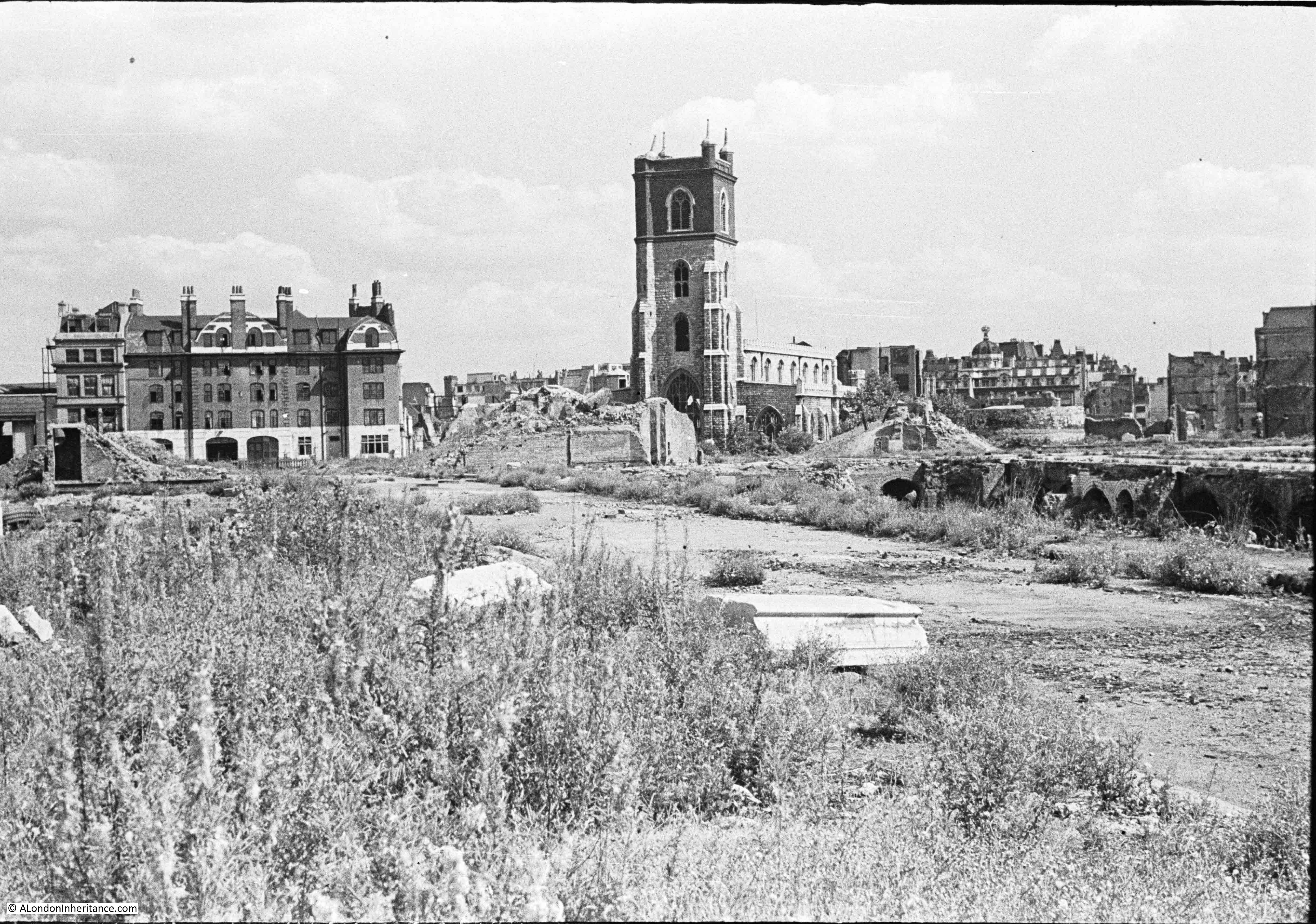
There are three main features in the photo, two of which survive to this day, although the area is now completely different following the development of the Barbican.
The church of St Giles Cripplegate is in the centre, the church looks relatively unscathed, however it suffered very badly and lost the main roof and contents of the church.
To the right of the church is a pile of rubble, and to the right of this, is the round shape of a Roman bastion, which can still be seen.
The large building on the left was the Red Cross Street Fire Station, demolished as part of the final land clearance in preparation for the build of the Barbican.
The following map extract is from the 1895 Ordnance Survey map. The fire station was yet to be built, and part of the site was occupied by a girls school, so I have marked the location of the fire station with a red rectangle. St Giles Cripplegate is just below, on the opposite side of Fore Street.
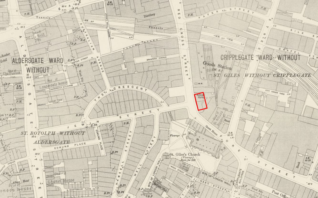
Credit: ‘Reproduced with the permission of the National Library of Scotland’
Locating the fire station and church on the map allows the streets to be identified, and if you look at my father’s photo, he was standing to the left of a street. the buildings have disappeared, but the paved surface of the old street remains.
This was Jewin Street which ran from Aldersgate Street to Red Cross Street, where the junction was directly opposite the fire station.
If you also look at the 1947 photo, in front, and to the left of the fire station is what looks to be a door frame, surrounded by a pile of rubble. This was all that remained of one of the first houses on Jewin Crescent, or The Crescent as it was labelled in the 1895 map.
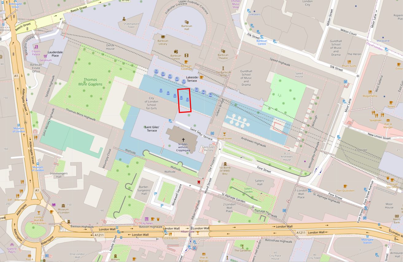
The development of the Barbican obliterated all the original streets, and the only points of reference that remain to this day are the church and Roman bastion.
In the following map extract showing the Barbican today, I have marked the location of the old Red Cross Street fire station with a red rectangle (© OpenStreetMap contributors).
There does not seem to be a consistent usage of the street name Red Cross Street, as Redcross Street is also used. The London Encyclopedia attributes the naming of the street to a red cross which probably stood outside a house belonging to the Abbot of Ramsay, with a first mention in the 13th century.
In A Dictionary of London by Henry Harben (1918) the first mention of the street is as Redecrochestrete in 1274. The entry for the street also mentions a Redcrosse tavern. The Dictionary also provides a similar source of the name as the London Encyclopedia “the names of the street and of Whitecross Street were derived from the armourial bearings of the Abbey of Ramsey and of the Priory of the Holy Trinity respectively, who both possessed houses in these street. But it seems more probable that the name was derived from the Red Cross standing at the north end of this street, whether a house bearing this sign or an actual wayside Cross, it is not easy to determine.”
Stow, writing in his Survey of London in 1603, described Red Cross Street – “In Red crosse street on the west side from saint Giles Churchyard be many fayre houses builded outward with divers Alleyes turning into a large plt of grounde, of olde time called the Jewes Garden, as being the only place appoynted them in England, wherein to bury their deade, till the year 1177”
The burial ground for the Jews is the source of the name Jewin Street.
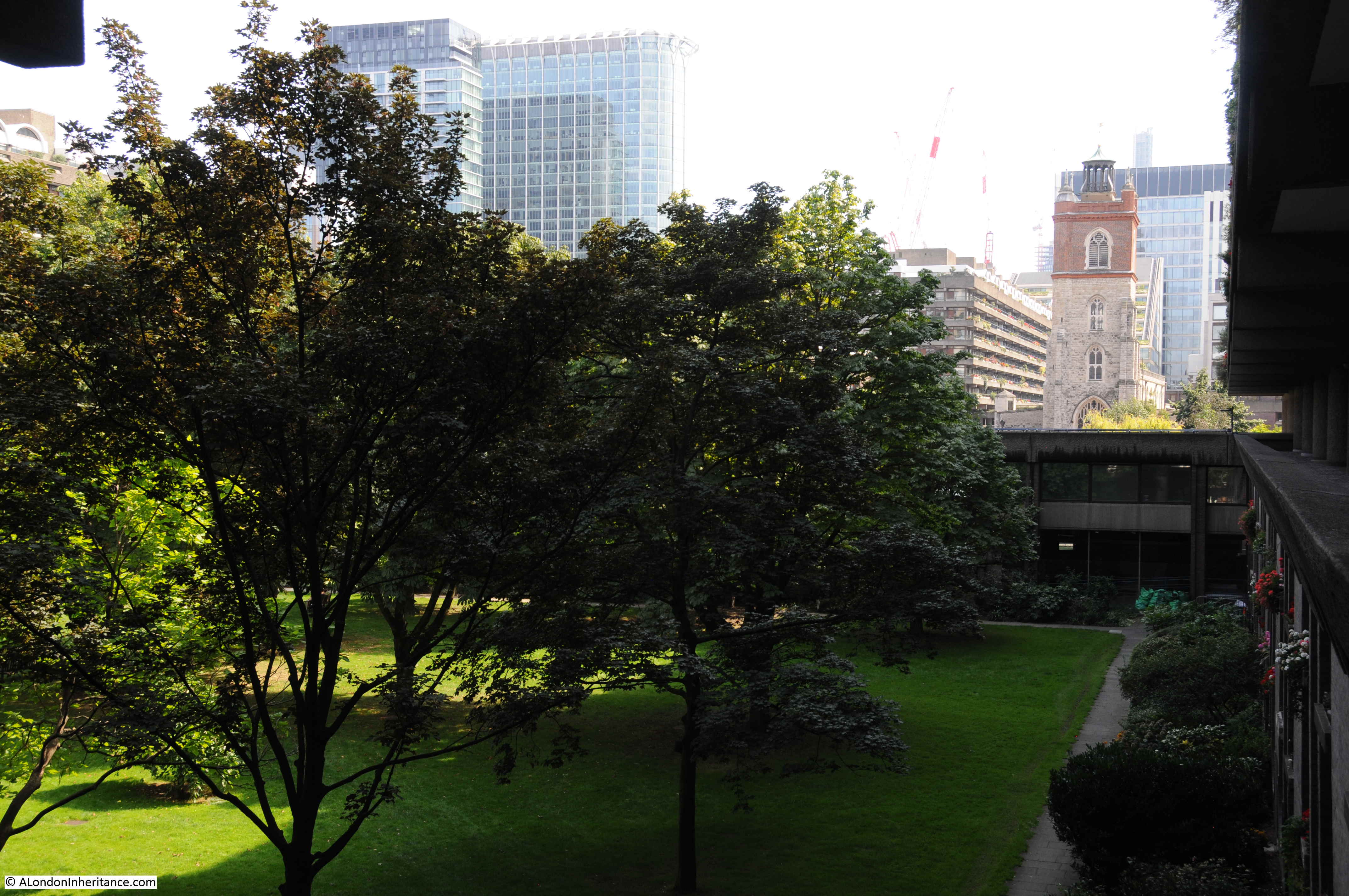
The building of the Barbican means it is impossible to take any form of meaningful equivalent photo of the same scene today. The nearest I could get (shown in the photo below), was from alongside Thomas More House, however to get the angle correct, I should have probably been standing in the tennis courts to the south of Thomas More House, however there is no view of St Giles Cripplegate from that location today.
The majority of the destruction of the area now occupied by the Barbican and Gold Lane estates occurred on the night of the 29th December 1940, with the fires created by incendiary bombs causing much of the devastation.
I wrote about this night attack in my blog post on “The Second Great Fire Of London” and in that post included part of an account of the night by Commander Firebrace of the London fire Brigade detailing his experiences at Red Cross Street fire station:
“In the control room a conference is being held by senior London Fire Brigade (LFB) officers. How black – or, more realistically, how red – is the situation, only those who have recently been in the open realise.
One by one the telephone lines fail; the heat from the fires penetrates to the control room and the atmosphere is stifling. earlier in the evening, after a bomb falls near, the station lights fail – a few shaded electric hand lamps now supply bright pin-point lights in sharp contrast to a few oil lamps and some perspiring candles.
The firewomen on duty show no sign of alarm, though they must know, from the messages passing, as well as from the anxious tones of the officers, that the situation is approaching the desperate.
A women fire officer arrives; she had been forced to evacuate the sub-station to which she was attached, the heat having caused its asphalt yard to burst into flames. It is quite obvious that it cannot be long before Redcross Street Fire Station, nearly surrounded by fire will have to be abandoned.
A few minutes later L.F.B. officers wisely evacuate Redcross Street Fire Station, and now the only way of escape for the staff and for the few pump crews remaining in the area lies through Whitecross Street”.
The high wind which accompanies conflagrations is now stronger than ever, and the air is filled with a fierce driving rain of red-hot sparks and burning brands. The clouds overhead are a rose-pink from the reflected glow of the fires, and fortunately it is bright enough to pick our way eastward down Fore Street. Here fires are blazing on both sides of the road; burnt-out and abandoned fire appliances lie smouldering in the roadway, their rubber tyres completely melted. the rubble from collapsed buildings lying three and four feet deep makes progress difficult in the extreme. Scrambling and jumping, we use the bigger bits of masonry as stepping stones, and eventually reach the outskirts of the stricken area.
The fire station did survive the war, and bomb damaged was repaired, but the remains of the buildings around Redcross Street, Jewin Street and Jewin Crescent had already been demolished during the war to make the area safe, leaving the exposed cellars, foundations, paved streets and piles of rubble shown in the 1947 photo.
I did get a surprise when researching this post, when looking through newspaper references to Redcross Street fire station as I found a report dating from April 1938 of the death of a distant relative – “A fireman who received a violent electric shock when he cut a cable while fighting a fire in Camomile-street E.C. on Tuesday, died in St. Batholomew’s Hospital. He was a 31 years old member of the Redcross-street Station. The fire, which started in the upper floor of a warehouse, was confined to the building.”
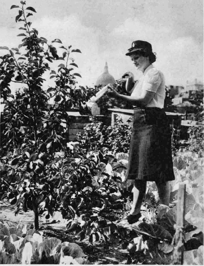
After the destruction of 1940, the firemen of Red Cross Street started a large vegetable plot on the land directly opposite the fire station alongside Jewin Street. The following photo from 1944 shows the firemen at work. The Roman bastion is visible behind the small trees, directly below the dome of St Paul’s.

Growing apple trees in the vegetable plot:
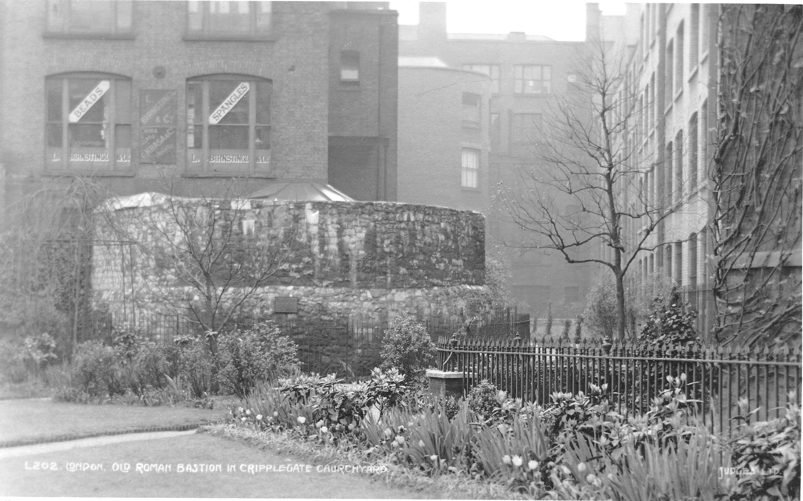
The Roman bastion shown to the right of the 1947 photo, survived the bomb damage and the development of the Barbican. It had been at the corner of the churchyard of St Giles Cripplegate, and before the war was surrounded outside of the churchyard by office buildings and warehouses. The following pre-war postcard shows the Roman bastion at the corner of the church yard.
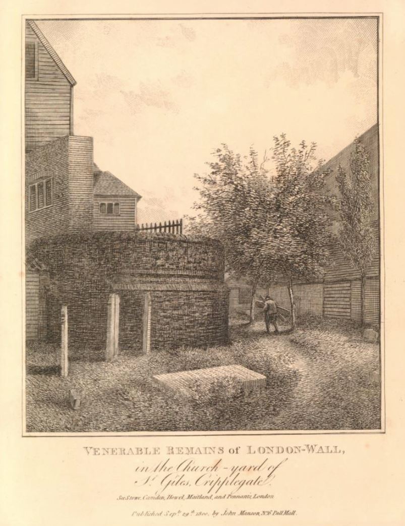
This rather rural looking print from 1800 shows the bastion and the “Venerable Remains of London-Wall in the church yard of St Giles Cripplegate” (©Trustees of the British Museum).
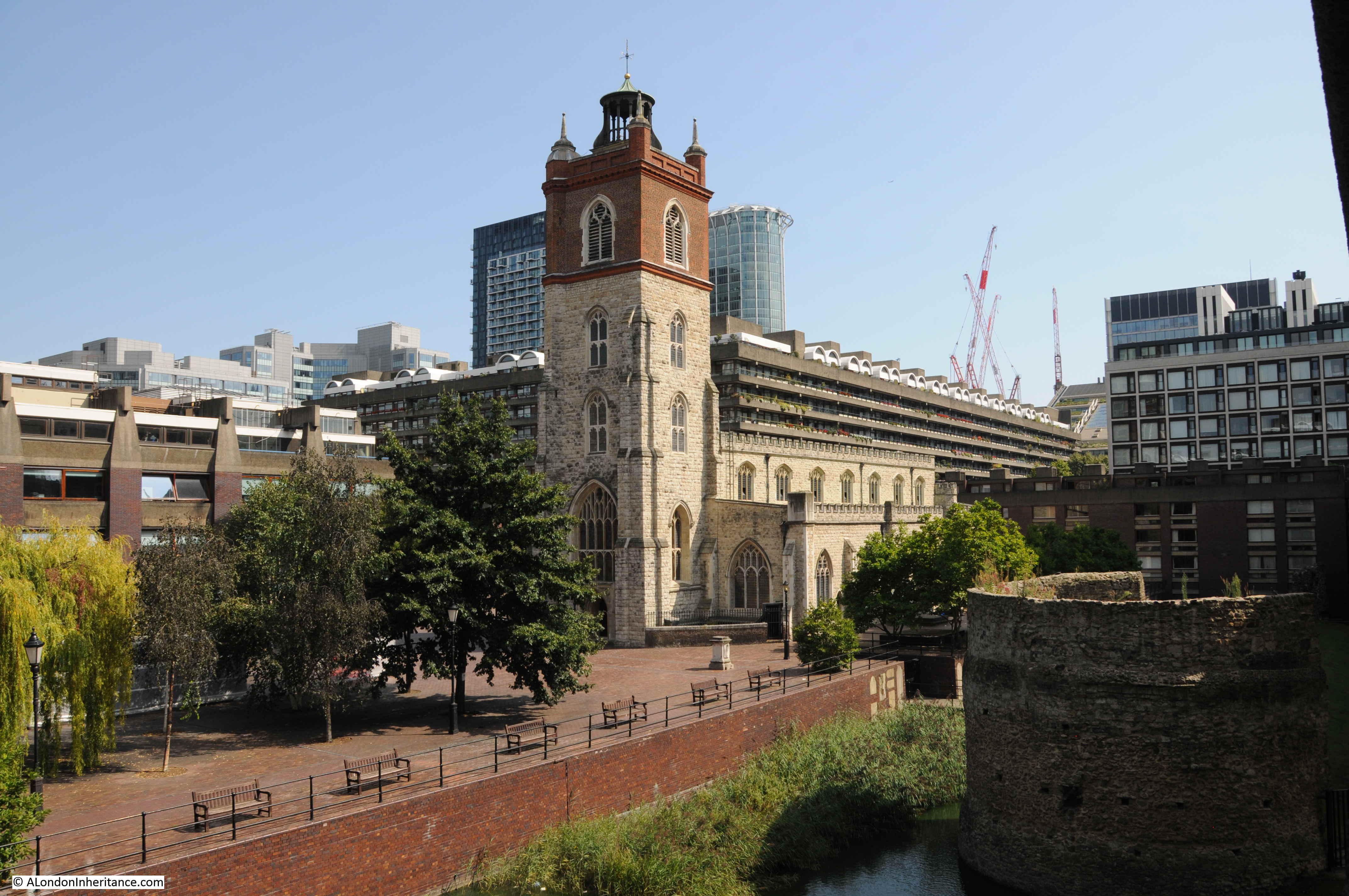
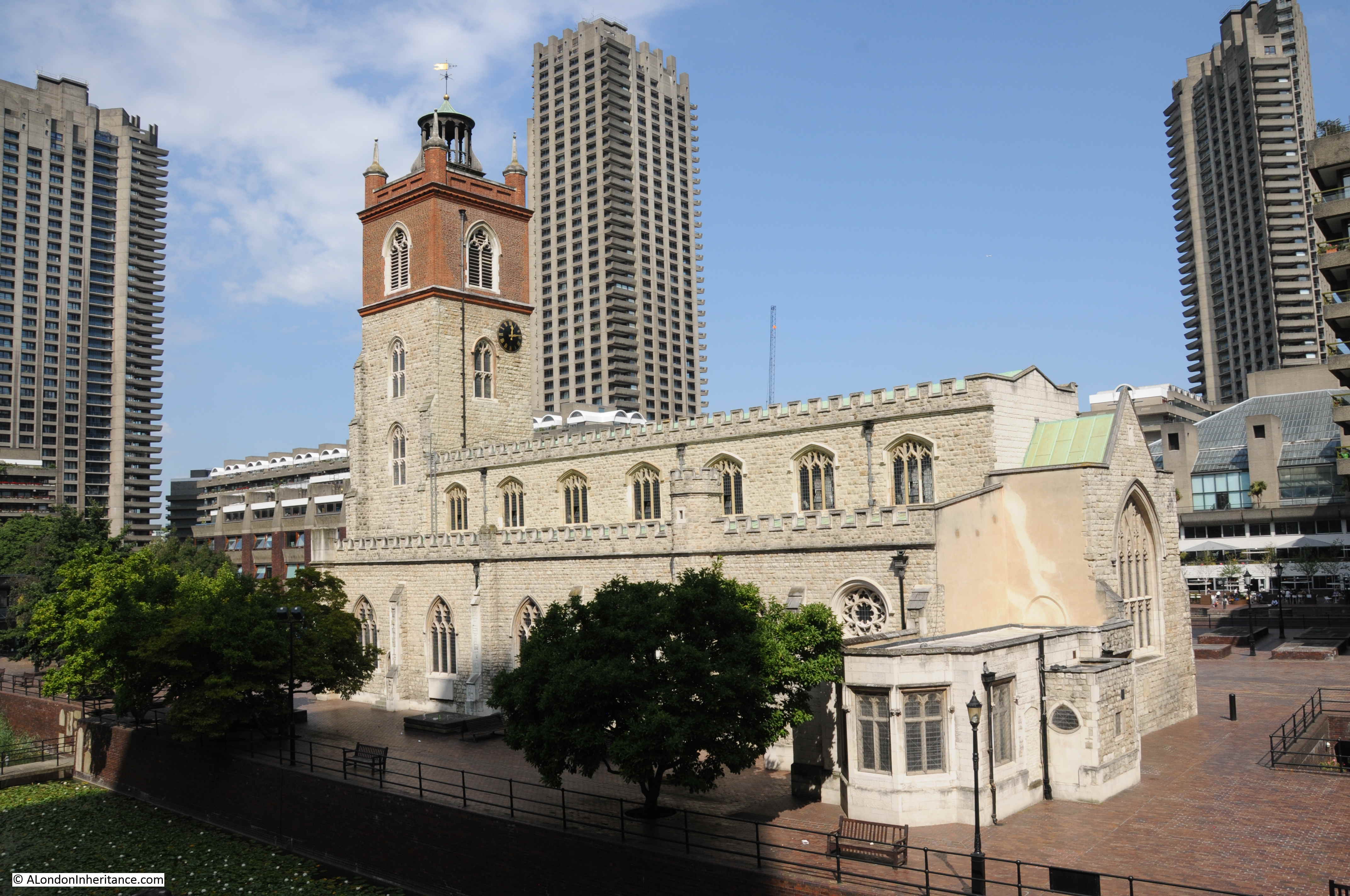
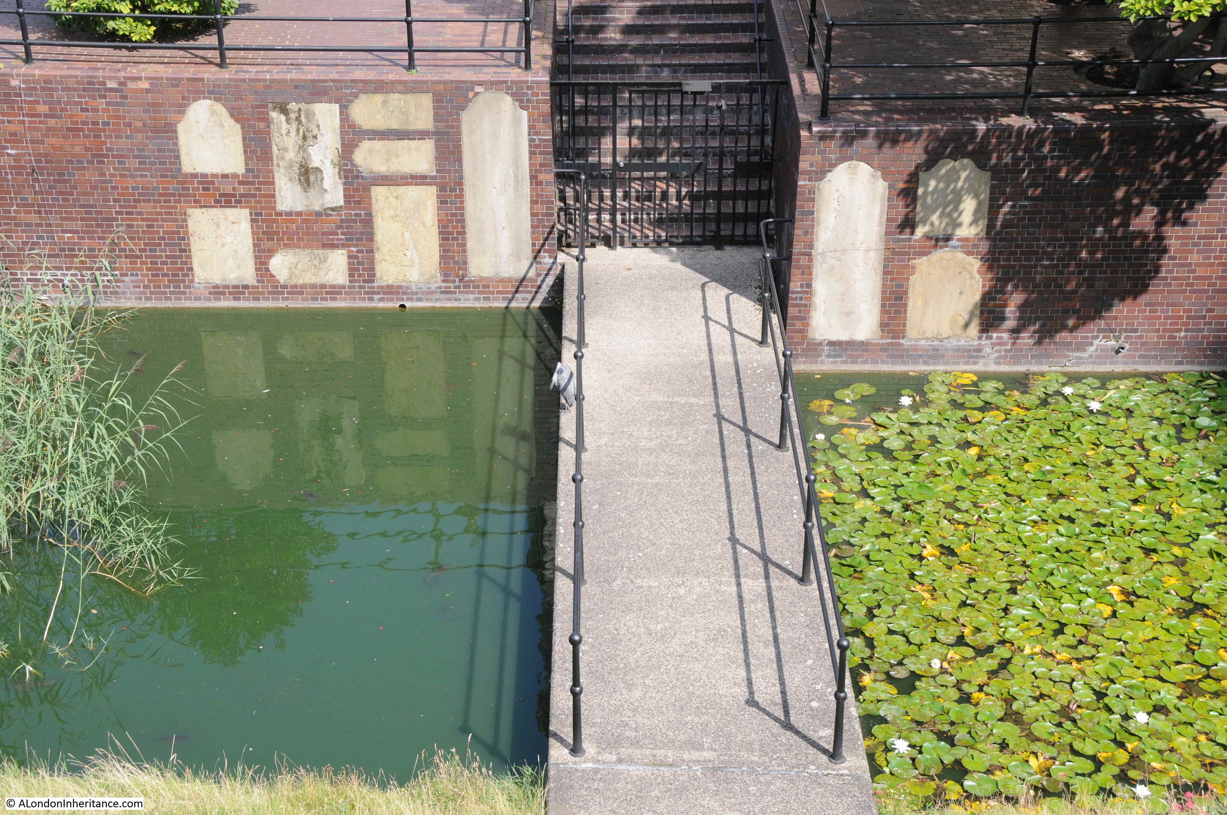
Today, the church yard has disappeared and the Roman bastion is separated from the church by a stretch of water, which gives the appearance of a moat separating these two survivors.
A year after my father took the photo at the beginning of this post, the following report appeared in the London Letter section of the Scotsman newspaper on the 30th August 1948:
Heart of the City – Even in the sun to-day the ruined area around St Paul’s presented a melancholy sight. Few of the millions who travel to and from the City each day can be aware of the ruins through which it is possible to walk for half and hour without coming to an intact building. There is little sign of new building. The only structure – a giant marquee used for the Honourable Artillery Company’s Ball by Finsbury Pavement – is now being dismantled.
By the shell of St Giles’s Cripplegate, office workers stop each day to inspect the excavations where shards of pottery, pieces of bone, and splinters of horn are daily coming to light. Nearby, where office buildings once stood, message boys now play cricket, their pitches fast becoming a riot of coltsfoot, cornflowers, rosebay and hollyhocks.
In St Giles’s Churchyard, this growth has been halted by firemen from the Red Cross Street fire station, who have been growing peas and potatoes by shattered tombstones.
The ruins extend to Smithfield, where a shabby board announces this was the site of the Old Red Cow.”
The years immediately after the war were a time for excavations around Cripplegate and the Roman bastion and remains of the Roman wall were excavated by the Roman and Medieval Excavation Council, under the direction of W.F. Grimes, Keeper of the London Museum.
As has probably been the problem with all archaeological excavations, the full funding needed for the work (estimated at £3,000) was not available, and the sum of £1,500 was allocated. It seems to have been a rather blunt approach to excavation as reports of the dig talk about modern building tools being used, with the roar of pneumatic drills rising from the trenches all day long.
The area around St Giles Cripplegate probably very rarely hears the sounds of pneumatic drills these days, but the church has lost its churchyard, is separated by water from the Roman bastion, the surrounding street network has long disappeared, and the church is dwarfed by the surrounding buildings.
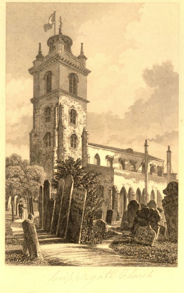
It was so very different in 1830, the date of the following print, when the church was surrounded by a traditional grave yard (©Trustees of the British Museum).
Many of the gravestones can still be found in the area around the church, as shown in the following photo where a sample are embedded in the wall that separates the water from the higher ground where the church is located.
The following photo shows the wartime damage to the buildings south of the church, in the space now occupied by the Wallside building, and facing onto Wood Street Square and Hart Street. The square and street are now under the Wallside building.
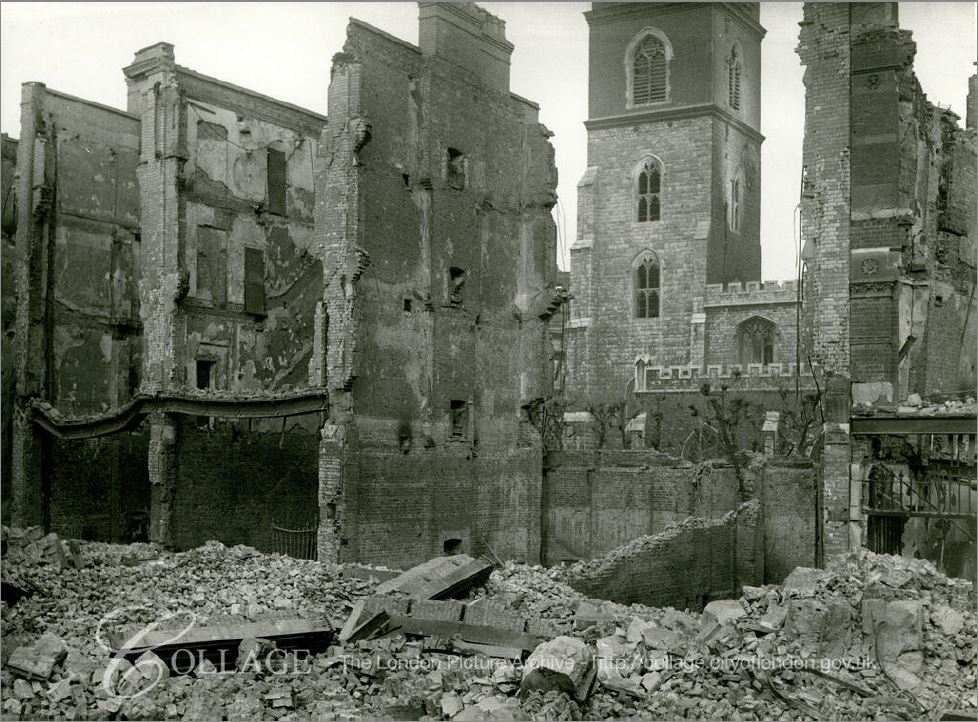
Image credit: London Metropolitan Archives, City of London: catalogue ref: M0019965CL
Whilst the tower and walls of St Giles Cripplegate survived, the interior and roof was completely destroyed, demonstrating that the destruction around the Barbican was the result of fires rather than high explosive bombs (many did fall on the area, but the majority of the damage was caused by fire).
The following photo taken in the days following the raid on the 29th December 1940, show the damage to the interior of the church.
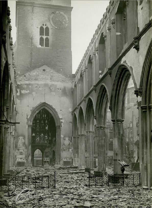
Image credit: London Metropolitan Archives, City of London: catalogue ref: m0017971cl
It is hard to imagine this level of damage when standing in the church today:

The full name of the church is St Giles without Cripplegate, referring to the fact that the church was outside the original City walls – confirmed by the nearby location of the Roman wall showing that the church is indeed north of the wall.
There may have been a church here in Saxon times, and the first stone church dates from 1090.
The church has been through a number of rebuilds over the centuries. The distinctive tower with a stone lower section and brick upper section dates from 1682, when the upper section of the original stone tower was removed, and 15 feet of brick tower added.
The church was severely damaged by fires in 1545 and 1897, but escaped the Great Fire in 1666.
St Giles Cripplegate claims to be the burial-place of the poet Milton and a life-size statue of Milton watches over visitors to the church:
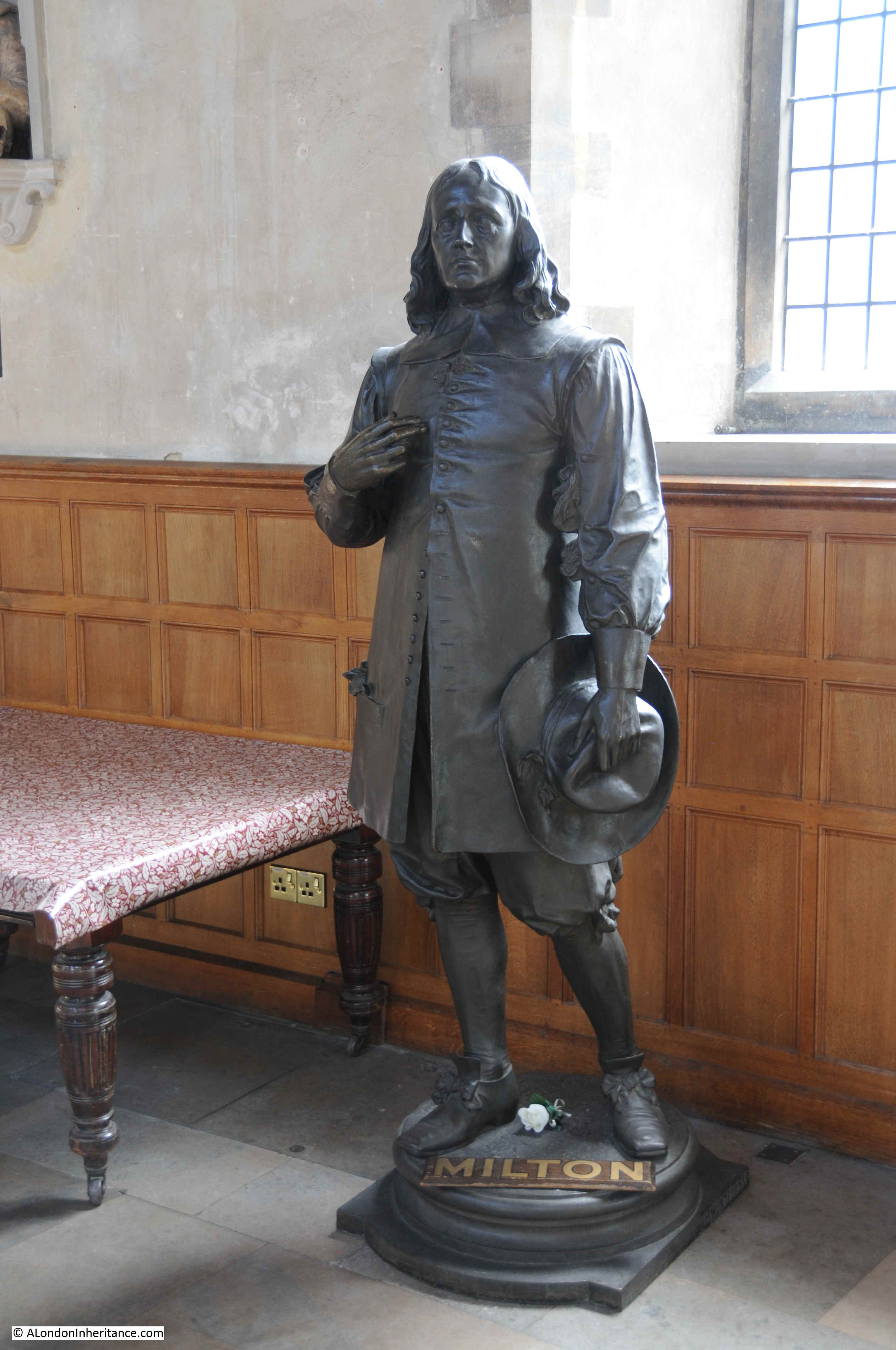
The Milton statue dates from 1904 when it was unveiled by Lady Alice Egerton as part of the reconstruction work after the 1897 fire.
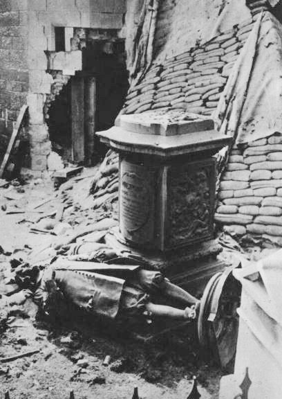
The statue had a rather close shave on the 29th December 1940:
Newspaper reports of the unveiling of the Milton statue also included a rather gruesome story about Milton’s body dating from 1790, when:
“There are probably many who will be surprised to hear that the body of Milton was once on view at the charge of threepence a head within a few yards from the site chosen for this splendid tribute to his memory. It was in 1790 after a little carousal, that two overseers and a carpenter entered the Church of St Giles Cripplegate, where Milton lay buried, and, having discovered the leaden coffin which contained his body, cut open its top with a mallet and chisel. When they disturbed the shroud, the ribs fell. Mr Fountain confessed that he pulled hard at the teeth, which resisted until someone hit them with a stone. Fountain secured all the fine teeth in the upper jaw, and generously gave one to one of his accomplices. Altogether the scoundrels stole a rib-bone, ten teeth, and several handfuls of hair; and to crown the diabolical business, the female gravedigger afterwards exhibited the body to anyone willing to pay threepence for the spectacle.”
St Giles Cripplegate is also the burial-place of the late 16th / early 17th century map maker John Speed.
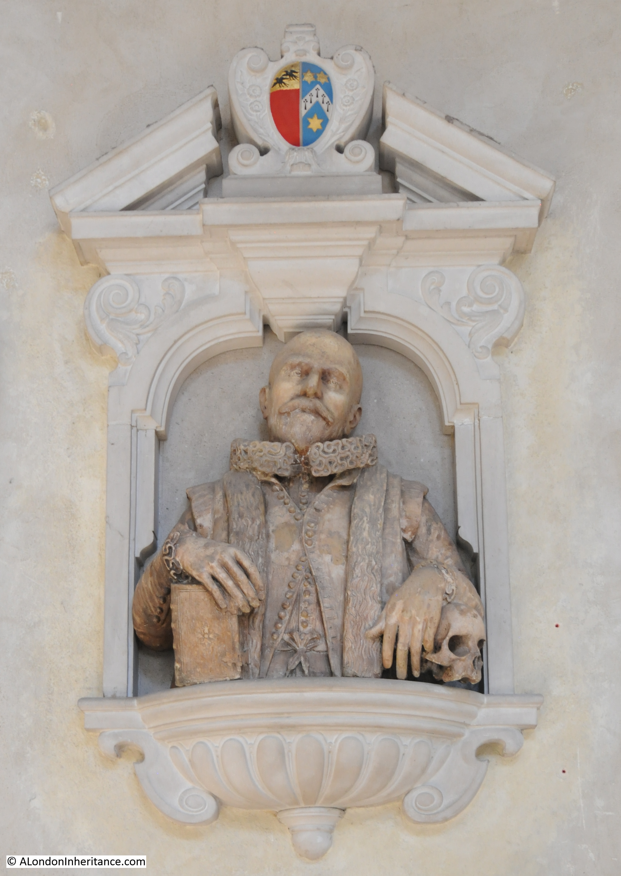
John Speed was a member of the Merchant Taylors Company, and it was this company that restored Speed’s memorial after being badly damaged in 1940.
Whilst Milton and Speed have some rather impressive memorials, there is one in the church that is much more modest.
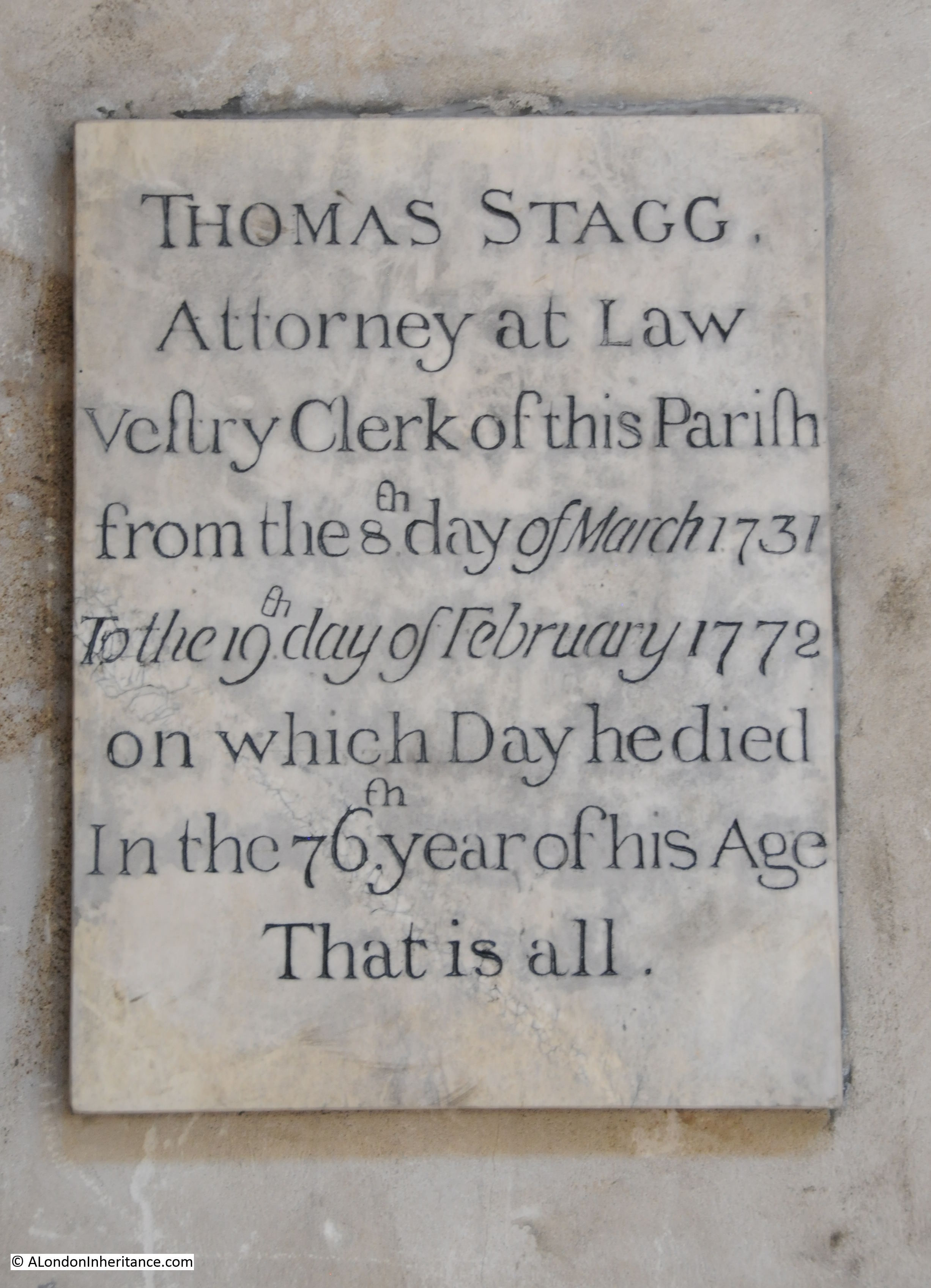
“That is all” sums up the memorial to the life of Thomas Stagg who was vestry clerk of the parish from 1731 to 1772. There are many other historical names who have an association with the church, including Oliver Cromwell who was married in St Giles Cripplegate in 1620.
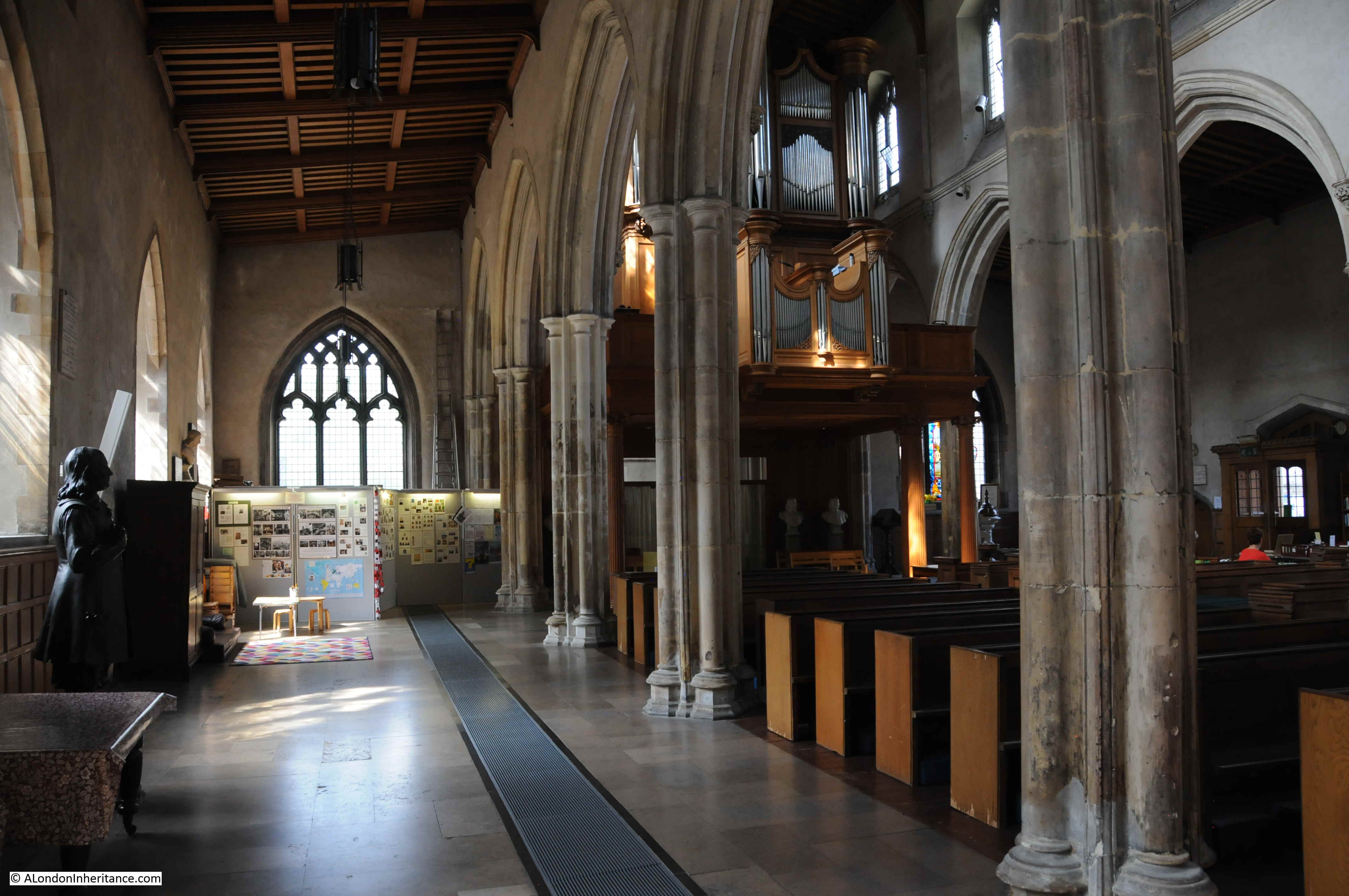
The view along the southern aisle of the church, Milton’s statue on the left:
This has been a brief description of a very historic area. I will be exploring more of the streets and buildings covered by the Barbican and Golden Lane estates, and the streets that have disappeared, during the coming weeks, and showing many more of my father’s photos of the area at the Barbican@50 event on the 14th September at St Giles Cripplegate.
Very interesting, as I worked around Moorgate when I left school in the early 1970s. I found a great article on paving London’s streets which you might like:
https://www.ianvisits.co.uk/blog/2015/01/10/the-time-when-londons-streets-were-paved-with-wood/
The Barbican area featured in an opening scene of the film “1984” — the 1956 version of the George Orwell story with Edmond O’Brien. Good quality prints of this film appear not to be in circulation but despite the fuzziness of the images someone has recently identified the areas of Philip Lane and Wood Street. Of course in 1956 it was still a scene of devastation which suited the mise-en-scène at the film’s start.
If the link is permitted, a couple of screenshots with their locations identified can be found on ReelStreets:
https://www.reelstreets.com/films/1984/
Looking forward to the Barbican@50 event. Best wishes for a grand turnout.
The mention of your distant relative will remind us on the day of those who gave their lives in public service for the City of London.
1940, Milton’s statue laying by its pedestal – you attribute it t the bombing on 29th December 1940, but I am certain I have seen it dated 25th August 1940, the night after the first bombs fell on central London (as covered in a post you did several years ago)
Alas, wartime censorship means the events of that night are quite difficult to untangle but I did what I could on my own blog:
http://blitzincidents.blogspot.com/2014/06/
which references your post on the subject and the Redcross Fire Station
Worth noting the current exhibition at the Guildhall Art Gallert on the archtecture of London – the best aspect ofwhich id a handful of paintings showing the post-war City, especially this exact area. Indeed see: https://www.timeout.com/london/art/architecture-of-london-review
There’s a fine post-War rendering of this area in Plate 4 of “The Stone Gallery Panorama – Lawrence Wright’s view of the City of London from St Paul’s Cathedral, c. 1948-56” which was published by the London Topographical Society last year. It’s available from their website at: https://londontopsoc.org/product/the-stone-gallery-panorama/
So interesting. There’s an excellent rendering of this area in plate 4 of the London Topographcial Society’s publication “The Stone Gallery Panorama, Lawrence Wright’s view of the City of London from St. Paul’s Cathedral, c. 1948-56”. The publication is available at: https://londontopsoc.org/product/the-stone-gallery-panorama
Mike, that is another book I will be purchasing. I did work on my own Stone Gallery Panorama in two posts a few years ago here https://alondoninheritance.com/londonvistas/post-war-london-from-the-stone-gallery-st-pauls-the-north-and-west/ and https://alondoninheritance.com/londonvistas/post-war-london-from-the-stone-gallery-st-pauls-the-south-and-east/ again using my father’s photos.
Sorry about the double post – I thought I’d ‘lost’ the first one. Shall be more patient next time.
Thanks for your Stone Gallery link: love the juxaposition of you and your father’s photos and that final IWM photo is incredibly evocative, but then I’m a sucker for snow. Hope you enjoy the LTS publication. Ever thought of joining? Best bargain membership in town (£20 annually AND a free annual publication). Although I’m the Secretary, it’s true! 🙂
Mike – already a member and have been for a few years. Was the Panorama one of the annual publications for members? I need to check. The London Bridge publication this year was excellent.
Good to hear! 🙂
The Panorama was last year’s publication, along with A ‘Connoisseur’s Panorama’, Thomas Girtin’s Eidometropolis and Other London Views c. 1796-1802 by Greg Smith.
Look forward to next post on this area.
Hello. I am an American and live in the U.S. but love all things related to the history and architecture of London. I inherited this interest from my parents whose house was filled with wonderful books such as the multi-volume London Old and New. Thank you for your marvelous research on this greatest of all cities.
Thank you once again for all the info and photos really enjoy them
All most interesting – thank you. The area was what seemed to us to be the exclusive playground for just a few of us boys immediately following the war. We are still in contact and I suspect we might have one or two further photos.
Absolutely fascinating. I only remember the building of the Barbican in the 1960’s, just as they were finishing the Girls” School.
Hello
Any one know where Red Cross Square was?
Looking for where the “Teychenne, Waterman, Sc Powell, of 32 Red Cross-sq, Cripplegate, feather and wool purifiers” was located???
Apparently it was an earlier name for Hamsell Street. That street has since given way to the Barbican Centre, and ran roughly north-south through what is now the Mountjoy Open Air Theatre [https://goo.gl/maps/BjK3uQAufbhxDFz39] . You can see it on Greenwood’s 1828 map [https://www.layersoflondon.org/map/overlays/greenwood-1828]. What’s your particular interest in that business?
See also https://www.british-history.ac.uk/no-series/dictionary-of-london/halls-rents-st-katherines-hand-alley#h2-0017
Hi Stephen – many thanks for the information – we found the approximate location – of course its completely changed now!. My partner’s g g grandfather Jean Teychenne and his brother Francois – in partnership with Waterman ?? had a feather works business there. I think there was a fire and they moved to Birmingham to continue the business. This was in the 1850’s I believe.
Thanks again
Paul
Ah, mine too! Do please drop me a line (stephen :at: docuracy.co.uk) if you’d like to compare notes on the family.