Yearly Archives: 2014

Post War London from the Stone Gallery, St. Paul’s – The North and West

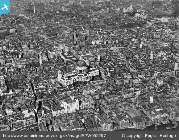
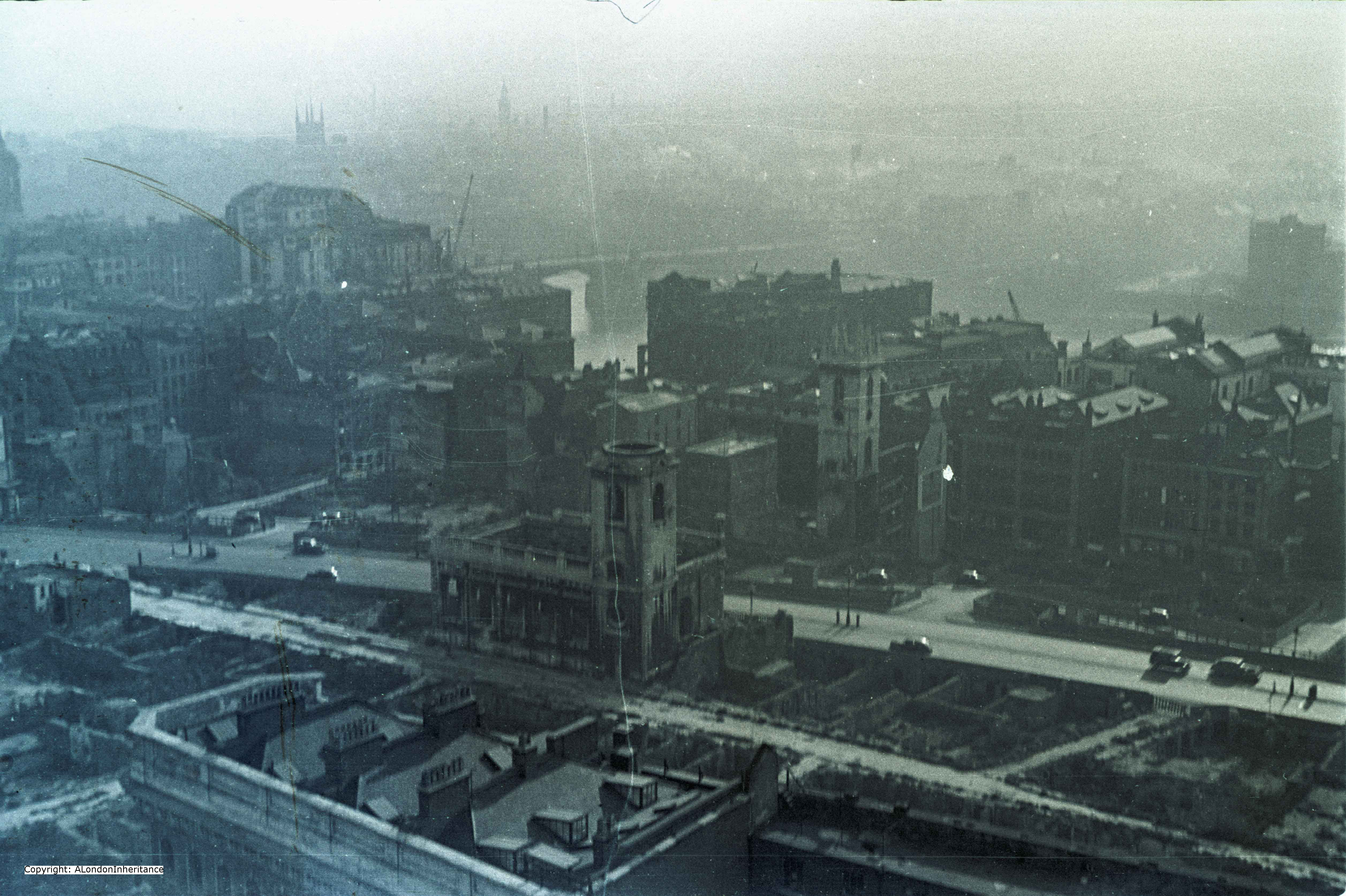
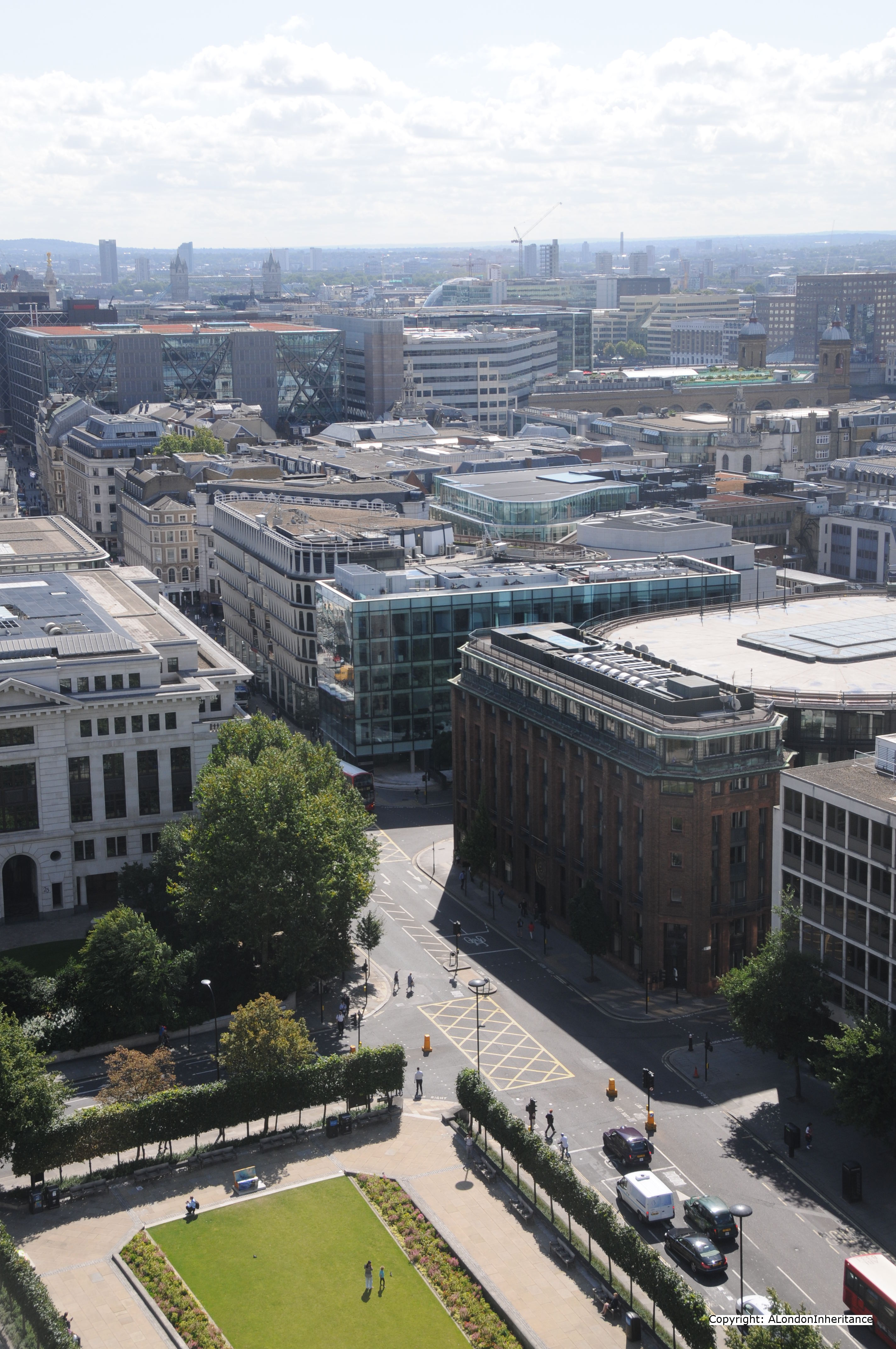
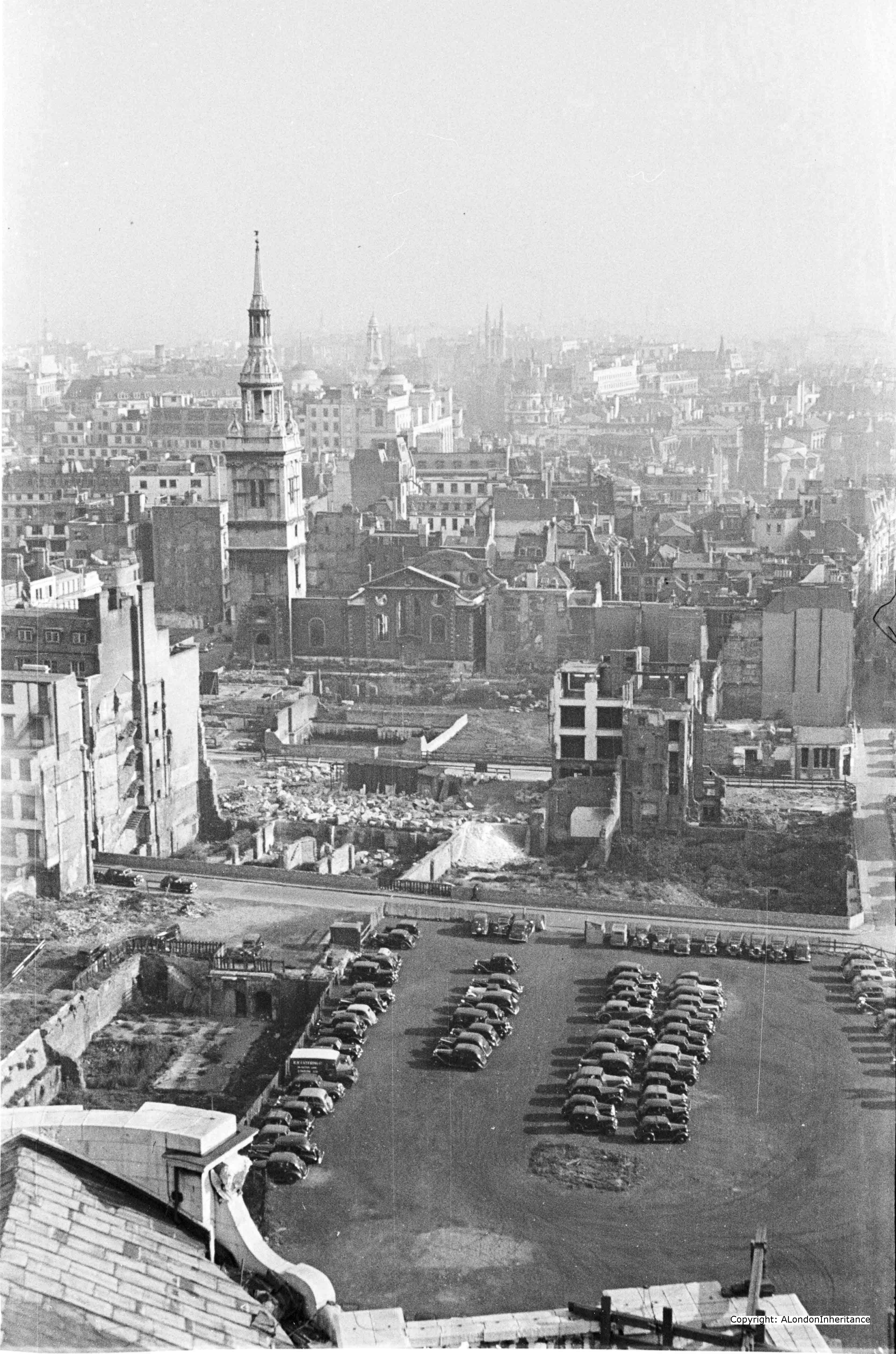
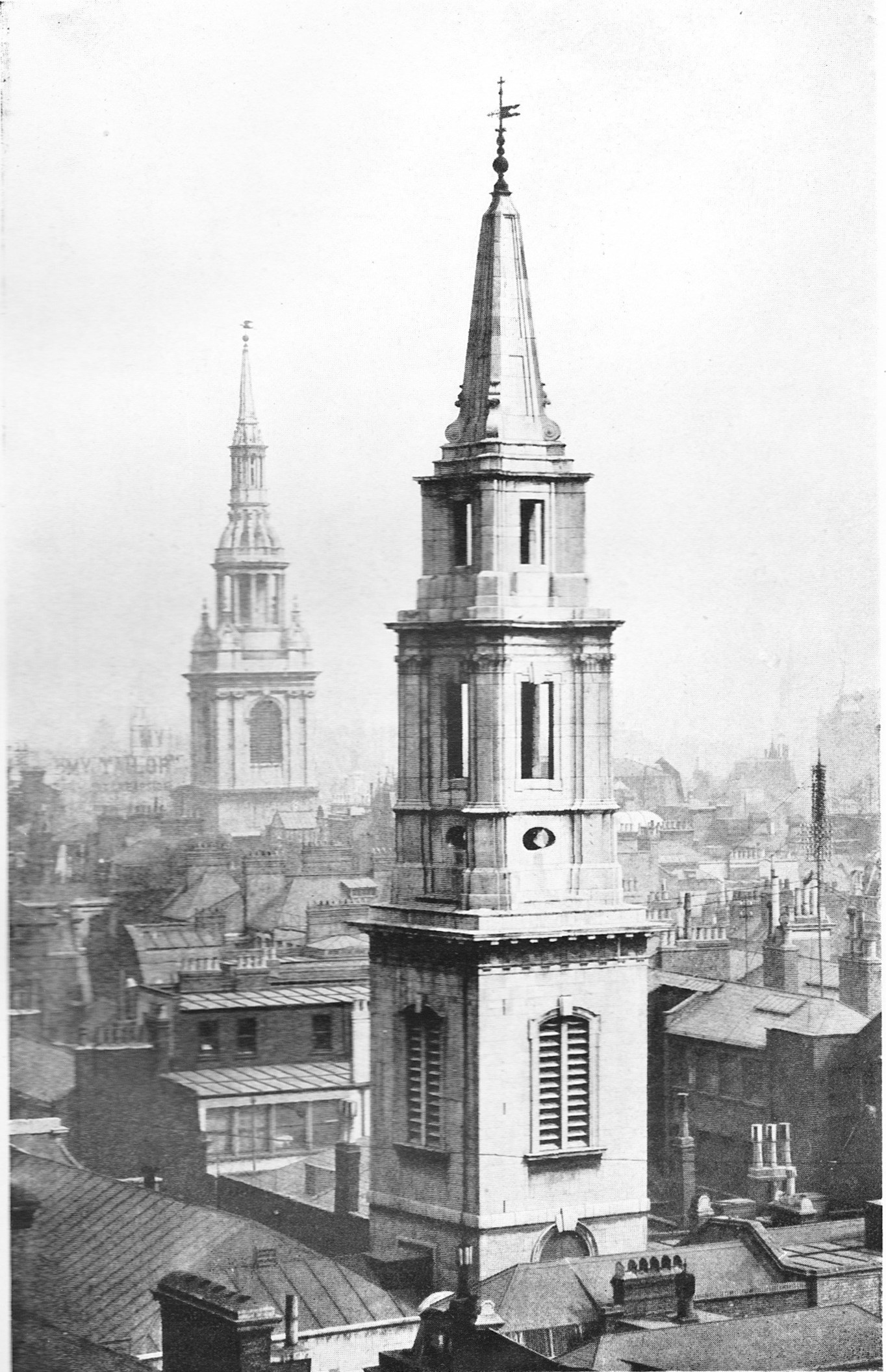
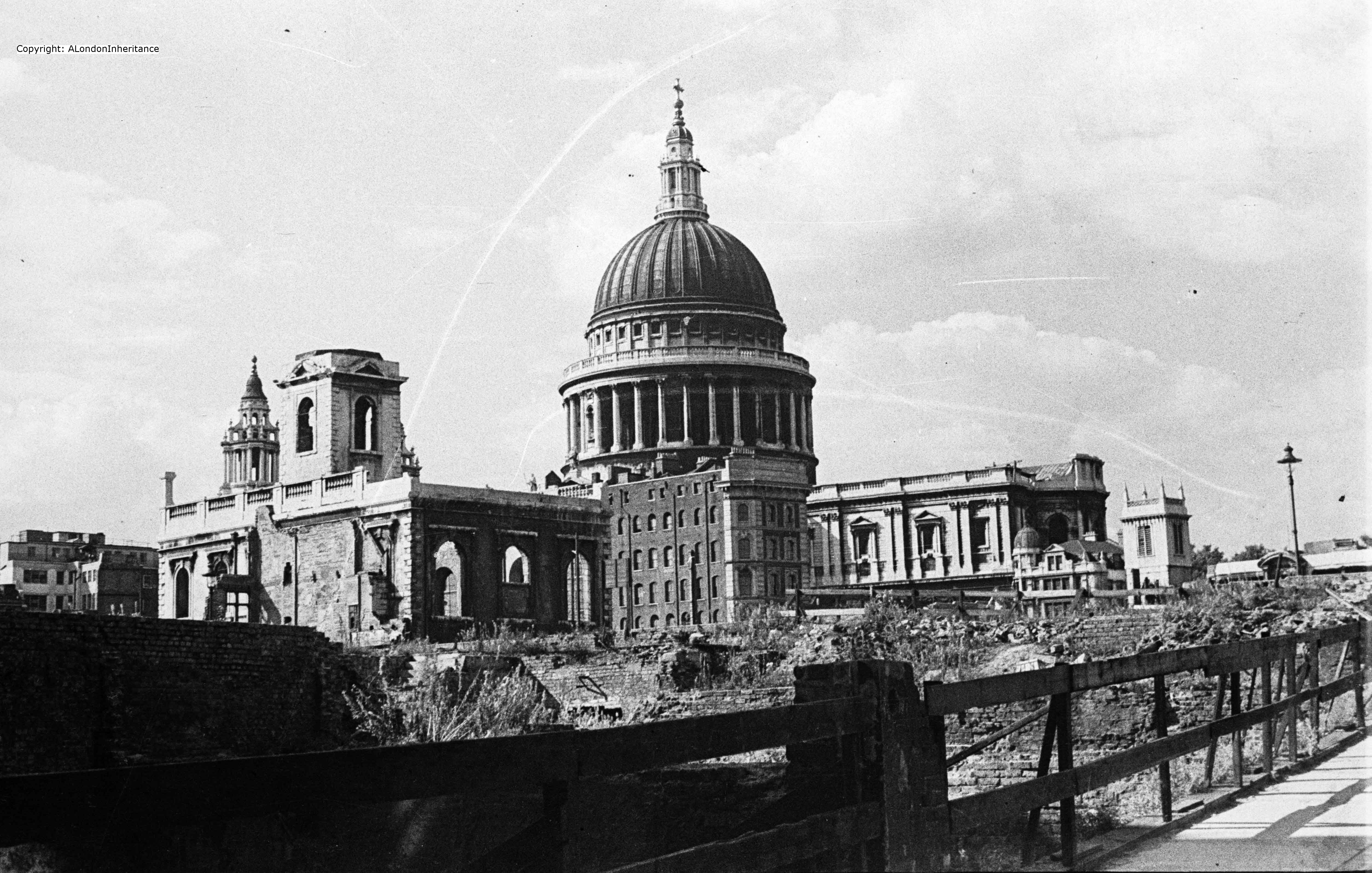
For this week’s post, we continue on our walk around the Stone Gallery of St. Paul’s Cathedral, 376 steps and 53 meters from the cathedral floor. We have covered the south and east views and this week it is the turn of the north and south and the first photo is looking roughly due north:

2014 North 1 old

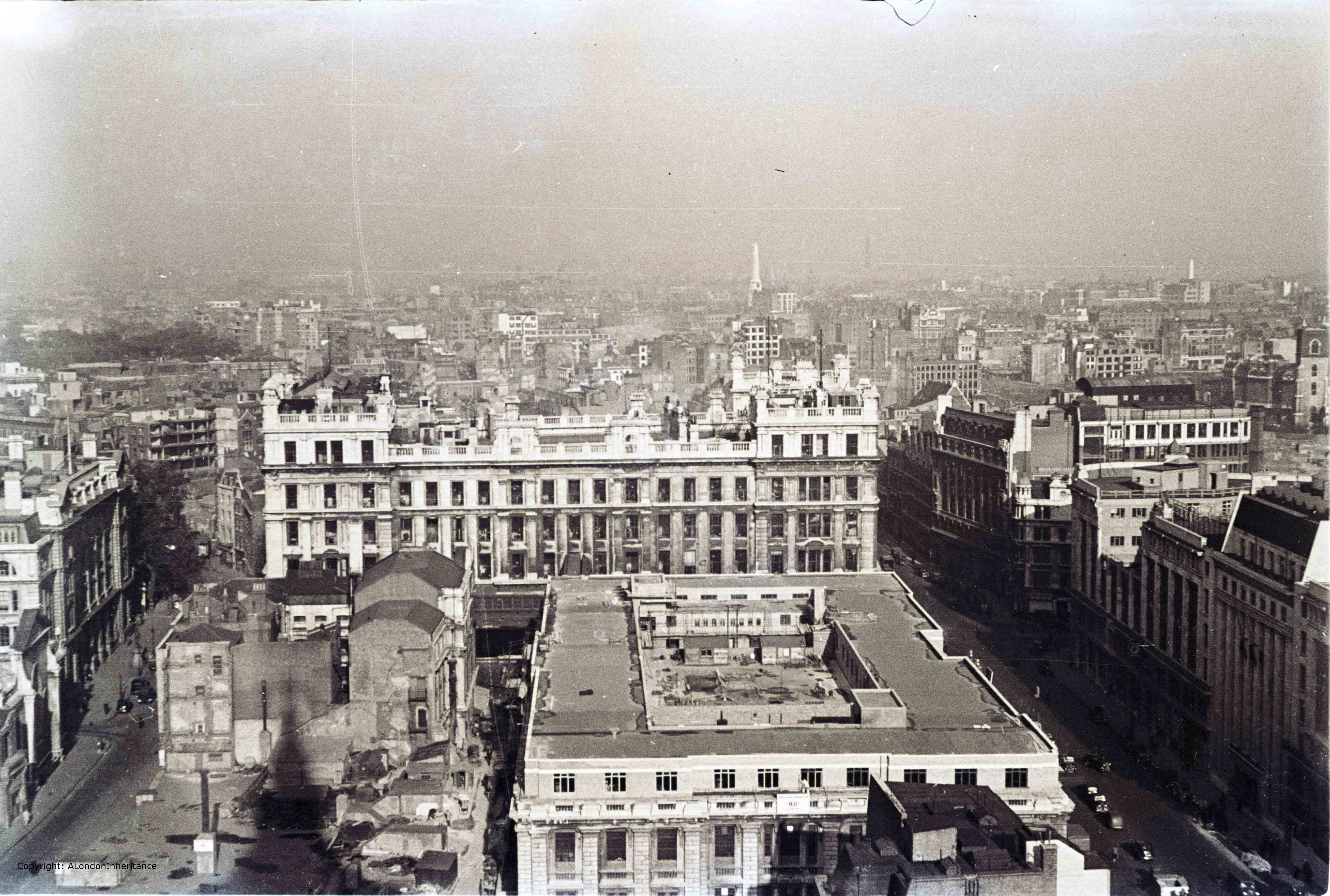
The street on the left is King Edward Street and the street on the right is St. Martin’s Le-Grand. The large buildings that occupy the space between these were General Post Office buildings  with the larger building in the centre of the photo being the headquarters of the General Post Office.

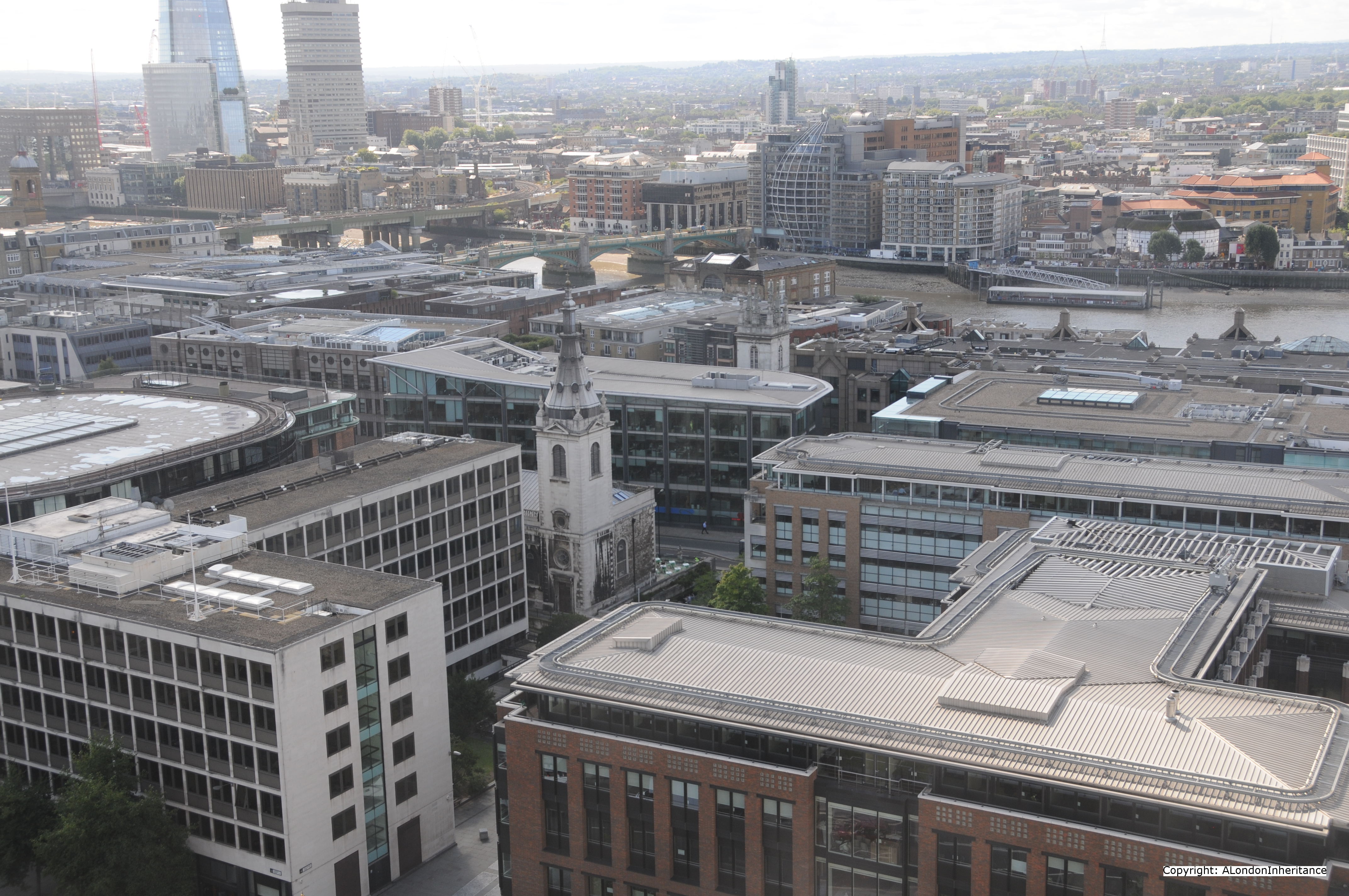
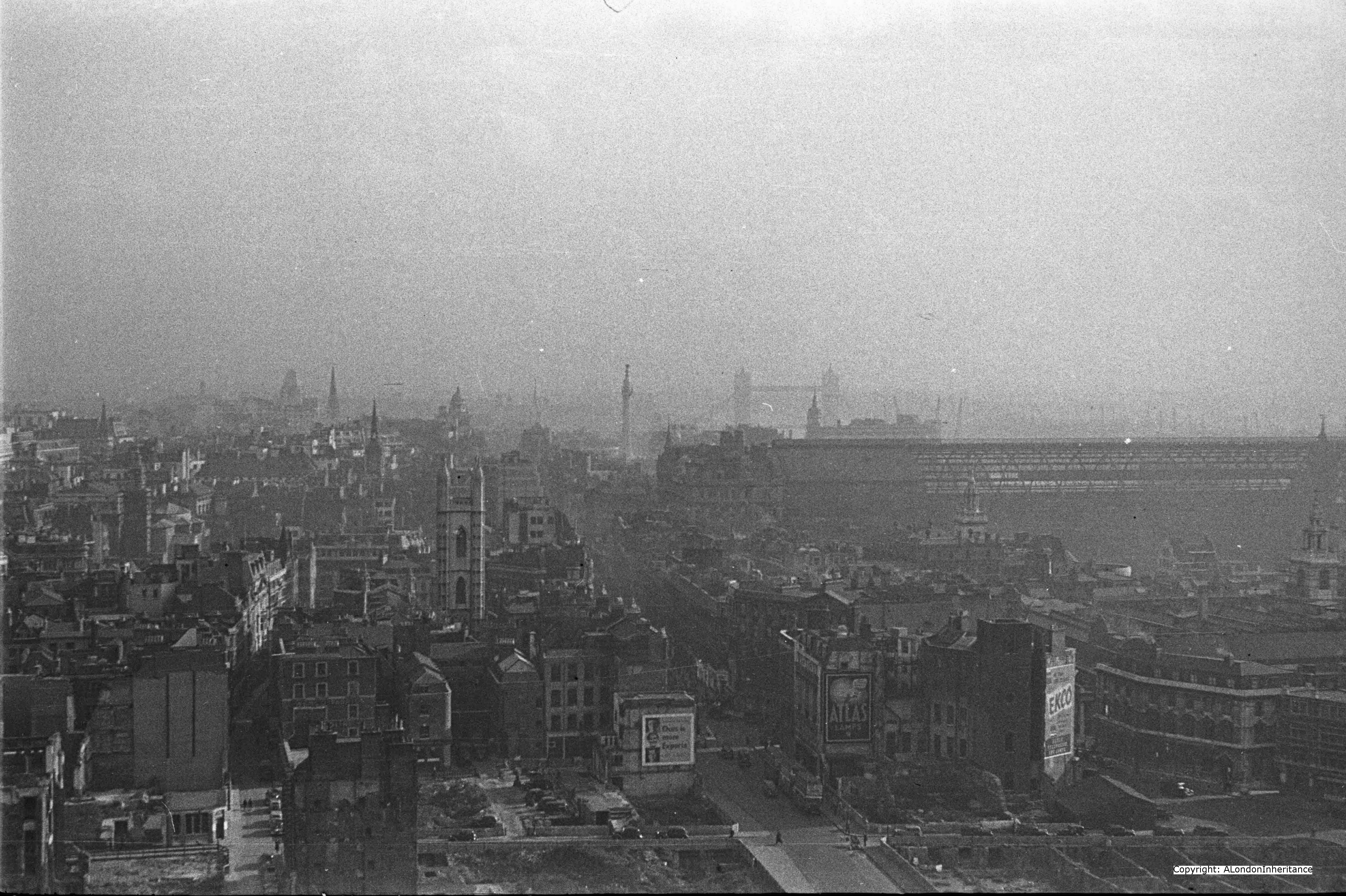
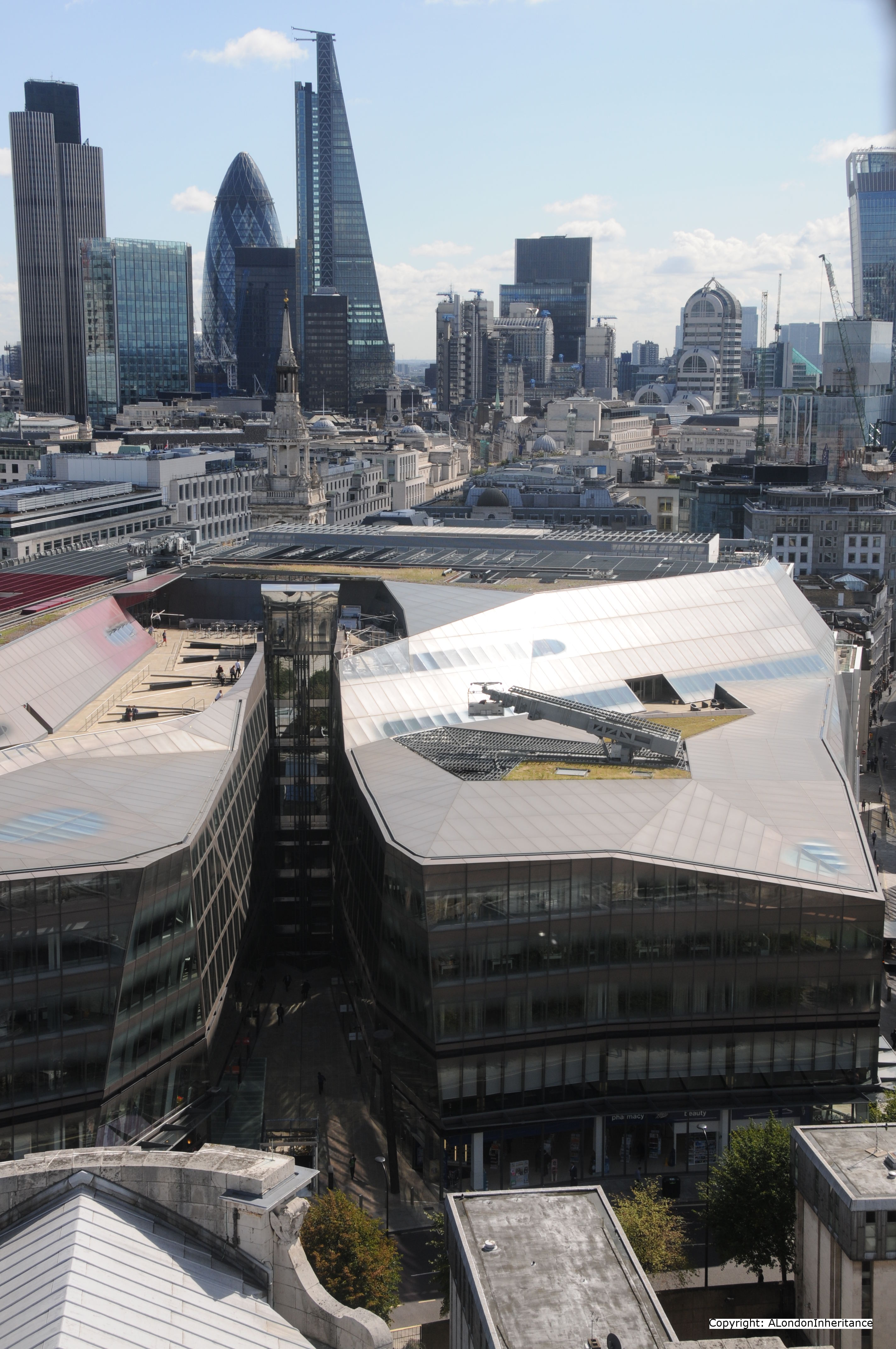
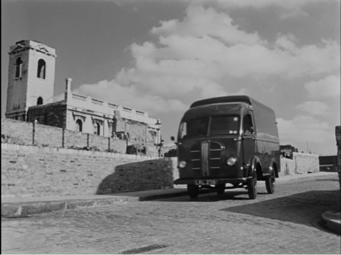
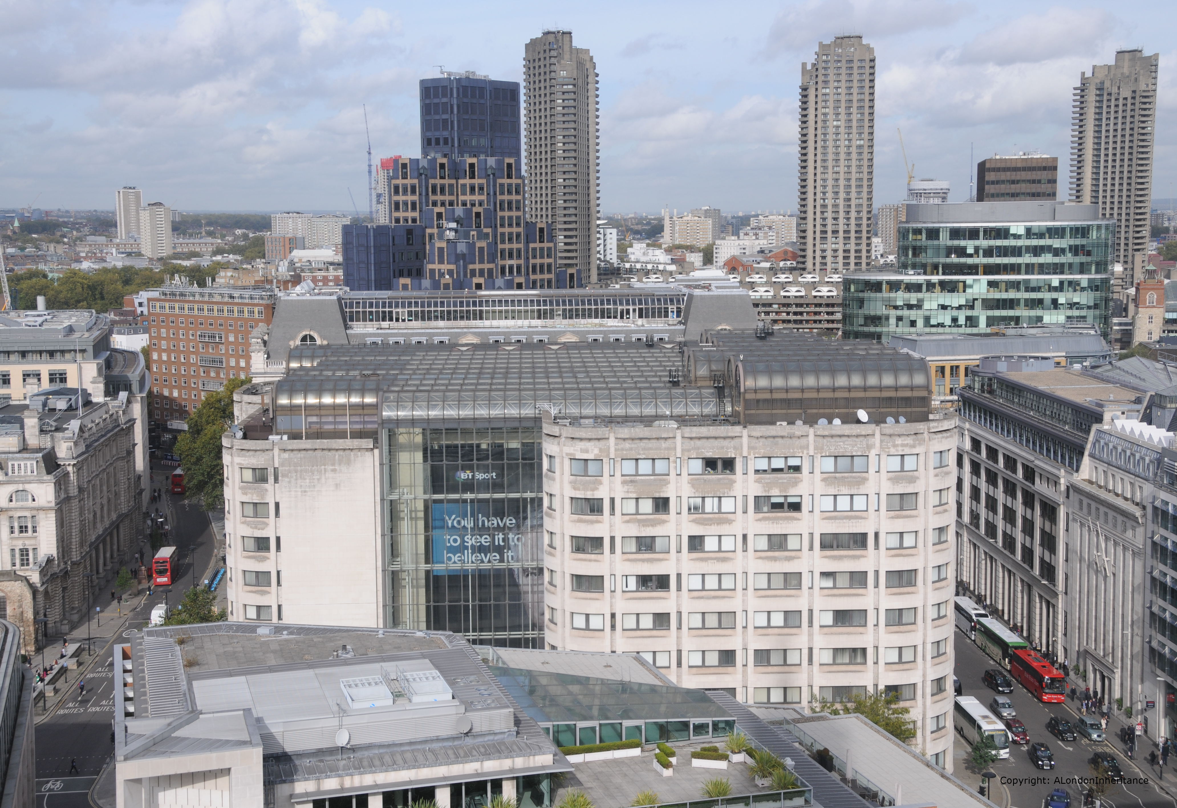
Whilst the roads are still in the same position, the view again is very different. In the following photo, apart from the streets my only reference points are the building on the extreme left of the photo and the church tower of St. Giles, Cripplegate on the right. These appear to be the only buildings that remains from the immediate post war period.

2014 North 1

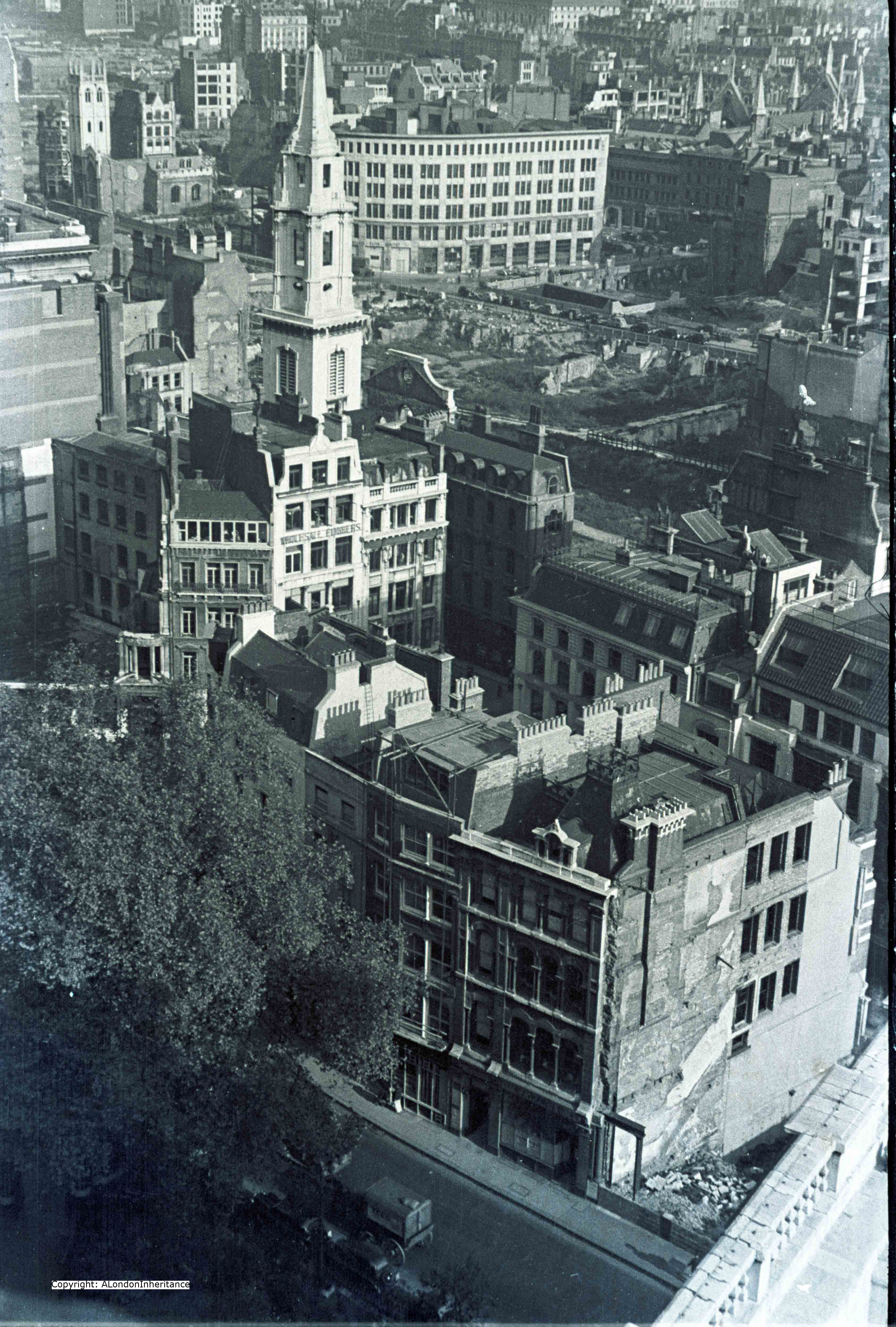
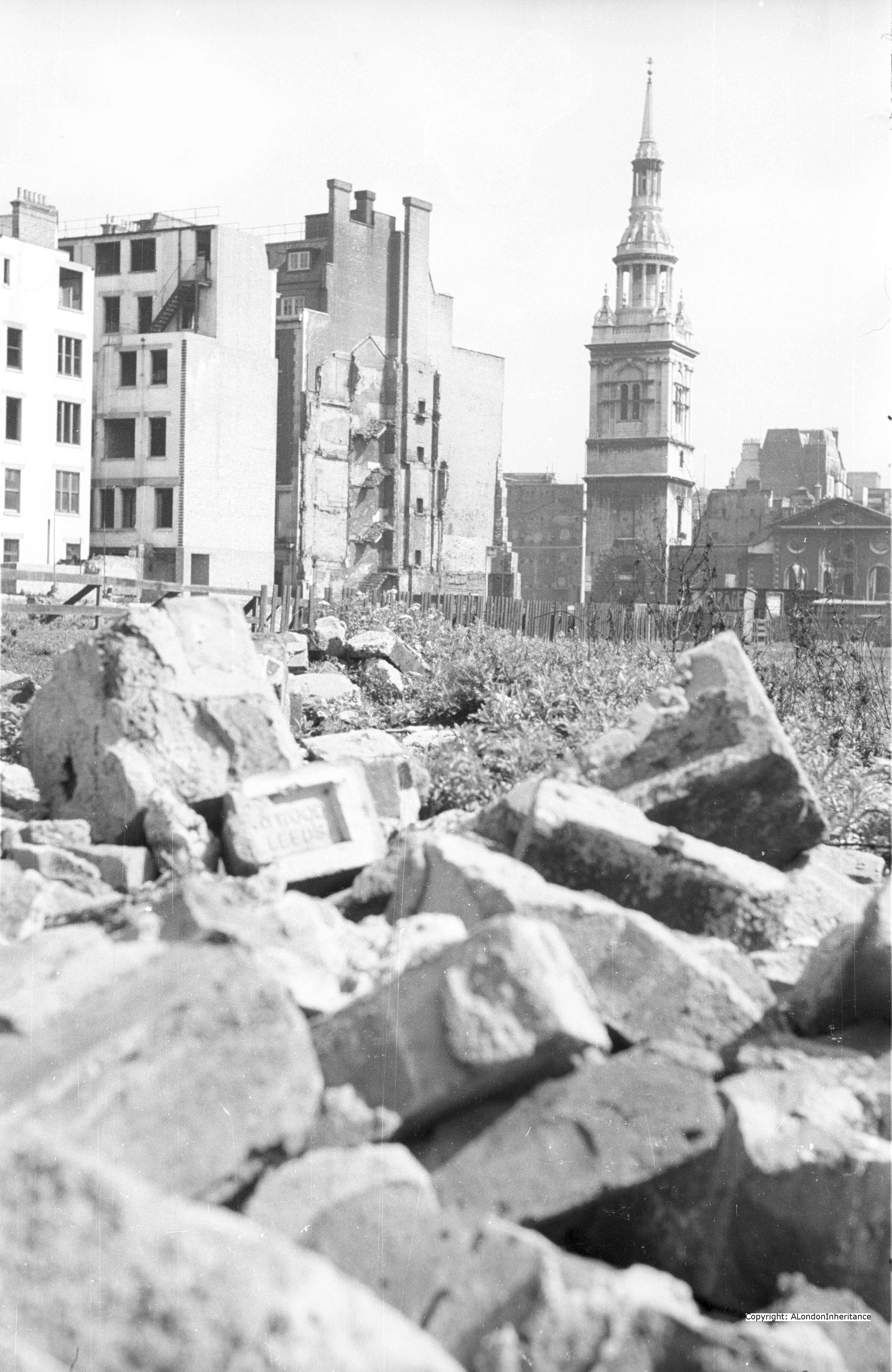
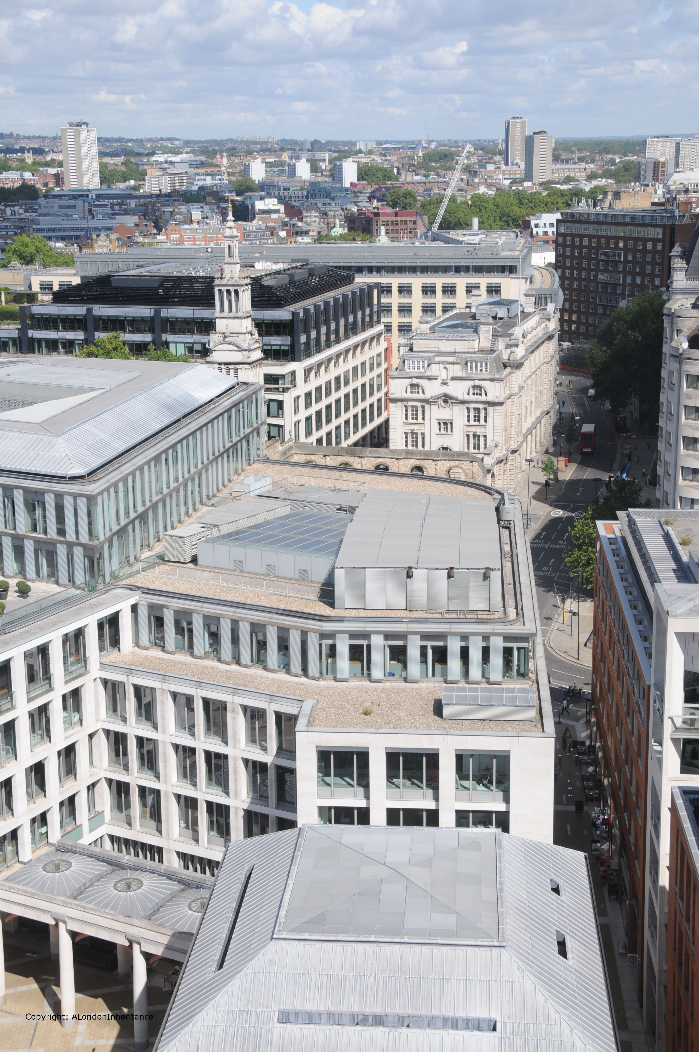
Now walk a few feet to the left and look out over to Christchurch Greyfriars.

Newgate Street is running left to right with King Edward Street heading north from Newgate Street.

2014 North 2 old

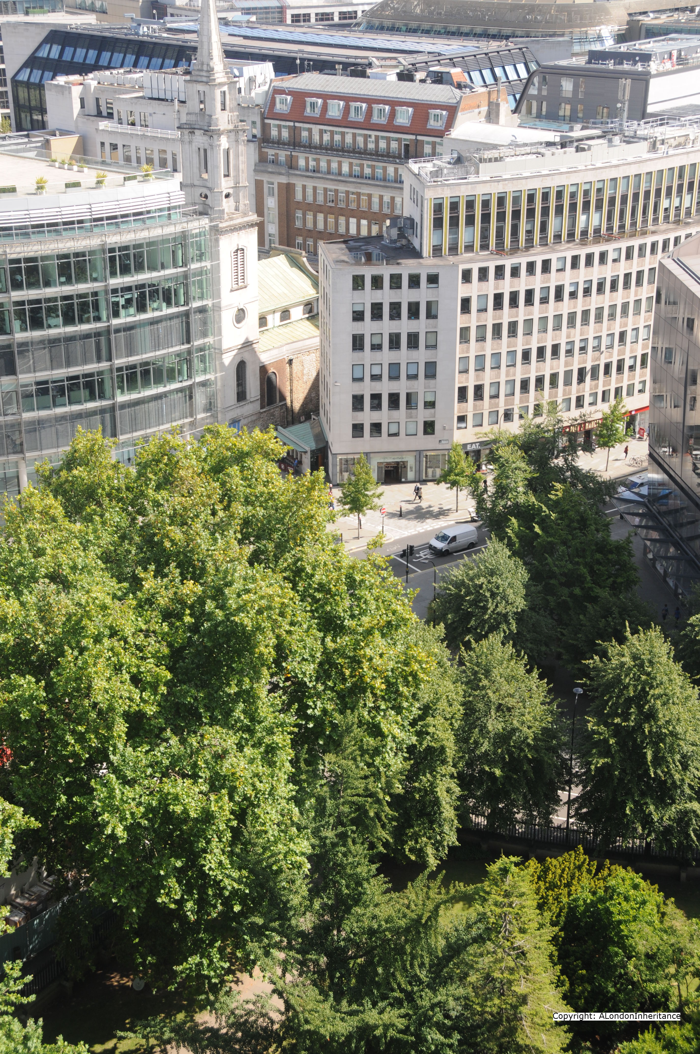
And the same view today. The body of the church has been left to this day as it was after being destroyed in 1940. Flower beds now occupy the space where the pews once stood. Apart from the church, the building just behind the body of the church also remains.

2014 North 2

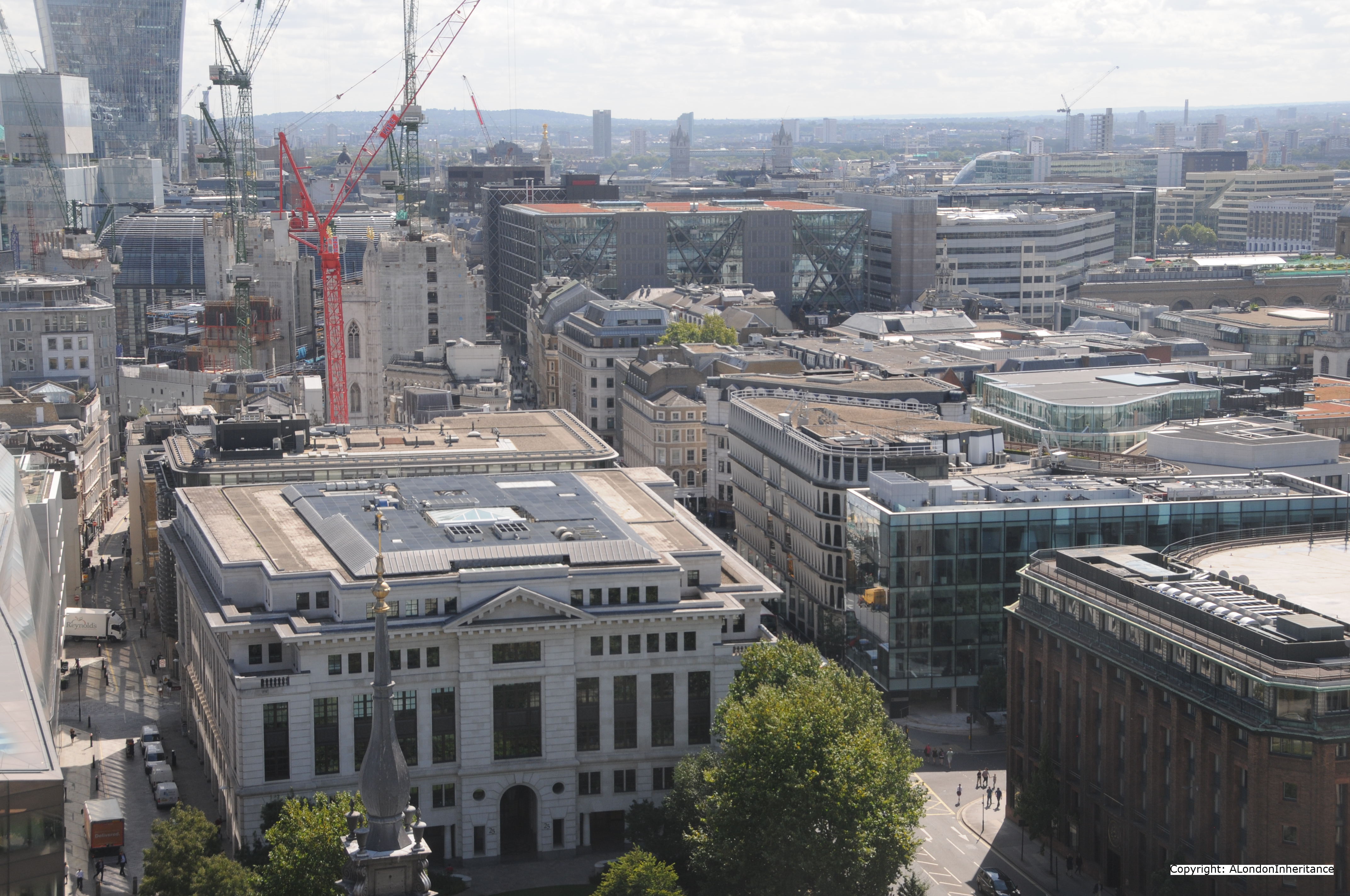
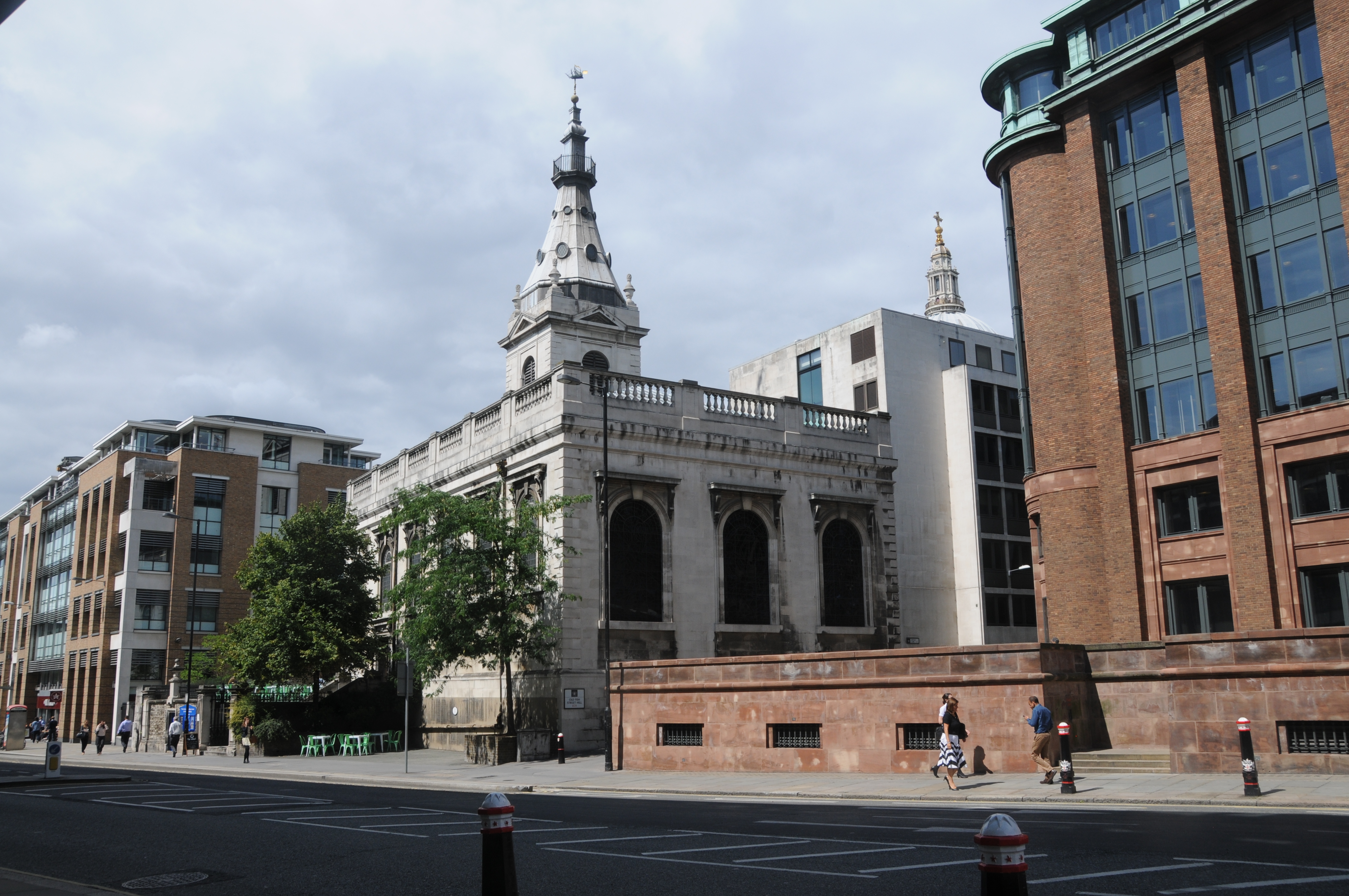
The above photos and the ones below are looking down on the area of Paternoster Square and Paternoster Row.

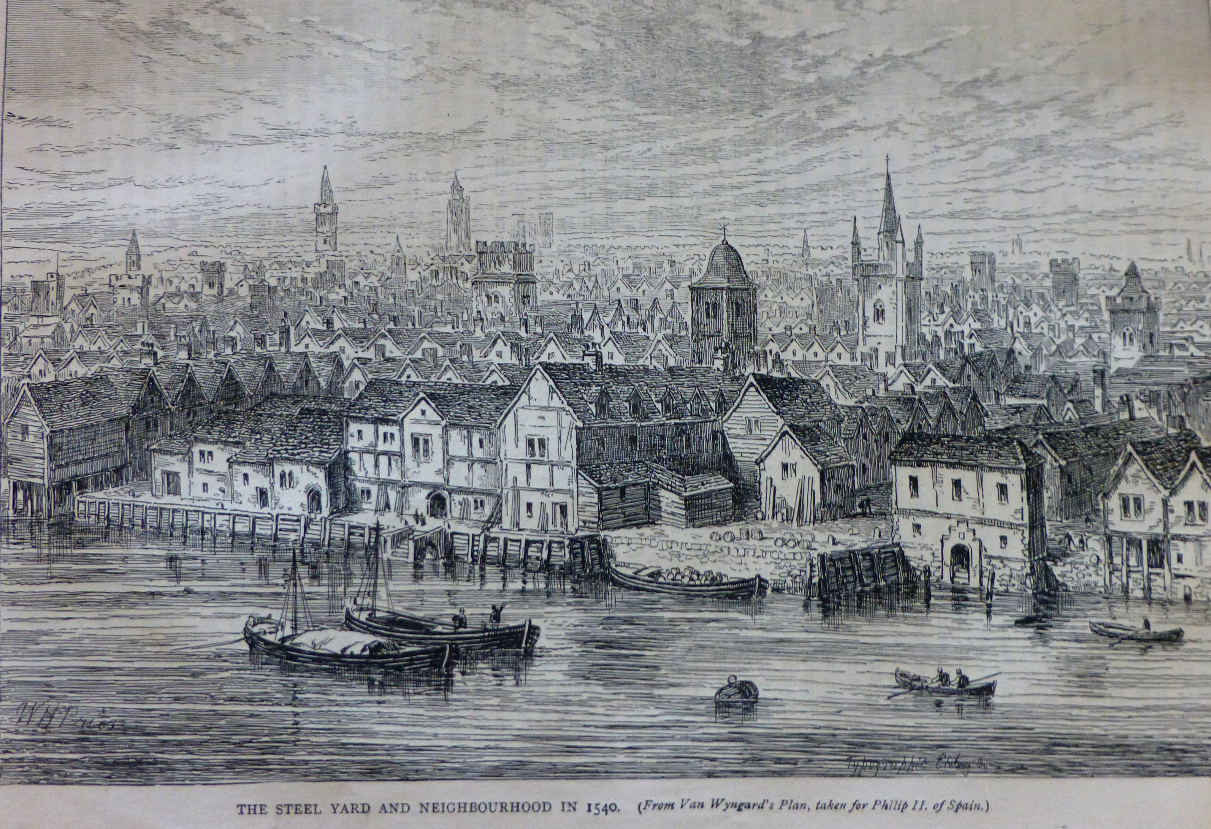
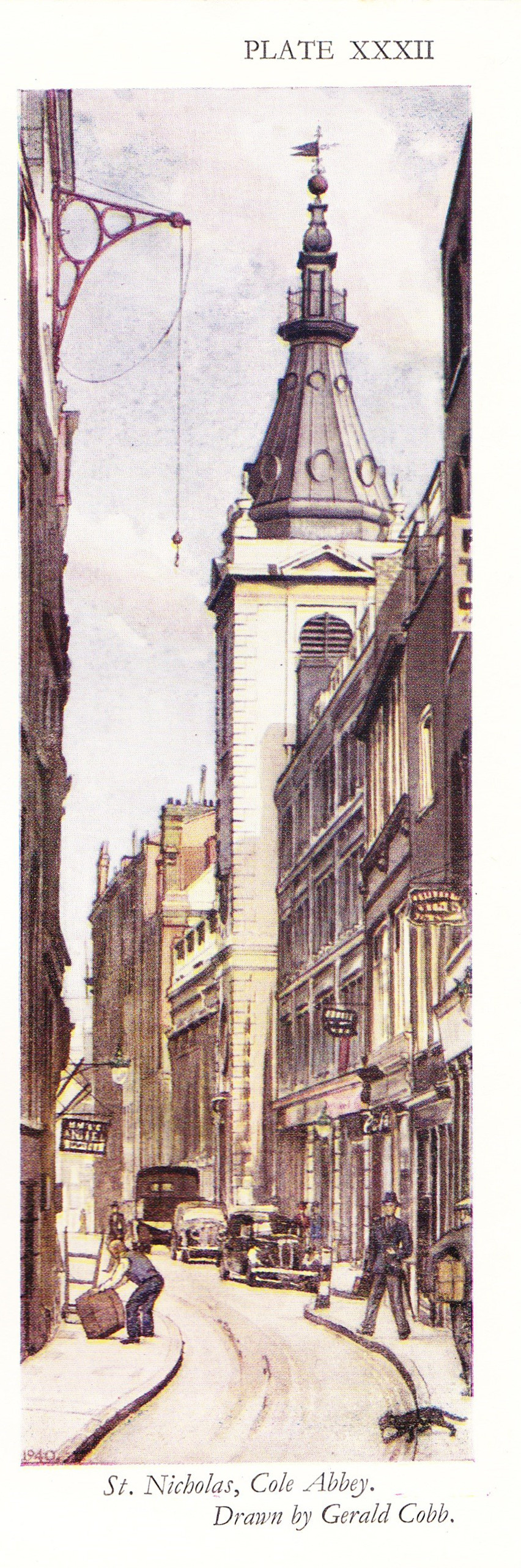
Paternoster Row was mentioned in the thirteenth century when Stow states that it was built around 1282 and that rents from the houses were used for the maintenance of London bridge. Before the war, this area was well-known for book publishing, distribution and warehousing, a fact that contributed to the intensity of the fires that raged in this area. This trade started well before the 20th century. It was in Paternoster Row in 1720 that William Taylor published Robinson Crusoe after Defoe had tried all over London to sell the manuscript. In 1724 Taylor’s publishing business was purchased by Thomas Longman who had founded the publishing firm of Longman, Green and Company also in Paternoster Row. Longman is still an imprint today, owned by the Pearson publishing company.

The following paragraphs are from the book “The Lost Treasures of London” by William Kent and give some idea of the dreadful loss to the long-established businesses that use to thrive in the City.

“On the night of the 29th December 1940 the bombs rained down here and Paternoster Row was more completely destroyed than any other City thoroughfare of importance. All that remained were a few buildings at the east end. The devastation in respect of books has been indicated by Evan Pughe, the Deputy Chairman of Simpkin Marshall and Co. Ltd:

On the night of the 29th December 1940, Simpkin Marshall, Ltd, the greatest distributor of English books in the world, carrying the largest comprehensive stock, lost approximately four million books when their premises in Ave Maria Lane, Stationers’ Hall Court, Stationers’ Hall, Amen Corner, Paternoster Row and Ludgate Hill, were entirely destroyed by the incendiary bombs of the enemy.

This disastrous fire eliminated everything. All the old records of the business going back a hundred and thirty years were destroyed; and most important of all, the great cataloguing system, the only one of its kind in the world, dating back for a hundred and fifty years. These catalogues were handwritten records of books, cross-referenced, so that books on all subjects could easily be traced. These records could immediately give books that had been published on any subject during the hundred and fifty years covered by them, the publisher, date of publication, the price, the size of the books, etc. They were invaluable and their loss will be felt by the reading public for many years to come.”

As a result of the blitz, Simpkin Marshall went out of business. It is hard to imagine the loss that must have been felt when Londoners returned to their place of work after an air raid and realised not just the loss of the buildings, but also what was held within and long established businesses.

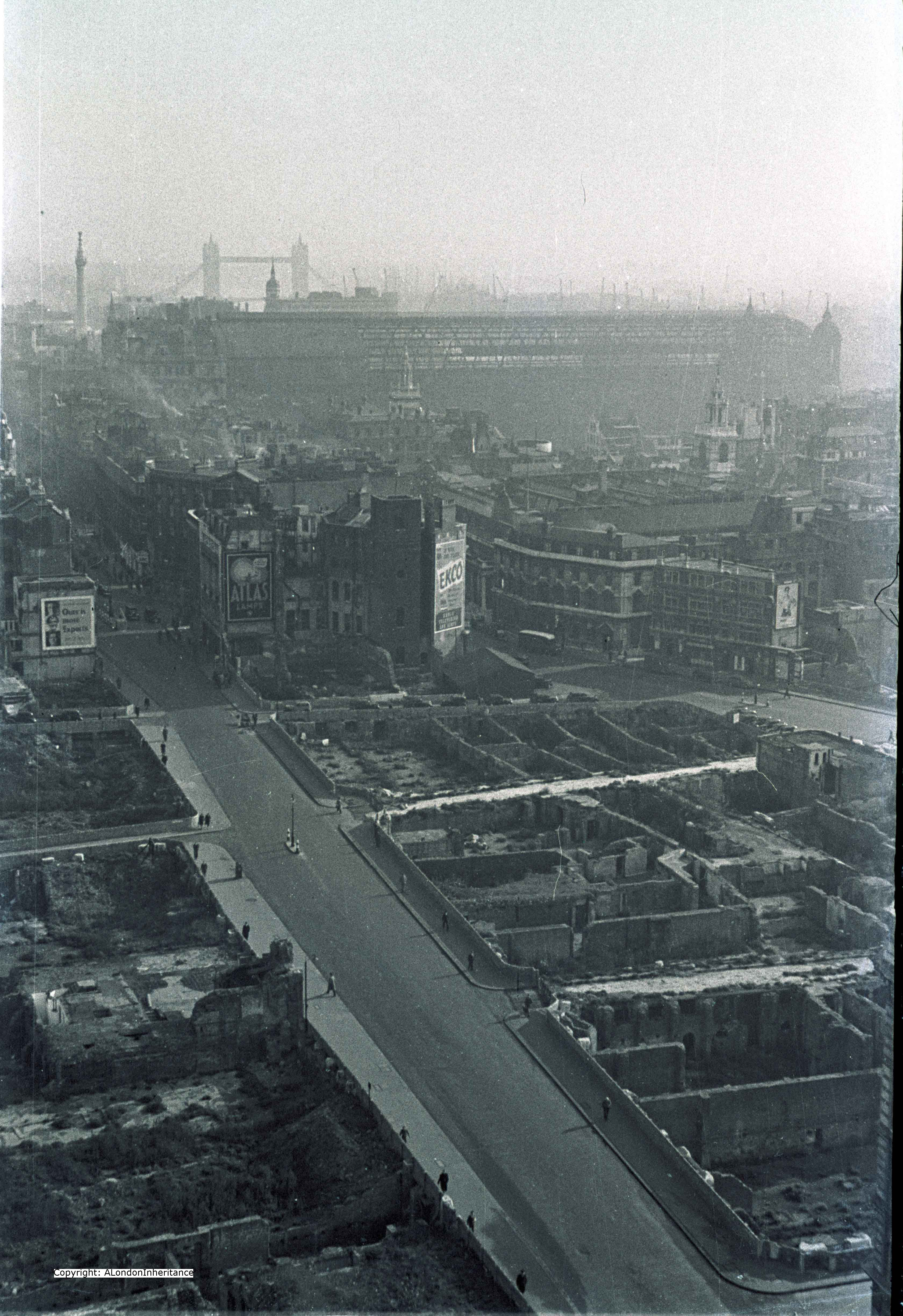
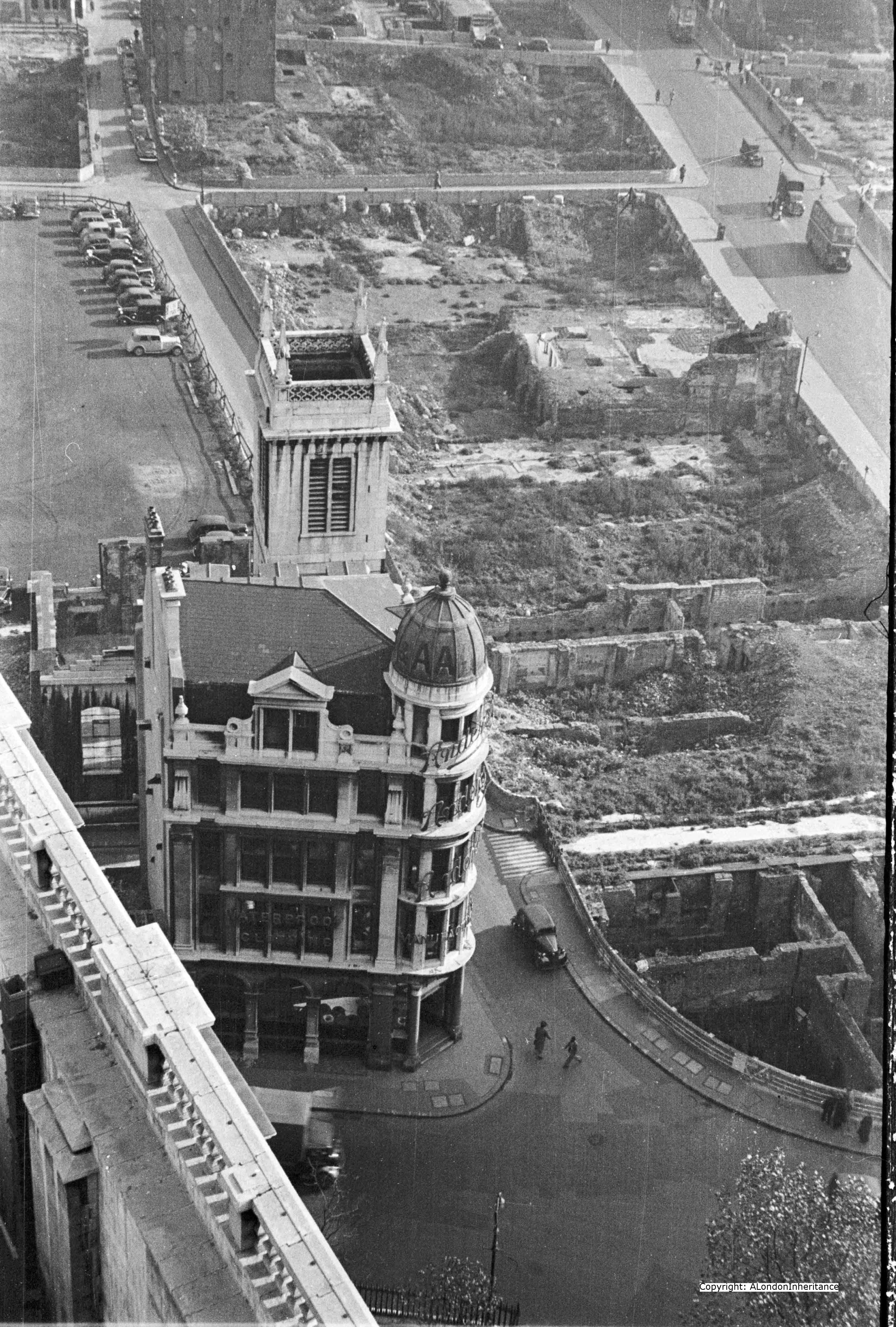
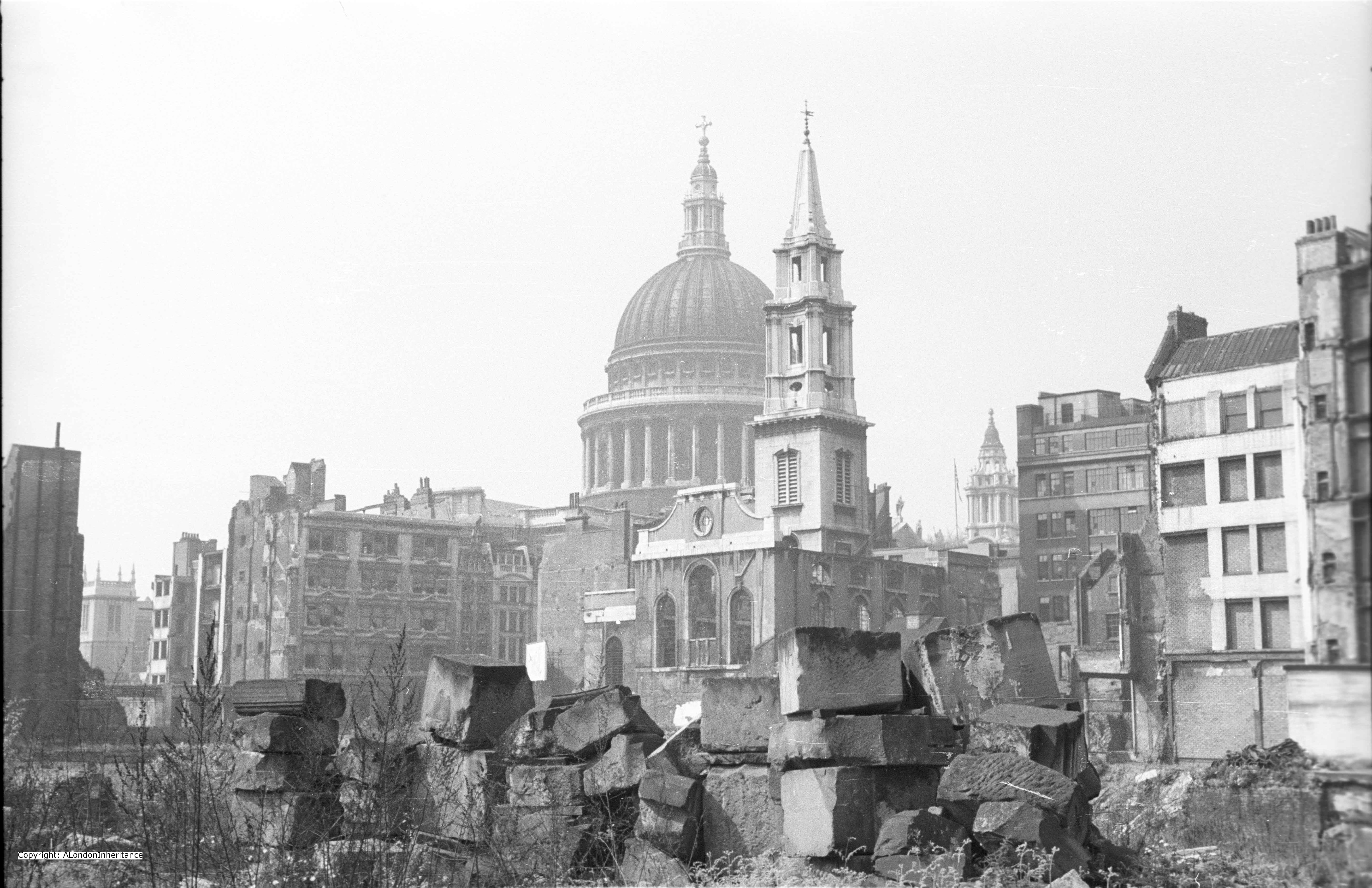
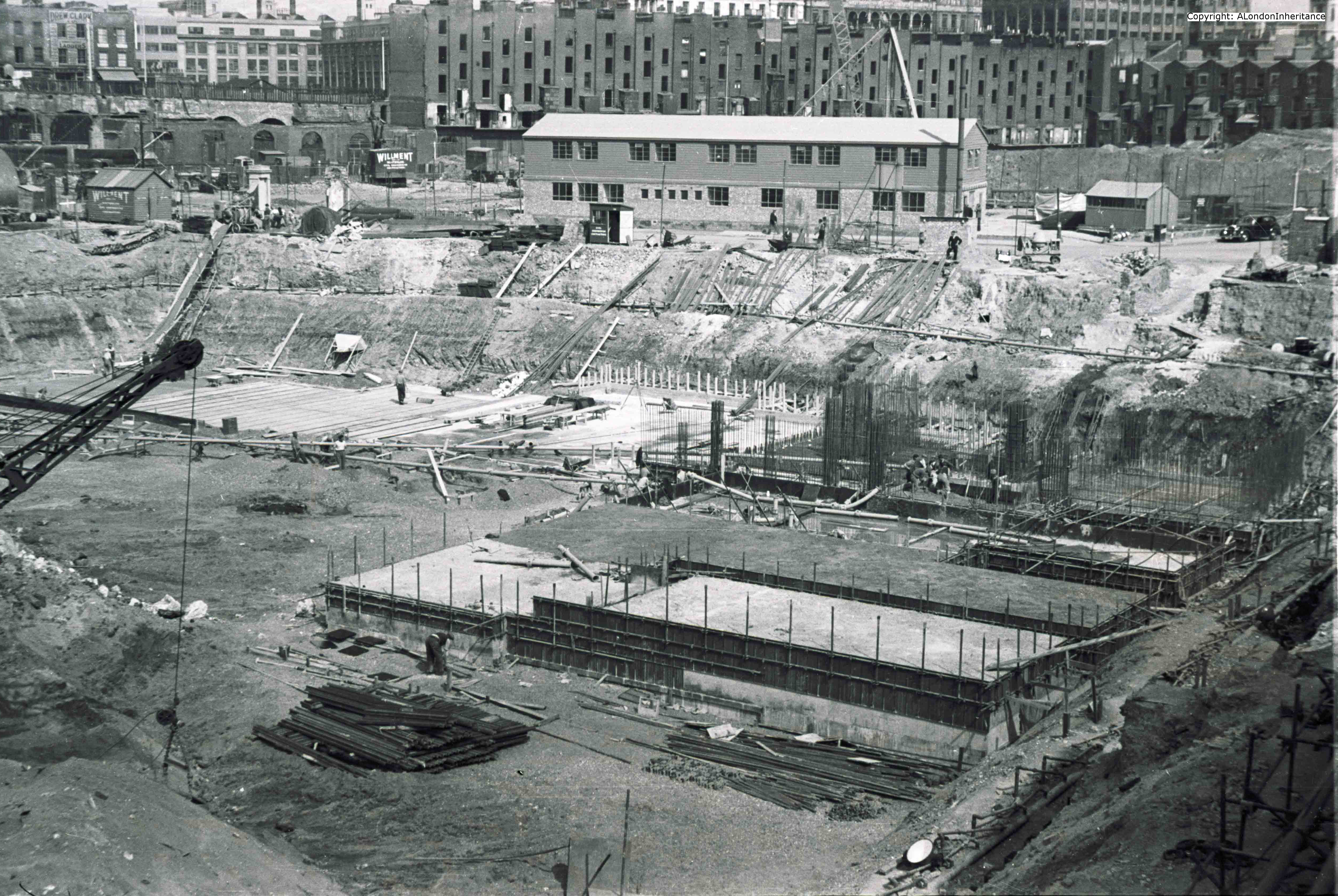
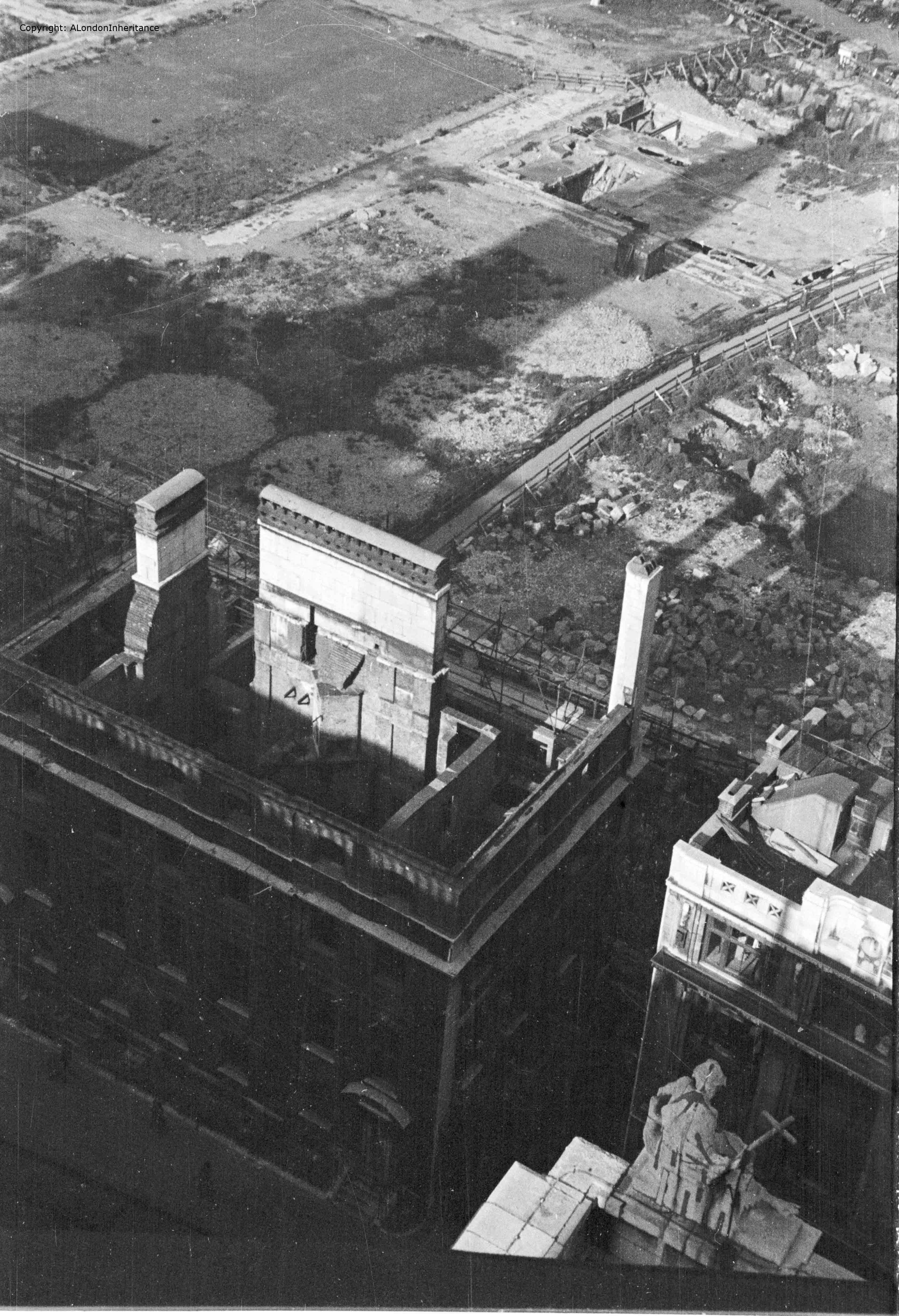
Turning a bit more to the left and peering down we can get a glimpse of the Chapter House and the road that was St. Paul’s Church Yard that closely circled the cathedral.

The five circular shapes just behind the Chapter House are the impressions left by water storage tanks. Access to water was always a problem during the blitz. Damage to water distribution pipes, blocked roads and low tides in the Thames all contributed to the lack of the plentiful supplies of water needed to fight the sheer number of fires that would take hold after a raid. After the Paternoster area was destroyed on the 29th December 1940, the area was quickly cleared and these water tanks were built and kept full ready for the next raid.

Further back can be seen the rectangular shape and surrounding streets of Paternoster Square.

2014 North 3 old

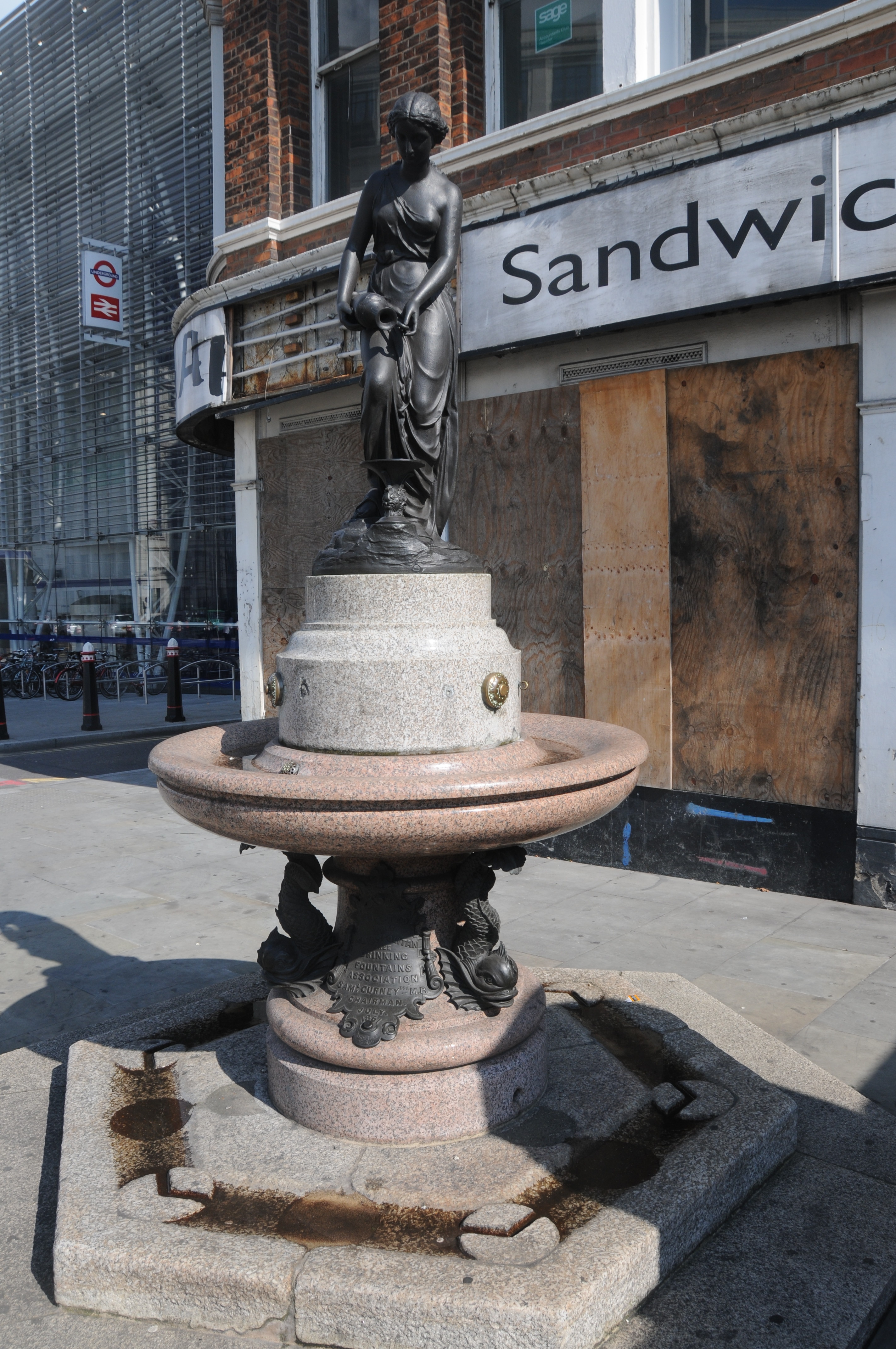
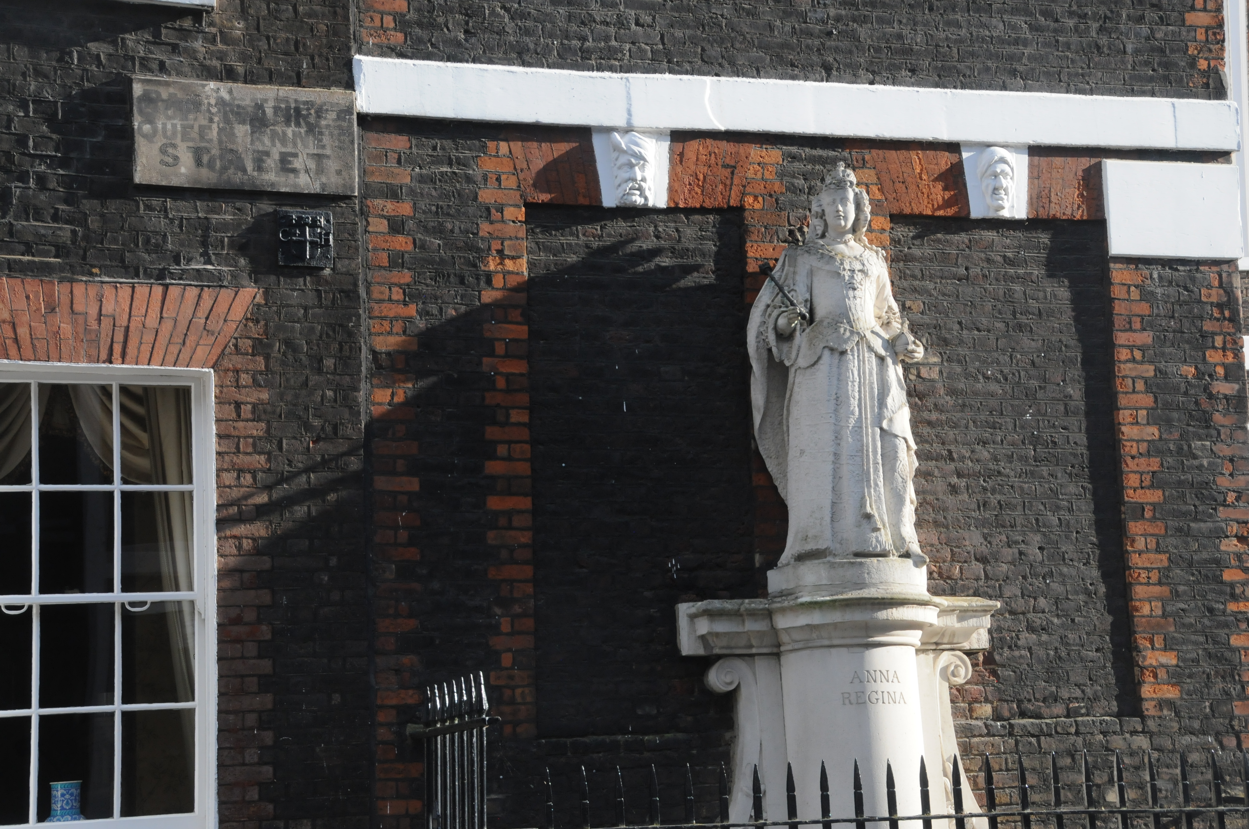
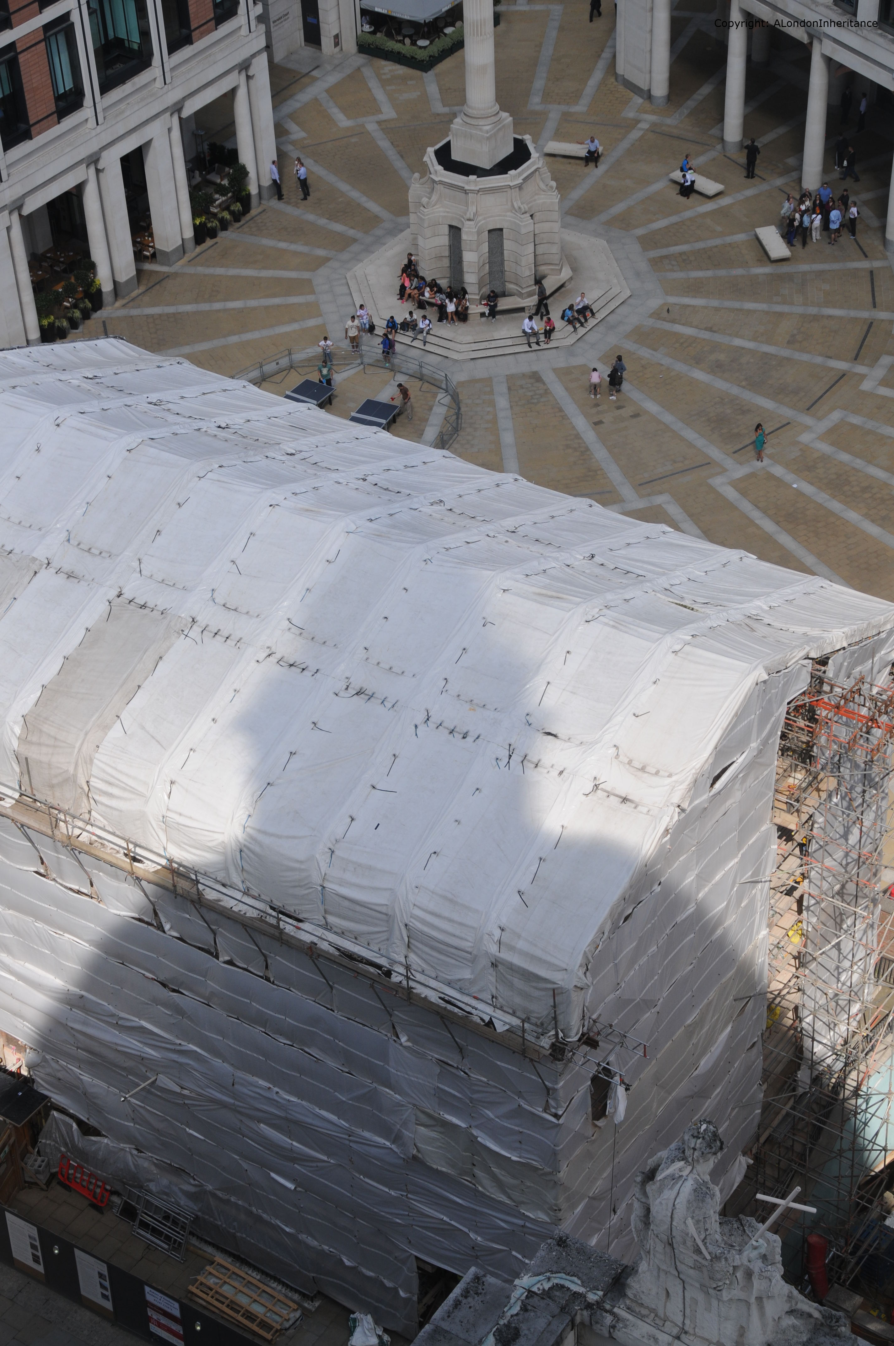
I was able to frame the following 2014 photo reasonably well using the statue at the bottom right, to take a photo in exactly the same position as my father 67 years ago. The current incarnation of the Chapter House is currently undergoing re-building / restoration work hence the protective covering.

2014 North 3

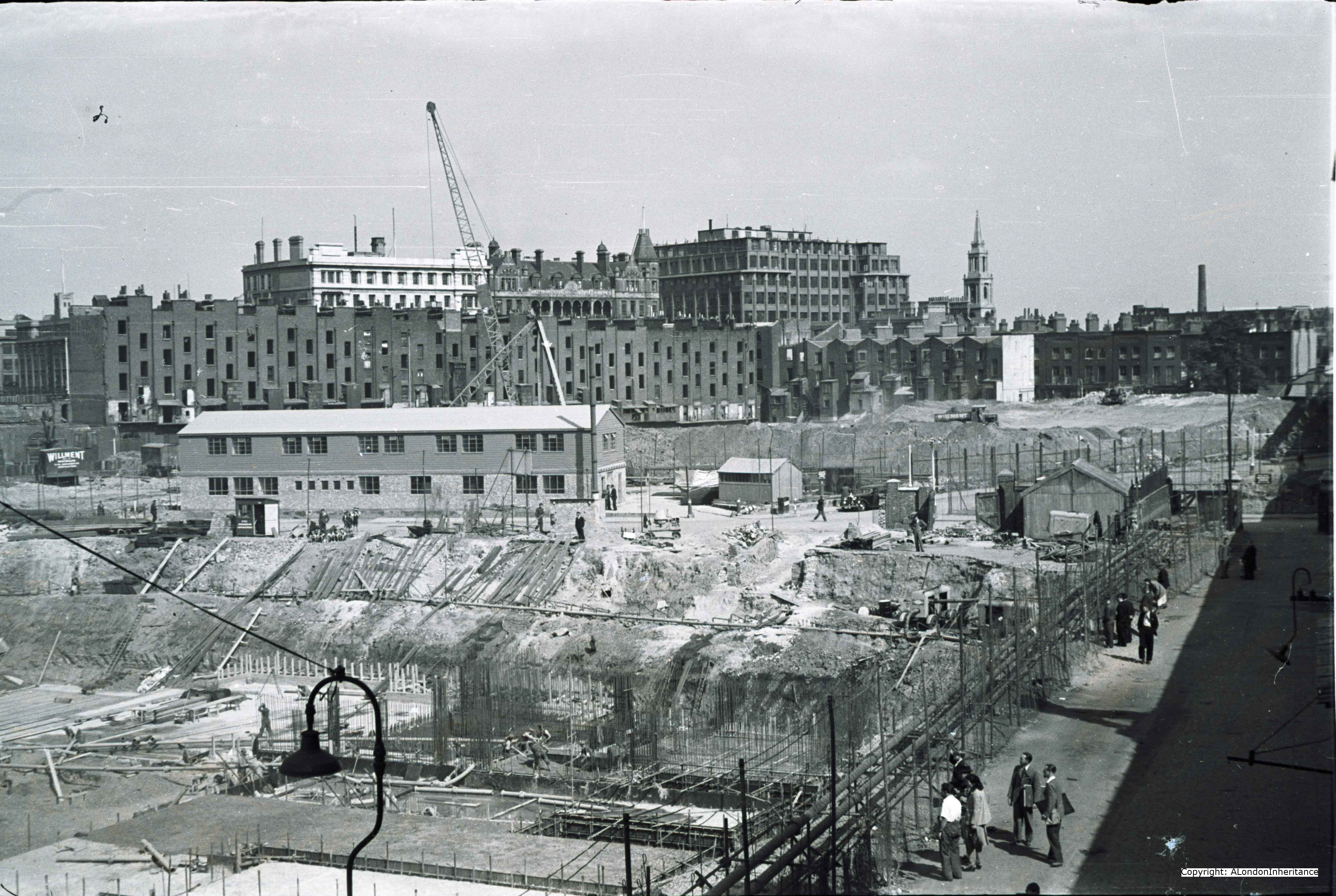
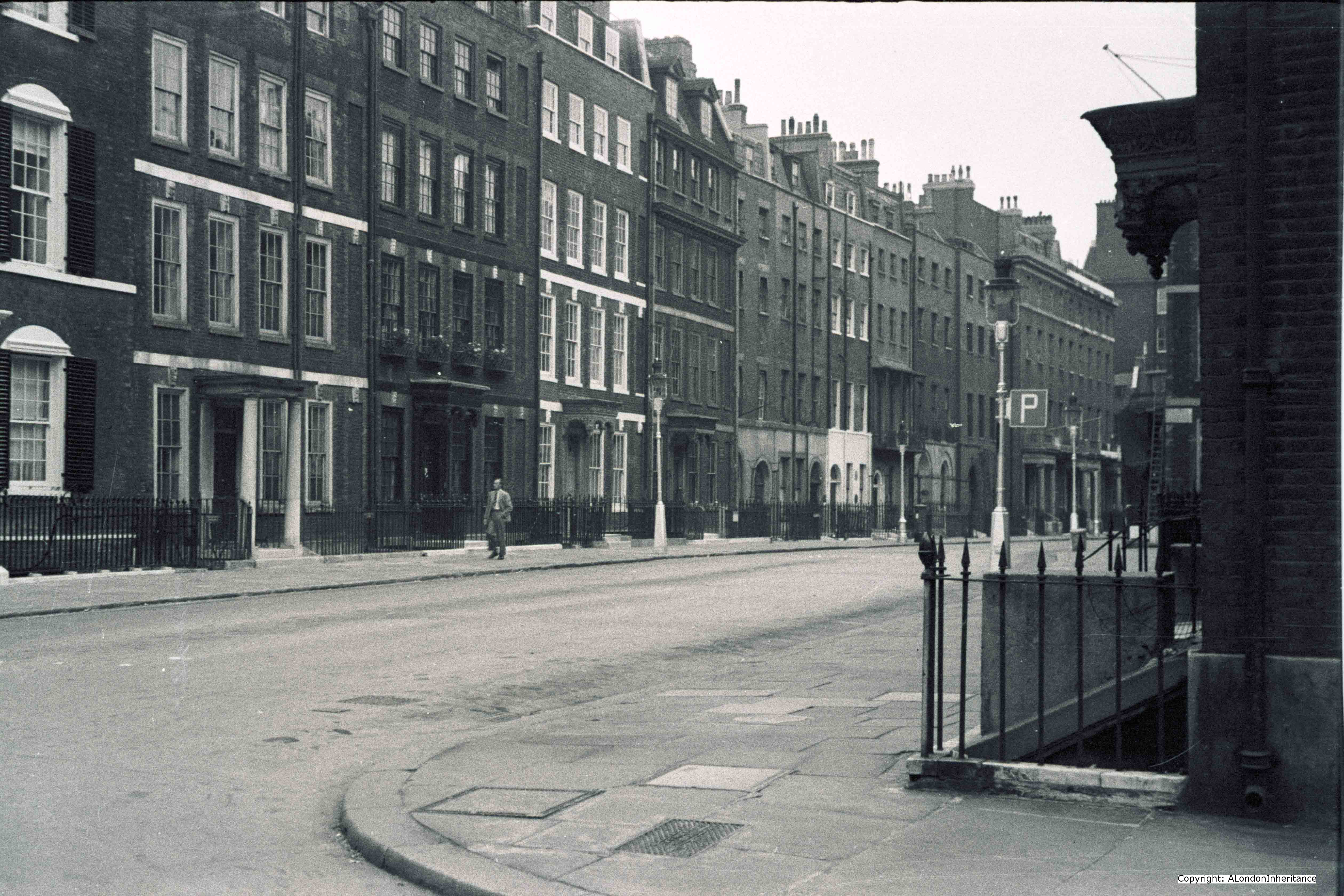
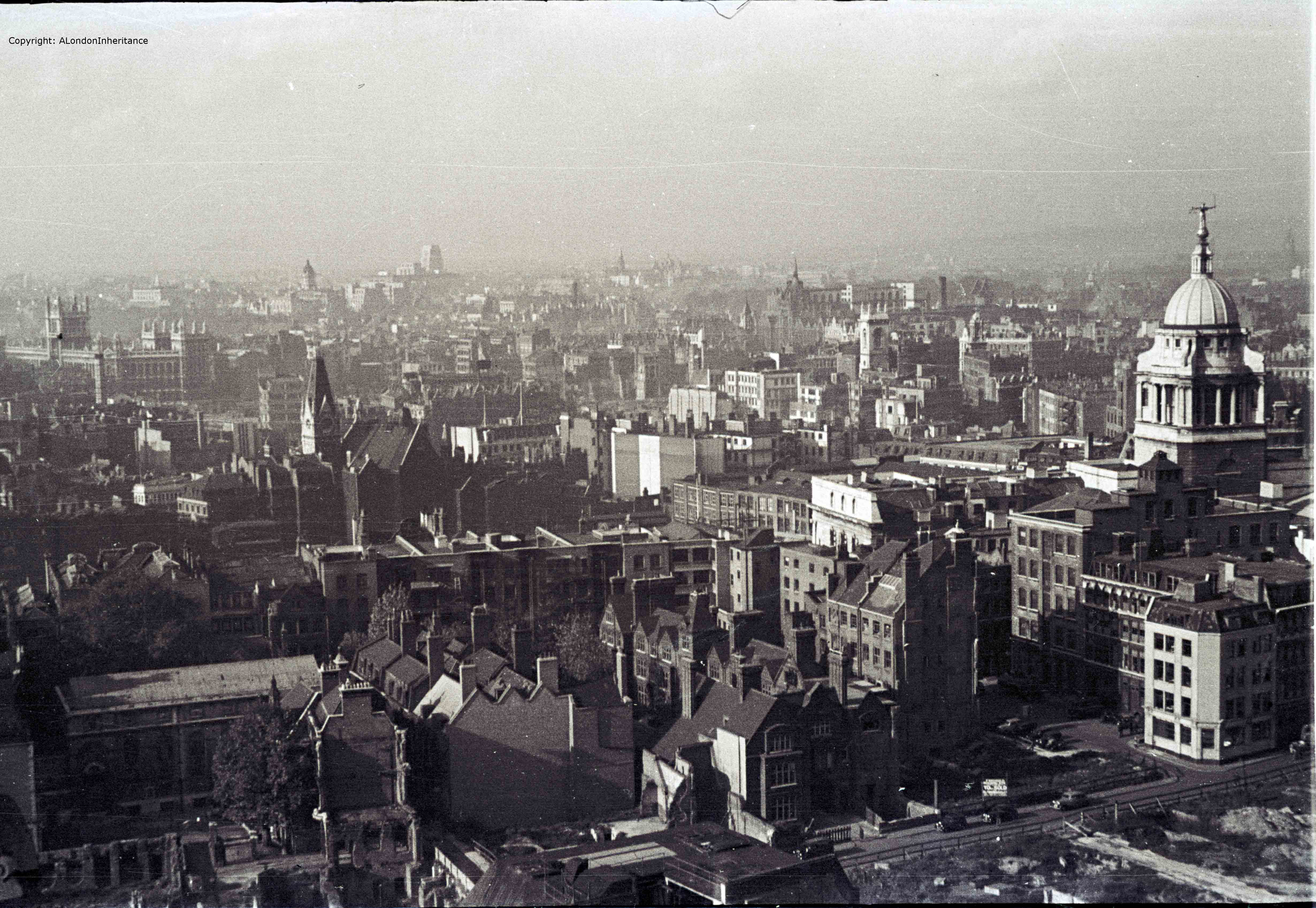
Now look up again and walk further to the left and out across to the west. In 1947 the Old Bailey with the “Lady of Justice” holding the sword and scales of justice stand well above the surrounding buildings, with the Senate House of the University of London the next tallest building in the distance.

2014 West 4 old

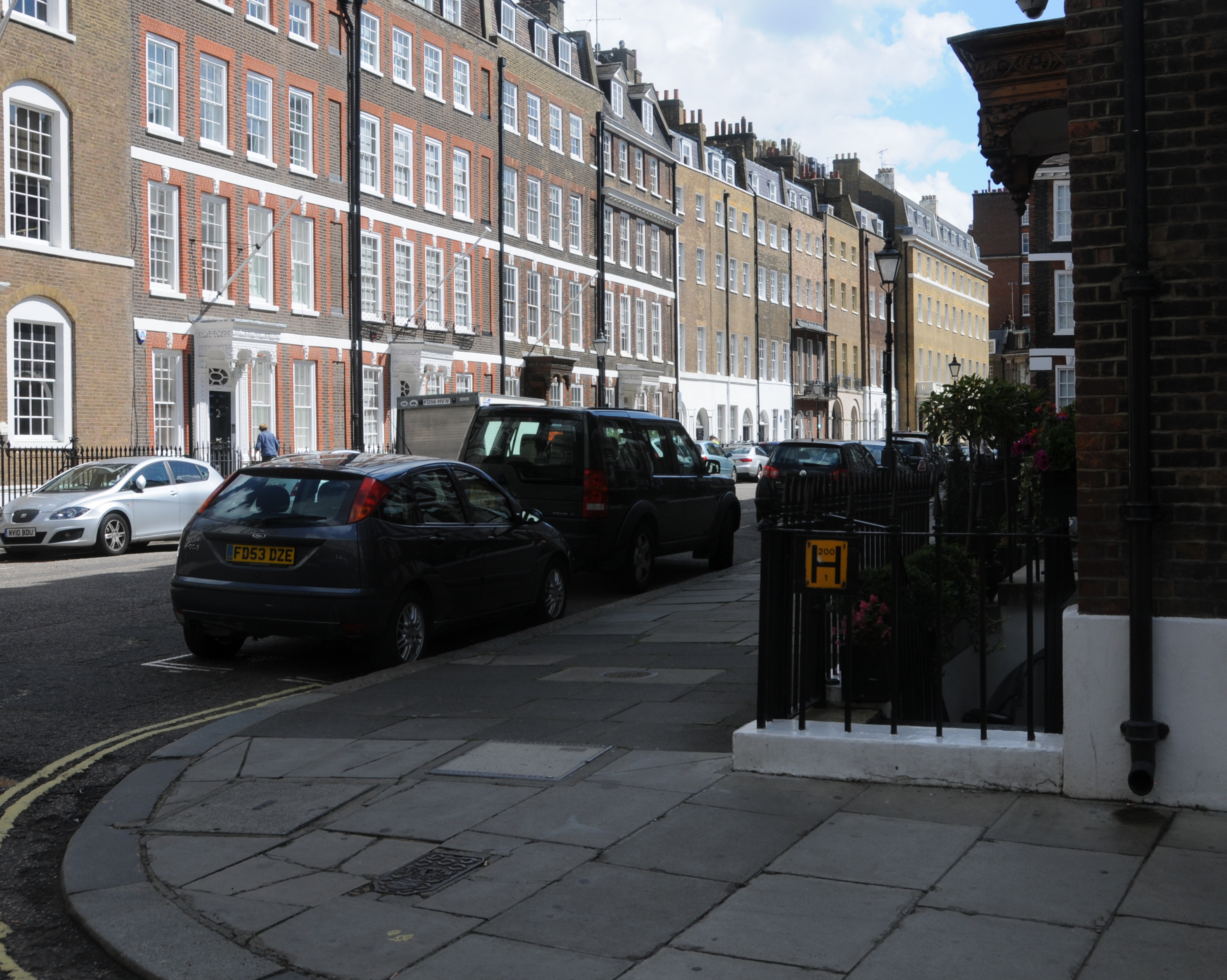
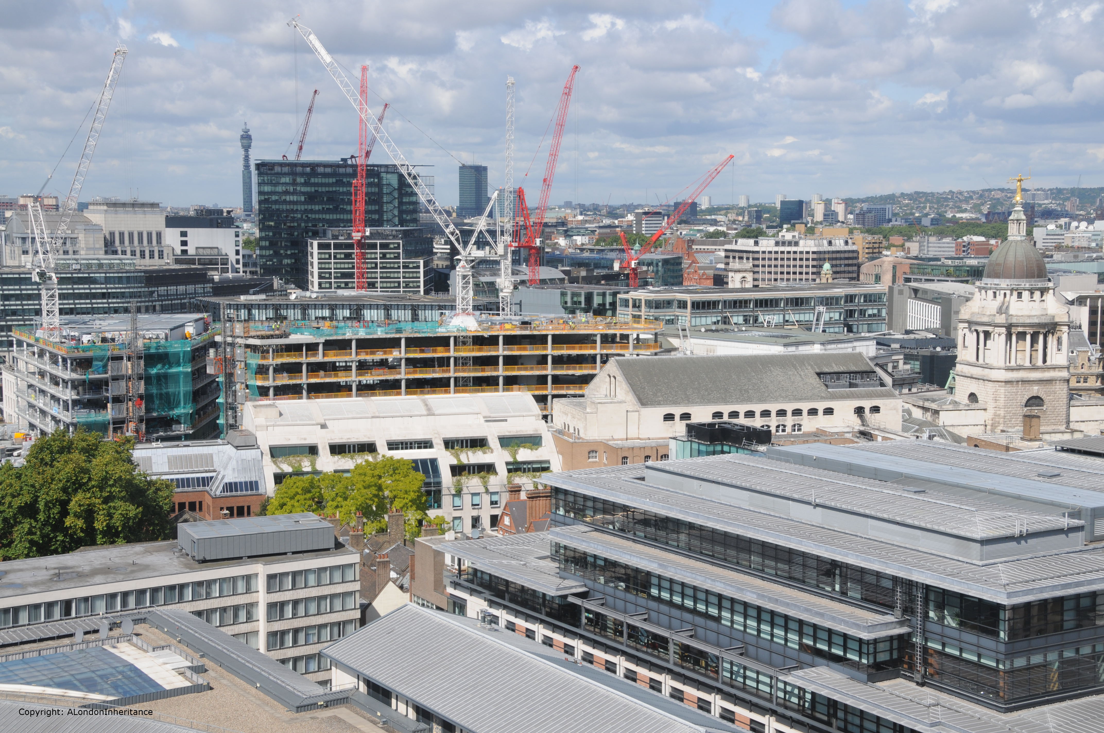
In 2014, the Old Bailey still stands clear but the rest of the view towards the west is very different. The view of the Senate House is now obscured, and the next tallest building on the horizon is the BT Tower.

2014 West 4

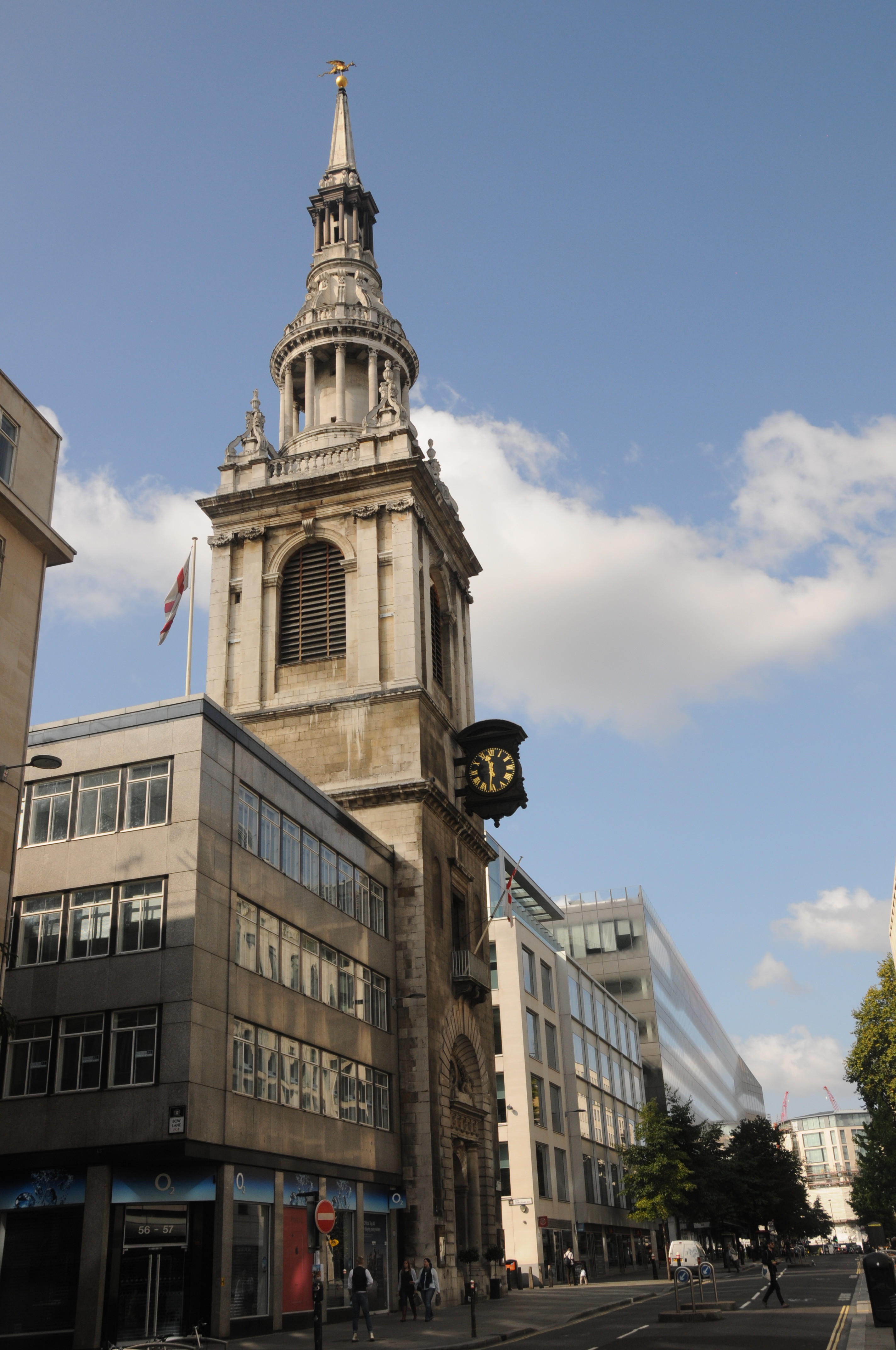
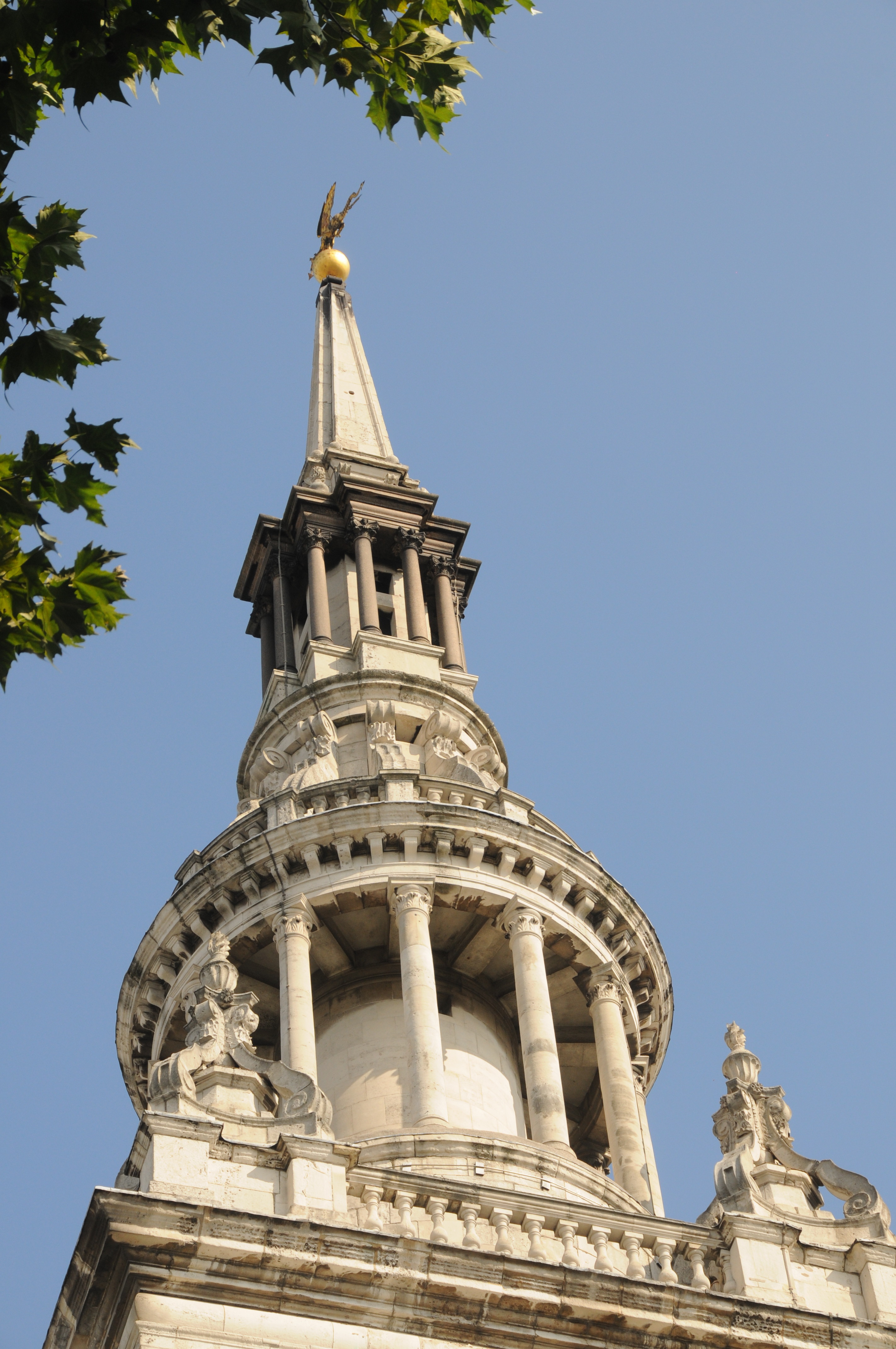
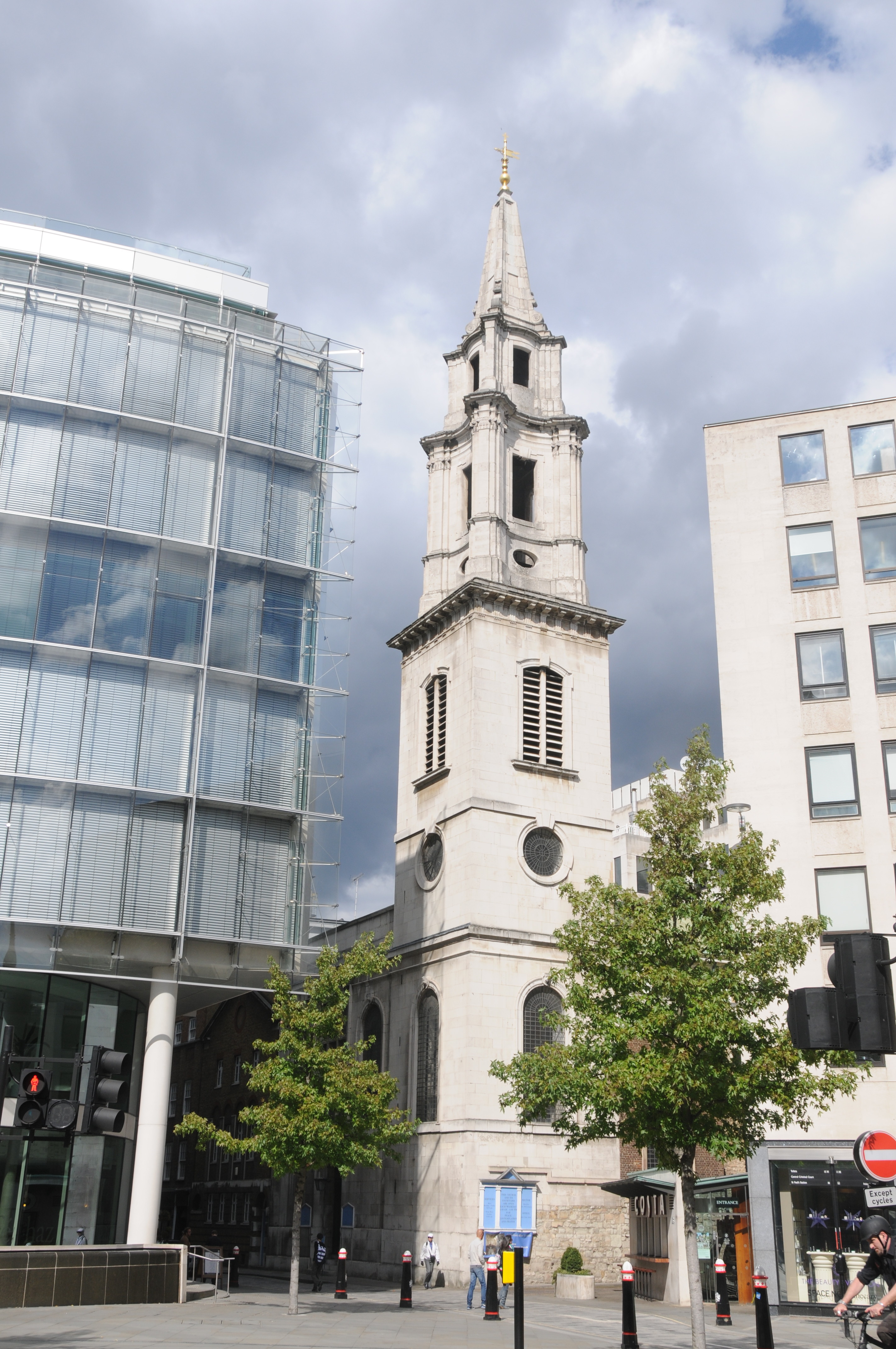
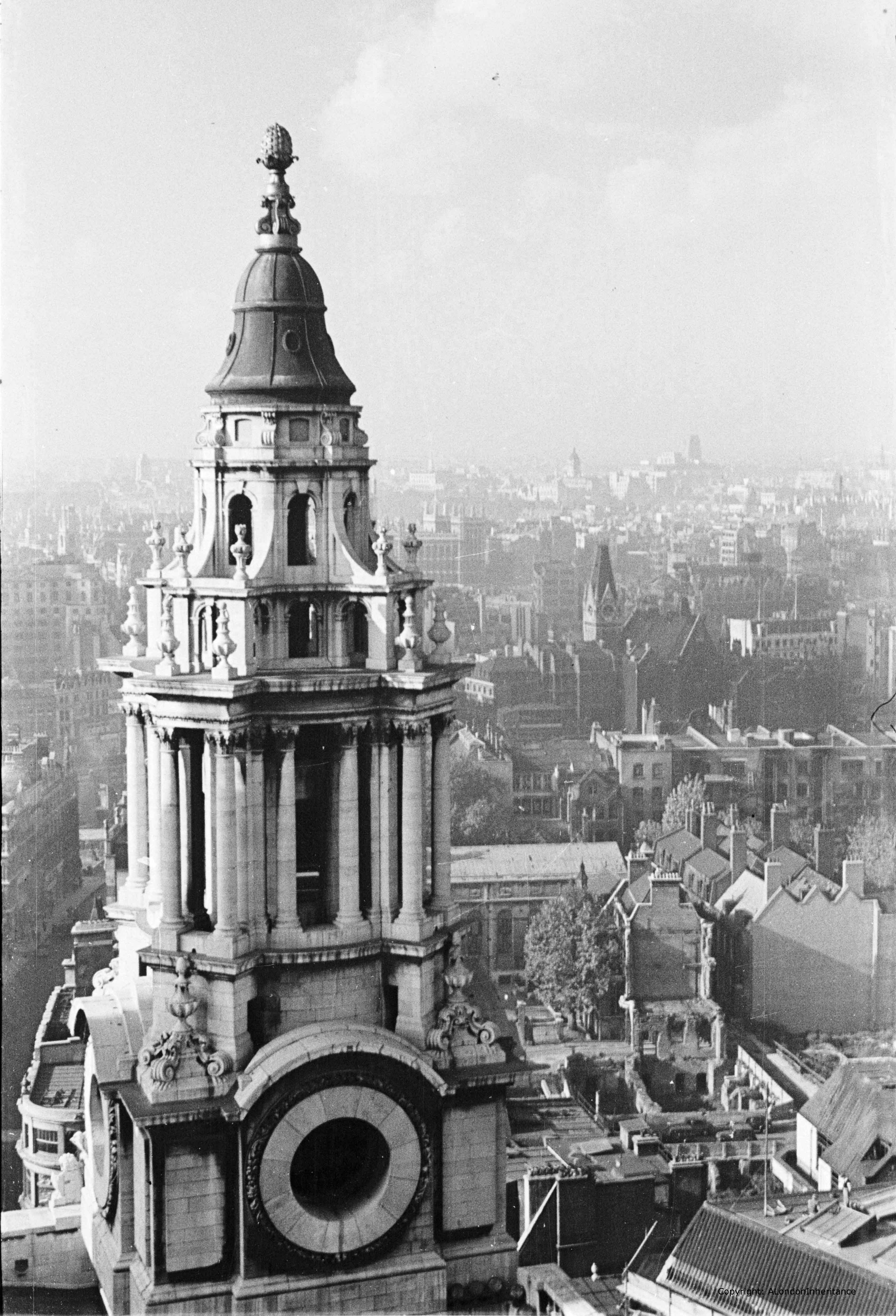
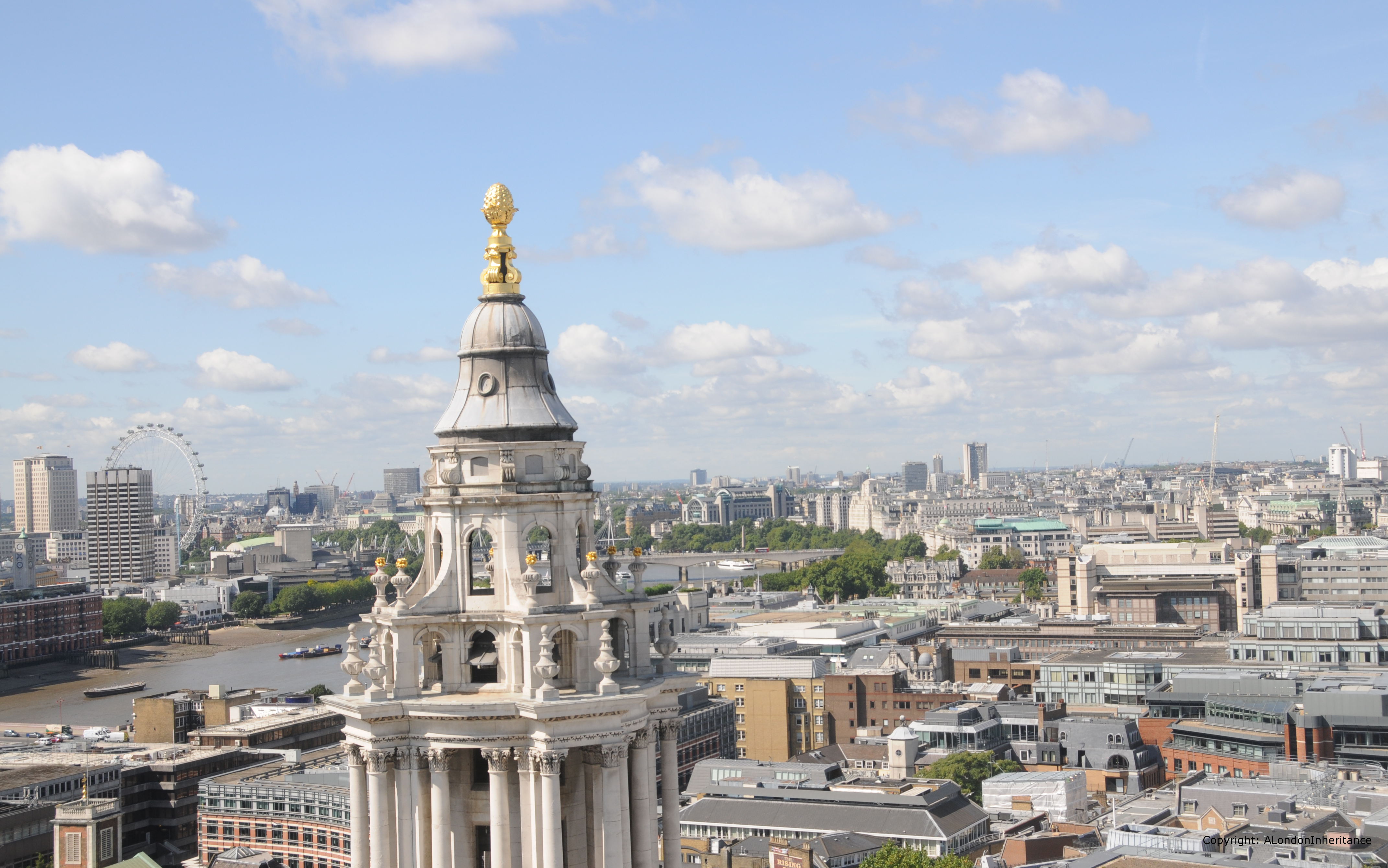
Turning to look further to the left, we can see one of the western towers at the front of St. Paul’s.

2014 West 5 old

And the same view today in 2014:

2014 West 5

Looking at these towers at the front of St. Paul’s, at the Dome, across the different levels of roof across the cathedral, the many small walkways, along with the many stairways leading up to the heights of the cathedral really bring home the complexity of protecting the cathedral during the air raids of the blitz.

The Very Reverend W.R. Matthews, Dean of St. Paul’s wrote an account of St. Paul’s Cathedral in Wartime published in 1946. The following extract covering the 29th December 1940 brings to life the challenges that the Fire Watchers faced whilst protecting the cathedral. We join the account after the external water supplies have dried up:

“The Watch was now forced back on their reserves and had to rely entirely on stirrup pumps and sandbags. How we blessed the prescience of our commander, who had insisted on having our supplies of reserve water augmented in case of an emergency like that which we now confronted. Tanks, baths and pails full of water with their compliment of crowbars, shovels and other fire-fighting equipment were now liberally installed in all the vulnerable parts of the building and were so arranged that men approaching the scene of the fire from any direction would be certain of finding the necessary appliances to hand. But for these precautions there might well have been a different story to tell of the fate of St. Paul’s that night.

The action in the cathedral became for a while a number of separate battles in which small squads fought incipient fires at different places on and beneath the roofs. Some of the bombs were easily dealt with, as for example that one which fell on to the floor of the Library aisle and was extinguished by Mr Allen and myself. I have a special affection for the scar left by that bomb on the floor – it represents, I feel, my one little positive contribution to the defeat of Hitler ! But some of these battles were arduous and protracted. Bombs which lodged in the roof timber were very dangerous and hard to tackle. More than one of these took three-quarters of an hour before they were put out and had to be attacked by two squads, one from below and the other from above. The lower squad had the additional discomfort of being drenched by the pumps of their more elevated colleagues”.

The account also makes clear the need for a “head for heights” when working in the roof spaces and above the cathedral floor. It is the bravery of the Fire Watchers that we have to thank for the survival of the cathedral.

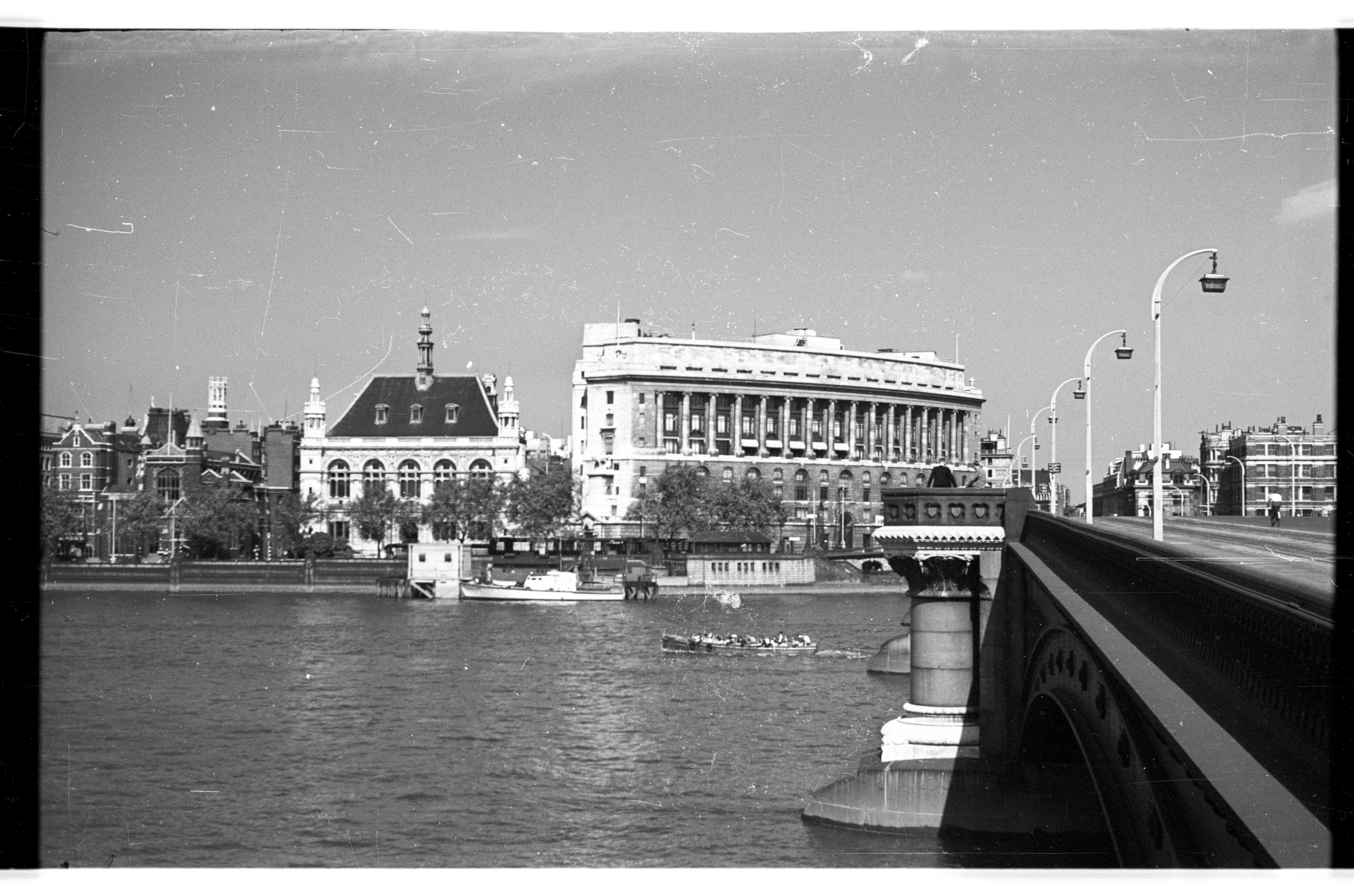
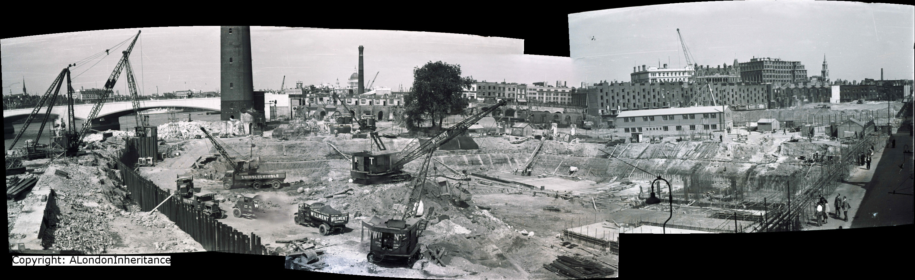
Now for the final view from the Stone Gallery in 1947 and we are looking out over the southerly of the western towers across the River Thames to Westminster. We can see Waterloo Bridge along with the Shot Tower on the south bank of the Thames.

2014 West 6 old

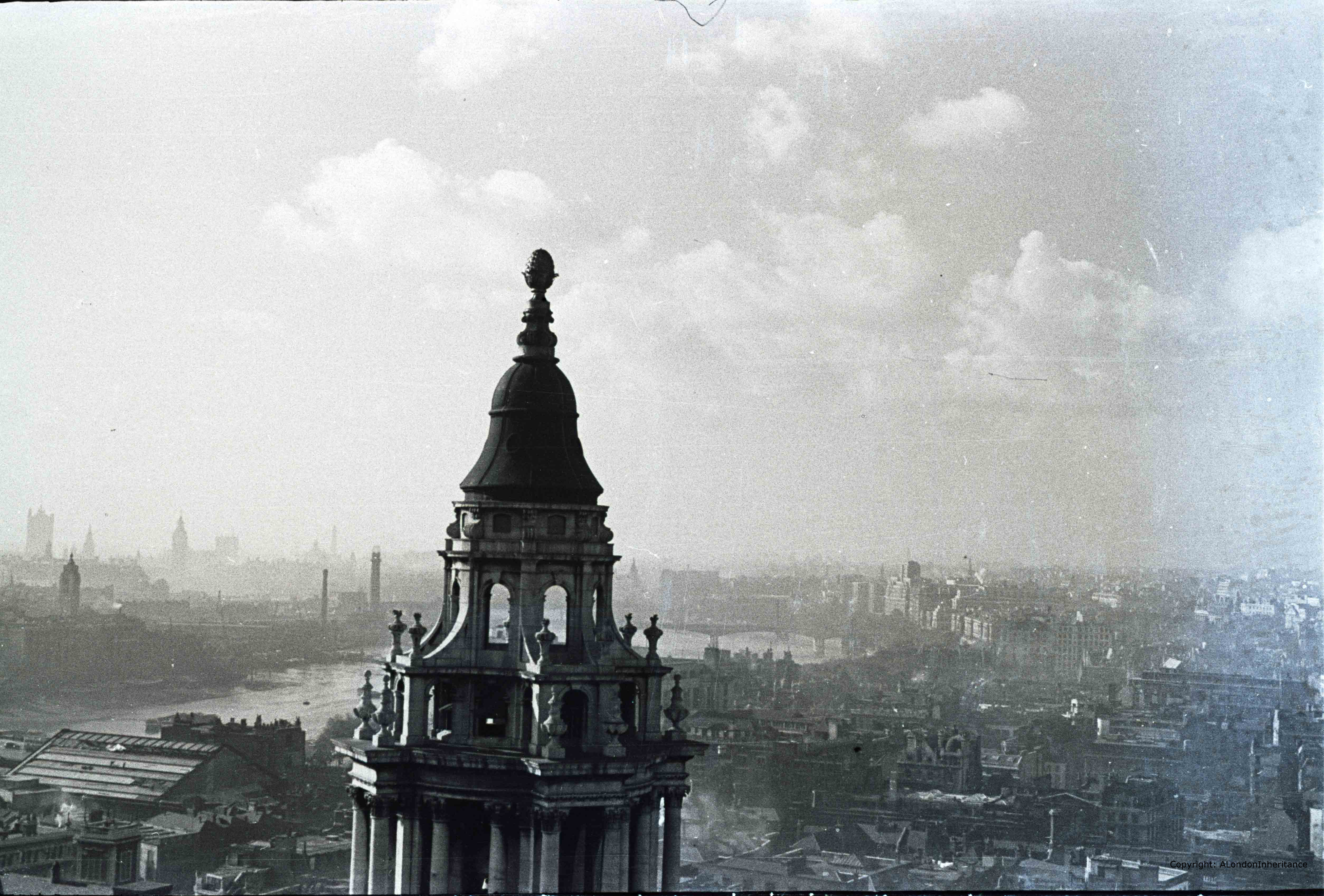
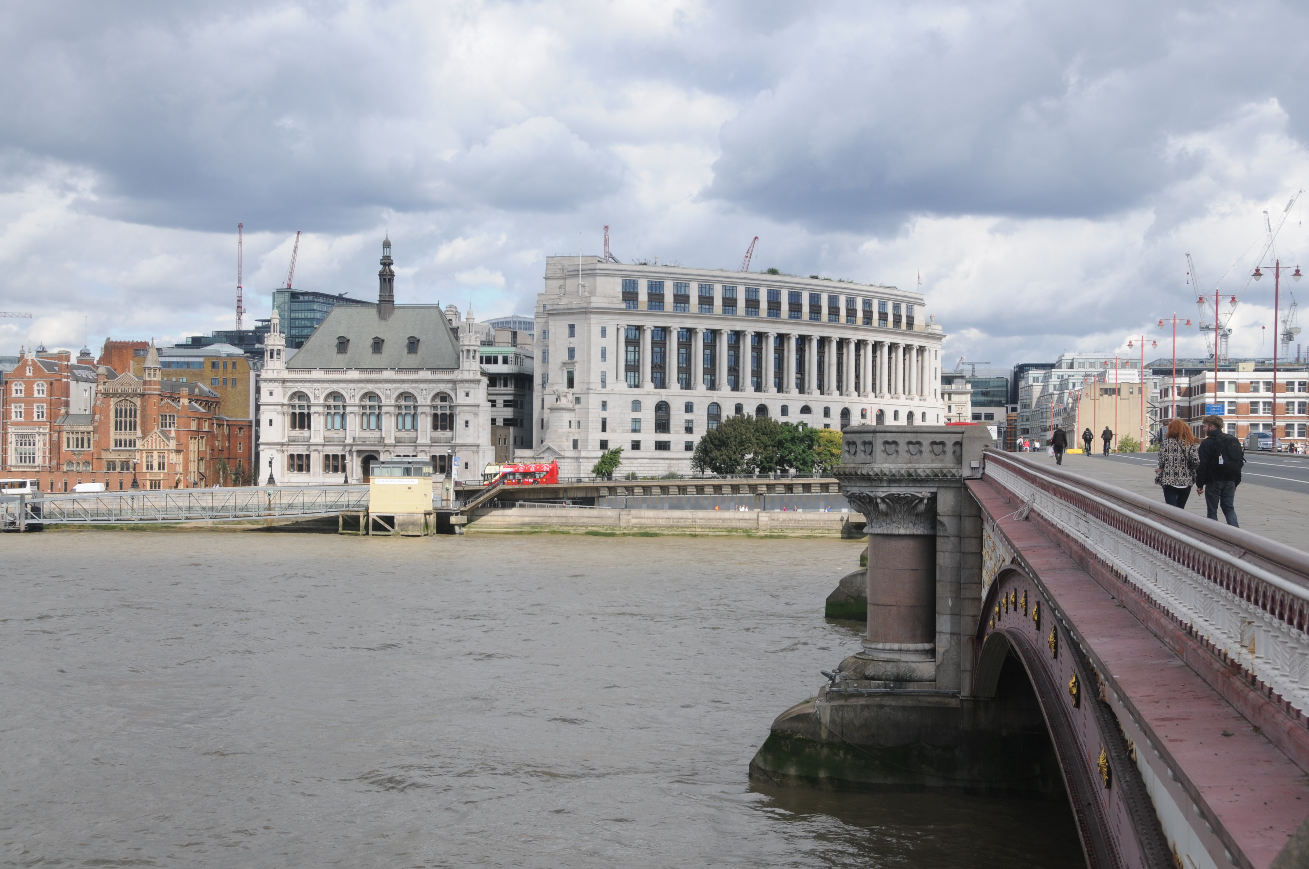
And in 2014, the view of the river and Waterloo Bridge remain but there has been considerable change on both banks of the river. In the 1947 photo, the south bank would soon be cleared for the Festival of Britain, after which the site was part occupied by the Shell Centre building then continuous development leading up to the London Eye.

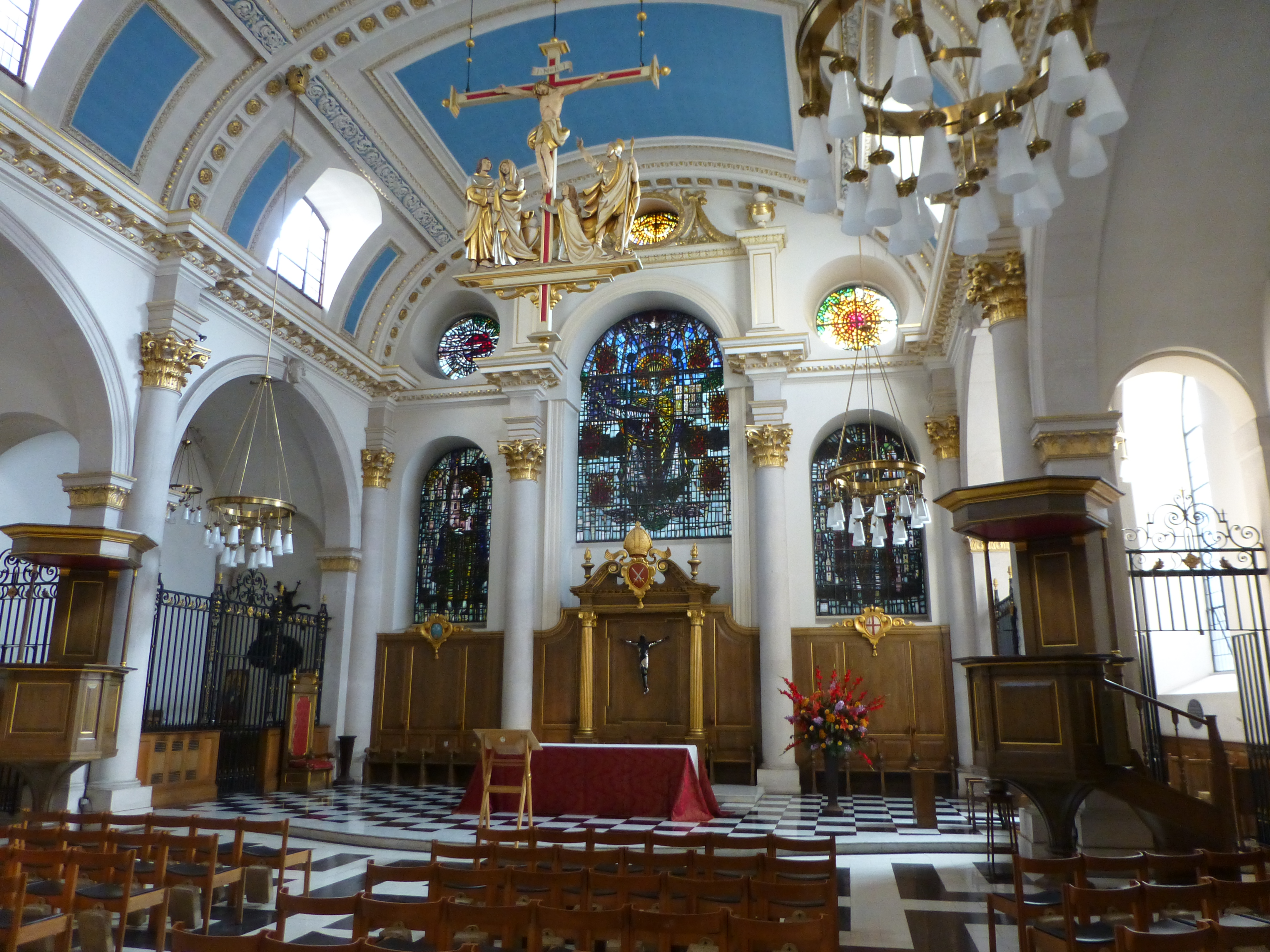
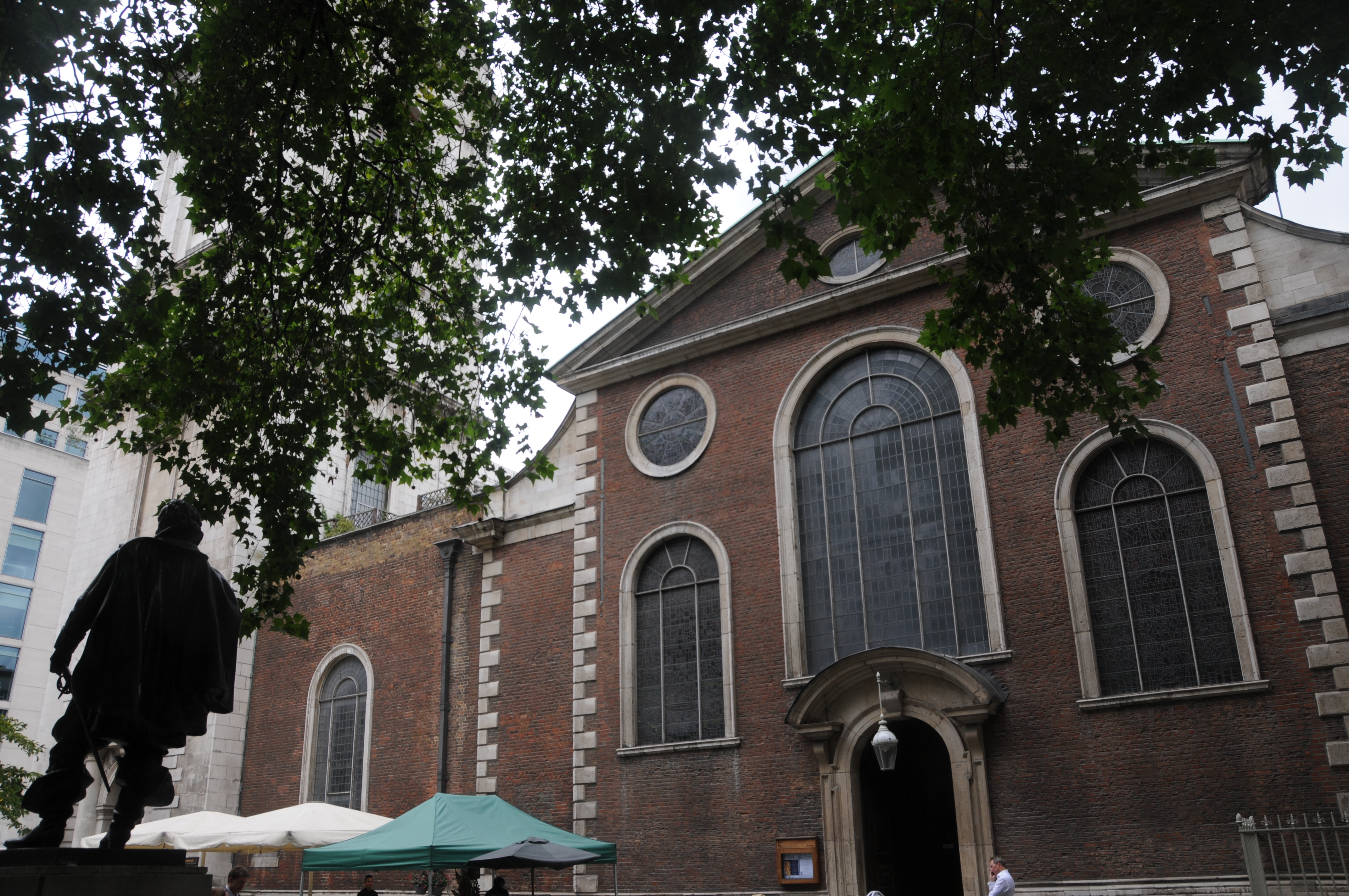
In the foreground in the extreme lower left of the photos is St. Benets, Paul’s Wharf.

2014 West 6

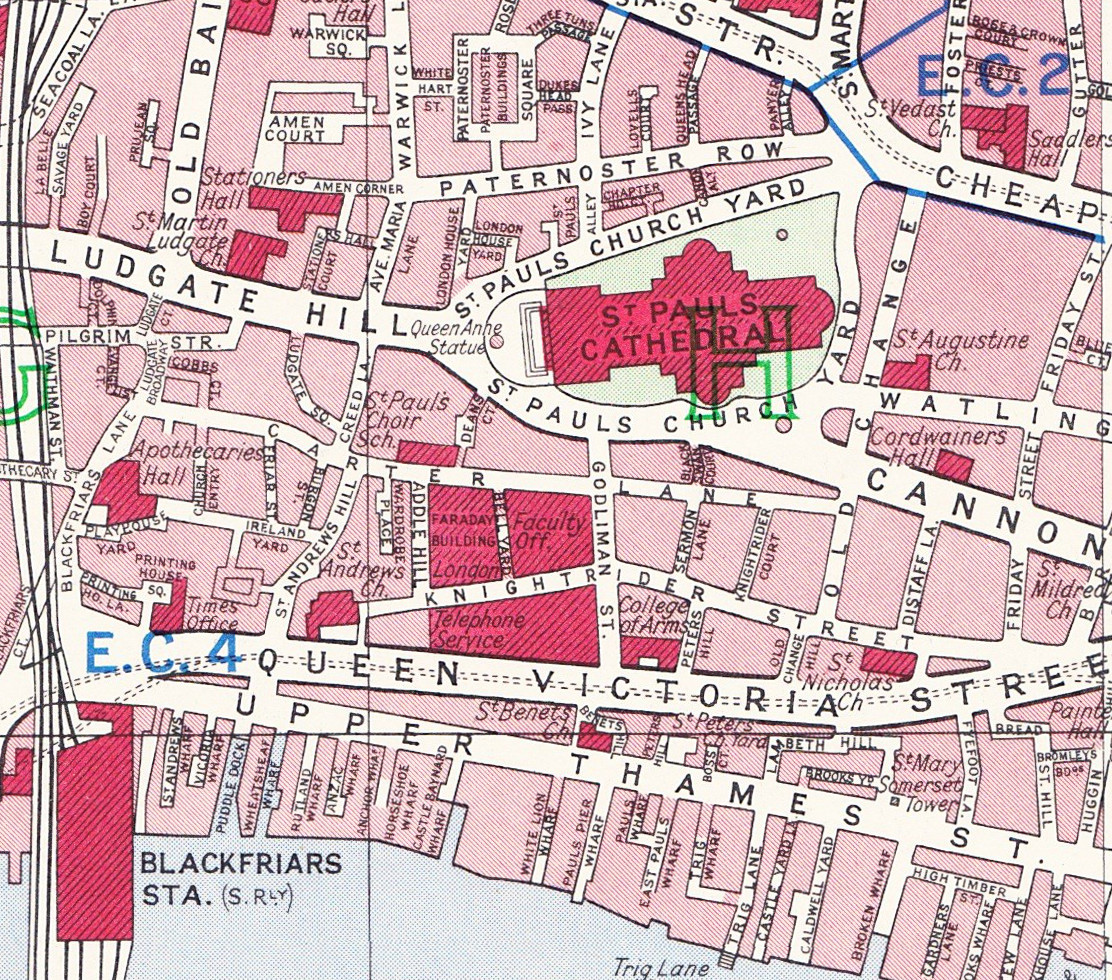
The following map from Bartholomew’s 1940 Reference Atlas of Greater London covers the area to the north of St. Paul’s and shows the streets between St. Paul’s Church Yard and Newgate Street. This was the area shown in the photos covering Paternoster Row and Square and shows the many small streets that were occupied by numerous businesses including that of Simpkin Marshall Ltd. These were soon to be lost with the rebuilding of the area over the coming decades.

map part 2

Compare this 1940 map with the Google map of today:

View Larger Map
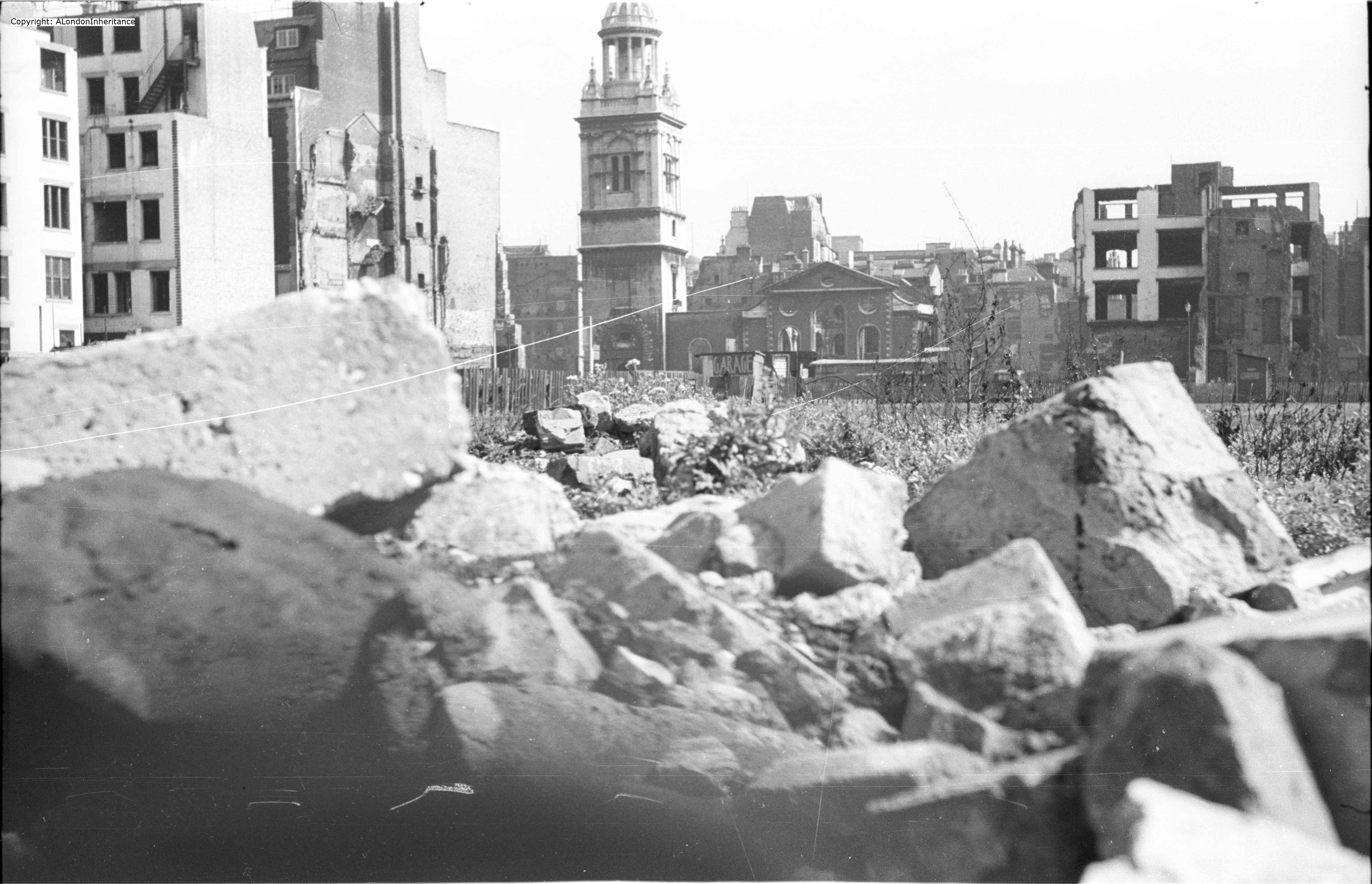
That completes our walk around the Stone Gallery. The air raid of the 29th December 1940 destroyed a significant part of the surroundings of St. Paul’s and the area has since changed dramatically.

The air raids destroyed not only buildings but also business that had been operating for many years, not to mention the thousands of lives that were lost. That St. Paul’s remains is thanks to the bravery of those who protected the building as the area was covered by a deluge of bombs.

For Londoners, it must have seemed that their City was changing forever almost on a nightly basis.

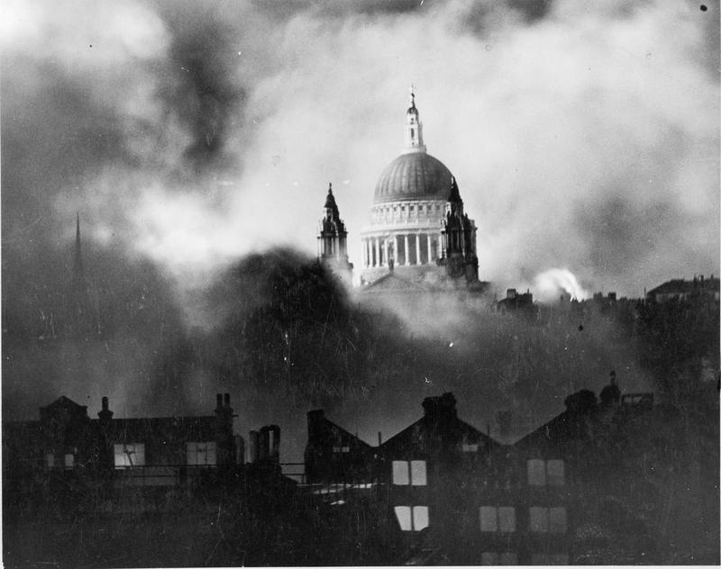
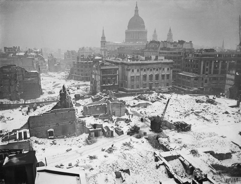
The following photo is from the Imperial War Museum collection © IWM (D 6412) and was taken in January 1942 and perhaps typifies the atmosphere that must have pervaded many parts of the city.

bombed london in the snow

The Stone Gallery (and the higher Golden gallery) provide a perfect location to view the wide sweep of London, from Shooters Hill, to Alexandra Palace, the City, Westminster, North and South Bank. The last stone of the cathedral’s structure was laid in 1708 and since that time it has looked down on a City that has changed beyond all recognition and hopefully will continue to do so for many centuries to come.

The sources I used to research this post are:

  • The Lost Treasures of London by William Kent published 1947
  • St. Paul’s Cathedral In Wartime by the Very Reverend W.R. Matthews, Dean of St. Paul’s published 1946
  • The Blitz by Constantine Fitz Gibbon published 1957
  • The City That Wouldn’t Die by Richard Collier published 1959
  • London by George H. Cunningham published 1927
  • Bartholomew’s Reference Atlas of Greater London published 1940
  • The Streets of London by Gertrude Burford Rawlings published 1926
  • And for a detailed minute by minute account I recommend reading The City Ablaze – The Second Great Fire of London 29th December 1940 by David Johnson published 1980

 alondoninheritance.com

Post War London from the Stone Gallery, St. Paul’s – The South and East

Soon after the end of the war, my father climbed the 376 steps from the cathedral floor up to the Stone Gallery at St. Paul’s Cathedral to get the view that only the Stone Gallery can provide of the sweep of London from the City to Westminster. From here he was able to take in what had become of the city that he had grown up in during the long years of the war.

67 years later I climbed the same 376 steps to take in how London had changed over those intervening years.

In this week’s post, the first of two, I will compare the photos he took then with my photos of 2014, however firstly to get our bearings the following Aerofilms photo from before the war shows how St. Paul’s was surrounded by the dense city streets with buildings much closer to the cathedral than they are now. These were not only offices, but also plenty of warehouses with one of the major publishers / book distributors having their office and warehouse just north of St. Paul’s in Paternoster Square. The spires of the city churches still stood clear of their surroundings, but St. Paul’s dominated the area. In view of what was to come it still amazes me that St. Paul’s survived.

EPW055297


Much of the devastation around St. Paul’s was caused on the 29th December 1940.

Christmas 1940 had been relatively quiet, however on the evening of the 29th December a large bomber force appeared over the City just after 6pm and for just over the next three hours incendiary bombs rained down on the City along with high explosive bombs. This combination caused maximum damage. High explosive bombs would rip buildings apart, exposing their contents to the impact of the incendiaries. During the peak of the raid over 300 incendiary bombs a minute were falling across the City and St. Paul’s quickly became surrounded by a sea of flame, fire crossing over the small streets and debris falling all around.

St. Paul’s was protected by a team of Fire Watchers who had the dangerous job of watching as the bombs fell and getting to an incendiary as quickly as possible to put it out before a fire became established. At one point an incendiary got stuck in the lead dome of the cathedral, where it could not be reached. A moment of danger as a single incendiary could cause a fire that would have engulfed the dome but miraculously it became free as it burned and melted the surrounding lead, and fell away from the dome landing in the Stone Gallery where the Fire Watchers could easily get to it and safely extinguish the danger.

It was not just incendiary bombs that put St. Paul’s at risk. The Fire Watchers also had to deal with a steady stream of flying embers from the surrounding buildings flying across and onto the cathedral. The heat from the concentration of fires stirred up winds that would spread embers quickly to create new fires where bombs had not landed.

The first waves of bombing finished just after 9pm and most of the area around St. Paul’s was ablaze along with many other areas of the City. The Fire Watchers and Fire Fighters worked hard in the dangerous conditions, a low tide not helping with extracting water from the Thames and the constant worry that the next wave of bombers would soon be over. However towards midnight the tide was rising and fog in the channel prevented the next wave of bombers from launching their next series of raids.

Next morning, Londoners awoke to a very different City.

Now join me as we walk around the Stone Gallery. We start looking over towards the south-east of London:

IMG02590-upload

The remains of the church in the centre of the photo is St. Nicholas, Cole Abbey and just behind is St Mary Somerset. The road between the two churches is Queen Victoria Street. The bridge spanning the Thames is Southwark Bridge and in the distance we can just see the tower of Southwark Cathedral.

The view today is shown in the following photo:

DSC_1404-upload

As with much of the City of London, the church towers provide us with reference points to confirm the location. St. Nicholas, Cole Abbey in the centre of the photo still stands along Queen Victoria Street with the steeple restored on the top of the tower.

Interesting that the River Thames is much more visible in 2014. Most noticeable is that we can now see the rail bridge into Cannon Street Station. The height of the buildings between St. Paul’s and the Thames appear lower than the buildings constructed in the pre-war period. A success of the regulations governing the views of St. Paul’s and surprising that in one area of London at least the buildings are not in a race for height.

Turning slightly to the left, we can now see the full length of Cannon Street Station with the original roof running the whole length from the Thames facing towers through to the station buildings facing onto Cannon Street. The Monument stands clear of surrounding buildings and the tops of the cranes running along the Thames between Billingsgate and Cannon Street can be seen.

IMG02591- upload

The same view today is shown below:

DSC_1392-upload

Cannon Street has lost the roof and the dominant position it held on the City skyline. The Monument now bravely maintains its position just above the surrounding buildings, but again is not such a prominent landmark on the skyline and all the cranes have been lost along the Thames.

A slightly different view just further to the left.

IMG02595-upload

And the same view today. the church in the centre of the above photo and just behind the red crane in the following photo is St. Mary Aldermary

DSC_1427-upload

The spire just edging into the bottom of the above photo is the rebuilt spire of St. Augustine, Watling Street and the tower as it was after the war is seen in the following photo from the Stone Gallery.

The building in front of the church in the following photo is the premises of Andersons Rubber Company. One of the buildings that was on the plot to the right of St. Augustine was Cordwainers Hall. In total a succession of 6 livery halls had been on this site from 1440. The one destroyed by bombing was built-in 1909 and was the last on the site as the Worshipful Company of Cordwainers moved to the Law Society in Chancery Lane, then in 2005 moved to the Clothworker’s Hall in the City.

IMG02592-upload

The view today could hardly be more different. the spire has been restored to the church, the Andersons building has been demolished and not rebuilt and the plot of land immediately to the right of the church are now gardens and pedestrian areas.

DSC_1385-upload

The small road that runs past the church and Andersons in the original photo which is now a pedestrian walkway was the end of Watling Street where is ran straight to the St. Paul’s Church Yard road that ran close around the cathedral. Pre-war, although St. Paul’s was the tallest building in London and so dominated the skyline, it was ringed on all sides by a tight network of roads and buildings. Re-building since the war has opened up the immediate cathedral surroundings.

We continue on our walk around the Stone Gallery, this time we have moved a bit further to the left and are now looking across to the centre of the City.

The tower of St. Mary-le-Bow still stands along Cheapside next to the burnt out shell of the church.

The road running across the photo at the back of the car park is Friday Street. So called due to the fishmongers who had their homes here and serving Friday’s market. A survival from the days when fish was eaten on a Friday. This street has now been lost under the One New Change development.

IMG02593-upload

The city skyline in the above photo is as it has been for hundreds of years with only the church towers and steeples rising above the surrounding streets. How different this now looks in 2014:

DSC_1414-upload

As well as One New Change in the foreground, the road in front, New Change is a new routing of the original road Old Change that ran directly behind St. Paul’s, so close that it is obscured in the original photo.

In the City, the march of the new towers continues with Tower 42 on the left followed by the Gherkin, the Cheesegrater and the WalkieTalkie just appearing on the right.

Now for the final photo of this week’s walk around the southerly and easterly aspects of the Stone Gallery and we are looking roughly north-east at St. Verdast alias Foster on Foster Lane.

Note in the top right corner is the shell of the Guildhall. The Guildhall suffered badly on the night of the 29th December when the fire spread from the neighbouring church of St. Lawrence Jewry. The roof was destroyed and the wooden figures of Gog and Magog from 1708 were reduced to ashes, along with about 25,000 volumes from the library.

IMG02594-upload

And today’s photo of the same area, which I admit I did not realise I took a bit too low and cut of the top of the spire on the church. That is what comes with trying to balance an iPad with the original photos and a camera at the same time and not checking afterwards!

DSC_1422-upload

To get a view of the streets around St. Paul’s and how they have changed, the following map is from Bartholomew’s 1940 Reference Atlas of Greater London. The original Old Change was between St. Augustine and St. Paul’s. This has been re-routed to the right and renamed New Change from which the development that is now on top of Friday Street takes its name. Watling Street and Cannon Street ran straight up to St. Paul’s Church Yard. This junction and the building plot where Cordwainer’s Hall was located are now gardens and pedestrian areas.

old map st pauls

Compare this 1940 map with the Google map of today:

View Larger Map

The following photo by the Daily Mail photographer Herbert Mason taken on the 29th December 1940 looking across Ludgate Hill towards St. Paul’s and now in the Imperial War Museum collection gives an impression of the scene with fires raging around the cathedral (photo © IWM (HU 36220A))

IWM St Pauls

Join me next week as I continue the walk around the Stone Gallery to view the North and Westerly views.

The sources I used to research this post are:

  • The Lost Treasures of London by William Kent published 1947
  • The Blitz by Constantine Fitz Gibbon published 1957
  • The City That Wouldn’t Die by Richard Collier published 1959
  • London by George H. Cunningham published 1927
  • Bartholomew’s Reference Atlas of Greater London published 1940
  • The Streets of London by Gertrude Burford Rawlings published 1926
  • And for a detailed minute by minute account I recommend reading The City Ablaze – The Second Great Fire of London 29th December 1940 by David Johnson published 1980

 alondoninheritance.com


A Walk In And Around St Mary-le-Bow

St Mary-le-Bow in Cheapside is one of the more well-known of the City churches being home to Bow Bells. The church also has one of the finest Wren steeples which, unlike the church adjacent to the steeple, survived wartime bombing.

My father took the following photo just after the war from Friday Street looking across the ruins of the city towards St Mary-le-Bow

St Mary-le-Bow

Friday Street is now lost under the One New Change development. Friday Street was on the south side of Cheapside, roughly halfway between Gutter Lane and Wood Street on the northern side, and ran down to Watling Street. The tower and steeple appear relatively unscathed from the outside unlike the church to the lower right which, although external walls remain, has been gutted and is now an empty shell. Within the tower fire did cause much damage and as a result the bells crashed to the ground.

As with many of these photos taken just after the war, it is impossible to take a comparison photo today. The space in between is now full of office blocks with no chance to get any view of the church.

St Mary-le-Bow is now best viewed from Cheapside and the small square adjacent to the church from where the beauty of the spire can be admired.

A Church has stood on the site of St Mary-le-Bow for many centuries. The church to the right rather than the tower is the original site of the church. Apparently when the church was rebuilt after the great fire Wren brought the tower forward onto Cheapside and connected the tower to the church with the vestibule which can be seen in the above photo as the brick wall between tower and church.

As evidence of the age of the church, below is an 11th century crypt constructed when the church was rebuilt by Lanfranc of Canterbury as his London headquarters.

The crypt, although with some changes resulting from reconstruction of the church above following the great fire and wartime bombing is in fine condition and can still be visited with two entrances, either through the vestibule or through a small set of steps at a corner of the church in the square outside.

Part of the crypt of St Mary-le-Bow which also extends to the left of the photo.

St Mary-le-Bow

Following the great fire, Wren planned the reconstruction of the church. The original tower was not badly damaged and much money was spent on attempted restoration, however re-building was eventually found to be inevitable. This is when the decision was taken to emphasise the importance of the church by rebuilding with a magnificent tower and bringing the tower forward to Cheapside. The former church stood about forty feet southwards of Cheapside and in order to bring the new tower forward to the line of the street the site of a house not yet rebuilt after the fire was purchased.

The accounts for the rebuilding of the tower show the expense that was put into the construction:

To Thomas Cartwright and John Thompson, Masons, for building ye whole Stone wall inside and outside of ye New Tower of Bow from ye pavement to ye top of ye first great cornice with ye winding Staires ye Great Neech Portalls Pillasters windows and carvings according to contract by the great bearing date March  3 1676 – £1600

ffor building from ye top of ye first great Cornice to ye top of ye round Cornice according to Contract signed Septr. 22, 1676 – £2550

from ye Top of ye Cornice over ye Ionick Pillars to the top of ye Cornice under ye Pedestall, ffeb. 27, 1679 – £467, 1, 6

from ye Top of ye Cornice under ye first pedestal to ye under side of ye Spire, June 27, 1679 – £295, 16, 6

about finishing ye Piramids Pinicles and other works of ye Tower, June 8, 1680 – £551, 16, 0

The accounts continue to list in detail the various items and costs for the construction of the Tower which finally amounted to £7,388 8s 7d which must have been a considerable sum in 1680, with a further £8,033, 0s, 5d spent on the church resulting in a combined total of £15,421, 9s, 0d which is by far the most spent on the reconstruction of any of the City churches. For comparison, St. Lawrence Jewry was the next most expensive at £11,870 which really highlights the importance of St Mary-le-Bow.

The tower and steeple are best viewed from Cheapside.

St Mary-le-Bow

And from the small square adjacent to the church, we can admire the detail of the steeple. The steeple is 224ft in height and is second only in height to St. Brides.

St Mary-le-Bow

My father also took another photo from roughly the same spot as the first showing the full height of the spire:

St Mary-le-Bow

Rebuilding after the war was carried out between 1956 and 1964. The light inside the church along with the white walls, blue panels, gold decoration and stained glass is magnificent:

St Mary-le-BowUnlike the tower and steeple, the main church building is very difficult to view from a distance. The main church is surrounded by buildings and the best viewing point is from the small square outside the church. The following photo shows the church with the tower to the left. It was possible to get a bit further back, however the tree then obscured much of the church. Even so, you can see from my father’s original photo that although the core of the church was gutted, the walls remain to this day.

St Mary-le-Bow

The statue to the left of the photo is Captain John Smith, a former parishioner of the church. It was Captain John Smith who was leader of the Virginia Colony and was the first English explorer to map the Chesapeake Bay area and New England during the British settlement along the east cost of the United States.

As always, I find it fascinating to walk around a building to see what can be discovered on the external walls. Hiding at the top of the walls are these headers to rain water down pipes continuing a long tradition of dating and decorating these architectural features. A visible reminder of the rebuilding of the church after the war.

St Mary-le-Bow

There is also a plaque removed from the church of All Hallows, Bread Street commemorating that John Milton was baptised in All Hallows.

All Hallows, Bread Street was a victim of the gradual consolidation of parishes over the centuries. It was not just the Great Fire of London and the Blitz that destroyed the City Churches, there was an ongoing process of consolidation. As well as All Hallows, St. Pancras, Soper Lane was also united with St. Mary-le-Bow.

St Mary-le-Bow

On the corner of the tower you will also find the following carving:

St Mary-le-Bow

This is nothing to do with the function of the church, they are found carved on buildings, bridges and walls across the United Kingdom.

They are Ordnance Survey Bench Marks carved into structures that are likely to be long-lasting and stable to provide a height reference. The horizontal line is the height reference above the Ordnance Survey datum.  This was used in the re-levelling of Greater London between 1931 and 1934 and established a height of 56.269ft above mean sea level at Newlyn in Cornwall (the Ordnance Survey datum for measuring heights above sea level). So if you now walk along Cheapside, past St. Mary-le-Bow, at least you know the height above sea level !

St Mary-le-Bow has always been a prominent landmark in Cheapside, a very busy route between Bank and St. Paul’s.  The following view taken from an early postcard shows how the steeple stood well above the surrounding buildings and then as now a clock on the front of the tower kept the busy people of Cheapside well-informed of the time of day.

St Mary-le-Bow

A fascinating church and I have not even covered the story of the Bow Bells, the nursery rhyme , Dick Whittington etc. as these are all well documented elsewhere.

The sources I used to research this post are:

  • The Old Churches Of London by Gerald Cobb published 1942
  • London by George H. Cunningham published 1927
  • Old & New London by Edward Walford published 1878

alondoninheritance.com

Unilever House, De Keyser’s Royal Hotel and the Drinking Fountain Association

Many of my recent posts have covered sites in London where the view has completely changed, however there are still views in London that have seen very little change over the last 70 years. One such view is looking over the river to Unilever House.

In 1948 my father took the following photo from the southern end of Blackfriars Bridge:

Unilever House

I took the following photo 66 years later standing in exactly the same position:

Unilever House

Very little has changed. The curved building that sits at the north end of the bridge, Unilever House has some cosmetic changes during renovations but is basically the same. Construction of Unilever House was completed in 1933 and since then has been the London head office of Unilever PLC.

Unilever House was built on the site of the De Keyser’s Royal Hotel. This can be seen in the following early photograph that was taken from the opposite side of the bridge to my father’s photo and shows the hotel following the same curved façade to the road as the current building.

Unilever House

De Keyser’s Royal Hotel was opened on the 5th September 1874 by Sir Polydore de Keyser who came to London as a waiter from Belgium and eventually became Lord Mayor of London.

The hotel was very exclusive and initially every guest had to be introduced personally or by letter before they could secure accommodation.

The hotel had 400 rooms and was taken over by the RAF in 1916 and after the war was acquired by Lever Brothers as their London offices. Lever Brothers became Unilever in 1929 when they merged with the Dutch company Margarine Unie.

Also in the above photo, the building at the end of the bridge on the right is Bridge House, which is still standing, but not in use (more of this later).

The following photo shows the partly constructed Unilever House on the site of De Keyser’s Royal Hotel:

Unilever House

Note the adverts for Lifebuoy soap on the panels around the base of the construction site, one of Lever’s earliest products.

After taking the new photo to compare the view with my father’s I took a walk across the bridge to the north side. On the north-east side of the bridge, just before reaching the new Blackfriars Station is the now empty Bridge House and tucked in the curve of this building is an old drinking fountain erected by the Metropolitan Free Drinking Fountain Association, which now stands rather forlorn in front of Bridge House which from its current state I suspect will soon be demolished, or hopefully renovated.

Unilever House

The Metropolitan Free Drinking Fountain Association was formed in 1859. There is an excellent history of the Association on the site of the Drinking Fountains Association which is well worth reading not just for a history of the association but also for description of Victorian London that supported the formation of the Association.

To quote from the Association’s history:

The supply of drinking water generally available to the poorer classes in London was in those days lamentably deficient both in quantity and quality, coming as it did mainly from pumps and surface wells. A report made in 1866 showed how contaminated this water was, and not only was the impurity of the water held to be largely responsible for the outbreaks of cholera in 1848-49 and again in 1853-54 but the heavy consumption of beer and spirits was in great measure also attributed to this cause. It was therefore high time that something was done to provide a readily available supply of pure drinking water in the cause of temperance, as well as of hygiene and it was to meet this need that the Association came into being.

At the inauguration of the association on the 10th April 1859 the objects of the Association were stated in the resolution:

That, where the erection of free drinking fountains, yielding pure cold water, would confer a boon on all classes, and especially the poor, an Association be formed for erecting and promoting the erection of such fountains in the Metropolis, to be styled “The Metropolitan Free Drinking Fountain Association“, and that contributions be received for the purposes of the Association. That no fountain be erected or promoted by the Association which shall not be so constructed as to ensure by filters, or other suitable means, the perfect purity and coldness of the water; and that it is desirable the water-rates should be paid by local bodies, the Association only erecting or contributing to the erection, and maintaining the mechanical appliances, of the fountains.”

The plaque on the bottom of the Blackfriars drinking fountain states that it was erected by the Association in July 1861 by the Chairman Samuel Gurney MP.

Unilever House

Bridge House with the fountain is shown in the following photo. A telephone box and the fountain, both symbols of earlier ages (with phone boxes I suspect being largely made redundant by mobile phones).

Unilever House

There is much more to say about Blackfriars Bridge which for this post I have only used to cross from the south to the north banks of the Thames, however it has been a busy week so I will leave this for another post to do the bridge justice.

What I hope this post has highlighted is that in almost every corner and building across London there is a fascinating history to be discovered that provides a tangible link back to the lives of Londoners across the centuries.

The sources I used to research this post are:

  • The Face of London by Harold Clunn published 1932
  • London by George H. Cunningham published 1927
  • Old & New London by Edward Walford published 1878
  • The Drinking Fountain Association

 alondoninheritance.com


Cannon Street Station and a Lost Roof of Iron and Steel

Cannon Street Station is a strange station. If you walk down Cannon Street the station appears to be hiding, pretending to be an office block and blending in with the other recent glass and steel office blocks that now make up so much of the City.

To find any real evidence of Cannon Street Station you need to head to Southwark Bridge where across the Thames you can view the rail bridge heading across the river and entering the station where it is flanked by two brick towers providing passengers their first glimpse of the London Terminus of the original South Eastern Railway.

This was the photo my father took back in 1948 of the entrance to the station from Southwark Bridge:

Cannon Street Station

In 2014 I took the following photo from the same spot on Southwark Bridge: Cannon Street Station

From this perspective the towers and the side walls remain, however the most significant change to Cannon Street Station is the roof. The original roof was glass on an iron frame that arched from side wall to side wall across the width of the platforms and ran the entire length of the station. The shape and length of the roof from the edge of the river to the station entrance made this a very significant landmark in the south of the City. The following photo is from a postcard showing the view across London looking west from the top of the Monument. The size of the roof of Cannon Street Station and how it dominated the area is clearly visible.

Cannon Street StationCannon Street Station was built on the location of the Steel Yard. According to “Old and New London”, this was:

“the residence of the Hanse Town, German and Flemish merchants who obtained a settlement in London as early as 1250. Henry III, in 1259 at the request of his brother Richard, Earl of Cornwall, granted them very valuable privileges, renewed and confirmed by Edward I. The City also conceded them many privileges, on condition of their maintaining Bishopsgate in repair (they rebuilt it once), and sustaining a third of the charges in money and men to defend it when need was. In spite of English jealousy, the Steel Yard merchants flourished till the reign of Edward VI, when the Merchant Adventurers complained of them and they were held, like all other strangers to have forfeited their liberties. In vain Hamburg and Lubeck sent ambassadors to intercede for their countrymen. Their monopoly was gone, but the Steel Yard men still throve, and continued to export English cloth. Elizabeth, however, was rougher with them, and finally expelled them from the country in 1597-8.”

The Steel Yard derived its name not from the steel imported by the Hanse merchants, but from the King’s steel yard here erected to weigh the tonnage of all goods imported into London, the tonnage office being afterwards transferred to the City.

A view of the Steel Yard and neighbourhood in 1540 can be seen below:

Cannon Street Station

Approval for the construction of the station was given through an Act of Parliament passed in 1861. Construction commenced in 1863 and the station was officially opened on the 1st September 1866. The station and bridge were designed by the Civil Engineers Sir John Hawkshaw and Sir John Wolfe Barry (who was also the engineer for the construction of Tower Bridge).

The station serves suburban South East London, Kent and East Sussex.

Due to pre-war neglect and damage during the war, the roof was demolished in 1958 and the hotel followed soon after in 1960. There followed a series of re-development projects across the station platforms and on the frontage to Cannon Street resulting in the station and offices we see today. Fortunately the towers facing the Thames are Grade II listed so at least what remains of the once magnificent building over and into the platform area is protected.

Much of the brick wall on either side of the station that reached up to the base of the roof is still in place and provides a sense of the scale of the original station. If you walk down to Upper Thames Street, then on the east side of the station, walk down Allhallows Lane along the side of the wall to the river, up a small set of steps and on the right is a plaque commemorating the German Hanseatic merchants who were based here in the Steel Yard for so many centuries.

Cannon Street Station

Cannon Street, after which the station is named, was originally Candlewick Street, first mentioned in 1276 and ran from Watling Street to London Bridge and was widened and extended to St. Paul’s Cathedral in 1853-4.

The original station buildings facing the road were in true Victorian station style. Along with the functions needed to support the station, the building also included the Cannon Street Hotel. The following postcard shows the station and hotel building facing onto Cannon Street. The architectural style is very similar to that of Charing Cross Station. Note also the two towers that matched those facing the bridge across the river.

Cannon Street Station

Looking at this postcard of Cannon Street it is hard to believe (or rather perhaps not given how much change there has been in the City) how the station frontage has changed. I took a walk down Cannon Street and took the following photo of the station as it now borders Cannon Street:

Cannon Street Station

As I said at the start of this post, until you get really close and look at the ground floor entrance, would you really know that this is a station, or just another City office building?

Walk past the station and you will see an M&S Simply Food shop to the left of the entrance. Above this are two parish boundary markers for St Swithin London Stone (the church damaged by bombing during the war and demolished in 1962) and St Mary Bothaw (this church was on the site of Cannon Street Station, but was destroyed in the Great Fire of London and not one of those selected to be re-built).

Cannon Street Station

Passengers arriving into Cannon Street Station would, if they could have looked directly into the station have seen the following view. Looking down into the station from this perspective gives an idea of the scale of the roof as it covered the length of the platforms from the edge of the Thames through to the station buildings on Cannon Street.Cannon Street Station

Today, by London station standards, Cannon Street Station is relatively quiet.  In 2012/13 there were just over 20 Million entries / exits compared to 95 Million for Waterloo (the busiest) and 38 Million for Charing Cross and unlike other central London terminus stations, Cannon Street is closed on Sunday’s (although this will change in 2015).

A shame that this station hides itself in the street after which it is named, however at least the view from the Thames continues to provide a memory of this fantastic example of Victorian architecture and engineering.

The sources I used to research this post are:

alondoninheritance.com


St Vedas and Foster Lane

This week’s photo finds us in Gresham Street in 1947 looking towards St. Paul’s Cathedral. With the exception of St. Paul’s and the church spires, all the other buildings have been demolished over the years following the war and only the street names and churches provide a tangible link back to the long pre-war period.

St Vedas

The church in the foreground is St Vedas on Foster Lane, a Wren church built following the Great Fire of London.

As with many City churches, the core of the church has been destroyed with only the shell remaining, however the tower still stands and fortunately is structurally sound. It was the raid on the 29th December 1940 that caused the majority of the damage in the area around St. Paul’s. As well as high explosive bombs, over 100,000 incendiary bombs created so many fires that the area was devastated. Only the work of many volunteer fire-fighters managed to save St. Paul’s.

My grandfather had experience of incendiary bombs during one of the many raids that hit the area they were living in just to the west of Euston Station. An incendiary penetrated the flat above and armed with buckets of water and a stirrup pump he managed to put it out before a fire took full hold. If you could get to an incendiary bomb quickly you would have a chance. The problem was the sheer number of them that would fall in a raid with limited numbers of fire-fighters to get to them quickly, or they would lodge in inaccessible places and could not be put out. This, along with the risk of high explosive bombs falling at the same time.

The photo was taken from Gresham Street, looking across Gutter Lane to St Vedas. I spent an hour somewhat optimistically walking around this area trying to get any view of St Vedas from Gresham Street and surroundings for a comparison photo, however with the degree of new building in the area it is impossible. Coming from the Gresham Street area, you do not realise there is a church until you are almost alongside.

The only place I could get a clear photo of St Vedas is from the Cheapside / New Change crossing just across from St. Paul’s where St Vedas still stands proudly in amongst the building of the last 65 years.

St Vedas

A church was established on the site in the twelfth century dedicated to St Vedas who was a French saint, Bishop of Arras and Cambray in the reign of Clovis (who lived from 466 to 511) and apparently performed many miracles on the blind and lame. Following the invasions of the region by tribes in the late Roman period, Vedas helped to restore the Christian Church.

The dedication to St Vedas may have been by the Flemish community in London in the 12th and 13th centuries. It is an unusual dedication for a church in the United Kingdom as there is only one other church that is currently dedicated to St. Vedas which is in Tathwell in Lincolnshire.

Foster Lane was also known in the 13th Century as St Vedas Lane, which was gradually corrupted over time to Foster Lane (the church has also been referred to as St. Foster).

Foster is evolved from Vedast in such steps as Vastes, Fastes, Fastres, Faster, Faister and Fauster. For 100 years or more prior to the Great Fire, the church was known as St. Foster’s and is now also known as St. Vedas alias Foster.

In the 19th century, the interior of St Vedas was described as:

“a melancholy instance of ornamentation. The church is divided by a range of Tuscan columns, and the ceiling is enriched with dusty wreaths of stucco flowers and fruit. The altarpiece consists of four Corinthian columns, carved in oak and garnished with cherubim and palm branches. In the centre above the entablature is a group of well executed winged figures and beneath is a sculptured pelican.”

From 1838 there is a reference that the church did not have stained glass, the windows being covered by transparent blinds painted with various Scriptural subjects.

The following photo from “The Old Churches of London” shows the altarpiece  in St. Vedas before destruction in the war, exactly fitting the 19th century description.

St Vedas

Work on reconstruction of St. Vedas commenced in 1953 and it is now a very bright and simple interior. There is still an altarpiece but without the degree of melancholy ornamentation as in the 19th century description. The following photo is as you enter the church and look down to the altar.

St Vedas And looking back towards the entrance to the church:

St Vedas

The following picture from “The Old Churches of London” provides an interesting view of the surroundings of St Vedas looking towards St. Mary-le-Bow in Cheapside.

St Vedas

This was still at a time when the spires of the City churches stood well above the surrounding buildings.

The spire of St Vedas is unusual when compared to many other Wren churches in that there are no vases to decorate the spire. The contrasting surfaces and cornices, concave and convex, emphasise the angles and on the light and shade across the spire.

It is always interesting to look at the outside of City buildings and on St Vedas I found two boundary markers just to the side of the main door. Interesting is the use of “alias Foster” as part of the name.St Vedas

St Vedas is a lovely church to visit and despite being so close to St. Paul’s and the thousands of people who visit this landmark everyday, and being in the heart of the city, it is a quiet and peaceful church. In the all too brief fifteen minutes I spent visiting the church I was not disturbed by a single person.

The sources I used to research this post are:

  • The Old Churches Of London by Gerald Cobb published 1942
  • London by George H. Cunningham published 1927
  • Old & New London by Edward Walford published 1878

alondoninheritance.com


Building the Foundations of the Royal Festival Hall

I have a number of photos of the Southbank as it was just after the war and prior to any demolition for the Festival of Britain, along with a few photos of the building of the Royal Festival Hall and I thought I had found all my father’s photos of this area of London, however I was recently scanning some more negatives and found a set of photos taken in 1948 as the site was cleared and the foundations for the Royal Festival Hall were being started.

I find these fascinating on a number of levels. The methods of construction, the immediate surroundings and the views of London in the distance.

These photos were taken from the end of the footbridge that ran alongside Hungerford railway bridge.

This first photo is looking directly into what will be the Royal Festival Hall. The area has been cleared and the ground dug out ready for the foundations and building to commence.

The remains of the buildings on the edge of the site are running along the roadway that leads to Waterloo Bridge which is just to the left. St. Paul’s can be seen in the distance standing clear as the tallest building in London. The chimney is on the south side of the river, just further along the Southbank.

Old RFH 1

In the following photo the camera has moved slightly to the left and we can now see the Shot Tower that will remain for the Festival of Britain, and the start of Waterloo Bridge. After the Festival of Britain the Hayward Gallery and Purcell Room would be built in the space occupied by the Shot Tower and along the approach road to Waterloo Bridge, filling the gap between the approach road and the Royal Festival Hall. The Hayward Gallery and Purcell Room are true examples of Brutalist architecture with considerable exposed concrete, very different to the Royal Festival Hall.Old RFH 3

And now further to the left again to see not just the construction site of the Royal Festival Hall but also the construction of the new embankment along the Thames.

Old RFH 4

It is surprising how that, apart from the different types of crane where most building sites now use Tower Cranes, the building site is very much as you find building sites today, however on enlarging the photos to look at the workmen, there is an almost complete absence of any of the protective clothing that would now be considered mandatory.

Trying to take a 2014 comparison photo is next to impossible. The following photo is taken from the end of the Hungerford Foot Bridge looking over towards Waterloo Bridge as close to the above photo as I could get, however the trees and building on the Southbank now completely obscure the view.

DSC_1588

The following photo is looking down into the construction site. Note all the old multi-floor, empty window buildings along the approach road to Waterloo Bridge. These would soon be demolished ready for the Festival of Britain. What was the Shell Centre Downstream building (now converted into apartments) now stands on the site of these buildings and the area behind the Royal Festival Hall.

Old RFH 2And turning to the right we can see on the right hand side the pathway along the side of Hungerford Bridge from Belvedere Road. The buildings in the distance still exist. The church is St. John’s, Waterloo, the building to the left of the church is now the James Clark Maxwell Building of King’s College London. The building to the left of this was the Royal Waterloo Hospital for Women and Children (which closed in 1976) and the building to the left of this is now also part of King’s College London.

Old RFH 5

I took the following photo from the end of the footbridge looking down to what was the ground level pathway between the Royal Festival Hall construction site and Hungerford Bridge. Still a very busy route from Waterloo Station to the foot bridge and across to the north bank of the Thames, but as with the rest of the site a complete change to how it was in 1948.

DSC_1584

The original photos were taken from the same position with the same camera settings, so I was able to stitch my father’s original photos together into a panorama showing the whole of the Royal Festival Hall construction site from the edge of the River Thames to the edge of Hungerford Bridge to provide a complete view of the construction site and the horizon as it was in 1948.

Panorama

The Royal Festival Hall is on a superb position on the south bank of the River Thames with sweeping views from Westminster across to the City. The building was the only permanent part of the Festival of Britain and one of the first major construction projects after the devastation caused by the bombing during the war.

Considering many of the other buildings that were constructed in the post war period, the design and architecture of the Royal Festival Hall works well within the location, is well proportioned and does not brutally dominate the area.

The following photo shows the view from the north bank of the Thames:

trees

I did not really expect to ever take this view as I am a firm believer that London needs more trees and green spaces, however with the river frontage of the Royal Festival Hall the trees tend to obscure the building from the river and the north bank and do not open up a view of the building to the wide sweep of the river and the rest of London as I am sure the original architects intended.

It would perhaps be good to open up this area to provide an unobstructed view of the Royal Festival Hall from the north bank of the Thames and to open up the wide curve of the Thames from Westminster to City from the Royal Festival Hall, and give one of the few good examples of immediate post war reconstruction the visibility it deserves.

You may also be interested in my earlier posts of the Southbank site:

The South Bank – Before the Festival of Britain and the Royal Festival Hall

The Royal Festival Hall – Before, During and After Construction 

 alondoninheritance.com


Route 159 – Marble Arch to Shrewsbury

Imagine you are a young Londoner in the late 1940s. Apart from a very brief period being evacuated to the countryside, you spent the whole of wartime in London. National Service then gave you experience of the world outside of London. You want to travel and explore but money is still very tight, international travel is still limited, petrol rationing is still in force, what would you do?

For many Londoners the answer was a bike and the Youth Hosteling Association. Membership of the YHA had reached 100,000 during the war and continued to rise for the first few years after the war due to challenges with travelling outside of the UK and the need for a cost-effective method of travel within the UK.

Cycling magazine had published a series of routes centred on London giving directions and distances across the country. The title of this week’s post is the route covering the 160 miles from Marble Arch to Shrewsbury, route number 159.

Main roads just after the war were very different to roads today. This was before the Motorway network, most long distance goods transport was still via train rather than lorry, and petrol rationing (which did not end until May 1950) restricted the amount of private cars on the road.

So for this week, let’s head out from London, along the old A5 and see how the area around Shrewsbury has changed.

old road

Our first stop is just to the south of Shrewsbury and the ruins of part of the old Roman town of Wroxeter (or ‘Viroconium’), which was the fourth largest city in Roman Britain, almost half the size of Roman London. The town was established in around 58AD and lasted for about 500 years during and for sometime after the Roman occupation.

Wroxeter was on Watling Street which started in the channel ports of Dover and Richborough, to London then up-country following a route with parallels to the original A5 (before the current A5 which has been considerably re-routed). Wroxeter also had a quay on the River Severn which gave the town access to the sea.

I would imagine there would have been considerable travel between London and Wroxeter during Roman times.

Much of the town still lies below ground, however the ruins of the Municipal Baths have been excavated and exposed.

This is how they appeared in the late 1940s:

old wroxeter

And in 2014 as an English Heritage site. Much the same as you would expect for something that has already lasted for over 1700 years.

new wroxeter

Leaving Wroxeter, we continue on the old A5 (now the B4380) and cross the River Severn at Atcham. This is an unusual river crossing as whilst a new, wider bridge was built in 1929 to support increasing levels of traffic, the original bridge built in 1774 was left in place and can still be crossed on foot.

My father took the following photo of the original bridge, with the new bridge in the background in the late 1940s. A summer photo with a slow flowing River Severn and a spot of fishing taking place just into the river.

old bridge

Again, the scene is virtually the same today as my 2014 photo shows. Apart from some minor changes to the river bank and the sand banks in the river, nothing has changed, however I did not have the luck of finding someone fishing in the river.

new bridge

Next we reach Shrewsbury, and one of the first landmarks we pass, just prior to crossing the River Severn to enter the main part of Shrewsbury is Shrewsbury Abbey. The following was the late 1940s view of Shrewsbury Abbey:

old shrewsbury cathedral

And the 2014 view from roughly the same position is below:

new shrewsbury cathedral

A few changes to road layout and street furniture, however very similar to the scene some 65 years ago.

The Abbey is close to the River Severn and unfortunately suffers from flooding relatively frequently. The Abbey was founded in 1083 although today only the nave survives from the original Abbey as it suffered much destruction and damage during the dissolution and the post-reformation period and also during the Civil War as Shrewsbury was a Royalist town.

To enter the centre of Shrewsbury we now cross the English Bridge. Again, this was on the original pre-A5 road from London and Thomas Telford used this bridge as part of the route from London to Holyhead for onwards sea travel to Ireland. The bridge is named the English Bridge as it is facing the road route into the heart of England, whilst the bridge on the opposite side of Shrewsbury continuing the road onwards is called the Welsh Bridge as it is facing the onwards route into Wales.

Although the present bridge is a 1926 rebuild of the bridge completed in 1774, a bridge has been on the site for many centuries.

The following is the late 1940s view of the bridge from the side of the River Severn closest to the centre of Shrewsbury:

old english bridge

And the following is my 2014 photo from roughly the same spot. Incredible how, some 65 years later, the view is almost identical.

new english bridge

And now after cycling 160 miles after leaving central London along the original A5 road with light traffic and through some beautiful countryside, we now reach our destination, the centre of Shrewsbury.

Shrewsbury is a very historic market town and county town of Shropshire. The centre of Shrewsbury has many timber-framed buildings from the 14th and 15th centuries and a street plan that is largely unchanged since the medieval period.

This is how one of the main road junctions appeared in the late 1940s:

old shrewsbury street

And again in 2014, apart from minor changes, very few differences in some 65 years.

new shrewsbury street

The timbered building in the centre of the picture is Henry Tudor House, built in the early 1400s and originally a collection of different shops and houses. Henry Tudor (Henry VII) sought refuge here on his way to the battle of Bosworth. This is where the Tudor dynasty replaced the Plantagenet dynasty as Henry’s army killed Richard III.

This is recorded by a sign on the front of the building:

plaque shrewsbury

And as proof that many of the original lanes and steps have survived, here is Bear Steps in the late 1940s:

old bear steps

And as they remain in 2014:

new bear steps 1

Although many of the views are very similar over a period of 65 years, as with London, the way of life would change dramatically. Roads, transport, tourism would not be the same again. The days of long distance cycling for pleasure and to experience countryside and towns would be soon long gone.

alondoninheritance.com

St. Nicholas, Cole Abbey – A Bombed Church and Film Location

This week’s photo taken in 1947, is looking across to St. Paul’s Cathedral from just south of Queen Victoria Street.

Dads Nicolas Cole

The photo clearly shows the devastation that wartime bombing caused to this area of the city and how amazing that despite this, St. Paul’s survived with relatively minimal damage.

The areas that were bombed were quickly cleared of any standing structures to make these areas reasonably safe, with just rubble, foundations and cellars remaining.

The exceptions to this were the churches of the city which, despite suffering terrible damage, were left standing ready for rebuilding.

The church in the foreground is St. Nicholas, Cole Abbey on Queen Victoria Street. The rebuilt church still stands, however finding the exact location of the original photo is impossible due to the amount of rebuilding and loss of many of the smaller streets.

The following is my 2014 photo:

2014 St Nicolas Cole Abbey

I am not in the exact position, my father’s photo was taken further back towards Upper Thames Street, however I could not get to the point I wanted due to the building that is now across the site.

The view across to St. Paul’s is also totally obscured by building with the exception of the very top of the dome.

As with the majority of City churches, it has been a location for a church for many centuries as the original St. Nicholas, Cole Abbey was founded before 1144. The church on the site was destroyed in the Great Fire and rebuilt by Wren as the first rebuilt after the Fire. The name of the church is somewhat misleading as it was never the site of an abbey. Some sources attribute the name to a derivation of coldharbour.

This is what St. Nicholas Cole Abbey looked like in the 1930s (from The Old Churches of London by Gerald Cobb):

old nicolas

Interesting to compare the 1930s drawing with the rebuilt church of today and admire how accurately the steeple on top of the tower has been rebuilt after complete destruction during the war.

St. Nicholas, Cole Abbey has also featured in film. The excellent Lavender Hill Mob released in 1951 was filmed in a number of London locations, including the bombed landscape between St. Paul’s and the river. The theme of the film is a gold bullion robbery which takes place outside of St. Nicholas when the van carrying the gold is hijacked and driven to a warehouse on the edge of the river.

This film is very well worth purchasing, not just for the story, the excellent Alec Guinness and Stanley Holloway along with a very early appearance by Audrey Hepburn, but also for the many scenes shot in the City just after the war and prior to the start of any rebuilding.

The following still from the film shows the hijacked van with the gold bullion being driven past St. Nicholas:

Lavender Hill Mob 1

And approaching the warehouse with St. Nicholas very clear in the background:

Lavender Hill Mob 2The area is so different today, however fortunately as across the City, the Wren churches continue to provide landmarks to the earlier topography of the City.

The sources I used to research this post are:

  • The Old Churches Of London by Gerald Cobb published 1942
  • London by George H. Cunningham published 1927
  • Old & New London by Edward Walford published 1878
  • And the film “The Lavender Hill Mob” released 1951 (and currently available on a remastered DVD)

alondoninheritance.com

The Canopies and Carving of Queen Anne’s Gate

In tracking down the locations where my father’s photos were taken, there are three distinct categories of photo:

  1. Those with a very recognisable scene
  2. Some have a street name or some other indicator of the location in the photo
  3. Many have no clue within the photo as to where it was taken

Today’s photo falls into the last category. It is one I have looked at many times, mainly fearing that like many London streets from the 18th Century, this one had been lost forever, however whilst tracking down Cockpit Steps for last week’s post I turned a corner and suddenly found myself looking at a street scene where the buildings had hardly changed in 60 years. I had come out of St. Jame’s Park Underground Station, walked up the first leg of Queen Anne’s Gate, turned to the right to head down to Cockpit Steps and found myself facing the same street scene that looked like this over 60 years ago:

Dads original photo QAG

My 2014 photo from the location:

2014 QAG

There have been some minor changes to the buildings, however apart from the ever-present impact of the car, the scene is basically the same.

Queen Anne’s Gate is a fascinating road. It was originally a street and a square. The section nearest the camera was Queen Square and the part furthest from the camera was Park Street. They were separated by a wall until 1873  when the two areas were combined into Queen Anne’s Gate. The building of the wall has many echoes with traffic concerns of today. Queen Square was constructed first, then when Park Street was constructed, residents of Queen Square were so concerned that the road would be used as a cut through for carriages to avoid the traffic of King Street, the Sanctuary and Tothill Street that a subscription was collected for the building of the wall to avoid the residents having the peace of their square disturbed.

The wall was just over halfway down the street and although the wall is long gone, the statue of Queen Anne still stands at this point:

DSC_1287

The street name sign still retains faded versions of the different street names. Note also the plaque underneath the street name sign. There is a another of these on the junction with Carteret Street:

carteret street

This is the symbol for Christ’s Hospital and is used to show that these buildings were owned by Christ’s Hospital. I believe that Christ’s Hospital owned these buildings until as recently as the mid 1990’s. Queen Square was originally the freehold estate of Sir Theodore Janssen, one of the directors of the South Sea Company in 1720, and when the South Sea crash came Queen Square was seized and sold to help pay of the debts of the institution.

The buildings in what was Queen Square (the part of Queen Anne’s Gate covered by my old and new photos) were completed around 1704 in the reign of Queen Anne (1702 to 1714), a monarch that does not get much visibility these days, however she was on the throne at a crucial time in the history of the United Kingdom when the Acts of Union came into force on the 1st of May 1707 which united Scotland and England into the single Kingdom of Great Britain.

Anne was therefore the first Queen of Great Britain and Ireland.

Intriguing to think that these buildings were completed before the act of union and dependent on the outcome of the Scottish vote in September may see a very changed situation.

Queen Anne’s Gate has a large number of Blue Plaques.  The following plaque is for Sir Edward Grey in what was the Park Street end of the road. Sir Edward Grey was the Foreign Secretary at the time of the outbreak of the First World War.

DSC_1345

Other Blue Plaques along the street:

Blue Plaques all

The architecture of the buildings in the original Queen Square part of Queen Anne’s Gate is superb, and the main doors to the majority of buildings have very elaborate decorated wooden canopies, the following being a typical example:

DSC_1356

Also along the buildings are elaborate stone carvings of which the following two are examples:

carved figures

This type of decorative stone carving and the carved wooden canopies were soon to be replaced by the Georgian style of architecture which was neater (less intricate carving) and more magnificent stone work. One of the key drivers behind this change was the considerable number of books published by craftsmen for craftsmen from about 1715, which led to the gradual standardisation of ornamentation. Architectural pattern-books resulted in much standard Georgian architecture across London. These Queen Anne’s Gate buildings were very much the end of an era.

The following map is a repeat of last week’s map showing the location of Cockpit Steps. Queen Ann’s Gate can be seen just to the left of the location of Cockpit Steps. The map also shows how the first part of Queen Anne’s gate is a cut through from St. James Park Underground Station through to Birdcage Walk.

cockpit map 2

As it was in 1940 it continues to be now, and whilst I was stood on the corner waiting to take a photo down what was Queen Square, there was an almost constant stream of people walking from the station area to Birdcage Walk with hardly a glance at the magnificent buildings that are over 300 years old.

The following is a sample of the doors and carved canopies along Queen Anne’s Gate:

DSC_1366

DSC_1364

DSC_1363

DSC_1362I am really pleased to have found the location of this photo. Not just for finding the location, but also that these buildings have survived the developments of the last 60 years.

If you arrive at St. James Park underground station, do not cut straight through to Birdcage Walk, take a detour down Queen Anne’s Gate and admire these superb buildings.

The sources I used to research this post are:

  • Georgian London by John Summerson published 1945
  • London: The Art of Georgian Building by Dan Cruikshank and Peter Wyld published 1975
  • The Face of London by Harold P. Clunn published 1951
  • London by George H. Cunningham published 1927
  • Old & New London by Edward Walford published 1878
  • Bartholomew’s Reference Atlas of Greater London published 1940

alondoninheritance.com