
I usually try to get in a couple of evening walks in that quiet period just after Christmas and before the main return to work at the start of January. This year, part of one of these walks crossed the River Thames using the Golden Jubilee walkways alongside Hungerford Bridge. I wanted to photograph the same scenes as 35 years ago in 1985, and to have a look at what has changed. Although the formal name of the crossing is the Golden Jubilee Bridge, I have called the post the view from Hungerford Bridge, as this was the original 1985 walkway and seems to be the most used name for the crossing.
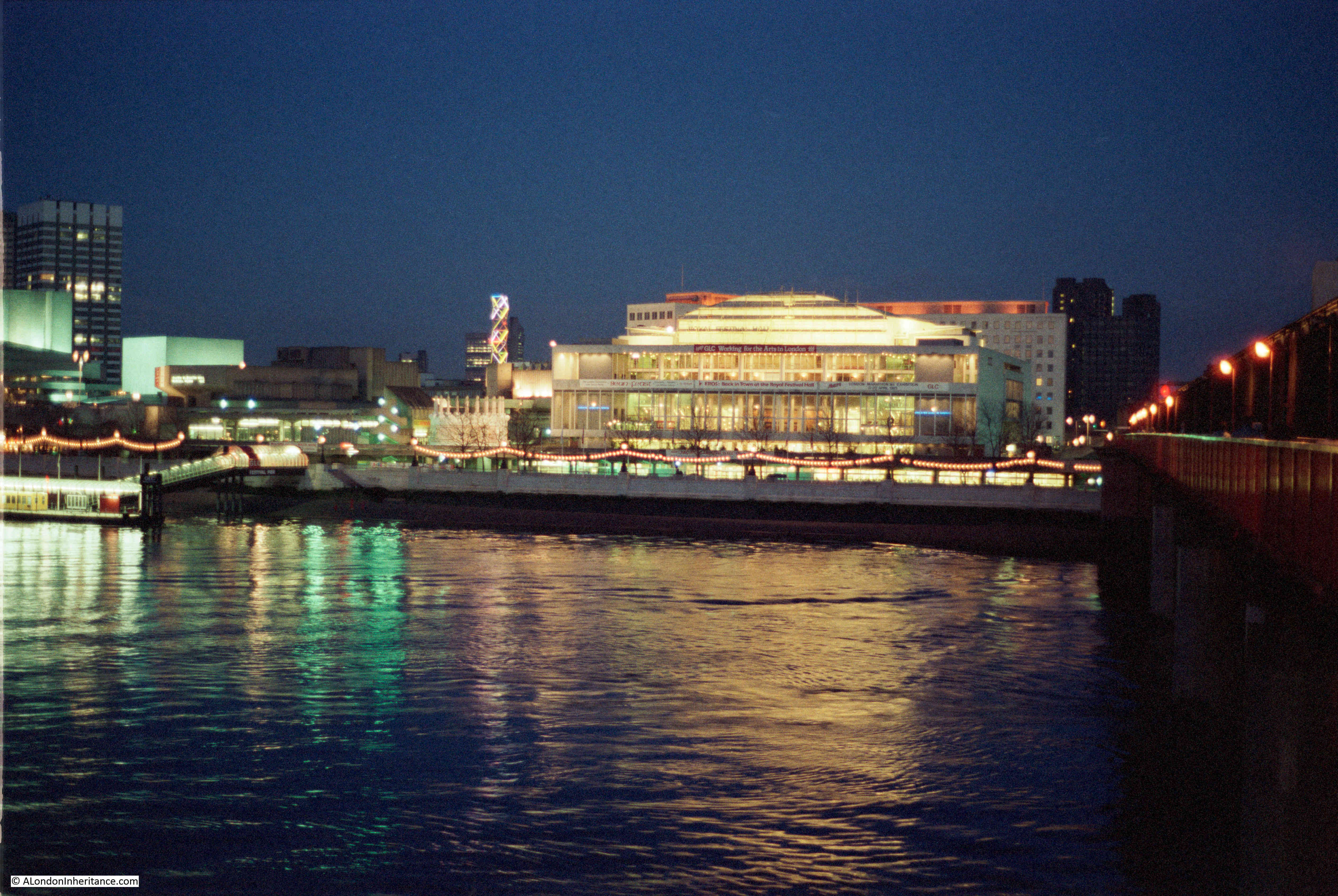
This was the view in 1985, looking south across the river towards the Royal Festival Hall.
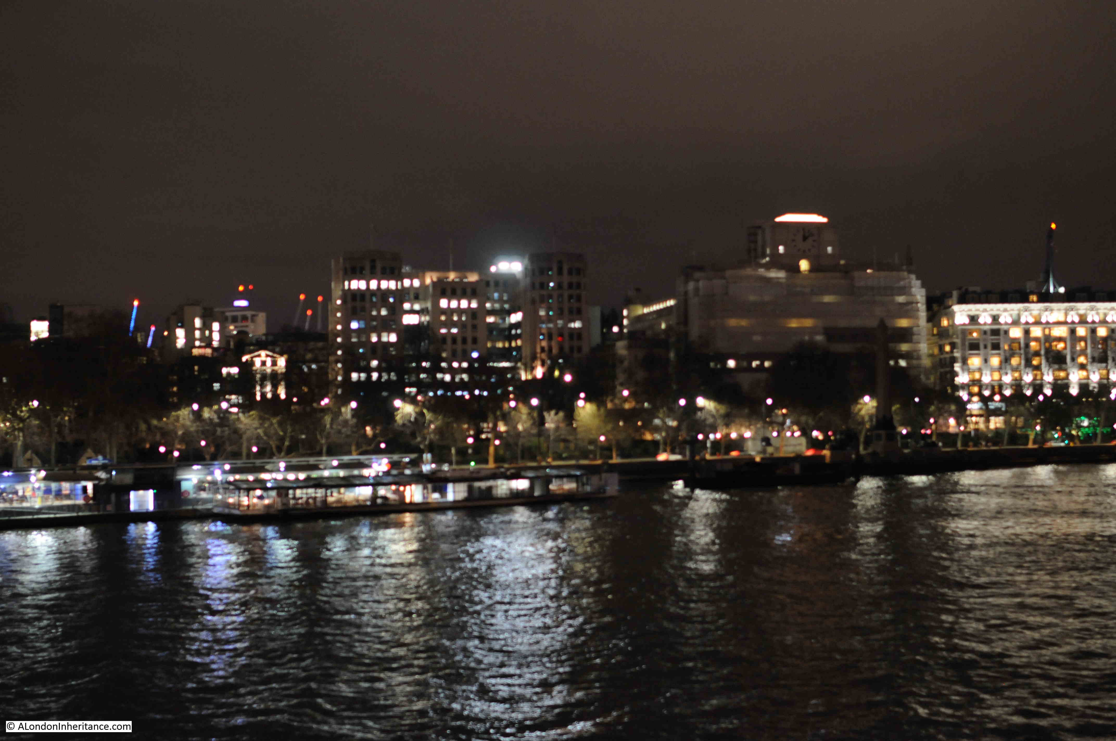
The same view 35 years later:

The viewpoint is slightly different, as seen by the different location of the tall office block on the left, however the area around the Royal Festival Hall is still an illuminated focal point on the South Bank.
The 1985 photo does include a feature that was a focal point of the South Bank. To the left of the Royal Festival Hall was a tall, illuminated lattice structure. The coloured lights were continuously changing.
I was working on the South Bank for much of the 1980s, and these ever changing lights were always in the background when working or walking in the area after dark. I moved abroad for a few years at the end of the decade, and cannot remember when these lights disappeared. It is these subtle changes that are so easy to miss.
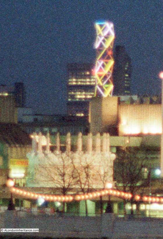
The following photo shows a detailed section from the original 1985 photo, which includes the lights, and also another unique feature from the 1980s.
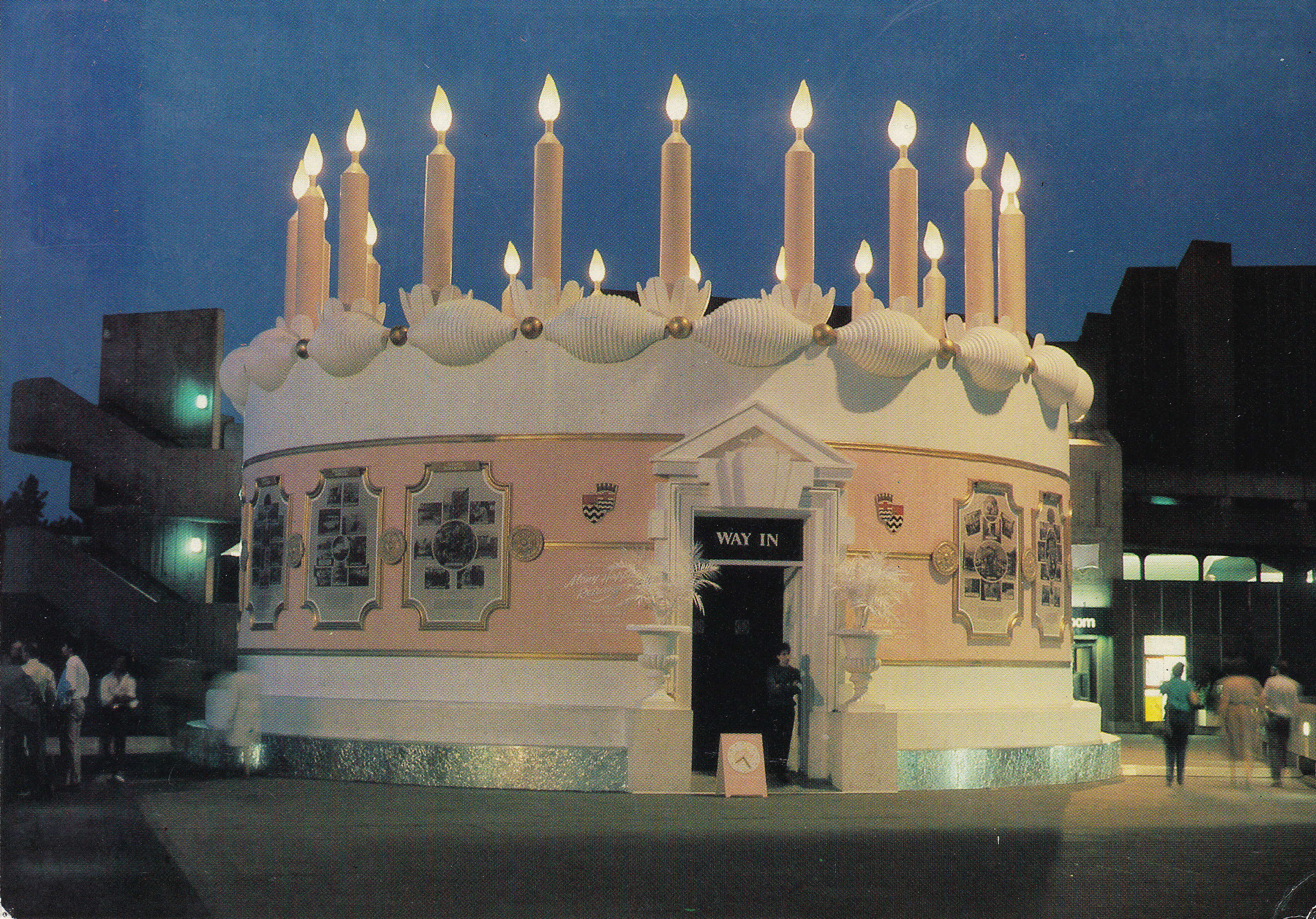
In a previous post on London postcards, I included one of a large birthday cake created by the Greater London Council on the South Bank as an exhibition and celebration of 95 years of the London County Council / Greater London Council. I had visited the exhibition within the cake, and taken photos, but had not yet scanned the negatives. In scanning negatives I finally found some which included the GLC cake.
This can be seen in the 1985 photo above, and also in the extract, which does give an indication of the size of the cake, and how incongruous a traditionally decorated birthday cake looked against the concrete architecture of the South Bank.
The following photo is from the original postcard which shows the cake close up.
There was also some event advertising along the front of the Royal Festival Hall. The following is an extract from the 1985 photo which shows this advertising along the front of the building.
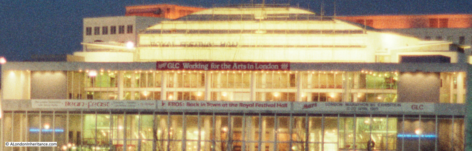
The red banner requests “Keep GLC Working for the Arts in London”. The mid 1980s was a time of conflict between the Thatcher led Conservative Government and the Labour majority Greater London Council led by Ken Livingstone.
This resulted in the 1985 Local Government Act which dissolved the GLC in 1986. Campaigns by the GLC could not influence the majority of the Conservative Government, and at the time there were serious concerns about future funding of South Bank complex. Probably one of the reasons why now the majority of the exterior ground level of the Royal Festival Hall is occupied by commercial businesses.
In the centre of the hall, there is a banner advertising that “EROS: Back in Town at the Royal Festival Hall”. I had completely forgotten about this, but in the 1980s the statue on the top of the Shaftesbury Memorial Fountain in Piccadilly Circus (so I assume technically correct to state Eros, which is frequently applied to the whole fountain), had been removed for restoration.
Prior to the return of the statue to Piccadilly Circus in 1985, it was displayed for a short period in the Royal Festival Hall.
The banner on the right advertises the “Mars London Marathon Exhibition” in advance of the marathon which took place in April of that year. Perhaps strange now that a health focused event would be sponsored by a brand such as Mars, but at the time (and for many years previously), the energy giving benefits of glucose were a major advertising feature of Mars bars.
The following 1985 photo again shows the GLC cake, and also the Festival Pier.

The same view from a slightly different angle, as to the right, the Kings Reach Tower office block now appears from behind the square office block of what was London Weekend Television.
A similar view in 2020 is shown in the photo below. The Kings Reach Tower building is now much taller having had several floors added during conversion of the block from offices to apartments. The future of the old London Weekend Television building (known after the closure of London Weekend Television as the London Studios and operated by ITV) is not clear. ITV moved out of the complex a few years ago, originally intending to return to refurbished studios, but they now uses studios at the redeveloped BBC Television Centre site in White City. I am sure that this high value location on the South Bank will become yet more expensive apartments.

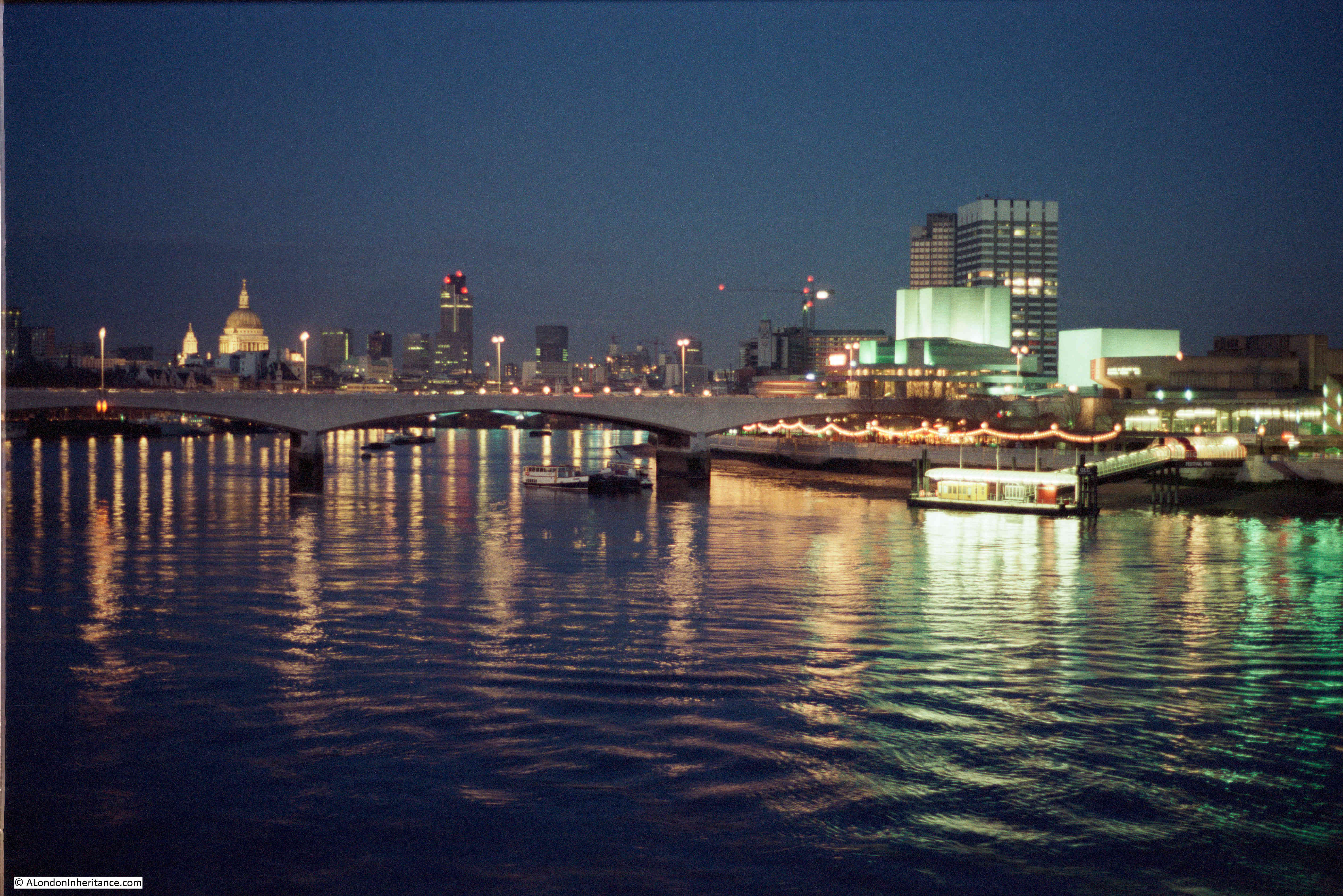
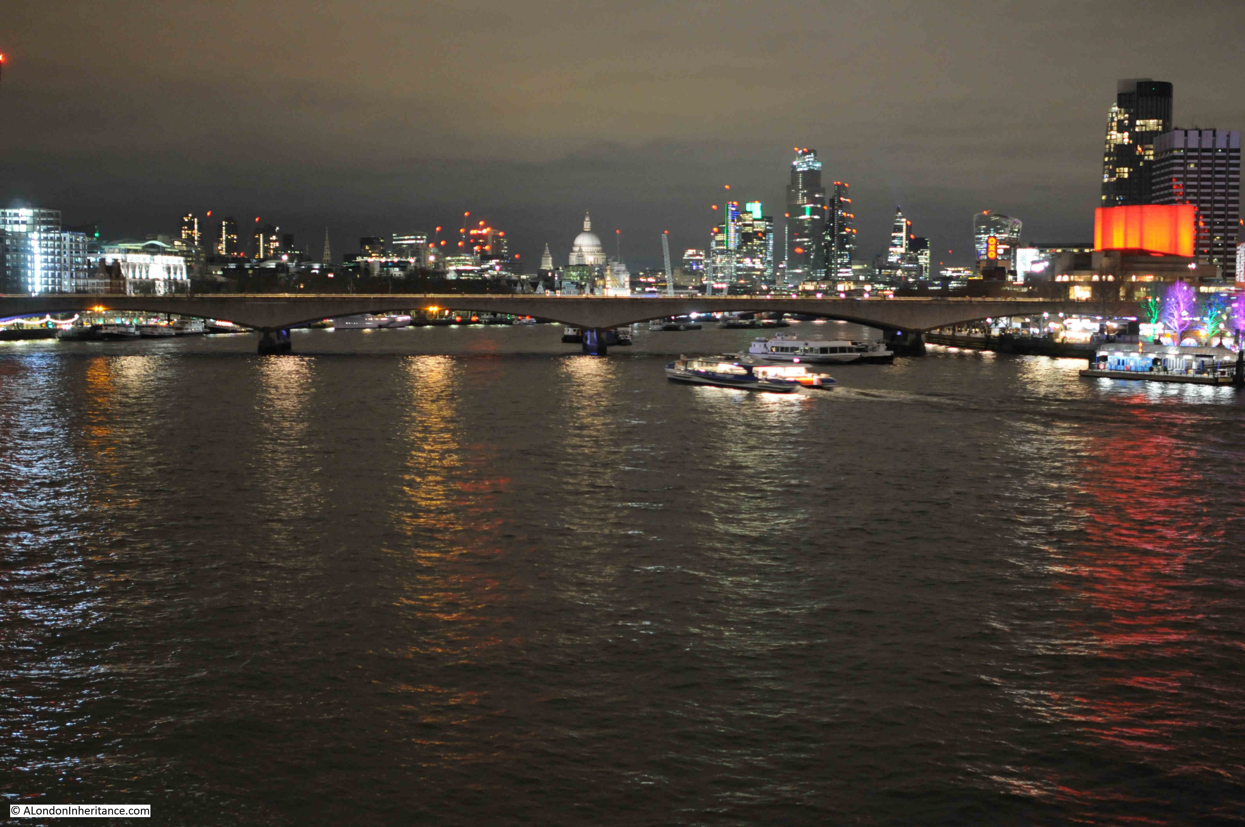
The following 1985 photo is looking along the river towards Waterloo Bridge, St Paul’s Cathedral and the City of London.
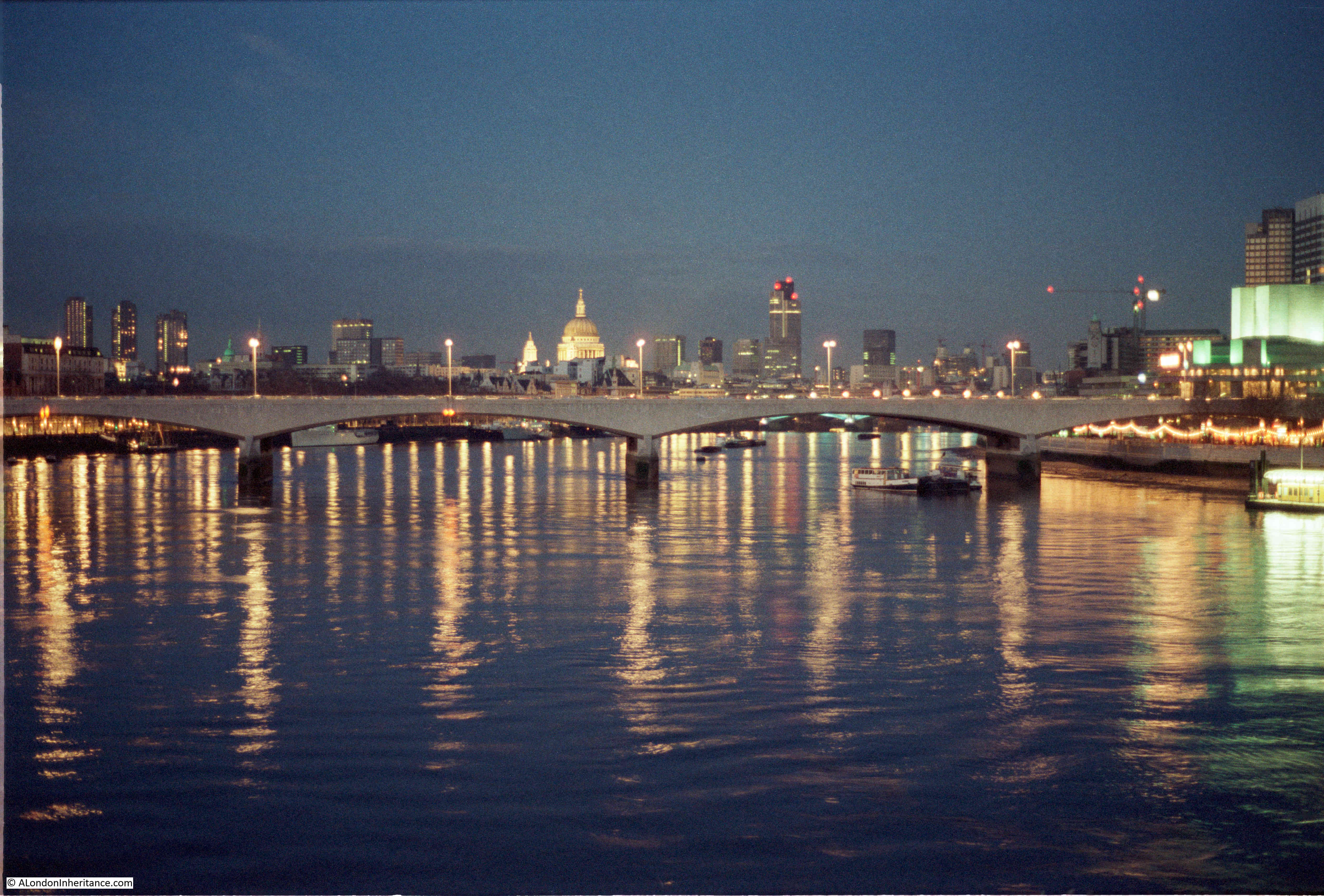
In the above photo, the cathedral stands clear, as does the old Nat West Tower to the right. This building, now called Tower 42, was the tallest building in the City.
The same view today is shown in the following photo. The Nat West Tower is now dwarfed and almost lost by the City developments of the last few decades.
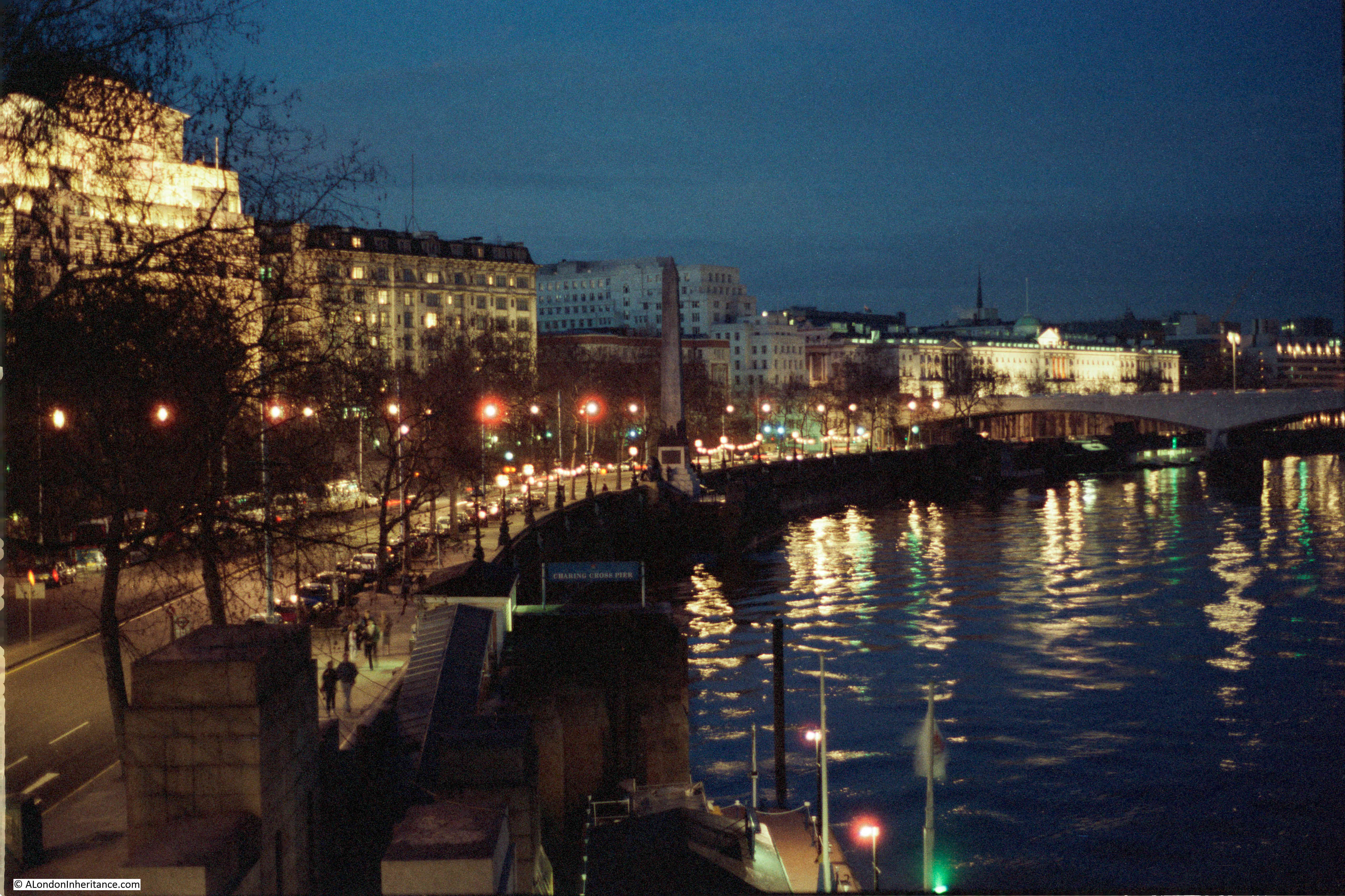
The following 1985 view is of the north bank of the river from the Hungerford Bridge walkway. The brightly lit building is the wonderful 1931, Grade II listed, Shell-Mex House, occupied at the time by Shell UK. The building is now known as 80 Strand. To the left is the Adelphi building, and the Savoy on the right.
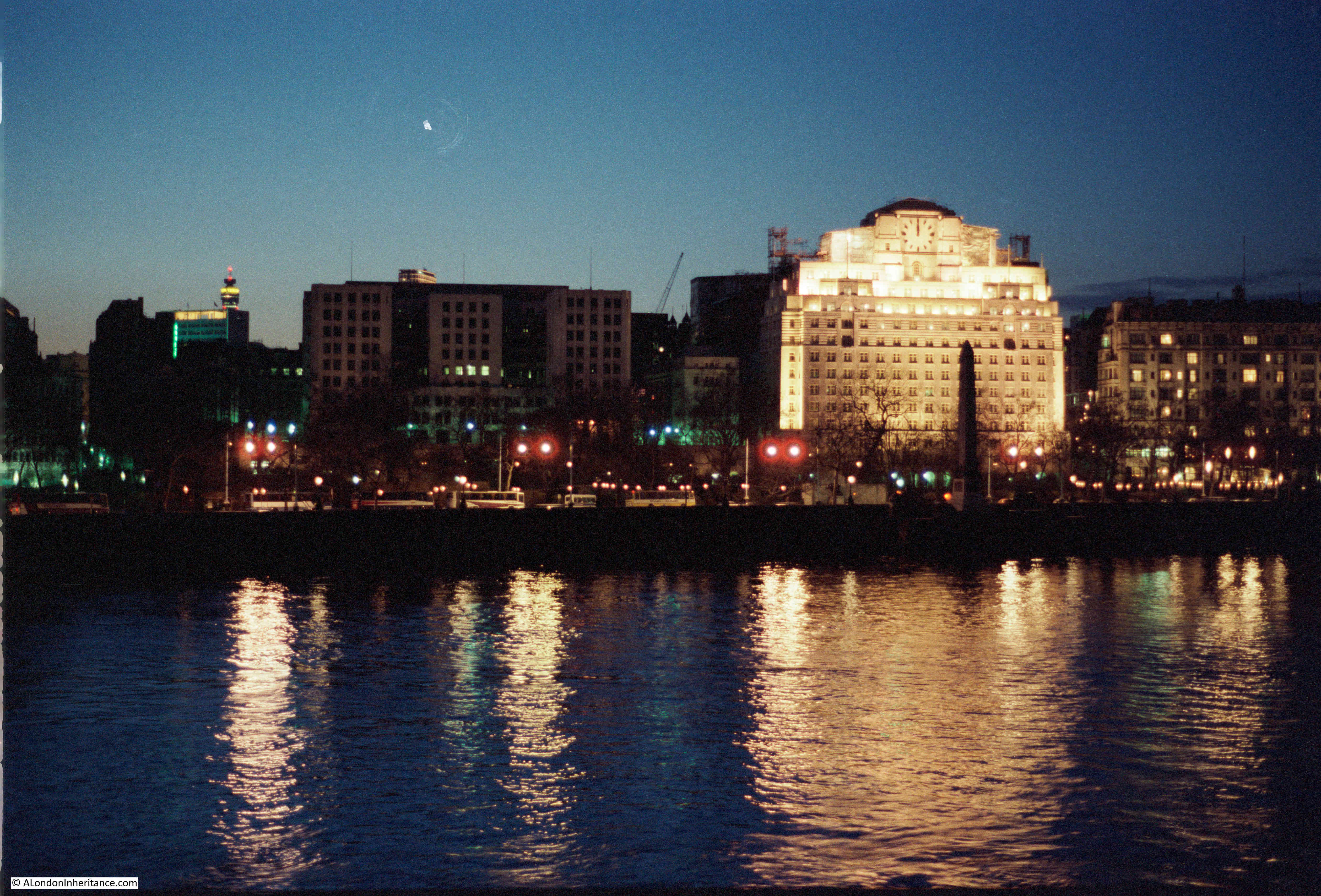
The same view today, although a bit later in the evening so a somewhat darker sky. The front of the Shell-Mex building is covered in sheeting as part of an ongoing refurbishment.
Walking along the walkway towards the north bank, and this was the 1985 view from Hungerford Bridge looking towards the Embankment.
The same view in 2020:

The Embankment is much the same, however the main change is the scale of the Embankment Pier. This is a relatively small feature in the 1985 photo, which has since been replaced by a much larger pier by the 2020 photo. This is indicative of the considerable growth in passenger transport along the Thames in the 35 years since 1985, when river piers were mainly used for tourist focused cruises of the river. The opening of the Thames Clipper Service in 1999 has contributed significantly to passenger traffic on the river, with the resulting upgrades and additions of river piers to support this traffic.
The main change between 1985 and 2020 has been the bridge across the river from which the photos were taken.
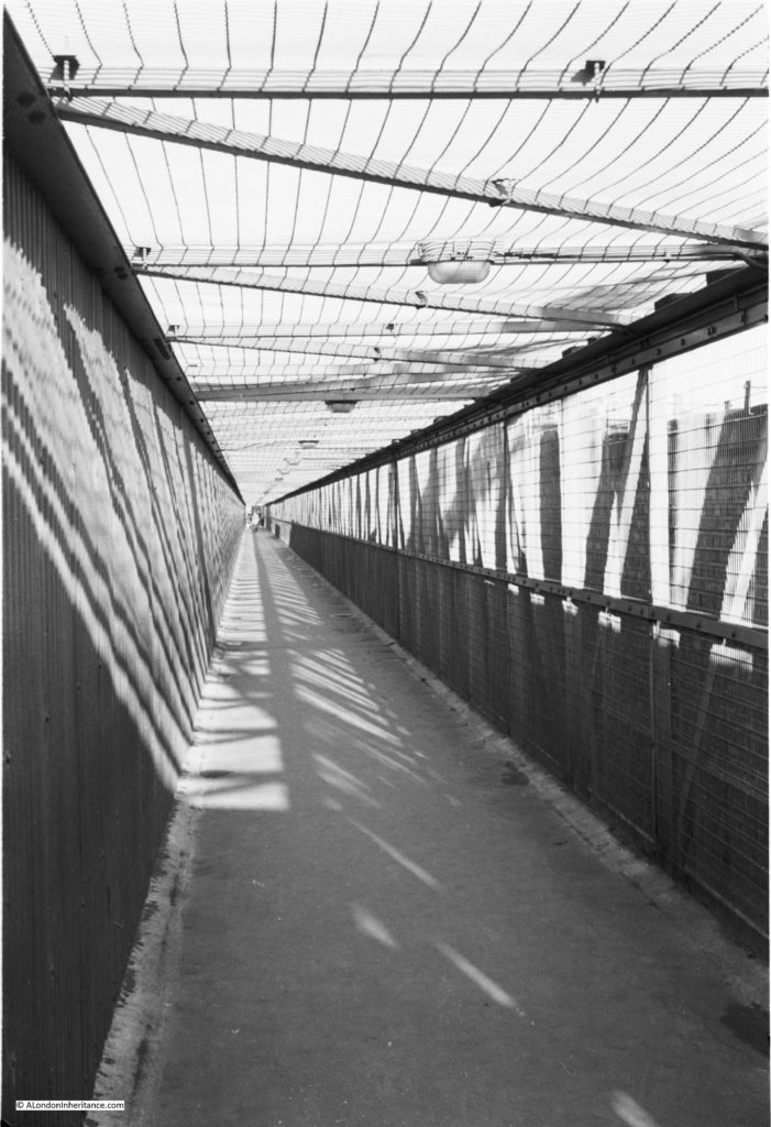
In 1985 there was only a single walkway on the side of the bridge looking towards the City. It was a narrow walkway, frequently covered in large puddles of water, and from experience, not somewhere that you would really want to walk across late at night.
The following photo shows the original walkway:
Today, there is a walkway on either side of Hungerford Bridge. Officially named the Golden Jubilee Bridge, these new walkways were completed in 2002 and provide a considerably improved walking route between the north and south banks of the River Thames.
With the growth of attractions and events along the South Bank, the number of people walking across the bridges has grown considerably. According to the website of the architects Lifschutz Davidson Sandilands, who with engineering company WSP, won the competition for the bridges, they are the busiest walking routes across the river in London, with 8.4 million pedestrians in 2014.
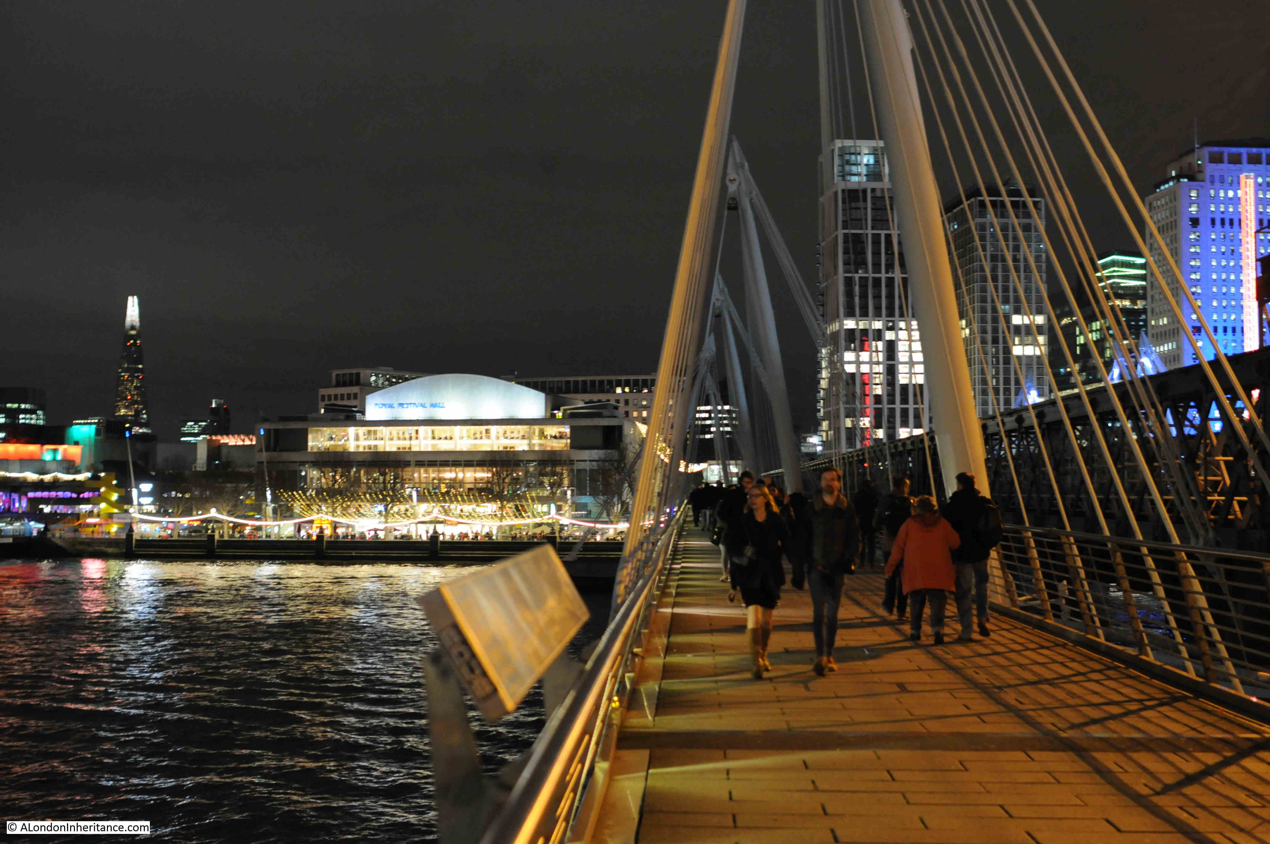
The following photo is the view south along the walkway, towards the Royal Festival Hall.
A view during the day of the Golden Jubilee bridge:
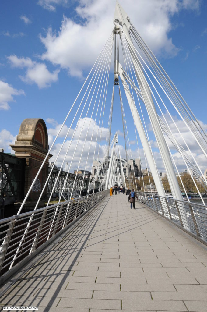
The architects state that the bridges “are slung from inclined pylons that pay homage to similar structures created for the 1951 Festival of Britain, held on the adjoining South Bank”.
As evidence of this, the following photo was taken by my father from the southern end of Hungerford bridge, just after the Festival of Britain had closed, and shows the structures referenced by the architects.

The view looking north along the walkway towards the illuminated buildings above Charing Cross Station.
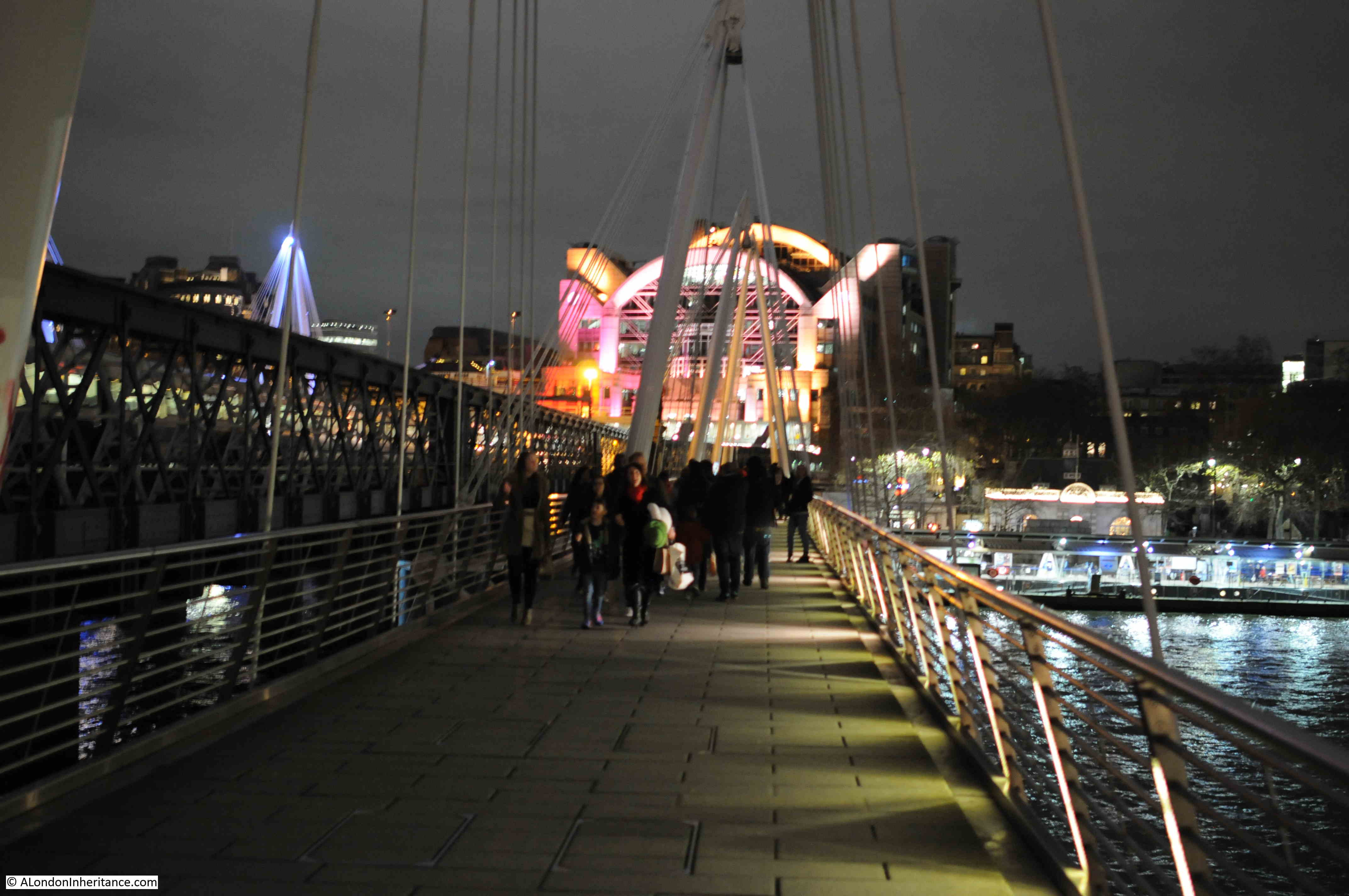
One final photo before I headed off north of the river – the Embankment from the walkway looking unusually quiet:

The Golden Jubilee Bridge is a considerable improvement over the previous walkway and provides a wonderful location to look at a spectacular view of the river, north and south banks, and the City, whether by day or night. The second walkway on the other side of Hungerford Bridge provides superb views towards Westminster.
The opening up of a walking route from the South Bank through Bankside and to Tower Bridge and beyond, along with attractions such as the London Eye and growth in the numbers of bars and restaurants has significantly increased walking across the river, along with the always present use of the bridge as a route between the north bank of the river and Waterloo Station.
Use of the river has grown since 1985 as evidenced by the considerably enlarged Embankment Pier.
In another 35 years time, the Royal Festival Hall will be just over 100 years old – it will be interesting to see how the area changes in the coming decades. One change I suspect will happen is the growth of tower blocks on the south bank beyond Waterloo Bridge and across the City. The area around the old London Weekend Television tower block and the London Studios will certainly look very different.
I would have liked to have seen photos of the Festival of Britain buildings in the 1950s like the giant needle
( It looked very similar in shape to a space ship anchored to the ground by several hawsers ( metal cables),) and other displays such as the rows of television sets which were very rare to the public. Rationing and ration books were in use in this period of time.
I enjoyed reading today’s post, Admin. Good photographs and interesting text as always.
Good luck with your aim of seeing what the skyline will look like in another thirty five years, but I don’t think I’ll be here to read about it or, come to that, will want to be around. By then I would be six years older than the Festival Hall ! 😉
In the late 1920s, in the difficult economic conditions of the times, two of Britain’s larger oil companies, Shell-Mex Ltd and British Petroleum, agreed to merge their British Isles marketing operations. They created a new company, Shell-Mex and B.P. Ltd (Shell 60%, BP 40%) (SMBP) which became responsible for the two brands oil marketing – everything downstream of the refineries (which were not included in the deal).
SMBP was a large company with a dominant market share and lots of employees. They decide to give it a smart new home and Shell-Mex House was constructed on the site of the old Cecil Hotel. It fronted onto The Strand and had a rear entrance from Embankment Gardens (like the Savoy Hotel next door). It opened in 1932.
SMBP traded for 44 years and was one of Britain’s biggest and most successful purely U.K. businesses. In 1976 it was split up again 60/40 and Shell and BP went their own ways again. Shell U.K. stayed in Shell-Mex House and BP moved to Victoria. In the new millennium Shell U.K. moved across the Thames and relocated to Shell Centre. Shell-Mex House was sold to a property company and was renamed 80 The Strand, but colloquially it is still known by its original name to this day. Externally it is largely unchanged from its Art Deco style of the early 1930s. It was a unique place to work and stamped a genuine bit of class on Shell-Mex and B.P. Those of us who worked there remember it fondly,
The lattice light sculpture on top of the Hayward Gallery was the Neon Tower by Philip Vaughan. It was connected to an anemometer, and the colours alternated more quickly, the windier it was.
Enjoyed the blog today. I was walking across Hungerford Bridge on Friday and paused in the middle to take in the views. The bridge definitely is a wonderful addition to our city, the previous crossing being quite forbidding. I’m thankful that the Southbank grew into the amazing cultural centre it is today. It’s brutalist architecture both thrilled me and scared me as a child (1970s).
Great stuff, always one of my favourite bridges. But I’m a little ashamed by how much I don’t notice. I’d forgotten all about that neon tower (it also took me a while to realise that the new ‘Hungerford’ bridge had a second pedestrian walkway round the other side). There is some background on the neon tower, taken down in 2008 when the Hayward started refurbishing. https://bit.ly/30bIbmt and later news, https://www.google.com/amp/www.theartnewspaper.com/amp/blog/matters-light-fantastic-at-hayward
My recollection of the illuminated scaffold tower on the Hayward Gallery building is that the light pattern was determined by an anemometer that measured wind speed. I think at low wind speeds only the yellow fluorescent tubes were active, with the blue/mauve tubes at slightly higher speeds. Moderate winds saw the red and green tubes working, and at really high speeds all lights were on. Perhaps others can confirm the speed.
It was indeed as Admin notes a prominent feature of the landscape from my time working on the South Bank in the 1970s.
In 1985 the year 2020 would have sounded so futuristic …and yet here we are. Another thought provoking set of pictures. As always, thank you for the post.
You mention scanning negatives. I have had mixed results doing this. What equipment are you using please ?
Paul, I have used a number of scanners over the years, the one I have been using for the last few is a Plustek OpticFilm. Works really well.
My film scanner, an Epson Perfection V800, has recently given up !
I’ll look at the Plustek OpticFilm. Thanks for the suggestion.
Thanks for a wonderful and informative post. I remember the multi coloured ‘light scaffold’ but not the cake.
One of my favourite buildings of the South Bank is the beautiful old GLC building now dwarfed by the popular London Eye – I thought the idea of the GLC very progressive but it probably imploded under its own weight and political machinations!
I was never a great fan of brutalist architecture but the Royal Festival Hall has softened with age and familiarity and would have been a big improvement on the worn-out wooden wharves it replaced although I remember being surprised, even as a child, at the demolition of the old shot tower that was once on this site.
My parents would take me on river trips where the boatmen would furnish us with a decent mix of history and legends and downright lies about the passing scenery – this was long before Borough market became a ‘destination’ and before Wanamaker’s Globe , a time when most of the South Bank looked decidedly grim although I learned to spell my first word from the Oxo tower.
Apparently, the OXO tower was a piece of cunning guerrilla advertising, when hoardings were not allowed on the Thames, OXO just incorporated their logo in the building so it could be seen by all!
I hate the London eye, as a structure in itself, it’s OK, but it looks so out of place at the South Bank and would be better placed further east, say towards Canning Town.
The County Hall is such a grand building and I remember going there as a child for some special lectures on science as my teacher thought they would suit me (all that has changed- I am just average ability now!).
The London eye takes away from the dignity of the civic buildings around it, and just draws gawping tourists, making Westminster bridge far too busy. It’s a shame that there is now a series of tacky tourist traps there (McDonalds! an aquarium! London dungeon!) …sorry, I really am a grumpy Londoner!
I used to cross the old Hungerford bridge regularly in the early 90s on my way to the BFI. It was always a nightmare of commuters just out of Waterloo going north. I was always on a tight schedule to get to the film in time having come up to Victoria from Brighton or Lewes then tube to Embankment. I was usually exhausted by the time I flopped in my seat. The other cinema goers must have thought there was a heavy breather in among them.
I was one of those commuters! I walked across and back every workday during the 1990s. London was de-populating in the 1980s and the Cross-rail project was cancelled at the time (Apparently it dropped to below 7 million) but it was reversed in 1985 with the arrival of the new electronic stock exchange trading floors. I found my schoolboy 1951 “Festival of Britain” enamelled visitors badge this year lurking in a box of old junk in the garage!
Thank you for all your lovely posts about London, keep up the good work.
Best regards Richard
Great photos I have a black and white film shot late 1950s titled night and day part shot on south bank as they were building festival hall ,
Still a lot of bomb damage evident ,very good London based film
Thanks for the ever interesting series of posts.
After a lifetime of seeing, reading and hearing about the statue of Eros at Piccadilly Circus, I found out recently that the subject it is actually Anteros rather than Eros.
Who knew, not me!
This is a great blog and I am glad to see that others are reading and commenting. I grew up in the Waterloo area in the 70s and 80s and still live here. I remember going across the Hungerford bridge just once with my mother when I was a child. It was narrow, rickety and crowded. Do you have any more photos of the footbridge itself?
I also remember that the foot bridge used to link with a wooden walkway that used to take you straight into waterloo station, via the concrete pedestrian bridge that still crosses York road. It was almost like being in an adventure playground. If anyone could post pictures of that, it would be great. I seem to remember it being painted dark red or pink- am I wrong?
London used to be a bit grim back then, it’s bright and shiny now, but getting too expensive and filled with annoying hipsters for most of us born here. Now I am getting older I am starting to look back rather than forward!
My response isn’t entirely relevant to your enquiry Emil, nor to our host’s blogpost. But hopefully you’ll agree it’s a good excuse to mention this fine architecture.com photo of the York Road pedestrian footbridge into Waterloo Station at the time of the Fest of Britain:
https://www.architecture.com/image-library/RIBApix/image-information/poster/waterloo-station-gate-festival-of-britain-south-bank-london-facade-with-brewery-lion-salvaged-from-t/posterid/RIBA19388.html
There is so much detail in that image, and more to ponder on what isn’t included. Was the footbridge entranceway within the station bedecked with Festival signage? What was the function of the street-level kiosk? And was there some abstract visual play intended between the brewery lion and the British Railways lion?
Hey, great picture! That black brewery lion statue looks just like the stone South Bank lion that is now on the south end of Westminster bridge.
Waterloo station looks relatively smart and branded here, and strangers can actually tell it is Waterloo station from a distance; yes, I wonder what that kiosk was for, did it actually lead to a secret entrance somewhere?
It seems that the metal walkway going into Waterloo station and the walkway I remember as a child may have been built for the festival? I love pictures like this.
Thanks to digital TV, it’s also possible to see old London getting shown in old movies on channels like London Live and Talking pictures. I wasn’t interested in social history until quite recently, but blogs like this make it really come to life.
Great photos and reminiscences, thanks. May I ask a question? I knew the old walkway when I worked in London between 1961 and 1991, but never knew it enclosed as it is in the b&w photo. When was the photo taken, please?
Another very welcome feature in the new photos is the dedicated cycleway along the Victoria Embankment! Rolling back a little of the dominance of the car by that, as well as by improving the footbridge!
Another great post. I remember the light tower well from when I used to walk over Hungerford Bridge just before it was removed. Such a shame it’s gone. I also used to skateboard on the South Bank in the mid 70s & have fond memories of the area. The view from the bridge is still one of my favourite views of the City
I remember, as a child in the 70s, being in the car with my parents diving along Embankment and seeing the coloured lights changing on the tower by the Festival Hall. I was fascinated by them! My parents told me the colours changed with the changes in the wind…..how true that is I have no idea but I guess it was just to keep me quiet!!