Tag Archives: Hungerford Bridge

Hungerford Bridge and Hungerford Market

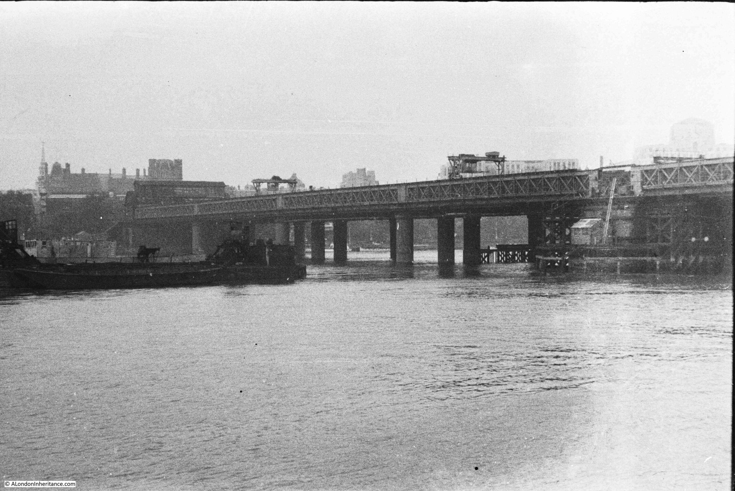
My father took the following photo of Hungerford Bridge from the south bank in 1947:
Hungerford Bridge

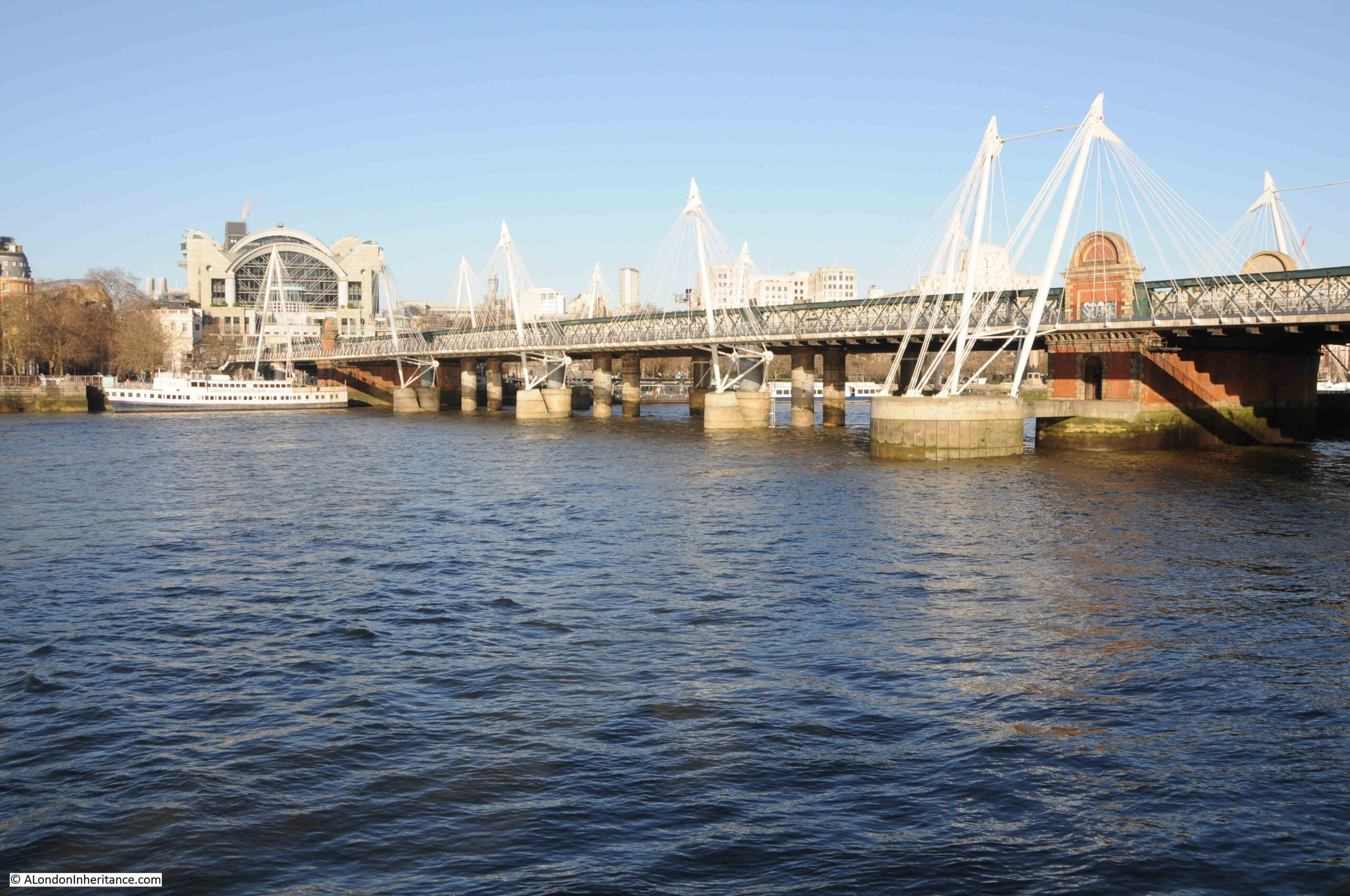
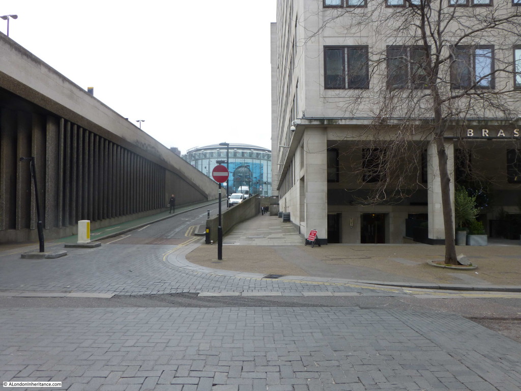
The same view in 2022:

Hungerford Bridge

The photos are seventy five years apart, and as could be expected the core of the bridge is much the same now as it was in 1947.

There are some minor differences. The brick structure above the pier on the right was missing in 1947, although its appearance today may suggest it is part of the original structure.

Two signal gantries can be seen above the tracks in 1947, and on the left of the bridge the entrance to Charing Cross Station can just be seen, where today, the 1991 office block, Embankment Place, above the station is the major feature at the end of the bridge.

The white structures along the length of the bridge in the 2022 photo support the Golden Jubilee Foot Bridge which was completed in 2002. There is a second foot bridge on the other side of the railway bridge, to an identical design.

These foot bridges replaced a single, narrow footbridge that originally ran along the far side of the bridge. It was not that pleasant a foot bridge, always had large pools of water across the walkway after rain, and was often not the route of choice after dark.

Hungerford Railway Bridge was opened in 1864. It was built by the Charing Cross Railway Company to provide a route into the new Charing Cross Station from across the river.

It was not the first bridge on the site, and investigating further reveals the source of the name, a failed market, the original bridge, and a very strange death.

Charing Cross Station was built on the site of the 17th century Hungerford Market, and the site had originally been home to Hungerford House, owned by Sir Edward Hungerford.

The Hungerford family name dates back to at least the 12th century with an early reference to one Everard de Hungerford. The family name came from the Berkshire town of Hungerford, and over the centuries, the family amassed a considerable amount of land and property and became very rich.

Many of the Hungerford’s had key roles in the governance of the country (in  January 1377, Sir Thomas Hungerford was elected speaker of Parliament), and in national events (for example during the Civil War Sir Edward Hungerford was in command of the Parliamentary forces in Wiltshire, where it was reported that he carried out his responsibilities with an unpleasant zeal).

The first record of the Hungerford’s owning a house in the Strand was when Sir Walter Hungerford took up residence in 1422.

The Hungerford’s would own a house in the Strand until the late 17th century, when Sir Edward Hungerford (the nephew of the Civil War Hungerford of the same name) decided to try and create a market to rival the recently opened, nearby, Covent Garden Market.

An Act of Parliament in 1678 granted Sir Edward Hungerford permission to let some of the grounds occupied by Hungerford House for building leases and also to open a market on the site on Mondays, Wednesdays and Saturdays. The market opened in 1682.

Despite being in what seemed to be an ideal location, the market was not really a success. It was sold to Sir Christopher Wren and Sir Stephen Fox in 1685 and after their deaths, it was sold on to Henry Wise around the year 1717.

It would stay with Henry Wise and his descendants until 1830.

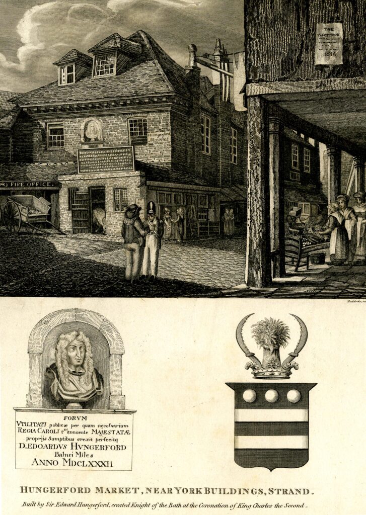
The following print from 1825 shows the original Hungerford Market:
Hungerford Market

The image at lower left shows the bust that is on the wall of the market building, and the text below names Edward Hungerford and confirms the opening date of 1682. The coat of arms on the right is that of the Hungerford family.

In the above drawing of the market, there is a sign on the building on the right about Watermen. The text below is too small to be readable. This is probably some reference to the stairs and access to the river at the far end of the market.

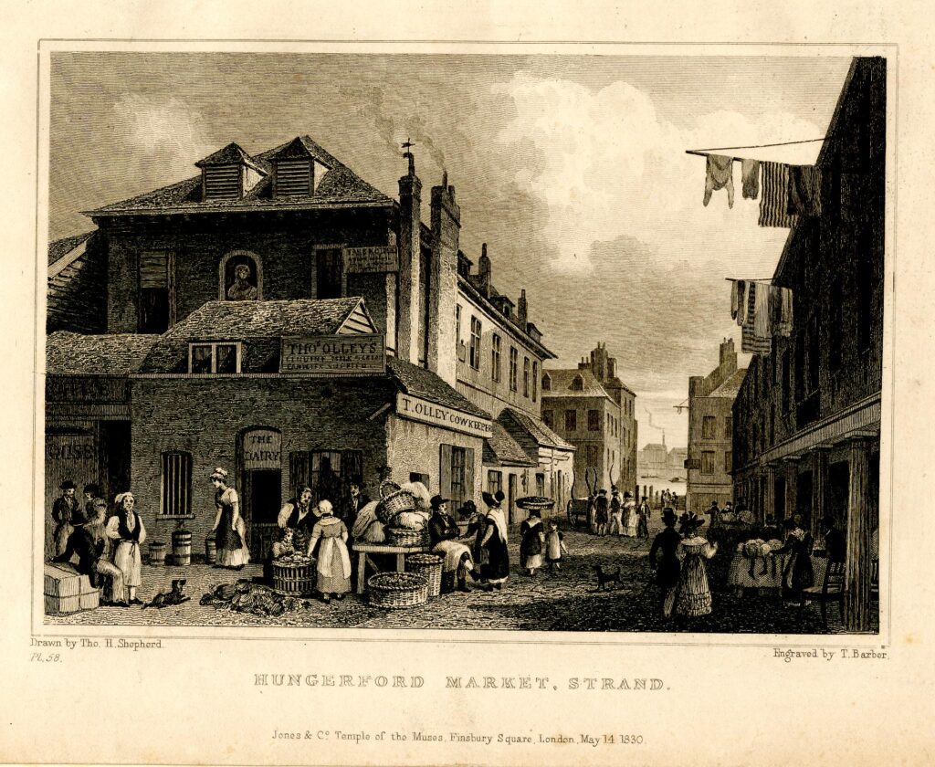
The following print from 1830 shows a busy market scene, with the River Thames visible in the gap between buildings in the distance.
Hungerford Market

John Rocque’s map of 1746 shows the market between the Strand and the river, and shows Hungerford Stairs running down to the river:
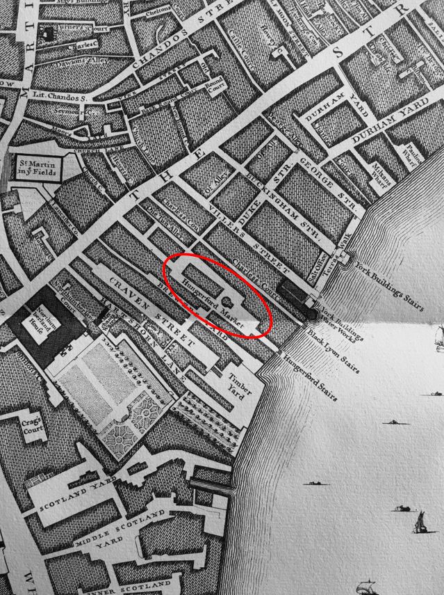
Hungerford Market

As usual, to help with research, I checked newspapers for mentions of the old Hungerford Market. Papers of the 18th and 19th centuries record the numerous accidental and strange deaths that happened across London. I have read hundreds of these and one of the most unusual concerns a worker from Hungerford Market. This is a report from the Ipswich Journal on the 3rd of July, 1725:

“On Sunday Evening, an elderly Man that carried a Basket in Hungerford Market for his Livelihood, was drowned in an excessive Quantity of ‘Strip and go Naked’ alias ‘Strikefire’ alias ‘Gin’, at a notorious Brothel in the Strand; the poor miserable wretch expiring under too great a Dose of that stupefying Benediction.”

I have never heard of “Strip and go Naked” or “Strikefire” as a drink, and assume it was a form of Gin as this was the last alias.

It was with some trepidation that I put the name into Google, and the search results imply that it is now an American drink made out of beer, vodka and lemonade, also a cocktail made from beer, gin, vodka, lime juice, orange juice and grenadine.

Whatever it was in 1725, its description as a “stupefying Benediction” does sound rather appropriate.

18th century newspapers provide a view of the trades within Hungerford Market. These were in the paper for events such as bankruptcy so are not a complete list, but provide an indication: Wine Merchant, Butcher, Slaughter House, Oyster Merchant, Indigo Maker, Ironmonger, Coal Merchant.

As with any location which attracted people, there was also a public house – the Bull’s Head.

During the early decades of the 19th century, the market was becoming rather run down, dirty and surrounded by squalid housing.

The descendants of the Henry Wise, who had owned the building since 1717, sold the land and buildings to the Hungerford Market Company which had been formed in 1830.

The new company believed that by rebuilding, and providing a much improved market environment, the Hungerford Market could be just as big a success as Covent Garden and could also tempt some of the fish trade away from Billingsgate.

The new market buildings were much increased in size compared to the original market. New houses were built alongside, which included a number of pubs. The market buildings pushed the river embankment out by a further 150 feet and a set of stone stairs were constructed down to the river.

The following three prints of the opening ceremony on the 2nd of July, 1833, give an impression of the scale of the new market buildings and the grandeur of the opening, which was intended to give the market a considerable amount of publicity, and attract Londoners from as far afield as possible into the market.

The following print shows the view from the river, with crowds of people in front of the market and on boats on the river.
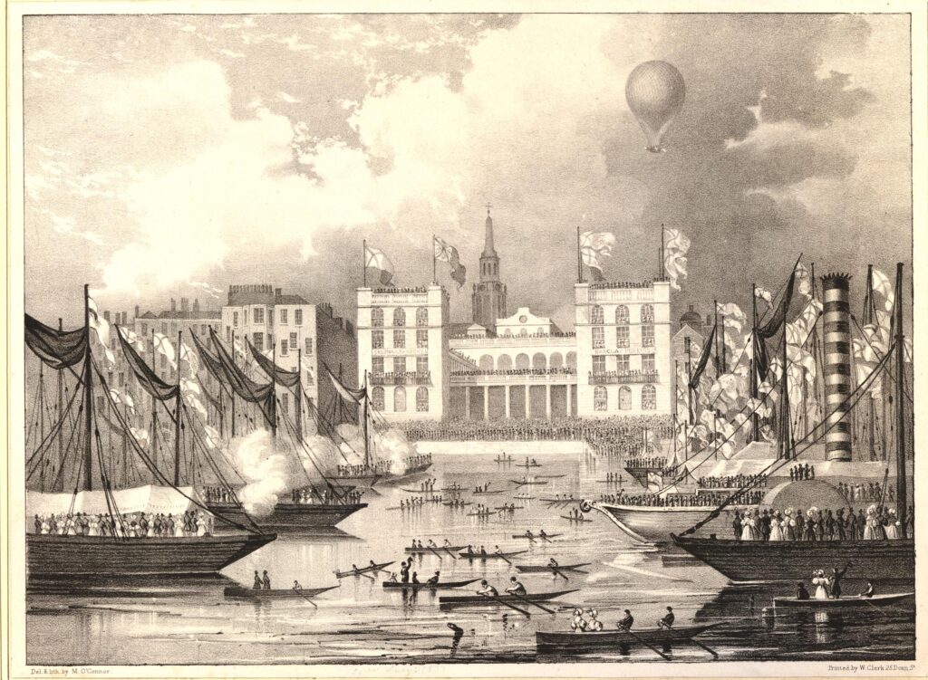
Hungerford Market

The opening of Hungerford Market was the place to be seen for the fashionable Londoner of 1833 as the following account from the Morning Advertiser on the 3rd of July, 1833 records:

“It having been announced that the opening of this splendid work was to take place yesterday at two o’clock in the afternoon, crowds began to assemble in the forenoon. By the specified hour, the concourse of people which thronged every part of the market, and all places adjoining, whence a view of what was going on could be had, was truly immense.

Of the numbers present it was impossible to form any conjecture which could be depended on. The large hall was most densely crowded with an assemblage of the most respectable kind, including much of the female beauty and fashion of this vast metropolis. The lower quadrangle was no less densely filled with an assemblage of the same class. The same may be said of the space appropriated to stalls and benches, underneath the colonnade. The quadrangle fronting the Strand, being open to all, was literally crammed with human beings. Indeed the open space in that particular part looked like a living mass of human beings.

The pavement on the south side of the magnificent building, which projects into the Thames, was so crowded with persons of all descriptions, that it was next to impossible to move from one part of it to another. The balconies at the top of the building, though a much higher price was demanded for admission to them, were filled with an assemblage of ladies and gentlemen. The view from these balconies was exceedingly interesting. It commanded an extensive prospect of the Surrey hills, and of a very considerable part of London, including a large portion of the Thames. Westminster and Waterloo Bridges were crowded with spectators, as were the tops of a great many houses in the neighbourhood of Hungerford-market.

The river was a most interesting scene; it was covered with boats, all as full as a regard to safety could justify. The coal barges in the neighbourhood of the market were so numerous and so close and so well filled that one could scarcely persuade himself they floated on water.

Taken altogether, we should say, it is very seldom indeed that so many human beings are congregated together.”

The following print shows the main attraction during the opening of Hungerford Market, a balloon ascent:
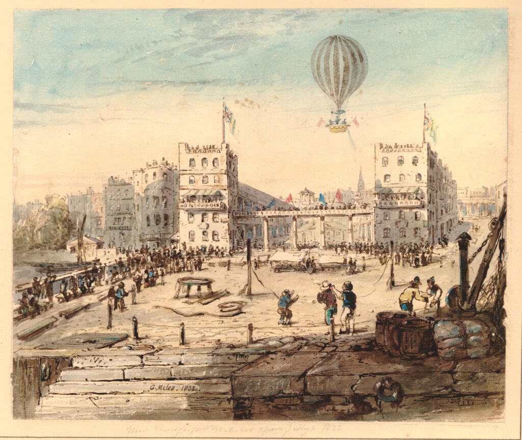
Hungerford Market

And the following print shows the balloon taking of from the quadrangle of Hungerford Market.
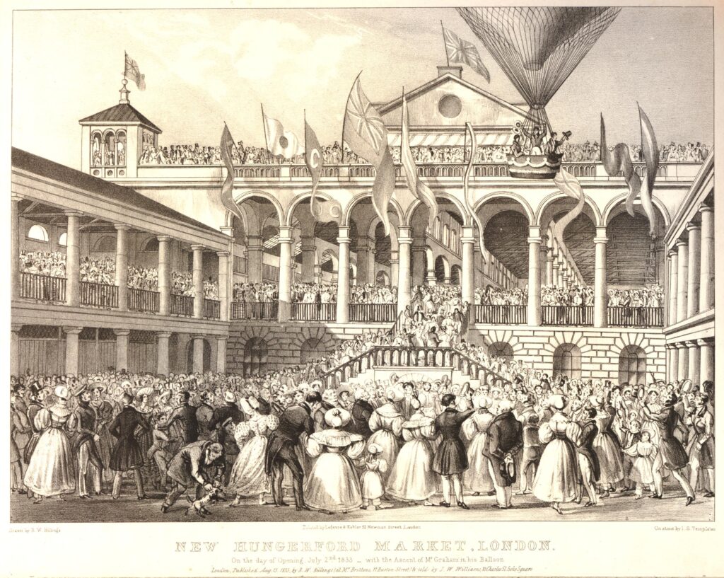
Hungerford Market

The balloon was piloted by George Graham, a prolific 19th century balloonist, who took two passengers with him in the basket.

The balloon took of at 4:30 in the afternoon. It went straight up for about sixty feet before heading in a south-easterly direction. Those in the basket waved their hats to cheers from the crowd as the balloon gained height.

By the time it had been up for 20 minutes it was described as being as small as a kite and after 30 minutes it was all but invisible, as it headed in the direction of Gravesend.

George Graham undertook many flights during the first half of the 19th century, and his wife was also a balloonist.

Margaret Graham was the first British woman to undertake a solo balloon flight, when in 1826 she took off from White Conduit Gardens in Islington, the location of her first flight with her husband just a couple of years before.

Individually, the couple would have a number of accidents. In one flight in 1838 George’s balloon hit a chimney on take off causing bricks to fall on an onlooker who died as a result. In a flight with his wife in 1851, the basket hit a rooftop just after launch causing him to fall from the basket and sustaining serious injuries.

In 1836, Margaret sustained serious injuries when during landing, her passenger stepped too early from the basket causing the balloon to rise, and Margaret to fall from a height.

In 1850 she suffered serious burns when a balloon caught fire.

George and Margaret had three daughters and the couple got them involved with ballooning. In 1850 Margaret flew with her three daughters causing something of a public outcry for taking all her children with her on what was considered a dangerous activity.

Despite having taken part in very many balloon flights Margaret died peacefully in her bed in 1880 at the age of 76.

Back to the opening of Hungerford Market, and in the evening there were fireworks and a ball was held which was “numerously and fashionably attended, and was kept up till a late hour with great spirit”.

The market buildings cost around £100,000 to build, and were expected to be a considerable success and rival Covent Garden and Billingsgate. At opening, all the market space had been rented out.

In the main hall, shops on the eastern side sold fruit and vegetables, butchers, selling meat, poultry and animal food took shops on the western side. There were large cellars and store rooms beneath the building and space for a large number of fish mongers. Space was provided for small traders with benches and stalls.

To try and tempt customers to the market, steam boats were run from east and west London along the Thames to the river stairs at the market. The market had one final trick to tempt what they called “the housewives of Lambeth and Southwark” to the market, and that was a bridge.
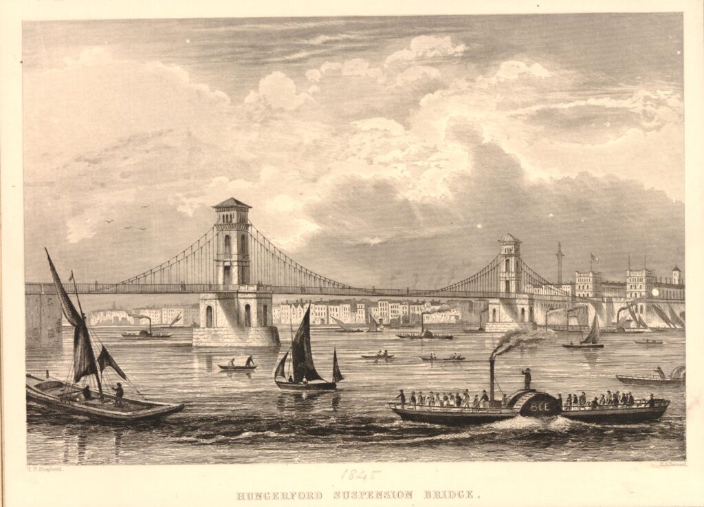
Hungerford Bridge

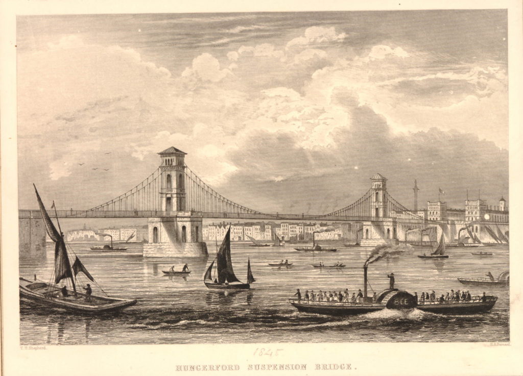
The above and below prints show the Hungerford Suspension Bridge which was opened to provide direct access to the market from the south bank of the river, and to provide another route over the river, as compared to cities such as Paris, London was believed to have too few bridges.
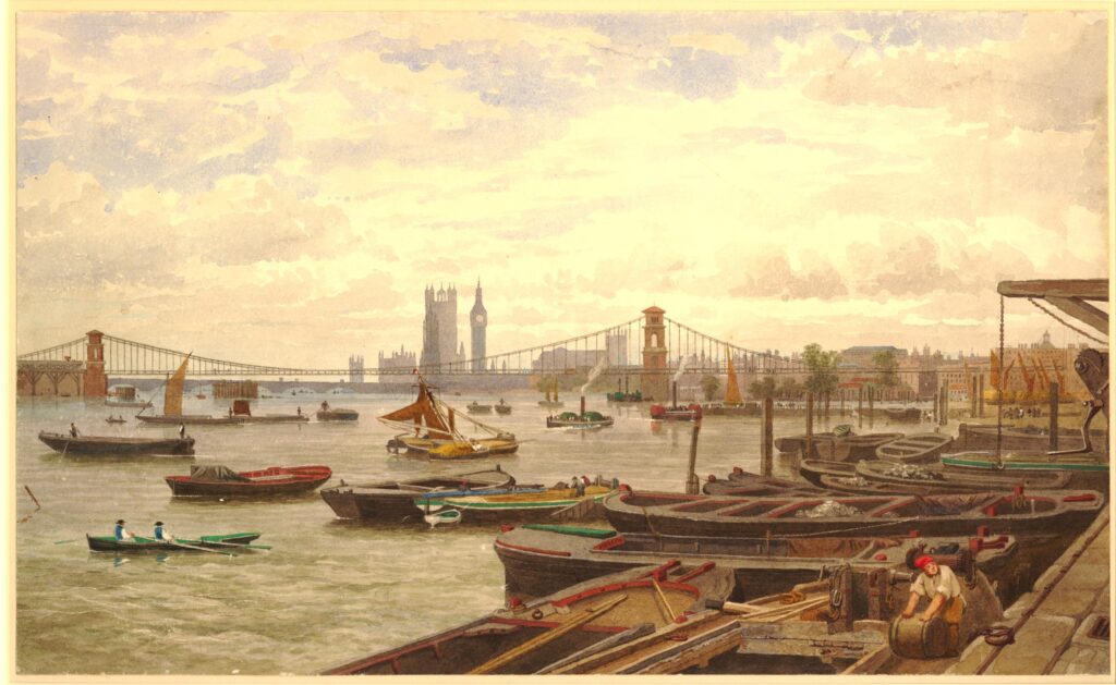
Hungerford Bridge

The bridge was designed by Sir Isambard K. Brunel and consisted of four individual chains running the length of the bridge, with two brick piers providing support for the chains.

The bridge was a considerable financial success. In their 1845 report for the first year of operation, the Directors recorded that tolls to cross the bridge raised £9,000 in a year. When the bridge was built it was expected that the daily traffic would be about 8,000 people, however after opening the bridge was attracting nearly 14,000 people.

The success of the bridge was such that the Board decided to pay the Directors £500 for their services to the company.

In a sign of what was to come, at the Board meeting in 1845, the Directors agreed to lease the bridge to the Central Terminus Rail Company for a fee of £186,000.

In the 1830s / 1840s, the area around Hungerford and Waterloo Bridges was being seen as a location for a railway terminus that would service the south east and south of the country, and connect into London Bridge – a subject way out of the scope of today’s post.

An interesting print from 1850 about flooding caused by a high tide shows some of the advertising for the Hungerford Bridge. The following print shows flooding in Vine Street which once ran where the Shell Centre building now stands on the South Bank, up to York Road. A large banner across the street directs people to the bridge, with another sign on the side of the terrace of houses towards the end of the street on the right:
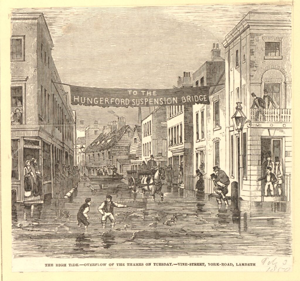
Vine Street flooding

The south bank, being part of low lying Lambeth Marsh was subject to frequent flooding at high tides as shown in the print.

In the following extract from the 1894 Ordnance Survey map, I have ringed the location of Vine Street (‘Reproduced with the permission of the National Library of Scotland“):
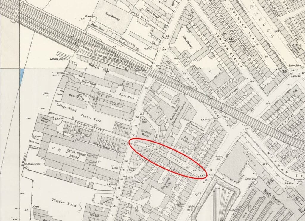
Vine Street

Despite the optimistic opening, steam boats bringing customers from along the river and the bridge to tempt customers from south London, the market was not a success.

In 1851 a Hungerford Hall was built on part of the site for lectures and exhibitions, however this building burnt down during an accident when lighting gas lamps. The fire also caused damage to the main market hall.

The market would close by the end of the 1850s.

Plans for new railways and stations had been developing during the mid 19th century, and the entire site of the market was purchased by the Charing Cross Railway Company in order to construct Charing Cross Station.

The station would serve as a terminus of a route from the south of the river, therefore a new bridge was needed, and this resulted in the demolition of the original Hungerford Bridge. The railway bridge was approved by the 1859 Charing Cross Railway Act, and construction of the new bridge started in 1860.

Charing Cross Station (and therefore the bridge) opened on the 11th January 1864, and quickly became a busy rail route between south and north sides of the river.

Demolition of the bridge was not the end for parts of the original suspension bridge.

One of Brunel’s projects had been the Clifton Suspension Bridge. This had run into delays and financial problems and Sir John Hawkshaw and William Henry Barlow took over construction of the bridge as consultant engineers, working to complete the bridge.

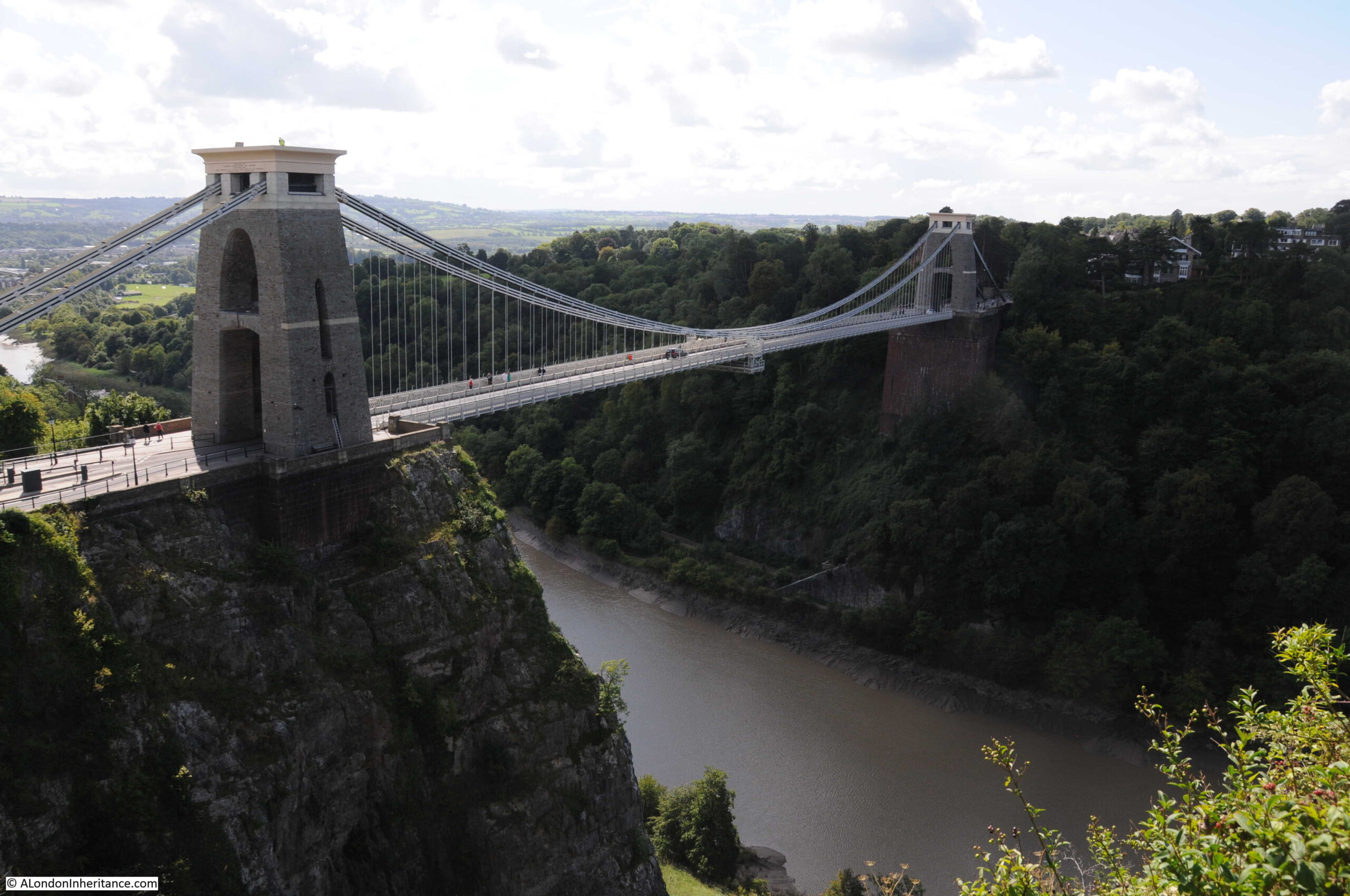
They were aware of the demolition of the Hungerford Bridge, and to help with the financial difficulties in completing the Clifton Suspension Bridge, they purchased the chains and ironwork from the original Hungerford Bridge for £5,000.

Many of these chains still remain, and look out on a very different view than when they spanned the River Thames (see my post on the Clifton Suspension Bridge and my visit to the hidden chambers beneath the bridge in this post):
Clifton Suspension Bridge

As well as some of the chains still being in use, the core of the piers from the first bridge were used in the construction of the piers for the new railway bridge.

The new Hungerford Railway Bridge initially provided a route for pedestrians across the river, with two footpaths on either side of the bridge. A toll of a half penny was charged up to 1878.

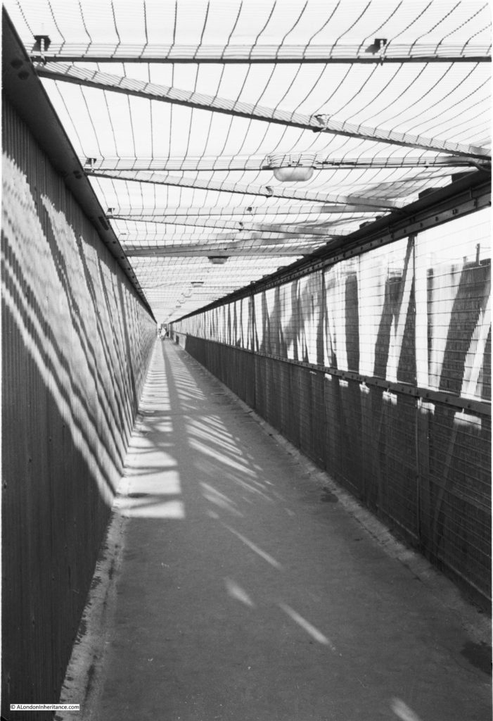
Initially the bridge provided four tracks across the river, however this was later widened to six tracks by the removal of the pedestrian routes, which were moved to a pedestrian way along the outside of the bridge.

The pedestrian route alongside the bridge as it appeared in the early 1950s:
Hungerford Bridge footbridge

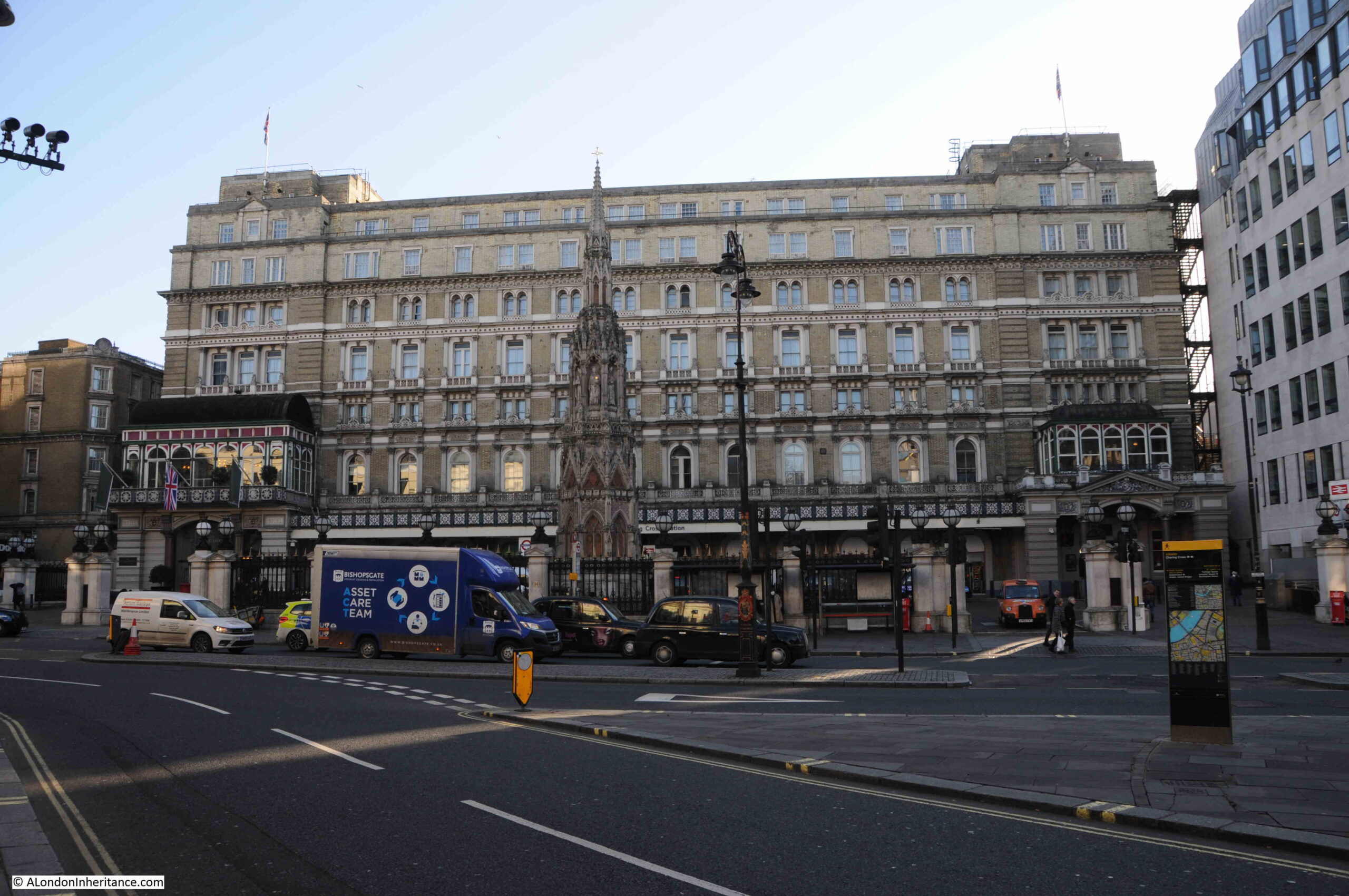
The entrance to Charing Cross Station as it appears today:
Charing Cross Station

The ornate construction in the forecourt is a reconstruction (not a replica) of the Eleanor Cross that was located nearby and destroyed in 1647. The original Eleanor Cross was one of several built across the country in the late 13th century to mark the route when the body of Queen Eleanor was carried from Nottinghamshire for burial in Westminster Abbey.

Although the main market buildings were very slightly further back from the front of the above building, they were built on the site of part of the building, the station concourse and the platforms down to roughly where Villiers Street is today, with the steps extending down into the river. The later construction of the Embankment pushed further into the river

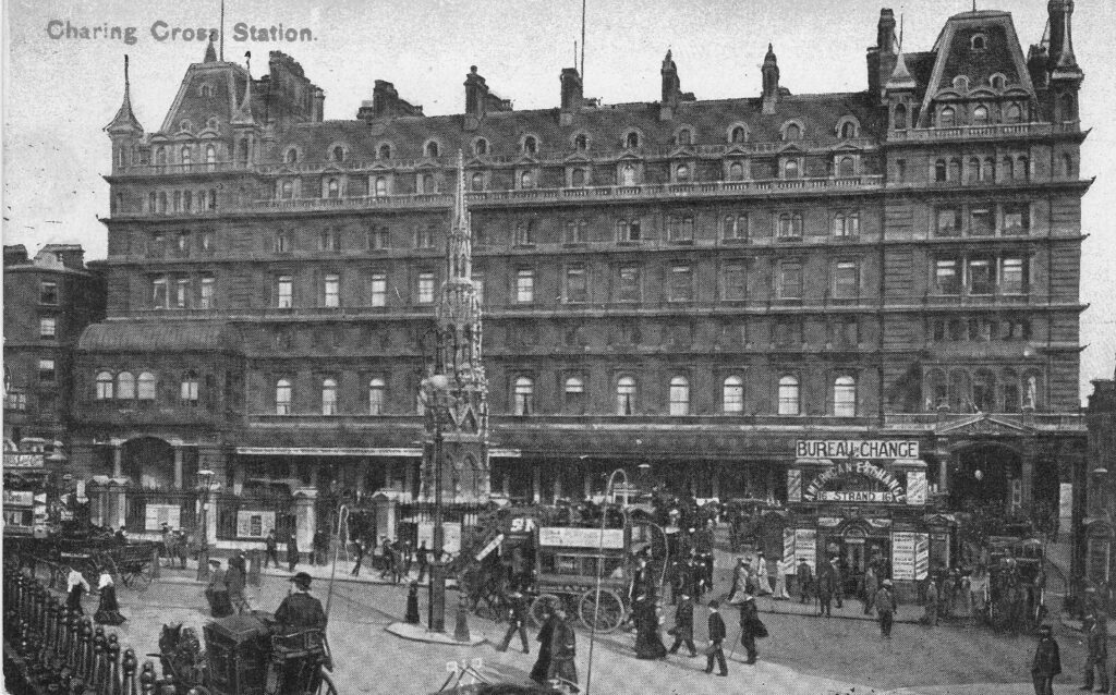
The following postcard shows Charing Cross Station as it appeared at the turn of the 19th / 20th century when the main building served the planned purpose of a hotel. Designed by Edward Middleton Barry in the French Renaissance style and which became one of the most fashionable hotels in London. Barry also designed the cross in the station forecourt:
Charing Cross Station

Plans for the reconstruction of London after the war proposed demolishing bridges such as Hungerford Bridge and routing rail traffic in tunnels, however there was no way in which this could be financially justified and the plans did not progress further than a paper proposal.

Hungerford Bridge now stands as a reminder of a centuries old family name, who had a house off the Strand in the 15th century, a site which became a market and is now occupied by Charing Cross Station.

All prints in this post are from the British Museum collection and reproduced under Creative Commons Attribution-NonCommercial-ShareAlike 4.0 International (CC BY-NC-SA 4.0) license.

alondoninheritance.com

The View from Hungerford Bridge – 1985 and 2020

I usually try to get in a couple of evening walks in that quiet period just after Christmas and before the main return to work at the start of January. This year, part of one of these walks crossed the River Thames using the Golden Jubilee walkways alongside Hungerford Bridge. I wanted to photograph the same scenes as 35 years ago in 1985, and to have a look at what has changed. Although the formal name of the crossing is the Golden Jubilee Bridge, I have called the post the view from Hungerford Bridge, as this was the original 1985 walkway and seems to be the most used name for the crossing.

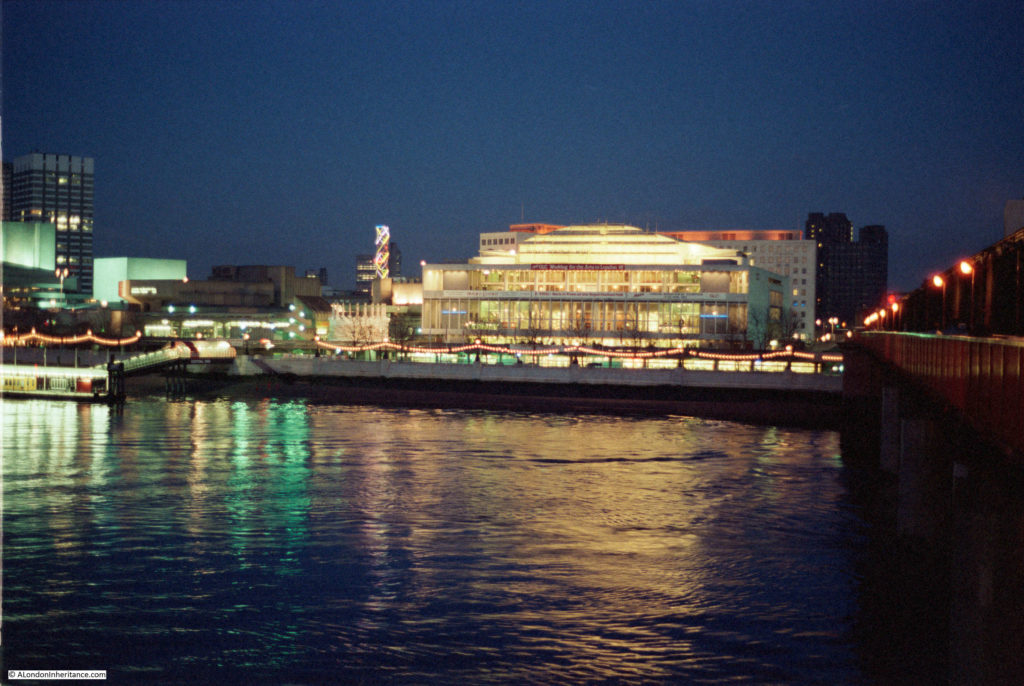
This was the view in 1985, looking south across the river towards the Royal Festival Hall.

View from Hungerford Bridge

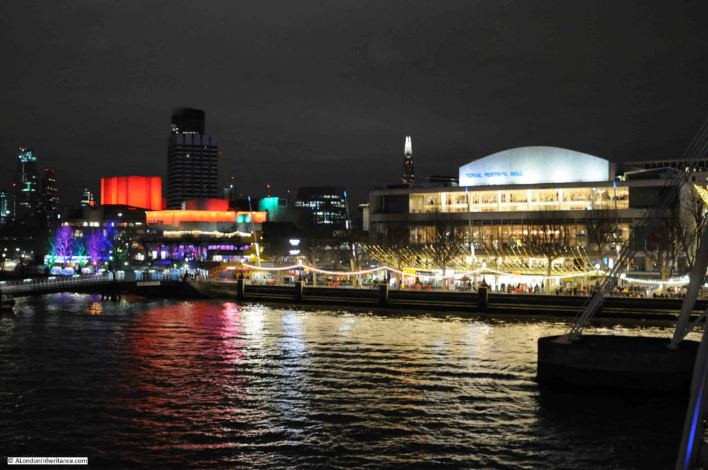
The same view 35 years later:

View from Hungerford Bridge

The viewpoint is slightly different, as seen by the different location of the tall office block on the left, however the area around the Royal Festival Hall is still an illuminated focal point on the South Bank.

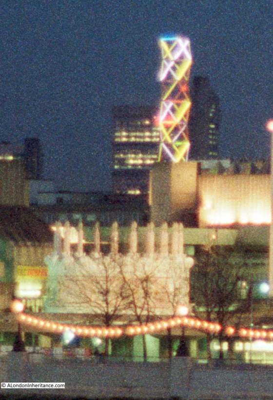
The 1985 photo does include a feature that was a focal point of the South Bank. To the left of the Royal Festival Hall was a tall, illuminated lattice structure. The coloured lights were continuously changing.

I was working on the South Bank for much of the 1980s, and these ever changing lights were always in the background when working or walking in the area after dark. I moved abroad for a few years at the end of the decade, and cannot remember when these lights disappeared. It is these subtle changes that are so easy to miss.

The following photo shows a detailed section from the original 1985 photo, which includes the lights, and also another unique feature from the 1980s.

View from Hungerford Bridge

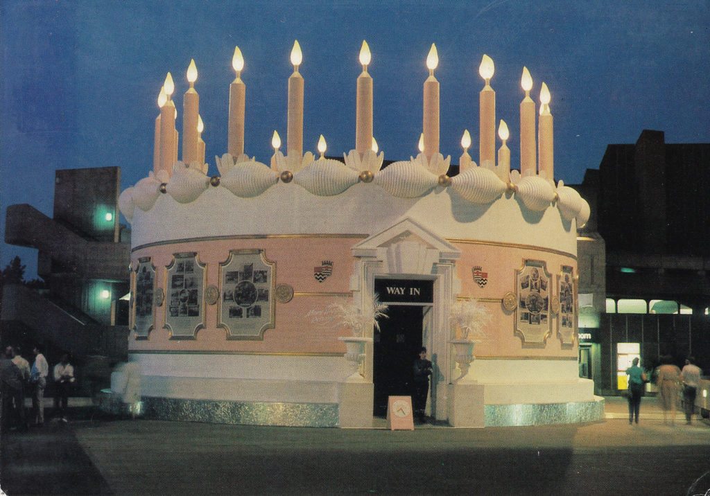
In a previous post on London postcards, I included one of a large birthday cake created by the Greater London Council on the South Bank as an exhibition and celebration of 95 years of the London County Council / Greater London Council. I had visited the exhibition within the cake, and taken photos, but had not yet scanned the negatives. In scanning negatives I finally found some which included the GLC cake.

This can be seen in the 1985 photo above, and also in the extract, which does give an indication of the size of the cake, and how incongruous a traditionally decorated birthday cake looked against the concrete architecture of the South Bank.

The following photo is from the original postcard which shows the cake close up.

View from Hungerford Bridge

There was also some event advertising along the front of the Royal Festival Hall. The following is an extract from the 1985 photo which shows this advertising along the front of the building.

View from Hungerford Bridge

The red banner requests “Keep GLC Working for the Arts in London”. The mid 1980s was a time of conflict between the Thatcher led Conservative Government and the Labour majority Greater London Council led by Ken Livingstone.

This resulted in the 1985 Local Government Act which dissolved the GLC in 1986. Campaigns by the GLC could not influence the majority of the Conservative Government, and at the time there were serious concerns about future funding of South Bank complex. Probably one of the reasons why now the majority of the exterior ground level of the Royal Festival Hall is occupied by commercial businesses.

In the centre of the hall, there is a banner advertising that “EROS: Back in Town at the Royal Festival Hall”. I had completely forgotten about this, but in the 1980s the statue on the top of the Shaftesbury Memorial Fountain in Piccadilly Circus (so I assume technically correct to state Eros, which is frequently applied to the whole fountain), had been removed for restoration.

Prior to the return of the statue to Piccadilly Circus in 1985, it was displayed for a short period in the Royal Festival Hall.

The banner on the right advertises the “Mars London Marathon Exhibition” in advance of the marathon which took place in April of that year. Perhaps strange now that a health focused event would be sponsored by a brand such as Mars, but at the time (and for many years previously), the energy giving benefits of glucose were a major advertising feature of Mars bars.

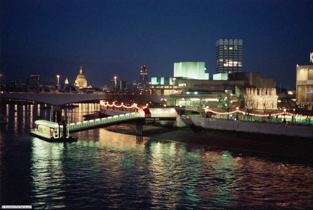
The following 1985 photo again shows the GLC cake, and also the Festival Pier.

View from Hungerford Bridge

The same view from a slightly different angle, as to the right, the Kings Reach Tower office block now appears from behind the square office block of what was London Weekend Television.

View from Hungerford Bridge

A similar view in 2020 is shown in the photo below. The Kings Reach Tower building is now much taller having had several floors added during conversion of the block from offices to apartments.  The future of the old London Weekend Television building (known after the closure of London Weekend Television as the London Studios and operated by ITV) is not clear. ITV moved out of the complex a few years ago, originally intending to return to refurbished studios, but they now uses studios at the redeveloped BBC Television Centre site in White City. I am sure that this high value location on the South Bank will become yet more expensive apartments.

View from Hungerford Bridge

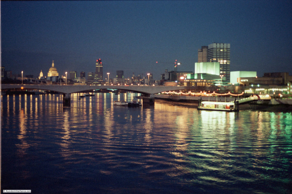
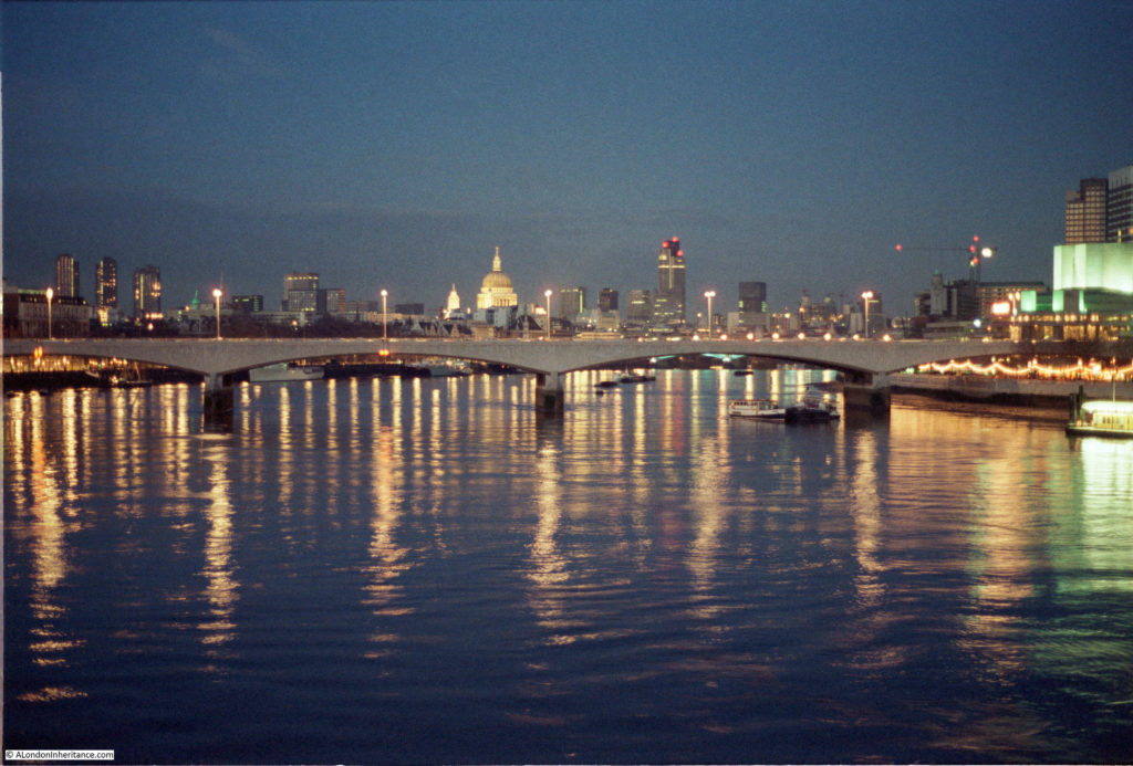
The following 1985 photo is looking along the river towards Waterloo Bridge, St Paul’s Cathedral and the City of London.

View from Hungerford Bridge

In the above photo, the cathedral stands clear, as does the old Nat West Tower to the right. This building, now called Tower 42, was the tallest building in the City.

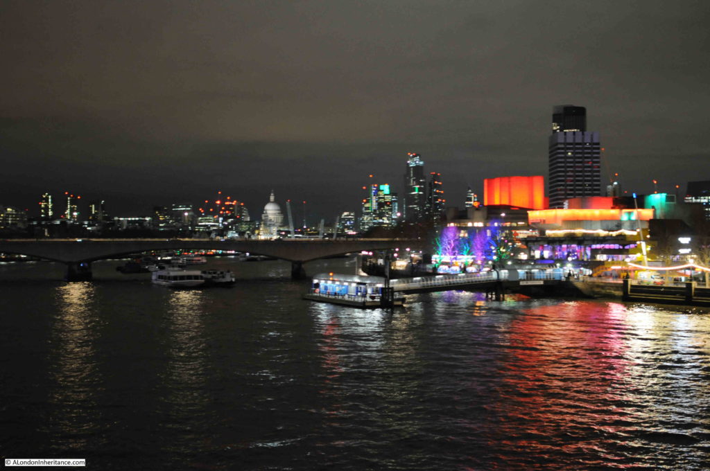
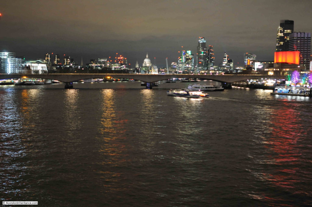
The same view today is shown in the following photo. The Nat West Tower is now dwarfed and almost lost by the City developments of the last few decades.

View from Hungerford Bridge

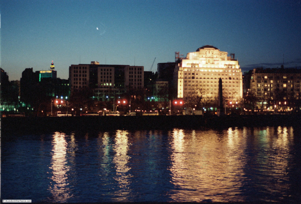
The following 1985 view is of the north bank of the river from the Hungerford Bridge walkway. The brightly lit building is the wonderful 1931, Grade II listed, Shell-Mex House, occupied at the time by Shell UK.  The building is now known as 80 Strand. To the left is the Adelphi building, and the Savoy on the right.

View from Hungerford Bridge

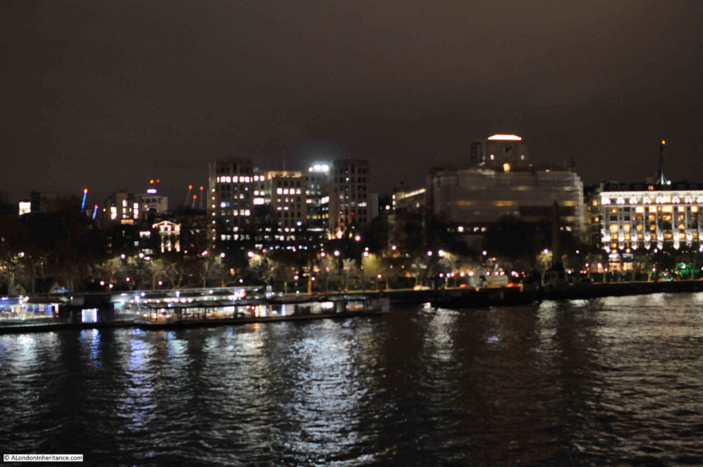
The same view today, although a bit later in the evening so a somewhat darker sky. The front of the Shell-Mex building is covered in sheeting as part of an ongoing refurbishment.

View from Hungerford Bridge

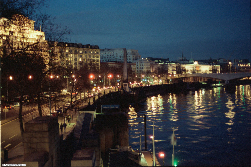
Walking along the walkway towards the north bank, and this was the 1985 view from Hungerford Bridge looking towards the Embankment.

View from Hungerford Bridge

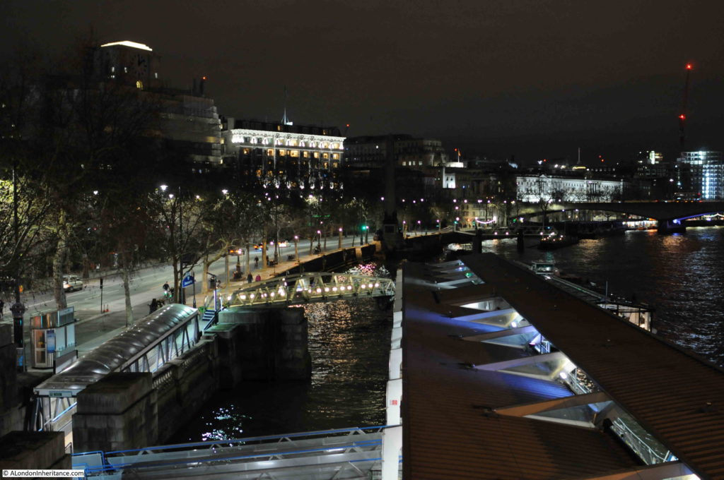
The same view in 2020:

View from Hungerford Bridge

The Embankment is much the same, however the main change is the scale of the Embankment Pier. This is a relatively small feature in the 1985 photo, which has since been replaced by a much larger pier by the 2020 photo. This is indicative of the considerable growth in passenger transport along the Thames in the 35 years since 1985, when river piers were mainly used for tourist focused cruises of the river. The opening of the Thames Clipper Service in 1999 has contributed significantly to passenger traffic on the river, with the resulting upgrades and additions of river piers to support this traffic.

The main change between 1985 and 2020 has been the bridge across the river from which the photos were taken.

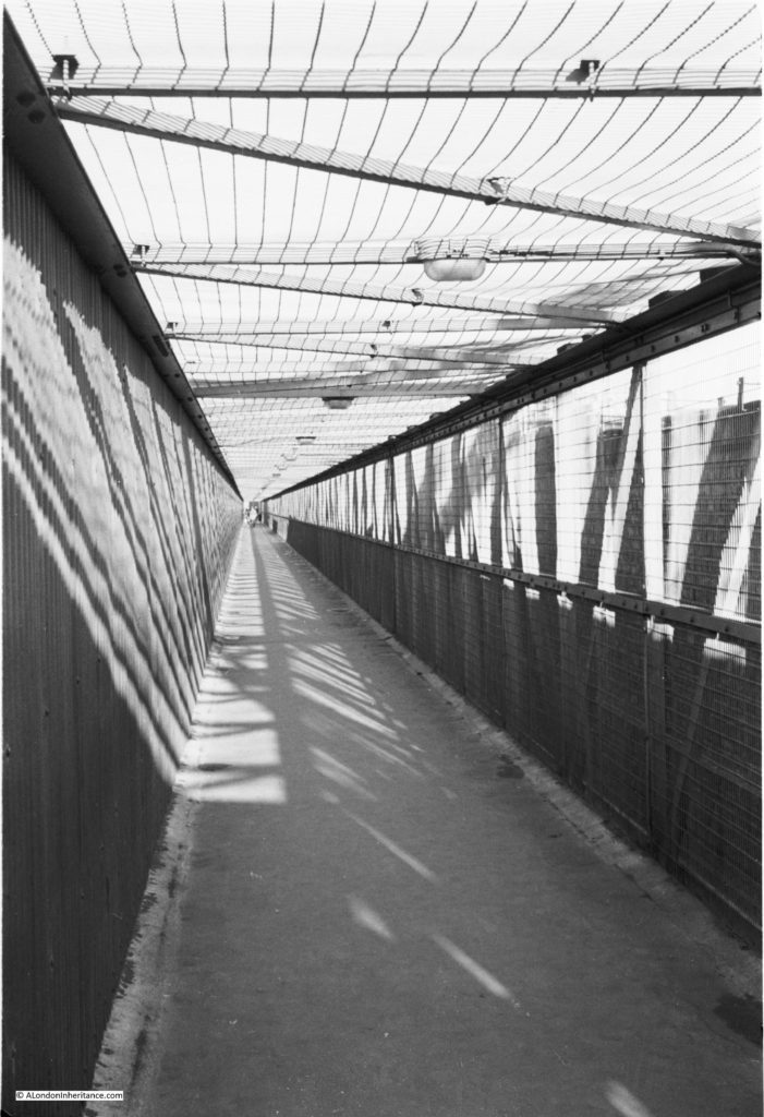
In 1985 there was only a single walkway on the side of the bridge looking towards the City. It was a narrow walkway, frequently covered in large puddles of water, and from experience, not somewhere that you would really want to walk across late at night.

The following photo shows the original walkway:

View from Hungerford Bridge

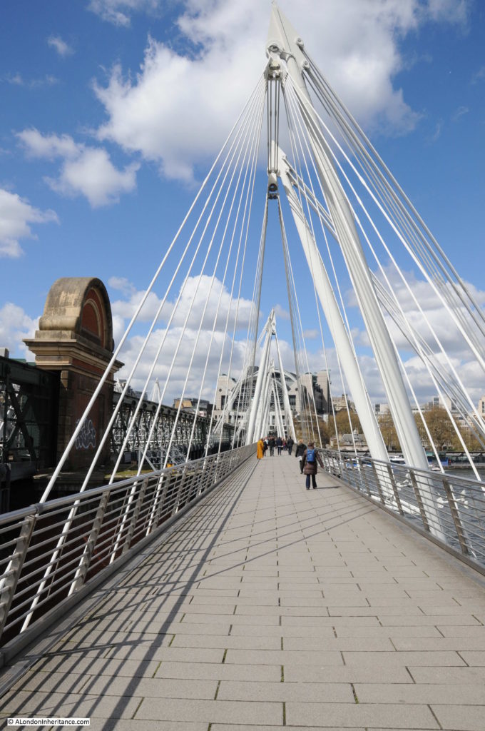
Today, there is a walkway on either side of Hungerford Bridge. Officially named the Golden Jubilee Bridge, these new walkways were completed in 2002 and provide a considerably improved walking route between the north and south banks of the River Thames.

With the growth of attractions and events along the South Bank, the number of people walking across the bridges has grown considerably. According to the website of the architects Lifschutz Davidson Sandilands, who with engineering company WSP, won the competition for the bridges, they are the busiest walking routes across the river in London, with 8.4 million pedestrians in 2014.

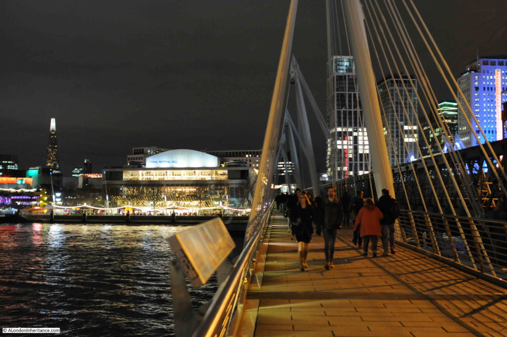
The following photo is the view south along the walkway, towards the Royal Festival Hall.

View from Hungerford Bridge

A view during the day of the Golden Jubilee bridge:

View from Hungerford Bridge

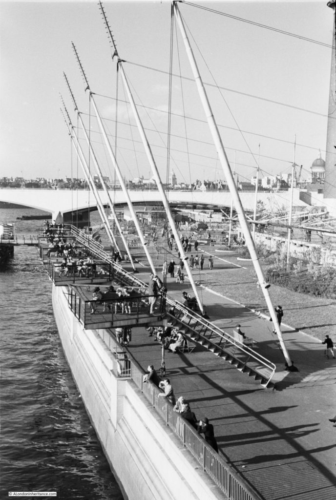
The architects state that the bridges “are slung from inclined pylons that pay homage to similar structures created for the 1951 Festival of Britain, held on the adjoining South Bank”.

As evidence of this, the following photo was taken by my father from the southern end of Hungerford bridge, just after the Festival of Britain had closed, and shows the structures referenced by the architects.

View from Hungerford Bridge

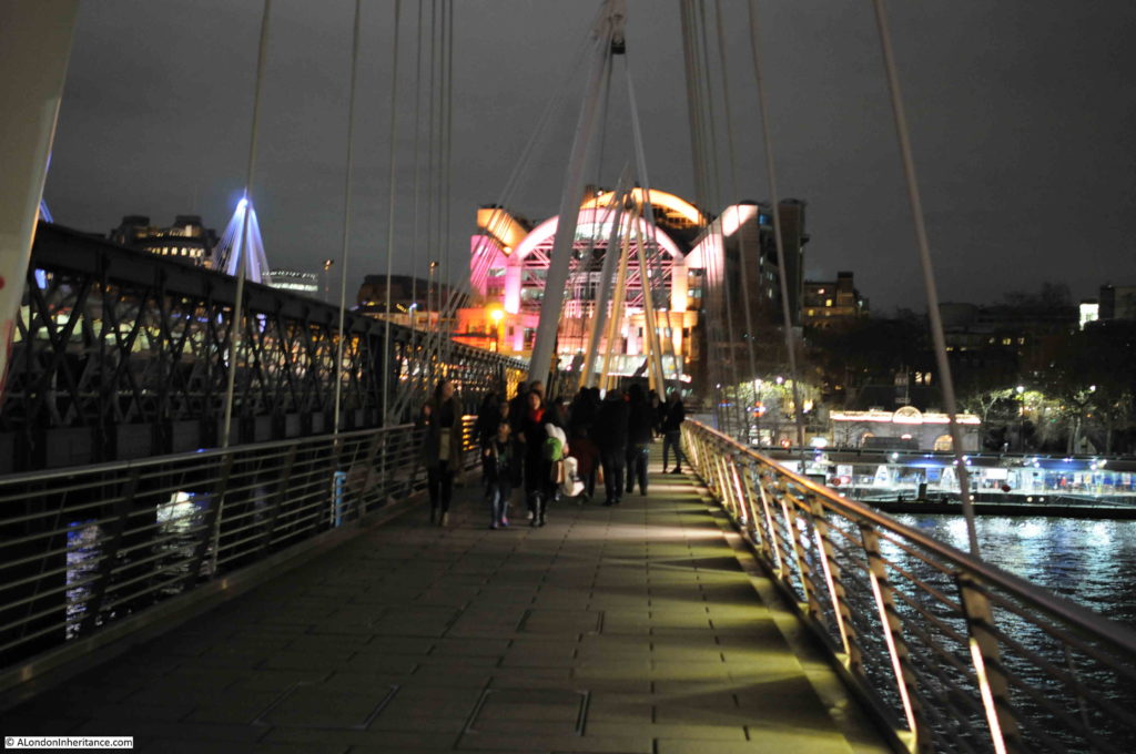
The view looking north along the walkway towards the illuminated buildings above Charing Cross Station.

View from Hungerford Bridge

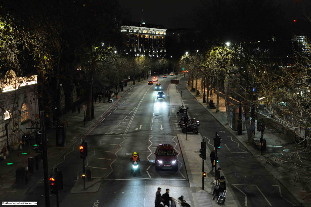
One final photo before I headed off north of the river – the Embankment from the walkway looking unusually quiet:

View from Hungerford Bridge

The Golden Jubilee Bridge is a considerable improvement over the previous walkway and provides a wonderful location to look at a spectacular view of the river, north and south banks, and the City, whether by day or night. The second walkway on the other side of Hungerford Bridge provides superb views towards Westminster.

The opening up of a walking route from the South Bank through Bankside and to Tower Bridge and beyond, along with attractions such as the London Eye and growth in the numbers of bars and restaurants has significantly increased walking across the river, along with the always present use of the bridge as a route between the north bank of the river and Waterloo Station.

Use of the river has grown since 1985 as evidenced by the considerably enlarged Embankment Pier.

In another 35 years time, the Royal Festival Hall will be just over 100 years old – it will be interesting to see how the area changes in the coming decades. One change I suspect will happen is the growth of tower blocks on the south bank beyond Waterloo Bridge and across the City. The area around the old London Weekend Television tower block and the London Studios will certainly look very different.

alondoninheritance.com

A Walk Along Belvedere Road – 1947 and 2016

Having explored the history of the South Bank in yesterday’s post, today it is time to take a walk along Belvedere Road to see the remains of buildings dating back to the start of the 19th century, the clearance ready for construction of the Festival of Britain and the foundations of the Royal Festival Hall. We will start from where Waterloo Bridge crosses Belvedere Road, drop down to Belvedere Road and then walk along Belvedere Road to County Hall.

My father visited this area a number of times between 1947 and 1951, first to photo the buildings as they were, then the area as it was cleared and finally as the construction of the Royal Festival Hall was underway. This post brings together photos distributed among a number of different posts over the last couple of years along with some new photos I have recently scanned.

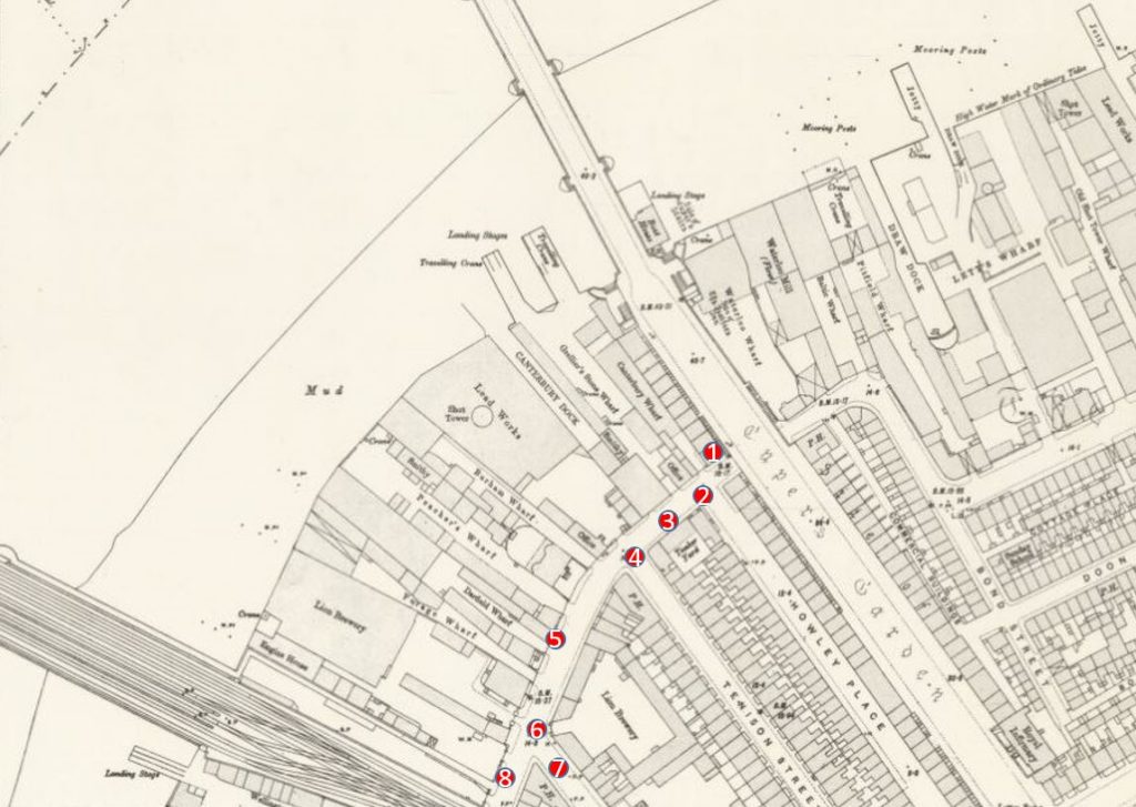
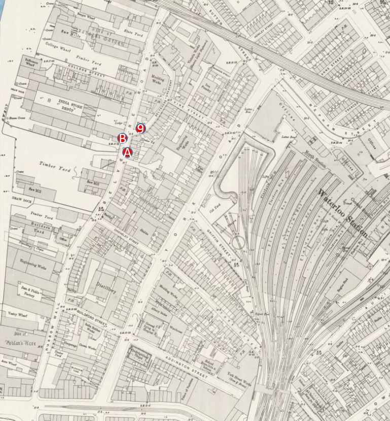
The map below is the same extract from the 1895 Ordnance Survey Map covering the area between Hungerford and Waterloo Bridges as in yesterday’s post. I have marked in numbered red dots the locations from where the photos in today’s post were taken.

Belevedere Walk Map 1

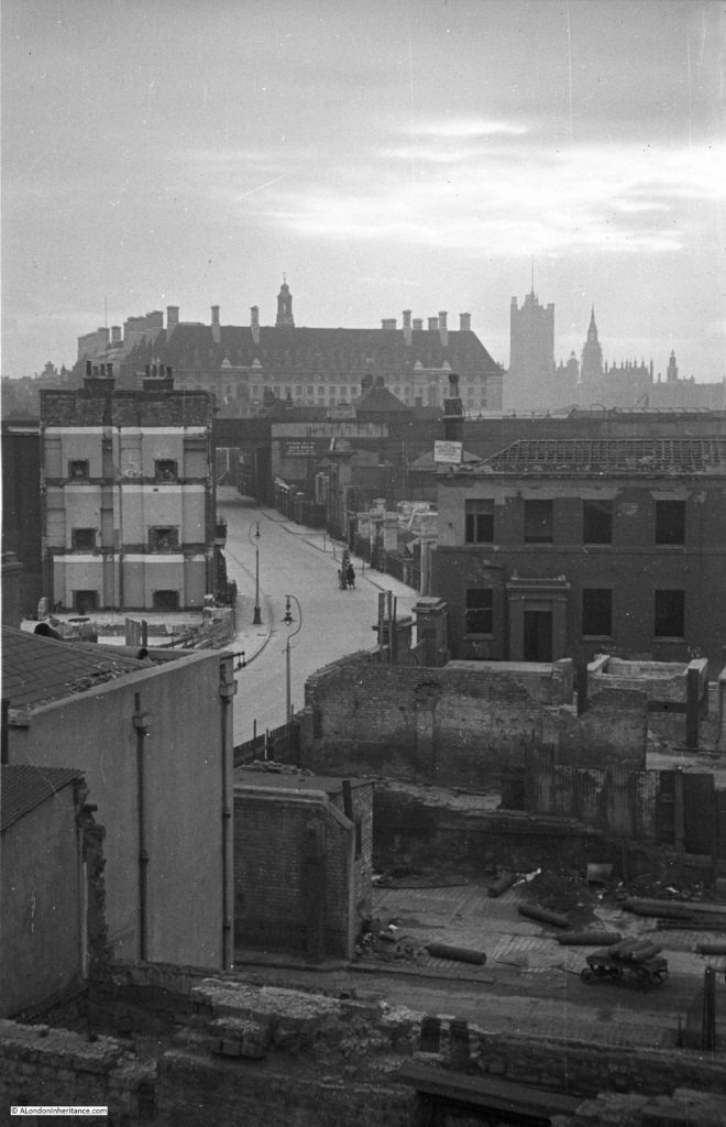
The first three photos are at point one. I am not sure whether they were taken from Waterloo Bridge, or from one of the buildings alongside the bridge, however this first photo is looking along Belvedere Road towards the bridge under the rail tracks leading up to Hungerford Bridge.

Demolition is already underway. The remains of the entrance to the Lion Brewery can be seen on the right, in front of the railway, and clearance of the houses on the left is well underway.

History of the Southbank 3

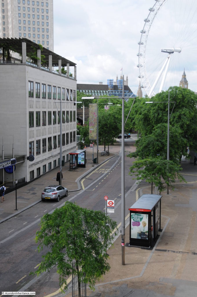
This is roughly the same view today. I should have been a bit further to the right, however the buildings of the Hayward Gallery obscure the view. Belvedere Road curves to the left towards where the road passes under the rail tracks – the bridge is obscured by the trees.

Belvedere Road Walk 1

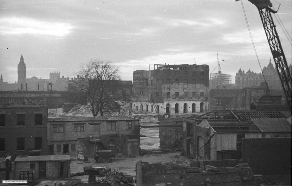
This next photo is from the same spot, but is looking towards the right, towards the Thames. The large building is the Lion Brewery. Note that on the opposite side of the river, construction of the new Ministry Defense Building is well underway. The buildings in the foreground are along Grellier’s Stone Wharf on the 1895 map.

History of the Southbank 2

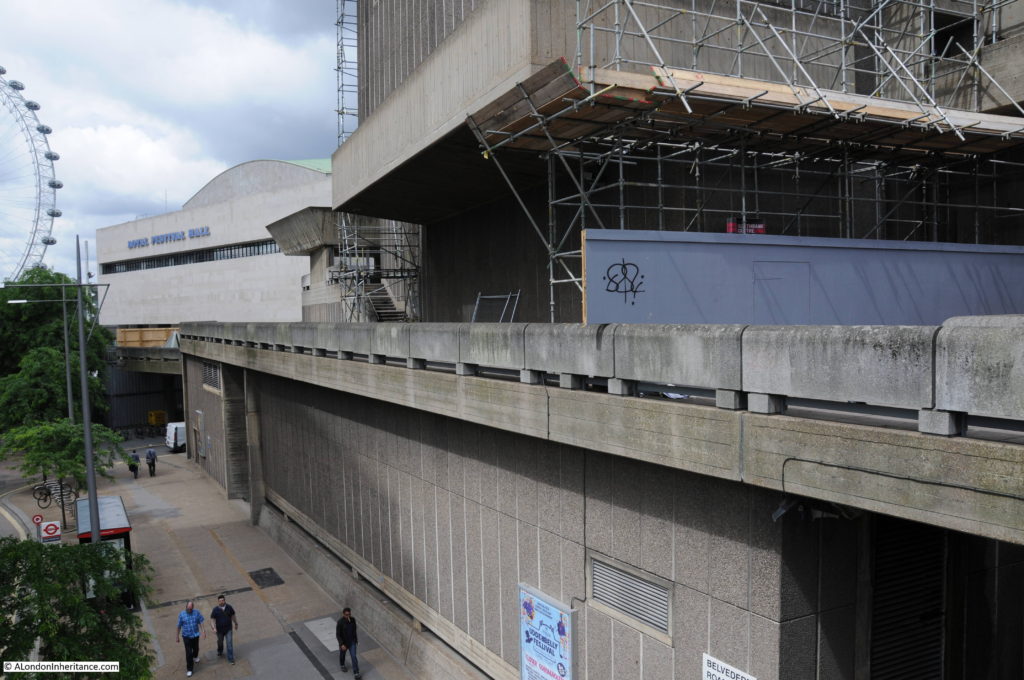
Again, I should have been a bit further towards the right, however the following view from 2016 shows that the entire site of the above photo is now occupied by the Royal Festival Hall, the Hayward Gallery, Queen Elizabeth Hall and the Purcell Room.

Belvedere Road Walk 2

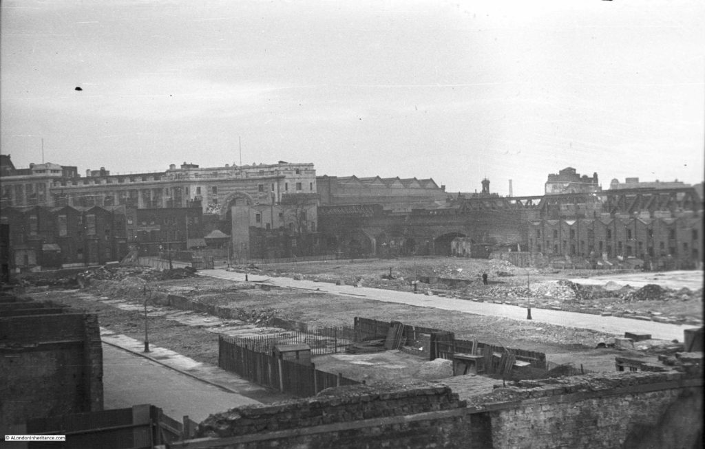
And the following photo is the last from the bridge and is looking to the left, towards Waterloo Station. Two streets can be seen, on the left is Howley Place and the street in the middle is Tenison Street. The terrace buildings that lined these streets have been demolished, however those along the boundary of the site remain. On the right are the houses along Sutton Street and the houses in front of Waterloo Station are along York Road. To the right of centre, there is a solitary figure standing on the rubble left by demolition.

History of the Southbank 1

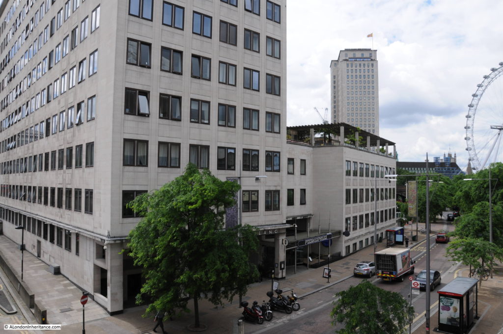
And the same view today. The entire site is now occupied by what was the Downstream Building of the Shell Centre office complex, but is now the Whitehouse Apartments. When I checked on their website, two apartments were for sale, one from just over £1 Million and the second for £2,750,000. A chat box from a representative in Hong Kong popped up whilst looking at the page asking if I needed help which tells you all you need to know about central London”s property market.

Belvedere Road Walk 3

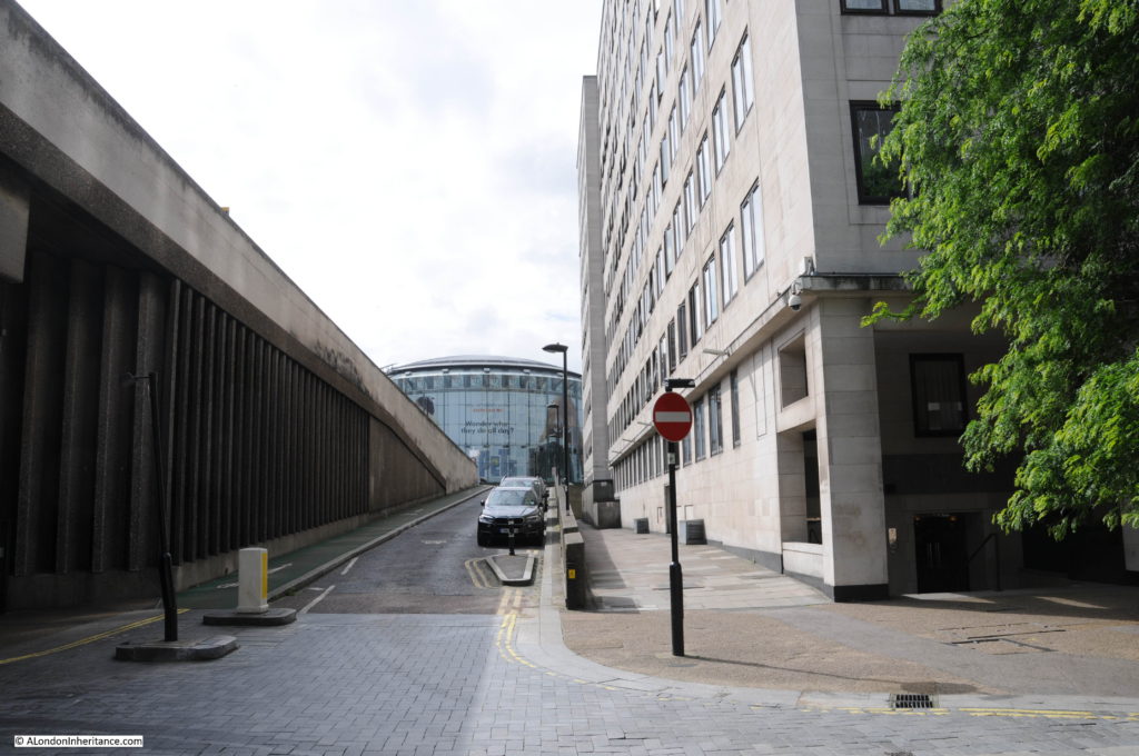
Now walk towards the large roundabout at the southern end of Waterloo Bridge and take an immediate right hand turn down the slip road that takes you down to Belvedere Road. This road does not appear to have a name, but runs along the route what was Howley Place. At the end of the slip road, on reaching Belvedere Road, turn round to look back up the slip road (position 2 on the map).

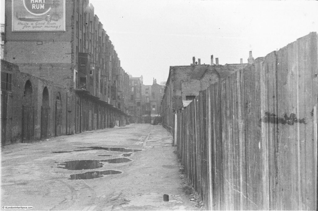
This was the original view:

History of the Southbank 27

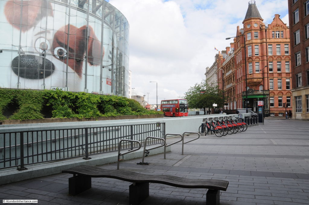
The buildings on the left are the rear of buildings facing onto the approach road to Waterloo Bridge which has since been widened. The large roundabout with the glass IMAX cinema in the centre, which can be seen at the end of the current slip road had not been built at the time of these photos, so the houses seen at the end of Howley Place are roughly where the edge of the IMAX is currently located.

Belvedere Road Walk 4

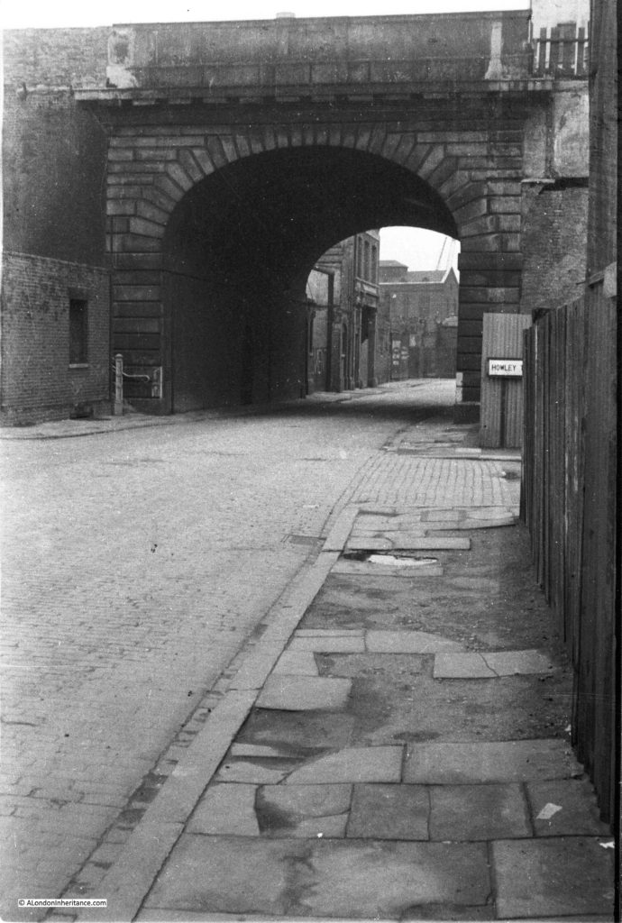
We can now start walking along Belvedere Road, but only a short distance to point 3 on the map where we can look back at the original bridge which takes the approach road to Waterloo Bridge over Belvedere Road. The entrance to Howley Place is on the right with part of the street name sign visible.

History of the Southbank 18

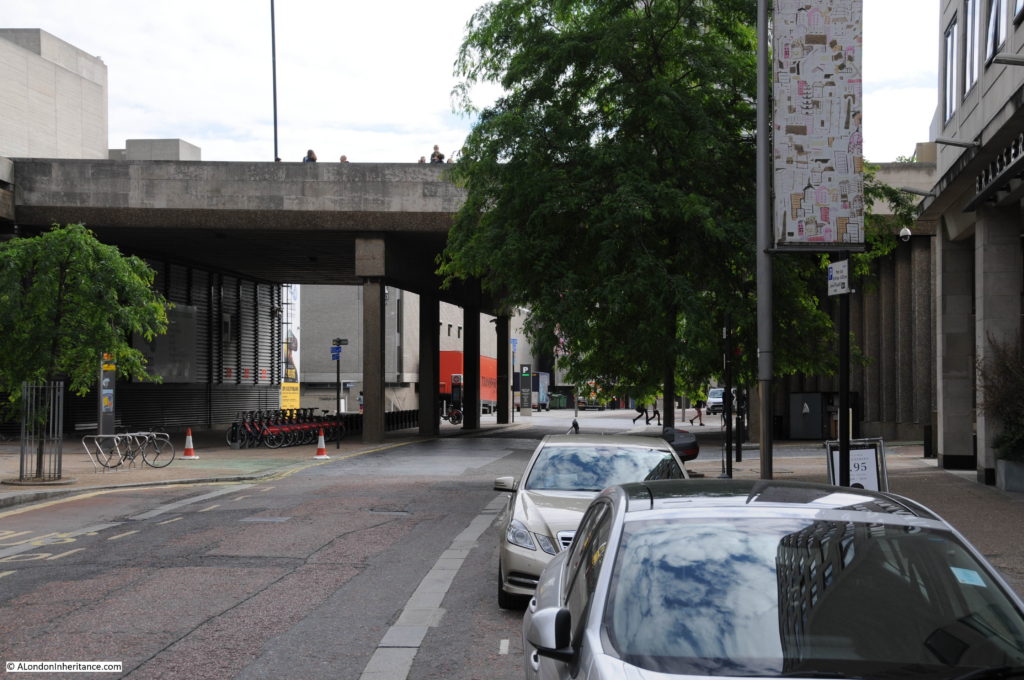
The same scene today. The approach road to Waterloo bridge has been replaced and is wider than in the original photo.

Belvedere Road Walk 5

Now walk a short distance along to point 4. This is the entrance to Tenison Street, looking towards Waterloo Station.

History of the Southbank 23

And this is roughly from the same position today. Waterloo Station is behind the buildings of the Whitehouse Apartments.

Belvedere Road Walk 6

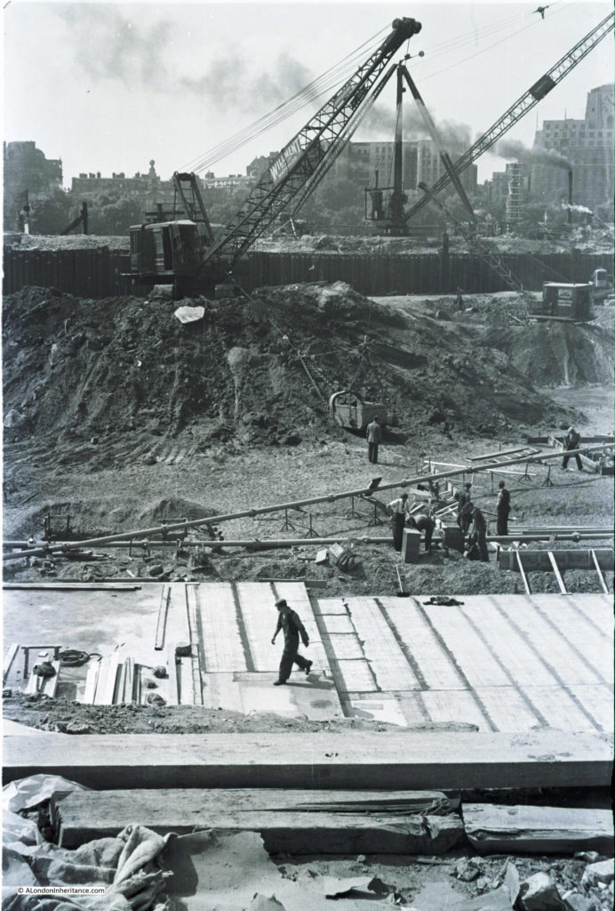
Now walk along to point 5 which is roughly half way along the rear of the Royal Festival Hall, and look towards the building. This was the scene at the start of construction of the Royal Festival Hall with the buildings on the north bank of the river clearly visible. There were some fascinating challenges with the construction of the building which I will cover in detail in my next post.

History of the Southbank 30

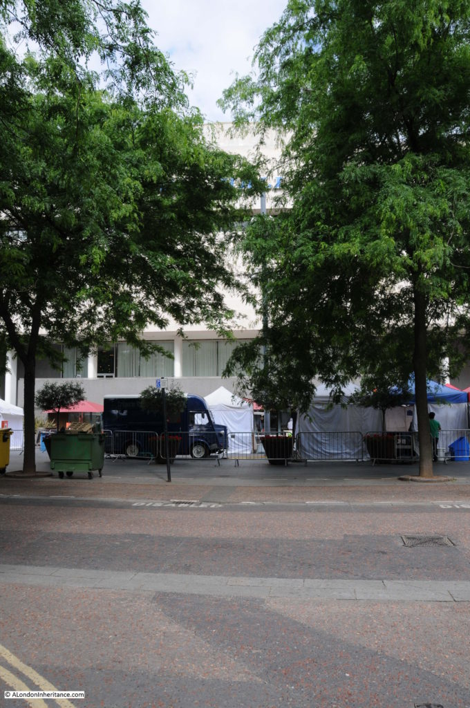
The same scene today, although not much to see with the trees in the foreground and then the rear of the Royal Festival Hall.

Belvedere Road Walk 7

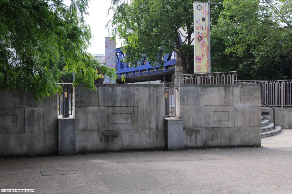
Now walk along to point 6 which is at the end of the original alignment of Sutton Walk which has now been cut short by Concert Hall Approach. The following photo shows where the original Sutton Walk met Belvedere Road. Looking over the wall surrounding the Whitehouse Apartments it is possible to see the remaining length of Sutton walk where it passes under the railway tracks. Sutton Walk originally continued straight on, to end at the point where this photo was taken.

Belvedere Road Walk 15

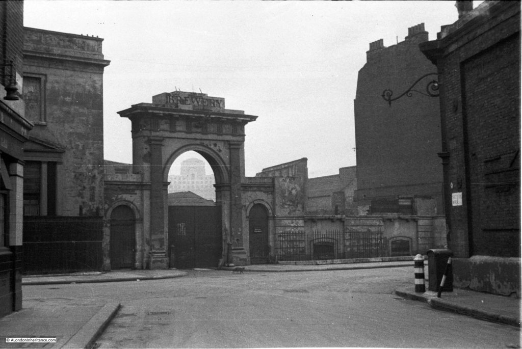
From this point we can walk slightly further along then turn back and look across where Sutton Walk joined Belevdere Road. This is the entrance to the buildings of the Lion Brewery on the south side of Belvedere Road with one of the three lions that were used above brewery entrances and the main brewery building. These buildings were used for stables and also as a warehouse. Look in front of the entrance arch and there are bollards on either side.
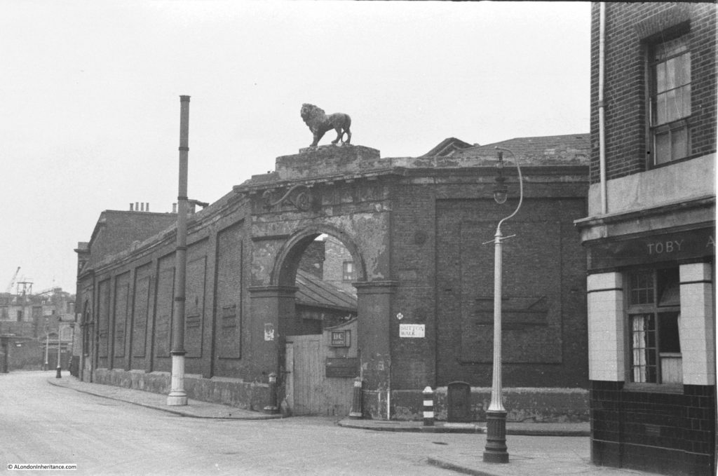
History of the Southbank 22

And they are still here in this later photo following demolition of all the buildings. The buildings running along the left are those along the approach to Waterloo Bridge and Howley Place, with the buildings along York Road on the right. All the buildings in the background are still there, with the Royal Hospital for Children and Women being the second building from the left.
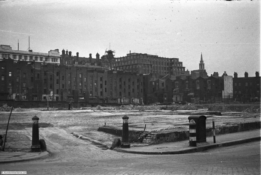
History of the Southbank 24

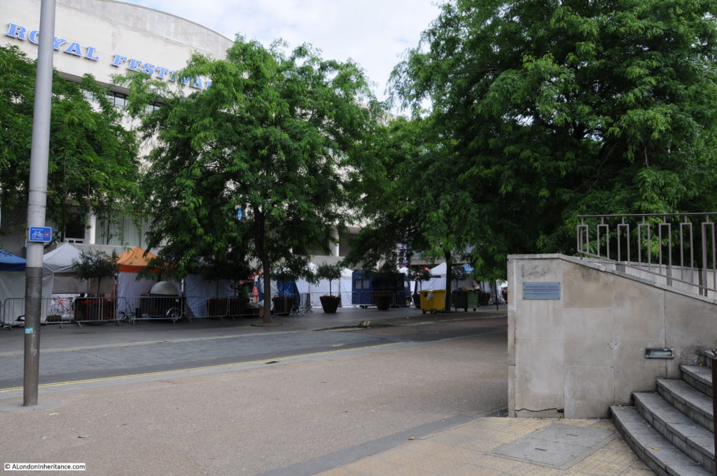
This is the same scene today.

Belvedere Road Walk 8

The following photo was taken from Sutton Walk, looking down towards the entrance to the Lion Brewery from Belvedere Road. There was a lion on top of this arch but this had already been removed.

History of the Southbank 20

Not easy to replicate this photo as this section of Sutton Walk does not exist, but the following photo is looking towards the area where the entrance to the brewery was located.

Belvedere Road Walk 9

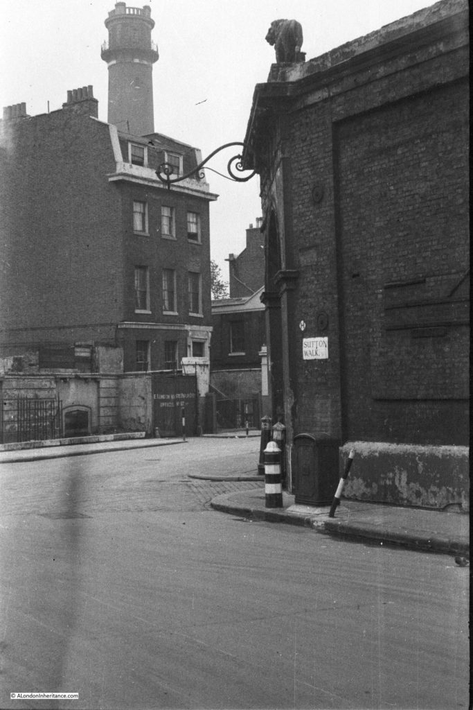
The next photo was also taken from the original Sutton Walk and is looking towards the right with the Shot Tower in the background.

The house in front of the Shot Tower is number 55 Belvedere Road, one of the substantial houses that went up along Belvedere Road in the first decades of the 19th century.

In 1821 a tin plate worker named John Fowler extended his lease on the land and built No. 55 for his own use. The Survey of London describes the building:

“No. 55 was a house of substantial character. Though detached, it was of terrace type without openings in the flank walls. It was in yellow stock brick and its front elevation was three windows wide to each of the ground, first and second floors. The windows had gauged flat arches and all had glazing bars to their double hung sashes. The ground storey was raised above a semi-basement and the entrance, which was reached by a short flight of steps, had an architrave surround with consoles each side designed to support a flat hood. The hood had been removed some time prior to demolition. There was a moulded band at first floor level and a bold parapet cornice above the second floor. Behind the parapet dormer windows were set in a slated mansard roof”.

History of the Southbank 21

John Fowler annoyed his neighbours when in 1839 he converted a factory between the rear of his house and the river into a lead works. Concern about the works was such that Golding, the owner of the Lion Brewery complained to his landlord, however a report from a Professor of Chemistry into the conditions of the lead works stated that their construction and use was such as to prevent waste, injury to the workmen and annoyance to the neighbourhood.

Along with the Lion Brewery, No. 55 was used by the London Waste Paper Company in the 1930s and would be demolished in 1949.

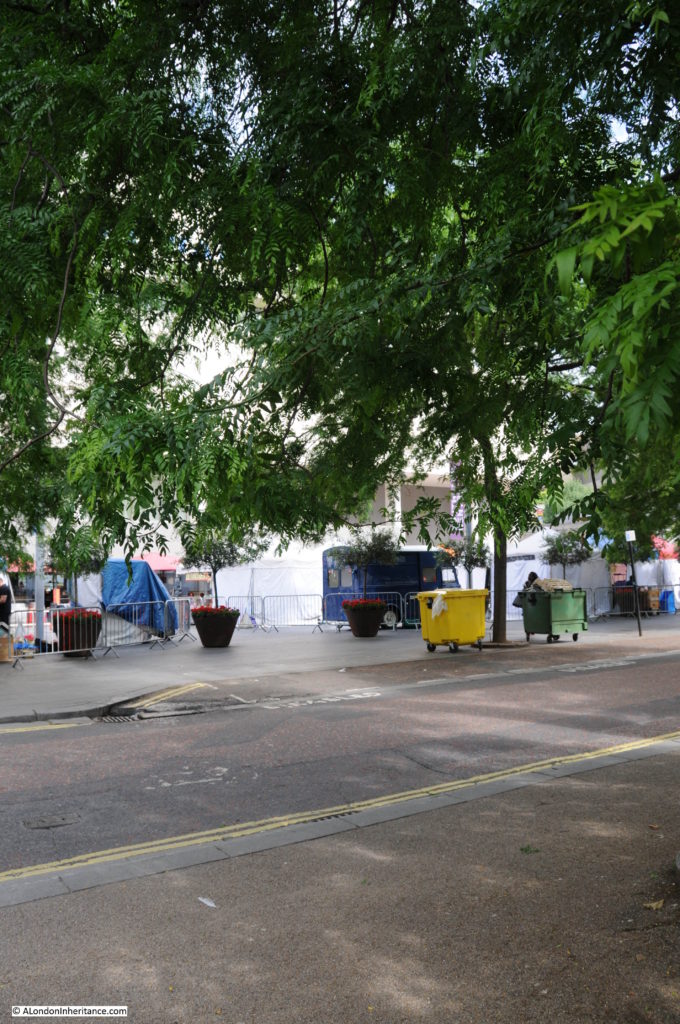
Again, not easy to replicate the original view as this part of Sutton Walk does not now exist, however the following photo is as close as I could get. Not much to see due to the trees, but the Royal Festival Hall is in the background.

Belvedere Road Walk 10

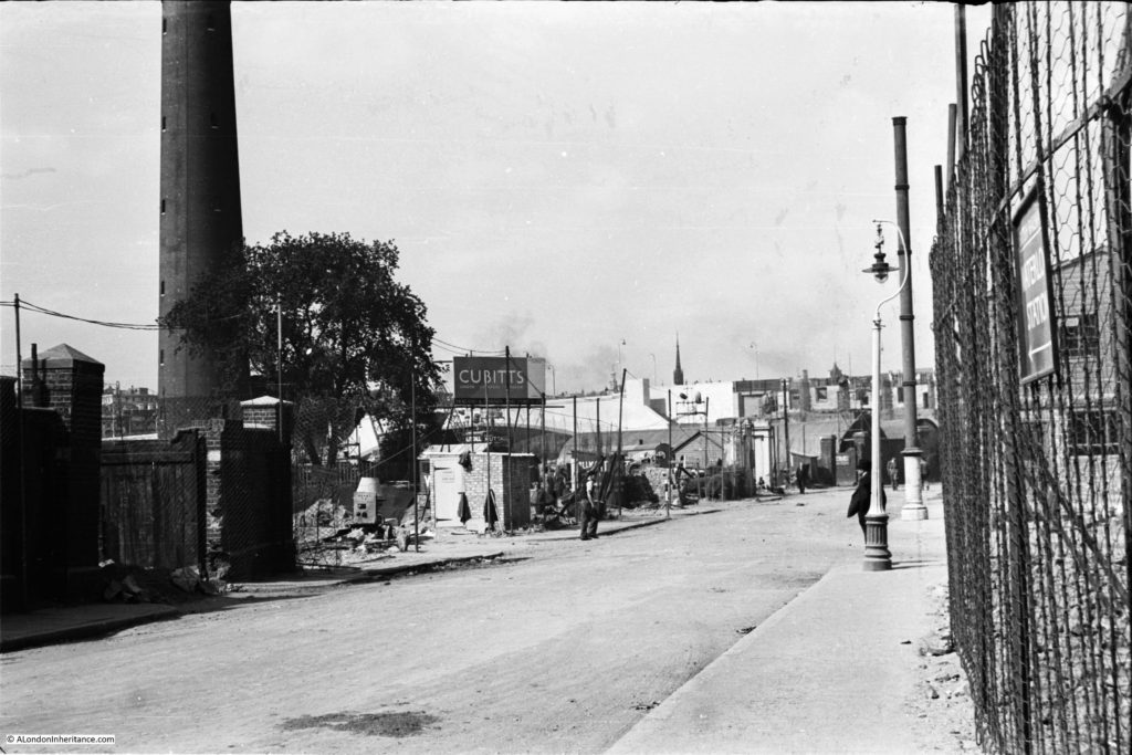
The following photo was taken just before construction of the Royal Festival Hall commenced. It was taken from where Belvedere Road passes under the rail tracks leading up to Hungerford Bridge and is looking back down Belvedere Road towards Waterloo Bridge which can just be seen behind the Cubitts sign at the centre left. Sutton Walk is just behind the lamppost running to the right. The Shot Tower is on the left. Note the “stink pipe” behind the lamppost (not sure if that is the correct name, but that is what we always called them).

History of the Southbank 29

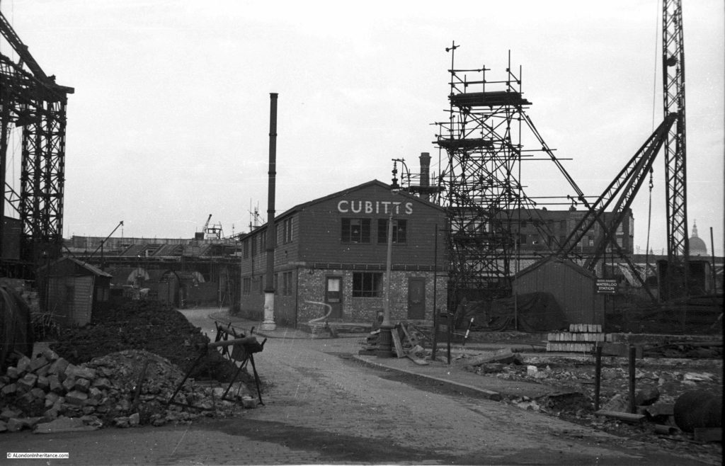
This is the view some weeks later, taken from the opposite side of the road. The “stink pipe” in the centre of the photo is the same as in the above photo. The Cubitts site office is on the former location of the Lion Brewery Stable and Warehouse. On the left is one of the three legs of the derrick supporting the crane that was used to build the Royal Festival Hall.

History of the Southbank 5

Cubitts were the main building contractors for the Royal Festival Hall, and the use of an onsite site office seems to have been unique for the time as it helped with the rapid construction of the building with drawings been passed from the office to the builders as the drawings were being completed – such was the pace with which the Royal Festival Hall was built.

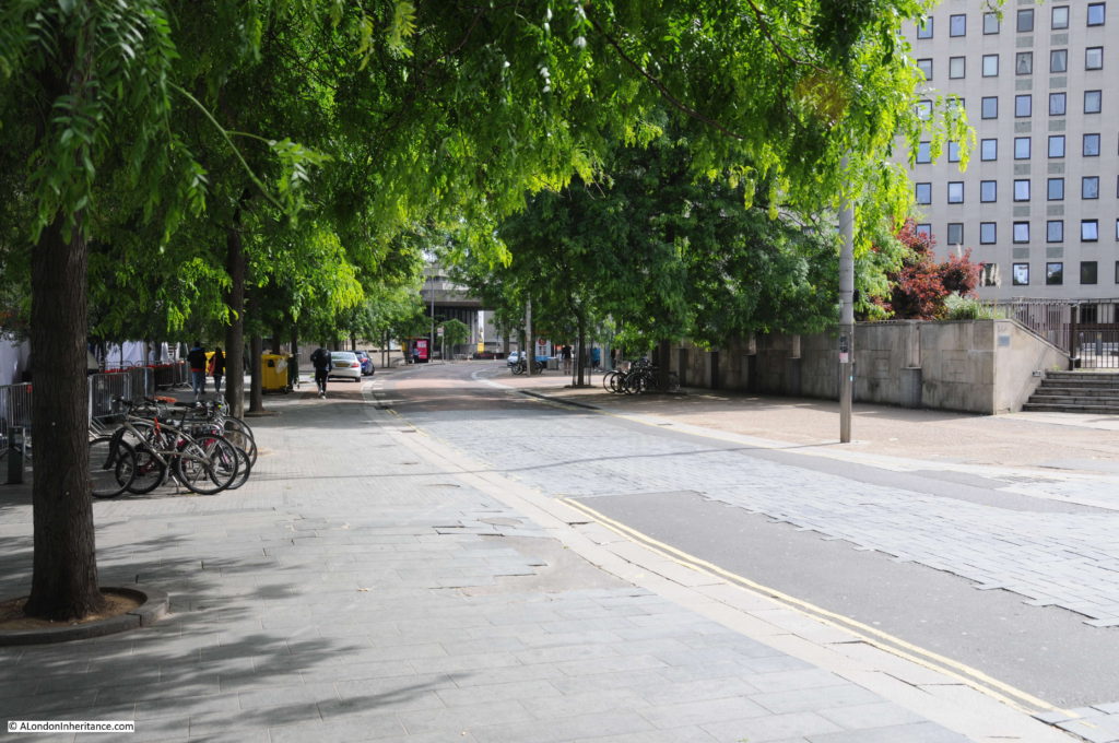
This is the same view today as the above photo taken at point 8 on the map.

Belvedere Road Walk 11

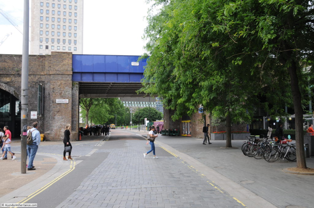
Now it is time to walk through to the other half of the area which is split in two by the rail tracks running up to Hungerford Bridge. This brick-built viaduct is the only remaining construction from the pre-war period and provides a perfect reference point to locate the key places on the 19th century Ordnance Survey maps. The viaduct has retained the original position of Belvedere Road and by retaining the short length of Sutton Walk that runs from York Road to the new Concert Hall Approach, allows the alignment to be confirmed to Belvedere Road and therefore the position of the entrances to the Lion Brewery.

This is where Belvedere Road passes underneath the rail tracks. The white plaque on the blue bridge reads “W. Richards & Son – 1900 – Leicester”.

1900 is not old by London standards, but it is the oldest construction in this part of London.

Belvedere Road Walk 14

The following map shows the area we are now in, having passed under the rail tracks at the top and continuing along Belvedere Road.

Belevedere Walk Map 2

A short distance along Belvedere Road, we can look towards the river and this is the approximate position of College Street leading down to Kings Arms Stairs. There is an entrance to the car park here – would be interesting to believe that this is a remaining part of College Street.

Belvedere Road Walk 16

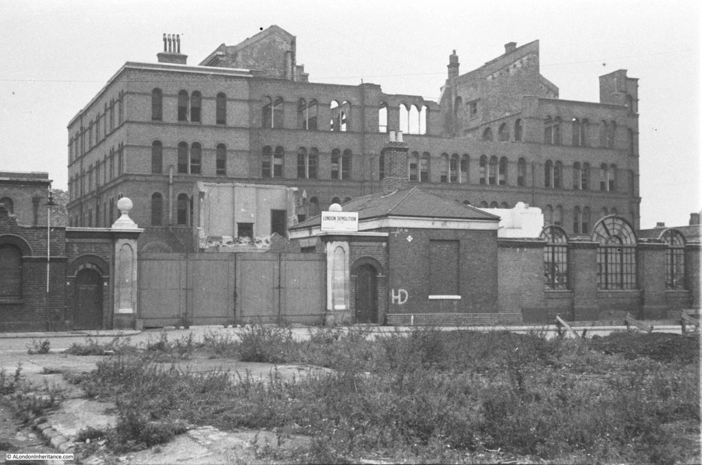
The next photo shows the India Stores Depot as it was prior to demolition. The photo was taken from point 9 in the above map, a short distance in Belvedere Crescent, the kerb of which can be seen in the lower left corner. The road running left to right in front of the gates is Belvedere Road. The India Stores Depot suffered badly from bombing during the war with the majority being left as a shell of a building.

History of the Southbank 16

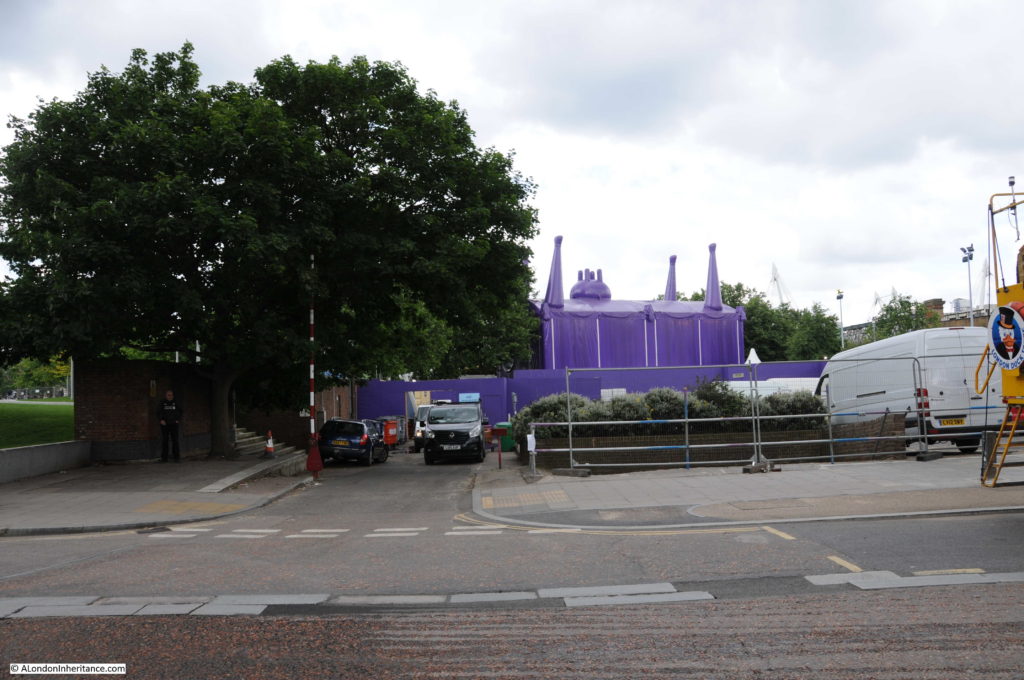
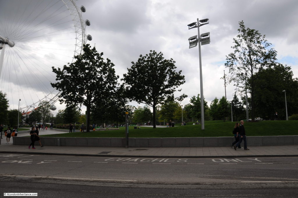
I could not get to the same position as the original Belvedere Crescent is under the Shell Centre complex. The following photo was taken from in front of Shell Centre looking across Belvedere Road to where the India Stores Depot were located, on the current Jubilee Gardens.

Belvedere Road Walk 12

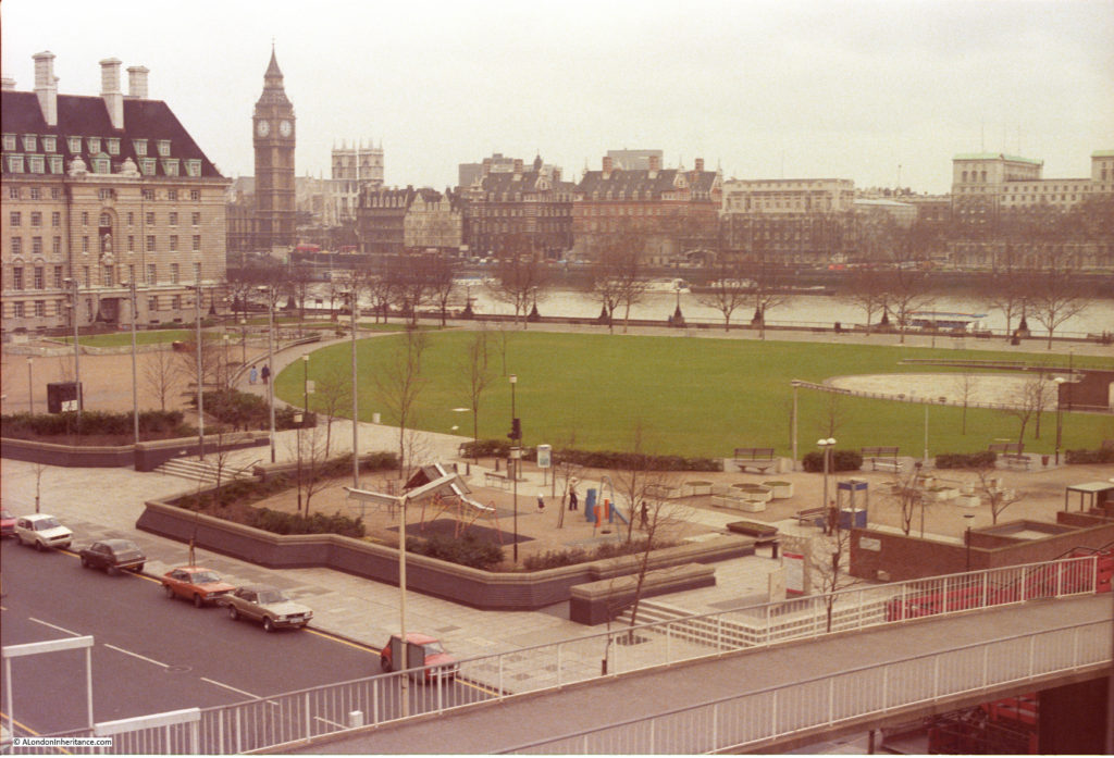
The Jubilee Gardens have been through a number of changes. I took the following photo in the mid 1980s of a much quieter Jubilee Gardens than today. The central area was later used as a construction site for the Jubilee Line extension with a large access shaft in the middle of the grassed area. The grass would be packed during summer lunchtimes with office workers from the Great London Council and Shell Centre.

Belvedere Road Walk 18

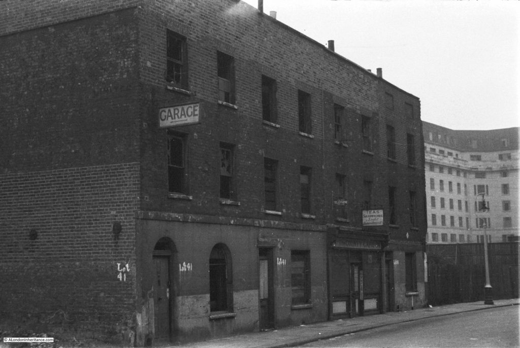
The buildings in the following photo were along Belvedere Road, roughly at point A, which today is the location of the Shell Centre tower building.

History of the Southbank 17

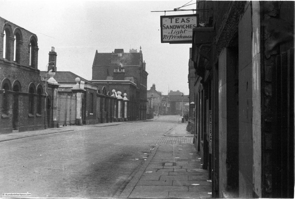
Another view with the buildings in the above photo now on the right of the photo below. The cafe in the photos above and below was called “The County Cafe” – I assume a reference to County Hall, just a bit further along Belvedere Road. It is small buildings such as these where the signs of the business still remain that bring home that this was once a busy area full of industry, cafes, shops and residents. The bridge carrying the rail tracks over Belvedere Road can be seen at the far end of the road and the entrance to the India Stores Deport is on the left.

History of the Southbank 15

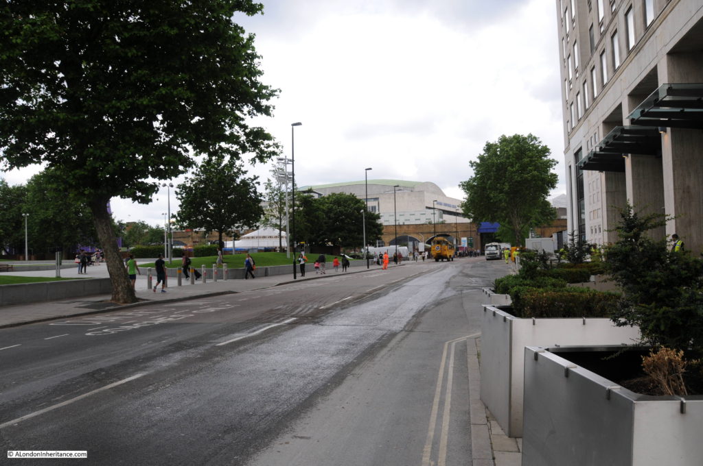
This is same scene today with the main tower building of the Shell Centre complex on the immediate right, occupying the space where the County Cafe once stood. The blue bridge at the end of Belvedere Road is in the same position as the photo above.

Belvedere Road Walk 13

Many of the streets in this area were named after Archbishops of Canterbury. Sutton Walk was named after Charles Manners-Sutton (Archbishop between 1805 and 1828).

Tenison Street was named after Thomas Tenison (Archbishop from 1694 to 1715) and Chicheley Street. was named after Henry Chichele (Archbishop from 1414 to 1443).

The naming of streets after Archbishops extended beyond the area between York Road and Belvedere Road. The street in front of Waterloo Station, Mepham Street was named after Simon Mepeham, Archbishop of Canterbury from 1329 to 1333).

From outside Shell Centre, we can turn towards County Hall and walk to the junction of Belvedere Road and Chicheley Street. Instead of turning up Chicheley Street we can still walk up towards Westminster Bridge through the County Hall complex. Today this is marked on maps as Belvedere Road, but on the 1895 Ordnance Survey maps, Belvedere Road ended at the Chicheley Street junction and this stretch of road up to Westminster Bridge was still called Narrow Wall, the last remaining use of this original name and reference to the earthen bank that separated the Thames from the rest of Lambeth marshes.

The following photo shows the Belvedere Road / Narrow Wall passing through the County Hall buildings, I will continue on from the end of this road in my next post.

Belvedere Road Walk 17

We have now walked the length of Belvedere Road and traced the pre-1951 streets and buildings where much of the original street plan still remained.

Although Belvedere Road has been straightened and widened over the years, we have walked the route of the original earthen wall.

In my next post we will walk along the north bank of the river before returning alongside Hungerford Bridge to look at the building of the Royal Festival Hall.

alondoninheritance.com

A Brief History Of The South Bank

I have long been interested in the history of the South Bank, which for the purposes of this post I will define as the area between County Hall and Waterloo Bridge. I worked there for 10 years from 1979 and it was the location where I first realised that my father had a collection of photos as he brought out some of the photos he had printed to show me what the area where I was now working had looked like some 30 years earlier.

The South Bank has been through two major transformations since the war. The first with the construction of the Festival of Britain exhibition which required the demolition of the whole area between County Hall and Waterloo Bridge (with the exception of Hungerford Railway Bridge which provides a useful reference point).

Following closure, the Festival of Britain site was in turn swiftly demolished with only the Royal Festival Hall remaining, with the rest of the site being gradually built up to the position we see today.

The South Bank was an inspired location for the main Festival of Britain site, a decision which has resulted in the South Bank continuing to be an arts and entertainment centre to this day.

The Festival of Britain was in many ways, a break point between the immediate post war period and the decades to follow. The Festival attempted to define the place of Great Britain within a new world order and looked at how British industry, science, design and architecture could shape that future for the better.

Starting today, and for the next few weeks, I will be exploring the history of the South Bank and the Festival of Britain in detail, starting with three posts covering the South Bank prior to the Festival of Britain.

Then next week, exploring the Festival of Britain at the South Bank, the week after moving to the Festival of Britain Pleasure Gardens at Battersea, then moving onto the Festival’s Architectural Exhibition at Poplar and finally, rounding off with the wider impact of the Festival of Britain.

These are locations and a time in recent history that I find fascinating – I hope you will also enjoy the journey.

A Brief History of the South Bank

I have published a number of photos my father took of the South Bank over the last couple of years and in the next couple of posts I will take a walk along Belvedere Road and then look at the construction of the Royal Festival Hall using these photos, including a number that I have not published before, but first, some history of the South Bank.

Originally, the river frontage along this stretch of the Thames was mainly marsh land and at times of high tide, water would sweep inland. At some point, an earthen bank was constructed to prevent the Thames coming too far inland and by the Tudor period, a road had been constructed on the alignment of this original earthen bank, although according to Thomas Pennant, in 1560 there was not a single house standing between Lambeth Palace and Southwark. This road was shown on maps as Narrow Wall and today, Belvedere Road is roughly along the line of the old Narrow Wall and therefore also the original wall that formed the barrier to the Thames.

Land between Narrow Wall and the river was gradually drained and a number of small industries grew up along this stretch of the river, with the land behind the Narrow Wall staying as marsh and pasture with drainage ditches taking water into the river.

In the fifteenth and sixteenth centuries, the land between the current location of Waterloo and Westminster Bridges, from Narrow Wall to the river was called Church Osiers (Osier being a name for a type of Willow) after the osier bed which occupied this marshy land at the side of the river that would frequently flood. At some point prior to 1690 the land was named Pedlar’s Acre. 1690 is the first time that the name appears in a lease document. The legend behind the name Pedlar’s Acre is that a Pedlar from Swaffham in Suffolk had traveled to London with his dog in the hope of finding his fortune. Different versions of the legend either has the Pedlar’s dog digging up a pot of money either on the South Bank, or after returning home to Swaffham. The Pedlar then gave the strip of land along the river to the parish of Lambeth on condition that his portrait, along with his dog be preserved in painted glass in the parish church.

What ever the truth of this story, there was a picture of the pedlar and his dog in one of the windows of Lambeth Church until 1884.

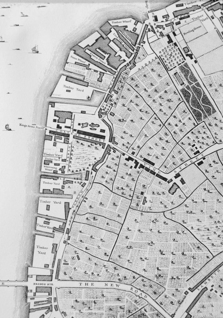
From the 17th century onwards, the land between Narrow Wall and the river was gradually developed. John Rocque’s map shows the area in the middle of the 18th century.

Westminster Bridge is at the bottom of the map and the future location of Waterloo Bridge is at the top of the map, to the left of the bowling green.

History of the Southbank Map 1

Narrow Wall, the original earthen wall, can be seen running parallel to the river, dividing the development along the river from the pasture land that covered much of Lambeth. Starting at the top right of the map, Cuper’s Garden runs in land from the river following almost exactly the route today of the approach road up to Waterloo Bridge.

Cuper’s Garden, one of the many pleasure gardens that ran along the south bank of the river was well known for displays of fireworks and it was also described as “not however the resort of respectable company, but of the abandoned of either sex”. The name came from one Boydell Cuper who had been the gardener to Lord Arundel at his property on the north bank of the river and who rented the land and created the gardens including using some of the old statues from Arundel House.

The land from Cuper’s Gardens along the river went under a number of changes of ownership and names including Bishop’s Acre, Four Acres and Float Mead.

Follow the river south through the wharfs and timber yards that now occupy the space between the river and the Narrow Wall, until College Street.

College Street is on the edge of the current location of the Jubilee Gardens with the open space bounded by College Street, Cabbage Lane and Narrow Wall, called College Gardens part of which is also now the Jubilee Gardens. At the end of College Gardens is Kings Arms Stairs, one of the many stairs down to the river. The curve inland of Narrow Wall at this point was later straightened out, with the inland curve being retained and originally named Ragged Row and then Belvedere Crescent.

The name College Street and College Gardens may refer to the ownership of this parcel of land by Jesus College.

The land after the next Timber Yard and onwards to Westminster Bridge was the future location of County Hall.

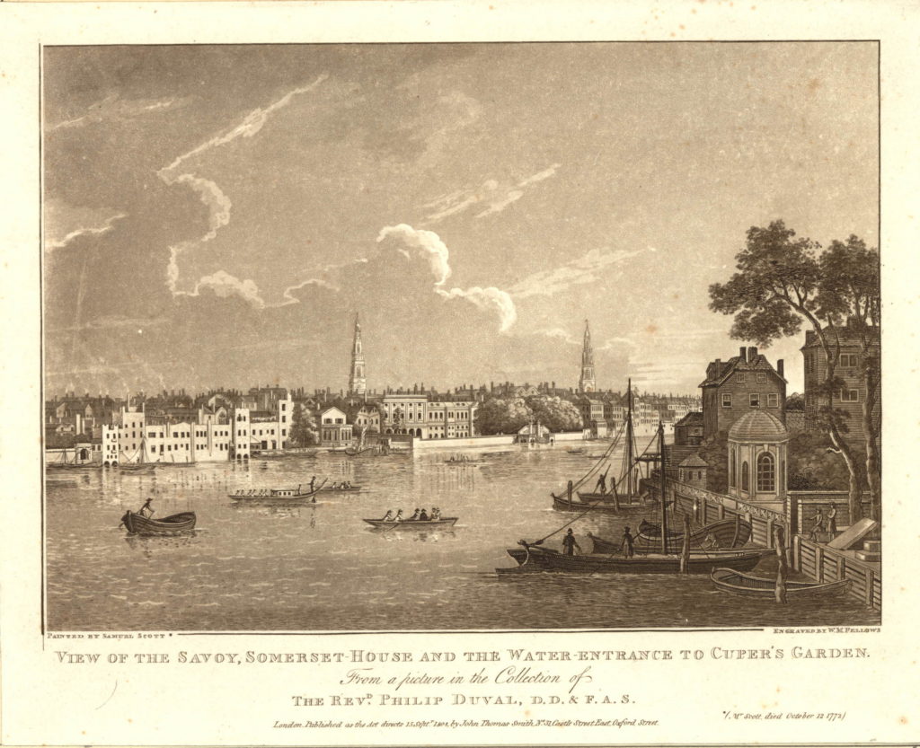
There are a number of prints of Cuper’s Gardens which give the impression of a very pleasant place. The following is from the mid 18th century and is looking across the curve of the river to the north bank, but shows the water entrance to Cuper’s Garden on the right side of the print.

591508001

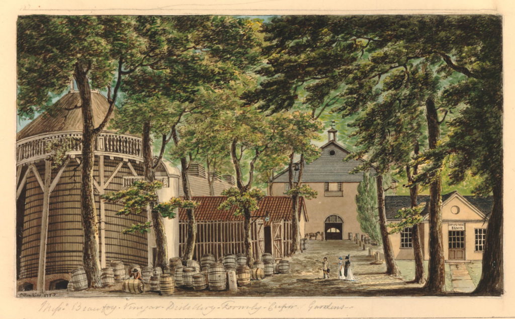
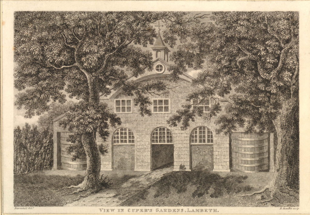
The following print is from 1798 and shows when part of the gardens were occupied by Beaufoy’s Distillery with a large amount of barrels outside. The print gives a good impression of the number of trees across the gardens as it was always described as a wooded area.

806092001

Another view of the Distillery in Cuper’s Gardens.

806217001

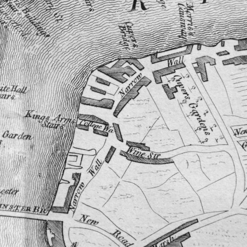
The next map is part of the “New and Correct Plan of London, Westminster and Southwark” from 1770. This shows the area to be roughly the same with Cuper’s Gardens at the top right of the map and Narrow Wall running down towards Westminster Bridge. This map is interesting as it shows the difficulty with relying on one specific map for accuracy. In the Rocque map, College Street is shown running into Vine Street. In the following map, College Street is now College Walk and Vine Street has changed into Wine Street. These are the only references I have found to these names so I assume that they are errors in 18th century map making.

History of the Southbank Map 6

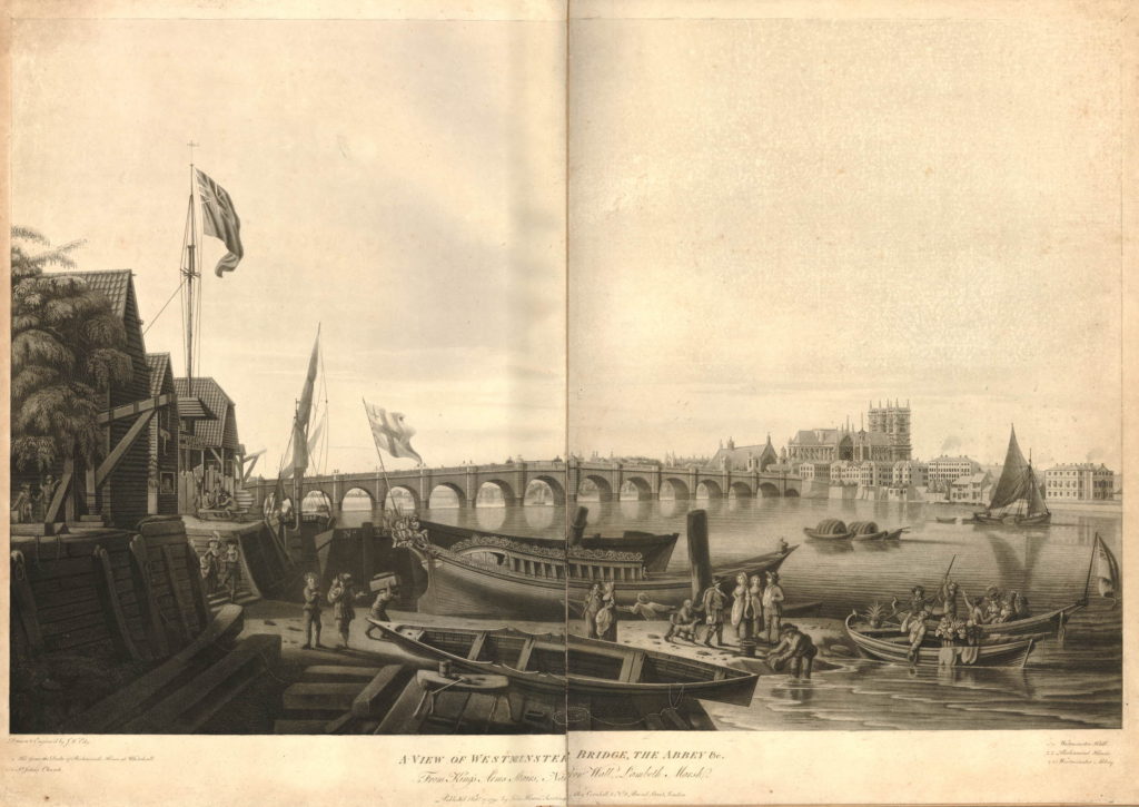
The above map shows the location of Kings Arms Stairs. The following print from 1791 is titled “A View of Westminster Bridge, the Abbey &c. from Kings Arms Stairs, Narrow Wall, Lambeth Marsh”. The stairs can be seen on the left, the tide is low and there is much activity on the waters edge. Westminster Bridge can be seen across the river with Westminster Abbey and Westminster Hall just to the left of the Abbey.

The rest of the scene cannot be a usual scene on this part of the south bank. In the centre of the print is a very ornate boat facing into the river with the flag of the City of London on the stern of the boat. The two small boats in the river to the right have people in ornate dress and large baskets of flowers. It would be interesting to know what was happening. On the left, the building just past the stairs has a sign reading “Artificial Stone Manufactory”, referring to Coade’s Stone Factory which i will cover later in the post.

582791001

Between the above map of 1770 and the next map, the Ordnance Survey map of 1895, the whole area underwent considerable development.

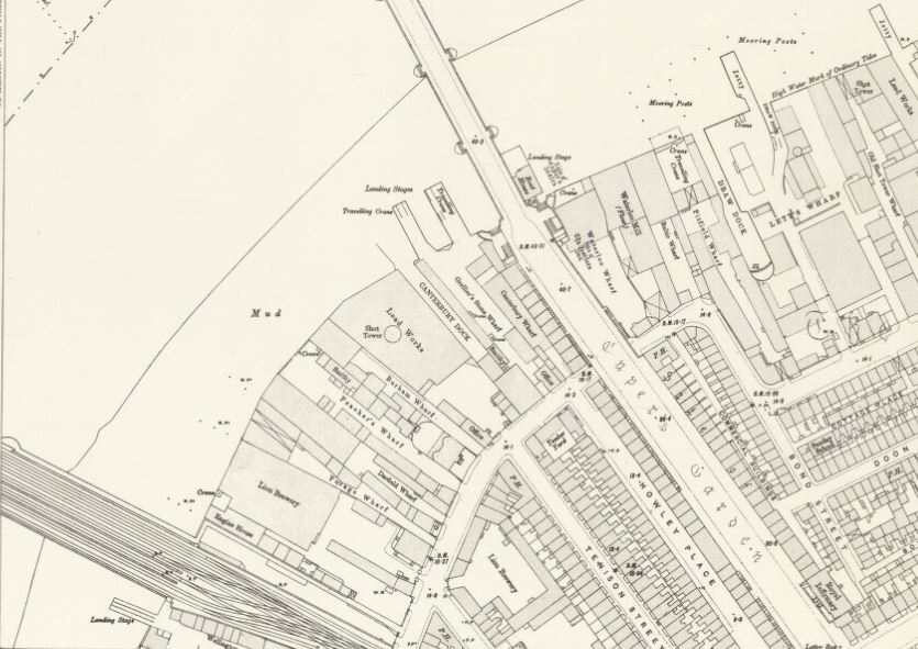
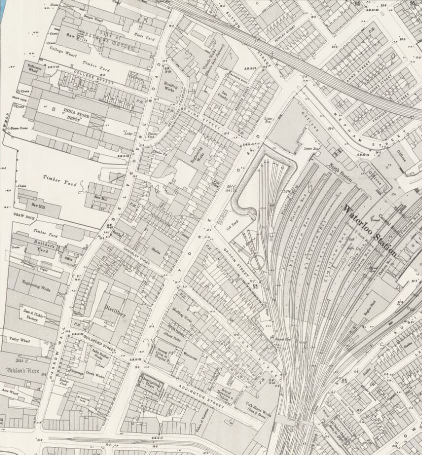
This edition of Ordnance Survey map splits coverage of the area between two maps, so the following map shows the area between Waterloo Bridge and Hungerford Railway Bridge.

History of the Southbank Map 3

The approach road to Waterloo Bridge still has the name of Cuper’s Garden, retaining a link from when this now heavily built area was mainly pasture land. The Waterloo Bridge approach was developed between 1813 and 1816.

The area inland from Belvedere Road has been developed with rows of terrace houses.

The area between the old Narrow Wall, now named Belvedere Road, and the River Thames is still industrial with two major landmarks, the Iron Works and Shot Tower close to Waterloo Bridge and the Lion Brewery adjacent to Hungerford Bridge. Narrow Wall was widened and straightened between 1824 and 1829 to become Belvedere Road. The source of the name is from Belvidere, a house and grounds on the land south of the Iron Works in the above map. As with many of the other pleasure grounds along the river, Belvidere was opened to the public from 1718 and sold wine and food, including fish taken from the river.

The start of the Hungerford Railway Bridge is shown in the lower left of the above map. Construction of the bridge and the associated railway almost cut the area in two with Belvedere Road now being the main route through the area. If you look back at the Rocque map, Hungerford Bridge was built over the Timber Yard and land just north of College Street.

Designed by Brunel, construction of the original Hungerford Bridge was completed by 1845 when the bridge was opened. It was not originally a railway bridge, the aim of the bridge was to bring more custom to the Hungerford Market on the north side of the river. The original bridge did not last long and in 1859 the construction of a new railway bridge was authorised by the Charing Cross Railway Act. The old bridge was demolished and the new railway bridge was opened in 1864. The chains and ironwork from the old Hungerford Bridge were sold to be used in the construction of the new Clifton Suspension Bridge, also to a design by Brunel.

The original Hungerford Suspension Bridge:

582941001

The other major change was the construction of Waterloo Bridge, with the approach road across the former Cuper’s Gardens. Construction of the original Waterloo Bridge commenced in 1811 with the bridge being opened by the Prince Regent on the second anniversary of the Battle of Waterloo in 1817, after which the bridge was named following an act of parliament in 1816 to approve the proposed name.

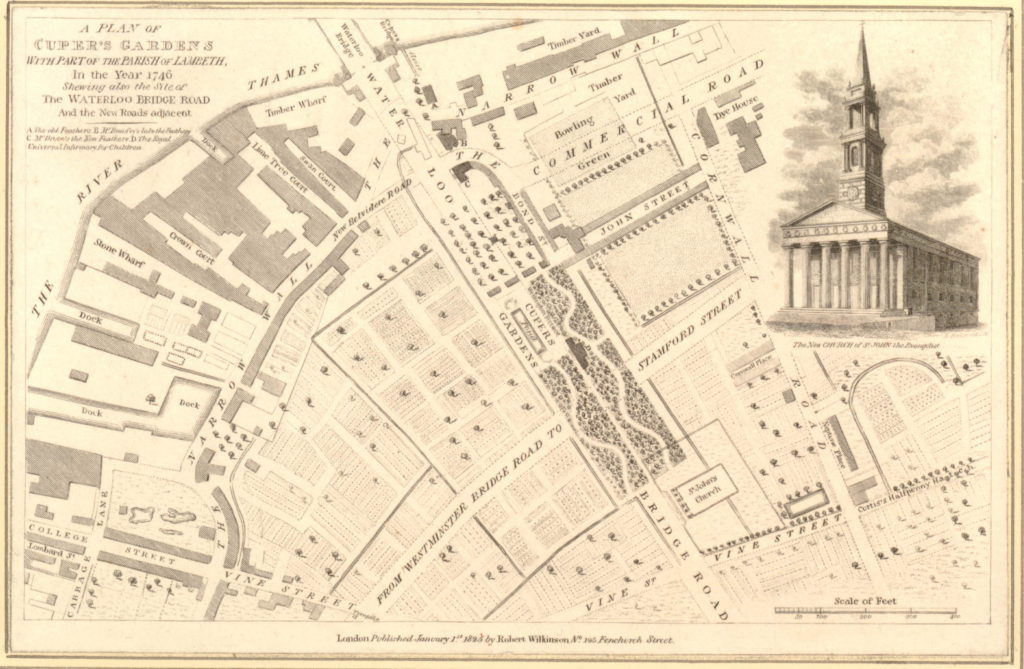
The following map is interesting as it appears to bring together some of the later development around Waterloo Bridge with the area in 1746. Published in 1825, eight years after the bridge was opened, it is titled “A Plan of Cuper’s Gardens with part of the Parish of Lambeth in the year 1746 showing also the site of the Waterloo Bridge Road and the new roads adjacent”.

The map helps define the exact location of Cuper’s Gardens as the church of St. John is also shown. The large roundabout at the end of Waterloo Bridge Road is now covering the end of Cuper’s Gardens at the junction with Stamford Street.

The map also shows how the name Belvedere Road came into use. The first straightening of the Narrow Wall is shown close to the approach to Waterloo Bridge and the name for this short section is New Belvidere Road. It is the first reference to the new street name, and also retains the original spelling from the house and gardens. As the name was taken on by the rest of the Narrow Wall, the name changed to the present spelling.

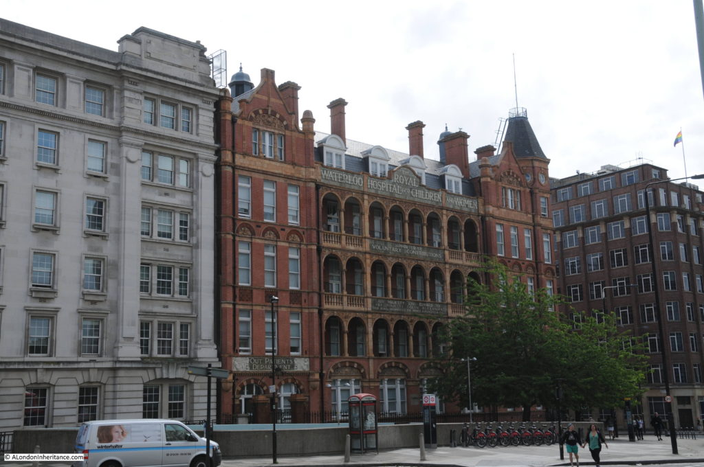
806218001You will need to click on the map to expand a larger version to see the next reference point to the area today. In the gardens in the wooded area just at the bottom right corner of the pond is a building marked D. Checking the key at top left, D is given as the “Royal Universal Infirmary for Children”. This is on an alignment of Waterloo Bridge down to St. John’s Church and although it has now closed as a hospital, a later version of this building, the Royal Waterloo Hospital for Children and Women is still there, on the junction with Stamford Street. This allows us to place the location of Cuper’s Garden precisely and as you walk up towards Waterloo Bridge from St. John’s Church, you are walking through the middle of Cuper’s Gardens.

The following photo shows the Royal Waterloo Hospital for Children and Women on the corner of the approach to Waterloo Bridge and Stamford Street.

History of the Southbank 31

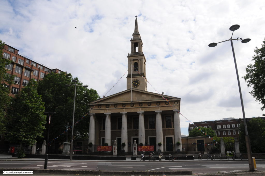
The church of St. John, although badly damaged by bombing during the last war, it was rebuilt to the original plan and is still exactly the same as the drawing on the 1825 map. During the Festival of Britain, the church was designated as the Festival Church with a programme of events during the period of the festival. The church is at the end of the original location of Cuper’s Gardens, the entrance to the gardens was on the left.

History of the Southbank 32

Looking up towards Waterloo Bridge from where the end of Cuper’s Gardens would have been. The hospital and Stamford Street are on the right. The IMAX cinema is on the left in the centre of the roundabout. A very different place to the 18th century gardens.

History of the Southbank 33

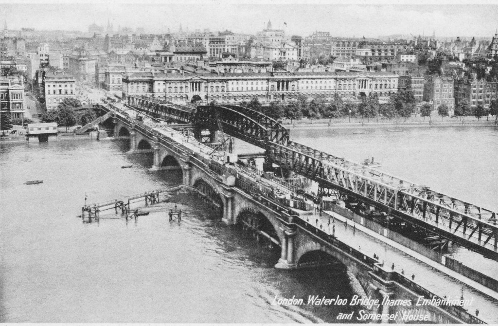
In 1923, Waterloo Bridge suffered from settlement to the central arch along with subsidence to the carriageway and parapet, leading to the bridge being closed to traffic in 1924. A temporary bridge was constructed alongside Waterloo Bridge and options were reviewed as to whether the original bridge should be repaired, rebuilt or a completely new design of bridge built.

The decision was for a new design of bridge and the Waterloo Bridge that we see today was fully opened in December 1945. The following postcard with a photograph taken from the top of the Shot Tower shows the original Waterloo Bridge with the damage to the central pier, along with the temporary bridge built alongside.

Postcard 5

Also in the above map, adjacent to Hungerford Bridge is the Lion Brewery. This area was originally the location of Belvidere House and Grounds, and in 1785, Water Works were built on the southern end of the gardens, drawing water from the river to supply the local residents. Not surprisingly, there were issues with the purity of the water being taken from the river and as part of the general improvements to London’s water supply, the water works were moved to outer London locations such as Surbiton. After the closure of the water works, the lease on the land was assigned to James Golding and the Lion Brewery was completed in 1837. On the opposite side of Belvedere Road to the brewery, Golding purchased a lease on an additional parcel of land and built stables and warehouses to support the brewery.

The Lion Brewery was taken over by the brewers Hoare and Company of Wapping in 1924 and in 1931 the building was badly damaged by fire. It was then temporarily used for paper storage before being demolished in 1949 to make way for the Royal Festival Hall.

During the demolition of the brewery buildings, a total of five wells were found which had been used to provide water for the brewery as water could not be taken from the Thames.

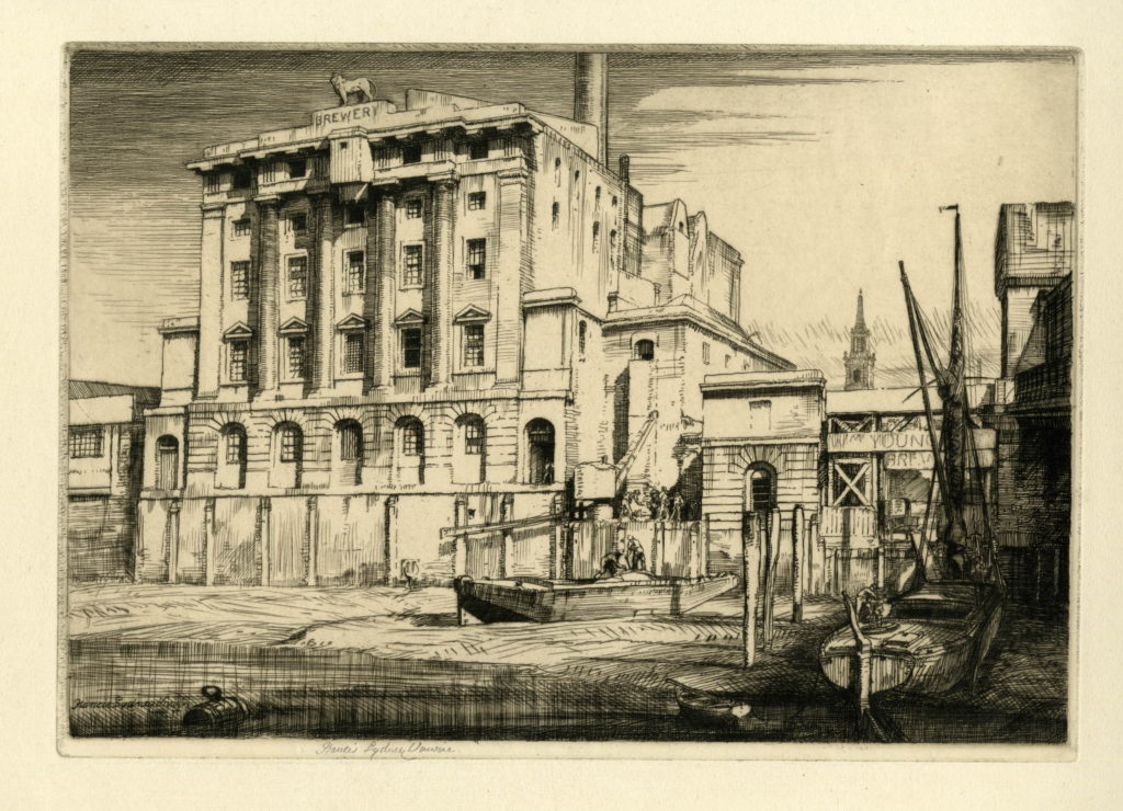
There are a number of prints which show the industry along the South Bank between Hungerford and Waterloo Bridges. The following shows the Lion Brewery. Note the tower of the church of St. John’s in the background.

334997001

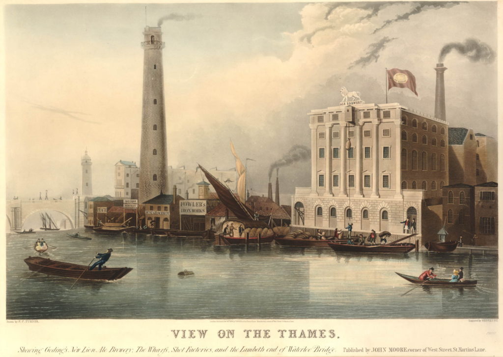
Another print shows both the Lion Brewery and the Shot Tower with the original Waterloo Bridge on the left.

582939001

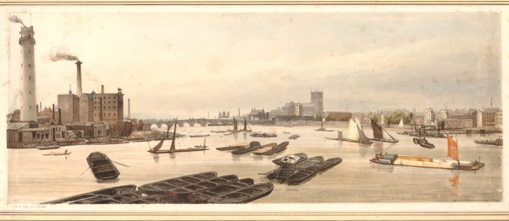
And a view from Waterloo Bridge along the river to Westminster Bridge before the construction of Hungerford Bridge. The Shot Tower and the Lion Brewery are on the left.

582808001

The Shot Tower was built in 1826. The gallery at the top of the tower is 163 feet high, and was used to drop molten lead for large shot. A gallery half way up the tower was used to make small lead shot.

The Shot Tower and the associated lead works were owned from 1839 by Walkers, Parker and Company who ran the business until 1949.

The area between Hungerford and Westminster Bridges is shown in the following map (the map cuts off before Westminster Bridge but if included it would be just at the bottom of the map to the left).

The map shows the straightened Belvedere Road, with the original curve in the road still in existence but is now named Belvedere Crescent. Follow Belevedere Road towards the bottom of the map and at the junction with Chicheley Street, it reverts back to Narrow Wall.

Below the Chicheley Street junction, the whole area between York Road and the river would later be occupied by County Hall. Following the Festival of Britain, the area bounded by York Road, Belevedere Road, the rail tracks and Chicheley Street would be occupied by the Shell Centre building. On the opposite site of Belvedere Road, up to the river, during the Festival of Britain, the Dome of Discovery would be built on the area occupied by the India Store Depot and today the Jubilee Gardens are on this spot.

History of the Southbank Map 4

At the top left of the map is a set of buildings, over which is written “site of Sparagus Garden”. This was also an early pleasure gardens, but unlike Culper’s Gardens, is not very well documented. This was also the site of Coade’s Artifical Stone Works.

The initial stone works on the site were opened in around 1770 by Daniel Pincot who published that he had opened a factory “by King’s Arms Stairs, Narrow Wall, Lambeth”. At some point soon after 1770, the factory appears to have been taken over by Eleanor Coade who would go on to run the factory for 25 years until her death in 1796 when her daughter, also called Eleanor, took over the factory. The younger Eleanor also ran the business well and opened a gallery for the factory’s products at the corner of Narrow Wall and Bridge Street – the street leading up to Westminster Bridge – along with a number of houses which took the name Coade’s Row.

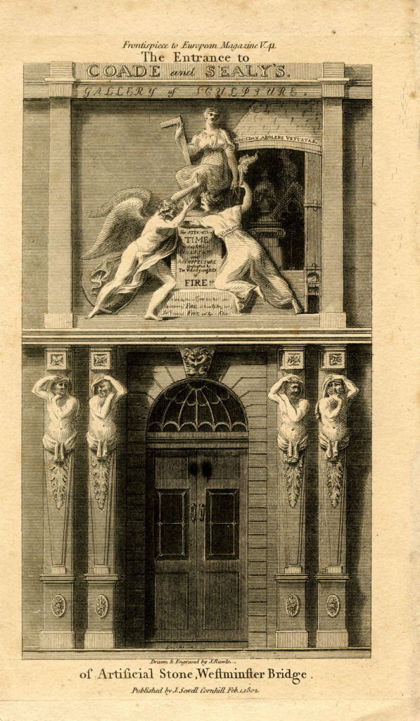
The entrance to the Coade Stone showroom on Westminster Bridge Street:

853044001

Products from the Coade factory were used across London and wider afield, but the most long lasting and well known is the lion that was on top of the Lion Brewery. Removed and stored at the time that the brewery building was demolished, it was installed on a plinth at the southern end of Westminster Bridge in 1966.

The younger Eleanor Coade was unmarried and had no children by the time of her death in 1821, however she had already taken on a cousin, William Croggon to take control of the business, who was succeeded by his son Thomas in 1836, however his ownership of the business did not last long and the Coade Stone Factory appears to have closed a year later in 1837 and the production of this unique, man-made stone was consigned to history.

Just to the south of College Street, is labelled the India Stores Depot. This was built in 1862 on land leased by the Secretary of State for India. These stores were gradually extended until the start of the 2nd World War, during which they suffered considerable damage and were demolished to make way for the Festival of Britain.

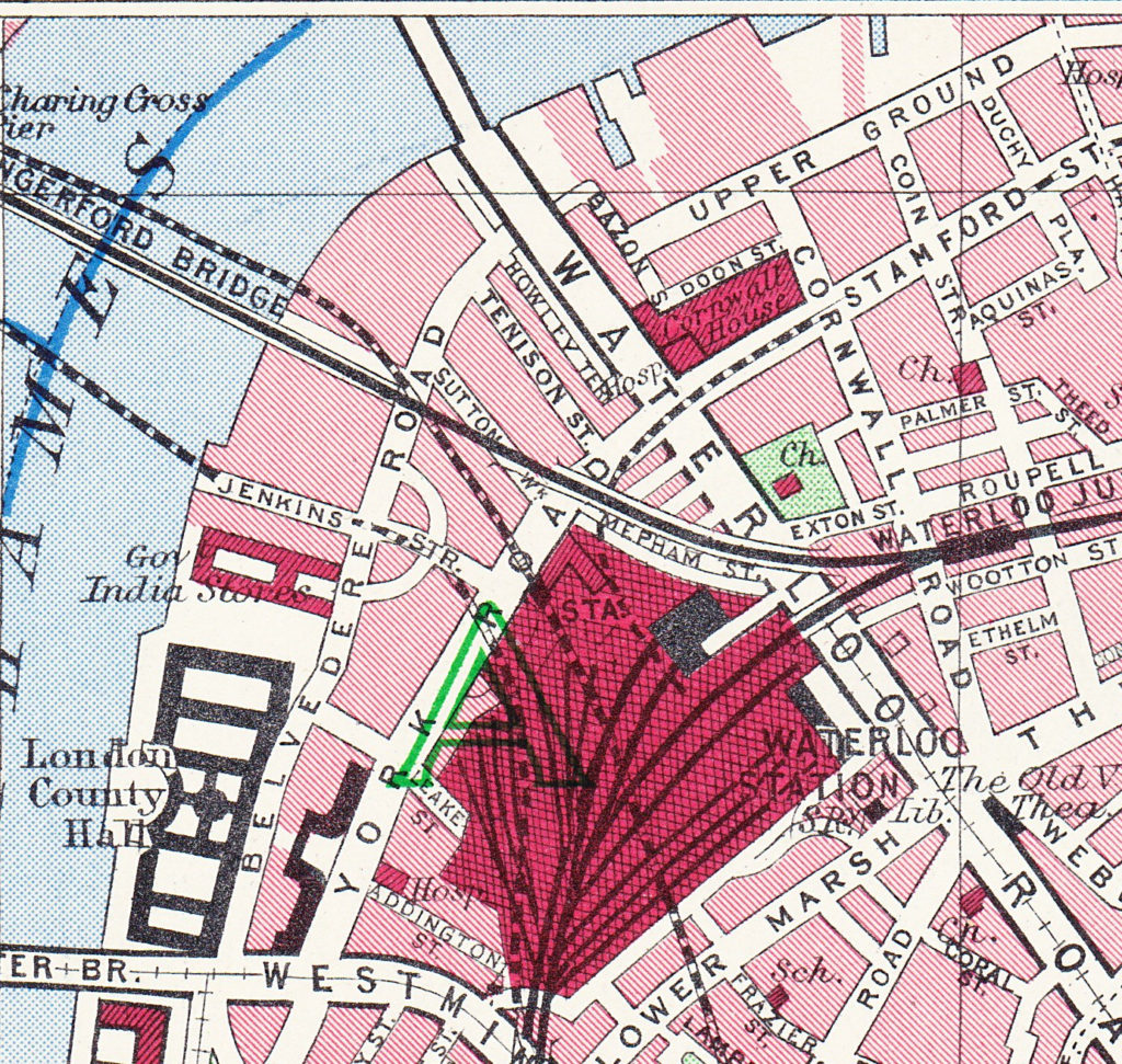
As a final bit of confusion regarding continuity of street names, the following map extract is from the Bartholomew Greater London Street Atlas from 1940. It shows Belvedere Road running between Westminster and Waterloo Bridges, with Howley Place shown at Howley Terrace, Tension Street and Sutton Walk with the same names as previous maps, but further along, where College Street and Vine Street were shown in the 1895 Ordnance Surcey map, the street is now called Jenkins Street. This map is the only place I have seen this name for the street, so it was either an error, or there was a name change between 1895 and 1940.

History of the Southbank Map 7

And finally we come to today and the following map shows the layout of the area as it is now – although this will also change soon as the buildings surrounding the Shell Centre tower have been demolished to make way for a new development of multiple apartment towers.

History of the Southbank Map 5

The map shows roughly the same area, between Waterloo Bridge at the top of the map and Westminster Bridge at the bottom.

The only streets that remain from previous years are Belvedere Road and Chicheley Street. Belvedere Road has been widened and straightened over the years, but follows roughly the same route as the Narrow Wall and the original earthern embankment.

There is more land between Belvedere Road and the river as during the construction of County Hall and the Festival of Britain, the embankment was pushed further into the river.

The approach road to Waterloo Bridge now covers the area occupied by Cuper’s Gardens. The Royal Festival Hall occupies the site of Timber Yards and then the Lion Brewery.

The Coade Stone Factory was on the site now occupied by the car park above the Jubilee Gardens.

The rows of terrace houses between Belevedere Road and York Road have gone with the space being occupied by the Shell Centre Upsteam and Downstream buildings – off which all but the tower building have either been converted into apartments or have been demolished to make way for more apartment blocks.

In my next post we will have a walk along Belvedere Road looking at the buildings and views from between 1947 and 1950 as the site is prepared for the Festival of Britain and comparing with the same scenes today.

All the prints in the above post are ©Trustees of the British Museum

The extracts from the 1895 Ordnance Survey Map are reproduced by permission of the National Library of Scotland.

alondoninheritance.com

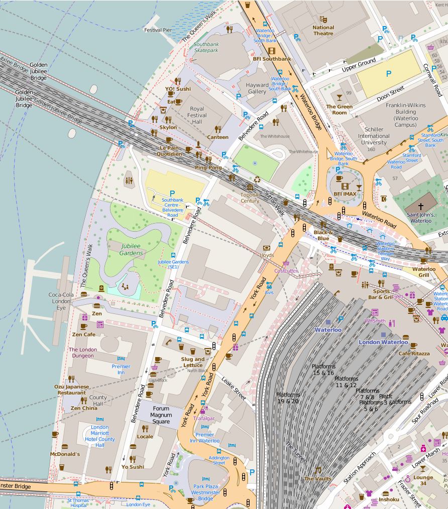
Tenison Street and Howley Terrace – Lost Streets On The Southbank

The area on the Southbank between Waterloo Station, the Thames, Waterloo Bridge and County Hall has seen considerable change over the last 70 years. Originally the location of industry and closely packed housing, post war the streets and buildings were almost completely erased and the Festival of Britain was built on the site in 1951.

Following the end of the Festival, the Royal Festival Hall remained with later additions including the Hayward Gallery and Purcell Room. On the area between Belvedere Road and Waterloo Station, Shell Centre, the UK head offices of the Royal Dutch Shell oil company were built, consisting of a tower block and upstream building to the west of Hungerford Bridge, with a downstream building to the east. The downstream building of Shell Centre was converted into flats some years ago, and currently the wings around the tower building are almost fully demolished ready for the construction of more residential towers (see my post covering a walk round the Shell Centre viewing gallery for more information).

My father took a number of photos of the area just after the war and during the building of the Royal Festival Hall. I have already covered posts on Building the Foundations of the Royal Festival Hall, the South Bank before the Royal Festival Hall, Construction of the Royal Festival Hall, and Sutton Walk.

Scanning through negatives, I have since found additional photos of the area and I feature these for this weeks post.

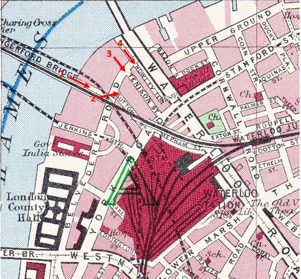
The map below is from the 1940 Bartholomew’s Atlas of Greater London and I have marked the locations and directions of view of this week’s photos.

More Southbank 12

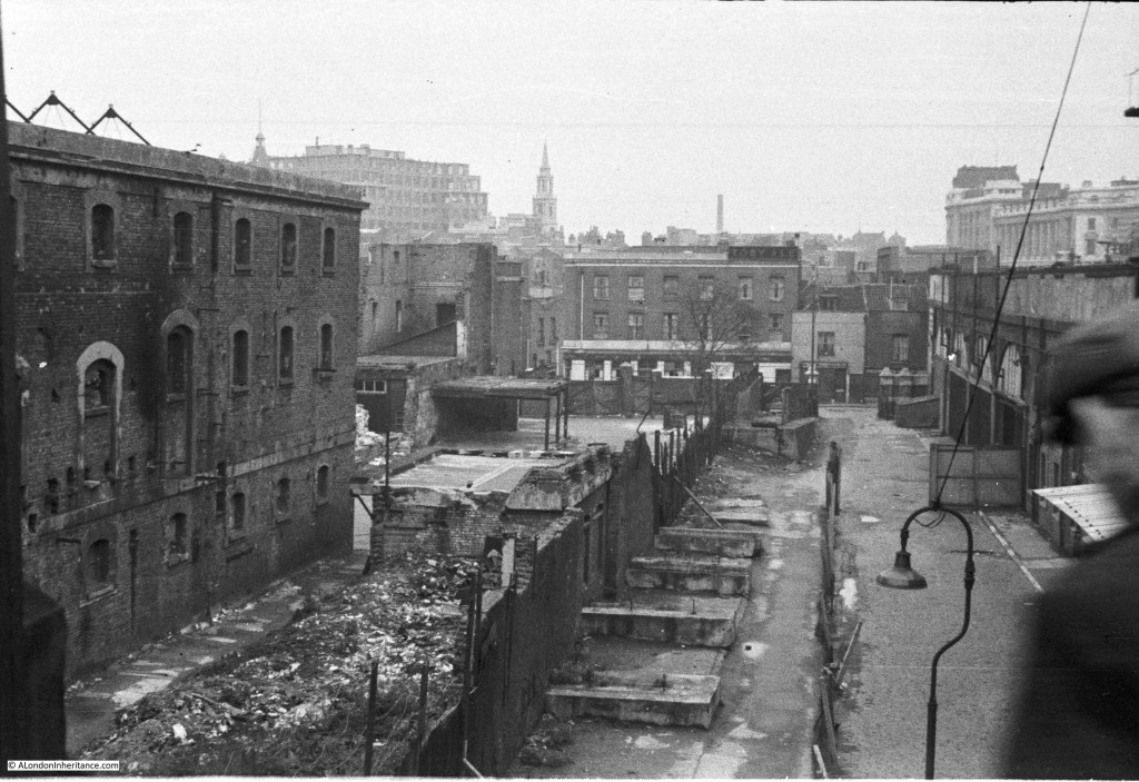
The following photo is from position 1 on the map and was taken from the end of the footbridge that ran alongside Hungerford Railway Bridge. The Lion Brewery is on the left and the railway into Waterloo East and across the river to Charing Cross Station is on the right, with Waterloo Station being the building on the far right. The buildings at the end of the road alongside the railway are along Belvedere Road. The building with the white lower level is a pub, however I have been unable to confirm the name, there were a number of pubs along Belvedere Road but I cannot find the name of this one. Sutton Walk is to the left of the pub.

More Southbank 5

Enlarging the photo, the building to the right of the pub has the name “Westward Ho” on the sign above the ground floor door and window. Not sure what this was, however in the Survey of London volume for the area there is a drawing of the building, the online page can be found here. Unfortunately, the Survey of London does not shed any light on the name of the pub. It does confirm that these buildings were numbered 116 and 118, the only pubs I can find were the White Hart at number 35 and the Green Dragon at number 68.

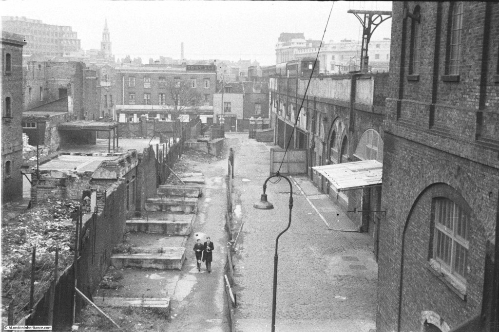
These photos were taken in 1948, before demolition took place in 1949. Another view at a slightly different angle from the end of the footbridge:

More Southbank 6

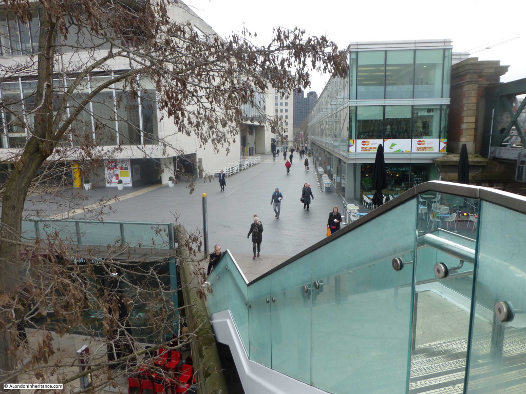
The Royal Festival Hall now occupies the area on the left and the whole scene has changed dramatically. Standing on the end of the new footbridge alongside Hungerford Bridge, I took the following photo.

More Southbank 10

My father visited the area again as demolition was taking place. This must have been around 1949 as this was the time when the area was being cleared ready for construction of the Festival of Britain.

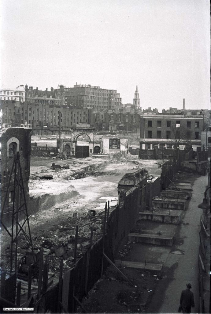
The following photo is from the same position on the end of the Hungerford Bridge footbridge and is looking slightly to the left of the above photos. Much of the Lion Brewery has now been cleared with only the entrance arch to Belvedere Road remaining. It also looks as if the pub has been gutted with empty windows now looking out onto the area.

More Southbank 3

The tall buildings in the background to the left all remain to this day. The church is St. Johns at Waterloo, the building to the left of the tall office block is the old Royal Waterloo Hospital for Women and Children.

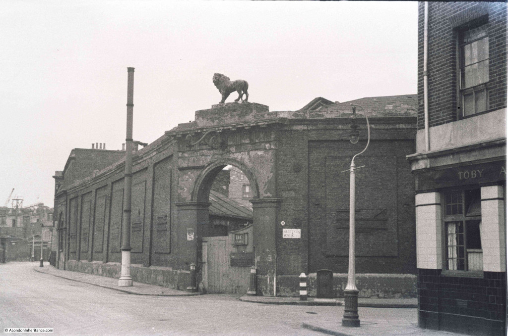
I featured the following photo in my post on Sutton Walk. This was taken outside the pub with Sutton Walk running off to the right and part of the Lion Brewery directly opposite.

More Southbank 7

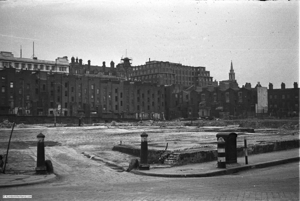
I have repeated this photo as the following photo was taken from roughly the same position after the brewery buildings had been demolished. The bollards confirm the location. This is looking from point 2 on the 1940 map.

The buildings that edge the open area are houses that ran along Howley Terrace.

More Southbank 2

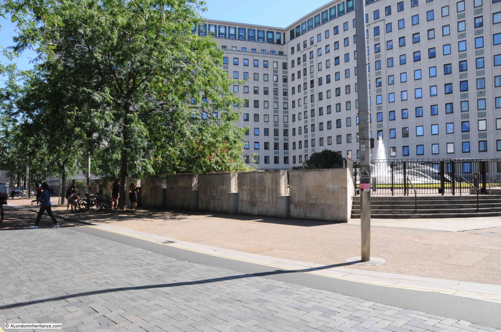
Sutton Walk has changed location, however the following photo was taken from roughly the same location and looking in the same direction. This whole area is now occupied by the White House Apartment Building (the old Shell Centre Downstream Building).

More Southbank 8

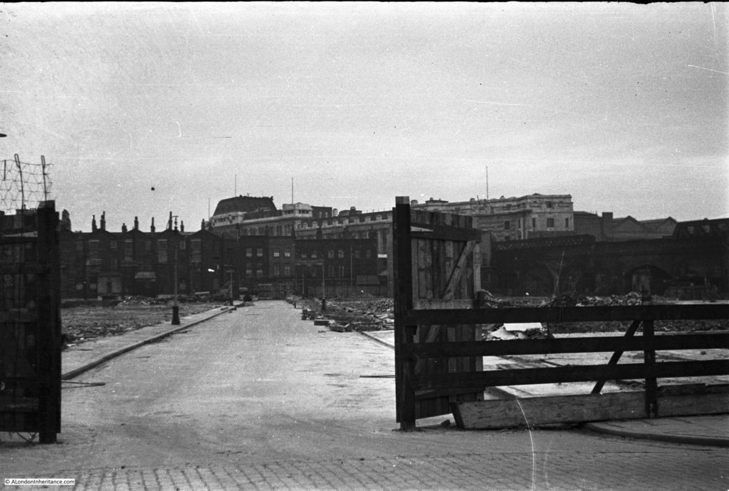
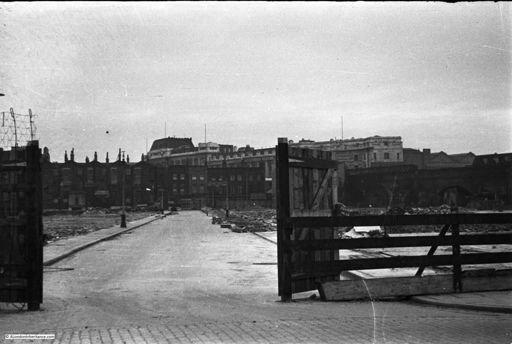
Moving along Belvedere Road towards Waterloo Bridge, the following photo is looking along point 3 in the map, along what was Tenison Street. The buildings have all been demolished but the road, pavement and street lamps remain, however they will also soon go ready for the Festival of Britain.

More Southbank 1

It is difficult to get the precise location today as the White house building obscures the view of Waterloo Station, however I took the following looking in the direction of where I believe Tenison Street ran.

More Southbank 13

As I covered in one of my earlier posts on the area, many of the roads in this area were named after Archbishops of Canterbury. Tension Street was named after Thomas Tenison who was Archbishop of Canterbury from 1695 to 1715.

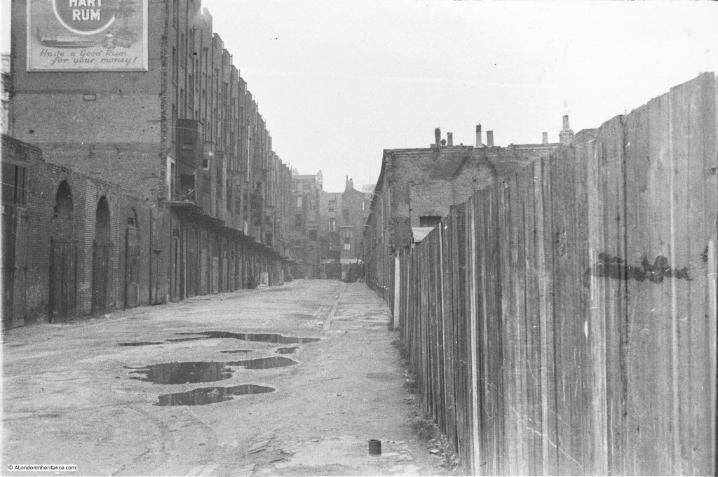
Move a bit further along Belvedere Road, and the following photo is looking along Howley Terrace (view 4 in the above map). The approach road running up to Waterloo Bridge is to the left of the photo hence the large advertisement on the side of the building to catch the eye of those travelling across Waterloo Bridge from the north to the south.

More Southbank 4

As part of the reconstruction of the area, a new approach road was built up to Waterloo Bridge. This approach road covered some of the area occupied by most of the housing on the left. Today, at the end of the approach road to Waterloo Bridge, at the junction with York Road and Stamford Street is a large roundabout which covers the space occupied by the houses at the very end of Howley Terrace.

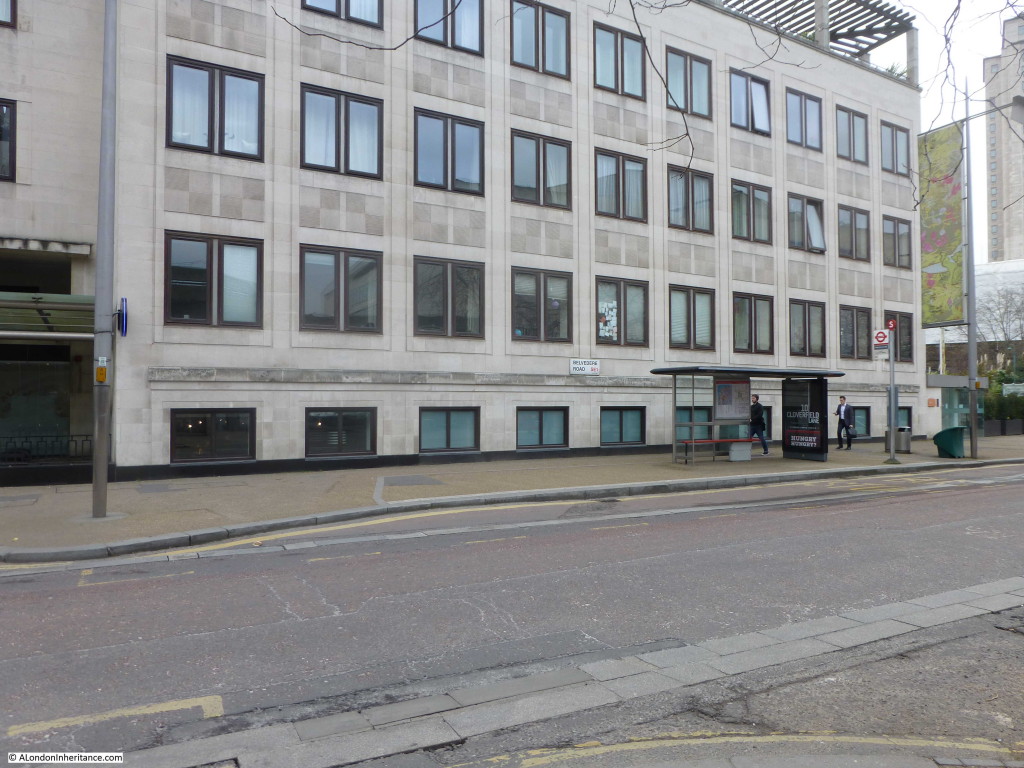
The following photo is looking along the same view today.

More Southbank 11

Remarkable how the area has changed. The original buildings along Howley Terrace (named after William Howley, Archbishop of Canterbury from 1828 to 1848) were crowded, multi-tenant housing with very basic facilities. Apartments in the White House now sell for between one and three million pounds.

William Kent in his 1951 edition of An Encyclopedia Of London has a couple of references to Tenison Street and Howley Terrace:

“The Lion Brewery has always been associated with a famous crime. In 1872 Dr. W.C. Minor, who had been a surgeon in the American Civil War, and on a visit to this country, was staying at 41 Tenison Street, shot a stoker, an employee of the Brewery in Belvedere Road. At the trial, he was found guilty but insane. From Broadmoor criminal lunatic asylum, where he was confined, he contributed between five and eight thousand quotations to Sir James Murray’s famous Oxford English Dictionary, and his name will be found in the acknowledged assistants to that great work.

In the process of making a site for the Festival of Britain, in the course of excavations, a skeleton was found near Howley Terrace. It was 12ft below ground and in 2ft of mud. It is believed to have been two hundred years old. Its legs were sprawled in odd directions, which seemed to indicate a violent end.”

Kent also states that during the preparation of the site for the Festival of Britain, sixty men used 93,000 tons of demolition material to build the river wall which is 1,691ft long,  so it is interesting to think that as you walk along the Southbank, next to the Thames, you may well be walking on all the materials that once made up the brewery and houses that occupied this area.

It is fascinating to walk around the Southbank with the photos from this and previous posts on the area. I can now build up a detailed photographic record of this small but fascinating part of London. I plan to bring these all together in a future post for a detailed walk around the area covering before, during and after the Festival of Britain to the current day.

alondoninheritance.com