Tag Archives: Rotherhithe

Horn Stairs, Cuckold’s Point and Horn Fair

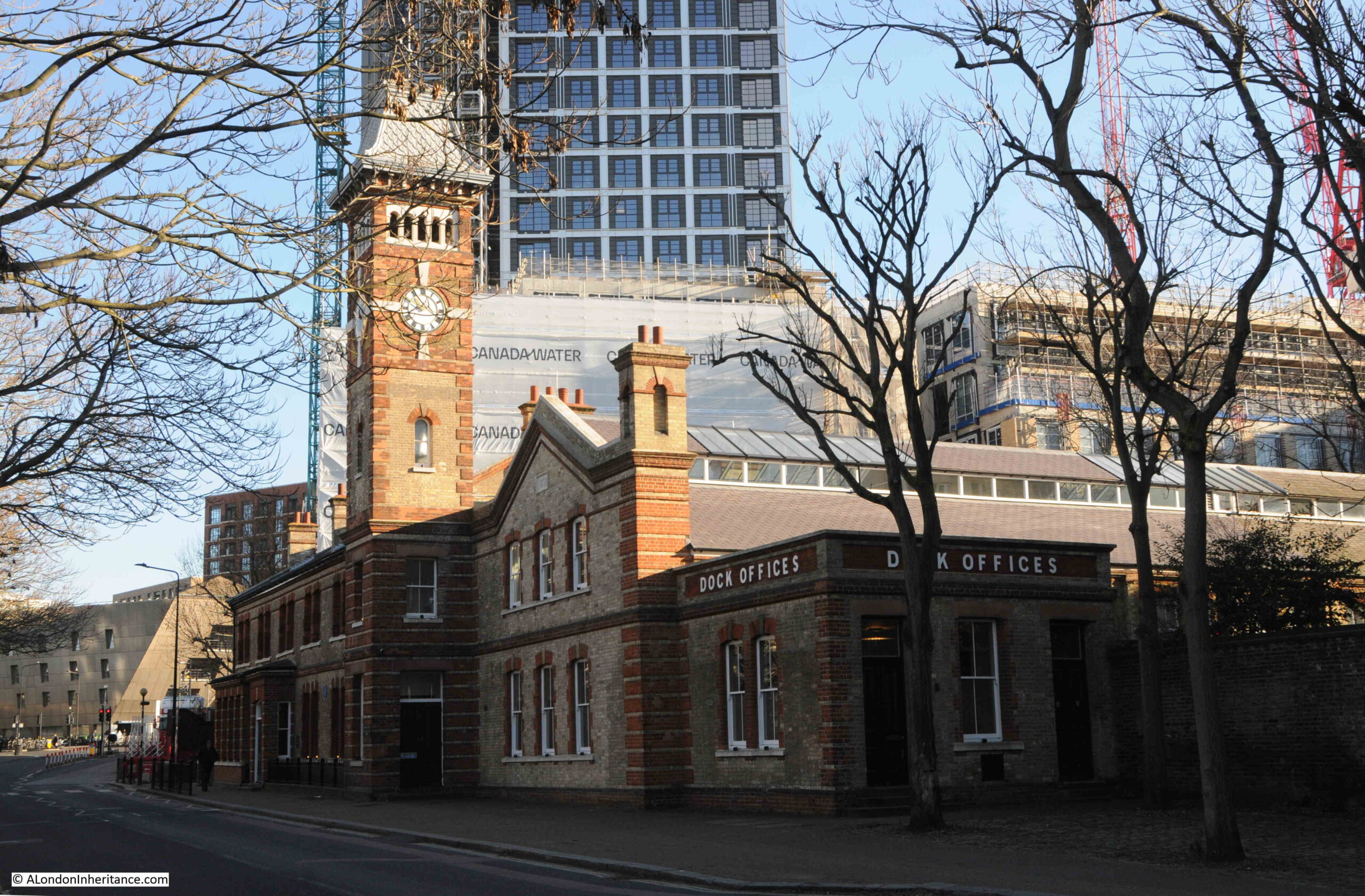
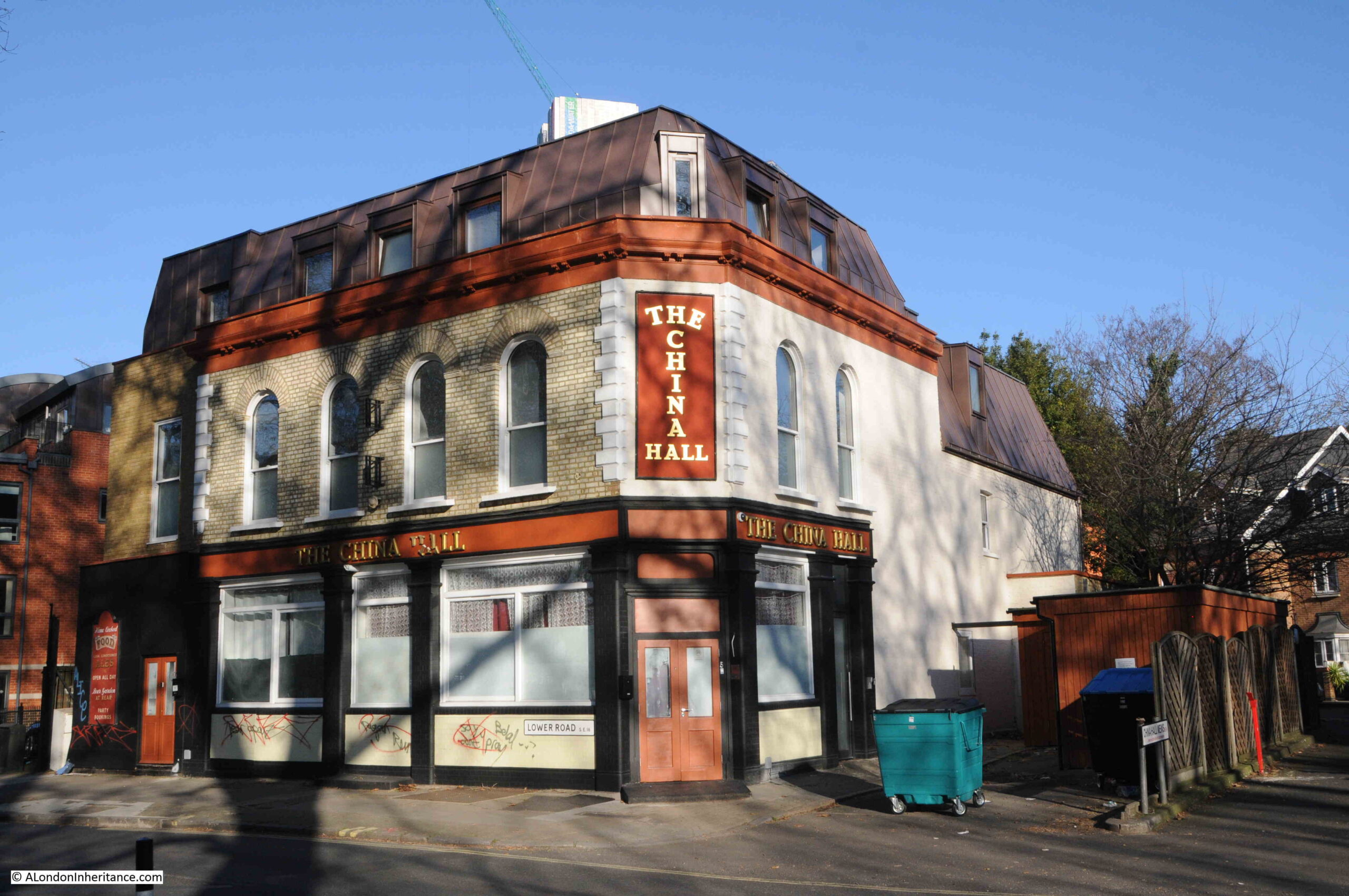
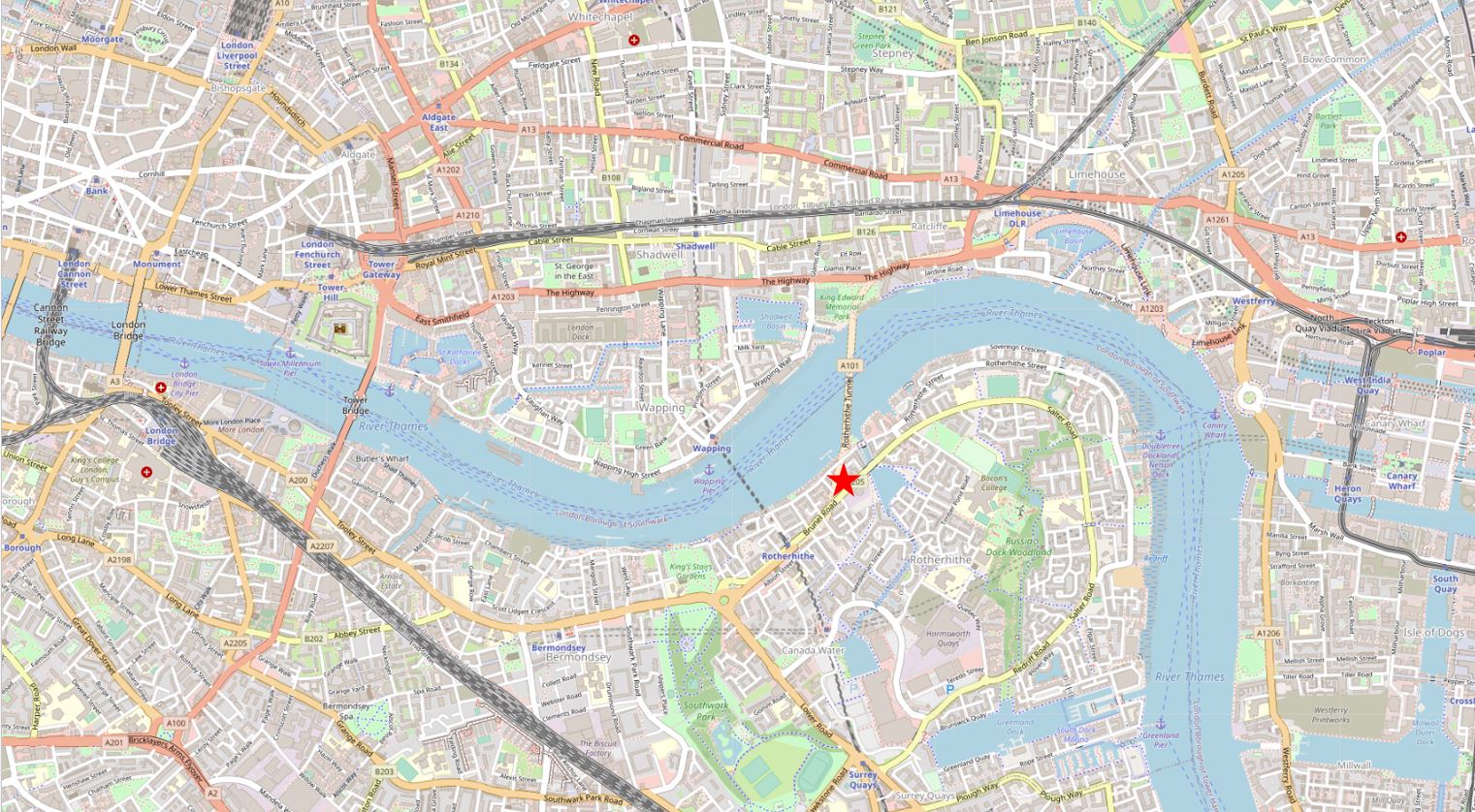
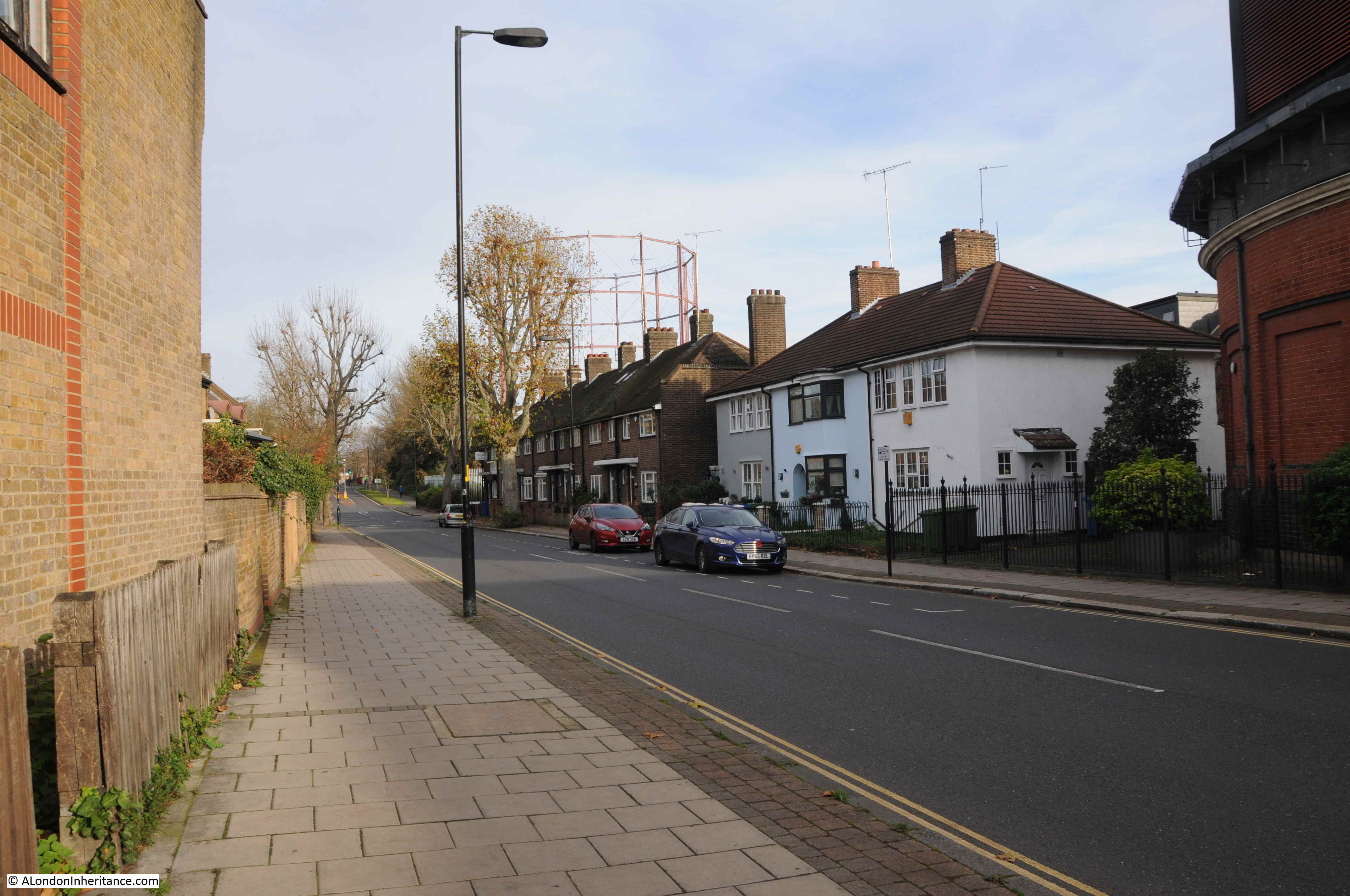
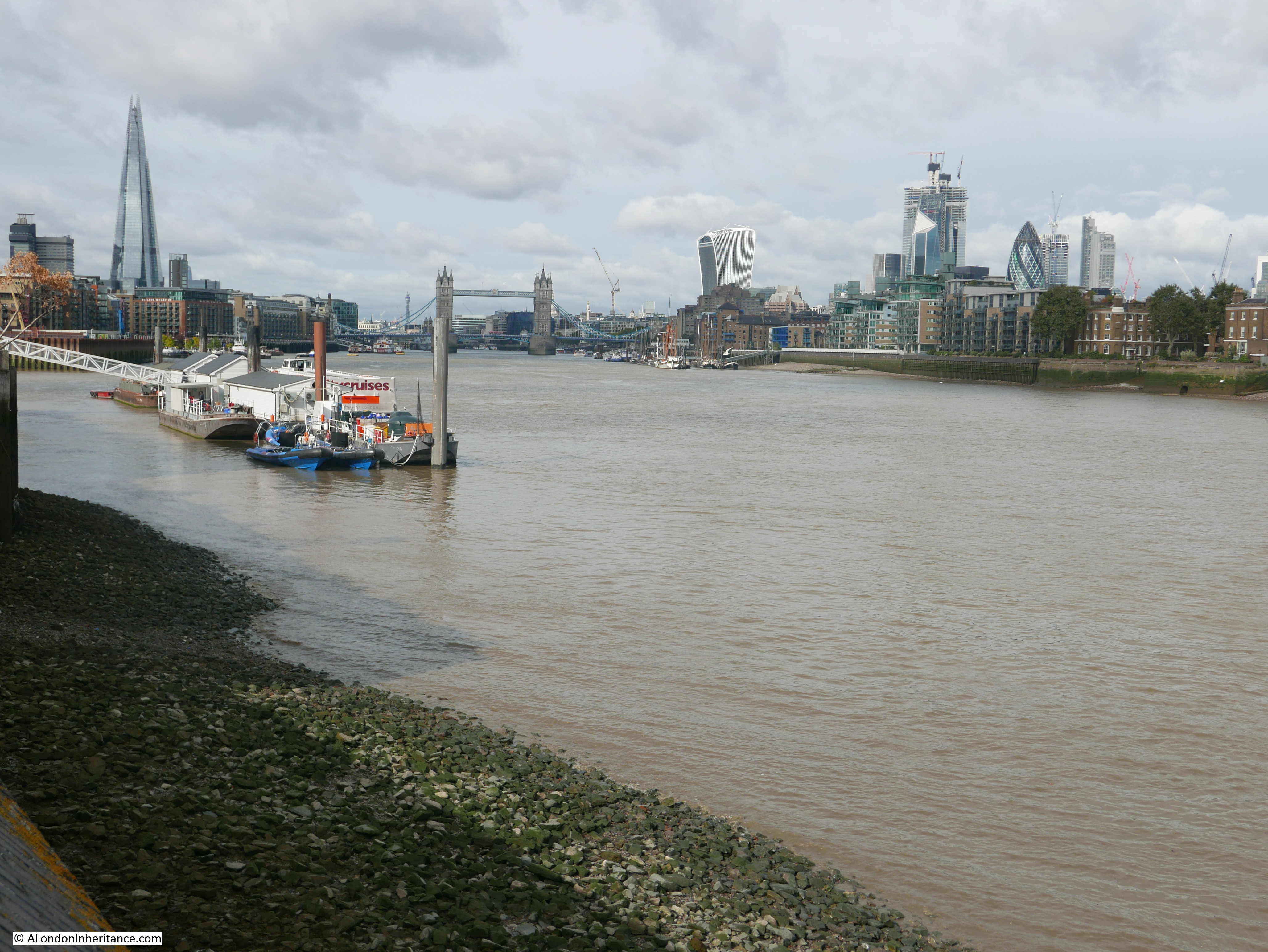
If you wanted to visit somewhere in London on a very cold January morning, a bright day, but with ice having formed overnight on standing water, the last place you may think of is the Thames foreshore, however, on such a day, I went to one of my favourite places on the river – Horn Stairs and Cuckold’s Point:

Cuckold's Point

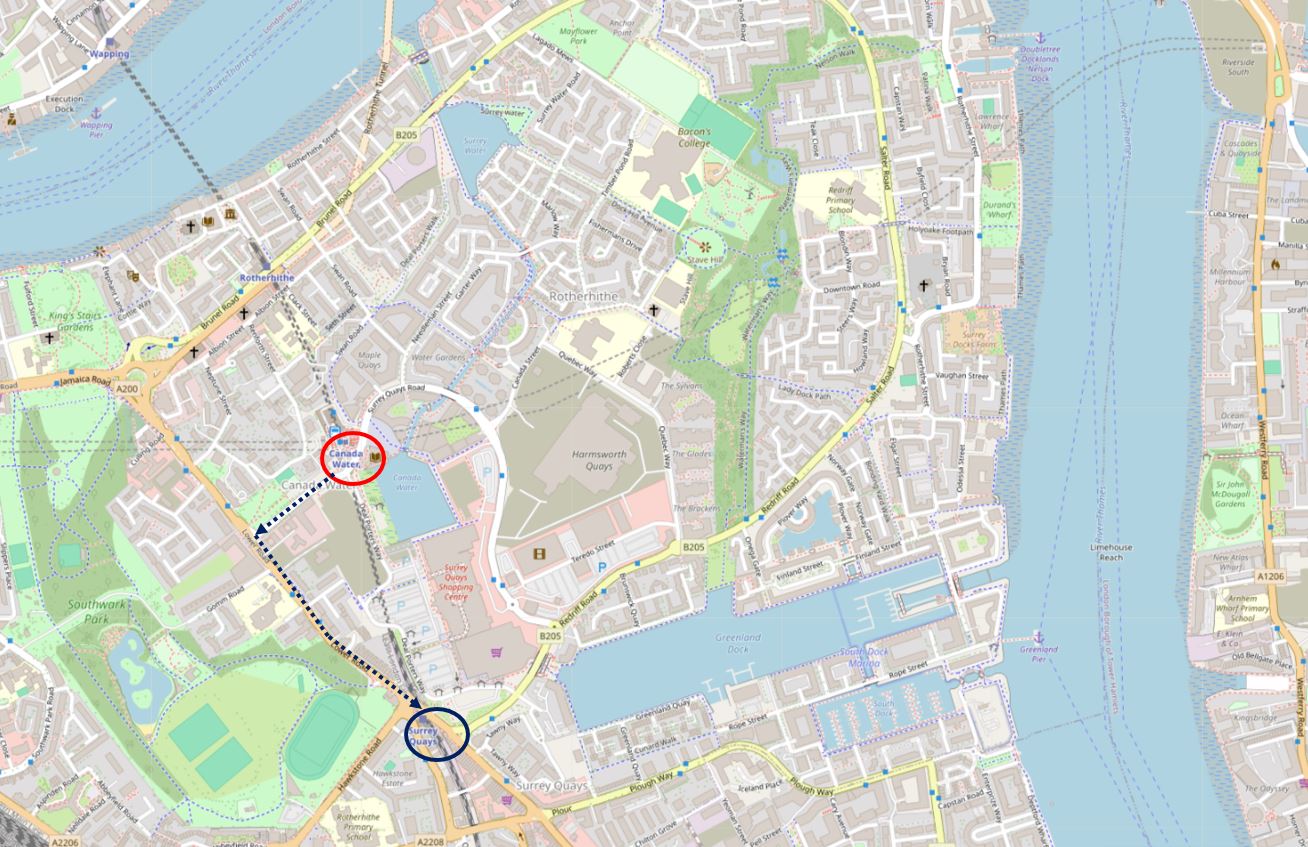
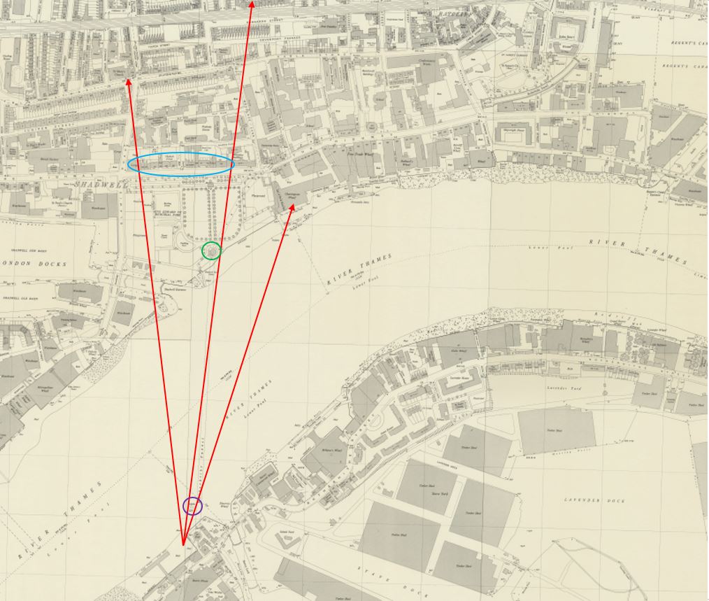
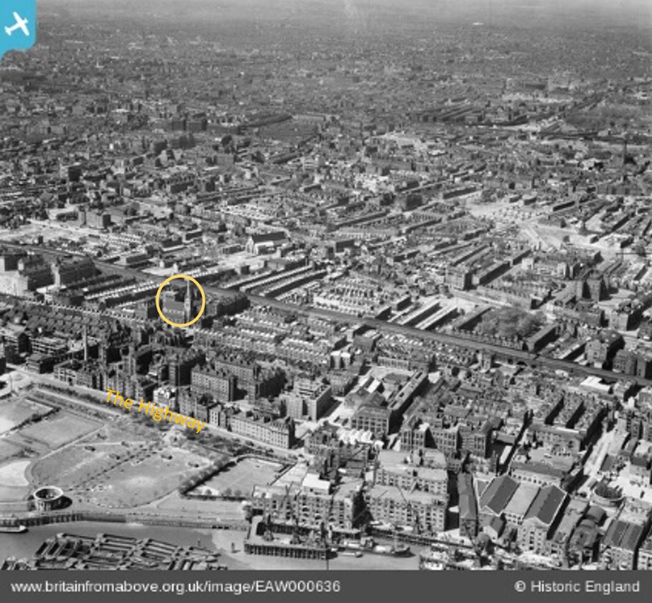
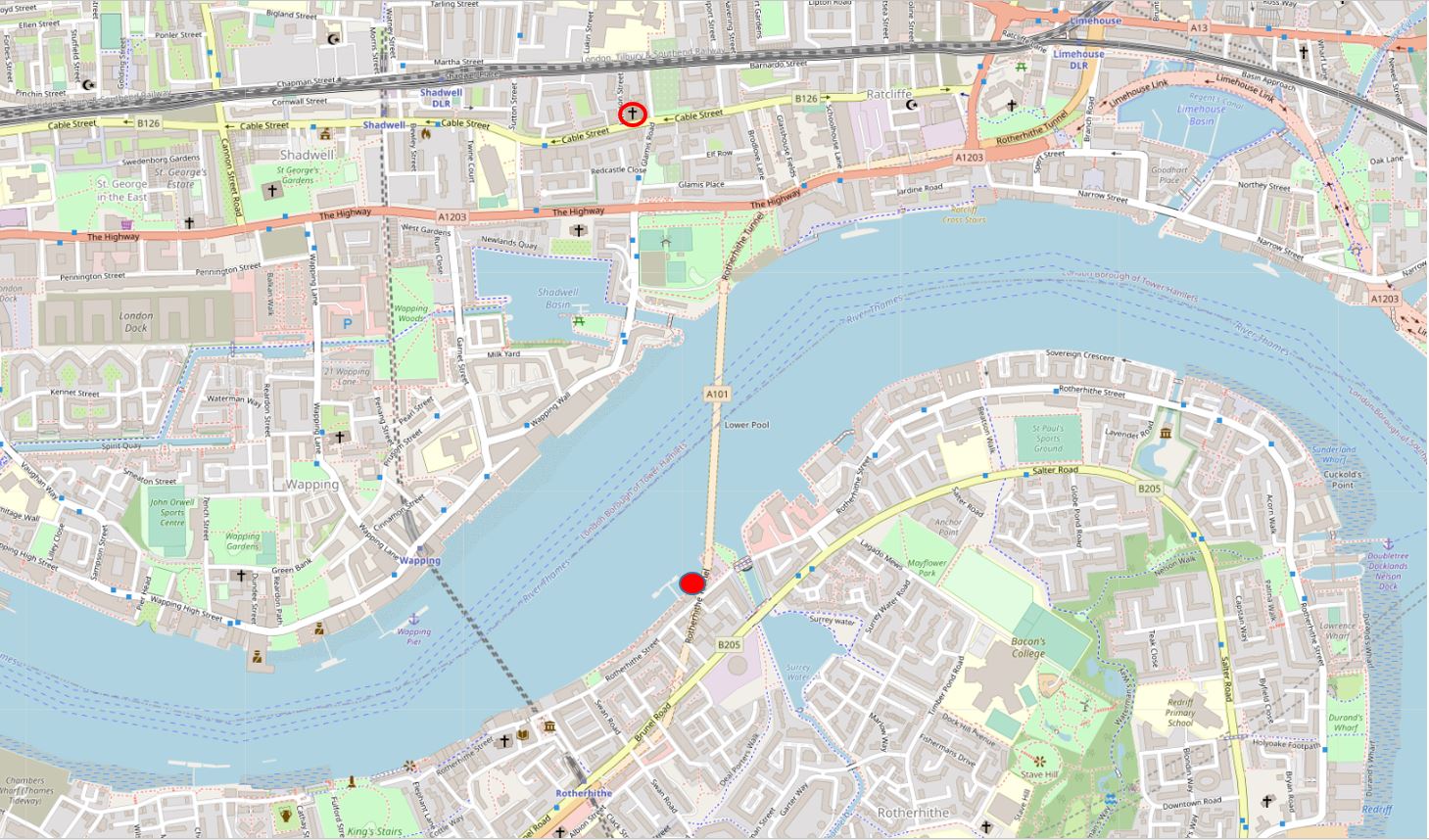
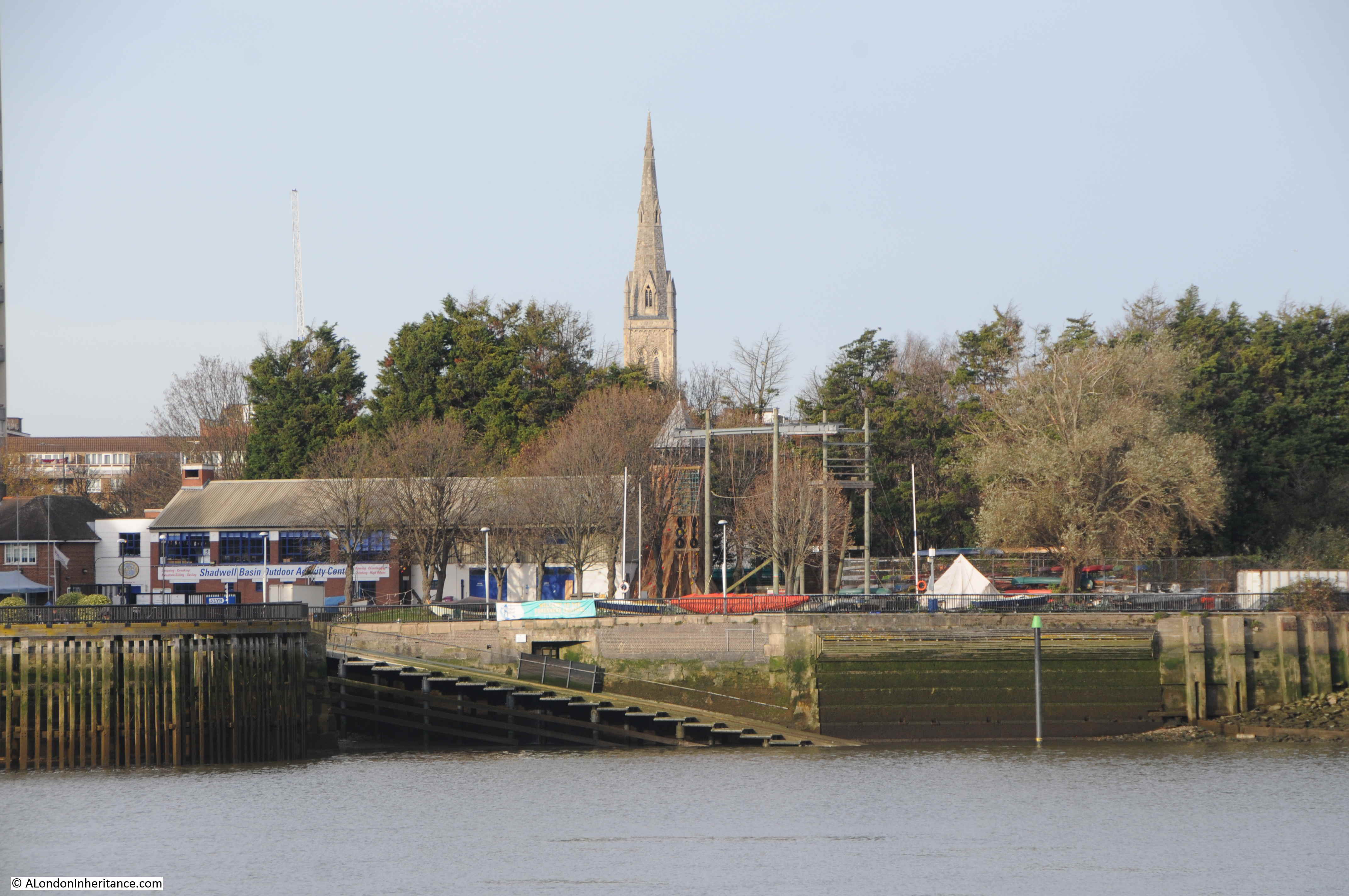
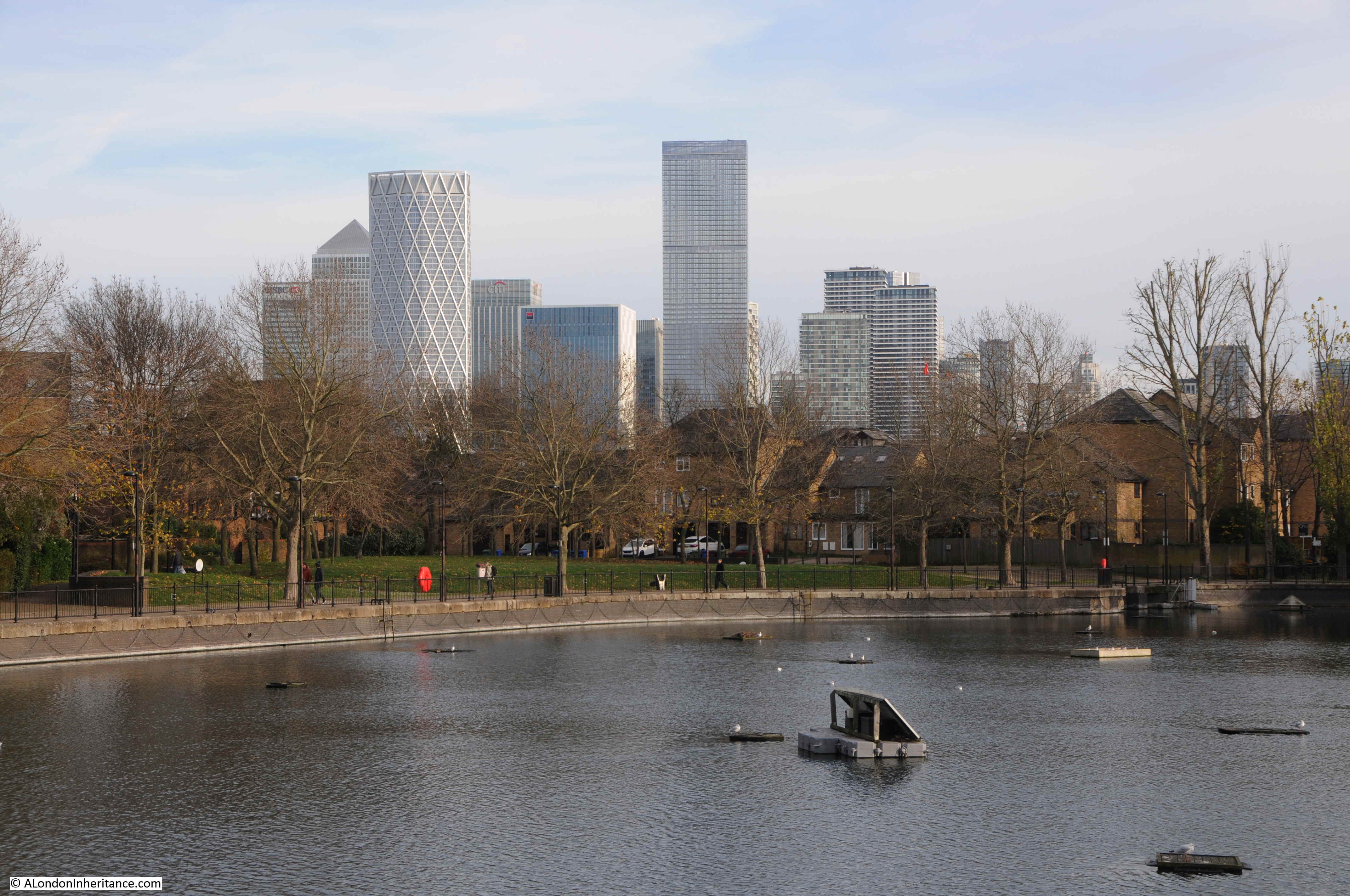
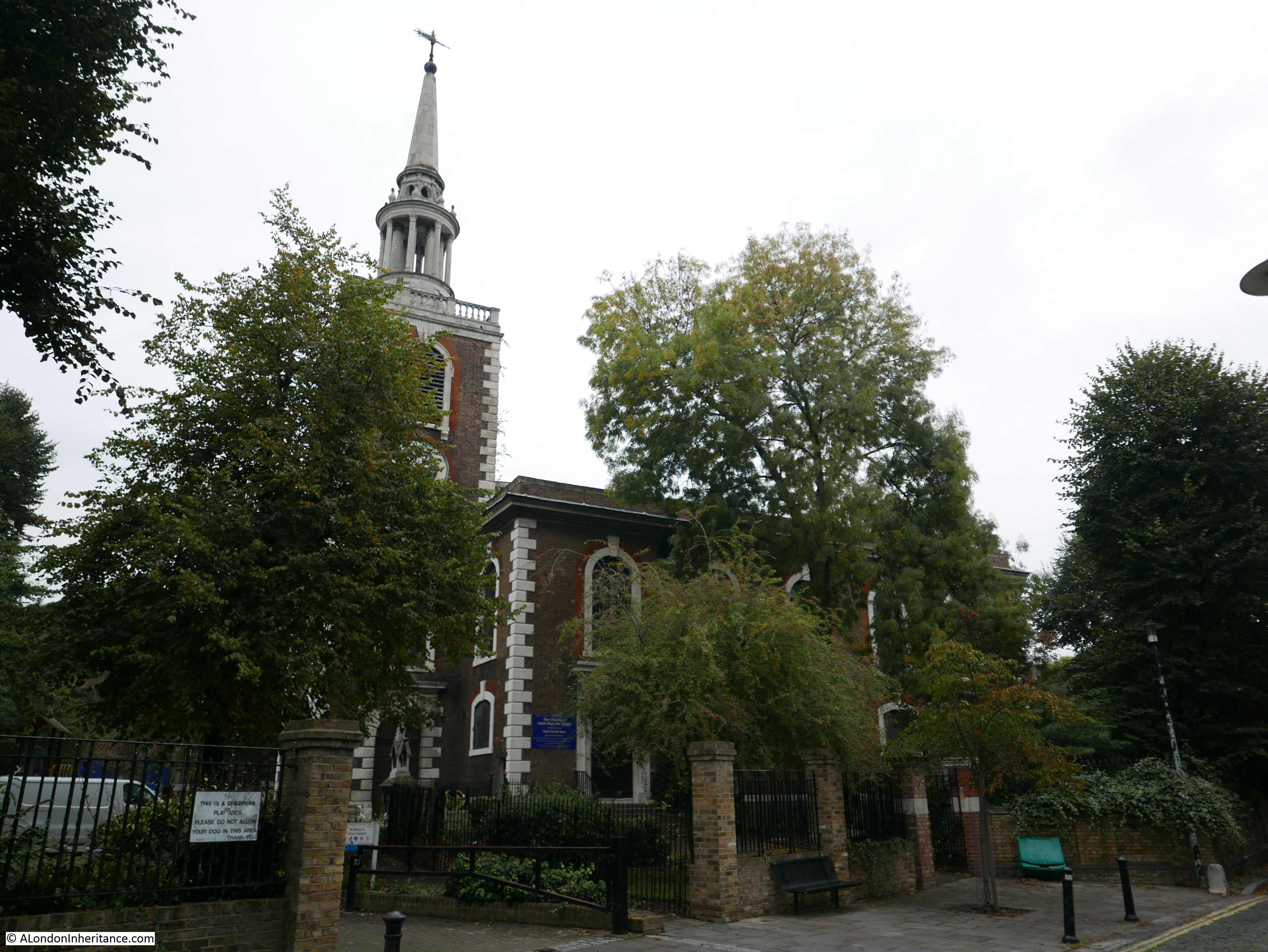
Horn Stairs and Cuckold’s Point are in Rotherhithe, opposite Limehouse and the north-eastern part of the Isle of Dogs, on the inside of a bend in the river where it curves past Rotherhithe.

I have marked the location with the red arrow in the following map  (© OpenStreetMap contributors):

Cuckold's Point

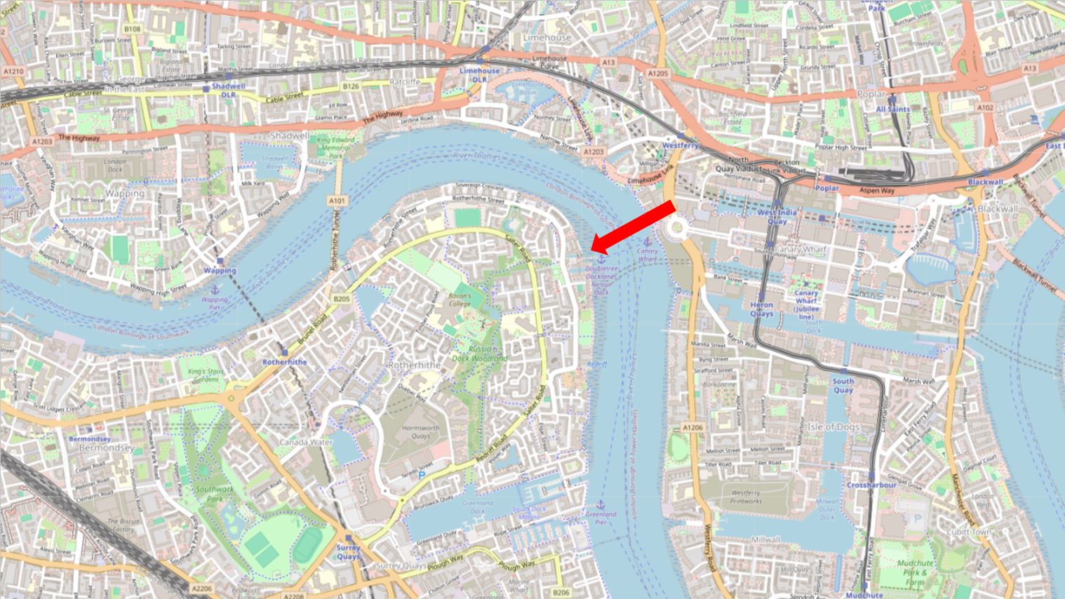
Cuckold’s Point is the area of the river / foreshore slightly to left and right of the arrow head in the above map, and where, when the tide is low, there is a broad beach of sand and mud running down to the water.

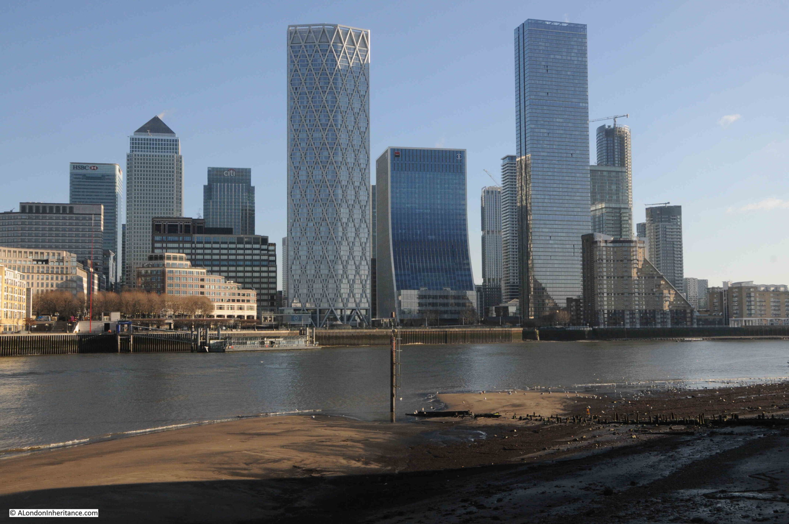
I was walking from the west, and there were some stunning views across the river, and as I reached the stairs, the outline of the causeway running from Horn Stairs could be seen, with a pole towards the end of the causeway:

Cuckold's Point

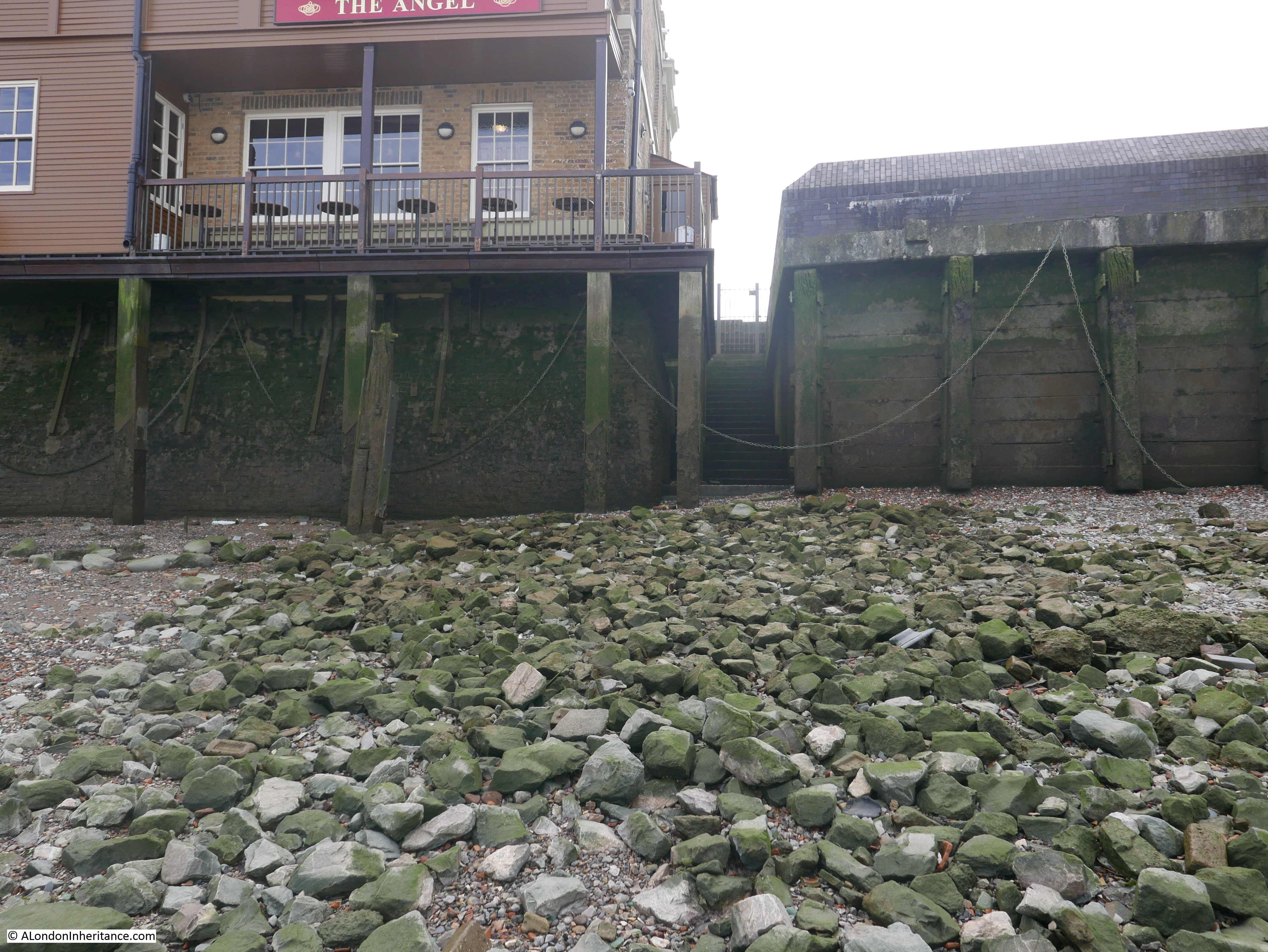
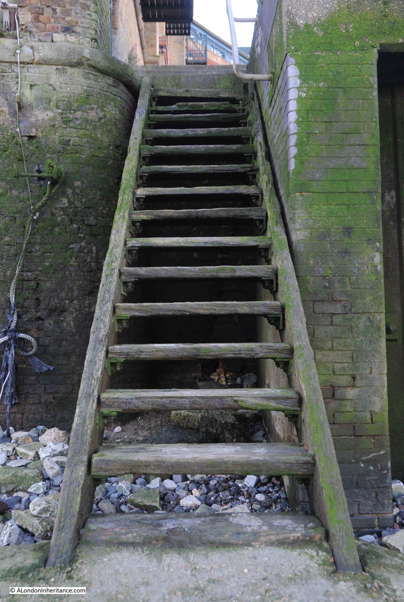
The steps over the river wall that lead to Horn Stairs:

Horn Stairs

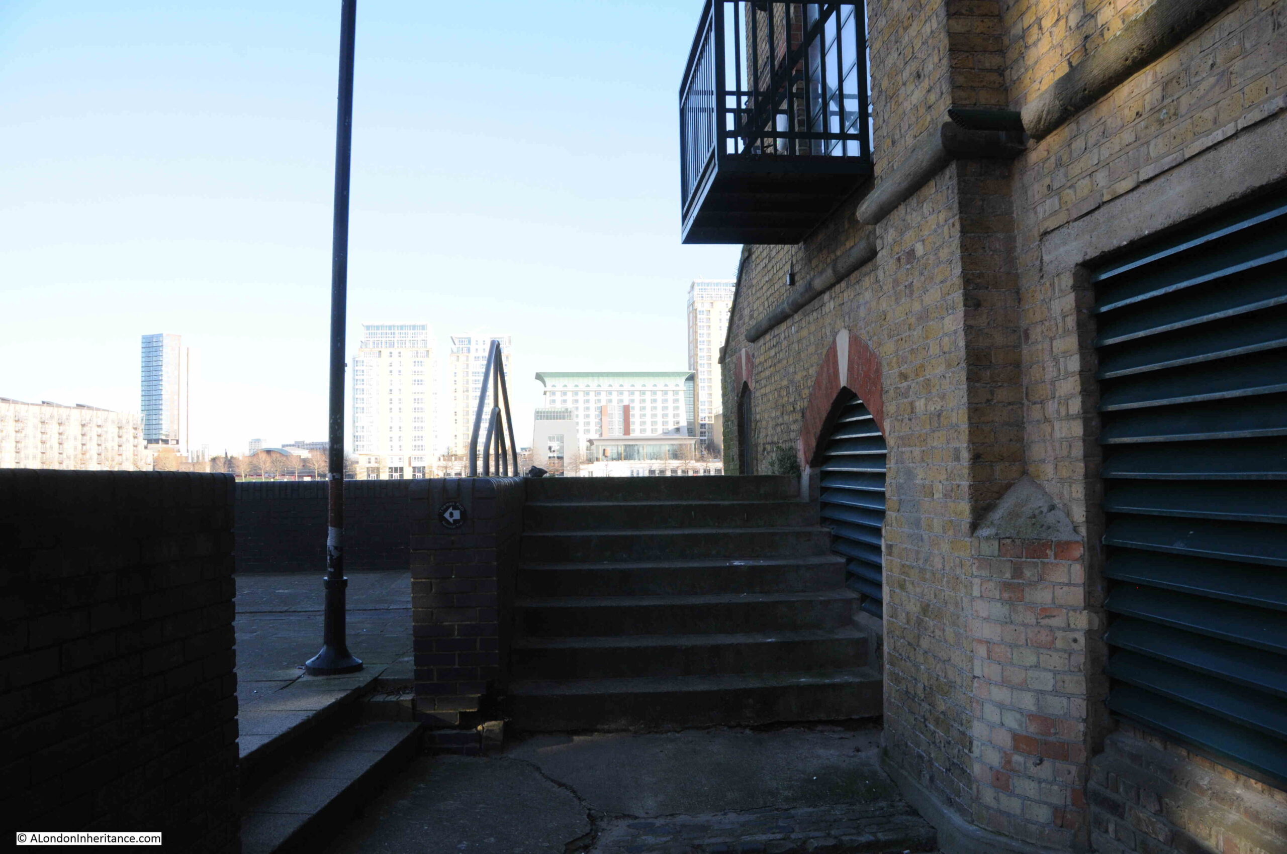
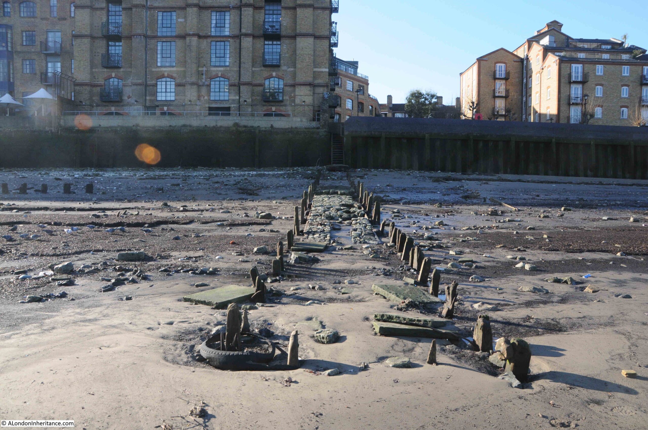
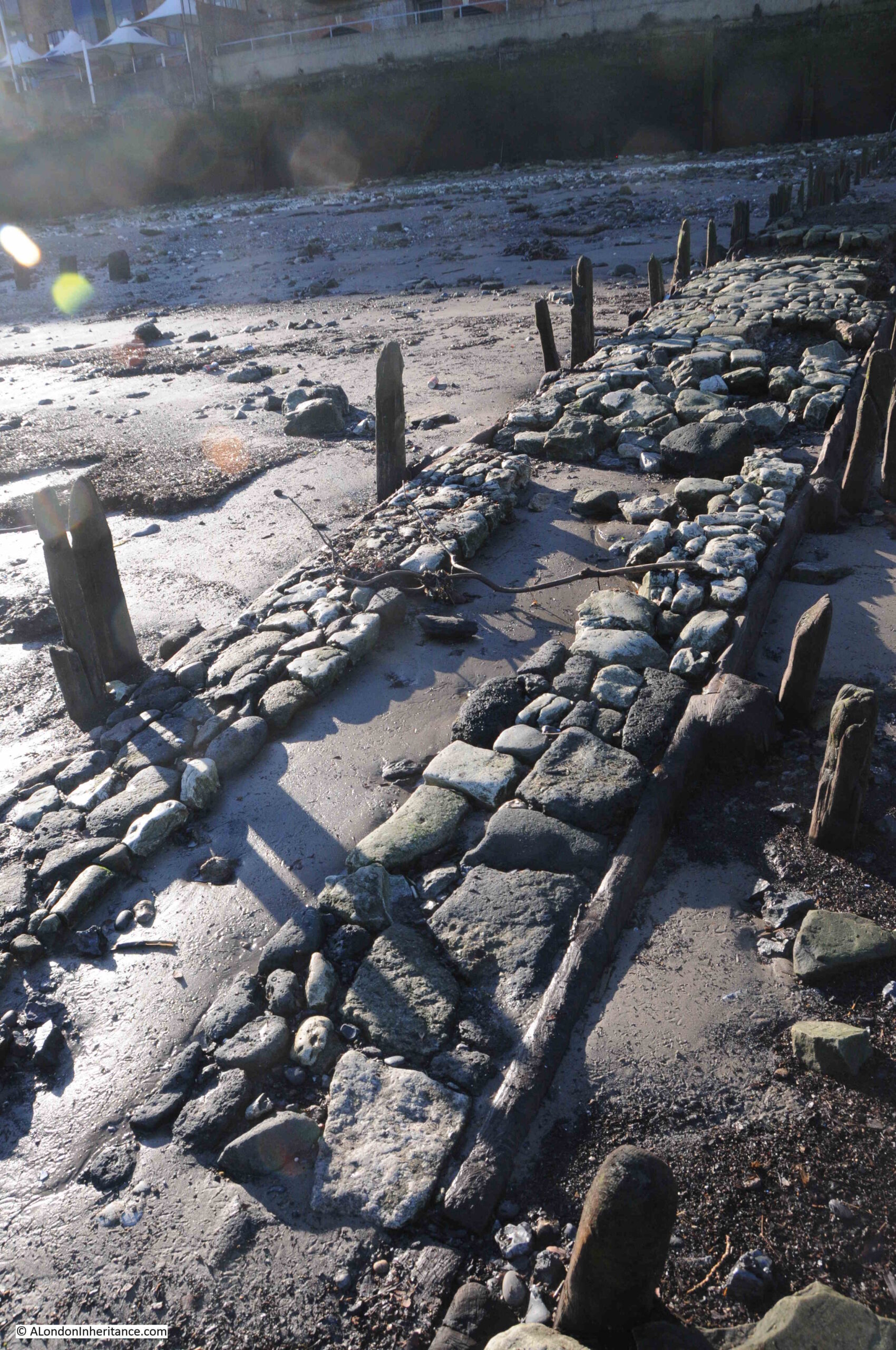
From the top of these steps, we get a view of the remains of the causeway leading off across the foreshore from the foot of the stairs:

Horn Stairs

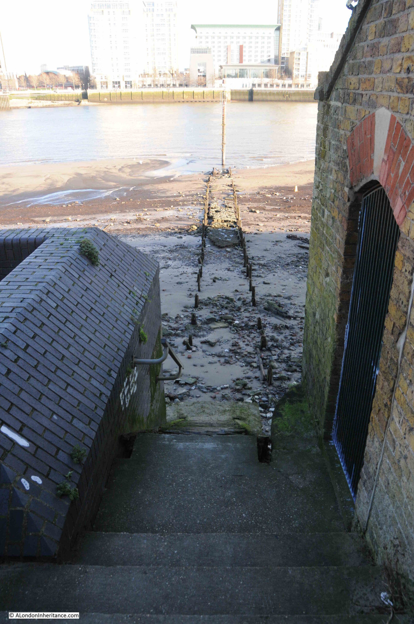
The upper part of the stairs, where they run over the river wall, are off concrete, with the main part leading down to the foreshore being a set of wooden stairs:

Horn Stairs

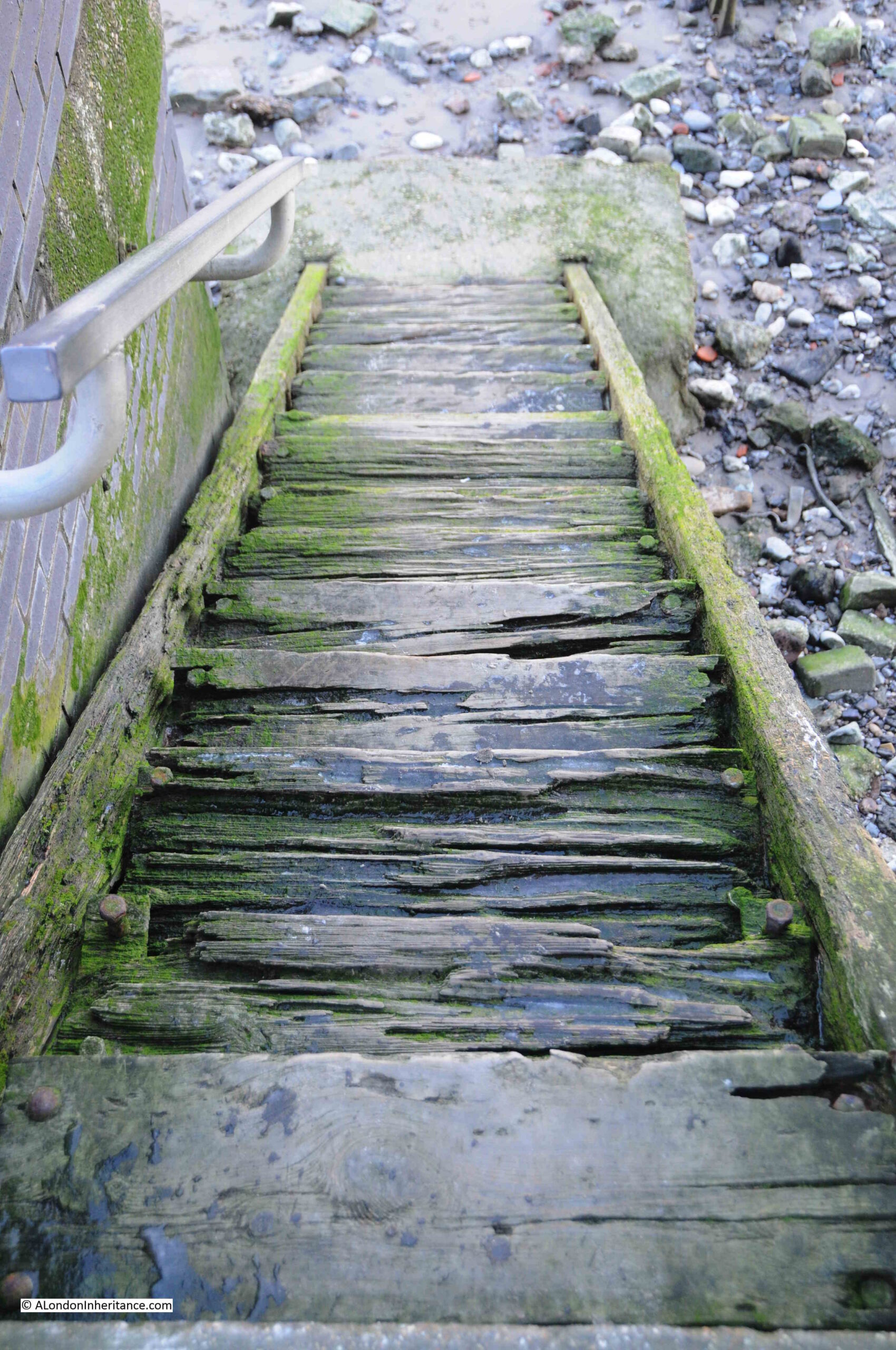
The upper part of the stairs look rather dodgy. From the top of the stairs it is difficult to tell how thick each of the steps is, and whether it will hold your weight if you walk down the stairs.

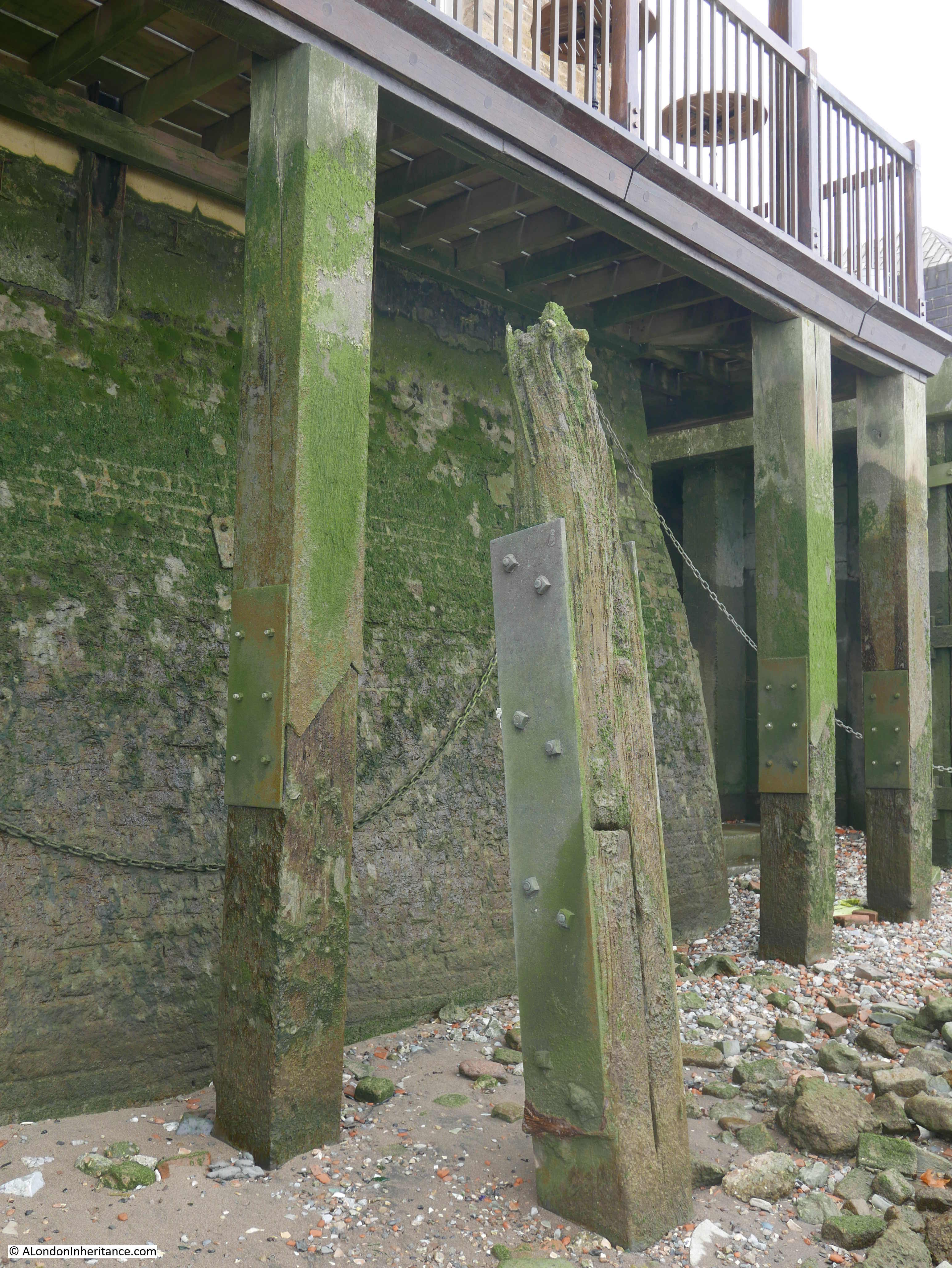
In the following photo of the top steps, you can see from the bolts on either side of each step, just how much appears to have eroded, or perhaps the wood has shrunk, also on the day I was at the stairs, there was ice in the hollows in each of the steps:

Horn Stairs

At the bottom of the stairs, we can see the remains of the causeway leading out towards the water:

Horn Stairs

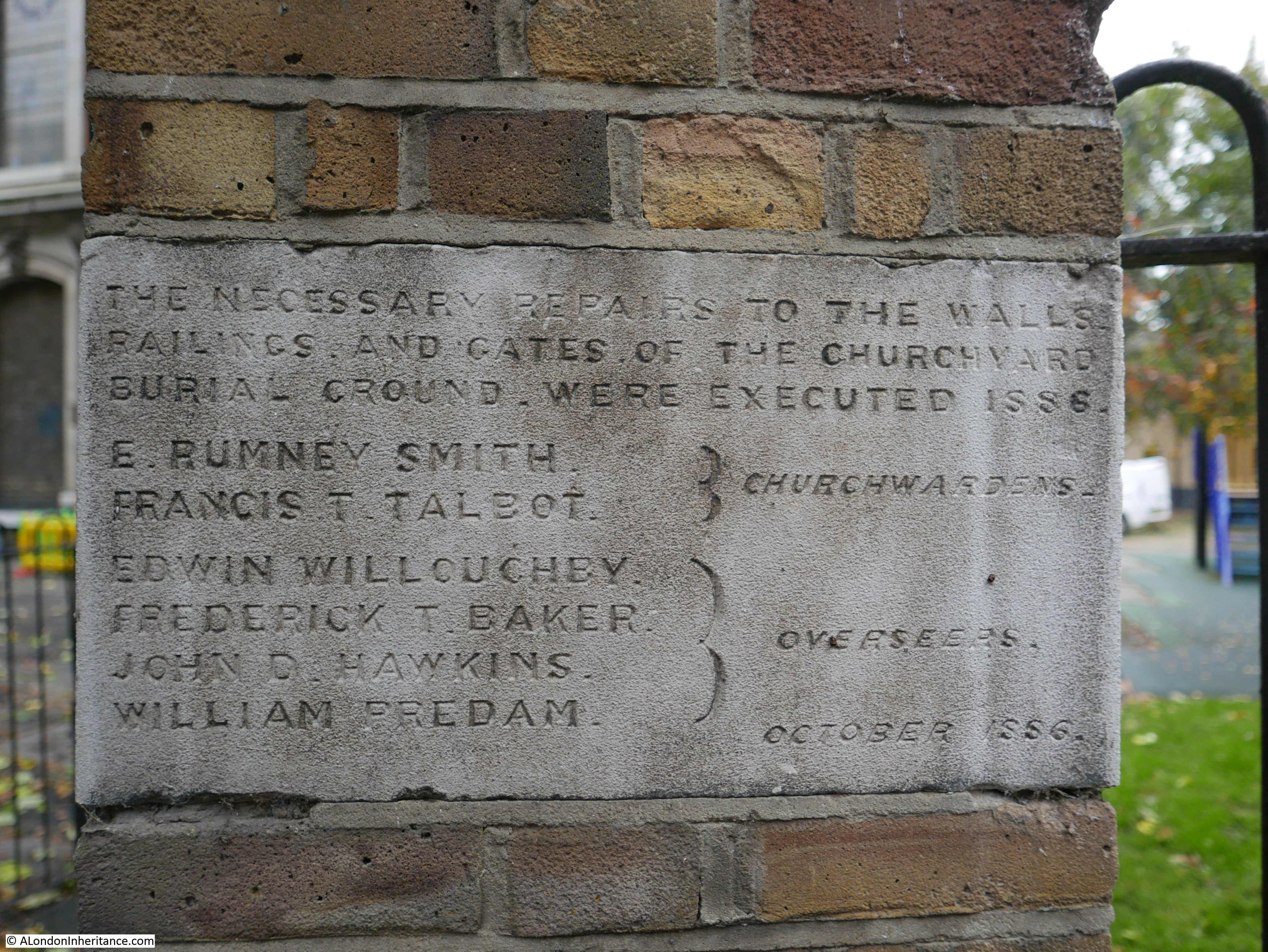
The Port of London Authority (PLA) has very little information on the stairs in their listing of all the Steps, Stairs and Landing Places on the Tidal Thames (published around 1995), there is just a remark that the stairs are in “Reasonable” condition and that they were still in use.

The PLA does not record any early dates for when Horn Stairs were in use, and there are not that many references to the stairs, with Cuckold’s Point being the name used for any reference to the location.

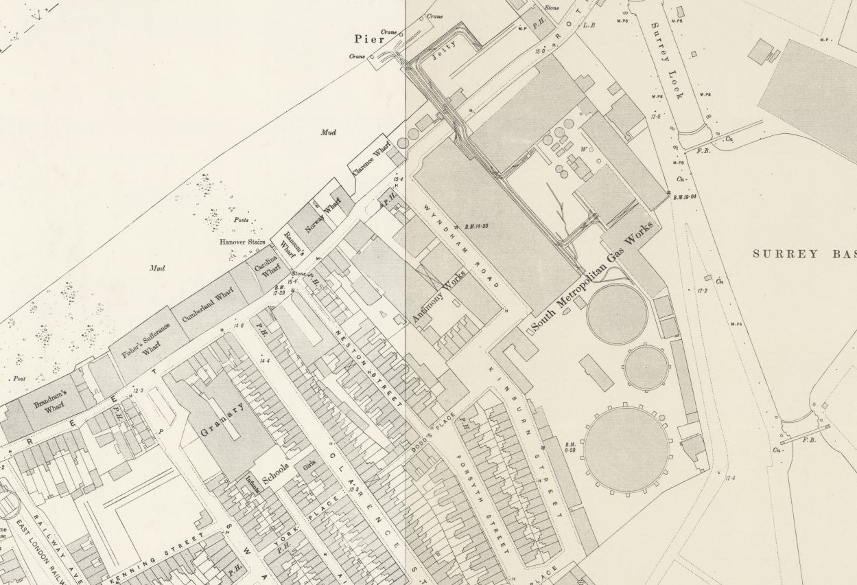
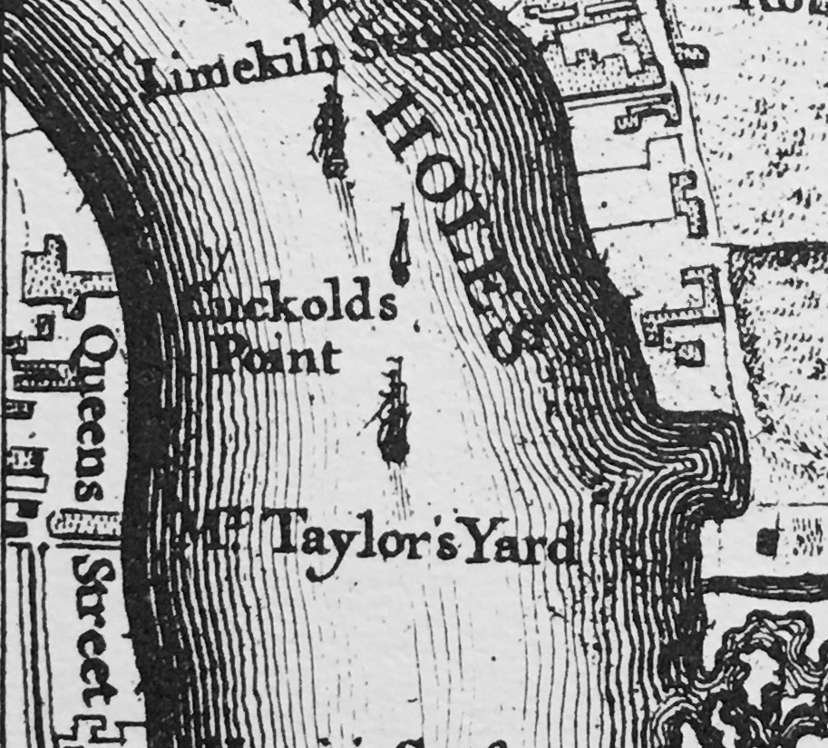
In Rocque’s map of 1746, the stairs are not shown, but Cuckold’s Point is marked:

Cuckold's Point

The earliest written reference I have found was in a newspaper article on the 25th of October, 1832 when the name Horn’s Stairs were used in a legal action against the owners of the Eclipse, a steam packet which ran between London and Margate, and was accused of running down a barge off Horn’s Stairs.

The name of the stairs did often appear as Horn’s or Horns rather than the singular Horn, and one of the possible sources of the name could be a Horns Tavern which was to be found near the stairs – although an unresolved question is what came first, the tavern or the stairs.

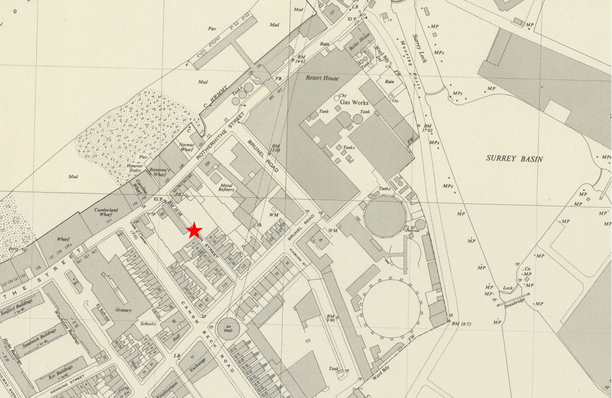
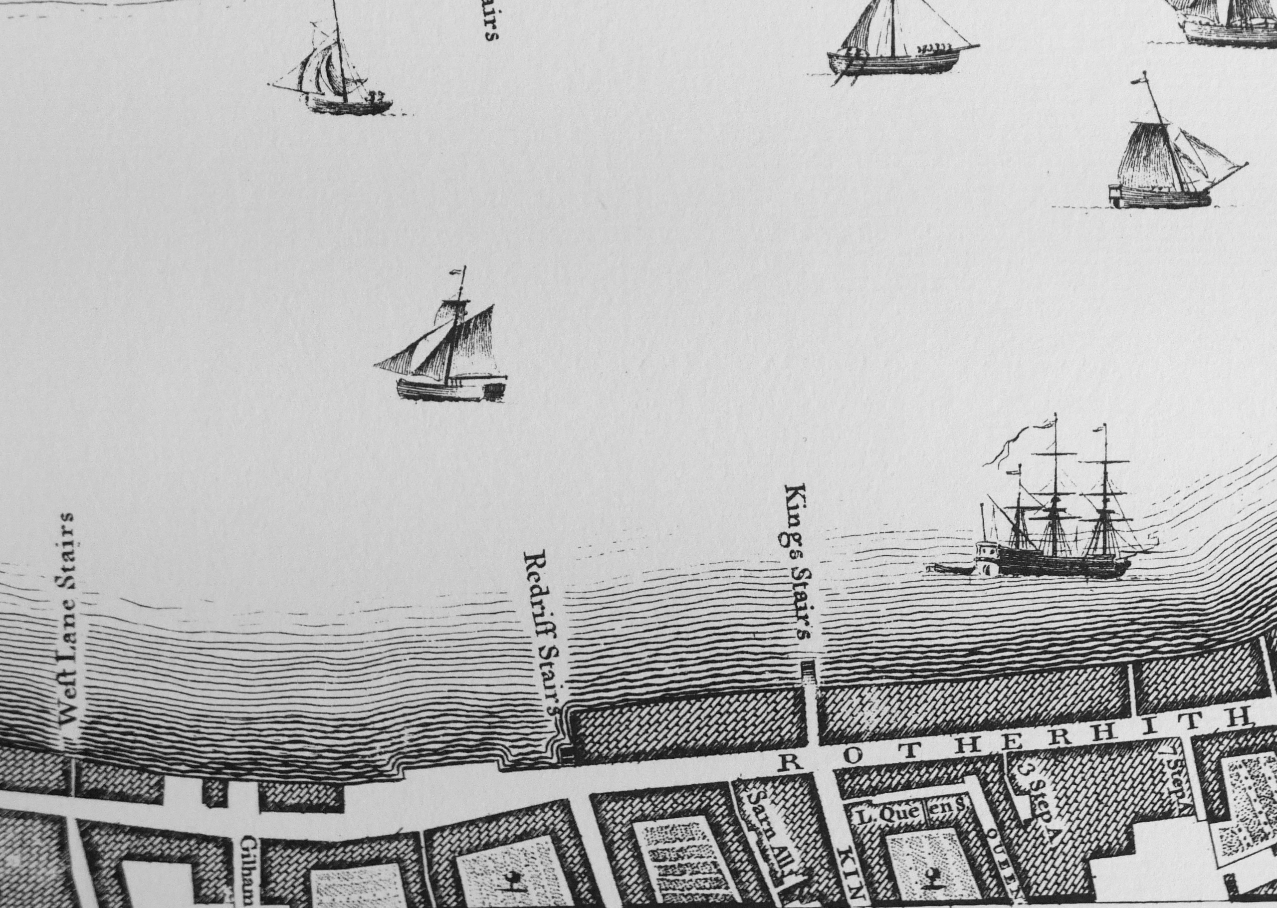
The name Horn is used in the majority of references from the late 19th century onwards, as shown in the following extract from the 1896 revision of the OS map, where Horn Stairs can be seen bottom left (‘Reproduced with the permission of the National Library of Scotland“):

Cuckold's Point

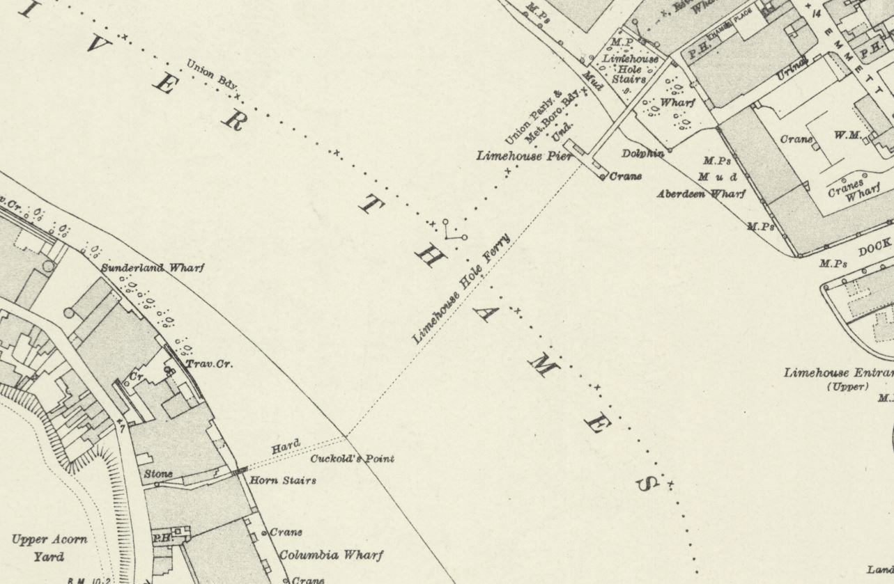
In the above map, the causeway leading out from the stairs is labelled “Hard”, and would have provided a hard surface above the sand and mud of the foreshore, to walk to and from a boat at nearly all states of the tide.

Also in the above map a dotted line leading across the river to Limehouse Pier can be seen, and labelled as Limehouse Hole Ferry. This was a regular ferry that had run for a good few centuries between the two sides of the river. I wrote about the ferry in my post on Limehouse Hole Stairs and the Breach.

The fact that Horn Stairs does not appear in the 1746 map, and I can find no written references to the stairs earlier than 1832 does not mean that the stairs and a causeway have not been here for much longer.

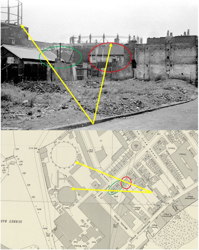
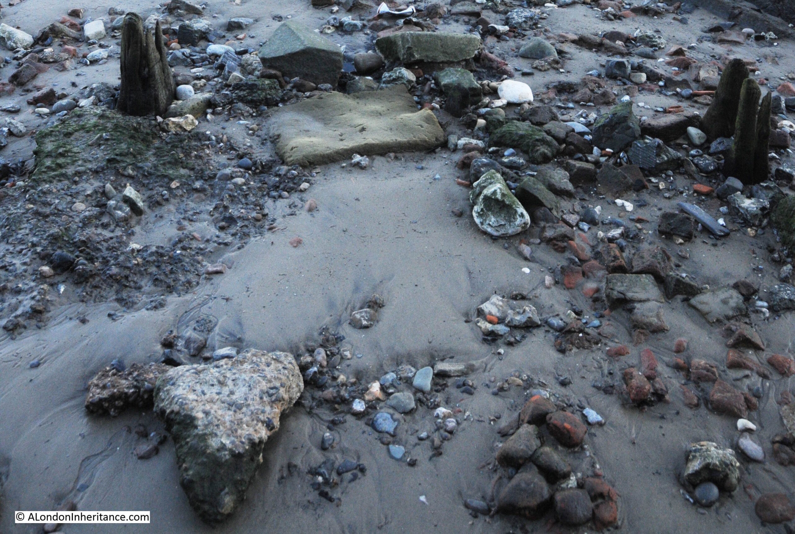
The City of London Archaeological Society has a fascinating post on surveying stairs, which included a section on Horn Stairs, and in the post, 16th or 17th century hand made bricks were identified which may have formed an early hard standing on the foreshore.

The post can be found here.

Although I could not find the bricks exactly as shown in the photo in the City of London Archaeological Society’s post, (the foreshore is a constantly changing environment), I did find a number of this type of red brick, which can be seen in the photo below, to the right side of the causeway:

Cuckold's Point

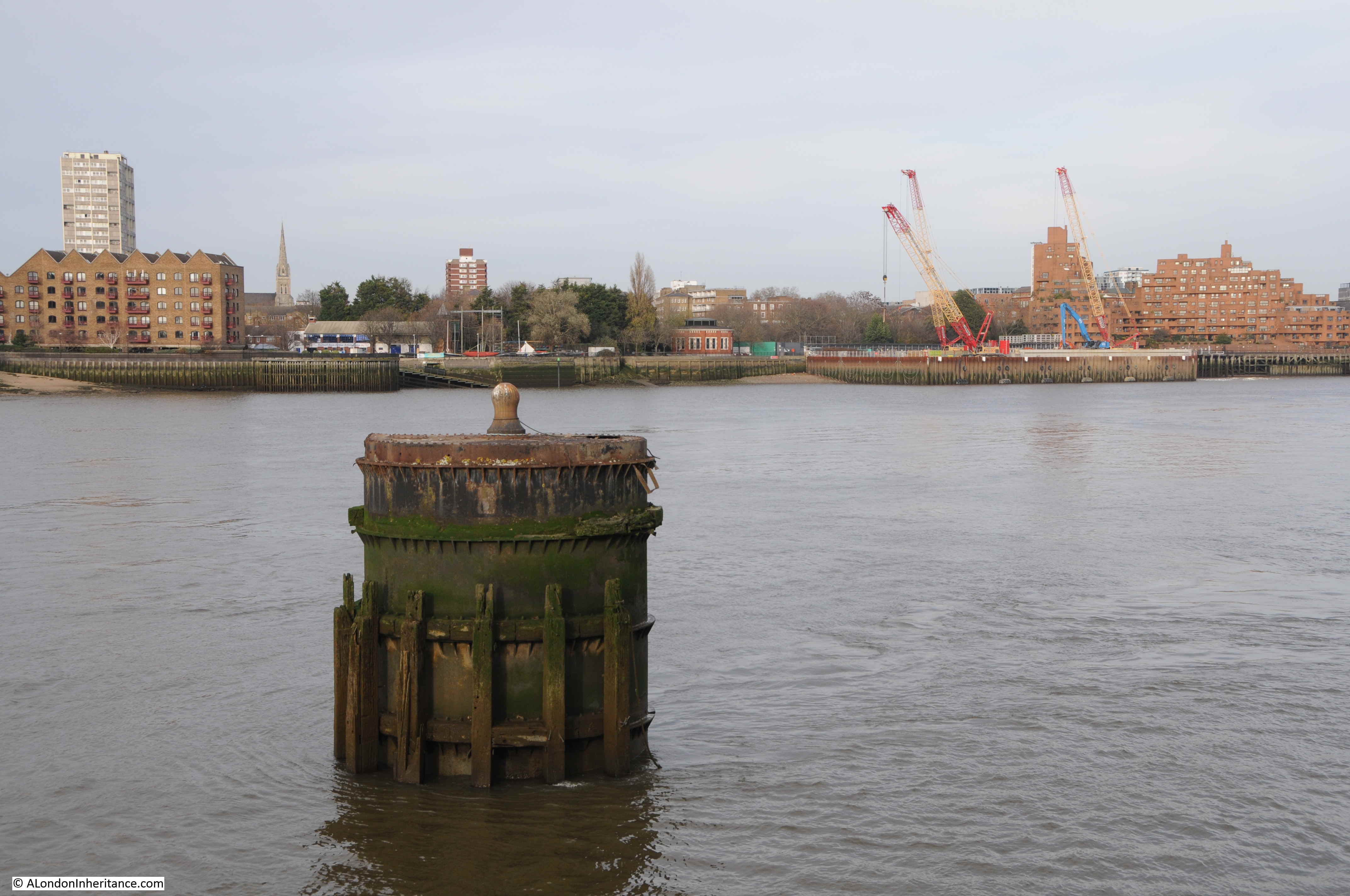
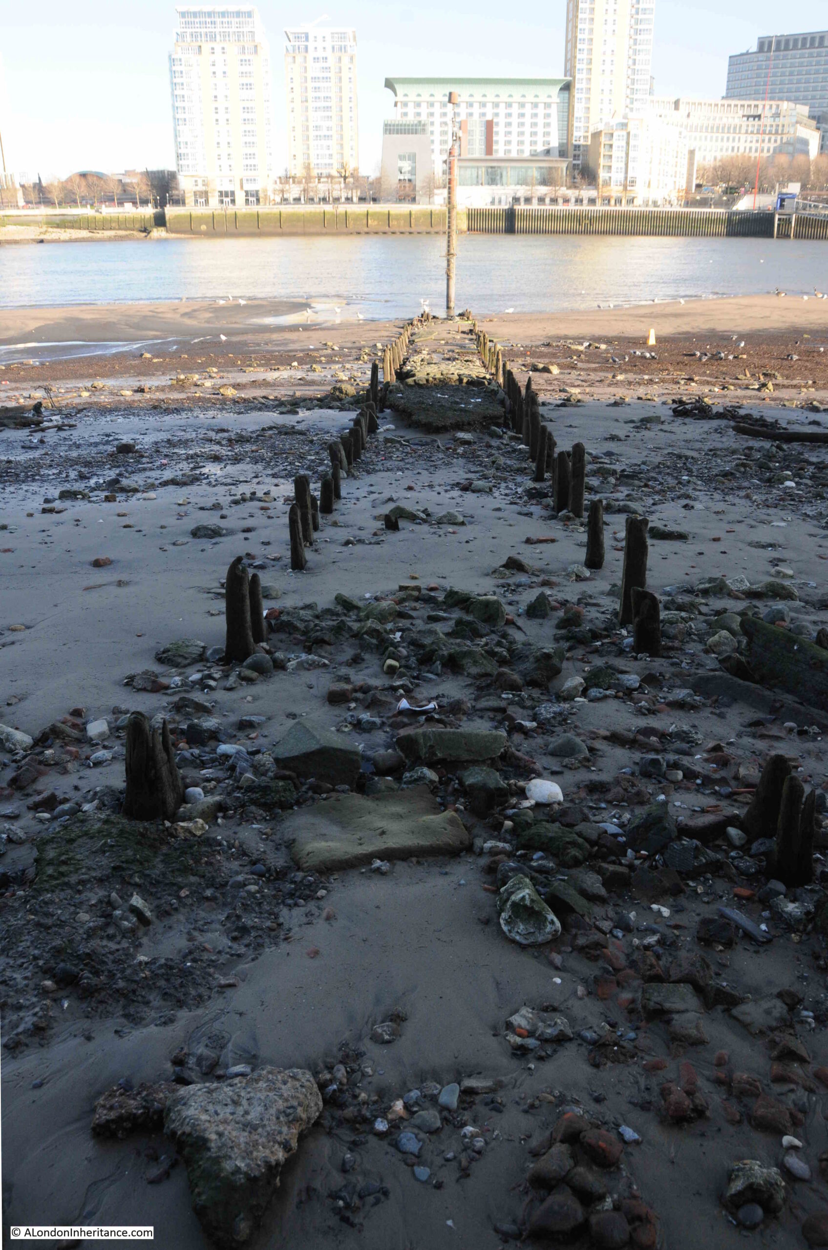
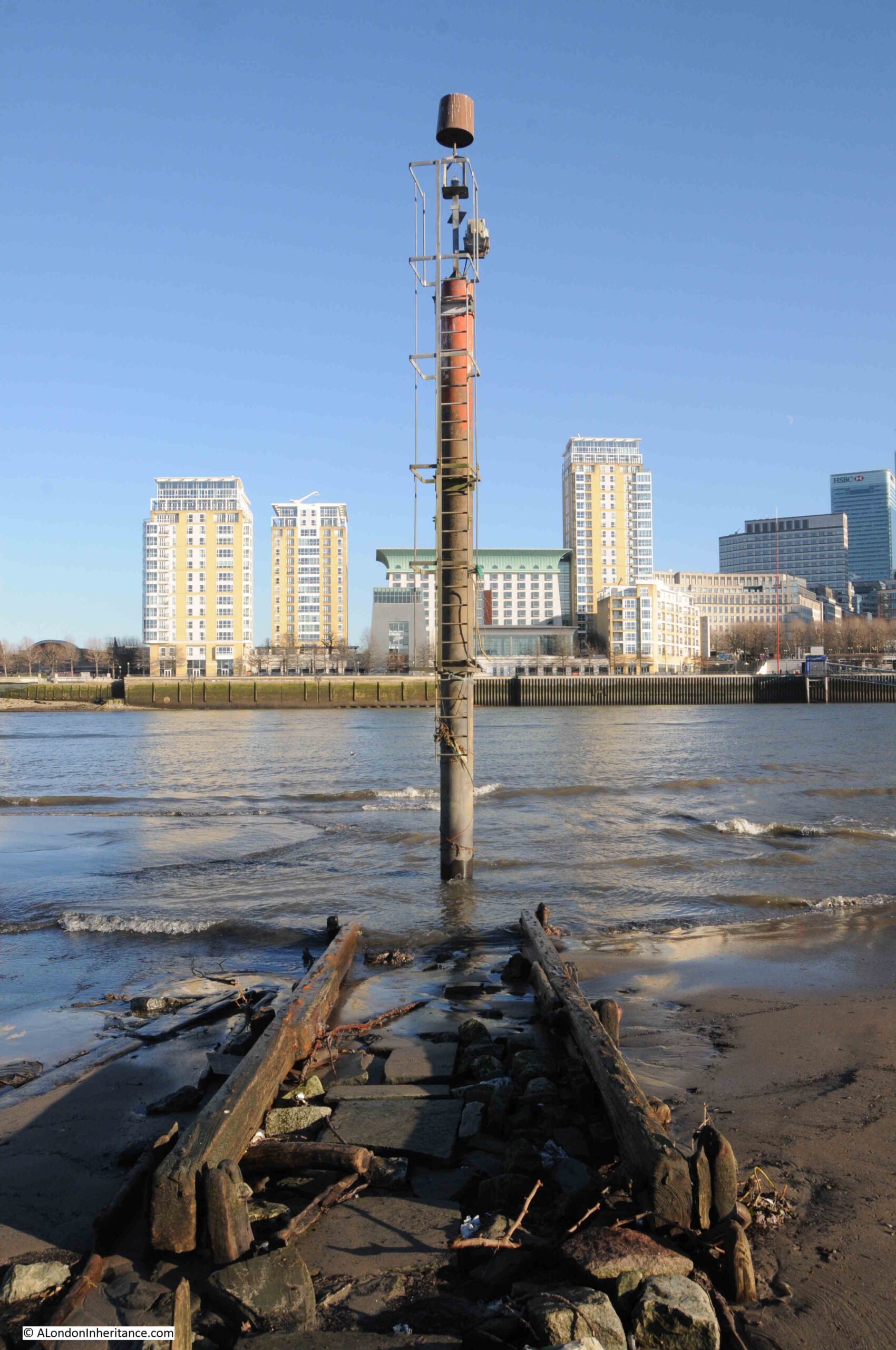
At the end of the causeway, and at the point just before where the Thames will recede to at low tide, is a pole labelled as a navigation marker on the PLA chart for this section of the river. The marker has a light at the top of the pole to ensure the marker can be seen in the dark:

Cuckold's Point

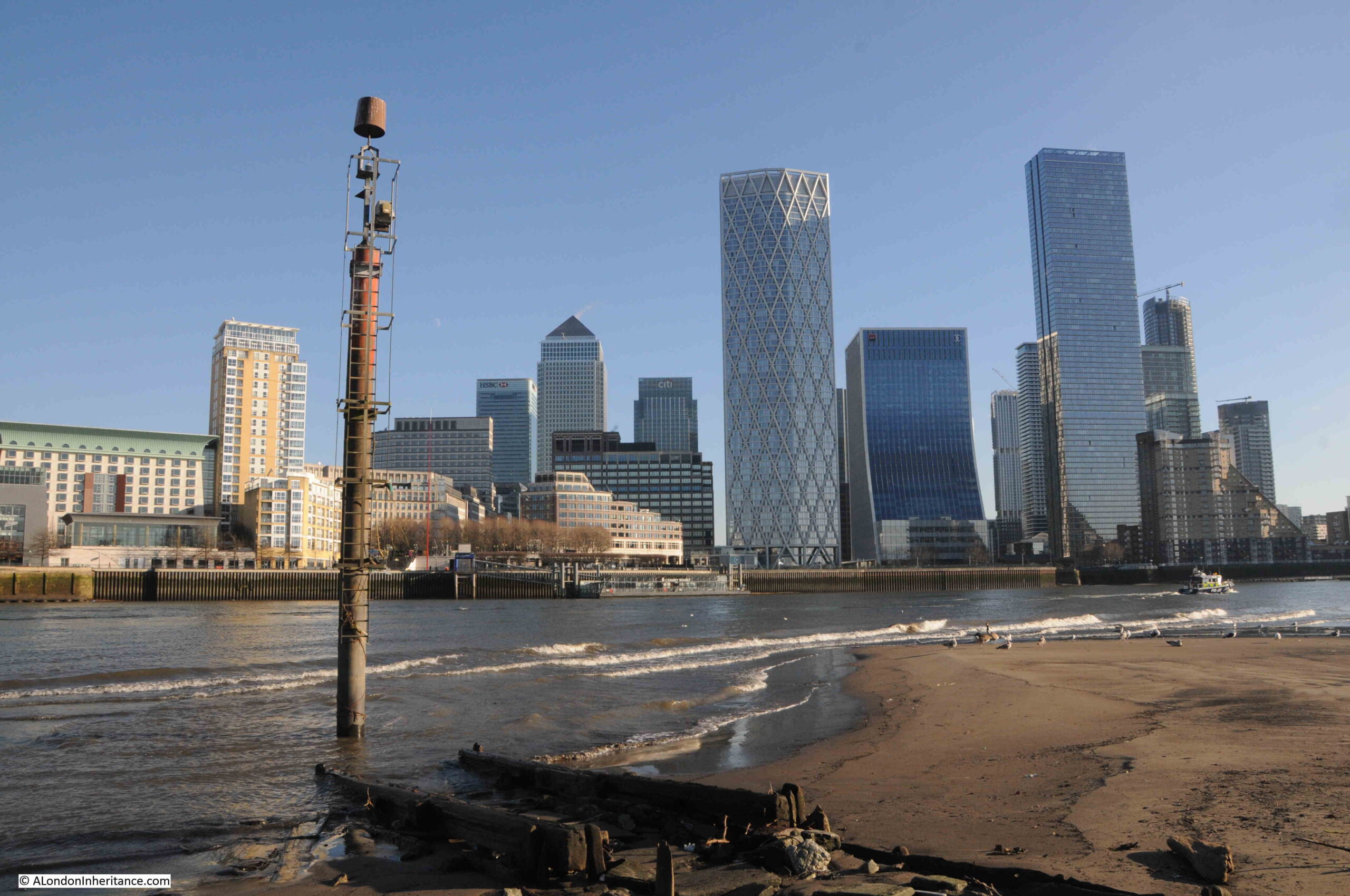
At the end of the causeway:

Cuckold's Point

Looking back to the river wall and the stairs down to the foreshore, which is a distance of some 50 metres, and the dark colouring along the river wall shows how high the water is when the tide comes in along Cuckold’s Point:

Cuckold's Point

The naming of Cuckold’s Point is interesting, and the true source of the name cannot really be confirmed given the centuries that the name has been in use.

The word Cuckold means, according to the online Cambridge Dictionary “If a man is cuckolded, his wife has a sexual relationship with another man”, and the most repeated story about the use of the word Cuckold for the foreshore in Rotherhithe goes back to King John, who was on the throne between 1199 and 1216.

There are a number of variations to the story, but it generally goes that King John was hunting around Shooters Hill, Blackheath and Greenwich. He seems to have found himself in Charlton, and entered the house of a Miller, where he found the Miller’s wife alone.

The Miller soon returned home, but found his wife “in flagrante” with the King.

The Miller attacked the King intending to kill him, and to defend himself the King revealed who he was, and came to an agreement with the Miller that he could have all the land to the west that he could see from his house, which extended all the way to what is now Cuckold’s Point, where, at the time, there was a pole with a pair of horns mounted on the top.

The Miller, in some stories, also had to walk to Cuckold’s Point once a year, with horns on his head.

So the name Cuckold’s Point came from the position that the Miller had been put in by King John.

The King also gave the Miller the right to have a fair on the 18th of October, and this fair became known as the Horn Fair and was held in Charlton.

An early view of Cuckold’s Point can be seen in a painting by Samuel Scott in his work “A Morning View of Cuckold’s Point“, painted between 1750 and 1760:

Cuckold's Point
A Morning, with a View of Cuckold’s Point c.1750-60 Samuel Scott c.1702-1772 Presented by H.F. Tomalin 1944 http://www.tate.org.uk/art/work/N05450

Credit:  Samuel Scott, 1750 – 1760 , Tate (N05450), Photo: Tate released under Creative Commons CC-BY-NC-ND (3.0 Unported)

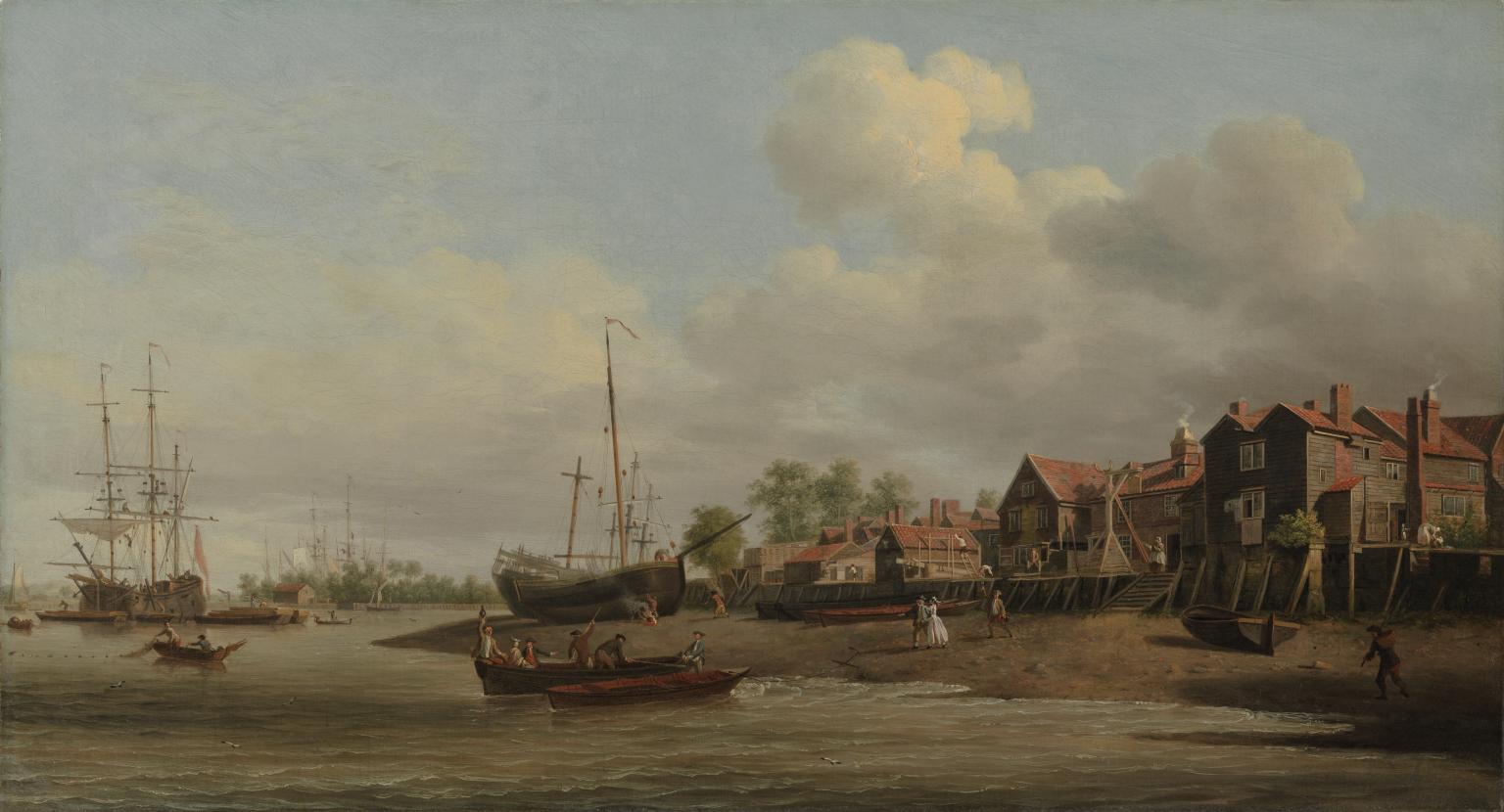
The challenge with confirming that this is Cuckold’s Point is that there are no features which can be found today, however there is a set of wooden stairs leading down to the foreshore, and the slope and shape of the foreshore is very similar to that of today.

The painting does though give a very good impression of what Cuckold’s Point probably did look like. There are two Waterman’s boats where the water meets the foreshore, and there is a third approaching the same point.

There are people on the foreshore walking down to the boats from the stairs, presumably either to meet the people arriving on the boats, or to take one of the boats along the river.

The ships on the foreshore are in the location of Mr. Taylor’s Yard, as shown in Rocque’s 1746 map.

The river appears to bend to the right, which indeed it does, as it heads along the eastern side of Rotherhithe towards Deptford.

The painting does provide some support to an alternative theory as to the name Cuckold’s Point. Just to the left of the stairs can be seen a wooden frame, and this is believed to show a ducking, or cucking stool, which was use to punish and humiliate women, who were labelled as a scold, or had committed some form of sexual offence, such as cheating on a husband.

As was usual, there was no similar punishment or humiliation for the man involved.

As the site of a cucking stool, where the wife of a cuckold would have been punished, this may also be the source of the name, however this story does not seem to have gained much support over the years.

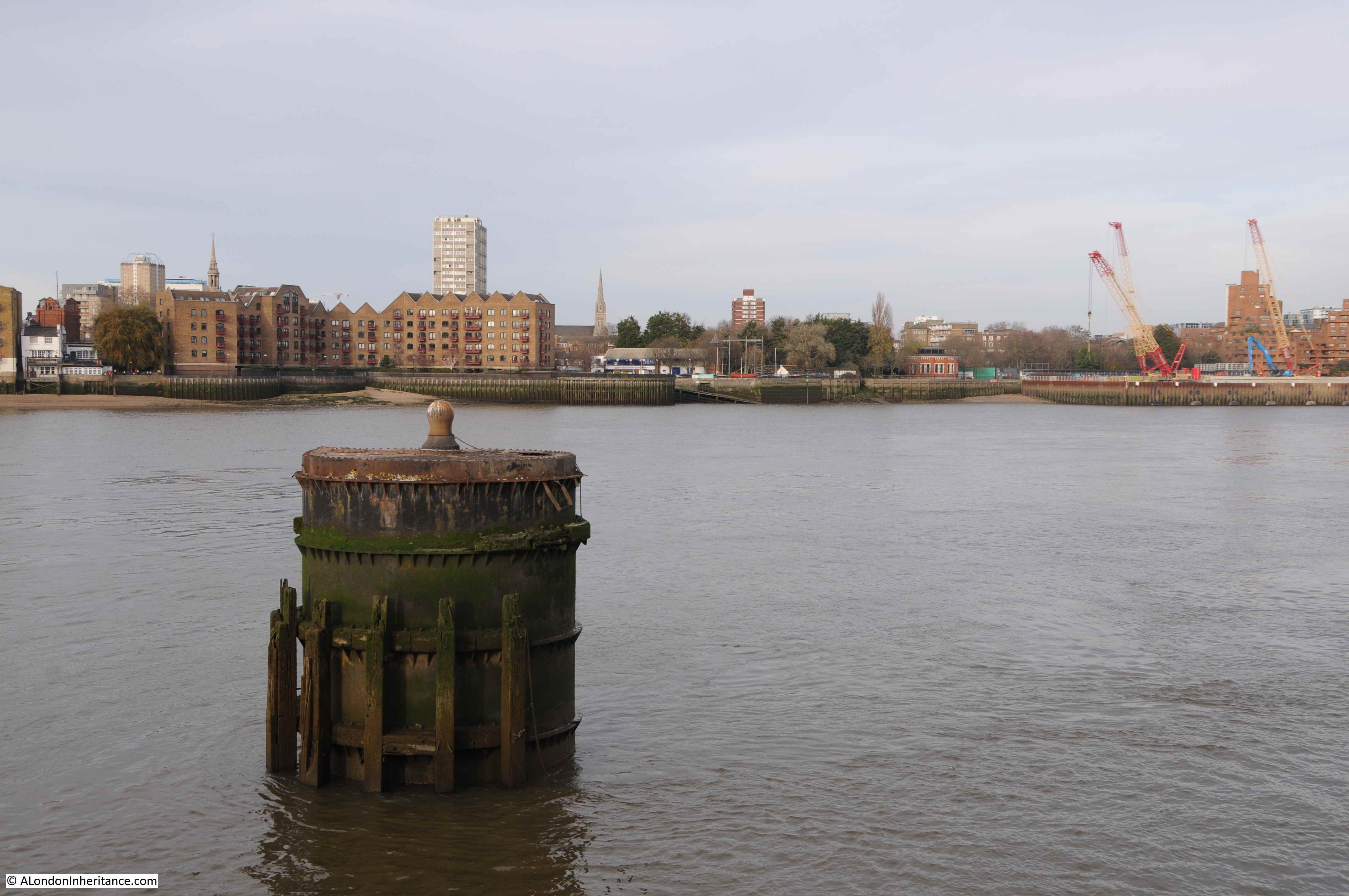
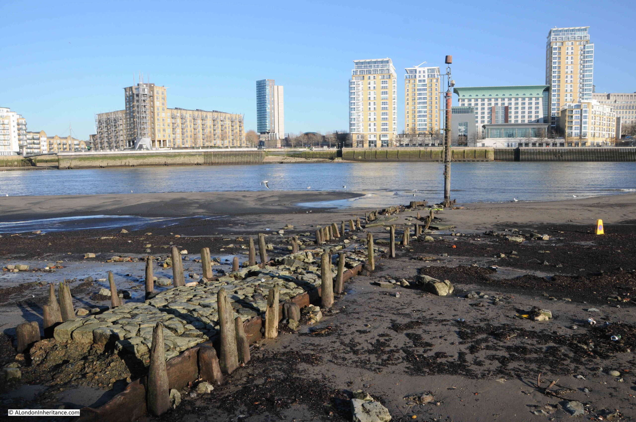
The broad sweep of the foreshore at Cuckold’s Point, looking west along the river in the direction of the City of London:

Cuckold's Point

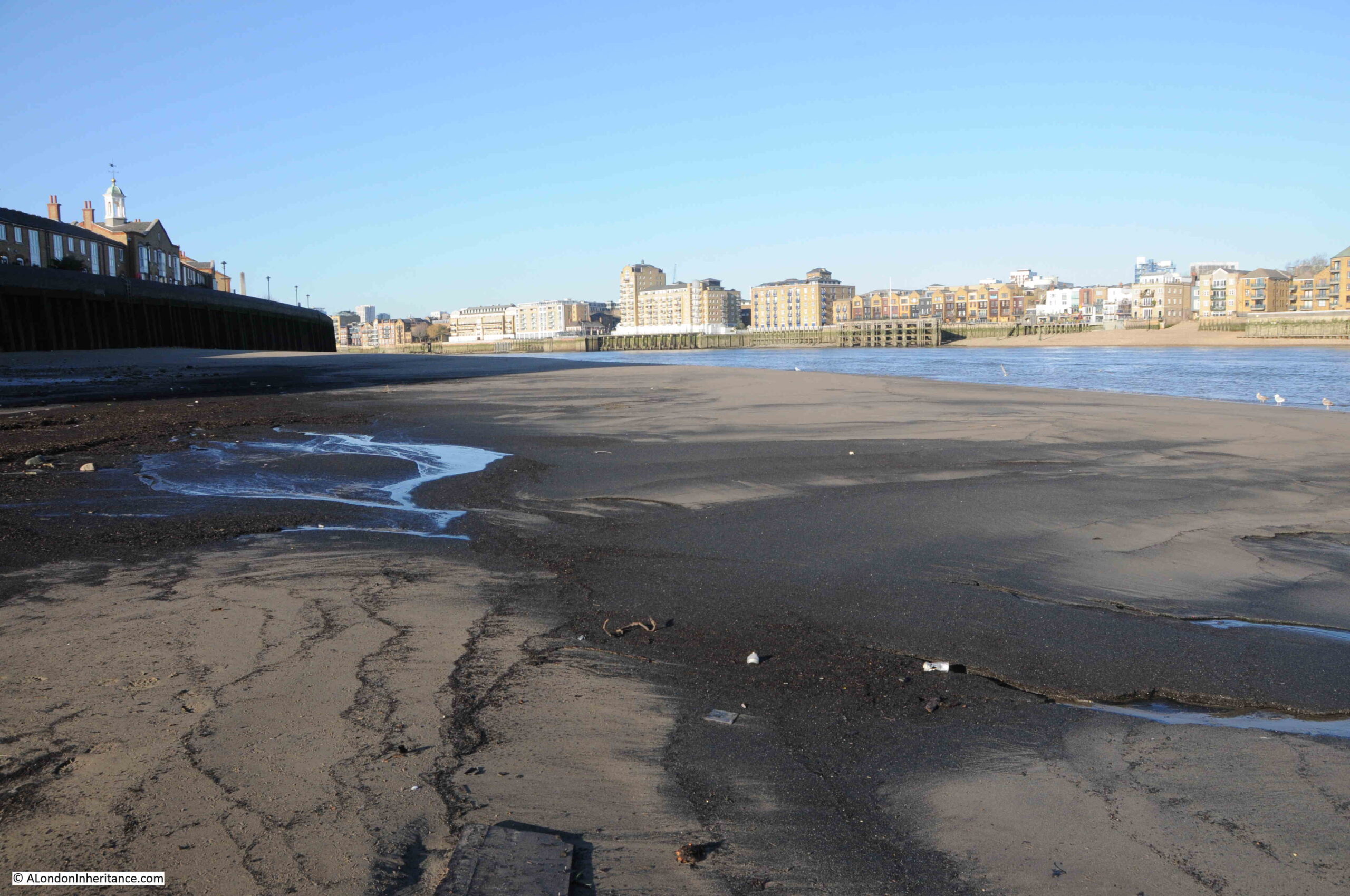
Standing at Cuckold’s Point on a cold January morning is a lonely experience. There is no one else around, and the river is also very quiet, with just the regular Thames Clippers causing a run of waves up to the foreshore.

These places were once busy, both along the rivers edge, the foreshore, and along the river, and it is fascinating to stand at these places, thinking of all the people that have stood in the same place, and the events that have taken place here.

I searched newspaper records for reports mentioning Cuckold’s Point for three decades in the first half of the 18th century, the 1720s, 30s and 40s and there are many references. The following is a sample of what went on around Cuckold’s Point in these years:

  • 17th June 1721 – On Thursday last in the Afternoon Mr. Bailey, a Coasting officer, and Mr. Purser, a Custom-House waterman, made a seizure in the River near Cuckold’s Point of 1900 Weight of Tea, artfully wrought up in the sides of a Mackerel Boat filled with Fish, and supposed to come of Ostend.
  • 11th of May 1726 – The Execution of Capt. Jeane, condemned at the late Sessions of Admiralty for the Murder of his Cabin Boy, is appointed for next Friday, he will be hanged in Chains over against Cuckold’s Point.
  • 6th of October 1736 – On Monday last a Fisherman caught in his Common Net, near Cuckold’s Point, a Salmon 38 inches long and about 17 inches round, and sold the same to Capt. Bond, who was in sight when the fish was caught, and was going on board the East-India Man at Gravesend. The Fisherman being unable to hold his net, begged assistance of a man in the Captain’s Boat, who accordingly went; but as he was helping he fell accidentally into the Thames, from whence it being low water, he took the Fish in his Arms and threw it into the boat. The Fish was sold for 36 shillings out of which the Fisherman gave the Waterman 6 shillings for his Trouble.
  • 23rd April 1737 – On Tuesday last, the Wind being very high, and the Tide rough, two boats, overladen with Passengers, were cast away between Cuckold’s Point and Deptford, and 17 persons drowned. Two other boats, near the same place, with 16 persons in them, and another at the Isle of Dogs, with six and a Waterman, overset, and seven of the former and all the layer were drowned,
  • 23rd October 1742 – Yesterday a new ship, of 220 Tons and 20 Guns, intended for the West India Trade, was launched at Mr. Taylor’s Dock at Cuckold’s Point, and named the Anna Maria (see earlier extract from Rocque’s map of 1746 for location of Taylor’s Dock)
  • 10th December 1743 – Last Tuesday upwards of 1000 Pairs of French Gloves with some Skins, were brought to the custom House. They were seized by Mess. Smith and Harris, Customhouse officers, as they were attempting to land them at Cuckold’s Point.
  • 4th February 1744 – On Tuesday 200lb of Cocoa Nuts, 200 Weight of Tea and 20 Pieces of Cambrick, with some Lace, were seized at Cuckold’s Point, and brought to the Custom House; This seizure is valued at £300. (Cambric is a finely woven, plain cloth that came from France)
  • 7th of March 1747 – Tuesday in the Afternoon as a Boat was going to Greenwich with six Passengers, it was overset near Cuckold’s Point by running foul of a Ships Anchor, by which accident Mrs. Sims and her Daughter, of St. Catherine’s Lane, were unfortunately drowned.
  • 27th of March 1749 – On Monday last thirteen prisoners were tried at Kingston in Surrey, three of whom were capitally convicted, viz. John Rayner, for Robbery on the Highway, Thomas Pattin and William Walker, two Watermen, for knocking down Mr. Alison, in a Boat on the River Thames, near Cuckold’s Point, and robbing him of a Silver Coffee Pot, a Watch, and a Guinea and Half in Money.

These quiet places along the Thames were once full of life, and also unfortunately, death.

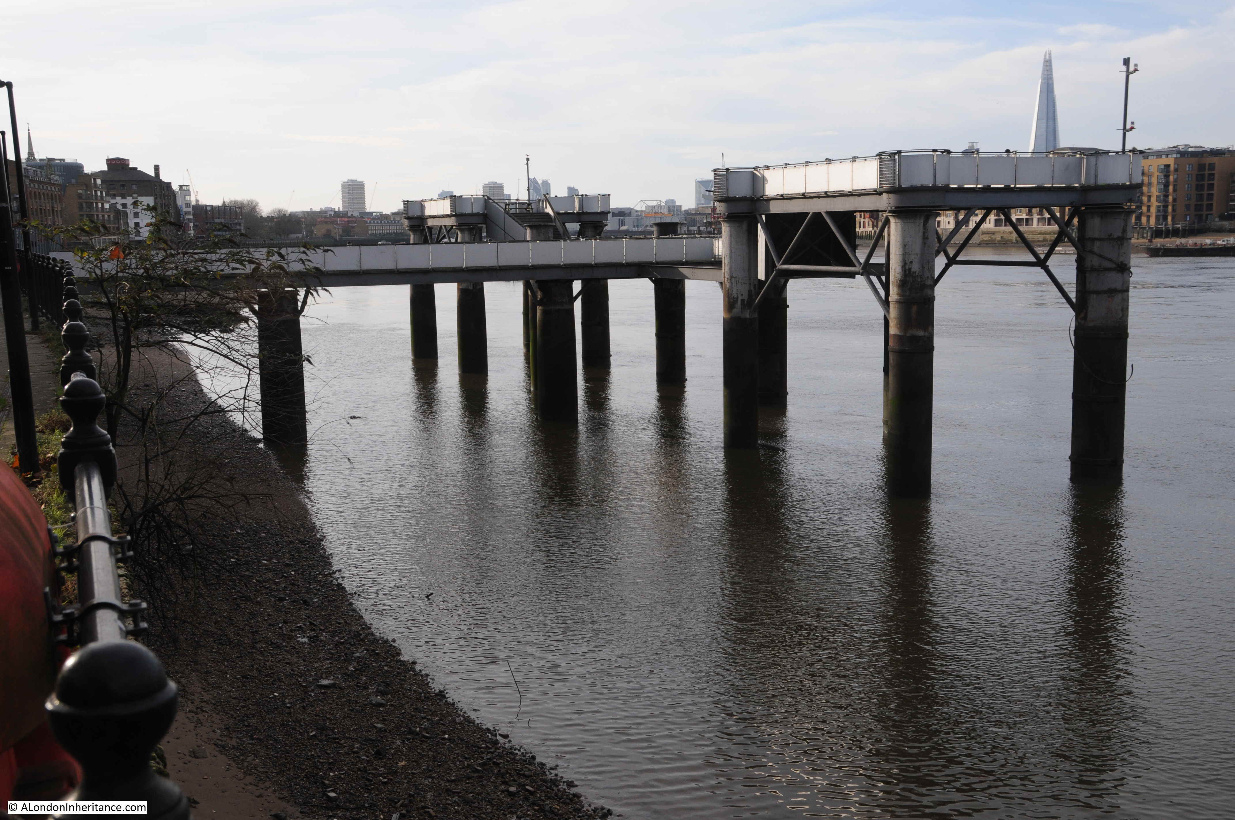
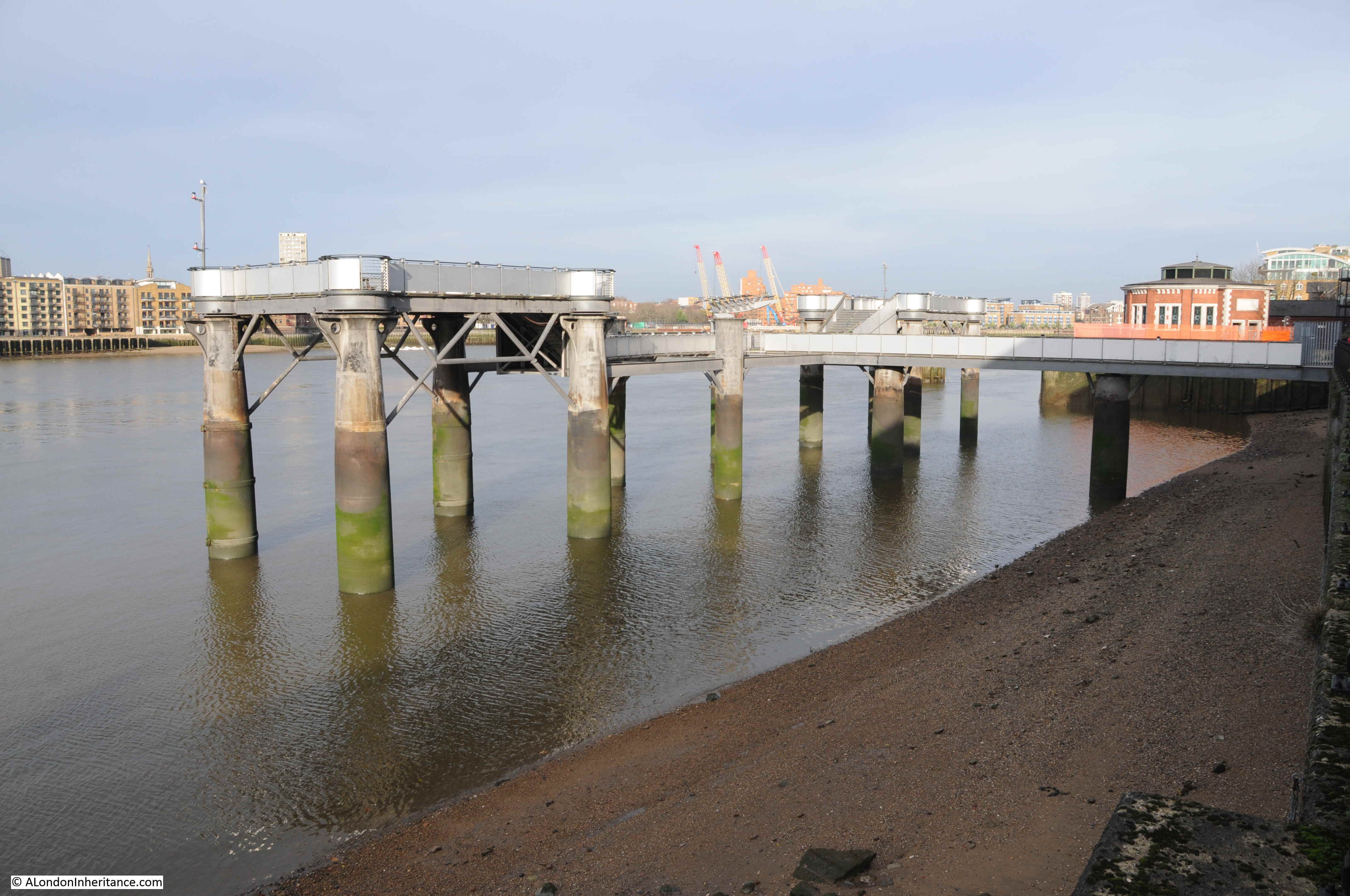
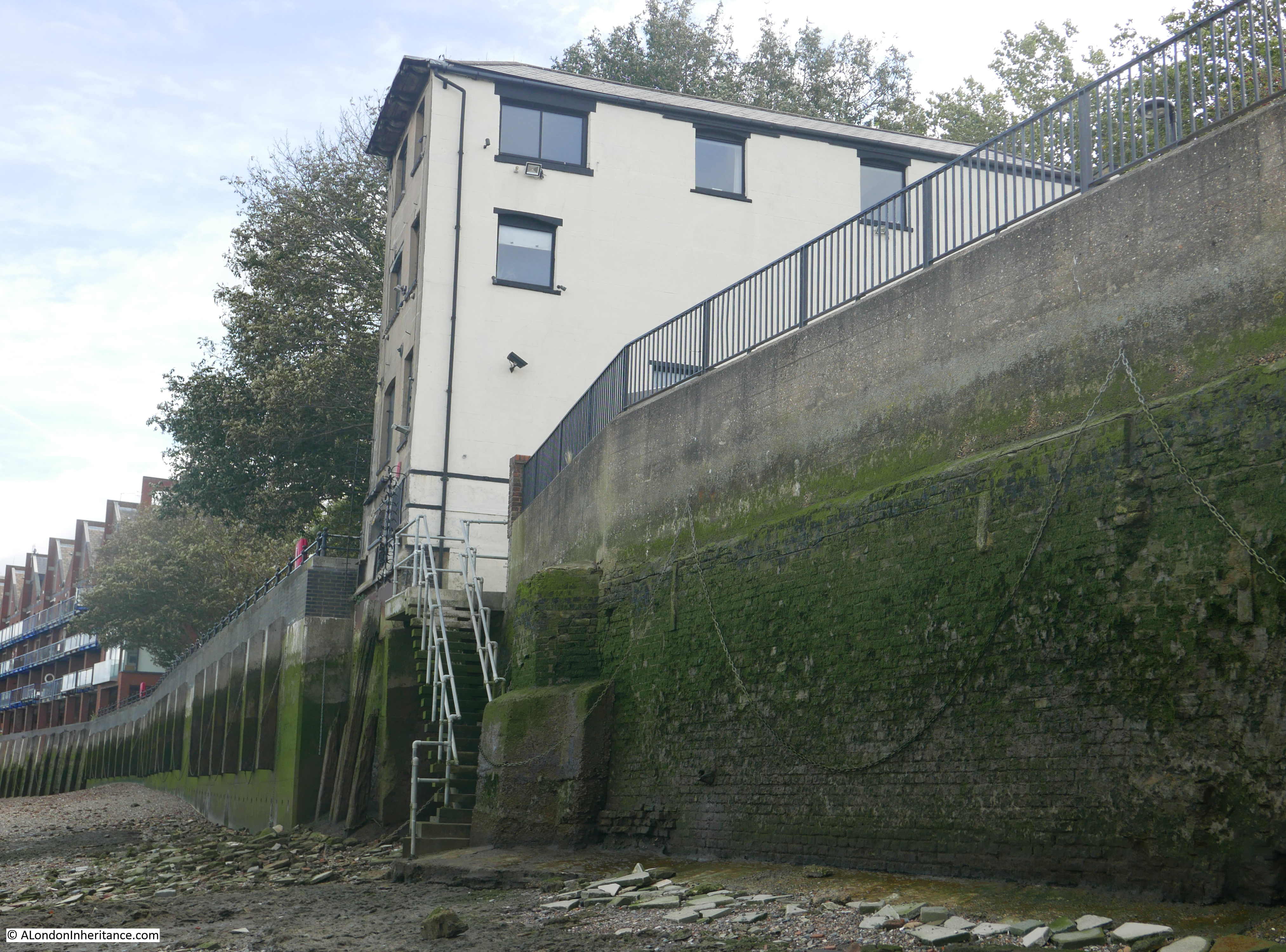
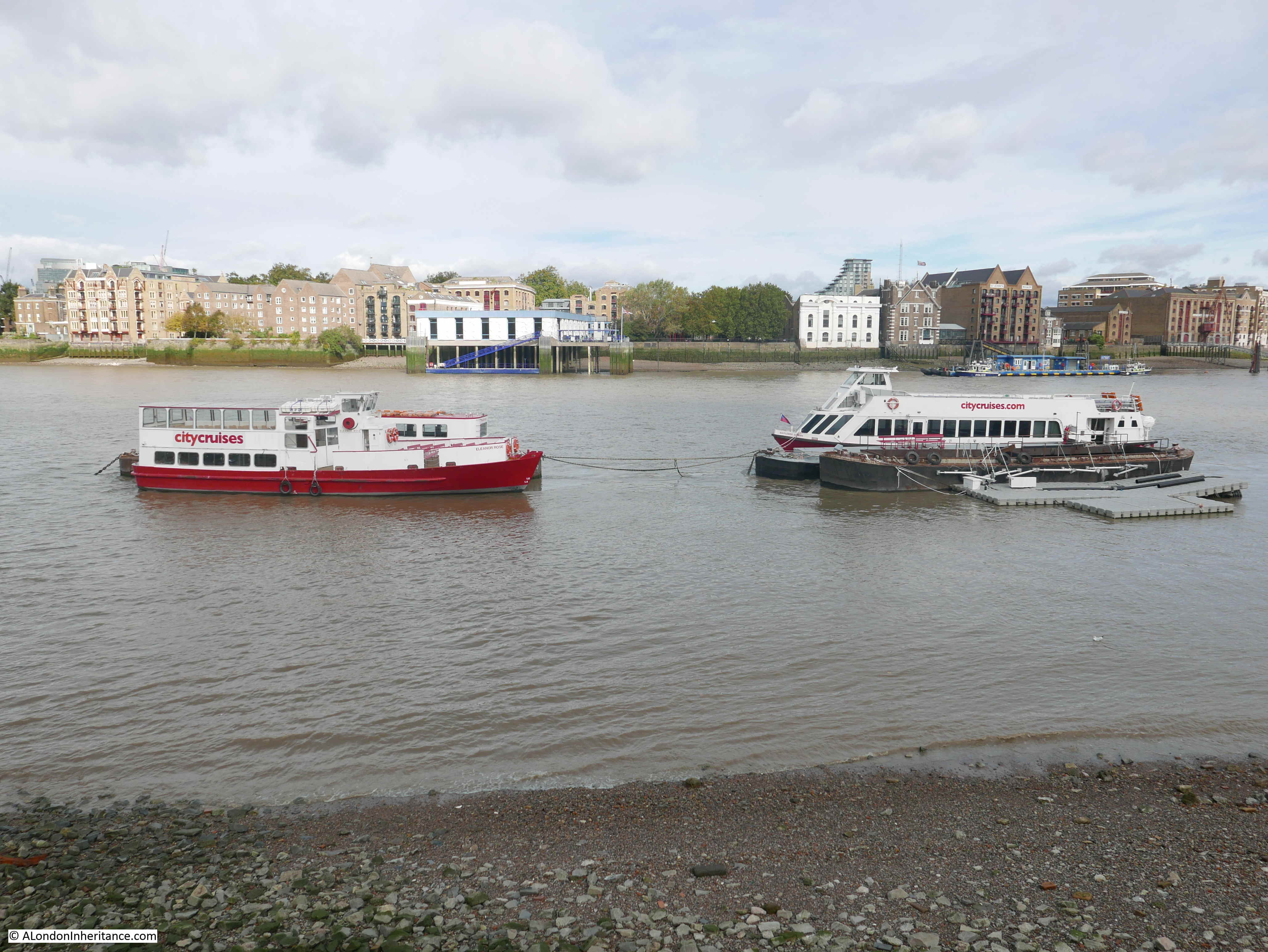
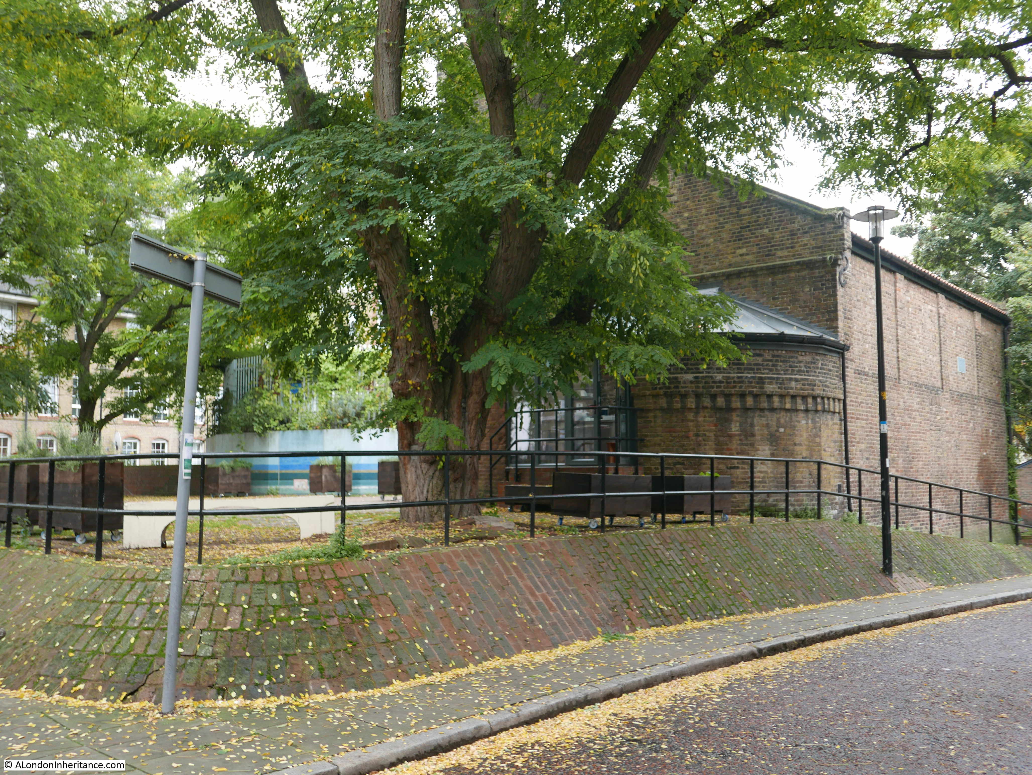
Looking along Cuckold’s Point to the east and there is a pier that reaches out over the foreshore. This is where you can catch the Thames Clipper RB4 service that runs between this pier at the Doubletree Docklands Hotel, across the river to the pier at Canary Wharf – a brilliant way of crossing the river.

Cuckold's Point

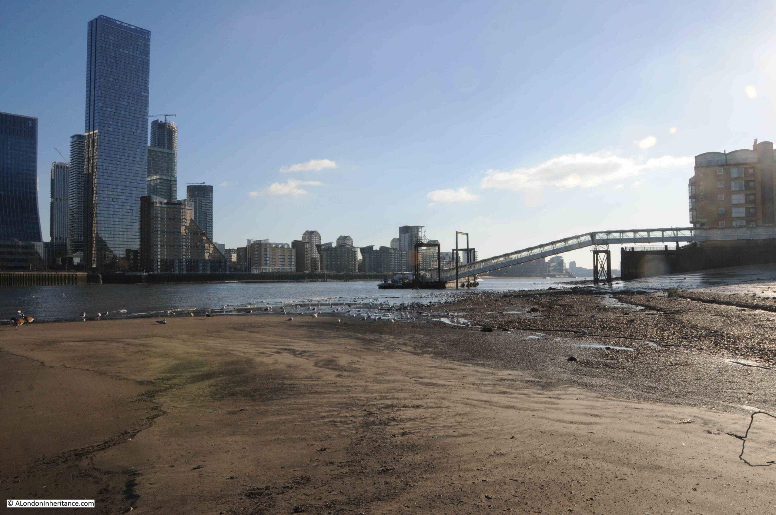
A rather good example of historical continuity in London, the Thames Clipper RB4 service has almost exactly the same route as the old Limehouse Hole ferry that ran from Horn Stairs.

Some of the long length of the causeway still has a layer of stones that would have provided the hard surface to walk down to catch your boat:

Horn Stairs

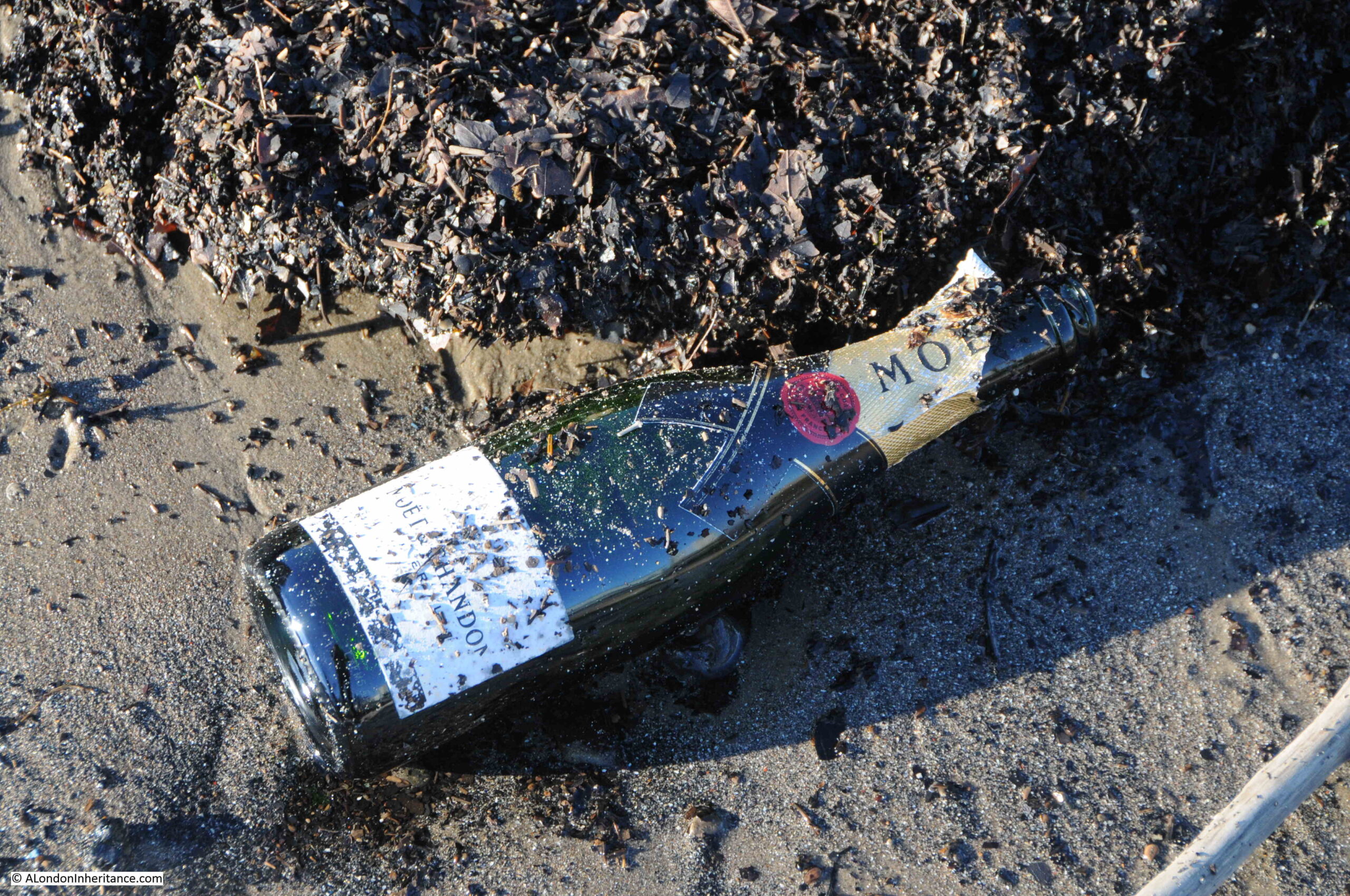
I visited Horn Stairs and Cuckold’s Point in January, and this was probably the left over of some New Year’s Eve celebrations:

Horn Stairs

Returning to the story of the Miller and King John, one of the rights allegedly granted to the Miller was the right to hold a fair in Charlton.

Whatever the truth in the story of the Miller and King, a fair was held each year, on St. Luke’s Day, the 18th of October, and the following article from The Sun on the 20th of October, 1846 hints at the antiquity of the fair, and also provides a good overview of the event.

There is also a reference to Cuckold’s Point towards the end of the article, which I have highlighted in bold:

“HORN FAIR – This scene of popular amusement was held yesterday, according to ancient custom, in the healthful and pleasant village of Charlton.

In former times it was generally distinguished by riot and obscenity. Some of the worst class in London made parties to carry out the vulgar joke of cornuted husbands and wives (cornuted means to bear or have horns).

Horn Fair (the common name) is now changed to Charlton Fair, and the visitors, more enlightened that their ancestors, seldom indulge in those disorderly transactions which bore the stigma of indecency. It was formerly a mart for various forms of utensils made of horn, and tradition ascribes the origin to King John. An armour carried out by that licentious and infamous Prince with the wife of an honest miller was the foundation for the fair. John, surprised by the enraged husband, would have perished under the uplifted dirk of the miller, had he not saved his life by promising to redress the injury. The compensation was a grant of land the miller could see westward from the top of his mill. Agreeable to the royal donation, a fair was to be held annually, on St.-Luke’s-day, for ever.

Such is the oral account of the fair from year to year, and there is, we believe, at the present day, an aquatic custom at Cuckold’s-point, where it is said the mill stood, which bears out the story. The waterman, as he passes the stairs, or landing place, frequently tells his fare that a spider is crawling on his hat. The person naturally takes it off his head, and then Old Charon, with a laugh, requests he will put it on again, having properly paid his respects to the Horns at Cuckold’s Point.”

Note in the above article that the mill is described as being at Cuckold’s Point, however the majority of references refer to the location being in Charlton, and that Cuckold’s Point, where horns were mounted on a pole, was the place furthest west that the Miller could see from his place in Charlton.

The article also mentions that Horn Fair was held on St. Luke’s Day. The connection with St. Luke comes from ecclesiastical art, where St. Luke is often painted with an Ox, an example being this early 18th century print which shows St. Luke seated at a desk, with a winged ox with horns, behind him.

St Luke

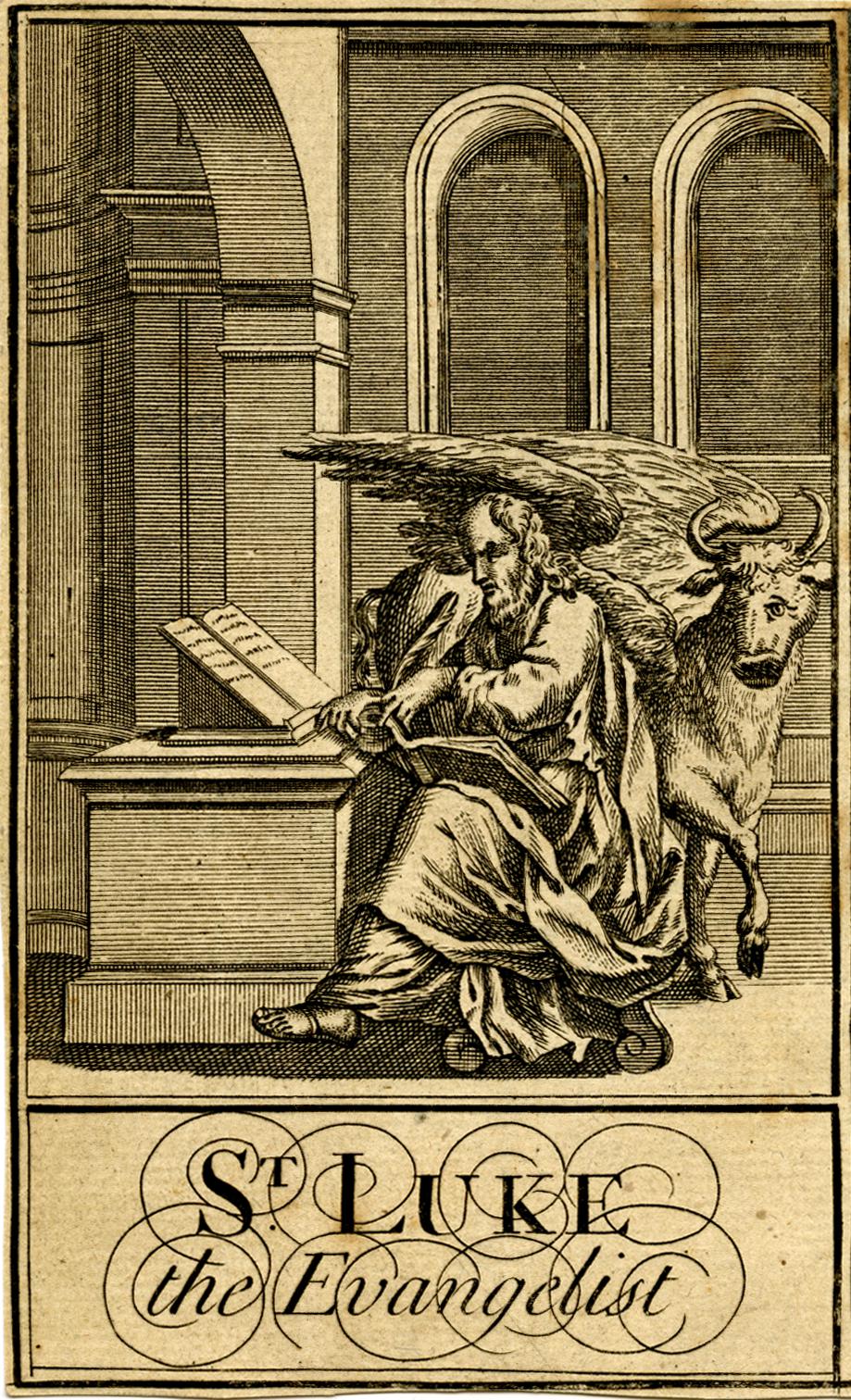
 © The Trustees of the British Museum Creative Commons Attribution-NonCommercial-ShareAlike 4.0 International (CC BY-NC-SA 4.0)

There are very many references to Horn Fare, including some which describe events such as the following from 1742:

“Monday being St. Luke’s Day, a large Body of Cuckolds, both real and reputed, attended the King, the Miller, and his Wife, from the Sun Yard in Bishopsgate-street, to Horn Fair, held at Charlton in Kent, according to annual Custom.”.

In the 18th century, the Press Gang took advantage of Horn Fair, as this report from the 27th of October, 1746 explains:

“Last Saturday Night a large Press Gang, with Horns on, and Music playing before them, came through Greenwich, Deptford and Rotherhithe, &c. from Horn Fair, which drew a great many Sailors out of their Retreats to see the Procession, several of whom were pressed for his Majesty’s Service, and sent directly on board the Tenders in the River.”

The stairs today look almost like archaeological remains, washed from under layers of mud and sand by a strong tide, a bit like Seahenge, discovered in Norfolk in 1998. I checked on the Historic England directory, and the stairs are not listed, and it is unclear who, if anyone, is responsible for these features. Sadly, they will probably continue to erode away. A great loss for future generations.

Horn Stairs

Temporary structures were erected for Horn Fair, and we can get a glimpse of these from reports about the fair, including one from 1819 where there was an unexpected heavy snow fall, which caused much damage to the fair, including temporary structures for “The Freemasons Tavern” and “The Crown and Anchor”, which had apparently been “fitted up with great splendor , and the proprietor had omitted to take down his lamps and lustres” – which along with bottles, crockery, furniture etc. were all badly damaged by the snow.

The Horn Fair was abolished in 1872. By then Charlton had ceased to be the “healthful and pleasant village of Charlton“, and was being rapidly developed.

Horn Fair did not fit in with the Victorian narrative of improvement, and riotous assemblies such as fairs, were seen as a threat to those living nearby, to law and order, and to the social structures of the time.

In the Morning Advertiser on the 27th of February, 1872, in between lists of the prices of coal, hops, potatoes, the cattle market, and an article listing the days of the arrivals of the mail from Australia, New Zealand, the Falkland Islands, Mexico, Egypt (all symbols of a new Victorian London), there was a brief article reporting on the official abolition of the Horn Fair at Charlton and the Blackheath Fair, both of which had “survived all other suburban pleasure fairs”.

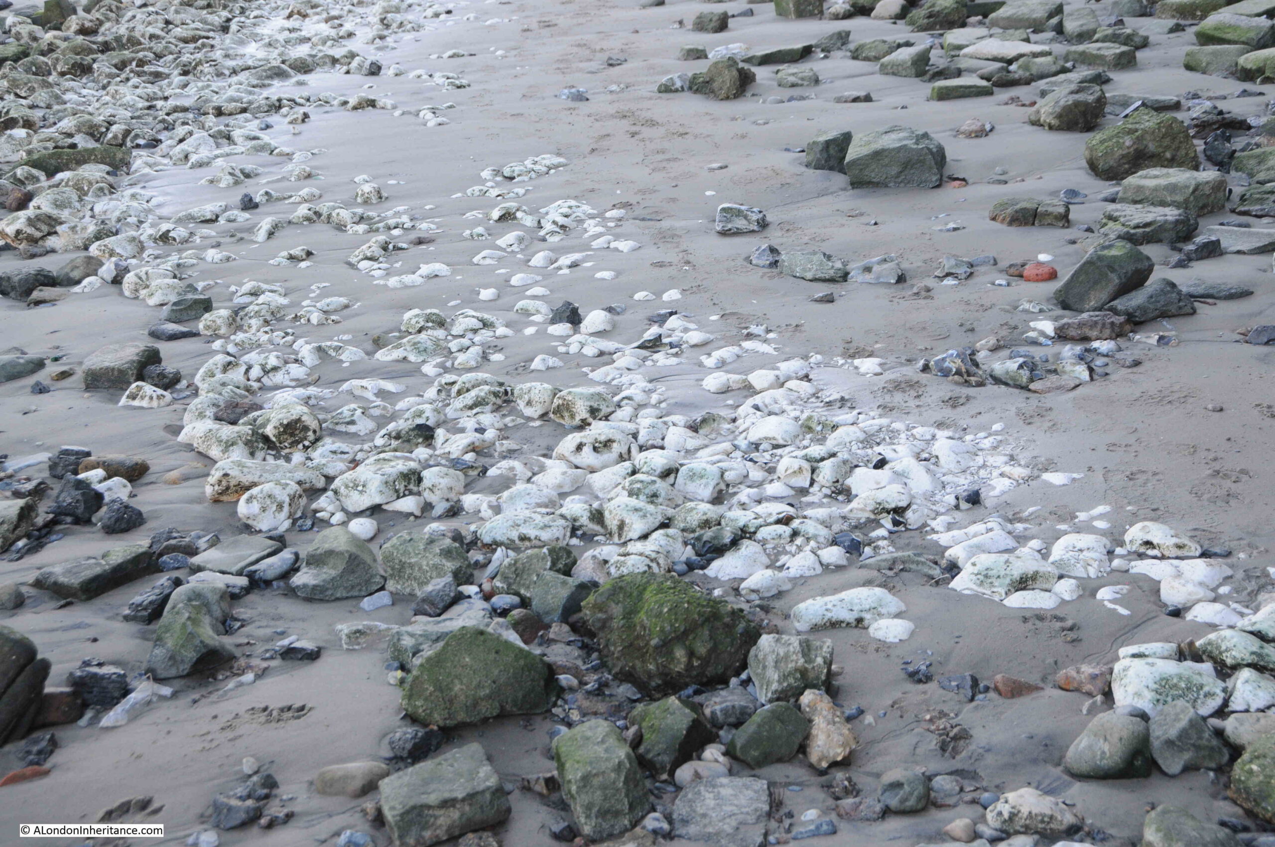
Chalk on the foreshore at Cuckold’s Point, left over from a time when chalk was used to build a flat platform on which barges could be grounded:

Horn Stairs

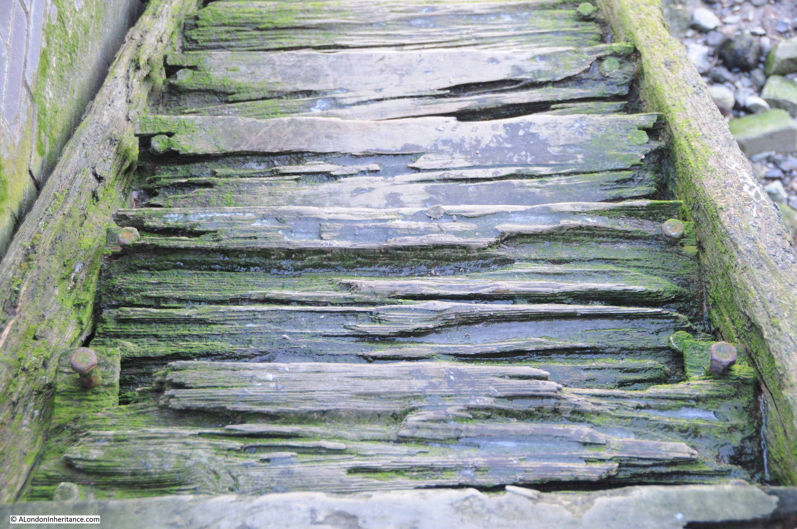
The wooden steps of Horn Stairs. The condition of the individual steps seems to get worse with height, with those at the very top appearing to be in very poor condition. I assume this is because those at the top are much more open to the atmosphere, are washed by the river rather than being covered, and suffer more wave action.

Horn Stairs

Horn Stairs and Cuckold’s Point are wonderful places to take in the river, views across to Limehouse and the Isle of Dogs (but walk down the stairs at your own risk !!).

It is a place with a long history, shared with the history of the river, and a connection with a Miller and King in Charlton, and a historic fair held in the “pleasant village of Charlton“, which does still have a Hornfair Road near the original location of the fair

What ever the truth of the story of the Miller, his Wife and King John, it is a fascinating part of London’s long history, and tells much about life in London over the centuries.

alondoninheritance.com

Jays for Jeans, Surrey Quays, Rotherhithe

Jays Stores was a store in Lower Road, Rotherhithe, that had a large sign advertising Jays for Jeans at the top of the building, above an illustration of a man presumably dressed in clothes available from the store.

My father photographed Jays Stores and the Jays for Jeans sign in 1986:

Jays for Jeans

I could not get exactly the same view as in 1986 due to road works occupying the space directly opposite, however an almost the same view of Jays for Jeans, 38 years later in January 2024:

Jays for Jeans

I am not sure exactly when Jays Stores opened, but the store closed in 2016. I suspect that the location of the store opposite the shops of the Surrey Quays shopping centre, Internet shopping, and the loss of local industry, with the resulting loss of trade for industrial wear, donkey jackets etc. (as advertised in the 1986 window) resulted in the store being economically unviable.

The store did make it onto the Internet though, as the surviving sign on the top of the building in 2024 shows that Jays for Jeans had a.co.uk address for the store, a different sign to the one in 1986.

The central panel has either completely faded, or perhaps been over painted.

To the right of the store, in the 1986 photo, can be seen part of one of the estate agents set-up to market the new properties being built as part of the redevelopment of the docklands.

Jays for Jeans is one of those local landmarks that defines an area for a specific period of time.

I walked down to the location of Jays for Jeans from Canada Water station, having arrived on the Jubilee Line.

It was a short walk, by the most direct route (that avoided the Surrey Quays shopping centre), but a route that confirmed that you can find things of interest in almost any London street, and is one of the joys of walking.

The following map shows my route from Canada Water station (within the red circle) down to the site of Jays for Jeans, next to the Surrey Quays station which is over ground only (dark blue circle). the dark blue dotted line shows the short route  (© OpenStreetMap contributors):

Jays for Jeans

Staring with the wonderful drum structure over Canada Water station, a design which allows a large amount of natural light to get into the station below. The drum is above the escalators which run between the ticket hall and the platforms below:

Canada Water Station

From Canada Water Station, I headed down Surrey Quays Road, a street which was one of the main entrances into the Surrey Commercial Docks which once occupied the majority of this part of Rotherhithe.

Along this street is one of the very few remaining buildings from the docks – the Dock Manager’s Offices:

Dock Manager's Offices

This glorious buildings is Grade II listed, and dates from 1892 when it was built by the Surrey Commercial Dock Company.

The building is very well preserved, and when in use as the dock offices, it consisted of three main parts: the Superintendent’s Office with clock tower, a Janitor’s House, which is the smaller block closest to the camera with the Dock Offices signage, and a large open plan General Office, which can be seen in the above photo receding to the right.

Dock Manager's Offices

The building is now owned by British Land, and I believe part of the interior has been designed to showcase the flats that are being built as part of the significant redevelopment going on around the Surrey Quays area.

There is a plaque on the side of the Dock Manager’s Office which records a major event during the last war:

Dock Manager's Offices

I am going to save the story of the docks here in Rotherhithe for some later posts as there is so much to tell about this part of London, and for now, I will continue on to Jays for Jeans.

At the end of Surrey Quays Road, the street meets Lower Road, and on the western side of Lower Road is the Seven Islands Leisure Centre:

 Seven Islands Leisure Centre

Opened as the Rotherhithe Bath and Assembly Hall on the 27th of November, 1965, the building included a swimming pool, assembly hall with stage and dressing rooms, crèche and play area for children and a place for sunbathing.

The name comes from what were believed to have been seven islands in-between the streams that drained Rotherhithe and Bermondsey into the Thames.

The building retains a wonderful example of the coat of arms of the old Metropolitan Borough of Bermondsey:

Bermondsey Coat of Arms

Bermondsey, as a Metropolitan Borough existed from 1900 (when it brought together the old parishes of Bermondsey, Rotherhithe and St. Olave), until 1965 when it was replaced by the London Borough of Southwark.

Within the coat of arms, the lion and the two letter B’s on either side, are from the Bermondsey Vestry and have their origins in Bermondsey Abbey.

The crown and the axe are from St. Olave, and come from the Royal Arms of Norway (see this post for more details on the origins of St. Olave and the connection with Norway).

Rotherhithe and the docks are represented by the ship at bottom right.

The Latin motto at the bottom of the arms, “prosunt gentibus artes” means “Arts profit the people”

On the opposite side of Lower Road is a brick built block of apartments, with a blue plaque between the first and second floors, above the central arch:

King Edward Frederick Mutessa

The blue plaque is to King Edward Frederick Muteesa II, the first President of Uganda:

King Edward Frederick Muteesa

Muteesa was the Kabaka (king or ruler) of Buganda, one of the individual kingdoms that make up the country of Uganda.

When Uganda became independent from Britain in 1962, Milton Obote became the Federal Prime Minister, and Obote negotiated an agreement with Muteesa that he would become President of Uganda, an agreement which was implemented by secret vote in Parliament on the 4th of October, 1963.

In the following years, there was infighting between the coalition that made up Parliament and between Obote and Muteesa, and it finally got to the point where in February 1966, Obote suspended the Federal Constitution and declared himself President, thereby deposing Muteesa.

Muteesa fled into exile and arrived in London, penniless, and without any support from the Government of Uganda.

During his earlier years he had been educated at Cambridge, where he also joined the university’s officer training corps, which led to a commission as a Captain in the Grenadier Guards.

It was this military connection that was to help with accommodation in London, and an old military contact provided him with the apartment in Orchard House, Lower Road.

He was not there for too long as on the 21st of November, 1969, he was found dead in the apartment, apparently of alcohol poisoning. A few hours before his death he had been interviewed by the BBC correspondent John Simpson, who found him sober, and there have been theories that he was murdered.

He was temporarily buried in England until the political situation changed in Uganda when Idi Amin overthrew Milton Obote and Muteesa’s body was returned to Uganda and given a state funeral and burial.

As with so much of London, there are a number of closed pubs in Lower Road, places that recall the working class history of the area.

The first of these is the Prince of Orange:

Prince of Orange

The pub seems to have opened around the late 1830s / 1840s as it is during these years that I find the first mentions of what appears to be the Prince of Orange pub.

In the following decades there are all the usual mentions of events that you would expect to find in a London pub in the docks, with crime, fights, jobs available etc.

in the pubs last few decades, it seems to have been a venue for jazz, as in newspapers there are plenty of adverts, such as for Pete Boulter’s Blues Jam session (1995), and Mr. B Plays Basie (1983). In the Stage and Television Today in October 1982, it was reported that “on the pub front, let us applaud the Prince of Wales, Buckhurst Hill and the Prince of Orange, Rotherhithe, both presenting jazz practically every night of the week”.

At times, the pub was on BBC Radio 2, for example the listings for the 25th of January, 1988, included “Jazz Score, where Benny Green is in the chair at the Prince of Orange, Rotherhithe, and on the panel are Acker Bilk, Peter Clayton, Alan Elsdon and Ronnie Scott”.

The Prince of Orange is now apartments.

A short distance further along Lower Road is another closed pub, the China Hall:

The China Hall

There has been a pub on the site for a number of centuries and in 1719 a pub on the site was apparently called the “Cock and Pye Ale House.” 

The earliest written reference I can find to the name China Hall is in the Oracle and Daily Advertiser, on the 27th of February, 1802, when “A few afternoons since, about half past four o’clock,, as Mr. Witts of the Europa Inn, Rotherhithe, was travelling near China Hall, in the lower Deptford Road, he was stopped by a single foot-pad, who robbed him of a £2 note and his cash”.

The road was originally called Lower Deptford Road, but has since dropped Deptford and is now simply Lower Road.

The site of the pub has a long history. In 1776 the pub appears to have been leased to a trader in tea and china called Jonathan Oldfield, and who built a theatre next to the pub, called the China Hall. The name may have come from his trade in china, and the name appears to have transferred from the theatre to the pub.

Edward Walford, writing in Old and New London (1878), has the following to say about the China Hall: “In former times a narrow pathway, called the ‘Halfpenny Hatch’ extended through the meadows and market-gardens from Blue Anchor Road to the Deptford Lower Road, where it emerged close by an old and much-frequented public-house called the ‘China Hall’. The ancient tavern, which was a picturesque building partly surrounded by an external gallery, was pulled down within the last few years, and in its place has been erected a more modern-looking tavern, bearing the same sign.

Our old friend Pepys mentions going to China Hall, but gives us no further particulars. It is not unlikely, says Mr. Larwood in his History of Signboards, that this was the same place which, in the summer of 1777, was opened as a theatre. Whatever its use in former times, it was at that time a warehouse of a paper manufacturer.

In those days the West End often visited the entertainments of the East, and the new theatre was sufficiently patronised to enable the proprietors to venture upon some embellishments. The prices were – boxes 3s; pit 2s, gallery 1s; and the time of commencement varied from half-past six to seven o’clock, according to the season. The Wonder, Love in a Village, the Comical Courtship and the Lying Valet were among the plays performed. The famous Cooke was one of the actors in the season of 1778. In that same year the building suffered the usual fate of theaters, and was utterly destroyed by fire”.

The China Hall pub closed at the end of 2018, after a local campaign failed to save it, although it appears to have been a going concern, was wanted by the local community and had publicans who wanted to continue.

The ownership of the pub has been very controversial, and since closure the upper floors have been converted to residential, with extra space from the addition of a mansard roof.

The ground floor did appear to be undergoing conversion however council planners issued a warning notice to stop. A planning application was made for conversion of the ground floor, this was turned down, and the council issued an enforcement notice requiring removal of residential partitions and fixtures.

The owner has since appealed against the planning refusal – I do not know the status of this appeal.

The China Hall illustrates the sad fate of many London pubs, that even when they are still viable businesses, and wanted by the local community, they are all too easily sold to a developer who can find more profit in the conversion of the property to residential.

Continuing down Lower Road, and on the eastern side of the street is a row of late 19th century, terrace houses. The second house on the left has a plaque to Ada Salter, just above the ground floor bay window, directly above where green bins can be seen:

Ada Salter

Ada Brown was born in 1866, a child within a Wesleyan Methodist family in Raunds, Northamptonshire. She moved to London in 1896, where she joined the West London Mission of the Wesleyan Sisters of the People, before moving to their Bermondsey Settlement in 1897.

Alfred Salter was a student at Guy’s Hospital when he met Ada at the Bermondsey Settlement. They married in 1900 and lived in Bermondsey. Both Ada and Alfred worked tirelessly to improve conditions in Bermondsey and Rotherhithe.

The house with the plaque is at 149 Lower Road, and was the Women’s House of the Bermondsey Settlement. Ada lived in the house for two periods in 1897 and 1898.

The plaque is very recent as it was installed on the house in 2023:

Ada Salter

Ada became a Labour councilor, the first woman councilor in Bermondsey in 1909 and set about recruiting women workers to trade unions to organise against the terrible working conditions in the area’s factories.

Alfred was elected MP for Bermondsey in 1909, the same year as Ada was elected Mayor.

A view of Ada’s campaigning approach to improving the living conditions of Londoner’s, can be seen in the following first two sections from an article she wrote in the Daily Herald on the 28th of February, 1934, titled: “Don’t forget the HIDDEN LONDON”:

“London is the most wonderful and romantic city in the world. London leads. What London thinks to-day Great Britain will do to-morrow.

Underlying its romance, its magnificence, its power, its wealth and its resources, is a vast morass of sorrow and misery, of poverty and struggle, of unrequited toil and unmerited suffering.

Watch some hundreds of thousands of citizens pouring each evening out of their office and work places in the centre of London and follow them to their homes. You will have glimpses of drab, featureless streets, rows of Early Victorian terrace houses, huge blocks of tenement dwellings. In these industrial dormitories the workers are not housed, but warehoused. Observe the daily fight for tram or bus and all the discomfort that it involves. Note the imperfect education given to children, too large classes, insufficiency of secondary schools, inadequacy of playing space in all working-class quarters.

Compare the dullness and ugliness of grace and colour which constitute the environment of the poor with the stateliness and magnificence of the West End and the pleasing amenities of the middle-class suburb.

Contrast the narrow, shut-in back yards with the spacious gardens surrounding the houses of the well-to-do. Remember the acres and acres of playing fields attached to all the public schools of England where the sons of the rich are educated, and then turn to the cramped, asphalted play grounds of the elementary schools in Bermondsey, Southwark, Bethnal Green, Stepney and Poplar.

It is this London of the mean streets to which our thoughts should turn at a London County Council Election rather than the ‘show’ London which visitors from the country and abroad come to see.”

Ada Salter in the early 1920s:

Ada Salter

Ada was also featured in “The VOTE -THE ORGAN OF THE WOMEN’S FREEDOM LEAGUE” on the 1st of December 1922, when she was the fifth in a series of features on women mayors. In the article, she wrote:

“As the first woman in London to be offered the position of Mayor, I am proud that I live and work in a borough, the elected representatives of which are prepared to choose an individual who belongs to what is sometimes described as the weaker sex. As a woman, I am naturally eager that the woman’s share in responsibility of government should be a direct one. There is still a tremendous leeway to be made up in all departments of life that affect women, but the failure to catch the vision of a free humanity, where men and women can act together, and not in antagonism, is not confirmed to one sex.

By common consent, the Bermondsey Borough Council has for some years dispensed with the wearing of the Mayoral and Aldermanic robes, but I also do not intend to wear the chain of office. This, of course, is a purely personal matter. For brilliant colouring, and for the brightness of gold, I have the greatest admiration, but I desire them not as symbols of place and power. The ideal for which we must strive is to secure respect for the authority and decisions of the Chair, rather by personality and character, than by decorations of office.”

I suspect we need more Ada’s in politics today.

Ada Salter died on the 4th of December, 1942. One of the newspaper reports of her death started with “The death of Mrs. Ada Salter, who was London’s first woman Mayor, is a reminder of the many hitherto exclusively masculine fields in which women have now staked out a claim”.

Continuing down to the site of Jays for Jeans, and the third pub in this short walk. This is still open as a bar and restaurant but with a new name of the Yellow House:

Jolly Caulkers

The was the Caulkers, originally the Jolly Caulkers, and in a couple of references, the Merry Caulkers.

A Caulker was the person who had the job to fill in any gaps in a ship, to make it watertight. Filling the gaps between originally wooden planks and later the metal sheets that would make up the hull of a ship.

A profession that would have been found across the docks of Rotherhithe.

The earliest reference I can find to the pub is in the 1840s, however the design of the pub does not look 19th century, and I suspect it may have been rebuilt in the 1910s, as in the South London Gazette in 1919 there are references to the New Jolly Caulkers, and which therefore may be a reference to the pub we see today.

And a very short distance on from the Yellow House / Caulkers, was Jays for Jeans.

A short walk, which has revealed one of the few remaining buildings from the time when Rotherhithe was covered in docks, the coat of arms of the Metropolitan Borough of Bermondsey, the first President of Uganda, Ada Salter, a campaigner for the living conditions of London’s working class and London’s first woman mayor, and three historic pubs.

There is so much more to write about this area, and the large dock complex that once occupied much of this part of Rotherhithe, and I hope to return in future posts.

alondoninheritance.com

A Thames Dolphin at Rotherhithe

The title for this week’s post is a bit deceiving. The Thames dolphin in question is not one of the marine mammals, rather it is a structure in the river which is also called a dolphin.

The definitions for this type of dolphin include a pile, or a collection of piles in the river to which a boat can be moored, or a cluster of piles at the entrance to a dock, and it is this later definition which I suspect applies to the dolphin in my father’s photo at the entrance to the Surrey Lock and Basin in Rotherhithe – photographed in 1947:

Dolphin

The photo was taken from the Thames foreshore, adjacent to the air shaft of the Rotherhithe tunnel, looking across to the Shadwell / Wapping side of the river.

The negative with the photo was in poor condition and took some processing to get to the copy you see above, which unfortunately still has the opposite bank of the river with a rather poor contrast and lack of detail to the buildings.

I could not get down to the foreshore to take a similar photo as the tide was not sufficiently out, so the angle of the 2020 photo is slightly different. The following photo shows that the dolphin can still be seen today, along with some landmarks visible in 1947 on the opposite side of the river.

Dolphin

The following extract is from the 1948 revision of the Ordinance Survey map. The lines converge on the approximate point where my father was standing to take the photo. A blue circle marks the location of the dolphin (‘Reproduced with the permission of the National Library of Scotland’).

Dolphin

The green circle on the opposite side of the river is the position of the air shaft of the Rotherhithe tunnel which can be seen in the 1947 photo. The centre red arrow shows the alignment of the airshaft in relation to the dolphin.

The arrow on the left points to the church spire that be seen in the 1947 photo. This is the spire of St Mary’s in Cable Street. The spire can also be seen in the 2020 photo, and I photographed the church when I was walking the area a few years ago.

Dolphin

The arrow on the right points to the buildings which can be seen to the right of the dolphin. These are the buildings and cranes of Charringtons Wharf, which were demolished some years ago to be replaced by the large block of flats on the site today. The cranes to the right of the tunnel air shaft in the 2020 photo mark one of the construction sites for the Thames Tideway Tunnel, or Super Sewer.

There is a prominent line of buildings running between the dolphin and the spire of the church. These were buildings along the northern edge of The Highway – buildings that have now been demolished.

The gap in the centre of the line of buildings is open space between The Highway and Glamis Place, with the ruins of a pub to the left.

The entrance to Shadwell Basin is also in the photo, but is hard to see due to the lack of contrast, and the lighting of the scene across the river. The entrance is also at an angle to the river so the northern side of the entrance looks like a continuation of the river wall.

I have marked these features on the original 1947 photo as shown below:

Dolphin

There is one feature in the 1947 photo that I could not locate, however the Britain from Above archive came to the rescue.

The following photo from 1946 shows the Wapping / Shadwell area. The tunnel air shaft is lower left and I have ringed the church. I have written the name of The Highway along the street and the row of buildings along the north side of the street can be seen.

Dolphin

From the church spire, look diagonally to the lower left and you will see a chimney. This is the chimney seen in the 1947 photo and is the feature I could not locate.

Comparing the photo and the OS maps, the chimney looks as if it may have been part of the Queen Elizabeth Hospital for Children.

The following map shows the area today. The lower solid red circle is the point from where the photo was taken, and for reference, the upper red ring is the location of the church (Map © OpenStreetMap contributors).

Dolphin

The entrance to the Surrey Basin can be seen to the right of the lower red circle and the entrance to Shadwell New Basin is on the opposite bank.

The following photo is looking slightly to the west. The air shaft of the tunnel is opposite, and it is strange to imagine the thousands of cars and lorries that are running daily, under the river between where I am standing and the air shaft opposite.

Dolphin

The dolphin has been repaired since the 1947 photo, but still retains the mooring bollard on top.

Across the river, there is a second church spire to the left, this is St Paul’s Shadwell. The white building on the extreme left is the Prospect of Whitby pub.

A close-up view of the air shaft on the north bank of the river. To the left of the air shaft are the Shadwell Dock Stairs, which I wrote about here.

Dolphin

The area behind the northern airshaft is the King Edward VII Memorial Park – a fascinating area which I wrote about here.

The following photo shows the Rotherhithe tunnel air shaft on the south bank of the river, mirroring the design of the structure on the opposite bank.

Dolphin

The location of these airshafts can be seen when travelling through the Rotherhithe tunnel. They are each located where the tunnel bends, and with the walls of the tunnel set back for the infrastructure leading up through the air shaft.

If you look along the river wall in the above photo, you will see steps descending down to the foreshore, which at the time I was there were still partly underwater.

I suspect this was the method my father used to get down to the foreshore to take the 1947 photo, as the steps are also shown on the 1948 Ordnance Survey map.

The entrance to the Shadwell New Basin on the opposite side of the river is almost impossible to see in the 1947 photo. The entrance is at an angle and is still not that obvious today. The following close-up photo shows the entrance to the basin.

Dolphin

The Prospect of Whitby on the northern bank of the river (I can only dream of having a beer there at the moment):

Dolphin

View looking west along the river with the dolphin:

Dolphin

The dolphin is just outside the entrance to the Surrey Lock, which was the western entrance to the Surrey Basin, and the large complex of docks that once occupied the peninsula. The following extract from the 1940 edition of Bartholomew’s Reference Atlas of Greater London shows the considerable size of the docks. The entrance by the dolphin is on the left and labelled Surrey Docks.

Dolphin

The following photo shows more clearly the position of the dolphin and the entrance to the docks, which today have two posts marking the entrance.

Dolphin

The mooring bollard on the top of the dolphin implies that ships could have been moored on the dolphin, however I would have thought a ship moored in that position could have been an obstruction for ships coming in and out of the dock.

Dolphins at the entrance to docks were also used as a type of fender where the dolphin provided something for a ship to gently hit up against, and as an aid to align and position the ship.

At the entrance to a dock this may have helped a ship enter or exit the dock rather than drift further up or down stream.

Whatever the use of the dolphin, I assume it is now redundant as the docks have long since closed, with the majority disappearing under new building, and the entrance from the lock into Surrey Water closed off by Salter Road which runs across the old entrance into the basin.

The entrance does have an interesting base, which appears to be composed of metal plates.

Dolphin

I suspect the design is to reduce the amount of sediment that settles on the base of the lock. The angled plates which run along the centre will result in water draining to left and right as the tide goes out, and the higher flow of water along the edges that this causes reduces the amount of sediment left in the dock.

Facing out of the dock, towards the Thames, the tunnel air shaft is on the left, and a large pub, the Salt Quay, on the right:

Dolphin

Looking in from the river, along the Surrey Lock, and a rolling lift bridge can be seen, carrying Rotherhithe Street across the lock.

Dolphin

The bridge is a rolling lift bridge as it has a large counter weight at one end of the bridge, with a curved framework connecting the counter weight to the deck of the bridge.

Dolphin

When the bridge opens, the counter weight moves to the ground, rolling the deck of the bridge upwards. The following photo shows the bridge in action, with the deck fully raised to allow ships to move from the lock and into the docks.

Dolphin

The above view is looking south-west from the Thames. The chimneys in the background are at the Rotherhithe Gas Works which I covered a couple of weeks ago.

The docks were a prime target for bombing during the last war, and the original bridge was badly damaged in September 1940. Whilst it could continue to provide a road across the dock, it could not lift, so only barges were able to enter, not the usual sea going ships that would have normally entered the docks via this route.

The original bridge was built in 1858 as part of the development of the dock complex, but was finally replaced in 1952 when the new bridge was completed and opened by Viscount Waverley, the chairman of the Port of London Authority.

When the bridge was opened, it was reported that “the people of Bermondsey will again be able to observe the daily spectacle of sea-going ships on their way in and out of this dock entrance”.

The bridge also had a wider roadway than the original bridge, along with improved approaches to the bridge which would help with the substantial volume of road traffic along Rotherhithe Street.

The bridge cost £110,000 to construct, and the fine balance of bridge and counter-weight enabled the 720 tons of the bridge to be raised or lowered in three minutes, by just a 50 horse power electric motor.

Newspaper reports of the time stated that “incorporated in the main structure are 100 tons of cast-iron blocks from an old bridge across the river at Limehouse”. An intriguing statement that I have not had the time to research.

The bridge today sits quietly in an area that those who attended the 1952 opening would be hard pressed to recognise, the area having been significantly redeveloped after the closure of the docks.

Dolphin

The following photo is looking from the bridge, along the Surrey Dock towards where Salter Road now closes off the entrance to the basin. Salter Road being part of the development of the area after the closure of the docks.

Dolphin

The dolphin at the entrance to the Surrey Lock is a reminder of the sea going shipping that once was so common on this part of the river, and that would have either moored on the dolphin, or used it as an aid to enter or leave the dock.

The Surrey Commercial Docks to give the dock complex their full name is an area I have yet to explore. My father took more photos of the area, so hopefully some return visits in 2021.

alondoninheritance.com

Rotherhithe Gas Works and a soon to be lost Gas Holder

If you have a gas boiler or cooker, the chances are that the gas you use could come from the North Sea, Norway, or via ship carried liquefied natural gas from countries such as Qatar, Russia and Trinidad to the terminal on the Isle of Grain in the Thames Estuary. When gas started to be used as an energy source in the 19th century, the production of gas was very local to consumers, and for this week’s post I am exploring one such production facility, the Rotherhithe Gas Works.

I have marked the location for today’s post by the red star in the following map  (Map © OpenStreetMap contributors):

Rotherhithe Gas Works

That is not a bridge across the Thames at the point of the star, it is the way Openstreetmap shows the Rotherhithe Tunnel.

The reason for the post on the Rotherhithe Gas Works is because of a photo taken by my father in 1948. The following photo shows what is probably open space following the demolition of bomb damaged houses, with in the background, parts of two large gas holders.

Rotherhithe Gas Works

I wanted to find the location of the photograph. I knew from my father’s notes that the location was Rotherhithe, but not from where the photo had been taken. The two gas holders were obvious clues, however the area is very different today, so I started off with the 1950 edition of the Ordnance Survey map of the area.

I have copied the photo below, added the map extract and marked up key points shown in both photo and map, and the approximate location where my father was standing to take the photo. I needed to rotate the map to get a similar orientation to the photo, so north is at the bottom and south at the top of the map.

Rotherhithe Gas Works

The red oval marks a semidetached pair of houses. To the left of these houses, there appears to be a tall wooden fence, and next to the fence, a terrace of older houses (you may need to click on the photo and enlarge to see the details of these clearly). These are the terrace houses shown by the green oval on the map.

In the background are the two large gas holders. The one on the right appears to be a larger circumference than the holder on the left, which matches both photo and map. Part of the gas holder on the left is obscured by a large building, again the same in both photo and map.

Extending the alignment of these features back, and they converge at a point on a street which again aligns with the photo as part of a street is in the lower right corner.

Rotating the map back to the correct orientation, and the street is Neston Street, marked below with the red star. The terrace of houses on the right of the street ends in a blank space on the map which corresponds with the 1948 photo (‘Reproduced with the permission of the National Library of Scotland’).

Rotherhithe Gas Works

So it should be simple to find the location today? Not very, as the area has changed so much. In the 1950 map above, All the large buildings between the round gas holders and the River Thames at top left, were part of the Rotherhithe Gas Works. To the left, there was some housing, along with other industrial buildings, and the area had also suffered bomb damage.

The Rotherhithe Gas Works closed in 1959, and over the last few decades, the area has been considerably redeveloped with new housing now covering all the original site of the gas works (with one exception). Roads have changed, and Neston Street has disappeared.

Marking Neston Street on today’s map of the area (red line) allows the location of the 1948 photo to be identified (red star),

Rotherhithe Gas Works

I needed to visit the site to see the area today, and to find one of the two remaining elements of the Rotherhithe Gas Works infrastructure, one that may not be around for too much longer.

I walked along Rotherhithe Street from the west, and walked up Canon Beck Road (to the left of the red line), a road that appears on both today’s and the 1950 map.

Just over half way along Canon Beck Road is a short entrance road to a residential square, Clifton Place. This is shown in the photo below:

Rotherhithe Gas Works

Neston Street would have run, left to right along the front and over part of the houses at the far end of the photo. To take the 1948 photo, my father was probably standing somewhere around the green and blue bins to the left of the photo.

Looming in the back of the above photo is one of the two remaining parts of the Rotherhithe Gas Works – the gas holder also seen to the left of the 1948 photo.

As well as visiting the site of my father’s photo, the gas holder was the second reason for wanting to visit, as it may well be soon disappearing as a local landmark, and a reminder of the industrial history of this part of Rotherhithe.

I walked up to Brunel Road. The terrace of houses along Brunel Road are not part of the redevelopment of the last few decades, they are much earlier. The gas holder can be seen in the background.

Rotherhithe Gas Works

Walking along Brunel Road up to the location of the gas holder, to find the one remaining holder from the gas works, sitting in the space that was also once occupied by the second gas holder in the 1948 photo.

Rotherhithe Gas Works

The remaining gas holder may not be here for long. Plans have been submitted for a complete redevelopment of the site which includes the land occupied by the gas holder, and the surrounding land.

The work will involve the demolition of the gas holder, and the infill of the tank below the gas holder, and the tanks below ground of the gas holders that have already been demolished.

Considerable work will involve removing contamination of the land and the move of operational gas piping and controls that still occupy the site.

The current plans appear to cover the construction of:

  • 40 dwellings for social rent
  • 39 dwellings for discount market rent
  • 198 private dwellings

The plans include the intention “To celebrate the character of the site and its industrial heritage”, which as far as I can see runs to “Balconies and stairways take reference from the industrial metal work” and “Pitched roofs reference the storage sheds associated with the Surrey Water Docks” along with the use of the colour red to accentuate certain features to recall the colour of the existing gas holder.

There is a web site for the proposed development, which includes presentations on the proposed work. It can be found under the name of the development Rotherhithe Holder Station.

A view of the gas holder and the surrounding land which is in-scope of the proposed development:

Rotherhithe Gas Works

The history of the Rotherhithe Gas Works is complex, and tells the story of the consolidation of the local gas companies throughout the 19th century and nationalisation in the 20th century.

Using a number of resources (which I will list at the end of the post), I have attempted to put together a graphical history of the Rotherhithe Gas Works, their ownership, and mergers with other gas companies. Be aware that there are various conflicting dates for some events, and also definition of a date, for example when a gas works became operational, the incorporation of a company by Act of Parliament etc.

Any corrections would be appreciated.

The following graphic shows how the Rotherhithe Gas Works (starting at left and highlighted by the red dotted line) integrated with London’s gas companies through to closure in 1959.

Rotherhithe Gas Works

The first gas works in Rotherhithe seem to have commenced construction by Stephen Hutching in around 1849, with the works becoming part of the Surrey Consumers Gas Company, a company incorporated by Act of Parliament in 1854.

In the mid 19th century there were many concerns about the quality of the gas provided to consumers and the cost, with companies having a monopoly within their local supply area. An 1849 article in The Era titled “Gas Monopolists In A Fever”  talks about the need for gas companies who can supply gas “free from sulphureted hydrogen, acid and ammonia” and the extortionate price charged with upwards of 15 shillings per 1,000 cubic feet, where independent calculations estimate that gas can be produced using modern methods for 2 shillings per 1,000 cubic feet.

The Surrey Consumers Gas Company merged with the South Metropolitan Gas Company in 1879, which brought together two gas companies serving south and south east London.

In 1881, the South Metropolitan purchased a large area of land on the Greenwich Peninsula and started the construction of the gas works which would go on to be one of London’s major gas producing centres for many years.

The South Metropolitan Gas Company would continue to integrate other, smaller companies, including the Phoenix Gas Company based in Bankside in 1880, the Consumers Gas Company in Woolwich and the Equitable Gas Company in Pimlico, both in 1885.

Probably because of the growth of sites such as the Greenwich Peninsula and Rotherhithe, the South Metropolitan closed and sold off sites at Woolwich and Bankside.

Reading newspaper references to London’s gas companies throughout the 19th and early 20th centuries, there are very many references to the monopoly position of these private companies, the cost of gas and frequently the quality of the gas, and pollution from the gas producing works.

In January 1860 the Surrey Consumers Gas Company were at Southwark Police court being charged by the Bermondsey vestry under the Nuisance Removal Act “for that they, in the manufacture of gas on their premises at Rotherhithe, did, on or about the 16th inst. cause an intolerable nuisance to exist as to be dangerous and injurious to the inhabitants of the parish of Bermondsey”.

The issue in January 1860 seems to have been a considerable amount of ammonia in the gas supply which had not been removed by the purifiers at the Rotherhithe gas works, and was causing a very bad smell, and health problems to those in Bermondsey who consumed the gas.

In 1875 at the half yearly meeting of the Surrey Consumers Gas Company, the news reports stated that the meeting “must have been attended with considerable interest by the fortunate individuals who hold shares therein. They have been too long accustomed to their unfailing profit of 10 per cent per annum. The balance sheet was as good as had ever been issued by the company”.

Consumer groups were frequently formed and south London’s vestries were often complaining about the costs and quality of gas, and there were many arguments that such companies should be publicly rather than privately owned.

London’s gas consumers would have to wait until 1949 for this to happen, when the countries gas companies were nationalised by the post war Labour government and the South Metropolitan Gas Company along with other London gas companies were merged into local gas boards under public ownership.

Ownership of gas provision came full circle when the nationalised gas board was privatised in 1986 as British Gas, and since then many of the arguments about the cost of gas are very similar to those in 19th century newspapers.

The production of gas was a very dirty business. Coal was heated in a furnace, which produced a range of gases including hydrogen and carbon monoxide. These gases were passed through a condenser where solids and liquids such as tar would be removed, before passing through a purifier where impurities such as sulpher and ammonia would be removed.

The gas was then fed to the gas holders ready for distribution at pressure to gas consumers.

An impression of the interior of the Rotherhithe Gas Works can be had from the following artwork dated 1918, with women working in the “retort” area (retorts are the furnaces where coal was heated to produce gas).

Rotherhithe Gas Works


 Copyright: © IWM. Original Source: http://www.iwm.org.uk/collections/item/object/105

Work at the Rotherhithe gas works was dangerous and there are newspaper accounts of accidents within the works. For example, when one of the gas holders was being built in 1890, a labourer named Barnes, aged 23, working for the contractors Clacton & Son of Leeds, died after falling twenty feet to the base of the holder.

Workers at the gas works had the Rotherhithe Gas Works Institute, and in October 1894, five crews from the institute raced on the Thames from the coal jetty at the gas works to Deptford Creek.

Discovery of North Sea gas in the 1960s resulted in the replacement of so called Town Gas from gas works such as that at Rotherhithe, by gas piped from below the North Sea. Although Rotherhithe has already closed in 1959, the majority of coal based gas works in the country had closed by the 1980s.

The lone gas holder at Rotherhithe now stands as an isolated reminder of this period of south London industrial history.

Rotherhithe Gas Works

The gas holder stands next to the remains of another of the areas lost industries. This is the Surrey Basin, one of the few reminders of the large area of docks that once occupied this area of Rotherhithe. The towers of the Isle of Dogs are in the background.

Rotherhithe Gas Works

The following photo is from Salter Road, a road that did not exist when the Rotherhithe gas works were in operation. The space in front of the camera, and the space occupied by the houses behind the trees was the space covered by the buildings of the gas works, which fed gas to the gas holders which are to the left of where I was standing to take the photo.

Rotherhithe Gas Works

Crossing Salter Road and looking back at the gas holder, which now supports mobile phone antennae’s at the very top.

Rotherhithe Gas Works

The following map from 1895 shows three gas holders with the main buildings of the Rotherhithe Gas Works to their north. There were a total of four gas holders over the life of the gas works (‘Reproduced with the permission of the National Library of Scotland’).

Rotherhithe Gas Works

Of the three shown in the map above, one was destroyed by war time bombing. I suspect that this was the smaller holder between the two outer holders, as it is not shown in the 1950 map, or in my father’s photo. The larger of the two gasholders was demolished at the same time as the rest of Rotherhithe gas works in the 1960s and 70s, leaving only the holder that remains today.

Apart from the gas holder, there is part of the site wall remaining alongside the Surrey Basin. Another part of the gas works infrastructure that we can see today is shown in the above map. If you look at the very top centre of the map there is a pier extending into the River Thames.

This was the pier used by ships bringing coal to the gas works, and looking at the map, you can see the conveyor system that carried coal from the pier, over Rotherhithe Street, to the retorts where the coal would be heated to produce gas.

The Rotherhithe Gas Works pier remains today. The view looking west:

Rotherhithe Gas Works

Looking east along the river with the gas works pier, and the round air shaft building for the Rotherhithe Tunnel behind the pier on the right.

Rotherhithe Gas Works

The Rotherhithe Tunnel was built under part of the site of the gas works, and during Parliamentary inquiries into the tunnel, the South Metropolitan Gas Company objected to the construction of the tunnel. Mr. George Livesey, chairman of the gas company stated in his evidence that “the proposed tunnel would pass under a corner of the works of the gas company where they had important buildings, retort houses, coalhouses, and so forth. These structures were of considerable weight, and the foundations were thoroughly sound. If there was any disturbance to the foundations – which were taken down to the gravel – it would put the retort house out of use, and if that happened in winter time it would be a very serious matter.

Pumping operations such as would have to be carried out by the County Council in constructing their tunnel might be a source of serious damage to the company’s works. The gas tanks were set into deep excavations full of water, and if this water and the sand in the foundations were interfered with the results would be that the tanks would leak”

it appears that the company had suffered damage to their operations on the Greenwich Peninsula when the Blackwall tunnel had been built, and they had not received any compensation for this damage, and they wanted a clause in the bill for the Rotherhithe tunnel to ensure they received compensation for any damage to the Rotherhithe works.

The statement about the gas tanks being set into deep excavations, full of water explains why the site today is a complex site to prepare for new building. The tank below ground of the existing gas holder is still in place, as is the tank of the demolished gas holder which was simply capped at the time. These tanks will need to be drained of polluted water and sludge and the hole refilled ready for building above.

I am not sure what the current state of the proposals for the site development are, I suspect that COVID has delayed the process.

Whilst there is an obvious need for more housing across London, it is a shame that another part of London’s industrial history will be disappearing.

This post has covered the history of the gas companies and the Rotherhithe gas works at a very superficial level, this is the problem with a weekly blog, I can only cover topics to a limited level.

The National Archives have a brief summary of the history of each gas company. Use the search box on their site to search for a company. The Early London Gas Industry site by Mary Mills is a fantastic resource covering the gas industry in London.

Although the area has changed significantly since 1948, I am pleased to have found the location of another of my father’s photos. Rotherhithe and Bermondsey is an area I will be returning to in the future.

alondoninheritance.com

The Angel Rotherhithe

There are many good reasons for a walk along the River Thames, east from Tower Bridge to Rotherhithe. Views over the river, the historic streets, historic architecture and a number of excellent pubs. One of which is the subject of this week’s post – The Angel Rotherhithe.

My father took the following photo of the pub from the foreshore of the river in 1951:

Angel Rotherhithe

I have been meaning to take a photo of the same view for a couple of years, however my previous walks here have been when the tide has not been low enough, or last year when the tide was low, but the pub had scaffolding around the building.

I was lucky on my recent visit as the tide was low, building work had finished and after some early morning rain, the weather was improving. This is the same view of the Angel Rotherhithe in 2018 from the foreshore of the River Thames:

Angel Rotherhithe

The pub looks much the same despite the 67 years between the two photos. Cosmetic changes, and I suspect some of the woodwork has been replaced.

There is one aspect of my father’s original photo that is a mystery. If you look along the balcony facing the river, there is a wooden panel with what appears to be two badges. I have zoomed in on the original negative scan and I cannot make out what they are. I have enlarged and cropped these out to show in the photo below:

Angel Rotherhithe

They both look to have some form of cross. The lower with a darker cross is a bit more clear than the one above. I do not know if the lower badge is that of the City of London.

They are on the balcony facing the river, so I suspect have some relevance to the working river. I would really appreciate any information as to what these symbols may mean.

There is easy access to the foreshore here, there are stairs just to the right side of the pub in the above photo, these are the Rotherhithe Stairs with a better view in the photo below:

Angel Rotherhithe

A short distance along the river to the east are another set of stairs, the stairs I used to walk down to the foreshore, shown in the photo below. These are the modern replacement for the King’s Stairs. One of the many sets of stairs that used to exist down to the river.

Angel Rotherhithe

From the foreshore it is possible to appreciate the tidal range of the River Thames. The green algae on the walls show the normal tidal range, with occasional high tides reaching further up the wall.

The King’s Stair’s and Rotherhithe Stair’s have been providing access to the river for many centuries. They were both shown on the 1746 Rocque map of London, although the Rotherhithe Stair’s were recorded as Redriff Stair’s (one of the earlier names for Rotherhithe).

Angel Rotherhithe

I suspect that the wooden posts supporting the balcony of the pub have been replaced since my father’s photo. The remains of the angled post shown in the 1951 photo can still be seen, the top part of the post showing considerable signs of decay. The posts also look as if the upper parts have been renewed but the lower section is older. The upper parts are smoother than the lower and they appear of different age.

Angel Rotherhithe

The Angel Rotherhithe is a wonderful early 19th century pub. Grade II listed and dating from the 1830s. The listing states that the building potentially includes material from a 17th century building that occupied the same position.  The entrance is on the westerly facing corner of the building, adjacent to the stairs leading down to the river.

Angel Rotherhithe

Over the years the pub has served the many, varied functions of a public house, over and above selling alcohol. It has hosted inquests, been the meeting place of clubs and societies, sales have taken place and the pub has been used as a contact address. Customers have occasionally attempted fraud (a common method appears to be demanding change when not originally having handed over any note or coin), along with the time in 1845 when the landlady was charged with allowing drinking in the Angel at 11 in the morning on a Sunday.

The Angel has open space on either side of the pub building. Space once occupied by the many working buildings along the river, but today transformed into a space to admire the full sweep of the Thames.

To the west of the Angel, a cat sits on the river wall.

Angel Rotherhithe

The cat is part of a group of figures by the sculptor Diane Gorvin titled “Dr Salter’s Daydream”.

Angel Rotherhithe

The Salter’s were a family who had a considerable impact on the lives of those living in Bermondsey.

Ada Brown was born in 1866 and moved to Bermondsey to work in the slums in one of the Settlements established across London. Alfred Salter was a student at Guy’s Hospital when he met Ada at the Bermindsey Settlement.

They married in 1900 and lived in Bermondsey. Both Ada and Alfred worked tirelessly to improve conditions in Bermondsey and Rotherhithe.

Ada became a Labour councilor, the first woman councilor in Bermondsey in 1909 and set about recruiting women workers to trade unions to organise against the terrible working conditions in the area’s factories.

Alfred was elected MP for Bermondsey in 1909, the same year as Ada was elected Mayor.

Health for those living in Bermondsey and Rotherhithe was not good. Tuberculosis was rife and average life expectancy was at the low end of what could be expected across the whole of London.

Long before the NHS they promoted free medical treatment and education on how hygiene could improve health and prevent disease.

These initiatives resulted in the death rate being reduced from 16.7 per 1,000 down to 12.9 per 1,000 of population in the five years following 1922.

Alfred worked on slum clearance programes whilst Ada focused on how the appearance of an area could improve living conditions, initiatives such as tree planting, public gardens and flower planting.

Ada died in 1942 and Alfred three years later in 1945. The group of statues next to the Angel reveal a tragedy in the lives of the Salter’s. The third statue, up against the river wall is that of a young girl. This is Joyce, their only child who died from scarlet fever in 1920, aged 8.

The title of the group is “Dr. Salter’s Daydream” and represents Alfred in his old age, dreaming of happier times with his wife Ada, their daughter Joyce and her cat.

I am not sure what Alfred would have thought with the statues being located next to the Angel pub as newspaper reports of his death included:

“An advocate of total abstinence, Dr. Salter once declared that he had seen many M.P.s drunk in the House and added that no party was exempt from that failing. He refused to withdraw the statement, and later spoke of Labour Members who ‘soak themselves until they are stupid’. Clergymen and ministers who drank in moderation, he declared, were worse enemies to the temperance cause than clergymen who were drunkards.”

He was also a pacifist. In coverage of local elections in 1907, the London Daily News reported that:

“Bermondsey’s other Councillor, Dr. Cooper, was also elected to Parliament last year. He immediately resigned from the L.C.C. and the seat was retained by Dr. Alfred Salter, who is again before the electors. Dr. Salter is a Quaker and life abstainer, and has resided at the Bermondsey Settlement for several years. He got his municipal training on the Bermondsey Borough Council. As a Passive Resister he has been to prison nine times.”

Dr. Alfred Salter in 1907:

Angel Rotherhithe

The open space next to the Angel provides some wonderful views of the river. Starting with the westerly view towards the City and Tower Bridge:

Angel Rotherhithe

Directly across the river to Wapping:

Angel Rotherhithe

Looking east along the river towards Shadwell:

Angel Rotherhithe

Three years before my father took the photo of the Angel at the top of the post, he took a river trip from Westminster to Greenwich and took photos along the way. The following photo shows the Angel in August 1948.

Angel Rotherhithe

Barges fill the river and large warehouses fill the space to the right of the Angel.

The large, flat roof warehouse was relatively recent. This was a bonded tobacco warehouse built in the 1930s in place of a previous 1907 warehouse (which was probably in place of earlier warehouses).

The LMA Collage archive includes a photo from 1956 of the Angle and the large, 1930s warehouse:

Angel Rotherhithe

Image credit: London Metropolitan Archives, City of London: catalogue ref: SC_PHL_01_040_81_9834

Surprisingly, given the size of the warehouse building, the remains of a much earlier building survived underneath. Much of the space that was occupied by the warehouse is now a large grassed space just to the south west of the Angel. There are the remains of some walls visible above the grass, the remains of King Edward III’s Manor House.

Angel Rotherhithe

Edward III reigned for a surprising long 50 years (for the fourteenth century) from 1327 to 1377. The manor house was constructed on a low lying island when much of the land here was still marsh.

The manor house consisted of a central open courtyard surrounded by buildings with a moat around three sides. The fourth side was open to the River Thames as the land on which Bermondsey Wall now runs had not yet been reclaimed.

There is no written record of why Edward III had a manor house in what must have been a rather damp and isolated place in the 14th century. The information panel states that there is documentary reference to the housing of the king’s falcons ‘in the chamber’ so perhaps it was the isolation and marshy land that provided the perfect place for falconry, at a location easy to access from the river and not far from the City.

The growth of industry eastwards from the City resulted in construction of embankments and walls along the river which cut off the house from the river by the end of the 16th century. The buildings were sold and used for a variety of purposes, before being integrated within the expanding warehouses along the river in the 18th and 19th century.

Some of the walls were still standing at the start of the 20th century when they were part of a 1907 warehouse.

The walls that remain above the current ground level may not look all that impressive (although to me, finding 14th century remains in Rotherhithe is impressive), however much of what was found when the site was excavated in the 1980s was buried for protection.

The buried southern wall includes the remains of what may have been a staircase. The manor house extended beyond the grassed area to include the houses that can be seen to the south and three medieval stone lined cesspits were found during excavations and preserved under these houses.

Excavations also identified a possible late Bronze Age ditch, two Roman pits and additional medieval features, so perhaps this area close the river was reasonably dry and attracted people to build, live and work here for many centuries.

The view from the opposite corner to the above photo, looking back over the remains of the manor house towards the Angel Rotherhithe.

Angel Rotherhithe

This is a fascinating area. Within such a small area there are two historic stairs down to the river, a group of statues commemorating a couple that did much to improve the conditions of the people of Bermondsey and Rotherhithe, as well as the grief they must have felt in the loss of their only child, along with the remains of a 14th century Manor House.

Angel Rotherhithe

The Angel Rotherhithe is also one of my favourite places to stand with a pint on a sunny day and watch the Thames flowing past.

alondoninheritance.com

New Deal For East London – Bermondsey To Rotherhithe

After last week’s post covering Bermondsey, I had a number of comments and feedback via e-mail and Twitter questioning why I had used the title “New Deal for East London” when I was writing about Bermondsey which is in south London, and the same will apply to today’s post continuing on to Rotherhithe.

A really interesting point and one that got me thinking about how we split London up into different areas.

These posts are based on the 1972 Architects’ Journal article which was titled “New Deal for East London”, so I turned to the article to read their definition which I reproduce below:

“London, like Gaul is divided into three parts. The City is based on its historic centre, first and still one of the great money markets of the world, into which about 1,000,000 office workers pour each morning. 

Then there is London to the west of the city, which has a widely mixed population of all classes doing all kinds of work, and contains centres of all major shopping and entertainment industries, the university and many colleges, art schools, theatres, concert halls, museums, libraries, the publishing and book selling industry, hotels, restaurants, all of which has become the centre of an immense tourist invasion every summer, held together by a good, if overcrowded road and rail network, and predominantly inhabited by a prospering, fully employed population, despite large areas of slum streets. Its comfortable suburbs stretch north, south and west to the motorways, lined with new industry, and the Green Belt beyond.

Finally, beyond the city from the Tower of London, there is the East End, largely cut off from the riverside by the docks where thousands of inhabitants have for long been employed and, despite middle class enclaves, such as Greenwich and Blackheath, this is predominantly working class London – a London of factories and warehouses, and vast council estates, replacing the meanly built streets of terrace houses that were largely shattered in the air raids of the Second World War. This is the poorest part of the capital, with the greatest need for all the social services provided (or permitted to be provided) by the local authorities, and – not surprisingly – with the highest rates. 

Today this is a going-downhill area in which neither the growing tourist industry, nor the entertainment industry, nor the new light industries show any interest. Such industries prefer to expand near the prosperous West End or in some part of the country, such as the new towns, where they will be eligible for an industrial development certificate and all the financial assistance that implies.”

So that is why the Architects’ Journal included Bermondsey, Rotherhithe and Greenwich in East London, a definition with which I can fully understand and agree. East London has traditionally been that part of London east of the City, but north of the river, however I stood on Tower Bridge looking east and the river curves south around the Isle of Dogs then north around the Greenwich Peninsula, taking in an area north and south of the river which had much the same general history, industries, extent of war-time damage and post war challenges.

There are many ways of looking at London and this is why I found this 45 year old article so interesting.

Back to the walk and in this post I am continuing on from Bermondsey to Rotherhithe to track down sites 76 to 79.

Rotherhithe

And an updated map showing the area today, with the four sites I will cover in this week’s post, sites 76 to 79.

Rotherhithe

At the end of last week’s post I was in Grange Walk and as I headed to the next location, I passed the following building on the corner of Grange Walk and Grigg’s Place:

Rotherhithe

The writing along the facade of the building facing Grange Walk announces that this was the “Bermondsey United Charity School For Girls – Erected A.D. 1830”.

I am not sure how long this lasted as a charity school as on the 1895 Ordnance Survey map, the building is labelled as a Mission Hall. It did suffer a serious upper floor fire in the year 2000, but is a listed building and at least externally, looks to have been restored to the building’s original state.

Adjacent to the school and running further along Grange Walk is this lovely row of terrace houses dated from 1890. The building in the centre of the terrace stands out due to the colour of the brickwork.

Rotherhithe

I did wonder if this was due to rebuilding after bomb damage, however the type of bricks, identical features to the other houses and that the individual brick courses run continuously along the terrace indicates that this is all original. I suspect that for some reason the brickwork on this single building has been cleaned. It does show what the terrace would have looked like when built, before being darkened by the city’s dirt.

Almost opposite this terrace of houses I found my next location:

Site 76 – Single House Of About 1700

The map shows this building slightly further on, at the junction with Fendall Street, however there is green space there now, with flats behind and this building is very close to the map location and fits the description.

The first thing I noticed about the building was the faded sign on the corner:

Rotherhithe

This reads “Spaull & Co Ltd” – who were a clay pipe manufacturing company in operation from 1880 to 1942.

Perhaps surprising that a company manufacturing clay pipes should have lasted to 1942, however the company started selling other products, and in later years in Kelly’s Directory they were listed as a Glass and Bottle Merchants.

The factory was located in nearby Westcott Street and later in Bermondsey Street and the building in Grange Walk was used as the company offices and also as a place for workers to stay in the attic rooms.

The front facade of the building which now looks to be a private house:

Rotherhithe

Continuing along Grange Walk and another terrace of 19th century houses:

Rotherhithe

My next location was almost at Bermondsey Underground Station, so I headed in that direction along Grange Road where I found “The Alaska Factory”:

Rotherhithe

The Alaska Factory was originally the firm of C.W. Martin & Sons Ltd, a company that had its roots in a business set up in 1823 by John Moritz Oppenheim to process seal fur.

The first factory was built on this site in 1869. a date confirmed above the original archway entrance to the factory which also includes a relief of a seal above the date with the words Alaska Factory on either side. The name Alaska refers to one of the main sources of seal fur which, along with Canada, and earlier the Antarctic kept the factory busy and 19th century and early 20th century fashion supplied with furs.

Over hunting of seals led to entirely predictable results, so the company expanded into general furs with the factory working on the processing and dying of new fur along with the reconditioning of fur that had already been used.

Whilst the gates onto Grange Road are from the original factory, the factory building we see today dates from a 1932 rebuild, which was designed by the firm of Wallis, Gilbert and Partners who also designed the magnificent Hoover building on the A40.

The factory has long since closed, and followed the inevitable route for most buildings in London, having been converted into flats.

From Grange Road, I turned into Spa Road, where opposite Bermondsey Spa Gardens I found the old public library:

Rotherhithe

This magnificent library building was constructed between 1890 and 1891 and opened as the first free public library in London. A large hall was added to the rear of the building in the 1930s.

Today, the building is occupied by Kagyu Samye Dzong London as a Tibetan Buddhist Meditation Centre.

The plaque still on the wall of the library building records the names of the commissioners, architect and builder:

Rotherhithe

A short distance further along from the library are the Borough of Bermondsey Municipal Offices:

Rotherhithe

Built during the late 1920s on the site of Bermondsey Public Baths and Wash Houses, and adjacent to the original Bermondsey Town Hall which was badly damaged during the last war and later demolished, the building was the home of Bermondsey Borough Council, until Bermondsey was integrated into the London Borough of Souuthwark.

The building has since been converted into, yes you probably guessed this, in the region of 40 new apartments.

The original foundation stone on the side of the building:

Rotherhithe

A short distance along Spa Road is the old Queen Arms pub. Long closed, and in the past subject to planning applications for demolition, the building has survived, converted to flats, and retains original signage. Unfortunately it will not be possible to play pool and darts or listen to the jukebox whilst drinking chilled continental lagers – the 1980s equivalent of craft beers.

Rotherhithe

Walking along Spa Road, I passed again under the railway viaduct to the junction with Thurland Road where I found my next location:

Site 77 – Early 19th Century St. James Church By Savage

Rotherhithe

At the end of the 18th century and start of the 19th, the population of Bermondsey was expanding rapidly and the area needed a church to serve those moving into the area.

St. James’ is one of the so called Commissioners Churches as it was a result of the Church Building Act of 1818 when Parliament voted money for the construction of new churches.

A group of local churchman purchased the land for the church and were given a grant by the Commissioners of the fund provided by Parliament for the construction of the church.

Construction of the church was delayed whilst additional funds were raised to build both a tower and a spire. This was achieved by building a crypt under the church were space was sold for burials, thereby allowing the money to be raised for construction of the tower, topped by a spire which we see today.

John Savage was the architect, the first stone was laid in February 1827 and the church was consecrated one year later in May 1829.

The interior of the church has recently undergone a full restoration and the use of light colours and high windows brightened the church on an otherwise grey day.

Rotherhithe

Looking towards the entrance to the church with the organ above:

Rotherhithe

Roof of the church:

Rotherhithe

The font:

Rotherhithe

The font cover has an interesting plaque:

Rotherhithe

The plaque reads:

“To the Glory of God and in loving memory of Emma Elizabeth, the beloved wife of Albert Fuller and youngest daughter of John & Sarah Ann Porter of 155 Jamaica Road in this Parish who died at Johannesburg, South Africa, May 1st 1897. Aged 24 years. This Font Cover was placed here as a last tribute of love by her sorrowing parents.”

The loss that the parents felt for their daughter is clear from the inscription. Jamaica Road is just outside the church of St. James, and the plaque tells not just a story of the parents grief, but how in the 19th century, people from across London, including the local streets of Bermondsey, were travelling the world. It would be interesting to know what Emma Elizabeth was doing in Johannesburg in 1897.

Another plaque in St. James also tells a story of local Bermondsey people who died in a foreign country. This is the Bermondsey Boer War Memorial:

Rotherhithe

The memorial was unveiled in 1903 in the original Bermondsey Town Hall in Spa Road (next to the Municipal Offices that we met earlier). The Town Hall suffered badly from bomb damage during the Second World War and was finally demolished in the 1960s. The memorial was stored in a council yard, and when that yard was in turn closed, a suitable location for the memorial was looked for, with St. James being a logical home for a memorial to local Bermondsey solders.

Time to walk to the next location, but a final view across the churchyard to St. James:

Rotherhithe

Just outside the churchyard is the Gregorian pub. An interesting architectural style that would perhaps be more at home a bit further out in the south London suburbs, however really good to see a pub which is still open.

Rotherhithe

A short distance further along Jamaica Road, just before reaching Bermondsey Underground Station I found the next location:

Site 78 – 18th Century Terrace

The terrace consists of two houses with two floors and an attic floor, and two houses with three floors:

Rotherhithe

These survivors from the 18th century now look out onto a very busy Jamaica Road and have the Jubilee Line running underneath.

Walking to my next location, I found Jimmy’s & Sons Barber Shops also in Jamaica Road.

Rotherhithe

Traditional Barber Shops are another of my photographic themes whilst walking London – this started with the photos my father took, including these from the mid 1980s.

Unfortunately what with passing traffic and trees, i could not get a perfect photo of the shop front.

To reach the next location, I cut down from Jamaica Road to the river, and walked along to:

Site 79 – Rotherhithe Conservation Area Round 1714 St. Mary’s Church

Rather than a single, or terrace of buildings, site 79 in the Architects’ Journal referred to an area clustered around the church. The risks to these types of street and buildings are clear from the following text from the 1972 article:

“As with the north bank, it was riverside villages that first grew in size and expanded in a linear form along the river. Rotherhithe still retains its early 18th century church and school. The last substantially 18th century street – Mayflower Street – was demolished in the 1960s; and Rotherhithe Street has recently lost the remainder of its early 18th century riverside houses. These losses are made ironic by the recent decision to make Rotherhithe a conservation area.”

Statements like this really bring home the opportunities lost in the decades after the war to retain and restore so many historic streets and buildings.

I walked towards the church at Rotherhithe through the start of Rotherhithe Street from Elephant Lane where Rotherhithe Street is a walkway between old warehouse buildings.

Rotherhithe

The walkway opens out to the wider road where the church is located. The entrance to St. Mary’s Church from Rotherhithe Street:

Rotherhithe

With plaques recording work carried out around the churchyard in the 19th century:

Rotherhithe

St. Mary’s Church from St. Marychurch Street on a grey and overcast September day.

Rotherhithe

The St. Mary’s that we see today dates from around 1714 with the tower and spire being added a few years later. The spire was rebuilt again in 1861. According to Old and New London, the “church was built on the site of an older edifice, which had stood for four hundred years, but which had become at length so ruinous that Parliament was applied to for permission to pull it down. The present church has lately been thoroughly restored and the old unsightly pews of our grandfathers’ time have been superseded by open benches.”

Plaques on the church record the sailing of the Mayflower and also work to underpin the tower of the church:

Rotherhithe

The church, as does much of Rotherhithe, deserves a dedicated post, however for the purposes of this post, I will continue walking around the conservation area identified in 1972.

Across the road from the church is the old churchyard, which is now St. Mary’s Churchyard Gardens. To the left of the churchyard is this old watch house dating from 1821, used for watchmen to provide a lookout over the churchyard for any nefarious activity including any attempted body snatching.

Rotherhithe

To the left of the watch house is a building that once housed a charity school:

Rotherhithe

As recorded on the plaque on the front of the building, the school originally dates from 1613 and moved into the building we see today in 1797. The plaque also has the blue coated children, typical of a charity school on either side. See also this post of another charity school across the river in Wapping.

Rotherhithe

Early 19th century building that formed part of the Hope Sufferance Wharf:

Rotherhithe

Late 18th century Grice’s Granary warehouse on the corner of St. Marychurch Street and Tunnel Road:

Rotherhithe

The blue plaque records that the Rotherhithe Picture Research Library and Sands Film Studio has been established in the building since 1976.

Tunnel Road is a clue that we are close to the Rotherhithe end of the first tunnel under the River Thames. At the junction of Tunnel Road and Rotherhithe Street we can see the Brunel Museum building. My post on walking through the tunnel can be found here.

Rotherhithe

The tower and steeple of St. Mary’s Church can be seen in the background of this print showing the diving bell used in the construction of the Thames Tunnel:

Rotherhithe

Where St. Marychurch Street curves around the church and meets Rotherhithe Street is the Mayflower Pub.

Rotherhithe

A plaque on the wall claims that the pub was built in the 17th century, however whilst a pub may have been on the site since the 17th century, the current pub building is more recent with the latest rebuild being in the 1950s.

Embedded in the front of the pub is a milestone indicating that the pub is 2 miles from London Bridge:

Rotherhithe

I am not sure of the age of this milestone, however in the 1895 Ordnance Survey map (see below), the letter M.S. indicates that the milestone was in front of the pub and 2 miles from London Bridge at the end of the 19th century:

Rotherhithe

There are other old signs on the side wall of the pub, including two parish boundary markers for St. Mary, Rotherhithe and a rather nice Right of Way sign by the Metropolitan Borough of Bermondsey:

Rotherhithe

And finally, before I walk back into central London, a view of one of the windows of the Rotherhithe Picture Research Library and Sands Film Studio on Rotherhithe Street:

Rotherhithe

And that concludes my two posts covering a walk from Bermondsey to Rotherhithe, the sites which the Architects’ Journal described as “Medieval village centres along the southern river bank and around London Bridge”.

In the same category, the article continued on from Rotherhithe to Greenwich, this walk will have to wait for another day when hopefully the weather will be better.

Apologies for the length of this post, however this is a fascinating area and there is much to discover. I have only lightly scratched the surface in these two posts, but it was a really enjoyable walk which I thoroughly recommend.

alondoninheritance.com