Tag Archives: Belvedere Road

County Hall and a Roman Boat

Today, the River Thames runs between embankments on the north and south sides of the river, embankments built over the last 160 years, and were still being completed in the 1980s. For centuries the river had an extended foreshore which would shift with the tides, and particularly on the south bank, large areas of wet, marshy land.

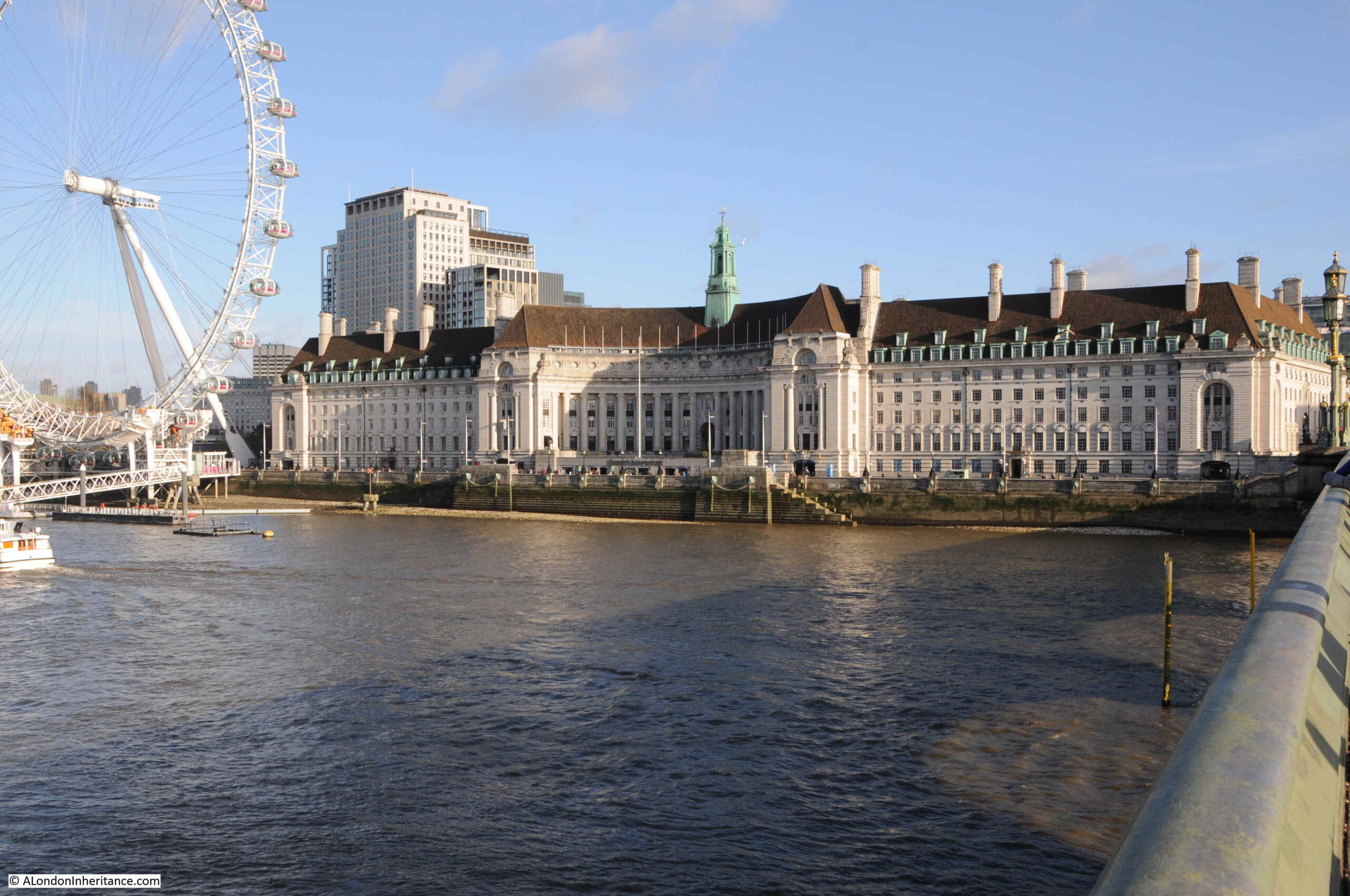
One stretch of the embankment, built during the first decades of the 20th century, is the stretch in front of County Hall, the purpose built home of the London County Council, then the Greater London Council, and now home to hotels and tourist attractions.

County Hall photographed from Westminster Bridge:
County Hall from Westminster Bridge

The London County Council was formed in 1889 to replace the Metropolitan Board of Works and to gradually take on powers covering Education, Health Services, Drainage and Sanitation, Regulation and Licensing of a whole range of activities, dangerous materials, weights and measures, street Improvements – there was hardly an aspect of living in London that would not be touched by the LCC.

The problem with having all this responsibility was that the LCC also needed the space for all the elected officials and the hundreds of staff who would deliver the services.

The LCC initially had an office at Spring Gardens, near Trafalgar Square, the old home of the Metropolitan Board of Works, but quickly started looking for a new location as staff began to be scattered across the city.

A wide range of locations were suggested, but they were either too small, too expensive or too close to the Palace of Westminster – the London County Council wanted to be seen as a completely separate authority to the national government, but still wanted a prominent location, suitable for the governance of London.

The LCC already had a Works Department which occupied a small part of a site on the South Bank, to the side of Westminster Bridge.

The new St Thomas’ Hospital on the other side of Westminster Bridge had already started the improvement of the Lambeth side of the river, which included the creation of a large formal embankment.

The land across Westminster Bridge Road from the hospital provided a sufficient area for the LCC with space to grow. It was in a prominent position, directly facing onto the river, and importantly was on the opposite side of the river to the Palace of Westminster so was close to, but separate from the national government.

As the site was being acquired, attention turned to the design of the new building, and a competition was organised to invite designs for the new home of the LCC.

There were some incredibly fancy and ornate designs submitted, however the winning design was one of relative simplicity by the 29 year old architect Ralph Knott.

Construction of County Hall began in January 1909 with the construction of a coffer dam in the river, which allowed the new river wall to be built, reclaiming an area of land from the river. Work then began on excavation of the ground, ready for laying a concrete raft on which County Hall would be built.

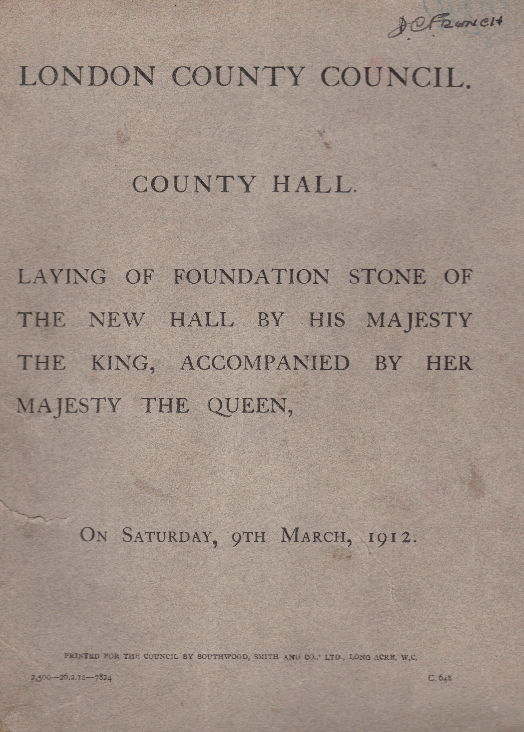
Work was sufficiently advanced, that by 1912 the laying of the foundation stone could take place, and to commemorate the event, a booklet was published, providing some history of the construction of County Hall up to 1912, along with some plans and photographs of the original river frontage, and an important find during digging ready for the construction of the concrete raft.
County Hall foundation stone

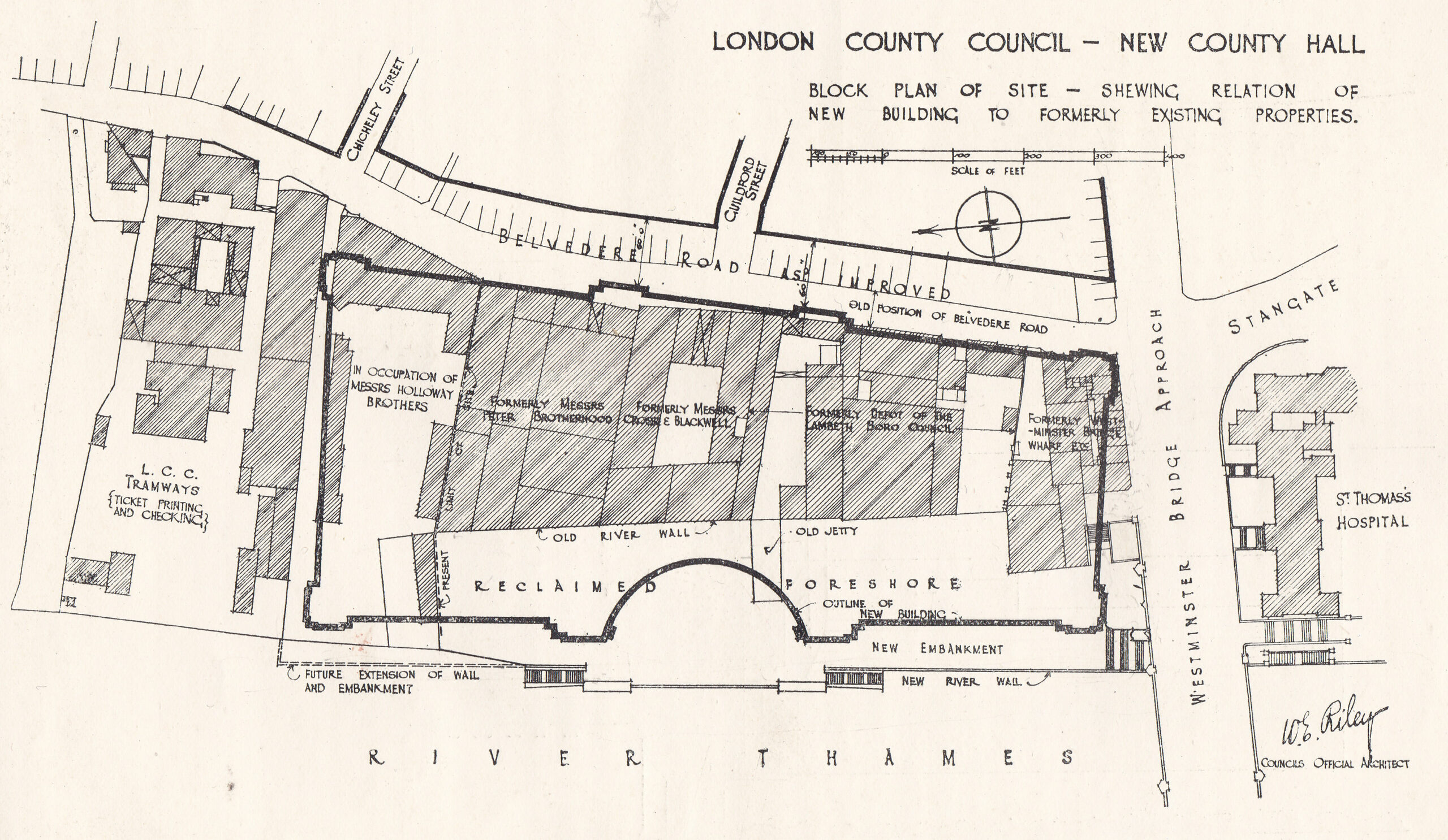
County Hall would be built on a 6.5 acre site, and to achieve this area, a significant part of the foreshore and river needed to be reclaimed. In total two and a half acres of the river were reclaimed and a new river wall constructed to hold back the Thames.

A new river wall had been part of the construction of St Thomas’ Hospital, and the alignment of this wall would be continued with the construction of County Hall.

588 feet of new river wall was constructed. the most difficult part being where the wall would come up against Westminster Bridge. The piers of Westminster Bridge had been built on timber piles, and the foundations of the river wall would go a further 6 feet deeper than those of the bridge, so careful construction was needed to avoid damage to the bridge. This included steel piles driven around the foundations of the bridge to provide some protection from the excavations of the river wall.

Construction of the wall started in January 1909 and was completed in September 1910 at a total cost of £58,000.

The booklet includes the following diagram which shows the outline of County Hall, the alignment of the new river wall, and within the outline of County Hall, the original buildings on the site and the alignment of the old river wall, showing just how much was reclaimed from the river.
County Hall

The site was occupied by businesses such as Cross and Blackwell with a jam and pickle factory, and the engineering firm of Peter Brotherhood who had their radial engine factory on the site. Their radial engine was an innovative machine used to power the Royal Navy’s torpedoes, as well as being a source of power for other machines including fans, and dynamos for the generation of electricity.

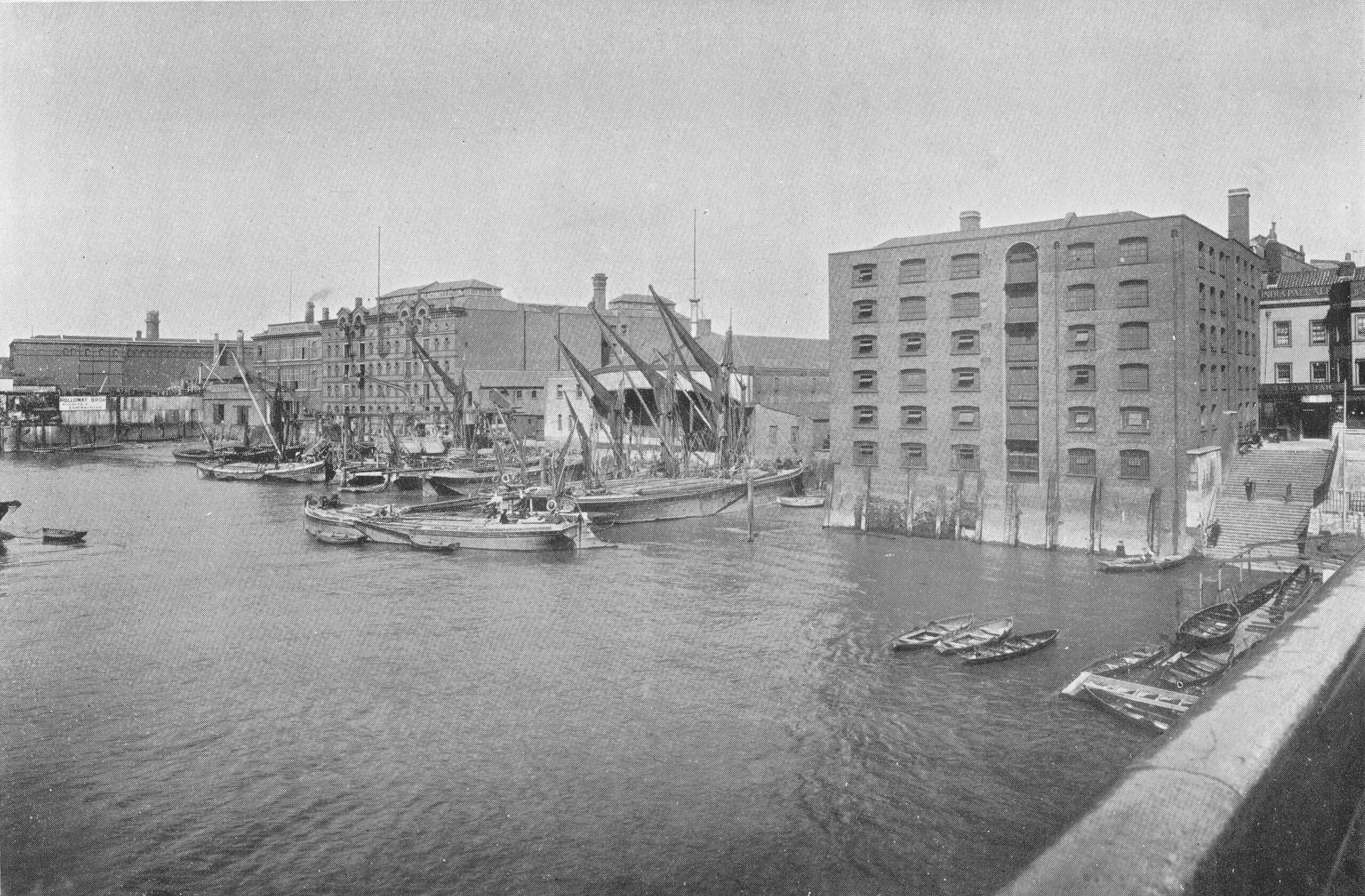
The booklet also includes the following photo of the site from Westminster Bridge. I suspect the embankment wall now runs roughly where the photographer was standing.
County Hall original river frontage

If you look at the edge of the photo on the right, there are a large flight of stairs leading down to the river, and at the top of the stairs can just be seen part of a pub. The pub had one side facing onto Westminster Bridge Road, and the other facing a small square and the river stairs. With limited research time, I have been unable to find the name of the pub, and it is not mentioned in the County Hall booklet.

This is the view of County Hall today, the photographer for the above photo was probably standing a bit closer to the river wall than I am, but everything in the following photo was built on reclaimed land.
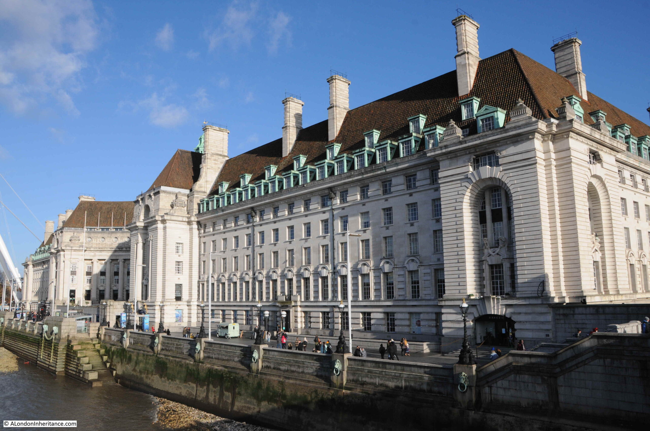
County Hall

The new river wall and embankment was a significant construction, and before work on this could start, a timber dam had to be built to hold back the Thames from the construction site. The dam consisted of a wall of tongue and groove timber piles, which had to be driven through four feet of mud, then eleven feet of ballast (sand, gravel etc.) before reaching London Clay, then driven further into the clay to provide a firm fixing.

This was needed as the dam would have to hold back a significant wall of water, as the tidal range could be over 20 feet, so the dam had to hold back sometimes no water (at very low tides) and at very high tides, a wall of over 20 feet of water pressing on the dam.

The embankment wall was a very substantial construction, reaching down over 35 feet below the original Trinity high water mark. Between the river wall and County Hall, a new public walkway was constructed, and under the walkway there were large vaults within the open space between the walkway and the concrete raft at the base.

The following drawing shows the construction of the wall and embankment:
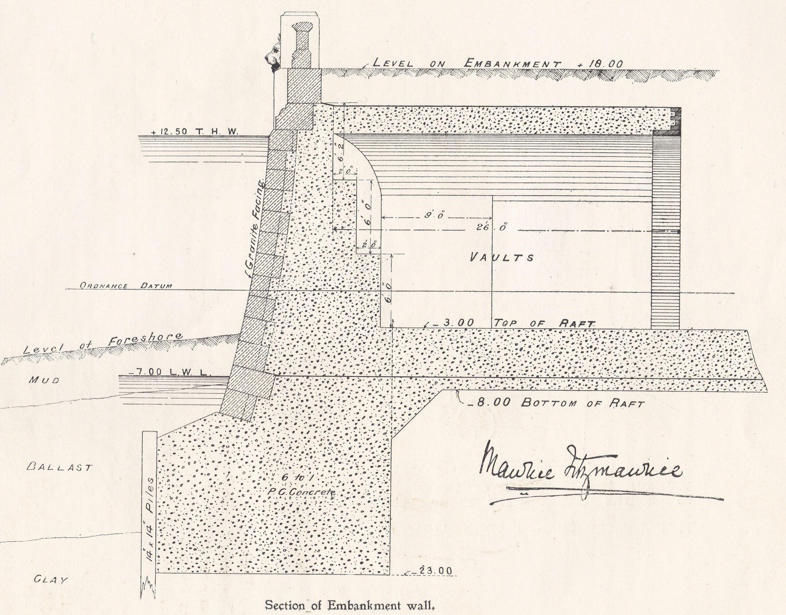
County Hall Embankment Wall

Behind the wall, a large area was excavated. Due to the marshy, damp nature of the ground a concrete raft was needed across the whole area on which County Hall would be built. It was during the excavation to build that raft that a significant discovery was made of the remains of a Roman boat, seen in the following photo as discovered:
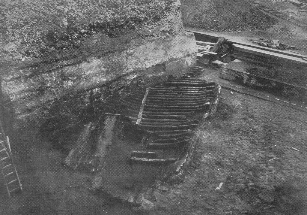
County Hall Roman Boat

The booklet provides a description of how the boat was found:

“The discovery was primarily due to Mr. F.L. Dove, the present chairman of the Establishment Committee. While inspecting in January 1910, with Mr. R.C. Norman, the then Chairman of the Committee, the excavation for the concrete raft, he noticed a dark curved line in the face of the excavation immediately above the virgin soil, and some distance beneath the silt and the Thames mud. The workmen engaged suggested that it was a sunken barge, but Mr. Dove realised from its position that it must be of considerable antiquity, and accordingly requested the Council’s official architect to have the soil carefully removed from above.”

Mr. Dove was right about the considerable antiquity of the find. When excavated, it was found to be a Roman boat, constructed out of carved oak. It was lying 19 feet, 6 inches below high water, and 21 feet 6 inches below the nearby Belvedere Road.

The size of the boat was about 38 feet in length, and 18 feet across.

Within the boat were found four bronze coins, in date ranging from A.D. 268 to 296, portions of leather footwear studded with iron nails, and a quantity of pottery. There were signs that the boat had been damaged as several rounded stones were found, one of which was embedded in the wood, and there was indication that some of the upper parts of the boat had been burnt.

After excavation, the boat was offered to the Trustees of the London Museum, who accepted, and the boat was removed from site, with the following photo showing the transport of the boat from the excavation site. It is within a wooden frame to provide some protection.
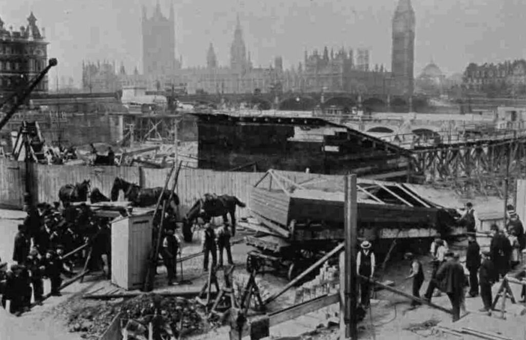
Roman Boat

The boat was put on display in Stafford House, then the home of the London Museum. (Stafford House is now Lancaster House, in St. James, a short walk from Green Park station).

The following photo shows the boat on display:
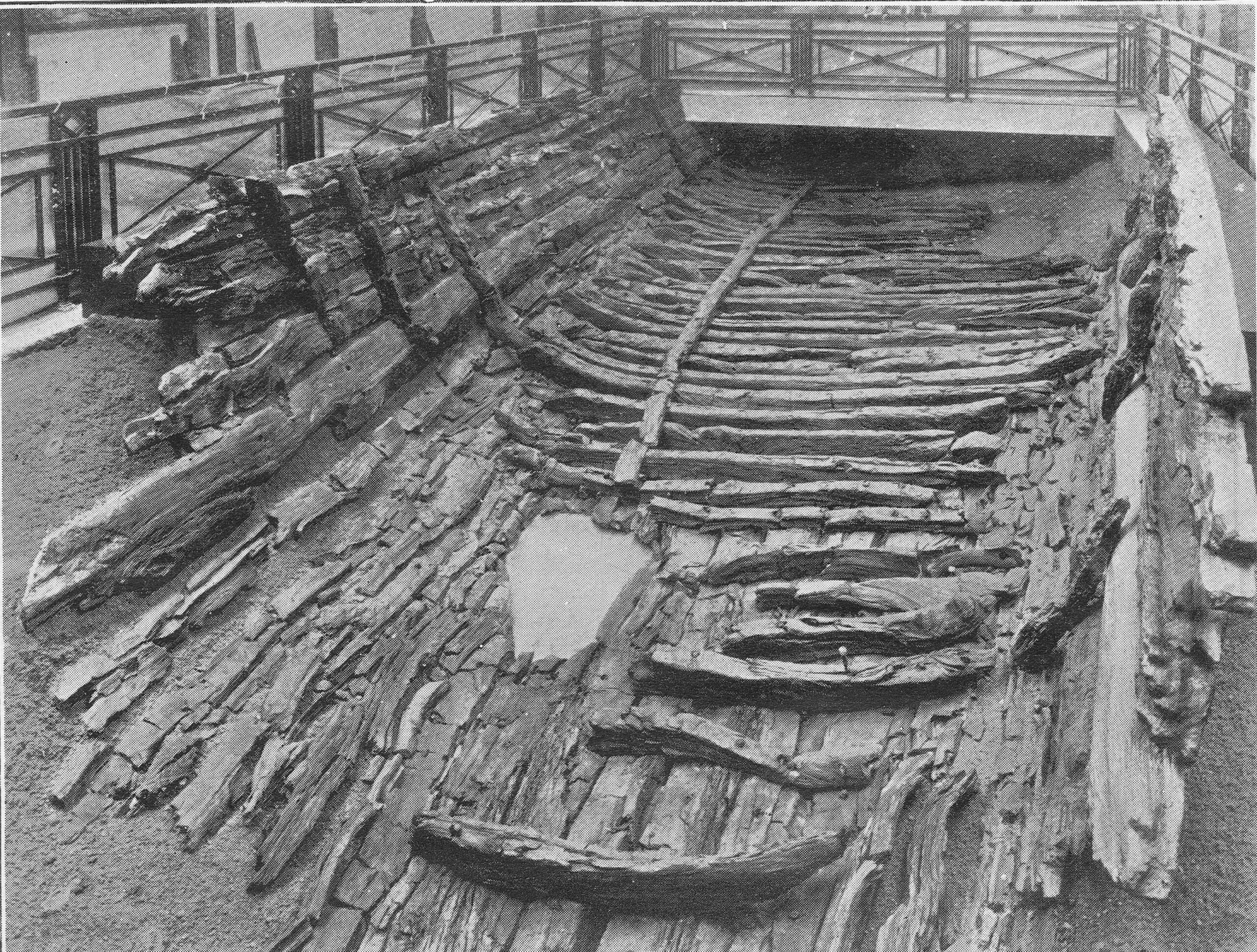
Roman Boat

I contacted the Museum of London to see if parts of the boat were available to view, and was told a sorry story of the limitations of preservation techniques for much of the 20th century.

The boat was found beneath the silt and Thames mud in an area of damp ground. This created an oxygen free environment which preserved the boat’s timber.

As soon as the boat was exposed, it started to dry out, and over the year the timbers cracked and disintegrated. Museum of London staff tried to patch up with fillers, but this was long before the chemical means of conservation that we have today were available.

When the Museum of London moved to its current site on London Wall, only a small section was displayed, and this was removed from display when the gallery was refurbished in the mid-1990s.

Some key features of the boat such as joints and main timbers have been preserved as well as they can be after so many years, and are stored in the Museum of London’s remote storage facility, so not available for public display.

The Museum of London did donate some of the fragments to the Shipwreck Museum in Hasting, so I got in contact with them to find out what remained.

I had a reply from the former City of London archaeologist, Peter Marsden, who advised that much of what was preserved at Lancaster House was modern plaster of paris painted black. He also confirmed that only some ribs and a few bits of the planks survive, and are no longer on display.

Peter Marsden has written some fascinating books on Ships of the Port of London. They are very hard to find, however the English Heritage Archaeology Data Service has the book “Ships of the Port of London, First to eleventh centuries AD” available to download as a PDF from here. It is a fascinating read which includes many more discoveries in the Port of London as well as the County Hall Roman boat.

The age of the boat seems to be around 300 AD which is confirmed by the coins discovered in the boat all being earlier, and Peter Marsden managed to get a tree ring date of around 300 AD from one of the planks.

It is difficult to confirm exactly why the boat was lost on the future site of County Hall. There was much speculation at the time, including in the County Hall booklet, that the boat had been lost during battles in AD 297. The burning on parts of the wood written about in the booklet has not been confirmed, and the stones could have been ballast.

It seems more likely that the boat may have been damaged, or simply lost on what was the marshy Thames foreshore and land of the south bank. Away from the City of London, the boat was left to rot, gradually being covered by the preserving mud and silt of the river until discovery in 1910.

There is another feature on the plan of the new County Hall that suggests the boat could have been on the edge of the Thames foreshore.

On the opposite side of County Hall to the river is a street called Belvedere Road. This was originally called Narrow Wall. The first written references to the name Narrow Wall date back to the fifteenth century, and it could be much older. The name refers to a form of earthen wall or walkway, possibly built to prevent the river coming too far in land, and as a means of walking along the edge of the river.

In the following extract from John Rocque’s 1746 map of London, Westminster Bridge is at the lower left corner, and slightly further to the right, Narrow Wall can be seen running north.
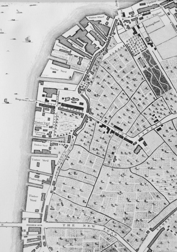
Narrow Wall

Although straightened out and widened, Belvedere Road follows the approximate route of Narrow Wall.

If Narrow Wall was built along a line that formed a boundary between river and the land, then the Roman boat was close to this and would have been in the shallow part of the reed beds that probably formed the foreshore.

I have annotated the original plan from the booklet with some of the key features, including the location of the Roman boat:
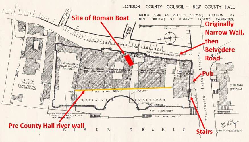
County Hall

The following view is looking along Belvedere Road / Narrow Wall, with County Hall to the left:
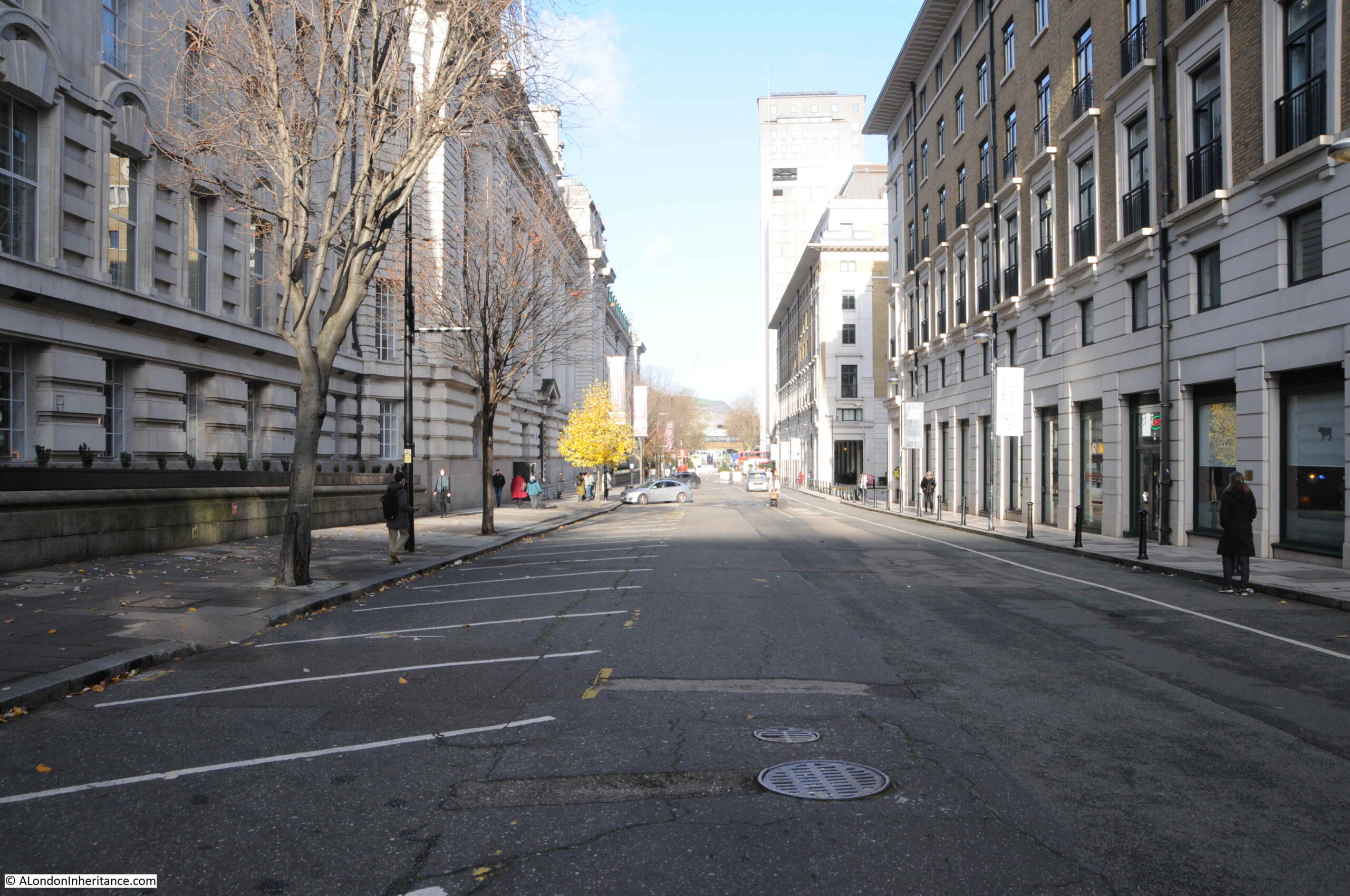
Belvedere Road

The following photo is a view of the entrance to County Hall from Belvedere Road. The Roman boat was found just behind the doors to the left:
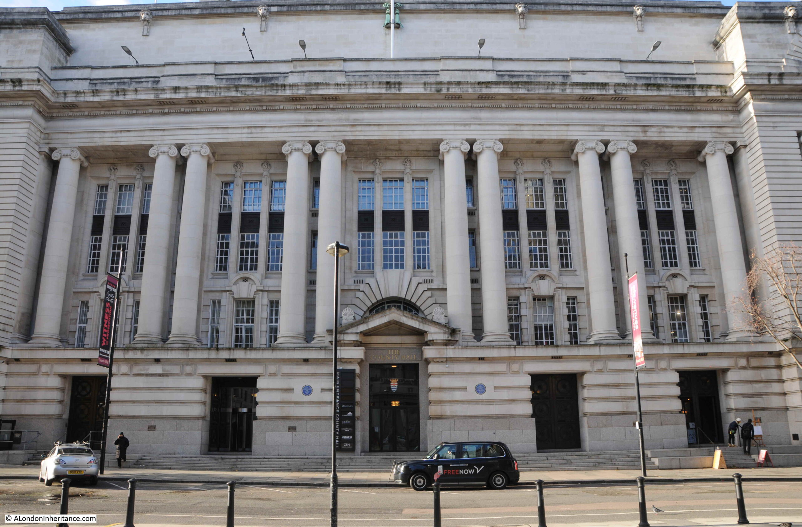
County Hall

There is a curious link between the finding of the Roman boat and the laying of the foundation stone commemorated by the booklet.

The foundation stone was laid on Saturday the 9th of March 1912 by King George V. Underneath the foundation station was a bronze box, the purpose of which was described in newspaper reports of the ceremony:

“Depositing a ‘find’ for some archaeologist of the future, the King and Queen watching the foundation stone of the new London County Hall being lowered into position. Before the stone was lowered into position and declared by the King to be well and truly laid, his Majesty closed a bronze box containing certain current coins and documents recording the proceeding, and caused it to be placed in a receptacle in the stone. Perhaps at some dim future day, when London ‘is one with Nineveh and Tyre’ this box and its contents will come to light beneath the spade of an excavator, burrowing amid the ruins of a forgotten civilisation.”

So having been the site of excavation of a Roman boat, the hope was that the bronze box would form an archeological discovery in some distant future.

I assume the bronze box is still there, below the foundation stone, in the north-east lobby adjacent to the old Council Chamber.

Construction of County Hall continued slowly. It was a large building requiring large numbers of workmen and materials.

The coal and dock strikes of 1912 and building workers strike of 1914 delayed construction. Work continued during the First World War, however war demands such as on the rail network caused problems with the transport of granite from Cornwall to London.

As parts of the building became useable, they were taken over by rapidly growing Government departments such as the Ministry of Munitions and Ministry of Food, who were able to prioritorise their needs over the LCC due to the demands of war.

By the end of September 1919, the LCC were able to retake possession of the building, and work on completion continued quickly, with over one thousand men working on the site by March 1921.

The building was soon substantially complete, was gradually being taken over by an ever expanding LCC staff, and was officially opened in July 1922.

The London County Council continued until the 1st April 1965. The London Government Act of 1963 restructured how London was governed, and this led to the Greater London Council (GLC) which took over from the LCC.

The GLC lasted to the 31st of March, 1986 when it was abolished by the 1985 Local Government Act, primarily down to conflict between the Labour held GLC and the Conservative government of Margaret Thatcher across the river.

The building was sold to the Shirayama Shokusan Corporation, a private Japanese company, for £60 million. and in the following years it would be converted to a hotel and the ground floor facing the embankment walkway hosts tourist destinations such as Shrek’s World of Adventure, a Sealife Centre and the ticket offices for the London Eye.

County Hall is Grade II listed, and the original Council Chamber of the LCC has been preserved, and is now available to hire and is used as a theatre.

The architect Ralph Knott worked on County Hall for most of his career. He had been called up into the Royal Air Force during the First World War where he was responsible for the design of airfield buildings, but he still kept in touch with County Hall construction. He returned to the County Hall project after the war to see the main building through to completion.

He was still working on plans for extension of the building late in his career, which were not finished at the time of his death at the young age of 50 on the 25th of January 1929.

County Hall is a fitting tribute to Ralph Knott. A relatively simple, but grand and imposing building facing onto the river, suitable for an institution that was to have so much impact on the 20th century development of London. A building of contrasting design to the Palace of Westminster on the opposite bank of the river.

Sad that the Roman boat has been substantially lost. Preservation of organic remains that have been in waterlogged soil for centuries is difficult, but thankfully now much better, as seen for example, with the preservation of the Mary Rose in Portsmouth.

I hope that no readers comment that the bronze box beneath the foundation stone has been removed. It would be great that it is still there for archaeologists in the distant future to dig up.

alondoninheritance.com

Building The Royal Festival Hall

Now for the final post in my trilogy on the history of the South Bank. In my last post, we had walked the length of Belvedere Road which ends on the approach road to Westminster Bridge. In this post, it is a quick walk along the north bank of the river to get some views of the South Bank, then back across Hungerford Bridge to look at the building of the Royal Festival Hall.

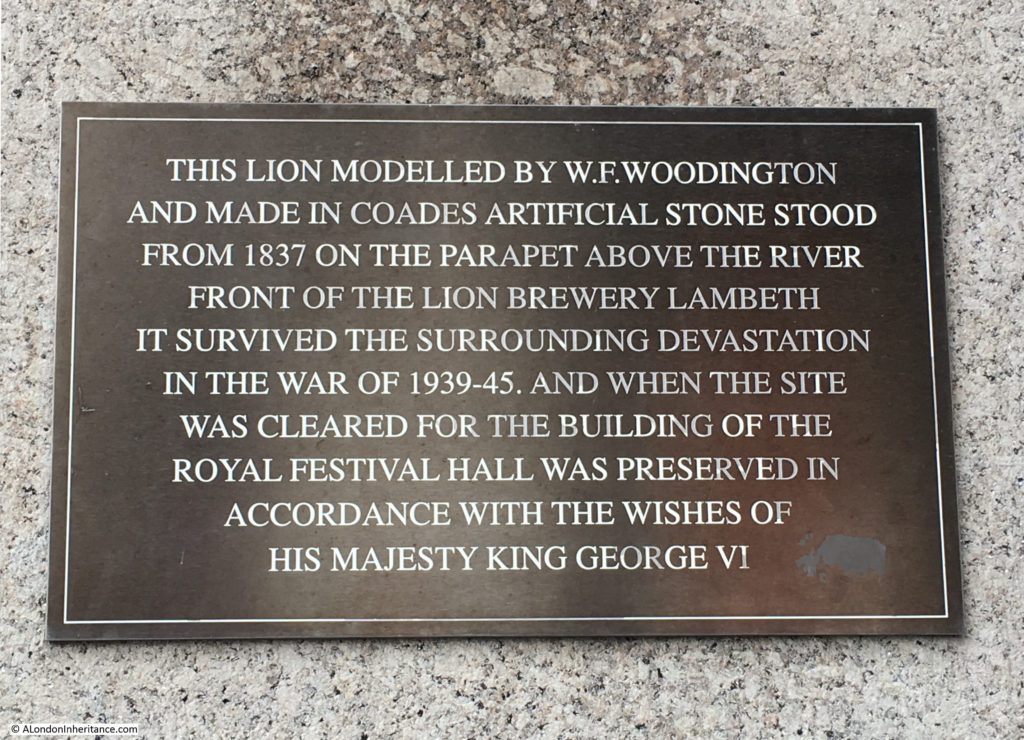
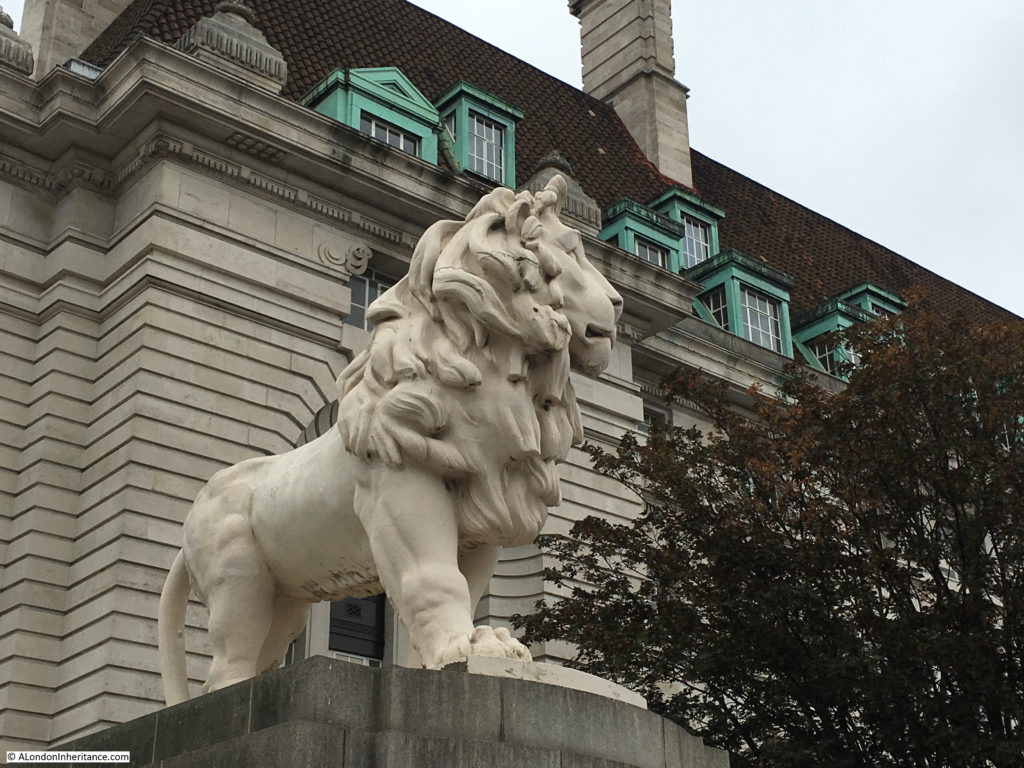
A short distance after leaving Belvedere Road and just before crossing Westminster Bridge is the lion that was at the top of the Lion Brewery building on the river facing side.

History of the Southbank 34

The lion is now on a large plinth which a plaque on the south facing side of the plinth with a brief history of the lion and how it came to be at the current location. We will meet the lion again as we cross Hungerford Bridge.

History of the Southbank 35

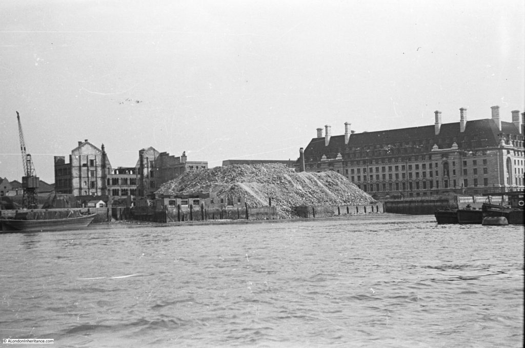
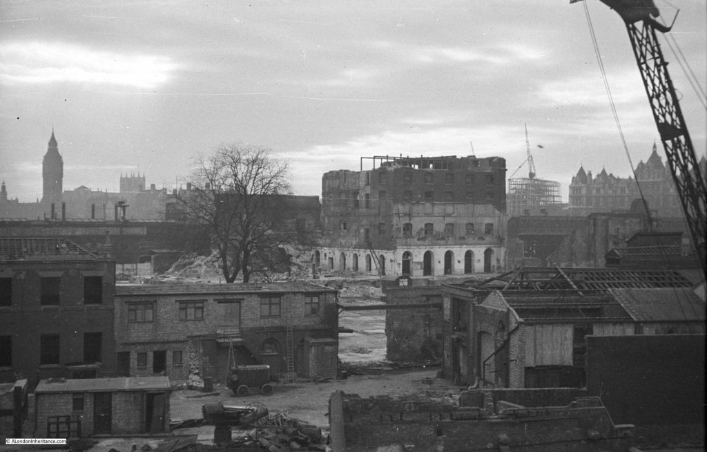
At the end of Westminster Bridge, turn along the north bank of the river, almost to Hungerford Bridge and look across the river to the South Bank. My father took the photo below when demolition of the buildings between County Hall and Hungerford Bridge had commenced. The shell of the building in the background is the India Store Depot. Along the edge of the river is a huge pile of rubble from the demolition work that had already taken place across the area. This was used to help build the extended embankment along the Thames where the embankment that has been built in front of County Hall would be extended all the way to Waterloo Bridge creating additional land that would be used for the Festival of Britain and would finally close and fill in all the various wharfs and inlets across this stretch of the river.

History of the Southbank 8

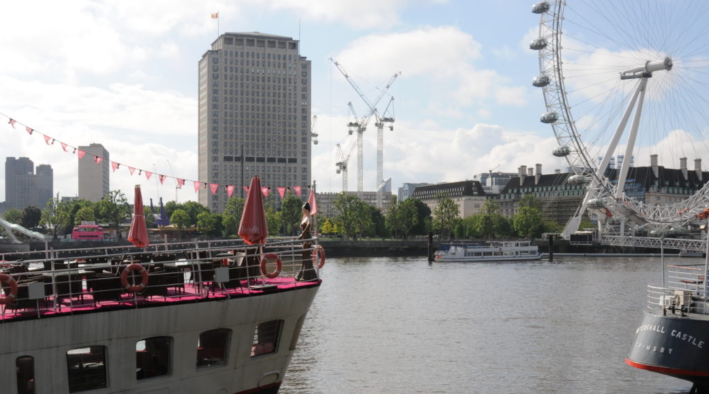
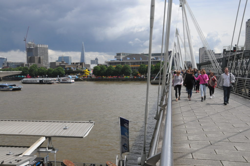
The following photo is from roughly the same position today. Not easy to get a clear photo due to the ships that are now moored along this side of the river.

Building the Royal Festival Hall 5

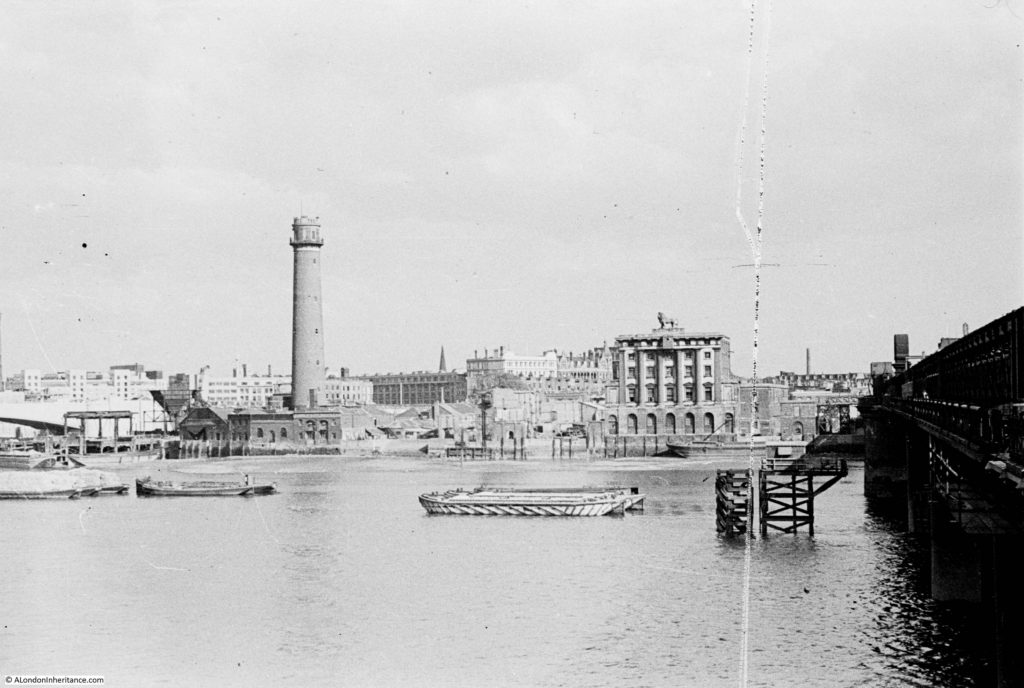
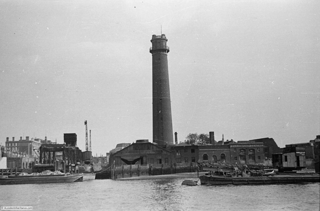
Now walk up to the footbridge on the side of Hungerford Railway Bridge that faces Waterloo Bridge. My father took the following photo from along here before the main demolition started. The Lion Brewery is on the right, still with the stone lion on the top of the brewery, the same lion that we walked past on the southern end of Westminster Bridge. The Shot Tower is on the left.

History of the Southbank 7

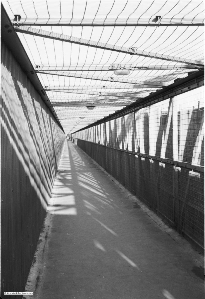
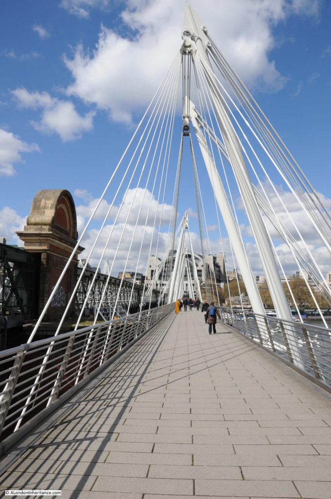
The original footbridge alongside the Hungerford Railway Bridge was a narrow walkway right up against the railway bridge, only on the side of the bridge facing Waterloo Bridge. This was replaced in 2002 by the much larger Golden Jubilee Footbridges which stand off from the railway bridge and are also on both sides of the railway bridge.

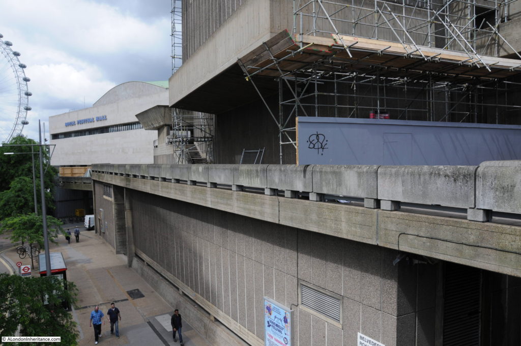
As these footbridges stand off from Hungerford Railway Bridge, it is not possible to get the same perspective, however the following photo is roughly from the same location. Waterloo Bridge is on the extreme left of both photos. The Royal Festival Hall is on the site of the Lion Brewery and the Hayward Gallery on the site of the Shot Tower,

Building the Royal Festival Hall 6

This photo was taken when my father took a boat trip down the Thames from Westminster to Greenwich. There is an inlet along the river edge to the left of the Shot Tower. Referring back to the 1895 Ordnance Survey map in my previous posts, this can be identified as Canterbury Dock. On the left of the Dock is a travelling crane.

History of the Southbank 9

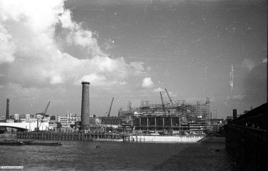
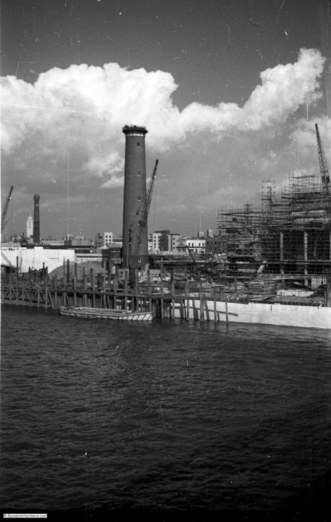
My father then took the following photo from the same position as the earlier photo, now showing the Royal Festival Hall under construction. All the original buildings on the site have been cleared with the exception of the Shot Tower, although the very top of the Shot Tower has been removed ready for the installation of the anti-aircraft gun that would provide the mount for the antennae that would be used during the Festival of Britain to bounce radio signals off the moon enabling visitors to see the echo of the radio signal – part of the Festival’s demonstration of British scientific achievements.

History of the Southbank 4

Walk further along the bridge and this is a closer view. The new embankment is also being built.

History of the Southbank 6

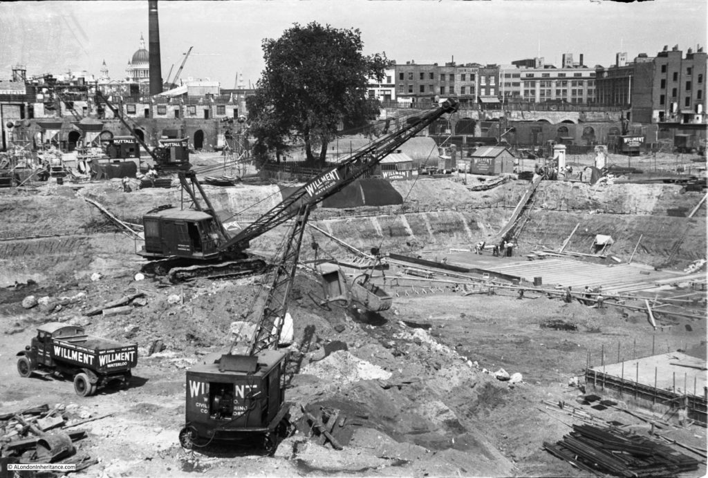
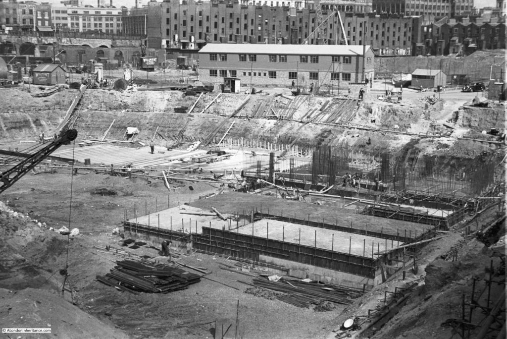
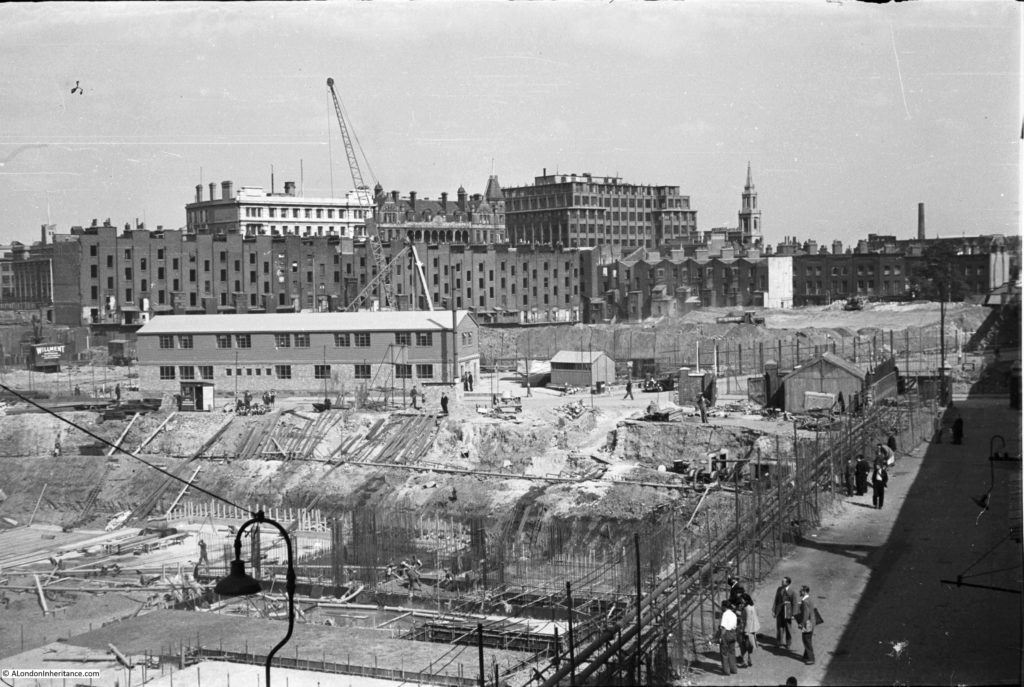
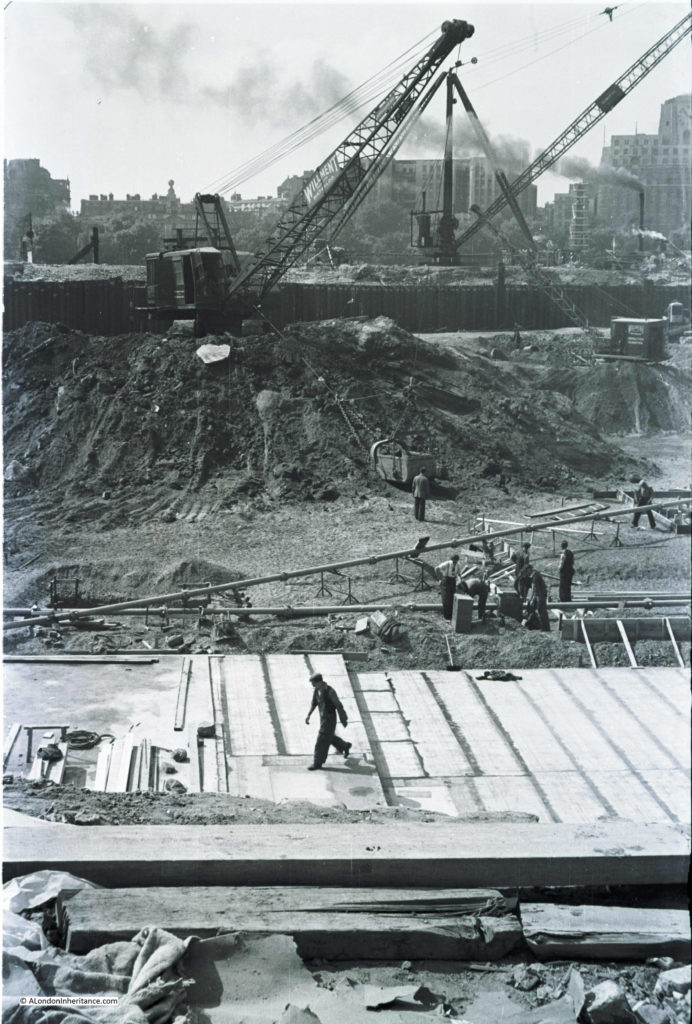
There are now a series of photos from the end of the footbridge, taken earlier than the above couple of photos, that show the digging of the foundations of the Royal Festival Hall. These start from the river edge and move round to the edge of the excavations. They show the amount of excavation needed as preparation for the rest of the build.

History of the Southbank 13

History of the Southbank 12

History of the Southbank 10

In this photo, the buildings of Howley Place can still be seen in the background behind Cubitts site office.

History of the Southbank 11

And in this photo, the buildings that ran along the edge of York Road are still there. These, and the building along Howley Place would soon be removed ready for the construction of the rest of the Festival of Britain site.

History of the Southbank 14

I stitched the above photos together to get a panorama of the building site.

Building the Royal Festival Hall 7

Construction of the Royal Festival Hall was documented in a book published for the Festival of Britain by the Association of Consulting Engineers. The book celebrates the role of Britain’s Engineers in a wide selection of global construction projects ranging from the Royal Festival Hall to Power Stations in South Africa and a Hydro-Electric scheme in Ceylon.

The section on the Royal Festival Hall details construction and some of the challenges with the build, for example with the proximity to the river and high ground water level. The land on which the Royal Festival Hall would be built is described as miscellaneous fill and silt down to about 10ft and London Clay at about 20ft. The ground water level also rises and falls with tide from a level of 2ft below and 3ft above ordnance datum (see picture below).

Building the Royal Festival Hall 3

Work on the foundations started in May 1949 with bulk excavation of the whole area – as clearly seen in the photos above that my father took of the area. Bulk excavation was used as the easiest way to clear the area needed for the foundations. The centuries of previous construction on the site included the remains of the old water works along with the brewery which was built on a 6 foot thick mass concrete raft. There was a large amount of work to prepare, which included sinking well points and then pumping out water which started on the 17th June 1949, when, withing four days the ground water level was reduced to 13ft below the ordnance datum. A huge volume of water was extracted, with at the start of pumping 150,000 gallons of water per hour were being pumped out, and even after the site had been “de-watered”, pumping was still needed of 80,000 gallons per hour to keep the area of the foundations dry.

A total of 63,000 cubic yards of materials were removed for the foundations.

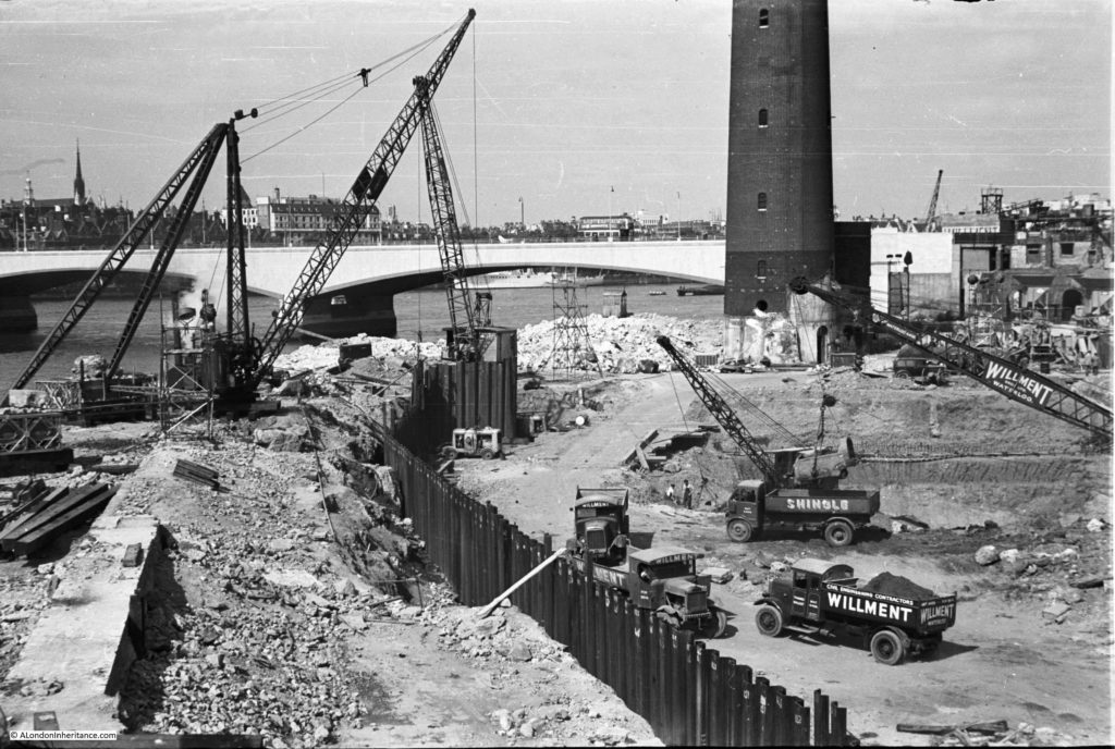
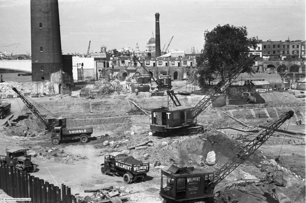
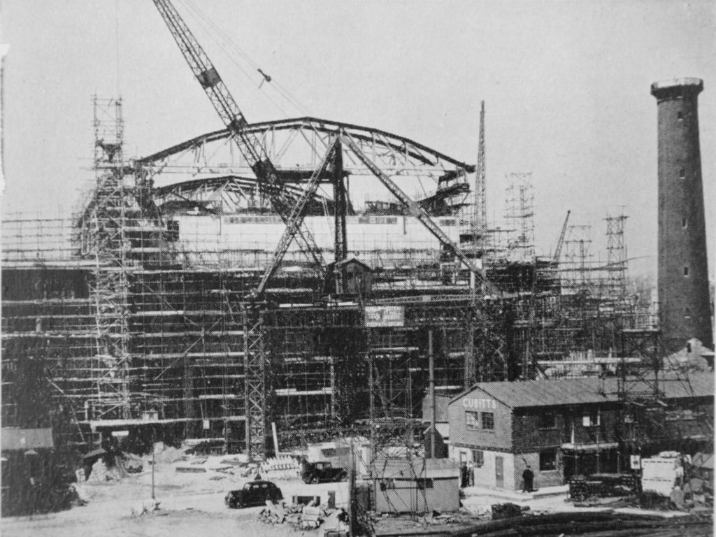
To assist with construction, a 10-ton derrick and and 50ft gabbard was erected adjacent to Belvedere Road. This is shown in the photo below and is the tripod like structure with the crane on the top platform – typical of the large cranes of the day, unlike the singe tower cranes that would be used today. Belvedere Road is running from left to right, the black cars show the location of the road and the Cubitts site office is the same as in the photos my father took along Belvedere Road and featured in the previous post.

Building the Royal Festival Hall 4

The book by the Association of Consulting Engineers describes the key structural features of the Royal Festival Hall:

“The structure under and around the auditorium consists of floors carried on columns and without infilling walls. The external faces of the building being largely glazed. These fundamentals of the architectural design resulted in the rather unusual condition  of the heavy mass of the auditorium weighing about 25,000 tons being supported at a high level on slender columns without lateral support. It was consequently decided to use the staircases at the four corners of the building as buttresses, and with this end in view they were designed as far as possible with reinforced concrete walls. It was found as the design developed that these walls had to be pierced by a large number of openings for ventilation and other services which has made them somewhat intricate. This result was not foreseeable at the time when the decision to use reinforced concrete walls was taken, since very little was known about the ventilation and other requirements. Had such information been available the design of the stair blocks would have been somewhat modified, although their function as buttresses would have had to be retained. This experience emphasises the importance of the ventilation scheme being developed at an early stage of the design of buildings.

The magnitude of the Festival Hall can be gauged from the particulars given below:

Contract price (including small hall)  £1,628,260

Tonnage of Steel reinforcement (excluding small hall): 2,340 tons

Weight of Roof Steelwork: 260 tons

Volume of mass of concrete: 8,800 cubic yards

Volume of Reinforced Concrete: 23,000 cubic yards”

The comment about the need to pierce the buttresses and install ventilation again shows the speed with which the Royal Festival Hall was being built with plans still being completed as the building was being constructed. New plans would be brought across from the Cubitts site office to specify the next part of the build and any problems would need to be resolved where the new plans required a change to what had already been built.

A criticism at the time that the Festival of Britain was planned and being built was that the manpower and resources being used were a distraction from the real need to build homes and factories after the devastation of the war, as well as the need to export production to bring in much needed foreign currency. The figures above illustrate the volume of materials needed for this single building.

The book then goes on to describe the challenges with the roof of the building:

“The acoustic consultants originally laid down that the roof of the auditorium should consist of two leaves, the inner one 8 inches thick and the outer 6 inches thick. These leaves were to be supported by an air space of 12 inches minimum thickness, and where the outer leaf rested on supports from the inner leaf, it was to be isolated by some insulating material which was subsequently decided to be 2 inches of glass silk. In addition to the 8 inch and 6 inch roof slabs, the roof girders are also required to carry a 2 inch solid suspended ceiling, ventilation ducts and other miscellaneous items. It will be realised that this constitutes a roof of unusual weight. The structural engineers recommended that the acoustic consultants should reconsider the rook thickness, and it was finally arranged that an inner leaf 6 inches thick and an outer 4 inches thick would suffice, a saving of 4 inches of concrete or approximately 50 lb. per square foot on the original proposal”.

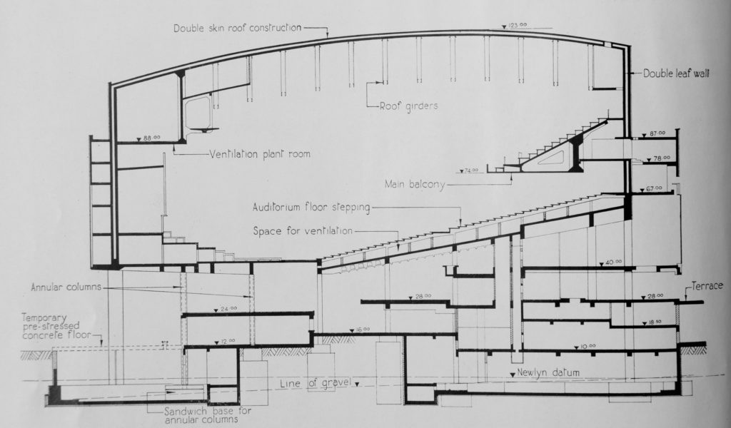
The following drawing shows a cross section of the Royal Festival Hall showing the raised auditorium:

Building the Royal Festival Hall 2

The design was dictated by the limited area of the site which resulted in the raised auditorium allowing two levels of main floors below the auditorium consisting mainly of open space for the main reception, restaurants and bars and exhibition areas. Walking in from the South Bank takes you directly into these open areas from where the fact that the main auditorium is built above is not immediately obvious – a very clever design.

The Royal Festival Hall went from design to completion in a very short time. A sketch design had been prepared by October 1948. Work on the engineering design started the following month in November 1948. Work on foundations started in May 1949 with the concrete super-structure starting to rise above ground level in October of the same year. The reinforced concrete roof was completed by the end of September 1950.

The short time for construction required work to continue throughout the cold winter of 1949/50. To ensure concreting work could continue during low temperatures, two stages were implemented. For stage one, precautions included heating of the mixing water, shielding and warming aggregate heaps to prevent them becoming frozen and covering over concrete with special mattresses. For even colder temperatures, stage two was needed during the early months of 1950 and included the use of a battery of steam boilers with steam heat being applied to newly concreted areas.

This was a significant achievement given that the Royal Festival Hall was only one part of a major construction site on the South Bank. There were also many other construction priorities across the country, there was a shortage of money and foreign currency, rationing was still in place and the country was still recovering after over 5 years of an intense war.

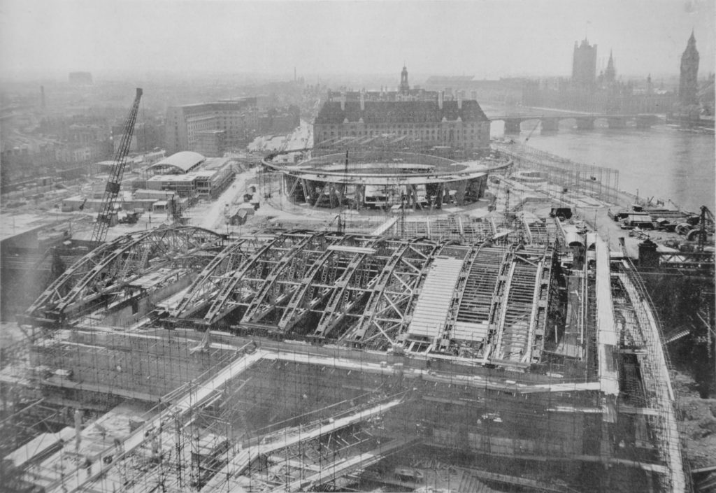
The following photo from the Association of Consulting Engineers book was taken from the top of the Shot Tower and shows the construction of the Royal Festival Hall in the foreground with the Dome of Discovery between the hall and County Hall, both surrounded by the construction site that will be the location of the Festival of Britain.

Building the Royal Festival Hall 1

Still standing at the end of the footbridge, this is what the area looked like prior to the construction of the Royal Festival Hall.

History of the Southbank 28

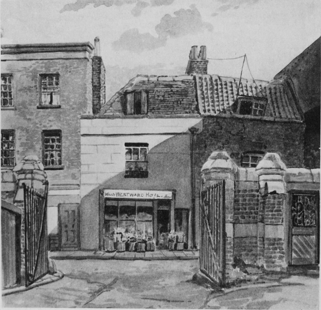
The Survey of London volume on the South Bank and Vauxhall included a drawing of the shop on Belvedere Road which can be seen at the far end of the road running alongside the railway arches.

Building the Royal Festival Hall 10

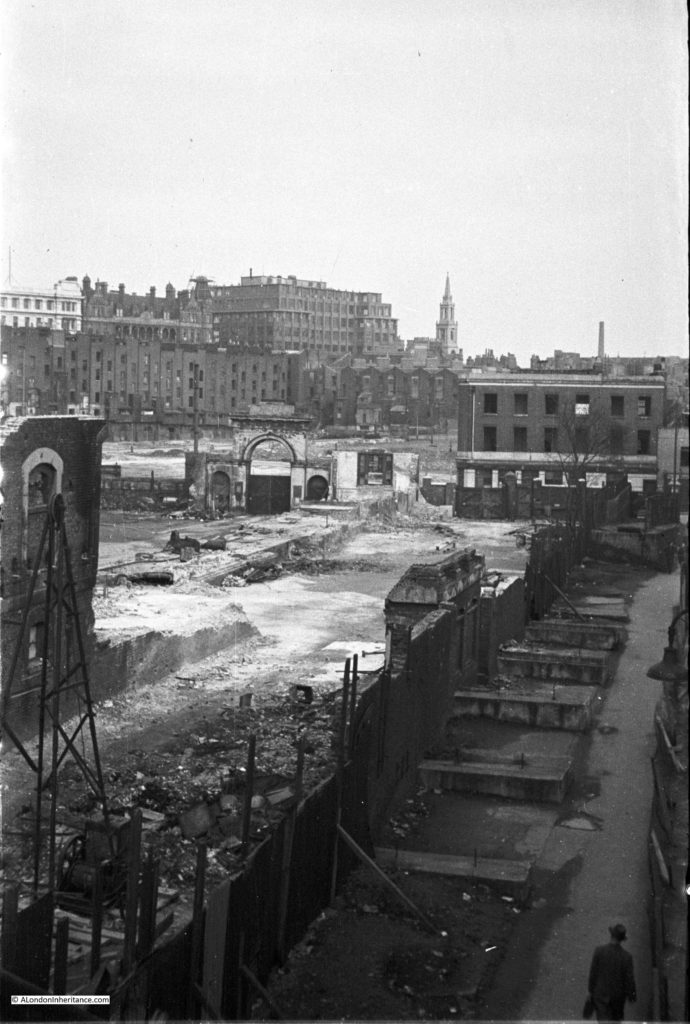
And months later, the same area with clearance well underway.The entrance arch to the Lion Brewery from Belvedere Road is still there.

History of the Southbank 26

I mentioned in my first post on the South Bank that I first realised that my father had a large store of negatives of London when I started working here and he showed me some of the photos he had taken of the area. Back in 1980 I had also started taking photos of London which included photos around the South Bank and I have recently found and scanned some of these negatives.

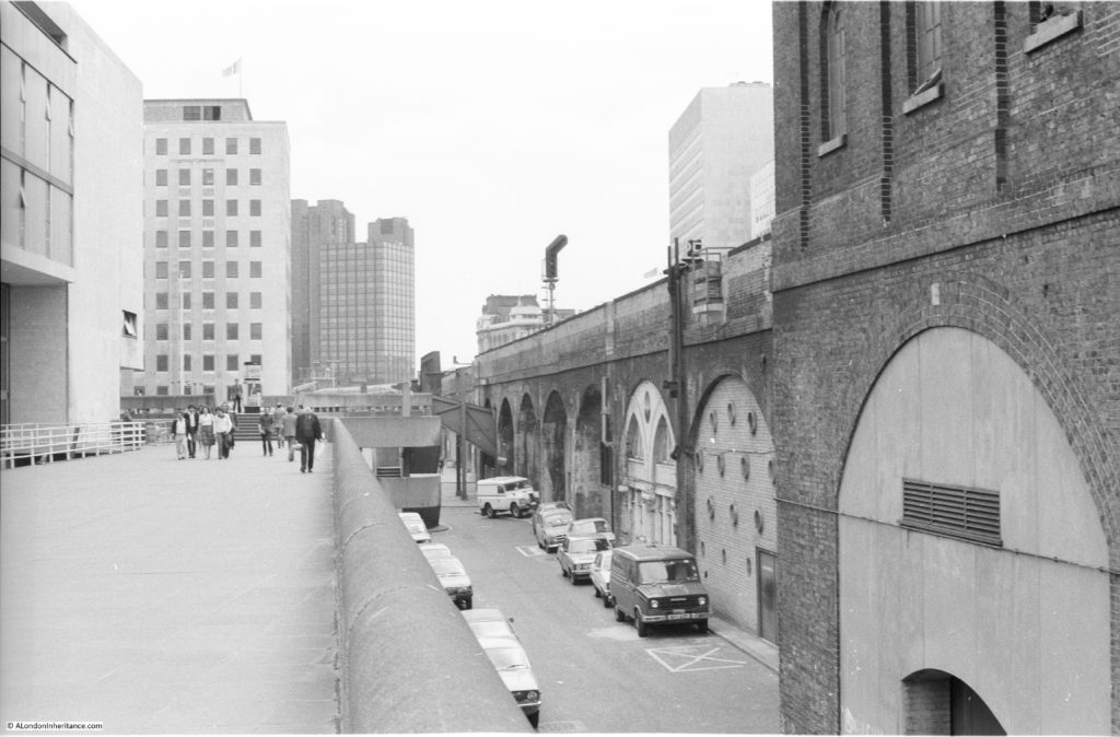
The following photo is the same scene as the above two, but taken in 1980. It is closer to the first of the above two photos, the part of the bridge on the right is still much the same and there is still a road on the lower right providing access to the arches underneath the railway.

Building the Royal Festival Hall 8

And below is my photo from June 2016 showing the same area, 36 years after I took the above photo and between 69 and 66 years after my father took the photos showing the various stages of the development of the site. It is much different now. New buildings have been constructed along the space of the original road.

Building the Royal Festival Hall 9

I have mentioned the footbridge alongside Hungerford Bridge a number of times and it was at the end of this bridge that my father took the above photos. He also took the following photo looking back from the southern end showing the bridge as it was when he was taking these photos between 1947 and 1951.

Building the Royal Festival Hall 11

The old footbridge is long gone and has been replaced by the Golden Jubilee footbridges that run on either side of Hungerford Bridge, unlike the original which only ran on the side facing Waterloo Bridge. I think you will agree, a major improvement to walking across the river.

Building the Royal Festival Hall 12

To finish off this exploration of the South Bank as it was before the Festival of Britain, walk straight on past the side of the Royal Festival Hall and walk down the steps to reach Belvedere Road and we have come full circle.

In my next post I will start to explore the Festival of Britain commencing with the South Bank Exhibition which occupied the area I have covered in my last three posts, and was the reason for the end to end clearance of the site and the construction of the Royal Festival Hall.

alondoninheritance.com

A Walk Along Belvedere Road – 1947 and 2016

Having explored the history of the South Bank in yesterday’s post, today it is time to take a walk along Belvedere Road to see the remains of buildings dating back to the start of the 19th century, the clearance ready for construction of the Festival of Britain and the foundations of the Royal Festival Hall. We will start from where Waterloo Bridge crosses Belvedere Road, drop down to Belvedere Road and then walk along Belvedere Road to County Hall.

My father visited this area a number of times between 1947 and 1951, first to photo the buildings as they were, then the area as it was cleared and finally as the construction of the Royal Festival Hall was underway. This post brings together photos distributed among a number of different posts over the last couple of years along with some new photos I have recently scanned.

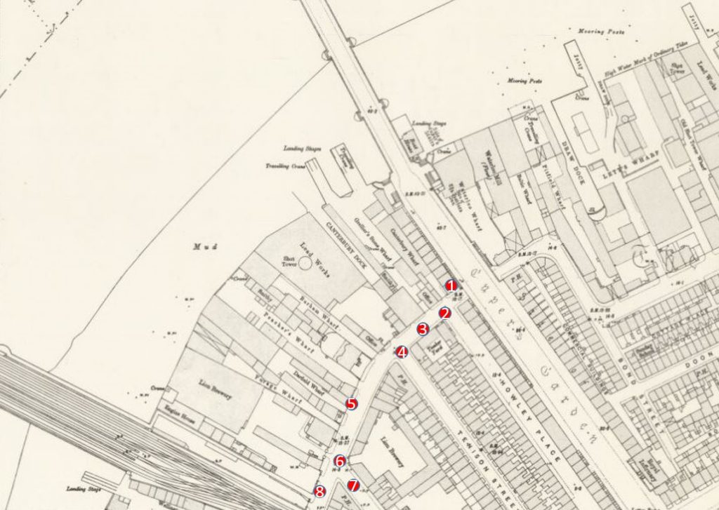
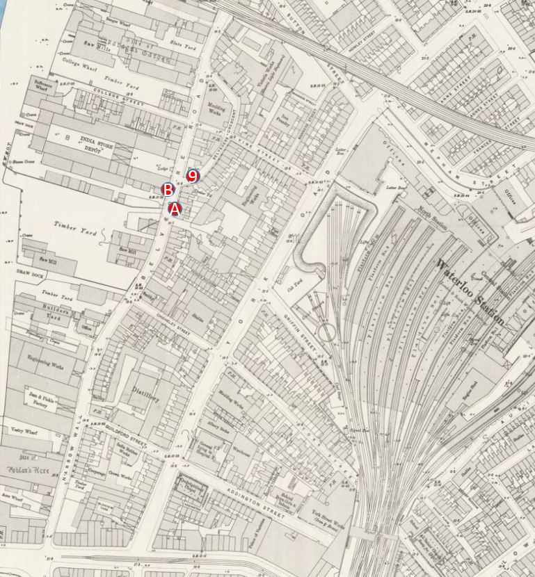
The map below is the same extract from the 1895 Ordnance Survey Map covering the area between Hungerford and Waterloo Bridges as in yesterday’s post. I have marked in numbered red dots the locations from where the photos in today’s post were taken.

Belevedere Walk Map 1

The first three photos are at point one. I am not sure whether they were taken from Waterloo Bridge, or from one of the buildings alongside the bridge, however this first photo is looking along Belvedere Road towards the bridge under the rail tracks leading up to Hungerford Bridge.

Demolition is already underway. The remains of the entrance to the Lion Brewery can be seen on the right, in front of the railway, and clearance of the houses on the left is well underway.

History of the Southbank 3

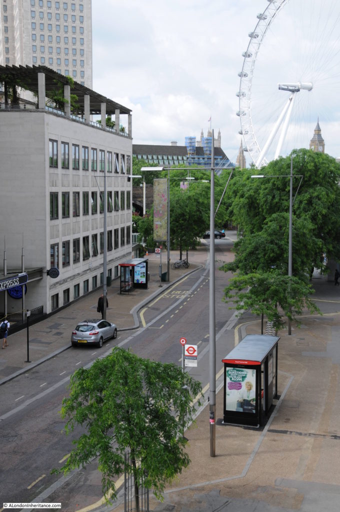
This is roughly the same view today. I should have been a bit further to the right, however the buildings of the Hayward Gallery obscure the view. Belvedere Road curves to the left towards where the road passes under the rail tracks – the bridge is obscured by the trees.

Belvedere Road Walk 1

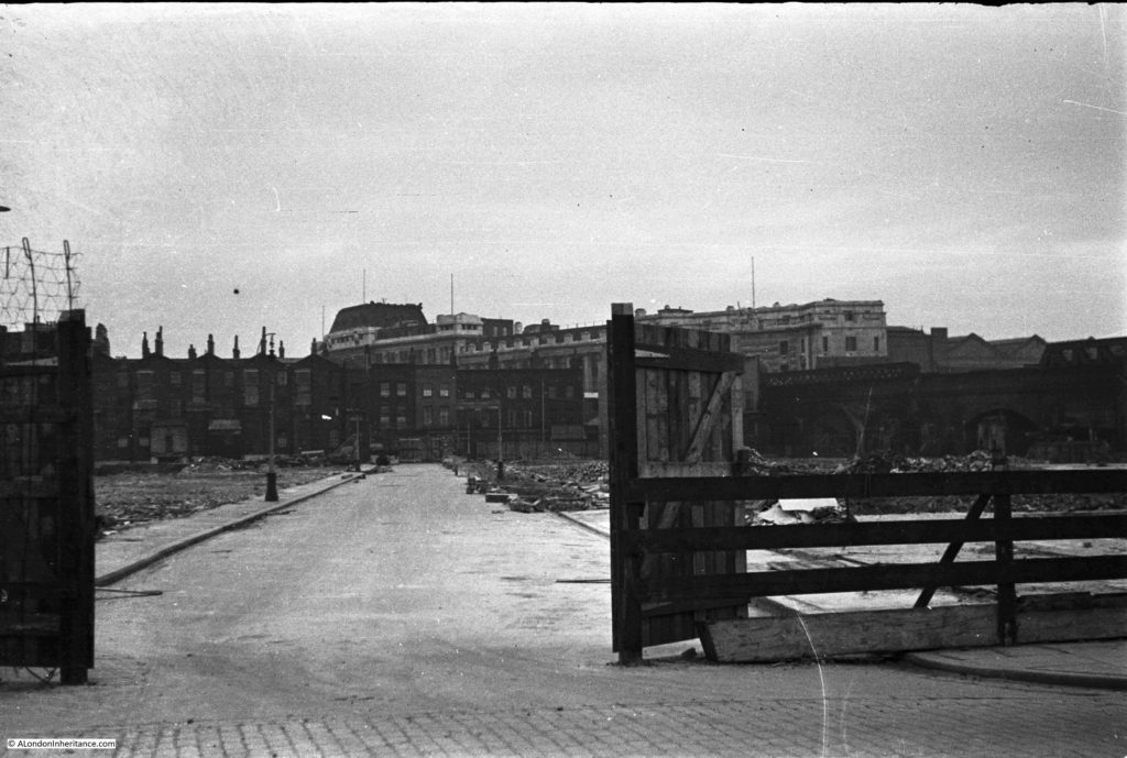
This next photo is from the same spot, but is looking towards the right, towards the Thames. The large building is the Lion Brewery. Note that on the opposite side of the river, construction of the new Ministry Defense Building is well underway. The buildings in the foreground are along Grellier’s Stone Wharf on the 1895 map.
History of the Southbank 2

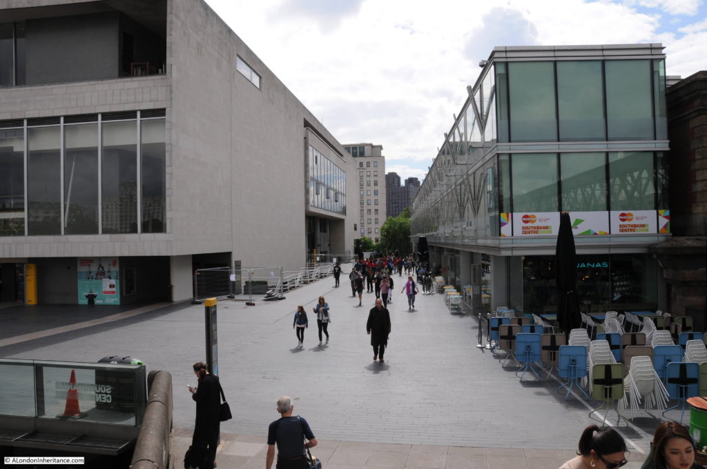
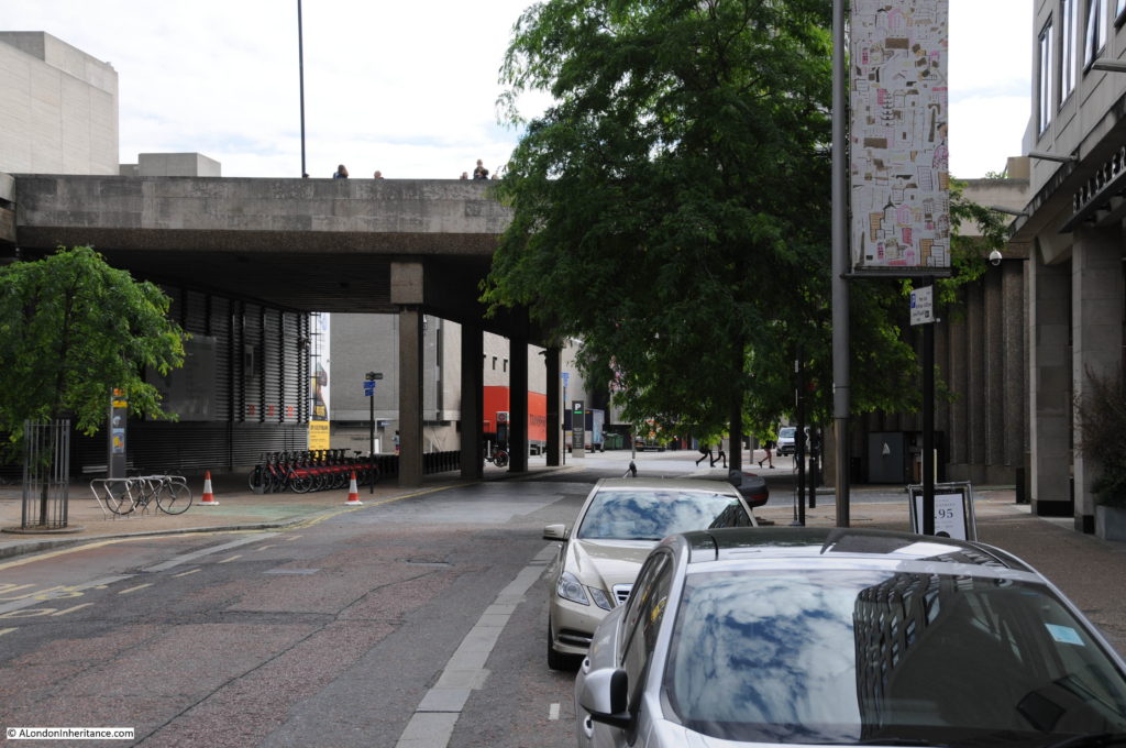
Again, I should have been a bit further towards the right, however the following view from 2016 shows that the entire site of the above photo is now occupied by the Royal Festival Hall, the Hayward Gallery, Queen Elizabeth Hall and the Purcell Room.
Belvedere Road Walk 2

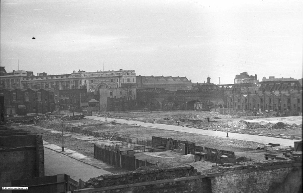
And the following photo is the last from the bridge and is looking to the left, towards Waterloo Station. Two streets can be seen, on the left is Howley Place and the street in the middle is Tenison Street. The terrace buildings that lined these streets have been demolished, however those along the boundary of the site remain. On the right are the houses along Sutton Street and the houses in front of Waterloo Station are along York Road. To the right of centre, there is a solitary figure standing on the rubble left by demolition.

History of the Southbank 1

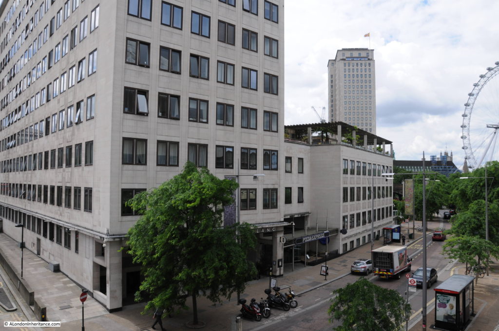
And the same view today. The entire site is now occupied by what was the Downstream Building of the Shell Centre office complex, but is now the Whitehouse Apartments. When I checked on their website, two apartments were for sale, one from just over £1 Million and the second for £2,750,000. A chat box from a representative in Hong Kong popped up whilst looking at the page asking if I needed help which tells you all you need to know about central London”s property market.

Belvedere Road Walk 3

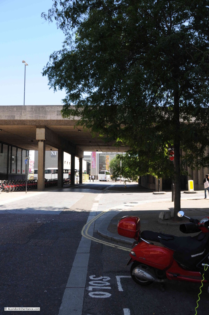
Now walk towards the large roundabout at the southern end of Waterloo Bridge and take an immediate right hand turn down the slip road that takes you down to Belvedere Road. This road does not appear to have a name, but runs along the route what was Howley Place. At the end of the slip road, on reaching Belvedere Road, turn round to look back up the slip road (position 2 on the map).

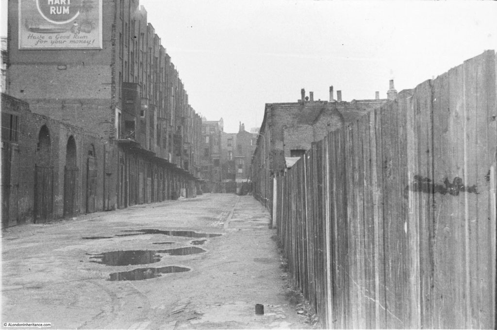
This was the original view:

History of the Southbank 27

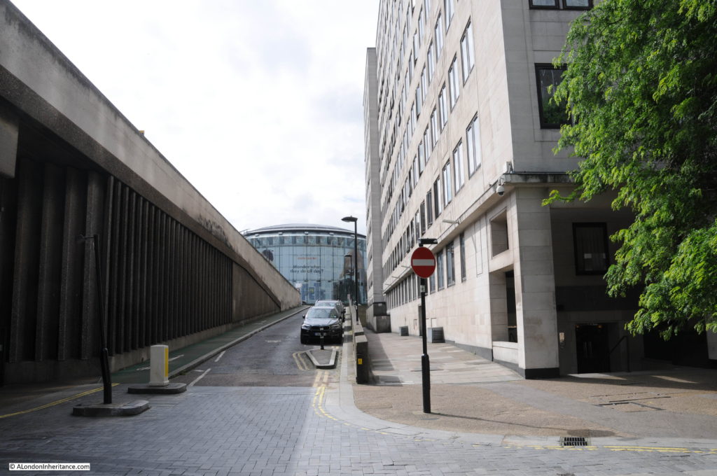
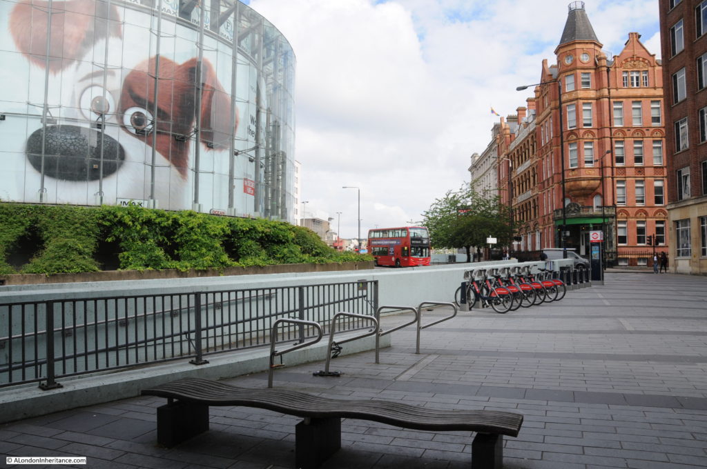
The buildings on the left are the rear of buildings facing onto the approach road to Waterloo Bridge which has since been widened. The large roundabout with the glass IMAX cinema in the centre, which can be seen at the end of the current slip road had not been built at the time of these photos, so the houses seen at the end of Howley Place are roughly where the edge of the IMAX is currently located.

Belvedere Road Walk 4

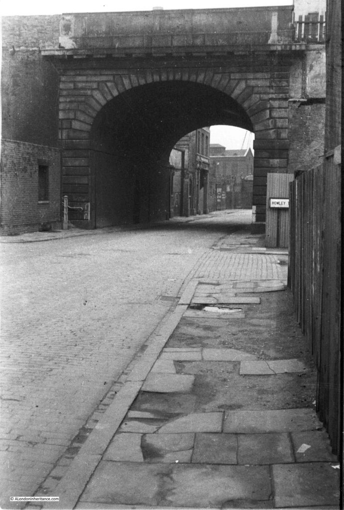
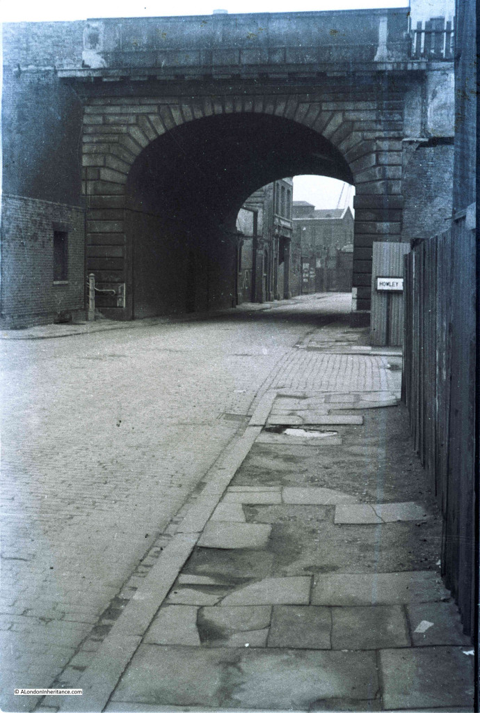
We can now start walking along Belvedere Road, but only a short distance to point 3 on the map where we can look back at the original bridge which takes the approach road to Waterloo Bridge over Belvedere Road. The entrance to Howley Place is on the right with part of the street name sign visible.

History of the Southbank 18

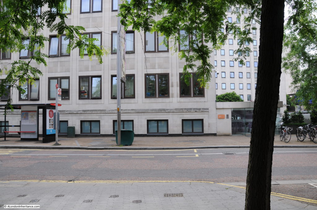
The same scene today. The approach road to Waterloo bridge has been replaced and is wider than in the original photo.

Belvedere Road Walk 5

Now walk a short distance along to point 4. This is the entrance to Tenison Street, looking towards Waterloo Station.

History of the Southbank 23

And this is roughly from the same position today. Waterloo Station is behind the buildings of the Whitehouse Apartments.

Belvedere Road Walk 6

Now walk along to point 5 which is roughly half way along the rear of the Royal Festival Hall, and look towards the building. This was the scene at the start of construction of the Royal Festival Hall with the buildings on the north bank of the river clearly visible. There were some fascinating challenges with the construction of the building which I will cover in detail in my next post.

History of the Southbank 30

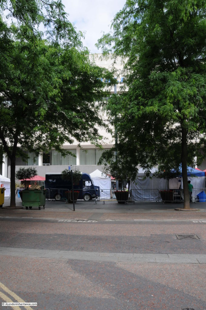
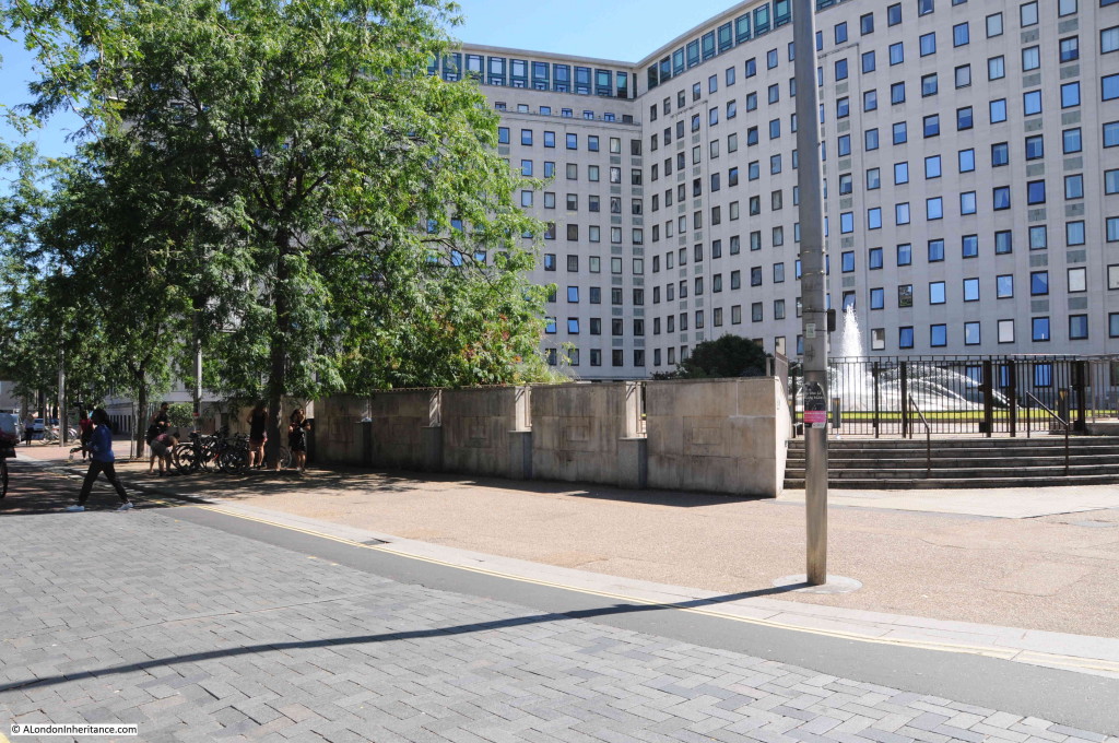
The same scene today, although not much to see with the trees in the foreground and then the rear of the Royal Festival Hall.

Belvedere Road Walk 7

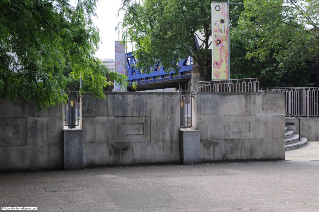
Now walk along to point 6 which is at the end of the original alignment of Sutton Walk which has now been cut short by Concert Hall Approach. The following photo shows where the original Sutton Walk met Belvedere Road. Looking over the wall surrounding the Whitehouse Apartments it is possible to see the remaining length of Sutton walk where it passes under the railway tracks. Sutton Walk originally continued straight on, to end at the point where this photo was taken.

Belvedere Road Walk 15

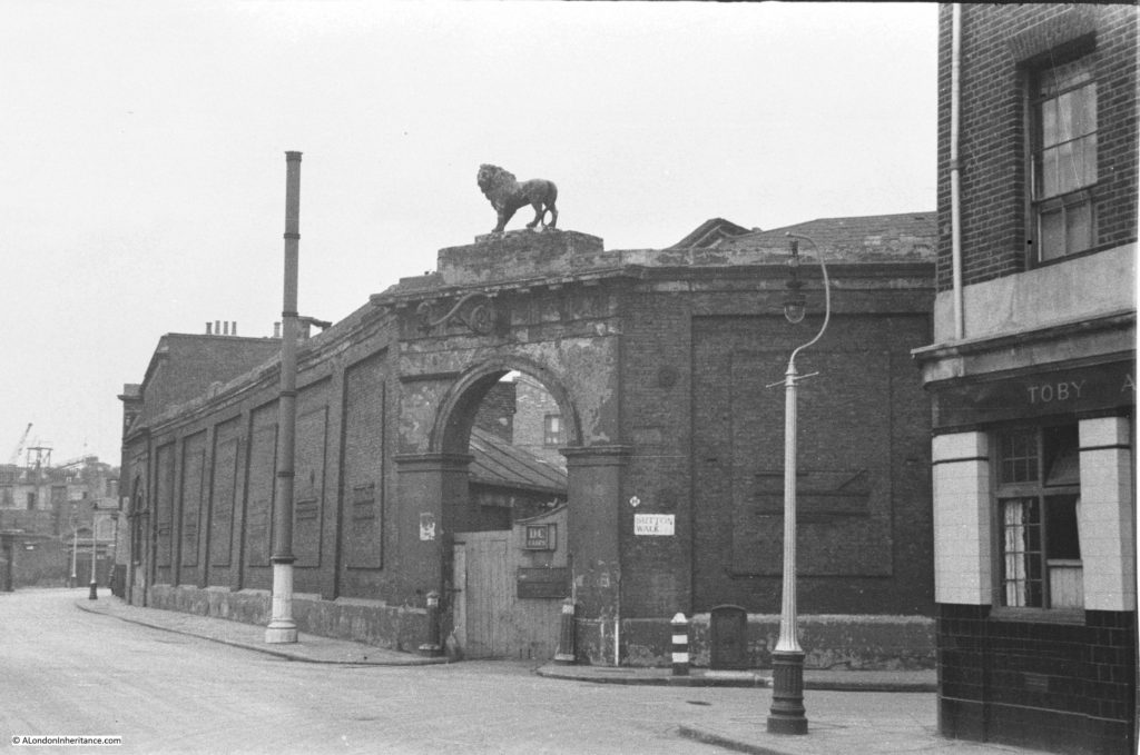
From this point we can walk slightly further along then turn back and look across where Sutton Walk joined Belevdere Road. This is the entrance to the buildings of the Lion Brewery on the south side of Belvedere Road with one of the three lions that were used above brewery entrances and the main brewery building. These buildings were used for stables and also as a warehouse. Look in front of the entrance arch and there are bollards on either side.

History of the Southbank 22

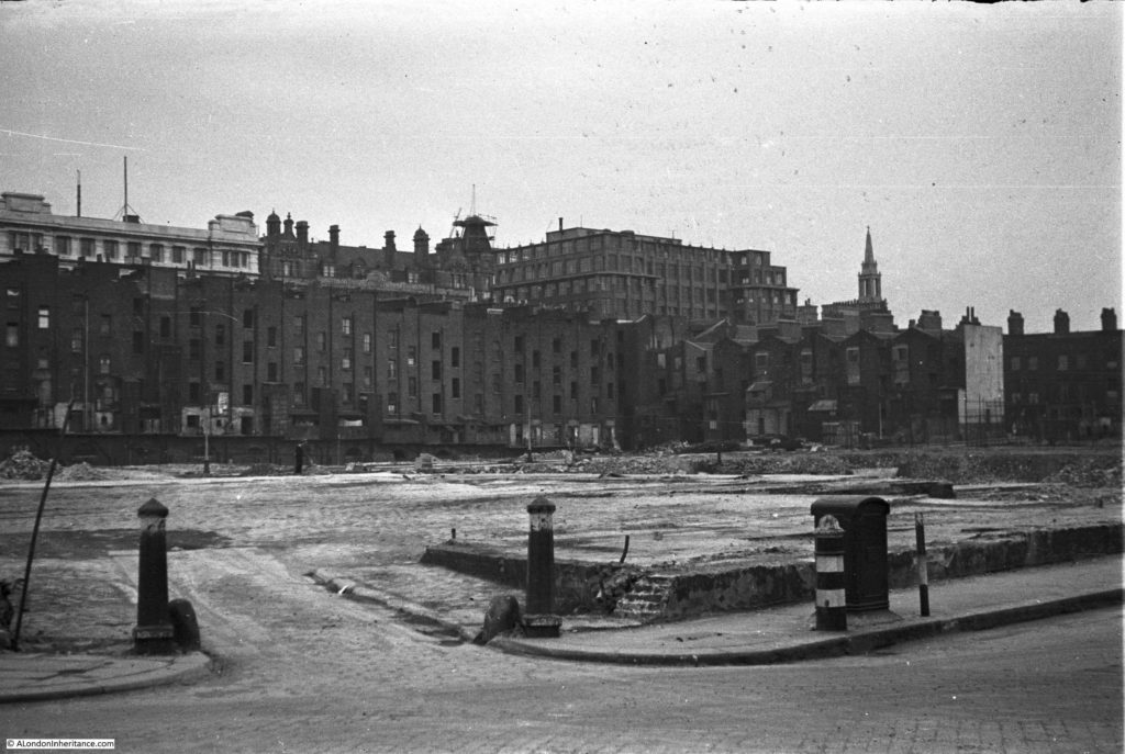
And they are still here in this later photo following demolition of all the buildings. The buildings running along the left are those along the approach to Waterloo Bridge and Howley Place, with the buildings along York Road on the right. All the buildings in the background are still there, with the Royal Hospital for Children and Women being the second building from the left.

History of the Southbank 24

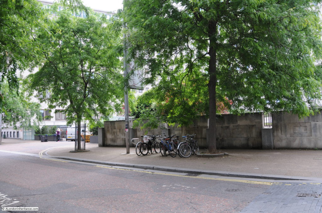
This is the same scene today.

Belvedere Road Walk 8

The following photo was taken from Sutton Walk, looking down towards the entrance to the Lion Brewery from Belvedere Road. There was a lion on top of this arch but this had already been removed.

History of the Southbank 20

Not easy to replicate this photo as this section of Sutton Walk does not exist, but the following photo is looking towards the area where the entrance to the brewery was located.

Belvedere Road Walk 9

The next photo was also taken from the original Sutton Walk and is looking towards the right with the Shot Tower in the background.

The house in front of the Shot Tower is number 55 Belvedere Road, one of the substantial houses that went up along Belvedere Road in the first decades of the 19th century.

In 1821 a tin plate worker named John Fowler extended his lease on the land and built No. 55 for his own use. The Survey of London describes the building:

“No. 55 was a house of substantial character. Though detached, it was of terrace type without openings in the flank walls. It was in yellow stock brick and its front elevation was three windows wide to each of the ground, first and second floors. The windows had gauged flat arches and all had glazing bars to their double hung sashes. The ground storey was raised above a semi-basement and the entrance, which was reached by a short flight of steps, had an architrave surround with consoles each side designed to support a flat hood. The hood had been removed some time prior to demolition. There was a moulded band at first floor level and a bold parapet cornice above the second floor. Behind the parapet dormer windows were set in a slated mansard roof”.

History of the Southbank 21

John Fowler annoyed his neighbours when in 1839 he converted a factory between the rear of his house and the river into a lead works. Concern about the works was such that Golding, the owner of the Lion Brewery complained to his landlord, however a report from a Professor of Chemistry into the conditions of the lead works stated that their construction and use was such as to prevent waste, injury to the workmen and annoyance to the neighbourhood.

Along with the Lion Brewery, No. 55 was used by the London Waste Paper Company in the 1930s and would be demolished in 1949.

Again, not easy to replicate the original view as this part of Sutton Walk does not now exist, however the following photo is as close as I could get. Not much to see due to the trees, but the Royal Festival Hall is in the background.

Belvedere Road Walk 10

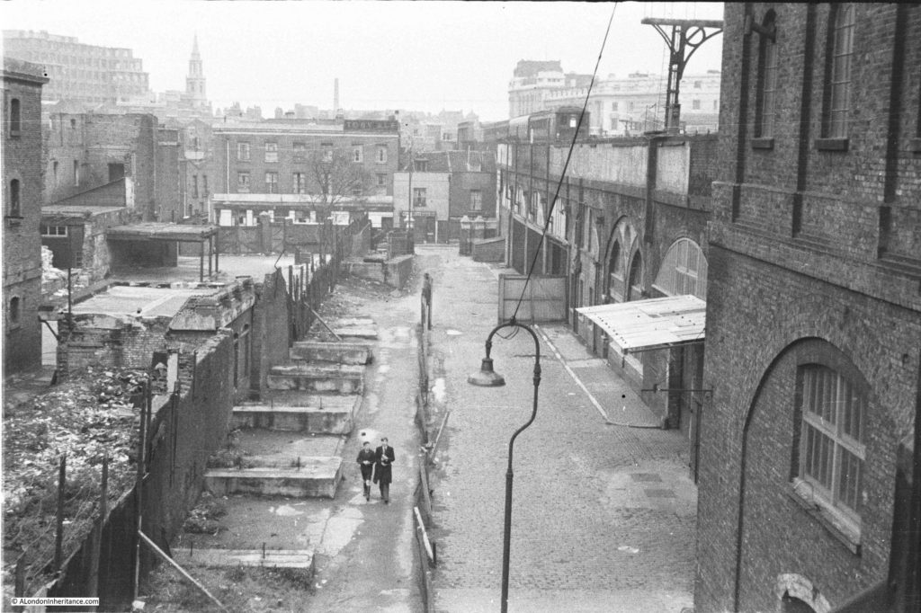
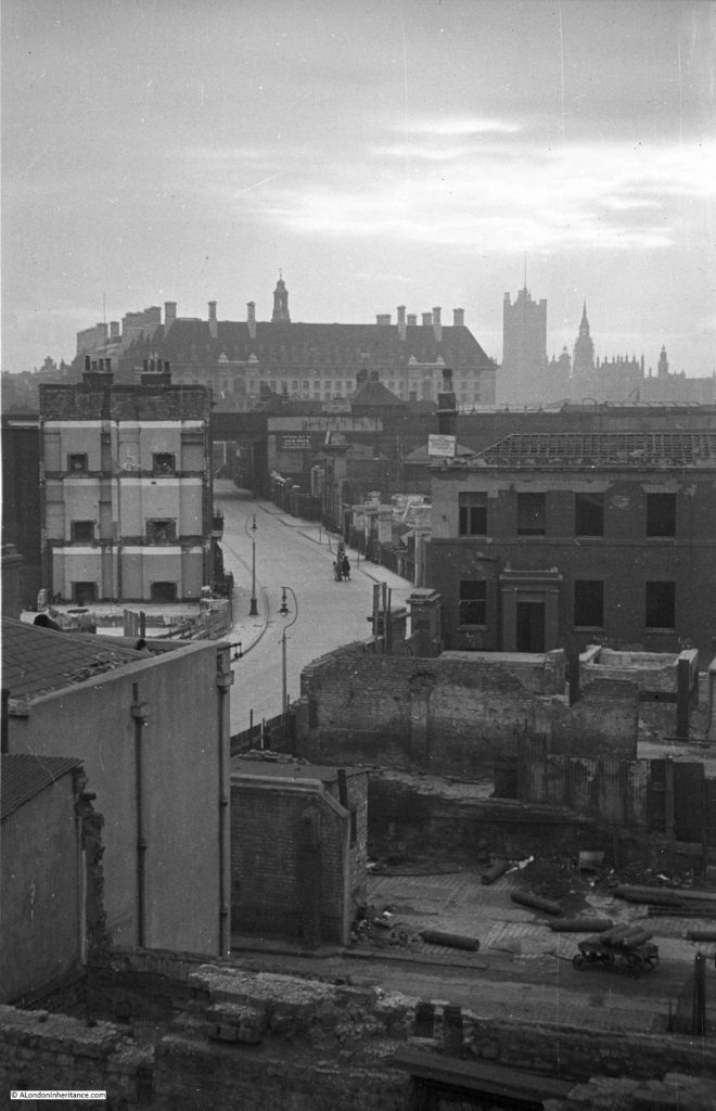
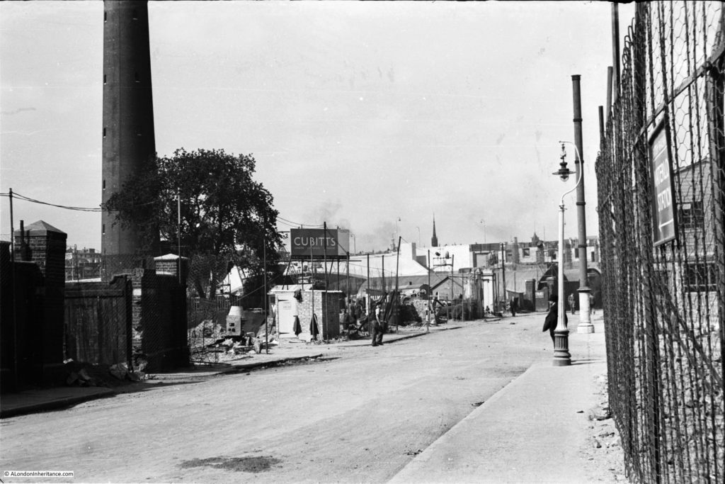
The following photo was taken just before construction of the Royal Festival Hall commenced. It was taken from where Belvedere Road passes under the rail tracks leading up to Hungerford Bridge and is looking back down Belvedere Road towards Waterloo Bridge which can just be seen behind the Cubitts sign at the centre left. Sutton Walk is just behind the lamppost running to the right. The Shot Tower is on the left. Note the “stink pipe” behind the lamppost (not sure if that is the correct name, but that is what we always called them).

History of the Southbank 29

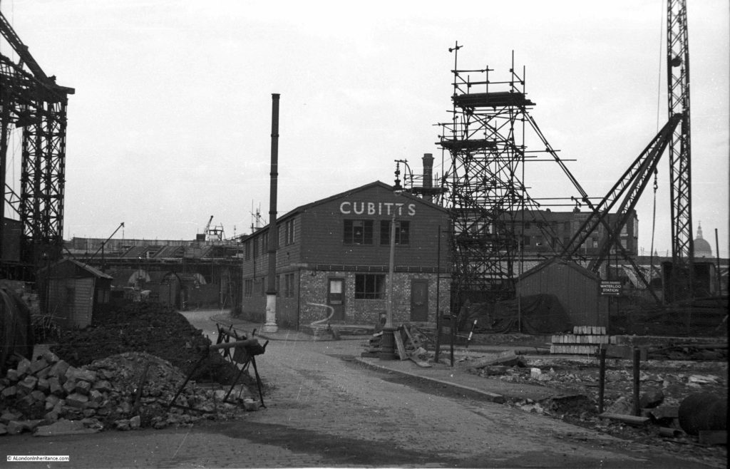
This is the view some weeks later, taken from the opposite side of the road. The “stink pipe” in the centre of the photo is the same as in the above photo. The Cubitts site office is on the former location of the Lion Brewery Stable and Warehouse. On the left is one of the three legs of the derrick supporting the crane that was used to build the Royal Festival Hall.

History of the Southbank 5

Cubitts were the main building contractors for the Royal Festival Hall, and the use of an onsite site office seems to have been unique for the time as it helped with the rapid construction of the building with drawings been passed from the office to the builders as the drawings were being completed – such was the pace with which the Royal Festival Hall was built.

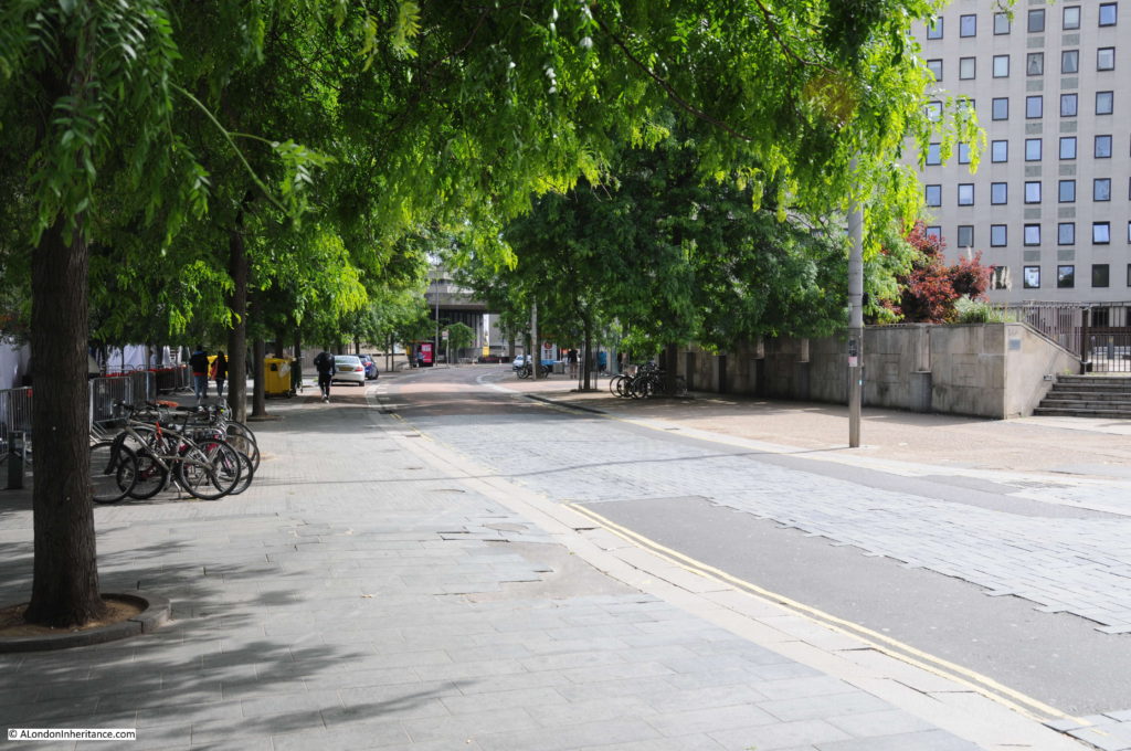
This is the same view today as the above photo taken at point 8 on the map.

Belvedere Road Walk 11

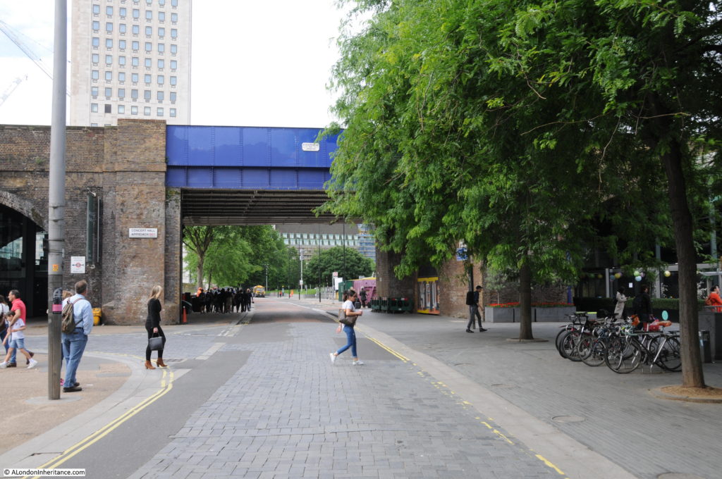
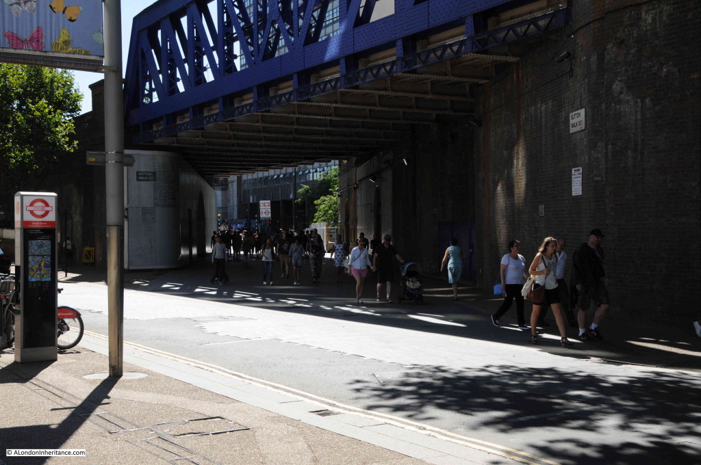
Now it is time to walk through to the other half of the area which is split in two by the rail tracks running up to Hungerford Bridge. This brick-built viaduct is the only remaining construction from the pre-war period and provides a perfect reference point to locate the key places on the 19th century Ordnance Survey maps. The viaduct has retained the original position of Belvedere Road and by retaining the short length of Sutton Walk that runs from York Road to the new Concert Hall Approach, allows the alignment to be confirmed to Belvedere Road and therefore the position of the entrances to the Lion Brewery.

This is where Belvedere Road passes underneath the rail tracks. The white plaque on the blue bridge reads “W. Richards & Son – 1900 – Leicester”.

1900 is not old by London standards, but it is the oldest construction in this part of London.

Belvedere Road Walk 14

The following map shows the area we are now in, having passed under the rail tracks at the top and continuing along Belvedere Road.

Belevedere Walk Map 2

A short distance along Belvedere Road, we can look towards the river and this is the approximate position of College Street leading down to Kings Arms Stairs. There is an entrance to the car park here – would be interesting to believe that this is a remaining part of College Street.

Belvedere Road Walk 16

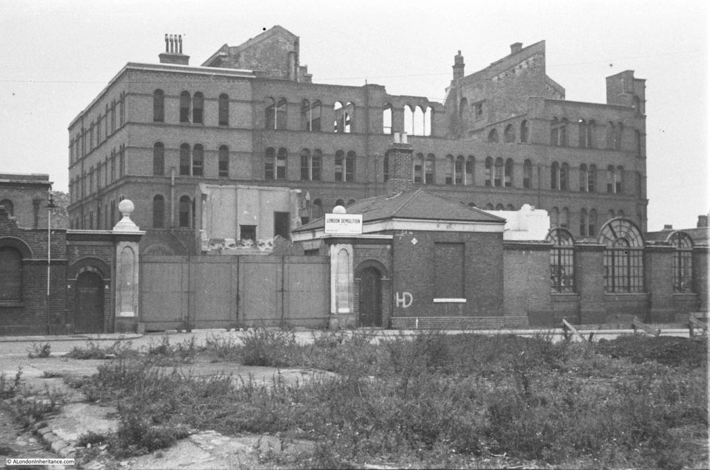
The next photo shows the India Stores Depot as it was prior to demolition. The photo was taken from point 9 in the above map, a short distance in Belvedere Crescent, the kerb of which can be seen in the lower left corner. The road running left to right in front of the gates is Belvedere Road. The India Stores Depot suffered badly from bombing during the war with the majority being left as a shell of a building.

History of the Southbank 16

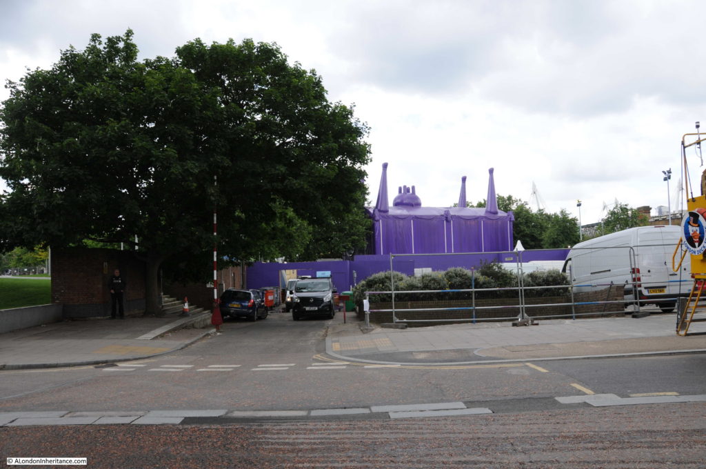
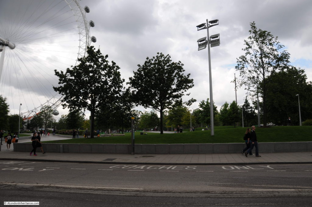
I could not get to the same position as the original Belvedere Crescent is under the Shell Centre complex. The following photo was taken from in front of Shell Centre looking across Belvedere Road to where the India Stores Depot were located, on the current Jubilee Gardens.

Belvedere Road Walk 12

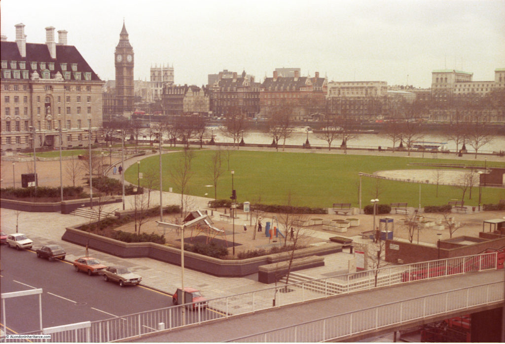
The Jubilee Gardens have been through a number of changes. I took the following photo in the mid 1980s of a much quieter Jubilee Gardens than today. The central area was later used as a construction site for the Jubilee Line extension with a large access shaft in the middle of the grassed area. The grass would be packed during summer lunchtimes with office workers from the Great London Council and Shell Centre.

Belvedere Road Walk 18

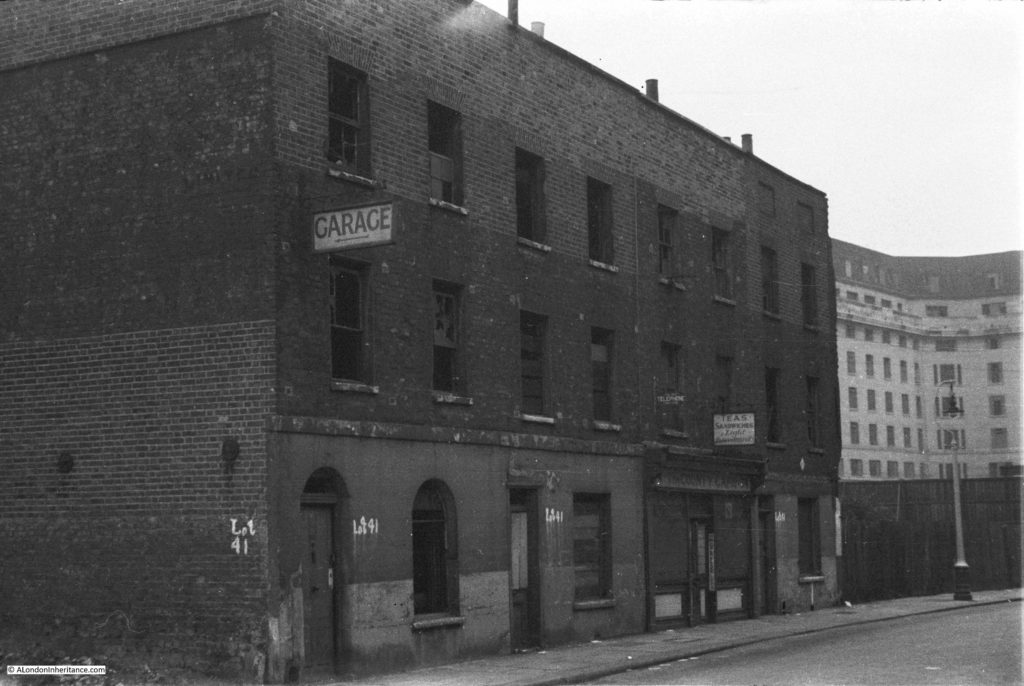
The buildings in the following photo were along Belvedere Road, roughly at point A, which today is the location of the Shell Centre tower building.

History of the Southbank 17

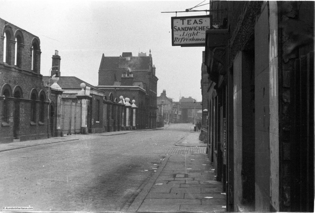
Another view with the buildings in the above photo now on the right of the photo below. The cafe in the photos above and below was called “The County Cafe” – I assume a reference to County Hall, just a bit further along Belvedere Road. It is small buildings such as these where the signs of the business still remain that bring home that this was once a busy area full of industry, cafes, shops and residents. The bridge carrying the rail tracks over Belvedere Road can be seen at the far end of the road and the entrance to the India Stores Deport is on the left.

History of the Southbank 15

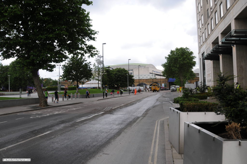
This is same scene today with the main tower building of the Shell Centre complex on the immediate right, occupying the space where the County Cafe once stood. The blue bridge at the end of Belvedere Road is in the same position as the photo above.

Belvedere Road Walk 13

Many of the streets in this area were named after Archbishops of Canterbury. Sutton Walk was named after Charles Manners-Sutton (Archbishop between 1805 and 1828).

Tenison Street was named after Thomas Tenison (Archbishop from 1694 to 1715) and Chicheley Street. was named after Henry Chichele (Archbishop from 1414 to 1443).

The naming of streets after Archbishops extended beyond the area between York Road and Belvedere Road. The street in front of Waterloo Station, Mepham Street was named after Simon Mepeham, Archbishop of Canterbury from 1329 to 1333).

From outside Shell Centre, we can turn towards County Hall and walk to the junction of Belvedere Road and Chicheley Street. Instead of turning up Chicheley Street we can still walk up towards Westminster Bridge through the County Hall complex. Today this is marked on maps as Belvedere Road, but on the 1895 Ordnance Survey maps, Belvedere Road ended at the Chicheley Street junction and this stretch of road up to Westminster Bridge was still called Narrow Wall, the last remaining use of this original name and reference to the earthen bank that separated the Thames from the rest of Lambeth marshes.

The following photo shows the Belvedere Road / Narrow Wall passing through the County Hall buildings, I will continue on from the end of this road in my next post.

Belvedere Road Walk 17

We have now walked the length of Belvedere Road and traced the pre-1951 streets and buildings where much of the original street plan still remained.

Although Belvedere Road has been straightened and widened over the years, we have walked the route of the original earthen wall.

In my next post we will walk along the north bank of the river before returning alongside Hungerford Bridge to look at the building of the Royal Festival Hall.

alondoninheritance.com

A Brief History Of The South Bank

I have long been interested in the history of the South Bank, which for the purposes of this post I will define as the area between County Hall and Waterloo Bridge. I worked there for 10 years from 1979 and it was the location where I first realised that my father had a collection of photos as he brought out some of the photos he had printed to show me what the area where I was now working had looked like some 30 years earlier.

The South Bank has been through two major transformations since the war. The first with the construction of the Festival of Britain exhibition which required the demolition of the whole area between County Hall and Waterloo Bridge (with the exception of Hungerford Railway Bridge which provides a useful reference point).

Following closure, the Festival of Britain site was in turn swiftly demolished with only the Royal Festival Hall remaining, with the rest of the site being gradually built up to the position we see today.

The South Bank was an inspired location for the main Festival of Britain site, a decision which has resulted in the South Bank continuing to be an arts and entertainment centre to this day.

The Festival of Britain was in many ways, a break point between the immediate post war period and the decades to follow. The Festival attempted to define the place of Great Britain within a new world order and looked at how British industry, science, design and architecture could shape that future for the better.

Starting today, and for the next few weeks, I will be exploring the history of the South Bank and the Festival of Britain in detail, starting with three posts covering the South Bank prior to the Festival of Britain.

Then next week, exploring the Festival of Britain at the South Bank, the week after moving to the Festival of Britain Pleasure Gardens at Battersea, then moving onto the Festival’s Architectural Exhibition at Poplar and finally, rounding off with the wider impact of the Festival of Britain.

These are locations and a time in recent history that I find fascinating – I hope you will also enjoy the journey.

A Brief History of the South Bank

I have published a number of photos my father took of the South Bank over the last couple of years and in the next couple of posts I will take a walk along Belvedere Road and then look at the construction of the Royal Festival Hall using these photos, including a number that I have not published before, but first, some history of the South Bank.

Originally, the river frontage along this stretch of the Thames was mainly marsh land and at times of high tide, water would sweep inland. At some point, an earthen bank was constructed to prevent the Thames coming too far inland and by the Tudor period, a road had been constructed on the alignment of this original earthen bank, although according to Thomas Pennant, in 1560 there was not a single house standing between Lambeth Palace and Southwark. This road was shown on maps as Narrow Wall and today, Belvedere Road is roughly along the line of the old Narrow Wall and therefore also the original wall that formed the barrier to the Thames.

Land between Narrow Wall and the river was gradually drained and a number of small industries grew up along this stretch of the river, with the land behind the Narrow Wall staying as marsh and pasture with drainage ditches taking water into the river.

In the fifteenth and sixteenth centuries, the land between the current location of Waterloo and Westminster Bridges, from Narrow Wall to the river was called Church Osiers (Osier being a name for a type of Willow) after the osier bed which occupied this marshy land at the side of the river that would frequently flood. At some point prior to 1690 the land was named Pedlar’s Acre. 1690 is the first time that the name appears in a lease document. The legend behind the name Pedlar’s Acre is that a Pedlar from Swaffham in Suffolk had traveled to London with his dog in the hope of finding his fortune. Different versions of the legend either has the Pedlar’s dog digging up a pot of money either on the South Bank, or after returning home to Swaffham. The Pedlar then gave the strip of land along the river to the parish of Lambeth on condition that his portrait, along with his dog be preserved in painted glass in the parish church.

What ever the truth of this story, there was a picture of the pedlar and his dog in one of the windows of Lambeth Church until 1884.

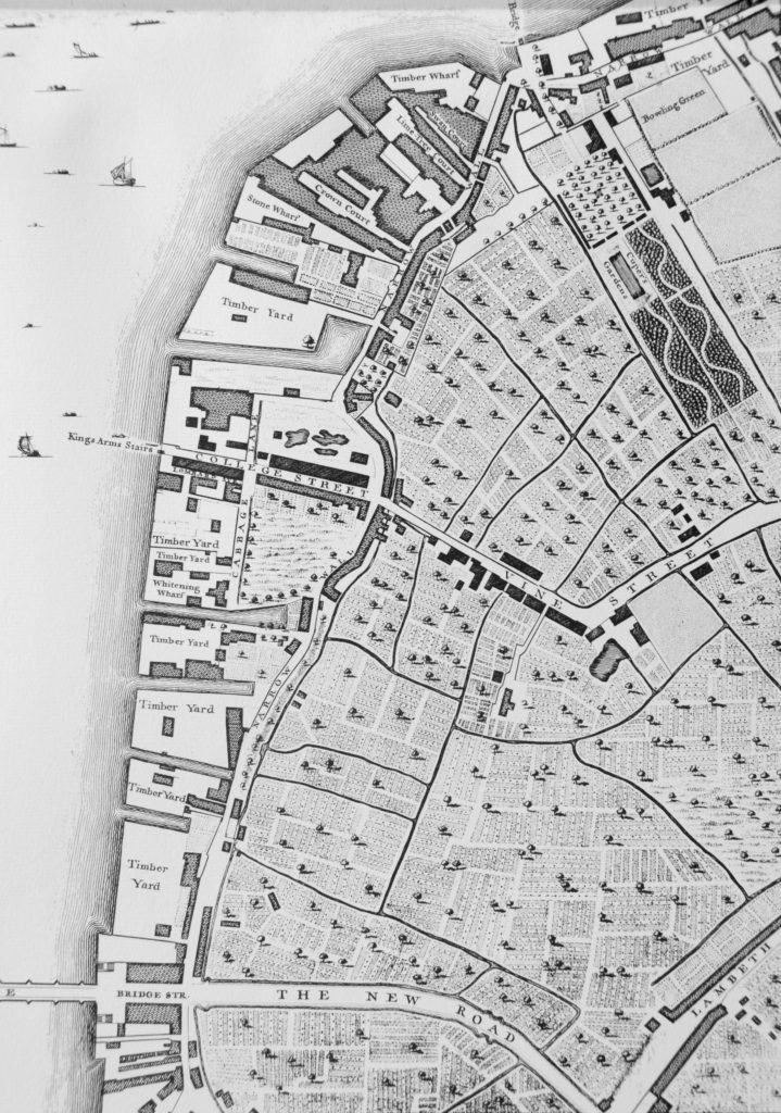
From the 17th century onwards, the land between Narrow Wall and the river was gradually developed. John Rocque’s map shows the area in the middle of the 18th century.

Westminster Bridge is at the bottom of the map and the future location of Waterloo Bridge is at the top of the map, to the left of the bowling green.

History of the Southbank Map 1

Narrow Wall, the original earthen wall, can be seen running parallel to the river, dividing the development along the river from the pasture land that covered much of Lambeth. Starting at the top right of the map, Cuper’s Garden runs in land from the river following almost exactly the route today of the approach road up to Waterloo Bridge.

Cuper’s Garden, one of the many pleasure gardens that ran along the south bank of the river was well known for displays of fireworks and it was also described as “not however the resort of respectable company, but of the abandoned of either sex”. The name came from one Boydell Cuper who had been the gardener to Lord Arundel at his property on the north bank of the river and who rented the land and created the gardens including using some of the old statues from Arundel House.

The land from Cuper’s Gardens along the river went under a number of changes of ownership and names including Bishop’s Acre, Four Acres and Float Mead.

Follow the river south through the wharfs and timber yards that now occupy the space between the river and the Narrow Wall, until College Street.

College Street is on the edge of the current location of the Jubilee Gardens with the open space bounded by College Street, Cabbage Lane and Narrow Wall, called College Gardens part of which is also now the Jubilee Gardens. At the end of College Gardens is Kings Arms Stairs, one of the many stairs down to the river. The curve inland of Narrow Wall at this point was later straightened out, with the inland curve being retained and originally named Ragged Row and then Belvedere Crescent.

The name College Street and College Gardens may refer to the ownership of this parcel of land by Jesus College.

The land after the next Timber Yard and onwards to Westminster Bridge was the future location of County Hall.

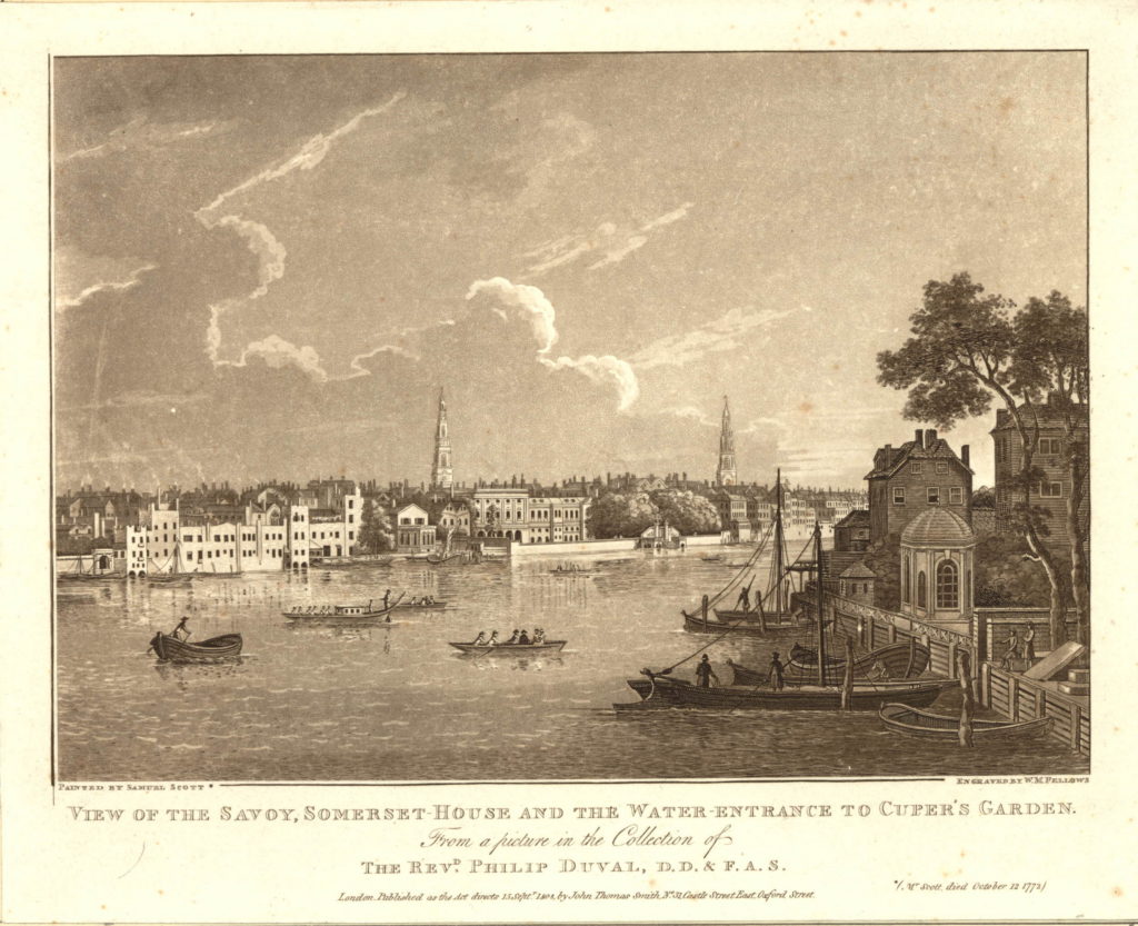
There are a number of prints of Cuper’s Gardens which give the impression of a very pleasant place. The following is from the mid 18th century and is looking across the curve of the river to the north bank, but shows the water entrance to Cuper’s Garden on the right side of the print.

591508001

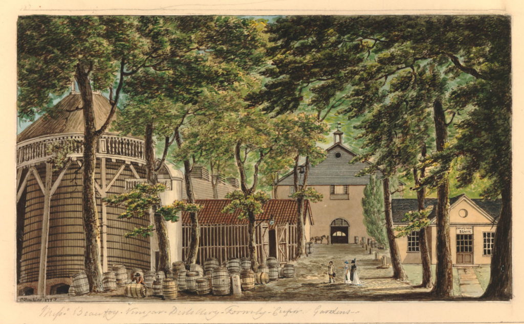
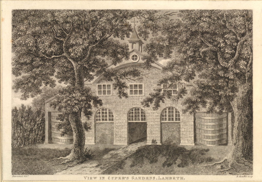
The following print is from 1798 and shows when part of the gardens were occupied by Beaufoy’s Distillery with a large amount of barrels outside. The print gives a good impression of the number of trees across the gardens as it was always described as a wooded area.

806092001

Another view of the Distillery in Cuper’s Gardens.

806217001

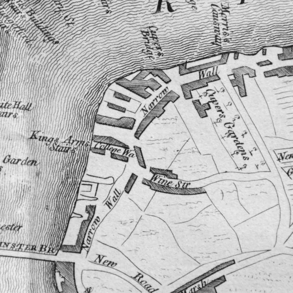
The next map is part of the “New and Correct Plan of London, Westminster and Southwark” from 1770. This shows the area to be roughly the same with Cuper’s Gardens at the top right of the map and Narrow Wall running down towards Westminster Bridge. This map is interesting as it shows the difficulty with relying on one specific map for accuracy. In the Rocque map, College Street is shown running into Vine Street. In the following map, College Street is now College Walk and Vine Street has changed into Wine Street. These are the only references I have found to these names so I assume that they are errors in 18th century map making.

History of the Southbank Map 6

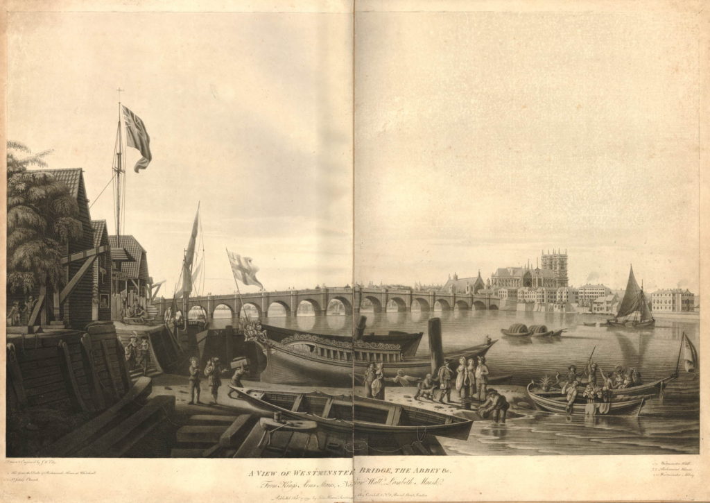
The above map shows the location of Kings Arms Stairs. The following print from 1791 is titled “A View of Westminster Bridge, the Abbey &c. from Kings Arms Stairs, Narrow Wall, Lambeth Marsh”. The stairs can be seen on the left, the tide is low and there is much activity on the waters edge. Westminster Bridge can be seen across the river with Westminster Abbey and Westminster Hall just to the left of the Abbey.

The rest of the scene cannot be a usual scene on this part of the south bank. In the centre of the print is a very ornate boat facing into the river with the flag of the City of London on the stern of the boat. The two small boats in the river to the right have people in ornate dress and large baskets of flowers. It would be interesting to know what was happening. On the left, the building just past the stairs has a sign reading “Artificial Stone Manufactory”, referring to Coade’s Stone Factory which i will cover later in the post.

582791001

Between the above map of 1770 and the next map, the Ordnance Survey map of 1895, the whole area underwent considerable development.

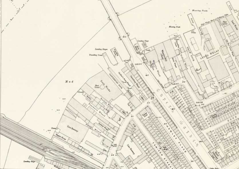
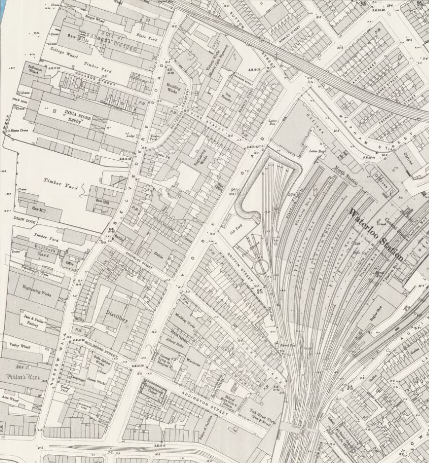
This edition of Ordnance Survey map splits coverage of the area between two maps, so the following map shows the area between Waterloo Bridge and Hungerford Railway Bridge.

History of the Southbank Map 3

The approach road to Waterloo Bridge still has the name of Cuper’s Garden, retaining a link from when this now heavily built area was mainly pasture land. The Waterloo Bridge approach was developed between 1813 and 1816.

The area inland from Belvedere Road has been developed with rows of terrace houses.

The area between the old Narrow Wall, now named Belvedere Road, and the River Thames is still industrial with two major landmarks, the Iron Works and Shot Tower close to Waterloo Bridge and the Lion Brewery adjacent to Hungerford Bridge. Narrow Wall was widened and straightened between 1824 and 1829 to become Belvedere Road. The source of the name is from Belvidere, a house and grounds on the land south of the Iron Works in the above map. As with many of the other pleasure grounds along the river, Belvidere was opened to the public from 1718 and sold wine and food, including fish taken from the river.

The start of the Hungerford Railway Bridge is shown in the lower left of the above map. Construction of the bridge and the associated railway almost cut the area in two with Belvedere Road now being the main route through the area. If you look back at the Rocque map, Hungerford Bridge was built over the Timber Yard and land just north of College Street.

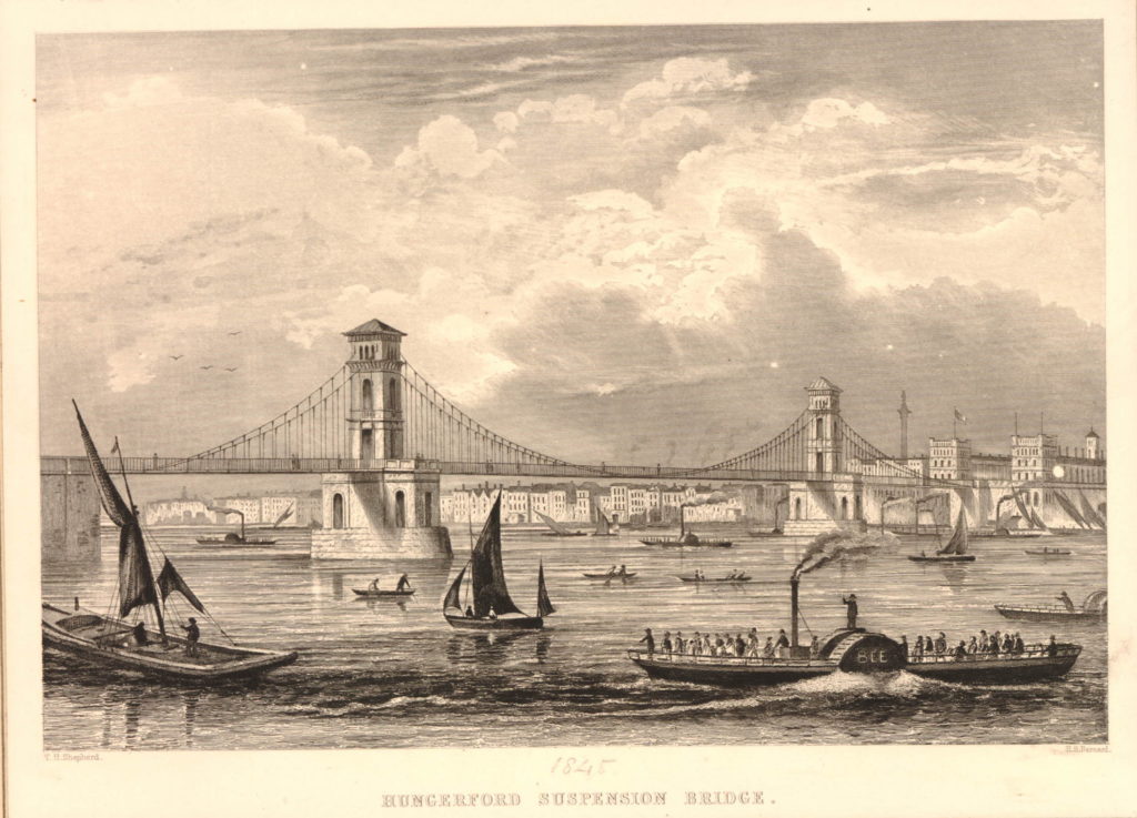
Designed by Brunel, construction of the original Hungerford Bridge was completed by 1845 when the bridge was opened. It was not originally a railway bridge, the aim of the bridge was to bring more custom to the Hungerford Market on the north side of the river. The original bridge did not last long and in 1859 the construction of a new railway bridge was authorised by the Charing Cross Railway Act. The old bridge was demolished and the new railway bridge was opened in 1864. The chains and ironwork from the old Hungerford Bridge were sold to be used in the construction of the new Clifton Suspension Bridge, also to a design by Brunel.

The original Hungerford Suspension Bridge:

582941001

The other major change was the construction of Waterloo Bridge, with the approach road across the former Cuper’s Gardens. Construction of the original Waterloo Bridge commenced in 1811 with the bridge being opened by the Prince Regent on the second anniversary of the Battle of Waterloo in 1817, after which the bridge was named following an act of parliament in 1816 to approve the proposed name.

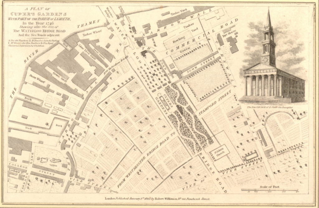
The following map is interesting as it appears to bring together some of the later development around Waterloo Bridge with the area in 1746. Published in 1825, eight years after the bridge was opened, it is titled “A Plan of Cuper’s Gardens with part of the Parish of Lambeth in the year 1746 showing also the site of the Waterloo Bridge Road and the new roads adjacent”.

The map helps define the exact location of Cuper’s Gardens as the church of St. John is also shown. The large roundabout at the end of Waterloo Bridge Road is now covering the end of Cuper’s Gardens at the junction with Stamford Street.

The map also shows how the name Belvedere Road came into use. The first straightening of the Narrow Wall is shown close to the approach to Waterloo Bridge and the name for this short section is New Belvidere Road. It is the first reference to the new street name, and also retains the original spelling from the house and gardens. As the name was taken on by the rest of the Narrow Wall, the name changed to the present spelling.

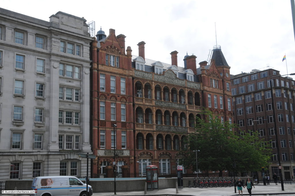
806218001You will need to click on the map to expand a larger version to see the next reference point to the area today. In the gardens in the wooded area just at the bottom right corner of the pond is a building marked D. Checking the key at top left, D is given as the “Royal Universal Infirmary for Children”. This is on an alignment of Waterloo Bridge down to St. John’s Church and although it has now closed as a hospital, a later version of this building, the Royal Waterloo Hospital for Children and Women is still there, on the junction with Stamford Street. This allows us to place the location of Cuper’s Garden precisely and as you walk up towards Waterloo Bridge from St. John’s Church, you are walking through the middle of Cuper’s Gardens.

The following photo shows the Royal Waterloo Hospital for Children and Women on the corner of the approach to Waterloo Bridge and Stamford Street.

History of the Southbank 31

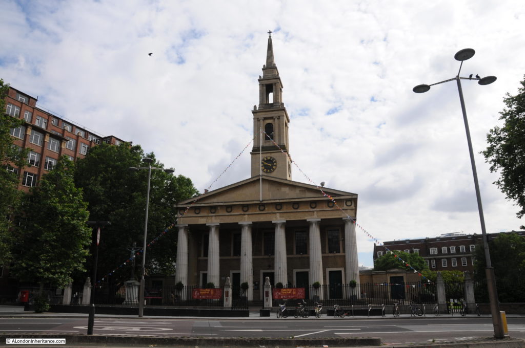
The church of St. John, although badly damaged by bombing during the last war, it was rebuilt to the original plan and is still exactly the same as the drawing on the 1825 map. During the Festival of Britain, the church was designated as the Festival Church with a programme of events during the period of the festival. The church is at the end of the original location of Cuper’s Gardens, the entrance to the gardens was on the left.

History of the Southbank 32

Looking up towards Waterloo Bridge from where the end of Cuper’s Gardens would have been. The hospital and Stamford Street are on the right. The IMAX cinema is on the left in the centre of the roundabout. A very different place to the 18th century gardens.

History of the Southbank 33

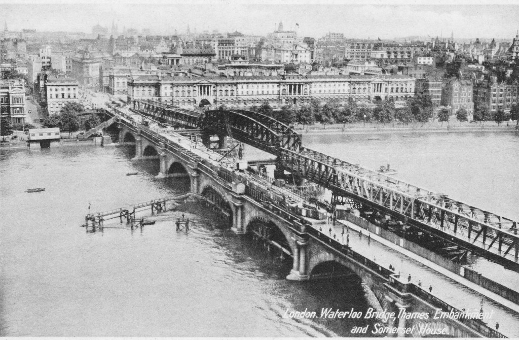
In 1923, Waterloo Bridge suffered from settlement to the central arch along with subsidence to the carriageway and parapet, leading to the bridge being closed to traffic in 1924. A temporary bridge was constructed alongside Waterloo Bridge and options were reviewed as to whether the original bridge should be repaired, rebuilt or a completely new design of bridge built.

The decision was for a new design of bridge and the Waterloo Bridge that we see today was fully opened in December 1945. The following postcard with a photograph taken from the top of the Shot Tower shows the original Waterloo Bridge with the damage to the central pier, along with the temporary bridge built alongside.

Postcard 5

Also in the above map, adjacent to Hungerford Bridge is the Lion Brewery. This area was originally the location of Belvidere House and Grounds, and in 1785, Water Works were built on the southern end of the gardens, drawing water from the river to supply the local residents. Not surprisingly, there were issues with the purity of the water being taken from the river and as part of the general improvements to London’s water supply, the water works were moved to outer London locations such as Surbiton. After the closure of the water works, the lease on the land was assigned to James Golding and the Lion Brewery was completed in 1837. On the opposite side of Belvedere Road to the brewery, Golding purchased a lease on an additional parcel of land and built stables and warehouses to support the brewery.

The Lion Brewery was taken over by the brewers Hoare and Company of Wapping in 1924 and in 1931 the building was badly damaged by fire. It was then temporarily used for paper storage before being demolished in 1949 to make way for the Royal Festival Hall.

During the demolition of the brewery buildings, a total of five wells were found which had been used to provide water for the brewery as water could not be taken from the Thames.

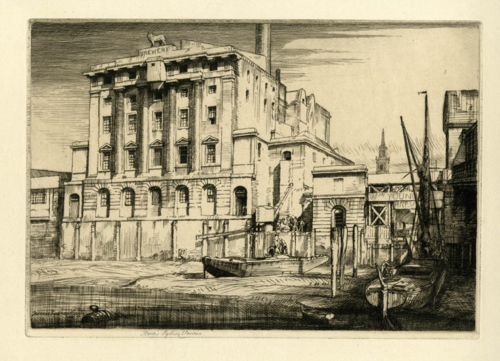
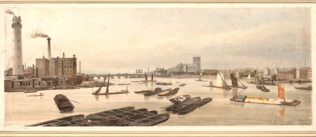
There are a number of prints which show the industry along the South Bank between Hungerford and Waterloo Bridges. The following shows the Lion Brewery. Note the tower of the church of St. John’s in the background.

334997001

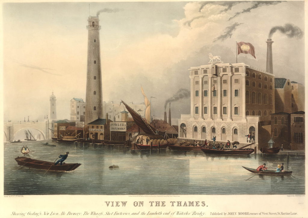
Another print shows both the Lion Brewery and the Shot Tower with the original Waterloo Bridge on the left.

582939001

And a view from Waterloo Bridge along the river to Westminster Bridge before the construction of Hungerford Bridge. The Shot Tower and the Lion Brewery are on the left.

582808001

The Shot Tower was built in 1826. The gallery at the top of the tower is 163 feet high, and was used to drop molten lead for large shot. A gallery half way up the tower was used to make small lead shot.

The Shot Tower and the associated lead works were owned from 1839 by Walkers, Parker and Company who ran the business until 1949.

The area between Hungerford and Westminster Bridges is shown in the following map (the map cuts off before Westminster Bridge but if included it would be just at the bottom of the map to the left).

The map shows the straightened Belvedere Road, with the original curve in the road still in existence but is now named Belvedere Crescent. Follow Belevedere Road towards the bottom of the map and at the junction with Chicheley Street, it reverts back to Narrow Wall.

Below the Chicheley Street junction, the whole area between York Road and the river would later be occupied by County Hall. Following the Festival of Britain, the area bounded by York Road, Belevedere Road, the rail tracks and Chicheley Street would be occupied by the Shell Centre building. On the opposite site of Belvedere Road, up to the river, during the Festival of Britain, the Dome of Discovery would be built on the area occupied by the India Store Depot and today the Jubilee Gardens are on this spot.

History of the Southbank Map 4

At the top left of the map is a set of buildings, over which is written “site of Sparagus Garden”. This was also an early pleasure gardens, but unlike Culper’s Gardens, is not very well documented. This was also the site of Coade’s Artifical Stone Works.

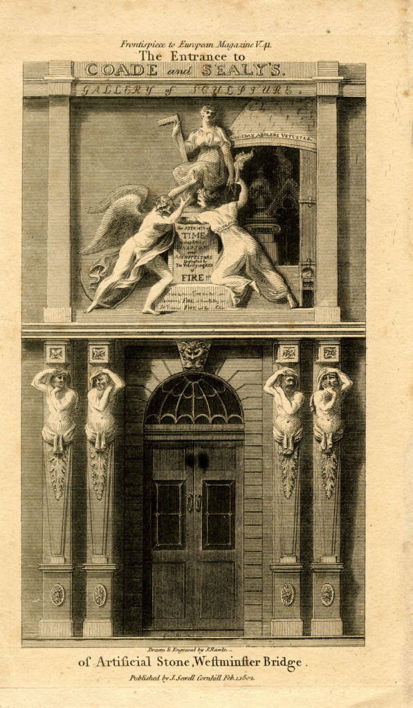
The initial stone works on the site were opened in around 1770 by Daniel Pincot who published that he had opened a factory “by King’s Arms Stairs, Narrow Wall, Lambeth”. At some point soon after 1770, the factory appears to have been taken over by Eleanor Coade who would go on to run the factory for 25 years until her death in 1796 when her daughter, also called Eleanor, took over the factory. The younger Eleanor also ran the business well and opened a gallery for the factory’s products at the corner of Narrow Wall and Bridge Street – the street leading up to Westminster Bridge – along with a number of houses which took the name Coade’s Row.

The entrance to the Coade Stone showroom on Westminster Bridge Street:

853044001

Products from the Coade factory were used across London and wider afield, but the most long lasting and well known is the lion that was on top of the Lion Brewery. Removed and stored at the time that the brewery building was demolished, it was installed on a plinth at the southern end of Westminster Bridge in 1966.

The younger Eleanor Coade was unmarried and had no children by the time of her death in 1821, however she had already taken on a cousin, William Croggon to take control of the business, who was succeeded by his son Thomas in 1836, however his ownership of the business did not last long and the Coade Stone Factory appears to have closed a year later in 1837 and the production of this unique, man-made stone was consigned to history.

Just to the south of College Street, is labelled the India Stores Depot. This was built in 1862 on land leased by the Secretary of State for India. These stores were gradually extended until the start of the 2nd World War, during which they suffered considerable damage and were demolished to make way for the Festival of Britain.

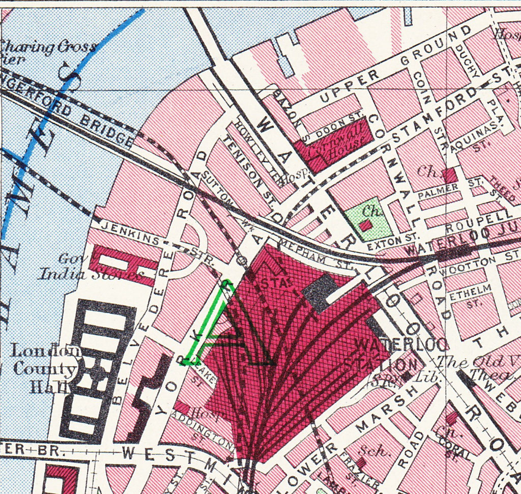
As a final bit of confusion regarding continuity of street names, the following map extract is from the Bartholomew Greater London Street Atlas from 1940. It shows Belvedere Road running between Westminster and Waterloo Bridges, with Howley Place shown at Howley Terrace, Tension Street and Sutton Walk with the same names as previous maps, but further along, where College Street and Vine Street were shown in the 1895 Ordnance Surcey map, the street is now called Jenkins Street. This map is the only place I have seen this name for the street, so it was either an error, or there was a name change between 1895 and 1940.

History of the Southbank Map 7

And finally we come to today and the following map shows the layout of the area as it is now – although this will also change soon as the buildings surrounding the Shell Centre tower have been demolished to make way for a new development of multiple apartment towers.

History of the Southbank Map 5

The map shows roughly the same area, between Waterloo Bridge at the top of the map and Westminster Bridge at the bottom.

The only streets that remain from previous years are Belvedere Road and Chicheley Street. Belvedere Road has been widened and straightened over the years, but follows roughly the same route as the Narrow Wall and the original earthern embankment.

There is more land between Belvedere Road and the river as during the construction of County Hall and the Festival of Britain, the embankment was pushed further into the river.

The approach road to Waterloo Bridge now covers the area occupied by Cuper’s Gardens. The Royal Festival Hall occupies the site of Timber Yards and then the Lion Brewery.

The Coade Stone Factory was on the site now occupied by the car park above the Jubilee Gardens.

The rows of terrace houses between Belevedere Road and York Road have gone with the space being occupied by the Shell Centre Upsteam and Downstream buildings – off which all but the tower building have either been converted into apartments or have been demolished to make way for more apartment blocks.

In my next post we will have a walk along Belvedere Road looking at the buildings and views from between 1947 and 1950 as the site is prepared for the Festival of Britain and comparing with the same scenes today.

All the prints in the above post are ©Trustees of the British Museum

The extracts from the 1895 Ordnance Survey Map are reproduced by permission of the National Library of Scotland.

alondoninheritance.com

The Brewery At The End Of Sutton Walk

Chances are, if you have walked from Waterloo Station down to the Royal Festival Hall, or the Southbank, you have walked along Sutton Walk without really being aware that you have.

Today, Sutton Walk is a short stretch of pedestrian walkway through one of the rail arches under the rail tracks leading up to Hungerford Bridge, however it was once a short street leading down to the Lion Brewery on Belvedere Road.

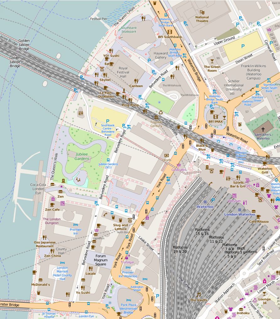
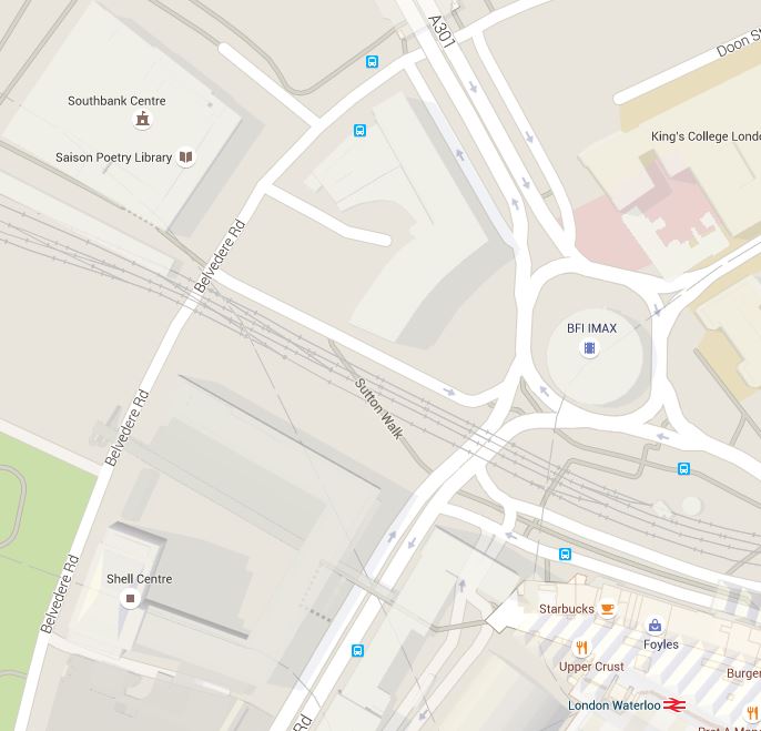
This is the location of Sutton Walk in 2015, in the centre of the map, the short stretch under the rail tracks:

Sutton Walk Map 2

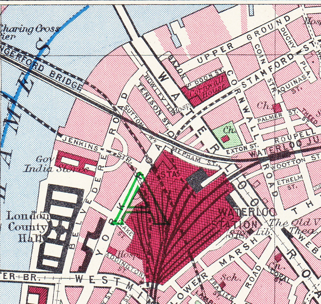
Before the post war development of the area for the Festival of Britain, the 1940 Bartholomew’s map showed the original Sutton Walk:

Sutton Walk Map 1

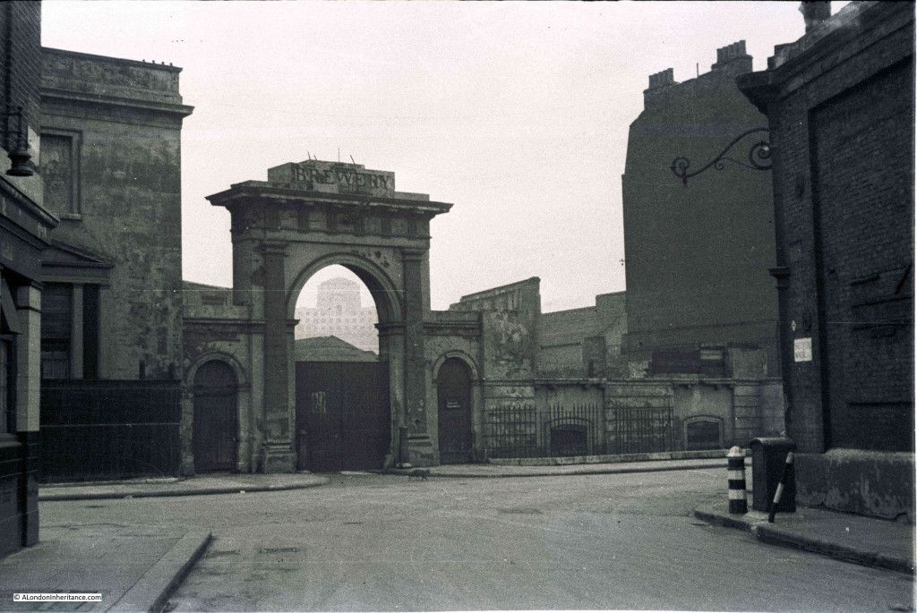
Before the demolition of the original buildings along Belvedere Road, my father took some photos in 1947 from the junction of Sutton Walk with Belvedere Road. These show part of the old Lion Brewery that are not often seen. There are many photos from the river (including some my father took here), but in this article I want to show the other side of the brewery.

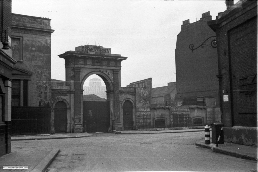
In the first photo, we are standing in the original Sutton Walk. The road running left to right is Belvedere Road. Straight ahead is the archway leading into what was the Lion Brewery. The word “Brewery” remains on the block at the top of the arch, however the stone Lion that originally sat on top of the arch has already been removed, leaving only the stubs of metal rods that would have held the Lion to the arch.

Sutton Walk 2Framed within the archway is Shell-Mex House on the north bank of the river. Originally on the right of the arch was a building of identical design to the building remaining on the left, and the main brewery buildings would have been visible through the arch. It must have been an impressive sight when the brewery was in full production.

One can only imagine the number of barrels of beer that have come through that archway.

The brewery was built between 1836 and 1837 on the site of a Water Works that supplied water to the local area using water taken directly from the river. Prior to the water works, a house called Belvedere (the origin of the road name) occupied the site. This became a tavern in 1781 and along with the gardens, was opened to the public following the tradition of “pleasure gardens” being opened along the south bank of the river.

The brewery building was seriously damaged by fire in 1931, after which it was used for a brief period as a storage place for waste paper.

This whole area was demolished in the late 1940s ready for the construction of the Royal Festival Hall and many of the streets were either lost or considerably changed. Although Sutton Walk does not now extend down to Belvedere Road it is still easy to find the location of my father’s photos by extending the line of the remaining pedestrian stretch under the railway.

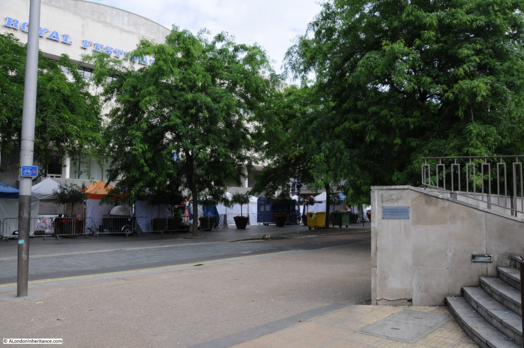
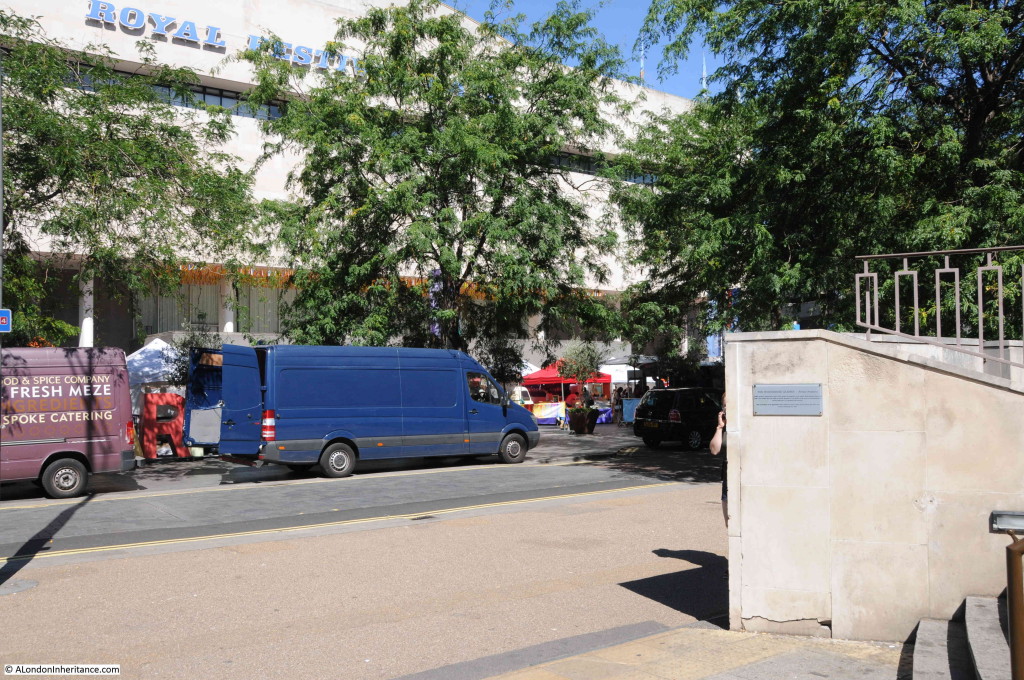
The same view today from roughly the same position:

Sutton Walk 6The Royal Festival Hall now fully occupies the site of the Lion Brewery between Belvedere Road and the Thames.

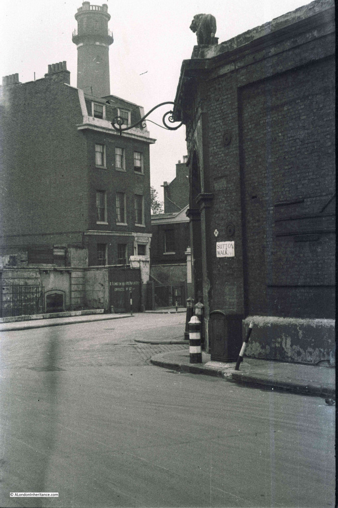
The next photo is from the end of Sutton Walk and looking to the right along a short stretch of Belvedere Road. Behind the building we can see the top of the Shot Tower. The top of the tower still in the original state prior to the modification for the Festival of Britain. The lettering on the wooden gate in the centre of the photo spells out the name of the London Waste Paper Company Ltd. After the brewery closed, the site was used for storage of waste paper by this company.

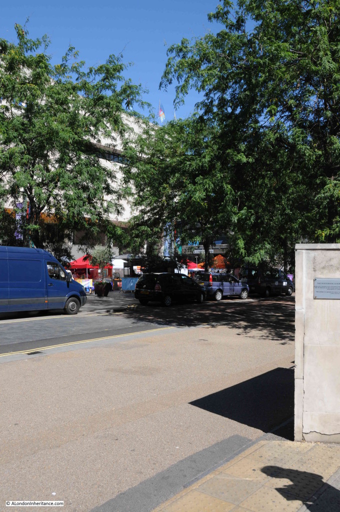
Sutton Walk 3The same view in 2015 looking at the edge of the Royal Festival Hall and towards the Hayward Gallery (hidden behind the tree):

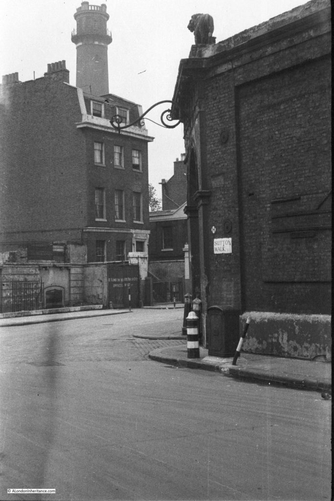
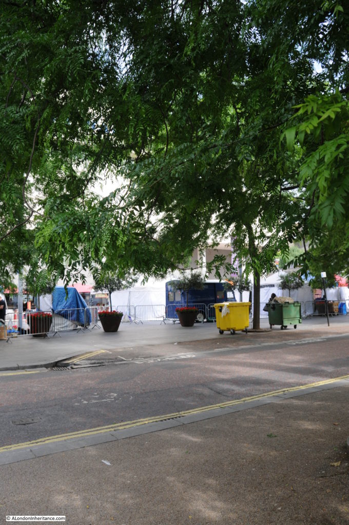
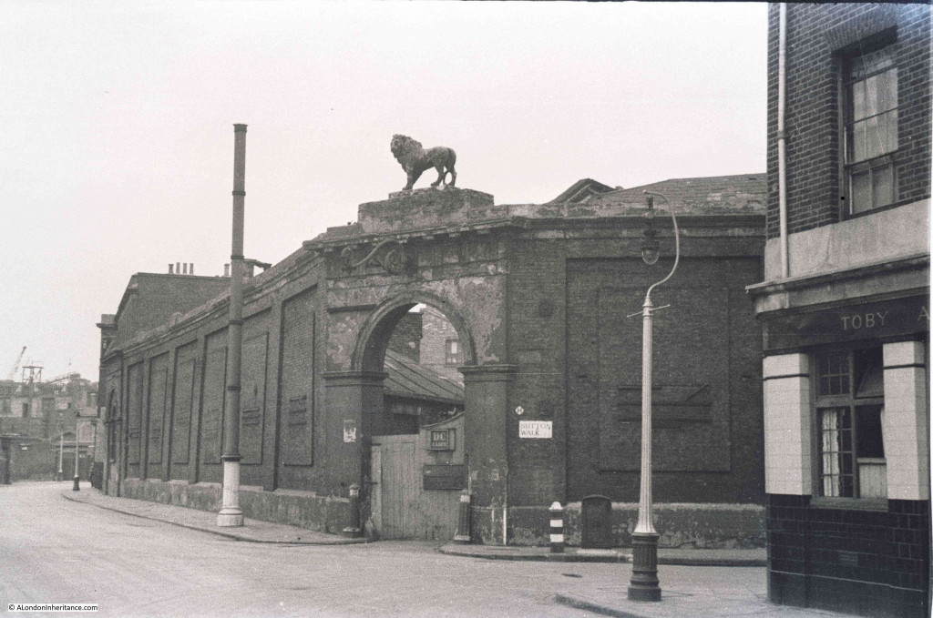
Sutton Walk 7Now we can cross over Belvedere Road and look back at the junction with Sutton Walk and we can see another part of the brewery with the same style of entrance arch, but still retaining the lion. This part of the brewery site contained warehousing and the stables.

Sutton Walk 4Also in the above photo, there is a pub on the right. There were several pubs along Belvedere Road as before the war, this was a very busy light industrial and residential area. It looks still occupied, but when the photo was taken in 1947 this area had mainly been cleared and the pub would soon be demolished.

And the same view in 2015. The building is the old Shell Centre Downstream building which is now “The Whitehouse”, one of the many office to luxury apartment conversions that now seem the norm across so much of central London.

From extending the remaining stretch of Sutton Walk down to Belvedere Road, the lamp posts on the right in the two photos seem to be in exactly the same position.

Sutton Walk 5This is all that is left of Sutton Walk today, the short pedestrian stretch under the railway. The road running left to right is Concert Hall Approach, a new road (if you call more than 50 years old, a new road !!), built as part of the redevelopment of the area.

Sutton Walk 10Although Belvedere Road was named after a house on the site of the Lion Brewery, a number of other roads in this area were named after Archbishops of Canterbury (no doubt due to  Lambeth Palace, the London residence of the Archbishop of Canterbury being not that much further along the Thames).

Sutton Walk was named after Charles Manners-Sutton (Archbishop between 1805 and 1828).

The nearby Tenison Street, (see the 1940 map, next street up towards Waterloo Bridge, lost during the construction of the Shell buildings) was named after Thomas Tenison (Archbishop from 1694 to 1715).

Although the street is not named in either the 2015 or 1940 maps, the street that runs from the corner of County Hall towards Leake Street is Chicheley Street. This street is still there and is named after Henry Chichele (Archbishop from 1414 to 1443).

Returning to Belvedere Road, we can walk to the right, eastwards towards Waterloo Bridge. This was the view in 1947 with the approach to Waterloo Bridge crossing over Belvedere Road:

Sutton Walk 1Although the current Waterloo Bridge was built in the early 1940s and opened in 1945, it still used the original approach road and the arches over the roads on the southbank. To confirm that this is indeed the location, look to the right of the above photo and part of a street sign can be seen.

This is Howley Terrace and using the 1940 street map, Howley Terrace can be seen running parallel to the Waterloo Road as it runs up to the bridge (and continuing the street name theme, Howley Terrace was named after William Howley, Archbishop from 1828 to 1848 – this also provides a good estimation of when these streets were named, probably around1848 as William Howley is the last Archbishop to have a street named after him in this area).

Sutton Walk Map 1

The naming of streets after Archbishops extended beyond the area between York Road and Belvedere Road. The street in front of Waterloo Station, Mepham Street (seen in the above 1940 map and still in existence) was named after Simon Mepeham, Archbishop of Canterbury from 1329 to 1333). The history of the church appears to be written across this area of Lambeth.

The view is very different now. The new approach road to Waterloo Bridge, built as part of the redevelopment of the area provides a very different crossing of Belvedere Road. There is still a road turning off to the right. This is now a slip road down from the roundabout at the end of the road to Waterloo Bridge, down to Belvedere Road. Unlike Sutton Walk, the slip road does not appear to have any name, therefore the name Howley Terrace looks to be consigned to history.

Sutton Ealk 8

I find the Southbank fascinating. It is one of the areas in London that has undergone such significant post war development that there are very few traces of what was there before. The railway running up to Hungerford Bridge is the only remaining structure that has survived, but it is good that some of the streets can still be found, even though, as with Sutton Walk, it is now a shadow of its former state.

 alondoninheritance.com