A high level view always provides a different perspective than walking the streets of London. From high-up, we can see how the height of the city changes over time, how different parts of the city relate to one another, how new developments impact the overall look and feel of London, architectural features not easily visible from ground level etc.
I have always taken any opportunity to look at London from above. Two of my first experiences of this were the Shell Centre Viewing Gallery, and crossing London in an old biplane (here and here). Click on the links for photos of a very different city.
A couple of week’s ago I was in Victoria on a fine autumn day with clear blue sky and bright sun, which presented another opportunity to look at the view over London, as Westminster Cathedral has a wonderful outlook from a viewing gallery towards the top of its 284ft high bell tower.
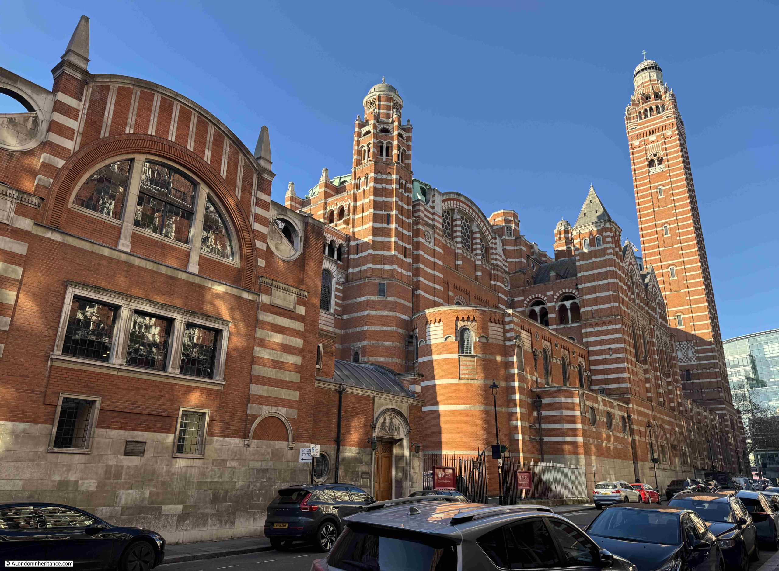
Westminster Cathedral is the Mother Church for Catholics in England and Wales, and is the home for the Archbishop of Westminster. It is a wonderful building, so very different to the buildings that have been recently built around Victoria:
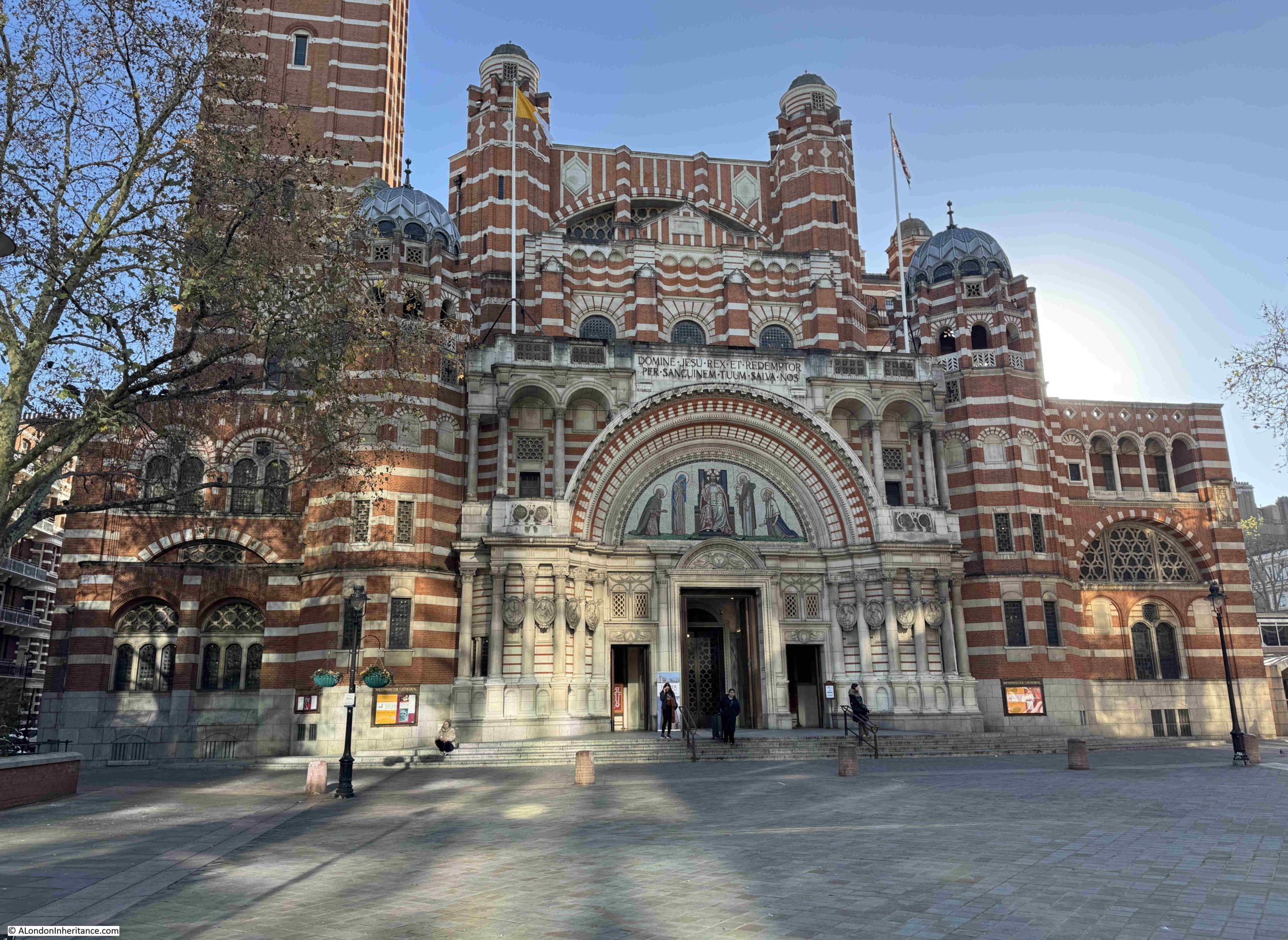
The cathedral is also so very different to other churches to be found in London. Designed by the architect John Francis Bentley and based on the type of Byzantine – Christian style of architecture frequently found in Italy and eastern Mediterranean countries, construction marked the end of the 19th and start of the 20th centuries, as the Cathedral was completed in 1903, so for a London church, it is relatively recent.
The view of the cathedral we see today from street level is even more recent, as up to the 1970s there were the large terrace style of houses, still to be found in Victoria, lining the street in front of the cathedral and blocking the view.
The cathedral was constructed of brick and Portland stone, the extensive use of brick was to reduce costs, however brick is a really good building material, and the mix of brick and Portland stone considerably adds to the architecture and appearance of the Cathedral, and the brick looks wonderful in the sun of an autumn day.
A full view of the façade of the Cathedral, with the bell tower on the left:
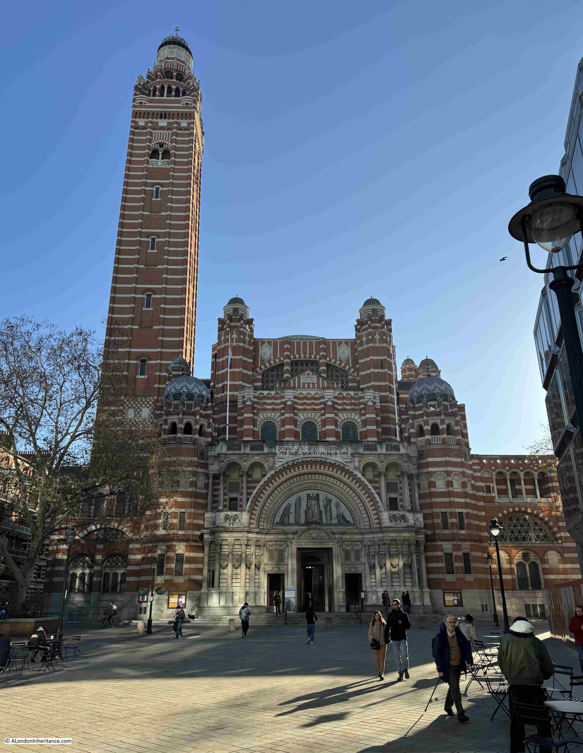
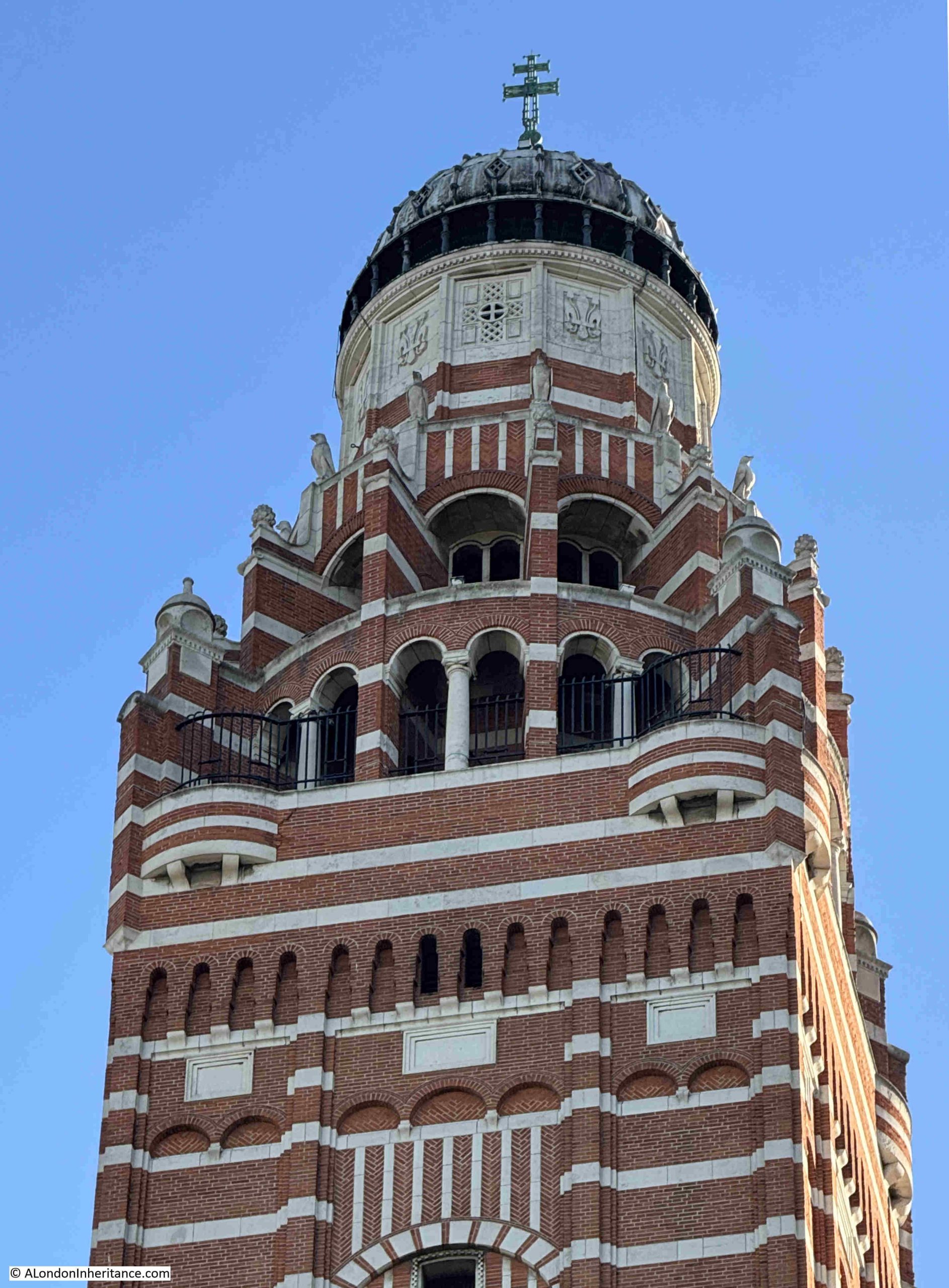
The overall height of the bell tower, or campanile to use the correct term, is 284 feet to the top of the cross on the dome, and just below the very top of the tower, there is a viewing gallery at 210 feet.
The bell tower has only one bell, however it weighs over 2,646 kg, and was cast in 1910 at the Whitechapel Bell Foundry, having been funded by Gwendolen Mary Fitzalan-Howard, Duchess of Norfolk.
The bell is apparently known as Big Edward, after Edward the Confessor, who is buried just along Victoria Street in Westminster Abbey.
In the following photo, the viewing gallery is the section of the tower where there are black railings:
Thankfully, there is a lift that takes you from the ground floor up to the viewing gallery, although they do warn you that if there is a problem with the lift, then it will be stairs all the way down.
The lift was blessed in 2015, and on a sign inside the lift is a copy of the blessing, so hopefully no lift problems during my visit.
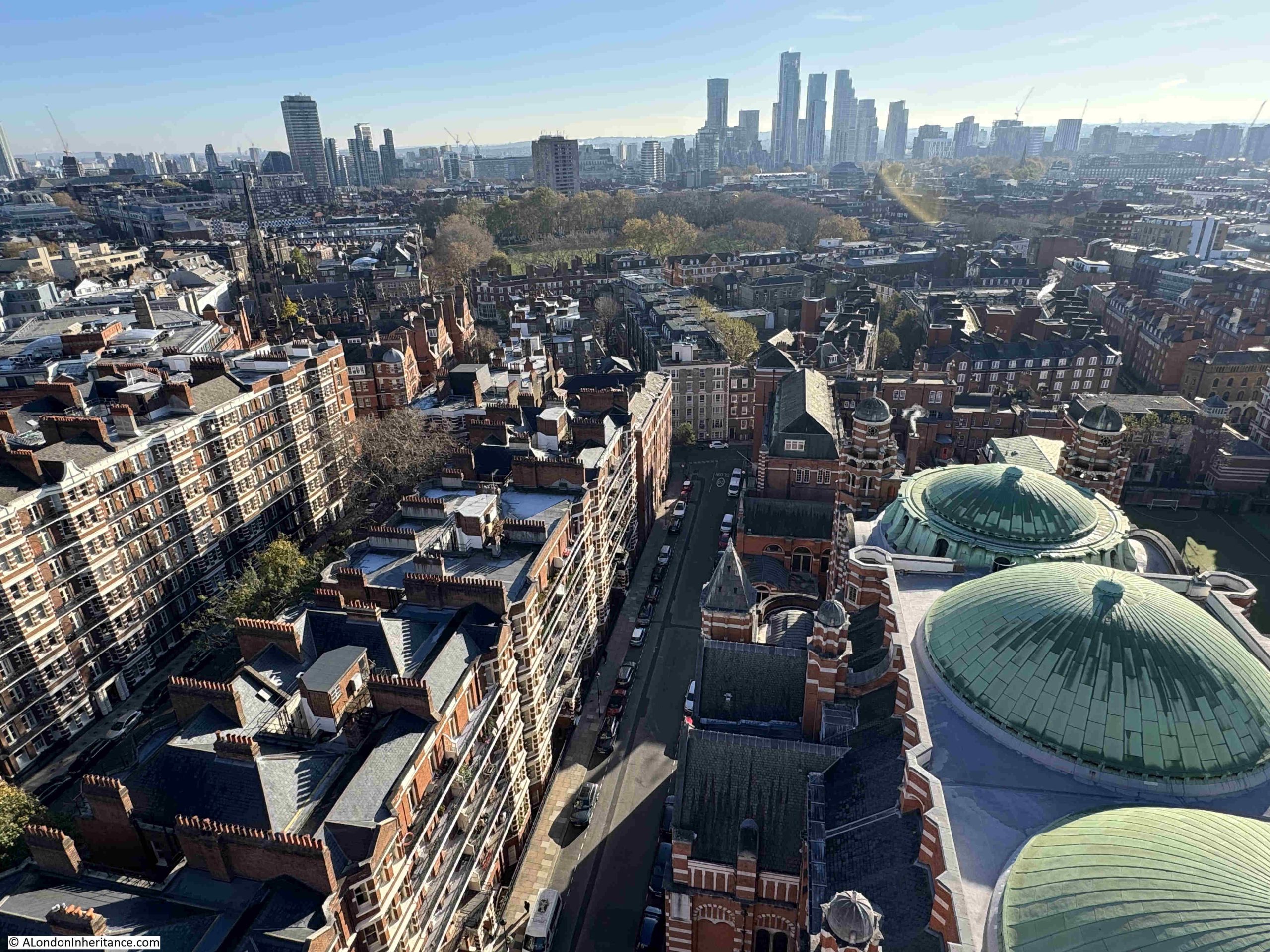
The lift opens out onto a semi-enclosed area, where there are arches providing access to stunning views across the city.
In the lower right of the following photo are two of the domes on the roof of Westminster Cathedral, and the towers in the distance are part of the recent developments at Nine Elms on the southern side of the Thames:
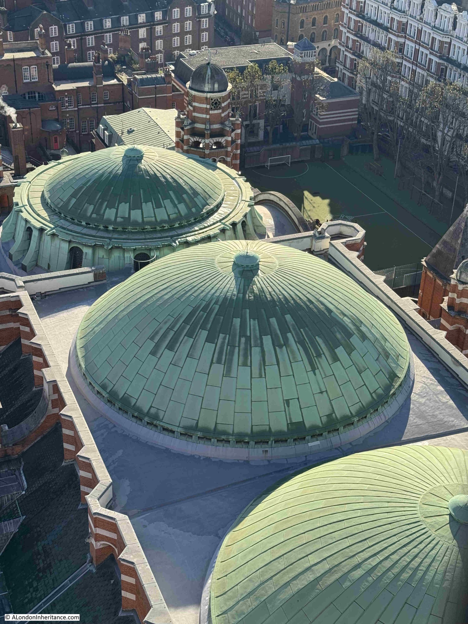
The following photo shows a close-up view of the domes along the roof. There are three of these, and whilst they look impressive from above, internally they provide a dramatic addition to the roof space, again following the style of Byzantine – Christian architecture:
At the rear of the cathedral is the Westminster Cathedral Choir School, which explains the football pitch and the buildings at the back.
Internally, the church is richly decorated across the lower half. The upper half and the internal sides of the domes are plain brick, which gives the upper part of the cathedral a darker appearance as you look up.
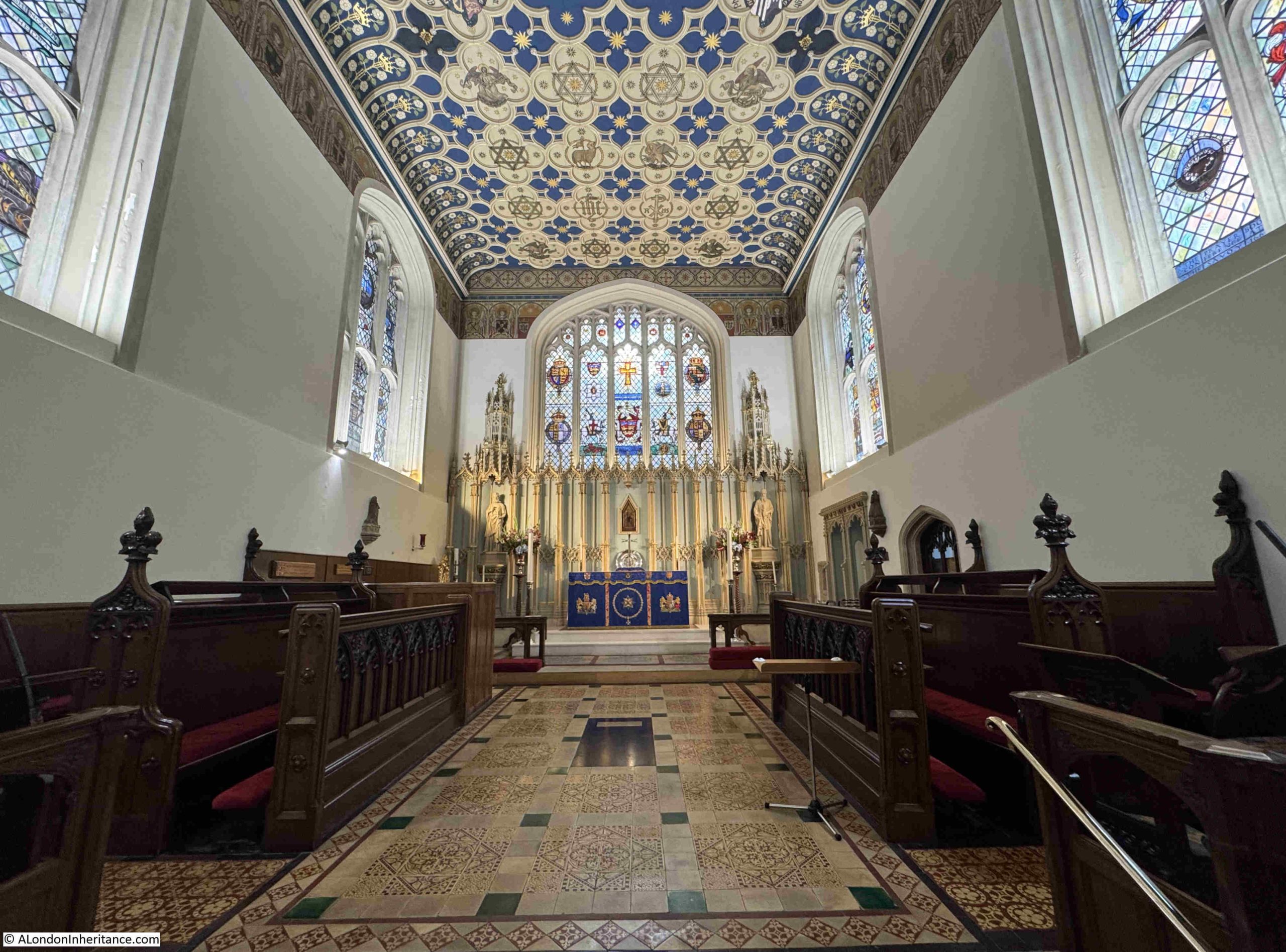
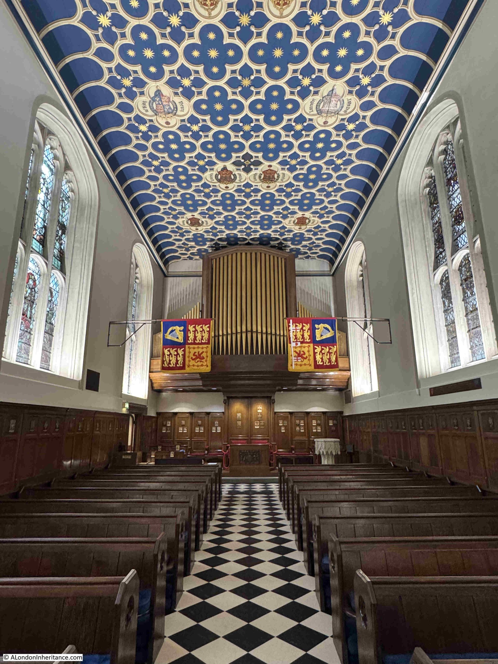
During my visit, there was a service in progress and no photo signs in place, so I cannot illustrate the internal appearance of the cathedral, but it is well worth a visit if you are in Victoria.
As well as the wide sweep of a view across the city, one of the joys of looking from above is picking out individual buildings, and getting a different perspective which is not that obvious from street level.
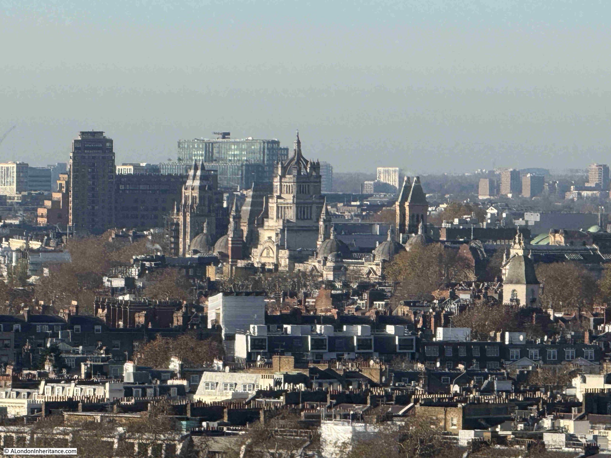
In the centre of the following photo is the impressive tower above the main entrance to the Victoria & Albert Museum in South Kensington, and behind the V&A is the Natural History Museum:
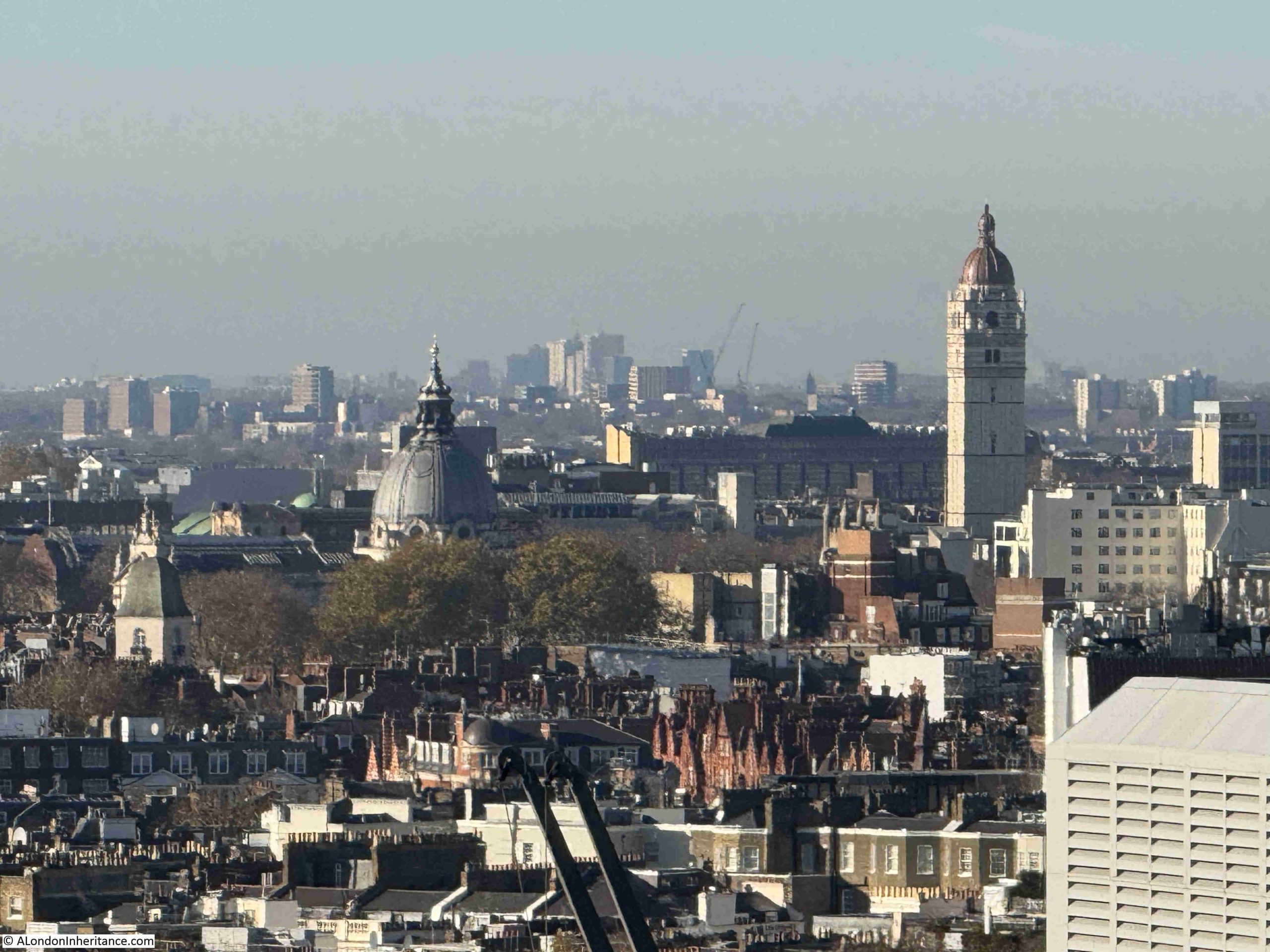
The dome in the following photo is that of the Brompton Oratory, and the tower to the right is the Queen’s Tower at Imperial College London, also in South Kensington. It is hard to tell from this distance, but I think the Queen’s Tower is still wrapped in sheeting as restoration work has been underway:
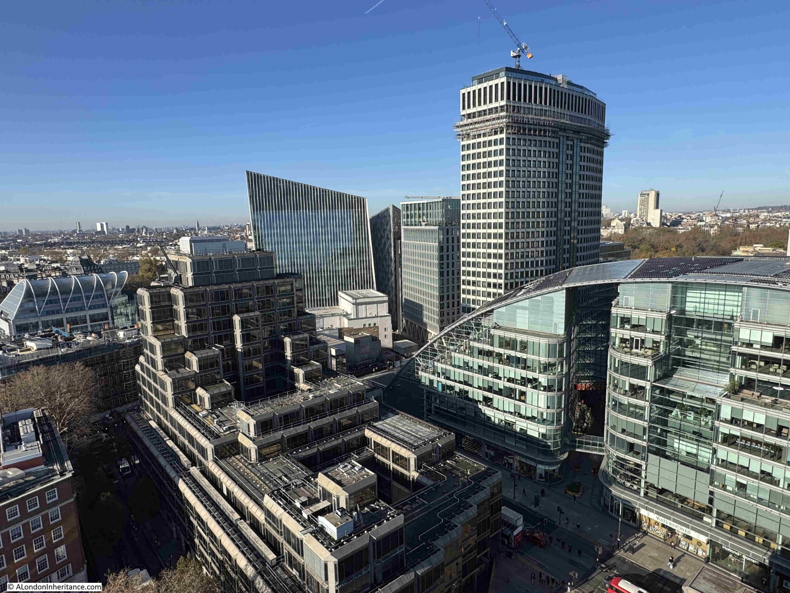
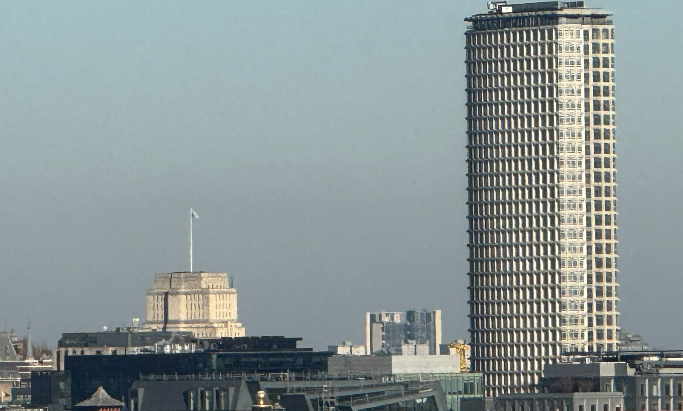
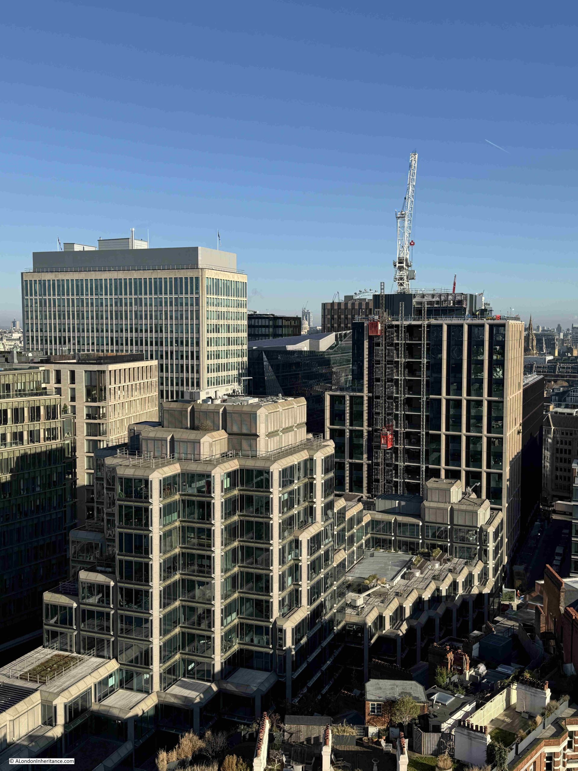
Victoria has changed dramatically over the last decade, and from the cathedral tower we can see many of the new buildings that now dominate the area:
Looking down to street level gives an impression of the height of the viewing gallery:
As I mentioned earlier in the post, when built, Westminster Cathedral was screened from Victoria Street by rows of terrace houses.
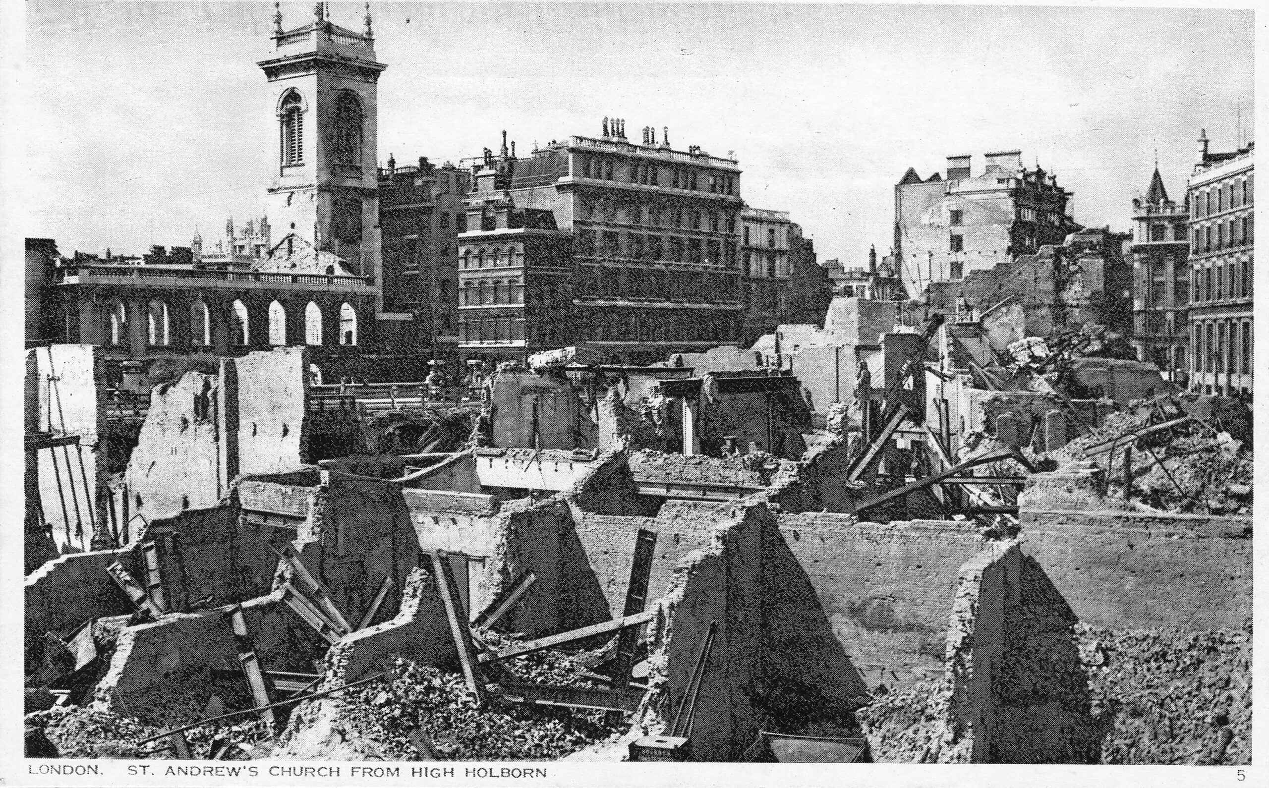
As a post is never complete without a map and the following is an extract from the 1952 revision of the OS map, where the houses that that once sat between Ashley Place and Victoria Street can be seen. These would be demolished in the 1970s, opening up the view to the cathedral from Victoria Street (‘Reproduced with the permission of the National Library of Scotland“:
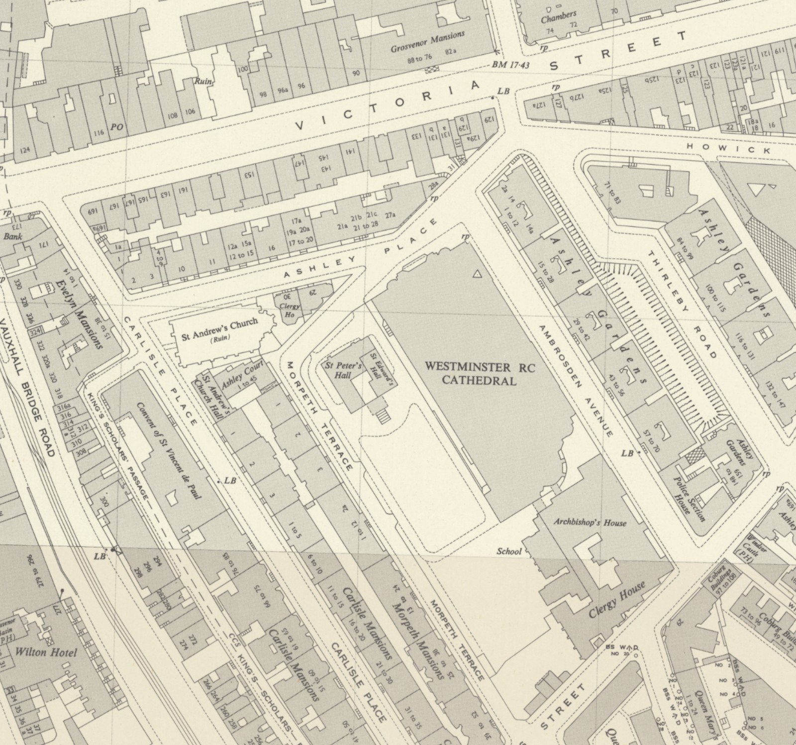
In the above map, another church can be seen to the left. This is St. Andrew’s Church, but with the word “ruins” in brackets. This church was also demolished in the 1970s and today the office building on the site is the head office of the John Lewis Partnership (although I vaguely recall a story that they were relocating from this office).
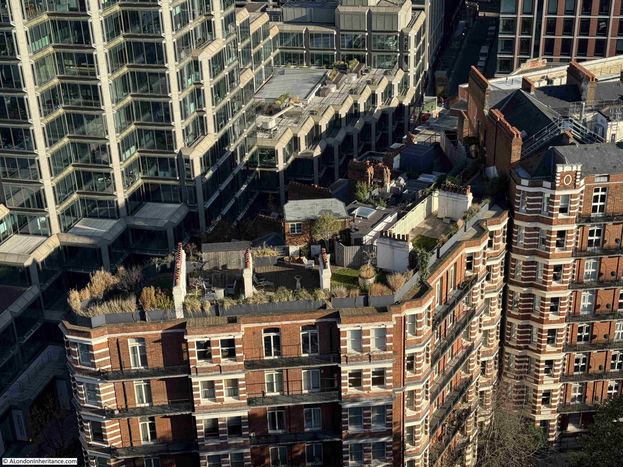
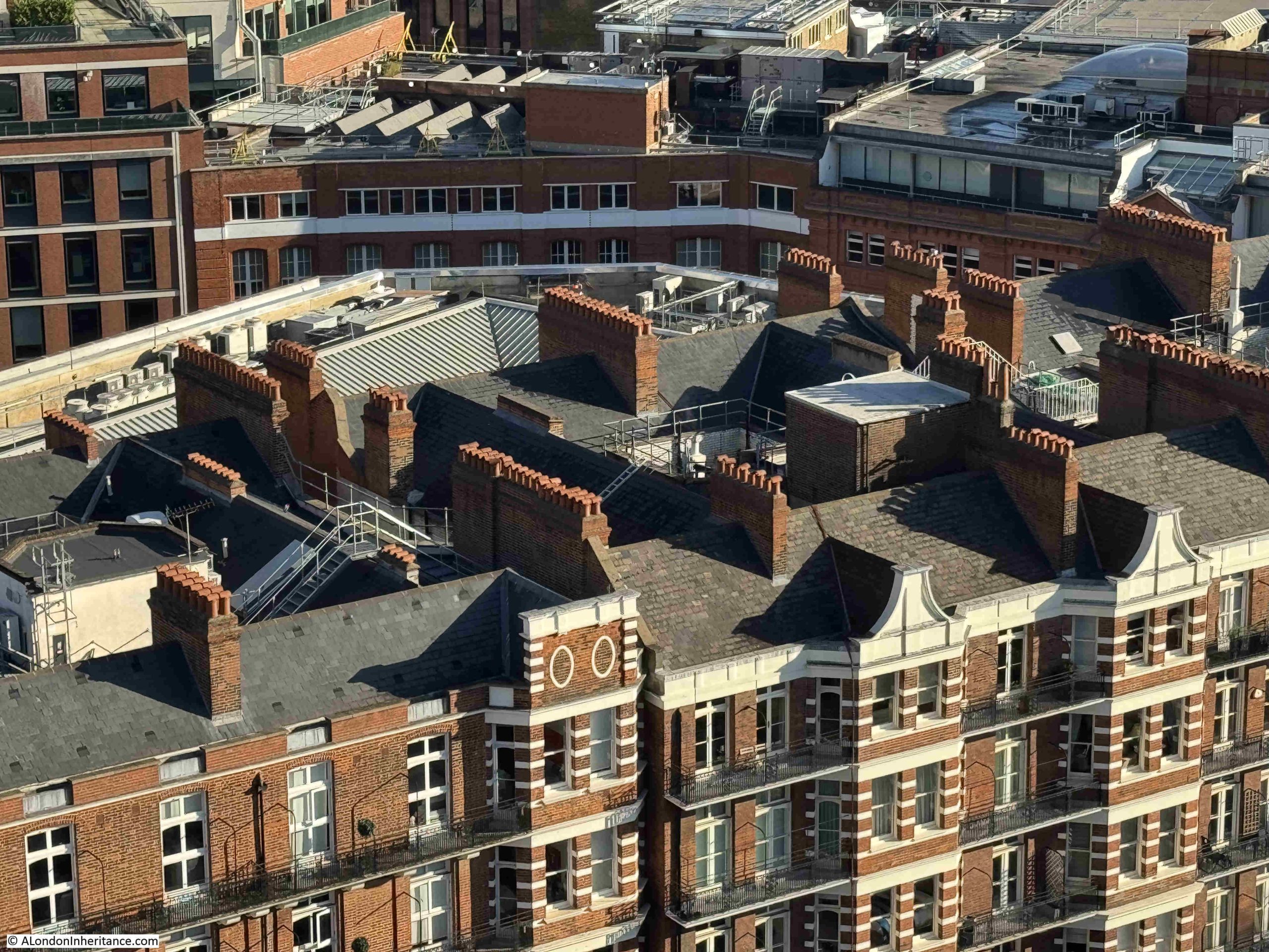
Large terrace blocks of flats can still be seen to either side of the cathedral, some of which have roof gardens:
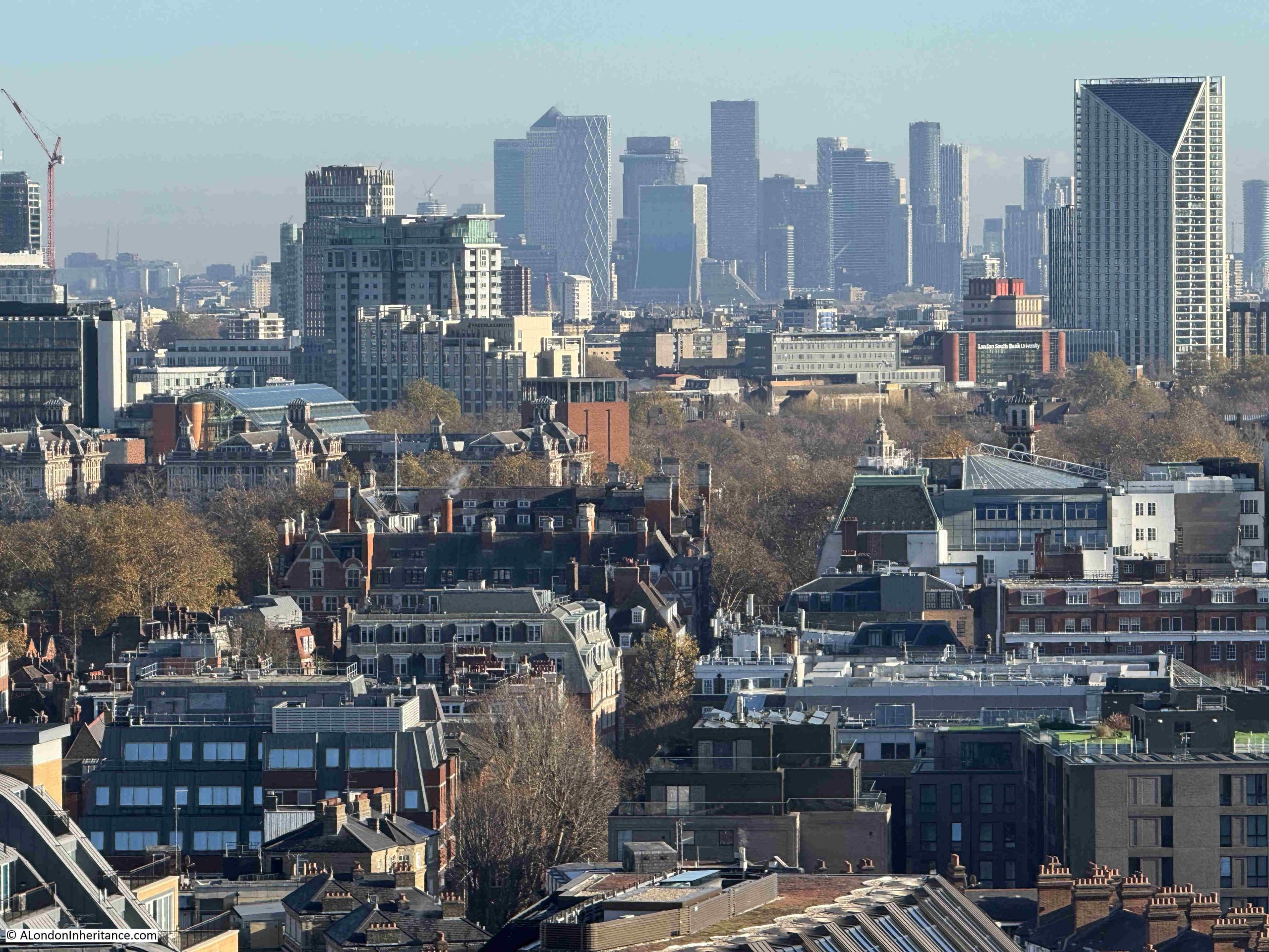
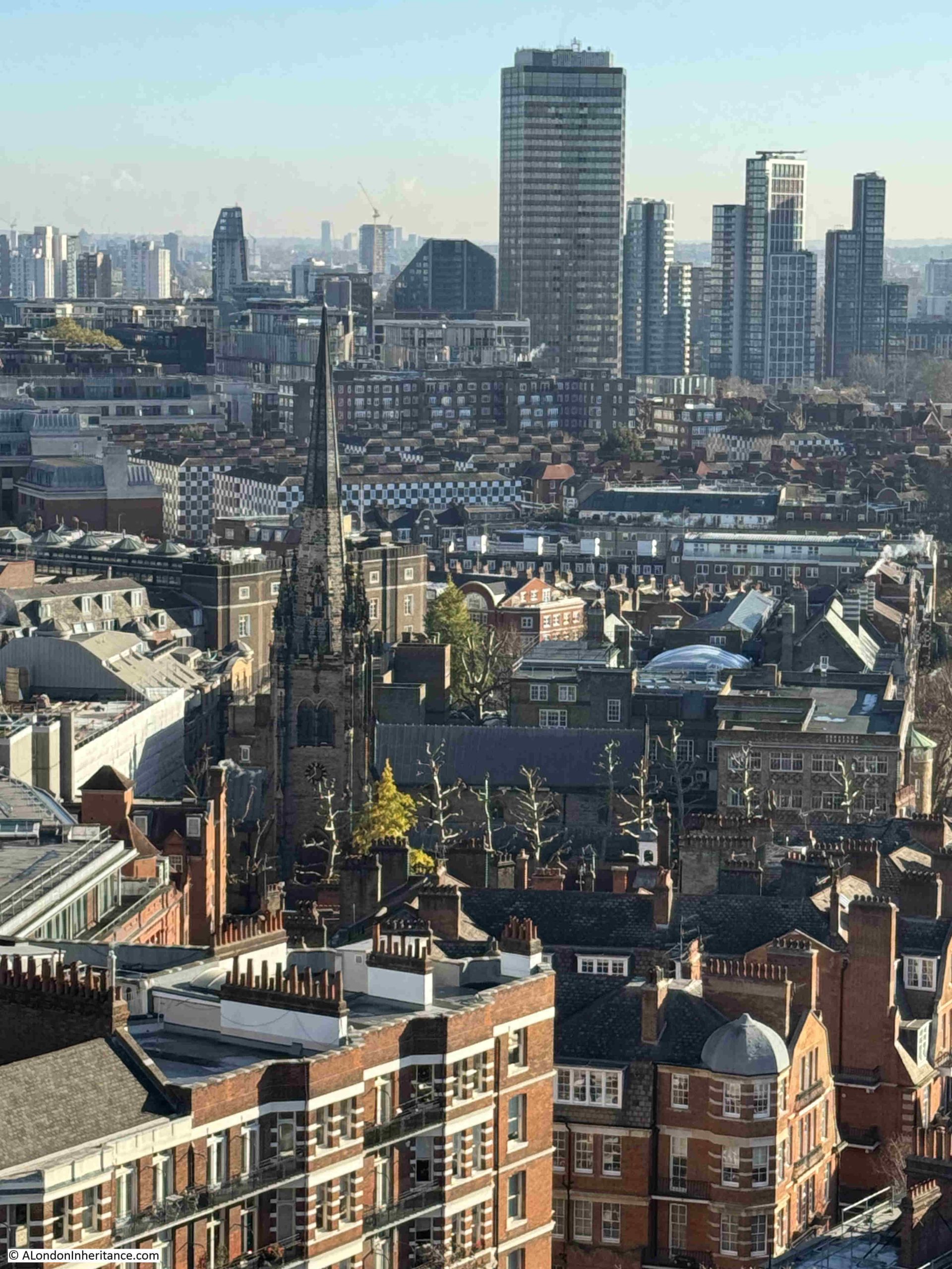
As well as Nine Elms, another part of London that has, and continues to change, is the Isle of Dogs, and from the tower of Westminster Cathedral we can see the towers that continue to be built in this part of east London. The change has been such as the tower with the pyramidal roof top, One Canada Square, the original tower at the development is now almost obscured by the other towers that have since been built:
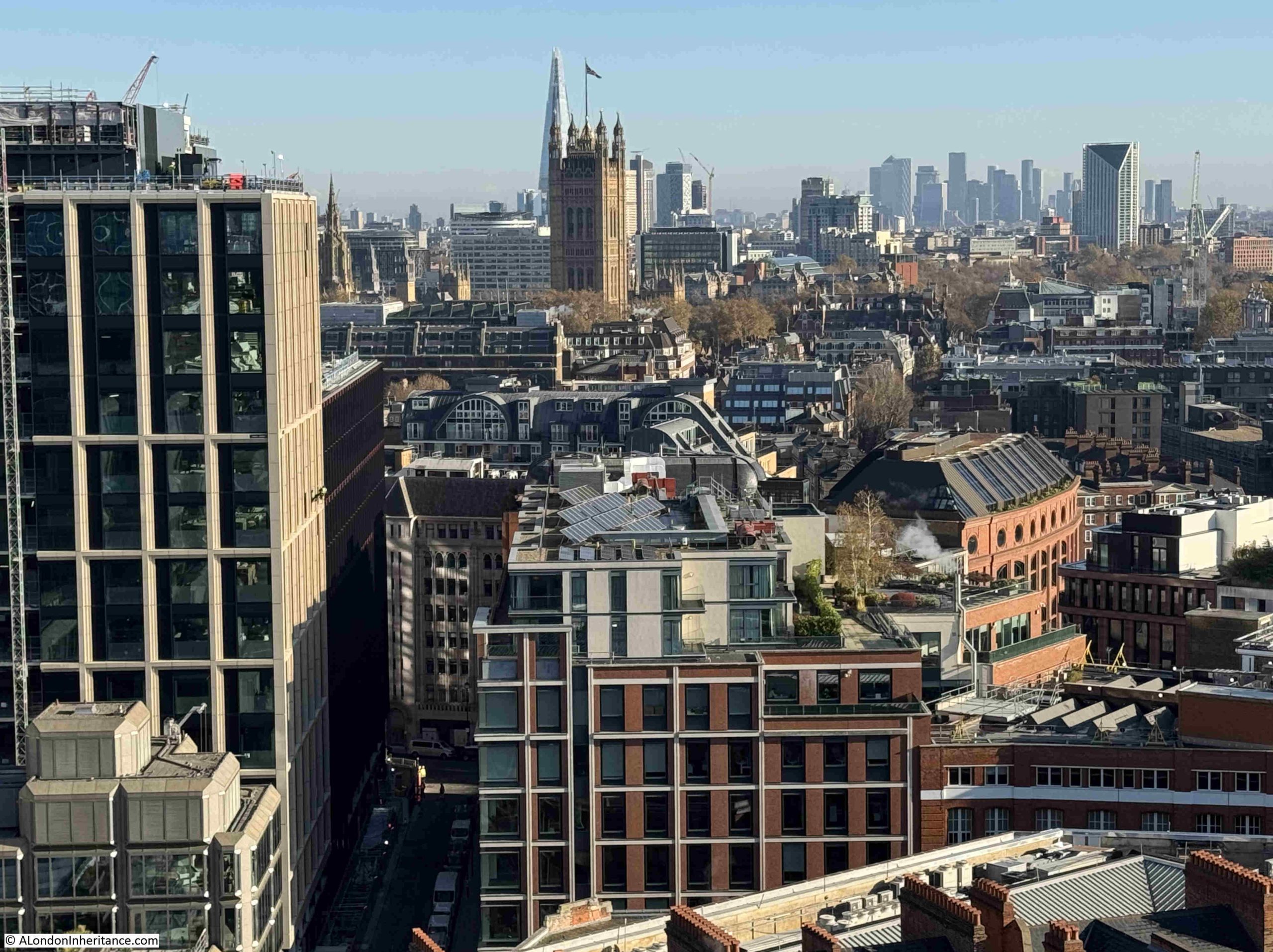
In the following photo, the Victoria Tower of the Palace of Westminster can be seen to left of centre, with the Shard partially obscured behind. The Elizabeth Tower with the clock is obscured by the building on the left, as are views of the City of London. The Isle of Dogs towers are in the distance:
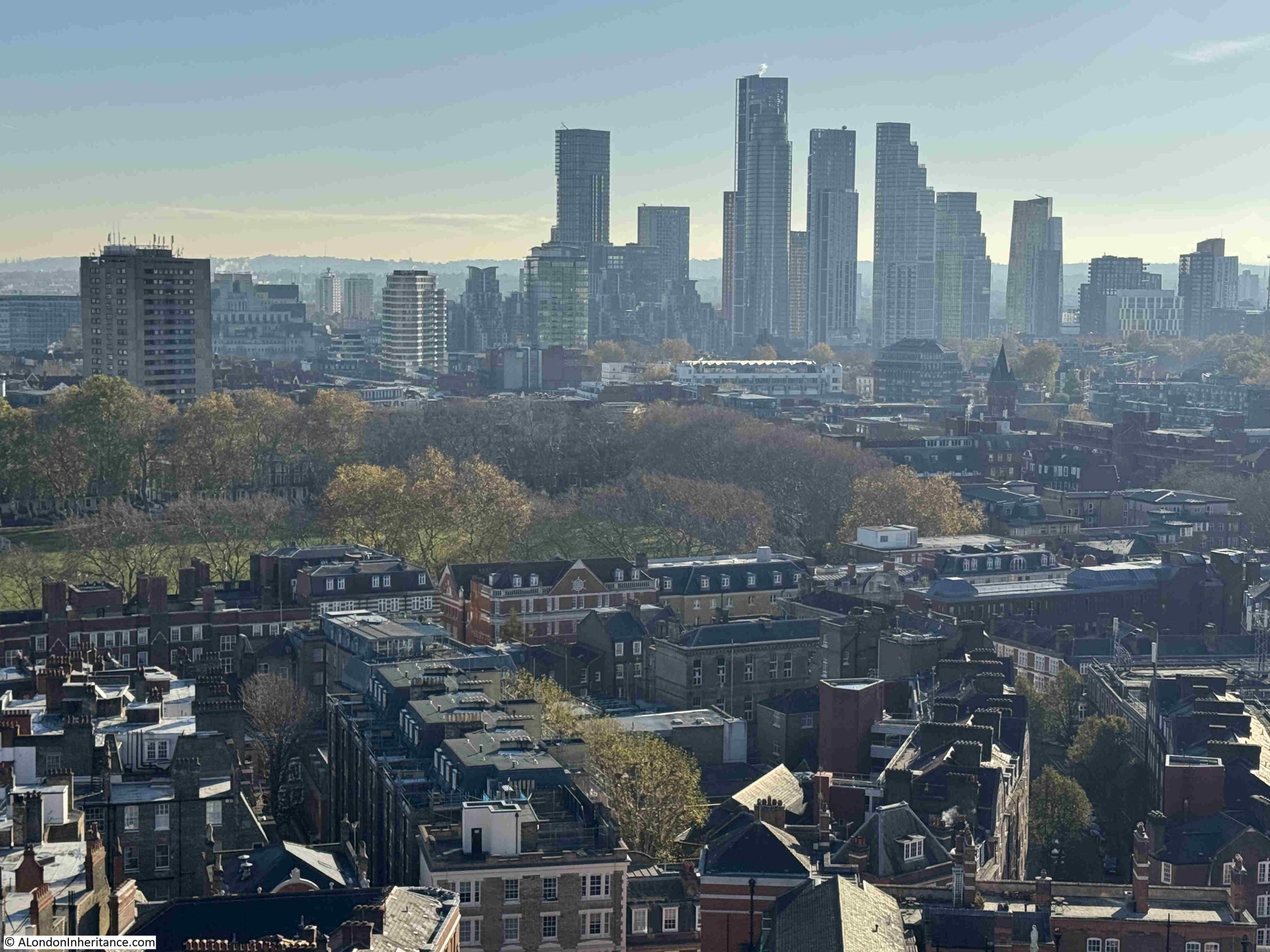
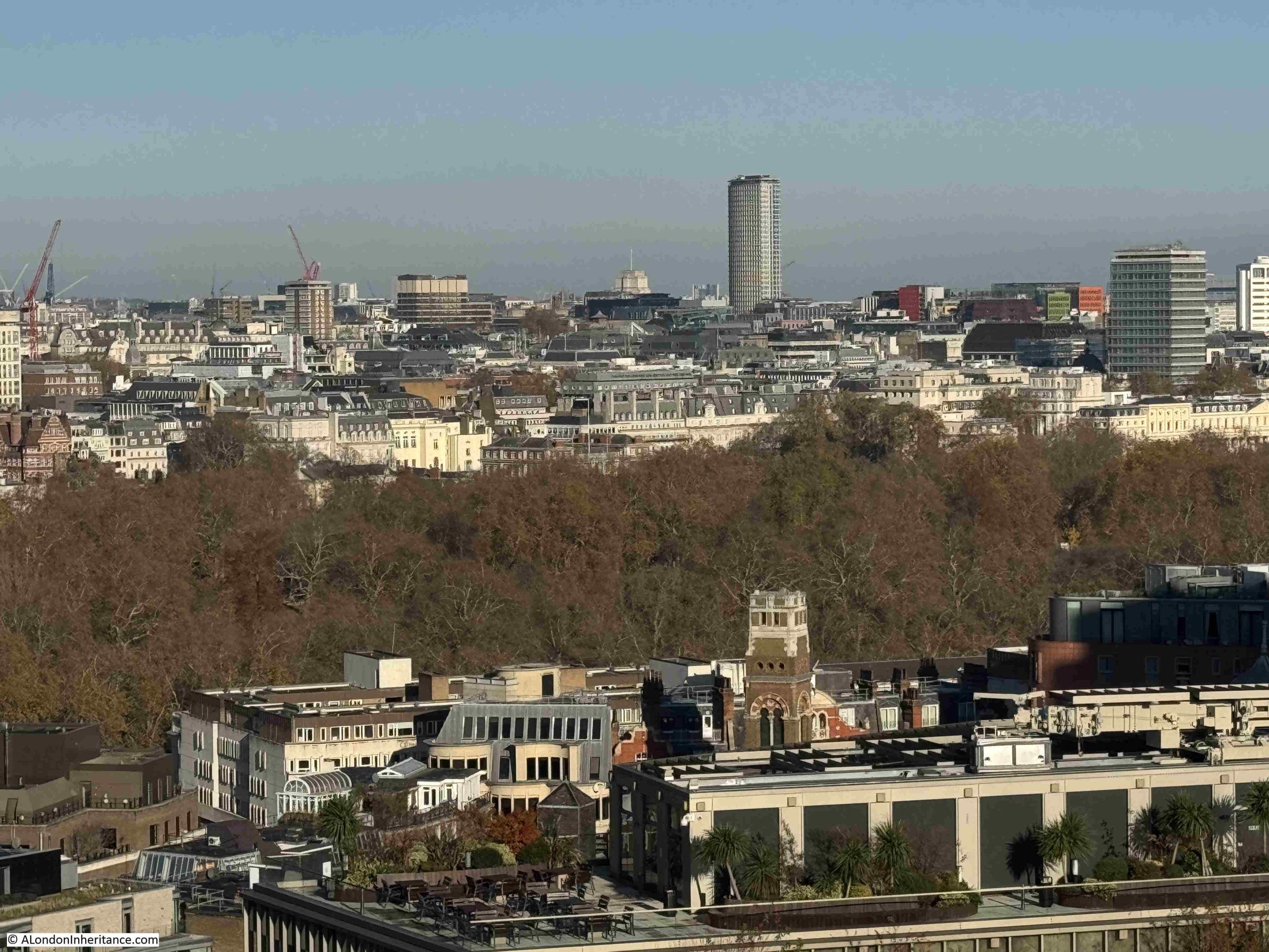
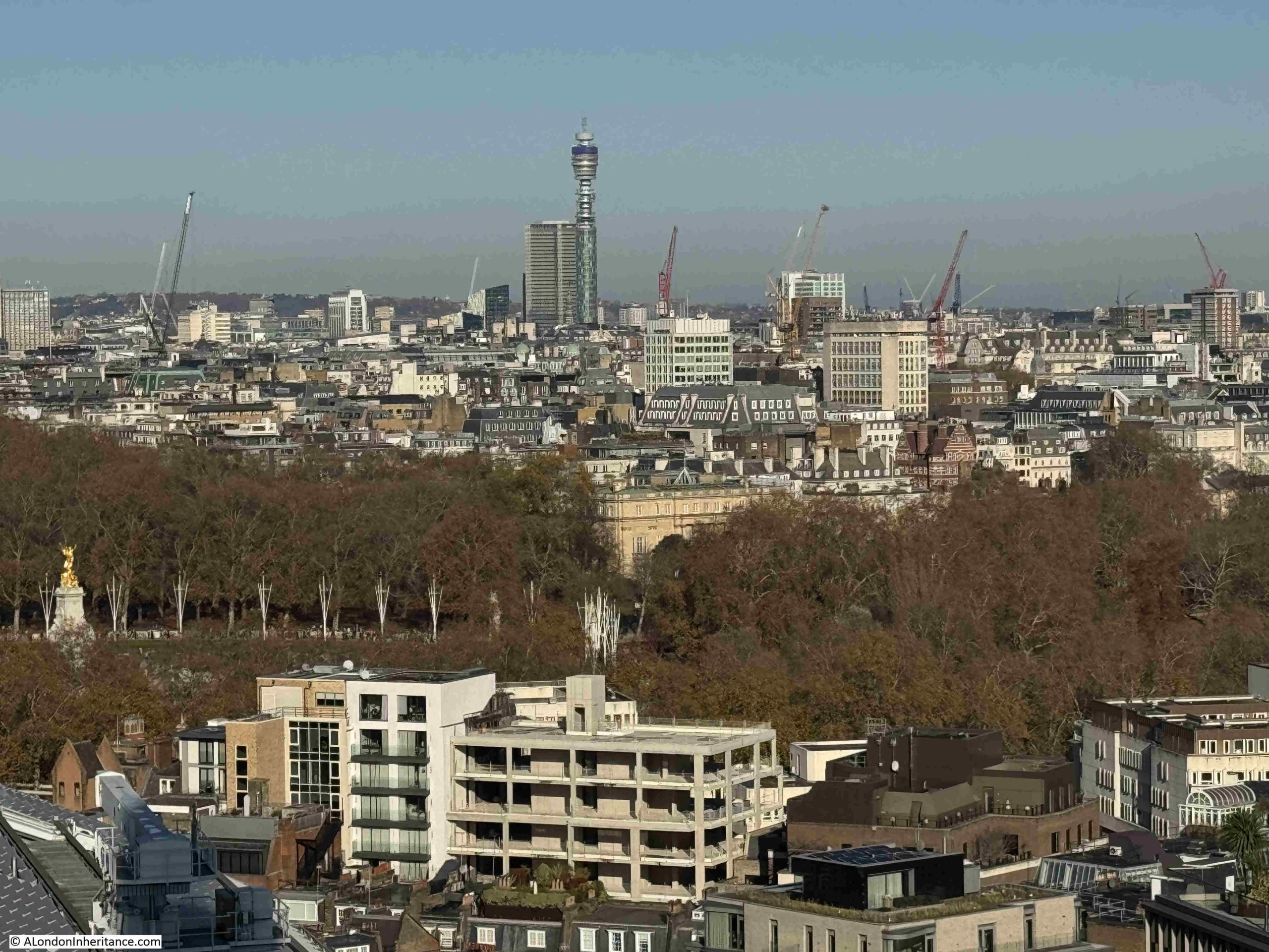
Another view of the Nine Elms development. The green space in the centre and to left is Vincent Square:
To the west of the cathedral is another long line of terrace flats, with those along Morpeth Terrace in the foreground and to the rear, Carlisle Place:
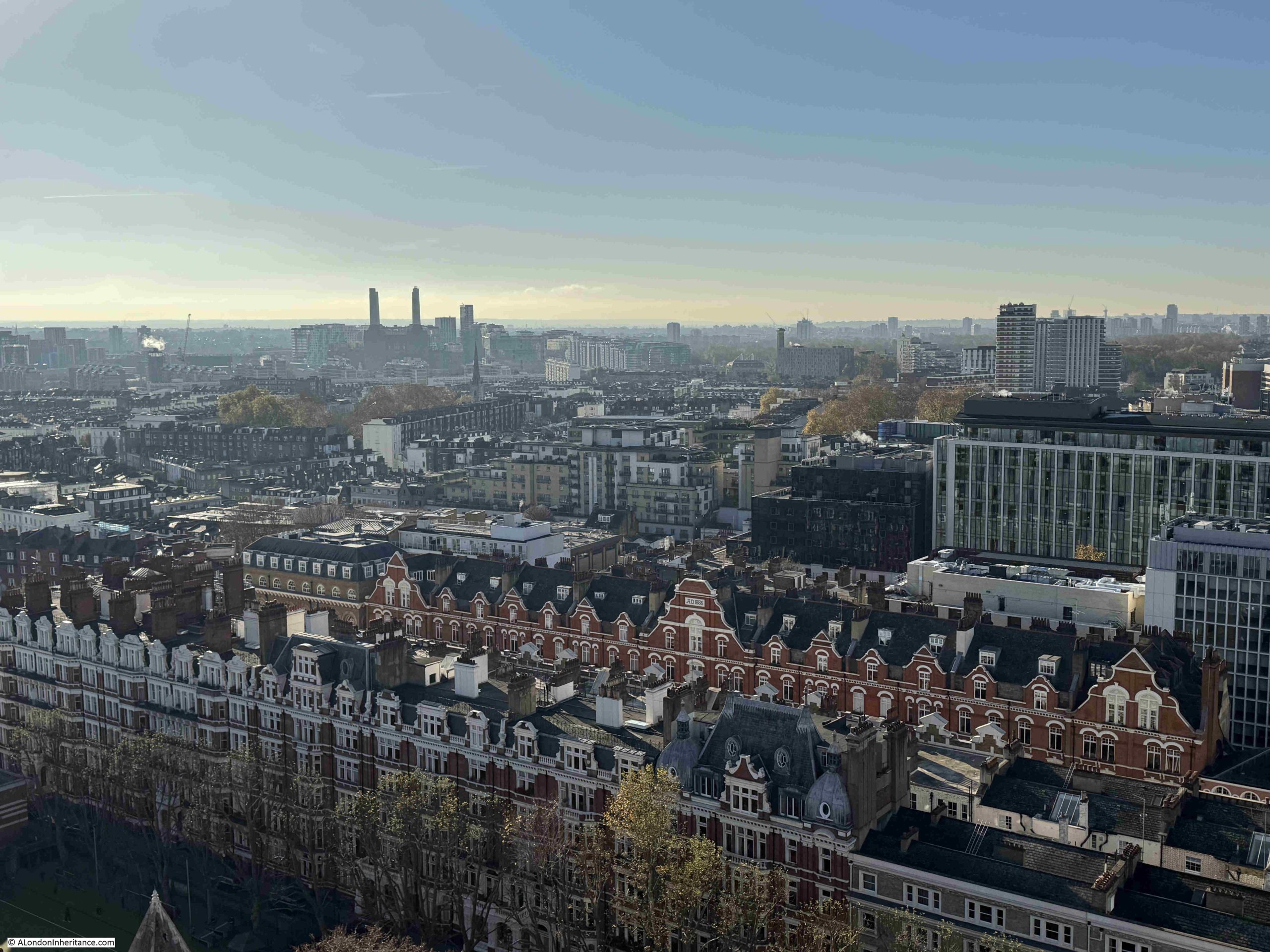
In the above photo we can see the chimneys of Battersea Power Station in the distance, and the following photo shows a closer view. It is good that with all the development around the old power station, the chimneys are still a stand out feature of this part of the city:
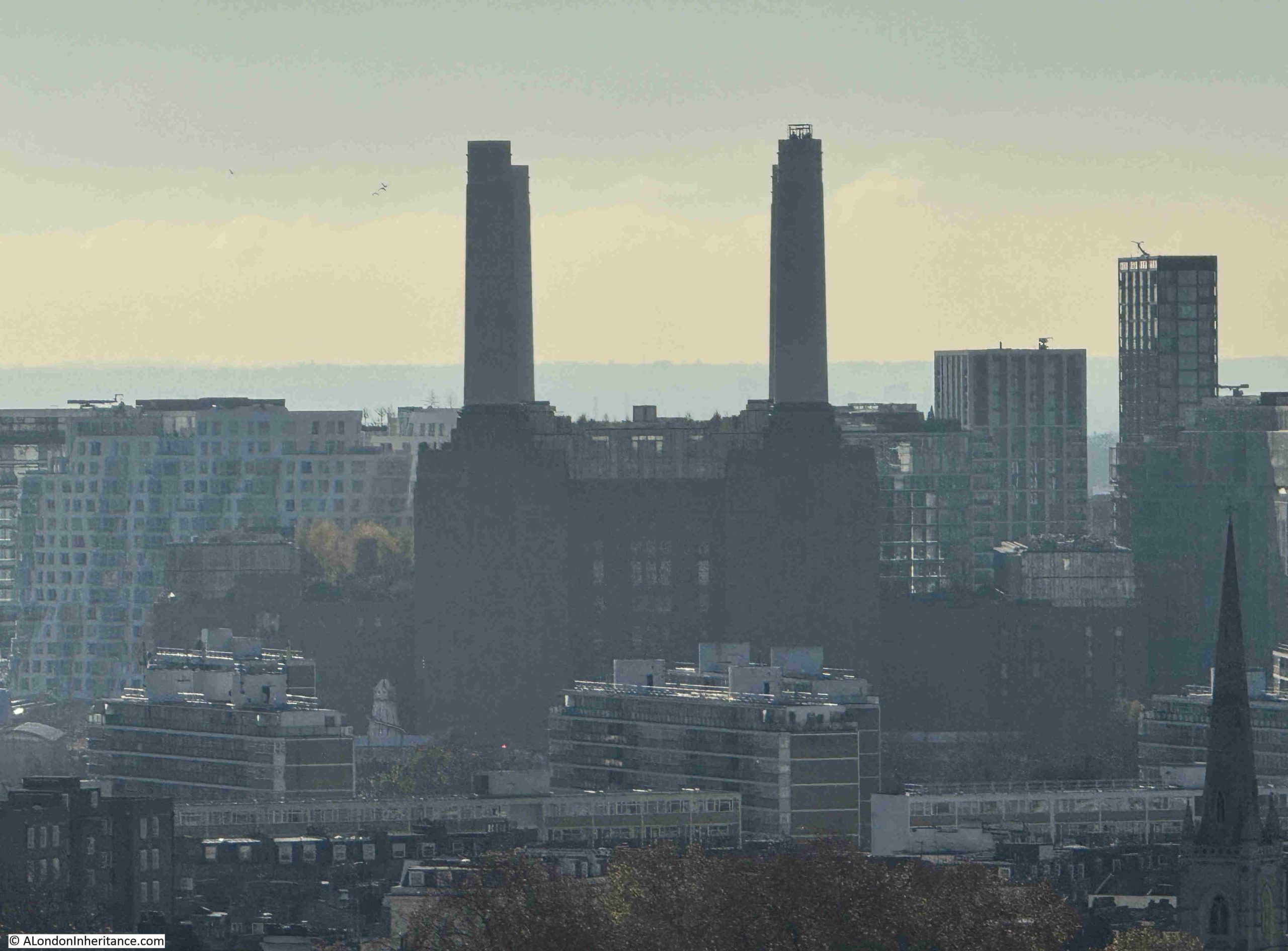
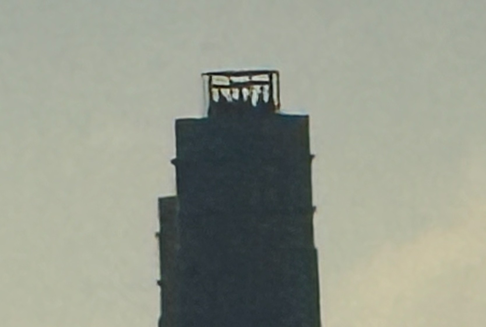
One of the power station’s chimneys also has a view across London, with an enclosed platform that rises up through the chimney, which can be seen in the above photo, and a close-up in the following photo (see links at the end of the post for views from the top of the chimney):
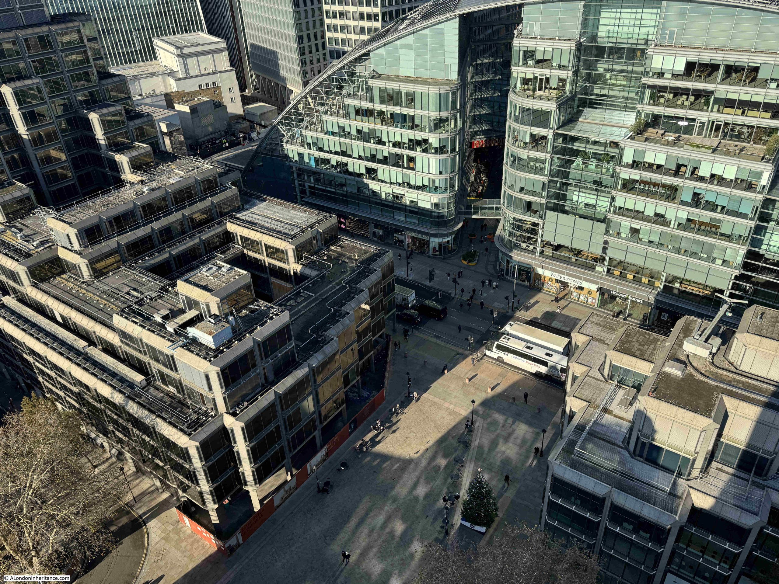
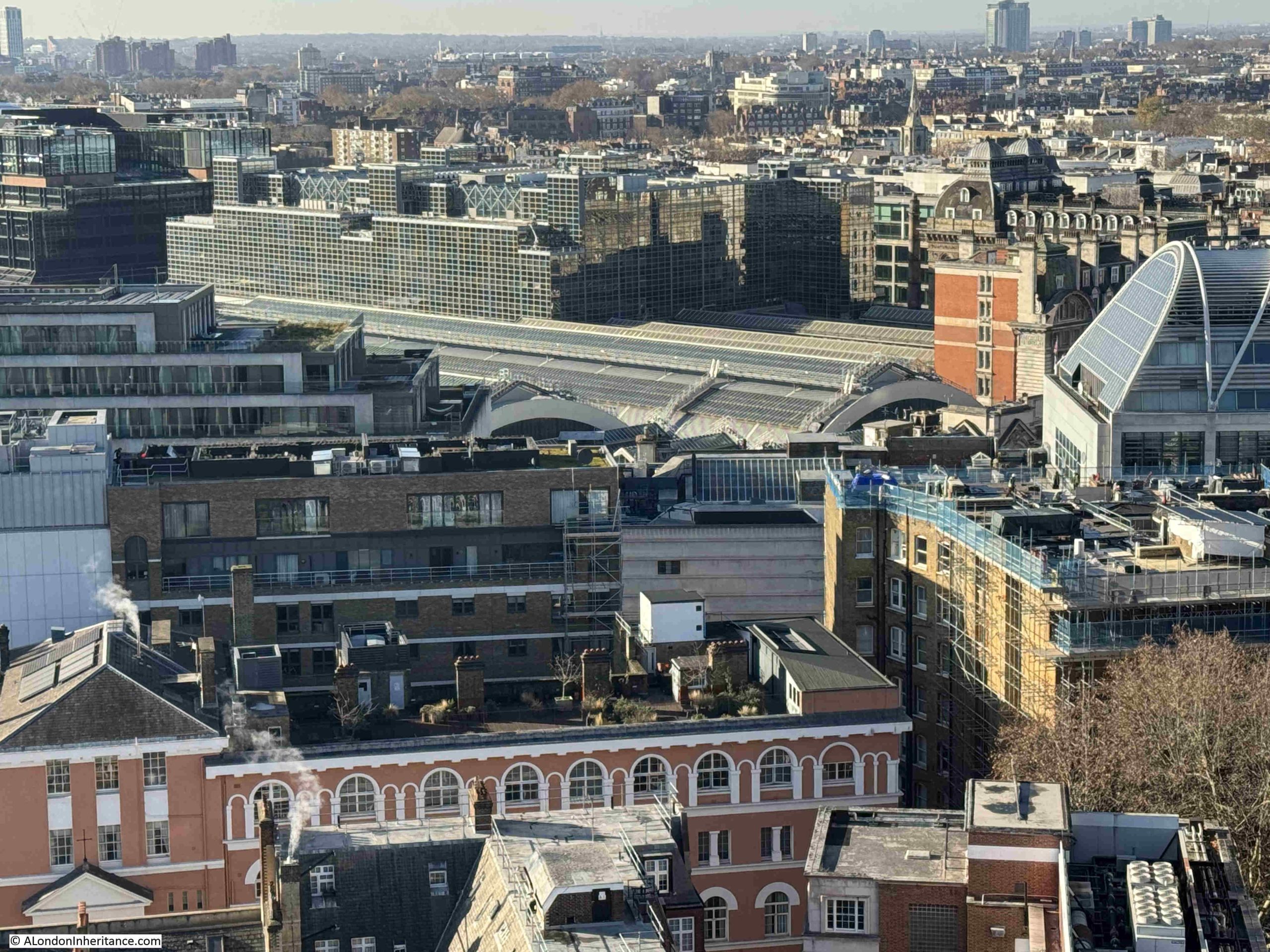
The long roof over the platforms of Victoria Station can be seen in the following photo, with the partially obscured brick building at the station entrance to the right:
View looking towards the north, with the Centre Point building still dominating the skyline:
A closeup of a section of the above photo shows Centre Point, with to the left what was once one of the tallest buildings in London – Senate House of the University of London:
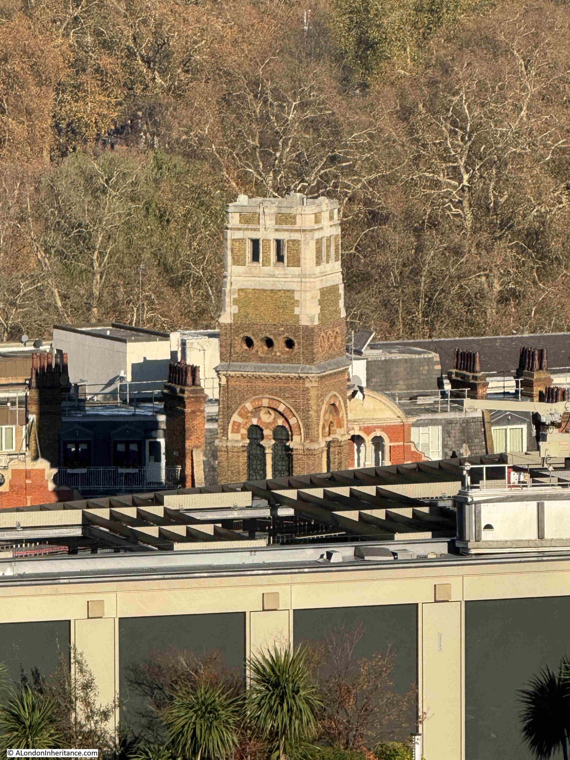
Also in the wider photo which includes Centre Point on the skyline, is a square brick tower, which is shown in the following close-up. This is the tower on the corner of Westminster Chapel, a much large church than this view of the tower suggests, founded in 1840 and facing onto Buckingham Gate:
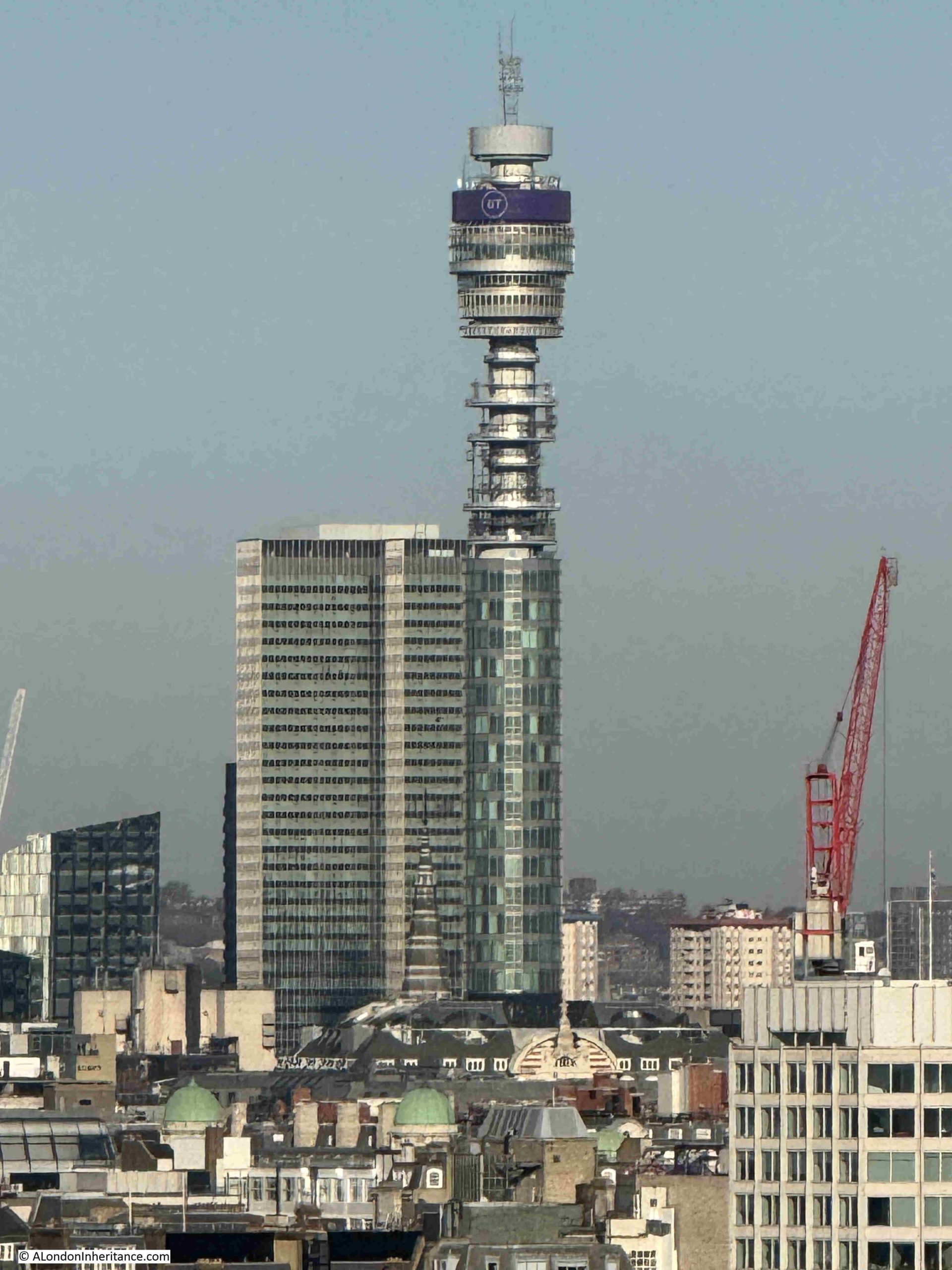
In the centre of the following photo is the Post Office / BT / New Hotel Tower, with Euston Tower in the background. Again, this view shows that there have been very few buildings of much height constructed since the Post Office Tower (officially opened 1965) and Euston Tower (completed in 1970) in this part of the city:
Close-up of the Post Office Tower with Euston Tower in the background:
Plenty of chimneys along the tops of the terrace buildings that still surround part of the cathedral. One can imagine the smog in the air when all these fires were once lit:
The 1963 Millbank Tower dominates the following photo, with new apartment blocks on the south of the river behind:
The church tower and steeple in the above photo belongs to St. Stephen’s in Rochester Row.
The City of London is obscured by the new blocks that have been built along Victoria Street, with one exception.
The following photo shows the blocks running south along Victoria Street. In the centre of the photo, in a gap between two smaller blocks is:
St. Paul’s Cathedral:
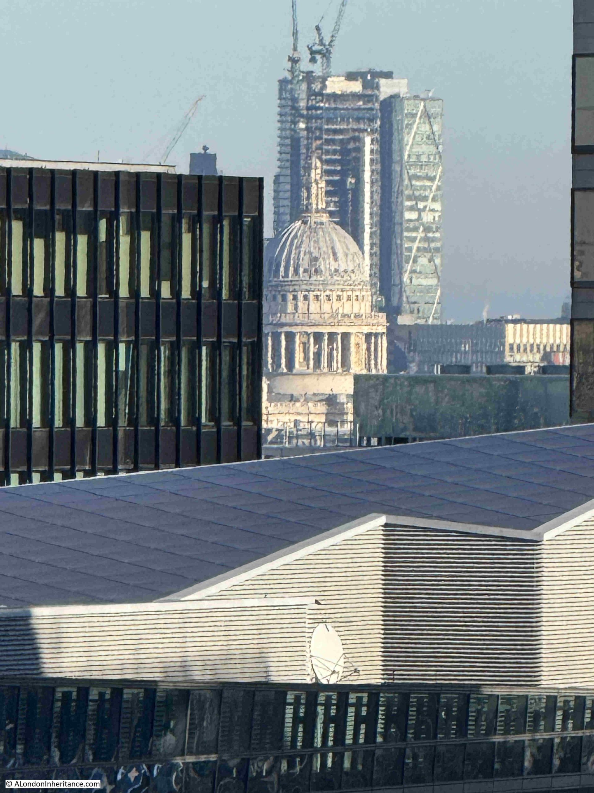
I do not think this small gap is part of the protected view of St. Paul’s, but I need to check. It is interesting though that in scanning the skyline from London’s high viewpoints, there is always something to find hiding among the later developments across the city.
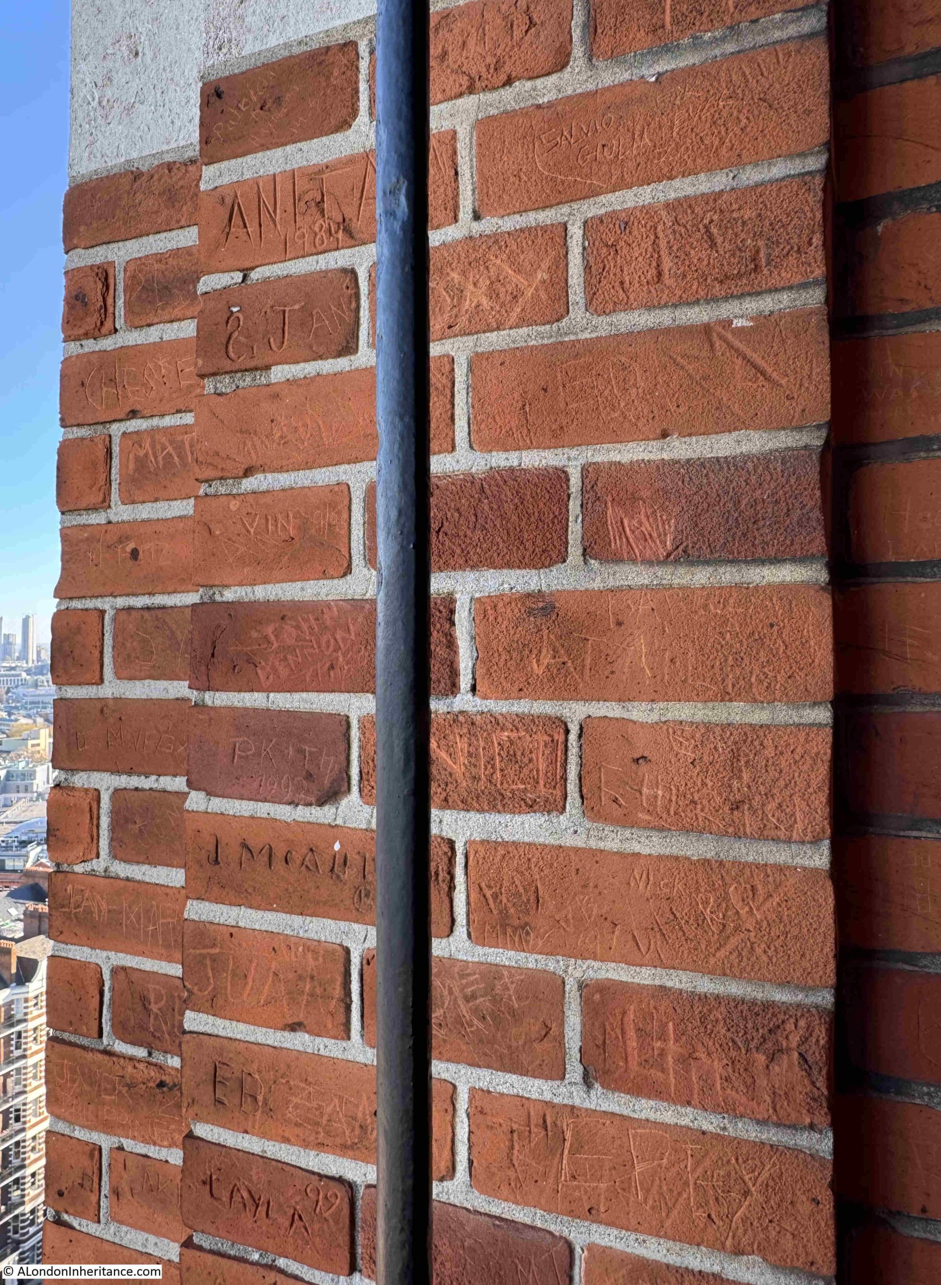
Unsurprisingly, the brick walls surrounding the viewing area at the top of the tower are covered in the names and initials of previous visitors:
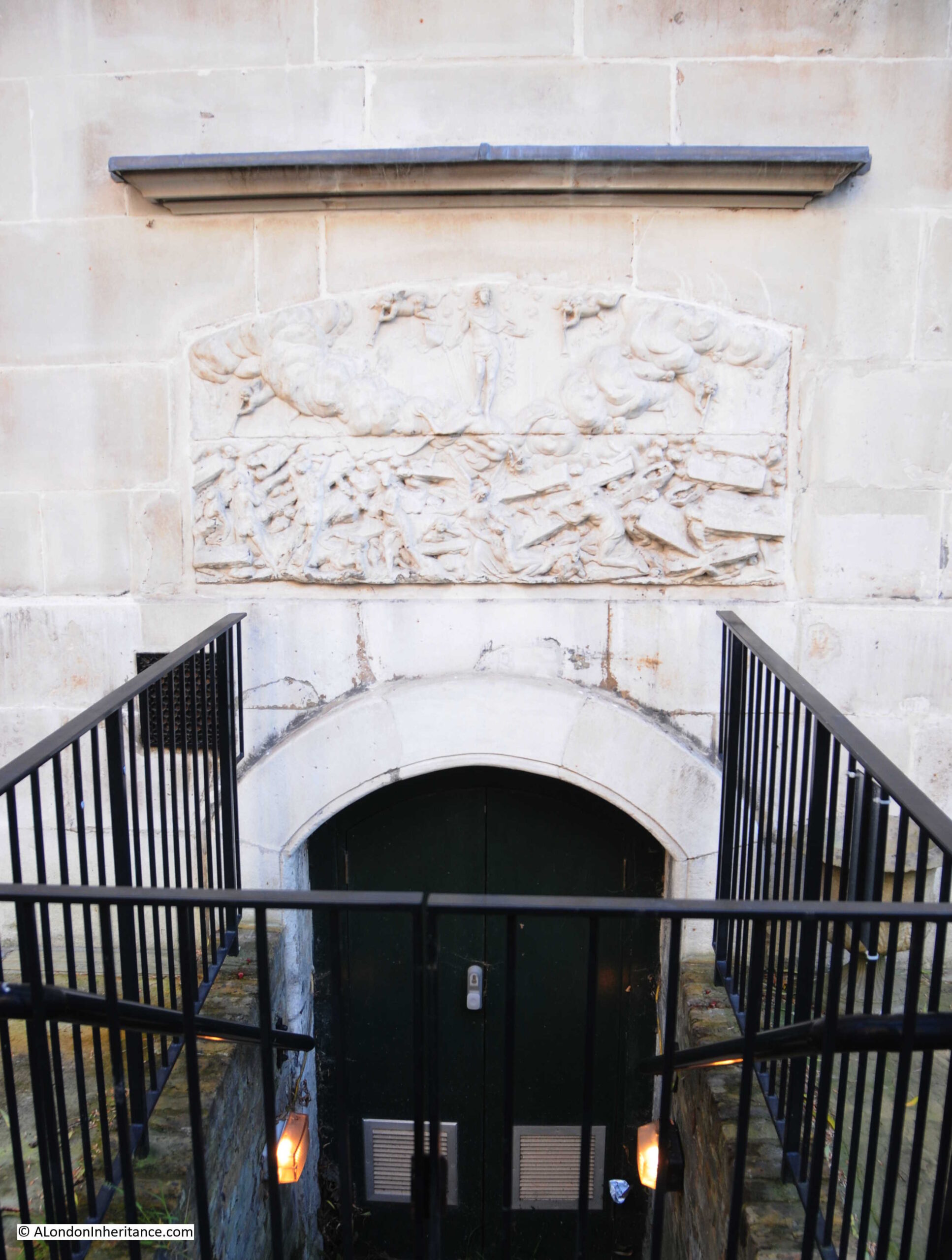
After returning back to ground level, I took a walk along Ambrosden Avenue, the street that runs to the east of Westminster Cathedral. The rear and sides of the building are just as ornate as the front, and in the sunshine of an autumn day, the red brick and Portland stone look really good:
In the above photo, between the two windows in the lower left corner, there is an old wooden sign on the wall, with one of the strangest warnings I have seen on a sign in London:
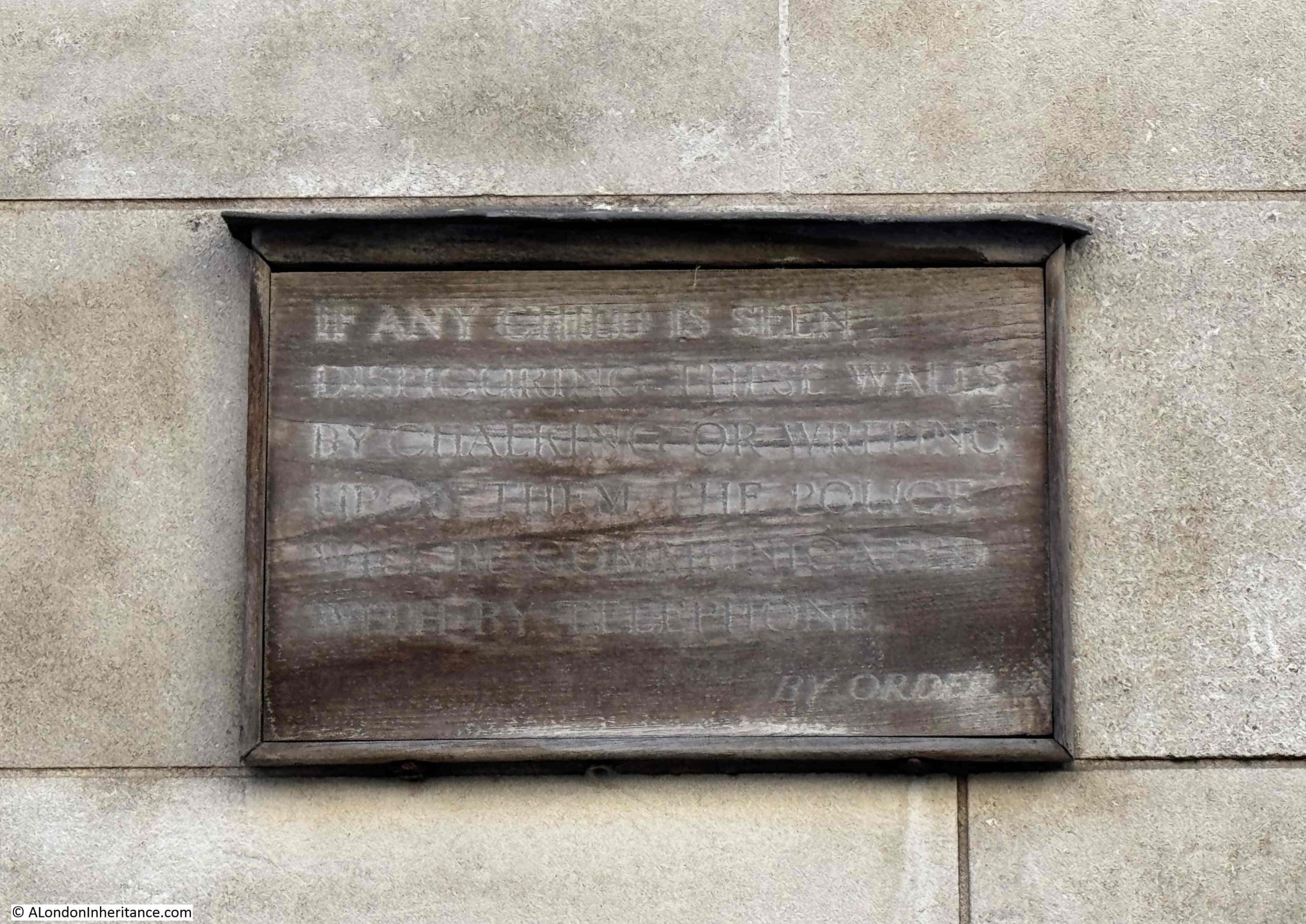
As far as I can tell, the sign reads:
“If any child is seen disfiguring these walls by chalking or writing upon them, the Police will be communicated with by the phone. By Order.”
I do not know if the sign was aimed at pupils at the Westminster Cathedral Choir School, or children in general, who must have been writing on the wall, and requiring the contact with the Police, but it must have been a real problem.
The viewing gallery at Westminster Cathedral is a wonderful place to look across London, and over time, to watch the development of the city.
Every time I have been to the top of the tower, it has been empty, and during my visit to take these photos, I was up there for about 30 minutes and no one else came up during that time.
If you are in Victoria, it is well worth a visit, both to see a fascinating cathedral, and to look across London. Entrance to the tower is via the shop, on the left side of the main entrance.
The viewing gallery is open from 10.30am to 4.30pm, Wednesday to Sunday, and costs between £5 and £10.
The following videos should help provide an impression of the view from the top of the bell tower.
Firstly looking from the west to the north:
Continuing round from the north to the south (the thumping sound you can hear in the next video is a military band along the Mall):
A bit more detail from the east to the south:
And finally from the south to the west:
For some of my other posts on views over London, the following links may be of interest:
Climbing The Caledonian Park Clock Tower
The Monument, Sky Garden And St. Paul’s Cathedral
Chrisp Street Market Clock Tower, Poplar
A Walk Round the Shell Centre Viewing Gallery in 1980