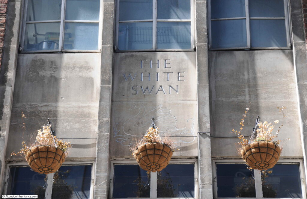
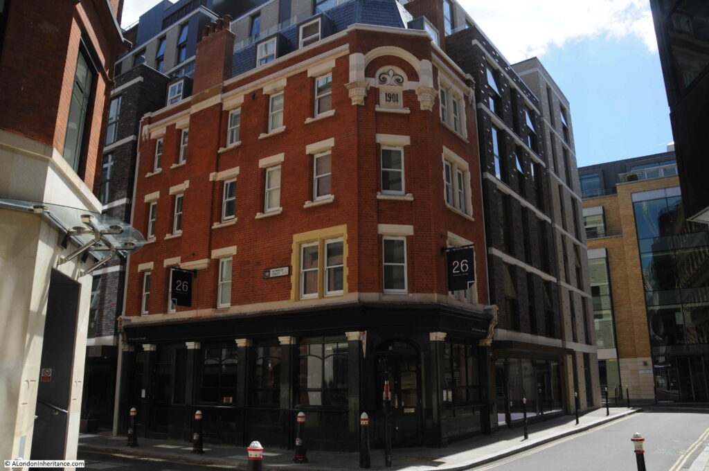
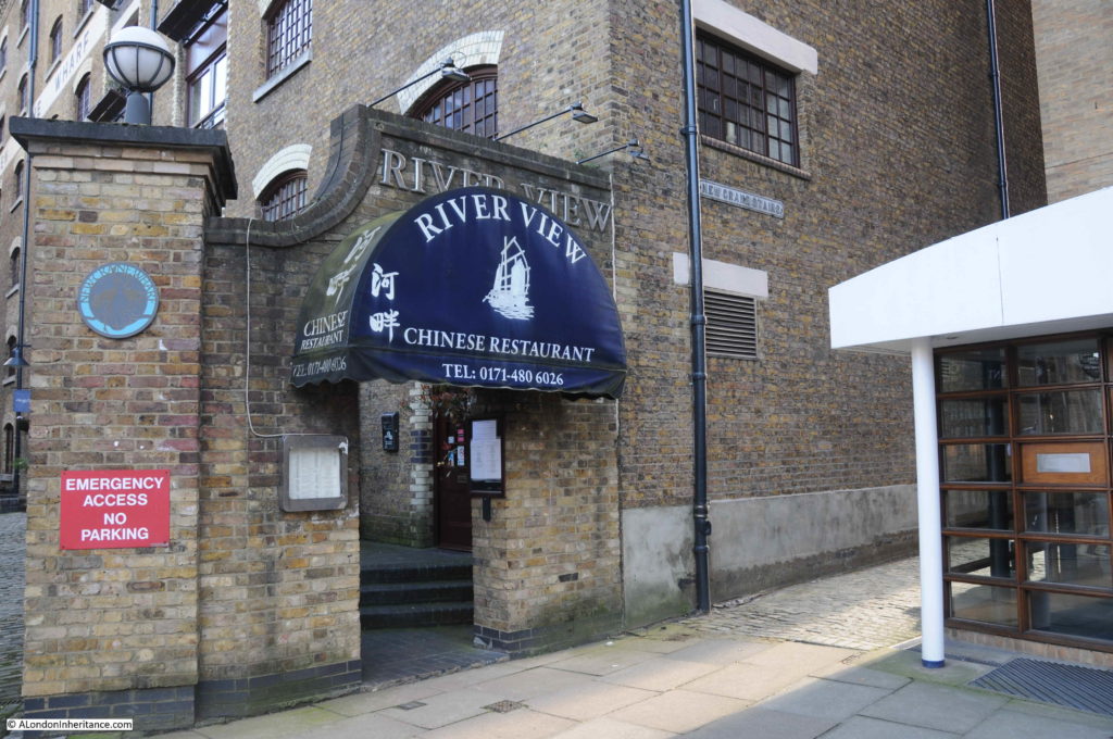
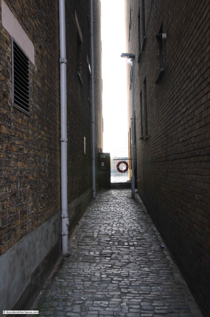
Category Archives: London Pubs

Tracing London’s old pubs

Jubilee Beers

As it is the Jubilee Weekend (or rather four days), I have a Jubilee related post on both Saturday and Sunday. Tomorrow’s post is one of my usual posts, with photos of previous events. For today’s post, I dug out my collection of 1977 Jubilee beers and 1981 Royal Wedding beers from the cobweb filled corner of the garage.

The late 1970s and early 1980s involved a lot of pubs. For some reason that I cannot really remember, in 1977 I collected any special Jubilee beer that I could find in pubs across London and Essex. Probably the novelty of finally being able to legally buy alcohol in a pub without any issues.

They have been boxed and stored away for the last 45 years, but I thought I would get them out for this weekend and see how many of the breweries, brewing Jubilee beer in 1977 still exist.

Young & Co – Silver Sovereign, brewed at the Ram Brewery in Wandsworth:

Silver Jubilee beer

Young’s closed the Ram brewery in 2006, and are now a pub company. Their beers were initially brewed by a joint venture with Charles Wells in Bedford, but they have since sold their share in the brewery venture.

They still have a head office in Wandsworth, close to the location of their original brewery.

Wadworths – Queen’s Ale:

Silver Jubilee beer

Wadworths are still brewing beer at their brewery in Devizes, Wiltshire, but according to their website, they do not appear to have a Jubilee beer for 2022. They had an impressive beer label in 1977.

Greene, King & Sons – Jubilee Ale

Silver Jubilee beer

Greene, King & Sons are still brewing at their brewery in Bury St. Edmunds, however again according to their website they do not appear to have a Jubilee beer for 2022.

Shepherd Neame – Silver Jubilee Ale

Silver Jubilee beer

Shepheard Neame are also still brewing at Faversham, Kent, and have produced a “Celebration Ale” for the 2022 Jubilee, however this is only available in casks in pubs rather than bottled.

Paine & Co – Silver Jubilee Ale

Silver Jubilee beer

A company that appears to have sold their pubs and brewery to a rival brewers in the 1980s. The name disappeared and the brewery would later close.

Fullers – Celebration Brew

Silver Jubilee beer

Fullers seem to have gone with a rather basic label for their Celebration Brew, although is does include a picture of a Griffin, from their Griffin brewery in Chiswick. They are still at the Chiswick brewery, however the Fullers company sold the brewery to Japanese international drinks company Asahi, and Fullers are now just a pub company with Asahi owning the brewery and producing beers under the Fullers name.

Fullers do not appear to be brewing a beer for the 2022 Jubilee.

Ridleys – Jubilee Ale

Silver Jubilee beer

Ridleys were brought by Greene King, who then closed their brewery near Chelmsford, Essex, and stopped producing the majority of beers under the Ridleys name. A rather nice silver label for their Jubilee Ale.

Morells – Celebration Ale

Silver Jubilee beer

The Morells company, along with their Oxford brewery closed in 1998.

Hall & Woodhouse – Bicentenary Ale

Silver Jubilee beer

Hall & Woodhouse appear to have ignored the 1977 Jubilee, preferring to celebrate their 200 year anniversary.

They are still in business with pubs and the same brewery in Blandford, Dorset, however as with the 1977 Jubilee, they do not appear to have a Jubilee beer for 2022.

Adnams – Royal Ale

Silver Jubilee beer

Adnams based in Southwold, Suffolk are still in operation, and producing beers from their own brewery. Unfortunately there appears to be no Jubilee Ale for 2022, although Adnams have branched out to produce Gin and Vodka as well as beers.

Royal Wedding Beers – 1981

On the same theme, the Royal Wedding in 1981 between Charles and Diana also resulted in a number of breweries producing special beers to commemorate the event.

Gibbs Mew & Co – Royal Heritage

Royal Wedding beer

Gibbs Mew & Co of Salisbury brewed a Royal Heritage beer, and their bottle featured St Paul’s Cathedral.

The company closed their Salisbury brewery in 1997 and continued as a pub chain, however the pubs and the company were sold to Enterprise Inns in 2011.

Devenish – Wedding Ale

Royal Wedding beer

Devenish was another Dorset brewery, and followed the same fate as Gibbs Mew.

Devenish closed their brewery in 1985, and continued as a pub operator until 1993 when the company was sold to Greenalls.

Berni – Royal Reception

Royal Wedding beer

If you fancied a beer in 1981 to go with your Berni Prawn Cocktail, Steak and Chips and Black Forest Gateau, then a bottle of their Royal Reception strong ale could be yours.

Berni was one of the pub / restaurant chains that would bring the experience of going out for a meal in the 1970s to the masses. Relatively cheap, good service and a simple, standard menu helped with the popularity of the chain, and the most brought meal of Prawn Cocktail, Steak and Chips and Black Forest Gateau becoming representative of eating out in the late 1970s.

Berni Inns was sold to Whitbread in 1995 who rebranded the chain to become part of the Beefeater resturants.

Brains – Prince’s Ale

Royal Wedding beer

Brains offered their Prince’s Ale in 1981. The brewery was based in Cardiff, where they are still brewing, but no special beers for the Jubilee that I can find on their website.

Fullers – Celebration Brew

Royal Wedding beer

Fullers Jubilee beer had a rather simple label, however they went with a more ornate label for their Celebration Brew to mark the 1981 Royal Wedding.

Greene King – Royal Wedding Ale

Royal Wedding beer

Greene King produced their Royal Wedding Ale. The label looks as if it was only designed at the last moment when it would have been too late to produce a more ornate label, so they went with a simple text based label.

St Austell Brewery – Prince’s Ale

Royal Wedding beer

The St Austell Brewery’s Prince’s Ale was rather unusual in that it was a Barley Wine.

Barley Wine is a type of beer, but is generally much stronger than a normal beer, probably why their bottle was smaller than the typical bottle of the time.

The St Austell Brewery is located in St Austell, Cornwall and the brewery and company are still in operation. They do have a Jubilee Beer called “Thank Brew” which apparently is part of an initiative by breweries, pubs and communities to produce a special beer for the Jubilee, and they are selling a bottled Platinum Jubilee Ale, which has a rather nice label.

J. Arkell and Sons – Royal Wedding Ale

Royal Wedding beer

Arkell’s had a rather impressive, gold label to their Royal Wedding Ale.

The company, based in Swindon is still brewing beer, but does not appear to be brewing a Jubilee beer.

Camerons – Royal Wedding Ale

Royal Wedding beer

Camerons featured a drawing of St Paul’s Cathedral on the label of their Royal Wedding Ale.

Camerons are still brewing in Hartlepool, Teeside, and whilst they do not appear to have a Jubilee beer, they have teamed up with the band Motorhead and have a Road Crew beer available both in draft and bottles.

Based on that small survey it seems that there are a very small number of beers brewed for the 2022 Jubilee, and I have not seen any on recent pub visits.

Probably brewers have to be more commercially focused these days, and the costs of producing a one off product outweigh the potential benefits.

What I did notice when revisiting all these bottles was that the labels do not show the alcohol content / ABV. If you were drinking a bottle of Berni’s Royal Reception Strong Ale, then you had no idea what strong actually meant.

The excellent Boak & Bailey site has researched the introduction of this labelling and found that it was a result of the UK implementing an EEC (European Economic Community) directive, and that labeling beers with the alcohol content became law on the 17th July, 1989.

All these 1977 Jubilee beers and 1981 Royal Wedding beers are unopened, although I very much doubt their contents are drinkable. and probably very unwise to try.

They will now be returned to a very dusty corner of the garage.

Whatever you are drinking (or not), I hope you are having a very good Jubilee four days.

alondoninheritance.com
The Champion Pub and Oxford Market

All my walking tours have sold out, with the exception of a few tickets on the Bankside to Pickle Herring Street tour. Details and booking here.

In 1980 I was wandering around London trying out a new zoom lens for my Canon AE-1 camera, taking some not very good photos. One of these was of the Champion Pub at the junction of Eastcastle Street and Wells Street, with the Post Office Tower in the background:

Champion pub

The photo was taken from the southern end of Wells Street towards Oxford Street, and a sign for Eastcastle Street can be seen on the right of the Champion pub. I think I was trying to contrast the old pub and the new telecoms tower.

A wider view of the same scene today, with the BT Tower as it is now known, starting to disappear behind the new floors being added to the building behind the Champion:

Champion pub

A closer view of the pub in 2022, 42 years after my original photo:

Champion pub

Given how many pubs have closed over the last few decades, it is really good that the Champion has survived, although it is a shame that the curved corner of the building has been painted, and it has lost the name which ran the full length of the corner of the pub.

The large ornamental cast iron lamp still decorates the corner of the building.

The curved corner to the upper floors was a key feature of many 19th century London pubs. They were meant to advertise the pub, the name could be seen from a distance on crowded streets, and the name would often give an identity to the junction of streets.

For an example of a pub which had a very colourful corner in the 1980s, and today displays the current name of the pub on the curved corner, see my post on the Perseverance or Sun Pub, Lamb’s Conduit Street.

The Champion is Grade II listed, and the Historic England listing details provide some background:

Corner public house. c.1860-70. Gault brick with stucco dressings, slate roof. Lively classical detailing. 4 storeys. 3 windows wide to each front and inset stuccoed quadrant corner. Ground floor has bar front with corner and side entrances and fronted bar windows framed by crude pilasters carrying entablature- fascia with richly decorated modillion cornice. Upper floors have segmental arched sash windows, those on 1st floor with keystones and marks. Heavy moulded crowning cornice and blocking stuccoed. Large ornamental cast iron lamp bracket to corner. Interior bar fittings original in part with screens etc, some renewal.

The “some renewal” statement refers to a few changes to the pub since it was built.

The first post-war renewal came in the 1950s. As with so many Victorian pubs across London, the Champion was in need of some refurbishment. Over 80 years of serving Wells Street, and open during the years of the second world war, resulted in the owners, the brewers  Barclay Perkins, engaging architect and designer John and Sylvia Reid.

The Reid’s were better known as interior, furniture and lighting designers rather than architecture, and their changes to the Champion were mainly of design.

The large Champion name down the curved corner of the pub was a result of their work. The lettering was in 30 inch Roman, and the letters were shaded to give the impression that they had been engraved rather than painted. The new name replaced a number of old wooden signs that were mounted on the corner. The corner of the pub was floodlit at night, which must have looked rather magnificent, and ensured the pub stood out if you looked down Wells Street when walking along Oxford Street.

The interior had been rather plain and was painted in what were described as drab colours.

The Reid’s divided what had been two bars to form three, added button leather seating around the edge of the bars, restored the bar and some of the original iron tables, and they added new glass windows consisting of clear glass for the upper half and frosted, acid cut glass for the lower half.

Features inside the pub included the use of mahogany panels, etched and decorated glass windows between bars, and textured paper on the ceiling. refurbishment also included the first floor dining room.

Their refresh of the Champion pub did get some criticism as there were views that it was returning to Victorian design themes. The early 1950s were a time when design and architecture were looking at more modern forms, typified in the themes and designs used for the 1951 Festival of Britain.

The early 1950s update to the pub included plain and frosted glass on the external windows, not the remarkable, stained glass windows that we see today. These are the work of Ann Sotheran, and were installed in 1989.

They feature a series of 19th century “champions”, with figures such as Florence Nightingale and the cricketer W.G. Grace.

On a sunny day, these windows are very impressive when seen from inside the bar:

Champion pub stained glass

The missionary and explorer David Livingstone:

Champion pub

Newspaper reports mentioning the Champion cover all the usual job adverts, reports of crime and theft etc., however I found one interesting article that hinted at what the inside of the pub may have been like in the 1870s.

In September 1874, the Patent Gas Economiser Company held their first annual general meeting, where they reported that they had installed 50 lights in the Champion. Seems a rather large number, but spread across three floors, entering the pub in the 1870s would have been entering a reasonably brightly lit pub, with the hiss of gas lamps and the associated smell of burning gas.

The same report also mentions that the company had installed 1000 lights at the Royal Polytechnic Institution in Regent Street, 600 lights in the German Gymnastic Society in St Pancras Road, and 50 lights in the Hotel Cavour in Leicester Square.

To the left of the Champion pub, along Wells Street, building work is transforming the building that was here, and is adding additional floors to the top, which partly obscures the view of the BT Tower from further south along the street:

Champion pub

There was one further site that I wanted to find, and this required a walk west, along Eastcastle Street.

Eastcastle Street was originally called Castle Street, a name taken from a pub that was in the street. The name change to Eastcastle Street happened in 1918. I cannot find the reason for the name change, but suspect it was one of the many name changes across London in the late 19th / early 20th centuries, to reduce the number of streets with the same name.

At 30 Eastcastle Street is this rather ornate building:

Eastcastle Street

Dating from 1889, this is the Grade II listed Welsh Baptist Chapel, the main church for Welsh Baptists in London.

Eastcastle Street is a mix of architectural styles. Narrow buildings that retain the original building plots, buildings with decoration that does not seem to make any sense, and rows of the type of businesses that frequent the streets north of Oxford Street.

Eastcastle Street

At the end of Eastcastle Street is the junction with Great Titchfield Street and Market Place:

Oxford Market

In the above photo, Great Titchfield Street runs left to right, and the larger open space opposite is part of Market Place.

The name comes from Oxford Market, a market that originally occupied much of the space around the above photo, with the market building on the site of the building to the left, and the open space in the photo being part of the open space around the market building.

in the following map, the Champion pub is circled to the upper right. On the left of the map, the blue square is where the market building of Oxford Market was located, the red rectangles show the open space around the market with the upper rectangle being where the open space can still be seen today (© OpenStreetMap contributors):

Oxford Market

Rocque’s map of 1746 shows Oxford Market, just north of Oxford Street:

Oxford Market

Oxford Market had been completed by 1724, however the opening was delayed as Lord Craven, who owned land to the south of Oxford Street feared what the competition would do to his Carnaby Market, however Oxford Market was finally granted a Royal Grant to open on Mondays, Wednesdays and Saturdays.

The market was built to encourage activity in the area, as the fields to the north of Oxford Street were gradually being transformed into streets and housing.

The market took its name, either from Oxford Street to the south, or more likely, Edward, Lord Harley, the Earl of Oxford who was the owner of the land on which the market was built as well as much of the surrounding land.

Harley had come into possession of the land through his wife, Lady Henrietta Cavendish Holles, who was the only child of John Holles, the Duke of Newcastle, the original owner of the farmland around Oxford Street.

The original market buildings were of wood, and the market was rebuilt in a more substantial form in 1815. The following view of the second version of Oxford Market comes from Edward Walford’s Old and New London:

Oxford Market

We can get a view of what was for sale at Oxford Market from newspaper reports:

  • February 8th, 1826 – john Wollaston & Co were selling their Gin in quantities of no less than 2 gallons at a price of 15 shillings per gallon
  • January 20th, 1824 – A “Great Room” of 45 feet square in the interior of the market was being advertised as being suitable for upholsterers, warehousemen and flower gardeners. The room was fitted with an ornamental stone basin and fountain and was suited for a flower garden
  • April 25th, 1841 – The Oxford Market Loan Office was advertising loans of Ten Guineas, Ten and Fifteen Pounds, which could be had from their office at the market
  • May 18th, 1833 – Rippon’s Old Established Furnishing Ironmongery Warehouse was advertising Fire Irons, Coal Scuttles, Knives and Forks, Metal Teapots and Tea Urns for sale from their warehouse at the market
  • December 15th 1827 – The lease of a Pork Butcher and Cheesemonger store at the market was being advertised. The store had been taking in £3,800 per year
  • June 27th, 1801 – Several lumps of butter, deficient in weight, were seized by the Clerks of the Oxford Market and distributed to the poor

So traders in the Oxford Market were selling a wide range of products, butter, pork, teapots and coal scuttles, flowers and gin, and you could also take out a loan at the market.

Nothing to do with Oxford Market, however on the same page as the 1801 report of butter being seized, there was another report which tells some of the terrible stories of life in London:

“Wednesday were executed in the Old Bailey, pursuant to their sentences, J. McIntoth and J. Wooldridge, for forgery, and W. Cross, R. Nutts, J, Riley and J. Roberts, for highway robbery. The unfortunate convicts were all men of decent appearance, and their conduct on the scaffold was such as became their awful situation.

Some of the above prisoners attempted on Monday to make their escape from Newgate through the common sewer – they explored as far as Milk-street, Cheapside, when the intolerable stench and filth overpowered their senses; with great difficulty they found their way to the iron-grating and intreated by their cries to be liberated. assistance was immediately procured, when they were released without much difficulty.”

These two paragraphs say so much: that you could be hung for forgery, the statement that their conduct on the scaffold was “such as became their awful situation”, and their desperation in seeking an escape via the sewer. Milk Street is roughly 568 metres from the site of the Old Bailey so they had travelled a considerable distance in an early 19th century sewer.

Back to Oxford Market, and the following view is looking down Market Place towards Oxford Street which can be seen through the alley at the end of the street:

Oxford Market

In the above photo, the market building was on the left, and open space in front of the market occupied the space where the building is on the right, the corner of which is shown in the following photo. The block was all part of the open space in front of Oxford Market.

Oxford Market

Oxford Market was never really a financial success. For a London market it was relatively small which may have limited the number of suppliers and the range of goods available.

By the late 1830s, part of the market had been converted into offices from where out-pensioners of Chelsea Hospital were paid.

The market buildings was sold in 1876, demolished in 1881, and a block of flats built on the site.

Although Oxford Market is long gone, the street surrounding three sides of the old market building is still called Market Place, and the footprint of the building, and the surrounding open space can still be seen in the surrounding streets, and the wider open space and restaurants along the northern stretch of Market Place.

alondoninheritance.com
Pennyfields, Poplar

The three volumes of “Wonderful London”, published in the 1920s contain a fascinating photographic record of the city at the start of the 20th century. Many of the scenes are recognisable today, however many have also changed beyond all recognition, and offer a glimpse of a way of life before being swept away during post-war redevelopment. One of these photos is of Pennyfields, Poplar.

The photo is titled “Gloom and Grime in the East End: Chinatown”, and has the following description: “A view of Pennyfields, which runs from West India Dock Road to Poplar High Street. There is a Chinese restaurant on the corner. A few Chinese and European clothes are all that are to be seen in the daytime”:

Pennyfields

The same view today (March 2022):

Pennyfields

The only surviving feature between the two photos which are around 100 years apart (although Wonderful London was published in 1926/7, the individual photos are not dated), is the street, Pennyfields, which runs from West India Dock Road (where I am standing), to Poplar High Street.

There are a number of features in the Wonderful London photo, two pubs on the left of the street, and the Chinese restaurant on the right, and the following graphic shows the position of these on the street today:

Pennyfields

Pennyfields still runs between West India Dock Road and Poplar High Street, and I have circled the street in the map below  (© OpenStreetMap contributors):

Pennyfields

Pennyfields, and the surrounding area, changed dramatically during the 19th century. At the start of the century, there was still a considerable amount of open space, however the arrival of the West India and East India Docks would drive the development of the area, and by the end of the 19th century, the land around Pennyfields was covered in dense terrace housing along with the infrastructure needed to serve the docks.

The following map is from Smiths New Plan of London, dated 1816. Pennyfields is not named, and appears to be a westward continuation of Poplar High Street:

Pennyfields

And by the time of the 1895 Ordnance Survey map, Pennyfields is named, and the whole area is built up (‘Reproduced with the permission of the National Library of Scotland“):

Pennyfields

I have marked a number of features in the above map. H. Doe. Foon is the Chinese restaurant on the corner. Note that the shape of the building in the above map is the same as the building in the photo. The restaurant also has the number 57. This was 57 West India Dock Road, not Pennyfields.

As with any east London street of the late 20th century, there are a number of pubs.

The pub that can just be seen on the left of the Wonderful London photo was the Commercial Tavern. Not seen in the photo, but to the upper left on the West India Dock Road was the Oporto Tavern.

In the Wonderful London photo, there is what appears to be a pub, with a large lantern outside. This is not marked as a Public House on the Ordnance Survey map, but I believe from checking street directories, that this was the premises of John Simpson, Beer Retailer, and would later become the Rose and Crown.

There are two more pubs along Pennyfields, not seen in the photo, the Three Tuns and the Silver Lion are marked on the map.

I will start a walk through the area just north of Pennyfields, at the Westferry Arms in West India Dock Road. In the 1895 OS map, I have marked the pub just north west of Pennyfields as the Oporto Tavern, and today it is the Westferry Arms:

Westferry Arms

The pub was originally the Oporto Tavern and changed name to the Westferry Arms around the year 2012, presumably named after Westferry Road which starts almost opposite the pub, along with Westferry DLR station.

The first reference I can find to the pub is from 1864, when the pub was advertising in the Morning Advertiser for a potman, so I suspect the pub was opened around 1860.

The pub was just a short distance north of one of the main entrances to the West India Docks, and was popular with those who worked at the docks as well as those who arrived by ship.

Bill Neal, who had been landlord of the Oporto Tavern for thirty one years when he died in 1951 and was such an institution that his death resulted in an article in the national Daily Mirror, an article which describes a way of life that would soon change for ever:

“The Juke Box is silent now in the pub where the sailors go – Before dawn came to London’s Covent Garden yesterday they were seeking out the most fragrant, whitest lilac and later, down in the West India Dock-road, Chinese were searching for black-edged handkerchiefs of mourning.

For Bill Neal is dead. Bill who for thirty-one years stood behind the bar of the Oporto Tavern in the West India Dock-road, only a few yards from the gates of the docks that lead seafarers to faraway places.

Bill was the seamen’s first port of call. He cared for the money of the wise ones who were determined to blot out their cares in drink. He was a soft touch for a free meal. Legend has it that he once even gave away his boots. But he could throw out the noisy drunkard quicker than any other landlord.

A man walked sadly into the saloon bar yesterday and stuck a slip of paper over the slot of the juke-box.

For the rest of the week, visiting seamen will not hear the music they love – for Bill Neal is dead.

And in the bar where Bill reigned for so many years – above the song song of the Chinese barbers and laundrymen, and the voices of the Limehouse Cockney, one voice was clear this morning.

It was that of the Rev. H. Evans, vicar of St Matthias, poplar, who stood where he had so often stood to have a chat with Bill. He was the ideal Christian, Mr. Evans said, he thought of other people and never of himself. Other people say he was foolishly generous.

In the decades after Bill Neal’s death, the docks would close and the seamen would disappear, and today the tower blocks of flats that are typical of new building on the Isle of Dogs have reached to the opposite side of the West India Dock Road:

Westferry Arms

The Westferry Arms closed in 2016 after a number of years when the pub attracted the drugs trade and also many complaints of noise, which is rather strange given how close the pub was to the (also now closed) Limehouse Police Station, which was a very short distance further north.

In 2015 there was an application to review the premises licence for the Westferry Arms, and reading through it is almost comical, where “whilst in the yard of the Limehouse Police Station, Police Officers smelt a strong smell of cannabis in the air coming from the direction of the Westferry Arms Public House.”

The request to remove the pubs licence was turned down, however this was on the basis that the pub would implement a number of new measures to address the sale and use of drugs and to restrict noise and outside drinking. The request was also turned down at the licensing sub-committee as members “were very concerned about the lack of action taken by the Police despite the premises being just meters away from the Limehouse Police Station”.

Today, the Westferry Arms is closed, with metal grills protecting the ground floor doors and windows:

Westferry Arms

In 2020 a planning application was approved to demolish the Westferry Arms, and build a new nine storey tower, with the basement and ground floor being available as a pub, and the upper 8 floors consisting of a mix of one, two and three bedroom flats.

Westferry Arms

No indication of when demolition will start, and while the Westferry Arms / Oporto Tavern waits, it reflects that even if the ground floor of the new development opens as a pub, it will never see the likes of Bill Neal, Dockers or seamen from around the world again.

Westferry Arms

Just to the right of the pub is Birchfield Street. I noticed one of the wonderful London County Council plaques on the side of Birchfield House:

Birchfield House

Birchfield House was the result of the only LCC slum clearance project in Poplar in the 1920s, and became part of the much larger Birchfield Estate during post war slum clearances, and redevelopment of bomb damaged buildings.

The following photo is looking back at the terrace of shops and flats where Pennyfields meets the West India Dock Road. The Commercial Tavern which can just be seen in the Wonderful London photo was at the far end of the terrace, where the blue / green shops are located.

Commercial Tavern

The terrace of shops appears to date from the 1970s and were built following the clearance of buildings along this stretch of the street, which included demolition of the Commercial Tavern.

The closed and shuttered Pennyfield Launderette:

Launderette

The next pub in the street is a bit of a mystery. In the Wonderful London photo, there appears to be a pub further down the street. It has large signs on the façade and a large hanging lantern over the street. It is a narrow building with only two horizontal window bays.

The 1895 OS map does not mark the building with the PH letters for a public house, however reading through street directories in the late 19th and early 20th centuries, the occupation of the owner is listed as “beer seller”.

Checking for newspaper references and there are a number at the end of the 19th century to the “Rose and Crown beerhouse”. It is not identified as a public house.

The difference is down to the 1830 Beer Act, which defined a beer house as a premises which was only licenced to sell beer, and could not sell wine, spirits etc. So a public house could sell the full range of alcoholic drinks, and the beerhouse, only beer.

A later incarnation of the Rose and Crown can be found on Pennyfields today.

The original building lasted until the 1950s. Whilst the rest of the street was being purchased by the LCC for redevelopment, the Rose and Crown was rebuilt, and the 1950s version of the Rose and Crown pub can be seen on the street today:

Rose and Crown

Probably the most famous owners of the Rose and Crown were Queenie and Slim Watts. Born locally on the Isle of Dogs, Queenie was also a jazz singer. They ran two pubs, the Rose and Crown on Pennyfields and the Iron Bridge Tavern, at 447 East India Dock Road.

I cannot find the exact dates when Queenie Watts ran the Rose and Crown, various Internet posts about her refer to both the 1960s and 1970s, so it may have been across both decades.

Most newspaper reports about her and one of the pubs are from the 1960s, where, for example, the Stage on the 5th of November 1964 refer to “Queenie Watts of the Iron Bridge as the East Ends first lady”.

There are a number of videos of her singing and perhaps one of the best to give an impression of her pubs in the 1960s is this video, which looks a real rather than a staged event, by the way people look at the camera.

The Rose and Crown closed in the year 2000 and for a while was converted into a private house. Today, the ground floor is home to a Chinese restaurant.

The following photo is looking along Pennyfields, towards Poplar High Street. The south side of the street is on the right and in the late 19th century was described as the poorest side of the street, with cheap and crowded lodging houses, houses occupied by poor manual labourers, and brothels.

Pennyfields

The reason why a photo of Pennyfields was included in the Wonderful London book was down to the reputation of Pennyfields and Limehouse Causeway as being the east London home of hundreds of Chinese seafarers and their families.

This was only for a relatively short period of time from the 1st World War to the 1930s, with the peak of the area’s reputation being in the 1920s – the same time as Wonderful London was published.

Pennyfields had always been multicultral, and checking census data and street directories, Jewish, Irish, Scandinavian and German names can be found.

In the 1910 street directory there was a Scandinavian Reading Room, and there were only two names which appear to be of Chinese origin: Wan Tsang, a Tobacconist at number 6, and Chang Ahon, an Interpreter at number 42.

The number would grow rapidly, with 182 Chinese men living in Pennyfields in 1918, and in the 1930s, around 5,000 were recorded as living in Pennyfields, Limehouse Causeway and the surrounding streets.

Moving into the area around Pennyfields was mainly down to the very close proximity of the docks (many were seamen), the availability of shops, restaurants etc. serving a Chinese customer base, and living in the same area as those of a similar origin – themes which have always influenced waves of east London immigration. Hostility from British sailors also prompted a clustering together by the Chinese seafaring community.

Pennyfields and Limehouse Causeway entered the public imagination as a place of mystery, opium dens, crime, brothels etc. In the 1920s, people from the wealthier parts of London would visit the area on a tour to see the mysterious Chinatown. East London opium dens have long featured in literature, film and TV series.

In reality, Pennyfields was much like any other east London street. It had a large Chinese population, but there were also many other nationalities as well as British working class.

The street was poor, housing and lodgings were crowded and in poor condition (again, much like many other east London streets). The street served a local economy, so to make money from the nearby docks there were pubs, brothels and lodging houses. The street had a mobile population as seamen from the docks arrived and departed.

Signage in the street added to its reputation, with Chinese names and written characters appearing on buildings – as seen on the resturant of H. Doe. Foon, but again much of this was short lived.

H. Doe Foon was on the corner of Pennyfields and West India Dock Road, and had a West India Dock address, being at number 57.

In the 1910 Post Office Directory, 57 West India Dock Road is listed a being occupied by Hutton and Co. Ship Chandlers. In the East London Observer, on the 10th of May 1930, 57 West India Dock Road was advertised as having the freehold for sale of a prominent corner shop and rooms. H. Doe Foon is listed in the 1920 street directory, so I suspect that it was the H. Doe Foon restaurant for nearly all of the 1920s.

But by being photographed and published in Wonderful London, H. Doe Foon has added to the street’s reputation.

The text with the photo in Wonderful London describes that within the street are “a score of shops selling chop suey, dried fish and vegetables, monster medicinal pills, tea, weird sweetmeats, and white preparation of palm”.

The text also describes crowded rooms with Chinamen playing “fan tan”, gambling, and the availability of drugs with a chalk cross on a door indicating that opium is available, and two crosses that cocaine can be purchased (perhaps like the Westferry Arms, Wonderful London also mentions that “it is virtually impossible for the police to obtain sufficient evidence to convict”).

The 19th century buildings of Pennyfields lasted until the 1950s and 1960s, when they were finally demolished to make way for new LCC / GLC flats and housing. The following extract from the 1950 OS map shows that many buildings did survive wartime bombing, although they were in a very poor condition by this time (‘Reproduced with the permission of the National Library of Scotland“):

Pennyfields map

In the above map, the Rose and Crown is shown, so no longer a beer house, and to the right, at number 39, is the Three Tuns, one of the oldest pubs on the street. The first reference I can find to the pub is from 1826, when the name of the pub was used in a fraud where cheques were presented at various London breweries in an attempt to get the fake cheque cashed. Over £400 had been made this way before the person running the fraud was caught.

As with the rest of the street, the Three Tuns was demolished for post war redevelopment, which included Rosefield Gardens (a new street running north from Pennyfields) and the surrounding housing:

Rosefield Gardens

Much of the north eastern side of Pennyfields is now a park – Pennyfields Park, which again was created during the redevelopment of the area, the following photo shows one of the entrances to the park. the Three Tuns pub would have been just to the right, behind the recycling signage.

Pennyfields Park

That a Pennyfields Park was created in the post war redevelopment of the area may be an accidental pointer to the origins of the name.

The meaning of the name is lost, however on Rocque’s 1746 map of London there is a reference to a Penny Fields, which seems to have been a 16 acre block of mainly undeveloped land (underlined in red in the following extract):

Pennyfields

As well as being on Rocque’s 1746 map, there are mentions of the 16 acres of Penny Fields in 17th century land transactions, so the name does go back to at least the 1600s.

In the above map extract, Poplar High Street is on the right, and the street that will take the name Pennyfields is the straight street that connects Poplar High Street to Limehouse Causeway.

There is one final pub to track down, and this may well be the oldest on the street. To the right of the OS map of Pennyfields is a pub called the Silver Lion.

The first mention of the Silver Lion is from an advert for a property for sale, which gives us a description of the area before the dense housing that would come during the rest of the 19th century.

On the 21st of February 1815, the Public Ledger and Daily Advertiser was advertising “the Leasehold premises, known as Ebenezer House, near the Silver Lion, Penny Fields, Poplar, comprising a substantial brick built dwelling house most commandingly situate at the end of Penny Fields, in the most preferable part of Poplar High Street , with a large plot of garden ground in the front, enclosed with a dwarf wall and palisade railings. The house contains four good bedrooms, two parlours, entrance passage, kitchen, pantry, wine cellars, and other conveniences”.

If you look at the Rocque map extract, there is a Robins Rope Walk, this appears to have been within the 16 acres of Penny Fields as in the same newspaper as the above advert, there is also for sale “a Leasehold estate, adjoining Mr. Burchfield’s rope-ground, Penny-Fields, Poplar”.

So Pennyfields started off as a 16 acres plot of land to the south of the street, and included a rope-ground where lengths of rope for ships was made.

The name then was used for a street connecting Poplar High Street and Limehouse Causeway.

Originally with a few larger houses with gardens, the street was densely built during the 19th century with houses and premises that catered to the nearby West India Docks.

At the end of the 19th century, and in the early decades of the 20th century, Pennyfields was at the centre of the Chinese population in east London.

The post-war decline of the docks, bomb damage, and the gradually decaying state of the housing within Pennyfields led to redevelopment by the LCC and then the GLC which demolished all the 19th century buildings, rebuilt the Rose and Crown, and lined the street with new flats.

And that is how we see the street today, however although the name dates back to at least the 17th century, I suspect Pennyfields will always be known for the Chinese influence on the street for a few decades in the early 20th century.

alondoninheritance.com
Middlesex Guildhall, City of London School and White Swan Pub

One of the brilliant things with writing the blog posts is the feedback from readers in the comments section. Readers frequently provide additional information, or clarify questions that I had not been able to answer, and last week’s post was no exception.

The reason I could not find any further UK census information or references to the later life of Llewellyn Wooderson is that it appears that he emigrated to New Zealand. The answer to the age difference between Henry Wooderson and his wife Sarah in the 1881 census appears to be an error in Henry’s year of birth, in addition to the spelling of Leicester Square as Lester Square – you cannot always believe everything in census data and need to double check with multiple sources where possible. There was also some feedback on the Toronto, Canada birth of their son.

I had taken the 2021 photo of the old shop not that long ago, and Cards Galore, the shop that now occupies that of L&R Wooderson is reported to have closed. If so, a sad casualty of the lack of office workers in the City.

My thanks for the feedback to last week’s post, and indeed, feedback to all posts.

Now to the subject of this week’s post. Two rather lovely London buildings, and an update on another city pub at risk.

Middlesex Guildhall

The Royal Aquarium was the subject of one of last year’s posts, and to illustrate the location of the building, I included the following map. To the right was another building, marked as “Guildhall”, circled in red in the map below:

Middlesex Guildhall

Middlesex Guildhall is a rather impressive building, facing onto Parliament Square. Once the home of Middlesex County Council and Quarter Sessions, the building is now home to the Supreme Court.

The inclusion of Middlesex in the name refers to the old County of Middlesex that once included much of London, dating from a time when the country was split into counties, rather than many of the City and Metropolitan Boroughs and administrative divisions that we have today, for example Greater London, which took over much of the County of Middlesex following the London Government Act 1963, although London had already been chipping away at the boundaries of counties such as Middlesex and Essex for some time.

The site of the Middlesex Guildhall was the site of Westminster Abbey’s Sanctuary Tower and Old Belfry. The name sanctuary refers to the expectation that fugitives could claim sanctuary from pursuers if they could make it into the building. The name can still be found today as I will show later in the post.

An old court house had existed on the site during the 19th century, however in 1889 this was replaced by the first Middlesex Guildhall, however this was too small for both the administrative and legal functions carried out in the building, and the building that we see today was built between 1906 and 1913. This was the building in the early 1920s:

Middlesex Guildhall

And 100 years later the building remains exactly the same, although now cleaned, and the trees in the foreground have grown:

Middlesex Guildhall

The architect was James Gibson, who designed a late Gothic style building, faced with Portland Stone, although with a steel frame which helped take on much of the load bearing functions and supported features such as the tower which rises from the centre of the façade facing onto Parliament Square.

Gibson’s other work in London included West Ham Technical College, completed in 1895.

Some of the very distinctive features of the building are the sculpture by Henry Charles Fehr, which can be found across the building. Fehr was also responsible for some of the carving on the wood seating and panels in the Court Rooms. The Middlesex Guildhall would be considered the peak of his career.

The following photo shows the cluster of sculpture above the main entrance to the building:

Middlesex Guildhall

This shows Henry III (on the left), granting a charter to the Abbey of Westminster. Above are the arms of the County of Middlesex (the three Seaxes, or swords, with the crown above), and below is what looks to be a view of Westminster Hall:

Middlesex Guildhall

There is more on either side of the main entrance, including Lady Jane Grey being offered the crown by her father-in-law, the Duke of Northumberland:

Middlesex Guildhall

And King John with the Barons at Runnymede:

Middlesex Guildhall

Fehr’s work is finely carved and very detailed:

Middlesex Guildhall

The building was designed with courts of law for the administration of justice, and this role has continued to this day as the building is now home to the Supreme Court. Figures holding the symbols of Justice:

Middlesex Guildhall

The courtrooms within the Middlesex Guildhall have seen many trials over the years. Some of the more unusual were possibly the court martial of spies during the First World War. For example from the Evening Telegraph on the 14th July 1915:

“TWO GERMANS ARRESTED ON CHARGE OF BEING SPIES, On His Majesty’s Fleet – The authorities announce the arrest of two alleged German spies. Their trial will take place by Court Martial on Friday next at Middlesex Guildhall. The whole proceedings will be held in camera.

They will be charged with collecting and attempting to communicate with the enemy, information about His Majesty’s Fleet.”

The above trial followed an earlier trial of the alleged spy Robert Rosenthal which was the subject of some publicity at the time as the London Daily News reported on the 7th July 1915:

“TRIAL OF ROSENTHAL. Proceedings in Camera at Middlesex Guildhall – The trial of the alleged spy, Robert Rosenthal, began before a general court martial at Middlesex Guildhall yesterday. He is accused of coming to this country for the purpose of obtaining information both of a naval and military character.

Originally it was announced that part of the evidence would be taken in public, but at the last moment it was decided that the whole trial should take place in camera.

Prisoner was defended by Mr. Frampton. A large crowd assembled outside Middlesex Guildhall to witness the arrival of the members of the court. None of the public was allowed in the building. The entrance to the court where the trial was conducted was guarded by soldiers, and inside Rosenthal was placed between soldiers with fixed bayonets.”

Robert Rosenthal was a German, born in Magdeburg in 1892. At the age of around 16, he went to sea, and spent time in America where he presumably learnt, or improved his American accent as in 1914 he was in England using the assumed name of Harry Berger and travelling as an American.

He travelled between England and the continent a couple of times without any problems, but on his final trip in May 1915 he was arrested as he tried to board a ship.

His arrest was down to a strange error in the direction of post. He would travel back to Copenhagen as travel to Germany was not possible, and when in Copenhagen he had posted a letter to Germany, detailing his plans. This letter was accidently put into a mail bag heading to England, which was opened on arrival by the postal censorship authorities, revealing his identity and travel plans.

The court martial at Middlesex Guildhall found Rosenthal guilty and he was sentenced to death as a spy. Rather than the typical execution by firing squad, Rosenthal was hanged at Wandsworth prison just 8 days after the trial, on the 15th July 1925.

Whilst the Middlesex Guildhall today does not see any court martials, as the home of the Supreme Court, the building will now often see the ultimate determination of justice. Probably the most high profile recent cases have been the challenges to the Brexit vote and the process of leaving the European Union a few years ago.

As well as the historic and legal sculpture, there are also a number of cultural references, including the following reclining figure with an artist’s palette and brushes.

Middlesex Guildhall

A walk to the rear of the Middlesex Guildhall will be rewarding. The name of the street, Little Sanctuary, recalls what was here when Westminster Abbey allowed privilege of sanctuary to law-breakers who took refuge in its north west precincts.

Middlesex Guildhall

More of Henry Charles Fehr’s ornate sculpture can be found:

Middlesex Guildhall

And then there is a rather different entrance:

Middlesex Guildhall

The stone gateway surround is all that remains of Bridewell or Tothill Fields prison which originally stood roughly where Westminster Cathedral is today, set back from Victoria Street.

The plaque above the door reads:

“Here are ….. Sorts of Work for the Poor of this Parish of St Margaret’s Westminster. As also the County according to Law and for Such as will Beg and Live Idle in this City and Liberty of Westminster. Anno 1665.”

A sign adjacent to the door explains how the gateway arrived at the Middlesex Guildhall:

Middlesex Guildhall

The Middlesex Guildhall is Grade II* listed, however this did not stop some significant internal change when the building was reconfigured to be ready to function as the Supreme Court.

The three Court Rooms, with the main court room originally being the Council Chamber for Middlesex Council, were planned to have much of their wooded seating, paneling and decoration removed and many of the internal rooms reconfigured for their new purpose.

Save Britain’s Heritage campaigned for the changes to be abandoned, however although they had the support of many in the arts and architecture communities, judges and MPs, Westminster Council approved the plans, and on appeal it was decided that it was in the national interest to have a Supreme Court and for the court to be located in Middlesex Guildhall, and that these national interests over-rode listed buildings law.

The original plans had included the removal of the arms of Middlesex from above the main entrance doors, however, as the photograph shows earlier in the post, the arms remain as a reminder of the original function of the building.

The second building for this week’s post is the:

Old City of London School

Viewed from across the River Thames, just to the west of Blackfriars Bridge, and between the cranes of the works for the Thames Tideway Tunnel is the building that was home to the City of London School.

City of London School

The origins of the school date back to around 1442, when John Carpenter, a former Town Clerk of the City left a property for the education of four choristers at the Guildhall Chapel.

In the early 19th century, the City of London decided to review the provision of education in the City, including that provided to the Guildhall Choristers, and in 1883 decided to found a school for the “religious and virtuous education of boys, and for instructing them in the higher branches of literature and in all other useful learning”.

The result was the first City of London School which was built on the site of Honey Lane Market, north of Cheapside. This market was not far from the site of last week’s post on the corner of Wood Lane and Cheapside, see the same map from the post showing the location of Honey Lane Market:

City of London School

The Honey Lane Market school opened in 1837, however by 1878 the school was becoming far too crowded, and the decision was taken that a new site and larger school was needed. The school was described as “affording educational facilities, to, on an average, upwards of 600 boys at one time. The sons of people residing in, and within a few miles of the City of London, and engaged in commercial, professional or trading pursuits, at moderate cost, and without removing them from the care or control of their parents”.

The original school on the site of Honey Lane Market:

City of London School

Source: Wikimedia Commons – Engraving by J. Woods of the City of London School in Milk Street. Original steel engraving drawn by Hablot Browne (1815-1882) after a sketch by Robert Garland (1808-1863). This was published in The History of London Illustrated by Views in London and Westminster (1838)

By coincidence, Henry Charles Fehr, who was responsible for the sculpture on the Middlesex Guildhall, had been a pupil at the City of London School on the Honey Lane Market site.

A site alongside the recently constructed Victoria Embankment was chosen, and in December 1882, the new school was opened by the Prince of Wales.

The new school would support up to 700 children and was intended to provide a level of education that would “lead to Universities for those who seek it”.

The new school photographed at the end of the 19th century, about 15 years after opening:

City of London School

To the rear of the building facing the Victoria Embankment were a number of additional school buildings along with a large playground and gym. Below ground there was a rifle range.

In 1937 for the centenary of the school, a biology lab was opened along with “one of the finest swimming pools in London”. In 1956 a Junior School was added to the site and two years later new Science rooms were added.

View of the school from Blackfriars Bridge, partly hidden by the Thames Tideway Tunnel works where a new intercept junction is being built, so that flow from the city sewer system can be intercepted and fed into the new tunnel. A new public space will be created when the work has completed.

City of London School

In the above photo, it looks as if the new river wall to the new space is being installed. Taking a closer look at this I was fascinated to see that the words “Bazalgette Embankment, Tunnel 48m Below”. Brilliant to see that the creator of the Embankment is being remembered, along with the latest engineering project at the site, with the depth of the tunnel far below.

Detail on the new river wall:

City of London School

A side view of the old City of London School shows the different materials used, with stone facing to the front of the building and much cheaper brick to the sides:

City of London School

The school on the Embankment would continue in use until 1986, when a new school was built, a short distance along the river, on a large site between Queen Victoria Street and the river. Part being constructed over Upper Thames Street.

The front of the building from the Victoria Embankment:

City of London School

If you look at the above photo, just below the parapet that lines the base of the roof, you will see four statues which reflect the educational focus of the school in literature, poetry and science with Shakespeare, Bacon, Milton and Newton being represented, however one of these has a strange spelling:

City of London School

Look at the statue to the left, and the spelling of the name on the plinth is Shakspeare, missing out the “e” between the k and s, as in the normal spelling of Shakespeare.

I know there have been alternative spellings of Shakespeare’s name, however the version with the “e” seems to have been the standard for many years.

Was it a simple spelling mistake? Did one letter need to be dropped so the longer name would fit across the plinth? or is there some other reason? I would love to know.

Following the move of the school in 1986, the building was refurbished and is currently occupied by the asset management company J.P. Morgan.

The Middlesex Guildhall and the City of London School have found new uses, and appear safe for the time being from any further redevelopment, however for my final building of this week’s post, there is a pub that may be at risk:

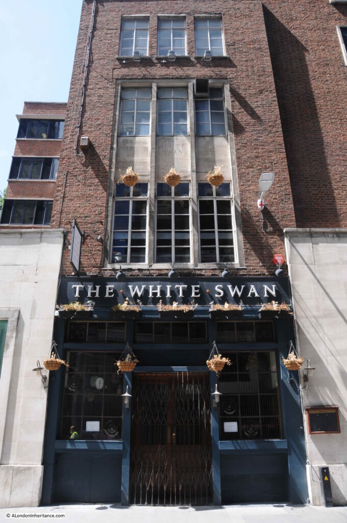
The White Swan – Fetter Lane

I photographed and wrote about the Swan in Fetter Lane last July when I went on a walk to find all the pubs of the City of London.

White Swan

Plans have recently been approved for the redevelopment of 100-108 Fetter Lane, however these plans include two options for the pub:

Option A is for a new office building, but with the White Swan Pub relocated and “reimagined in an enhanced manner”.

Option B is for flexible office space, a pedestrian route, gardens and the White Swan retained as part of an extension of new commercial space.

Source: Buildington

Option A, where the pub appears to be demolished, and a new pub built in the dreaded words of “reimagined in an enhanced manner” sound rather ominous.

White Swan

Just three buildings out of the thousands that can be found across London, and representative of the change that always has, and will continue to take place across the city’s streets. I do hope though, that the White Swan survives. A fine example of a 1950’s brick built, London pub.

alondoninheritance.com
The Star – Belgrave Mews West

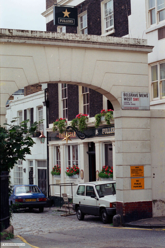
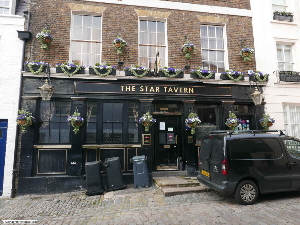
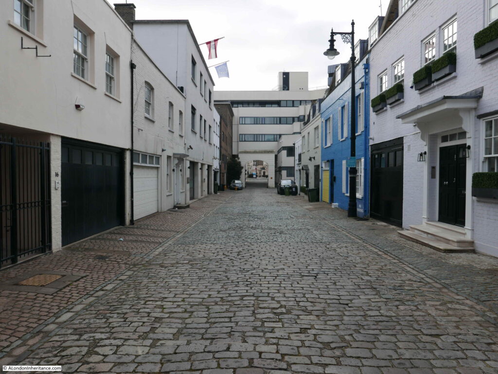
This week, I am back to exploring pubs of the 1980s, and unlike the last post on the Narrow Boat in Ladbroke Grove, today’s pub is still open. This is the Star in Belgrave Mews West:

Belgrave Mews West

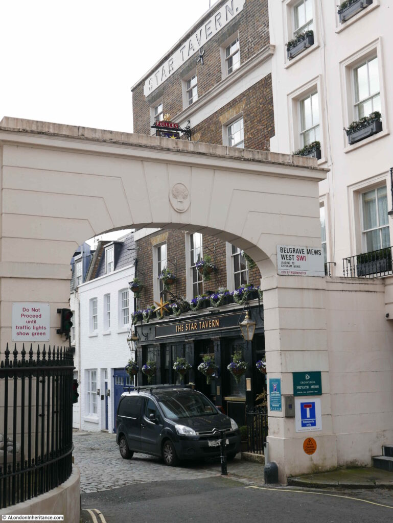
The same view today:

The Star Belgrave Mews West

Apart from some minor cosmetic changes, and a change of colour for the ground floor of the pub, it has hardly changed in 35 years.

There is one minor difference which tells a wider story of how pubs have changed. Go back to the 1986 photo at the top of the post and look at the ground floor window to the left of the pub, and there is an Xpelair fan installed at the top of the window.

These were so common in pubs (there is one in the centre of the Horse and Groom Pub, Groom Place, Belgravia from a few weeks ago). They were needed as this was long before the smoking ban came into force in 2007, and pubs were mainly for drinking with a much smaller side line in food. I had a part time job in a pub in the early 1980s and I am sure I was on the equivalent of 20 day sometimes, just by breathing the air.

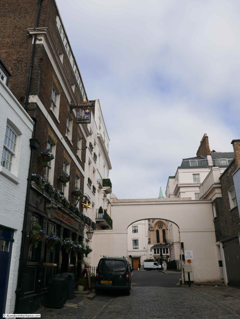
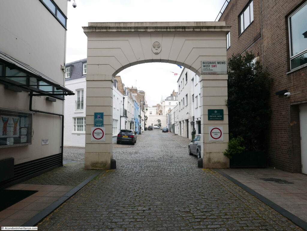
There is also a change at the top of the arch. In 1986 the top was plain, however in 2021 there is a wheatsheaf. The wheatsheaf is the symbol of the Grosvenor Estate, of which the mews are part.

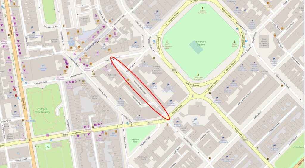
The Star is located at the northern end of Belgrave Mews West, which runs between Chesham Place and Halkin Place, just to the west of Belgrave Square. I have highlighted the location of the mews in the following map (Map © OpenStreetMap contributors):

Belgrave Mews West

The Star was part of the westward expansion of Belgravia in the 1830s / 1840s, with the development of the Grosvenor Estate. The pub has retained its original name, and the first reference I can find to the pub implies that it opened in 1848, as from the Morning Advertiser on the 13th March 1848, in the column detailing the results of licence applications:

“Star, Belgrave-mews West, Belgrave-square – Mr Woolff appeared for Richard William Ledger, a beer-house-keeper, and applied for a licence on the grounds that there were a great many workmen and servants of the nobility and gentry in the neighbourhood, who required that accommodation which only a licensed house could afford, and that there was no public-house nearer than the Turk’s Head which is distant 400 yards from the petitioner’s. There was no objection – Licence granted”.

The Turk’s Head mentioned in the licence application is still a pub, but is now called the Alfred Tennyson, and can be found at 10 Motcombe Street, Belgravia.

The Star looks to be in a purpose built pub building, so I am not sure what came first, the building or the licence application? I assume the building was designed with the sole purpose of being a pub.

The licence application is also interesting as it clearly identifies the target clientele. You would probably not have found any of the wealthy owners of the large houses around Belgrave Square in the Star, however for their servants, and those working in the area, the Star must have been a welcome escape.

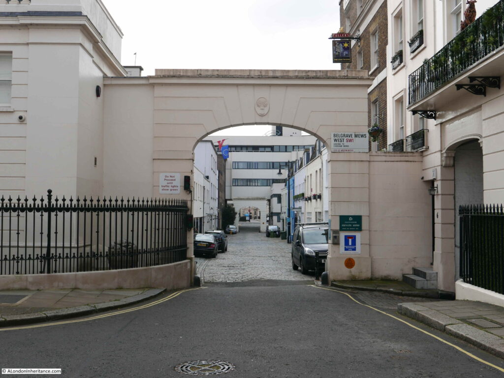
The following photo is looking south down Belgrave Mews West. Belgrave Square is to the left and the buildings on the left of the mews back onto the houses in Belgrave Square, which is probably where many of the pubs clientele worked.

Belgrave Mews West

The Star – currently closed, but opening soon.

The Star Belgrave Mews West

The Star seems to have been a place where the rich and famous, as well as many of the major criminals of the time met in the 1950s and 1960s.

It is the place where members of the gang who carried out the Great Train Robbery met to plan the raid.

A description of the pub in the Tatler on the 23rd July 1966 describes the rather colourful landlord at the time:

“The Star, 6 Belgrave Mews West. Pat Kennedy’s voice sounds like gravel-chips being steamrollered. It is heard at full blast any time of day or night, as he holds court in the upstairs bar. Paddy’s, as the pub is known, has seen it all. Name a personality, and he or she has been there. Nuff said”.

Those reported as frequenting the Star included actors Albert Finney, Diana Dors and Peter O’Toole, A couple of months after the above report, in a section on London’s best bars, the Tatler described the Star as “it attracts fanatical partisans of darts and pin-tables, and creates an illusion of spies and illicit rendezvous”.

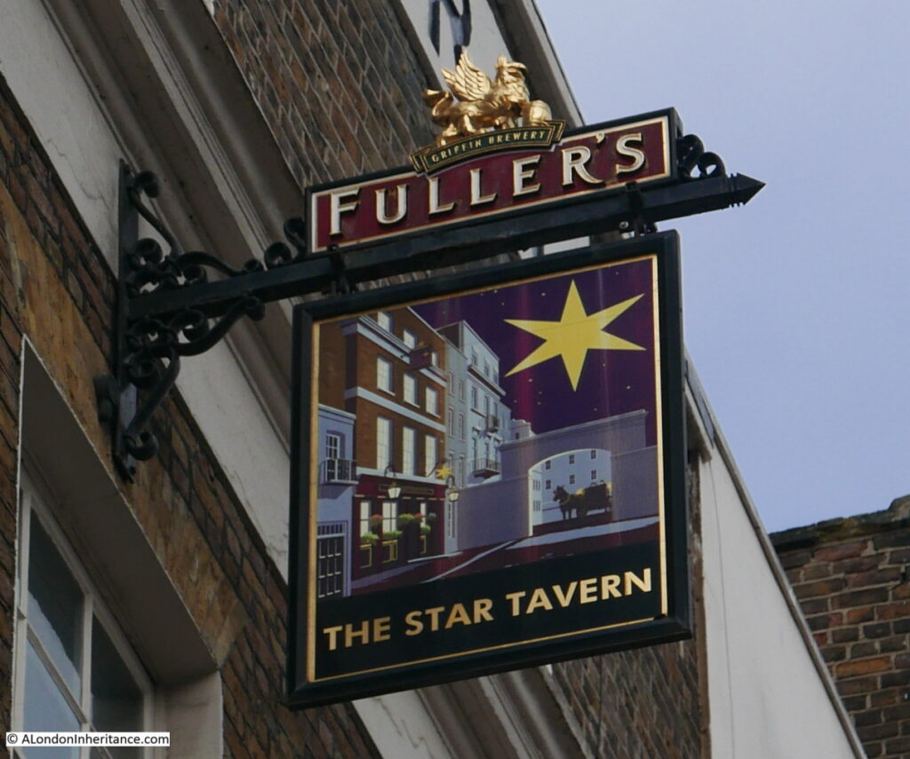
The pub sign features a view of the pub to the side, looking through the arched entrance to the mews, where a coach and horses are waiting.

The Star Belgrave Mews West

Looking through the arch with the Star to the left:

The Star Belgrave Mews West

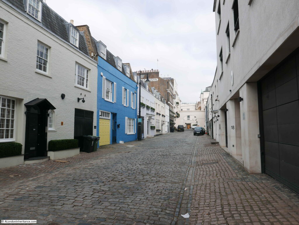
Walking further down the mews and this is the view looking up, with the pub at the far left:

Belgrave Mews West

The majority of the buildings that line Belgrave Mews West are the type of buildings you would expect to find in such as place. Two storey buildings, many with large entrances on the ground floor which would have once been the stables for the large houses in Belgrave Square. The rear of these buildings face onto a small open space between them and the larger houses on Belgrave Square, allowing easy access when a servant needed to get the horse and carriage round to the front door in Belgrave Square.

The difference with Belgrave Mews West is that towards the southern end of the mews there are two embassy buildings.

The Austrian Embassy has a very impressive frontage onto Belgrave Square, however to the southern end of the mews, on the left, we can see the Austrian flag above the very plain rear of the embassy.

Belgrave Mews West

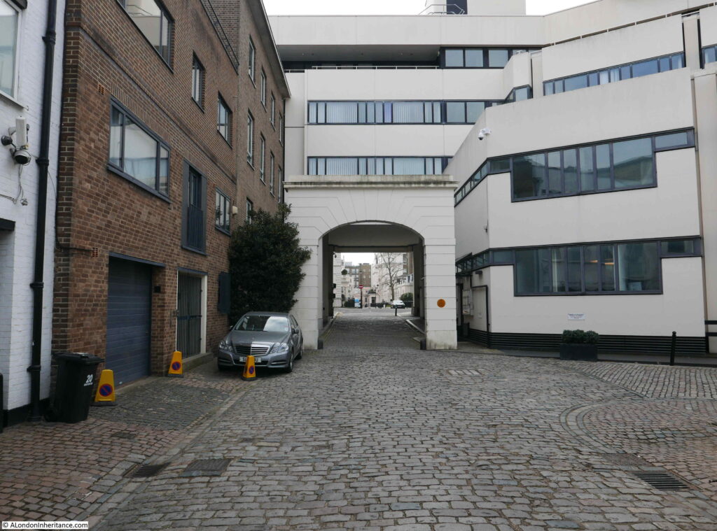
At the far end of the mews, between the arch that mirrors the arch by the Star is the German Embassy which occupies a large area of land between Belgrave Mews West and Chesham Place.

Belgrave Mews West

View through the southern arch of Belgrave Mews West:

Belgrave Mews West

The LCC Bomb Damage Maps show that the buildings in the space occupied by the Austrian Embassy in Belgrave Mews West suffered severe damage, and the houses that were along Chesham Place and the mews were damaged beyond repair, so bomb damage probably explains why the original early 19th century buildings have been replaced by more the more recent embassy buildings.

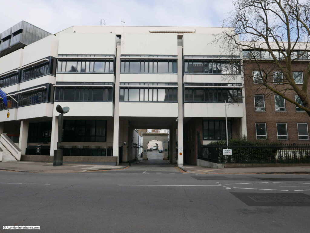
The following photo shows the entrance to Belgrave Mews West from Chesham Place, which passes underneath the German Embassy. I was surprised that it was so easy to walk around the embassy and take photos, however there were plenty of CCTV cameras around.

Belgrave Mews West

Belgravia has been a preferred location for embassies since the area was first built. In “Knightsbridge and Belgravia” E. Beresford Chancellor (1909) writes about Chesham Place, including that the “Russian Embassy has been located here since 1852”.

The Star is one of those wonderful pubs that make wandering the side streets so very enjoyable, even more so when the pub reopens on the 17th May. Brilliant to see that the Star is still to be found, and another pub added to the list to revisit when open.

alondoninheritance.com
Narrow Boat Pub, Ladbroke Grove

Last week, I featured a pub in Belgravia that is still there. For today’s post, I am in Ladbroke Grove to visit the site of a lost pub. This is the Narrow Boat on Ladbroke Grove, adjacent to the bridge over the Paddington Arm of the Grand Union Canal.

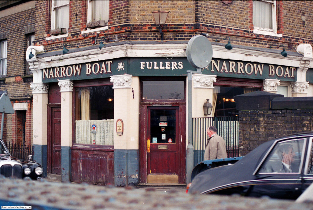
This was the Narrow Boat pub in 1986:

Narrow Boat Pub

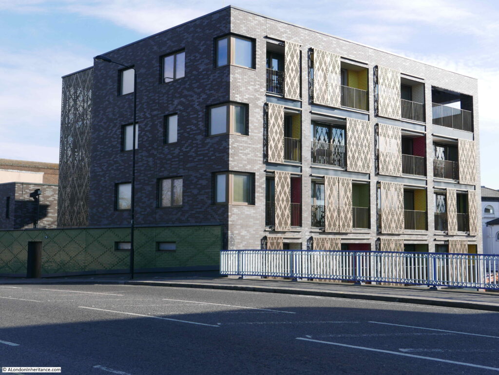
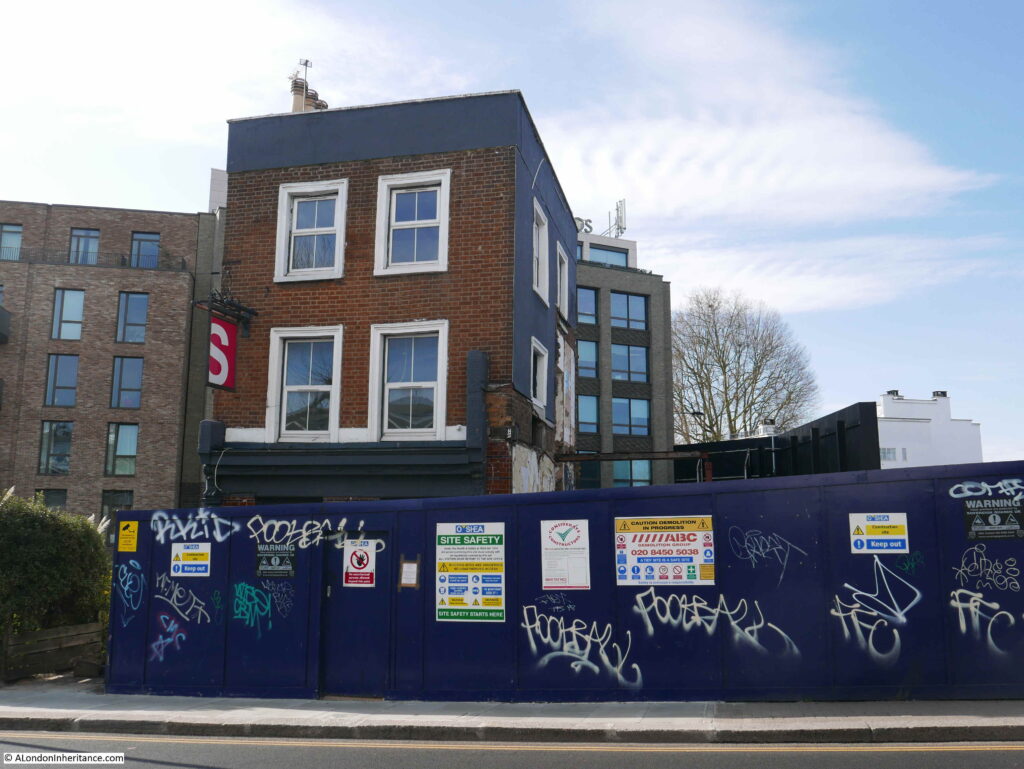
The pub has disappeared, bridge rebuilt, and the Narrow Boat has been replaced by a block of flats:

Narrow Boat Pub

My father took the 1986 photo, and I have no idea whether including the passing cars in the frame was intentional or accidental. Chauffeur driven cars, and I do not recognise the man sitting in the rear of the car on the right.

If the passing cars were accidently included in the frame, this was the days of film, so taking another when there was a risk of more traffic in the view was often an inefficient use of film. Very different to today when you can take as many digital photos as needed to get the right view.

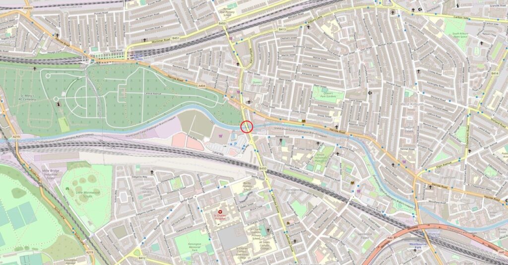
The Narrow Boat was located on the north east corner of the bridge taking Ladbroke Grove over the Paddington arm of the Grand Union Canal. I have highlighted the location with the red circle in the following map (Map © OpenStreetMap contributors):

Ladbroke Grove

An area I have not written about before (there are so many still to do). The large area of green space to the left of the pub is Kensal Green Cemetary, which is well worth a visit.

The Narrow Boat was a relatively recent name for the pub. It had originally been called the Victoria. The name changed in 1977 when the Chiswick brewer’s Fuller, Smith and Turner took over the pub. A news report of the change in ownership records that the name change was in keeping with the pub’s proximity to the Portobello Docks, and the narrow boats that carried goods along the canal. The new landlords of the pub were also new to the pub trade. Wally Sharpe had been a London cab-driver for eleven years and Irene Sharpe had been a civil servant.

They had plans to completly refurbish the pub, and for a beer garden and the build of a landing stage on the canal for passing canal traffic.

Judging from the exterior of the pub just nine years later, I am not sure how many of these plans came through to completion. I suspect that Wally and Irene were just ahead of their time, and a pub with gardens facing onto the Grand Union Canal could now be rather profitable, especially as the area is not particularly well served with pubs.

I cannot find the exact date when the pub opened. There are newspaper references to the Victoria pub in the 1890s. In the late 19th century this was on the edges of built London with still many fields to the north and west. Kensal Green Cemetary had opened in 1833, making use of the amount of open space available in the area.

The Paddington arm of the Grand Union Canal opened in 1801 to provide a link between Paddington Basin and the main Grand Union Canal which connected with Birmingham and much of the rest of the country’s canal network.

The Victoria may not therefore have been opened much earlier than the 1890s, unless it was built to serve those passing on the canal.

In the late 1970s, the Marylebone Mercury had a regular beer column and on the 14th September 1979, one of the improvements to London pubs was the fitting of hand pumps in Fullers pubs, with fifty so far being upgraded to return to more traditional ways of serving beer. The Narrow Boat was included in the list of pubs in which the author of the column would enjoy a pint.

in the same year, the beer column commented that the Narrow Boat pub had been included in the Campaign for Real Ale’s 1979 edition of the Good Beer Guide.

Earlier mentions of the pub include a report in 1912 into the drowning of an eight year old boy who had been fishing in the canal. Joseph Church, the landlord at the time was one of those trying to rescue the boy and was called as a witness at the inquest.

In 1902, the Kilburn Times reported on the trial of a drinker in the Victoria who was charged with disorderly conduct and assaulting a Police Constable. In a strange turn of events, the drinker was found innocent after evidence presented, including from the pub’s landlord, proved that the Police Constable had intimidated and assaulted the drinker. The Police Constable was reported.

Apart from that, the Victoria / Narrow Boat appears to have passed a reasonably quite life servicing the locals, workers on the canal, and those from the gas works opposite.

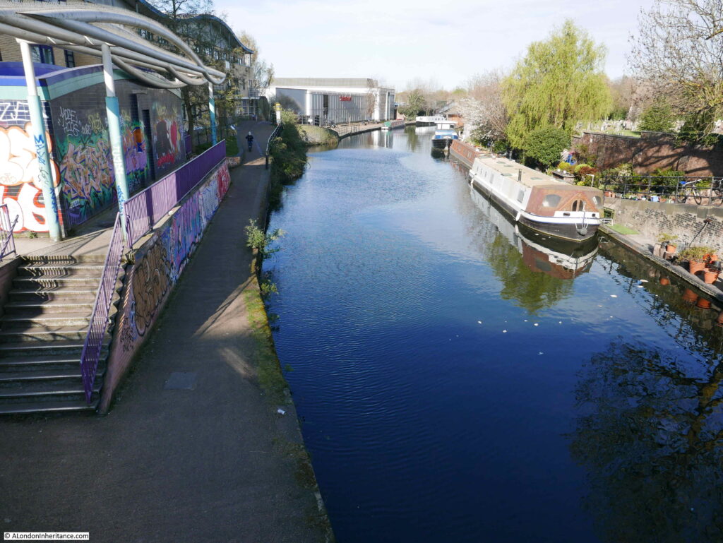
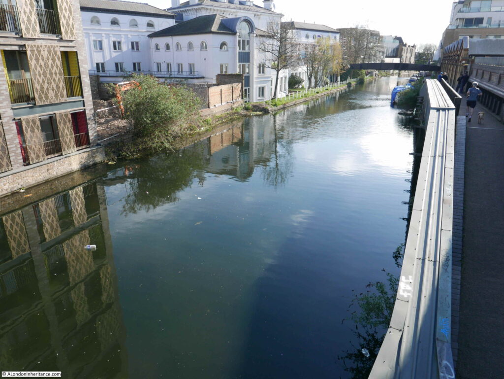
The following photo is looking to the west, from the bridge that carries Ladbroke Grove over the canal.

Grand Union Canal

Parts of Kensal Green cemetary can just be seen on the right, and the large building in the distance on the left is a Sainsbury’s store. The area on the left was once occupied by a large gas works.

The view over the opposite side of the Ladbroke Grove bridge, looking towards the east.

Grand Union Canal

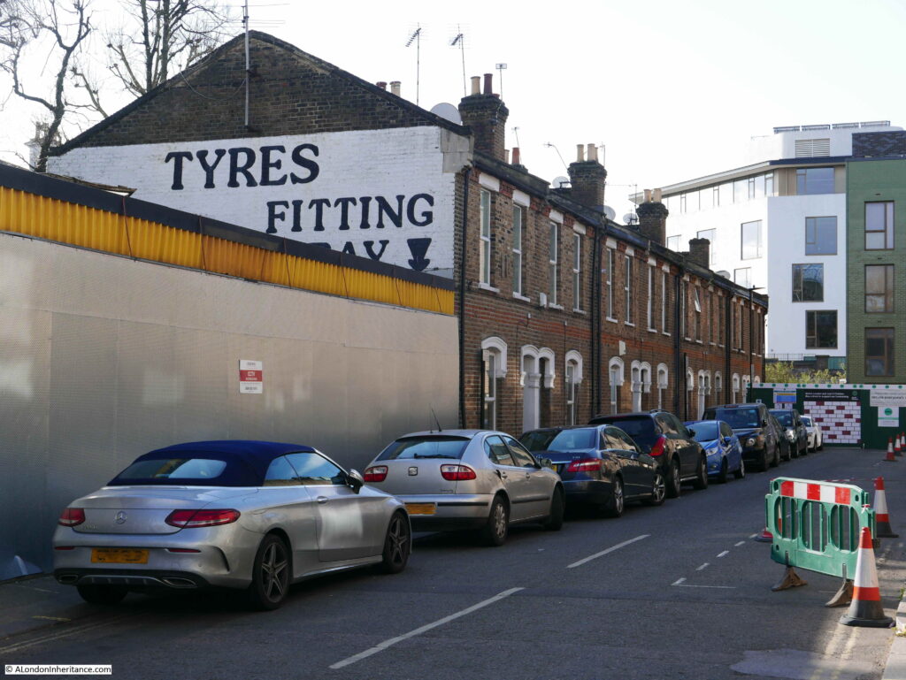
There has been, and still is much development in the area. This is St John’s Terrace which originally ran from Harrow Road to the rear of the Narrow Boat. The building that has replaced the pub can be seen at the end of the street.

Ladbroke Grove

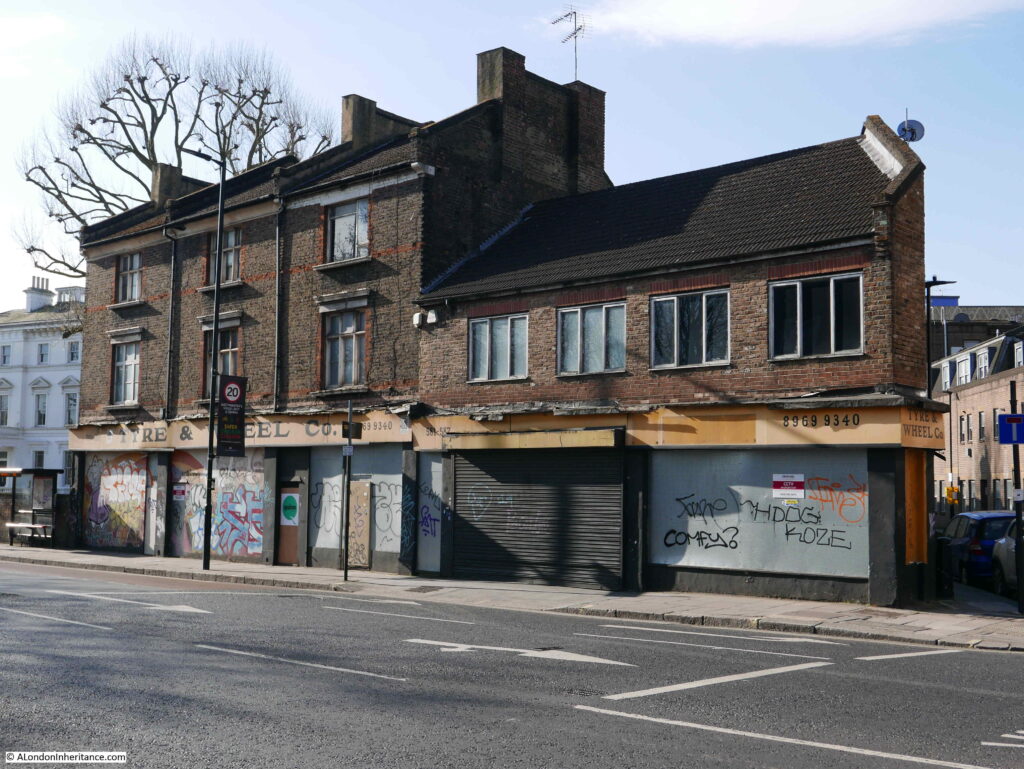
On the corner of St John’s Terrace and Harrow Road is the closed premises of the Tyre and Wheel Company, which has been closed for some time, and I assume is waiting for demolition and probably the build of new flats.

Ladbroke Grove

Walking back south along Ladbroke Grove, over the bridge and turning into Kensal Road is the boarded up remains of another pub. This was the late 19th century Western Arms.

Ladbroke Grove

The Western Arms originally had a large single storey ground floor bar running to the right of the three storey block, however this looks to have been recently demolished,

The pub was called the Playhouse during its last years as a pub, finally becoming a cocktail bar / performance venue. The old pub occupies a reasonably large corner plot so could easily suffer the same fate at the Narrow Boat, however as the three storey block has so far been left standing there is some hope that this will be retained, and the building retains a similar function to that performed during its time as a pub.

Ladbroke Grove

A short walk along Kensal Road offers other buildings of interest. This is “The Gramophone Works”:

Ladbroke Grove

The name comes from the building being the home of Saga Records Ltd during the 1960s and 70s.

The site was purchased in 1960 by Marcel Rodd, who purchased Saga Records the following year.

Saga Records was one of the first companies to reduce the cost of records, to try and break up control of the market by the major music companies. The majority of their music publishing appears to have been classical records, however they also included jazz and West End shows in their catalogue. In 1966 on their Saga EROS label they released the soundtrack to West Side Story by the original English cast.

A short distance further along Kensal Road is another closed pub. Again, from the 19th century and with the wonderful original name of “Lads of the Village”.

Ladbroke Grove

The pub features in a number of interesting news reports. The earliest I can find dates from 1864, so I suspect the pub dates from the 1850s, or very early 1860s. The headline in the 1864 article gives an indication of trouble, and the fact that this area was then a very new development:

“Riot at Kensal New Town – Mr Alfred Price, the landlord of the ‘Lads of the Village’ beershop, Kensal New Town, said: Yesterday morning I left my house a little after six o’clock. I closed the house, barricaded and locked the tap-room door which opens into the street. I bolted the bar door, and went out by the front door, which closed with a spring lock.

I returned between six and seven o’clock the same morning, after taking a walk. I found the tap-room door broken open, and all these men there. Shay was behind the bar acting as landlord. I had porter and ale on the engine, and he was drawing from it. I saw eight pots of beer filled and a half-gallon can, also full, on the counter. The others were partaking of the beer, and giving it away as well to parties outside and others inside.

I said ‘How dare you force into my premises and give away my beer’ Shay merely laughed. They continued drawing the beer and drinking it, in spite of me. I saw Foley and Gadstone shortly afterwards, and they partook of the beer. I went for the police at eight o’clock, and returned with a constable. There were about 40 gallons of beer and ale on draught at the time. I find the barrels are drained and the bung of another barrel had been taken out and the contents were wasted”.

Foley was jailed for three months for assaulting a policeman, and the judge ordered a police inspector to investigate further.

The name of the pub was frequently abbreviated to just The Village, however not that long ago changed name to Frames, although it did not last long with the new name, closing in 2016, and no indication of when current work will complete, and what the old pub will eventually become.

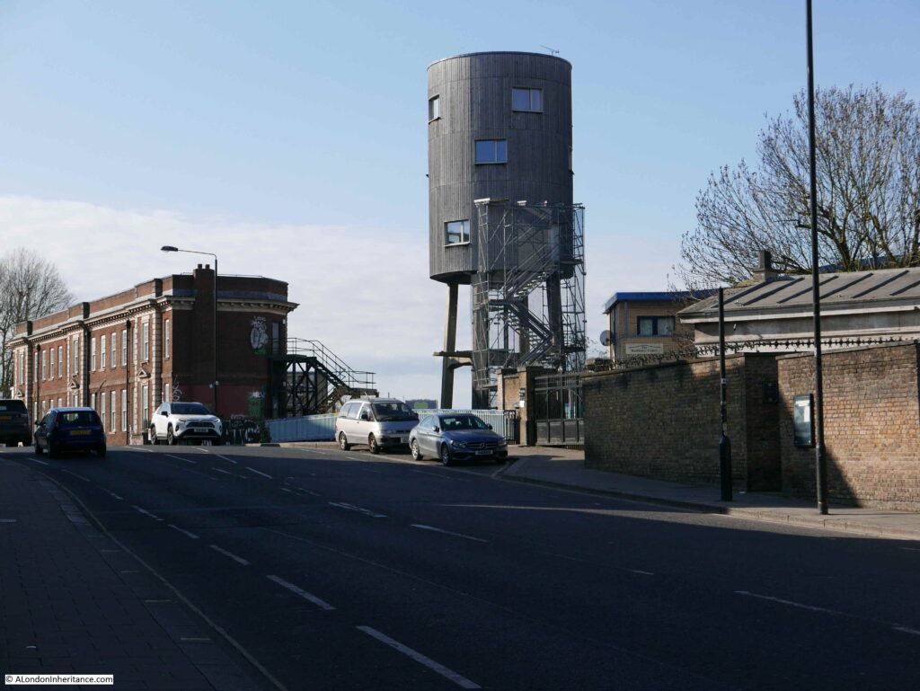
Returning back up Kensal Road to the location of the Narrow Boat pub and looking across the bridge is a rather unusual structure:

Ladbroke Grove

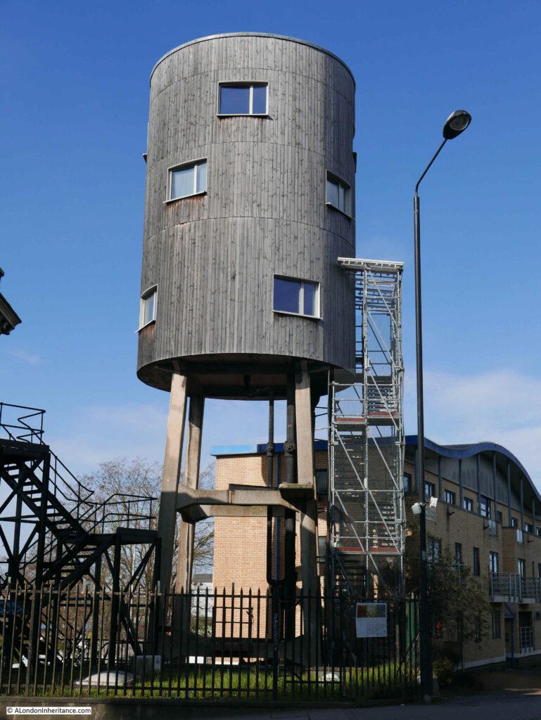
This is an old water tower that was originally built in the 1930s to hold 5,000 gallons of water ready to use if parts of the adjacent gas works caught fire.

The water tower was converted for designer Tom Dixon by the architectural practice SUSD Architects. Building work was completed in 2012, with additional floors added to the water tower to provide a kitchen, two reception rooms, two bathrooms and two bedrooms.

There were originally plans to extend accommodation down to ground level, hiding the four concrete legs, however these plans do not seem to have made any further progress since the initial conversion.

Ladbroke Grove

The building is in a strange location. There must be good views over the surrounding area as there is nothing of similiar or greater height to block the view.

Access is via the temporary looking scaffold stairs to the side of the tower.

A walk round to the side of the Sainsbury’s car park provides another view of the tower:

Ladbroke Grove

No idea if anyone is living in the converted water tower at the moment, but it would be a rather interesting place to stay, and look out over the canal, and the streets of Ladbroke Grove, Kensal Green and Kilburn.

All the locations covered in this post are within a five minute walk of the Ladbroke Grove bridge over the Grand Union Canal. In that short distance, there were once three pubs. One, the Narrow Boat has completely disappeared, and the future does not look good for the remaining two empty buildings.

I have many more 1980s London pubs to visit, some remaining, some lost, however I will break these up after two weeks of pubs and return to these again in the coming months – and hopefully when we can go inside.

alondoninheritance.com
Horse and Groom Pub, Groom Place, Belgravia

For this week’s post I am in Belgravia, an area of London I have not covered before, however this is a return visit to check on a pub last photographed in 1985. This is the Horse and Groom in Groom Place, Belgravia.

Horse and Groom

The same pub today, unfortunately closed whilst we are still under Covid restrictions.

Horse and Groom

The Horse and Groom in Groom Place is one of London’s ‘mews’ pubs. Not on a main street, rather tucked away in one of the small side streets that were designed for servicing the large houses on the main streets, for stabling the horses of their residents, providing (when originally built) lower cost housing and for some small industrial purposes.

Chester Street and Chapel Street run from Grosvenor Place to Upper Belgrave Street and Belgrave Square. Groom Place runs between Chester and Chapel Streets. I have highlighted the location in the following map, with a red circle marking the location of the Horse and Groom on the corner of Groom Place (Map © OpenStreetMap contributors):

Belgravia map

The green and blue to the right of the above map are the gardens and lake of Buckingham Palace Gardens.

This area of London is relatively new, having been built during the early decades of the 19th century.

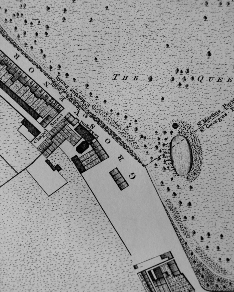
Horwood’s map of 1799 shows some early building along Grosvenor Place, and the first houses in Chapel Street, however the rest is still field (unfortunately this area was on the edge of the page of my copy of Horwood’s map, so only part of the fields are shown).

Horwood's map of Belgravia

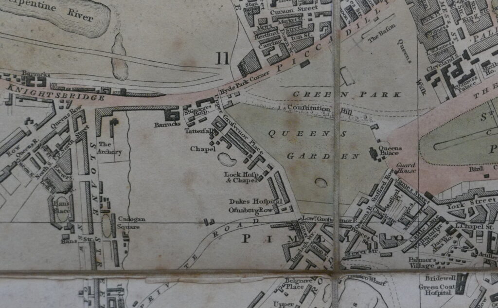
Smith’s New Plan of London dating from 1816 provides a better view of the area (but without the level of detail of Horwood’s map), and shows the Queen’s Gardens (what are now Buckingham Palace Gardens), with Grosvenor Place to the left of the garden with building now along the street and starting to reach into the fields behind.

Smith's new plan of London

There are some differences with Horwood’s earlier map. The above map shows a pond just below the word “Chapel” which does not appear on the more detailed Horwood map. There were several ponds in the area as Rocque’s map of 1746 show these, and the area was known to have been poorly drained.

There is an interesting detail in the above map. look to the left of the open space with the word “Chapel”, and you will see a wavy line running down from Knightsbridge. This was the River Westbourne when it still ran through what remained of the fields of west London, running down from the Serpentine in Hyde Park, which originally used the Westbourne as a water source, before the river became too polluted.

The ponds and the River Westbourne provide some clues as to the state of the area that would become Belgravia. In Old and New London (1878), Edward Walford writes:

“There was a time, and not so very distant in the lapse of ages, when much of Belgravia, and other parts of the valley bordering upon London was a ‘lagoon of the Thames’; indeed, the clayey swamp in this particular region retained so much water that no one would build there. At length, Mr Thomas Cubitt found the strata to consist of gravel and clay, of inconsiderable depth.

The clay he removed and burned into bricks, and by building upon the substratum of gravel, he converted this spot from the most unhealthy to one of the most healthy in the metropolis, in spite of the fact that the surface is but a few feet above the level of the River Thames at high water, during spring-tides”.

Thomas Cubitt started developing Belgravia in 1824 on behalf of the owner of the land, Richard Grosvenor, the 2nd Marquess of Westminster. As well as removing the clay, Harold Clunn in the Face of London (1932) states that the ground level was also made up by the use of the soil excavated to form the St Katherine Docks, however I suspect this was more towards the south of the estate around Pimlico rather than in the area of Groom Place.

The land consisted of what had been known as the Five Fields, an area of around 430 acres that stretched from roughly Hyde Park Corner down to Pimlico and Chelsea. The area was once part of the ancient Manor of Ebury, and in 1677 it came into the possession of the Grosvenor family through the marriage of Sir Thomas Grosvenor to Mary Davies who owned Ebury Farm with the associated land.

The name Ebury can still be found today with Ebury Street to the south of Belgravia, near Victoria Station, along with the nearby Ebury Square. Ebury Street follows the rough alignment of an old street called the Five Fields, and the original location of Ebury Farm (also called Avery Farm on early maps) was close to Ebury Square and Victoria Coach Station.

The name Belgravia comes from the village of Belgrave in Cheshire, which is part of one of the estates owned by the Duke of Westminster.

Returning to Groom Place, and where there is a branch leading up to Chapel Street, was, in 1985, L. Binelli, General Store:

Binelli General Stores, Groom Place

The General Stores have gone, the crooked corner door has been straightened, a window added to the first floor, and the building is now home to Muse – a restaurant run by the chef Tom Aikens:

Muse Restaurant Groom Place

A bit of detail from the 1985 photo – 1980s corner shops always seemed to have their windows stuffed with the products you could buy in the shop, and frequently a Lyons Maid ice cream sign.

Binelli store window

Walking up to Chapel Street, and we can see the original name of Groom Place:

Groom Place

Chapel Place was the name from the time the area was built up until the early 20th century (I cannot find the exact date of the name change).

Perhaps the name change was to mirror part of the name of the Horse and Groom pub, or to recall one of the jobs that would have been based here. It may have been changed to avoid confusion with another Chapel Place, between Oxford Street and Henrietta Place, which still exists today. The need to avoid confusion with other streets of the same name was a frequent justification for name changes.

Given the history of the area, there is one thing I am confused about with the Horse and Groom. Just above the door, the pub advertises “established 1698”.

Horse and Groom

This date was not on the original 1985 photo, and given that the area was built during the first decades of the 19th century, 1698 seems a considerable time before this development and was a time when the area was mainly fields.

The first reference I can find to the Horse and Groom dates from the 15th March 1852, when a rather cryptic paragraph in the Morning Advertiser states “Horse and Groom, Chapel-place, Belgrave-square. Joseph Prior applied for this licence and Mr Wire appeared in opposition – Licence refused”.

Why Joseph Prior was unsuitable for the licence to run the Horse and Groom and what caused Mr Wire to object is not recorded, but it does confirm that the Horse and Groom was a working pub in 1852, and therefore probably dates to when Chapel Place was constructed. The name of the pub refers to the main activity that took place in Chapel Place.

We can get an idea of how the area was developing from an advert for the Horse and Groom in the Morning Advertiser on the 18th June 1868:

“HORSE AND GROOM, 3 CHAPEL-PLACE, BELGRAVE-SQUARE, together with the GOODWILL AND BENEFICIAL POSSESSION. The premises are of recent elevation, combining all the requisites for carrying on the excellent full-priced trade this house is noted for. Protected, unopposed, and with the certainty of additional trade, arising from the countless mansions that are now being erected in Grosvenor-place and the vicinity, render this property comparatively speaking matchless”.

Looking down Groom Place from Chester Street:

Horse and Groom

The large building on the left in the above photo was Bryant’s Second-hand Saddlery, Harness and Horse Clothing Depot, established in the early 1830s.

The following photo shows the full building of the Horse and Groom and answers the question regarding the age of the pub.

Horse and Groom

If you look to the left of the windows on the first floor is writing stating that Shepherd Neame are Britain’s oldest brwery, and that they were established in 1698, so the sign above the door relates to the brewery, not the pub.

I can reasonably confidently date the pub to when Chapel Place was built, around the late 1820s / early 1830s.

The buildings housing the depot for all things horse related:

Groom Place

The following photo is from outside the Horse and Groom, looking back up Groom Place towards Chester Street.

Groom Place

I love looking for evidence in the built streets of London remaining from the time before they were built.

I have no evidence to confim this, but as shown in the above photo, the central part of Groom Place is in a dip, with the parts of the street going to Chapel and Chester Street rising in height.

The early maps show a pond roughly in the area of Groom Place, and perhaps when laying out the streets, the site of an old pond would not be where you want to build the expensive houses, so the smaller houses, and those occupied by stables were built on the site of the old pond.

The price of properties in Groom Place reflect the price of Belgravia in general. There is currently a two floor flat in Groom Place for sale for £2.795 Million. The covered Bentley in the following photo highlights the money you need to live in the area.

Groom Place

A final look back along Groom Place from just outside the old Binelli General Store:

Groom Place

Belgravia may not appear too interesting at first glance. Rows of similar terrace houses, foreign embassies, buildings owned offshore as investments and empty for much of the time, however look a bit closer and there are so many interesting little side streets and interesting buildings. The old Five Fields is just below the surface and it is still possible to trace some of the old roads and locations of the Five Fields and Ebury Farm which have transformed into the Belgravia we see today. There is plenty more to explore, including more mews pubs.

Thankfully the Horse and Groom is still there, although redecorated since 1985. It is a really good pub, and although great at any time of year, a visit in the winter and leaving after dark, into Groom Place can, just for a moment, recall what this part of Belgravia may have been like in the 19th century.

alondoninheritance.com
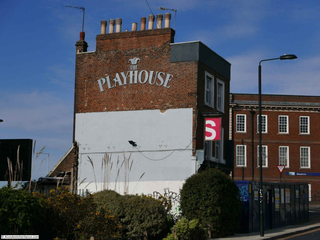
George Inn, Borough High Street, Southwark

The George Inn, along Borough High Street, Southwark is the only remaining galleried coaching inn in London of the many that once serviced the numerous coaches that connected the city with the rest of the country.

The George remains thanks to the London and North Eastern Railway. Although they did demolish large parts of the original buildings leaving only one side of the complex, they sold to the National Trust in 1937, who continue to own the property with it currently being leased to the pub chain and brewer, Greene King.

Back in 1977, I took the following photograph of the George with the main building and galleried upper floors.

George Inn

There was something being filmed at the time of my visit, as the lights facing into the building demonstrate – cannot remember what it was – a late 1970s period drama.

On a rather overcast September day, I went back to Borough High Street to photograph the George Inn.

George Inn

The George still has the narrow entrance from Borough High Street. These are days of COVID precautions and the sign indicated a separate side for entrance and exit.

George Inn

I did not want to challenge the restrictions in place, so did not walk into the yard just to take photos. I was short of time, having to be in Clerkenwell that afternoon so could not stop for a drink. The George is on the list for a return visit, and some better photos.

George Inn

The George looks much the same as in my 1977 photo, however the building at the end of the yard in 1977 has been demolished and replaced.

The George is a very old Inn, dating back to at least the 16th century. It was mentioned by Stowe in 1598 as one of the “fair inns” of London.

It was originally called the St. George, but because of changes in sentiment towards religious iconography, Popery and saints, the inn became the George in the mid 16th century.

In 1622 the inn is described as being built of “brick and timber”. In 1670 a Mark and Mary Wayland were running the George for an annual rent of £150. That year the pub was damaged by fire. Wayland rebuilt and had his rent reduced to £80 and a sugar loaf.

A much larger fire in 1676 that burnt through much of the surrounding area, totally destroyed the George, but again it was rebuilt by the tenant who had the rent further reduced to £50 and a sugar loaf, along with an extension of the lease.

In 1825, the George is recorded as being “a good commercial inn in the Boro High Street; well known, whence several coaches and many wagons depart laden with the merchandise of the metropolis, in return for which they bring back from various parts of Kent, that staple article of the country, the hop, to which we are indebted for the good quality of the London porter”.

In 1855, a description of the stables area of the inn included “a round room for the ostlers in the days of pack-horses, and a stable below ground with steps leading down to it”.

For many years, the George was owned by the trustees of Guy’s Hospital, which was on the eastern boundary of the original George Inn – the building we see today is a small part of the original inn and the associated buildings to support the coaching business.

In 1874, St Guy’s Hospital sold the George Inn to the Great Northern Railway. The coming of the railways had seen a rapid decline in travel by horse and coach, so the sale of the inn to the GNR, who used the site as a receiving station for goods to be transported on their rail network, was in many ways a logical continuation of the main transport function of the inn.

The following photo shows the courtyard of the George, looking towards Borough High Street, with a sign above the entrance to the offices of the Great Northern Railway:

George Inn

The location of the George Inn was key to the success of the inn as a coaching inn, as one of many inns located in courtyards along the main road that led south from London Bridge.

The following map extract is from a map of the Parish of St. Saviours Southwark by Richard Blome (late 17th century but published by John Stow in 1720).

It shows the road leading from London Bridge at the top of the map, down to the Marshalsea Prison at the bottom of the map. This road had long been the only southern route out of the City of London.

George Inn

To the right of the road are numerous alleys and courts. Many of these were inns such as the Spur Inn, Queen’s Head Inn, Talbot Inn, White Heart Inn, King’s Head Inn, Black Swan Inn, Ship Inn and Bores Head Inn. Southwark really did have a lot of Inns.

At number 35, with the red circle is the George Inn. The narrow access from the street leads on to a large courtyard.

There were a number of reasons for the high number of inns. The road was originally the only road from the City of London to the southern counties of England. The area was outside the control of the City of London, there was more land available and rents were cheaper than on the other side of London Bridge.

Catching a coach from one of the Inns in Southwark was almost the equivalent of walking across London Bridge today and catching a train at London Bridge Station.

Coaches from the Southwark Inns served numerous destinations in the counties of Kent, Sussex and Hampshire and in 1809, W.S. Scholefield who was running the George at the time, published a list of the destinations from the inn, and their frequency:

George Inn

The table demonstrates just how busy the George Inn must have been. Numerous destinations, with some having four coaches a day. Horses being stabled at the George, passengers staying in the rooms of the George before an onward journey, luggage and other goods for onward transport across London.

The table includes coaches, which were mainly for passenger transport, and also wagons, which were used for the transport of goods, so the George was also the hub for a transport network for products, raw materials and personal / household goods that needed to be sent to destinations from Kent to Hampshire, and returning goods for sale in the City.

I plotted the coach network onto a map to give a graphical view of the geographic spread and number of destinations (Map © OpenStreetMap contributors):

George Inn

The majority of destinations are in the county of Kent, with some in Sussex. There is a  significant gap between the main Kent services and the five destinations to the west of the map, with no services to towns such as Edenbridge, East Grinstead, Uckfield and Lewes.

It may have been that there was no market for these destinations, or that they were served by coaches from other Southwark based coaching inns. I did consider trying to put together a map showing the destinations from the different inns, where these are known, colour coding based on the Southwark inn. An 18th century / early 19th century equivalent of a 21st century rail network map, but as usual have the idea but not the time.

What the list of destinations does not show is whether each was a single route with multiple stops, or whether these were individual destinations, or a mix of both. Or, whether some of these destinations were reached through a change in coach.

There is a brilliant book called “Paterson’s Roads – An Entirely Original and Accurate Description of all the Direct and Principal Cross Roads in England and Wales”.

I have the 1826 edition, and the book is basically an early 19th century SatNav, It provides detailed routes to get from Town A to Town B, listing all the intermediate towns, turnpikes, and where other destinations could be reached through turning off from the main route. The routes are annotated with descriptions of the towns and villages along the route, milestones, turnpikes and important buildings.

One of the routes is from London (the Surrey side of London Bridge) to Dover. An important destination, as from Dover boats provided the shortest crossing of the channel over to continental Europe. As Dover is one of the destinations from the George, I plotted the route from 1826 as the red line on the following map:

George Inn

The route is the most direct route, but with a short diversion for a stop at Gravesend – a long route in a horse drawn coach on 18th / early 19th century roads.

Paterson’s Roads describes Gravesend as “the first port in the Thames, and by a grant of Richard II, enjoys the privilege of conveying passengers to and from London; the vessels depart from Billingsgate every day at high water, on the ringing of a bell, and from Gravesend every flood tide. All outward bound vessels are obliged to bring-to here, till they have been examined by the proper officers, and receive their clearances; here also all foreigners are detained on arriving from abroad; till they have obtained permission from the Secretary of State’s office to proceed, and all foreigners departing must receive their clearance  from the Aliens office here”.

Paterson’s Roads also provides points where there is a route to a secondary destination, shown as the blue lines on the map. So a stop at Chatham provides a route south to Maidstone, a stop at Faversham provides a route to Ashford, and a stop at Canterbury provides a route north to Whitstable.

The infrastructure needed to support the number of coaches and wagons departing from and arriving at the George Inn was significant and originally the Inn was much larger than we see today.

The coming of the railways destroyed the coach and wagon business and Inns such as the George lost much of their business over a relatively short period of time.

Buildings and land that were originally part of the George were sold, and part was demolished or converted by the Great Northern Railway to be used as storage space.

The Great Northern Railway became the London and North Eastern Railway, and in 1937, the LNER sold the George to the National Trust, who still own the building. As part of the sale, the LNER produced a plan created in 1847 when the previous owner, Guy’s Hospital, had sold to the Great Northern Railway.

This plan provides a detailed view of the original scale of the George, not just the yard in front of the current pub, but extending much further back towards Guy’s Hospital, where there were a large number of stables for the horses that once pulled the coaches and wagons across the counties south of London:

George Inn

The following photo, dated to the 1880s shows the yard outside the current pub. The archway at the end of the yard is that shown in the plan above which leads into the stable yard and extensive stabling.

George Inn

Image credit: London Metropolitan Archives, City of London: catalogue ref: SC_PHL_02_0970_X72_310

Newspaper records mainly reference the George Inn for coaching services rather than the alcoholic problems that a 18th / 19th century inn would often have, for example, even in 1812 it was not a good idea to fraudulently claim expenses:

“28th October 1812 – MIDDLESEX SESSIONS. Thomas Pearson, lately employed as office keeper in the office of his Majesty’s Quarter-Master-General, stood indicted for fraudulently altering, in a bill from the coach-office of the George Inn, Southwark, the sum of 3s 1d to 13s 1d for the carriage and porterage of a parcel from Hythe; and thereby defrauding his Majesty”.

There were adverts of coach services from the George, and the mention of reduced fares probably indicates the competitive nature of coach services. From the Maidstone Advertiser on the 20th September 1842:

Reduced Fares. Direct to London in three and a half hours by the favorite 4-horse coach, from the Swan Inn, Maidstone, every afternoon at 4 o’clock. Returning from the Ship, Charing Cross, Belle Sauvage, Ludgate Hill; Bull and Mouth, St Martin’s Le Grand; Blossoms Inn, Lawrence-lane; every morning at nine o’clock; and the George Inn, Borough, at half past nine, Fares 10 Shillings Inside. 6 Shillings Outside”.

On the same page as the above advert, is another that tells of the coming demise of the horse drawn coach services, and is probably why the above advert was advertising reduced fares:

“South-Eastern Railway Booking Office. Swan-Inn, High-street, Maidstone.

To and from London in three and a quarter hours!

Superior appointed coaches start punctually at the stated times from the above office to the station Paddock Wood, passing through Testom, Wateringbury and Peckham. Fares 2 Shillings Inside, 1 Shilling Outside”.

The above advert is interesting as it shows the hybrid nature of early train services and how the railway companies used the coach services they wanted to replace as feeder services to their stations.

The South Eastern Railway had reached Paddock Wood in Kent in May 1842, but would not reach Maidstone until 1874, so the South Eastern Railway ran coach services to take customers from nearby towns such as Maidstone to the nearest station.  A clever idea as it not only grew traffic on the new rail network, but also encouraged those who had to use a feeder service to support the extension of the rail network to their own town.

The railways would quickly kill off the horse and coach services, and with them the need for coaching inns, and in the latter half of the 19th century London lost nearly all the coaching inns, with the exception of the George Inn. Even the nearby Tabard Inn, which seems to have been older than the George was demolished in 1873.

By 1899, the importance of the George was being recognised. From the 4th September 1899:

“I am glad to observe that London is not to be deprived of the old George Inn at Southwark – the last of the picturesque galleried hostelries of London. It was reported in one quarter that this ancient inn was to come down; in another, that it was to be turned into a common-place gin palace. 

It was frequently visited by the sixth Lord Digby, a benevolent member of the Peerage, who midway in the eighteenth century, used to disguise himself in a shabby old blue dress and visit the old Marshalsea prison, and free a number of prisoners by paying their debts in full. He did this twice a year, at Christmas and Easter, and then took them to the George, celebrating the occasion by entertaining the liberated prisoners to a repast”.

An earlier story about Lord Digby tells of thirty people he had released from the Marshalsea prison, sitting at dinner at the George Inn.

Late 19th century view of the George:

George Inn

The George Inn is one of the many London locations that claim an association with the author Charles Dickens, although with the George it is almost certainly true that he did visit the inn and it does get a brief mention in Little Dorrit.

There are many original features inside the pub, dating back to the 19th, 18th and 17th centuries, and there is possible reuse of medieval beams and stone.

The George Inn is still owned by the National Trust, is Grade I listed and the inn is currently run by Greene King.

The George was a key location for transport to Kent, and there are plenty of other reminders in this area of Southwark of how Kent produce was taken to, traded and sold in Borough.

A couple of weeks ago I wrote about Borough Market and the Hop Exchange, and a short distance in Borough High Street from the George is this facade:

George Inn

WH and H Le May were William Henry and his brother Herbert. Born in Gun Lane, Limehouse, they went on to establish a very successful hop trading business based on Borough High Street.

Their trade extended to all the hop growing areas of the country, not just Kent, but counties such as Herefordshire where newspapers had adverts for the business encouraging growers to consign their hops to WH and H Le May, to be “sold in London, the best market for hops”.

Advertising included pricing updates and in 1911 they reported that “the demand for all types of hops continues, and prices have again advanced on all the hop markets of the world”.

George Inn

The business may be long gone, but the ornate facade provides a reminder of this area of Southwark’s connection with the trade of agricultural produce from Kent, southern England and further afield.

One of the books I have used to research this post is “The Old Inns of Southwark and their Associations”, by William Rendle and Philip Norman. The book was published in 1888.

Old books help as they provide information closer to the time they are recording. Some care must be taken to double check, but they are a good source of information.

These books also have their own history as they pass from owner to owner over the years, accumulating a memory of their time with some of the owners of the book.

In the Old Inns of Southwark, on the rear of the title page, I found the following photo glued onto the page.

George Inn

I have no idea who A.H, Lucas was, perhaps the owner of the book in December 1959 when the photo was taken.

I was considering adding my 1977 photo, but I did not own the book at the time, so when it is possible to get back to the George, I will take another photo and add to the book.

Another book which takes this to a more extreme level, with additions that tell of the coaching history of Chatham is “The Medway River and Valley” by William Coles Finch, an author and resident engineer of the Chatham and District Water Company. The book was published in 1929 and is a fascinating history of the River Medway, and the towns along the Medway.

The book was purchased when published by a Mr A.C. Holliday, a local teacher.

In 1934 A.C. Holliday had written to William Coles Finch, apparently praising his books as Coles Finch replied, and A.C. Holliday glued the reply into the book:

George Inn

A.C. Holliday also glued into the book, on every empty page at the start and end of the book, newspaper cuttings on the history of Chatham.

This cutting tells of the first train to arrive in Chatham, and also recalls the state of the roads which the old horse drawn coaches would have used to reach Chatham from London from inns such as the George Inn, with dust in dry weather and mud in winter:

George Inn

The article includes mention of the Vans that once ran to London, loaded with goods. The sense of London as being a distant place of mystery and adventure, and of the problems that a traveler would encounter with thieves on Shooters Hill:

George Inn

William Coles Finch died in 1945, and an obituary is glued in the book:

George Inn

William Coles Finch wife, Emily wrote to A.C. Holliday regarding the article, and the letter is also glued into the book:

George Inn

There is no free space in the book to add any further contributions, however I printed one of my photos of the London Stone at Yantlet Creek to use as a book mark, and have this in the book as my addition to its history.

I have always used the latest London Underground folded maps, exhibition or concert tickets, or photos as bookmarks and leave these in the book when finished – my contribution to their history.

The George is now much smaller than the original establishment, when horses needed to be stabled and coaches and wagons set out for the southern counties, but it still shows what an inn would have looked like when horse drawn vehicles were the main mode of transport.

As the George Inn is owned by the National Trust (a brilliant decision by the LNER), the long term future looks assured, and it is the perfect place to stop for a drink and consider the many thousands of travelers who must have departed or arrived here, each on their own special journey through, what was described in Coles Finch’s book as “London, being a distant place of mystery and adventure”.

alondoninheritance.com
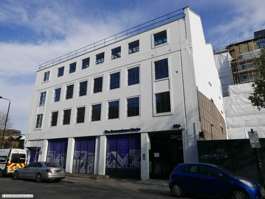
The Globe at Borough Market

In 1977 I was taking some photos around Southwark using my brand new Canon AE-1, purchased using hire purchase as at the time it was the only way I could afford such a camera, and I was desperate to replace the cheap Russian Zenit camera I had been using. The main feature of this camera seemed to be a sticking shutter which ruined far too many photos.

A couple of these photos were of the Globe at Borough Market. A very different market to the market of today.

Globe at Borough Market

The same view 43 years later in 2020:

Globe at Borough Market

The Globe was built in 1872 to a design by architect Henry Jarvis. A lovely brick pub, the paint on the external walls in my 1977 photo has since been removed to reveal the original brickwork.

When I took the original photo, Borough Market was a very different place. Selling all types of fruit, vegetables, potatoes etc. The market started very early in the morning mainly selling to businesses such as the shops and restaurants of south London.

The narrow aisles between the market stalls meant that vehicles could not easily enter the market so porters were employed to transfer goods from lorries parked in the streets, into the market.

One of the barrows used by a porter is outside the corner entrance to the pub. This was why I took the photo as the barrow and pub seemed to be a good combination that in many ways summed up a London market at the time. There is another barrow parked alongside the Globe at left.

There were a number of pubs surrounding Borough Market, catering to the needs of those who worked in the market, which included being open much earlier in the morning than a normal London pub. Reading the licence information above the door of the Globe gives an indication of days and times that the pub served the market, and the trades of those who were expected in the Globe:

“NOTICE PURSUANT TO THE LICENSING ACT 1964 – Intoxicating liquors are permitted to be sold and supplied in these premises between the hours of six-thirty and eight-thirty of the clock on the morning of Tuesday, Wednesday, Thursday, Friday and Saturday of each week. Excepting Christmas Day, Good Friday and Bank Holidays for the accommodation of persons following their lawful trade of calling as Salesmen, Buyers, Carmen, Assistants or Porters and attending a Public Market at the Borough of Southwark”.

Another photo of the Globe in 1977:

Globe at Borough Market

And in 2020. The days of selling Double Diamond are long gone.

Globe at Borough Market

In the above photo, at the very top right corner, you can just see an edge of the Thameslink Viaduct that was built over Borough Market between 2009 and 2013.

The first floor of the Globe was the film location for Bridget Jones flat in the 2001 film Bridget Jones Diary.

Globe – the name of the pub in stone above the windows, seen in both the 1977 and 2020 photos:

Globe at Borough Market

If you go back to the photo at the top of the post, and look along the left side of the street, and in the distance is an arch with a sign above. The sign still remains although Lee Brothers Potato Merchants have long gone.

Globe at Borough Market

The origins of Borough Market are ancient, dating back for at least 1,000 years. Originally a market at the southern end of London Bridge, however by 1754 the City of London was fed up with the Southwark entrance to the bridge being congested by a market, and that the market was taking business away from the City markets. A bill was introduced to Parliament to stop the market trading in March 1756.

The local residents were not happy with the loss of their market and raised £6,000 to buy an area of land called The Triangle, and this became the new home of what is today Borough Market.

The market flourished, and the arrival of the railways with their local goods yards increased the volume of fruit, veg, etc. being sold at the market.

The end of the wholesale market started in the late 1970s and continued in the early 1980s. The City of London constructed New Covent Garden market in Nine Elms. This was a much larger market with considerably easier access and plenty of parking, unlike at Borough Market.

In parallel was the gradual replacement of the traditional corner shop and green grocer by much larger supermarkets who had their own supply chain and had no need to purchase fruit and veg from a local market such as Borough.

The market’s renaissance started in the late 1990s when specialist food suppliers started to move in, and food fairs were organised. Borough Market has since gone from strength to strength, and on most days (prior to the Covid-19 pandemic) it would be crowded with tourists and shoppers.

When walking among the stalls, it almost looks as if you could buy a different cheese for every single day of the year.

Along with the market traders, a wide range of restaurants have opened surrounding the market, and the old pubs that once served the market porters at 6:30 in the morning, have a new lease of life and are serving a very different customer – no longer are barrows left outside the pub door.

One of the pubs surrounding the market is the appropriately named The Market Porter on the corner of Stoney Street and Park Street.

Globe at Borough Market

The Market Porter dates from 1890, however the site was previously occupied by a pub named the Harrow.

Further along Stoney Street is another pub that looks in a rather strange location, squashed by the railway bridge directly above the pub. This is the Wheatsheaf:

Globe at Borough Market

The current Wheatsheaf building dates from 1840, although a pub had been on the site since the 18th century. It originally had three floors and was part of a terrace. The pub lost the third floor when the pub closed in 2009 for the construction of the Thameslink Viaduct which now runs directly overhead. The Wheatsheaf reopened in 2014 in its new, cramped looking condition, however thankfully this historic pub survived such a dramatic change.

Construction of the Thameslink Viaduct was a significant engineering achievement, with building such a structure above a working market. The viaduct runs for 322 metres across the market, and during construction, work included the removal and replacement of the market’s historic roof.

The following photo shows the Wheatsheaf in 1943, in its original condition (the building on the right), along with the same style of barrow that I would photograph in 1977:

Globe at Borough Market

Image credit: London Metropolitan Archives, City of London: catalogue ref: SC_PHL_01_376_F1582

On the corner of Stoney Street and Southwark Street is the Southwark Tavern, a lovely Victorian corner pub dating from 1862:

Globe at Borough Market

However a more remarkable building is alongside the Southwark Tavern. This is the imposing Hop and Malt Exchange.

Globe at Borough Market

The Hop and Malt Exchange dates from 1867 and was designed by the architect R.H. Moore, and was the premises of the Hop Planters Association.

The frontage along Southwark Street is 340 feet and it covered more than an acre of land.

Although the building looks impressive today, it was originally a much taller building, however after a fire in 1920 which gutted much of the building, the top two floors were demolished. The original, larger facade just after the fire can be seen in the photo below:

Globe at Borough Market

Image credit: London Metropolitan Archives, City of London: catalogue ref: C_PHL_01_375_574c_2

The Hop and Malt Exchange was built in Southwark, as it was close to the main railway stations and goods depots that served the hop growing counties of Kent, Sussex and Surrey and provided a place were growers and buyers could meet in one place to conduct the sale of hops.

The main entrance to the Hop and Malt Exchange:

Globe at Borough Market

The pediment above the main entrance contains some wonderful decoration showing hop and malt production. Hops being grown and picked in the centre. Barley being grown on the right for the production of malt, with these products being carried in a sack on a barrow on the left.

Globe at Borough Market

Looking through the iron gates of the entrance (which are also beautifully decorated), we can glimpse the main Exchange Room:

Globe at Borough Market

The Exchange Room was the central point for trading activities. It was 80 feet long by 50 feet wide and 75 feet was the original height to the top floor. The roof was glass allowing plenty of natural light to shine on the floor below. There was a central lantern feature running along the length of the roof, and in the pre-fire building, this was 115 feet above the floor of the Exchange Room.

The Exchange Room was surrounded by four floors of offices and show rooms where growers could show off their products to potential buyers. First and second class refreshment rooms were also provided. Presumably you used the first class when trying to impress a buyer, and the second class for normal refreshment.

A view of the Exchange Room after opening:

Globe at Borough Market

Today, the Hop and Malt Exchange has been restored and is currently a location providing office, corporate hospitality and a live events space, so in some ways is still true to the original use of the building – although no longer trading in hops and malt.

Borough Market and the Hop and Malt Exchange highlight that this area was a significant place for trading agricultural products. What started off as a market on the southern end of London Bridge, grew considerably with the arrival of the railways. Road and rail access to the southern agricultural counties turned this part of Southwark into a key location where London’s shops, restaurants and breweries could negotiate and buy the key agricultural products they needed for their business.

My 1977 photo captured the very end of that long period, but Borough Market still remains serving a new, 21st century customer.

alondoninheritance.com
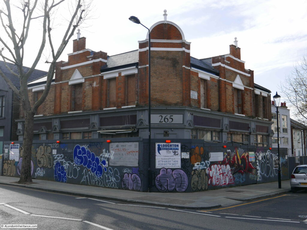
Pubs of the City of London, July 2020 – Part 3

I have finally completed the write up of the third and final part of my walk to find the pubs of the City of London in July 2020. At the end of the last post, I had reached 26 Furnival Street, and my final set of pubs runs from Farringdon Street to Aldersgate Street via Smithfield.
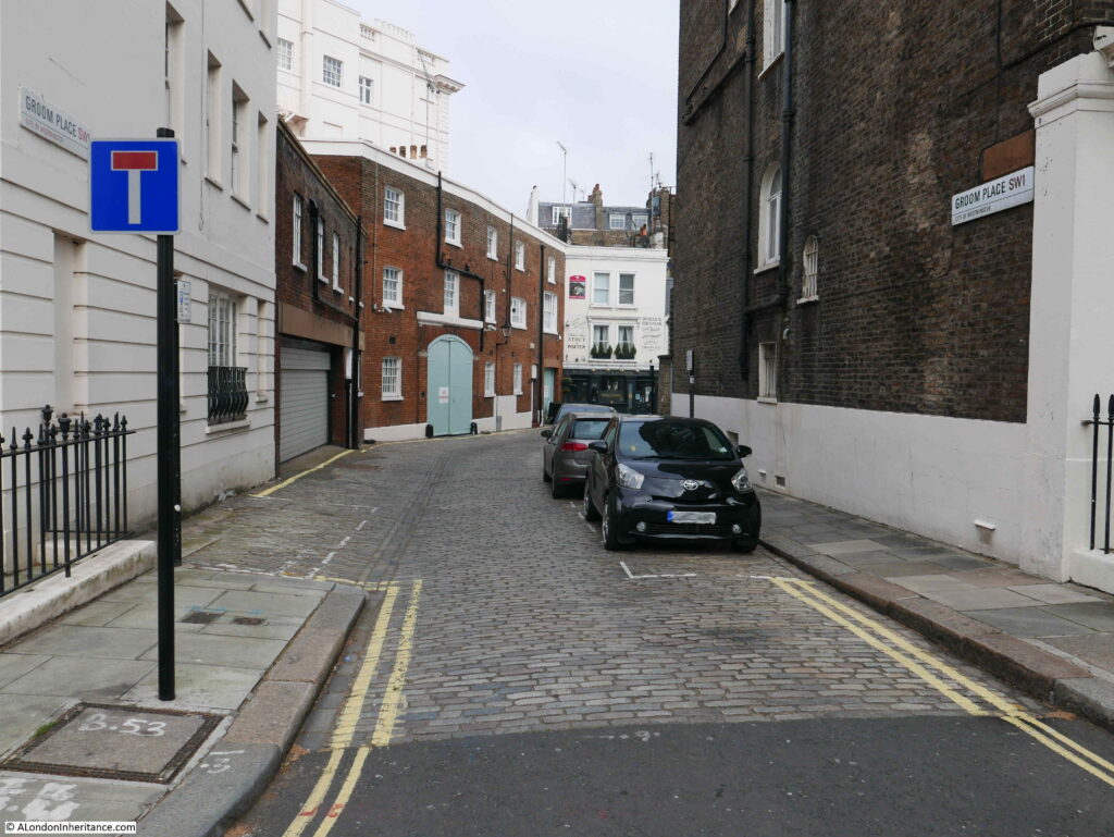
Before starting with the first pub of this final stage, the following map brings together all the pubs that I walked to in the City of London. Clicking on the appropriate marker will take you to the pub in the appropriate post.

Error: The map ID (4) does not exist


From Furnival Street at the end of part two, I walked east to Farringdon Street to find the:
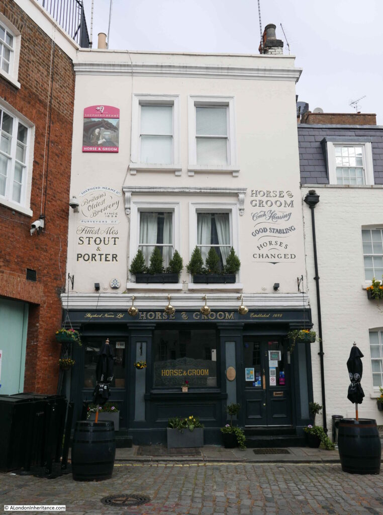
Hoop and Grapes – Farringdon Street

The Hoop and Grapes is an early 18th century pub squeezed between two buildings of much more recent construction.

pubs

The pub was built on a part of St Brides churchyard that was remote from the church,
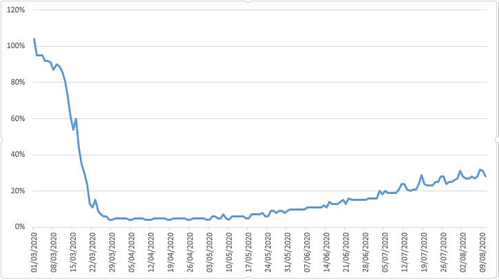
The pub was near the Fleet prison and the course of the River Fleet. The Hoop and Grape’s website claims that the pub was the site of “Fleet Weddings” which is entirely possible. Fleet weddings were weddings performed outside of the normal process for conducting weddings. They were held when couples did not want to hold a wedding at their home church, when they had to be held quickly, or with some secrecy. An article from the May 1867 edition of the Cornhill Magazine provides some background to Fleet weddings:
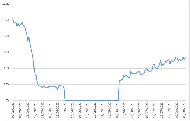
“In the days of which we are writing, a large number of dissolute clergymen were to be found within and about the Fleet Prison. Some of these were confined in the prison itself; other of them, although also detained for debt, being privileged to reside within the local of the Fleet. These men discovered in the recent order of the Ecclesiastical Commissioners the means of their own pecuniary benefit.

They at once espoused the cause of candidates for clandestine matrimony, and undertook to meet the popular demand. They began to marry couples on application, without notice and without publicity, the only requirements being the payment of fees; and the amount of these fees was permitted to vary, according to the pecuniary capacities of the applicants for matrimony, although, as we shall hereafter see the parsons invariably secured as large a remuneration for their services as possible.

The marriages were at first often solemnized in the Fleet Chapel; but the Act at length put an end to their celebration there, and henceforth they took place in various brandy shops and other places in which the parsons lodged, or still oftener in certain taverns which came to be known as regular marriage houses, the landlords whereof derived their profits from matrimony just as they did from malt liquors. In many cases rooms were especially fitted up for the performance of the marriage ceremony, and these apartments were often dignified with the title of ‘chapel’ the name of a saint being sometimes prefixed to the word chapel in the ordinary manner. As soon as the Fleet became associated in the public mind with clandestine marriage, it was voluntary resorted to by many abandoned clergymen”.

So the next time you drink at the Hoop and Grapes, remember the many clandestine marriages that probably took place within the building.

The Hoop and Grapes had a special licence for many years, allowing the pub to open between two and five in the morning for the convenience of printers who worked in nearby Fleet Street. The licence only allowed the pub to serve those working in the newspaper trade, and other trades which involved night or early morning working, such as London’s markets. Pubs that held these special licences often were not too careful in checking that their customers worked in the allowed trades.

In March 1894, the landlord of the Hoop and Grapes was fined £5 for serving persons who were not connected with the newspaper or market trades.

The Hoop and Grapes was under threat of demolition in the 1990s, when the buildings surrounding the pub had already been demolished. The building was saved and Grade II listed in 1991. The Historic England listing states that the pub was built for a vintner around 1720 and converted to a public house in 1831, and that brick vaults in the basement are thought to be part of 17th century warehousing vaults built in connection with the formation of the Fleet Canal.

Full view of the Hoop and Grapes:

pubs

Leaving behind the Hoop and Grapes, I cut through from Farringdon Street to Limeburner Lane, then up Old Bailey to find:

The Viaduct Tavern – Newgate Street

The Viaduct Tavern was undergoing some external renovation and would have been open under normal circumstances.

pubs

The Viaduct was built between 1874 and 1875 with latter interior changes between 1898 and 1900 by Arthur Dixon. Without the scaffolding, the Viaduct is an impressive later Victorian, curved corner pub, and is Grade II listed.

There are a number of legends / urban myths about the Viaduct. It is claimed to be one of the most haunted pubs in the City, and also that the cellars were once the cells of Newgate prison, which was across the road. Even Google maps describes the Viaduct as “Pub in former jail”

Not something I believe as they look like normal beer cellars with racking for barrels and bottles, not cells. If they were I would also have thought they would have been part of the Historic England listing.

From the Viaduct, I walked up Giltspur Street to West Smithfield to find:

The Bishops Finger – West Smithfield

The Bishops Finger is on the west side of the street that circles round the central space in West Smithfield. A late 19th century building with some rather ornate decoration between the top two windows:

pubs

The Bishops Finger name dates from 1981. The pub had been purchased by Shepherd Neame in the 1970s, and the change in name was to name the pub after one of their leading beers.

The pub had originally been called the Rutland and had also been the Rutland Hotel.

Above the first floor window on the right is the year 1890 which dates the construction of the building, however there must have been a previous establishment called the Rutland on the site prior to the 1890 build. Newspaper reports of a Rutland in West Smithfield include an advert on the 19th October 1864 in the Clerkenwell News for “Girls (Two clean, respectable), wanted, 16 or 18 , used to a Coffee House, must be able to wash. The Rutland, Smithfield”.

So the Rutland was probably a coffee house before changing to a hotel and pub which may have been when the new building was built. The name Rutland may have come from the old English county of Rutland.

The Duke of Rutland was a frequent exhibitor of cattle at Smithfield and the Rutland Agricultural Society were frequently involved with Smithfield, promoting the agricultural produce of their county.

The pub sign today, reflecting the pub’s current name:

pubs

Sign in the window summing up the position of City of London pubs in July 2020:

pubs

According to the Bishops Finger’s website, they are still closed, so not yet back to normal.

West Smithfield is ringed by a number of pubs in addition to the Bishops Finger. The proximity of Smithfield Market would have generated large amounts of business for these establishments.  Across the central space from the Bishops Finger is:

St Barts – West Smithfield

I was not sure whether to include the St Barts. It is not a traditional pub, but as it occupies such a prominent position in West Smithfield I have included it in the post.

pubs

Named after the local hospital, the St Barts is owned by the Hush Heath wine estate in Tonbridge, Kent. It seems to be more of a wedding venue, and available for event hire, with operation as a walk in pub during the week. Before being called the St Barts, it was a business known as Jamies Bar, however I believe the building was originally a bank.

On the corner facing Smithfield is the date “Erected 1885”, which gives a clear date for the building, however on the side of the building facing Long Lane are the words and date “Established A.D. 1825”, so I am not sure exactly what was here, and what was established in 1825.

Another pub that is only a recent pub is the:

Butcher’s Hook and Cleaver and Fuller’s Ale and Pie House – West Smithfield

I have bundled these together as although they look like very different pubs, they are both owned by Fuller, Smith and Turner and are effectively a single pub. The Fuller’s Ale and Pie House is the corner building and the Butcher’s Hook and Cleaver is the building on the immediate left.

pubs

They were both opened in 1999, with the corner building originally being a Midland Bank, and the building to the left were the offices of a meat wholesalers.

Walk into Cloth Fair, the street alongside the Fuller’s pub and there is an old pub:

The Rising Sun – Cloth Fair

The Rising Sun occupies a corner position on Cloth Fair, with the narrow Rising Sun Court running alongside the pub down to Long Lane.

pubs

The Rising Sun is an old pub that has kept its original name for the last couple of centuries. The earliest written reference I can find to the pub is from the Morning Advertising on the 29th December 1818, when the landlord of the Rising Sun, a Mr Swift was one of the stewards for the 25th anniversary celebrations of the Friendly Society of Licensed Victuallers.

A pub has probably existed on the site for several centuries, as a survey in 1616 recorded a pub called the Starre Tavern in the same location as the Rising Sun.

One of the more unusual references in newspapers to the Rising Sun dates from 1945. During the war, businesses bombed out of their normal building had to find temporary offices and in October 1945 the Maurice Dixon Musical Service, who provided orchestral services to theatres in the West End were advertising that their temporary address was the Rising Sun.

The pub sign of the Rising Sun:

pubs

The Rising Sun was closed in the early 1970s, but fortuently the pub was purchased by a brewery and opened later the same decade. The state of the Rising Sun in 1971 can be seen in the following photo from the London Metropolitan Archives, Collage collection. I suspect anyone seeing the pub at the time would not have expected it to survive.

pubs

Image credit: London Metropolitan Archives, City of London: catalogue ref: SC_PHL_01_022_71_1551

The Rising Sun is a lovely pub at any time of year, however my favourite time to visit is during a winters weekend evening when the streets around Cloth Fair are quiet and the light from the windows of this small corner pub offer a warm welcome.

The view from Rising Sun Court up to St Bartholomew the Great:

pubs

From Rising Sun Court I walked along Long Lane to find one of the few businesses that was busy – having just been allowed to open.

pubs

Further along Long Lane was:

Old Red Cow – Long Lane

The Old Red Cow is a lovely red brick building facing onto Long Lane. The lower left of the ground floor is an alley which leads through to the passages between Cloth Fair and Long Lane.

pubs

As with the Rising Sun, the Old Red Cow is an old pub. Although the current building dates from 1854, a pub with the same name had already been on the same site. The first reference I can find is from September 1803 when the Old Red Cow was one of the places involved with the trial of someone who was alleged to have stolen a parcel of valuable Spanish wool.

Facing onto Smithfield Market, the Old Red Cow was popular with market workers and the market must also be behind the source of the name of the pub.

Walking through the alley next to the Old Red Cow, I walked back into Cloth Fair to find:

The Hand and Shears – Cloth Fair

The area around Cloth Fair really does have some good pubs, and the Hand and Shears at the junction of Cloth Fair, Middle Street and Kinghorn Street is one of them.

pubs

The Hand and Shears was one of the pubs photographed by my father in 1952:

pubs

The Hand and Shears has a fascinating history, including involvement with the Bartholomew Fair held on the fields of Smithfield.

I have written a full post dedicated to the Hand and Shears which you can find here.

From Cloth Fair, I walked to Aldersgate Street, then south to St Martin’s-le-Grand for my final pub:

Lord Raglan – St Martin’s-le-Grand

The Lord Raglan is squashed between a couple of office blocks. It is a pub with a long history.

pubs

The current building dates from 1855 when the previous pub on the site became the Lord Ragland Hotel.

A pub has been on the site since at least the 16th century, when it was known as the Fountain. It later became the Bush, and then the Mourning Bush. The source of the name “Bush” is interesting as it dates from the times when many people were illiterate and picture signs directed people to the right place. The Globe in September 1903 referenced the pub in St Martin’s-le-Grand:

“And before inn signs became the heterogeneous, unmeaning medley of heroes and landowners heads, of blue boars and other heraldic monstrosities, there were two or three emblems which were the chosen sign of the the vintner’s and ale-seller’s trade. Some used chess-board pattern on their shutters and so became known as the Chequers, a name still used; but the common signs were the red lattice and the ivy bush. It is of course from this ancient vintner’s custom of hanging out a green bush as a sign that we get our proverb ‘Good wine needs no bush’

The bush was always of ivy, the custom thus preserving the association of ivy with Bacchus which takes us back to classical times. 

A tavern-keeper in Aldersgate Street, when Charles I was beheaded, painted his artificial bush black, and his house was long known as “The Mourning Bush’ at Aldersgate. To ‘beat the ivy-bush’ became a recognised slang phrase for the habit of tavern-frequenting.”

The article refers to the Mourning Bush being in Aldersgate, and this street name seems to have been used as well as St Martin’s-le-Grand as the pub was so close to the junction of the two streets and the site of the original City gate.

The pub changed name during the Crimean War to Lord Raglan.

Lord Raglan was Field Marshal FitzRoy James Henry Somerset, who in 1854 was commander in chief of the British troops during the Crimean War.

Lord Raglan now looks out over St Martin’s-le-Grand from the sign of the pub that bears his name.

pubs

The Lord Raglan ended my walk around the pubs of the City of London in July 2020.

When writing this post I checked the web site of many of the pubs I have covered, and a number of them are still closed, and there must be concern for the future of many of these institutions.

Train travel and passenger numbers on the Underground are still a fraction of their pre-March levels. The majority of City workers are still working at home, and I suspect this will be a long term trend.

I downloaded the latest transport data for London from the Government Statistics website. This has data comparing passenger numbers on each day as a percentage of the equivalent day in 2019. I created the following graph using the data in the spreadsheet from the 1st March 2020 to the 10th August 2020, showing the percentage against the equivalent day in 2019 for travel on the London Underground:

pubs

The graph shows that last Monday, the 10th August, travel on the Underground was still only 28% of the same day in 2019. The situation for London buses is better, but still very low compared to a normal day:

pubs

The drop to zero is the period when Transport for London introduced the middle-door only boarding policy, with no requirement to touch in, so obviously lost any meaningful passenger number data.

The graph shows that on Monday 10th August, bus passenger numbers were still just over 50% of the number on the equivalent day in 2019.

The Government site does not have London specific National Rail data, however it does have comparison data covering rail traffic across the country, so London will be included in these figures. Again up to Monday 10th August, however the last 7 days are provisional so will be updated with final figures. The graph does show a similar drop in rail usage, which if you have been to any of London’s main stations will be easily confirmed.

pubs

These graphs reflect not just the work at home approach, but also the loss of tourism in London, which will also drastically impact so many businesses and jobs across the city.

On the days I have been in the City over the last few weeks, it has been a shadow of its former self. The streets are quiet, many of the take away food shops are still closed, there are few workers in offices.

Businesses will realise that they do not need everyone in an expensive office, every day, indeed many of the large City financial companies have already announced that they do not expect staff to have to work onsite in the City, full time, in the future.

Technology has for some time enabled many office based jobs to be done from anywhere and the Covid pandemic has accelerated the deployment and take-up of this method of working. Workers will also realise they can make substantial savings in terms of the cost and time of travel.

There will always be a need for people to work together, in an office for specific activities, and it is essential that there is a level of human interaction. I suspect that numbers of City workers will gradually rise, but will never get back to pre-March levels. Many City workers will get to a mix of work from home and work from office.

The impact on the City of London will be interesting to see. Will there be sufficient business to support not just the pubs, but all the other businesses that rely on many thousands of commuters travelling into the City, five days a week.

Will the City need so many steel and glass office towers, and will some of the planned future towers be built?

I will aim to take a walk around the same pubs as I have covered in these three posts in five years time. I hope I will find they are all still in business.

alondoninheritance.com