One of the brilliant things with writing the blog posts is the feedback from readers in the comments section. Readers frequently provide additional information, or clarify questions that I had not been able to answer, and last week’s post was no exception.
The reason I could not find any further UK census information or references to the later life of Llewellyn Wooderson is that it appears that he emigrated to New Zealand. The answer to the age difference between Henry Wooderson and his wife Sarah in the 1881 census appears to be an error in Henry’s year of birth, in addition to the spelling of Leicester Square as Lester Square – you cannot always believe everything in census data and need to double check with multiple sources where possible. There was also some feedback on the Toronto, Canada birth of their son.
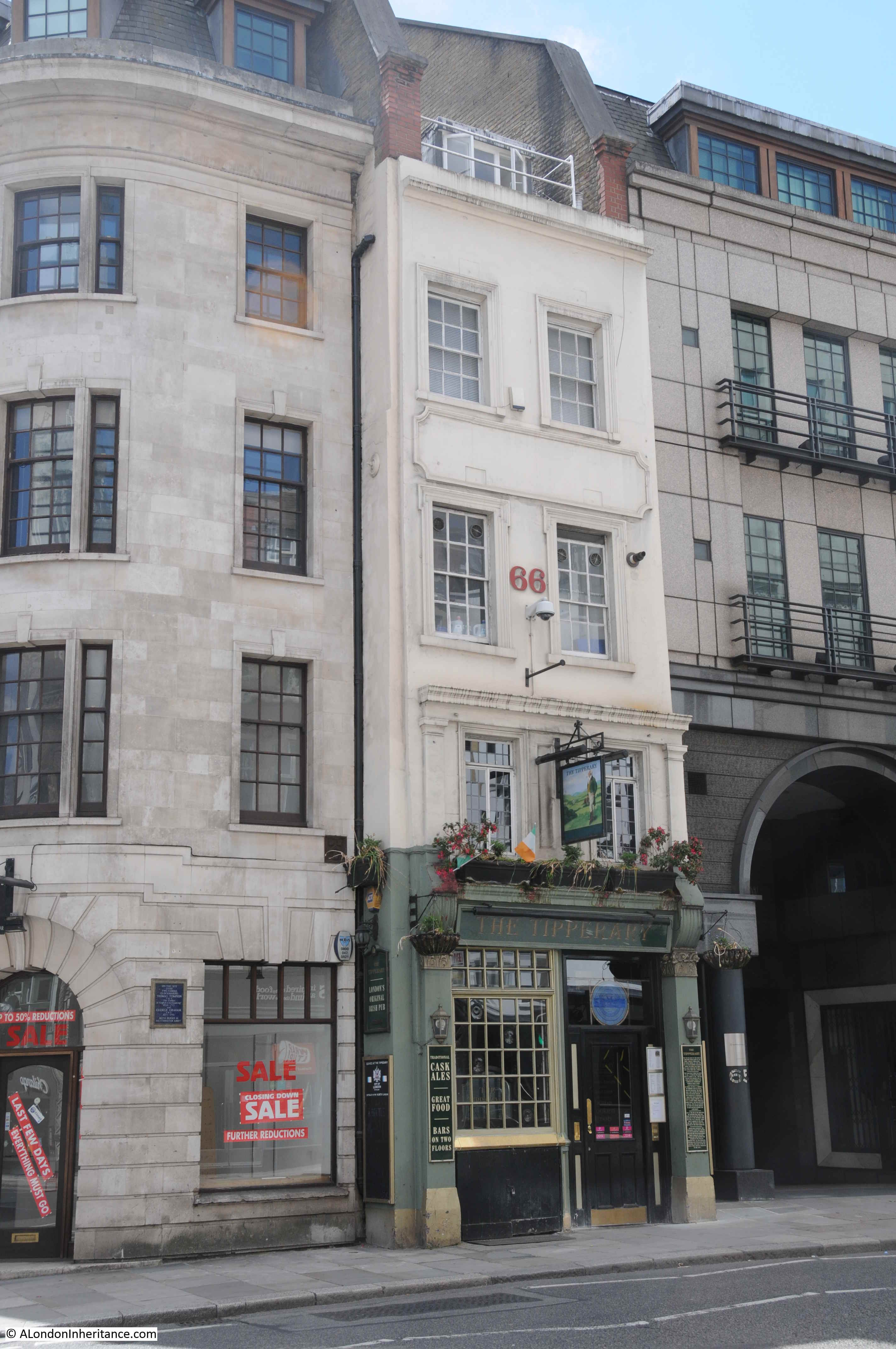
I had taken the 2021 photo of the old shop not that long ago, and Cards Galore, the shop that now occupies that of L&R Wooderson is reported to have closed. If so, a sad casualty of the lack of office workers in the City.
My thanks for the feedback to last week’s post, and indeed, feedback to all posts.
Now to the subject of this week’s post. Two rather lovely London buildings, and an update on another city pub at risk.
Middlesex Guildhall
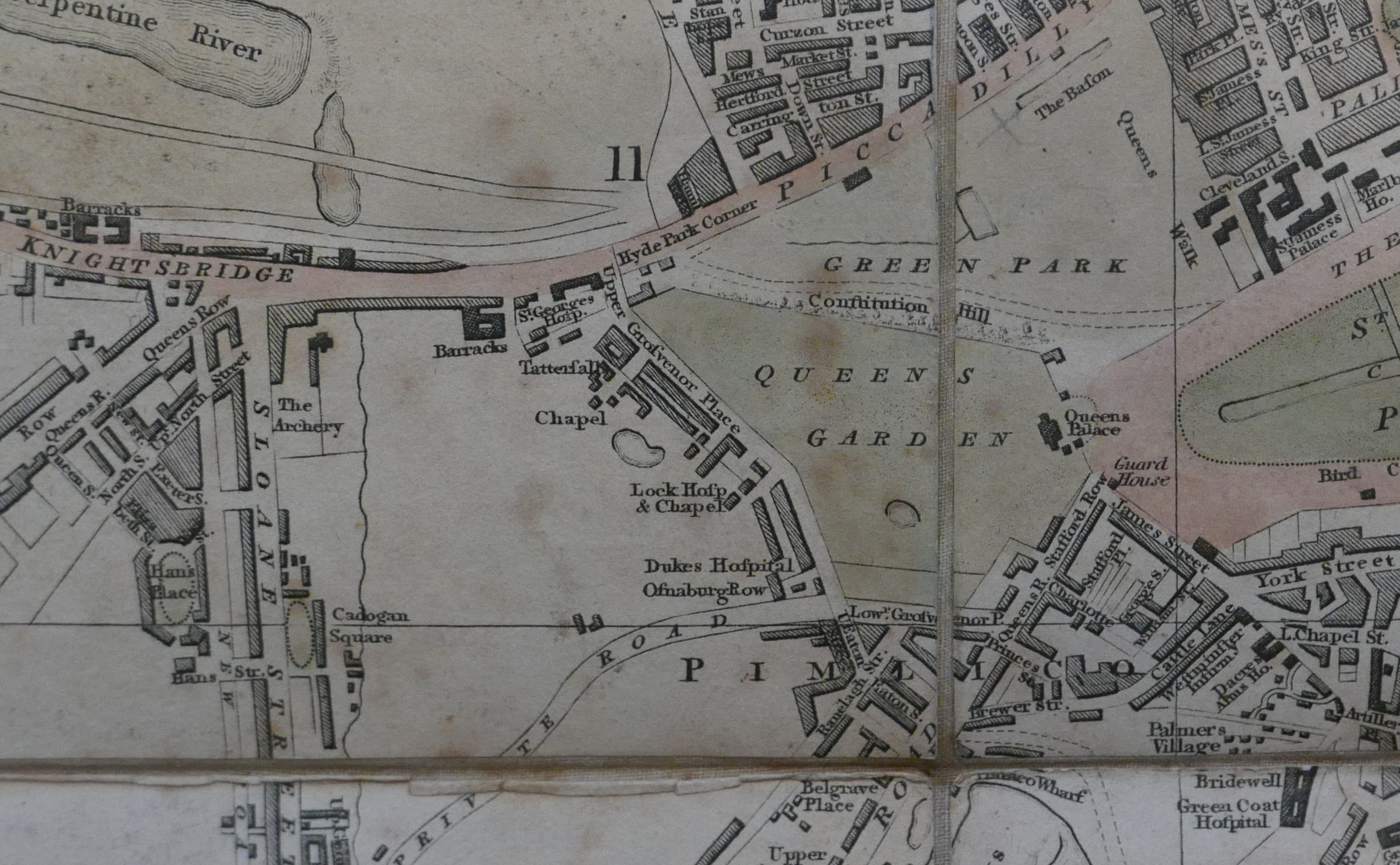
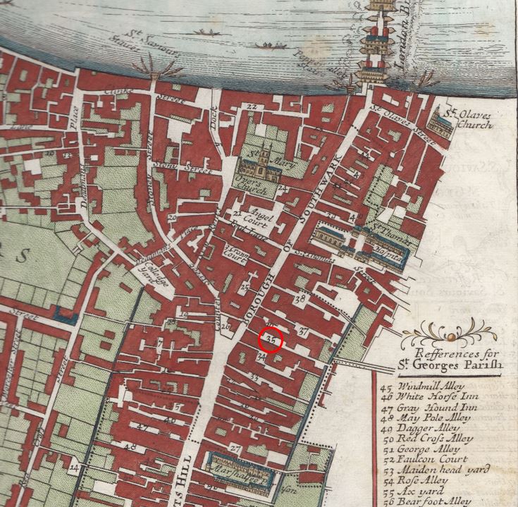
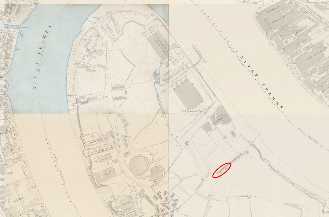
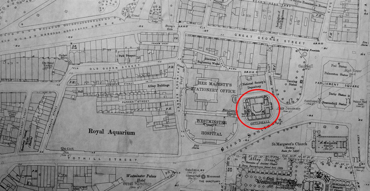
The Royal Aquarium was the subject of one of last year’s posts, and to illustrate the location of the building, I included the following map. To the right was another building, marked as “Guildhall”, circled in red in the map below:
Middlesex Guildhall is a rather impressive building, facing onto Parliament Square. Once the home of Middlesex County Council and Quarter Sessions, the building is now home to the Supreme Court.
The inclusion of Middlesex in the name refers to the old County of Middlesex that once included much of London, dating from a time when the country was split into counties, rather than many of the City and Metropolitan Boroughs and administrative divisions that we have today, for example Greater London, which took over much of the County of Middlesex following the London Government Act 1963, although London had already been chipping away at the boundaries of counties such as Middlesex and Essex for some time.
The site of the Middlesex Guildhall was the site of Westminster Abbey’s Sanctuary Tower and Old Belfry. The name sanctuary refers to the expectation that fugitives could claim sanctuary from pursuers if they could make it into the building. The name can still be found today as I will show later in the post.
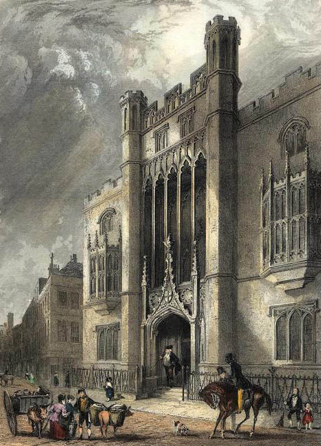
An old court house had existed on the site during the 19th century, however in 1889 this was replaced by the first Middlesex Guildhall, however this was too small for both the administrative and legal functions carried out in the building, and the building that we see today was built between 1906 and 1913. This was the building in the early 1920s:
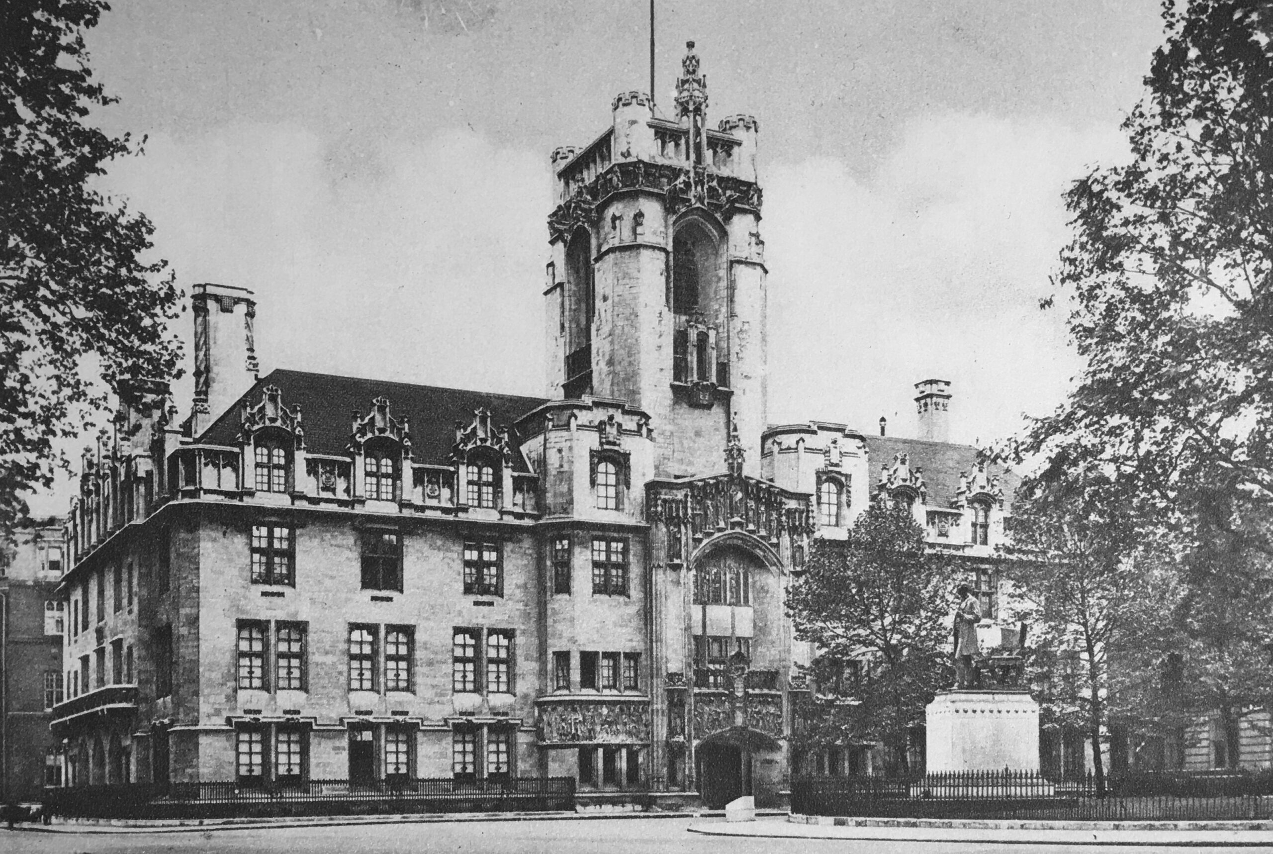
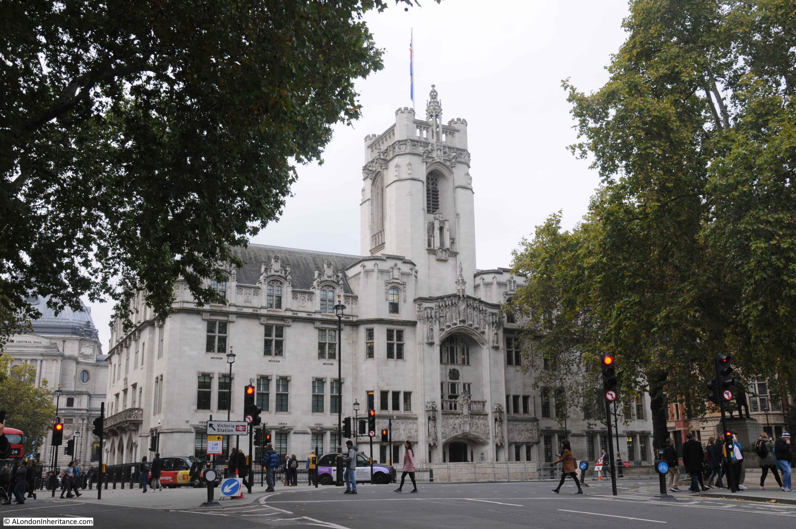
And 100 years later the building remains exactly the same, although now cleaned, and the trees in the foreground have grown:
The architect was James Gibson, who designed a late Gothic style building, faced with Portland Stone, although with a steel frame which helped take on much of the load bearing functions and supported features such as the tower which rises from the centre of the façade facing onto Parliament Square.
Gibson’s other work in London included West Ham Technical College, completed in 1895.
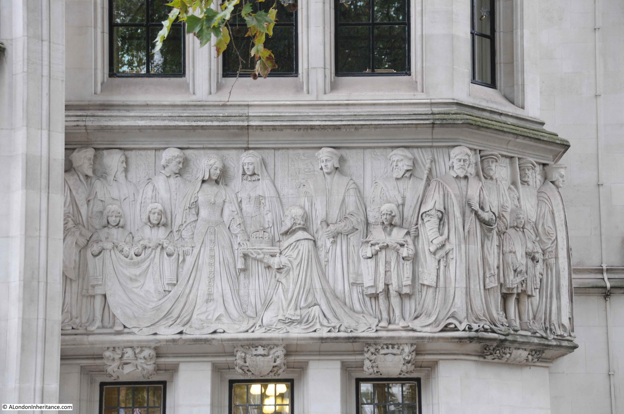
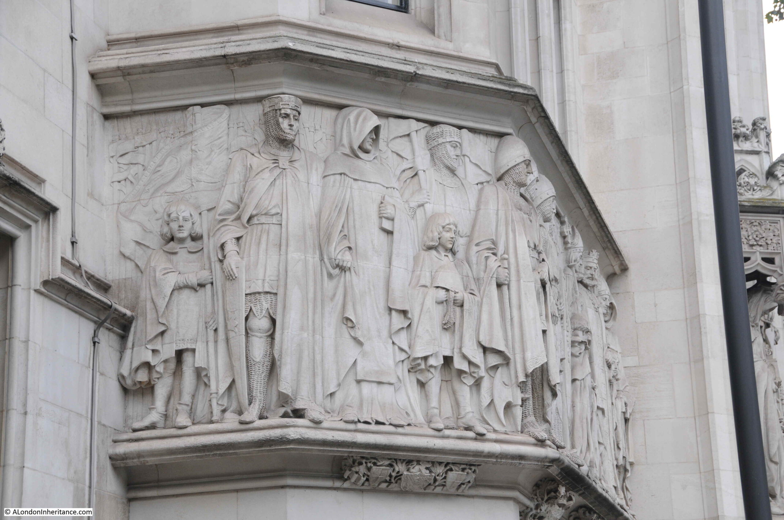
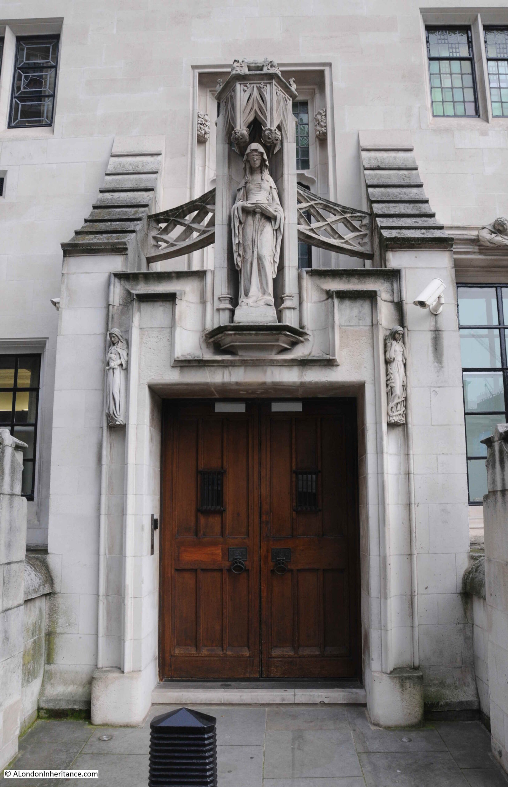
Some of the very distinctive features of the building are the sculpture by Henry Charles Fehr, which can be found across the building. Fehr was also responsible for some of the carving on the wood seating and panels in the Court Rooms. The Middlesex Guildhall would be considered the peak of his career.
The following photo shows the cluster of sculpture above the main entrance to the building:
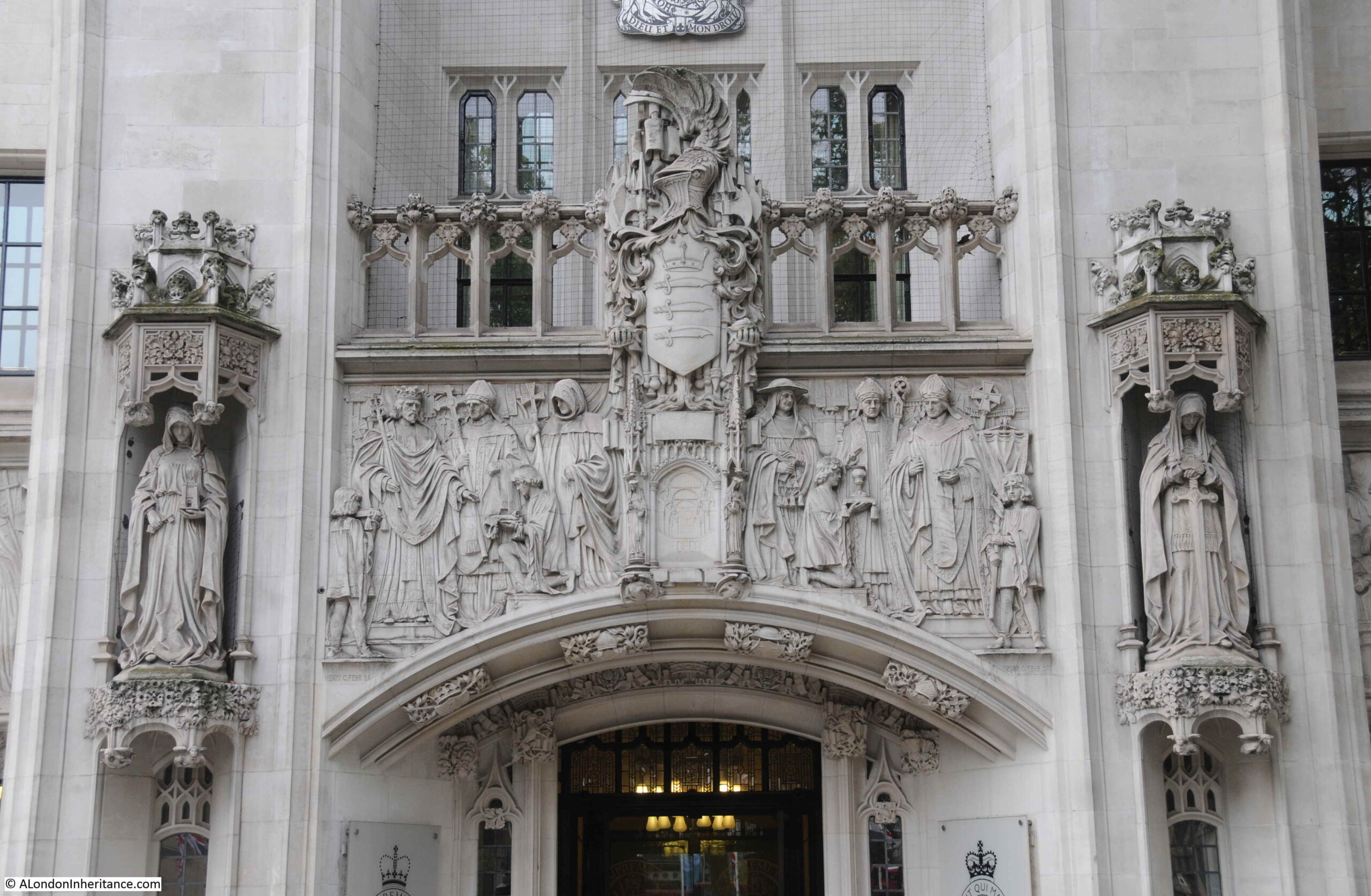
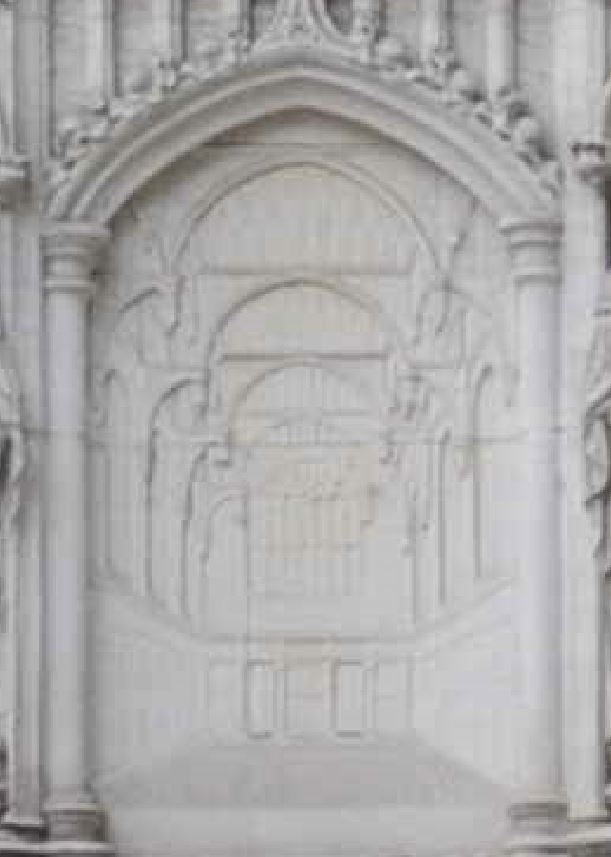
This shows Henry III (on the left), granting a charter to the Abbey of Westminster. Above are the arms of the County of Middlesex (the three Seaxes, or swords, with the crown above), and below is what looks to be a view of Westminster Hall:
There is more on either side of the main entrance, including Lady Jane Grey being offered the crown by her father-in-law, the Duke of Northumberland:
And King John with the Barons at Runnymede:
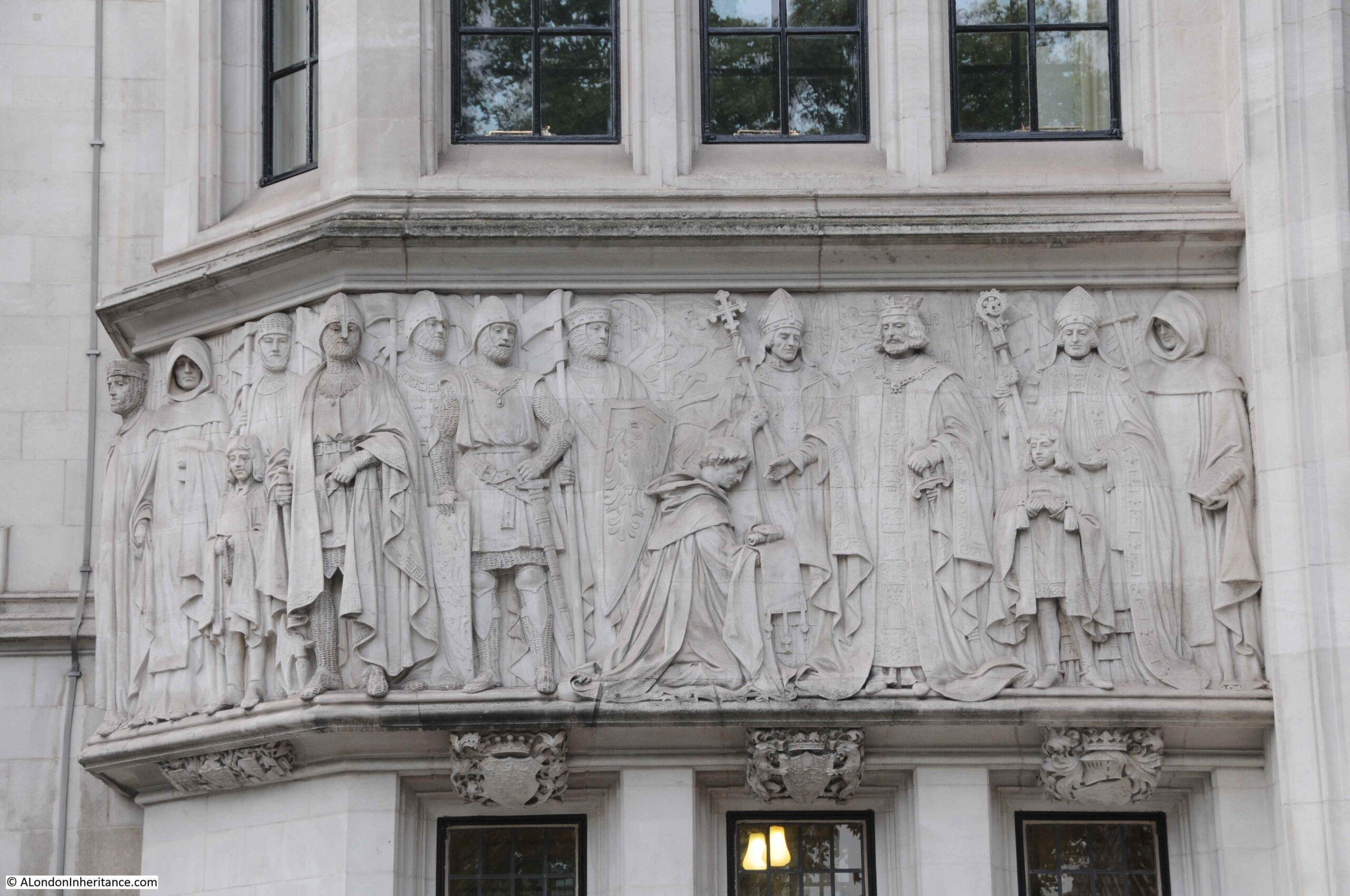
Fehr’s work is finely carved and very detailed:
The building was designed with courts of law for the administration of justice, and this role has continued to this day as the building is now home to the Supreme Court. Figures holding the symbols of Justice:

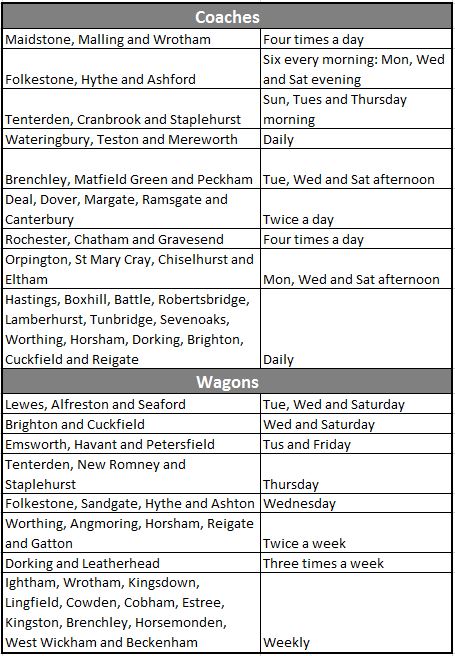
The courtrooms within the Middlesex Guildhall have seen many trials over the years. Some of the more unusual were possibly the court martial of spies during the First World War. For example from the Evening Telegraph on the 14th July 1915:
“TWO GERMANS ARRESTED ON CHARGE OF BEING SPIES, On His Majesty’s Fleet – The authorities announce the arrest of two alleged German spies. Their trial will take place by Court Martial on Friday next at Middlesex Guildhall. The whole proceedings will be held in camera.
They will be charged with collecting and attempting to communicate with the enemy, information about His Majesty’s Fleet.”
The above trial followed an earlier trial of the alleged spy Robert Rosenthal which was the subject of some publicity at the time as the London Daily News reported on the 7th July 1915:
“TRIAL OF ROSENTHAL. Proceedings in Camera at Middlesex Guildhall – The trial of the alleged spy, Robert Rosenthal, began before a general court martial at Middlesex Guildhall yesterday. He is accused of coming to this country for the purpose of obtaining information both of a naval and military character.
Originally it was announced that part of the evidence would be taken in public, but at the last moment it was decided that the whole trial should take place in camera.
Prisoner was defended by Mr. Frampton. A large crowd assembled outside Middlesex Guildhall to witness the arrival of the members of the court. None of the public was allowed in the building. The entrance to the court where the trial was conducted was guarded by soldiers, and inside Rosenthal was placed between soldiers with fixed bayonets.”
Robert Rosenthal was a German, born in Magdeburg in 1892. At the age of around 16, he went to sea, and spent time in America where he presumably learnt, or improved his American accent as in 1914 he was in England using the assumed name of Harry Berger and travelling as an American.
He travelled between England and the continent a couple of times without any problems, but on his final trip in May 1915 he was arrested as he tried to board a ship.
His arrest was down to a strange error in the direction of post. He would travel back to Copenhagen as travel to Germany was not possible, and when in Copenhagen he had posted a letter to Germany, detailing his plans. This letter was accidently put into a mail bag heading to England, which was opened on arrival by the postal censorship authorities, revealing his identity and travel plans.
The court martial at Middlesex Guildhall found Rosenthal guilty and he was sentenced to death as a spy. Rather than the typical execution by firing squad, Rosenthal was hanged at Wandsworth prison just 8 days after the trial, on the 15th July 1925.
Whilst the Middlesex Guildhall today does not see any court martials, as the home of the Supreme Court, the building will now often see the ultimate determination of justice. Probably the most high profile recent cases have been the challenges to the Brexit vote and the process of leaving the European Union a few years ago.
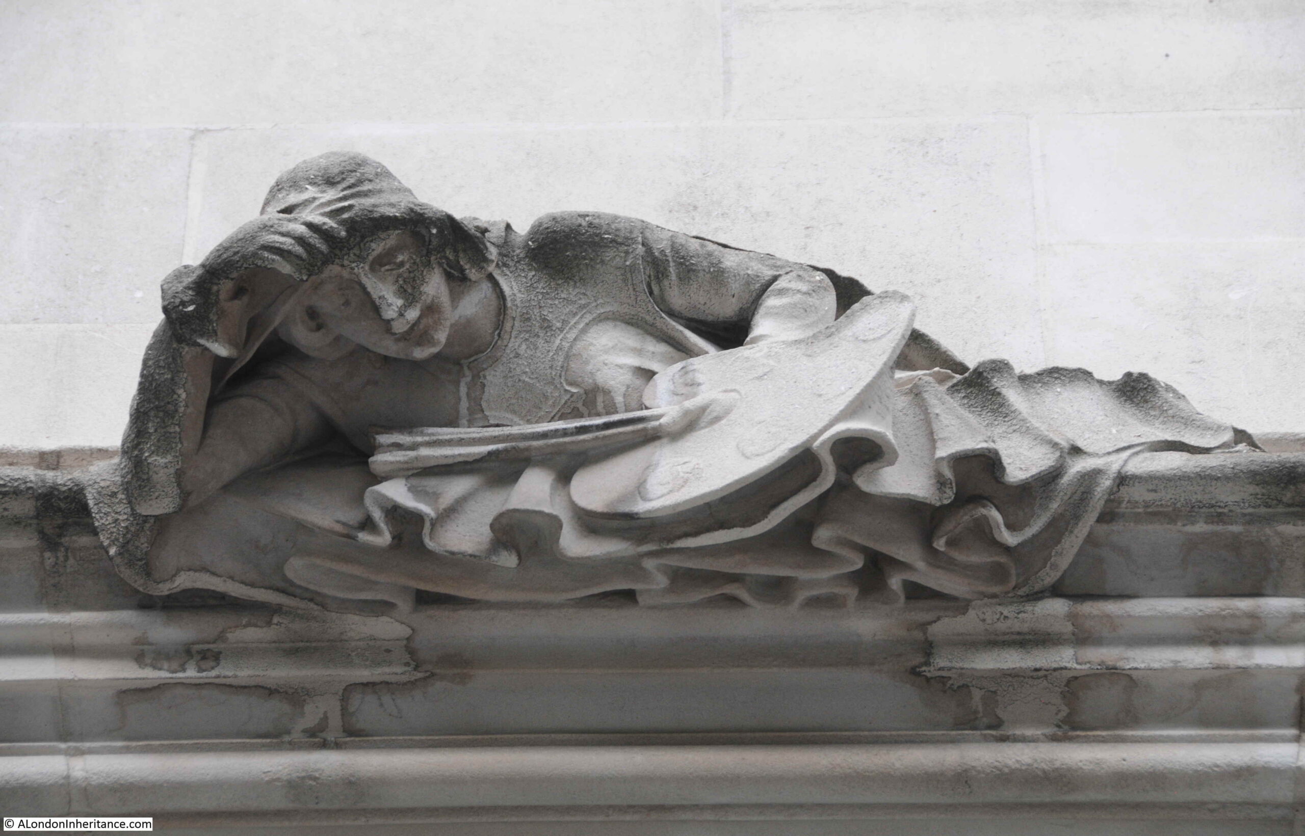
As well as the historic and legal sculpture, there are also a number of cultural references, including the following reclining figure with an artist’s palette and brushes.
A walk to the rear of the Middlesex Guildhall will be rewarding. The name of the street, Little Sanctuary, recalls what was here when Westminster Abbey allowed privilege of sanctuary to law-breakers who took refuge in its north west precincts.

More of Henry Charles Fehr’s ornate sculpture can be found:
And then there is a rather different entrance:
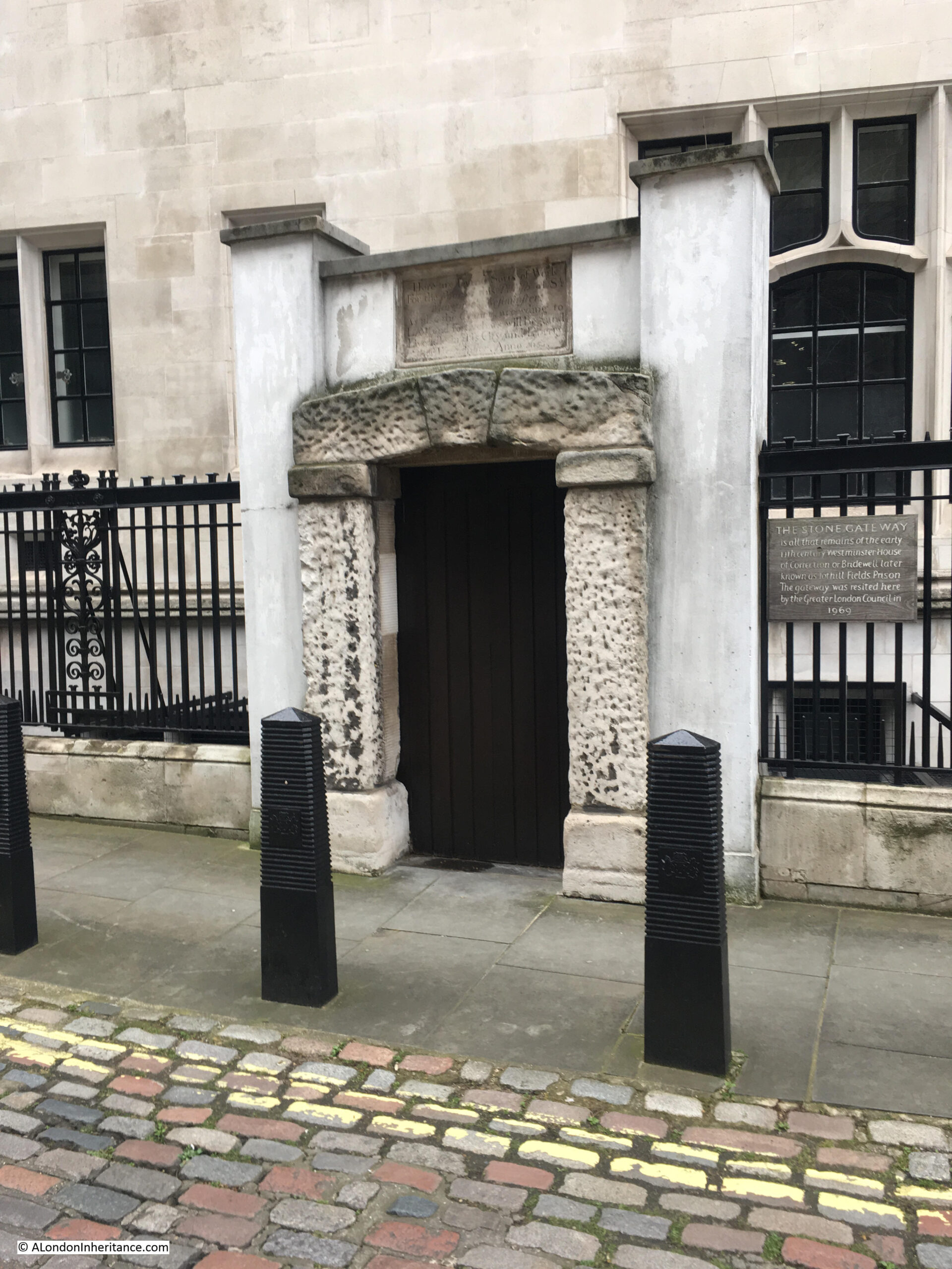
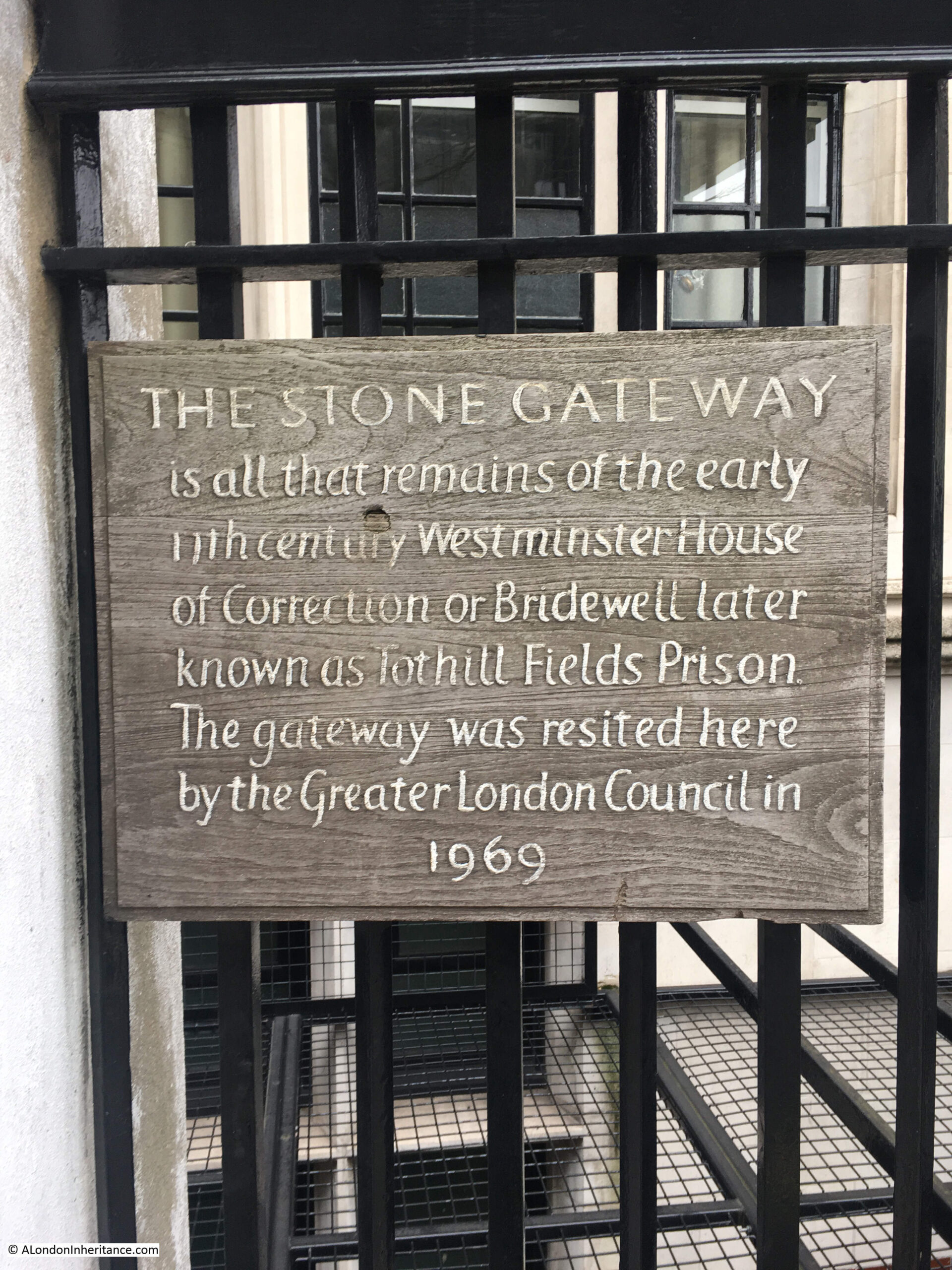
The stone gateway surround is all that remains of Bridewell or Tothill Fields prison which originally stood roughly where Westminster Cathedral is today, set back from Victoria Street.
The plaque above the door reads:
“Here are ….. Sorts of Work for the Poor of this Parish of St Margaret’s Westminster. As also the County according to Law and for Such as will Beg and Live Idle in this City and Liberty of Westminster. Anno 1665.”
A sign adjacent to the door explains how the gateway arrived at the Middlesex Guildhall:
The Middlesex Guildhall is Grade II* listed, however this did not stop some significant internal change when the building was reconfigured to be ready to function as the Supreme Court.
The three Court Rooms, with the main court room originally being the Council Chamber for Middlesex Council, were planned to have much of their wooded seating, paneling and decoration removed and many of the internal rooms reconfigured for their new purpose.
Save Britain’s Heritage campaigned for the changes to be abandoned, however although they had the support of many in the arts and architecture communities, judges and MPs, Westminster Council approved the plans, and on appeal it was decided that it was in the national interest to have a Supreme Court and for the court to be located in Middlesex Guildhall, and that these national interests over-rode listed buildings law.
The original plans had included the removal of the arms of Middlesex from above the main entrance doors, however, as the photograph shows earlier in the post, the arms remain as a reminder of the original function of the building.
The second building for this week’s post is the:
Old City of London School
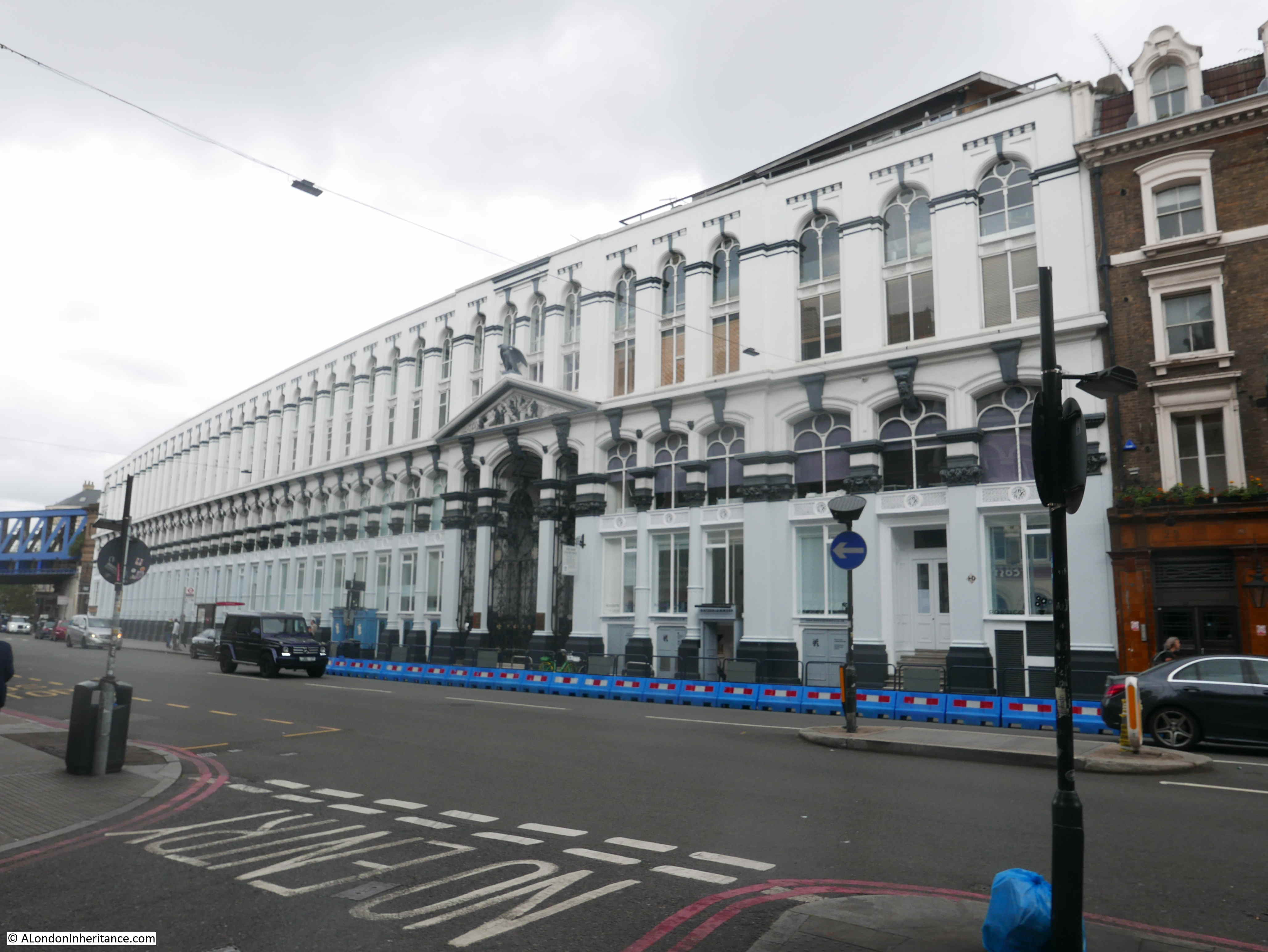
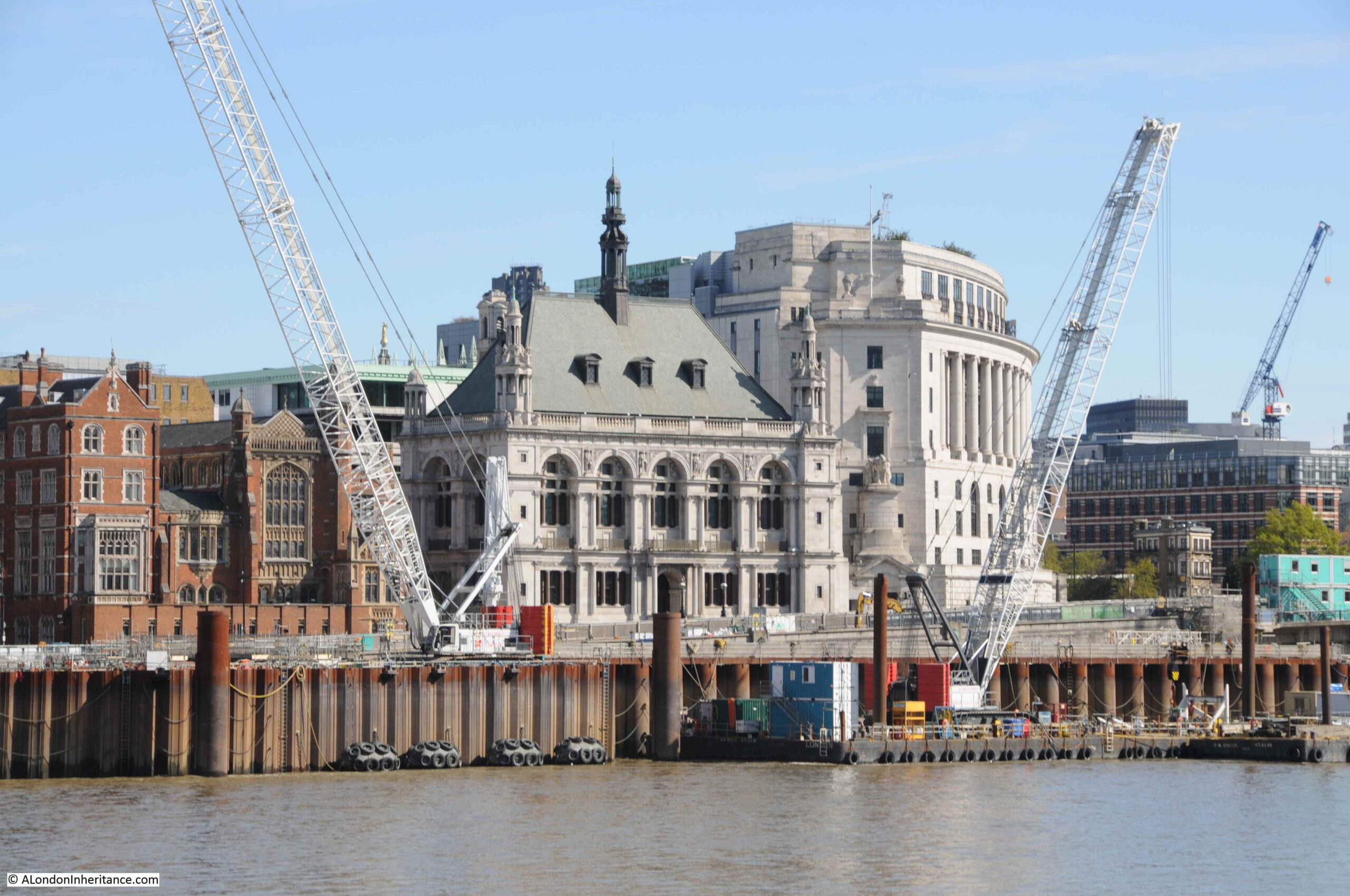
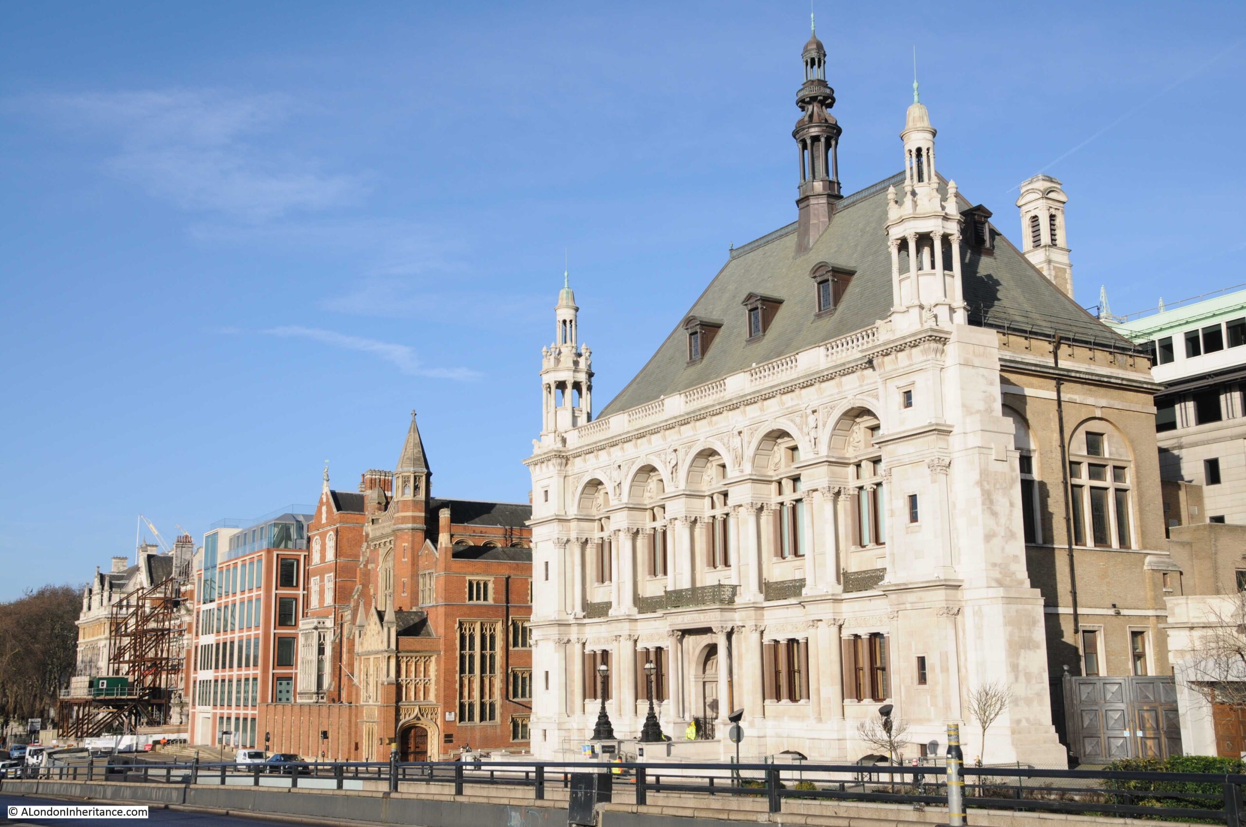
Viewed from across the River Thames, just to the west of Blackfriars Bridge, and between the cranes of the works for the Thames Tideway Tunnel is the building that was home to the City of London School.
The origins of the school date back to around 1442, when John Carpenter, a former Town Clerk of the City left a property for the education of four choristers at the Guildhall Chapel.
In the early 19th century, the City of London decided to review the provision of education in the City, including that provided to the Guildhall Choristers, and in 1883 decided to found a school for the “religious and virtuous education of boys, and for instructing them in the higher branches of literature and in all other useful learning”.
The result was the first City of London School which was built on the site of Honey Lane Market, north of Cheapside. This market was not far from the site of last week’s post on the corner of Wood Lane and Cheapside, see the same map from the post showing the location of Honey Lane Market:
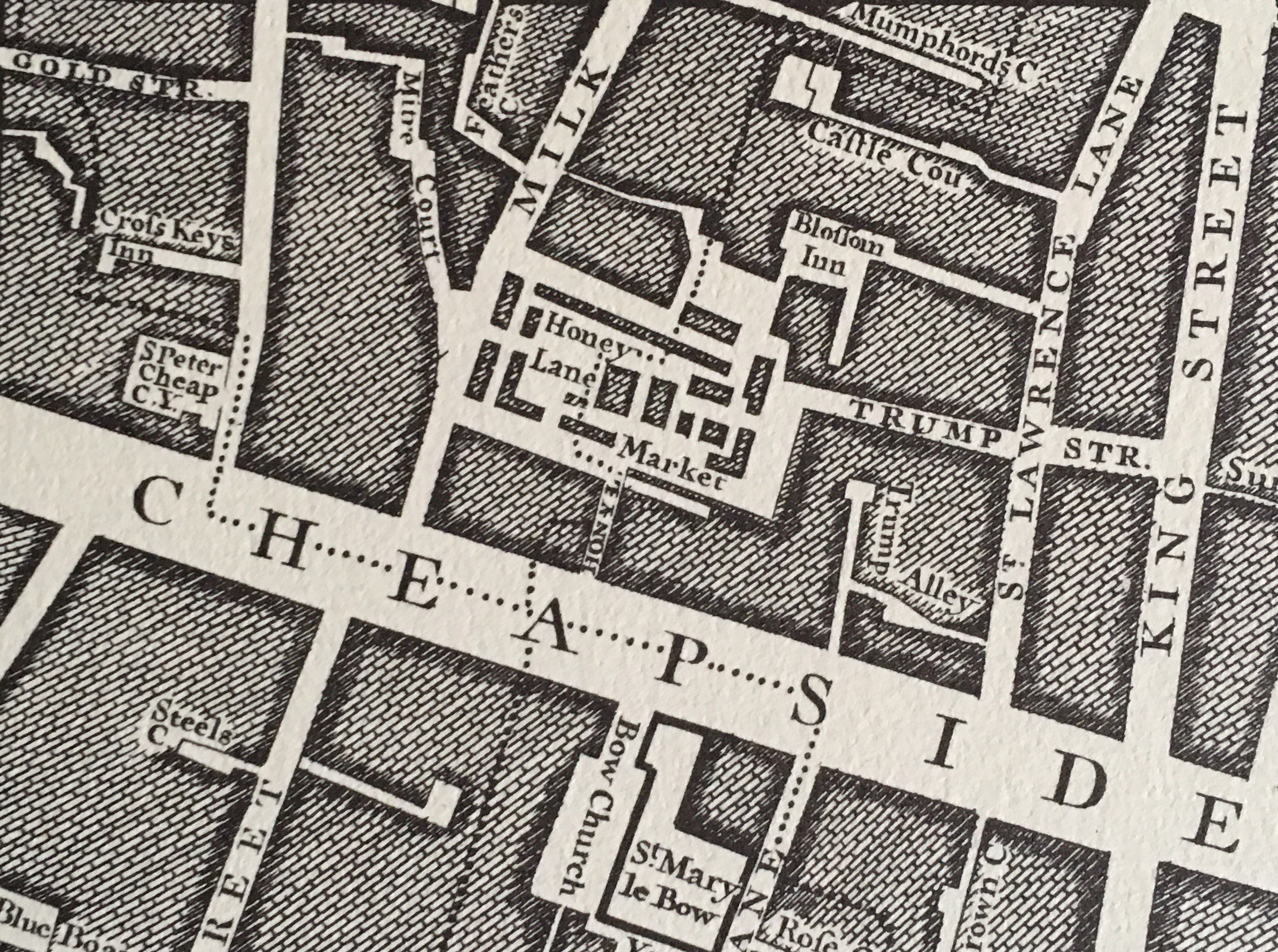
The Honey Lane Market school opened in 1837, however by 1878 the school was becoming far too crowded, and the decision was taken that a new site and larger school was needed. The school was described as “affording educational facilities, to, on an average, upwards of 600 boys at one time. The sons of people residing in, and within a few miles of the City of London, and engaged in commercial, professional or trading pursuits, at moderate cost, and without removing them from the care or control of their parents”.
The original school on the site of Honey Lane Market:
By coincidence, Henry Charles Fehr, who was responsible for the sculpture on the Middlesex Guildhall, had been a pupil at the City of London School on the Honey Lane Market site.
A site alongside the recently constructed Victoria Embankment was chosen, and in December 1882, the new school was opened by the Prince of Wales.
The new school would support up to 700 children and was intended to provide a level of education that would “lead to Universities for those who seek it”.
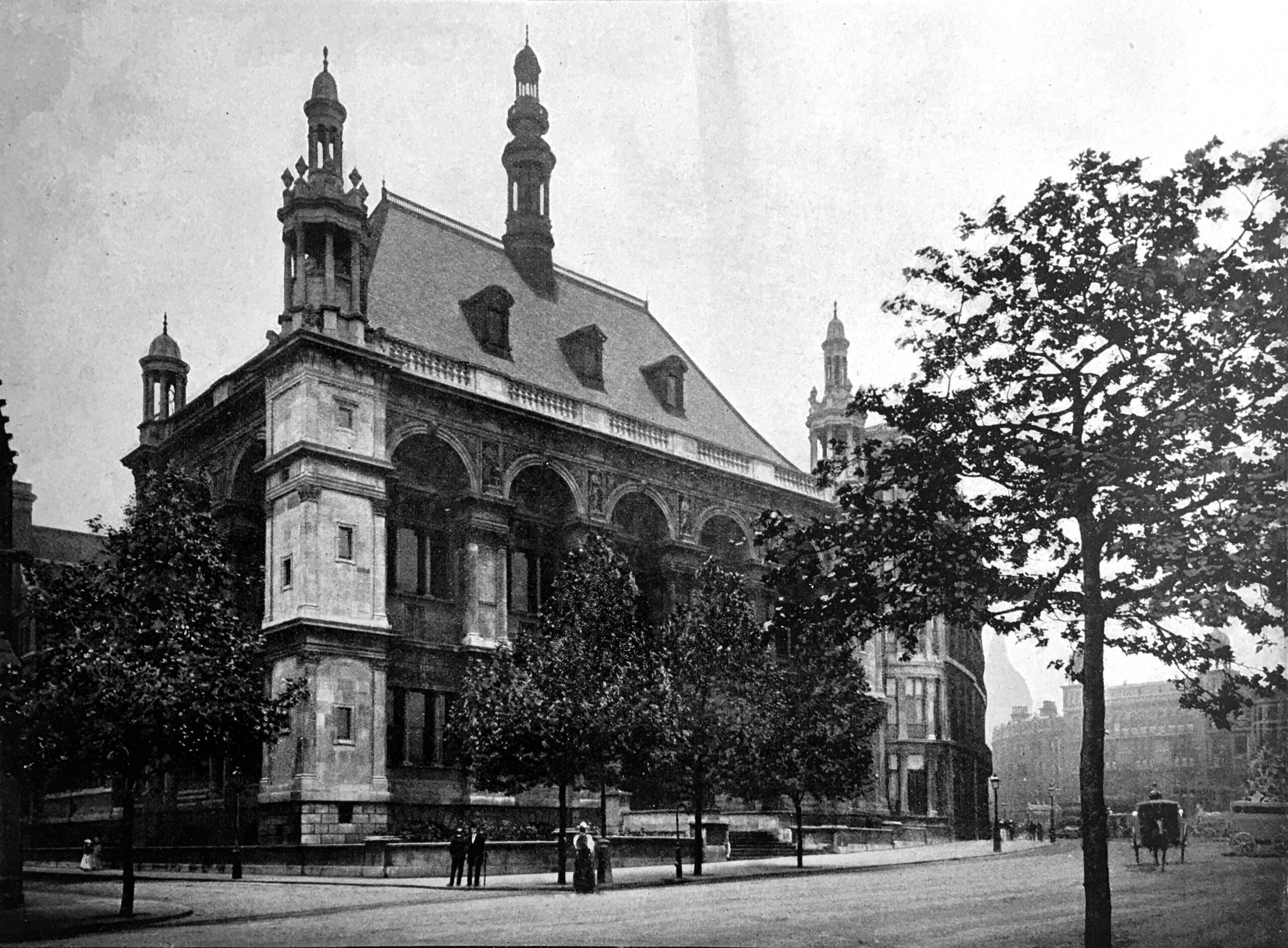
The new school photographed at the end of the 19th century, about 15 years after opening:
To the rear of the building facing the Victoria Embankment were a number of additional school buildings along with a large playground and gym. Below ground there was a rifle range.
In 1937 for the centenary of the school, a biology lab was opened along with “one of the finest swimming pools in London”. In 1956 a Junior School was added to the site and two years later new Science rooms were added.
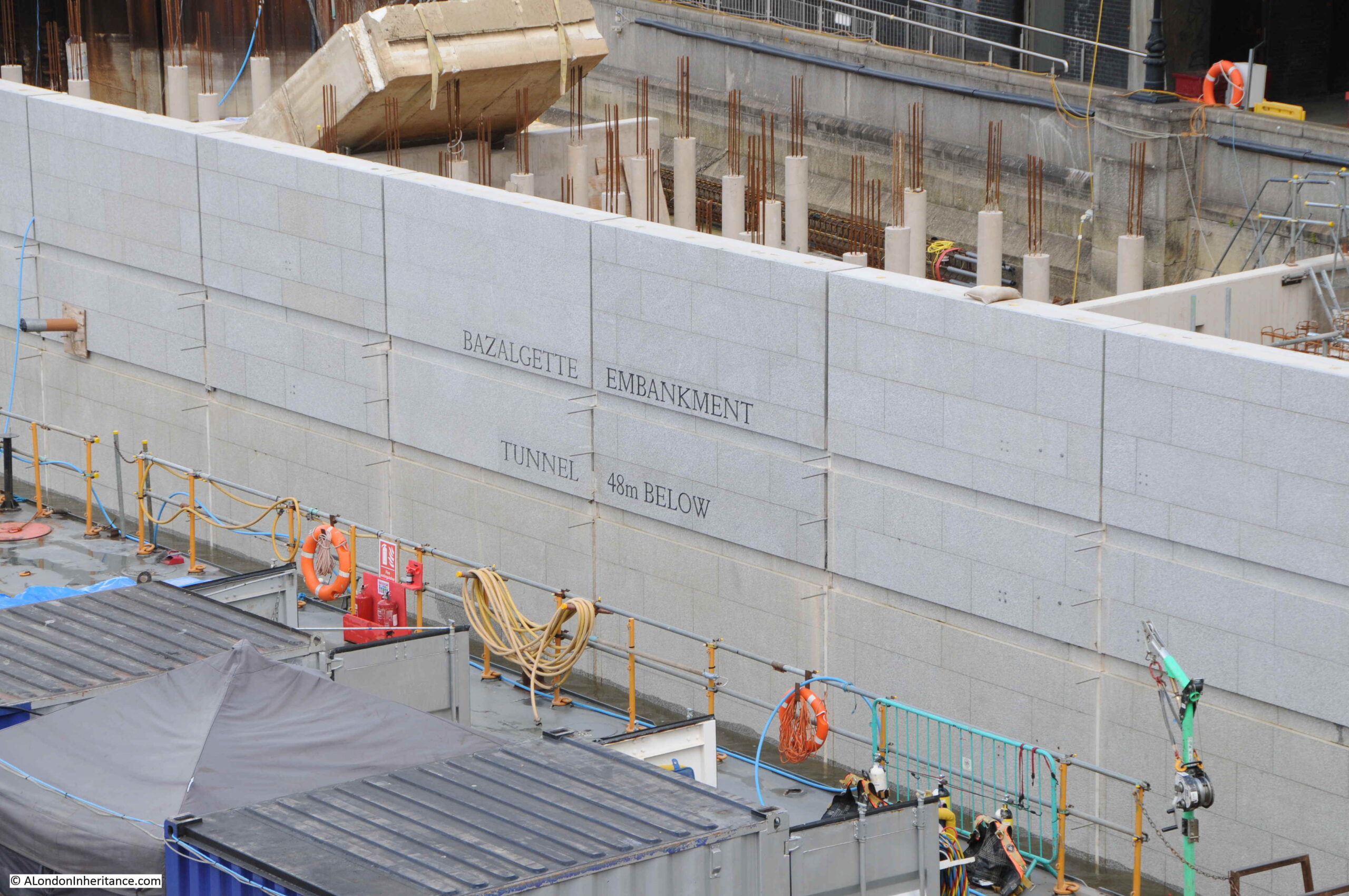
View of the school from Blackfriars Bridge, partly hidden by the Thames Tideway Tunnel works where a new intercept junction is being built, so that flow from the city sewer system can be intercepted and fed into the new tunnel. A new public space will be created when the work has completed.
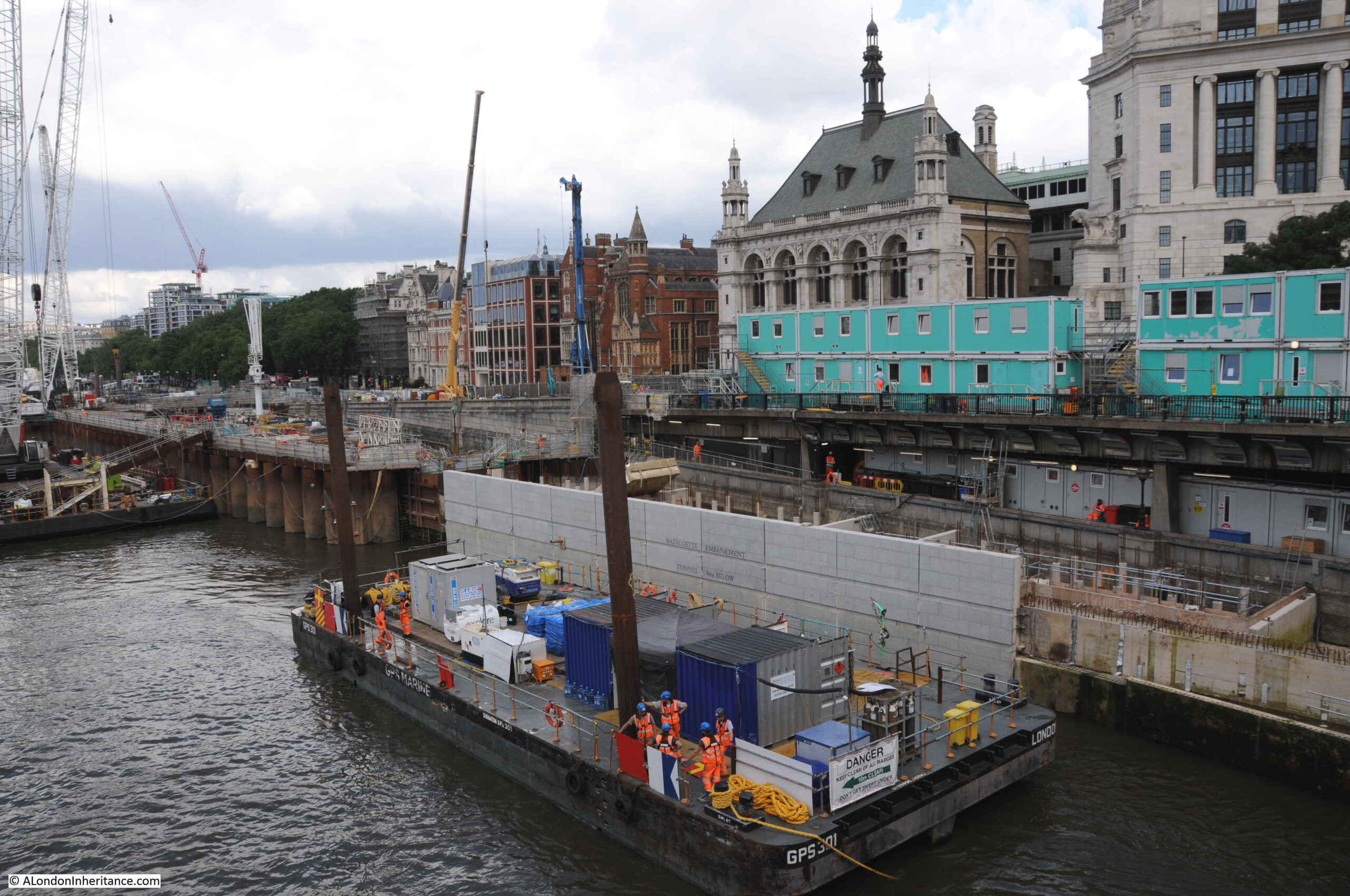
In the above photo, it looks as if the new river wall to the new space is being installed. Taking a closer look at this I was fascinated to see that the words “Bazalgette Embankment, Tunnel 48m Below”. Brilliant to see that the creator of the Embankment is being remembered, along with the latest engineering project at the site, with the depth of the tunnel far below.
Detail on the new river wall:
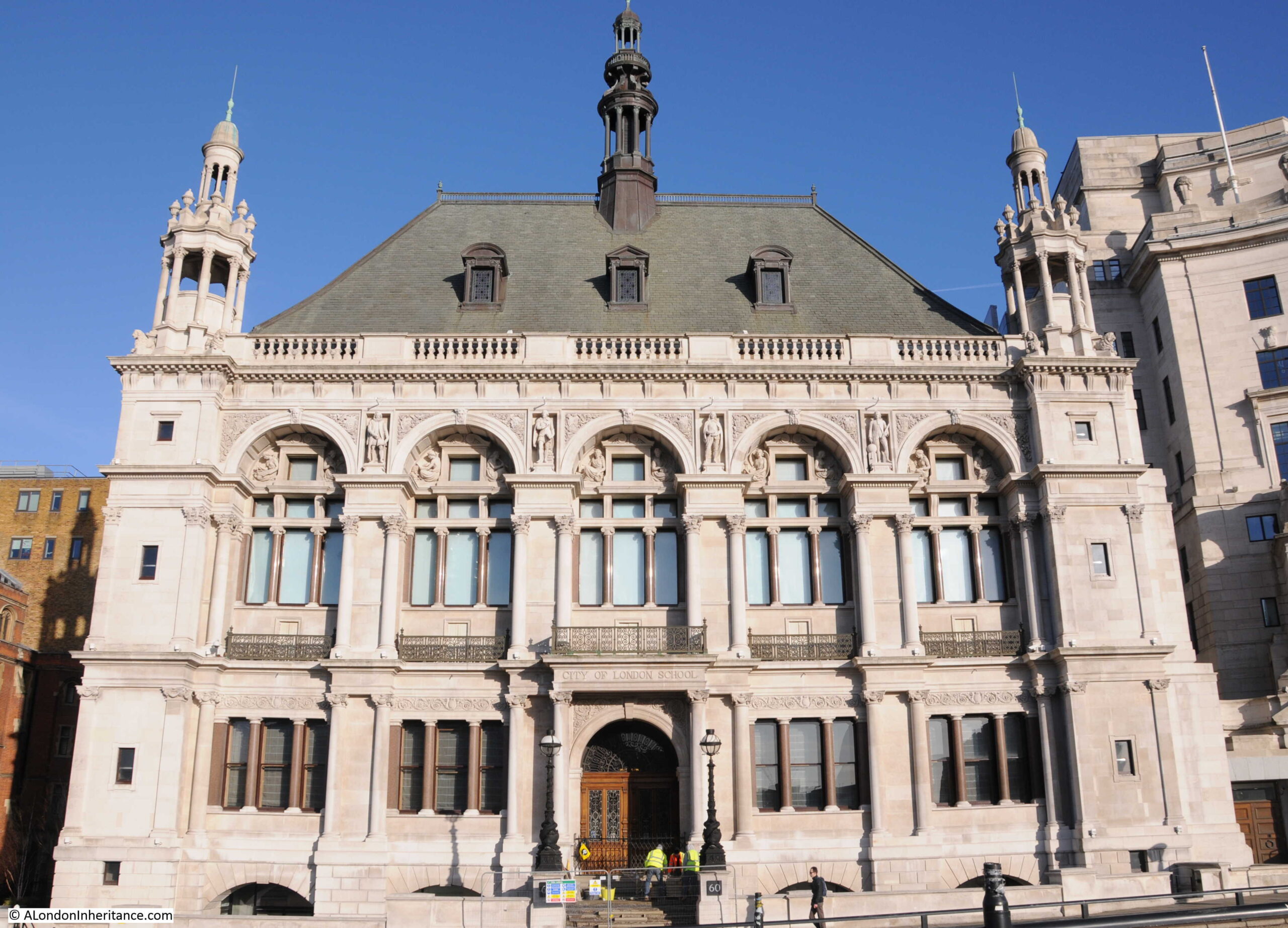
A side view of the old City of London School shows the different materials used, with stone facing to the front of the building and much cheaper brick to the sides:
The school on the Embankment would continue in use until 1986, when a new school was built, a short distance along the river, on a large site between Queen Victoria Street and the river. Part being constructed over Upper Thames Street.
The front of the building from the Victoria Embankment:
If you look at the above photo, just below the parapet that lines the base of the roof, you will see four statues which reflect the educational focus of the school in literature, poetry and science with Shakespeare, Bacon, Milton and Newton being represented, however one of these has a strange spelling:
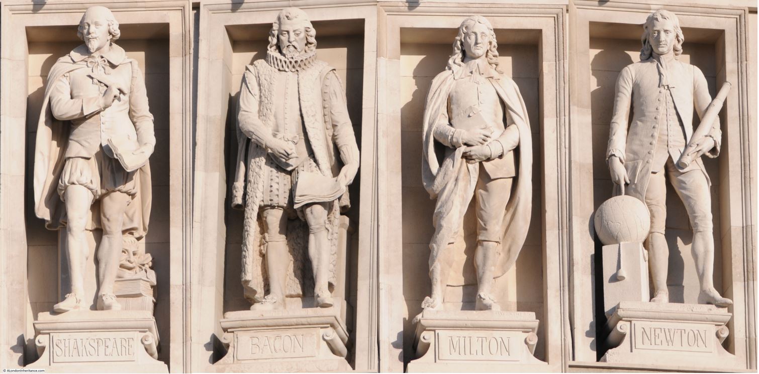
Look at the statue to the left, and the spelling of the name on the plinth is Shakspeare, missing out the “e” between the k and s, as in the normal spelling of Shakespeare.
I know there have been alternative spellings of Shakespeare’s name, however the version with the “e” seems to have been the standard for many years.
Was it a simple spelling mistake? Did one letter need to be dropped so the longer name would fit across the plinth? or is there some other reason? I would love to know.
Following the move of the school in 1986, the building was refurbished and is currently occupied by the asset management company J.P. Morgan.
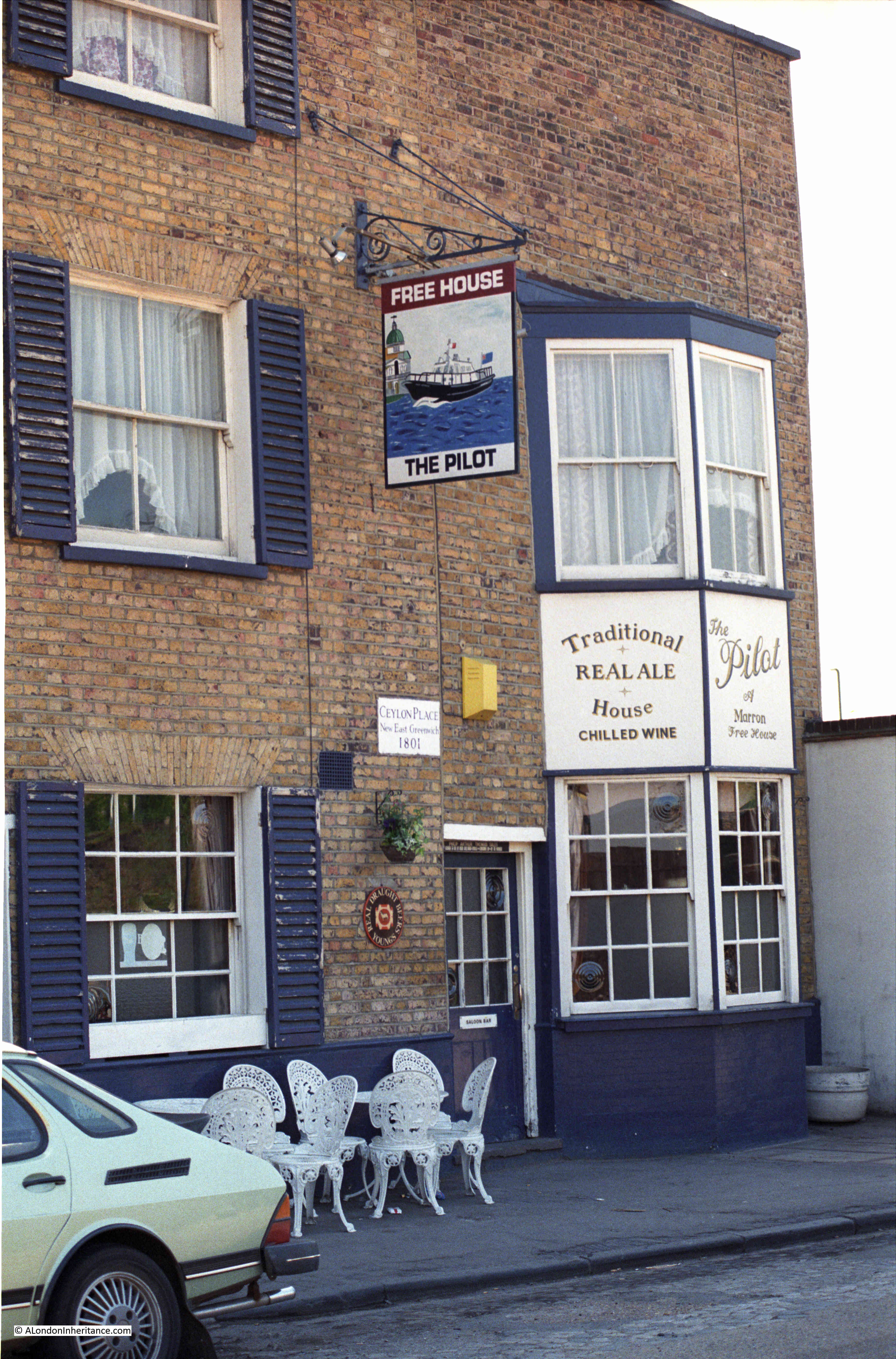
The Middlesex Guildhall and the City of London School have found new uses, and appear safe for the time being from any further redevelopment, however for my final building of this week’s post, there is a pub that may be at risk:
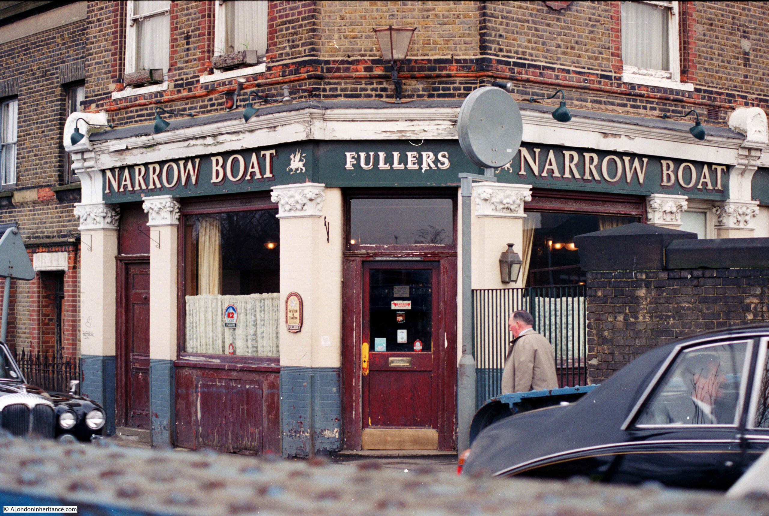
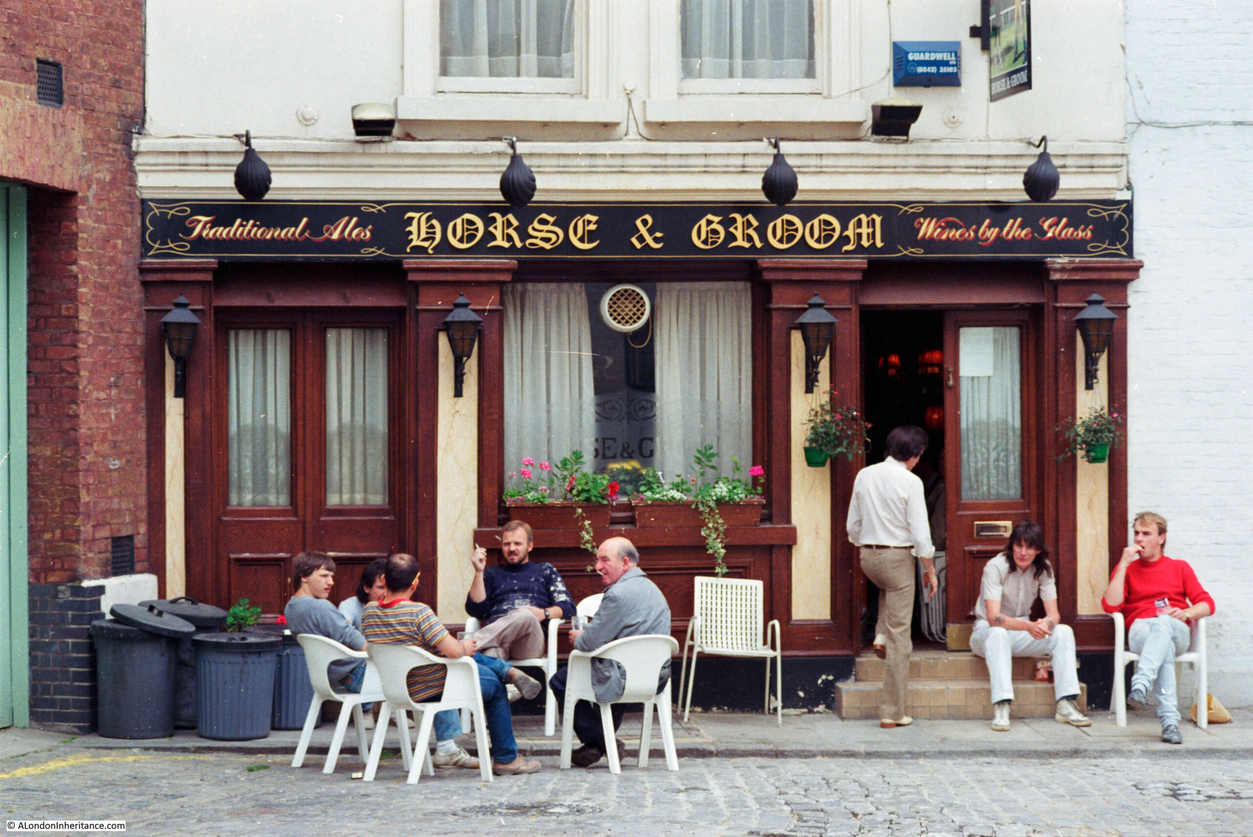
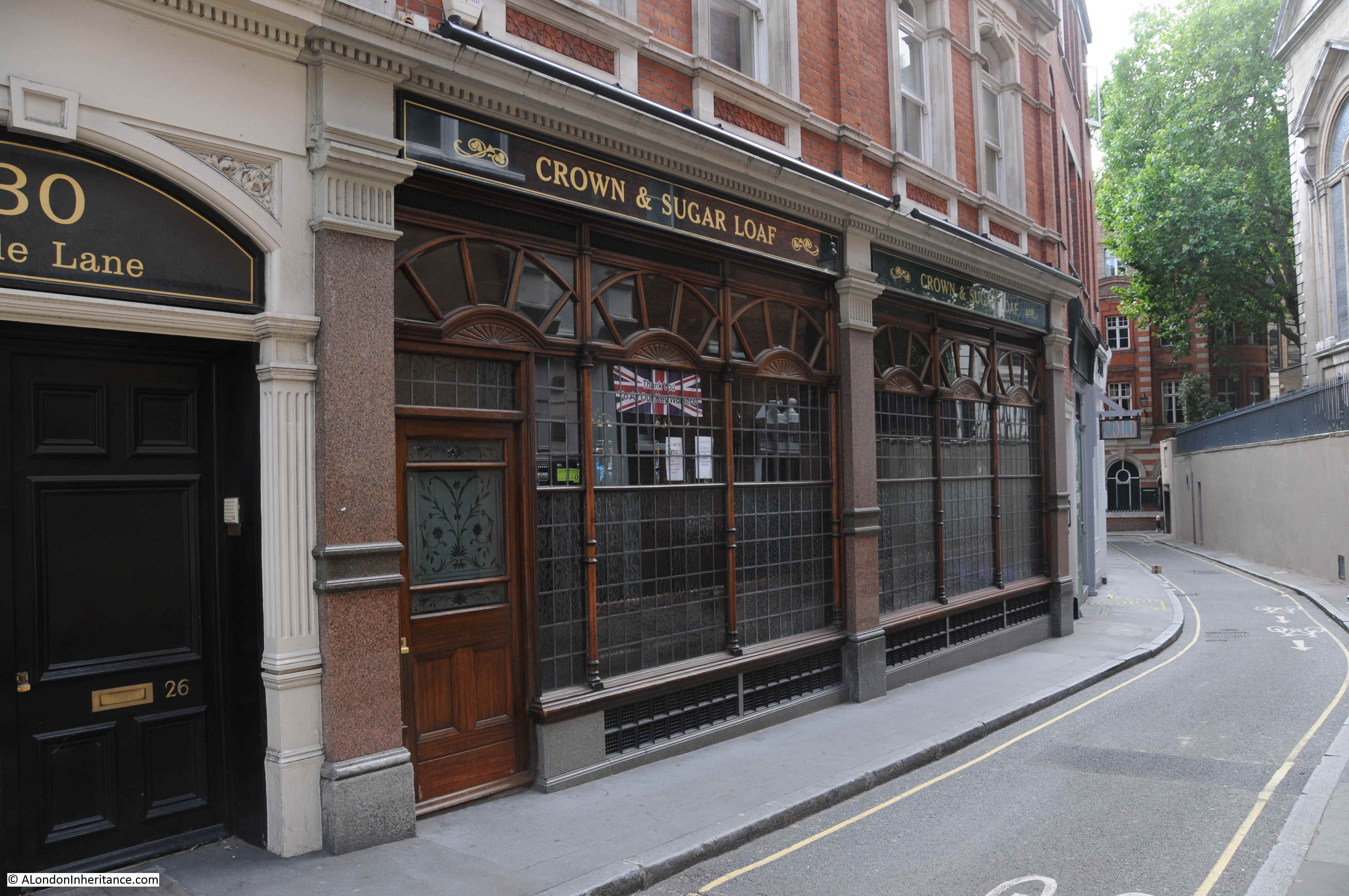
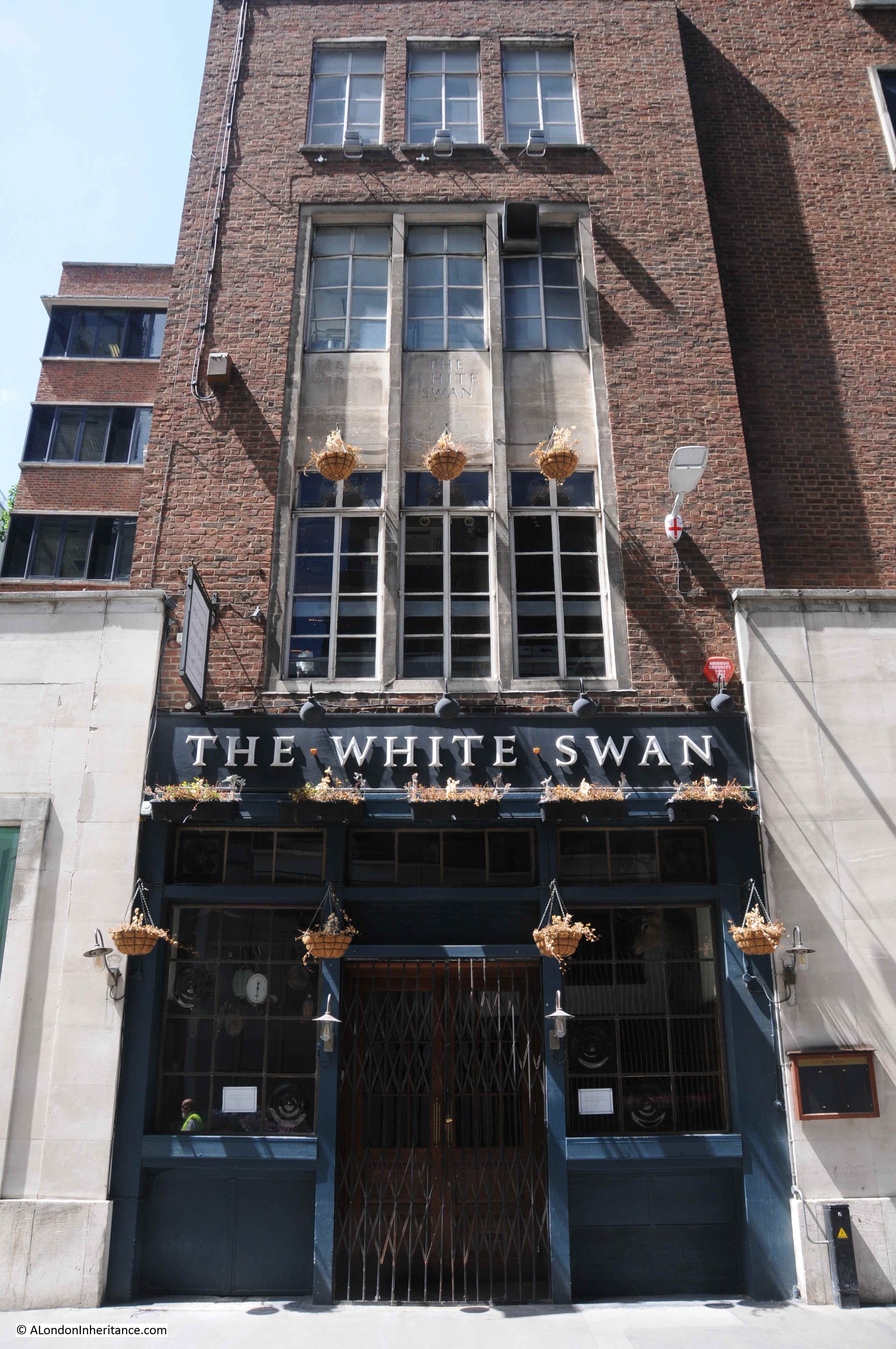
The White Swan – Fetter Lane
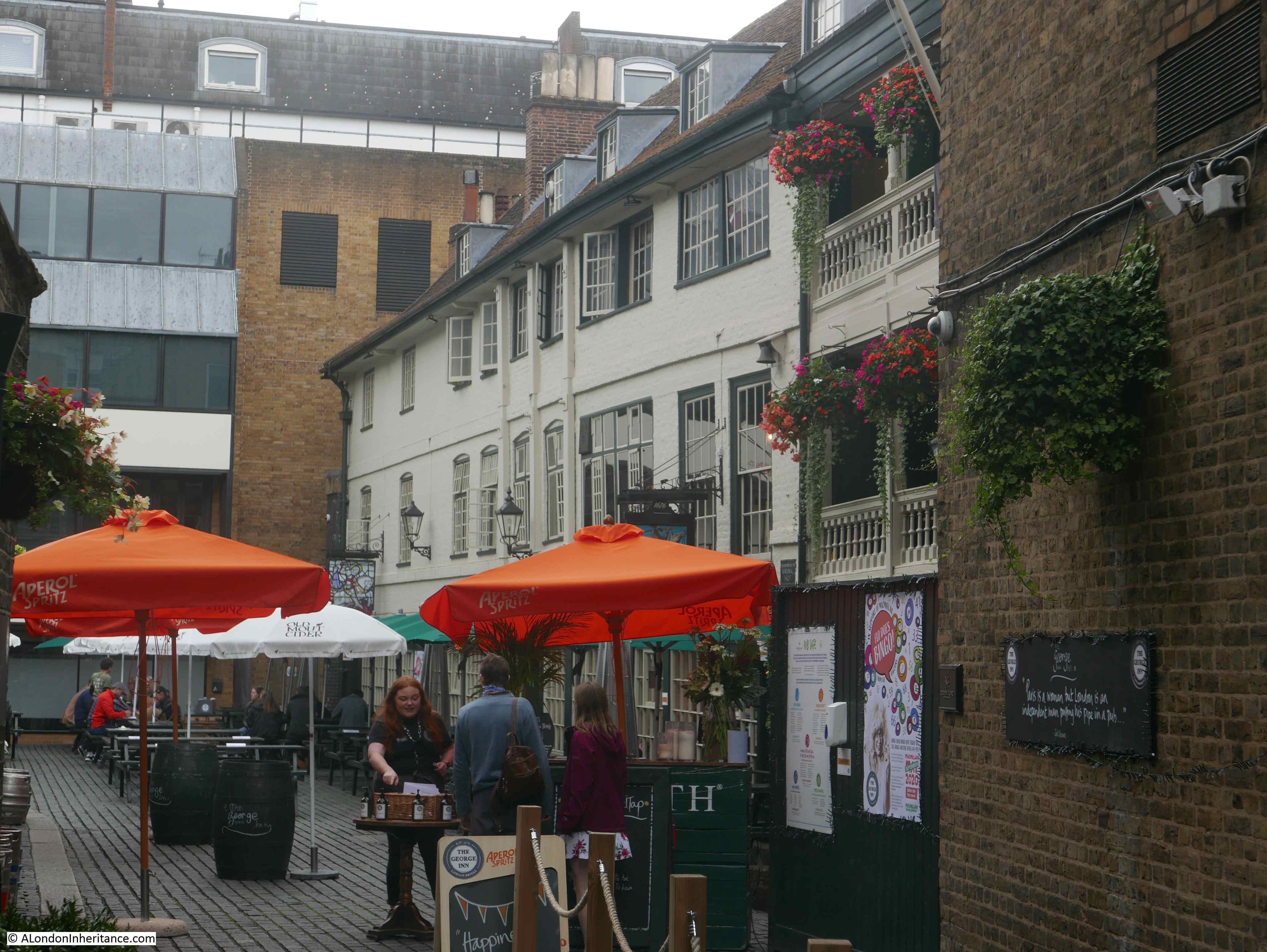
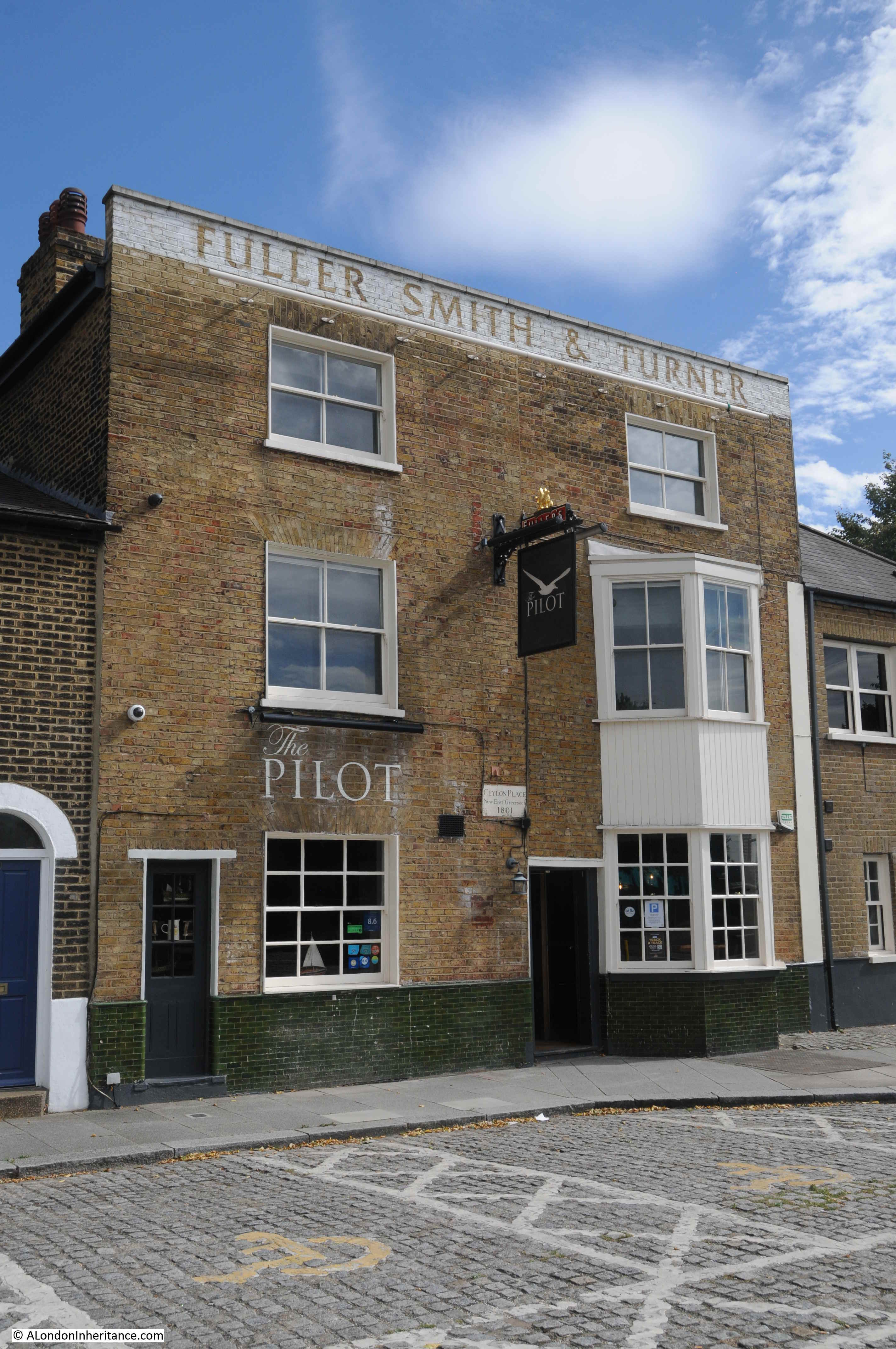
I photographed and wrote about the Swan in Fetter Lane last July when I went on a walk to find all the pubs of the City of London.

Plans have recently been approved for the redevelopment of 100-108 Fetter Lane, however these plans include two options for the pub:
Option A is for a new office building, but with the White Swan Pub relocated and “reimagined in an enhanced manner”.
Option B is for flexible office space, a pedestrian route, gardens and the White Swan retained as part of an extension of new commercial space.
Option A, where the pub appears to be demolished, and a new pub built in the dreaded words of “reimagined in an enhanced manner” sound rather ominous.
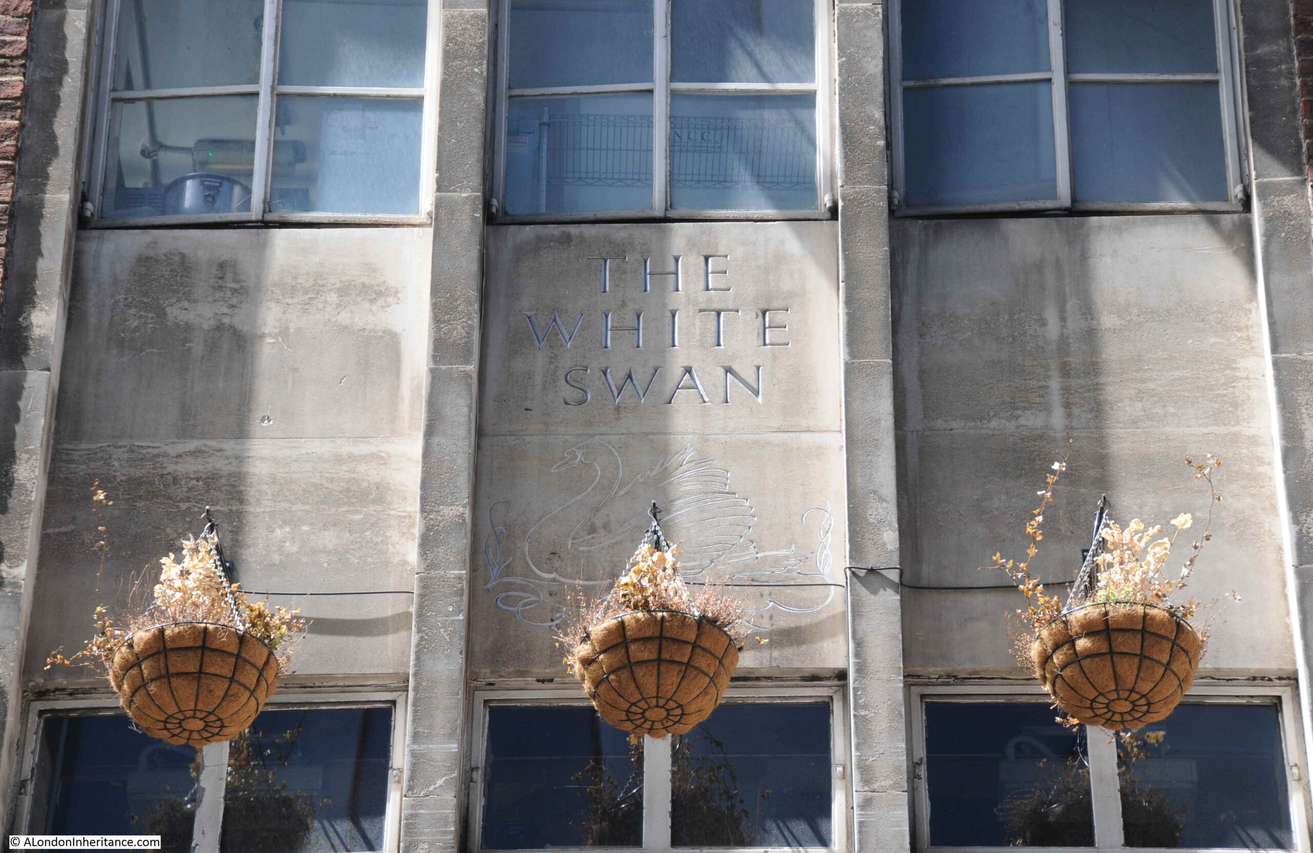
Just three buildings out of the thousands that can be found across London, and representative of the change that always has, and will continue to take place across the city’s streets. I do hope though, that the White Swan survives. A fine example of a 1950’s brick built, London pub.