London Films – Capturing 100 Years of Change

This time last year, in that strange period, between Christmas and New Year, I wrote a post about London – Captured in Music Videos, as they are fascinating, not just for the excellent music, but to see London in the background, in these videos from the last few decades.

For this year, I thought I would have a post about London films. Not films where London appears in the background, but films which are dedicated to telling a story about a particular aspect of the city.

They are fascinating to watch, not just to see how the city has changed physically, and how life in the city has also changed, but also to make us think.

The people we see in these films working or living in London could probably not have foreseen the dramatic changes that would transform their city, and likewise our experience of the city today is just a snapshot, and in years to come many aspects of the city will be radically different, and it will be someone else’s city, who will probably look back at film of London in the 2020’s with a mix of nostalgia and amusement.

So for the long, dark evenings, here is London from the past 100 years.

If the WordPress YouTube Block works there should be several videos embedded in this post. I am not sure if they will show in the emailed version of this post. If not, go to the home page by clicking here to view the post.

The London Nobody Knows

The film “The London Nobody Knows” is a fascinating glimpse of London at a time of great change. By the release of the film at the end of 1968, there had already been considerable reconstruction after the bombing of the 1940s, and gleaming glass and steel office blocks were springing up across the city.

There were though still a considerable number of bomb sites and damaged buildings, and the London Docks were still busy, although there were signs of the changes that would effect trade on the river and the docks in the future.

The film was written by the writer Brian Comport and the artist and author Geoffrey Fletcher, and the film takes its name from the book the London Nobody Knows by Geoffrey Fletcher. His books mixed Fletcher’s drawings of buildings, street infrastructure, people etc. across the city with descriptive text.

The film uses the actor James Mason as a focal point for the film, as he visits and talks about the changing face of London, armed with his flat cap and umbrella:

The London Nobody Knows is perhaps the classic London film.

Capital County

Capital County is a 1951 London County Council film and starts with some history of the development of London, then going on to show the very extensive range of services for which the LCC were responsible, and how these services touched much of the life of all Londoners. The film demonstrates this through Albert Brown, a typical Londoner:

Capital County shows that it is not just physical change that has transformed London over the last 70 plus years, but also the way London is administered and governed.

Bermondsey Wall

Bermondsey Wall is a 1932 film which has some wonderful views of the working river and backstreets of Bermondsey, and focuses on the work of the Time and Talents Association, who by the time of the film were based in Dockhead House, Abbey Street. Time and Talents was started in 1887 to help young girls use their “Time and Talents” in the service of others, to provide education, practical skills and also provide hostels for girls’ accommodation. The organisation has evolved into a community organisation which is still running today across Rotherhithe and Bermondsey.

The Proud City – A Plan for London

The Proud City is a film produced for the Ministry of Information, to explain the 1943 County of London Plan. The film includes the main authors of the plan, JH Forshaw (Architect to the London County Council) and Sir Patrick Abercrombie (Professor of town planning, University of London), who explain why a plan is needed, the thinking behind the plan, how it will transform London, and the resulting benefits for all those who live and work in the city, along with some wonderful film of the city.

The plan was wide ranging, and covered almost every aspect of life in London, and the plan identified many of the issues with the haphazard way in which London had developed over the centuries, resulting in poor housing, housing and industry together existing in a mixed street plan, traffic congestion, the way the old village London had merged into a far larger and more complex greater London.

We can see today how some of the ideas from the plan have been implemented. The plan makes a comparison between the north and south banks of the river in central London, with well designed offices, government buildings and a fine Embankment with trees and gardens on the north, whilst on the south bank there was a confusion of warehouses, slums and derelict streets, which had been made worse since the Blitz. The plan identified the south bank of the river as an ideal opportunity to develop a new river frontage, worthy of London.

The intention with bombed, industrialised areas such as Stepney, was to transform them into new “social units” or neighbourhoods, each with a population of between 6,000 and 10,000, and having a school, local shopping centre, medical facilities and with housing provided by a mix of terrace housing, each with a garden, and blocks of flats built within landscaped grounds.

Industry and commerce would be moved to the boundaries of neighbourhoods, rather than being mixed in with housing, and main roads would also be at the edge to avoid through traffic.

An early example of the concept that today seems to have attracted the name of the 15 minute city.

The film has some wonderful quotes, for example the following from Patrick Abercrombie:

“There must be change, always change, as one season, or one generation, follows another”.

This quote sums up London’s history. A city that has always changed, adapted and evolved, but the problem with change is that it raises questions about what we keep and what we get rid of to continue that change.

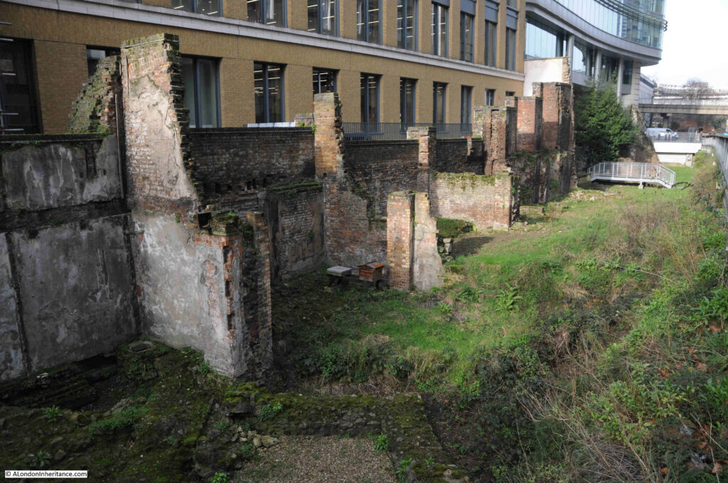
You can see these issues play out every day, with a few current examples being the M&S building in Oxford Street, proposed redevelopment of Liverpool Street Station, the new buildings on the site of the London Weekend Television building on the Southbank, and the potential demolition of Bastion House on London Wall, along with the adjacent, old Museum of London site (both by the architects Philip Powell and Hidalgo Moya, who also worked on the 1951 Festival of Britain and designed the magnificent Skylon).

The Port of London

A film by British Pathe and British Instructional Films Ltd and headlines as a Classroom film. The film shows the workings of the London Docks. It starts off slowly, whilst working through a map showing the location of all the docks from Tilbury to St. Katherine, and then shows the docks in operation:

British Instructional Films Ltd were primarily a documentary film maker, founded in 1919 by Harry Bruce Woolfe. The subject of these films ranged from the re-enactment of military engagements through to a long running Secrets of Nature series, which included painstaking studio and laboratory work, as well as filming out in the field.

A common thread running through the films produced by the company was patriotism and Empire.

The company suffered financially during the late 1920s and early 1930s and became part of the Pathe company, who continued to use the brand name of British Instructional Films for their educational films, as with the film Port of London.

The City of London – Reel 1

Part one of a film from 1951 showing the City of London in operation – the Stock Exchange, Baltic Exchange, Lloyds of London etc.

The City of London – Reel 2

The second part of the film, which focuses on the ceremonial and crafts aspects of the City of London.

Both films show a very different City of London to the City of today, including a City where men are in all of the roles of any consequence in the City:

Barbican, 1969: The development of the Barbican Estate following World War II

This is a wonderful film in “Technicolour” that covers not just the development of the Barbican Estate, but includes many other aspects of London. The views of the estate being built, alongside views of what was there before help illustrate what a transformational housing project the Barbican was for the City of London:

The film includes a brilliant few minutes of people looking round one of the show flats which have been furnished in a very modern, late 1960s style, with emphasis on the kitchens, bathrooms, and how the flats have been designed to maximise views through the windows, sunlight, sound proofing etc.

The Living City

The film The Living City was made in 1970 for the City of London Corporation. The film starts with views of the fires started by incendiary bombing on the night of the 29th December 1940, and then goes on to tell of the reconstruction of the City, the institutions and businesses that make the City the main centre for global trade, finance and insurance, and how the City is being rebuilt, including some film of the Pedways:

It is interesting to compare the City of London in 1970 with the City of today. The film talks about Cheapside being the main shopping street of the City and a “seething confluence of seven major thoroughfares” between the Bank junction and St. Paul’s. The film shows the amount of traffic along streets such as Cheapside and across the Bank junction, and this is one of the things about the City that I struggle with today.

Despite the air being much cleaner and healthier, the City just seems to have lost a sense of human activity, of being an exceptionally busy, exciting place, and across the whole film we can see the sheer diversity of activities that went on within the City of London.

There is film of the markets at Billingsgate, Spitalfields and Smithfield, and somewhat ironically given the City of London Corporation’s plan to close the Smithfield meat market, the film talks about the “City’s determination to keep the wholesale markets”.

There have though been some positive changes in the 74 years since the film, the fur market in Beaver House of the Hudson Bay Company no longer operates, and ivory is not stored and traded in the Port of London Authority warehouse in Cutler Street.

The danger with changes such as the closure of Smithfield is that the City of London gradually looses all the things that have made the City such an important place for many hundreds of years, and the square mile looses its identity and ends up much like many other places in central London where expensive apartments, hotels and places to attract visitors and tourists become the primary drivers of redevelopment.

The Changing Face of London

The Changing Face of London from 1960 is also about change, starting with scenes of demolition and the ruined buildings across the city, then focussing on redevelopment and potential plans for the city.

The models shown for large site redevelopment and also for individual buildings are fascinating, but thankfully some of these schemes did not get built.

If you have been on my Barbican walk, at 17 minutes and 19 seconds into the film, there is a view of the new section of London Wall that had been opened in the previous year (1959), and to the left you can see the church of St. Alphage, which was later demolished to just the medieval remains we can see next to London Wall today, and to the left there is Roman House, the white office block that was the first post war building constructed in the area, and about the only one of the buildings in the scene that remains to this day.

The Pedway: Elevating London

The Pedway was one of the ideas coming from wartime plans for post-war redevelopment of the City of London, where pedestrians would be separated from road traffic on raised pedestrian ways, and the redevelopment of London Wall resulted in one of the areas where Pedways were extensively used across a wide area.

The concept was not only to separate pedestrians from traffic, but also to provide on the Pedway, the shops, pubs, restaurants and other services that would have normally be found at street level.

This 2013 documentary tells the story of the Pedway, along with the associated redevelopment of much of the City of London:

The original Pedways have all but disappeared in the development of the last few decades, however elevated walkways are still the main method of walking through the Barbican estate, and there has been a reconstruction of a Pedway (but without shops, pubs etc.) in the area to the north of London Wall, around the remains of St. Alphage.

This Is London – 1981

This film is more a tourist overview of London, but is interesting as it shows the city at the start of the 1980s, when London was still a very low rise city.

At 55 seconds into the film, there is a wonderful bit of film of a hovercraft on the Thames and passing under Tower Bridge:

Bob Hoskins: London is being “Sterilised by greed” 

This is another absolute classic, with the actor Bob Hoskins showing Barry Norman around parts of the south London riverside from Coin Street on the Southbank down to Shad Thames, and whilst some of the developments he talks about did not get carried out, many did, and his core argument is the same today as it was in 1982:

The future’s up for grabs – GLC Docklands

Where the Bob Hoskins film talks about the derelict buildings along the river, and the preference of developers for offices over houses, the following film explores the impact on those who lived around the large expanses of old docks that were “up for grabs”.

There are lots of interviews with those who live in the area. Young people who complain about the lack of facilities and how far they have to travel for school, older people who talk about what the docks were like when working, talk about some of the new developments and the physical separation of council and private housing etc.

Many of these issues are still just as relevant, and the area around the Royal Docks shown in parts of the film are still being developed today, and from my walks around the area, there still seems to be very few facilities for those living in the new apartment blocks.

River Cruise Down The Thames

This is a GLC film, aimed mainly at visitors to the City, but the film also highlights the benefits that the GLC has brought to the city (the film ends with the slogan “keep GLC working for London” as the film was made when the Conservative government was arguing for the abolition of the GLC).

The film runs from Hampton Court, Twickenham and Kew, down to Greenwich and the recently completed Thames Barrier:

Film 87 – How Docklands became Vietnam

The closure of the London docks offered producers of film and TV programmes so many opportunities with large areas of derelict land and buildings available.

Much of Bob Hoskin’s film The Long Good Friday was filmed in and around docklands, and this extract from Film 87 shows how Beckton Gas Works were transformed into Vietnam for Stanley Kubrick’s film Full Metal Jacket:

It is worth watching just for Barry Norman’s description of yuppies at the beginning of the film.

The following links are to films held by the British Film Institute. Unfortunately, unlike YouTube, the BFI does not appear to have a player that can be embedded in a WordPress site, so the links take you to the BFI website.

Barbican Regained

The film covers the area that would become the Barbican, but also takes a look at the rest of the City:

https://player.bfi.org.uk/free/film/watch-barbican-regained-1963-online

Many of the views of the area that would become the Barbican are in colour, and in one section of the film, when the camera is panning across the Barbican, at 10 minutes 52 seconds, there is a view that is almost identical to that taken by my father around 16 years earlier. See the post on the Cripplegate Institute and Jewin Crescent, and photo at this link to compare, and the comparison shows how little had changed during the whole of the 1950s.

A Day in London

This film from 1920 starts from Victoria Station and then travels across London, visiting the main landmarks that a visitor to the city would have been expected to visit:

https://player.bfi.org.uk/free/film/watch-a-day-in-london-1920-online

The majority of the landmarks are much the same today as they were in 1920. What has changed are the people, cars and buses, and the fact that in 1920 Downing Street was just a normal London street that happened to have the official home of the Prime Minister. A reminder that one of the many factors to have changed London over recent years has been terrorism with Downing Street now looking like a fortified street, London’s bridges having barriers between road and footpaths etc.

Barbican Phoenix

Barbican Phoenix is yet another film on the redevelopment of the area around London Wall and the Barbican:

https://player.bfi.org.uk/free/film/watch-barbican-phoenix-1961-online

What interests me about these films is that they include scenes that are very similar to the photos taken by my father, and at 1 minutes, 36 seconds into Barbican Phoenix there is a view of the Red Cross Street fire station and church of St. Giles Cripplegate that are also featured in my father’s photo in the post at this link.

A small selection of films that show how London has changed over the past 100 years, and how London has continued to evolve to meet challenges and opportunities.

One of many themes from these films is the sheer diversity of activities there were in London, and my concern is that in many ways it is becoming a less diverse city, and risks ending up as a tourist attraction rather than a living and working city.

I think sometimes we focus too much on the physical aspects of the city, preservation of buildings etc. Whilst it is important that we preserve key buildings and significant architecture, that we build more homes etc. my personal view is that the far more important question is what do we want the city to become – probably a question that is impossible to answer.

alondoninheritance.com

A Christmas Book – London after Dark by Fabian of the Yard

London after Dark by Fabian of the Yard is not really a Christmas book. I have added the Christmas reference to the title of this Christmas Day post for a special reason.

My father had a large collection of books about London, and reading many of these at a young age was probably one of the factors that helped grow my interest in the city.

On the inside page, he frequently wrote the date of purchase, where purchased, and if a present, who gave it to him (often written by the person who gave it). A bit of a tradition that I have carried on to this day, as surprisingly, I am often given London books as Christmas presents.

London after Dark was a present to him, confirmed by the note and date on the front page of Christmas 1954 – Christmas 70 years ago today.

Fabian of the Yard was ex-Detective Superintendent Robert Fabian, whose first book, simply titled “Fabian of the Yard” had been a best seller and was described in newspaper reviews as “the best detective autobiography ever written”. This is the cover of London after Dark:

The author biography on the inside cover reads: “Fabian began as an ordinary constable walking the regulation 2.5 m.p.h. on the beat, and worked his way up through all the grades of the C.I.D.

Few men understand the workings of the criminal better than Bob Fabian; from his earliest days as a probationer detective in Soho he made a point of frequenting the cafes and dives to which hardened old lags tend to return, and from them he learned a strange kind of loyalty which on more than one occasion helped to solve a difficult case.

But the Underworld also knew that when Fabian was roused it faced an enemy whose pursuit would be relentless and whose brain could outwit the most cunning.”

The caption to the following photo reads “I spend much of my time wandering round odd spots in London”:

London after Dark covers the period when Fabian was head of the Vice Squad, and in the book he gives “vivid descriptions of dope, prostitution, blackmail, low night-clubs and all that goes with the murky side of London after Dark“, and that “he eschews sensationalism and deals with them as human problems for which it seems we are all responsible” – I did say it is not really a Christmas book.

“Night closes over London, and under the light of a lamp, two people meet”:

A selection of chapter headings helps provide an idea of the contents:

  • London’s Night Clubs
  • Dope – A Traffic in Damnation
  • Sex and Crime in London
  • The Street Girls of Soho
  • The Master Minds of Crime
  • The Men of Violence
  • London’s Cocktail Girls
  • West End Hotel Undesirables
  • The Blitz Site Murder
  • The Constable Who Noticed Something
  • The Killer Left a Thread

“Drama or romance?”:

The book is a fascinating, very descriptive read of crime in London during Fabian’s police career, up to his retirement in 1949.

There is an interesting chapter on the role of the pub in London night life, and the pubs of Soho (or the “square mile of vice” as Fabian describes the area), were places where anything could happen.

To try and maintain order within the pubs of Soho, Fabian included a list of “thou-shall-nots” as a guide for the Soho publican:

  • Allow betting in the pub. This is very strictly enforced and a publican can very soon lose his licence if he allows any laxity in this rule.
  • Allow billiards on Sunday. The reason for this is not obvious as it cannot be more wicked to play the game on Sunday than any other day of the week. It is probably a survival of a strict Sabbatarian approach to the Lord’s Day, and, like so many similar rules and regulations, awaits the hand of the reformer.
  • Allow the pub to be used as a brothel. This is the most important rule as there was a time within living memory when certain pubs were used for immoral purposes, and quite unfit places to take one’s female relations or friends.
  • Serve liquor to policemen while on duty. Hard luck on a thirsty policeman, maybe, but a very wise precaution.
  • Allow drunkenness, violent, quarrelsome or riotous conduct to take place on his premises. I am not going to pretend that there is no drunkenness in pubs today – there is – but compared with my young days, it is no longer a serious social problem. I well remember the average Saturday night on the beat when the paths were strewn with drunks of both sexes. Fights were a regular feature, and it was quite common to see two women surrounded by a crowd tearing at each other’s hair and screaming. Not a pretty sight, I can assure you.
  • Harbour thieves or reputed thieves, policemen on duty or prostitutes. A pub is a natural meeting-place, and a publican has to be especially careful to ensure that his premises are not used for criminal purposes or soliciting by males or females.

“Outside a London pub, ‘hot dogs’ find ready customers”:

“For those who prefer a restaurant, Soho provides for every taste”:

The book is very much of it’s time. The language used to describe sections of the community in Soho is not what we would use today, and the attitude to what were crimes at the time (such as homosexuality) is appalling.

The book describes a Soho (with some diversions to other parts of London as well as some serious crimes across the country) that was over 75 years ago and for the most part is unrecognisable today.

I am not in favour of cancelling books and authors from when attitudes were so very different. They are important in understanding how attitudes have evolved, how London was at various points in history, and how attitudes, places and communities continually change.

Too often we look back on a sanitised view of the past – a golden era when compared to the present time, and an understanding that the past was just a flawed as today is important.

Someone looking back on London in 75 years time will probably be just as critical.

“For some, life begins after dark”:

“A friendly chart with Roy Birchenough at his club”:

Roy Birchenough, on the left in the above photo, seems to have come to the notice of the police on a number of occasions. The following news’s report from the Sunday Express on the 31st of July, 1932 is a typical example:

“VORTEX STRUCK OFF. CLUB STARTED BY TRAGIC VISCOUNTESS. The Vortex Club, Denman Street, Piccadilly, which was started by Eleanor Viscountess Torrington a fortnight before she was found dead from gas poisoning last December, was struck off the register by Mr. Mead at Marlborough Street yesterday.

The new proprietor, Harry Shine was fined £130, and the secretary, Roy Birchenough was fined £120 for selling drinks without a licence during prohibited hours and on credit.

These disreputable clubs necessitate constables having to visit them and drink which is undesirable but necessary, declared Mr. Mead.”

The fine detailed above did not change Roy Birchenough’s approach to keeping a club, as he was fined a number of times during the 1930s, and in 1939, he received a “sentence of one month’s imprisonment was passed at Bow Street on Roy Birchenough, of Norfolk Place, London, W., for selling liquor at Chumleigh’s bottle party, Regent Street, London. He was fined £60 for keeping the premises for public dancing without a licence.”

“Piccadilly Circus, where the pulsing heat of London is most truly felt”:

The big problem for the Vice Squad in Soho in the 1930s and 1940s was drugs, and London’s black market drugs included heroin, cocaine, morphine, pethidine, with the main problem drugs being opium and marijuana, and during a five year period, prosecutions for marijuana increased by 2,100 per cent.

Charing Cross Road was a particular problem area, and it was where “young gangsters use it to get courage. Girls are betrayed by it. It is the easiest, newest weapon of the West End ponce”.

Fabian describes a raid at the Paramount Dance Hall in Tottenham Court Road, where eight men were arrested – one so drug crazed that he attacked the police.

The Paramount Dance Hall and the Club Eleven were both closed by the police. Another closure was the A to Z Dance Club in Gerard Street after a raid by twenty five police officers.

“The lights of Leicester Square act as a magnate to Londoners and visitors from overseas”;

A read of “London after Dark” by “Fabian of the Yard” provides a whole new perspective for when you walk the streets of Soho. A very different place today, but a place that is in danger of changing from the area described in the book to a very sanitised, corporate space that removes almost everything that has made Soho such a unique area of London.

And with that, can I wish you a very happy Christmas, however (or not) you are celebrating, and if you get any books as presents this Christmas, write the date inside, along with who gave it to you (or better still get the giver to write) – a simple message to the future.

alondoninheritance.com

York Buildings Stairs and the Watergate

The following photo is from the 1890s book, “The Queen’s London”, and shows the Water Gate between Buckingham Street and the Embankment Gardens:

The caption underneath the photo reads: “In a corner of the public gardens on the Victoria Embankment, at the foot of Buckingham Street, is the ancient Water Gate to York House, a mansion begun by Inigo Jones for the first Duke of Buckingham. It is a beautiful monument of the famous architect’s skill, and can challenge comparison with similar work by any of the Italian masters. The old Water Gate is the earliest ornamental archway in London. It is interesting, moreover, as showing the former level of the Thames. This part of town was a very different place once, when the nobles fancied it for their mansions, or even prior to the making of the Embankment, when it was regularly lapped by the tide.”

The above description, written around 130 years ago applies equally today, and the Water Gate has been a regular feature in books that covered the key features of the city at the time of publication, and the Water Gate made another appearance in the 1920s volumes of “Wonderful London”:

Apart from the architecture, the really fascinating thing about the Water Gate is that it shows how much of the Thames was taken up by the construction of the Embankment, and with a walk up Buckingham Street, it demonstrates the topography of the area, and how we can still see the relatively steep descent from the Strand down to the foreshore of the river.

Rocque’s 1746 map shows the Water Gate and surrounding streets as they were in the middle of the 18th century. They are shown in the following extract, in the middle of the map, where the Water Gate is part of York Buildings Stairs:

The map shows that the Water Gate faced directly onto the Thames foreshore, and whilst the Water Gate was an unusual feature for Thames Stairs, York Buildings Stairs were just another of the Thames Stairs that lined the river, and looking along the river in 1746, we can see other stairs. Salisbury Stairs, Ivy Bridge, Black Lyon Stairs and Hungerford Stairs, all lost with the construction of the Embankment.

The Embankment was built between the mid 1860s and the early 1870s (there are various dates either side of these dates, dependent on exactly what start and completion meant), and around 15 years before the start of construction, John Wykeham Archer created the following water colour of the Water Gate:

Image: © The Trustees of the British Museum. Shared under a Creative Commons Attribution-NonCommercial-ShareAlike 4.0 International (CC BY-NC-SA 4.0) licence.

The Thames was much wider before the construction of the Embankment, and the foreshore would have been a much shallower slope down to the centre of the river.

The above image shows grass growing across part of the foreshore, and a sunken boat to the right.

The sunken boat must have been just one of thousands of old wooden boats that were abandoned on the river and gradually decayed, sank, and became part of the river’s story. This has been happening from at least the Roman period, and on the southern side of the river, a Roman boat was discovered when excavating the ground ready for the build of County Hall.

I wrote about the County Hall Roman boat in this post, and it again illustrates how much wider the river once was, on both northern and southern sides of the Thames.

Also in the above image, there is a brick wall along the back of the Water Gate. Whilst this may have been to keep back very high tides on the river, its primary purpose seems to have been to create a terrace along the side of the river, as the street was called Terrace Walk.

In the 1746 map, the stairs are called York Buildings Stairs, and this name tells of the building that the Water Gate was once part of, and that once occupied the streets behind the Water Gate in the 1746 map.

The building was York House, shown in the following print, with the Water Gate shown with steps down to the river:

Image: © The Trustees of the British Museum. Shared under a Creative Commons Attribution-NonCommercial-ShareAlike 4.0 International (CC BY-NC-SA 4.0) licence.

The building that would eventually become known as York House was built around 1237 for the Bishops of Norwich, and was then known as Norwich Place. This was the time when Bishops from around the country had a London town house as a London base, to be near the Royal Court, in which to entertain etc. (for another example, see my post on Winchester Palace).

The Bishops of Norwich maintained ownership of the house until Henry VIII gave the house to the Duke of Suffolk in 1536, granting the Bishop a smaller house in Cannon Row, Westminster.

Mary I then took the house and gave it to the Arch Bishop of York, and this is when the house took the name of York House. From then on, the house went through a series of owners who seem to have gained or lost possession of the house at the whim of Royal favour.

The Water Gate dates from George Villiers, the Duke of Buckingham’s ownership of the house, when he carried out extensive repairs and had the Water Gate built in around 1626.

The caption to the photo from the Queen’s London at the top of the post, attributes the repairs and the Water Gate to Inigo Jones, however there is doubt about this and the Historic England listing for the Water Gate (Grade I) states that it was “executed by Nicholas Stone but the design also attributed to Sir Balthazar Gerbier”, and that the alterations to York House carried out at the same time were also by Gerbier, rather than Jones.

The Water Gate and stairs down to the river would have provided a private landing place, enabling the occupants of York House to take a boat along the river, or to return home, without having to use the streets, or a public landing place. The Water Gate would also have stood out along the north bank of the river, and would have been a statement, and an impressive place for visitors to arrive.

York House was demolished in the 1670s, with only the Water Gate surviving. The land behind was developed by Nicholas Barbon into the network of streets we see today.

George Villiers, the 2nd Duke of Buckingham imposed a rather unusual condition on the redevelopment, in that the streets that were to be built spelled out his full title, so if we go back to Rocque’s 1746 map, we can see his full title, including the “of” with Of Alley. I have numbered the street in the order in which they appear in his full title:

Only part of the Duke’s title remains today. Duke Street is now John Adam Street, George Street is now York Buildings, and part of Of Alley has been lost under the development of the land between John Adam Street and the Strand with only half remaining now as York Place. All as shown in the following map (© OpenStreetMap contributors):

The Water Gate today:

The Water Gate lost its connection with the River Thames with the construction of the Embankment between the mid 1860s and the early 1870s. This created the roadway, the Victoria Embankment, walkway along the river, with large retaining walls along the river.

Between the Victoria Embankment and the Water Gate are Embankment Gardens, and part of the gardens and Victoria Embankment are built over what is now the Circle and District Line, along with the sewage system designed by Sir Joseph Bazalgette, which was much needed to avoid sewage being discharged directly into the Thames.

The Water Gate is now a considerable distance from the river, and if the distance measure feature on Google maps is accurate, the Water Gate is now 129 metres from the river – a distance which shows the considerable size of the construction work that formed the gardens and Victoria Embankment.

After the construction of the Victoria Embankment, and the gardens, there was concern about the future of the Water Gate, which by the end of the 1870s was in a very poor state, and in urgent need of restoration.

There were also proposals that the Water Gate should also be moved to sit on the new Embankment wall, facing onto the river. Whilst this would have continued the gate’s original purpose, it would have been completely out of context, and there was no need for such a water gate onto the river as using a waterman to row you along the river was by the late 19th century a redundant mode of travel.

Building News of November 1879 covered the issues with, and proposals for the Water Gate:

“The Metropolitan Board of Works have at last turned their attention to the deplorable condition of York Stairs, or Buckingham Gate, as it is sometimes called, now half buried in the newly made slopes of the Embankment-gardens.

Designed to face with its best aspect the fashionable highway of the day – the river, the building became almost forgotten when that time passed away, until the Embankment again brought the public to its proper front. It is undoubtably a relic worth preserving on account of its artistic merits, independent of the historic interest attached to it.

We wait with interest to learn of the Metropolitan Board of Works with regard to its ‘restoration’. It is hoped that better judgement will be exercised by that practical body than has been in some similar instances.

There can be little question that to allow it to retain its original site must be the best plan. Under some circumstances it might be desirable that such a structure should follow the retreated river margin; but the lines of the modern Embankment, however beautiful in themselves, would be utterly discordant with the old-style water gate. And again, the river is no longer the highway from which the majority of people view our public buildings.

We are glad to see that something is to be done. As we pointed out in a former number, it is quite time the neglected ornament was reinstated to a position of the dignity it deserves.”

One of the proposals for the water gate, to reunite it with the river whilst maintain it in its original position, was to run a pipe from the river, under the Embankment, over the rail tracks of the new cut and cover railway, and to a large pond around the water gate.

This would bring river water to fill the pond, and the construction of the sewer under the new Embankment was expected to ensure that the river water would now be clean. This proposal did not get carried out.

Rather the water gate was restored, and the surroundings of the water gate landscaped, to bring it to a similar state that we see today. The work was carried out by the London County Council (who took over the responsibilities of the Metropolitan Board of Works), and completed in the early 1890s.

A look behind the water gate, and we can start to see the difference in land levels, with steps up to the southern end of Buckingham Street:

In the above photo the railings and steps are all Grade II listed, and are described as “Mid C.18. Cast iron and Portland stone”.

What was Terrace Walk in 1746 is now Watergate Walk, here looking to the west, and steps up to Villiers Street:

And to the east towards York Buildings:

The rear of the Water Gate:

The rear of the Water Gate in 1862, as painted by John Wykeham Archer in 1862, just before the construction of the Victoria Embankment and gardens:

Image: © The Trustees of the British Museum. Shared under a Creative Commons Attribution-NonCommercial-ShareAlike 4.0 International (CC BY-NC-SA 4.0) licence.

Buckingham Street is one of those London streets where the majority of the buildings that line the street have listed status.

In the photo below, the end of terrace building is a 1679-80 town house, built as part of Barbon’s development of the area. It was somewhat rebuilt later in the 17th, and again in the 18th centuries:

A plaque on the building states that Samuel Pepys lived in a house on the site, which must have been the original Barbon development:

Next to the houses in the photo above, is the house shown in the photo below, Grade I listed, with the listing dating it as “c.1676-77 with early C.19 and later alterations”, and as being again part of Barbon’s development of the land formerly occupied by York House:

This house also has a plaque claiming Samuel Pepys as a resident, and it appears he lived in the house between 1679 and 1688, when he stayed with William Hewer and that the house was partly in use as the Admiralty Office:

Looking up the full length of Buckingham Street, we can see the way the land gradually rises in height, up to the rear of the building at the very far end, which has a frontage onto the Strand:

One of the very few buildings on Buckingham Street which is not listed, is this building on the south east corner of the street:

The building that was originally on the site was once the home of William Smith – the father of English Geology:

The rear of the water gate from the southern end of Buckingham Street, which again shows the height difference between the street and the gate:

Another house from Barbon’s development of the area. Grade II* listed as a terraced town house, and dating from between 1675 and 1676:

As we approach the northern end of Buckingham Street, where John Adam Street crosses, we can better see the height difference with the rear of the building at the far end, which has a frontage on the Strand. Steps run up from John Adam Street, and the remaining section of the now renamed Of Alley is at the top of the stairs:

One of the interesting aspects of walking the streets between the Strand and the Embankment is the wide variety of architectural styles we can find. The result of the redevelopment of small plots of land over the centuries.

On the corner of Buckingham Street and John Adams Street is the following Grade II listed corner house and office, built around 1860 by R. P. Pullan:

Walking back to the Embankment Gardens, and this is the view towards the west. The Water Gate can be seen lurking low down on the right:

The above view shows just how much the area in front of the Water Gate has changed.

For roughly the first 240 years of the water gate’s existence, it was looking out directly onto the River Thames, and was used as a placed where people could catch a boat to travel across or along the river.

For the last 155 years, the Water Gate has lost contact with the river, now 129 metres to the south, and it looks out across a very different view.

The York Buildings Stairs / Water Gate are also another example of how we have significantly reduced the width of the River Thames over the centuries, and how the river now runs in a channel, rather than a river with a gradually descending and wider foreshore.

For more on this area, you may also be interested in my post on the Embankment Gardens Art Exhibition and the Adelphi.

alondoninheritance.com

The Eagle’s Nest and Monmouth

Long term readers will be aware, that as well as taking photos of London, my father also took photos around the country in the late 1940s / early 1950s during National Service and then cycling with friends and staying in Youth Hostels.

For this week’s post I am visiting two of these locations, the wonderfully named Eagle’s Nest followed by the town of Monmouth.

I have been saving this post until the gloomy days of December, as we approach the shortest day of sunlight of the year, as a reminder of the weather and long days of summer.

The Eagle’s Nest

The following is the first of my father’s photos taken from the Eagle’s Nest, a view point looking over the lower Wye Valley with the River Wye in the foreground and the River Severn in the background:

I visited the Eagle’s Nest a few months ago, on a warm September day, and the following photo is looking at the same view as my father’s photo, 76 years later:

The location of the Eagle’s Nest is in south east Wales, very close to the border with England, so close that the border runs along the middle of the River Wye, so in the above photo, the fields in the centre left are in England, the wooded banks on the right are in Wales.

In the following map I have marked the location of the Eagle’s Nest with a red circle, and ringed the town of Monmouth, which I will come to later in the post, with the dark blue circle:

The River Severn is the large body of water from bottom centre up to top right. The Eagle’s Next overlooks the River Wye, which can just be seen in the above map, threading up from where it meets the Severn, just past Chepstow in the south of the map.

The following extract shows the Eagle’s Nest circled, with the loop of the River Wye:

The Eagle’s Nest is reached by one of two paths through the surrounding woodland. One is a steep ascent via 365 steps, the other is a more gentle route, and together they form a loop via a car park next to the road at the bottom of the wooded sides to the river.

The path up through the woods:

Which is well signposted:

The view is the result of the River Wye cutting through limestone over very many thousands of years, leaving limestone cliffs on either side with the river in a valley or gouge.

The Eagle’s Nest is the name given to the viewpoint which was built in 1828 as part of the walks around the Duke of Beaufort’s nearby Piercefield estate. The name is appropriate as it is easy to imagine eagles nesting in the limestone cliffs and flying out over the Wye, hunting for food. 

It was built on the Monmouthshire bank of the Wye, and at a height of 771 feet, it offers a wonderful view of the bend in the river, to the south and east, and across to the River Severn.

The Eagle’s Nest viewing point, built on the side of the cliff, with railings and a run of seats, as shown in the following photo:

The way a tree at the end of the row of seats has weaved its way around the wall gives some indication of the age of the view point:

This is the second of the two photos taken by my father in 1948, and is looking slightly to the left / east of the first photo, and shows the flat area of land circled by the River Wye. In the background is the River Severn, and to the upper left, the limestone cliffs of the gouge created by the river, can be seen:

The same view in 2024:

In the upper left of the above photo, the limestone cliffs that form the sides to the route of the River Wye can be seen. The following photo shows a closer view of these cliffs:

There seem to be a number of theories as to how the gouge through which the River Wye flows, was formed, but their common factor is the Wye gradually eroding through upper layers (possibily sedimentary layers that covered the area), then down through the limestone below.

It could also have been due to erosion by glacial melt water flowing along the route of the future River Wye.

Whatever the exact geological process that formed the area, it has left behind a very impressive landscape.

The River Severn flows in the background of the 1948 and 2024 photos, and there are a couple of key features today, which were not there in 1948.

At that time, a ferry provided a crossing of the River Severn, however with post-war rising traffic volumes, a ferry would not last for long as a feasible option.

The need for a bridge was being argued from the 1920s, and finally was justified and funded, with construction started in 1961, with the second Bridge opening in 1963.

From the Eagle’s Nest, we can see the original Severn Bridge in the distance:

The Severn Bridge was a considerable success, and traffic using the bridge increased rapidly in the decades after opening, so much so, that it was expected that the bridge would be running at full capacity by the mid 1990s.

The answer was a second bridge, and in 1992 construction started, with the bridge opening in 1996, and named the Prince of Wales Bridge with the Prince also performing the opening ceremony.

The Prince of Wales Bridge can be seen in the following photo:

Both bridges were originally toll bridges, however at the end of 2018, tolls for both bridges were removed, and they are now free to cross.

The Eagle’s Nest has been a viewing point for almost 200 years, and changes to the route of the Wye will take centuries as the river naturally changes over time.

I assume that the land in the middle as the river curves around the inside of the cliffs, is mainly soil / mud and possibly sediment deposited over the centuries as the river occasionally floods.

There is one feature in my father;s photos that I assumed would not have survived in the following 76 years. The following photo is an extract from the photo at the top of the post, and shows a small area of land that has fallen into, or been eroded by the river:

The feature is still there, in what appears to be exactly the same shape:

The level of the mud in 2024 seems higher than in 1948, so perhaps mud is gradually being deposited in the breach, and over the following decades it will disappear and the original line of the river bank restored.

The view from the Eagle’s Nest is stunning, even more so after a walk up through the woods where there is no indication of the view, until you get to a few stairs down through the trees to the viewing platform – it is well worth a visit.

After an uninterrupted 20 minutes looking over the River Wye, we then left for the next destination of:

Monmouth

Monmouth is a wonderful Welsh town, just a couple of miles inside the border and surrounded by a stunning landscape.

The book “Where Wye and Severn Flow” by W.J. Smart (1949) provides the following description of the town and the surrounding countryside:

“It is literally true that five minutes walk from the centre of this ancient town of Monmouth and you are in the corn fields. The same number of minutes will take you over the Wye Bridge to the foot of the Kymin – a wooded hill which rises to seven hundred feet above sea level – or over the Trothy Bridge where you may begin the thousand-feet ascent up the winding road to the Trellech Plateau. If you are here in the springtime, you will find the winding, woodland paths on the Buckholt, fifteen minutes walk from the town, lined with bluebells and foxgloves; in the summertime, you will find boating on the river from Wye Bridge to Symonds Yat; in the autumn you will see the hills on every side aflame with colour.

Monmouth is thus at the bottom of a basin with highlands rising all around it. It is surrounded by three rivers – the Wye, the Trothy and the Monnow. Its natural scenery is unspoilt and probably unchanged since the days when Caractacus repulsed the Romans on the Little Doward, or when William Fitz Osbern, the chief military advisor to William the Conqueror, stablished Monmouth Castle to keep back the Welsh.”

The walks may be slightly longer these days to get to the surrounding countryside as there has been some development since the above was written, however the description of Monmouth at the bottom of a basin, the three rivers and the surrounding countryside is still just as valid.

The major change is probably the dual carriageway of the A40 which today runs between the town and the River Wye.

My father was cycling through Monmouth in the year before the book with the above description was published, and he took a couple of photos of one of the unique structures in Monmouth, the medieval bridge and gate tower at the entrance to the town over the River Monnow:

The following photo if from a slightly different angle, and through the main arch of the gate tower we can see Monnow Street – the main street through the town:

The same view in 2024 – seventy six years later:

In 1948, the bridge was the main route to the south and west of Monmouth, so as shown in my father’s photos, the route through the bridge was open, and there was a sign on the right indicating a 9ft 6 inches headroom, the height at the top of the straight side walls, below the arch at the top of the route through the gate.

A new bridge opened in 2004, a short distance to the east, and from then onwards, the Monnow Bridge has been closed closed to traffic.

The bridge and gate tower are Grade I listed. The bridge is believed to have been built in 1272, to replace a wooden bridge from the 1170s.

The bridge and gate house are not exactly as they were first built. The gate tower was modified in both the 18th and 19th centuries, starting in 1705 when it was converted to a two storey home, with included the removal of a battlemented parapet.

Monmouth did originally have stone defensive walls surrounding the town. The gatehouse was not part of this walls, but provided a stand alone structure to defend against anyone trying to cross the bridge into the town, and also as a toll house, generating revenue from those crossing the River Monnow to the town.

The width of the bridge was originally limited to just the road surface that we see today, but was widened in the early 19th century, to the width we see today. The passageway on the north side of the bridge was cut through the gate tower in 1819, with the southern passageway added in 1845.

The following print shows the road and bridge before these changes, with the central arch being the only access through the gate tower:

Image: © The Trustees of the British Museum. Shared under a Creative Commons Attribution-NonCommercial-ShareAlike 4.0 International (CC BY-NC-SA 4.0) licence.

The gate tower has been used for a range of purposes over the centuries, a gaol, toll house, guard room and for a short time as a residence.

The gate tower was often used for defensive purposes as Monmouth occupies a key geographical location, on the Welsh / English borders, as well as at crossing points over the Rivers Wye and Monnow.

The town saw frequent skirmishes during the various campaigns between the Barons and King Edward II in the 14th century. The town changed hands a couple of times during the English Civil War, and the last time that the gate tower was occupied by troops ready for the defence of Monmouth was during the Chartist risings in 1839.

Side view of the bridge and gate tower with the River Monnow flowing underneath:

A blue plaque for the Monnow Bridge which confirms that it is the only surviving medieval bridge and gate tower in Britain:

Monnow Bridge was the only means of access from the roads to the south of Monmouth, into the town, and from the bridge Monnow Street, which is effectively the high street, leads up through the town:

Looking at the map of listed buildings on the Cadw website shows that the majority of the buildings along Monnow Street are listed.

In the above photo, the Robin Hood Inn is on the corner, and is Grade II* listed. It is believed to be 16th century is origin, with the main internal features being 17th century.

The upstairs rooms of the building were used as a meeting place for Catholics before the Roman Catholic Relief Act of 1829 removed the majority of the restrictions on the Roman Catholic faith.

The building in the photo below is the distinctive Cornwall House, one of the few buildings in Monnow Street that is set back from the street. The house is a 1752 rebuild of a 17th century house on the site, which had earlier been an inn:

Monmouth is the type of town where shops such as White Stuff and Café Nero occupy Grade II listed, 18th century buildings. The plaque on the upper floor at the centre of the building has the initials THE and the date of 1724:

The Shire Hall:

Monmouth was the county town for Monmouthshire until boundary and county changes in 1974. The Shire Hall was important in Monmouth’s role as a county town, with the County Court occupying the building from 1821.

The original Shire Hall was built in 1724, but has been much remodelled to accommodate the various functions which have occupied the building.

On the front of the Shire Hall is a statue of Henry V, who was born in Monmouth, according to the statue in 1387, however a different date in 1386 is frequently given for the date of his birth in Monmouth Castle. The statue is part of the overall Grade I listing of the Shire Hall and was added in 1792, being the work of Charles Peart:

Directly in front of the Shire Hall is a Grade II* listed statue of Charles Rolls (part founder of Rolls-Royce) who, although born in London, had strong connections to Monmouth, as he was the son of Lord Llangattock of “The Hendre”, a large Victorian county house close to Monmouth.

The statue was unveiled in 1911 following Rolls death in a flying accident at Bournemouth in 1910. The statue has Rolls looking at a model of the bi-plane he was flying at the time of his death:

Henry V was born in Monmouth Castle, however today there is not that much left of the structure. The following photo is looking at what remains of the Great Tower of the castle:

On the approach to the castle is the Grade I listed Great Castle House:

The original house, dating from 1673 is at the centre. The side wings were added in 1863.

The house was built by the Duke of Beaufort , and has been used as a residence by the Beaufort’s, an Assize Court prior to the construction of the Shire Hall, and as a girls school.

In 1852 Great Castle House became the headquarters of the Monmouthshire Militia, and has continued in having a military role as the building is now home to the Royal Monmouthshire Royal Engineers, and their Regimental Museum occupies the block to the left, which is why there is an assembly of military equipment in front of the building, with the cannon seen to the right being captured at Sevastopol in 1855.

At the top of Monnow Street, Church Street runs off to the side. A narrow pedestrian, shop lined street, which leads as the name suggests, to the church. Every single building in the street is listed:

Not what you would perhaps expect to see in such a street, but along the street we find the Savoy Theatre, described in the Grade II* listing as a “rare and little altered example of a small cinema (600 seats) from the inter-War period in Wales, and as part of the continuous run of historic buildings in Church Street”. The cinema occupies a 19th century rebuild of a house dating from around 1700:

A final look down along Monnow Street, with the wooded hills in the distance, across the bridge and the River Monnow:

The viewing point at the Eagle’s Nest and the town of Monmouth are both wonderful places to explore, and both look glorious on a summer’s day, the type of day which seems a long way off whilst I am writing this post during days of cold, grey December weather.

You may also be interested in the following posts covering the area around the Wye Valley and Chepstow:

Chepstow And The River Wye

Tintern Abbey – Summer 1947 and 2019

National Service, Chepstow, 1947

alondoninheritance.com

Thomas Linacre, Faraday, Gregory de Rokesley, Thanet House and John Wesley

After a long series of posts exploring the Royal Docks and the area around north Woolwich, I am now back in the City of London, continuing my series of posts on the plaques that can be found across the city streets, and some of the history that they tell, starting with:

Thomas Linacre – Physician

The plaque for Thomas Linacre is in Knightrider Street, a section of which runs along the back of the Faraday Building in Queen Victoria Street. It is a strange street, as although there are no barriers, and it appears to be an ordinary public street, it is a private road, and there are orange signs on the walls at the entries to the street that advise it is a private road, and that unauthorised parking will be clamped.

I assume it is a private road due to the Faraday Building, and that there were once Post Office buildings on both sides of the street.

In the following photo, the Faraday Building is on the left, and you can see the plaque just by the start of the ramp up to one of the entrances to the building:

The plaque tells that the Physician, Thomas Linacre lived in a house of the site:

The years on the plaque cover the period from his birth until his death rather than the time he lived at the house on this site. I cannot find any firm reference to when he did live in Knightrider Street, and it is one of the interesting things about plaques in general. The plaque does not tell us how important the site was to Linacre. A short visit or a long life in Knightrider Street.

Linacre is believed to have been born in Canterbury in 1460 (as usual, there is a very small amount of doubt due to the distance of time, and the availability of written records from the time), but he did go to Christchurch, Canterbury, and followed this with university at Oxford, where in 1484 he was elected a fellow of All Souls’ college.

He travelled widely in Italy, Rome, Florence and Padua, where he obtained his Doctor of Medicine, which was confirmed when he returned to England, where he continued his stay in Oxford.

In 1501 he was appointed to the office of preceptor and physician to Prince Arthur, the eldest son of King Henry VII, and the next in line to the throne.

In 1501, at the age of 15, Prince Arthur married Catherine of Aragon, and soon after their marriage, the couple moved to Ludlow Castle. Not long after their arrival they both became ill with the “sweating sickness”. Catherine recovered, but Arthur died on the 2nd of April, 1502.

Henry VII’s second son, also a Henry, would then become next in line for the throne, and he would marry his elder brother’s widow. In 1509, Arthur’s younger brother would become Henry VIII – how history would have change if a 15 year old boy had not become ill and died.

How much responsibility Thomas Linacre had for the health of Prince Arthur is not clear, however his death does not seem to have done any damage to Linacre’s career, although after the death, Linacre does seem to have devoted his time to study and furthering his skills within his profession as a physician – perhaps he was keeping a low profile.

As well as medicine, Linacre also started on a course of study in theology, and was ordained as a priest, collecting a number of parishes across the country, far too widely distributed that he was able to serve as a local priest, and this was probably either for an income, or for a pension as he often resigned from the parish a short time after taking on the role.

In the early 16th century, the role of a physician and the practice of medicine was incredibly basic by today’s standards. During his time in Italy, Linacre had seen a more structed environment for the distribution of knowledge, and this led him to the founding of the Royal College of Physicians of London.

He had received royal approval for the new college through the granting of letters patent, however there was no money associated with royal support, and the costs of the college had to be covered by Linacre, and other associated with the college.

One way in which Linacre supported the new college was through the use of his home in Knightrider Street, where meetings of the college were held. Linacre gave his home to the college before his death, and the house was used as the meeting place for the Royal College of Surgeons all the way to 1860, when the site was taken over to become Her Majesty’s Court of Probate.

Again, it is strange what is not mentioned on these plaques, and for Thomas Linacre, there is no mention of his role in the founding of the Royal College of Physicians, or that the College held meetings at the house on the site for many years.

Thomas Linacre died in 1524, and was buried in St. Paul’s Cathedral.

Thomas Linacre “from a very curious old drawing”:

Image: © The Trustees of the British Museum. Shared under a Creative Commons Attribution-NonCommercial-ShareAlike 4.0 International (CC BY-NC-SA 4.0) licence.

Her Majesty’s Court of Probate was a short term replacement for Thomas Linacre’s old house, and the meeting place of the Royal College of Physicians, as this area was soon to be taken over by the new London Telephone Service, then the Post Office and now British Telecom.

Knightrider Street is an interesting street that has changed over the centuries. Taking over other streets, lengthening, then being chopped and shortened. I wrote a post a few years ago which included some of the history of Knightrider Street, which can be found here.

At the western end of Knightrider Street, Addle Hill runs north, and along this we find:

Faraday Building North – The home of multiple London telephone exchanges

The building on the right of the above photo is relatively new, however look along the ground floor of the building, and half way along, there is a strange architectural addition, the surround to an entrance to an earlier building on the site:

The VR in the rectangular panel above the entrance shows that this is a survivor from the reign of Queen Victoria, and the plaque to the left explains the origins of the feature:

That this was the former site of the north block of Faraday Building.

The late 19th and early 20th centuries saw the rapid expansion of telephone services across London. These started out as a local service, then expanded national, and finally during the 20th century, international services.

Telephone services became an essential business tool for the financial, insurance and trading businesses that occupied the City.

Early technology for telephone services, which continued through most of the 20th century, required lots of space. All the cables that ran across the City to individual telephones needed to be terminated, the equipment that connected telephone to telephone needed space, which grew rapidly with the introduction of mechanical automated telephone switching equipment. Space was needed for the teams of operators who manually connected calls.

We can follow the expansion of the site through a couple of OS maps, and in the first from the 1890s, I have marked the buildings that at the time were labelled as the Controller’s Offices for London Telephone Services of the General Post Office. The site surrounded by the red lines is that of the building in Addle Street. In yellow is the building that was in the site of the current Faraday Building (Map ‘Reproduced with the permission of the National Library of Scotland“):

By the 1950s, the current Faraday Building along Victoria Street had been built, and the building on Addle Street had extended east, occupying the site of all the small buildings to the right of the red lined building in the above map, and had now become Faraday Building North, and confirmed by the blue plaque. and as shown in the following map:

As indicated by the plaque, the building was home to multiple different exchange systems supporting local traffic all the way to international traffic, as the Faraday Buildings were the hub of international cables, and the operator services that went with them.

Key telephone circuits were also routed via Faraday, including the hotline between Washington and Moscow. Space requirements continued to increase and more modern buildings were required to house new technology and during the early 1980s, Baynard House was built to the south of Queen Victoria Street.

As the technology serving telephone services continued to evolve, automated switching become standard, removing the need for space for operators. Electromechanical switching was replaced by computer controlled switching, again removing the need for large amounts of space.

These changes meant that space requirements for telephone services reduced considerably, and telephone services consolidated to the main Faraday Building and Baynard House on Queen Victoria Street, and in 1982, the old building on Addle Hill was vacated, however the surrounds to the entrance to the building were retained, and now add some interest to the building on the site today, that, along with the plaque, inform that this area was once a central hub of telephone services that connected the City of London to the country, and the rest of the world.

A few years ago, I wrote a post on the Faraday Building in Queen Victoria Street, and the comments to the post are brilliant, as there are many from those who worked across the Faraday Building complex. The post can be found here.

Gregory de Rokesley – Eight Times Mayor of London

The next plaque can be found in Lombard Street, towards the junction with King William Street. In the following photo, there are three people to the right of the grey van. look between the front two, and a blue plaque can just be seen:

The plaque informs that Gregory de Rokesley, who was eight times Mayor of London lived in a house on the site:

Gregory de Rokesley, or Gregory of Ruxley, took his name from Ruxley in north Kent; to the south east, and now almost a suburb of Sidcup.

As with so many others who were part of the governance of the City of London, Rokesley was a highly successful merchant, trading in a wide variety of goods, including wine, corn and wool. He also supplied the Royal Court with goods, and to indicate the wealth that he had accumulated, in 1290 he lent the King a sum of £1,000. A huge sum in the 13th century.

His first steps into the management of the City were as a sheriff between 1263 and 1264. This was followed by becoming an Alderman of Dowgate ward, and then between 1274 and 1281, he held the position of Mayor of London.

During his first period as Mayor, he did undertake actions to improve the governance of the city, improve the hygiene of the city by employing what were described as a corps of scavengers to remove waste from the city streets, however his efforts in maintaining law and order in the city were not that effective, with rising crime rates, and he consequently lost the position of Mayor in 1281.

His successor, Henry le Waleys, proved equally unpopular, and in 1284 Rokesley was again elected as Mayor, although this time he only last until the following year.

His downfall again was law and order, and in 1285, King Edward I set up a commission to examine lawlessness across the city.

Edward I also allowed the Canons of St. Paul’s Cathedral to enclose the site of the old folkmoot, just to the north east of the cathedral due to the trouble caused by those who used the site (the Folkmoot was one of the Anglo Saxon methods of governance and was a meeting place of the free population of London in order to make decisions on important issues of the time. It was held three times a year at Midsummer, Michaelmas and Christmas.

By the end of the 13th century, the Folkmoot as a method of governance was becoming redundant, and the space appears to have been used by those described as “evil-doers”, hence the justification for the closure, however enclosure of the space, as well as setting up a commission to look at lawlessness in the city was seen by the inhabitants as an attack on the city’s special liberties, and Rokesley was blamed for not defending these liberties from the King’s attentions, so, for the second and final time, he lost the position of Mayor.

Rokesley was a bit of a contradiction, because as well as being a successful City trader, having many roles in the governance of the City, including Mayor, he was also a Royalist and was given many important roles by the King, which also probably contributed to his wealth.

He died in 1291, and his will included a considerable amount of property scattered across and around London, as well as his large mansion house in Lombard Street – the site referred to by the plaque.

Thanet House – Aldersgate Street

Close to where Aldersgate Street meets the roundabout circling the old Museum of London site, there is a bus stop, with a plaque on the adjacent wall which tells anyone waiting for a bus that here was the site of Thanet House:

Which could have been found here between 1644 and 1882:

Hard to believe if you walk along Aldersgate Street today, that in the book Londinopolis (1657), the author James Howell describes Aldersgate Street as having “spacious and uniform buildings which made Aldersgate Street resemble a street in an Italian town”.

One of those buildings was Thanet House, built by Inigo Jones in 1644, which is shown in the following print, published around 40 years after the house was completed:

Image: © The Trustees of the British Museum. Shared under a Creative Commons Attribution-NonCommercial-ShareAlike 4.0 International (CC BY-NC-SA 4.0) licence.

Thanet House was the building’s original name, and it would later be called Shaftesbury House. Old and New London has the following to say about the building:

“Shaftesbury or Thanet House, one of Inigo Jones fine old mansions, formerly the London residence of the Tuftons, Earls of Thanet. From them it passed into the family of the clever and dangerous political intriguer, Anthony Ashley Cooper, Earl of Shaftesbury”.

Thanet House is shown in William Morgan’s 1682 map of London (the centre of the following extract), where the house also has gardens stretching back towards the location of the wall around London:

Thanet House, or Shaftesbury House came back into the ownership of the Thanet family in the early 18th century, however rather than being a London residence for the family, it was used as an Inn, a Lying-in-Hospital, shops, and, as the following 1851 print shows by the sign above the central door, there was also warehouse space to rent:

Image: © The Trustees of the British Museum. Shared under a Creative Commons Attribution-NonCommercial-ShareAlike 4.0 International (CC BY-NC-SA 4.0) licence.

By the middle of the 19th century, Aldersgate Street was a busy commercial street, with the Post Office buildings at the southern end of the street adding to the importance of the area.

The end of Thanet House came in 1882 when it was demolished, and by the 1890s editions of the Ordinance Survey map, the site was being shown as having been subdivided into a number of smaller buildings facing onto Aldersgate Street.

A photograph of the building in 1879, a couple of years before demolition, can be found on the Royal Academy of Arts website, at this link.

A short distance along from the plaque to Thanet House, there is another plaque to be found:

John Wesley – The Probable Site

Which can be seen on the wall to the left:

The plaque on the wall:

John Wesley was the key founder of the religious movement known as Methodism.

He was born in 1703 into a religious family, and religious learning was a key part of his early education, which continued at Charterhouse School in London, and then at Christ Church, Oxford.

The event in Wesley’s life that happened at Aldersgate Street was after his return from a couple of years in Savannah, Georgia, in the US, where he had been invited to act as the local minister attending to both the spiritual needs of the colonists as well as trying to convert the indigenous American population.

He was largely unsuccessful with attempts at conversion, and sailed back to England both disillusioned and depressed by his experience, and doubting his inner spiritual strength.

On the 24th of May, 1738 Wesley attended a Moravian meeting in Aldersgate Street (the Moravians were one of the oldest Protestant streams of Christianity, dating back to the 15th century), and it was at this meeting that, as described on the plaque, he “Felt his heart strangely warmed”, as he described in his diary entry for the day:

“In the evening I went very unwillingly to a society in Aldersgate Street, where one was reading Luther’s ‘Preface to the Epistle to the Romans’.  About a quarter before nine, while he was describing the change which God works in the heart through faith in Christ, I felt my heart strangely warmed. I felt I did trust in Christ, Christ alone for salvation, and an assurance was given me that he had taken away my sins, even mine, and saved me from the law of sin and death.”

His later diary entries do though throw some doubt on how influential the meeting in Aldersgate Street was to his restoration of faith and spiritual strength, however he started to preach widely across the country, and his lasting legacy was to be the Methodist Church after his death in 1791.

“The Beauties of Methodism. Selected from the works of the Reverend John Wesley”:

Image: © The Trustees of the British Museum. Shared under a Creative Commons Attribution-NonCommercial-ShareAlike 4.0 International (CC BY-NC-SA 4.0) licence.

There is though some doubt as to exactly where in Aldersgate Street the Moravian meeting that Wesley attended was being held. The plaque does state that it is at the “Probable Site”.

The plaque is also now part of the history of the area, as it was placed on an earlier building in Aldersgate Street in August 1926:

So the plaque itself has survived the destruction of much of the area during the last war, and the demolition of buildings across the area ready for the build of the Barbican estate, and is therefore one of the very few survivors from before the last 70 years of Aldersgate Street reconstruction.

Five more of the plaques that tell the long and diverse history of the City of London.

alondoninheritance.com

Crossing the Thames at Woolwich

Woolwich has the distinction of having two unique ways of the crossing the River Thames. There is one of two, dedicated foot tunnels under the river (the other is at Greenwich), and it is the only place on the river where there is a combined vehicle and foot passenger ferry across the river, which has the added bonus of being free.

I have not used either of these crossings for around 20 years, so when I was walking around the Royal Docks for my previous posts, it seemed the idea opportunity to use the tunnel and ferry again, and I could also use London’s latest bit of transport infrastructure, the Elizabeth Line which runs to Woolwich, to get there.

The river is a short walk from the Elizabeth Line station, and a short distance away, there is a sign offering the two choices to cross the river:

The location of the entrance to the foot tunnel is not immediately clear. There is a small street (Glass Yard) heading off Woolwich High Street, where the above sign is located, you need to walk to the end of this street, turn right, and the tunnel entrance is hidden behind the Waterfront Leisure Centre:

The entrance on the north bank of the river is far more obvious as it stands alone, as can be seen in the following photo from across the river:

Although the entrance to the foot tunnel is hidden behind the leisure centre, it is the crossing point of a number of walking and cycling routes as illustrated by the rather comprehensive sign outside the entrance:

The Thames Path – where to the east it is 8.75 miles to Crayford Ness. The Capital Ring, where it is 35 miles to Richmond Bridge, The Thames Cycle Path with Greenwich to the west (6 miles) and Erith to the east (6.5 miles),

The bottom left sign informs that North Woolwich Station is a quarter of a mile away via the foot tunnel, which is rather out of date as North Woolwich Station closed in 2006.

The brick entrances to the Woolwich foot tunnel are Grade 2 listed, and the Historic England listing describes these structures in a far better way than I can:

“II Rotunda. 1910-12, by Sir Maurice Fitzmaurice. Red brick with blue brick plinth; roof mostly of lead. One storey. Canopied entrance with decorative bargeboards and foliate capitals to cast-iron columns. Segmental arches over paired fifteen-pane sash windows with wrought-iron grilles set in square recessed panels; stone cornice beneath panelled stone-coped parapet. Conical roof with circular lantern.”

Despite the fact of the Grade II listing, the unique status as being one of only two foot tunnels under the Thames in London, and that the tunnel is still in use, the Leisure Centre has been built up against the structure, as closely as it possibly could be, as illustrated by the following photo:

The Woolwich Foot Tunnel opened in 1912, when Woolwich already had a free ferry across the river, so you may well ask, if there was a ferry, why go to all the expense of building a tunnel under the river?

The local newspapers covered the opening of the tunnel, and the first paragraph in their accounts provides the justification for the tunnel:

“In spite of the County Council’s efforts to provide a frequent and regular service between North and South Woolwich, two causes have mitigated against the continuous working of the ferry – fog, and, in exceptionally severe winters, ice. The stoppages, especially those from fog, usually occurred during the early morning when workpeople had to cross the river to their labours, and serious hardship was thus inflicted on a large number of people. With these facts before it, the County Council recognised that the service would have to be supplemented, and in November 1908, they submitted to Parliament a scheme for the construction of a tunnel for foot passengers between the north and south districts.

It was pointed out that if such a tunnel were constructed it would no longer be necessary to provide a continuous service of ferry boats. The necessary sanction having been obtained tenders were invited and that of Messrs. Walter Scott and Middleton Ltd., amounting to £78,860 was accepted.”

My last few posts on the Royal Docks has hopefully highlighted the size of these docks, and therefore the amount of people needed to work across them. Add to that, the industry that occupied the land between the docks and the river, all contributed to a significant demand for workers, many of whom would have lived on the south of the river in Woolwich, and for whom, the ferry would have been essential to their employment on the north of the river.

The following postcard was issued to mark the opening of the tunnel on the 26th of October, 1912 by Lord Cheylesmore, who was Chairman of the London County Council:

The photo for postcard was by a Woolwich photographer, although I cannot be sure whether the photo is off the Woolwich or the North Woolwich tunnel entrance. The opening ceremony was held at the southern entrance, however I cannot place the features seen around the entrance in maps of the area around the time of the tunnel opening.

When the tunnel was opened, the entrance was in Nile Street, a short, wide street that led to the South Pontoon, from where the Woolwich Ferry could also be taken, so unlike today, the foot tunnel entrance was collocated with the ferry approach, so if the ferry was not running, the passengers could simply divert down the tunnel.

Today, the tunnel entrance is separate to the tunnel approach.

Early photos and postcards often had crowds looking at the photographer, possibly the novelty of seeing a photographer. In the above photo there is a baby or young child in white, in the centre of the crowd. It would be fascinating to know the stories of these young Woolwich residents:

Walking into the entrance to the tunnel, and there is a large No Cycling sign above a spiral stairway that leads down to the tunnel:

The view along the tunnel from the base of the southern entrance:

Lift at the base of the southern entrance:

The newspaper article covering the opening of the tunnel provides some background to its design and construction:

“The new tunnel, which was begun in May, 1910, was designed by, and carried out under the supervision of the Chief Engineer of the London County Council, Sir Maurice Fitzmaurice. It closely resembles the Greenwich Tunnel, which was opened in 1902. It consists of a cast iron tube, of 12ft. 6in. outside diameter, connecting two vertical shafts of 25ft. inside diameter, and about 60 ft. deep.

The length between the shafts is 1,635 ft., or nearly one third of a mile. The thickness of the river bed between the top of the tunnel and the river is about 10 ft. at the deepest place. Electric lifts have been provided to accommodate forty passengers each. A fair day’s progress in tunnelling was 8ft. 6in. The ground passed through was almost entirely chalk, with numerous fissures, which were in free communication with the river. The cost has been about £85,000.”

The Greenwich foot tunnel referred to above was opened in 1902, and both tunnels used a very similar construction technique. I wrote a detailed post about the construction of the Greenwich Foot Tunnel, here.

Sir Maurice Fitzmaurice, who designed and supervised the construction of the Woolwich foot tunnel was also responsible for the Rotherhithe tunnel, where construction started in 1904 and the tunnel opened in 1908.

As you walk through the tunnel, it is good to know that there is 10 feet between the top of the tunnel and the bed of the River Thames:

There are plenty of very obvious signs that state there is to be no cycling through the tunnel. During my walk through there were two cyclists. One was wearing a high-vis jacket, obviously going either to or from work, and was cycling very slowly – which was fine given how empty the tunnel was of walkers (only me and one other), however half way along I heard a whooshing sound behind me, and one cyclist, on a racing bike, wearing a helmet, sped past, looking like he was doing a time trial through the tunnel. In the time between passing me, and me lifting my camera, he was the distance from me as shown in the following photo:

The problem of cycling through the tunnel has been around since the tunnel opened. In June 1913 the Woolwich Gazette and Plumstead News reported the following:

“FOOT TUNNEL CYCLING – Hebert F. Clarke of 1. Chertsey Road, Leytonstone was summoned for riding a bicycle through Woolwich Foot Tunnel. George Hunter of 28 The Parade, Grove Green Road, Leytonstone, was also summoned. Each fined 2s.”

It is remarkable how many tunnels under the Thames opened in a very short period of time, and much was made of the cost of the Woolwich tunnel compared with the others:

  • 1897 – The Blackwall Tunnel. Cost £1,300,000
  • 1902 – Greenwich Foot Tunnel. Cost £180,000
  • 1908 – The Rotherhithe Tunnel. Cost £1,000,000
  • 1912 – The Woolwich Foot Tunnel. Cost £87,000

Infrastructure getting cheaper is something we can only dream of today.

Approaching the southern end of the tunnel:

The decision to build a foot tunnel at Woolwich, highlights the challenges of planning for the future.

At the opening ceremony, it was stated that the need for a subway had been emphaised by recent fogs, which had interfered with the working of the ferry.

Lord Cheylesmore stated during his speech at the opening ceremony that (referencing the decision to open the ferry. twenty-one years earlier) “If future requirements had then been realised it was possible that a vehicular tunnel would have been constructed in the first place.”

It is always a problem when constructing any large transport / infrastructure project, to know whether an alternative design would better serve future requirements. The problem is that waiting for those future requirements to become clear, results in nothing being built. Building now risks it being outdated in the future.

The opening ceremony was held in Nile Street, the access road to the ferry, with the tunnel entrance alongside. Nile Street is now under the Waterfront Leisure Centre, and the ferry pier has moved slightly to the west.

At the southern end of the tunnel, the lift was not working, so it was up the stairs for the 60 ft. of the access shaft:

Back up to the surface on the north of the river, and here the access building is identical to that on the south of the river, although here it is in open space, with no surrounding buildings:

Outside there are direction signs for the Capital Ring and on a separate post, direction signs for local buses and a DLR station. Fortunately no sign for North Woolwich Station on this side of the river:

One of the new Superloop branded buses stops outside the tunnel entrance:

New building close to the entrance to the tunnel which is alongside the approach road to the Woolwich Ferry:

The new tunnel had an impact on one of the oldest professions on the river. In the year after the tunnel was opened, the London County Council paid out £15 to each of the sixteen remaining Woolwich ferrymen, who once rowed people across the river.

One of the ferrymen was a 60 years old who had been on the river “since he was six weeks old”, and knew “every mudbank and creek from Kingston to Dover and Yarmouth”, and as well as a ferryman had worked on lighters, as well as being a sailor.

He complained that “I’ve worked hard and straight, I’ve helped the police and I’ve helped my passengers. I have saved lives and property. I have been proud to be a freeman of the river, and now, when I am old, they go and dig a hole below it and rob me of my trade. It isn’t fair.”

Following the opening of the tunnel, there were ongoing challenges with the costs of running and maintaining both the ferry and the tunnel, with some attempts to reduce the hours that the lifts down to the tunnel operated (which were soon restored), and the number of ferry crossings, which were reduced slightly, however the ever increasing volumes of motor traffic meant that any reduction in ferry crossings was short lived.

The northern tunnel entrance:

From close to the tunnel entrance, we can see the current terminal of the Woolwich Free Ferry:

The northern tunnel access which is in a very different environment from the hidden and enclosed location of the southern. Hopefully with all the new building planned for this part of North Woolwich, it will stay in the open:

The opening ceremony for the tunnel was held in Woolwich on the southern side of the river. After the speeches and formal parts of the ceremony, Lord Cheylesmore along with the other dignitaries who had attended the ceremony descended down to the tunnel and walked to North Woolwich.

After emerging from the tunnel entrance shown in the above photo, they took the Woolwich Free Ferry back to Woolwich, and that it what I will now do.

Walking to the pier that leads to the ferry – the access road bends to the left at the end of the end of the orange cones:

As you walk onto the road leading up to where the ferry boards, we can see the old walkway that was to the immediate west of the approach to the ferry. In the following photo, there is a large anchor in the gap between the bushes:

Looking along the approach to where the ferry boards:

As you walk up to the ferry, there are some brilliant views along the river. In the following photo, the Thames Barrier stretches across the river, and on the right is where the ships carrying sugar cane dock for unloading into the Tate & Lyle factory:

Where vehicles and foot passengers board the ferry:

The Woolwich Ferry is currently a two ferry service, with a departure every 15 minutes from five in the morning until nine in the evening. Whilst waiting for the ferry to arrive, you can watch the two ferries perform their synchronised crossing of the Thames:

Facilities are basic, but then with a 15 minute service there is no need for anything more sophisticated. The footpath on the western side of the approach road takes you up to the boarding point, where a bus shelter provides some limited protection from the elements:

The earliest references to a ferry at Woolwich date back to 1308, when it was included in the sale of a house by a waterman named William de Wicton.

The ferry in the 14th century, and the following centuries would have been similar to services provided by watermen along the length of the Thames, where for a fee they would row you across the river.

These services were generally provided from a defined point, usually a set of Thames Stairs or a named place where a street reached the river. This was the case for the ferry at Woolwich, where it ran from Warren Lane at Woolwich (circled red in following 1746 map extract):

To and from the end of the lane in the following map. This point was covered by two separate pages in my copy of Rocque’s map so I have had to show two different map extracts. Where the tip of the red arrow is located was where the lane met the Thames:

The ferry service run by a waterman must have been a very ad-hoc serviuce and he probably spent more of his time rowing people up and down the river. During the 18th century there was very little where North Woolwich is now located. It was all fields, marsh and streams as the above extract demonstrates.

The early years of the 19th century saw the start of more formal ferry services, with the military setting up a ferry for their own use, from Woolwich Arsenal in 1810, and in 1811 a ferry was established by an Act of Parliament, and was run by a company that was called “The Woolwich Ferry Company”, however this service only lasted until 1844.

The demand for a regular, high volume service would come with the development of the area to the north of the river with the Royal Docks and associated industry in the 19th century.

On the 16th of October, 1880, the Kentish Independent reported that “A meeting is advertised for Monday next at the Town Hall to consider the proposed establishment of better communications between South and North Woolwich, embraced in the scheme of the Thames Screw Ferry Company. From the company’s prospectus we learn that they contemplate building two large twin screw boats, with turn-tables on deck and other conveniences for transporting horses and vehicles, together with a saloon for passengers, and that they propose to have landing stages at various positions below London Bridge. As we are chiefly interested in the Woolwich section of the river, where facilities of communication are perhaps more needed than anywhere else, we hope that the promoters will give us their earliest attention. At a moderate calculation it is computed that some 200 carriages will cross the river daily, and with a charge of 6d to 2s according to the number of horses, it is estimated that the speculation will be a profitable one.”

On the same page as the above report, there was a fascinating article on the impact of the electric lights at the Royal Albert Dock, which had only just opened, and was the first London dock to be lit by electric lighting.

Consider that the following was written when London must have been very dark at night, very limited electric lighting, some gas lighting, and not much else after dark:

“THE ALBERT DOCKS – The appearance of the electric lights at the new docks, seen from any eminence where a full view of the whole sweep can be obtained, is on a clear night very striking and beautiful, especially if a position is chosen from which any of the brilliant sparks are seen reflected in the river. In another sense beyond pleasure to the eye, they are beacons of satisfaction to the people of Woolwich, for they typify better days in store, increase in trade, and reduction of local burdens.”

It must have been quite something to stand in Woolwich and look across the river to see the light from the new electric lights along the new dock, and the article also highlights the positive impact that the docks were hoped to have on Woolwich – and for which a ferry was really important, so the residents of Woolwich could benefit from the opportunities opening up on the north of the river.

One of the two Woolwich ferries arriving at the northern pier:

The two new ferries entered service in early 2019, after being delivered from where they were built in Poland.

The ferry in the above photo is named the Ben Wollacott, after the 19 year old deck hand who died in the river in 2011, after being pulled from the ferry while mooring ropes were being untied.

Serco, the company then in charge, was found guilty of failing to ensure the health and safety of its crew, and fined, with costs, a sum of £220,000.

The second of the two new ferries was named the Dame Vera Lynn.

The above photo shows a packed ferry, with a mix of lorries, vans and cars making the free crossing across the river.

And whilst I was waiting for the ferry to arrive, there was a queue of vehicles building to cross from north to south:

There is no ceremony for foot passengers boarding the ferry, the barrier across the walkway lifts and you walk onboard, whilst vehicles are still leaving the ferry:

Which provides a perfect opportunity to see the deck of the ferry before any vehicles have boarded:

The ferries before the current pair had a passenger area below the vehicle deck. With the two new ferries, there is a passenger area at deck level, on one side of the ship, where a corridor is lined with blue plastic seating:

The meeting in Woolwich Town Hall in October 1880 was strongly in support of a new ferry, with the “rapid growth of townships on the north of the river” being a key driver of the need for Woolwich residents to be able to cross the river via regular and reliable services.

In the October 1880 meeting, we also see the demands that the ferry should be free. Many of the bridges over the Thames in west London had recently had the fee dropped for a crossing, so west London bridges were now free to cross, and the Woolwich argument was that the three million people east of London Bridge were paying their rates, which went towards the Metropolitan Board of Works ability to drop the charges for west London bridges, east Londoners should have the same facilities.

Plans then moved quickly, and in 1884, the Metropolitan Board of Works agreed to deliver a free ferry across the river, and in 1887, the construction company Mowlem (who were also responsible for much construction work across the whole of the London docks right up to their closure), was awarded a contract to build the approach to the ferry, pontoons and boarding infrastructure.

The Woolwich Free Ferry opened on the 23rd of March, 1889, and such was the importance of the event that reports of the opening also mentioned that it was made “the occasion of a public holiday in the neighbourhood of Woolwich”.

The service was opened by Lord Rosebery, the chairman of the London County Council, who had just taken over the responsibilities of the Metropolitan Board of Works (and after whom Rosebery Avenue was named).

Two steam ferries had been built for the opening of the service, the Gordon and the Duncan, and they were reported as being “capable of carrying a thousand people and at least a dozen vehicles upon the upper deck”.

The ability to take a thousand people and only twelve vehicles highlights the original need for the ferries, being able to transport large numbers of residents from Woolwich and surrounding areas, to the new employment opportunities that were opening up across the Royal Docks, and the industry along the river.

Local business soon took advantage of the new free ferry in their advertising, with, for example T. Gordon, a maker of hand-sewn boots in 9 Hare Street, Woolwich, heading his adverts with the opening of the Woolwich Free Ferry, and that residents of South and North Woolwich, Silvertown, Canning Town, Plumstead, Charlton and the Surrounding Vicinity could all now “Come and judge for yourselves”, the quality of his boots.

The new service was not without its problems. The ferries were built of pitch-pine “a wood chosen for its self preservative qualities, but unfortunately very inflammable”, and there were occasional fires on the ferry as a result.

There was also a case where the steering on a ferry jammed mid river, with the Captain stopping power so it would not ram the jetty, however the ferry then started drifting in a busy river. On checking the steering gear it was found that a bolt had dropped and jammed the gear, and on removal, the ability to steer was restored.

The bolt was found to be unlike any used in the ferry, so it was assumed to be sabotage.

The ferry crossing in the 1970s:

The following photo shows two of the three ferries built in 1963, and which were replaced by the ferries that we see on the river today. The photo dates from the 1980s, as behind the ferry, on the left edge of the photo, some of the dishes of the BT Docklands Satellite Ground Station, can be seen:

I took the following photo on a Sunday in 2015, I know it was a Sunday as two of the three ferries are moored in the river just to the right of the pier on the left, where there is a single ferry docks:

The following photo shows the Duncan – one of the first boats built for the opening of the ferry service:

The deck is crowded with passengers with what appears to be a mix, including children along with men in military uniforms. The upper deck is crowded with vehicles.

The following photo shows the Gordon, the second of the three ships built for the opening of the ferry. It was named after General Gordon of Khartoum:

Although it does not look that much different from the above ferry, the photo below is of the Will Crooks, built in 1930 as one of the replacements for the original fleet of ferries:

The following photo from the 1920s books “Wonderful London” shows the ferry crossing the river, with a man at one of the Thames stairs in the foreground. There is a rowing boat tied up, so perhaps he is one of the old waterman still hopeful of some business:

The text with the above photo claims that the ferry “conveys about half a million vehicles a year free of charge”, and that the cost to run the ferry was about £25,000 a year.

My view from the ferry of the landing place on the north of the river, from where the ferry had just departed. The round brick building of the tunnel entrance can be seen to the right:

The Tate & Lyle factory:

As I arrive at the southern pier, the Dame Vera Lynn is arriving at the north:

The crossing between Woolwich and north Woolwich is brief, however it does provide the opportunity for some wonderful views across the river. Another view of the Thames Barrier, with the towers of the Isle of Dogs in the background:

Arriving at Woolwich:

The ramp descending:

As with boarding the ferry, when leaving, the barrier lifts and you walk off. A quick look back at the ferry:

The Woolwich ferry approach road:

As I was leaving, a queue was building up ready for the following ferry, and at Woolwich, there is a separate queuing area where vehicles queue before be let on to the approach to the ferry.

The route from south to north seemed much busier than that from north to south. That may just be a time of day thing. I tried to find any detailed statistics of ferry usage on the Greater London Authority and the Transport for London websites, but after a quick search, nothing seemed to be available.

The headline statistics seems to be that the Woolwich ferry carries around two million passengers a year. The vast majority of these will be the occupants of vehicles rather than foot passengers.
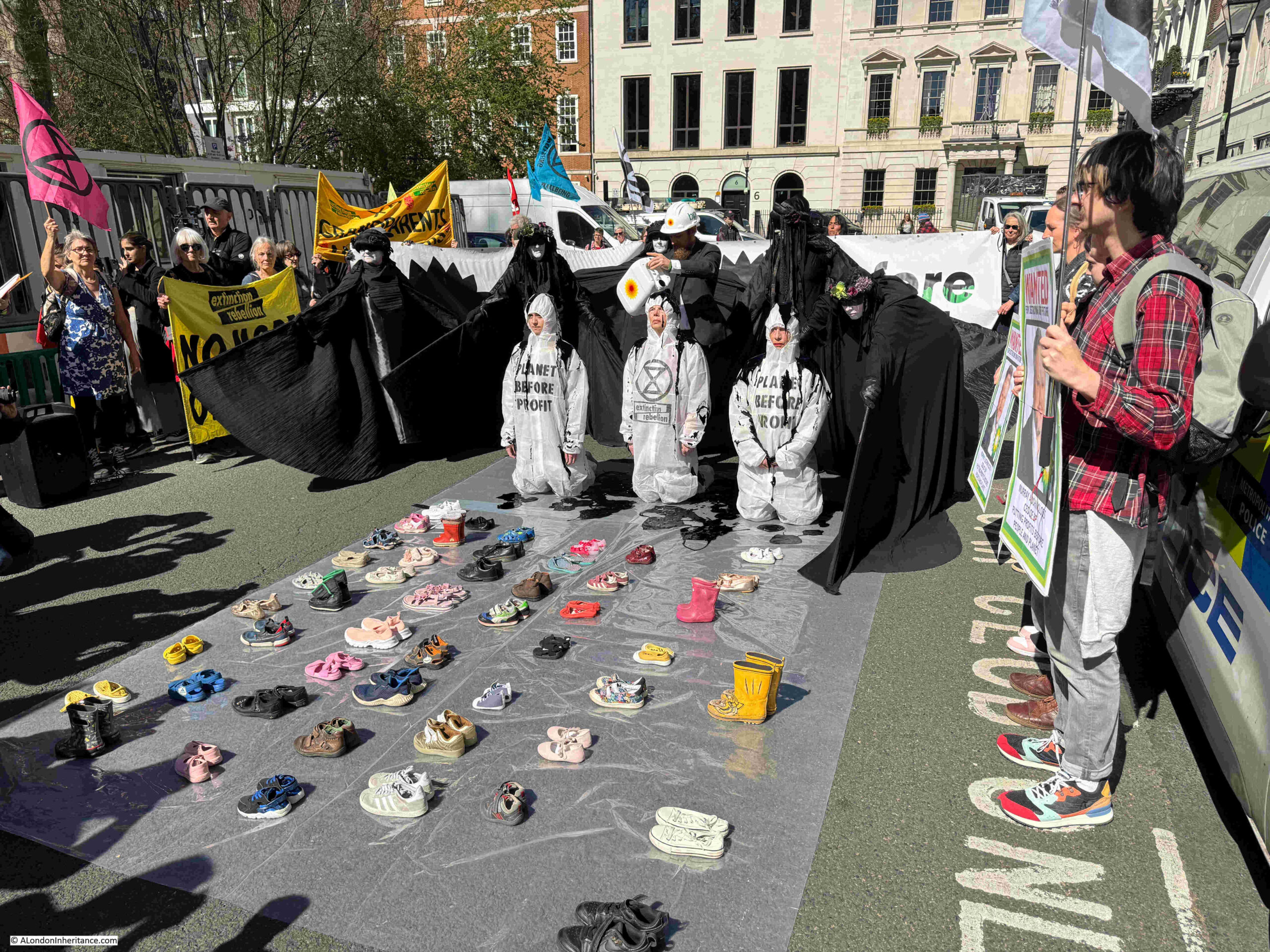
The following photo shows the entrance to the ferry at Woolwich:

I did not notice one on the north of the river, but at Woolwich on the south, the ferry has a “River” TfL roundel:

The combination of the two methods of crossing the river at Woolwich are unique. Whilst there is another foot tunnel at Greenwich, there is no other large passenger / vehicle ferry.

The fact that the Woolwich ferry continues to be free is remarkable in today’s financial environment, where so much starts to be attracting a price.

When the new Silvertown tunnel opens, there will be a fee for using the tunnel, and to stop people continuing to use the currently free Blackwall tunnel, a new fee will be introduced for using this old tunnel, the first time in 130 years.

It will be interesting to see if the Silvertown tunnel has an impact on traffic levels on the Woolwich ferry. Theoretically not, as the Silvertown Tunnel follows a similar route to that of the Blackwall tunnel. It could be that traffic on the Woolwich ferry increases to avoid the fees at the Blackwall and Silvertown tunnels, such are the unintended consequences of change.

To introduce a fee for the Woolwich ferry would require an Act of Parliament to amend the act originally brought forward by the Metropolitan Board of Works to introduce the ferry, which specified that the ferry should be free to use.

Today, foot passengers wanting to travel between the north and south sides of the river at Woolwich also have the choice of the DLR which runs from Woolwich Arsenal to the north, as well as the Elizabeth Line which runs from Abbey Wood, to Woolwich, before heading north of the river.

The loss of the docks in the 1980s significantly reduced the number of jobs for residents of the south to commute to on the north. The DLR and Elizabeth Lines have added alternative options, however for a quick, free crossing of the river, the Woolwich Ferry is a wonderful way of seeing the river and getting between north and south Woolwich, and the foot tunnel provides an historic alternative using one of only two surviving foot tunnels under the Thames.

alondoninheritance.com

King George V Dock – The Last of the Royals

In my final post exploring the Royal Docks, I am looking at the King George V Dock, the last of the three docks that make up the Royals, and was opened in 1921.

I have a copy of the book that was issued to commemorate the opening of the King George V Dock, and at the back of the book are some fold out paper maps, one with a view of all the docks from St. Katherine out to Tilbury, and the following is an extract from the map showing the Royal Docks as they were following completion of the new, third dock (the map is a bit creased. It is 100 years old and of very thin paper so I did not want to put too much pressure on the folds):

The King George V Dock is the dock on the right, below the Royal Albert, and in the map it is marked Royal Albert Dock Extension (South). The book and map were issued in advance of the formal opening by King George V, so I assume it was the wrong thing to do with royal protocol to give the new dock’s name before the King had officially opened and named the dock.

Another point with the map, is that the Port of London Authority were considering a fourth dock for the Royals complex. The red lettering above the Royal Albert Dock is marked as a “Site for dock”. This additional dock was never built, and future expansion by the Port of London Authority would be focused on Tilbury.

It is not possible to walk alongside the majority of the King George V dock. London City Airport occupies the northern side of the dock, whilst other parts of the airport (car parks, offices etc.) occupy much of the southern side, and the one road that ran alongside the dock is fenced off.

So to look at the dock, I am taking a walk along Woolwich Manor Way and the Sir Steve Redgrave Bridge, which provide a good view along the length of the King George V Dock, as well as the lock entrances and the Royal Albert Dock.

The route I am taking is shown by the red dashed line in the following map, starting from the bottom of the line, looking to the west, then returning on the other side of the bridge, looking at the view to the east (© OpenStreetMap contributors):

Detail from the map at the top of the post shows the Royal Albert Dock Extension, or the King George V Dock as it would be officially known following the opening ceremony:

The road I am following in today’s post is shown in the above map, running over the lower of the three locks to the right, before bending to avoid the Basin, although today the road is straight and a bridge runs over the Basin.

There is no access to the south of the King George V Dock, the road that runs along the south side is fenced off from the east. The blue sign is offering a welcome to London City Airport, although there is no public access from this direction:

A look through the gates, and the road disappears off to where the car parks for the airport are located, with access being from the terminal building at the far west of the dock:

So I am continuing along the Woolwich Manor Way, up to the bridge that runs over the lock between the dock and the river:

Looking along the lifting bridge over the lock:

And from the middle of the bridge, we can look to the west, along the full length of the King George V Dock:

The new dock was needed because the size of ships continued to grow, and there were now ships that were larger than could be accommodated by the Royal Victoria or Royal Albert Docks.

The book published for the opening of the dock provides some insight:

“The largest work yet undertaken by the Port Authority has been the construction of the great dock which his Majesty King George V, has graciously consented to open, and which, in point of importance, is surpassed by no other undertaking of a similar nature carried out during recent years. The improvement in Port facilities by its completion may be illustrated by the fact that, whereas the largest vessel which hitherto could be accommodated in the docks was limited to about 19,000 gross register tons and that only at Tilbury, a distance of 26 miles below London bridge, the new dock will permit of vessels up to 30,000 tons being berthed within six and a half miles of the heart of the City.”

The above text shows that in the early 1920s, the proximity of the docks to the heart of the City of London was still an important factor. There were still many warehouses and trading establishments in the City which received and traded goods coming into the docks.

The text also illustrates why, despite the opening of the new dock, their long term demise could have been foreseen. The story of all the London docks is one of expansion and movement east along the Thames. This was to move to locations where there was sufficient space for very large docks, and where the River Thames was deep enough for large ships to sail.

Ship sizes would continue to grow, and the eventual lack of available space, and the limited depth of the river, would seal the fate of the docks from the Royals, west towards central London. A fate that was confirmed with the arrival of containerisation.

The book published for the opening of the dock starts with a wonderful artwork showing the ship carrying the King, entering the King George V dock, under the lifting bridge, with probably PLA staff and other dignitaries standing on the side of the lock:

The coat of arms are those of the Port of London Authority, with individual components from the arms on the flag. The motto of the PLA “May the Port of the Empire Flourish” is below the arms.

Again, as mentioned earlier, the book does not mention the name King George V Dock. The new dock on the title page is simply the “Southern Extension of the Royal Victoria and Albert System”.

The King George V Dock was of a considerable size. Last week’s post on the locks connecting the Royal Docks to Gallions Reach described the entrance lock, and the following is again taken from the same book, and describes the scale of the dock, as well as the infrastructure that enabled flexible loading and unloading between ship and multiple land-side methods for storage or onward transport:

“The wet dock has a water area of 64 acres and a depth of 38 feet, and is surrounded by quay walls of an aggregate length of approximately 10,000 feet, providing fourteen berths for steamers of the largest size. The length of the dock is 4,578 feet and the width varies from 710 feet at the eastern end to 500 feet at the western end.

A swing bridge, weighing about 1,800 tons, carries the dock road and the rail traffic across the passage which communicates with the Royal Albert Dock.

On the north side of the dock, three double storey sheds, each about 1,100 feet long, are being erected with a width on the ground floor of 110 feet. Reinforced concrete has been adopted for the framework and floors of the sheds, with brick panels, and the roofs have been constructed on the ‘North Light’ principle with steel trusses. Two lines of railway are laid along the quay, 50 feet wide, and a loading platform and three lines of railway have been provided at the rear of the sheds.

Twenty-four 3-ton electric level-huffing cranes constitute the cargo handling appliances on the North Quay itself, but each shed is further equipped with eight 1-ton electric underhung revolving jib cranes travelling transversely through the shed, which are capable of dealing with goods from the quayside or from the railway trucks or carts on the land side and depositing them on any portion of the upper floor or through hatchways on to the lower floor. The quay cranes are capable of lifting three tons at a radius of 60 feet, or a slightly reduced load at a maximum radius of 65 feet.”

The book for the opening of the King George V Dock included some wonderful paintings showing the appearance of the dock after completion, and in operation:

The painting shows the lock to the Thames at lower right, and the passage to the Royal Albert Dock at upper right, with the swing bridge for road and rail traffic. Also shown is the lifting bridge over the end of the entrance lock, where it meets the dock – the point where I was standing to take the photo of the whole of the dock earlier in the post.

The painting also shows the sheds and cranes lining both side of the dock, as described in the book, which also includes an aerial photo of the Royal Docks, with the King George V Dock labelled as “The New Dock” on the left (the photo shows the new dock as being far wider than the Royal Victoria or Albert docks)

Another painting from the book shows the dock as it would be when full of ships up against the quays, along with barges being pulled by tugs:

And another painting showing some detail of the southern quayside, with the Thames in the background:

in the above painting we can see how the south side of the dock differed from the north. Along the northern side of the dock, ships moored directly alongside the quay, however on the southern side:

“Here are seven reinforced concrete jetties, each 520 feet long and 22 feet wide, have been constructed at a distance of 32 feet from the face of the wall, the only shore connection being by means of a timber footbridge.

Ships will berth on the outside of the jetties, and the electric cranes, six to each jetty, will discharge goods direct from the ship’s side either on to the quay for delivery to carts or railway trucks, or for sorting and temporary storage in the sheds behind, or direct into barges lying in the space reserved for them between the jetties and the wall. this arrangement has been specially designed to facilitate the discharge of the large proportion of goods arriving for delivery direct into barges.”

Again, flexibility was key, and as well as the ability to take much larger ships, the king George V Dock also offered multiple methods of transferring cargo.

Photo of the sheds along the north the of the dock, before the cranes were installed:

When we look at the dock today, we see a large expanse of water, with just a few feet of concrete above the water along the quayside. What we cannot see is the significant amount of construction below the ground / water level, and the book to mark the opening of the dock includes some illustrations where we can see the depth and width of the concrete quayside, and the depth of piling needed to support the warehouses:

The drawing also shows how flat bottomed ships of the day were, which enabled the ship to carry large amounts of cargo. I mentioned this in the previous post where the lock into the Royal Victoria Dock was originally a slight V shape, which matched the shape of the hulls of Victorian shipping, but had to be flattened to accommodate ships in later decades.

The following photo shows the north quay in use, with a floating crane moored alongside a ship to assist with unloading into barges:

View along the south side of the dock, showing the cranes installed on their jetties:

And this is the drawing showing the construction of the southern side of the dock, with the crane on a jetty and space for barges between the quayside and the jetty. Unlike the northern side of the dock, the southern side had a sloping base from the jetty up to the dock, as there was no intention for ships to be moored directly alongside the quay.

Detail of the southern side of the dock in use can be seen in the following photo:

Even with a photo of the King George V Dock without water, it is still hard to appreciate the full scale of the dock. The following photo shows the dock, which appears to be fully excavated. The view is from the east, looking west, and the southern edge of the dock is on the left, where we can see the wooden construction of the jetties which have yet to have their cranes installed:

Work on the dock started in August 1912, however work came to a standstill during much of the First World War due to shortages of men and material. Work recommenced in the Autumn of 1918.

The following describes how the docks were equipped and the enormous volumes of materials that were involved:

“The general equipment of the dock includes floating cranes, tugs, locomotives, rolling stock, electric trucks, conveyors, piling machines, and other labour-aiding appliances of the most modern type for the efficient and rapid handling of cargo.

Altogether about 5,000,000 cubic yards of material have been excavated for the works, of which 2,000,000 cubic yards have been deposited at sea. The whole of the ballast required, over 500,000 cubic yards, was obtained from the excavations on the site and use in admixture with about 100,000 tons of Portland Cement for the concrete.”

One of the more unusual features of the King George V Dock was that it had a dry dock at the western end of the dock.

A dry dock is a dock where a ship can be floated into the dock. Gates are then closed across the access to the dry dock and the water is pumped out. The hull of the ship is then in the dry, and maintenance or repairs can then be performed on the hull.

The following photo shows the dry dock just before the opening of the King George V Dock:

The location of the dock is within the red oval in the following extract from an early 1950s edition of the OS map. Whilst the docks are not named, the King George V is the lower dock with the Royal Albert above (Map ‘Reproduced with the permission of the National Library of Scotland“):

From the bridge, we can look across to the passage between the King George V and Royal Albert Docks. There was originally a swing bridge over this passage which carried a road and rail tracks:

Although today we cannot find any cargo vessels in the King George V Dock, there is an old light vessel. This is Light Vessel 93:

The following history of the light vessel is from the vessel’s entry in the register of National Historic Ships UK, and the entry and source of the following text can be found by clicking on the text:

“LIGHT VESSEL 93 was ordered by Trinity House in 1938 and was built by Philip & Son of Dartmouth. She is a vessel of riveted steel construction. She first served on the Galloper Station and then on mine watching duties on the Thames between 1947 and 1953. After further service on the East Goodwin and Galloper Stations she had renovations carried out by Swan Hunter in 1980 and Holman & Sons of Penzance in 1996.

After conversion to solar power in 1998 she had further service at Inner Dowsing Station, Sunk Station and Foxtrot 3 before being sold into private ownership in 2004. She is used as a photographic studio, events and exhibition space.” 

The light vessel was moored in the Royal Victoria Dock, close to the mill buildings, but was moved earlier this year in preparation for the foot bridge that is planned to be built across the Royal Victoria Dock, as part of the redevelopment of the land around the Millennium Mill.

When London City Airport was built, it was over the land between the King George V and Royal Albert Docks, with part of the airport, and a later extension of the aircraft stand area, and equipment and vehicle holding area. The extensions over the dock were built on piles, and the following photo is looking across to the airport, with the runway on the right, and we can just see part of the piles between the surface area of the airport and the water of the dock:

The bridge carrying the Woolwich Manor Way over the entrance lock is still a lifting bridge, although the current bridge is not the original. Standing in the middle of the bridge we can see where the two sides of the bridge meet, with the water of the lock visible below:

The presence of London City Airport can be felt when walking around the Royal Docks, and parts of North Woolwich and Silvertown. The bridge is also at the end of the runway, and adjacent to the approach lights, and we can look straight down to the runway and the planes taking off:

Or landing:

The above photo shows just how much this whole area has changed. Part of the dock water can be seen on the right of the photo and the grey blocks of the Millennium Mills are in the centre. These are from the time when the Royal Docks were the largest of London’s docks, with enormous volumes of cargo passing through.

In the foreground we see a plane coming into land at London City Airport – in some ways continuing the use of the area for transporting things internationally. Whilst the docks served passengers and cargo via ships, the airport now moves passengers via planes.

In the background are the towers around Canary Wharf on the Isle of Dogs, built on another London dock complex. On the left is the O2 / Millennium Dome, built on what was a highly industrial area of the Greenwich Peninsula.

Continuing along the bridge, and we pass over the Royal Albert Dock. the passage between the King George V and Royal Albert can be seen on the left:

At the end of the bridge, we arrive at the road network north of the docks, along with the DLR. Just below the road direction sign is a reminder of when the Excel Exhibition Centre was a Nightingale Hospital:

This section of the bridge is named “The Steve Redgrave Bridge” (possibly because of the Royal Docks rowing centre nearby):

I am now walking back along the eastern side of the bridge, the side that faces towards the Thames, and therefore the locks from the Royal Docks to the river, and here we get another view of the impounding station that pumps water from the river into the docks to maintain water levels. From this perspective we can also see the new development at this end of the Royal Albert, surrounding the impounding station:

We then come to the first of the locks from the docks to the river. This is the lock from last week’s post where the width of the lock has been considerably reduced so a much smaller (and cheaper) set of lock gates could be installed. just how much the width of the lock has been reduced can be seen when looking through the lock:

And then the second lock. This is the one that has mainly been filled in, with only a small part remaining at the dock, and into the river:

And we then come to the derelict area between the Royal Albert Basin and the lock into the King George V dock:

View over this area:

In the following photo is where Gallions Road joins Woolwich Manor Way. Gallions Road is the road where I found the other end closed in last week’s post, requiring an alternative route along the bush and butterfly alley that ran next to the Thames, which was in fact, a far better route:

There is a blue sign just visible to the left of the above photo. The sign is for Gallions Point Marina which was once reached down this closed road.

Gallions Point Marina was in the Basin between the eastern end of the Royal Albert Dock and the lock into the Thames.

In my walk around the Royal Docks I could find no evidence of a marina, and the space once occupied by Gallions Point Marina is empty. Strangely, their website is still online.

The marina was a casualty of plans to redevelop Albert Island, the derelict area between the locks for the Royal Albert and King George V.

The Greater London Authority (GLA) had been trying to take possession of the land used by the marina, and despite attempts of mediation between the company and the GLA, there was no agreement.

The GLA then took legal action and evicted the staff of the Marina on the 9th of October 2018, and took possession of the land.

In 2017, the GLA had selected London and Regional Properties  as the developers of the site, and in 2021 outline planning approval was granted for the redevelopment scheme, which does include a boat yard, storage buildings and warehouse, and according to the original requirements of the GLA, facilities for repair and maintenance work on ships that use the Thames.

The development has a website which can be found by clicking here, and the home page includes an image of some impressive ship repair facilities.

If the area is developed as the GLA originally intended, it will be a suitable development for the site, maintaining the relationship with the river and shipping that has been the whole history of the Royal Docks.

The rather good alley along the Thames with the hundreds of butterflies will be lost though, but there is planned to be public access – hopefully still along the river and across the locks, and hopefully the redevelopment will include many references to the heritage of the site.

Continuing along Woolwich Manor Way, and I have now reached the point where the bridge crosses the lock into the King George V dock, this is the lifting bridge shown earlier in the post, and I can look along the lock out to the Thames:

The area to the right of the lock in the above photo has already been redeveloped. Albert Island is the area to the left, and in this website (click here), there is an image of the proposed new development, showing buildings up to the lock.

As mentioned earlier in the post, when you look at the docks, it is hard to appreciate their size. Water up to a few feet below the sides of the dock does not give an appreciation of the depth, however the following photo is of the lock into the King George V dock under construction, the same lock as shown in my photo above, and illustrates the size, and the complexity of the lock’s build:

The bridge I was standing on to take a photo of the lock is the latest version of the bridge carrying Woolwich Manor Way across the lock, and dates from 1990.

The original version of the bridge, completed at the same time as the King George V dock is shown in the following photo, looking from the lock into the dock:

I have repeated below the painting from the front of the book issued to commemorate the opening of the King George V Dock, as the painting is of the same view as in the above photo:

The dock was opened on the 8th of July, 1921 by King George V, who, during the ceremony to open the dock said that “I have much pleasure in acceding to your request that the dock shall be known as the King George V Dock.” I assume that this is why all documentation and references to the dock prior to the opening used terms such as “new dock”, of as the “Southern Extension of the Royal Victoria & Albert Dock”, as in the front page shown above.

It was probably not royal protocol to assume the name before the King had publically granted his approval.

The opening ceremony started with a “river pageant”, with the King boarding a boat at Westminster Pier and changing to a larger boat after passing under London Bridge. There was a Royal salute fired by the gun battery at the Tower of London, shipping, warehouses, wharves and buildings along the river displayed flags and bunting, and the sides of the river were lined with people cheering as the King and Queen passed.

After two hours, they reached the entrance to the King George V Dock, and entered the lock, with children singing “patriotic airs” along the lock edge, which was also lined by seamen from H.M.S. Pembroke and boys from the Royal Hospital School at Greenwich, as well as a number of naval ships.

The King’s ship (the Rover) entered the dock through the lock, and moored alongside a transit shed at the north side of the dock, where there was a large assembly of Government and Port of London Authority officials, as well as members of the Royal Household, Ambassadors, Royal Watermen, the Archbishop of Canterbury and the Bishops of Southwark and Barking.

In reply to an address by the chairman of the Port of London Authority, the King’s speech at the quayside included references to the history of the London docks:

“Your address reminds us of the great antiquity of London as a port. Even in the far-off days of the Romans it was frequented by foreign merchants and trading ships, and the history of its development into the largest port in the world must appeal to every sailor and every merchant who has any feeling for the romance of his calling. The port in which Chaucer worked as a Custom House official, in which Drake, the founder of our sea power, entertained his Sovereign on board the Golden Hind is deeply interwoven with the fabric of English history. From those times onward the traffic and discoveries of our ancestors have brought an increasing commerce to the shores of the Thames until it is not to much to say that here the highways of the oceans meet.

You have referred to the natural advantages of the Thames estuary and to the enterprise of the trading community as the two great factors in the advancement of the Port of London. For many centuries seamen and merchants were content to rely on the first of these, but during the last hundred years improvements in ship building and the growth of the trade of London have rendered it necessary in an increasing degree to call in commercial effort and engineering skill to supplement natural advantages.”

The King continued in the same vein and also remarking on the increasing size of ships that the new dock would be able to support, and finally the King declared the new dock open as the King George V Dock, and unlike the two hour pageant down the river, the royal party took cars back from the docks to Buckingham Palace.

The north side of the dock, and from the images of the redevelopment of Albert Island, the PLA building on the side of the dock will disappear:

The lock, as well as the dock, is used as a temporary holding place for the equipment that performs much of the infrastructure work along the river, and this leads to some very strange vessels to be seen – I have no idea what the following vessel does:

The south side of the lock into the King George V dock:

A final look as I continue south along Woolwich Manor Way. In years to come, this view will be very different:

And the above view concludes my exploration of the Royal Docks, an absolutely fascinating area that demonstrates the sheer size and ambition of the London Docks, the civil engineering, the enormous volumes of trade that passed through these docks, and the passengers who departed and arrived on ships from across the world – a history that I hope will be told in future development.

As mentioned earlier in the post, the need for the King George V Dock to support ever increasing ship size should have hinted at the future closure of the London dock system, when there was not enough land for docks, and the Thames was not deep enough to bring any larger ships up to the Royals. Dredging the Thames to provide a channel was already an ongoing problem.

The docks at Tilbury continue in operation, and the really large container ships do still use the Thames, arriving at the London Gateway port, just to the west of Canvey Island. The London Gateway continues to expand, and a couple of days ago, the shipping company Maersk announced that in 2025 it is moving from the Port of Felixstowe in Suffolk, to the London Gateway in the Thames.

I have not really covered the working history of the docks – something hopefully for a future post, There are a couple of places in Silvertown I still need to cover, probably the subject for an extra post, but for now, that is the Royal Docks – well worth a visit and long walk.

I have used many excellent books, LDDC publications, newspapers etc. to research the Royal Docks. The following are a sample of some of the books, which are often available online:

  • Dockland – An illustrated historical survey of life and work in east London, published by the North East London Polytechnic (1986)
  • A London Docklands Guide by Tony Phillips (1986)
  • History of the Port of London by Sir Joseph Broodbank, Chairman of the Dock & Warehouse Committee of the PLA (1921)
  • London Docklands. Past, present and future by Professor S.K. Al Naib (1994)
  • Liquid History by Arthur Bryant (1960)
  • The Port of London Yesterday and Today by D.J. Owen, General Manager of the Port of London Authority (1927)
  • The Said Noble River by Alan Bell (1937)
  • London Docks 1800 – 1980. A civil engineering history by Ivan S. Greeves (1980)
  • Discover London Docklands. An A to Z Illustrated Guide by Professor S.K. Al Naib (1992)
  • The Port of London – A brief survey of its History with outline of its present facilities and Trade. Published by the Port of London Authority (1931)

The Royal Docks are a fascinating area to walk (if there is interest, I may do a walk around the Royals next year), but until the weather improves, and if you read this on the day of publication, as Storm Bert sweeps the country, you may be interested in the following films on life on the river and the Royal Docks.

The first, from the British Film Institute does not feature the Royal Docks, but it is from the 1930s and shows much of the working river in colour:

https://player.bfi.org.uk/free/film/watch-colour-on-the-thames-1935-online

There were once tours via boat into the Royal Docks, and the following colour film from 1966 shows a cruise along the river, before entering the Royal Docks, at the King George V lock, the bridge carrying Woolwich Manor Way opening, and then a tour through the Royal Docks:

A British Pathe film showing the working docks:

alondoniheritance.com

The Gallions Reach Entrances to the Royal Docks

In this week’s post I am continuing my walk around the Royal Docks, starting from where I ended last week’s post, at the eastern end of the Royal Albert Docks, and where the entrance locks to the Royal Albert and King George V docks from the Thames at Gallions Reach can be found. In North Woolwich I also find a sad example of how a pub’s façade has been included in a new development.

The red dashed line in the following map shows my route, starting at upper right, crossing over the entrances to the docks, then walking through parts of North Woolwich towards Silvertown (© OpenStreetMap contributors):

The above map shows just two entrances, one to the basin which connects to the Royal Albert Dock, and a longer entrance that connects to the King George V Dock, however there were originally three entrance locks, as shown in the following map from when the docks were operational:

The lower entrance to the Basin has been filled in, although there is a short stretch remaining of the old lock where it meets the Basin, and where it originally entered the Thames.

The upper entrance, the locked stretch of water between the Thames and the Basin remains, however today has a much smaller lock gate, as the point in the lock where the gate is located has been narrowed by a rectangular block of land built over the channel where the lock gate is located.

In the following photo, the impounding station that was at the end of last week’s post is just behind the new block of apartments on the right, and you can see how the lock has been narrowed, as I am standing on the infill, and the original width of the lock can be seen after the last lamp post:

The following photo is from Britain from Above and shows the three locked entrances (Source: EAW008722 ENGLAND (1947). The Royal Albert Dock and the King George V Dock, North Woolwich, 1947):

The red rectabgle on the right is the infill over part of the lock, with the new lock gate being the red line. The infill enabled a much smaller lock gate to be fitted (and presumably at much lower cost), than the original lock gates.

The yellow rectangle over the middle lock is the area that has been filled in, and the red dashed line is the walking route I took to bypass a closed road, and get from the old position of the central lock to the large lock that connected the Thames with the King George V Dock, on the left of the photo.

The three locks in the above photo became the only route into the Royal Docks complex after 1928. By that time, the lock gates at the western entrance to the Royal Victoria Dock had reached the end of their useful life, and the roller paths at the bottom of the gates were causing problems.

There was also very little left of the original concrete base to the lock. It appears that dredging had gradually removed the concrete base over the 70 years that the lock had been in use.

The lock was repaired and strengthened, although a decision was made to restrict the western entrance to the Royal Victoria Dock to barge traffic only, with the three entrances at Gallions Reach then becoming the only entrances for shipping.

Standing in the lock and looking towards the Basin shows the much smaller width of the lock gate:

On the left of the above photo is a small building which I think houses the switch gear to control the lock gates. A sign on this building shows one of the rules to prevent rabies infection:

Although the original lock gates have been removed, some of the machinery that was used to control them can still be seen, embedded in the side walls, and below this (although difficult to see) are numbers indicating the depth of water, carved in the stone of the side wall:

Looking out to the Thames from the lock – just imagine how many ships have arrived to, and departed from the Royal Albert Dock through this entrance:

Buildings, and bollards for ship’s ropes still line the side of the lock:

On both sides:

View across the lock showing the proximity of the new housing developments:

At the end of that part of the lock where the width has been narrowed, looking up towards the Basin, along the original width of the lock:

The Gallions entrance lock to the Albert Dock was upgraded in the early 1950s.

The floor of the lock was found to be curved, and whilst this was acceptable for Victorian shipping with curved hulls, shipping by the 1950s had almost flat bottoms to maximise cargo space.

The lock was also chain operated, and the system was 70 years old, and reaching the end of its useable life.

The problem with upgrading the lock was that it needed to be empty of water, and a wall of some type was needed towards the Thames and towards the Royal Albert Dock, as if water flooded in from the dock it could cause an incredible amount of expensive damage to the ships in the dock, if the water level suddenly reduced.

The first method used was by building a dam of granite blocks across the end of the lock. When the dam was tested, there was horizontal movement within the layers of blocks, and a scour hole of some 20 feet deep had formed in the chalk below the lock.

The dam of granite blocks was replaced by a dam of a double layer of sheet piling with 70 foot long piles driven 15 feet into the chalk below the lock.

The area around the lock also had to be de-watered to reduce the pressure pushing on the lock walls from the land surrounding the lock. This was done by installing 34 deep wells around the lock of 24 inches diameter, with a 12 horse power submersible pump in each that worked to reduce the level of ground water around the lock, and hence the pressure on the lock walls.

The work to reshape the bottom of the lock, and to make repairs were completed by 1956 when the lock reopened.

Standing by the side of the lock it looks like a stable volume of water within concrete walls, however the details in the paragraphs above show the complexity of the structure, the huge forces that water at either ends of the lock, and within the surrounding ground, exerted on the lock.

They are remarkable examples of complex civil engineering.

Nine years ago, I took the following photo of the entrance to the lock from the river, when the new apartment buildings next to the lock were being built:

If you have walked the Capital Ring, then the route I am taking across the lock entrances to the Royal Docks is probably familiar:

Once across the lock, and I enter a very different landscape. Where all of my walk around the Royal Albert Dock so far, has been through developed land, or open space waiting to be developed, the space between the old dock entrances is an area devoid of people, a number of apparently derelict buildings, and empty space:

They really do not want you to stray off the road, probably sensible as the docks are of deep water:

The road has a name – Gallions Road, and it runs from the first lock that I crossed, up to Woolwich Manor Way, although do not expect to see any people, cars or lorries on this road:

The road is called Gallions Road and the title of the blog post is “The Gallions Reach Entrances to the Royal Docks”, so where does Gallions come from?

If you want to locate a place, then it needs a name, and this is no different with the River Thames. So much once went on along the river, that names were useful to refer to each stretch, and Gallions Reach was the name given to the part of the Thames roughly from Woolwich to Barking Creek.

The Gallions name comes from the Galyons family, who owned land along this part of the river in the 14th century.

With the way we use the river today, names such as Gallions Reach are not often heard, although the original Galyons is in use for the hotel in the previous post and the Gallions Reach Shopping Park is in nearby Beckton.

The name was used very many times to describe events on the river in previous centuries, and I have seen both Gallions, Gallion’s and Galleons used as spellings. Many of the uses describe some very dramatic events, such as in May 1816 when there was a armed fight on the Thames.

A boat carrying dollars to India was moored on the river at Greenwich. Due to the value of the cargo, armed guards were on board. A boat appears with two men onboard and comes up against the boat carrying the dollars. As there are only two people on board there is not much concern.

As the boat comes alongside, 20 armed “pirates” emerge from under a tarpaulin and swarm onto the cargo boat, threatening to kill the crew. A shooting fight breaks out as the crew fight back with blunderbusses.

The pirates manages to grab boxes of dollars (to the value of £7,000 in 1816), and they then flee on their boat. The report continues:

“It would seem from the speedy approach of day-light and the slackness of the tide immediately after the robbery was committed, the villains were afraid to venture on shore with their stolen property, and had therefore deemed it expedient to sink the whole, or part of the chests, as they supposed within the low water mark, in Gallions Reach; for about seven o-clock, at low water, three of the chests were observed uncovered on the shore, where they had been just left by the tide.”

In some respects, in past centuries, the Thames was a city in its own right, there were so many people working and travelling on the river and there were newsworthy events on the river almost every day.

The report on the theft of the dollars (they were in chests, so I am assuming some form of silver dollar) concludes by saying that of the £7,000 stolen, only £3,000 had been recovered, so perhaps there are some early 19th century dollars still to be found in the muds of the Thames at Gallions Reach.

Back to the 21st century, and I am continuing along Gallions Road, with the approach lights to London City Airport to my right. The proximity of the land between the dock entrances and the runway probably limits what can be built here as any high rise buildings would extend too far into the approach path:

And here the road is closed. No mention of why, but I cannot get any further:

However there is another route, and just to the left of the above photo is this footpath which heads up towards the river (the footpath is marked by the red dashed line in the Britain from Above photo earlier in the post):

In the above photo there is a car on the left. There was a large dog in the rear barking at me as I walked past, with a security man sitting in the front seat.

What they were guarding is shown in the following photo – some derelict land and a large shed. The lower lock into the Basin at the end of the Royal Albert Dock once ran across the land in the foreground of the photo below (the orange rectangle in the Britain from Above photo earlier in the post):

Nine years ago, I took the following photo of the block up entrance to the lower lock from the river:

At the end of the first stretch of footpath, it does a ninety degree bend and ruins alongside the Thames on the left, with thick bushes on the right hand side. It was a sunny, warm day, and what was remarkable about this footpath were the huge number of butterflies in the bushes, and as I walked along the footpath, they would rise from the bushes then fly back in. I have never seen so very many in one place.

Looking back along the footpath, with the Thames just visible on the right:

And at the end of the stretch that runs parallel with the Thames, there is another ninety degree bend, again with thick bushes and butterflies on the right, and some derelict land on the left:

At the end of which, there are steps:

And over the steps, a footpath which leads down to the lock that connects the King George V Dock to the River Thames:

At the end of the footpath, I reach the walkway over one of the lock gates:

This lock is massive, and I believe is still of the same dimensions as when the King George V Dock was built, and opened in 1921.

The following photo is looking towards the King George V Dock from the middle of the lock gates closest to the Thames. There are two other sets of lock gates, and the bridge in the distance carries the Woolwich Manor Way over the lock, where it joins the main dock:

The lock is still in use, providing access for ships to and from the Royal Dock complex, and the bridge in the distance, carrying Woolwich Manor Way over the lock is a Bascule Bridge and consists of two cantilevered steel box girder leaves which taper towards and meet at the middle. The bridge opens much as Tower Bridge does, with the two sections rising from the middle, and can swing by roughly 90 degrees, therefore opening up almost vertically.

The current bridge dates from 1990, replacing an earlier bridge, which also opened to allow ships to move between dock and lock.

Looking out to the Thames from the middle of the lock gate (standing in the middle of the relatively narrow lock gate, you get the feeling that you are suspended above two huge, dynamic stretches of water):

The King George V Dock was the last major dock to be built in London, and, as with the other two docks that make up the Royal Docks was on a massive scale. The lock entrance between the dock and the Thames was the largest entrance on any London Dock.

I have a one of the book’s issued to mark the opening of the dock on the 8th of July 1921, and the book describes the lock as follows:

“Ships will enter from the river through an entrance lock 800 feet long by 100 feet wide with a depth of water on the sill of 45 feet below Trinity high water, equivalent to 41 feet 8 inches at high water of ordinary neap tides. Its length is divided into two compartments of 550 feet and 250 feet by three pairs of steel lock gates, each leaf of which weighs 309 tons, operated by direct acting hydraulic rams. By the use of a floating caisson, for which provision has been made at the inner end, the effective length of the lock can be increased to 910 feet.

The lock walls have been constructed of eight to one mass concrete with a four to one face, and are founded in chalk, 65 feet below coping level, the thickness of the wall at the bottom being 21 feet. The floor, also of concrete, is 11 feet 9 inches thick in the middle.

Two entrance jetties project a distance of 480 feet into the river, and form a bellmouth 675 feet wide across the outer extremity.”

The details of the thickness of the lock walls and base give some idea of some of the pressures that the lock had to withstand – water pressure, added to when large ships passed through the lock, and pressure from within the land surrounding the dock, acting on the inside of the lock walls.

The lock seems to be in the same configuration today, with three pairs of lock gates, with a shorter section between the two gates nearest the river, and a longer section between the two gates nearest to the dock.

With the lock being full of water, it is difficult to see the massive scale of the structure. The book issued at the opening of the dock includes a number of photos which show the lock under construction, the first shows the lock being built, empty of water:

The second photo shows “one of the three pairs of lock gates”, and as described in the text, each side of the lock gates weighs 309 tons:

To put the scale of the above photo of the lock gates into context, look at the very bottom centre of the photo, and you can just see two figures, I have enlarged just this small section in the photo below:

In the above photo you can also see the roller and the roller path at the outer edge of one of the lock gates. This roller supported the gate as it was opened or closed.

Looking back over the walkway over the outer lock gate:

The three lock gates in the lock to the King George V Dock are still fully operational, and part of the opening and closing mechanism can be seen coming from the side of the quay, where the rest of the mechanism is located:

A final look out to Gallions Reach, the part of the Thames where the three locks at the eastern end of the Royal Albert and King George V provided access to and from the Royal Docks:

Again, imagine all the ships, cargo and people who have passed through this lock. One example is the Blue Star Line “Almeda” shown in the following photo in the entrance lock to the King George V Dock on the completion of her maiden voyage with passengers from Argentina on the 6th of April, 1927:

The area between the upper lock to the Royal Albert Basin and the lower lock to the King George V is a really interesting area. Empty and derelict, the only person I saw was the security man with his dog sitting in the car.

On leaving the lock into the King George V dock, the area changes dramatically, and we enter streets lined by housing that has been built over the last couple of decades:

I walked through this new estate, and onto Woolwich Manor Way, and where the name changes to Albert Road at the junction with Woodman Street, on the corner was a large, closed pub, now converted into residential:

This was the Roundhouse. The pub does not appear in the 1895 OS map, but there was a large corner pub on a street corner just to the north.

This pub was demolished when the King George V dock was built, and I wonder if the Roundhouse was built after this nearby pub was demolished.

The Roundhouse closed in 2003, and then converted to residential.

Directly opposite the pub is Barge House Road:

Barge House Road has pre-war housing on the western side of the street. There is a plaque up on the wall of the house facing onto Albert Road, but the date on the plaque has been worn a bit too much to be read.

In the 1895 OS map, the street is shown (but without a name), and there is no housing on either side of the street, so I suspect it was built as part of the development of the area when the King George V dock was built.

There was though a pub (called the Barge House) at the southern end of the street, and a small dock into the river.

The dock is listed in the PLA 1980s listing of “Steps, Stairs and Landing Places on the Tidal Thames”, as the “Old Barge House Drawdock”. A drawdock was a place where boats could be drawn out of the river for loading / unloading, for maintenance etc.

The dock is still partly there, and I will visit in a future post.

The next street along is Woolwich Manor Way, a continuation of the street that runs over the lifting bridge over the lock into King George V Dock, with houses on the eastern side of the street and the Royal Victoria Gardens opposite (again, the date on the plaque on the end house is too worn to see the date of construction):

I walked from Albert Road up to Woodman Street as there was a pub I wanted to see, all that is left of the Royal Oak in a remarkable example of where the façade of the pub has been retained, and a very different building completed around and above:

Close up showing the lovely green tiling of the old Royal Oak and a “Truman’s Beers, Eagle Brand” tiled sign:

The Royal Oak was in business by the early 1870s, and was a typical east London pub, however bombing during the Second World War resulted in the loss of the upper floors.

Remarkably, the Royal Oak continued to trade using just the remaining ground floor.

The pub finally closed around 2010 / 2011, was purchased for redevelopment as apartments, with planning permission that new apartments could be built, but the lower floor had to be retained, and possibly reopen as a pub.

Whilst the new apartments have been completed and appear occupied, what remains of the Royal Oak looks to be gradually deteriorating. I have no idea if anything remains of the interior of the orginal pub, or whether it is just the outer facade that has been retained.

There appears to be no progress in converting / restoring or reopening the ground floor as a pub, or as any other business.

A real shame:

When writing the blog, I really do try and get all my facts right, and I am very grateful to readers who point out any errors (thankfully very few).

The Internet can be an excellent source of factual information, and it can also propagate errors, and I am very conscious of this when writing a post, as I do not want to include errors that others may therefore take as fact.

When researching the Royal Oak, I found a number of websites that associate the Royal Oak in Woodman Street, North Woolwich with the naming of Arsenal Football Club.

Arsenal was originally named Dial Square, after one of the workshops at the Woolwich factory.

After a win in December 1886, the club met in the Royal Oak, and decided to change name to  Royal Arsenal, a name which lasted until 1893 when the name changed to Woolwich Arsenal.

A number of websites claim the Royal Oak was the one I have photographed, for example one site stating the Royal Oak in north Woolwich, and another the Royal Oak at 83 Woodman St, London, E16 2LN, but also mentioning the Woolwich Arsenal Station which is south of the river.

The official history of Arsenal, on the club’s website also refers to the Royal Oak, but next to Woolwich Arsenal Station, which is the correct location of the Royal Oak in question.

Probably an issue with two pubs called the Royal Oak, but one south of the river next to Woolwich Arsenal, and the other north of the river in North Woolwich.

The King George V dock is very close, but nothing can be seen of the dock due to buildings and high walls, however there is an occasional a glimpse that the dock is there down some of the side street off Woodman Street, where, for example, the top of Light Vessel 93, moored in the King George V dock can be seen:

I will cover the light vessel in a future post.

At the end of Woodman Street is Pier Parade, where North Woolwich library can be found:

North Woolwich Police Station, which opened in 1904 on the corner of Albert Road and Pier Road:

The building still appears to be in use as a Police Station, but the “front counter” was closed in 2013.

There is a very detailed spreadsheet available on the Metropolitan Police website that details all the station closures between 2010 and 2023, listing the 126 closures during this period, and whether it was the just the front counter, or the whole police station.

For those fully closed, the spreadsheet also lists the purchaser of the site and the price paid. The spreadsheet can be found here.

Opposite the police station is the Royal Standard, seems to be open as a pub, but also as a resturant:

Diagonally opposite to the pub is the following terrace of buildings of mixed age and style, but mainly pre-war, on Pier Road, the street that leads to the Woolwich ferry:

A bit further along Albert Road, on the corner with Fernhill Street is a rare sight in east London, a relatively modern pub, the Henley Arms:

The current Henley Arms was opened in 1966, replacing an 1860s pub with the same name that stood closer to the corner of Albert Road than the current pub.

The Henley Arms is a survivor from a time when there were so many pubs in the area. I have walked a relatively short distance along Albert Road. Between the Roundhouse and the Henley Arms is 900 metres, and the 1956 edition of the OS map shows nine pubs, so one every one hundred metres. This does not include pubs such as the Royal Oak or the Barge House which were between Albert Road and the docks, and the river.

The majority were large corner pubs, and all would have been busy.

The closure of the Royal Docks started their decline, and in the following decades there was the typical story of closure and redevelopment as residential.

That is another part of the area around the Royal Docks, North Woolwich and Silvertown explored. The area where the three locks were, between the docks and the Thames at Gallions Reach is a very unique area, and I hope that when it is developed, as it inevitably will, the locks, their scale, construction and history is retained and highlighted, as the place where very many thousands of ships and people, and millions of tons of cargo entered and left London’s largest dock complex.

alondoninheritance.com

Royal Albert Dock and London City Airport

After last Sunday’s diversion, I am back in the Royal Docks, this time exploring the second of the three individual docks that make up the overall “Royals” dock complex – the Royal Albert Dock.

The following map shows the Royal Albert Dock (the top of the two docks), and the red dotted line shows the walk I am covering in today’s post, with some of the key buildings circled. I am starting at the red oval to the left of the map. There is so much to find around this part of east London, that it will take a couple of posts to cover  (© OpenStreetMap contributors).

I also have an error to own up to. In my original post on the history of the Royal docks, I included a number of photos that my father had taken, describing them all as being of the Royal Victoria Dock. From some comments and emails received (thanks for all the comments, they are all read and appreciated), from people who had worked in, and known the area well, the photo showing ships lining the sides of a dock was in fact the Royal Albert Dock:

Whilst all the other photos had identifiable features, and were of the Royal Victoria Dock, my father must have started his walk around the Royal Victoria Dock at the eastern end of the dock, where it joined the Royal Albert, and where there was a good view along the Royal Albert, so the above photo is of the Royal Albert Dock, and is where I am walking in today’s post.

I started the walk at the appropriately named Royal Albert Station on the Docklands Light Railway:

One of the few surviving buildings from when the docks were operational is located right next to the DLR station, this is the Compressor House (light blue oval in the map):

The Compressor House dates from 1914 and was originally a warehouse providing cold storage for cargo shipped via the Royal Docks:

The Compressor House featured in a document released by the Mayor of London back in May 2024. The document covers the “leasehold disposal of Compressor House, for 10 years, to Really Local Group to deliver a project that addresses priorities of good growth, levelling up and Royal Docks placemaking; and provides best value for the GLA Land and Property Limited commercial asset.”

Apparently the building retains many original internal features such as hoists, rails and winching machinery. Plans for the building include a café, rooms for hire, including for exhibitions and performances, and a learning / meeting room.

I love the terms used in documents talking about the benefits of a project, as the Mayor of London document talks about linking the surrounding communities with the Royal Docks, through “in this case through the lens of digital inclusion”. I have no idea what this means.

It would be really good to make publicly accessible use of the building – providing the original features are retained, along with the story of how the building was once part of the Royal Docks success.

Arms of the Port of London Authority and the date of 1914 displayed above the door.

From the Royal Albert DLR station, and the Compressor House, it was a very short walk to the side of the Royal Albert Dock:

There is a wide walkway along the northern edge of the dock, with some recent developments along the side, but what impresses is the enormous expanse of water. The above view is looking east, and the view below is looking to the west, where the bridge can be seen that marks the point where the Royal Albert meets the Royal Victoria Dock:

Whilst there has been less development along this side of the Royal Albert Dock, along the south of the dock, where there is a strip of land between the Royal Albert and King George V dock, there is the result of one of the first major infrastructure projects around the Royal Docks, that was, and continues to be an issue for many local residents, and which made the Royal Docks a significant transport hub for London. This is London City Airport, where from the north side of the dock, you can watch planes landing and taking off, where there were once warehouses:

View across to the terminal buildings at London City Airport:

The idea for an airport in the docklands came from the London Docklands Development Corporation in the early 1980s. The concept was for an airport that would service the business centres of the City of London, and the proposed development centered on Canary Wharf in the Isle of Dogs.

The airport would offer swift access from these centres of business, with minimal waiting time at the airport. Almost a “turn up and fly” approach, rather than the longer travel out to airports such as Heathrow and Gatwick, with the lengthier times for check-in, security etc. as well as often delayed take-offs and landings.

The airport was built by the civil engineering and construction company, Mowlem, between 1986 and 1987.

Incidentally, one of the best books I have on the construction and engineering of the London Docks is “London Docks 1800 – 1980 by Ivan Greeves (1980)”. (I will give a long list of the books and sources I have used in the final post on the Royal Docks).

Ivan Greeves was a fellow of the Institution of Civil Engineers and a Director of John Mowlem, and Mowlem had been involved with many of the civil engineering projects around the London Docks. Greeves’ book is a wonderful detailed civil engineering history of the London Docks.

There were many publications by both the LDDC and other publishers, as the development of the docklands got underway. I collected as many as I could, and one was the magazine “Vistas”, published by the London Docklands Publishing Consortium, and in issue 2. Spring 1987, the first two airlines that would use London City Airport, which would open later in the year were featured:

The first two airlines were Brymon Airways and Eurocity Express, and an article in Vistas explains the airlines plans, and the type of service they intended to operate from the new docklands airport.

There is also a photo showing London City Airport under construction, when it occupied just the land between the Royal Albert and George V docks:

The article continues, with both airlines explaining the benefits of flying from London City Airport, with Brymon fully focused on the business traveler, and Eurocity Express also focused on the business traveler, but also expecting a share of leisure travelers:

It was a Brymon flight that had helped prove that planes could take off and land from short landing strips in the docklands, when in 1982 a Brymon Dash 7 aircraft landed at Heron Quays in Canary Wharf.

Eurocity Express changed name to London City Airways in 1988 to more closely align the identity of the airline with London City Airport, but would suffer financial collapse two years later in 1990.

In the late 1980s I worked for a company that was split between London and Amsterdam and did use London City Airport a number of times. It was a really fast airport to get through, whether arriving or departing, and the best bit was always coming into land, with the steep approach, and good views of the surrounding docklands.

I did take my camera a number of times, but cannot find the negatives. Hopefully one day.

Old and new industries / business around the Royal Docks – planes at London City Airport, with the Tate and Lyle factory in the background:

After opening, the airlines operating from London City Airport used propeller driven airplanes such as the Dash 7. These carried relatively few passengers when compared to larger jet aircraft, however they were more than capable of landing and taking of from a short runway.

The airport served business centres close to the UK, such as Amsterdam and Paris, and in the following years the destinations served, as well as the number of passengers grew considerably (including New York for a short time).

An extension to the airport opened in 1992. Access to the airport improved in 2005 when a DLR station was opened at the airport, and in 2008, additional aircraft parking space was opened on an extension to the airport built on piles over part of the King George V dock.

Jet aircraft started to use the airport in the early 1990s, and today jet aircraft run the majority of services, with a small number of propeller driven aircraft still operating.

In the first full year of operation, 133,000 passengers passed through London City Airport. In August of this year, the Government approved the expansion of the airport to increase capacity from 6.5 million to 9 million, with more weekend and early morning flights.

Flight destinations and the target traveler have also moved on from the initial business market, and when I had a look in the terminal building there seemed to be just as many people, if not more, going away for leisure, including families, than business.

I am writing this on a Friday evening, and I had a look at the first flight on Saturday morning which is a British Airways flight to Ibiza – definitely not one of the original target markets.

There is not much going on along the north bank of the Royal Albert Dock, and whilst I was walking, on a summer’s weekday morning, there were very few people around., so in this quiet place, it is strange to hear the sound of a jet aircraft taking off, or the quitter sound of a landing, at regular intervals:

There is a certain symetry between the airport and the old docks. The docks transported cargo all over the world and the airport is now flying people.

The north bank of the dock is really quiet, as this view along the walkway demonstrates:

And with it being such a peaceful environment, it is hard to imagine just how busy the Royal Albert Dock was, and what a sight it must have been, with so many ships coming and going, and vast amounts of cargo being shifted between warehouses, transit sheds, quayside, lighters and ships, as the following photo of the dock demonstrates:

The warehouses that ran alongside the length of the dock were not meant for long term storage, most were transit sheds as this was their main purpose, to temporarily hold cargo as it transited from ship to destination, or from source to ship.

The following photo shows a typical transit shed at the Royal Albert Dock:

And an innovation across the Royal Docks was the use of the railway as a means of transport. The docks were threaded through with rail lines allowing the movement of goods within the docks, and out onto the wider mainline rail networks, as the following photo of a cold store, along with overhead conveyors between buildings, shows:

Continuing the walk along the Royal Albert Dock, and I have reached a series of office blocks:

I have no idea who thinks of the slogans that often try to attract people or companies to new properties, “Regenerative Audacious Disruptive” and “Where Paradigms Shift” – totally meaningless – although I suppose that if a company moved their office to one of these blocks, with so few facilities or other businesses around, it would genuinely be “disruptive”:

Although they do have a good view along the dock, and across to the towers on the Isle of Dogs:

All these office blocks appear to be unoccupied, and they are a testament to an over hyped scheme that was entirely dependent on foreign investment and foreign businesses.

A headline in the Guardian on the 30th of May, 2013 read “Chinese to develop slice of British imperial past: Royal Albert Dock due to be Asian business park by 2023: Transformation of London site could bring 20,000 jobs”.

The article below the above headline reported that the Chinese developer Advanced Business Park had signed a £1 billion agreement with London Mayor Boris Johnson to develop a 35 acre site alongside the Royal Albert Dock with offices and shops, with the aim of attracting Asian businesses to set-up their European head quarters at the site, as well as British companies who do business in Asia.

At the signing of the agreement, Boris Johnson said that it would be “London’s third great business area” and that it “will restore jobs and growth to the Royal Docks, an area . . . that has been in more or less continuous decline for 50 or 60 years”.

The parts of the development that have been completed seem to have been mainly empty since completion, and the 20,000 jobs have not materialized.

In 2022 newspaper headlines reported that the “Royal Albert Dock a ghost town as developer goes bankrupt”. This was ABP Investment Ltd, the Beijing based original property developer.

In May, 2024 the Greater London Authority was looking for a new developer for the land alongside the northern edge of the Royal Albert Dock, as from the original 2013 agreement, only about 10% had been built, and this 10% was mainly empty office blocks.

The central street through the existing office blocks is called Mandarin Street, reflecting the Chinese heritage of the original developer and investment:

Leaving Mandarin Street, and the empty office blocks behind, I continue walking on past the empty land that should by now, based on the 2013 agreement, have seen 20,000 people working here:

Look left from my position when taking the above photo and there are some really good, original buildings from the time of the working docks, and this is the Dock Manager’s Offices (green oval in the map at the top of the post):

Grade II listed and built in 1883 by Vigers and Wagstaffe. The name of the building should explain what went on here – it was from where the Royal Docks were managed, where the dock records were kept and administered.

A second building, alongside the Dock Managers Office is the Central Buffet, also by Vigers and Wagstaffe, dating from 1883, and is also Grade II listed.

The Central Buffest appears to have been a café / restaurant for workers and for passengers traveling via the Royal Docks. It also appears to have been used as a pub, as this report from the 6th of December 1897 explains;

“BETTING AT THE ROYAL ALBERT DOCKS – At Stratford Police court on Saturday, Thomas Clarey, a lighterman, of 49, freemasons-road, Custom-house, was summoned on six information’s for using the Central Buffet, a public-house in the Royal Albert Docks, for the purpose of betting with other persons, and Henry James Morgan, the secretary of the London and India Docks Joint Committee, the holder of the licence of the Central Buffest, was summoned for permitting the place to be used for the purposes of betting.”

A “barmaid” was also called to give evidence, so the Central Buffet was certainly also working as a pub.

The Dock Managers Office and the Central Buffet are remarkable buildings, and from their appearance they would be more expected in the suburbs, or as a country house, rather than in the industrial east London docks.

Winged figure with trumpet on top of the Central Buffet:

A look along the Royal Albert Dock, and there is still much of the dock behind me, and in the distance, out of sight in the photo below, is the Royal Victoria Dock. You really need to walk alongside the Royal Docks to fully appreciate the sheer scale of these manmade temples to London’s trade:

Vessels berthed at the Royal Albert Dock:

More shipping in the Royal Albert Dock:

New Quays added to the Royal Albert Dock in the 1930s:

The following photo shows how cargo could be loaded to and from lighters as well as the quayside. The Royal Albert Dock was known as a dock where goods of all sorts could fine the appropriate facilities for unloading, storage and distribution:

All very different today as I walk along a mainly silent quayside, with just the occasional take off or landing on the other side of the water to disturb the peace.

London City Airport is on the south side of the Royal Albert Dock, however there was a second, short term airstrip on the north side of the dock.

In 2007, the Red Bull air racing event took place in London, and the long open space alongside the north of the dock proved ideal for the pits area and runway for the event.

If I remember correctly, the Red Bull race was also held in docklands in the following year, 2008, and these events had quite an impact on the London City Airport, as flights from the airport had to be suspended whilst Red Bull racing was underway.

Peer over a fence as you walk along the north side of the Royal Albert Dock, and parts of the overgrown runway can still be seen:

The RB in the runway designation of RB 28 stands for Red Bull. There is a photo of the runway in as new condition, and when in use for Red Bull Racing on the Abandoned Forgotten & Little Known Airfields in Europe website, which can be found by clicking here.

Further along the Royal Albert Dock, there are some recent buildings which have brought activity to the area, although as I was there during August, they were again very quiet.

These are educational establishments, and first is the London Design and Engineering UTC (University Technical College):

A UTC is a government funded school that offers 14 to 19 year olds a more focused technical and scientific educational, taught in a different way to a normal school.

The next building is the University of East London:

The area around these buildings should be much busier in school term time, but during August they just added to the sense that the northern section of the Royal Albert Dock needs a considered development plan to bring in more life, and benefits for the local community just outside of the dock, not just yet another area flooded with identikit apartment blocks.

Next to the university buildings there is the student accommodation, which includes several rather different, round blocks:

They are described as “having a nautical theme in homage to the shipping heritage of the area”:

They certainly have a good view, looking out on the dock, and with views of planes arriving and departing at the airport on the opposite side of the dock:

The Royal Albert Dock was opened on the 24th of June, 1880, and cost £2,100,000 to construct – a considerable sum of money at the time. I described the opening ceremony in my first post on the Royal Docks, here.

Although built not that long after the Royal Victoria Dock, the Royal Albert was needed to accommodate ships of larger size and deeper draught than the earlier Victoria Dock, as well as providing a significant amount of additional space for ships to dock, and the associated infrastructure for moving and storing cargo.

The Royal Albert Dock was 27 feet in depth (just 1.5 feet deeper than the Royal Victoria, but suffcient for the expected larger ships). The entrance from the Thames to the Royal Albert Dock was 550 feet in length and 80 feet wide.

The water area that the Royal Albert Dock occupied was 73 acres, compared to 66 acres for the Royal Victoria.

The Royal Albert Dock was the first London Dock to be lighted by electricity, and this helped the dock to be in use by both night as well as day.

Between the main dock area of the Royal Albert, and the locked entrance to the Thames was a basin. In the following photo, I am almost at the basin, and looking along the full length of the dock. A little way along the dock edge on the left, you can just see the entrance to the King George V Dock, which is to the south of the Royal Albert

Looking in the other direction at the basin, the area of water between the dock and the Thames:

The following map extract shows the eastern end of the Royal Albert Dock (upper length of water) with the basin connecting the dock to two entrances to the river:

Today, the area to the north of the basin has been redeveloped, and there are blocks of new apartment buildings to be seen. The area from the upper entrance to the river and down to the large entrance to the King George V dock is undeveloped, and is where we can see some of the old dock infrastructure, and get an impression of the size of the dock entrances.

Changes within the basin have added some routes across, including lifting bridges:

From this point, I took a very short detour to find another of the building that remain from when the docks were operational, the Galyons Royal Docks (purple oval in the map at the start of the post):

Originally the Gallions Hotel, it is Grade II* listed, and as with the Dock Managers Office and the Central Buffet, it was by George Vigers and T R Wagstaffe  and dates from the same period as it was built between 1881 and 1883:

The Civil & Military Gazette on November the 8th, 1893 carried an account of a visit to the Royal Docks, which included this description of the Gallions Hotel:

“At the Gallions Hotel you meet old salts and ships captains of all types; some, of the old-fashioned style, look as if they have just foregathered with their friends, Cap’en Cuttle and Bunsby, and shake their grizzled heads dolefully (as is the custom of grizzled heads all over the world) over the present degenerate age; they drink rum and hot water, with an enticing piece of lemon floating on the top out of fat glasses with a leg, called very appropriately ‘rummers’ and stir up the seductive beverage thoughtfully with a fat glass spoon.

Of a different stamp, and yet of the true British sailor breed are the smart young captains and mates who are standing each other whiskies and sodas (plenty of whisky and very little soda). The genial landlady knows them all, and has a greeting for each; they come and go at intervals, and in the meantime, have been round the world. It is a small journey now-a-days, this circumnavigation of the globe, and is thought nothing of at the Gallions. Many and curious are the tokens of affection and esteem brought home by these sailor men to their kind hostess; her parlour walls are simply covered with curios of every conceivable kind.”

The interior of the Gallion’s is interesting, and is perfectly described in the Historic England listing: “Notable interior with diagonal timber bracing of massive proportions to ground floor. Oak staircase with enriched balusters and newels. Main saloon contains huge timber bar and original fittings.”

The exterior is equally interesting, with a “roughcast first floor with plaster frieze by Edward Roscoe Mullins”:

According to the excellent book “Docklands – An illustrated historical survey of life and work in east London” (North East London Polytechnic – 1986), the Gallions Hotel was for the “use of liner passengers embarking at the adjacent jetty. A subway used to connect with the Royal Albert Dock Basin”. I have also read that the subway was more a covered walkway between hotel and boarding point for liners.

Whilst the Gallions Hotel (or Galyons using today’s spelling) is still a pub / restaurant today, it is now serving a very different clientele. Not a liner passenger or “old salts and ships captains” in sight.

There is another building nearby which is also still serving the same purpose. This is the Royal Docks Impounding Station (yellow oval in the map at the start of the post):

The purpose of an impounding station is to maintain the water level in the enclosed area of the docks.

The docks gradually loose water through evaporation, seepage through the walls of the dock, and through the lock gates, although this is less of a problem as the lock gates are infrequently opened these days.

To replace lost water, the impounding station pumps water into the docks from the Thames, and on the day of my visit, possibly difficult to see in the following photo, the impounding station was active, and water was upwelling in the area in front of the four pipes which route the water into the basin. The water was very mud coloured compared to the rest of the dock:

The impounding station was built in 1912 and was originally equipped with three steam driven pumps. These were replaced by four electrically powered pumps in 1954. 

There is a water intake in the Thames at Gallions Reach, and a 4m by 5.5m intake culvert connects to the impounding station, below which is a large wet well, where water from the intake is then pumped into the dock.

To put the operation of the building into perspective, each of the four pipes leading from the building into the dock are 70 inches in diameter, and through these, each pump and pipe carries 7150 litres of Thames water a second into the dock, and as an Olympic swimming pool is the usual measure when water is concerned, when all four pumps are working they would fill one of these swimming pools in one and a half minutes.

Whilst I have not seen inside the Royal Docks Impounding Station, a few years ago I did visit the impounding station at West India Dock, which you can read about in this post.

Arms of the Port of London Authority and date of construction on the impounding station:

The rear of the impounding station, also showing the new apartment buildings that have been recently built around the west end of the Royal Albert Dock:

By the end of the 19th century, the Royal Victoria and Royal Albert Docks were very busy places. Their colossal length could handle very many large ships at the same time. Cold stores, general warehouses and transit sheds were integrated with a rail network that ran within and around the docks, interconnecting the docks and with the wider national rail network.

Ships were getting larger and faster, and refrigerated shipping brought new opportunities to bring cargo into the country, however the success of the docks was also seen as a threat to many traditional businesses within the UK, as the following extract also from the Civil & Military Gazette on November the 8th, 1893 explains:

“The ships of this line (at any rate those employed in the frozen meat trade), go out with general cargoes round the Cape of Good Hope, and return around Cape Horn; they are away altogether about five months each trip. In addition to the mutton and lamb, a great trade is gradually springing up in butter and cheese, and many tons of these commodities are now imported into England. It seems a poor look out for the wretched British farmer, and something will have to be done for him before long, or the agriculturist in Britain will become as extinct as the dodo; he is undersold at all points, and cannot make a living from the soil.”

As has always been the case, the ability to import large quantities of a product frequently causes a conflict with internal producers which often cannot compete.

There is so very much to see around the Royal Docks, and in next week’s post, I will be walking through the more derelict part of the area, where the entrances between the Thames and the dock are located, walking across a large locked entrance, and then into North Woolwich and Silvertown.

alondoninheritance.com

The Mermaid Theatre – Puddle Dock

If you have been on my Puddle Dock walk, you will recognise this location, the old Mermaid Theatre alongside Puddle Dock.

Although I have written about Puddle Dock before (there is a link at the end of the post), I have not covered the Mermaid Theatre, so time to remedy that omission in today’s post.

The Mermaid Theatre is the brick building in the centre of the following photo:

Upper Thames Street is the road in the foreground. This was constructed on land reclaimed from the Thames foreshore as part of the late 1970s / early 1980s redevelopment of the whole area in the photo.

The street Puddle Dock, which occupies the site of the original Puddle Dock is the street to the left of the photo.

Another view of the Mermaid Theatre. This is not the original theatre, it was part of the redevelopment of the area when the surrounding office blocks were built, along with Upper Thames Street:

The following photo shows the original Mermaid Theatre building, the smaller building in the centre of the photo, alongside the edge of the Thames:

In the above photo, all the land in front of the theatre would be reclaimed to allow the move of Upper Thames Street to a new dual carriageway. New office blocks were built around the theatre and Puddle Dock, which can be seen to the left of the theatre, was filled in and the street with the same name constructed.

The story of the theatre, how it came to occupy this bomb damaged site, and its transformation to the place we see today, is the subject of today’s post.

The Mermaid Theatre was the dream of Bernard Miles and his wife, Josephine Wilson.

Bernard Miles was born in Uxbridge to a father who was a market gardener and mother who was a cook.

He went to school in Uxbridge and then Pembroke College, Oxford, and after university he took a job as a teacher, but he would not stay for long in this profession.

His first acting role was as the second messenger in a revival of Richard III, after which he joined a number of repertory companies taking on roles from a carpenter to an actor. He had London stage roles in the late 1930s and early 1940s, including touring with the Old Vic.

He also had a number of film roles starting with the 1932 film, Channel Crossing, and the films that followed included In Which We Serve (1942) and Great Expectations (1946), and he continued to have film roles through to his final film in 1988, The Lady and the Highwayman.

He also appeared on TV, with one of his best known roles as Long John Silver in a TV series and later TV film of Treasure Island. He would also play the role of Long John Silver when Treasure Island was put on at the Mermaid Theatre.

He perhaps overplayed the role of a pirate when he “kidnapped” the Governor of the Bank of England on a short river journey on the Thames, when he “relived” the Governor of a cheque for £25 in support of the Mermaid, and then used the event to claim that the Mermaid Theatre was supported by the Bank of England.

It was down to Bernard Miles enthusiasm for the Mermaid Theatre, his ability to fund raise, and his sheer hard work throughout the whole process, that took the Mermaid Theatre from idea through to a working theatre, opening in 1959.

To explore the story of the Mermaid Theatre, I will use the Press Information document issued for the official opening of the theatre at 6p.m. on Thursday the 28th of May, 1959:

The press pack starts with the background to the Mermaid:

“‘See the players well bestowed’, says Hamlet, and the City has obeyed his solemn injunction by helping to bring to fruition a dream born on Acacia Road, St. john’s Wood, nine years ago.

In the dream Bernard Miles and his wife, Josephine Wilson saw one of the most exciting small theatres in Europe rising against the blitzed warehouses of the City’s riverside. They saw a new and vital centre of entertainment thriving in the great business hub of the Commonwealth.

In that summer of 1951, they had built a small theatre in their back garden. Its stage and fittings had been planned by two brilliant young designers, Michael Stringer and Walter Hodges, and early in September the Mermaid Theatre opened with Kirsten Flagsted singing twenty-six performances of Purcell’s ‘Dido and Aeneas’. Her salary for the season was a bottle of stout a day.

This first season was such a success that it was decided to have another one the following year. This time Bernard and Josephine Miles had no idea that before long they would be building a real bricks and mortar theatre in E.C.4. But during the second Mermaid season, a good friend of the Miles’ brought the Lord Mayor, Sir Leslie Boyce, to see the production of Macbeth. It was the Lord Mayor who suggested that the Mermaid be brought to the City for Coronation Year.

So it came about that between May and August 1953, the Mermaid Company played 13 weeks on the Piazza of the historic Royal Exchange in the very heart of a City, theatre less for nearly 300 years. And 70,000 people paid to see the four productions. This solid support led the Miles’s to believe that there was a very real demand for drama in the City.

From this point the ball began to roll towards Puddle Dock. It was argued that if they could persuade the City Corporation to lease them a bombed site for a token rent and then build the theatre by public subscription, they could set it fee from rent and so bring the price down to a real pubic service and habit forming level.

And since the entire Box Office takings could then be spent on the productions, this freedom from rent would also act as a negative subsidy, giving vital artistic elbow room.

In 1956, the Corporation generously granted a lease of the Puddle Dock site, so rich in theatrical associations. Then began the task of raising the £62,000 required to build and equip the theatre.”

The Puddle Dock site provided by the City Corporation really was a bombed warehouse, as can be seen in the following photo with the warehouse that would become the Mermaid Theatre on the left, with Puddle Dock, with a moored barge, to the right of the warehouse:

Looking up what was Puddle Dock today, with the old Mermaid Theatre buildings on the right:

Following the provision of the warehouse site, the next step was to try and raise the money needed to build and equip the theatre. The press pack continues:

“COLLECTING THE MONEY: The Mermaid has been financed entirely by public subscription. By donations from banks, shipping companies, insurance companies, stockbrokers, the City livery companies, ordinary men and women all over the United Kingdom, indeed all over the world – in America, Australia, New Zealand, Africa, Spain, Portugal, France, Canada, Bermuda, Norway and Sweden.

The launching of the ‘buy-a-brick’ campaign in 1957 carried the Mermaid appeal across the world. Nearly 60,000 people have paid their half-crown for a brick in the venture.

There have been many delightful instances of individual generosity, many heart-touching stories of a very real and practical interest in the living theatre.

There is the old-age pensioner who write saying she would like to donate £5. Not having the ready cash, she asked to be allowed to subscribe on the ‘never-never’ – a down payment consisting of a savings book containing five shillings worth of 6d. savings stamps followed, and the installments are paid whenever she finds she has a bit to spare.

There is the 10-year-old boy in Hampstead who sent two half-crowns – ‘the profit I made on the pantomime Aladdin which I staged in my bedroom at Christmas’.

There is the man working next door to the theatre who every week for 2.5 years has clocked in to give his half-crown.

There is the school-girl who sent her 10 shilling birthday money – ‘It was given to me to spend on whatever I wanted most, and most of all I want four bricks in your theatre.”

There is the New Zealander who sent money for four ‘bricks’ on behalf of his ancestors who lived and worked in the City during the 18th and 19th centuries.

In addition to cash, covenants etc., the Mermaid has received many gifts of materials. Window frames, lavatory and wash basins, bricks, radiators, timber, electrical equipment, bars, tiles, piping, furniture, carpet. And the neighboring firms have helped by lending office accommodation and storage space; by donations of paper for our printing; by the free use of office machinery and facilities.”

A bit further up Puddle Dock and we can see where the entrance to the theatre dives under the 1980s office block:

Development of the Mermaid Theatre progressed as follows:

  • OCTOBER 1956; The Mermaid Theatre Trust is granted a lease of a bombed site in Puddle Dock. It is decided to incorporate the existing 4-ft thick walls in the design and simply bridge them with a concrete barrel roof. An appeal is launched for the £60,000 needed to complete and equip the building.
  • JULY 1957. Sufficient money has been collected for work to start on the site. An open-air concert is held on the site to mark the launching of the building programme. Artists include Amy Shuard, Denis Matthews, Harold Jackson, Larry Adler and Max Bygraves. Some 1000 people sat on park chairs on a bombed site open to the sky, and a mercifully fine evening gives a good send off to the Mermaid project.
  • SEPTEMBER 1957. The Lord Mayor of London launches a ‘buy-a-brick’ campaign to raise further funds for the theatre. He throws the first half-crown into a trunk on the steps of the historic Royal Exchange and appeals to the rank and file of City workers to support the venture. The two-week campaign brings some of the biggest names in show business into the streets and pubs of the City selling ‘bricks’. Over £3,000 is raised,
  • DECEMBER 1957. Work on the building advances. The site is a sea of scaffolding as work begins on the roof. Meanwhile the work of collecting money continues. Cheques roll in from the great mercantile exchanges, from banks and shipping companies, from stockbrokers, charitable trusts and insurance companies. From a host of firms and individuals.
  • MARCH 1958. The roof is on, A roof-warming party is held on the site. A torch lit at the stage door of the Theatre Royal, Drury Lane (London’s oldest theatre) is run through the streets to Puddle Dock by relays of the John Tiller Girls. on arrival at the Mermaid it is taken over by Norman Wisdom who casts it into the faggots beneath a 15-gallon cauldron of punch which is then served to the 1000 guests. Later, Norman joins the builders on the roof to drink a toast. Meanwhile, Sir Donald Wolfit, in a speech to the crowd, declares the roof ‘ well and truly no longer open’. The first stage of the building is complete.
  • JUNE 1958. Members of the Moscow Art Theatre Company pay a visit to the site. At tables under the new roof they sit down to a traditional English meal – roast beef and ale from the wood. During their visit, the director of the company, Mr. A. Golodovnikov, traces the M.A.T.’s seagull emblem in a block of cement as a permanent reminder of the visit. The Mermaid is made an honorary member of the M.A.T.
  • AUGUST 1958. the building is well advanced. the restaurant and dressing room area overlooking the river is nearing completion. Work has started on the seating ramp in the auditorium.
  • APRIL 1959. The auditorium and restaurant are complete. Work continues in the foyer.
  • MAY 1959. All is ready. A two year battle is won.

Before continuing with the story of the Mermaid Theatre, lets have a look at the location of the theatre, as the place today is very different compared to when the theatre opened in 1959.

The area around Puddle Dock was completely redeveloped in the late 1970s / early 1980s. New office blocks were built around the theatre, Puddle Dock was filled in, and replaced by the road that retains the name of the old dock, and the theatre was completely redeveloped.

This redevelopment resulted in the building that we see today, with a larger block to the south, overlooking the river, where the Mermaid Theatre restaurant and bar were located, the auditorium running back along the site of Puddle Dock, and the entrance to the theatre under the office block that spans Puddle Dock.

In the following photo, I am looking across the street Puddle Dock to the theatre entrance under the office block:

A close-up showing the glass windows of the entrance foyer, and a small passage running between the theatre and an office block to the left:

The late 1970s / early 1980s redevelopment of this whole area was significant, and included the reclamation of some of the Thames foreshore, and the rerouting of a historic London street.

The following map extract is from an early 1950s edition of the OS map. I have circled the word “ruin”, and this is the location of the ruined warehouse in the photo earlier in the post, and also the location of the Mermaid Theatre (Map ‘Reproduced with the permission of the National Library of Scotland“):

You will see that Upper Thames Street runs to the north of the ruined warehouse, and further along to where it joins Queen Victoria Street.

As part of the 1970s / 1980s redevelopment, the foreshore in front of the 1959 build of the Mermaid Theatre was reclaimed, and Upper Thames Street rerouted to run along this reclaimed land as a dual carriageway (the route of the red line in the above map), part of the Lower and Upper Thames Street changes that provided a dual carriageway from north of the Tower of London to join with the Embankment.

And where Upper Thames Street once ran – a typical Victorian street lined by large warehouses and offices, today, in front of the Mermaid Theatre, there is a short passageway. Upper Thames Street once ran along here:

A wider view:

When the Mermaid Theatre opened in 1959, the main entrance to the theatre was onto the original alignment of Upper Thames Street, where the short passageway is in the above photo.

The following photo shows the main entrance to the theatre, with Upper Thames Street (as confirmed by the street sign on the theatre) in front of the building – now a short, dark passageway:

if you walked into the entrance shown above, through the foyer and then into the auditorium, then this would have been your view down to the stage, with the original warehouse walls to left and right, and the new concrete roof above:

The view of the auditorium in the above photo may look rather basic, however at opening, the Mermaid Theatre had:

  • 500 theatre seats on a single sharply-raked tier
  • A stage of 48 feet wide by 28 feet deep
  • An extensive stage lighting system
  • The Mermaid was the first theatre in the country to have a stereophonic sound system, a donation from the Decca Record Company
  • Restaurant and snack bars
  • Eight dressing rooms with total accommodation for 50 to 60 actors. The dressing rooms were named after Wards of the City of London – Castle Baynard, Candlewick, Newgate, Cordwainer, Dowgate, Cripplegate, Broad Street and Queenhithe.

After opening, and throughout the 1960s and 1970s, the Mermaid Theatre was generally successful. An almost continuous run of different productions, apparently able to attract many of the leading actors of the time, as well as good audience numbers, although finances were always a challenge.

Bernard Miles and Josephine Wilson had the role of artistic directors, and Bernard Miles would occasionally also appear in one of the Mermaid’s productions.

The symbol of the Mermaid Theatre, on all their programmes, advertising etc., from the 1959 opening, was a mermaid, as shown on the cover of the programme for the 1972 production of Noel Coward’s Cowardy Custard:

The Mermaid was often struggling financially, so as well as the revenue from ticket sales, the theatre was always looking for additional sources of revenue, and as with theatres today, food and drink made up a large part of this.

In the Mermaid Theatre, there was the Riverside Restaurant, the Tavern Restaurant, the Whitbread Bar, the Charrington Bar and a Snack Bar:

The cast list from the 1972 production of Cowardy Custard:

When the area around the Mermaid Theatre was redeveloped, the theatre had to close for an extended period of time. This work involved the reclamation of the foreshore, build of a new embankment and the move of Upper Thames Street from the north of the theatre to the new dual carriageway to the south, filling in Puddle Dock, and build of the new road alongside the theatre, and the build of all the new office blocks that today surround the theatre.

The new route of Upper Thames Street is shown by the red line on the earlier OS map extract.

Bernard Miles was able to get some support for the rebuild of the Mermaid Theatre out of the developers of all the change, and this resulted in the slightly enlarged theatre building that we see today. However it also cost the Mermaid a considerable sum of money, and in the programmes that went with their early 1980s productions, they advertised the:

“MERMAID APPEAL – The Mermaid Theatre Trust offers warn thanks to those who have contributed in cash and in kind to the rejuvenation of the theatre. BUT, the hard winter of 1979 and the medieval and Victorian obstacles underground slowed up our rebuilding and combined with inflation to push up the cost of completing our existing building by £100,000. PLEASE HELP TO TOP US UP.”

The medieval and Victorian obstacles underground highlights that when the 1959 Mermaid was built, it was mainly built within the ruins of an existing building, and there was no need to go down below the surface for the majority of construction work.

When the Mermaid reopened in 1981, the first production was a musical version of the 17th century play Eastward Ho. This was a financial disaster and lost £80,000, and over the next two years, losses kept increasing to reach a total of £650,000.

One of the 1981 productions was “Children Of A Lesser God”, which opened on the 25th of August, 1981:

Which starred Trevor Eve, Elizabeth Quinn, and Irene Sutcliffe:

The above programme was one of the last to list Bernard Miles and his wife Josephine Wilson as Artistic Directors.

Two years after reopening, debts were so bad that the Trustees were forced to put the Mermaid up for sale.

Bernard Miles and Josephine Wilson stepped down as Artistic Directors.

The Mermaid Theatre was purchased by Ugandan Asian businessman Abdul Shamji through his property company Gomba Holdings.

Shamji was sentenced to 15 months imprisonment in 1989 following the collapse of the Johnson Matthey Bank, and the Mermaid Theatre then went through a series of different owners, and with different artistic directors and managers, however the theatre never reached the success in terms of productions, actors and audiences that it had done under Bernard Miles (although it had always struggled financially).

In 2000 it was basically a redundant building, and in 2002 it was scheduled for demolition as part of a redevelopment plan for the area (which never materialised), and in 2003 the Mayor of London blocked any demolition.

The theatre was used for a number of BBC concerts, and the formal end of the building as a theatre came in 2008 when the Corporation of London City Planning Committee removed the theatre license from the Mermaid Theatre.

When the Mermaid was opened in 1959, it was the first theatre in the City of London for almost 300 years, by the time the theatre was redundant, the City of London had a theatre at the Barbican, so there was probably no perceived need to, or interest in financially supporting the smaller Mermaid.

The building was then turned into an exhibition and conference centre, a role it continues to this day

Bernard Miles was recognised for his work both as an actor and with the Mermaid Theatre as in 1953 he was made a CBE, he was knighted in 1969 and in 1979 he was made a Life Peer as Lord Miles of Blackfriars in the City of London.

His choice as being titled “Lord Miles of Blackfriars” probably indicates his deep connection with Blackfriars and the Mermaid.

Whilst the Mermaid building is a reminder of Bernard Miles’ original dream of a new theatre in the City of London, there is almost nothing to remember Bernard Miles or Josephine Wilson around Puddle Dock.

The one exception requires a walk up to the walkway on Baynard House (one of the office blocks that were built as part of the major redevlopment of the area – the walkway can be accessed from stairs on Queen Victoria Street, and provides access to Blackfriars Station).

In this gradually decaying space can be found the Seven Ages of Man sculpture by Richard Kindersly:

A plaque on one of the side plinths near the sculpture records that the work was unveiled by Lord Miles of Blackfriars on the 23rd of April, 1980:

Bernard Miles continued to act after stepping down from the Mermaid Theatre, but these roles must have been difficult given his previous 30 years involvement with the Mermaid, from the initial idea through to stepping down as artistic director.

In 1983, he took on the role of Firs, the old retainer, in Lindsay Anderson’s production of the Cherry Orchard, at the same time as what could have been considered his very own cherry orchard, the Mermaid, was being sold.

Bernard Miles and his wife Josephine Wilson had put almost all their own money into the Mermaid Theatre, and in 1989 they had to move from their four bedroomed house in Canonbury to a flat.

Josephine died in 1990, she had been Bernard Mile’s strongest and most consistent supporter throughout their life together, and during the whole period of the Mermaid, from the original idea through to the loss of their roles with the theatre.

After the death of his wife, Bernard moved into a Middlesex nursing home, and it was rumoured that he only had his state pension to live on.

The Mermaid Theatre’s new management staged a gala benefit in his honour, and despite being confined to a wheel chair, and also partially deaf, we was able to hear the many tributes that were paid to him, whilst in the theatre that had been his main life’s work.

Bernard Miles died on the 14th of June, 1991. Obituaries after his death celebrate his role in the founding of the Mermaid Theatre and the challenges that he overcame in getting the idea of the theatre from a bomb damaged warehouse through to a working theatre in the City of London.

They also identify a number of shortcomings, that perhaps he never recognised his shortcomings as an actor, that he wanted to take on the great roles of theatre, but in the words of one obituary “he played them and was terrible in all of them”.

He was strongly loyal to his old actor and director friends, but again was blind to their inadequacies.

He also failed to listen to advice when he had an idea and wanted to see it through, which was one of the reasons why the Mermaid frequently struggled financially.

Despite these shortcomings, he was widely remembered with affection and for his achievement in bringing the Mermaid to the City of London, long before the Royal Shakespeare Company were established at the Barbican.

I have tried to visit the Mermaid, and to take some photos, however there has been no response to my requests.

A walk around the outside of the theatre shows the Mermaid surrounded by the developments of the 1970s / 80s, but this could all change as there are proposals for a wholesale redevelopment of the area, and it is one part of London that does need to change – one of the most unfriendly pedestrian places you will find in the City of London.

Nothing appears to remain from before the theatre was built (although I would love to know what is underneath the Mermaid), however I did find these two strange red painted metal objects to either side of one of the doors to the theatre:

They appear to be made of iron, and are completly out of place with their surroundings. Two thirds of the way up, there is a slot on both objects, the type of slot that looks as if a wooden plank would have been inserted to bar the way.

It would be interesting to know if these are survivors from the time before the Mermaid was built.

The Mermaid Theatre is a fascinating story of how one man’s single minded devotion to an idea, led to the founding of the first new theatre in the City of London in almost 300 years, and in many ways, also led to its downfall.

I hope in the redevelopment of the area, the story of Bernard Miles, Josephine Wilson, and the Mermaid Theatre does not get lost.

You may also be interested in my post on Puddle Dock And a City Laystall, and Queen Victoria Street and Upper Thames Street – A Lost Road Junction.

I will also be running the walk “The Lost Landscape and Transformation of Puddle Dock and Thames Street” in the summer of next year. Follow here on Eventbrite to get updates when new walks are available.
alondoninheritance.com