Tag Archives: Limehouse

Walking the Limehouse Cut – Part 2

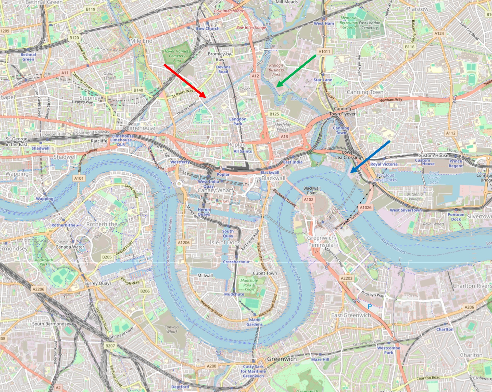
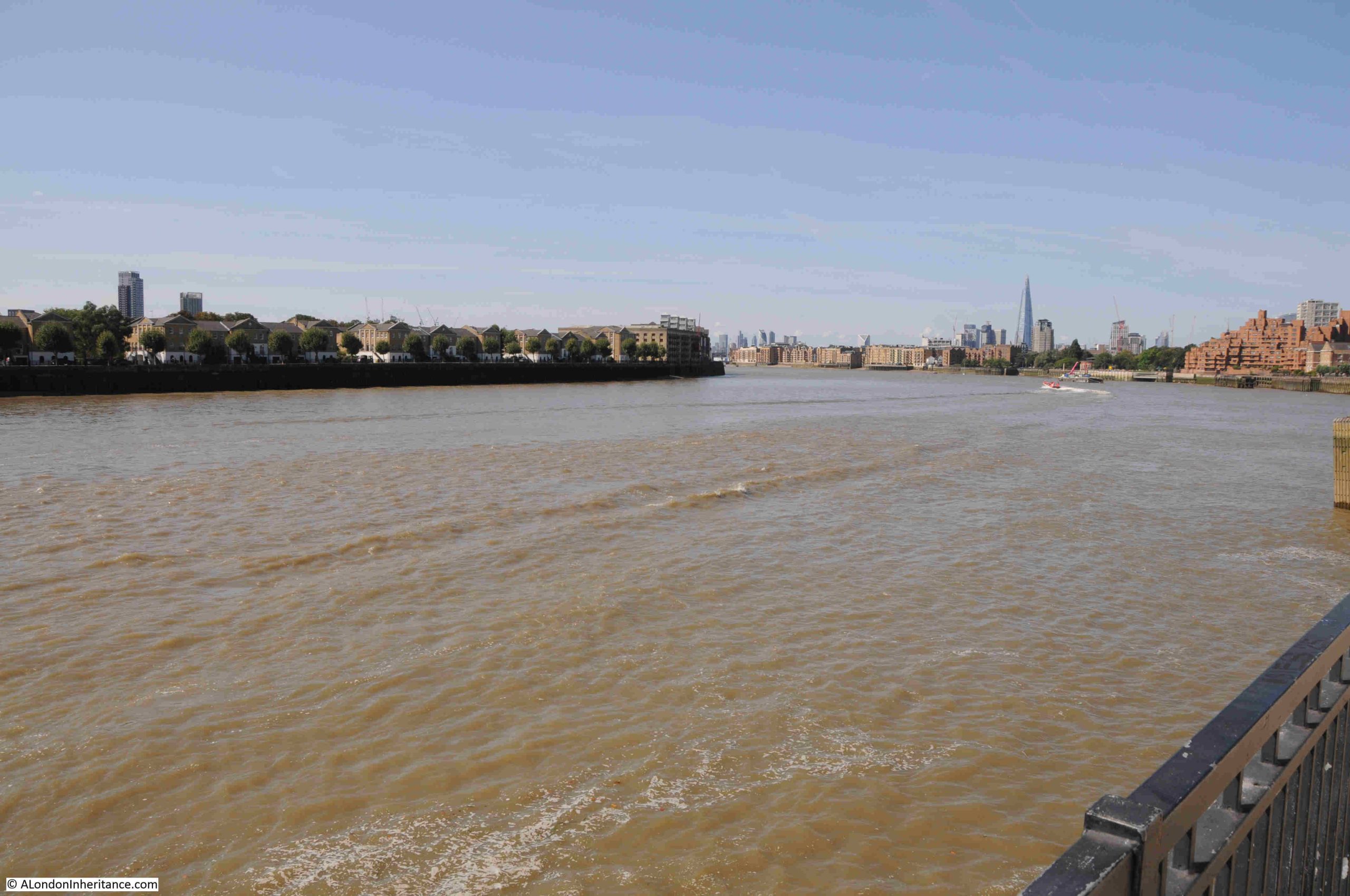
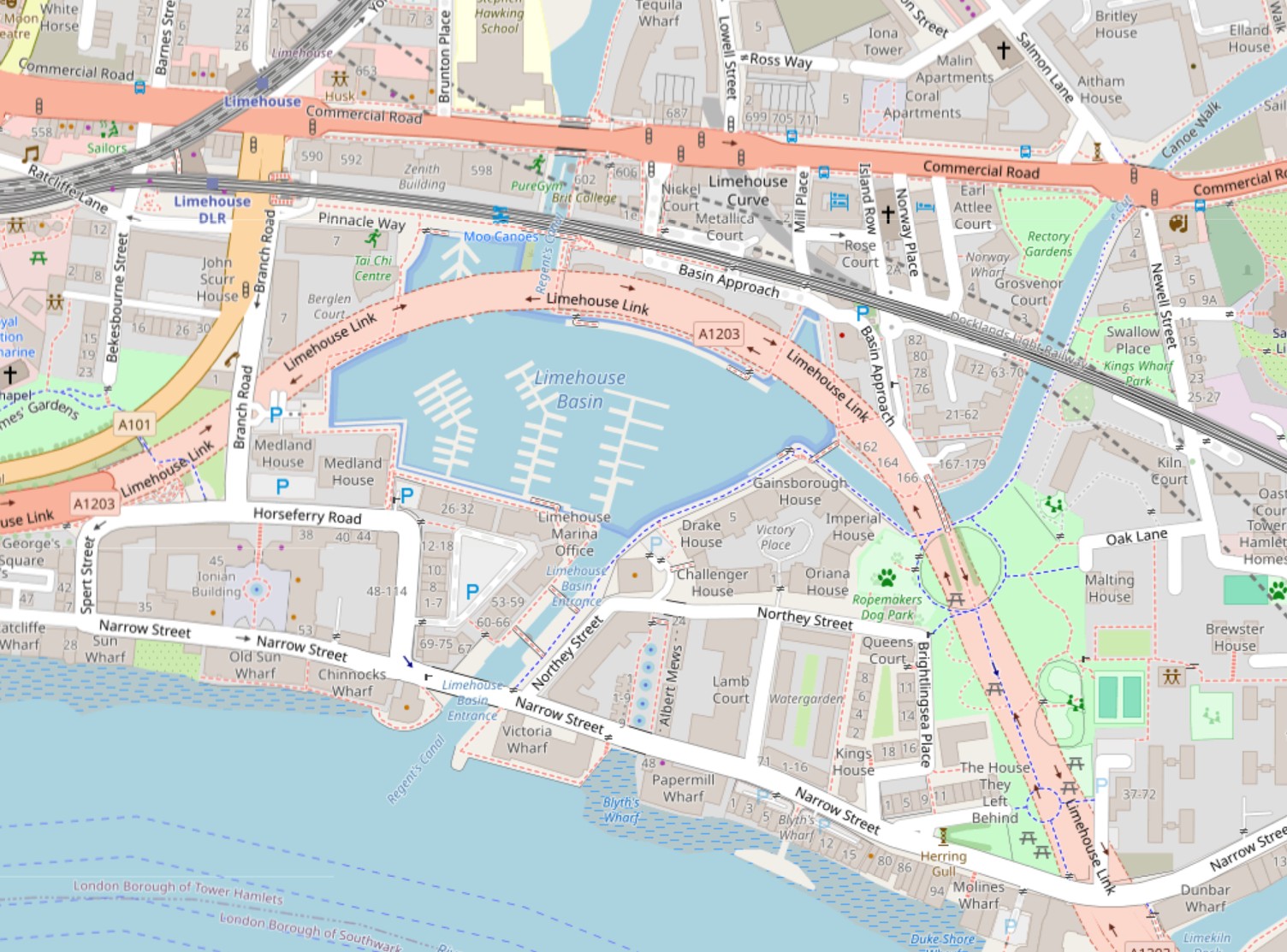
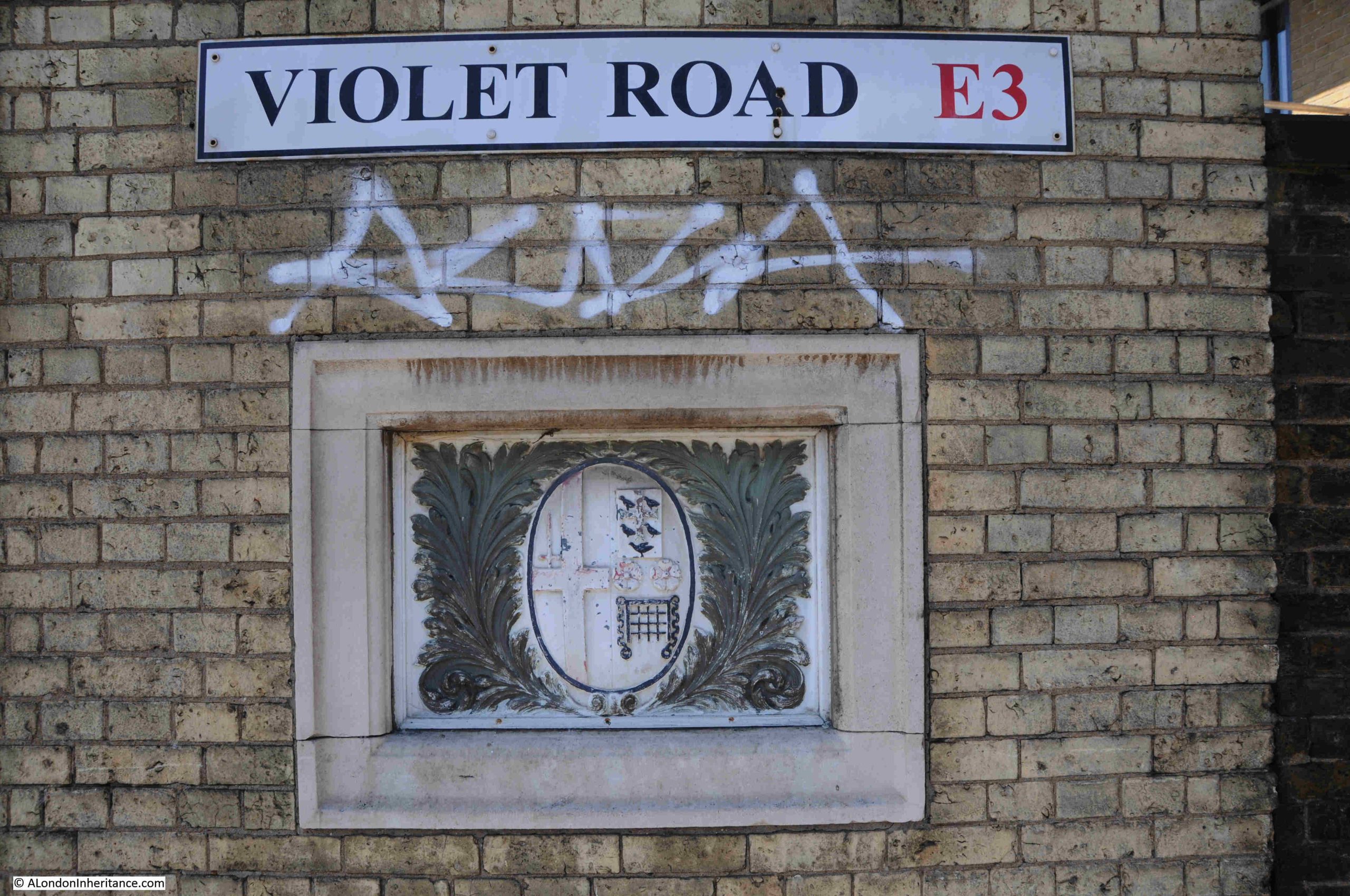
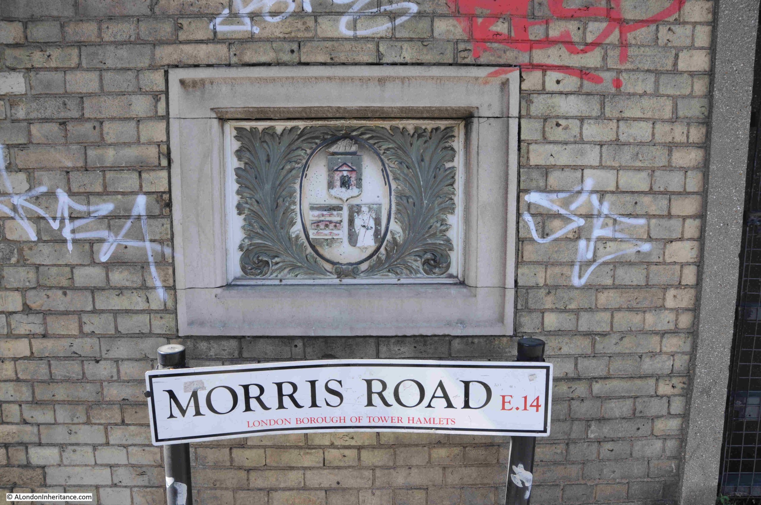
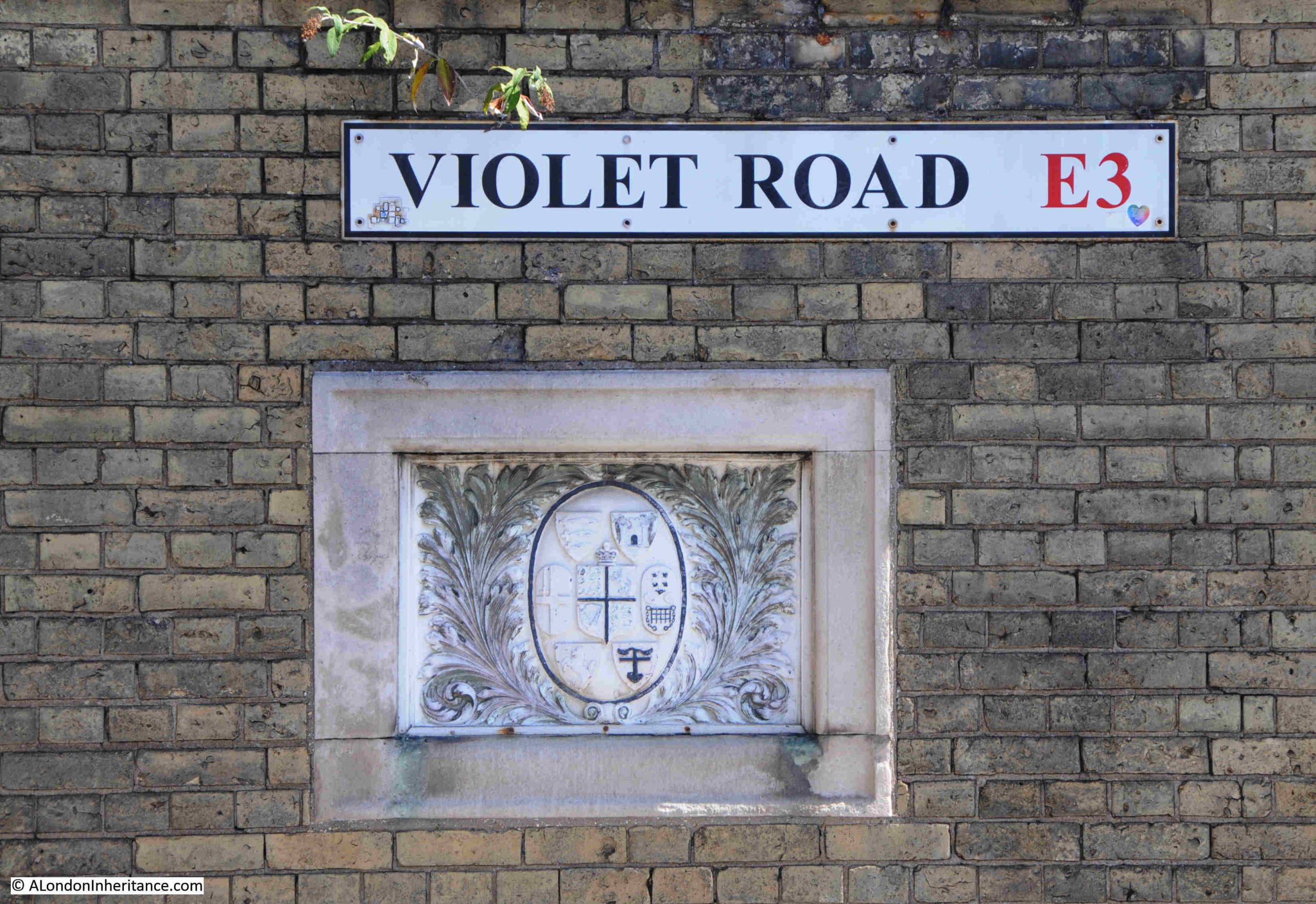
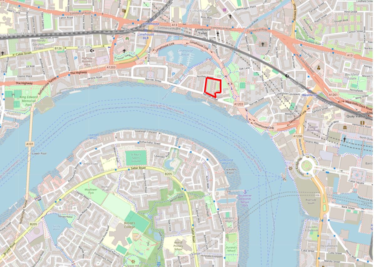
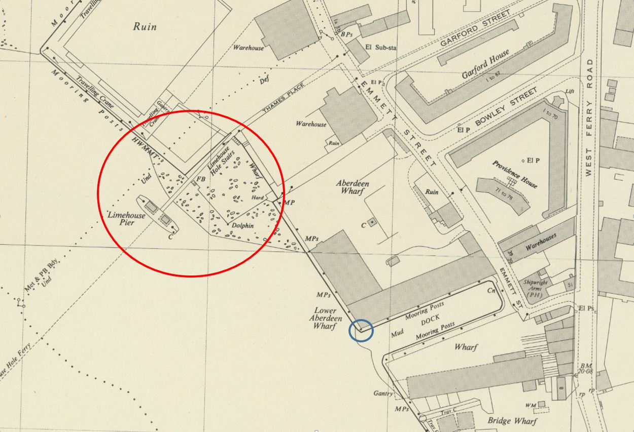
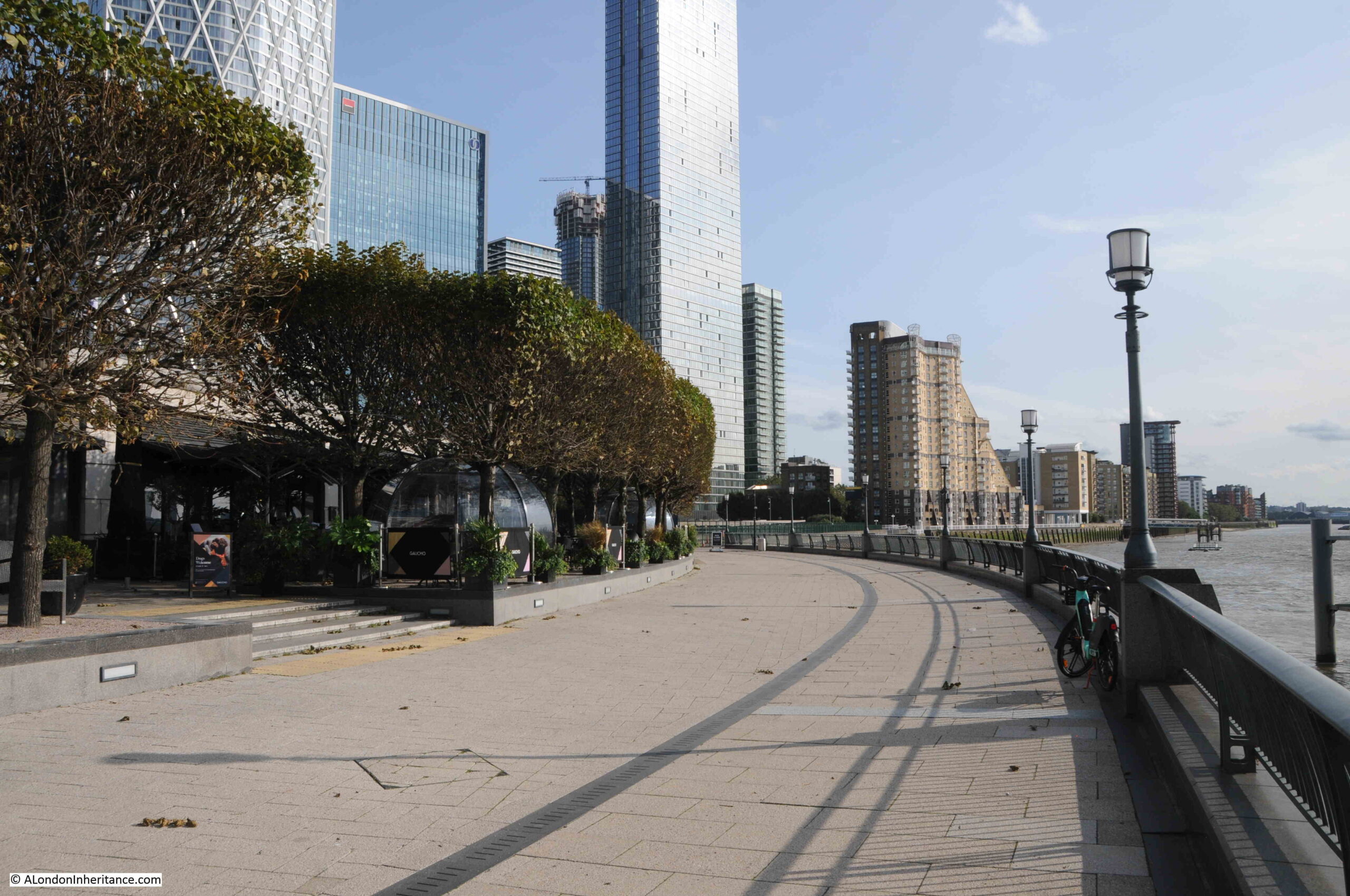
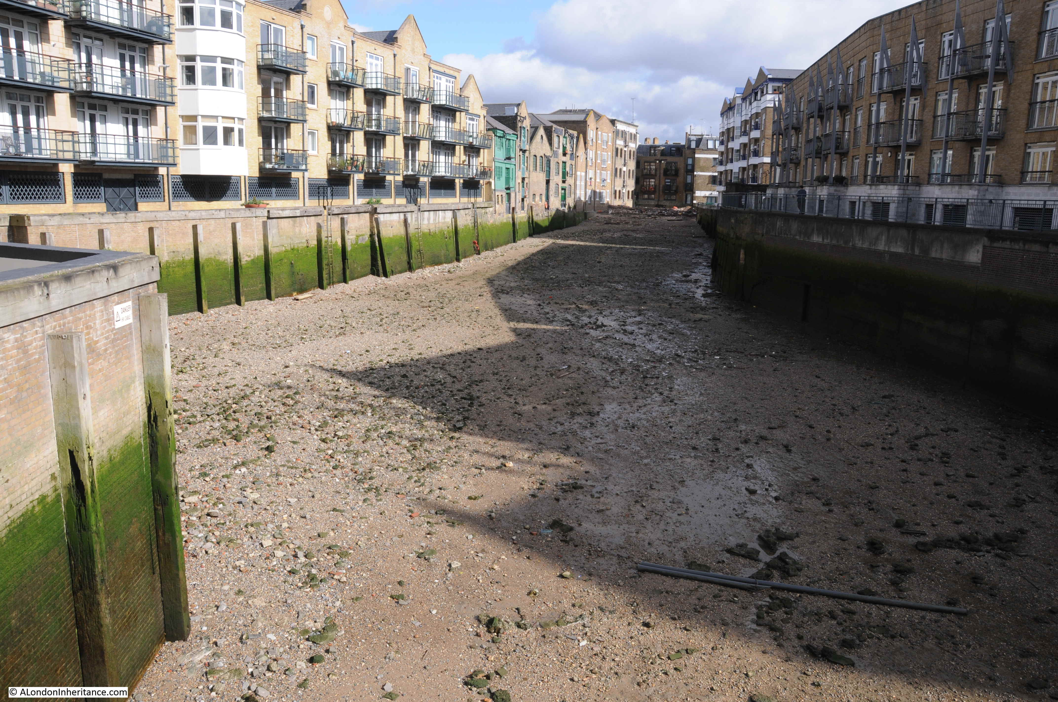
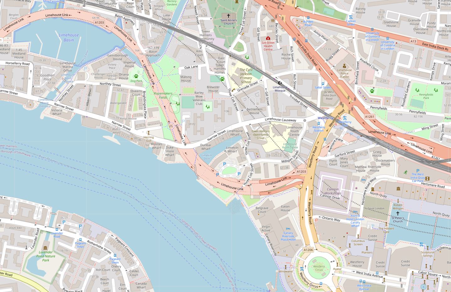
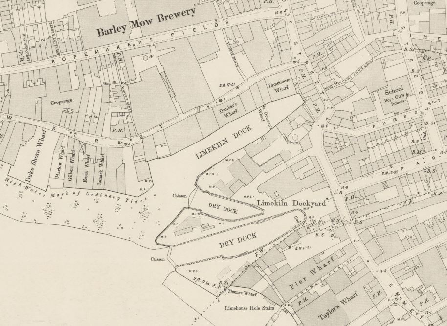
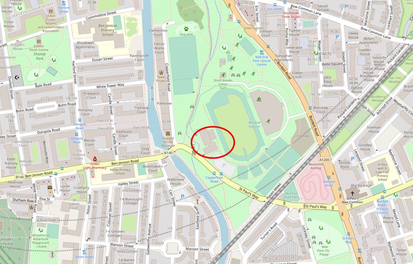
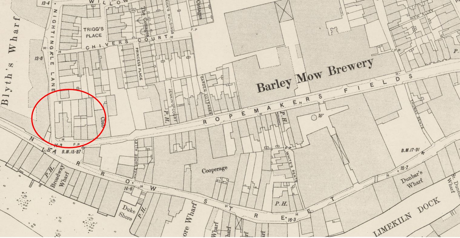
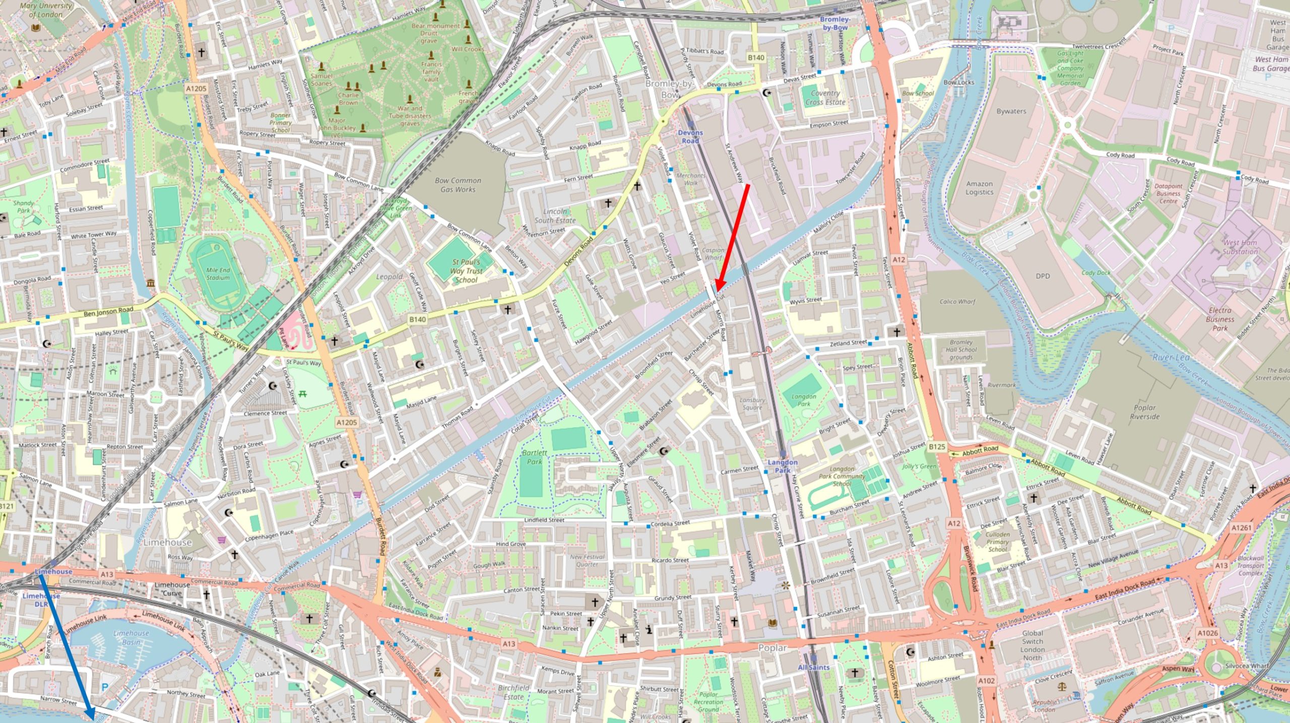
In the first part of my walk along the Limehouse Cut, I started where the Cut once entered the River Thames (blue arrow in the following map), and ended where Morris and Violet Roads cross the Cut (red arrow). In today’s post, I am continuing along the Limehouse Cut to where it meets the River Lea and walking up towards Three Mills Island (map © OpenStreetMap contributors):

From here onwards, there are not so many people walking along the tow path. The first part of the walk has been reasonably busy with walkers, joggers and cyclists.

If you do walk the same route, the only thing to watch out for is the occasional cyclist who does not give any warning of their approach, races up behind you, and when you are aware of them coming up behind, the distance is insufficient for both pedestrian and cyclist to safely move to opposite sides of the tow path. One cyclist almost ended up in the water when we both moved to the same side, and the distance between us required an emergency swerve.

This was only a single instance, the majority of cyclists are very considerate of pedestrians.

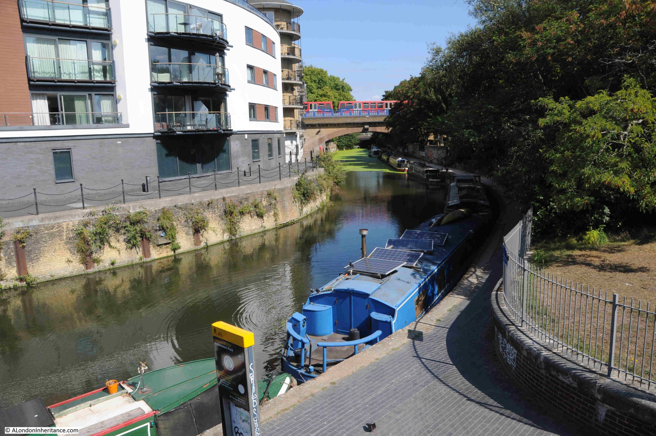
A short distance along from the Morris and Violet Roads bridge is the bridge that carries the Docklands Light Railway across the Limehouse Cut. As I passed under the bridge, a train passed above:

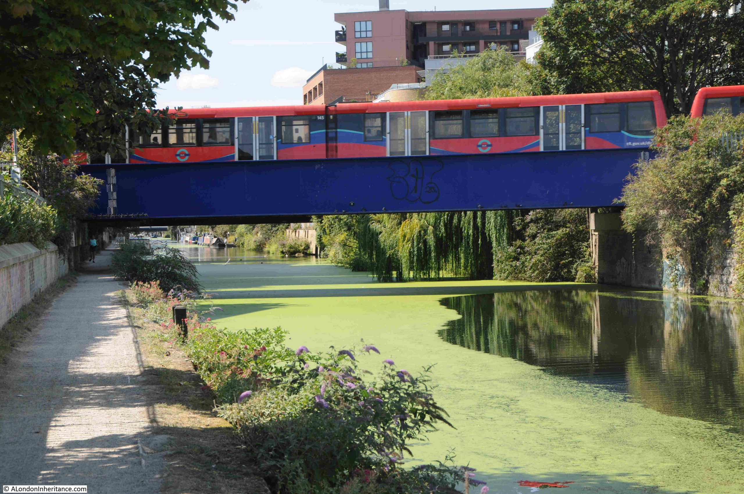
This is the section of the DLR that runs between Poplar and Stratford, Devons Road station to the north west and Langdon Park station to the south east. It was originally the route of the North London Railway, and on the land to the right of the above photo, there was a complex of engine and carriage sheds with multiple tracks to serve these, and provide a connection with the main railway.

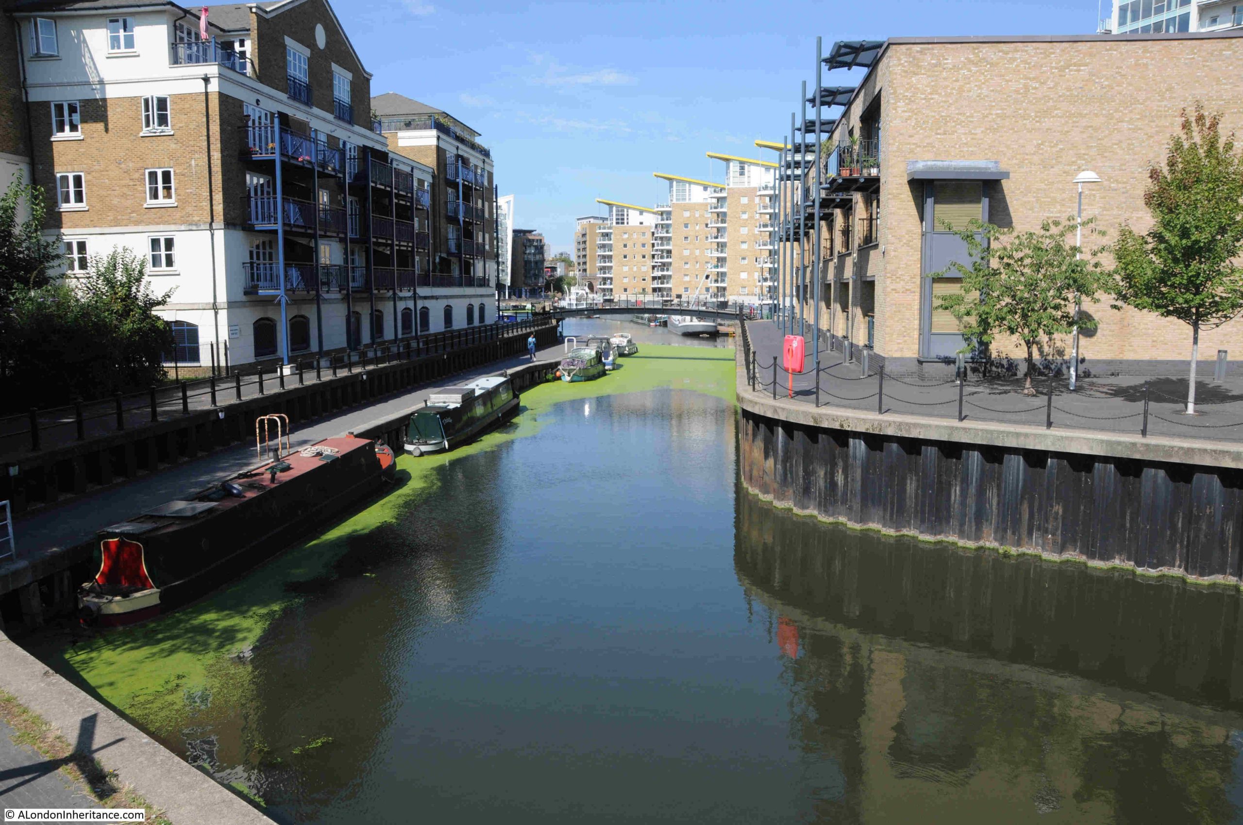
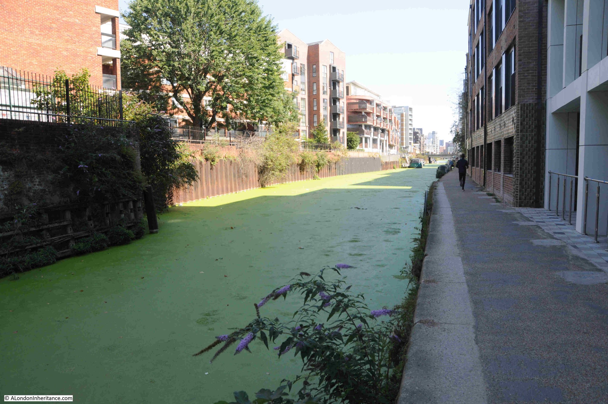
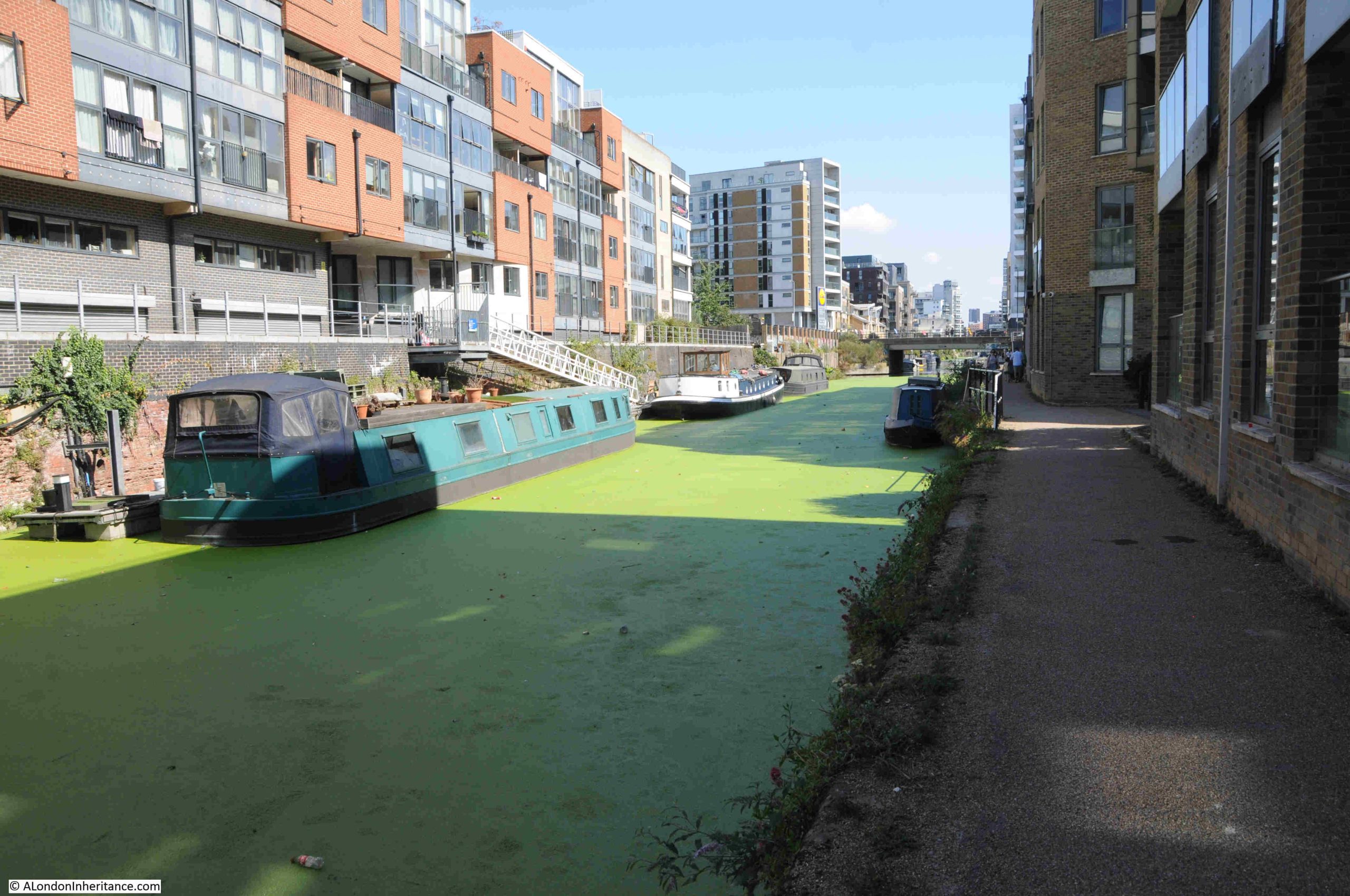
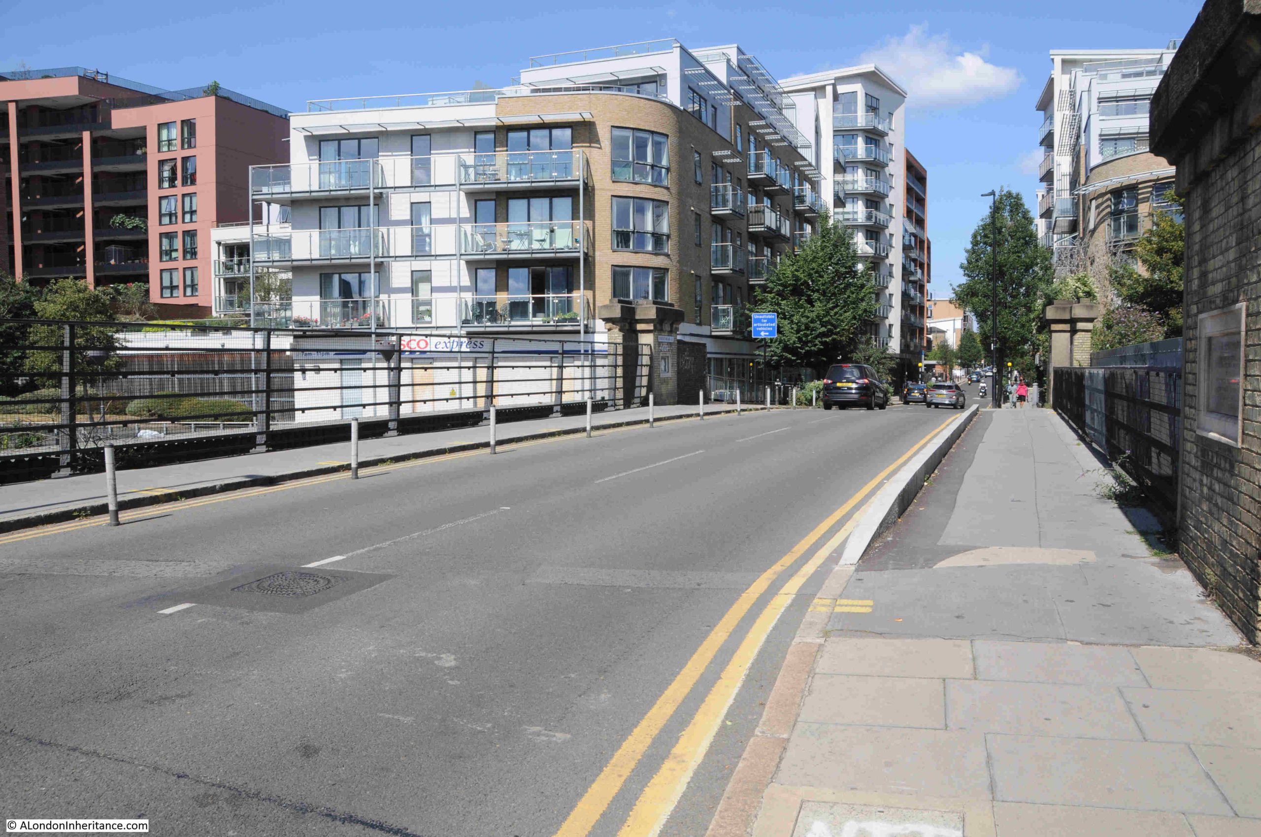
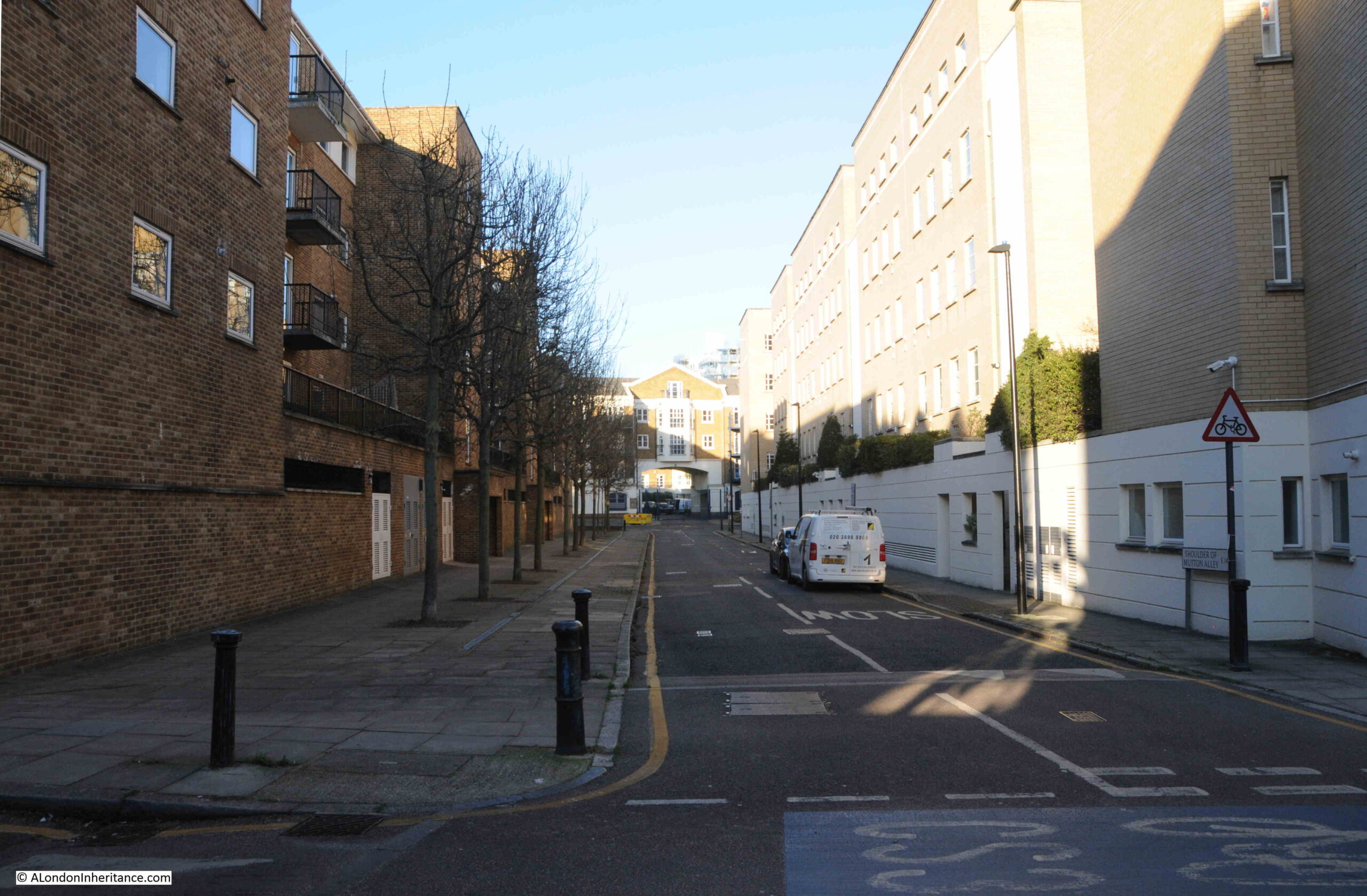
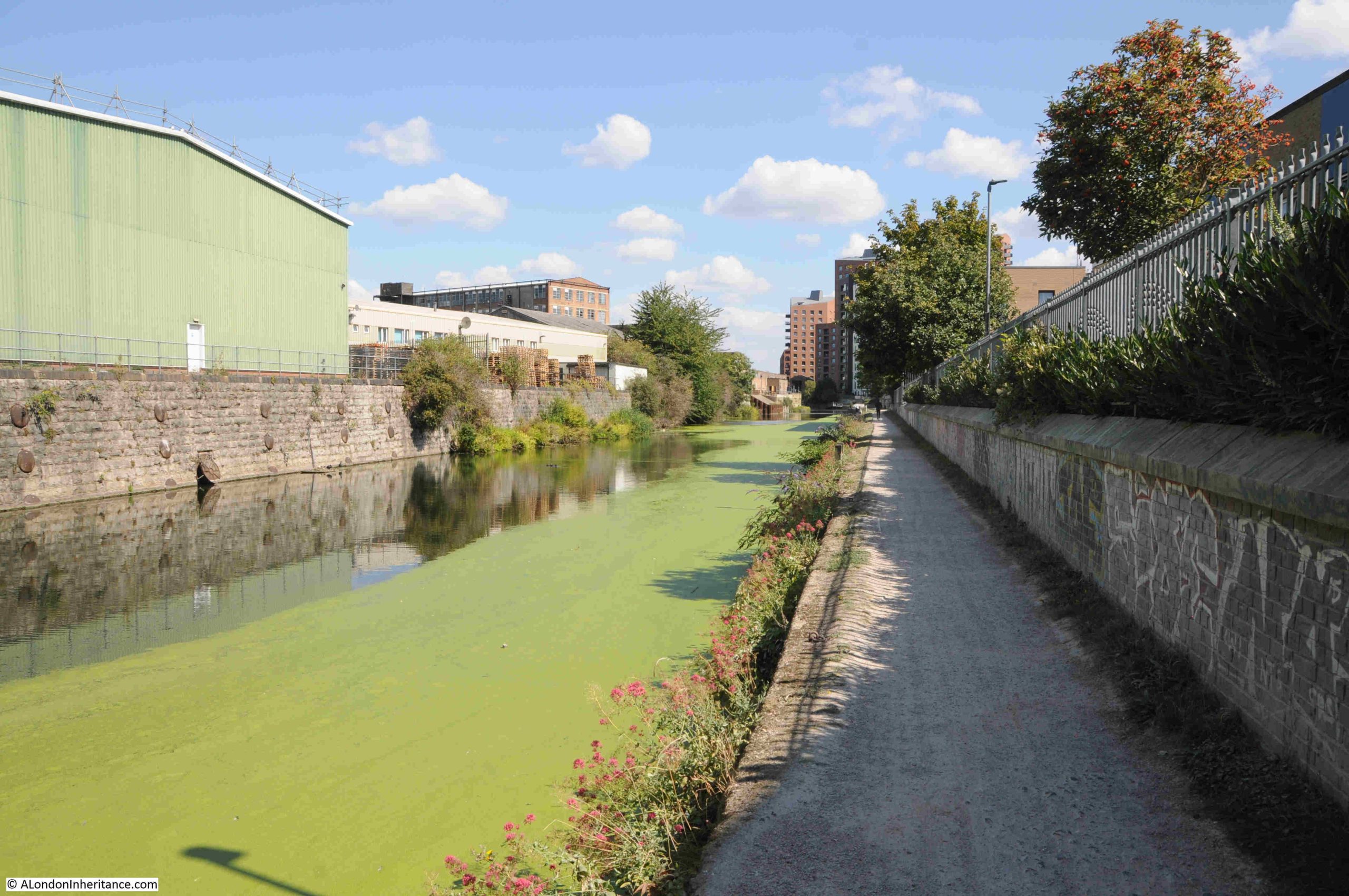
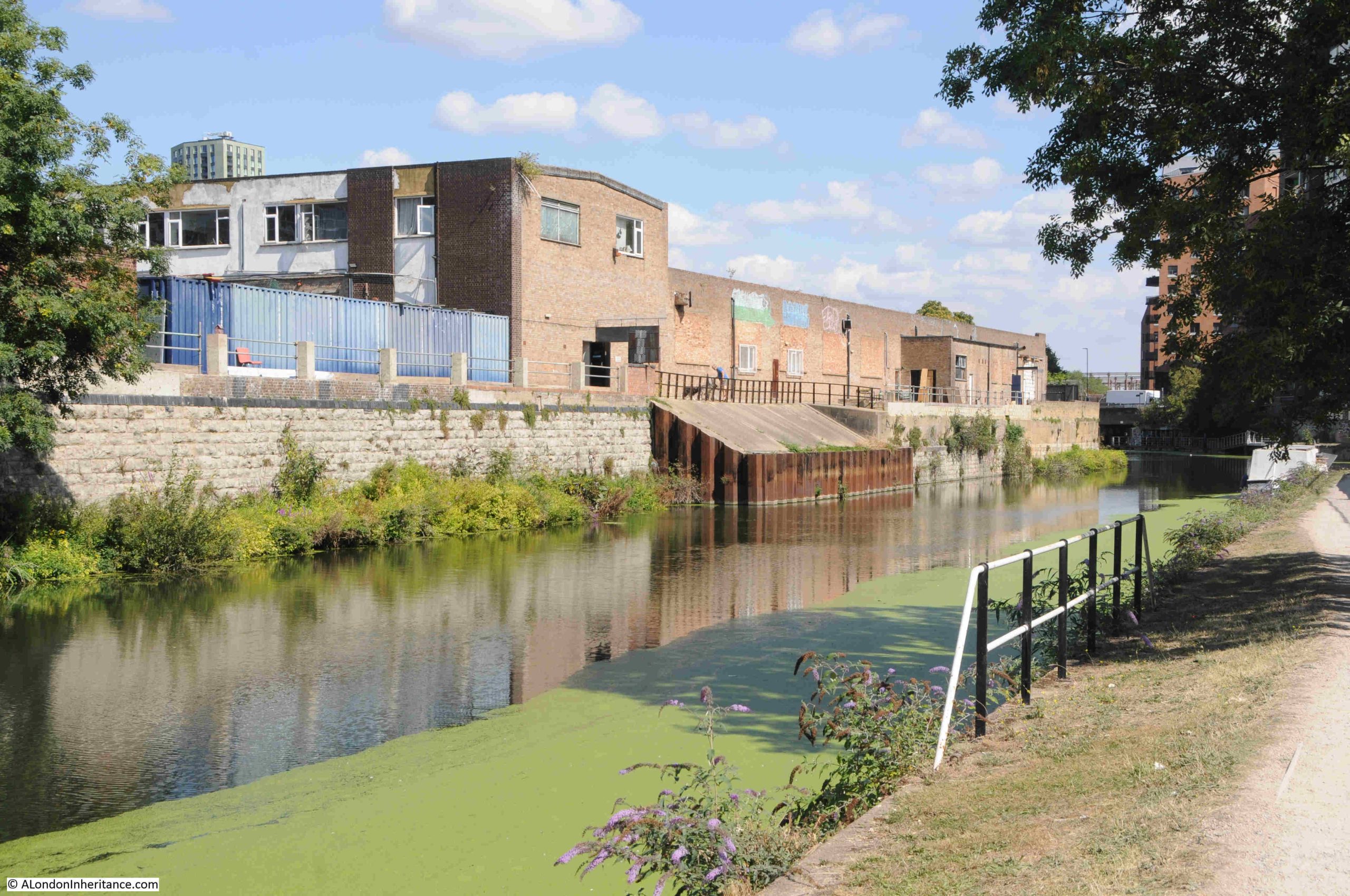
The Limehouse Cut now has a much more industrial / commercial feel to the land alongside the Cut, which probably explains why there are not so many people walking this section than along the earlier part of the walk:

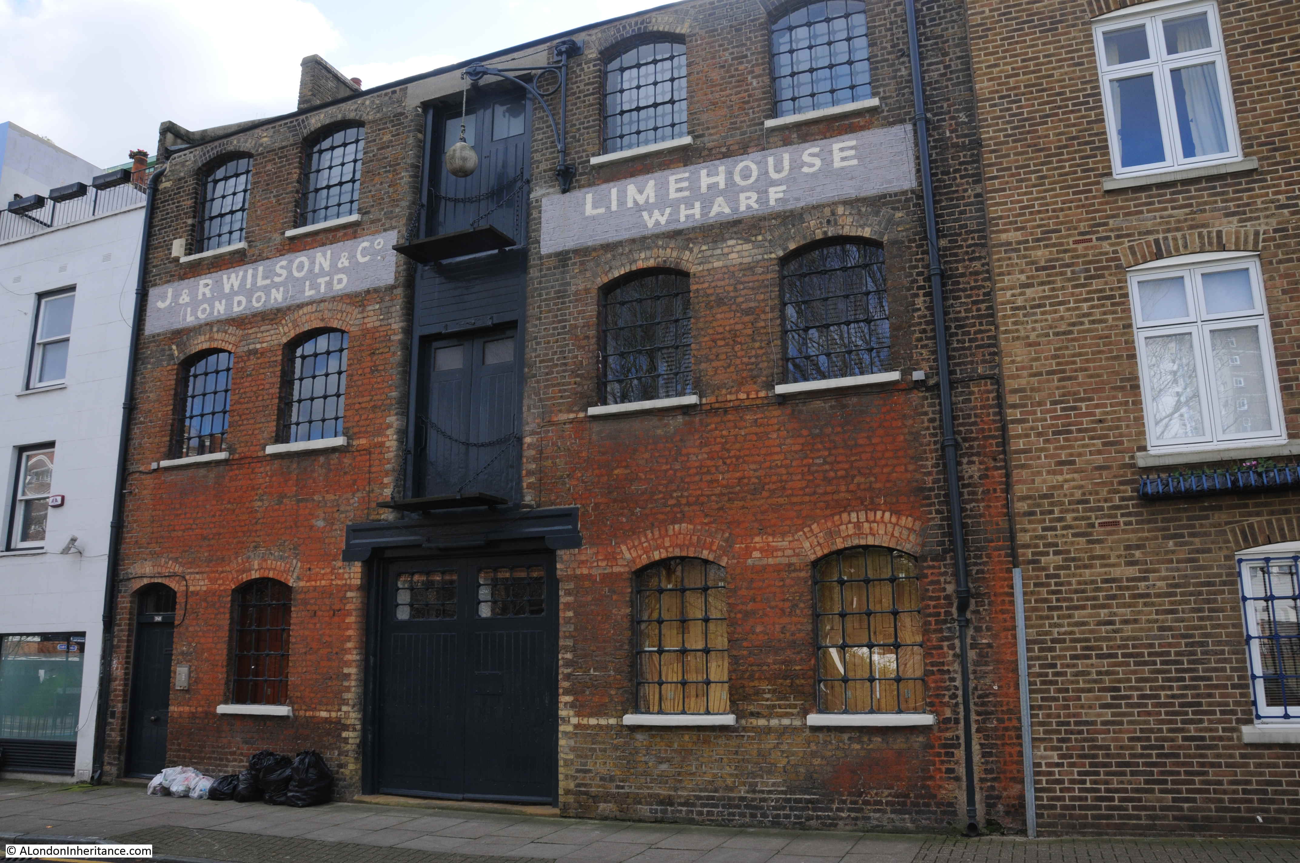
Very few remains of earlier industry survive, however is the metal frame of an earlier building surrounding a new building seen to the left in the following photo. This was originally a furniture factory and what is now a rusty metal frame once extended over the Limehouse Cut to provide a gantry with facilities to load and unload barges on the water:

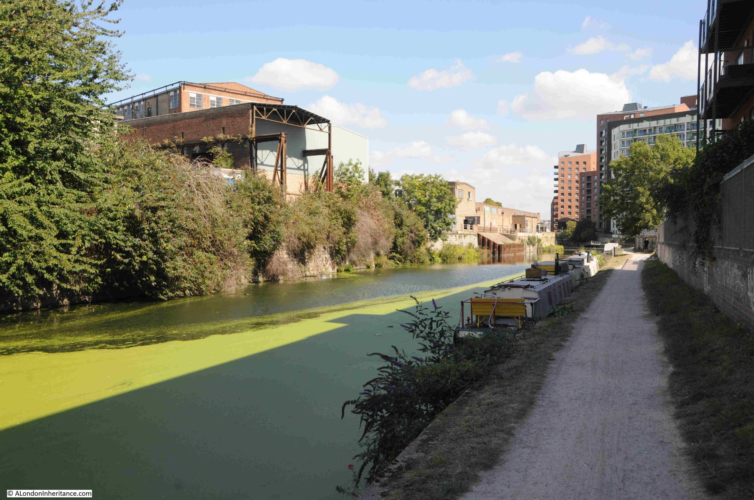
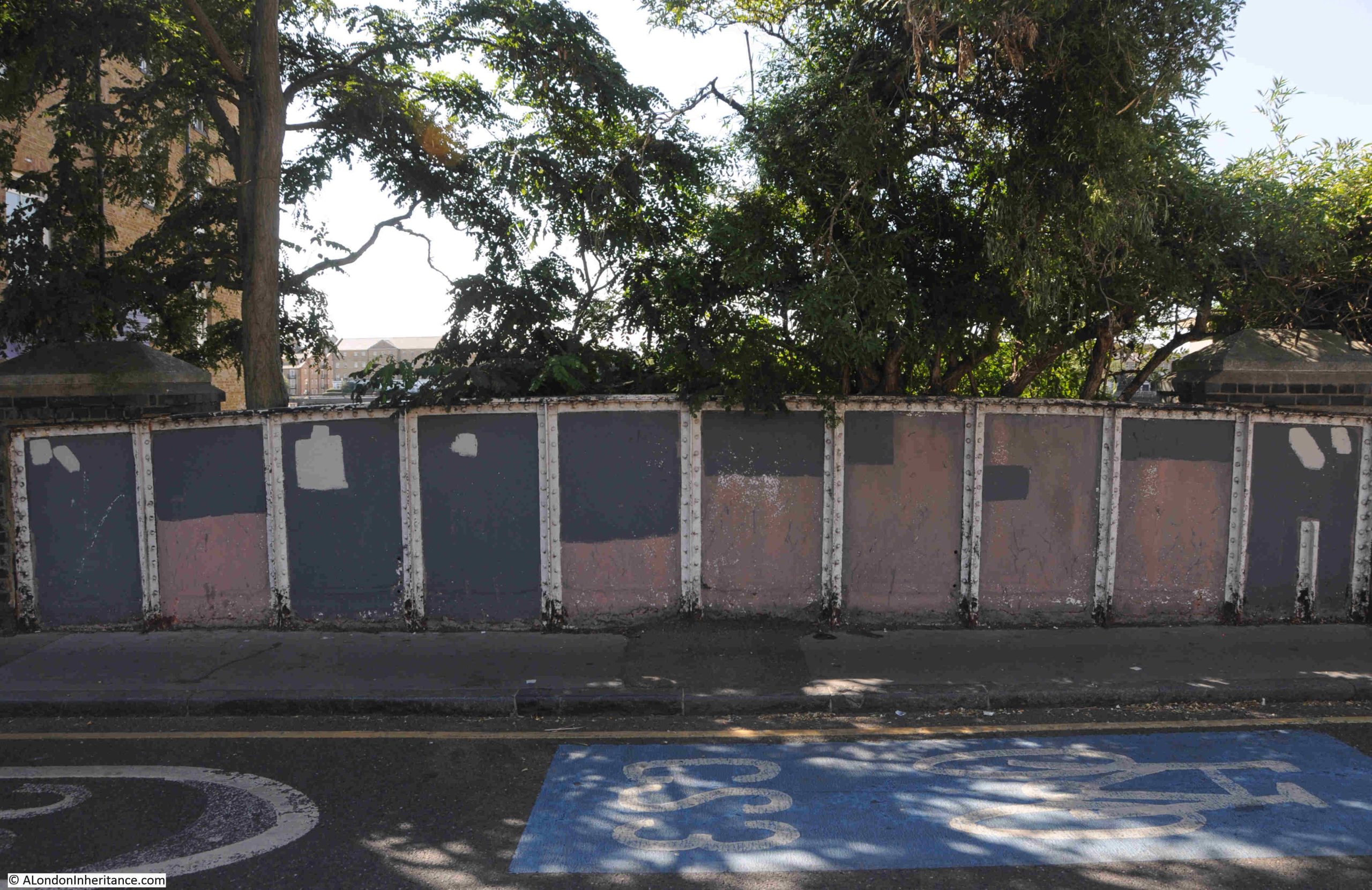
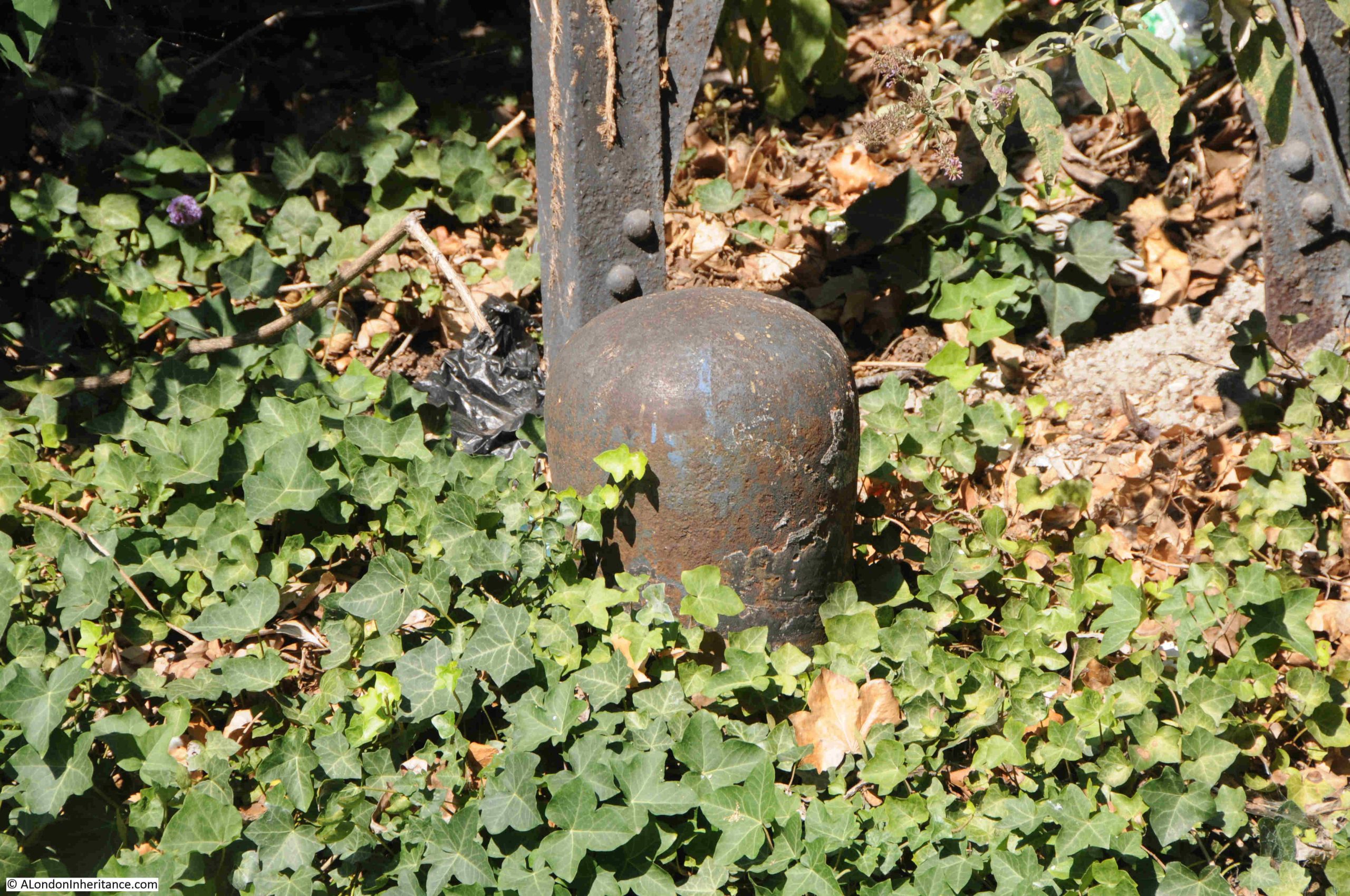
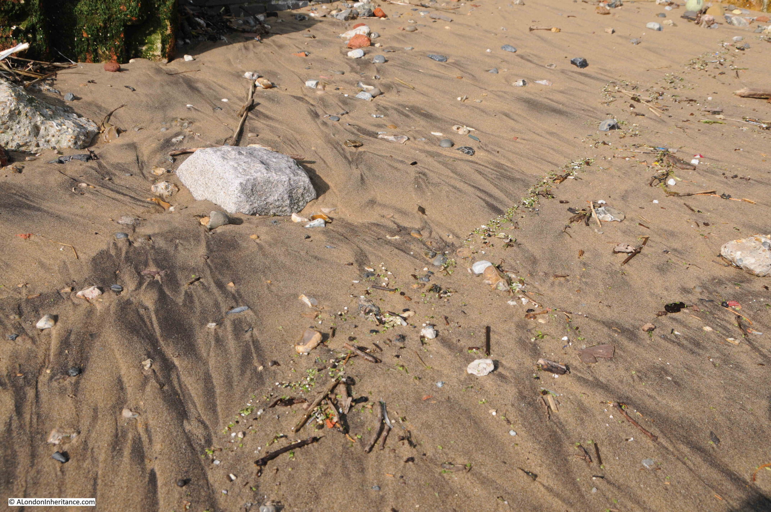
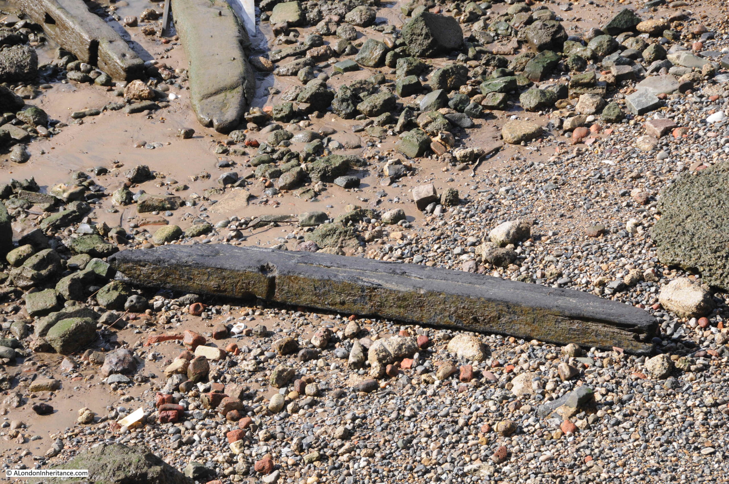
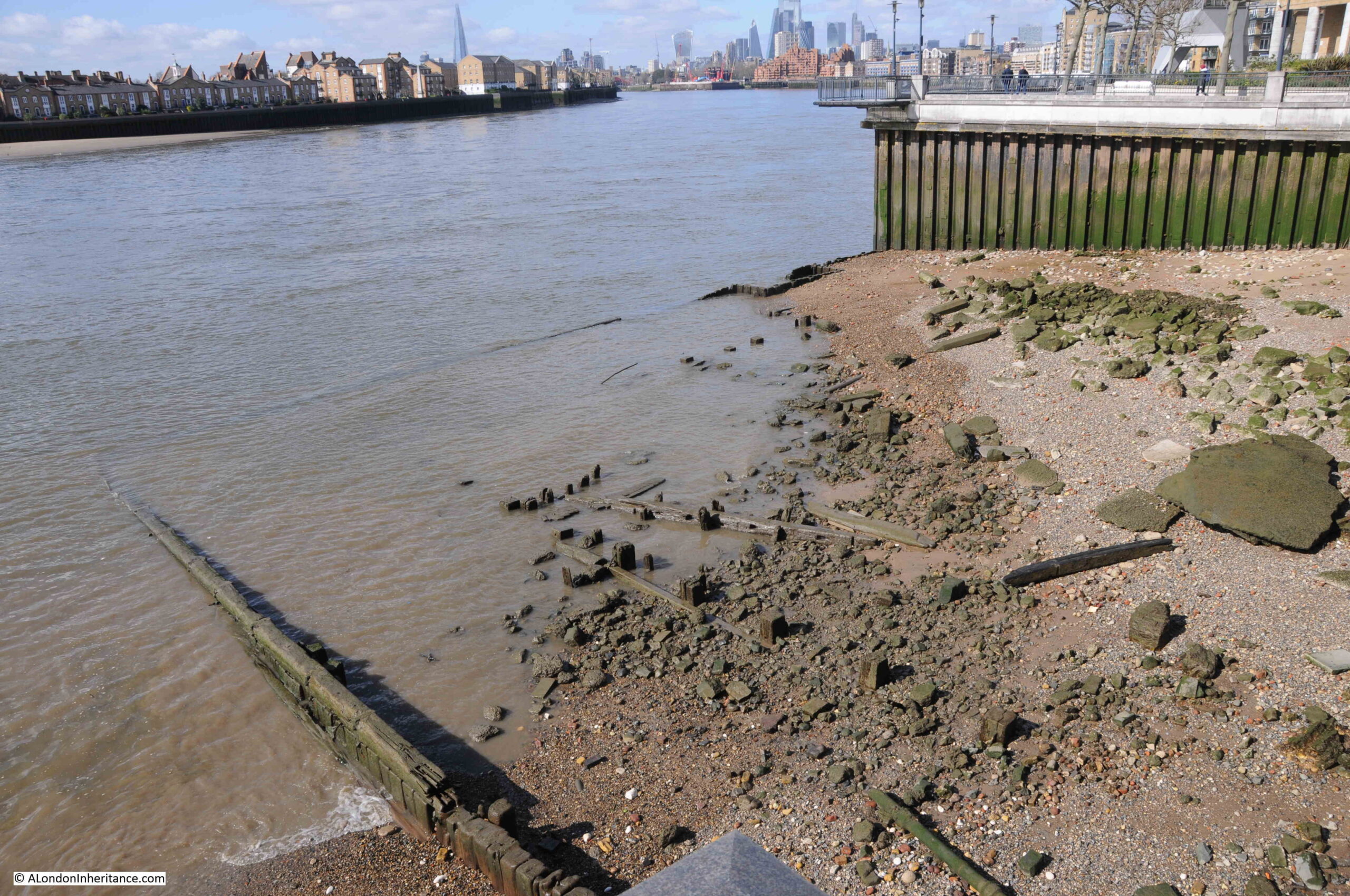
Further along there is a length of metal piling and concrete infill extending into the water. I cannot find any similar features in earlier maps, and it looks relatively new. No idea of the purpose:

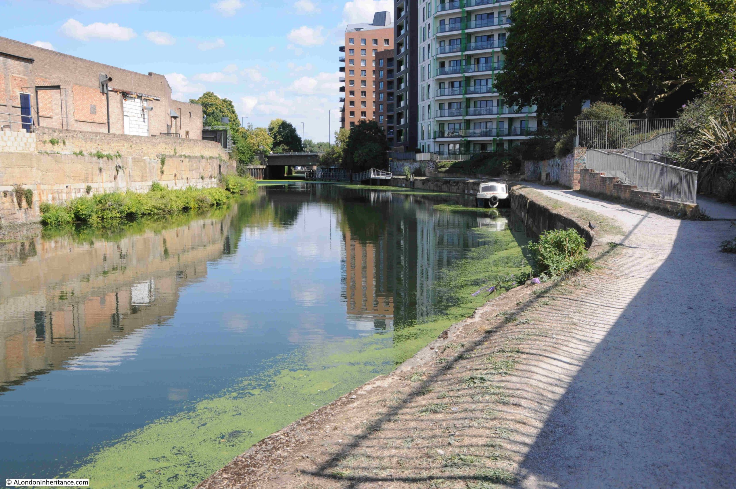
For almost the entire length of the route, the Limehouse Cut has been a straight line. It was built at a time when north of a small area along the river, there was no development, so the original builders dug the Cut through what was rural land.

We are now though approaching the end of the Limehouse Cut and there is a slight curve in the route:
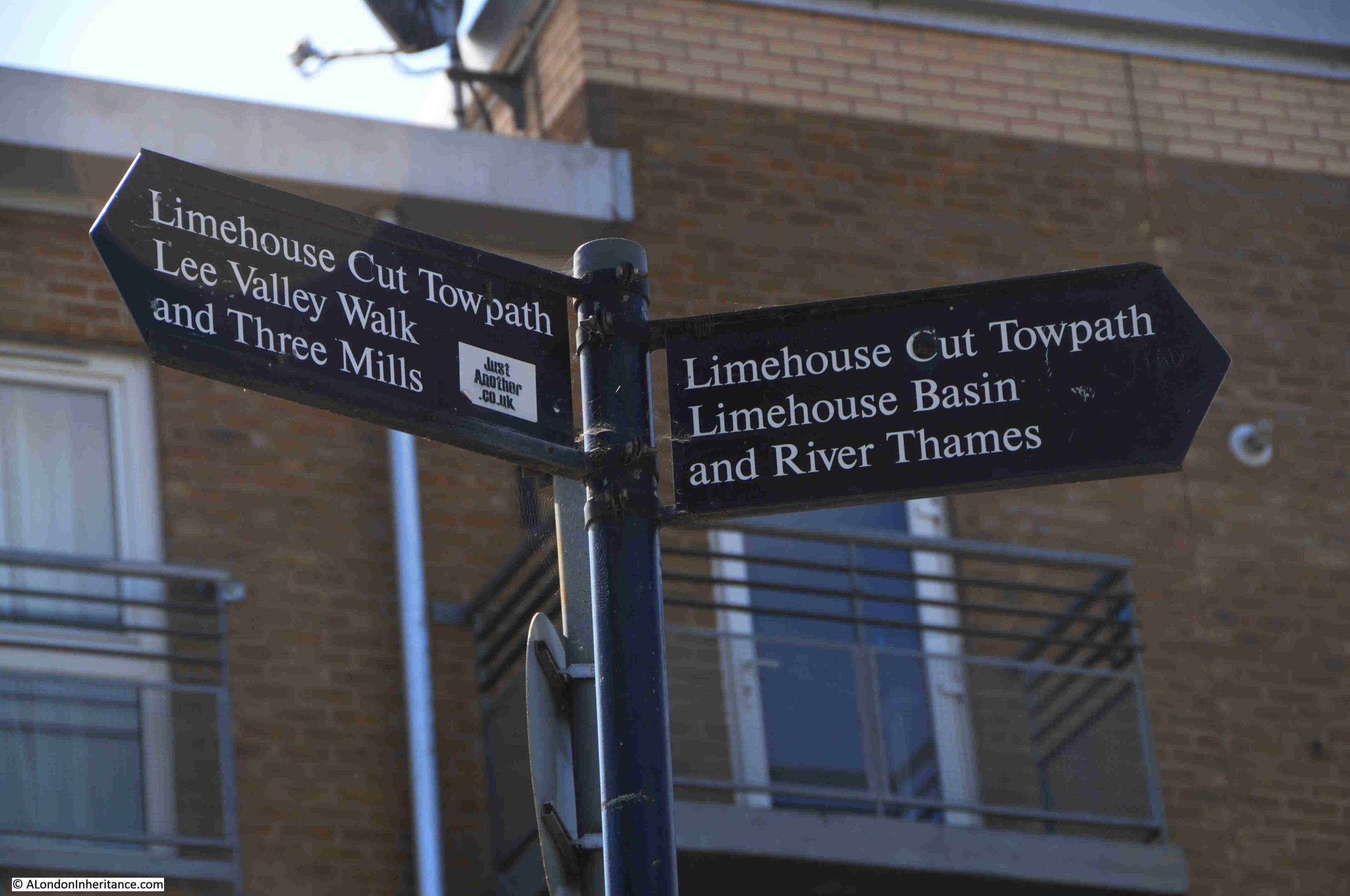
Well signposted:

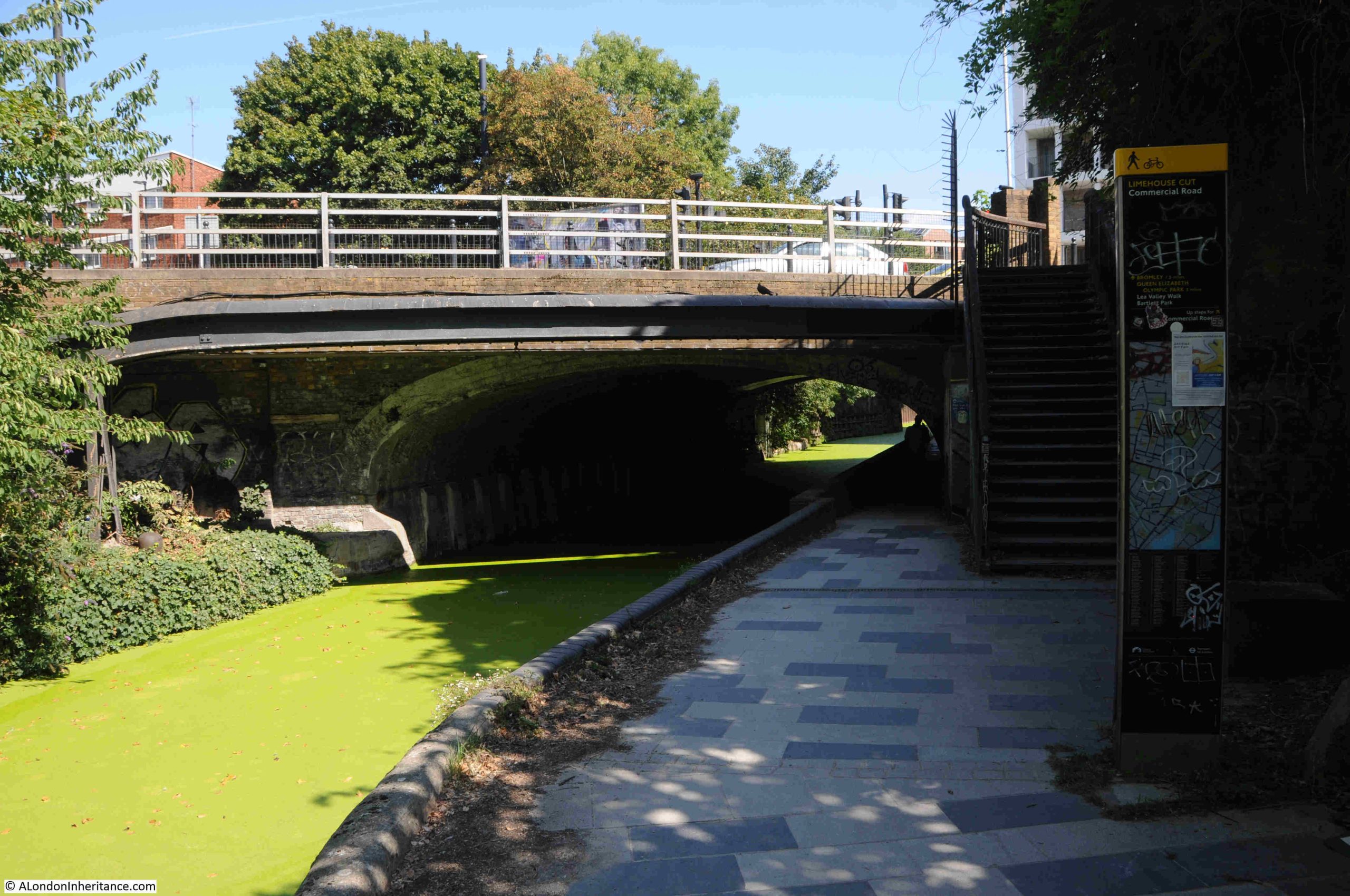
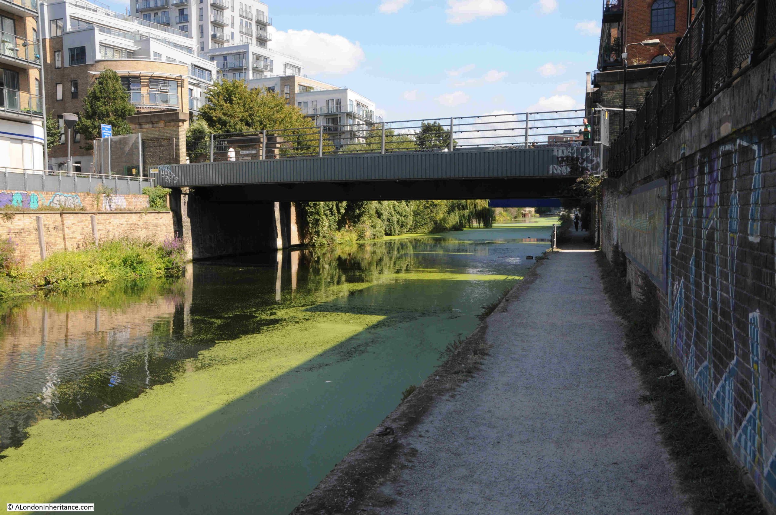
The towpath changes here and offers two routes. To the right, the footpath runs up to the six lanes of the A12 road, and to the left, and new walkway takes the walking route along the side of Limehouse Cut:
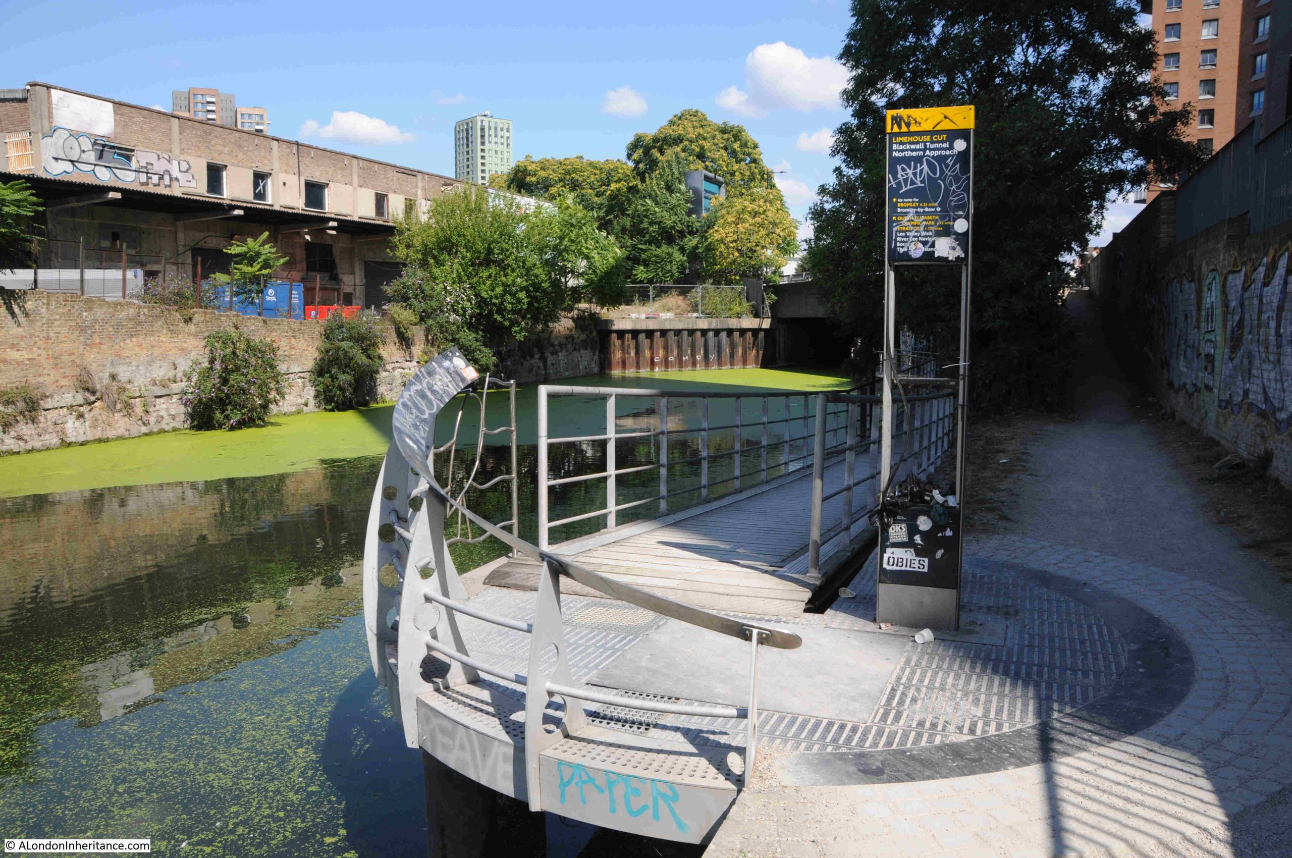
And under the A12:

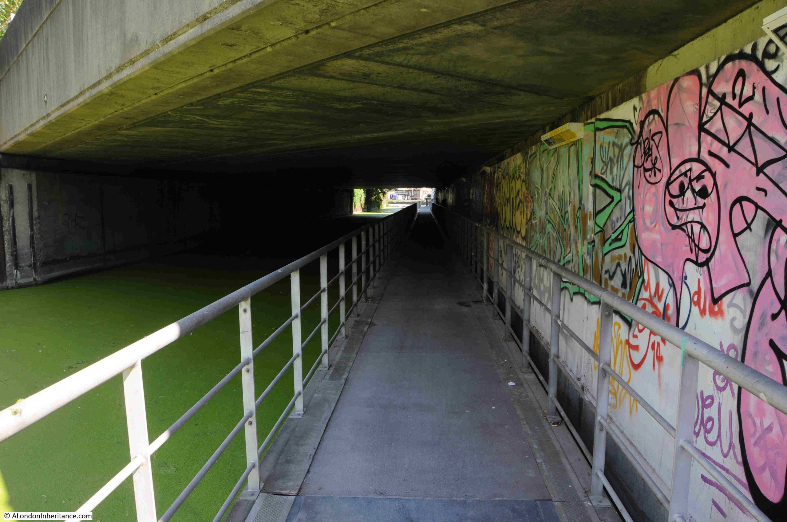
This walkway was needed when the A12 was enlarged. This section has always been a narrow part of the Cut, and a place where Leonard’s Road crossed, however the routing of the A12 from Stratford down to East India Dock Road (A13) and the Blackwall Tunnel required a new, significantly larger bridge to be built.

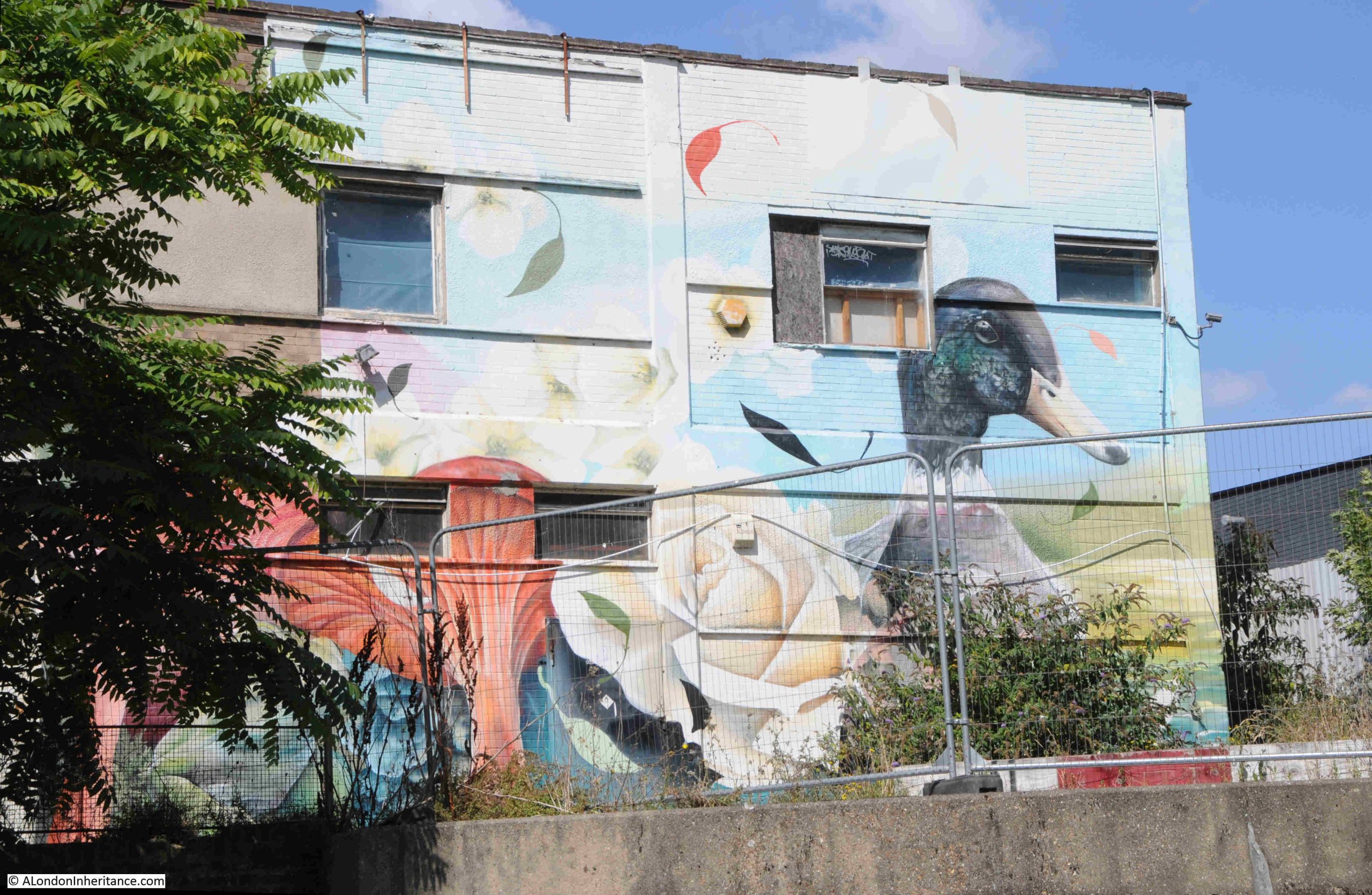
There were a good number of ducks along the length of the Limehouse Cut, and after walking under the A12, one of the breeds seen on the water has been painted on the wall of a building to the side of the Cut:

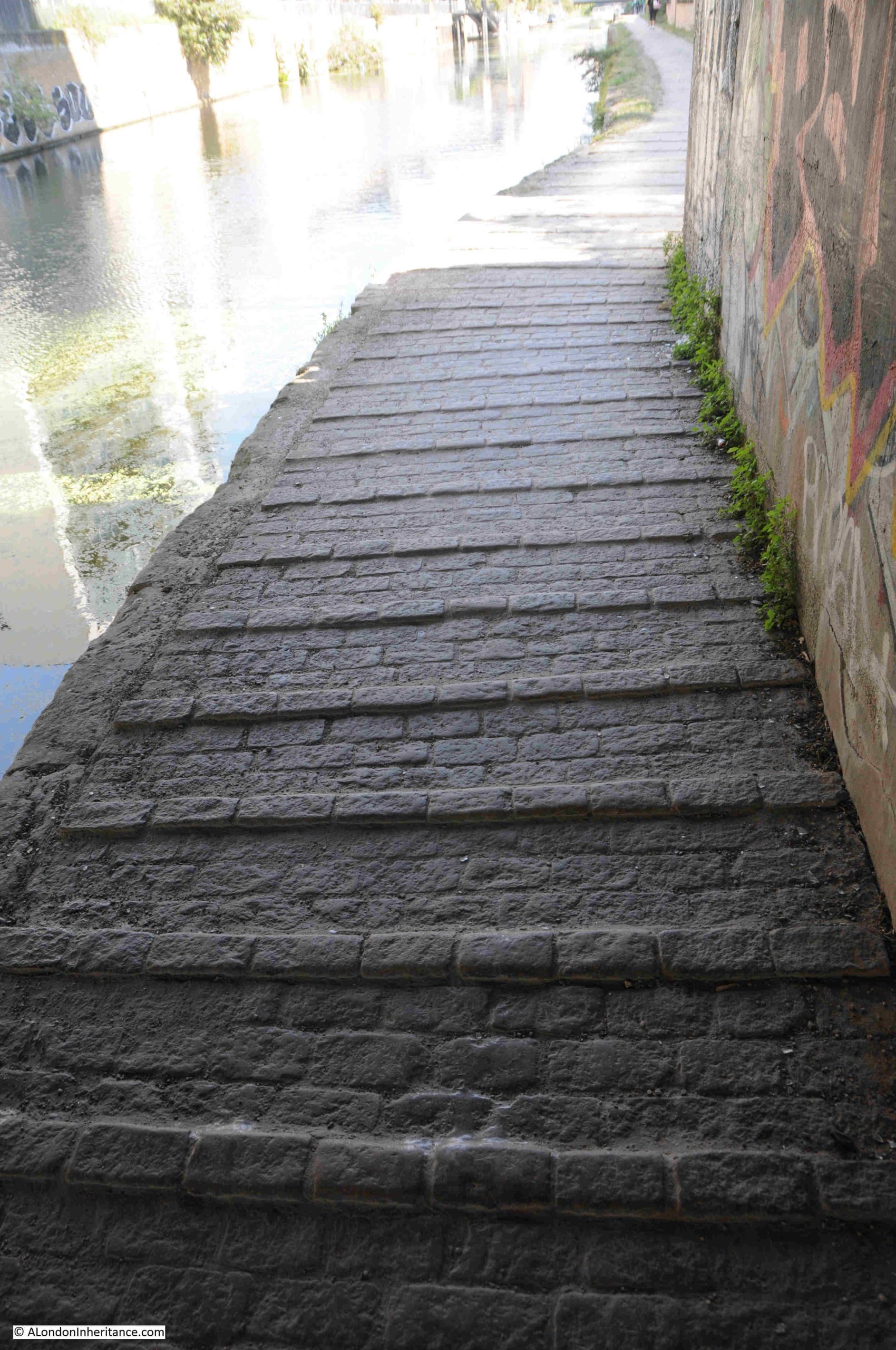
Looking back towards the bridge thar carries the A12, and next to it another bridge for Gillender Street. The original wall of the Cut can be seen on the left:

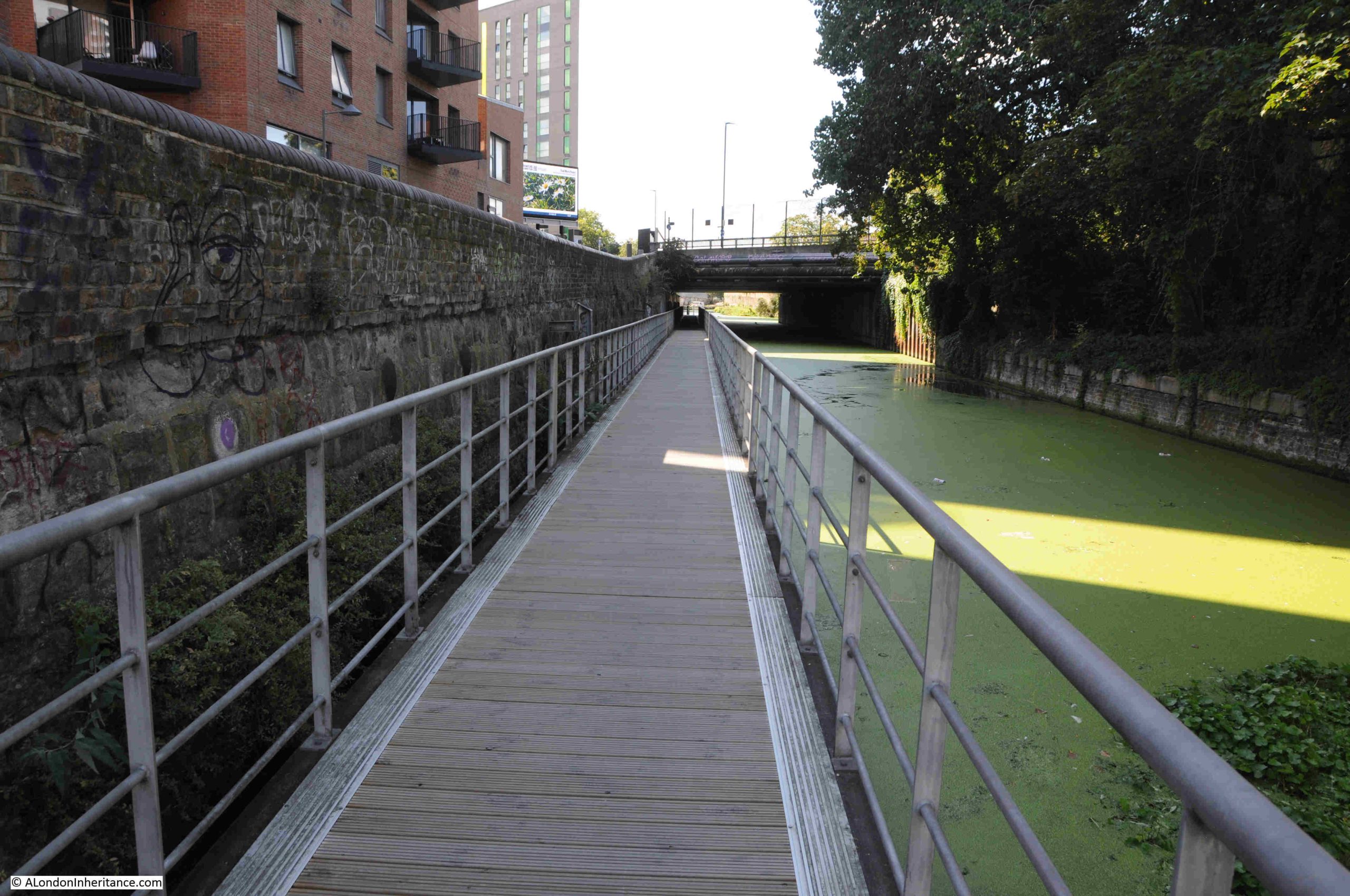
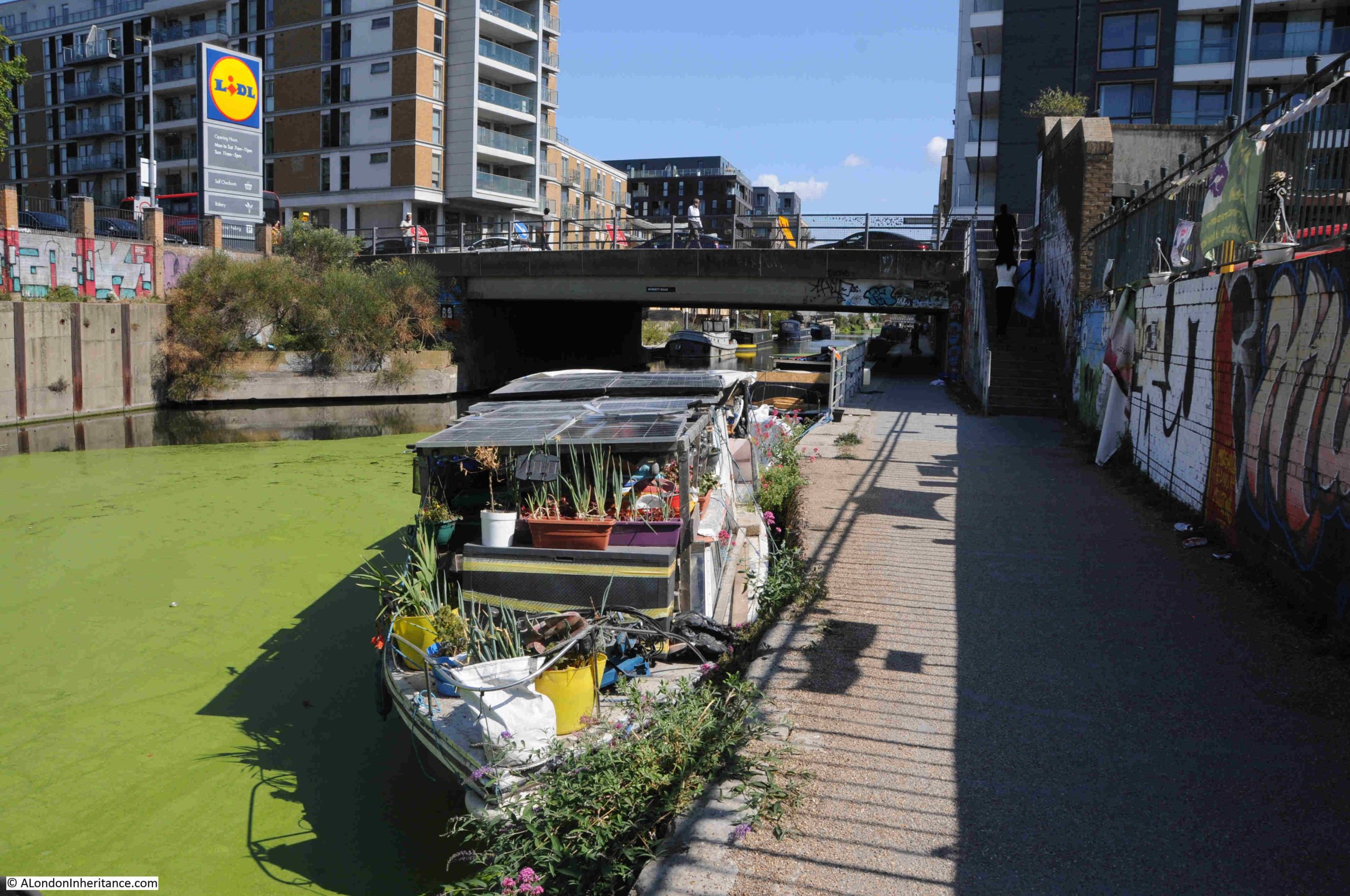
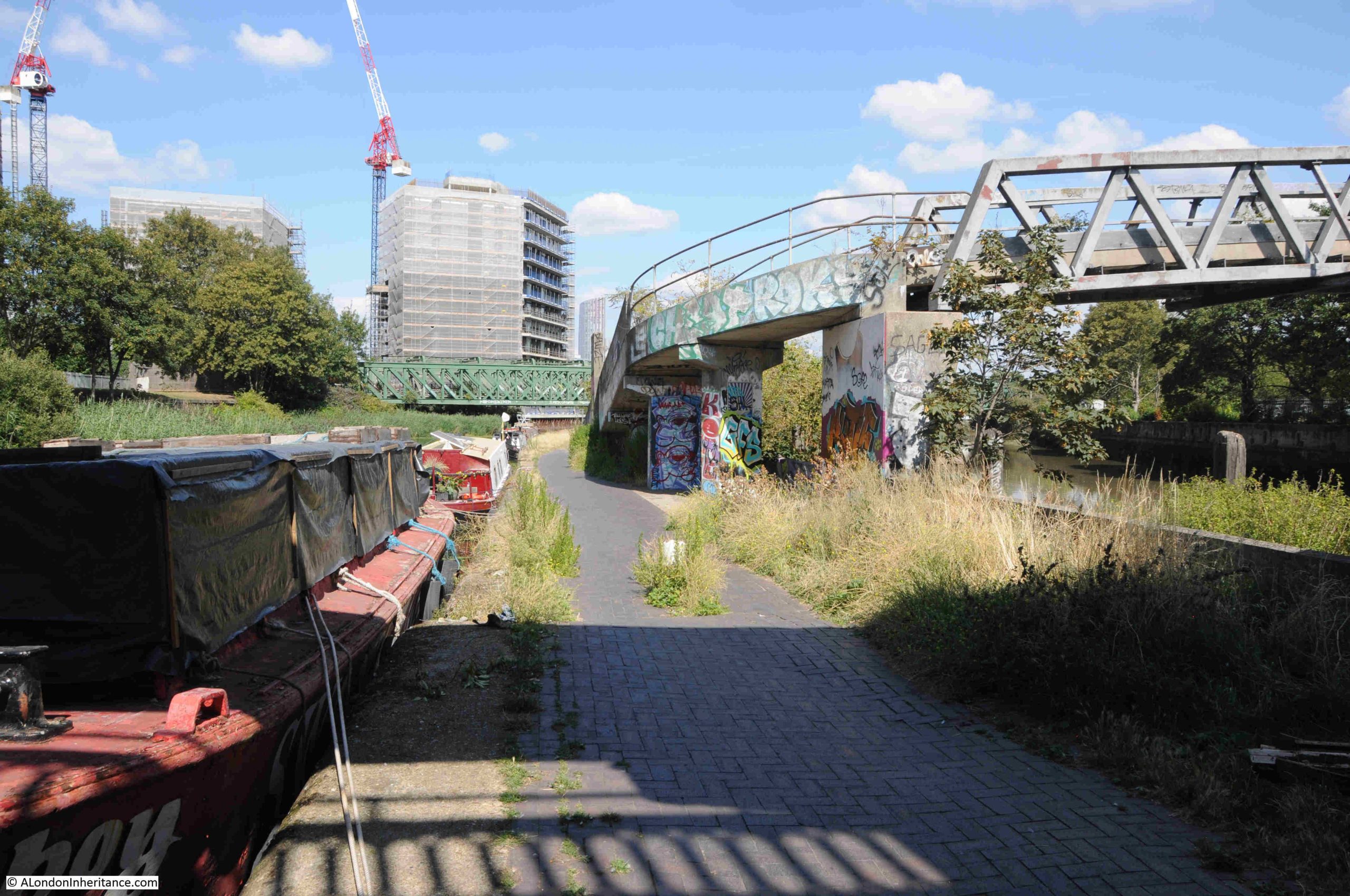
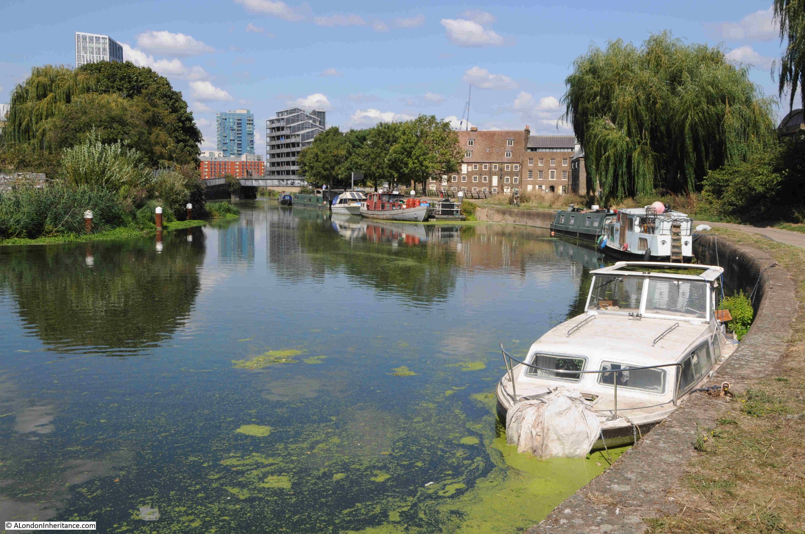
At the end of the walkway, the water opens up as we approach the River Lea:

I have been using the name River Lea throughout my posts on the Limehouse Cut, although two spellings are used for the river that the Limehouse Cut was built to bypass. Lea and Lee.

The source of the River Lea is in Bedfordshire, to the north of Luton. The river runs through Bedfordshire, Hertfordshire, on the edge of Essex before heading into Greater London.

The name Lea is used from the source to Hertforshire, and from Hertford to the Thames, both Lea and Lee are used.

The Lee comes from the Lee Navigation.

The reason why the Limehouse Cut was built was to bypass the River Lea as it ran to the east of the Isle of Dogs, to provide a more direct route to the City of London, to avoid the bends in the River Lea as it approached the Thames and to avoid the tidal sections of the Lea.

Similiar issues resulted in the construction of the Lee Navigation. This is a canal built on a parallel route to the River Lea, with an aim of smoothing out many of the bends in the Lea, providing additional space for boats, along a route where water levels could be managed. In a number of places the Lee Navigation and River Lea are combined as a single channel.

This is why a look at a map reveals a complex route of parrallel waterways, which often combine.

In the following map, the River Lea runs to the right and the Lee Navigation to the left, as they both pass through, and then head north from Stratford (map © OpenStreetMap contributors):

The River Lea had been subject to many previous attempts to manage the use of the river, make improvements and control water extraction. See my post on the New River for where this early 17th century approach for providing water supplies to the growing city met the Lea.

The 1767 River Lee Navigation Act authorised a number of improvements, including the construction of new lengths of canal, and further acts, such as the 1850 Lee Navigation Improvement Act allowed additional construction, including a number of locks along the route.

The parallel running, sometimes combining and both routes serving the same source and destination have resulted in both Lea and Lee being used, however Lea is for the river and Lee is for the Lee Navigation, the fully navigable canal system built over the last few centuries, that provides an easier to use route than the river, and we see this name as we approach the point where Limehouse Cut, Lee Navigation and River Lee combine:

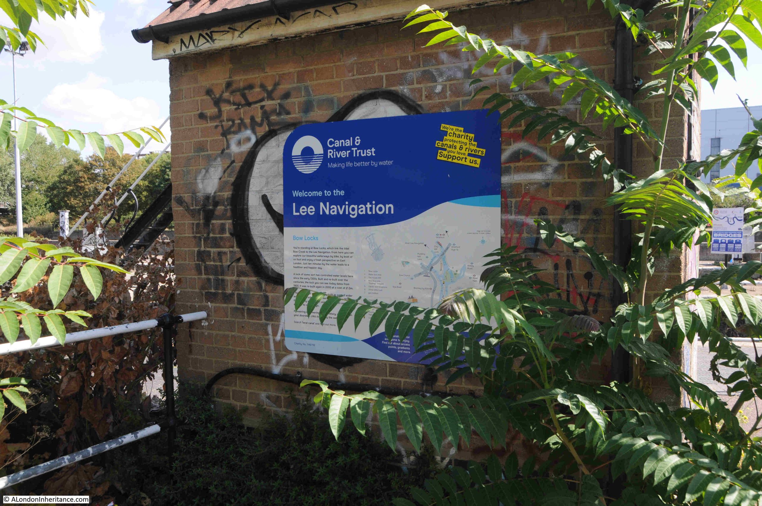
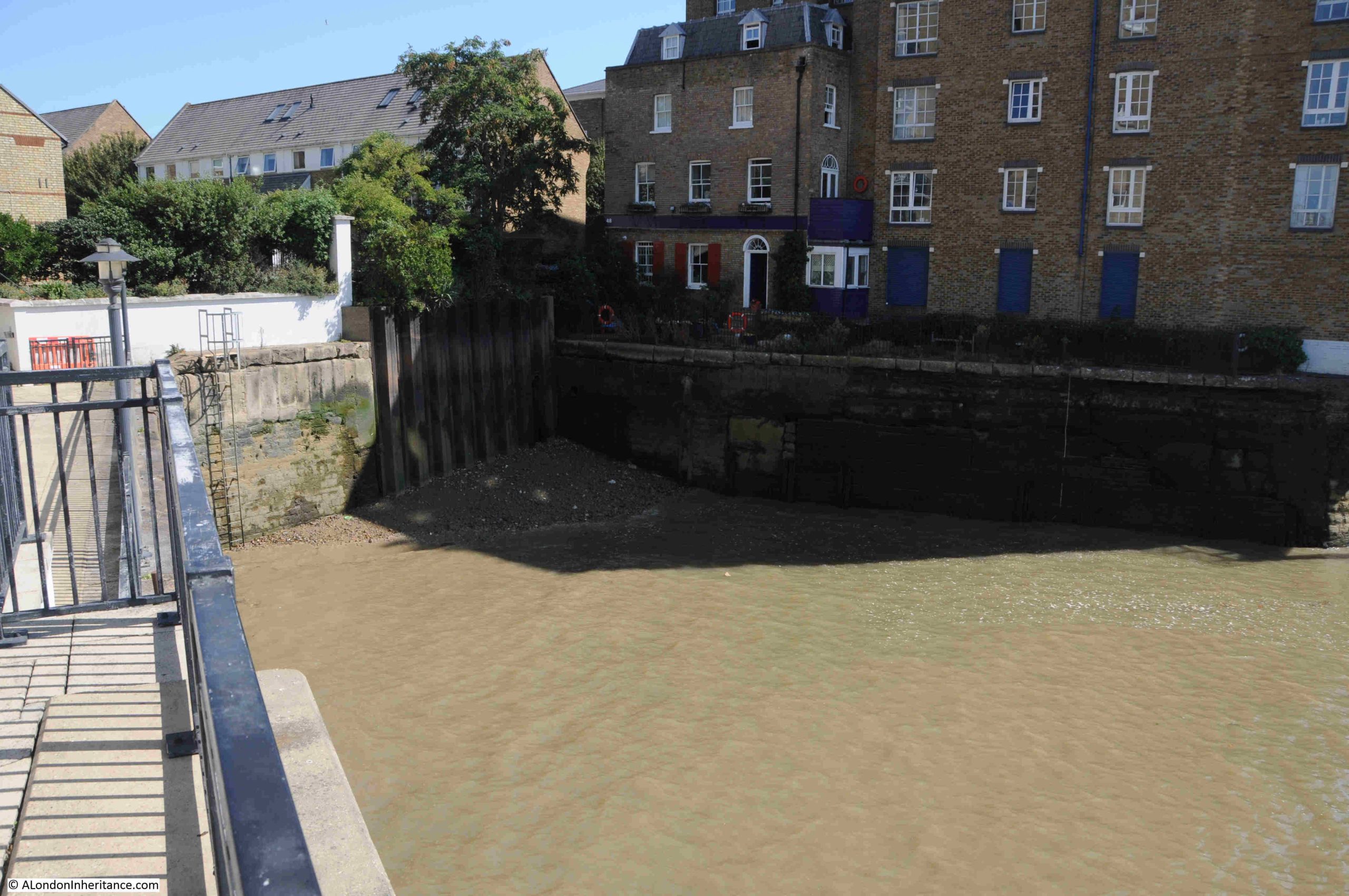
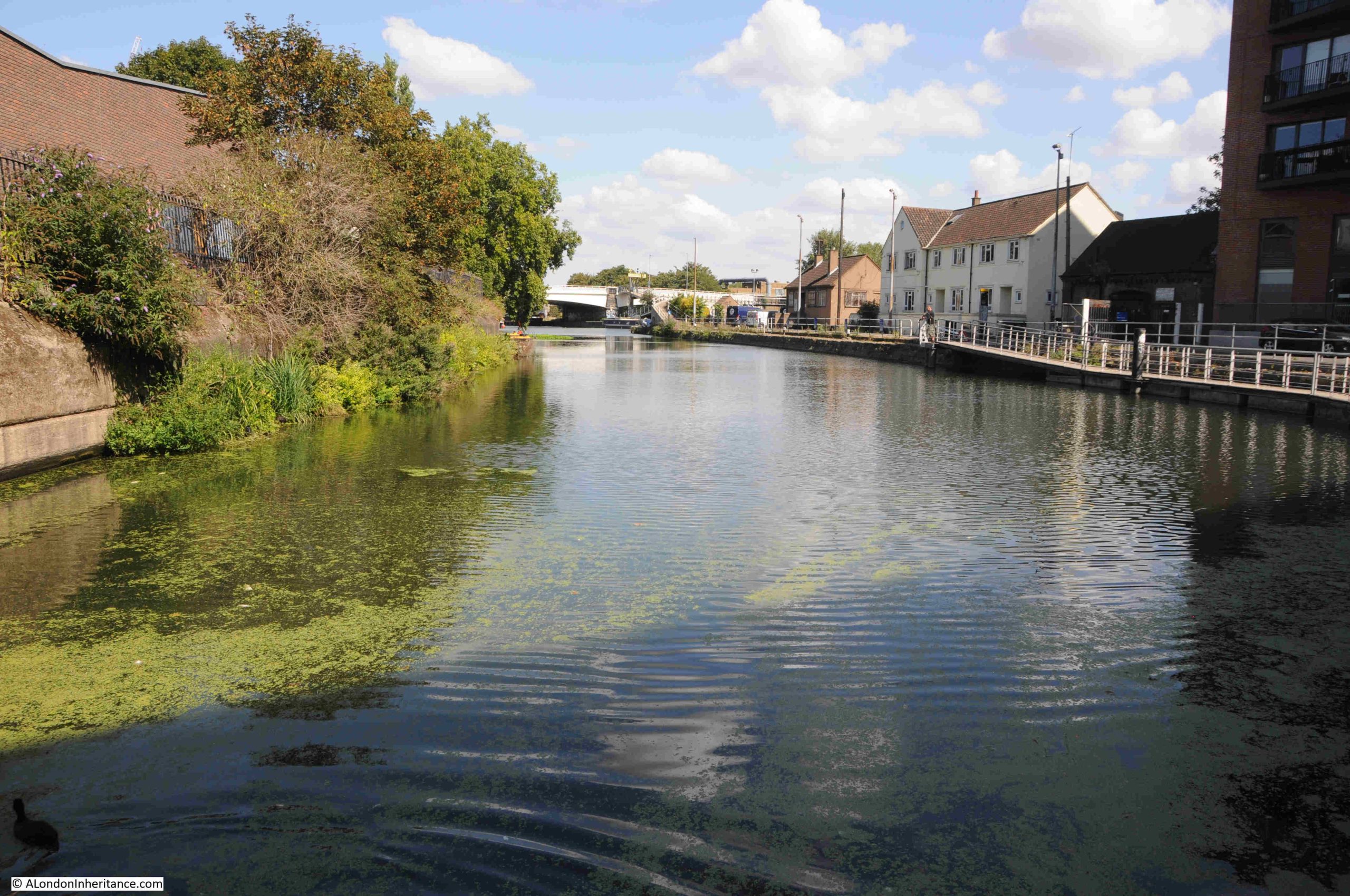
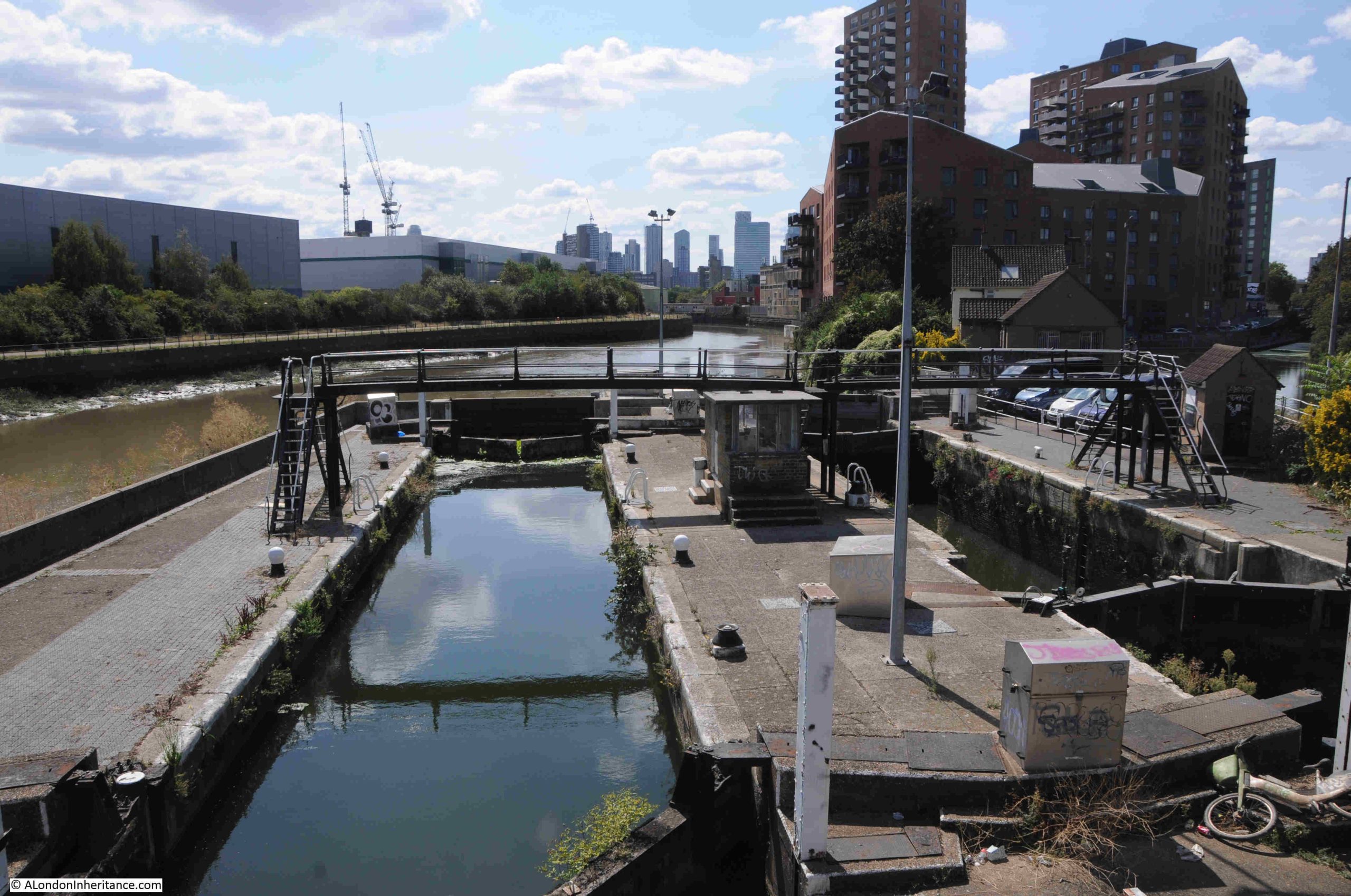
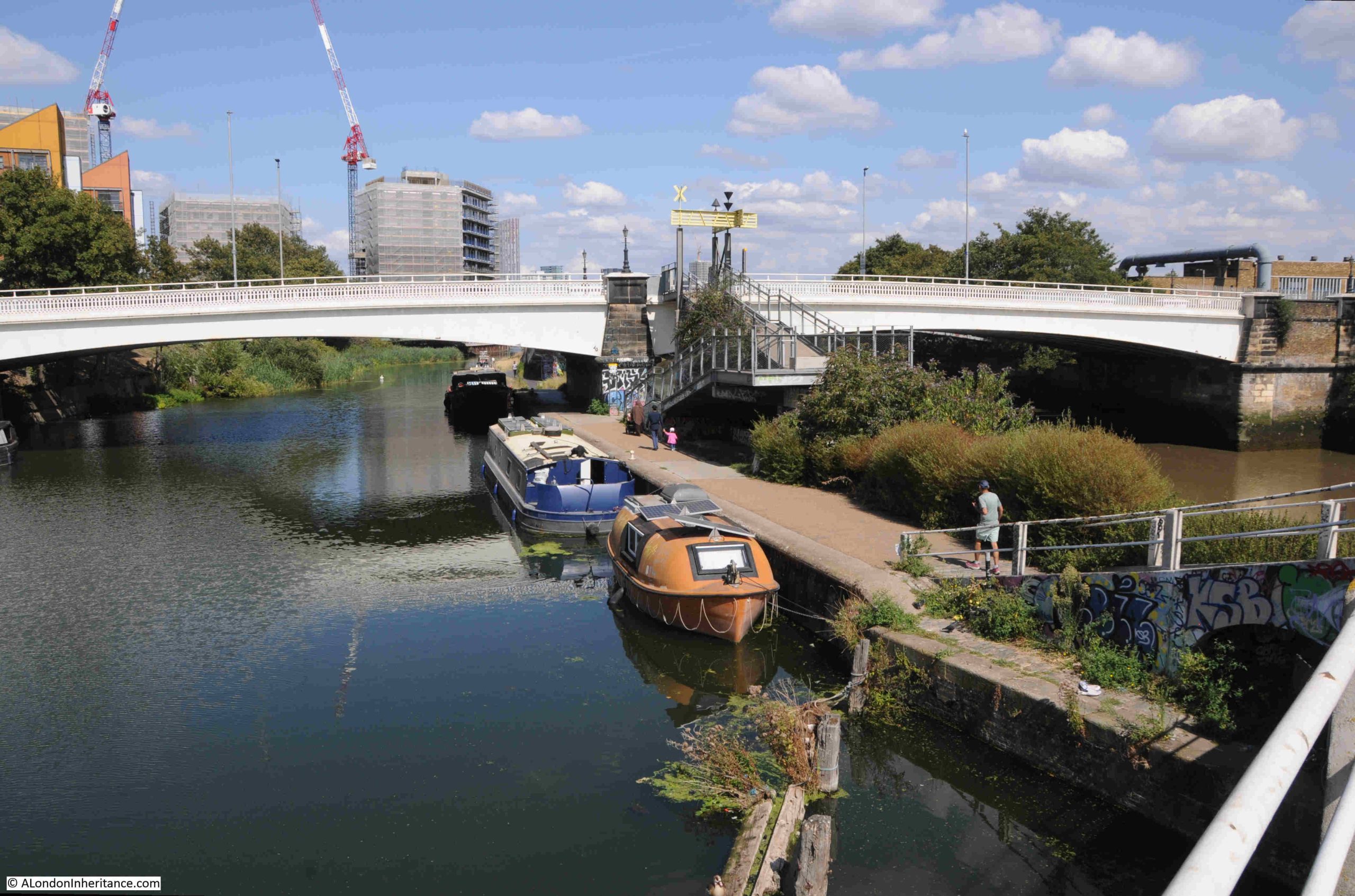
And it is here that we find the Bow Locks:

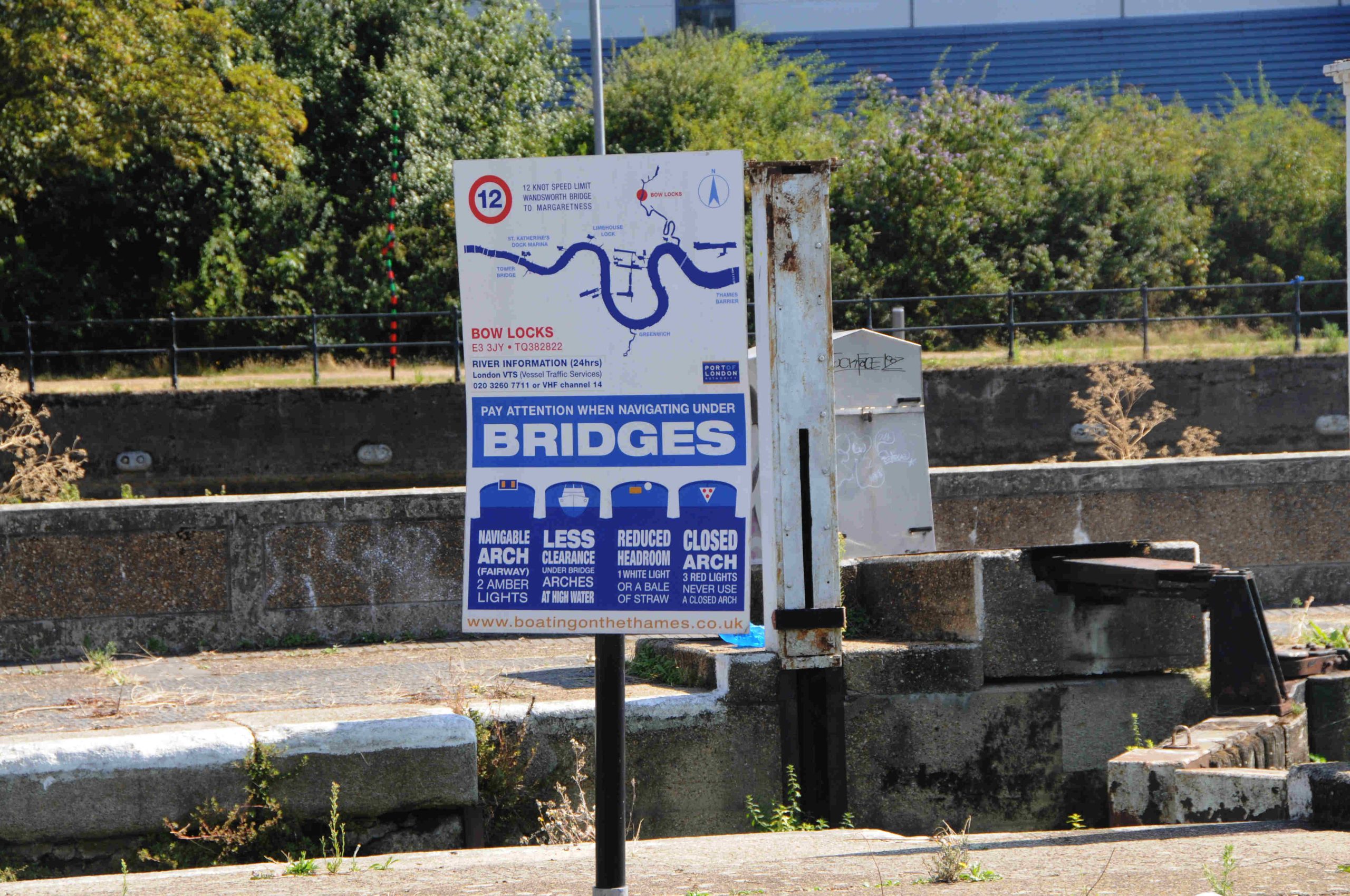
Bow Locks control access from where the Limehouse Cut meets the River Lea, and Bow Creek, also known as the River Lea which runs down to the River Thames, and is tidal:

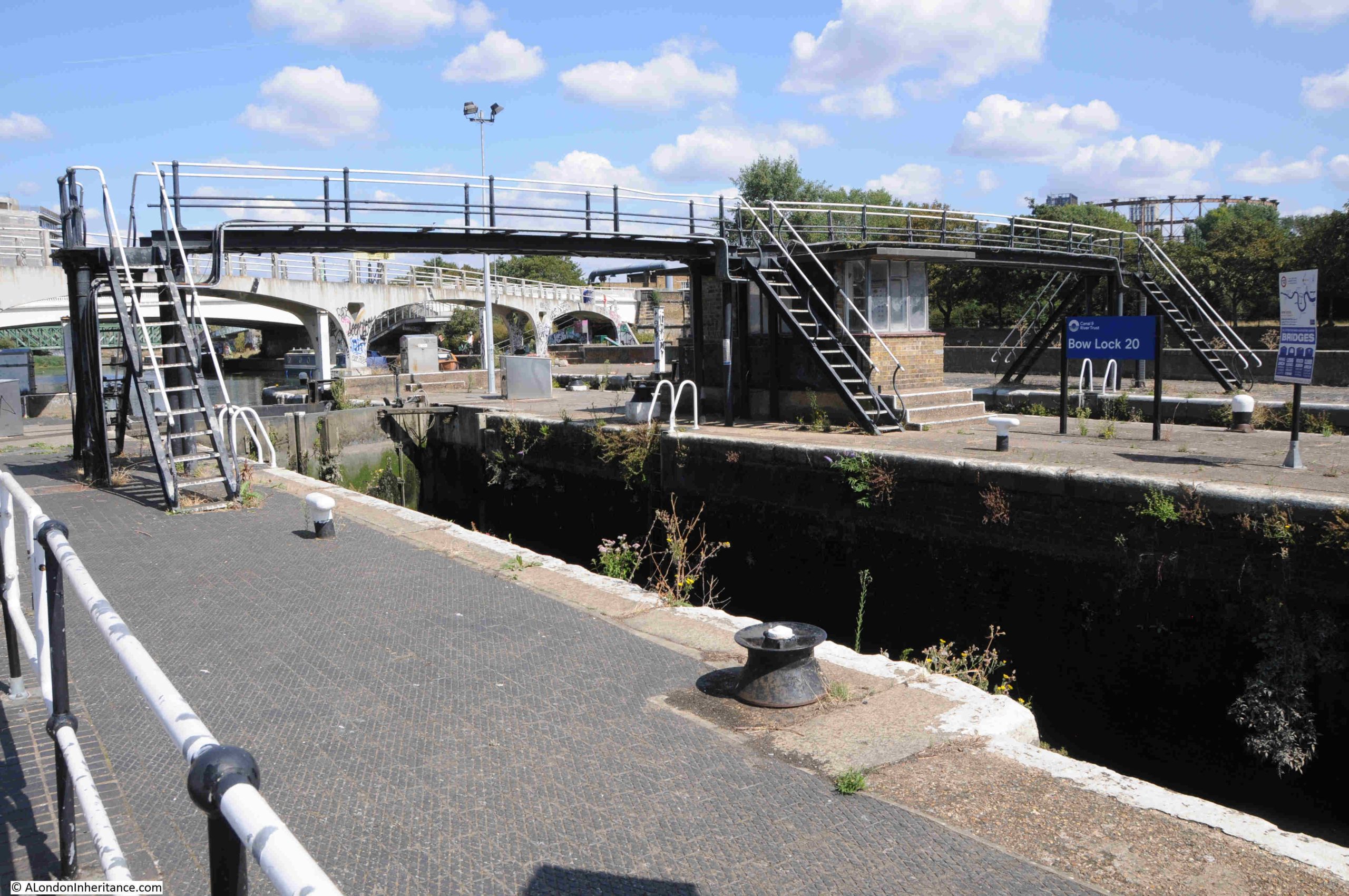
In the background of the above photo there is a grey / white bridge. This is a 1930s foot bridge that spans the waterways, and although I was at the end of the Limehouse Cut, I wanted to explore a bit further, so headed over this footbridge:

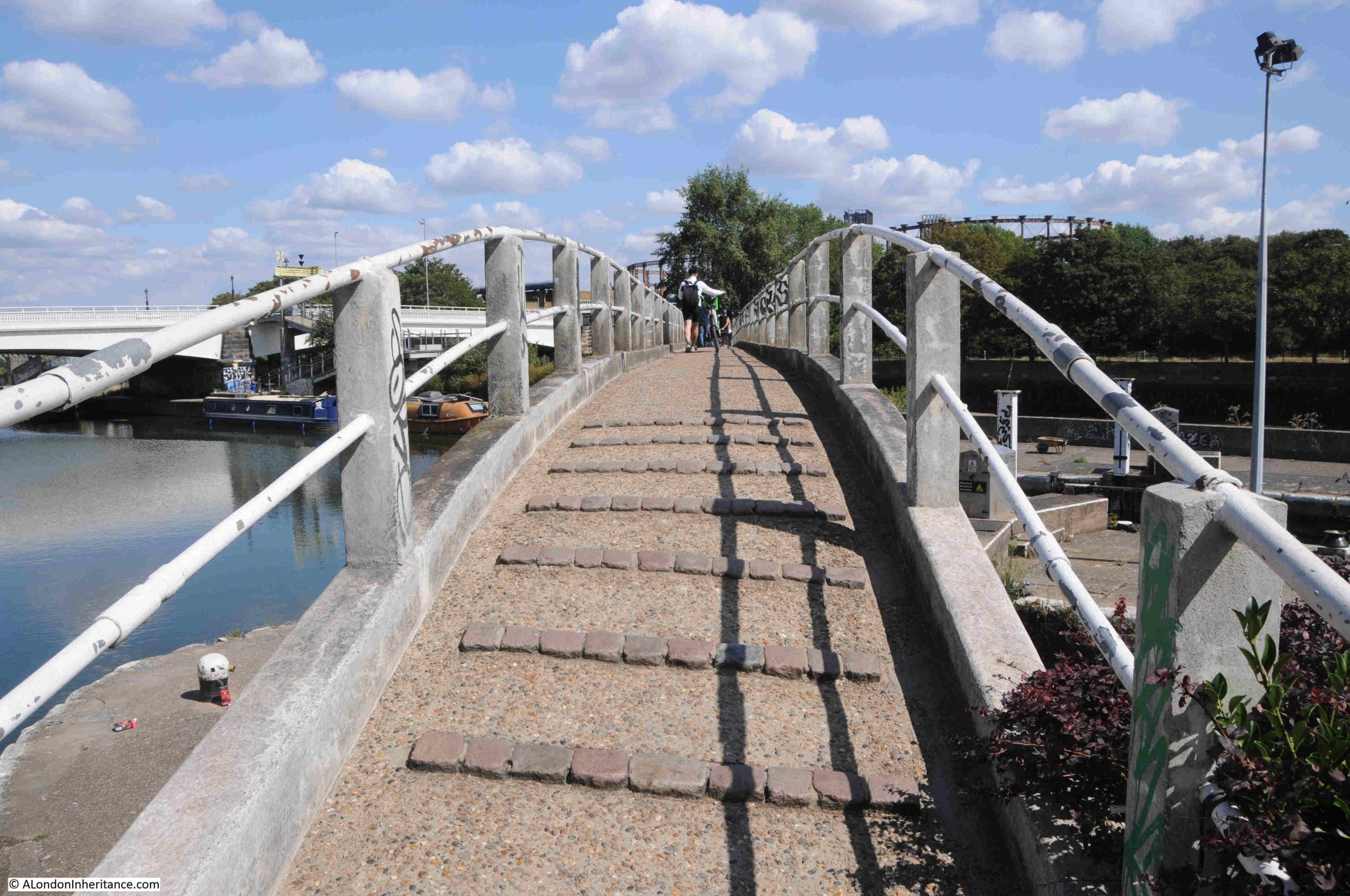
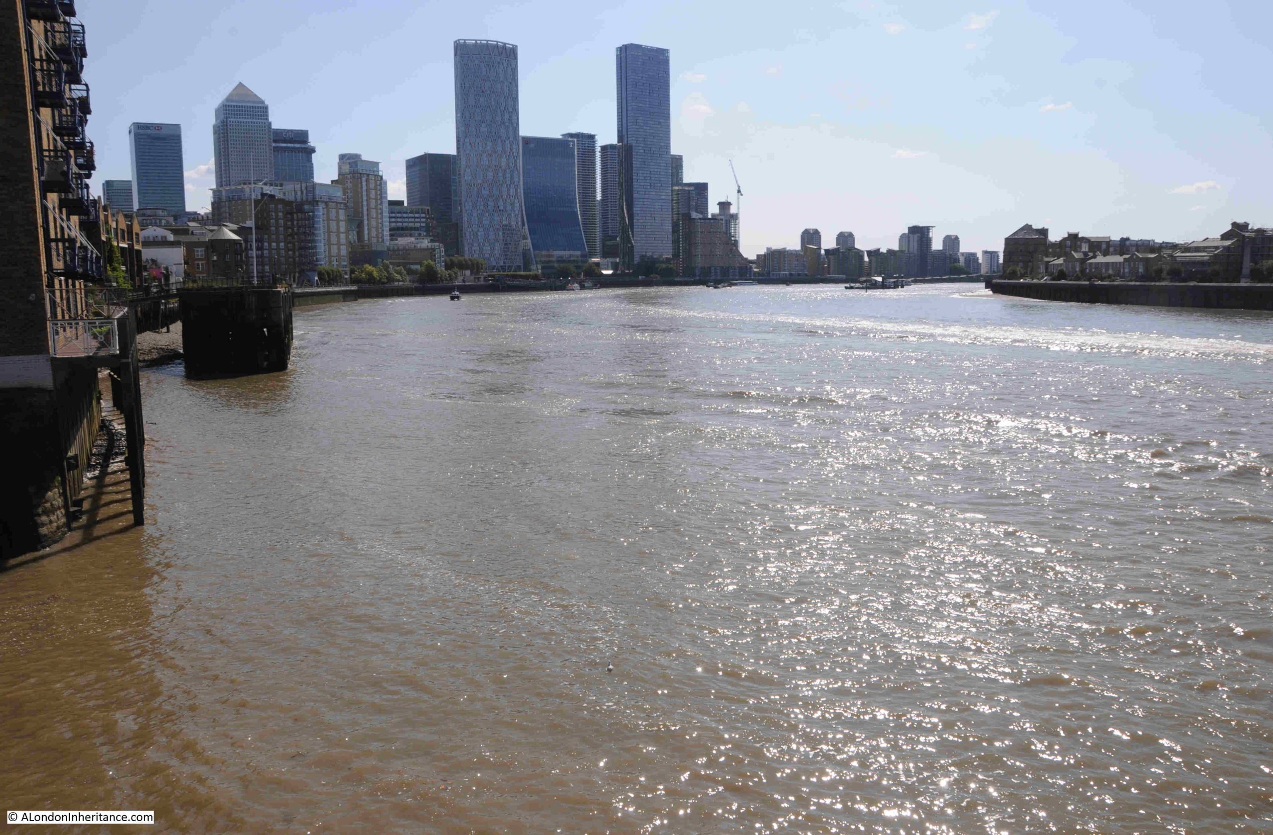
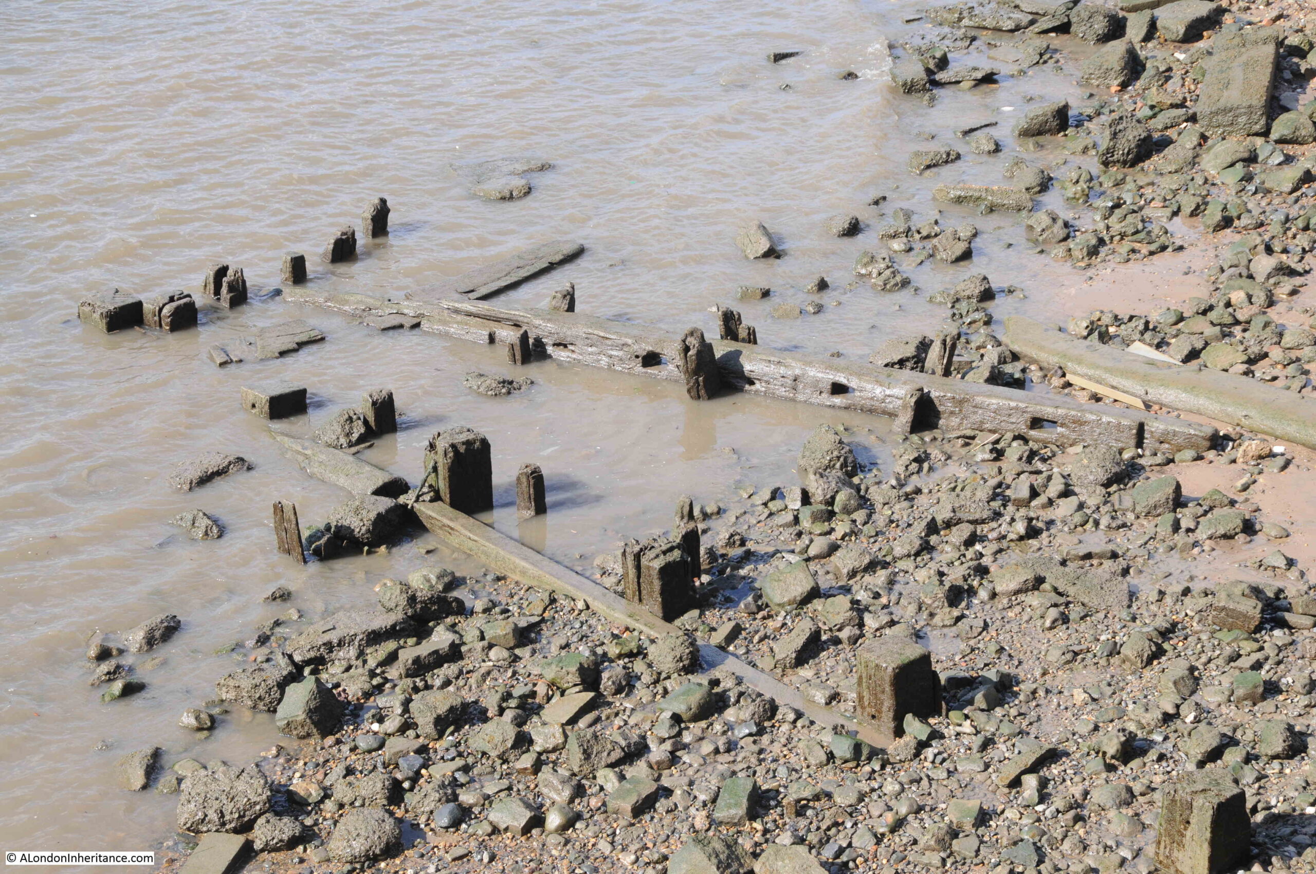
From the footbridge, we can look over the lock and along Bow Creek / River Lea as it heads towards the Thames. The mud banks on the side show that this stretch of the river is tidal, and demonstrates why the lock is needed. On the right edge of the photo, a small part of the Limehouse Cut can be seen. It is these locks that ensure there is a stable height of water in the Limehouse Cut:

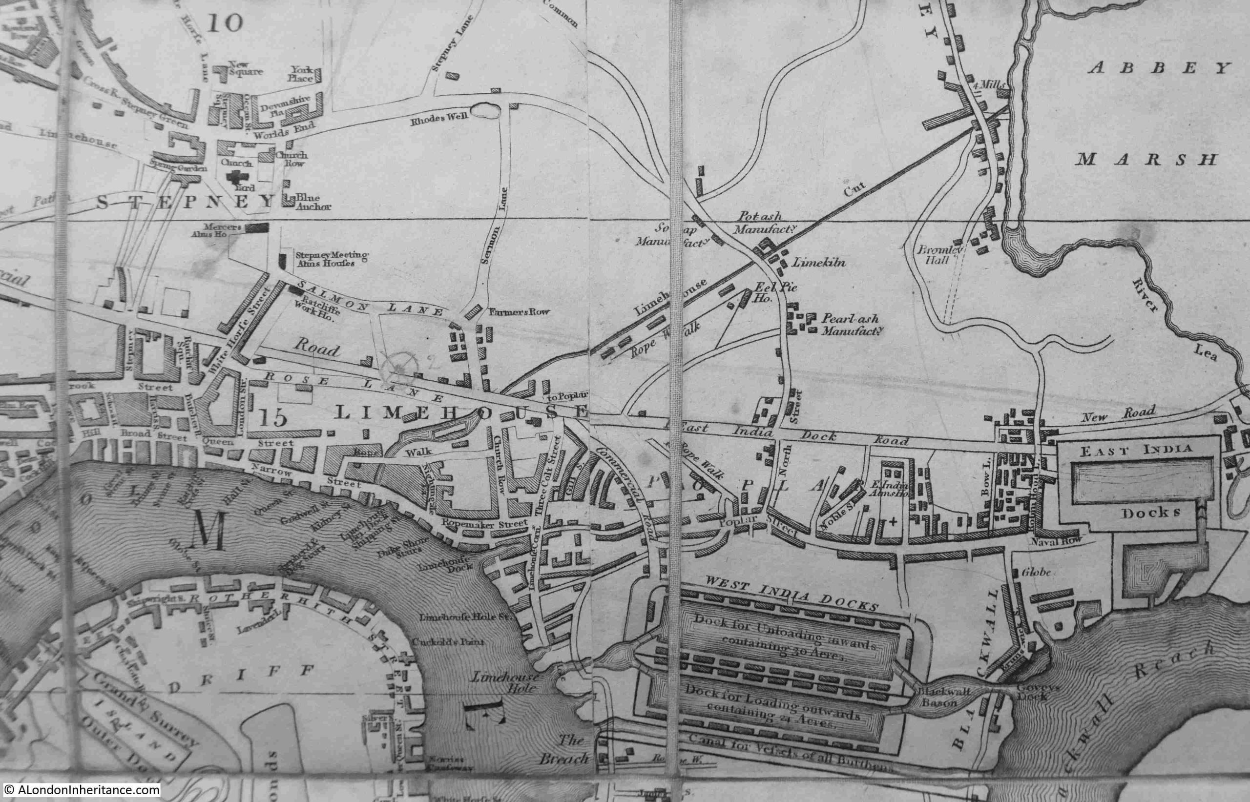
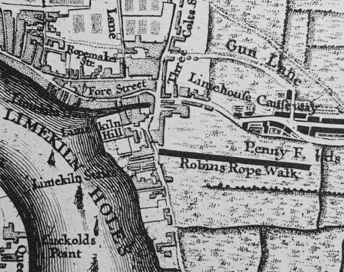
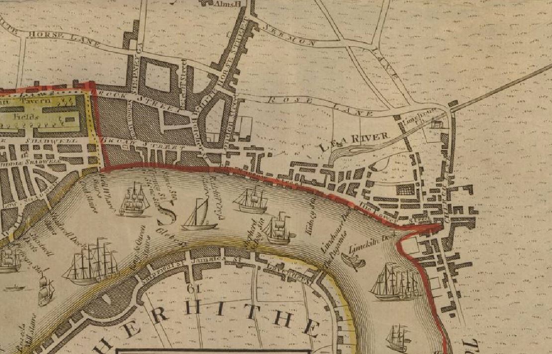
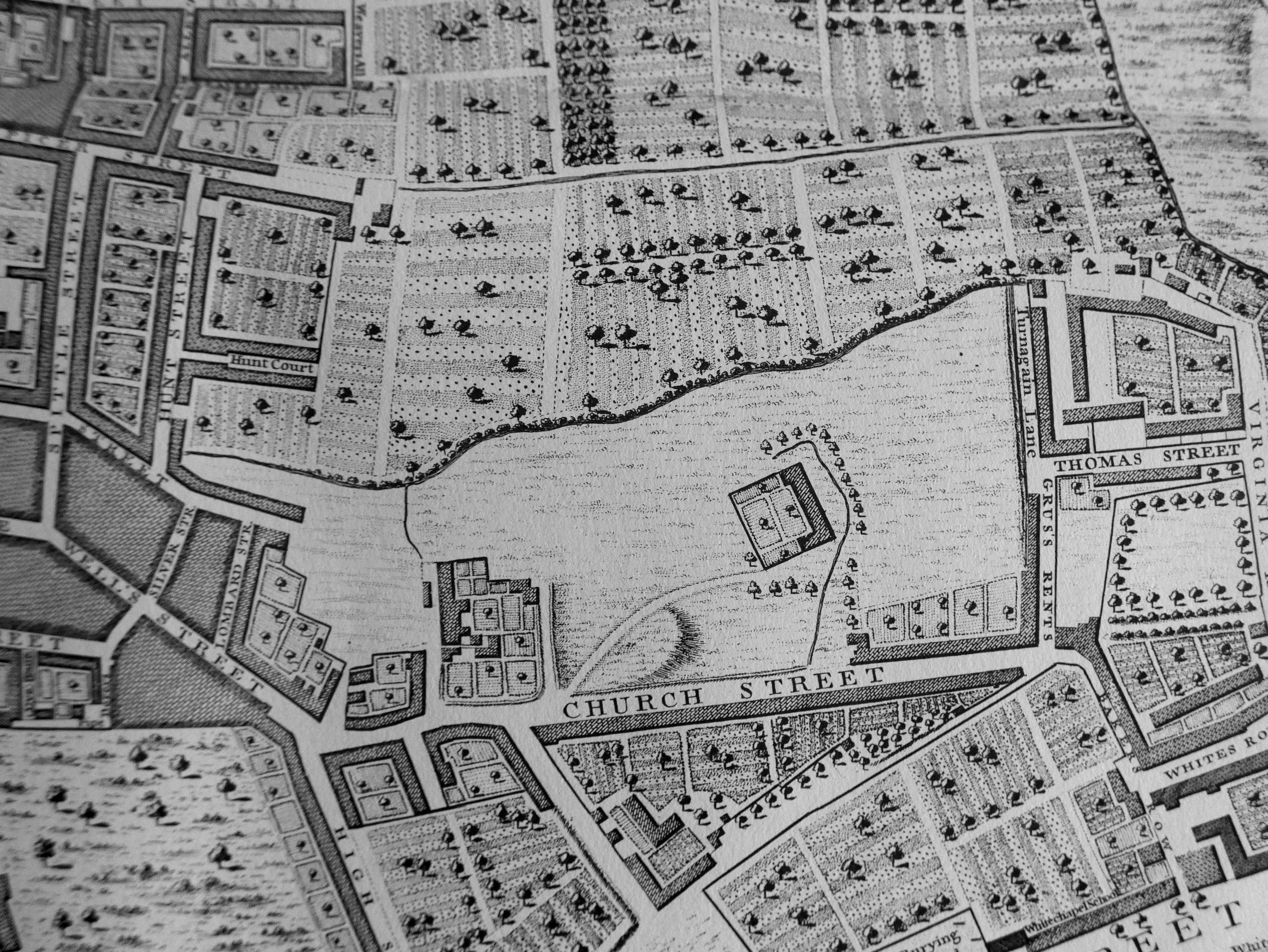
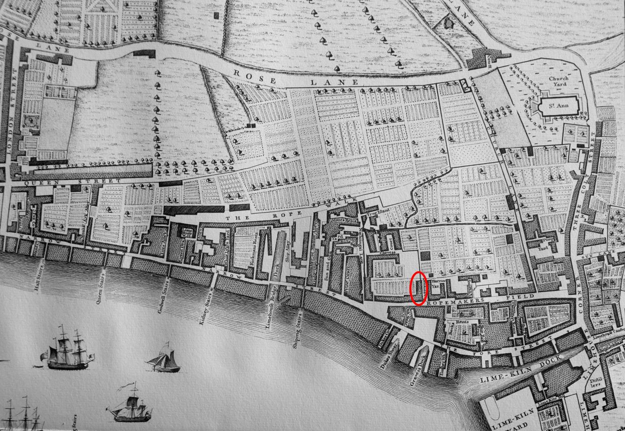
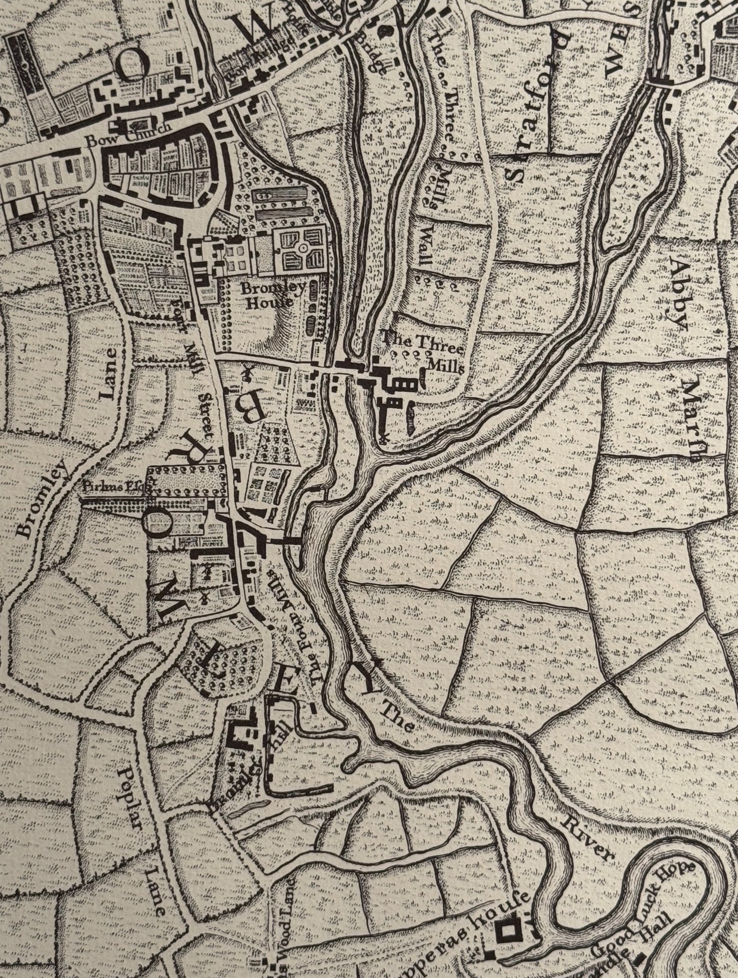
Around 20 years before the completion of the Limehouse Cut, where it joins the River Lea was an area of fields, orchards, gardens and limited housing. In the following extract from Rocque’s map of 1746, you can see the world BROMLEY curving to the left of centre. The Limehouse Cut went through the letter M as it ran from bottom left up to join the River Lea:

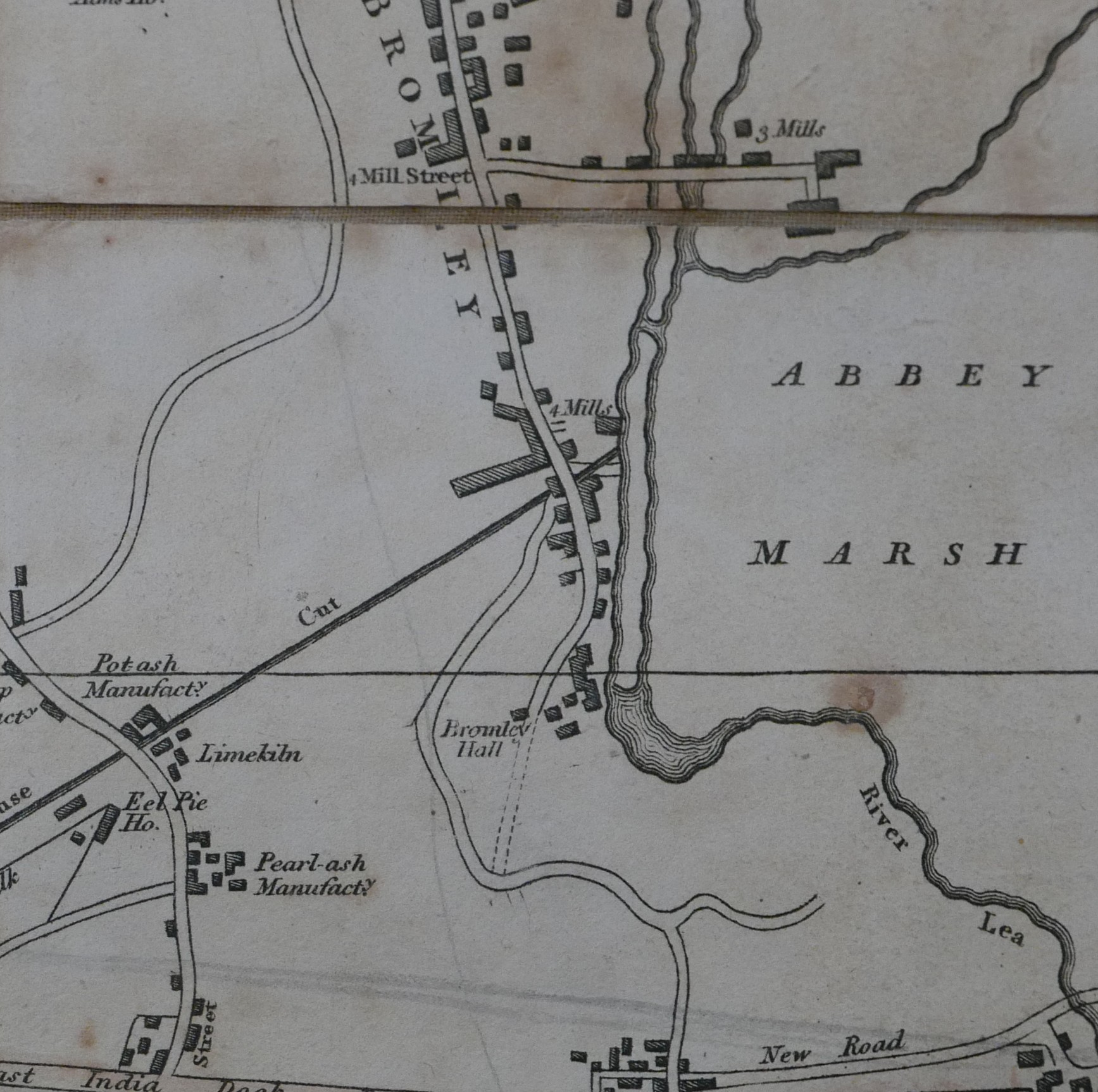
To demonstrate the complexity of the River Lea / Lea Navigation, and the associated waterways in the area, the following extract is from Smiths New Plan of London from 1816, and shows the straight line of the Limehouse Cut joining one of the strands of the Lea:

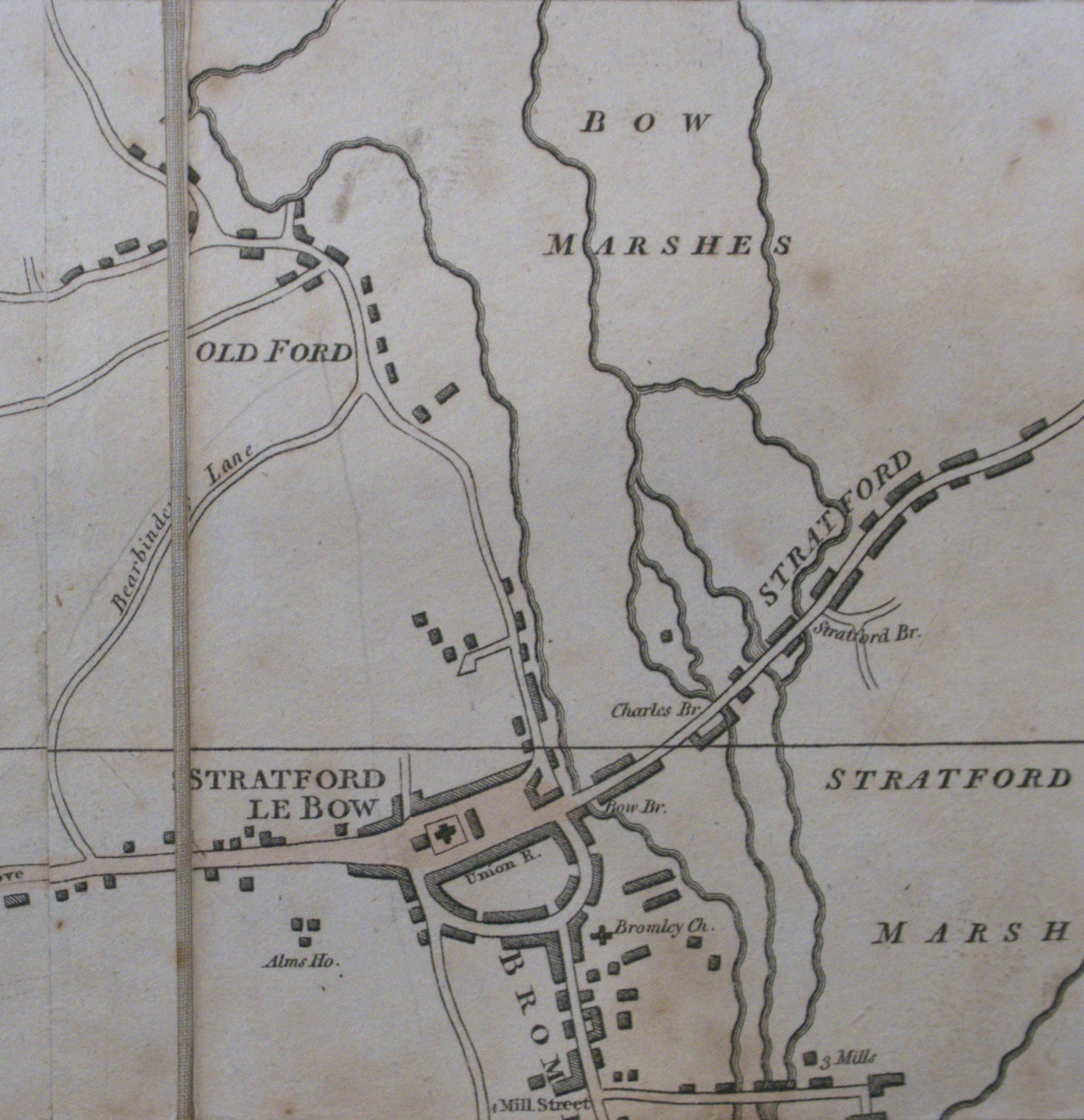
The complexity of this water network can be shown using the same map, but a bit further north in the area surrounding and to the north of Stratford. The names Stratford Marsh and Bow Marshes demonstrate the nature of the surrounding land, and how the Lea river system has had an impact on this area for centuries:

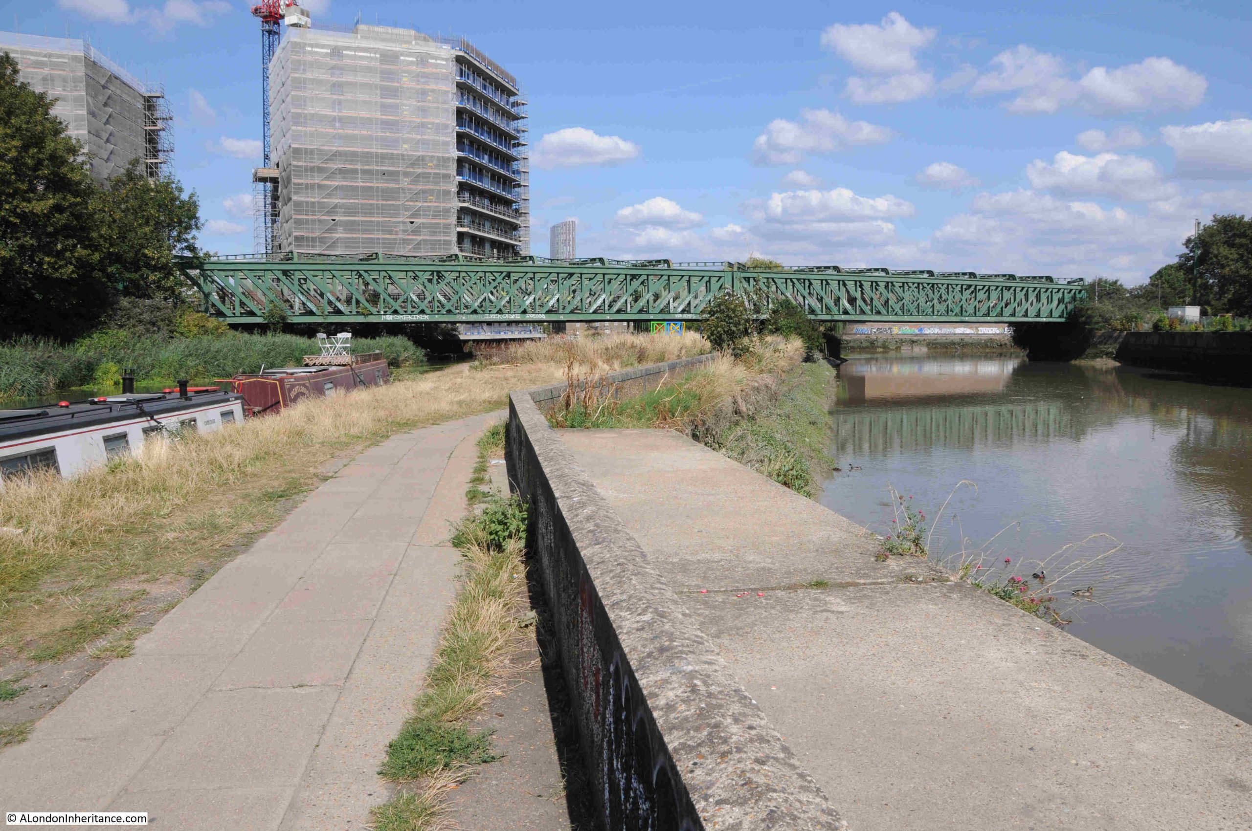
After that slight digression, I am still on the footbridge, and this is the view looking north with the bridge carrying Twelvetrees Crescent across the Lea:

The orange boat moored in the above photo is an old British Gas life boat, which I assume came from either a North Sea gas / oil rig or a ship – and is now performing a very different use.

Walking under Twelvetrees Crescent Bridge, and there is a walkway that once provided access to the gas works just to the east:

Further on is the bridge that carries both the District and the Hammersmith & City lines over the Lea:

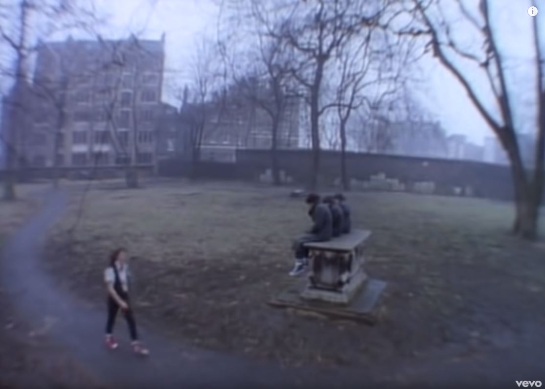
Along this stretch of the Lea is a rather isolated but colourful piece of sculpture. I knew it was sculpture as the small blue plaque on the concrete base states “Please do not climb on the sculpture”:

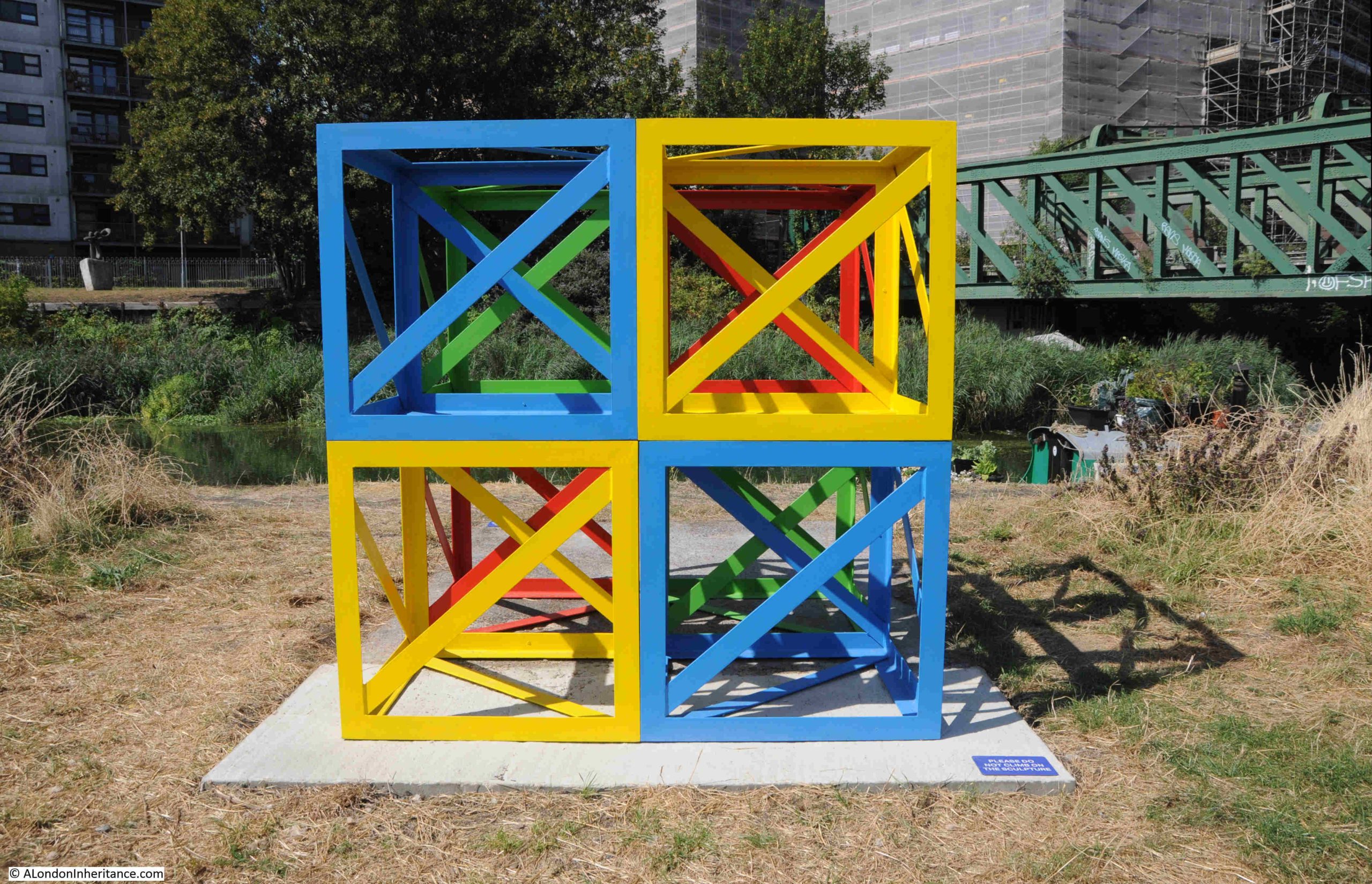
The sculpture is part of “The Line”, and the following is from the project’s website: “The Line is London’s first dedicated public art walk. Connecting three boroughs (Newham, Tower Hamlets and Greenwich) and following the Greenwich Meridian, it runs between Queen Elizabeth Olympic Park and The O2 on Greenwich Peninsula. The Line features an evolving programme of art installations (loans and commissioned works), projects and events, illuminating an inspiring landscape where everyone can explore art, nature and heritage for free.”

The above work is by Rasheed Araeen, who “is renowned for his use of an open cube structure with diagonal support in his sculptural works”.

A map of the route of The Line, and the works along the route, can be found at this link.

Looking across the branch of the Lea that runs to the right of where I am walking, are the old gas holders of the Bromley by Bow gas works:

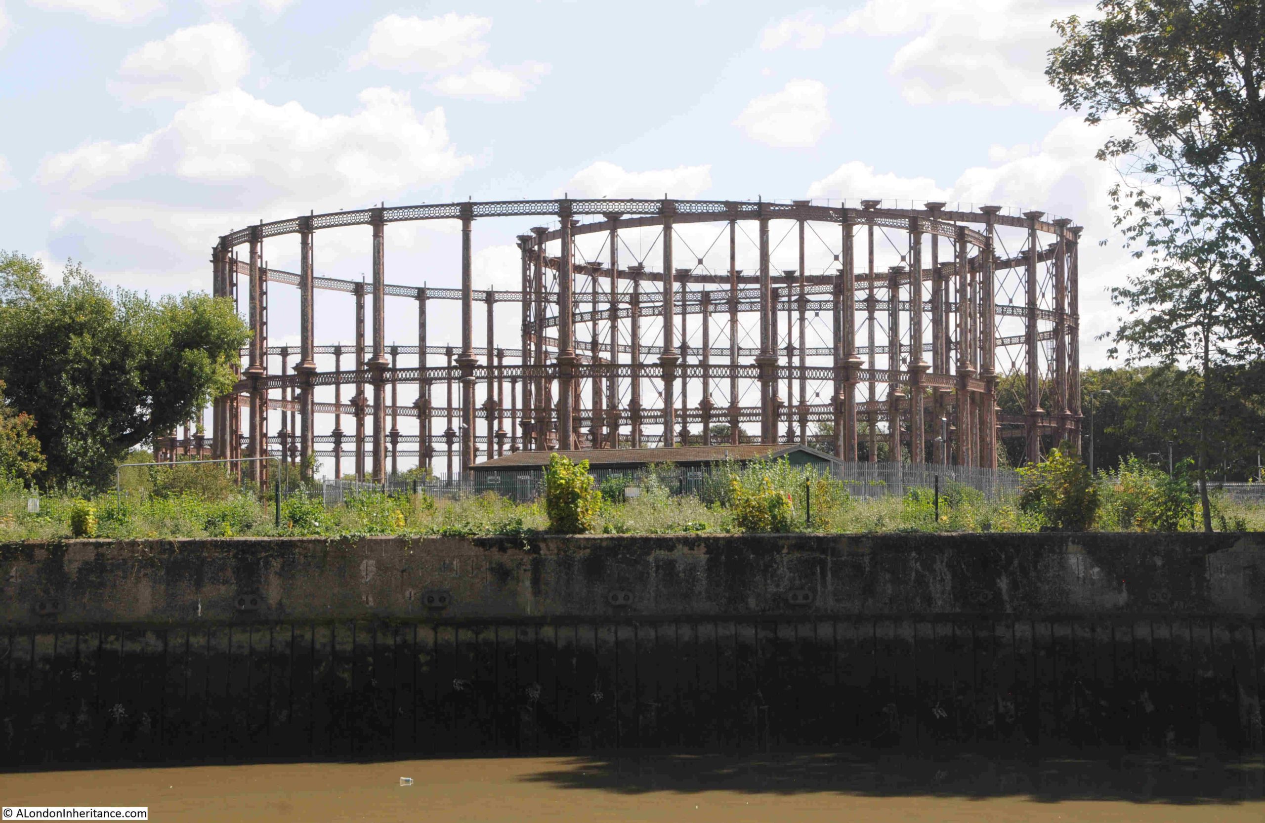
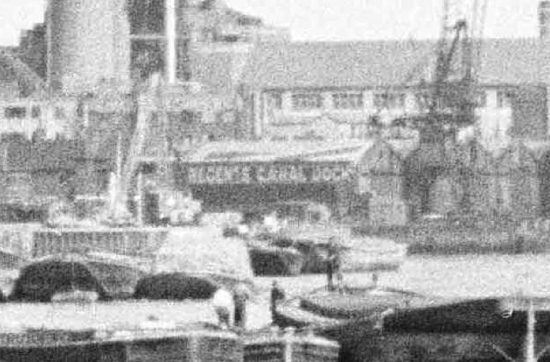
The 1914 revision of the OS map shows the round circles of the gas holders, and a short distance below is the Bromley Gas Works, who had their own dock leading from the River Lea. A small part of this dock still remains in the middle of an industrial estate which has taken over the land of the gas works:

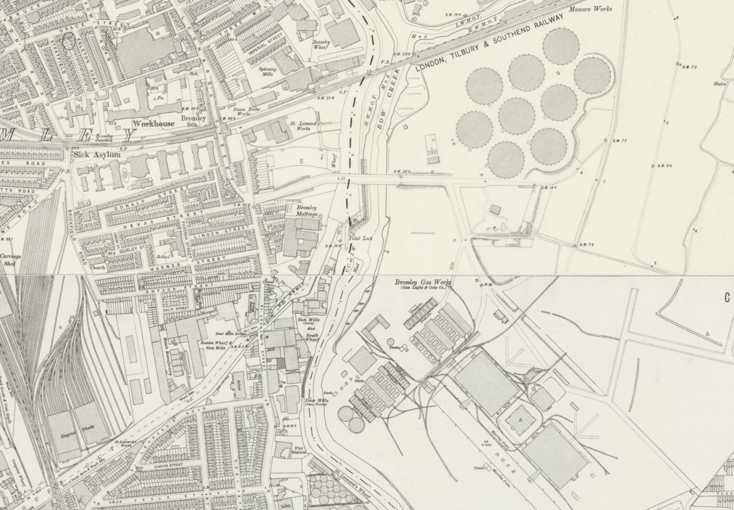
(Map ‘Reproduced with the permission of the National Library of Scotland)

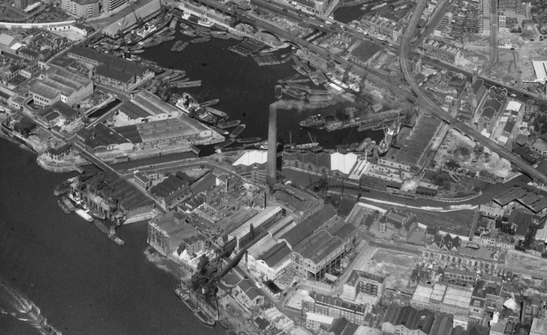
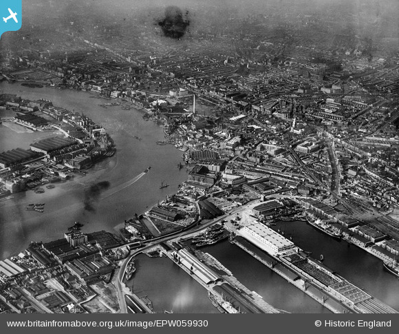
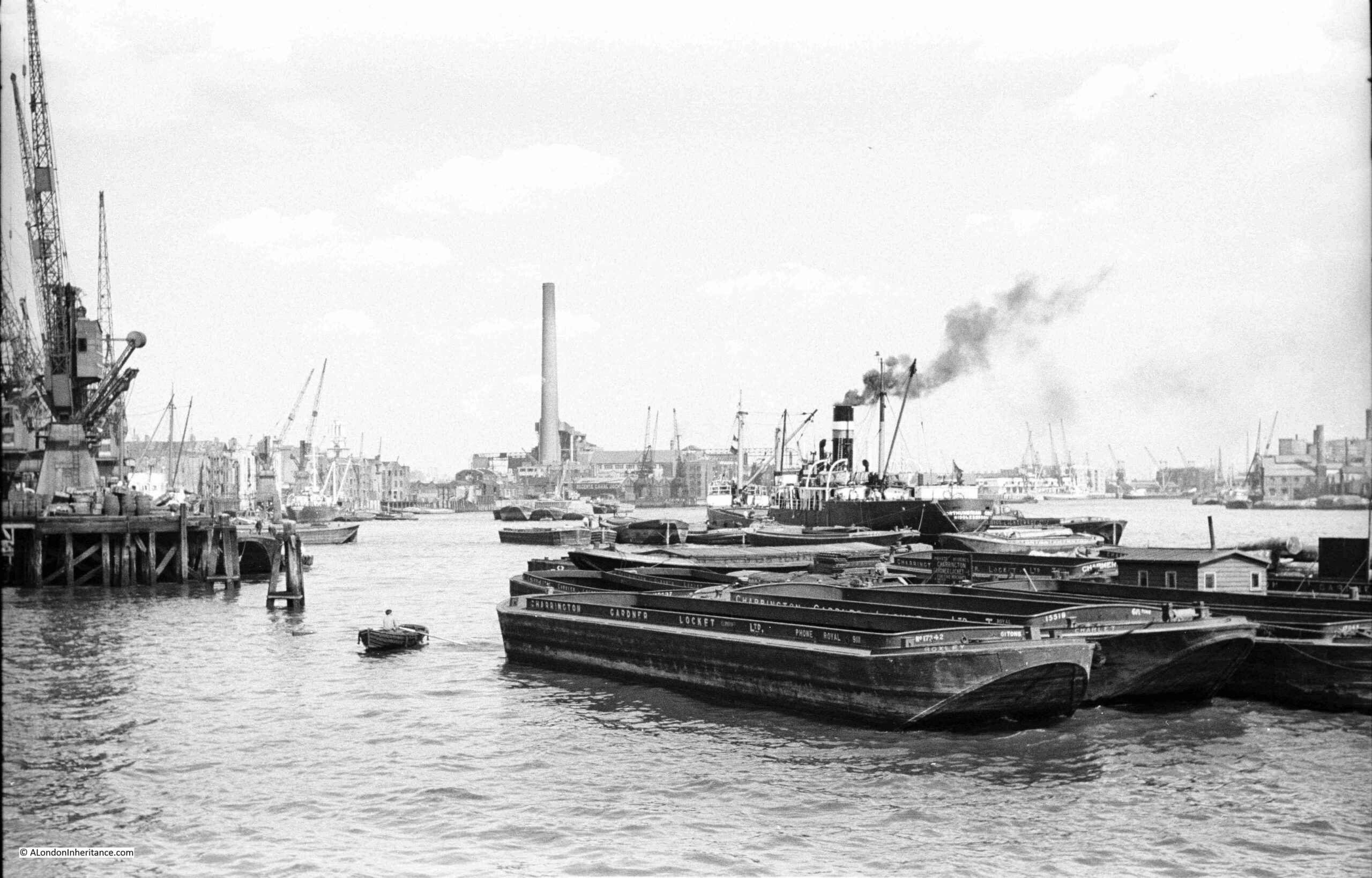
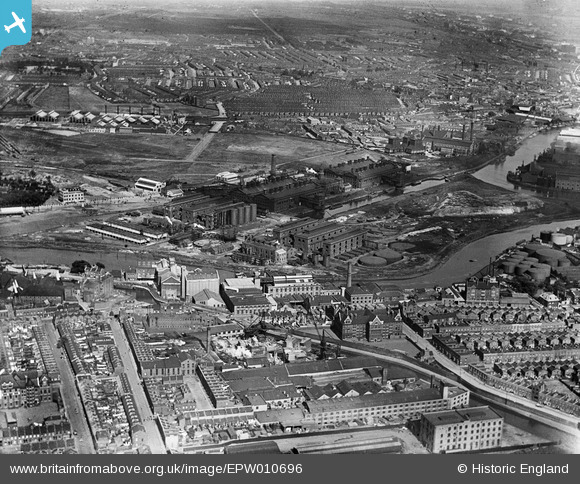
The following photo from Britain from Above shows the Bromley by Bow Gas Works in 1924. The River Lea can be seen running below the gas works buildings, and the dock that served the works can be seen coming of the Lea on the right of the photo, and running into the heart of the works. The gas holders are off to the left of the photo, a short distance from the works:

The Bromley by Bow gas works have a fascinating history and hopefully will be the subject of a future post, but for now I am continuing along the River Lea to my final stop.

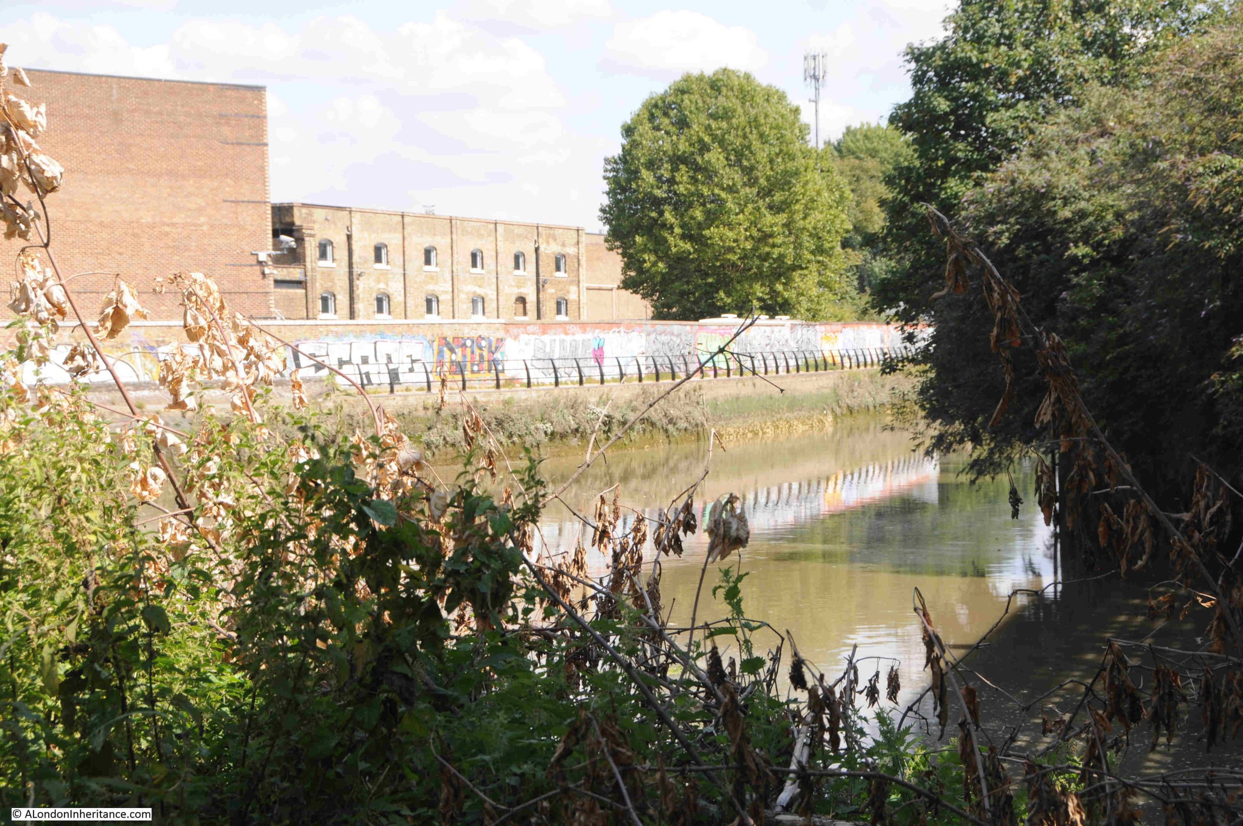
In the complex web of waterways, as we approach Three Mills Island, we can see through the trees and bushes that line the river, the Channelsea River, one of the old rivers that ran across Bow. It now runs up to Abbey Road where it disappears into a culvert, and also forms the southern part of the channels that now makes Three Mills Island, an island:

If you go back to the 1746 and 1816 maps, you will see the Channelsea River heading east from the Lea, just below the Mill.

Back looking along the River Lea, and if it was not for the tower blocks in the background, this idyllic view could be deep in the countryside rather than being in east London:

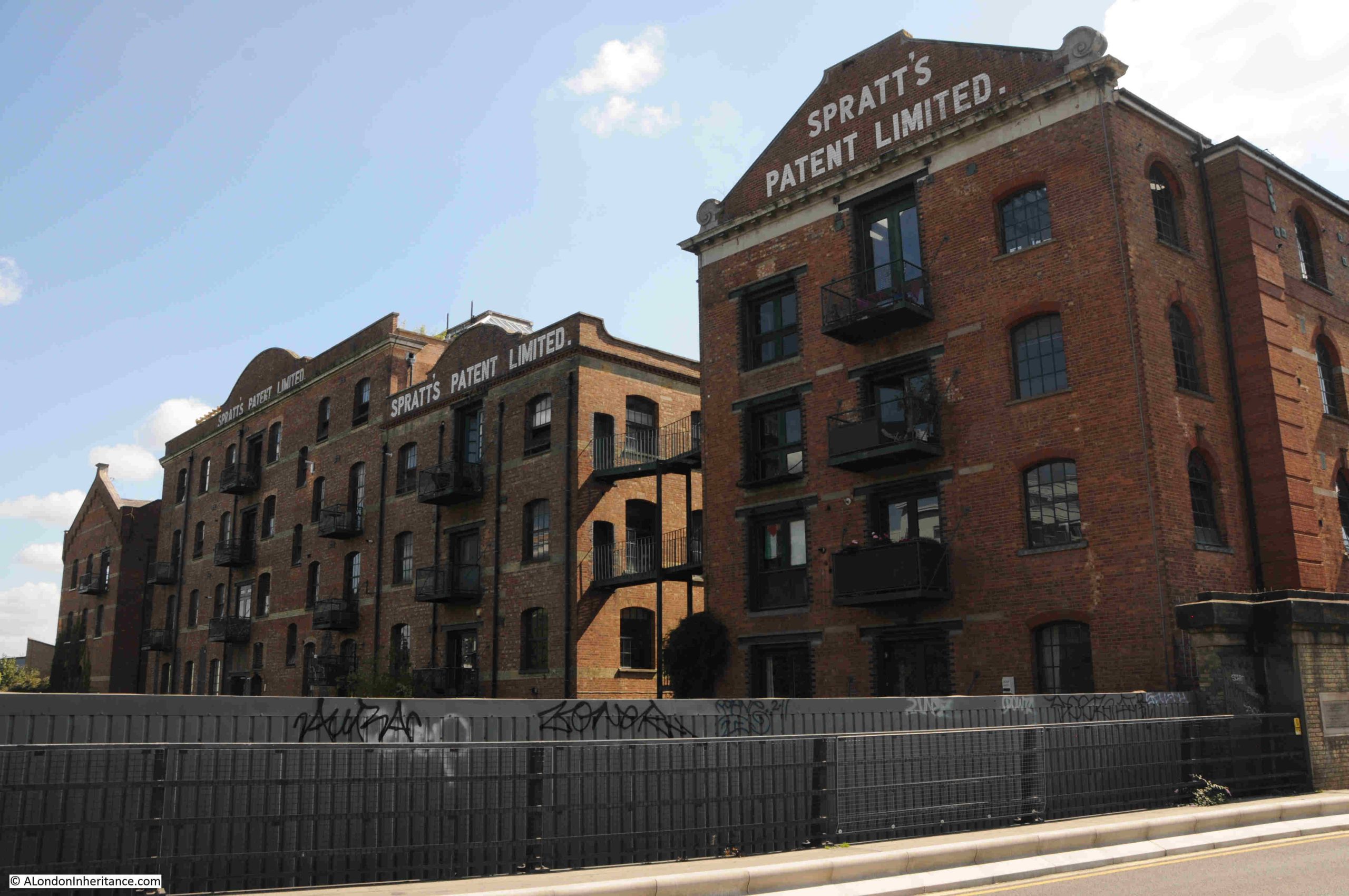
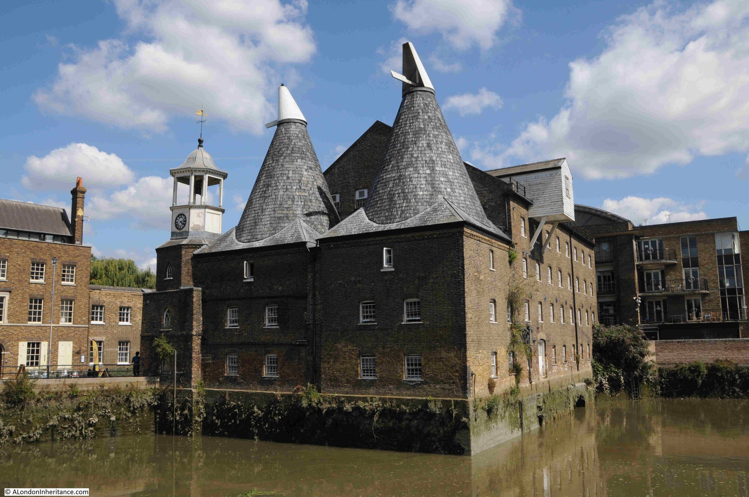
The brick buildings to the right of the above photo are those of the old mill buildings on Three Mills Island, which look glorious as you approach:

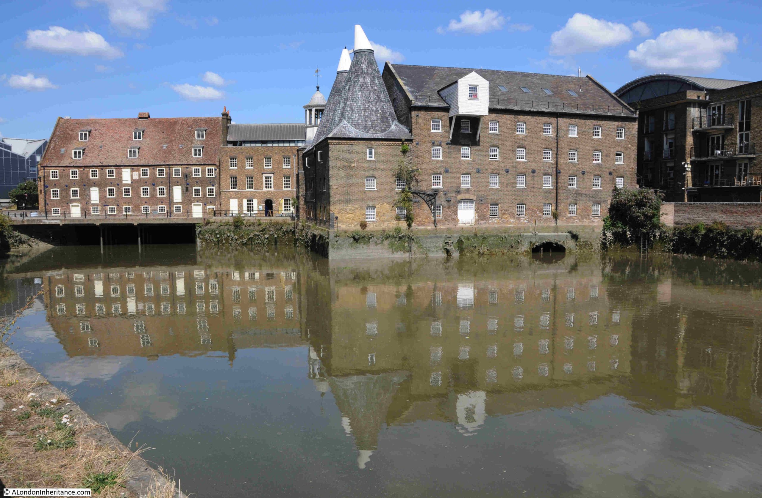
Although now an island due to the rivers that surround the site, it has not always been an island as the maps earlier in the post show. The site became an island when a channel along the east of the site was built from the Channelsea River back up to the River Lea.

Mills have been operating here for centuries, making use of the power of the water and tides along the River Lea. The buildings that we see today are mainly 18th century and range from Grade I to Grade II listed:

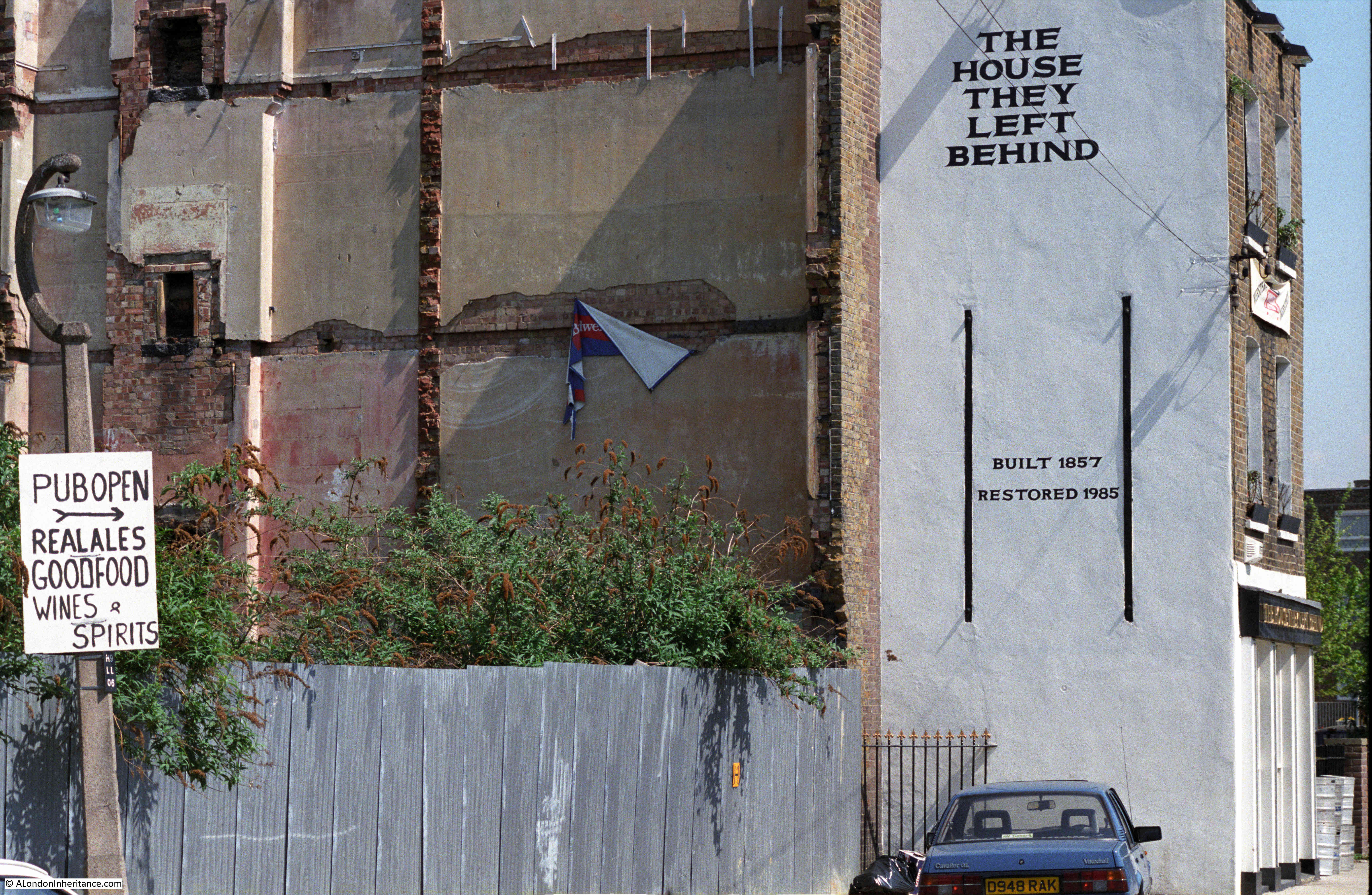
Back in 1972, the Architects’ Journal featured a lenghty article on the sites in east London that were considered at risk. Bombing, post war industrial and population decline across east London resulted in a range of buildings that were considered at risk of demolition.

I started working through all the sites back in 2017, to see how many had survived. The first post in the series is here. I still have a small number to finish off.

Given what a wonderful set of buildings we see today, it is surprise (or perhaps not given the attitude to many old industrial buildings at the time), that the mill buildings were considered at risk, including what is the world’s largest surviving tidal mill.

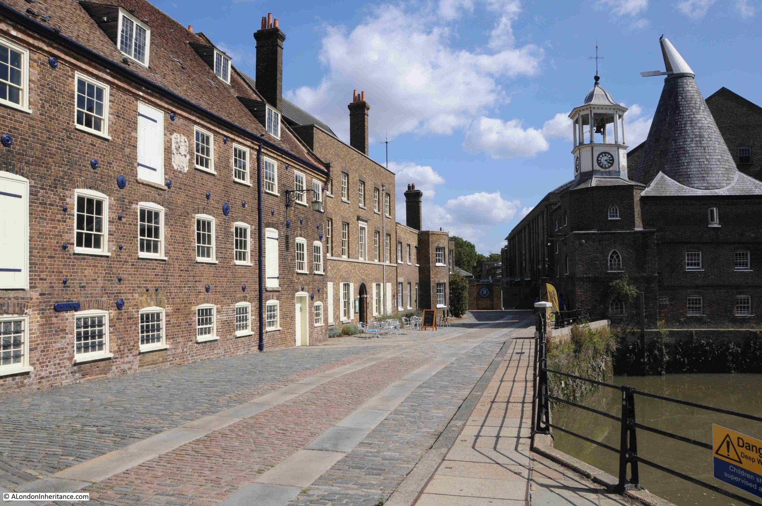
At the end of the street in the above photo is 3 Mills Studio, a studio complex built on the site of the Three Mills Distillery, and the studios where Master Chef is filmed.

As with the gas works, the history of this site deserves a dedicated post, which will hopefully appear in the not too distant future.

It is a really interesting walk along the Limehouse Cut from the old entrance to the Thames, up to the River Lea, and along the Lea to Three Mills Island.

Limehouse DLR station is near the start of the walk and Bromley by Bow station is a short walk from the end (walk to the north of the nearby Tesco store, underneath the A12, then south to the station.

The Limehouse Cut was a clever answer to the challenges of 18th century cargo transport from the Lea to the City of London, along with the docks and industry along the Thames from Limehouse to the City.

The Limehouse Cut eliminated the need for a long detour around the Isle of Dogs, the curving southern stretch of the Lea into the Thames, and the tidal challenges of this stretch of river.

Today it provides the route for a fascinating walk.

alondoninheritance.com

Walking the Limehouse Cut – Part 1

Thank you so much for ticket purchases of my walks announced last Sunday. They all sold out on the same day. I will be adding a few more dates for these walks in the coming months, and for an update as soon as they are on line, follow me on Evenbrite, here, and I will also announce in the blog.

For today’s post, I am walking along an 18th century engineering and construction innovation that helped transport goods from the counties north of London, into the city, and also served the industry that developed in east London.

The River Lea (Lee is also used, but I will stick with Lea), runs from Bedfordshire, through Hertfordshire, and then through east London to enter the River Thames just to the east of the Isle of Dogs at Bow Creek.

The Lea was used to carry goods, such as grain and malt, from the counties to the north and east of London to the Thames, where barges would turn west and head into the City.

Traffic on the River Lea started to increase considerably during the 18th century, and during this period a number of improvements were made, including locks and cuts, to bypass meanders in the river.

The big problem for those using the Lea to transport goods into the City was the Isle of Dogs. Being to the east, barges and shipping had to navigate around the Isle of Dogs before they could head into the City. This was at a time before the extensive use of steam power and when barges and shipping relied on the wind and tide.

If you look at the following map, the River Lea is highlighted by the green arrow, with the entrance of the river into the Thames shown by the blue arrow. As can be seen, the Isle of Dogs caused a significant addition to the route to head west into the City (map © OpenStreetMap contributors):

There had been proposals to cut a channel through the northern part of the Isle of Dogs to provide a direct route, however use of the land for the docks that expanded across the area was a more profitable and efficient use of the land.

The Civil Engineer John Smeaton had been looking at how the River Lea could be improved to make it easier to navigate, and one of his recommendations was to build a channel or cut from the River Lea to the Thames at Limehouse.

This would provide a direct route to the Thames, and would avoid the time consuming journey around the Isle of Dogs.

The River Lee Act, an Act of Parliament, was obtained in 1766 to build the channel, and work swiftly commenced with the new Limehouse Cut opening on the 17th of September, 1770.

Referring back to the above map, the Limehouse Cut is highlighted by the red arrow, and it can be seen to run from the Lea at the upper part of the Cut, down to enter the Thames at Limehouse.

The map today shows the Limehouse Cut running through an area which is heavily built up, however even over 40 years after completion, much of this area was still rural, and in the following extract from the 1816 edition of Smith’s New Plan of London, we can see the Limehouse Cut running from Limehouse up to the River Lea next to Abbey Marsh through mainly empty land, which allowed a very straight channel to be built:

Not that clear in the above map, but the Limehouse Cut ran directly into the Thames, and the original entrance to the river can still be seen today:

The view looking east from where the Limehouse Cut originally entered the Thames, where we see the Thames turning to the right to start its route around the Isle of Dogs:

And looking west in the direction of the City, the Limehouse Cut provided a far more direct route for shipping on the Lea taking their produce and goods to the City:

Whilst the old entrance remains, the Limehouse Cut is now diverted into the Limehouse Basin. If you refer back to the map of the area today, the Limehouse Basin is the area of water just to the left of the lower part of the Limehouse Cut.

The following map shows Limehouse Basin, look just to the right of where the channel from the basin enters the Thames and there is an indent. This is the original entrance to the Limehouse Cut (map © OpenStreetMap contributors):

The Limehouse Basin, or originally the Regent’s Canal Dock opened along with the Regent’s Canal in 1820, to form a place where shipping could dock, load and unload whilst transferring their goods between the barges that travelled along the Regent’s Canal.

The two entrances to the river for the Regent’s Canal Dock and the Limehouse Cut were very close together, and for eleven years between 1853 and 1864, the Limehouse Cut was diverted into the Regent’s Canal Dock, however after 1864 the original entrance was back in use, with a new bridge carrying Narrow Street over the canal. It seems that the return to the original route into the Thames was down to the imposition of additional charges and rules by the owners of the Regent’s Canal Dock on the users of the Limehouse Cut, who now had to pass through the dock to reach the Thames.

Use of the original route would last for another 100 years, when the Limehouse Cut was rediverted back into what is now Limehouse Basin, a routing it retains today.

Although blocked up where the original entrance meets Narrow Street, we can follow the old route of the Limehouse Cut in the way the area has been landscaped as part of the redevelopment.

The side of the 1864 bridge that once carried Narrow Street over the Limehouse Cut remains:

The following photo is the view looking north from the bridge which once took Narrow Street over the Limehouse Cut, and a channel of water follows the original route. It was here that a lock was located to control the height and flow of water between the tidal Thames and the Limehouse Cut:

Which then continues after Northey Street:

And in the following photo, I am now at the Limehouse Cut, where it curves to head towards Limehouse Marina. The original route to the Cut is to the left of the photo:

The following photo is looking north along the Limehouse Cut at the start of the walk. The first of many bridges can be seen. This one carrying the DLR over the Cut:

The Limehouse Cut took just 16 months to build, and was the first canal built in London as well as being one of the first across the country.

As can be seen in the maps at the start of the post, the Cut was (and still is) remarkably straight, and it followed a minor geological feature, where there was a slightly higher flood plain to the north west, and slightly lower flood plain to the south east of the Cut, although with so much later construction, this feature is hardly visible today.

The first road bridge we come to is the bridge that carries the Commercial Road over the Cut:

The Commercial Road was built in the first years of the 19th century to connect the expanding docks to the east of the City, with warehouses, business premises and workers in the City and east London.

The Evening Mail on the 24th of August, 1804 was reporting on the build of the Commercial Road (or Grand Commercial Road as it was first called), and highlighted the Limehouse Cut as being one of the obstructions in Limehouse: “At a short distance before it arrives at Limehouse church, the direct communication is impeded; but to prevent, as much as public convenience could admit, any variation, the bridge of the Limehouse Cut is considerably enlarged”.

Although the bridge was enlarged, the Limehouse Cut still narrows as it passes under the bridge.

Along the route there are reminders of the heritage of the Cut, with features once used for mooring ropes:

Passing under the Commercial Road Bridge, and this is the view looking north:

Much of the Limehouse Cut as well as the Limehouse Basin was covered in green weed growth, possibly a result of the hot summer:

The majority of the land along the side of the Limehouse Cut has been converted to either new apartment buildings, or renovation of earlier buildings into apartments.

Very little examples of the old industries that once lined the Limehouse Cut remain, in the following photo is an example of part of the industrial heritage of the area:

In the late 19th century, the space in the above photo was occupied by a disinfectant factory. I do not know if the buildings and chimney we see today are part of that business, or from the early 20th century.

I have been trying to build a list of all the businesses that once operated along the Limehouse Cut, but it is one of many projects that is taking time to complete and is only partly done.

Looking to the right of the above photo, and we see the bridge carrying Burdett Road over the Cut. A Lidl is on the left, on space once occupied by a lead works:

Passing under the Burdett Road bridge, and the Limehouse Cut carries on to the north. Walking the Cut highlights just how straight the route taken for the construction was, although the empty fields on either side have long gone.

To walk the Limehouse Cut, the eastern side of the Cut is the best route to take, this provides a continuous walkway from the Limehouse Basin, all the way up to where the Cut joins the River Lea.

The eastern side is marked “towing path” on OS maps, so this was the continuous pathway alongside of the Cut so horses and men could pull barges along the length of the Cut.

It is possible to walk parts of the western side of the Cut, however much of this route is built up to the edge of the water.

Along the footpath, there are more reminders of the heritage of the Cut:

Somewhere to stand and look out over the Cut:

Walking further along the Limehouse Cut, and there is a bit more industry along the western edge. Not the dirty, manufacturing businesses that once occupied the space rather light industrial, storage and distribution etc.

A short distance along and there is a short indent to the Cut named Abbott’s Wharf:

There was an Abbott’s Wharf to the left, however checking the OS maps for 1914 and 1951, and there is no indent at this position. There was an Abbott’s Wharf as a set of large buildings to the left, but the OS maps show a continuous tow path, without any indent, so this is probably part of the recent redevelopment of the area as a new apartment block to the right of the wharf is named Abbott’s Wharf.

A short distance along is the bridge that carries Bow Common Lane (to the west) and Upper North Street (to the east), across the Limehouse Cut:

The Limehouse Cut, along with the Regent’s Canal, helped the considerable industrial development of the area, and industry took up a considerable length of the sides of the Limehouse Cut.

Much of this was dirty, polluting industry, although there were places such as biscuit factories along the route.

In the 1860s, the rector of St. Anne’s Limehouse wrote that “no bargee who fell in had any chance of surviving his ducking in the filthy water”, such was the polluted state of the water.

Despite this claim in the 1860s, and the considerable range of dirty and polluting industries alongside the Cut, in 1877 the Limehouse Board of Works was claiming that the water was in excellent condition. At a meeting looking into a number of local issues, when talking about fever and smallpox:

“Mr. Peachey stated that fever was prevalent in the neighbourhood of the Limehouse Cut. Mr. Potto said that the disease could not be attributed to the Limehouse Cut for the water there was in excellent condition.”

I am not sure though whether Mr. Potto would have been happy to swim in the Cut despite his claim.

The bridge shown in the above photo was a notorious place for the appalling smell from adjacent industries and the bridge acquired the name of Stinkhouse bridge.

Stinkhouse Bridge was mentioned in numerous newspaper reports in the 19th century, including one report in 1844 about a fire at a factory complex next to the bridge. The factory was a pitch, tar and naphtha distillery. Naphtha is a distillation of crude oil, gas, or coal-tar.

There were attempts at cleaning up the root cause of the smells, for example, the following is from the East London Observer in November 1878, reporting on a local council meeting, where:

“The Medical Officer of the North District (Mr. Talbot), reported that in consequence of complaints made to him concerning noxious vapours in the vicinity of ‘Stink House Bridge’, he had carried out a series of systematic observations both as to their existence and their causes. The results of his examination, with the assistance of Inspector Raymond, were that the nuisance was traced to some six factories, and in each case a notice had been served by order of the Sanitary Committee, and a communication sent to the Metropolitan Board about the discharge of ammoniacal liquor into the sewers.”

The notices served do not seem to have had too much impact, as complaints continued for many years.

The name Stinkhouse Bridge continued to be in use for many decades. The last written use in either local or national press was in 1950.

Underneath the bridge, there are raised sets along the towpath. I do not know if they are original, or if they were there to help provide grip for the horses pulling barges along the Cut:

As with the River Thames, the Limehouse Cut was both a playground and a death trap for children.

As industry populated the banks of the Cut, and streets with housing covered the surrounding area, children were drawn to the Cut by the attraction of water, the novelty of the barges both moored and passing along the Cut, and the variety of places to play.

This resulted in the deaths, usually by drowning, of a considerable number of children. Looking through old newspapers, a child’s death is reported almost every year.

For example, two years that are typical:

  • 1936 – A verdict of accidental death was recorded by Dr. R.L. Guthrie at a Shoreditch inquest upon John Brown aged 7, of 72 Coventry Cross Estate, Bow, who was drowned in Limehouse Cut on Saturday
  • 1937 – Dinner Hour Swim which Ended Fatally. A verdict of accidental death was recorded on George Henry Hector, aged 16, employed at Crown Wharf, Thames Street, Limehouse, who was drowned in Limehouse Cut

Fires were frequent along the Limehouse Cut, both in the buildings alongside, and in the barges travelling and moored along the Cut. Buildings were often storing or processing, and barges were transporting, highly inflammable goods.

One such example is from 1935, as reported in the following article;

“Frederick Carpenter, aged 15, of Provident Buildings, Limehouse, played a valuable part in assisting to prevent the spread of an outbreak of fire which involved three barges lying in Limehouse Cut, near Burdett Road, Limehouse.

Several craft were stationed close together, and Carpenter leapt through flames and smoke to loosen moorings so that those which were on fire might be separated from the rest. A crowd on onlookers helped to drag other barges out of the danger area. Of the barges which caught fire two were laden with timber and one with bales of sacks.

Firemen fought for more that an hour to extinguish the blaze.”

The Limehouse Cut is a very different place today:

In the above photo, the Limehouse Cut appears reasonably wide. It does narrow where it passes under bridges, but for much of its length, it is wide enough for barges to be moored either side, and a couple of barges to pass in the centre. This was not how the Cut was originally built.

When the Limehouse Cut was opened in 1770, it was only wide enough to carry a Lea Barge with a standard beam (width) of 13 foot. Very quickly this became a significant problem with the number of barges attempting to travel both ways along the Cut.

A couple of years after opening, passing places started to be built along the length of the Cut, but this was a very limited solution, and to support the expected rapid increase in use of the Cut, in 1773 it was decided that the whole length of the Cut should be widened to allow barges to pass in both direction.

It took some time to widen a working canal, but by 1807 the majority of the Limehouse Cut had been widened to 55 feet. The challenge was with the bridges, and as can still be seen today at a couple of the bridges, the Cut narrows to pass underneath the bridge.

The Limehouse Cut continues to be lined with a much smaller number of barges than when the Cut was in use as a route between the River Lea and the Thames, and the majority today appear to be residential:

The following bridge carries Morris Road (to the south east) and Violet Road (to the north west), over the Limehouse Cut:

There are a range of interesting features here, and it is worth walking up to the bridge to take a look.

Firstly, along the eastern side of the Limehouse Cut is Spratt’s Patent Limited factory, a manufacturer of foods for a wide range of domestic animals, probably best known for their dog foods:

In 1910, Pratt’s Patent were supporting the Cruft’s dog shows, where they were described as “the universal providers to the dog, poultry and caged bird fraternities”.

At a 1910 Kennel Club show at Crystal Palace, Spratt’s Patent provided the food for 3,346 dogs.

Spratt’s Patent was founded by James Spratt, an American electrician who arrived in the UK in the 1850s intending to manufacture and sell lightning conductors.

The story behind the animal foods business is that in east London he saw dogs eating the hard biscuits left from the ships docked in the area. He patented a new dog food which was made by baking wheat-meal which had been mixed with rendered meat and vegetables. 

Whether it was coincidence or not, Charles Cruft, the founder of Cruft’s Dog Shows started off as an employee of Spratt’s Patent, and when Cruft went on to run the dog shows, Spratt’s became a key supplier.

For many years, the company was the largest manufacturer of dog food and dog biscuits in the world, and supplied not just domestic demand, but also the US and Europe, along with exports to many other countries.

They also had premises in Bermondsey and Barking. Their address in Bermondsey was used for advertising featuring Dog Medicines, Poultry Houses, Appliances and Medicines, and via Bermondsey, dog owners could also entrust Spratt’s Patent with their dogs whilst they were on holiday. The dogs were transferred to Mitcham, as in the following from the Kilburn Times in July 1891:

“PETS IN HOLIDAY TIME – our readers, before leaving for their holidays , might entrust their canine friends as boarders to Spratt’s Patent Dog Sanitorium, which is on a healthy site near Mitcham. The kennels are large and spacious, the dogs are groomed and exercised for several hours daily, and are not caged or chained. Write Spratt’s Patent Limited, Bermondsey for all particulars.”

Today the building is mainly residential.

The bridge carrying Morris and Violet Roads over the Limehouse Cut has a new deck, however at the four corners of the bridge, the brick pillars survive:

On one pillar is a plaque that tells that the bridge was built by the Board of Works for the Poplar District, and that it was opened on the 19th of May, 1890.

On the other three pillars there are coats of arms. These seem to be arms of many of the boroughs in London that may have some involvement with the Limehouse Cut.

In the following, the arms of the City of London are on the left, not sure about the arms on the right:

Morris Road is the eastern side of the bridge, towards Poplar, and the arms on this side of the bridge are those of old Poplar Borough Council:

And the third pillar has a collection of arms, which I need to research:

Back down alongside the Limehouse Cut, and the banks along the western side look almost as if they are lining a country canal.

In the next post, I will complete the walk, and reach where the Limehouse Cut meets the River Lea, the Bow Locks, and take a quick look at the Bromley by Bow Gas Works and Three Mills Island.

alondoninheritance.com

Narrow Street – The Story of a Riverside Community

Back in January I published the following photo, taken by my father in August 1948, which shows the rear of the buildings along Narrow Street in Limehouse. It was in a post about William Adams – The Adventures of a Limehouse Apprentice, and was used to illustrate how so much of Limehouse had a working relationship with the Thames, and I wrote that I would return to the photo to tell the story of some of the buildings.

The photo shows the rear of the buildings along Narrow Street. There are barges and lighters on the foreshore, and the majority of the buildings have structures on, or alongside the foreshore, showing that each building had some form of relationship with the river.

It is a place where for many of the occupants of the buildings, the river was either a place of work, or their onshore work was dependent on the river, the trade that the river brought to London and the wealth created by the river (although for the majority of the residents of Limehouse, very little of that wealth trickled down to them).

The same terrace of houses along Narrow Street today (my photo is looking straight at the terrace from the opposite embankment, where my father’s photo shows the terrace from an angle, and lower down as he was on a ship on the river):

The following extract from father’s photo shows the buildings to the left of the photo. I will be going into some detail as to the occupants of the buildings later in the post, but compare the following photo with the one above, as it shows the change that has happened across the Thames, from a working river, where many of the buildings along the river’s edge were involved in someway with the river, an industrial scene, barges and lighters on the foreshore, where the photo of the terrace today shows a clean foreshore, with the houses looking out on to a quiet river, mainly populated with Thames Clipper passenger boats, Ribs taking people on high speed trips along the river, containers of London’s rubbish being taken further down the Thames for incineration, and the occasional cruise ship heading for a berth along side HMS Belfast:

The following 19th century print shows the same terrace of houses. The tower of St. Anne’s Limehouse is in the background to the above print and the 1948 photo:

Image: © The Trustees of the British Museum. Shared under a Creative Commons Attribution-NonCommercial-ShareAlike 4.0 International (CC BY-NC-SA 4.0) licence.

Buildings have occupied the river’s edge in Limehouse for centuries, with Narrow Street providing a road alongside the inland façade of these buildings.

In the following extract from Rocque’s 1746 map, I have marked the terrace in my father’s photo with a yellow line. The red arrow is pointing to Duke Shore, which I will come back to later in the post:

The following extract is from “A New and Correct Plan of the Cities of London and Westminster”, published by Haines and Son in 1796, and again I have marked the terrace in the 1948 photo with a yellow line:

Image: © The Trustees of the British Museum. Shared under a Creative Commons Attribution-NonCommercial-ShareAlike 4.0 International (CC BY-NC-SA 4.0) licence.

This map shows the clustering of building in Limehouse in the 18th century, with much of the area to the north and east still rural, with fields and marsh. The feature marked as Lea River in the above map is the Limehouse Cut, that had recently been completed from the River Lea to the Thames, west of the Isle of Dogs, thereby allowing boats on the River Lea heading towards the City to take a short cut, rather than having to travel around the bulge of the Isle of Dogs.

The maps above show the area alongside Narrow Street has been occupied since the mid 18th century, however it has been occupied for very much longer as my post on William Adam’s demonstrated, when Adam’s became an apprentice to a boat builder in Limehouse in the 1570s.

The transformation of the area as we see it today, is therefore a very short period in Narrow Street’s long history as for centuries it was intimately connected with industry and trade on the river.

I can only illustrate a very small part of this long history in a single blog post, so I will start with a look at the terrace of buildings in the left side of the 1948 photo, explore who lived in the houses, the businesses that operated alongside the Thames, and compare with the area today, starting with the following then and now comparison, with the coloured arrows referencing the same places in both photos and also used as references in the rest of the post:

Working from left to right, the red arrow points to a gap, with a house on the site today. I will return to this location later in the post.

The yellow arrow points to the Grapes pub, a pub that claims to have stood on the site for nearly 500 years, and I have no reason to doubt that age, as what is now Narrow Street has been a street alongside the river for centuries, and whilst in land was still rural, light industries such as boat building occupied the river front.

There are many newspaper references to the pub, starting in the 1800s, when it was written about as “Mrs. Horsley’s Bunch of Grapes”. For example, in an 1805 advert Mrs. Horseley was advertising for staff for the pub, and in the same year, an auction in the pub of “free hold houses” in Limehouse was being advertised.

The 1911 census records that in the Grapes lived William George Higgins, aged 32 and listed as the Licensed Victualler. He lived in the pub with his wide Charlotte aged 35, and 7 children ranging in age from 5 months to 14.

Charlotte had been married before as one of the 7 children was listed as a stepson to William Higgins. He was also the oldest, at 14. Charlotte was recorded as “helping in the business”. She had had 8 children, one of which had died, with 7 surviving.

The members of the Higgins family had not moved far, as they were all listed as having been born in either Mile End, Stepney or Poplar.

The following photo shows the Grapes from Narrow Street, and it was typical of the times that such a narrow house would be home to a business as well as nine people – two adults and seven children:

Numbering of houses in Narrow Street seems to have stayed the same since the 1911 census, and the following extract from Open Street Map shows the stretch of buildings. The Grapes is shown towards the left, this is number 76. Not all the houses had a return in the 1911 census, but we can trace many of the occupants of the houses from the census (map © OpenStreetMap contributors):

At number 82 Narrow Street was William Ritchie aged 66 with his wife Mary 64. He was listed as a store keeper. They were recorded as having 7 children, all surviving but none living at home. Also living in the house was their nephew David aged 30 who was a general labourer.

At 84 Narrow Street was Charles Brammall, a 55 year old Lighterman who lived in the house with his wife Elizabeth aged 56, daughter Jessie aged 24 and son Sydney aged 14.

As an indication of the birth rate and the frequently high death rate for young children, Elizabeth had had a total of 9 children, 4 had died and 5 were still living. Jessie was recorded as “Help at Home”, whilst Sydney was still at school, although at 14 this would not be for much longer.

In my father’s 1948 photo, the rear of number 84 Narrow Street is the house in the following extract from the photo with the word “ETHEREDGE”. In 1948, the building was also occupied by Charles and Arthur Etheredge who were tug owners:

The Etheredge firm had operated from Narrow Street since the 1890s, so I suspect the residents in the 1911 census were either employees of the company, or were living in rented out upper floors.

Etheredge advertised their services as follows: “Vessels Towed to any part of the CHANNEL. Ships transported from Docks to Dry Docks”. As well as offices in the building at Narrow Street, they were also at the London Shipping Exchange, and if you wanted to send them a telegram to get a tug boat for your ship, they had the Telegram address of “TUGBOAT LONDON”.

At 86 Narrow Street was John Barnett aged 77, recorded as being a General Dealer with his 45 year old wife Caroline (quite an age gap) and 3 daughters aged 10, 8 and 6.

At 88 Narrow Street was George Costino aged 60, a Lighterman, and his 60 year old wife Clara. They were the only people in the house, and under children, it was recorded as “none”.

There is no number 90 in the census returns. This is probably down to it being part of the W.N. Sparks business. I will come to this business shortly, but for now, the following is a brief description of number 90 from 1955: “No. 90 is indisputably the oldest. I doubt it was once the home and workshop of an Elizabethan mast and spar maker, as local gossip claims, but one of the firm’s employees did in fact find a spade guinea and a doubloon there”.

Whilst the majority of Narrow Street residents seem to have been born in east London, some had moved to Limehouse, often from a considerable distance.

At number 92 was Robert Gilmore, age 26, who was listed as being single and having a job as a house painter. He was living in the house with Sydney Gilmore, his 2 year old son. Also in the house was Mary Stephenson, a 37 year old House Keeper.

Robert and Sydney had come from Scotland, with Sydney being born in Aberdeen. Robert was listed as being single rather than a widower, so it is interesting to speculate why he had moved from Aberdeen to Limehouse with his very young son.

The housekeeper Mary, had also moved some distance, coming from Cumberland.

Number 92 was also home to Caroline Thorn, 68 and a widow. She lived in the house with her son William, 31 and a General Labourer in the shipping trade, daughters Rosetta (25) a Dining Rooms Waitress and Amy (23) a Restaurant Cook.

All three children were single, and it is interesting when reading census date from over one hundred years ago, that many children were still single and listed as living at home, well into their late 20s and early 30s. Often this seems to be written about as a more recent trend, however it could have been something seen more in major industrial cities in the past.

Number 94 is the building highlighted by the orange arrow in the above then and now photo combination. The following is an enlargement from the original photo, and shows number 94. There are a large number of barges on the foreshore between the building and river, and we can see the name W.N. SPAR, with the rest of the name obscured by the mast and sale:

This was the barge building business of W.N. Sparks, and in 1911, the census records that the building was the home of Reuben James Sparks (30), a Barge Builder and Surveyor, his wife Georgina Sparks (35), daughter Ruby aged 6 and son William, who was 3 months old.

Reuben Sparks had taken over the business from his father, William Nathanial Sparks (hence W.N. Sparks on the building in 1948) who was born in 1848, and in the 1891 census, he was listed as being a Marine Surveyor and was also living at 94 Narrow Street, with his wife Sarah and their 8 children, ranging in age from Mary (19) recorded as being an Organist, down to Lily aged 3. Sarah’s sister Elizabeth was also recorded as living in number 94. She was aged 22 and a machinist, so there were 11 people living in the building, as well as the barge building business..

Reuben was their fifth child, but took over the business as he was the oldest son, the older three children were all daughters.

By the time of the 1911 census, William Nathaniel Sparks had moved from Limehouse to Ilford, where he was living at 38 Mansfield Road. The house is still there, and although now the exterior has been rendered and the house appears to be of multiple occupancy, it was a substantial brick house of the late 19th / early 20 century, so William’s barge building business in Limehouse had obviously been profitable.

In 1911, William was 64, but was still recorded as being a Marine Surveyor Barge Business, but I suspect by then he was mainly retired, leaving the barge business to his son Reuben.

William still had three of his children at home, who were all single. Grace (34), a professional vocalist, Edith (29), Ernest (27), a clerk, and Lily (24) also a professional vocalist.

In the house was also Ann, a servant and Elizabeth, a nurse, so one of the Sparks family probably needed extra medical care.

William and Reuben Sparks were just one in a line of barge building at the same site in Narrow Street.

The following print from 1876 shows the view along the same terrace of buildings as in my father’s photo, and on the right of the print is number 94, and rather than the name W.N. Sparks, the sign reads “Surridge and Hartnoll Barge Builders”:

The only reference I can find to Surridge and Hartnoll is their inclusion in a list or partnerships dissolved in May 1879, when they were listed as being barge builders, shipwrights, mast and sail makers. The record also detailed that as well as 94 Narrow Street, they also operated at Fisher’s Wharf in Millwall.

Number 94 had some history. In an article in the Sphere on the 23rd of April, 1955 about Limehouse, there is the following about the building: “Local gossip maintains that the bricked in ovens on the ground floor are relics of a sugar bakery which formerly occupied the premises. But there is circumstantial evidence that the famous blue and white Limehouse chinaware began to appear in the middle of the eighteenth century. Like the other premises of Messrs. Sparks, this house is full of noble old beams and is a maze of rooms, stairways and trapdoors. Contrasting with the now abandoned kiln where the timbers for wooden barges were once steamed into shape are modern welding plant and electric machinery.”

The front of number 94, facing onto Narrow Street. As with the majority of this terrace of buildings, number 94 is Grade II listed:

It seems a long way back in the post, but if you go to the then and now photo. the green arrow is pointing to an area of open space on the foreshore known as Duke Shore.

This was long an open space, and is shown in Rocque’s 1746 map as an open space as it still is today, although there are two modern, narrow houses that block off Duke Shore from Narrow Street, and the adjacent stairs between street and foreshore have also been blocked off.

Also returning to the 1948 photo, and to the left of the Grapes was an open space. Unlike Duke Shore, this was normally a built space, and in the following photo, the building in the centre with the bay upper floor is the building that stood in the space:

The Grapes can be seen just to the right with the brewery name Taylor Walker & Co on the sign at the top or th3 pub.

The building shown in the above photo was once the Harbour Masters office, but in the 1911 census, it was occupied by James Smith aged 59 who was listed as an Inspector. He lived here with his wife Annie Caroline aged 37, and 9 children including what must have been children from his first marriage as ages ranged from 0 to 24. The eldest two sons were a Mechanical Engineer and a Lighterman. Also living in the house was Katheryn Helvin aged 16 from Poplar and listed as a General Domestic Servant.

The following photo is the right side of the 1948 photo, and continues to show the industrial theme of the buildings along the foreshore, however what I want to focus on with this extract is the chimney and two large buildings in the background:

The building on the right should give a clue as to their function, as we can see the words Taylor Walker. This was the Barley Mow Brewery of Taylor, Walker & Co,

Brewing started on the site in 1730 with the firm of Hare & Salmon. Edward Taylor became one of the partners in the brewing company in 1796 and John Taylor joined in 1816, and the firm eventually became known as Taylor, Walker & Co.

The Barley Mow Brewery buildings that we can just see in my father’s 1948 photo were from the 1889 rebuild and expansion of the brewery.

Ind Coope purchased the brewery in 1959, and with the consolidation and closure of many London breweries, brewing ceased at the Barley Mow in 1960.

After demolition of the brewery, the Barley Mow housing estate was built on the site. A couple of the tower blocks of the housing estate can be seen in my comparison photo earlier in the post.

One of the tower blocks of the estate suffered a strange fate, as when the Limehouse Link Tunnel was built through the area, the tower nearest the construction site was demolished as there was concern that vibration from construction and ground movement would damage the tower.

The article I quoted earlier from the Sphere on the 23rd of April, 1955 was focused on the change then taking place in Limehouse with a focus on Narrow Street, what was being lost, and what may come. The last few paragraphs from the article are below, the text includes a phrase which I suspect, always has, and always will apply to London “the illusion of permanency“:

“Possibly the most disturbing feature of the post-war world is the speed of change. Traditional methods, standards, customs and scenes are swiftly dissolving; and notwithstanding the advantages of streamlined substitutes, those of us who have known the illusion of permanency cannot help feeling that our world has suddenly become unstable.

Nowhere is this feature of to-day more in evidence than along the commercial Thames-side, where long stretches of the tideway banks, in many cases unchanged for a century or more, have been almost completely transformed within the short space of the post-war period. And now the rambling Limehouse waterfront of Messrs. W.N. Sparks and Sons, barge builders and repairers, almost the last of the river scene as Dickens knew it, is for sale.

If you do not know the Limehouse riverside, you are to imagine a line of tall, venerable buildings of varying age, their lower walls washed twice daily by the tides. The centre piece is a dark and cavernous barge-repair loft, usually lit for passing watermen by a dramatic spray of blue welding sparks. The frontages abut on Narrow Street between the Bunch of Grapes and Duke Shore Wharf – a street famous in our island history, for it re-echoes the steps of Sir Walter Raleigh, Sir Humphrey Gilbert, William Burrough, Phineas Pett, Duncan Dunbar, Captain Cook and Jerome K. Jerome.”

In 1955, there was still an expectation that the area around Limehouse, as well as much of the river all the way to the City, would continue to be a place of physical trade and industry in the coming decades. I doubt they could have imagined just how much of this would be lost over the coming 30 years. The articles final paragraph:

“It is too much to expect that this rambling old water-front will be left intact; the modern tideway cannot afford to permit the picturesque to stand in the way of progress. But whatever streamlined industry supplants the old barge establishment, whatever new trade it attracts to the Port of London, some of us think the Thames will be poorer.”

There is obviously much more to be written about Narrow Street (for example see this post about Daniel Farson, a one time resident of one of the houses in the Narrow Street terrace), however the constraints of a weekly post limit what can be explored.

Tower Hamlets council had a plan to demolish parts of the terrace in the early 1970s to replace with a green space along the river. Fortunately this did not take place. The Grapes pub was saved by new leaseholders which included Evgeny Lebedev, and Sir Ian McKellen. The terrace is listed, which should help preserve this historic and fascinating range of buildings, that for so long was part of the working river.

However, as the 1955 article stated, there is always the “illusion of permanency”.

alondoninheritance.com

William Adams – The Adventures of a Limehouse Apprentice

My recent posts on the Royal Docks highlighted just how much traffic there once was on the River Thames and across the docks of London. The river has been a major route for the trade of goods for centuries.

As well as goods, many thousands of people also departed from, or arrived in London via the river, and it is interesting to think of where they went, what they did, did they return etc. when standing at one of the Thames Stairs, or looking out across a now quiet river, where the main traffic is now either the Thames Clipper passenger boats, or the ribs taking passengers on high speed trips along the river.

Limehouse is one of many places along the river and is there because of the river. Developing from around Limekiln Dock and along the edge of the river, Limehouse expanded inland rapidly during the 19th century, to provide space for industry and warehousing, and for housing for those who worked in these businesses and in the docks.

The following photo was taken by my father in August 1948, and shows the rear of the buildings along Narrow Street in Limehouse:

The photo illustrates that all these buildings were in some way connected to the river. There are barges on the foreshore and rough work sheds facing onto the river (each of the buildings in the photo has a story to tell, and I will return to this photo in a later post).

So whilst in 1948, Limehouse and the Thames were still intimately connected, I want to go back over 370 years to a boy who started as an apprentice in a Limehouse shipyard, and in the following years married locally, had children, before leaving Limehouse, his wife and children for the far side of the world, never to return.

William Adams was born in Gillingham, Kent in 1564. There is no record of the date of his birth, but that was the year he was baptised on the 20th of September so presumably he was born in the same year.

He spent the first 12 years of his life in Gillingham, and being next to the River Medway, Adams must have been very familiar with the shipping on the river, and the connection of the Medway with the River Thames.

Around the age of 12, William Adams was taken on as an apprentice by the ship builder Nicholas Diggins who had a yard in Limehouse.

I assume that during his time as an apprentice, which lasted for 12 years, he also lived in Limehouse, with perhaps occasional trips along the river to visit any family living in Gillingham.

Nicholas Diggins is recorded as being a ship builder, however as well as ship building, Adams, seems to have learnt the skills he would use in his future career, becoming proficient in sailing and navigation to a level that by the end of his apprenticeship in 1588 he was the Captain of the ship Richard Duffield which was acting as a supply ship to the main naval fleet fighting the Spanish Armada.

In 1589 Adams still seems to have had an attachment to Limehouse, as on the 20th of August 1589, he married Mary Hyn at the parish church of St. Dunstan’s Stepney. At this time, Limehouse was a small community strung out along the river without a local parish church, so came within the parish of St. Dunstan. The population of Limehouse would not justify a local church for over 100 years, when St. Anne’s Limehouse was built, and consecrated in 1730

Although Adams was now married, his wife Mary cannot have seen him much over the coming years. The majority of the ten years after his marriage was spent in the service of the Worshipful Company of Barbary Merchants – a short lived company, set up to trade with the north African coast.

North African trade was a dangerous occupation, as there were many pirates operating off the north African coast, and quarrels with traders could result in the taking of a crew into enslavement.

Adams did not seem to come to any harm, as by 1593 he was part of an unsuccessful Dutch expedition to find a route via the north of Russia to the spice islands of the East Indies.

William Adams work with the Dutch would lead to his voyage to Japan. In the late 16th century, the Dutch and English were on friendly terms. The Dutch had provided help with the defeat of the Spanish Armada, and the English had supported the Dutch in their rebellion against Spanish rule of the Netherlands.

Adams would find that alliances between England and the Netherlands, and hostilities with Spain and Portugal would extend across to the far side of the world.

In 1598, William Adams left his wife, children, Limehouse and England for the last time as on the 24th of June he sailed from Texel in the Netherlands as part of a five ship Dutch fleet, consisting of the Geloof, the Blijde Boodschap, the Trouw, the Liefe and the Hoop.

William Adams was originally the pilot of the Hoop, however he was transferred to the Liefde, a decision which probably saved his life.

The journey from the Netherlands to Japan took two years and terrible hardship for the crew, with only one of the five ships making it to Japan, and of the 110 crew that left the Netherlands on the Liefde, only 24 survived the journey, and due to starvation, of these only 6 were able to stand and just about walk off the ship when it reached Japan. One of these six was William Adams.

The following map shows the approximate route taken by the Liefde from the Netherlands to Japan (© OpenStreetMap contributors):

Key events on the journey were as follows:

  1. Arrival at the Cape Verde islands
  2. Limted supplies taken on board at Cape Lopez
  3. Crews suffer from dysentery at Annabon
  4. Winter storms and attacks by “savages” as the ships pass through the Magellan Straits
  5. Ships attacked and many of the crew killed at Mocha
  6. Arrival in Hawaii. Eight of the crew jump ship by taking the ships pinnace, and fleeing to an island.
  7. Pass the Bonin Islands with only 24 of the crew of the Liefde left alive
  8. Arrival in Japan in the year 1600

According to William Adams account of the voyage, they encountered hostile peoples at almost all their stops, when they had an urgent need to trade, and to bring on board supplies of food and water.

For example, at point 4, the ships delayed passing through the Straits of Magellan in order to make repairs and fabricate a twenty-two ton Pinnace (a large rowing or sailing boat to travel between ships and between ships and shore). During this delay, the winds changed and the ships were stuck for months of “much snow and ice”, with crew dying of exposure, or being killed by those on land, when crew members went ashore to collect fire wood.

By the time the ships left South America, only the Liefde and the Hoop remained of the original five ships, and during the crossing of the Pacific they encountered a large storm, and on the following day, the 24th of February 1600, the Hoop had disappeared, never to be seen again.

Finally, in April 1600, the Liefde anchored off Kyushu, Japan, and was met by dozens of small boats coming out to meet them.

Japan on William Adams Arrival

When William Adams arrived in Japan, the country was in the midst of a Civil War, with different families and clans vying for power. There were two main rulers in Japan, the Mikado, or Emperor, which was mainly a ceremonial role, and the Shogun, who was responsible for the defence of Japan and for maintaining internal order.

Real power was with the Shogun, and when Adams arrived, the Tokugawa family had just won control of the role of Shogun, but even within the family there was conflict as to succession.

Hideyoshi Tokugawa was the most powerful of the family clan, but when he died in 1598, he had left a young son to take over the role of Shogun. Another family member, Ieyasu was determined to become Shogun, and after various court intrigues and battles, including one where armaments and cannon taken from Adams ship the Liefde were used, Ieyasu was recognised by the Emperor as the Shogun.

The following image shows Tokugawa Ieyasu and his eighteen celebrated retainers:

Image: © The Trustees of the British Museum. Shared under a Creative Commons Attribution-NonCommercial-ShareAlike 4.0 International (CC BY-NC-SA 4.0) licence.

Also, at the time of Adams arrival, there were already two European powers active in Japan, Spain and Portugal, both countries trading with Japan, and Portuguese Jesuits and Spanish Franciscans seeking to establish the Roman Catholic church in the country and to convert Japanese citizens to Christianity.

Whilst both Jesuits and Franciscans had built churches, and managed to convert some Japanese, they were also viewed with suspicion, and had provided the Shogun with a false view of Europe, by claiming that Europe was united under the Roman Catholic faith.

Quarrels between the Jesuits and Franciscans deepened Japanese suspicion, and in 1597, nine missionaries and seventeen Japanese converts were crucified on the orders of the Shogun.

Japan was though, interested in expanding the country’s world view and importantly, trade, and in 1585, four Japanese ambassadors arrived in Milan, with their Jesuit teacher:

Image: © The Trustees of the British Museum. Shared under a Creative Commons Attribution-NonCommercial-ShareAlike 4.0 International (CC BY-NC-SA 4.0) licence.

Knowledge of the English and Dutch was though very limited, and the arrival of the Englishman Adams and surviving Dutch crew members was therefore viewed with suspicion by the Japanese, and as being from, in the view of the Jesuits and Franciscans, heretical Protestant countries, were seen as a threat to the establishment of the Roman Catholic church in Japan, as well as the trading privileges granted to the Portuguese and Spanish.

When William Adams arrived in Japan, the Portuguese and Spanish were the main threat to his, and the Dutch crews survival.

William Adams in Japan

When the Liefde arrived in Japan, the crew were too weak to offer any resistance to the Japanese, and immediately after their arrival “many barks came aboard us. The people offered us no hurt, but stole all things they could steal”.

The local Lord made a house available for the crew, however six of the surviving crew died within days of their arrival.

News of the ship’s arrival was sent to the Shogun Ieyasu, and whilst the surviving crew waited for news, they were interrogated by the Portuguese and Spanish, who claimed they were pirates rather than merchants, and should be immediately executed.

Finally Adams received a summons to appear before Ieyasu, and just over a month after landing, Adams was taken to Osaka, and appeared before the Shogun.

Language was an immediate problem, and the only interpreter with both English and Japanese, was a Portuguese, who immediately raised suspicions with Adams that he was interpreting correctly.

Ieyasu was intently interested in Adams story, how he had arrived in Japan, about England and the Netherlands, relationship with Spain and Portugal, religion etc.

The following image shows William Adams before Ieyasu, showing him the route that the Liefde had taken to arrive in Japan on Adams world map that had survived the initial looting of the ship by being hidden in his cabin:

Source: Editor = Dalton, W. / (Dalton, William)., Public domain, via Wikimedia Commons

Adams argued that their only intention was a desire for good relations with Kings and Potentates, and to be able to trade, as each country would have goods that would benefit the other, and as Adams meeting with Ieyasu was ending he asked for the same trading privileges as the Spanish and Portuguese.

To this request, no clear answer was made, however to Adams concern, he was taken to prison.

He was then again taken before Ieyasu and again returned to prison, with Adams fearing that during his time in prison, the Portuguese and Spanish were doing their best to persuade Ieyasu that the Englishman and Dutch crew be executed, or if not, that they were not granted any trading privileges.

Adams was eventually released, returned to the crew, and with the crew, the Liefde was moved to Edo (the original name of Tokyo). The ship still had plenty of weapons on boards, and Ieyasu was anxious that these did not fall into the hands of his enemies. After arrival the crew started to receive money from Ieyasu via a Japanese official to pay for their maintenance.

The delays whilst Adams was being interrogated caused the surviving crew to be concerned about their future, and eventually, all the crew decided to go their own way, and make what life they could in Japan, or to try and leave the country, and they continued to be granted a subsidence benefit from Ieyasu.

Adams though was treated differently by Ieyasu, who commanded Adams to built a ship, similar to the Liefde that had carried Adams on such a long and dangerous journey.

For this task, Adams was able to use the skills he had learnt in Limehouse, and, along with the carpenter of the Liefde, built a ship about half the size of the Liefde for Ieyasu, who was so pleased with the result, that he granted Adams easy access to his presence, and Adams started to provide Ieyasu with lessons in geometry and mathematics.

This concerned the Portuguese and Spanish, who now tried to bring Adams within their sphere of influence, and use his good relations with Ieyasu. This included trying to convert Adams to the Roman Catholic faith.

A Jesuit priest also offered to help Adams get approval from Ieyasu to leave Japan and return home. Adams had already tried to get approval to leave, which had been refused by Ieyasu, and Adams was not happy to use Jesuit influence.

Adams influence was however continuing to grow, and he was granted a large estate at Hemi, forty miles south of Edo, and resigned to the fact that he would probably not be allowed to leave Japan, he married a Japanese woman, and they had two children, Joseph and Susanna.

Adams was allowed to leave Japan for short periods, but only on business for Ieyasu, for example one journey was to the Philippines, where Ieyasu wanted Adams to convince the Spanish colonial authorities to trade directly with Japan.

Adams was not keen on helping the Spanish and Portuguese, and in the early years of the 17th century, Ieyasu invited the Dutch to trade with Japan. It took a few years after the initial invitation to be sent in 1595, when two Dutch trading ships arrived in Japan, Adams was on hand to offer his help in negotiating a trading agreement, and to establish a trading post in the town of Hirado.

Adams had a long relationship with the Dutch, all the way until his death. He helped the Dutch trade, acted as a translator, and helped with the establishment and running of their trading post, however he was also using the Dutch to send letters back home to England, to inform the authorities of his position, and also to his wife.

The Dutch though were frustrating these attempts at communications by reading, delaying or destroying many of his letters.

In 1611, the East India Company were planning for a fleet of ships to be sent to India, and that they should also have a secondary objective of continuing on to Japan, try to get trading privileges, and to open up a trading post in the country.

Adams became aware of this, and wrote to the company to say that on arrival, the East India Company ships should ask for Adams, and he would provide them with all the assistance needed to meet with Ieyasu, and to arrange trading privileges.

The East India Ship the Clove arrived in Hirado on the 11th of June, 1613, under the command of John Saris.

The first meetings between Saris and Adams did not seem to go that well, with Adams claiming that many of the goods that had been brought to Japan in the Clove were not of much value, or not really goods that the Japanese were interested in purchasing.

Saris was keen to have a meeting with Ieyasu, and finally a meeting was arranged which was attended by both Saris and Adams.

Saris had brought with him a letter from King James I, along with gifts for Ieyasu, and Saris requested that the English be granted trading privileges so they could trade freely, import and export goods with Japan, and that English ships could arrive and depart as part of the trading process. When the meeting had ended, Saris left, but Ieyasu requested that Adams stay behind as Ieyasu wanted to question him about the English King, and his greatness and powers.

There was no answer from Ieyasu at the meeting as to whether he would grant Saris any trading privileges, and Saris and Adams had to wait for around ten days before a letter arrived from Ieyasu granting English traders the right to enter and leave Japan, pay no tariffs, to own houses and buildings, to receive prompt payment, and for English laws to be applied in the event of a crime being committed.

The English then established a trading factory (they were called factory’s but in reality were warehouses rather than a building where anything was made).

The relationship between William Adams and John Saris was never that good. Saris was always suspicious whether Adams was really working to the benefit of the English trade in Japan, and as he was still helping the Dutch, whether he was more in their employ than the English.

Saris was about to leave Japan, but was concerned about maintaining Adams support in his absence. Saris started negotiating with Adams to convince him to become a full time employee of the East India Company.

The company had already helped Adams English wife, and had advanced her £20 which Adams acknowledged, but he did not want to be a full time employee, rather seeking a month by month employment, as was his way of working with other trading businesses in Japan.

Adams finally did accept an offer of £100 a year, with the East India Company continuing to pay his English wife £20.

John Saris returned to England, but rather than receiving a welcome, he was subject to an enquiry by the East India Company for trading on his own account. His cabin was also searched and he was found to have kept a lascivious painting of Venus in his cabin along with pornographic pictures and books. The scandal of what was found, along with his own trading resulted in Saris being dismissed from the company’s service.

Despite this he does not seem to have suffered. He married a grand-daughter of a Lord Mayor of London and retired to Fulham, where he lived in some comfort for 30 more years until his death.

Back in Japan, William Adams was as busy as ever. Working for the East India Company, as well as occasionally helping the Dutch, and carrying out requests from Ieyasu. This included a fair amount of travelling, including to the Philippines, China, and what is now Vietnam. Along with the East India Company, Adams also helped to set up trading houses across the country, so the company had greater access to the Japanese market than just via the single factory in Hirado.

Life though soon started to get difficult for Adams, the East India Company, and other countries trading in Japan.

In 1616 Tokugawa Ieyasu died. The following illustration shows Shogun Ieyasu as the founder, with fourteen of the following generations of Tokugawa shogun. As the founder of the dynasty, Ieyasu is shown in the centre:

Image: © The Trustees of the British Museum. Shared under a Creative Commons Attribution-NonCommercial-ShareAlike 4.0 International (CC BY-NC-SA 4.0) licence.

Ieyasu was succeeded by Tokugawa Hidetada.

Hidetada was more cautious about the foreign trading companies, and soon issued a proclamation that no Japanese citizens could purchase goods from the foreign traders who had set up operations in Osaka, Kyoto and Sakai.

Cooks (the successor of Saris in running the English Factory in Japan) and Adams travelled to Edo to understand the situation, but on arrival, the ban was confirmed, however it was also confirmed that the East India Company could continue trading at the original factory in Hirado.

Another change following the death of Ieyasu, was that Adams did not have the same easy access to the court. When he petitioned Hidetada in the matter of a conflict at sea between the English and Dutch, where the Dutch had taken an English ship, Adams was left waiting for a month before he was given a decision. A month where he often had to wait at court all day, hoping for an answer.

The issue with the Dutch, also highlighted the increasing tensions and competition between the Dutch and the English merchants.

Adams was also continuing his journeys to other countries, trying to make trading agreements for the East India Company, and for trade with Japan.

William Adams died suddenly, on the 16th of May 1620 at Hirado, shortly after his return to Japan from a final voyage. He was aged 55, and had been in Japan for 20 years, and had last seen Limehouse and his English family around the year 1598.

In the years after his death, foreign trade with Japan rapidly declined. In 1623, the English Factory was closed, and the East India Company left Japan, to focus instead on India. The following year, the Spanish were ordered to leave Japan, and the Portuguese survived until 1639 when they were also ordered to leave.

The Dutch were permitted to maintain a very small trading post on an island in the harbour of Nagasaki.

In his will, Adams split his estate leaving half to his Japanese family, and half to his English family.

Today, there is a memorial to William Adams in Gillingham, and in Ito, Shizuoka Prefecture, the Anjin Festival is held every year in August. The festival is “the largest event in Ito City, celebrating the achievements of Miura Anjin, the diplomatic advisor to Tokugawa Ieyasu”, Miura Anjin is the Japanese name taken by William Adams.

In 1927 a memorial to the Trading Factory at Hirado was unveiled by the British Ambassador, Sir John Toilley, and Capt. Cloudesley Robinson, the British Naval Attaché, who had both been conveyed from Nagasaki to Hirado on board a Japanese naval cruiser. The memorial has the names of those who were involved with the Factory, and includes the following quotation from a letter written by Capt. Richard Cooks, the factor to the headquarters of the East India Company in Hirado: “The 12th June (1613) we came to an anchor in the haven of Firando in Japan, where the Kinge of the place received us very kyndlie”.

William Adams story was used for the 1975 book “Shogun” by James Clavell, which was then the basis for the 1980 TV mini-series of the same name, staring Richard Chamberlain as John Blackthorne (the role of Blackthorne was based on Adams), and the name Blackthorne was also used for a recent 2024 US TV mini series.

The life of William Adams – quite a story for a Limehouse apprentice, but just one story of the many thousands who have sailed from London and headed out across the world via the River Thames.

The sources I have used for this post are as follows:

  • The Log-Book of William Adams, with the Journal of Edward Saris edited, with introduction and notes by C.J. Purnell – London, 1916
  • The First Englishman in Japan – The Story of William Adams by P.G. Rogers. The Harvill Press, 1956
  • Servant of the Shogun by Richard Tames. Paul Norbury Publications, 1981
  • Samurai William – The Adventurer Who Unlocked Japan by Giles Milton. Hodder & Stoughton, 2002

alondoninheritance.com

Stepney Power Station, Limehouse

The banks of the Thames was not just full of docks and warehouses, but was also a place of industry, attracted by the easy transport of raw materials and goods along the river. Many of these industries were very dirty, polluting the local area and blighting the lives of those who lived nearby.

One of these was Stepney Power Station, a coal fired electricity generator, that can be seen in the following photo taken by my father in August 1948 on a boat trip from Westminster to Greenwich:

Stepney Power Station

The same view in January 2024:

Stepney Power Station

I have outlined the location of Stepney Power Station in red, in the following map of the area today (© OpenStreetMap contributors):

Stepney Power Station

As can be seen, the power station is next to Limehouse Dock (originally Regent’s Canal Dock), and the name Stepney Power Station comes from the power station being in, and originally built, by the Borough of Stepney. It was occasionally referred to as Limehouse Power Station, which more accurately referred to its geographic location.

At the start of the electrification of London, lots of small electricity generating stations sprung up across the city, funded and built by a mix of private and public bodies.

These would supply their local area, with limited, if any, connection to other power generators.

London’s Boroughs were under pressure to develop and build electricity services to provide this new power source to homes, industry, the lighting of streets etc. and there were a large number of power stations built at the end of the 19th and the first decades of the 20th century.

My grandfather worked in two power stations in Camden (see this post for one of these), and my father worked for the St. Pancras Borough Council Electricity and Public Lighting Department which then became part of the London Electricity Board.

Stepney Power Station formerly opened on the 27th of October, 1909, as recorded by a report in the Morning Leader on the following day;

“An extension of the Stepney electricity undertaking was opened yesterday by the Mayor and Mayoress (the Hon. H.L.W. and Mrs. Lawson).

The new generating station is situated at Blyth’s Wharf on the river, which gives the advantages of cheap sea-borne coal and an ample supply of condensing water.

Councilor Kay mentioned yesterday that the whole station had been erected by the council’s officials, so that it was in every respect a municipal undertaking.”

The 1909 power station was relatively small, but in the following years it would rapidly grow as demand for electricity increased and the cables needed to carry electricity across Stepney were installed and spread out across the Borough.

The version of the power station in my father’s 1948 photo shows the power station at its maximum size, with the tall chimney, which was added in 1937. There would be further upgrades in the following years, but from the river, this is how the station would have looked.

To help identify the location of the power station, features of the power station, and a comparison with the same view today, I have marked up the following two photos, starting with the view in August 1948:

Stepney Power Station

And January 2024:

Stepney Power Station

The following extract from the OS map shows the location of Stepney Power Station, labelled as “electricity works”. The conveyor transporting coal from the coaling pier to the power station can be seen, and between the coaling pier and Narrow Street, there is an open space. In the 1909 report of the opening, there is a reference that the “new generating station is situated at Blyth’s Wharf on the river”, and this open space was Blyth’s Wharf  (‘Reproduced with the permission of the National Library of Scotland“):

Stepney Power Station

Being right next to the river was a perfect location for the power station. It enabled supplies of coal to come from the north east of the country, via sea then along the Thames. The river also provided ample supplies of cooling water and water for steam generation in the boilers.

As the generation capacity increased, and therefore the demand for coal, the coaling jetty was built in 1923 to simplify the transport of coal from ship to where it would be burnt.

Newspapers in the 1920s were full of adverts by Stepney Borough Council advertising that their supply of electricity was the cheapest in London due to the prime location of their power station.

Whilst good for the price of electricity, the location was not good for those who lived, worked, and went to school near Stepney Power Station. There were many complaints about the dirt and pollution from the power station, and if you look at the above map, just to the top right of the power station, there are two buildings marked “school”. These are mentioned in the following newspaper article.

From the East End News and London Shipping Chronicle on the 2nd of December, 1949:

“COAL DUST COMPLAINT – Stepney Council is joining the L.C.C. in ‘strong representations’ to the British Electricity authority about nuisances caused by the Stepney power station.

It is said that coal dust dispersed by the movement of coal at the power station can penetrate into class rooms at the Cyril Jackson school even when the windows are closed and the schoolkeeper’s house – about six yards away from the station – cannot be occupied.

Another nuisance is caused by grit from the chimney of the station, the council was told last week. The council point out that when they were in control of the chimney as electrical supply undertakers in 1935 they improved conditions there.”

As the article highlights, it was not just pollution from the chimney, it was also the dust created by the use of coal.

Coal had to be unloaded from ships, transported across Narrow Street, stored, and then pulverised reading for burning. All these activities would have created coal dust, much of which would have contaminated the local area.

Another example can be found in the East End News and London Shipping Chronicle on the 6th of April 1950:

“GRIT AND COAL DUST, COMPLAINT ABOUT STEPNEY POWER STATION – The public health committee reported to the last meeting of Stepney boro council:

Representations have been made to the Minister of Fuel and Power and the British Electric Authority with a view to securing an abatement of the nuisance caused by the emission of grit from the chimney of the Stepney power station and by coal dust distributed as the result of the movement of coal.

The representations have been duly acknowledged by the Ministry and British Electric Authority, in a communication to the Minister dated January 24, 1950, deprecates the suggestion that the condition has worsened since this station vested in the Authority; state that the Authority is fully alive to the responsibility for ensuring that only the minimum interference is caused in the vicinity; and suggest that the chief engineering inspector of the Ministry should visit the site for the purpose of determining whether any further remedial measures are practicable.

We are fully alive to the fact that the operation of a generating station in a highly congested district must, to some extent, detract from the amenities of the persons residing therein but we are seriously concerned that the health of the children attending the Cyril Jackson school, which adjoins the station, may be prejudiced by the emission of grit and coal dust. We understand the extent of the coal dust nuisance varies with the climatic conditions and, it appears to us that since pulverised fuel is being used the coal storage bunkers should be effectively covered in. before making further representation, however, we have directed that inquiry be made of the Minister of Fuel and Power as to whether the Ministry’s chief inspector has visited the site, if so, what further remedial measures are considered necessary.”

I can only imagine what the long term impact on the health of the children attending the Cyril Jackson school would have been. The mention in the above article to the “British Electric Authority” is to the post-war nationalisation of the country’s electricity generating and distribution industries, which brought together all the private and public generating stations, and their distribution networks, into single bodies.

The British Electricity Generating Authority would late become the Central Electricity Generating Board, which would build the national transmission network (the pylons, or towers as they should be known), which allowed the small power stations in London to be closed, and electricity transported from much larger stations across the rest of the country.

When Stepney Power Station was first built, each of the boilers had it’s own chimney. This was standard construction in the first decades of the 20th century (see this post which includes a photo of the first Bankside power station with its rows of chimneys).

In this 1928 photo, we can see the power station as the white building, with a number of chimneys rising from the roof. Note that the chimneys are relatively low in height:

Stepney Power Station

Photo from Britain from Above at this link.

The low height of the chimneys did not help with the dispersion of smoke, gases and grit from the chimney so by 1937 a much taller chimney had been built, which can be seen in the following 1949 photo and is the chimney seen in my father’s photo:

Stepney Power Station

Photo from Britain from Above at this link.

There was a rather glowing report about the new chimney in the Evening Telegraph and Post on the 2nd of August 1937:;

“An Almost Invisible Chimney – There is nothing mars a city more than unsightly chimneys sprouting from factories and power stations. London’s East End must have hundreds of these chimneys, which are, of course, necessary to carry away dangerous smoke and fumes.

There is, however, one chimney in London, its 354 feet making it one of the highest in Britain, which cannot be called unsightly, for it cnnot be seen a mile away. It is situated in Limehouse, and is part of the Stepney Power Station.

The reason for its invisibility is that it is constructed of square bricks, some brown, some a light creamy colour. At close quarters it looks spotty, but from the distance it seems to have no real colour of its own, and is just a faint shadow on the sky.”

I know for certain that it could be seen from more than a mile away, as the chimney appears in other photos taken by my father, and the “light creamy colour” would have turned dark in a short time due to the level of pollution in the air in the industrial West End of London.

For example, this is my father’s photo of the view from the east of King Edward VII Memorial Park in Shadwell, and clearly shows a very visible chimney rising above Stepney Power Station:

Stepney Power Station would continue in operation until 1972 when it was decommissioned.

During the 1950s and 1960s large new coal and oil fired power stations had been build along the Thames, and a distribution network connected London up with the rest of the country, so there was no need for small power stations in congested areas of London.

All that remains today of Stepney Power Station is the coaling pier. The buildings and chimney were all demolished years ago, and the building that now occupies the majority of the site is the Watergarden complex of apartments.

This is the view of the Watergarden apartments facing onto Narrow Street:

Narrow Street

Stepney Power Station was instrumental in providing electricity to the factories, warehouses, docks and homes of the borough, and in 1917, Stepney had entered into an agreement with Bethnal Green Council, under the London Electricity Supply Act of 1908, to help develop and supply electricity in Bethnal Green.

The growing dependence on electricity can be seen by the impact that failures in supply had on the local area.

On the 8th of May, 1926 it was reported that:

“LIGHT CUT OFF, London Hospitals Have To Stop X-Ray Work: Three important London hospitals are still without electric current owing to the Stepney power station cutting off the supply. They are the London Hospital, the Whitechapel Infirmary, and the Whitechapel Dispensary for the Prevention of Consumption.

The work of these hospitals becomes more and more hampered by the loss of electrical power, and all X-ray has had to be stopped.”

And on the 27th if July, 1955, the Daily Herald reported that:

“POWER FAULT BLACKS OUT HOSPITALS: Three East London hospitals and the whole borough of Stepney were blacked out last night by a four-hour power failure.

It was the third in a week, and the third time cinema audiences get their money back. Police were sent in vans to all major crossings because traffic lights failed.

And while engineers sweated at Stepney power station, hospitals, homes and public houses switched to candles.

At the London Jewish Hospital the water supply failed too. It is kept up to pressure by electric pumps.”

From the London Daily Chronicle on the 22nd of August, 1922:

STEPNEY IN DARKNESS – Two Men Injured at the Electricity Works: Two workmen named as Tindall and Armstroong were injured last evening in a mishap at Stepney Borough Council’s electricity generating station in Narrow-street, Limehouse.

The switchboard burst into flames, and the two men sustained burns in trying to put out the fire. Their injuries, however, were not serious, and after treatment at Poplar Hospital they were allowed to go home.

For a time part of the district was deprived of Light and Power.”

The view today, looking into the Watergarden complex from Narrow Street, into what was the core of the power station:

Narrow Street

The view from the west – no coal dust, dirt, smoke or grit covering Limehouse today:

Narrow Street

To the west of the power station site was Shoulder of Mutton Alley, which can still be found today, as can be seen in the following photo where the power station would have been on the right, and a paperboard mill on the left, with the power station chimney being at the far end of the street:

Stepney Power Station

Walking along Narrow Street today, it is hard to imagine just how much industry there was along these now quiet streets, along with the noise and dirt which these industries generated. In just the above photo there was the power station and a paper mill on opposite sides of the street.

Stepney Power Station does help tell the story of how electricity came to London, and became an essential part in the ability of the city to operate in the modern world.

The Cyril Jackson school is still in Limehouse, however it has moved slightly east to a site along Limehouse Causeway, where today the children breath much cleaner air than their predecessors.

alondoninheritance.com

Limehouse Hole Stairs and the Breach

Limehouse Hole Stairs are one of the very old stairs between the land and the river. They are towards the eastern edge of Limehouse, in an area once known as Limehouse Hole, where the river turns south on its journey around the Isle of Dogs.

Today, the stairs are a wide and well maintained set of steps leading down from the walkway alongside the river, towards a very roughly rectangular area which is accessible when the tide is low:

Limehouse Hole Stairs

The location of Limehouse Hole Stairs is shown by the red oval in the following map (© OpenStreetMap contributors):

Limehouse Hole Stairs

On the foreshore at low tide:

Limehouse Hole Stairs

The foreshore at Limehouse Hole Stairs has large sandy patches along with plenty of stone and brick that has found its way into the river from the buildings and infrastructure that once lined the Thames.

If you look closely, it is interesting how similar items can be found in lines along the foreshore. They were left when the tide went out, and form a line across the sand. I have no idea of the mechanism that leaves them in a line rather than randomly scattered, and on the foreshore at Limehouse Hole Stairs, a line of green glass / plastic / minerals (not sure what they were), was stretched across the sand:

Limehouse Hole Stairs

The Port of London Authority list of the steps, stairs and landing places on the tidal Thames has very little information on Limehouse Hole Stairs, just recording that they were in good condition, with stone and concrete steps and in use. The PLA had not recorded whether the stairs were in use in their two key recording years of 1708 and 1977.

The stairs are old, but the stairs we see today are very different to what was there prior to the redevelopment of the area in recent decades, which I will show later in the post.

The following extract from the 1949 revision of the OS map shows the location of Limehouse Hole Stairs  (‘Reproduced with the permission of the National Library of Scotland“)..

Limehouse Hole Stairs

There is an area of foreshore that dries when the tide is low shown mainly within the red circle. Limehouse Pier extends into the river. Follow the pier back to land, and in the corner is Limehouse Hole Stairs.

You can also see in the above map, a line forming two sides of a square, with the river walls forming the other two sides. The two lines running across the dried foreshore in the map were a wooden surround, parts of which can still be seen today, as I will show later.

I will come to the relevance of the blue circle later in the post.

This area has a complicated naming history.

Written references to the stairs date back to the early 19th century, although these do not explicitly name Limehouse Hole Stairs. A typical advert in February 1807 was for the Schooner Anne which was for sale and could be seen “lying at Limehouse Hole, opposite the stairs”.

The name Limehouse Hole is also a bit of a mystery. It may refer to a form of small harbour or dock, although I find this unlikely as the larger Limekiln Dock is within the area traditionally known as Limehouse Hole.

I did wonder if the name referred to a hole in the river, perhaps a particularly deep part of the Thames, however in the area known as Limehouse Hole, the bed of the river is of a depth that is normal for much of this stretch of the river, typically around 6 metres deep at the lowest astronomical tide.

There is though a strange depression in the bed of the river not far to the west, in the middle of the river opposite the entrance to Limehouse Dock, where the river descends from a depth of 5.5 metres to a depth of 11.4 metres, all within a small area of the Thames.

To add to naming confusion, if we look at Rocque’s map from 1746, there are stairs in the rough location of Limehouse Hole Stairs, however Rocque calls then Limekiln Stairs, and he also names this stretch of the river Limekiln Holes rather than Limehouse Hole, so perhaps the name refers to some aspect of the Limekiln industry, and as this industry declined, the name changed from Limekiln to Limehouse Hole.

The Survey of London does though state that the name Limehouse Hole was in use for this section of the river by the seventeenth century, so perhaps Rocque was confused with the Limekilns and Limekiln Dock, or in the 18th century there were different names in use.

The extract from Rocque’s map is shown below:

Limehouse Hole Stairs

The first references to the full name of Limehouse Hole Stairs start to appear around 1817, and there are multiple references in the 1820s onwards. All the usual events that make their way into the papers – accidents on the river, ships for sale, fires in the buildings by the stairs, rowing competitions, and tables of rates for Watermen to charge to row passengers along the river.

In the OS map shown above, there is a pier coming out from Limehouse Hole stairs. The earliest reference I can find to the pier dates from 1843, when there was an article in the November 5th edition of The Planet recording a court case, where “On Tuesday, Jonathan Bourne, a waterman, and one of the proprietors of the floating-pier at Limehouse Hole stairs, appeared to answer a charge of carrying passengers in his boat on Sunday, in violation of the rights and privileges of William Banks, the Sunday ferryman. The real question in dispute between the parties was as to the right of the watermen owning the floating pier to convey passengers to and from the Watermen’s Company steamers which stop there. When the tide is low there is not sufficient water for the steamers to come alongside the outer barge of the pier, and the watermen row the passengers to the steamers, and vice versa, but no money is taken.”

From the article, it appears that the pier was owned by a group of watermen. The article also shows how watermen were regulated, and had specific rights covering what they could do, and when. I did not know that the Watermen’s Company ran steamers on the river. This must have been a far more efficient way of conveying passengers along the river, rather than rowing as watermen in previous years would have done. Also, an early version of the Thames Clippers that provide the same service today.

The pier seems to have disappeared by the 1860s, as in the East London Observer on the 1st of May, 1869, there was a report on a public meeting of the parishioners of Limehouse “to consider what action should be taken in obtaining the construction of a pier on the Thames, for the convenience of the inhabitants of Limehouse”, and that “there were many persons who would far rather go to the city by boat than either rail or bus”.

A new pier was needed because “the old pier was never under the management of the Thames Conservators, but under that of the watermen, who let it go to ruin”.

A new pier was built in 1870 and this second pier lasted until 1901, when it was removed for the construction of Dundee Wharf, and a couple of years later, the London County Council built the third pier on the site.

Getty Images have some photos of this third iteration of the pier, with the following photos showing the pier stretching out across the foreshore, with Dundee Wharf in the background, on the left. Click on the arrows to the sides of each photo to see all images of the pier in the gallery. (If you have received this post via email, the photo may not be visible due to the way code embedding works. Go to the post here https://alondoninheritance.com/ to see the photo).

Embed from Getty Images

The photos show the wooden surround which was shown in the earlier OS map. The photo helps with the purpose of this surround, as it presumably held back a raised area of the foreshore to create a reasonably level space for barges and lighters to be moored.

The Survey of London states that this third pier “was removed by the PLA in 1948, but the stairs and Thames Place, though closed off in 1967, survived until 1990”. The survival of the stairs until 1990 presumably refers to the version of the stairs prior to that which we see today.

The result of multiple piers, along with the wooden surround to the area, means that there are still remains on the foreshore which we can see today:

Limehouse Hole Stairs

Including plenty of loose timbers which may have been washed here from other locations along the river:

Limehouse Hole Stairs

And when the tide is low, we can still see the wooden surround which once enclosed a flat area of the foreshore as can be seen in the Getty photo above:

Limehouse Hole Stairs

The following 1914 revision of the OS map shows Limehouse Hole Stairs and the pier, and also shows Limehouse Hole Ferry running across the river from the pier. This was a ferry to the opposite site of the river which landed at Horn Stairs, and which provided a fast way of crossing the river, rather than having to travel to either the Rothehithe or Blackwall Tunnels (‘Reproduced with the permission of the National Library of Scotland“):

Limehouse Hole Stairs

The following photo from Britain from Above shows the site in 1953 when the pier had been removed. I have marked Limehouse Hole Stairs, which at the time was simply wooden steps leading down to the foreshore. To get a closer view, the photo can be found here.

Limehouse Hole Stairs

The pier had been removed just a few years before the above photo. Limekiln Dock runs inland towards the top of the photo, and, along with the shape of the river wall where Limehouse Hole Stairs is located, is the only feature that survives today. Almost every single building has disappeared.

Although Limehouse Hole Pier has gone, there is another pier, a short distance to the south, where the Canary Wharf pier can be found today, which provides access to the Thames Clippers, providing a similar function to the old steamers that once docked at Limehouse Hole pier:

Canary Wharf pier

Looking north from Canary Wharf pier, and there is another feature that survives. In the following photo, looking towards the location of Limehouse Hole Stairs, there is a straight row of metal piling, followed by a brick wall:

remaining wall to a lost dock

With a closer look, we can see that the brick wall turns inwards:

Remaining wall to a lost dock

Returning to the 1949 revision of the OS map, I have marked the curved brick wall in the above photo, by a blue circle in the following map:

Limehouse Hole Stairs

The curved brick wall was at the northern side of the entrance to a dock that ran alongside Lower Aberdeen Wharf.

The wall today looks as if it continues in land and I would love to know how much of the old dock, and the walls that once surrounded the dock, survive under the modern walkway that has been built as part of the redevelopment of the area.

We can also see the dock in an aerial photo, again from the Britain from Above web site, and dating from 1938:

View of Limehouse

I have highlighted the corner wall we can see today in an extract from the above photo, and have also marked the stairs and pier:

Remaining dock wall

As well as Limehouse Hole Stairs, the other part of the title of the post is “the Breach”.

Much of the Isle of Dogs, and indeed much of the land alongside the Thames, is low lying, and over the centuries, it has been very common for there to be floods during high tides.

As London grew, and trade along the river developed, land was reclaimed, and river walls were built, but until the 20th century, these walls were often not of the height and strength we see today.

Nor far south of Limehouse Hole Stairs is an area of land where the river wall was breached, and was flooded, or in a state of marsh, for very many years. This was known as “The Breach”, and was shown on maps, including Rocque’s 1746 map, where it can be seen with a road running around what appears to be an area of marsh:

The Breach

There is also a water feature in the above map called the “Poplar Gut”, and both this and the Breach were mentioned in an article in the East London Observer in 1903, when “Pepys in his diary under date of 23rd March, 1660, mentions that he saw the great breach which the late high water had made, to the loss of many thousands of pounds to the people about Limehouse. In Gascoyne’s map, the spot is marked by the explanation ‘Old Breach, the Foreland, now a place to lay timber’ and ‘The Breach’ is applied to what was more recently known as the Poplar Gut”.

The reason why the Breach happened where it did was down to the natural erosion of the land by the river at this particular point in its meander around the Isle of Dogs.

In time, and without any human intervention, the Thames would have cut through the northern section of the Isle of Dogs, leaving the part of the river around the south of the Isle of Dogs as an Oxbow Lake. The Thames has made subtle changes to its course over the centuries, and it is only in recent years that we have effectively put the river into a concrete and banked channel, and limited the natural forces of erosion.

There are also stories of people digging out ballast from the foreshore around where the Breach occurred, which would have contributed to the flood.

The view from Greenwich would have looked very different if the river had continued with the Breach.

in the quote from Pepys, he mentions that the Breach is now a place to lay timber, and this would have been a good place, as timber was often kept in a wet environment to stop the wood drying out and to allow gradual conditioning before sale.

In a parish map from 1703, the area is marked as a place to lay timber:

The Breach

In Rocque’s map, there is an inland area of water called the Poplar Gut and in the above map it is labelled as the Breach. This was part of the area that flooded when the river breached the bank along the river.

This must have been a significant area of reasonably deep water, as on the 10th of June, 1748, it was reported that “On Saturday last, in the evening as Mr. George Newman, son of Mr. Newman, an eminent Linen Draper in Whitechapel, was washing himself in Poplar Gut, he was unfortunately drowned, although all possible means were used by a companion he was along with, to save him, to the inexpressible grief of his parents, and all who knew him”.

The Breach lasted for some years, and was still shown in the 1816 edition of Smith’s New Plan of London, which also included the recently completed West India Docks, which had been built over the Poplar Gut:

The Breach

The Breach would soon be reclaimed after the publication of the above map, as the size and number of docks grew on the Isle of Dogs, and industry expanded along the edge of the river (the West India Docks and the channel across the Isle of Dogs will be the subject of future posts).

Nothing remains to be seen of the Breach today, although it was to the south of where the Canary Wharf pier is today, in the following view:

The Breach

And almost as a reminder of when it was impossible to cross where the water of the Thames had breached the bank, during my visit, the path was closed, but this time for maintenance, rather than a flood:

The Breach

This small area of Limehouse has changed dramatically over the last few decades, however there are still places where we can see traces of the previous industrial. docks and riverside infrastructure.

Wooden planks still poking through the foreshore, although being gradually eroded, a brick wall running along the river’s edge, and location and names of the stairs that bridge the boundary between land and the river.

You can find links to all my posts on Thames stairs in the map at this link.

alondoninheritance.com

Limehouse – A Sink of Iniquity and Degradation. A New Walk.

(Dates for my new walk at the end of the post) The following photo was taken by my father from the eastern end of the King Edward VII Memorial Park in Shadwell. It is looking east along the Thames towards Limehouse:

Limehouse

The photo shows this stretch of the river as it was in the late 1940s. A busy place with docks, wharves and cranes, with barges and ships along the river.

The tall chimney is that of Limehouse (also called Stepney) power station. An electricity generating station that ran on coal transported along the river. The power station was built in 1907, however the tall chimney was added 20 years later in 1927 due to complaints about the amount of pollution that was being spread around Limehouse by the much smaller original chimneys. At the time of building, it was the tallest chimney in London at a height of 351 feet.

The power station was closed in 1972 and demolished soon after.

Just in front, and to the right of the power station chimney is the entrance to the Regent’s Canal Dock (now Limehouse Basin). Although the entrance is hard to see, the warehouses with the name of the dock, on the east side of the entrance to the dock from the river can be seen in this extract from the above photo:

Limehouse Regent's Canal Dock

The title for the walk “Limehouse – A Sink of Iniquity and Degradation” came from the book “Limehouse through Five Centuries” written in 1930 by the Reverend J.G. Birch of St. Anne’s, Limehouse. He used the phrase in his introduction to the book, and also added that he hoped that the book would help dispel this myth.

Limehouse has always had an air of mystery and intrigue, an exotic and dangerous place to those who did not live or work along the river.

The 1916 book Limehouse Nights by Thomas Burke featured a number of short stories centred on Limehouse, the opium dens and the Chinese community, which were also the background to the stories of Dr. Fu-Manchu by Sax Rohmer. The works by Burke and Rohmer featured appalling stereotypical views of the Asian community then living in Limehouse.

Stories about Limehouse exploited themes of violence, crime, sex and drugs and how the import of opium resulted in the exploitation of English women, often to sell opium in the fashionable West End.

The image of Limehouse as a place of intrigue and mystery continues to this day, with the 1994 book Dan Leno and the Limehouse Golem by Peter Ackroyd, on which the 2016 film The Limehouse Golem was based.

Whilst there were opium dens, crime and violence, Limehouse was a hard working place, based around the trade and industry that grew along the Thames. The Chinese population were frequently sailors who had settled in Limehouse and married local women, along with a temporary increase in numbers when ships with Chinese crew docked. Their numbers though were relatively low, not as large as popular literature of the time might suggest.

Limehouse was an early site of ship building. From Limehouse, sailors and traders set out along the Thames to cross the oceans of the world. Industry, warehouses and docks lined the river, with cramped housing alongside polluting factories.

Limehouse provided access to the Thames for the inland waterways, with the Limehouse Cut and the Regent’s Canal providing access to the river from the rest of the country. In the Regent’s Canal Dock (now the Limehouse Basin), ships unloaded all manner of cargo, including coal, timber, fruit and ice.

There was technical innovation, hydraulic power and an electricity generating station running on coal delivered via the river. The London & Blackwall Railway cut through Limehouse on a brick viaduct, paving the way for the Docklands Light Railway.

The decades after the 2nd World War were not kind to Limehouse as trade along the river slowly declined and industry closed or moved away.

From the late 1980s onwards, Limehouse was transformed, with some major projects being driven by the developments on the Isle of Dogs just to the east.

I have long been fascinated by Limehouse, a place that for centuries was shaped by the relationship between the land and the river. Whilst today that contact is maintained by Limehouse Basin, the rest of Limehouse is now just a spectator to the activity on the river.

This walk will explore the history and development of Limehouse from the 15th century to the present day. The people, those who settled in Limehouse, the relationship with the River Thames, trade, waterways, tunnels, streets, pubs and church, along with some of the reality of the opium dens.

As with the Reverend J.G. Birch, my aim with the walk is to dispel some of the myths about Limehouse and focus on the real history of this fascinating part of east London.

The walk will start at Limehouse DLR station and end at Westferry DLR station. It will take around 2 hours 30 minutes and is a walk of slightly over 2 miles.

The schedule of walks is listed below. Click on each date to get to the Eventbrite booking page:

Just added a couple of new dates as the original set sold out:

Or for an overview of all the walks on Eventbrite, then click here.

I look forward to showing you around this fascinating part of east London.

alondoninheritance.com

Limekiln Dock and the Black Ditch

Walking between Tower Bridge and the Isle of Dogs back in early March, I crossed the entrance to Limekiln Dock. The tide was out and the dock presented the strange view of being completely empty of water.

Limekiln Dock

Limekiln Dock is a relatively short expanse of water leading off from the Thames at Limehouse. Over the last few centuries the dock has been called several variations of the name, including Limekiln Creek, Limehouse Creek and Limehouse Dock.

Limekiln Dock seems to be the most commonly used name.

The following map extract shows Limekiln Dock in the centre of the map (Map © OpenStreetMap contributors).

Limekiln Dock

The map implies there is a road running over the entrance to the dock. This is the Limehouse Link Tunnel and runs underneath the entrance to the dock – the lighter colour used for the road on the map shows the extent of the underground routing.

Limekiln Dock is an old feature. In the following Rocque map extract from 1746, the dock is to the right.

Limekiln Dock

Rocque shows that on the southern side of the dock entrance was Lime Kiln Yard. This was the location of the lime kilns that as well as giving their name to the dock, were also the origin of the name Limehouse.

The following extract from Haines & Son map of 1796 also shows Limekiln Dock to the right of the map.

Limekiln Dock

The views of Limekiln Dock in the two 18th century maps show an inlet from the Thames, wider at the entrance, and tapering along the length of the dock. It was not the shape of many other docks along the river, which were more of a rectangular shape, with the full width of the dock staying almost constant along the length.

The reason for the shape of Limekiln Dock is that it is a mainly natural feature. Whilst the shape may have been modified over the years, the dock is the shape it is as it was the entry point into the River Thames of the Black Ditch.

The Black Ditch is one of the many London rivers and streams that has long been hidden underground, becoming part of the City’s sewer system.

As can be seen in the two maps, during the 18th century, the city was extending along the Thames and had reached Limehouse, although still the majority of building was located close to the river. Inland, most of the area was still field and agricultural, although long rope walks could be found, where the open space provided the large elongated area needed for the manufacture of ropes for the shipping industry.

We can get an impression of the area from the following 1773 print. The entrance to Limekiln Dock is just visible, about three quarters of the way along the shoreline © The Trustees of the British Museum.

Limekiln Dock

The whole area saw a dramatic increase in industry and housing during the 19th century, and by 1894, Limehouse was a large area of East London, covered in streets, warehouses, factories and terrace housing.

Limekiln Dock had grown a Dry Dock, with a second Dry Dock built just to the south of the entrance, all part of Limekiln Dockyard – it seems that the original Lime Kilns had disappeared many years earlier ‘Reproduced with the permission of the National Library of Scotland’ ..

Limekiln Dock

Walking along Narrow Street, Three Colt Street and Limehouse Causeway, it is not obvious that Limekiln Dock is there – hidden behind the old warehouse buildings and the recently constructed apartment buildings.

The photo at the start of the post was taken from the footbridge that now crosses the entrance to Limekiln Dock, and from on the river, we can get a good view of the entrance to Limekiln Dock today.

Limekiln Dock

The footbridge is a swing bridge as there are historical rights to bring ships into the dock and moor at the warehouse buildings, although I suspect that this very rarely happens. The bridge was completed in 1996 and designed by YRM and Anthony Hunt Associates and built by Littlehampton Welding.

The photo above shows all the new apartment buildings that now line the majority of Limekiln Dock. These have been built over the last 30 years, and in 1981, the entrance to Limekiln Dock looked very different:

Limekiln Dock

Image credit: London Metropolitan Archives, City of London: catalogue ref: SC_PHL_02_0912_81_120_6813_4

The only buildings that remain from the 1981 photo are some of the older buildings visible in the above photo towards the end of the dock.

I love finding little details in these photos which are the same, despite significant change in the area. If you look at the right hand corner of the dock entrance, on both photos there is a section with vertical lines, perhaps reinforcing rods. There is also the same crack visible leading down to the base of the wall, although in the 2020 the crack seems to have extended higher.

I have enlarged the two sections below:

Limekiln Dock

During the 19th century, Limekiln Dock was a very busy place, with goods being unloaded and loaded into the surrounding warehouses. It cannot though have been a very pleasant place to work as the state of Limekiln Dock was a continuing problem.

In a letter to the East Observer on the 27th February 1869, a Mr P. writes:

“THE LIMEKILN CESSPOOL – On several occasions the Limekiln-dock has been alluded to at the Limehouse District Board, as the common receptacle for the sewerage of part of Fore-street, and also being a harbour for a large portion of the animal refuse of the Thames. The place alluded to is Limekiln Creek. The sanitary condition of the place may be seen by any of your readers who will ask permission of several occupiers of houses adjoining the abominable place; we hear of fevers and other contagious diseases being prevalent. Need we wonder ! What will be the consequence if the present mild winter is succeeded with a warm spring?”

The letter was one of the few places I found the word Creek being used rather than Dock. The state of the dock was obviously a long standing problem, as 24 years later, the responsibility for cleaning Limekiln Dock had reached the courts. From the Standard on Thursday December the 14th 1893:

“The Conservators of the Thames V. The Sanitary Authority of the Port of London – This was a specially constituted Court for a hearing of a special case stated by Mr. Mead, Metropolitan Police Magistrate, sitting at the Thames Police-court, in respect to a dispute between the Corporation of the City of London, in their capacity as Sanitary Authority for the Port of London, and the Conservators of the Thames.

The dispute arose in reference to the cleansing of Limekiln Creek, at Limehouse. The Creek, which runs inland some 500 feet from the river is occupied by wharves on each side, is said to have become a public nuisance, and dangerous to health, through the accumulation of foul sewage matter, besides floating dead animals, refuse thrown from barges, &c.”

Initially, the Magistrate found in favour of the Corporation of the City of London, and that it was the Conservators of the Thames responsibility to clean Limekiln Dock, however on appeal, this was overturned and the responsibility was with the Corporation of the City of London as Sanitary Authority.

The following photo is of the far end of Limekiln Dock. You can see at the end there is a large pile of rubbish left as the tide has gone out. I suspect the dock has the same problem as the 19th century articles described where the incoming tide carried rubbish into the dock, which settled and remained at the end of the dock as the water then went out.

Limekiln Dock

As well as everything that washed up from the Thames into Limekiln Dock, the dock also suffered from everything that was washed down the Black Ditch and into the dock as the Black Ditch’s access point to the River Thames.

The Black Ditch is one of London’s lost rivers and has not been very well documented. Most of the detailed routings come from the time when the Black Ditch was a sewer, and whilst the name was used for the full extent of the sewer, it may not have been the original route of the stream.

Care is also needed as the words “black ditch” seemed to have been used as a generic description of a polluted, dirty stream or ditch of water and there are a number of references to other black ditches across London.

The East London Observer had a fascinating regular column going by the name of Roundabout Old East London. The column would be packed with local history, although it is difficult to know how true there all were, but the columns always provide some interesting background information to East London at the time. In the 5th April 1913 column, there was reference to the river running from Limekiln Dock, but under a different name (although the Black Ditch was mentioned). The paragraph was headed The Barge River:

“It would seem from old records of place names in the parishes and hamlets along the Thames side, that Limehouse Hole was so-called because a stream – a Century ago called the Barge River – at that place found its way to the great River.

This effluent, which through the greater part of its course came to be little more than an open ditch, is now the Limekiln Dock Sewer. It is described in the first Metropolis Act 1855 as a Main Sewer of the Metropolis, as commencing at Bonner’s Hall Bridge, leading into Victoria Park, and it extends along Victoria Park-road, East side of Bethnal Green, Globe-road, White Horse-lane, and Rhodeswell-road. It passed under the Regent’s Canal at Rhodeswell Wharf, thence along the Black Ditch, Upper North-street; and discharges into the River Thames at Lime Kiln Dock.

For a considerable length before it entered the Thames the Barge River was tidal, even within living memory.

In 1835 there was an old resident of Narrow-street, Limehouse, who recalled through his father, some strange yarns of smugglers and Revenue Officers on the Barge River when it was navigable for ships and boats for a considerable distance at some seasons and tides.

There are vague references to this stream, and to another which probably joined it across what was afterwards called Bow Common by way of South Grove in the extreme west of Mile End Old Town in very old land records. Of this latter now subterranean river, the engineers of the extension of the Underground Railway made troublesome acquaintance when the tunnel was being constructed”.

I suspect that the use of the name Barge River was an error. I cannot find any other references linking the name to the Black Ditch. There are a few cryptic references to a Barge River near the Lee and in Tottenham, but that is it – I suspect the author was describing the route of the Black Ditch.

I checked the referenced 1855 Metropolis Act and it does not mention the Barge River, but does list the same route for the Limekiln Dock Sewer. The Metropolis Act is a fascinating document (if you like that sort of thing, which I do) as it lists all the main sewers across London in 1855, and there was a considerable number of them. Many were old rivers and streams, covered in and converted to sewers.

The route compares well with the route of the Black Ditch described by Nicholas Barton and Stephen Myers in The Lost Rivers of London. Running alongside Upper North Street, Rhodeswell Street and the east side of White Horse Lane.

One tributary then goes a short distance over Mile End Road to Globe Road. Where the book and article differ is that Barton and Myers do not have the Black Ditch heading up to Victoria Park. They have the ditch in three separate streams heading to Whitechapel, Spitalfields and Bethnal Green.

I suspect the 1855 Metropolis Act correctly routed the sewer which ran from Bonner’s Hall Bridge. Part of the route included the route of the Black Ditch, with pipes leading from the main sewer carrying the old Black Ditch to the destinations listed by Barton and Myers.

There are very few maps which show any part of the Black Ditch. Some show some tantalising river like features. For example, the following extract from Rocque’s 1746 map shows a river like line to the south of Rhodes Well.

Limekiln DockRhodes Well is the source of the name Rhodeswell Road, and was located roughly within the red oval as shown in the following map extract – exactly where the Black Ditch was described as crossing the Regent’s Canal (Map © OpenStreetMap contributors).

Limekiln Dock

One of the tributaries of the Black Ditch was from Spitalfields and in the following extract from 1746, there is a wavy line forming a boundary between what appears to be cultivated fields to the north and grassland to the south. This must be a natural feature due to the irregular line which looks as you would expect of a stream.

Limekiln Dock

The possible stream in the above map runs from the junction of Vallance Road and Buxton Street down to Woodseer Street on today’s streets, and is similar to the route mapped by Nicholas Barton and Stephen Myers.

The Black Ditch may have formed a boundary between Mile End and Bethnal Green. At a meeting of the Mile End Old Town Vestry in August 1877, the upgrade of a sewer was one of the points for discussion, and the sharing of costs between Bethnal Green and Mile End Vestries. During the meeting, it was stated that “The old sewer, as it had been called, was really no sewer at all, but the old black ditch through which the ancient boundary of the two hamlets ran. It was in a horrible state, and if not attended to at once, should heavy rains ensue, it was hard to say what might happen”.

The state of the Black Ditch had been the subject of complaint for many years prior to the work in 1877.

In 1859 it was described as the “receptacle for the sewage from a great number of houses”. The Black Ditch ran under houses for part of its route. In an 1831 murder investigation it was revealed that there was no problem with access to a house which was built over the Black Ditch as anyone could gain access to the premises from the Black Ditch than accessing the house above.

The route of the Black Ditch is on my list of future walks, however I suspect that there is very little to see of this lost river which now runs below the streets in London’s sewers, but it is always worth having a listen at any manhole covers along the route after heavy rains.

Returning to Limekiln Dock, lets have a look at some of the buildings that line the dock.

When walking along Narrow Street, it is not immediately obvious that the dock is behind the buildings, however the names of the buildings provide a clue.

Dunbar Wharf is one of the buildings that date from the time when Limekiln Dock was a busy dock on the Thames. Today, the building retains many of the original external features:

Limekiln Dock

Dunbar Wharf was named after the Dunbar family who had a very successful business at Limekiln Dock.

The Dunbar family wealth was initially from a Limehouse brewery established by Duncan Dunbar. It was his son, also called Duncan, who used the money he inherited from his father to build the shipping business that was based at Dunbar Wharf.

Dunbar’s ships carried passengers and goods across the world as well as convicts to Australia. Whilst very successful, this was not without the occasional disaster, as described in this article from the Western Times on the 7th November 1865:

“The Wreck Of The Duncan Dunbar – The passengers and crew of the Duncan Dunbar reached Southampton on Saturday morning on board the Brazil mail steamer Oneida. It seems that the vessel struck on the reef Las Rocas at about half past eight in the evening of the 7th of October, and an awful night was passed on board. On the following morning they were all, 117 in number, landed on a little island or bank of sand, which was covered with birds. They remained in this situation, with the exception of the captain, one of the passengers and six seamen, who started in a lifeboat to Pernambuco for aid, till the 17th, when they were fetched off by the Oneida. Though the sufferings, mental and bodily were indescribable, not a life was lost or a limb broken.”

The Duncan Dunbar stuck on the reef off the coast of Brazil.

Limekiln Dock

The problem I find with researching a specific subject is that it always opens up another interesting subject, and so it was with Duncan Dunbar.

He was widely known as a “protectionist” in matters of trade, and the battle between trade protection and free trade came to a head in 1849.

During the previous couple of centuries, a number of Navigation Acts had been put in place which protected British trade, and gave a commercial advantage to British manufacturers, agriculture and shipping.

By the mid 19th century the Free Trade movement was pushing for the repeal of these acts, and the opening up of Global Trade.

A large meeting was held in the City of London in May 1849 of what were known as “Protectionists” and Duncan Dunbar was at the meeting and was elected to the committee – an indication of his reputation. An association was formed and went by the name of the The National Association for the Protection of British Industry and Capital. One of the resolutions passed stated:

“That it is of the opinion of this meeting, that the adoption of a Free Trade policy has failed to produce the national benefits predicted by its promoters; that it has been followed by deep injury to many of the great interests of this country; that a reaction in public opinion is widely diffused, and is rapidly extending in favour of just and moderate protection to the productions of the land, the manufacturers, and the industry of the United Kingdom and British possessions; and that it is of the utmost importance to the restoration of the prosperity to the nation, that the influence of agricultural, colonial, mercantile, manufacturing and shipping interests should be united in resistance to the further progress of experimental legislation”.

Duncan Dunbar and his fellow members of the new association were not successful, and the repeal of the navigation acts remained in force.

Duncan Dunbar died in 1862. The report of the funeral, published on the 17th March 1862 provides a view of the standing of Duncan Dunbar in London and the wider shipping community:

“Funeral Of The Late Mr Duncan Dunbar, the Shipowner – The funeral of the late Mr Duncan Dunbar, the eminent shipowner, took place on Friday at Highgate cemetery. The mournful cortege, which comprised ten mourning coaches and several private carriages, left the deceased gentlemen’s residence, Portchester Terrace, Bayswater, at 12 o’clock, and reached the cemetery shortly after 1 o’clock. the mourners comprised a number of gentlemen of high standing in the commercial world. At Poplar and Limehouse much respect was shown. Nearly all the shipping in the East and West India Docks had their colours hoisted half mast high, as also the flags on the pier head entrances of the docks, the lofty mast house at Blackwall and Limehouse Church, the bells of which tolled during the hours appointed for the mournful ceremony.”

Duncan Dunbar did not have any children so his wealth was divided across his wider family members, although no one in the wider family wanted to continue the shipping business. The ships and warehouses were sold, however Dunbar Wharf remains to this day as a reminder of a once highly successful shipping business.

As well as Dunbars Wharf, there are a number of other building remaining along Narrow Street that face onto Limekiln Dock, including Dunstans Wharf:

Limekiln Dock

And Limehouse Wharf:

Limekiln Dock

On the corner of Narrow Street and the southern stretch of Three Colt Street is an old pub:

Limekiln Dock

This was the Kings Head, a late 18th Century / early 19th Century pub, that although it is still clear that this was once a pub, closed a long time ago, around the early 1930s after which it became the office of a banana importing business.

Walking along Three Colt Street towards the river is Limekiln Wharf, dating from 1935:

Limekiln Dock

Further along is one of the new apartment blocks that now surround the entrance to Limekiln Dock:

Limekiln Dock

At the end of the wall with darker bricks, there is a dark green door built into the wall.

A rather faded plaque on the door provides some background:

Limekiln Dock

“This is a replica of the door which served the old Limehouse built around 1705 and demolished in 1935. The original door was donated to the Ragged School Museum Bow E.3.”

Which really brings me back to where I started. The Lime Kilns at the southern entrance to Limekiln Dock that gave the dock its name, and indeed the area of Limehouse.

Standing on a new footbridge looking along Limekiln Dock opens up the history of the dock, one of London’s lost rivers that ran to Spitalfields and Bow, one of the 19th centuries most successful shipping companies, the tension between protectionism and free trade, and the location of Limehouse Lime Kilns.

alondoninheritance.com

The House They Left Behind

The following photo is from 1986, and shows the side of a building where the adjacent buildings have obviously been demolished. The building has “The House They Left Behind” painted in bold black letters on a white background, with below the original build date and a restoration date of the year before the photo was taken.

House They Left Behind

The same view today:

House They Left Behind

The House They Left Behind is still there, although the side of the building has been painted over. New homes have been built on the vacant space to the left.

Going back to the original photo, the sign on the street lamp on the left should give a clue as to the function of the building, the house they left behind was a pub, originally the Black Horse, but renamed as The House They Left Behind after all the adjacent buildings were demolished, mainly due to bomb damage from the war.

The building is in Ropemaker’s Fields, a short stub of a road that turns off Narrow Street in Limehouse, East London.

Unfortunately, my father did not take a photo of the front of the pub, only the signs at the side, however this is the front of the building on a sunny March morning.

House They Left Behind

I am not sure exactly when the pub closed, but it was auctioned off as a closed pub, and with planning permission for conversion to a home in 2009. The house was up for sale last year for £3.25 million.

In the 1986 photo, the sign on the side of the pub dates the build to 1857, however licensing records date a pub at the address to 1807, so the current building is a mid 19th century rebuild of the Black Horse.

It was adjacent to the Barley Mow Brewery, which was also located on a much longer Ropemaker’s Fields, which ran all the way to Three Colt Street. The 1894 edition of the Ordnance Survey map shows the location of the pub (red oval), Ropemaker’s Fields and the Barley Mow Brewery, which occupied a large area to the east. I have also marked another well-known Limehouse pub with a blue oval – the is the Grapes.

House They Left Behind

Credit: ‘Reproduced with the permission of the National Library of Scotland’ 

Today, Ropemaker’s Fields ends immediately to the east of the pub, and the green space with the same name, along with the housing estate alongside Barleycorn Way now occupy the area of the brewery, and the rest of Ropemaker’s Fields.

The name Ropemaker’s Fields give an indication of what the space here in Limehouse was used for. The following map is an extract from John Rocque’s 1746 map of London. The location of “The House They Left behind” is highlighted by the red oval. The street was named Ropemakers Fields in 1746, so this is an old street name.

House They Left Behind

If you look to the left and slightly higher from the red oval, there is a space called The Rope Walk.

A rope walk was a long space where lengths of rope would be made by twisting together the individual strands of material. The Rope Walk and Ropemaker’s Field indicate that this activity was carried out here in Limehouse, with a ready market for rope nearby from the ships docking along the river.

The 1746 map also shows that Narrow Street ended at the junction with Ropemaker’s Fields. The Fore Street was the road that continued on, however today Narrow Street now continues all the way to Three Colt Street and The Fore Street name has disappeared.

The following photo is a slightly wider view and shows where Ropemaker’s Fields would have once continued.

House They Left Behind

The 1746 map also shows an open space at the junction of Narrow Street and Ropemaker’s Fields. That open space remains today and at the corner, facing west is a large sculpture of a Herring Gull.

House They Left Behind

This was commissioned by the London Dockland Development Corporation in 1994 and created by the artist Jane Ackroyd.

The old pub is the only building that remains from the old Ropemaker’s Fields street. There is a single photo in the London Metropolitan Archives, Collage collection showing Ropemaker’s Fields. The following photo shows numbers 89 to 91.

House They Left Behind

Image credit: London Metropolitan Archives, City of London: catalogue ref: SC_PHL_01_397_1505

It is possible to precisely locate the above photo. The street name on the wall on the far left of the photo states Nightingale Lane. This lane ran north from the junction of Narrow Street and Ropemaker’s Fields, and if we look back at the 1894 Ordnance Survey map, we can see the bow-window of the first building, and the building that juts out a bit further into the street. I have circled these buildings in the map extract below. The pub would have been a short distance further along the street in the above photo.

House They Left Behind

Credit: ‘Reproduced with the permission of the National Library of Scotland’ 

Side view of The House They Left Behind, showing that whilst the building looks small from the street, it extends a long way back.

House They Left Behind

There are numerous mentions of the original pub name, the Black Horse, in newspapers. Mostly all the usual adverts for staff, use of the pub as an address for sales and auctions or meetings and inquests. In 1842 there was an inquest held in the pub on the sudden death of the landlady, from the Morning Post on Wednesday 11th May 1842:

“SUDDEN DEATHS – Three inquests were held last evening, by Mr Baker, on the bodies of persons who had died suddenly. The first took place at the Black Horse, Ropemaker’s-fields, Limehouse, on the body of Mrs Elizabeth Barton, aged 63, the landlady of the above house. Sophia Forest said that the deceased went out for a walk on Monday evening last, and returned home in good health and spirits at about half-past six o’clock. At about seven o’clock witness found her sitting in a chair in her parlour and quite insensible. She died at nine o’clock. Verdict, Natural death.”

Reading through old newspapers, competitive rowing on the Thames seems to have been a thing in the 19th century, with pubs often used in some form for the organisation of a race. Again, the Black Horse is mentioned a number of times in this context, and on the 2nd May 1858, Bell’s Life in London and Sporting Chronicle reported on once such challenge:

“CANNON AND WADE – In answer to Cannon’s challenge, Wade will give him two boat lengths start, and row him for £30 or £50 a side. Money ready on Thursday next at Mr Harass’s Black Horse, Ropemaker’s-fields, Limehouse. Since the above was in type Cannon called at our office, and expressed his willingness to proceed with the match; he deposited £2 10s in our hands, and will be at Mr Jones’s Ship, Church-street, Rotherhithe on Thursday next, prepared to sign articles and make it into £5 a side.”

With these competitions, there seems to often have been taunting of one party by the other, often seen as in the above competition by one person offering the other a head start, and a large amount of money. Presumably implying a low opinion of the other’s abilities.

A licence application in 1908 to the Clerk of the Licensing Justices of the Tower Division shows how the name of the pub and the pub sign was a real identifier of the pub, perhaps from a time when many people could not read, and signs were the visual identification of a place. The application finishes off “…. and which premises I intend to keep as an Inn, Ale-house or Victualing House under the sign of the Black Horse”.

The most recent mention of the pub is from 1998 when Christopher Dunhill, the heir to the Dunhill tobacco business was stabbed in the pub, with the landlord also being wounded. Dunhill had been living above the pub and was reported to be in a serious but stable condition at the time.

The Daily Mail reported that:

“The House They Left Behind is a stump of a pub that stands on a corner in
Limehouse, East London, isolated by Hitler’s Luftwaffe and subsequent
redevelopment. By closing time on Monday night there were only eight people in
the bar. Six left. Police are now asking them to come forward.

The two who remained were landlord Tony Fran, 32, and Mr Dunhill, 43, who
appears to have been lodging above the premises while running an oyster stall
on the small plaza outside. At around 11.30, three men carrying at least one
knife entered. Their intention was to murder both Mr Fran and Mr Dunhill.
They left in a dark-coloured car having failed, but only just.

Mr Dunhill had been stabbed 12 times in the head, neck and stomach. Last
night he was ‘stable’ in the Royal London Hospital. ‘He’s definitely on the
mend and should be out soon,’ said his brother Jonathan. But why would someone
want to kill Christopher? ‘I am not prepared to comment on that.’ Mr Fran
received wounds to his arms and buttocks and was discharged next day. He claims
to remember little of the attack.”

To the east of the pub is the green space, Ropemakers Field. This is looking along the space from the southern end, up towards the Limehouse Cut. The street, Ropemaker’s Fields once ran left to right where the shelter now stands.

House They Left Behind

On the opposite side of Ropemaker’s Fields to the pub is a triangular open space, then we find Narrow Street, with on the river side of the street, this historic Georgian terrace, which mirrors the scale of earlier 18th century development on the river.

House They Left Behind

At the western end of the terrace is the Grapes pub, the plaque on the pub claiming a 1583 date for a pub being at this location.

House They Left Behind

Further along the terrace are a mix of architectural styles representing the changing development of the buildings along the river’s edge:

House They Left Behind

The buildings provided the housing, workshops and warehouses that were needed to support the trade and industry on the river, just at the rear of these buildings.

House They Left Behind

Although the pub has gone, it is good that there is a single reminder of the buildings that once ran along Ropemaker’s Fields, so the name The House They Left Behind is still just as relevant.

The name of this short stub of a street also recalls one of the ship building and maintenance related industries that took place in the fields to the north.

Wapping Trivia

To finish off this post – a bit of Wapping trivia. The area to the east of London, both north and south of the river, was used as the backdrop for a number of films and music videos during the late 1970s and 1980s. I know films used east London in the preceding decades, but these were the years when I started taking an interest in these and their London locations.

I have been tracing and photographing the location of many of these for a future post, from  Derek Jarman’s 1978 take on Punk in the film Jubilee through to music videos such as Katrina & The Waves and Walking On Sunshine from 1985, and it was locations from this later video that I was looking for when walking to Ropemaker’s Fields last Monday.

One of the locations has changed very little. This is a still from the video (available on YouTube), filmed in St John’s Churchyard next to Wapping High Street.

House They Left Behind

The same scene today:

House They Left Behind

Hardly changed in the last 25 years, although many other locations used in the video are very different now, or have been lost. More from this video, others and films in a future post.

To finish off, and show how wonderful London looks on a sunny spring morning, a view across St John’s Churchyard towards the church:

House They Left Behind

alondoninheritance.com

Limehouse Town Hall And St Anne’s Church

My next Open House location was reached after a short walk along the Thames Path, up Three Colt Street and left along Commercial Road to just before where the Commercial Road crosses the Limehouse Cut to find Limehouse Town Hall:

Limehouse Town Hall

Limehouse Town Hall from across the Commercial Road:Limehouse Town Hall

On the 12th June 1875, a small advert appeared on page 4 of the East London Advertiser:

“The Churchwardens and Overseers of the Parish of St. Anne, Limehouse, being desirous of erecting a new Town Hall and Parochial Offices, require a suitable site for the same in the Parish. Proposals for the Sale of Properties for this purpose may be addressed to the Churchwardens and Overseers at the temporary offices, 713 Commercial-road.”

The proposal for a new town hall was not universally popular in Limehouse. the letters page of the East London Observer reflect the views of some of the more vocal of the opponents including a Mr. Richardson who “did not like the expense of the Town Hall, or that it would be let for entertainments.”

A plot of land was purchased directly on the Commercial Road and next to St. Anne’s church however the letters of complaint kept coming. In June 1878, “T.M.” wrote to the editor of the East London Observer that, “having seen on the plot of ground, formerly Mr. Walter’s house, a board placed with the inscription ‘Site for Limehouse Town Hall’, it occurred that if you would kindly allow me through the medium of your paper to draw the attention of the authorities and inhabitants to the advantage of allowing the site to remain open, and in due course taking down the ugly coffee-shop adjoining, thereby prominently showing up one of Sir Christopher Wren’s noblest churches, and at the same time giving the authorities the means of widening the thoroughfare and facilitating public traffic in that busy part, it would be a great boon.”

Interesting that T.M. refers to the church as by Wren. It was designed by Wren’s assistant Nicholas Hawksmoor,

Despite these protests, Limehouse Town Hall was built with construction starting in 1879 and the hall being completed in 1881 at a cost of £10,000 plus £2,920 for the land.

A foundation stone on the front of the building records the name of the builder and the architect.

Limehouse Town Hall

The East London Observer on Saturday 2nd April 1881 reported on the opening of the new Limehouse Town Hall:

“LIMEHOUSE AND ITS NEW TOWN HALL – The parish of Limehouse has entered into possession of its new town hall, and the opening of the building has been the occasion of a considerable amount of celebration. The parish officials evidently felt that the event was one akin in importance to the transformation which takes place when the chrysalis is resolved into a beautiful winged butterfly, and they may accordingly be pardoned for displaying more or less ecstasy on the occasion. Hope of having a proper parochial habitation has with them been so deferred, that we have jocularly referred to the anticipated building for some years past as ‘the millennial town hall’. First of all there was the financial difficulty, and when this was conquered or arranged, there were tedious and trying legal delays which seemed to perpetually bar the way to the achievement of the object upon which the Vestry of Limehouse had set its mind. Delays, anticipations and doubts are now all dismissed, and the long-looked-for day of possession has arrived and has been jubilantly greeted.

The event of opening the new building was accompanied by much eclait, for the church wardens had the support and presence of both the members for Tower Hamlets, of Mr Samuda, the late representative of the borough – who, by the way, met with quite as warm a reception as either Mr. Bryee or Mr. Ritchie – of several of the county magistrates, and other gentlemen of local position and influence.

Naturally the entree into a building such as that erected at Limehouse is not an ordinary occurrence, and it will be admitted by those who witnessed the proceedings that all that could be done to vest the affair with extraordinary significance was done. This, of course, is quite a matter of taste, which it is not our intention to dispute.  Still, as cool critics of facts, we must not overlook the circumstance that the possession of a town hall does not confer any addition of practical power. Limehouse for administrative purposes remains, as it was, part of the Limehouse District for sanitary purposes, and a part of the Stepney Union for poor-law purposes.”

The article then goes on to ask whether the new town hall may be part of a plan for Limehouse to gain more self-governing powers, but the article also challenges the expense of the new town hall if it was only to be used for “the self-glorification of the members of the Vestry and the exclusively for parochial purpose”, then there would be a challenge to the costs incurred.

They were confident that the Vestry would allow the free use of the new town hall by the rate payers of Limehouse, and that opportunities should be explored for letting the hall for public meetings, concerts etc. along with a reading room, free library and classes offering instruction in technical or higher education to help the people of Limehouse “might be cultivated morally and socially, and become better prepared to exercise their due influence upon the world of which they form part”.

The new Limehouse Town Hall did not therefore have an easy start and high expectations were set for how the building would be used.

The building has not functioned as a town hall for many years and has served many different uses over the years, including as the National Museum of Labour History which was opened in 1975 by Harold Wilson and lasted until the mid-1980s when financial troubles resulted in the closure of the museum with the collections being rescued by Manchester City council which formed the basis for the People’s History Museum.

Time to see the interior of the building.

On entering through the front doors, there is a short hall way to the bottom of the grand staircase which runs up to the first floor.

Limehouse Town Hall

View from the staircase up to the first and second floors. The ornate balusters on the staircase and the second floor walkway are original, produced in Glasgow by the MacFarlane foundry.

Limehouse Town Hall

Detail of the balusters – very ornate but they were not created specially for Limehouse Town Hall, they were a catalogue item of the foundry. I doubt those who criticised the costs of the town hall would have been happy with specially designed ornamentation for the building.

Limehouse Town Hall

Looking down from the first floor landing.

Limehouse Town Hall

Detail of the original tiles which have survived remarkably well.

Limehouse Town Hall

The church of St. Anne Limehouse is just to the east of Limehouse Town Hall and there is a wonderful view of the church looking rather ethereal through the window half way up the staircase.

Limehouse Town Hall

On the landing.

Limehouse Town Hall

Limehouse Town Hall is now well over 100 years old and has been through a succession of owners over the years. The age of the building and impact on the fabric is clear at a number of locations within the building, including this view of the ceiling.

Limehouse Town Hall

On the first floor is the large assembly room. It is this room that has served both the original Vestry and the people of Limehouse over the years. The hall has hosted numerous Vestry meetings, concerts, political meetings, dances, an infant welfare centre and exhibitions.

Limehouse Town Hall

From 1881 the building was licensed for music and dancing and again in the pages of the East London Observer there is a report and a number of letters regarding the purchase of a piano for the hall, the cost of the piano and who was actually funding the purchase.

View of the other end of the assembly room. Until around 1950 there was a raised platform at this end of the hall which was used for speeches and performances.

Limehouse Town Hall

Balcony over the main door leading from the landing. The glitter ball hints at one of the uses of the room.

Limehouse Town Hall

A sign on the balcony provides a clue as to one of the previous uses of the hall.

Limehouse Town Hall

Limehouse Town Hall was built with high expectations for its contribution to the lives of those living in Limehouse. Whilst Limehouse did not achieve the level of local governance to which the founders of the hall had aspired, the range of events held within the hall meant that it must have featured in the day-to-day lives of the people of Limehouse.

My next Open House visit was adjacent to Limehouse Town Hall and a very short walk to:

St. Anne’s Limehouse

The view of St. Anne’s Limehouse along St. Anne’s Passage.

Limehouse Town Hall

St. Anne’s church was one of the twelve churches built as a result of a 1711 Act of Parliament to build churches in locations across London where populations had grown but were not well served by a local church.

A tax on coal was used to fund the building work, which resulted in a number of large and architecturally impressive churches across the city.

St. Anne’s was designed by Nicholas Hawksmoor and built between 1714 and 1727.

The church was badly damaged by fire in 1850 and also by bombing in 1941. It has been through a number of restorations, the latest having been completed in 2009.

I have walked past St. Anne’s many times, but have never seen inside. The last time I walked past was when I was exploring the sites at risk as identified by the Architects Journal in 1972 when the church was one of the sites of concern, although it was Grade I listed in 1950.

Walking into the church reveals a large and impressive interior.

Limehouse Town Hall

With a very ornate roof.

Limehouse Town Hall

Looking back towards the main entrance to the church. The organ was built by John Gray and Frederick Davison who had a factory in Euston Road.

Limehouse Town Hall

The church was permitted by Queen Anne to fly the White Ensign and the location of the church, so close to the River Thames, together with the height of the church tower meant that St. Anne’s was a prominent landmark for those navigating the river and the church was marked by trinity House on navigation charts.

Many prints of the river around Limehouse show the church in the background. For example, the following print from 1827 shows the church as a very visible landmark just to the left of the ship on the right.

Limehouse Town Hall

The White Ensign was originally the flag of the second most senior Admiral in the Navy. In 1864 the White Ensign became the ensign of the Royal Navy.

Display boxes in the church display naval flags including the flag of HMS Ark Royal and the White Ensign flown on the church:

Limehouse Town Hall

The font which dates from the restoration carried out between 1851 and 1857 by John Morris and Philip Hardwick after the fire in 1850.

Limehouse Town Hall

This fire appears to have almost destroyed the church. There was a report on the fire in the London Evening Standard on the 30th March 1850, titled “Total Destruction Of Limehouse Church By Fire”:

“We had the lamentable task yesterday of announcing the total destruction by fire of the beautiful parish church of St. Anne, Limehouse. We now append some further particulars:-

It appears that at seven o’clock yesterday morning a man named Wm. Rumbold, who lights the stove fires, and attending to the heating of the church, entered the edifice and proceeded with his duties. He ignited both the furnaces, and at a quarter past eight o’clock was about to satisfy himself of the degree of temperature in the interior of the church, when he perceived a strong smell of burning wood, and shortly afterwards saw a quantity of smoke issue from the roof. Impressed with a fear that something serious had happened, Rumbold ran off to the residence of Mr. George Coningham, the beadle and engine keeper of the parish, who resides about 150 yards distant from the church.

Coningham instantly returned with Rumbold to the church, on reaching which, Coningham ascended through the belfry and immediately opened a door over the organ loft leading to a vast chamber extending over the whole body of the church. As soon as the door was opened, Coningham and Rumbold were both driven back and nearly suffocated by a rush of smoke and rarefied air which issued out of this chamber, and clearly indicated where the seat of the mischief really was. 

Coningham and Rumbold, with a view to rousing the neighbourhood, rang the two bells. An immense congregation of the inhabitants very speedily assembled. The fire had by this time begun to make its way through the roof. As yet there was no engine on the spot, and but a very scanty supply of water flowed from the street plugs.

The Rev. George Roberts, curate of the parish, who had by this time arrived. headed a large party of gentlemen, and by their exertions all the registers and other valuable parochial documents have been fortunately saved. 

The progress of the flames was so rapid that not a little risk was incurred in this good work.

Several engines had arrived before the roof fell, and a very good supply of water was at length obtained, but from the great difficulty of getting at the spot where the fire raged, all the efforts of the firemen were comparatively fruitless, and Mr Braidwood, the leader of the force, at once pronounced that any hope of saving the interior of the church was quite out of the question. 

The church was one of the most perfect interiors of the period in which it was built – Queen Anne’s time. It possessed a magnificent organ, built by Richard Bridge, in 1741, and a superb altar window of painted glass.”

It must have been devastating to the people of Limehouse to see their church in ruins.

Displayed in one of the side rooms is one of the hands from what may have been the original clock on the church. If I read the writing along the clock hand correctly it reads “This —– was taken from the face of the clock by R. Linton 1826”. The naval association of the church is shown in the clock hand by the anchor shape on the right of the hand.

Limehouse Town Hall

There is also a memorial to those who I assume were parishioners who lost their lives in the First and Second World Wars.

Limehouse Town Hall

It is always depressing to read these lists of names of those who had been killed during the wars, even more so when you find surnames repeated as you can imagine the impact it must have had on the families concerned.

One surname stood out on the St. Anne’s memorial – Peterken. There was an H.C. Peterken killed in the First World War and an A. Peterken killed in the Second World War.

I was able to find some background on H.C. Peterken.

Horace Peterken was a Private in the London regiment of the 2nd (City of London) Battalion (Royal Fusiliers). He was killed in action on the 26th October 1917. This was the first day of the Second Battle of Passchendale which ran until the 10th November 1917, so I assume he was killed on the first day of this battle.

In the 1911 Census he was living at 63 Three Colt Street in Limehouse (a street I walked up from the river to Commercial Street) along with his parents and six brothers and sisters.

His father, Henry George Peterken was 47 at the time of the census and is recorded as being born in Poplar. His father was a Letterpress Printer and Stationer. His mother, Sarah Ann Peterken was 46 and was born in Ratcliffe.

Sarah is recorded as having had 9 children, with 8 living and 1 died. Given that 7 children were living at the house in 1911 I assume the eighth may have been the oldest and had left home.

Horace was 15 at the time and his brothers and sisters living in Three Colt Street were; Ada, aged 23, Edith, aged 19, Winifred aged 17, Leonard aged 11, Mabel aged 9 and Cyril aged 4.

Ada was a Stationers Assistant so presumably worked for her father, Edith was a Dressmaker.

Henry George Peterken was a councillor and his printing shop was in Poplar High Street. The family may have been of Irish descent as on the 29th May 1909, the East London Observer  reports that his daughter Winnie (Winifred) led the Irish detachment in a Pageant to celebrate Empire Day.

Horace was born in the last quarter of 1895, so was around 22 when he died at Passchendale.

In one corner of the church there are steps leading down to the crypt:

Limehouse Town Hall

Walking down the stairs brings you to a smaller room before the main crypt which I suspect has the original flagstones across the floor.

Limehouse Town Hall

The large crypt has been through a major restoration with some superb brickwork across the walls and roof.

Limehouse Town Hall

Limehouse Town Hall and St. Anne’s Limehouse – two more fascinating buildings and each played their part in the rich history of East London.

Two more locations to visit which I will cover in my final post on Open House 2017 in the next couple of days.

alondoninheritance.com