Tag Archives: Wapping High Street

Wapping Dock Stairs

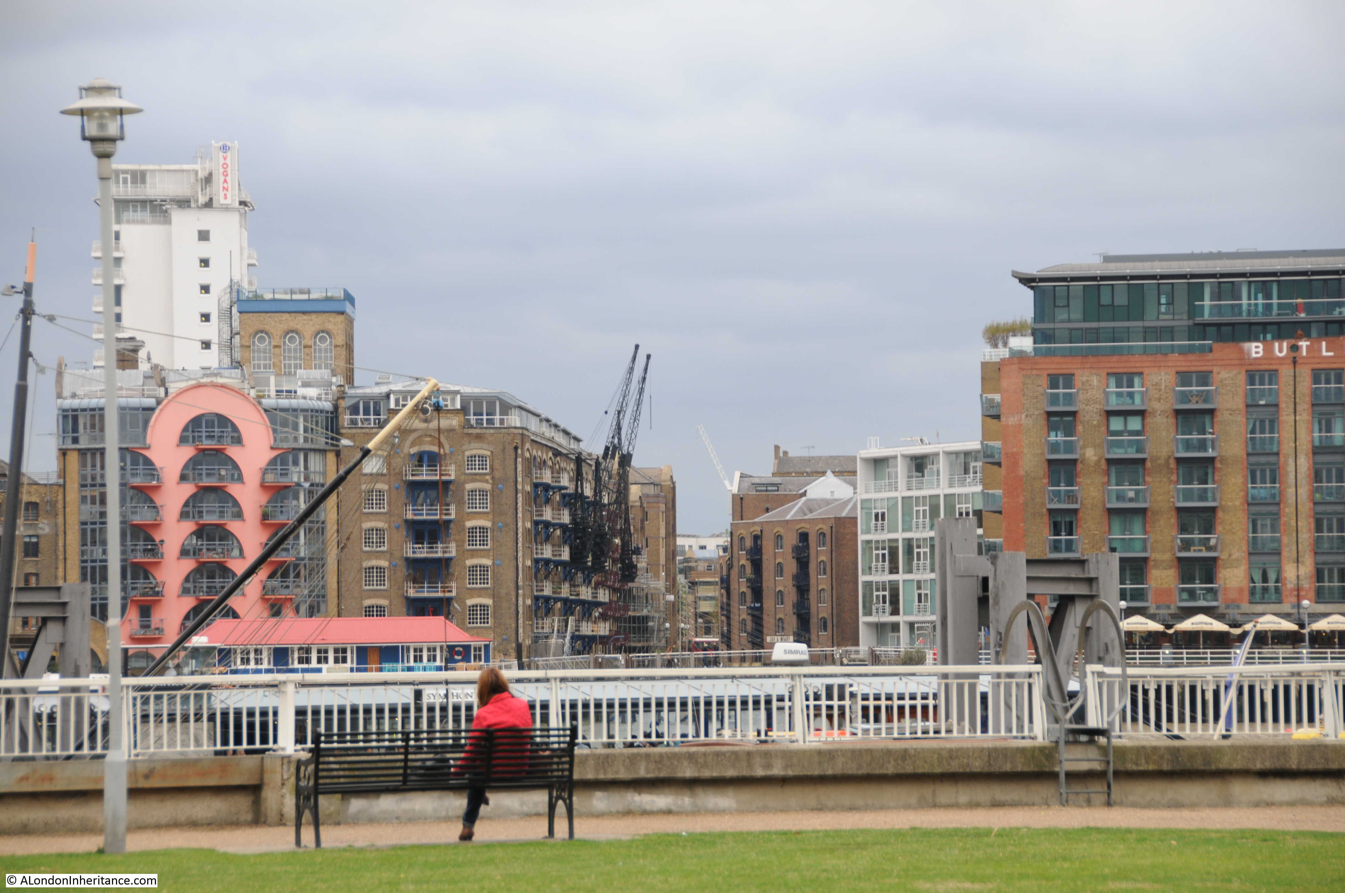
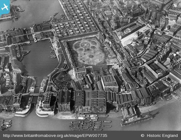
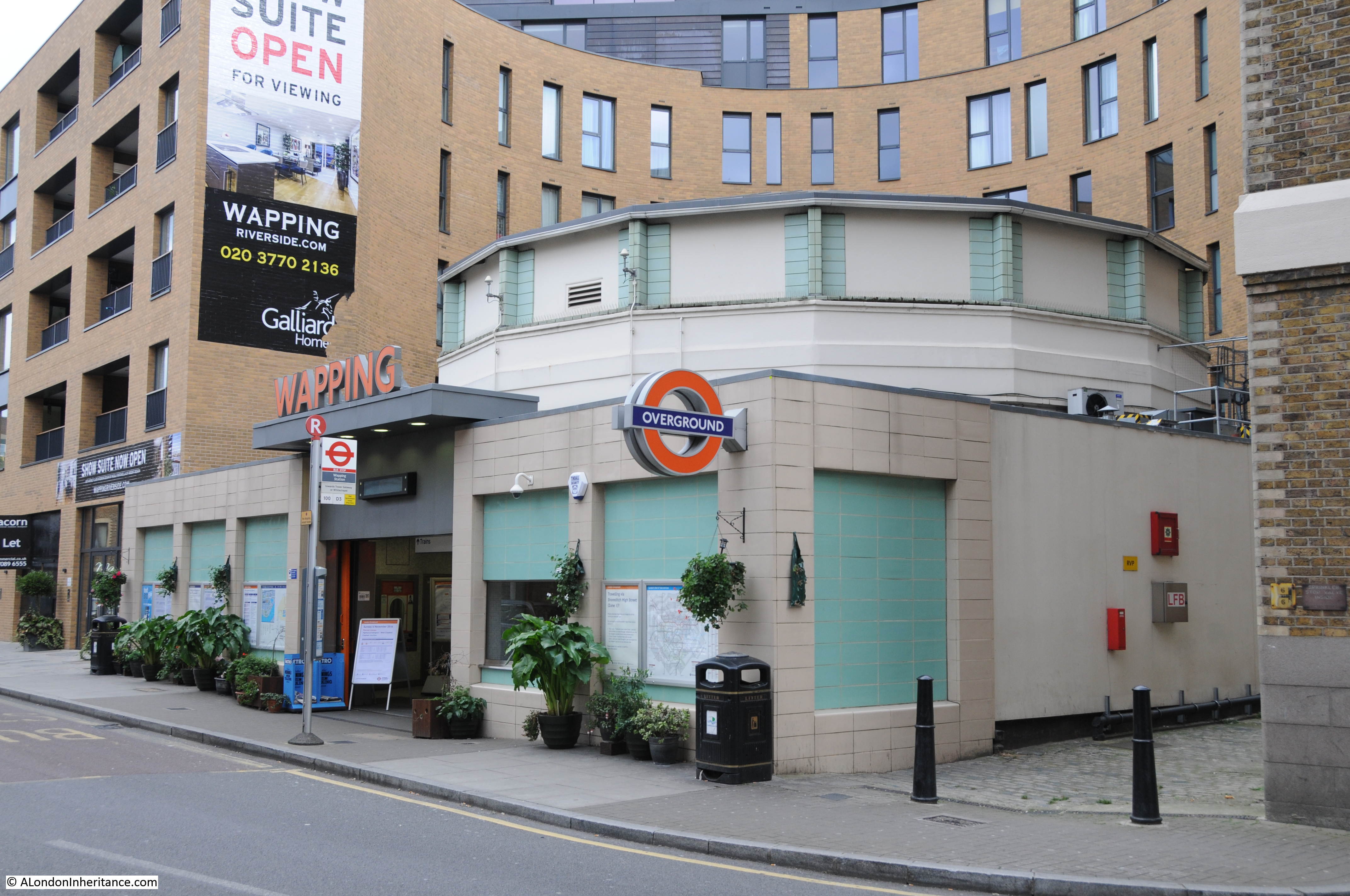
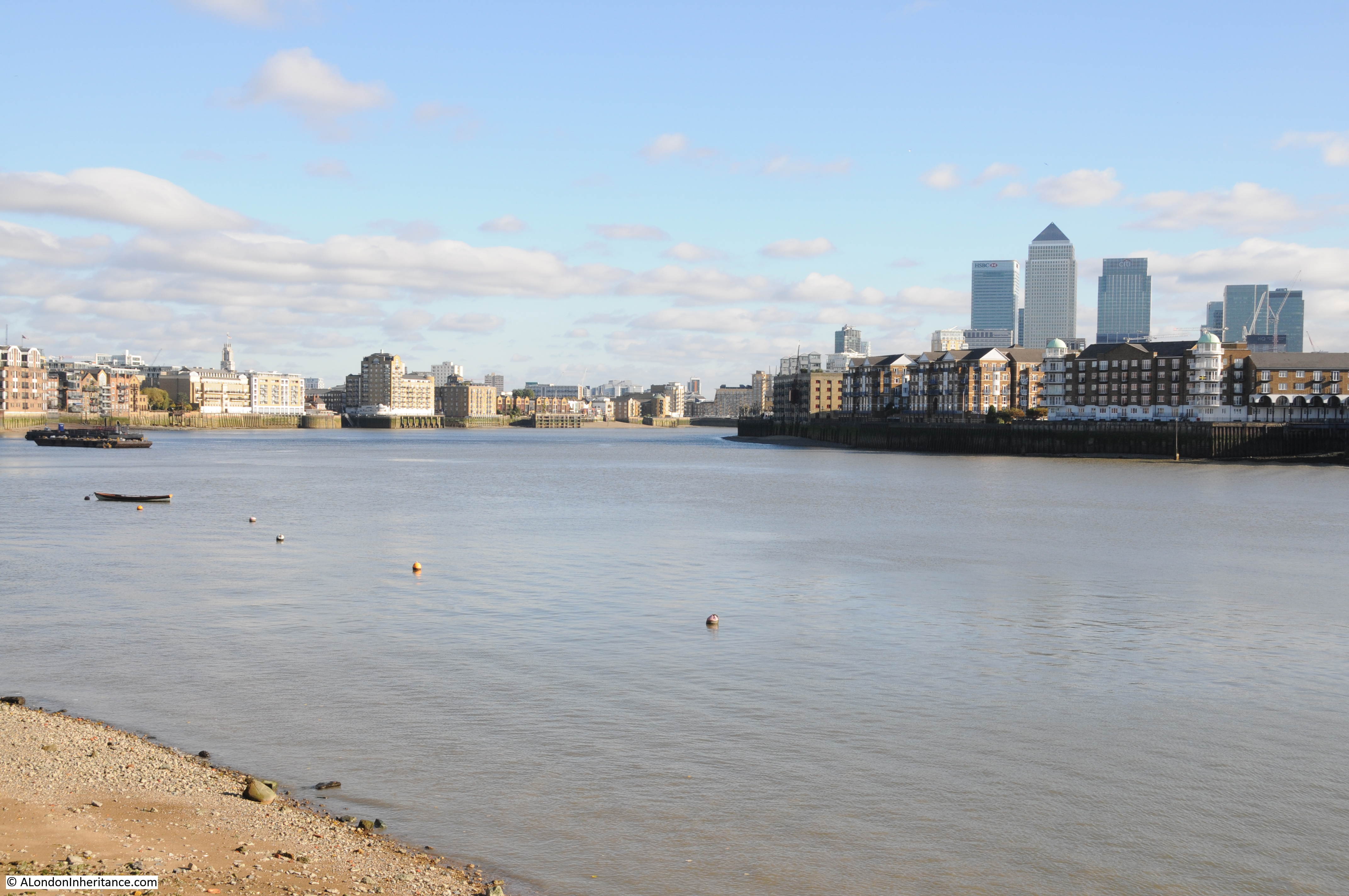
If you have been on my Wapping walk, you will hopefully recognise the following view, and it is a view that I find fascinating as it represents the history of crossing the Thames between Wapping and Rotherhithe..

Wapping Dock Stairs

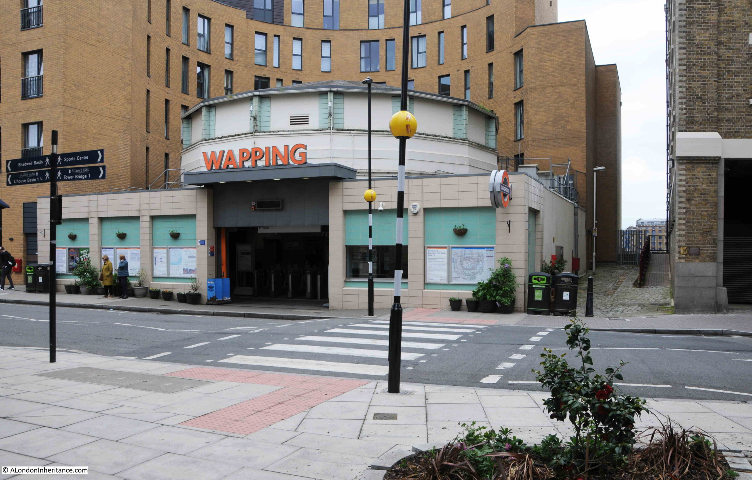
The main feature in the photo is Wapping Station, a station on the London Overground that from Wapping crosses under the river to the next stop on the route south at Rotherhithe.

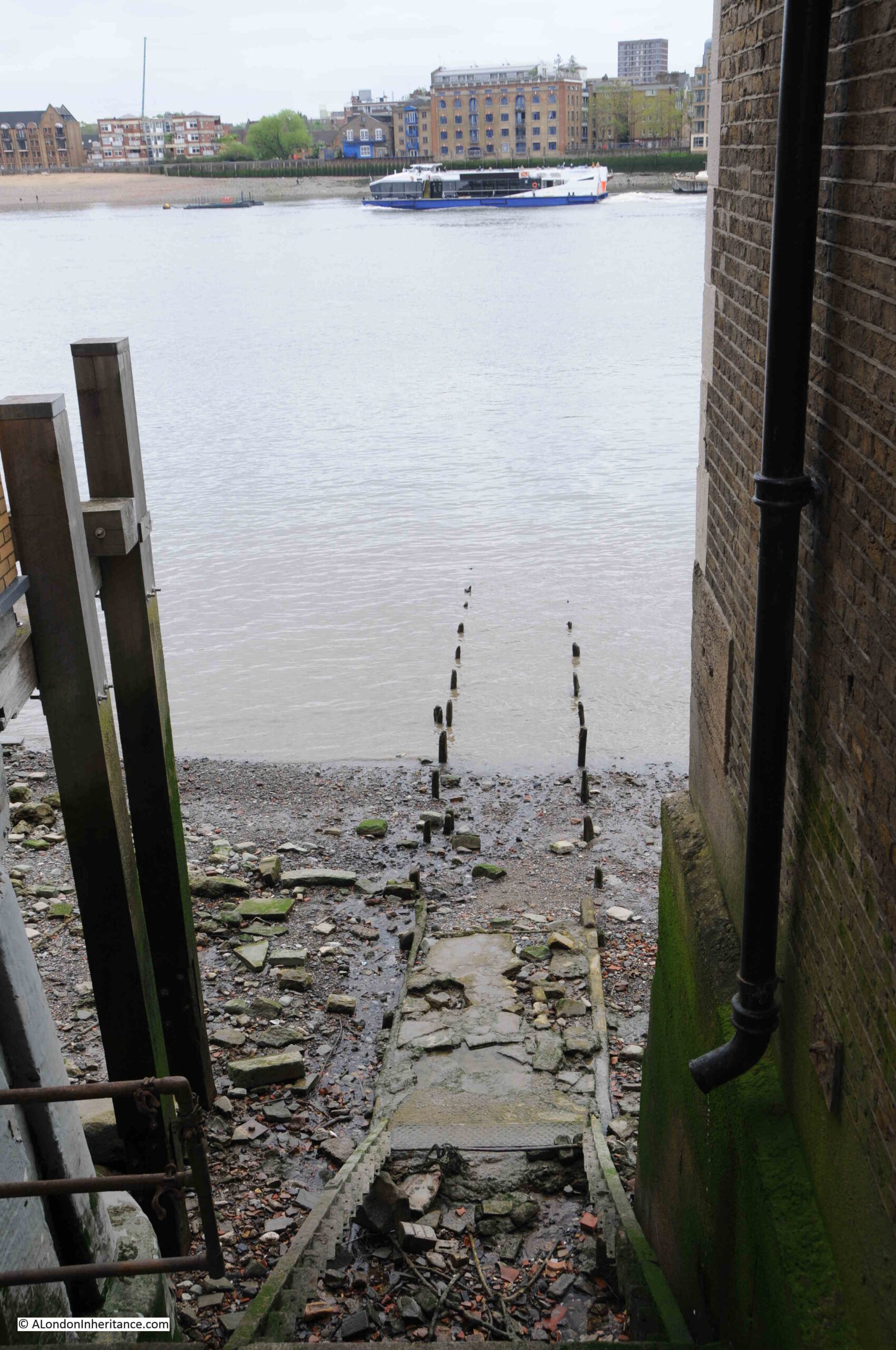
I will touch on the station later in the post, but the main focus of today’s post is at the end of the walkway to the right of the station, a walkway that leads up to Wapping Dock Stairs.

If you have been reading the blog for a few years, you will realise I have a strange fascination with Thames Stairs.

Not so much the physical stair, although these are really interesting, historical structures, rather what the stairs represent.

For centuries, these were the main interface between the land and the river. If you were travelling up, down, or across the river you would use one of the Watermen who would cluster at the base of the stairs, to row you to your destination.

If you were leaving London, you would reach the boat taking you to your destination via a river stair, or if you were arriving back in London, you would return to the land via the stairs.

Countless thousands of people have used these stairs. For some, arriving at the stairs would be their first view of London, for those leaving, it could be their last view of London.

Many of those who have had to flee the country, for political or religious reasons, would have left the country via Thames stairs. Perhaps leaving in disguise, or in the dead of night to avoid recognition, to catch a boat to take them away from the country.

I have covered many such stories in previous blog posts, and will provide links at the end of today’s post, but for now back to Wapping Dock Stairs.

As with nearly all the stairs in Wapping, Wapping Dock Stairs are old, and date back to at least the end of the 17th century, and are probably much older.

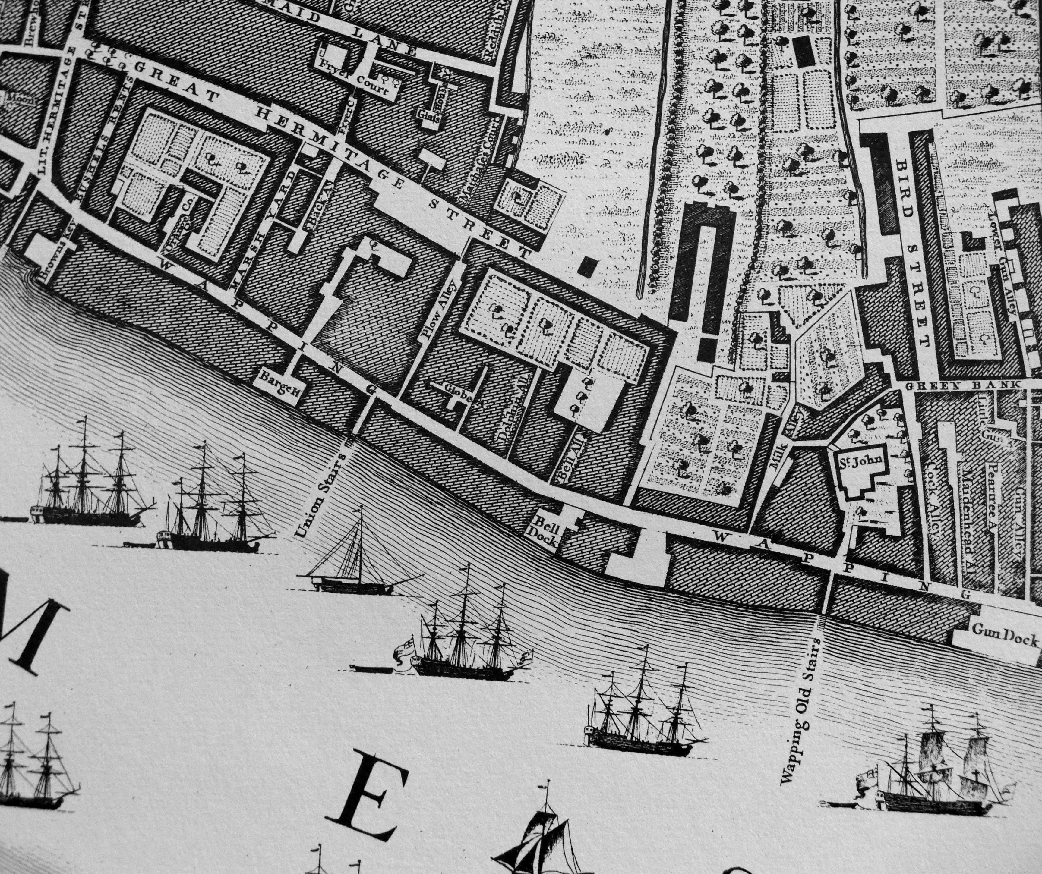
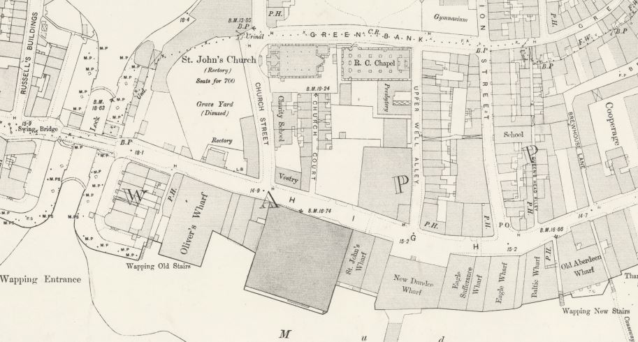
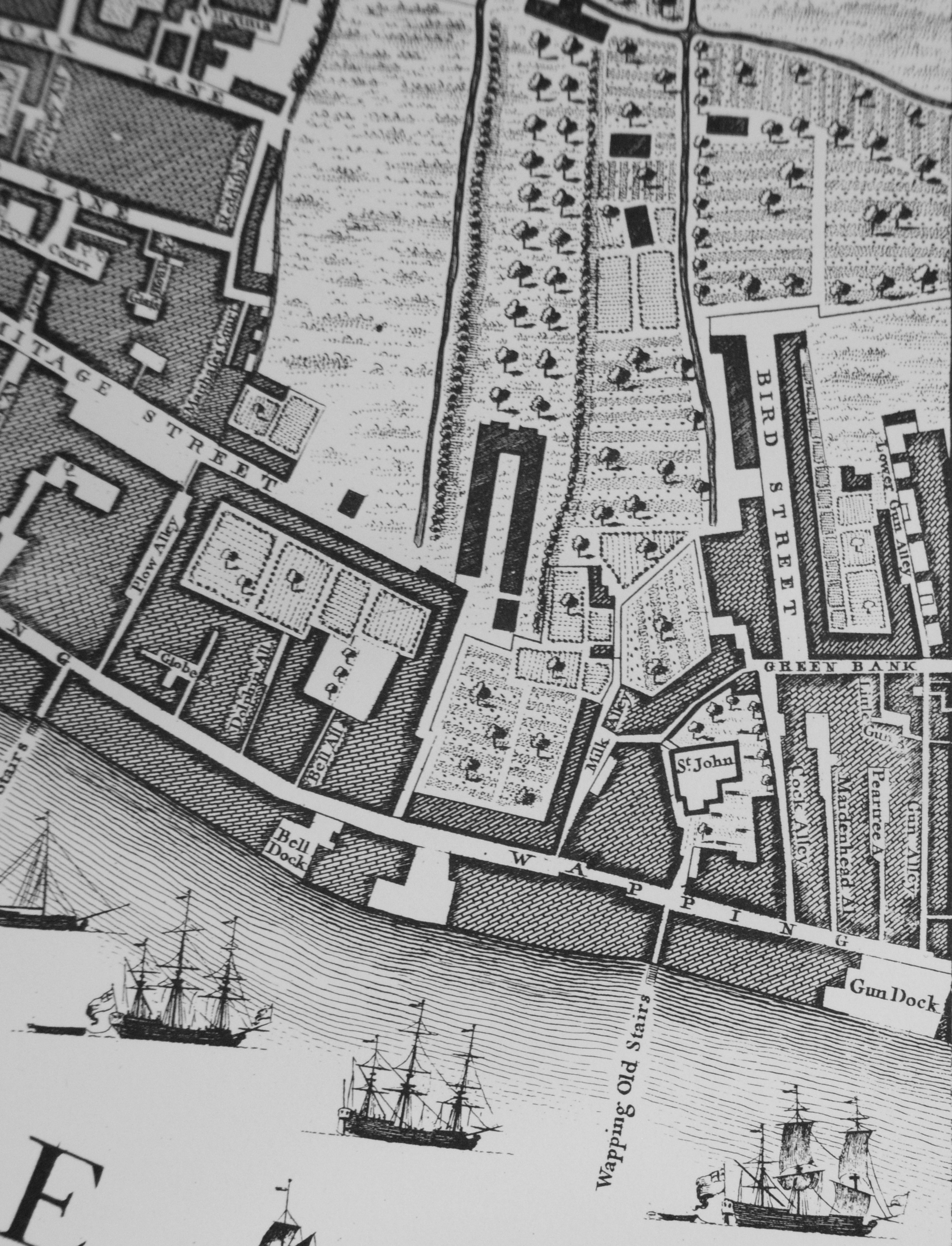
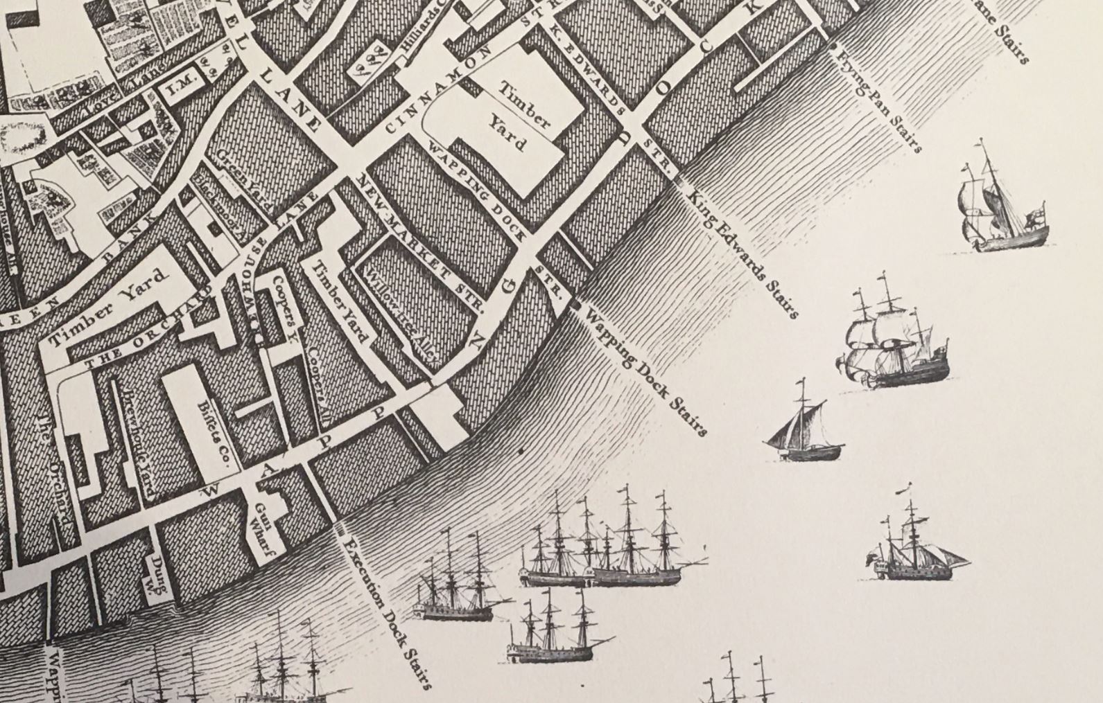
In Rocque’s map of 1746, the stairs are shown in the centre of the following extract, with Wapping Dock Street being the street that leads up to the stairs:

Wapping Dock Stairs

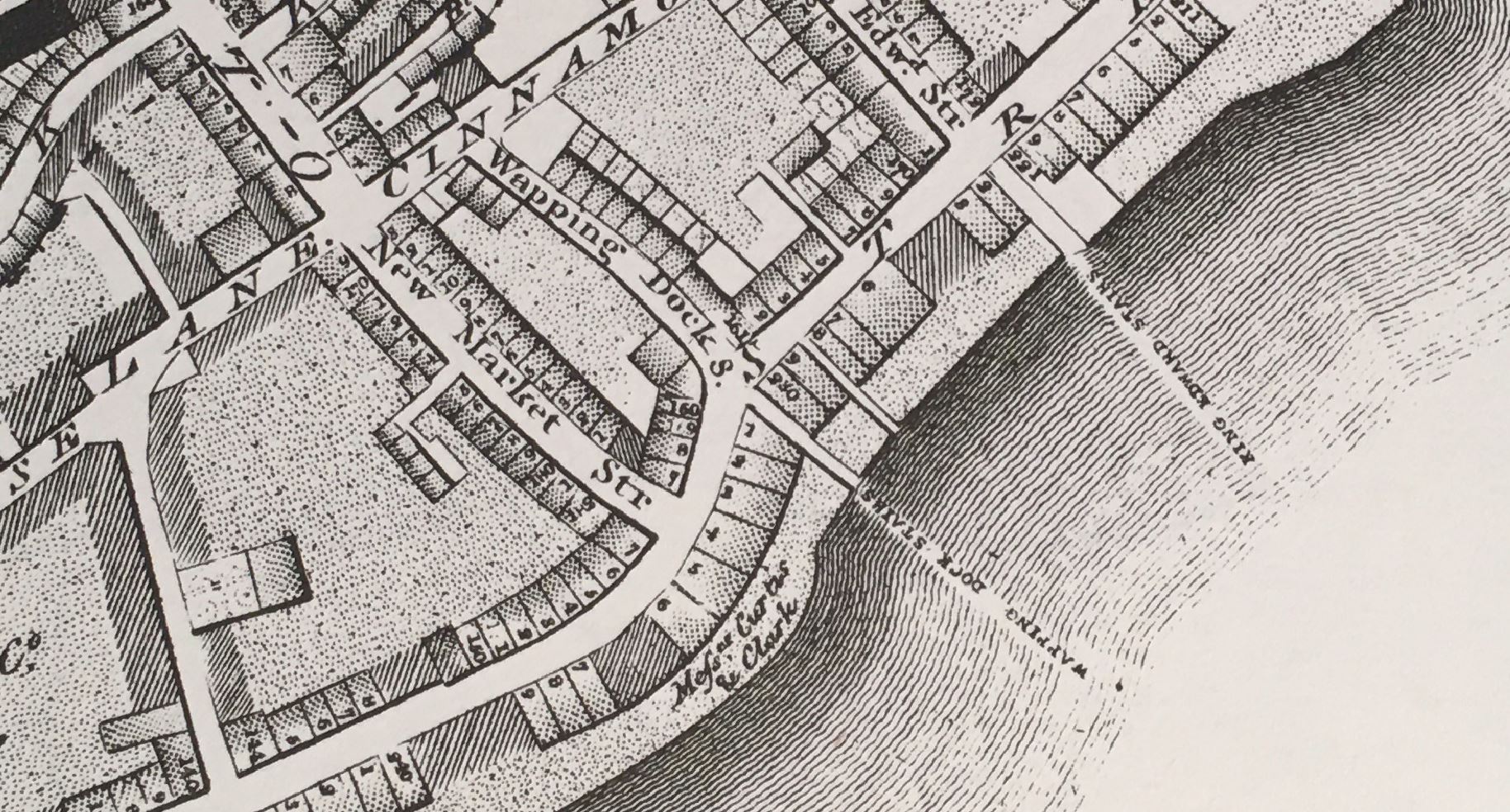
Richard Horwood’s map of London from 1799 also shows Wapping Dock Stairs, and when compared to Rocque’s map, Horwood adds a level of detail with individual buildings lining the streets:

Wapping Dock Stairs

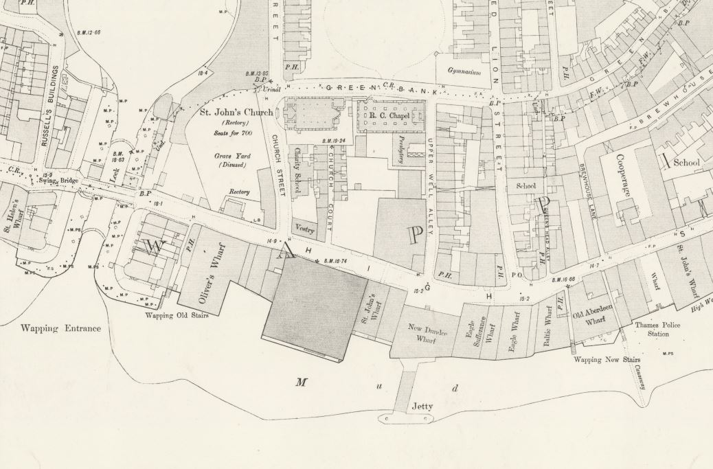
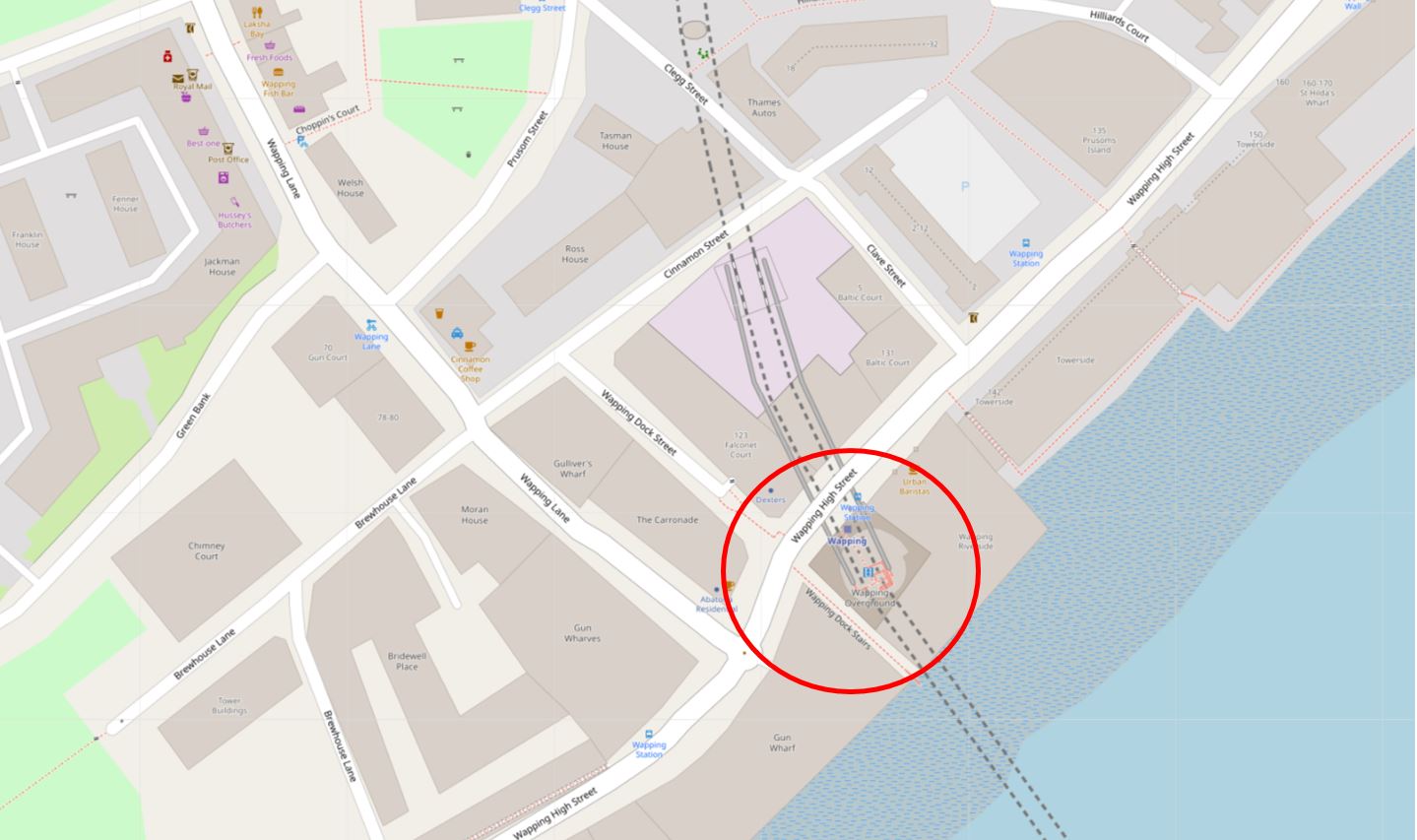
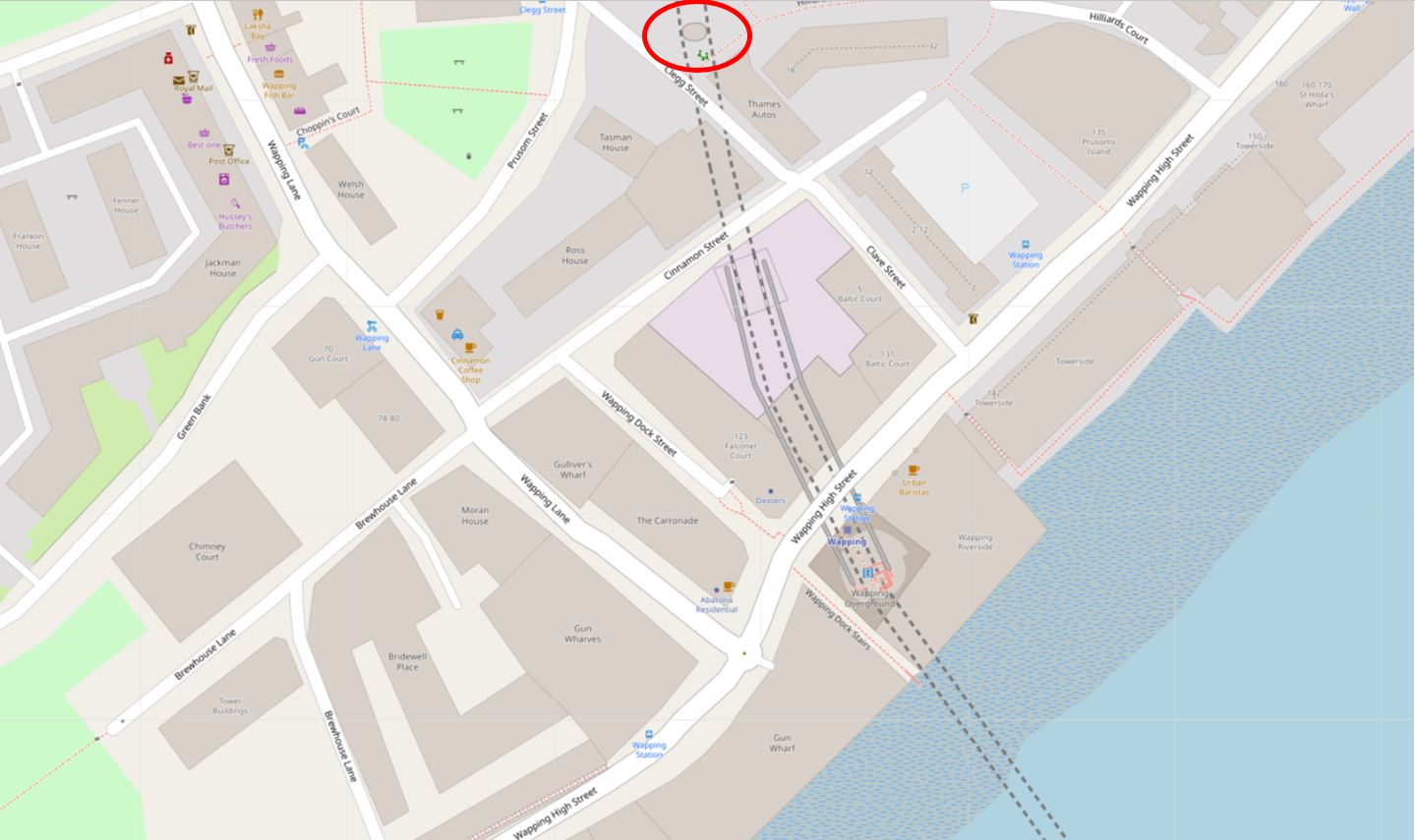
The location today, with the stairs and station circled, is shown in the following map  ( © OpenStreetMap contributors):

Wapping Dock Stairs

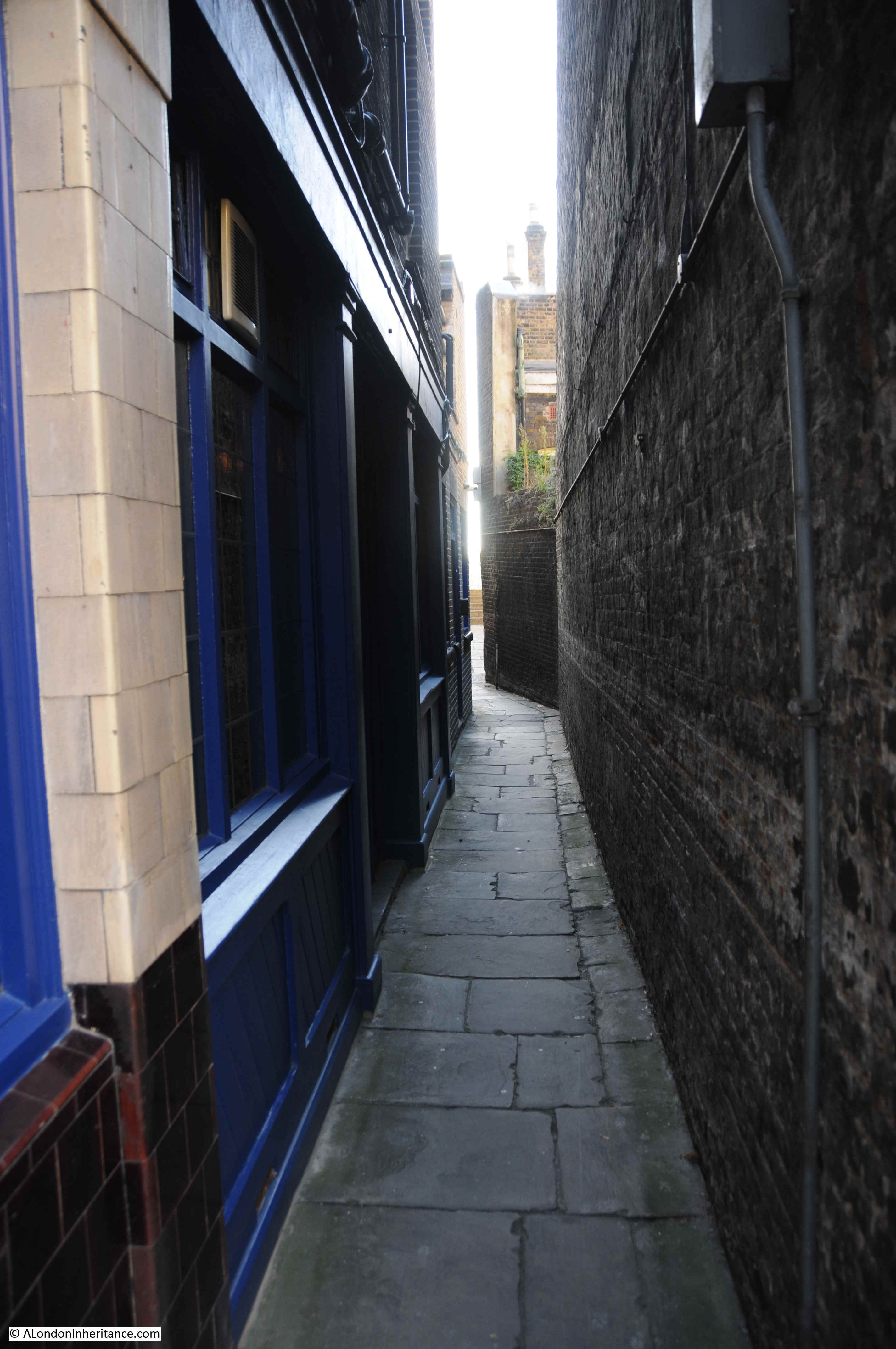
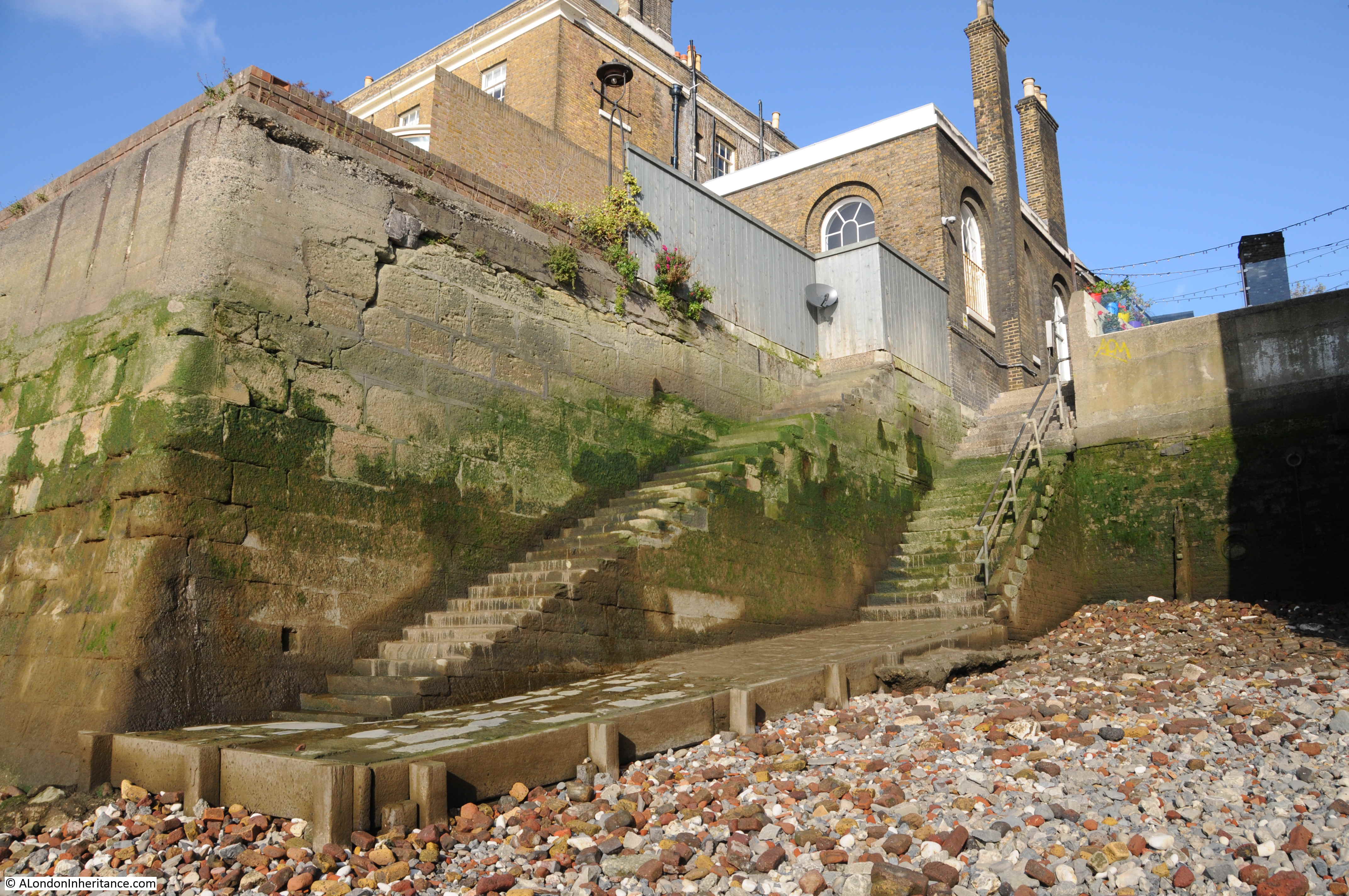
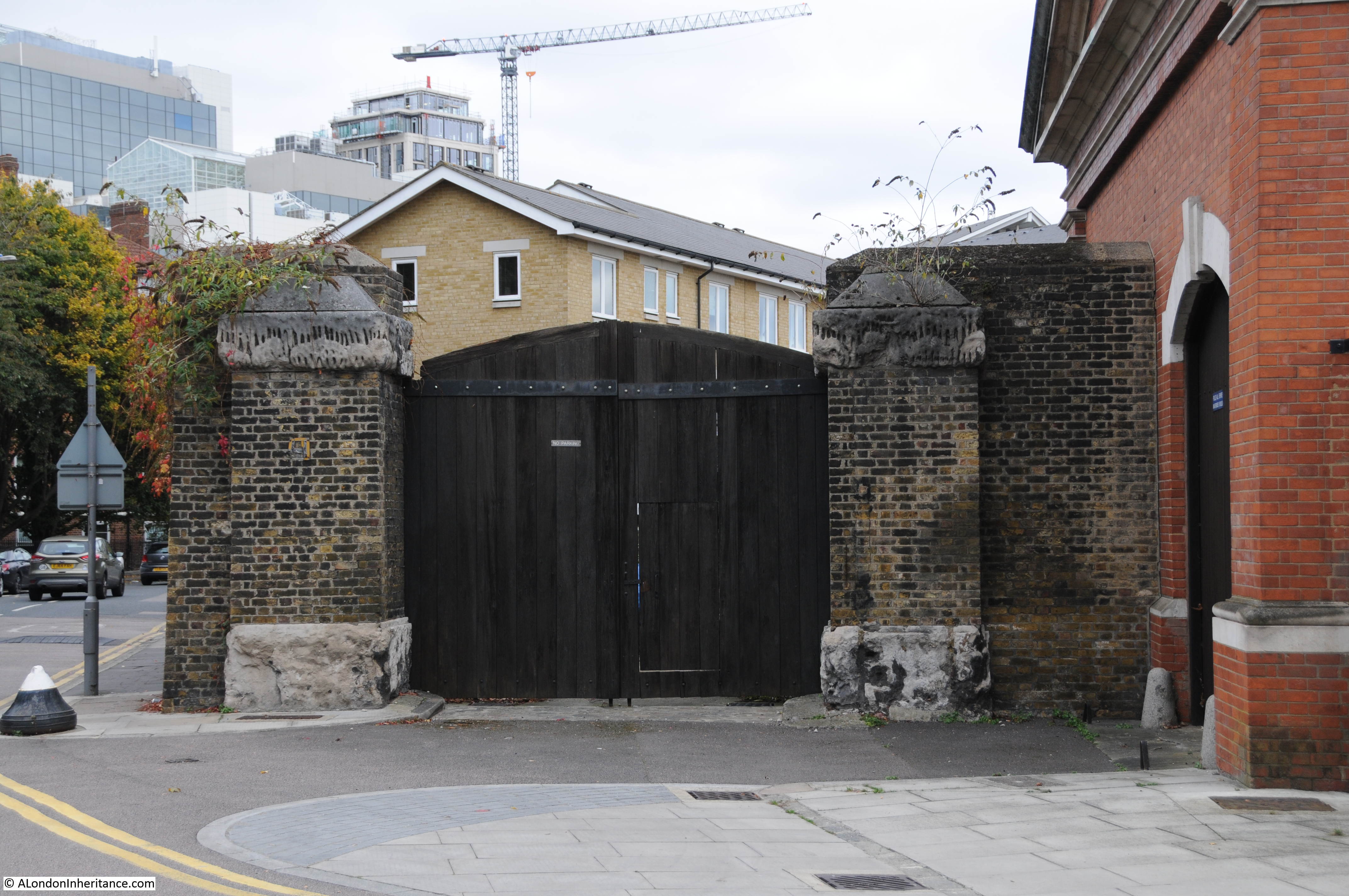
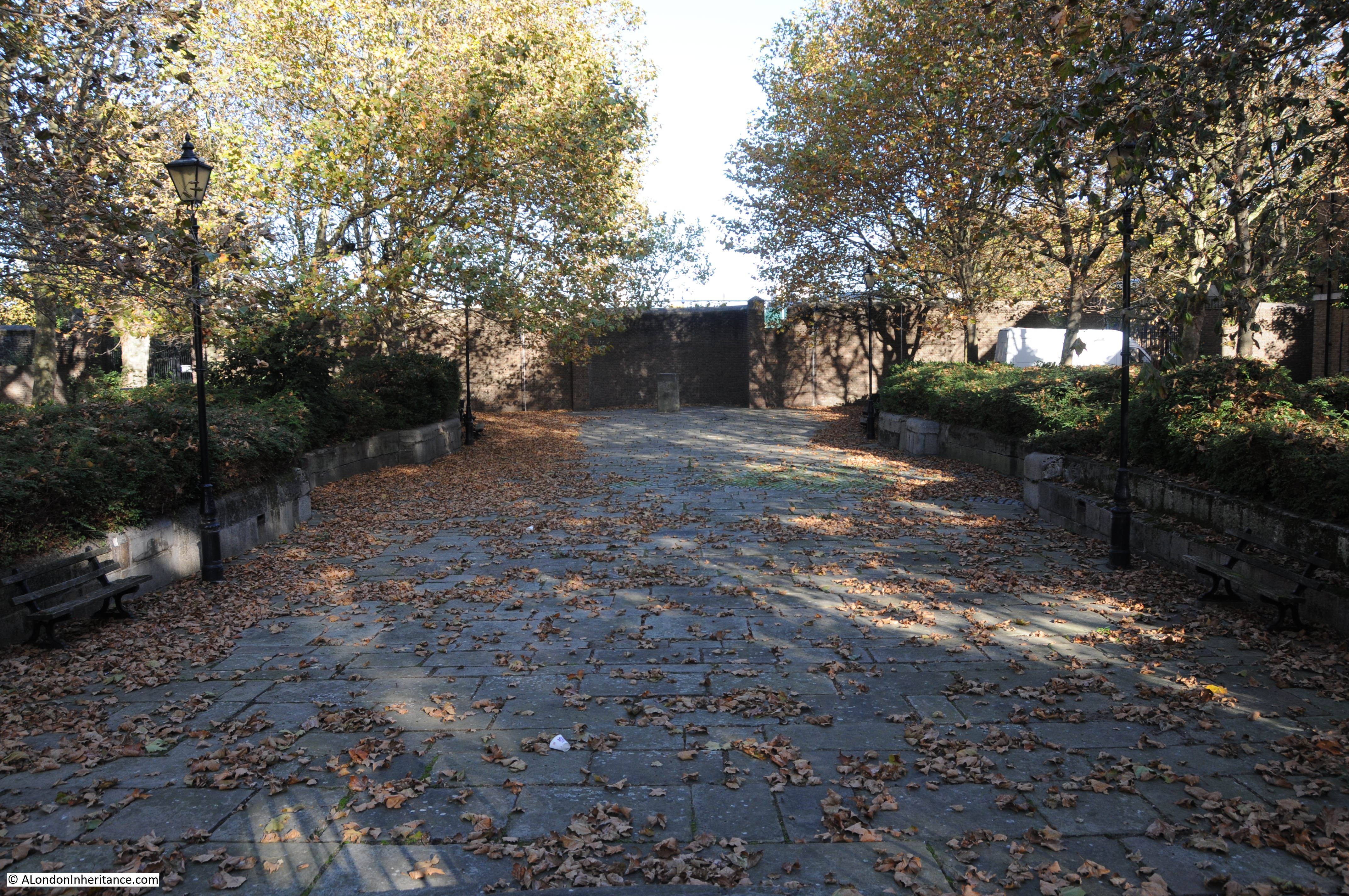
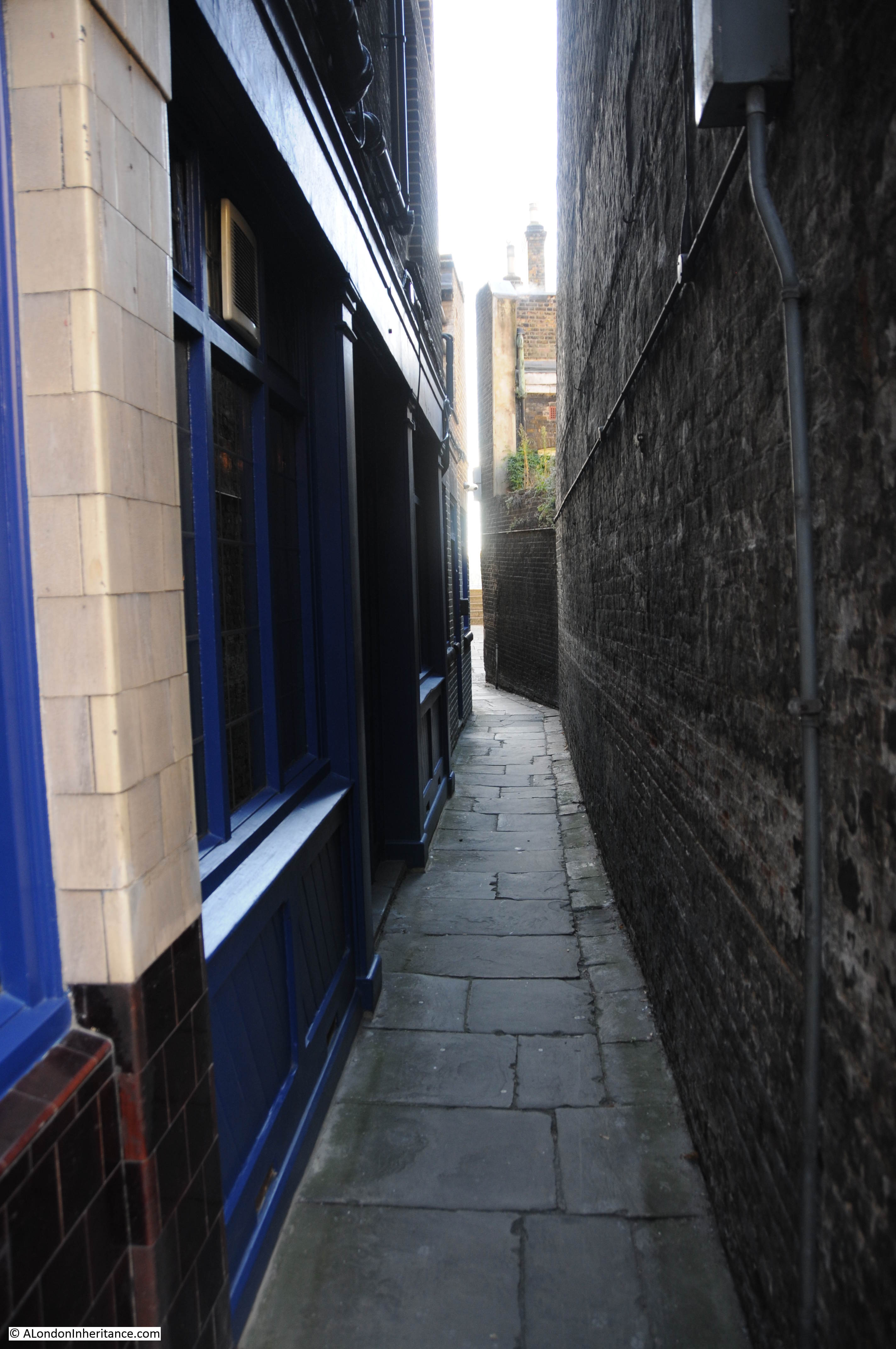
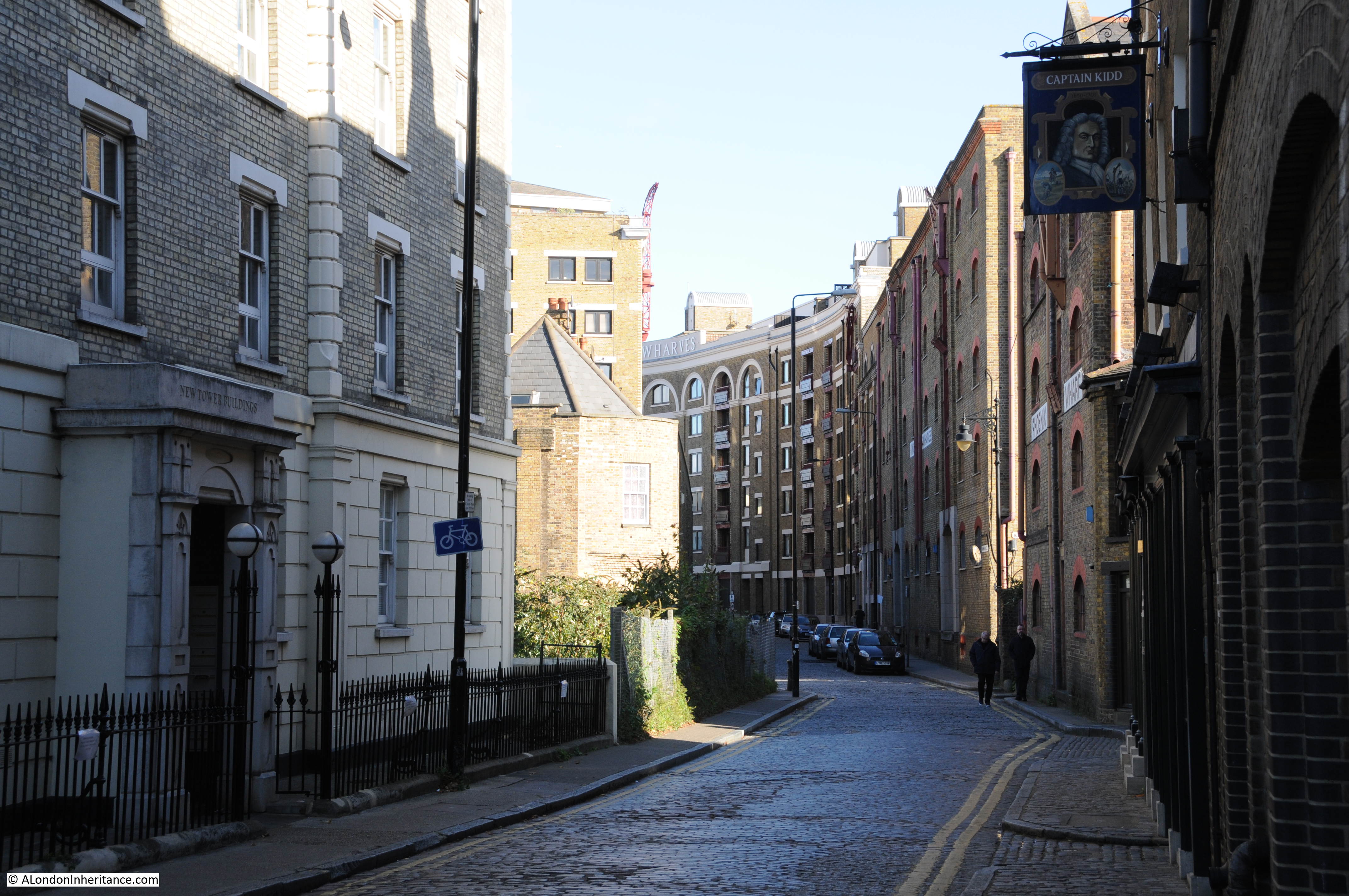
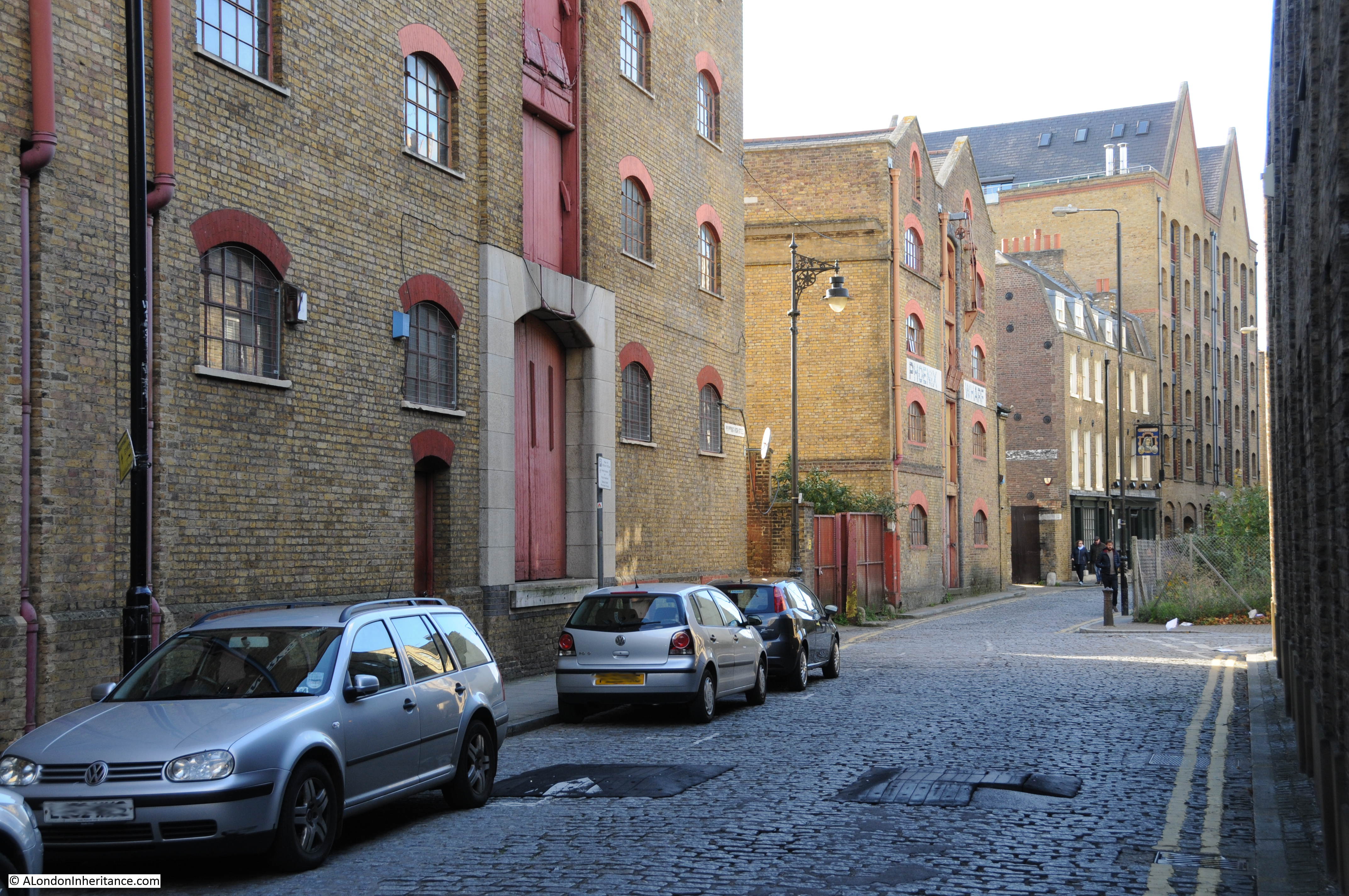
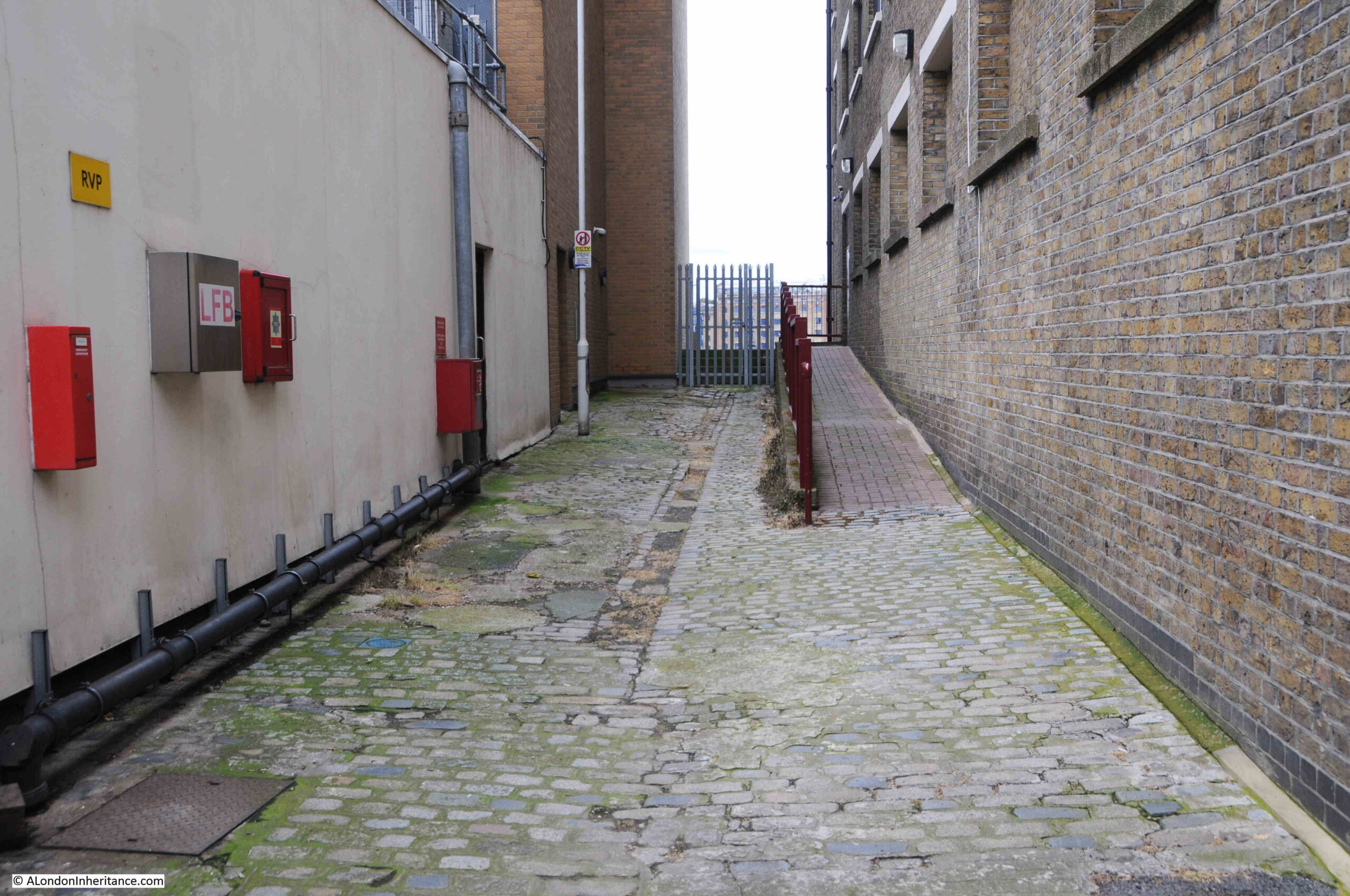
Turning off Wapping High Street, this is the approach to the stairs. The walkway on the right leads to an entrance to the building on the right. The walkway on the left leads to the stairs.

Wapping Dock Stairs

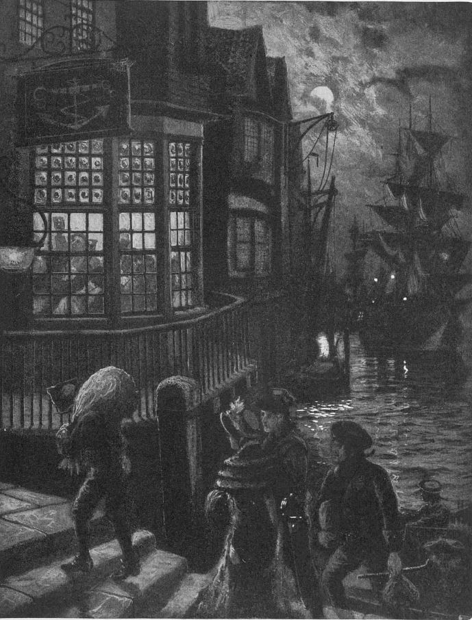
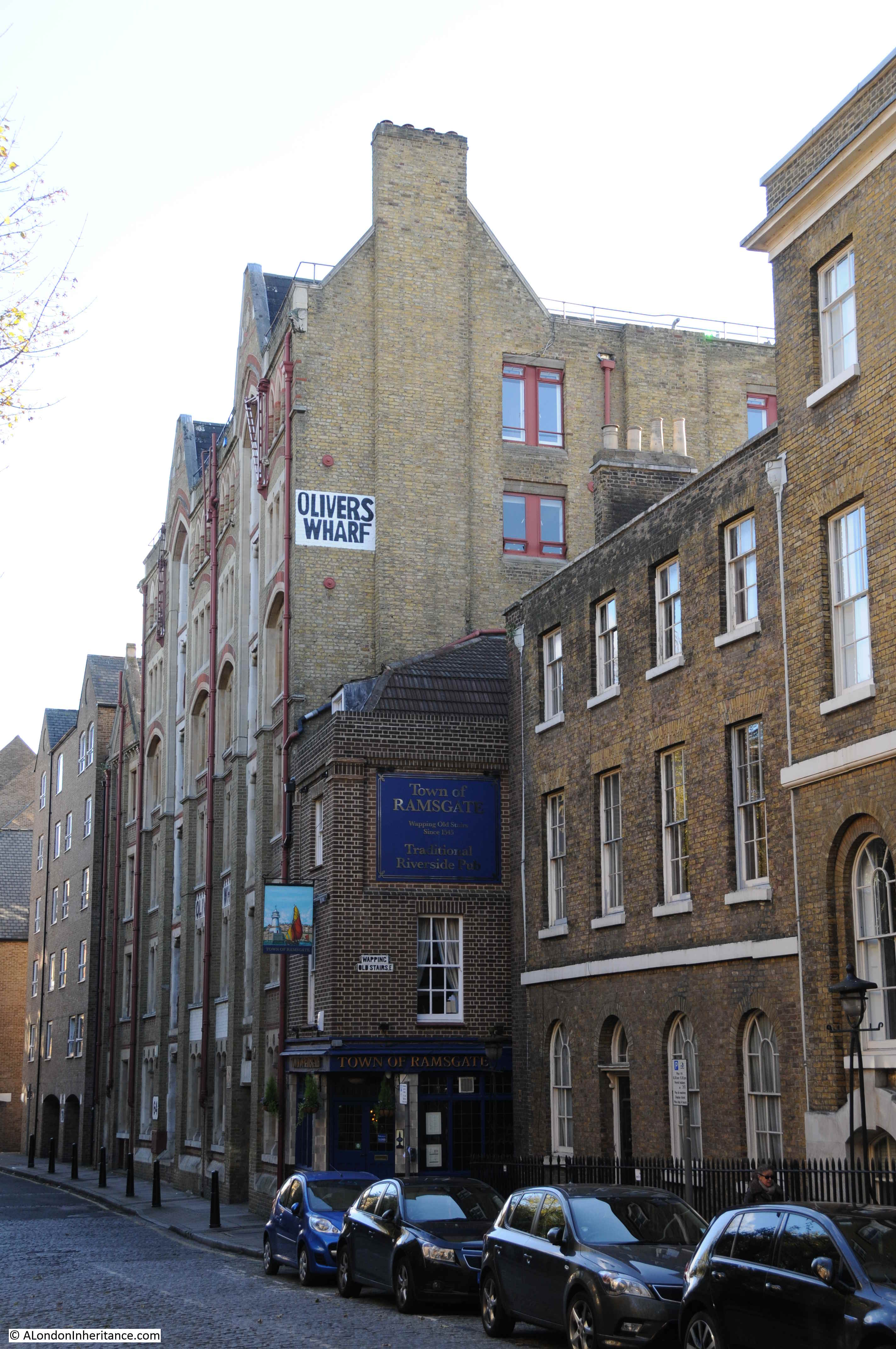
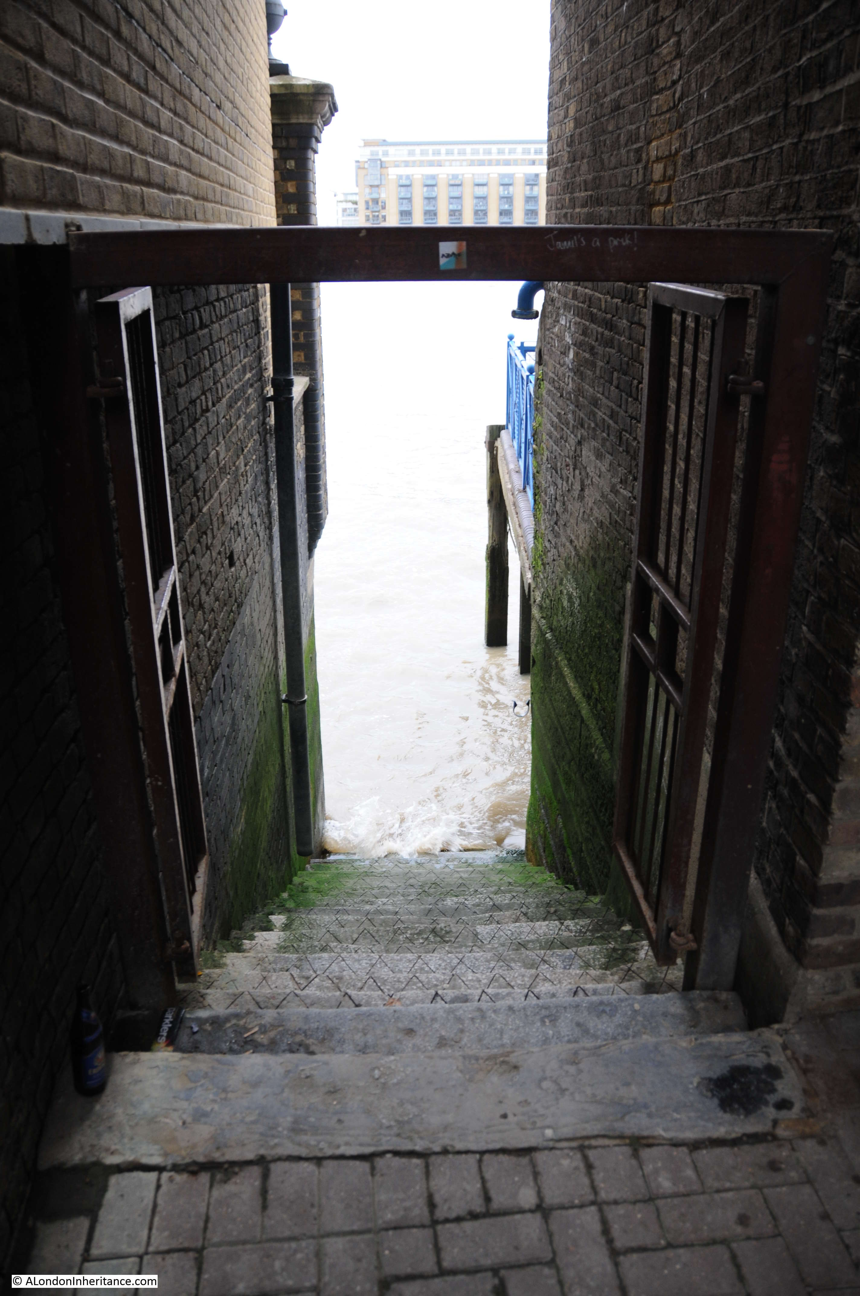
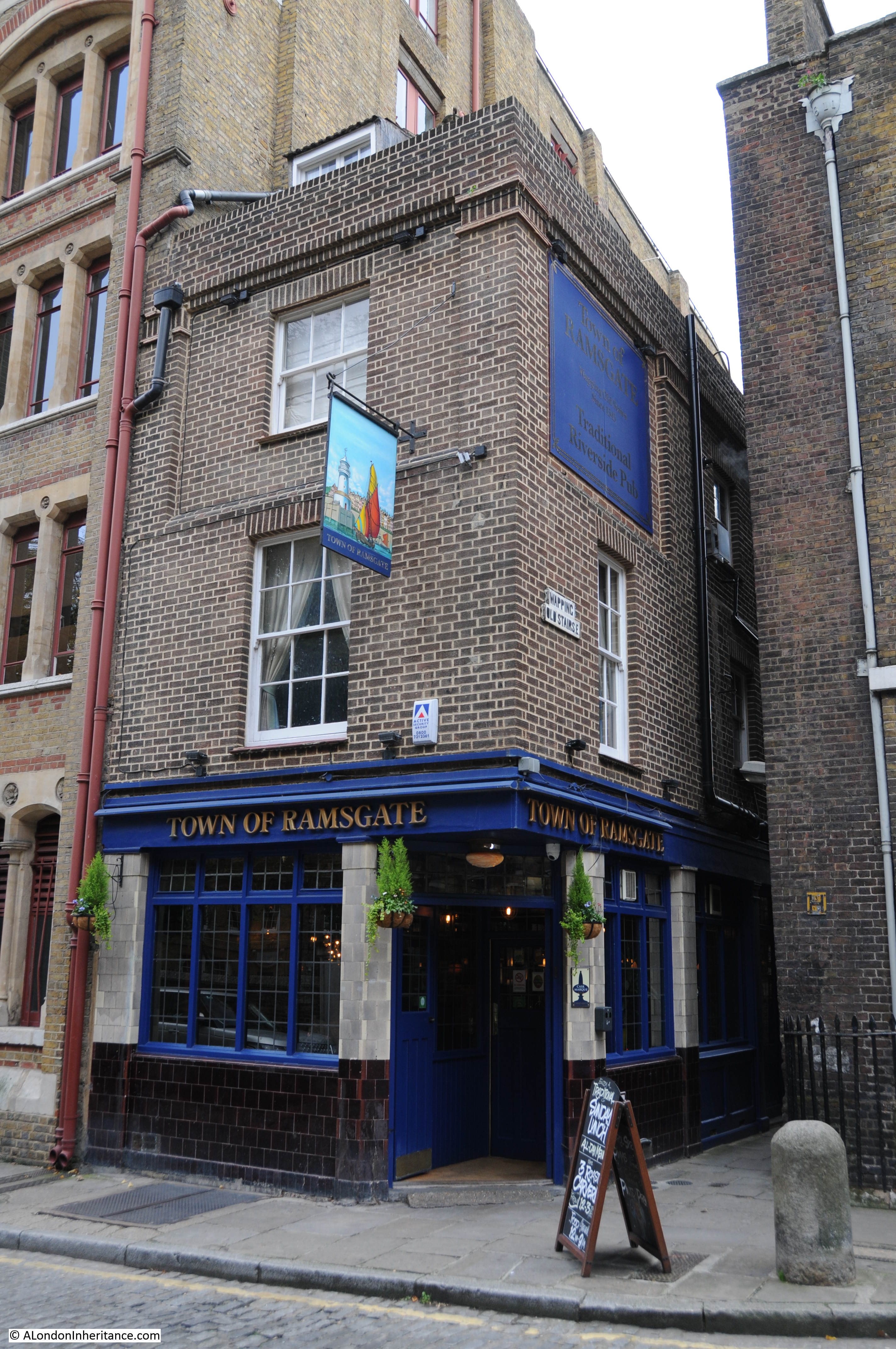
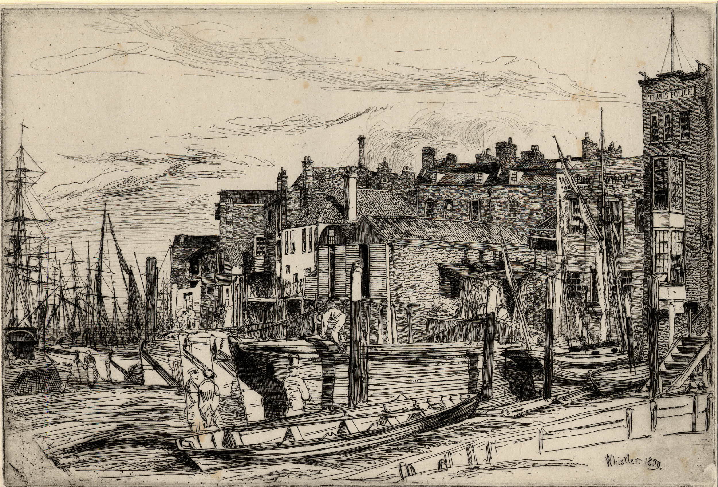
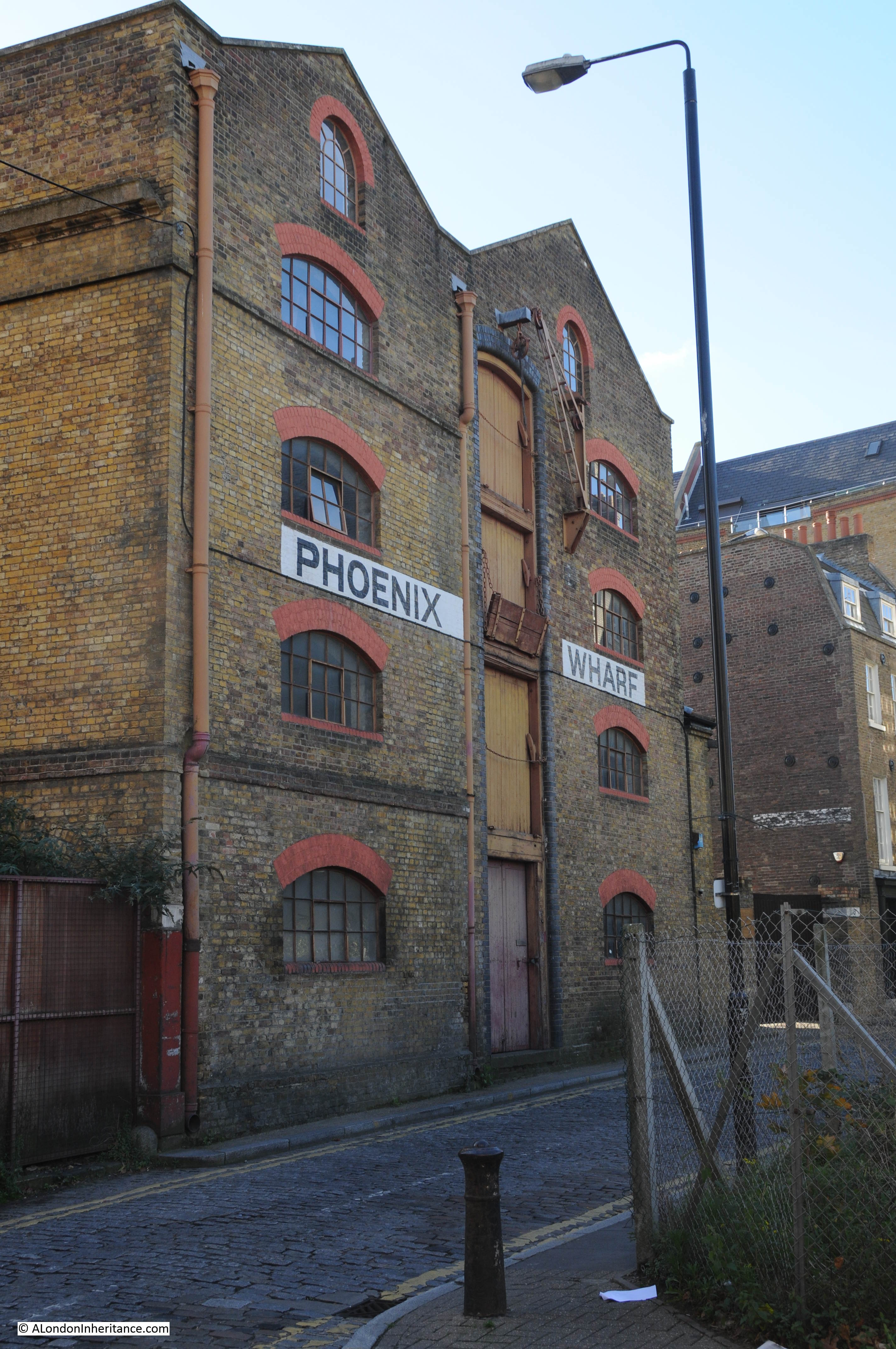
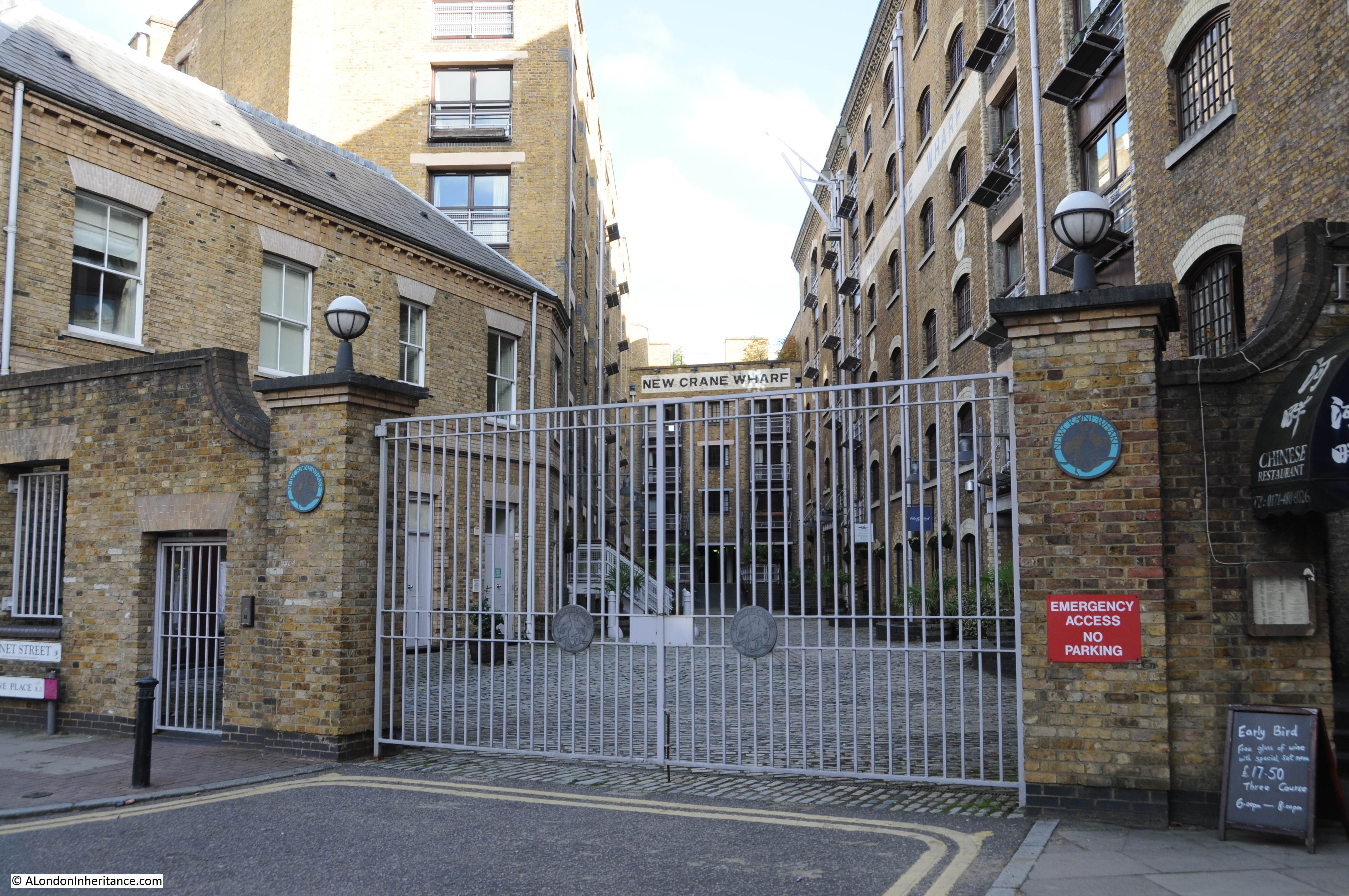
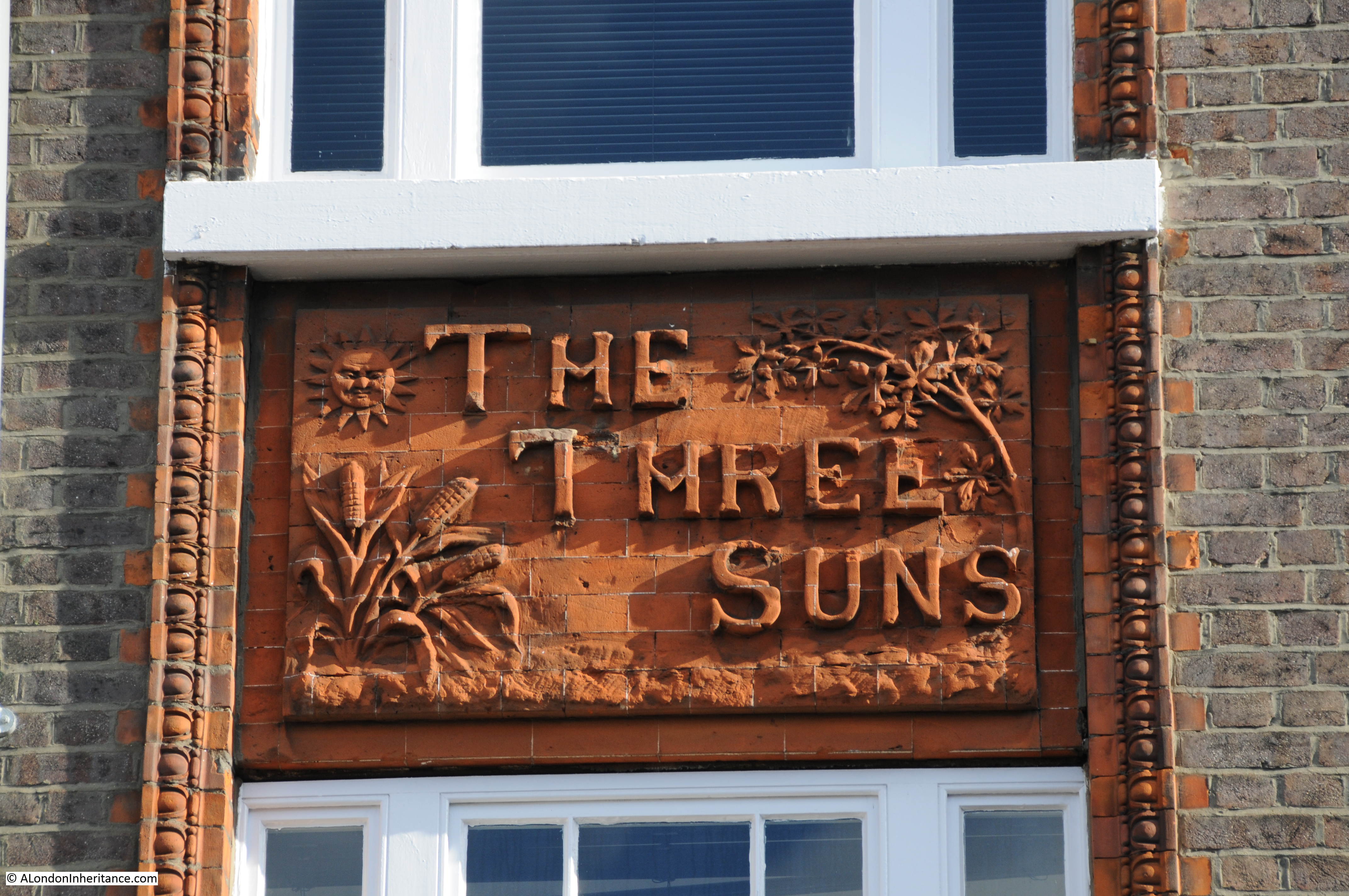
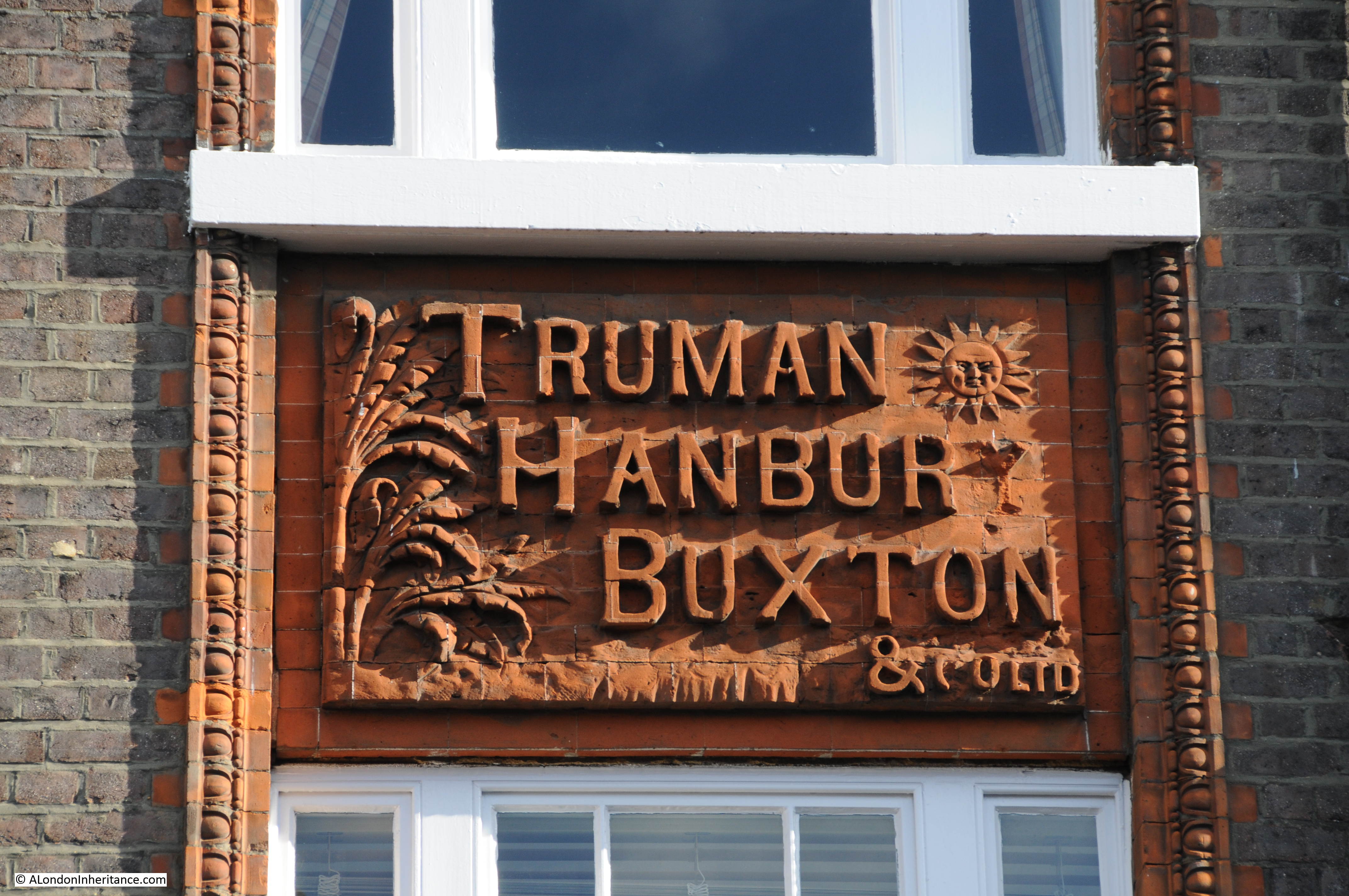
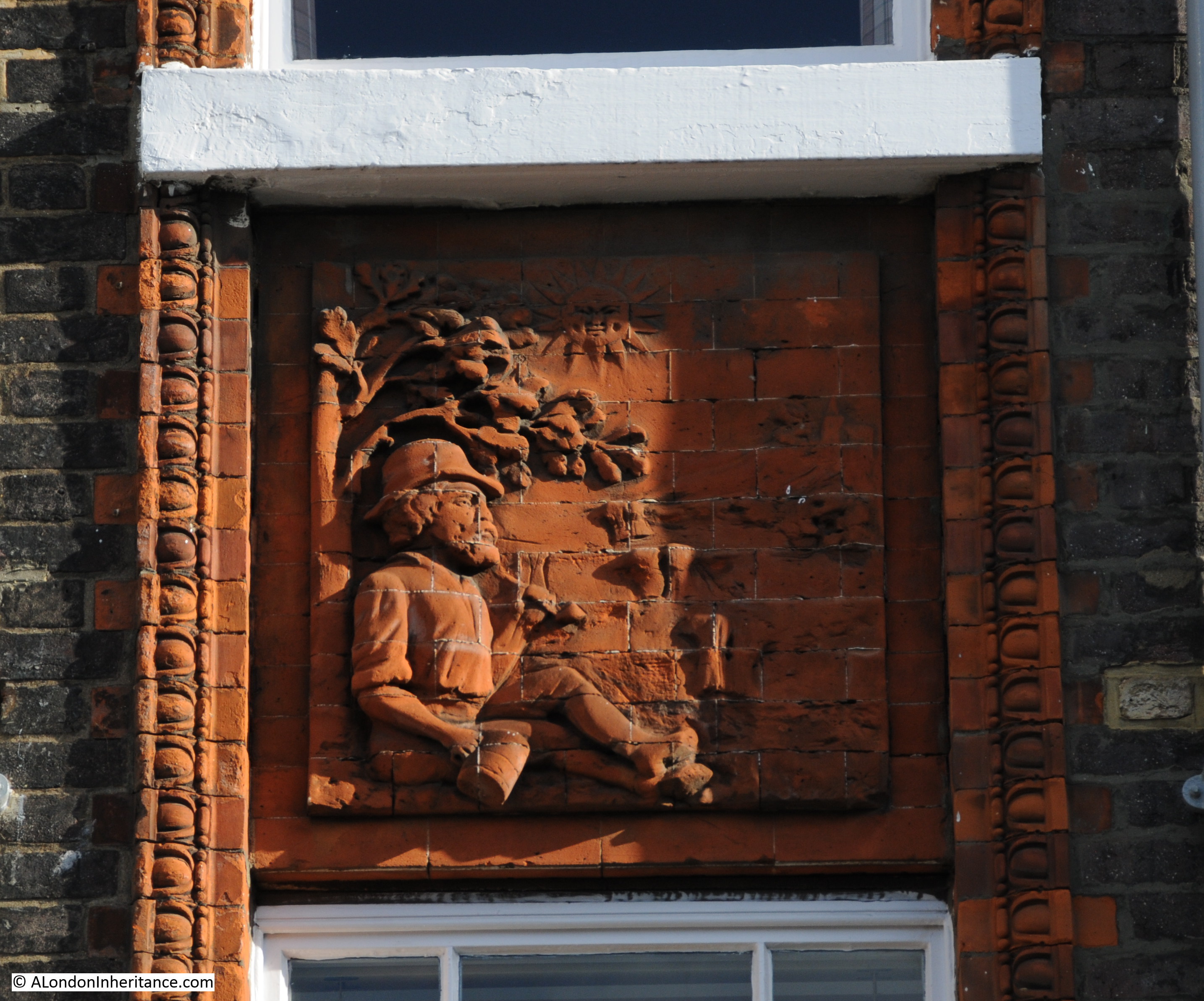
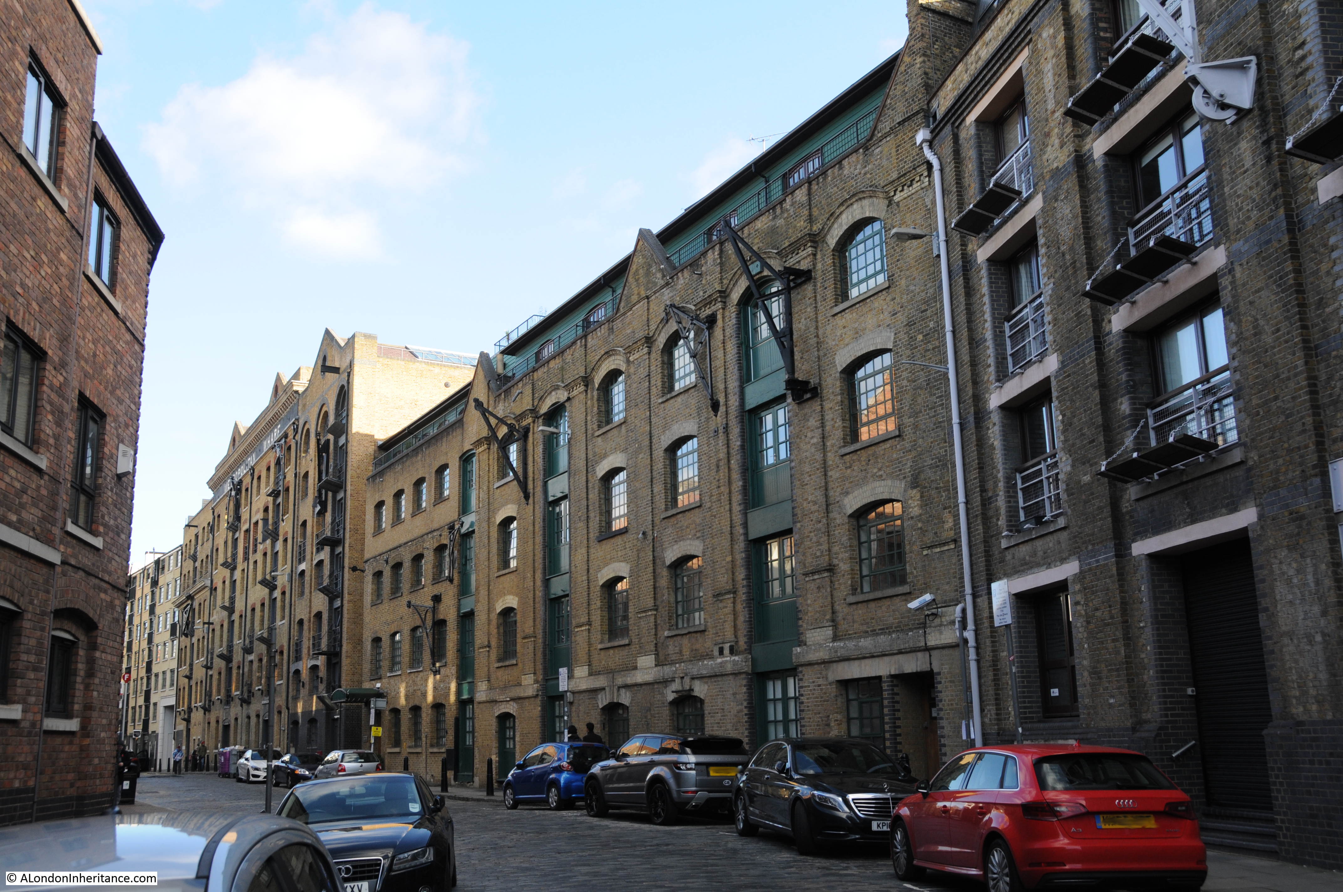
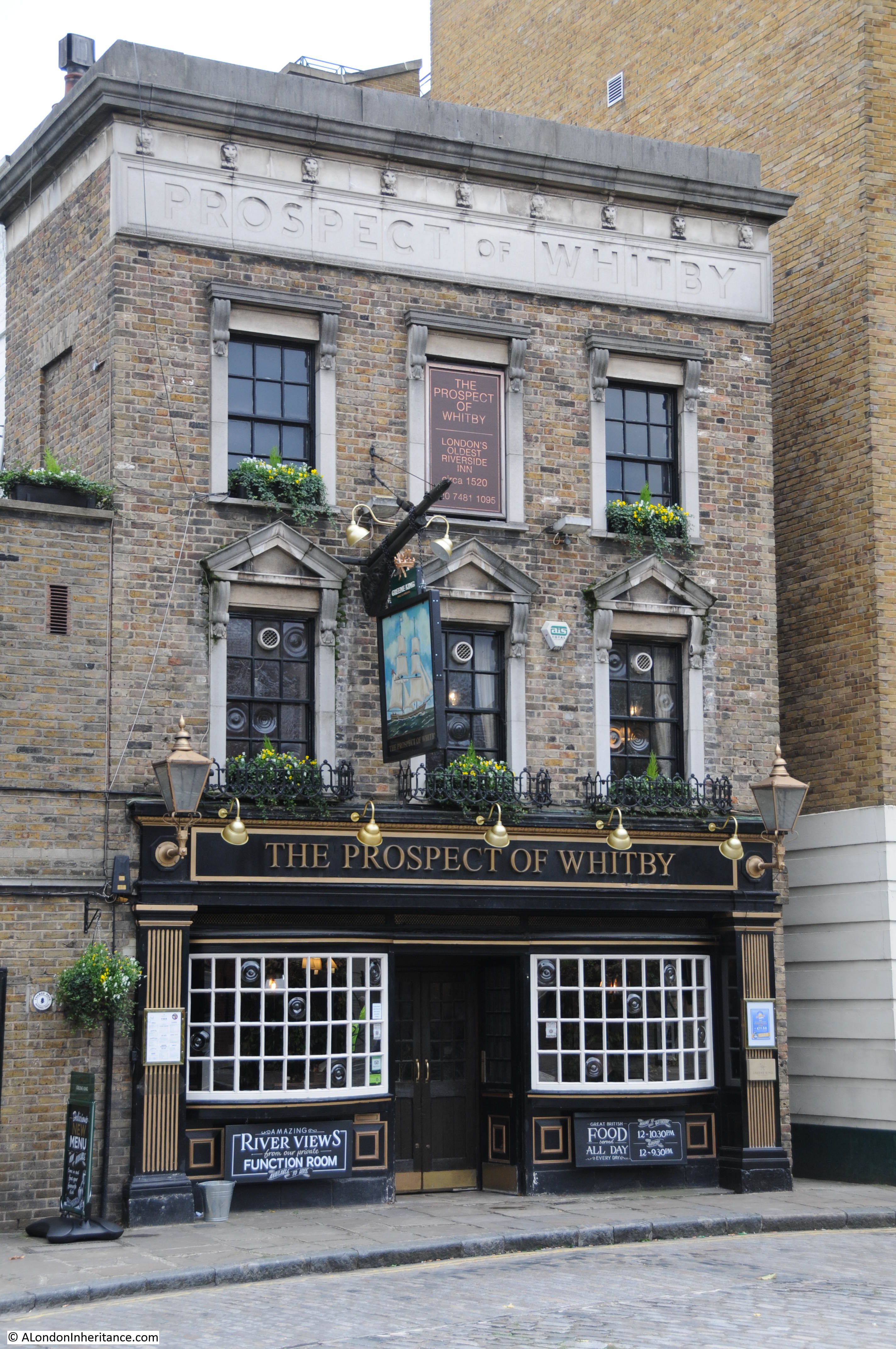
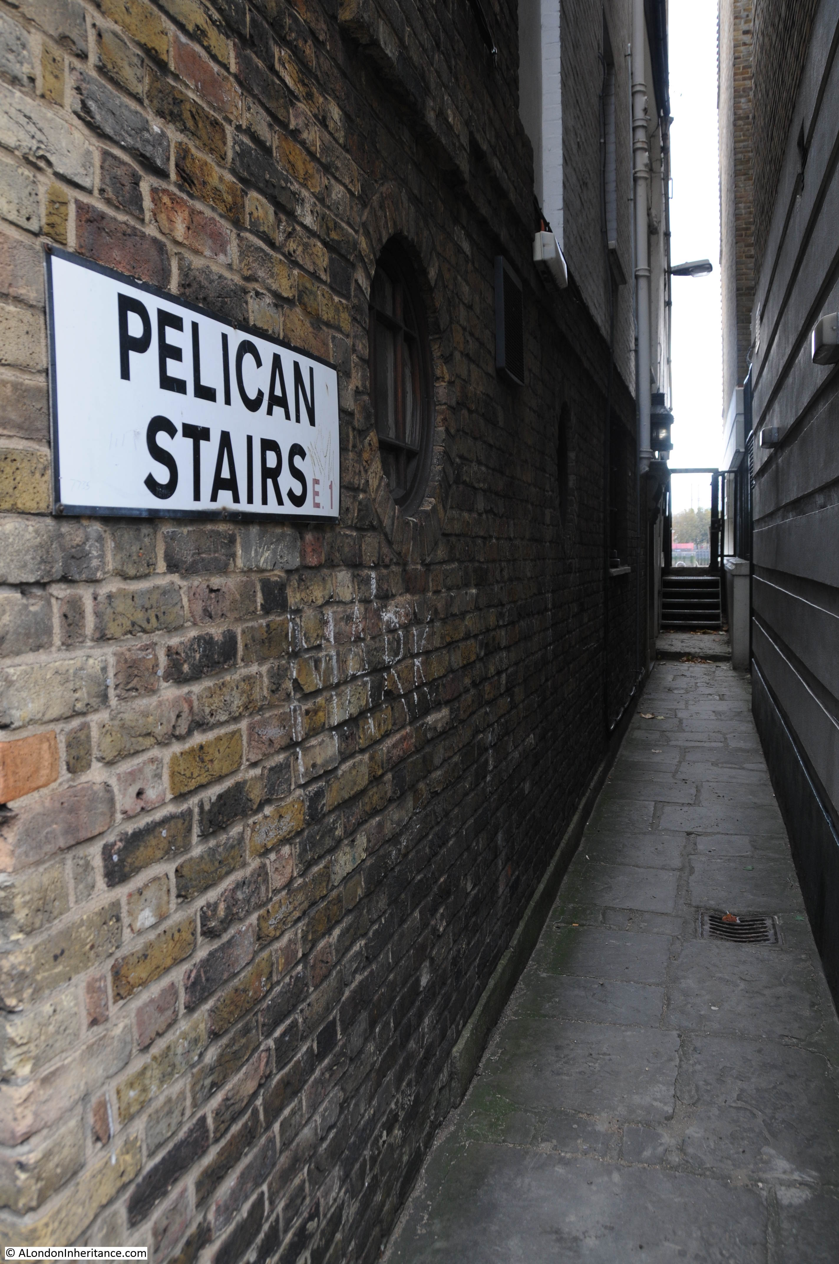
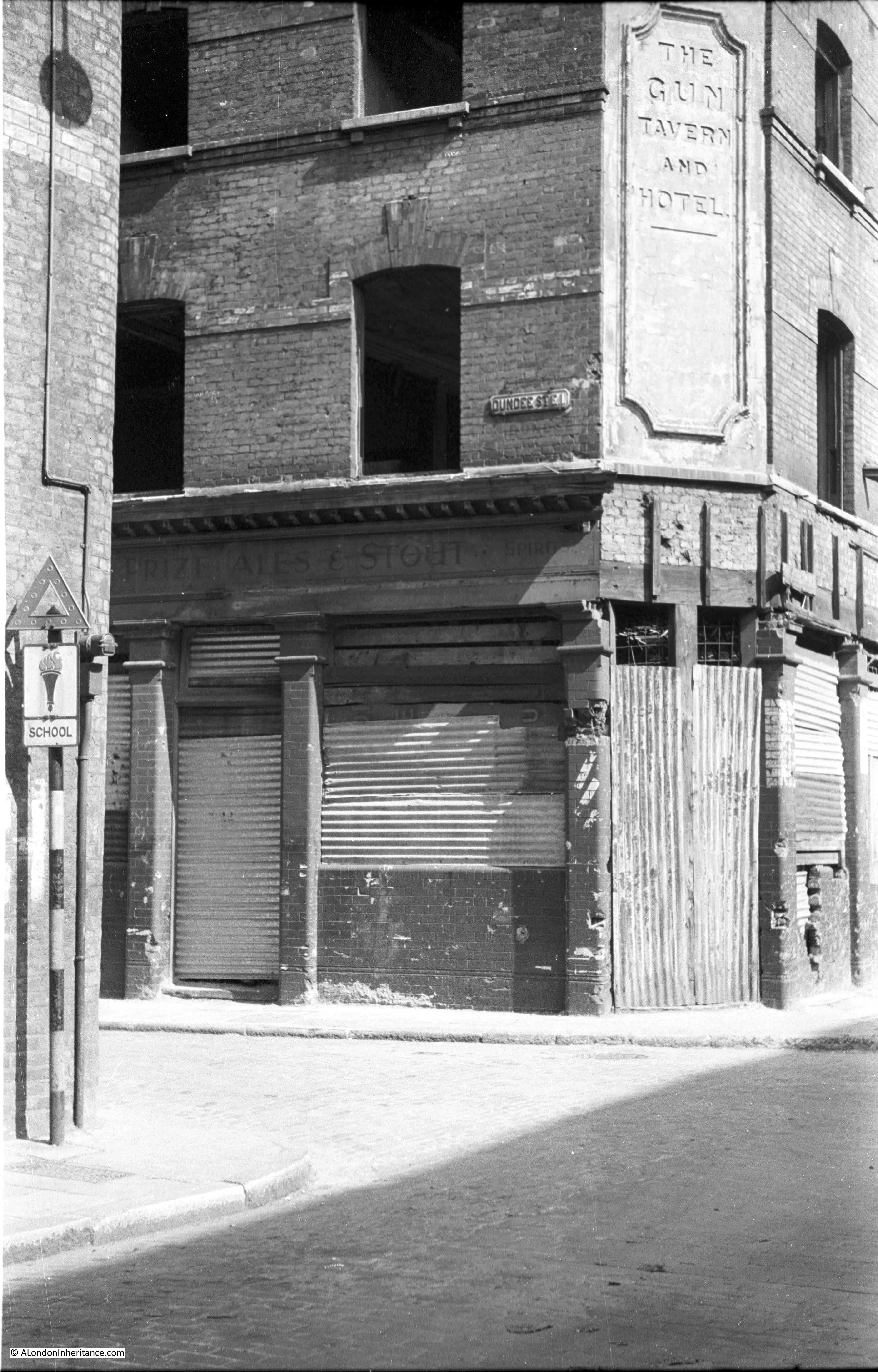
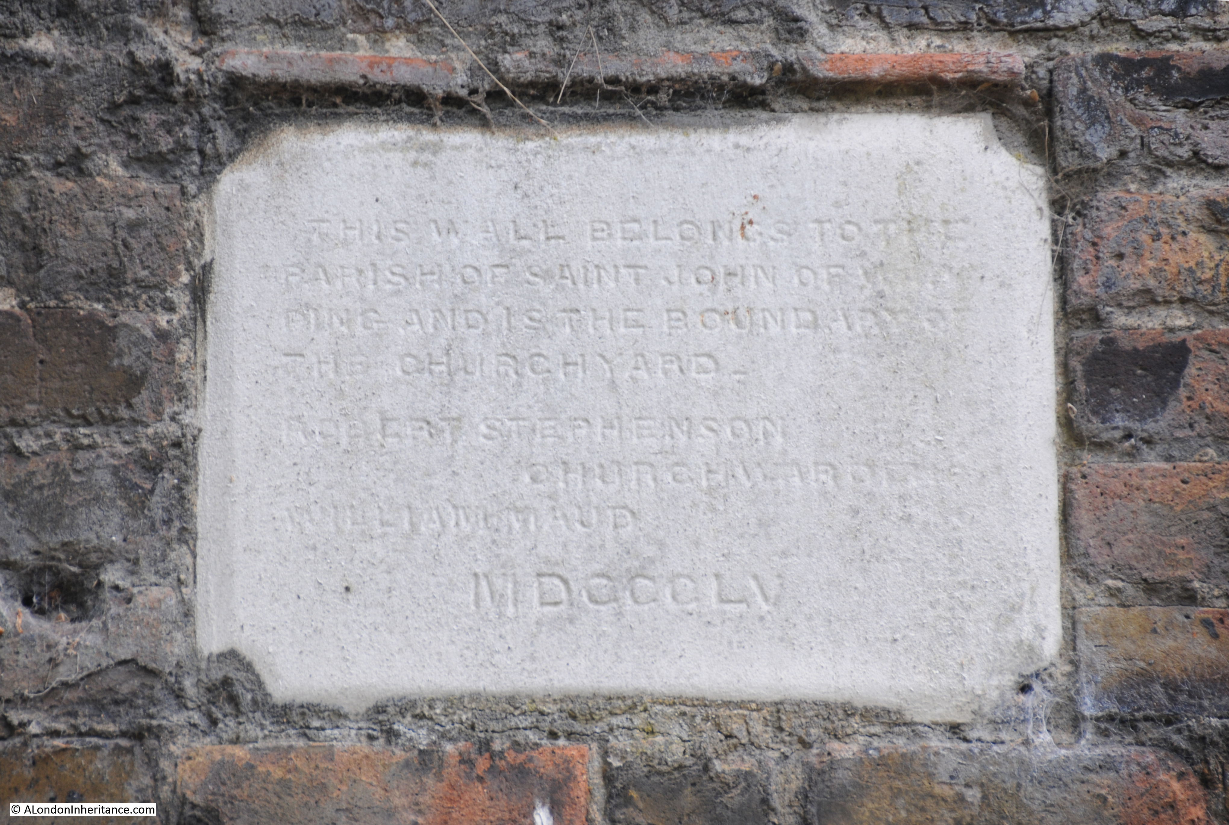
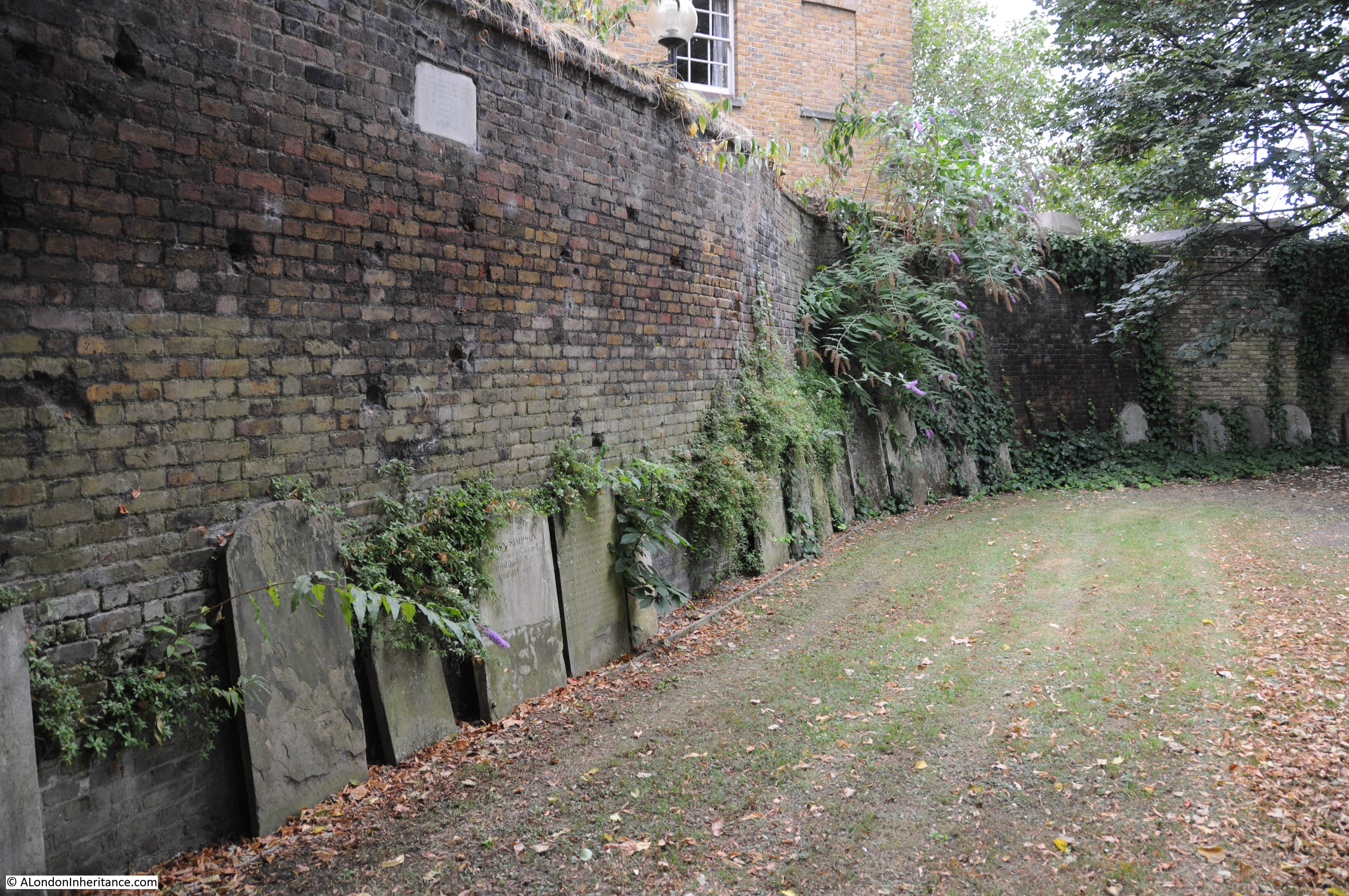
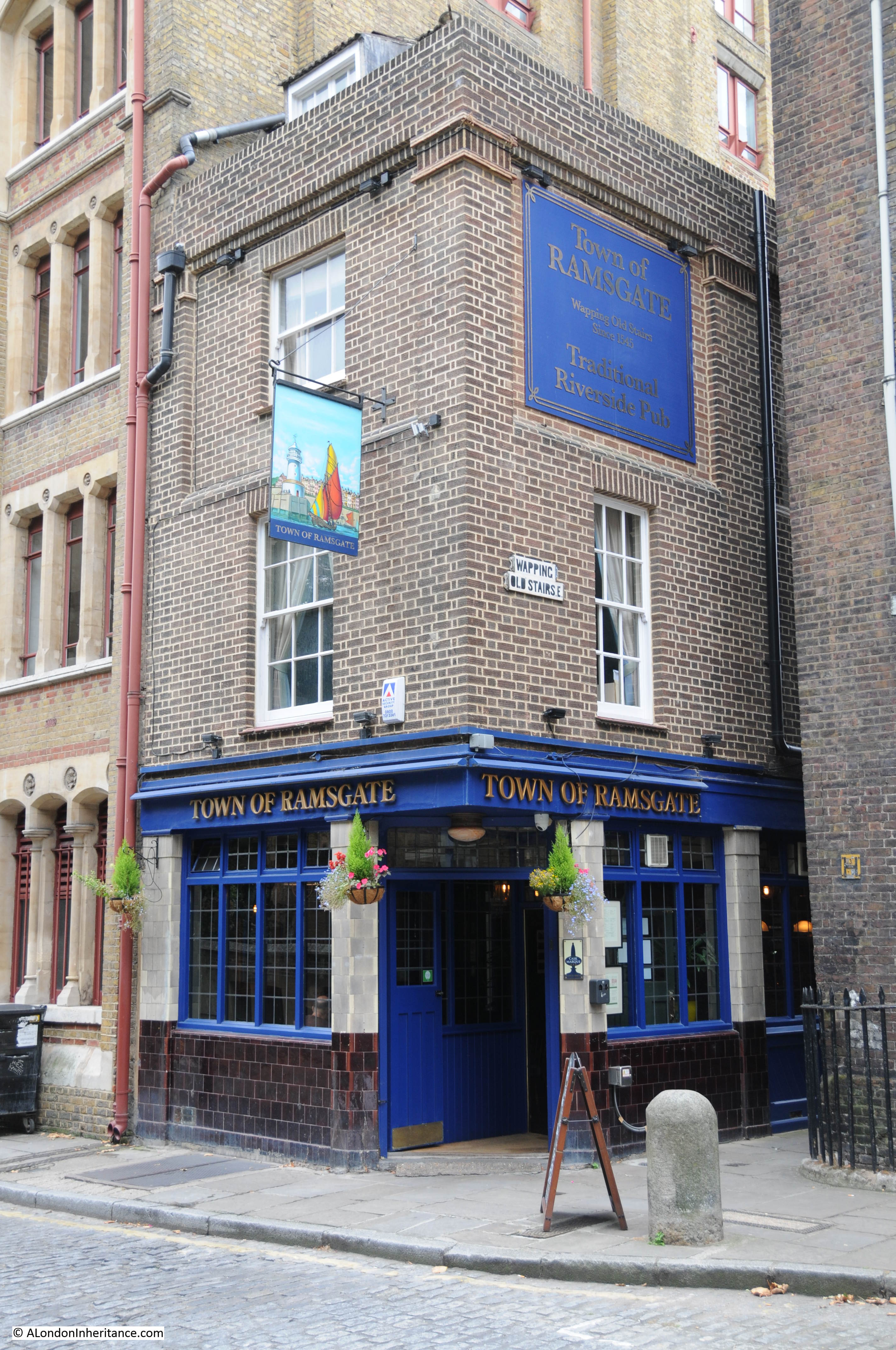
Nearly every set of stairs in Wapping had a pub by the side of the approach to the stairs. Only two can be seen today, the Town of Ramsgate by Wapping Old Stairs, and the Prospect of Whitby by Pelican Stairs.

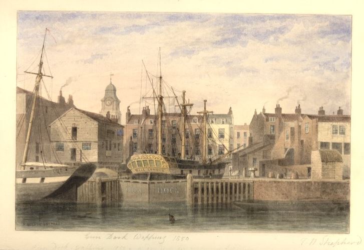
Wapping Dock Stairs also had a pub, the Swan, and we can get a view of the pub from an advert in the Morning Advertiser on the 2nd of December,1806 when the lease came up for sale:

“A lease for 21 years, and immediate possession, of the SWAN PUBLIC HOUSE, situate at the corner of Wapping Dock Stairs, as eligible a spot for business as any along the coast; it contains in the basement, an extensive dry cellar; on the ground floor, a convenient bar, large tap-room, and good parlour, and three stories above, with a space of about 30 feet square on each floor, divided into numerous well-proportioned rooms; here is an abundance of accommodation for lodgers, as well as ample conveniences for an extensive business; common industry and attention would assuredly beget here a very lucrative trade. May be viewed at any time for a week prior to the sale. Particulars to be had of Mr. Harris, No. 12, Gracechurch Street.”

There are many newspaper references to these pubs by stairs, and so often they offer a glimpse into a story which you really want to know more about, for example, from the Morning Advertiser on the 26th of August, 1808:

“If the next of Kin of Hendrick Steerwell, late belonging to the West India Merchant ship Ranger, dec. will apply at the Swan, Wapping Dock Stairs, they will hear of something to their advantage.”

This brief advert leaves so many questions unanswered. Who was Hendrick Steerwell, where and how did he die (presumably whilst serving on the West India Merchant ship Ranger). What did he leave that would be of advantage to his next of kin, did they benefit, and also what happened if there were several next of kin.

A whole story could be written based on that single advert from 1808.

The advert also highlights that the stairs were a key part of the pub’s location. Rather than giving an address on Wapping High Street, the pub is specifically mentioned as being at the stairs.

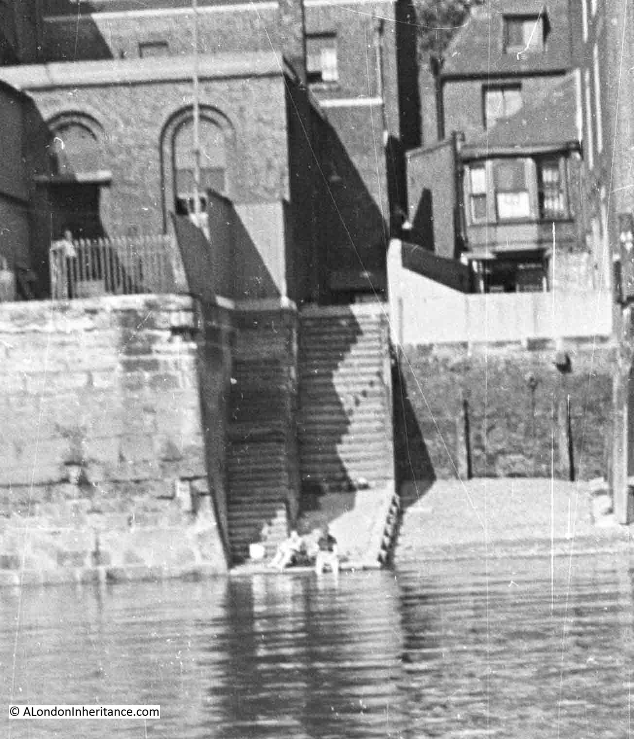
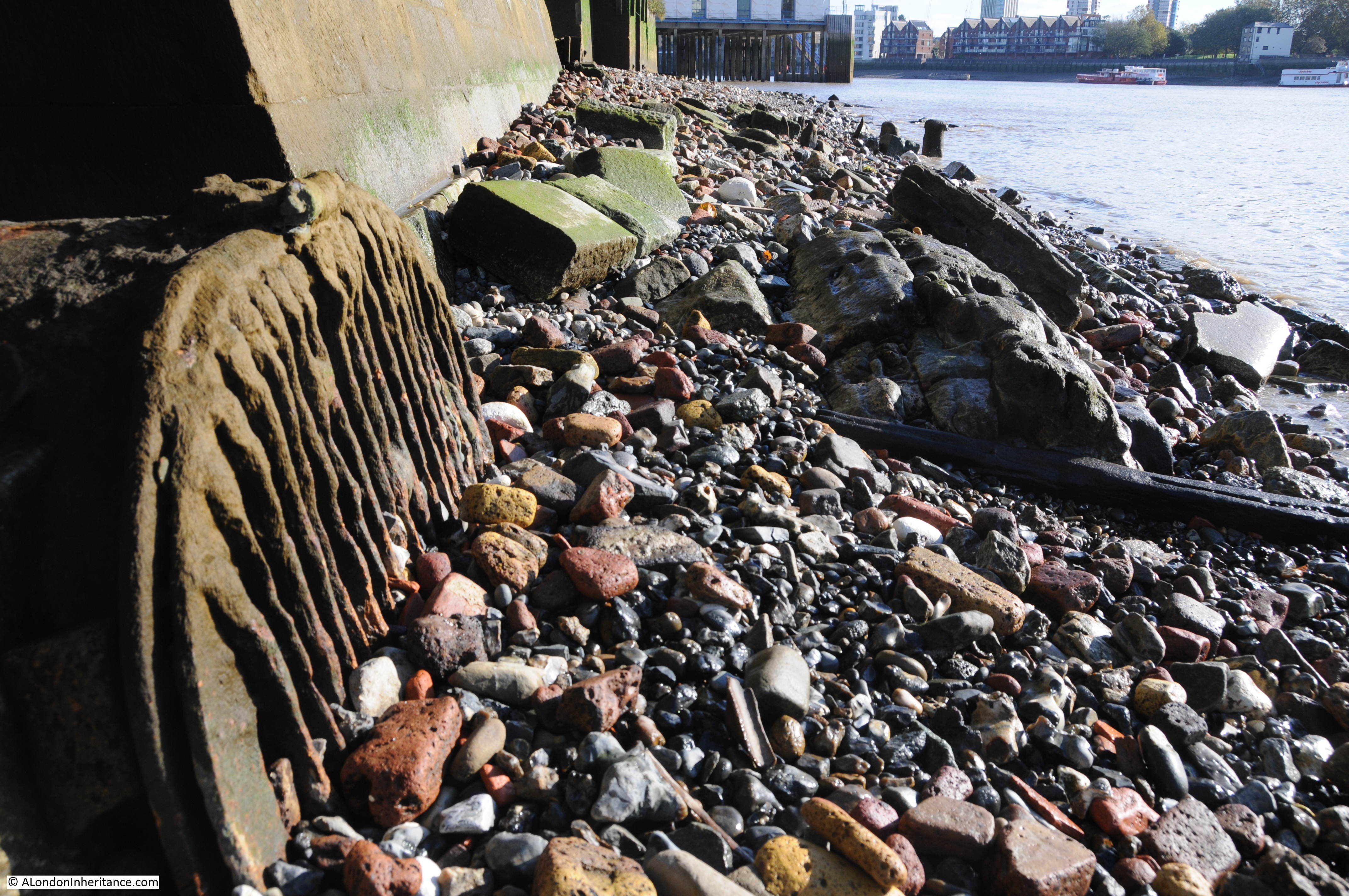
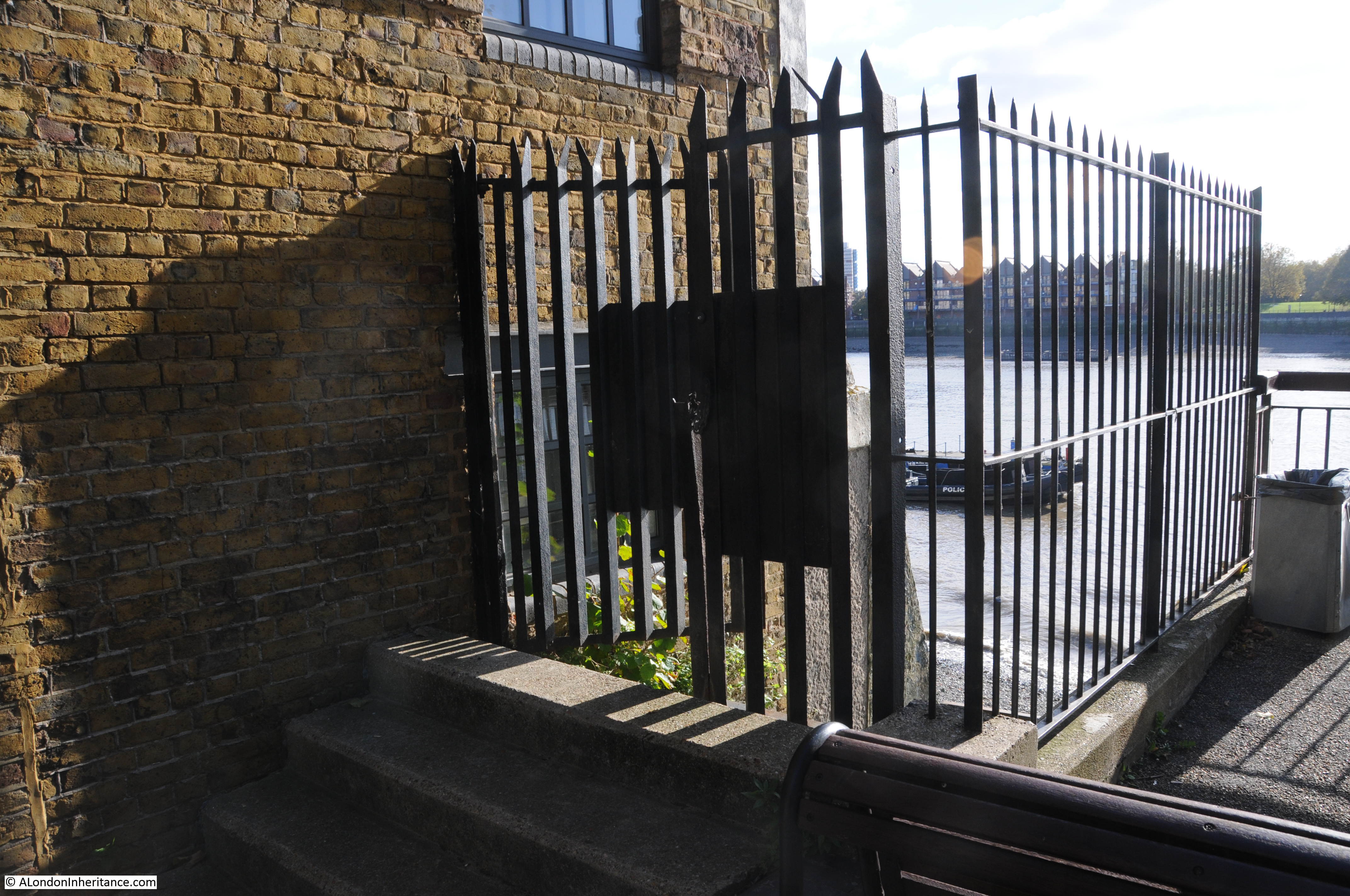
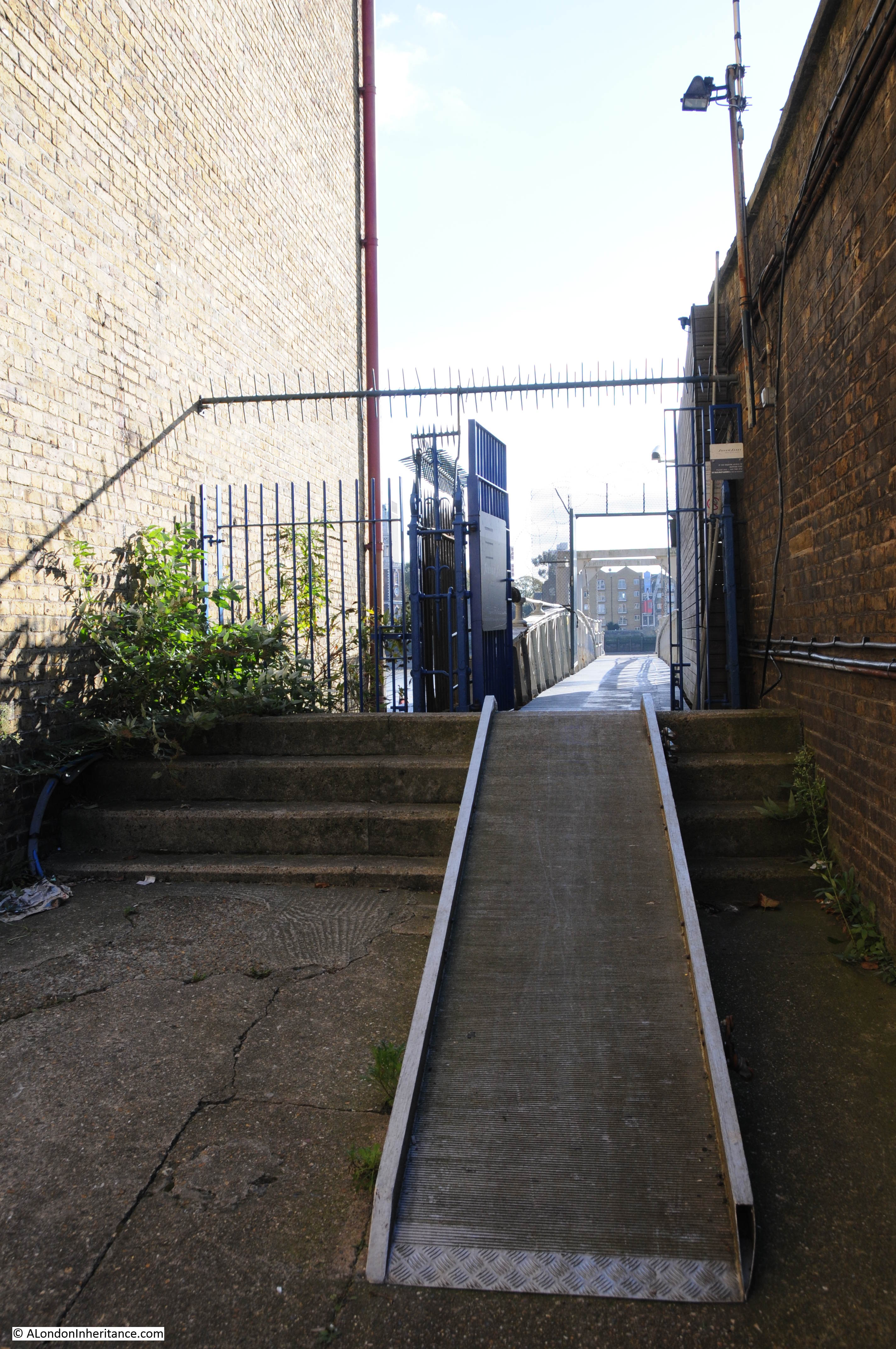
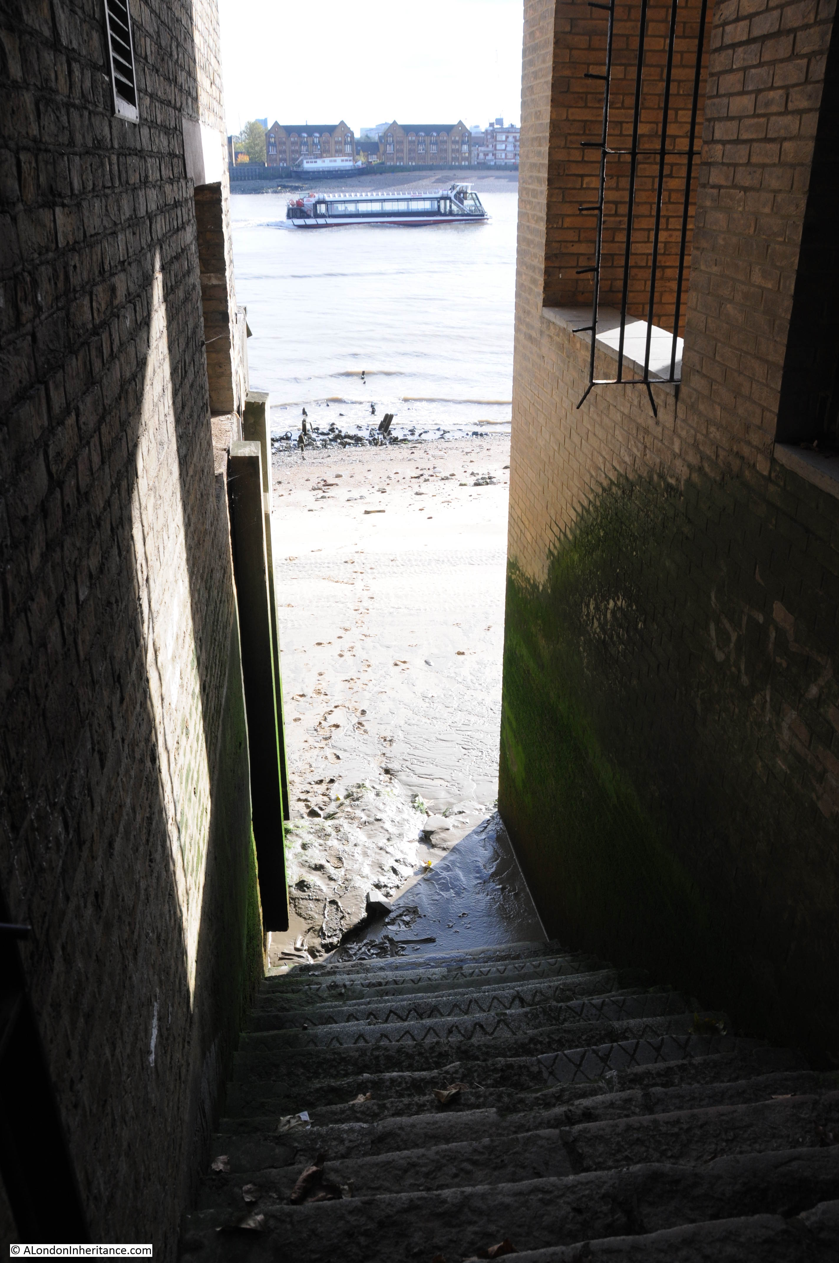
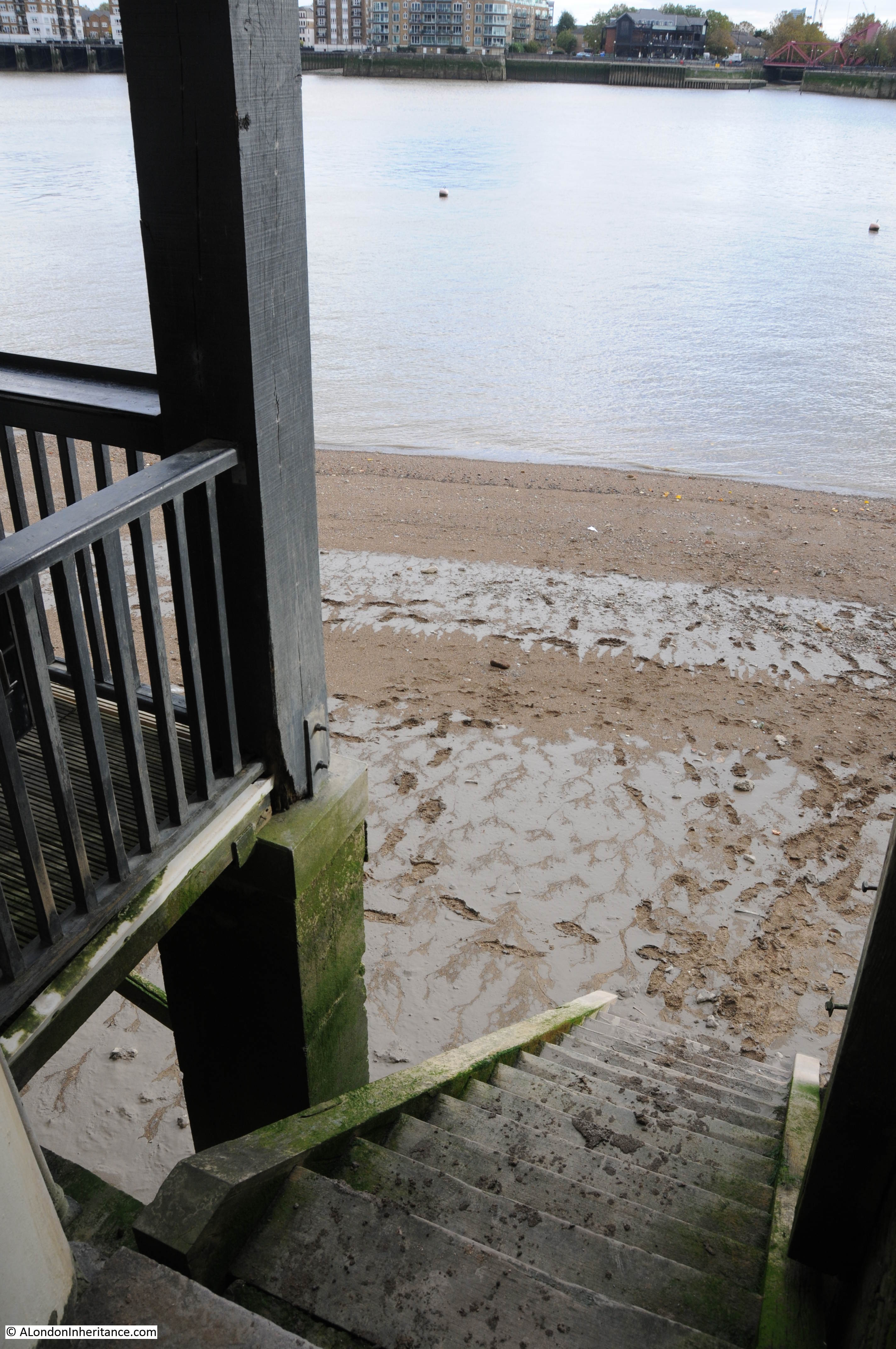
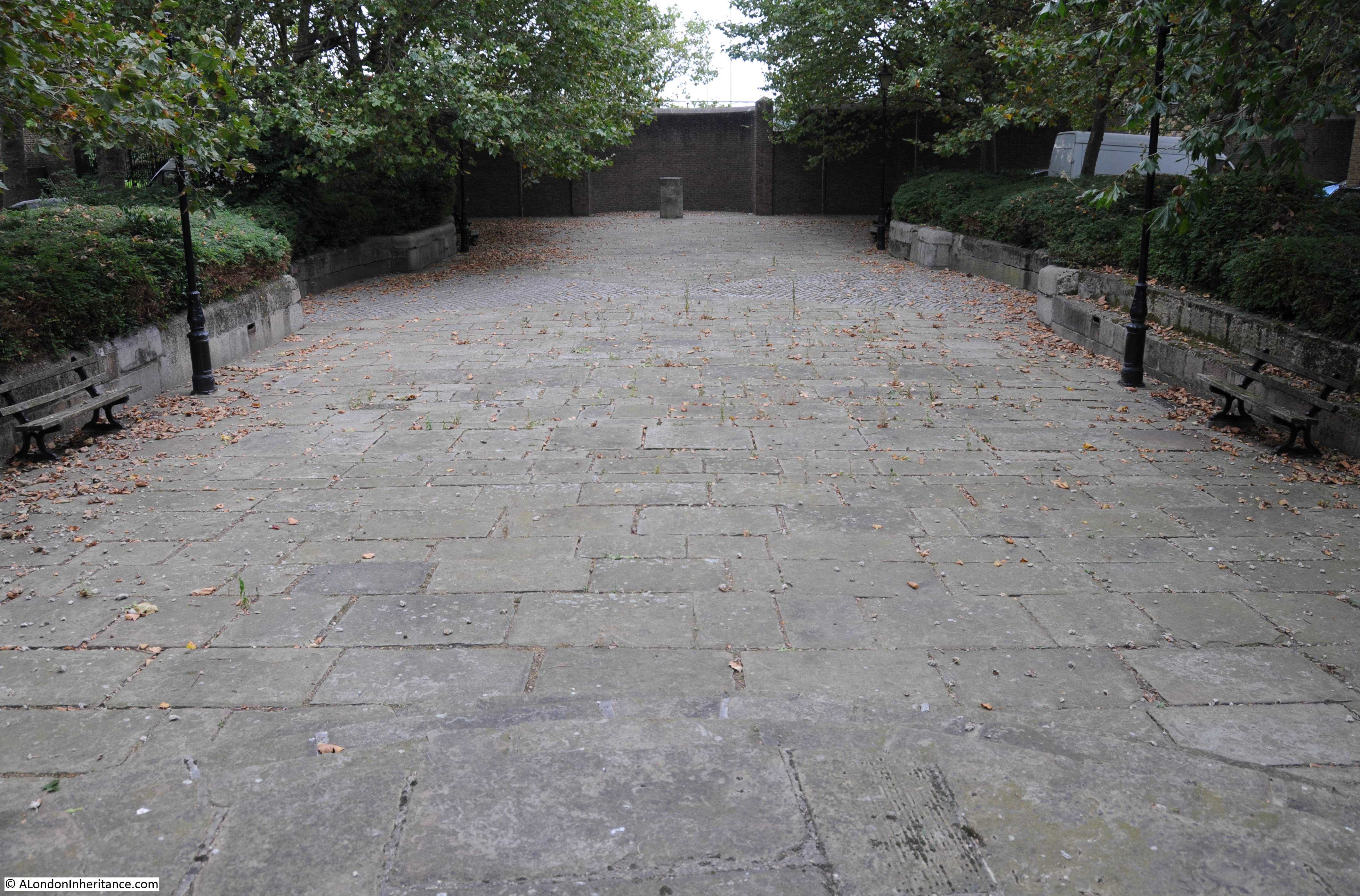
Back to Wapping Dock Stairs, and approaching the stairs there is a strong metal gate preventing any access to the stairs. Behind the gate are the stone steps often found at these stairs which added a bit height and therefore flood prevention from high tides:

Wapping Dock Stairs

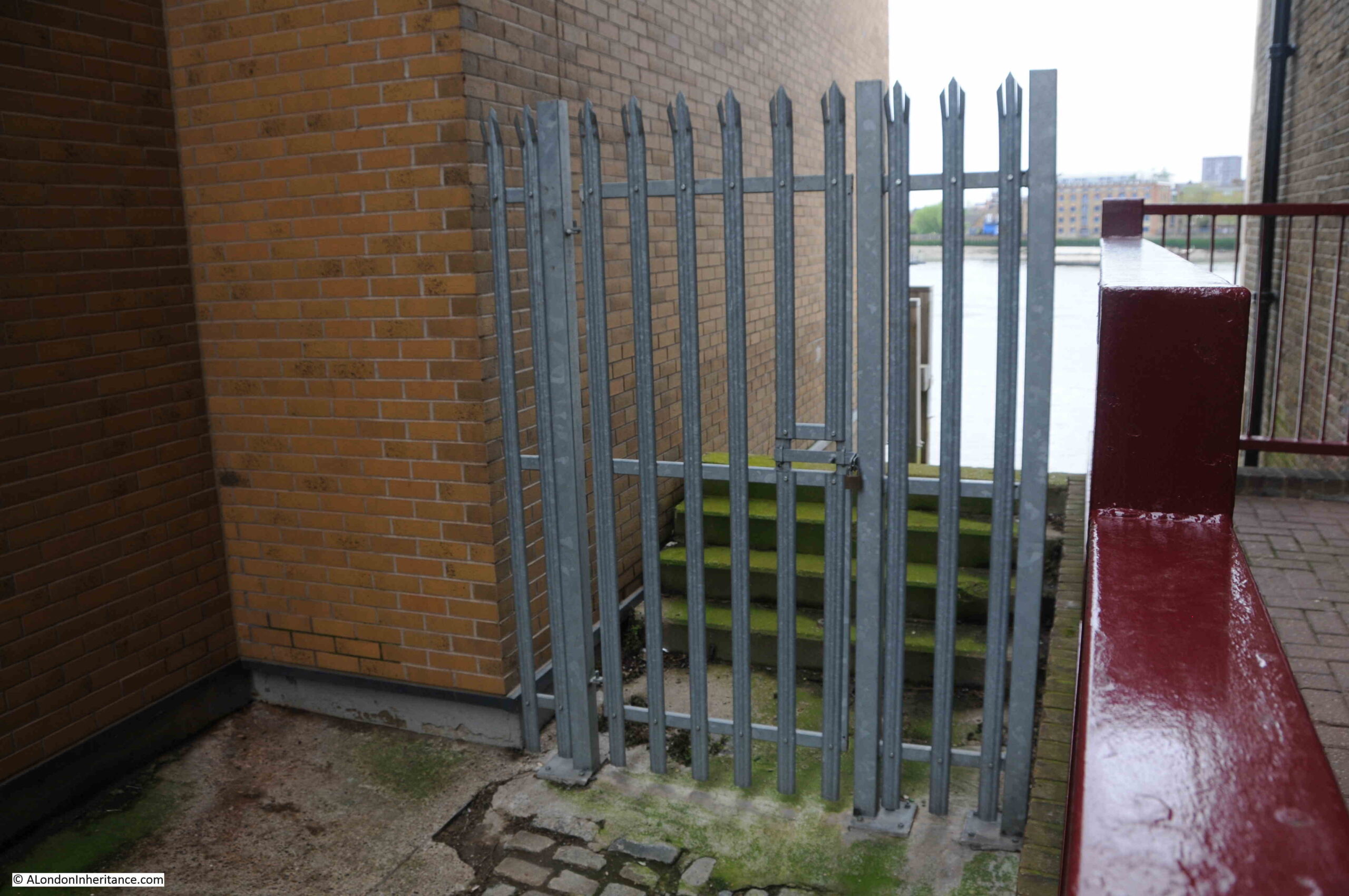
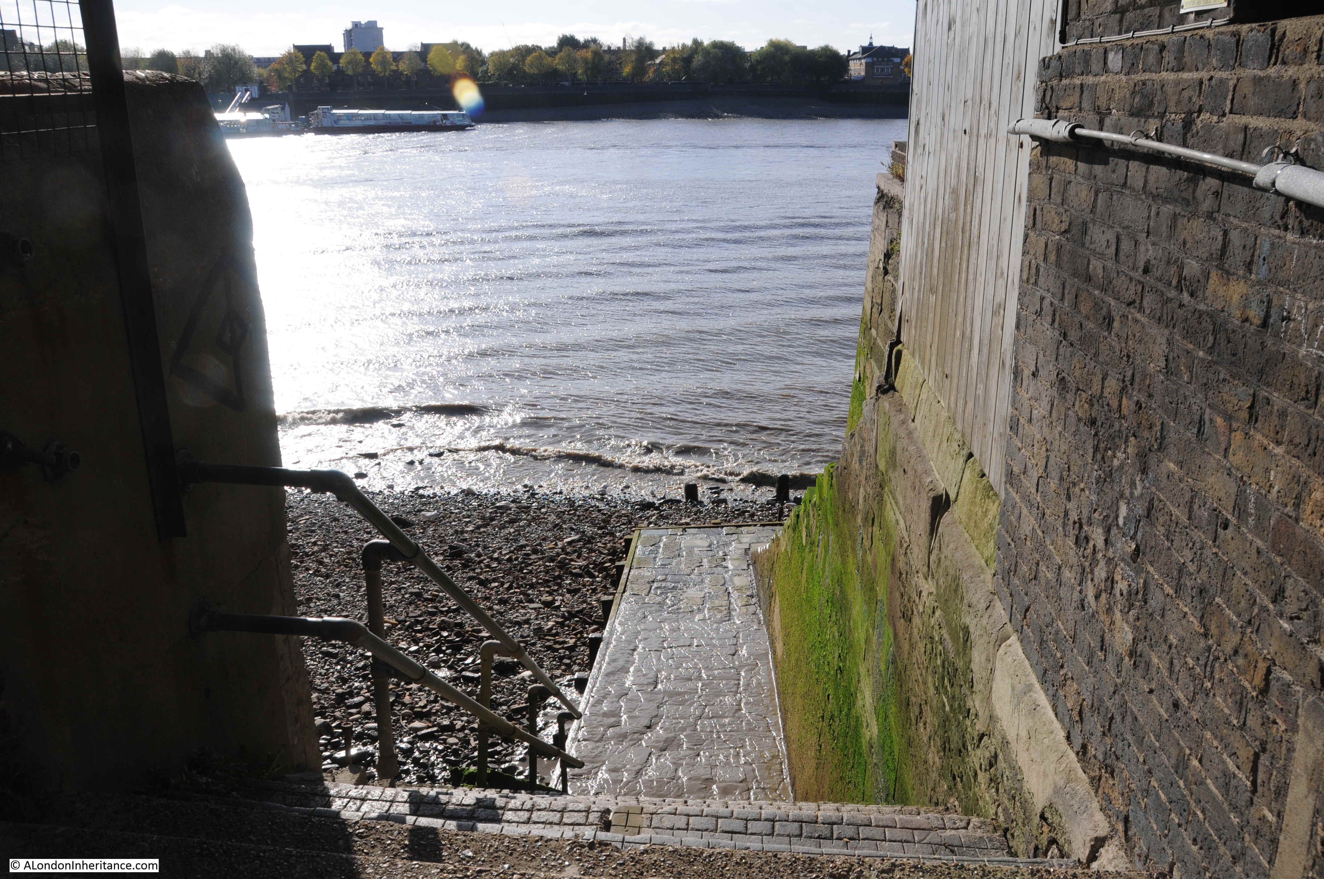
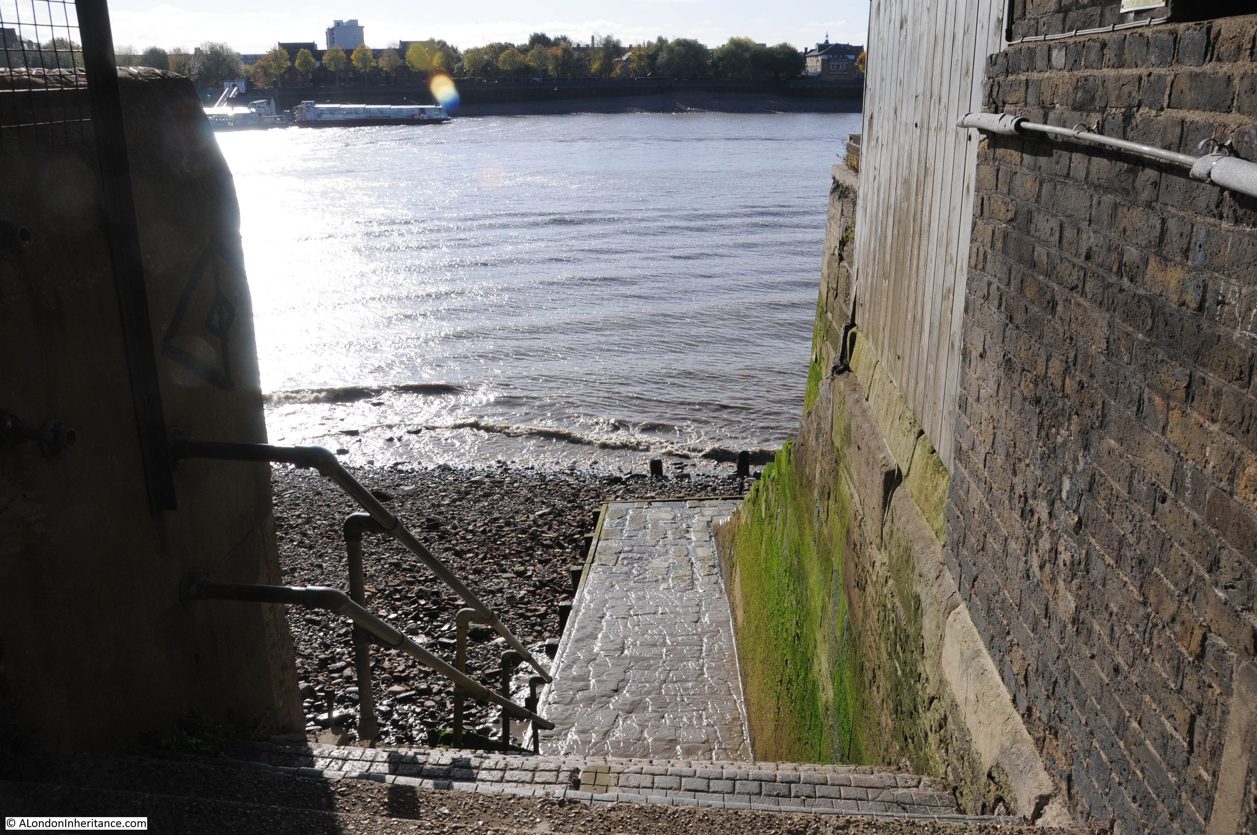
Looking over the gate, and we can see why they were fenced off so securely:

Wapping Dock Stairs

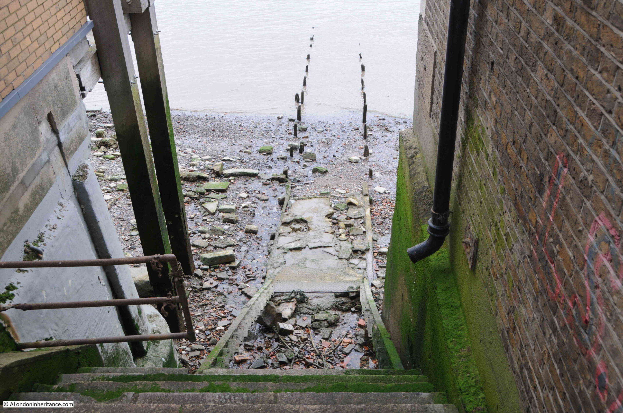
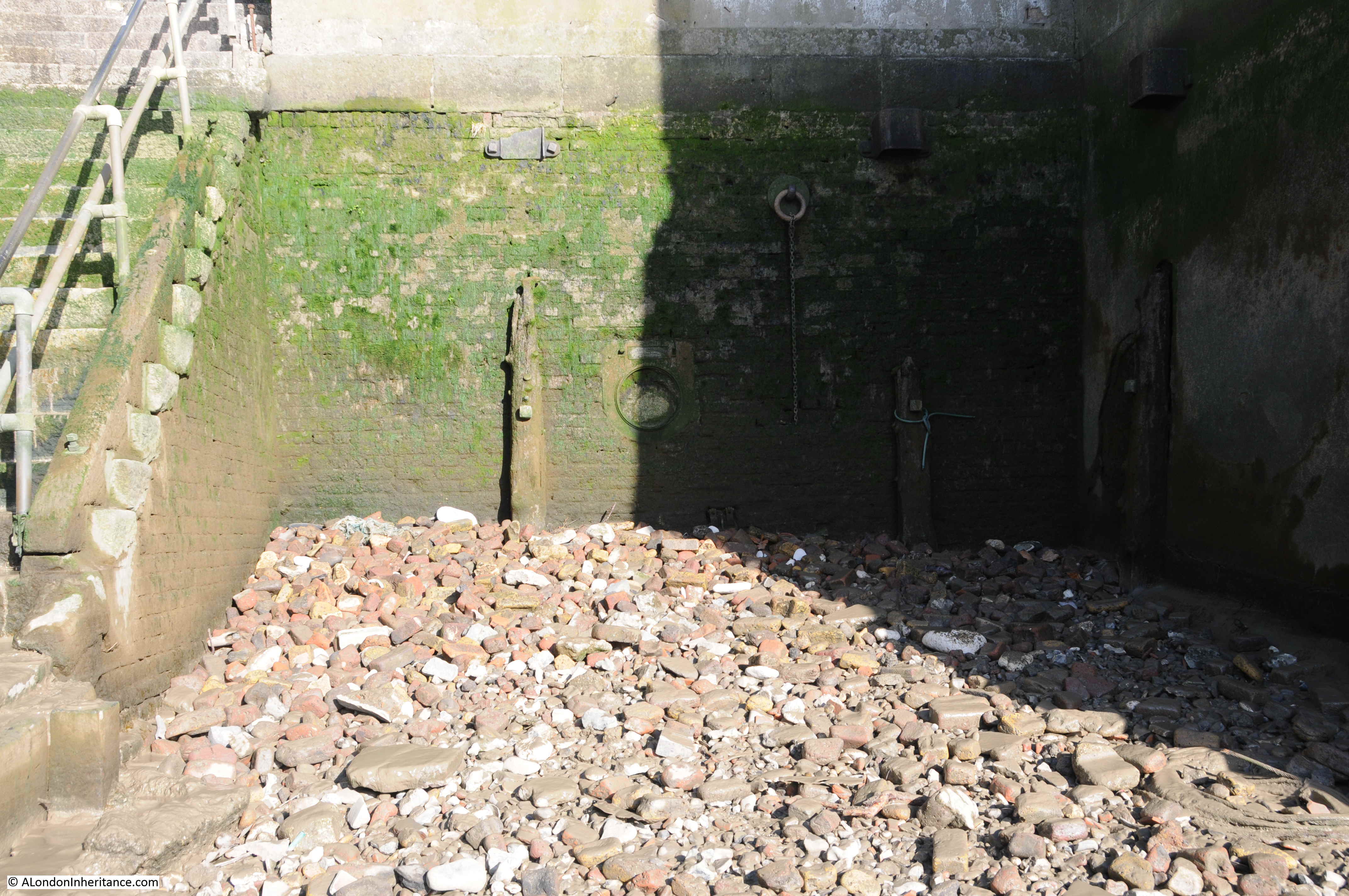
There are stone steps that run down to where a series of wooden steps once led down to the foreshore. These wooden steps have completely eroded away.

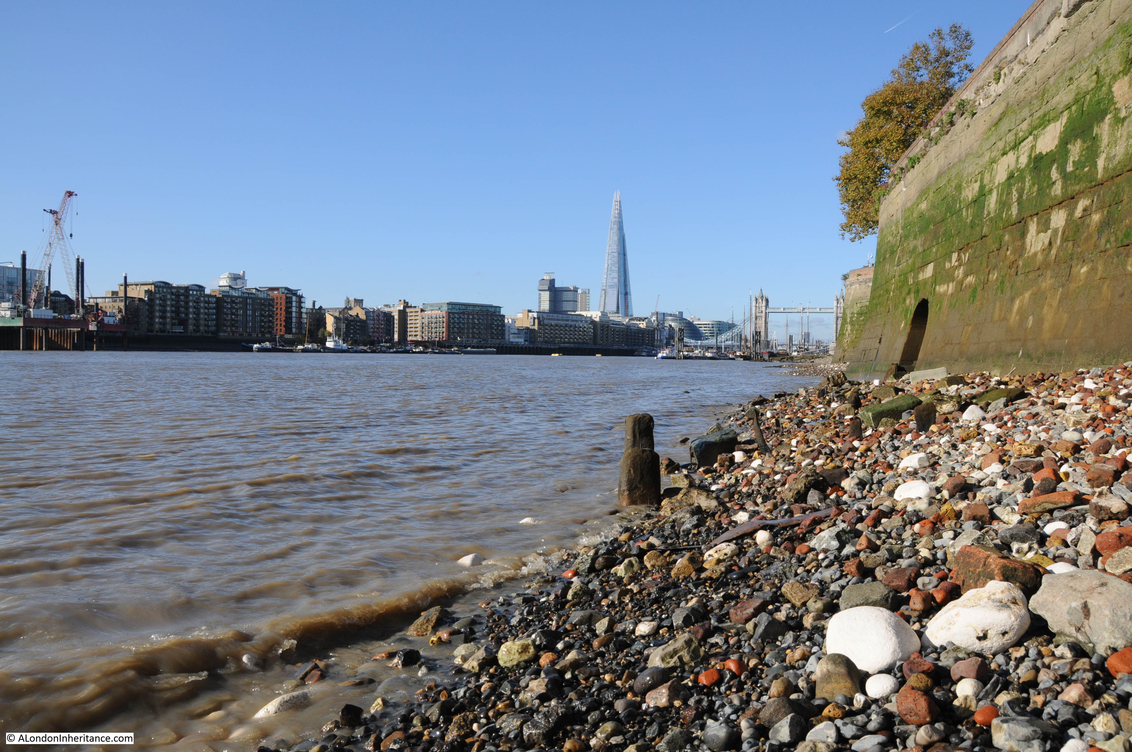
From the bottom of where the wooden steps should have been, the remains of a causeway leads out across the foreshore, into the river.

Much of the causeway has also eroded, leaving only the wooden stakes on either side that would have held the causeway in position.

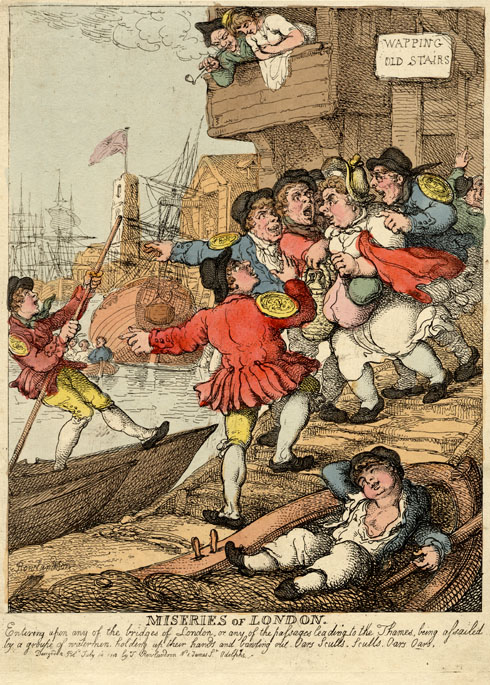
From the top of Wapping Dock Stairs, we can look across the river to Rotherhithe. This view would once have been full of ships, with ships being moored around the stairs, some of which were often for sale, such as on the 20th of November, 1805 when the following auction was advertised:

“This day, the 20th Instant, at Three precisely, The good Smack Ocean, built at Burnham in Essex, in 1798, is a strong, clinch-built vessel, and is well adapted for the Oyster Trade, a Pilot Boat, &c, well founded in stores. Lying at Wapping Dock Stairs.”

Wapping Dock Stairs

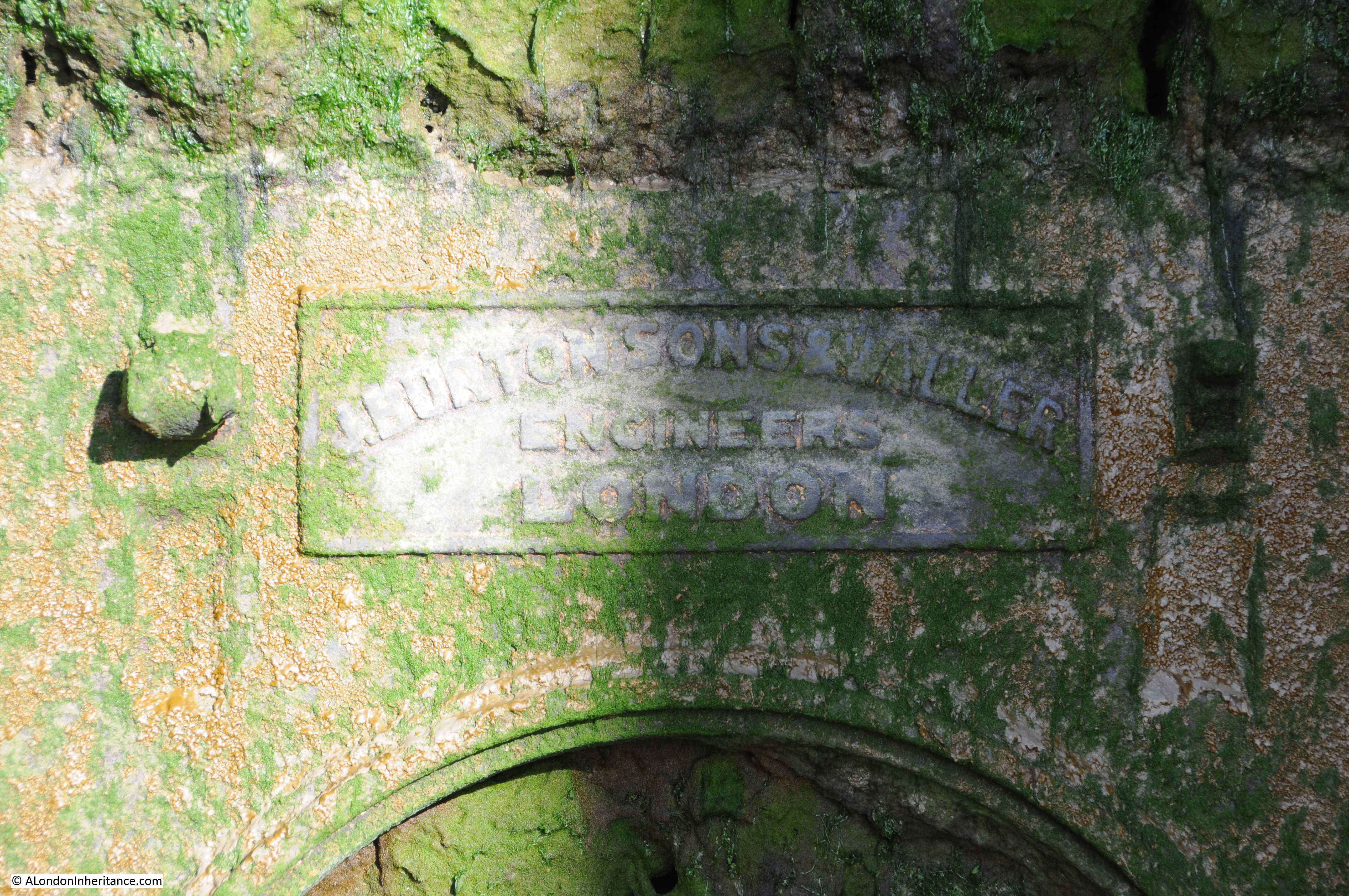
To pursue my rather nerdy interest in Thames Stairs, I have finally got hold of a copy of a book published by the Port of London Authority, titled “Access to the River Thames. A Port of London Authority Guide”, with the sub-title of “Steps, Stairs and Landing Places on the Tidal Thames”:

Port of London Authority

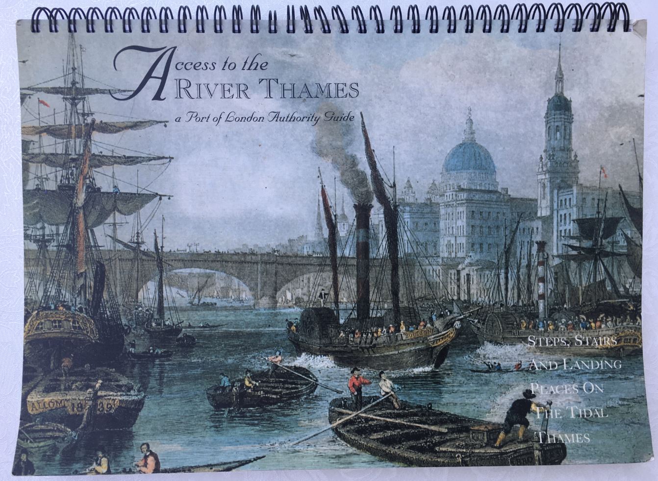
Although the book is not dated, I believe it was published around 1995.

It covers all the steps, stairs and landing places on the part of the Thames managed by the PLA, the tidal Thames, and covers from Richmond down to Southend.

There is an outline map, based on the area covered by a PLA chart for sections of the river, with the stairs along that stretch of the river marked and named.

There is a table for each set of steps, stairs and landing places describing key features of each. I copied the details for Wapping Dock Stairs into the following table:

Wapping Dock Stairs

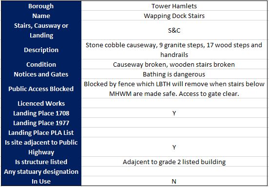
The categories for each set of stairs, landing places etc. in the book are the same, allowing them to be compared.

For Wapping Dock Stairs the stairs are described as having a broken causeway and wooden stairs. This probably means that the wooden stairs were part there, but in the following 30 years they have disappeared completely.

Bathing is dangerous, and public access to the stairs is blocked by a fence which the London Borough of Tower Hamlets will remove when the stairs below Mean High Water Mark are made safe.

I have always wondered about responsibility for these stairs. The London Borough of Tower Hamlets were responsible for putting in the metal gate, but are they responsible for the stairs down to the foreshore, or is it the Port of London Authority who, along with the Crown Estate are the primary owners of the foreshore.

I have emailed the PLA asking who is responsible for the stairs, it will be interesting to see the reply.

The tables for all stairs, from Richmond to Southend list whether the stairs were a landing place in 1708 and 1977. Wapping Dock Stairs is listed as a landing place in 1708, which sets a minimum age for the stairs as over 300 years.

I do not know why 1708 has been used for all stairs, steps and landing places along the tidal Thames. A few quick searches have not revealed any surveys or maps that were made of the whole tidal river in 1708 – probably another question for the PLA.

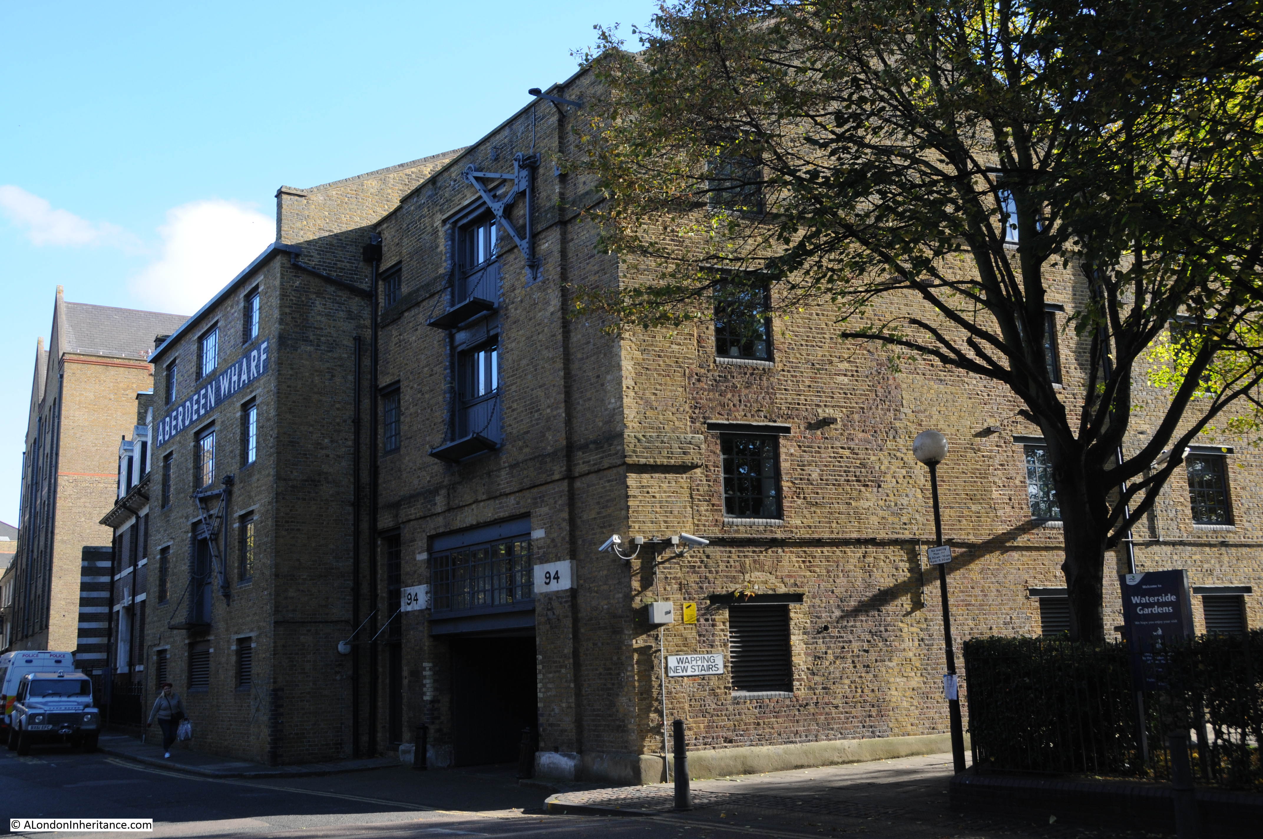
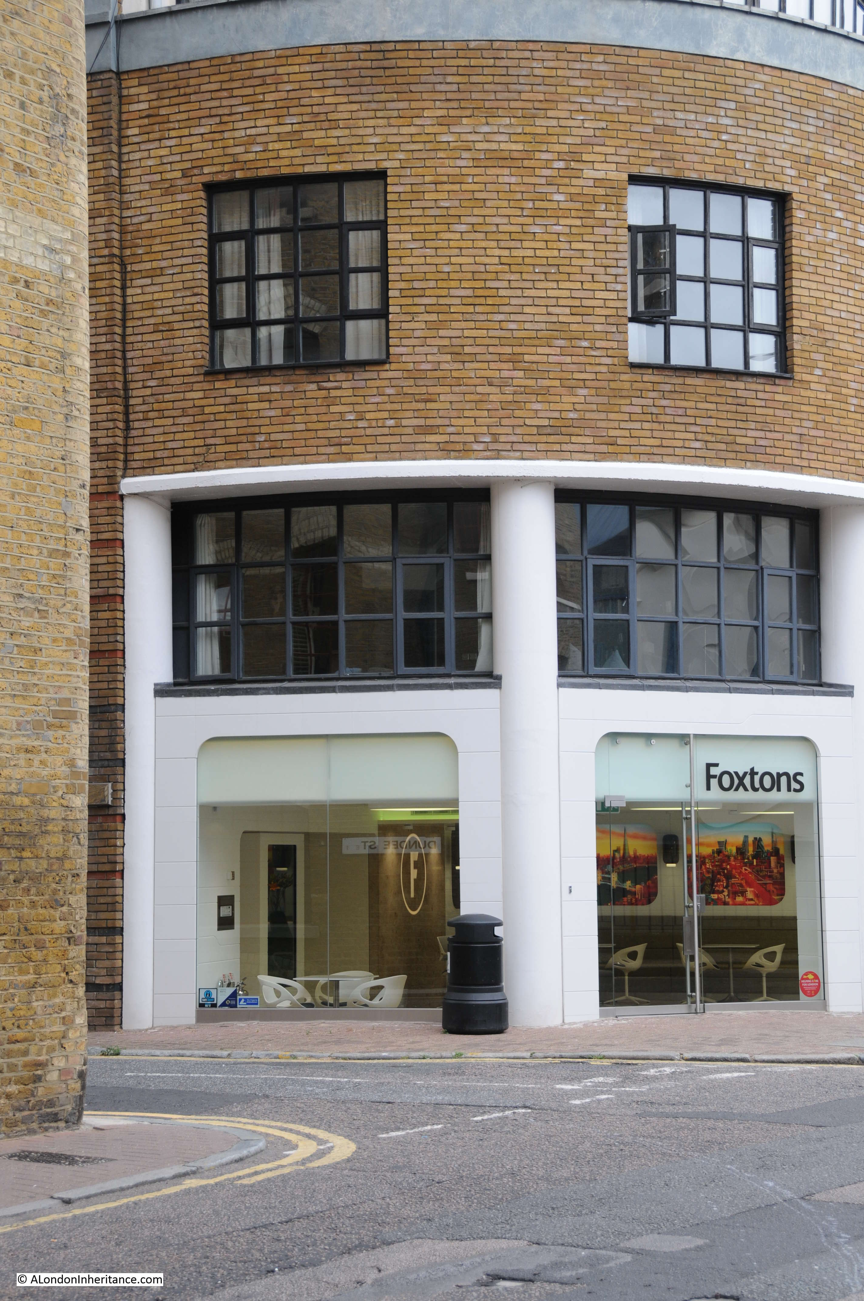
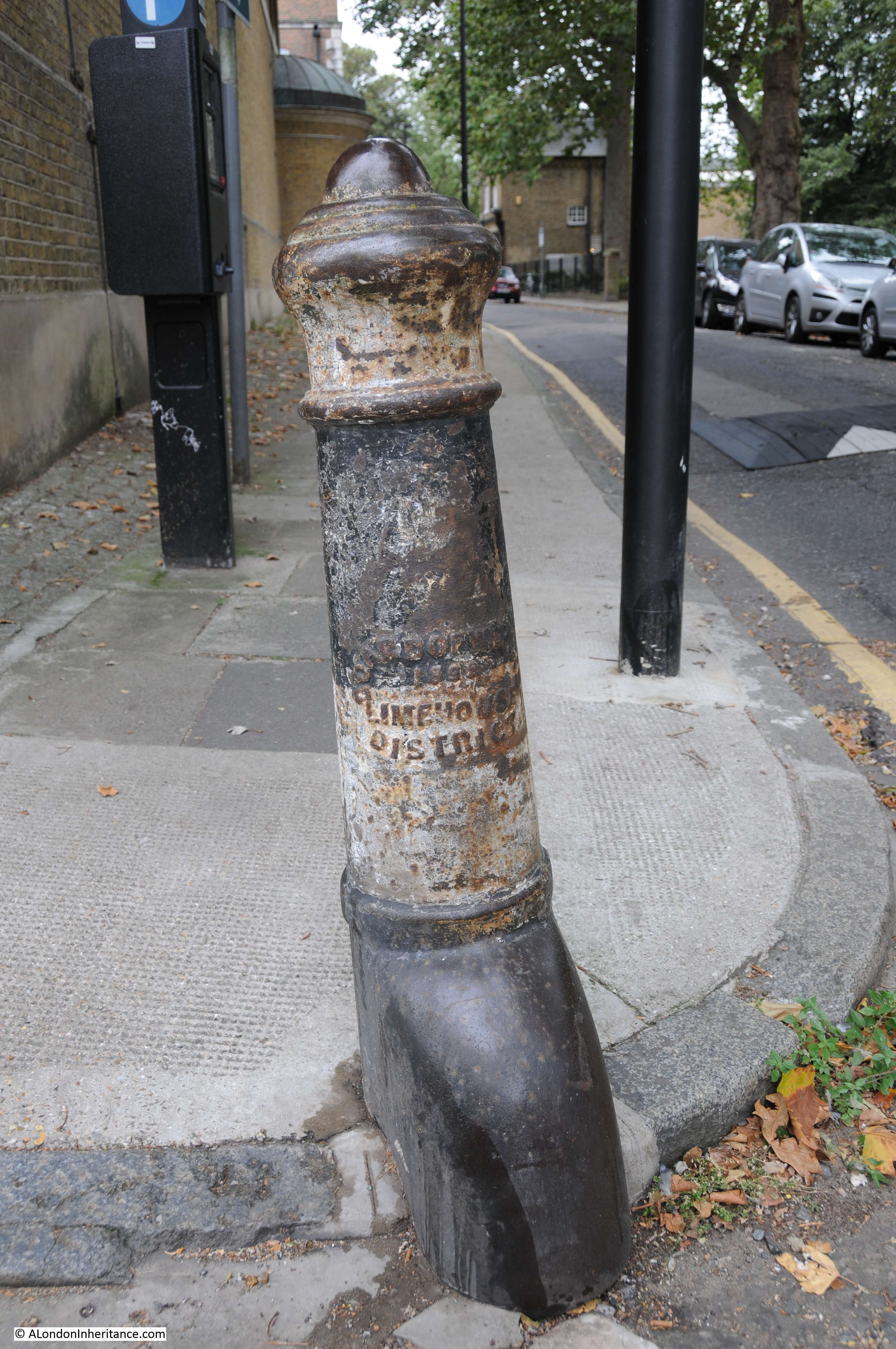
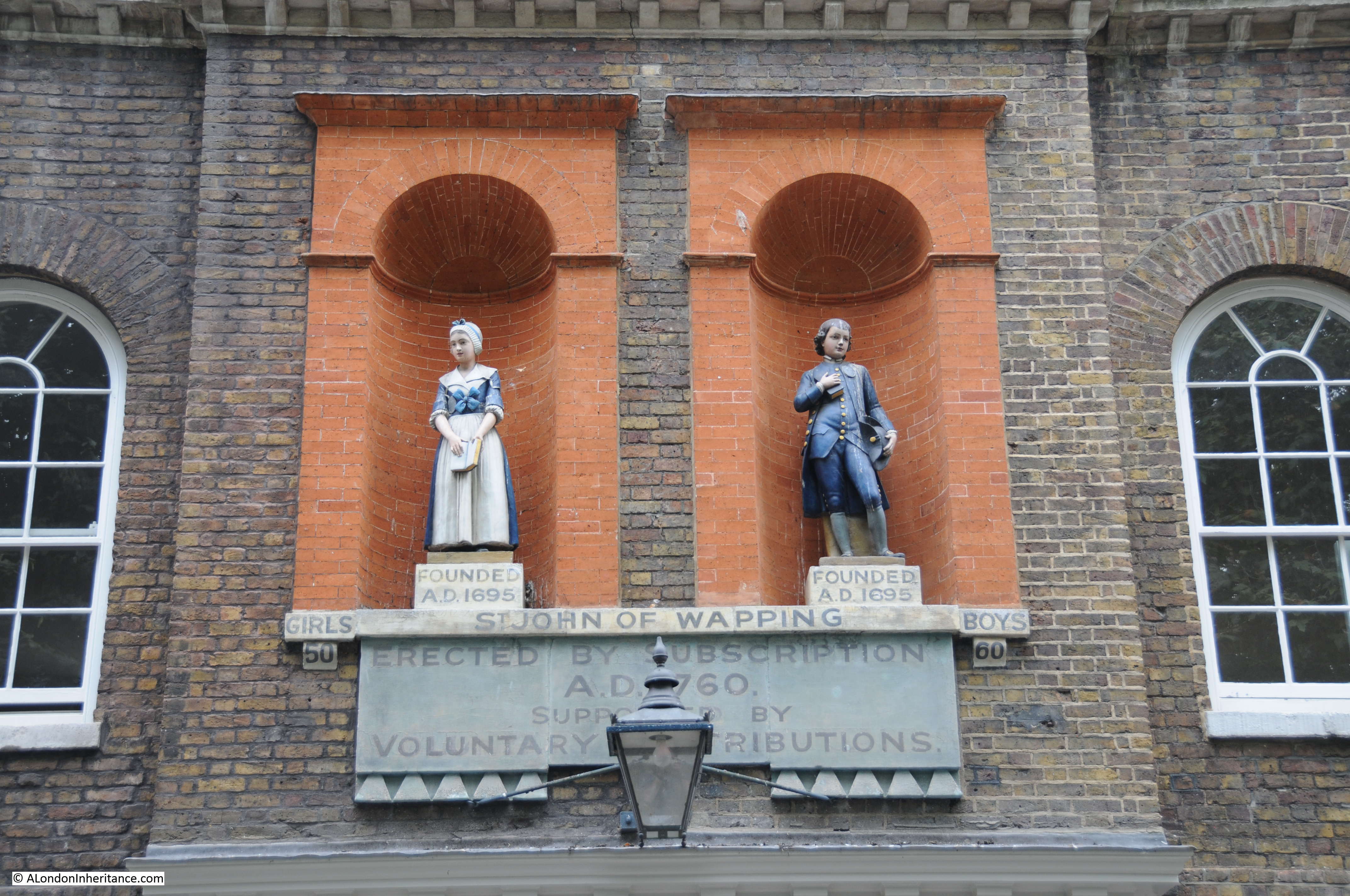
The Grade 2 listed building that the table states that the stairs are adjacent to is the 1920s Gun Wharves that runs along 124 to 130 Wapping High Street.

I wrote at the start of the post that the photo of Wapping Station and Wapping Dock Stairs show the methods of crossing the river that have been in use for hundreds of years.

In the early 19th century, the increase in the numbers of people crossing the river by boat resulted in a proposal for a foot tunnel under the river.

The result was a foot tunnel where the rail route under the river is today. I walked through the tunnel in 2014, and the following is a brief extract from my post on the tunnel, which you can find here.

A Thames Tunnel was badly needed. It was a four mile circuit between Rotherhithe and Wapping via London Bridge and ferries carried 4,000 people across the Thames every day at Rotherhithe.

Marc Brunel was convinced that a tunnel could be built and had the concept of a shield to protect workers at the face of the tunneling work. A meeting with investors was held on the 18th February 1824 and a company formed with Brunel appointed as engineer.

The shaft was started in March 1825 and all appeared to be going well, however in January 1826 the river burst through, but work pressed on and by the beginning of 1827 the tunnel had reached 300 feet.

As work progressed, in addition to the risk of the river breaking through, there were all manner of problems including strikes, mysterious diseases (the River Thames was London’s main drain, polluted with a considerable amount of sewage) and explosions from “fire-damp”.

The river continued to burst through. On Saturday 12th January 1828 six workman were trapped and drowned and despite the hole being filled with 4,000 bags of clay the project was temporarily abandoned due to lack of funds. The tunnel was bricked up and no further work carried out for seven years.

Work started again on the 27th March 1835 and carried on for a further eight more years.

In March 1843 staircases were built around the shafts and Marc Brunel  led a triumphant procession through the tunnel. Marc Brunel’s son Isambard worked with his father during the construction of the tunnel and was appointed chief engineer in 1827, however his work with the Great Western railway took him away from the tunnel during the later years of construction. Marc Brunel worked on the tunnel from start to finish.

As one of the sights of London, the Thames Tunnel was a huge success. Within 24 hours of the tunnel’s opening fifty thousand people had passed through and one million within the first fifteen weeks.

It did not remain a foot tunnel for long. The Thames Tunnel was purchased by the East London railway in 1866 and three years later was part of London’s underground railway system.

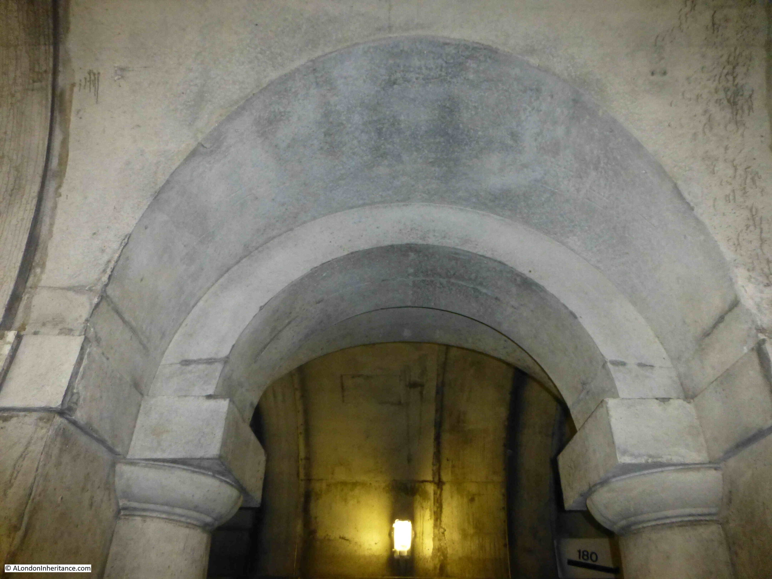
View along one of the tracks in the tunnel:

Wapping tunnel

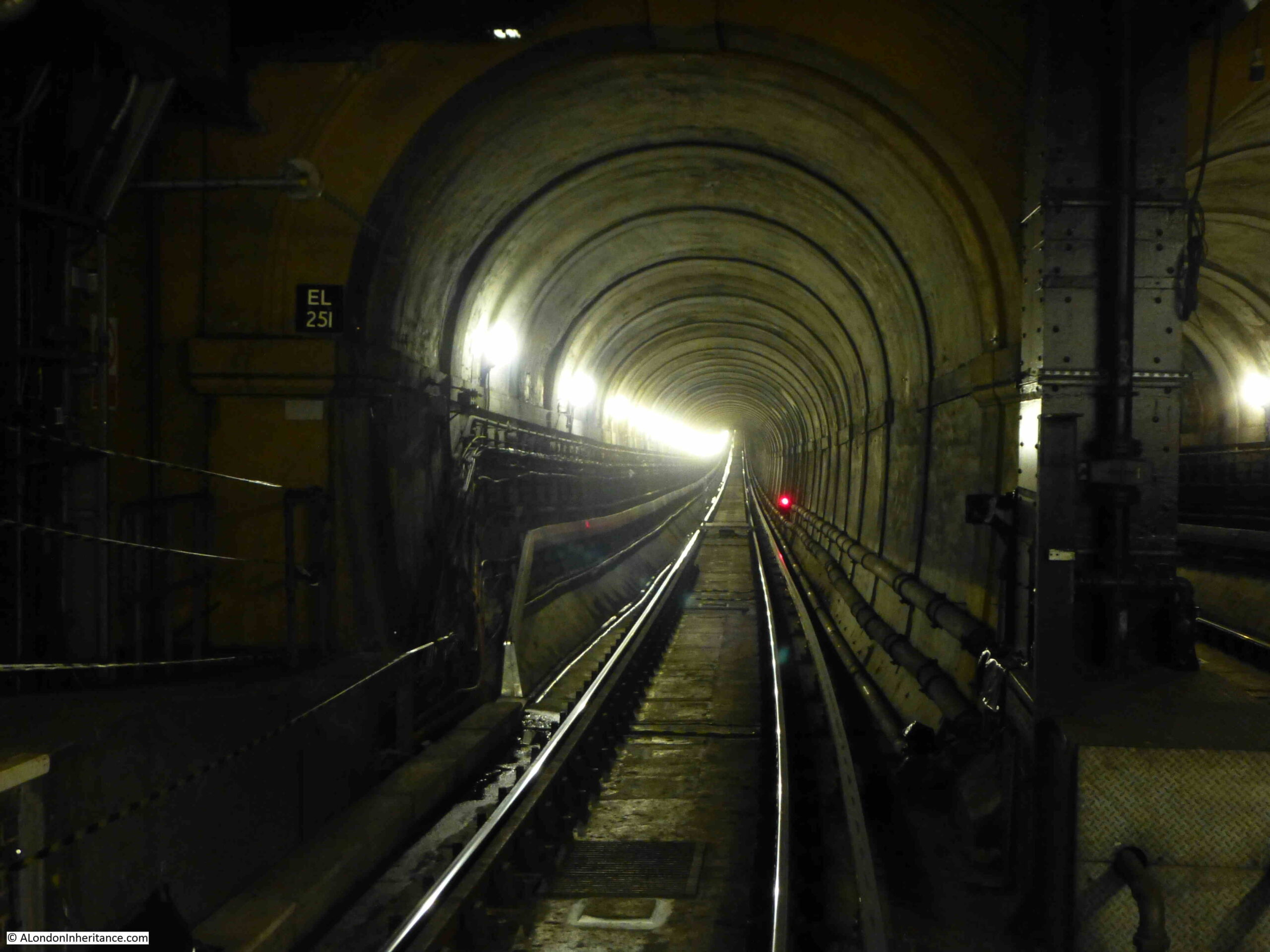
The wall between the two tracks in the tunnel had arches spaced at roughly regular intervals along the length of the tunnel.

When the tunnel first opened for foot passengers, a number of enterprising Londoners set out stalls in these arches selling to those who had come to walk through the tunnel. There were reports at the time of how all these stalls selling food, souvenirs etc. degraded the walk through the tunnel. Low level crime was also attracted to the tunnel.

Looking at the arches in what is now a railway tunnel shows a quality of design and finish that was meant to be seen by people walking through, rather than speeding past in a train.

Wapping tunnel

So in summary, the view across to Wapping Station and the adjacent Wapping Dock Stairs shows:

  • The means of crossing the river between Wapping and Rotherhithe for hundreds of years by taking a boat from a Thames Stair
  • The introduction in 1843 of a foot tunnel which offered a new and unique way of crossing the river, and;
  • The purchase of the tunnel by the East London railway in 1866 and integration into London’s rail network, part of which it has remained to this day

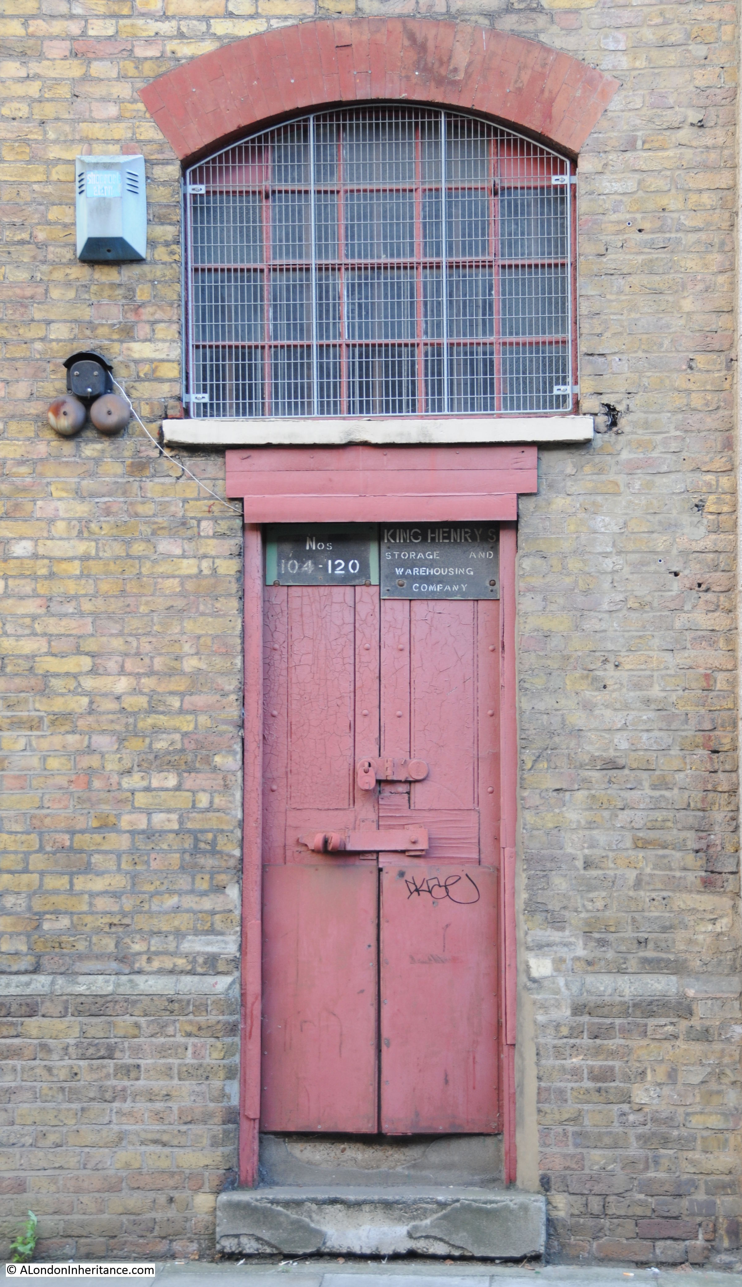
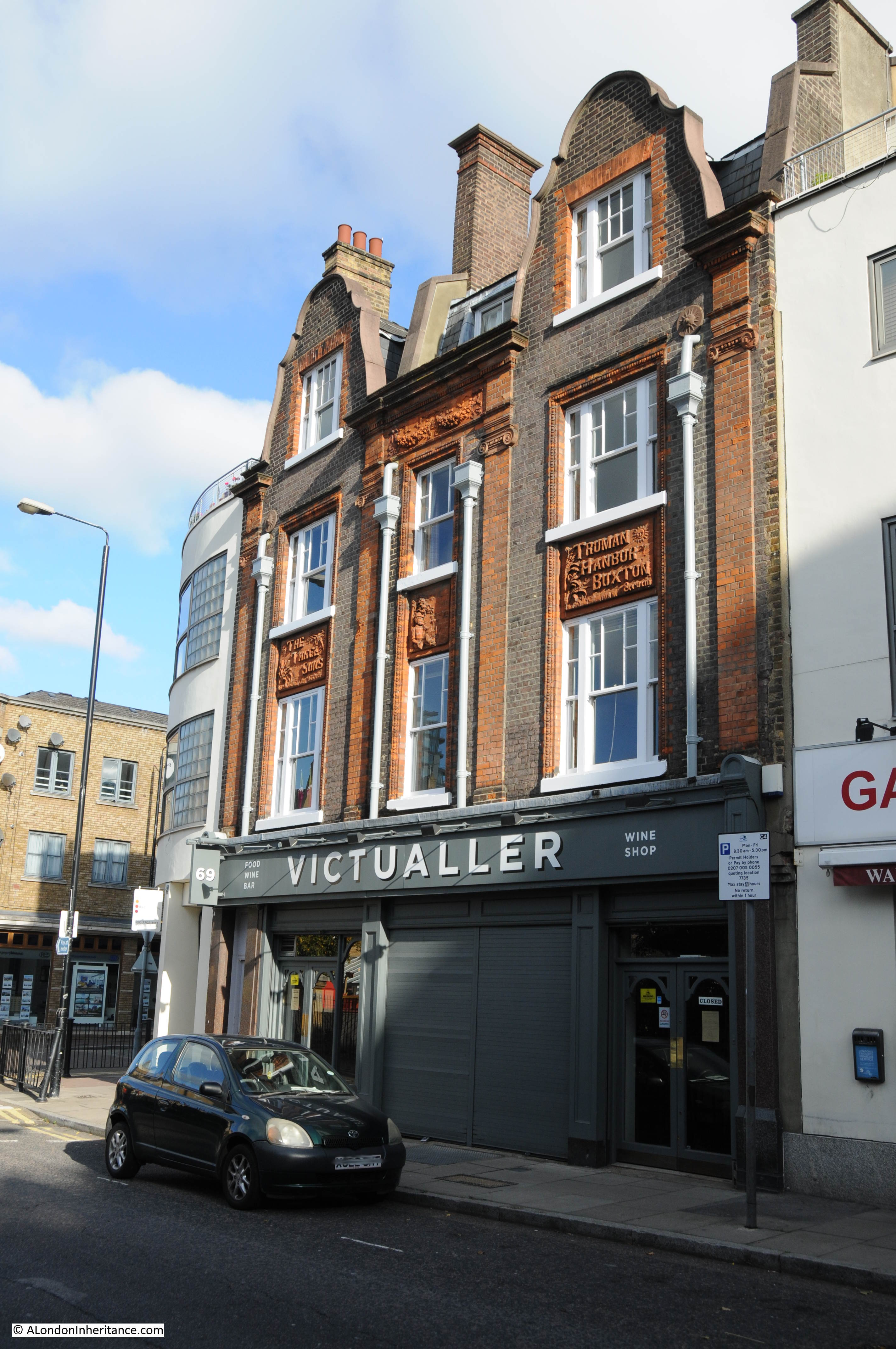
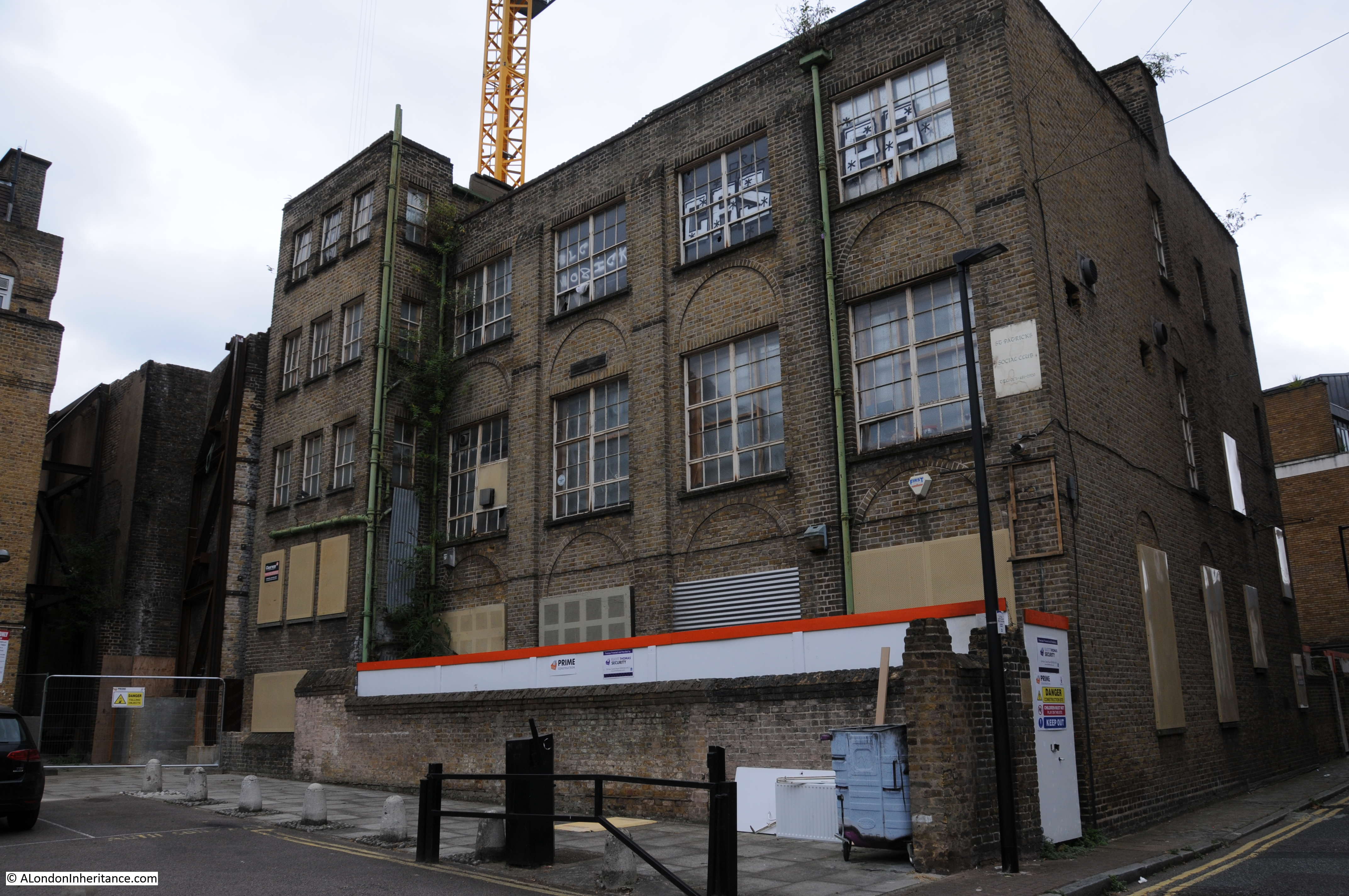
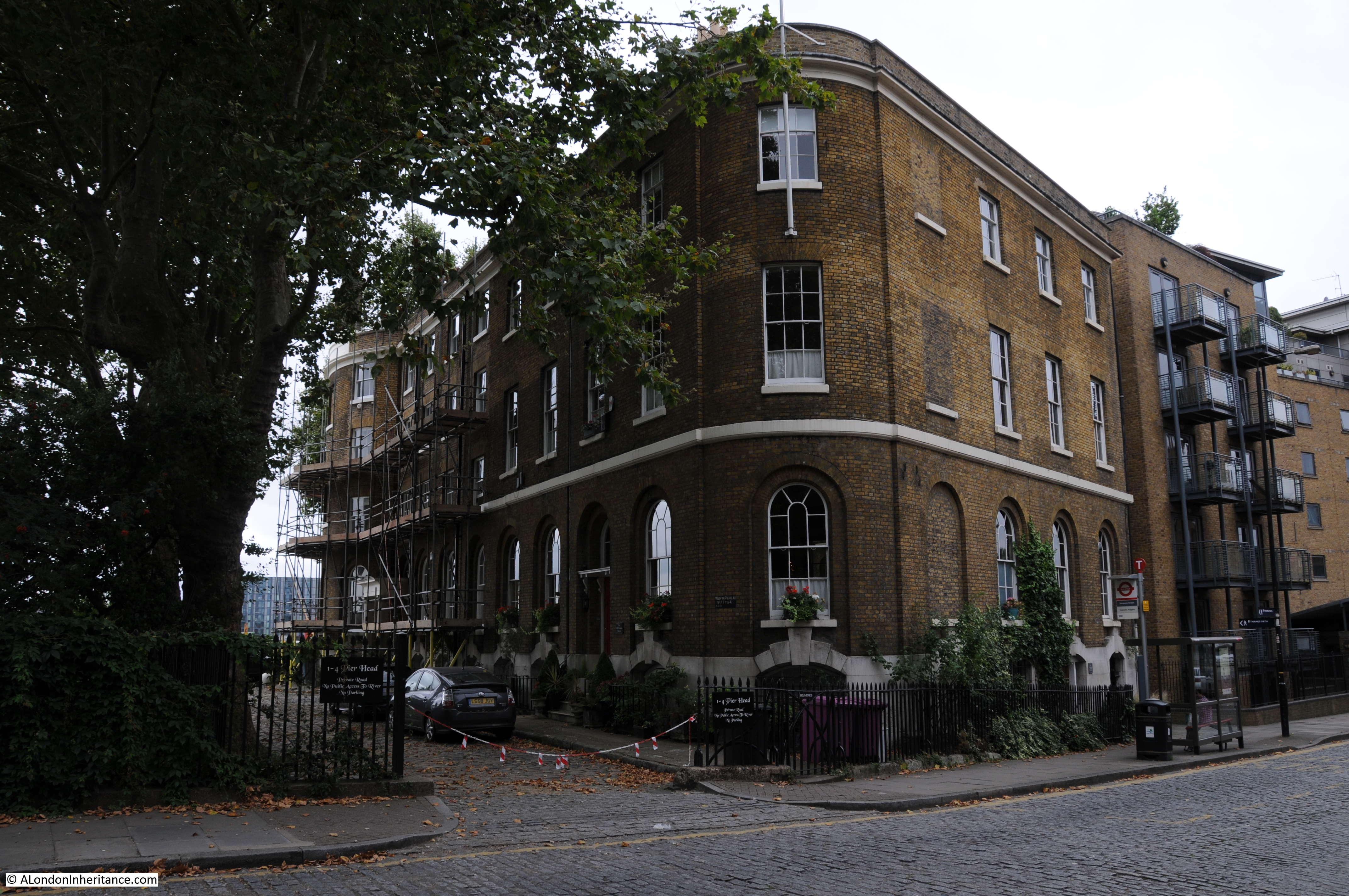
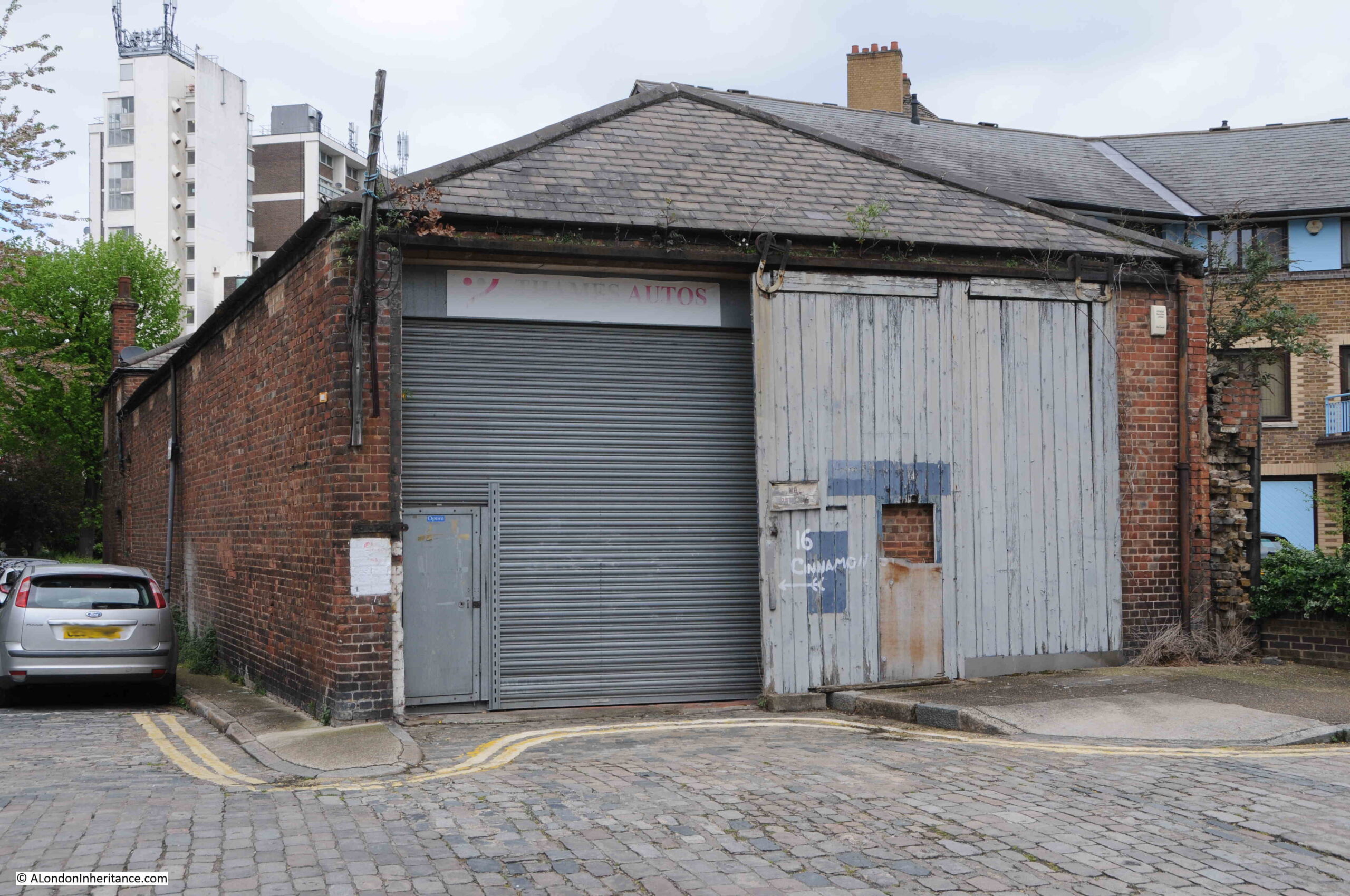
There was another feature that I wanted to find related to the station. Walking slightly in land, along Clave Street, then Clegg Street, where on the corner is this building, part of the landscape of Wapping prior to the development of recent decades:

Industrial history

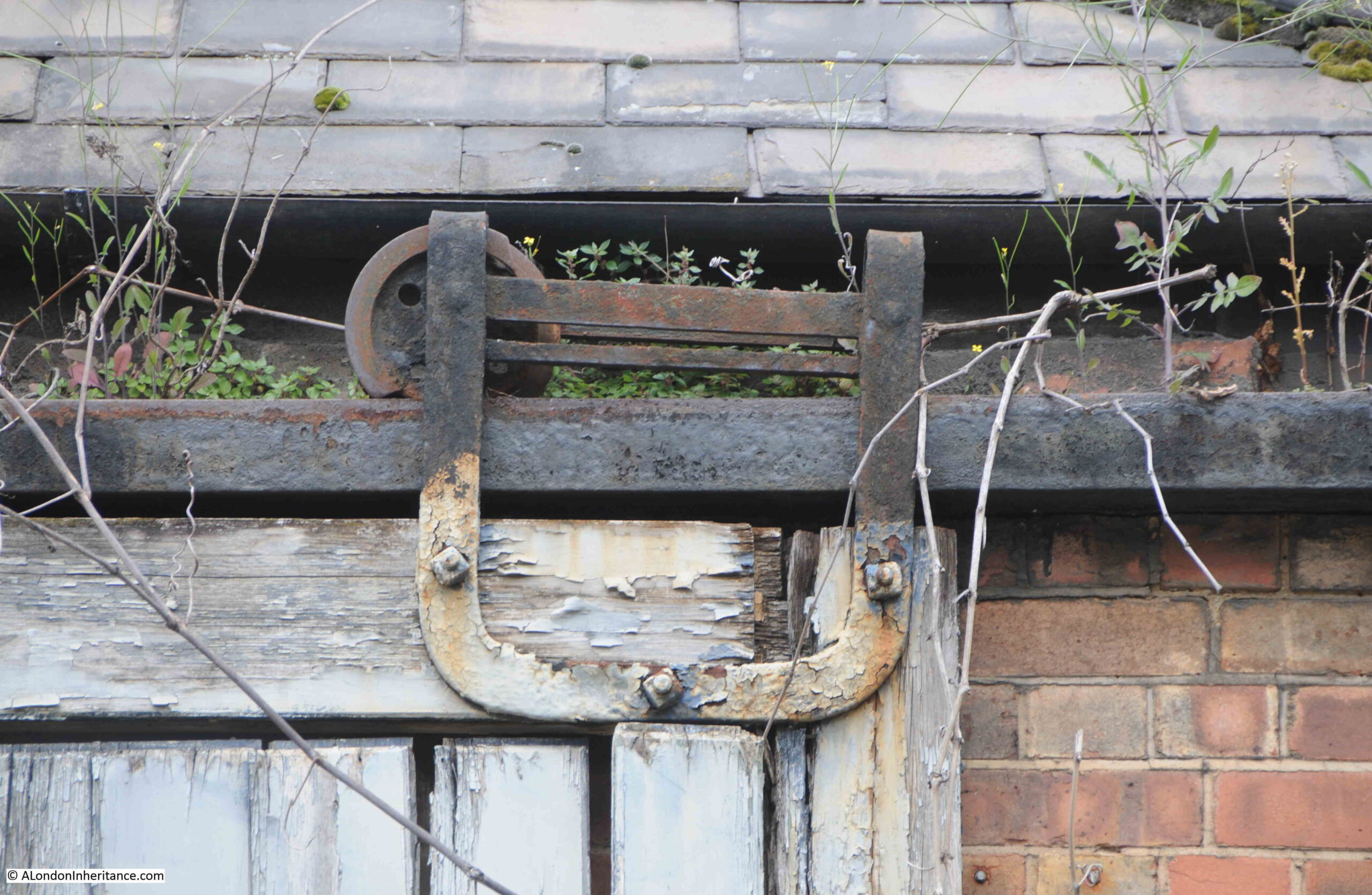
With some lovely metal fittings that allow the wooden door to be rolled along the front of the building:

Industrial history

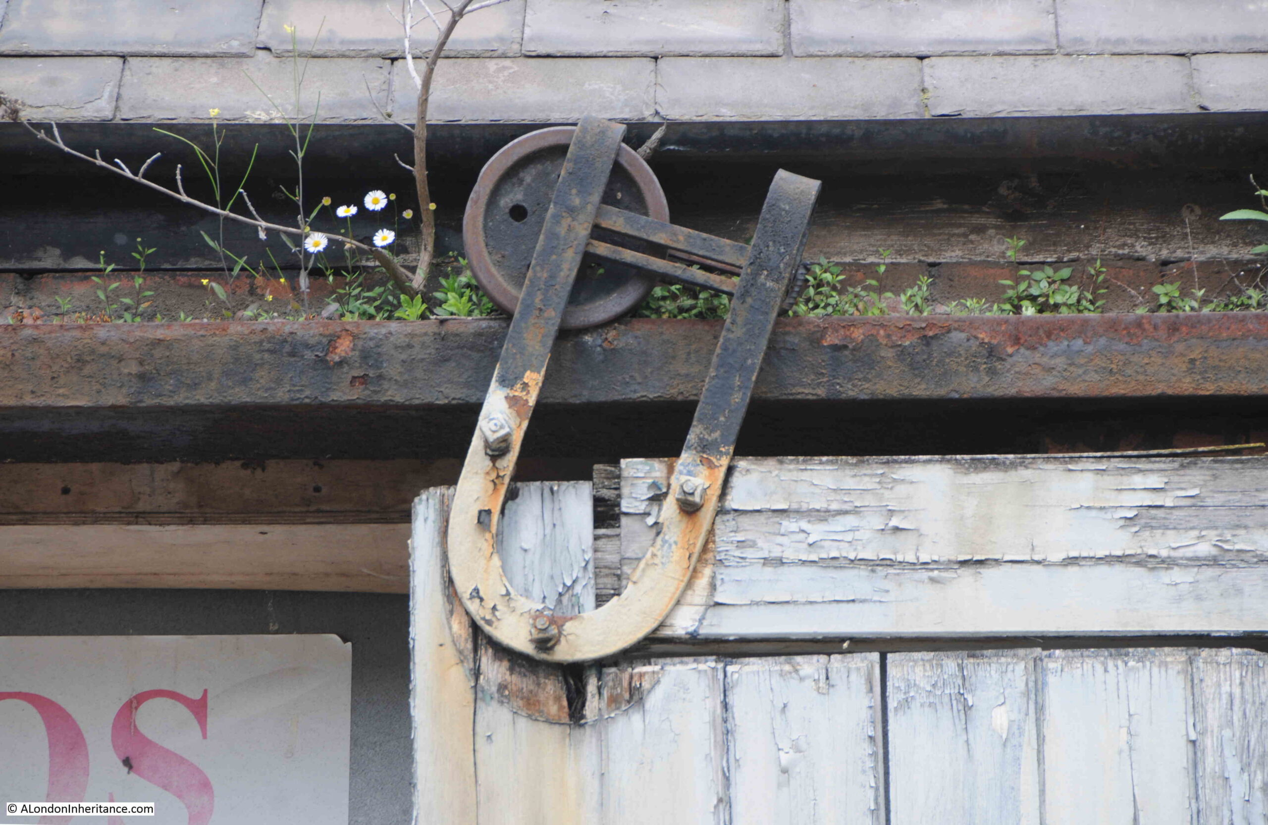
Which I suspect have not worked for many years:

Industrial history

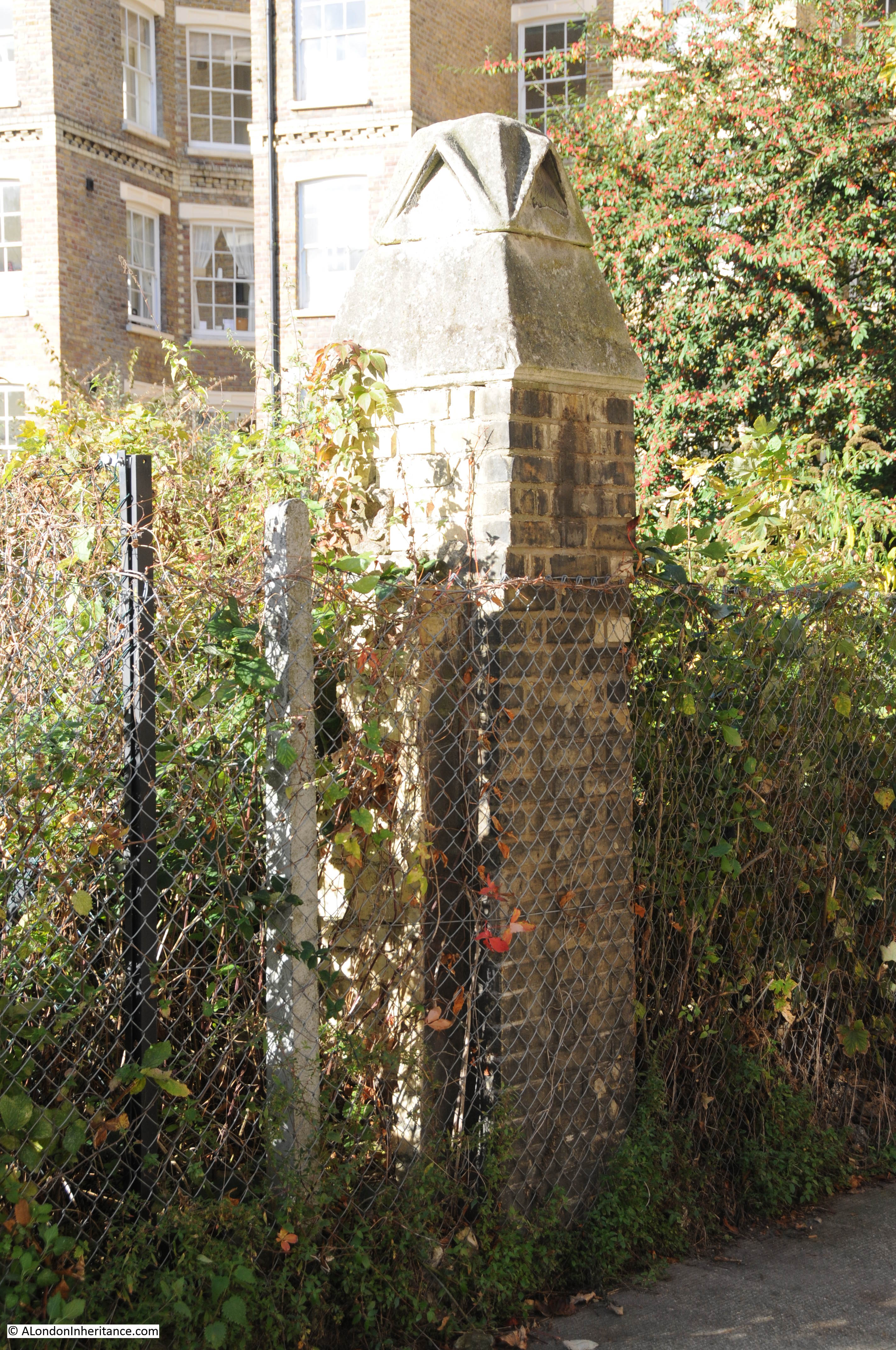
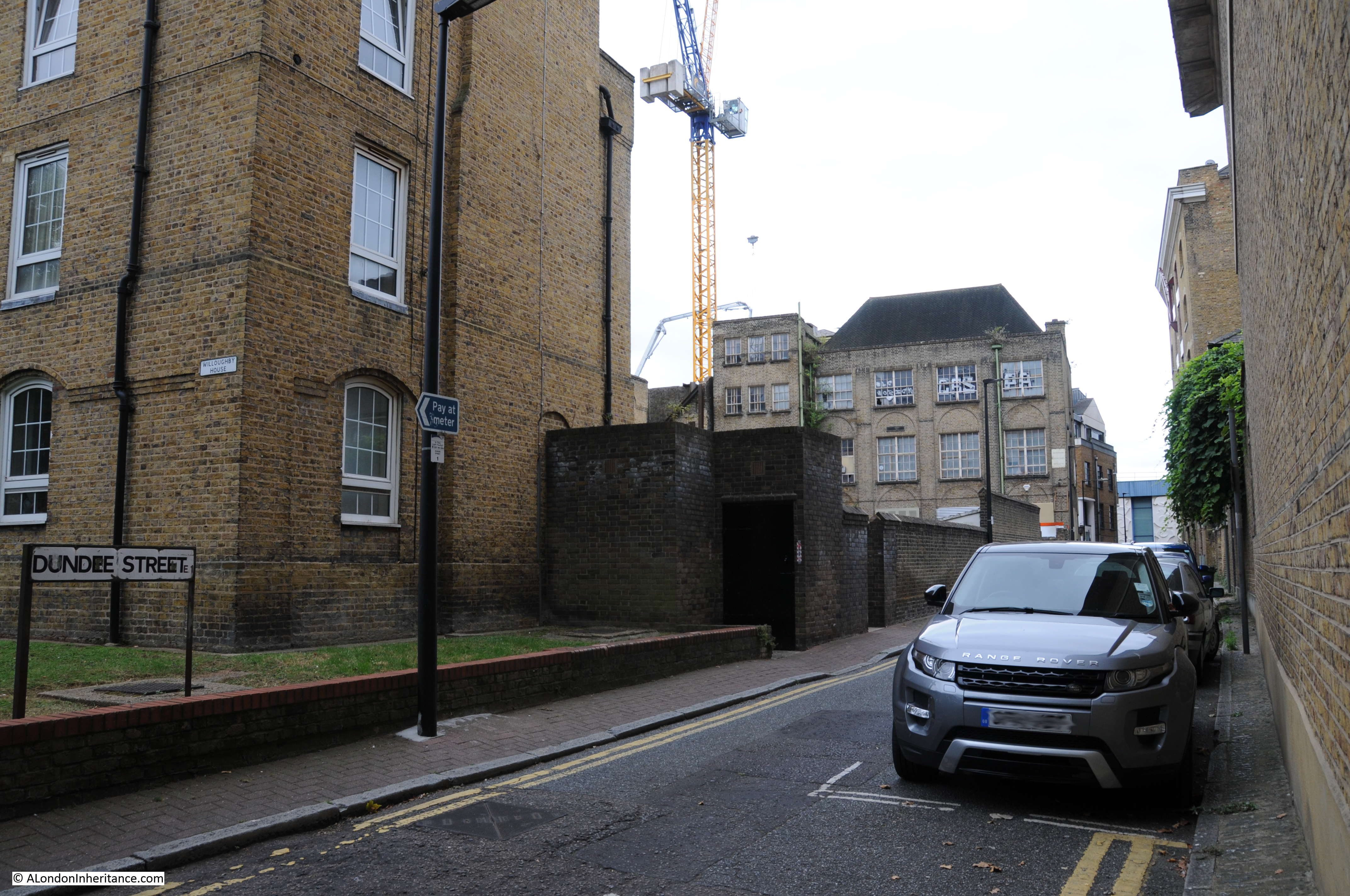
At the back of the building, there is a small green space, with a children’s playground in Hilliards Court. At the side of the playground is this structure:

Tunnel air vent

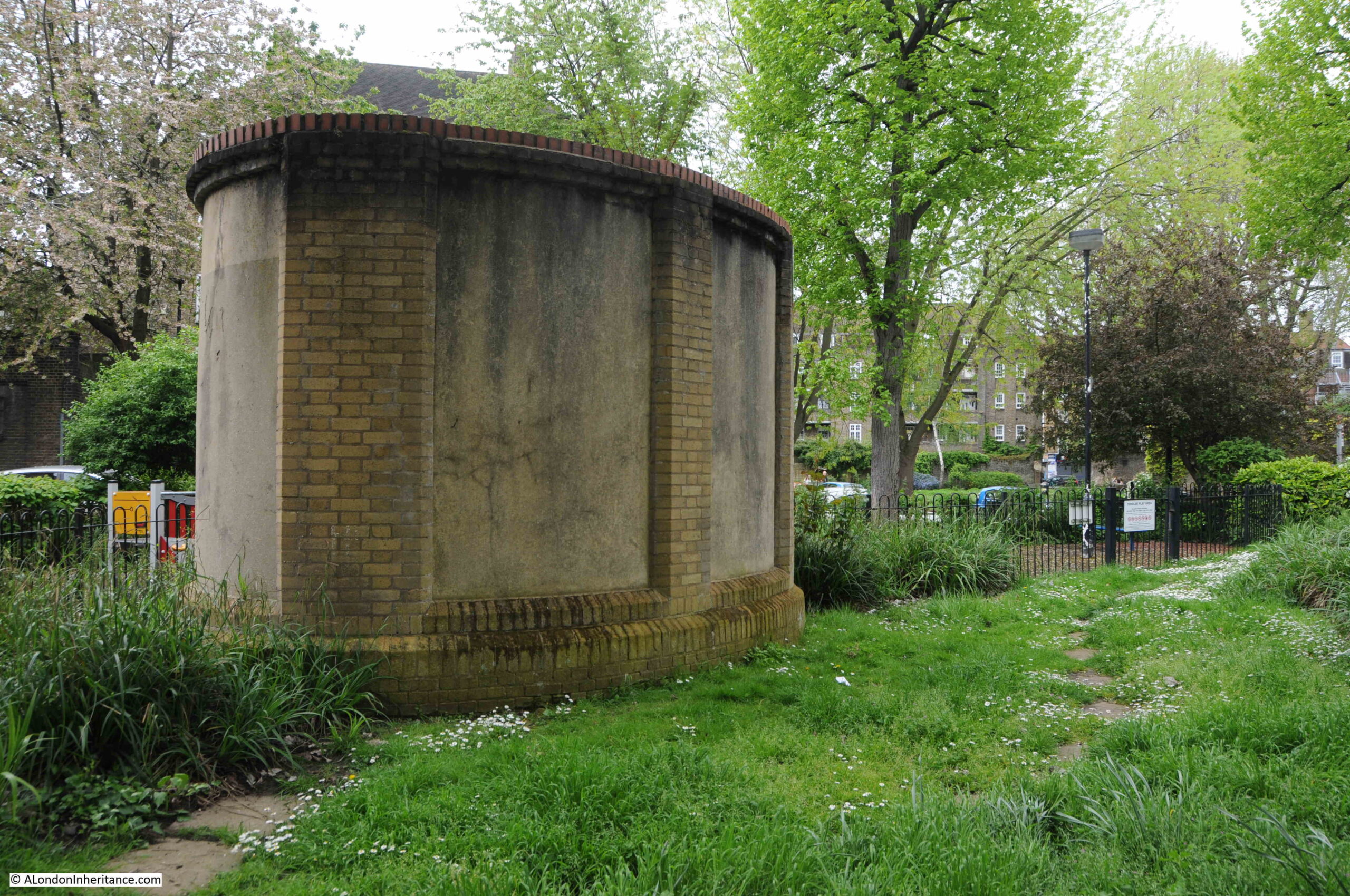
Stand here for a few minutes and you will soon hear the very clear sound of a train, either pulling away from, or slowing down into, Wapping Station. An unexpected sound in this very quiet Wapping green space, coming from an air vent to the tracks below.

Openstreetmap includes the route of the railway, even though it is underground at this point. I have circled the air vent at the top of the following map  ( © OpenStreetMap contributors):

Wapping Station

The PLA book on Steps, Stairs and Landing Places on the Tidal Thames lists a total of 241 from Richmond to Southend, along both banks of the river – so I have only scratched the surface.

If you are interested in reading about the other Thames stairs I have covered, then:

alondoninheritance.com

Wapping Old Stairs

I have touched very briefly on Wapping Old Stairs in a previous post, when I went for a walk along Wapping High Street and Wapping Wall. I am returning to the stairs as when working through the photos my father had taken on a boat trip along the Thames in August 1948, I found one of Wapping Old Stairs and the adjacent Oliver’s Wharf.

Wapping Old Stairs

I tried to take a photo of the same view when out on the river a couple of months ago, but failed completely to get as good a photo as the one above.

The following photo is the area today. Oliver’s Wharf is the building on the right, the stairs are to the left of Oliver’s Wharf.Wapping Old Stairs

What I love about these photos is that they frequently show people, often children, on the stairs (for example, see the post on Emerson Stairs), and this includes the photo of Wapping Old Stairs, see the following enlargement from the original which shows two children at the bottom of the stairs.

Wapping Old Stairs

Wapping Old Stairs are – old. There is the possibility that stairs at this location date back to the 16th century or earlier. The first newspaper reference I can find is from the 12th August 1736 when “The Body of a young Man well dressed, with a Watch and a Sum of Money in his Pockets, was taken up floating at Wapping Old Stairs: Upon fetching him he appeared to be an Apprentice belonging to Mr. Stilton, a Currier in Bermondsey-street; but by what Means he came drowned is very uncertain.”

This report confirms that in 1736 they were called the “Old” stairs. This part of the name was used to separate these stairs from another set of stairs built slightly to the east along the river, which were called Wapping New Stairs (these can also be found today).

The following extract from the 1896 Ordnance Survey Map shows Oliver’s Wharf and Wapping New Stairs to the left of the map, just before the Wapping Entrance to Wapping Basin of the London Docks. Towards the right of the map are Wapping New Stairs, just by Old Aberdeen Wharf.

Wapping Old Stairs

Credit: ‘Reproduced with the permission of the National Library of Scotland’ 

So presumably Wapping Old Stairs were the original stairs, and Wapping New Stairs came latter, with the old and new being added to uniquely identify the stairs. This method of identifying stairs can be found in the names of a number of Thames stairs, for example I have already written about Horselydown Old and New Stairs.

Despite being called “New”, Wapping New Stairs are also old, and I found a newspaper reference to them a couple of years before that for Wapping Old Stairs, when, from the 28th December 1728:

“On Monday, between one and two in the Morning, a Fire was discovered at the Waterman’s Arms Ale-House near Wapping New Stairs, and by timely assistance was quenched, having only burnt some Apparel and a Chest, on which the Servant Maid of the House had stuck a Candle, but had fallen asleep and left it burning.”

The number of fires in the timber buildings along the river was considerable, and a regular occurrence. In the same newspaper was another report of a fire at the nearby Gun Dock:

“Yesterday Morning early, a Fire broke out at a Hatter’s near Gun Dock in Wapping, which in a short space consumed the same, and three other Houses adjoining to it: In one of the Houses a Man and three Women went upstairs to save some Goods, but were prevented by the Flames from getting down again: one was saved by escaping over the Tops of some Houses, and the three Women flung themselves out of a Window into the street but one of them (a Servant Maid) pitched on her Head and died on the Spot.”

Both stairs therefore date from at least the early 18th century, with Wapping Old Stairs almost certainly being of a much earlier date.

Both stairs also feature on the 1746 Rocque map. The following extract shows Wapping Old Stairs to the right of the map (the new stairs are also on the map, but on a separate page in my copy of Roque’s maps).

Wapping Old Stairs

Thames stairs provide a useful geographic reference point to events on the river, and newspapers from the early 18th century onward are full of reports of bodies being found, arrivals and departures, crime, lost goods, arriving and departing ships etc.

One report from the 28th October 1738 gives an idea of the types of exotic goods that were arriving at Wapping in the 18th century:

“On Saturday Mess. Wills and Fleming, two Tide Surveyors, found 200 lb of Venice Glass at Wapping Old Stairs, which were sunk in the River in three Bags, fix’d to two Boat-Hooks very artfully. ‘Tis a rich Capture.”

I suspect that 200 lbs of Venice Glass would indeed be a rich capture. What the report does not help with is why they were in the river – lost while transferring from river to land, or perhaps hidden in the river by a thief, ready for later recovery.

Thames river stairs are rich sources of history for that part of London that forms the boundary between river and land (see my post on Life and Death at Alderman Stairs, where I explored in more detail the history of one set of Thames stairs).

Wapping Old Stairs also probably has more cultural references than the majority of other river stairs.

Wapping Old Stairs was the title of a Comic Opera at the Vaudeville Theatre in 1894:

Wapping Old Stairs

The St. James’s Gazette review of the play, which had a rather serious subject for a comic opera:

“The author and composer of ‘Wapping Old Stairs’, the new opera or operetta produced at the Vaudeville on Saturday night, may be congratulated on having achieved a genuine musical and dramatic success. There is but little of the spectacular element in the piece; the same set scene does duty throughout, and almost the only dresses are those of sailors and of their constant associates, ‘the merry maids of Wapping’. The eminent musician in using for his score the old melody of ‘Wapping old Stairs’ , which might have been treated with dramatic effect. 

Mr Stuart Robertson’s book, with but little dramatic basis is ingeniously constructed, and his lyrics are written with grace and point. It appears that in the last century, or even earlier, two sailors of Wapping fell in love with the same girl; on which the most unscrupulous of the young woman’s admirers committed a murder, and so arranged matters that his rival was looked upon as the assassin and, to save his life, fled to foreign parts. But after the lapse of many years the truth came out; when the good man returned to the land of his birth and the girl of his heart, while the bad man was executed, and after ‘ suspension by the neck’ hung ignominiously in chains.

This story is, no doubt a little tragic for a comic opera, and the librettist, whilst softening its harsher features, has introduced in abundance the element of mirth.”

The Vaudeville Theatre is probably the nearest that most West End theatre goers would get to the realities of life in 19th century Wapping. The review of the play also comments on the execution by hanging, which refers to the practice of hanging criminals along the river and a number of places, including Wapping Old Stairs have been referenced as “Execution Dock”. I suspect no single site was used and a number of locations along the Wapping riverbank would have been used.

The Tatler in 1903 produced the following print to go with a song written by Charles Dibdin which referenced the stairs:

“Your London girls with all their airs

Must strike to Poll of Wapping Stairs

No tighter lass is going

From Iron Gate to Limehouse Hole

You’ll never meet a kinder soul

Not while the Thames is flowing”

Wapping Old Stairs

Wapping Old Stairs is reached today, as it has been for many years, by turning off Wapping High Street and walking alongside a pub, which possibly dates back to the 15th Century as the location for a pub. Known from 1533 as The Red Cow, then the Ramsgate Old Town and finally from 1811 as the Town of Ramsgate. This may also date the origins of Wapping Old Stairs as a pub alongside stairs would be ideal for those arriving or departing on the river.

Wapping Old Stairs

The narrow alley leading to the stairs:

Wapping Old Stairs

View of the stairs at low tide:

Wapping Old Stairs

The liquefied mud covering the stairs at low tide does make the stairs a rather risky route down to the foreshore, but once at the bottom, the reward is a superb view along the river. The photo below is the view looking west towards the City. The entrance to what was the London Docks can be seen where the river wall appears to break.

Wapping Old Stairs

The foreshore is littered with London’s history. Rounded nodules of chalk, once used to provide a flattened base on the foreshore for mooring barges and lighters. The bricks that once built the City and Docks, now broken and worn by a thousand tides.

The distinctive two sets of stairs. I suspect the stairs on the right are the original Wapping Old Stairs, and those on the left were added to provide private access for the buildings on the left, built alongside the entrance to the London Docks.

Wapping Old Stairs

It was at the base of these stairs that the children were sitting in the 1948 photo. Interesting to speculate on the countless thousand who have arrived or departed along these stairs, transported cargo to and from the river, or just sat here and watched the river.

The small dock space to the right of the stairs is much the same as in 1948.

Wapping Old Stairs

In the centre of the dock wall, at the point between light and shadow in the above photo is a large round pipe that looks to have been filled, above is a manufacturer’s name:

Wapping Old Stairs

J. Burton Sons & Waller were Gas, Hydraulic and Sanitary Engineers  of John’s Place, Holland Street, Blackfriars, Southwark.

As usual, a brief exploration of part of London’s history, and writing these posts always generates a long list for further research. When were Wapping Old Stairs first used and named, and what part did the stairs play in the development of Wapping. Confirmation of the reason for the double sets of stairs. What did J. Burton Sons & Waller install at Wapping Old Stairs.

For me, the Thames Stairs are where I feel closest to London’s long history in that unique area between the river and the land, and there are many more stairs to explore.

alondoninheritance.com

Wapping High Street And Wapping Wall

For New Year’s Day, can I suggest a walk along Wapping High Street and Wapping Wall to explore a fascinating area of London where many features can still be found that date back to the time when these streets were lined with working warehouses, wharves, pubs and all the associated life that went with the proximity of Wapping to the River Thames.

Starting off from St. Katherine Docks and walking the length of Wapping High Street before turning onto Wapping Wall, there are still many of the original stairs down to the river, warehouse buildings and pubs.

The streets are now much quieter and the only goods being pushed along the streets today are likely to be Ocado deliveries to the expensive apartments that now line the river, rather than goods being transferred to and from the ships that once lined the river and headed inland to the London Docks.

Starting in St. Katherine’s Way and the first steps to the river are Alderman Stairs. As is common with the river stairs in Wapping, a narrow alley leading to a set of steps down to the river. High warehouse buildings on either side. Water, mud and growths of algae on the steps make them rather dangerous to climb down to the foreshore.

wapping-high-street-2

Reading newspapers from the last couple of centuries and there are frequent reports of drownings happening from the stairs that line the river. A report from the 28th August 1933 reads:

“On Saturday evening a five year old Italian boy – Denno Mendessi, of Wapping – was playing on Alderman Stairs, Wapping when he fell into the Thames, and was drowned.”

Two lines in a newspaper column that report one of many such tragedies.

All over Wapping there are the remains of the original buildings and docks that once covered the area from the River Thames to The Highway (the A1203 running from East Smithfield to Limehouse). I have an ongoing project to find and photograph all these remnants.

Here is an original entrance to the western most basin that led in from the river to the London Docks.

wapping-high-street-3

On walking into Wapping High Street, on the right are the Hermitage Memorial Gardens, built in memorial of the East London civilians who lost their lives during the bombing of this area during the last war.

In the photo below we are looking across the gardens to the entrance to St. Saviour’s Dock on the south side of the river.

wapping-high-street-1

Wapping has always been associated with the Thames, along with the trades and people who worked on the river, in the warehouses, the sailors who would arrive in Wapping up one of the many steps leading to the river in search of a diversion whilst their ship was being unloaded and loaded.

Wapping was portrayed in a number of different prints and pamphlets that all tended to dwell on the seedier side of Wapping. Typical is the following from 1818 (©Trustees of the British Museum).

The British Museum description to this print reads:

“A jovial sailor bestrides a mis-shapen horse with panniers, a foot in each basket. In each basket sits a bedizened prostitute, each holding one of his arms. He grins amorously towards the one on his right who is immensely fat, with a patched face and coarse features. She wears long gloves, holds up a parasol, and a reticule dangles from her arm. The other, who is less repulsive, drinks from a bottle; from her pannier dangles a jar of ‘British Spirits’. Both wear feathered hats and low-cut dresses with very short sleeves, necklaces, and ear-rings. They are in a wide cobbled street leading to the Thames, which resembles the sea; behind a corner shop (left), inscribed ‘Dealer in Maritime Stores’, appears the stern of a ship flying an ensign”

76929001

The section of Wapping High Street up to the junction with Sampson Street is mainly new developments. Looking west along Wapping High Street, and rather than the original warehouses, new blocks of flats line the space between river and road.

wapping-high-street-4

Walking on, and here the road crosses over the entrance to the Wapping Basin and the London Docks. Now long filled in, the entrance is still very clear when looking left and right as you walk along this part of the road.wapping-high-street-5

This Aerofilms photo from 1922 shows the entrance when these docks were still in operation. The narrow channel leading from the Thames to Wapping Basin is shown on the left of the photo with Wapping High Street crossing the entrance at the half way point.

epw007735-pier-head

Stopping on Wapping High Street and looking inland towards where Wapping Basin was once located provides this view. The channel is still clearly visible with the original walls still on either side.

wapping-high-street-36

I have written more about this small immediate area in a post on the Gun Tavern, which can be found here.

We now come to the Town of Ramsgate pub, possibly the site of a pub dating back to the 15th Century. Known from 1533 as The Red Cow, then the Ramsgate Old Town and finally from 1811 as the Town of Ramsgate.

wapping-high-street-35

The Town of Ramsgate was allegedly where the notorious Lord Chief Justice Jeffreys was captured whilst trying to escape by boat. Jeffreys had been the judge during the trials of those who participated in the Monmouth Rebellion in the west country. The Monmouth Rebellion was an attempt to overthrow the Catholic James II who had become king after the death of his brother Charles II. The rebellion was led by James Scott, 1st Duke of Monmouth who was an illegitimate son of Charles II.

During 1685 Judge Jeffreys presided over the Autumn Assizes in Winchester, Dorchester, Taunton and Wells. Hundreds of people were tried for various offences as part of the rebellion and the majority were sentenced to death, although many of the sentences were later changed to transportation. It is estimated that as many as 250 people were still hanged, including an elderly woman Alice Lyle whose only offence was in helping two of the rebels, she did not participate in the rebellion.

James II was in turn overthrown by William of Orange during the Glorious Revelation of 1688 and it was this event which caused Judge Jeffreys to attempt to escape the country, having lost the king he did so much to support.

In Old and New London, Walter Thornbury describes the capture of Judge Jeffreys in Wapping using a description from Macaulay:

“A scrivener who lived at Wapping, and whose trade was to furnish the sea faring men there with money at high interest, had some time before lent a sum on bottomry. The debtor applied to equity for relief against his own bond and the case came up before Jeffreys. The counsel, for the borrower, having little else to say, said that the lender was a trimmer. the chancellor instantly fired. ‘A trimmer! where is he? Let me see him. I have heard of that kind of monster. What is he made like?’ The unfortunate creditor was forced to stand forth. The chancellor glared fiercely on him, stormed at him, and sent him away half dead with fright. ‘While I live’ the poor man said as he tottered out of court, ‘I shall never forget that terrible countenance.’

And now the day of retribution had arrived. The ‘trimmer’ was walking through Wapping when he saw a well known face looking out the window of an ale-house. He could not be deceived. The eyebrows, indeed had been shaved away. The dress was that of a common sailor from Newcastle and was black with coal-dust; but there was no mistaking the savage eye and mouth of Jeffreys. the alarm was given. In a moment the house was surrounded by hundreds of people, shaking bludgeons and bellowing curses. The fugitive’s life was saved by a company of the Trainbands; and he was carried before the Lord Mayor.

The mayor was a simple man, who had passed his whole life in obscurity, and was bewildered by finding himself an important actor in a mighty revolution. The events of the last twenty-four hours and the perilous state of the city which was under his charge, had disordered his mind and body. When the great man, at whose frown, a few days before, the whole kingdom had trembled, was dragged into the justice room begrimed with ashes, half dead with fright, and followed by a raging multitude, the agitation of the unfortunate mayor rose to the height. He fell into fits, and was carried to his bed, whence he never rose. Meanwhile, the throng without was constantly becoming more numerous and more savage. Jeffreys begged to be sent to prison. An order to that effect was procured from the Lords who were sitting at Whitehall; and he was conveyed in a carriage to the Tower.

Two regiments of militia were drawn out to escort him, and found the duty a difficult one. It was repeatedly necessary for them to form, as if for the purpose of repelling a charge of cavalry, and to present a forest of pikes to the mob. The thousands who were disappointed of the revenge pursued the coach, with howls of rage to the gate of the Tower, brandishing cudgels, and holding up halters full in the prisoners view. The wretched man meantime was in convulsions of terror. He wrung his hands, he looked wildly out, sometimes at one window, sometimes at the other, and was heard, even above the tumult crying, ‘Keep them off, gentlemen ! For God’s sake, keep them off !’. At length having suffered far more than the bitterness of death, he was safely lodged in the fortress, where some of his most illustrious victims had passed their last days, and where his own life was destined to close in unspeakable ignominy and terror.”

Judge Jeffreys died of kidney disease while being held in the Tower in April 1689. He was originally buried in the Tower but in 1692 his body was moved to the City church of St. Mary Aldermanbury. The church was badly damaged during the Blitz when Jeffreys tomb was also destroyed. The remains of the church were shipped to the US and the site of the church is now a garden. See my post on St Mary Aldermanbury which can be found here.

The following print (©Trustees of the British Museum) from the time illustrates the arrest of Lord Chancellor Jeffreys.

353417001

At the side of the Town of Ramsgate is an alley leading to Wapping Old Stairs.

wapping-high-street-34

The view from the top of the stairs. Fortunately my visit coincided with a low tide so I could make my way down to the river, although this was somewhat precarious as the steps were covered in a thin layer of very slippery mud and water.

wapping-high-street-33

The view from the foreshore looking back up at Wapping Old Stairs.

wapping-high-street-37

Wapping Old Stairs were one of the many stairs providing access to the river to reach the ships that would be moored, to get transport along the river or to load / unload cargo and passengers. The print below (©Trustees of the British Museum) from 1807 and titled “Miseries of London” shows a potential passenger at Wapping old Stairs being accosted by a group of watermen after his custom. The badge on their arms identifies them as Thames Watermen. They are calling out “Oars, Sculls, Sculls, Oars, Oars.”

10044001

The foreshore at Wapping Old Stairs, looking towards Tower Bridge. The large white stones are lumps of chalk. These can be found all along the foreshore in central London as chalk was used to provide a flat layer on which barges could settle. Chalk would be pressed into the foreshore to provide a flat and relatively smooth bed. The remains of some of these are still visible, however for most, the chalk has now washed away and can now be found as individual lumps of chalk, washed smooth by the tides, along the foreshore.

wapping-high-street-31

In the above photo, the break in the river wall can just be seen which once led into Wapping Basin and the London Docks. There is also a smaller entrance in the river wall. Within this was a long out of use, rusted and silted up outflow from somewhere inland, into the river.

wapping-high-street-32

Back in Wapping High Street and these buildings were once the Aberdeen Wharf. The entrance to the right leads to Wapping New Stairs.

wapping-high-street-29

At the top of Wapping New Stairs.

wapping-high-street-27

View from the top of Wapping New Stairs looking east towards the pier belonging to the river police.

wapping-high-street-28

The building of the Marine Policing Unit, the original Thames River Police.

wapping-high-street-26

Theft from boats moored along the river was a very serious problem, a small boat could moor alongside and cargo stolen whilst the crew were onshore or asleep. This was such a problem in the 18th Century that in 1798 the Thames River Police was set-up specifically to police the river.

Much of the theft that occurred was petty pilfering of part of a consignment of goods in transit between ship, warehouse and onward distribution. A typical case reported in the Evening Mail of the 27th April 1842 records that a prisoner was found with a number of small bottles of brandy and one of Champagne in his house. Whilst it was not possible to prove where this had come from it was reported that there were 2,000 to 3,000 casks of brandy and wine on the quays, from which, in the darkness of the night, any quantity could be abstracted. Two or three casks had brandy missing in the warehouse in which the prisoner worked, but again it was not possible to prove that the brandy was the same as in the bottles found in the prisoners house. Due to the lack of evidence, the judge could not send the accused to the Old Bailey, however the judge did impose the maximum penalty he could which was two months imprisonment with hard labour.

I suspect that although there was a lack of evidence, the judge wanted to impose the maximum penalty in his power mainly as a deterrent to others who might think about taking a small quantity of the goods that were found in every warehouse and wharf along Wapping.

Print showing the original Thames Police building on the right.

50065001

Looking east past the Captain Kidd pub, not an old pub as it dates from the 1980s. The tall warehouses that line the river casting Wapping High Street into a deep shadow on a sunny day.

wapping-high-street-25

The only area along here that has not been redeveloped in some way.

wapping-high-street-24

Walk off Wapping High Street, a short distance down the narrow Bridewell Place and this pillar is still in place that would have been part of the original entrance and wall around the warehouse that once stood here.

wapping-high-street-23

Phoenix Wharf. There were plans dating from 2013 to redevelop Phoenix Wharf, into eight private flats along with building on the empty land opposite as shown in the photos above. I am not sure of the latest status of these plans, but over three years later and work does not appear to have started.

wapping-high-street-22

The entrance to King Henry’s Stairs in the photo below. These stairs now seem to be private property and there has been a pier here from many years. There is a report in the East London Observer from the 14th July 1860 that states:

“Thames Conservancy – New Pier at Wapping. By order of the Conservators of the River Thames a new landing pier has been placed at King Henry Stairs, Wapping. This landing station is near to the Thames Tunnel, and fixed in lieu of the old Tunnel Pier, which has been removed altogether. The new pier is of elegant design, and when completed will no doubt contrast very favourably with the old pier, which for years has been declared unfit for its purpose. At the opening of the new pier several of the Conservators were present, but not any public demonstration was made.”

wapping-high-street-21

The photo below shows Phoenix Wharf and the building to the left of the photo is King Henry’s Wharf which was also included in the development plans mentioned above, with 27 private flats planned for King Henry’s Wharf. The plans included using the original large loading doors for a main entrance and boarding up the remaining entrances.

wapping-high-street-19

Original door and signage on King Henry’s Wharf. i wonder how long this will still be there?

wapping-high-street-20

Further along, we then come to Wapping Station, which although part of the Overground network, at this point is below ground, as this station is at the northern end of Brunel’s original Thames Tunnel which now carries this section of the Overground below the Thames. See my post here on walking through the Thames Tunnel from Rotherhithe to Wapping.

wapping-high-street-6

At the end of Wapping High Street is New Crane Wharf, all converted into apartments.

wapping-high-street-18

Adjacent to New Crane Wharf are New Crane Stairs shown in the photo below. There were many accidents at night at these stairs resulting in drowning which was put down to the lack of lighting.

There is a letter in the East London Observer dated the 1st March 1873 from a Mr Saxby Munns who has been trying to get additional lighting installed at New Crane Stairs for a number of years. Saxby Munns writes:

“Having applied to the Board for sufficient light to prevent accidents, and that, after five years, not having been provided, I felt the right method would be to bring it publicly before their notice. There is a lamp which has been removed from one side to the other of the street frontage of the landing, and utterly useless as regards the stairs and landing. Of whom could the surveyor have complained that he should have been unable to hear of people being drowned at these particular stairs. Did he ask the water police, or the watermen at the stairs? or did he inquire of the coroner’s officer and the sergeant of police? who on occasion of the last person drowned had to grope their way early in the morning, by aid of the sergeant’s bull-eye – although conducted by myself through the arched-over passage. This was the second body I picked up within two months, and both by evidence drowned from New Crane Stairs, and not ‘turned up’ by any particular eddy.

The surveyor thanked Mr Hopson for bringing the subject to his notice. I also thank him, and am certain that if these two gentlemen will take the trouble, on any dark night, to approach the stairs, either by river or road, their recommendation to the Board will have the desired effect of causing a necessary precaution to be taken, viz., a light on the river frontage, like that at Horslydown, and adopted at many other stairs of a similar dangerous character, and thus largely decrease the number of fatal accidents that occur at New Crane Stairs.”

Even on a bright sunny day it is easy to see how dangerous these stairs could have been in the dark.

wapping-high-street-17

Wapping High Street now turns inland for a short distance before becoming Garnet Street with Wapping Wall turning off to the right. Here we find the old Three Suns pub. Still serving alcohol, but now a wine bar and shop.

wapping-high-street-13

The pub was built in 1880 and closed in 1986. The building still retains some fantastic decoration from the time when the building was the Three Suns pub.

wapping-high-street-14

wapping-high-street-15

wapping-high-street-16

We now turn into Wapping Wall and a familiar wall of warehouses line the street, adjacent to the river.

wapping-high-street-12

Wapping Wall takes its name from the original defensive wall built to prevent the river from spilling over onto the marshland that once covered most of this area of Wapping. Drainage of the marshland and construction of defensive walls had begun around 1327. Breaches of the wall continued to be a problem until the late 16th Century when the construction of wharves started between the river and the wall which had the impact of strengthening the defenses.

Wapping Wall follows the eastern part of this original defensive wall.

Wapping Wall is today a row of warehouses converted into flats until we reach the Prospect of Whitby pub, which I covered a few weeks ago in my post on  the Prospect of Whitby and Shadwell Basin which you can find here.

wapping-high-street-8

Pelican Stairs running alongside the pub…..

wapping-high-street-9

…..down to the river:

wapping-high-street-10

From here, the walk can continue on towards the Isle of Dogs, but for now it is a good opportunity to enjoy the view of the river from the Prospect of Whitby and perhaps reflect on the long history of this fascinating area which retains so much despite the onslaught of development.

wapping-high-street-11

alondoninheritance.com

The Gun Tavern – A Tale Of Two Wappings

I find it fascinating to track down the locations of the photos my father took in the late 1940s. They all tell a story and highlight the changes that have taken place across London over the last 70 years. Sometimes, I can put a pair of photos together that sum up the change, not just at that specific place, but across a whole area of London, and that is the case with today’s post -The Gun Tavern – A Tale Of Two Wappings (with apologies to Charles Dickens).

The Gun Tavern and Hotel was on the corner of Wapping High Street and Dundee Street. Wapping is the area to the east of the Tower of London. An area of high density housing, warehouses and docks. Nearly all activity that took place in Wapping was driven by the River Thames. Ships moored alongside the warehouses or lighters transported goods to and from ships in the river. Steps leading down to the river provided access for those who worked out on the river. Housing provided very basic accommodation for the workers and the many pubs provided almost the only escape from work.

I will not put any text in between the following two photos so they can be compared. The first is the original photo taken by my father of the Gun Tavern and Hotel. I easily found the location today and the second photo shows the same scene today. Look at the building on the left which is the same in both photos. The pattern of the brickwork is the same and in the lower left of both photos, set into the pavement is a fire hydrant in the same position over 69 years.

The major change is the building that now occupies the site of the Gun Tavern.

gun-tavern-1

gun-tavern-2

This is now a Foxtons Estate Agents and these two photos sum up the changes to Wapping over the past 70 years.

Walk along Wapping High Street and the majority of the old warehouses and wharf buildings have now been converted to apartment buildings, forming a barrier between the river and the street. There are some access areas and walkways, however considering how close this is to central London, Wapping High Street feels strangely quiet. It is almost a dormitory street for those who work in the rest of London, or apartments that get occasional visits from their remote owners. It has to be a wasted opportunity as with a more mixed use approach and more affordable housing this could be a much more vibrant area.

Wapping High Street is one of the few streets in London where you can walk a distance and not find the usual Starbucks, Costa or Pret which I assume the lack of local business or passing trade cannot justify. I last walked along Wapping High Street a few years ago and the site of the Gun Tavern was then a cafe, however either it could not make enough money, or the new development now occupied by Foxtons was a more profitable change for the owners.

The same road surface as in my father’s photo showing underneath later surfacing.

gun-tavern-3

The map below is an extract from the 1893-1895 series Ordnance Survey map. This shows the area around Dundee Street and the Gun Tavern including some of the many street name changes. The River Thames is at the bottom of the map, and Wapping High Street is running left to right across the map.

At the time of this map, Dundee Street was called Upper Well Alley and can be seen running vertically from Wapping High Street just to the right of centre. The Gun Tavern is the building labelled PH at the junction of Upper Well Alley with Wapping High Street.

gun-tavern-19

The considerable number of pubs across Wapping can be seen just by the sample in this one small area. Including the Gun Tavern, there are seven Public Houses marked. Today, there are hardly any pubs across the whole of Wapping. The only inland pub is Turner’s Old Star on Watts Street. The other pubs are the riverside pubs, Town of Ramsgate, The Captain Kidd and The Prospect of Whitby. The Town of Ramsgate is shown in the above map as the PH just above Wapping Old Stairs. At the end of the 19th century, there were roughly 29 public houses along just Wapping High Street.

I have been unable to trace when Upper Well Alley changed named to Dundee Street. At the end of Upper Well Alley in the above map, facing on to the river is New Dundee Wharf, so the new name must have come from the name of the Wharf and as it has “New” at the start of the wharf the name of the wharf must have been relatively recent.

In the 19th century, the Gun Tavern was often used as a location in which to hold an inquest. Reading accounts of these from newspapers of the time provides a fascinating insight into life in Wapping and London.

The following is from the London Daily News of the 30th January 1846, the headline was “Heartless Conduct. Mysterious Suicide”:

“At a late hour last evening Mr. Baker held an inquest at the Gun Tavern, Gun Wharf, Wapping on the body of Mrs. Lucy Robinson, alias Hawker aged 36 years, who was found drowned. William Adamson, a fisherman, said that on Tuesday forenoon, whilst in his boat, grappling off Wapping in sixteen feet of water, his grappling iron brought up the body of the deceased. She had a long Cashmere scarf twisted tightly around her waist, and her bonnet strings were tied in nine knots close under the chin. Mr. Henry Lambert, proprietor of the Caledonian Arms, Pentonville, identified the body as that of his sister; she some months kept the Vine Tavern, Kentish Town; she was then a widow.

A man named William Hawker, an omnibus conductor, used to frequent the house. He soon after professed an attachment to her; he represented himself as a single man; the correspondence was carried on for some time, and he ultimately induced her to cohabit with him as man and wife. Witness, hearing of this fact went to her, for the purpose of expostulating with her on her conduct, when words ensued between Hawker and witness. Hawker struck him several violent blows, and knocked him down, the next day witness went to the house again, his intention being to get a warrant for the assault. when he went he found the house shut up, and that Hawker and deceased had gone to France; they soon after returned, when he heard they had been married and that Hawker had drawn about 900s of deceased’s money, from a bank in which she had deposited it. He had never seen her since.

Martha Gaylor of Vine-cottage, Kentish-town, deposed that she had been a tenant of the deceased’s, and on terms of intimacy for the last eight years. After deceased and Hawker came from France, they went to live at No. 11 Marylebone Street. She told witness she was married; and that since she had found out that he had a wife living. Witness knew that there was a woman called Mrs. Hawker, and had seen her call at the house since Hawker’s return from France. Deceased had often complained to witness of the ill-usage she received at the hands of Hawker, showing bruises on her wrists, face and other parts of her person; and that he was in the constant habit of drinking, and ill-using her since she had obtained her money. On Tuesday week he thrust her out of doors violently on to the pavement. She took drink occasionally.

On Saturday night last, at ten o’clock witness called upon her. She was then intoxicated; did not see her again alive. Was told subsequently that she suddenly left the house at twelve o’clock at night, and was not heard of again until her body was found. There being no other evidence to show by what means she came into the water, the jury said they should not be satisfied until the man Hawker was before them, to hear his statement. Marshall, the beadle, said he had summoned him, but he was not in attendance. The inquiry was therefore adjourned for his attendance, and the production of other evidence as to how the deceased came into the water.”

As well as many murders and suicides, the Gun Tavern also held inquests into the frequent accidents on the river. The following is from Lloyd’s Weekly Newspaper from the 25th August 1878 and has the headline “Fatal Boat Accident”:

“Yesterday evening Mr. Collier held an inquiry at the Gun Tavern, High-street, Wapping, touching the death of a young man named Charles Wicks. Deceased was a telegraph-wire worker, and on last Sunday he and several others went for a rowing an out-rigged four-oar cutter on the Thames, all being said to be used to rowing. When off Blackwall-point they were caught in the swell of a Newcastle boat, and the craft in which the deceased was, becoming filled, they had to jump out. Only two out of the five could swim. A witness threw him an oar, but it did not reach him. He and another man went down, the other three being picked up by the waterman’s skiff. the body was found off Wapping on Friday. The jury returned a verdict of Accidental Death.”

Reading the newspaper accounts of the numerous inquests held at the Gun Tavern covering suicides, murders and accidents quickly dispels any romantic view of life in Wapping by the River Thames in the 19th century.

As well as the inquests held in the Gun Tavern, the residents of Upper Well Alley were involved in many crimes, including murder. The following is from the Morning Post on the 26th August 1896, with the headline “The Wapping Tragedy”:

“James Jones, ship’s fireman, of 8, Upper Well-alley, Wapping, was charged yesterday on remand before Mr Dickenson, at the Thames Police Court, with the murder of Edward White by stabbing him in the neck with a knife. Further evidence was taken. That of the medical men who made the post-mortem examination showed that there were nine external wounds and 10 internal wounds. They were both incised and punctured, and all, with the exception of a small one at the back of the head, might have been caused by the knife produced. the most serious one was at the back of the neck, which divided the spinal column and vertebral artery. the wound which severed the spinal cord was a fatal one. Mr. Dickinson remanded the prisoner, and the witnesses who had given evidence were bound over.”

Another newspaper article from the 18th December 1894 had the title “Not sober for 4 years” and told the story of the death of a woman from number 8 Upper Well Alley, Wapping who had not been sober for over 4 years. The wife of a waterside labourer, she would not get up until 4 in the afternoon and had already taken everything in the house to the pawn shop to fund her drinking. When she could no longer move, she managed to get rum brought to her bed and after her death a bottle of spirits were found hidden underneath the pillow.

Upper Well Alley, or Dundee Street of today is very different to the days of the 19th century newspaper reports and is under going further change. The photo below taken in Dundee Street shows the St. Patrick’s Social Club building which I believe will soon be demolished.

gun-tavern-4

Dundee Street and along Green Bank was once home to St. Patrick’s Social Club, School and Church. Today only the church remains.

On the corner of Dundee Street and Green Bank is an old bollard dated 1899 and stating Limehouse District. In the late 19th century, the district of Limehouse extended from the main land area around St. Annes Limehouse, along a narrow strip of river side land in Wapping to a short extension inland here around Dundee Street. This bollard was the only remaining marker I could find around Dundee Street, Green Bank and Scandreet Street.

gun-tavern-5

Looking down Dundee Street, or as it was Upper Well Alley, from the junction with Green Bank.

gun-tavern-6

At the end of Green Bank, on the corner with Scandrett Street (or Church Street as it was on the 1895 Ordnance Survey map) is the old Turks Head pub (the PH at the very top, centre of the above map). Closed as a pub in the late 1970s, the Turks Head was restored by a charitable trust in the 1980s providing a community cafe for the local area.

gun-tavern-7

On the Scandrett Street side of the building is the original 1706 street name plaque, confirming that this was originally Bird Street.

gun-tavern-8

The following extract from John Rocque’s map of 1746 shows the area in the right hand lower quarter. Bird Street is clearly marked as is Green Bank (about the only street in the area to retain its original name). Comparing with the 1895 Ordnance Survey map shows that New Dundee Wharf was originally Gun Dock and leading north from here was Gun Alley and across Green Bank Lower Gun Alley. This explains where the name Gun Tavern came from although whether the street or the pub was named first is a good question.

gun-tavern-20

What appears to have happened over the last almost three hundred years is that Gun Alley was probably the original name, following by Upper Well Alley and then Dundee Street which remains the name today. Fascinating why names change so much and in this small area of Wapping only Green Bank retains its original name. (It is tempting to think that as Green Bank dates from at least 1746, the name may refer to an embankment along here that held the river back from further encroachment inland, much like the original street name of Narrow Wall on the South Bank, although I have not found any proof of this).

the following print  (©Trustees of the British Museum) shows the view of Gun Dock from the river in 1850. The church tower in the background is that of St. John’s which we will come to next.

gun-tavern-23

The original 1756 parish church of St. John’s is on the corner of Green Bank and Scandrett Street. The church was badly damaged during the war with only the tower and the shell of the rest of the church remaining. The building was later rebuilt as apartments so apart from the tower, the rest of the building is a new construction. To blend in with the surroundings much of the external walls were built using materials from other buildings destroyed during the war.

gun-tavern-9

Next to the church are the buildings of the St. John’s School. Although founded in 1695, the school was established by voluntary subscriptions in 1704, with old buildings on the west side of church street purchased to provide accommodation for the school. The site of these original buildings were included in a later expansion of the churchyard, so in exchange, a plot of land was given to the trustees of the school and the buildings that we see now constructed in 1756 to 60.

gun-tavern-10

The school appears to have been in a reasonably financially stable position. The 1819 the second report by the Commissioners on the Education of the Poor reported that the school held £2,000 in stocks and the dividends from these, as well as an annual £10 rent from the lease of a small parcel of land provided much of the income that the school needed. There was also a separate fund of £384 which had been raised by subscription among the inhabitants of Wapping in 1725. This money was used to purchase some land and buildings and at the time of the report a rent of £60 10 shillings was being generated for the school.

At the time of the report, the annual expenditure of the school was £480. The main costs were:

  • Clothing about £200
  • Schoolmasters and schoolmistress’s salary with coals, and etc. about £100
  • Repairs, about £40
  • Stationary, about £50

This was in excess of the dividends and money from rents received by the school, with the gap being made up from voluntary subscriptions.

Above the doors to the school, statues of school children in their blue coat uniforms. gun-tavern-11

Opposite the church and the school is the original churchyard.

gun-tavern-12

A plaque set into the wall of the churchyard, dated 1855 states that the wall belongs to the Parish of St. John of Wapping and is the boundary of the churchyard.

gun-tavern-13

The churchyard wall, plaque and old headstones lined up against the wall.

gun-tavern-14

One of the few remaining pubs in Wapping is the Town of Ramsgate – a pub which deserves a dedicated post. The pubs on the river almost certainly have a long-term future, their river facing location provide a reliable stream of custom which ensures their profitability and the history of pubs such as the Town of Ramsgate and the Prospect of Whitby should also hopefully also protect their future. The entrance to Wapping Old Stairs is down the alley to the right of the pub.

gun-tavern-15

If you walk a very short distance back along Wapping High Street towards the City, you cross the old entrance to the Wapping Basin and the London Docks. This has long been filled in following the closure of the docks, however stand on the Wapping High Street and look in land and the entrance to the Wapping basin is still visible with the walls of the entrance channel still either side of what is now a paved area.

gun-tavern-16

The buildings on the western side of Pier Head.

gun-tavern-17

The original buildings from when this was a working dock line the entrance at Pier Head either side of Wapping High Street.

The following photo is looking back towards Dundee Street from Pier Head. This was originally a swing bridge allowing the channel to be opened up whenever a ship needed to cross between the river and the Wapping Basin. This must have been really impressive to watch.

gun-tavern-18

When I travelled down the Thames last October I took the following photo from the river showing the entrance to the Wapping basin and the buildings of Pier Head on either side.

gun-tavern-22

Leaving Pier Head, i headed back to central London down a relatively quiet Wapping High Street until reaching the bustle of St. Katherine’s Docks which, on a busy Friday lunchtime was crowded with people.

The area around Dundee Street has so much history. I have not even touched on the River Police, or the stories associated with Execution Dock, but the area runs the risk of being turned into a quiet suburb of silent apartments lining Wapping High Street. This will be such a loss.

alondoninheritance.com