If you have been on my Wapping walk, you will hopefully recognise the following view, and it is a view that I find fascinating as it represents the history of crossing the Thames between Wapping and Rotherhithe..
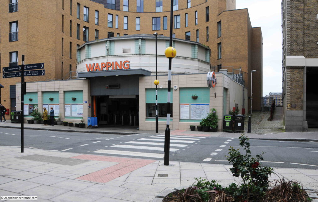
The main feature in the photo is Wapping Station, a station on the London Overground that from Wapping crosses under the river to the next stop on the route south at Rotherhithe.
I will touch on the station later in the post, but the main focus of today’s post is at the end of the walkway to the right of the station, a walkway that leads up to Wapping Dock Stairs.
If you have been reading the blog for a few years, you will realise I have a strange fascination with Thames Stairs.
Not so much the physical stair, although these are really interesting, historical structures, rather what the stairs represent.
For centuries, these were the main interface between the land and the river. If you were travelling up, down, or across the river you would use one of the Watermen who would cluster at the base of the stairs, to row you to your destination.
If you were leaving London, you would reach the boat taking you to your destination via a river stair, or if you were arriving back in London, you would return to the land via the stairs.
Countless thousands of people have used these stairs. For some, arriving at the stairs would be their first view of London, for those leaving, it could be their last view of London.
Many of those who have had to flee the country, for political or religious reasons, would have left the country via Thames stairs. Perhaps leaving in disguise, or in the dead of night to avoid recognition, to catch a boat to take them away from the country.
I have covered many such stories in previous blog posts, and will provide links at the end of today’s post, but for now back to Wapping Dock Stairs.
As with nearly all the stairs in Wapping, Wapping Dock Stairs are old, and date back to at least the end of the 17th century, and are probably much older.
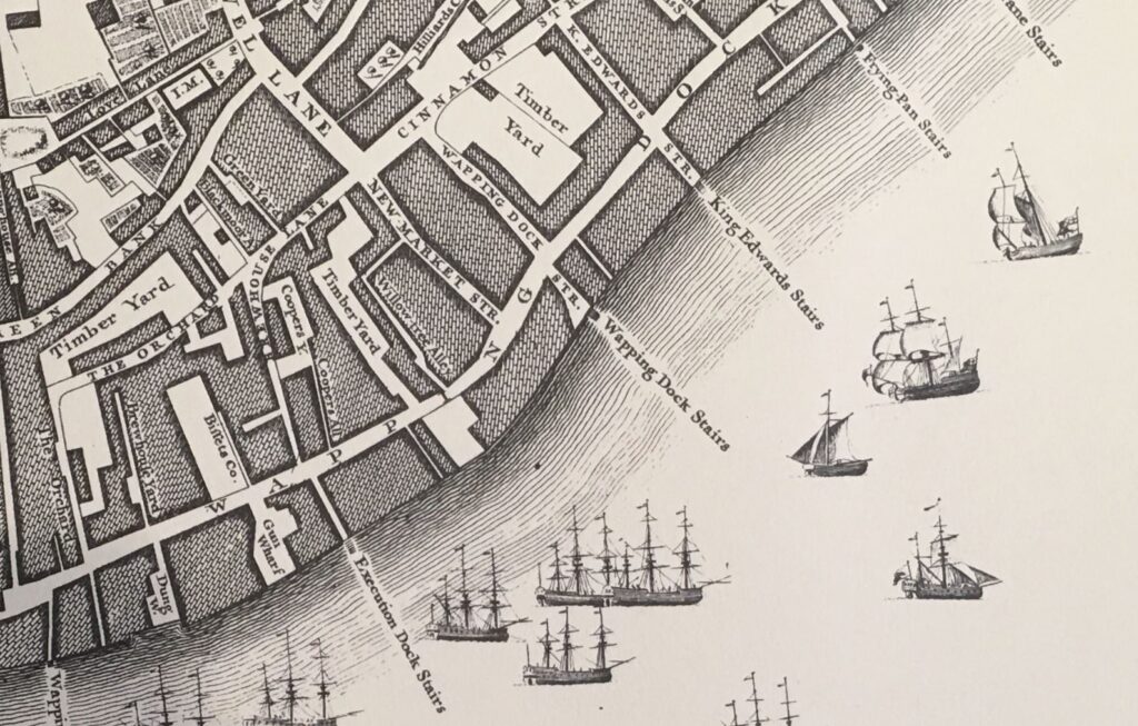
In Rocque’s map of 1746, the stairs are shown in the centre of the following extract, with Wapping Dock Street being the street that leads up to the stairs:
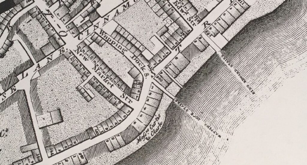
Richard Horwood’s map of London from 1799 also shows Wapping Dock Stairs, and when compared to Rocque’s map, Horwood adds a level of detail with individual buildings lining the streets:
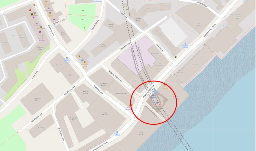
The location today, with the stairs and station circled, is shown in the following map ( © OpenStreetMap contributors):
Turning off Wapping High Street, this is the approach to the stairs. The walkway on the right leads to an entrance to the building on the right. The walkway on the left leads to the stairs.
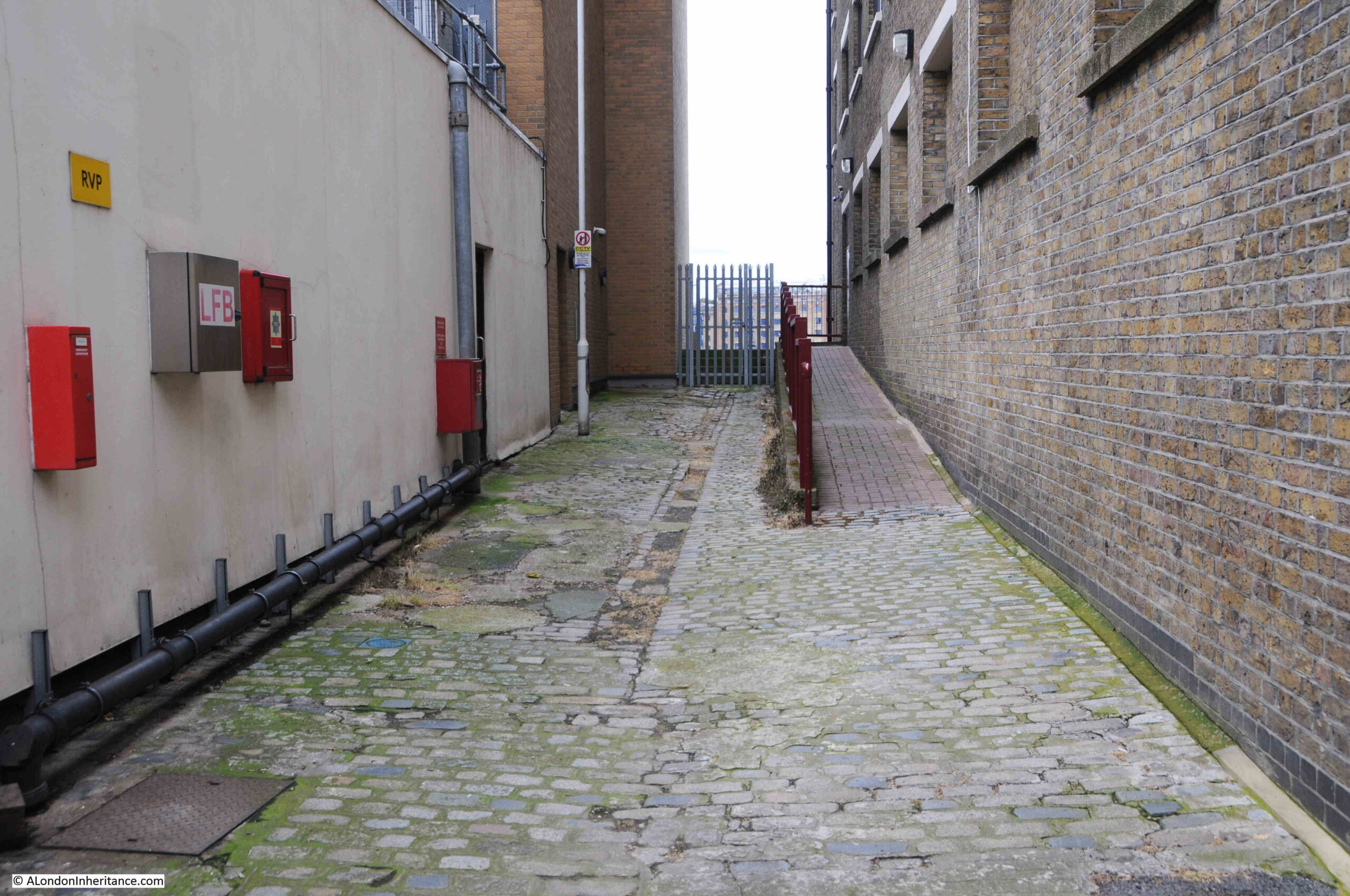
Nearly every set of stairs in Wapping had a pub by the side of the approach to the stairs. Only two can be seen today, the Town of Ramsgate by Wapping Old Stairs, and the Prospect of Whitby by Pelican Stairs.
Wapping Dock Stairs also had a pub, the Swan, and we can get a view of the pub from an advert in the Morning Advertiser on the 2nd of December,1806 when the lease came up for sale:
“A lease for 21 years, and immediate possession, of the SWAN PUBLIC HOUSE, situate at the corner of Wapping Dock Stairs, as eligible a spot for business as any along the coast; it contains in the basement, an extensive dry cellar; on the ground floor, a convenient bar, large tap-room, and good parlour, and three stories above, with a space of about 30 feet square on each floor, divided into numerous well-proportioned rooms; here is an abundance of accommodation for lodgers, as well as ample conveniences for an extensive business; common industry and attention would assuredly beget here a very lucrative trade. May be viewed at any time for a week prior to the sale. Particulars to be had of Mr. Harris, No. 12, Gracechurch Street.”
There are many newspaper references to these pubs by stairs, and so often they offer a glimpse into a story which you really want to know more about, for example, from the Morning Advertiser on the 26th of August, 1808:
“If the next of Kin of Hendrick Steerwell, late belonging to the West India Merchant ship Ranger, dec. will apply at the Swan, Wapping Dock Stairs, they will hear of something to their advantage.”
This brief advert leaves so many questions unanswered. Who was Hendrick Steerwell, where and how did he die (presumably whilst serving on the West India Merchant ship Ranger). What did he leave that would be of advantage to his next of kin, did they benefit, and also what happened if there were several next of kin.
A whole story could be written based on that single advert from 1808.
The advert also highlights that the stairs were a key part of the pub’s location. Rather than giving an address on Wapping High Street, the pub is specifically mentioned as being at the stairs.
Back to Wapping Dock Stairs, and approaching the stairs there is a strong metal gate preventing any access to the stairs. Behind the gate are the stone steps often found at these stairs which added a bit height and therefore flood prevention from high tides:
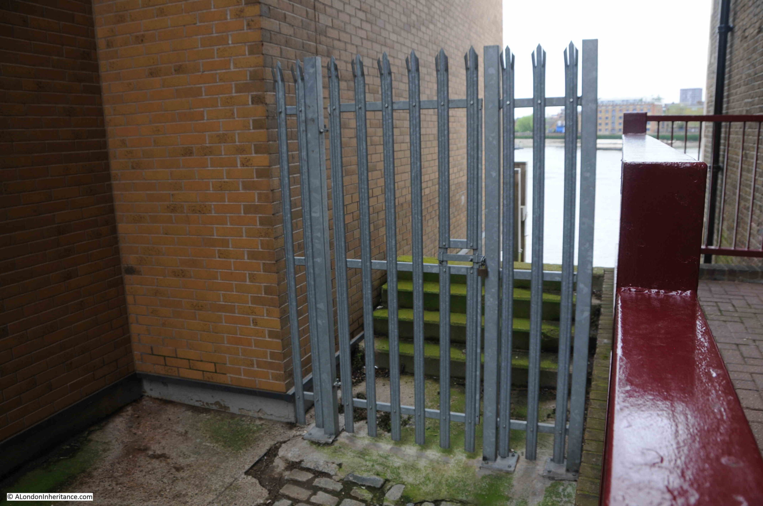
Looking over the gate, and we can see why they were fenced off so securely:
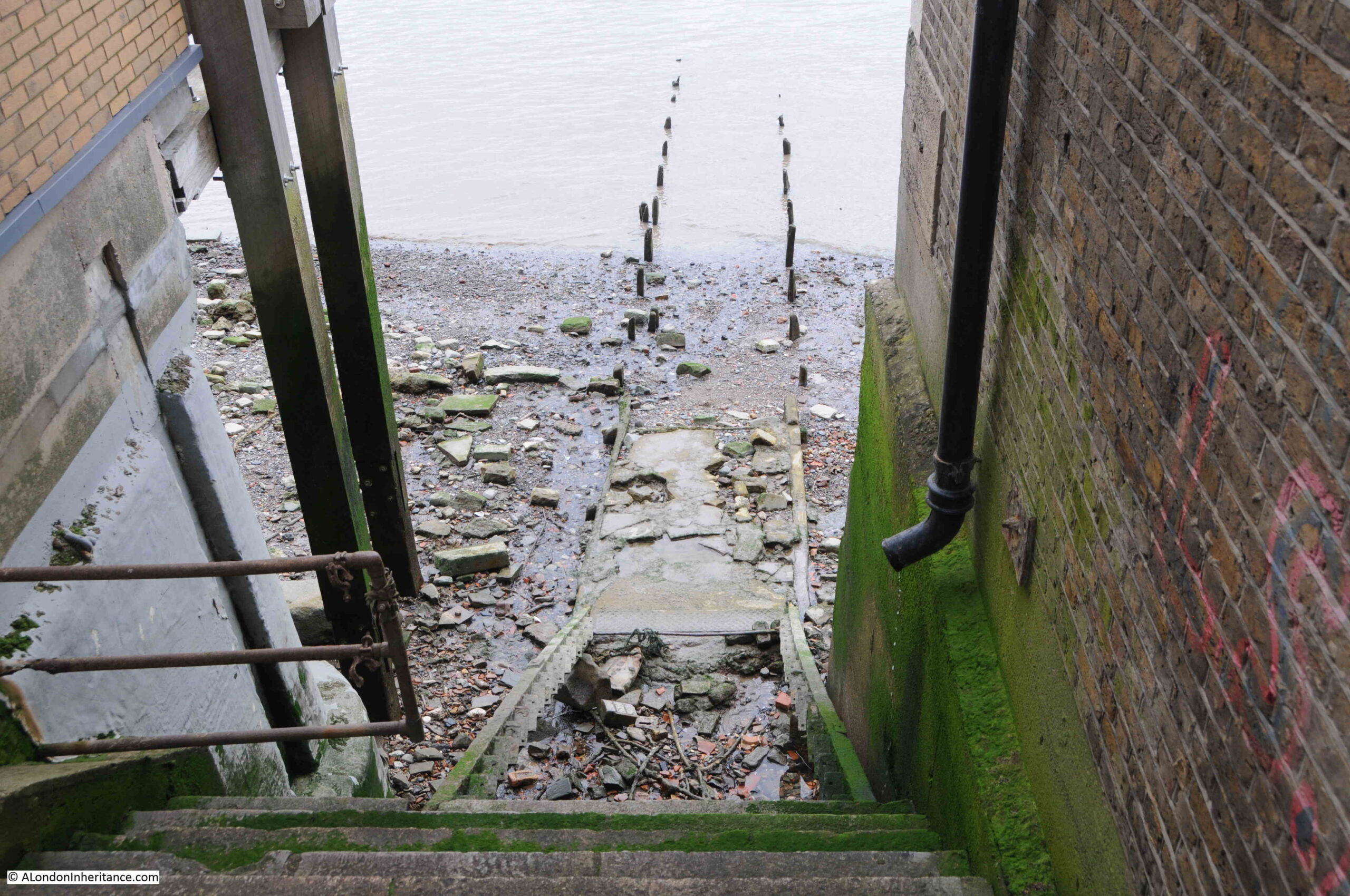
There are stone steps that run down to where a series of wooden steps once led down to the foreshore. These wooden steps have completely eroded away.
From the bottom of where the wooden steps should have been, the remains of a causeway leads out across the foreshore, into the river.
Much of the causeway has also eroded, leaving only the wooden stakes on either side that would have held the causeway in position.
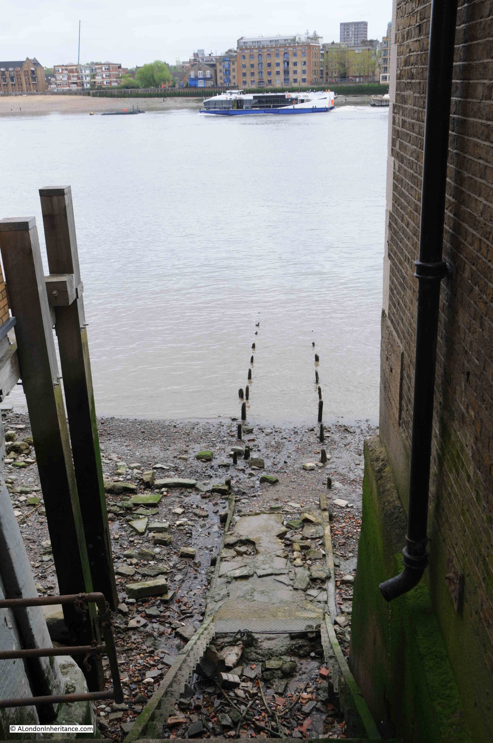
From the top of Wapping Dock Stairs, we can look across the river to Rotherhithe. This view would once have been full of ships, with ships being moored around the stairs, some of which were often for sale, such as on the 20th of November, 1805 when the following auction was advertised:
“This day, the 20th Instant, at Three precisely, The good Smack Ocean, built at Burnham in Essex, in 1798, is a strong, clinch-built vessel, and is well adapted for the Oyster Trade, a Pilot Boat, &c, well founded in stores. Lying at Wapping Dock Stairs.”
To pursue my rather nerdy interest in Thames Stairs, I have finally got hold of a copy of a book published by the Port of London Authority, titled “Access to the River Thames. A Port of London Authority Guide”, with the sub-title of “Steps, Stairs and Landing Places on the Tidal Thames”:
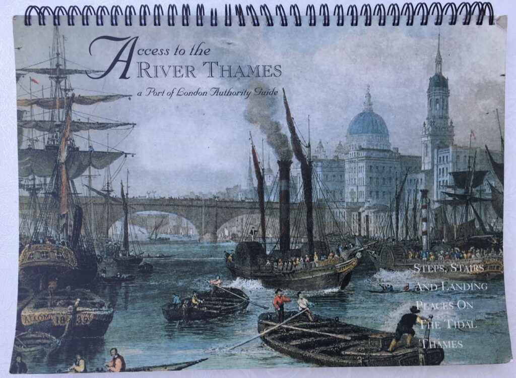
Although the book is not dated, I believe it was published around 1995.
It covers all the steps, stairs and landing places on the part of the Thames managed by the PLA, the tidal Thames, and covers from Richmond down to Southend.
There is an outline map, based on the area covered by a PLA chart for sections of the river, with the stairs along that stretch of the river marked and named.
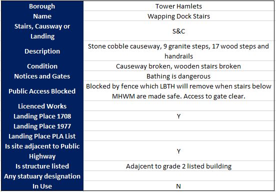
There is a table for each set of steps, stairs and landing places describing key features of each. I copied the details for Wapping Dock Stairs into the following table:
The categories for each set of stairs, landing places etc. in the book are the same, allowing them to be compared.
For Wapping Dock Stairs the stairs are described as having a broken causeway and wooden stairs. This probably means that the wooden stairs were part there, but in the following 30 years they have disappeared completely.
Bathing is dangerous, and public access to the stairs is blocked by a fence which the London Borough of Tower Hamlets will remove when the stairs below Mean High Water Mark are made safe.
I have always wondered about responsibility for these stairs. The London Borough of Tower Hamlets were responsible for putting in the metal gate, but are they responsible for the stairs down to the foreshore, or is it the Port of London Authority who, along with the Crown Estate are the primary owners of the foreshore.
I have emailed the PLA asking who is responsible for the stairs, it will be interesting to see the reply.
The tables for all stairs, from Richmond to Southend list whether the stairs were a landing place in 1708 and 1977. Wapping Dock Stairs is listed as a landing place in 1708, which sets a minimum age for the stairs as over 300 years.
I do not know why 1708 has been used for all stairs, steps and landing places along the tidal Thames. A few quick searches have not revealed any surveys or maps that were made of the whole tidal river in 1708 – probably another question for the PLA.
The Grade 2 listed building that the table states that the stairs are adjacent to is the 1920s Gun Wharves that runs along 124 to 130 Wapping High Street.
I wrote at the start of the post that the photo of Wapping Station and Wapping Dock Stairs show the methods of crossing the river that have been in use for hundreds of years.
In the early 19th century, the increase in the numbers of people crossing the river by boat resulted in a proposal for a foot tunnel under the river.
The result was a foot tunnel where the rail route under the river is today. I walked through the tunnel in 2014, and the following is a brief extract from my post on the tunnel, which you can find here.
A Thames Tunnel was badly needed. It was a four mile circuit between Rotherhithe and Wapping via London Bridge and ferries carried 4,000 people across the Thames every day at Rotherhithe.
Marc Brunel was convinced that a tunnel could be built and had the concept of a shield to protect workers at the face of the tunneling work. A meeting with investors was held on the 18th February 1824 and a company formed with Brunel appointed as engineer.
The shaft was started in March 1825 and all appeared to be going well, however in January 1826 the river burst through, but work pressed on and by the beginning of 1827 the tunnel had reached 300 feet.
As work progressed, in addition to the risk of the river breaking through, there were all manner of problems including strikes, mysterious diseases (the River Thames was London’s main drain, polluted with a considerable amount of sewage) and explosions from “fire-damp”.
The river continued to burst through. On Saturday 12th January 1828 six workman were trapped and drowned and despite the hole being filled with 4,000 bags of clay the project was temporarily abandoned due to lack of funds. The tunnel was bricked up and no further work carried out for seven years.
Work started again on the 27th March 1835 and carried on for a further eight more years.
In March 1843 staircases were built around the shafts and Marc Brunel led a triumphant procession through the tunnel. Marc Brunel’s son Isambard worked with his father during the construction of the tunnel and was appointed chief engineer in 1827, however his work with the Great Western railway took him away from the tunnel during the later years of construction. Marc Brunel worked on the tunnel from start to finish.
As one of the sights of London, the Thames Tunnel was a huge success. Within 24 hours of the tunnel’s opening fifty thousand people had passed through and one million within the first fifteen weeks.
It did not remain a foot tunnel for long. The Thames Tunnel was purchased by the East London railway in 1866 and three years later was part of London’s underground railway system.
View along one of the tracks in the tunnel:
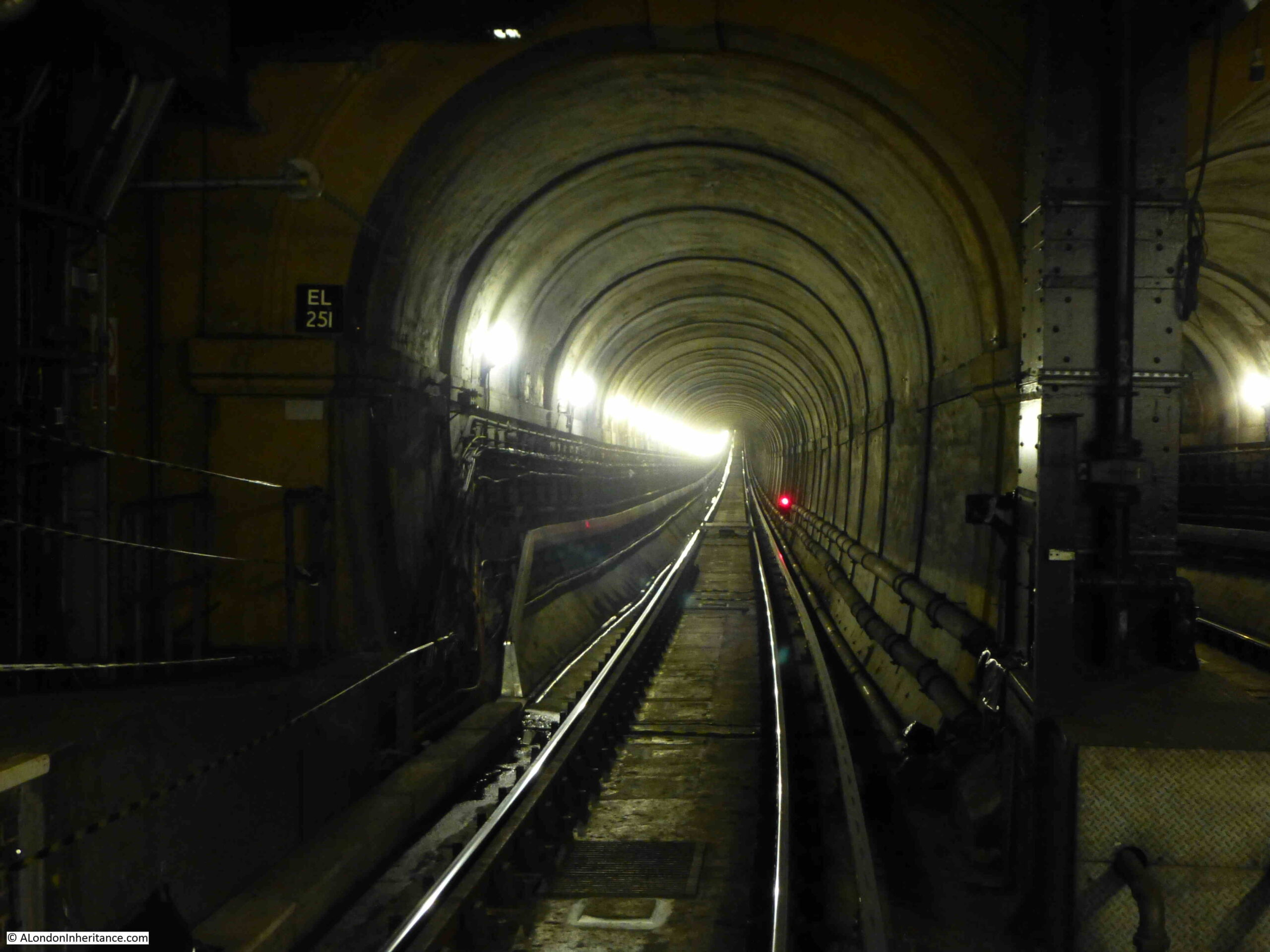
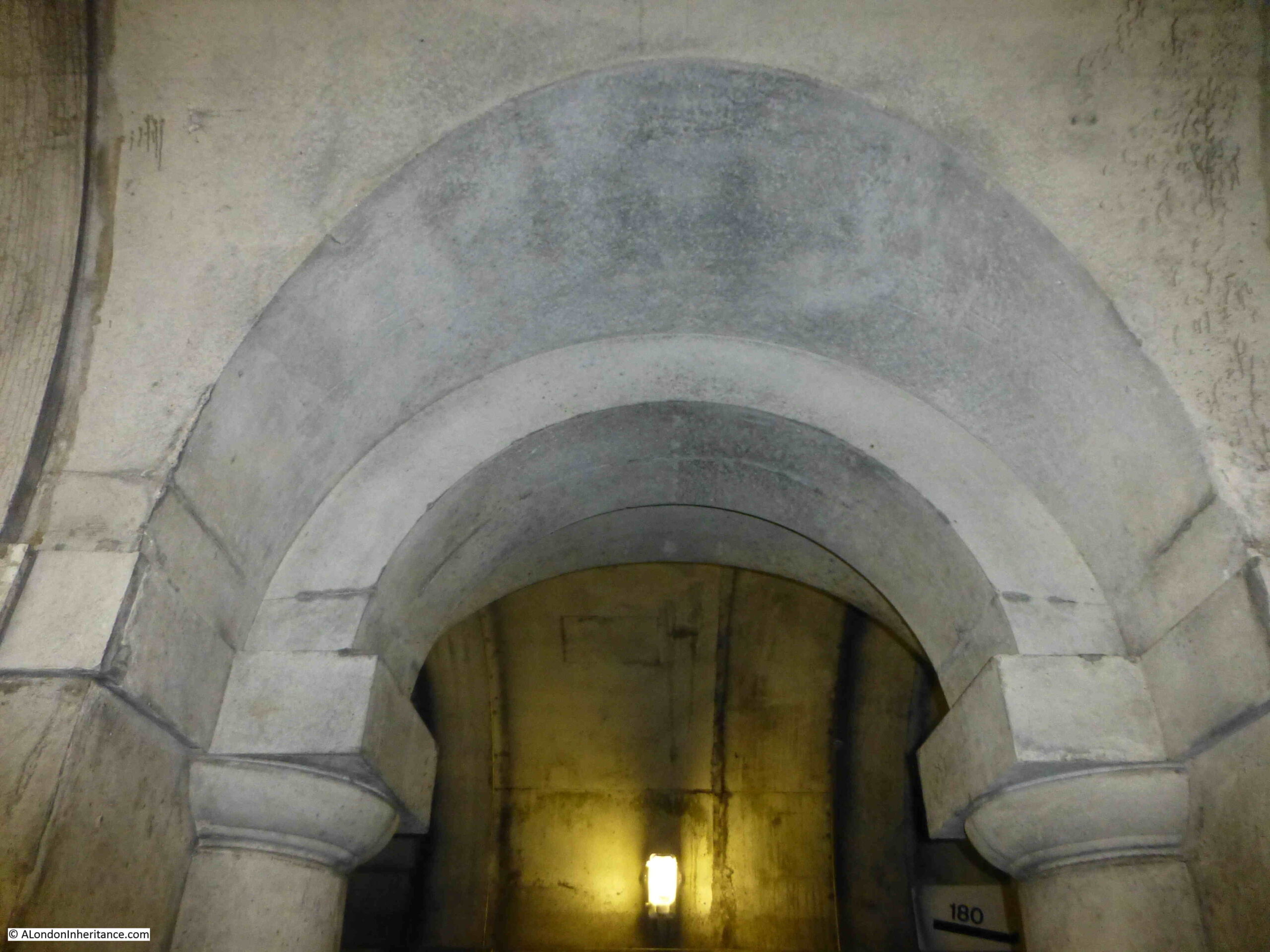
The wall between the two tracks in the tunnel had arches spaced at roughly regular intervals along the length of the tunnel.
When the tunnel first opened for foot passengers, a number of enterprising Londoners set out stalls in these arches selling to those who had come to walk through the tunnel. There were reports at the time of how all these stalls selling food, souvenirs etc. degraded the walk through the tunnel. Low level crime was also attracted to the tunnel.
Looking at the arches in what is now a railway tunnel shows a quality of design and finish that was meant to be seen by people walking through, rather than speeding past in a train.
So in summary, the view across to Wapping Station and the adjacent Wapping Dock Stairs shows:
- The means of crossing the river between Wapping and Rotherhithe for hundreds of years by taking a boat from a Thames Stair
- The introduction in 1843 of a foot tunnel which offered a new and unique way of crossing the river, and;
- The purchase of the tunnel by the East London railway in 1866 and integration into London’s rail network, part of which it has remained to this day
There was another feature that I wanted to find related to the station. Walking slightly in land, along Clave Street, then Clegg Street, where on the corner is this building, part of the landscape of Wapping prior to the development of recent decades:
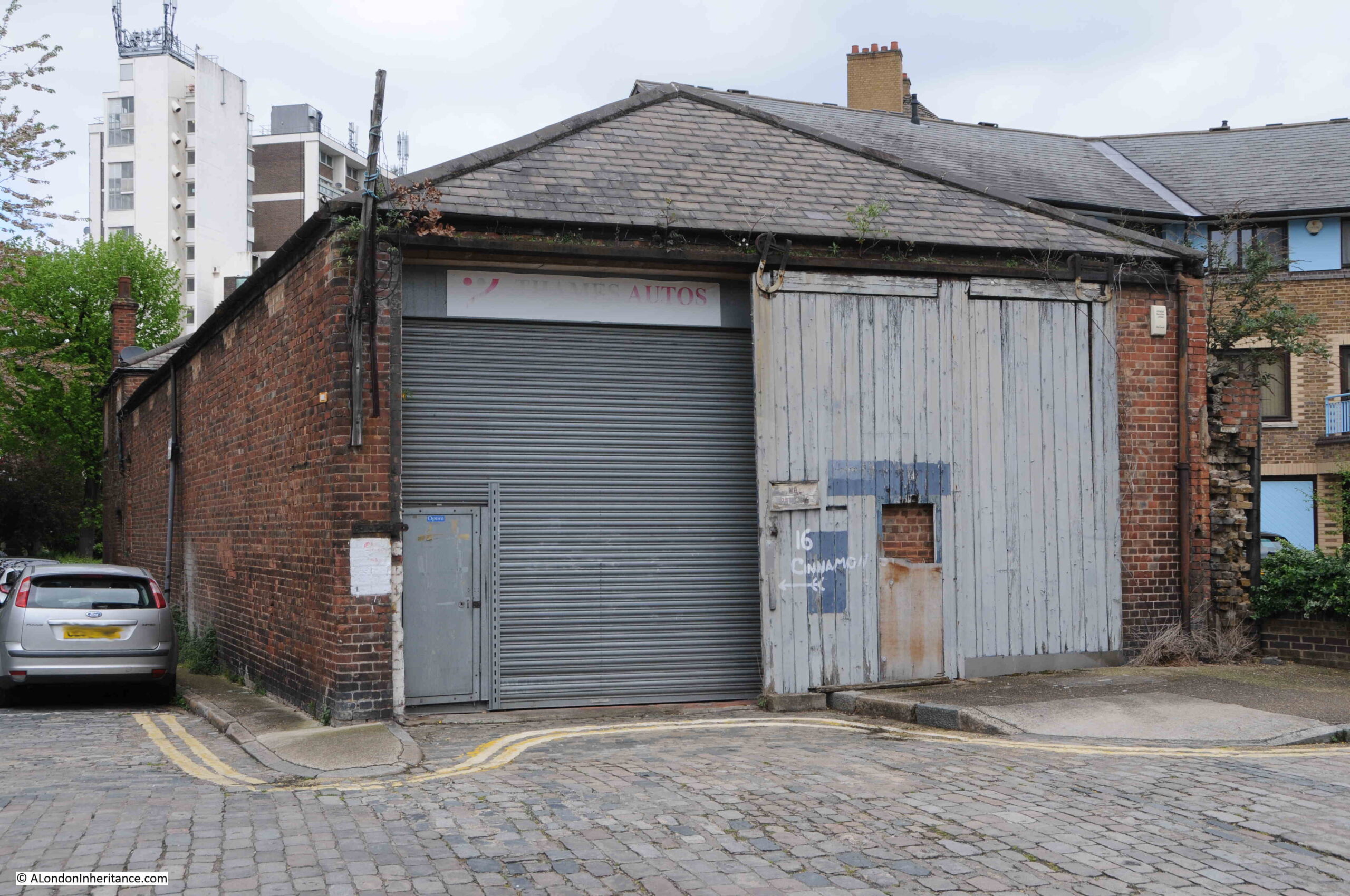
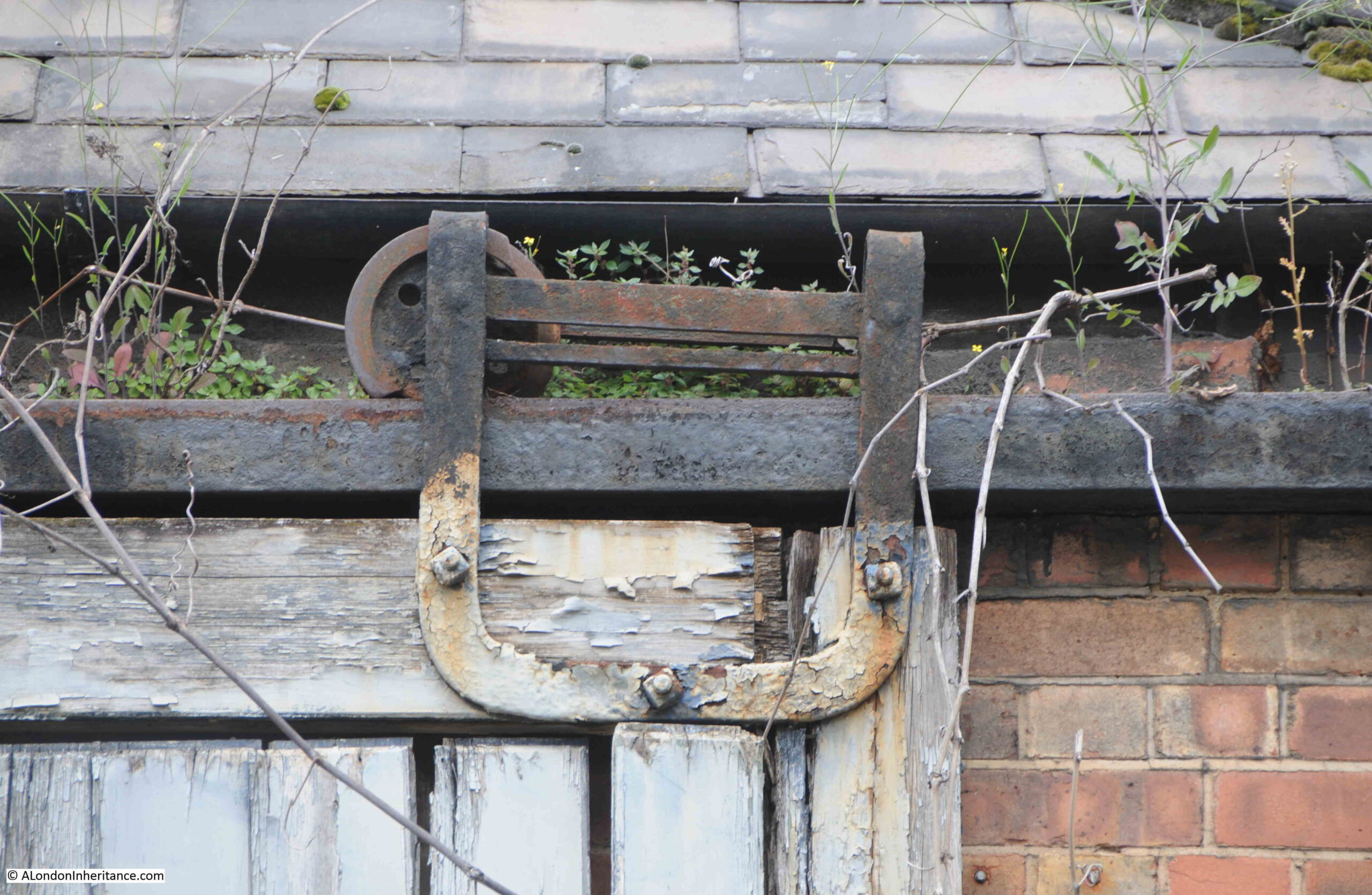
With some lovely metal fittings that allow the wooden door to be rolled along the front of the building:
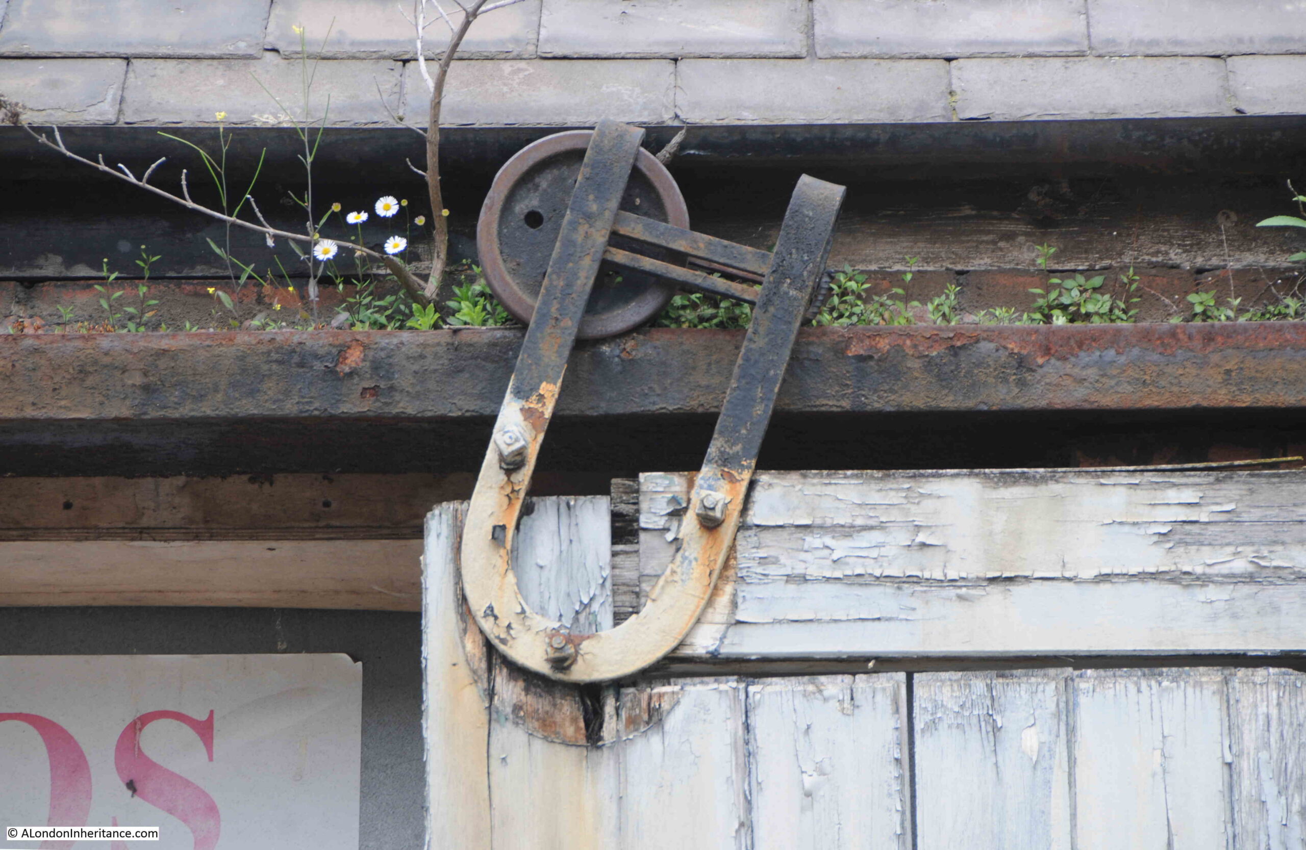
Which I suspect have not worked for many years:
At the back of the building, there is a small green space, with a children’s playground in Hilliards Court. At the side of the playground is this structure:
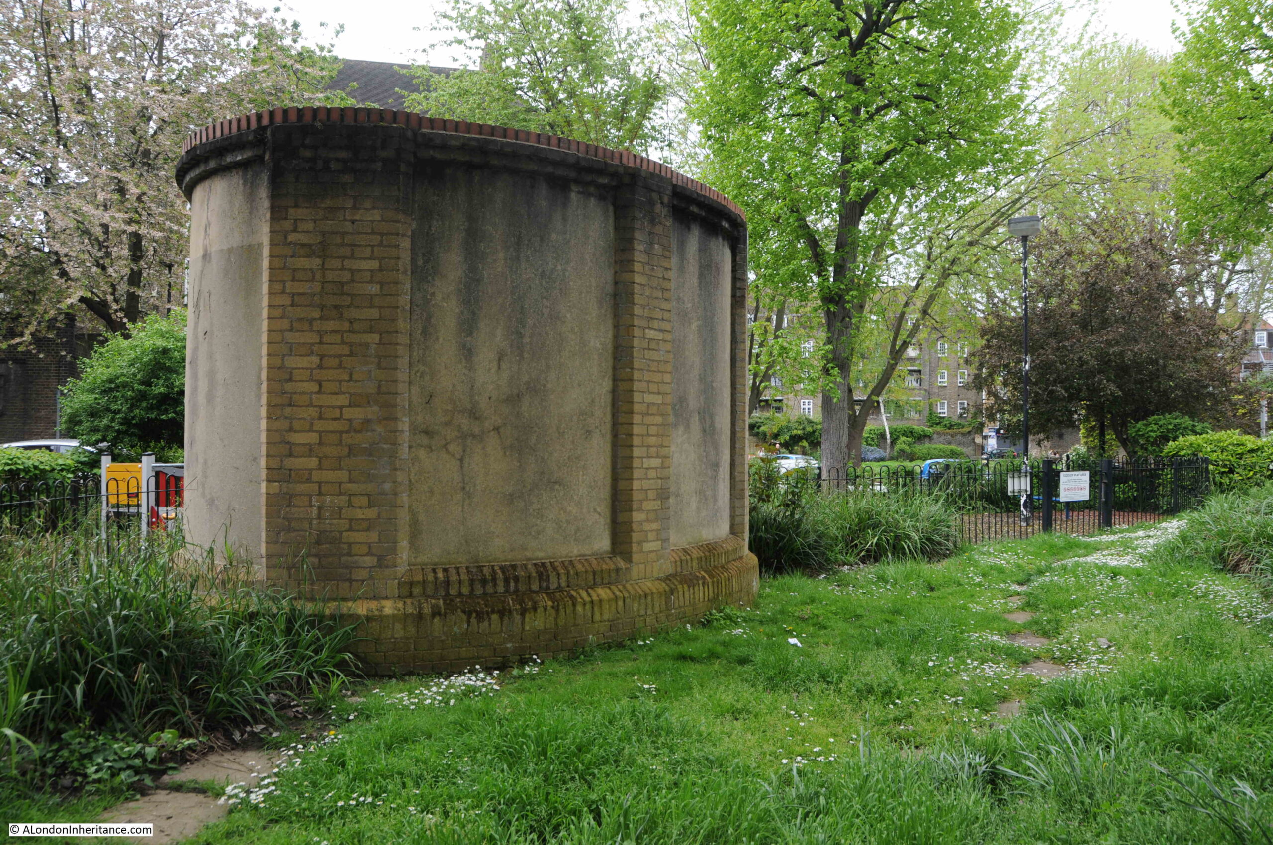
Stand here for a few minutes and you will soon hear the very clear sound of a train, either pulling away from, or slowing down into, Wapping Station. An unexpected sound in this very quiet Wapping green space, coming from an air vent to the tracks below.
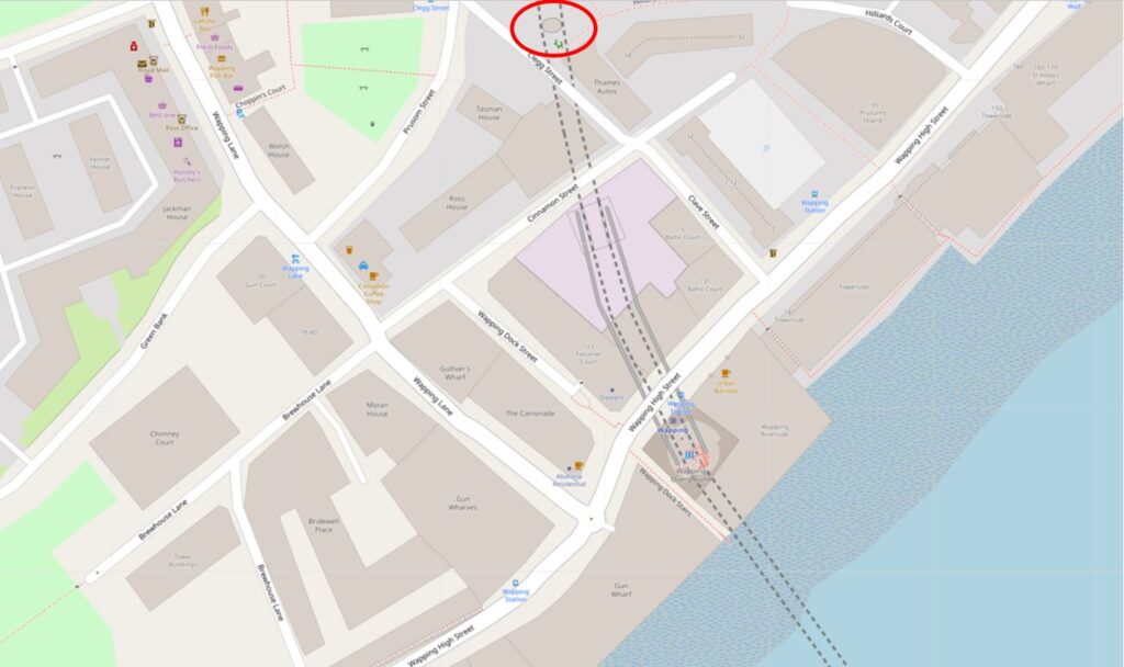
Openstreetmap includes the route of the railway, even though it is underground at this point. I have circled the air vent at the top of the following map ( © OpenStreetMap contributors):
The PLA book on Steps, Stairs and Landing Places on the Tidal Thames lists a total of 241 from Richmond to Southend, along both banks of the river – so I have only scratched the surface.
If you are interested in reading about the other Thames stairs I have covered, then:

Marvellous. I can smell the Thames from here…
30 feet square is 900 square feet.
Thanks Alec, completing this part of the post too late at night
Another fascinating post, thank you. (The pub’s floor area was 30 feet square – each side was 30 feet in length – not 30 square feet).
Thanks David, completing this part of the post too late at night.
As regards ownership of the stairs, this would not be the Crown as that relates to the foreshore itself and it would not be PLA as they would only be involved in giving a licence to rebuild the causeway as it extends into the Thames.
Riparian ownership should be held by the Land Registry but often these areas have never been registered or are registered to defunct or untraceable entities. Ideally, Environment Agency should have a list of owners as they are the authority charged with flood defences but I doubt that they do.
My own gut feeling though, is that it’s Tower Hamlets. And if it is, it may not be registered with LR as councils sometimes fail to register all their land.
Thank you very much. I am so interested in that area as many of my ancestors were there in the 1700s doing pretty well as mast makers, carpenters and shopkeepers.
In 2010, a chap named Peter Finch surveyed at all the stairs in the 1995 book and produced a pdf with his comments. See https://canoelondon.com/wordpress/wp-content/uploads/2013/04/Access-to-the-River-Thames.pdf.
Thank you again.
Ancestors on my paternal side lived in Lower Gun Alley Leading from Gun wharf, at one time ,and on the census throughout the 1800`s are listed as watermen or lightermen.
Once again a great and informative read and photos, Thank you…..
Perhaps 30 feet square meant exactly that, ie 30ft x 30ft and not 30 Square feet?
Fascinating. Thank you so much for this post.
Always fascinated by the dockland blogs very interesting.
Particularly love the blog posts on stairs, keep on going with those please. What an amazing piece of
work your blog continues to be.