Yearly Archives: 2017

Trafalgar Square, New Year’s Eve, 1981

In my last post of the year, I revisit an earlier New Year’s Eve celebration in London, but can I firstly wish you all a very Happy New Year for 2018 and thank you for reading my posts and your feedback over the past year – it is so very much appreciated.

New Year’s Eve in London has become a very organised event. Large areas of central London are closed, tickets must be purchased, and sell out very quickly, security will, understandably, be very tight. This is all very different to my first experiences of New Year’s Eve in London. In the late 1970s and 1980s we would occasionally spend the evening out and about, wandering the streets, pubs, clubs of the West End and celebrating midnight with thousands of people in Trafalgar Square.

One year I took my camera with me and recently I found some of the negatives. Many had camera shake a I was trying to take hand held photos at night and using a film camera. I still have to find some of the other negatives of photos taken whilst walking the streets, however here is a set of photos taken in the crowd in Trafalgar Square on New Year’s Eve, 1981.

New Year's Eve

Trafalgar Square was then the centre of New Year’s Eve celebrations until the focus moved to the Embankment with the firework displays along the Thames.

My memory of these nights in London are probably influenced by the passage of time and alcohol on the night (the reason why I only risked taking my camera along on one New Year’s Eve), however I remember the very large crowds that assembled in Trafalgar Square ready for midnight and so many people walking the streets before and after midnight, usually with bottle or cans in hand.

New Year's Eve

This was only 36 years ago, but it feels like a different world. If you compare these photos with those of the crowds in London tonight there is one very big difference – in 1981 there was not a single mobile phone in sight. Tonight the glow of mobile phone screens taking photos of the fireworks, selfies etc. will be seen across the crowds.

There was also minimal security, I do not remember seeing many police around and those that were visible would not be armed.

I do not remember any road closures (although the roads around Trafalgar Square probably were closed), however there was hardly any traffic. I do remember the freedom to wander the streets into the early hours and the alcohol induced friendliness of everyone on the streets – probably one of the few times Londoners will talk to so many strangers.

There was also a need to be careful – as when any such large crowd assembles there were rowdy elements, those who had been drinking too much and for too long, and crime such as pickpocketing – but at the age I was then it was all a big adventure.

New Year's Eve

Some detail from the above photo – if it could be climbed then it would be climbed:

New Year's Eve

The only organised facilities that I remember were some first aid facilities around the base of Nelson’s Column:

New Year's Eve

I have no idea how many people there were in Trafalgar Square, however you had to get there well before midnight to get in the centre of the square. Crowds would stretch along all the roads leading into Trafalgar Square. In the following photo the sea of heads can be seen stretching off into the Strand.

New Year's Eve

I am not sure what time we got home that night, but after midnight, celebrations continued for many hours in the streets across the West End.

New Year's Eve

New Year’s Eve in Trafalgar Square could not compete with the massive firework display along the river tonight, however I suspect that the New Year’s Eve fireworks are aimed just as much for TV viewers around the world as they are for those standing along the Embankment, as London competes with other global cities.

With the now ubiquitous mobile phone, they will also probably be one of the most photographed large events in London.

alondoninheritance.com

The Temple Church

I had not been in the Temple Church for over 45 years. It is a place I have wanted to visit again, however until this summer, I had not made the effort to turn off Fleet Street and walk down the alley when the church was open.

The time of my last visit was as a small child, on one of the many London walks with our parents. My memories of the church are of a dark, mysterious interior – a black and white vision of the church. memories probably distorted by a child’s view and the passage of time.

Finally, this year, on a glorious summer day (good to remember just after the shortest day of the year), I did turn off Fleet Street and walk down the short alley to the Temple Church to see if it was the same as the vague memories of my only other visit.

The entrance to the alley that leads to the church is through a stone archway that occupies one half of the ground floor of a four storey building. On leaving the archway and entering the open alley we are in a place that is very different from the noise and traffic of Fleet Street, just a short distance behind:

Temple Church

The initial view of the round tower, probably the most distinctive feature of the church:

Temple Church

All that remains of the churchyard on the northern side of the church:

Temple Church

The round tower:

Temple Church

The Temple Church was built by the Knights Templar in the 12th century and the round tower was consecrated by Heraclius, the Patriarch of Jerusalem in 1185. The design of the round tower was intended to resemble the Church of the Holy Sepulchre in Jerusalem.

The chancel was added in 1240.

The Temple Church is a Royal Peculiar, this is a church that belongs directly to the monarch, rather than belonging to a diocese as with a parish church. The lead member of clergy in the Temple Church is called the Master of the Temple, a reference to the head of the order of the Knights Templar.

Despite the 12th century origin of the church, it has undergone so much “restoration” over the centuries, including major 19th century works, that there is a very little of the original church left. The Temple Church was also very badly damaged during the last war which required considerable restoration and rebuilding work.

Writing in The Bombed Buildings of Britain (the Architectural Press) in 1942, John Summerson stated “The Temple Church is a building which has suffered such dreadful ‘restoration’ that hardly one visible stone of it can be certified as older than the first half of the 19th century”.

The church did escape the Great Fire in 1666, but soon after in 1682, according to “The New View of London” by Edward Hutton, published in 1708 the Temple Church was “beautified, and the curious wainscot screen set up. The south-west part was, in the year 1695, new built with stone. In the year 1706 the church was wholly new whitewashed, gilt, and painted within, and the pillars of the round tower wainscoted with a new battlement and buttresses on the south side, and other parts of the outside were well repaired.”

More repairs were carried out in 1737 to the north and eastern sides of the church and in 1811 more general repairs were made.

More extensive repairs were carried out in 1825 to the south side of the church and the lower part of the round tower and the earlier wainscoting was removed. Further repairs and restoration began in 1845 to remove much of the earlier “beautification” and included the lowering of the pavement back to its original level. The whitewashing was also been removed.

19th century repairs including refacing much of Temple Church using Bath stone.

One of the few parts of the Temple Church which does appear to be part of the early build of the church is the magnificent western doorway to the round tower. The difference in colour shows the difference between original and Victorian restoration – the lighter coloured three outer pillars on each side are Victorian, the inner columns are original.

Temple Church

Walking out of the alley, into the large open area at the southern side of the church provides a good view of the round tower:

Temple Church

And of the whole southern facade of the church which includes the day to day entrance into the building:

Temple Church

This southern view of the church was not always so open, and highlights the last time the church suffered major damage and later restoration. There is a stone plaque among the paving slabs recording the loss of the Lamb Building that had been built in 1667 and was destroyed in 1941:

Temple Church

The Lamb Building as it was in the 1920s is shown in the photo below. A wonderful building, damaged to the point where it could not be rebuilt. The photo also highlights how close buildings were constructed up again the Temple Church.

Temple Church

The following photo is looking across from Middle Temple and shows the Temple Church in the centre between the large hall on the right and the buildings on the left. Both the Temple Church and the hall have lost their roofs and have been reduced to shells of buildings with only their outer walls remaining.

Temple Church

(Photo used with permission from London Metropolitan Archives, City of London. Catalogue reference M0019522CL)

The problem I find when researching these posts is that I almost always find related interesting topics to read more about. For the Temple Church, I was looking in the Imperial War Museum archives and found a couple of paintings of the Temple Church made by artists working under the War Artists Advisory Committee (WAAC).

The WAAC was formed in 1939 and led by the National Gallery Director, Kenneth Clark. The aim was to create an artistic record of the war, and during the course of the conflict over 400 artists had worked on the project, creating around 6,000 works of art.

I plan to write a future post on the War Artists Advisory Committee – it is a fascinating body of work and portrays a different aspect of the war across London to the photographic record.

The first picture (© IWM (Art.IWM ART LD 1510) is by Henry Samuel Merritt and shows the badly damaged round tower and workers clearing rubble from around the building:

Temple Church

The second picture (© IWM (Art.IWM ART LD 4899) by Norma Bull shows the stone effigies of knights on the floor of the round tower. The remains of the damage caused by the bombing and fires can be seen including the broken metal railings around the effigies and cracked and broken tiling:

Temple Church

These pictures illustrate the level of post war rebuilding that was needed to restore the church to the standard we see today.

Having walked around the outside of the church it was time to take a look inside and see if the church resembled my black and white memories of the church from my first visit.

Walking through the door revealed a very different church, bright, colourful and showing the incredible amount of effort that went into restoring the church from the wartime shell.

This is the view looking along the chancel:

Temple Church

From the opposite side of the chancel:

Temple Church

On the floor of the round tower are the effigies of knights that I remember from my first visit and probably most captured a childhood imagination:

Temple Church

The effigies are of knights from the 12th and 13th centuries, some are identified, other are not, and are labelled as “Effigy of a Knight”:

Temple Church

The effigies suffered significant damage in 1941. The roof of the round tower collapsed onto the floor below and fires consumed all the woodwork in the church. As with the rest of the church, the effigies also required significant post war restoration.

Some of the effigies are named, although most of the reference books I have read covering the Temple Church refer to the naming as “said to be” so I suspect that due to the centuries that have passed, the periodic restoration and rebuilding of and within the church, we cannot really be sure that the effigies are named correctly.

These two are both identified as William Marshall, the 13th century first and second Earl’s of Pembroke:

Temple Church

The first Earl of Pembroke worked between King John and the Barons during the negotiations that ended with the Magna Carta. His son, the second Earl of Pembroke was one of the Surety Barons at Runnymede. They were both buried under the round tower.

The rebuilt roof of the round tower:Temple Church

Standing by the interior side of the western door, this is the view down the length of the church, through the round tower and the chancel:

Temple Church

The following 1870 drawing from a similar viewpoint to the above photo shows that the post war rebuilding was faithful to the building as it was before the war:

Temple Church

There are a number of carved heads in the triangular spaces (spandrels) either side of the top of the arches around  the edge of the round tower.

Temple Church

There are differing opinions as to whether any of these are original or later recreations. Simon Bradley and Nikolaus Pevsner writing in “London: The City Churches” state that the heads were renewed by Robert Smirke during one of the 19th century restorations.

Temple Church

Whatever their actual age, they do recreate typical medieval grotesques, caricaturing people, animals and mythical beasts.

Temple Church

Including combinations of people and animals with this rather painful looking biting of an ear.

Temple Church

The font is not that old, dating from around 1840:

Temple Church

This is the tomb of Edmund Plowden:

Temple Church

Plowden was born in 1519 and was a notable English Lawyer. As well as through the legal profession, his connection with the Temple Church was his role as Treasurer of the Temple Church from 1561 to 1570. He died in 1585 and following his directions, he was buried in the Temple Church.

The tip of the nose on the following figure on the side of Plowden’s monument indicates many years of rubbing by visitors to the church:

Temple Church

The post war rebuild of the Temple Church was significant, but was mainly completed by the mid 1950s, with stained glass being completed towards the end of the decade.

There is a carved record of the rededication of the church in 1954 in the Chancel:

Temple Church

Three of the stained glass windows at the eastern end of the chancel. These windows were made by Carl Edwards between 1957 and 1958. The summer sunshine really highlighted the colour and the delicate and intricate nature of these windows:

Temple Church

There is a door at the base of the round tower with steps that lead up to the triforium which runs around the circumference of the round tower.

Temple Church

The view from the round tower triforium, looking through the three arches that lead into the chancel:

Temple Church

Whilst there is very little left of the original church, and the building has been through so many restorations and rebuilds, perhaps the key point is that whilst the fabric has changed, Temple Church maintains the original layout, which includes the important and rare round tower. The Temple Church also provides a tangible link with the Knights Templar (who have been the subject of some fantasy writing and theories over the years), along with the Magna Carta and the legal profession of the surrounding Inner and Middle Temple.

I found the Temple Church to be very different to my distant memories of the place. Far from having a dark, black and white interior, the church is bright, colourful and fascinating.

alondoninheritance.com

Gresham Street And St. Lawrence Jewry

I did not immediately recognise the location of this week’s post. I knew it was in the City of London, but I could not place the curve of the street or the church tower. It was finally the buildings on the right and the church tower that resulted in  me standing in Gresham Street, by the junction with Foster Lane.

Gresham Street

And this is the same view on a late autumn afternoon in 2017:

Gresham Street

The two photos help illustrate the many subtle changes that have taken place in the City, and what buildings did, and did not survive post war reconstruction.

The building that initially helped me to identify the location is the large building on the right of both photos. This is the hall of the Goldsmiths’ Company. The building is the third Goldsmiths’ Hall on the same site. The Goldsmiths’ Company moved to this location in 1339 and the current hall dates from 1835. The hall avoided the complete wartime destruction of many of the surrounding buildings, however the south west corner of the building was damaged by a direct hit.

The building next to Goldsmiths’ Hall is the Wax Chandlers Hall. As can be seen this was completely destroyed during the war apart from the granite ground floor outer walls. Rebuilding of the hall was completed in 1958 with the granite frontage being retained and brick used for the new upper floors. As with the Goldsmiths’ Hall, this is a historic location for the Wax Chandlers as they have occupied the site since 1501.

The church tower is that of St. Lawrence Jewry. The church was almost completely destroyed in December 1940, apart from the tower and the outer walls. The church had lost its steeple, which is one of the reasons I did not immediately identify the church.

Gresham Street has also undergone some subtle changes. Today, standing outside Goldsmiths’ Hall we can look directly down to St. Lawrence Jewry. This was not the case when my father took the original photo as there were some curves in the street and a building in front of the church tower.

Gresham Street has been through post war widening and straightening. The following map shows the area today. There is only a slight curve in the street by the junction with Aldermanbury.

Gresham Street

If we go back and look at John Rocque’s map of 1746 we can see that the street had a more pronounced curve at the junction with Aldermanybury and it is here that post war straightening has slightly changed the street. Gresham Street also had different names.

Gresham Street

During the 19th century, many of the City’s streets were widened, straightened and what were smaller individual streets were joined into single, longer streets.

Gresham Street was one of these, created in 1845 from Cateaton Street and Lad Lane. The new street was named after Sir Thomas Gresham who was the founder of the Royal Exchange and Gresham College, which started in Bishopsgate Street in 1597 before moving to Gresham Street in 1843 – it has been at Barnard’s Inn Hall near Chancery Lane since 1991.

It is interesting that the street alignment and the buildings blocking the front of St. Lawrence Jewry were much the same in my father’s post war photo as they were in 1746.

This is the full view of Goldsmiths’ Hall on Gresham Street. The main entrance is along Foster Lane. This is the only building to survive intact from before the last war along this stretch of Gresham Street up to the church of St. Lawrence Jewry,

Gresham Street

The front of the Wax Chandlers Hall is in the photo below. The granite frontage is the only part that survives from the original pre-war building. The hall dated from the 1845 creation of Gresham Street as the earlier hall occupied land to the north of the existing hall, which was used in the extension of Gresham Street.

Gresham Street

The following print from 1855 shows the Wax Chandlers hall in 1855, not long after it was built. The ground floor is the same as in the building today, however the upper floors are very different as a result of the post war rebuild of the bombed building.

Gresham Street

Walking down Gresham Street I came up to the church of St. Lawrence Jewry, the church tower in the distance in my father’s photo.

Gresham Street

In the original photo, the church had lost the spire on top of the tower, indeed only the tower and surrounding walls had survived the bombing and resulting fires.

The first church on the site was around the 12th century. The dedication is to St. Lawrence, a 3rd century martyr who was burnt to death on a gridiron in Rome. The reference to Jewry is that the church was originally in the part of the City occupied by the Jewish community.

The symbol of the gridiron on which St. Lawrence was killed is used on the weather vane of St. Lawrence Jewry:

Gresham StreetThe church was one of many destroyed in the Great Fire of 1666 and a new church was built by Wren in 1671 to 1677. The new church cost £11,870 and was the most expensive of the City churches built after the Great Fire.

The rear of the church from the junction of Gresham Street and King Street:

Gresham Street

This 18th century view of the church from King Street shows that the post war rebuild of the exterior was faithful to Wren’s original design:

Gresham Street

This print from 1811 is interesting, it includes the small church yard in what is now the large open space in front of the Guildhall, and the text also mentions the church being in Cateaton Street.

Gresham Street

The interior of the church:

Gresham Street

Looking towards the organ at the rear of the church:

Gresham Street

The roof:

Gresham Street

The interior of the church today is very different from the pre-war church. City churches tended to be very ornate with lots of wood panelling. The following print shows the organ case of the pre-war St. Lawrence Jewry:

Gresham Street

This is the vestry of the pre-war St. Lawrence Jewry – the ceiling was painted by Isaac Fuller II and carved plaster and dark wood paneling produced a very ornate room:

Gresham Street

As mentioned earlier, the interior of the church was completely destroyed by the fires caused by incendiary bombs during the raids on the 29th December 1940.

My father’s photo only shows the tower from a distance with the loss of the spire being the only visible damage, however the following photo shows the interior of the church – open to the sky, the interior completely destroyed and a single monument surviving on the wall.

Gresham Street

Within the church is a small display showing some of the artifacts rescued from the bombed church. This includes the cups shown in the photo below to show the damage that was caused by the intensity of the heat.

Gresham Street

A plaque on the wall of the church commemorates the post war reconstruction:

Gresham Street

The destruction of the interior required new furniture which was donated by the City Livery Companies. Items for the church also came from other churches. Many of the pews came from Holy Trinity Marylebone and the font which dates from 1620 was a post war relocation from Holy Trinity Minories.

Gresham Street

The church in late afternoon autumn light:

Gresham Street

Gresham Street

The church has lost its churchyard and bombing destroyed the majority of the interior monuments, however a few monuments and gravestones are preserved, including this 18th century monument to several members of the Heylyn family.

Gresham Street

St. Lawrence Jewry once had a small churchyard as shown in Rocque’s map and one of the 18th century prints shown above. The area between the church and the Guildhall was also built up with only a street running from Gresham Street up to the main entrance of the Guildhall.

This area is now a large open space, as shown in the following photo. I am standing at the edge of the church in what was once the churchyard.

Gresham Street

The Guildhall also suffered extensive damage during the same raids that destroyed St. Lawrence Jewry – that is another story for the future. The following postcard shows the buildings on the left between the church and the entrance to the Guildhall.

Gresham Street

On the north east corner of the church is an old, hardly readable wooden sign that reads “Church entrance in Gresham Street”. It looks very old, but I cannot believe it is pre-war as being wood I doubt it would have survived the fires.

Gresham Street

Gresham Street and St. Lawrence Jewry were my last locations to visit after a walk from Canary Wharf, through Shadwell and Wapping to the City, to visit sites for a couple of my posts over the last month, and a few more for future posts. Very different start and end points, but both with so much to tell of London’s history, however at this point, the main thing on my mind was finding a local pub.

alondoninheritance.com

Curzon Square, Curzon Place And Seamore Place

For this week’s post I am on the edge of Park Lane, in Pitt’s Head Mews between Green Park and Hyde Park, at the bottom of the steps leading up to Curzon Square, or what in 1951 was called Curzon Place:

Curzon Square

Despite redevelopment of the buildings on either side of the steps, they are still there, although now with a slight curve in the steps as they lead up to Curzon Square, and with new stone steps, replacing the originals which had probably seen over a century of use:

Curzon Square

Pitt’s Head Mews was once full of stables, however today the part of the street that runs up to Park Lane has been completely redeveloped. On the left is the London Hilton Hotel which was built in 1963 on an extensive area between Pitt’s Head Mews and Hertford Street that was destroyed during the blitz.

The stairs are not that visible, tucked away between the two buildings on the right in this view standing in Pitt’s Head Mews looking up to Park Lane

Curzon Square

Today, the steps lead up to Curzon Square, however as can be seen in the sign on the left of the 1951 photo, the area at the top of the steps was then called Curzon Place. This is not the only name change.

The following drawing from the book London – Alleys, Byways and Courts by Alan Stapleton, published in 1924 includes this drawing of the steps, looking much as they did when my father took the 1951 photo, however note the caption to the drawing and the sign in the drawing to the top left of the steps – when this was drawn in the 1920s, the area at the top of the steps was called Seamore Place:

Curzon Square

Curzon Street originally ran straight into Park Lane. The following map extract from 1832 shows Curzon Street along the middle of the map. Curzon Place is the small area of open space just above the letter ‘M’ in Mews.

Curzon Square

By 1895 the area had been redeveloped and Curzon Street was now blocked off from Park Lane. At the end of the street, it turned left into Seamore Place. You can just see the steps leading into Pitt’s Head Mews at the lower right corner of Seamore Place in the following map. At the time this was the shortest route into Curzon Street from the south.

Curzon Square

The buildings at the end of Curzon Street were demolished in 1937 which returned the direct access to Park Lane that Curzon Street had in the 1832 map. Seamore Place appears to have been renamed Curzon Place around the 1937 changes.

At the top of the steps, we are greeted with this view of Curzon Square:

Curzon Square

There does not appear to be much written about Curzon Square / Seamore Place, however whilst reading the book by Alan Stapleton which included the drawing shown above, I did find the following:

“Seamore Place consists of old-fashioned mansions, but No. 8 was the home of the ‘gorgeous’ Lady Blessington, with whom live here, her daughter and son-in-law, Count d’Orsay. Here nightly, met all the fashion, celebrities of all nations, and travellers from all countries.

Haydon said, ‘Everyone goes to Lady Blessington’s. She has the first news of everything and everybody seems delighted to tell her. She is the centre of more talent and gaiety than any other woman of fashion in London.

She began to edit her ‘Book of Beauty’ here. Willis described her as ‘a woman of remarkable beauty’ and ‘one of the most lovely and fascinating women he had ever seen.”

The Wallace Collection includes the following painting of Lady Blessington, by Thomas Lawrence in 1822 – an early 19th century celebrity:

Curzon Square

Edward Walford writing in Old and New London also includes the following description of Seamore Place;

“Seamore Place is the name of a row of handsome but old fashioned mansions, which occupy a sort of cul de sac at the western end of Curzon Street. They are only nine in number, and their chief fronts look westward over Hyde Park. in one of them, Lady Blessington with her daughter and her son-in-law Count D’Orsay, resided during a part of her widowhood, from about 1836 to 1840, surrounded by all the fashionable butterflies of the world whose admiration she so much courted.”

The last time that Curzon Square became well known was in the 1970s. The building shown below is part of 9 Curzon Place. It may look to be a Georgian building of blackened London brick, however the interior of the house was completely gutted just after the last war. The building was converted into 12 apartments and major changes were made including putting a lift shaft up through the central staircase.

Curzon Square

The American singer Harry Nilsson owned one of the flats on the top floor, and it was in this flat that firstly Mama Cass Elliot of the band the Mamas and Papas died in 1974 of a heart attack.

This was followed in 1978 by the death in the same flat of Keith Moon, the drummer with The Who, who died of an overdose of Heminevrin which he was taking to help with the symptoms of alcohol withdrawal.

9 Curzon Place was part of a redevelopment of Curzon Square that ended in 2002 and saw the square pedestrianised, along with an underground car park. I believe it was at the time of this redevelopment that the name changed from Curzon Place to Curzon Square.

The entrance to 9 Curzon Square:

Curzon Square

The view from Curzon Street looking past 9 Curzon Square. At the far end the steps down to Pitt;s Head Mews can be seen:

Curzon Square

Curzon Square today appears to be much quieter than when Keith Moon and Lady Blessington called this part of London home.

I am pleased though, that despite development of the square, the steps – although of recent materials – are still in the same place as when my father photographed them, and Curzon Square is another location I can tick off in the search for all his London photos.

alondoninheritance.com

Hardinge Street, Johnson Street And Ratcliffe Gas Works

For this week’s post, it was a short walk after leaving last week’s location at Westferry Road, to find what remains of a street my father photographed in 1949. When sorting through his photos this was one location I was doubtful I would find. I did not recognise the scene and there were no clues to place the photo, apart from being taken from within what looks like a railway arch. I published the photo in one of my mystery location posts in 2015 and was really pleased when it was identified as Hardinge Street, just off Cable Street, a third of a mile east of Shadwell Station.

Hardinge Street

And this is the view from the same location today:

Hardinge Street

Hard to believe that this is the same place, however there are a number of clues. In addition to the obvious railway arch, in both photos the left hand section of the arch is fenced off, it was probably some form of workshop or storage area in 1949. There is access from the street to the fenced off area in both photos, and just past this there is another street leading off to the left.

There are also the sort of small details I love finding. On the pavement and kerb edge of the street, just before the street on the left there is a manhole cover on the pavement and a drain cover next to the kerb in the street. These are in the same locations in both photos – when the street above changes, often the utilities below the streets follow the same routes for decades.

Hardinge Street is one of the many streets that ran between Cable Street and Commercial Road. The following extract from the 1895 OS map shows Cable Street along the bottom, Commercial Road along the top and in the centre of the map, Hardinge Street running between the two.

Hardinge Street

The railway, built in the late 1830s that runs into Fenchurch Street can be seen cutting Hardinge Street in two.

The streets are densely packed with houses, as can be seen in my father’s photo. The street on the left is named as Poonah Street in the map. The streets running off to the right can be seen in both map and photo.

Perhaps surprising is that the street looks intact after the heavy bombing east London suffered during the war. I checked the London County Council Bomb Damage Maps and the houses in my father’s photo are coloured yellow – “Blast damage, minor in nature”. the only exception is on the right side of the photo, the building on the corner of the street leading off to the right, there appears to damage and scaffolding. This building is coloured orange for “General blast damage, not structural”. A bomb must have fallen in the street leading off to the right as in the map there is a row of houses on both sides of the street coloured purple for “Damaged beyond repair” and black for “Total destruction”. It is the blast from this bomb that must have caused the blast damage to Hardinge Street.

The fate of Hardinge Street is very different either side of the railway.  To the north, the view in my father’s photo, all the buildings, Hardinge Street and most of the side streets have all been demolished and replaced with the Bishop Challoner School. The map extract of the area today shows roughly the same area as the 1895 map and highlights how significantly the area has changed.

Hardinge Street

It is fascinating to trace the history of the area. Hardinge is an unusual name. I could not find any reference to why the street was given this name, however Poonah Street gave me a clue.

Poona was the name given by the British to the Indian city of Pune during the 19th century – I suspect the ‘h’ at the end was added as the pronunciation of the word probably ended with ..ah.

Following the Indian connection, Henry Hardinge, 1st Viscount Hardinge was Governor General of India between 1844 and 1848, so I suspect that when the street was redeveloped at some point between the 1850s and the 1895 OS map, it took the name of a Governor General of India.

Why do I say redeveloped? This is an extract from an 1844 map of the same area.

Hardinge Street

The name Cable Street had not extended for the full length of the street covered today – in 1844 this section was called New Road. What would become Hardinge Street is again in the centre of the map, but in 1844 was called Vinegar Lane. The railway is in the same position and comparing the map with later maps, Devonport Street on the right is the only street that has survived with the same name from 1844 to 2017. John Street on the left is now Johnson Street and next left, Lucas Street is now Lukin Street (and today follows a different route south of the railway).

To the left of Vinegar Street can be seen the Ratcliffe Gas Works along with the round symbols of gas holders. By 1895, the gas works had been demolished, Vinegar Street became Hardinge Street and the area was full of densely packed housing, corner shops and pubs.

Time for a walk around the area. The following photo is looking south, through the arches to the southern end of Hardinge Street. The location of my father’s photo and my later photo is just inside the arch to the right, up against the metal fencing.

Hardinge Street

This is looking at the corner of Poonah Street and Hardinge Street. In the 1949 photo this was the location of the corner shop.

Hardinge Street

A footpath can be seen to the right of the above photo. Although Hardinge Street as a road has now been cut off from Commercial Road, a footpath runs along the side of the school up to Steel’s Lane (another survivor from the 1895 map) and then to Commercial Road. The footpath is called Hardinge Lane, retaining the name, but Lane reflecting the loss of the through street.

Walking back under the rail bridge, south towards Cable Street, on the western side of Hardinge Street are Coburg Dwellings. The building dates from 1904 and was constructed by the Mercers Company. The name comes from the region of Germany where Queen Victoria’s husband, Prince Albert was born.

Hardinge Street

In the above photo, there are a number of white plaques between the first and second floors of Coburg Dwellings. These are Mercers’ maiden property marks to show that the land and buildings belonged to the Mercers Company. A Mercers’ maiden in close up:

Hardinge Street

The Mercers Company is one of the oldest of the City’s Companies. The earliest mention of the Mercers is the appointment of the fraternity in 1190 as patrons of the Hospital of St. Thomas of Acon, On the 13th January 1394 the “men of the Mistery of Mercery of the City of London” were incorporated by royal charter.

The Virgin is part of the Armorial Bearing of the Mercers Company and was used for the Maiden property marks on Mercers’ buildings. Many of these can still be found across London.

The Armorial Bearings of the Mercers Company:

Hardinge Street

One of the entrances to Coburg Dwellings:

Hardinge Street

Another Maiden mark is on the building to the left of Coburg Dwellings, built as a Convent for the Sisters of Mercy:

Hardinge Street

Looking up towards the railway arches. As I explored the area there were frequent DLR and mainline trains passing over Hardinge Street:

Hardinge Street

On the corner of Hardinge Street and Cable Street is the building that was once the Ship pub:

Hardinge Street

The pub closed in 2003 and has since been converted into flats with an additional floor added to the top of the building. Fortunately a boundary marker from 1823 (which probably dates the construction of the pub) remains on the Hardinge Street side of the pub, between the ground and first floors:

Hardinge Street

Newspapers during the 19th and early 20th century included the usual adverts for staff at the Ship and also using the pub as a contact address for sales, however in 1893 there is a report which would have made the landlord very unpopular with the residents of Hardinge and Cable Streets:

“At the Thames Police court, London, on Wednesday, William Williams of the ‘Ship’ public-house, Cable-street, St. George’s was summoned at the instance of the Excise Commissioners, for diluting beer. and for not entertaining his permits in the spirit stock-books, and for not cancelling said permits, whereby he had rendered himself liable to penalties amounting to £200. The defendant pleaded guilty. Mr Mead fined him £35 for the dilution and £5 each for the other two summonses.”

His fines seem light compared to what the maximum penalty could have been, however I can imagine the reception he received back at the pub after having been convicted of diluting the beer.

The church seen next to the pub is St. Mary, Cable Street. A relatively recent church having been consecrated on the 22 May 1850 to serve the growing population as the district developed.

After the church, I turned into Johnson Street. This street runs back up to Poonah Street to take me back to the location of the original photo. This is the view looking down Johnson Street:

Hardinge Street

The 1844 map had the location of the Ratcliffe Gas Works on the right of Johnson Street, filling in the area between Johnson Street and Hardinge Street, although there does look as if there was a narrow line of buildings along Hardinge Street.

When the use of gas for lighting and power started, the small scale of production and lack of large distribution systems meant that gas works would be built to serve a local area, very much within the centre of the area they were serving, even if that meant building a gas works in the middle of housing, or either side of a railway viaduct.

Gas works were dirty and dangerous places and would also produce fumes and smells that would blanket the local area. The following extract from the Essex Standard on the 31st October 1834 reports on an explosion at the Ratcliffe Gas Works:

EXPLOSION OF THE RATCLIFFE GAS-WORKS. On Tuesday morning, about five o’clock, a terrific explosion was heard to proceed from the Ratfcliffe Gas Works, which caused the greatest consternation and alarm in the neighbourhood. The inhabitants rose from their beds in all directions, and on proceeding to the spot, it was discovered that one of the large gasometers had burst at the back of the factory, adjoining Johnson Street and had carried away the outside case or vat in which the gasometer was placed, besides forcing down a brick wall, several feet in thickness, the materials of which were thrown in every direction. 

It appears that the gasometer contained at the time of the accident not less than 16,000 feet of gas, and owing to the chive hoop, which binds the bottom of the tank giving way, the pressure became so great on the other parts of the gasometer, that it gave way, and sank with a tremendous crash on one side, forcing the gas out at the top, and splitting the massive timbers which composed the case, and the large upright beams which supported the whole fabric. Heavy pieces of timber were reduced to splinters and others forced to a considerable distance. A ponderous wheel, by which the gasometer was suspended, was hurled into the yard, a distance of 50 feet, and fell by the side of a man employed on the premises, who narrowly escaped destruction. 

A stable by the side of the gasometer was blown in and reduced to ruins, the corn-bin, rack and everything were displaced, but singularly enough a horse within escaped unhurt.

After the explosion the place presented one mass of ruins – bricks, iron and wood lying about Johnson-street and the factory-yard in every direction. The damage is estimated at upwards of £20,000, but it is gratifying to add that no lives were lost, nor was any person injured; but if the explosion had taken place a few hours later, there is no doubt that a great many would have been killed, as Johnson Street is a very populous and much frequented thoroughfare, and several labourers were generally kept employed about the tank which burst.

Another gasometer only five feet from the other remained uninjured, which is accounted for by the great strength of the outer casing, which is formed of wrought iron, braced by large girders. A gas light in a lamp close to the tank was blown out; a circumstance which prevented the contents of the gasometer from being ignited, and probably saved property to a large amount from destruction.”

There are many other reports in the papers during the 19th century of the terrible fumes and smells that would come from the gas works, and of injuries to workers including the death of a worker during the construction of a new gasometer.

These were not good places to have in built up areas and the proximity to a busy rail viaduct cannot have helped. As can be seen in the 1895 OS map, the gasworks had been closed as part of the redevelopment of the area.

At the top of Johnson Street is this row of houses that have survived from the 19th century redevelopment of the area:

Hardinge Street

Again with a Mercers’ Maiden to show ownership. I assume that the Mercers owned the block of land that formed a rectangle between Hardinge Street, Cable Street, Johnson Street.

Hardinge Street

At the top of Johnson Street at the corner with Poonah Street:

Hardinge Street

The photo below is looking along Poonah Street towards the junction with Hardinge Street. In the above and below photos, the metal fencing that formed a boundary in the Hardinge Street arch can also be seen running along Poonah Street and to the arch in Johnson Street.

The Mercers Company owned the land before the railway was built and I suspect that the fencing shows the boundaries of the Mercers land as it is aligned with the buildings in Johnson and Hardinge Streets. This would explain why part of the area under the arch in Hardinge Street is fenced off – a reminder of land ownership from long before the railway was built, and that continues to this day.

Hardinge Street

To finish of this week’s post, here are a couple of extracts from my original high-resolution scan of the negative. I find the detail in these photos fascinating and as a reminder that it is not just the buildings that have long since disappeared, but also the people who made this area their home.

The following extract shows the left side of Hardinge Street. A woman with a shopping bag has possibly just been shopping in the shop on the corner of Poonah Street and Hardinge Street.

There is a large pram parked outside the terrace of houses and further along what could be two women, a small child between them and a pushchair.

Hardinge Street

And on the right of Hardinge Street, there is a pub on the corner, people walking along the pavement and what looks to be a couple of children underneath the scaffolding on the corner of the house.

Hardinge Street

Hardinge Street along with Emmett Street and Westferry Road in last week’s post have changed dramatically over the past seventy years. The people in the original photos, outside the newsagent in Westferry Road and those in Hardinge Street could probably never have imagined how much their streets would change.

I wonder what the next seventy years will bring?

alondoninheritance.com 

The Westferry Road, Emmett Street Newsagent

Gala Day London by Izis was published in 1953 and brings together the photography of Izis Bidermanas with the words of writers. artists and poets of the day. The aim of the book was to have:

“Twenty-two amongst the most representative of our writers, poets and artists have contributed original texts relating to the photographs. Together their work forms a unique anthology both of the creative impulse which is alive in Britain today and of how London appears to our generation.”

The book is a wonderful collection of full page black and white photographs of London and Londoners, providing a snapshot of the city in 1953.

Westferry Road

Izis Bidermanas was born in Lithuania in 1911, but moved to Paris in 1930 to pursue his interest and career in photography. Being Jewish, he had to leave Paris during the war and escaped to Ambazac in south central France, part of Vichy France. It was here that he changed his first name from Israëlis to Izis to try to disguise his origin, but he was still arrested and tortured by the Nazis. He was freed by the French Resistance, who he then joined and took a series of portraits of resistance fighters which were published after the war to great acclaim.

After the war he returned to Paris to continue his photographic career and also started publishing books which portrayed his subjects in a humanistic, affectionate and nostalgic style.

Izis published a couple of books of London photography in 1953, The Queen’s People and Gala Day London – both full of wonderful photos that capture London at a specific point in time.

So why am I featuring Gala Day London for this week’s post?

It was one of my father’s large collection of London books and I was browsing through the book a few months ago and found one of his photos between two of the pages. Written on the back of the photo was “Newsagent – Emmett Street / Westferry Road, 5th September 1986”.

The photo was inserted alongside the page that had the following Izis photo:

Westferry Road

And this is the photo I found inserted in the book, my father’s photo taken on the 5th September 1986:

Westferry Road

Remarkably the photo is of the same location. Under the white washed walls, the bricked up windows, the loss of all the signage and the bollards on the pavement the building is the same.

The Emmett Street sign appears to be the same, but has been moved lower down the wall and painted over so is not immediately obvious. The larger wall of the building behind can also be seen in both photos.

It is incredibly sad to compare the two photos. What had in 1953 been a typical East London newsagent was now derelict and waiting for demolition as part of the redevelopment of the area around Canary Wharf.

My father’s notes on the back of the photo gave me the location – Emmett Street and Westferry Road so I had to find the location today.

The map below is an extract from the 1940 Bartholomew’s Atlas of Greater London. I have put a red circle around the junction of Emmett Street and Westferry Road where I believe the newsagent was located.

Westferry Road

I then checked the 1895 Ordnance Survey map as this is far more detailed and at the same junction there is a building on the corner of the junction with the same angled corner of the building where the entrance was located. I knew the building was on this side of the street as in my father’s photo the pole in front of the wall is casting a shadow, so the wall is facing south.

Westferry Road

The Ordnance Survey map is on the wonderful National Library of Scotland web site and the site has the ability to overlay a modern map on the 1895 map with adjustable transparency, so with a modern overlay and transparency the map looks like this:

Westferry Road

The link to the NLS site for the map is here.

The map gave me the exact location for the newsagent – underneath Westferry Road where it runs up to Westferry Circus.

A note on Westferry Road. In the 1895 OS map, the road is named as Bridge Road. At the time Westferry Road only ran as far north as the entrance to the South Dock, from there onwards it was named Bridge Road, presumably as this part of the road crossed the entrances to the South Dock and the Limehouse Basin.

By the 1940 map, Bridge Road had been renamed West Ferry Road.

Today, it is still the same name, however in the 1895 and 1940 maps it is West Ferry, today on maps and signs the two words have been combined to Westferry Road.

A couple of weeks ago I had a day off from work and for a change the weather was brilliant so I headed out on the DLR to Canary Wharf and took the short walk to Westferry Circus.

Emmett Street today has been lost beneath all the development of recent decades. Hotels, apartment buildings and one of the entrances to the Limehouse Link Tunnel have all erased this street. Emmett Street developed during the early 19th century to provide a link from Three Colt Street to Bridge Road along the back of the buildings constructed along the river front.

Westferry Circus was partly built over the old Limehouse Basin and the Limehouse entrance from the river. It is an elevated structure built higher than the original level of the land so Westferry Road slopes upward to meet Westferry Circus.

This is the view of Westferry Road as it slopes up to Westferry Circus. I tried to accurately locate the old newsagent building by referencing its position on the National Library of Scotland map, using the buildings alongside, the black lights along the edge of the road which appear visible as black dots on the overlay map, and the position of Ontario Way.

I have marked the location of the newsagent building using red lines in the photo below:

Westferry Road

It depends how the land levels have changed with all the building work, but the top of the upper floor of the newsagent would probably have been above the current level of the road.

There are also roads running either side of the elevated approach road to Westferry Circus. This is the view from the side, again I have marked where the old newsagents was located:

Westferry Road

This is the view looking up towards Westferry Circus. The newsagent was on the elevated road, to the left of the direction sign. I doubt if the three men sitting outside the newsagent could have imagined that their view would be changing to this over the coming decades – I wonder what they would have thought?

Westferry Road

As the weather was so good, here are a couple more photos, this one looking across Westferry Circus:

Westferry Road

And this one looking from the edge of Westferry Circus along the Thames to the City. It was here that the Limehouse entrance from the river ran across the open space at the bottom of the steps to a set of locks roughly where I am standing.

Westferry Road

It was fascinating to find my father’s photo in among the pages of Gala Day London. It was one of a number he took in the 1980s around the Isle of Dogs and East London.

The layout of the book consists of an Izis photo on the right hand page and a poem or descriptive text on the left. A wide range of authors and poets contributed to the book including John Betjeman, Laurie Lee and T.S. Lewis.

Opposite the Emmett Street photo was a poem written by Clifford Dyment, a poet, literary critic, editor and journalist, who lived from 1914 to 1971. His contribution appropriately is to the wonderful variety of the corner shop:

Westferry Road

The lines “it may be sherbet suckers, dabs, straps of liquorice” perfectly describe my memories of corner shops as a boy.

I do not know why Izis singled out this newsagent out of all the newsagents and cornershops there were across London at the time, or if the photo was natural or had been set up. The majority of his work in the two London books look natural. The following from the introduction to Gala Day London provides some clues of how he selected his subjects:

“Izis Bidermanas is both a foreigner and a poet who uses a camera. When we look at his photographs we recognise that the obvious subjects have been avoided and that ‘there is a poetry of cities which has nothing to do with things that receive three stars in the guide books. Perhaps it has been specially by way of Londoners rather than by stone and stucco that he has grown to know London. His pictures are above all an evocation of daily life. He has had a capricious sitter and has not attempted to bend her to his will but has preferred to attend upon her whim. This attitude has probably been responsible for the sense of humanity which arises from the pictures.”

It is always strange to stand at places such as Westferry Circus and look down on the view today knowing what was once here – it was then time to move on and make the most of the weather as I had a few more East London locations to track down and photograph.

alondoninheritance.com

Albert Bridge And The Extra Piers

After exploring Cheyne Row for last week’s post, I walked along the Chelsea Embankment towards Battersea Bridge, to photographic the same view as my father’s photo looking along the River Thames towards Albert Bridge, with Battersea Park and Power Station in the background.

Albert Bridge

The same view today:

Albert Bridge

In the last half of the 19th century, Chelsea was growing rapidly. The Chelsea Embankment was under construction, the first Chelsea Bridge (originally called the Victoria Bridge) had been completed in 1858 and the nearby Battersea Bridge was of a rather old and fragile wooden construction.

Congestion and the rapid development of the area justified an additional river crossing and in 1860 Prince Albert proposed that an additional bridge between the two existing bridges would be justified by the volume of traffic and the revenue that would be generated by tolls for crossing the bridge. The Chelsea Bridge when opened was a toll bridge and proposals for the Albert Bridge included a toll for crossing the river.

The Albert Bridge Company was formed to build and operate the bridge and construction started in 1870. The bridge was designed by Rowland Mason Ordish using his own patented design. Although construction of the Albert Bridge was approved in 1864, the six year delay to the start of construction (due to plans and work on the Chelsea Embankment), allowed Ordish to design and build another bridge using the same principles – the Franz Joseph Bridge which spanned the River Vltava in Prague.

The following photo of the Franz Joseph Bridge shows how similar the design was to the Albert Bridge, and also probably shows how the deck was suspended – a design that would lead to structural weaknesses in the Albert Bridge resulting in the need for additional strengthening over the years.

Albert Bridge

Source: By František Fridrich (21. 5. 1829 – 23. 3. 1892) [Public domain], via Wikimedia Commons)

The Albert Bridge was opened in 1873. The bridge was 710 feet long with a central span between the two towers of 384 feet. The design included toll booths at both ends of the bridge to collect the tolls for crossing the river. The cylindrical piers were the largest ever cast and were manufactured at a nearby metal works on the Battersea side of the river, then floated down to the location of the bridge, sunk in the river and filled with concrete.

Soon after construction, there were concerns about the strength of the bridge as it would frequently vibrate, a problem which was amplified when large numbers of people walked across the bridge in step – an issue when troops from the nearby Chelsea Barracks crossed the bridge.

The vibration of the bridge was the result of the synchronisation of the steps of those crossing the bridge. The same problem was seen when the Millennium Footbridge opened across the river in June 2000. When upwards of 2,000 people were on the bridge it would start to vibrate. Research has shown that when a bridge starts to vibrate, people walking across the bridge start to synchronise their step with the movement of the bridge, which in turn amplifies the vibration and movement.

Interesting that even after 130 years, the same problems can apply to a structure.

In 1884 Sir Joseph Bazalgette inspected the bridge and found that the iron rods supporting the bridge were showing signs of corrosion and a program of work was implemented to strengthen the bridge which included the installation of steel chains to support the deck along with the replacement of the timber decking.

The steel chains changed the appearance of the bridge from the original design, which probably looked very similar to the Franz Joseph bridge, to the Albert Bridge that we see today.

When I took the comparison photo, I was trying to align features on the bridge with the chimneys of Battersea Power Station to make sure I was roughly in the same position. There were a number of distractions to this.

Firstly, if you look under the Albert Bridge there are a number of piers in the river further back. These are not the piers of Chelsea Bridge, rather they are the piers of one of the temporary bridges constructed over the river during the war to provide additional capacity should one of the main bridges be badly damaged by bombing. I wrote about this bridge in a previous post, and this is my father’s photo of the temporary bridge at Battersea:

Albert Bridge

But there was another difference looking underneath the bridge – when my father took the original photo the bridge was a suspension bridge, with the central span supported across the river by the chains running from the top of each tower. In my 2017 photo there is a large pier supporting the centre of the bridge.

The central pier was the result of ongoing concerns about the strength of the Albert Bridge. After Bazalgette’s inspection in 1884, as well as the additional strengthening work, he imposed a weight limit of five tons for vehicles crossing the bridge.

There was a proposal to demolish the bridge in 1926 and replace with a new, stronger bridge, however lack of funding meant that this did not progress beyond the proposal stage. A second attempt to demolish the bridge was made by the London County Council in 1957, however a campaign led by John Betjeman saved the bridge again.

The weight limit for vehicles crossing the bridge had been further reduced to two tons in 1935, so clearly something had to be done to strengthen and preserve the bridge.

As well as replacing the decking and strengthening the bridge structure, the answer to significantly strengthen the bridge was to convert the bridge to a more traditional beam bridge by the addition of a central pier. The bridge closed in 1973 for this work to be carried out which resulted in the bridge we see today.

The two new central piers are of the same design as the original piers, however they support a metal girder that runs under, and supports the centre of the bridge:

Albert Bridge

In echoes of the Garden Bridge, there was also a proposal in 1973 to close the Albert Bridge to traffic and change the bridge into a public park and pedestrian walkway. John Betjeman also supported this proposal, along with many of the local inhabitants who probably saw the closure of the bridge to traffic as a way of reducing the ever increasing volumes of traffic along the Chelsea Embankment. Motoring groups opposed the idea and such was the need for river crossings capable of supporting vehicular traffic that the proposal was rejected and the bridge reopened to pedestrians and traffic after the strengthening work and the addition of the new central piers.

Despite this work, the weight limit has remained at two tons and to try and prevent vehicles over this weight from crossing the bridge a traffic island was introduced at the southern end of the bridge to narrow the entrance, thereby limiting the size of vehicles trying to cross.

The last strengthening work to be carried out was in 2010, and the Albert Bridge will continue to require periodic work to maintain the decking and the supporting ironwork well into the future.

The toll booths at the entrance to the bridge:

Albert Bridge

The toll booths still retain the signs warning troops to break step when marching across the bridge:

Albert Bridge

View across the bridge from the north side on a sunny autumn day:

Albert Bridge

The plaque on the bridge states the bridge was opened in 1874, however the bridge had a phased opening.

Albert Bridge

The “Shipping and Mercantile Gazette” on the 1st January 1873 reported on the initial opening of the Albert Bridge:

“THE ALBERT BRIDGE AT CHELSEA – At 1 o’clock yesterday, amid the firing of cannon and waving of flags, the Albert Bridge at Chelsea was opened to the public. There was an absence of all ceremony, as the bridge is as yet in an unfinished condition. The opening simply consisted in the admission of the public over the bridge, the engineer, contractor and other gentlemen going over in a carriage. By this event, however, the conditions of the Act of Parliament have been complied with, which required that the bridge should be opened before the close of the year. The work of completion is being rapidly proceeded with, and in a short time the formal ceremony of opening the bridge may be expected to be performed.”

There does not appear to have been a formal opening ceremony, and there are reports in the newspapers of the time of the bridge opening to traffic in September 1873.

The view looking to the east from the centre of the bridge:

Albert Bridge

And the view looking to the west:

Albert Bridge

The bridges in the above photos, Chelsea and Battersea Bridges were, as with the Albert Bridge, all originally toll bridges, however soon after the Albert Bridge had opened, it was made toll free along with many other bridges across the river. The East London Observer reported in the 31st May 1879:

“FREEING THE BRIDGES OVER THE THAMES – a great work has just been accomplished in which the East End has co-operated with the West, although its first importance is for the latter. It was but the other day that Waterloo Bridge was thrown open free of toll, and the boon granted is conspicuous by the fact that in seven months the traffic has increased 90 per cent. But last Saturday five bridges were made free of toll for ever, these being the Lambeth, Vauxhall, Chelsea, the Albert and Battersea Bridges.

Within the Metropolis there are thirteen bridges spanning the River Thames and connecting the Middlesex and Surrey shores. With a view of obtaining for the public the full advantage of these bridges as a means of free communication between the various points of the Metropolis, the Board of Works in 1877, promoted a bill in Parliament, to enable them to purchase the interests of the several companies in all the toll bridges crossing the Thames within the metropolis, including the two foot-bridges at Charing Cross and Cannon Street railway stations, and also one bridge crossing the Ravensbourne at Deptford. the bill was successfully carried through both Houses of Parliament, and passed into law in July 1877.”

The Albert and Battersea Bridges were owned by the same company and the sum of £170,000 was paid by the Metropolitan Board of Works to the company for the purchase of the bridges.

From then on, crossing the river was toll free, which must have been one of the drivers to opening up business and trade on both sides of the River Thames, as the article also states that “A free communication across the Thames is an incalculable boon to all classes of inhabitants on both sides of the river”.

Following the opening of the bridges described above, the only bridges across the Thames that still had tolls were bridges at Wandsworth, Putney and Hammersmith.

The view from the centre of the bridge – the style of decoration is the same throughout the bridge, with the round patterns repeated across both sides of the bridge span, and along the edge of the steps that lead up from the river walkway on the north bank of the river.

Albert Bridge

View from the traffic island on the southern end of the bridge looking back over towards the north:

Albert Bridge

It is perhaps a wonder that the Albert Bridge has survived so long. A bridge that once had a twin crossing a river in Prague.

A bridge that if the Chelsea Bridge had retained its original name would be one half of the Victoria and Albert Bridges.

And a bridge that may have been the original “garden bridge”.

The Albert Bridge is a unique bridge. The addition of the central pier has changed the design of the bridge to a more traditional beam bridge, however on a sunny autumn day it still appeared as London’s most beautiful bridge across the Thames.

alondoninheritance,com


Cheyne Row – Chelsea

Cheyne Row is an early 18th century street in Chelsea and is the location for this week’s post to track down the locations of two photos taken by my father in 1949.

The first photo is of the terrace of houses with a church at the end of the terrace where Cheyne Row meets Upper Cheyne Row.

Cheyne Row

The same view today:

Cheyne Row

The view has hardly changed, just cosmetic details such as the removal of the balcony on the house on the right, and the addition of a canopy above the door on the third house along. A single car was parked in the photo in 1949, today there is continuous parking along both sides of the street.

The church at the end of both photos has one of the longest dedications I have found – Our Most Holy Redeemer and St. Thomas More.

It was built between 1894 and 1895 on the site of the warehouse and showroom for the pottery run by William de Morgan who was in Cheyne Row between 1872 and 1881 before moving his pottery to Merton and then in 1888 to Sands End in Fulham. de Morgan was a friend of, and heavily influenced by William Morris. As well as pottery, he appears to have specialised in glazed tiles, very colourful and with intricate designs. The following picture shows a sample of his designs for decoration and ornament for pottery and tile work (© Victoria and Albert Museum, London):

Cheyne Row

In the 18th century, Chelsea was the location for a number of pottery businesses. Chelsea China was manufactured at a pottery in nearby Lawrence Street. Cheyne Row was also the location for Josiah Wedgewood’s London Decorating Studio. Pottery would be made at Wedgewood’s factory in Etruria near Stoke on Trent and brought down to London for final decoration before being sold to the affluent citizens of the city.

The main entrance to the church is on Cheyne Row and it extends back along Upper Cheyne Row. The crypt of the church was used as an air raid shelter during the 2nd World War. On the night of Saturday 14th September 1940, people were sheltering in the crypt when a high explosive bomb hit the church and exploded in the crypt. Of the 100 or so people in the crypt, 19 were killed by the explosion.

Cheyne Row

Despite the loss of life, the overall fabric of the church did not suffer major damage, unlike the nearby Chelsea Old Church which was completely destroyed in 1941 – see my post here.

The second photo that my father took from Cheyne Row was from the end of the street, looking across to this building on the corner of Upper Cheyne Row and Glebe Place.

Cheyne Row

The same building today:

Cheyne Row

The key difference being that the white paint that covered the building in 1949 has been removed exposing the original brick work which, in my view, is a considerable improvement.

The only other change being the addition of the ornate ironwork at the sides and above the entrance from the street – the rest of the railings appear to be the same.

Cheyne Row was one of the first formal, residential streets in this part of Chelsea.

The street was built in 1708 on land that had been a bowling green belonging to the Three Tuns pub that was on the stretch of road facing the river.

Originally, the land had been part of the Manor of Chelsea, associated with the nearby Manor House which had been located to the west of Cheyne Row, just north of Upper Cheyne Row. The land and Manor House was purchased by Charles Cheyne in 1657. His son William inherited the estate, however he was also Lord Lieutenant of Buckinghamshire and preferred the country, so in 1712 William sold the Manor of Chelsea to Hans Sloane. The first part of Cheyne Row had already been built and named after the family that had owned the land for fifty-five years when the land was sold.

The following extract from John Rocque’s 1746 map shows Cheyne Row – the street in the centre of the map running up from the river with the solid black block of buildings on the right side of the street.

Cheyne Row

The map shows that the area was mainly gardens and orchards in the middle of the 18th century. The street running along the river ends at the junction with what is now Royal Hospital Road. The numerous stairs to the river, the boats on the river and the ferry landing points show that the river was probably the fastest and safest way to travel to central London from Chelsea.

To the right of Cheyne Row and towards Oakley Street (which now runs up from the Albert Bridge) was Shrewsbury House, another of the Tudor manor houses along this stretch of the river. Shrewsbury House was demolished in 1813, however the western boundary brick wall of the grounds associated with the house still forms the boundary wall at the end of some of the gardens of the houses on the eastern side of Cheyne Row. Tudor bricks from the house and boundary walls can also be found in the walls around this part of Chelsea.

Stone plaque from 1708 recording that this is Cheyne Row (although the more I look at the plaque it looks like Cheyne Ron):Cheyne RowThe house with the 1708 plaque is on the end of the original terrace of Cheyne Row houses, the other end of the terrace are the houses shown in my father’s first photo.

Cheyne Row

In the middle of this terrace is Thomas Carlyle’s house:

Cheyne Row

Thomas Carlyle was a Scottish philosopher, historian and writer, born in 1795 he moved to London with his family in 1831 before moving to Cheyne Row in 1834 where he would stay until his death in 1881. His wife, Jane, was initially concerned about the location, that being so close to the river the area would be foggy in winter, damp and unwholesome. The rent for such a large, solidly built house was low, only £35 for the first year as the area at the time had become rather unfashionable.

The house is owned by the National Trust. On the front of the house is a plaque erected by the Carlyle Society.

Cheyne Row

Thea Holme, the actress and also author of a couple of excellent books, one on the “The Carlyles At Home” and the second “Chelsea” which is a detailed history of Chelsea, lived in Thomas Carlyle’s house in the 1960s whilst her husband was working for the National Trust as the curator of the house.

The junction with Lordship Place is roughly a third of the way up Cheyne Row from the river end of the street. The buildings to the left of this junction are the first to be built and were originally houses with single digit street numbers. For example Carlyle’s house was originally number 5 but is now number 24. This change in number was due to the additional building in the street and changing the numbers in what had originally been the section furthest from the Thames (also originally called Great Cheyne Row) to a single set of street numbers starting from the junction with Cheyne Walk.

The buildings to the right of the junction with Lordship Place leading down towards the river are of three storeys but are slightly smaller than the upper section of the street.

Cheyne Row

The second terrace house in the photo above, the one with the strange dummy window on the first floor has a round plaque between the windows on the ground floor:

Cheyne Row

The plaque records that Margaret Damer Dawson lived in the house in Cheyne Row. Margaret Damer Dawson was a fascinating figure during the first couple of decades of the 20th century.

She was one of the founders in September 1914 of the Women Police Volunteers, which evolved into the Women Police Service, and which grew significantly during the First World War. As well as her interest in the police service, Margaret Damer Dawson was also a musician, a climber, motor-cyclist and a strong anti-vivisectionist.

The obituary published after her death in 1920 provides an interesting view of her achievements and of London during the First World War:

“The late Miss Margaret Mary Damer-Dawson OBE, whose death was announced last week, rendered valuable service to the young women of England by her work in connection with the Women Police Force of which she was Commandant.

The writer of a personal tribute in ‘The Times’ says her death came as a great shock to those who had known and worked with her. Woman of a naturally fastidious mind, she faced the realities of life with such courage that her work was of far more use than that of a woman of coarser fiber could have been. The most feminine of women, with a gentle voice and quiet manner, she yet went further than other uniformed women in adopting the outward symbols of male authority. She cut her hair close to her head, a fashion in which many of her inspectors followed her, and it was the rule of her force that superior officers were addressed as ‘sir’.

With the outward symbols, however the apparent masculinity disappeared. Everything that was young found in her a protector; she protected ‘khaki-mad’ young women from themselves, and she protected country-bred, ignorant young men, brought into big camps and great cities from harpies of all kinds. But especially was she the young woman’s friend. She was not of those who believed that it was only a young man who could sow his wild oats and then go straight; she believed that the young woman could pull herself together equally well, and she was entirely opposed to those who seem to think that sack-cloth and ashes and laundry work are the only possible means of redemption for a girl who has decided to give up a bad life.

Many girls who had strayed into the West End, had become known to the police, and had then tired of their life and wished to reform, found in her a useful and sincere friend. She had a gift for finding jobs for many protegees and girls who came to her, knowing her practical sympathy, rarely failed to make good. And even the failures she did not blame; for she knew that circumstances and the present state of the law were against them. One particular case moved her very strongly and she often told it as an example of how the fates played against her. A girl whom she had helped, and who had been accustomed to being in the West End at night, found ill-paid work in a factory near King’s Cross. A girl whom she knew on the streets sent her word that she was fallen ill and was penniless in lodgings near Leicester Square. the former was crossing the square to see her when a policeman who knew her, saw her and arrested her for accosting. On the policeman’s evidence the girl was imprisoned, and this nearly broke Miss Damer-Dawson’s heart. for the girl, when she came out, declined to work any more, as she refused to believe that once a women was known to the police she could never make good again.”

One of her motivations for founding the Women Police Service was her shock in discovering in 1914 that Belgian refugees from the Germans were being enticed into the sex trade by pimps and gangsters, often as they arrived as London’s train stations.

As well as support of the police service which was short of offices due to the war, the Ministry of Munitions employed members of the women’s police service to search women munition workers when they entered and left munition factories.

At the end of the First World War Damer-Dawson asked the Chief Commissioner of Police to make the Womens Service a permanent part of the police force, however he refused, apparently stating that the women were “too educated” and would “irritate” male members of the police force.

Magaret Damer-Dawson was awarded an OBE for her work with the Women Police Service during the First World War. She is pictured here, seated in uniform:

Cheyne Row

In the gardens that run alongside Cheyne Walk there is also a bird bath commemorating Damer-Dawson:

Cheyne Row

For a change, my walk around Cheyne Row was in lovely autumn weather, with sunshine highlighting to advantage the buildings that line the street. As well as the terraces of three floor houses, there are also buildings of very different styles showing that this is a street that has evolved since the first building in 1708, however despite these very different styles, they all seem work well together.

Cheyne Row

I mentioned Thea Holme earlier who lived in Carlyle’s house. In her book Chelsea, she talks about walking in Cheyne Walk and finding a foreign tourist looking lost and asking for “Chelsea”. She gradually comes to understand that by Chelsea he means the King’s Road, and then ends this story with the paragraph:

“But is there a Chelsea still which is not the King’s Road, which has not only a heart, but a spirit? Where is Chelsea, the Chelsea whose fame grew from century to century, spread abroad by the people who fell under the spell of this ‘Hyde Park on the Thames’? it is still on the Thames, though separated from it by an ever-increasing flow of traffic. It still has a beauty of water and sky, and the remains of nostalgic antiquity.”

Perhaps it was the lovely autumn weather, but I agree, it is easy to fall under the spell of this part of Chelsea.

alondoninheritance.com

The Lost Alleys Of Cloth Fair

For this week’s post I am in Cloth Fair, a street just off West Smithfield with a name that goes back to the early days of the Bartholomew Fair held here when the fair was a centre for cloth merchants from across the country.

The street name and buildings indicate that when walking down this street we are following in the footsteps of those who have walked Cloth Fair for centuries, but all is not quiet what it seems along the street as I will show later in the post, but for now, it was tracking down the location of one of my father’s photos that took me to Cloth Fair, and to these buildings which he photographed in 1951:

Cloth Fair

The focus of my father’s photo was the taller of the buildings with the bay windows. These are numbers 41 and 42 Cloth Fair, the oldest residential buildings within the current boundaries of the City of London.

Construction of these buildings started at the end of the 16th century with completion early in the 17th, at a time when the area was within the walled compound of St. Bartholomew’s. They survived the Great Fire of London, and as my father’s photo confirms, they also survived the blitz.

The building on the right, number 40 was occupied by Mitchell, Inman & Co. a wholesale firm in the cloth trade, so even when my father took the photo in 1951 there was still a business specialising in the product after which the street was named. Mitchell, Inman & Co. produced a wide range of cloth based products, and in the London Evening Standard in 1866 they were advertising as “The cheapest house in London for Billiard, Bagatelle, and Card Table cloths.”

My father’s photo was taken from up against the church where, typically for photographing London today, there was building work underway, so my photo is from further along Cloth Fair, but shows the buildings are much the same today.

Cloth Fair

Ian Nairn described the houses as wonderful – “Wonderful not as a specimen of rustic late-seventeenth century architecture, not even as a very pretty building (which it is), but as an embodiment of the old London spirit. Chunky, cantankerous, breaking out all over in oriels and roof lights, unconcerned with academies, fashions or anything else other than shapes to live in. There was a lot of this in London after the fire; this is now almost the only example left.”

The buildings were almost lost early in the 20th century when they were classified as dangerous structures. The architects Paul Paget and John Seely bought the buildings in 1930 and carried out a very sympathetic restoration. They continued living and working together in number 41 and their success enabled them to purchase and restore many other buildings in Cloth Fair.

The following print shows 41 and 42 Cloth Fair in 1851 with shops occupying the ground floor of the building:

Cloth Fair

By 1930, 41 and 42 Cloth Fair had already survived other major changes in Cloth Fair. Up until the start of the 20th century Cloth Fair and the surrounding area included numerous crowded alleys with very unsanitary conditions. The Corporation of London Sanitary Committee condemned many of the buildings in 1914 and their demolition was completed soon after.

The state of Cloth Fair was frequently mentioned in newspapers. Cloth Fair and the Hand and Shears pub were part of the opening and administration of the Bartholomew Fair and the opening of the 1829 fair is recorded in the London Courier and Evening Gazette with “the usual formalities as they are ostentatiously styled, do not go beyond some such ceremony as that of the Lord Mayor and Sheriffs standing in a filthy lane, called Cloth Fair, whilst a Marshalman or Herald miserably reads a proclamation, enjoining such as frequent the fair to abstain from all proprieties.”

The British Museum has some photos of the alleys around Cloth Fair taken in 1877 by A. Bool for the Society for Photographing Relics of Old London.  These photos (©Trustees of the British Museum) show ancient buildings crowded around narrow alleys.

Cloth Fair

The following photo shows not only the narrow alleys around Cloth Fair, but also how Cloth Fair has changed over the years. The photo shows a narrow alley. A small child is at the end of the alley and on the left are houses leaning over the alley to get a small bit of additional space for the upper floor.

Look to the right of the photo and there is a substantial stone building.

Cloth Fair

I found the above photos after I had walked along Cloth Fair, so I could not get a photo in the same position, however after looking again at my photos it was clear where the above photo was taken.

On the right in the above photo there are three arches at ground level. Above this, there is a roof, leading back to a higher stone wall with windows and drain pipes. Towards the end of the alley, the building on the right is higher still, with an angled roof.

Now look at the photo below and it is clear that the building on the right in the above photo is the side wall of the St. Bartholomew the Great.

Cloth Fair

The original photo was taken roughly were the furthest bollard is now located, looking towards the nearest bollard, which is roughly where the child was standing. Two of the three arches can be clearly seen, as can the roof above, the windows and drain pipes. Getting closer to the camera, the building rises a level with an angled roof, as in the original photo.

The houses on the left of the original photo were where the “Keep Clear” signs are on the road today. This alley was not Cloth Fair, but ran parallel to the church where Cloth Fair should have been, so how did this work?

Turning to the 1895 Ordinance Survey map provided the answer:

Cloth Fair

Cloth Fair can be seen running left to right across the map. Below Cloth Fair is St. Bartholomew the Great.

Look just above the church, and between the church and Cloth Fair, running half way along Cloth Fair is another row of houses with a narrow alley between the church and Cloth Fair. This is the alley in the photo.

The alley and houses have clearly disappeared since 1895, however that cannot be the full story otherwise there would be a much larger space today, where the alley, houses and Cloth Fair were located.

The extract from the map of the area today has the answer:

Cloth Fair

The angle of the route of Cloth Fair as it runs past the church to the right has been changed. In the 1895 map, the junction with Middle Street is slightly offset, today Cloth Fair runs straight into Middle Street. Cloth Fair today is also running parallel to the church.

The British Museum collection also has the following photo, which I believe is taken in the same alley, but this time looking in the opposite direction as to the photo above, now with the church of St. Bartholomew on the left of the photo. This is looking towards the where the alley exits onto Cloth Fair in the 1895 OS map.

Cloth Fair

In the photo below, the alley in the above two 1877 photos ran along the footpath on the left, and the majority of the road was occupied by the houses in the photo. The original Cloth Fair ran along the footpath and partly under the buildings on the right. In the above photo there is a building projecting out at the end of the low roof leading up from the bottom left of the photo. This is the entrance porch seen in the photo below with the black and white patterned roof.

Cloth Fair

So even along streets as old as Cloth Fair, we can never be sure we are actually walking along the route of the original street. Along this stretch of the street today we are walking along the old alley and where the houses once stood.

There are many other lovely buildings along Cloth Fair. This is the Rising Sun pub at Number 38.  A pub has been at this location for a number of centuries. I can find newspaper reports mentioning the pub going back to the start of the 19th century, and the pub is (although not the same building), much older.

Cloth Fair

Cloth Fair would have been risky place to be in during the Bartholomew Fair. The are numerous reports of crimes in the area, many violent and plenty of thefts, including the following from the Rising Sun:

“On Monday se’nnight, some thieves during the busy period of the evening, it being at the time of Bartholomew Fair, broke into the upper apartments of Mr William Sawyer, of the Rising Sun, Cloth Fair, and carried off all the wearing apparel, some sheets, and two watches, &c., to the value in the whole of £60 with which they decamped, and have not yet been discovered”.

This is number 43 Cloth Fair, also on Cloth Court,

Cloth Fair

The building was home to Sir John Betjeman from 1954 for 20 years. He moved into the building after meeting Paul Paget and John Seely and seeing their restoration work in Cloth Fair. The building is now owned by the Landmark Trust.

Cloth Fair

Although Cloth Fair has lost many of the alleys that lined and led off from the main street, there are still a few that remain to give a limited sense of what the area was once like.

Cloth Fair

The buildings that line Cloth Fair are fascinating, as is the history of the street and association with the Bartholomew Fair, however after finding the photos of the alleys and the alley that once ran along the edge of the church, it was being able to place the alley, and the realisation that streets I thought were original have slightly changed their route over the years that was really pleasing.

It is these little details that make walking London’s streets so interesting.

alondoninheritance.com

Spa Road Station, Bermondsey – London’s First Railway Terminus

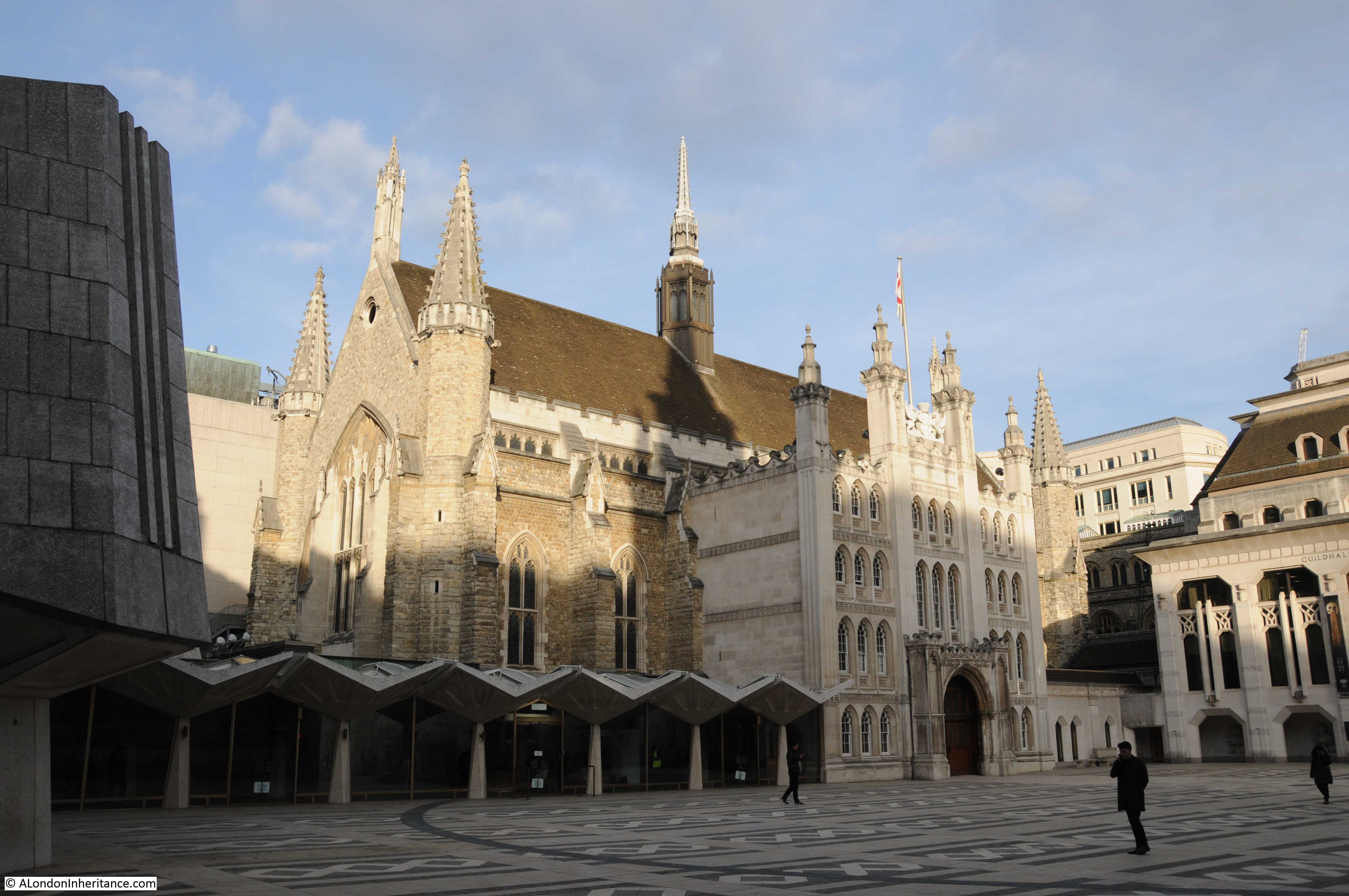
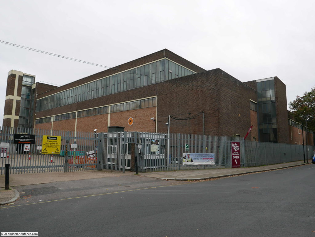
During my walk through Bermondsey and Rotherhithe in the last couple of posts, I walked past one location that helps tell the story of the development of the railways in London as well as the long brick viaduct that stretches across so much of south east London from London Bridge Station. This was in Spa Road, Bermondsey, the location of Spa Road Station, London’s first railway terminus.

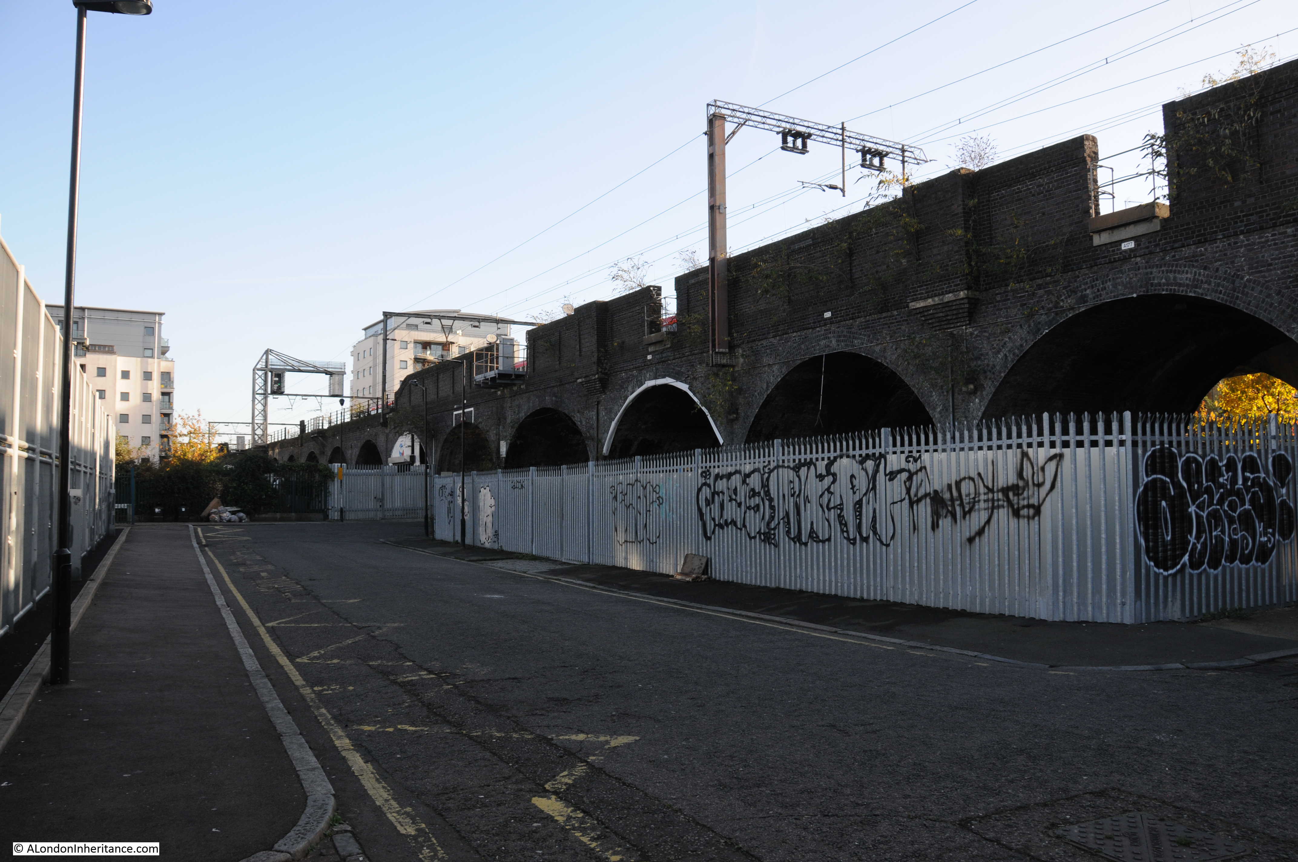
The brick viaduct that carries the railway out from London Bridge Station is an early 19th century engineering marvel. Although sections have been widened, and cast iron extensions to the side of the viaduct help carry the large numbers of trains that run along this route every day, the core of the brick viaduct is the same as when built for the London and Greenwich Railway Company in the 1830s.

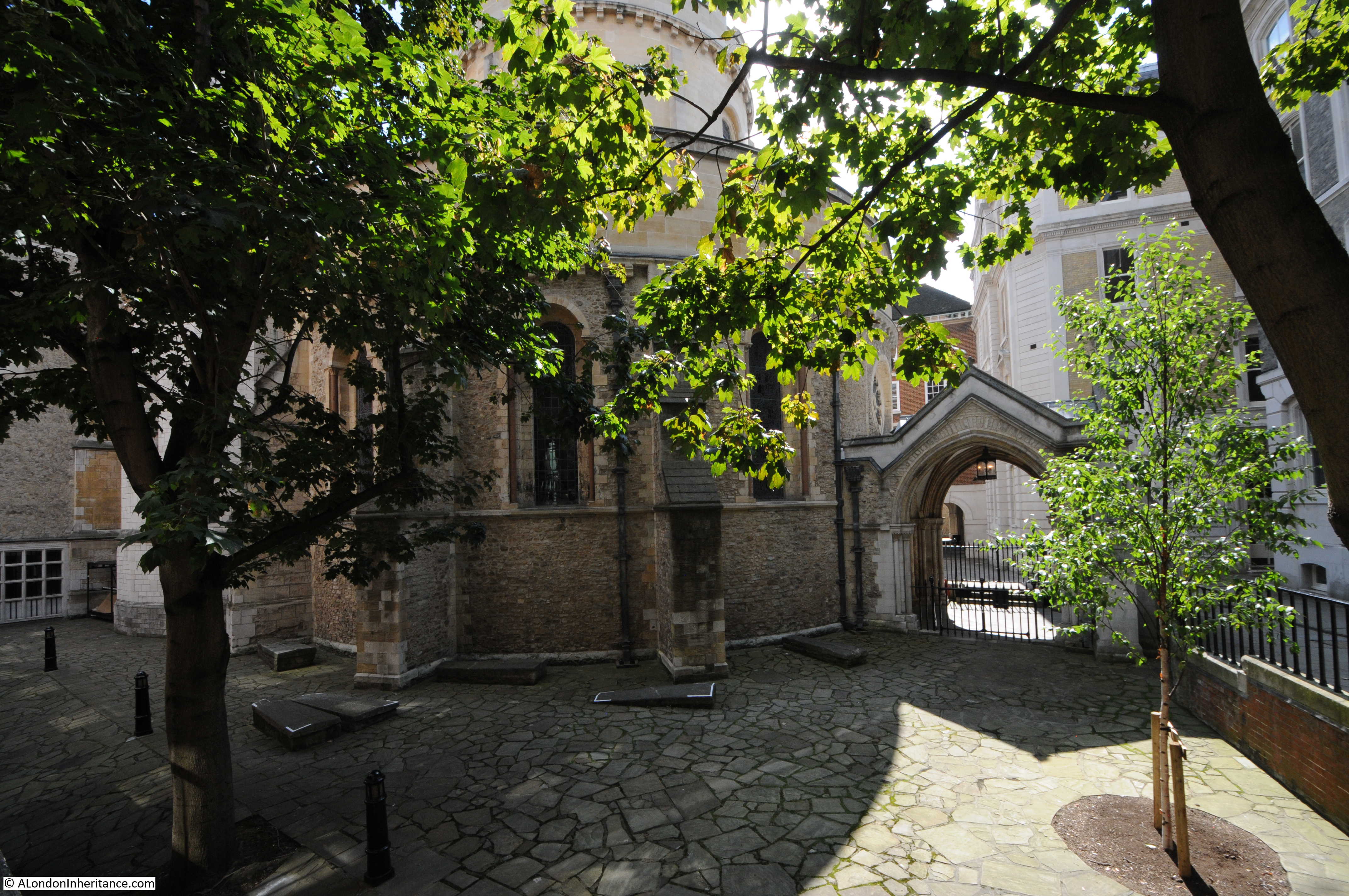
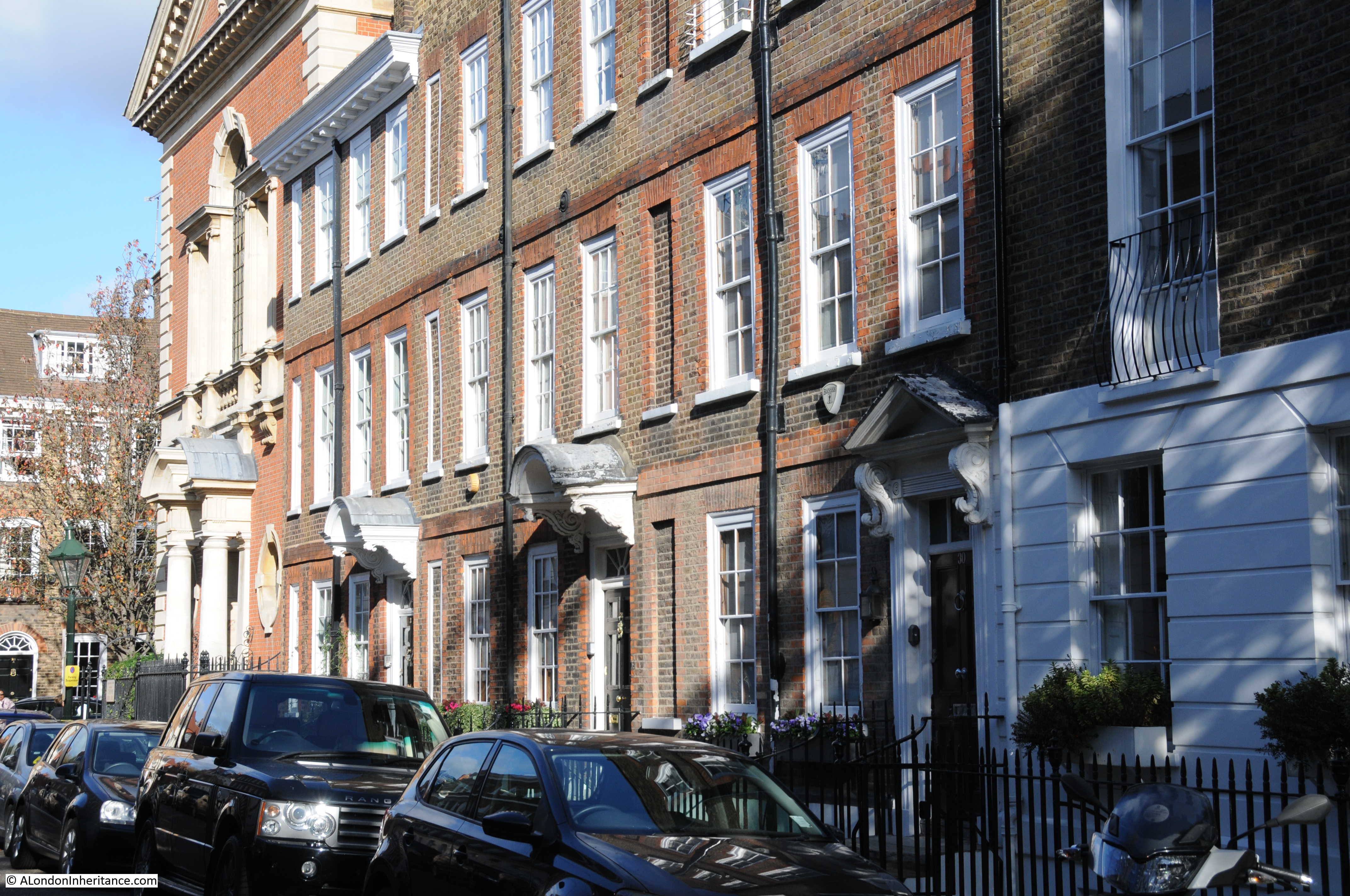
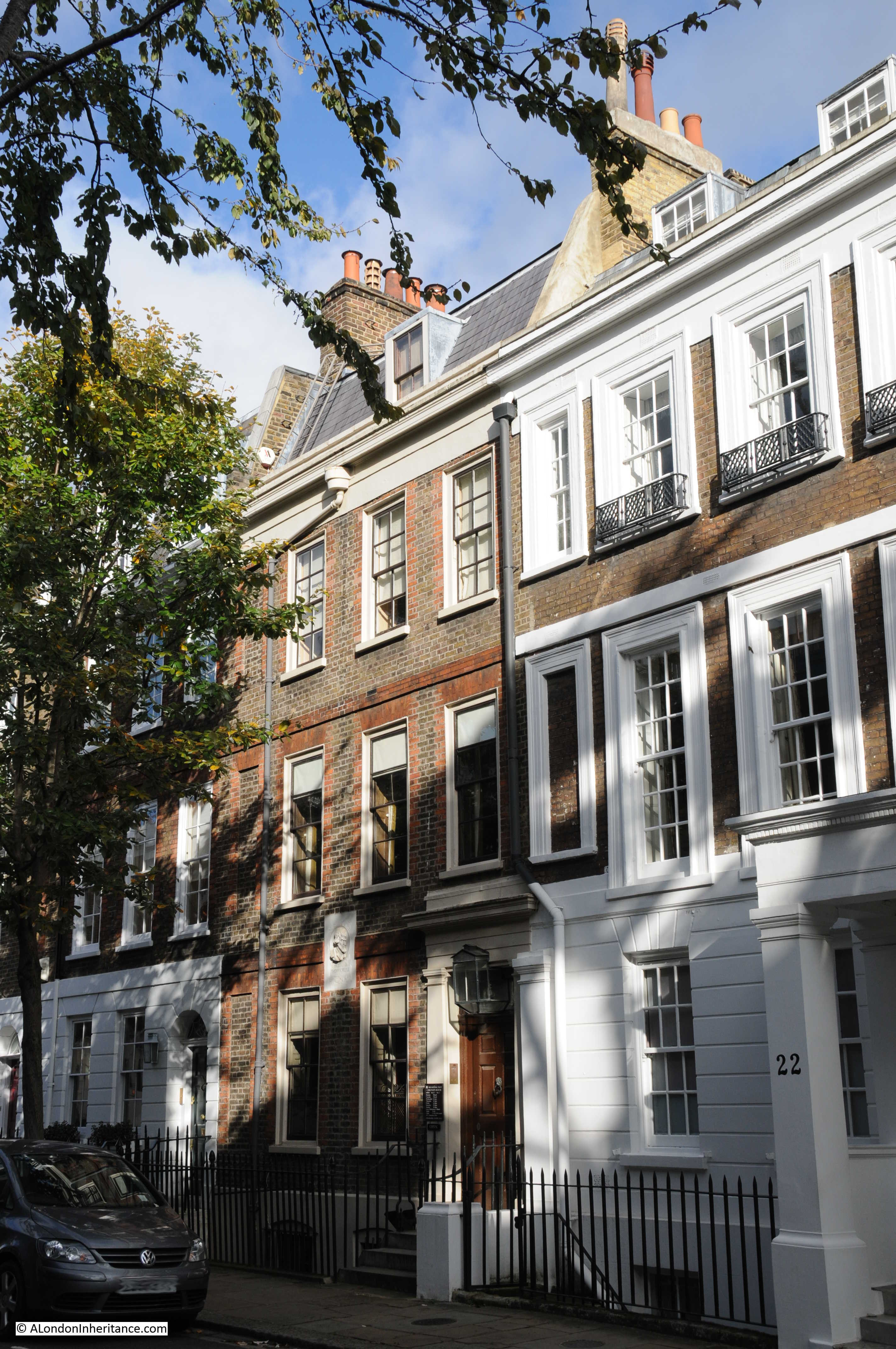
When built, Spa Road was roughly the location where the viaduct emerged from the streets of south London and headed over open country and market gardens towards Deptford and Greenwich. In many places the viaduct is hidden from view behind the buildings that cluster up against the sides of the railway, however in the many streets that cross underneath the viaduct, we can still get a good view of this remarkable structure.

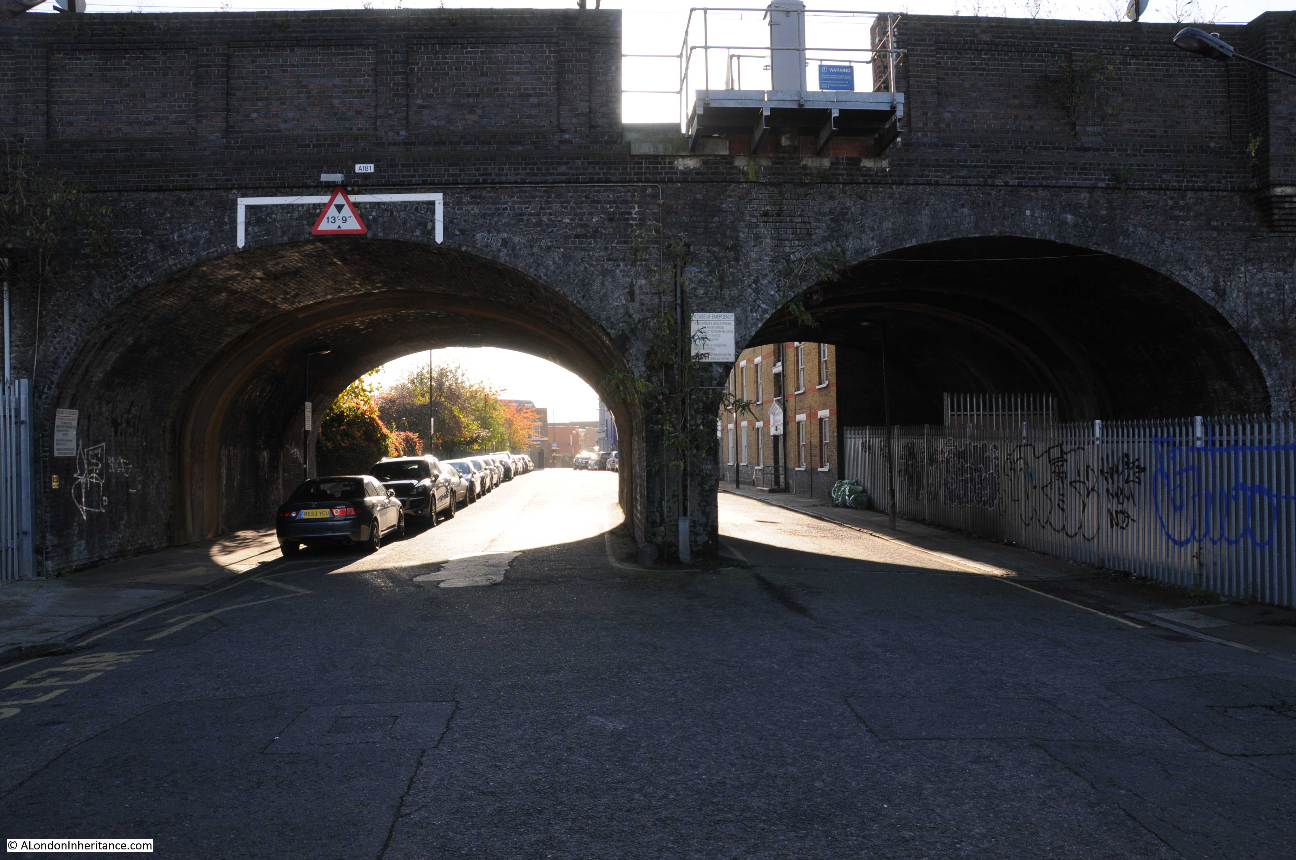
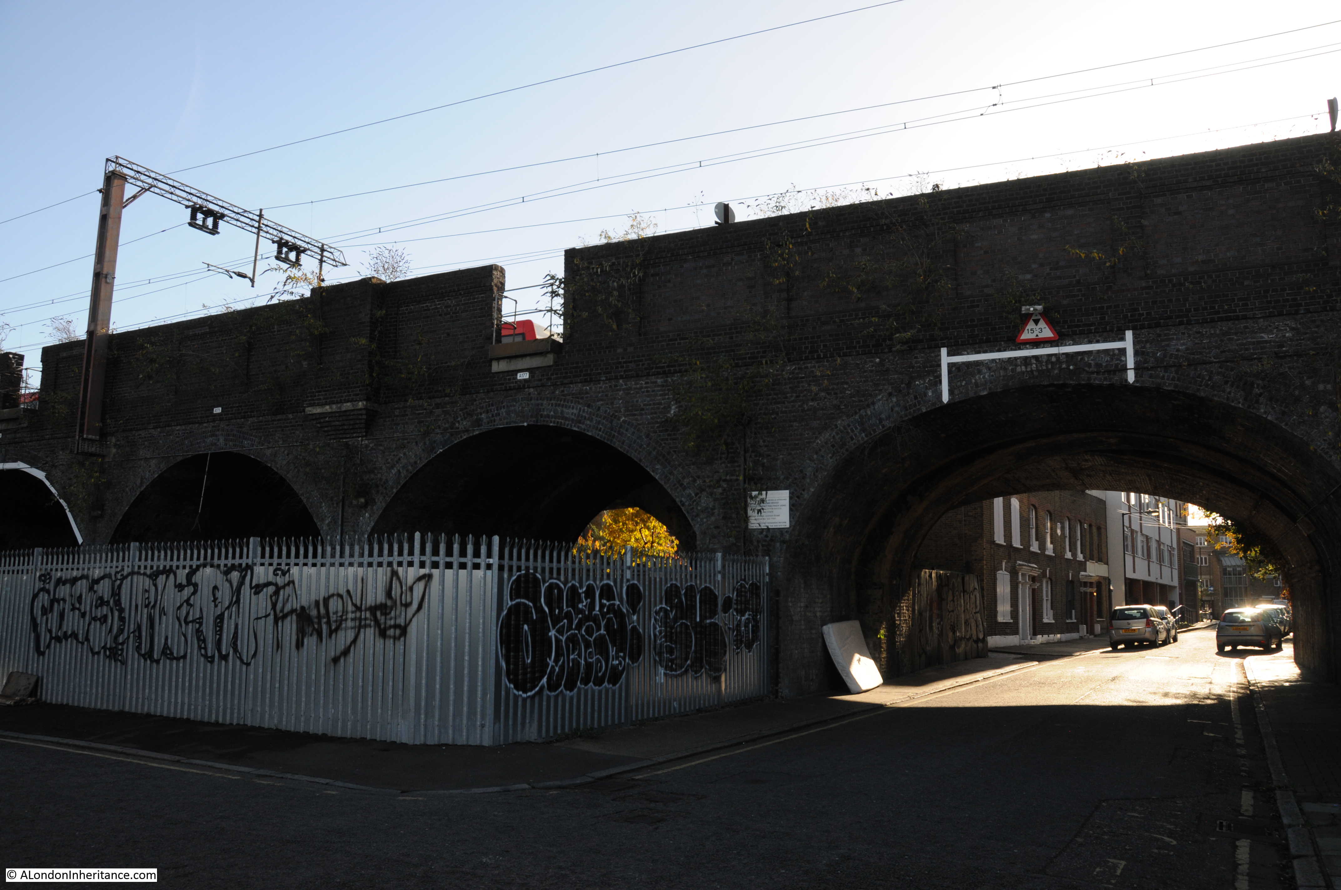
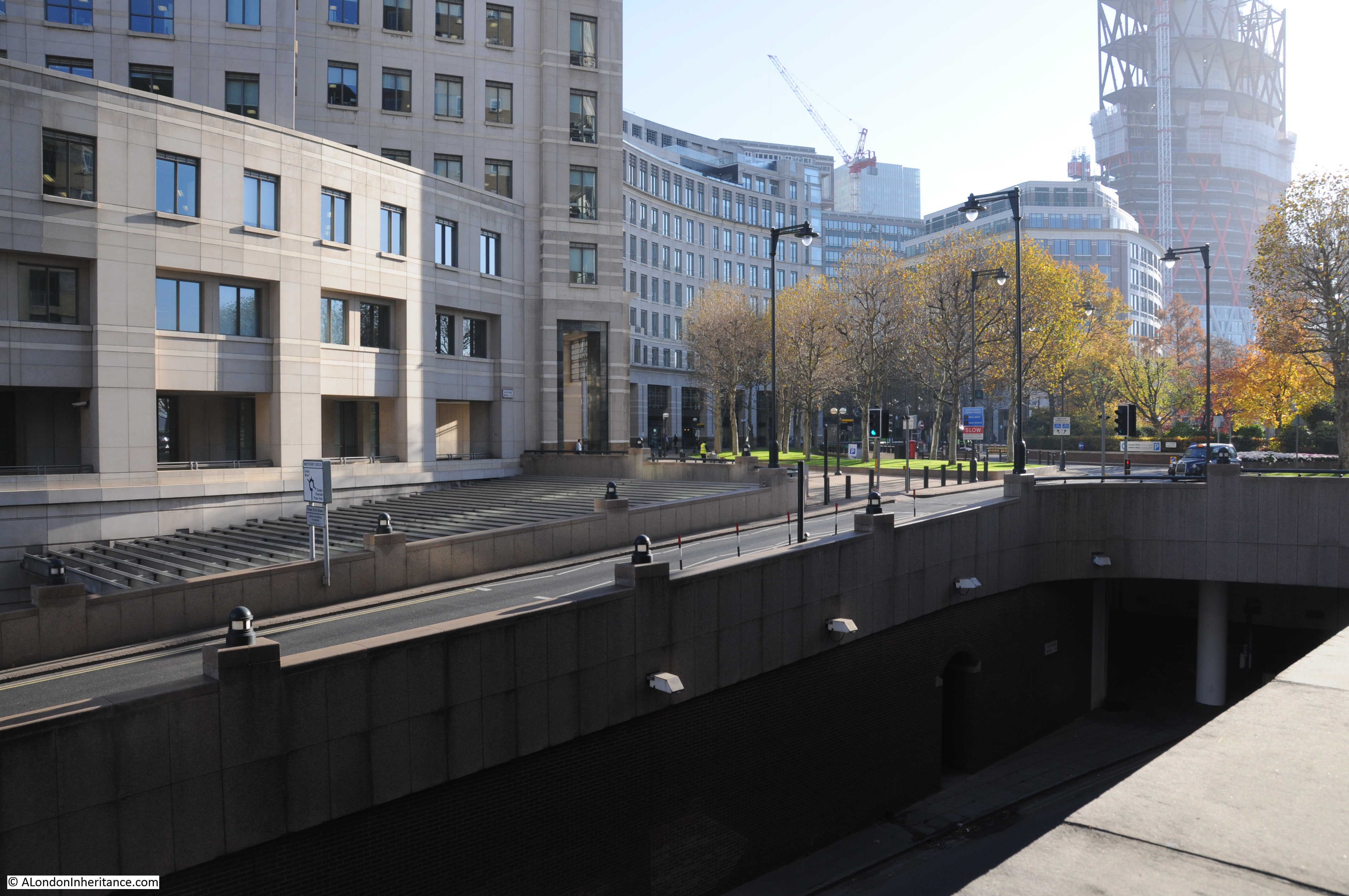
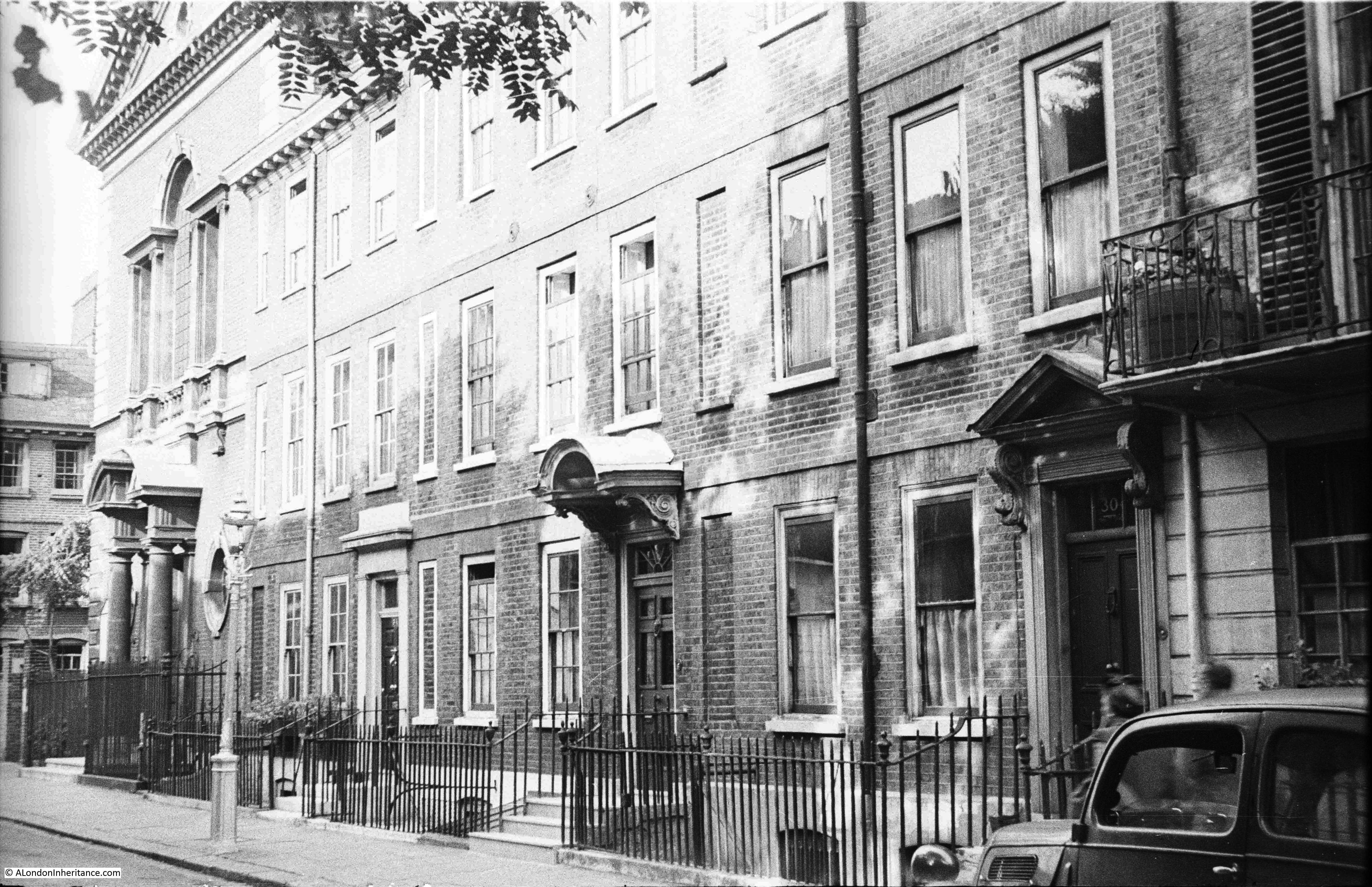
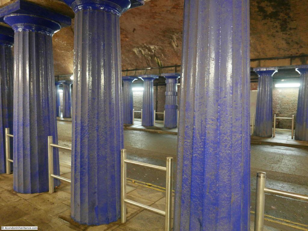
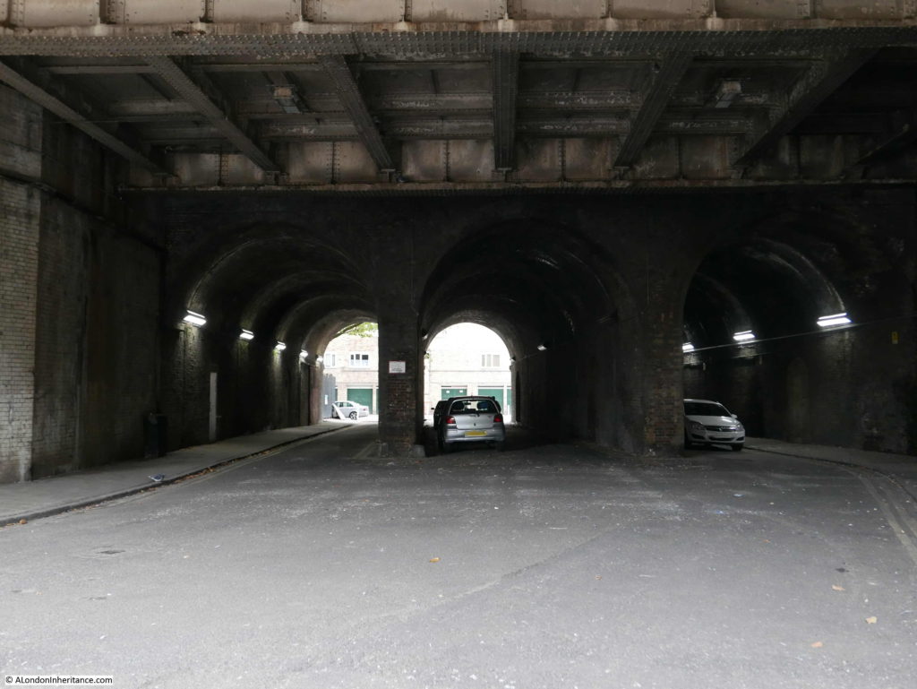
As I walked along Spa Road, this is the view of the tunnel underneath the viaduct from the southern approach where Spa Road narrows to pass between the original cast iron columns:

Spa Road Station

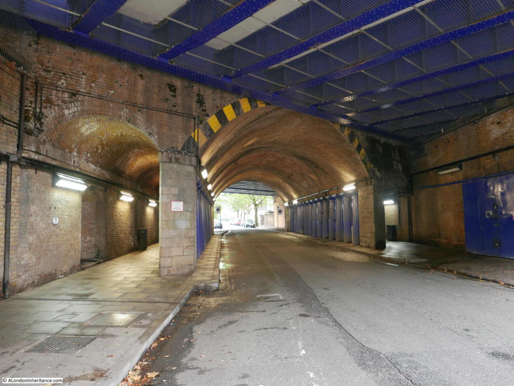
The central roadway runs through the middle of the tunnel with footpaths on either side between the cast iron columns and the tunnel walls:

Spa Road Station

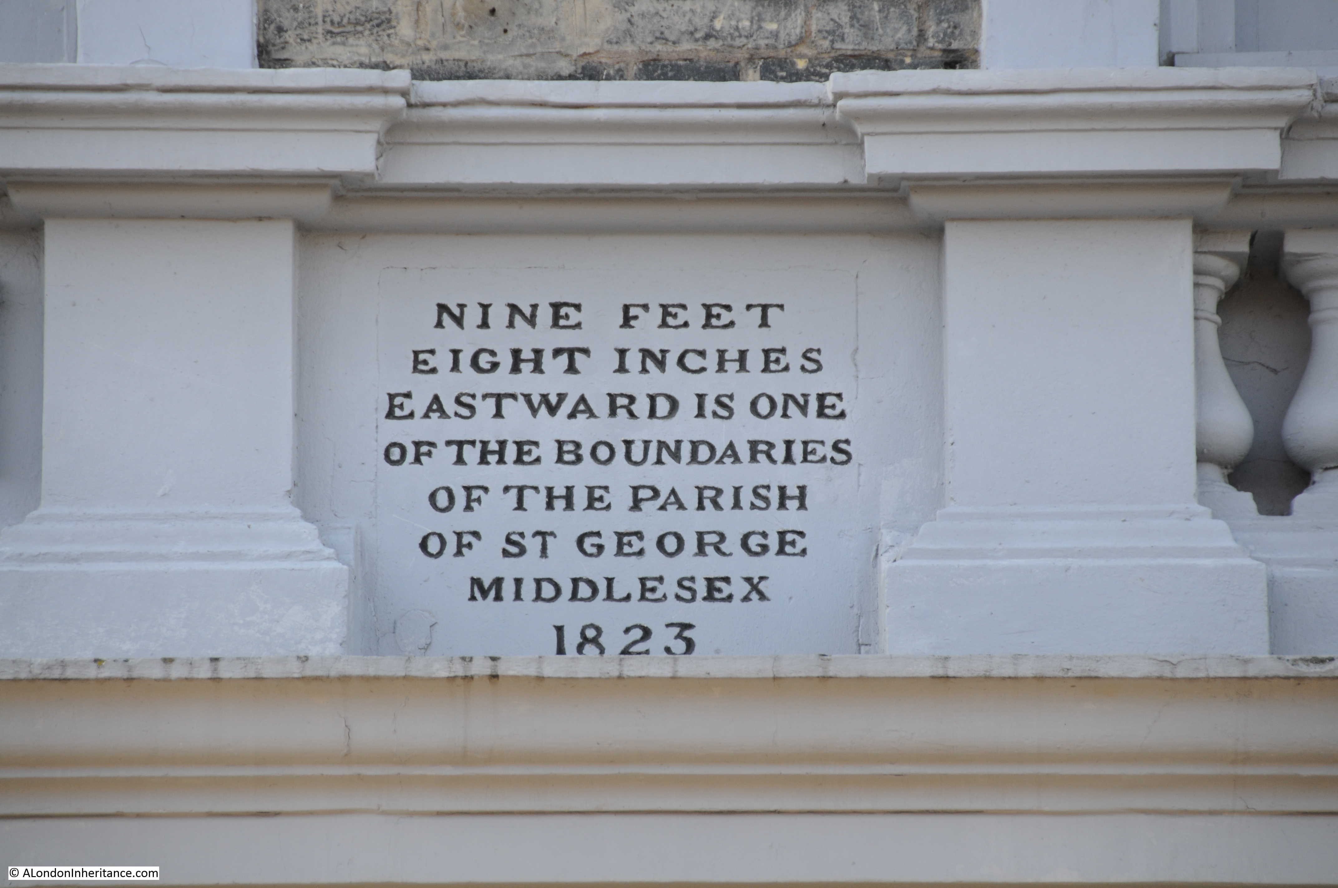
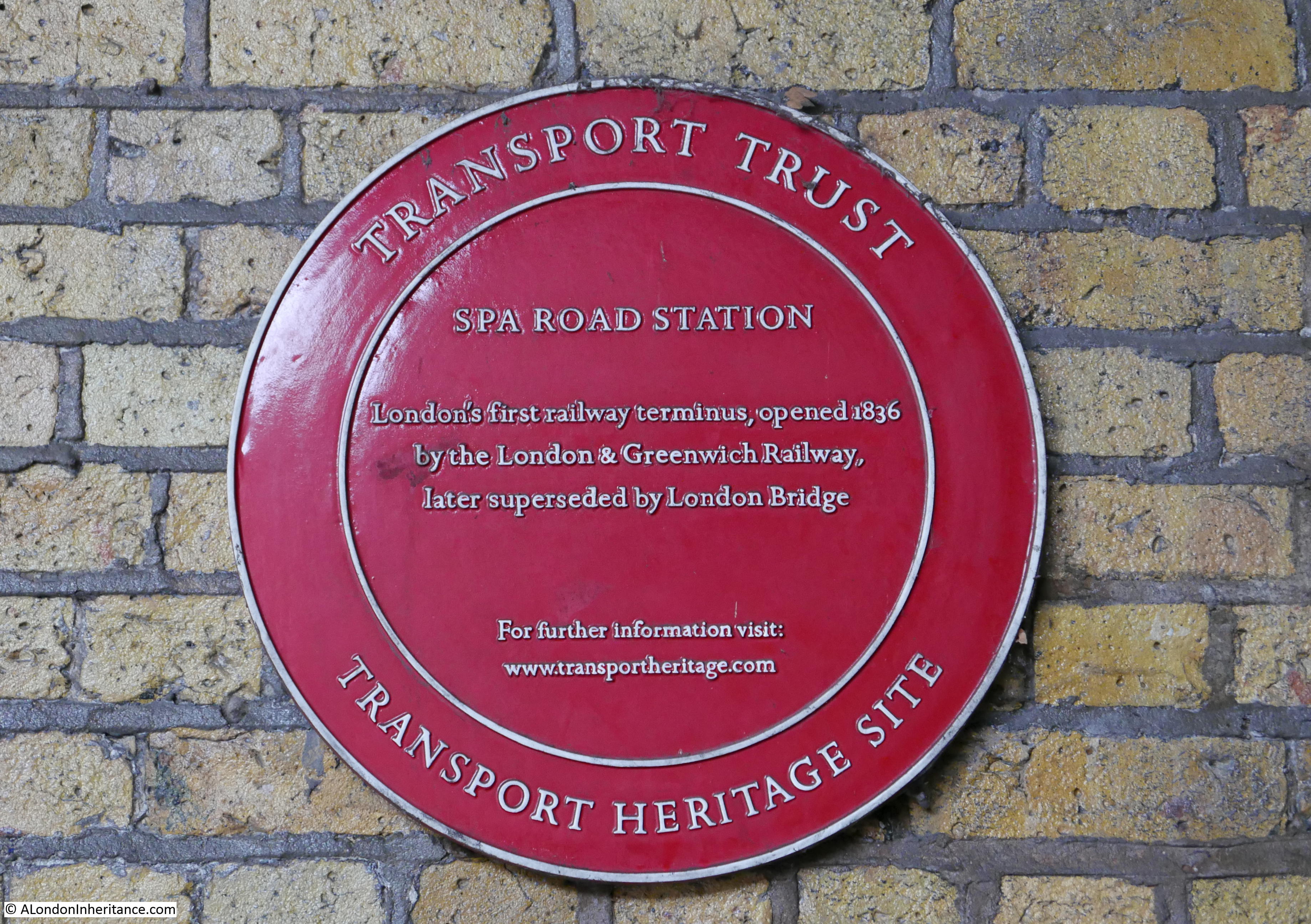
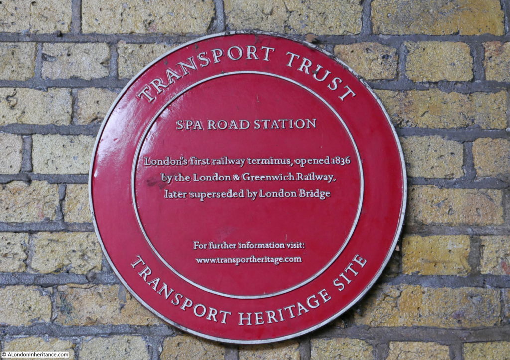
And on the side of the tunnel is this plaque commemorating Spa Road Station.

Spa Road Station

Proposals for a railway to run from London out to Deptford and Greenwich had been put forward in the early decades of the 19th century, and in the 1830s. the technical solutions, finance and Acts of Parliament came together to build this first railway into central London.

The land between the planned London terminus of London Bridge and Spa Road in Bermondsey was built up, very densely as the proposed route approached London Bridge. Running a railway at ground level would have caused considerable problems with the large number of streets that would have to be crossed by a railway. The land was also marshy and the open land out towards Rothehithe and Deptford was crossed by streams and ditches.

A viaduct was seen as the best solution as this would carry the railway above the marshy ground and would also ensure the streets that the railway crossed could run underneath the viaduct without obstructing street traffic or the railway.

The route was surveyed in 1832 and in 1833 the Acts of Parliament had been approved and the Act to create the London and Greenwich Railway (L&GR) received Royal Assent on the 17th of May 1833.

The L&GR began compulsory purchases of land in 1834, and the enormous quantities of materials needed to build the viaduct began to arrive on site.

Construction of the viaduct started at Corbetts Lane as this point was roughly in the centre of the route, and was in open country so was not dependent on the land purchases and demolition work required to prepare the route in central London.

Soon after construction started, the considerable quantity of 100,000 bricks were being laid daily and such was the demand for bricks that the price of bricks for sale in the London area rose due to shortages created by the quantities purchased for the construction of the railway.

On either side of the viaduct a roadway and footpath was constructed. This was intended to provide access to the arches and also to provide a parallel walking and carriage route with the railway charging a fee for access. The boundary between the pathway and the adjacent country was made up of shrubs and bushes.

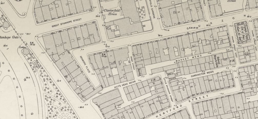
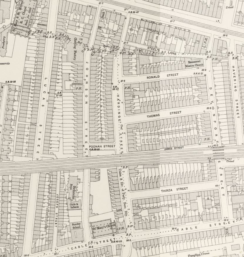
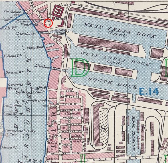
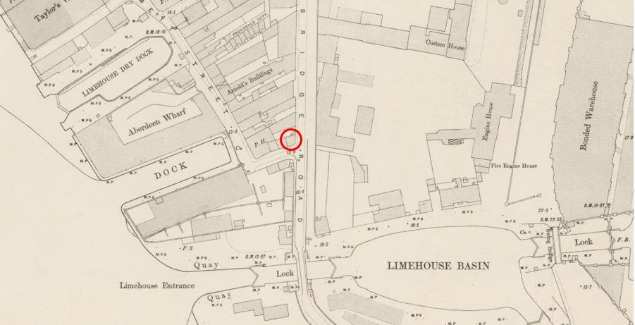
Maps provide an insight into how south east London expanded, the route of the railway and Spa Road Station. The first map shows Bermondsey in 1832:

Spa Road Station

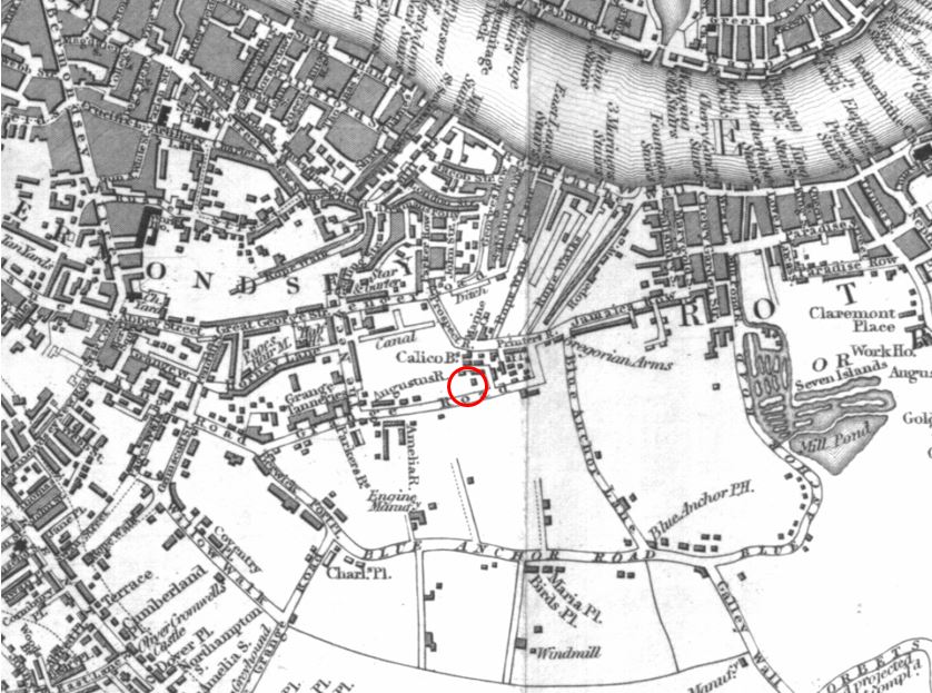
I have marked the location of the future Spa Road Station with a red circle. The street running left to right underneath the circle is the future Spa Road, although in 1832 is was called Grange Road.

Look just to the upper right of the red circle and you will see the name Gregorian Arms – this is the pub on the Jamaica Road which is still in existence and with the same name. See my photo of the pub in last week’s post.

In 1832, the future location of Spa Road station was on the edge of development with open country and market gardens stretching out towards Deptford and Greenwich. To the right of the red circle are the Seven Islands and the Mill Pond. Occasional houses, a windmill and the Blue Anchor Public House can be seen along the sides of the streets.

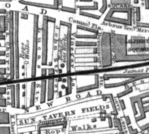
Now move forward, only 12 years to 1844, and a solid black line across the map shows the new viaduct of the London and Greenwich Railway. Look in the centre of the map, and replacing the red circle is the new Spa Road Station, with the street below the station now having been renamed The Spa Road.

Spa Road Station

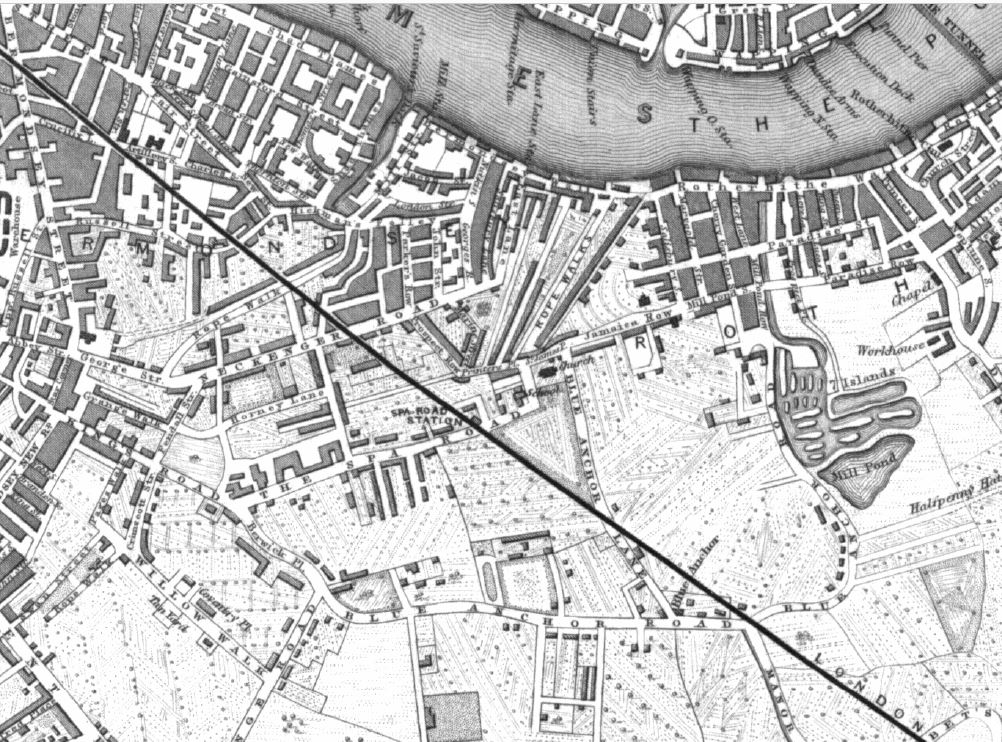
Apart from the building of the viaduct, there has not been much more development, with the route of the railway to the south east still running over open land, although more detail has been added to this map which shows the cultivated nature of the land.

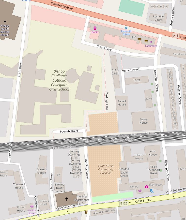
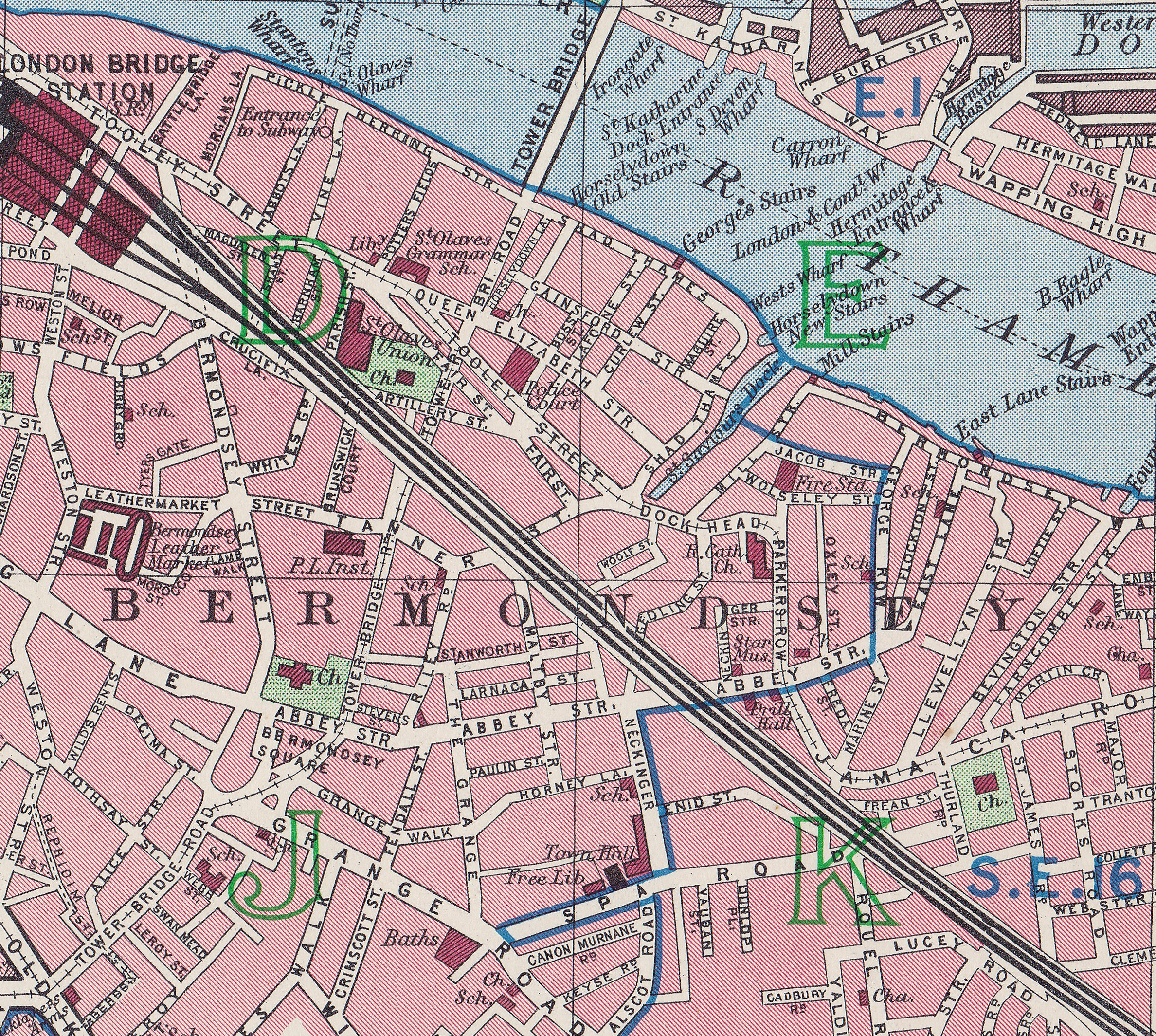
The 1895 Ordnance Survey map extract shown below demonstrates how the area around Spa Road had changed from open country to densely built streets in the 50 years between the above and below maps.

Spa Road Station

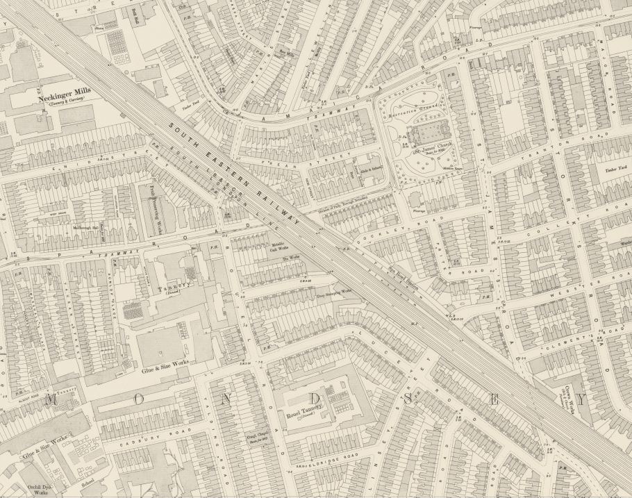
The map also shows that Spa Road Station has moved from being to the west of Spa Road to now being a couple of hundred yards to the east (I explain the move later in the post).

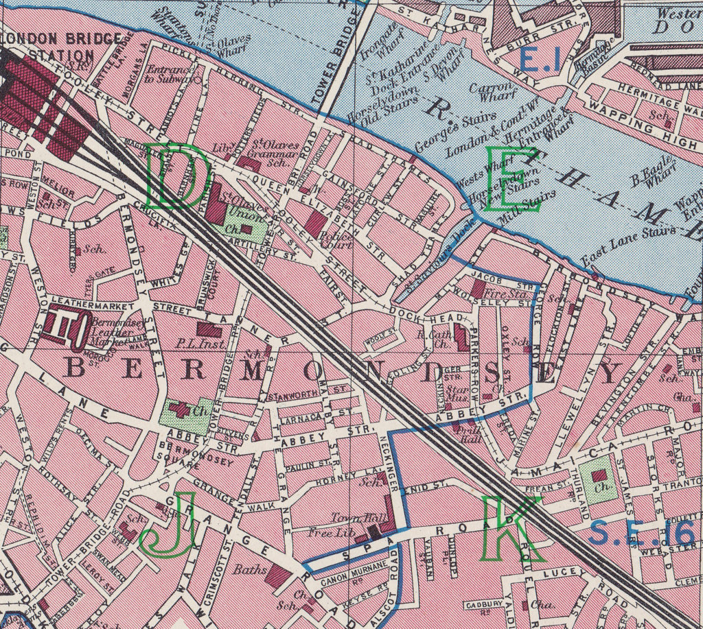
Forty five years later in the 1940 edition of Bartholomew’s Atlas of Great London, Spa Road Station has disappeared. Spa Road is in the lower right hand quarter of the map and the top right of the green letter K is roughly where the first station was located. The map shows that by 1940 there were no stations in the area with London Bridge being the terminus for rail lines heading off to the south east.

Spa Road Station

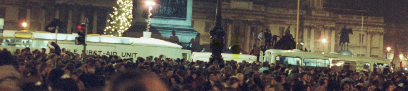
As the viaduct was completed, there was considerable interest in the London & Greenwich Railway which the company encouraged by providing access to the viaduct. On Easter Sunday 1835 some 10,000 people walked along the viaduct with the company taking almost £50 in tolls.

During the rest of 1835 construction of the viaduct at the Greenwich and London Bridge ends continued and test runs of trains were made along the route. By early 1836 there was considerable pressure to open the railway. Revenue was needed and there was welcome publicity to be had from being the first railway to run trains in London. It was therefore decided to open the line between Spa Road and Deptford whilst the Greenwich and London Bridge works completed.

The first train left Deptford for Spa Road Station at 8am on Monday 8th February 1836.

It must have been quite an experience to speed along in a train along the viaduct above the surrounding buildings and countryside. The Birmingham Journal on the 13th February 1836 reported “A passenger in a Greenwich Railway carriage, on Monday last, says, that in one of the experimental trips, the train of six carriages was conveyed at the rate of a mile per minute, or 60 miles per hour! He adds, that the sensation experienced was that of flying, rather than that which is felt in the most rapid of ordinary modes of travelling. There were two numerous parties of ladies in the carriages, who seemed highly delighted.”

The first trains on the 8th February marked the start of a regular service from Spa Road. Adverts in newspapers gave details of the services and fares. From the Public Ledger and Daily Advertiser on the 10th February 1836:

“LONDON & GREENWICH RAILWAY COMPANY. A TRAIN of the Company’s CARRIAGES will start DAILY at the following hours, until further notice – Fare, 6d. 

From DEPTFORD to SPA-ROAD, BERMONDSEY, at eight, nine, ten, eleven, twelve, one, two, three, four and five”

The return journey from Spa Road to Deptford was at half past the hour.

The first station at Spa Road was very much of a temporary form. Wooden stairs led up to the top of the viaduct where there was a narrow platform between the tracks and the viaduct parapet. The platform space was so limited that passengers would queue up the stairs until there was space to board a train.

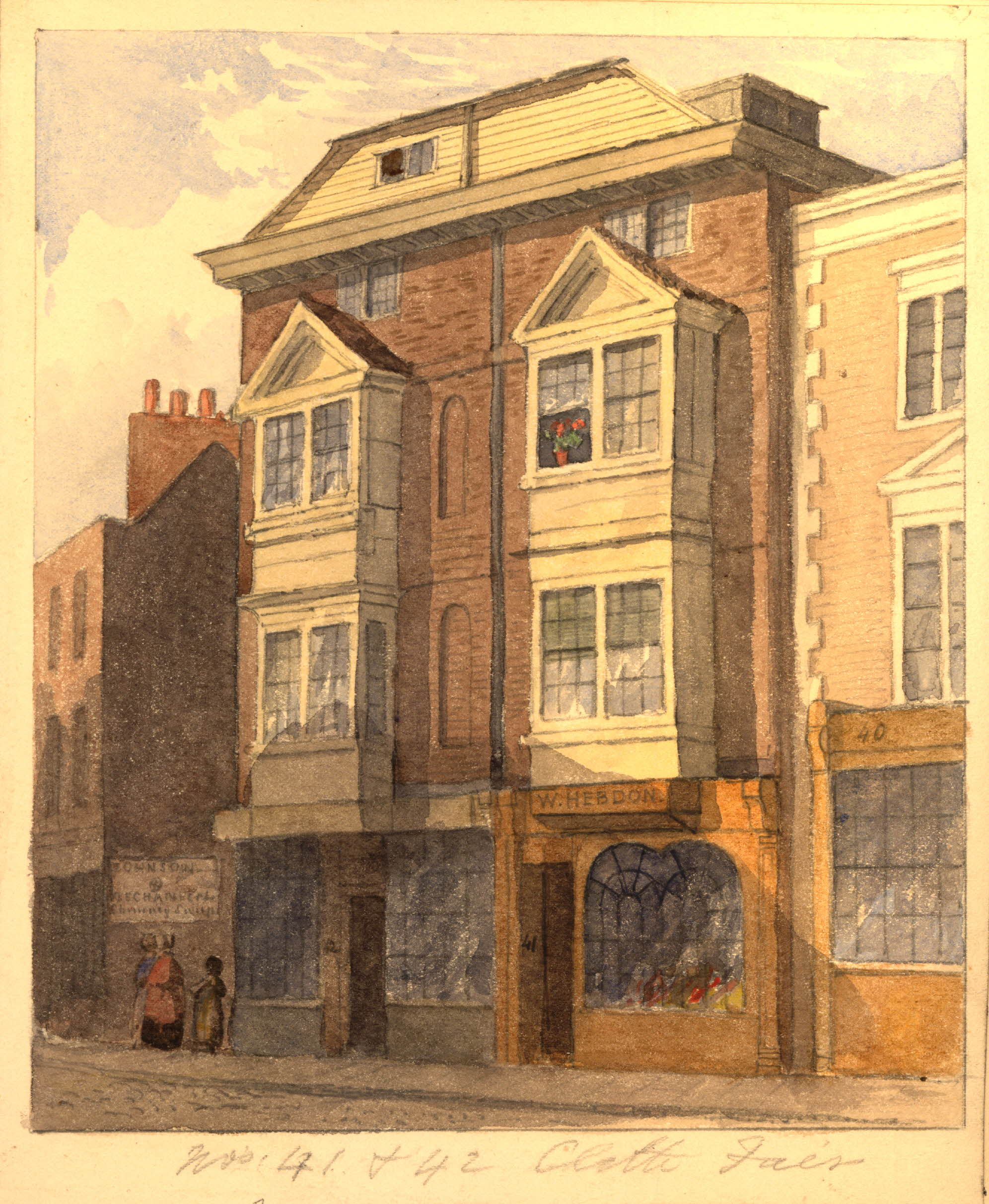
The following print from 1836 shows the Spa Road tunnel underneath the viaduct with the stairs up to the station on the left. This is the view approaching the viaduct from the south.

Spa Road Station

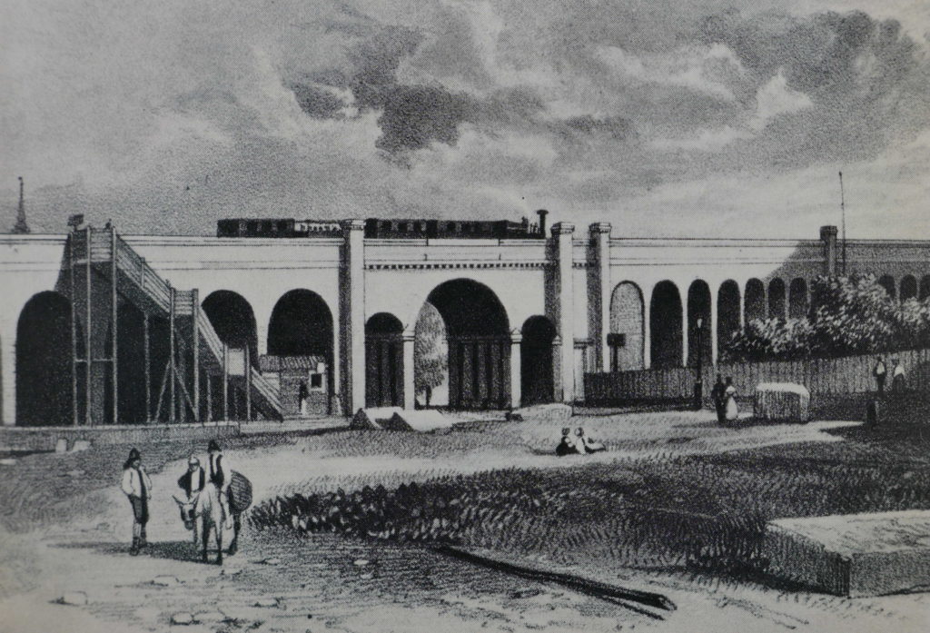
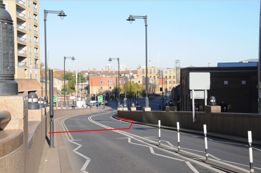
Today, the above view is obscured by buildings, however the following photo shows the arches to the left of Spa Road and it was along here that the stairway led up to the platform.

Spa Road Station

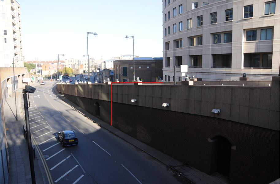
The following photo shows the arches on the northern side, although these have been extended out from the original viaduct to form a bulge in the track for the future station. The metal bridge carrying the rail tracks rather than the original brick arches can be seen in the top left – another example of a later extension to the original viaduct.

Spa Road Station

The narrow nature of the platforms at Spa Road and the casual attitude towards the dangers of trains, with passengers standing on the tracks until the train arrived, resulted in a fatal accident at Spa Road on Monday 7th March 1836. From the London Evening Standard on the 10th March 1836:

“Mr James Darling, poulterer, Leadenhall-market, deposed that on Monday afternoon last, about three o’clock, he was standing by the platform on the Greenwich and London Railway, near the Spa-road, which is erected for the purpose of assisting passengers to get into the coaches that proceed on the railway. He was waiting for the steam engine to come from Deptford, which was shortly expected with a train of carriages, and which on arrival would be detached from that train to be joined to the train of coaches in which passengers would be conveyed to Deptford, and which train was on the railroad on the south line. While standing there he saw the train coming from Deptford. At that moment he was assisted on the platform. He had just been speaking to the deceased. The train came in at a rapid rate, and at the place where the engine is detached it receded from the north to the south line, and was not stopped till it came with a very violent concussion against the carriages. From the shock, witness was completely turned round. The train, by the impetus given it, was propelled to the barrier on the north line; on reaching which witness observed the deceased on the ground, dead.”

Despite this tragic accident and a number of other fatalities, the new railway was popular with travelers between Bermondsey and Deptford, and in December 1836 the stretch of viaduct between Spa Road and London Bridge opened allowing trains to now run to central London and out to Deptford, and following completion of the route from Deptford to Greenwich in April 1840 the full route was open.

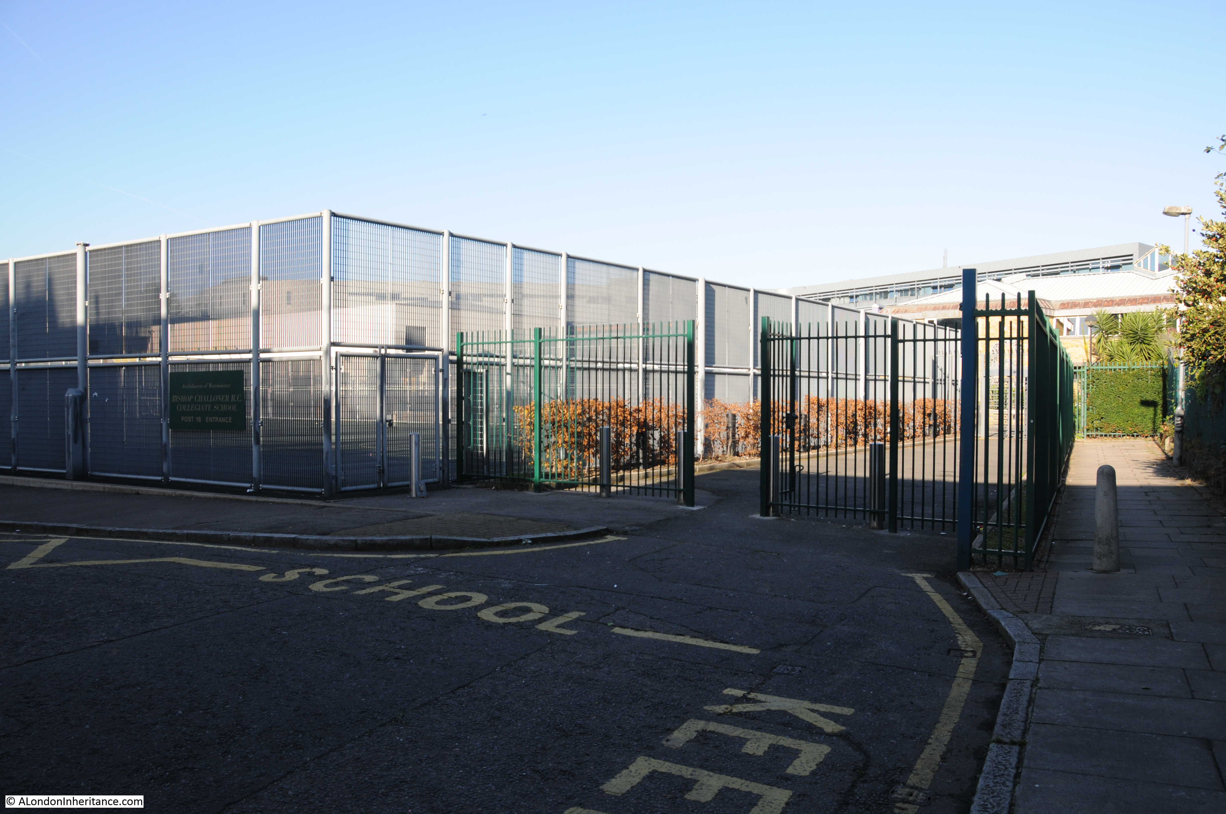
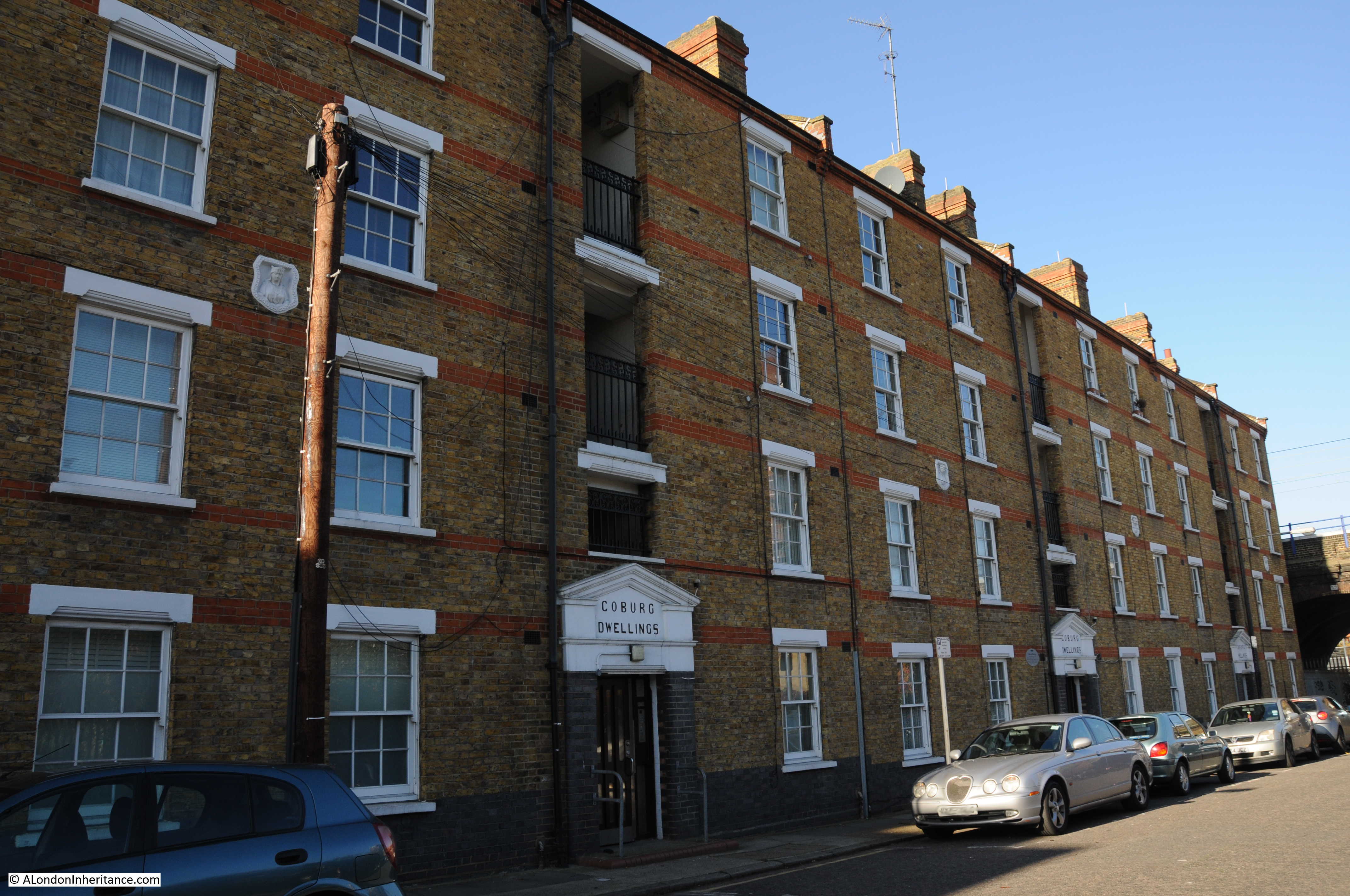
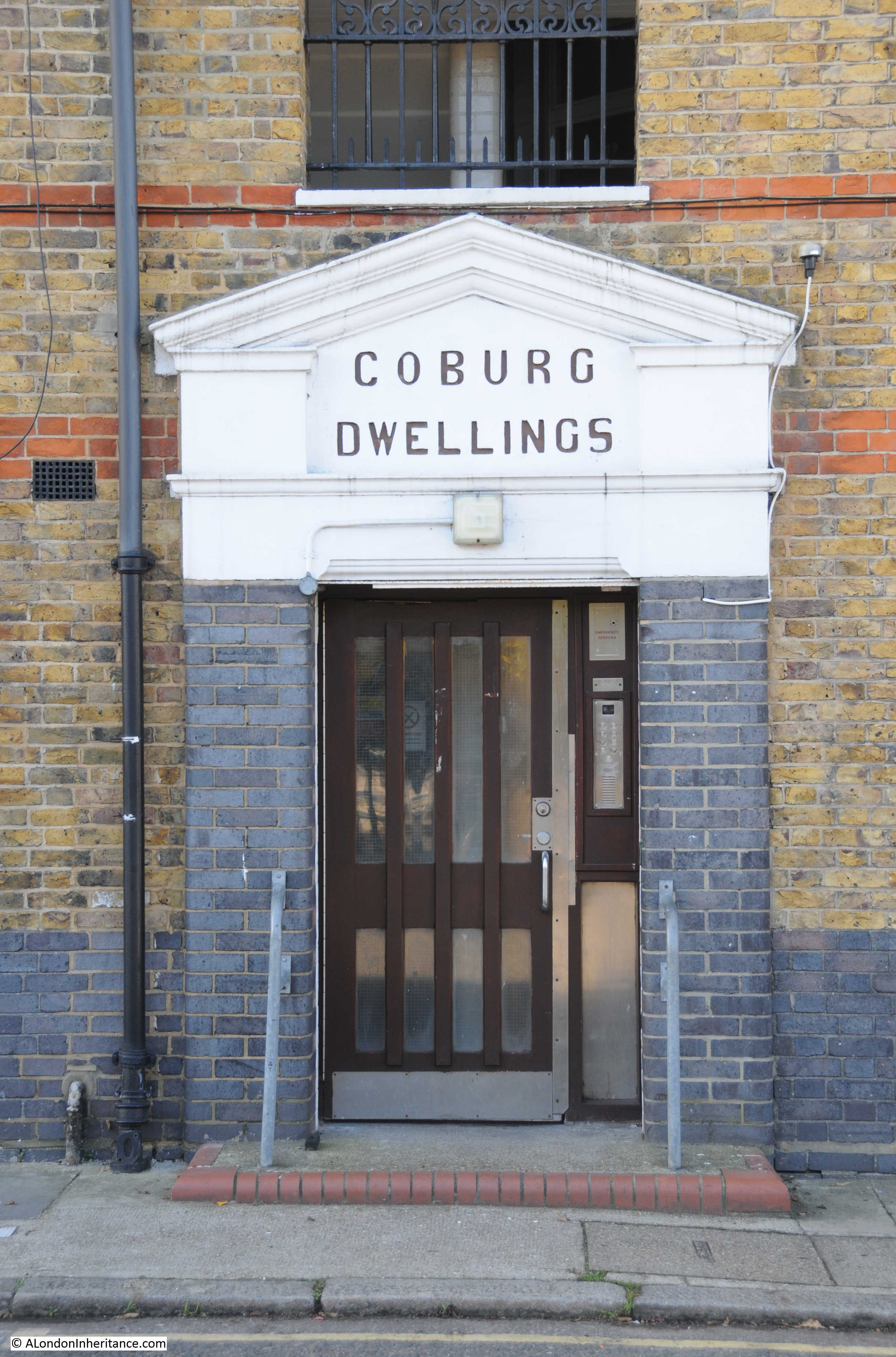
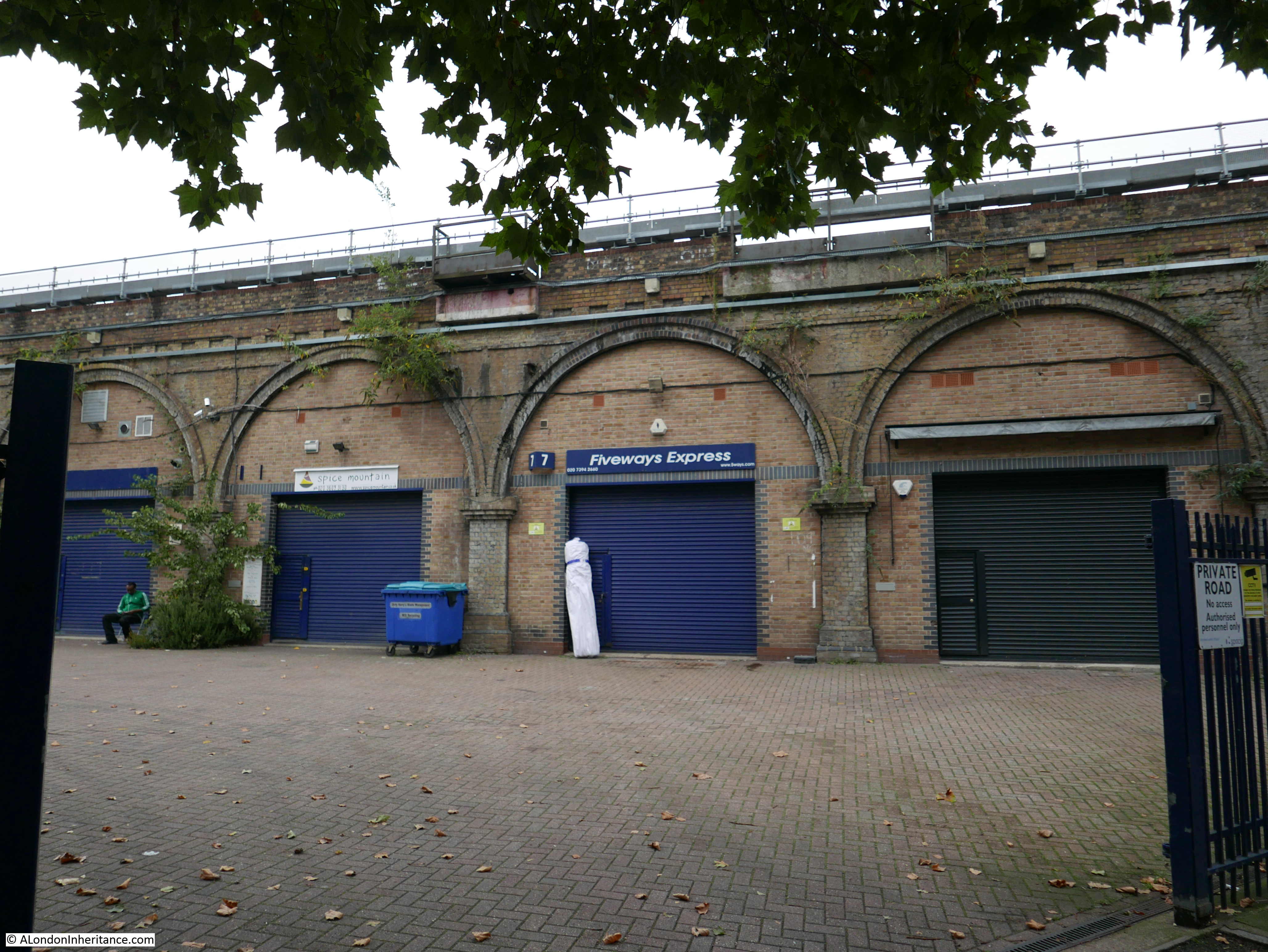
Improvements and upgrades were made to the original Spa Road Station, however around 1872 it was relocated to a new station built 200 yards to the east where new ticket offices had been built into the arches and steps from within the arches led up to the platforms. This new station operated until the 15th March 1915 when Spa Road was one of a number of stations closed due to war time economy measures and it was never to re-open.

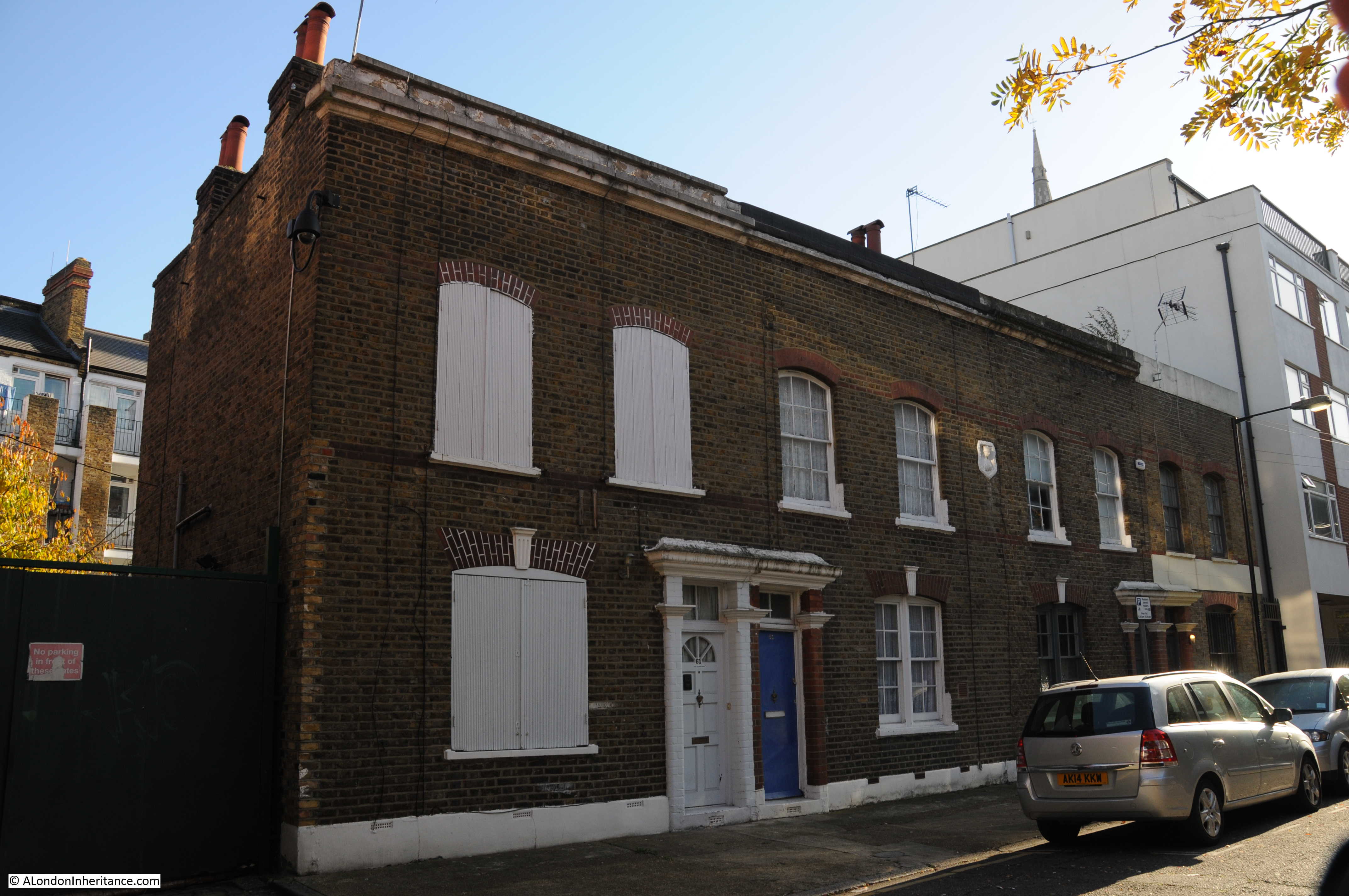
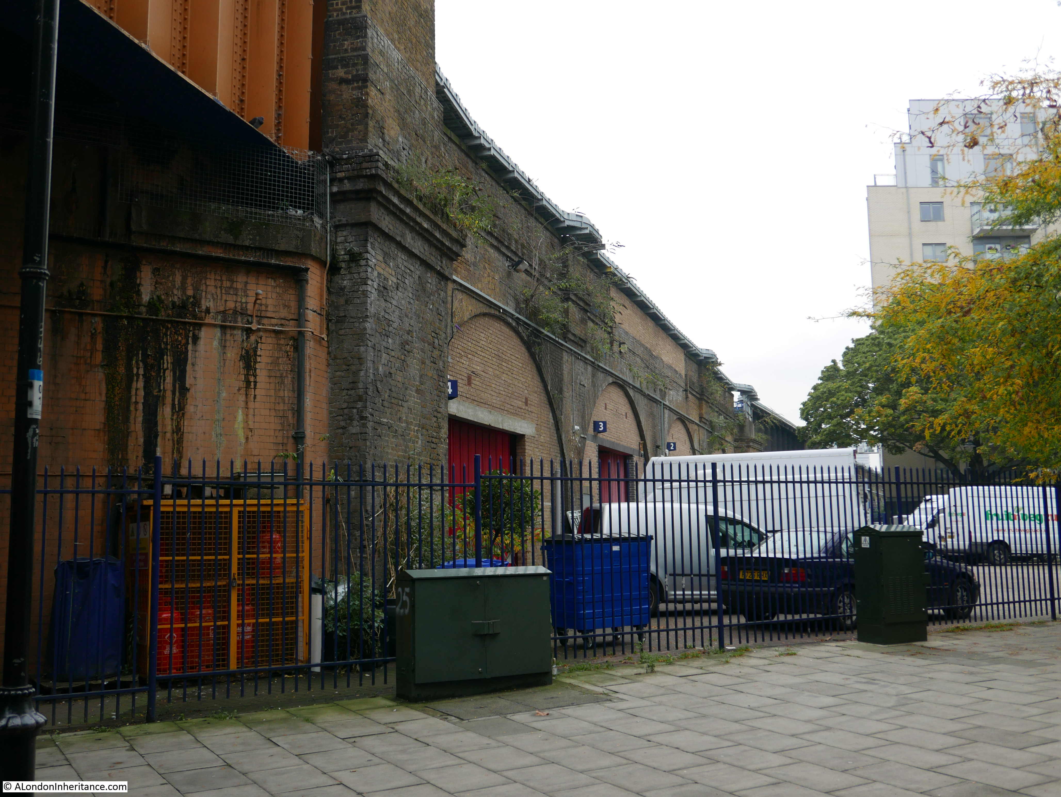
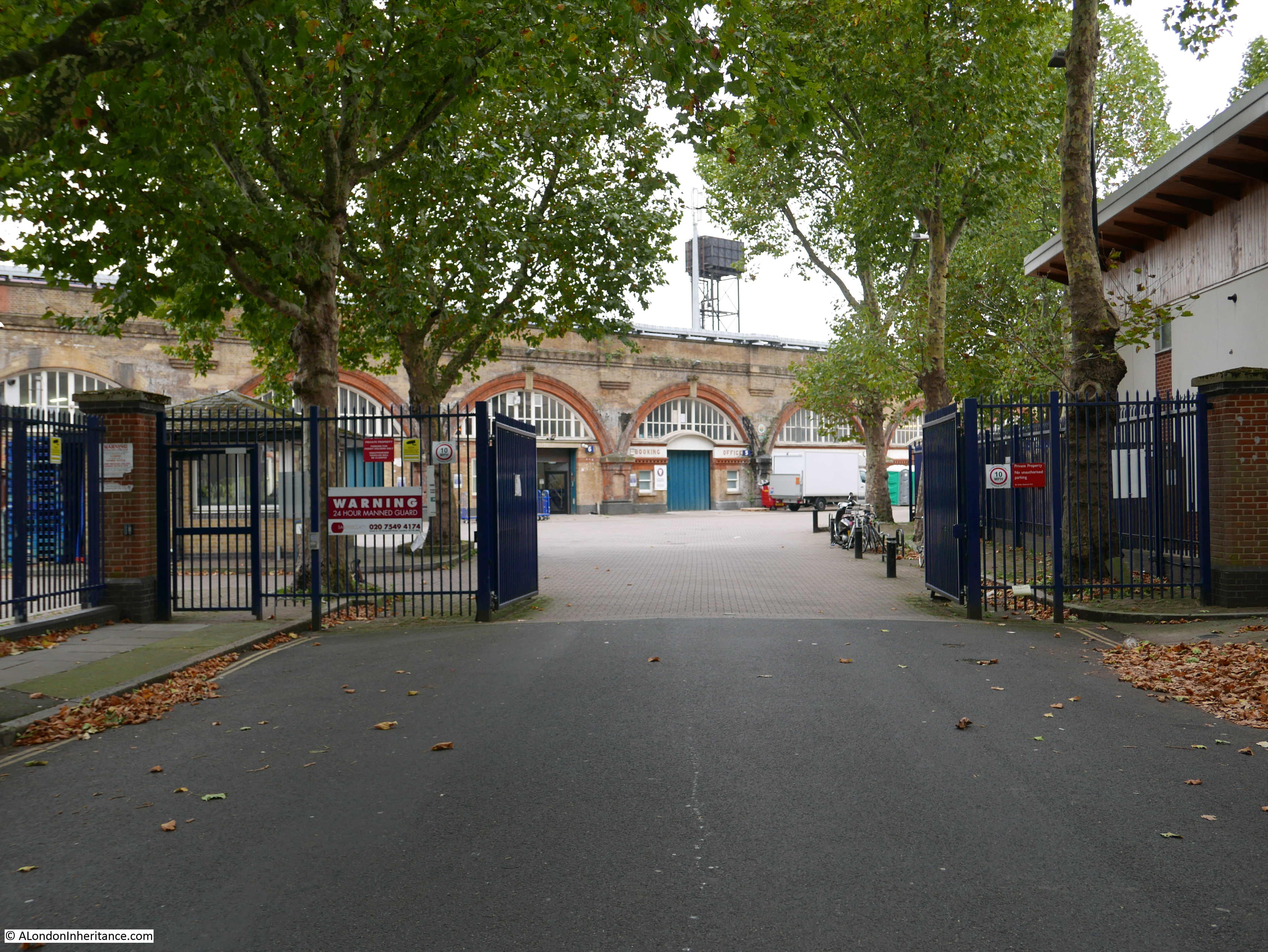
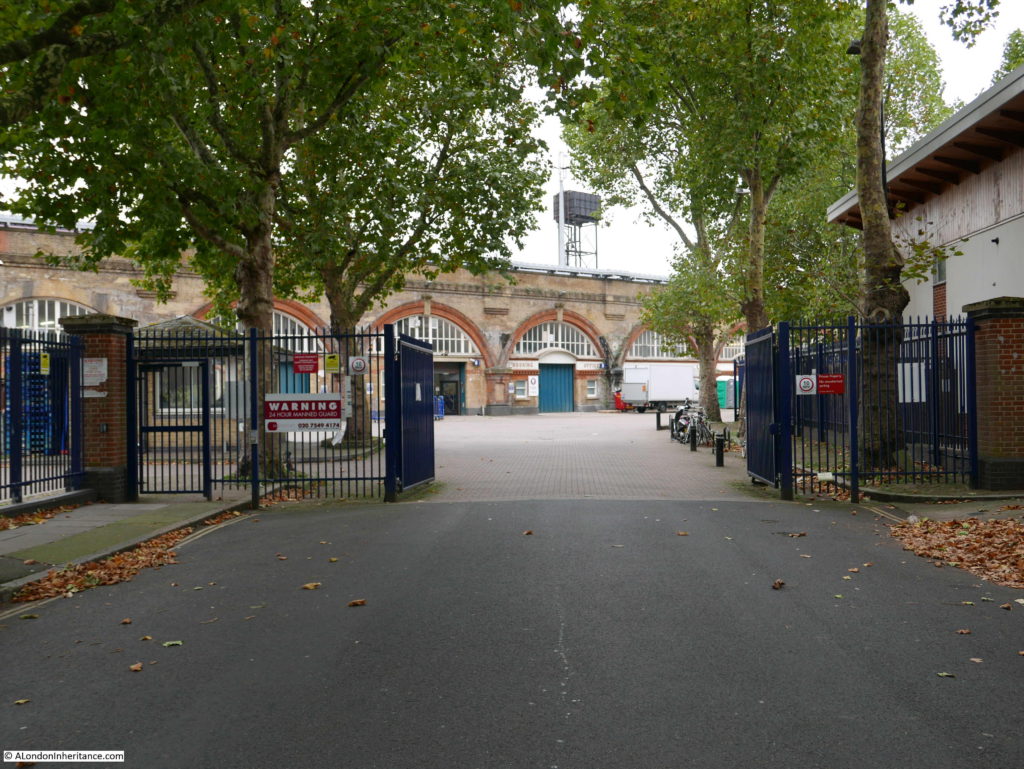
The remains of this later station can still be seen in a small industrial area at the end of Priter Road.

The view from Priter Road looking directly at the arch that was once the Spa Road Booking Office:

Spa Road Station

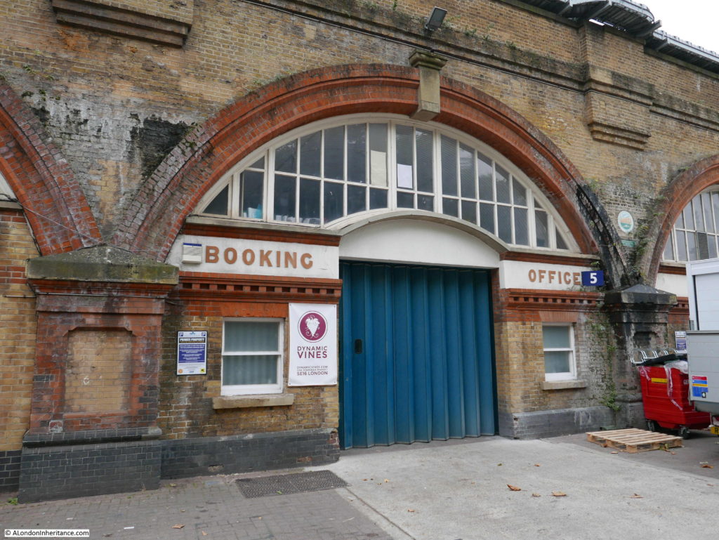
The view along the arches. The Spa Road Booking Hall is in the arch just to the left of the white truck:

Spa Road Station

The booking office:

Spa Road Station

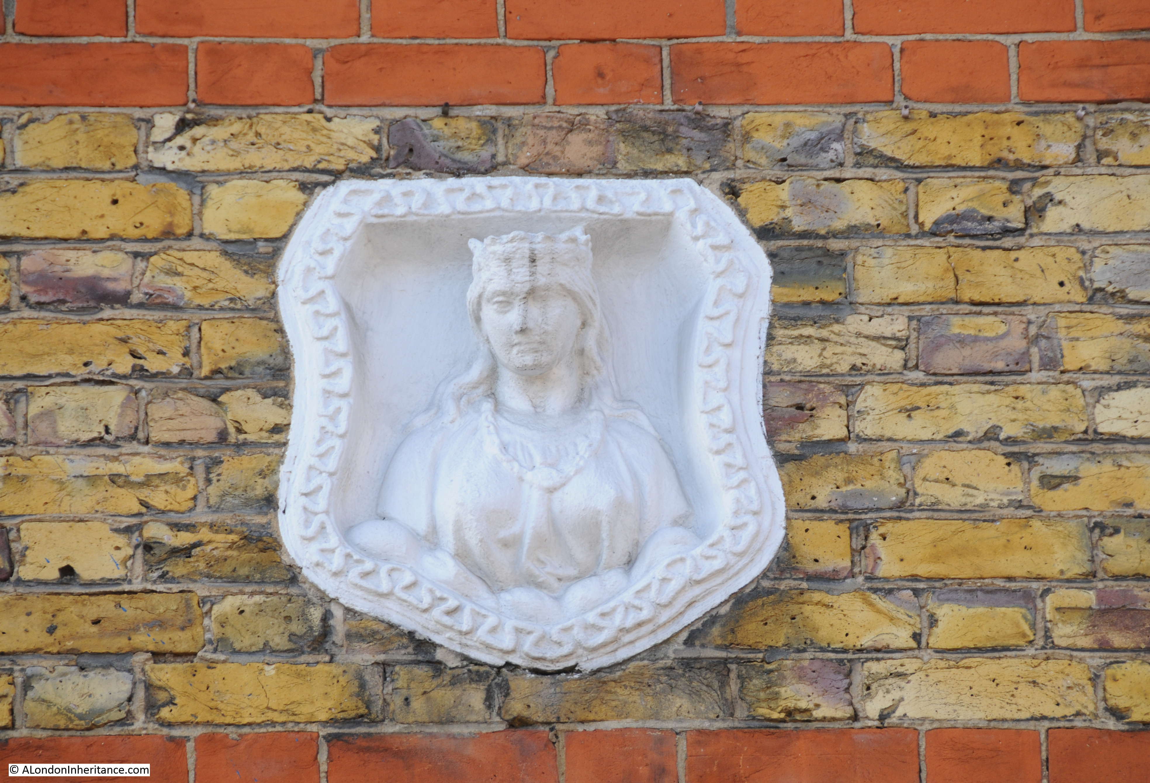
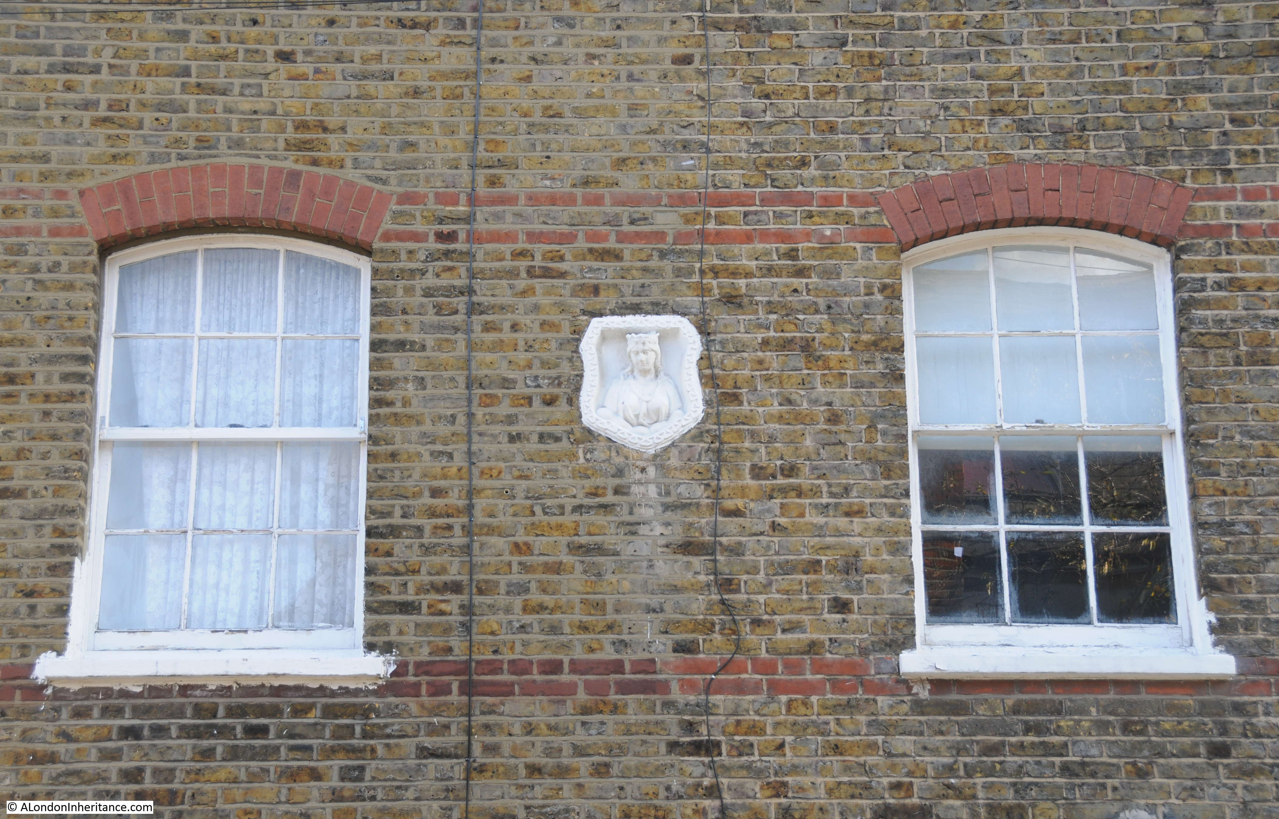
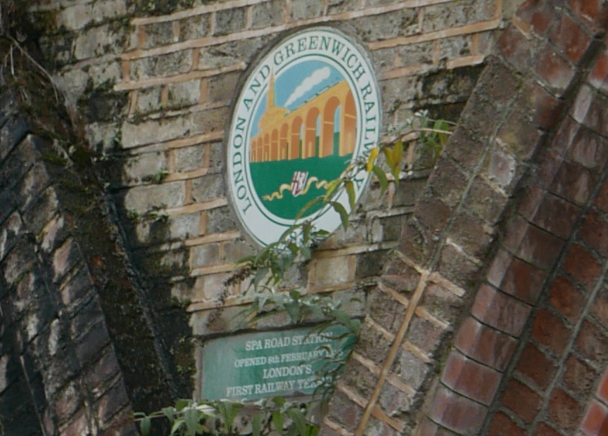
To the right of the Booking Office there are a couple of plaques recording the London and Greenwich Railway and Spa Road Station. Had to take the photo at an angle as a truck was parked directly in front.

Spa Road Station

Soon after the viaduct was opened, other railway companies were formed to build and run additional routes out of London Bridge Station. Until these new lines branched off to their final destination, they used the viaduct built by the London and Greenwich Railway and paid a fee to the L&GR, usually based on a percentage of the ticket value.

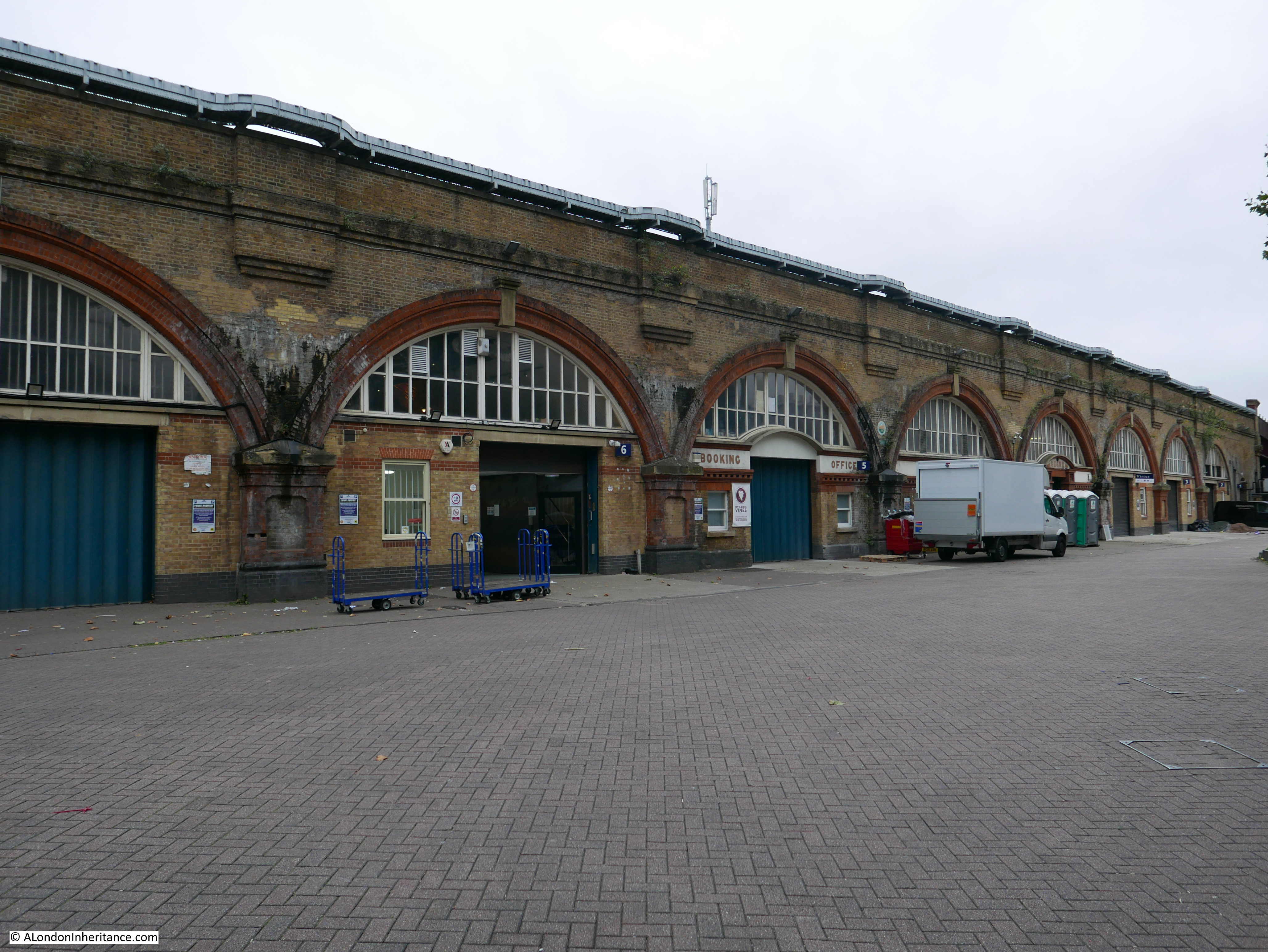
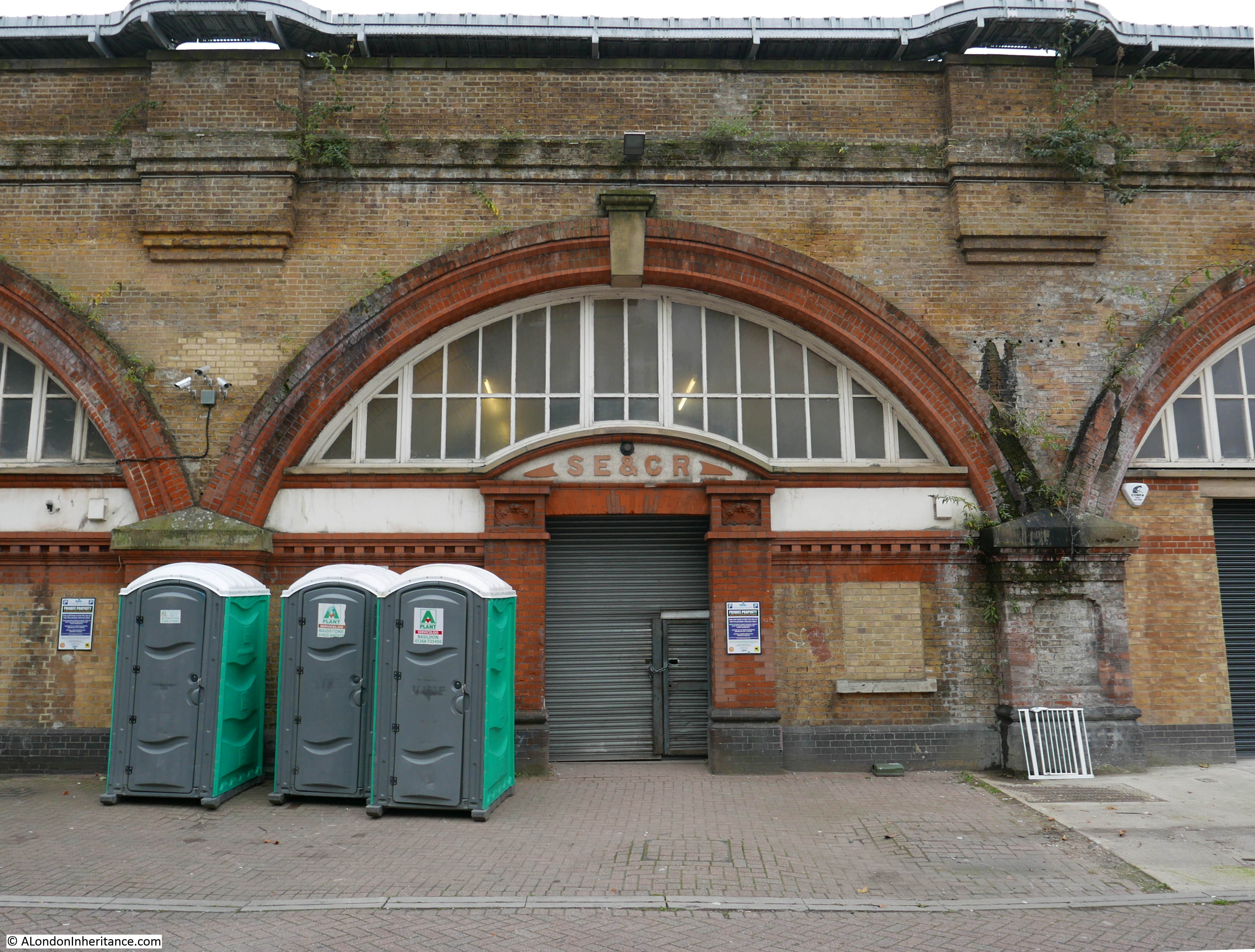
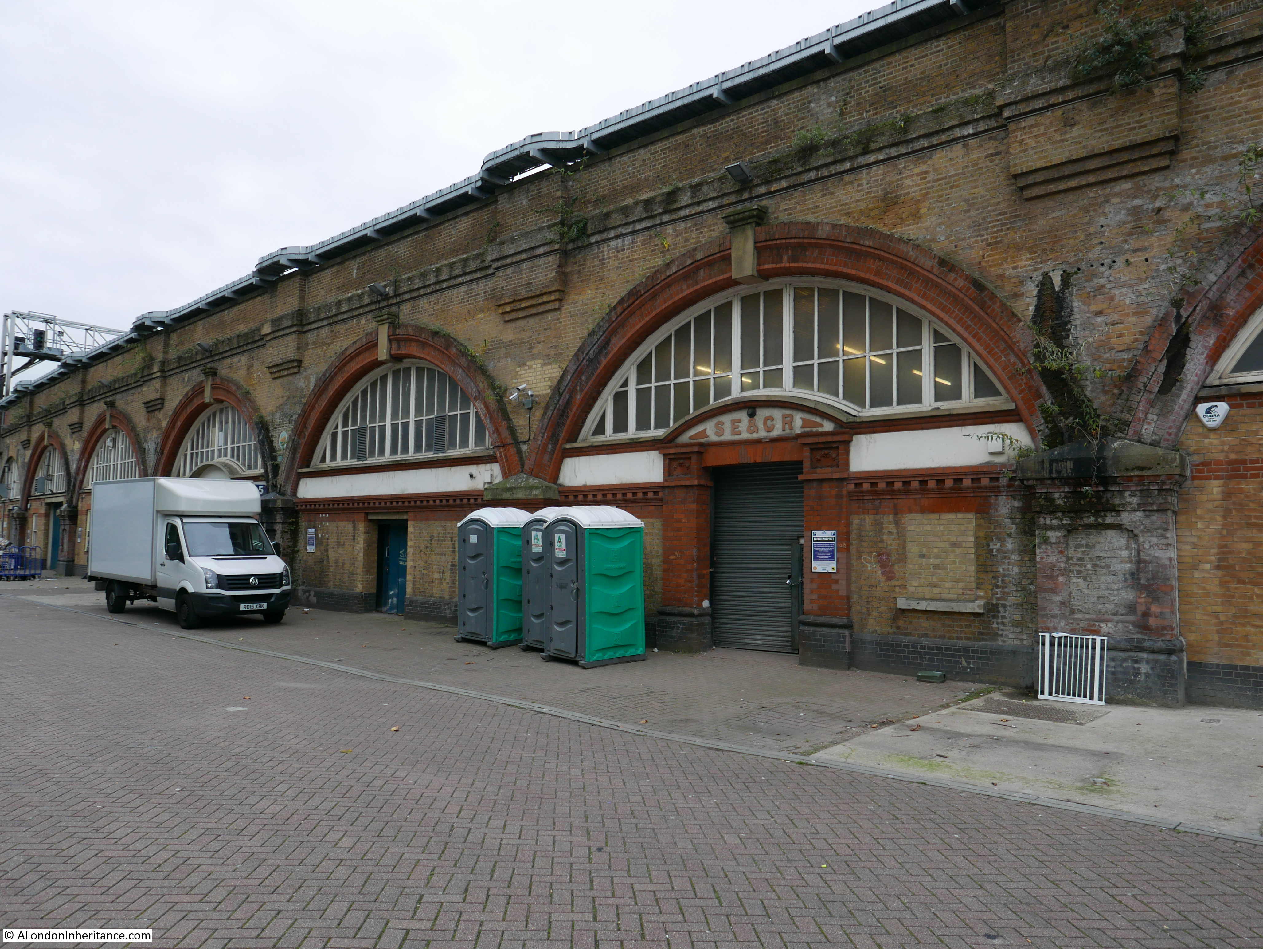
One of the these was the South Eastern and Chatham Railway, formed in 1899 from the merger of the South Eastern Railway and the London, Chatham & Dover Railway. A couple of arches along from the booking office is another survivor from Spa Road station, with the initials of the South Eastern and Chatham Railway above the main entrance.

Spa Road Station

I have a postcard of the station when in use by the South Eastern and Chatham Railway., although I am not sure which of the two arches feature in the photo.

Spa Road Station

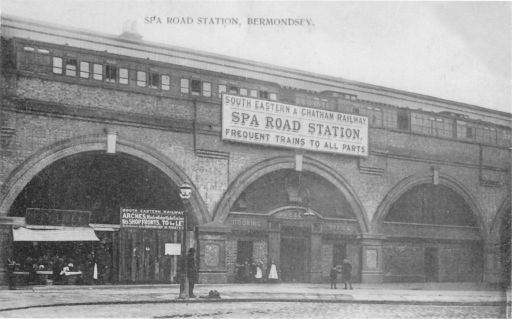
Above the arch are the initials SE&CR which are preserved on one of today’s arches, whilst on either side of these initials in the above postcard are the words Booking Office which feature on the other arch that remains today. There are no other clues as to which of the two arches is in the old photo, however it does show what the station looked like,

The view above the arches also shows the improvements at this second Spa Road Station.

The original station was made up of wooden staircases up the side of the viaduct leading to a narrow platform between the parapet and the tracks. The new station had wider platforms. station buildings and a roof above the platforms. The stairs leading to the platforms were also inside the viaduct. The space for the station on the viaduct was still limited, but it was a considerable improvement on the first station.

The two arches are in the photo below, although the arch with the words Booking Office is behind the wide truck:

Spa Road Station

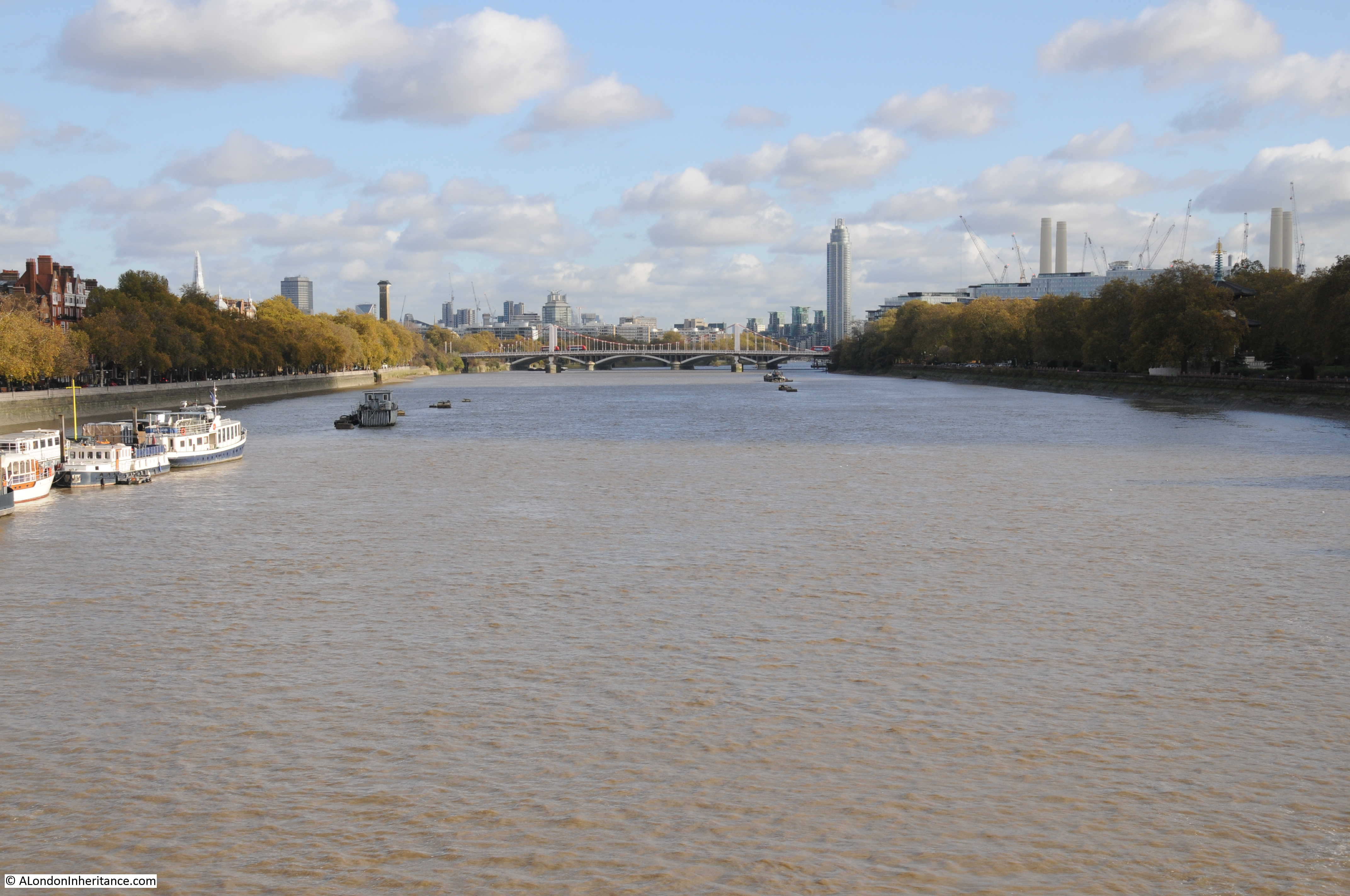
The remains of the station on the viaduct can still be seen today. I have never been able to get a good photo from a train on the route, however the location of the station can be seen from the Shard.

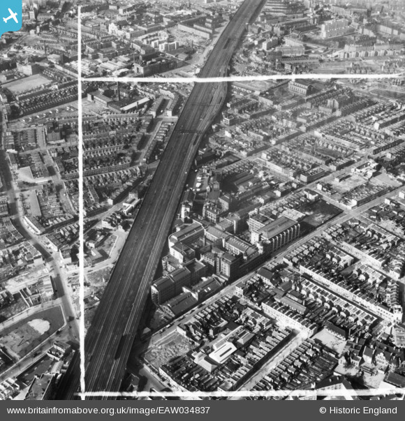
The following view shows the viaduct stretching out from London Bridge Station towards Deptford and Greenwich, and gives a good impression of the scale of the building work carried out in the 1830s by the London and Greenwich Railway. Follow the viaduct away from London Bridge and in the distance, a train can just be seen on the left of the viaduct.

Spa Road Station

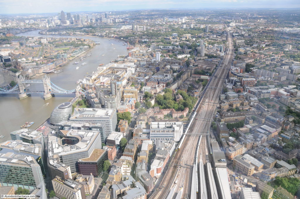
Enlarging this section of the photo shows the location of Spa Road Station where the viaduct extends out to the left. The platform was in the middle of the two tracks:

Spa Road Station

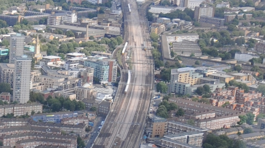
The tower of St. James Bermondsey is on the left of the station, and the large buildings of the old Peek Frean biscuit factory are just to the upper left of the station. These provide a couple of good landmarks to locate the old station when on a train running along the viaduct.

The remains of the station are also visible in these 1951 photos from Britain from Above:

Spa Road Station

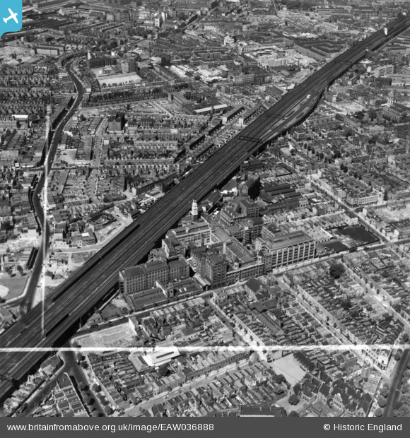
Both photos also show the size of the Peek Freans biscuit factory which ran alongside the viaduct.

Spa Road Station

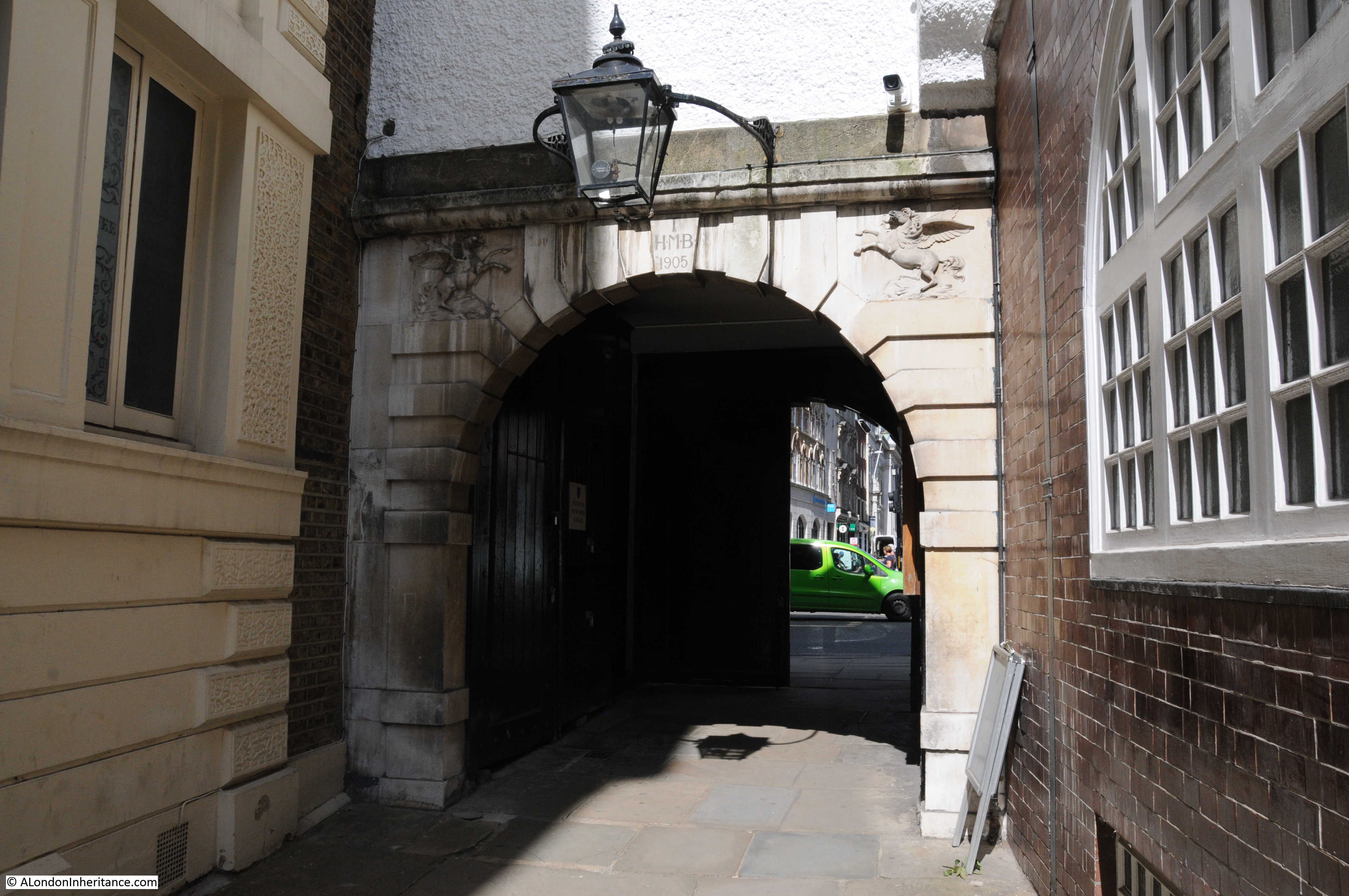
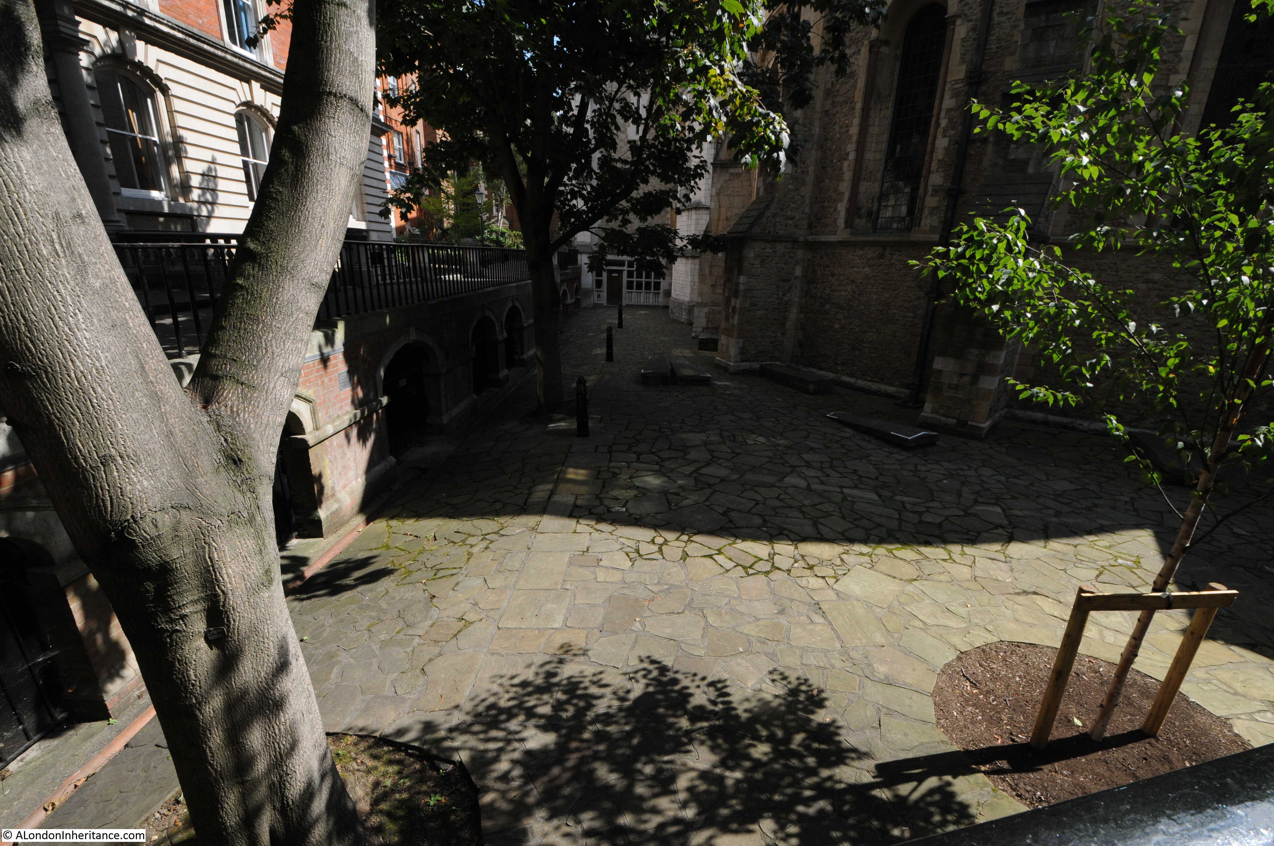
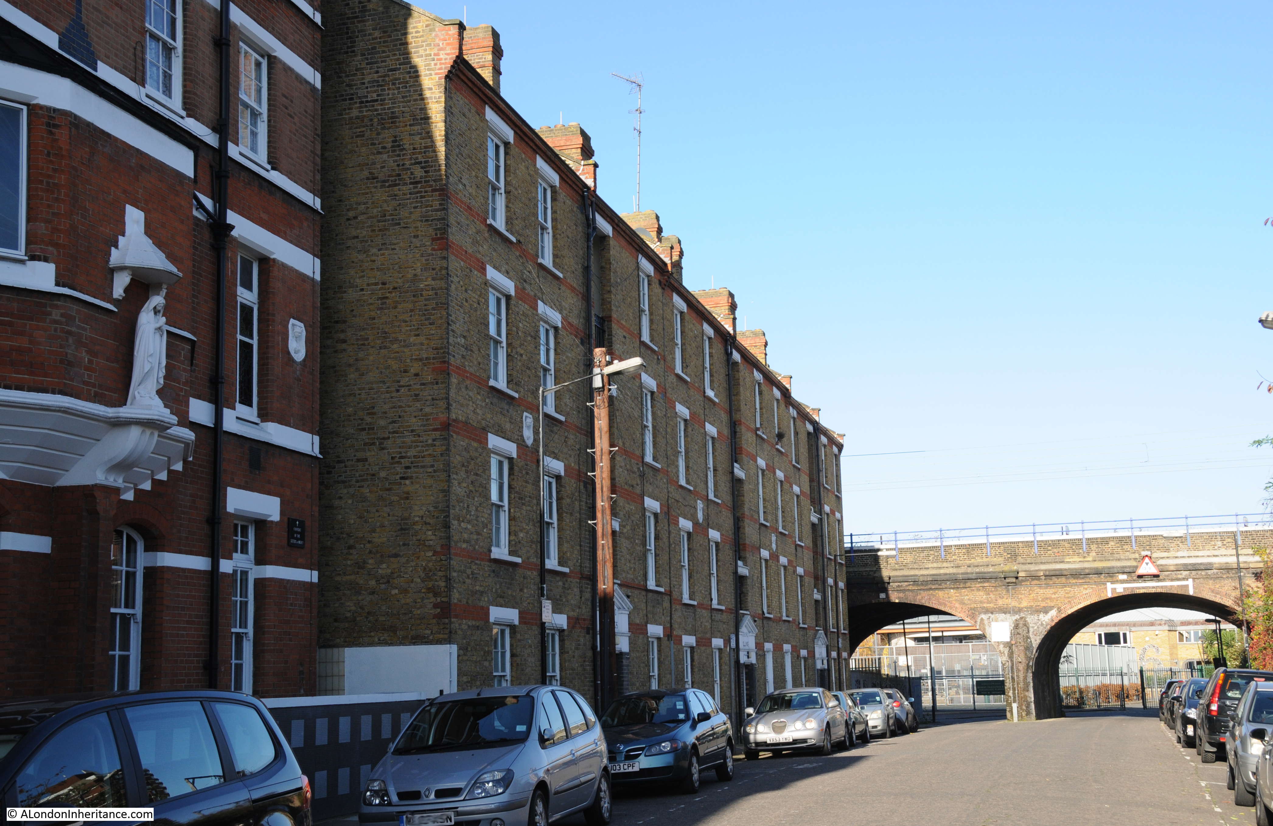
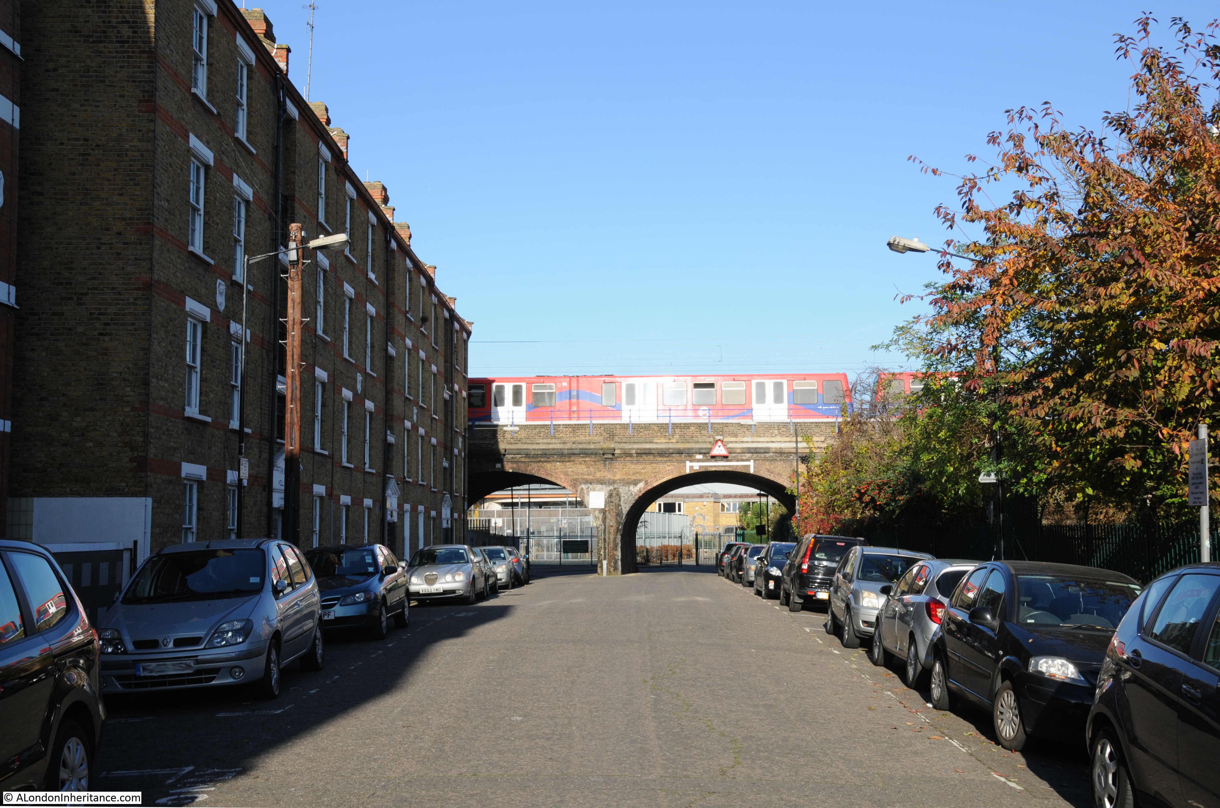
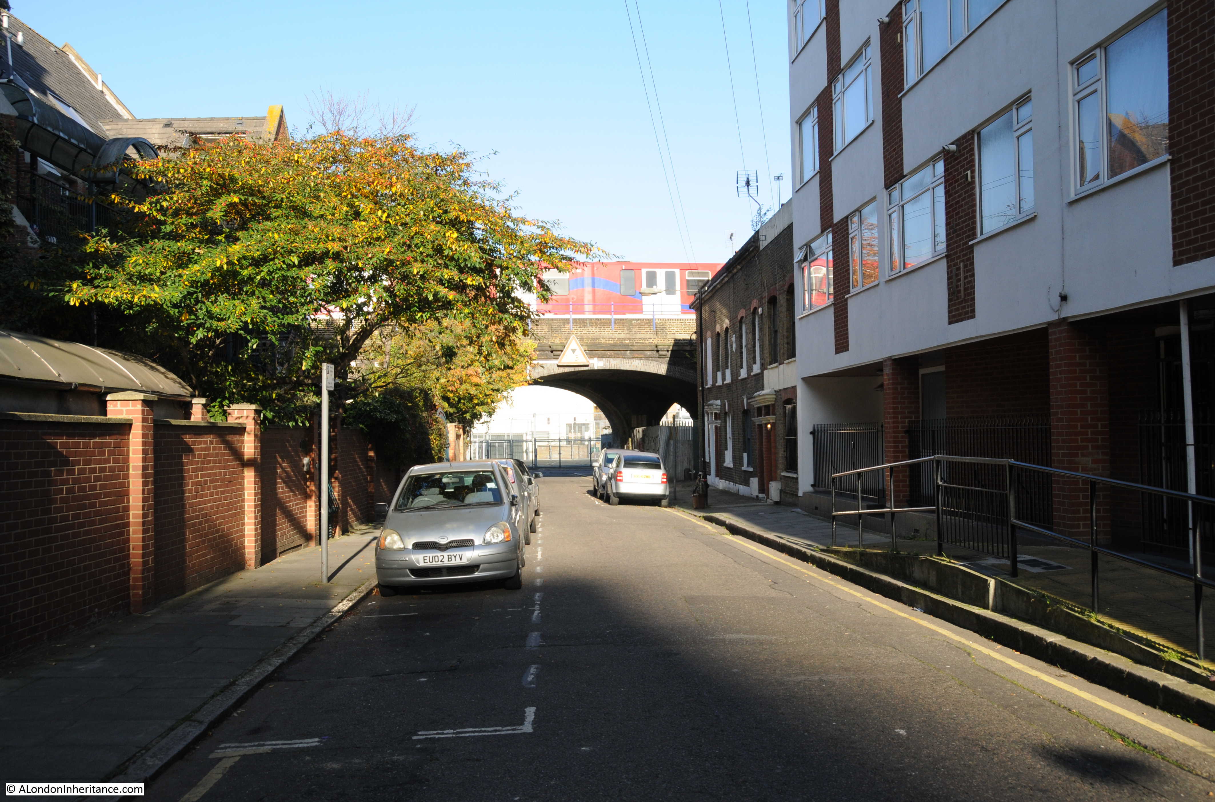
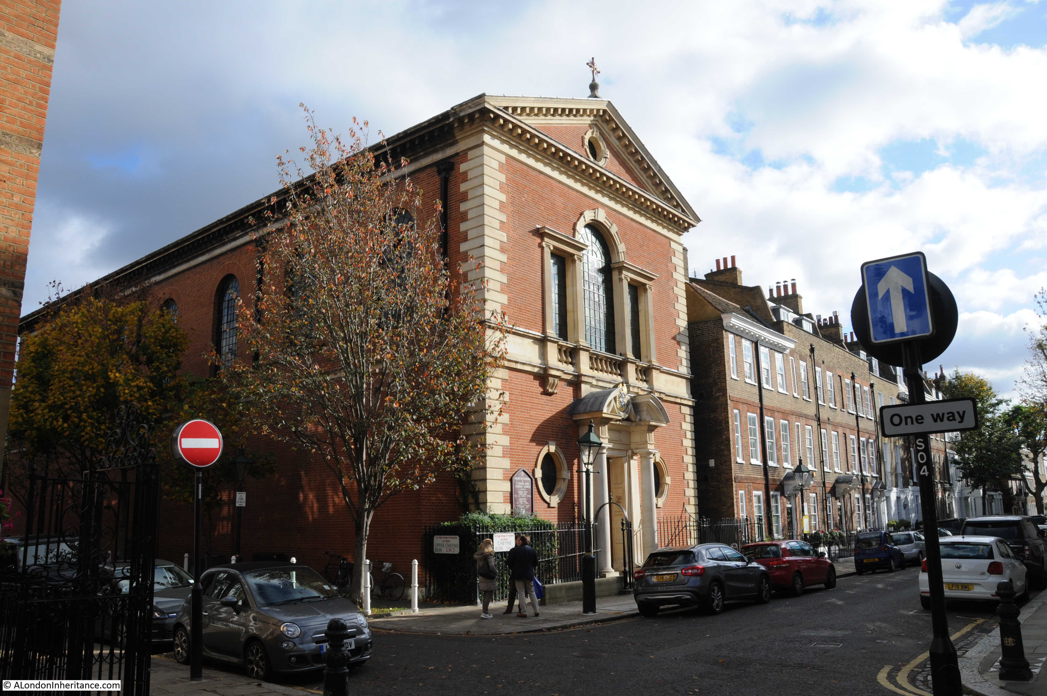
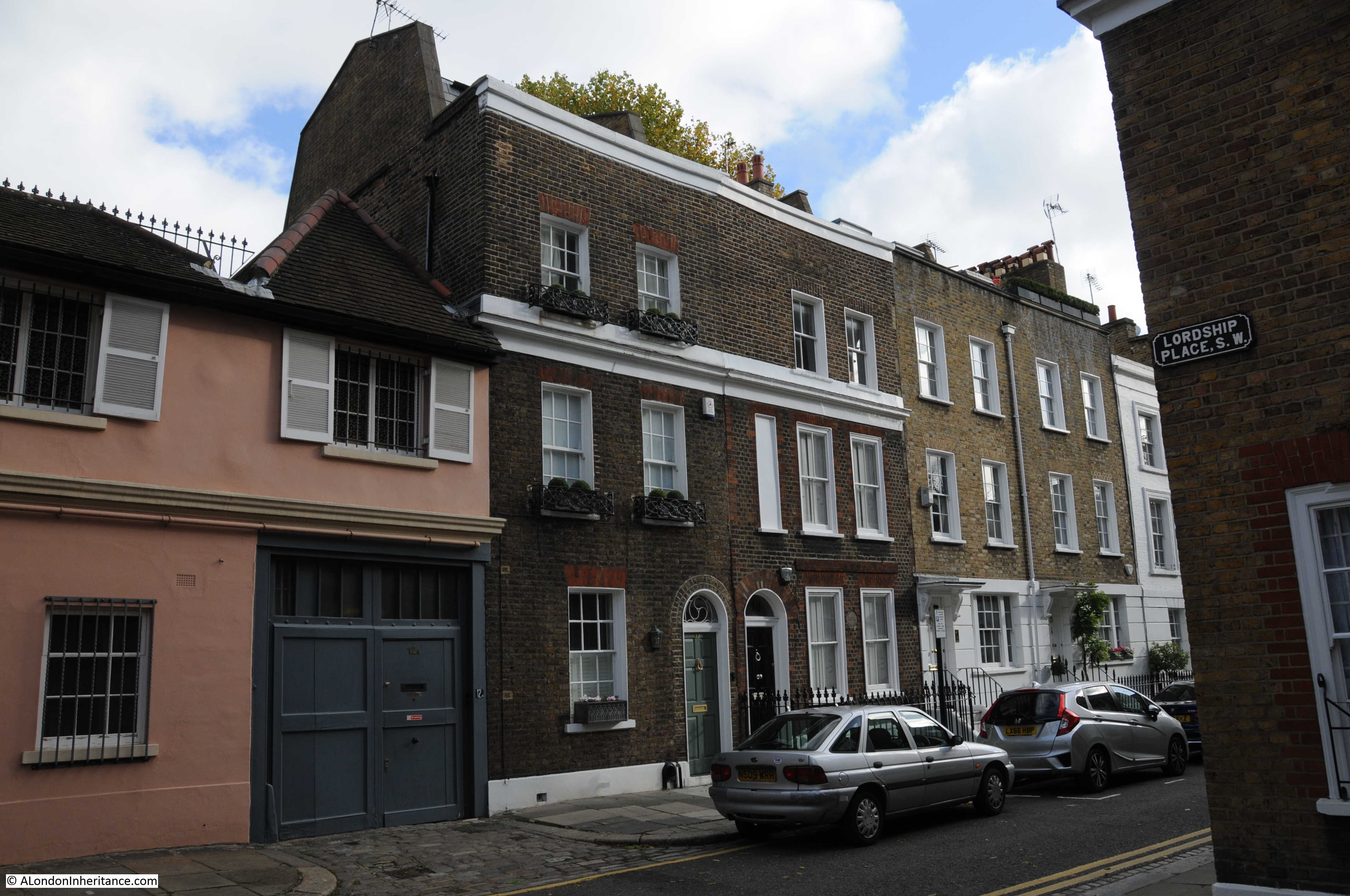
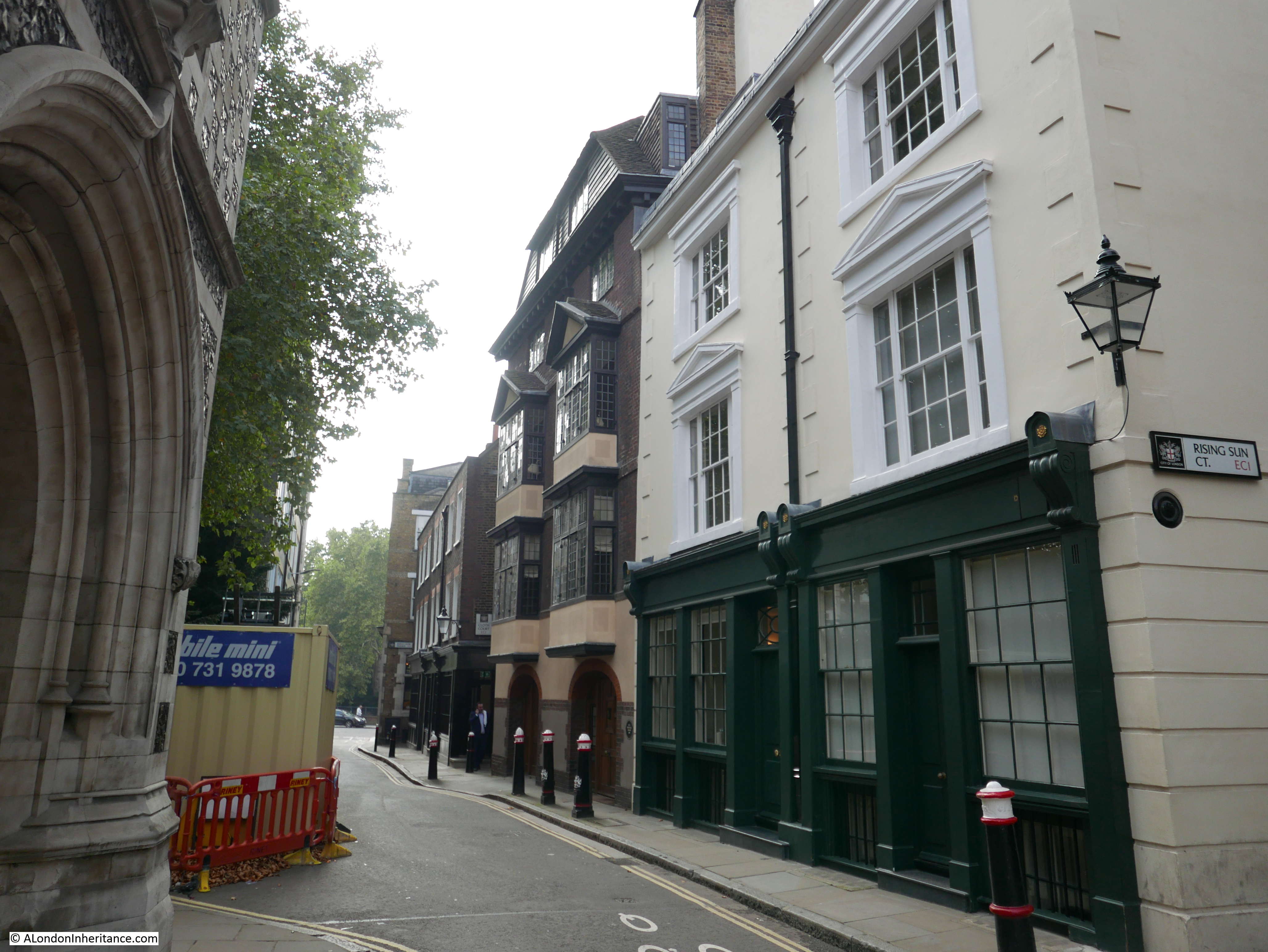
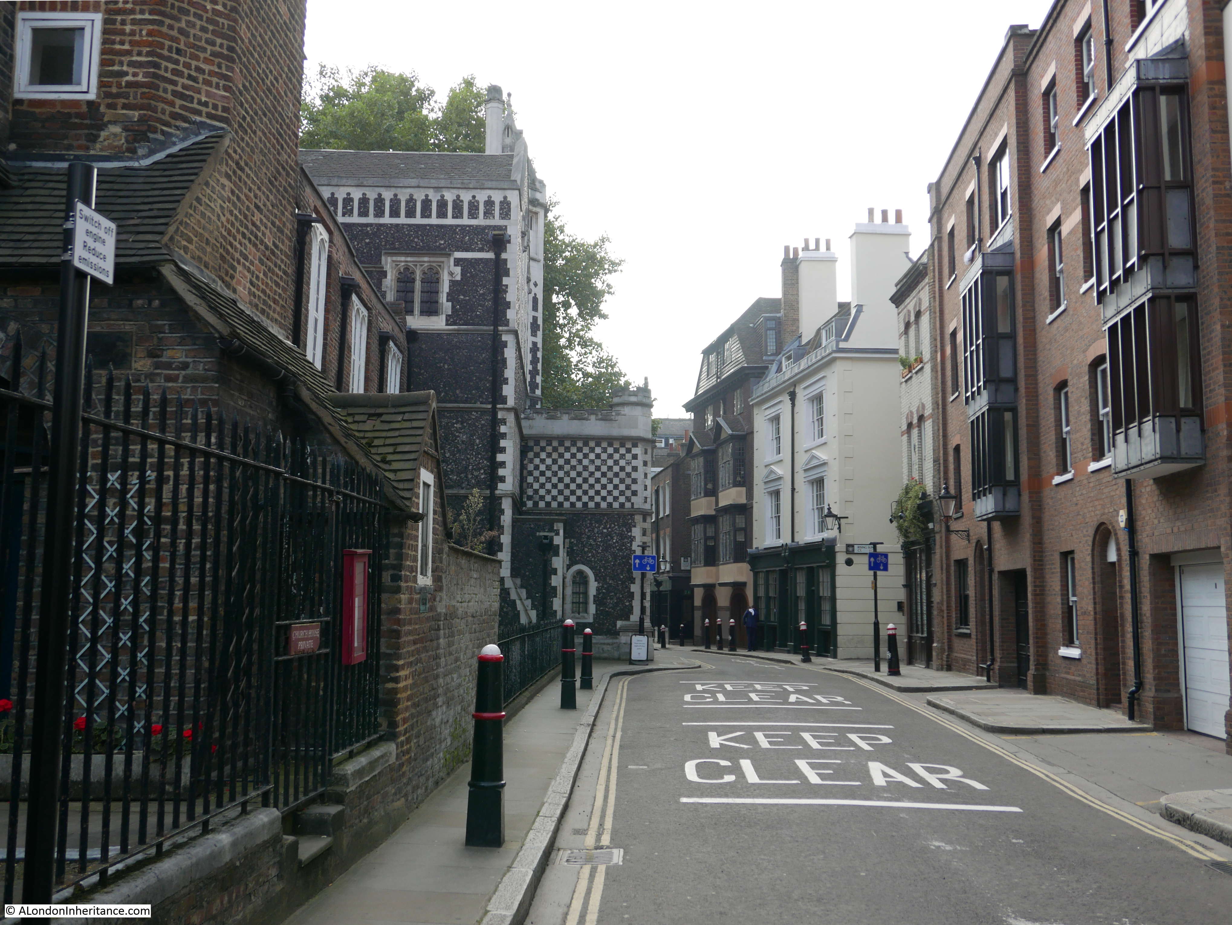
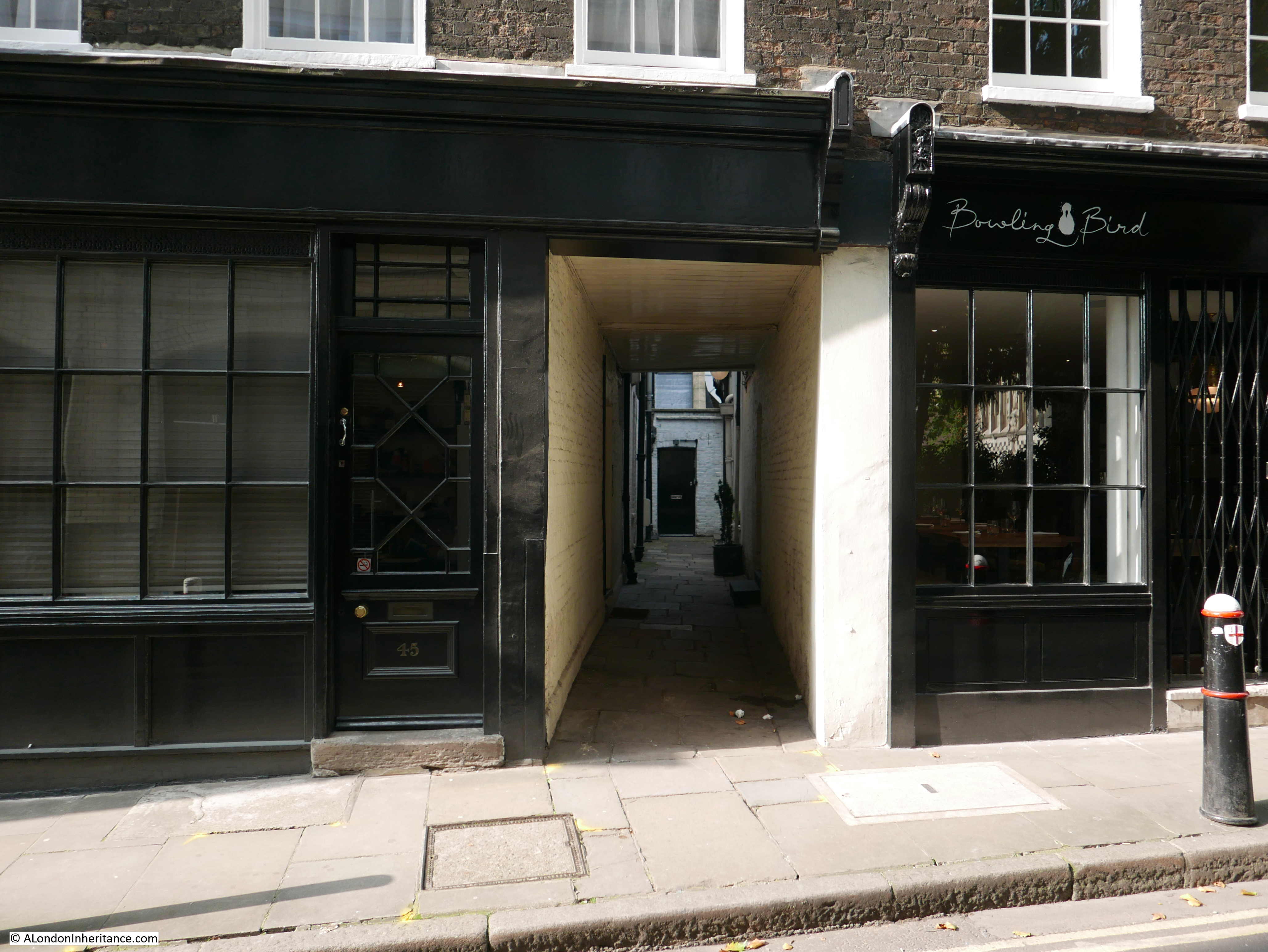
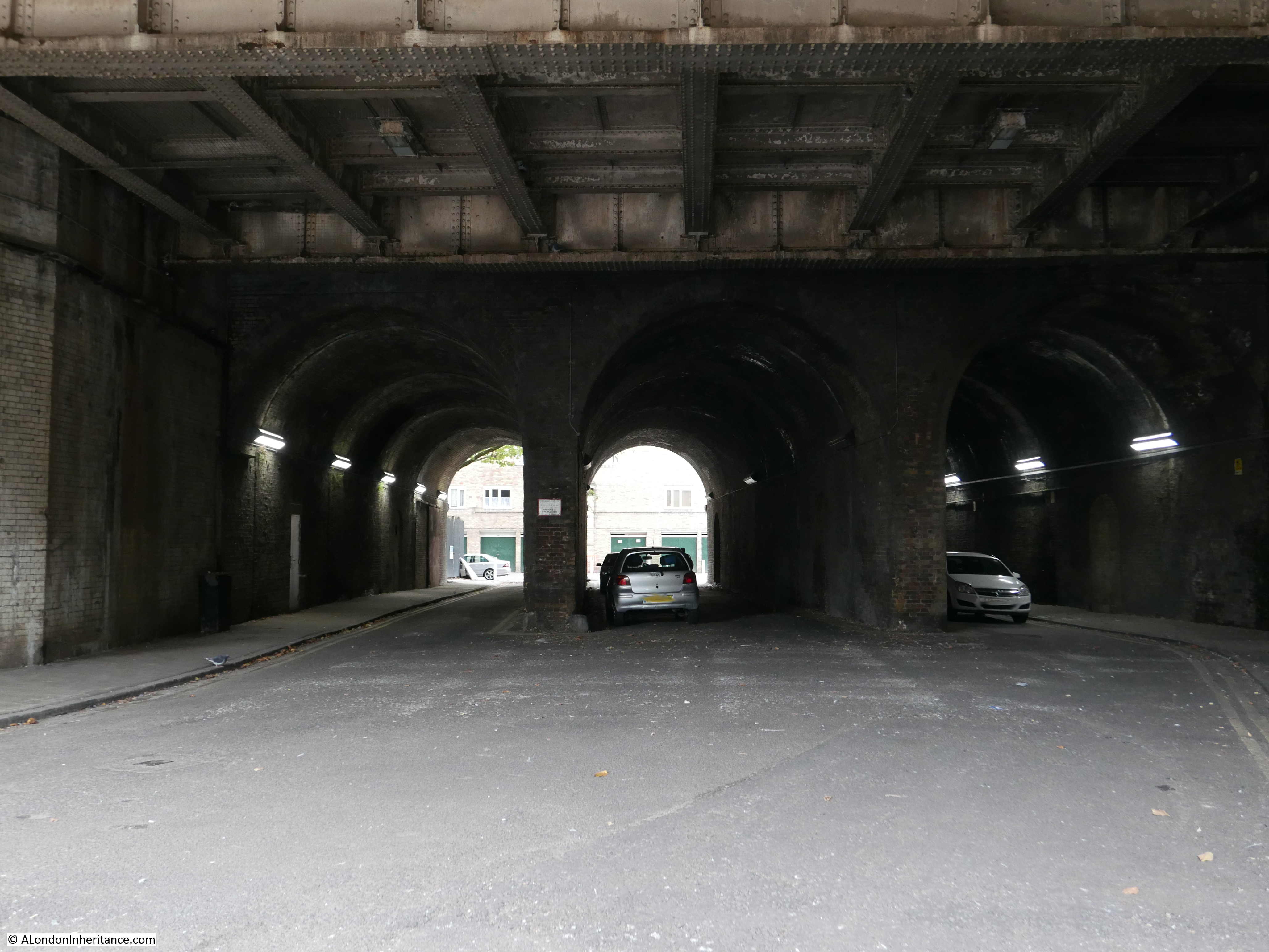
Whilst exploring Spa Road, I walked to some of the other streets passing through the viaduct. There are many of them, all different with features dictated by the places they connect, the type of streets that pass underneath and the architecture of the viaduct.

The number of streets cutting through the viaduct show that the use of a viaduct rather than ground level rail tracks was a superb bit of forward thinking. Despite the size of the viaduct, the frequency of streets passing underneath helps to ensure that the areas on either side are not separated. It all seems part of the same, connected place and instead of walking along open streets, part of the route is through a relatively short tunnel.

Had the London and Greenwich Railway been built at ground level, there would have been very few crossing points resulting in a distinct separation between either side of the tracks.

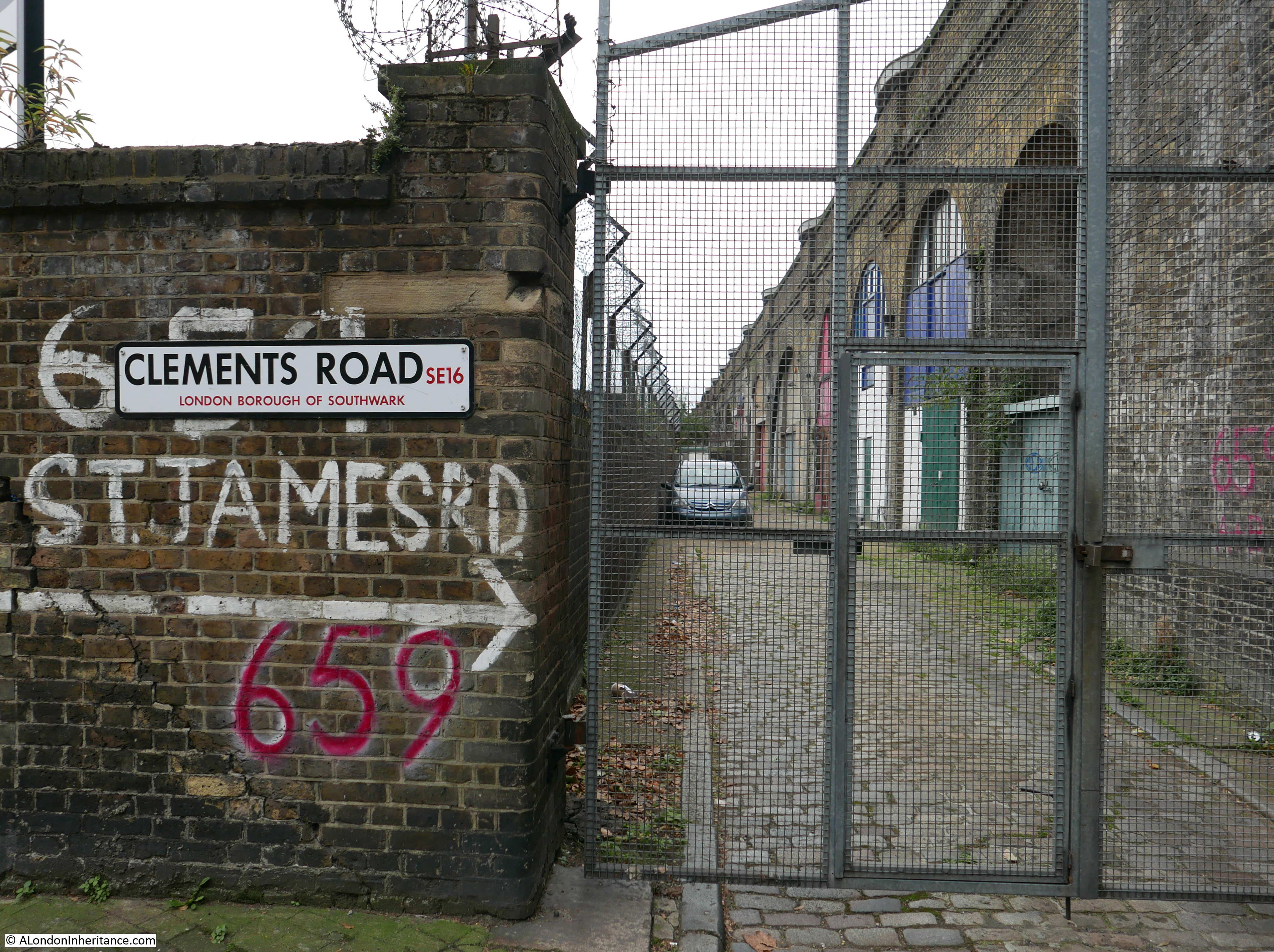
The wonderfully named Rail Sidings Road passing underneath the viaduct. Rail Sidings Road runs to Lucey Way which in turn runs parallel to the viaduct and alongside a housing estate. It is not a main through road and the tunnels on the right are now used for parked cars with only the tunnel on the left being open for traffic.

Spa Road Station

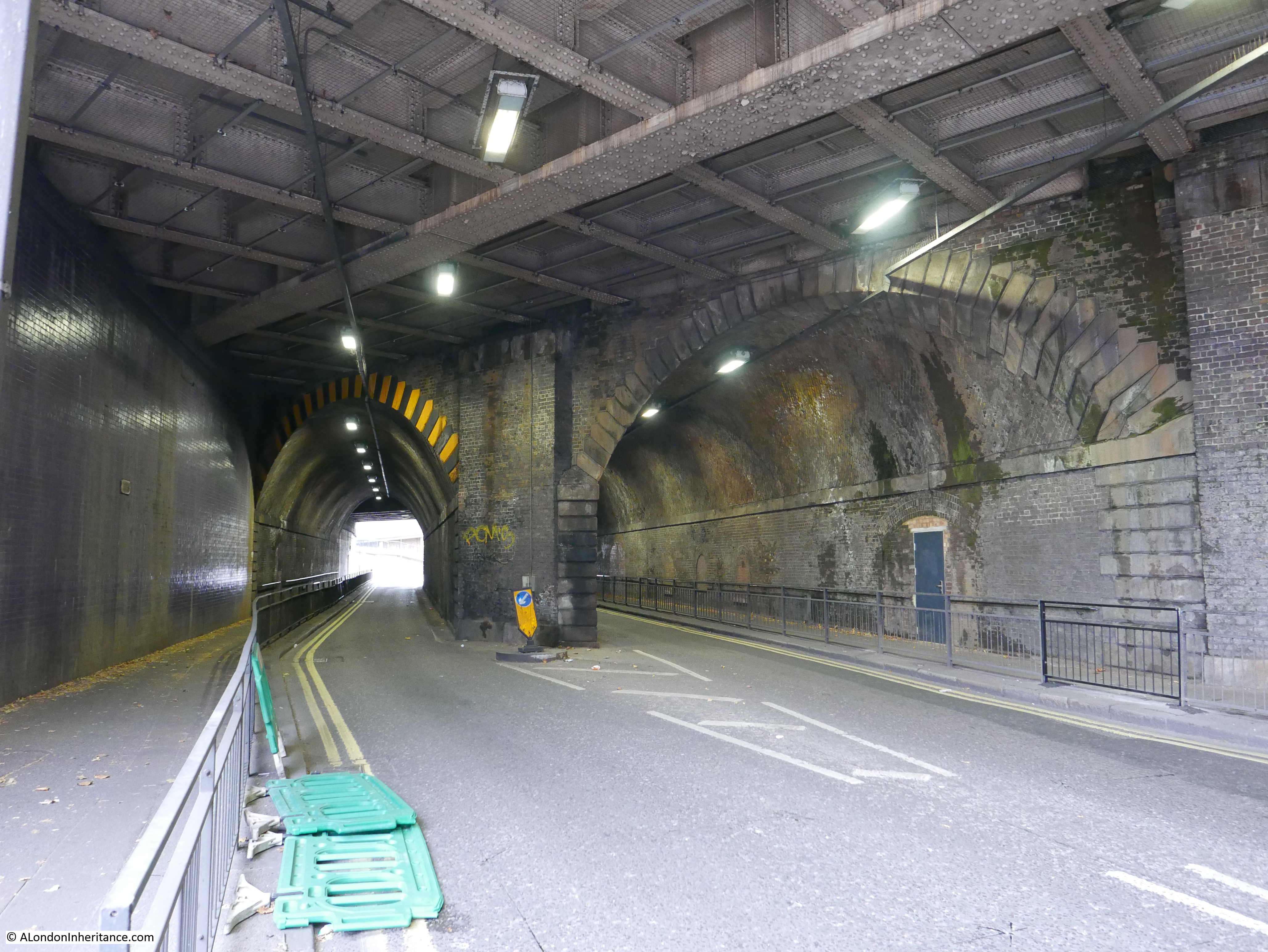
St. James’s Road tunnels passing underneath the viaduct:

Spa Road Station

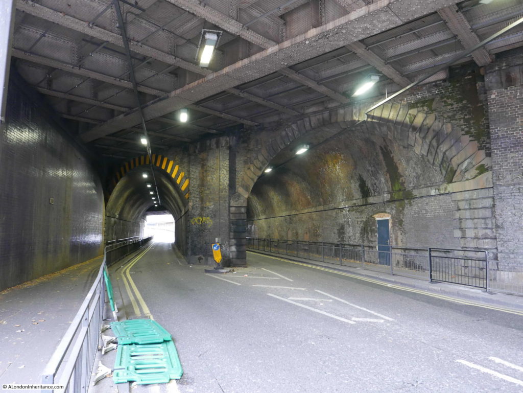
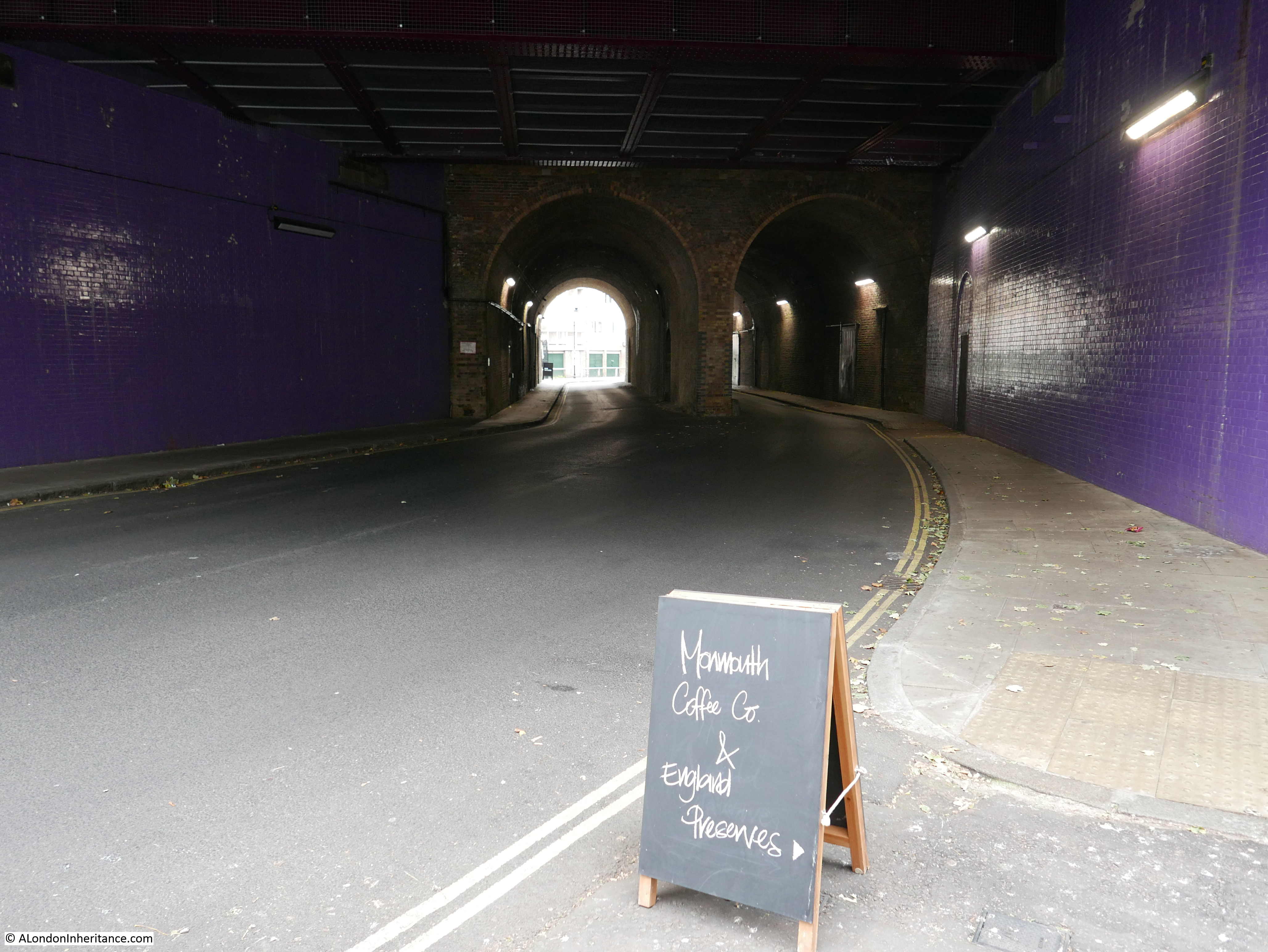
Dockley Road passing underneath the viaduct, with a Monmouth Coffee Shop in one of the arches:

Spa Road Station

Whilst walking through these few tunnels I started to have thoughts about a project to photo all the tunnels between London Bridge and Greenwich – I need to take this less seriously !!

Adjacent to the St. James’s Road tunnel is Clements Road. Running from Clements Road. Parallel to the viaduct is a narrow paved road. When the original viaduct was built, construction included a roadway and footpath alongside the length of the viaduct and the L&GR charged a toll for the use of these. I have no idea whether this is true, however it would be good to think that this cobbled roadway is part of the original road from when the viaduct was built.

Spa Road Station

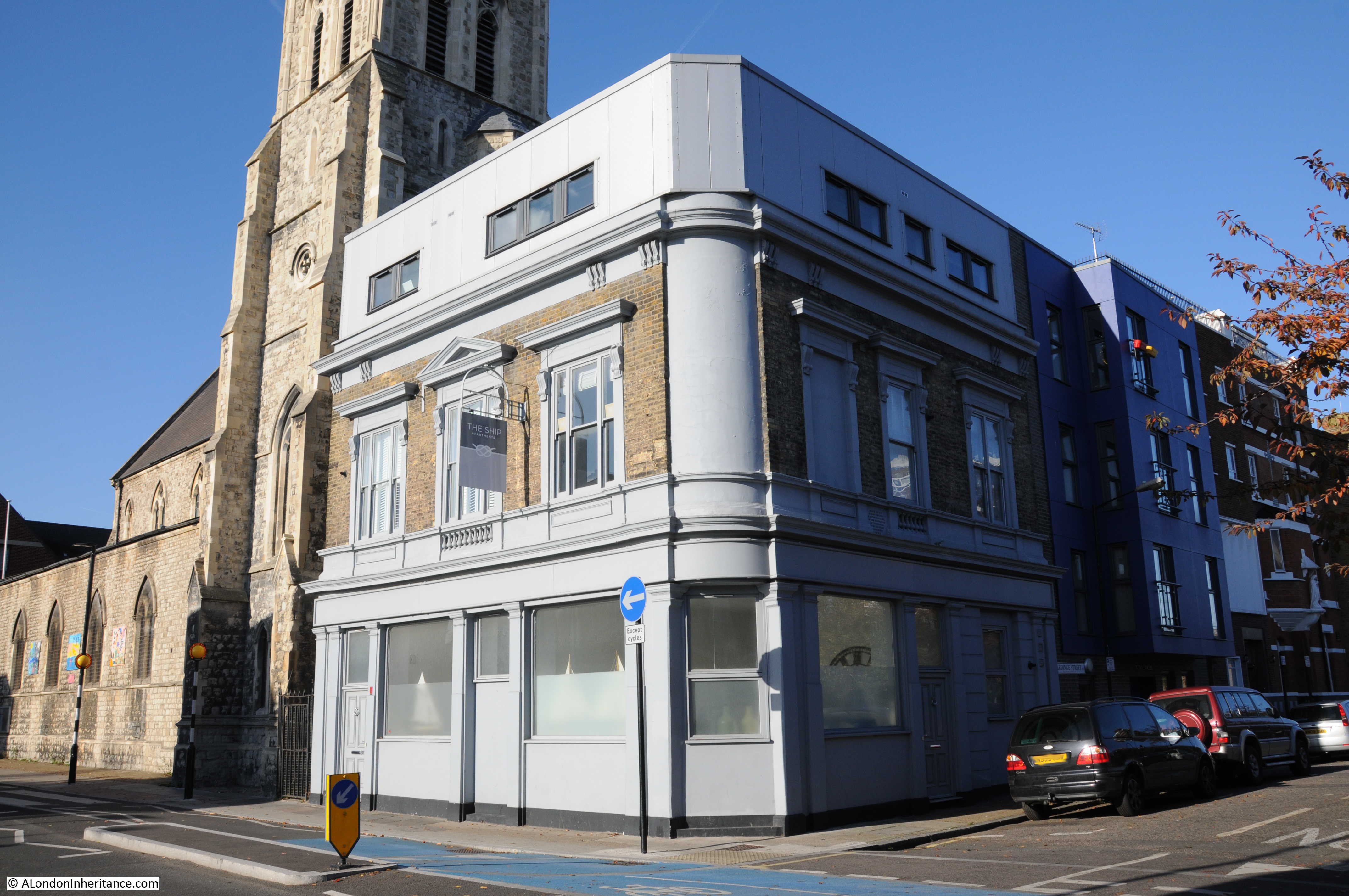
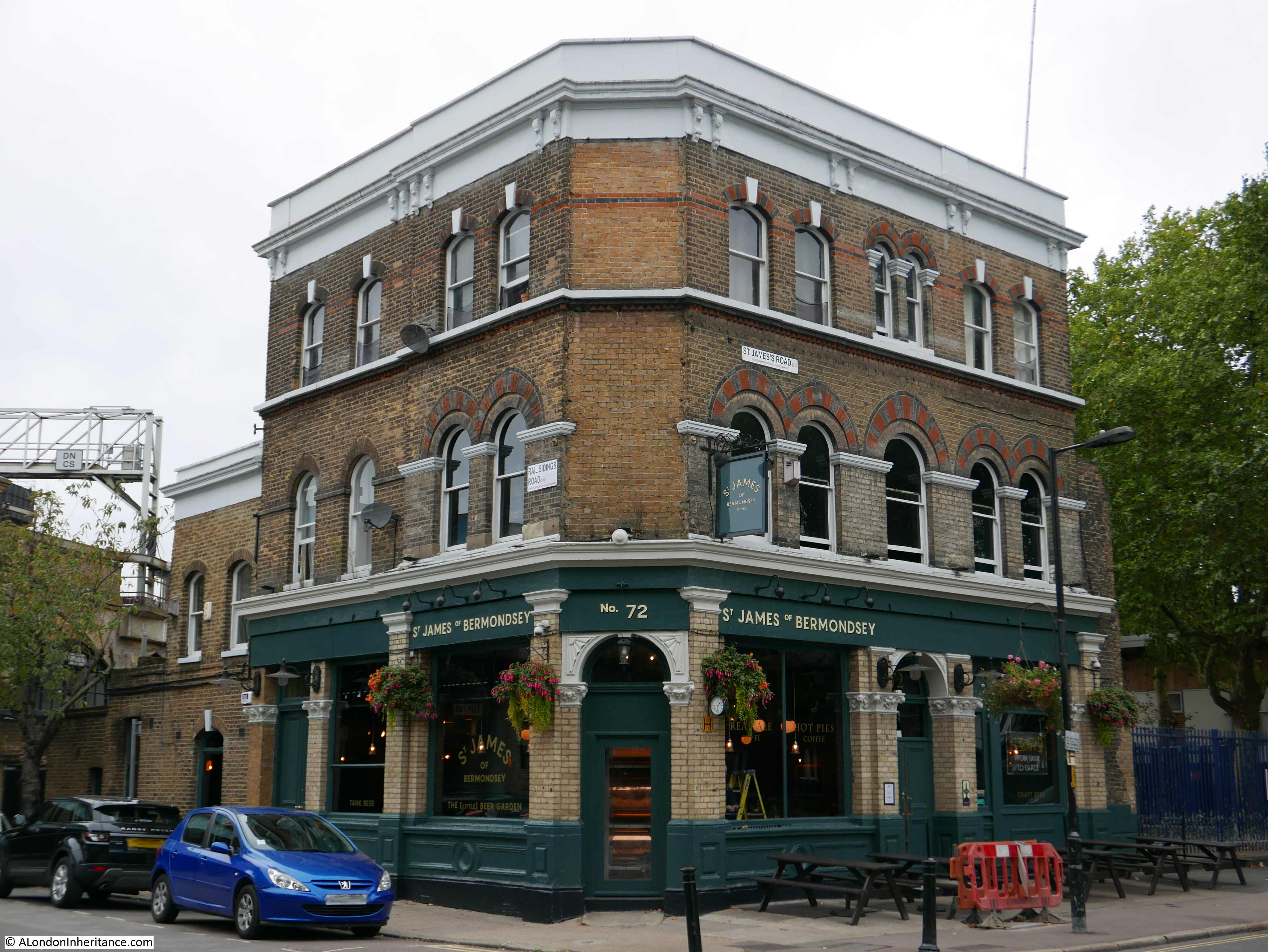
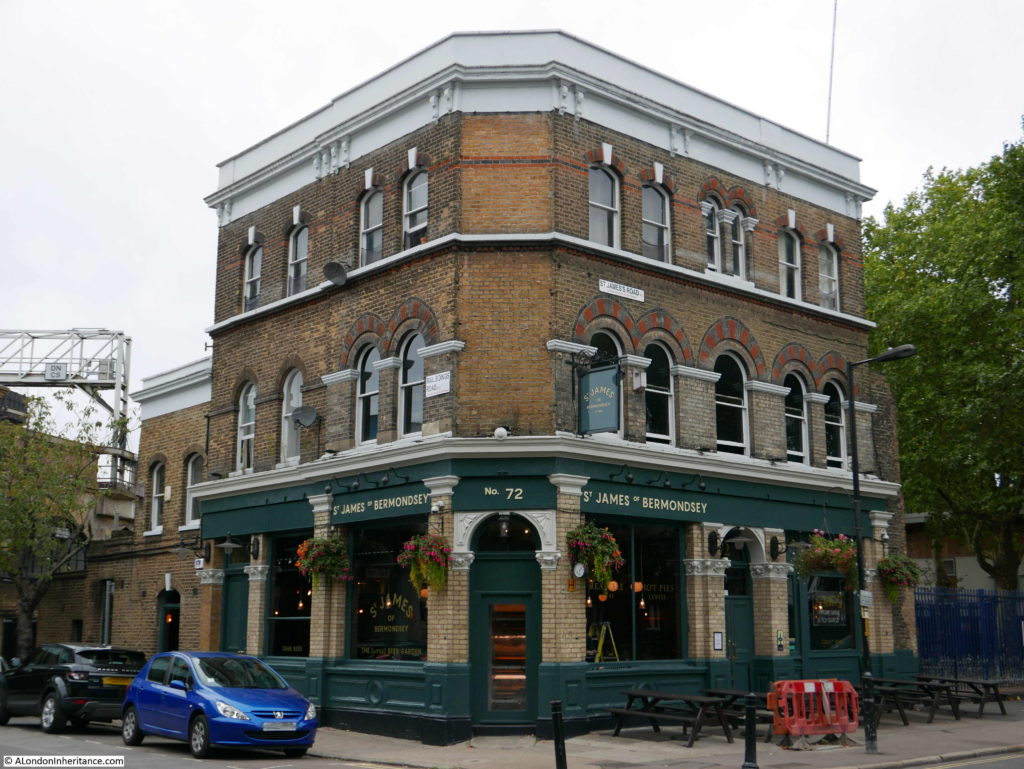
On the junction of Rail Sidings Road and St. James’s Road is the pub St. James of Bermondsey, formerly the St. James Tavern, a Victorian pub dating from 1869.

Spa Road Station

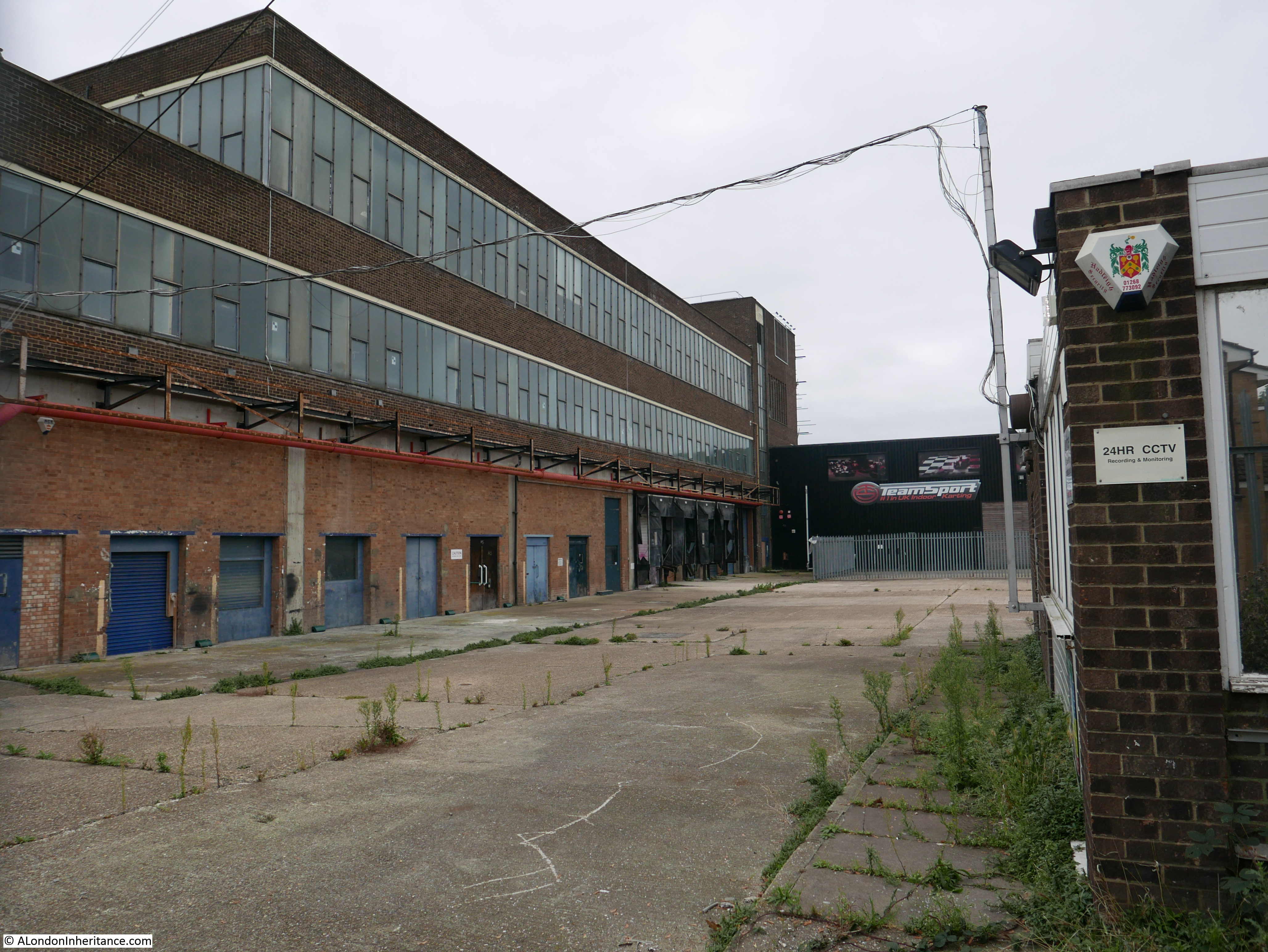
I also walked along Clements Road to take a look at a major landmark in the area, the old Peek Freans biscuit factory.

The Peek Freans factory was part of the development of Bermondsey from the open country shown in the maps earlier in this post to the densely built area of today. The factory was built on 10 acres of former market gardens adjacent to the viaduct which were purchased in 1866.

The factory closed in 1989, and has since provided space for a number of small businesses, however will soon be the subject of a major redevelopment.

Spa Road Station

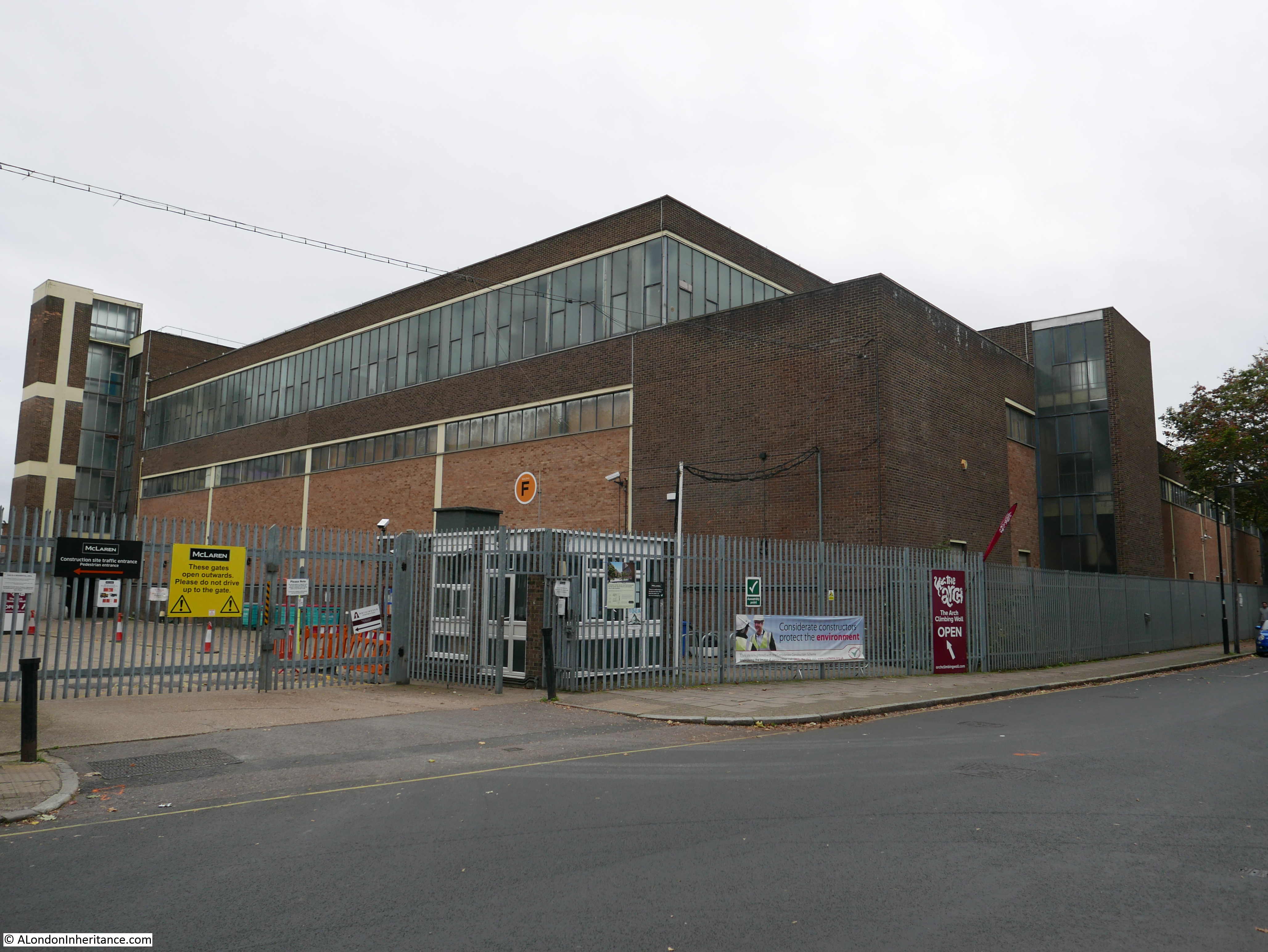
One of the old factory entrances:

Spa Road Station

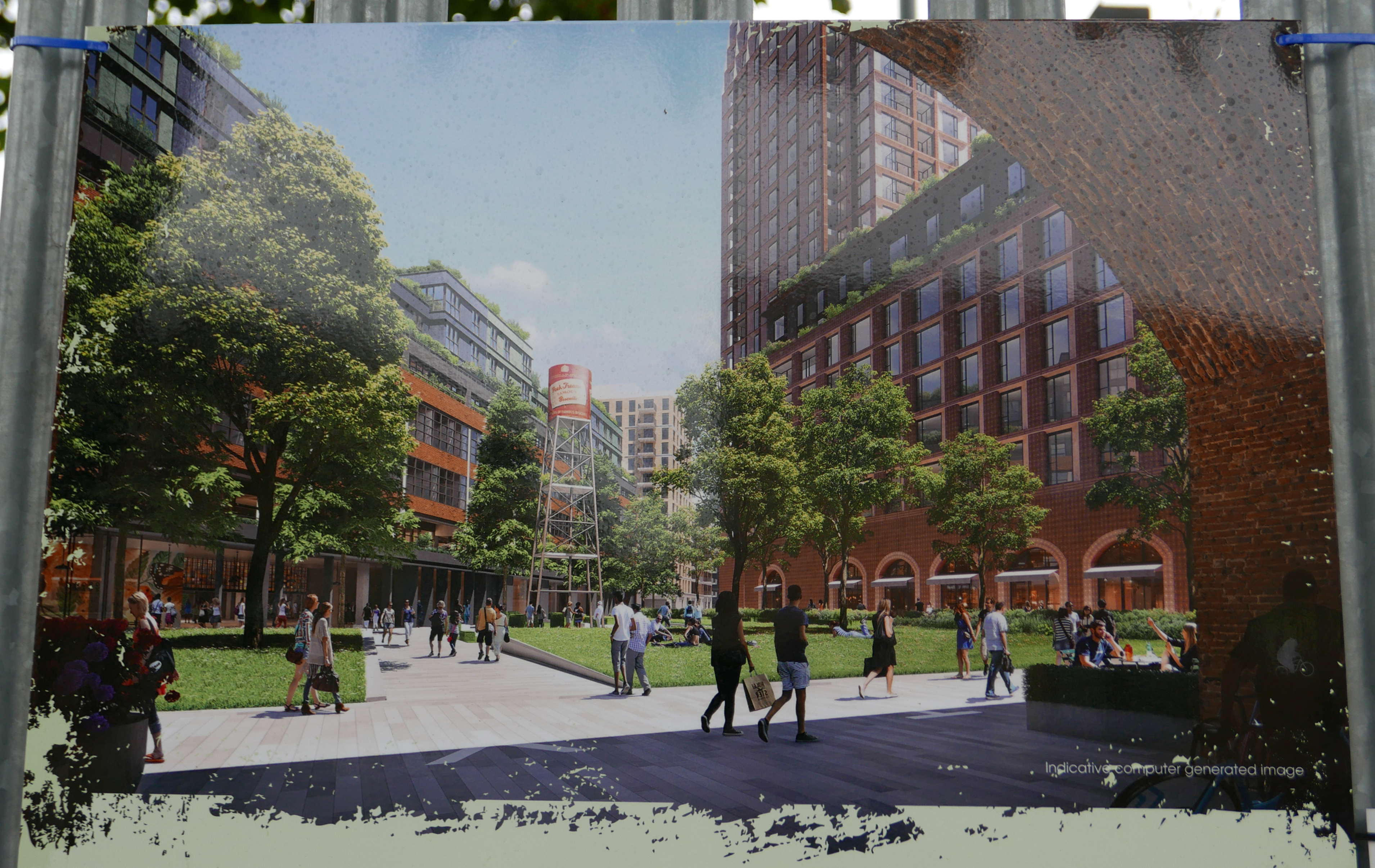
There is one of the usual artists impressions of the future development cabled tied to the metal fencing around the old factory. The usual view of these future developments where the sky is always blue, it is always summer and where no one over the age of forty or fifty would apparently ever be seen.

Spa Road Station

To be fair to the developers, the small print in the bottom right corner does state “Indicative computer generated image” so it may look completely different when finished (as these developments often do).

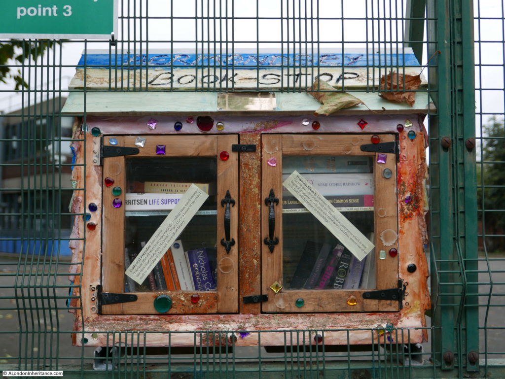
There is so much more to explore here, but this post is getting too long. For a final photo, I found this Bermondsey Book Stop at the junction of Webster Road and Clements Road, opposite one of the entrances to the old Peak Freans factory with quotes from Pride and Prejudice and Tristram Shandy on the doors.  A brilliant initiative.

Spa Road Station

Spa Road Station has now been closed for over 100 years, however the place where the viaduct passes over Spa Road will always be the first railway terminus in London and the viaduct will continue to support many more trains and passengers than the original founders of the London & Greenwich Railway can ever have imagined.

I have only covered the very first years of the construction of the viaduct. As soon as the viaduct was under construction there were many proposals for additional routes and extension of the railway onwards to Gravesend and Dover.

There was even a serious proposal at one stage to extend the viaduct across Greenwich Park, however fortunately this scheme was turned down in favour of the tunnel that was built underneath the land between the Queen’s House and the old Royal Naval College.

If you travel on the railway, look out towards the north when the old biscuit factory comes into view or the tower of St. James Church and you may catch a glimpse of the remains of Spa Road Station.

alondoninheritance.com