Category Archives: London Journeys

A Sunday Morning Walk In Nine Elms

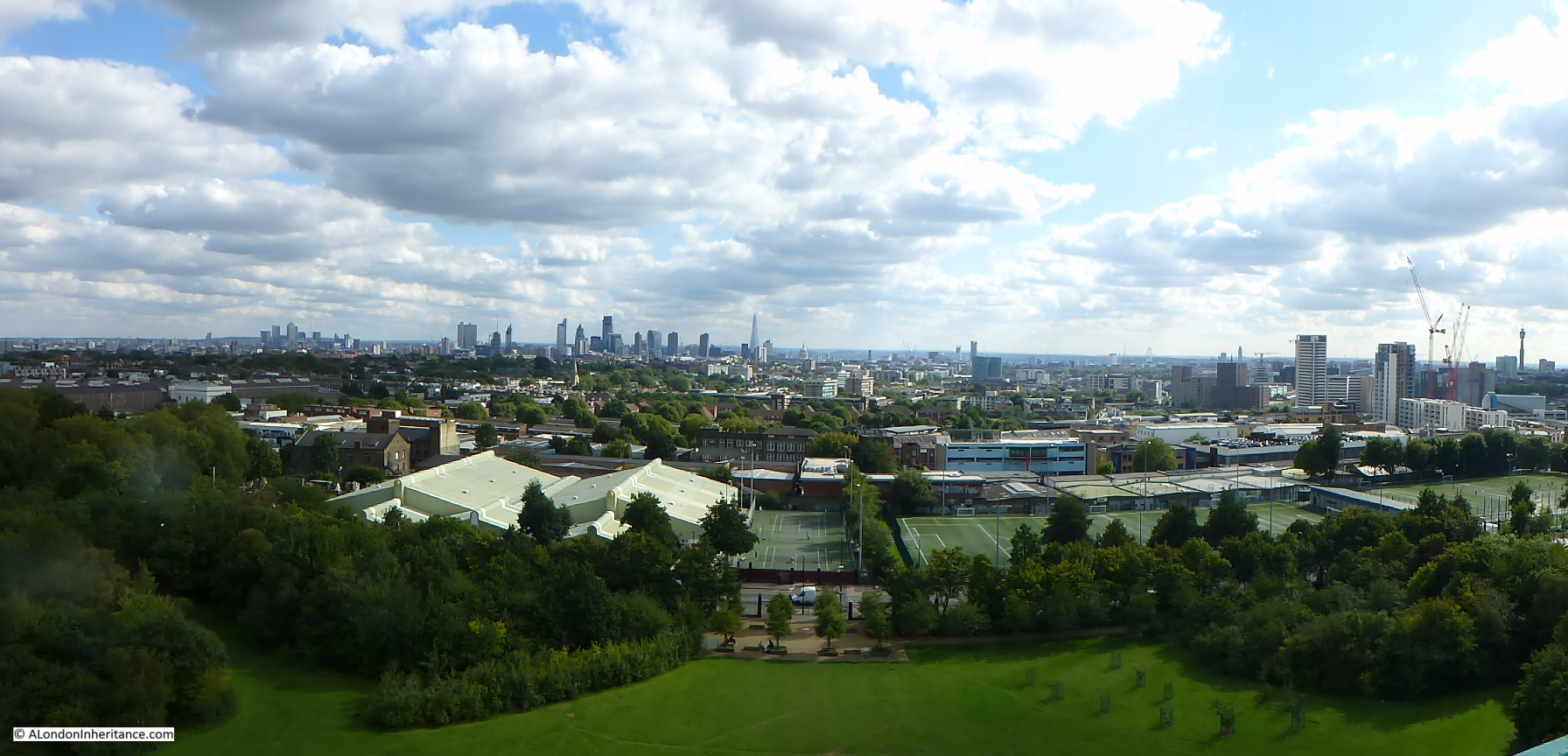
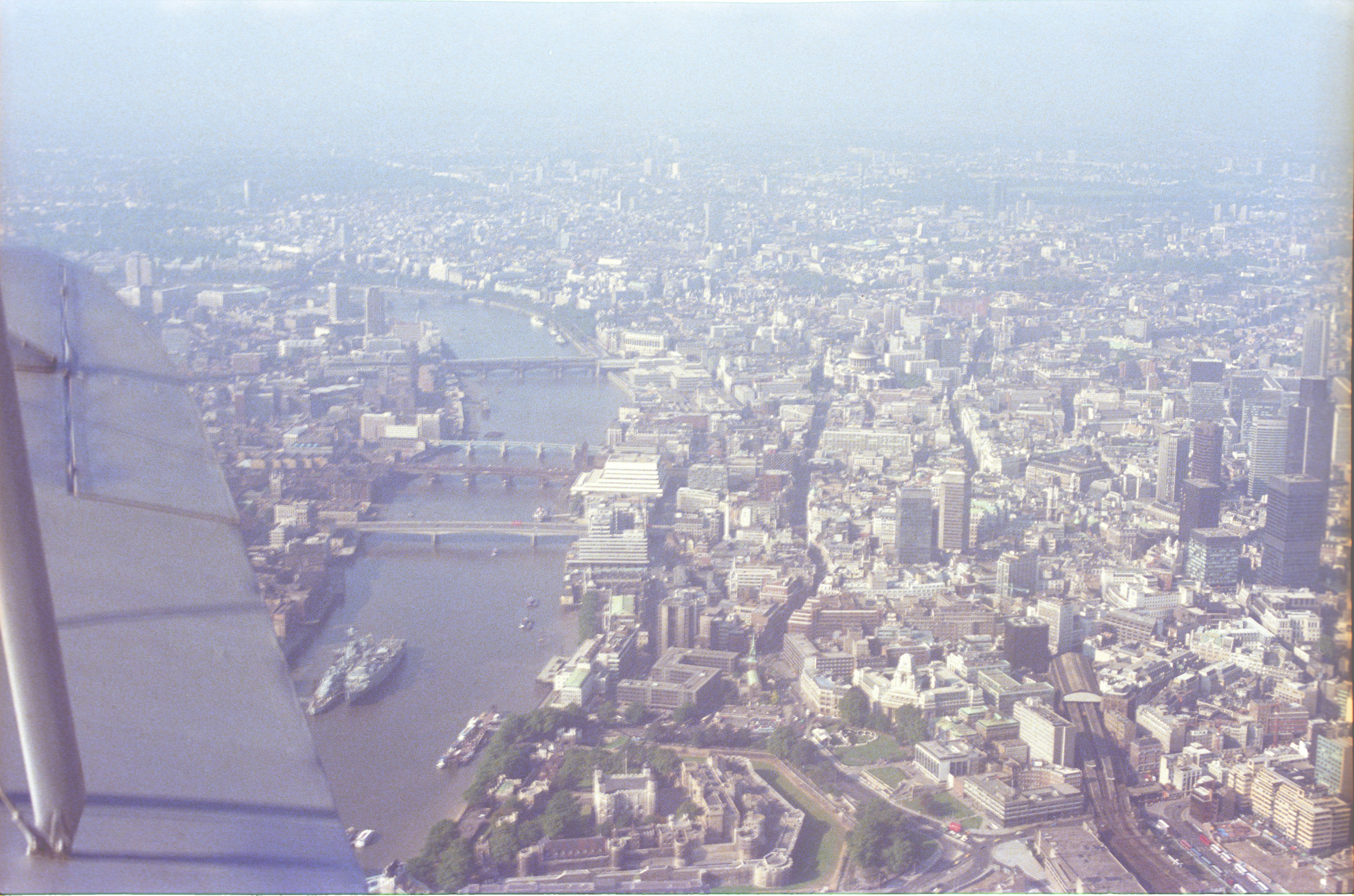
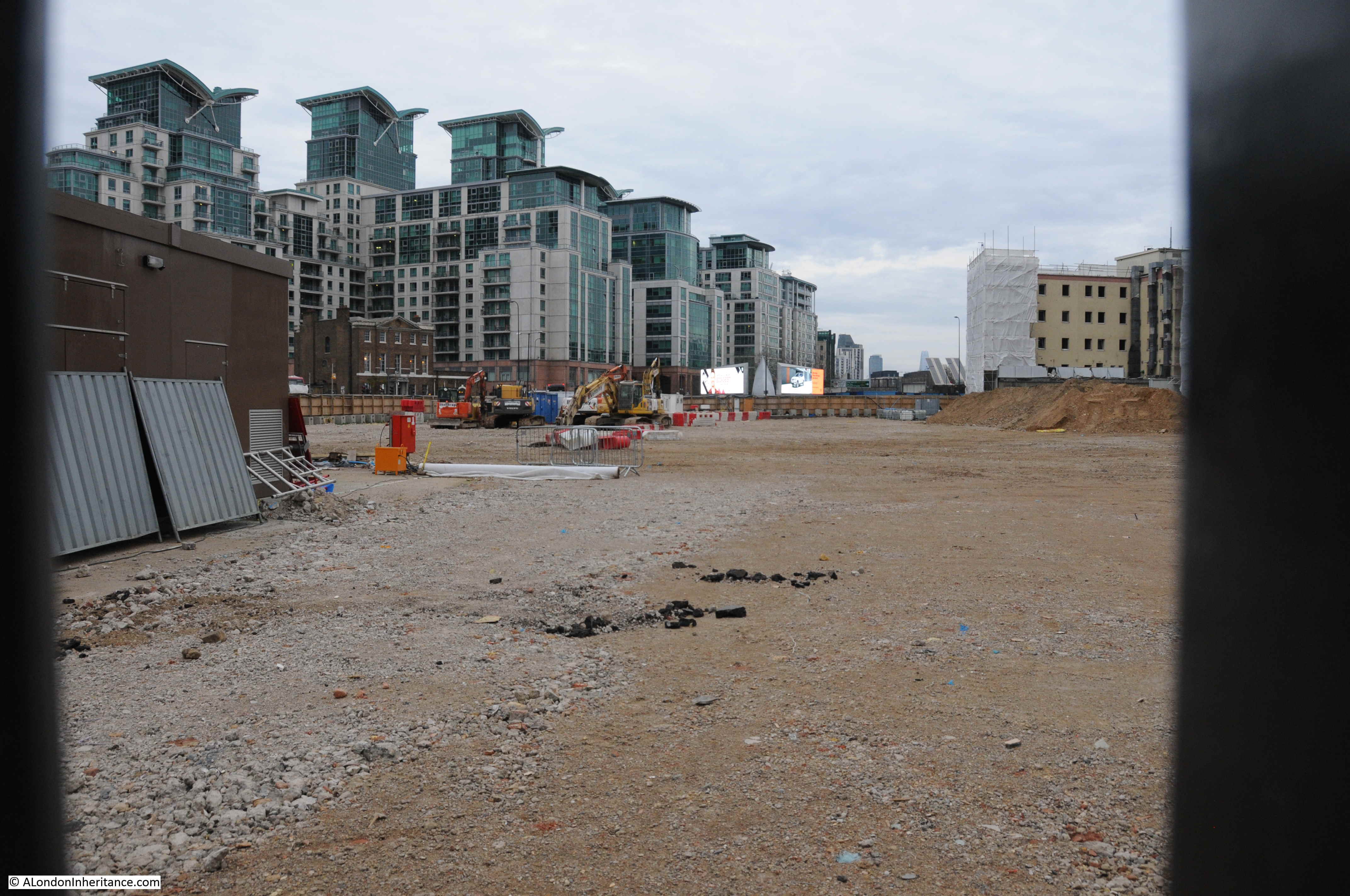
In photographing London, I try to get to places before they change, which is not an easy task given the rate of change in London. One area undergoing significant change is Nine Elms, and indeed the whole arc to the south of the river between Battersea Power Station and Vauxhall. This must be one of the largest construction sites in the country, with demolition of acres of industrial space, to make way for a forest of new apartment towers.

The most well known new occupant of this area is the United States Embassy, however the majority of the area is still a construction site and recent demolition has cleared a new area for development.

I am occasionally on the train between Clapham Junction and Waterloo and the train provides a perfect view of Nine Elms. I have been planning to take a walk around the area, but the view a couple of weeks ago prompted me to walk Nine Elms sooner rather than later.

The view from the train was the usual acres of cleared space ready for new construction, along with a range of new apartment towers in various stages of completion, however what caught my eye was at the edge of one of the recent blocks of demolition, a row of what looked to be early 19th century houses were visible. An unexpected sight given that this area was previously occupied by light industry, numerous courier companies, car repair businesses, markets etc.

Last Sunday I had a couple of hours spare in the morning. so I headed to Vauxhall to take a quick walk around Nine Elms, to find the houses I could see from the train. I also found hundreds of people making their way from Vauxhall to Nine Elms wrapped up against the cold of a January morning.

Walking across Vauxhall Bridge, I headed along Wandsworth Road to find the houses I had seen from the train. I have marked my full route around Nine Elms on the following map.

Nine Elms

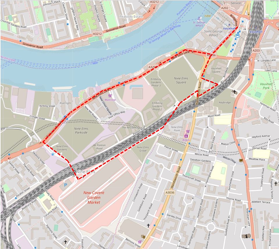
Maps  © OpenStreetMap contributors. 

I have also added the times each photograph was taken to record a January Sunday morning in Nine Elms.

09:43

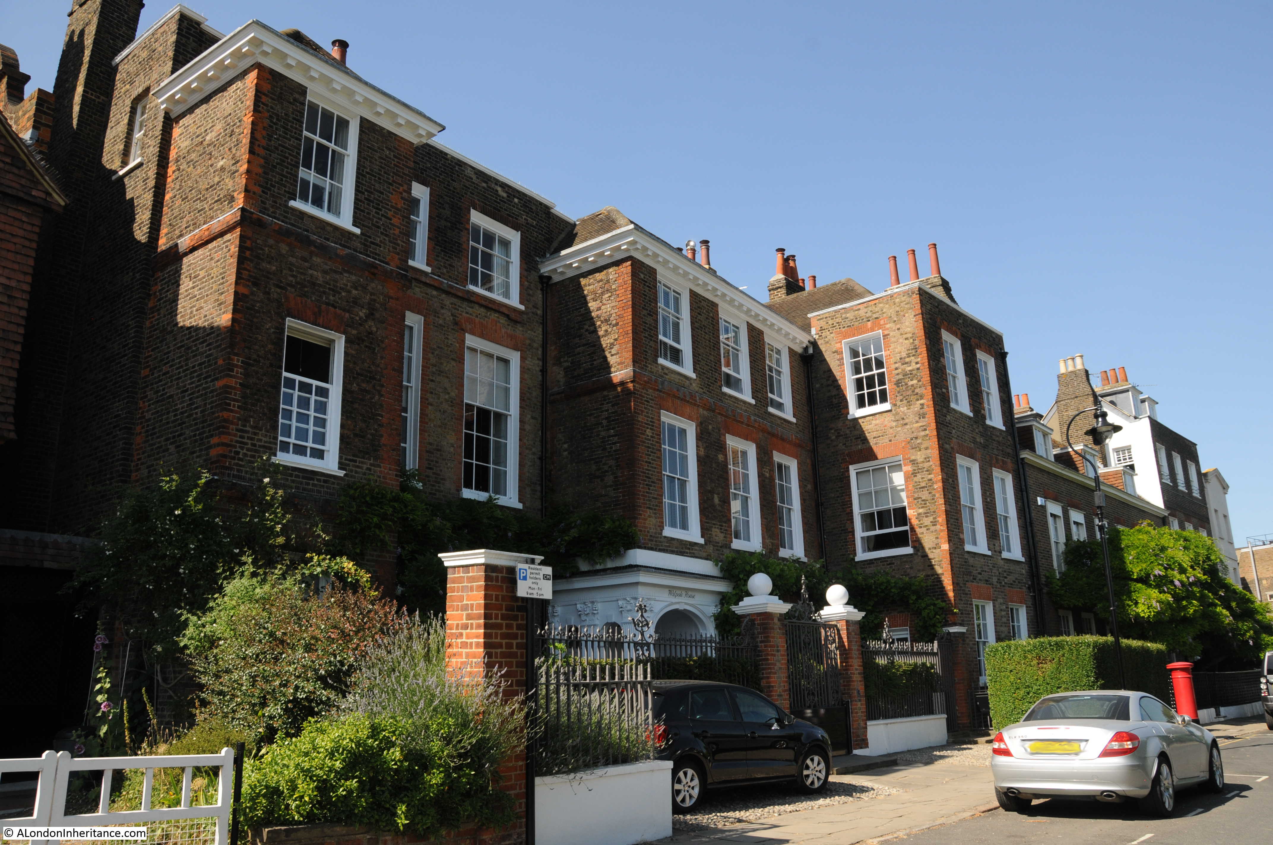
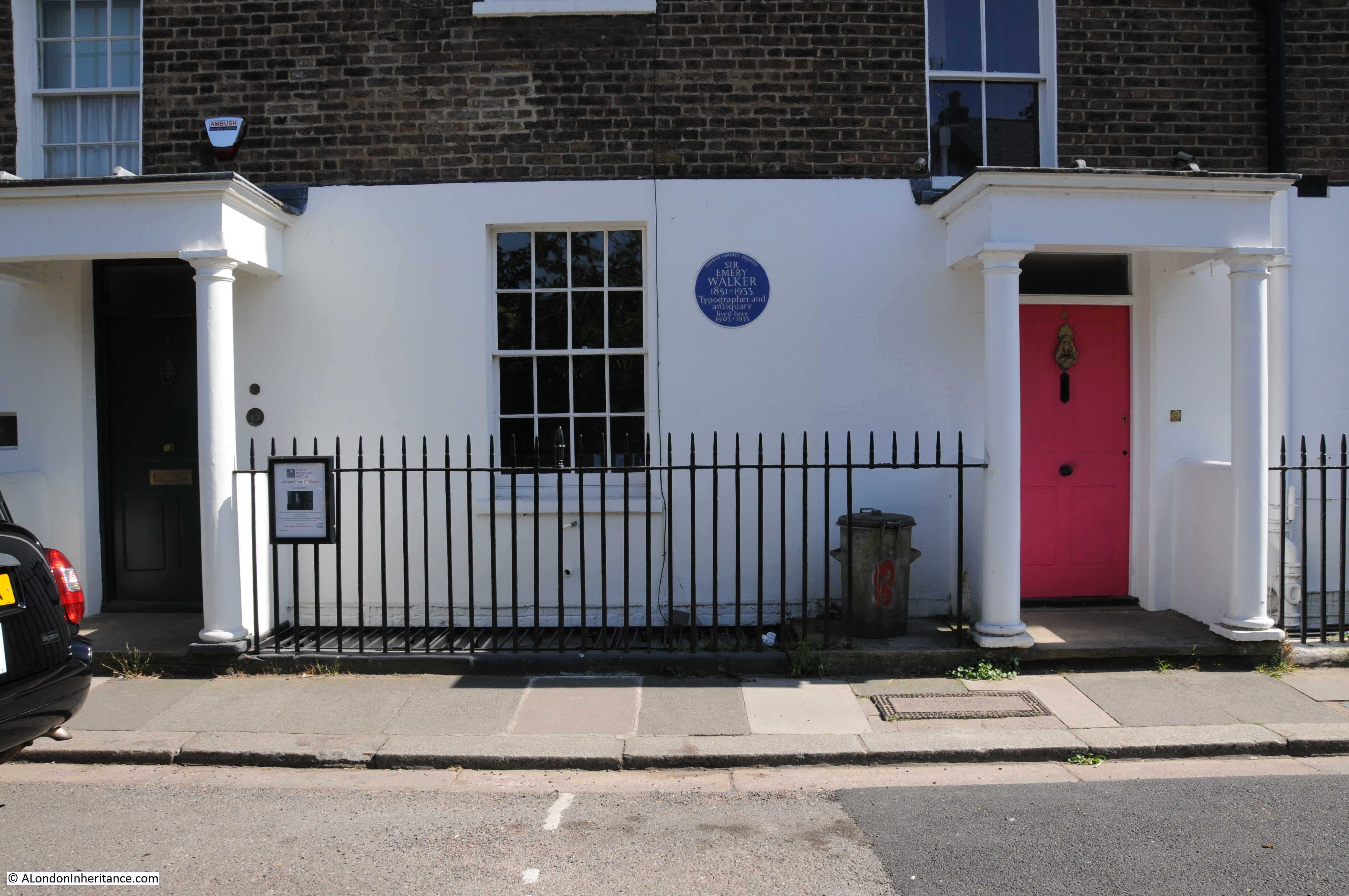
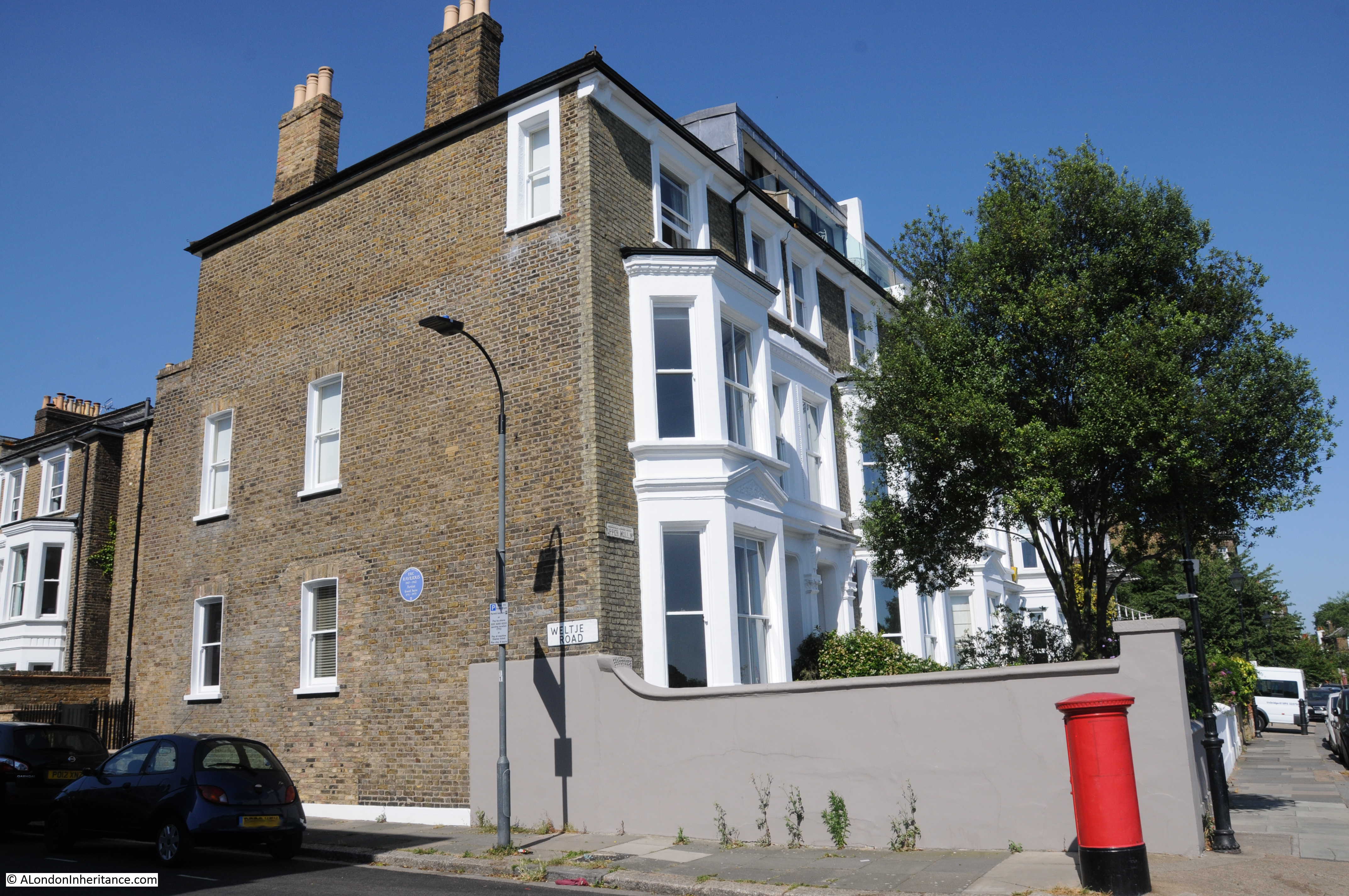
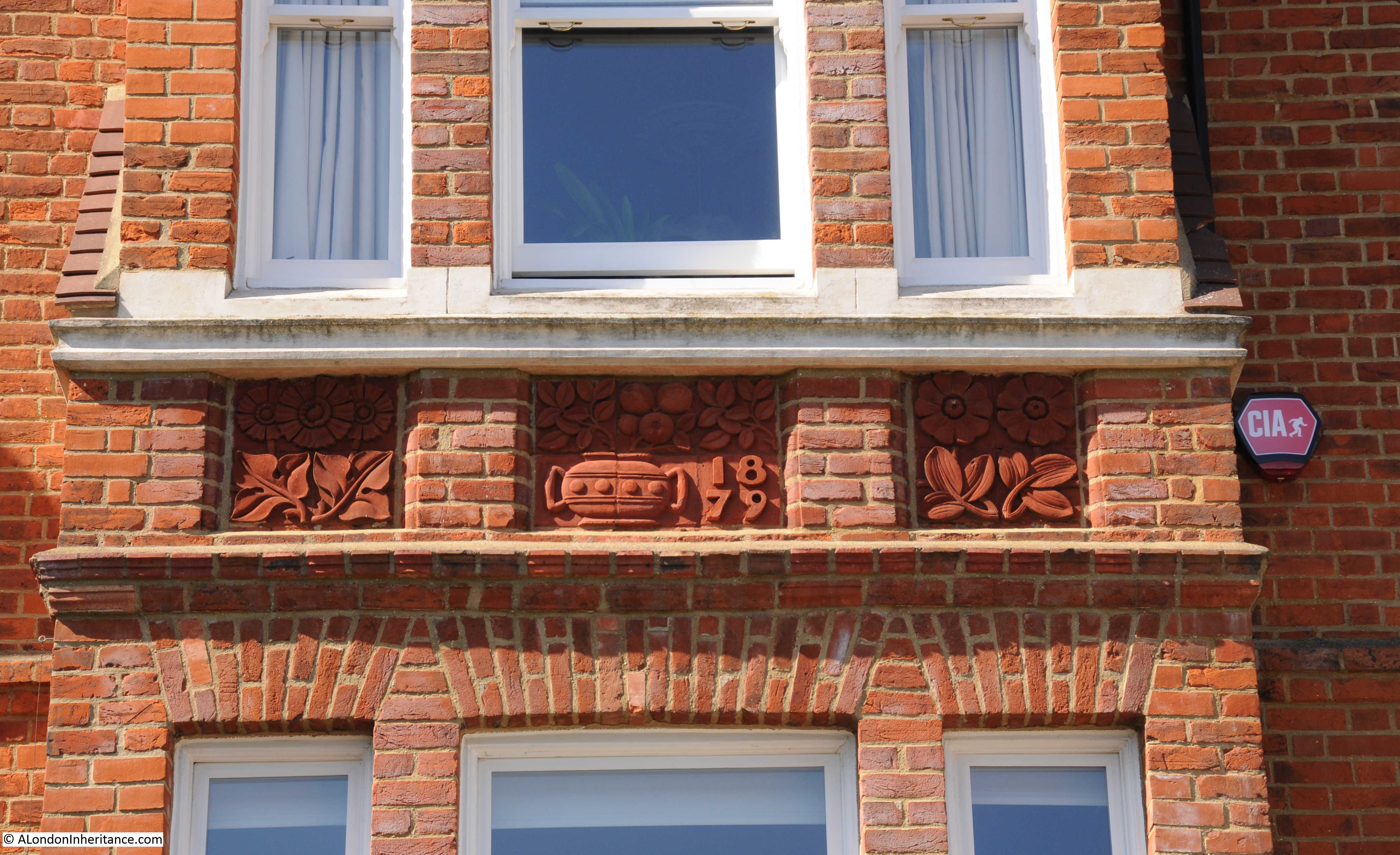
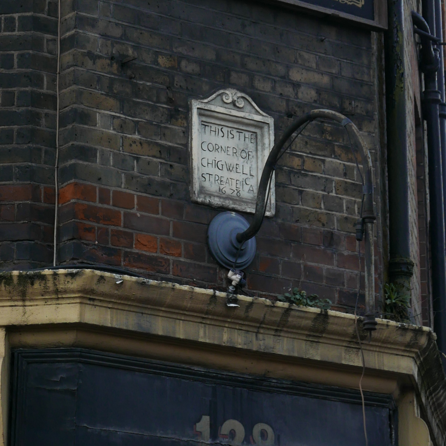
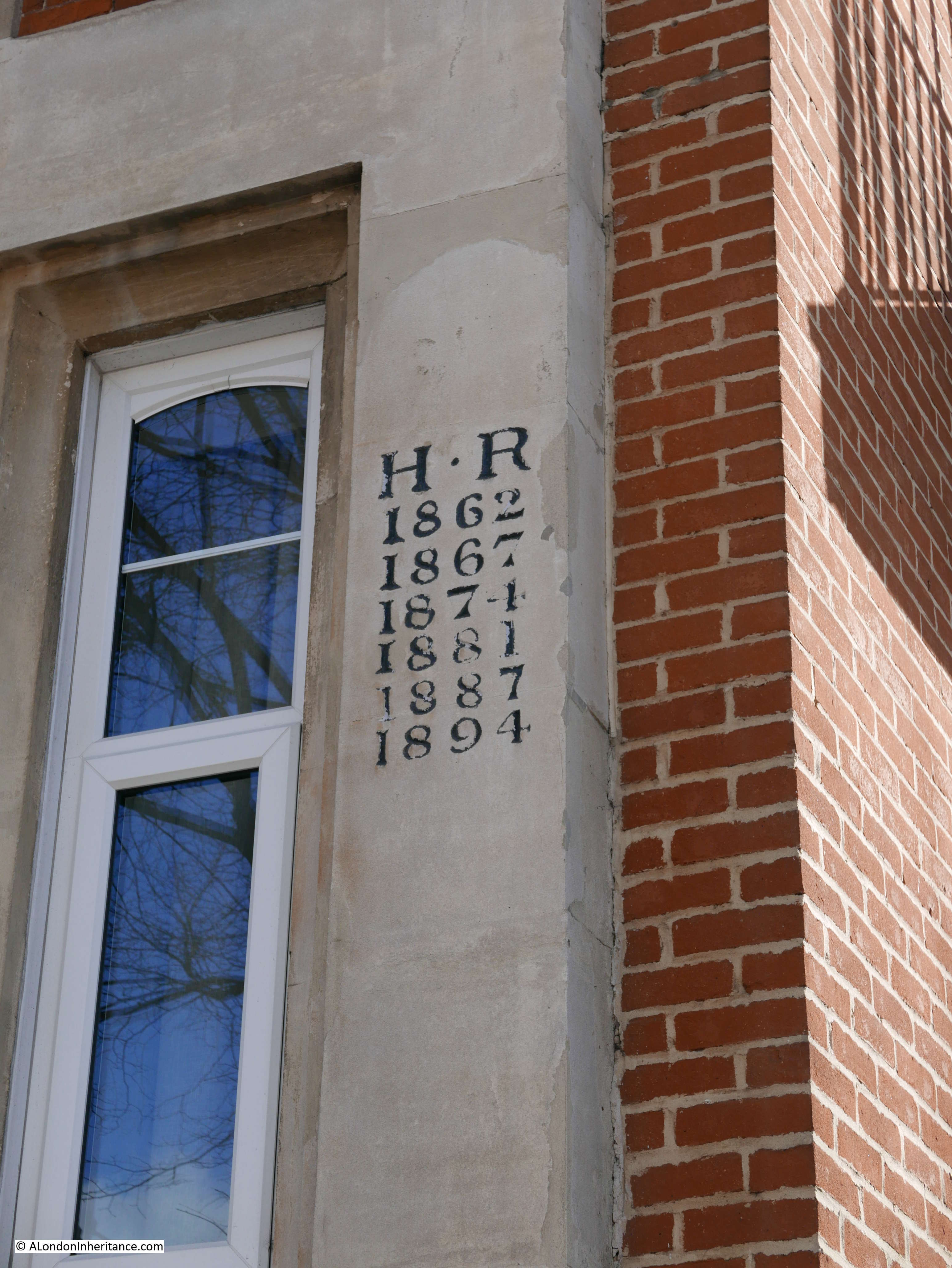
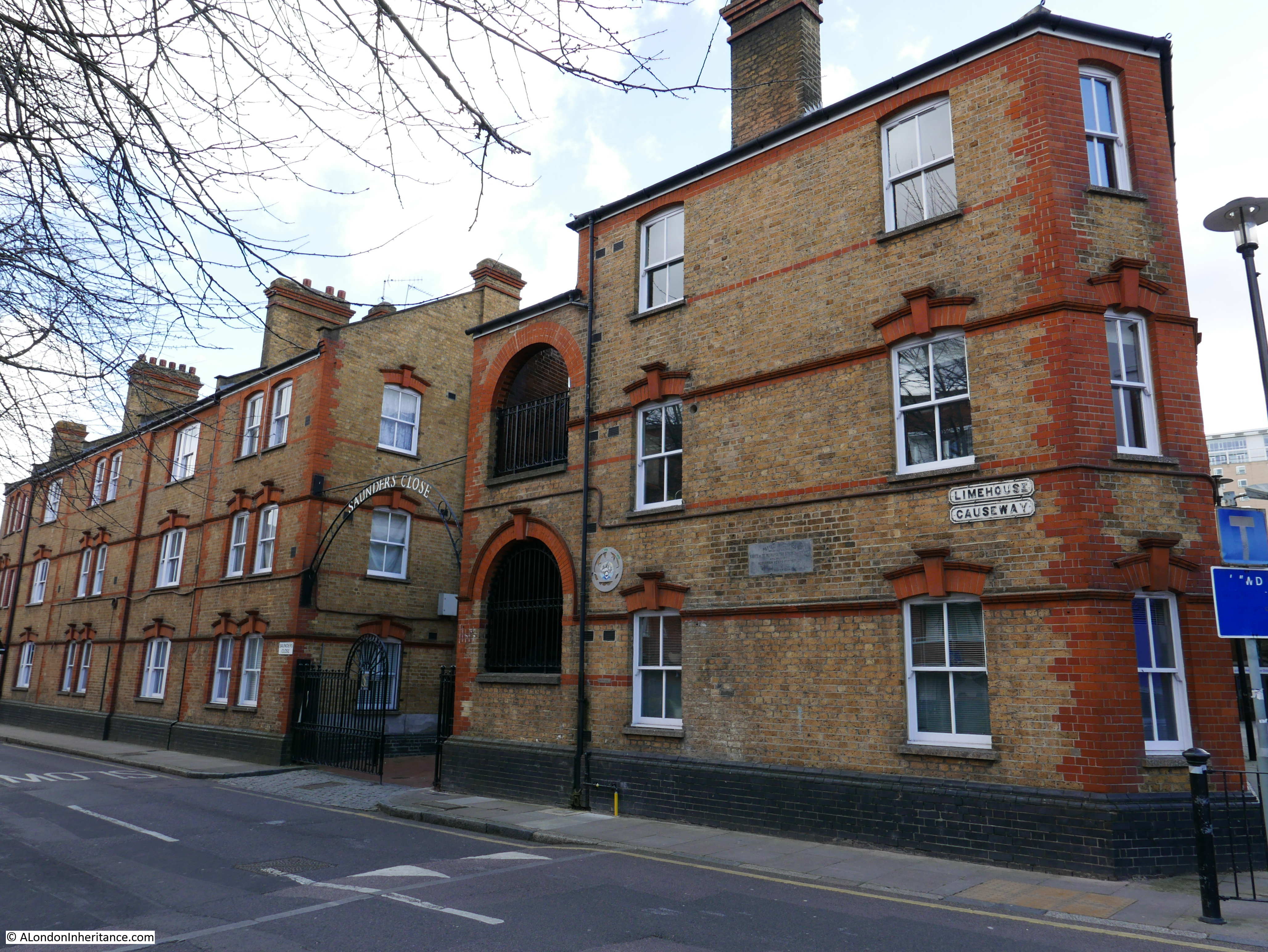
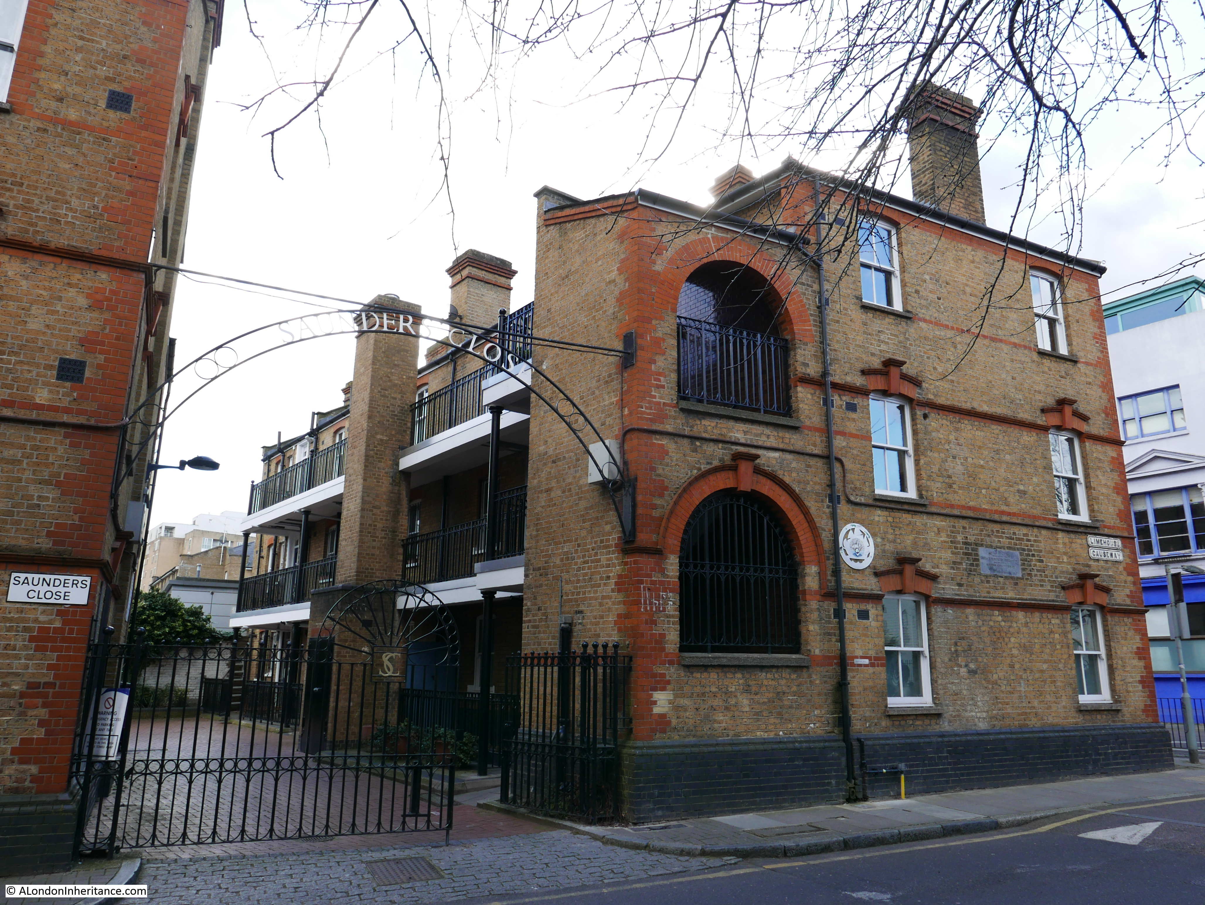
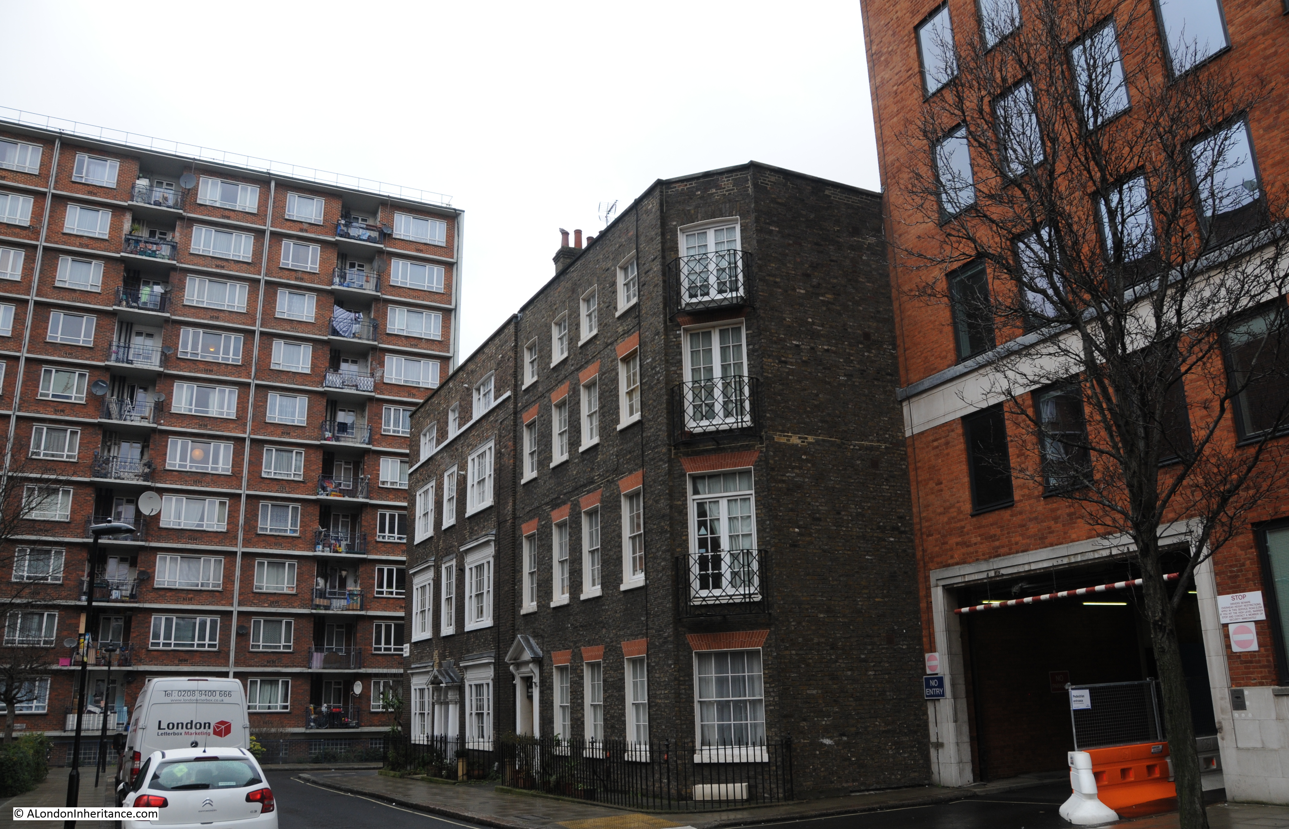
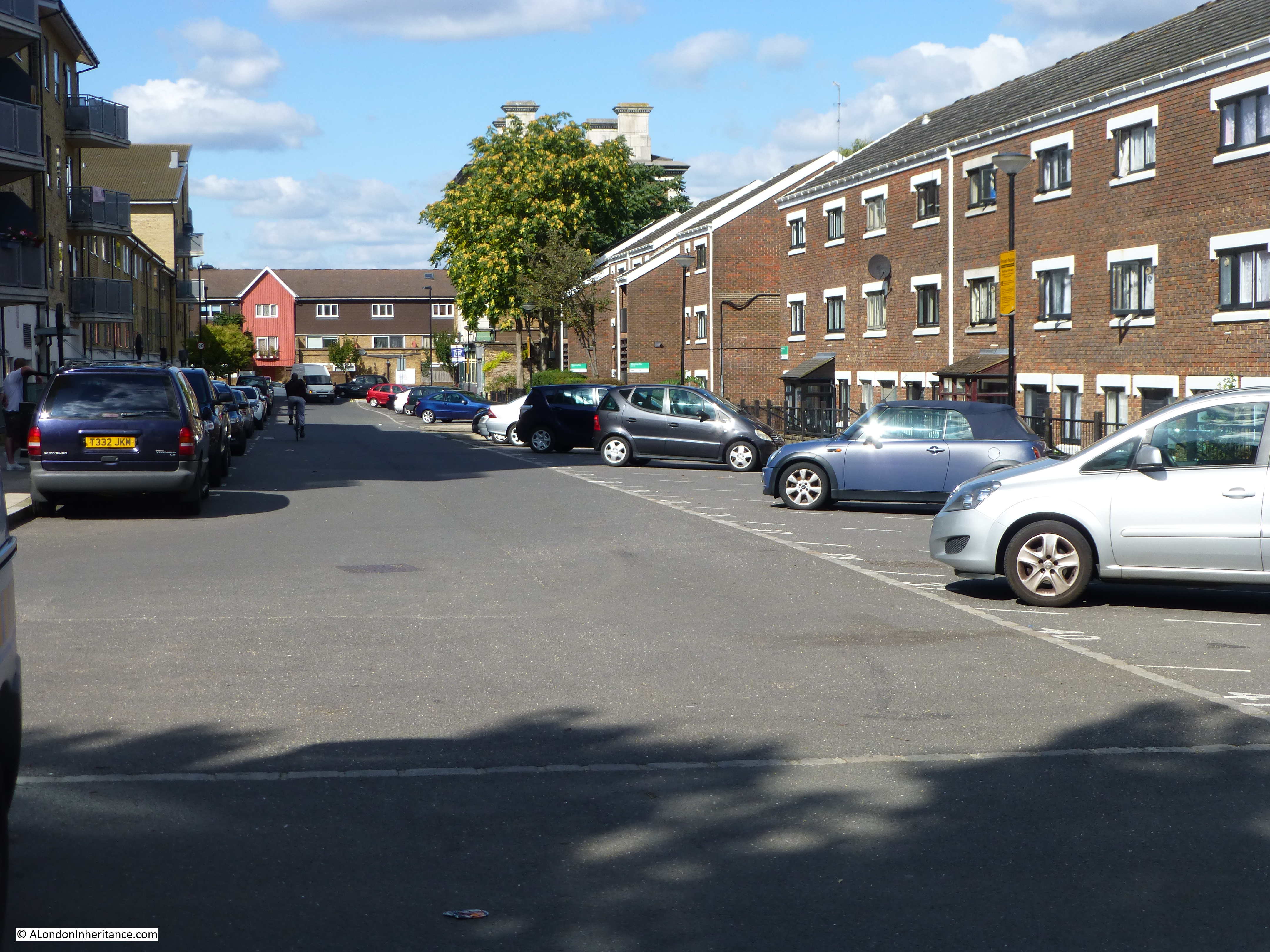
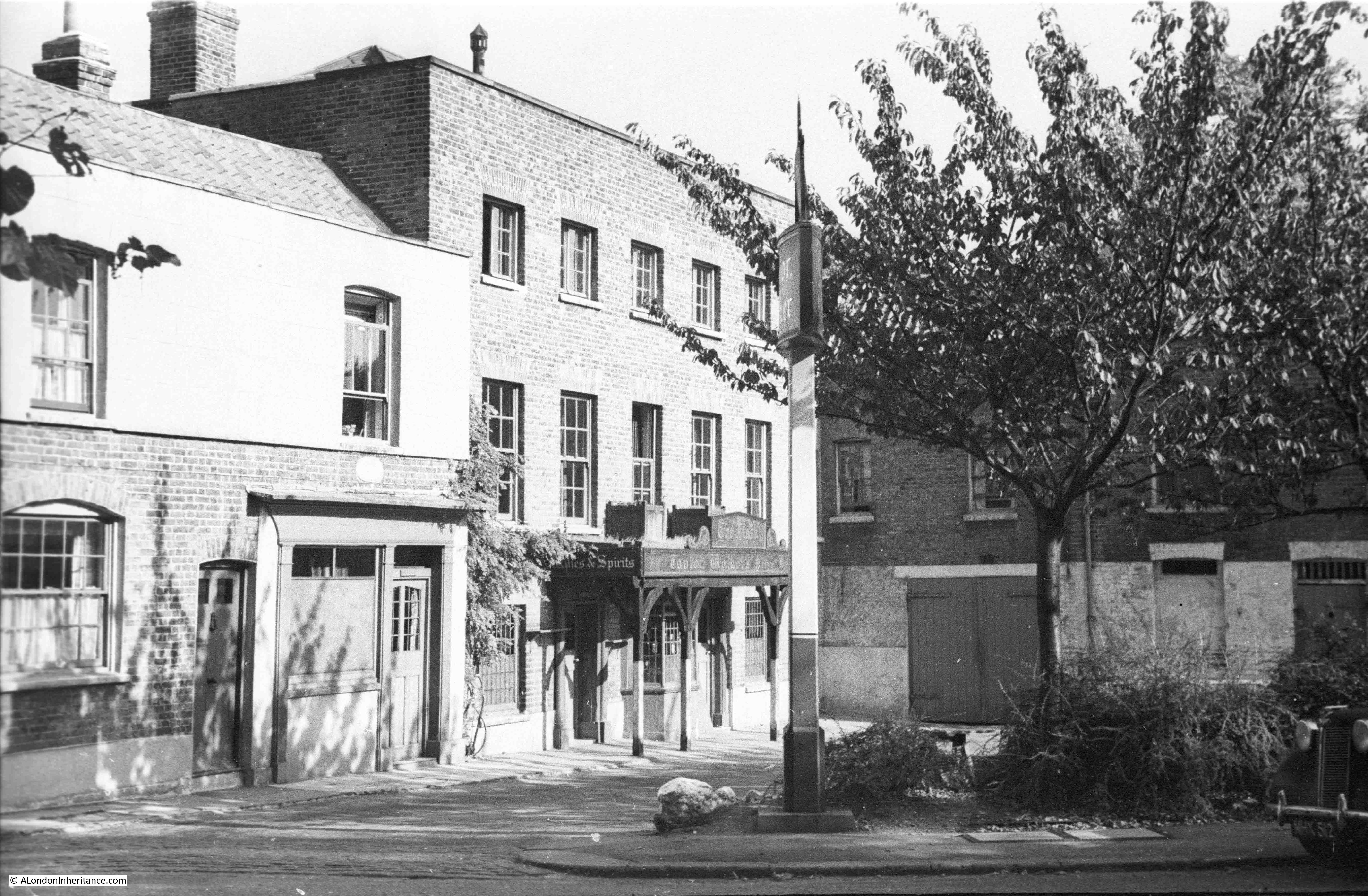
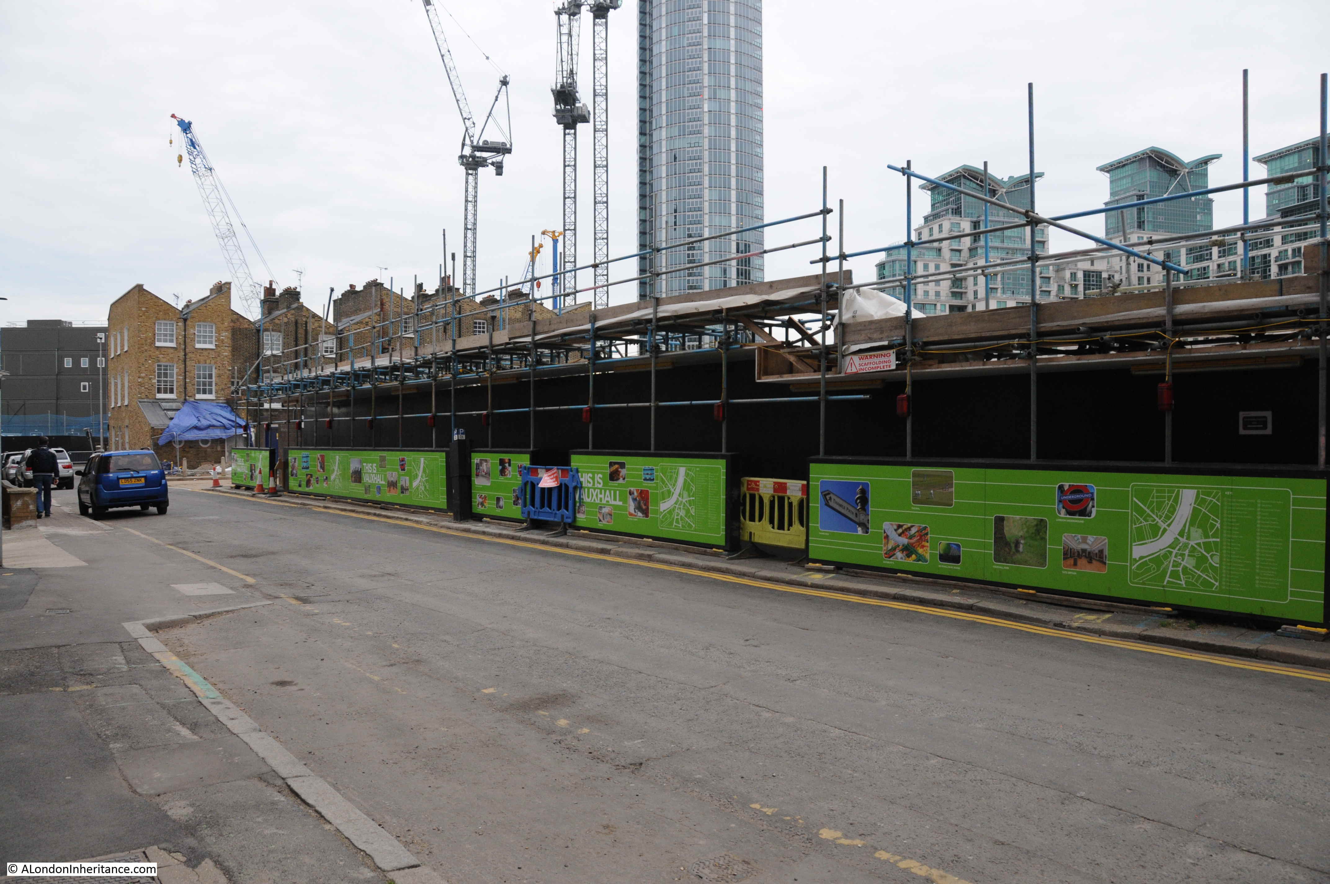
I found the houses I was looking for a short distance along the Wandswoth Road, just before the junction with Miles Street. A terrace of six houses with three taller on the left and three shorter on the right.

Nine Elms

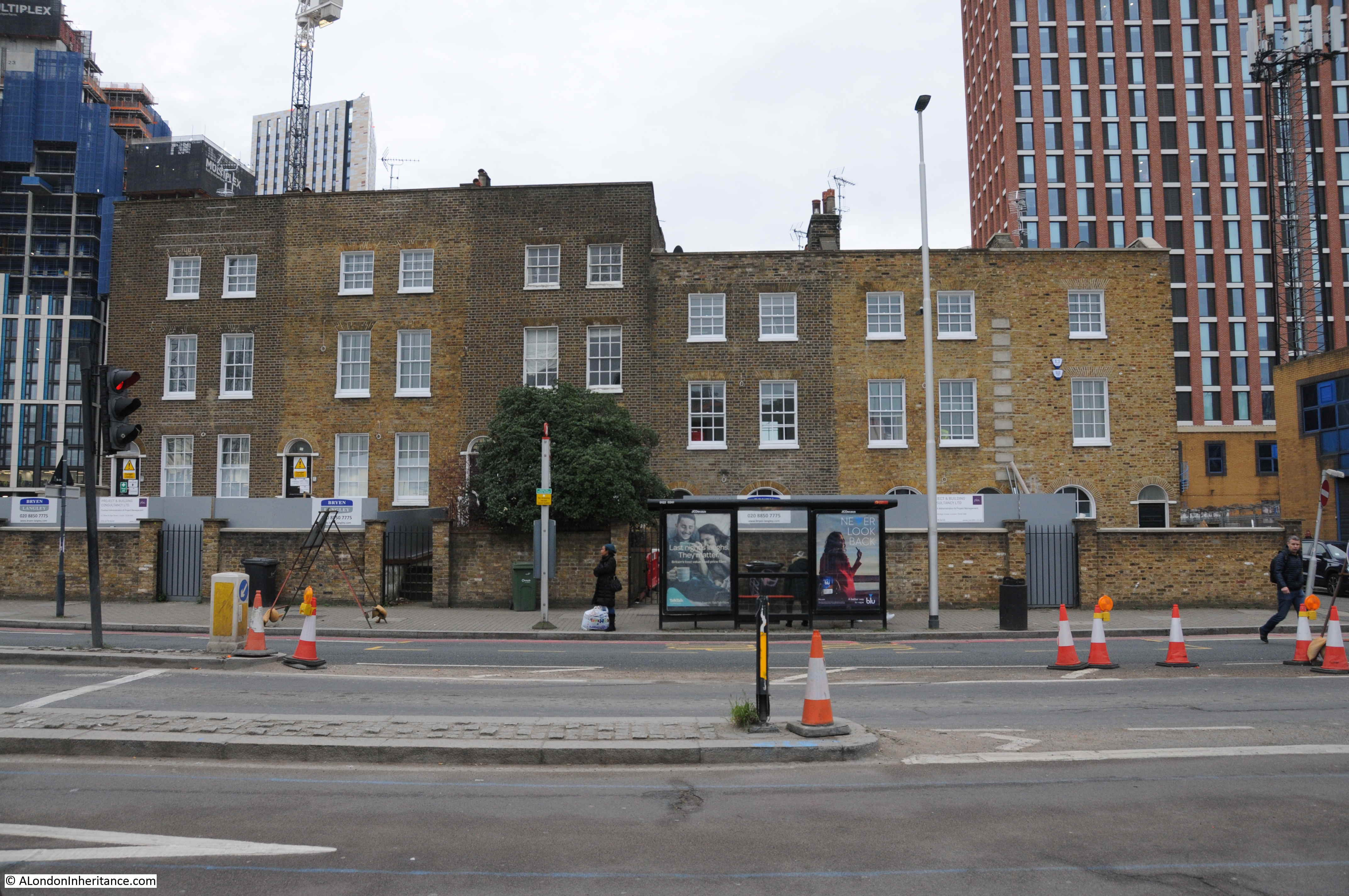
Of the six houses, a couple look as if they have been cleaned whilst the house on the far right looks rather strange when compared with the other five, one window per storey rather than two. They currently appear to be providing office space for activities associated with the redevelopment of the area.

Although Nine Elms may be considered a rather unattractive area, it has a fascinating history and has been a key location in the development of the railway system to the south of London.

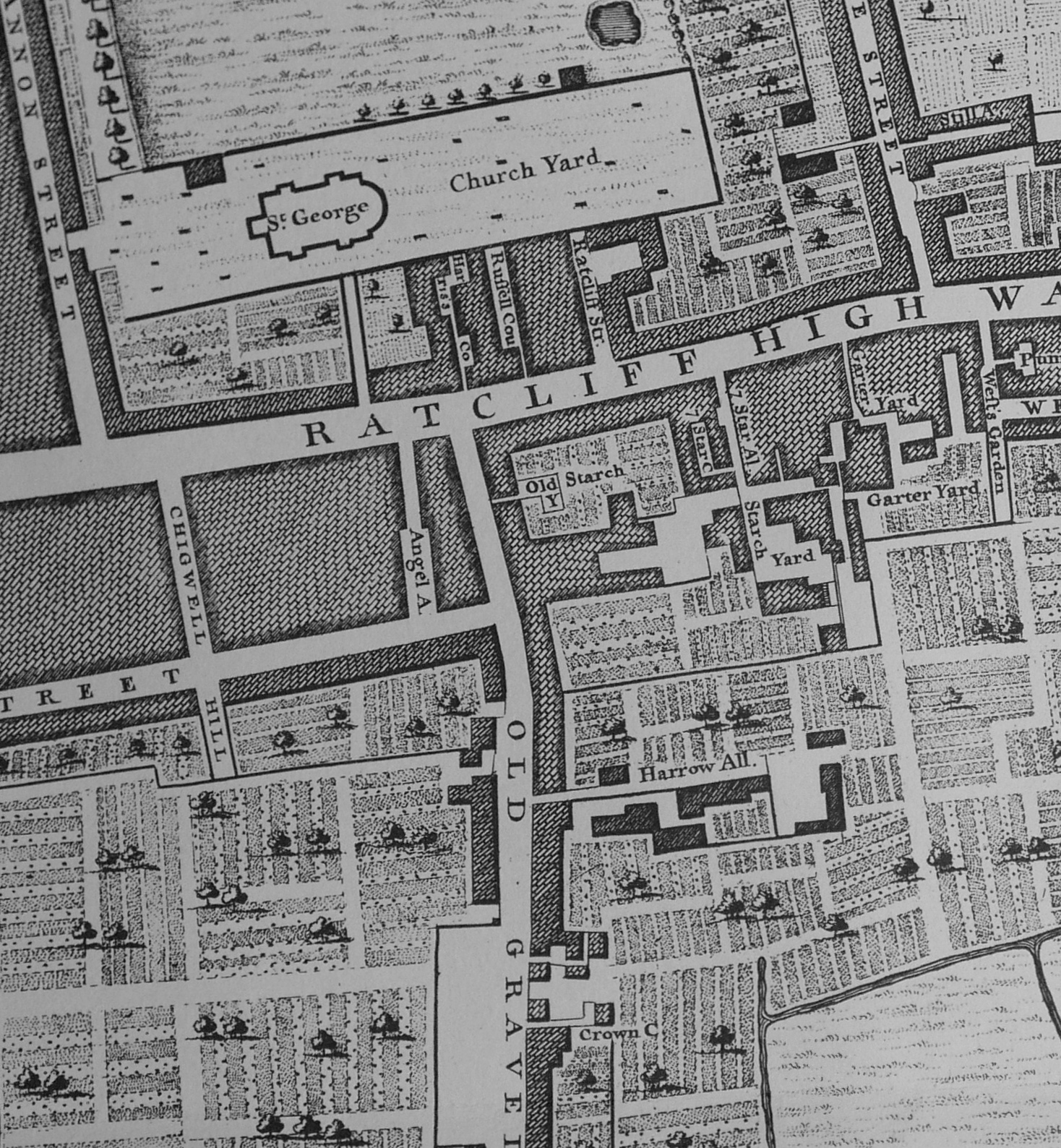
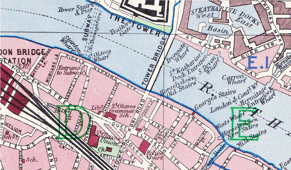
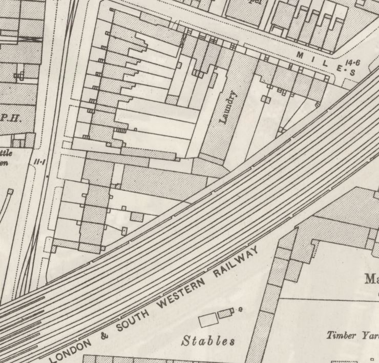
The 1895 Ordnance Survey map provides a good overview of the area following the first wave of development, and also locates the houses that still stand on the Wandsworth Road.

The following extract from the map shows the railway running into Waterloo Station towards the top right of the map. The area between the railway viaduct into Waterloo and the river has a considerable amount of railway infrastructure, including the Nine Elms Depot, however there are also pockets of housing with an oval shaped area between Wandsworth Road and the viaduct and it is here that we can find the six houses.

Nine Elms

Credit: ‘Reproduced with the permission of the National Library of Scotland’ 

I have circled the six houses on the map, at the junction of Miles Street and Wandsworth Road. They are almost the only survivors from the nineteenth century, and it is surprising that these houses have lasted through successive waves of redevelopment.

The following map shows roughly the same area today as the 1895 map, again I have marked the location of the six houses.

Nine Elms

There is so much history in this area. In the first decades of the 19th century, various schemes were looked at to try and speed up the transport of goods and people arriving by sea into London, as from the Atlantic, the route along the south coast then along the Thames added a number of days and were dependent on weather and tide. One scheme considered the construction of a canal from Portsmouth to London, but in 1831 initial plans were made for a railway from Southampton to London, with the London terminus at Nine Elms.

Construction of the railway from Nine Elms to Southampton started with the route to Woking Common in 1838. In 1846, a train pulled by an engine named “The Elk” ran from Southampton to Nine Elms in 93 minutes. By comparison, an on-time journey today takes around 80 minutes, so not a significant difference (although there is no mention of the number of intermediate stops for “The Elk”).

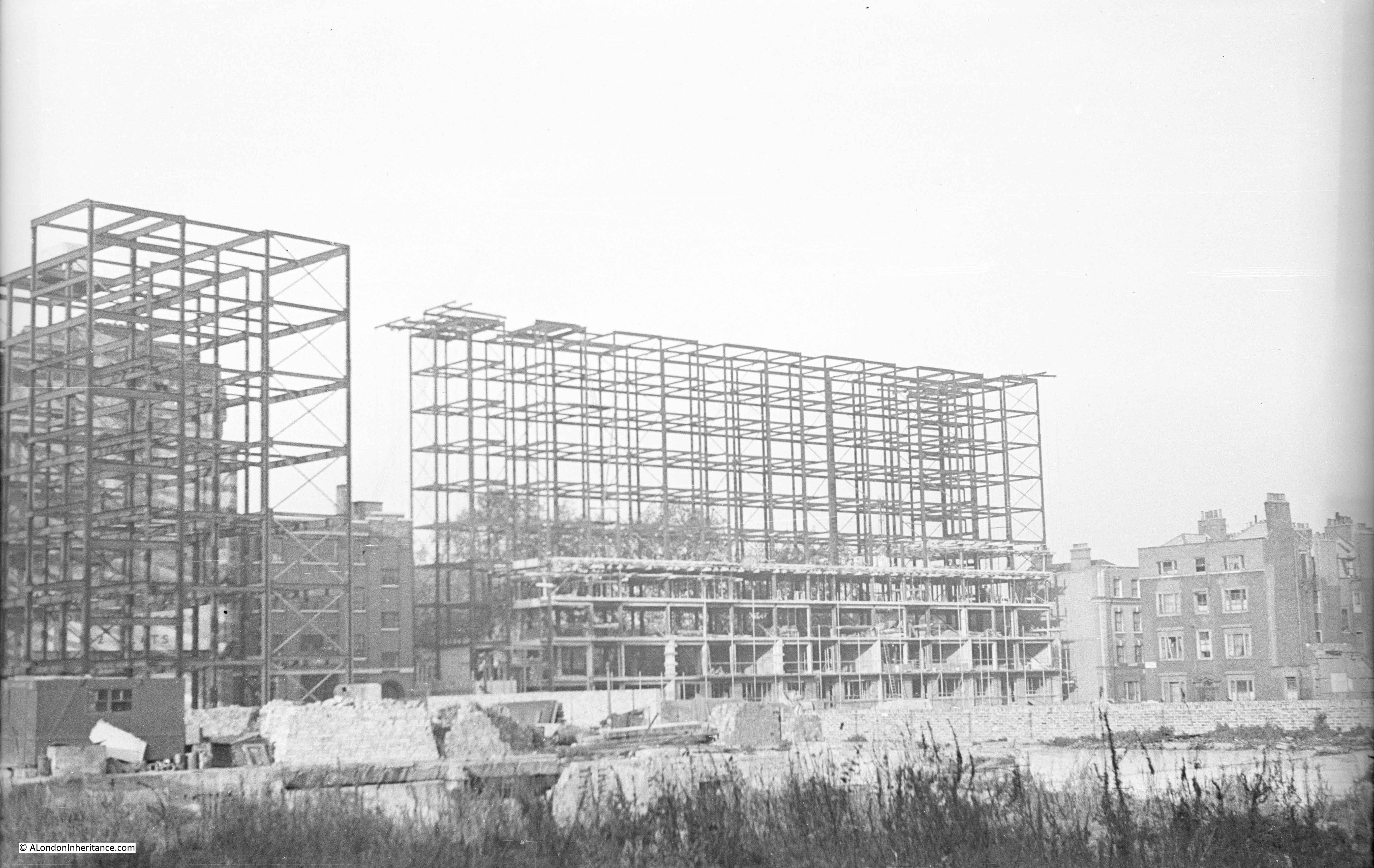
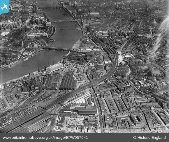
Nine Elms closed as a passenger station ten years later when the viaduct into Waterloo was built and the London terminus of the railway moved to the first Waterloo Station. Nine Elms then provided space for a Locomotive Works, which closed in 1909 when the works moved to Eastleigh in Hampshire. Nine Elms also provided space for a large Goods Yard and this continued in operation until 1968.

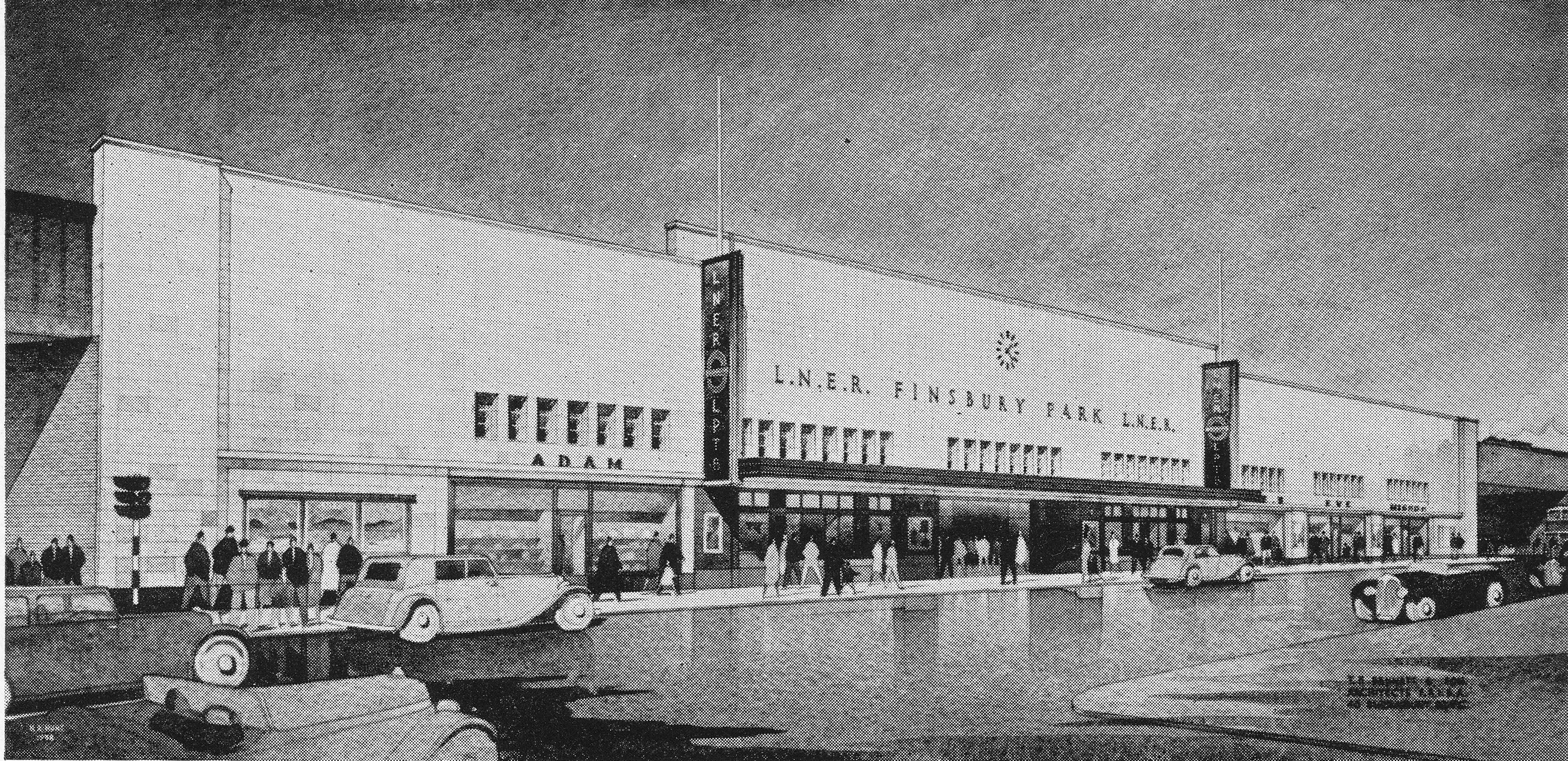
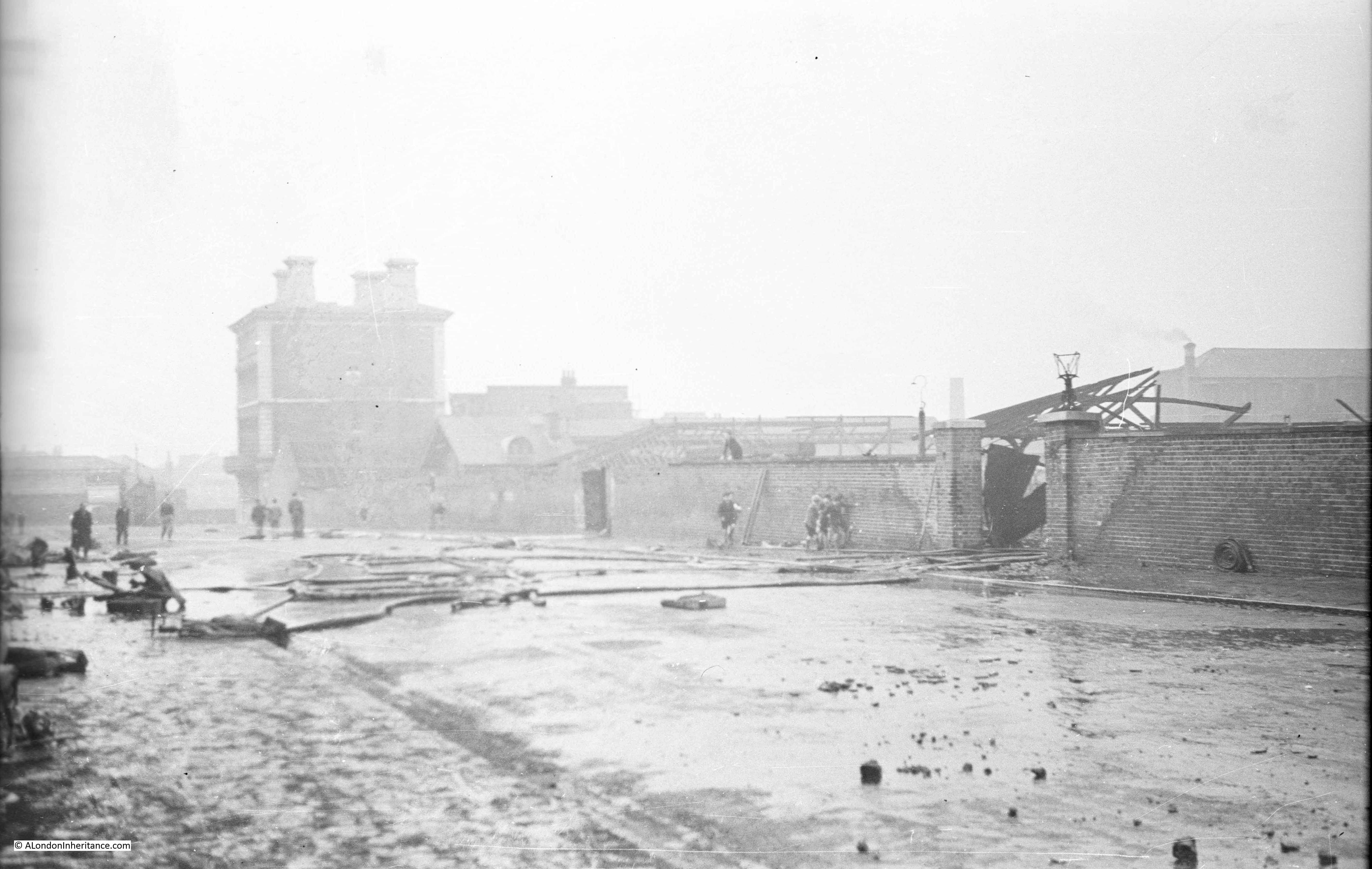
This photo from 1938 shows the scale of the railway sheds and goods yard at Nine Elms.

Nine Elms

This post is already too long, so I will leave the history of the railways in Nine Elms for another time, and continue walking.

09:44

There was a continuous stream of people walking along Wandsworth Road, and just to the left of the six houses, one of the illegal betting scams normally seen on Westminster Bridge was in action, looking to take money from those streaming past – and probably those less able to manage the inevitable loss.

Nine Elms

This is obviously a problem in the area as there are signs up along the street advising people not to participate in these activities.

I walked past the houses and tuned into Miles Street and walked down to take a look at the rear of the buildings.

09:45

Nine Elms

This explained why one of the end houses looked so different. The view from the back shows that the end house appears to be a new build. The other houses in the terrace look original from the rear.

Hoardings lined the edge of Miles Street, hiding the areas of demolition that had opened up the view of these houses from the railway. There were a couple of gates where it was possible to peer through.

09:46

Nine Elms

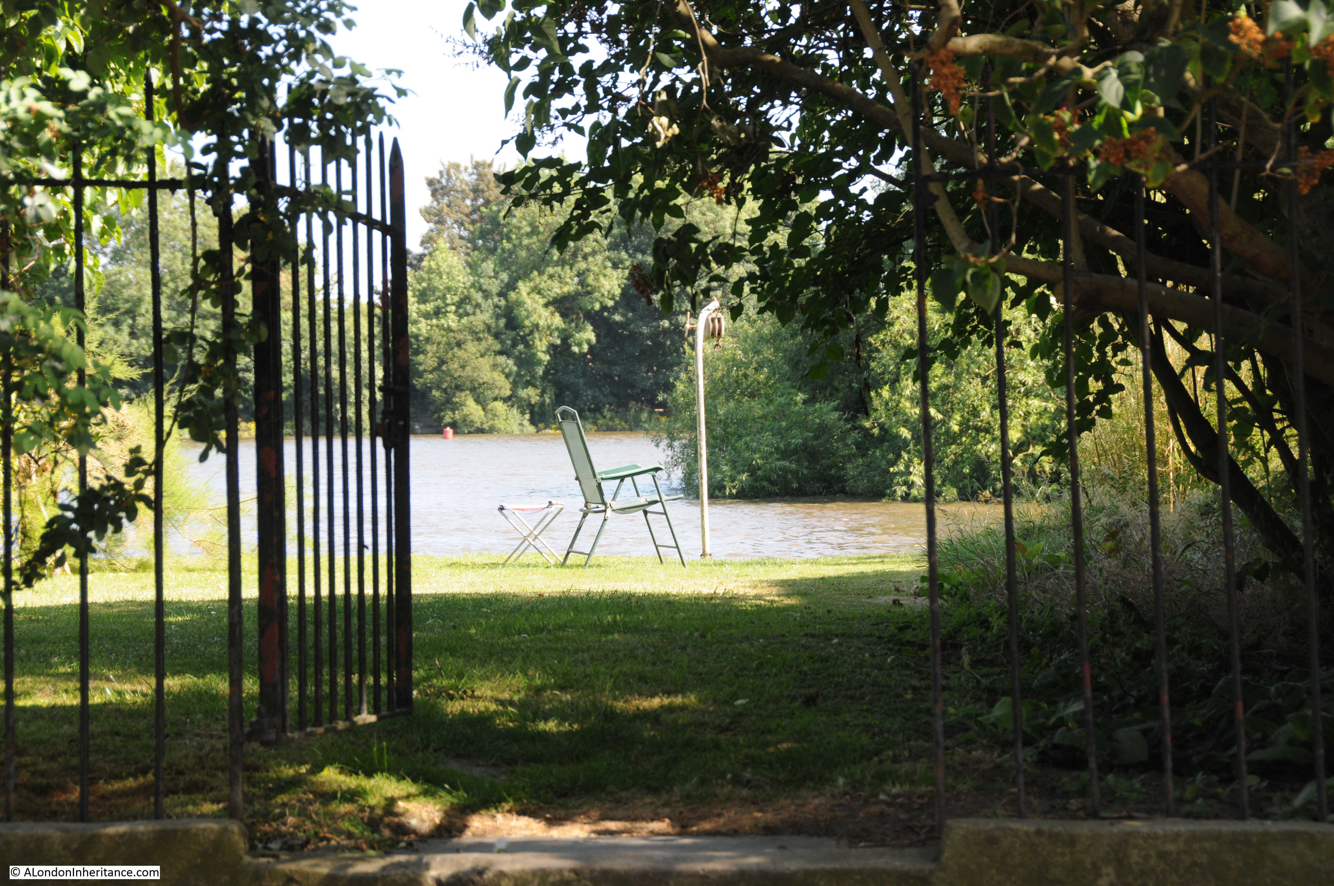
The above photo is looking through a gate onto the open space between the six houses (on the immediate left) and the railway viaduct (out of view on the right). Vauxhall is in the distance and only part of the space is visible, there is more to the right. The demolition of the buildings in this area opened up the view of the six houses from the railway.

09:47

Nine Elms

The above view is from the point where Miles Street meets the railway viaduct. The large open space is behind the hoardings on the right and the six houses can be seen in the distance.

09:47

Just before the point where Miles Street passes under the viaduct there is a street running towards Vauxhall. The following photo shows this street and also highlights one of the problems of walking around this area, so many streets have been closed off for construction. This is happening so rapidly that online maps such as Google and OpenStreetmap are not up to date with changes in the area.

Nine Elms

The above view is looking along the viaduct towards Vauxhall and Waterloo. Looking in the opposite direction and there are new buildings and a walkway alongside the viaduct – this was the direction that I decided to follow.

09:47

Nine Elms

A newly surfaced walkway runs alongside the viaduct and what appears to be a new student accommodation building on the right.  Further along this walkway is a rather strange survivor from the 19th century.

09:49

At the end of the student accommodation building is this strange wall.

Nine Elms

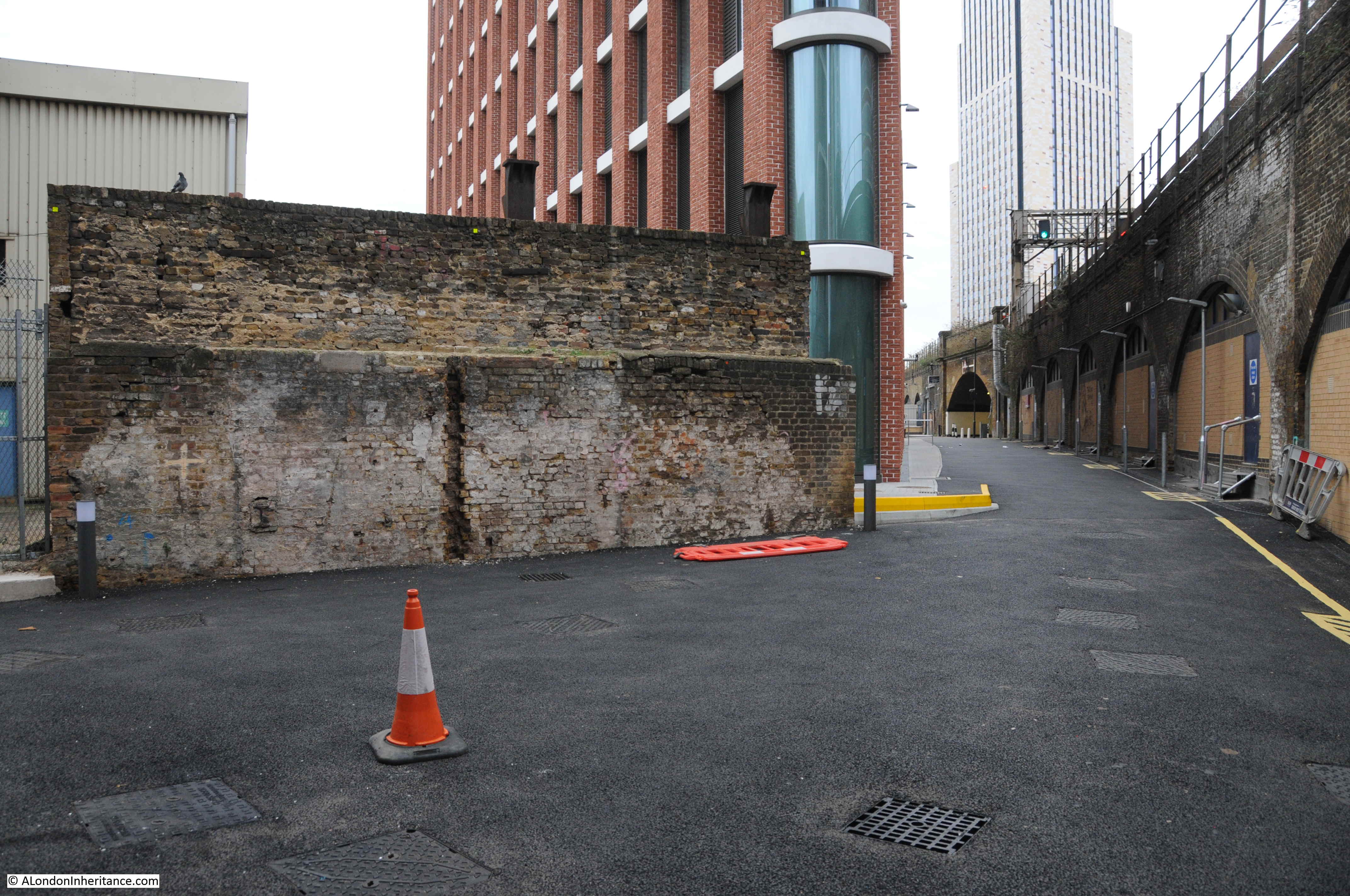
On the opposite side of the wall is a small electricity substation, so I am not sure if this is the reason why the wall has survived, I can see no other reason. The wall is not at right angles to the viaduct, it is slightly angled. The following is a detailed extract from the 1895 Ordnance Survey map. Miles Street is at the top and the route of the walkway is from Miles Street down, along the edge of the viaduct. Halfway along there is a large building, at an angle to the viaduct. I suspect that the wall is the remains of the uppermost wall of this building, the section where it is joined on to the smaller building at the end of the Laundry.

Nine Elms

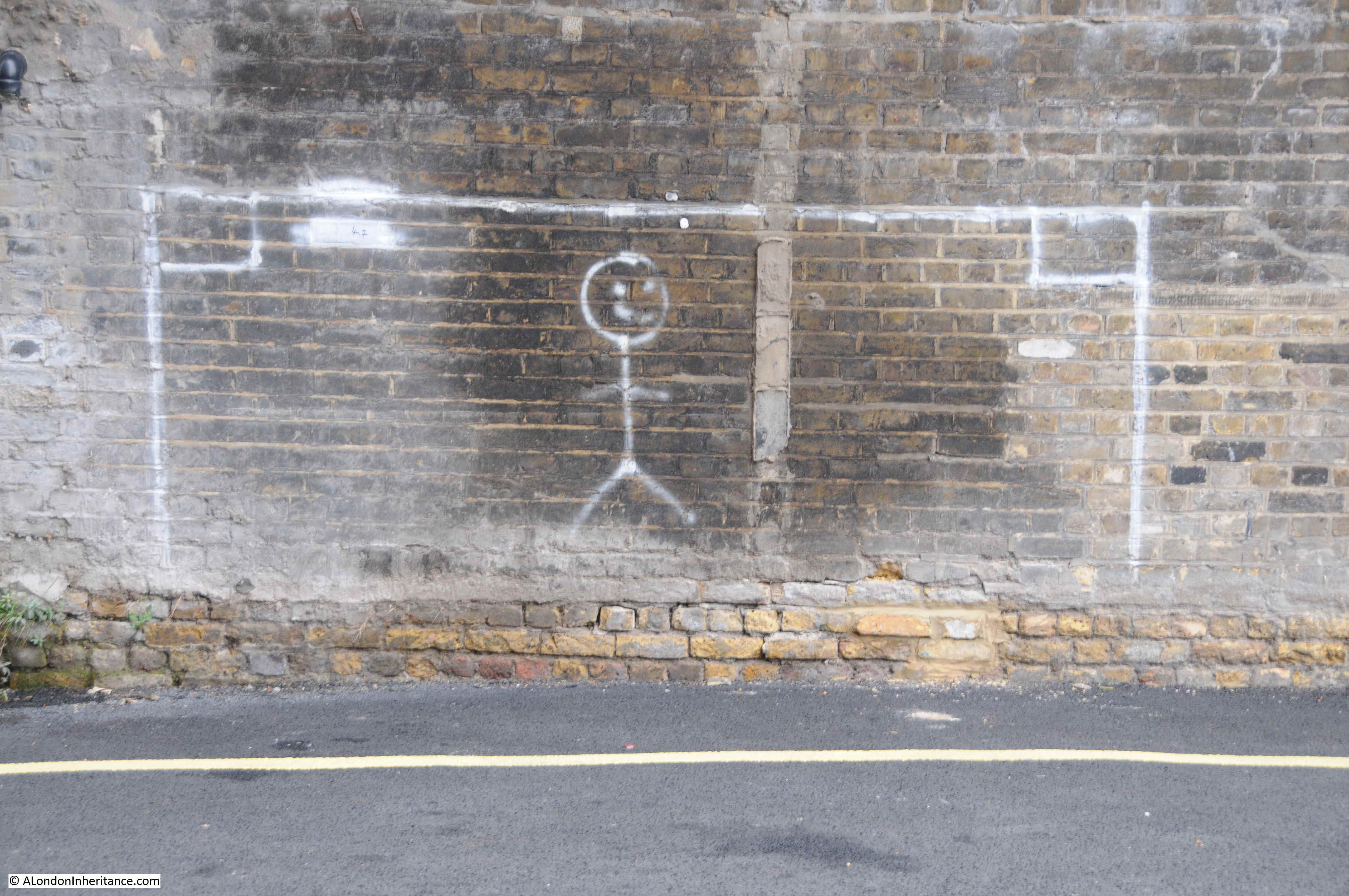
No idea why the wall has been retained, however I really do hope that it remains exactly as it is, a shadow of the many buildings that once occupied this area over a century ago.

09:49

Goal on the viaduct:

Nine Elms

The end of the walkway joins Wandsworth Road, which I crossed over to walk along Parry Street. This is a narrow street that heads underneath the viaduct.

09:54

A look back down Parry Street at the continuous stream of people:

Nine Elms

There are a couple of tunnels underneath the viaduct. The majority of people were taking the direct road route, I spotted a narrow entrance and went to take a look at what was intended to be the pedestrian route under the viaduct.

09:55

Nine Elms

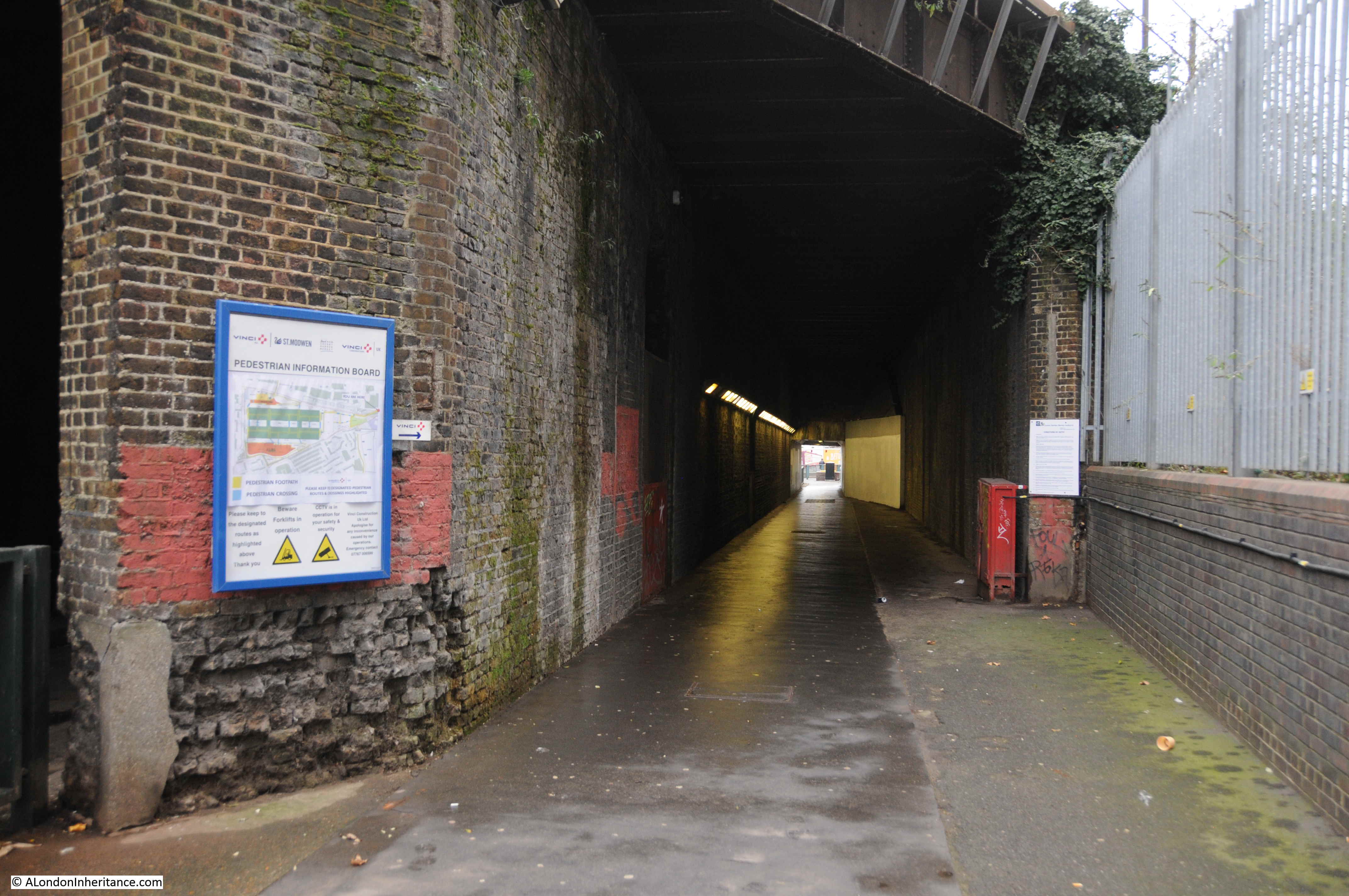
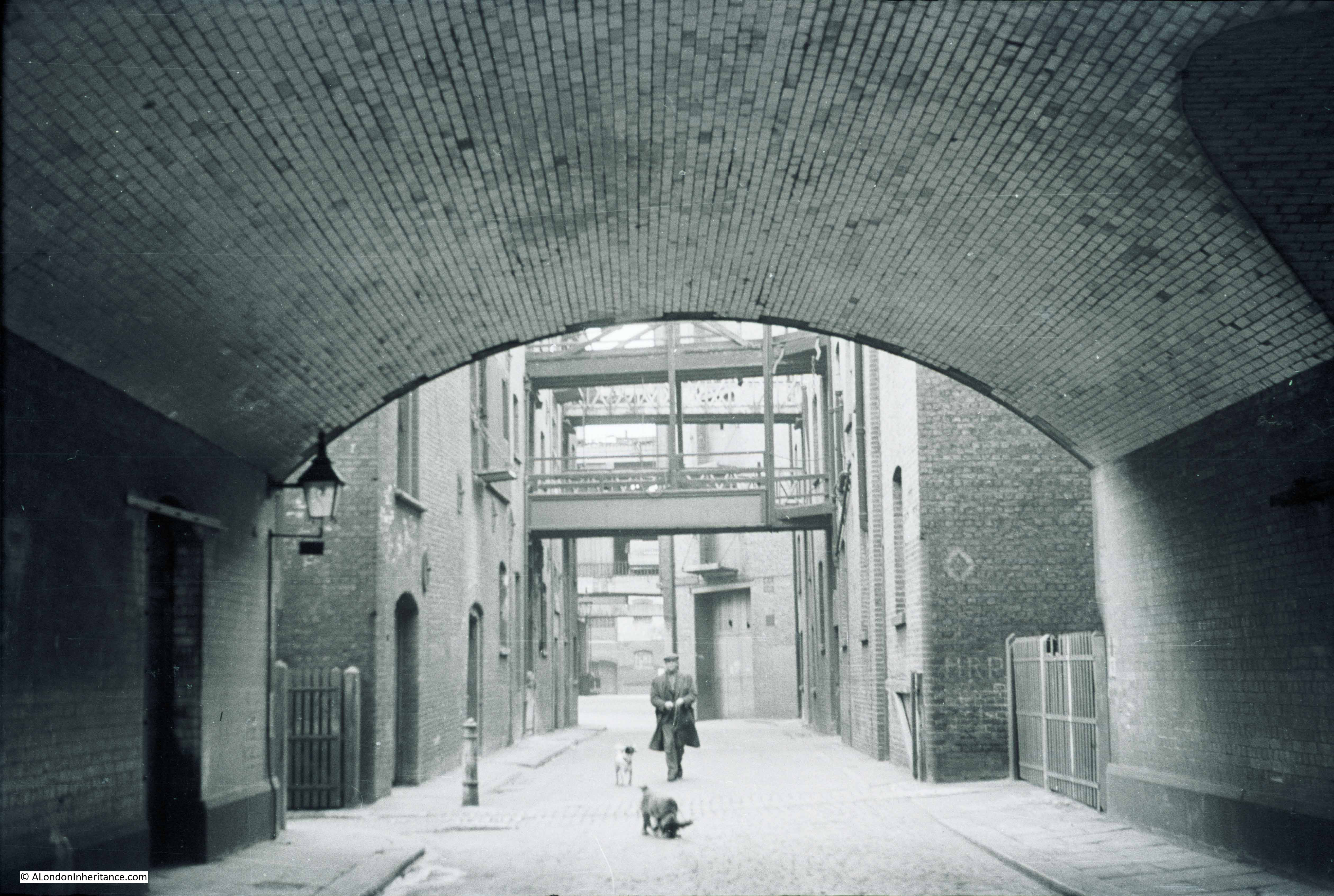
I love railway viaducts. They are brilliant examples of Victorian construction, and whilst train passengers pass above, there is a different world of passages and arches underneath.

09:56

Reaching the other side of the viaduct and there are a number of businesses operating in the arches. Espirit Decor:
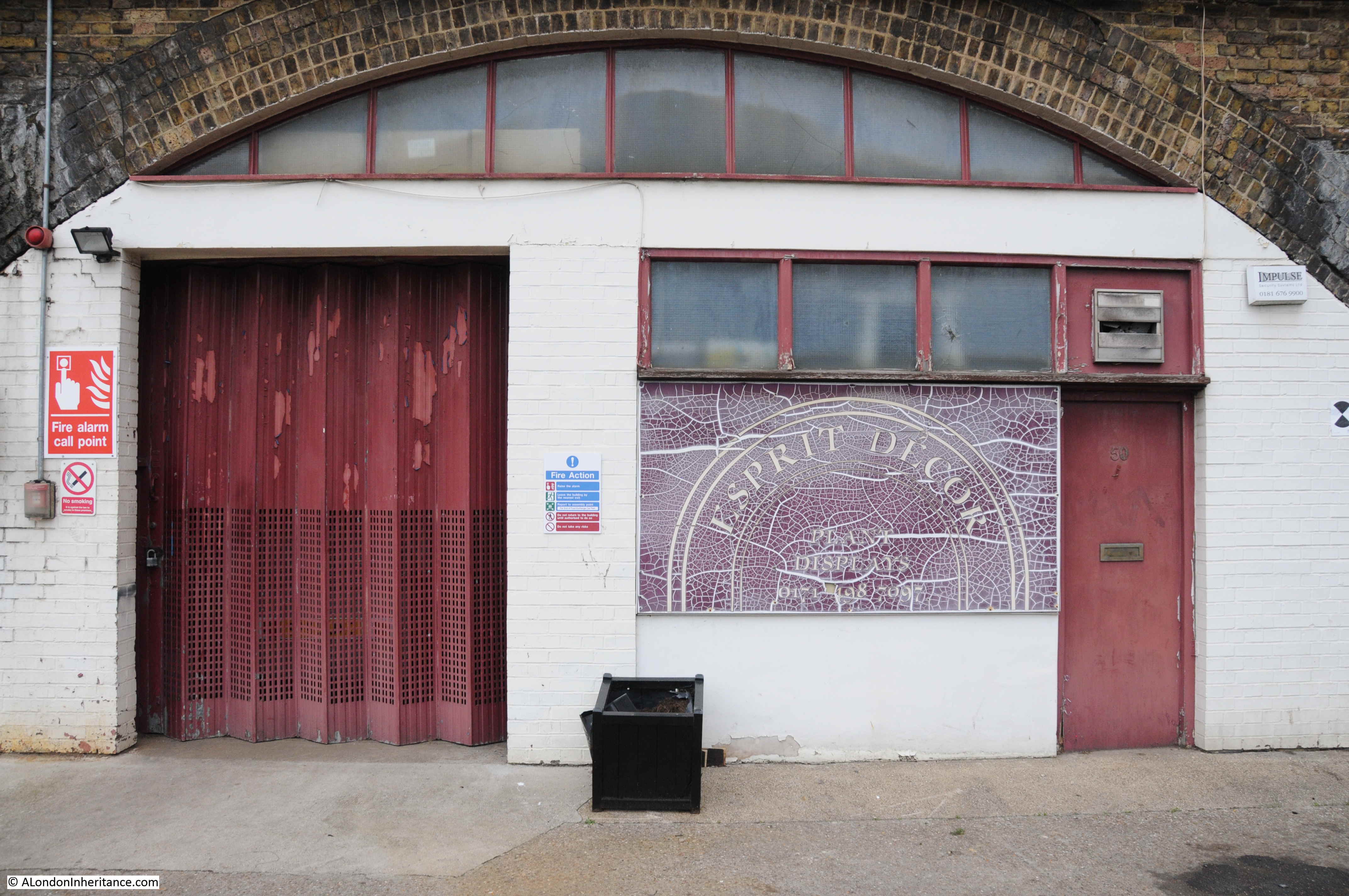
Nine Elms

09:56

And Sophie Hanna Flowers (a logical location given the flower market which I will soon find).

Nine Elms

09:57

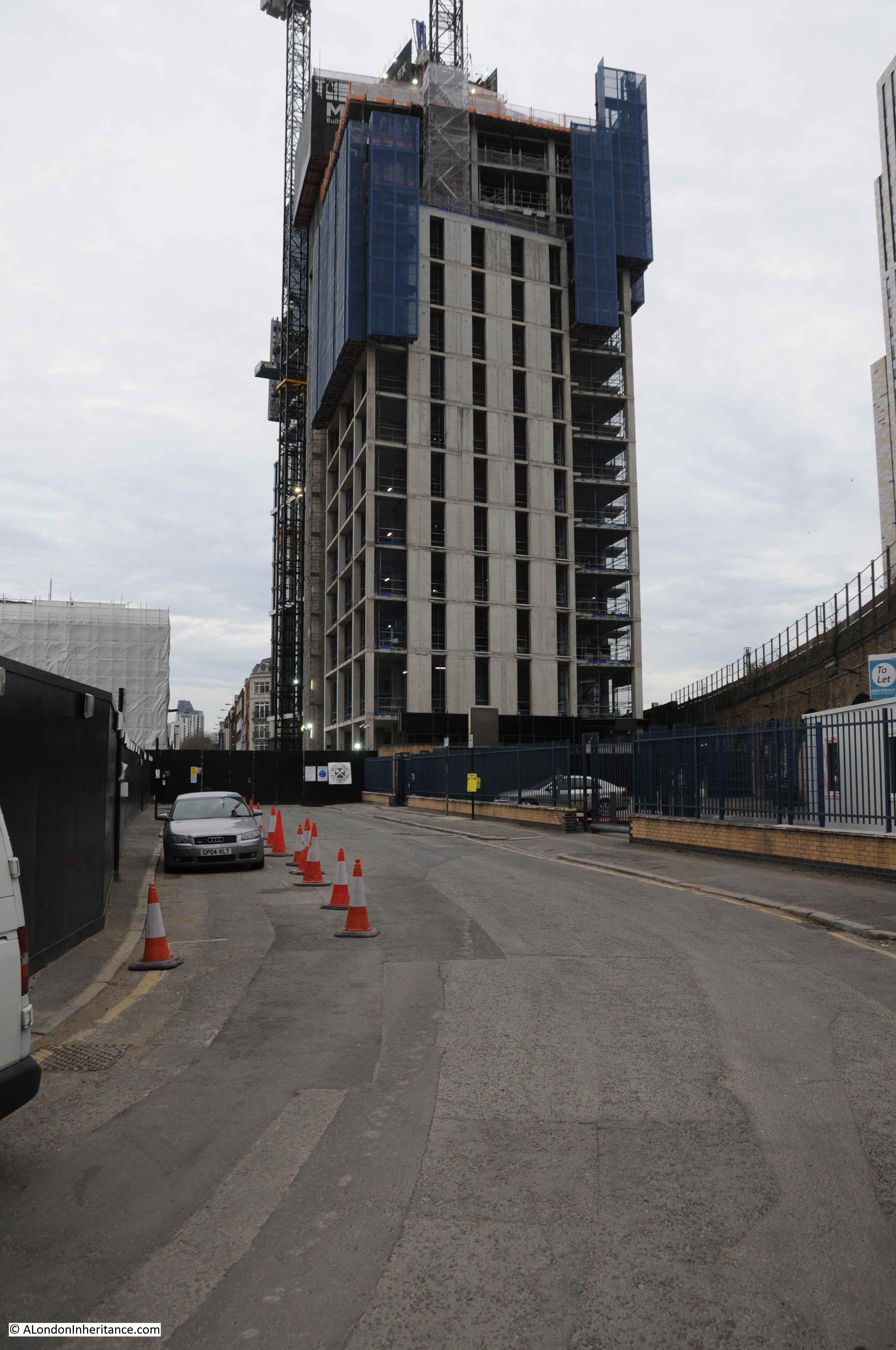
Directly opposite is the Nine Elms construction site for the Northern Line extension from Kennington to Battersea,
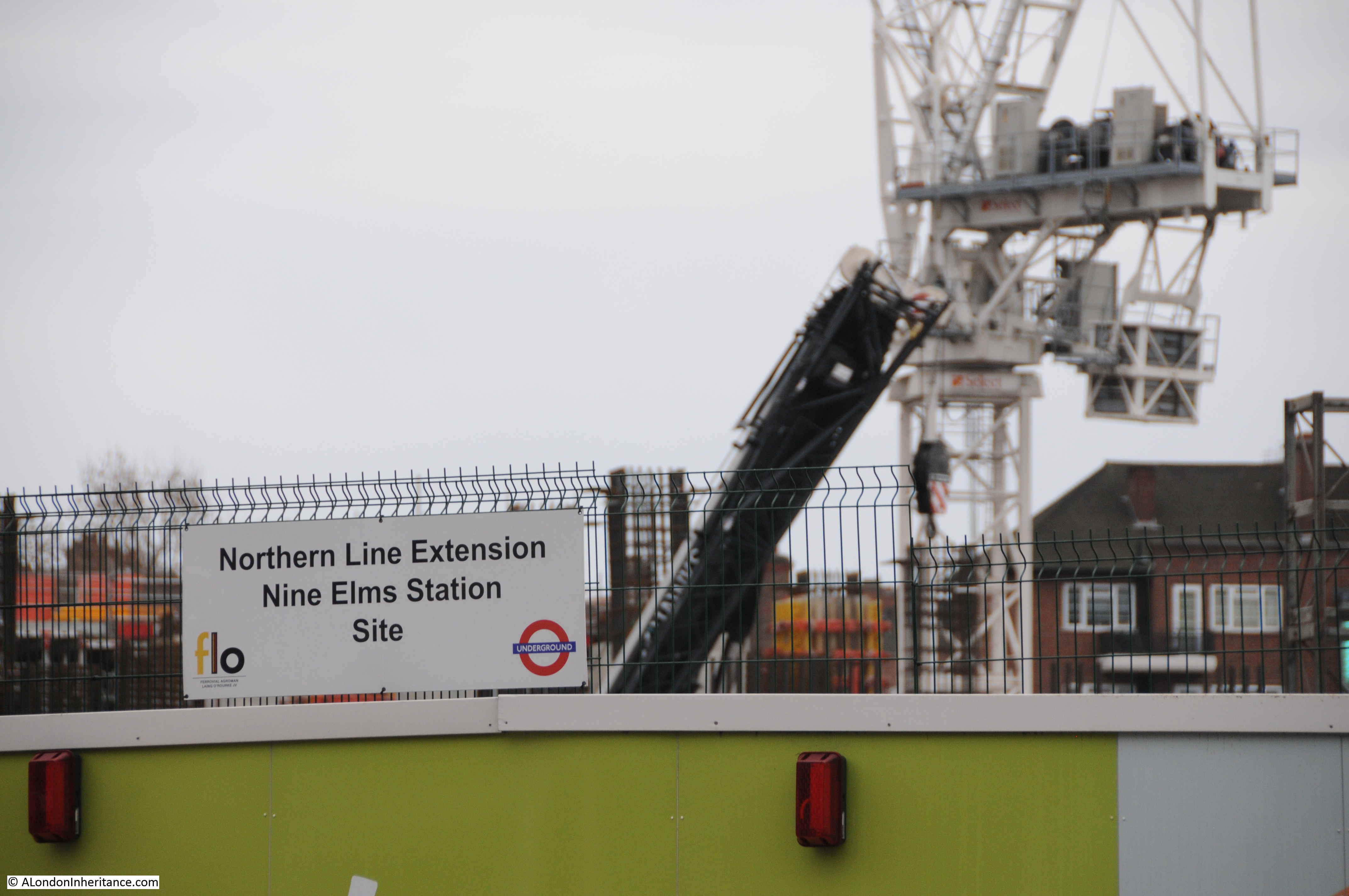
Nine Elms

09:57

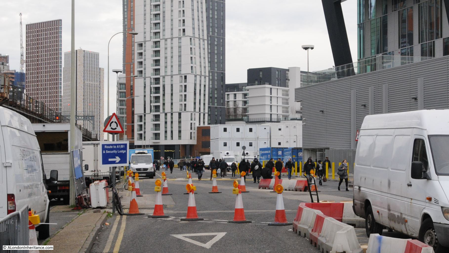
The viaduct now takes on a different appearance with infrastructure to service the tracks above and parking / workshop space for the considerable number of vans that wait here ready for their early weekday morning activity.
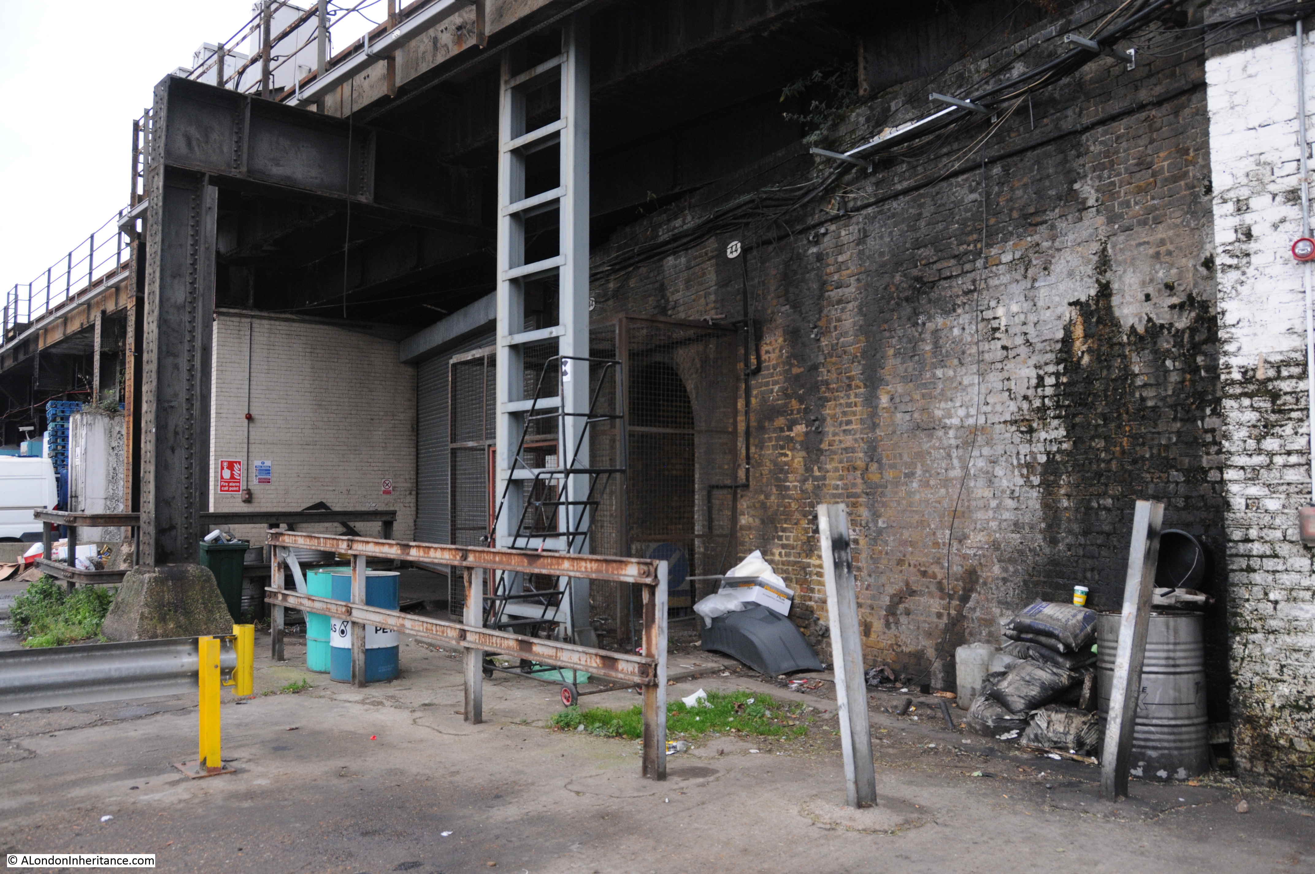
Nine Elms

10:00

I had to wait for a gap in the stream of people walking along the road to take the following photo.

Nine Elms

The photo does not really convey the view. I am standing surrounded by vans, a stream of people, wrapped up against the January cold and carrying bags, pulling shopping trolleys and wheeled suitcases walk below the railway tracks. Around them tall apartment blocks grow, each with a design that appears completely uncoordinated with any other, as if each had been designed in isolation and dropped from above onto Nine Elms.

This being a Sunday, the railway is relatively quiet. In the week a stream of trains would be taking commuters from the suburbs of London, the villages of Surrey, Hampshire and beyond into the city.

On the other site of the railway, huge signs advertise luxury apartments and penthouses.

10:01

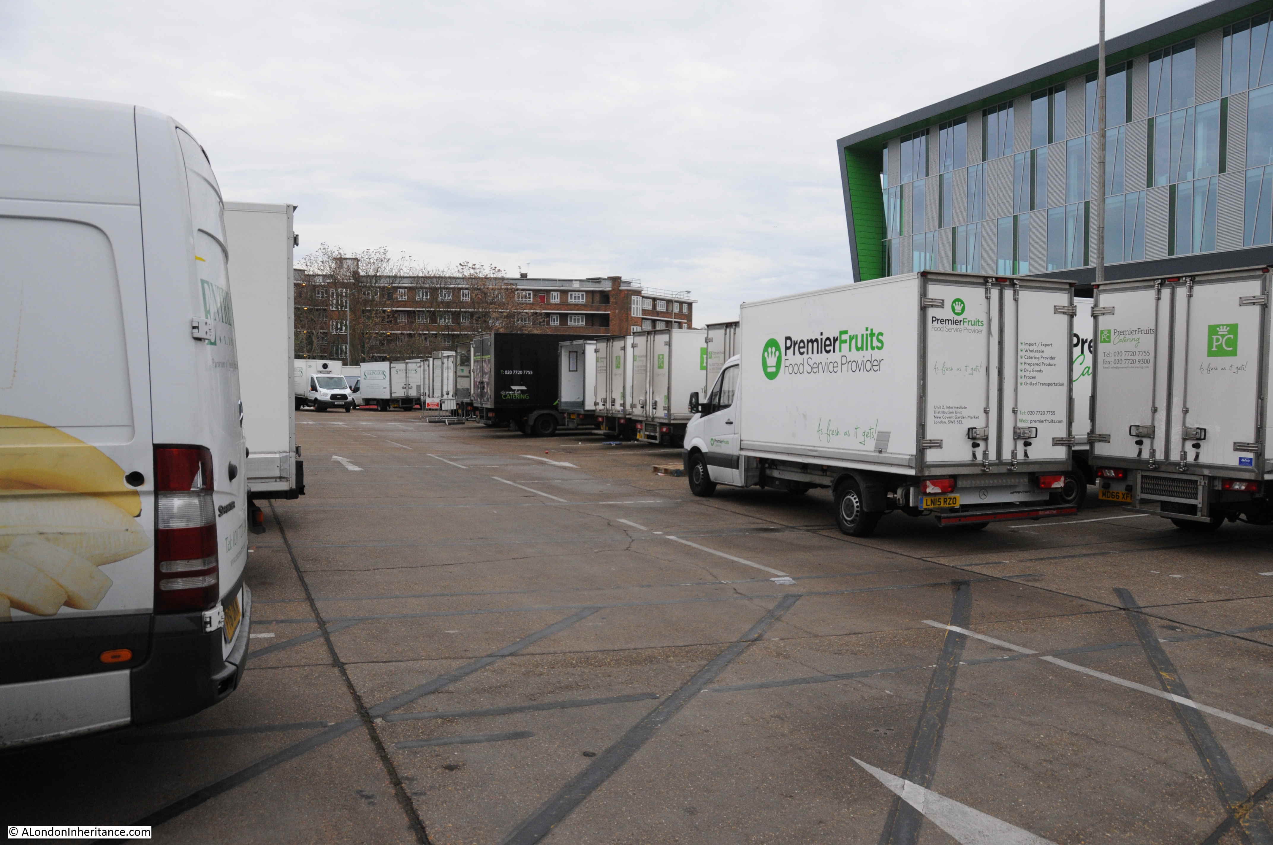
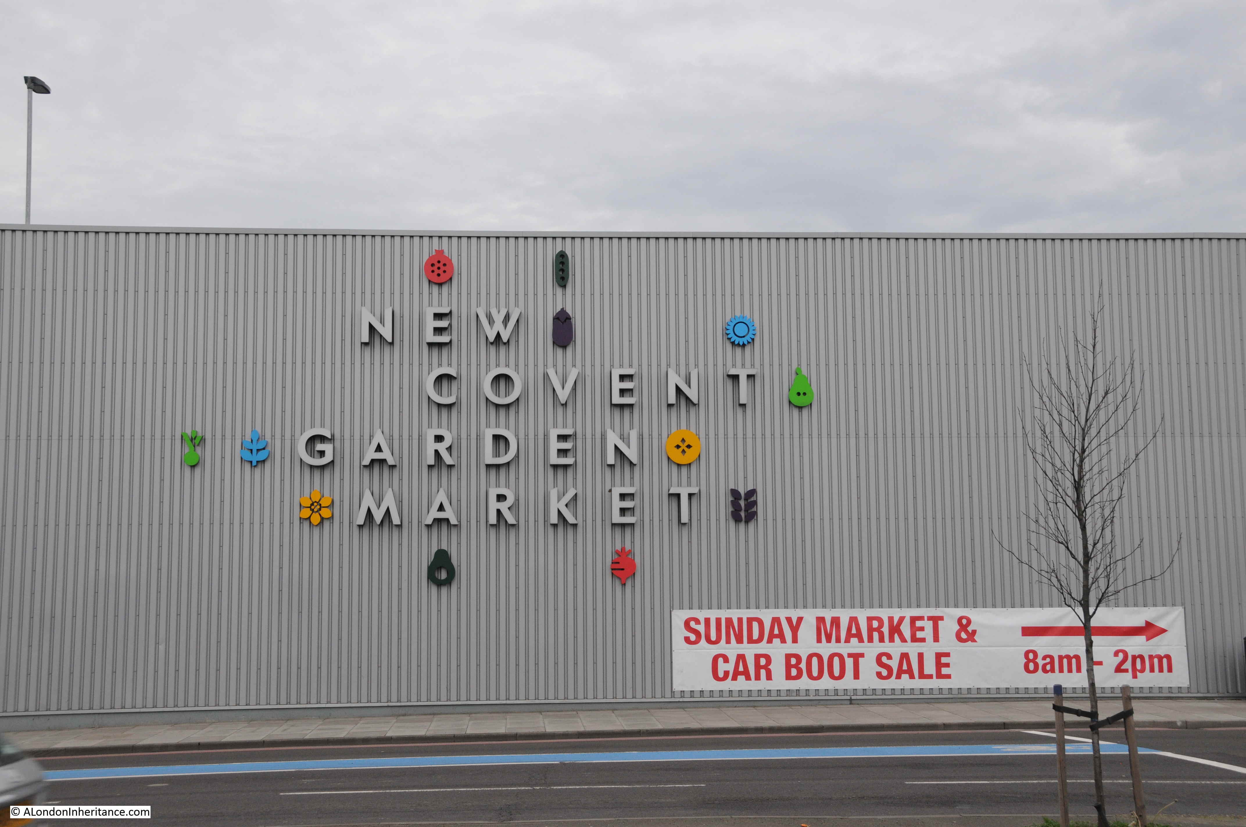
Turning round and there is a large car park full of vans – this is New Covent Garden Fruit and Veg Market.

Nine Elms

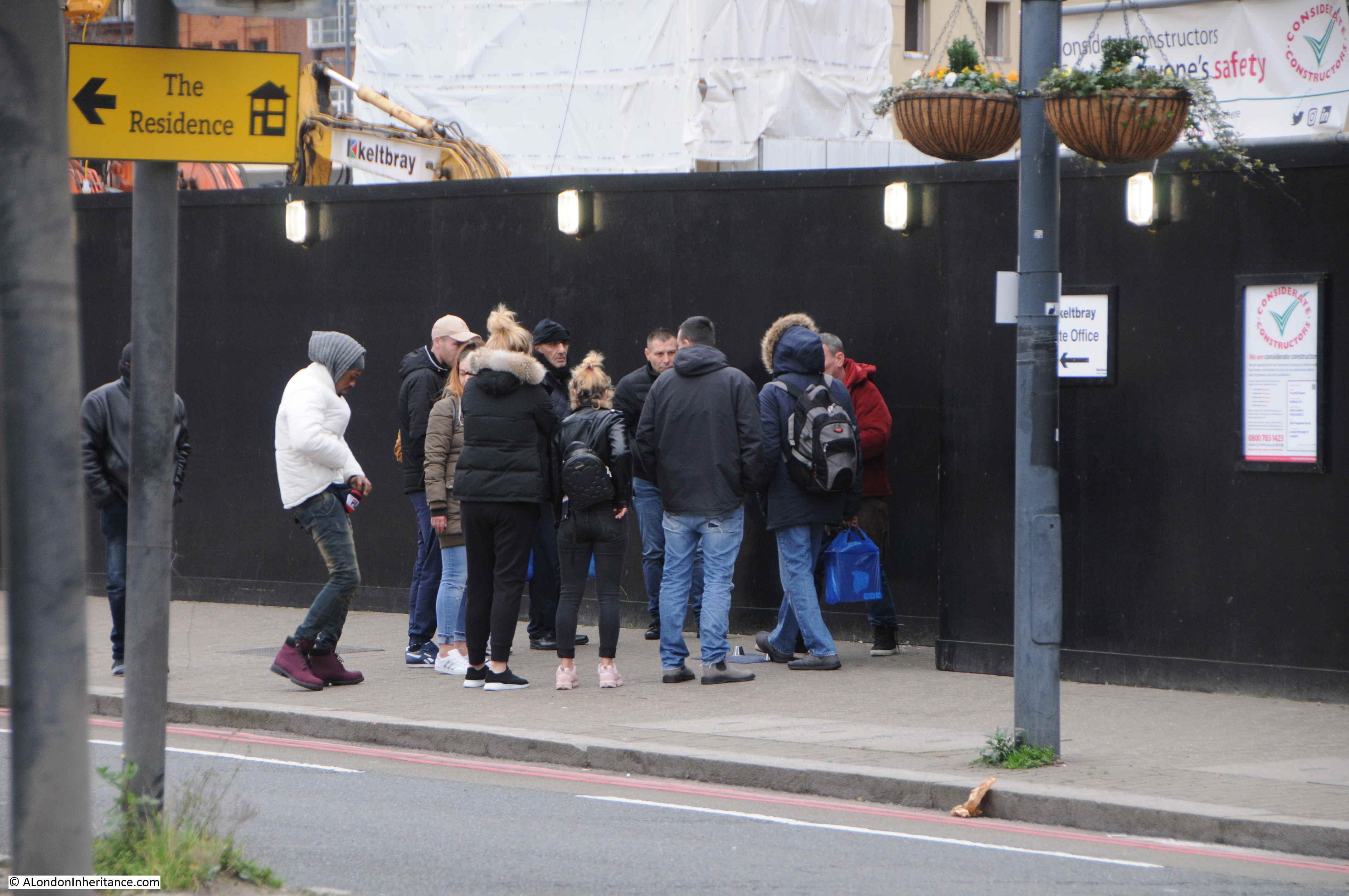
Just past the first market buildings was the reason for so many people walking along these streets on a Sunday morning as a large Sunday Market and Car Boot Sale operates here from eight in the morning to two in the afternoon.

10:03

Nine Elms

This is not a market for arts and crafts, this is market for the basics in life. I did not have time to explore the market apart from a quick walk along a couple of aisles where there are clothes, bags and cases of every description, tools, mobile phones and tablets.

It would have been good to take photos in the market, but the last thing the people who have come shopping here on a cold Sunday in January want is some bloke taking photos.

The market appears to be known as a source for second hand tools. On my walk back to Vauxhall, a man with an east European accent asked where the tool market was. He had just arrived in the country looking for work and needed to find some cheap tools to get started. How many times has that happened in London over the centuries.

The market is very busy, the photo below shows the number of people walking to and from the market.

10:07

Nine Elms

Continuing on, I walked through the man entrance to New Covent Garden Market.

10:10

Nine Elms

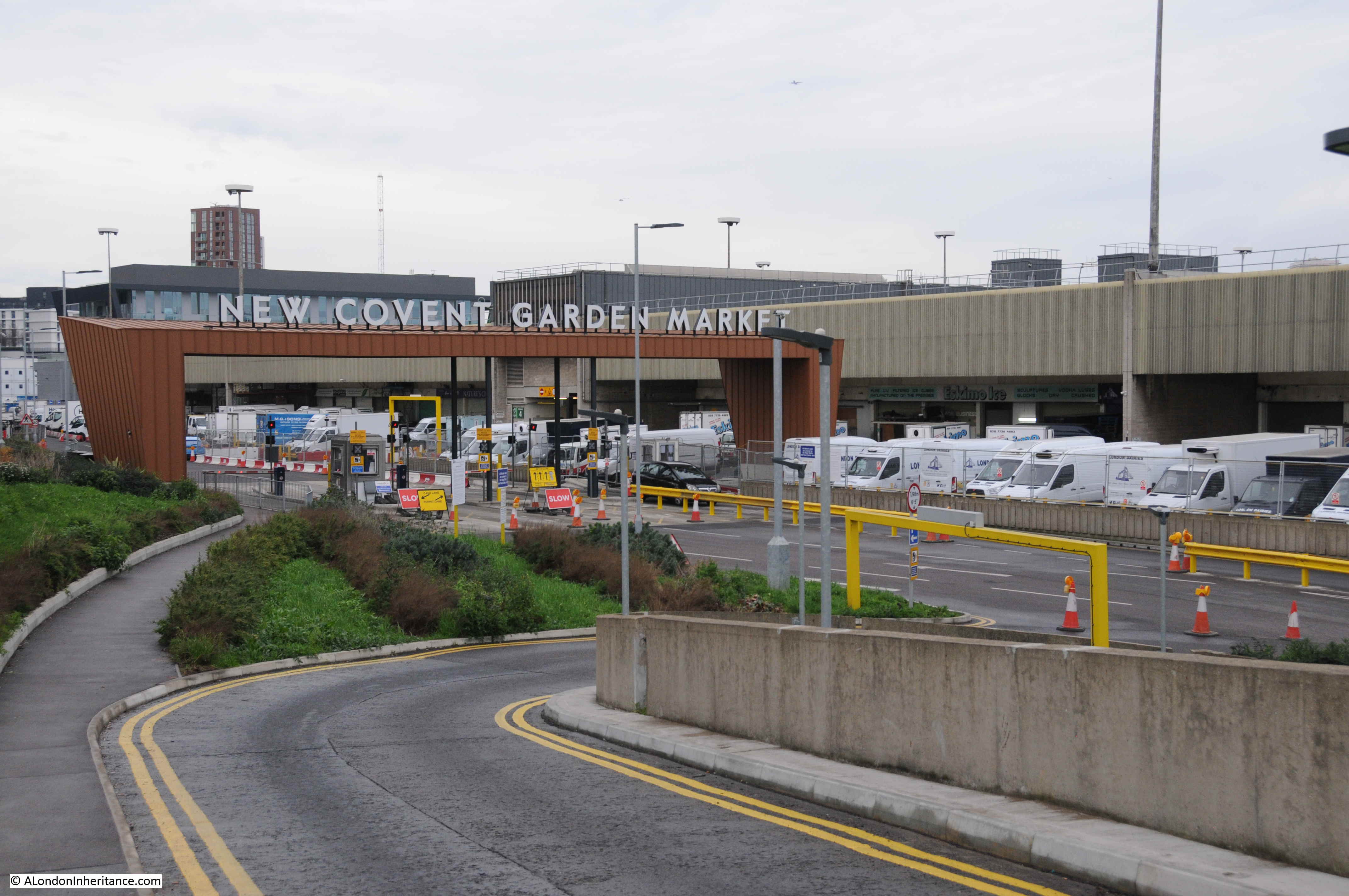
Covent Garden Market had outgrown its original location by the early 1960s. Lack of space for expansion and congestion on the surrounding roads required a new location to be found. The Nine Elms site was identified in 1961 and construction of New Covent Garden started in 1971. The Fruit & Veg and Flower Markets moved from Covent Garden to Nine Elms in November 1974 to sites to the south and north of the railway viaduct.

The southern market has been demolished and relocated (which I will find soon), but the main fruit and veg market continues in the original 1974 location and many of the buildings have recently been rebuilt and refurbished, with further construction ongoing.

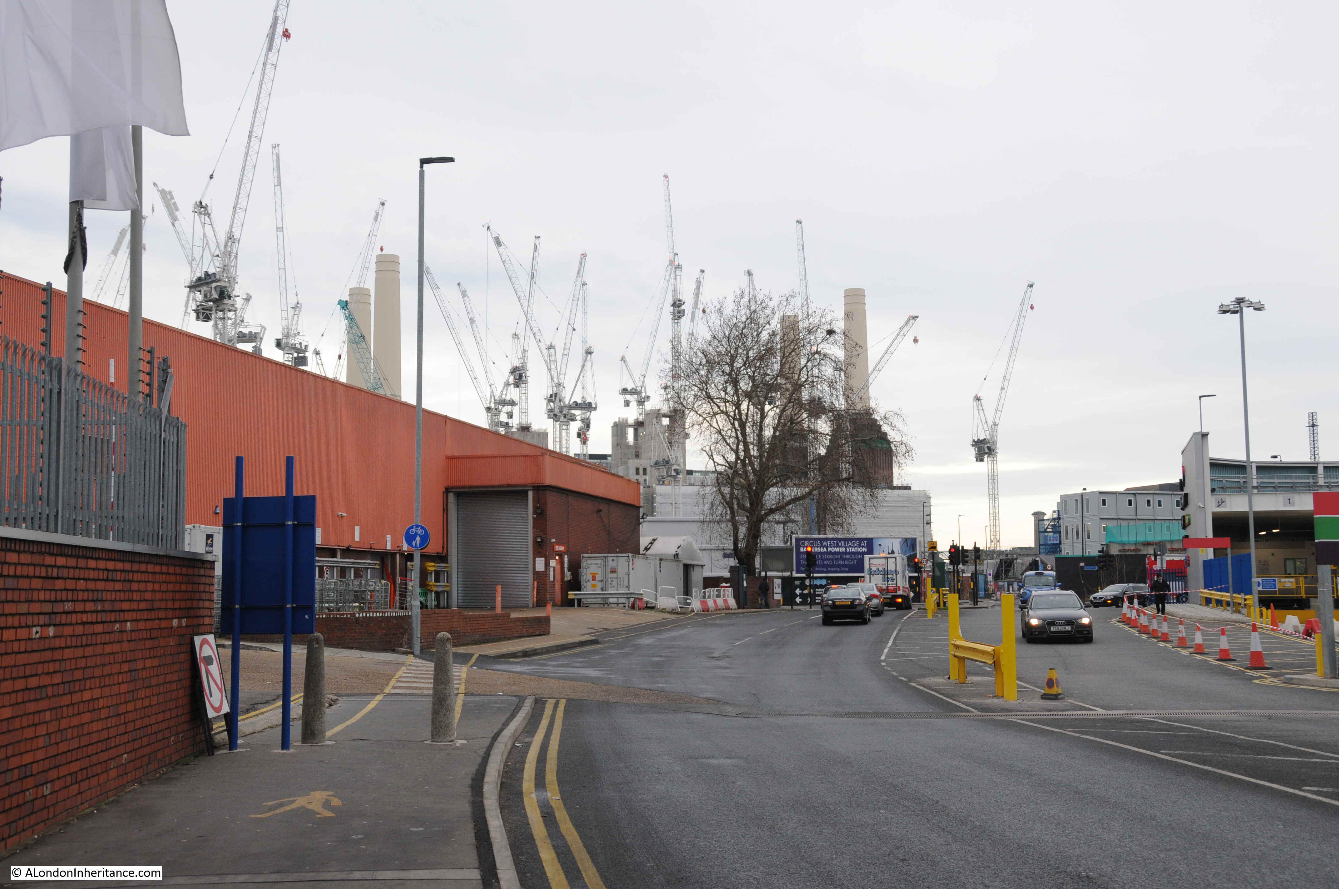
The market has a dedicated road tunnel under the railway viaduct allowing access to and from Battersea Park Road, so this is the route I took. Passing under the railway and the cranes surrounding Battersea Power Station come into view, further emphasising the sheer scale of the construction projects between Vauxhall, Nine Elms and Battersea.

10:15

Nine Elms

It is along this road, just under the railway viaduct, that the new Flower Market has been located.

10:17

The entrance to the Flower Market:

Nine Elms

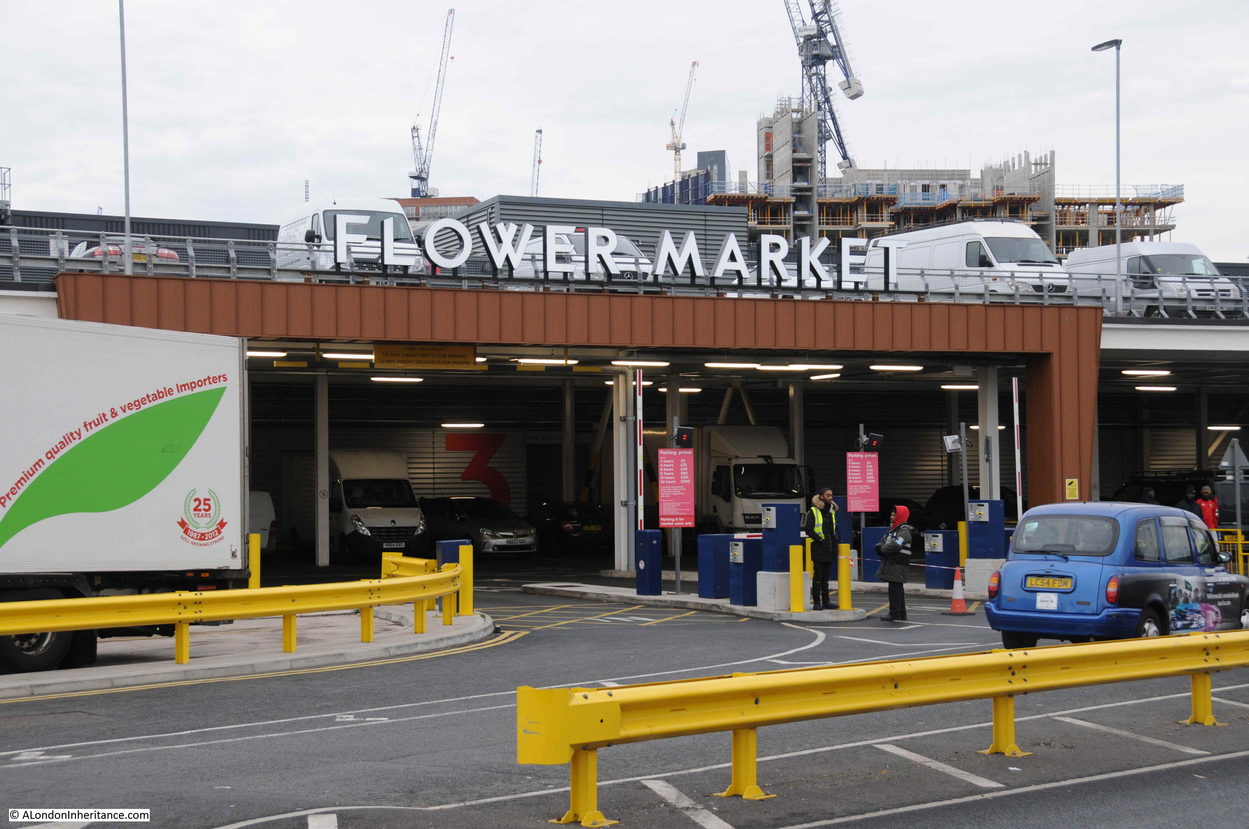
The Flower Market was opened in April 2017 having moved from a location further down towards Vauxhall. That original site has now been demolished and cleared ready for new construction.

10:20

The new – New Covent Garden Flower Market in Battersea Park Road:

Nine Elms

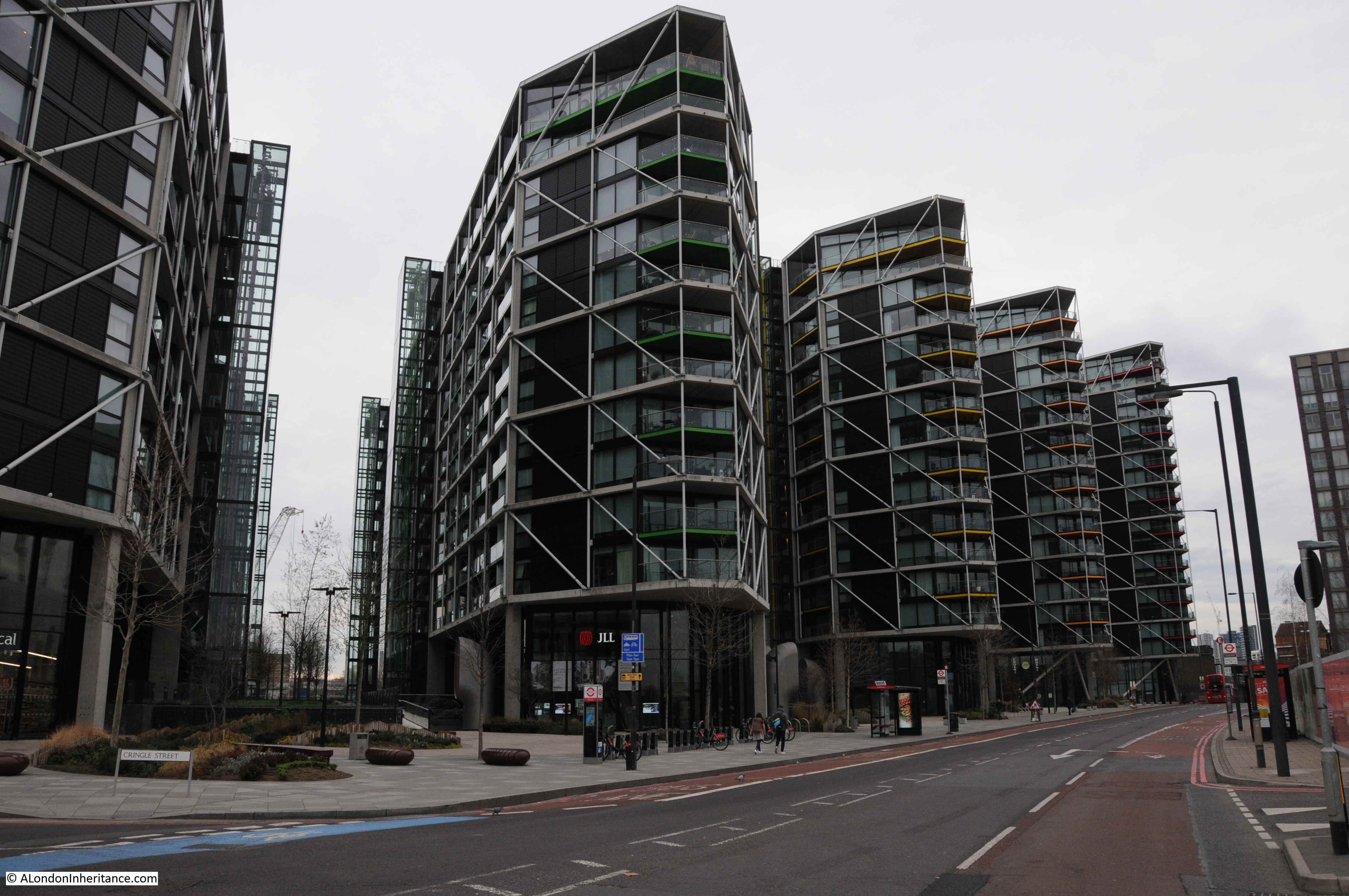
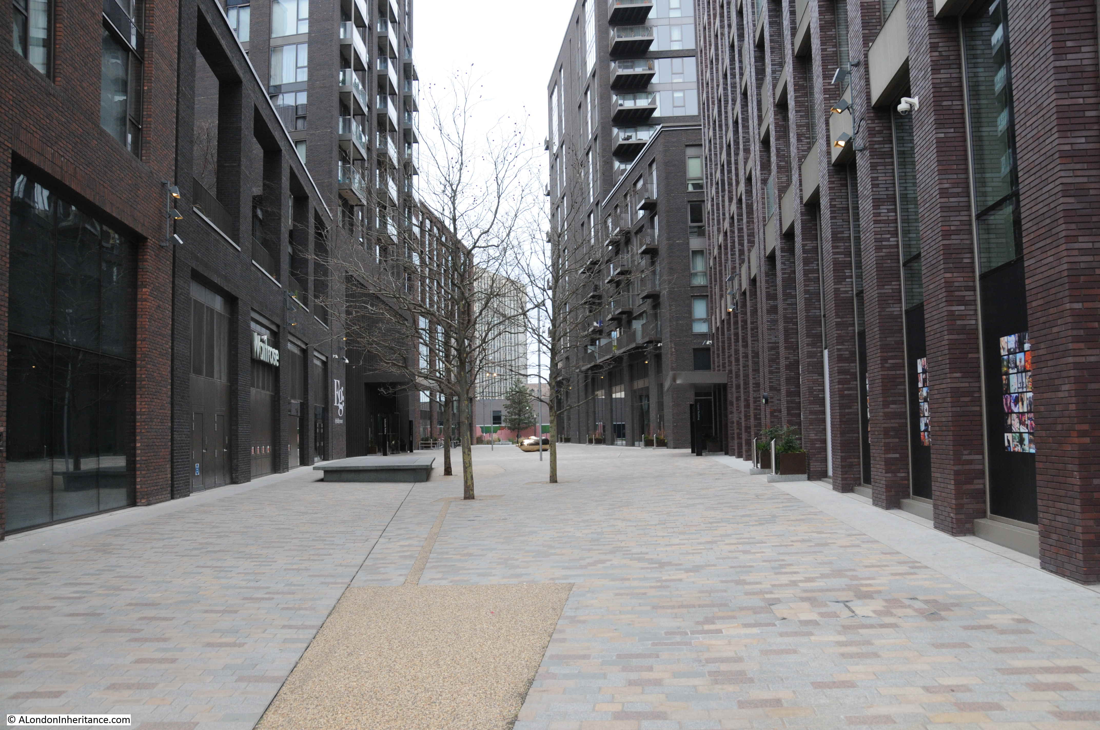
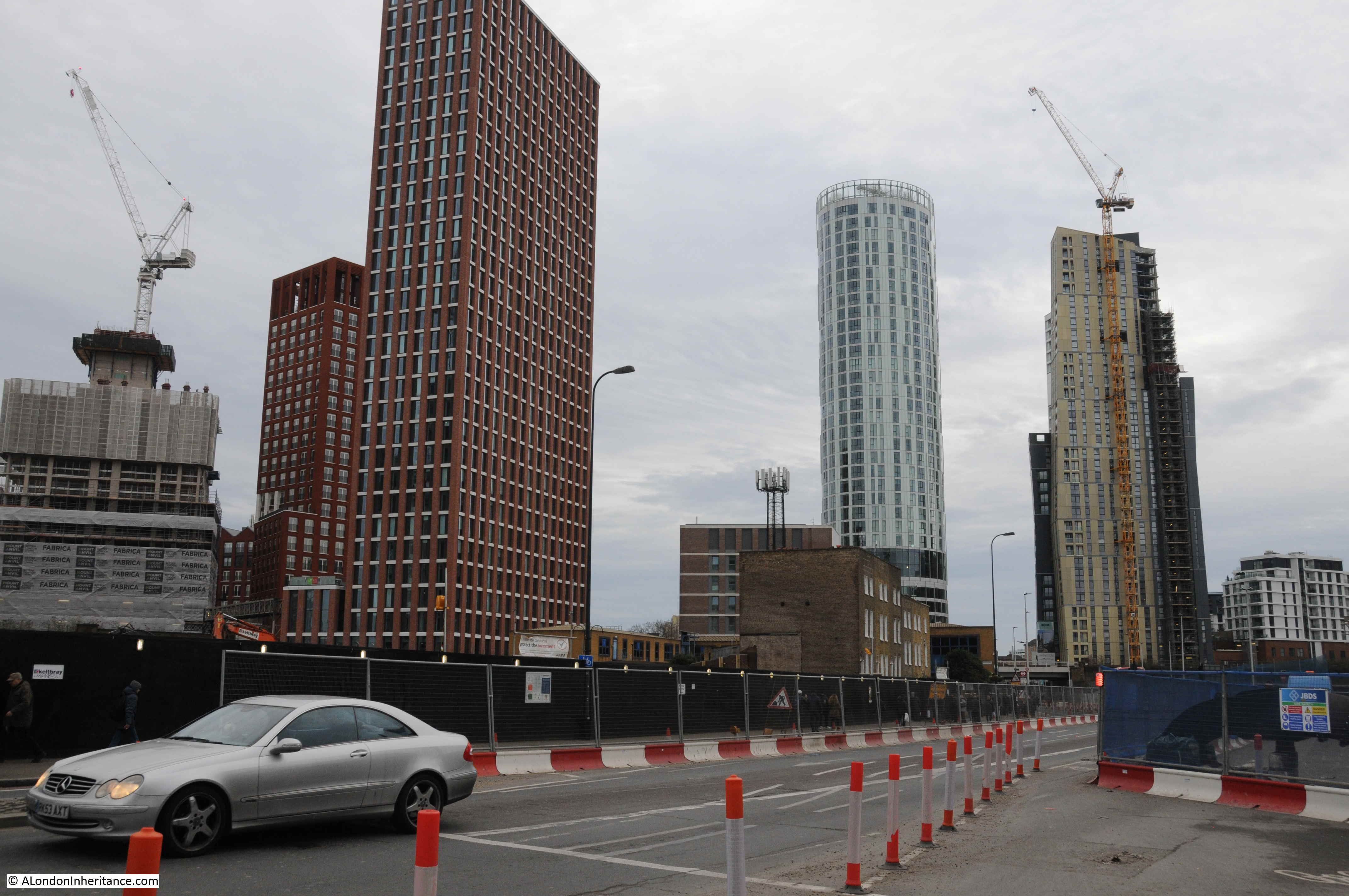
Completing a circular route, my plan was now to walk back along Battersea Park Road and Nine Elms Lane to where I started in Vauxhall. It is along here that some of the original apartment blocks from this recent phase of development can be found.

10:32

When redevelopment started, it was on the bank of the river, and over the last few years has continued back inland. Between Nine Elms Lane and the River Thames are five blocks of identical design/

Nine Elms

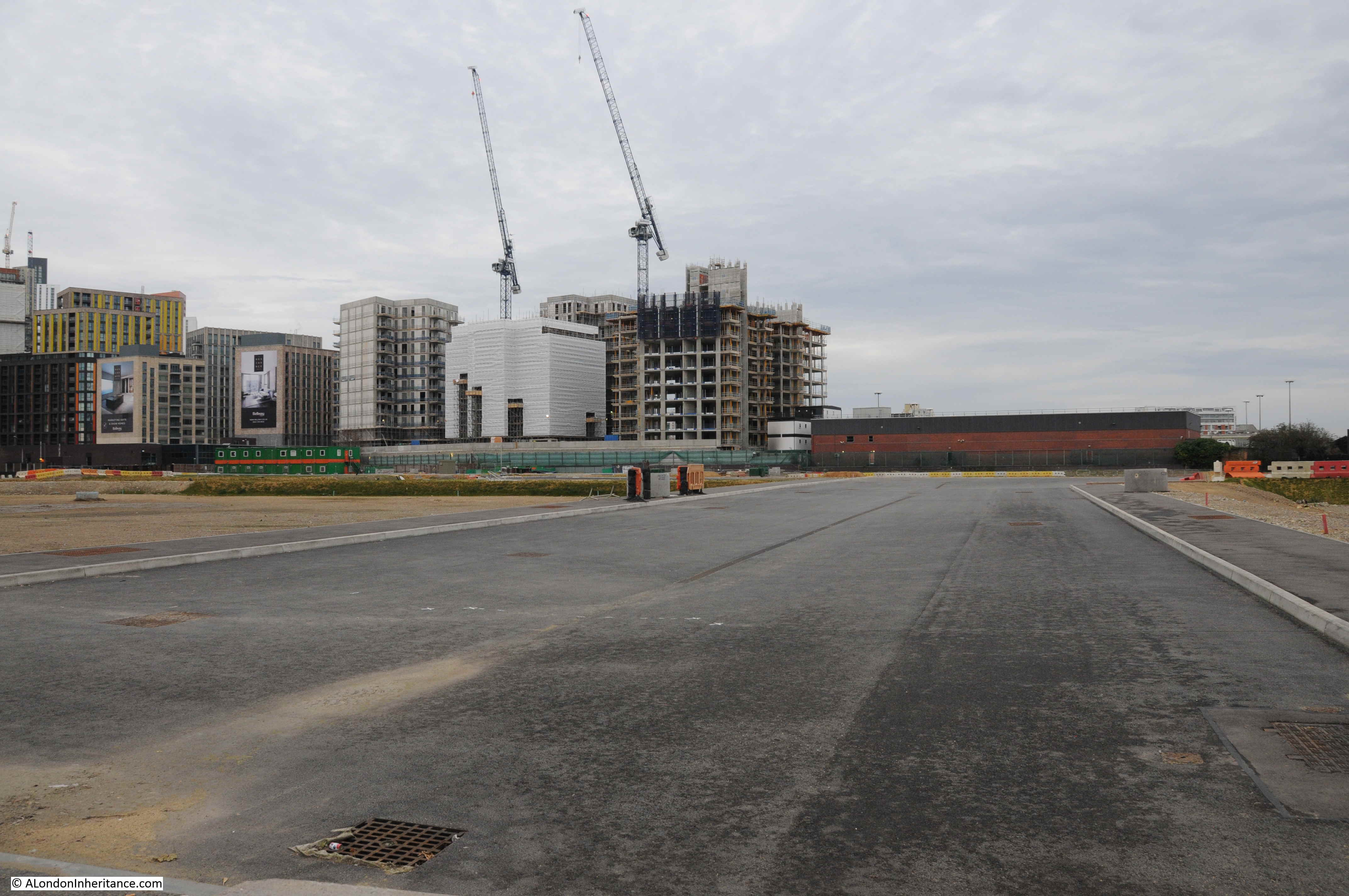
On the opposite side of Nine Elms Lane, large areas of land have been cleared. The roads are ready and utility services laid underneath the roads ready to service the buildings that will spring up on either side.

10:36

Nine Elms

10:38

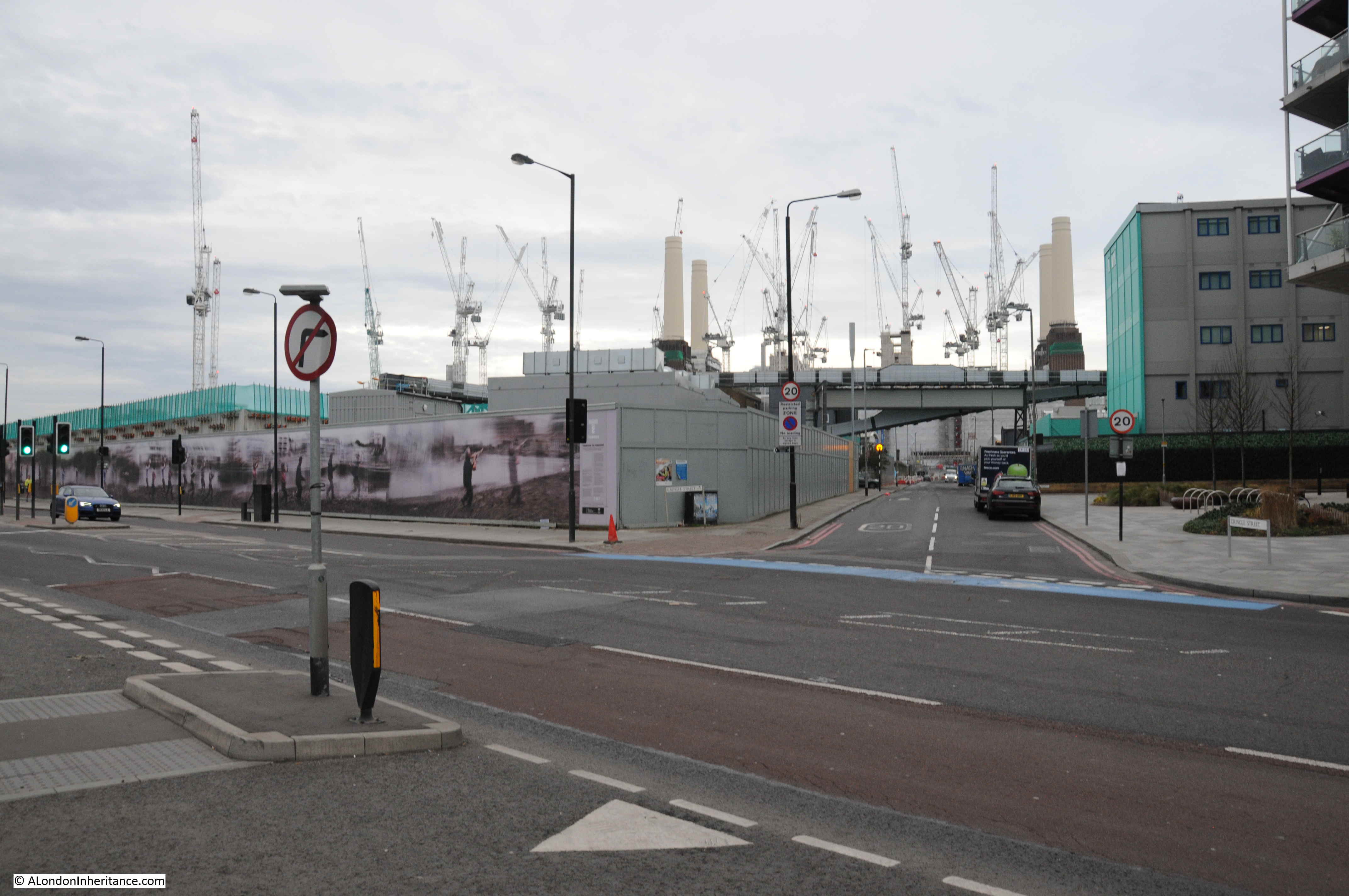
Opposite is Cringle Street which leads to the large construction site surrounding Battersea Power Station:

Nine Elms

Further along Nine Elms Lane there are a number of completed buildings.

10:40

A very quiet January Sunday morning:

Nine Elms

Walking further along Nine Elms Lane and I found probably the most publicised building in the Nine Elms redevelopment.

10:48

This is the new United States Embassy:

Nine Elms

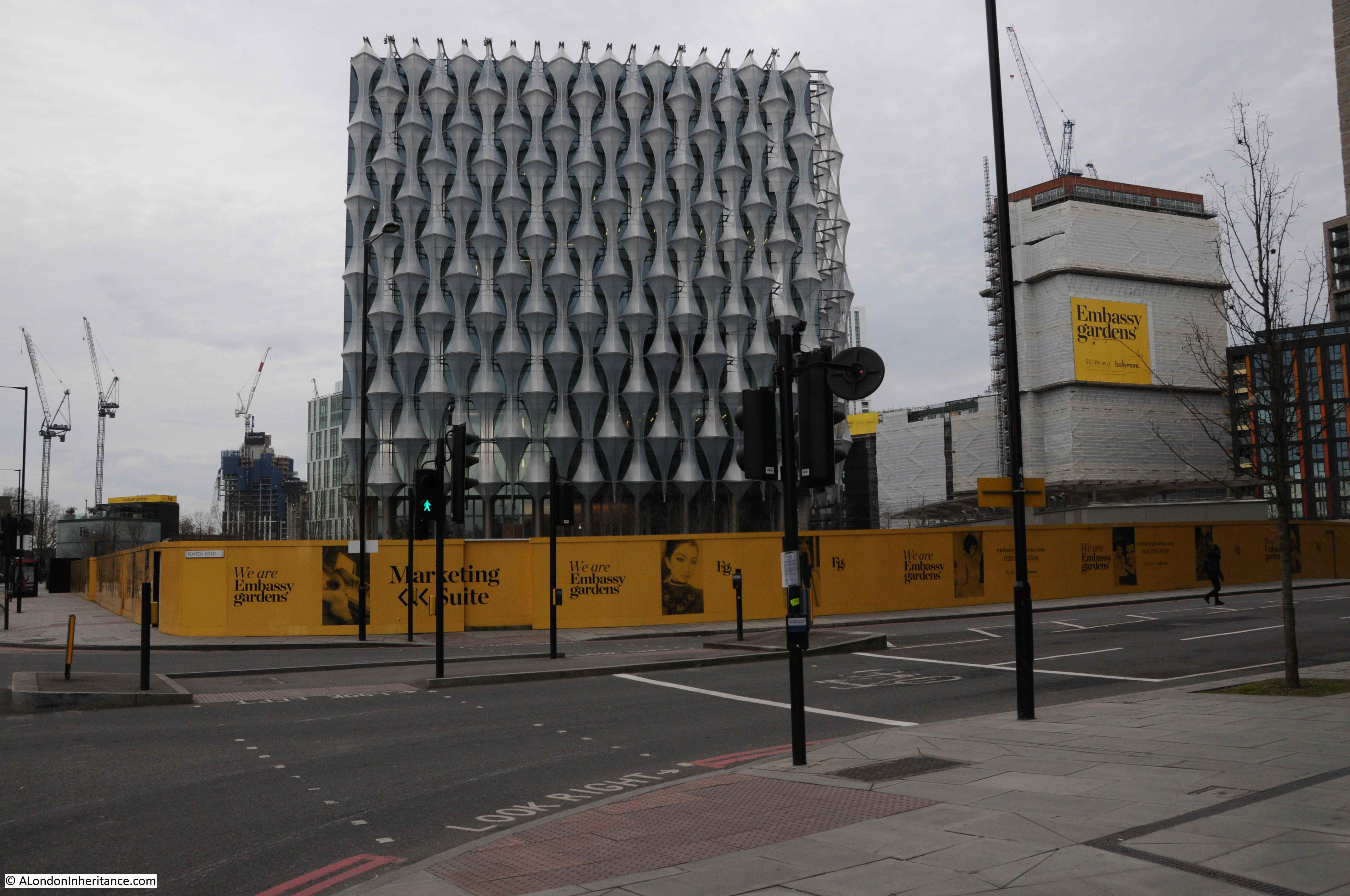
It is January, it is a grey day, it is a Sunday morning so there are not many people around, the building is surrounded by construction sites, however comparing the new location to the original location in Grosvenor Square – it is very different.

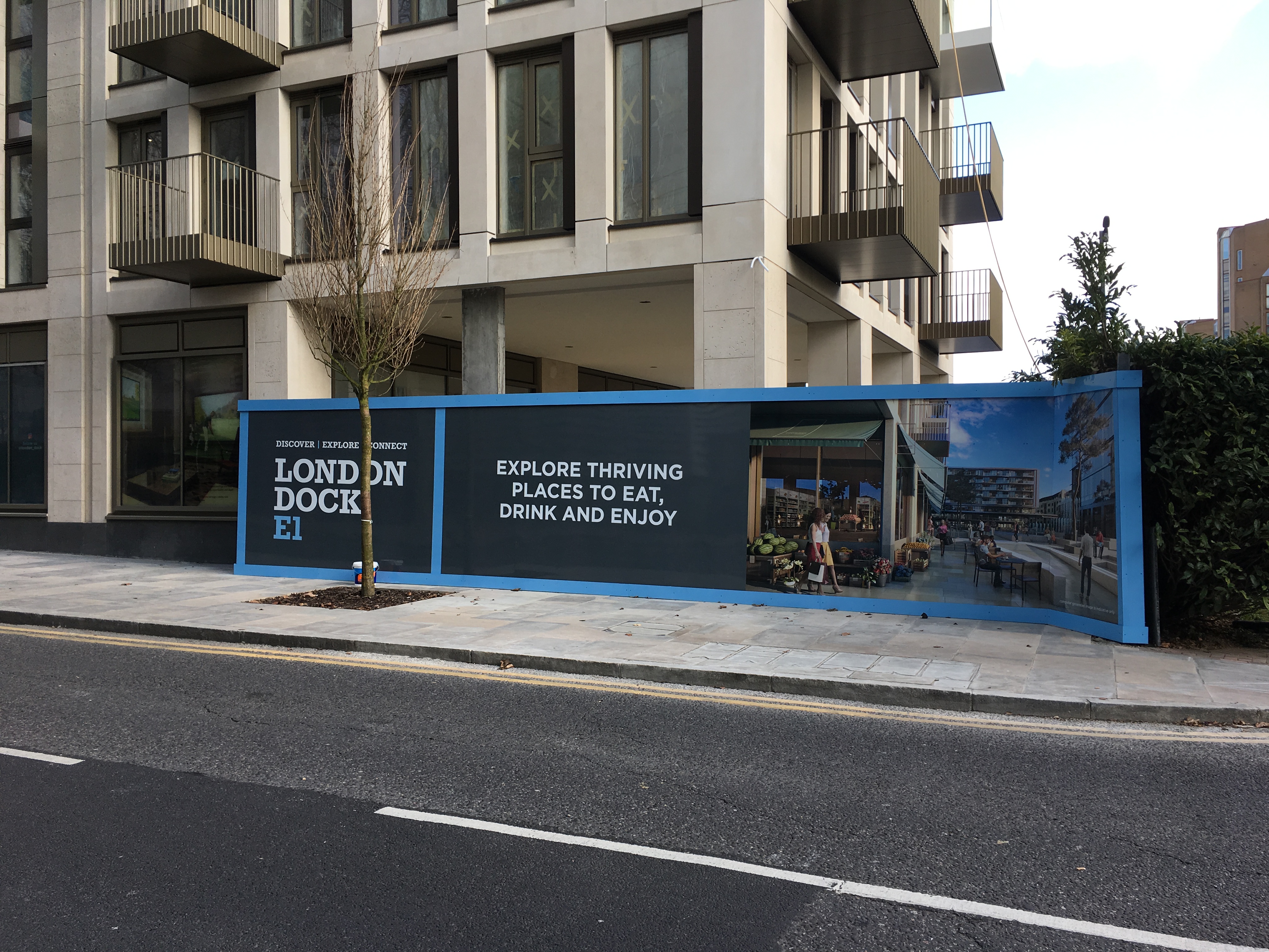
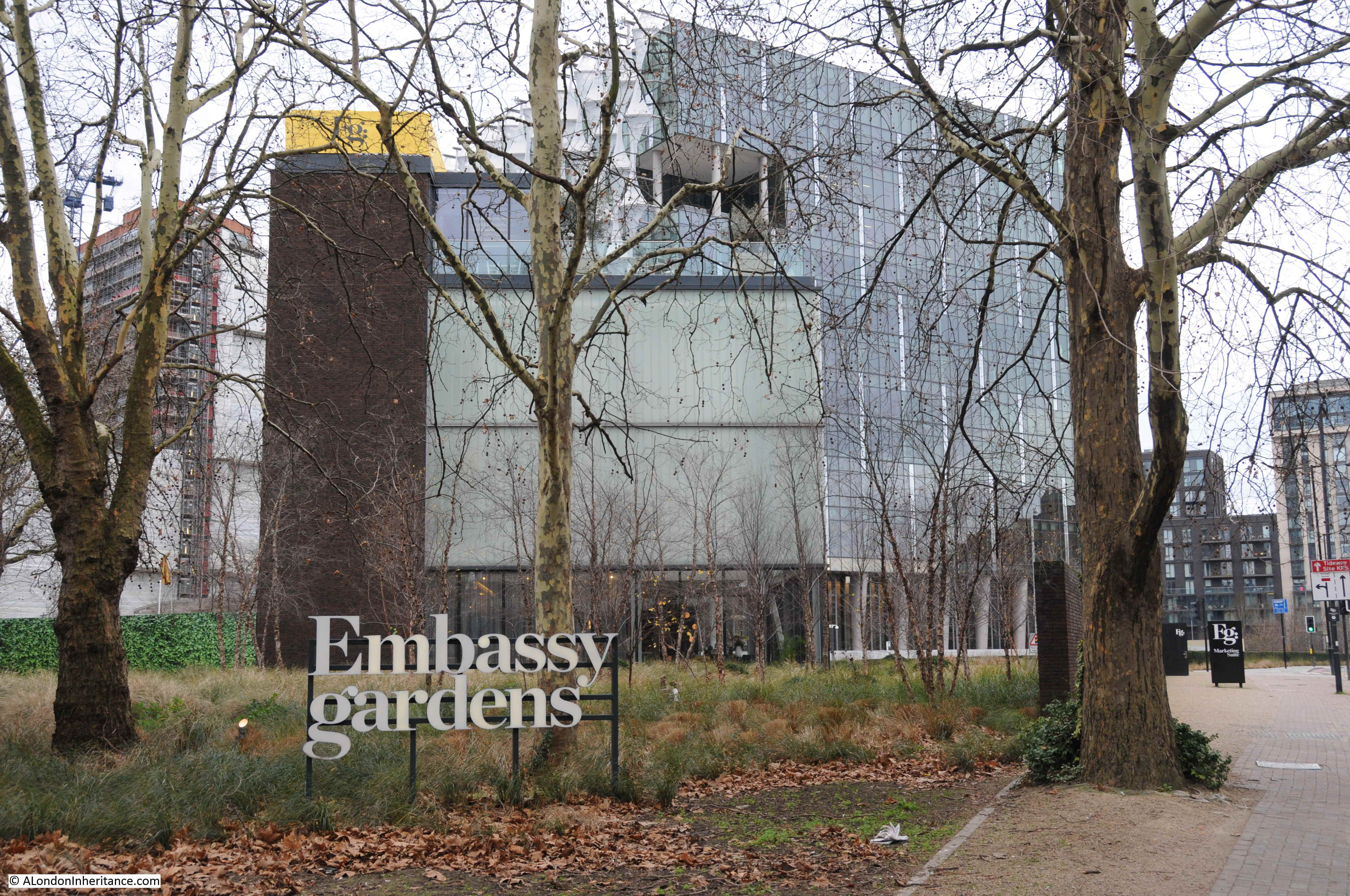
I am sure it will be a much improved environment when the rest of the redevelopment of Nine Elms is complete. The hoardings around the site between road and Embassy are for the residential blocks that will be built here – the Embassy Gardens development. Based on the photos of potential residents on the hoardings around the building site, I doubt I fall within their age demographic.

10:50

Further down Nine Elms Lane:

Nine Elms

10:55

Continuing along Nine Elms Lane and there is another large space cleared and ready for new construction. This was where the original flower market was located.

Nine Elms

And if I have calculated the location correctly, it was also somewhere here that the original London terminus of the Southern Railway was located.

This was the street entrance of the terminal building in 1942. The building suffered bomb damage during the war and was demolished in the 1960s ready for the construction of the New Covent Garden Flower Market in 1974.

Nine Elms

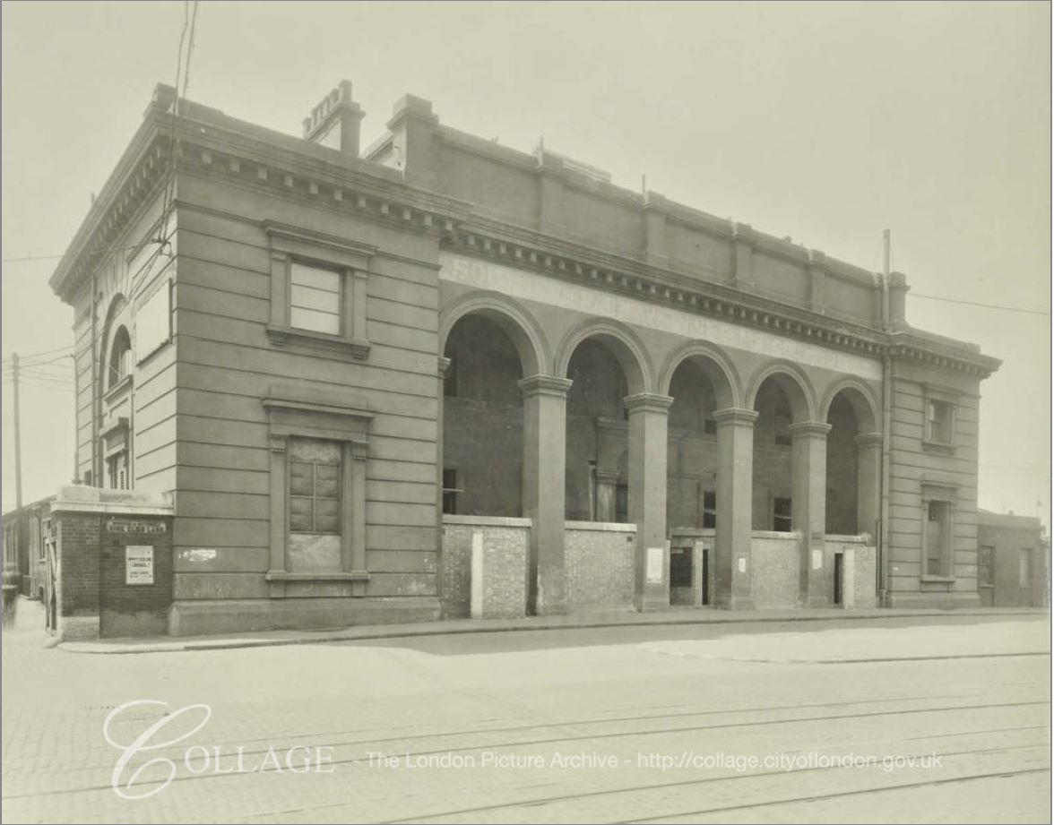
Image credit: London Metropolitan Archives, City of London: catalogue ref: SC_PHL_02_0629_F898

10:56

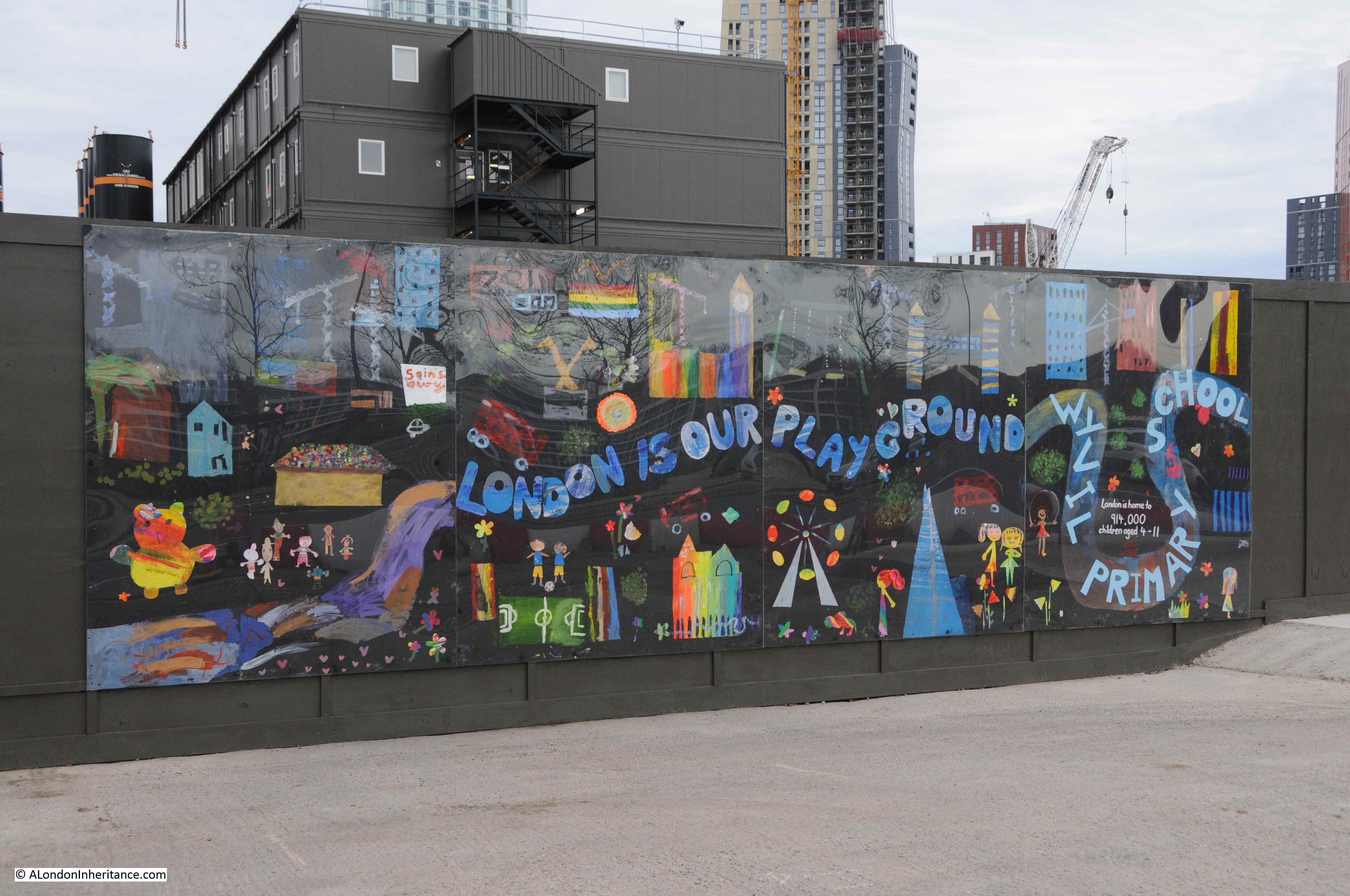
Mural by Wyvil Primary School – the mural informs that London is home to 914,000 children between the ages of four and eleven.

Nine Elms

I now reached the junction of Nine Elms Lane and Wandsworth Road.

10:57

From here I could look down Wandsworth Road again to see the houses that were the reason for spending Sunday morning in Nine Elms.

Nine Elms

It is a wonder that they have survived so long, given the closure of the railway station, workshops and good yards which were the catalyst for development of the area. The houses are probably of the same age as the original Nine Elms station.

The houses and the strange length of wall in the walkway alongside the viaduct are the only survivors from the 1895 map that I found, apart from the railway viaduct.

No idea what will happen to the houses. I hope they survive the latest phase of development and having seen the railway come and go, the Flower Market almost opposite built and demolished, they will now be surrounded by the towers that are springing up all around them.

11:10

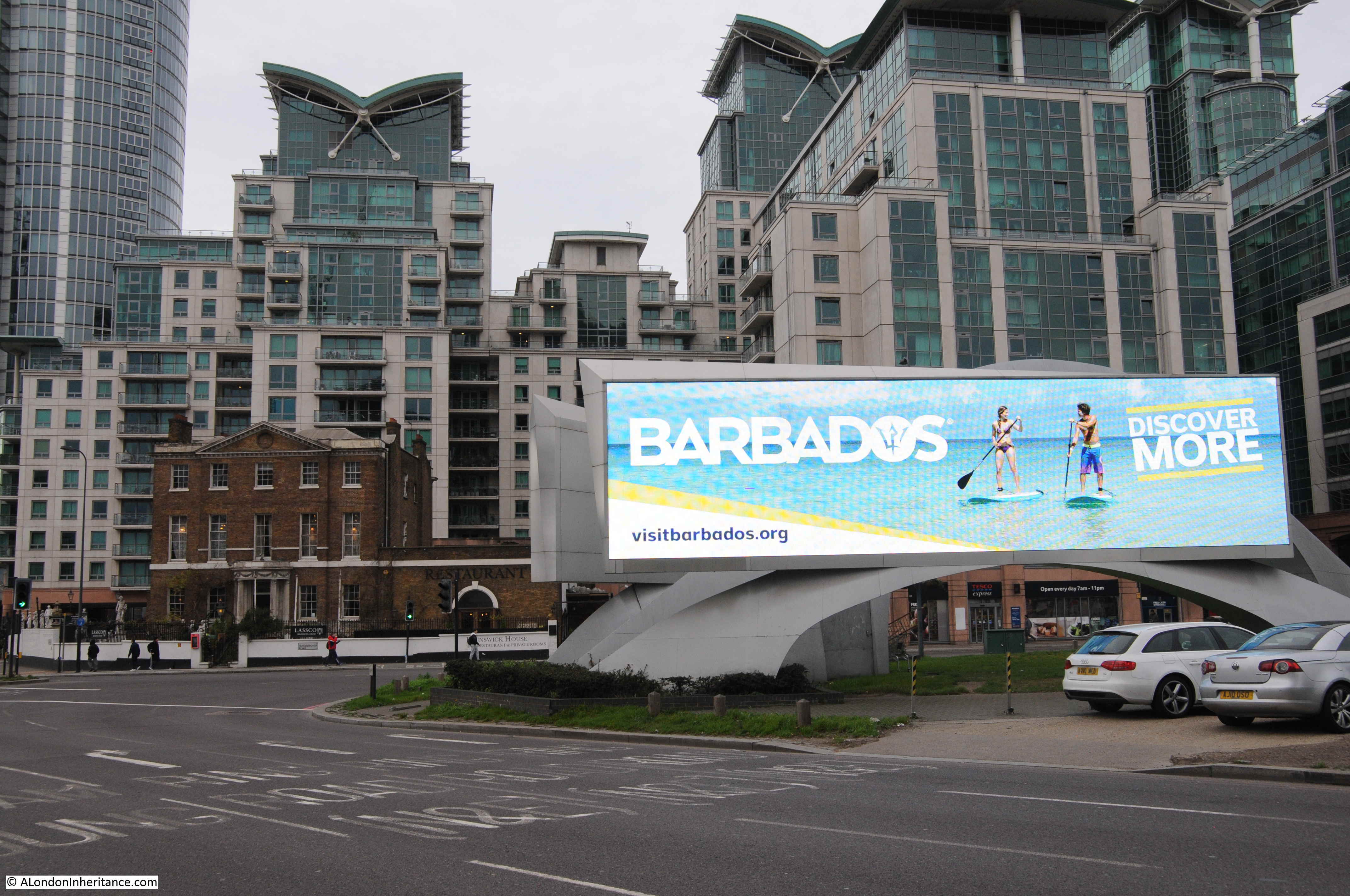
At the junction of Nine Elms Lane, Wandsworth Road and Parry Street, the bright lights of Barbados shine on those still streaming from Vauxhall Station to the Sunday Market.

Nine Elms

And as one final comparison photo, the old Brunswick Club building with the residential blocks behind in the above photo and the Nine Elms Cold Store in the photo below.

Nine Elms

Image credit: London Metropolitan Archives, City of London: catalogue ref: SC_PHL_01_258_71_7183

Nine Elms is probably not high up on the list of walks in London, however I found it fascinating. The sheer scale of the redevelopment work, with the extension down to Battersea Power Station, is remarkable. Not just above the surface, but also below ground with the Northern Line extension. The Sunday Market also serves those who need somewhere to buy cheap goods and for those seeking to start a life in London.

Nine Elms has been through two development phases. Originally as the first Southern Railway terminus in London, then with the associated locomotive works and goods yard, then as the site for Covent Garden’s relocated fruit, veg and flower markets with other light industrial business. Now a third phase as Nine Elms transitions to a mainly residential area, however it is good to see that the market will stay here.

There is still much to explore in Nine Elms, and when I return I will check to see if the six houses have survived along with the strange wall alongside the viaduct.

alondoninheritance.com

Along The Thames From Chiswick To Hammersmith

If you drive west out of London, along the A4, Great West Road from the Hammersmith Flyover to Chiswick and the Hogarth Roundabout, you pass along a very busy highway with three lanes of traffic either side.

This probably is the last place you would expect to find one of the more historic walks along a very scenic part of the River Thames, with some of the views looking more like the depths of the countryside rather than a built up area of west London.

There are some superb walks along the River Thames, and for today’s post, here is a walk from Chiswick to Hammersmith on a very hot Saturday afternoon in June (it is also a lovely walk on a cold, dark winter’s evening). The walk is perfect for a hot day as there are plenty of suitable stopping places along the route for some quick refreshment.

In the following map extract, the A4 is the large road running from the Hammersmith Flyover at top right, down to the Hogarth Roundabout at bottom left.

Chiswick

(Map  “© OpenStreetMap contributors”).

A short distance below the A4 is the river and along the river is a series of streets starting with, on the left, Chiswick Mall.

I started by walking to the river down Church Street, between St. Nicholas’ Church and Fuller’s Griffin Brewery to reach Chiswick Mall.

Chiswick Mall runs along the river, with gardens separating the street from the river, and large houses lining the street opposite the river.

The views here to the river look as if they should be from the upper reaches of the river, rather than a short distance from the six lanes of the A4.

Chiswick

The river here does frequently flood across the road. This was not a particularly high tide, however the damp road shows how far the river had come across the road.

Chiswick

The majority of the houses on the opposite side of the street have flood defences in the form of walls and metal gates that can be closed across the entrances from the street to prevent water from flooding towards the house.

There are also signs warning of the potential impact if you leave your car along the Chiswick Mall.

Chiswick

This is Walpole House, a Grade II listed building dating from the 18th century, possibly with elements from the 17th century.

Chiswick

Barbara Villiers, Duchess of Cleveland, a former mistress of King Charles II was one of the earliest recorded residents, with Thomas Walpole a later owner, who gave his name to the house.

Another view from Chiswick Mall towards the River Thames:

Chiswick

Italy or Chiswick?

Chiswick

At a number of places, the route between Chiswick and Hammersmith turns slightly in land and there are houses between the street and the river. This is where Chiswick Mall ends and becomes Hammersmith Terrace.

Chiswick

There are a number of references to the age of the terrace, dating them from 1755 to 1770. The houses along the terrace are nearly identical, however there are some minor differences, and some which stand out such as very different entrance doorways.

As could be expected there are blue plaques to be found. This one to the typographer and antiquary Emery Walker Chiswick

Emery Walker was a friend of William Morris and it was Walker’s interest in early typefaces that inspired Morris to set up the Kelmscott Press.

A short distance along the terrace is another blue plaque, this time for Edward Johnston, a Master Calligrapher.

Chiswick

Edward Johnston has had a significant impact on 20th century London. It was Johnston who created the sans-serif alphabet (now called Johnston) in 1916 for use across London Underground.

At the end of Hammersmith Terrace, the route returns to run alongside the River Thames, and at this turning is a good stopping point – The Black Lion:

Chiswick

The view at the end of Hammersmith Terrace. Hammersmith Bridge is just starting to appear in the distance:

Chiswick

The view looking back upstream towards Chiswick with Chiswick Eyot in the middle of the river:

Chiswick

The River Thames between Hammersmith and Chiswick is a wide river. In many places the river is bounded by large concrete walls that keep the river within the channel, however in some places, such as where the river floods in Chiswick Mall, the river comes up to the road, with a poorly defined boundary between river and land.

This was the state for the river until recent times, and early prints show a wide, meandering river with marshy edges. The following print from 1750 shows the River Thames from Chiswick:

Chiswick

In 1834, the banks of the river are starting to be developed, but the edge of the river is still a natural boundary between buildings and river:

Chiswick

However much of the river now has a very clear boundary, and time for another stop at the Old Ship:

Chiswick

A short distance along from the Old Ship is the London Corinthian Sailing Club, with a lookout and small pier for launching boats onto the Thames:

Chiswick

Chiswick

The forerunner of the club was the London Sailing Club, who later moved further downstream towards Essex, and those who remained in Hammersmith started the Corinthian’s. They were original housed in a building where Furnivall Gardens are now located, however the area suffered badly in the war, and the council cleared the land to create the gardens.

The council provided Linden House for the club where it remains to this day. The building is a magnificent, 18th century, former Merchants house.

Chiswick

On the corner of Upper Mall and Weltje Road is this house with a blue plaque on the side:

Chiswick

The plaque records that the artist Eric Ravilious lived in the house between 1931 and 1935.

Chiswick

He lived in a flat in the house with his wife Tirzah Garwood. His work had a very distinctive style and his later work covered many wartime scenes. He took the opportunity for a posting to Iceland with the RAF in August 1942 to paint both the Icelandic scenery and the work of the RAF.

On the 2nd September 1942 he was on an air-sea rescue mission flying from Iceland, in search of a plane that had been lost the previous day. The plane with Ravilious on board also disappeared, and he was lost at the young age of 39.

The following is an example of his wartime work. Bombing the Channel Ports. with the description from the IWM image: “a deserted coastal road that leads past an ‘acoustic mirror’ early warning device. In the top right of the composition there are searchlights beaming up into the sky, and a large circular glow of light to one side.”

Chiswick

Bombing the Channel Ports (Art.IWM ART LD 1588) Copyright: © IWM. Original Source: http://www.iwm.org.uk/collections/item/object/22468

On the river wall opposite is this survivor from 1960 warning that you could be fined forty shillings for driving or parking along Upper Mall:

Chiswick

On the wall of Eric Ravilious house, there is another survivor from the time when Hammersmith Borough Council was the authority for the area up to 1965.

Chiswick

A Jasmine covered lamp post:

Chiswick

Carved decoration on houses:

Chiswick

On Upper Mall is the small museum of the William Morris Society:

Chiswick

The displays are worth a visit, and above the entrance is an interesting plaque recording a unique event that took place here in Hammersmith.

Chiswick

The plaque is to record the construction and testing of the first electric telegraph here in Hammersmith in 1816.

This was the work of Sir Francis Ronalds who lived here and used his garden for experimentation. He was awarded a knighthood in 1870 and the following Illustrated London News report provides a good insight into an interesting character:

“The Queen has lately conferred the honour of knighthood upon a gentleman in the eighty-second year of his age, who showed the use of the electric telegraph so long ago as 1816. Sir Francis Ronalds, F.R.S. formerly director of the Kew Observatory, has devoted his life to the advancement of electrical science and its practical applications. in 1814, having made the acquaintance of M. de Lue, then engaged in a series of interesting experiments, Mr. Ronalds was induced to turn his attention to this subject.

The researches he then began, with a view to ascertain the degrees of quantity and intensity in the electric pile, and his invention of a clock to be kept in motion by electro-galvanic power, were described in the Philosophical Magazine.

In the summer of 1816 he undertook to prove the practicability of telegraphic communication at great distances, by transmitting a certain number of electric shocks, for an arranged signal, through insulated wires of a considerable length. He laid his wire in glass tubes surrounded by wooden troughs lined with pitch, which were placed in a covered ditch, 525 feet long and 4 feet deep in his garden at Hammersmith. He also suspended eight miles of wire, by silk cords, from two wooden frames erected on the lawn, so that the wire passed to and from many hundred times, well insulated at each point of attachment, and forming one continuous line, kept separate from contact with other parts.

Both these kinds of apparatus served equally to show the instantaneous transmission of the electric shock. in order to provide the means of conveying intelligence along the underground line, he placed at each end of it a clock, with a dial bearing twenty letters inscribed. It is only needful to explain that the two clocks were made to go isochronously, the one always presenting the same letter as the other at any particular second of time; and the moment chosen was indicated at the other end by the sudden collapse of a pair of pith ball electrometers, suspended at each station close to the clock dial and connected with the telegraph wire.”

The following illustration shows the apparatus used by Francis Ronalds in his Hammersmith garden:

Chiswick

I wonder what he would have thought of the people walking by his house using mobile phones with instant communication anywhere in the world?

The route now turns slightly in land as there are a row of houses between the Mall and the river, and here we find the next stop:

Chiswick

The Dove is an old pub, originally an early 18th century coffee house, not that big, but with some brilliant views over the river and the perfect place for a stop on a hot summer’s afternoon.

A short distance further along, the route returns to the river’s edge, alongside Furnivall Gardens, named after Dr. Frederick Furnivall who was one of the original creators of the Oxford English Dictionary. The relevance to the location alongside the river is his enthusiasm for rowing and his own Furnivall Sculling Club.

Alongside Furnivall Gardens we can get a view of the full length of Hammersmith Bridge:

Chiswick

Unfortunately, as the tide comes in, the river washes up the rubbish that has probably been up and down the Thames many times with the tides.

Chiswick

My next stop was at the Rutland Arms, probably the busiest pub along the river between Chiswick and Hammersmith.

Chiswick

Almost next door to the Rutland Arms is an older pub (the white building with the awning projecting from the front), the Blue Anchor which was first licensed in 1722. Another good stop on a hot summer afternoon:

Chiswick

A final blue plaque for George Devine, the Artistic Director of the Royal Court Theatre, who lived in this house overlooking the river and Hammersmith Bridge.

Chiswick

I then reached the end of the walk from Chiswick to Hammersmith, at Hammersmith Bridge, which deserves a dedicated post, however I took a quick walk across as this is always a fascinating bridge to pick out design and construction details.

Chiswick

The year of construction, 1887, replacing a previous bridge across the river:

Chiswick

Detail of the decoration on the rods leading up from the deck of the bridge to the main suspension cable:

Chiswick

Lights, which all appeared to be on during a bright summer afternoon:

Chiswick

The view from the bridge to the north bank at Hammersmith:

Chiswick

Wooden seating between the walkway across the bridge and the road.

Chiswick

As traffic passes over the bridge it makes a very distinctive rumbling noise. The cause of which is easily seen, as it the reason why Hammersmith Bridge is London’s weakest bridge.

The deck of the bridge appears to consist of wooden decking, overlaid with metal plates, then a layer of tarmac, which in many places has disintegrated. The rumbling noise as traffic passes over the bridge is caused by tyres passing over the many exposed bolt heads, which presumably are holding the metal plates and wooden decking together.

Chiswick

Chiswick to Hammersmith along the river is a fascinating walk, not just for the architecture and scenery, but also to discover early experiments with the electric telegraphic and the creator of the typeface that is still used across the London Underground.

There are also plenty of refreshing stops along the way, which on a very hot June day were very welcome.

alondoninheritance.com

Rambling From Whitechapel To Limehouse

In my last post I wrote about the sites between Whitechapel and Limehouse in the 1972 Architects’ Journal article. Whilst walking to these locations, I took a number of detours from the direct route between the article locations to explore more of the history of Whitechapel and Limehouse.

Whilst walking the streets there is so much to see of the history of an area and how London is changing. This is a follow-up post to explore some of the other fascinating aspects of rambling around London.

To get from Wellclose Square down to Wapping High Street, I crossed over East Smithfield and walked down Vaughan Way. As with so much of London, Vaughan Way is being occupied with almost identical blocks of apartments. Across London you will find these, frequently with an artist impressions of the aspirational life style that those living in these apartments will enjoy.

If you have every looked at these pictures, they always have a number of common features. It is nearly always summer and the sun is shining, the age group of those pictured in the scene generally appears to be below 40, there are always people relaxing in the sun and often some form of coffee / food shop.

The artists’ impression of the London Dock development in Vaughan Way fits the standard model and appears to have a particularly well stocked fruit shop / florist on the corner.

I have been taking photos of these pictures for some time for a mini project to come back and compare whether the places as built meet the artists’ impressions (strange, I know but that what happens when you walk). I somehow suspect that in reality they will be rather different.

After walking around the buildings in Wapping, I walked up Wapping Lane and there is a small collection of shops including a butchers, wine merchants and a launderette, all housed in buildings from the first decades of the 20th Century and built by the London County Council. The following building, Columbus House, still has the LCC coat of arms mounted proudly on the centre of the 2nd floor of the building.

Whilst walking around East London you will find so many closed pubs. Changes in employment, culture and demographics have resulted in an area where you would have once been unable to walk for a couple of minutes without finding another pub, now having hardly any. In Wapping Lane, you will find one of the few remaining in this part of East London, the White Swan and Cuckoo.

What amused me with this pub, was the pub’s ginger cat walking up and down outside, waiting to be let in. In the above photo he is sitting outside the corner entrance.

One of the pubs that closed a number of years ago was The Old Rose on the corner of The Highway and Chigwell Hill. I walked up Wapping lane to the Highway to see whether there was any change in the derelict state of this pub.

The only survivor in this stretch of the Highway between a McDonald’s and Petrol Station on one side and a potential building site on the other. If you look just above the door, there is the following plaque:

Which if it is the original from 1678 would have been on the building here prior to the current Rose pub. What is strange though is that the plaque on the pub states Chigwell Streat. Today, the road to the side of the pub is called Chigwell Hill and checking John Rocque’s map from 1746, as can be seen below it was also called Chigwell Hill (to the left of centre), so if it was originally a Street, the name change must have been prior to 1746.

The open land at the end of Chigwell Hill in 1746 would become part of the London Docks in a little over 60 years.

The Old Rose appears in newspaper records from the early 19th Century, although prior to 1810 it appears to have been called the Old White Rose. There are newspaper reports of all the usual East London pub events – inquests into deaths in the nearby Docks and from the river, sales of good and property, sports meetings and strangely, the meeting place of Lodge No. 2 of the Ancient Order of Druids.

Today, The highway runs all the way to the junction with Butcher Row and the Limehouse Link Tunnel. This was not always so. For example, in the 1832 map of London, “drawn and engraved for Lewis’ Topographical Dictionary” , the Ratcliff Highway as it was then called only ran just under half its current length, before turning into a series of different streets called High Street of Upper Shadwell, Cock Hill and Broad Street.

Most of the area was devoted to trades related to the River Thames and the shipping that used the river. For example, just north of what was the High Street of Upper Shadwell were the Sun Tavern Fields which included some very long rope walks, where the rope used on ships could be manufactured in long lengths.

Along the Highway is this building with a blue plaque installed by the Stepney Historical Trust on the side which reads “Captain James Cook, the ablest and most renowned Navigator this or any country hath produced, lived in a house a few yards from this spot, 126 Upper Shadwell, 1763 – 1765“.

But what intrigued me was that on the front corner of the building are these initials and series of years. I have no idea what they mean.

At the end of the Highway, a short distance up Butcher Row at the junction with Cable Street is this building, Thames House. A mix of different structures from Victorian to the 1960s, it has had rather a number of problems with the way that some of the units within the building were sub-let. A planning application was expected to be made to Tower Hamlets Council towards the end of 2016 for a rejuvenation of this building, however I am not aware of the current status or plans.

But there is some rather philosophical graffiti on the side of the building – another good subject to collect and photograph whilst walking around London. (see this post for some photos of 1980s East London graffiti from my collection).

Walking along Wapping High Street, Wapping Wall and Narrow Street, it is easy to forget that the River Thames is close by, just the other side of the large former warehouses that line the southern side of the streets. Occasionally the river reveals itself, with a view of the full sweep of the river. One such place is along Narrow Street where the street crosses the entrance to Limehouse Basin.

A swing bridge carries Narrow Street across the entrance to the basin which is now a Marina. Formerly the Regent’s Canal Dock, the basin provides access to the Regent’s Canal, allowing cargo to be carried from the Thames, along the Regent’s Canal to the north of London.  The basin also provides access to the Limehouse Cut which runs up to the River Lea, and therefore by the River Lea and the Regent’s Canal, the basin provided access between the Thames and the inland waterways of England.

Along Narrow Street is Dunbar Wharf, still looking much as it must have done when a working wharf owned by the Dunbar family in the 19th century.

The Dunbar family wealth was initially from a Limehouse brewery established by Duncan Dunbar. It was his son, also called Duncan, who used the money he inherited from his father to build the shipping business that was based at Dunbar Wharf.

Dunbar’s ships carried passengers and goods across the world as well as convicts to Australia. Whilst very successful, this was not without the occasional disaster, as described in this article from the Western Times on the 7th November 1865:

“The Wreck Of The Duncan Dunbar – The passengers and crew of the Duncan Dunbar reached Southampton on Saturday morning on board the Brazil mail steamer Oneida. It seems that the vessel struck on the reef Las Rocas at about half past eight in the evening of the 7th of October, and an awful night was passed on board. On the following morning they were all, 117 in number, landed on a little island or bank of sand, which was covered with birds. They remained in this situation, with the exception of the captain, one of the passengers and six seamen, who started in a lifeboat to Pernambuco for aid, till the 17th, when they were fetched off by the Oneida. Though the sufferings, mental and bodily were indescribable, not a life was lost or a limb broken.”

Duncan Dunbar died in 1862. The report of the funeral, published on the 17th March 1862 provides a view of the standing of Duncan Dunbar in London and the wider shipping community:

“Funeral Of The Late Mr Duncan Dunbar, the Shipowner – The funeral of the late Mr Duncan Dunbar, the eminent shipowner, took place on Friday at Highgate cemetery. The mournful cortege, which comprised ten mourning coaches and several private carriages, left the deceased gentlemen’s residence, Portchester Terrace, Bayswater, at 12 o’clock, and reached the cemetery shortly after 1 o’clock. the mourners comprised a number of gentlemen of high standing in the commercial world. At Poplar and Limehouse much respect was shown. Nearly all the shipping in the East and West India Docks had their colours hoisted half mast high, as also the flags on the pier head entrances of the docks, the lofty mast house at Blackwall and Limehouse Church, the bells of which tolled during the hours appointed for the mournful ceremony.”

Duncan Dunbar did not have any children so his wealth was divided across his wider family members, although no one in the wider family wanted to continue the shipping business. The ships and warehouses were sold, however Dunbar Wharf remains to this day as a reminder of a once highly successful shipping business.

A few other wharf buildings remain with their facade much as they would have been when operating as a working wharf.

I continued along Narrow Street to the junction with Three Colt Street where I found another example of a closed East London pub. This was the Kings Head, a late 18th Century / early 19th Century pub, that although it is still clear that this was once a pub, closed a long time ago, around the early 1930s after which it became the office of a banana importing business.

The following photo shows the old Kings Head building in 1964 when used as the office for a banana importer and distributor.

(Photo used with permission from London Metropolitan Archives, City of London. Catalogue reference SC/PHL/01/400/64/6692)

And this fascinating photo from 1902 looking down Three Colt Street towards the junction with Narrow Street shows the building when it was a pub in the distance on the right hand side.

(Photo used with permission from London Metropolitan Archives, City of London. Catalogue reference SC/PHL/01/400/1507)

Across the junction from the old Kings Head pub are these buildings:

They were originally named Potter Dwellings after Alderman Henry Potter, also Mayor of Stepney.

There are plenty of records of Alderman Potter – opening events, chairing meetings, presenting prizes etc. but I could find no record of him opening these buildings or involved in their planning. Post war, they were renamed Saunders Close. I have seen references to the new name being after a Mr Saunders, a caretaker of Potter Dwellings during the war, and that the buildings were named after him following an act of bravery, but again, I can find no evidence in support.

It is good though, to see these survivors of very early 20th century East London housing which have survived both wartime bombing and post war development.

The one permanent feature across East London is continuous change and there are still so many buildings that I suspect will be demolished or transformed in the coming years. On the opposite side of Commercial Road from the church of St. Anne’s, Limehouse are these derelict buildings.

Once the home of that standard business which occupies all such sites across East London, the building will probably not be standing in a couple of years.

Further along Commercial Road is the Star of the East.

Another East London pub from the first half of the 19th century, the pub has been through a series of recent reopening and closures and is currently closed. The building has some ornate carving and decoration, very different from many other East London pubs and was probably due to its prominent position on the Commercial Road at the junction with the East and West India Dock roads, rather than being a local corner pub.

I had not intended this to be another long post, however I find that just rambling round the streets of London is an endlessly fascinating exercise. There is so much to see and learn of how the city has evolved and how this process is the one consistent feature of London’s long history.

alondoninheritance.com

My Third Year Of Exploring London – Readers Comments

This week is the end of my third year of exploring London and of writing this blog – a point I must admit I am surprised I have reached.

My purpose is the same as when I started, to trace the locations of the photos my father took of London and to give me a push to get out and explore the city.

I would really like to thank everyone who reads, subscribes and comments to my posts. I would also like to apologise to all those who comment and e-mail as I am really bad at responding. Writing and researching a weekly post as well as all the normal work and family commitments is a challenge. When I complete one post it is then into panic mode to focus on the next post. I can only admire those who write more frequently.

As a thanks for all the comments I have received, I would like to use this opportunity to publish a small sample of comments to my posts from over the last year. I learn so much from these, they provide personal background to the locations I cover, more information about the sites, answers to questions, point out errors (thankfully not too often) and provide links to other resources including a number of fascinating films.

So, to start with a post I published in March of last year.

Chelsea Old Church

Chelsea Old Church was destroyed during the last war and my father took the following photo of the site. The church was rebuilt after the war to an identical design as the original, and many of the interior monuments were restored and now make the church a fascinating place to visit on the Chelsea Embankment.

I received a comment from Paul on his experiences around Chelsea Old Church:

I started my school life at Cook’s ground in 1939. I entered through the right hand gate on Old Church Street that had an overhead engraved stone sign saying “Girls and Infants”. The left gate’s said “Boys”. I didn’t have far to walk because we lived at Rectory Chambers almost next door. In front of our house was McCauley’s grocery. He had two girls and I went to school with them. Between our house and the school was Roma’s cafe, Rosemary was my mother’s best friend. In front was the “Pig’s Ear”. Wooden beer barrels were off loaded from horse drawn wagons and slid into the pubs cellar through a trap door in the pavement. Coal was also delivered to all the houses by horse cart and unloaded through small iron “manholes” in the pavements. The were no cars parked on the streets. Trams ran down Beaufort St. from Kings Road to Clapham Juction. A fellow on a bicycle lite the gas street lights with a flame at the end of a pole. 

Then all of a sudden ALL the lights went out. My mother got a summons because a light showed through the tiny bathroom window! Like all the other windows it should have been covered with black cloth.

The year after I started school we were labeled and posted by train to Cornwall. I returned home a year later because I had contracted diphtheria. The whole area at the end of the street was now a pile of rubble and a part of the church left standing was boarded up so we could’t get in, though we tried. There were still some of my friends around and we used the bricks to make dugouts and play “war” games throwing rocks at each others trenches. I was once knocked out and awoke in a neighbor’s kitchen while the lady bathed the back of my head. I have a photo of me on the rubble with my baby brother and mother nearby. It was taken by my father before he left for Africa. A neighbor named Bill Mallett became my best friend. He drove a lorry which he had parked in next to the damaged area in front of his house. He told me what had happened while I was away. He helped my mother repair our front windows. She had tomatoes planted in flower boxes on the roof. Paulton’s Square had “victory” gardens planted around the half buried shelters there. All the railings had been removed. I hated to go down after the air raid siren sounded because they smelt so bad. The wardens allowed me to site at the door with them and watch the planes until the noise got too loud. After the “all clear” my friends and I ran through the streets looking for bombs and shrapnel. One of us found a whole incendiary so he became our leader. He took it home for his collection and never did tell his parents! I found a small bomb and we tried to set it off by repeatedly throwing it in our “war zone”. Finally it broke apart and it was filled with a yellow putty. Notices were pasted all around with photos of “booby” traps that were dropped by the Germans. They looked like toys but we never found one! I could have been one of the kids by the ice-cream cart shown above or at least they were my some of my friends.

I left Kingsley (Cook’s ground) for the last time through the left gate in 1948, Dr. George Walsh was head master. 

Manchester Square, The Marchioness Of Hertford And A Very Old Lane

Then in May I wrote about Manchester Square, home to Hertford House and the Wallace Collection.

Geraldine shared an experience when walking through the square in 1969:

I lived at 25 Manchester Street (near the junction with Dorset Street) for five years, from 1968 till 1973. Back then, EMI Records occupied a post-war office building in the north-west corner of the square (since demolished). The cover shot for the Beatles’ first album shows them leaning over a street-side balcony at EMI House, grinning like cheeky chappies. Quite by happenstance, I was walking home from work through the square in 1969, saw a small crowd gathered outside EMI, looked up & there were the Fabs in their hippie pomp, being photographed by Angus McBean again, for what was intended as the cover of their album-in-progress. (It’s on the Blue Album: 1967-1970.)

And from Henry, a wonderful family link to Manchester Square:

My great-grandfather Stopford Brooke (the founder of the Wordsworth Trust at Grasmere) lived at 1 Manchester Square between 1866 and 1914. His large study was at the top of the very tall house, where he would entertain the likes of Robert Browning, Alfred Lord Tennyson, W.B.Yeats and Henry James. An unmarried sister looked after his seven motherless children, for whom Sunday lunch was the only time when they could be sure to see their father. who sat at the end of the long dining-room table. His long sermons stirred the conscience of late Victorian London.

It Can Now Be Revealed

It Can Now Be Revealed is the title to one of the many booklets published at the end of the war to record the experiences of specific organisations or London boroughs during the war and also looking forward to post war reconstruction.

It Now Can be Revealed covered British Railways and as well as covering the war, also provided a very positive view of the future development of the railways, and included this drawing of a new Finsbury Park station which will be rebuilt “on the most modern lines”.

Within the text of the booklet there was a reference to News Theatres, which I had not come across before:

“The future British railway station will incorporate as spacious a concourse as possible, equipped with all the facilities that passengers need, conveniently situated and easily identifiable. Both concourse and public rooms will be light, cheerful and attractively decorated. News theatres (no idea what these were), newsagents, fruiterers, chemists, confectioners shops and Post Office facilities will be included whenever needed. Special attention will be given to the standard of food, drink and service provided in the refreshment rooms. Finally the platforms will be kept as free as possible of obstructions and passengers given the clearest indication and guidance about their trains, and how to get to them, by means of carefully designed train indicators and signs, supplemented by loudspeakers.”

I had some feedback about News Theatres, from M D West:

News Theatres were small cinemas for showing film newsreels etc….they built one in the Queens Building public foyer at Heathrow (opened 1956) and I think there was one at Victoria Station.

From Colin:

There was certainly a news cinema at Victoria Station, the entrance was shared with the parcels’ office on the Buckingham Palace Road side and was parallel to the road. I used to walk there to see the ‘toons in the ’50s it must have been

From Anne:

Up until the 1970s or so it was common to be able to walk in and out of a cinema at any point in the performance, so I guess the idea of a news theatre (in pre-TV days) at a station would be to pop in and pass the time while you waited for your train.

And from Guy which included a link to a photo of the Victoria Station Cartoon Cinema as the News Theatre became:

Here’s a link to details of the news cinema at Victoria Station that later became a cartoon cinema, before shutting in 1981:
http://cinematreasures.org/theaters/1248/

Smith Square – Architecture, History, And Reformers

In June I went to Smith Square.

Eddie wrote with his experience of working in the area and gave me a challenge I have not yet completed:

I spent many many hours walking around it during the 1970’s being a Police Officer at Rochester Row. Harold Wilson, Prime Minister twice, used to live at number 5 Lord North Street and he and the house had 24 hour armed protection, just one of many armed protection posts on Rochester Row and Cannon Row’s ground. Next time you visit see if you can find the two ‘ducks’ in Smith Square.

The Festival Of Britain – Maps, Football, Guidebooks. Science And Abram Games

Then in July I wrote a number of posts on the Festival of Britain, one of which included this fantastic map published to illustrate the “local conversational gambits when touring the country”.

Comments gave personal experiences of the Festival, including from Patsy:

At the age of 6, I attended the festival of Britain.
I only have snatched of memories of it. Yet it is something I will never completely forget. I remember particularly the huge ‘pole’ rising into the sky – the Skylon – I couldn’t understand what it was for. There were squirrels in the trees – models of squirrels – I wondered why they didn’t have real squirrels.
I remember being bewildered by the crowds and I remember an overhead cable car. Other than that, memory fades.

And from Veronica:

I went to the Festival of Britain and it was a memorable experience for someone especially who had lived through the war years , as well as going to the Festival itself we saw much of London still showing all the dreadful damage still awaiting re-development. As well as that we got to go into the Dome of Discovery and saw the actual “largest piece of Plate Glass ever made at that time” My father worked on that and Pilkington Brother Glass manufacturers of St Helens, Lancashire had to have a special “low-loader vehicle” made to bring it down to London. We all lined the streets to see it go on its way.

And from Geraldine Terry:

My father was a joiner from Tyneside who traveled to London and found work on the Royal Festival Hall construction site. He helped to make some of the concrete shuttering. He returned to Tyneside after the Festival of Britain, but it was an important period in his life. He told me that the construction workers were given free tickets to the inaugural concert, which he enjoyed.

I am researching my father’s life and would love to know more about what it was like to be involved in building the Hall. If anyone knows of any workers’ accounts, I’d appreciate hearing about them.

Unfortunately I have not found any accounts from those who worked on building the Royal Festival Hall and the Festival in general – they would be fascinating to read.

Canterbury – 1948 and 2016

As well as London, my father also took lots of photos across the country whilst during National Service and on cycling holidays across the Youth Hostels of the country. In August I visited a number of these locations across England and Scotland. One was Canterbury in Kent and this is one of the photos my father took.

Both Annie and Geraldine directed me to the 1944 film A Canterbury Tale which can be viewed online here. A really good film, but obviously of the period and the end of the film includes a number of shots in and around Canterbury showing how badly the city was bombed. One scene includes the following clip taken from almost exactly the same position as the photo my father took.

The Furthest Object Visible From The Shard

In September I spent a day climbing five of the highest locations in London starting with one of the earliest (The Monument) to the latest (Shard). From the Shard I wondered what was the furthest object I could see from the top (see the ghostly image of a chimney on the horizon towards the right of the following photo)

There are loads of good viewpoints in and around London and Pimlico Pete mentioned one which is on my list for this year:

Barnet church tower is open on Saturdays in July and August. It’s well worth the climb up the claustrophobic stairwell because the views are outstanding. I have clocked Wrotham transmitter mast at 31 miles and St John’s church tower in Higham at 32.4 so not quite matching the feat we see here. I found it useful to manipulate the contrast and colour tint in Photoshop to bring out the fuzzy detail. Wrotham would have remained unspotted otherwise.

I also had some interesting comments on the blog and via Twitter correctly advising that actually the Sun, or perhaps even the Andromeda Nebula would be the furthest things that could be seen, so perhaps I need to correct the title to terrestrial objects, and with the level of light pollution in London I suspect you could never see the later.

St. Pancras Old Church, Purchese Street, Gas And Coal Works

in October I went to the area around St. Pancras Old Church to find the location from where this and a couple of other photos were taken. The church is in the background on the right behind the trees.

The area was home to a number of coal storage depots, from where coal would be collected for onward distribution across London. Some comments on how this worked, and how dangerous this could be. Firstly from Keith:

Howdy! The Purchese Street depot was built in 1898 by the Midland Railway. The depot took the form of drops – the coal fell from a wagon on the high level directly into dealers’ wagons avoiding the time and expense of transhipment but generating noise and dust. Last time I was up that way there was a rather nice red brick retaining wall. There was a flying bomb dropped around here and maybe that is why the place looks rather messy. 1940-41 damage was usually tidied up more neatly than that.

From Denis:

Coal was held in a hopper, and the coal merchant would park the lorry underneath and hold an empty sack under the hopper outlet, press a pedal to open the hopper, allowing coal to fall into the sack, which was then stacked on the back of the lorry where they stood. Made loading a bit easier. My dad used this yard a lot. One day a fellow coalman had a seizure/fit whilst filling a sack and was just rooted to the spot with his foot on the pedal as coal fell all over him. The other coalmen fortunately were on hand to save him. I was just a kid and was there with my dad that day, I’ll never forget it.

Warehouses And Barges In The Heart Of The City

Also in October I published some of my father’s photos of when the warehouses were still working in central London:

Thanks to Jerry who pointed out that I had got my captions round the wrong way (probably as a result of late Saturday night writing) and also recalling the terrible working conditions of those working in the streets along the river:

Pickle Herring Street ( where incidentally there were a number of fish stalls) is the image that you’ve associated with the large ship actually shown in the neighbouring photograph, swap the captions and you’ve done it. My own father who was born in 1924 actually grew up around the Shad Thames an Pickle Herring Street area, playing amongst the barges along the Thames, an activity made famous by the 1950 Film The Mudlarks. His mother apparently worked on the family fish stall on Pickle Herring Street, as mentioned above and not surprisingly contracted severe arthritis in her hands, working in such freezing conditions in the winter here, must have been dreadful. I recall walking around Shad Thames in the 1980’s before major redevelopment and restoration and finding abandoned Wharehouses still with the produce they handled pouring out of rotten doorways, this included flour that probably would have been used by the nearby Peek Freans and Jacobs biscuits factories.

I was also sent some wonderful photos from David Smith. His mother had taken them in the 1960s including this photo looking up the Thames from Tower Bridge.

The Lord Mayor’s Show In The Early 1980s

In November it was the turn for some of my photos from the 1980s, this time photos from the Lord Mayor’s Show,

It was really good that someone saw the post and also themselves in one of the photos – from Julie:

Every year, my kids have to endure, as we watch the Lord Mayor s parade on TV, my trip down memory lane recounting the year Tom ( husband) and I took part, alongside many of our fellow Disney workers in this wonderful parade
I couldn’t believe it when, upon opening your blog, daring to hope that we might have been snapped…….. there we are! Me ( Cinderella) and other half Tom, (Bert) ……
I remember, it rained that day too, as it so often does for the parade!
But nobody minded… Long live the parade!

The photos also showed the high level walkways that were once a feature along London Wall. For some more information on these MikeH wrote:

The walkways above street level, which can be seen in the views of London Wall, are all part of the ‘Pedway’ scheme for The City of London in the 1950’s and 60’s. It was planned to separate pedestrians from the road traffic and provide a continuous walkway from building to building and across roads, all new buildings were required to provide this and as adjacent sites were developed the pedway would gradually expand to cover the whole of the city. Many buildings had included this and quite a few bridges were built but inevitably there were many dead ends awaiting further development and the whole plan was abandoned by the 1980’s.

MikeH then provides the link for a film about the walkways:

Further to my previous reply this documentary contains lots of old film including the bomb sites around St Pauls. Its called Elevating London by  Chris Bevan Lee.   http://vimeo.com/80787092

The film is a brilliant account of the rebuilding of this part of London and the Pedway scheme as the walkways were called. I highly recommend watching the film.

The Tiger Tavern At Tower Hill

Also in November I wrote about the Tiger Tavern pub that was once on Tower Hill.

There were rumours about an underground tunnel linking the pub and the Tower of London although I could find no evidence, however Barbara wrote:

You mention a blocked off tunnel in the basement of The Tiger, I have been in that tunnel and also seen the mummified cat, I spent many hours there as my uncle was once the manager.

It would be really interesting to know if any of the tunnel remains under Tower Hill.

Russell Square And Librairie Internationale

In January I wrote about the Libraire Internationale in Russell Square.

I found evidence of anarchist magazines being sold at the Librairie Internationale, however they seemed very polite anarchists as also found by Rob:

The Times of 1/2/1935 reported on a case in which Gladys Marie, the Duchess of Marlborough, claimed damages from a number of defendants for circulating a libel. “Mr Theobald Matthew, for Librairie Internationale [of Russell Square, W.C.], said that his clients expressed their regret as soon as the libel was brought to their attention and they now offered a sincere and unqualified apology to the Duchess.” Polite radicals indeed!

Then some more information from the excellent London Remembers site

Thanks for publishing the photos of the ‘Turkish Baths’ corner. We’d already stretched our definition of a ‘memorial’ and published that sign on our website. But your photos prompted us to do some more research, trying to understand the history of the site and to find out exactly where the Baths and the Arcade were. With the info from your photos and some maps we’ve got a bit closer: https://www.londonremembers.com/memorials/turkish-baths-in-russell-square

And from Peter:

My eye was taken by the Imperial Hotel. The magnificent edifice dating from the early 20th century was itself a replacement of a previous incarnation. My 4x great-uncle, George Heald, wrote a letter from the Imperial Hotel in 1846 to George Mould in the Railway Office, Carlisle concerning the costings of the new railway that Heald was being asked to engineer between Skipton and Lancaster. Heald travelled the length and breadth of the country and stayed in the best hotels as might be expected for such a prominent engineer. His story is on Wikipedia. Mould was another pioneer of railways who lived longer than Heald (1816-1858) and built some of the main railways in Spain

And that was just a small sample of the fascinating and informative comments I received over the last year. Again my thanks for every single comment, all the feedback and additional information. And now to start next week’s post.

alondoninheritance.com

My Second Year Of Exploring London

With this post, I finish my second year of exploring and writing about London, and start my third. I would like to thank everyone who has read, commented, e-mailed and subscribed, I am very grateful for every bit of feedback and I apologise for my often delayed responses, it is a challenge to research and write a post a week.

I started this blog with two main aims:

  1. To identify the locations of all the photos my father took across London.
  2. To act as an incentive to get out and explore more of London.

I have made great progress with my father’s photos and now have around 90% identified and will cover many of these locations over the coming year. I published two posts with locations I could not identify and the response was remarkable with the majority of locations and events from these two posts identified. To have locations identified over the course of a Sunday where I had spent some weeks trying to work out where they were was a fantastic experience, and my thanks for your considerable knowledge of London. It is still my aim to identify the location of every single photo.

For point two, it has been a really interesting year. We too often take for granted what is on our doorstep. Follow the same routes and go to the same places. There is so much to explore across London and the blog has given me the incentive to get out and explore different places, I will highlight a few of these below.

So what of the third year? I still have very many of my father’s photos of London to cover and will be comparing these with the location today. He also took hundreds of photos across the UK during Youth Hosteling holidays and National Service in the late 1940s. If you do not mind the occasional trip out of London I will also start covering some of these to show what the country looked like to a Londoner after almost six years of war. There are also many new places in London I want to visit and explore and will be covering these during the coming year.

So, again my thanks for reading the blog, and I hope I can keep you interested during the coming year.

And to finish, a summary of some of the posts from the last year:

Mystery Locations

Nearly all the locations from my two Mystery Locations posts were identified. The following photo was in my first post from last August and did not get identified at the time, however when I published the second set, I had feedback on this photo. It was taken just off Theobalds Road and is looking across to Harpur Street (the old building on the right is at the junction of Harpur Street and Dombey Street). The building work is the construction of new flats which are still there.

Unknown Locations 1

I had already written about the area in my post on A Water Pump, Bedford Row And Tracing Harpur’s Bedford Charity Estate and photographed part of the flats and the old building at the end of the street, but had not realised that this was the location:

Bedford Row 15

I was doubtful whether the next photo would get identified as there were very few landmarks. It shows a scene after a fire with hoses still covering the street.

Unknown Locations 2

I had feedback that the building looked like one of the pubs on the corner of the old Caledonian Market. I visited in September and was really pleased to see the building is still there – hidden behind the tree in the photo below:

Pub Road 1

The Changing City

Exploring the locations of my father’s photos show how much the city has changed over the last 70 years, however even in places with considerable change there are still survivals from the past. My favourite example of this was from my post on Pickle Herring Street. This is a lost street that ran along the south bank of the river, west from the southern end of Tower Bridge. My father took the following photo standing under an arch in the approach to Tower Bridge looking along Pickle Herring Street:

Pickle 1

The scene is very different today:

Pickle 2

But despite all this change, small features such as the tiling in the roof of the arch are exactly the same:

roof compare 1

The Southbank is another of the areas in London that has changed beyond all recognition. My father took lots of photos of this area just before demolition for the Festival of Britain. They show a very different place to the Southbank we see today. The entrance to the Lion Brewery at the end of Sutton Walk:

Sutton Walk 2

And the same scene today – part of Sutton Walk still exists, but the length in which my father took the above photo is now a pedestrian walkway and has been built over to the right:

Sutton Walk 6

London in the 1980s

As well as photos from the late 1940s / early 1950s I have photos from many other periods. I published a number of photos that both my father and I took in the 1980s, the decade when the areas to the east of London started to change following the closure of the docks. These photos included the changing face of the Isle of Dogs:

Street Scenes 16

Along with reaction to the politics of the time:

Street Scenes 14

I have more of these photos for the year ahead.

London Maps

There are some remarkable maps of London, but my favourite by far is my 1940 copy of Bartholomew’s Greater London Street Atlas from 1940. This was my father’s who had to get a neighbour who was in the Home Guard to purchase it from Foyles as only people in uniform could purchase maps during the war. The following is an extract from this atlas showing the area to the south of Tower Bridge and the same Pickle Herring Street referred to above.

Pickle map 1There are also many other maps of London and I covered a sample of the maps I have collected, including the colourful from London events over the years:

Map 10And the practical to track down changes in the street plan:

1835 London Bridge 1New Places

There is so much to explore across London and the city is ideally suited to walking, whether to Highgate in the spring:

Highgate 14

Where I walked to the Flask pub which is still much the same as when my father took the following photo:

Highgate 4

Or along the Greenwich Peninsula – an area which will soon look very different and where some key locations rich in industrial history are under threat:

Greenwich Peninsula 10

I have also traveled along the Thames on many occasions throughout the year. Two of the most memorable being on the Paddle Steamer Waverley from Tower Pier out to the Maunsell Forts in the estuary.

Barking to Southend 16

The city also looks very different when travelling along the river at night:

Thames at Night 15

We have lost some of the connection with the Thames, however it has been the Thames that established and has shaped London during the last two thousand years. Now the river seems to only be seen as either a scenic sales benefit to the many buildings being constructed along the banks of the river, or as a threat during the high tides that cause water to flood onto the footpath in Greenwich of leak through the embankment walls in Millbank.

The Waverley will be making another visit to London later this year – I plan to be on-board again

A reminder of the warehouses along the side of the river and the risks of fire came when I had the opportunity to be on the Massey Shaw Fireboat on 29th December to mark the 75th anniversary of the major bombing attack on London on the 29th December 1940. The Massey Shaw has been restored to a fully operational condition and to see a Fireboat that went to Dunkirk and fought fires along the river for many decades, performing the same function as a modern-day fire boat was a credit to the original designers of the Massey Shaw:

Massey Shaw 29th December 2015 - 24

Open House London offers opportunities to visit places that are normally closed. For the Open House weekend last September I was able to climb the Caledonian Clock Tower. The gallery around the top provides some of the finest views of the city:

Caledonian Clock Tower 11

The London Transport Museum have also run a number of tours of hidden parts of the Underground System. I was able to visit many of these during the year, including the old Down Street station:

Down Street 18

The Post Office Railway has held an almost mythical status for me since reading about the railway as a child in the early 1970s. Last year it was opened for a few days by the Postal Museum and it did not disappoint:

Post Office Railway 20

With the coming spring (although with this year’s weather spring is already here in parts of London), the Chelsea Physic Garden is a place to spend an afternoon away from the traffic and crowds which I did last April:

Physic 17

London Events

In July I went to see Swan Upping take place along the Thames. My father had photographed the event when it still started in central London:

Swan Upping 4

Following the swans, Swan Upping has now moved out of central London, now running along the river to the west of London. I saw the boats arrive at Goring and whilst the location has changed, the uniforms and ceremony remain the same:

Swan Upping 20

So thank you again for reading, and I hope you will join me for a third year of exploring London.

alondoninheritance.com

A de Havilland Dragon Rapide Flight Over London

For this week’s post I am going to dive back into my own photo collection, and back to 1980 when my early interests in London, flying and photography all came together.  I found an advert for flights over London in a de Havilland Dragon Rapide. Cannot remember where I found the advert, it was probably one of the London evening papers. This was in the days before the Internet and to apply for tickets the process was to send a letter with a cheque and sit back and wait hoping that I would get one.

Thankfully I did, and on the booked Saturday when remarkably for British summer weather, it was ideal flying weather, it was a drive down to Biggin Hill in Kent.

The Dragon Rapide entered service in 1934 as a short haul commercial passenger transport with a crew of 1 and capacity for 8 passengers, and was designed and built by the de Havilland company who also manufactured aircraft such as the Gypsy and Tiger Moth and during the war the Mosquito, along with Britain’s first commercial jet airliner, the Comet.

The Dragon Rapide for my flight was G-AIDL which was manufactured in 1946 by Brush Coachworks of Loughborough under licence from de Havilland.

The Dragon Rapide 1

 de Havilland Dragon Rapide G-AIDL ready to go at Biggin Hill.

Biggin Hill is about 12 miles from central London and from the airport there is a good view over to the city. The weather was good, the plane was ready and boarding started.

Everyone had a window seat as there were two lines of seats against the edge of the plane with a very small passengerway in the middle. Very small and cramped compared to passenger planes of today, and very noticeable how thin the construction was between the passenger cabin and the outside of the plane.

Inside the Rapide

Inside the Rapide. This is what passenger flight used to be like. Everyone had a very good view. The door lock does not too strong though !!

The two propeller engines started and we taxied to the runway and were quickly away and heading towards London.

The flight was relatively smooth, but noisy due to the proximity of the engines and the non existent sound proofing in this age and type of plane, but that was part of the enjoyment and if it was quiet it would not have been the same experience.

At the relatively low height and slow speed it was easy to follow the landmarks below and see those of central London slowly getting closer.  The flight crossed the Thames at Greenwich, flew to the east of the city, turned and followed the same route back. This allowed passengers on both sides of the plane to get the same views of central London and to the east.

Limehouse basin

In the above photo we are crossing the Thames to the west of the Isle of Dogs. The Regents Canal basin is clearly seen in the lower right of the photo with the Limehouse Cut leaving the basin diagonally from the top corner. The Regents Canal leaves the basin roughly in the middle of the basin and passes the tower blocks and then the gasholders.

As I was sitting on the right of the plane, my first views of central London came when the plane turned and we started to head back.

Many of my photos are slightly blurred. I was taking photos from a moving object which was also vibrating so it was a challenge to get a good photo. This was also the days of film photography with the standard maximum film cartridge of 36 photos so I also had to ration how many I took, we would be past a location before I could change a film. This would not be a problem now with digital photography and a memory card capable of storing many thousand of high quality photos.

Central London

Despite these challenges, the photo above was almost perfect.

Christ Church Spitalfields stands out well in the lower right of the photo with Spitalfields Market in front of the church. Slightly above and to the left of Spitalfields Market is Liverpool Street station, and to the left of the station, the buildings of the City of London with the (as it was at the time) National Westminster Tower having just been completed and the tallest building in the city.

City and Thames

The second photo as we passed the city also came out well and shows Fenchurch Street Station to the lower right and St. Pauls to the right of centre. Still not that many tall buildings between the centre of the city and the river. The bridges starting with the bridge closest are London Bridge, railway bridge into Cannon Street station, Southwark Bridge, Blackfriars rail and road bridges

The gleaming white building between London Bridge and the rail bridge into Cannon Street station is Mondial House. This was a Post Office (British Telecom) building completed in 1975 which hosted one of the largest telephone switching systems in Europe and was a major international telephone exchange. Changes in telephone technology made the services provided within the building redundant by the late 1990’s and it was demolished in 2006.

Note that the Monument was very visible just to the right of London Bridge.

All too soon, the flight headed back along the Thames before turning back to Biggin Hill over Greenwich, giving some superb views of Greenwich, Blackheath and back towards London.

Greenwich 1

Looking down on Greenwich Park

Greenwich 2

 Greenwich and the edge of Blackheath

Greenwich 3

Looking back towards a very hazy city.

We landed back at Biggin Hill all too quickly and I had a roll of 36 photos to be rushed of to Boots for developing (how digital photography has changed all this!).

London is a fantastic city to explore at ground level, however flying over the city always puts the city in context. How central the River Thames is to the topography of the city, the differences between the south and north banks of the river, the complexity and difference in style and age of the buildings from the modern office blocks to the Tower of London.

Following a quick internet search, it is still possible to take a flight in a Dragon Rapide over London. See the Classic Wings web site for flights this year. I am very tempted to take another flight for a comparison view of the city 34 years later, and this time I can book via the internet rather than post. Now where is my credit card?

alondoninheritance.com