A couple of week’s ago, I was in St. James’s Square, where a combination of time of year, and weather contributed to one of those days where London is such a pleasure to walk and explore:

St. James’s Square was developed as part of the growth of Stuart London during the 17th century, when London was expanding westwards with the development of large estates in Piccadilly and St. James’s and eastwards through the developments of the East India Company in Wapping, Limehouse and Blackwall. St. James’s Square can be found almost half way between Piccadilly and Pall Mall.
The central gardens are an oasis of peace, away from the surrounding streets, including the street that surrounds the gardens which is packed with parked cars and vans, and traffic which appears to use one of five streets leading off from the square as a short cut, away from the main streets.
The gardens have a number of works of art, including the 1982 Leonardo da Vinci Monument (Vitruvian Man) by Enzo Plazzotta:

View looking north through the gardens. A small part of the church of St. James’s Piccadilly can be seen in the distance behind the statue:

I did not get the details of this work, which I think is relatively new:
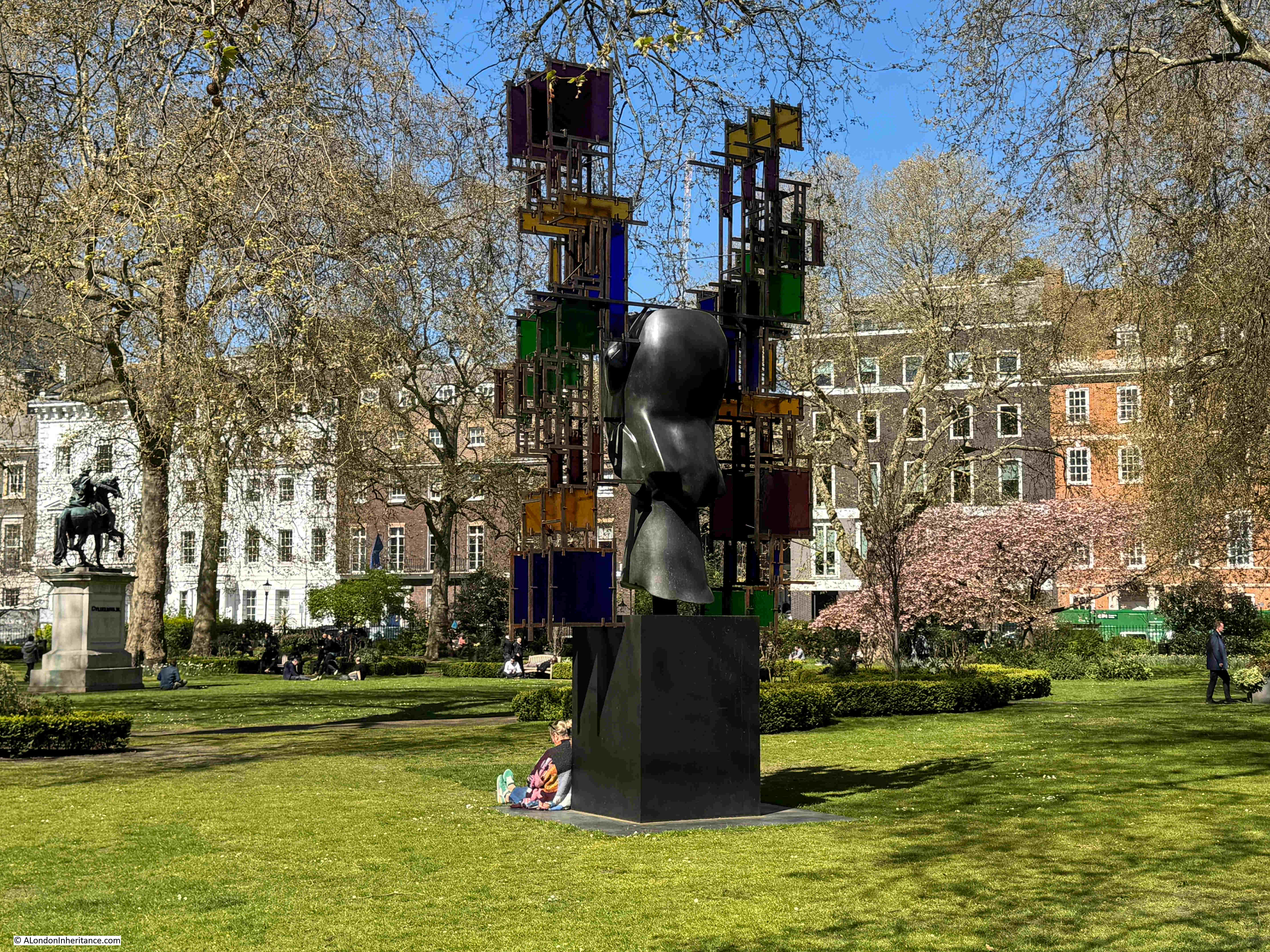
View across the gardens from the north west:

In the centre of the gardens is a statue of William III, cast in bronze with the king dressed as a Roman General. The statue dates from 1807, so is much later than the original square, and it is a statue that was some years in the making, as the funding for the statue had been provided in 1724 by the will of Samuel Travers, and was reported in newspapers of the time as follows:
“Samuel Travers Esq. of Hitcham in Berks, member of Parliament for St. Maws in Cornwall, Auditor to the Prince, and Clerk to the King’s Works, and who dy’d, last Week, has left a Legacy of £500 to Prince William, as much to Lady Essex Roberts; Money for erecting a statue to King William in St. James’s Square or Cheapside Conduit”.
Samuel Travers must have been very rich for the time. As well as the above, he also left considerable sums of money to other beneficiaries, including £500 for “maintaining seven decayed Lieutenants at Sea”, as well as a considerable sum to Christ’s Hospital.
The statue of King William III, with the Theatre Royal, Haymarket in the distance:

The view of the statue with the theatre aligned with the centre of the gardens, along one of the streets which leads off the square, gives the impression that this was part of the design of the overall area, however the theatre was built after St. James’s Square had been completed, and when the square was built, there was a much narrower street leading into Haymarket, along with buildings that blocked the view. The view we see today is the result of later improvements to the surrounding streets.
View from the western entrance to the central gardens:

If you walk from Jermyn Street along Duke of York Street to get to St. James’s Square, there is a plaque on the walk at the corner of street and square that provides some background as to the origins of the square:

Henry Jermyn, the Earl of St. Albans (and who gave his name to Jermyn Street which runs between St. James’s Square and Piccadilly) has already started development of area based on his leasehold of land where Pall Mall is now to be found.
In 1665, King Charles II granted the freehold of the land now occupied by St. James’s Square and the surrounding streets, to Henry Jermyn, two years after he had petitioned the King for the grant of land.
In the following years there were issues with the exact area covered by the grant of land to Henry Jermyn, and the City of London objected to the development of an area that had been fields and lanes as all the new houses would be a competitor for limited supplies of water, however Henry Jermyn’s relationship with the Crown appears to have overcome any objections.
Initial plans for the development of the square included a symmetrical plan of four wide streets leading from the square at the centre of each side of the square. During development, this plan was modified with narrower streets to extend the amount of built space, and on the southern side of the square, rather than a single street to Pall Mall, two streets were built at the south east and south west corners. The use of two narrow streets on the southern side of the square was aimed at preventing the square from being a major route from Pall Mall up to Jermyn Street.
Development of the square commenced in the late 1660s, and by the time of William Morgan’s 1682 map of London, houses lined three sides of the square, with smaller buildings between the square and Pall Mall, as can be seen in the following extract from Morgan’s map:

The original layout of the square included a central area surrounded by low fencing, but early in the 18th century, the centre had been taken up by a large pond, as shown in Rocque’s 1746 map:

A 1720 print showing the original design of the square, with a street for coaches lining the four sides alongside the houses, and a central square for walking surrounded by a low fence:

Image: © The Trustees of the British Museum. Shared under a Creative Commons Attribution-NonCommercial-ShareAlike 4.0 International (CC BY-NC-SA 4.0) licence.
The above print shows an ordered and tidy square, however there were ongoing issues with maintaining the cleanliness of the place, as described by Norman Brett-James in “The Growth of Stuart London” (London & Middlesex Archaeological Society 1935): “The condition of St. James’s Square left much to be desired, and Macaulay was not exaggerating when he describes the Square as ‘a receptacle for all the offal and cinders, for all the dead cats and dead dogs of Westminster. At one time cudgel play kept the ring there. At another an impudent squatter settled himself, and built a shed for rubbish under the windows in which the first magnates of the realm, Norfolk, Ormode, Kent and Pembroke, gave banquets and balls’ “.
To address issues with the square, in 1726 a Bill was put before the Commons to “enable the inhabitants of St. James’s Square to make a Rate on themselves, to clean, adorn and keep in repair the said Square”.
This improvement act appointed Trustees to care for and regulate the square, and their first meeting was held on the 23rd of June, 1726. This trust is still in place, and is the oldest Trust of its kind still operating in London.
The following 1754 print of St. James’s Square shows the central pond (a basin of water of 150 feet diameter), and if you look closely, to the left of the pond is a small boat with a man pushing the boat along with a stick and a woman sitting in the back of the boat – perhaps one of the most unusual features of a London square. There is also a small fountain in the centre:

Image: © The Trustees of the British Museum. Shared under a Creative Commons Attribution-NonCommercial-ShareAlike 4.0 International (CC BY-NC-SA 4.0) licence.
One of the more unusual events held in a London square occurred on the night of the 9th of September, 1695, when a fire-work display was held in the square to celebrate “His Majesties Glorious success in taking of Namur” (Namur, in what is now Belgium, was taken by the French during the Nine Years war , and recaptured in 1695 after forces led by the Earl of Athlone surrounded the town).
A print of the event shows fireworks in the centre of St. James’s Square, which also appears to be surrounded by soldiers simultaneously firing their guns:

Image: © The Trustees of the British Museum. Shared under a Creative Commons Attribution-NonCommercial-ShareAlike 4.0 International (CC BY-NC-SA 4.0) licence.
The statue of King William III from the time it was installed in St. James’s Square in 1807, in the centre of the basin of water, which was still occupying the central part of the square:

Image: © The Trustees of the British Museum. Shared under a Creative Commons Attribution-NonCommercial-ShareAlike 4.0 International (CC BY-NC-SA 4.0) licence.
From the 1820s there was more planting around the square, and by the 1850s this was making the central water filled basin into a rather dark and dank place, so in 1854 the basin of water was filled in, and the gardens gradually assumed the shape and planting we see today.
The majority of the buildings surrounding the square date either from the 19th and 20th centuries, or are rebuilds or significant remodels of the original houses. An example is number 4 St. James’s Square, in the north east corner, which is Grade II* listed, and is a 1726 to 1728 rebuild of the original 1676 house built on the site by Nicholas Barbon, a significant property developer of London in the late 17th century, and responsible for many of the original houses in St. James’s Square:

On number 4 is a plaque recording that Nancy Astor lived in the house, she was the first woman to sit as a Member of Parliament:

In the photo of the corner of the square just above, there is a building to the left of number 4, with a flag flying above the entrance with the number 5. This building was the Libyan Embassy in 1984.
On the 17th of April, 1984, a demonstration by the Libyan National Salvation Front was held outside the Libyan Embassy, to protest about the execution of two students in Tripoli opposed to the Gaddafi regime.
Barriers had been erected to separate the protestors from the Embassy and from a separate protest by those who supported the regime.
During the protest, shots were fired by those in the Embassy at the anti-regime protestors, and one of the police officers on duty during the protest was hit, and died later the same morning.
The police officer was PC Yvonne Fletcher, and today there is a memorial to her at the place in St. James’s Square where she fell:

There is also a tree planted inside the gardens as a memorial to PC Yvonne Fletcher by the Trustees of the square, and her colleagues at Vine Street police station:

To the right of number 4 is number 3, a 20th century occupant of the square, dating from 1934, and designed by architects Alfred and David Ospalek:

Above the ground floor are a series of stone panels by Newbury Trent, which represent the street-criers of London:

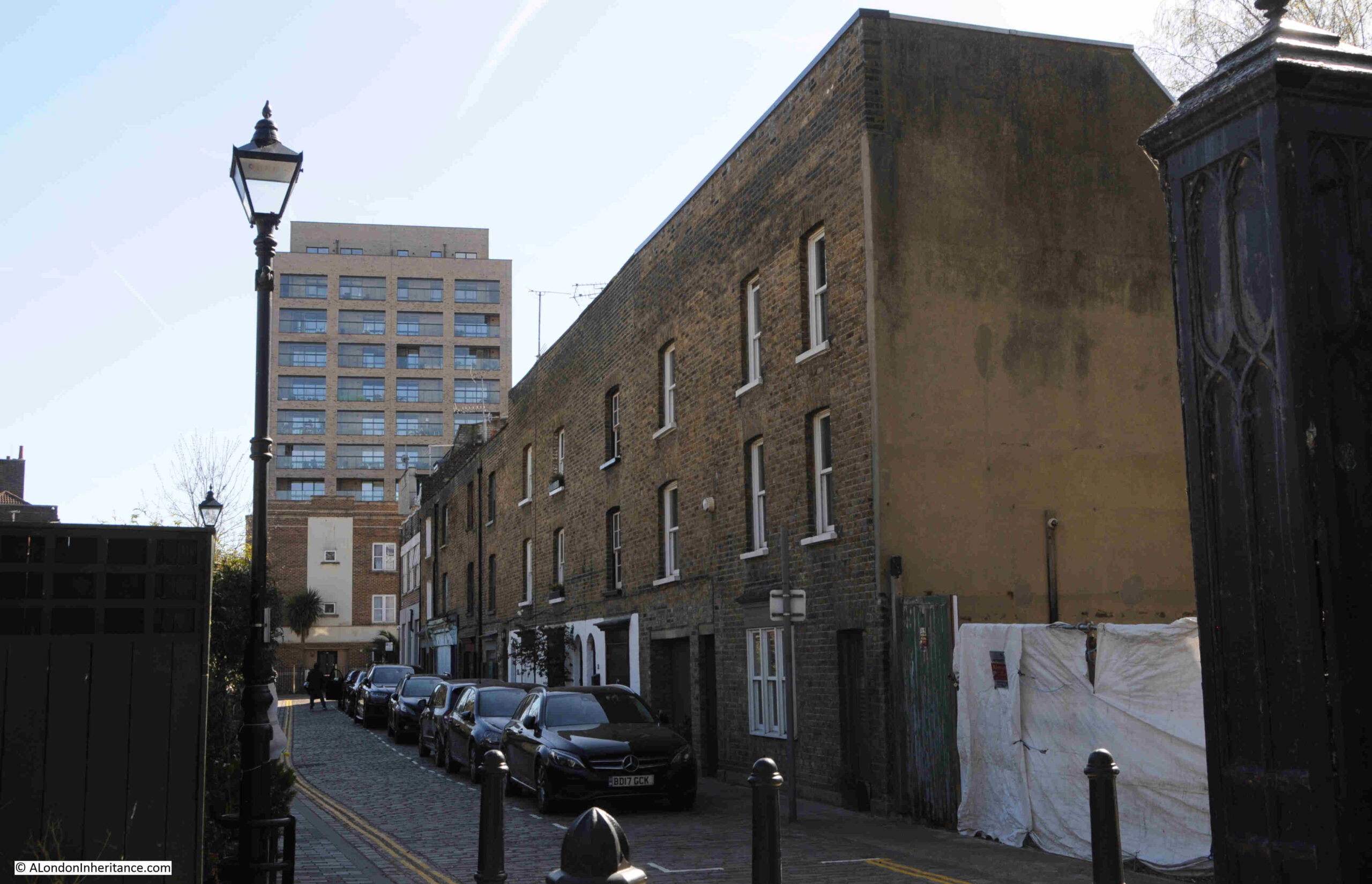
On the corner of the south east street leading from the square down to Pall Mall is this brick Grade II listed house, and it is prime example of how houses have been modified over the centuries:

From its appearance, the house could date from the original build of the square, however the house dates from around 1772, so almost 100 years after St. James’s Square was laid out and built.
If you look at the house, there is the ground, then first and second floors, with a band of brick running around the walls above the second floor. This band marks the original start of the roof of the house as the upper two floors were added in the 1850s. London houses have had so many modifications over the centuries.
Many of the newer buildings around St. James’s Square occupy the space of more than one of the original houses, however there are some new builds which occupy the same plot of land as the original house. The only way to generate more floor space was to build up, resulting in tall, narrow buildings, such as these two, also at the south eastern corner of the square:

The western side of the square – the building on the left with the two flags is the East India Club, one of west London’s many private members clubs:

House along the northern side of the square:

If you look just above the roof of the Mini car in the above photo, there is a very small part of a blue plaque showing, this is to record that Ada Countess of Lovelace lived here:

Augusta Ada King was the only legitimate daughter of the poet, Lord Byron. She was eight when her father died, and perhaps typically of the time, the majority of the reports of her death focussed on her father, the following being one example:
“She had small resemblance to her father. No one, we are told, would have recognised the Byron features – the finely chiselled chin or the expressive lips or eyes of the poet – in the daughter. Yet at times the Byron blood was visible in her look – and those who saw her in 1835, on her marriage with Lord Lovelace fancied they saw more traces of the poet’s countenance in the bride than they remembered at any other time. But dissimilarity of look was not the only dissimilarity between Byron and his daughter. Lady Lovelace cared little about poetry”.
The report does acknowledge that “Her favourite science was the mathematical”, and indeed she does seem to have been a mathematical prodigy from an early age, and the reference to being a “Pioneer of Computing” on the plaque is down to her work with Charles Babbage and his “calculating machine”.
From notes that she kept, Ada appears to have been one of the first to recognise that a machine such as that built by Babbage, could be used for more than just as a calculating machine. With the appropriate algorithm, such a machine could carry out a wide and varied range of tasks – although I wonder if Ada could have imagined just how far computing and algorithms have been embedded into almost every aspect of life, 173 years after her death.
Ada Countess of Lovelace died of cancer at the tragically young age of 36. She is remembered still to this day with the programming language Ada being named after her.
Further along the northern side of the square, on the corner with Duke of York Street are two houses, both from 1736. On the left is the Grade I listed Chatham House, and on the right (without a door to the square) is the Grade II* listed number 9, which has its entrance in the street leading out of St. James’s Square:

Chatham House on the left is home to the organisation of the same name, dedicated to international affairs, and also the source of the term “Chatham House Rule”, a rule that states that what is revealed at confidential meetings can be used, but the identity of the person who spoke cannot be revealed.
The house has also been the home to three Prime Ministers, as this really nice London County Council plaque on the building reveals:

The house on the right is on the site of the house where Henry Jermyn, the Earl of St. Albans died.
The reason why I was in St. James’s Square was to visit the London Library, one of the institutes that I use for research, and which has a entrance in the north-west corner of the square:

The London Library was founded in 1841 and moved to its current location in 1845.
The single bay entrance is deceiving, as the London Library occupies a considerable area behind this one façade, stretching back and around to the right, along the side of the building to the right of the above photo.
The building is a bit of a maze (which is part of the pleasure), and in the following photo, the shelves on the left cover just part of their collection of books about London:

And in an area known as the “stacks”, you walk amongst shelves, along floors which look down to more shelves of books below:

A magical place.
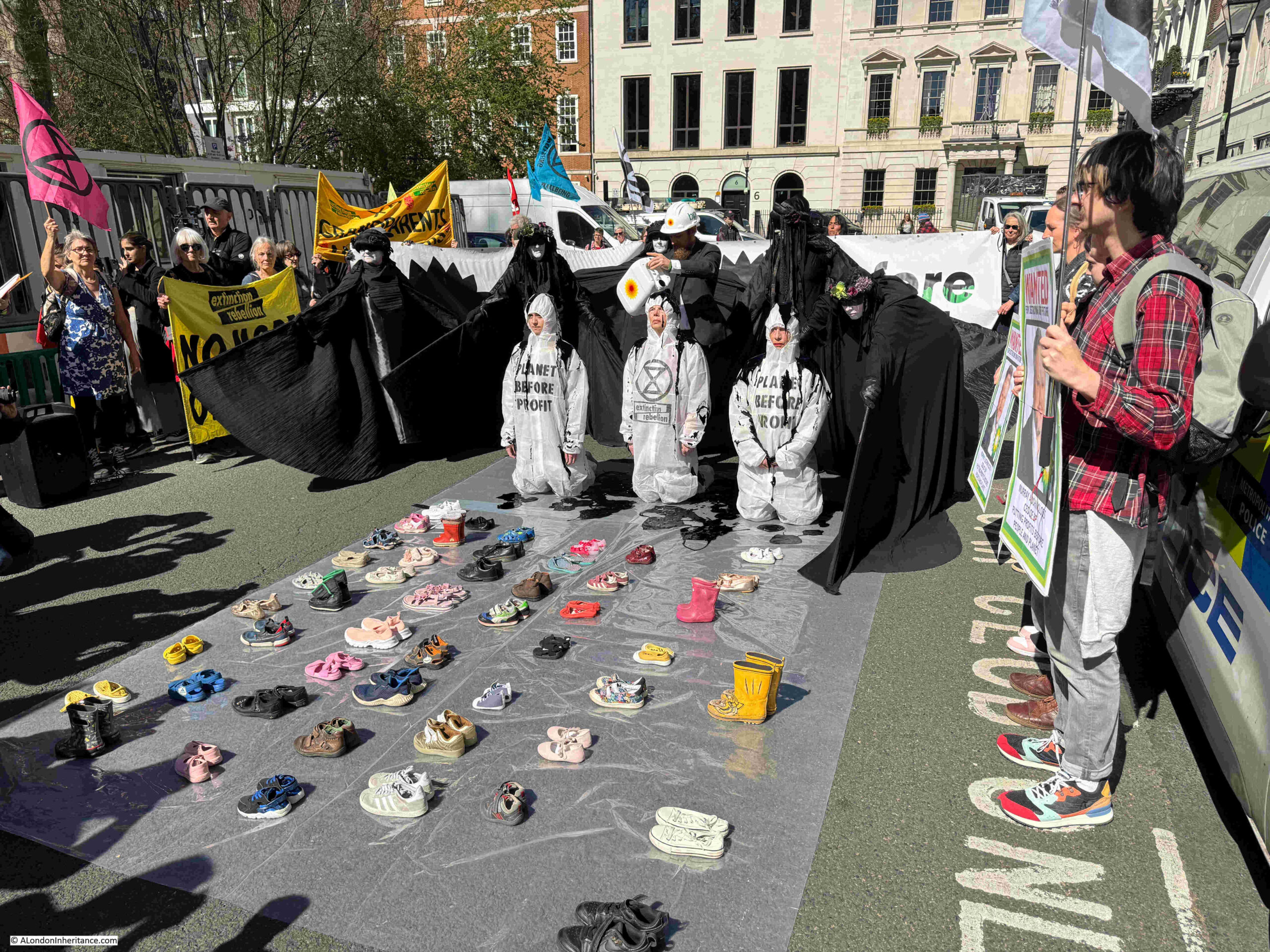
There is one more building in St. James’s Square which I have not mentioned, and on the day of my visit was to be a focal point for protest. The first indication of this was this small group within the gardens:

St. James’s Square is home to the registered office and worldwide headquarters of BP and Extinction Rebellion were holding a protest in the square, outside BP’s offices.
This started off with the north eastern section of the square being blocked:

BP’s offices:

Whatever your views of Extinction Rebellion, they have perfected a very theatrical method to get their message across, and are just one of many in the long running history of protest in London over very many centuries:
That is a very brief overview of St. James’s Square. A square that was part of the Stuart expansion of London during the late 17th century, as the city expanded into the surrounding fields.
A square that has been transformed over the centuries. Not just the central gardens, but also the new builds, rebuilds, and modifications of buildings surrounding the square, as the square changed from being the homes of the rich, aristocrats and well connected, to the home of international companies, institutes such as Chatham House, the London library, and a private members club.
A square that has been the home to many of those who were influential in their period of time, and a square that has seen protest, with one of these events resulting in the murder of a police officer by the representatives of a murderous regime.
Sitting in the central gardens on a glorious spring day, it was though intriguing to imagine the 1695 fireworks in the square to celebrate the victory at Namur, a display held on the edge of the growing city, and long before the use of gas or electric lighting, a very dark city.