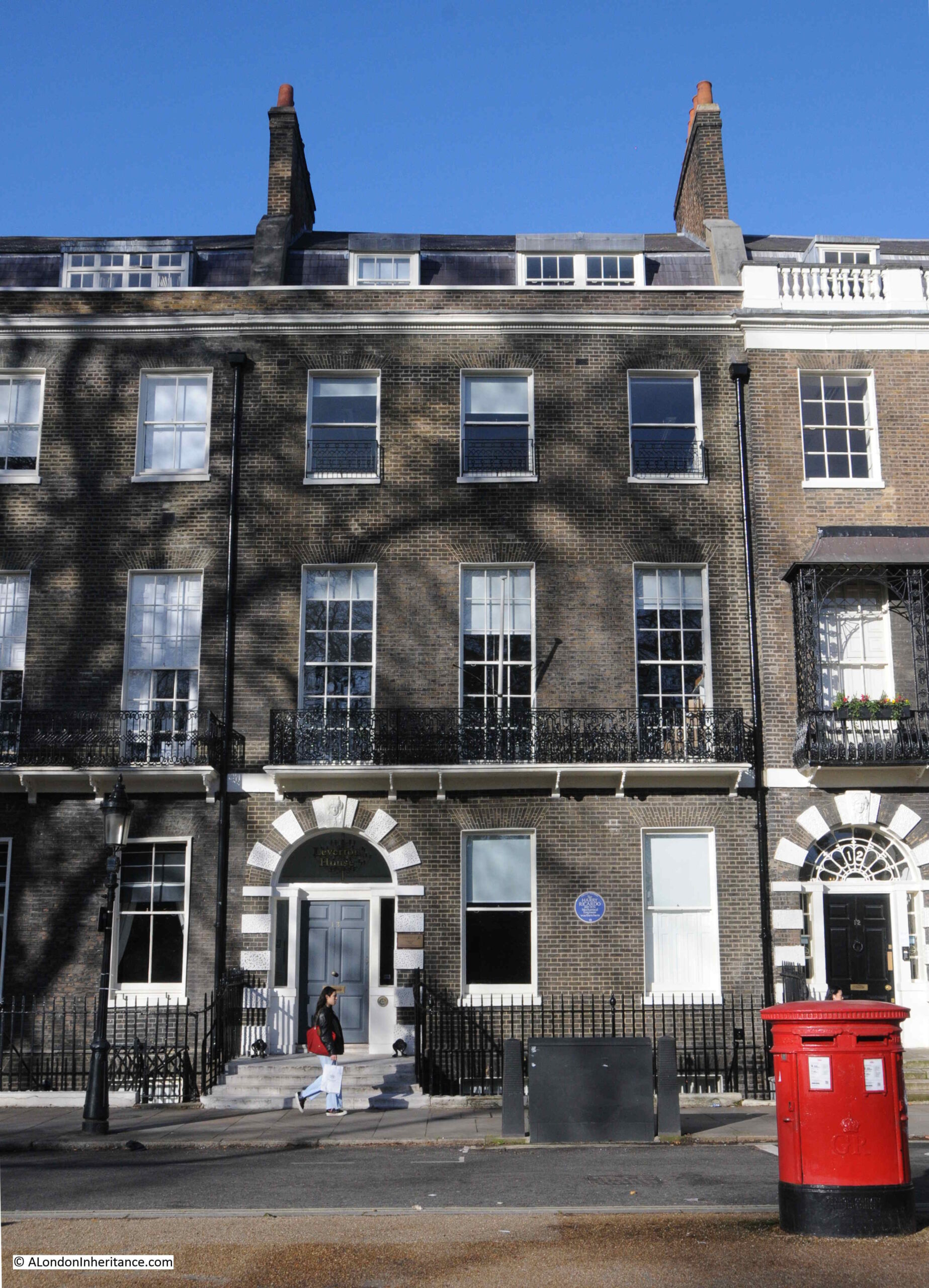
Jays for Jeans, Surrey Quays, Rotherhithe

Jays Stores was a store in Lower Road, Rotherhithe, that had a large sign advertising Jays for Jeans at the top of the building, above an illustration of a man presumably dressed in clothes available from the store.

My father photographed Jays Stores and the Jays for Jeans sign in 1986:

Jays for Jeans

I could not get exactly the same view as in 1986 due to road works occupying the space directly opposite, however an almost the same view of Jays for Jeans, 38 years later in January 2024:

Jays for Jeans

I am not sure exactly when Jays Stores opened, but the store closed in 2016. I suspect that the location of the store opposite the shops of the Surrey Quays shopping centre, Internet shopping, and the loss of local industry, with the resulting loss of trade for industrial wear, donkey jackets etc. (as advertised in the 1986 window) resulted in the store being economically unviable.

The store did make it onto the Internet though, as the surviving sign on the top of the building in 2024 shows that Jays for Jeans had a.co.uk address for the store, a different sign to the one in 1986.

The central panel has either completely faded, or perhaps been over painted.

To the right of the store, in the 1986 photo, can be seen part of one of the estate agents set-up to market the new properties being built as part of the redevelopment of the docklands.

Jays for Jeans is one of those local landmarks that defines an area for a specific period of time.

I walked down to the location of Jays for Jeans from Canada Water station, having arrived on the Jubilee Line.

It was a short walk, by the most direct route (that avoided the Surrey Quays shopping centre), but a route that confirmed that you can find things of interest in almost any London street, and is one of the joys of walking.

The following map shows my route from Canada Water station (within the red circle) down to the site of Jays for Jeans, next to the Surrey Quays station which is over ground only (dark blue circle). the dark blue dotted line shows the short route  (© OpenStreetMap contributors):

Jays for Jeans

Staring with the wonderful drum structure over Canada Water station, a design which allows a large amount of natural light to get into the station below. The drum is above the escalators which run between the ticket hall and the platforms below:

Canada Water Station

From Canada Water Station, I headed down Surrey Quays Road, a street which was one of the main entrances into the Surrey Commercial Docks which once occupied the majority of this part of Rotherhithe.

Along this street is one of the very few remaining buildings from the docks – the Dock Manager’s Offices:

Dock Manager's Offices

This glorious buildings is Grade II listed, and dates from 1892 when it was built by the Surrey Commercial Dock Company.

The building is very well preserved, and when in use as the dock offices, it consisted of three main parts: the Superintendent’s Office with clock tower, a Janitor’s House, which is the smaller block closest to the camera with the Dock Offices signage, and a large open plan General Office, which can be seen in the above photo receding to the right.

Dock Manager's Offices

The building is now owned by British Land, and I believe part of the interior has been designed to showcase the flats that are being built as part of the significant redevelopment going on around the Surrey Quays area.

There is a plaque on the side of the Dock Manager’s Office which records a major event during the last war:

Dock Manager's Offices

I am going to save the story of the docks here in Rotherhithe for some later posts as there is so much to tell about this part of London, and for now, I will continue on to Jays for Jeans.

At the end of Surrey Quays Road, the street meets Lower Road, and on the western side of Lower Road is the Seven Islands Leisure Centre:

 Seven Islands Leisure Centre

Opened as the Rotherhithe Bath and Assembly Hall on the 27th of November, 1965, the building included a swimming pool, assembly hall with stage and dressing rooms, crèche and play area for children and a place for sunbathing.

The name comes from what were believed to have been seven islands in-between the streams that drained Rotherhithe and Bermondsey into the Thames.

The building retains a wonderful example of the coat of arms of the old Metropolitan Borough of Bermondsey:

Bermondsey Coat of Arms

Bermondsey, as a Metropolitan Borough existed from 1900 (when it brought together the old parishes of Bermondsey, Rotherhithe and St. Olave), until 1965 when it was replaced by the London Borough of Southwark.

Within the coat of arms, the lion and the two letter B’s on either side, are from the Bermondsey Vestry and have their origins in Bermondsey Abbey.

The crown and the axe are from St. Olave, and come from the Royal Arms of Norway (see this post for more details on the origins of St. Olave and the connection with Norway).

Rotherhithe and the docks are represented by the ship at bottom right.

The Latin motto at the bottom of the arms, “prosunt gentibus artes” means “Arts profit the people”

On the opposite side of Lower Road is a brick built block of apartments, with a blue plaque between the first and second floors, above the central arch:

King Edward Frederick Mutessa

The blue plaque is to King Edward Frederick Muteesa II, the first President of Uganda:

King Edward Frederick Muteesa

Muteesa was the Kabaka (king or ruler) of Buganda, one of the individual kingdoms that make up the country of Uganda.

When Uganda became independent from Britain in 1962, Milton Obote became the Federal Prime Minister, and Obote negotiated an agreement with Muteesa that he would become President of Uganda, an agreement which was implemented by secret vote in Parliament on the 4th of October, 1963.

In the following years, there was infighting between the coalition that made up Parliament and between Obote and Muteesa, and it finally got to the point where in February 1966, Obote suspended the Federal Constitution and declared himself President, thereby deposing Muteesa.

Muteesa fled into exile and arrived in London, penniless, and without any support from the Government of Uganda.

During his earlier years he had been educated at Cambridge, where he also joined the university’s officer training corps, which led to a commission as a Captain in the Grenadier Guards.

It was this military connection that was to help with accommodation in London, and an old military contact provided him with the apartment in Orchard House, Lower Road.

He was not there for too long as on the 21st of November, 1969, he was found dead in the apartment, apparently of alcohol poisoning. A few hours before his death he had been interviewed by the BBC correspondent John Simpson, who found him sober, and there have been theories that he was murdered.

He was temporarily buried in England until the political situation changed in Uganda when Idi Amin overthrew Milton Obote and Muteesa’s body was returned to Uganda and given a state funeral and burial.

As with so much of London, there are a number of closed pubs in Lower Road, places that recall the working class history of the area.

The first of these is the Prince of Orange:

Prince of Orange

The pub seems to have opened around the late 1830s / 1840s as it is during these years that I find the first mentions of what appears to be the Prince of Orange pub.

In the following decades there are all the usual mentions of events that you would expect to find in a London pub in the docks, with crime, fights, jobs available etc.

in the pubs last few decades, it seems to have been a venue for jazz, as in newspapers there are plenty of adverts, such as for Pete Boulter’s Blues Jam session (1995), and Mr. B Plays Basie (1983). In the Stage and Television Today in October 1982, it was reported that “on the pub front, let us applaud the Prince of Wales, Buckhurst Hill and the Prince of Orange, Rotherhithe, both presenting jazz practically every night of the week”.

At times, the pub was on BBC Radio 2, for example the listings for the 25th of January, 1988, included “Jazz Score, where Benny Green is in the chair at the Prince of Orange, Rotherhithe, and on the panel are Acker Bilk, Peter Clayton, Alan Elsdon and Ronnie Scott”.

The Prince of Orange is now apartments.

A short distance further along Lower Road is another closed pub, the China Hall:

The China Hall

There has been a pub on the site for a number of centuries and in 1719 a pub on the site was apparently called the “Cock and Pye Ale House.” 

The earliest written reference I can find to the name China Hall is in the Oracle and Daily Advertiser, on the 27th of February, 1802, when “A few afternoons since, about half past four o’clock,, as Mr. Witts of the Europa Inn, Rotherhithe, was travelling near China Hall, in the lower Deptford Road, he was stopped by a single foot-pad, who robbed him of a £2 note and his cash”.

The road was originally called Lower Deptford Road, but has since dropped Deptford and is now simply Lower Road.

The site of the pub has a long history. In 1776 the pub appears to have been leased to a trader in tea and china called Jonathan Oldfield, and who built a theatre next to the pub, called the China Hall. The name may have come from his trade in china, and the name appears to have transferred from the theatre to the pub.

Edward Walford, writing in Old and New London (1878), has the following to say about the China Hall: “In former times a narrow pathway, called the ‘Halfpenny Hatch’ extended through the meadows and market-gardens from Blue Anchor Road to the Deptford Lower Road, where it emerged close by an old and much-frequented public-house called the ‘China Hall’. The ancient tavern, which was a picturesque building partly surrounded by an external gallery, was pulled down within the last few years, and in its place has been erected a more modern-looking tavern, bearing the same sign.

Our old friend Pepys mentions going to China Hall, but gives us no further particulars. It is not unlikely, says Mr. Larwood in his History of Signboards, that this was the same place which, in the summer of 1777, was opened as a theatre. Whatever its use in former times, it was at that time a warehouse of a paper manufacturer.

In those days the West End often visited the entertainments of the East, and the new theatre was sufficiently patronised to enable the proprietors to venture upon some embellishments. The prices were – boxes 3s; pit 2s, gallery 1s; and the time of commencement varied from half-past six to seven o’clock, according to the season. The Wonder, Love in a Village, the Comical Courtship and the Lying Valet were among the plays performed. The famous Cooke was one of the actors in the season of 1778. In that same year the building suffered the usual fate of theaters, and was utterly destroyed by fire”.

The China Hall pub closed at the end of 2018, after a local campaign failed to save it, although it appears to have been a going concern, was wanted by the local community and had publicans who wanted to continue.

The ownership of the pub has been very controversial, and since closure the upper floors have been converted to residential, with extra space from the addition of a mansard roof.

The ground floor did appear to be undergoing conversion however council planners issued a warning notice to stop. A planning application was made for conversion of the ground floor, this was turned down, and the council issued an enforcement notice requiring removal of residential partitions and fixtures.

The owner has since appealed against the planning refusal – I do not know the status of this appeal.

The China Hall illustrates the sad fate of many London pubs, that even when they are still viable businesses, and wanted by the local community, they are all too easily sold to a developer who can find more profit in the conversion of the property to residential.

Continuing down Lower Road, and on the eastern side of the street is a row of late 19th century, terrace houses. The second house on the left has a plaque to Ada Salter, just above the ground floor bay window, directly above where green bins can be seen:

Ada Salter

Ada Brown was born in 1866, a child within a Wesleyan Methodist family in Raunds, Northamptonshire. She moved to London in 1896, where she joined the West London Mission of the Wesleyan Sisters of the People, before moving to their Bermondsey Settlement in 1897.

Alfred Salter was a student at Guy’s Hospital when he met Ada at the Bermondsey Settlement. They married in 1900 and lived in Bermondsey. Both Ada and Alfred worked tirelessly to improve conditions in Bermondsey and Rotherhithe.

The house with the plaque is at 149 Lower Road, and was the Women’s House of the Bermondsey Settlement. Ada lived in the house for two periods in 1897 and 1898.

The plaque is very recent as it was installed on the house in 2023:

Ada Salter

Ada became a Labour councilor, the first woman councilor in Bermondsey in 1909 and set about recruiting women workers to trade unions to organise against the terrible working conditions in the area’s factories.

Alfred was elected MP for Bermondsey in 1909, the same year as Ada was elected Mayor.

A view of Ada’s campaigning approach to improving the living conditions of Londoner’s, can be seen in the following first two sections from an article she wrote in the Daily Herald on the 28th of February, 1934, titled: “Don’t forget the HIDDEN LONDON”:

“London is the most wonderful and romantic city in the world. London leads. What London thinks to-day Great Britain will do to-morrow.

Underlying its romance, its magnificence, its power, its wealth and its resources, is a vast morass of sorrow and misery, of poverty and struggle, of unrequited toil and unmerited suffering.

Watch some hundreds of thousands of citizens pouring each evening out of their office and work places in the centre of London and follow them to their homes. You will have glimpses of drab, featureless streets, rows of Early Victorian terrace houses, huge blocks of tenement dwellings. In these industrial dormitories the workers are not housed, but warehoused. Observe the daily fight for tram or bus and all the discomfort that it involves. Note the imperfect education given to children, too large classes, insufficiency of secondary schools, inadequacy of playing space in all working-class quarters.

Compare the dullness and ugliness of grace and colour which constitute the environment of the poor with the stateliness and magnificence of the West End and the pleasing amenities of the middle-class suburb.

Contrast the narrow, shut-in back yards with the spacious gardens surrounding the houses of the well-to-do. Remember the acres and acres of playing fields attached to all the public schools of England where the sons of the rich are educated, and then turn to the cramped, asphalted play grounds of the elementary schools in Bermondsey, Southwark, Bethnal Green, Stepney and Poplar.

It is this London of the mean streets to which our thoughts should turn at a London County Council Election rather than the ‘show’ London which visitors from the country and abroad come to see.”

Ada Salter in the early 1920s:

Ada Salter

Ada was also featured in “The VOTE -THE ORGAN OF THE WOMEN’S FREEDOM LEAGUE” on the 1st of December 1922, when she was the fifth in a series of features on women mayors. In the article, she wrote:

“As the first woman in London to be offered the position of Mayor, I am proud that I live and work in a borough, the elected representatives of which are prepared to choose an individual who belongs to what is sometimes described as the weaker sex. As a woman, I am naturally eager that the woman’s share in responsibility of government should be a direct one. There is still a tremendous leeway to be made up in all departments of life that affect women, but the failure to catch the vision of a free humanity, where men and women can act together, and not in antagonism, is not confirmed to one sex.

By common consent, the Bermondsey Borough Council has for some years dispensed with the wearing of the Mayoral and Aldermanic robes, but I also do not intend to wear the chain of office. This, of course, is a purely personal matter. For brilliant colouring, and for the brightness of gold, I have the greatest admiration, but I desire them not as symbols of place and power. The ideal for which we must strive is to secure respect for the authority and decisions of the Chair, rather by personality and character, than by decorations of office.”

I suspect we need more Ada’s in politics today.

Ada Salter died on the 4th of December, 1942. One of the newspaper reports of her death started with “The death of Mrs. Ada Salter, who was London’s first woman Mayor, is a reminder of the many hitherto exclusively masculine fields in which women have now staked out a claim”.

Continuing down to the site of Jays for Jeans, and the third pub in this short walk. This is still open as a bar and restaurant but with a new name of the Yellow House:

Jolly Caulkers

The was the Caulkers, originally the Jolly Caulkers, and in a couple of references, the Merry Caulkers.

A Caulker was the person who had the job to fill in any gaps in a ship, to make it watertight. Filling the gaps between originally wooden planks and later the metal sheets that would make up the hull of a ship.

A profession that would have been found across the docks of Rotherhithe.

The earliest reference I can find to the pub is in the 1840s, however the design of the pub does not look 19th century, and I suspect it may have been rebuilt in the 1910s, as in the South London Gazette in 1919 there are references to the New Jolly Caulkers, and which therefore may be a reference to the pub we see today.

And a very short distance on from the Yellow House / Caulkers, was Jays for Jeans.

A short walk, which has revealed one of the few remaining buildings from the time when Rotherhithe was covered in docks, the coat of arms of the Metropolitan Borough of Bermondsey, the first President of Uganda, Ada Salter, a campaigner for the living conditions of London’s working class and London’s first woman mayor, and three historic pubs.

There is so much more to write about this area, and the large dock complex that once occupied much of this part of Rotherhithe, and I hope to return in future posts.

alondoninheritance.com

From Bread Street to Australia – More London Plaques

For this week’s post, I am returning to the plaques that can be found around the City of London. I originally started this series of posts with just the City Blue Plaques, however there are so many interesting stories to be found in other types of monuments and plaques around the City of London, that I have since broadened the scope of these posts.

Today’s post starts with a monument to Admiral Arthur Phillip, who provides the connection that is the title of the post – From Bread Street to Australia.

Admiral Arthur Phillip, R.N. Citizen of London

If you walk to the western end of Watling Street in the City of London, towards St. Paul’s Cathedral, you will come to an open space, with gardens on the left and the shops of One New Change on the right.

Tucked in the southern part of the space, up against the gardens is a small monument:

Admiral Arthur Phillip, R.N. Citizen of London

The monument is to Admiral Arthur Phillip, Royal Navy, and it is a bronze bust of Phillip that sits at the top of the monument. The bust was rescued from the church of St. Mildred, Bread Street, after the church had been destroyed by bombing in 1941.

A plaque below the bust provides some background:

Admiral Arthur Phillip, R.N. Citizen of London

As the plaque states, Admiral Arthur Phillip was born in the ward of Bread Street on the 11th of October 1738. He went to the Royal Hospital School at Greenwich, and joined the Royal Navy in 1755.

In his time in the Navy, he was involved in the Battle of Menorca and the Battle of Havana, but after these battles he was left without a ship, and as was the custom at the time, naval officers had to find other sources of employment and Arthur Phillip took up farming in Hampshire.

In 1769, he rejoined the Royal Navy, and in the following years was involved in a number of battles around the world.

Although his time in the Navy appears to have been successful, if he had not been appointed the first Governor of Port Jackson, which he also named Sydney, after his friend Lord Sydney, his name would probably have been very little known today, and not commemorated in the City of London.

The following portrait shows Captain Arthur Phillip, as he was in 1786. The portrait is by Francis Wheatley:

Admiral Arthur Phillip, R.N. Citizen of London
Source: State Library of New South Wales. Out of Copyright

I found a newspaper report from 1936 regarding a commemoration service to be held in St. Mildred’s, Bread Street for Admiral Arthur Phillip, and the article provides some additional information on his expedition to Australia, and the founding of the settlement at Port Jackson, which would later become part of the city of Sydney.

“Admiral Arthur Phillip, for whom a commemoration service will be held at St. Mildred’s Church, Bread Street, London on Tuesday, commanded the Sirius on an expedition to New South Wales some years after it had been discovered in 1770 by Captain Cook.

The expedition, which first arrived at Botany Bay, consisted of an armed trader, three store ships, and six transports. The persons on board the fleet included 40 women, 202 marines of various ranks, five doctors, a few mechanics, and 756 convicts. The live stock included cows, a bull, a stallion, three mares, some sheep, goats, pigs, and a large number of fowl. Seeds of all descriptions were provided for planting in the strange land, but Botany Bay was found unsuitable for settling upon. The expedition finally ended at Port Jackson, near the present site of Sydney.

Later on, other convict ships arrived, and in 1793 came the first free settlers, who were presented with grants of land.

The memorial service in London to the admiral will be attended by the Lord and Lady Mayoress of London, Lord Wakefield of Hythe, and the Sheriffs of the City, while Sir Archibald Weigall, Governor of South Australia from 1920 to 1922, will give the address”.

As the plaque states, St. Mildred’s, Bread Street, was destroyed during the Second World War, and was not rebuilt.

Although the original church has been lost, the memorial service continues to this day, and is currently held annually in St. Mary-le-Bow, Cheapside.

Arthur Phillip was in charge of the first fleet of convicts that had sailed from England to start the first colony in Australia.

The first fleet was the result of ideas that had been put forward for how Australia should be colonised, and what to do with the numbers of convicts which were seen to be a cost to the state, and how they could be usefully employed.

The following newspaper extract is from the 5th of November 1784:

“A plan has been presented to the minister, and is now before the cabinet, for instituting a new colony in New Holland. In this vast tract of land, which is so extensive as to participate of all the different temperaments or climates which affect the globe, every sort of produce and improvement, of which the various soils of the earth are capable, may be expected.

It is therefore proposed to send out the convicts to this place, under such regulations as may tend to the establishment of a new colony.

The only inhabitants which are thought to possess New Holland, are a few tribes of harmless uncultivated people, who loiter on the shore, and are only to be found in some creeks which seem convenient at once for shelter and provision, so that from there the European can have but little to fear, especially as it may be supposed no settlement will be attempted without sufficient force, at least in the first instance, to protect it from every species of surprise or depredation.”

It is horrendous to read, 240 years later, the lack of any interest in the history and culture of the indigenous population, and to understand what their fate would be over the years after the first fleet’s arrival.

The name New Holland in the above article is the first European name given to the continent of Australia in 1644 by the Dutch explorer Able Tasman who was employed by the Dutch East India Company, and after whom the island of Tasmania would be named.

There are a couple of reliefs on the monument, one on each side. The following shows “The discovery and fixing of the site of Sydney on Wednesday 23rd January 1783. Reading from left to right, Surg. J, White, R.N. Capt. Arthur Phillip, R.N. Founder, Leut. George Johnston, Marines, A.D.C. Capt. John Hunter, R.N. and Capt. David Collins, Marines”.

Admiral Arthur Phillip, R.N. Citizen of London

The second relief shows “The founding of Australia at Sydney on Saturday, 26th January 1788. Figures in rowing boat leaving H.M.S. Supply are Capt. Arthur Phillip, R.N. Lieut. P. Gidley King, R.N. and Lieut. George Johnston, Marines A.D.C.”:

Admiral Arthur Phillip, R.N. Citizen of London

Whilst the reliefs show a heroic view of the arrival at Port Jackson / Sydney, the reality of living at the settlement in the years after was rather challenging.

The following letter is from the Kentish Gazette on the 2nd of June, 1789. It provides a very honest view of the terrible conditions of the first settlers, and also their interaction with the indigenous population, who are described as “savages”.

“The following from Port Jackson, is written by a female pen; and as from a particular circumstance it seems an upright picture of the place, we lay it before our readers.”

The letter was written in Port Jackson on the 14th of November, 1789, and the author of the letter is not named.

I take the first opportunity that has been given us, to acquaint you with our disconsolate situation in the solitary waste of the creation. Our passage, you may have heard by the first ships, was tolerably favourable; but the inconveniences since have suffered for want of shelter, bedding &c. are not to be imagined by any stranger. However, we have now two streets, if four rows of the most miserable huts you can possibly conceive, deserve the name; windows they have none, as from the Governor’s house, &c. now nearly finished, no glass could be spared; so that lattices of twigs are made by our people to supply their places.

At the extremity of the lines, where, since our arrival, the dead are buried, there is a place called The Church Yard; but we hear as soon as a sufficient quantity of bricks can be made, a church is to be built, and named, St. Philip’s after the Governor’s namesake. Notwithstanding all out presents, the savages still continue to do us all the injury they can, which makes the soldiers duty very hard, and much dissatisfaction among the officers. I know not how many people have been killed. As for the distress of the women, they are past description, as they are deprived of tea and other things they were indulged in, in the voyage by the seamen; and as they are all totally unprovided with clothes, those with young children are quite wretched. Besides this, though a number of marriages have taken place, several women who became pregnant on the voyage, and are since left by their partners, who are returned to England, are not likely, even here, to form any fresh connections.

We are comforted with the hopes of a supply of tea from China, and flattered with getting riches when the settlement is complete, and the hemp the place produces is brought to perfection. Our Kangaroo cats are like mutton, but is much leaner; and here is a king of chickweed so much in taste like our spinach, that no difference can be discerned. Something like ground ivy is used for tea; but a scarcity of salt and sugar makes our best meals insipid. The separation of several of us to an uninhabited island was like a second transportation. In short, every one is so taken up with their own misfortunes that they have no pity to bestow on others. All our letters are examined by an officer; but a friend takes this for me privately. The ships sail tonight.”

The following map is from 1789, the same year as the above letter, and shows how small the settlement at Sydney Cove Port Jackson was, and features from the letter can be seen in the map. Arthur Phillip’s ship, the Sirius, is shown in the bay. The ships are numbered and identified at top left.

Admiral Arthur Phillip, R.N. Citizen of London

Map source: State Library of New South Wales

The description to the map is “Sketch & description of the settlement at Sydney Cove Port Jackson in the County of Cumberland taken by a transported convict on the 16th of April, 1788, which was not quite 3 months after Commodore Phillips’s landing there”.

When looking at the above map, it is remarkable that this small settlement developed into what is now the city of Sydney.

The following print shows H.M.S. Sirius and Supply, the ships of the First Fleet to arrive at Jackson’s Bay © The Trustees of the British Museum):

Admiral Arthur Phillip, R.N. Citizen of London

The majority of people arriving in the new settlement in the years at the end of the 18th century were convicts, and these featured in many prints of the time.

The following print shows “Black-Eyed Sue and Sweet Poll of Plymouth, taking leave of their lovers who are going to Botany Bay” © The Trustees of the British Museum):

Admiral Arthur Phillip, R.N. Citizen of London

In the print, the jailer is shown urging the two convicts to get on the ship which will take them to Australia, and perhaps to remind them of what they have escaped, there is a gallows on a hill in the background.

After a challenging start for the colony at Port Jackson, the rest of Australia would gradually be colonised, and the original site of Port Jackson would grow into the city of Sydney that we see today.

The following map shows the size of the city of Sydney, and I have marked the location of the original colony in the area around Sydney Opera House and the Sydney Bridge (© OpenStreetMap contributors):

Admiral Arthur Phillip, R.N. Citizen of London

In just under two weeks time, on January the 26th it will be Australia Day, which commemorates the landing of the First Fleet, and the day on which Arthur Phillip from Bread Street in the City of London raised the Union flag at the first colony.

St. John the Evangelist, Friday Street

Next to the monument to Arthur Phillip is one of the City of London blue plaques, recording that it was the site of the church of St. John the Evangelist on Friday Street, and that the church was destroyed in the Great Fire of 1666:

There is not much to be found about the history of the church. In “London Churches Before The Great Fire” by Wilberforce Jenkinson (1917), there is the following paragraph about the church:

“At the end of Friday Street, at the corner of Watling Street, stood the church of St. john the Evangelist, one of those known as a ‘Peculiar’. In 1361 a chantry was founded by William de Augre. The first rector was Joh. Hanvile, who retired in 1354. The income of the benefice was returned in 1636 as £76, 10 shillings. After the Fire the parish was annexed to that of All Hallows, Bread Street. A small portion of the churchyard at the corner of Watling Street may still be seen.”

The church was known as a ‘Peculiar’, and the book gives the following definition:

“Peculiars were exempt from ordinary jurisdiction. The name of Peculiar was given to thirteen churches, of which Bow Church was the chief, and signified that they were exempt from the jurisdiction of the Bishop of London and were under the Archbishop of Canterbury”.

The plaque can be seen in the following photo on the wall on the right. One New Change is the building in the background, and the monument to Arthur Phillip is on the left, behind the greenery.

The church stood in Friday Street, and according to “London Past and Present” by Henry Wheatley (1891), the origin of the name is:

“So called, says Stow of fish mongers dwelling there, and serving Friday’s market.”

The location of the church was still marked in this 1772 Ward map of Breadstreet and Cordwainer’s Wards:

In the lower right corner of the above map is a view of St. Mildred’s, Bread Street. This was the church that was bombed during the last war, and from where the bust of Arthur Phillip was recovered from the ruins.

St. Paul’s School, Founded by Dean Colet

A very short walk to the west from the site of the above monument and plaque is the street New Change, and on the western side of this street is the following plaque, recording that St. Paul’s School, stood near the site of the plaque, from 1512 to 1884:

St. Paul's School, Founded by Dean Colet

Although the plaque states 1512, there has been a school associated with the cathedral for many centuries before the 16th century.

Some form of school where those who sung in the cathedral were taught was probably in existance at some point after the cathedral’s founding in the early 7th century.

In the early 12th century, a Choir School was established where boy choristers were taught. The boys were typically those in need, and as well as being taught, the Choir School provided them with food and a place to live. The boys in the Choir School would have sung in the Cathedral.

As the school developed, two forms of education emerged. There was the Choir School and a Grammar School, the later concentrating less on the teaching of singing.

This is where Dean Collet comes in, and where the plaque may need a bit more detail for those casually looking at it.

Dean was not a first name. The plaque refers to John Colet who was Dean of St. Paul’s Cathedral. John Colet was the son of Sir Henry Colet, who had been the Lord Mayor of London for two terms.

On Sir Henry Colet’s death, John inherited a substantial fortune, and with part of this inheritance, endowed and refounded the Grammar School at St Paul’s.

Dean Collet’s refounding of the church is interesting as he seems to have taken a very “renaissance” approach to education and governance of the school.

As would have been expected, education was based on Christian principles, but also employed a humanist approach. He also started a separation of the school from the Cathedral, as he chose members from “the most honest and faithful fellowship of the mercers of London” as school governors, rather than clergy from St. Pauls.

The choir and grammar schools continued to diverge and have separate premises, and today, the school founded by Dean Collect has been based in Barnes, West London since 1968.

The location of the plaque is shown in the following photo:

St. Paul's School, Founded by Dean Colet

Although St. Paul’s School has moved to Barnes, the building where the plaque can be found is still as school, as the St. Paul’s Cathedral School, which is the school that the original Choir School has evolved into.

St. Paul’s School in 1807 is shown in the following print, looking across St. Paul’s Churchyard (part of the cathedral is on the right):

St. Paul's School, Founded by Dean Colet

I believe that the school shown in the above photo is that founded by Dean Colet, as the following invitation to an event involving the school shows the same buildings, and the final part of the event is to “Dine at Mercers Hall in Cheapside”, and it was Dean Colet who employed members of the Mercers Company as Governors of the school © The Trustees of the British Museum):

St. Paul's School, Founded by Dean Colet

Although Dean Colet’s school has moved to west London, the survival of a school on the site, associated with the Cathedral, is one of the places of centuries long continuity that can be found across the City.

Water Fountain by the Company of Gardeners of London

If you walk from the location of the plaque to Dean Colet’s school, you will find to the south east of St. Paul’s Cathedral a grassed area, with fountains, surrounded by paving and seats:

Water Fountain by the Company of Gardeners of London

Set into the surrounding wall is a plaque that records that the wall fountain was the gift of the “Master Wardens, Assistants and Commonality of the Company of Gardeners of London – 1951”.

Water Fountain by the Company of Gardeners of London

The year of 1951 should offer a clue as to why the gardens are here. They were part of efforts to improve the post-war environment of the City, and their completion was timed to coordinate with the Festival of Britain, which is why they are called Festival Gardens.

The following photo shows the gardens soon after opening in 1951:

Water Fountain by the Company of Gardeners of London

The street at the top of the above photo that runs to the right was St. Paul’s Churchyard, and this street, along with the circular feature at the very top of the photo, have since disappeared in the creation of gardens running along the south side of the cathedral.

Another street that has been lost is also recorded:

Site of Old Change – A City Street Dating From 1293

At the western end of the gardens is a wall, with fountains facing onto the grassed area. At the back of this wall there is a plaque on the northern corner of the wall:

Old Change

The plaque records that this was the site of Old Change, a city street dating from 1293, and as you walk along the paved area to the side of the wall and plaque, in the lower right of the above photo, you are walking along part of the original route of Old Change:

Old Change

“London Past and Present” Henry Wheatley (1891), provides some historical background to the street, along with its original name, and the source of the name:

“Old Change, Cheapside to Knightrider Street, properly Old Exchange, but known by its present name since the early part of the 17th century.

Old Exchange, a street so called of the King’s Exchange there kept, which was for the receipt of bullion to be coined. Stow, p.129.

The celebrated Lord Herbert of Cherbury lived in the reign of James I, in a ‘house among the gardens near the Old Exchange’. At the beginning of the last century the place was chiefly inhabited by Armenian merchants. At present (1890) it is principally occupied by silk, woolen and Manchester warehousemen. On the west side were formerly St. Paul’s School and the church of St. Mary Magdalen, on the east is the church of St. Augustin.”

As I have mentioned before on the blog, it is always difficult to know what is really true. The above extract states that the name Old Change applied from the early part of the 17th century, however the reference to the street in “A Dictionary of London” by Henry Harben (1918) states that “First mention ‘Old Change’ 1292-4”, however Harben’s book does confirm the name Old Exchange also applied, and that the name came from the Kings Exchange, which was “situated in the middle of the street”.

I have marked the location of Old Change in this ward map from 1755.

Old Change

The uppermost red arrow shows the section from Watling Street to Cheapside, and the lower arrow shows the section from Watling Street down to the junction of Old Fish Street and Knightrider Street.

The map shows how built up the area immediately surrounding the cathedral was, and which lasted until the post-war development, which opened up some of the surroundings of the cathedral.

I have marked the location of Old Change in the following photo which is from my father’s series of post-war photos from the Stone Gallery of St. Paul’s Cathedral:

Old Change

The wall at the back of the fountain on which the plaque is mounted is along the side of the street at the position of the arrow head in the above photo.

The plaques and monuments to be found across the City of London tell some remarkable stories of the City’s history, and of those who were born and have lived in the City.

Well worth more than a quick glance when walking the City’s streets.

alondoninheritance.com

A Wet January Evening in the City, and the Festival of Britain

A mix of subjects in this week’s post.

Firstly, if you would like to hear me say erm far too many times whilst I talk about the blog, I had a chat with Liam Davis who hosts a weekly podcast on Shoreditch Radio, where he invites guests from all walks of life to talk about London.

There is also a good discussion with Feargus Cribbin of the London Pub Map.

If the embedded widget below does not work, you can find the podcast at this link.

A Wet January Evening in the City of London

Not the most promising of headings, but hopefully I will show you why it is worth it.

The period between Christmas and the first full working week in the new year is a strange one in the City of London.

There are not too many people around, there will be those who have taken an extended break over Christmas and the first few days in January, also, working from home is a very attractive way of working at this time of year.

Although Christmas is rapidly fading from memory, there are still plenty of decorations and lights. Add to that a very wet start to the year, and an evening when the rain gets heavier by the hour, and the City takes on a very melancholy appearance.

The majority of people on the City’s streets are taking the sensible approach of heading home as quickly as possible, however it is also a good time for a little exploration.

Personally, I prefer the summer. A bit of warmth, plenty of sunshine, long evenings, however London looks good at almost any time of year, and to demonstrate, I took a walk from Liverpool Street down to the Bank, taking a series of photos as I went, with light rain to start, and heavy rain at the Bank preventing a longer walk.

I started at Exchange Square, which is an open space between office blocks at the end of the shed over the platforms of Liverpool Street Station.

It is a very unique place, providing an unusual view of the station and the structure of the roof above the platforms. I have written a dedicated post about the area, which you can find here, but the purpose of my latest visit was just to admire the view.

The trees in Exchange Square are currently decorated with lights:

Wet January Evening in the City

The view from this space is good during daylight, but after dark it takes on a very different aspect, with the lights of the square, the station, and the tower blocks behind.

I assume that if the proposed development above Liverpool Street station goes ahead, then the view of the office blocks in the distance will be blocked by the new tower built over the station:

Wet January Evening in the City

From the fencing between the square and the station, we can look down on the platforms:

Wet January Evening in the City

Artificial lighting after dark brings out a different level of detail within the roof over the station platforms:

Wet January Evening in the City

Exchange Square lights:

Wet January Evening in the City

There are plenty of people using the station, but not as busy as on a working day outside of the Christmas / New Year period:

Wet January Evening in the City

The McDonald’s at the station entrance:

Wet January Evening in the City

One of the good things about walking while it is raining are the reflections of lights on the surface of the streets, creating pools of colour. This is by one of the entrances to Liverpool Street underground station, with the Railway Tavern at the corner on the right:

Wet January Evening in the City

Entrance to Liverpool Street Underground Station:

Wet January Evening in the City

View back to the station entrance, with purple lighting, and the brightly lit interior of the station in the background:

Wet January Evening in the City

Entrance to the office building that is on the site of Broad Street Station:

Wet January Evening in the City

View back towards Liverpool Street Station. The alternative view, if the proposed development goes ahead, can be seen in this pdf. The view does not seem to appear on the projects website, only in the pdf of Exhibition Materials.

Wet January Evening in the City

Taxis waiting outside the station:

Wet January Evening in the City

The view along Bishopsgate:

Wet January Evening in the City

The main streets are much quieter than usual, and the alleys and courts that can be found across the City are dead:

Wet January Evening in the City

Ball Court, leading off Cornhill:

Wet January Evening in the City

The tragically closed Simpsons, in Ball Court:

Wet January Evening in the City

View east along Cornhill:

Wet January Evening in the City

Colour from the basement:

Wet January Evening in the City

Cornhill looking west towards the Bank junction, with St. Paul’s Cathedral just visible in the distance:

Wet January Evening in the City

At the rear of the Royal Exchange:

Wet January Evening in the City

The towers of the City above the “relatively” low rise buildings around the Bank:

Wet January Evening in the City

At the Bank junction, in front of the Royal Exchange looking along Cornhill, and the rain was getting heavier:

Wet January Evening in the City

The Royal Exchange with the towers of the City:

Wet January Evening in the City

Looking down Lombard Street:

Wet January Evening in the City

No. 1 Poultry, between Poultry (right) and Queen Victoria Street (left):

Wet January Evening in the City

A final look back towards the east of the City:

Wet January Evening in the City

The rain was very heavy by the time I reached the Bank, and as water and the electronics in a camera do not mix that well, I joined the few remaining commuters walking into the Bank station to head home.

The Festival of Britain – Land Travelling Exhibition

If you have followed the blog for a few years, you will know that I am really interested in the Festival of Britain. The primary site for the festival in 1951, was on the Southbank, in the area between County Hall and Waterloo Bridge.

There were though festival sites all across the country, as the intention was for the country to be involved, not just a London centric festival.

Each of the main festival exhibitions had their own festival guide book. All were based on the same format and design as the Southbank festival site, but with a different colour to the cover page where the Abram Games famous festival emblem featured.

I have been trying to collect all the festival guide books for some years, and I recently got hold of a copy of the guide book for the travelling element of the 1951 exhibition:

Festival of Britain Travelling Exhibition

This guide book covered the land travelling exhibition, which visited Birmingham, Leeds, Manchester and Nottingham. As the land travelling exhibition, this would reach major inland cities, where the exhibition on an old aircraft carrier covered major coastal locations (link to this at the end of the post).

The introduction provides the background to the travelling exhibition:

The Festival Exhibition is visiting four of our major inland centres of industry: Manchester, Leeds, Birmingham and Nottingham. It is therefore appropriate that the main theme of this Exhibition should be the British people and the things they make and use: our past and present achievements in technology and industrial design, and how these provide us to day with manifold opportunities to enrich our daily lives.

The things that will be seen in this Exhibition are not ordinary, average products, but some of the best things that this country is producing at the present time. They are things that we can be proud of, that can inspire and fill us with confidence in the future; and they are a challenge to British industry to emulate the achievements shown here.”

For a travelling exhibition, this was a complex undertaking with thousands of display items grouped into sections as the visitor walked through the exhibition.

The themes were: Materials and Skill, Discovery and Design, People at Home, People at Play, People at Work, People Travel, and the route and individual displays within each section are shown in the following double page map from the guide book:

Festival of Britain Travelling Exhibition

The focus on technology and industrial design was appropriate for the locations of the exhibition as these were still major industrial centres. It also followed the overall theme of the future, presenting an optimistic view of the future following years of war, rationing and austerity. An attempt to show what the country could make, as there was still an urgent need to reduce imports, grow exports and sell for foreign currency, and to provide a unifying experience which would involve everyone across the country.

Unlike the Southbank Festival guide book, which contained long written sections describing the displays, the guide book for the Travelling Exhibition was mainly a catalogue of all the individual items on display, however it does contain some brilliant drawings of the exhibition areas.

The following image is titled “The Façade”, and shows the main entrance to the exhibition:

Festival of Britain Travelling Exhibition

The image looks as if it is a Hollywood film premier rather than an exhibition of technology and industrial design.

The timetable for the travelling exhibition was as follows:

  • MANCHESTER – At the City Hall, Deangate. Open from Thursday, 3rd May to Saturday, 26th May inclusive
  • LEEDS – On Woodhouse Moor (Woodhouse Lane and Raglan Road Corner), Leeds. Open from Saturday, 23rd June to Saturday, 14th July inclusive
  • BIRMINGHAM – At the Bingley Hall, King Alfred’s place. Open from Saturday, 4th August to Saturday, 25th August inclusive
  • NOTTINGHAM – At Broadmarsh, Lestergate, Nottingham. Open from Saturday, 15th September to Saturday, 6th October inclusive.

The exhibition was open seven days a week, with a morning start, and closing at 11:00 pm, including Sunday, although on Sunday’s the exhibition opened at 2:30pm, as I assume there was still an expectation that people would be going to church on a Sunday morning.

The travelling exhibition was not the only Festival of Britain event organised in these cities, for example, in Birmingham, newspapers were also advertising other Festival of Britain events such as a City of Birmingham Show in Handsworth Park, with events including a dog Show, a Rabbit Show and ending with fireworks. There was also a military tattoo at the Alexandra Sports Stadium and a Festival of Opera and Drama at the Midland Institute and Moseley and Balshall Heath Institute.

The next image shows the Corridor of Time:

Festival of Britain Travelling Exhibition

The Corridor of Time was introduced in the guide book as follows:

“The things that have been made in each age have depended upon the degree of man’s mastery over the materials of the earth and the development of his skill in making and using tools and machines. The story of the ascent of man, the ‘tool-using animal’, from the most primitive times to the present day is told in striking and symbolic form in the Corridor of Time. As we advance with time and see the achievements of the past mirrored in the future, we cannot but be optimistic of the possibilities for man that lie ahead.”

At the end of the Corridor of Time the visitor entered the arena where there was an information desk where “industrial enquiries will be directed to a special information room staffed by representatives of the Council of Industrial Design and of industry”.

It is interesting as to who the exhibition was aimed at, as at times the guide book almost sounds like a description of a trade show, rather than an exhibition that was aimed at the general population.

To help people attend the exhibition from the towns and villages surrounding the four cities, British Rail offered cheap day return tickets, and for Birmingham this offer applied to all stations within an 80 mile radius of the city.

The following image shows “The Arena” which led from the Corridor of Time to the rest of the exhibition:

Festival of Britain Travelling Exhibition

From the Arena, we enter the “People at Home” section of the exhibition, which in the guide book is illustrated by an image of “The Garden Room” of the “House of the Future”:

Festival of Britain Travelling Exhibition

The Garden Room is a view of what would be happening in the future with the popularity of conservatories and large windows facing onto a back garden, however in the exhibition there was a recognition of the housing problems that the majority of the population continued to face:

“THE BED-SITTING ROOM – With smaller houses and scare accommodation, this form of room has taken on a new importance in recent years. Special efforts and imagination can make the bed-sitting room very congenial, either for the adult living apart from the family or as a place of privacy for the older child.”

We then come to the “People at Play” section, which is illustrated with “The Fashion Theatre”:

Festival of Britain Travelling Exhibition

The People at Play section included displays on:

  • Outdoor Sports and Games
  • Hobbies (Amateur Photography, Amateur Radio, Painting and Home Cinematography)
  • Leisure Wear (which was displayed by “actress mannequins” in a continuous performance in the Theatre of Fashion)
  • The Rolling English Countryside (walking, rambling, mountaineering, cycling , rowing and canoeing)
  • Indoor Sports and Games

A look at the list above might imply that the exhibition was aimed at the affluent middle class, however taking Amateur Photography and Cycling as two example, that is exactly what my father was doing in 1951. He started off with a Leica camera purchased cheaply from a serviceman returning from Germany after the war, and cycled the country with friends after National Service, staying at Youth Hostels, which was a very cheap way of seeing the country.

We then come to the “People at Work” section, with an image of the same name:

Festival of Britain Travelling Exhibition

“Britain’s industrial achievements and engineering skill are renowned throughout the world. We were pioneers and leaders in industrial engineering in the 18th and 19th centuries”, so began the introduction to the “People at Work” section. The guide book featured the jet engine, or the “Whittle Engine” as it was called in the Exhibition Guide after Frank Whittle who was instrumental in the development of the jet engine.

The guide mentions John Barber who had taken out a patent for what would become a gas turbine, the core of a jet engine, as early as 1791.

Barber’s designs were very much in advance of their time, and manufacturing technology was not at the stage where the designs could be turned into a working gas turbine.

In a perfect example of what ever you think the future will be, it will almost certainly be different, in the section on People at Work, there are some paragraphs under the heading “The Future”.

The guide explains that the future of electricity and energy production is with home supplies of coal and peat, and that cheap supplies of these, rather than the expensive oils currently being burned would help power the future.

No understanding in 1951 of the impact of burning large amounts of fossil fuels, and digging up large amounts of peat.

The next section of the exhibition is “People Travel”, with an illustration of the same name:

Festival of Britain Travelling Exhibition

The guide compares the arduous methods of travel at the time of the 1851 Great Exhibition, with the travel opportunities one hundred years later in 1951, with air travel and the car providing the means to explore the country and the wider world – “the private car has added a new degree of freedom to the mode of life of many people in all countries”.

To show some of the accessories that went with the freedom of travel provided by the car, the exhibition included:

  • Picnic Basket “Fieldfare”: G.W. Scott & Sons Ltd, 4-10 Tower Street, London W.C.2
  • Twin cup vacuum flask. British Vacuum Flask Co. Ltd. Lissenden Works, Gordon House, London, N.W.5
  • Coffee cups and saucers, acrylic. S.C. Errington (Hanwell) ltd, 132a Uxbridge Road, London W.7
  • Plastic sandwich box, Marris’s Ltd, 16 Cumberland Street, Birmingham

So the opportunity in the summer of 1951, if you had a car, was a drive out into the countryside, where you could stop and have lunch from your plastic sandwich box, drink coffee from acrylic coffee cups and saucers kept warm in the vacuum flask, all stored in your Fieldfare picnic basket from Tower Street.

“PEOPLE TRAVEL because now the opportunity is open to all”:

Festival of Britain Travelling Exhibition

The logistics of the travelling exhibition were impressive. It covered an area of 35,000 square feet, and was the world’s biggest transportable, covered Exhibition ever to be constructed.

It needed to be assembled and disassembled quickly due to the tight time schedule of openings and closings in the four different cities.

The exhibits were designed for quick and easy assembly, and to allow for differences between the sites, such as different floor levels, the exhibition structures were on adjustable footings. All exhibits were also completely wired for connecting up at each site.

The guide includes a photo of the Exhibition Façade under construction, and I am sure that is the main hall of Alexandra Palace:

Festival of Britain Alexandra Palace

Alexandra Palace makes sense as it would have provided a large area for construction of all the exhibits, and the contractors responsible were the City Display Organisation, London.

As with all the Festival of Britain Guide Books, the one for the Travelling Exhibition included a large number of adverts, many in colour, and they feature a range of British industrial enterprises, the vast majority of which have all disappeared in the years since the 1951 festival.

In the Triumph Renown, manufactured by the Triumph Motor Company, you could get out and visit places and events such as displayed in the following photo:

Triumph Renown

I think that is a location in outer London, as in the photo we can see the following:

Triumph Renown

Before Lego, there was Minibrix:

Minibrix

Minibrix were manufactured by the Minibrix Rubber Company, a subsidiary of the I.T.S. Rubber Company of Petersfield in Hampshire. Production started in the late 1920s.

The bricks were made out of solid rubber, and were therefore rather heavy compared to the plastic bricks that Lego would later introduce.

Competition from Lego, who used plastic for their bricks, which was cheaper to produce, and allowed a much wider range of models to be built, meant that Minibrix could not compete, and Minibrix ended production in 1976.

The fate of Minibrix sums up much of the industries and businesses featured in the Festival of Britain, with the majority disappearing in the next 40 years.

One that does still thrive is Rolls-Royce, who continue production of the jet engine in Derby.

I still have a couple of Festival of Britain Guide Books to find, but if you would like to read some of my other posts on the festival, you can find them at the following links:

alondoninheritance.com

The 1954 London Year Book

The Evening News published two London Year Books, one for 1953 and the other for 1954. I cannot find year books for any other years, so I assume it was for just these two.

I wrote about the 1953 edition in this post, and for today’s post, on the eve of 2024, a review of the 1954 edition, taking a look at what London was like 70 years ago, key events of the previous year, and expectations for the coming year.

In very many ways, London has changed significantly in the past 70 years, but much else remains the same. In 1954, the city was still recovering from the ravages of the Second World War, a process that would take the following two decades. The Docks were still a major source of trade and employment with the Thames still a busy transport route.

The City of London was a major financial centre, and in 1954 there was no indication at all that the Isle of Dogs would become a rival financial centre (although in 2023, some companies are planning to move back to the City).

The population of London was very slowly recovering from the low levels seen as a result of migrations out during and immediately after the war.

The cover of the Evening News Year Book for 1954:

The year book is a densely packed little book about the city, claiming to have 10,000 facts about London within its 192 pages.

The 1954 edition starts with a review of 1953, with the heading “A Glorious London Year”, with, as in 2023, the main event of the year being a Coronation, which the book introduces with:

“‘What fun they had in 1953’. So, I feel, will your grandchildren exclaim when they turn over the pictures you have pasted in the big book, or listen to play-backs of newsreels and the famous films. But we know that it was more than fun. it was a flame that warmed and lit the island in that wet spring and summer.”

Although the Coronation was a highlight, there had been a number of tragic events in the previous couple of years, including in 1952, a major train accident at Harrow and Wealdstone Station:

This happened on the 8th of October, when “the Perth to Euston express smashed into a local train standing at Harrow and Wealdstone Station. Seconds later, the Euston to Liverpool Express ploughed into the wreckage. Altogether 111 people died.”

The accident apparently remains the worst peacetime accident on the British rail network. The following British Movietone newsreel provides a view of just how bad the crash was:

The other significant tragedy of 1953 was the flooding of January 1953, when “On the night of 31st January, nature dealt a savage blow along the East Coast – and London, too suffered. Here are the occupants of houses in Mary Street, West Ham, salvaging their property after flooding”.

The following newsreel provides an overview of the level of devastation caused by the floods across England, the Netherlands and Belgium:

The Year Book included a section on “Excavating Ancient London”. The 1950s were a time of significant archaeological discoveries across London, with so many areas opened up for excavation following wartime bombing.

Many of these digs were led by Professor W.F. Grimes, who was Director of the Museum of London, and it was Grimes who wrote the pages in the Year Book on excavating London, starting with:

Almost every year adds to the quota of new discoveries to the store of raw materials upon which the early history of London must be built. Many of these are chance finds, due to accidents of one sort or another; but interesting as they may be, they do not tell the expert anything like as much as finds which have been the outcome of carefully-controlled scientific excavations.”

Grimes features two significant sites excavated during 1953. The first was the discovery of Roman mosaic floors in what would have been large houses along the banks of the Walbrook river. The second was at St. Bride’s, Fleet Street, where “discoveries have shed light upon the Roman period, the Anglo-Saxon period and the Middle Ages”.

The following photo shows “the excavations at St. Bride’s, Fleet Street, there can be seen in the distance, at right angles to the outside of the east wall, the first trace of the foundation of a Roman building. During excavations inside the church isolated pieces of tessellated pavement were found from time to time”:

And “the Roman stone foundation which was discovered running underneath the east end of St. Bride’s church”:

Grimes finished his section in the Year Book with “It is gratifying to record the enlightened intention of the Vicar and Churchwardens to undertake the expensive task of preserving these features in their rebuilt church for the benefit of future generations of Londoner’s”.

They truly did do a magnificent job with both preserving and displaying these historic features, as I discovered in this post on the church of St. Bride’s.

Another section in the 1954 Year Book looked at the Airports of London.

In the early 1950s, air traffic was gradually increasing, and London was served by seven airports, and the following table shows the 1952 traffic volumes at these airports (at the time, Heathrow had not taken on the name by which it is currently known, and was then called simply London Airport):

Remarkable when you compare the passengers handled figures that Gatwick and Stansted are now the second and third major airports serving London.

The London Airport / Heathrow was starting to become the major airport that it is today. The Year Book recorded that in the past three years, traffic at the London Airport had more than doubled.

The infrastructure of the airport was also developing with the new access tunnel having been recently completed:

The Year Book reported that the access tunnel was part of a development scheme which was due for completion in 1960 and would cost around £6,700,000 and that by completion of this work, the airport would handle 3,250,000 passengers a year.

That expectation of 3.25 million compares to a pre-pandemic high figure of 80.9 million passengers in 2019.

Whilst the London Airport was developing as a place of international trade and transport, the River Thames was still London’s major route for trade, and the Year Book recorded that the following docks were busy, and administered by the Port of London Authority:

London Docks, St. Katherine Docks, East India Dock, West India Docks, South-West India Dock, Millwall Docks, Royal Victoria Dock, Royal Albert Dock, king George V. Dock, Tilbury Docks, Surrey Commercial Docks.

The Year Book introduced the Port of London, by: “The Port of London comprises 69 miles of the River Thames from the estuary to the landward limit of its tidal waters at Teddington, and five great dock systems which are situated within 26 miles of the tideway between Tilbury, some 24 miles inland from the sea, and Tower Bridge”.

In the early 1950s, the total volume of trade through the London dock system was still higher than pre-war figures, as illustrated by the following figures:

  • 1939: Total Tons – 41,662,063
  • 1952: Total Tons – 49,193,517
  • 1953: Total Tons – 48,284,513

The size and complexity of the London dock system was remarkable. The following photo shows the bascule bridge at the King George V Dock which opens to allow a ship to enter the dock. The view is taken from the entrance lock, showing the dock in the background:

In 1954, the Inland Waterways were still an important part of the transport of goods to and from London, and then to the wider world. A section on the inland waterways shows just how interconnected the system was:

“The Inland Waterways controlled by the Docks and Inland Waterways Executive within the Greater London Area are the former Grand Union Canal and the Lee and Stort Navigation.

These waterways commence amidst London’s dockland and are, therefore, conveniently situated in relation to the Port’s world shipping activities. The principal routes are; London to the Midlands (Grand Union Canal); London to Hertford and Bishop’s Stortford (Rivers Lee and Stort). The route from London to the Midlands has two important junctions with the River Thames, one at Regent’s Canal Dock and the other at Brentford.

Regent’s Canal Dock, situated on the north side of the river at Limehouse, and approached by a sea lock 60ft wide, can accommodate ships of 300ft length. It has a waterway area of about 11 acres and is well equipped for dealing with coal and general merchandise.

From Regent’s Canal Dock goods are shipped by through-water route from London to the interior of Belgium, Holland, France, Switzerland, Canada, America, Scandinavia and the Mediterranean, thus linking England’s waterways with the other great canal systems of the world.”

Although the inland waterways network had been competing with the railways for the best part of a century, in the 1950s it was still carrying a significant amount of trade, with 3,068,000 tones carried in 1952 across the network of the Regent’s Canal, River Lee and the Grand Union Canal.

I doubt whether those working across this network and in the London docks could have foreseen the coming widespread use of the Container as a means of shipping goods, along with the rapid increase in the size of ships that would soon render the London Docks redundant

In the following 30 years after the 1954 Year Book, all the docks, with the exception of Tilbury, would close, resulting in a fundamental change in the relationship between London and the Thames.

The Year Book includes no indication that this would be the future of the docks, rather it gives impressive descriptions of the dock systems and the volume of trade through the Port of London:

Tucked away in a corner of a page in the section on the Thames, there is a reference to a new infrastructure project that would become part of the most dominant transport method across the country, with the “Proposed Thames Tunnel”, which would become the first tunnel of what is now the twin tunnels and the bridge of the Dartford Crossing:

Although the proposed Thames tunnel would be a future method of crossing the river, other methods were in use, which are still in use today, such as the Woolwich Free Ferry:

The Woolwich Free Ferry had opened in 1889, and in 1954 was operated by four vessels of the type shown in the above photo, named, John Benn, John Squires, Gordon Crooks and Will Crooks. The vessel shown in the above photo is the Will Crooks.

Whilst the Thames supported the majority of London’s trade and industry, it was also a threat to the City, as the 1953 floods had so tragically demonstrated.

Although the 1953 flood was exceptional, London had suffered many minor flooding events, and newspapers hold very many records of these over the previous couple of hundred years.

Water would often break the embankment defences, as shown in the following photo, with the caption: “Firemen dragging kerb-stones to buttress the Embankment wall as water comes up at Lambeth Bridge during a Thames flood”:

The 1953 flood, along with the many minor floods, would lead to the construction of the Thames Barrier with the Thames Barrier and Flood Protection Act 1972 enabling the construction of the barrier which became operational in 1982.

Between the sections on the Thames, and a brief section on new arrivals at London Zoo, the Year Book included a London Diary, detailing the dates of major events in the city during 1954:

There may not have been too much interest in the 1954 Association Football Cup Final (now known as the FA Cup), as there were no London clubs involved. In the 1954 final, West Bromwich Albion beat Preston North End 3-2.

The Year Book includes a table titled “The Londoner At Work”, which includes a list of the types of work and professions, along with an estimate of the numbers employed in each:

Again, the table shows how London has changed in the last 70 years, with the types of job, and the numbers employed, very different today. At the time of the Year Book, the third highest number of employees, worked in Engineering, Shipbuilding and Electrical Goods. I do not know the equivalent number today, but it must be a very small number when compared to 1954.

Then and Now photos have always been popular, and the 1954 Year Book included a number, showing how London has changed over the years.

The first is of Regent Street, where the caption to these two photos reads “Apart from the traffic, Regent Street has apparently changed but little – but look again. The buildings are different, and the street at the end seen in the upper picture taken in the 1890s is now gone”:

Followed by “The top picture shows the Strand, only 43 years ago. Bush House was not yet built, but a space has been cleared. Posters on the island site inform us that ‘Sweet Nell of Old Drury’ would be running at the New Theatre. Today, only the building on the left, and St. Mary’s church remain”:

And finally “Selling off, premises coming down, says the notice on the shop in Camberwell in 1889. And down came the building, to make way for a theatre. Here, at the Triangle, Camberwell, was built the Empire Theatre in 1894. Today, that too has gone, and a modern cinema takes its place”:

The Odeon Cinema shown in the above photo was opened in 1939, however it closed as a cinema in 1975, with periods of temporary alternative use, along with being empty, until it was finally demolished in 1993. The site is now occupied by a Nando’s and flats. London keeps changing.

The Year Book included a “Know Your London” section, with a picture quiz of buildings and objects from across the city. Answers will be at the end of the post.

Although the Year Book contains a very large amount of data about London, some of it is partial and does not show a complete picture.

The Year Book includes the following table about passenger numbers at the main London railway termini. The numbers are of Originating Passengers, passengers who began their journey at the station, so does not show the overall number of passengers.

Presumably, to get an estimate of the total number of passengers I could double the figures in the table, as those who depart from the station may well return, and this would certainly apply to the large number of commuters, which I assume is what the Season Tickets figure covers.

Despite the gaps in the above figures, it does show that Waterloo was the busiest station by originating passengers in 1951, a position it would hold in overall passenger numbers for the following decades.

Any guide to London would need to include a map of the Underground network, and the 1954 Year Book included such a map:

The Victoria and Jubilee lines had yet to be built, and the Embankment Station is shown as Charing Cross, with Charing Cross Station shown as Trafalgar Square.

The Year Book has a vast amount of individual facts and figures, and it is interesting to compare with the same figures of today, however where comparisons are made, I have not had time to confirm the method of measurement is the same, but these figures do give an indication of change and of overall numbers, for example:

  • London had a total of 80,683 hospital beds (compared to 20,746 today)
  • The London Fire Brigade attended to 20,328 calls (I cannot find equivalent data, but in 2022 the LFB responded to 125,392 incidents, comprising 19,298 fires, 46,479 special services and 59,415 false alarms)
  • The London Electricity Board was still changing over customer supplies from legacy DC and non-standard AC supplies to get all consumers on to the standard 230volt supply we use today
  • In 1952, 8,307,345 telegrams had been sent
  • There were 1,845,078 telephones in London
  • 15,209 telephonists connected calls where automatic calls could not be made
  • In 1952, 2,684,248,580 letters and packets had been posted, of which 99,294,832 had been sent at Christmas
  • The City of London Police had 633 officers at the end of 1952, compared to 1,007 today
  • The Metropolitan Police had 16,399 officers at the end of 1952, whilst today there are 34,184 officers (excluding community support and special officers)
  • There were 121,411 registered aliens across London in 1952, the largest population coming from Germany which numbered 10,721
  • There were 1,121 missing persons reported in 1952 with 35 cases outstanding at the end of the year
  • During 1952, 15,684 stray dogs came into the hands of the Police and were sent to Dog’s Homes
  • 570 people had been killed on London’s roads in 1952
  • There were 4,020 taxi-drivers licensed by the Metropolitan Police
  • The daily average of water supplied to consumers across London was 325,090,000 gallons, and the average consumption per head was 49.44 gallons, compared to 144.4 litres (31.76 gallons) per head in 2021/22 (I assume the higher number in the early 1950s was down to the amount of industry in London, which the city does not have today)

As with the 1953 edition, the London Year Book for 1954 is a fascinating snapshot of the city.

As far as I know, these books were only published for 1953 and 1954. I would love to be wrong, and find other editions.

Much equivalent information is made available online today, however whilst today there is the ability to provide much more detailed and granular levels of data, frequently a headline figure is obscured by the amount of detail available.

Information is also often scattered across various organisations as responsibilities for services has been devolved across both the public and private sectors.

A annual Year Book would be a brilliant summary of the state of London.

And with that review of 1954, can I wish you a very happy 2024, and close with the answers to the picture quiz from seventy years ago:

  • A. St. John’s Gate, Clerkenwell
  • B. Grasshopper on top of the Royal Exchange
  • C. Senate House, London University
  • D. Calendar Clock, Hampton Court
  • E. Middle Temple Lane, leading up to Fleet Street
  • F. London Stone, in the wall of St. Swithin’s church opposite Cannon Street Station
  • G. Kenwood House
  • H. Guldhall, City of London
  • I. Figure of Britannia on top of Somerset House
  • J. St. Ethelburga’s Church, Bishopsgate
  • K. Southwark Cathedral
  • L. One-man police station in Trafalgar Square. the lamp is from H.M.S. Victory
  • M. The tower of Middle Temple Hall, surmounted by the Agnus Dei of the Temple

Regarding the one-man police station in Trafalgar Square and the lamp coming from H.M.S. Victory, I have never found any firm evidence for this, so whilst it may be true, it may also be one of those myths that gets retold about the city.

alondoninheritance.com

The Vulgar Tongue and Provincial Words

An extra post this weekend, following up on the post a couple of weeks ago on Captain Francis Grose’s Dictionary of the Vulgar Tongue which was first published in 1785; a fascinating little book that really bring to life the language that would have been heard on the streets of London in the 18th century.

This week I am covering words starting with the letters N to Z, and as with the first post covering A to M, there is the same focus on crime and punishment, and the challenges of everyday life.

There are words and phrases that are still in use today, many others have been redundant for a very long time.

There are also early examples of how we communicate today, with “gentlemen’s visiting cards” showing an early use of the type of text abbreviation used today with text and Whatsapp messaging (see P.P.C and D.I.O).

It was not just the vulgar tongue of London that Grose collected, he also published “A Glossary of Provincial and Local Words used in England” – a collection of words used across the country and show a very different focus than the vulgar tongue with an emphasis on agriculture, the weather and rural life, my favourite being AQUABOB which I will be using should we get any really cold weather this winter.

So, starting with the letter N from Dictionary of the Vulgar Tongue, we find some people that you would not want to meet on the streets of London:

NATTY LADS – Young thieves or pickpockets.

NAVY OFFICE – The Fleet prison. Commander of the Fleet; the warden of the Fleet prison.

Confined in the Fleet Prison, from “A Rake’s Progress” by Hogarth © The Trustees of the British Museum):

NECK STAMPER – The boy who collects the pots belonging to an alehouse, sent out with beer to private houses.

NEW DROP – The scaffold used at Newgate for hanging criminals; which dropping down, leaves them suspended. By this improvement, the use of that vulgar vehicle, a cart, is entirely left off.

NICKNACKS – Toys, baubles or curiosities.

NIGHTMAN – One whose business is to empty the necessary houses in London, which is always done in the night.

NYP SHOP – The Peacock in Gray’s Inn Lane, where Burton ale is sold in nyps.

NIPPER – A cut-purse; so called by one Wotton who in the year 1585 kept an academy for the education and perfection of pickpockets and cut-purses; his second school was near Billingsgate, London. As in the dress of ancient times many people wore their purses at their girdles, cutting them was a branch of the light fingered art, which is now lost, though the name remains.

OAR – To put in one’s oar; to intermeddle, or give an opinion unasked; as, to be sure, you must put in your oar.

OLD HAND – Knowing or expert in any business.

OLD HARRY – A composition used by the vintners to adulterate their wines, also the nick name for the devil.

OLD NICK – The Devil.

ORGAN – A pipe. Will you cock your organ? will you smoke your pipe?

OTTOMISED – To be ottomised; to be dissected. You’ll be scragged, ottomised, and grin in a glass case; you’ll be hanged, anatomised, and your skeleton kept in a glass case at Surgeons Hall.

OVERSEER – A man standing in the pillory, is, from his elevated situation, said to be made an overseer.

OWL – To catch the; a trick practiced upon ignorant country boobies, who are decoyed into a barn under pretence of catching an owl, where, after divers preliminaries, the joke ends in their having a pail of water poured upon their heads.

OWL IN AN IVY BUSH – He looks like an owl in an ivy bush; frequently said of a person with a large frizzled wig, or a woman whose hair is dressed a-la-blowse.

OWLERS – Those who smuggle wool over to France.

P.P.C. – An inscription on the visiting cards of our modern fine gentleman, signifying that they have called pour prendre conge, i.e. ‘to take leave’. This has of late been ridiculed by cards inscribed D.I.O. i.e.’ Damme, I’m off’.

PADDINGTON FAIR DAY – An execution day, Tyburn being in the parish of Paddington. To dance the Paddington frisk; to be hanged.

PALL – A companion. One who generally accompanies another, or who commit robberies together.

PANNIER MAN – A servant belonging to the Temple and Gray’s Inn, whose office is to announce dinner. This in the Temple is done by blowing a horn, and in Gray’s Inn proclaiming the word Manger, Manger, Manger, in each of the three courts.

PARSON – A guide post, hand or finger post by the road for directing travelers: compared to a parson, because like him, it sets people in the right way.

I discovered the Guide Post shown in the photo below, which dates from 1686 and includes a pointing hand at Wroxton, from my post On The Road To Stratford-Upon-Avon

PECKISH – Hungry

PETER GUNNERE – will kill all the birds that died last summer. A piece of wit commonly thrown out at a person walking through a street or village near London, with a gun in his hand.

PETTICOAT HOLD – One who has an estate during his wife’s life, called the apron-string hold.

PETTICOAT PENSIONER – One kept by a woman for secret services.

PIGEONS – Sharpers, who, during the drawing of the lottery, wait ready mounted near Guildhall, and, as soon as the first two or three numbers are drawn, which they receive from a confederate on a card, ride with them full speed to some distant insurance office, where there is another of the gang, commonly a decent looking woman, who takes care to be at the office before the hour of drawing; to her he secretly gives the numbers, which she insures for a considerable sum.

PIMP – A male procurer, or cock bawd; also a small fagot used about London for lighting fires, named from introducing the fire to the coals.

The following print from 1771 is a satire on gullible youths and dishonest prostitutes. The women on the left is picking the man’s pockets, and behind the curtain is the pimp. To emphasize the story being told, the picture on the wall behind the three at the table is of a sheep being fleeced © The Trustees of the British Museum).

PISS POT HALL – near Hackney, built by a potter chiefly out of the profits of chamber pots.

PISS-PROUD – Having a false erection. That old fellow thought he had an erection, but his _______ was only piss-proud; said of any old fellow who marries a young wife.

PITT’S PICTURE – A window stopt up on the inside, to save the tax imposed in that gentleman’s administration.

PURL – Ale in which wormwood has been infused, or ale and bitters drunk warm.

QUEEN STREET – A man governed by his wife, is said to live in Queen Street, or at the sign of the Queen’s Head.

QUEER BIRDS – Rogues relieved from prison, and returned to their old trade.

QUEER PLUNGERS – Cheats who throw themselves into the water, in order that they may be taken up by their accomplices, who carry them to one of the houses appointed by the Humane Society for the recovery of drowned persons; and the supposed drowned persons, pretending he was driven to that great extremity by great necessity, is also frequently sent away with a contribution in his pocket.

QUICK AND NIMBLE – More like a bear than a squirrel. Jeeringly said to any one moving sluggishly on a business errand that requires dispatch.

RABBIT CATCHER – A midwife.

RAINY DAY – To lay up something for a rainy day; to provide against a time of necessity of distress.

RANTALLION – One whose scrotum is so relaxed as to be longer than his penis, i.e. whose shot pouch is longer than the barrel of his piece.

RAREE SHEW MEN – Poor Savoyards, who subsist by showing the magic lantern and marmots about London.

RIDING ST. GEORGE – The woman uppermost in the amorous congress, that is, the dragon upon St. George. This is said the way to get a bishop.

RIGMAROLE – Roundabout, nonsensical. He told a long rigmarole story.

RING – Money procured by begging; beggars so called it from its ringing when thrown to them. Also a circle formed for boxers, wrestlers, and cudgel-players, by a man styled Vinegar; who, with his hat before his eyes, goes round the circle, striking at random with his whip to prevent the populace from crowding in.

ROMEVILLE – London

ROUGH – To lie rough; to lie all night in one’s clothes; called also roughing it. Likewise to sleep on the bare deck of a ship, when the person is commonly advised to choose the softest plank.

ROUND ABOUT – An instrument used in house-breaking. This instrument has not been long in use. It will cut a round piece about five inches in diameter out of a shutter or door.

RUFFLERS – The first rank of criminals; also notorious rogues pretending to be maimed soldiers or sailors.

RUNNING STATIONERS – Hawker of newspapers, trials and dying speeches.

RUSSIAN COFFEE HOUSE – The Brown Bear in Bow-street, Covent Garden, a house of call for thief-takers and runners of the Bow street justices.

SANDWICH – Ham, dried tongue, or some other salted meat cut thin and put between two slices of bread and butter; said to be a favourite morsel with the Earl of Sandwich.

SCAMP – A highwayman. Royal Scamp; a highwayman who robs civilly. Royal foot scamp; a footpad who behaves in like manner.

A Scamp in action © The Trustees of the British Museum):

1894 06 11 79 Maclain the Highwayman robbing Lord Eglington Anon P&D

SCOURERS – Riotous bucks, who amuse themselves with breaking windows, beating the watch, and assaulting every person they meet; called scouring the streets.

SHARK – A sharper; perhaps from his preying upon anyone he can lay hold of. Also a custom-house officer, or tide-waiter. Sharks; the first order of pickpockets. Bow-street term, 1785.

SHOOT THE CAT – To vomit from excess of liquor; called also catting.

SHOPLIFTER – One that steals whilst pretending to purchase goods in a shop.

SHY COCK – One who keeps within doors for fear of bailiffs.

SILVER LACED – Replete with lice. The cove’s kickseys are silver laced; the fellow’s breeches are covered with lice.

SIMPLES – Physical herbs; also follies. He must go to Battersea, to be cut for the simples – Battersea is a place famous for its garden grounds

SNAP DRAGON – A Christmas gambol; raisins and almonds being put into a bowl of brandy, and the candles extinguished, the spirit is set on fire, and the company scrambles for the raisins.

STARVE’EM, ROB’EM AND CHEAT’EM – Stroud, Rochester and Chatham; so called by sailors, and not without good reason.

SUGAR SOPS – Toasted bread, soaked in ale, sweetened with sugar, and grated nutmeg; it is eaten with cheese.

SUNNY BANK – A good fire in winter.

SURVEYOR OF THE HIGHWAYS – One reeling drunk

THIEF TAKER – Fellows who associate with all kinds of villains, in order to betray them, when they have committed any of those crimes which entitle the persons taking them to a handsome reward, called blood money. It is the business of these thief takers to furnish subjects for a handsome execution, at the end of every sessions.

The thief-taker Stephen Macdaniel, 1756 © The Trustees of the British Museum):

THIMBLE – A watch. the swell flashes a rum thimble; the gentleman sports a fine watch.

THREE-PENNY UPRIGHT – A retailer of love, who, for the sum mentioned, dispenses her favours standing against a wall.

THREE THREADS – Half common ale, mixed with stale and double beer.

TILBURY – Sixpence; so called from its formerly being the fare for crossing from Gravesend to Tilbury fort.

TWITTER – All in a twitter; in a fright. Twittering is also the note of some small birds such as the robin &c.

TWO TO ONE SHOP – A pawnbroker’s; alluding to the three blue balls, the sign of that trade; or perhaps to its being two to one that the goods pledged are never redeemed.

The three balls of a pawnbroker’s can be seen in this Hogarth print “Beer Street” from 1751. The drawing shows the collapsing house of “N Pinch Pawn Broker”, and looking at the people shown in the view, one can imagine how the phrases listed in Captain Grose’s Dictionary of the Vulgar Tongue were part of normal street language.

UPPING BLOCK – Steps for mounting a horse. he sits like a toad on a jossing block; said of one who sits ungracefully on horseback

UPSTARTS – Persons lately raised to honours and riches from mean stations.

VAULTING SCHOOL – A bawdy-house; also an academy where vaulting and other manly exercises are taught.

WAITS – Musicians of the lower order, who in most towns play under the windows of the chief inhabitants at midnight, a short time before Christmas, for which they collect a Christmas-box from house to house. They are said to derive their name of waits from being always in waiting to celebrate weddings and other joyous events happening in the district.

WATER SNEAKSMAN – A man who steals from ships or craft on the river.

WATERPAD – One that robs ships on the River Thames

WESTMINSTER WEDDING – A match between a whore and a rogue.

WHETSTONE PARK – A lane between Holborn and Lincoln’s Inn Fields, formerly famed for being the resort of women of the town.

WIBLING’S WITCH – The four of clubs: from one James Wibling, who in the reign of King James I, grew rich by private gaming and was commonly observed to have that card, and never to lose a game but when he had it not.

WINDOW PEEPER – A collector of the window tax.

XANTIPPE – The name of Socrates’s wife; now used to signify a shrew or scolding wife.

YARMOUTH PYE – A pye made of herrings highly spiced, which the city of Norwich is by charter bound to present annually to the King.

ZNEES – Frost or Frozen, Zueesy weather; frosty weather.

A Glossary of Provincial and Local Words used in England

Francis Grose also published “A Glossary of Provincial and Local Words used in England”, and the words and phrases in this publication are very different to those in his Dictionary of the Vulgar Tongue.

Whilst those in the Vulgar Tongue have a number of common themes such as crime and punishment, prostitution, sexual relations, and general street life, those in Provincial and Local Words have mainly agricultural and rural meanings.

It is though impossible to know whether there was any bias in Grose’s collection of words and phrases. Was he looking for words that confirmed the worst of city life for his dictionary of the vulgar tongue, whilst looking for words that confirmed the rural nature of the countryside?

The two books do show the split between City and Country life which was still very marked in the 18th century, and would change significantly during the 19th century with the rapid expansion of industry and migration to the city by very large numbers of those who had lived in the countryside.

Examples from “A Glossary of Provincial and Local Words used in England”, include:

AQUABOB – An icicle

BARSON – A horse’s collar

BERRY – to berry, to thresh out corn

CANDLING – a supper given in some parts by landlords of ale houses to their customers on the Eve of Candlemas-day; part of it is a pie, thence called a CANDLING-PIE

CUSHETS – Wild pigeons

DALLOP – A patch of ground among corn that has escaped the plough; also tufts of corn where dung-heaps have long laid

ERRISH – A stubble field

FEATHERING – Binding a hedge

FLIGGURS – Young birds, just fledged.

GIBBET – A great cudgel, such as are thrown at trees, to beat down fruit.

HOPPER-CAKE – a seed cake with plums in it, with which the farmers treat their servants when seed-time is finished.

IMP – to rob, or disposes a person.

JACK – half a pint.

KING HARRY – A goldfinch

LEASTY WEATHER – dull, wet, dirty.

MAWKIN – a bunch of rags used for cleansing the oven.

NEB or NIB – the nose, also the beak of a bird.

NOON-SCAPE – the time when labourers rest after dinner.

OLD LAND – ground that had laid long untilled, and just ploughed up.

PINGSWILL – a boil

QUAKLED – almost choked, or suffocated.

RANDLE BAWK – an iron gibbet in a chimney, to hang the pot-hooks on.

SEEING-GLASS – a mirror, or looking glass.

TWITTER – to tremble. This is a word of general use. My heart twitters; I am all of a twitter. To TWITTER thread or yarn, is to spin it uneven; generally used also in this sense.

URCHIN – a hedgehog

VELLING – ploughing up the turf, or upper surface of the ground, to lay in heaps to burn.

WARPING – turning a river on land to obtain the mud for manure when it recedes.

YEAVELING – evening.

ZINNILA – a son-in-law

Francis Grose left a wonderful collection of words and phrases in use in the city and country during the late 18th century. The importance of these words is that they provide an insight into life at the time,

I did wonder how many of these terms were invented by those providing them to Grose, however I have found very many of them in newspapers from the 18th and 19th centuries, confirming their use in the way described by Grose.

For example, the first reference I could find of the term SNAP DRAGON dated from 1738, and in the Bristol Mercury dated the 30th of December 1889, there is a feature on Christmas customs, and the following is included:

“SNAP DRAGON – With regards to Christmas fare, snap dragon is a very ancient favourite, although I think it is dying out. A number of raisins are deposited in a shallow disk or bowl, and brandy is poured over them and ignited. The fun is to snatch a raisin through the flames. To this there is such a song as:

Here he comes with flaming bowl, Don’t he mean to take his toll; Snip snap dragon,

Take care you don’t take too much, Be not greedy in your clutch, Snip snap dragon.

Although Grose collected all these words and phrases in the second part of the 18th century, many of them must have had some considerable age, particularly those of the Provincial and Local words as I suspect words in use in the city changed more frequently than those in the countryside..

Both of Grose’s publications help to bring to life the everyday experience of the late 18th century, and provide a very valuable record.

alondoninheritance.com

London – Captured in Music Videos

If the WordPress YouTube Block works there should be several videos embedded in this post. I am not sure if they will show in the emailed version of this post. If not, go to the home page by clicking here to view the post.

One of the problems with using the Internet whilst working on the computer is the risk of being distracted. Often whilst researching and writing a post, if I am looking at online resources such as old newspapers or library materials, I will find a new subject completely different to what I should be concentrating on.

YouTube is another terrible distraction. I often have a music playlist running in the background, but then start looking at the videos, and London spotting has been a way of trying to justify this distraction.

I know it is an age thing, but the period from around 1976 to the late 1980s were definitely one of the most creative periods. I started to see bands whilst still at school, with the first being the Canterbury band Caravan back in May 1974. Incredibly they are still going and we saw them last year at the Union Chapel in Islington.

My first big concert was seeing Yes at Queens Park Rangers Loftus Road stadium back in 1975. Since then, it has been so many bands at so many venues, and many are still touring today, and so far next year, Squeeze and Human League are booked.

Whilst music films / videos had been around for many years, from the late 1970s they became almost an essential media format to go with any band or song aiming to make an impression.

Many of these had an element filmed in London, and they show not just a band, but also a city as they both were around 40 years ago.

So for today’s Christmas Eve post, a brief selection of videos with views of London, in no particular order, starting with one which by chance I saw being filmed.

Altered Images – Happy Birthday (1981)

I was in Blackfriars when this was filmed, and saw the external sequence of the video which had a table set up for a birthday party between the road and rail bridges at Blackfriars. The video was made 42 years ago, and the tree at the opposite side of the river is in the video and can still be seen today.

The Clash – London Calling (1979)

The video to go with London Calling was recorded on a dark and wet night on a boat or pier on the south bank of the river next to the Albert Bridge:

The Specials – Ghost Town (1981)

A brilliant song which is really evocative of the early 1980s. There are shots of the City, around the Bank of England, the towers in the Barbican, and along London Wall, with much of the video being shot in east London around the docks, and through the Rotherhithe Tunnel. The video features Terry Hall who sadly died a year ago in December 2022.

Ultravox – Vienna (1980 / 1981)

Whilst much of the video was shot in Vienna, early parts of the video were shot in Covent Garden, for example starting at 52 seconds you can see St. Paul’s, Covent Garden in the background:

Dexys Midnight Runners – Come On Eileen (1982)

The video was filmed around Kennington. The shop at the beginning of the video is number 151 on the corner of Brook Drive and Hayles Street. The pub in the background starting at 1 minute 32 seconds is the old Two Eagles on the corner of Austral Street and Brook Drive. The pub is now flats.

Katrina & The Waves – Walking On Sunshine (1985)

Much of the video for this song was filmed in east London, in the old warehouses in and along Wapping High Street and Wapping Wall. There is a segment in the video which starts at 39 seconds, which features in my Wapping walk, where the band are in St. John’s Churchyard by Wapping High Street.

The Human League – Love Action (1981)

The church used in this video was St Saviour’s in Warwick Avenue, and the main entrance to the church on Warrington Crescent can be seen starting at 1 minute, 4 seconds. The entrance looks almost exactly the same today.

I cannot work out where the flats were. Apparently in south London and almost certainly long demolished.

Human League – (Keep Feeling) Fascination (1983)

The house that has been painted orange in this video was part of an estate that would soon be demolished. The house was at the corner of First Avenue and Third Avenue in Plaistow, east London. The scenes of the band playing were recorded in a studio.

Whilst the houses in the video have long been demolished, the street layout is today the same, and for nerdy location spotting, the large BT manhole cover in the pavement at the corner can just be seen in the video and is still on the pavement today.

Pet Shop Boys – West End Girls (1984)

This video starts off in Wentworth Street in east London and ends in Leicester Square with a number of locations used throughout the video including Waterloo Station, with the old W.H. Smith shop featuring.

Depeche Mode – Just Can’t Get Enough (1981)

The external scenes in this video almost look like an after thought. Whilst nearly all the video is filmed in a studio, there are a couple of “blink and you miss it” moments when there are shots on the South Bank. The first at 1 minute 42 seconds, in the Undercroft with Hungerford Bridge just visible in the background, and at 2 minutes 58 seconds, the stairs that were at the Belvedere Road side of the Royal Festival Hall, with the windows of the old Down Stream building of Shell Centre in the back ground.

The Communards – Don’t Leave Me This Way (1986)

At the very start of this video there are shots around Battersea Power Station, an area that looks very different today:

ABC – When Smokey Sings (1987)

As with many other videos, this one solved the problem of what do you do with a long instrumental section at the start of the track, by driving around London, before the video heads to the studio for the rest of the track.

The Stranglers – Strange Little Girl (1982)

Strange Little Girl by the Stranglers by contrast was all filmed on the streets of London, starting at Liverpool Street Station before the rest of the video being mainly around Cambridge Circus and Leicester Square.

Queen – A Kind of Magic (1986)

Queen were one of the more innovative bands at using video, and it probably helped that they had sufficient budget to create these, although the video for Bohemian Rhapsody was probably a gamble at the time, but turned out to be one of the more remarkable of this new type of media.

Queen’s A Kind of Magic was filmed in the Playhouse Theatre, which is tucked in between Charing Cross Station and Craven Street / Northumberland Avenue.

The theatre was derelict at the time, having closed as a BBC studio in 1976. I was working across the river on the South Bank in the 1980s and saw a fire at the theatre at one point, although I do not think it caused too much damage.

The theatre was also at risked of demolition, however a year after Queen filmed in the theatre, it was restored and reopened, and is still a working theatre today.

The Verve – Bitter Sweet Symphony (1997)

Whilst my preferred period is from 1976 to the late 1980s, there is obviously much brilliant music both before and after. One example that makes use of London’s streets is Bitter Sweet Symphony by The Verve.

Almost the whole of the video is Richard Ashcroft walking along Hoxton Street, bumping into people as he goes. The video starts off on the corner of Hoxton Street and Falkirk Street, and he walks north along the eastern side of the street. The Golden Fried Chicken in 1997 is now Hoxton Chicken and Pizza.

At 58 seconds into the video you can see Shenfield Street, which I wrote about in this post (got to get at least one link in to one of my posts).

Fat Les – Vindaloo (1998)

Fat Les was a band put together by Keith Allen, Alex James of Blur and artist Damien Hirst. Vindaloo was created as the unofficial song for the 1998 World Cup.

The video was a brilliant parody of Verve’s Bitter Sweet Symphony, also filmed along Hoxton Street, and starting at the same junction with Falkirk Street.

Unlike the Verve’s video, where Ashcroft walks alone for the majority of the video, in Vindaloo, a large group quickly forms, with Keith Allen playing a prominent role. The group is good for a bit of people spotting.

Wilko Johnson and Roger Daltry – Going Back Home (2014)

Wilko Johnson (of the brilliant Dr. Feelgood) and Roger Daltry of the Who released an album with the same name in 2014.

The video that went with the title track is a really clever combination of old and new film of both Johnson and Daltry, but also from the 1970s with some scenes which I find very familiar.

The video includes scenes of the elevated section of the M4 in west London, the old Shell Haven refinery at Canvey Island (where Dr. Feelgood originally formed), along with Southend including the Kursaal.

There is a brilliant 1975 film of a Dr. Feelgood concert at the Kursaal at this link, which starts of with some aerial film from the end of Southend pier down to the Kursaal.

Wilko Johnson sadly died in November 2022.

The Divine Comedy – National Express (1999)

The Human League video used a street before demolition. The Divine Comedy used a hospital shortly before demolition for the video to go with National Express.

The video was filmed in the old Joyce Green Hospital in Dartford, Kent (which hopefully is close enough to greater London to be included in this post):

The Kinks – Come Dancing (1982)

Come Dancing by the Kinks was also filmed at site which has since been demolished, with the Ilford Palais being used for the dance hall shots.

Many of the external shots were filmed around Hornsey, where Ray Davies had a studio. Starting at 53 seconds is the shop Keevans, which was on the corner of Hillfield Avenue and the High Street. The shop is now a hair and beauty salon, but the building to the left in Hillfield Avenue is recognisable due to the distinct decoration around the windows and doors.

Cathy Dennis – Waterloo Sunset (1997)

Cathy Dennis did a rather good version of the Kinks song Waterloo Sunset, and in the video to go with the song, she is being driven around London in a black cab, with old and current scenes of London in the background. The video has a twist at the end when the cab driver is revealed.

Blur – Parklife (1994)

The video for this song was mainly filmed on the Greenwich Peninsula.

The terrace of houses that feature in the video are next to the Pilot pub (see my post here about the pub and the terrace). The video was made before the Millennium / O2 Dome was built and in the background we can see some of the area, including one of the old gas holders.

Amy Winehouse – Back to Black (2007)

Many of the street scenes in this video with Amy Winehouse are in Stoke Newington, with the cemetery shots being set in Abney Park Cemetery. A brilliant song by an artist who died far too young.

Lily Allen – LDN (2006)

This is a brilliant song and video. The video follows Lily Allen walking through the streets of London as the words and song contrast both positive and negative views of the city.

The following words from the song “When you look with your eyes everything seems nice, But if you look twice you can see it’s all lies.” are a lesson for how to walk around the streets of London. Not necessarily in a negative way, but to see what is really happening, what is driving change, and the problems that London has, as does any large, complex city (the song starts at 42 seconds).

Ray Davies and Chrissie Hynde – Postcard from London

To end on a suitable video, this is Postcard from London by Ray Davies of the Kinks and includes Chrissie Hynde of the Pretenders. The track was a Christmas charity single by Davies and has scenes of Christmas in London.

That is just a brief sample of the many music videos that have featured London in one way or another. Just another way in which the city has featured in popular culture.

And with that selection of some of the songs that distract me when I am trying to work at the computer, it just leaves me to wish you a very happy Christmas, however you celebrate (or not), and a peaceful few days between Christmas and the New Year.

alondoninheritance.com

Dictionary of the Vulgar Tongue

In my last couple of posts, I have used an example from Captain Francis Grose’s Dictionary of the Vulgar Tongue. This is a book I have had for a while, but only just looked through it again in the last month to find some quotes relevant to the subjects of the last couple of weeks.

The book is a fascinating record of street language of the 18th and early 19th centuries, and was collected by Grose during night walks across London, to drinking dens, along the docks, meeting with the crews of ships arriving in the Thames, from criminals and by listening to the conversations he heard across the London streets.

His book was published in 1785, and it was later republished in an expanded form in 1811 as a Dictionary of Buckish Slang, University Witt and Pickpocket Eloquence.

Captain Francis Grose was born in 1731 to a father who had arrived from Switzerland and had set up a jewelry business in London. His mother was from London. He served in the army, from where the title Captain came, and also studied art, however his real interest seems to have been the history of the country in its many forms.

In retirement from the Army, he became a serious antiquarian, and published a six volume set of Antiquities of England and Wales between 1773 and 1787. Two years later he followed up with a two volume set of the Antiquities of Scotland.

Captain Francis Grose © The Trustees of the British Museum):

Captain Francis Grose the antiquarian

His Dictionary of the Vulgar Tongue was put together based on the phrases he heard on the streets, in pubs, the docks, on ships, and from anywhere where those who were not members of so called “polite society” would congregate.

In 1755, a few decades before the Dictionary of the Vulgar Tongue was published, Samuel Johnson had published his Dictionary of the English Language. This was an important and groundbreaking work, and Captain Grose’s dictionary is in many ways equally important, capturing the “vulgar” language and phrases that would not appear in Johnson’s dictionary.

The phrases in the Dictionary of the Vulgar Tongue tell us of the life of those who were poor, who practiced criminality, in tough professions such as the naval and on crews on merchant ships.

Certain themes run through the phrases in the dictionary. Crime and execution being one, prostitution and sexual relations between men and women being another main theme.

Grose, the Antiquarian © The Trustees of the British Museum):

Captain Francis Grose the antiquarian

Many of the phrases recorded in the dictionary are incredibly crude, and it would be interesting to know if all the phrases are genuine, or whether some of those who provided phrases for Grose, made some up to see what they could get away with, and whether they could fool the antiquarian who had come looking for the vulgar language of the working and criminal classes.

There is a wonderful scene in the TV series Blackadder, the episode featuring Samuel Johnson’s Dictionary, when Johnson claims his dictionary is a complete record of the English language, Blackadder starts making up random, meaningless words. You can watch the extract from the programme by clicking here. I can imagine the same scene when Grose was recording entries for his dictionary.

Whilst the majority of the phrases in the dictionary are no longer heard, many still are, for example HUSH MONEY and MUD LARK, although Mud Lark now applies to those who search the foreshore for interest rather than necessity, to try and make some money, as was the case in the 18th century.

Some words described in the dictionary are still in use today, but with a wider meaning. The word HEDGE was in the dictionary, and today is still in use mainly in the financial markets as a risk management approach to avoid losses. The 18th century description by Grose explains in a couple of sentences how this complex financial method works.

Some phrases in Grose’s dictionary come up in surprising places today. The Bruce Willis film Die Hard seems now to be a Christmas film (and yes, it is on Channel 4 on Saturday 23rd December at 9pm). DIE HARD was not a term made up for the name of the film, it was in use in the 18th century, and although slightly different, you can see why the term was chosen for the name of the film.

You had to be careful how you used some phrases as those such as GOOD MAN had a very different meaning depending on where you were in London when you used it. Descriptions such as BUG-HUNTER and MITE provide an idea of living conditions in 18th century London.

So thanks to Captain Grose, here are a selection of the words and phrases from his dictionary, between the letters A to M.

They tell of life on the London streets, who you might meet, the tricks used by the criminal classes, punishments, places across the city, societies, and general day to day life.

I have left out the most vulgar, but you should get an idea from the following, starting with:

AFFIDAVIT MEN – Knights of the post, or false witnesses, said to attend Westminster Hall, and other courts of justice, ready to swear any thing for hire.

ANGLERS FOR FARTHINGS – Begging out of a prison window with a cap, or box, let down at the end of a long string.

ARK RUFFIANS – Rogues who, in conjunction with watermen, robbed, and sometimes murdered, on the water, by picking a quarrel with the passengers in a boat, boarding it, plundering, stripping, and throwing them overboard.

BARBER’S CHAIR – She is as common as a barber’s chair, in which a whole parish sit to be trimmed; said of a prostitute.

BARREL FEVER – He died of the barrel fever; he killed himself by drinking.

BEARD SPLITTER – A man much given to wenching.

BEGGAR MAKER – A publican, or ale-house keeper.

BERMUDAS – A cant name for certain places in London, privileged against arrest, like the Mint in Southwark.

BETWATTLED – Surprised, confounded, out of one’s senses.

BILLINGSGATE LANQUAGE – Foul language, or abuse. Billingsgate is the market where the fish women assemble to purchase fish; and where, in the dealings and disputes, they are somewhat apt to leave decency and good manners a little on the left hand.

BOARDING SCHOOL – Bridewell, Newgate, or any other prison, or house of correction

BOW-WOW SHOP – A salesman’s shop in Monmouth Street; so called because the servant barks. and the master bites.

BUG-HUNTER – An upholsterer.

BULK AND FILE – Two pickpockets; the bulk jostles the party to be robbed, and the file does the business.

BUM BOAT – A boat attending ships to retail greens, drams, &c. commonly rowed by a woman; a kind of floating chandler’s shop.

BURN CRUST – A jocular name for a baker.

CATERWAULING – Going out in the night in search of intrigues, like a cat in the gutters.

CHEAPSIDE – He came at it by way of Cheapside; he gave little or nothing for it, he bought it cheap.

CHELSEA – A village near London, famous for the military hospital. To get Chelsea; to obtain the benefit of that hospital. Dear Chelsea, by God! an exclamation uttered by a grenadier at Fontenoy, on having his leg carried away by a cannon-ball.

CHURCHYARD COUGH – A cough that is likely to terminate in death.

CIT – A citizen of London

CITY COLLEGE – Newgate.

CLINK – A place in the Borough of Southwark, formerly privileged from arrests; and inhabited by lawless vagabonds of every denomination, called, from the place of their residence, clinkers. Also a gaol, from the clinking of the prisoners’ chains or fetters; he is gone to clink.

COLLEGE – Newgate, or any other prison. New College; the Royal Exchange. King’s College; the King’s Bench prison. He has been educated at the steel and took his last degree at college; he has received his education at the house of correction, and was hanged at Newgate.

CONTRA DANCE – A dance where the dancers of the different sexes stand opposite each other, instead of side by side, as in the minuet, rigadoon, lourve, &c. and now corruptly called a country dance.

COVENIENT – A mistress.

COVENT, or CONVENT GARDEN, vulgarly called COMMON GARDEN. Anciently, the garden belonging to a dissolved monastery; now famous for being the chief market in London for fruit, flowers, and herbs. The theatres are situated near it. In its environs are many brothels, and not long ago, the lodgings of the second order of ladies of easy virtue were either there, or in the purlieus of Drury Lane.

COVENT GARDEN ABESS – A bawd.

COVENT GARDEN AGUE – The venereal disease. He broke his shins against Covent Garden rails; he caught the venereal disorder.

COVENT GARDEN NUN – A prostitute.

DINING ROOM POST – A mode of stealing in houses that let lodgings, by rogues pretending to be postmen, who send up sham letters to the lodgers, and whilst waiting in the entry for the postage, go into the first room they see open, and rob it.

DIP – to dip for a wig. Formerly in Middle Row, Holborn, wigs of different sorts were, it is said, put into a close-stool box, into which, for three-pence, any one might dip, or thrust in his hand, and take out the first wig he laid hold of; if he was dissatisfied with his prize, he might, on paying threepence, return it and dip again.

DONE UP – Ruined by gaming and extravagence.

DUCK – A lame duck; an Exchange Alley phrase for a stock-jobber, who either cannot or will not pay his losses, or differences, in which case he is said to ‘waddle out of the alley’, as he cannot appear there again till his debts are settled and paid; should he attempt it, he would be hustled out by the fraternity.

DUFFERS – Cheats who ply in different parts of the town, particularly about Water Lane, opposite St. Clement’s church in the Strand, and pretend to deal in smuggled goods, stopping all country people, or such as they think they can impose on, which they frequently do, by selling them Spitalfields goods at double their current price.

DUTCH FEAST – Where the entertainer gets drunk before his guest.

DIE HARD – To die hard, is to show no signs of fear or contrition at the gallows; not to whiddle or squeak. This advice is frequently given to felons going to suffer the law, by their old comrades, anxious for the honour of the gang.

ESSEX LION – A calf; Essex being famous for calves, and chiefly supplying the London markets.

ESSEX STILE – A ditch; a great part of Essex is low marshy ground, in which there are more ditches than stiles.

FAGGER – A little boy put in at a window to rob the house.

FANCY MAN – A man kept by a lady for secret services.

FINISH – The finish; a small coffee-house in Covent Garden market, opposite Russell Street, open very early in the morning, and therefore resorted to by debauchees shut out of every other house. It is also called Carpenter’s coffee house.

FLY-BY-NIGHT – You old fly-by-night; an ancient term of reproach to an old woman, signifying that she was a witch and alluding to the nocturnal excursion, who were supposed to fly abroad to meetings, mounted on brooms.

FOUNDLING – A child dropped in the streets, and found, and educated at the parish expense.

Image of the Foundling Hospital established in 1739 by Thomas Coram to provide a home for foundlings © The Trustees of the British Museum):

Dictionary of the Vulgar Tongue

FOUSIL – The name of a public house, where the Eccentrics assemble in May’s Buildings, St. Martin’s Lane.

FREE AND EASY JOHNS – A society which meet at the Hole in the Wall, Fleet Street, to tipple porter, and sing bawdry.

GALIMAUFREY – A hodgepodge made up of the remnants and scraps of the larder.

GILE’S or ST. GILE’S BREED – Fat, ragged, and saucy; Newton and Dyot Streets, the grand headquarters of most of the thieves and pickpockets about London, are in St. Giles’s.

Part of the Rookery, St Giles by John Wykeham Archer © The Trustees of the British Museum):

Dictionary of the Vulgar Tongue

GO SHOP – The Queen’s Head in Duke’s Court, Bow Street, Covent Garden; frequented by the under players; where gin and water was sold in three-halfpenny bowls, called Goes; the gin was called Arrack.

GOLD FINDER – One whose employment is to empty necessary houses; called also a tom-turd-man, and night-man; the latter, from that business being always performed in the night.

GOOD MAN – A word of various imports, according to the place where it is spoken: in the city it means a rich man; at Hockley in the Hole, or St. Giles’s, an expert boxer, at a bagmo in Covent Garden, a vigorous fornicator; at an alehouse of tavern, one who loves his pot or bottle; and sometimes, though but rarely, a virtuous man.

GREENWICH BARBERS – Retailers of sand from the pits at and about Greenwich in Kent; perhaps they are styled barbers, from their constant shaving the sand banks.

GREENWICH GOOSE – A pensioner of Greenwich Hospital.

GRUB STREET – A street near Moorfields, formerly the supposed habitation of many persons who wrote for the book sellers; hence a Grub-street writer means a hackney author, who manufactures books for the booksellers.

HEDGE – To make a hedge; to secure a bet, or wager, laid on one side, by taking the odds on the other, so that, let what will happen, a certain gain is secured, or hedged in, by the person who takes this precaution, who is then said to be on velvet.

HELL – A taylor’s repository for his stolen goods, called cabbage. little Hell; a small dark covered passage, leading from London Wall to Bell Alley.

HIGHGATE – Sworn at Highgate; a ridiculous custom formerly prevailed at the public houses in Highgate, to administer a ludicrous oath to all travelers of the middling rank who stopped there. The party was sworn in a pair of horns, fastened on a stick, the substance of the oath was never to kiss the maid when he could kiss the mistress, never to drink small beer when he could get strong, with many other injunctions of the like kind; to all which was added the saving grace of ‘unless you like it best’. the person administering the oath was always to be called father by the juror; and he, in return, was to style him son, under the penalty of a bottle.

Swearing on the horns at Highgate © The Trustees of the British Museum):

Dictionary of the Vulgar Tongue

HOLBORN HILL – To ride backwards up Holborn Hill; to go to the gallows; the way to Tyburn, the place of execution for criminals condemned in London, was up that hill. Criminals going to suffer always ride backwards, as some conceive to increase the ignominy, but more probably to prevent them from being shocked with a distant view of the gallows; as in amputations, surgeons conceal the instruments with which they are going to operate. The last execution at Tyburn, and consequently of this procession, was in the year 1784, since when criminals have been executed near Newgate.

Being taken along Holborn Hill to Tyburn © The Trustees of the British Museum):

Dictionary of the Vulgar Tongue

HOOF – To beat the hoof; to travel on foot. he hoofed it or beat the hoof every step of the way from Chester to London.

HUSH MONEY – Money given to hush up or conceal a robbery, theft, or any other offence, or to take off the evidence from appearing against a criminal.

IMPOST TAKERS – Usurers who attend the gaming-tables, and lend money at great premiums.

IRON – Money in general. To polish the king’s irons with one’s eyebrows – to look out of grated or prison windows.

ISLAND – He drank out of the bottle till he saw the island; the island is the rising bottom of the wine bottle, which appears like an island in the centre, before the bottle is quite empty.

JACK ADAMS – A fool. Jack Adam’s parish; Clerkenwell

JARVIS – A Hackney coachman

JOSKIN – A countryman. The dropcove maced the Joskin of twenty quid means The ring dropper cheated the countryman of twenty guineas.

TO KEEP IT UP – To prolong a debauch. We kept it up finely last night; metaphor drawn from the game of shuttlecock.

KEEPING CULLY – One who keeps a mistress, as he supposes, for his own use, but really for that of the public.

KICKS – Breeches. A high kick; the top of the fashion. It is all in the kick; it is the present mode. Tip us your kicks, we’ll have them as well as your lour; pull of your breeches, for we must have them as well as your money.

KIDNAPPER – Originally one who stole or decoyed children or apprentices from their parents or masters, to send them to the colonies; also called spiriting, but now used for all recruiting crimps for the king’s troops, or those of the East India company; and agents for indenting servants for the plantations, &c.

KNIGHT OF THE ROAD – A highwayman.

KNIGHT OF THE WHIP – A coachman.

KNOCK ME DOWN – Strong ale or beer.

KNOT – A crew, gang, or fraternity. He has tied a knot with his tongue, that he cannot untie with his teeth; i.e. he is married.

LACED MUTTON – A prostitute.

LADYBIRDS – Light or lewd women.

LAG FEVER – A term of ridicule applied to men who being under sentence of transportation, pretend illness, to avoid being sent from gaol to the hulks.

LAVENDER – Laid up in lavender; pawned.

LAWFUL BLANKET – A wife.

LAYSTALL – A dunghill about London, one which the soil brought from the necessary houses is emptied, or, in more technical terms, where the old gold collected at weddings by the Tom turd man is stored.

LIKENESS – A phrase used by thieves when the officers or turnkeys are examining their countenance. As the traps are taking our likeness; the officers are attentively observing us.

LITTLE BARBARY – Wapping

LITTLE EASE – A small dark cell in Guildhall, London, where disorderly apprentices are confined by the city chamberlain: it is called Little Ease from its being so low that a lad cannot stand upright in it.

LUMPERS – Persons who contract to unload ships; also thieves who lurk about wharfs to pilfer goods from shops, lighters &c.

LUSH – Strong beer.

MACCARONI – An Italian pasta made of flour and eggs. Also a fop; which name arose from a club called the Maccaroni Club, instituted by some of the most dressy travelled gentlemen about town, who led the fashions; whence a man foppishly dressed, was supposed a member of that club, and by contraction styled a Maccaroni.

MAN OF THE TOWN – A rake, a debauchee.

MEN OF KENT – Men born east of the river Medway, who are said to have met the Conqueror in a body, each carrying a green bough in his hand, the whole appearing like a moving wood; and thereby obtaining a confirmation of their ancient privileges. the inhabitants of Kent are divided into Kentish men and men of Kent. Also a society held at the Fountain Tavern, Bartholomew Lane, A.D. 1743.

MINOR CLERGY – Young chimney sweepers.

MISCHIEF – A man loaded with mischief, i.e. a man with his wife on his back.

MITE – A nick name for a cheesemonger; from the small insect of that name found in cheese.

MOBILITY – The mob; a sort of opposite to nobility.

MONEY DROPPERS – Cheats who drop money, which they pretend to find just before some country lad; and by way of giving him a share of their good luck, entice him into a public house, where they and their confederates cheat or rob him of what money he has about him.

MOON CURSER – A link-boy; link-boys are said to curse the moon, because it renders their assistance unnecessary; these gentry, frequently, under colour of lighting passengers over kennels, or through dark passages, assist in robbing them.

MUD LARK – A fellow who goes about the water side picking up coals, nails, or other articles in the mud.

MUNSTER PLUMS – Potatoes

I hope that gives you an idea of the contents of Captain Grose’s Dictionary of the Vulgar Tongue, and the colourful language that was once heard across the streets of London.

I will explore letters N to Z in a future post.

alondoninheritance.com

St Bride’s Tavern, Bridewell Place, Prison and Palace

In 2020 I wrote a couple of posts on City of London pubs. It was in the middle of the Covid pandemic, and between a couple of lock downs I walked a very quiet City of London, photographing all the old pubs. A project based on what I have learnt from exploring all my father’s photos – it is the ordinary that changes so quickly, and we seldom notice trends or significant changes until they have happened.

Since that post, just three years ago, three pubs have closed. The White Swan in Fetter Lane has been demolished, the Tipperary in Fleet Street has been closed for some time and it is doubtful if it will reopen, and the latest pub to close is the St. Bride’s Tavern in Bridewell Place, which I photographed a couple of weeks ago:

St. Bride's Tavern

It was not down to a post pandemic lack of trade, or any financial problems with the pub, it was that the owner of the property would not let the pub renew the lease in January 2023, so the pub closed on Friday the 23rd of December 2022.

The owner of the land plans to strip back the office block to the right of the pub in the above photo, demolish the pub, and rebuild the building on the right with a new extension where the St. Bride’s Tavern is now located. to create a much large office block.

There was a well supported application to the City of London Environment Department to nominate the St. Bride’s Tavern as an Asset of Community Value, however this did not work, and closure went ahead.

With the trend of recent years for greater working from home, and a general decline in the need for office space, I really do wonder why establishments such as the St. Bride’s Tavern need to be demolished to create new office space.

The City of London was also planning to pivot more towards heritage, culture, arts and tourism as a response to post pandemic working, and retaining pubs would align with this strategy, however the City is being reasonably successful in tempting businesses to move back to the City from Canary Wharf as companies such as HSBC let go of large office space in the Isle of Dogs, in favour of smaller offices in the City.

An image of the new development can be seen on the website of the company that secured planning approval for the development. Click here to see the news item.

The image at top left shows the smaller extension of the new development to the rear of the main building on New Bridge Street, and the details of the development include the statement that there will be a “re-provided public house at ground-floor and part-basement level”, however a pub as part of the ground floor and basement of a modern office block just does not have the character and attraction of a dedicated building.

The building in which the St. Bride’s Tavern was located is not particularly attractive. A post-war development, which does have a rather unusual central bay of windows that runs up to include the second floor. This always looked good in the evening when the bay windows were lit.

The following photo shows St. Bride’s Tavern when it was open back in 2020:

St. Bride's Tavern

Decoration at the top of the bay windows:

St. Bride's Tavern

The pub sign has been removed, however I did photograph the sign back in 2020, which showed the tower of the church after which the pub was named:

St. Bride's Tavern

The pub is a post war building as the pre-war buildings on the site had been damaged during the war.

I am not sure that the site of the pub today is the original site of the pub as in the 1894 Ordnance Survey map it was not marked as a Public House and the building on the site appears to have been occupied by a Police Station of the 3rd Division.

Searching through old newspaper reports about the pub and a St. Bride’s Tavern appears to have been in the street behind the current pub – Bride Lane, for example in the Daily News on Saturday October the 19th, 1901, the pub was up for sale: “Freehold ground rent of £100 per annum, exceptionally well secured upon those fully-licensed premises, licensed as the White Boar, but also known as the St. Bride’s Tavern, Bride-lane, Fleet-street”.

Also, in the East London Observer on the 8th of December, 1900, there was a report on the marriage of Charles Seaward who was the Licensed Victualler of the Drum and Monkey pub in Whitecross-street and Miss Clara C. Wilkins, the manageress of the St. Bride’s Tavern, Bride-lane, Ludgate Circus. The wedding took place at St. Bride’s Church and the wedding breakfast was held in the St. Bride’s Tavern, from where the newly married couple would leave, later in the day, for a honeymoon in Brighton.

In the following extract from the 1894 OS map, I have ringed the current site of the St. Bride’s Tavern in red (and not labelled as a public house), and the pub that I believe was the original White Boar / St. Bride’s Tavern in yellow, and in the 1951 revision of the OS map, the pub in Bride Lane is still marked, with the space of the current pub an empty space (‘Reproduced with the permission of the National Library of Scotland“):

St. Bride's Tavern

The current St. Bride’s Tavern building does extend all the way between Bridewell Place and Bride Lane, so I suspect that the original pub may have wanted a larger site, and had available the land almost directly opposite, with the new pub still retaining an aspect (although the rear) onto Bride Lane.

If the site of the current pub was also the site of the original, it would have faced onto Bride Lane so could have had that address, but it was not marked as a public house in the OS map.

I have marked the site today of the pub with a red circle in the following map (© OpenStreetMap contributors):

St. Bride's Tavern

The St. Bride’s Tavern is named after the nearby church, as the image on the pub sign confirms, however the pub is in Bridewell Place, which is a very historic name and location.

The name Bridewell originally came from a well between Fleet Street and the Thames, which was dedicated to St. Bride. The name Bridewell was also given to what was described as a “stately and beautiful house” built by Henry VIII in 1522.

London Past and Present, by Henry B. Wheatley (1891) provides the following information: “Built by Henry VIII in the year 1522 for the reception of Charles V of Spain. Charles himself was lodged at Blackfriars, but his nobles in this new built Bridewell, ‘a gallery being made out of the house over the water (the Fleet) and through the wall of the City into the Emperor’s lodgings at the Blackfriars”

The Agas map includes an image of Bridewell, alongside the Fleet and part of which looked onto the Thames. In the 16th century the bank of the river was further in land than the river is today:

Bridewell

The following print from 1818 shows Bridewell Palace as it appeared in 1660 © The Trustees of the British Museum):

Bridewell

We can see what was by the 17th century, the narrow entrance to the Fleet, Bridewell on the left bank and part of Blackfriars on the right.

The print provides the following background: “Bridewell in its original state , was a building of considerable magnitude, as well as grandeur, extending from the banks of the Thames southward, as far north as the present Bride Lane, and having a noble castellated front towards the river, the interior was divided into different squares or courts with cloisters, gardens &c. as represented in the vignette. King Henry VIII built this Palace for the entertainment of the Emperor Charles V, but it retained the dignity of a Royal residence only during the former, being converted into an Hospital by Edward VI who gave it to the City for the maintenance and employment of vagrants and Idle Persons and of Poor Boys uniting it in one cooperation with Bethlem Hospital. A very small part of the original structure now remains.”

So if Henry VIII’s Bridewell extended as far north as Bride Lane, then the St. Bride’s Tavern of today is located inside the very northern edge of the old palace.

London Past and Present, by Henry B. Wheatley (1891) provides the following regarding the change in use of the building: “Bridewell, a manor or house, so called – presented to the City of London by King Edward VI, after an appeal through Mr. Secretary Cecil and a sermon by Bishop Ridley, who begged it of the King as a workhouse for the Poor, and a house of Correction ‘for the strumpet and idle person, for the rioter that consumeth all, and for the vagabond that will abide in no place”.

The problem for the new institution was that the availability of food and lodgings in the workhouse attracted people from across London, and it was “found to be a serious inconvenience. Idle and abandoned people from the outskirts of London and parts adjacent, under colour of seeking an asylum in the new institution, settled in London in great numbers, to the great annoyance of the graver residents.”

A number of children that were housed at Bridewell ended up being transported to the United States following a petition in 1618 from the Virginia Company for 100 children of the streets, who have no homes or anyone to support or provide for them. These children became part of the new colony at Jamestown. 

In response to complaints about the numbers attracted to the institution, the City changed parts of the buildings of the Bridewell into a granary, however in 1666 the original house and precincts were destroyed in the Great Fire.

A new house was built in a “more magnificent and convenient manner than formerly”, and these new buildings, based around two central courtyards, can be seen in the centre of the following extract from Rocque’s 1746 map:

Bridewell

In the early 18th century, Bridewell was a place where are “maintained and brought up in the diverse arts and mysteries a considerable number of apprentices”, however “vagrants and strumpets” were still being committed into Bridewell with an average of 421 per year, with a peak of 673 in 1752.

Bridewell took on the role of a prison, and as well as holding a City Magistrates Court, the buildings also had seventy cells for male offenders and thirty for female.

Taking one year, 1743, we can get a view of some of the reasons why Londoners were being taken to Bridewell;

  • Margaret Skylight (a Fortune Teller) was committed to Bridewell for stealing a pair of diamond ear rings
  • On Saturday last a Man was committed to the Bridewell of this City for retailing Spirituous Liquors without a licence
  • Last Wednesday Francis Karver, alias Blind Fanny was committed to Old Bridewell for hawking newspapers, not being duty stamped, contrary to Act of Parliament
  • On Sunday Night last, a Parcel of Link-Men, who generally ply about Temple-Bar, made a sham Quarrel near that place, and got a great number of people together, several of whom had their pockets pick’d, by another Gang of Roques, who mingled with the Crowd, as has been very often practiced. We hear four Rogues have been since committed to Bridewell
  • Yesterday James Williamson was committed to Bridewell by Mr. Alderman Arnold, for attempting to pick the Pocket of one William Burris, last Saturday Night of his Handkerchief; while he was carrying him to the Constable, one of the Gang picked his Pocket of his Watch.

I hope I have the location of all the above correct, as by the early 18th century, the name Bridewell had become a common term for a prison, or place where someone was remanded before being put up before a judge.

In London there was a Bridewell in Clerkenwell and one at Tothill Fields, Westminster, and there were several so called Bridewell’s across the country, including one at Oxford and another at Colchester.

In newspaper reports, the name was often given as Clerkenwell Bridewell or Oxford Bridewell, whereas the original establishment seems to have been referred to as simply Bridewell or Old Bridewell.

The large numbers of apprentices at Bridewell also seem to have caused much trouble in the surrounding area. They were called Bridewell Boys, and also in 1743: “On Thursday Night last about Nine o’clock, as some Bridewell Boys were coming through Shoe-lane, they attacked two women, who ran for refuge into the Salutation Tavern near Field Lane End, the Boys followed them, and to get at them, broke the glasses of the Bar, on which one of them was seized, whereupon the others retired, but soon returned in greater numbers, armed with broomsticks, &c. and demanded their Companion; which being refused, they broke all the Windows, Lamps, and whatever else they could get at; however at length, several of them were secured, and it is hoped will meet with a Punishment due to their Crime.”

Bridewell also makes an appearance in Captain Grose’s “Dictionary of Buckish Slang, University Wit and Pickpocket Eloquence”, or the “1811 Dictionary of the Vulgar Tongue”, with the term Flogging Cove, which was used to describe the beadle, or whipper, in Bridewell.

This print dating from 1822 shows part of the quadrangle at Bridewell, with the male prison, part of the female, and the Great Hall. Note the bars over the windows in the central block, and small windows in the block to the left © The Trustees of the British Museum):

Bridewell

The end of Bridewell as a prison came in the 1860s when the City Prison at Holloway was built in 1863, following which, the materials of Bridewell were sold at auction and cleared away by the following year, with the chapel being demolished in 1871.

Bridewell featured in one of the prints by Hogarth in his 1732 series “A Harlot’s Progress”, and in this print we see Moll, the women featured through the series, still in her finery, as she is beating hemp, along with other inmates, under the watchful eye of a warden © The Trustees of the British Museum):

Bridewell

Although Bridewell prison has long gone, the 1805 former offices of the Bridewell Prison / Hospital and entrance from New Bridge Street survives.

I have taken a photo of the building and its associated plaque several times, but cannot find them (if you knows of a cheap and efficient application for sorting and indexing thousands of digital photos, I would be really grateful), however the wonderful Geograph site came to the rescue, and the Grade II* listed building can be seen here, between the traffic lights:

Bridewell

Looking south down New Bridge Street cc-by-sa/2.0 – © Basher Eyre – geograph.org.uk/p/923440

The St. Bride’s Tavern will soon be similar to Bridewell – just a memory on the ever changing streets of London.

The development proposals apparently include a pub within the ground floor and basement of the new office block, but this will not be the same as the dedicated pub that currently stands on the site.

Three City of London pubs have now closed since my walk in 2020. How many more over the coming years will suffer the same fate?

alondoninheritance.com

Queenhithe – The Original London Dock

The following photo was taken by my father from the south bank of the river, looking across to the north bank, it is where the walkway along the river turns slightly inland to pass under Southwark Bridge:

Queenhithe and the north bank of the River thames

The same view today:

View to the north bank of the River Thames from Bankside

The layout of the place is the same today, with the pillars (although today much more substantial) supporting the building overhead, being in the same place. The building on the left is now a Zizi Italian restaurant, replacing the warehouses and industrial buildings that once lined this stretch of the river.

The view is across to the north bank of the river, where a number of warehouses can be seen. Of these, there is only one building that remains today. That is the large warehouse directly underneath the dome of St. Paul’s Cathedral.

The subject of today’s post, is a feature on the north bank, that is just visible in the above photo.

Whilst the warehouses form an almost continuous line along the river, there is one place where the river cuts slightly in land to form a small dock. This can just be seen to the right of the following enlargement from the above photo and is Queenhithe Dock:

North bank of the River Thames

The view across the river today. Queenhithe can just be seen as the indention in the river wall, just to the right of centre. The tall brick building to the left is the warehouse seen below the dome of the cathedral in the above photos:

North bank of the River Thames

A closer view showing Queenhithe Dock. The building at the back of the dock is a recently completed hotel:

Queenhithe

Queenhithe’s importance comes from the fact that it is a surviving dock space dating back to the Saxon and Medieval period.

The dock is believed to have been established by King Alfred after he reoccupied the area within the City walls in 886. At that time, it was called Ethelredshythe after King Alfred’s son in law, when it was a place where boats were pulled up on the foreshore with goods being sold from the boats.

The name Queenhithe comes from Queen Matilda, the wife of Henry I, who was granted the taxes generated by trade at the dock. Hithe means a small landing place for ships and boats.

Matilda also had built London’s first public lavatory at the dock, which was available for the “common use of the citizens” of London, and was no doubt built at the dock so the output of the lavatory could flow directly into the river – some things do not change.

Queenhithe is shown in the Agas map (from around the mid 16th century to the early 17th century), with one boat with a sail, and a smaller boat being within the dock:

Agas Map

The map appears to show some open space between the end of the dock and the houses lining Thames Street, and this space was presumably used for holding cargos being moved between the ships on the river and the land, and for conducting sales.

Writing in London Past and Present (1891), Henry Wheatley describes Queenhithe as:

“It was long the rival of Billingsgate and would have retained the monopoly of the wharfage of London had it been below instead of above bridge. In the 13th century it was the usual landing place for wine, wool, hides, corn, firewood, fish and indeed all kinds of commodities then brought by sea to London.”

The dock today is a much smaller part of what was the original dock and trading area. Excavations beneath some of the buildings surrounding the dock have found remains of a Roman quay along with the 9th century shore where trading took place, along with a series of medieval waterfronts, showing how during the medieval period the river wall was gradually being pushed further into the river.

The edge of the dock as it enters the Thames:

Queenhithe

Queenhithe is classed as a Scheduled Ancient Monument, and is one of the areas along the river where any form of mudlarking or disturbance of the dock or foreshore is prohibited.

The Historic England description of the reason for designating Queenhithe as a Scheduled Ancient Monument provides a good explanation of the importance of the place:

“Quays are structures designed to provide sheltered landing places with sufficient depth of water alongside to accommodate vessels over part of the tidal circle. The features and complexity of quays vary enormously depending partly on their date but also on their situation and exposure, the nature of the underlying geology and alluvium, and the volume and types of trade they need to handle. By their nature, quays also tend to occur in proximity to centres of trade and administrative authority, usually in locations already sheltered to some extent by natural features. Basic elements of quays may include platforms built up and out along a part of the coast or riverside that is naturally deep or artificially dredged, or along an artificial cut forming a small dock on a riverside or coast.

Urban waterfront structures and their associated deposits provide important information on the trade and communication links of particular periods and on the constructional techniques and organisation involved in the development of waterfronts. Artefacts recovered through excavation and the deposits behind revetments will retain evidence for the commodities which were traded at such sites.

Major redevelopment schemes along the Thames in the past have meant that the site at Queenhithe Dock is a rare survival of a sequence of waterfront constructions dating from the Roman period. The timber quays, revetments and the occupation levels are well preserved as buried features. It will provide evidence for the riverside development of London including archaeological and environmental remains and deposits. These deposits will provide information about the river and riverside environment and, by extension, about the people who lived alongside and have used it. The site is of particular significance as one of the few early medieval docks recorded in London.”

At low water, the full extent of the foreshore within Queenhithe can be seen:

Queenhithe

Queenhithe featured in a range of newspaper reports which help to give an idea of what life was like at the dock, and in London. Some examples:

3rd December 1741: “On Friday a wealthy Baker near Bishopsgate Street, was by two Money-Droppers, deluded into a Public House by Queenhithe, and there at Cards tricked out of above £100. Tis strange this stale Cheat should still prevail.”

According to the rather wonderful “The 1811 Dictionary of the Vulgar Tongue” by Francis Grose, a Money Dropper was a cheat who would drop some money, and then pretend to find it in front of someone, who he would then entice into a pub to share in his good luck at apparently finding the money.

Once in the pub, the Money Dropper would then cheat or rob the person he had enticed into the pub out of any money they had on them, and with the Baker, it was £100, a considerable sum of money in 1741.

Interesting that in 1741 it was thought that the was a “stale” cheat, so must have been a method employed by cheats for many years before.

The Lord Mayor’s procession (now the Lord Mayor’s show), when the new mayor took office was once a very riotous affair across the City. Crowds, fighting, fatal accidents – all very different to today. A long account of the November 1774 procession included the following reference to Queenhithe: “A man was run over by a coach at Queenhithe, and killed. A boat was overset near Queenhithe Stairs by the Watermen attempting to row passengers nigh enough to see the Lord-Mayor take water, and, it is said, six people were drowned”.

A reference to Queenhithe in 1799 adverts headed “Important Inland Communication” highlights how, in the days before the railways, goods arriving or departing from the river around Queenhithe could transfer goods across the rest of the country.

The advert stated that “The Public are respectfully informed, that Goods are regularly conveyed from Queenhithe, London, to Newbury, and from thence o Andover and Salisbury, and also down the Andover Canal to Southampton, and vice versa”.

It cost 11d (old pence) to send a hundredweight (about 112 pounds or 50kg) to Newbury, 2shillings and 6d to Salisbury and 2shillings to Southampton.

The advert shows how in 1799 there was an integrated transport system to transfer goods between London and surrounding counties and towns, as it also states the company “affords a regular communication with the following market and borough towns, and their respective neighbourhoods: Amesbury, Blandford, Cranborne, Christchurch, Dorchester, Downton, Fordingbridge, Fareham, Gosport, Havant, Kingscleare, Lymington, Mere, Newport, Poole, Portsmouth, Ringwood, Romsey, Shaftesbury, Whitchurch, Wilton, Wimborne and Yarmouth”.

It is often overlooked that the success of London as a trading port and as a commercial centre was only possible because of an interdependent relationship with a complex transport network between London and the rest of the country.

It was no good if people or goods arriving in London could not travel to destinations across the country with reliability and with a reliable timetable and cost.

One of my many unfinished projects is mapping out all the 18th century coach routes out of London. It was a very extensive network, equal in its day to the train network we have today.

As well as a reliable transport network, another important factor in the success of trade along the river was transparency in the pricing of key goods, so a market could develop based on pricing transparency. Here again, Queenhithe featured in many newspaper reports on the previous day’s prices:

“The Price of Flour for Bread at Queenhithe, from 4s, 9d per Bushel, Second Sort from 4s 4d to 4s 8d per Bushel. Windsor Beans £8, 2s per Quarter. Common Ditto £2 per Quarter.”

Sometimes the flour brought up for sale did not always sell as in 1757: “Last week several Mealmen at Queenhithe loaded their barges with the Flour that they had brought up for Sale, and sent it back”.

A “Mealman” was the name given to those who traded in grains and flour.

In the following photo, I am looking across the Thames from the north east corner of the dock:

Queenhithe

There was a very similar view in the book Wonderful London, published in the 1920s, which shows lighters moored at the entrance, and inside the dock:

Queenhithe

The description that goes with the above photo reads “Old Queenhithe, Once The Principal Dock Of London Port – All that is left of Queenhithe is an indentation in the line of wharves backing onto Upper Thames Street. But this, with Billingsgate, once formed the Port of London. It was called by its present name in the reign of Henry II, but as a dock it is centuries older, for we first hear of it in 899 during Alfred’s reign. To encourage its prosperity taxes were levied on foreign vessels discharging cargo elsewhere in the city. By Stow’s time it had fallen into disuse. It is now used for floating lighters to the surrounding warehouses”.

Queenhythe as a trading dock gradually lost its usefulness as the size of ships increased and the docks grew along the river, both within the City of London, and along the rest of the Thames.

As shown by the Wonderful London photo above, it did continue to be a place where lighters could be moored, with the relatively flat bottom of the dock allowing a lighter to be settled at low water, rather than being moored in the river. Space along the foreshore would have been at a premium during the 18th and 19th centuries, and partly into the 20th.

The Wonderful London photo shows the bed of Queenhithe appearing to be a level layer of mud. Today. the bed of the dock is mainly stone, broken bricks and the other detritus that gets carried along the river.

I suspect that the mud has gone as there is no activity in the dock today, and the lack of moored lighters and shipping along the river has increased the flow of the river, which has led to erosion of the mud.

If you look at the dock today, it gives the appearance that the mud has been cleared, and the incoming tide has pushed some of the old dock surface, and rubbish from the river, up to a pile at the back of the dock. Even an old scooter looks as if it is now becoming part of the buried history along the river:

Rubbish on the foreshore

Along the eastern wall of the dock is the Queenhithe Mosaic, which provides “A timeline displaying the remarkable layers of history from Roman times to Her Majesty’s Diamond Jubilee”:

Queenhithe Mosaic

The mosaic was design by Tessa Hunkin and Southbank Mosaics created the installation in 2014, and next to the river, it starts with the first Roman invasion:

Queenhithe Mosaic

Then we see the first reference to Queen Matilda and Queenhithe:

Queenhithe Mosaic

And that Queenhithe was London’s Grain Dock, a role it still had in the 18th century:

Queenhithe Mosaic

Other key London events are included such as when St. Paul’s Cathedral was first built in stone, and when London became a Saxon town:

Queenhithe Mosaic

There is then the 19th century “Big Stink” and World War 2 and the Blitz, which damaged so much of the area surrounding Queenhithe:

Queenhithe Mosaic

And finally the Millennium Bridge and the Jubilee. The mosaic is mainly a timeline, although the Thames flows along the length of the mosaic and at the end. as well as covering events in 2012, we also see the river opening out into the estuary, and four turbines from the wind farms that have covered parts of the wider estuary:

Queenhithe Mosaic

Rocque’s map of 1746 shows Queenhithe Dock with a small area of open space at the top of the dock, labelled Queen Hith (earlier references to the dock often spelt the Hith part without an e):

1746 map of Thames Stairs

There are a number of boats which look as if they could be either sailing into, or away from the dock. There are also two sets of stairs. On the right are Queen Hith Stairs, and on the left are Queen Hith Little Stairs.

I can find a number of references to Queenhithe Stairs over the last few centuries. I quoted one earlier in the post with the story of the “boat was overset near Queenhithe Stairs“, when a Waterman was taking people out into the river to see the new Lord Mayor take to the river.

The Port of London Authority listing of all the steps, stairs and landing places on the tidal Thames does not have any reference to these stairs, however, they are still there. Not the nice set of stone steps leading down to a causeway on the foreshore, rather Queenhithe Stairs now consist of a vertical metal set of steps right up against the river wall, with a short set of steps providing access over the river wall as can be seen in the following photo, in exactly the same place as in the 1746 map:

Queenhithe Stairs

Looking over the edge of the river wall, and we can see the vertical steps heading down to the foreshore:

Queenhithe Stairs

There is a high river wall around Queenhithe, an essential bit of infrastructure to keep the surrounding land dry during times of very high tide, and building embankments along the river has been a continuous project in keeping the City of London dry.

I found a mention of Queenhithe Stairs in a reference to building an embankment wall, when in 1856 the London Weekly Chronicle had an article on an Act of Parliament to progress a whole series of infrastructure projects across London, including;

“An embankment along the Middlesex side of the River Thames, which said embankment will commence at or near certain stairs called Queenhithe Stairs, in the parish of St. Michael, Queenhithe, in the city of London, and from thence run in a westerly direction along and in front of the north bank of the river, and terminate on the river bank at or about a point in the parish of Saint Margaret in the City of Westminster, in the county of Middlesex.”

Other parts of the Act included building a railway within the embankment, so this was one of the enabling acts for both creating a new wall along the river and building what has now become the Circle and District underground railway lines along the Embankment.

The embankment as actually built ended at Blackfriars and did not extend to Queenhithe Stairs. The warehouses along the river, with their need for easy access directly onto the river prevented the new embankment being built as far as Queenhithe, but it is one of those “what ifs” with the development of London over the centuries.

From the walkway along the side of the river, there is nothing to be seen of Queenhithe Little Stairs, and I cannot find any written reference to the stairs, however looking across from the south bank of the river, we can see a set of steps vertically up against the river wall in the place shown in Roqcue’s 1746 map:

Thames Stairs

Interesting how there is a rise in the height of the foreshore around the bottom of the steps, and how these stairs survive despite having very little practical use these days, although I suspect that with the height of the river wall, having stairs along the foreshore is a sensible precaution for anyone stranded on the foreshore as the tide comes in, or having fallen in the river, although with the tides in the river, getting to the stairs would be a challenge.

Queenhithe is an interesting survivor, as what survives is the space, rather than any physical structure such as a building, wall, paving, etc. Whilst there are remains of the use of the dock below the surface, Queenhithe’s importance is as a reminder of how the City and the Thames developed and for so many centuries, were interdependent.

Given the level of 19th century rebuilding of the City, I am surprised that Queenhithe survived, and was not replaced by new warehouses, however the dock had already given its name to a Ward, so the importance of the place must have long been clear, and removing the place that was the source of the Ward’s name was probably too much, even for Victorian commercial redevelopment of the City of London.

alondoninheritance.com

Euston Station and HS2 – A 2023 Update

In 2017, I photographed the area to the west of Euston Station, with a focus on  St. James’s Gardens, as this area was about to become the construction site for the expanded Euston Station, for the London terminus of HS2, a high speed railway that would run to Birmingham with branches to Manchester and the east Midlands.

Each year since 2017, I have made a return visit to the area around Euston Station, intending to photograph what was there before demolition, then the construction phase and finally the new Euston Station.

In recent years, the future of HS2 has been in doubt, and a couple of months ago, the Government announced that the northern sections would be dropped and that the London section between Old Oak Common and Euston Station would be paused.

In the latest HS2 6-monthly report to Parliament – November 2023, it was stated that delivery remains on track for “Old Oak Common in west London and Birmingham Curzon Street by 2029 to 2033”. There was no date given for completion of the section from Old Oak Common to Euston.

There is a list of all my previous HS2 posts at the end of this post, and after anticipating seeing a new station as the final post in this series, I now wonder whether I will ever get to see a new HS2 station at a redeveloped Euston.

The following map from the Media section of the HS2 website shows the route as it was still planned in 2022:

HS2
HS2_print_Infrastructure map_post IRP_220607_jpg

As well as pausing construction of the section from Old Oak Common to Euston, the November report to Parliament stats that “we will not proceed with Phase 2a, 2b or HS2 East”.

Much of the construction area is hidden behind panels, many of which have artwork and advertising that tells the story of what HS2 will bring to Euston, and the wider benefits of the project. Much of this now looks rather hollow and out of date, and includes the new Euston Station:

HS2

And as well as “building you a better Euston”, the following poster still states that HS2 will be “Connecting eight out of ten of Britain’s largest cities”, and will “More than double the number of train seats out of Euston in peak hours”:

HS2

And that improvements to the existing station will provide a “Bigger, better concourse, 100s of new seats, wider platform ramps”.

Extension of HS2 from Old Oak Common to Euston has been “paused”, and the November report to Parliament states that:

“We are going to scale back the project at Euston and adopt a new development led approach to the Euston Quarter which will deliver a station that works, is affordable and can be open and running trains as soon as possible. We will not provide design features we do not need and will instead deliver a 6-platform station which can accommodate the trains we will run to Birmingham and onwards and which best supports regeneration of the local area. In this way we will attract private funding and unlock the wider land development opportunities the new station offers, while radically reducing its costs to the taxpayer.”

But the most scary part of the new plans for Euston is this sentence in the November report:

“At Euston, we will appoint a development company, separate from HS2 Ltd, to manage the delivery of this project. We will also take on the lessons of success stories such as Battersea Power Station and Nine Elms, which secured £9 billion of private sector investment and thousands of homes.”

Whilst economically, Nine Elms has been considered a success in bringing in considerable (mainly overseas) investment to develop the area, the Nine Elms development seems to have resulted in the random placement of individually designed tower blocks, without any apparent cohesive design for the area. The towers look as if they have been randomly dropped from the sky, with a height and density to maximise profit rather than to add character and improve a key part of London.

Is this the future for Euston? A station hiding underneath another vision of Nine Elms, delivering enough cash from developers to complete the section from Old Oak Common to Euston along with the new station, but with a focus on the needs of developers, rather than a new the design and build of a new station that could have served as the London terminus of a growing railway to the north of the country.

In the following map, I have added a red line to show the area which had been cleared for the new station, and the tracks leaving the station to head to Old Oak Common (Map © OpenStreetMap contributors):

HS2

HS2 have a couple of photos in the Media section of their website which shows the scale of the site. The following is looking at the site from the north:

HS2
An aerial still of the HS2 Euston Station site, August 2022

And the following view is looking north, with Euston Station to the right:

HS2
An aerial still of the HS2 Euston Station site, August 2022

Both of the above photos are available to download from the Construction section of the HS2 media Gallery at this link.

I suspect that the main problem that HS2 has had is the name – High Speed 2.

The slightly shorter journey time from London cannot really justify the expense of the project, and the additional speed will only really benefit journeys much further north than Birmingham.

The main benefit that HS2 provides is extra capacity on existing rail lines, such as the West Coast Main Line (WCML).

Transferring high speed trains from the existing WCML onto HS2 would have released a significant amount of extra capacity which could have been used for freight, additional passenger train services between many of the places on the WCML route, as well as increasing the number of high speed trains.

However, calling the project Extra Capacity 1, or EC1 does not sound as exciting as HS2, although it would have been a better description of the real benefits.

I started my 2023 walk on a weekday, when hopefully it would be clear how much work was still underway. My route started in Clarkson Row, just to the west of Mornington Crescent, as here you can just about see over the wall, across the existing tracks, to where new tracks will be run as the railway heads from Euston to Old Oak Common:

HS2

Heading along Hampstead Road, and this is the view along the street, back towards Mornington Crescent. The main entrance to the site to the west of Hampstead Road is here:

HS2

There was still work underway, however according to HS2 press releases, what is happening now around Euston is “enabling work” rather than construction works, and there were utility works on the street, so I assume this means minor, low cost works which may make the project easier to get underway if and when it restarts.

One of the entrances to the main Euston site:

HS2

Look back along the Hampstead Road:

HS2

This is the main entrance from Hampstead Road to the main site around Euston Station:

HS2

There appeared to be very little happening, and the only vehicle that was running through the site was a road sweeper.

There is no sign of any elements of a new station, and the appearance of the site was much the same as last year. Parts of the site which were open last year have now been fenced off, so the site appears more enclosed than a year ago, but again, not much happening within the site.

There are three places where there is a change to last year, the first is the National Temperance Garden, described as “a temporary green space for all to enjoy”. It has been built on the site of the old National Temperance Hospital, and this is the view of the garden from Hampstead Road:

National Temperance Garden

The large structure behind the gardens are offices and have been there for the last few years. The fencing between the gardens and Hampstead Road are standard HS2 Euston green security fencing and surround places on the site where there are no large panels.

Inside the gardens, which apparently has been “specially designed to be moved and re-used in the local area when the site closes”:

National Temperance Garden

These buildings were home to the Maria Fidelis School:

HS2

To free up the school site, HS2 have built a new school between Drummond Crescent and Phoenix Road, and the site in Starcross Street is now closed.

The school and a large new building behind the school are a new “Euston Skills Centre”, set-up to provide training to local people and thereby providing the number of trained workers that such a large project requires.

The Euston Skills Centre was handed over to Camden Council on the 20th of November, however given that work within Camden has now been paused it will be interesting to see what Camden Council does with the facility. Hopefully there are still plenty of training opportunities for Camden locals to work on the project from Old Oak Common northwards.

Between the skills centre and Starcross Street is the second of the places where there has been a tangible change, compared to last year.

This is another temporary open space, in the form of Starcross Yard:

Starcross Yard

The theme for Starcross Yard is “echoes of place”, and within the space there are physical reminders of places from a surprisingly wide area, not just the HS2 construction site, or Euston.

To highlight these, there are information panels along the railings which tell of the “uncommon histories of people and space”.

The first is the Temperance Hospital, which was demolished as part of the clearance of the HS2 construction site:

Starcross Yard

The second covers the St. James’s Burial Ground, which again was cleared as part of HS2 site clearances. The panel highlights the boxer Bill Richmond who was buried at St. James’s Burial Ground, and a number of others buried are also named, as well as many from the workhouse:

Starcross Yard

Railings from the old burial ground now form part of Starcross Yard.

The above two panels refer to places that have become part of the HS2 construction site. The rest of the panels cover people and places that are further away, and not part of HS2.

The first of these is the German Gymnasium which today can be found by the southern entrance to Pancras Square, between St. Pancras and King’s Cross Stations:

Starcross Yard

Poles from the German Gymnasium can now be found at Starcross Yard.

Next up is Cumberland Market:

Starcross Yard

Cumberland Market was a short distance to the west of Euston Station, at the southern end of the Regents Park Basin, a small dock area off the Regents Canal.

My father grew up next to the Regents Park Basin, and I wrote about the area in this post. Starcross Yard has cobbles from Cumberland Market.

Next is St. Aloysius, a Somers Town Catholic Church:

Starcross Yard

The church is still functioning, although a mid 1960s rebuild, rather than the buildings shown on the panel. The church can be found to the east of Euston station, in Eversholt Street.

And the final panel covers the local schools, including the Maria Fidelis school, which is the large brick building beside Starcross Yard:

Starcross Yard

I rather like what they have done with Starcross Yard. Too often when large areas of London are redeveloped, there is nothing left to indicate anything about the people and places that once had a connection to the place.

Starcross Yard is temporary, and I hope whatever comes next retains this approach to the areas history.

Meanwhile, at the end of Starcross Street, the Exmouth Arms are still open:

Exmouth Arms Starcross Street

Next to the Exmouth Arms is another of the site entrances, guarded by a rather bored security person:

Starcross Street

At the end of Starcross Street is Cobourg Street, although the road element of the street is now boarded off, with only the footpath remaining.

Cobourg Street crosses Drummond Street, and last year you could walk along this far stretch of Cobourg Street, but during my 2023 visit, the footpath was being fenced off:

Drummond Street

It seems to be a result of the “pause” in work of HS2 into Euston, that the whole site seems to be getting more enclosed and secure. I assume if you have a large area of open land sitting idle, you do not want the risk of anyone getting in.

This is the view back along Cobourg Street from Drummond Street towards the Exmouth Arms:

Cobourg Street

Where Drummond Street once ran all the way to the edge of Euston Station, it now stops at the junction with Cobourg Street, and continues on as a walkway, with the HS2 construction site on either side.

This is the view along the walkway, looking up towards Drummond Street:

HS2

And from the same location, looking towards Euston Station:

HS2

And back towards Drummond Street:

HS2

At the corner of where Drummond Street once met Melton Street is the original Euston station of the Charing Cross, Euston and Hampstead Railway (I wrote about a visit to the station and tunnels in this post):

Euston underground station

To the left of the underground station is another large area of cleared space, this was the area once bounded by Melton Street, Drummond Street, Euston Street and Cobourg Street, and was where the Bree Louise pub was to be found:

HS2

The following view is from the same position as the above photo, and is looking along where Melton Street ran into Cardington Street. It was a short distance along Cardington Street that St. James’s Gardens could be found. The tree is the only reminder of the trees that once lined part of the street and across the gardens.

HS2

The view along what was Melton Street, with a walkway into Euston Station up the ramp to the left:

HS2

The walkway along what was Melton Street:

Melton Street

There is a small stub of Melton Street left, where it meets Euston Road, and again has a very quiet entrance to the HS2 construction site:

Melton Street

I then walked along Euston Road to find the third place where there is any tangible sign of a change. At the eastern side of the station is Eversholt Street, and in front of the station, and the bus stops, between Eversholt Street and Euston Road, one of the open spaces alongside Euston Road has been redeveloped:

Eversholt Street

The area is still secured by standard HS2 Euston green mesh fencing, but through it there appears to be a new taxi drop of point. It all looks finished, but no indication of when it will be opening:

Eversholt Street

Then a walk to the open space in front of the station:

Euston station concourse

With a view in the opposite direction showing the office blocks between Euston Station and Euston Road:

Euston station

Returning to Melton Street, where there is a ramp leading to a walkway into Euston Station, this is the view, with a large open construction site behind the panels on the right:

Euston Station

If you walk into Euston Station, up to the first floor area where there is a pub and food outlets, at the western end of this space there are stairs back down to ground level, and from here there is a view over the construction space in front of the station, with Melton Street to the right, and taxi ranks alongside Euston Road:

View from Euston station

Not much happening in this large area:

View from Euston station

The station concourse:

Euston station concourse

That was the HS2 Euston construction site in 2023. Very little change compared to a year ago, with only two small gardens and a taxi drop off point the only external signs of change.

There were not that many construction workers around, and the perimeter of the site seems to be getting more secure, as if it is closing up for a long period.

HS2 seems to be a love / hate project, and whatever your individual views on the project, it does not give a good impression of the country when we seem unable to build major infrastructure projects such as HS2.

There is an interesting article on the London reconnections website, comparing the costs of infrastructure projects in the UK and other, comparable countries, and it is remarkable just how much extra, projects in this country are to build compared to others.

There are many complex reasons for this. Planning processes, funding complexity, objections to projects, long decision making, changes to decisions etc. all add to cost.

Although the Old Oak Common to Euston section has been paused, there will still be cost, at the very minimum the construction sites will need security, and I suspect it will take very many years before sufficient private finance is found to complete the project.

London Mayors and Government Ministers of all parties seem to like the phrase that “London is open for business”, a phrase which I find rather meaningless, but seems to translate as the city is open for anyone to purchase London’s assets, and this will probably be the way for Euston with offshore investment building up a new Nine Elms above a very slimmed down station.

Apart from the Silvertown Tunnel, HS2 is the only other major public transport infrastructure project in London.

Crossrail 2 has been “paused” since October 2020, and I doubt there will be anything for some decades to come.

Sorry to be so depressing on your Sunday morning.

I stayed taking a few more photos as it got dark, and as I left the station, the new information board in the outside concourse mirrored my thoughts at the time about the future of Euston’s development, with almost every train being delayed:

Euston departure board

My visits to the Euston HS2 construction site for the past six years are covered in the following posts:

My first post was back in 2017 and covered St James Gardens, just before they were closed for excavation.

My second post in 2018 walked around the streets to the west of the station, as buildings began to close, and the extent of the works could be seen.

I then went back in 2019 as demolition started.

In 2020, demolition was well underway and St James Gardens had disappeared, and the associated archaeological excavation had finished

And in June 2021 I went back for another walk around the edge of the construction site.

Last year’s 2022 walk around the site is here.

I suspect the site will be much the same when I visit again later in 2024.

alondoninheritance.com