Tag Archives: Tottenham Court Road

Warren Street and J.Evans, Dairy Farmer

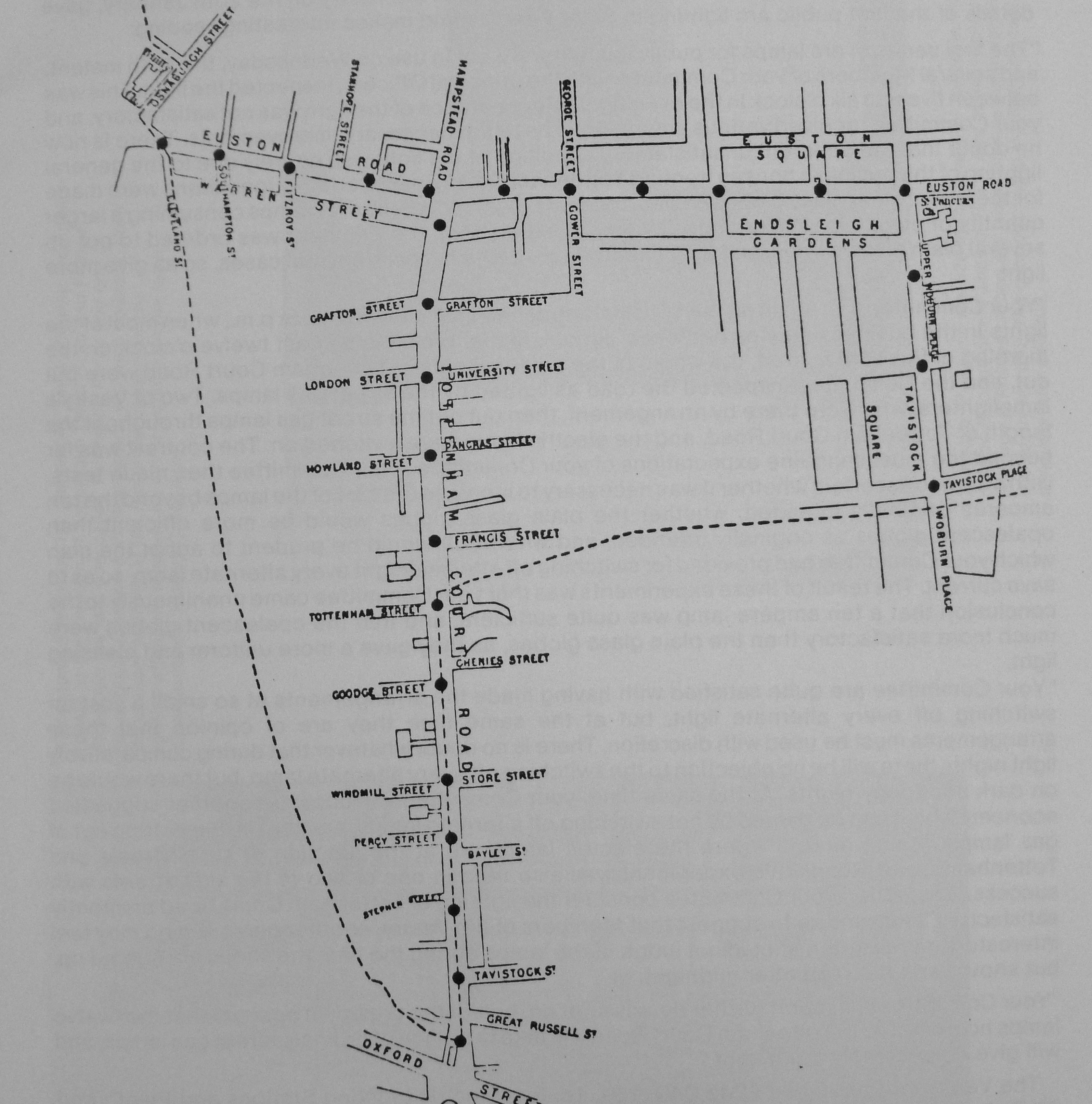
Warren Street is probably better known by the underground station of the same name, at the junction of Tottenham Court Road and Euston Road.

Warren Street runs parallel to Euston Road between Tottenham Court Road and Cleveland Street and my reason for being in Warren Street was to track down the location of one of my father’s 1980s corner shop photographs.

This is the corner shop of J. Evans, Dairy Farmer on the corner of Warren Street and Conway Street, photographed in 1986.

Warren Street

The same location, 33 years later in 2019, now occupied by The Old Dairy coffee shop.

Warren Street

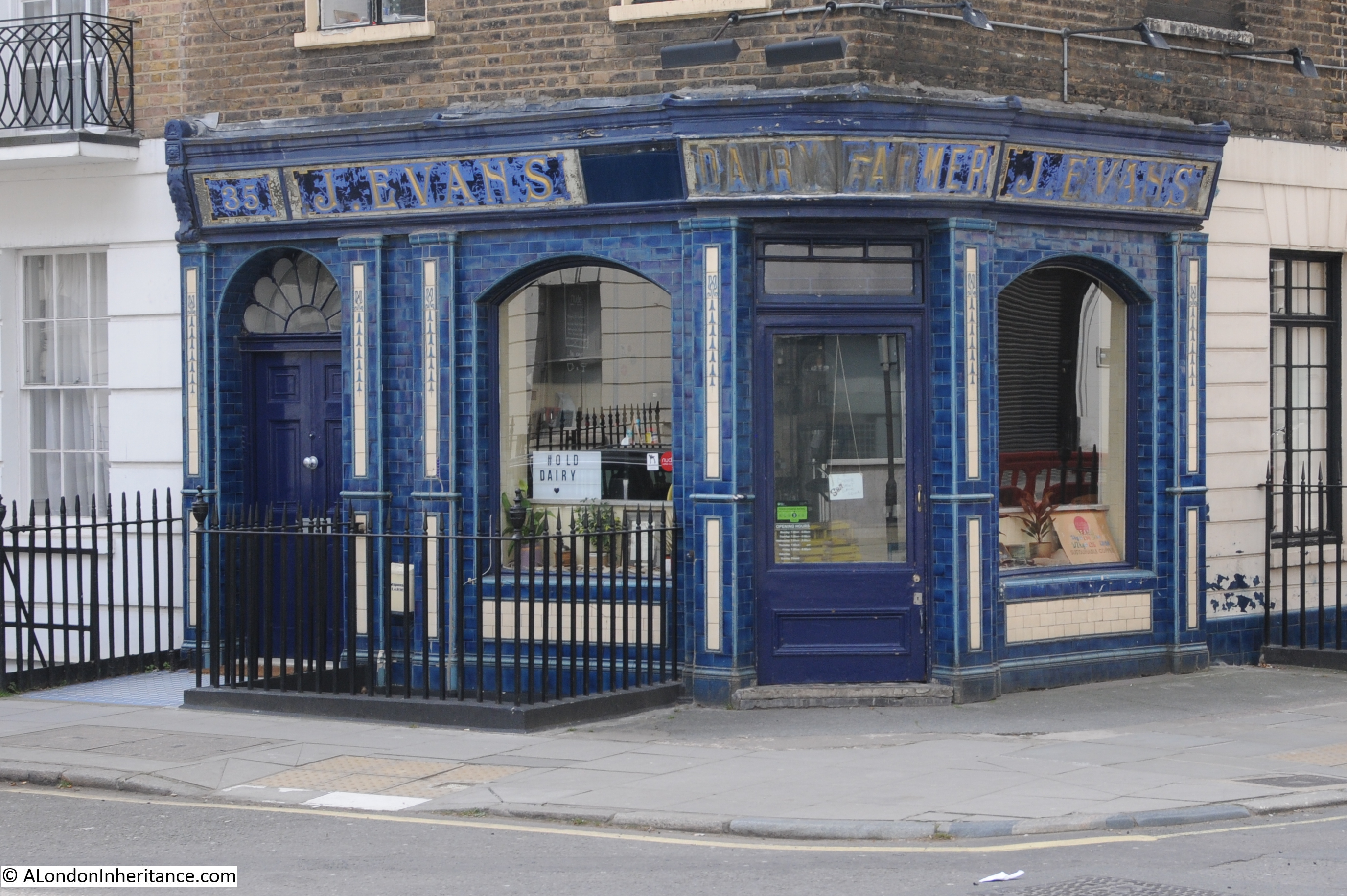
The shop front and the railings are Grade II listed. The listing states that the building was constructed around 1793 with the shop front dating from 1916. I suspect that J. Evans was one of the Welsh dairy farmers who set up shop in London. The inside of these corner shops are very similar, shelves packed high with tinned and packet goods.

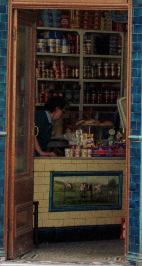
An enlargement of the view through the door shows a wonderful tiled picture of a field and cows, part of a set of scales can be seen to the right and the shop assistant is behind the counter.

Warren Street

This was only 33 years ago, but this type of local shopping is now dominated by the big supermarket brands, and a small store like this could probably not afford the rent or business rates.

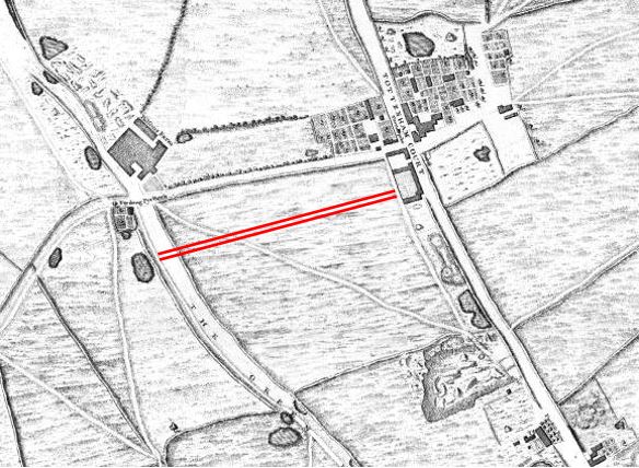
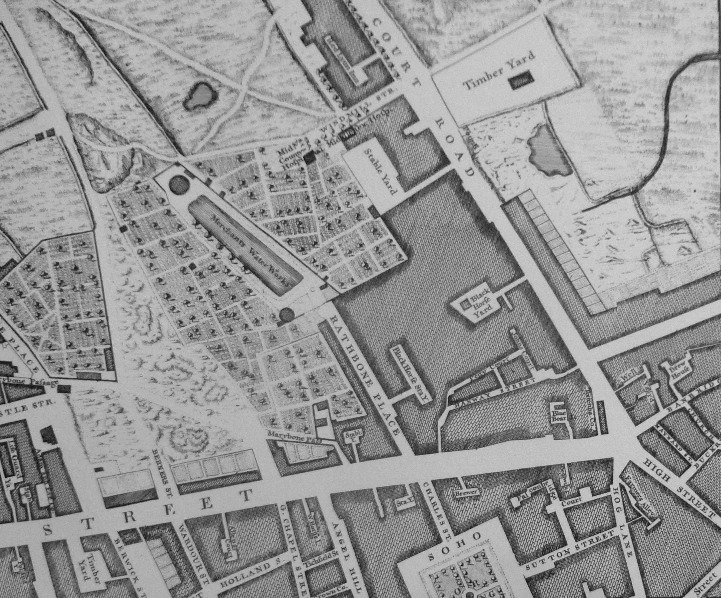
The tiled picture of fields and cows could have been the scene where Warren Street is located back in 1746. At the time when John Rocque complied his map of London, the city had not yet reached as far as Warren Street and the area was still mainly fields, with some limited building just north of the future junction of Tottenham Court Road and Euston Road. In the following extract from Rocque’s map, Tottenham Court Road is on the right. I have marked the approximate location of Warren Street with red lines, running across the full width of a field.

Warren Street

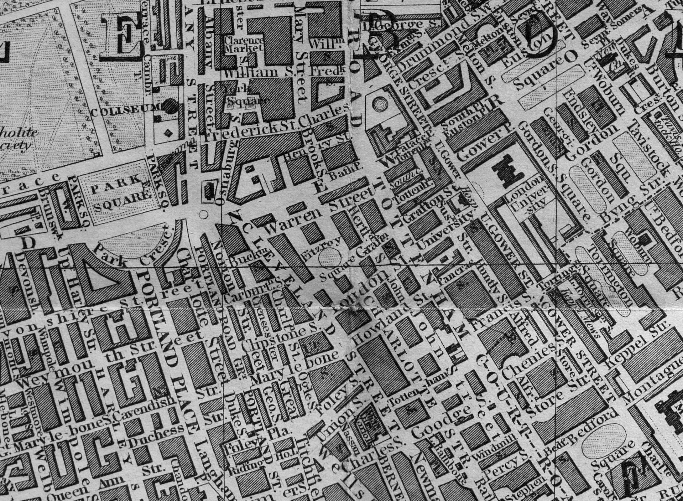
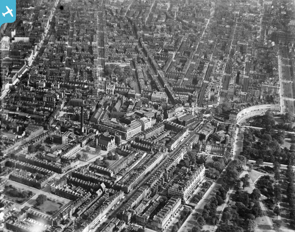
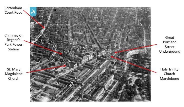
One hundred years later, and all the fields of Rocque’s map would be buried under a significant northward expansion of the city. The following map extract from Reynolds’s 1847 map (now I have the map out the shoe-box for last week’s post, I will use it more) shows Warren Street just above the centre of the map, with building covering the entire area (apart from the corner of Regent’s Park shown top left).

Warren Street

Warren Street was built between 1790 and 1791. The street is named after the daughter of Sir Peter Warren, Anne Warren the wife of Charles Fitzroy, the 1st Baron Southampton who was the owner and developer of the land on which Warren Street was built.

Warren Street is relatively quiet, a mix of architecture, but retaining many original buildings.

The street runs parallel and a short distance to the south of the busy Euston Road. Standing in Conway Street and looking across Warren Street, Euston Road can be seen, along with the new office buildings of the Regent’s Place development.

Warren Street

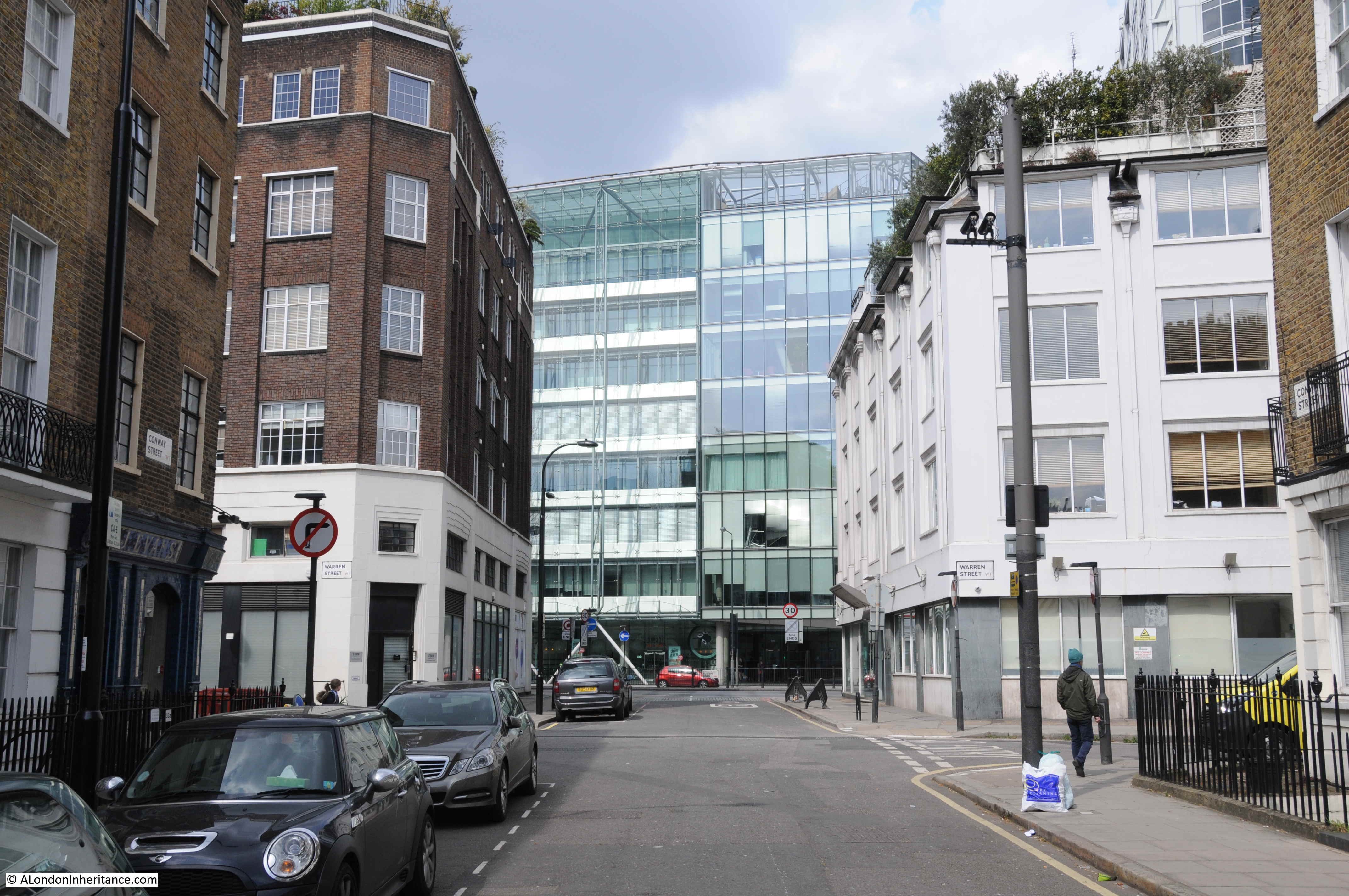
Looking south down Conway Street from Warren Street and a mainly original street plan and buildings survive.

Warren Street

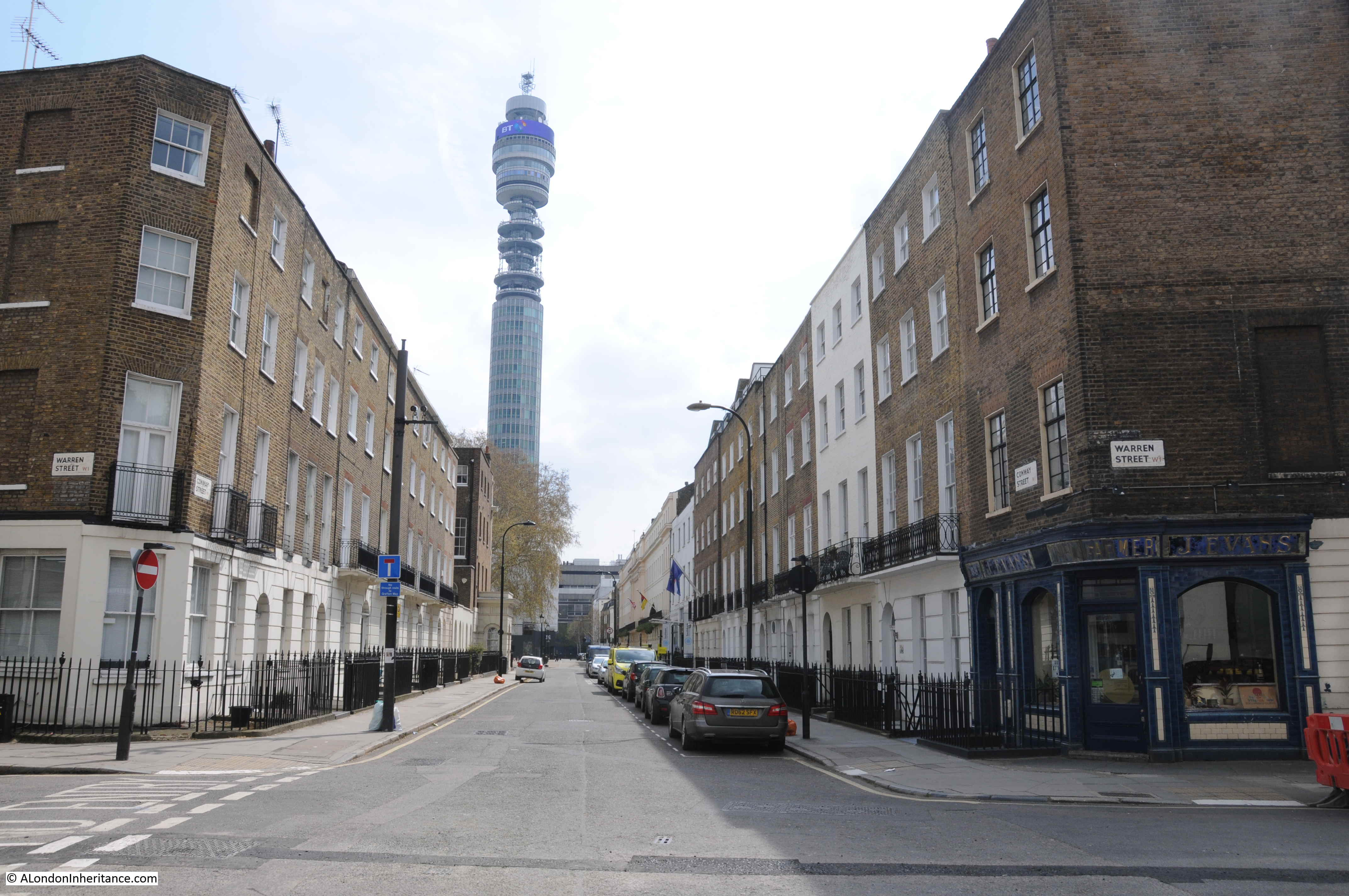
In the above photo, the J. Evans corner shop can be seen on the right. Note the lighter bricks on the second and third floors.  The difference in bricks is due to a mid 20th century re-build of the top two floors.

The London Metropolitan Archive, Collage site has a couple of photos of J. Evans shop. The following photo dates from 1978.

Warren Street

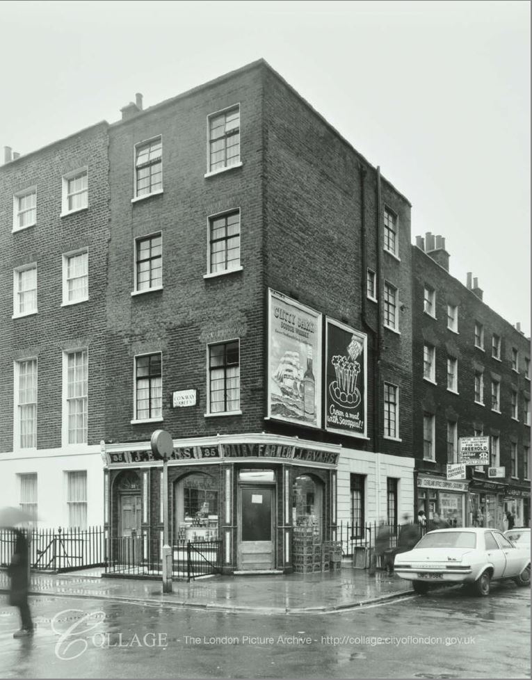
Image credit: London Metropolitan Archives, City of London: catalogue ref: SC_PHL_01_337_78_689.

A couple of large adverts are on the Warren Street facing wall. Also note that just along Warren Street were some other shops. Difficult to see exactly what they are selling, but they look to be typical of the shops serving the day to day needs of local residents that were once found all across London. Today, these shops have been converted to a couple of private clinics.

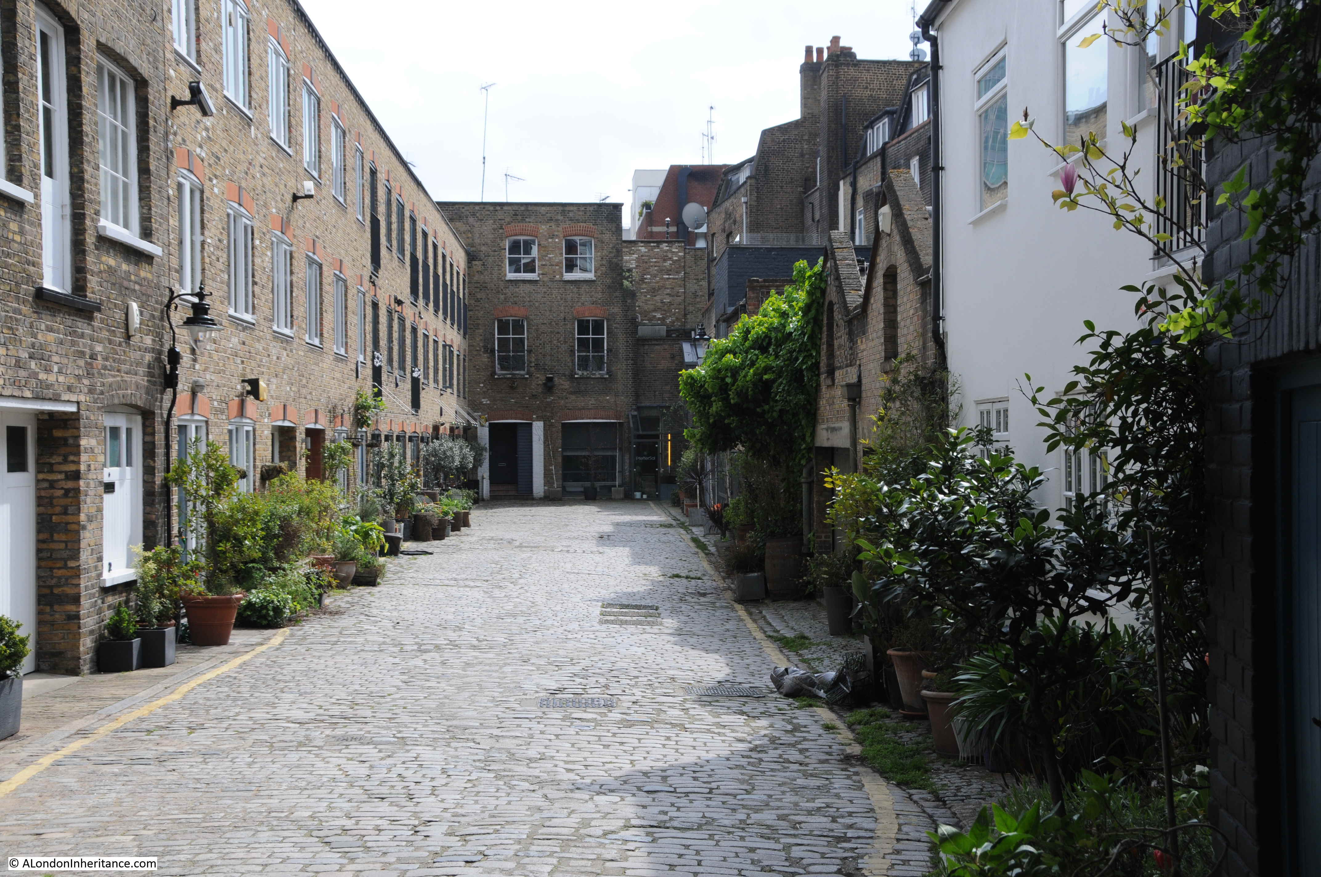
The buildings in which these other shops were located have what appears to be a secret entrance to a different place – this is the entrance to Warren Mews.

Warren Street

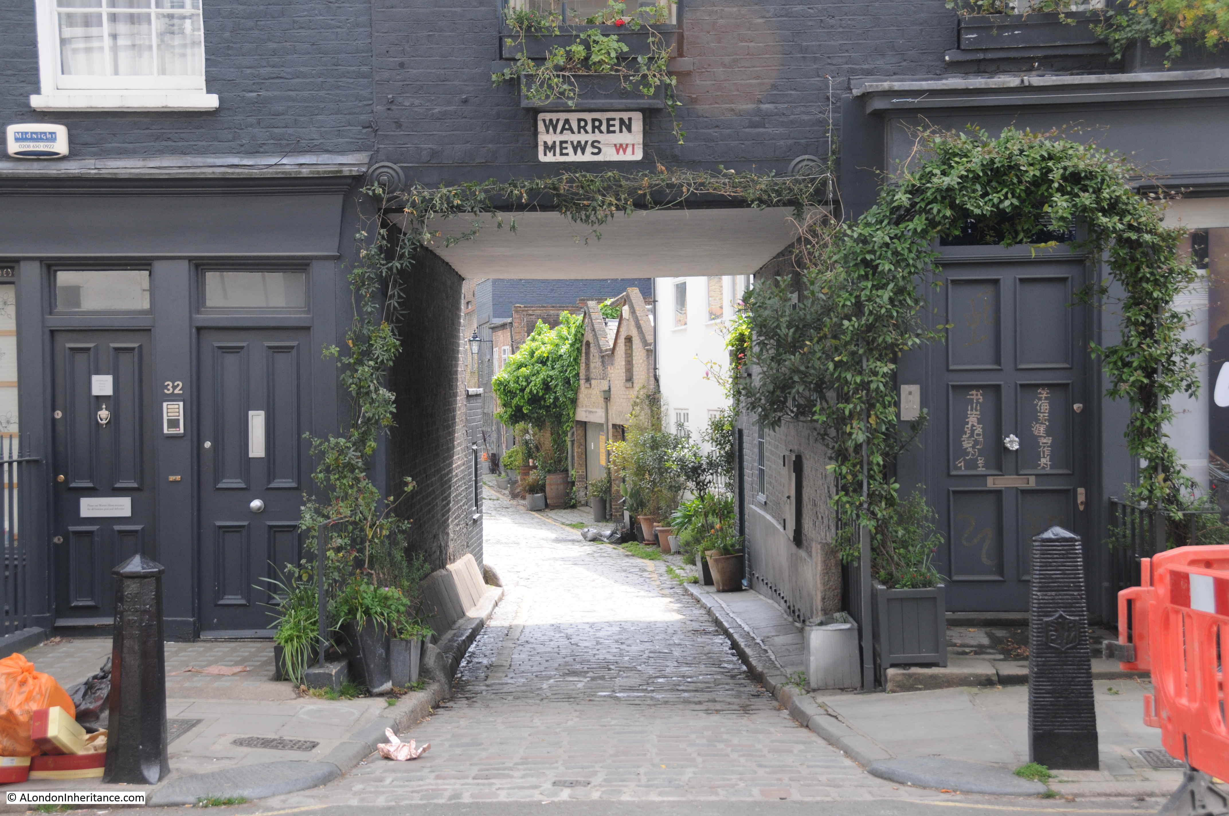
Warren Mews is a short street, even quieter than Warren Street, although I dread to think how much the houses that line the mews cost.

Warren Street

After having found the old shop frount, I walked back down Warren Street towards Tottenham Court Road, viewing an interesting series of buildings as I walked.

The Smugglers Tavern:

Warren Street

I do get depressed when walking the streets of London looking at the loss of one off shops, specialist shops and businesses, however in Warren Street I found a survivor. This is the London premises of Tiranti – a UK manufacturer and supplier of Sculptors equipment.

Warren Street

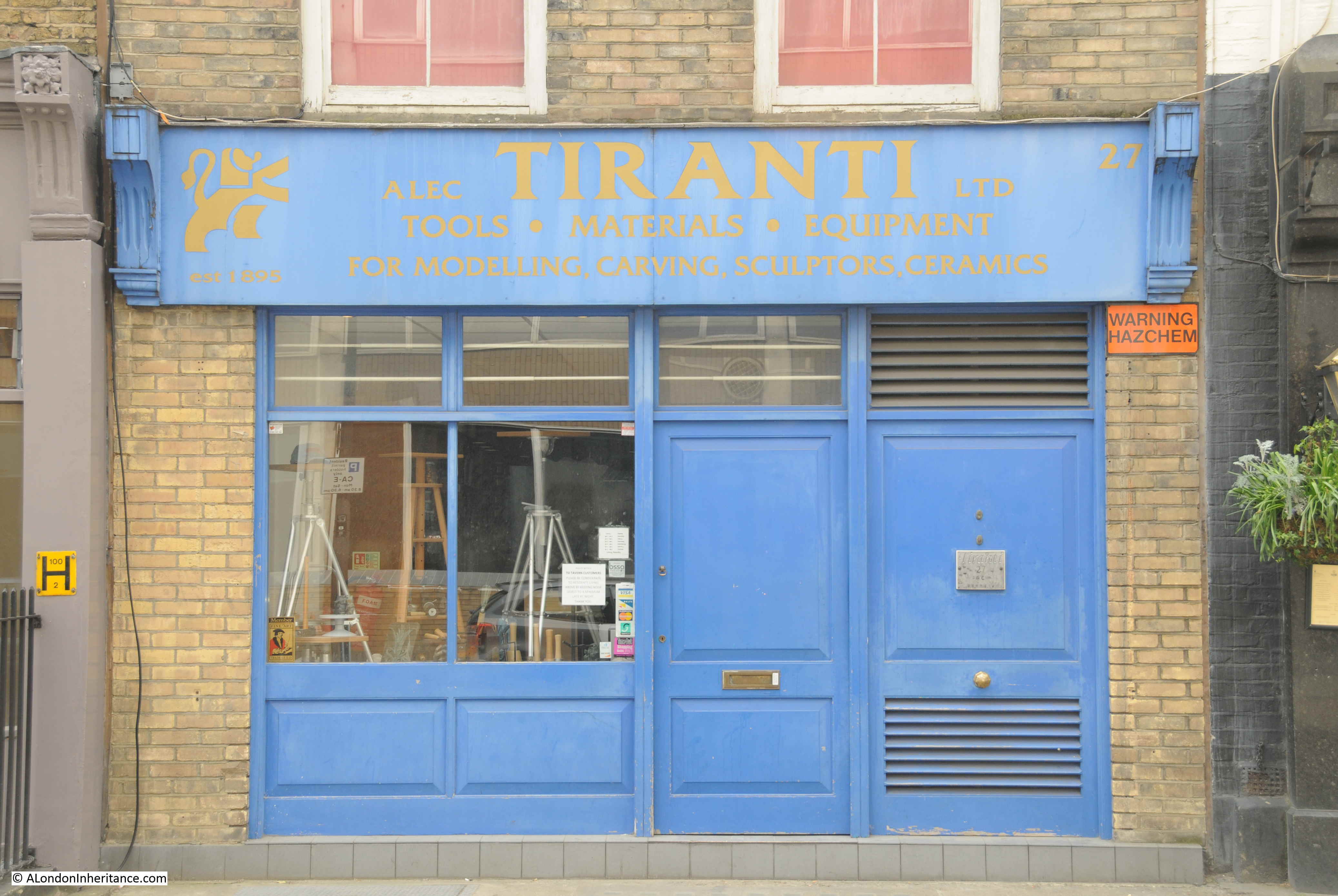
The business was founded in High Holborn by Giovanni Tiranti in 1895.  The business relocated to a number of different locations over the years, and whilst the main business is now located in Thatcham, Berkshire, Tiranti still retain a London premises.

The shop window of Tiranti in Warren Street:

Warren Street

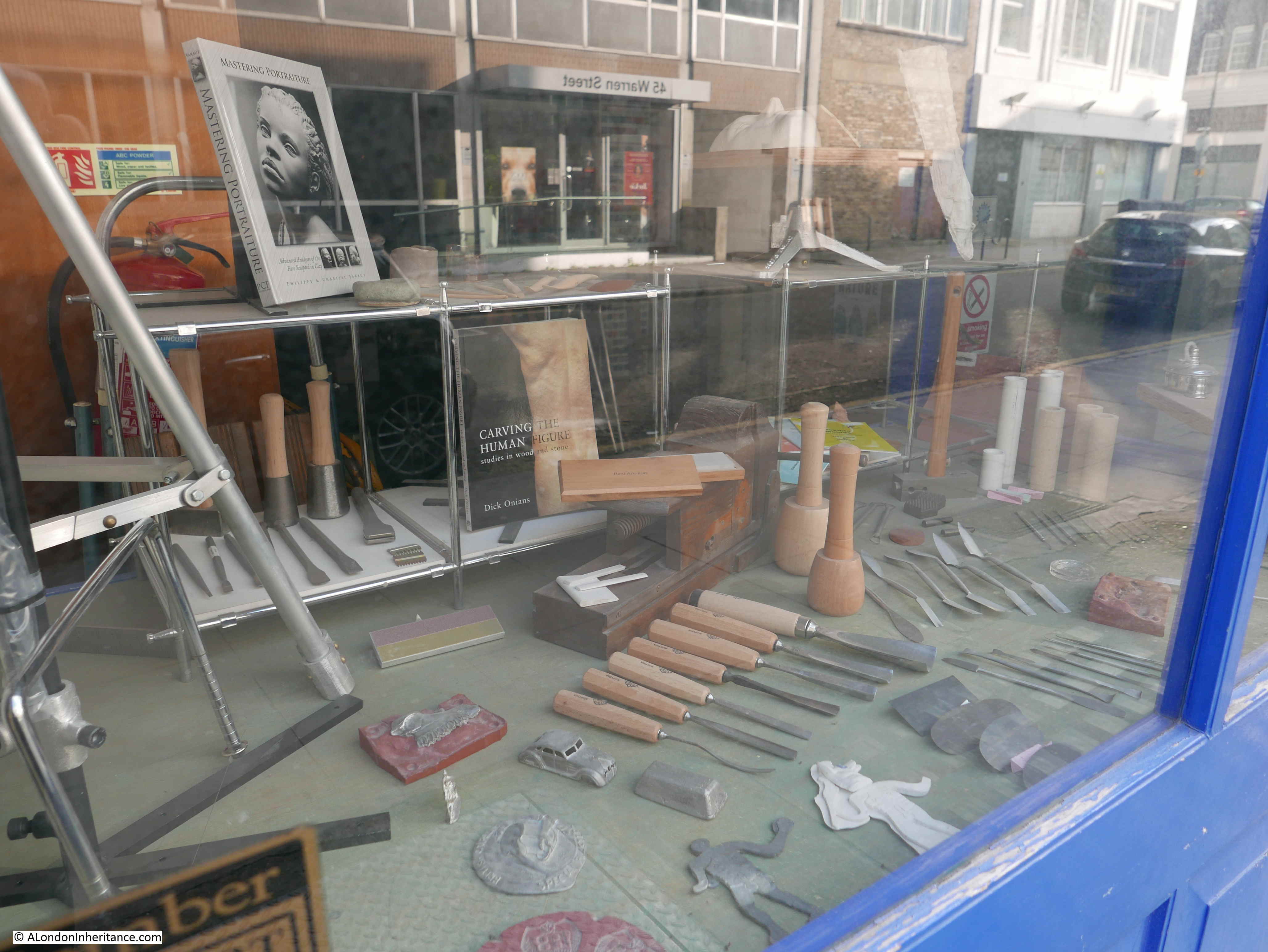
Tiranti has a fascinating history. Their web site can be found here, and contains an “About” page with a history of the business and their moves across London.

Although Tiranti has survived, another specialist business in Warren Street recently closed.

At the junction of Warren Street and Fitzroy Street is a large corner store, currently occupied by the Loft furniture business as their London showroom.

Warren Street

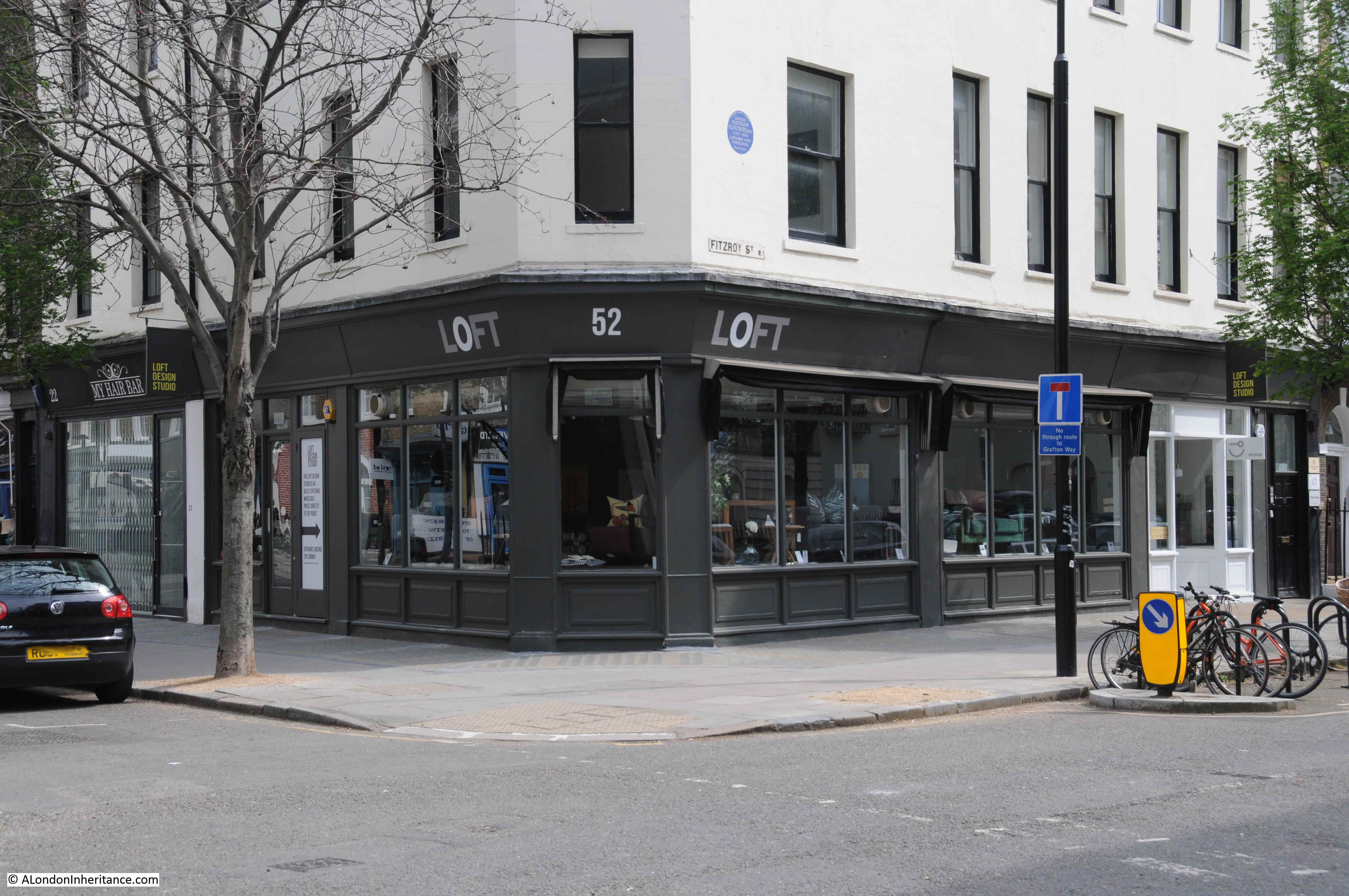
Until early 2017, this was the building occupied by French’s Theatre Bookshop:

Warren Street

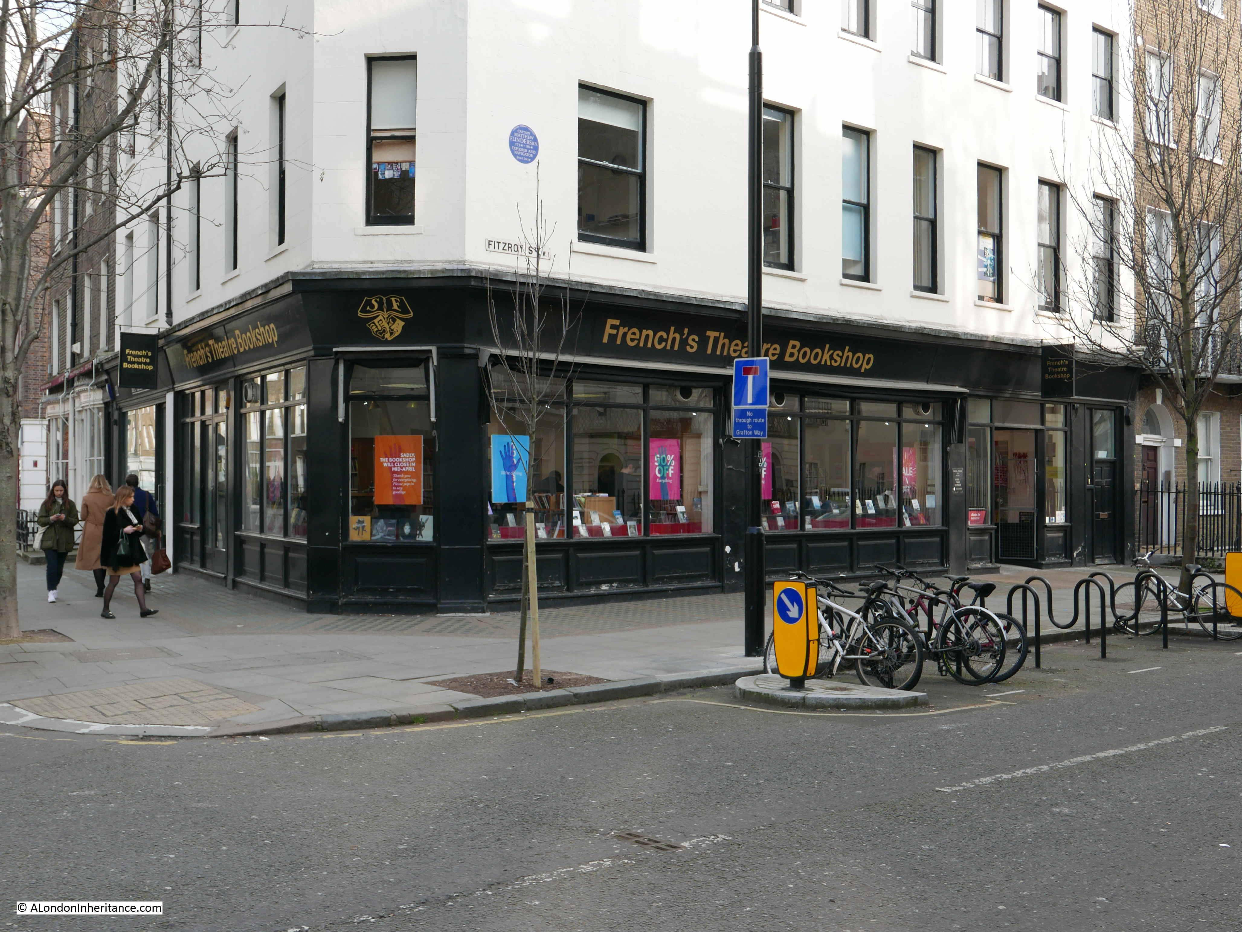
The French’s business was established in London around 1830. The bookshop occupied several locations across London and moved to the Warren Street / Fitzroy Street location in 1983, so whilst not a long term occupier of the site, it was good to find a specialist business serving the acting community of London and further afield.

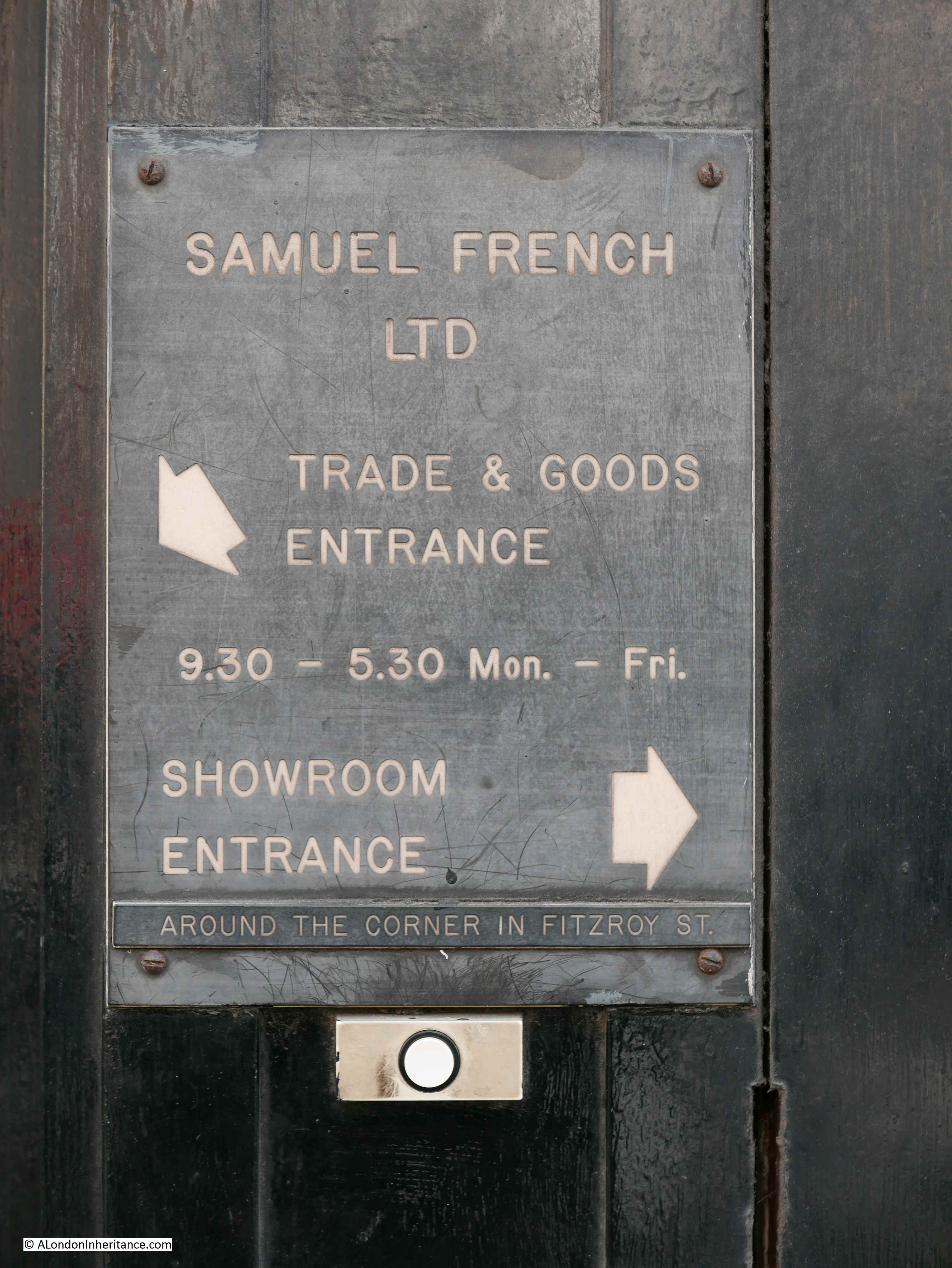
After closure, French’s went fully online, but has now reopened a bookshop at the Royal Court Theatre.

A few years ago I photographed the original entrance sign for Samuel French. It is remarkable how quickly places change.

Warren Street

The LMA Collage site identifies the same corner shop, now occupied by Loft, previously by French’s Theatre Bookshop, was in 1972 occupied by a second-hand car business.

Warren Street

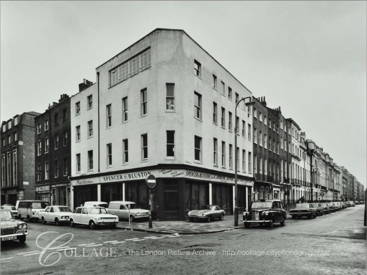
Image credit: London Metropolitan Archives, City of London: catalogue ref: SC_PHL_01_340_72_1023.

Used car dealing was a specialty of Warren Street for much of the first half of the 20th century with car dealers occupying many of the buildings and also second-hand cars for sale lining the street. The business on the corner with Fitzroy Street must have been one of the last in operation on the street.

The car dealing business in Warren Street attracted a number of dubious characters, one of whom was Stanley Setty, a car dealer who operated outside a cafe on the corner of Warren Street and Fitzroy Street (on the opposite  side to the above photo) . Setty dealt in cash only and was always in possession of large amounts of cash.

He had an associate in Brian Donald Hume who dealt in black market goods. In 1949, after an argument and a fight, Setty was murdered by Hume, who disposed of his body parts over the Essex Coast from a hired plane.

The Daily Herald on the 24th October 1949 included a graphical report of the murder (©British Newspaper Archive)

Warren Street

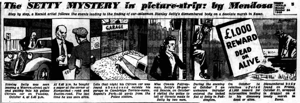
Hume was found not guilty of the murder, only the lesser offence of being an accessory to the murder by disposing of the body. After his release from prison he was happy to report to the press that he had carried out the murder – the defence of double-jeopardy protecting him from a new trial.

Warren Street is a very different street today.

On the Fitzroy Street side of the Loft / French’s Theatre Bookshop building is a blue plaque which has an interesting connection to recent excavations.

Warren Street

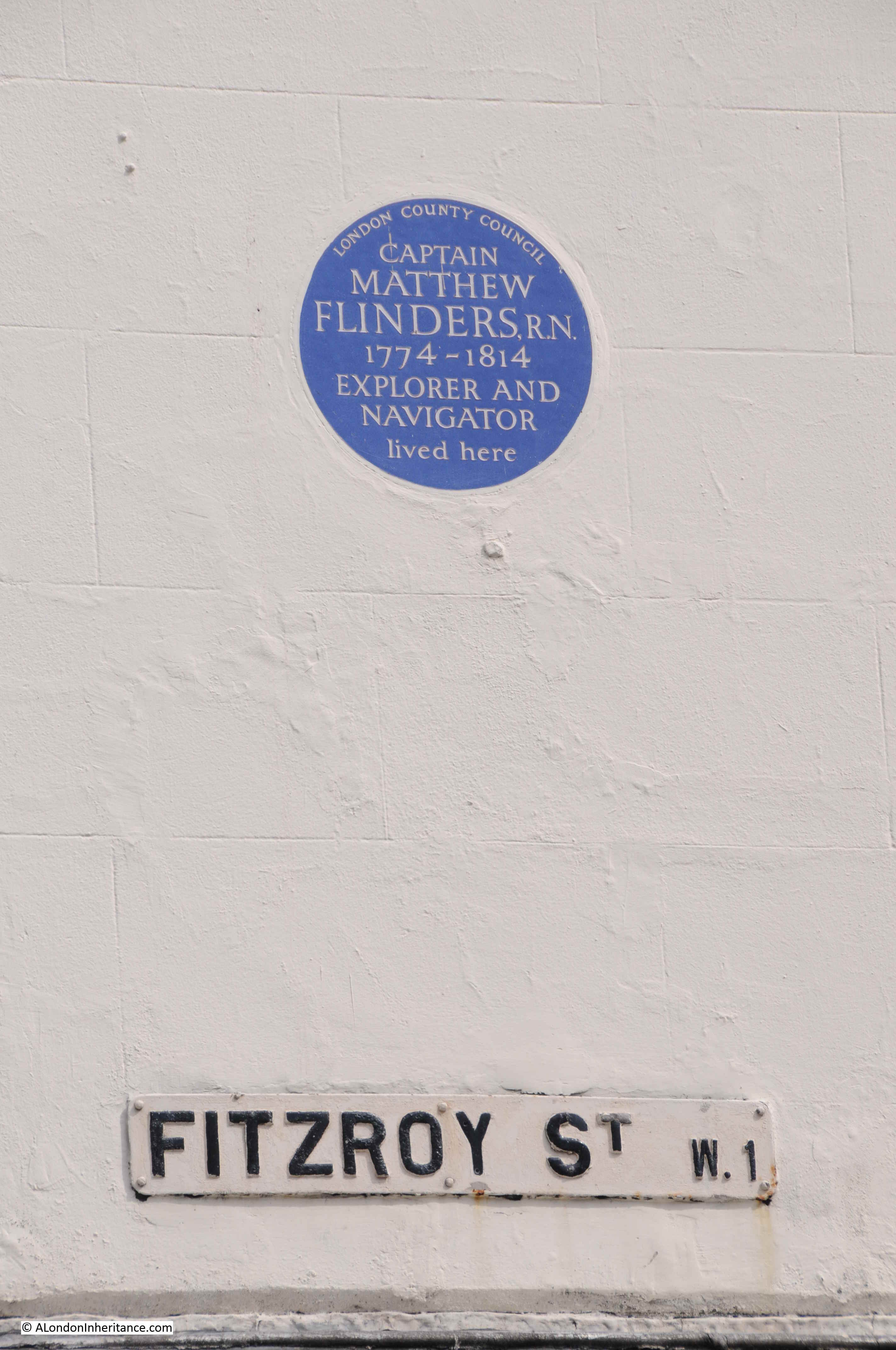
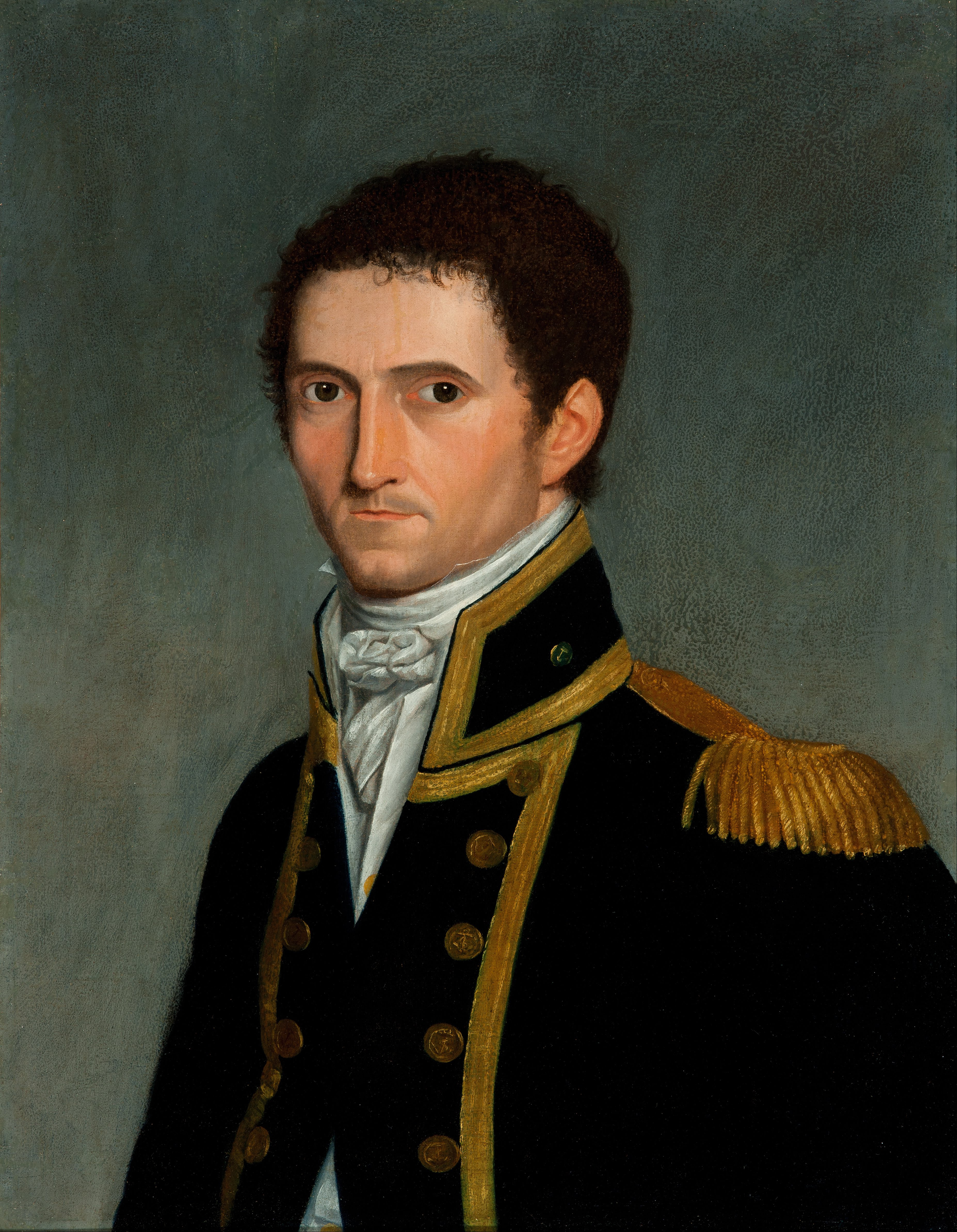
Captain Matthew Flinders was instrumental in identifying Australia as a continent, by being the first western explorer to circumnavigate the land, which he would also play a part in naming.

His name was all over the media earlier this year when his grave was discovered during the excavations of St James’s burial ground as part of the HS2 extension to Euston Station, a short distance along the Euston Road from Warren Street.

Captain Matthew Flinders (source here).

Warren Street

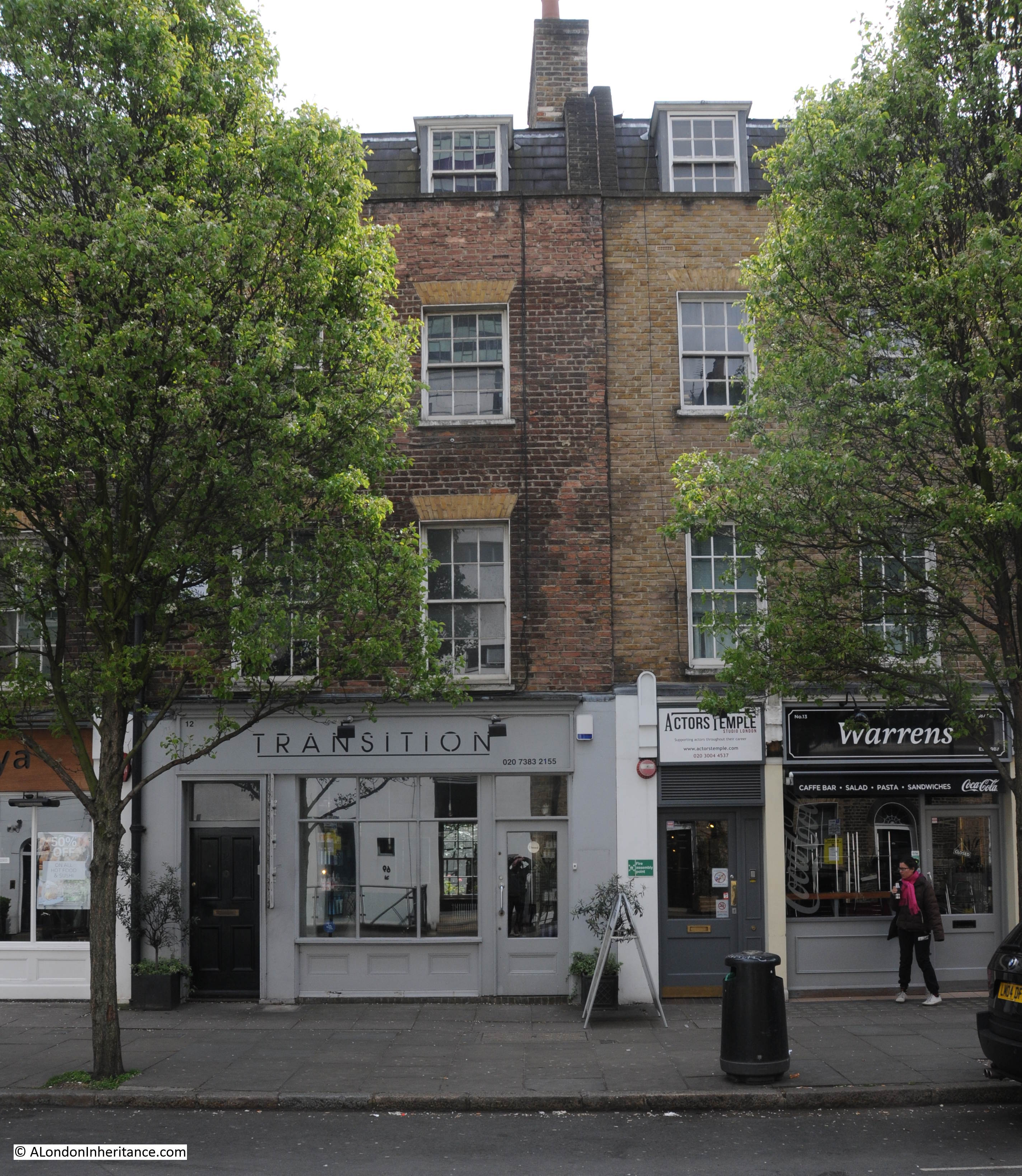
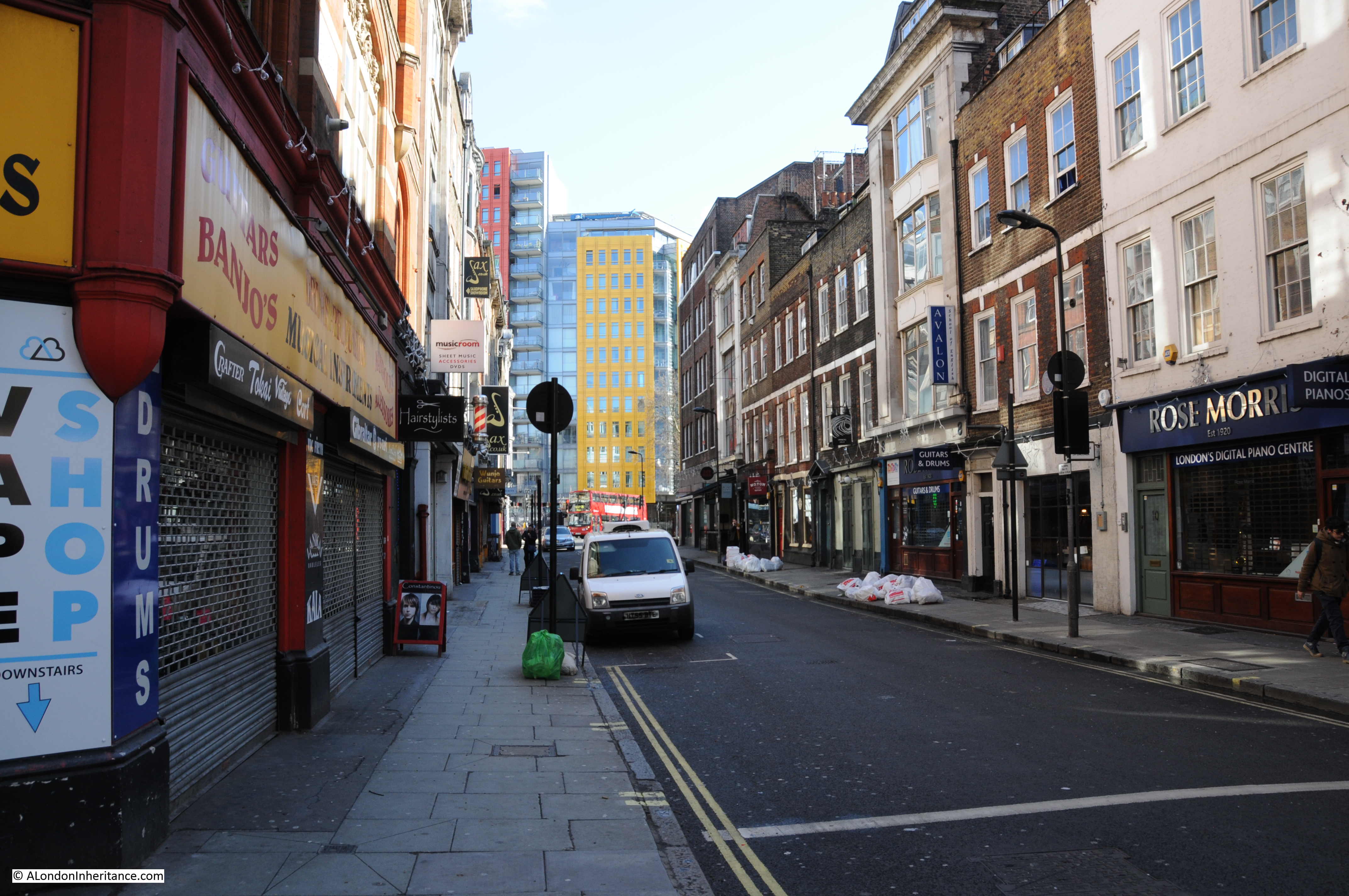
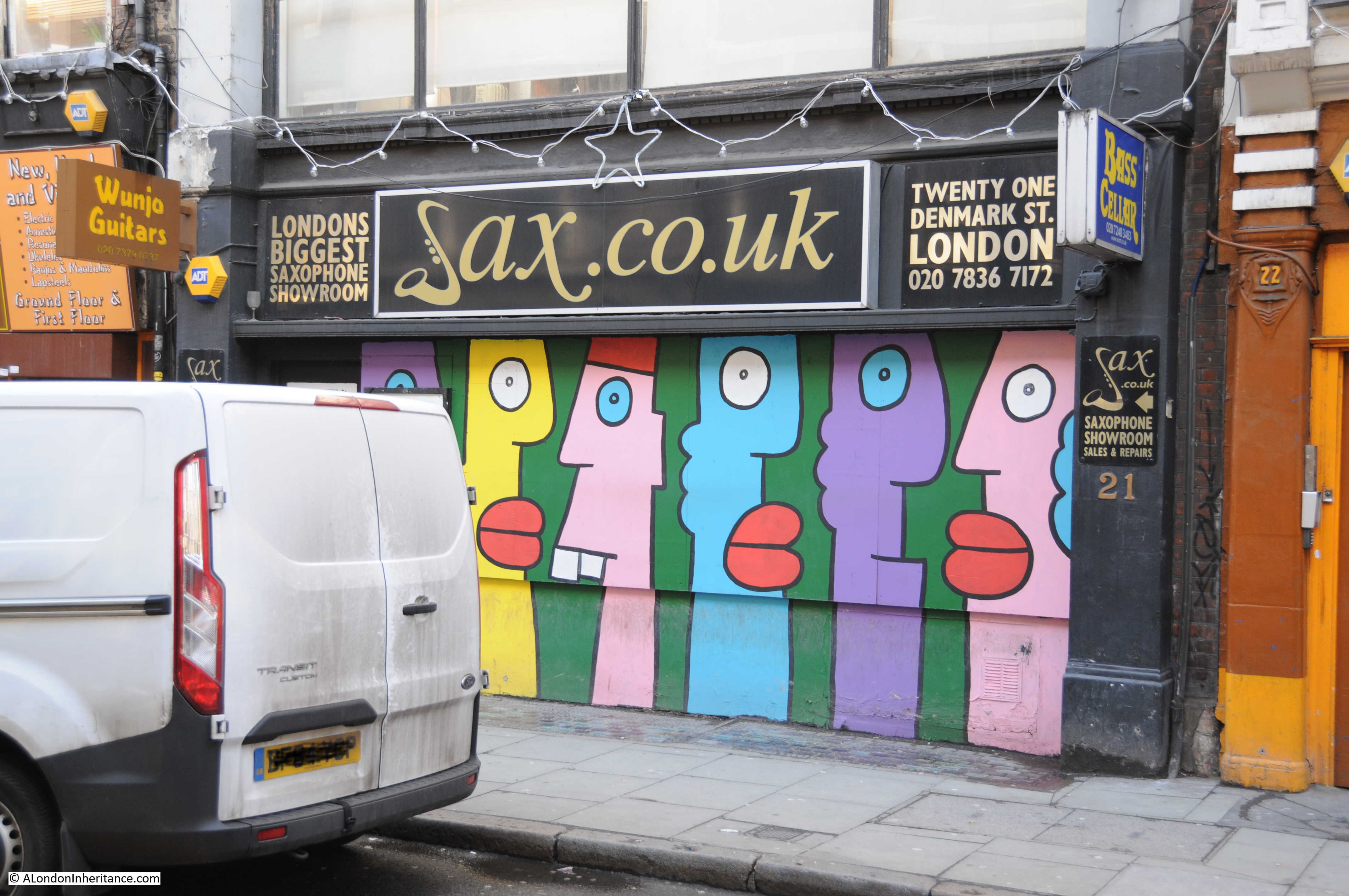
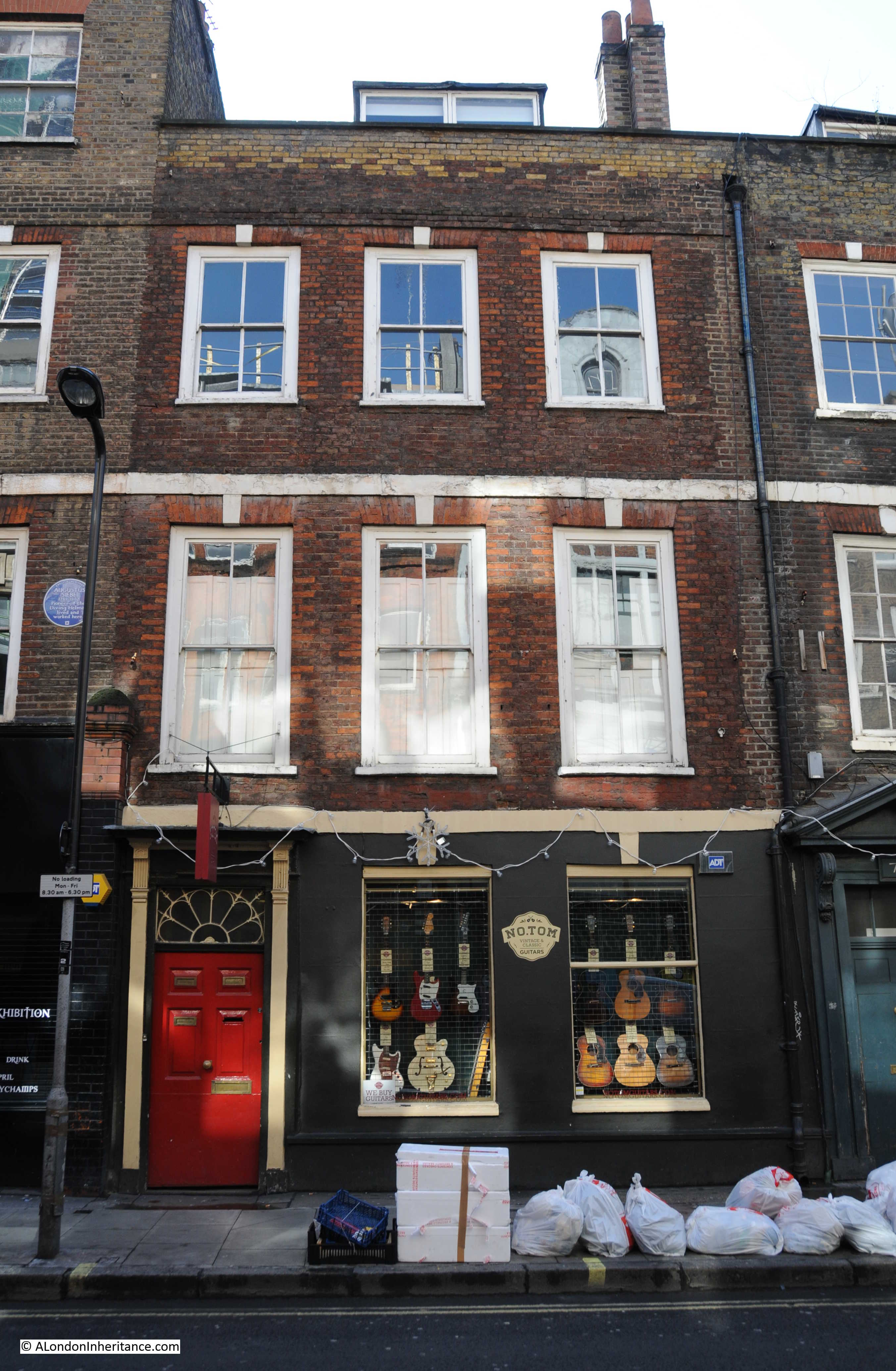
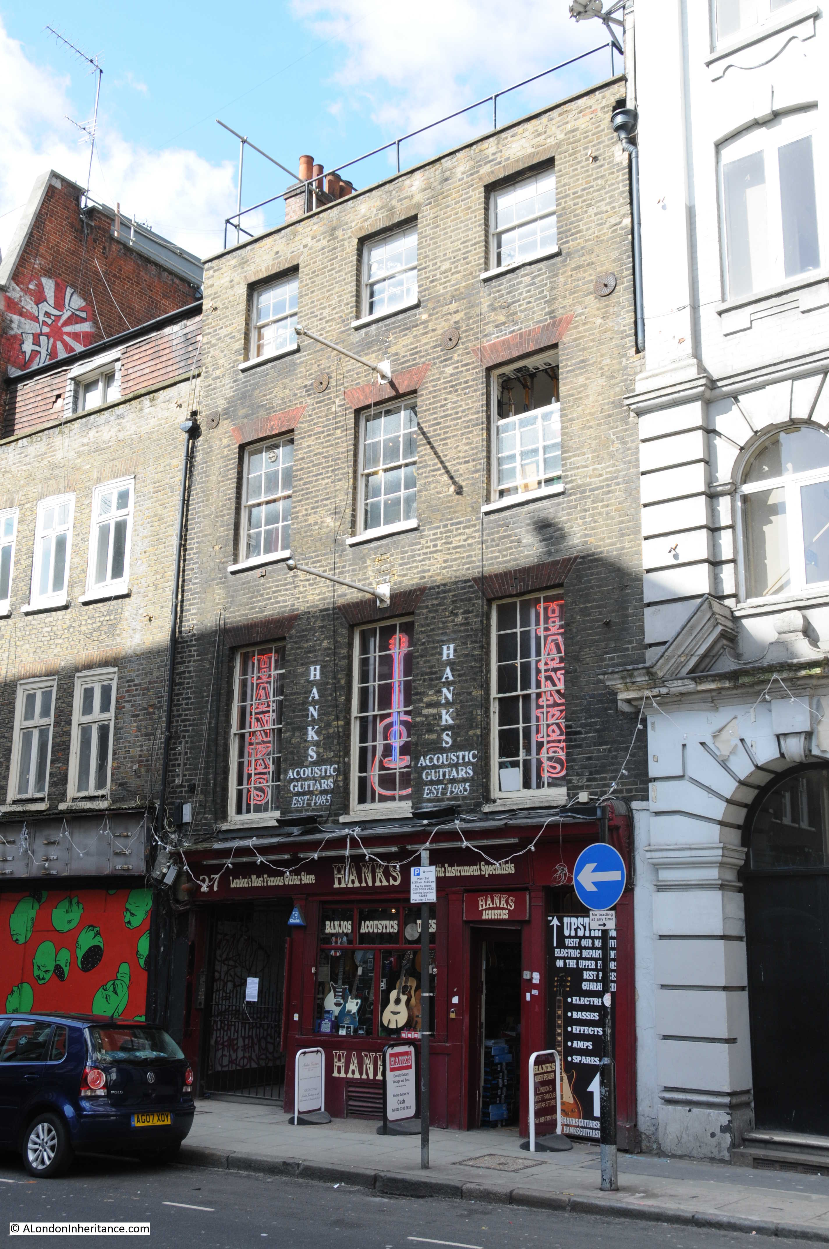
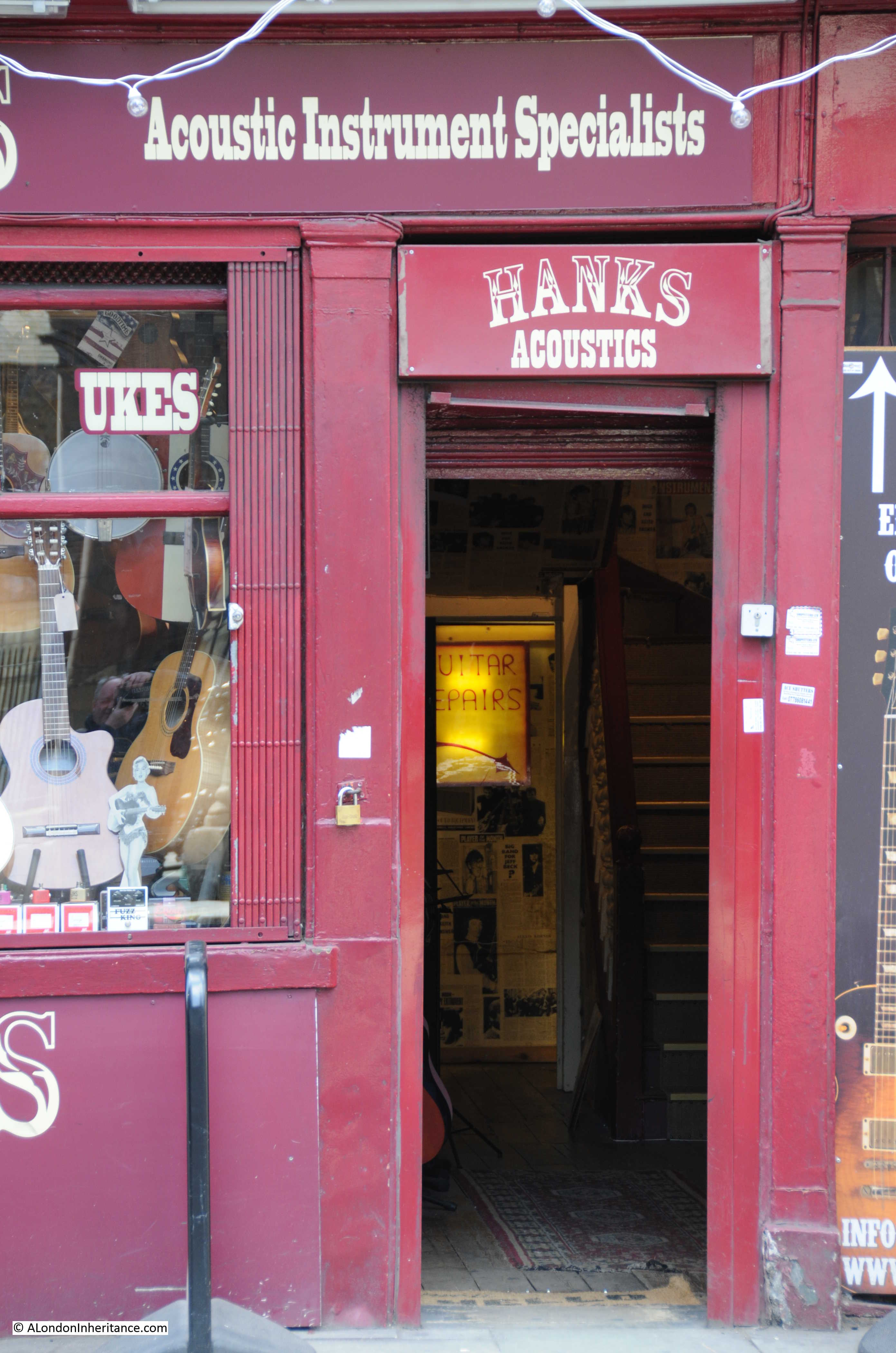
Warren Street has some interesting shop fronts:

Warren Street

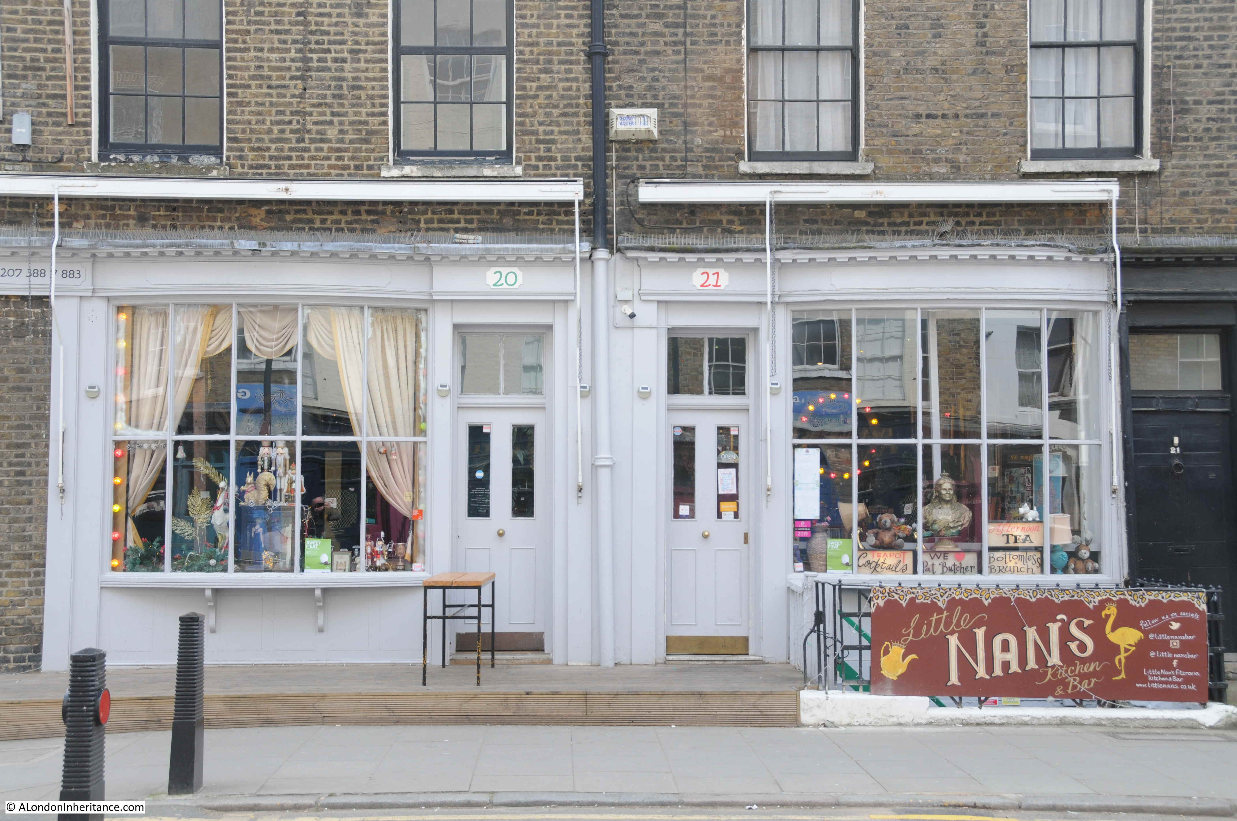
Original terrace of houses, shops on the ground floor, offices and / or flats above. Work on the buildings over the years shown by the different brick colours.

Warren Street

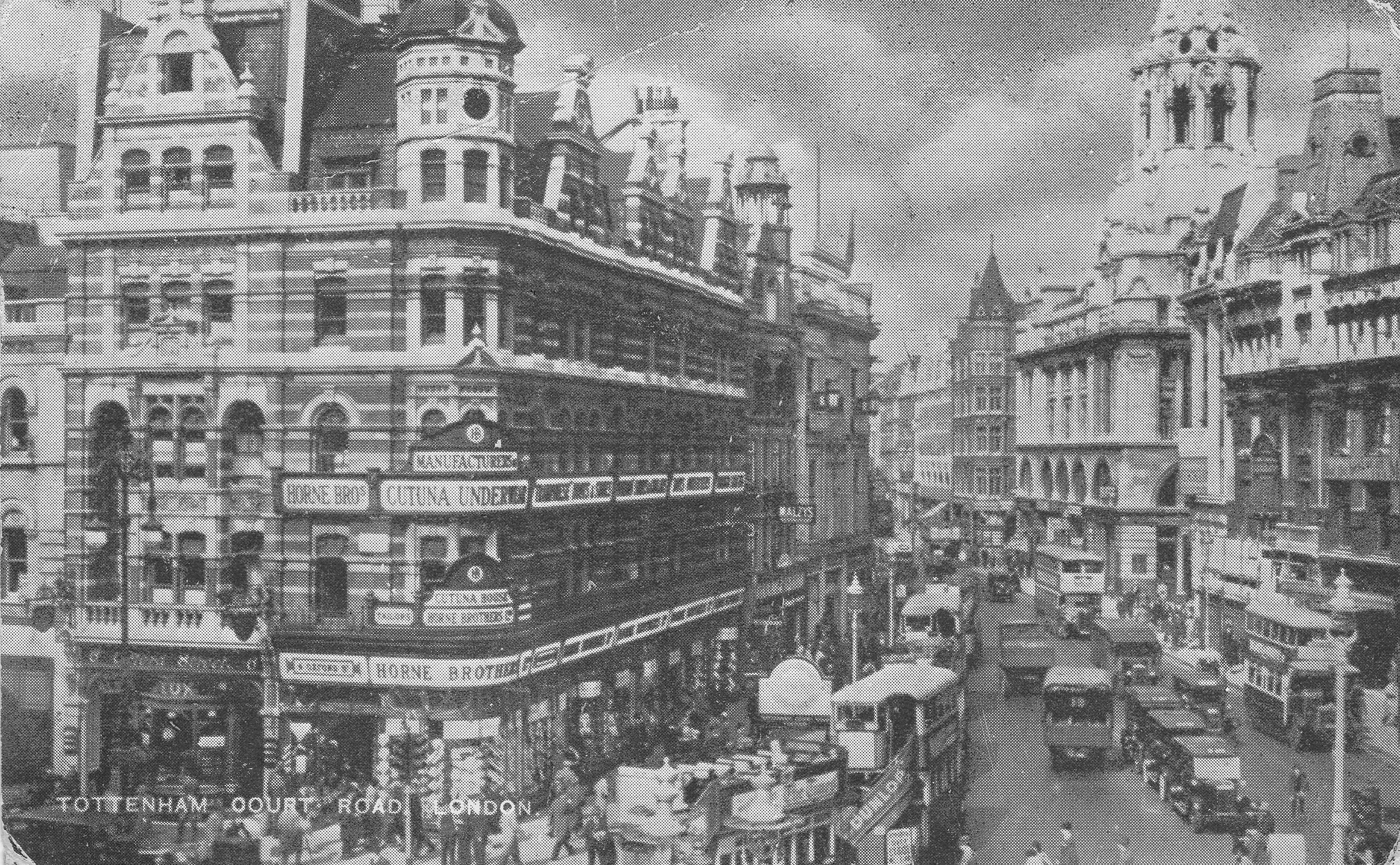
At the junction of Warren Street and Tottenham Court Road is the underground station that bears the street’s name.Warren Street

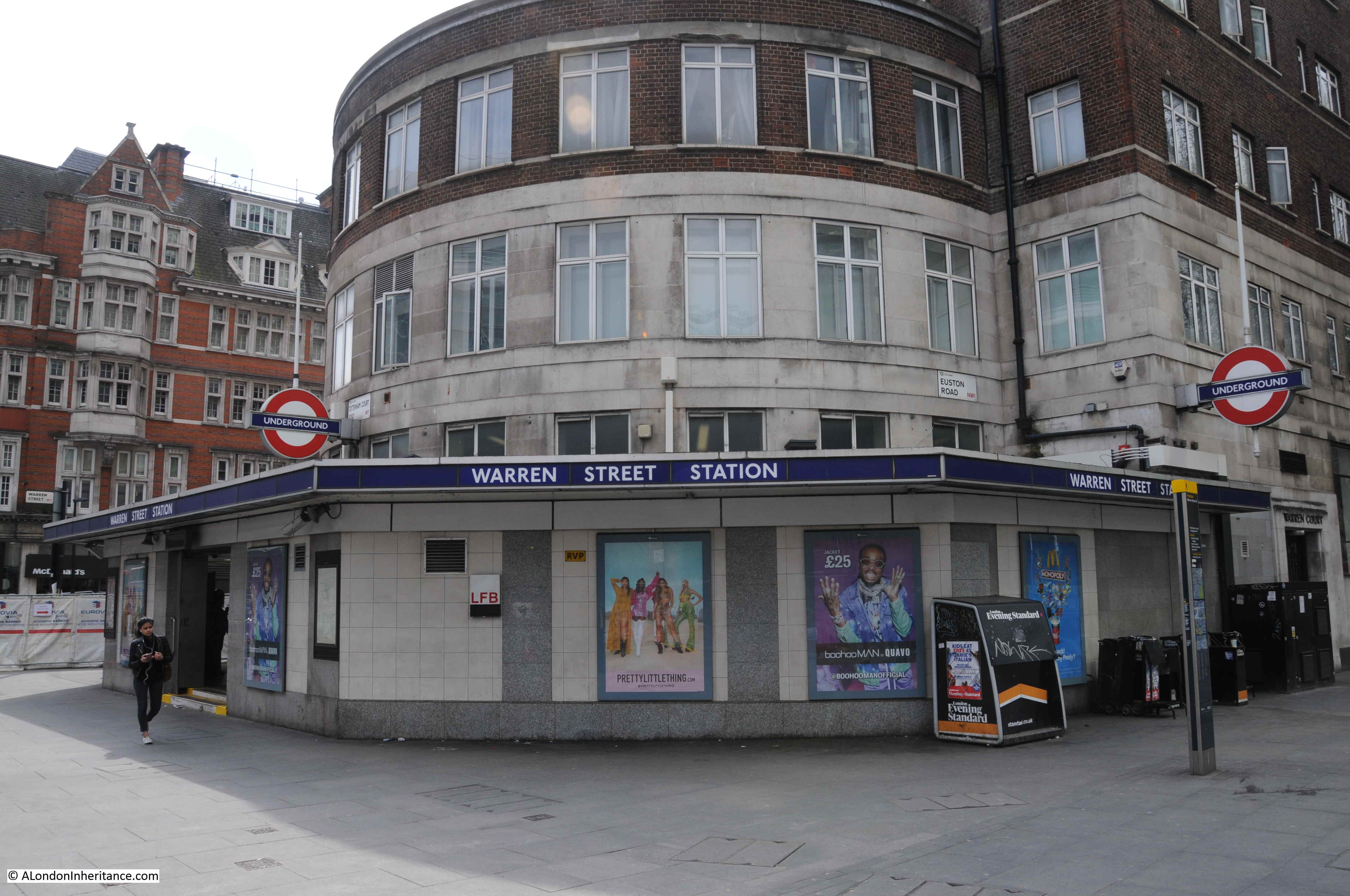
The first underground station opened here in 1907, with the current building dating from 1934.

The station is on the Northern and Victoria lines, and is a very busy station during week days.

Large numbers of people use the station for the offices at Regent’s Place, University College Hospital, University College London, and the businesses that line Tottenham Court Road and the surrounding streets. It is a station I have used many times and during the early morning peak hours the automatic ticket gates are usually left open to speed passengers through from the escalators to the street.

Since being a field on the northern edge of John Rocque’s London, Warren Street has been home to some lovely late 18th century buildings, the discoverer of Australia as a continent, the arrival of the underground, used car dealers, and J. Evans – Dairy Farmer, the shop that was the reason for my walk along Warren Street.

alondoninheritance.com

Saint Giles Pound

The problem I find with this blog is that there is so much to discover and learn, each post really needs much more investigation than I currently have the time to do. This week’s post is an example.

My father took the following photo of a milestone in Highgate in 1948. It is just south of the Flask pub along Highgate West Hill. (For a view of the Flask and Highgate in 1948 see my post here.)

Saint Giles Pound 1

The milestone is still there. See my following photo of the milestone today. Nothing special you might think, but compare the mileage, five in 1948 and four today and the destination is a location that does not now exist in London, Saint Giles Pound.

Saint Giles Pound 2

So where and what was Saint Giles Pound?

Saint Giles refers to the parish of St. Giles in the Fields, the parish that took in the area around the church of the same name, just a short distance south-east from the junction of Tottenham Court Road, Oxford Street and Charing Cross Road.

In my usual London reference books I have found a number of references to the Saint Giles Pound which was a fenced area to hold sheep and cattle etc.

From “The History of the United Parishes of St. Giles in the Fields” by Rowland Dobie, published in 1829:

“The Pound and Cage originally adjoined each other, and stood in the middle of the High Street, from whence Parton informs us it was removed in 1656, to make way for the almshouses which were afterwards built there.

‘The Pound’ he adds, probably existed from a very early period, as a necessary appendage to the parish while a village, and abounding in pasture lands, though it is unnoticed in the books of the parish, till Lord Southampton’s grant of the ground on which it stood for the almshouses, where it is described as occupying a space of 30-feet, which was to the dimensions of the new Pound, therein directed to be removed to the end of Tottenham Court Road. The exact site of the Pound was the broad space where St. Giles High Street, Tottenham Court Road, and Oxford Street meet, where it stood till within memory. Noticed for the profligacy of its inhabitants, the vicinity of this spot became proverbial: witness the couplet of an old song.

‘At Newgate steps Jack Chance was found,

And bred up near St. Giles Pound’

it was finally removed about the year 1765, since when the neighbourhood has experienced many improvements, particularly by the erection of the great Brewery of Messrs. Meux and Co.

The Cage appears to have been used as a prison, not merely of a temporary kind, but judging from the parish records, with little lenity.”

Charles Knight in the Milestones section of his book, London, published in 1841 states:

“Again, St. Giles Pound, a real pound for cattle, which is marked upon the old plans, was a prominent object, standing in the village of St. Giles at the intersection of the roads from Hampstead and from Oxford. This also was something like the beginning of London: but Hicks’s Hall and St. Giles Pound have long since vanished; and the milestones which record their glory ought also to be swept away.”

The milestone therefore is alongside one of the old routes that was used to bring animals in from the north, through Highgate and down into London, and thankfully it has not been “swept away”.

The two photos of the milestones also have different distances, five in 1948 and four in 2016. The only reference I can find to this change is that it was made by a local resident of Highgate who was frustrated with the error. So is four miles correct? Although I have walked the route, I have not measured, so a quick check on Google maps, from Highgate West Hill at roughly the position of the milestone, to a point on New Oxford Street a very short distance past the end of Tottenham Court Road to allow for the possible siting of the Pound more towards St. Giles High Street. The following map confirms the distance as being exactly four miles (the blue dots). Even with some longer alternative routes, the distance does not reach five miles.

Saint Giles Pound 6

It would be interesting to know if the error in distance was from when the milestone was originally installed, or perhaps when the figures may have been re-cut as they do look very sharp in the 1948 photo with very little deterioration to the edge of the lettering. The key point is that today, the distance is correct.

A wider view of the milestone alongside Highgate West Hill.

Saint Giles Pound 3

Intriguingly, the Pound may be marked on a map. The following is an extract from John Rocque’s map of London from 1746. This is 19 years before the Pound was removed. Look in the lower right of the map, at the junction of Tottenham Court Road, Oxford Street and the High Street of St. Giles. There is a rectangular feature in the open area of the junction – could this be the Pound? The location fits perfectly the description given by Rowland Dobie in his book, quoted earlier.

Saint Giles Pound 4

Strange to think that this very busy junction, with the new Crossrail station being built, was once the location of a Pound, holding animals being brought down from the north.

The map extract is from the very lower right hand corner of the page. At the very bottom right corner is a street with only the word “Street” showing. This is Denmark Street featured in my post of a couple of weeks ago.

The map has some other references that point to the original use of this area. In the above map, the road running south from the junction is Hog Lane. The alley leading off from the top right of Hog Lane is Farmers Alley.

Hog Lane is now the northern section of Charing Cross Road. From “London” by George H. Cunnigham (1927):

“In Hogarth’s time this portion of the street was known as Hog Lane, later Crown Street, under which name it was widened and made part of Charing Cross Road.”

So after the Pound had disappeared, there was no longer an association with animals so the name changed, with finally as so often happens in London, the street being integrated in the lengthening and widening of a main street.

Returning to my opening comment at the start of today’s post, just finding this single milestone opens up so many questions.

Is there more information on the Pound, and is the original location marked on any maps? (the Rocque map shows the location after the move from St. Giles High Street). Are there any more of the milestones? I have not found any, however Knight’s book refers to another milestone in Camden at the two-mile point. What was the purpose of the Pound? Was it used as a stopping off point before heading into the City or did it serve the local area?

More questions for my ever-growing list of things to learn about London.

alondoninheritance.com

Denmark Street

London has always had areas which attracted specific types of trade, shops and industry, a number of which clustered around Tottenham Court Road underground station.

To the south, along Charing Cross Road was Foyles and a range of second hand bookshops (some of which remain, along with Foyles in their new location). To the north, along Tottenham Court Road was to be found a large number of electronics shops. It was here that I bought my first calculator whilst still at school in 1976, a Decimo Vatman, so called because as well as the normal addition, subtraction, multiplication and division keys, it also had a (revolutionary for the time), percentage key. When I last walked along Tottenham Court Road, nearly all of these electronics shops have now disappeared.

The Paolozzi mosaics at Tottenham Court Road underground station featured designs including cameras, electronics, music shops and saxophones to reflect the area around the station. It is these last two which feature in this week’s post, from a street I have been wanting to photograph for some time as the area is changing considerably. Walk a short distance south along Charing Cross Road and you will find Denmark Street, a street that has been the hub of the music industry for many decades.

I walked to Denmark Street early on a very sunny morning – not always the best for photography with the contrast between light and dark.

Looking back up towards the large building site at the top of Charing Cross Road, an indication of what is happening to the area:

Denmark Street 17

On the corner of Charing Cross Road and Denmark Street:

Denmark Street 29

Looking down Denmark Street from Charing Cross Road, a mix of architectural styles, with at the end of the street, a sign of things to come with the standard new build that can now be found anywhere across London.

Denmark Street 16

According to George Cunningham in “London – a Comprehensive Survey”, Denmark Street was built in 1689 and is the scene for the Noon drawing from Hogarth’s series Four Times of The Day. The drawing contrasts the different populations of the area, an elegant crowd leaving a French Huguenot Church, compared with a rowdy crowd of Londoners outside a tavern.

Numbers 4, 5, 6, 7, 9 and 10 Denmark Street, although having had many alterations, are still much the original buildings from the 1689 construction of the street.

Denmark Street is now mainly guitar shops, but at the peak of the music industry here in the 1960s was also the home of music publishers, recording studios, and the music papers NME and Melody Maker.

Wunjo Guitars and the Gary O’Toole School of Music:

Denmark Street 28

There have been a number of recent closures, including this Saxophone shop which has now moved to Hampstead Road.

Denmark Street 27

The old signs still on the building:

Denmark Street 13

Number 6 Denmark Street, one of the remaining 17th century townhouses which was recently Grade II listed. The building was the home of the Sex Pistols for a time in the 1970s and has John Lydon’s graffiti still on the walls.

Denmark Street 23

Number 5 was the London home of Augustus Siebe who designed a version of the diving helmet which was detachable from the main body and included a valve in the helmet. This new design revolutionised diving for the construction, naval and salvage industries.

Denmark Street 24

Number 7, the Smoking Goat restaurant:

Denmark Street 22

Rose Morris, opened in Denmark Street in 1920:

Denmark Street 21

Plaque recording the alternative name sometimes used for the street:

Denmark Street 20

Music Room:

Denmark Street 18

Westside:

Denmark Street 5

Regent Sounds Studio. The original recording studios here were used by the Rolling Stones to record their first album. Others recording here included the Kinks and Black Sabbath:

Denmark Street 4

Guitars are everywhere:

Denmark Street 2

Taking photos of guitars in the sun:

Denmark Street 30

Hanks Guitar shop:

Denmark Street 7

Denmark Street 6

Denmark Place alley, adjacent to Hanks, closed now and subject to a stopping-up order due to the large development at the rear of Denmark Street:

Denmark Street 9

Denmark Place – an old alley, now with nowhere to go:

Denmark Street 10

Yet more guitars:

Denmark Street 15

Denmark Street 14

Looking back up Denmark Street towards Charing Cross Road:

Denmark Street 8

The opposite side of the street:

Denmark Street 11

At the end of Denmark Street is St. Giles-in-the Fields. Outside the church and looking back at the corner of Denmark Street. New building to the right:

Denmark Street 25

Looking down St. Giles High Street towards the Centre Point building which is now being redeveloped and will consist of “82 highly exclusive, superior luxury apartments” .

Denmark Street 26

The redevelopment will also apparently transform the area into “one of the most visited retail, leisure and prime residential hubs in the country”. I fully agree that the area around Centre Point was in need of development, however I fear this area will now become the hub of ridiculously expensive luxury apartments and global retail brands – much as can be found across the rest of London with no local character or acknowledgement of the areas history.

To see the scale of construction, walk down St. Giles High Street and turn left to see this example of facadism. The whole area at the rear of Denmark Street is being rebuilt and the old facade onto St. Giles High Street looks to be the only part that will possibly remain.

Denmark Street 1

Although the 1960s and 1970s were the peak for the music industry in Denmark Street, it still retains a very unique character, which I fear will be lost in the years ahead as the area sucumbs to the corporate development which is sanitising so much of London. Specialist shops will go online or disperse across London (as with the Sax shop) and the impact of clustering a specific trade will be lost.

For an in depth look at Denmark Street, I recommend the excellent Street of Sound photo blog.

alondoninheritance.com

Regent’s Park Power Station And The First Electric Lighting In Tottenham Court Road

Today, we take electricity for granted, however in the history of London it is only comparatively recently that the city has been lit and powered by electrical power.

The old power station at Bankside has been transformed to Tate Modern and the power station at Battersea is finally undergoing a major redevelopment, however before these two well known landmarks powered the city, there were a number of smaller stations built at the start of London’s electrical age at the end of the 19th century.

My grandfather worked in one of these during the 1930s and 1940s. I never met him as he died long before I was born, however I have always been interested in discovering where he worked and if I could find any history of the power station.

The site he worked at was the Regent’s Park Central Station, an unlikely name for such an industrial activity, but at the start of electrical generation in London, the technology available only supported small scale, local generation and there was a need for a station that could serve the area to the east of Regent’s Park.

The Regent’s Park Central Station was constructed by the Vestry of St. Pancras, the first local authority in London to start the transfer from gas street lighting to electric and to provide a supply to private consumers. Construction started in 1890 and the station started generating electricity in late 1891. (The Vestry of St. Pancras was the original Parish Administration before the change to a Metropolitan Borough following the London Government Act of 1899)

So where was this power station and what did it look like?

I have been searching a number of archives but have been unable to find any photos of the power station. I have found an aerial view taken by Aerofilms in 1926 which does show the chimney of the power station. See the photo below, the power station can be seen to the left of centre. (Aerofilms link here)

EPW015727

To highlight the location, and to show where it was relative to other landmarks, I have marked some locations in the photo below. The photo has been taken north of the power station, looking south. Tottenham Court Road is on the left, running from the junction with Euston Road away towards Oxford Street at the top of the photo. Regent’s Park can be seen to the right.

Regent's Park Power Station 9

I knew roughly where the power station was located as in the accounts written by my father of growing up in London during the war, he referred to the power station being in Longford Street and Stanhope Street, so my next challenge was to see if I could find the location today.

As with much of London, parts of this area have seen some significant change, particularly the major building work that has resulted in the Euston Tower and Triton Square office developments. The following map  (Reproduced by permission of the National Library of Scotland) shows the location of the power station, built within an area of land surrounded by houses, bounded by Longford Street and Stanhope Street.

Regent's Park Power Station 8

An 1892 issue of The Engineer contains an article about the power station and includes a number of plans and drawings, including the following detailed plan of the power station (I have rotated by 90 degrees to roughly align with the map above).

Regents Park Power Station 14

The challenge with locating the site of the power station today is that the routing of Longford Street changed in the 1960s as part of the redevelopment of the area. The following map shows the area today.

Regent's Park Power Station 10

Compare this map to the 1895 Ordnance Survey map. In 1895, Longford Street ran straight to Stanhope Street which continued down to the Euston Road. Today, Stanhope Street has been cut off from Euston Road by the Triton Square development and Longford Street now curves up to meet the end of Stanhope Street and Drummond Street. As can be seen from the 1895 map, this curve to get to Drummond Street (the road that is not named to the right of the power station) means that Longford Street now cuts across the lower part of the power station.

Having found the location of the power station and how the streets have changed, it was time to visit the area. I have repeated the 1895 map, and have now marked the approximate positions of where I took the following three photos.

Regent's Park Power Station 15

For the first photo, I walked down Drummond Street, and came to the junction with Stanhope Street. This photo is taken from position 1 and is looking down the new routing of Longford Street down towards position 2. Westminster Kingsway College now occupies the site of the power station and the houses that ran along Stanhope Street. The southern end of the power station building housing the engine and dynamos would also have run across the area now occupied by Longford Street.

Regent's Park Power Station 5

This photo is taken from position 2, looking across the houses that ran along Longford Street and directly into the power station which occupied the centre and left area of the college buildings with the engine and dynamo building extending onto the road.

Regent's Park Power Station 6

And this photo was taken from position 3, standing in the original section of Longford Street, which originally ran straight on. The revised layout with the curve round to the left can be clearly seen.

Regent's Park Power Station 7

So what did the power station look like? The “Engineer” publication also included drawings of the power station. In photo 2 above I am looking directly into the South Elevation shown below.

Regent's Park Power Station 12

The roof of the power station was constructed from glass panels. In my father’s account of growing up in the area, written just after the last war he refers to this roof. During September and October 1940 my grandfather was working the night shift at the power station. The following is my father’s account of one particularly heavy night’s raid when a land mine landed close to their flat during this time:

“After perhaps two hours, a warden appeared, told us of our miraculous escape from the land mines – we were not yet aware of what had happened – and suggested we should make our way to the nearest rest centre. now that the raid appeared to be easing.  However, mother’s priority was to get to see father although the thought of the glass roof and the electrical apparatus under it was not exactly comforting.

Mum said her grateful goodbyes from both of us, then passing through the passageway beneath Windsor House out into Cumberland Market to walk the quarter mile or so to Longford Street. the moon was still there, and from the east came the distant rumbles and flashes in the sky, marking the dying hours of the raid. Neither of us said much and hurried along fearing a sudden blast should the mines explode. The usual smell of smoke, and the far off sound of planes, bells of emergency and fire service vehicles making their way as best they could and hardly anyone around on their feet.

Answering the ringing bell at the generating station gate, father was shocked to see us standing there. He knew from reports that Saint Pancras was being plastered that night, but little else. in the warm again and with dad, more tea and the raid diminishing all the time we slowly made a sort of recovery.”

The power station was built for the Vestry of St. Pancras. A municipal electricity service to provide electrical street lighting and provide power for industry and homes in the local area.

The annual statements for the power station remain and make fascinating reading to understand the process for building a power station in the late 19th century and how quickly the use of electricity was adopted in the immediate area.

The construction of the power station was authorised by the St. Pancras (Middlesex) Electric Lighting Order 188x (the last number was not readable, but I believe to be 1888).

Loans were raised to fund the construction including an initial £70,000 loan, a temporary bank loan of £21,269 then in 1891 a loan of £10,000 from the London County Council.

Land was purchased for a total of £10,827, which included a number of houses along Longford Street which then contributed rent into the accounts of the power station.

Initial site clearance and erection of a hoarding was done by George Tatum for £36. Additional hoarding was provided by F.H. Culverhouse & Co. for £4, 17s, 6d.

Machinery and plant cost £24,878 and the laying of mains cables and services including royalties (presumably to land owners) came to £33,787.

The initial batch of public lamps cost £6,723 and £3 was spent on posters and £40 on advertising.

The station started generating electricity in 1891. The following table shows how the number of consumers, electricity generated, lamps and motors grew in the first few months of operation.

    30th Nov 1891 31st Dec 1891 31st Jan 1892 28th Feb 1892 31st Mar 1892 30th April 1892 31st May 1892 30th June 1892
Number of Consumers 57 72 81 93 103 108 115 119
Daily Consumption (Units) Minumum 17 33 79 174 104 201 187 144
Maximum 390 1825 3105 1641 880 1248 842 861
Average 220 665 1145 1067 640 757 625 540
Number of Arc Lamps 68 71 68 67 83 83 85 85
Number of Motors 0 3 3 3 3 4 4 3

The annual accounts provide very detailed information on the performance of the power station. Two examples of the information recorded are shown below.

For the month of January 1893:

260 tons of coal delivered at a cost of £260
Station staff: 18
Outdoor staff: 11
Total units sold: 49,750
Customers: 167
Units to private houses: 3,973
Units to other than private houses: 43,775
Public Lighting: 20,211
Complaints as to supply to Consumers and Arc Lights: 6

and for the month of December 1893:

306 tons of coal delivered at a cost of £272
Station staff: 19
Outdoor staff: 24
Total units sold: 57,784
Customers: 238
Units to private houses: 5,119
Units to other than private houses: 49,268
Public Lighting: 27,252
Complaints as to supply to Consumers and Arc Lights: 5
589,690 Gallons of water used = 5.4 gallons per unit generated
672,000 lbs of Coal used = 6.1 lbs per unit generated

Interesting that whilst the Station Staff stayed almost static, the number of Outdoor Staff more than doubled. I assume this was due to the manpower required to connect a growing number of new customers to the supply system across an infrastructure that did not yet exist and to maintain the connections of existing customers.

The volume of coal and water needed to support generation gives some idea of the complex  infrastructure and supply chain required to continue round the clock operation.

Also note that at this early stage, utilities were recording the number of complaints, something that utilities would continue to do well over 100 years later.

The accounts also record the average number of units consumed per household. These are shown in the following table and show a considerable increase per household during the last decade of the 19th century. Presumably due to the increased use of electric lighting and new electrical appliances being developed and bought by householders:

1892 18.8 1896 47.7
1893 24.7 1897 63.12
1894 29.57 1898 82.91
1895 35.29 1899 102.86

The generation of electricity allowed the transition to start from gas to electric street lighting and the Vestry of St. Pancras were one of the first municipal authorities to start this change.

The Engineer article and the accounts refer to some of the drivers for moving to electric street lighting and also some of the other day to day events for the power station and Vestry:

– In consequence of the War in South Africa, great difficulty in obtaining supplies of smokeless steam coal. As a result, the price of smokeless coal has increased between 50% and 75% on previous years contracts;

– Numerous complaints have been received of smoke nuisance;

– Four workmen employed by the department who were reservists and have been called up. Their wives are receiving half pay;

– For the gas street lights still in use in 1897, the wages of the lamp lighters increased from 21s 6d to 24s per week.

Tottenham Court Road and Euston Road were some of the first streets to be lit using electricity from the Regent’s Park Central Station. A number of experiments were undertaken to identify the best position for street lamps, their height and the type of light generated by arc lamps.

The best position for lamps was identified as being in the centre of the road and close to side roads. This enabled an even spread of light across the road, with light penetrating down side roads. Lights were installed and connected to the supply from the Regent’s Park station and in January 1892, Tottenham Court Road became the first street to be lit by electric lamps and electricity supplied by the Vestry of St. Pancras. A committee from the Vestry visited Tottenham Court Road and were most satisfied by the lighting from the new street lamps, which provided twelve times more light than the gas lamps they replaced.

The following map shows the position of the new arc lamps installed by the Vestry of St. Pancras.

Regent's Street Power Station 2

The original design of the street lamps.

Regent's Park Power Station 13

These original street lamps are still in place, although converted to modern forms of lighting and electricity (the original power station produced Direct Current unlike the Alternating Current (AC) of today’s electrical system). Just before visiting Longford and Stanhope Street I walked along part of Tottenham Court Road to take a look. The streetlamp at the junction with University Street and Maple Street.

Regent's Park Power Station 3

Looking up Tottenham Court Road to the junction with Euston Road. The final two street lamps at the top of Tottenham Court Road which also appear to have lost their glass domes.

Regent's Park Power Station 4

The St. Pancras Vestry was the first municipal authority in London to generate electricity. Others swiftly followed. Hampstead Vestry in 1894 and Islington in 1896. Shoreditch implemented an innovative way of generating electricity and profit for rate payers by using their refuse destructor as a means of generating electricity and disposing of waste.

By the end of the 19th century there were some 200 miles of streets across London lit by electricity generated by municipal authorities.

Victorian London is often portrayed through the perspective of fog and Jack the Ripper. I much prefer the view of an innovative city with a growing infrastructure and the sophistication and organisation to start the delivery of services that today we take for granted.

I hope that one day I will find some photos of the Regent’s Park Central Station, however it was still a moving experience to stand in Longford Street early one January morning and look at the site where my grandfather worked many years ago.

alondoninheritance.com

London Postcards

Back in August, I published a number of London Postcards showing the city during the first decades of the 20th Century. For this week’s post I have another series of postcards from the same time period.

I find these fascinating as they show many different aspects of London and provide a tangible link with those who lived in, or were visiting London.

The first postcard is of a very wintry Royal Observatory at Greenwich. Taken at a time when this was still a working observatory. Very rare to see such snowfall in London today.

The postcard was posted at a very different time of year to the pictured scene, on the 31st August 1905. With a Greenwich postmark, posted to a child in Lowestoft with a birthday wish from his aunt and uncle.

Postcards from London 2 7

As well as scenic views, early postcards are also populated by Londoners. This postcard shows Covent Garden with some fantastic detail of a very busy street scene. This was at a time when wearing a hat was almost mandatory, with the type of hat indicating your position in the social structure of the day. The scene is also piled high with baskets ready to transport goods to and from the market.

Postcards from London 2 8

The following postcard shows Regent Street at a time when almost all shops had awnings or shop blinds. The shop on the right is the London Stereoscopic Company. Formed during the 1850s, the company started selling stereoscopic photos and viewers and then went into the general photographic business selling cameras, photographic paper and other photography supplies. The company lasted until 1922.

The bus in the foreground is the number 13 covering Finchley Road, Baker Street, Oxford Street, Piccadilly Circus, Charing Cross and Fleet Street. The number 13 bus route today covers many of the same locations.

Postcards from London 2 2

Another street scene, this time Holborn (posted on the 18th September 1913).

Postcards from London 2 3

All these photos show the main street lamps on islands in the centre of the road. When electric lighting was introduced to the streets of London, the centre of the road was found to be the best location to spread light across both sides of the road. These lighting islands also had other benefits. A report presented to the Vestry of St. Pancras in 1891 covering the use of public lighting by electricity claimed that one advantage of central street lighting in busy thoroughfares is that they regulate the traffic. The report stated:

“Your committee are informed that the Commissioner of Metropolitan Police has suggested that there ought to be a rest at that point to prevent the numerous stoppages and accidents that occur there. The Police seem to be strongly of the opinion that the fixing of rests assists very materially in the regulation of the traffic, and your Committee feel therefore that although at first sight many people may think the lighting from the centre of the road would tend to obstruction, it really assists in facilitating the traffic and preventing obstruction in crowded thorough-fares.”

“Rests” refers to the islands built in the centre of the road where a street lamp could be installed and protected from traffic. They also provided a safe stopping point, or rest, for pedestrians trying to cross the road. The report was written as part of the planning for the installation of electric arc lamps in Tottenham Court Road. The following postcard shows Tottenham Court Road taken looking north from the junction with Charing Cross Road. The buildings on the left, along with the pub are still there.

Postcards from London 2 9

The above postcard was sent by a visitor to London from North Wales who “has been seeing the sights and are now going to the zoo.”

Perhaps one of those sights was Leicester Square, much quieter than it is today, possibly a weekend in winter when sitting in, or running through the square was the ideal way to pass the afternoon. The building in the background with the large flag is the original Empire Theatre. Opened in 1884 and demolished in 1927.

Postcards from London 2 5

It was not just central London locations that were popular subjects for postcards. The following card, postmarked 1912, shows Clapham Junction. Although the type of traffic has changed, the scene looks remarkably similar today, although the Arding and Hobbs department store on the corner is now a Debenhams.

The sender of the card wrote “On back is the new Arding & Hobbs. Old building burnt down a few years ago.” The new building shown in the postcard was completed in 1910.

Postcards from London 2 15

At first glance, the following photo looks to be of Charing Cross Station, although, as the name across the building confirms, it is the original Cannon Street Hotel, forming the entrance to Cannon Street Station.

Postcards from London 2 11

To show how similar they are, the following shows Charing Cross Station. This is no coincidence as they were both designed by Edward Middleton Barry who also designed the replica Queen Eleanor Cross which stands in the forecourt of the station. The hotel at Cannon Street has long gone, and the station entrance now looks very different. Charing Cross provides a physical reminder of what once stood in Cannon Street.

Postcards from London 2 10

The next postcard is of the Monument, however what I find more interesting about the scene are the people, and also the large amount of advertising on the building to the left. The postcard was posted at the station at Walton on Thames by someone who had just moved into a new house in Weybridge. Perhaps a City worker who had bought the postcard in London.

Postcards from London 2 6The posters include adverts for, Nestles Swiss Milk, Bass beer, the Royal Military Tournament, Regie Cigarettes, Allsopp’s Lager and Triscuit, which if it is the same thing is a cracker produced in America and is still in production today. The building on the corner on the right is the Monument Tavern.

London’s bridges have always been popular subjects for postcards, and the following view is of London Bridge. The bridge shown is that designed by John Rennie and opened in 1831. It was sold in 1968 to make way for the current London Bridge and rebuilt in Lake Havasu City, Arizona. Both the buildings on either side of the end of the bridge are still there, Adelaide House on the right and Fishmongers Hall on the left.

Postcards from London 2 12

And the following postcard shows Blackfriars Bridge. The large curved building at the left of the bridge is De Keyser’s Royal Hotel which was opened on the 5th September 1874 by Sir Polydore de Keyser who came to London as a waiter from Belgium and eventually became Lord Mayor of London. The Uniliver building is now on this site.

Postcards from London 2 14

The following postcard is titled “The Hanging Gardens of London, Selfridges Water Gardens Looking West”. The roof of the Oxford Street department store, Selfridges, had gardens and cafes during the 1920s and 30s and were a popular location after shopping. The roof gardens were damaged during the last war and never reopened.

Postcards from London 2 13

The following postcard shows the London County Council Millbank Estate, and judging by the condition of the streets, this must be soon after construction of the estate finished in 1902. The building halfway down the road on the left is a school. The estate and the school are still in existence and the buildings today look much the same although there is now parking lining most of these streets. The Milbank Estate is Grade II listed. The people in the photo are probably some of the first occupants of the estate.

Postcards from London 2 4

Although the Tower of London is the subject of the following postcard, I find the background of more interest as it shows London when the height of buildings was relatively low compared to the City we see today. This postcard has a 1931 postmark and was sent to Belgium by a visitor to London.

Postcards from London 2 16

The following photo taken from Bankside shows the north bank of the river with the original wharfs.

Paul’s Wharf in the centre with St. Paul’s Pier in front, the London & Lisbon Cork Wood Company (the smaller building towards the right with the white upper part), and Trig Wharf to the right. The Millennium Bridge now crosses the river here, roughly at the site of the London & Lisbon Cork Wood Company.  The Bankside location has always provided a superb view across the river and has a fascinating history which I wrote about here, mainly involving the transport of coal and other goods on the river hence the lighters on the river in the foreground.

Postcards from London 2 1

In the days before the personal ownership of portable cameras, postcards were about the only means of sending a message showing where the author lived or was visiting and as such they provide a fascinating insight into early 20th century London.

alondoninheritance.com