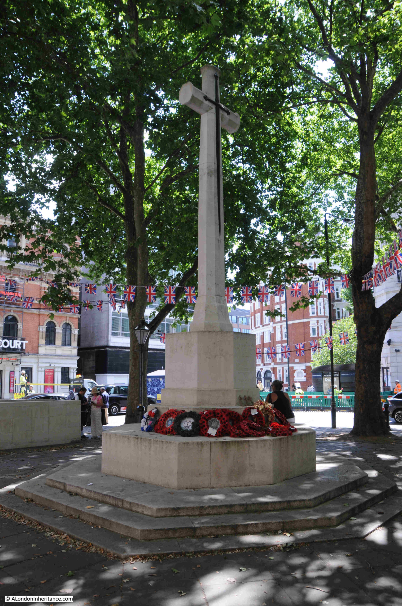
The Port of London Authority book “Access to the River Thames – Steps, Stairs and Landing Places on the Tidal Thames” lists 240 of these places between Teddington and Southend, and as you may have noticed from a number of blog posts, I am trying to visit all of them.
The 240 ranges from a causeway at Two Tree Island, near Southend, the last of the sites listed, via multiple sites as the Thames winds through London, out to Teddington, the end of the tidal river.
Back in May, I featured Bell Watergate Stairs in Woolwich, and today I am returning to visit another set of stairs in Woolwich – Nile Street Stairs.
This is the entry point to Nile Street Stairs from the embankment walkway:
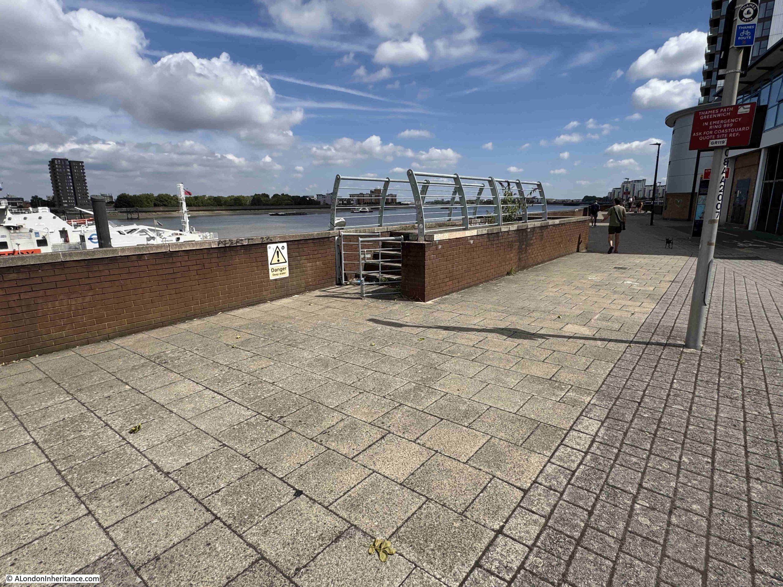
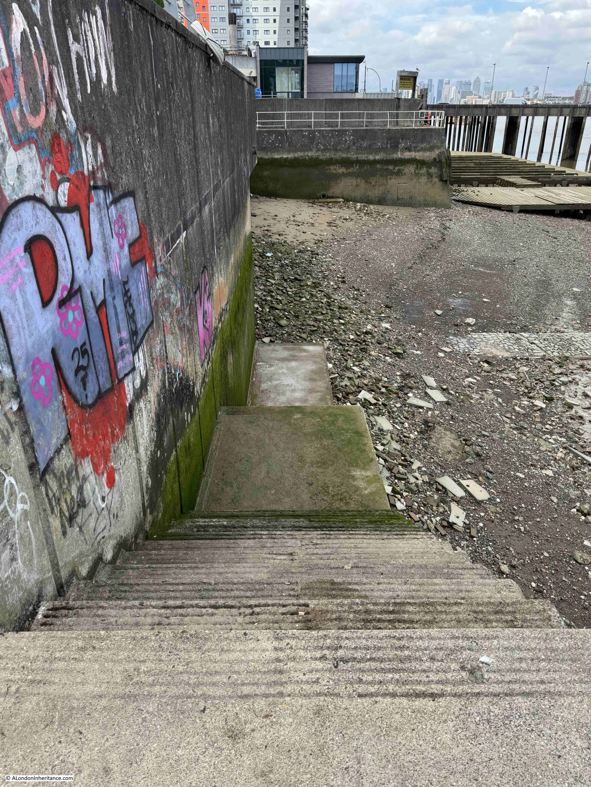
The location of the stairs down to the foreshore has changed slightly, as concrete stairs now run parallel to the river wall, down to where the causeway that led from the original stairs can be seen to the right:
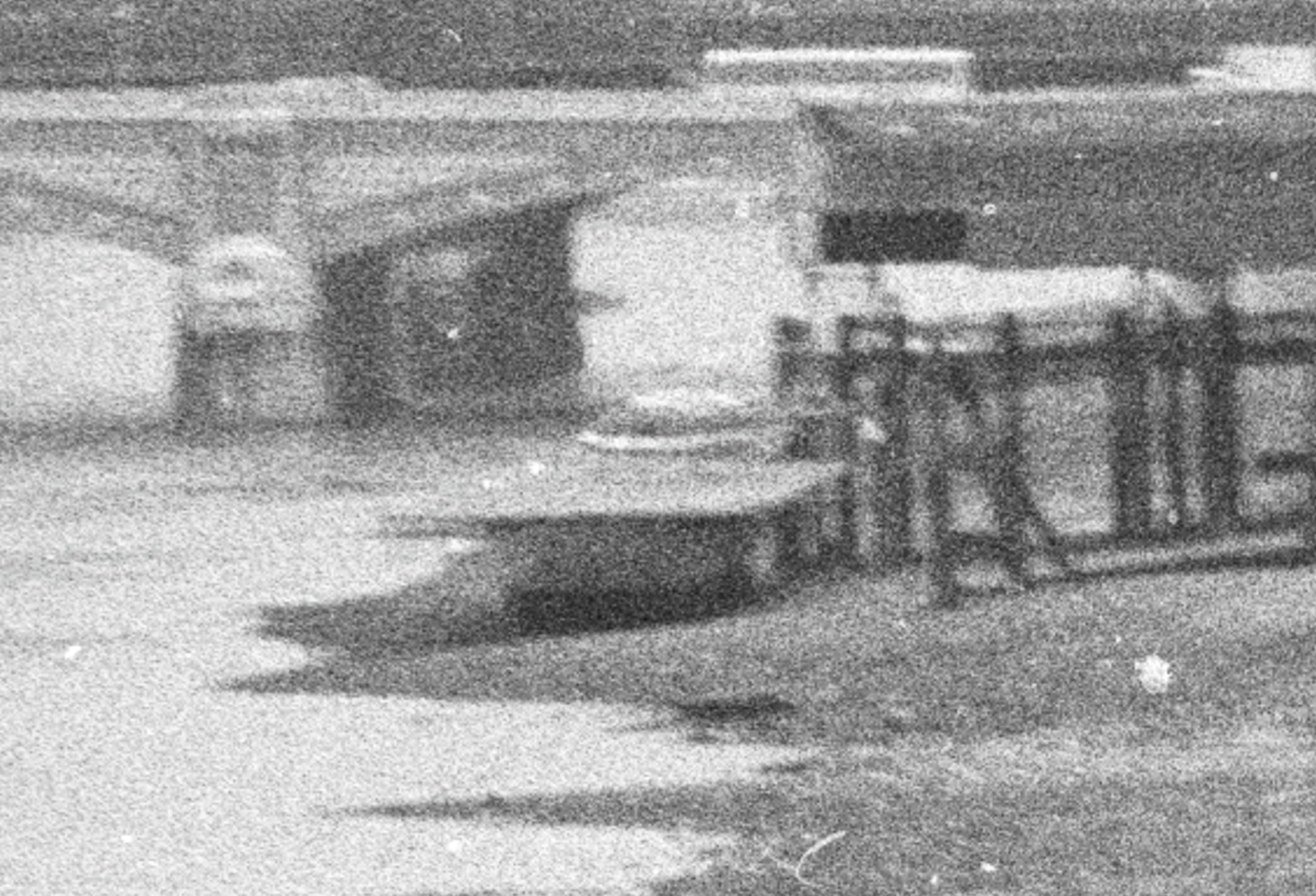
Looking to the right, we can see the full length of the causeway that ran from the stairs, with the access jetty to the Woolwich Free Ferry visible at top right:
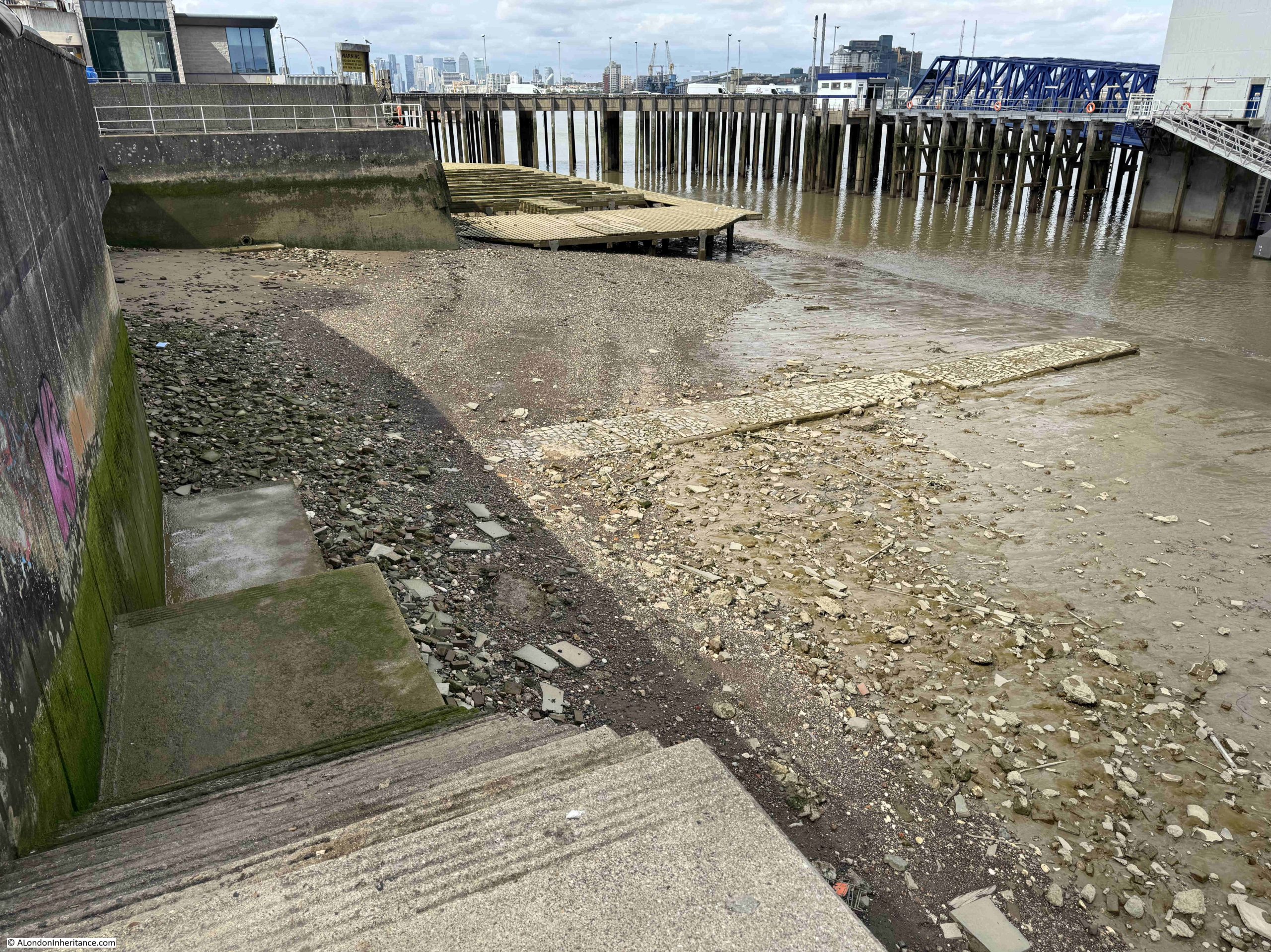
Nile Street Stairs and Causeway, with the Woolwich Free Ferry:
The causeway runs for some length across the foreshore, and provided a reasonably dry, mud free route between the base of the stairs and your boat which would have been alongside the causeway.
It is in a remarkably good condition. I do not know when it was last repaired, but it is a remarkable survivor given that the original pier to the Woolwich Free Ferry was built immediately to the right of the causeway. The pier and docking point for the ferry we see today is a mid 20th century change from its first location.
As with many other Thames stairs, they have been very many events related directly to the stairs, and a strange headline concerning the stairs in the Kentish Independent on the 3rd of May 1957 read – “The Affair Of The Wet Footprints”, and the article goes on to state “After police boats had been alerted to scour the Thames near the Woolwich Free Ferry on Friday night to look for a youth who was reported to have fallen feet first into the water, P.C. Booth found wet footprints leading from the ferry stairs. He followed them as far as the Odeon cinema where they petered out.
The pier master told police that he had seen an 18 year old youth in Edwardian clothes stagger down the Nile Street stairs alongside the ferry. He then hit the rails, straightened up and slipped feet first into the river.
Later another youth said he had seen a man come up the stairs soaked to the skin.”
A rather mysterious story, with the wet footprints and the youth in Edwardian clothes in 1957.
What is remarkable about Nile Street Stairs and the causeway leading across the foreshore is their survival, as it was here where the original access to the Woolwich Free Ferry was built.
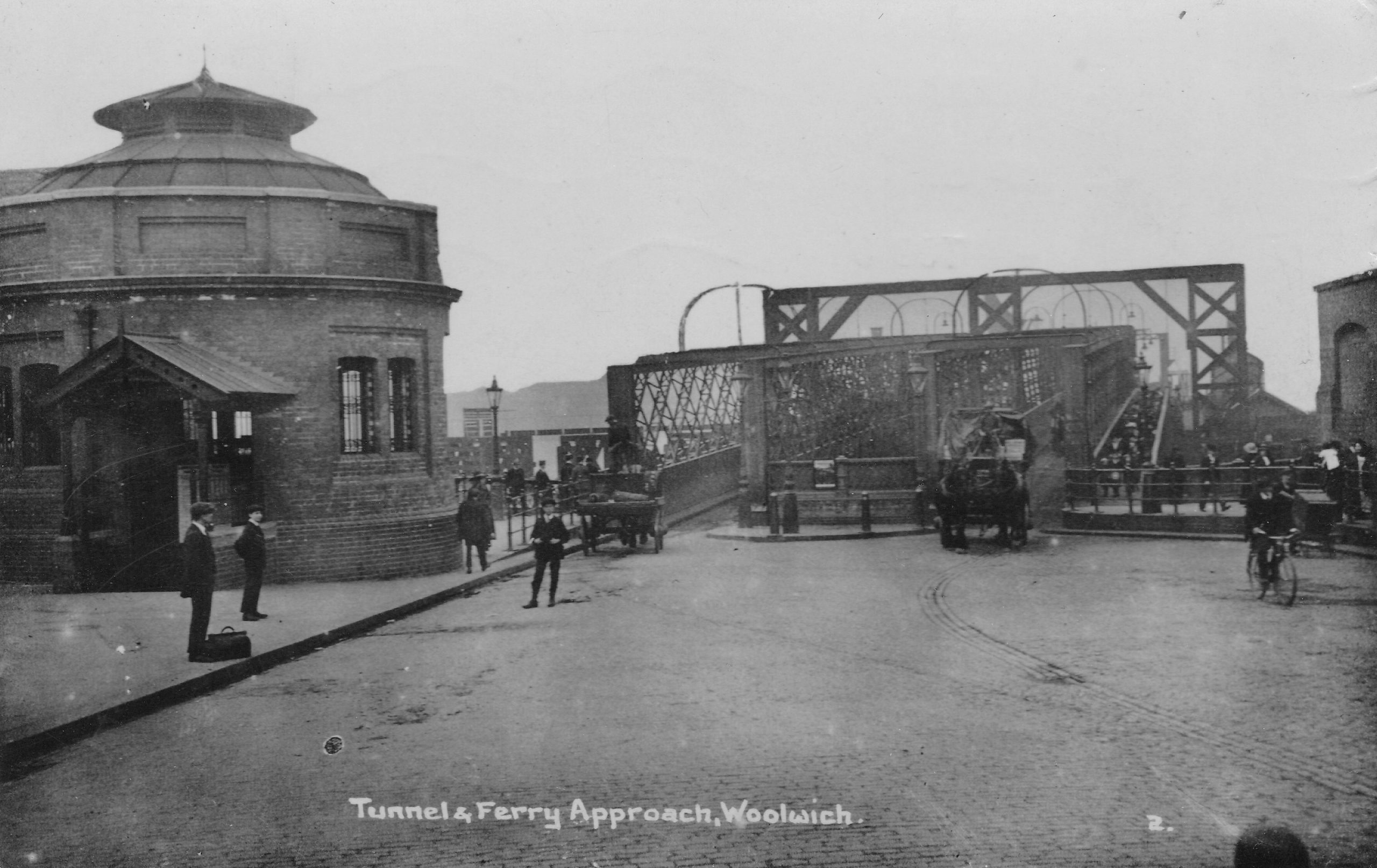
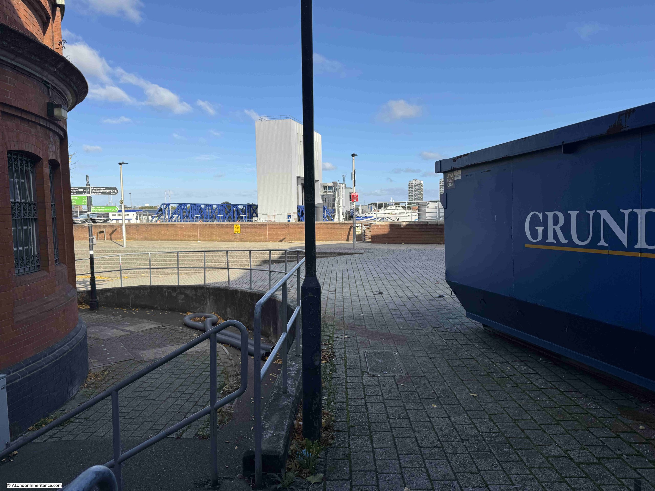
The following photo shows the entry to the foot tunnel to the left, and the pier providing access to the ferry straight ahead.
The stairs and causeway were immediately to the left of the ferry pier:
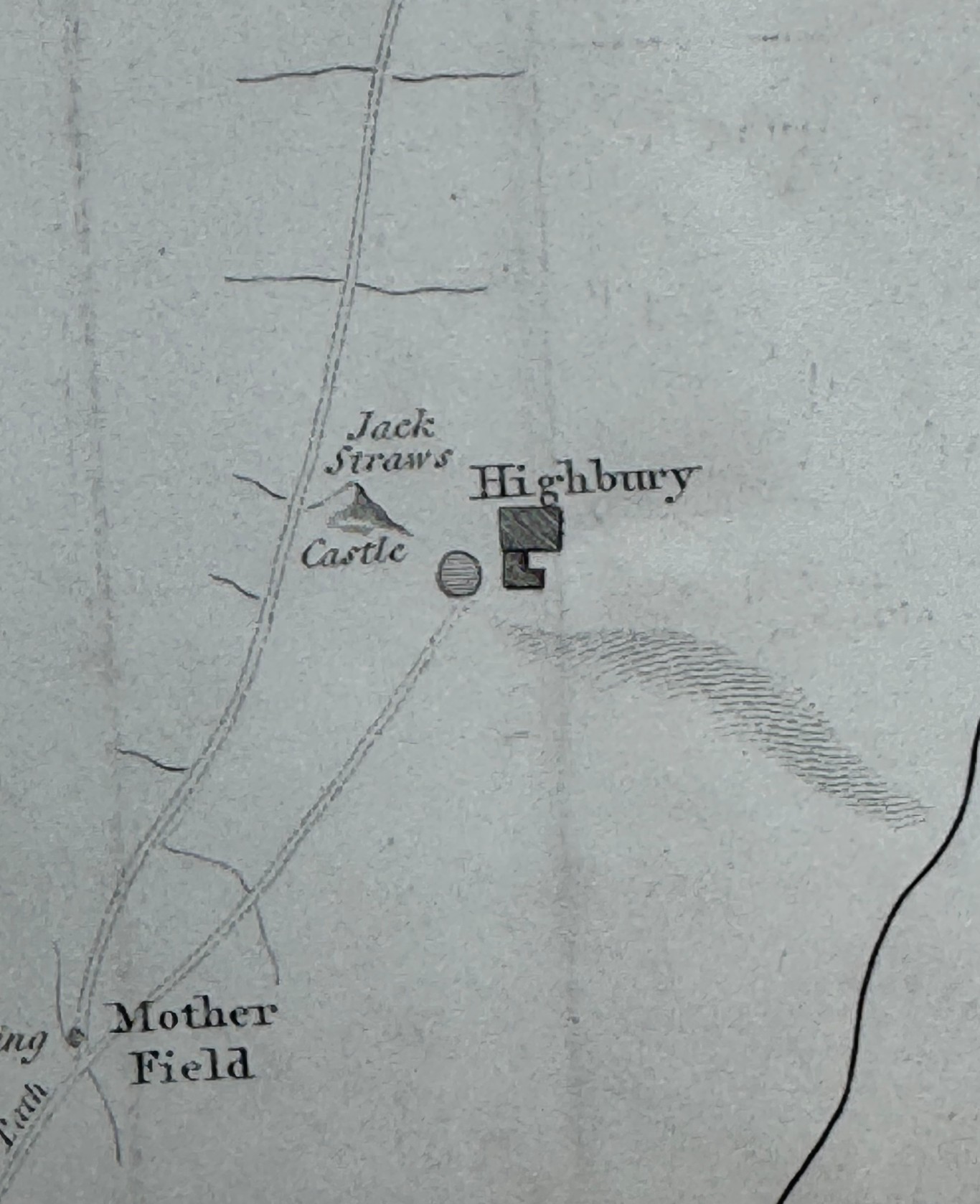
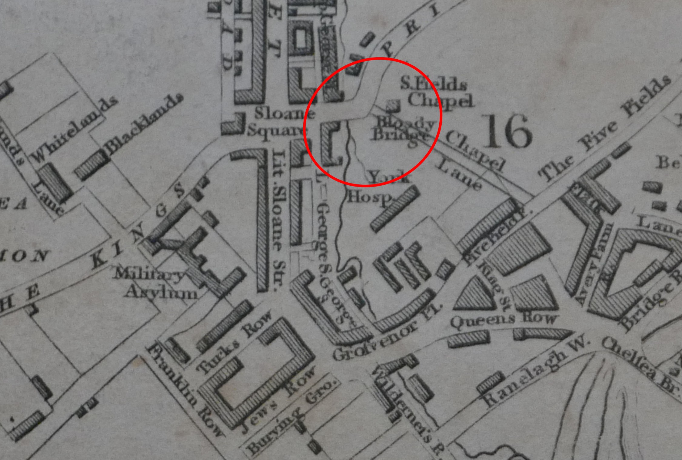
We can see how close they were in the following extract from the 1897 edition of the OS map, where I have arrowed the causeway (Map ‘Reproduced with the permission of the National Library of Scotland):
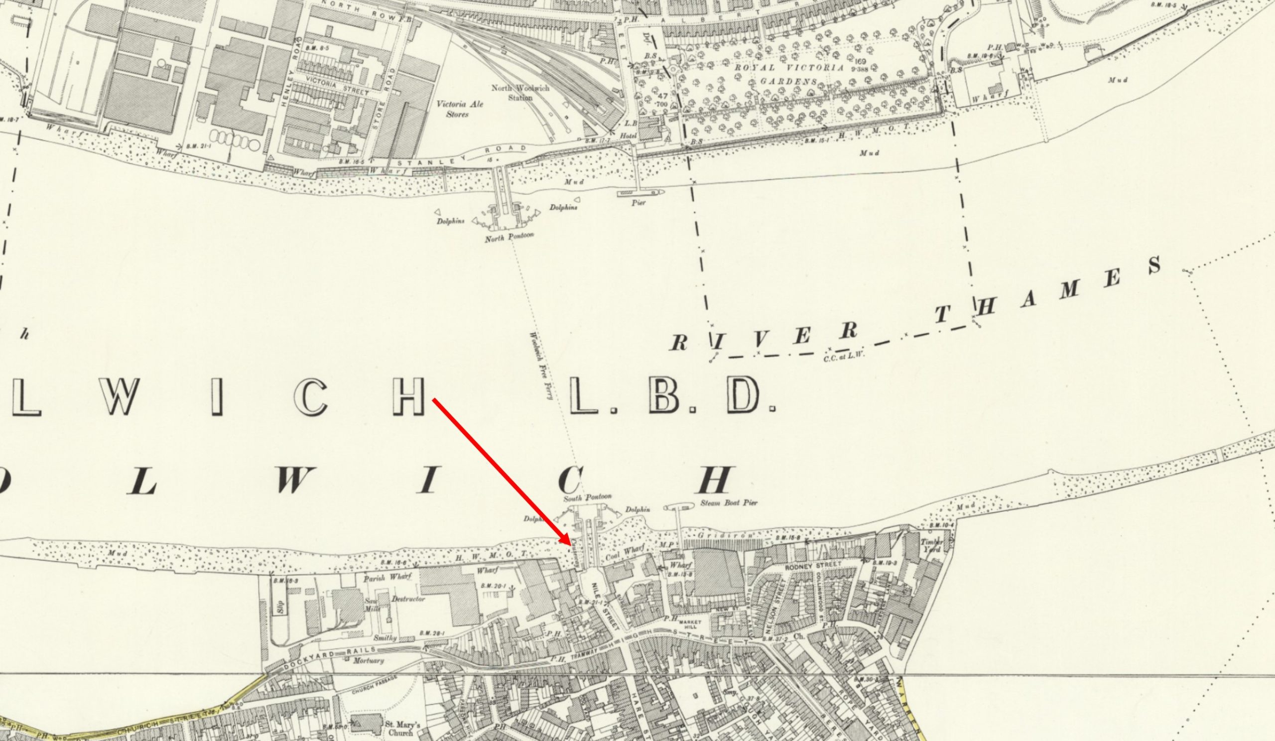
Which is much clearer in the following extract from the above map, where we can see Nile Street Stairs leading down, immediately to the left of the pier, and the causeway running out along the foreshore:
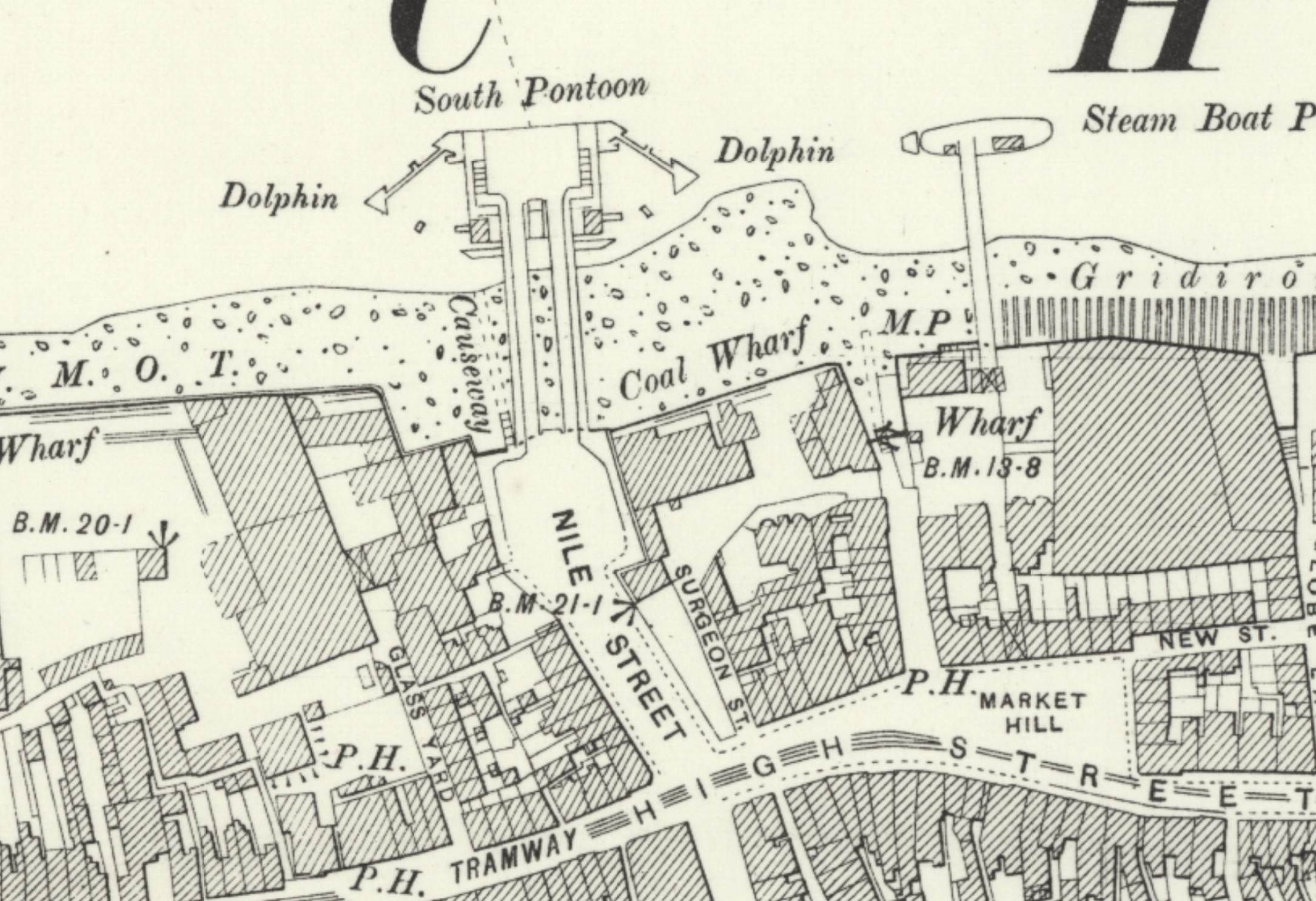
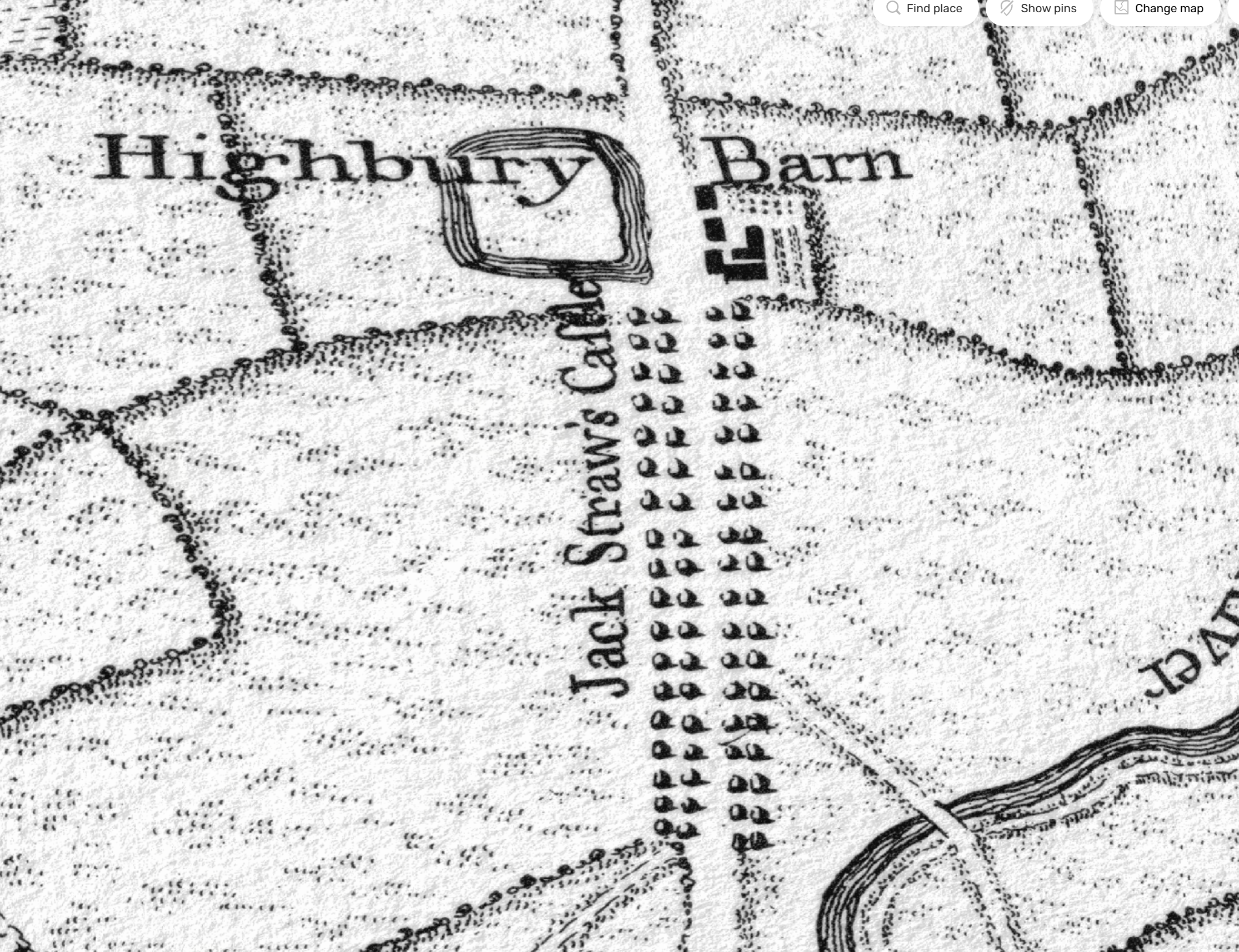
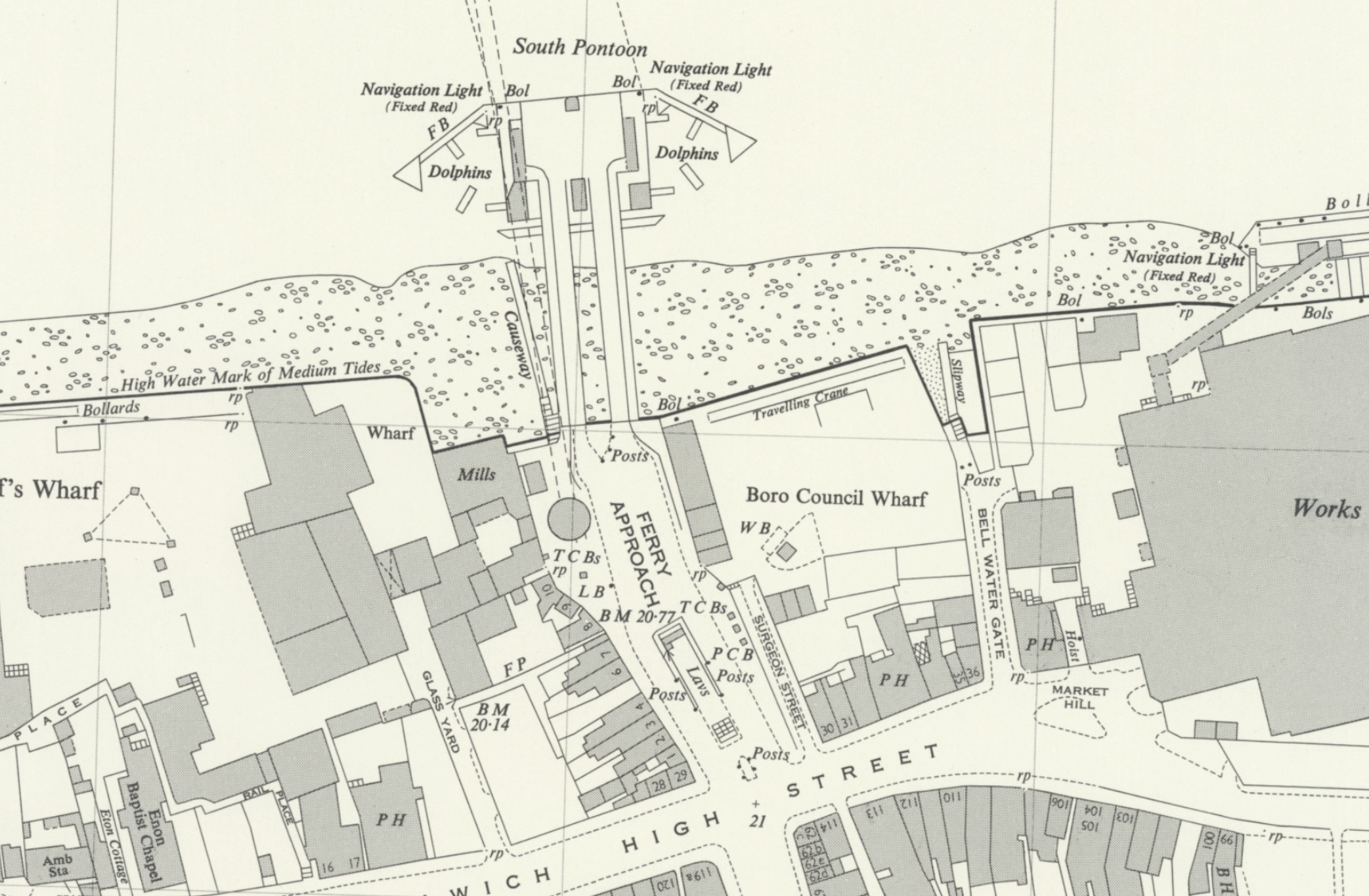
In the above map, the round entrance to the foot tunnel cannot be seen, as this had not yet been built. It was completed and opened in 1912, and in the following 1956 revision of the map, we can now see the round entry building to the foot tunnel, slightly inland from the pier and to the left of what was Nile Street, now named Ferry Approach, with the stairs and causeway still in place (Map ‘Reproduced with the permission of the National Library of Scotland):
The Woolwich foot tunnel had been built after the opening of the Free Ferry as an alternative method of crossing the river, when the ferry was not operational due to weather conditions such as fog and ice, maintenance problems etc.
Both OS maps only use the name “causeway”, rather than give the name Nile Street Stairs. It is named on earlier maps, one of which I will show later in the post. I suspect that the construction and use of the pier for the ferry diminished the importance and use of the stairs and causeway, which may have contributed to the failure to provide a name in these maps.
The above map also shows some brilliant street planning, as you have both the ferry and foot tunnel entrances side by side, so if you were in a hurry to get to your job at the Royal Docks across the river, and when you arrived, the ferry was not working, you could just detour to the tunnel entrance, and walk under the river rather than sail across.
You can also see in the middle of Ferry Approach, a space with the word “Lavs” – some public toilets, also possibly essential in what must have been a place with a very high footfall, as thousands of workers once used either the ferry or tunnel to get to their place of work, either at Woolwich Arsenal, the Royal Docks, or the very many industrial premises that lined the river on northern and southern sides.
In the following photo from the current top of the stairs, I am looking back along what was Nile Street. The round brick access building to the Woolwich foot tunnel is to the right, and the Woolwich Waterside Leisure Centre is the building to the rear of, and surrounding the foot tunnel entrance. The Leisure Centre was also built over Nile Street:
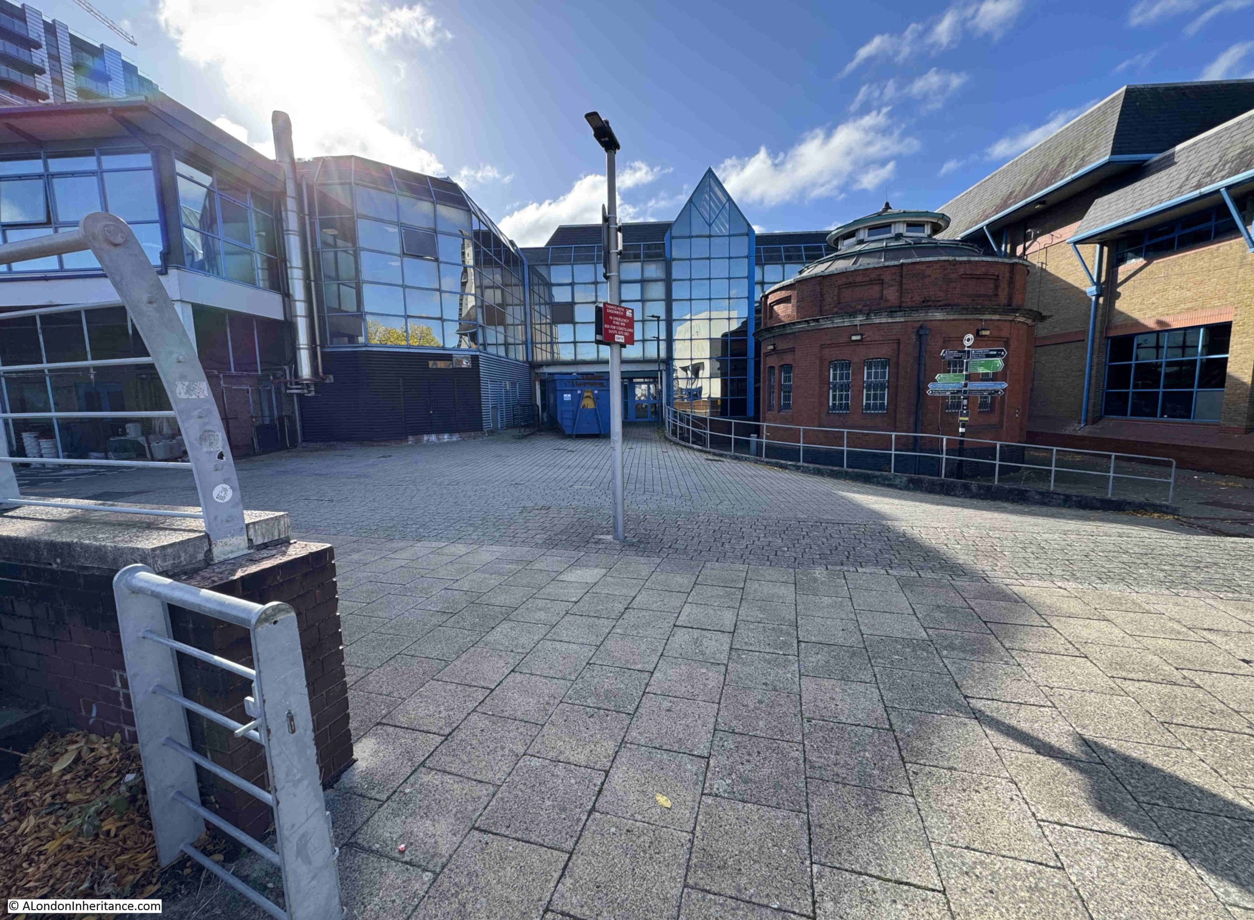
The following photo was taken from the edge of the leisure centre, as far back as I could get, to try and recreate the old photo earlier in the post. I should have been much further back, but the leisure centre now sits above Nile Street:
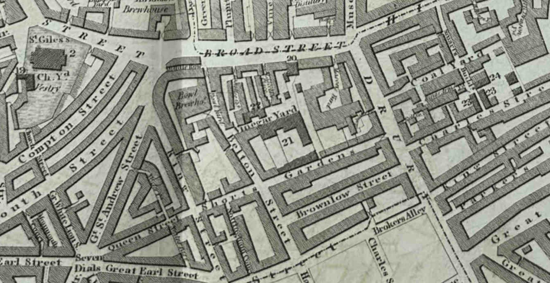
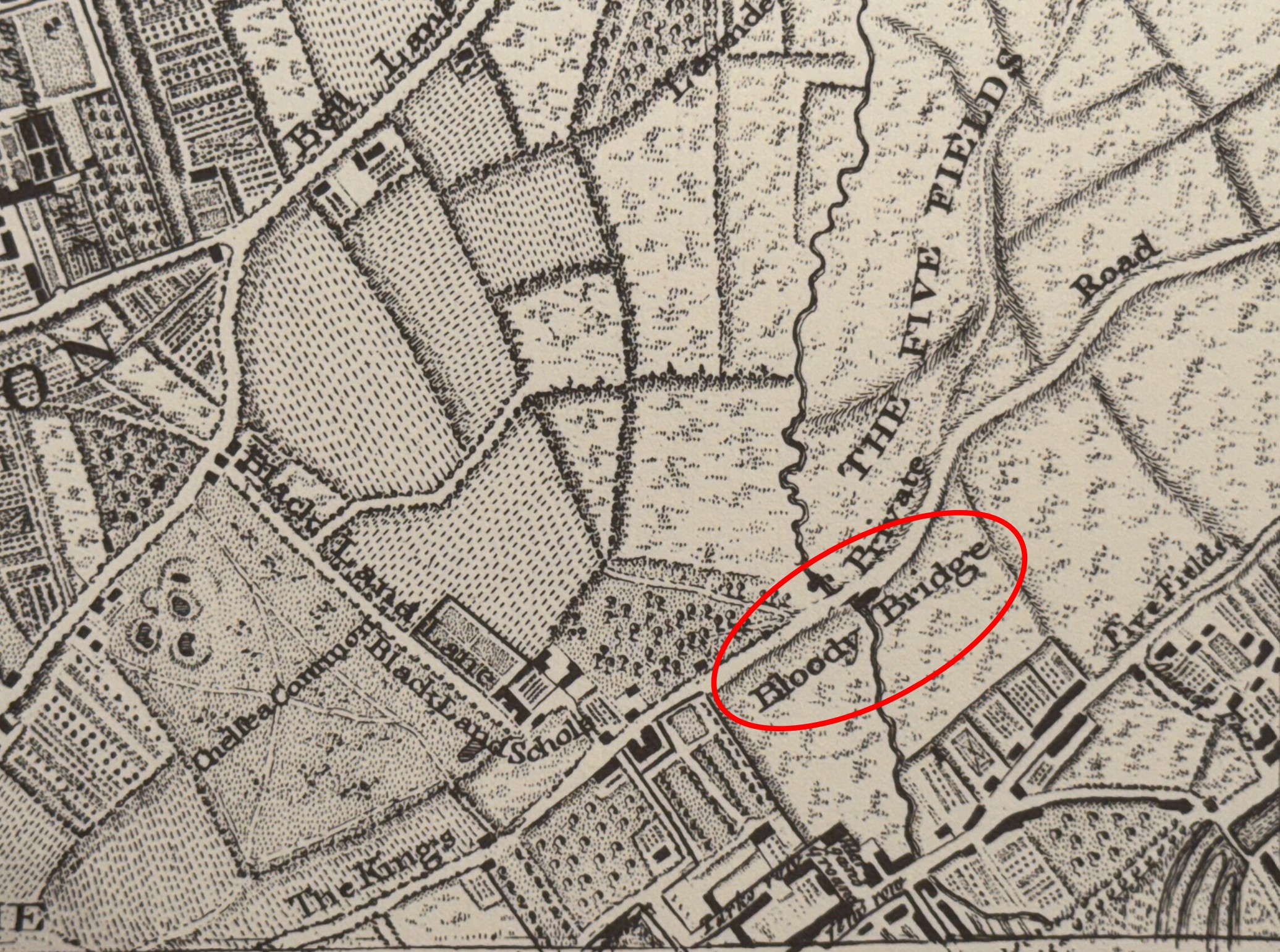
The area around Nile Street, the old ferry pier, and north towards Woolwich High Street has been considered as the original nucleus of the town of Woolwich, and many of the old street names recall rural surroundings. Streets in the area had names such as Hog Lane, Dog Yard, Hare Street and Cock Yard, and Hog Lane was the original name of Nile Street, as we can see from Rocque’s 1746 map of London, where I have underlined the name in red, as it was also used to name the stairs:
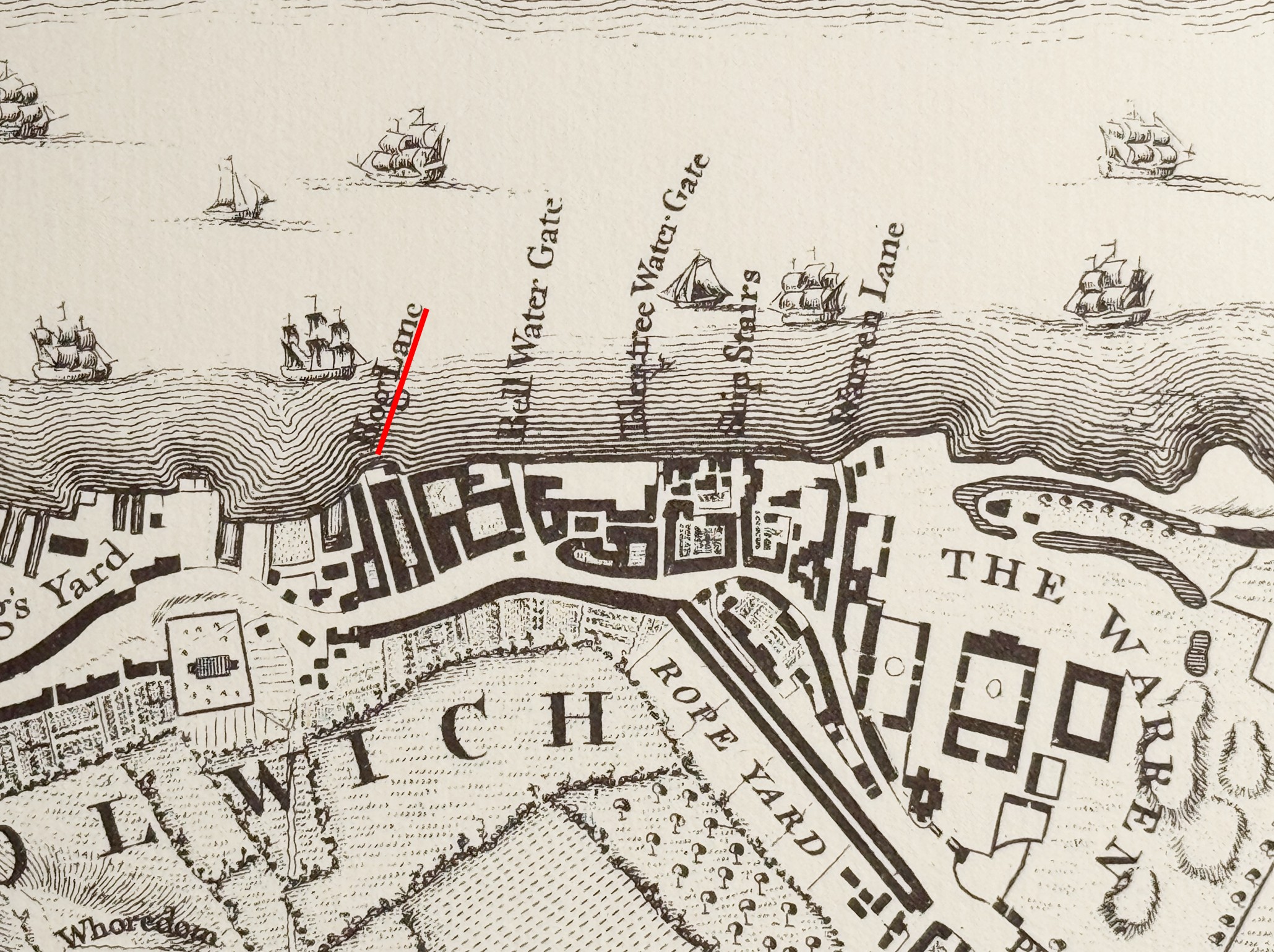
Rocque’s map shows the origins of Woolwich as a number of streets and buildings clustered along the river, with a total of five stairs providing access to the river. Hog Lane was both the name of the stairs and the street running back from the stairs, both of which would later change to Nile Street.
To the right of Hog Lane stairs in the above map is Bell Water Gate, which I wrote about in this post.
I cannot find out when the name changed, but I did wonder, given the ship building, naval and military aspect of Woolwich, with the Royal Arsenal (part seen to the right of the above map by the name of “The Warren”, whether the name changed in the late 18th / early 19th century following the 1798 Battle of the Nile where a fleet led by Nelson defeated a French fleet at Aboukir Bay, at the mouth of the River Nile where it flows into the Mediterranean.
This theory falls apart though as Hog Lane still appears in use for much of the 19th century, so in 1861 there is a newspaper report of a drunken man being robbed in Hog Lane, after he had gone to Hog Lane Stairs to wait for a boat, fell asleep, and on waking found that he had been robbed of his hat, handkerchief, boots and money.
Also in 1861 there was a report of a woman’s suicide at Hog Lane Stairs. She was wandering the foreshore and was asked by two boatmen whether she wanted a boat, but replied that a boat was coming for her. After going up the stairs, and returning sometime later, they found the same woman face down in the river.
The use of Hog Lane seems to die out after the 1860s, and in 1882 there is a report of the theft of timber from a wharf . It had been stolen from the pond adjacent to the owners wharf, and was re-landed at Nile Street Stairs, where the timber was sold for chopping into fire wood.
In 1915, Police Constable Taylor received the Royal Humane Society’s certificate for rescuing a boy from drowning at Nile Street Stairs.
The above news reports show why I find Thames stairs so fascinating. It is not just their physical nature, it is the very many stories of London life that can be pinpointed to their specific location. Looking over the river wall at the causeway and thinking about the thousands of Londoners who have used the steps and causeway, their stories, mostly just using the stairs to travel across or along the river, but also what drove some of them to suicide, crime, and the heroism of a rescue of a child from the dangerous waters of the Thames.
I have a theory that the majority of Thames stairs had a pub alongside. This seems true for nearly all stairs in Wapping, Shadwell, Limehouse, Rotherhithe etc. but also seems to be true for Woolwich.
There was a pub called the Nile Tavern adjacent to the stairs. In 1848 this pub was to be Let or Sold, and the following details were in the Morning Advertiser on the 15th of June 1848:
“Woolwich, Kent – Most excellent FREE WATER-SIDE PUBLIC HOUSE and TAVERN – to be LET or SOLD, with immediate possession, the Nile Tavern, Hog-Lane, Woolwich, situated adjoining the stairs next the Royal Dockyard, close to the Steam-boat Piers, and directly opposite the Eastern Counties Railway. The house is at present doing upwards of 20 puncheons of porter per month, with spirits , &c. in proportion, but which may be considerably increased.”
In other adverts for the pub it is described as “river facing”, so must have been at the river end of Hog Lane / Nile Street and facing onto the river.
I wonder if the pub was named after the Battle of the Nile, and the street changed name to reflect the name of the pub.
The Eastern Counties Railway refers to the railway and station that had just arrived in North Woolwich, and the steam boat piers refer to piers for boats travelling along the river, as well as the ferry set up by the Eastern Counties Railway to transfer rail passengers between their station of the north bank, and Woolwich on the southern bank of the river.
And if you fancy trying to order a “puncheon of porter” for Christmas from your local off licence, a puncheon is a third of a tun, which was a large barrel that held 252 gallons of wine.
In another advert, the Nile Tavern was described as “fronting the Thames and conveniently arranged for doing an extensive Public house and Tavern Trade, which its situation is always sure to command, being the nearest house to the shipping lying off the Royal Dockyard, and the place for embarkation for all persons connected therewith, and others employed on the river, the waterside premises” – a description which perfectly summarises why there was nearly always a pub next to a set of Thames Stairs, when the river was the working heart of the city.
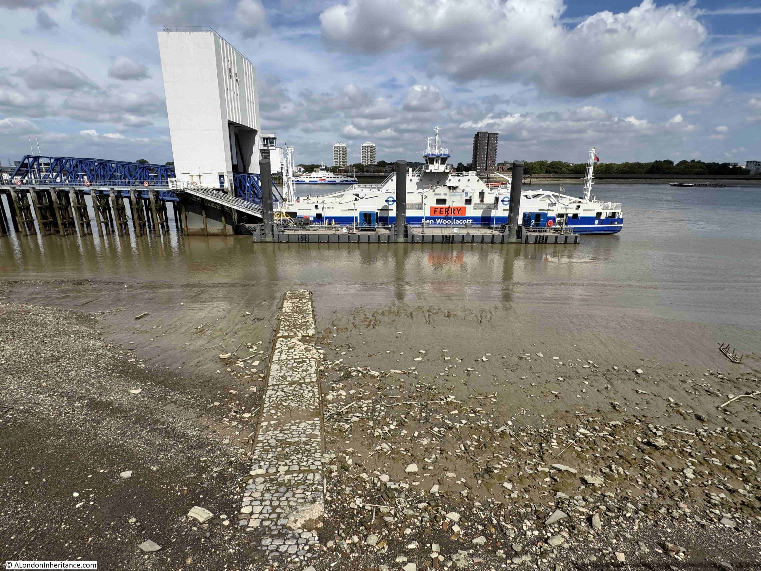
In the following photo from the Woolwich ferry, part of the causeway is just visible emerging from the receding tide. The stairs are now on the left, but originally followed the causeway back and up to the land. The Nile Tavern must have been to left or right of the stairs, and Nile Street / Hog lane headed back to the left of the round foot tunnel entrance, under what is now a sports centre, and up to Woolwich High Street:
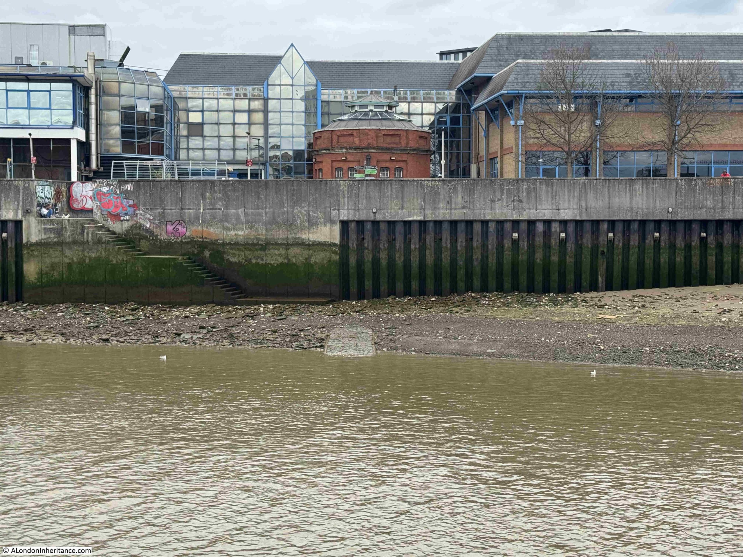
Woolwich is protected from the river by high concrete walls, as is the opposite shore along North Woolwich. The above photo provides a view of these defences.
They are needed as Woolwich is downstream of the Thames Barrier, and is therefore not protected by the barrier. When the barrier is closed, the height of the water is a remarkable spectacle.
Whilst the Thames has for centuries been the source of London’s economic growth, prosperity, work, trade and travel, it has also been a source of danger to the low laying land along the sides of the river.
Nile Street and the Nile Tavern were mentioned in reports of a major storm during the first week of January 1887 when the “weather had been rough and stormy during the greater part of the week. Heavy rain had fallen every day and the temperature has continued unseasonably high”.
In Woolwich, several houses in Nile Street were flooded, as was the cellar of the Nile Tavern, and along the length of the Thames there was flooding from the lower portions of Chiswick and Hammersmith, where barriers were erected. Parts of Kew and Richmond were flooded, and in central London, Nine Elms, Wandsworth, Lambeth, Blackfriars, Deptford and Rotherhithe were all reported as suffering from flooding.
In Shadwell there was an “inundation”, and the “sailors and waterside characters turned out en masse, and beguiled the small hours of the night with songs in praise of the ocean and the river. The poorer of the people who worked in the docks were great sufferers of the inundation, which at one time threatened to wash away their wretched houses.”
In a similar way to the storm and floods of 1953, the 1877 storm also caused flooding along parts of the east coast, and in Lincolnshire and Cambridgeshire.
Nile Street / Hog Lane Stairs – that is another of the 240 river access points on the tidal Thames.
Each has been a part of the development of their local area, both on the river and on land. For many thousands of people over the centuries, they were an important place for so many reasons.
We have lost that connection with the river, but it would be good if the name of these stairs was on display, along with a brief bit of their long story and how important they once were to the people of Woolwich.