Over the last couple of years, I have been writing about a number of the Thames stairs in central London, however for today’s post in my weird obsession with these places on the river, I am visiting Two Tree Island in Essex, to find the last landing place on the Thames.
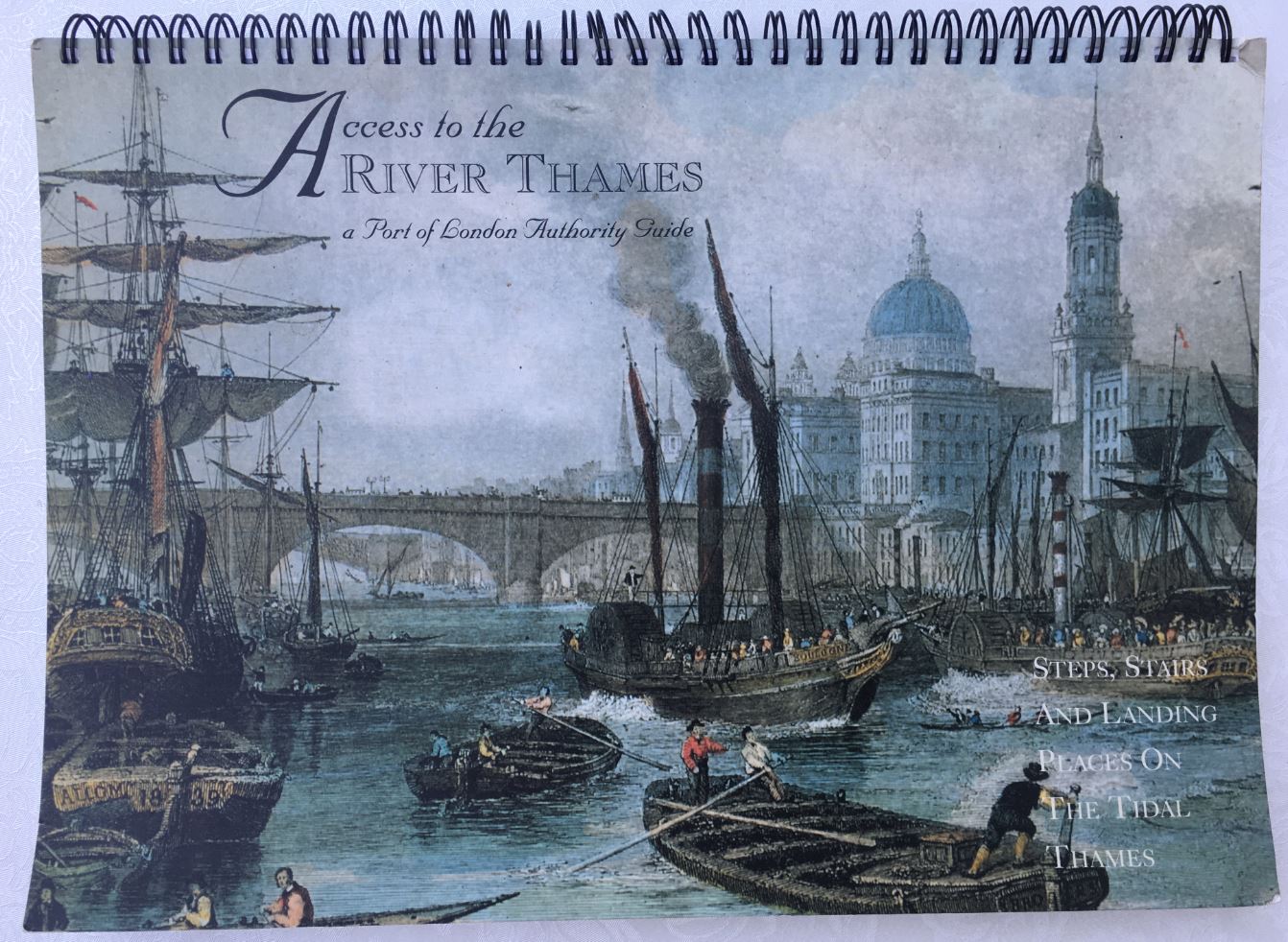
I need to clarify the definition of last landing place. I am using the list of steps, stairs and landing places on the tidal Thames, as listed in the book on access to the river published by the Port of London Authority:
The book lists all the landing places, steps and stairs on the tidal river, which is the area of the PLA’s responsibility, so from Teddington in the west, to near Southend in the east.
The definition of the last landing place could be at either extreme of the tidal river, depending on which way along the river you were heading, however for the last landing place, I am using the location on the last page in the book, and furthest east on the maps within the book.
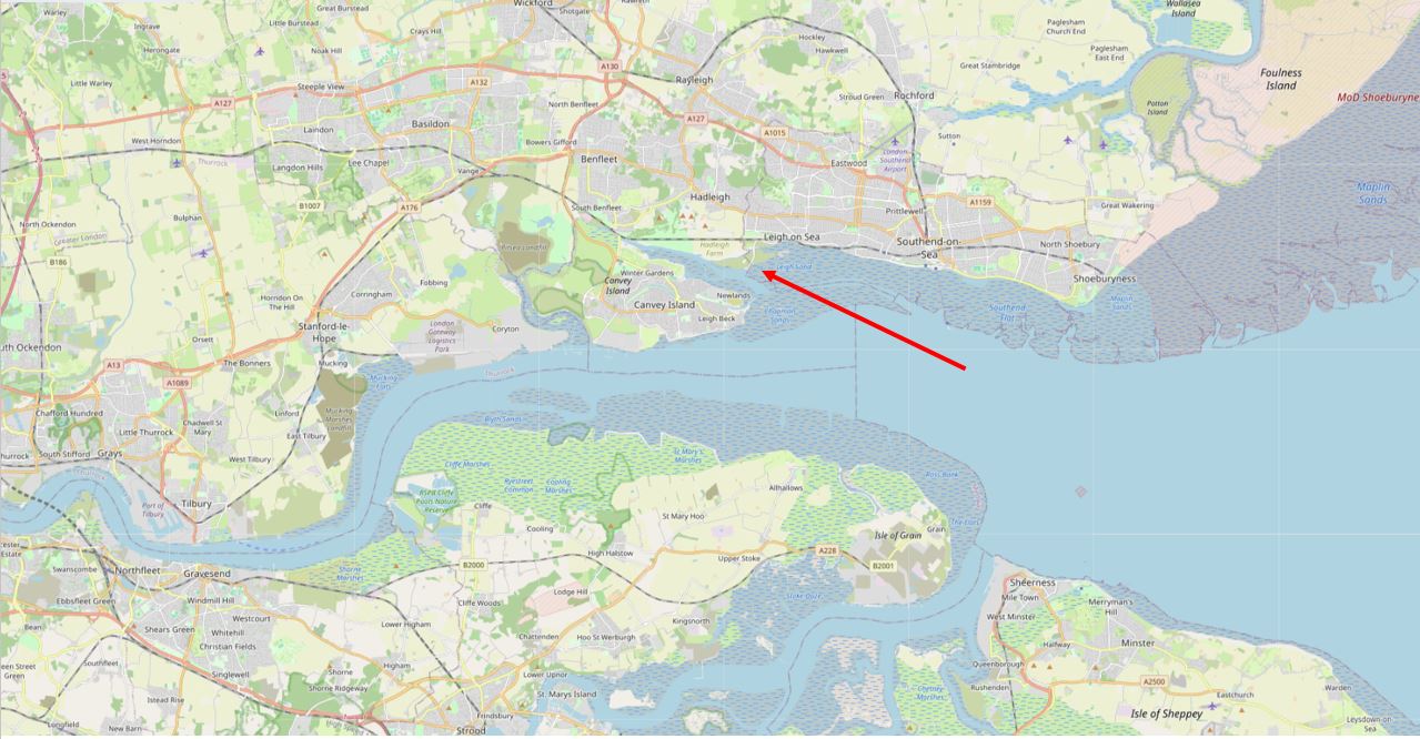
A couple of weeks ago, we were going to a concert in Southend, so it was the perfect opportunity for a diversion to find Two Tree Island, and the causeway.
Two Tree Island is, as the name suggests, an island, and is located between Southend and Leigh-on-Sea, and Canvey Island.
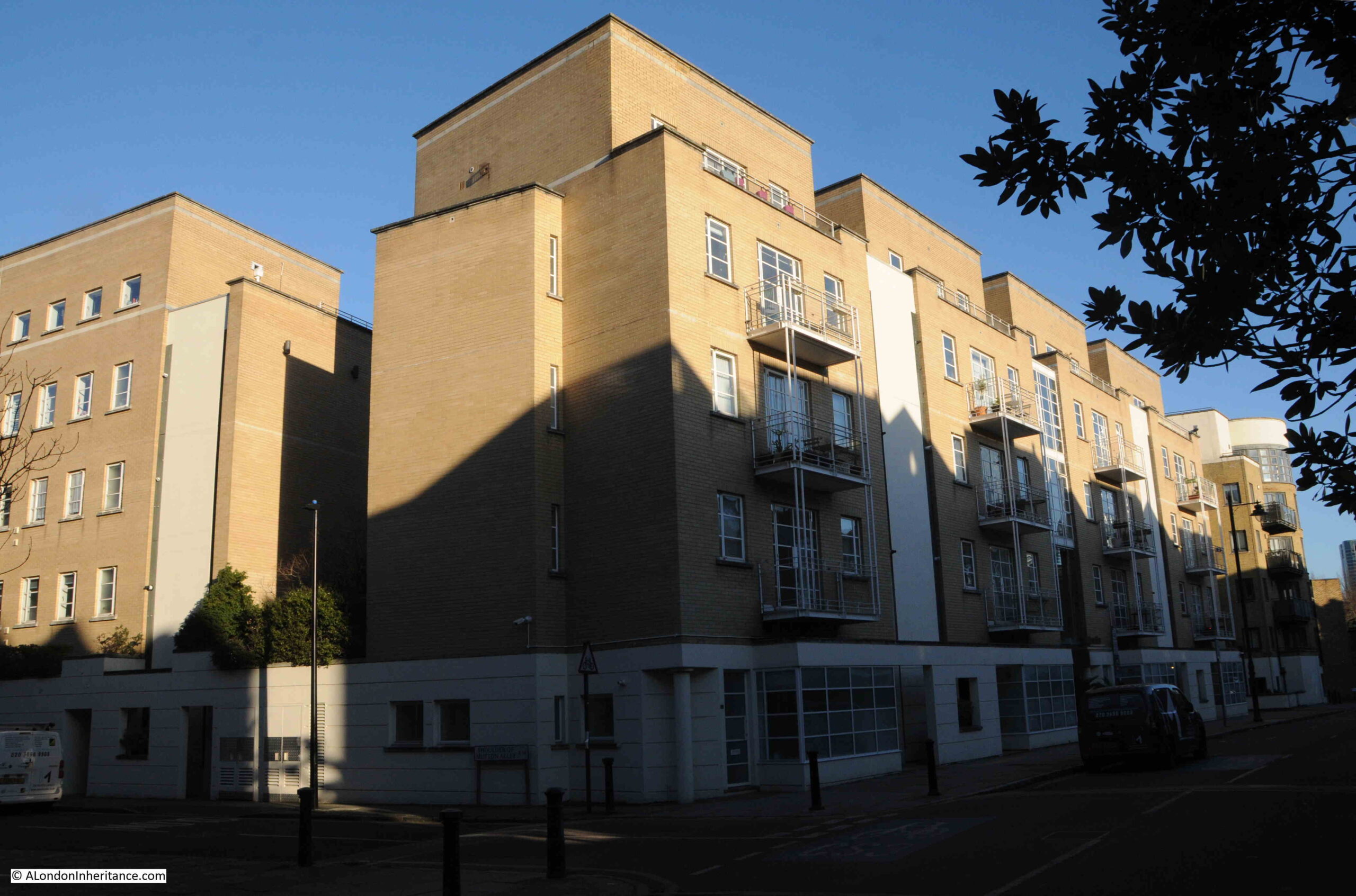
The island nature of the place can be seen on the one road to the island, with the need to cross a bridge which takes you over the channel which runs to the north of Two Tree Island:
Looking west as you cross the bridge, and the nature of area becomes clear, low-lying, channels of water, and subject to the changing of the tide:
Looking over the eastern side of the bridge, there is a small marina on the left. This often dries out when the tide is low, but during my visit, the tide was coming in and the width of the channel was widening:
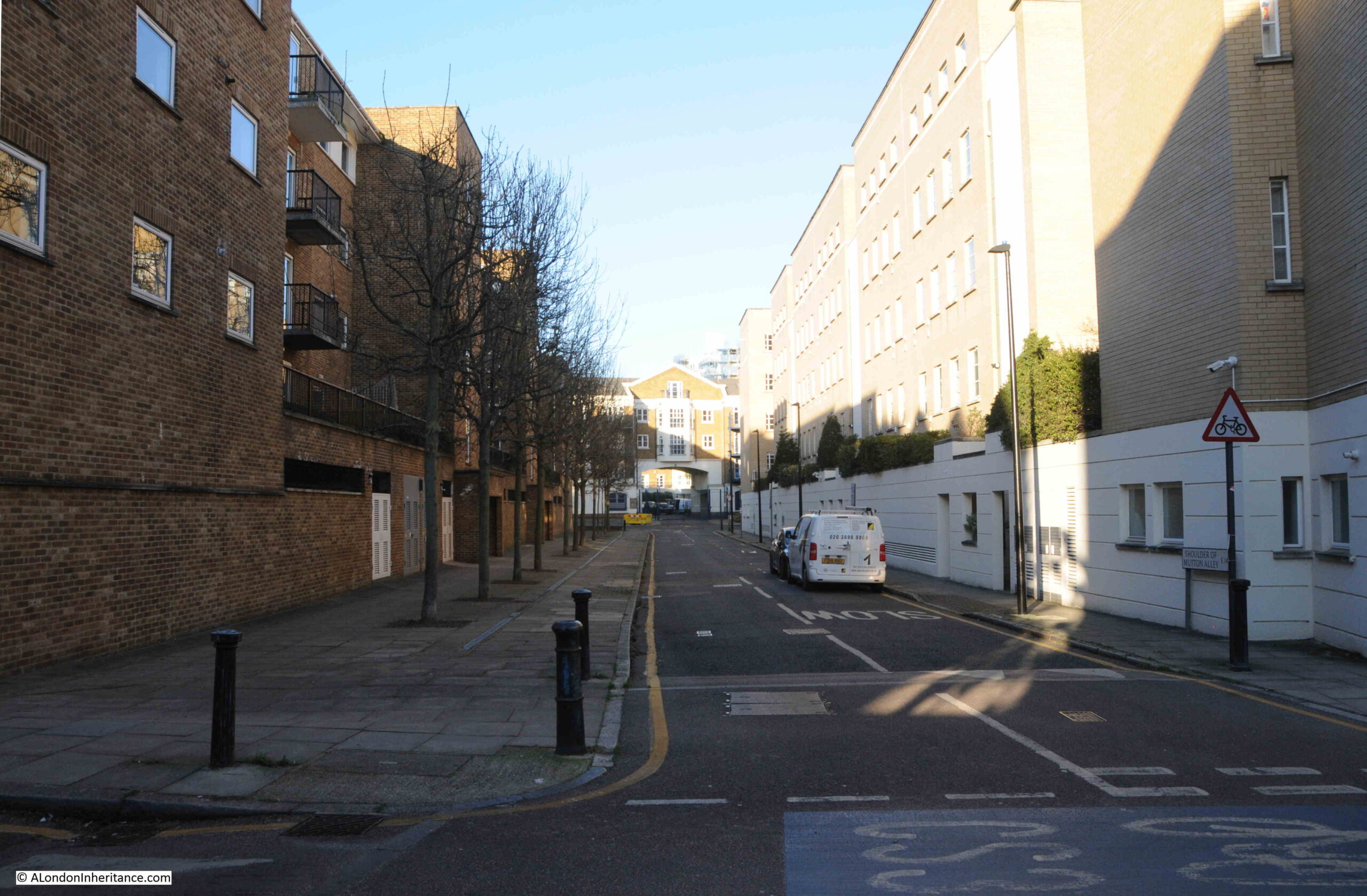
Having crossed the bridge, and we can look back and see the edge of one of the housing estates that surround Leigh-on-Sea, on the high land that centuries ago was the natural barrier to the Thames:
Two Tree Island has not always been land. It was reclaimed from the river in the 18th century and used as farmland. In 1910, a sewage works was built on the north east edge of the island, and for parts of the 20th century, it was also used for landfill.
Two Tree Island was flooded during the major flooding of the east coast and Thames estuary during 1953.
Once over the bridge, there is a sign welcoming you to Two Tree Island, and the sign indicates the current use of the land as it is managed by the Essex Wildlife Trust:
I can find no confirmed source for the name of the island. There are may trees on the island today, perhaps when the land was first reclaimed, when it was farmland, there may have been two distinctive trees. The first written reference to the name I can find is from 1967, when the site was included in a list of reserves set-up by the Essex Naturalists’ Trust.
The site was also called Leigh Marsh, and there are older references to this name, for example in 1836, when the the owner of the land had died, and their executor was selling the farm and farm land that the deceased had owned, which included: “Also 179 acres, 1 rood, 36 perches of valuable marshland, situate in the parishes of Leigh and Hadleigh, called Leigh Marsh, with a dwelling house and out-buildings, which is let until Lady-day next, £120 per annum.”
The land was valuable as it was good grazing land, and the mud flats and sea bed of the estuary off Two Tree Island was also used as shell fish beds, so the whole area was a valuable, agricultural site.
There has always been the threat of development in places along the river. In 1973, Maplin Airport, further east, off Foulness Island, was being considered as a new London Airport, and Southend Council put forward Two Tree Island, and the surrounding marshes, as a new nature reserve to compensate for the loss of land at Foulness and in the Thames Estuary.
The previous year, 1971, a “massive yacht marina” was proposed for Two Tree Island, however this was thrown out by Southend Council.
The majority of the island is now nature reserve, with plenty of tracks to walk, there is a small air strip for a model aircraft club, and a slowly decaying Pill Box as a reminder of the threat of invasion along the estuary in the last war.
The remains of the old sewage works are now providing a haven for birds, including nesting Egrets.
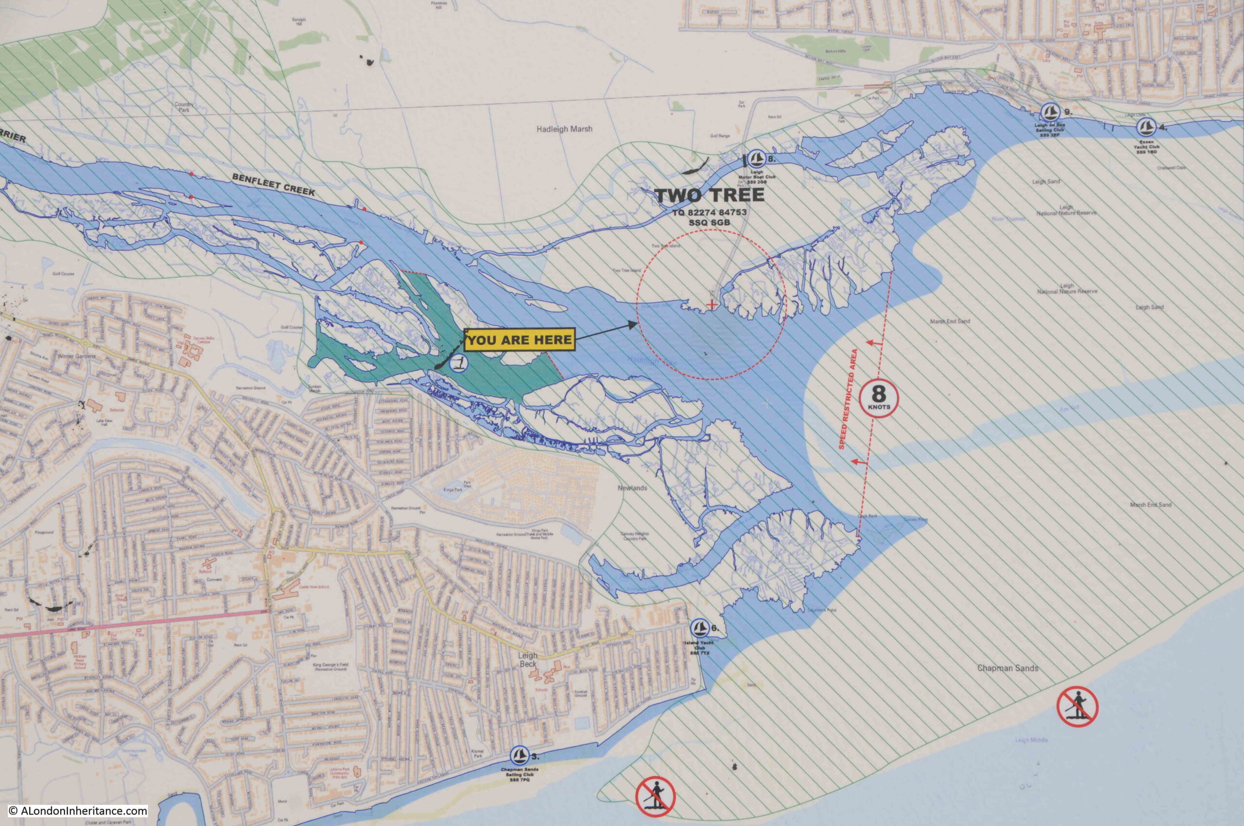
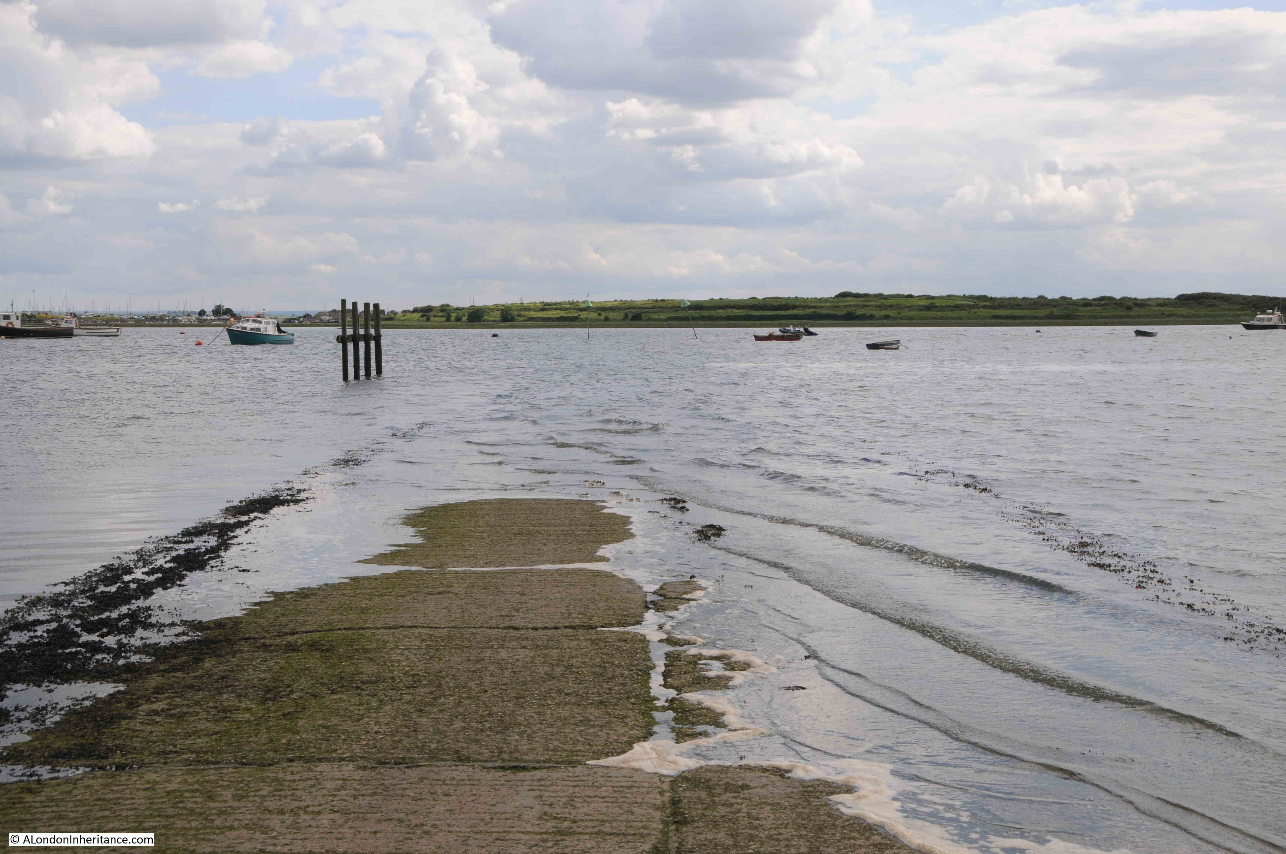
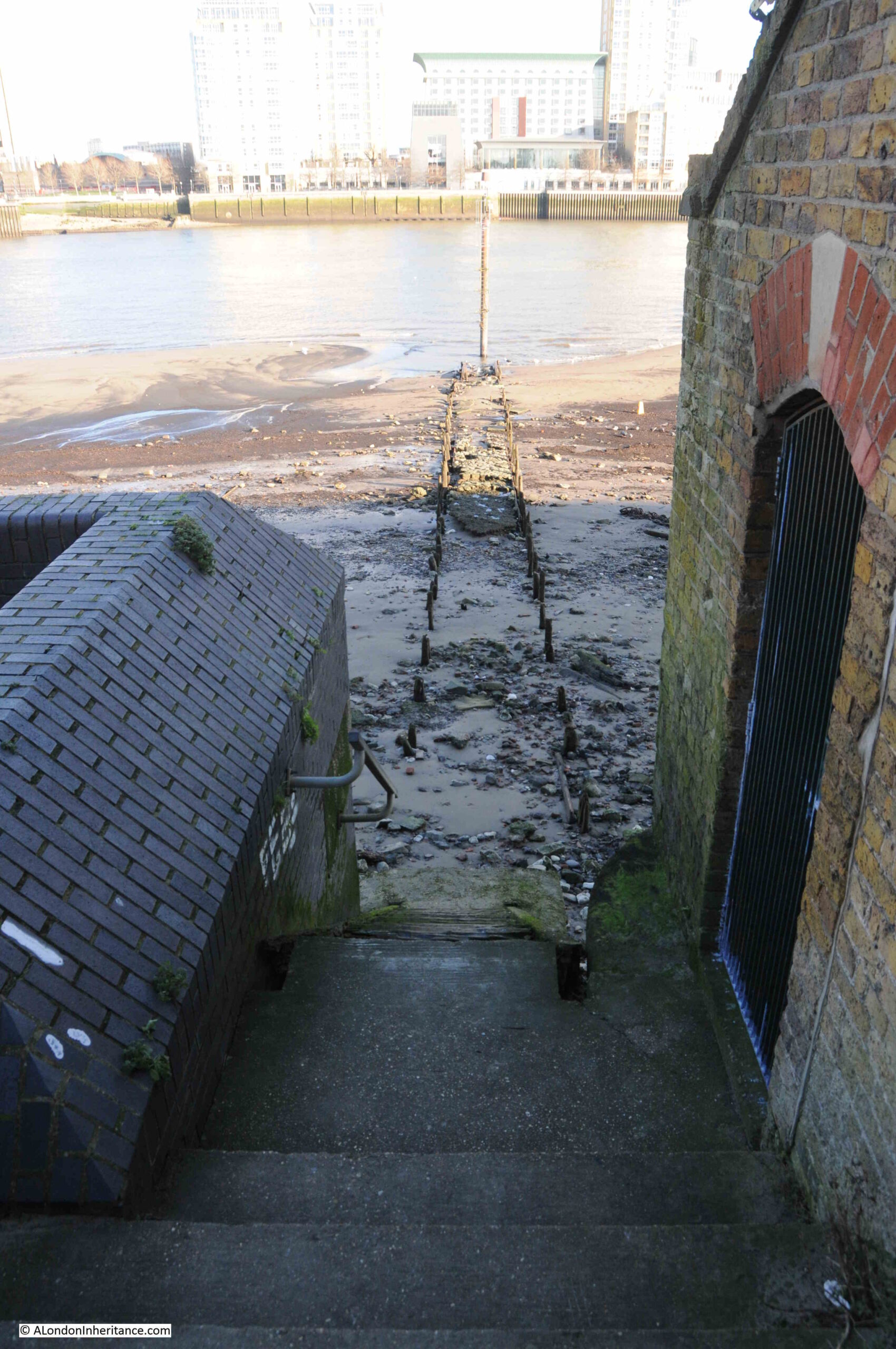
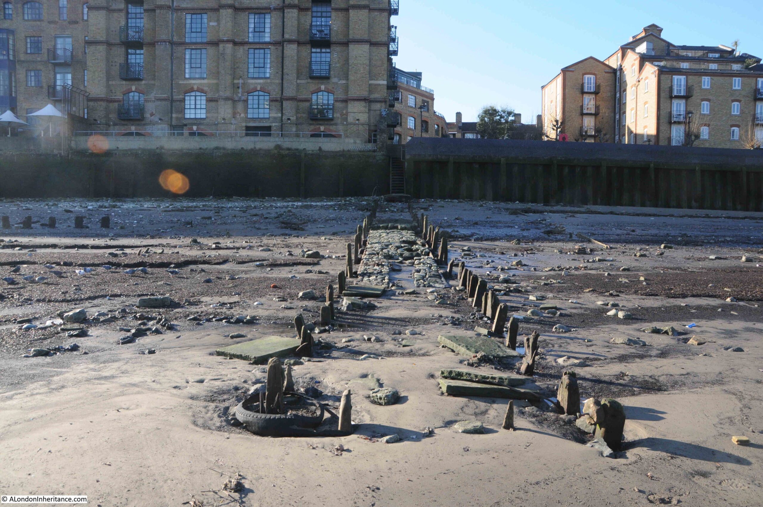
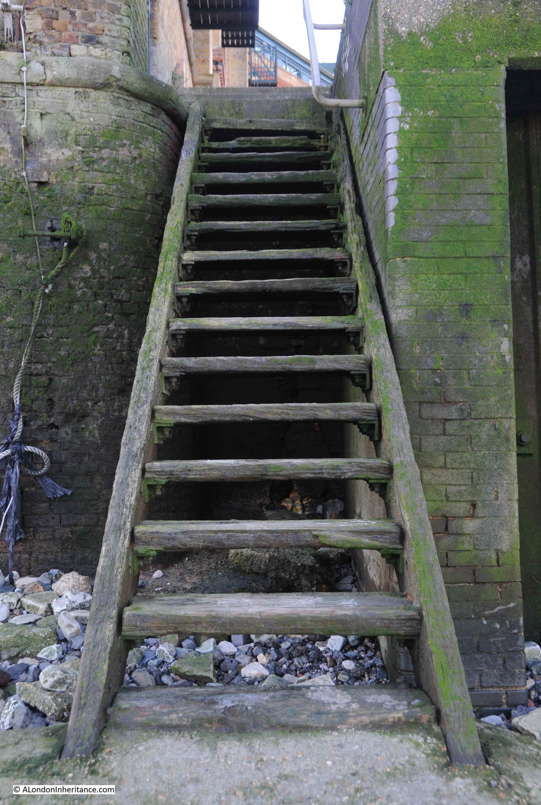
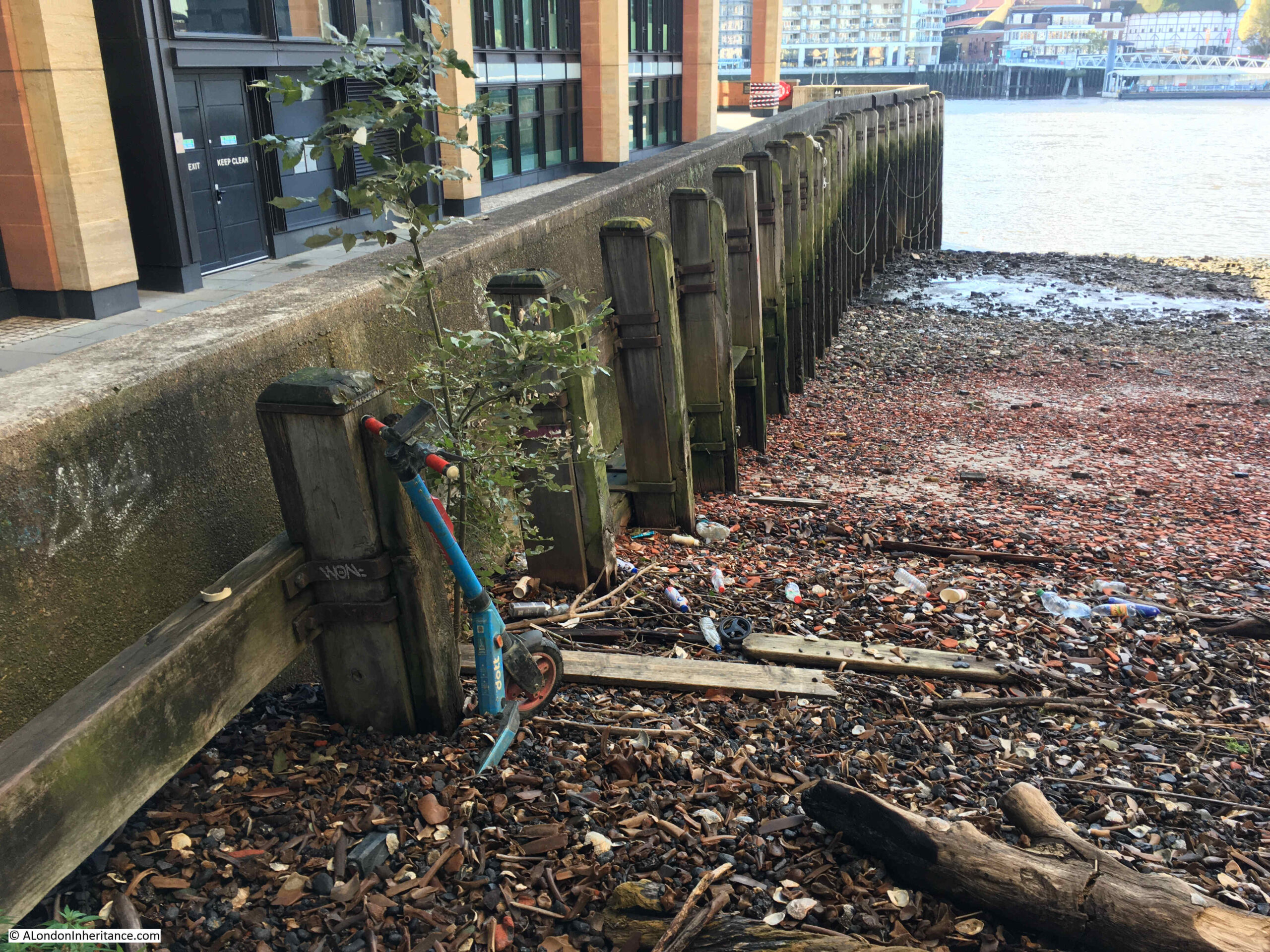
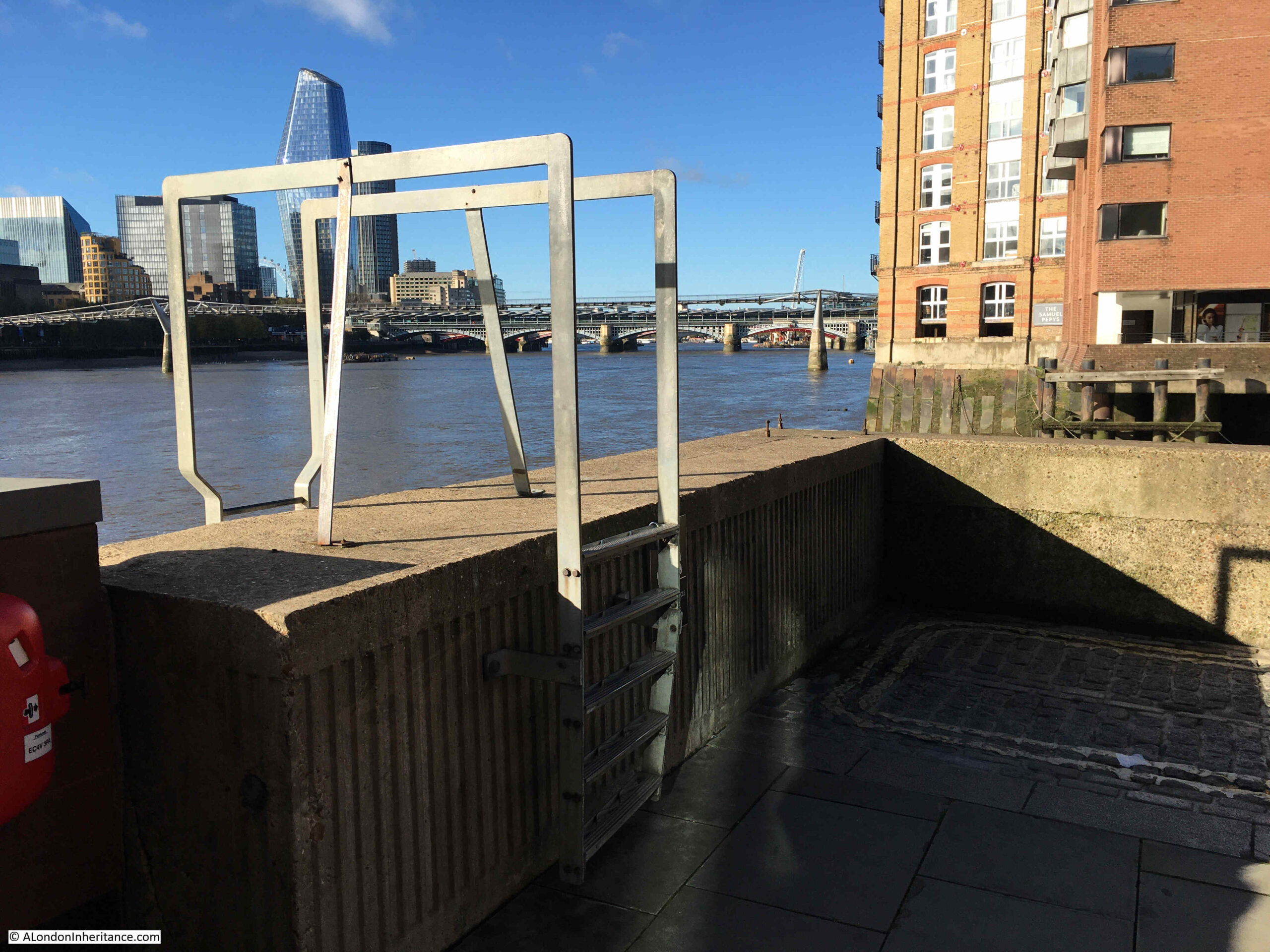
I have now reached the southern side of the island to find the causeway, where there is a Port of London information sign:
With the map showing the area in detail, and a helpful “You Are Here”:
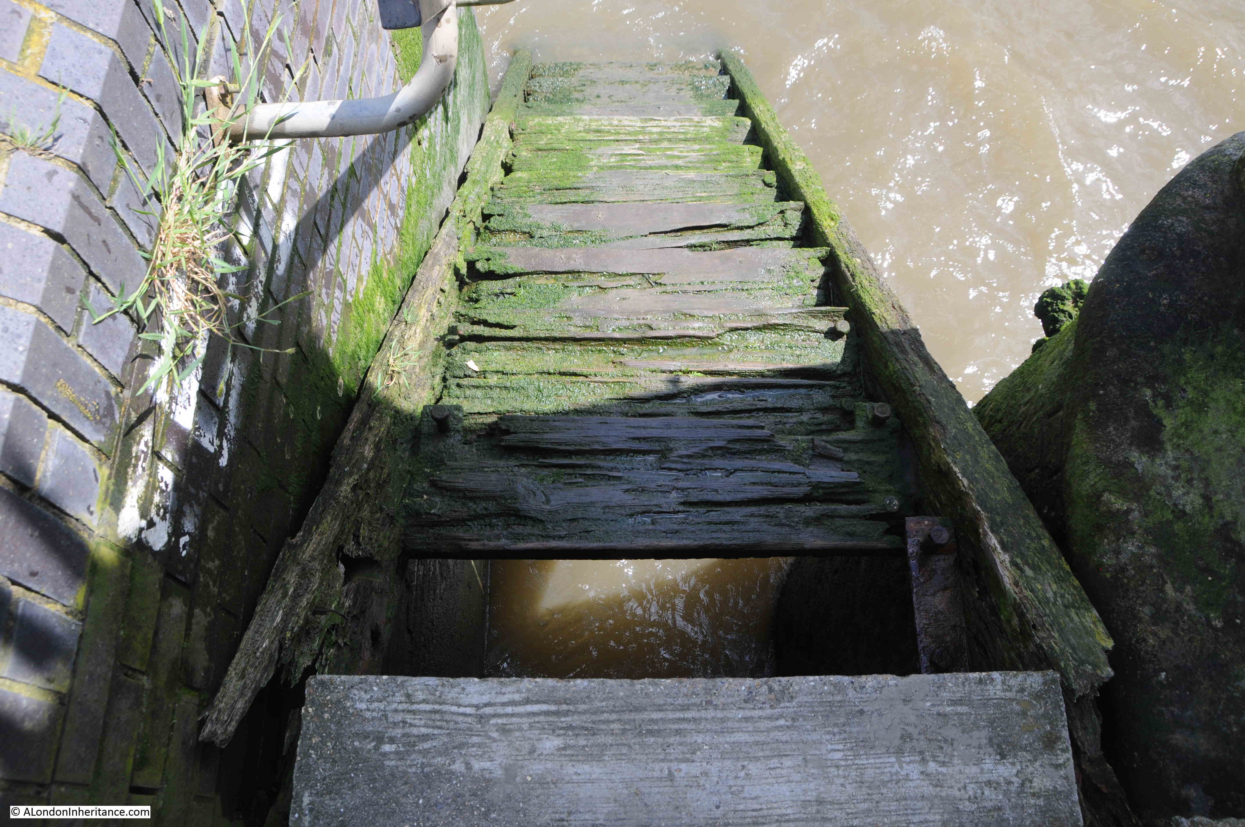
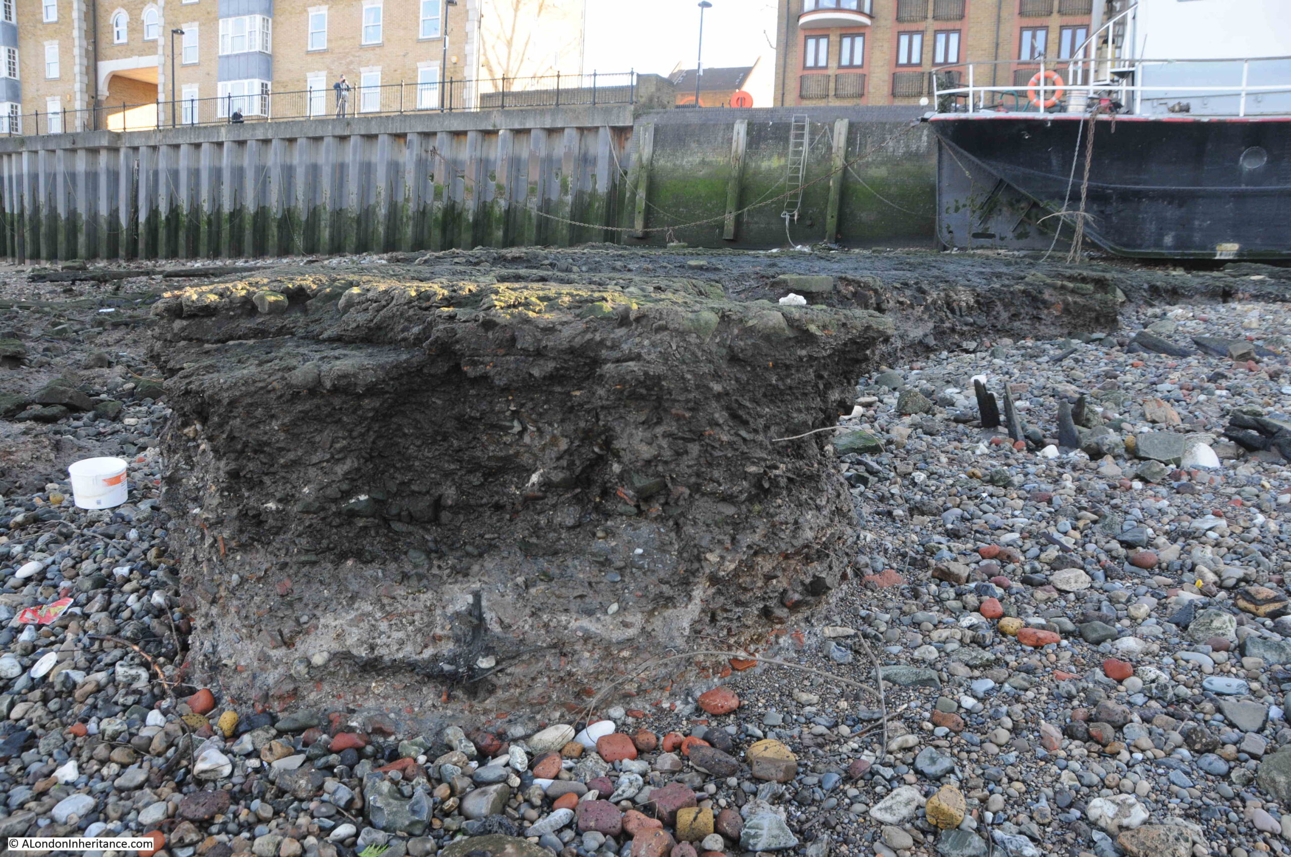
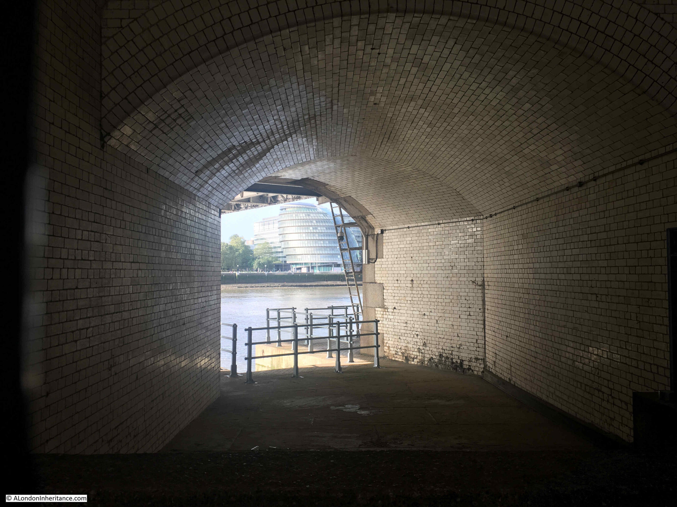
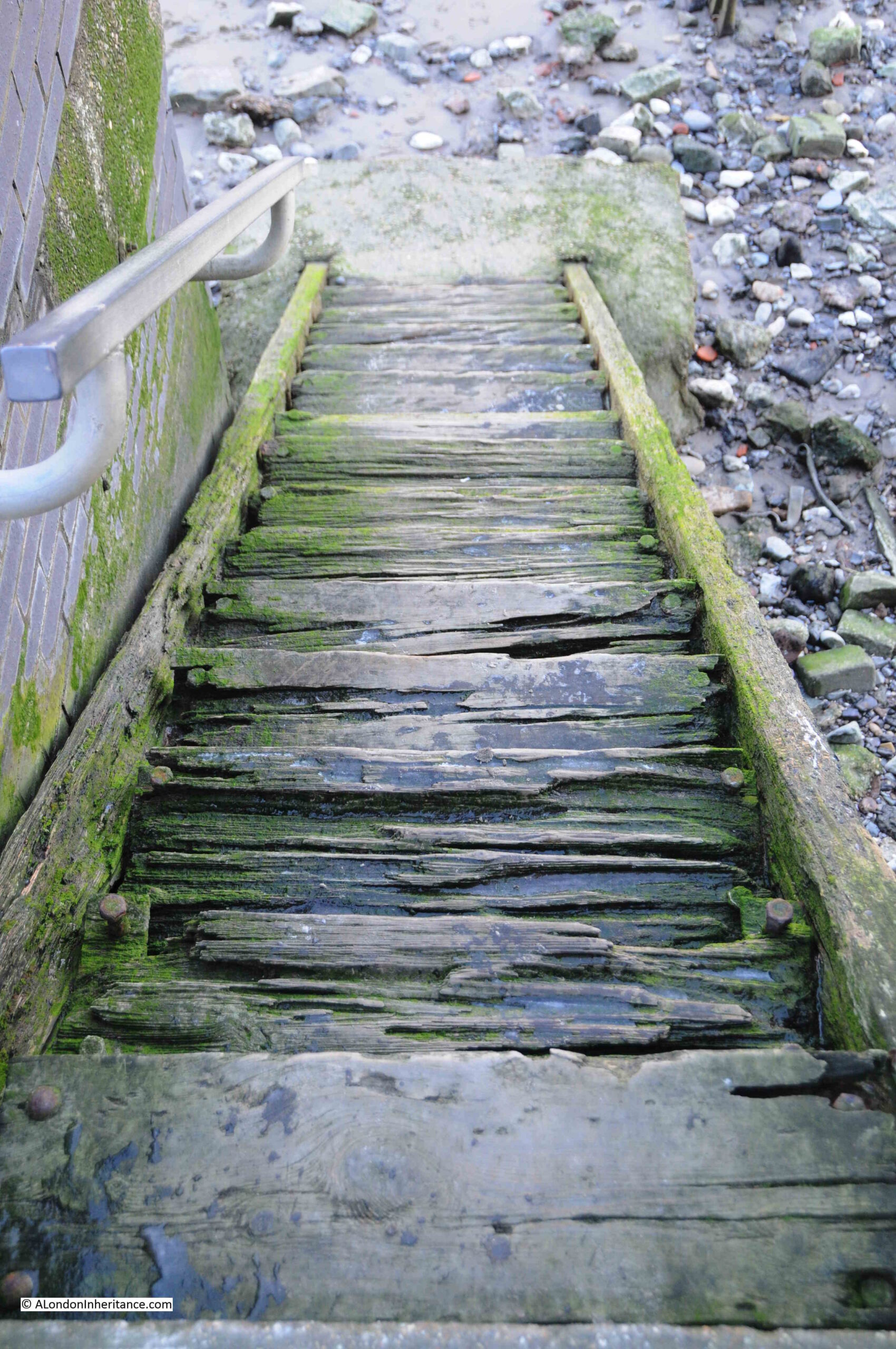
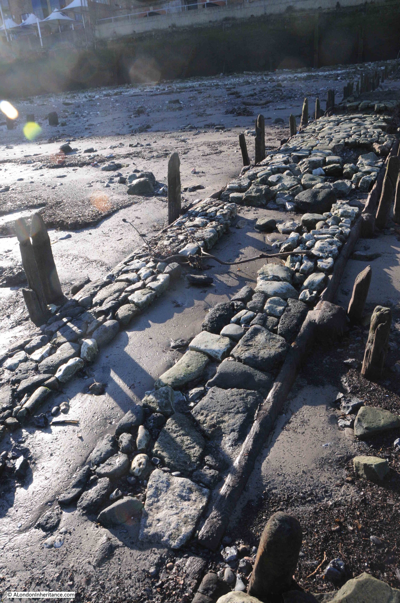
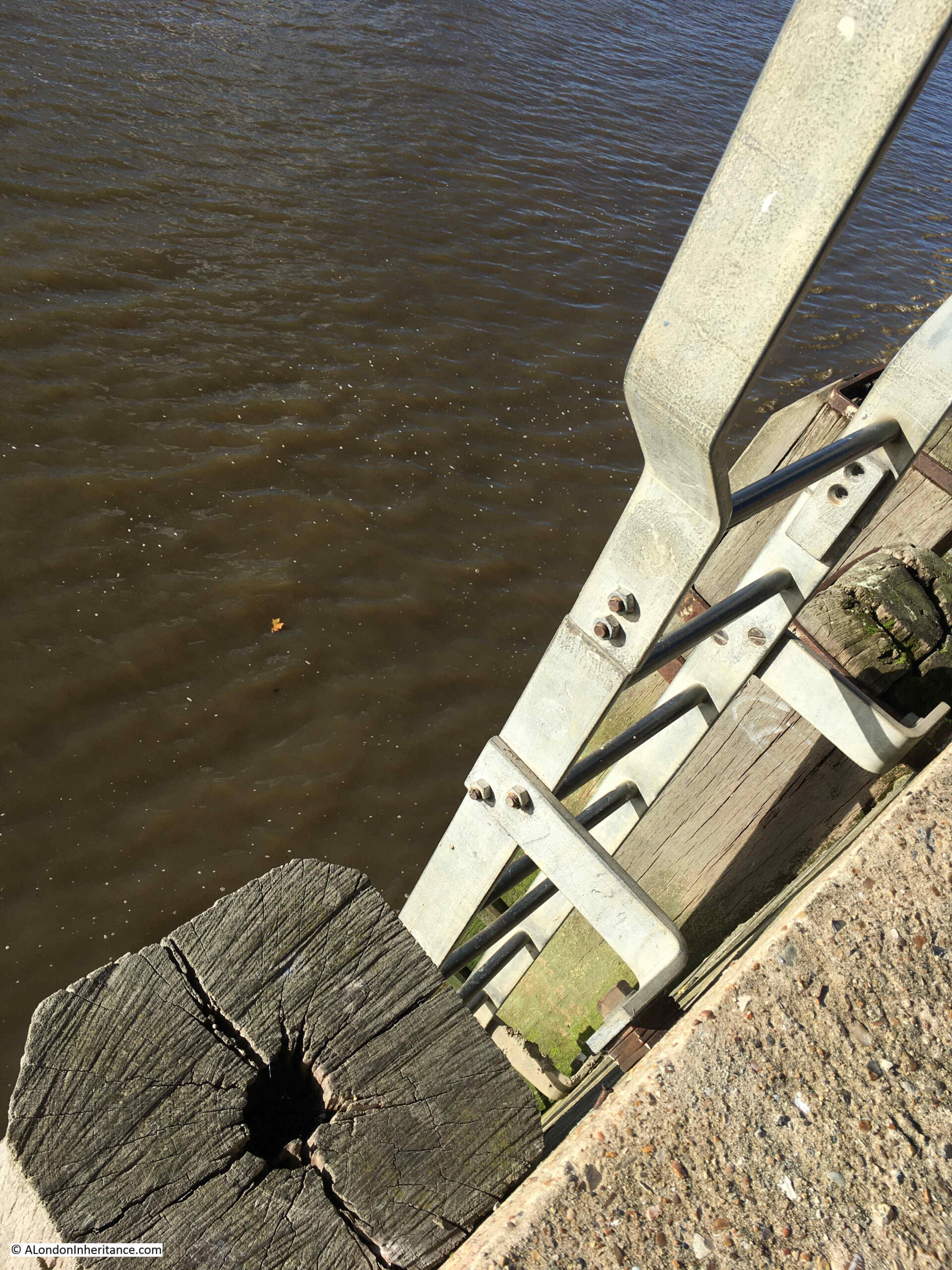
And it is here that I find the causeway, the last landing place on the River Thames, within the area of responsibility of the Port of London Authority:
Not that impressive, compared to many of the stairs in central London, however this is a simple, functional place which is still in use. A concrete strip running out into the water from which boats can be launched and recovered.
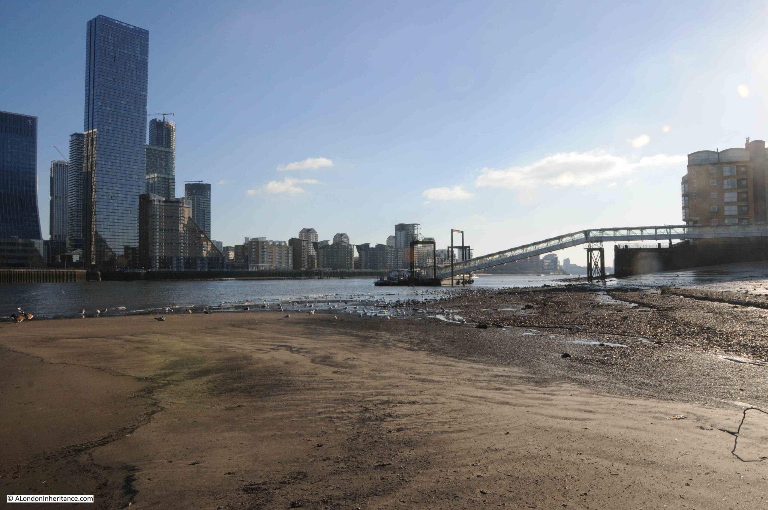
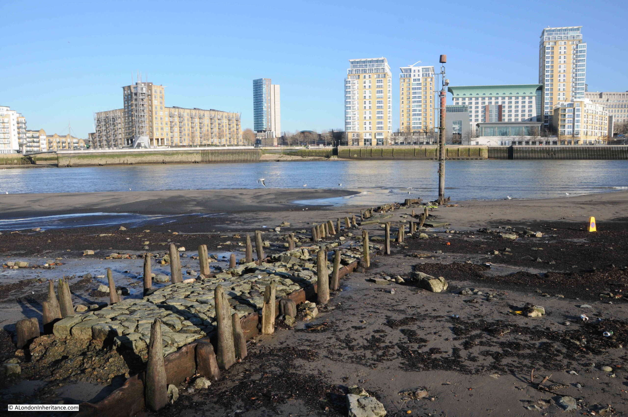
The land in the distance in the above photo is Canvey Island, and as we look around, we can see other infrastructure that is only there because of the River Thames.
Looking to the east, directly over Canvey Island, are the container cranes of the London Gateway, the latest port on the river, having opened in 2013, and offering a deep water channel, and mooring along side, for the very large container ships that use the river today:
And looking to the south, the storage tanks for liquefied natural gas (LNG) are on the Isle of Grain on the southern side of the Thames. LNG is brought by ship from across the world to be stored in these tanks before being distributed to homes and industry across the country, or via undersea pipe to Europe:
The Thames Estuary has been the entry point for goods and commodities for centuries, and today this includes gas to power the country, and container ships full of all manner of products.
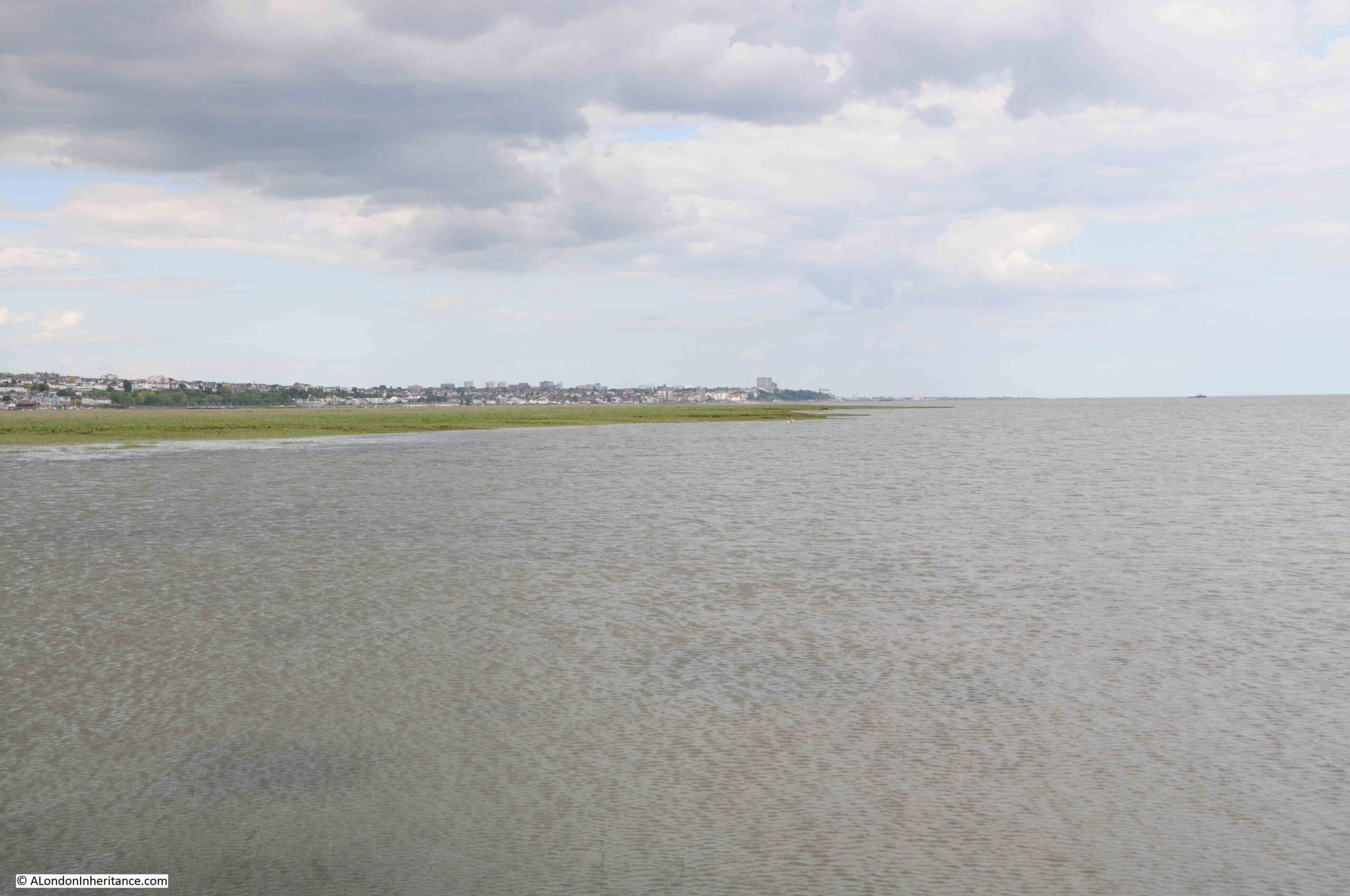
Looking east, and in the distance, we can see the City of Southend-on-Sea:
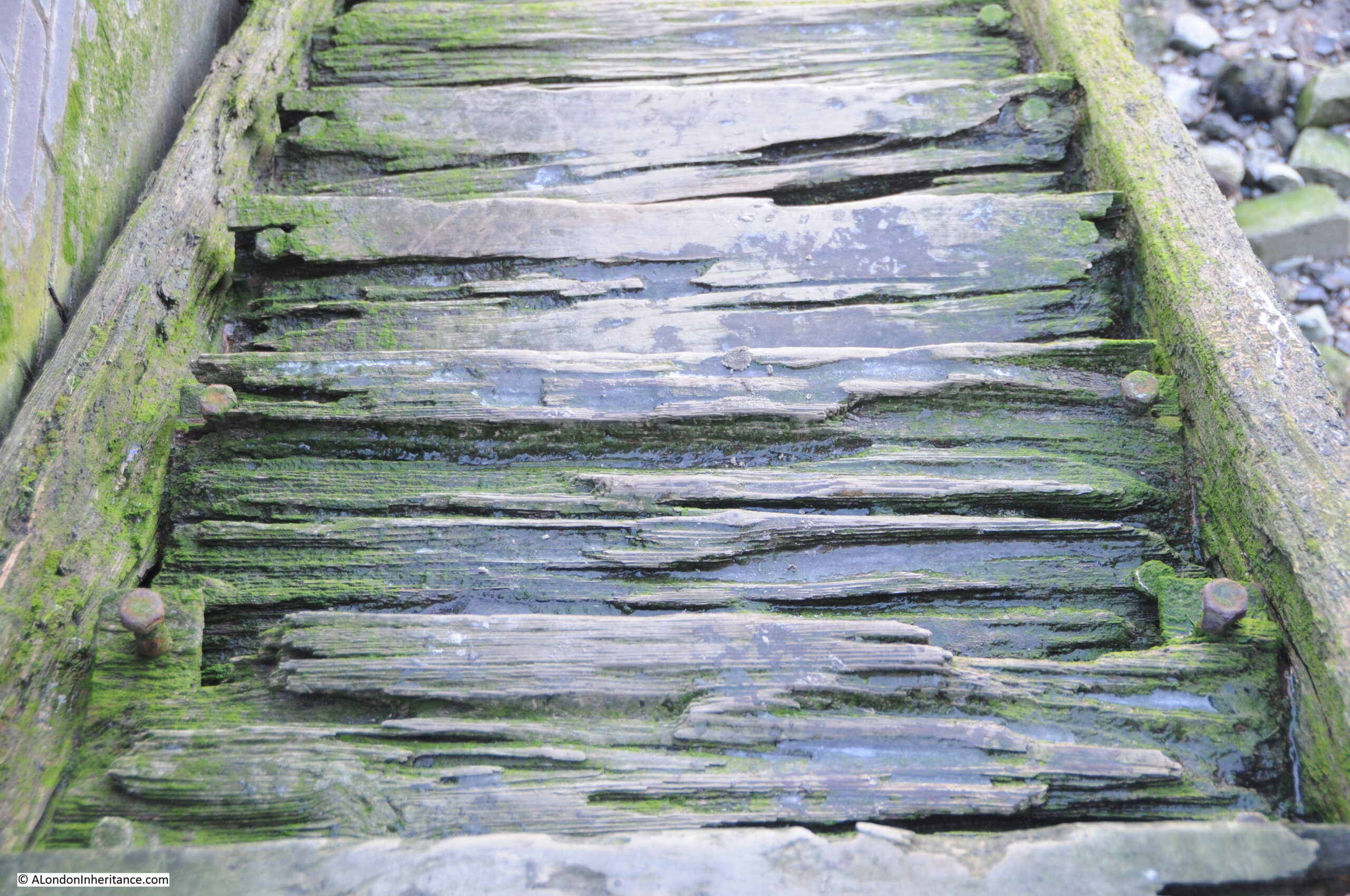
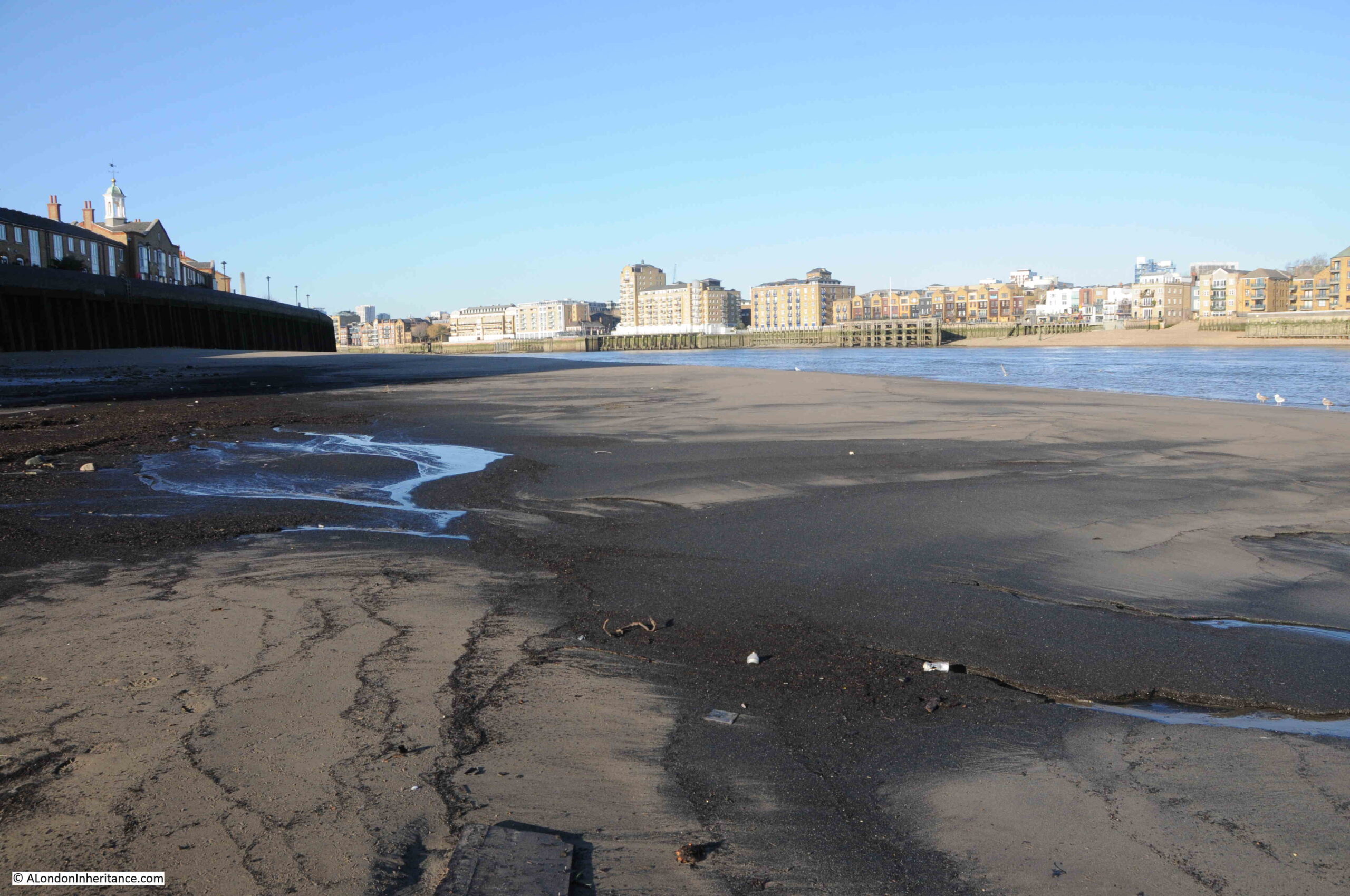
A look back along the causeway:
Although the causeway is a firm stretch of concrete, it is always good to remember just how far and how quickly the tide comes in along the Thames, and the tide was rising and washing over the causeway:
And within a few minutes, water was covering half of the causeway:
So that was the last place of access to the River Thames, according to the Port of London Authority listing – just a few hundred more to go along the river.
I have written a number of posts about this area of the river. You may be interested in:
As a postscript to the post, all my posts on Thames stairs have attempted to show how important the River Thames has been in the history and development of London, and how the river was once such a key part of the life of the so many Londoners.
We have tended to loose that connection with the river. The Thames is the reason why London is located where it is, and also why London has developed as much as it has.
There is not that much traffic on the river in central London, however towards the estuary, the docks at Tilbury and London Gateway are still busy.
The river is much cleaner than it was when industry lined the river and so much of London’s rubbish entered the river.
Although today, the river is a good way to travel on Thames Clippers, views along the river are good, and the river adds value to the properties built along side, it is also a river that is viewed as a potential risk from rising sea levels and flooding, it is used as a dumping ground for sewage from sewer overflows, and we have built into the river so it is channeled for much of its route through the city.
Whilst writing today’s post, I had BBC Radio 4 on for a change, and by chance there was a fascinating programme on the rights of natural features such as rivers, and how a number of rivers have been give the legal rights of personhood, which basically states that rivers have certain rights, such as the right to flow, the right not to be polluted etc.
It is a fascinating concept with a number of rivers in places such as New Zealand, India and Mexico having already been granted similar rights to that of a person.
In the UK, there is currently an initiative to develop a Rights of River motion for the River Ouse in Sussex.
It is a fascinating concept, and interesting to consider how this could apply to the River Thames, and how the river could be considered as an end to end entity, with rights, from source to estuary.
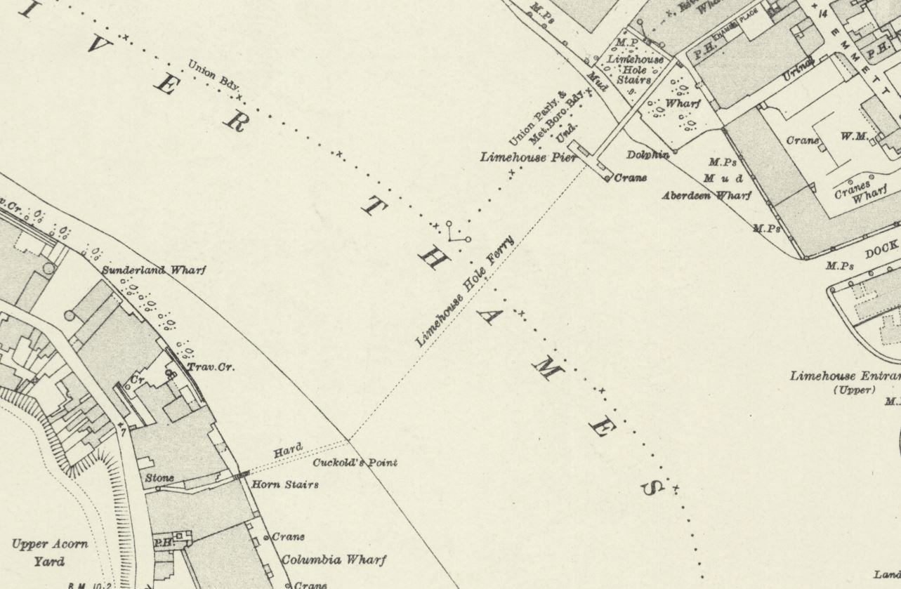
One of the pleasures of writing the blog is finding out more about an area I have already covered. Back in February I wrote a post about Horn Stairs, Cuckold’s Point and Horn Fair, and whilst at the stairs I had walk around Rotherhithe Street, and a block of flats seemed vaguely familiar.
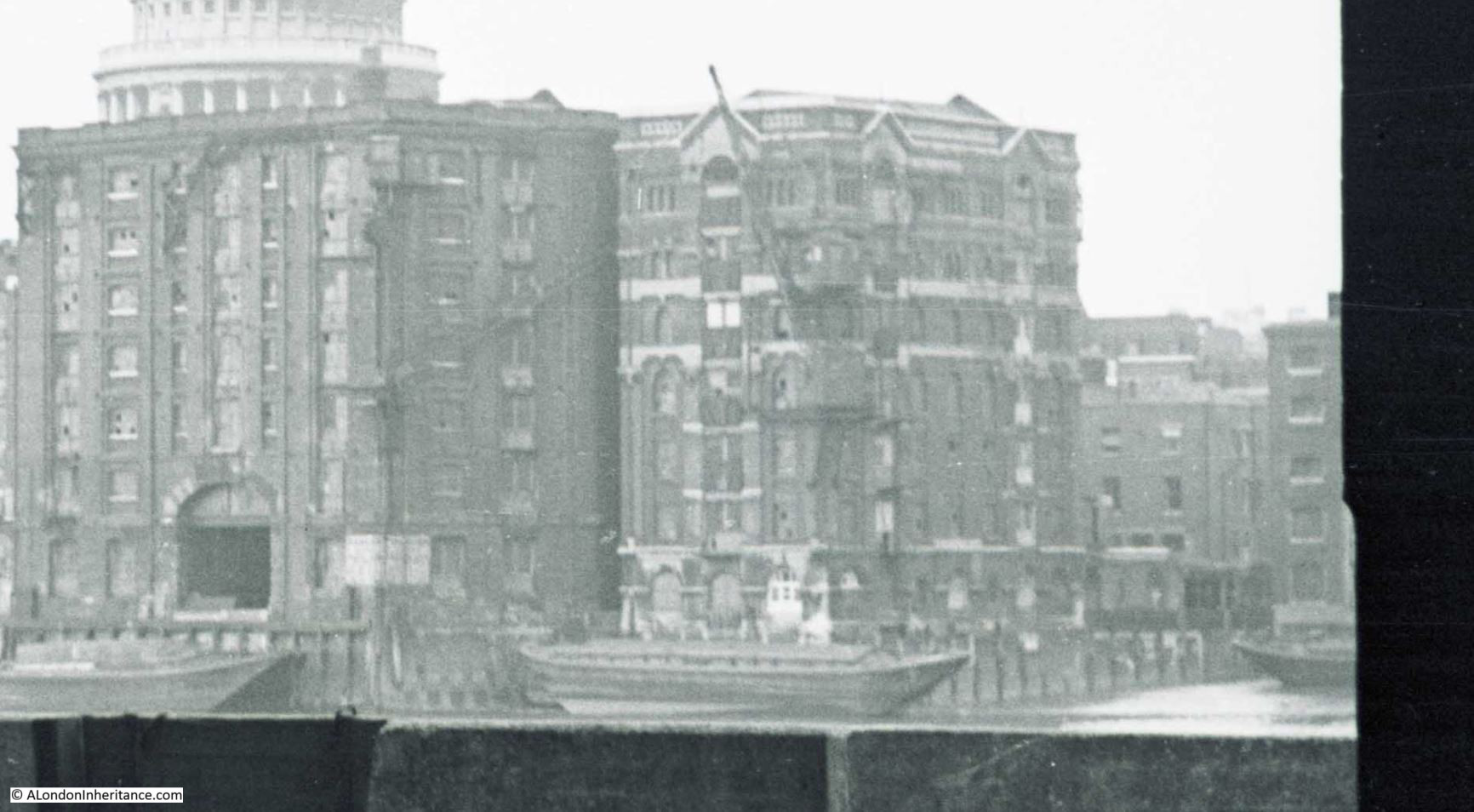
Back home I looked through the photos of a boat trip my father had taken along the Thames in August 1948, and found the flats I walked past in Rotherhithe Street.
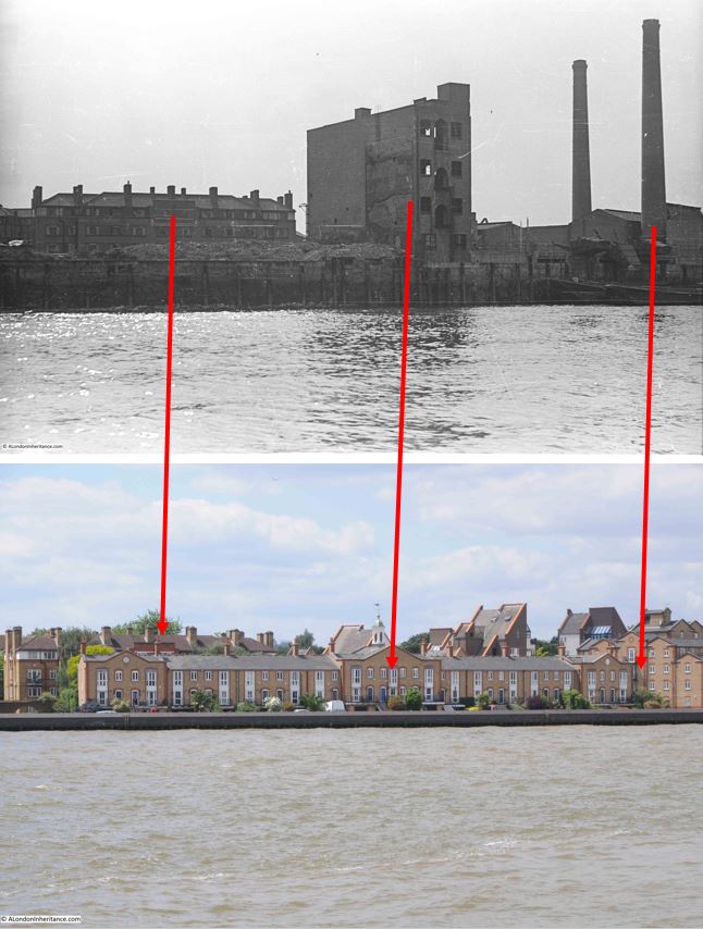
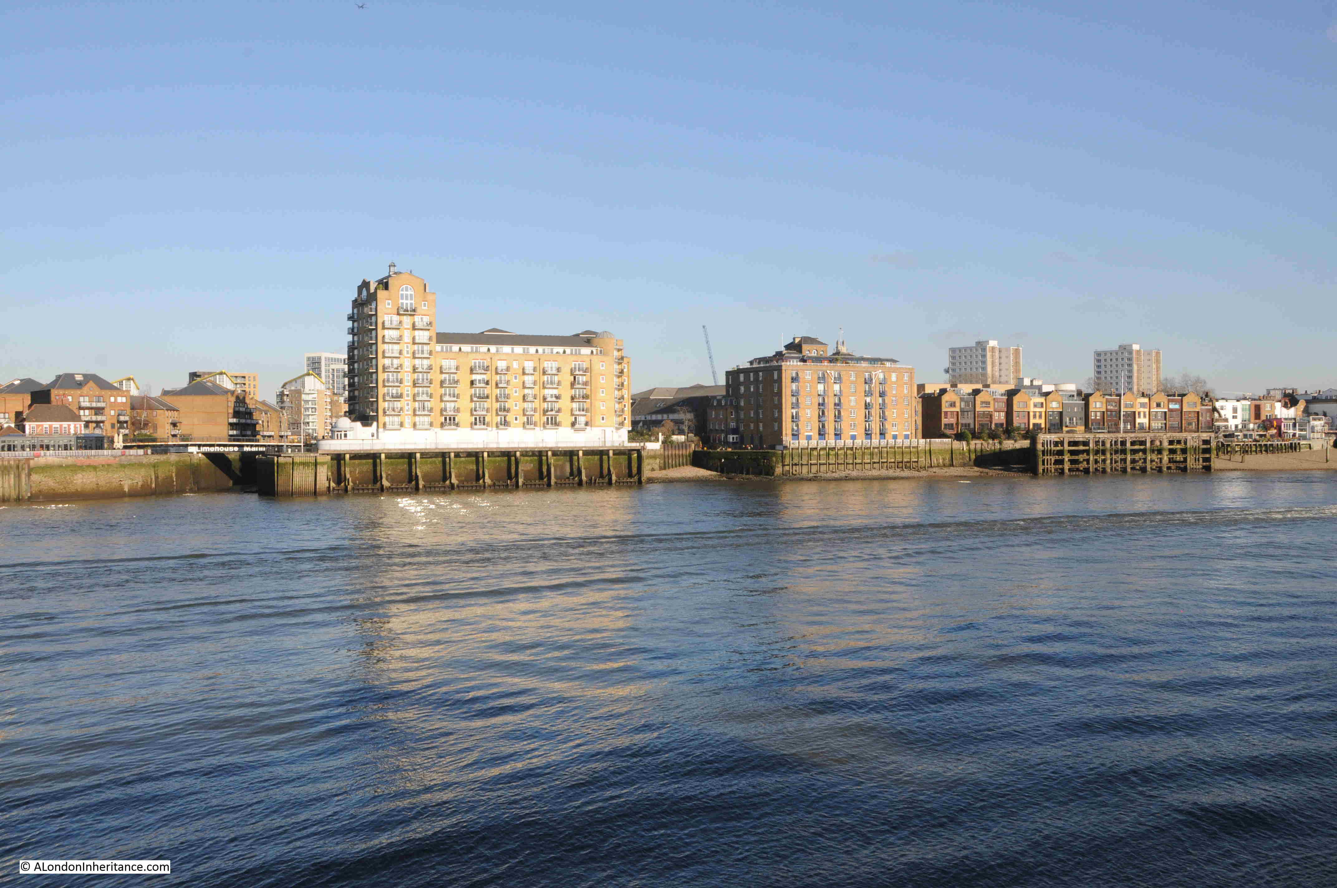
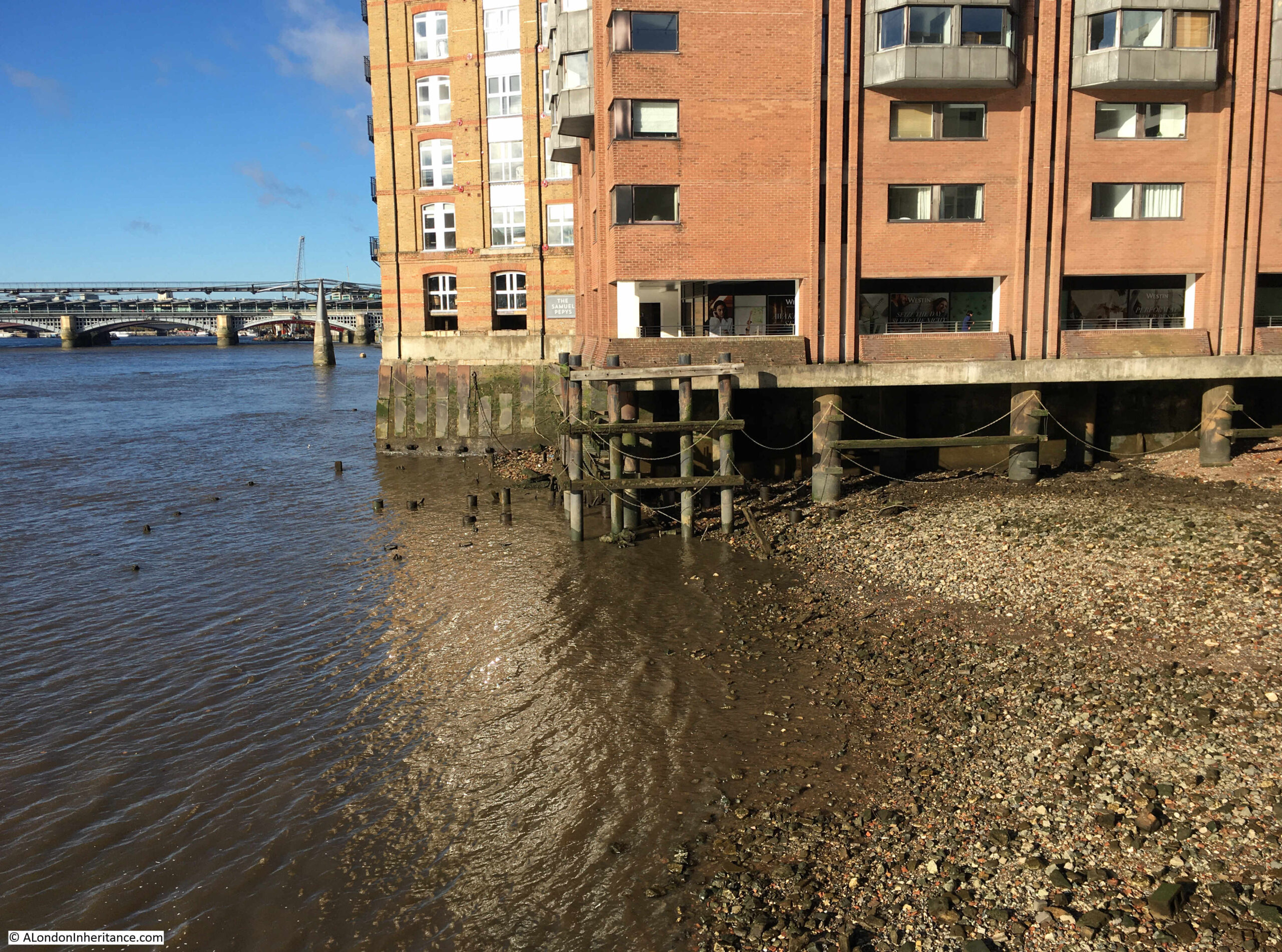
This is the August 1948 photo of Sunderland Wharf and Ordnance Wharf, Rotherhithe, with the block of flats in the background:
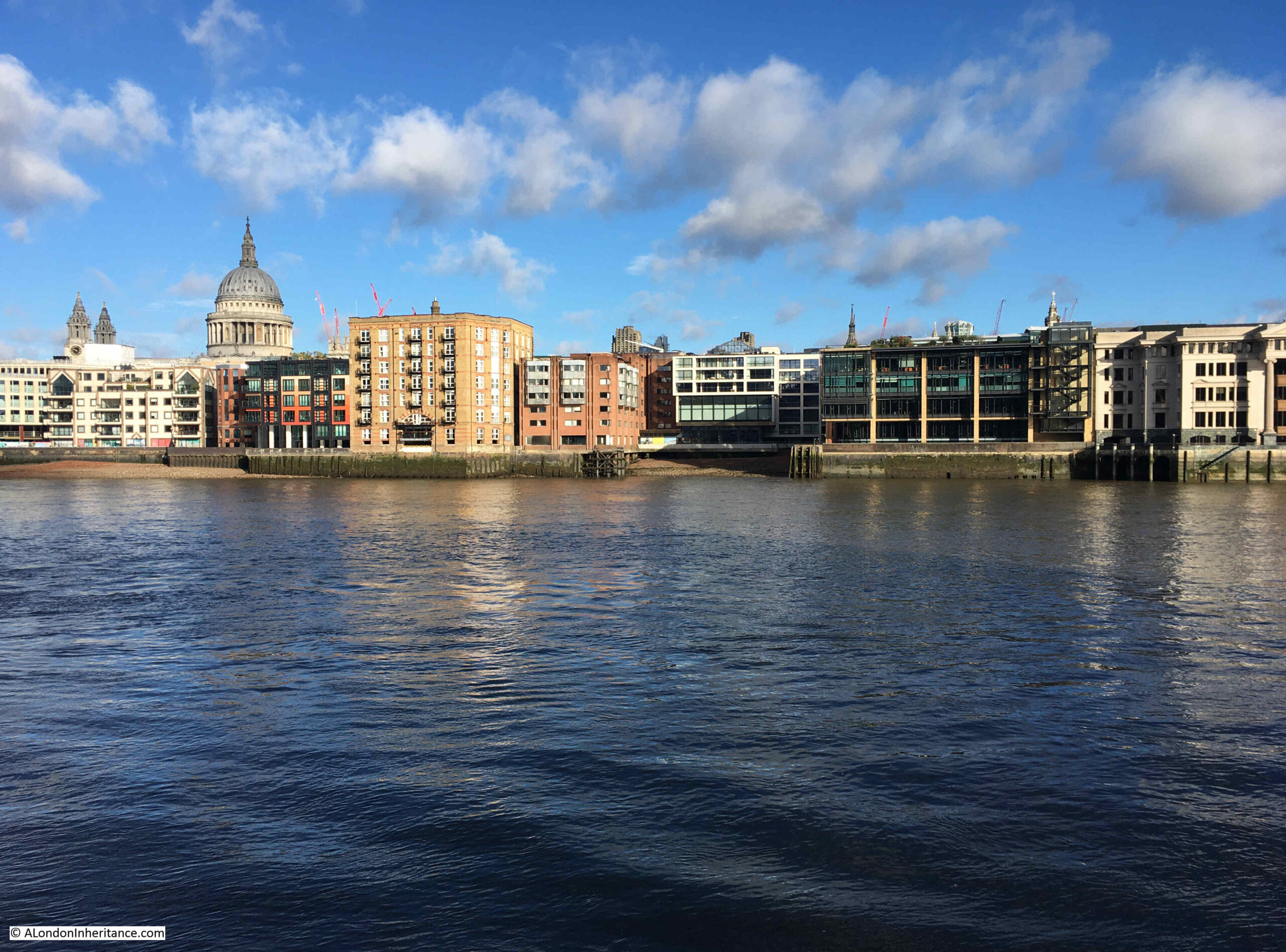
The same view, seventy six years later in 2024:
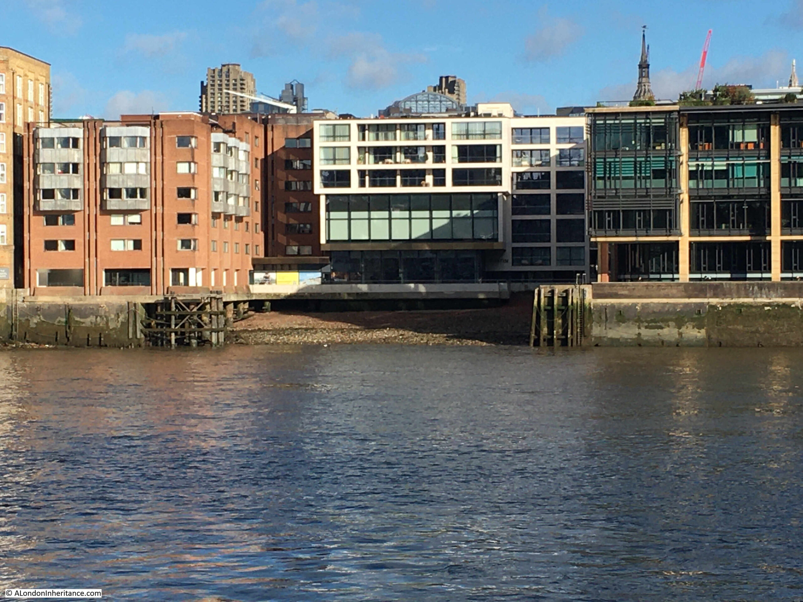
in the following image, I have mapped the 1948 photo to that of 2024. The flats are just about visible behind the new houses which line the river. I have also marked where the tall building and the chimney nearest the river were located in the area as seen today:
There is a whole sequence of photos that my father had taken in August 1948 on a boat trip from Westminster to Greenwich. I have already featured a number in the blog, but there are a number where there are no easily identifiable features, such as a wharf name on a building, and the buildings along the banks of the river, particularly on the south side, have changed so much that identifiable features are rare.
Luckily, it was finding the block of flats that enabled the location in this photo to be identified.
The series of photos show a very different London to the east of Tower Bridge. Significant bomb damage and an area of warehouses and industry, often very dirty and polluting industry.
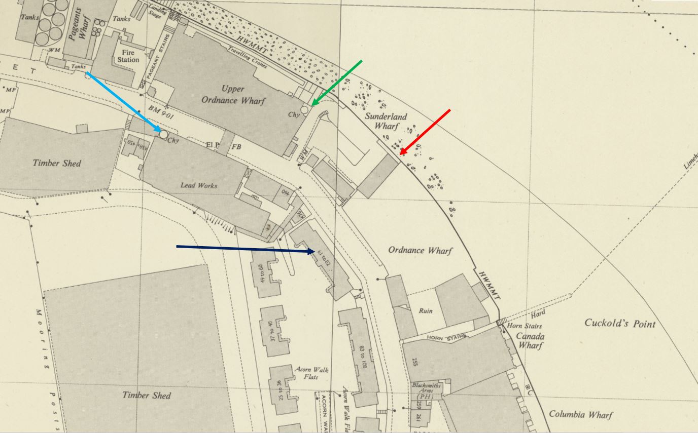
The following extract is from the 1949 revision of the Ornance Survey map, so only one year after my father’s photo, and the features in the photo can be seen in the map.
I have highlighted them as follows:
Dark blue arrow – the block of flats seen in the background
Red arrow – the remaining tall and narrow building
Green arrow – the chimney nearest the river to the right of the photo
Light blue arrow – possibly the second chimney in the photo. It appears further back in the map than in the photo. This may be down to the perspective of the photo, or possibly an error with the map
The area in the 1948 photo consisted of a number of wharves, as can be seen in the above map.
The land between the flats and the river was Ordnance Wharf. I cannot find the use of the wharf immediately before the war and subsequent bomb damage, however the type of industry that occupied Ordnance Wharf can be seen in the following newspaper article from April 1883:
“DESTRUCTIVE FIRE IN ROTHERHITHE – At about midnight, a fire, which was attended with the most disastrous consequences, broke out in the extensive oil-cake mills at Ordnance Wharf, Rotherhithe, London, S.E. The premises, which consisted of six buildings, each of three floors were occupied by a French firm, Messrs Francoise and Joseph Badart Freres, who carry on a large business as oil-cake merchants in the south-east districts.
How the fire originated remains a mystery, but in a very few minutes it gained a complete mastery of the buildings, enveloping them in a mass of flame which made it quite impossible for even the firemen who were first on the spot to attempt to effect an entrance.”
The entire site was destroyed in a couple of hours, and the fire burnt until six in the evening, and a large number of men then had to be employed to keep the site damped down so fires would not restart.
Oil cake seems to have been the product made from the oil released from many different types of seeds.
The book London Wharves and Docks, published in 1953 by Commercial Motor does not have an entry for Ordnance Wharf, so I assume it remained derelict after the war.
The next Wharf is Sunderland Wharf, the area to the right of the tall, narrow buildings and up to the chimneys. In 1953, the occupier of the wharf was listed as Bermondsey Borough Council, and use of the wharf was listed as “Disposal of house and trade refuse by barge”.
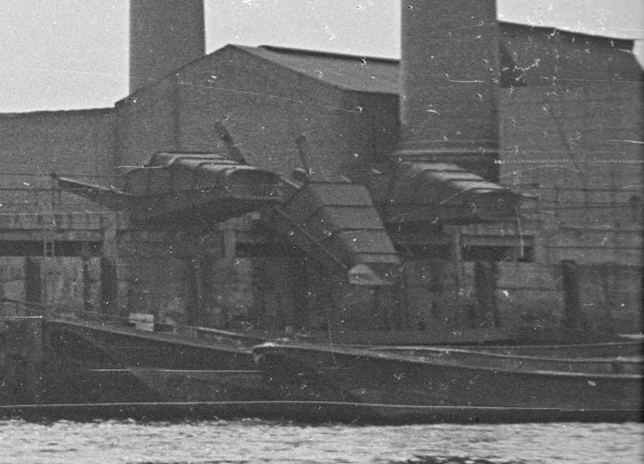
The location of the chimneys, and the building to the right, most of which is not shown in the photo was Upper Ordnance Wharf. In 1953 this was still a working industrial site, and was occupied by H.J. Enthoven and Sons, Ltd, who processed non-ferrous metals, coal, coke and iron ore, and seem to have been mainly processing the metal lead.
An extract from part of my father’s 1948 photo shows some of the infrastructure at Upper Ordnance Wharf. These look as if they were used to funnel materials from the factory site down into barges on the foreshore:
A highly industrial site, along with a number of derelict areas after wartime damage.
it is very different today, as I found with a walk around the site.
This is Rotherhithe Street, with the blocks of flats on the left. The block in the 1948 photo is the one furthest on the left:
The block of flats seen in the 1948 photo, and which enable the location to be identified is shown in the photo below. The distinctive middle section, where brick rises up above the entrance to the flats, the full height up above the upper attic space, which gives the central section a top of a flat wall of brick:
The estate of which the above block is part is Acorn Walk. Built in the 1930s, the estate consists of a number of similar blocks of flats as shown in the following estate map. The block in the 1948 photo is the block at upper right:
The name Acorn Walk comes from Upper Acorn Yard, a flat space for storing timber on which part of the estate was built, and Acorn Pond, an expanse of water a short distance to the south which was also used for storing timber.
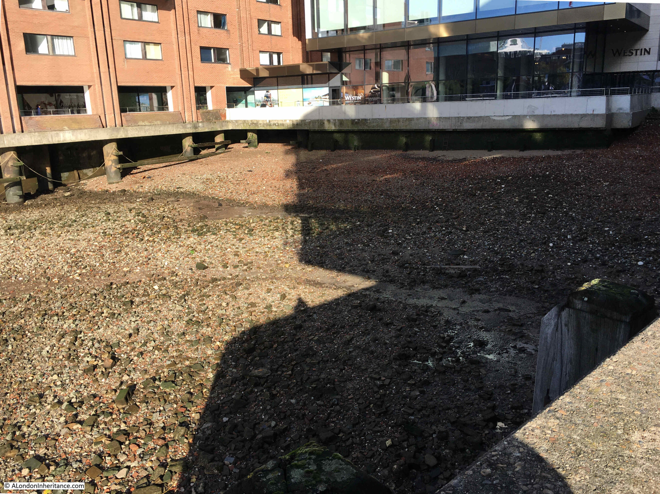
Walking up to the river’s edge, and this is the view along what was Ordnance Wharf. The tall narrow building in my father’s 1948 photo was where the taller section of the terrace of houses, the one with the structure on the roof with cupola and weather vane, can be seen:
At the end of the above terrace is the following view, where Sunderland Wharf and then Upper Ordnance Wharf. and the H.J. Enthoven industrial premises were located. The funnels in the extract from the photo that tipped material down into barges were were the furthest trees on the right can be seen:
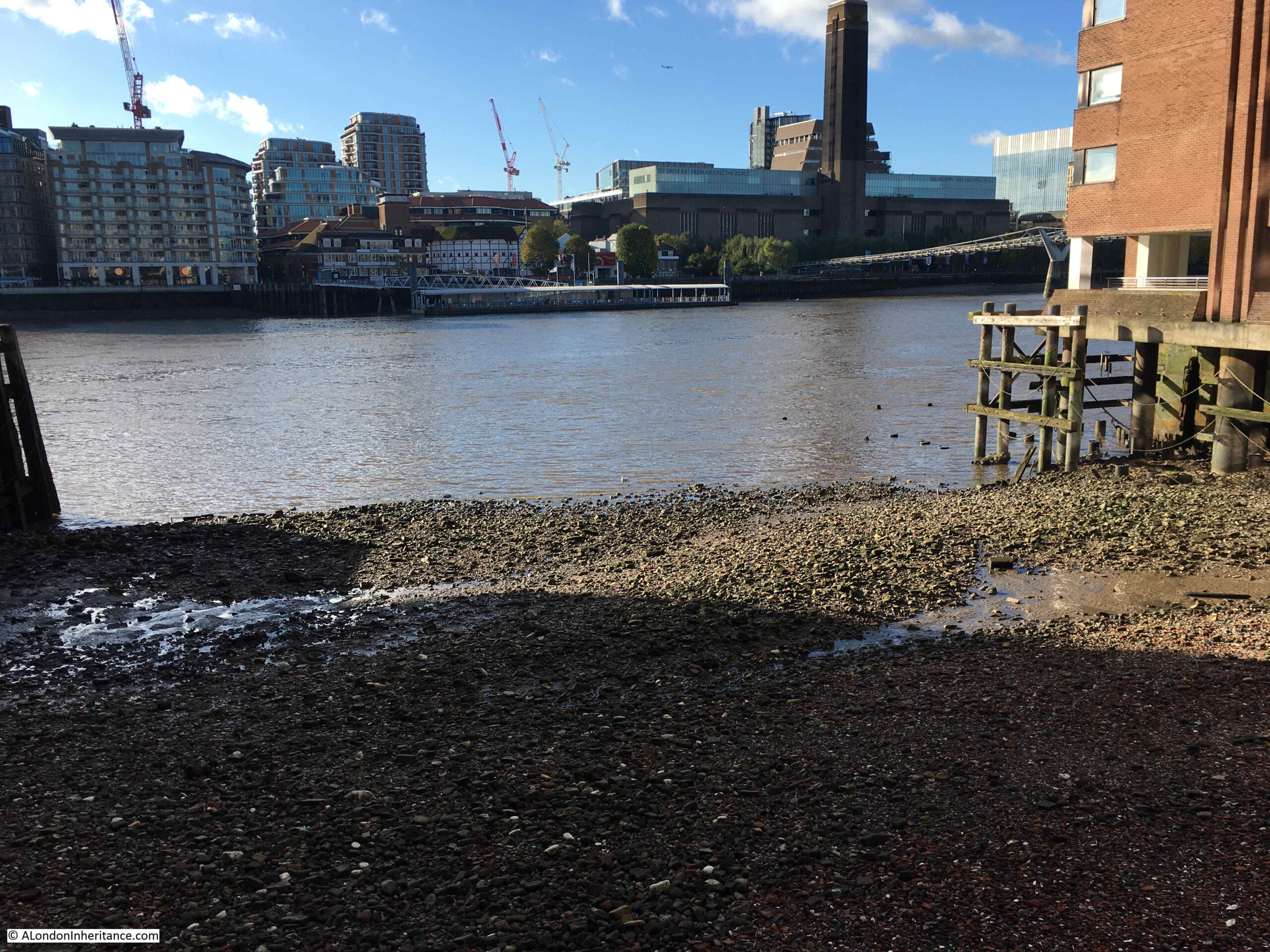
I had walked along the river walkway earlier in the year for the post on Horn Stairs, not realising that this was the location of one of my father’s photo. The following photo is looking back towards the warehouses of Canada Wharf taken from the edge of the 1948 photo, so these warehouse would have been to the left or east of Ordnance Wharf:
Horn Stairs is at the base of the Canada Wharf warehouse, the bottom left corner of the building in the above photo, so I went to take a look at the stairs.
I remarked in my post back in February, on the poor condition of the stairs, and how the upper steps seemed to be deteriorating badly, and just under six months later, the top step has disappeared, leaving a gap between the concrete edge of the walkway and the stairs, and the next couple of steps do not look all that robust.
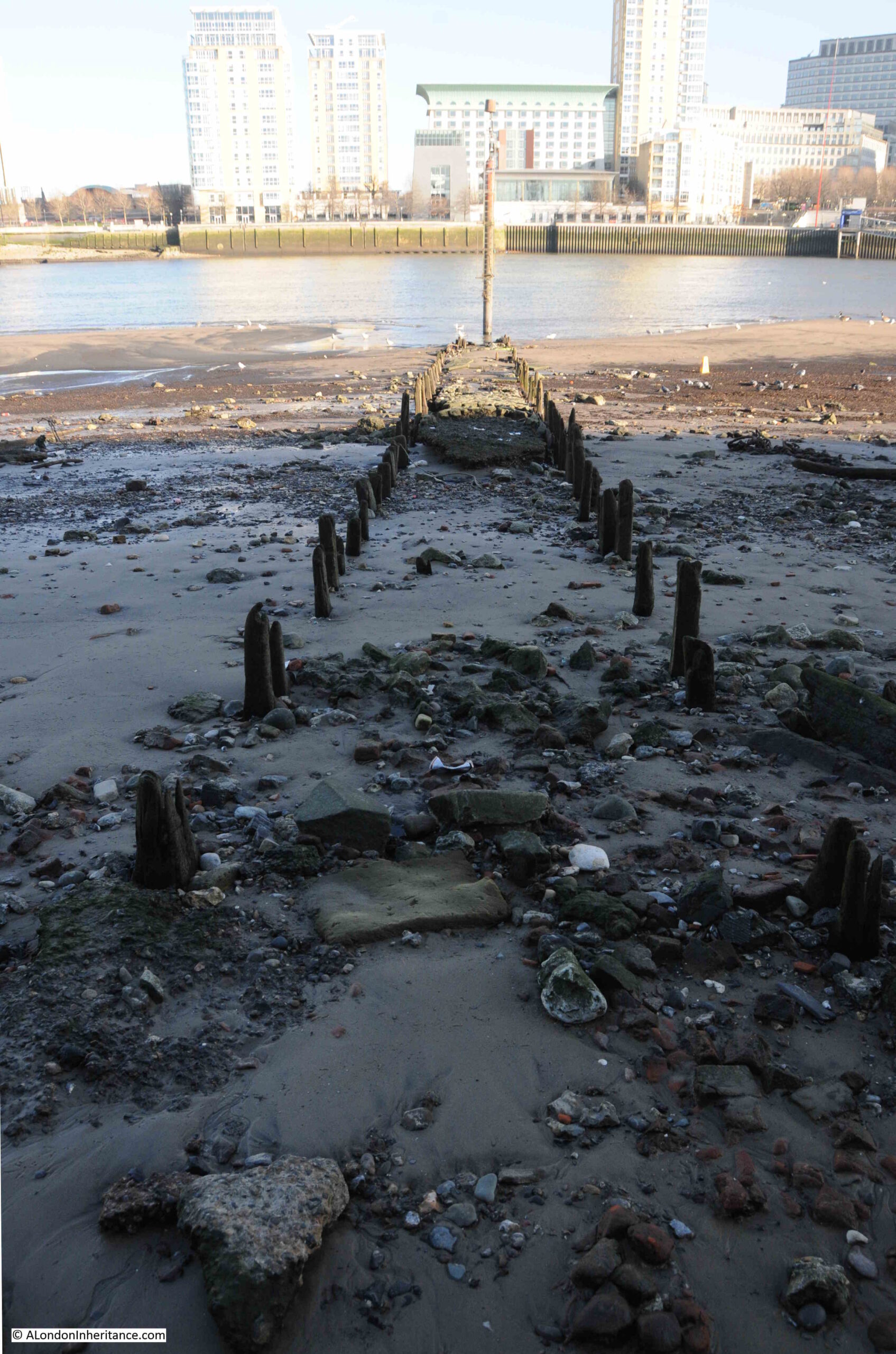
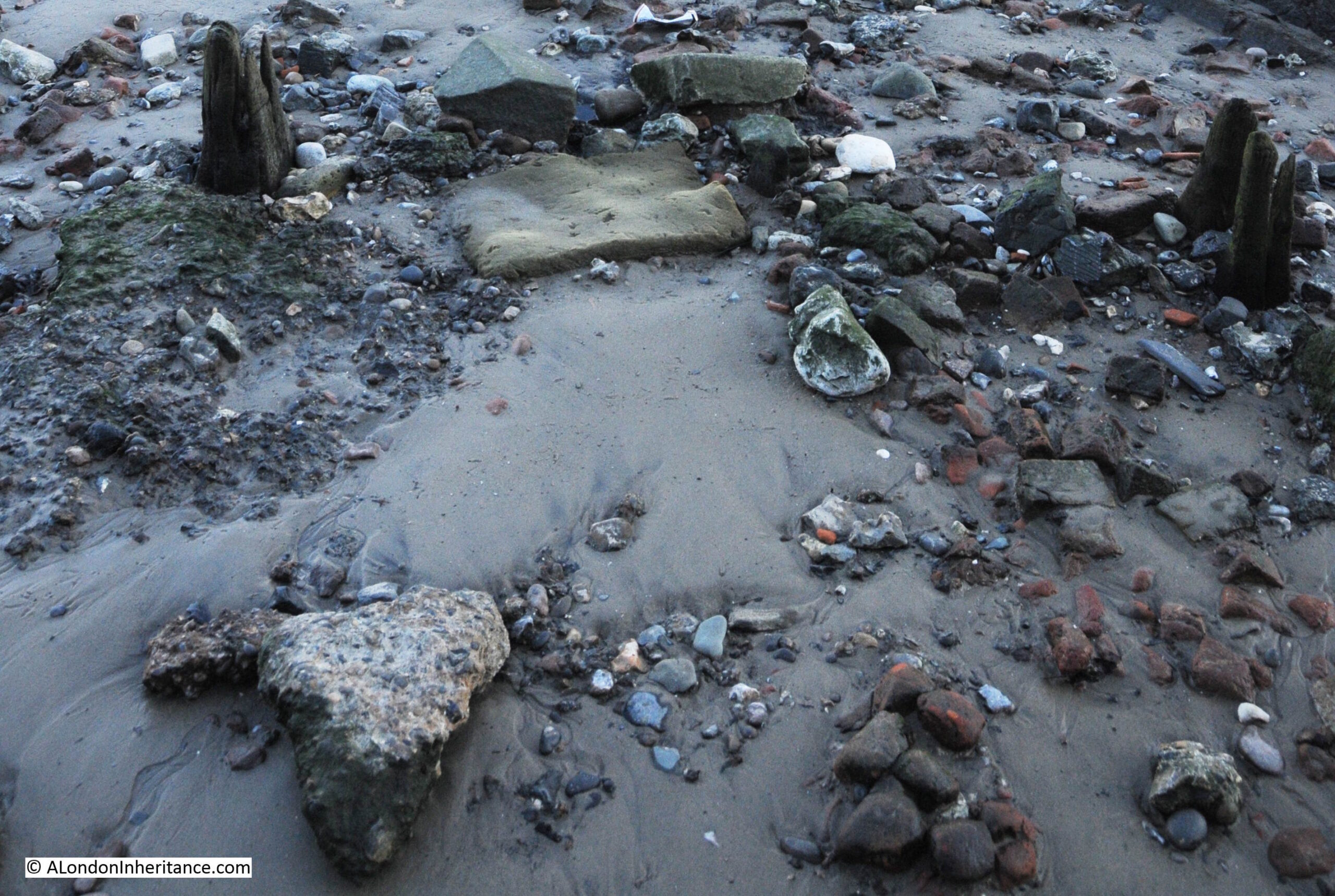
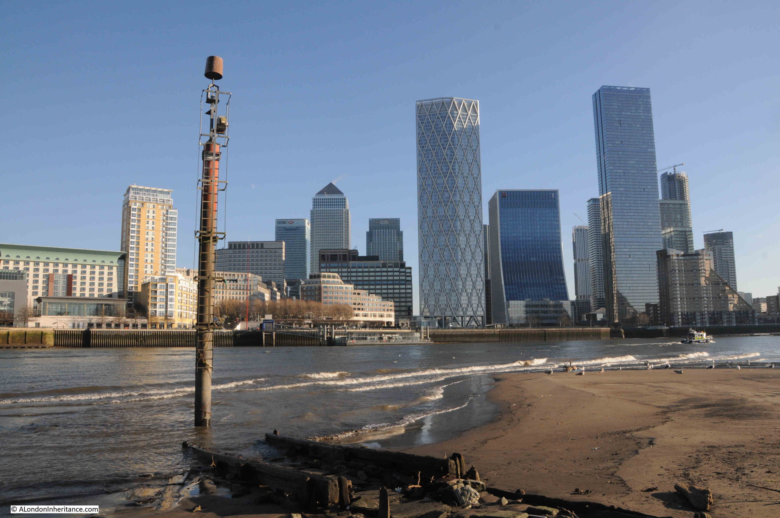
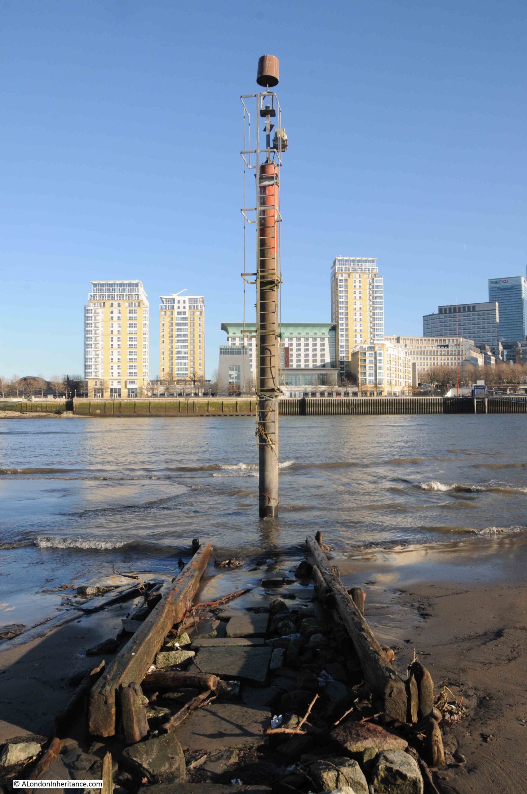
The tide had been coming in for a few hours when I visited, so the foreshore was covered, and the navigation marker at the end of the causeway leading out from the stairs was isolated in the waters of the river:
To show just how wide is the range of the tide along the river, compare the above photo with the following photo taken for my Horn Stairs post which shows the navigation marker at low tide, with the remains of the causeway fully exposed, and the above photo had not yet reached high tide, and it was not one of the occasional very high tides.
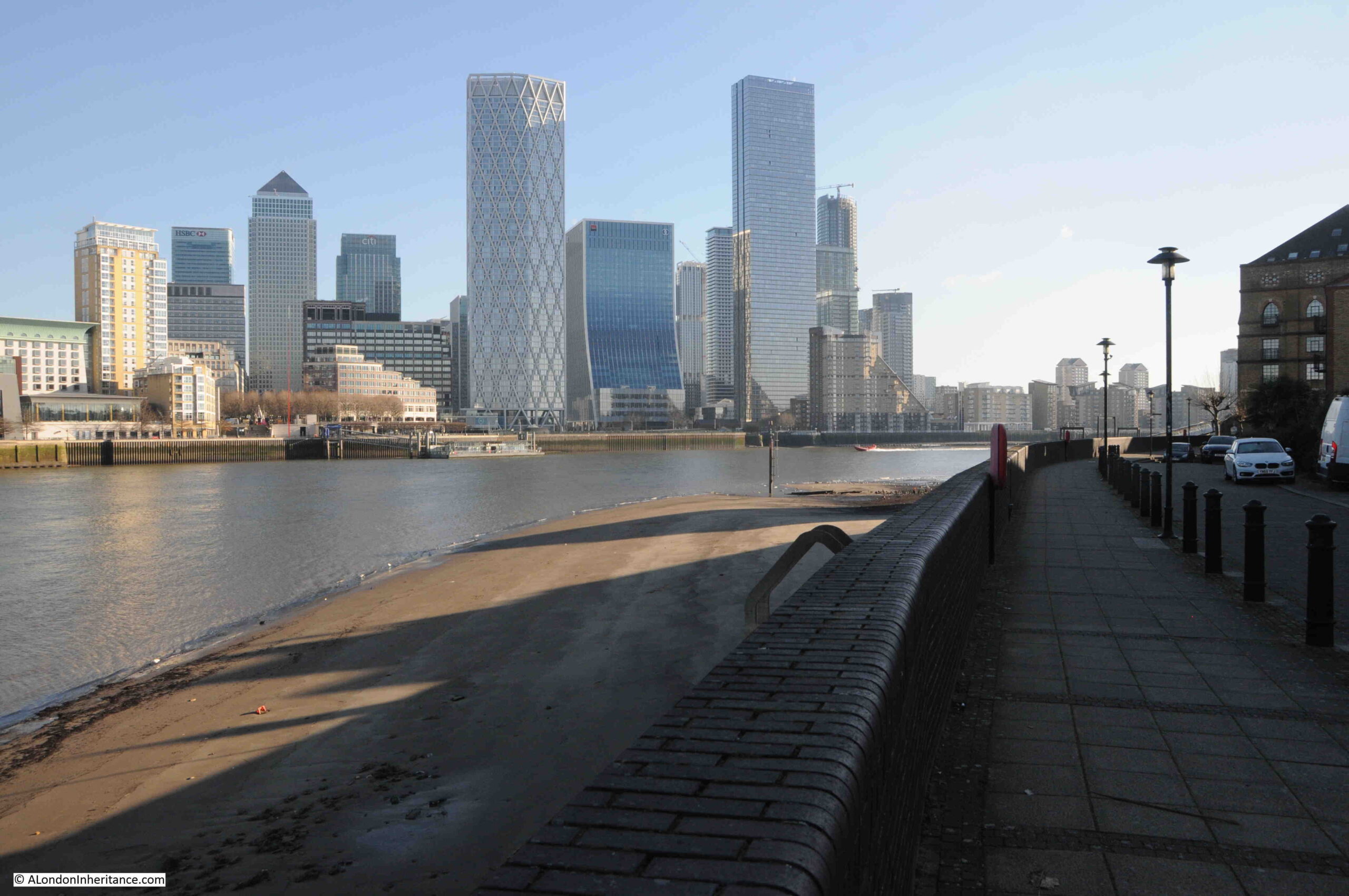
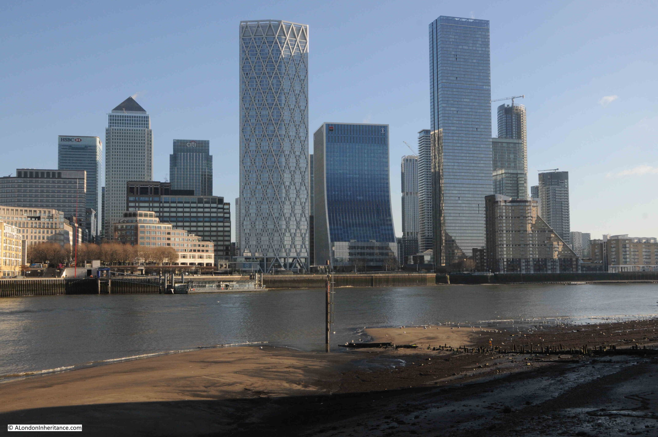
Rotherhithe is really fascinating, and I will be writing more blog posts about the area in the coming months. To get from the north side of the river where I had taken the comparison photos from across the river, to the Rotherhithe side, I used the Thames Clipper / Uber boat route RB4, which is a dedicated route between Canary Wharf and the Doubletree Hotel in Rotherhithe.
This is a brilliant route across the river, and lands at the Doubletree Hotel where as far I can tell, the route to the street is through the hotel lobby (or at least that is the route I have always taken).
The following photos cover the short section of street from the Doubletree Hotel to the site of the 1948 photo, starting with this view looking along Rotherhithe Street:
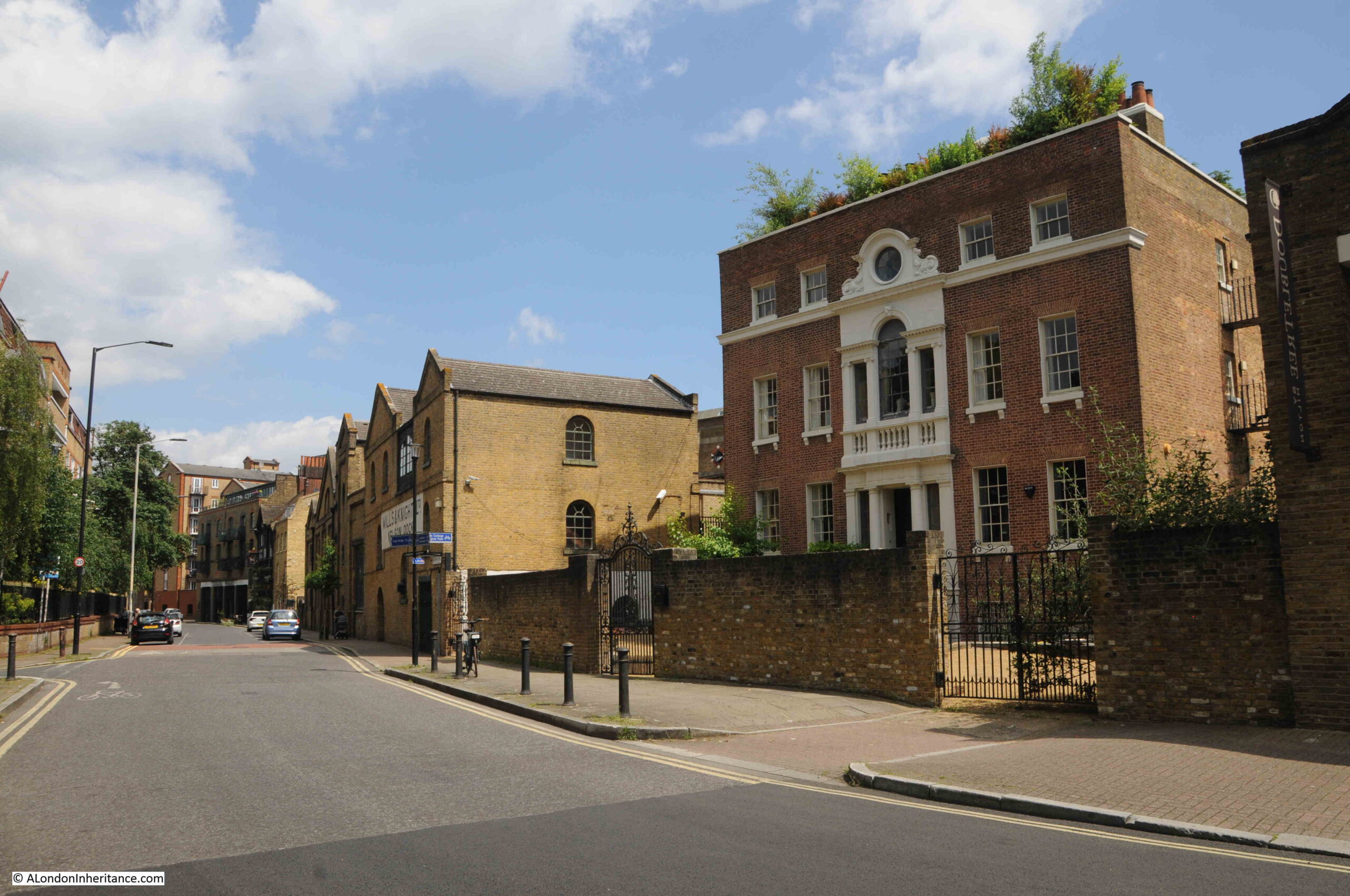
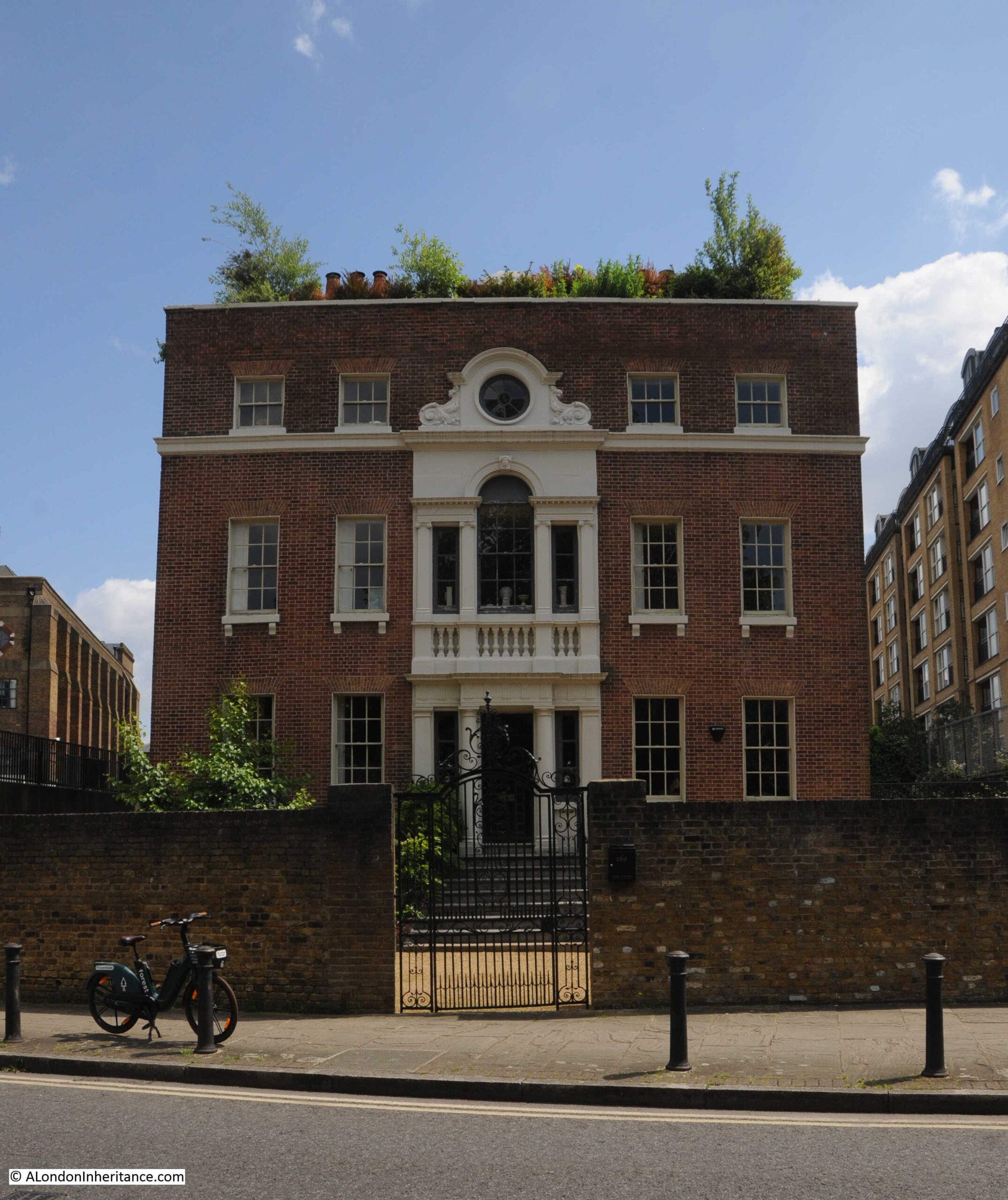
The first building is this rather ornate house, which dates from the mid 18th century, and is not the type of building you would expect to find with so much industry between the street and river:
This is Nelson House and the building is Grade II* listed, and was a shipbuilder’s house. It reflects a time when this part of the river was not end to end industrialisation, but was small industry associated with the river, such as timber yards and shipbuilders, along with their owners and workers homes, including those who made good money from their river businesses. Inland from Rotherhithe Street when the house was built, it was all still fields.
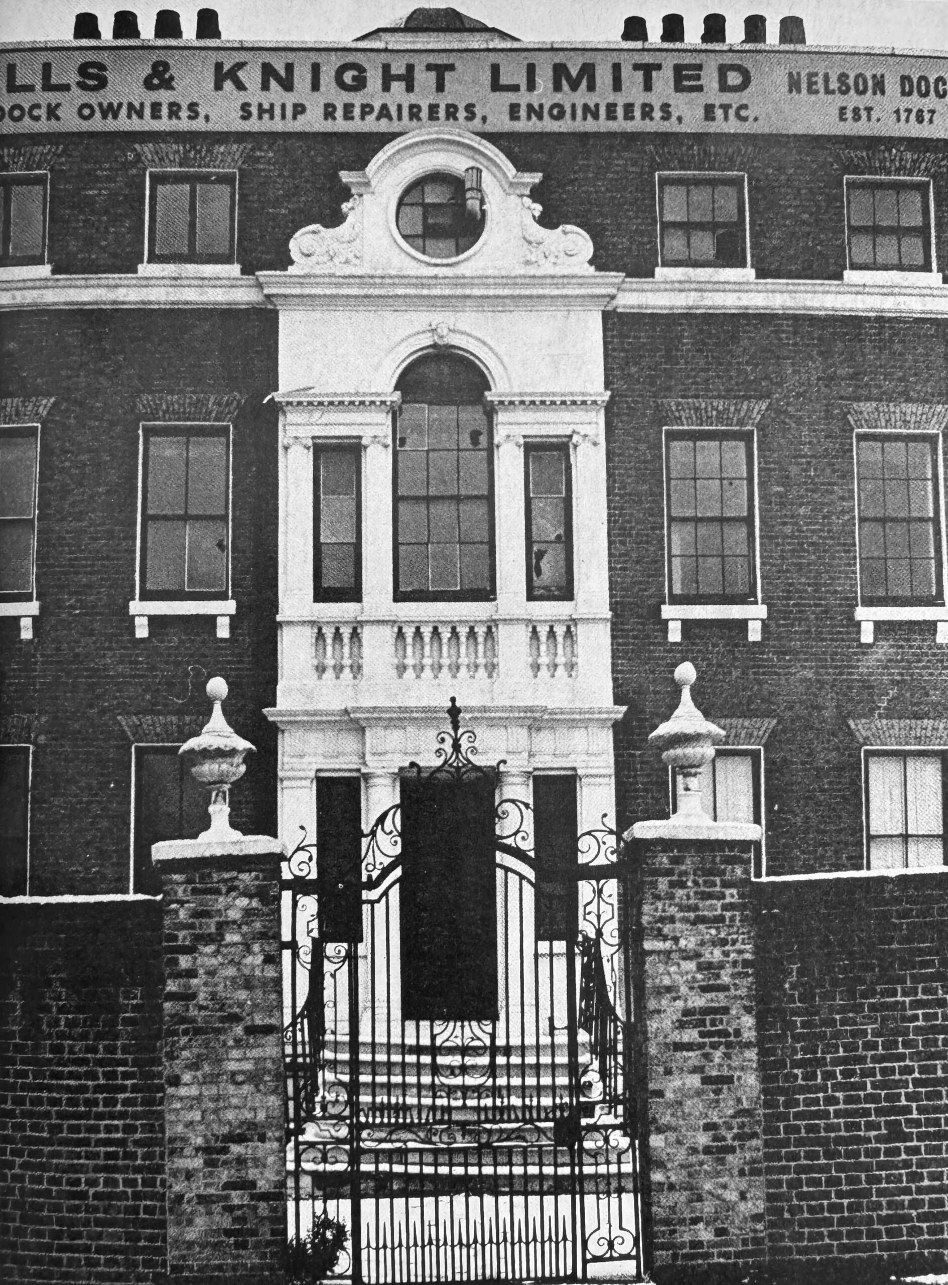
The house was included in the 1972 Architects’ Journal feature “New Deal for East London”, on the possible threats to many of the historic buildings of east London (both north and south of the river. See this post for more information on the 1972 article).
The following photo shows the house in the early 1970s, with the name of the last Thames focused business to occupy the building:
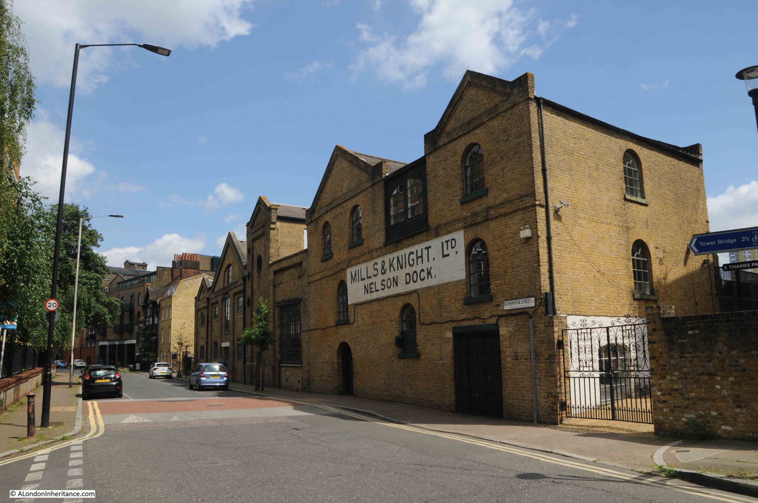
Next along Rotherhithe Street are the buildings of Mills & Knight at Nelson Dock:
Nelson Dock had long been a slipway into the river and there was also a dry dock where ships could be taken in from the river, the water drained out, allowing the hull to be worked on in the dry.
The 1953 London Wharves and Docks publication still lists the site as providing these services.
We then come to the Blacksmiths Arm:
There may have been a pub here in the late 18th century, but the first written reference to the Blacksmiths Arms that I can find is from the London Morning Advertiser on the 2nd of May, 1823, when particulars for an estate that was for sale could be had at the Blacksmiths Arms, Cuckolds Point.
Given that Cuckholds Point was the area of foreshore at the base of Horn Stairs, I suspect that this is the same pub.
The current building dates from the mid to late 19th century, and the interior and the mock Tudor frontage dates from the 1930s.
We then come to the part of Canada Wharf that faces onto Rotherhithe Street:
Along this stretch of Rotherhithe Street is an unusual reminder of one of the earlier attempts at providing a river boat service – a reminder of some London transport history:
The White Horse company ran a ferry along the river from Canary Wharf and Rotherhithe to the City, opening in June 1999. In 2000, they also ran the ferry service from Greenwich, by the Cutty Sark, to the Millennium Dome.
Both services closed in 2001, and the assets of the company were put up for sale, so the above sign represents a ferry service that ran for two short years.
I am pleased I found the location of the 1948 photo, one of those I thought might be a challenge, and a photo that highlights just how much Rotherhithe has changed.
Now for some extra content after a walk through the City last week:
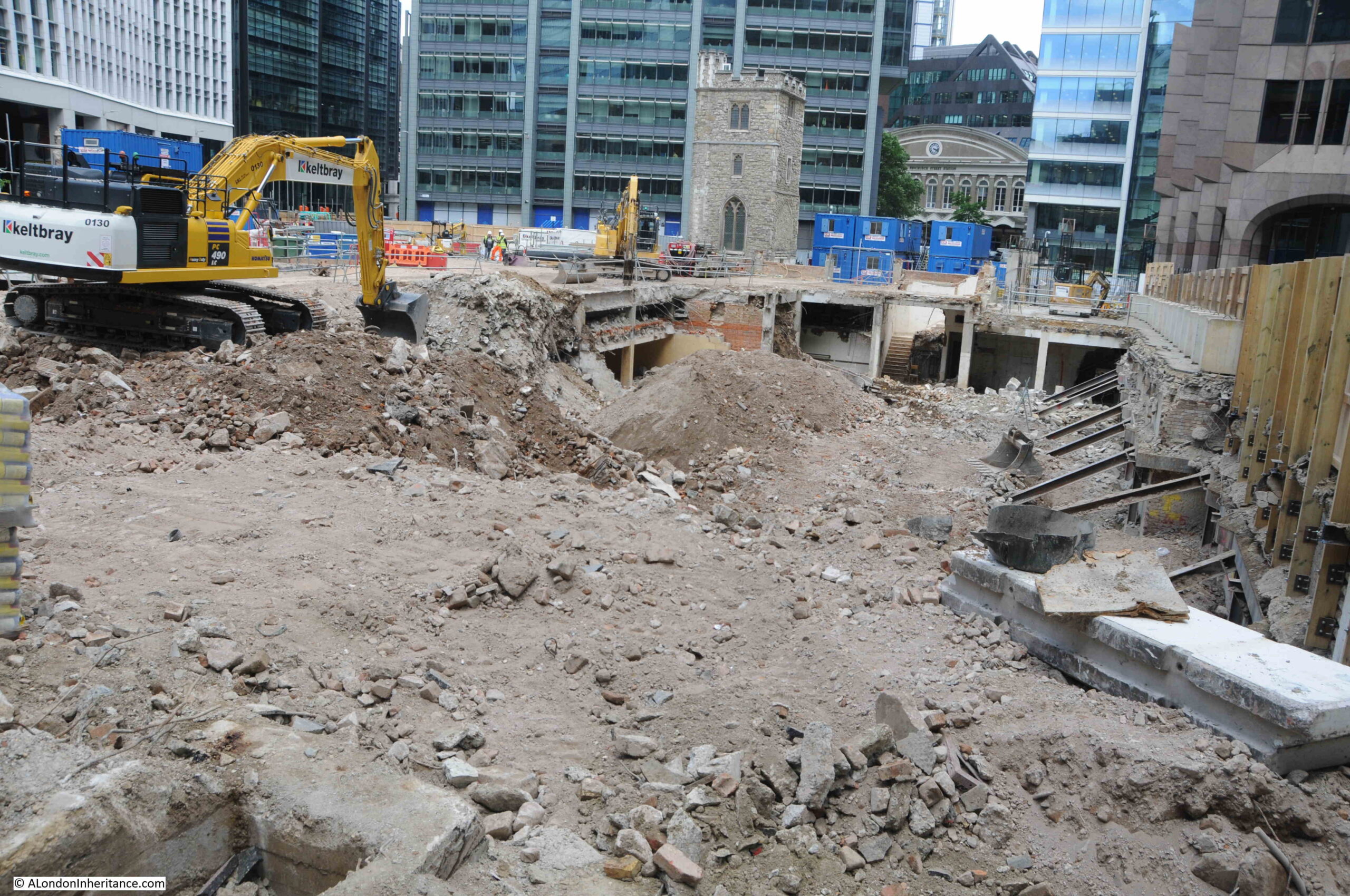
Walking through the City last week and although I knew there was a major redevelopment planned, the sight of the church tower standing alone in the rubble of the demolished buildings that once surrounded the tower was rather stunning:
The construction site is surrounded by tall wooden hoardings that you cannot see over, however holding my camera above the wooden wall, and lots of random clicking revealed the following scene, where the area around the tower has been demolished down to ground level, revealing the basements of the demolished buildings:
The site was the home to the post-war version of Clothworkers Hall, and the Clothworkers’ Company have had a hall on the site since 1528. The Clothworkers’ Company also own the land and will have a new hall built as part of the overall redevelopment.
The documentation that goes with the development (called 50 Fenchurch Street) states that it sits on the “southern edge of the City’s eastern tower cluster”, and this can be seen in the following photo:
As well as a new hall for the Clothworkers’ Company, the development will consist of a 36 storey commercial tower, which will have a new public roof garden, which seems mandatory in recent City developments.
The tower will have “Innovative vertical urban greening to mitigate air and noise pollution, and improve biodiversity”, and there will be a new public realm at ground level, which will include access to the church tower and to the crypt of Lamb’s Chapel, which was originally at Monkwell Street, now under the Barbican Development (I wrote about Lamb’s Chapel in this post).
The view of the tower and building site from Mark Lane:
And from Fenchurch Street, where a lone pillar from one of the demolished buildings remains:
Whilst the buildings that were demolished were of no real architectural or historical interest, and the Clothworkers’ Company will remain on a site they have occupied for hundreds of years in the latest iteration of their hall, what is often ignored and lost is the historical layout of the streets and alleys.
In the following extract from Rocque’s 1746 map of London, I have highlighted the church (red arrow), Clothworkers’ Hall (green arrow) and an alley by the name of Star Alley (red arrow):
Although surrounded by post-war buildings, Star Alley, as a physical alley that you could walk, existed all the way up to the recent demolition, in the same alignment as in the 1746 map.
It may survive in some form in the new development, either studs on the ground, different types of paving, or a name of a walkway through the new tower, but the alley will have been lost, and for me, it is the loss of this historic streetscape which is worse than the loss of the post-war buildings or the build of a new tower.
I finished off my 2018 post with the following paragraph:
“It is remarkable that the tower of All Hallows Staining has survived for so long without a functioning church. The tower, churchyard, Star Alley, Dunster Court and the Clothworkers’ Hall form a small City landscape that is the same as mapped in 1746 and may date back to around 1456 when the Shearmen (the predecessors of the Clothworkers’ Company) purchased the land in Mincing Lane.”
Little did I know that six years later, apart from the tower of All Hallows Staining, everything else would be gone.
For this week’s post, I am continuing with one of my favourite London subjects – Thames Stairs, and I am in Rotherhithe to find Hanover Stairs, and also to check whether the stairs confirm my theory that nearly every Thames stair had an associated pub.
This was the view, early on a sunny morning, walking along the footpath beside the Thames, with Hanover Stairs signposted next to the steps down to the river:
There is a gate at the top of the stairs, with a warning sign showing someone falling down the stairs, along with the danger warnings of Slippery Steps, Sudden Drop and Deep Water – all of which make sense for these stairs:
A look down the stairs reveals that they are in very good condition and consist of brick steps leading down to a sandy foreshore:
The Port of London Authority list of access points to the River Thames has very little information about these stairs. It just states that they were in use in 1977, consisted of concrete stairs and were in good condition.
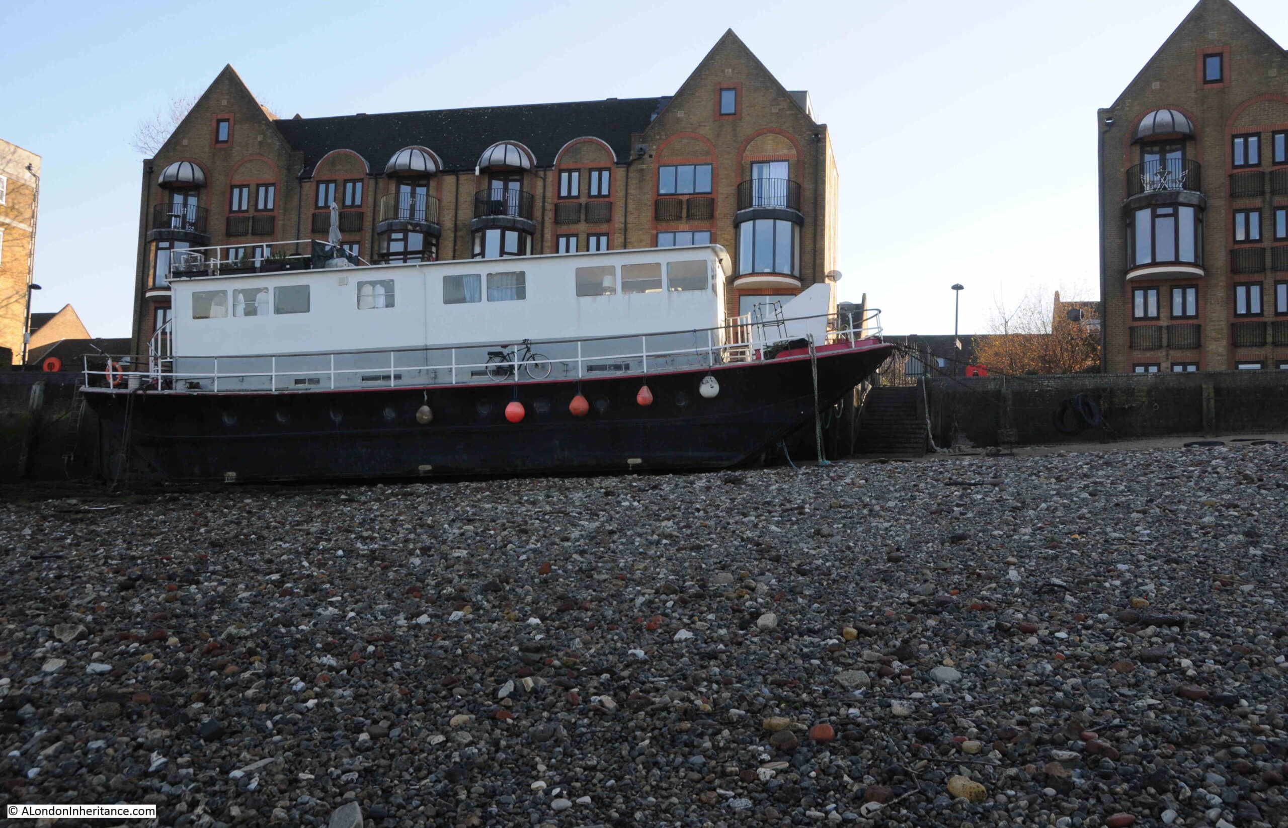
Hanover Stairs are rather unusual in that there is a ship moored at the foot of the stairs. A scene that was probably rather common when the river was in use and ships would have moored in the river and along the foreshore.
Presumably a house boat, and equipped for permanent occupation as there are a range of pipes plumping in services between the ship and the shore.
During my visit it was a low tide and I could walk out for a reasonable distance across the foreshore. In the following photo, I am looking back from the water’s edge to the shore line, and the photo shows how the shore here drops considerably away from the edge of the land:
Looking east, with Shadwell and Limehouse visible across the river:
The narrow gap for New Crane Stairs, between two large buildings, shows the importance and persistence of Thames Stairs.
The following photo is looking west along the river, and in this photo we can clearly see how steep is the drop in the foreshore from the edge of the river out towards the centre:
Next to the stairs, where the house boat is today, there was a small pier. On the foreshore, there is the abbreviation M.P.s – This stands for mooring posts and shows that ships and boats would have been moored along the foreshore at Hanover Stairs.
Large buildings line the river, warehouses and industrial sites, with a small number of terrace streets leading back in land.
To the upper right of the above map, is the pier for the Rotherhithe Gas Works, and these works can be seen running back in land, where the circular feature of the gas storage tanks can be seen.
I have a theory that nearly all Thames Stairs in populated and industrial areas, had a pub located next to the stairs, and Hanover Stairs continues to confirm this theory.
In the above map, I have ringed the PH of Public House which was opposite the stairs, where an alley led between two adjacent large buildings, down to the stairs.
I found the name of the pub by doing a newspaper search for Hanover Stairs, and found the pub had a good Thames related name of the Ship.
A typical example of where the Ship was mentioned in relation to the stairs, and an advert which shows how these pub were important for more than just drinking is the following advert which appeared in the Kentish Independent on the 24th of January, 1852, where an auction was being advertised for the “Stock of Mr. Little, Timber Dealer, who is retiring from business”.
The auction of Mr. Little’s stock included a very large quantity of timber, a “capital nearly new Timber Cart”, and rather strangely “a Sow and Four Pigs”.
The advert then goes on to list where the catalogue for the auction could be had, and this is where I found the reference to the Ship:
“Catalogues had: the Lord Duncan and Dover Castle, Broadway; Bratt’s New Cross Inn: Shard’s Arms, Old Kent Road: The Ship, Hanover Stairs, Rotherhithe; Prince of Orange, Greenwich; Three Tuns, Blackheath: Tiger’s Head, Lee: Dartmouth Arms, Sydenham Common; of Mr. Little on the premises, and of Mr. Rogers, Auctioneer, Valuer, Estate and House Agent, Lewisham.”
Another advert which mentions the pub was from June 1825 shows the type of excursion you could have taken on a summer’s day, early in the 19th century:
“GRAND NOVEL EXCURSION. A. READ, Captain of the FAVOURITE, Steam Packet, begs to inform his Friends and the Public that he has engaged the above elegant and commodious Vessel for an EXCURSION round the ISLE of SHEPPY, passing the Nore, Whitstable, Queenborough, and his Majesty’s Fleet at Sheerness, on Thursday, the 29th Instant, and return the same evening. A grand Band of Music will be provided. refreshments may be had on board at the usual moderate charges.”
Tickets for this “Grand Novel Excursion” were 5 shillings and 6 pence each, and the Ship was one of the places where you could buy tickets, and in this advert, Mr. Rounce was mentioned as the landlord of the Ship. Tickets were for sale widely across London, from the Rose by the Old Bailey, pubs in east London, both north and south of the river, a grocer in Tower Street, and offices in Fenchurch Street.
Both of these adverts show the importance of these local pubs to other commercial activities. They were places where you could advertise to the local community and use as local distribution hubs.
The importance of the relationship between the Ship and Hanover Stairs is that in these two examples, and many other reference I found, although the pub is in the street opposite the stairs, the name of the street is not mentioned, just the name of the pub and the name of the stairs.
The Ship closed around 1960, and sadly I cannot find any photos of the pub.
The majority of the Thames Stairs have lost their associated pub. A few still exist in Wapping (Pelican Stairs next to the Prospect of Whitby and Wapping Old Stairs next to the Town of Ramsgate).
In Rotherhithe, a surviving example is the Mayflower, where to the left of the pub can be found Church Stairs:
21st century detritus washing up on the foreshore at Hanover Stairs:
The earliest written references I could find to Hanover Stairs dates from the 1790s, where for example, on the 11th of January, 1796, in a list of Dividends to be paid to Creditors, there was the following “Alexander Christall and James Church of Hanover Stairs, Rotherhithe, Surrey, Sail-makers”.
On the 28th of November, 1761, it was reported that “The John and Thomas, Blickenden, loaded with Corn, is sunk in the River near Hanover Stairs”.
Hanover Stairs can be seen in Rocque’s map of 1746 (underlined in red):
The map shows that in the 1740s, whilst the river’s edge was developed, a short distance inland it was still orchards, farmland, fields, marsh and streams. The section of the road that is now Rotherhithe Street was then named Redriff.
One of the few streets that leads inland from Redriff is directly opposite Hanover Stairs, and is named Hanover Street. I suspect the street took the name from the stairs, as these were probably a much older feature than the street.
I cannot find the source of the name Hanover as used for the stairs. Possibly there may have been local merchants from Hanover in Germany, of it may have been after George I, who became the first British King from the German House of Hanover who was on the British throne between 1714 and 1727.
Hanover Street changed named to Heston Street, and in the rebuilding of the area over the last few decades, the street that was one of the first running inland from the river, was built over and is now one of the many lost streets of the area.
So the stairs along the foreshore have been here for at least 275 years, and features from the long industrial history of the area can still be seen along the foreshore, for example, large stretches of consolidated stone and concrete, much eroded by the river:
Looking along the foreshore from Hanover Stairs to the pier that once supplied the Rotherhithe Gas Works with coal arriving along the river:
Looking back at the steps of the stairs, with in the foreground some of the chains and weights used to keep the house boat securely moored alongside the river wall:
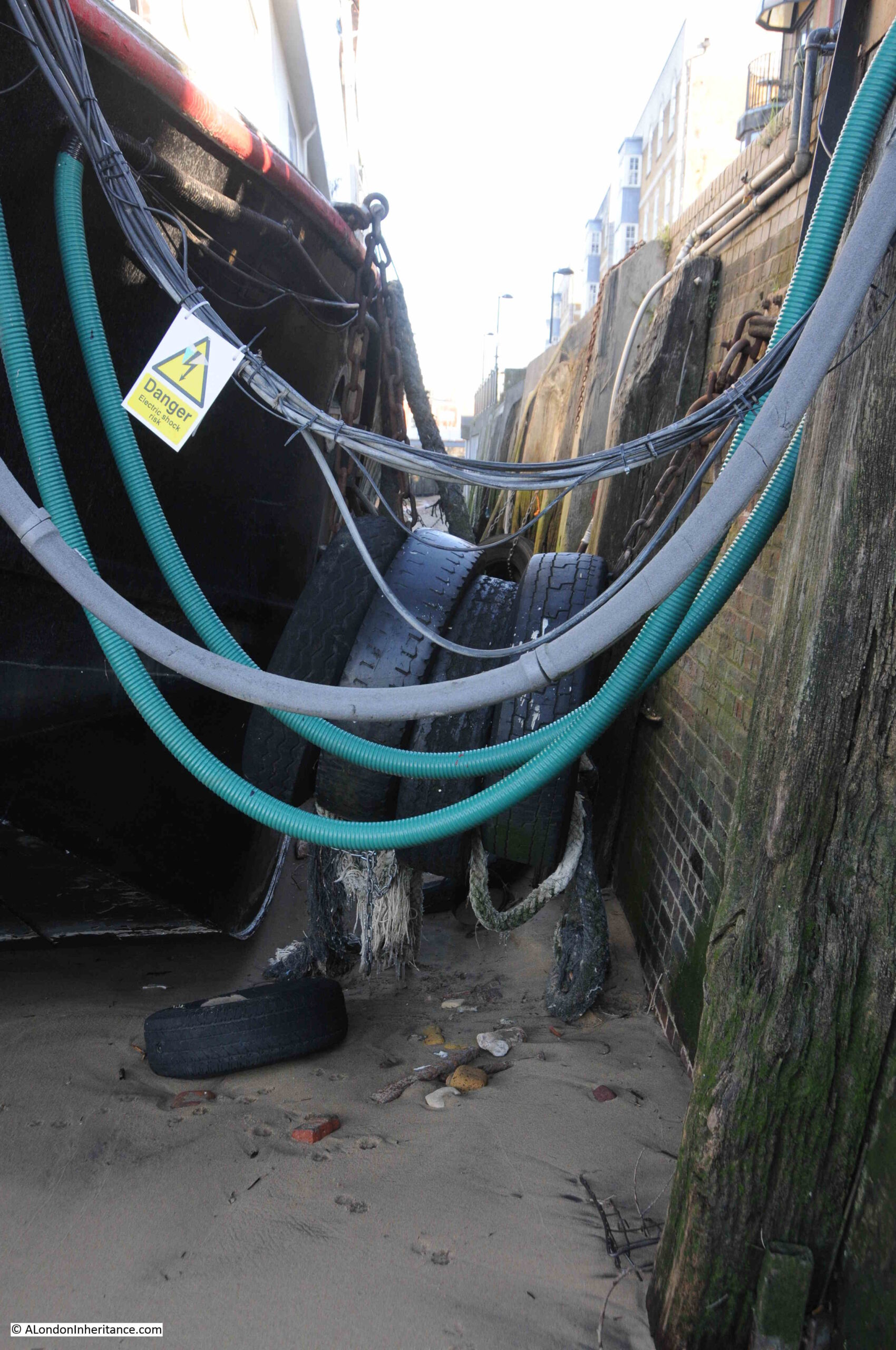
Cables and pipes carrying services to the house boat and tyres to protect the side of the boat:
There are frequent mentions of Hanover Stairs in newspapers up to the 1930s, when the last two reports are about an 11 year old boy who drowned after falling into the river when he and his friends were playing on barges next to the stairs, and a thief who was caught in Rotherhithe Street with a sack full of Gin bottles, which had been stolen from a barge lying next to the stairs.
After the 1930s, there seems to have been very little happening at the stairs (or at least anything that was considered newsworthy). That may have been due to the level of bomb damage at the stairs and the surrounding streets, which was considerable.
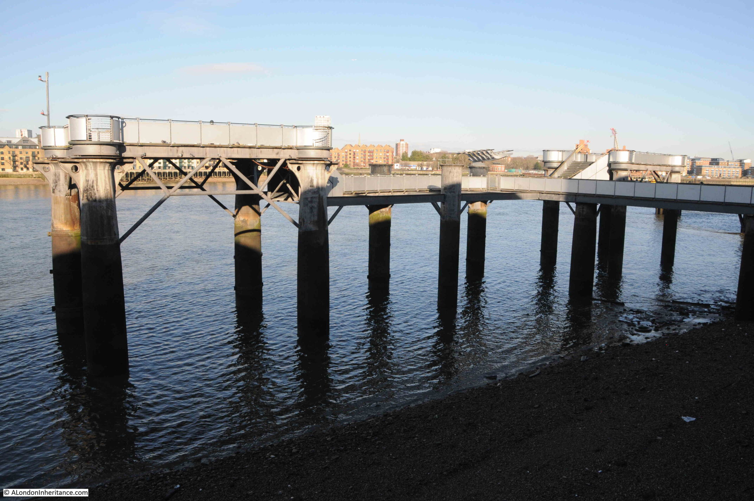
After leaving the stairs, I walked along the river path to take a closer look at the former gas works pier:
The pier is in good condition, and is a suitable reminder of the connection between the river and the industries activities that once occupied so much of Rotherhithe:
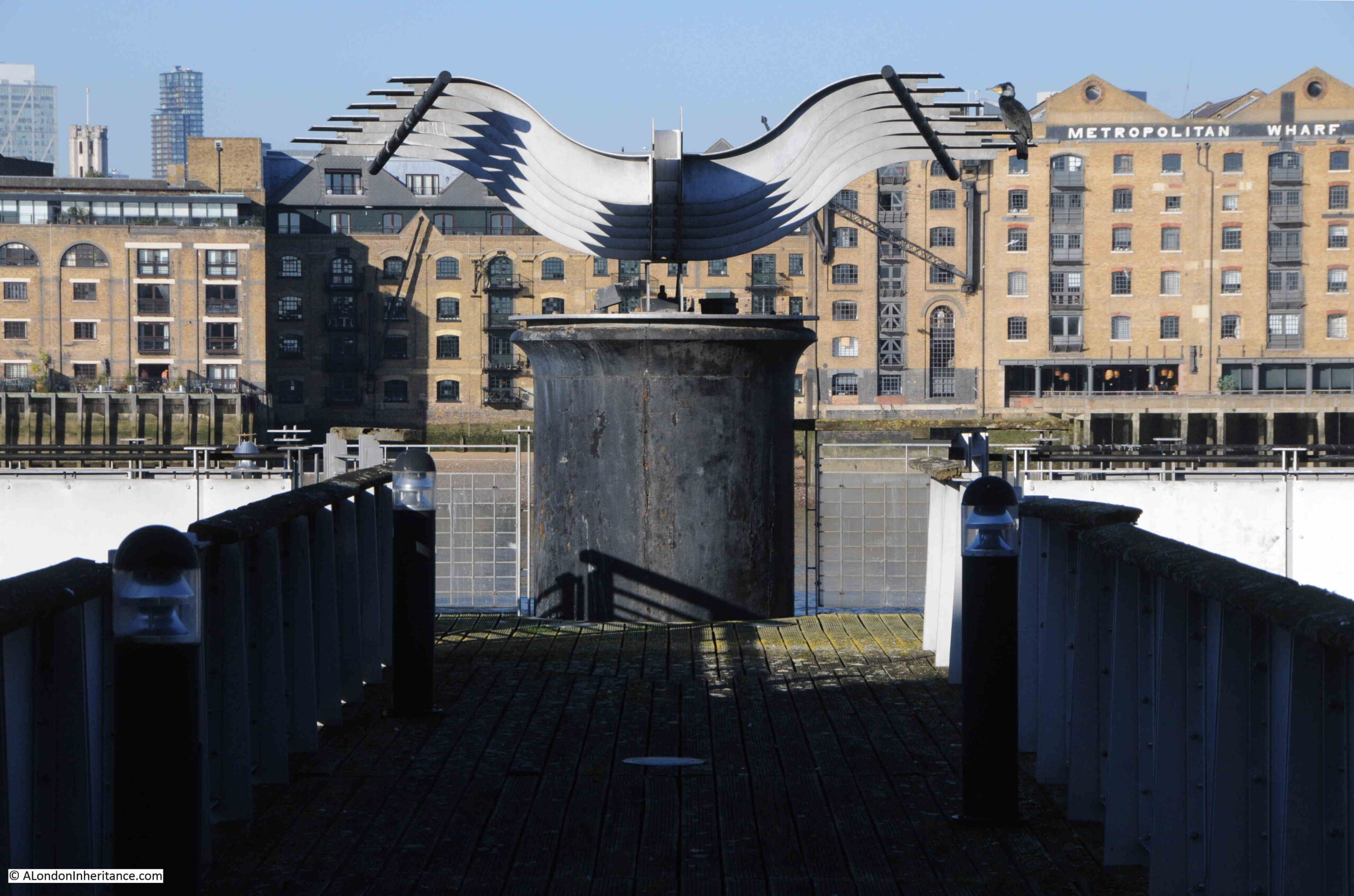
I have often wondered what the metal structure is on the rivers edge at the centre of the pier, shown in the photos above and below. I assume it is part of the equipment which once carried coal from ships moored alongside the pier to the gas works, however now standing isolated of any other infrastructure, it almost looks like a work of art.
Seen from head on, the curves of the shaped metal on either side almost give the whole thing the appearance of a bird flying in from the river:
Another set of Thames Stairs ticked off the list, and one that continues the link between a local pub and stairs.
They were an important combination in the day to day life of the working river. The stairs provided access to the river and the barges and ships moored nearby, the watermen that would take you to your destination along the river, a place where those working or travelling on or along the river would have known well.
The stairs were also a landmark, referenced whenever you needed to refer to something happening on the river, on land, or to get to this part of Rotherhithe.
The pub was not just a place to buy alcohol, it was an important part of the local community, a place where other commercial activities could take place, such as selling tickets or distributing auction catalogues, where inquests to those who died on the river were held, where those working on the river probably went in for a drink after returning via the stairs, a local meeting point next to the stairs etc.
And that relationship is strengthened by the names frequently given to these pubs, which often referred to some aspect of river life, as with the Ship next to Hanover Stairs.
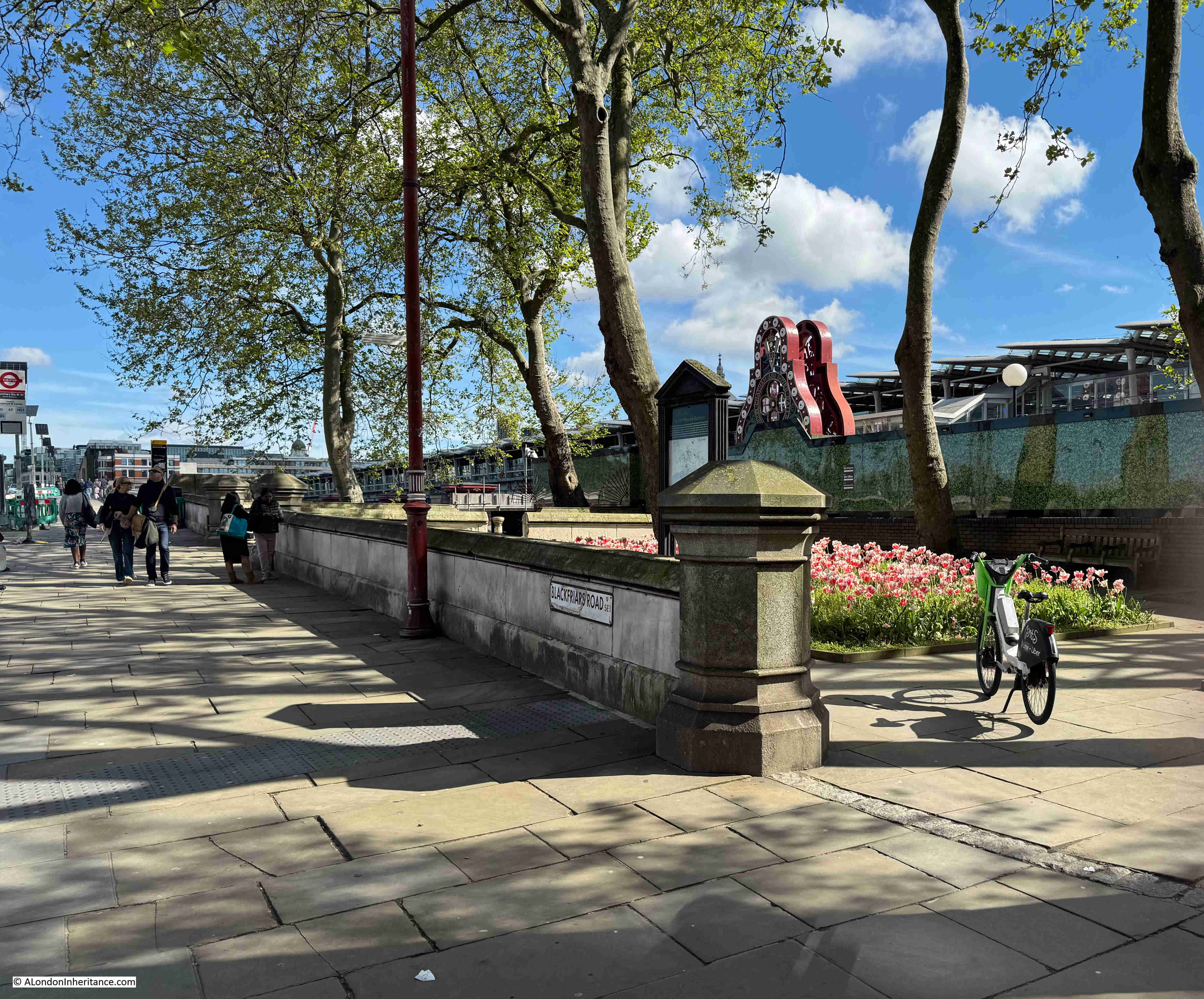
If you walk to the southern end of Blackfriars Bridge, on the eastern side of the bridge there is a small garden, and it is a perfect example of how places in London can tell multiple stories, and for the garden the story is of the engineer John Rennie, the Albion Mill, a unique view of London, as well as the price of grain and flour in London.
This is Rennie Garden alongside the path that runs up to, and along the eastern side of Blackfriars Bridge:
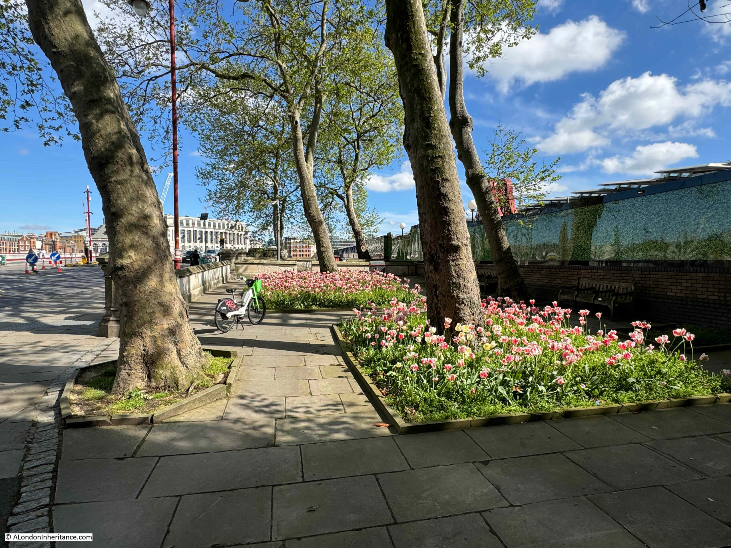
This is a very small garden and consists of a few trees and two blocks of planting:
Which really look good, and bring a splash of colour on a sunny May morning:
The gardens were created in 1862 by the Corporation of London and named the Rennie Garden after the engineer John Rennie.
The following extract from the 1894 edition of the Ordnance Survey map shows the gardens (ringed in red), as a very small patch of public gardens squashed between the railway and the road, both of which were running on to the bridges which crossed the Thames (‘Reproduced with the permission of the National Library of Scotland“):
In the above map, some stairs can be seen running down to the foreshore from the north of the gardens. The stairs are still there today, however they now lead down to the walkway along the side of the river:
There are though stairs on the other side of the river wall which lead down to the foreshore. This is not a historic set of stairs and they seem to have been built around the same time as the bridge.
So why are the gardens named after John Rennie, and what is the connection with a mill, the price of flour and a view of London?
John Rennie was the architect of London Bridge (the version of the bridge that was later demolished and moved to Arizona in the US). After Rennie’s death in 1821, the bridge was built by his son, also named John, who continued his father’s practice as a civil engineer.
According to “A Biographical Dictionary of English Architects” by H.M. Colvin, (1954), John Rennie (1761 to 1821) “was the younger son of a Scottish farmer, and was born in Phantassie in East Lothian on June 7th, 1761. As a child he showed a remarkable aptitude for mechanical pursuits, and he afterwards found congenial employment with a millwright. His earnings enabled him to study at Edinburgh University for three years before establishing himself as a millwright and general engineer. In 1784 he went to Birmingham in order to assist Boulton and Watt in designing and executing the machinery for the Albion Flour Mill ay Southwark”.
And that is the connection between John Rennie and the gardens, as they are on part of the site of the Albion Flour Mill, the first steam powered flour mill in London and at the time of completion, the largest in the world.
The Albion Flour Mill, Blackfriars Bridge is shown in the following print, with the edge of the bridge (the version before the Blackfriars Bridge we see today) at the right edge of the print:
Before the Albion Mill, there had been a number of much smaller mills scattered across London and the counties surrounding the city, using a range of power sources such as wind and water.
The introduction of steam power rendered all these other mills redundant as the Albion Mill could process large quantities of grain with a reduced level of manpower. Being next to the river enabled both coal and grain to be delivered directly to the mill.
Newspapers reported on the opening of the Albion Mill, and the following from the 10th of April 1786 is typical “A few days since the Albion Mill, on the Surrey side of Blackfriars Bridge, commenced working. This mill, the largest in the world, has been erected by the proprietors for the beneficent and salutary purpose of supplying this great metropolis with flour, and of course reducing the price of bread, the greatest blessing the poor can experience on this earth. The machinery is worked by the operation of steam, and we are happy to say, there is every reason to expect it will amply fulfil the intent, and fully reward the ingenuity and public spirit of those gentlemen who have risked their money in this arduous and laudable undertaking”.
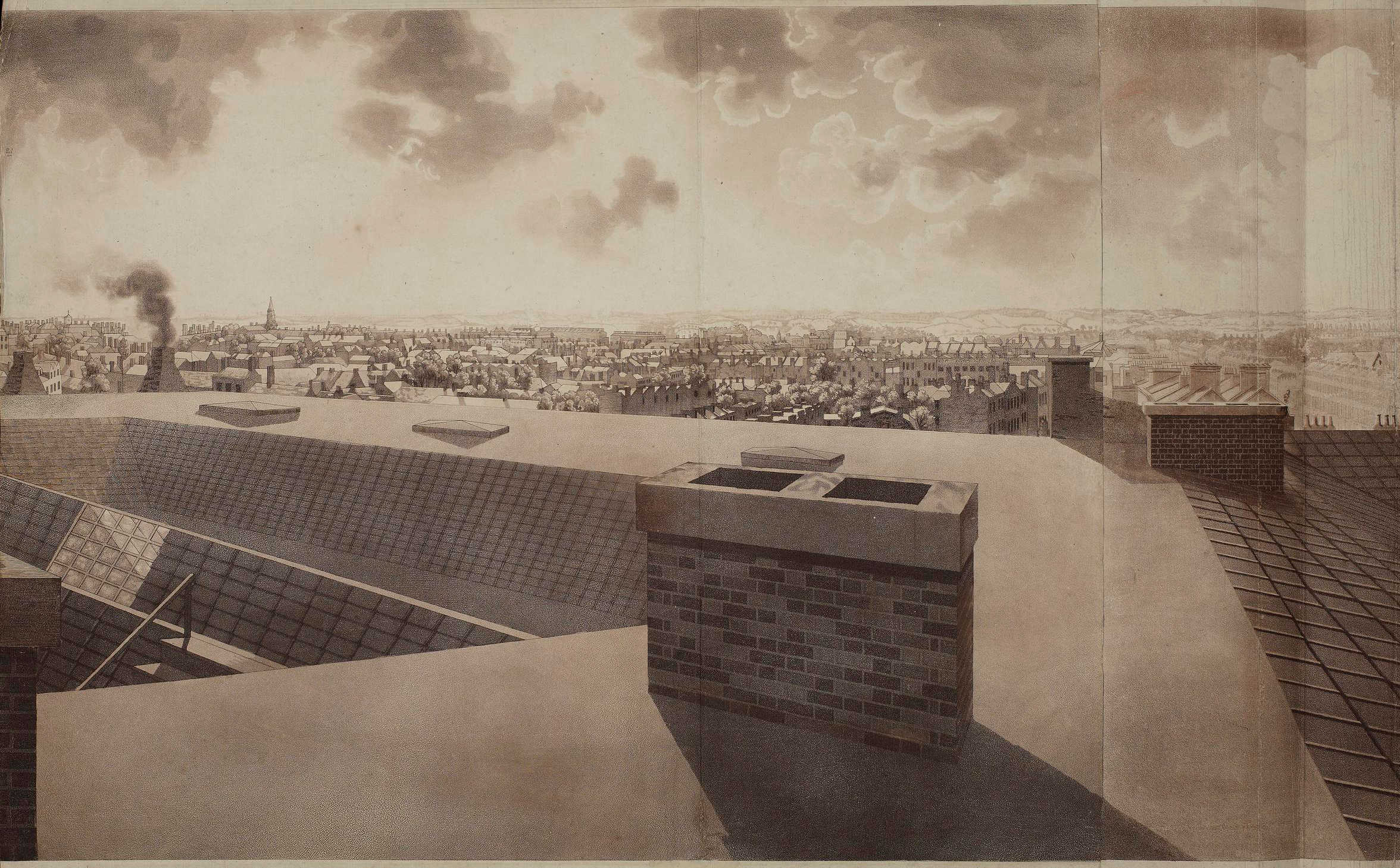
As well as being the first use of steam power in London to produce flour, the Albion Mill’s name was associated with a panoramic drawing made from the roof of the building “London from the roof of Albion Mills”.
The panorama as a form of painting and exhibition was invented by a Scottish painter, Robert Barker. One of the 19th century accounts of the history of the panorama claims that Barker had been imprisoned for debt in Edinburgh in 1785. “His cell was lighted by an air-hole in one of the corners, which left the lower part of the room in such darkness that he could not read the letters sent to him. He found, however, that when he placed them against the part of the wall lighted by the air hole the words became very distinct. the effect was most striking. It occurred to him that if a picture were placed in a similar position it would have a wonderful effect. Accordingly on his liberation he made a series of experiments which enabled him to improve his invention, and on June 19, 1787, he obtained a patent in London, which established his claim to be the inventor of the panorama”.
To display his new invention, Barker raised enough money to build “an entire new Contrivance or Apparatus for the Purpose of displaying Views of Nature at large by Oil-painting, Fresco or any other mode of painting and drawing”. This was to be found next to Leicester Square, with a small entrance from Cranbourn Street.
Barker gave his display the name “Panorama”, and once inside, spectators would stand on a raised circular platform in the centre of a round building. They were about 30ft away from the circular wall on which was painted the scene to be viewed, stretching for the full 360 degrees around the spectators.
After entering in the dark, light was then let in from the roof, and it was focused on the scene painted on the surrounding wall – the panorama.
The lighting and the quality of the painting on the wall gave the effect of standing in the middle of the real scene that was portrayed around the wall.
To keep paying spectators returning, Barker regularly changed the panoramas on display, and they were not limited to landscapes. One very popular panorama was of the Naval Grand Fleet lying at Spithead, with Portsmouth and the Isle of Wight in the background.
Robert Barker’s panoramas were very successful and always drew a crowd wherever they were on display. He opened panoramas in France, Holland and Germany, and the panoramas on display in Leicester Square would also go on tour around the country, as the following from Aris’s Birmingham Gazette on the 22nd of October, 1798 illustrates:
“By particular Desire of a Number of Families of Distinction in Birmingham and its Environs; the PANORAMA, Union-street, or perspective VIEW of the GRAND FLEET at Spithead, will continue open till Saturday next, the 27th instant, on which day it will positively and finally close, in order to embark for Hull, where it is engaged. That part of the public who have not yet had an opportunity of seeing the Grand Exhibition, will do well to take the present Opportunity of seeing the Wooden Walls of England before their Departure. Admittance One Shilling.”
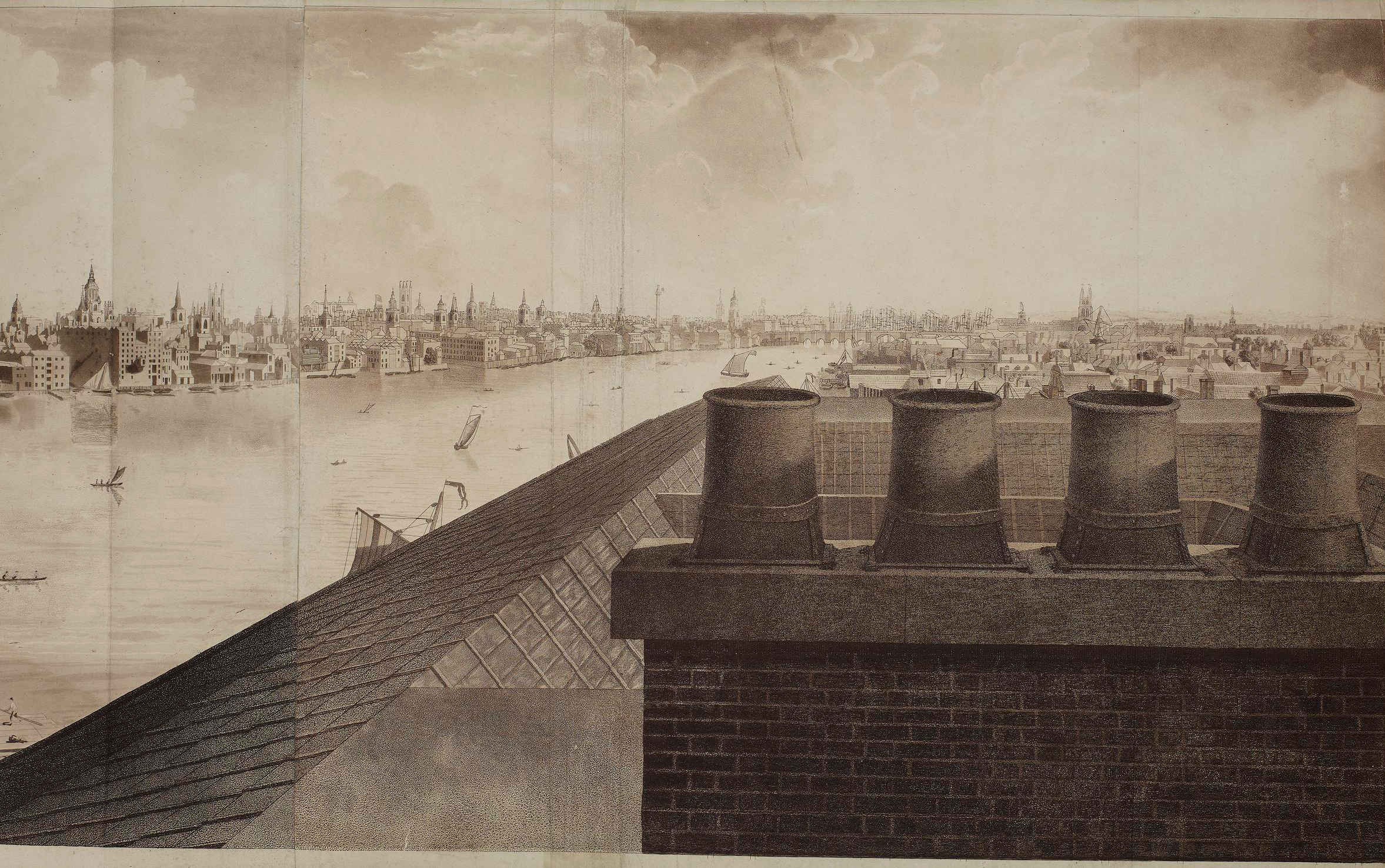
After completion, the Albion Mill was the highest building between St. Paul’s Cathedral and Westminster Abbey, so it was the ideal location from where to make another panorama, and to do this Barker sent his 16 year old son up to the roof of the mill in the winter of 1790 to 1791 to paint the view for the full 360 degrees – a vast panorama of London at the end of the 18th century.
The British Museum have a copy of the panorama from the roof of Abbey Mill in their collection, and it is available for use under a Creative Commons license, so although today I cannot get to the same height and specific location from where the panorama was made, below is a very rough comparison of the early 1790s with the view of London today.
Looking to the north and we can see St. Paul’s Cathedral, spires of the City churches, and the Blackfriars Bridge on the left:
To the west:
To the south-west:
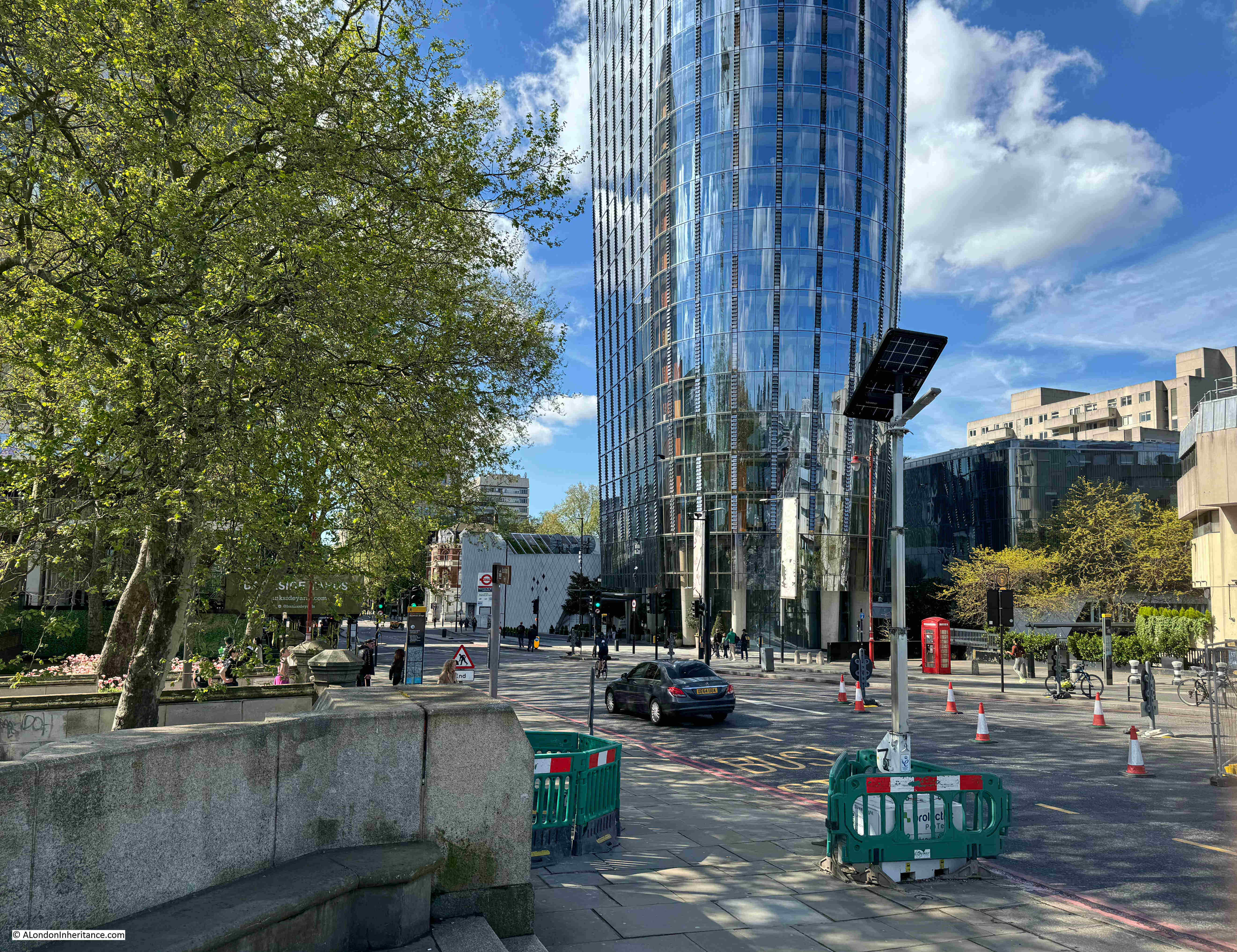
A very different view today:
To the south:
To mirror the above view, I would be looking straight at the Rennie Garden as in the photos earlier in the post.
As with Robert Barker’s other panoramas, the View from the Roof of Albion Mill also travelled across the country, and internationally, so for example, in 1796 it was on display in Philadelphia in the US, where you could walk in to see the view of London for half a dollar.
The panorama was also printed onto single sheets to give an idea of the view of London:
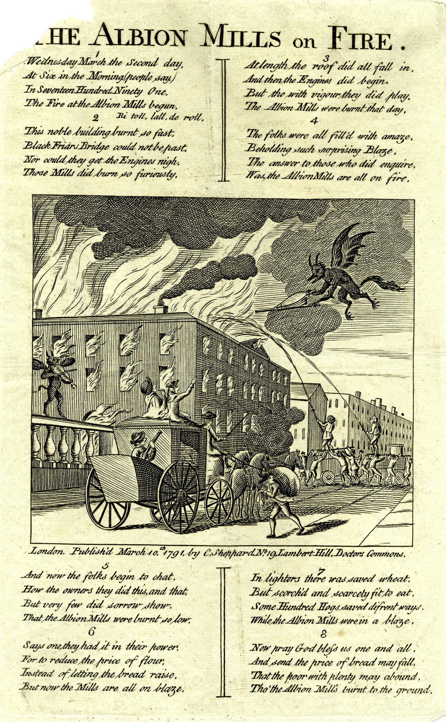
The Albion Mill did not last for long as in March 1791, a couple of months after the panorama was completed, the entire building burnt down.
The following report from newspapers of the time covers the fire, and also provides a possible cause:
“Yesterday morning, soon after six o’clock, a most dreadful fire broke out in the Albion Mills, on the Surrey Side of Blackfriars Bridge, which raged with such unbaiting fury, that in about half an hour the whole of that extensive edifice, together with an immense quantity of Flour and Grain, was reduced to ashes; the corner wing, occupied as the house and offices of the Superintendent, only escaping the sad calamity from the thickness of the party wall.
It was low water at the time the fire was discovered, and before the engines were collected, their assistance was ineffectual; for the flames burnt out in so many directions, with such incredible fury, and intolerable heat, that it was impossible to approach on any side till the roof and interior part of the building tumbling in completed the general conflagration in a column of fire, so awfully grand as to illuminate for a while the whole horizon.
The wind being easterly, the flames were blown across Albion place, the houses on the west side of which were considerably scorched, and the inhabitants greatly alarmed.
In the lane adjoining the Mills one house was burnt to the ground, and others considerably damaged. The Accident is supposed to have been occasioned by the Machinery having been overheated by Friction.
Another circumstance has been mentioned, that might operate either as an original or secondary cause in producing the above catastrophe:- A quantity of Grain that lay contiguous to the Machinery had been damaged by the late Floods, and was Yesterday Morning observed to have acquired such a degree of Heat, as made some of the Workmen conceive that it might be dangerous to put the Mills in motion. The Remark was not attended to, and the Consequence has been what we have related.”
So after 5 short years the Albion Mills had completely burnt down.
The following print shows the mill on fire, attempts to pump water from the river at low tide, into the fire, and watching crowds lining the side of Blackfriars Bridge:
The total loss of the Albion Mill was estimated by the companies that had insured the mill at around £90,000. There were also concerns about the loss of a large quantity of grain, and what this would do to the price and availability of flour. The proprietors of the mill were able to assure concerned Londoners that whilst a large quantity had been lost at the Albion Mill, they still had large quantities at other grain stores.
There were many though, who celebrated the loss of the Albion Mill, and a number of satirical prints were published about the fire:
In the above print, the dejected owners can be seen in the boat at lower left. In front of the building there are two barges on the river. The left barge is filled with sacks labelled Pot80 (potato), and the barge on the right with sacks of Indian Wheat. These sacks were implying that the flour produced at the mill had been adulterated. A number of demons can be seen rejoicing at the fire.
The opening of the Albion Mill had a very serious impact on all the millers in London and the counties surrounding the capital. The use of steam power had allowed the mill to produce flour quickly and efficiently, and the impact of this resulted in the closure of many other mills.
As an example of both the impact of the working Albion Mill, and the after effects of the fire, the following is from the Hampshire Chronicle on the 14th of March 1791:
“The Berkshire millers are sensibly affected by the late fire at the Albion mills, but not with grief. Many of them, who gave over working two years since, have again set their wheels in motion.
The flour-mills at Blackwall, Poplar, Limehouse, Rotherhithe, and many other places, which have stood still upwards of these three years, have also begun working again, owing to the Albion mills being burnt down.”
The price of flour had increased during the time of the mill’s operation. In the five years prior to opening, the average price of flour had been 44 shilling, 6 and a quarter pence. During the years the mill was in operation, the average price had increased to 45 shillings and 2 pence. A small increase, but still an increase.
It was argued that the increase in price was down to two bad harvests and that there had been a scarcity of wheat throughout all of Europe.
The following print also had a celebratory theme to the fire at Albion Mills, with a demon playing a fiddle on Blackfriars Bridge as the mill burns, whilst another demon fans the flames:
The following print is titled “A New Dance, as it was performed with Universal Applause, at the Theatre Blackfriars March 2nd 1791” and shows a celebrating crowd on the bridge, and three men dancing in the foreground. The man on the right has a sheaf of papers over his shoulder on which is written “Success to the Mills of Albion but no Albion Mills”:
One of the main complaints against the Albion Mill was that by being able to process so much grain and flour, and by forcing so many other mills to close, it was becoming a monopoly. These allegations may have had some truth, as soon after the fire, it was reported that:
“However well or ill informed the charge of monopoly against the Albion Mill Company may have been, the destruction of their mill has been followed by an almost immediate fall of three shillings per quarter in the price of wheat. This is proof that they were generally considered as having it in their power to keep up the price artificially.”
There were proposals to rebuild the mill in the years following the fire, however permission was not granted for the project, and houses were later built on the site of the Albion Mill.
I always find it surprising how you can take one very small spot in London, in this post, Rennie Garden at the southern end of Blackfriars Bridge, and find layers of history, and so many other connections. The story of John Rennie, a leading mechanical engineer in the later decades of the 18th century, the first steam driven mill in London, the story of the panorama and a unique and innovative view of London in the late 18th century, and the price of grain and flour.
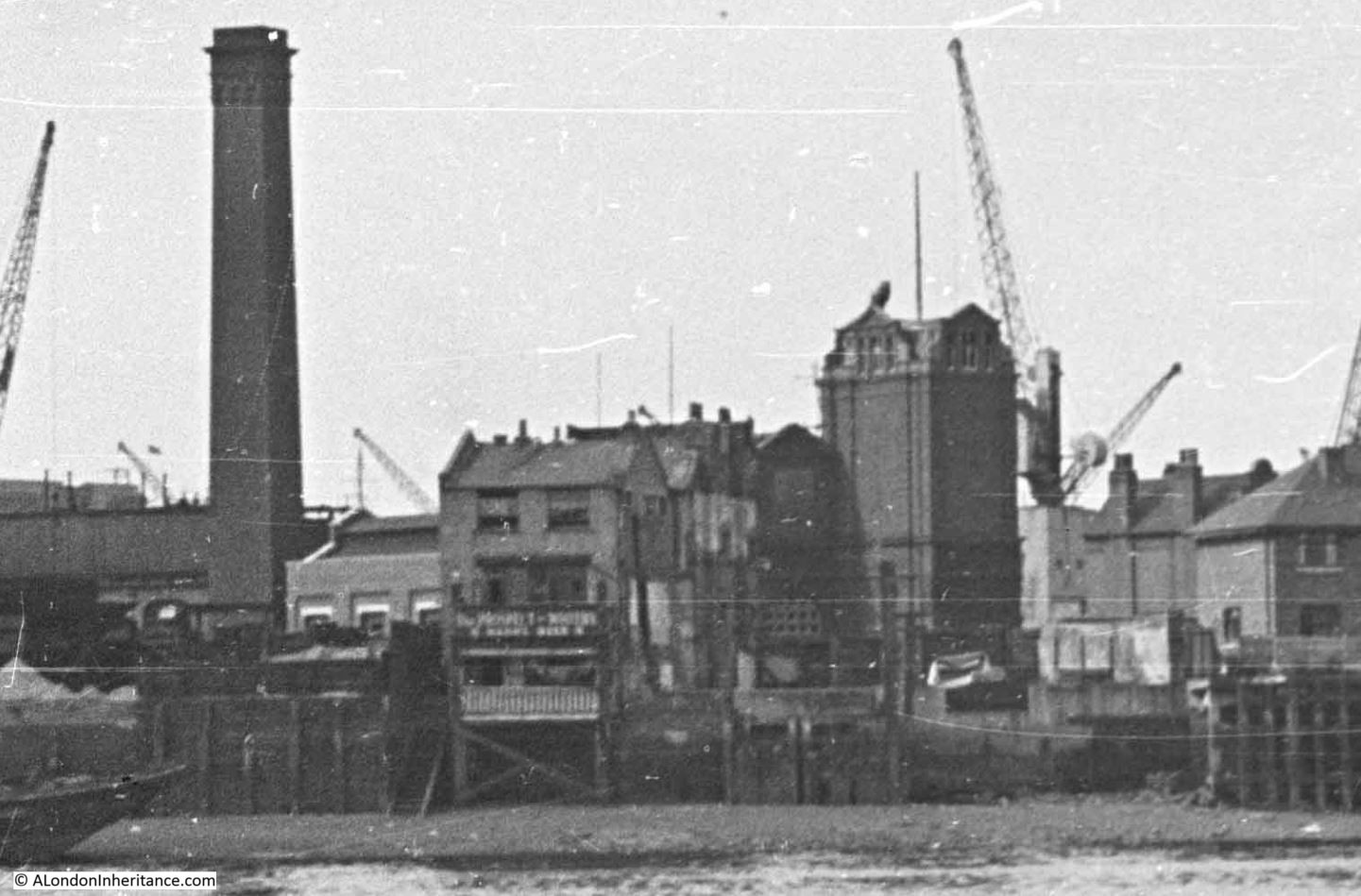
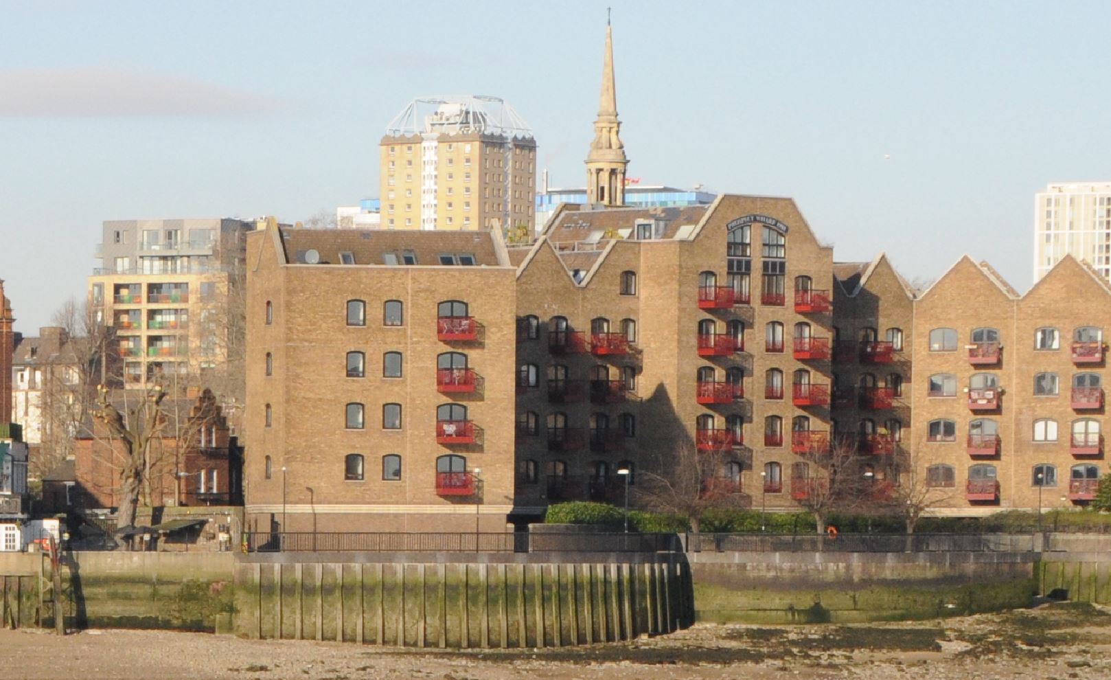
For today’s post, I have another of my father’s photos, taken on a boat trip along the River Thames in August 1948, this time looking across to Wapping, the Prospect of Whitby and Pelican Stairs:
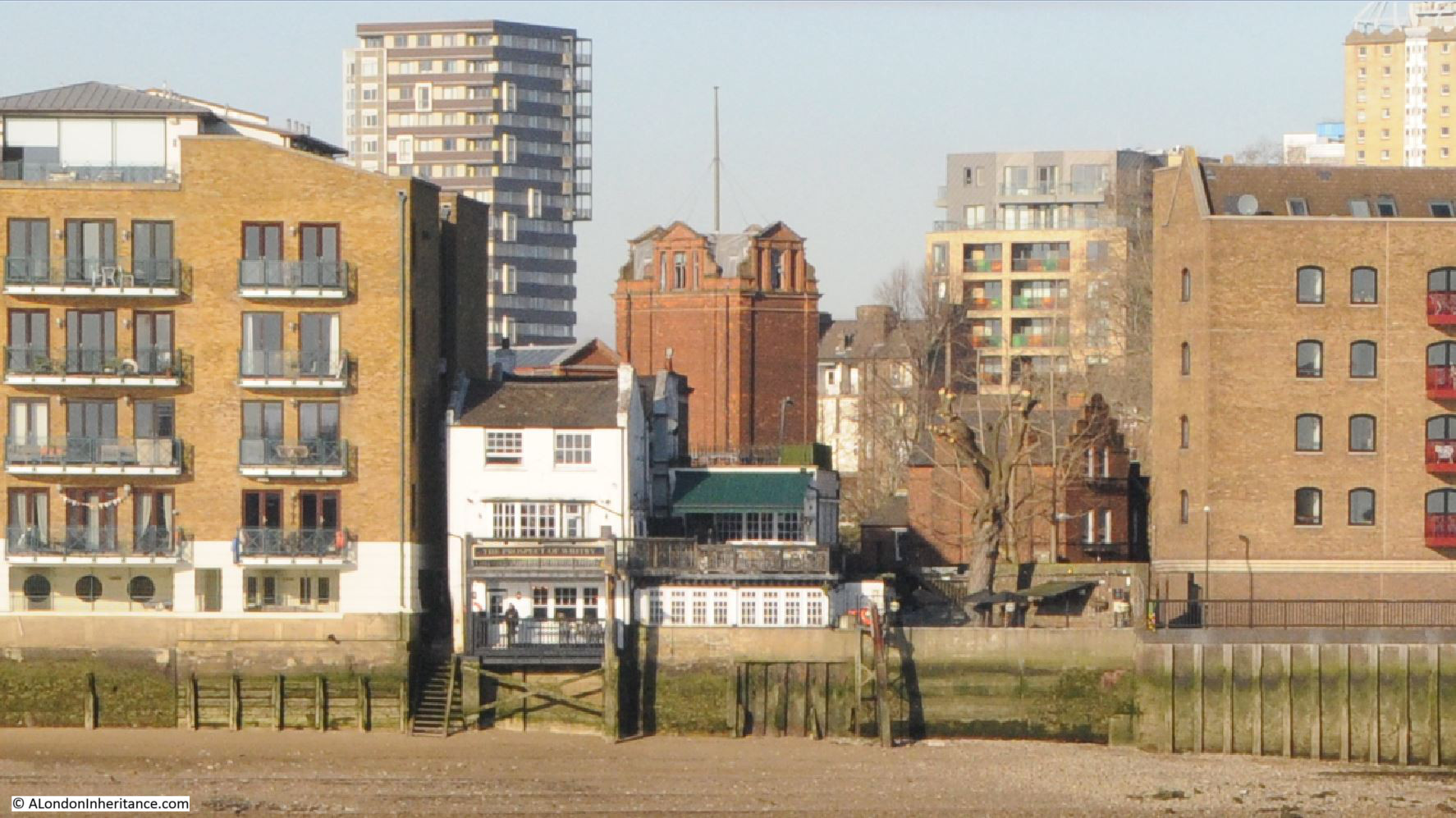
The same view in 2024, some 76 years later:
The 1948 photo shows an area just three years after the end of the war, and the bombing that badly damaged the whole area of the docks. It was a dirty, industrial place, still important in supporting the trade of London and the country, with imports and exports through the docks.
Only a few buildings have survived the intervening 76 years. The Prospect of Whitby pub, today a brightly painted white building along the river. The brick building behind, the steeple of the church of St. Paul’s, Shadwell, and on the left edge of both photos is a warehouse (1948) now converted to flats.
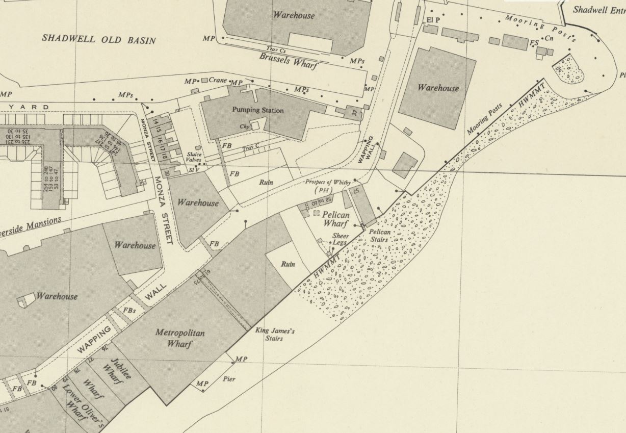
The Prospect of Whitby can be seen roughly in the middle of the map, and to the left of the pub is Pelican Stairs and Pelican Wharf. Just to the left of the P in Pelican is a square which marks the position of the chimney seen in the photo.
An extract from the photo provides a closer look at the Prospect of Whitby and surrounding buildings:
On the left is Pelican Wharf, then the Prospect of Whitby, with Pelican Stairs descending immediately to the left of the pub, then in the background, the large brick building of the London Hydraulic Power Company.
The same view today:
A new apartment building has been built over Pelican Wharf. The first mention I can find of Pelican Wharf dates from December 1866, when the wharf was mentioned in an article about a collision in the river opposite the wharf.
Many of the apartment buildings in my 2024 photo were part of the late 1980s development of the area, and there is an article in the Brentwood Gazette from the 22nd of April, 1988 which mentions Pelican Wharf, and provides a reminder of the transformation of the 1980s:
“Six months after Black Monday the Docklands property market is experiencing a ‘new realism’, says Stephen Miles-Brown of estate agents Knight Frank & Rutley.
The Essex bookmakers and the South London car dealers – the ‘Top Gun’ speculators of yesteryear – have all but disappeared, says Mr. Miles-Brown. In their place has come the traditional buyer with a mortgage, a career and even a few children.
Docklands developers are in the middle of the strongest buyer’s market for years. They have responded quickly and imaginatively. Immediately post Black Monday, there were incentive schemes, buy-backs, chain breaking and mortgage discounts, now the latest and perhaps best news of all is the return to good old fashioned ‘value for money’, a code word for keen prices, more space and upgraded specifications.
These developments with a large degree of space and higher specifications are far removed from some of the earlier ‘little boxes’ and are to be found throughout Docklands in such places as Timber Wharf on the Isle f Dogs, Greenland Passage in the Surrey Docks, Lime Kiln Wharf and Duke Shore Wharf in Limehouse, Pelican Wharf and Eagle Wharf in Wapping and Millers Wharf by St. Katherine Docks.
April marks the start of the 1988 ‘Docklands Season’ with no less than 10 major residential developments coming forward over the next few weeks.
They offer the choice of over 500 new homes, from first-time buyer studios at under £100,000 to – only for the seriously rich – 3,000 sq. ft. penthouses at £1.5 million !”
The later half of the 1980s and into the 1990s really was a development rush along the banks of the Thames, and although the article described the situation as a buyers market, prices for river facing properties in the 1980s were expensive. A first time buyer’s studio for under £100,000 may seem really cheap today, but in 1988 this was expensive.
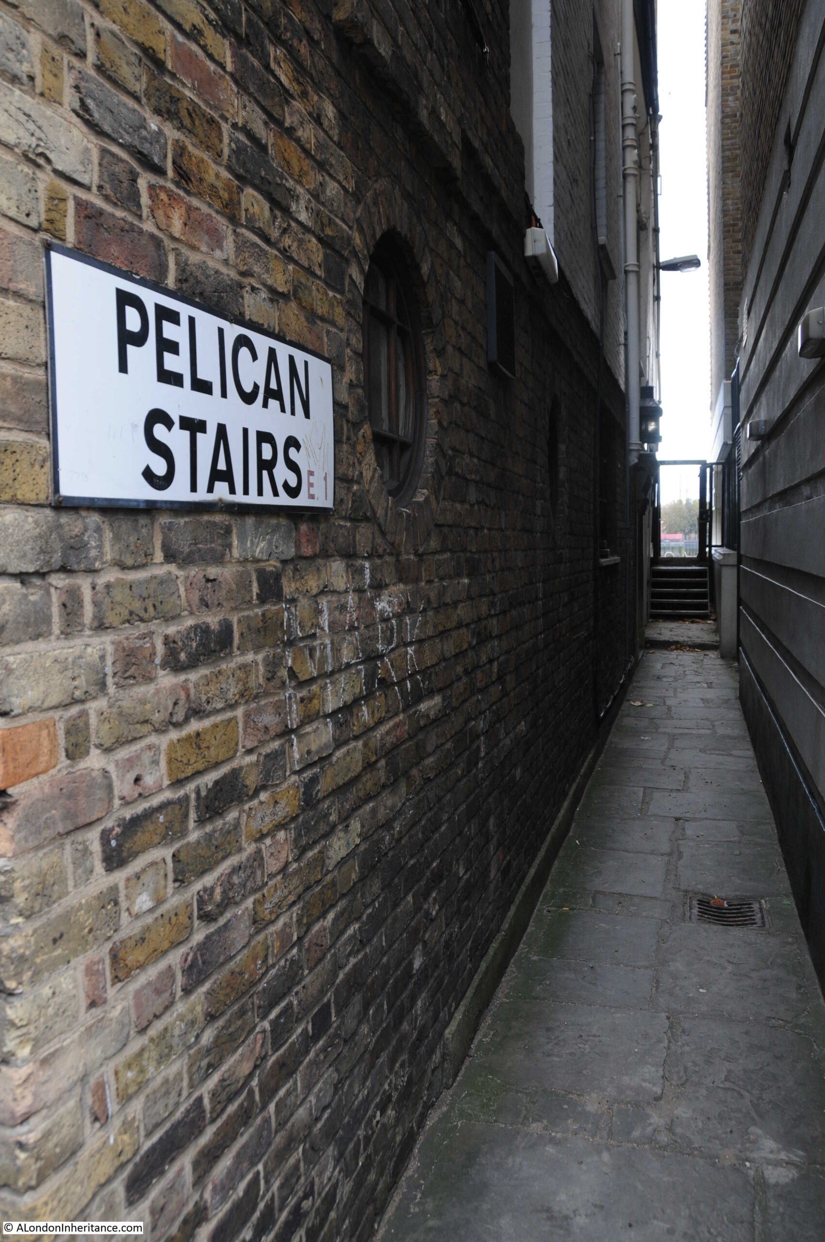
In the above 1948 and 2024 photos showing the Prospect of Whitby, a set of stairs can be seen running down to the foreshore to the left of the pub. These are Pelican Stairs.
Pelcian Stairs are listed in the Port of London Authority listing of access points to the Thames as being in use in 1708, and they are certainly old stairs. Their location next to a pub is typical of many of the stairs in Wapping, as many users of the stairs, whether arriving back, or waiting to leave via the stairs, would have headed to the pub, and the combination of stairs and pubs were centres of local activity.
The Prospect of Whitby was originally called The Pelican, but it is not clear where the name was used first, either the stairs or the pub.
The PLA listing (published around 1995) recorded that the stairs then had “Steps missing dangerous, derelict”.
As can be seen today, the stairs are now very much in use:
The first written reference to Pelican Stairs I could find was from the 30th of August, 1746, when the Kentish Messenger reported that “On Tuesday Evening, a Fire broke out in the House of Mr. Pelham, near Pelican Stairs in Wapping, occasioned by a quantity of Okum taking Fire; which burnt with such Violence, that the same, and the House of Mr. Beane, a Distiller and Grocer, were consumed, with their Stocks in Trade, which amounted to several hundred Pounds; two other Houses, both inhabited, and other small tenements were much damaged.”
It is remarkable the number of fires that occurred, but perhaps not surprising when you consider that there were many houses, warehouses and factories where highly inflammable goods were stored, and where both building and working practices lacked the approaches needed to prevent the start and spread of fires.
The entrance alley to Pelican Stairs alongside the Prospect of Whitby:
The large brick building behind the Prospect of Whitby can be seen in both 1948 and 2024 photos. This was the Wapping pumping station of the London Hydraulic Power Company.
The London Hydraulic Power Company (LHPC) was formed in 1884 by Act of Parliament, although the provision of hydraulic power by the company had started in the previous years with a station at Bankside, as the Wharves & Warehouses Steam Power & Hydraulic Pressure Company.
The aim of the company was to provide hydraulic power (water under pressure), across London, and the docks were a major consumers of this form as power, as there were numerous cranes, lifts, swing bridges, dock gates, windlass etc. which needed a reliable source of power to operate.
The LHPC established a network of pipes across London, interconnecting their pumping stations and their consumers – much like the electricity network of today – and as well as the London Docks, the company provided power to the numerous, power hungry industries and businesses across London, even extending to the raising and lowering of theatre safety curtains in the West End.
The Wapping pumping station was built between 1889 and 1892.
The station was equipped with up to six steam engines which used coal delivered via the adjacent Shadwell Basin, and took water from boreholes below the station and from the water in Shadwell Basin.
The large brick building we can see in the photos was were the accumulator tanks were located. These held water at pressure, so the hydraulic pressure across the distribution system could be delivered at a constant pressure, and the London system was at a pressure of 750 psi (pounds per square inch).
The Wapping station transitioned to electric pumping rather than steam and coal due to the Clean Air Act which had been brought into force due to the smog’s of the 1950s.
Remarkably, the Wapping station did not close until 1977, as hydraulic power was still being used, however by the 1970s, the reduction in the use of the London docks, and the transition to electric power for remaining uses of hydraulic power resulted in the closure of the station, and the network used to deliver the hydraulic power delivered by these stations.
With the 1980s liberalisation of telecommunications, and the forming of Mercury Communication as a competitor to BT, Mercury purchased the pipe network of the London Hydraulic Company to use as a ready made distribution network for their cables.
Although Mercury as a brand name disappeared in 1997, the pipes continued to be used by Cable & Wireless, and they still carry fibre optic cables today, so rather than distributing hydraulic power, the pipes are distributing voice and data across London.
The Wapping pumping station has had a number of temporary uses since closure, including activities such as an art gallery and café / restaurant, and there have been proposals for long term use, but as far as I know at the moment, there are no firm plans for the building.
Looking at another part of my father’s photo, and there was a bit of a mystery, but which shows how features remain hidden and then are revealed.
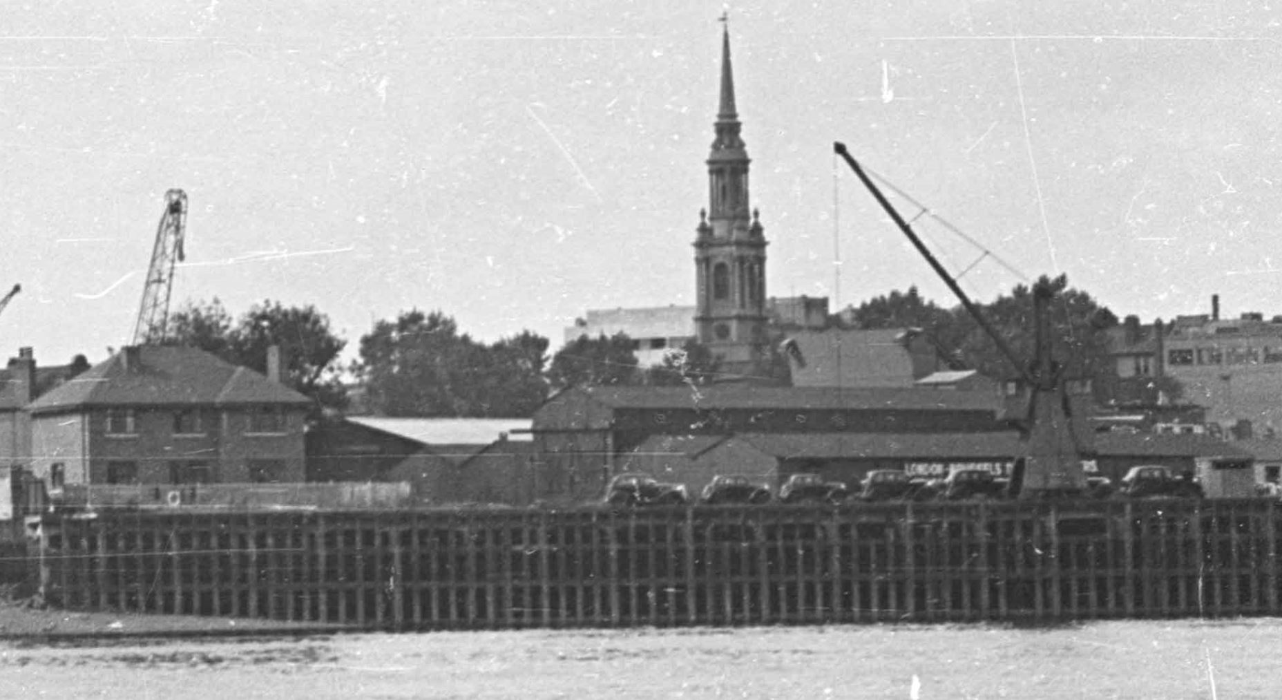
The following photo shows the area to the right of the Prospect of Whitby in my father’s 1948 photo:
And this is the same view today:
The 1949 OS map shows this section of the photo, as shown in the extract above, and the black cars parked in a line (possibly awaiting loading on a ship for export), are parked where the words “Mooring Posts” can be seen (‘Reproduced with the permission of the National Library of Scotland“):
The map also shows the low warehouse behind the cars and what also likes rather like a domestic house to the left of the photo.
The mystery is that in 1949 photo and map, at the side of the river there is a continuous and straight line of wooden posts forming the edge of the land, however if you look at my 2024 photo, today the wall along the foreshore is curved, and to the right there is a solid, curved, concrete wall.
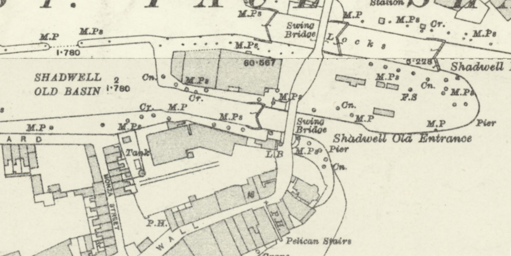
We can still see the main entrance between the Thames and Shadwell Basin at the upper part of the map, but in 1897, below the main entrance, was “Shadwell Old Entrance”.
The London Docks were a continuous building site, and in Shadwell, the “Shadwell Old Basin” and the “Shadwell Old Entrance” were the first part of the docks to be built in Shadwell.
The success of these docks was such, that they were soon expanded and the much larger Shadwell Basin was built, just north of the Old Basin, which was included within the overall Shadwell Basin.
The old entrance would then be closed off, with the single main entrance shown in the 1949 map remaining as the eastern entrance to Shadwell and the London Docks complex.
I assume that the the original entrance was built over, probably not completely removing and filling in the entrance, rather building over it to complete the view we see in the 1948 photo and 1949 map.
When the area was redeveloped in the 1980s and 90s, this structure was then removed, and the curved concrete wall built across what remained of the Shadwell Old Basin entrance.
It is fascinating how across London, the evidence of former land use, industries etc. have survived and can still be seen today.
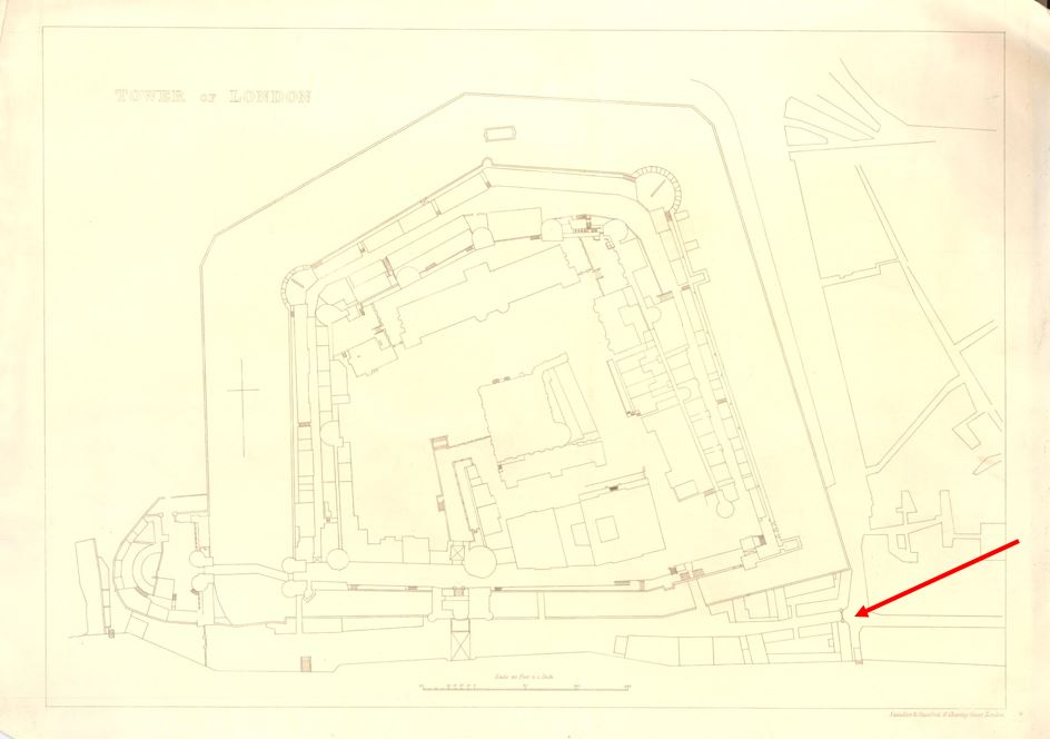
Underneath the northern tower of Tower Bridge, there is a late 19th century version of one of the old Thames Stairs, which has a name that refers to one of the gates that controlled access into the Tower of London. This is Iron Gate Stairs.
The stairs are shown before Tower Bridge was built in this extract from Langley and Belch’s, 1812 New Map of London (underlined in red):
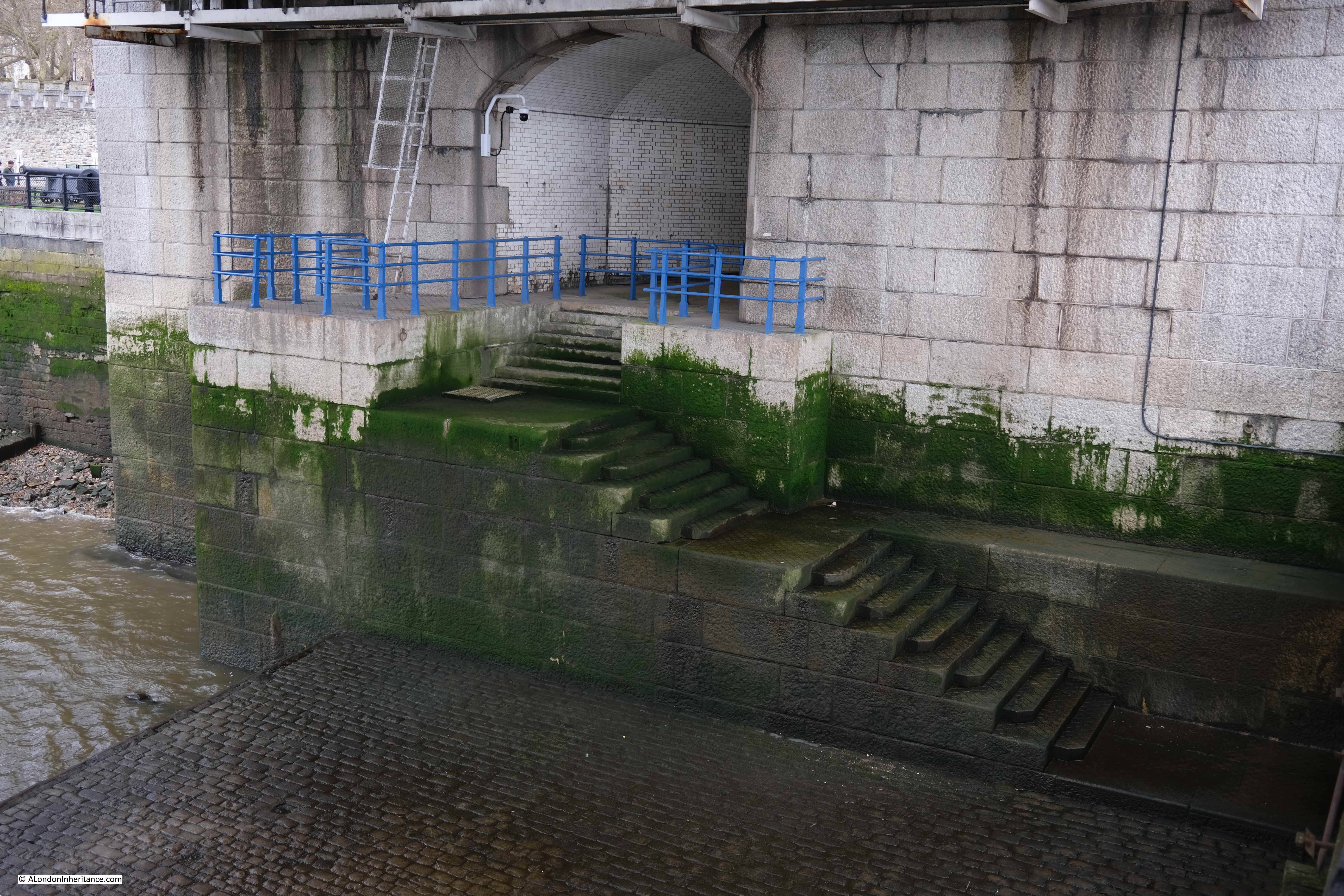
Today, Iron Gate Stairs are reached via a tunnel which runs through the northern tower of the bridge, and comes out to a well maintained set of stone stairs:
As far as I can confirm, by checking and aligning a number of maps, the stairs today appear to be in the same location as the stairs shown in the 1812 map.
It shows the importance of these access points to the river, that they were included in the design of Tower Bridge, and it must have cost more, and been more complex, to route the access to the stairs through the tower, rather than relocate them to one of the sides of the northern tower of the bridge.
The Port of London book “Access to the River Thames, a Port of London Guide”. includes these stairs in the listing of all points of access to the river along the tidal Thames, and the PLA record for Iron Gate Stairs reads:
Stairs and Causeway
Constructed of Stone
A landing place in 1708 and 1977 and in use at the time of the book (around 1995)
Structure is listed
The stairs are gated
Bathing from these stairs is extremely dangerous
I cannot find a separate listing for the stairs on the Historic England website, so I assume that the stairs are included within the overall Grade I listing of Tower Bridge, as the access to the stairs is part of the structure of the bridge.
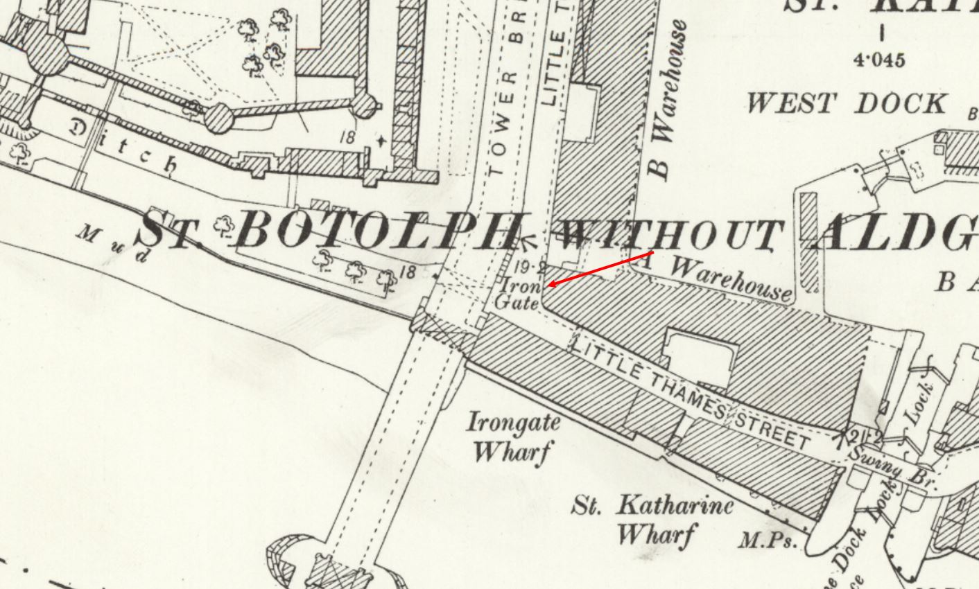
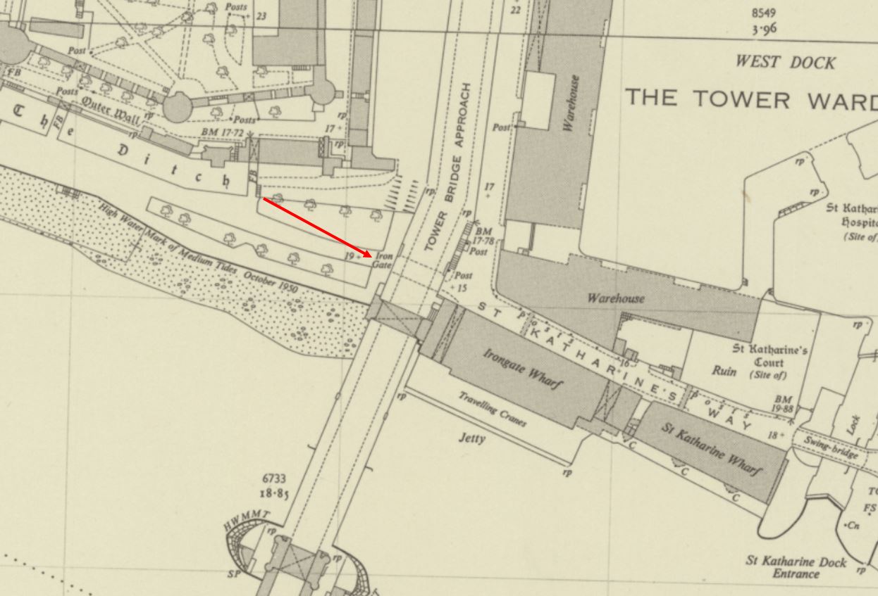
The name of the stairs is interesting, and it appears to refer to a gate that once controlled access to the south east corner of the area between the walls of the tower and the river.
In this 1852 plan of the Tower of London, there are a cluster of buildings in the lower south east corner, with a black line, indicating some form of gate, controlling access (red arrow):
Although not named, the stairs can be seen running down to the river, next to the gate.
After the construction of Tower Bridge, the name Iron Gate is retained, and although the stairs do not appear to be named (perhaps because they are under the bridge), iron Gate is used next to the tunnel underneath the approach to Tower Bridge, where today you can walk from the St Katherine Dock area, to the area between the Tower of London and the river.
So Iron Gate in the OS maps seems to continue to refer to a gate across this access through the wall created by the approach road to Tower Bridge.
As with all Thames stairs, there are references to the stairs in multiple newspaper reports over the centuries. For example, the following is from the Public Ledger and Daily Advert on the 9th of October, 1826, and unfortunately it does not record what Samuel Pearce did, which required such a public apology:
“CAUTION TO WATERMEN – I Samuel Pearce, Waterman, plying at Iron Gate Stairs, near the Tower, beg publicly to acknowledge and express my grateful feeling to John Morrison, Esq. for foregoing a prosecution against me, which I well merited, in consequence of an unprovoked and unwarrantable outrage committed on him on Friday evening; for which I cheerfully make this public apology, which he accepts, in consequence of the distressed state of my wife and infant family.”
Iron Gate Stairs were also the boarding point if you wanted to travel to “Harwich, Yarmouth and Places Adjacent”, as the 80 horse-power Steam Packet Swift sailed from the stairs on Sundays and Thursdays in the 1820s.
Indeed, Iron Gate Stairs feature in papers across the 18th and 19th centuries with all the usual stories of activities that happened at these places which formed a key access point between the land and the river.
As with other stairs, Iron Gate Stairs was a place where bodies recovered from the river were brought up to land.
The Historic England Monument Record for the Iron Gate refers to it being a gate tower constructed during the reign of Edward III (who reigned between 1327 and 1377), and that it was built to strengthen the defences of the Tower on the southern side of the complex, and that it commanded a “walled causeway through to the Develin Tower at the south east corner of the outer wall.“
Stow in the early 17th century refers to the Iron Gate as being “great and strong but not often opened”.
The Iron Gate was demolished in 1680 following a review of the Tower’s defences, and whilst looking for space to expand accommodation.
So whilst the gate tower was demolished, as shown in the 1852 map, a gate seems to have remained in place, although rather than the gate tower, just a standard gate.
After demolition, there also appears to have been a cluster of buildings around the location of the gate which seem to have been used for accommodation, storage and small industrial activity.
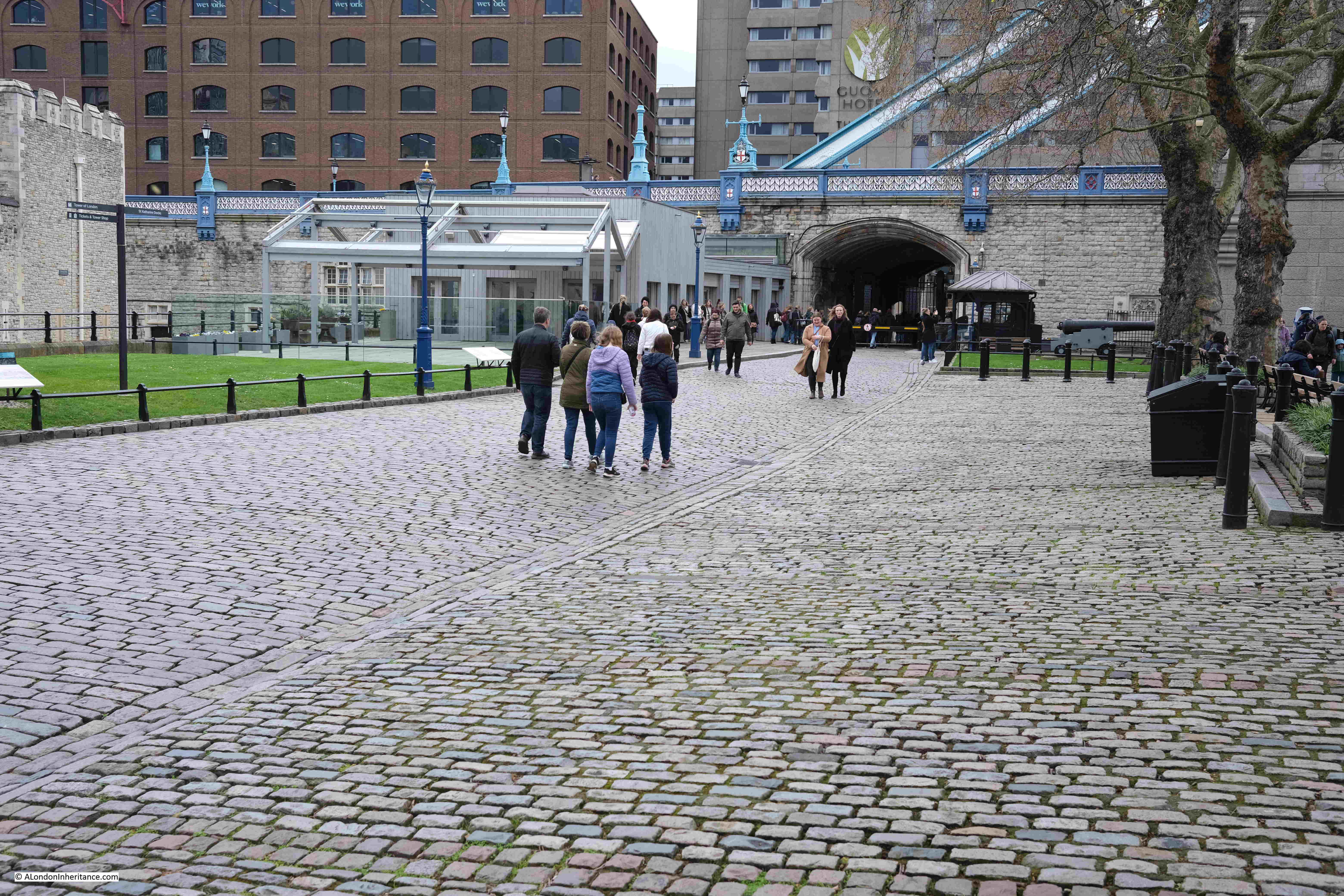
Construction of Tower Bridge cleared these buildings, and today we can see the area where the Iron Gate was located when looking towards the bridge, from the west:
And with some lovely historical continuity, the area of the Iron Gate is still gated, with a gatehouse and barrier across the road:
And looking through the walkway under the approach road to Tower Bridge, we can see gates part open across the walkway, as well as much larger and stronger gates set against the sides of the walkway:
In the following photo, the entrance to the walkway tunnel under the approach road is on the right, and the arch on the left provides access to the entrance to Iron Gate Stairs:
Which, as the PLA description of the stairs records, is gated:
View of how the tunnel exits the base of the northern tower of Tower Bridge, and the steps leading down:
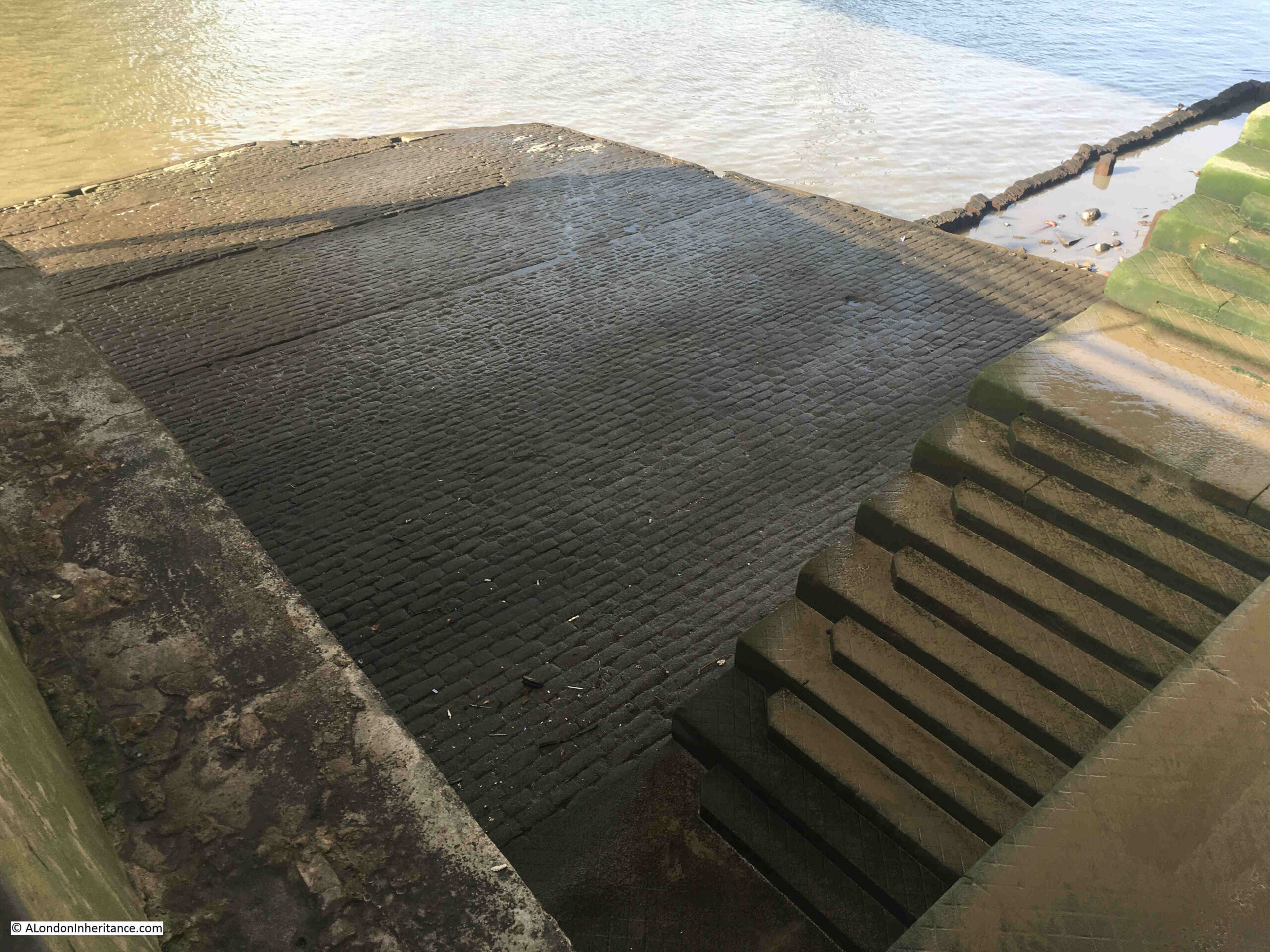
As the PLA document records, a causeway is part of Iron Gate Stairs, and for the stairs this is one of the largest causeways to be seen. It covers a large space at the base of the stairs, both in terms of width and length into the river:
The stairs are part of the construction of Tower Bridge, and I assume that the causeway may well date from the same time (assuming it has been continuously repaired). I doubt whether the stairs would have had a causeway of such size prior to the bridge being built.
The need for a bridge at or around the location of Tower Bridge had been a pressing issue for many years prior to the construction of the bridge. In the later half of the 19th century, there was so much cross river traffic that an urgent solution was needed.
In 1884, the Southwark recorder and Bermondsey and Rotherhithe Advertiser was reporting that “The Corporation also propose to establish a steam ferry across the river, from Iron Gate Stairs, Little Tower Hill, to Horselydown Old Stairs, near Horselydown Lane. Another scheme for crossing the Thames is proposed by the Tower (Duplex) Bridge Bill. The structure would cross the river from Hartley’s Wharf, Horselydown, to Little Tower Hill, having in the centre of the river two loop bridges.”
The following year, the Eastern Argus and Borough of Hackney Times, was reporting about the construction of the new bridge, and that “the work will be done by the City Corporation which has set down five years as the period for completing it. It is to be formed from a point westwards of and near the Iron Gate Stairs to Hartley’s Wharf. The cost will be £750,000, and the structure will be of such a character as to admit of the passage at all times of the tide of vessels navigating the river. The bridge will be a great convenience to East London”.
The above report does call into question whether the current stairs were built on the site of the original Iron Gate Stairs, as the article states that the new bridge is to be built “westwards of and near the Iron Gate Stairs”.
A later article in June 1886 does though seem to confirm that the northern tower, and the stairs we see today are on the site of the original stairs, as when describing the works for the new bridge, the article states “On the north side, as already stated, it touches the shore at Irongate Stairs, from which a road will lead directly up to the Minories”.
In 1889, Watermen were complaining about the disruption to their trade “THE TOWER BRIDGE AND THE LONDON WATERMEN – The Select Committee of the House of Lords appointed to considered the Tower Bridge Bill proceeded to-day to hear the evidence of numerous watermen who claim compensation for disturbance of their occupation between Irongate and Horselydown Stairs in consequence of the construction of the works,. George William Shand was the first claimant”.
I would have thought that the watermen would have been far more concerned about the forthcoming loss of their trade between the two stairs once the new bridge had been opened.
Based on the majority of newspaper reports, aligning maps, and the Port of London Authority listing of Thames Stairs, I am as certain as I can be that the stairs we see today are in the same place as the original Iron Gate Stairs.
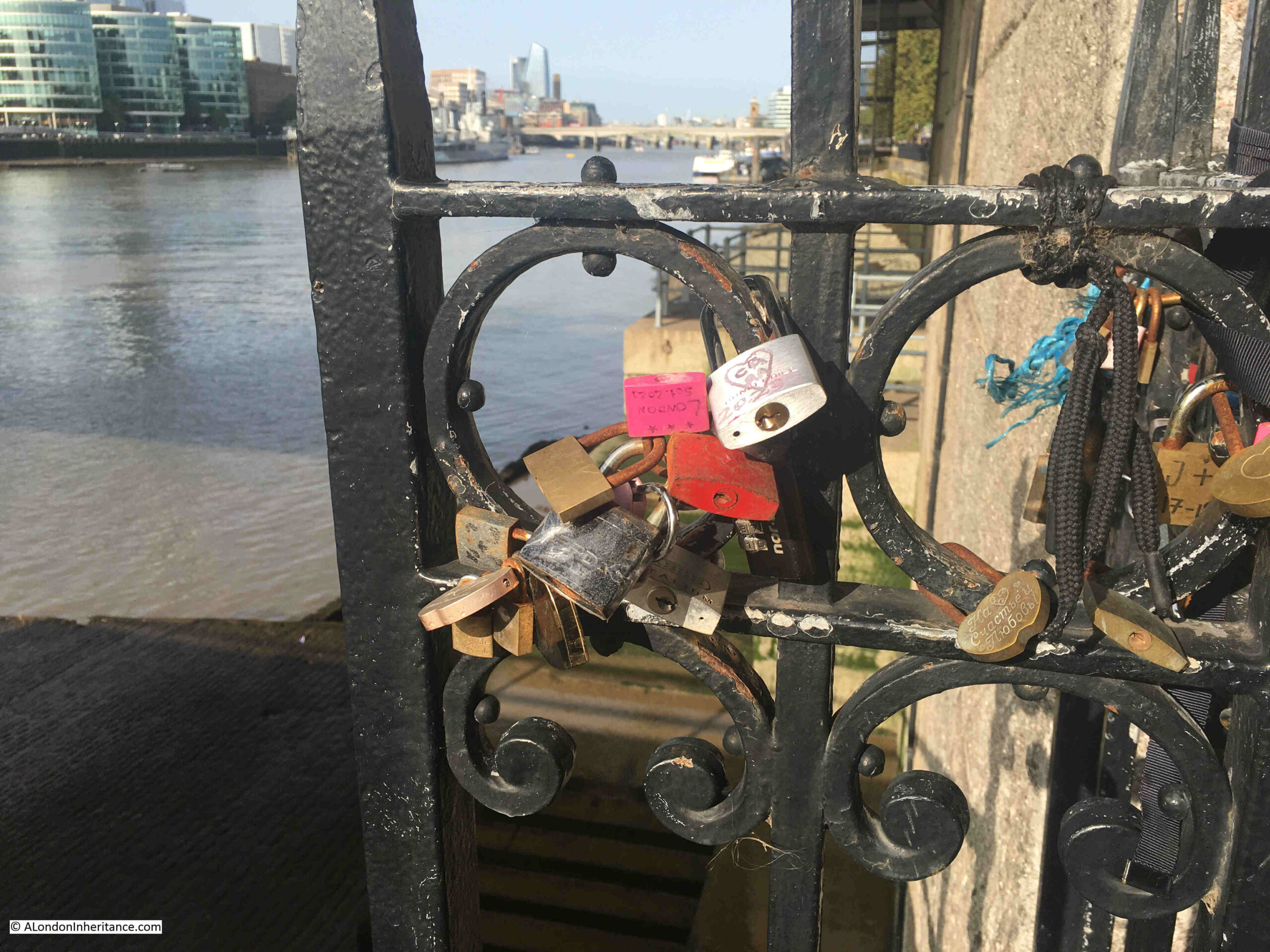
The railing by the side of the view over the stairs seem to have acquired evidence of many of the tourist visits to the site:
I had a good look around, however I could not find any signs that name iron Gate Stairs.
They are though yet another example of historical continuity, with the stairs being in roughly the same place after the construction of Tower Bridge, and being named after a gate dating back to the 14th century, located where there are still a barrier and gates in position, to close of the south eastern entry to the space between the Tower of London and the River Thames.
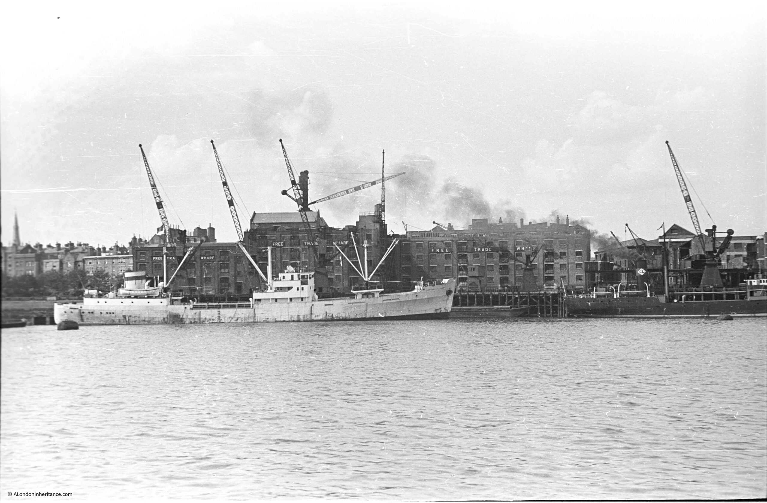
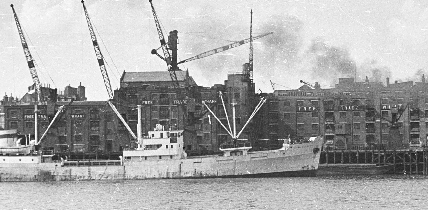
The following photo was taken by my father in August 1948, and shows the buildings of Free Trade Wharf in the old area of Ratcliffe:
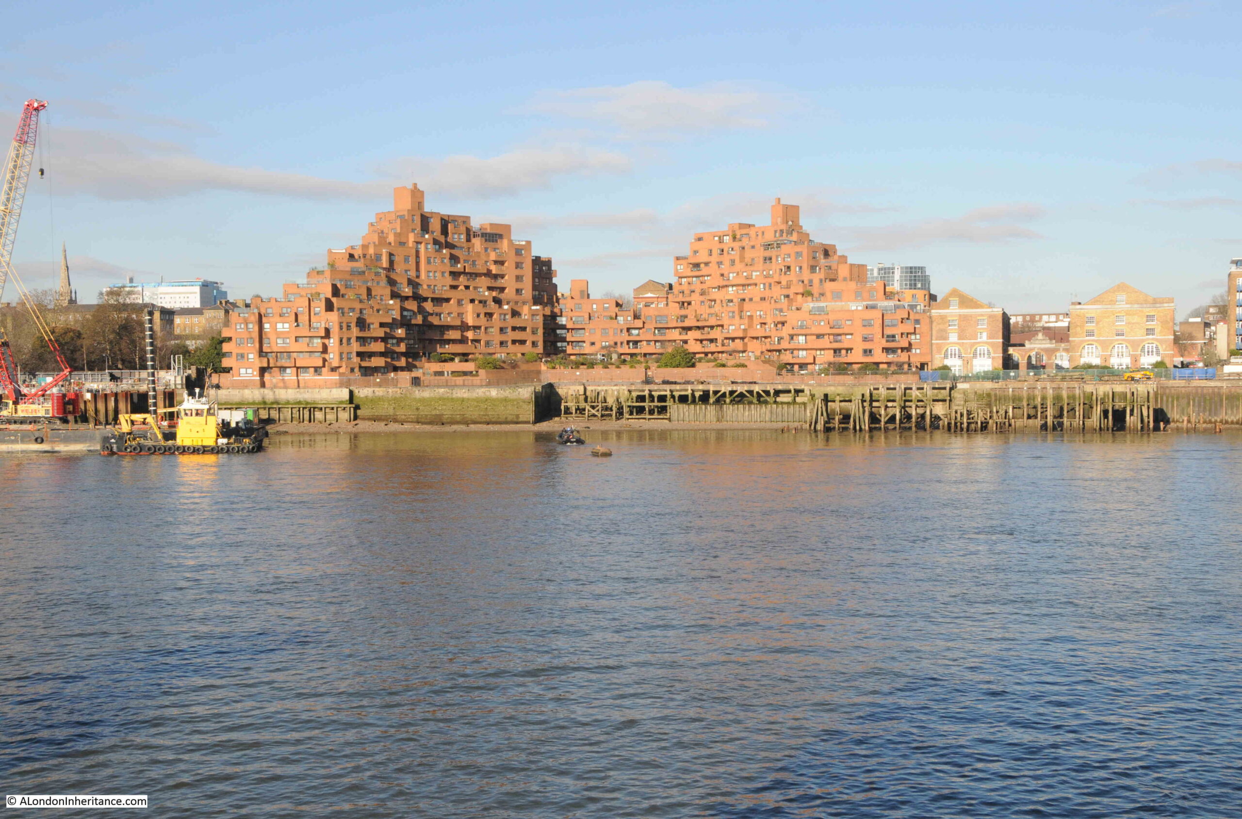
The same view, seventy six years later in 2024:
Despite the loss of the central Free Trade Wharf buildings, there are some features that can be found in both photos.
On the left of both photos, there are no buildings along the edge of the river, and trees can be seen in an open space leading back from the river. This is the King Edward VII memorial park.
Staying on the left of both photos, a church steeple can be seen in the background. This is St. Mary’s Cable Street.
The central part of the photo is very different. The Free Trade Wharf was purchased by the Inner London Education Authority in 1977 with the intention of building a campus for the City of London Polytechnic, which had been formed in 1970 with the consolidation of the City of London College, Sir John Cass College and the School of Navigation.
These plans did not follow through, and the site remained vacant until the early 1980s when the growing trend for the construction of residential properties along the banks of the Thames resulted in the purchase of the site for residential development, and the building on the site we see today was built.
It is one of the more distinctive residential buildings along the river, and was designed by the architects Holder Mathias Alcock, who are still practicing today, although the name Alcock has been dropped.
Their distinctive design has been described as being of “dramatic ziggurat-style terraces”, and also looking as if it could have been made out of Lego.
Faced by red brick, the building does look good in direct sunlight, and the from what I have read, one of the reasons for the shape of the building, where the sides step back towards the centre, was to maximise the number of apartments that had a river view, rather than being a flat building along the river.
This new development retains the name Free Trade Wharf, and looking at an extract of the 1948 photo, we can see this name was displayed in white lettering along the side of the building facing the river:
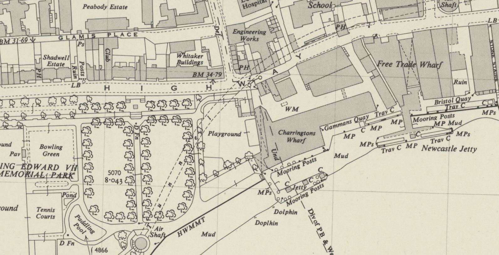
Although this very clear naming of the Free Trade Wharf did throw me into a momentary bit of doubt about whether I had identified the correct location for the photo, as in the OS map, published a couple of years after my father’s photo, the building is marked as Charringtons Wharf, as can be seen in the following map, along the river and to the right of the park (‘Reproduced with the permission of the National Library of Scotland“):
To confirm, I checked in the book “London Wharves and Docks”, published by Commercial Motor in 1953, and the entry for Charringtons Wharf included a reference that “Occupier: Free Trade Wharf Co. Ltd”.
The Charringtons name came from the ownership of the site by Charrington, Sells, Dale and Company, who traded in coal and coke. I cannot find exactly when this part of the site became known as Free Trade Wharf, however as you can see from the above map extract, this name was also in use for the buildings to the right, which are on the right of my father’s photo, but hidden behind the cranes, and the black coloured ship on the right.
The Commercial Motor book provides some detail on trade at the wharf in 1953:
“Facilities: a. General, b. Rubber, matches, canned goods. Maximum cranage (cwt) 45, Storage space (cubic feet, covered); 869,450, Storage Space (cubic feet, uncovered): 5,000.
Customs facilities included Sufferance Wharf, Dry Bond, Captain’s Imperfect Entry (a Sufferance Wharf is a licensed private wharf where goods can be kept until the duty is paid. A Dry Bond is where goods can be stored before customs duty is paid. Dry refers to the type,, so dry goods unlike wet goods such as alcohol. Captain’s Imperfect Entry is a strange one. Captain’s Entry is where the Captain of a ship has provided the details of the goods he wants to unload to the warehouse, but I am not sure what Imperfect refers to).
The wharf had a jetty and a quay, with 250 feet being the maximum length of ships accommodated at the jetty and 210 feet at the quay. and the depth of water went from 24 feet at high water down to 2 feet at the jetty, and from 19 feet to drying out at the quay. “
Just to the left of the site today, is one of the construction locations for the Thames Tideway Tunnel:
The OS map shows the buildings to the right of my father’s photo, labelled as Free Trade Wharf. These buildings are much earlier than the main block, but are hidden behind the ship and cranes in my father’s photo.
An extract from this photo showing the dark coloured ship, with part of these buildings just visible in the background:
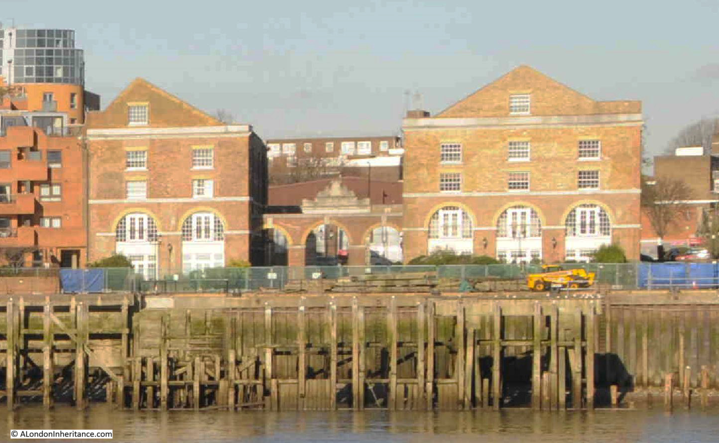
The buildings, the ones labelled as Free Trade Wharf in the OS map as can be seen in 2024:
These buildings are Grade II listed and they date from 1796, although there have been many alterations over the years.
They were built for the East India Company, and handled a variety of goods, including saltpeter, which was used in the manufacture of gun power.
The site later became a place where colliers from the coal fields in the north east of the country would unload, and is presumably where the Charringtons connection comes from.
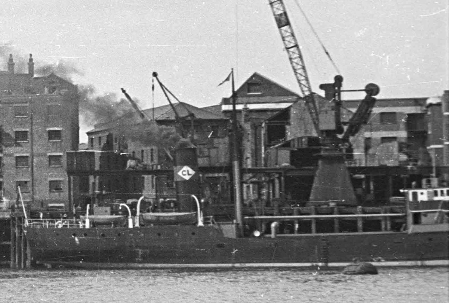
There are two ships in the 1948 photo. the ship on the left has no visible feature to help with identification. I use a high resolution scan for my father’s photos, and despite this, I cannot read the name of the ship on the bow.
The ship on the right has no visible name, presumably it is on the bow and only the rear section of the ship is visible in the photo. What can be seen is the funnel, and this has the letters CL in a white diamond.
Ships with the identifier of the owning / operating company were once a frequent sight on the Thames, and as kids in the late 1960s / early 1970s, we would often go down to the Thames by Coal House Fort, through East Tilbury (which always fascinated with its village and Bata shoe factory in this isolated part of Essex).
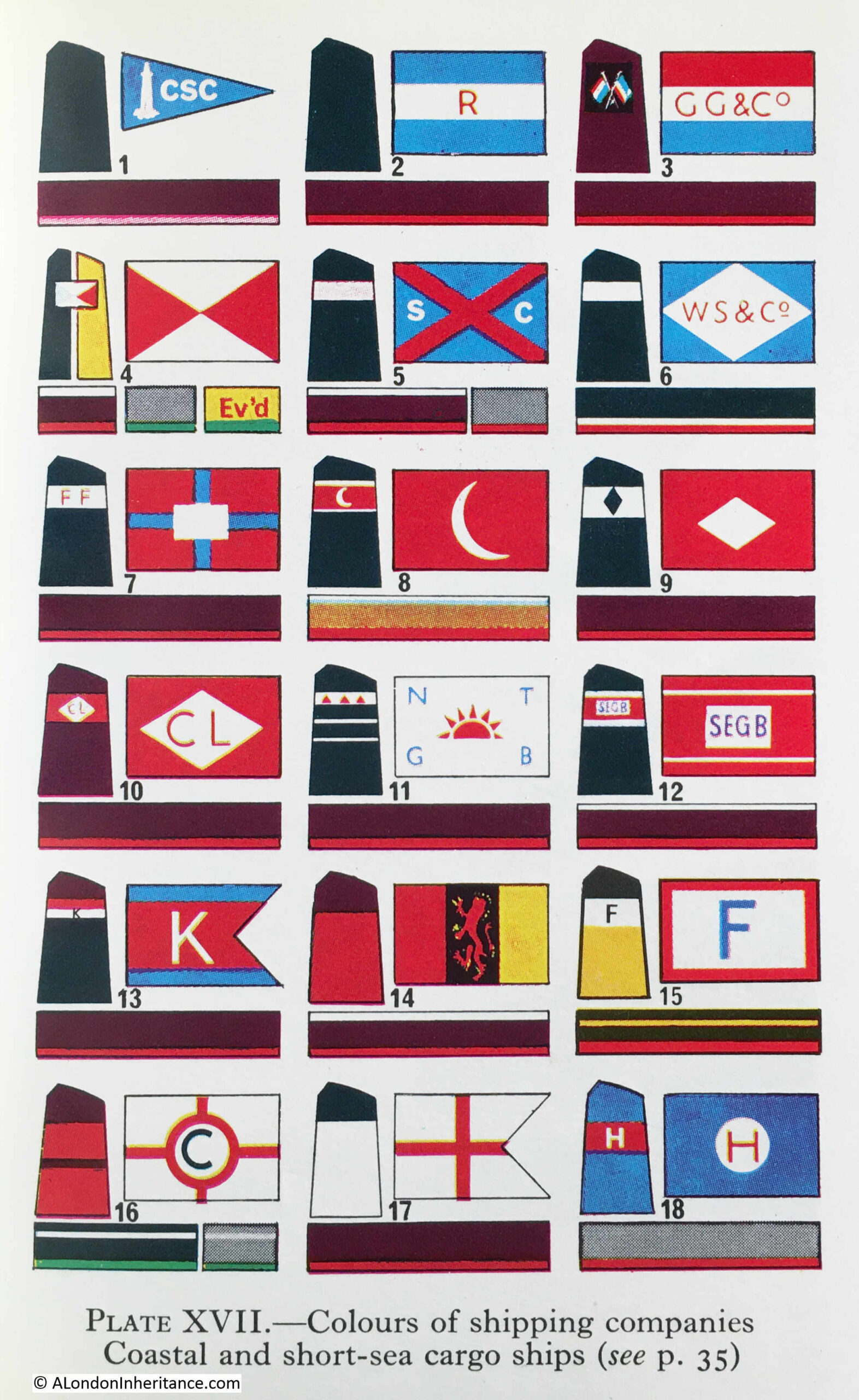
I had the Observer’s Book of Ships and used this to check of the passing ships. I still have the book and checked it to see if the CL in a white diamond is listed, and fourth down, on the left column, I found it:
Turning to page 35, and CL is for Comben Longstaff & Co. Ltd of London, and who were listed as Colliers.
The company was named after William Comben Longstaff, who was born in Lambeth in 1896.
Comden Langstaff & Co. Ltd was originally involved in a range of maritime services including insurance, owning, managing and operating a fleet of ships that delivered raw materials and goods to the ports around the coast of the UK.
Newspapers of the time have many references to the purchase of new ships, sale of older ships, trade, routes etc. and the company seems to have been reasonably active.
The majority of their ships seem to have been built by John Lewis of Aberdeen, and the following article from the Aberdeen Press and Journal on the 9th of June 1948 is typical of the company’s coverage in the press:
“STEAM COASTER LAUNCHED – I have great faith in this country, but its only salvation is hard work, said Mr. Comben Longstaff at a gathering after the launching yesterday of the steam coaster Lancasterbrook, built by Messrs John Lewis and Sons Ltd, Aberdeen, for his firm, Messrs Comben Longstaff and Co. Ltd, London.
Mr. Andrew H.S. Lewis said the Lancasterbrook was a sister ship of the Londonbrook, built by his firm two years ago. She was an oil burner and was fitted with patent steel hatch covers.
They were building two other ships for the same owners.
Mrs. Comben Longstaff named the vessel which is 200ft in length and is of the raised quarterdeck type. The rudder is semi-balanced and streamlined and was made to the owners’ own design.”
The article mentions the Londonbrook, which had been built by the firm two years earlier, so presumably in 1946, and from checking photos of the Comben Longstaff ships, I believe the ship to the right of my father’s photo is the Londonbrook.
The company was sold in 1954, and William Comben Longstaff died in 1966.
Their ships continued operating around the coast of the country and in the late 1970s, two new ships were built, the Durhambrook and Devonbrook, continuing the Comben Longstaff tradition of adding “brook” to the end of their ship names.
The company ended operations in 1981, and all the ships were sold.
Both the Free Trade Wharf and the ships that docked at the wharf are from a time when you could sit on the river wall at Tilbury on a summer’s evening, and watch the ships passing along the river, checking them off in your Observer’s book.
If you wanted to visit somewhere in London on a very cold January morning, a bright day, but with ice having formed overnight on standing water, the last place you may think of is the Thames foreshore, however, on such a day, I went to one of my favourite places on the river – Horn Stairs and Cuckold’s Point:
Horn Stairs and Cuckold’s Point are in Rotherhithe, opposite Limehouse and the north-eastern part of the Isle of Dogs, on the inside of a bend in the river where it curves past Rotherhithe.
Cuckold’s Point is the area of the river / foreshore slightly to left and right of the arrow head in the above map, and where, when the tide is low, there is a broad beach of sand and mud running down to the water.
I was walking from the west, and there were some stunning views across the river, and as I reached the stairs, the outline of the causeway running from Horn Stairs could be seen, with a pole towards the end of the causeway:
The steps over the river wall that lead to Horn Stairs:
From the top of these steps, we get a view of the remains of the causeway leading off across the foreshore from the foot of the stairs:
The upper part of the stairs, where they run over the river wall, are off concrete, with the main part leading down to the foreshore being a set of wooden stairs:
The upper part of the stairs look rather dodgy. From the top of the stairs it is difficult to tell how thick each of the steps is, and whether it will hold your weight if you walk down the stairs.
In the following photo of the top steps, you can see from the bolts on either side of each step, just how much appears to have eroded, or perhaps the wood has shrunk, also on the day I was at the stairs, there was ice in the hollows in each of the steps:
At the bottom of the stairs, we can see the remains of the causeway leading out towards the water:
The Port of London Authority (PLA) has very little information on the stairs in their listing of all the Steps, Stairs and Landing Places on the Tidal Thames (published around 1995), there is just a remark that the stairs are in “Reasonable” condition and that they were still in use.
The PLA does not record any early dates for when Horn Stairs were in use, and there are not that many references to the stairs, with Cuckold’s Point being the name used for any reference to the location.
In Rocque’s map of 1746, the stairs are not shown, but Cuckold’s Point is marked:
The earliest written reference I have found was in a newspaper article on the 25th of October, 1832 when the name Horn’s Stairs were used in a legal action against the owners of the Eclipse, a steam packet which ran between London and Margate, and was accused of running down a barge off Horn’s Stairs.
The name of the stairs did often appear as Horn’s or Horns rather than the singular Horn, and one of the possible sources of the name could be a Horns Tavern which was to be found near the stairs – although an unresolved question is what came first, the tavern or the stairs.
The name Horn is used in the majority of references from the late 19th century onwards, as shown in the following extract from the 1896 revision of the OS map, where Horn Stairs can be seen bottom left (‘Reproduced with the permission of the National Library of Scotland“):
In the above map, the causeway leading out from the stairs is labelled “Hard”, and would have provided a hard surface above the sand and mud of the foreshore, to walk to and from a boat at nearly all states of the tide.
Also in the above map a dotted line leading across the river to Limehouse Pier can be seen, and labelled as Limehouse Hole Ferry. This was a regular ferry that had run for a good few centuries between the two sides of the river. I wrote about the ferry in my post on Limehouse Hole Stairs and the Breach.
The fact that Horn Stairs does not appear in the 1746 map, and I can find no written references to the stairs earlier than 1832 does not mean that the stairs and a causeway have not been here for much longer.
The City of London Archaeological Society has a fascinating post on surveying stairs, which included a section on Horn Stairs, and in the post, 16th or 17th century hand made bricks were identified which may have formed an early hard standing on the foreshore.
Although I could not find the bricks exactly as shown in the photo in the City of London Archaeological Society’s post, (the foreshore is a constantly changing environment), I did find a number of this type of red brick, which can be seen in the photo below, to the right side of the causeway:
At the end of the causeway, and at the point just before where the Thames will recede to at low tide, is a pole labelled as a navigation marker on the PLA chart for this section of the river. The marker has a light at the top of the pole to ensure the marker can be seen in the dark:
At the end of the causeway:
Looking back to the river wall and the stairs down to the foreshore, which is a distance of some 50 metres, and the dark colouring along the river wall shows how high the water is when the tide comes in along Cuckold’s Point:
The naming of Cuckold’s Point is interesting, and the true source of the name cannot really be confirmed given the centuries that the name has been in use.
The word Cuckold means, according to the online Cambridge Dictionary “If a man is cuckolded, his wife has a sexual relationship with another man”, and the most repeated story about the use of the word Cuckold for the foreshore in Rotherhithe goes back to King John, who was on the throne between 1199 and 1216.
There are a number of variations to the story, but it generally goes that King John was hunting around Shooters Hill, Blackheath and Greenwich. He seems to have found himself in Charlton, and entered the house of a Miller, where he found the Miller’s wife alone.
The Miller soon returned home, but found his wife “in flagrante” with the King.
The Miller attacked the King intending to kill him, and to defend himself the King revealed who he was, and came to an agreement with the Miller that he could have all the land to the west that he could see from his house, which extended all the way to what is now Cuckold’s Point, where, at the time, there was a pole with a pair of horns mounted on the top.
The Miller, in some stories, also had to walk to Cuckold’s Point once a year, with horns on his head.
So the name Cuckold’s Point came from the position that the Miller had been put in by King John.
The King also gave the Miller the right to have a fair on the 18th of October, and this fair became known as the Horn Fair and was held in Charlton.
An early view of Cuckold’s Point can be seen in a painting by Samuel Scott in his work “A Morning View of Cuckold’s Point“, painted between 1750 and 1760:
A Morning, with a View of Cuckold’s Point c.1750-60 Samuel Scott c.1702-1772 Presented by H.F. Tomalin 1944 http://www.tate.org.uk/art/work/N05450
The challenge with confirming that this is Cuckold’s Point is that there are no features which can be found today, however there is a set of wooden stairs leading down to the foreshore, and the slope and shape of the foreshore is very similar to that of today.
The painting does though give a very good impression of what Cuckold’s Point probably did look like. There are two Waterman’s boats where the water meets the foreshore, and there is a third approaching the same point.
There are people on the foreshore walking down to the boats from the stairs, presumably either to meet the people arriving on the boats, or to take one of the boats along the river.
The ships on the foreshore are in the location of Mr. Taylor’s Yard, as shown in Rocque’s 1746 map.
The river appears to bend to the right, which indeed it does, as it heads along the eastern side of Rotherhithe towards Deptford.
The painting does provide some support to an alternative theory as to the name Cuckold’s Point. Just to the left of the stairs can be seen a wooden frame, and this is believed to show a ducking, or cucking stool, which was use to punish and humiliate women, who were labelled as a scold, or had committed some form of sexual offence, such as cheating on a husband.
As was usual, there was no similar punishment or humiliation for the man involved.
As the site of a cucking stool, where the wife of a cuckold would have been punished, this may also be the source of the name, however this story does not seem to have gained much support over the years.
The broad sweep of the foreshore at Cuckold’s Point, looking west along the river in the direction of the City of London:
Standing at Cuckold’s Point on a cold January morning is a lonely experience. There is no one else around, and the river is also very quiet, with just the regular Thames Clippers causing a run of waves up to the foreshore.
These places were once busy, both along the rivers edge, the foreshore, and along the river, and it is fascinating to stand at these places, thinking of all the people that have stood in the same place, and the events that have taken place here.
I searched newspaper records for reports mentioning Cuckold’s Point for three decades in the first half of the 18th century, the 1720s, 30s and 40s and there are many references. The following is a sample of what went on around Cuckold’s Point in these years:
17th June 1721 – On Thursday last in the Afternoon Mr. Bailey, a Coasting officer, and Mr. Purser, a Custom-House waterman, made a seizure in the River near Cuckold’s Point of 1900 Weight of Tea, artfully wrought up in the sides of a Mackerel Boat filled with Fish, and supposed to come of Ostend.
11th of May 1726 – The Execution of Capt. Jeane, condemned at the late Sessions of Admiralty for the Murder of his Cabin Boy, is appointed for next Friday, he will be hanged in Chains over against Cuckold’s Point.
6th of October 1736 – On Monday last a Fisherman caught in his Common Net, near Cuckold’s Point, a Salmon 38 inches long and about 17 inches round, and sold the same to Capt. Bond, who was in sight when the fish was caught, and was going on board the East-India Man at Gravesend. The Fisherman being unable to hold his net, begged assistance of a man in the Captain’s Boat, who accordingly went; but as he was helping he fell accidentally into the Thames, from whence it being low water, he took the Fish in his Arms and threw it into the boat. The Fish was sold for 36 shillings out of which the Fisherman gave the Waterman 6 shillings for his Trouble.
23rd April 1737 – On Tuesday last, the Wind being very high, and the Tide rough, two boats, overladen with Passengers, were cast away between Cuckold’s Point and Deptford, and 17 persons drowned. Two other boats, near the same place, with 16 persons in them, and another at the Isle of Dogs, with six and a Waterman, overset, and seven of the former and all the layer were drowned,
23rd October 1742 – Yesterday a new ship, of 220 Tons and 20 Guns, intended for the West India Trade, was launched at Mr. Taylor’s Dock at Cuckold’s Point, and named the Anna Maria (see earlier extract from Rocque’s map of 1746 for location of Taylor’s Dock)
10th December 1743 – Last Tuesday upwards of 1000 Pairs of French Gloves with some Skins, were brought to the custom House. They were seized by Mess. Smith and Harris, Customhouse officers, as they were attempting to land them at Cuckold’s Point.
4th February 1744 – On Tuesday 200lb of Cocoa Nuts, 200 Weight of Tea and 20 Pieces of Cambrick, with some Lace, were seized at Cuckold’s Point, and brought to the Custom House; This seizure is valued at £300. (Cambric is a finely woven, plain cloth that came from France)
7th of March 1747 – Tuesday in the Afternoon as a Boat was going to Greenwich with six Passengers, it was overset near Cuckold’s Point by running foul of a Ships Anchor, by which accident Mrs. Sims and her Daughter, of St. Catherine’s Lane, were unfortunately drowned.
27th of March 1749 – On Monday last thirteen prisoners were tried at Kingston in Surrey, three of whom were capitally convicted, viz. John Rayner, for Robbery on the Highway, Thomas Pattin and William Walker, two Watermen, for knocking down Mr. Alison, in a Boat on the River Thames, near Cuckold’s Point, and robbing him of a Silver Coffee Pot, a Watch, and a Guinea and Half in Money.
These quiet places along the Thames were once full of life, and also unfortunately, death.
Looking along Cuckold’s Point to the east and there is a pier that reaches out over the foreshore. This is where you can catch the Thames Clipper RB4 service that runs between this pier at the Doubletree Docklands Hotel, across the river to the pier at Canary Wharf – a brilliant way of crossing the river.
A rather good example of historical continuity in London, the Thames Clipper RB4 service has almost exactly the same route as the old Limehouse Hole ferry that ran from Horn Stairs.
Some of the long length of the causeway still has a layer of stones that would have provided the hard surface to walk down to catch your boat:
I visited Horn Stairs and Cuckold’s Point in January, and this was probably the left over of some New Year’s Eve celebrations:
Returning to the story of the Miller and King John, one of the rights allegedly granted to the Miller was the right to hold a fair in Charlton.
Whatever the truth in the story of the Miller and King, a fair was held each year, on St. Luke’s Day, the 18th of October, and the following article from The Sun on the 20th of October, 1846 hints at the antiquity of the fair, and also provides a good overview of the event.
There is also a reference to Cuckold’s Point towards the end of the article, which I have highlighted in bold:
“HORN FAIR – This scene of popular amusement was held yesterday, according to ancient custom, in the healthful and pleasant village of Charlton.
In former times it was generally distinguished by riot and obscenity. Some of the worst class in London made parties to carry out the vulgar joke of cornuted husbands and wives (cornuted means to bear or have horns).
Horn Fair (the common name) is now changed to Charlton Fair, and the visitors, more enlightened that their ancestors, seldom indulge in those disorderly transactions which bore the stigma of indecency. It was formerly a mart for various forms of utensils made of horn, and tradition ascribes the origin to King John. An armour carried out by that licentious and infamous Prince with the wife of an honest miller was the foundation for the fair. John, surprised by the enraged husband, would have perished under the uplifted dirk of the miller, had he not saved his life by promising to redress the injury. The compensation was a grant of land the miller could see westward from the top of his mill. Agreeable to the royal donation, a fair was to be held annually, on St.-Luke’s-day, for ever.
Such is the oral account of the fair from year to year, and there is, we believe, at the present day, an aquatic custom at Cuckold’s-point, where it is said the mill stood, which bears out the story. The waterman, as he passes the stairs, or landing place, frequently tells his fare that a spider is crawling on his hat. The person naturally takes it off his head, and then Old Charon, with a laugh, requests he will put it on again, having properly paid his respects to the Horns at Cuckold’s Point.”
Note in the above article that the mill is described as being at Cuckold’s Point, however the majority of references refer to the location being in Charlton, and that Cuckold’s Point, where horns were mounted on a pole, was the place furthest west that the Miller could see from his place in Charlton.
The article also mentions that Horn Fair was held on St. Luke’s Day. The connection with St. Luke comes from ecclesiastical art, where St. Luke is often painted with an Ox, an example being this early 18th century print which shows St. Luke seated at a desk, with a winged ox with horns, behind him.
There are very many references to Horn Fare, including some which describe events such as the following from 1742:
“Monday being St. Luke’s Day, a large Body of Cuckolds, both real and reputed, attended the King, the Miller, and his Wife, from the Sun Yard in Bishopsgate-street, to Horn Fair, held at Charlton in Kent, according to annual Custom.”.
In the 18th century, the Press Gang took advantage of Horn Fair, as this report from the 27th of October, 1746 explains:
“Last Saturday Night a large Press Gang, with Horns on, and Music playing before them, came through Greenwich, Deptford and Rotherhithe, &c. from Horn Fair, which drew a great many Sailors out of their Retreats to see the Procession, several of whom were pressed for his Majesty’s Service, and sent directly on board the Tenders in the River.”
The stairs today look almost like archaeological remains, washed from under layers of mud and sand by a strong tide, a bit like Seahenge, discovered in Norfolk in 1998. I checked on the Historic England directory, and the stairs are not listed, and it is unclear who, if anyone, is responsible for these features. Sadly, they will probably continue to erode away. A great loss for future generations.
Temporary structures were erected for Horn Fair, and we can get a glimpse of these from reports about the fair, including one from 1819 where there was an unexpected heavy snow fall, which caused much damage to the fair, including temporary structures for “The Freemasons Tavern” and “The Crown and Anchor”, which had apparently been “fitted up with great splendor , and the proprietor had omitted to take down his lamps and lustres” – which along with bottles, crockery, furniture etc. were all badly damaged by the snow.
The Horn Fair was abolished in 1872. By then Charlton had ceased to be the “healthful and pleasant village of Charlton“, and was being rapidly developed.
Horn Fair did not fit in with the Victorian narrative of improvement, and riotous assemblies such as fairs, were seen as a threat to those living nearby, to law and order, and to the social structures of the time.
In the Morning Advertiser on the 27th of February, 1872, in between lists of the prices of coal, hops, potatoes, the cattle market, and an article listing the days of the arrivals of the mail from Australia, New Zealand, the Falkland Islands, Mexico, Egypt (all symbols of a new Victorian London), there was a brief article reporting on the official abolition of the Horn Fair at Charlton and the Blackheath Fair, both of which had “survived all other suburban pleasure fairs”.
Chalk on the foreshore at Cuckold’s Point, left over from a time when chalk was used to build a flat platform on which barges could be grounded:
The wooden steps of Horn Stairs. The condition of the individual steps seems to get worse with height, with those at the very top appearing to be in very poor condition. I assume this is because those at the top are much more open to the atmosphere, are washed by the river rather than being covered, and suffer more wave action.
Horn Stairs and Cuckold’s Point are wonderful places to take in the river, views across to Limehouse and the Isle of Dogs (but walk down the stairs at your own risk !!).
It is a place with a long history, shared with the history of the river, and a connection with a Miller and King in Charlton, and a historic fair held in the “pleasant village of Charlton“, which does still have a Hornfair Road near the original location of the fair
What ever the truth of the story of the Miller, his Wife and King John, it is a fascinating part of London’s long history, and tells much about life in London over the centuries.
The banks of the Thames was not just full of docks and warehouses, but was also a place of industry, attracted by the easy transport of raw materials and goods along the river. Many of these industries were very dirty, polluting the local area and blighting the lives of those who lived nearby.
One of these was Stepney Power Station, a coal fired electricity generator, that can be seen in the following photo taken by my father in August 1948 on a boat trip from Westminster to Greenwich:
As can be seen, the power station is next to Limehouse Dock (originally Regent’s Canal Dock), and the name Stepney Power Station comes from the power station being in, and originally built, by the Borough of Stepney. It was occasionally referred to as Limehouse Power Station, which more accurately referred to its geographic location.
At the start of the electrification of London, lots of small electricity generating stations sprung up across the city, funded and built by a mix of private and public bodies.
These would supply their local area, with limited, if any, connection to other power generators.
London’s Boroughs were under pressure to develop and build electricity services to provide this new power source to homes, industry, the lighting of streets etc. and there were a large number of power stations built at the end of the 19th and the first decades of the 20th century.
Stepney Power Station formerly opened on the 27th of October, 1909, as recorded by a report in the Morning Leader on the following day;
“An extension of the Stepney electricity undertaking was opened yesterday by the Mayor and Mayoress (the Hon. H.L.W. and Mrs. Lawson).
The new generating station is situated at Blyth’s Wharf on the river, which gives the advantages of cheap sea-borne coal and an ample supply of condensing water.
Councilor Kay mentioned yesterday that the whole station had been erected by the council’s officials, so that it was in every respect a municipal undertaking.”
The 1909 power station was relatively small, but in the following years it would rapidly grow as demand for electricity increased and the cables needed to carry electricity across Stepney were installed and spread out across the Borough.
The version of the power station in my father’s 1948 photo shows the power station at its maximum size, with the tall chimney, which was added in 1937. There would be further upgrades in the following years, but from the river, this is how the station would have looked.
To help identify the location of the power station, features of the power station, and a comparison with the same view today, I have marked up the following two photos, starting with the view in August 1948:
And January 2024:
The following extract from the OS map shows the location of Stepney Power Station, labelled as “electricity works”. The conveyor transporting coal from the coaling pier to the power station can be seen, and between the coaling pier and Narrow Street, there is an open space. In the 1909 report of the opening, there is a reference that the “new generating station is situated at Blyth’s Wharf on the river”, and this open space was Blyth’s Wharf (‘Reproduced with the permission of the National Library of Scotland“):
Being right next to the river was a perfect location for the power station. It enabled supplies of coal to come from the north east of the country, via sea then along the Thames. The river also provided ample supplies of cooling water and water for steam generation in the boilers.
As the generation capacity increased, and therefore the demand for coal, the coaling jetty was built in 1923 to simplify the transport of coal from ship to where it would be burnt.
Newspapers in the 1920s were full of adverts by Stepney Borough Council advertising that their supply of electricity was the cheapest in London due to the prime location of their power station.
Whilst good for the price of electricity, the location was not good for those who lived, worked, and went to school near Stepney Power Station. There were many complaints about the dirt and pollution from the power station, and if you look at the above map, just to the top right of the power station, there are two buildings marked “school”. These are mentioned in the following newspaper article.
From the East End News and London Shipping Chronicle on the 2nd of December, 1949:
“COAL DUST COMPLAINT – Stepney Council is joining the L.C.C. in ‘strong representations’ to the British Electricity authority about nuisances caused by the Stepney power station.
It is said that coal dust dispersed by the movement of coal at the power station can penetrate into class rooms at the Cyril Jackson school even when the windows are closed and the schoolkeeper’s house – about six yards away from the station – cannot be occupied.
Another nuisance is caused by grit from the chimney of the station, the council was told last week. The council point out that when they were in control of the chimney as electrical supply undertakers in 1935 they improved conditions there.”
As the article highlights, it was not just pollution from the chimney, it was also the dust created by the use of coal.
Coal had to be unloaded from ships, transported across Narrow Street, stored, and then pulverised reading for burning. All these activities would have created coal dust, much of which would have contaminated the local area.
Another example can be found in the East End News and London Shipping Chronicle on the 6th of April 1950:
“GRIT AND COAL DUST, COMPLAINT ABOUT STEPNEY POWER STATION – The public health committee reported to the last meeting of Stepney boro council:
Representations have been made to the Minister of Fuel and Power and the British Electric Authority with a view to securing an abatement of the nuisance caused by the emission of grit from the chimney of the Stepney power station and by coal dust distributed as the result of the movement of coal.
The representations have been duly acknowledged by the Ministry and British Electric Authority, in a communication to the Minister dated January 24, 1950, deprecates the suggestion that the condition has worsened since this station vested in the Authority; state that the Authority is fully alive to the responsibility for ensuring that only the minimum interference is caused in the vicinity; and suggest that the chief engineering inspector of the Ministry should visit the site for the purpose of determining whether any further remedial measures are practicable.
We are fully alive to the fact that the operation of a generating station in a highly congested district must, to some extent, detract from the amenities of the persons residing therein but we are seriously concerned that the health of the children attending the Cyril Jackson school, which adjoins the station, may be prejudiced by the emission of grit and coal dust. We understand the extent of the coal dust nuisance varies with the climatic conditions and, it appears to us that since pulverised fuel is being used the coal storage bunkers should be effectively covered in. before making further representation, however, we have directed that inquiry be made of the Minister of Fuel and Power as to whether the Ministry’s chief inspector has visited the site, if so, what further remedial measures are considered necessary.”
I can only imagine what the long term impact on the health of the children attending the Cyril Jackson school would have been. The mention in the above article to the “British Electric Authority” is to the post-war nationalisation of the country’s electricity generating and distribution industries, which brought together all the private and public generating stations, and their distribution networks, into single bodies.
The British Electricity Generating Authority would late become the Central Electricity Generating Board, which would build the national transmission network (the pylons, or towers as they should be known), which allowed the small power stations in London to be closed, and electricity transported from much larger stations across the rest of the country.
In this 1928 photo, we can see the power station as the white building, with a number of chimneys rising from the roof. Note that the chimneys are relatively low in height:
The low height of the chimneys did not help with the dispersion of smoke, gases and grit from the chimney so by 1937 a much taller chimney had been built, which can be seen in the following 1949 photo and is the chimney seen in my father’s photo:
There was a rather glowing report about the new chimney in the Evening Telegraph and Post on the 2nd of August 1937:;
“An Almost Invisible Chimney – There is nothing mars a city more than unsightly chimneys sprouting from factories and power stations. London’s East End must have hundreds of these chimneys, which are, of course, necessary to carry away dangerous smoke and fumes.
There is, however, one chimney in London, its 354 feet making it one of the highest in Britain, which cannot be called unsightly, for it cnnot be seen a mile away. It is situated in Limehouse, and is part of the Stepney Power Station.
The reason for its invisibility is that it is constructed of square bricks, some brown, some a light creamy colour. At close quarters it looks spotty, but from the distance it seems to have no real colour of its own, and is just a faint shadow on the sky.”
I know for certain that it could be seen from more than a mile away, as the chimney appears in other photos taken by my father, and the “light creamy colour” would have turned dark in a short time due to the level of pollution in the air in the industrial West End of London.
For example, this is my father’s photo of the view from the east of King Edward VII Memorial Park in Shadwell, and clearly shows a very visible chimney rising above Stepney Power Station:
Stepney Power Station would continue in operation until 1972 when it was decommissioned.
During the 1950s and 1960s large new coal and oil fired power stations had been build along the Thames, and a distribution network connected London up with the rest of the country, so there was no need for small power stations in congested areas of London.
All that remains today of Stepney Power Station is the coaling pier. The buildings and chimney were all demolished years ago, and the building that now occupies the majority of the site is the Watergarden complex of apartments.
This is the view of the Watergarden apartments facing onto Narrow Street:
Stepney Power Station was instrumental in providing electricity to the factories, warehouses, docks and homes of the borough, and in 1917, Stepney had entered into an agreement with Bethnal Green Council, under the London Electricity Supply Act of 1908, to help develop and supply electricity in Bethnal Green.
The growing dependence on electricity can be seen by the impact that failures in supply had on the local area.
On the 8th of May, 1926 it was reported that:
“LIGHT CUT OFF, London Hospitals Have To Stop X-Ray Work: Three important London hospitals are still without electric current owing to the Stepney power station cutting off the supply. They are the London Hospital, the Whitechapel Infirmary, and the Whitechapel Dispensary for the Prevention of Consumption.
The work of these hospitals becomes more and more hampered by the loss of electrical power, and all X-ray has had to be stopped.”
And on the 27th if July, 1955, the Daily Herald reported that:
“POWER FAULT BLACKS OUT HOSPITALS: Three East London hospitals and the whole borough of Stepney were blacked out last night by a four-hour power failure.
It was the third in a week, and the third time cinema audiences get their money back. Police were sent in vans to all major crossings because traffic lights failed.
And while engineers sweated at Stepney power station, hospitals, homes and public houses switched to candles.
At the London Jewish Hospital the water supply failed too. It is kept up to pressure by electric pumps.”
From the London Daily Chronicle on the 22nd of August, 1922:
“STEPNEY IN DARKNESS – Two Men Injured at the Electricity Works: Two workmen named as Tindall and Armstroong were injured last evening in a mishap at Stepney Borough Council’s electricity generating station in Narrow-street, Limehouse.
The switchboard burst into flames, and the two men sustained burns in trying to put out the fire. Their injuries, however, were not serious, and after treatment at Poplar Hospital they were allowed to go home.
For a time part of the district was deprived of Light and Power.”
The view today, looking into the Watergarden complex from Narrow Street, into what was the core of the power station:
The view from the west – no coal dust, dirt, smoke or grit covering Limehouse today:
To the west of the power station site was Shoulder of Mutton Alley, which can still be found today, as can be seen in the following photo where the power station would have been on the right, and a paperboard mill on the left, with the power station chimney being at the far end of the street:
Walking along Narrow Street today, it is hard to imagine just how much industry there was along these now quiet streets, along with the noise and dirt which these industries generated. In just the above photo there was the power station and a paper mill on opposite sides of the street.
Stepney Power Station does help tell the story of how electricity came to London, and became an essential part in the ability of the city to operate in the modern world.
The Cyril Jackson school is still in Limehouse, however it has moved slightly east to a site along Limehouse Causeway, where today the children breath much cleaner air than their predecessors.
The following photo was taken by my father from the south bank of the river, looking across to the north bank, it is where the walkway along the river turns slightly inland to pass under Southwark Bridge:
The same view today:
The layout of the place is the same today, with the pillars (although today much more substantial) supporting the building overhead, being in the same place. The building on the left is now a Zizi Italian restaurant, replacing the warehouses and industrial buildings that once lined this stretch of the river.
The view is across to the north bank of the river, where a number of warehouses can be seen. Of these, there is only one building that remains today. That is the large warehouse directly underneath the dome of St. Paul’s Cathedral.
The subject of today’s post, is a feature on the north bank, that is just visible in the above photo.
Whilst the warehouses form an almost continuous line along the river, there is one place where the river cuts slightly in land to form a small dock. This can just be seen to the right of the following enlargement from the above photo and is Queenhithe Dock:
The view across the river today. Queenhithe can just be seen as the indention in the river wall, just to the right of centre. The tall brick building to the left is the warehouse seen below the dome of the cathedral in the above photos:
A closer view showing Queenhithe Dock. The building at the back of the dock is a recently completed hotel:
Queenhithe’s importance comes from the fact that it is a surviving dock space dating back to the Saxon and Medieval period.
The dock is believed to have been established by King Alfred after he reoccupied the area within the City walls in 886. At that time, it was called Ethelredshythe after King Alfred’s son in law, when it was a place where boats were pulled up on the foreshore with goods being sold from the boats.
The name Queenhithe comes from Queen Matilda, the wife of Henry I, who was granted the taxes generated by trade at the dock. Hithe means a small landing place for ships and boats.
Matilda also had built London’s first public lavatory at the dock, which was available for the “common use of the citizens” of London, and was no doubt built at the dock so the output of the lavatory could flow directly into the river – some things do not change.
Queenhithe is shown in the Agas map (from around the mid 16th century to the early 17th century), with one boat with a sail, and a smaller boat being within the dock:
The map appears to show some open space between the end of the dock and the houses lining Thames Street, and this space was presumably used for holding cargos being moved between the ships on the river and the land, and for conducting sales.
Writing in London Past and Present (1891), Henry Wheatley describes Queenhithe as:
“It was long the rival of Billingsgate and would have retained the monopoly of the wharfage of London had it been below instead of above bridge. In the 13th century it was the usual landing place for wine, wool, hides, corn, firewood, fish and indeed all kinds of commodities then brought by sea to London.”
The dock today is a much smaller part of what was the original dock and trading area. Excavations beneath some of the buildings surrounding the dock have found remains of a Roman quay along with the 9th century shore where trading took place, along with a series of medieval waterfronts, showing how during the medieval period the river wall was gradually being pushed further into the river.
The edge of the dock as it enters the Thames:
Queenhithe is classed as a Scheduled Ancient Monument, and is one of the areas along the river where any form of mudlarking or disturbance of the dock or foreshore is prohibited.
“Quays are structures designed to provide sheltered landing places with sufficient depth of water alongside to accommodate vessels over part of the tidal circle. The features and complexity of quays vary enormously depending partly on their date but also on their situation and exposure, the nature of the underlying geology and alluvium, and the volume and types of trade they need to handle. By their nature, quays also tend to occur in proximity to centres of trade and administrative authority, usually in locations already sheltered to some extent by natural features. Basic elements of quays may include platforms built up and out along a part of the coast or riverside that is naturally deep or artificially dredged, or along an artificial cut forming a small dock on a riverside or coast.
Urban waterfront structures and their associated deposits provide important information on the trade and communication links of particular periods and on the constructional techniques and organisation involved in the development of waterfronts. Artefacts recovered through excavation and the deposits behind revetments will retain evidence for the commodities which were traded at such sites.
Major redevelopment schemes along the Thames in the past have meant that the site at Queenhithe Dock is a rare survival of a sequence of waterfront constructions dating from the Roman period. The timber quays, revetments and the occupation levels are well preserved as buried features. It will provide evidence for the riverside development of London including archaeological and environmental remains and deposits. These deposits will provide information about the river and riverside environment and, by extension, about the people who lived alongside and have used it. The site is of particular significance as one of the few early medieval docks recorded in London.”
At low water, the full extent of the foreshore within Queenhithe can be seen:
Queenhithe featured in a range of newspaper reports which help to give an idea of what life was like at the dock, and in London. Some examples:
3rd December 1741: “On Friday a wealthy Baker near Bishopsgate Street, was by two Money-Droppers, deluded into a Public House by Queenhithe, and there at Cards tricked out of above £100. Tis strange this stale Cheat should still prevail.”
According to the rather wonderful “The 1811 Dictionary of the Vulgar Tongue” by Francis Grose, a Money Dropper was a cheat who would drop some money, and then pretend to find it in front of someone, who he would then entice into a pub to share in his good luck at apparently finding the money.
Once in the pub, the Money Dropper would then cheat or rob the person he had enticed into the pub out of any money they had on them, and with the Baker, it was £100, a considerable sum of money in 1741.
Interesting that in 1741 it was thought that the was a “stale” cheat, so must have been a method employed by cheats for many years before.
The Lord Mayor’s procession (now the Lord Mayor’s show), when the new mayor took office was once a very riotous affair across the City. Crowds, fighting, fatal accidents – all very different to today. A long account of the November 1774 procession included the following reference to Queenhithe: “A man was run over by a coach at Queenhithe, and killed. A boat was overset near Queenhithe Stairs by the Watermen attempting to row passengers nigh enough to see the Lord-Mayor take water, and, it is said, six people were drowned”.
A reference to Queenhithe in 1799 adverts headed “Important Inland Communication” highlights how, in the days before the railways, goods arriving or departing from the river around Queenhithe could transfer goods across the rest of the country.
The advert stated that “The Public are respectfully informed, that Goods are regularly conveyed from Queenhithe, London, to Newbury, and from thence o Andover and Salisbury, and also down the Andover Canal to Southampton, and vice versa”.
It cost 11d (old pence) to send a hundredweight (about 112 pounds or 50kg) to Newbury, 2shillings and 6d to Salisbury and 2shillings to Southampton.
The advert shows how in 1799 there was an integrated transport system to transfer goods between London and surrounding counties and towns, as it also states the company “affords a regular communication with the following market and borough towns, and their respective neighbourhoods: Amesbury, Blandford, Cranborne, Christchurch, Dorchester, Downton, Fordingbridge, Fareham, Gosport, Havant, Kingscleare, Lymington, Mere, Newport, Poole, Portsmouth, Ringwood, Romsey, Shaftesbury, Whitchurch, Wilton, Wimborne and Yarmouth”.
It is often overlooked that the success of London as a trading port and as a commercial centre was only possible because of an interdependent relationship with a complex transport network between London and the rest of the country.
It was no good if people or goods arriving in London could not travel to destinations across the country with reliability and with a reliable timetable and cost.
One of my many unfinished projects is mapping out all the 18th century coach routes out of London. It was a very extensive network, equal in its day to the train network we have today.
As well as a reliable transport network, another important factor in the success of trade along the river was transparency in the pricing of key goods, so a market could develop based on pricing transparency. Here again, Queenhithe featured in many newspaper reports on the previous day’s prices:
“The Price of Flour for Bread at Queenhithe, from 4s, 9d per Bushel, Second Sort from 4s 4d to 4s 8d per Bushel. Windsor Beans £8, 2s per Quarter. Common Ditto £2 per Quarter.”
Sometimes the flour brought up for sale did not always sell as in 1757: “Last week several Mealmen at Queenhithe loaded their barges with the Flour that they had brought up for Sale, and sent it back”.
A “Mealman” was the name given to those who traded in grains and flour.
In the following photo, I am looking across the Thames from the north east corner of the dock:
There was a very similar view in the book Wonderful London, published in the 1920s, which shows lighters moored at the entrance, and inside the dock:
The description that goes with the above photo reads “Old Queenhithe, Once The Principal Dock Of London Port – All that is left of Queenhithe is an indentation in the line of wharves backing onto Upper Thames Street. But this, with Billingsgate, once formed the Port of London. It was called by its present name in the reign of Henry II, but as a dock it is centuries older, for we first hear of it in 899 during Alfred’s reign. To encourage its prosperity taxes were levied on foreign vessels discharging cargo elsewhere in the city. By Stow’s time it had fallen into disuse. It is now used for floating lighters to the surrounding warehouses”.
Queenhythe as a trading dock gradually lost its usefulness as the size of ships increased and the docks grew along the river, both within the City of London, and along the rest of the Thames.
As shown by the Wonderful London photo above, it did continue to be a place where lighters could be moored, with the relatively flat bottom of the dock allowing a lighter to be settled at low water, rather than being moored in the river. Space along the foreshore would have been at a premium during the 18th and 19th centuries, and partly into the 20th.
The Wonderful London photo shows the bed of Queenhithe appearing to be a level layer of mud. Today. the bed of the dock is mainly stone, broken bricks and the other detritus that gets carried along the river.
I suspect that the mud has gone as there is no activity in the dock today, and the lack of moored lighters and shipping along the river has increased the flow of the river, which has led to erosion of the mud.
If you look at the dock today, it gives the appearance that the mud has been cleared, and the incoming tide has pushed some of the old dock surface, and rubbish from the river, up to a pile at the back of the dock. Even an old scooter looks as if it is now becoming part of the buried history along the river:
Along the eastern wall of the dock is the Queenhithe Mosaic, which provides “A timeline displaying the remarkable layers of history from Roman times to Her Majesty’s Diamond Jubilee”:
The mosaic was design by Tessa Hunkin and Southbank Mosaics created the installation in 2014, and next to the river, it starts with the first Roman invasion:
Then we see the first reference to Queen Matilda and Queenhithe:
And that Queenhithe was London’s Grain Dock, a role it still had in the 18th century:
Other key London events are included such as when St. Paul’s Cathedral was first built in stone, and when London became a Saxon town:
There is then the 19th century “Big Stink” and World War 2 and the Blitz, which damaged so much of the area surrounding Queenhithe:
And finally the Millennium Bridge and the Jubilee. The mosaic is mainly a timeline, although the Thames flows along the length of the mosaic and at the end. as well as covering events in 2012, we also see the river opening out into the estuary, and four turbines from the wind farms that have covered parts of the wider estuary:
Rocque’s map of 1746 shows Queenhithe Dock with a small area of open space at the top of the dock, labelled Queen Hith (earlier references to the dock often spelt the Hith part without an e):
There are a number of boats which look as if they could be either sailing into, or away from the dock. There are also two sets of stairs. On the right are Queen Hith Stairs, and on the left are Queen Hith Little Stairs.
I can find a number of references to Queenhithe Stairs over the last few centuries. I quoted one earlier in the post with the story of the “boat was overset near Queenhithe Stairs“, when a Waterman was taking people out into the river to see the new Lord Mayor take to the river.
The Port of London Authority listing of all the steps, stairs and landing places on the tidal Thames does not have any reference to these stairs, however, they are still there. Not the nice set of stone steps leading down to a causeway on the foreshore, rather Queenhithe Stairs now consist of a vertical metal set of steps right up against the river wall, with a short set of steps providing access over the river wall as can be seen in the following photo, in exactly the same place as in the 1746 map:
Looking over the edge of the river wall, and we can see the vertical steps heading down to the foreshore:
There is a high river wall around Queenhithe, an essential bit of infrastructure to keep the surrounding land dry during times of very high tide, and building embankments along the river has been a continuous project in keeping the City of London dry.
I found a mention of Queenhithe Stairs in a reference to building an embankment wall, when in 1856 the London Weekly Chronicle had an article on an Act of Parliament to progress a whole series of infrastructure projects across London, including;
“An embankment along the Middlesex side of the River Thames, which said embankment will commence at or near certain stairs called Queenhithe Stairs, in the parish of St. Michael, Queenhithe, in the city of London, and from thence run in a westerly direction along and in front of the north bank of the river, and terminate on the river bank at or about a point in the parish of Saint Margaret in the City of Westminster, in the county of Middlesex.”
Other parts of the Act included building a railway within the embankment, so this was one of the enabling acts for both creating a new wall along the river and building what has now become the Circle and District underground railway lines along the Embankment.
The embankment as actually built ended at Blackfriars and did not extend to Queenhithe Stairs. The warehouses along the river, with their need for easy access directly onto the river prevented the new embankment being built as far as Queenhithe, but it is one of those “what ifs” with the development of London over the centuries.
From the walkway along the side of the river, there is nothing to be seen of Queenhithe Little Stairs, and I cannot find any written reference to the stairs, however looking across from the south bank of the river, we can see a set of steps vertically up against the river wall in the place shown in Roqcue’s 1746 map:
Interesting how there is a rise in the height of the foreshore around the bottom of the steps, and how these stairs survive despite having very little practical use these days, although I suspect that with the height of the river wall, having stairs along the foreshore is a sensible precaution for anyone stranded on the foreshore as the tide comes in, or having fallen in the river, although with the tides in the river, getting to the stairs would be a challenge.
Queenhithe is an interesting survivor, as what survives is the space, rather than any physical structure such as a building, wall, paving, etc. Whilst there are remains of the use of the dock below the surface, Queenhithe’s importance is as a reminder of how the City and the Thames developed and for so many centuries, were interdependent.
Given the level of 19th century rebuilding of the City, I am surprised that Queenhithe survived, and was not replaced by new warehouses, however the dock had already given its name to a Ward, so the importance of the place must have long been clear, and removing the place that was the source of the Ward’s name was probably too much, even for Victorian commercial redevelopment of the City of London.