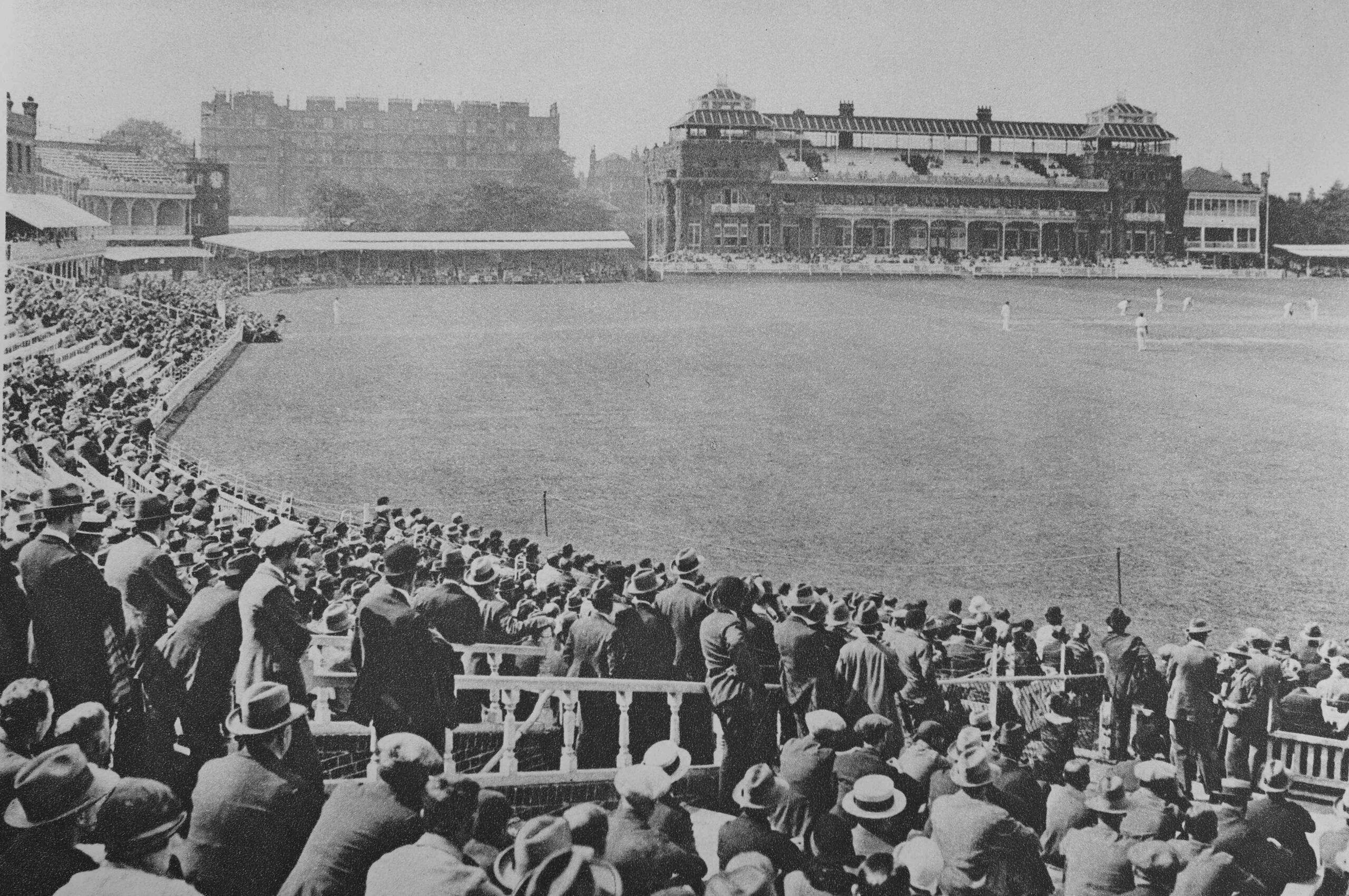
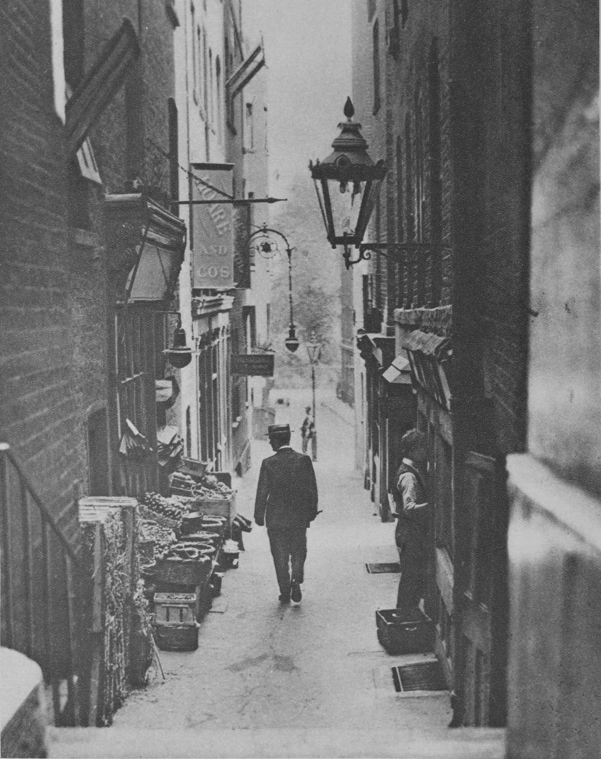
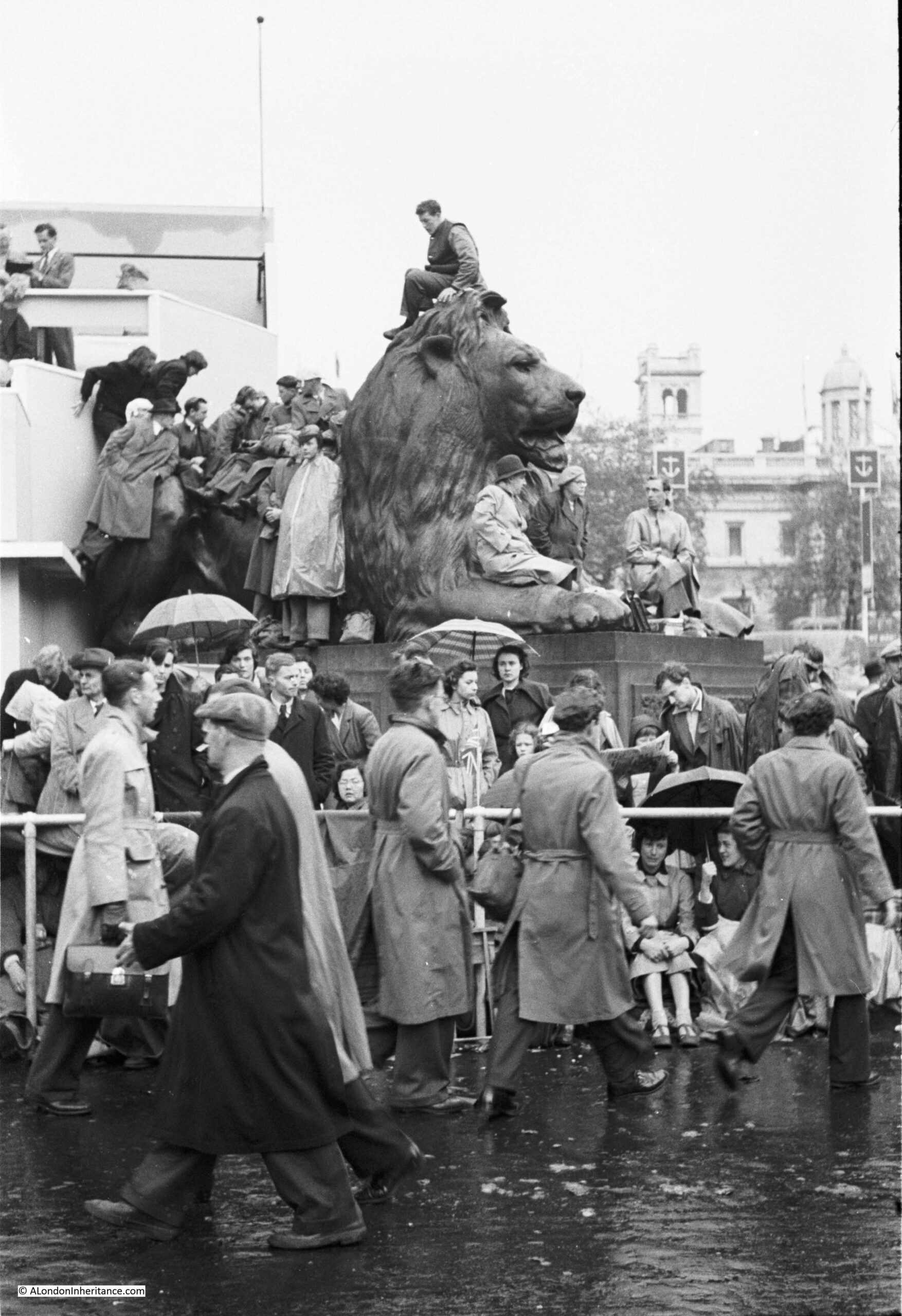
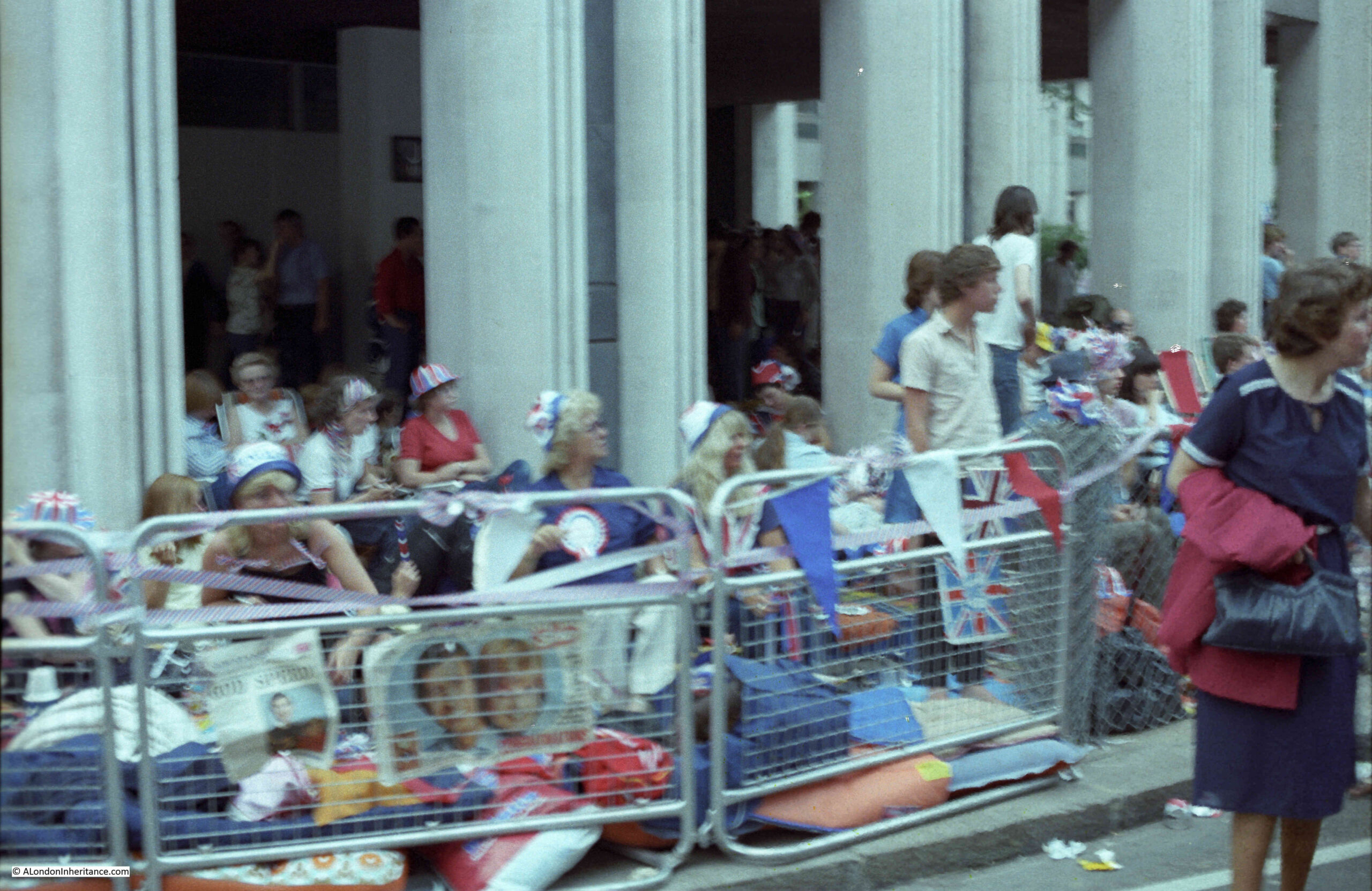
The majority of my father’s photos were not dated. It is possible to work out the year that the photo was taken by looking at the notes that went with the negatives, and where an individual photo has been printed and dated from a film of 36 photos. Three photos I can date accurately are of Covent Garden, on Sunday the 9th of August, 1953:
I suspect these photos were possibly taken as competition entries at the St. Brides Institute Photographic Society, as my father was a member and did win a couple of their competitions. They seem to be more composed, and to focus on specific details rather than general photos of places.
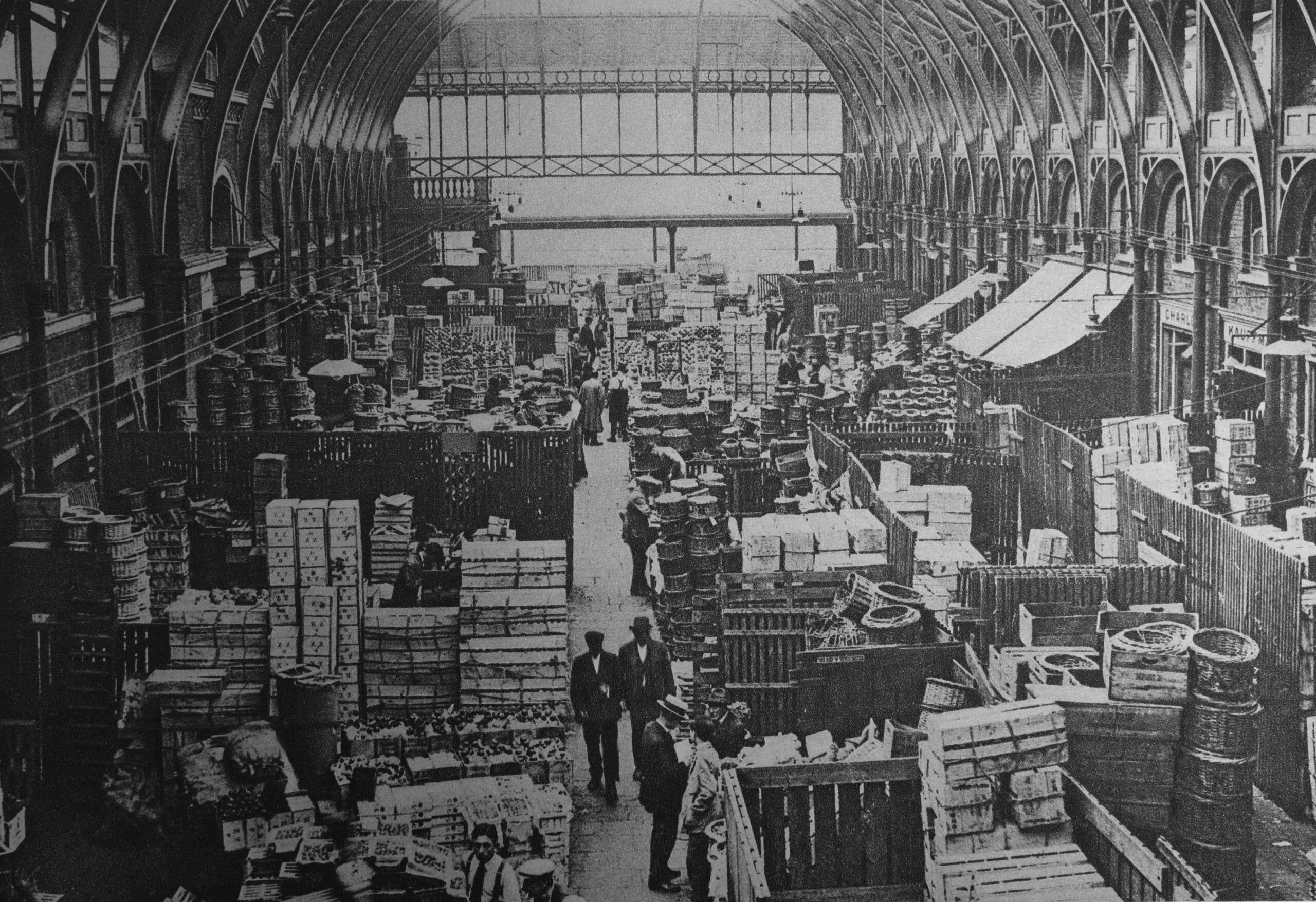
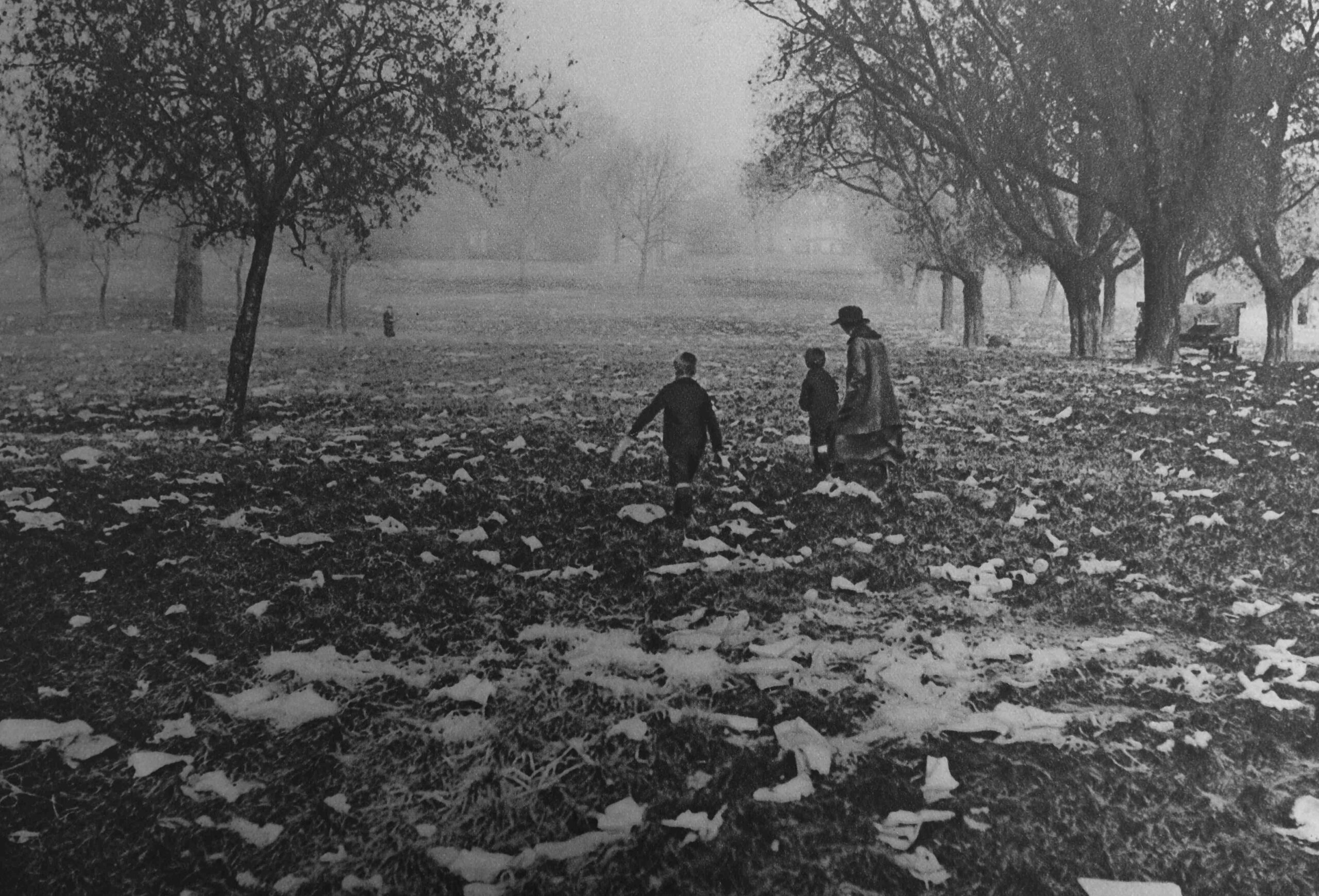
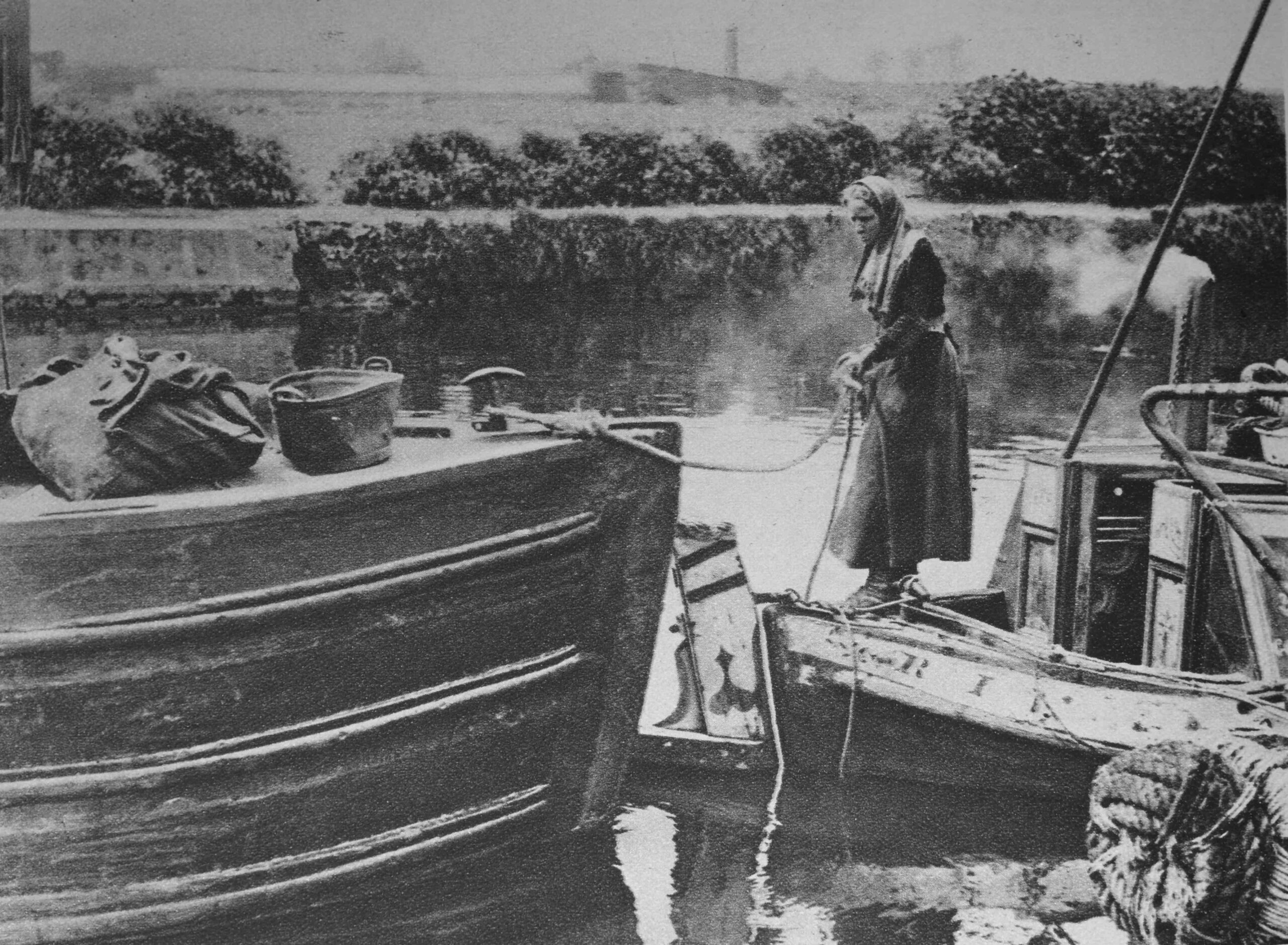
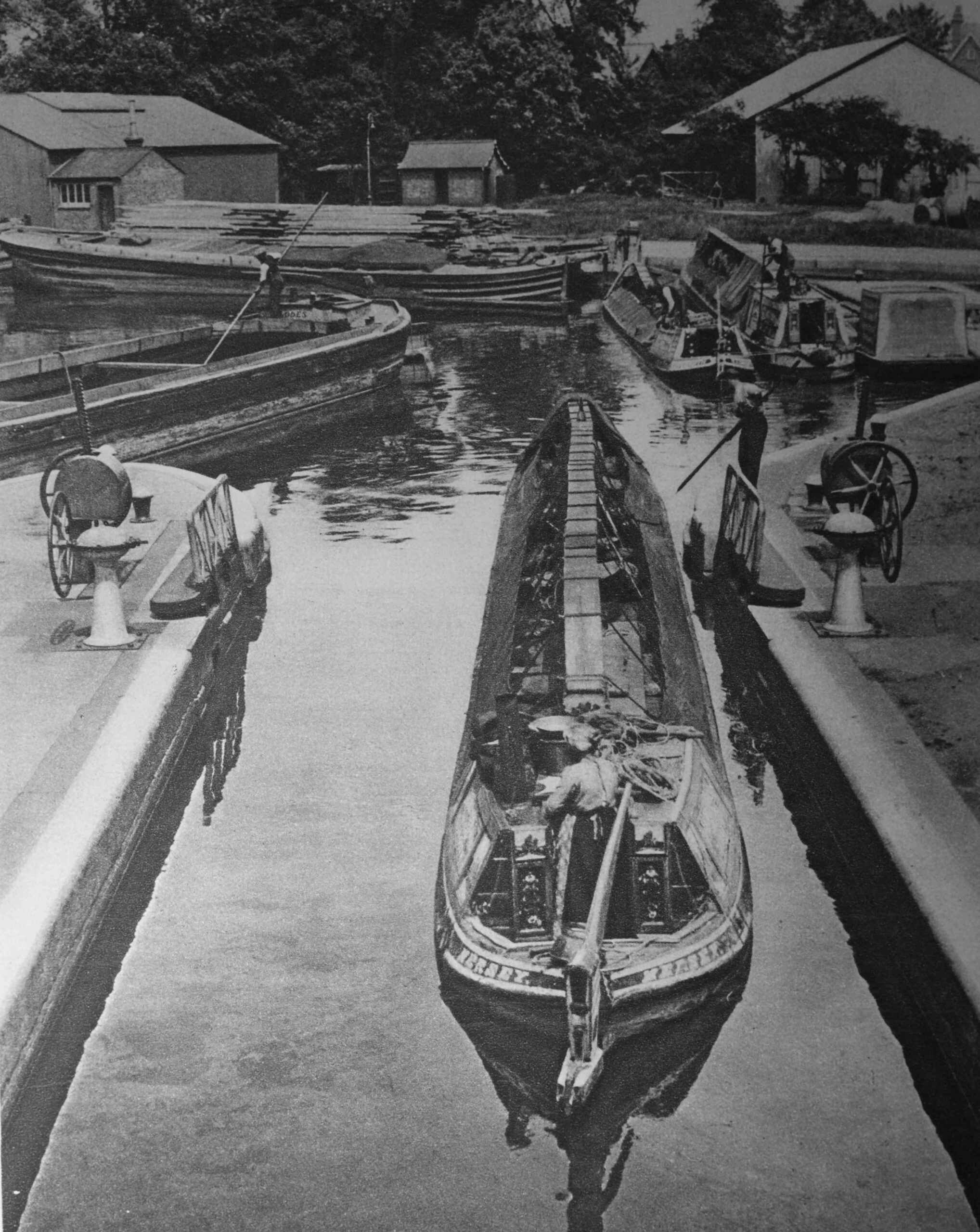
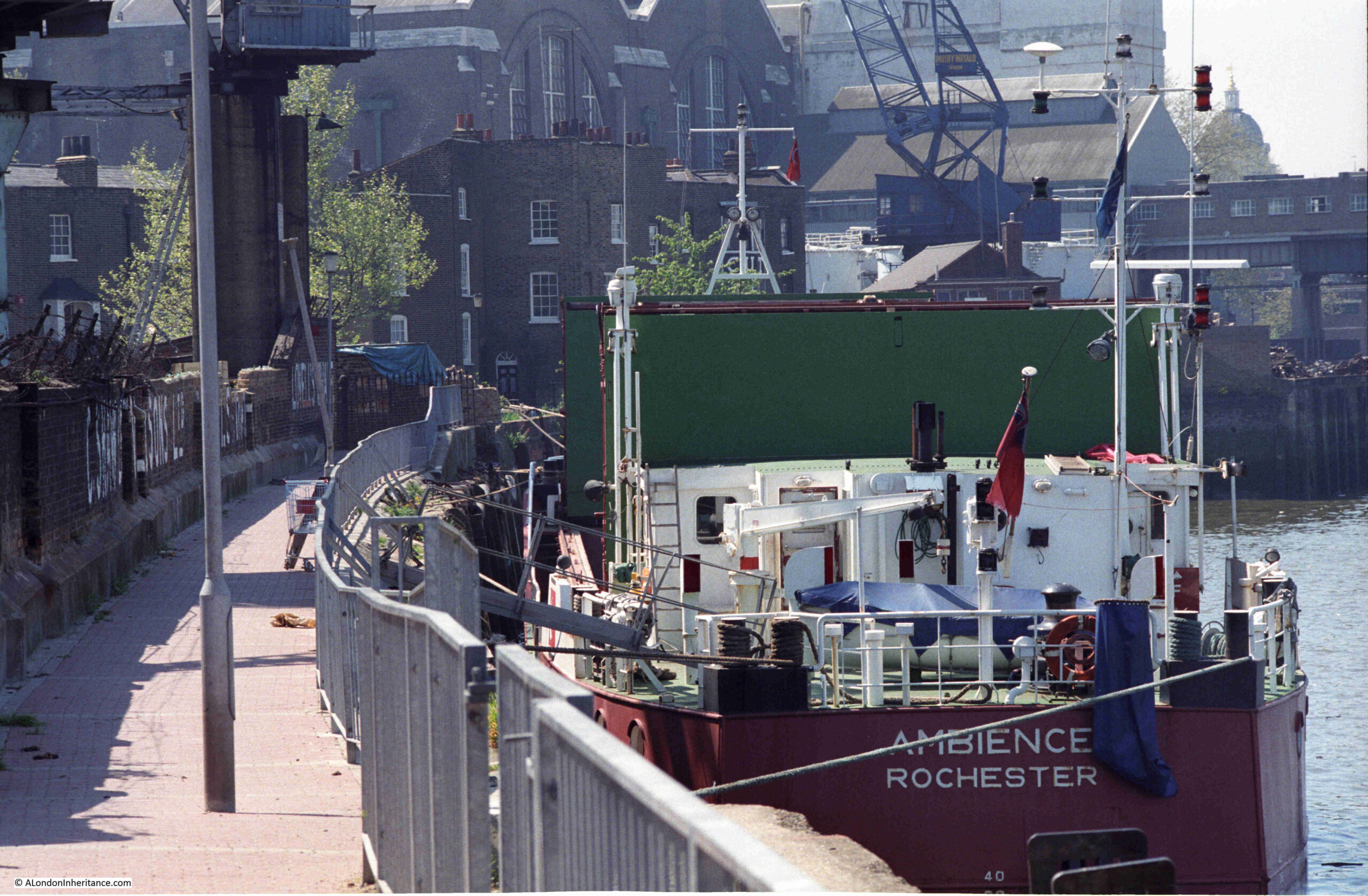
The photos were taken around the northern side of the market building, and show piles of produce in sacks and boxes:
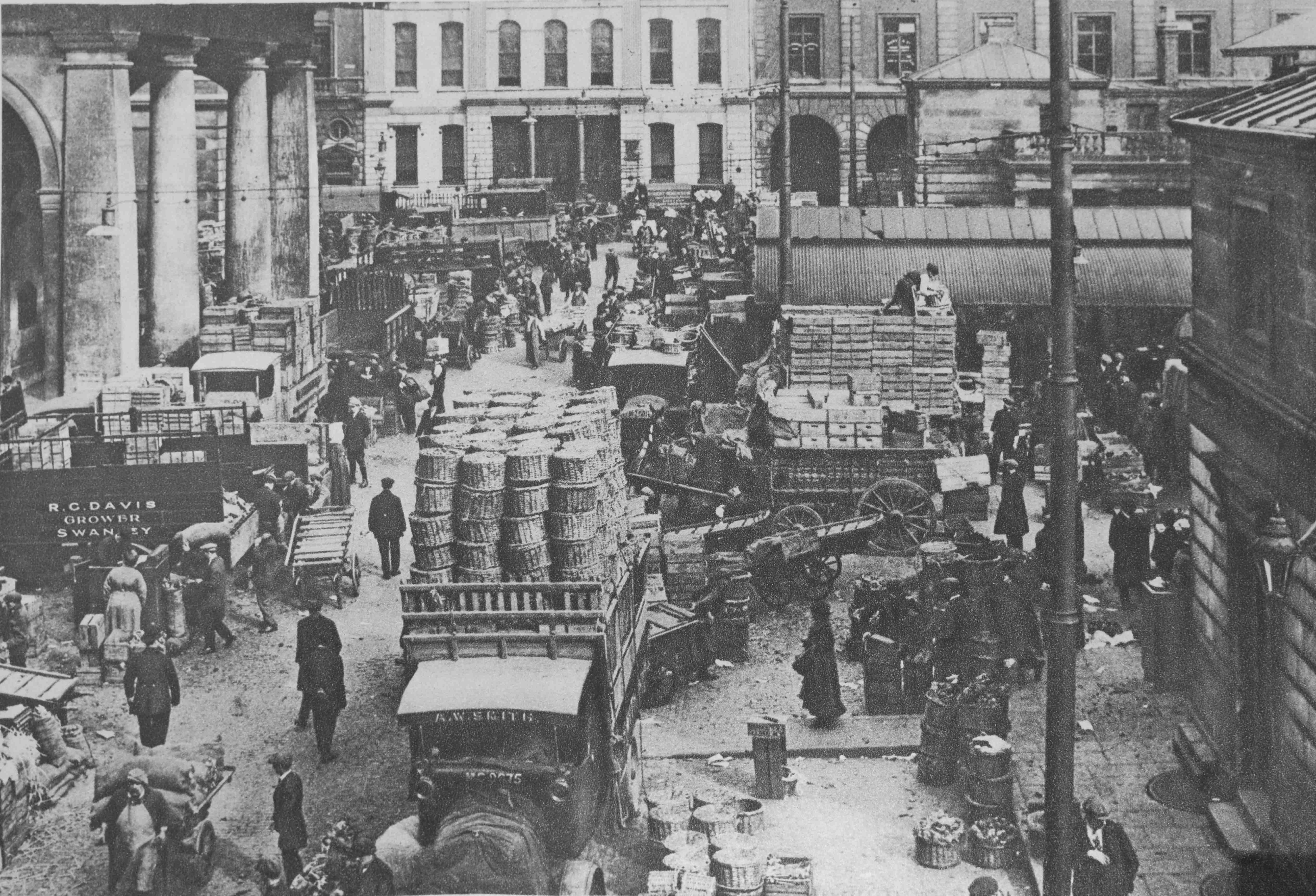
Along with the barrows used by market workers to move stock around:
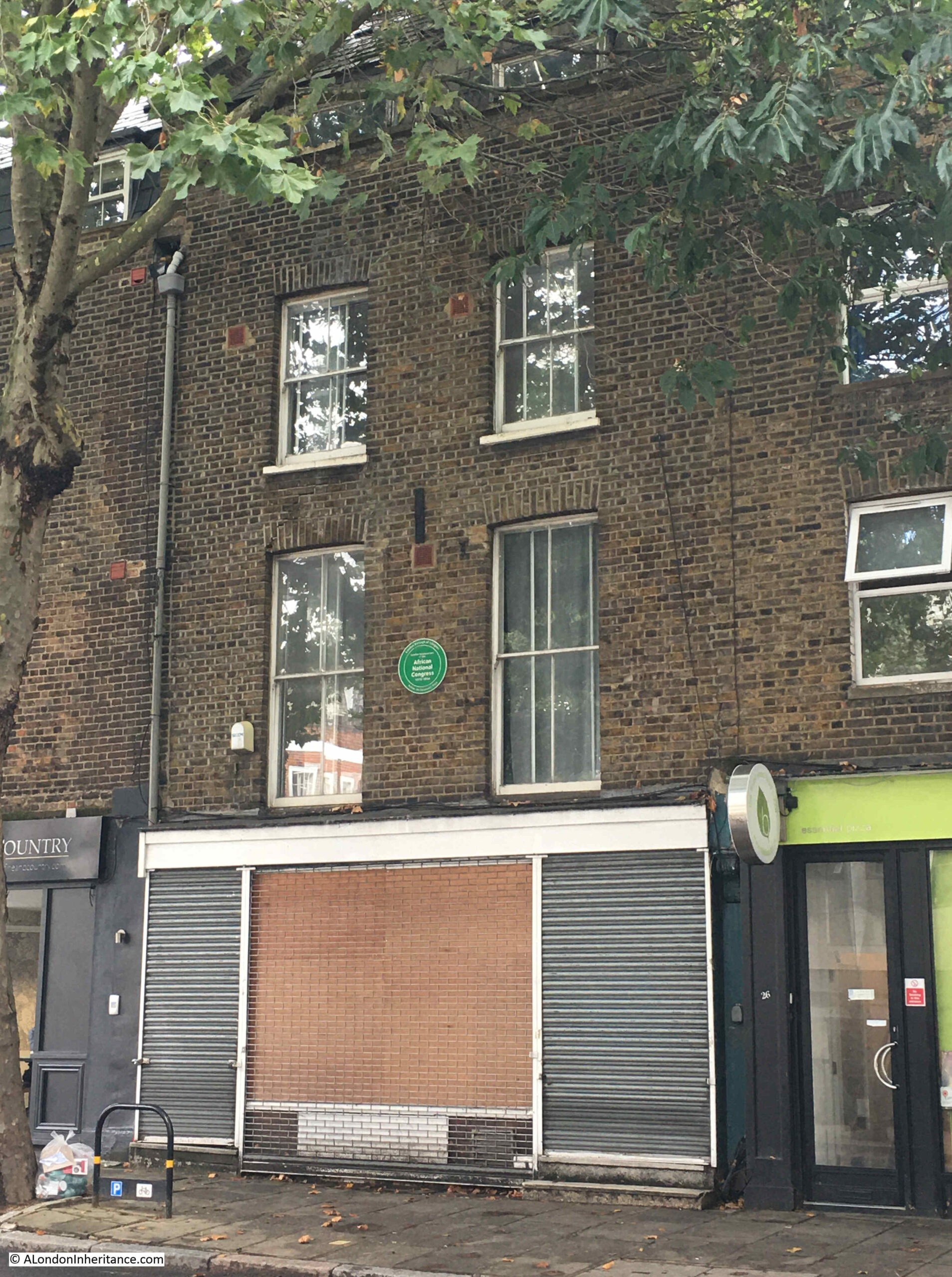
Although my father had recorded that these photos were of Covent Garden market, I was rather unsure of the location.
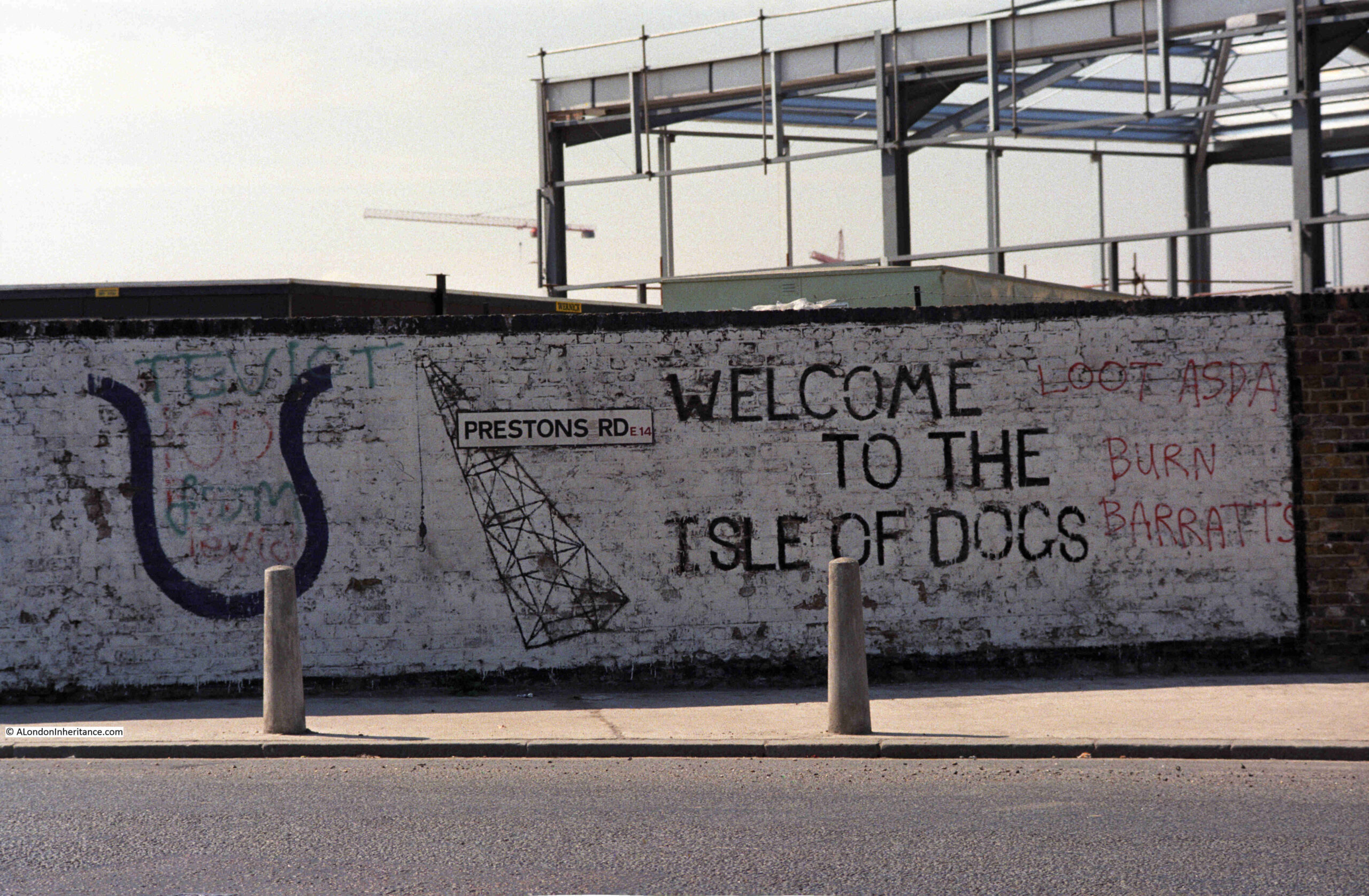
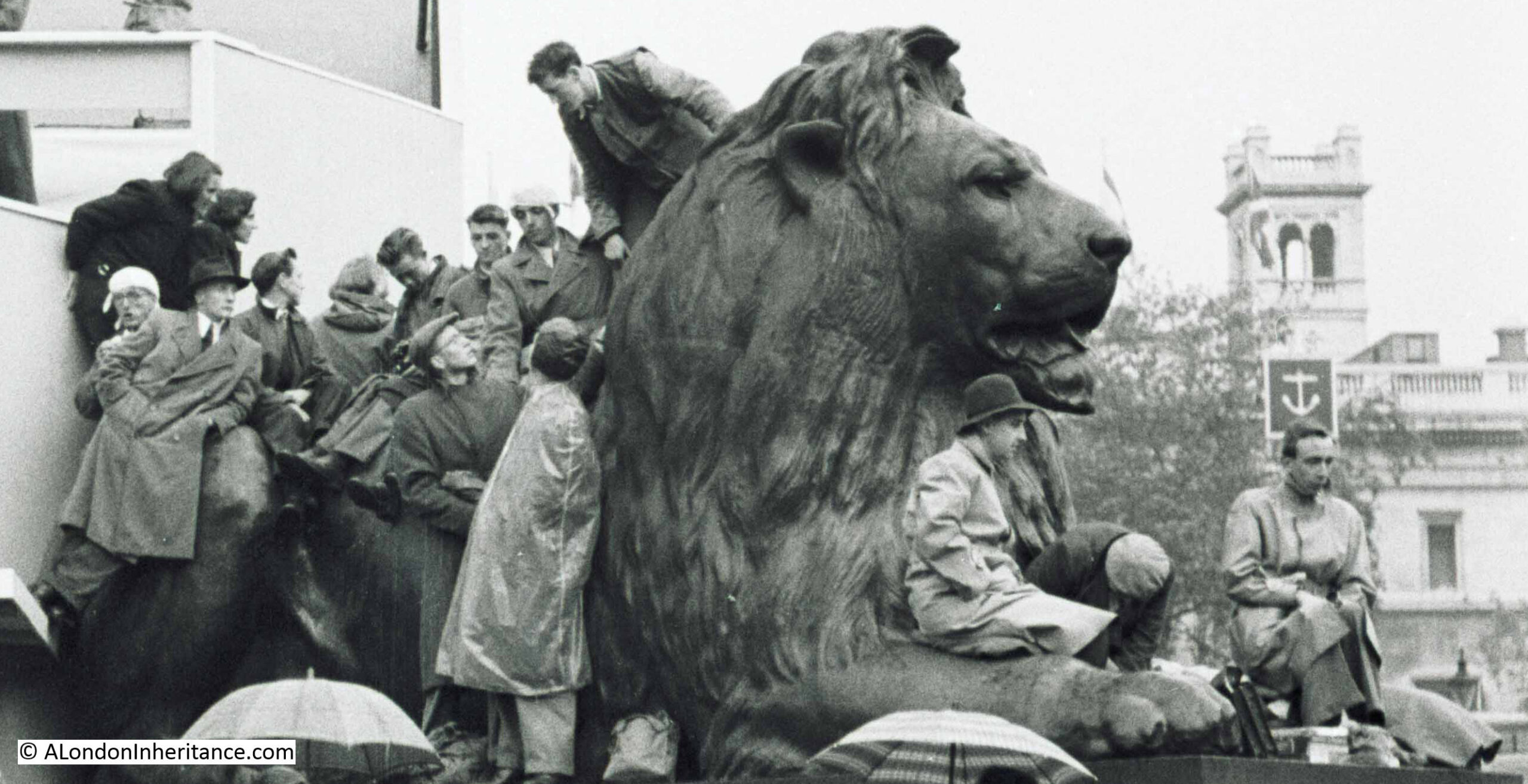
In the background of the first photo the corner of a building with two street name signs can be seen.
The following extract shows the two street signs as a clip from the TIF 55MB image straight out of the scanner, so about the best I can get, given that this is from 72 year old film:
Even with the grainy image, it is possible to see the names James Street on the left and Covent Garden on the right, so I can locate the photo as being on the northern side of the market building.
The street names seemed to provide firm proof of the location of the photo, however one aspect of the 1953 photo still concerned me. Return to the photo at the top of the post, and the pillar is in sunlight, with the shade of a lamp being cast on the pillar. If the pillar was on the north-western side of the market (you can see the orientation of the market building in the above map), could it really have been in direct sunlight, sufficient for a distinct shadow to form on the pillar?
This application displays a street map, and allows you to adjust the date and time, and the map displays how the area in shadow changes.
Using Shademap, it looked as is the photo was taken just after 4pm. At this time, the angle of the shadow cast by the sun looks as if it would cast a shadow of an overhead lamp on the pillar, with the pillar and area where the boxes and sacks are located, in sunlight.
Shademap also shows that the corner building with the street name signs would be in slight shade, which seems to agree with the photo.
So if the photo was taken just after 4pm on Sunday the 9th of August, 1953, you may well be wondering why I am featuring it for the post on the 2nd of March. It is down to my lack of organisation with posts, and featuring posts in the order of scanning the photos and an opportunity to visit the site.
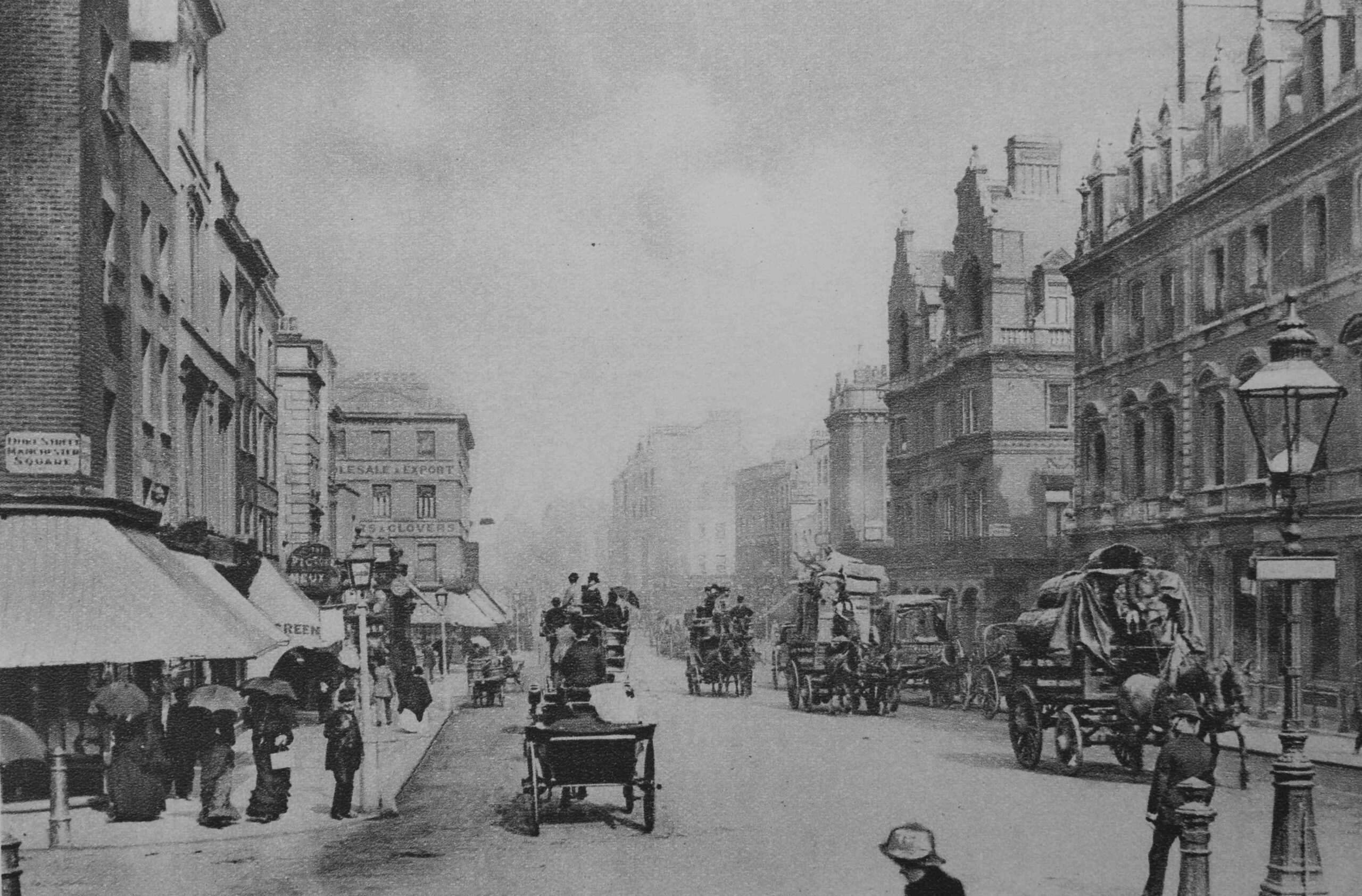
To find the location of the photo, I walked to the north-western side of the Covent Garden market building. This is the view along the open space between the market on the right and the surrounding buildings on the left. You can see the pillars which line the edge of the market, one of which featured in my father’s photo:
It is difficult to be sure exactly which pillar was in the photo. The first possibility is shown in the following photo:
Two street name signs can still be seen on the corner of the building opposite, however the building is not the same as the one in the 1953 photo. The building we see today is part of the late 1990s redevelopment of the large plot, part occupied by the Royal Opera House. The street running off to the left is James Street.
I moved to the next gap between two pillars to take the following photo, which could also include the pillar in the original photo. This photo shows one of the ornamental barrows around the market which are reproductions for decoration, rather than the original barrows shown in my father’s photo:
The shadow on the pillar in the 1953 photo was presumably a lamp, and today there are still lamps lining the edge of the building above the pillars, although comparing with the 1953 shadow, they do not appear to be the same:
I find it fascinating to explore some of the details within these old photos. The following is an extract from the second of the 1953 photos:
Firstly, the sacks have the numbers 1952 on them, which I assume is a year, which would have been the year before the photo was taken. Possibly the year that the sacks were made?
Both the sacks and the boxes to the right have the name W. Medlock, which seems to have been a company that operated at Covent Garden for many years.
The first reference I found to W. Medlock was in the Bedfordshire Times and Independent on the 5th of September, 1871, in an article about the Sandy Flower and Horticultural Show.
In the list of those who were judges of flower and agricultural exhibits, Mr. W. Medlock is a judge for the Market Garden produce, and he is listed as Mr. W. Medlock, Covent Garden.
As well as being a judge, W. Medlock also exhibited produce at the Sandy show. In the 1903 show, within the category for Market Gardeners, Medlock won a special prize for a “bushel of white or red Hebron potatoes”.
W. Medlock Ltd, were a firm of potato merchants, which explains the shape of the contents of the sacks in the above photo. There are many references to them in and around Sandy, Bedfordshire, which has long been an agricultural area, and there are still growers and merchants of potatoes listed in the area.
In the 19th century, Sandy was a small market town and in the 1924 revision of the Ordnance Survey map, much of the land surrounding the town is marked as being allotments, so this was an area of market gardens.
What must have helped with linking Sandy with Covent Garden was that the town was not far from the original A1 north road, and in 1850 Sandy railway station was built, providing a rail route to London, which must have been the main method for transporting W. Medlock’s potatoes from the town to Covent Garden.
Further confirmation that W. Medlock was a potato merchant was from a very condescending article in the Daily Herald on the 16th of June, 1931:
“POTATOES GET THE SACK – CROSSED OFF MENU BY SLIMMING GIRLS. Potato sales are dropping alarmingly. The homely ‘spud’ is being despised and rejected, and women are responsible.
Through the eyes of the potato, women see the great modern bogey, Fat, and they are as much afraid of the potato as they would have once have been of a mouse.
‘Our sales have dropped by a third in the past three years’ said the manager of Messrs. W. Medlock Ltd. wholesale potato merchants of Covent Garden, to a Daily Herald representative yesterday.
Restaurants are serving far fewer potatoes than they used to because women will not eat them. Even the women who are not definitely on a slimming diet have certain taboos, and the first of them is potatoes.
‘Women are behaving very foolishly about dieting, and this potato ban is one example of their folly’ a doctor said. They are doing harm by cutting out potatoes unless they substitute something equally starchy – which they don’t.
Potatoes are good food, and it is time women learned sense about them.”
However, the only person acting foolishly was the Daily Herald reporter, as soon after the above article, the paper had to print the following apology:
“POTATO FIRM’S SALES – In our issue of June 16 we stated that the sales of Messrs. W. Medlock Ltd. wholesale potato merchants of Covent Garden ‘have dropped by a third in the past three year’.
Messrs. Medlock inform us that this is not correct. Their sales have not diminished in any way, but on the contrary, are regularly and steadily increasing.
We gladly give publicity to this fact and offer our apologies to Messrs. W. Medlock Ltd. for any annoyance the misstatement may have caused them.”
Which just goes to show that back in 1931, stories in papers about diets were just as reliable as they are today.
The name of another Covent Garden merchant, and which also demonstrates a link with the agricultural areas surrounding London, can be found by looking at one of the other 1953 photos, where boxes with the name W.J. Soper can be seen:
W.J. Soper were agricultural merchants who seem to have brought in produce from Norfolk. They were regularly mentioned in lists of merchants in Norfolk newspapers, such as the Lynn News and Advertiser, based in King’s Lynn, to the north-west of Norfolk, just south of the Wash.
A typical mention from the 14th of March, 1958 reads:
“Large quantities of King Edward and Majestic Ware potatoes, Parsnips, Red Beet, and Cabbage – W.J. Soper, Ltd. Covent Garden, Spitalfields, Borough Market, Harlow. Cheques daily or weekly as required – Local rep. W. Edwards, Tel Wisbech 1769.”
Soper’s representative was based in Wiusbech, which is a short distance to the south-west of King’s Lynn. The advert tells us a bit about how Covent Garden market operated.
Firstly, along with W. Medlock, companies such as W.J. Soper, trading at Covent Garden were buying in produce from across the agricultural lands of Bedfordshire, Cambridgeshire and Norfolk, and with the location of towns such as Wisbech, this probably included Lincolnshire.
The expansion of the rail network across these counties from the 1850s must have helped considerably with the transport of agricultural produce to help feed the ever growing population of London.
W.J. Soper’s newspaper listing also mentions other London markets at Spitalfields, and Borough Market, so many companies were probably not just operating at Covent Garden, but were bringing in produce to be sold across London. The mention of Harlow is rather strange, unless they also served a market in one of the first post-war new towns being built in London’s orbit.
One other point about the photos – they were taken on a Sunday afternoon, and there is lots of agricultral produce piled up outside the main market buildings.
The market must have been closed at that time, and unfortunately the photos do not show if there was anyone who worked at the market in the surrounding area. Was there any form of security to protect these sacks and boxes from theft? If not it seems remarkable that so much could be left around the market until it opened early on Monday morning.
There is a fascinating film of Covent Garden fruit, flower and vegetable markets in operation from 1957, just four years after my father’s photo. The film starts at a farm in Sussex where produce is being loaded onto a lorry for a late night drive into London so the produce can be sold at Covent Garden. The film can be watched here:
The film mentions potatoes from Norfolk, but also demonstrates the wide geographic area that supplied produce to be sold in the market, as well as the considerable distances that produce sold at the market were transported to, so as well as being a market to supply London, Covent Garden was also supplying many businesses across the country.
The film also implies that the market was almost a 24 hour operation, with produce arriving at all times, and being sold during a set number of hours. Perhaps this explains why the sacks and boxes in my father’s photo appear to have been left unattended on a Sunday afternoon. They may have just arrived, or were waiting to be moved.
I always find it rather poignant watching these old films, as those shown working across the market had no idea of just how much the market would change in the coming decades, with Covent Garden closing as a market and relocating to Nine Elms less than twenty years after the above film.
This time last year, in that strange period, between Christmas and New Year, I wrote a post about London – Captured in Music Videos, as they are fascinating, not just for the excellent music, but to see London in the background, in these videos from the last few decades.
For this year, I thought I would have a post about London films. Not films where London appears in the background, but films which are dedicated to telling a story about a particular aspect of the city.
They are fascinating to watch, not just to see how the city has changed physically, and how life in the city has also changed, but also to make us think.
The people we see in these films working or living in London could probably not have foreseen the dramatic changes that would transform their city, and likewise our experience of the city today is just a snapshot, and in years to come many aspects of the city will be radically different, and it will be someone else’s city, who will probably look back at film of London in the 2020’s with a mix of nostalgia and amusement.
So for the long, dark evenings, here is London from the past 100 years.
The film “The London Nobody Knows” is a fascinating glimpse of London at a time of great change. By the release of the film at the end of 1968, there had already been considerable reconstruction after the bombing of the 1940s, and gleaming glass and steel office blocks were springing up across the city.
There were though still a considerable number of bomb sites and damaged buildings, and the London Docks were still busy, although there were signs of the changes that would effect trade on the river and the docks in the future.
The film was written by the writer Brian Comport and the artist and author Geoffrey Fletcher, and the film takes its name from the book the London Nobody Knows by Geoffrey Fletcher. His books mixed Fletcher’s drawings of buildings, street infrastructure, people etc. across the city with descriptive text.
The film uses the actor James Mason as a focal point for the film, as he visits and talks about the changing face of London, armed with his flat cap and umbrella:
The London Nobody Knows is perhaps the classic London film.
Capital County
Capital County is a 1951 London County Council film and starts with some history of the development of London, then going on to show the very extensive range of services for which the LCC were responsible, and how these services touched much of the life of all Londoners. The film demonstrates this through Albert Brown, a typical Londoner:
Capital County shows that it is not just physical change that has transformed London over the last 70 plus years, but also the way London is administered and governed.
Bermondsey Wall
Bermondsey Wall is a 1932 film which has some wonderful views of the working river and backstreets of Bermondsey, and focuses on the work of the Time and Talents Association, who by the time of the film were based in Dockhead House, Abbey Street. Time and Talents was started in 1887 to help young girls use their “Time and Talents” in the service of others, to provide education, practical skills and also provide hostels for girls’ accommodation. The organisation has evolved into a community organisation which is still running today across Rotherhithe and Bermondsey.
The Proud City – A Plan for London
The Proud City is a film produced for the Ministry of Information, to explain the 1943 County of London Plan. The film includes the main authors of the plan, JH Forshaw (Architect to the London County Council) and Sir Patrick Abercrombie (Professor of town planning, University of London), who explain why a plan is needed, the thinking behind the plan, how it will transform London, and the resulting benefits for all those who live and work in the city, along with some wonderful film of the city.
The plan was wide ranging, and covered almost every aspect of life in London, and the plan identified many of the issues with the haphazard way in which London had developed over the centuries, resulting in poor housing, housing and industry together existing in a mixed street plan, traffic congestion, the way the old village London had merged into a far larger and more complex greater London.
We can see today how some of the ideas from the plan have been implemented. The plan makes a comparison between the north and south banks of the river in central London, with well designed offices, government buildings and a fine Embankment with trees and gardens on the north, whilst on the south bank there was a confusion of warehouses, slums and derelict streets, which had been made worse since the Blitz. The plan identified the south bank of the river as an ideal opportunity to develop a new river frontage, worthy of London.
The intention with bombed, industrialised areas such as Stepney, was to transform them into new “social units” or neighbourhoods, each with a population of between 6,000 and 10,000, and having a school, local shopping centre, medical facilities and with housing provided by a mix of terrace housing, each with a garden, and blocks of flats built within landscaped grounds.
Industry and commerce would be moved to the boundaries of neighbourhoods, rather than being mixed in with housing, and main roads would also be at the edge to avoid through traffic.
An early example of the concept that today seems to have attracted the name of the 15 minute city.
The film has some wonderful quotes, for example the following from Patrick Abercrombie:
“There must be change, always change, as one season, or one generation, follows another”.
This quote sums up London’s history. A city that has always changed, adapted and evolved, but the problem with change is that it raises questions about what we keep and what we get rid of to continue that change.
You can see these issues play out every day, with a few current examples being the M&S building in Oxford Street, proposed redevelopment of Liverpool Street Station, the new buildings on the site of the London Weekend Television building on the Southbank, and the potential demolition of Bastion House on London Wall, along with the adjacent, old Museum of London site (both by the architects Philip Powell and Hidalgo Moya, who also worked on the 1951 Festival of Britain and designed the magnificent Skylon).
The Port of London
A film by British Pathe and British Instructional Films Ltd and headlines as a Classroom film. The film shows the workings of the London Docks. It starts off slowly, whilst working through a map showing the location of all the docks from Tilbury to St. Katherine, and then shows the docks in operation:
British Instructional Films Ltd were primarily a documentary film maker, founded in 1919 by Harry Bruce Woolfe. The subject of these films ranged from the re-enactment of military engagements through to a long running Secrets of Nature series, which included painstaking studio and laboratory work, as well as filming out in the field.
A common thread running through the films produced by the company was patriotism and Empire.
The company suffered financially during the late 1920s and early 1930s and became part of the Pathe company, who continued to use the brand name of British Instructional Films for their educational films, as with the film Port of London.
The City of London – Reel 1
Part one of a film from 1951 showing the City of London in operation – the Stock Exchange, Baltic Exchange, Lloyds of London etc.
The City of London – Reel 2
The second part of the film, which focuses on the ceremonial and crafts aspects of the City of London.
Both films show a very different City of London to the City of today, including a City where men are in all of the roles of any consequence in the City:
Barbican, 1969: The development of the Barbican Estate following World War II
This is a wonderful film in “Technicolour” that covers not just the development of the Barbican Estate, but includes many other aspects of London. The views of the estate being built, alongside views of what was there before help illustrate what a transformational housing project the Barbican was for the City of London:
The film includes a brilliant few minutes of people looking round one of the show flats which have been furnished in a very modern, late 1960s style, with emphasis on the kitchens, bathrooms, and how the flats have been designed to maximise views through the windows, sunlight, sound proofing etc.
The Living City
The film The Living City was made in 1970 for the City of London Corporation. The film starts with views of the fires started by incendiary bombing on the night of the 29th December 1940, and then goes on to tell of the reconstruction of the City, the institutions and businesses that make the City the main centre for global trade, finance and insurance, and how the City is being rebuilt, including some film of the Pedways:
It is interesting to compare the City of London in 1970 with the City of today. The film talks about Cheapside being the main shopping street of the City and a “seething confluence of seven major thoroughfares” between the Bank junction and St. Paul’s. The film shows the amount of traffic along streets such as Cheapside and across the Bank junction, and this is one of the things about the City that I struggle with today.
Despite the air being much cleaner and healthier, the City just seems to have lost a sense of human activity, of being an exceptionally busy, exciting place, and across the whole film we can see the sheer diversity of activities that went on within the City of London.
There is film of the markets at Billingsgate, Spitalfields and Smithfield, and somewhat ironically given the City of London Corporation’s plan to close the Smithfield meat market, the film talks about the “City’s determination to keep the wholesale markets”.
There have though been some positive changes in the 74 years since the film, the fur market in Beaver House of the Hudson Bay Company no longer operates, and ivory is not stored and traded in the Port of London Authority warehouse in Cutler Street.
The danger with changes such as the closure of Smithfield is that the City of London gradually looses all the things that have made the City such an important place for many hundreds of years, and the square mile looses its identity and ends up much like many other places in central London where expensive apartments, hotels and places to attract visitors and tourists become the primary drivers of redevelopment.
The Changing Face of London
The Changing Face of London from 1960 is also about change, starting with scenes of demolition and the ruined buildings across the city, then focussing on redevelopment and potential plans for the city.
The models shown for large site redevelopment and also for individual buildings are fascinating, but thankfully some of these schemes did not get built.
If you have been on my Barbican walk, at 17 minutes and 19 seconds into the film, there is a view of the new section of London Wall that had been opened in the previous year (1959), and to the left you can see the church of St. Alphage, which was later demolished to just the medieval remains we can see next to London Wall today, and to the left there is Roman House, the white office block that was the first post war building constructed in the area, and about the only one of the buildings in the scene that remains to this day.
The Pedway: Elevating London
The Pedway was one of the ideas coming from wartime plans for post-war redevelopment of the City of London, where pedestrians would be separated from road traffic on raised pedestrian ways, and the redevelopment of London Wall resulted in one of the areas where Pedways were extensively used across a wide area.
The concept was not only to separate pedestrians from traffic, but also to provide on the Pedway, the shops, pubs, restaurants and other services that would have normally be found at street level.
This 2013 documentary tells the story of the Pedway, along with the associated redevelopment of much of the City of London:
The original Pedways have all but disappeared in the development of the last few decades, however elevated walkways are still the main method of walking through the Barbican estate, and there has been a reconstruction of a Pedway (but without shops, pubs etc.) in the area to the north of London Wall, around the remains of St. Alphage.
This Is London – 1981
This film is more a tourist overview of London, but is interesting as it shows the city at the start of the 1980s, when London was still a very low rise city.
At 55 seconds into the film, there is a wonderful bit of film of a hovercraft on the Thames and passing under Tower Bridge:
Bob Hoskins: London is being “Sterilised by greed”
This is another absolute classic, with the actor Bob Hoskins showing Barry Norman around parts of the south London riverside from Coin Street on the Southbank down to Shad Thames, and whilst some of the developments he talks about did not get carried out, many did, and his core argument is the same today as it was in 1982:
The future’s up for grabs – GLC Docklands
Where the Bob Hoskins film talks about the derelict buildings along the river, and the preference of developers for offices over houses, the following film explores the impact on those who lived around the large expanses of old docks that were “up for grabs”.
There are lots of interviews with those who live in the area. Young people who complain about the lack of facilities and how far they have to travel for school, older people who talk about what the docks were like when working, talk about some of the new developments and the physical separation of council and private housing etc.
Many of these issues are still just as relevant, and the area around the Royal Docks shown in parts of the film are still being developed today, and from my walks around the area, there still seems to be very few facilities for those living in the new apartment blocks.
River Cruise Down The Thames
This is a GLC film, aimed mainly at visitors to the City, but the film also highlights the benefits that the GLC has brought to the city (the film ends with the slogan “keep GLC working for London” as the film was made when the Conservative government was arguing for the abolition of the GLC).
The film runs from Hampton Court, Twickenham and Kew, down to Greenwich and the recently completed Thames Barrier:
Film 87 – How Docklands became Vietnam
The closure of the London docks offered producers of film and TV programmes so many opportunities with large areas of derelict land and buildings available.
Much of Bob Hoskin’s film The Long Good Friday was filmed in and around docklands, and this extract from Film 87 shows how Beckton Gas Works were transformed into Vietnam for Stanley Kubrick’s film Full Metal Jacket:
It is worth watching just for Barry Norman’s description of yuppies at the beginning of the film.
The following links are to films held by the British Film Institute. Unfortunately, unlike YouTube, the BFI does not appear to have a player that can be embedded in a WordPress site, so the links take you to the BFI website.
Barbican Regained
The film covers the area that would become the Barbican, but also takes a look at the rest of the City:
Many of the views of the area that would become the Barbican are in colour, and in one section of the film, when the camera is panning across the Barbican, at 10 minutes 52 seconds, there is a view that is almost identical to that taken by my father around 16 years earlier. See the post on the Cripplegate Institute and Jewin Crescent, and photo at this link to compare, and the comparison shows how little had changed during the whole of the 1950s.
A Day in London
This film from 1920 starts from Victoria Station and then travels across London, visiting the main landmarks that a visitor to the city would have been expected to visit:
The majority of the landmarks are much the same today as they were in 1920. What has changed are the people, cars and buses, and the fact that in 1920 Downing Street was just a normal London street that happened to have the official home of the Prime Minister. A reminder that one of the many factors to have changed London over recent years has been terrorism with Downing Street now looking like a fortified street, London’s bridges having barriers between road and footpaths etc.
Barbican Phoenix
Barbican Phoenix is yet another film on the redevelopment of the area around London Wall and the Barbican:
A small selection of films that show how London has changed over the past 100 years, and how London has continued to evolve to meet challenges and opportunities.
One of many themes from these films is the sheer diversity of activities there were in London, and my concern is that in many ways it is becoming a less diverse city, and risks ending up as a tourist attraction rather than a living and working city.
I think sometimes we focus too much on the physical aspects of the city, preservation of buildings etc. Whilst it is important that we preserve key buildings and significant architecture, that we build more homes etc. my personal view is that the far more important question is what do we want the city to become – probably a question that is impossible to answer.
Four years ago, I published some photos from the book “The Queen’s London”. This was a book published in 1896 and described as “A pictorial and descriptive record of the Streets, Buildings, Parks and Scenery of the Great Metropolis in the Fifty-Ninth Year of the reign of Her Majesty Queen Victoria”.
The photos in the book show London as it was, near the end of both the 19th century and the Victorian period. A century and a reign of considerable change across the city.
New streets had been carved through areas of historic small streets, courts and alleys. Many of the city’s slum areas had been cleared and rebuilt, although there were many left, and the 19th century had not really done much for the average worker, with poor housing, low wages, and often unstable employment.
However, the 19th century also saw a rapidly growing middle class, who lived in the terrace houses that expanded rapidly in the suburbs.
In many ways, London is still a 19th century city. Although industry has almost disappeared from the city, but many of the innovations of the 19th century have continued to expand, and enable the growth of the city, for example the Underground (the first stretch of the Central Line between Shepherds Bush and Bank opened in 1900, and parts of what are now the Circle, District, Northern, Metropolitan, Waterloo & City, opened in the last few decades of the 19th century).
The railways were transporting passengers and commuters into the city, road traffic was growing rapidly. The docks were exporting and importing goods across the world and serving the industries expanding across the country.
Institutions and places such as the Natural History Museum, Albert Hall, University College London, the National Gallery, Trafalgar Square were founded / built, along with the current Palace of Westminster. The Embankment and the first great sewer system was constructed.
The City of London was a global centre of finance and business, and to emphasize how the City had changed during the 19th century, the population of the City had declined as commerce and industrial took as much space as possible, and after the 1666 Great Fire, the Victorian period saw one of the largest periods of closures of City churches due to the dwindling population.
In the 124 years since, there have not been so many fundamental changes to the city. We have just expanded much of what was started by the Victorians (housing, transport networks etc.), and the landscape has changed from relatively low buildings (where St. Paul’s still stood high above the rest of the city’s buildings), to a city of towers, both office and residential.
The major changes have been the exodus of manufacturing industry and the closure of the docks, air travel resulting in London being one of the world’s main tourist destinations, a move to a service / cultural / knowledge based industries (although the roots of these were formed in the 19th century, and earlier), along with significant demographic change.
The dedication at the start of the book shows perhaps one of the most significant changes, when in the 1890s, London was the capital of an empire on which “the sun never sets”:
“To her most Excellent Majesty Victoria, Queen of Great Britain and Ireland, Empress of India, etc. etc. This Pictorial representation of the Capital of Her Empire is by Her Majesty’s Most Gracious Permission., respectfully dedicated.”
The riches from the Empire, whether traded goods or finance, were one of the key drivers of the development of 19th century London, and it was the loss of the Empire, two World Wars, and significant social change, and change in the workplace, that contributed to the development of the London we see today, built on the foundations of the 19th century.
To see how the city has changed, the following photos are a sample from “The Queen’s London”, showing how a Londoner or visitor in the 1890s would see the city (the captions from the book are below each photo):
The Victoria Embankment, From Waterloo Bridge
“The Victoria Embankment, as viewed from Waterloo Bridge, quite surpasses anything that is seen beside the Seine or the Tiber. Its magnificent sweep from the Houses of Parliament to St. Paul’s is one of the finest sights in the whole of London, and cannot fail to impress every observer. Cityward the most noticeable building is Somerset House, with its fine façade of 780 feet, and beyond this lie the Offices of the London School Board, the Temple Library, Sion College Library, and the City of London School. The Embankment itself, the greatest achievement of the late Metropolitan Board of Works, cost nearly two millions, and its construction occupied six years – 1864 to 1870.”
The caption mentions the “late Metropolitan Board of Works”, which was founded in 1856, and then integrated into the London County Council in 1889, following a number of corruption scandals within the MBW, and the drive to deliver competent, London wide, governance, another late 19th century initiative.
St. Paul’s Cathedral
“This noble Cathedral is the third largest church in Christendom, being only surpassed by St. Peter’s in Rome and the cathedral in Milan. The old Cathedral was burnt in 1666, and the first stone of the one designed by Sir Christopher Wren was laid in 1675, divine service being celebrated twenty-two years later. the great architect is buried in the east end of the crypt. The building cost, according to Milman, £736,750, and not only was it virtually completed by one architect, and under one bishop, but the same master builder who laid the first stone also laid that crowning the cupola. The great dome is 112 feet in diameter, 27 feet less than that of St. Peter’s. the Cathedral is 500 feet in length, and the height to the top of the cross from the road is 370 feet.”
London was a low rise city at the end of the 19th century, and would stay that way for much of the 20th century, until buildings such as the Post Office Tower (1964), and the Nat West building (1980) were constructed. In the following decades there would be an explosion of tall towers across the city, both office and residential, however there are now protected views of St. Paul’s Cathedral, which were brought in after developments such as the Post Office Faraday Building (1933) in Queen Victoria Street were constructed, higher than other buildings between the Thames and Cathedral, and impacting the view of the cathedral.
The National Gallery, With St. Martin’s Church
“The National Gallery, concerning the merits or demerits of which such strong opinions are expressed by architectural critics, is Grecian in style and Wilkins was responsible for the design. This gallery was built in 1832-8 to receive the pictures of which the nucleus had been formed in 1824; after twenty two years, the structure was considerably enlarged, and the façade is now 460 feet in length. To the right, in our view, is the church of St. Martin’s-in-the-Fields, which boasts a Grecian portico of quite unusual beauty. It was built in 1721-6 by Gibbs, on the site of an earlier church; and in the old churchyard lies buried Nell Gwynne, under whose bequest the fine bells are rung every week.”
The opening sentence in the above description shows another constant in London’s history – that there will always be strongly differing opinions about the new buildings that line the city streets.
The Customs House
“Between London Bridge and the Tower, and having, separating it from the Thames, a broad quay that was for long almost the only riverside walk open to the public, is the Customs House. Five earlier buildings on the same site were destroyed by fire, and the present structure was erected in 1814-17, the fine façade being designed by Sir R. Smirke. Some 2,000 officials are employed at the Customs House, and in its famous Long Room alone – 190 feet by 60 feet – eighty clerks are habitually engaged. this is not surprising, for the trade of the Port of London is by far the greatest of any port in the world. the building, which is entered from Lower Thames Street, contains an interesting Smuggling Museum.”
The Customs House building is still there, although, the closure of the docks made the purpose of the building redundant. The caption makes an interesting point regarding access to the river, as it was “for long almost the only riverside walk in London, open to the public”, however although we now have long lengths of riverside walks, in many ways as the Thames is no longer really a working river, we have lost a much greater connection with the Thames.
The Natural History Museum, South Kensington
“A high place among the fine public buildings in South Kensington must be given to the Natural History Museum, which faces Cromwell Road. Mr. Waterhouse, R.A. was the architect, and the erection occupied the years 1873-80. The structure is Romanesque in style, and the terra-cotta façade is, with good reason, greatly admired. The Museum is 675 feet in length, and the towers which rise from the wings are 192 feet high. Hither were brought the Natural History collections of the British Museum in order to relieve in some measure the congested condition of the national institution in Bloomsbury. Considering the popularity of such collections, it is not surprising that the annual number of visitors to the Natural History Museum should be over 400,000.”
In the late 19th century, 400,000 visitors probably seemed like a very large number, however in the Natural History Museums latest annual review, they state that “In the year to April 2023, we welcomed 5,157,405 visitors”.
Much of this growth has been fuelled by the growth in tourism within London, but the figures highlight that with many aspects of London today, it is just a much busier / larger version of what was established in the 19th century.
The Royal Exchange
“Few edifices in London are more impressive that the Royal Exchange, with its stately Corinthian portico. it was built by Tite in 1842-4, on the site of Gresham’s Exchange. In the tympanum is a group representing the Sovereignty of Commerce, whilst below are inscribed the words ‘The earth is the Lord’s, and the fullness thereof’. Business is transacted in the building of an afternoon, the attendance being greatest on Tuesdays and Fridays. On the left of the Royal Exchange is the Bank of England, at one end of Threadneedle Street. the equestrian statue in front represents Wellington and is an excellent specimen of Chantry’s work. The open space bounded by the Exchange, the Bank, and the Mansion House is perhaps the busiest in all the City.”
The congested junction in front of the Royal Exchange was long a problem with City traffic and is one of the reasons why Upper and Lower Thames Street and London Wall were widened as east – west routes to bypass the Bank junction (see last week’s post).
Today, the junction is very different, not only has horse drawn traffic long disappeared from the City streets, changes brought in by the City of London to reduce vehicular traffic in the City have made the junction much quieter.
The Strand, Looking West
“No better idea of the Strand can be obtained than from the church of St. Mary-le-Strand, whence this view was taken. On the left is the entrance to Somerset House, used as Government offices and erected by Sir William Chambers in 1776-80, in place of the old palace begun by the Protector Somerset. A little further west is Wellington Street, bisecting the Strand and affording access to Waterloo Bridge. At the far end of the houses is seen the Nelson monument in Trafalgar Square. The Strand is the southern main artery from the City to the West End, and is always crowded with traffic, especially when the theatres which abound in the neighbourhood are being emptied of their patrons. The thoroughfare, which is here shown at its broadest, owes its name to the fact that the Thames formerly flowed close beside it.”
Apart from Somerset House, nearly all he buildings in this view have been demolished, however the terrace immediately to the right of Somerset House can still be seen today, to give an impression of what the overall street would have once looked like.
The reference in the caption to the theatres of the West End is just as relevant today, as it was in the 1890s.
The Crystal Palace
“Built of the materials that housed the Great Exhibition of 1851 in Hyde Park, the Crystal Palace at Sydenham cost no less than a million and a half sterling. It is composed entirely of glass and iron, and was designed by Sir James Paxton. The Palace from its lofty eminence is visible for miles in every direction. Its principal hall, or nave, is 1,608 feet long, while the central transept is 390 feet long by 120 feet broad and rises to a height of 175 feet. On either side of the Palace are the water towers, each 282 feet high, and these add greatly to the general effect, best appreciated from the delightful grounds, which cover some 200 acres. Our view shows the Upper Terrace, the Central Transept, and the northern Water Tower.”
Crystal Palace was destroyed by fire in November 1936, although the building has gone, the name remains.
The following photos are from the Britain from Above website, showing Crystal Palace before the fire (!928):
And after the fire (1936):
The Tower Bridge
“Further communication across the Thames at this point had been urgently needed for many years. The necessary act was passed in 1885, the foundation stone laid by the Prince of Wales on June 21, 1886, and the work completed at a cost of about a million sterling in 1894. the bridge, designed by Mr. Wolfe Barry, C.B. is of somewhat peculiar construction, the low level passage being on the ‘bascule’ principle: i.e. the centre span of 200 feet is divided into two, each half being pivoted and furnished with a counterpoise, and hauled upward and back against the towers when the waterway is opened, the bridge is shown thus opened in the view. A high-level footway is also carried across nearly at the top of the towers, access to this being afforded by lifts in the latter. The side spans are on the suspension principle.”
Tower Bridge was the last central London road bridge to be built, so by the end of the 19th century, London had the same number of road bridges as we do today. This also applies to the rail bridges. Some have though been rebuilt, and dates for the first and current road bridges are show below:
London Bridge – very early : 1973
Southwark Bridge – 1819 : 1921
Blackfriars Bridge – 1769 : 1869
Waterloo Bridge – 1817 : 1942
Westminster Bridge – 1750 : 1862
The only completely new river crossing we have built since the end of the 19th century is the Millennium Foot Bridge.
The Imperial Institute
“The Imperial Institute at South Kensington was built with the twofold object of celebrating the Queen’s Jubilee and cementing the British Empire. Her Majesty in person both laid the foundation stone of this splendid building in 1887, and declared it open in 1893. The architect, Mr. T.E. Colcutt, was inspired by Tennyson’s words ‘Raise a stately memorial, Make it really gorgeous, Some Imperial Institute, Rich in symbol, in ornament, Which may speak to the centuries’. In design the Institute is Renaissance, freely treated. the main entrance is particularly fine, and the interior is worthy the exterior. Altogether the buildings occupy two acres. Every Friday, the public is admitted free to the exhibitions, and the attractions of the Institute are enhanced by concerts, lectures etc.”
Despite Tennyson’s words and the ideals that the Imperial Institute aspired to, it was not a great success, and by 1899, the University of London had taken over half of the building for administrative offices.
Demolition started in 1957 and was completed by 1967. The site of the Imperial Institute is now occupied by Imperial College.
The tower that can be seen to the right of the above photo was saved from demolition, and after some substantial works to enable the tower to stand on its own, it now stands within the Imperial college campus, and can be seen close up by cutting through the campus along Imperial College Road.
Yeoman of the Guard
“In very welcome contrast to the sober story of the Tower of London is the bright red uniform of its wardens – the Yeoman of the Guard. These men are commonly called Beefeaters, a title as to the derivation of which etymologists differ. Some explain it as a corruption of ‘buffetiers’ or waiters at the royal buffet; others trace it back to the rations of beer formerly served out to men whilst on duty. Be this as it may, the Yeoman of the Guard are veterans who have all more or less distinguished themselves on the field of battle. On State occasions they sometimes constitute a picturesque guard of honour, and at the opening of each new Session of Parliament a body of them searches the cellars of the Houses of Parliament as a precaution against any ‘gunpowder treason and plot’.”
The Yeoman of the Guard are still very much a key part of the Tower of London. I suspect the beard size has decreased somewhat since the end of the 19th century. The major change to the Yeoman of the Guard was very recent, with Moira Cameron becoming the first female Yeoman in 2007.
Greenwich Hospital
“Greenwich Hospital occupies the site of the royal palace erected in the fifteenth century on the south bank of the Thames four miles from London bridge. To students of Inigo Jones and Sir Christopher Wren, the Hospital is of great architectural interest. It consists of four quadrangles, and is best seen from the river, whence the less worthy portions are invisible. William and Mary deserve the credit of rebuilding the palace and of converting it into a refuge for decrepit and disabled seamen. In the present reign, however, in the year 1871, the pensioners made way under an Admiralty scheme for naval cadets, who are here educated. The Painted Hall, the Nelson relics, and the ship models, regularly draw to the Hospital troops of visitors.”
The Naval College for cadets closed in 1997. Part of the site is now occupied by the University of Greenwich, and it is often used as a film set.
“Her Majesty’s prison at Holloway is an imposing building, modern in date and castellated in design, with excellently arranged accommodation. It is the chief gaol for London and the county of Middlesex, and is constantly in evidence owing to the fact that prisoners awaiting trial are thither sent. Holloway Gaol also offers hospitality to debtors, to female convicted prisoners, and to a few special offenders, such as those who have committed contempt of court. Lieut-Colonel E.S. Milman combines in his person two offices, being Governor of both Holloway and Newgate prisons. Pentonville Prison is less than half a mile distant.”
Holloway Prison closed in 2016, and the prison is probably best known for being the place where the last women to be executed, Ruth Eillis, was hung in 1955.
Ludgate Circus
“One of the busiest spots in the City is Ludgate Circus, where meet Fleet Street, Ludgate Hill, Farringdon Street and New Bridge Street. As may be seen from our view, the stately dome and towers of St. Paul’s Cathedral are conspicuous objects from the Circus, although the railway bridge and the slender steeple of St. Martin’s – one of Wren’s churches – obstruct the view. The name Ludgate is derived from an old gate – the sixth and principal gate of London – says Stow on his survey, which was taken in 1760. Antiquaries, however, differ as to whether the gate was built by a King Lud, who flourished B.C.66, or whether the word is merely a corruption of Floodgate or Fleetgate.”
Apart from the cathedral and church, the only building that remains from the 1890s view is the building on the left of the photo.
The railway bridge has gone, with the railway through Ludgate Hill being replaced by the Thameslink route, with the railway now running underground, and the new City Thameslink station on the right of Ludgate Hill, just the other side of where the bridge was in the photo.
Although the buildings have changed, the view up Ludgate Hill to the focal point of the cathedral is essentially the same.
London Bridge, Looking North-West
“The most noticeable thing about London Bridge is the enormous traffic over it – now however, appreciably relieved by the Tower Bridge a little further east. London Bridge is only 54 feet broad, so that it is not surprising that many projects for widening should have been discussed. The first bridge over the Thames at this point was built about A.D. 994; the first stone one was finished in 1208. Since then the bridge has often been the scene of fighting and tumult, as well as of state pageants. In Elizabeth’s reign it was restored, afterwards the horrid custom grew of exposing upon it the heads of traitors. The present bridge was commenced under Rennie in 1824 and cost £506,000.”
The bridge shown in the above view is not the London Bridge we see today. The latest incarnation of London bridge was constructed about 30 metres to the west of the previous bridge shown in the photo, and opened in 1973.
The bridge in the photo was taken apart and sold to the American entrepreneur Robert McCulloch, who had the bridge rebuilt at Lake Havasu City in Arizona, although by rebuilt, the stones from the earlier bridge were mainly used as facing stones on a steel reinforced concrete structure, required to give the bridge the strength needed to carry traffic.
The Charing Cross Hotel
“Charing Cross Hotel is situated at the South Eastern Railway Company’s western terminus, and lends a dignity to the line which the hideous bridge across the Thames does its best to destroy. Entrance to the station is obtained from the large yard, which generally presents a very busy scene, especially when the Continental mail is about to start. The hotel was built by Sir C. Barry, on the site of Hungerford Market. Charing Cross was once marked by a Gothic Monument, known as Eleanor’s Cross which Edward I erected to distinguish the spot where his dead wife’s body remained a while when being taken to Westminster Abbey. It was erected in 1291, but in 1647 was removed by order of Parliament. The present cross is the work of the late E.M. Barry.”
This view remains almost the same to this day. Charing Cross is one of the few stations that has retained the hotel building that stood between the station platforms and the street. This was a feature of many other stations, such as Cannon Street, which have lost their hotels during redevelopment.
The Charing Cross building continues to be a hotel and is now the Clermont Hotel.
“Conspicuously placed on the Victoria Embankment is the famous granite obelisk known as Cleopatra’s Needle. It was put up in Heliopolis by Pharaoh Thothmes II, about 1500 B.C,. and twenty-three years before the Christian era it was erected at Alexandria – Cleopatra’s city. For centuries, the obelisk lay neglected in the sand, but in 1819 it was presented to the British nation by Mohammed Ali as a memorial of Nelson and Abercromby. Dr. (afterwards Sir) Erasmus Wilson expended £10,000 upon its removal to this country in 1877. Owing to stormy weather the transport ship had to be abandoned in the bay of Biscay, but fortunately the monument was rescued, and in the following year it was placed in its present position near Waterloo Bridge. It is 68.5 feet high, and weighs 180 tons. The sphinxes are modern.”
A view that looks much the same today, with the same lamps on the Embankment wall, and trees between the pavement and the road. I doubt the trees are the same as those in place today, and there is now a cycle way between trees and road, and in the background it is the original Waterloo Bridge that can be seen.
Oxford Street, Looking East
“A very characteristic part of Oxford Street is depicted above. The large house of which the corner is seen on the left is Messrs. Marshall & Snelgrove’s and in all directions are shops dear to the hearts of town and country ladies. New Bond Street opens on the right, where the flag is waving; and the view extends beyond Oxford Circus. Oxford Street is, as everybody knows, one of the main arteries of the metropolis, through which the traffic flows from east to west, and from west to east, in an unceasing stream; and the broadness of the thoroughfare at this spot affords a pleasing contrast to the cramped and inconvenient proportions of the Strand and Fleet Street.”
I am not sure if the shops along Oxford Street are “dear to the hearts of town and country ladies” today, and the street has come in for considerable criticism over the previous few years, with a number of shops closing, and the take over of many shops by American Candy Stores. The future of the Marks & Spencer store in the street is uncertain as the company want to demolish and rebuild, whilst there are campaigns to save the building.
Oxford Street is a street that needs some considerable change if it is to regain its reputation as one of the premier shopping streets in the country.
Hammersmith Bridge, From The South Side
“At Hammersmith, the River Thames is spanned by a very graceful Suspension Bridge, which was opened in the summer of 1887 by the late Prince Albert Victor, Duke of Clarence. This bridge serves the district between Putney and Kew, a distance of five and a half miles. The parish church which is, however, of no particular interest is shown in the picture presented above. perhaps the most striking feature of Hammersmith, which lies, of course, on the left bank of the river, is the Mall, where are situated houses dating from the reign of Queen Anne. At Hammersmith, too, are the headquarters of the various boating clubs. The bridge used to be crowded on the occasion of the Oxford and Cambridge boat-race, but of late years, this practice has been forbidden by the authorities.”
The view of the bridge itself is much the same today as it was in the 1890s. Hammersmith Bridge was closed in 2020 due to micro-fractures, caused by corrosion, being found in the structure of the bridge.
It has since been reopened for pedestrians and cyclists (who need to dismount their bike to cross the bridge), and the task of trying to find a solution and repair the bridge is underway, although there is as yet no date when, or if, the bridge will ever fully reopen.
The main issue is financial, as the costs to repair such an old, Grade II* listed structure are considerable, and the previous Government told Hammersmith & Fulham Council that they would have to fund 33% of the estimated £250 million repair costs.
I suspect that the Victorians would have been stunned by the delays in repairing this bridge, however the approach taken in the 19th century would simply have been to demolish the existing bridge and build new. There was very little consideration of the historical or architectural significance of buildings and structures in the 19th century, and if they were in the way of what was assumed to be “progress”, they were simply demolished.
The West India Import Dock
“The West India Docks, a hundred and sixty four acres in extent, consist of two parallel docks running east and west from Limehouse to Blackwell. Over the chief, or western entrance are inscribed the words ‘The West India Import Dock, begun 12th July 1800; opened for business 1st September 1802’. The opening ceremony was performed by William Pitt, and this was the first wet dock built on the north side of the Thames. The Import Dock, the more northerly of the two has on the north side eleven huge warehouses, capable of accommodating nearly a hundred thousand tons of goods; here are stored sugar, coffee, flour, cocoa, spices etc. The other West India Dock is known as the Export Dock.”
A time travelling Victorian would be able to tecognise many of the photos from the 1890s included in the post above, however the West India Import Dock would be unrecognisable.
The dock is part of the overall Canary Wharf development, and whilst part of the dock remains, there is water for much of the original overall east – west length, the width has been reduced, considerable new office building on either side of the water, and the new Elizabeth Line Canary Wharf Station has been built along what was once the centre of the dock.
What the time traveler may recognise are the buildings of the Museum of London, Docklands at the north west corner of the old West India Import Dock. The museum is housed in one of the last remaining, Grade I listed warehouses which date from 1802.
The changes at the West India Import Dock represent not just the closure of the working dock, but the loss of a complete form of trade, with all the jobs and industries that were dependent on the ships that once sailed to and from the central London docks.
I find it fascinating to consider how a major city such as London changes over time, how there are periods in the life of a city which put into place the foundations of how the city will operate for the next one hundred years plus.
Much of what we see in London today, does have its roots in the 19th century, and we have just expanded what was started over one hundred years ago.
Firstly, if you would like to hear me say erm far too many times whilst I talk about the blog, I had a chat with Liam Davis who hosts a weekly podcast on Shoreditch Radio, where he invites guests from all walks of life to talk about London.
There is also a good discussion with Feargus Cribbin of the London Pub Map.
Not the most promising of headings, but hopefully I will show you why it is worth it.
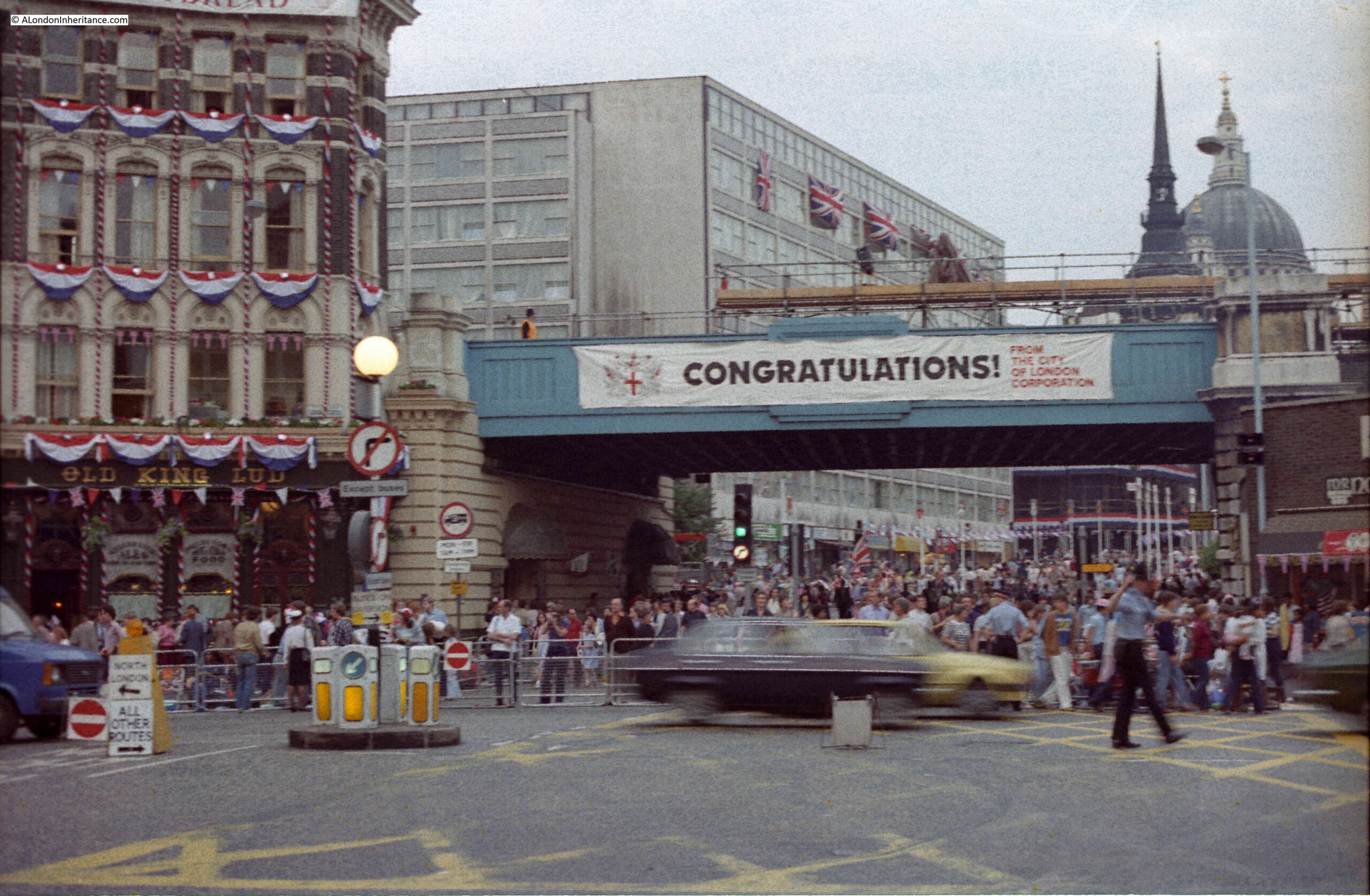
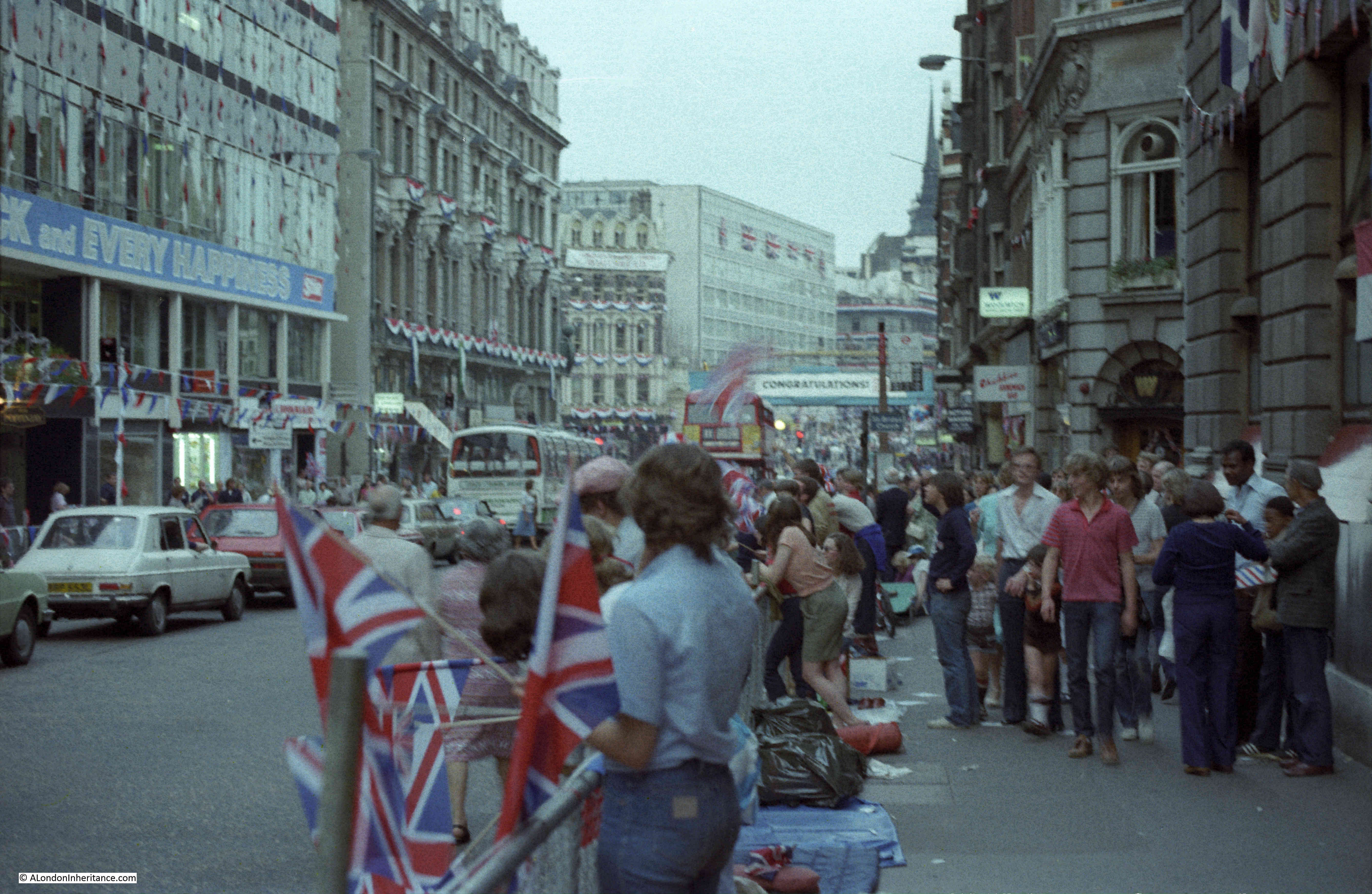
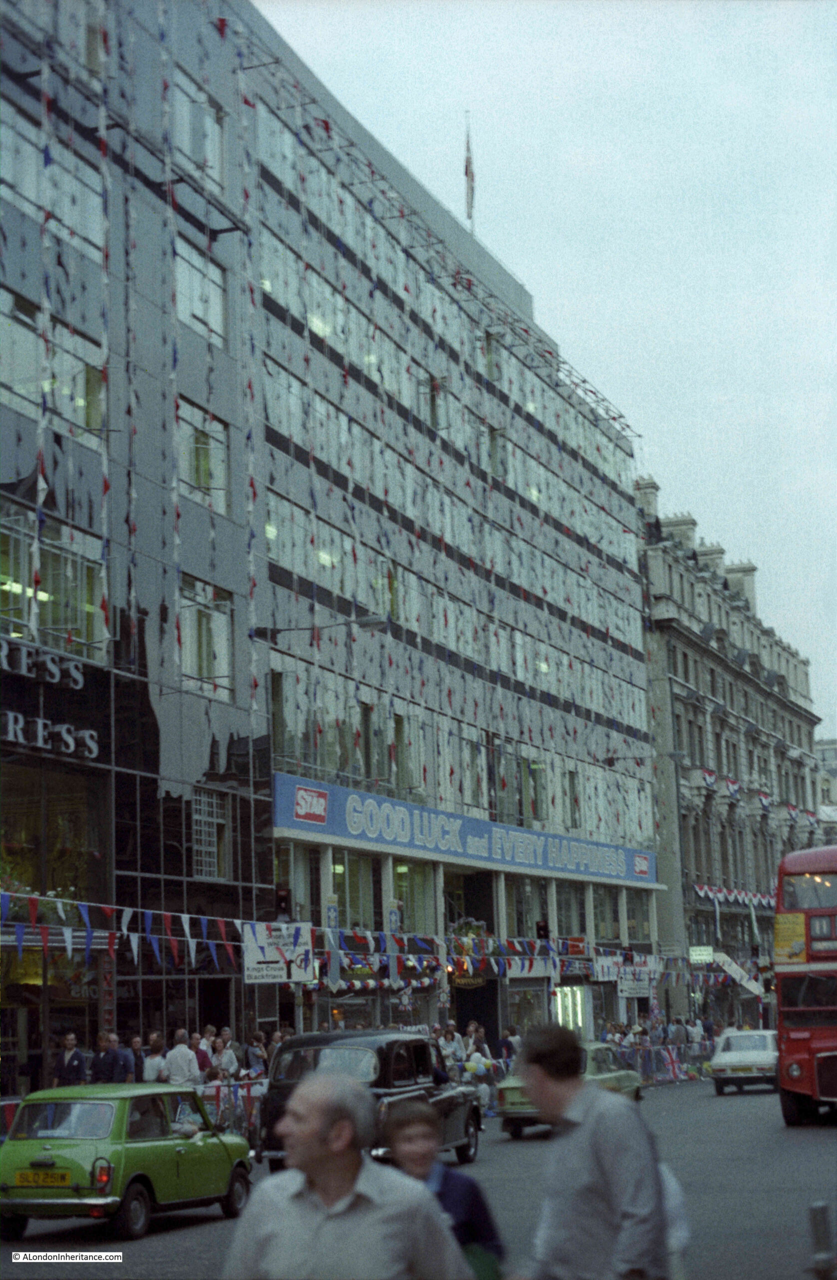
The period between Christmas and the first full working week in the new year is a strange one in the City of London.
There are not too many people around, there will be those who have taken an extended break over Christmas and the first few days in January, also, working from home is a very attractive way of working at this time of year.
Although Christmas is rapidly fading from memory, there are still plenty of decorations and lights. Add to that a very wet start to the year, and an evening when the rain gets heavier by the hour, and the City takes on a very melancholy appearance.
The majority of people on the City’s streets are taking the sensible approach of heading home as quickly as possible, however it is also a good time for a little exploration.
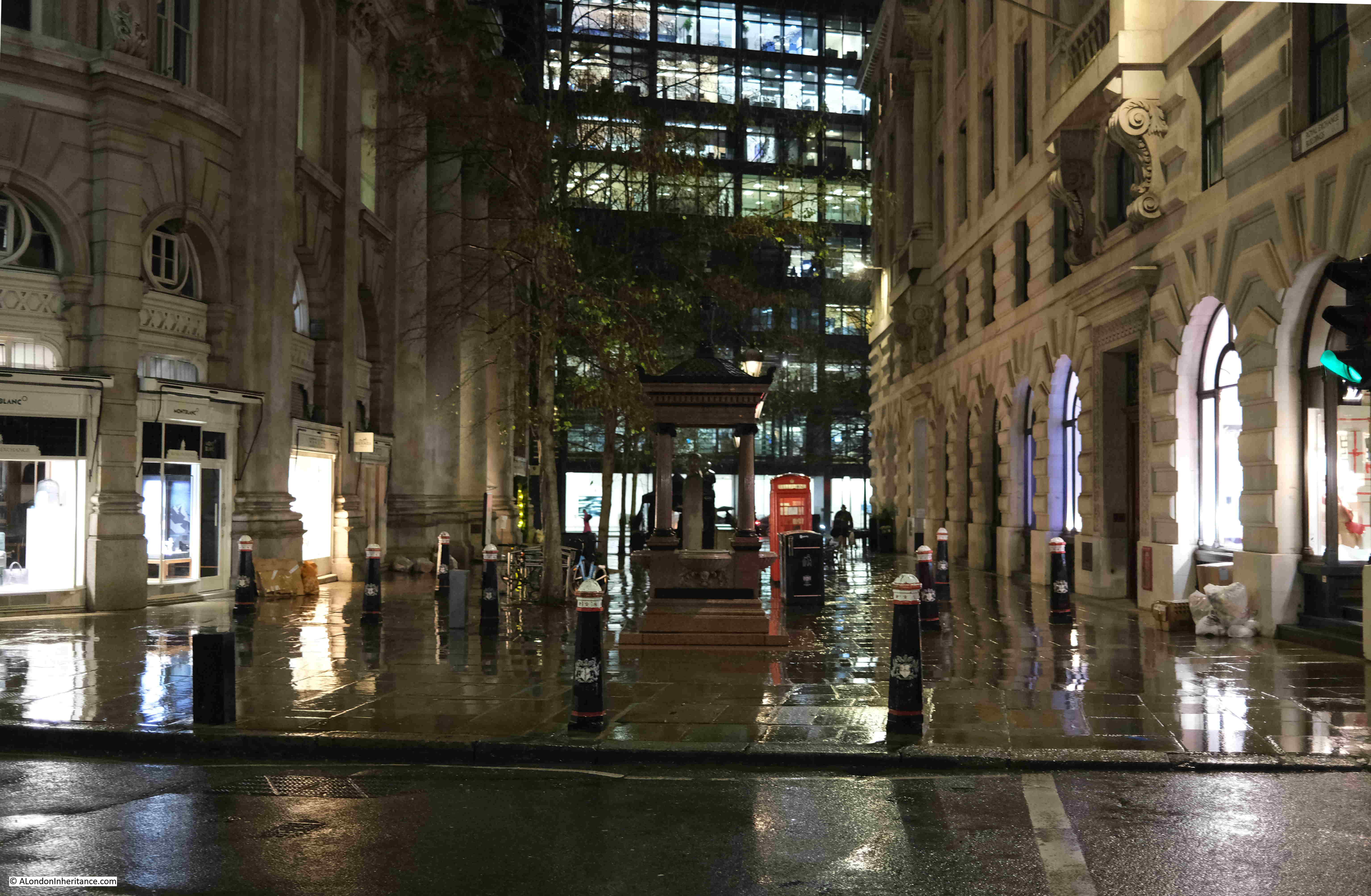
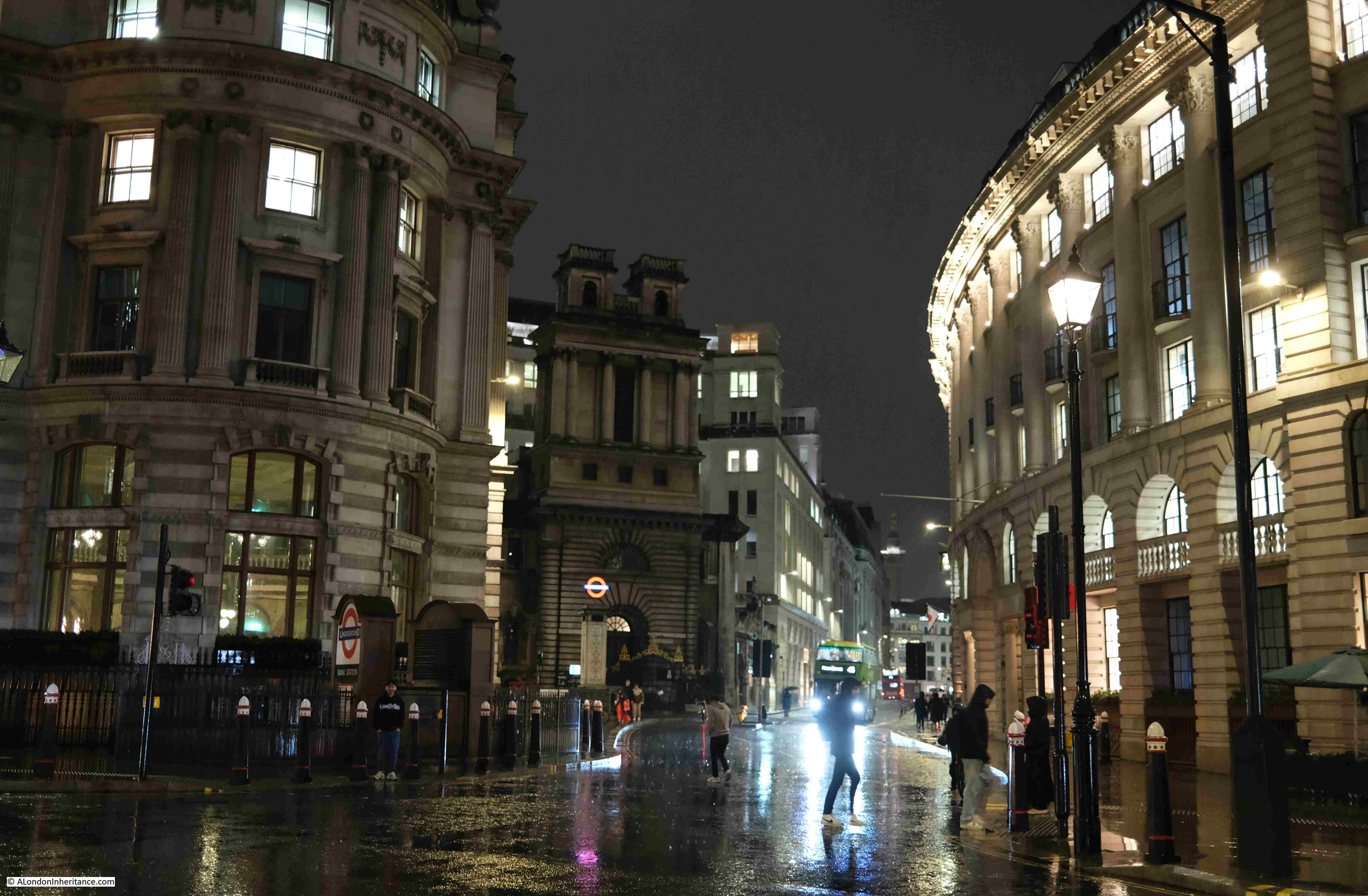
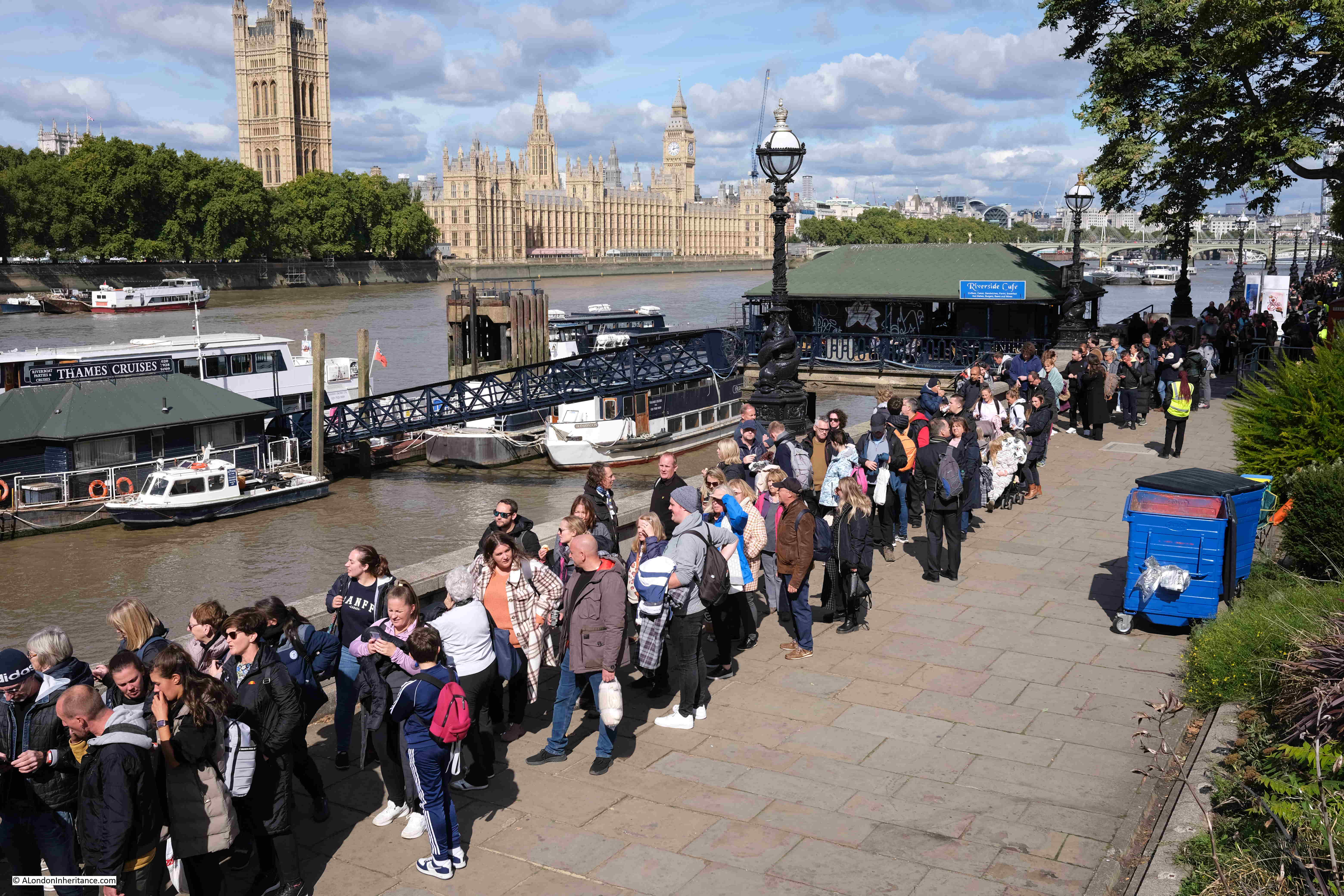
Personally, I prefer the summer. A bit of warmth, plenty of sunshine, long evenings, however London looks good at almost any time of year, and to demonstrate, I took a walk from Liverpool Street down to the Bank, taking a series of photos as I went, with light rain to start, and heavy rain at the Bank preventing a longer walk.
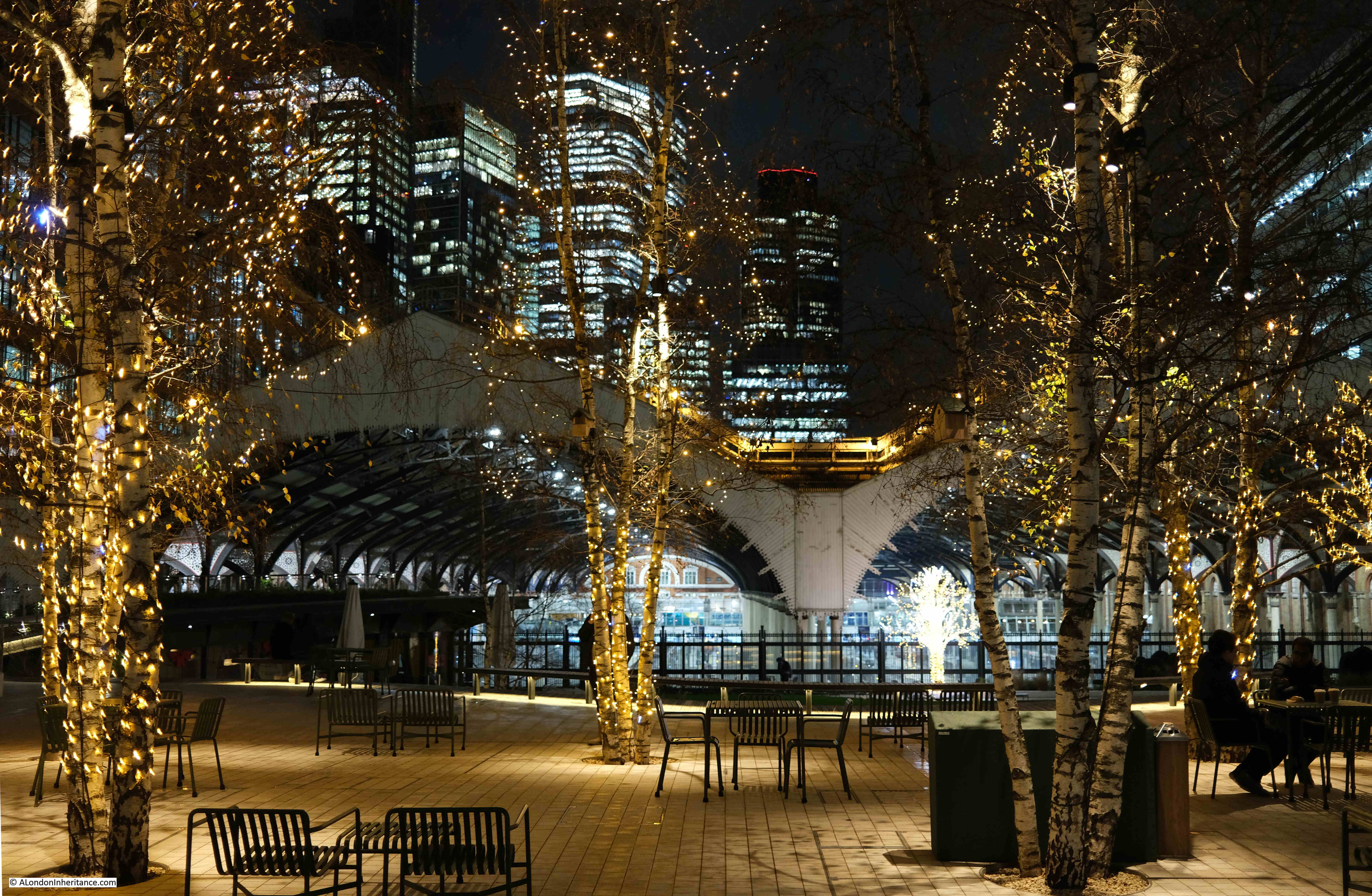
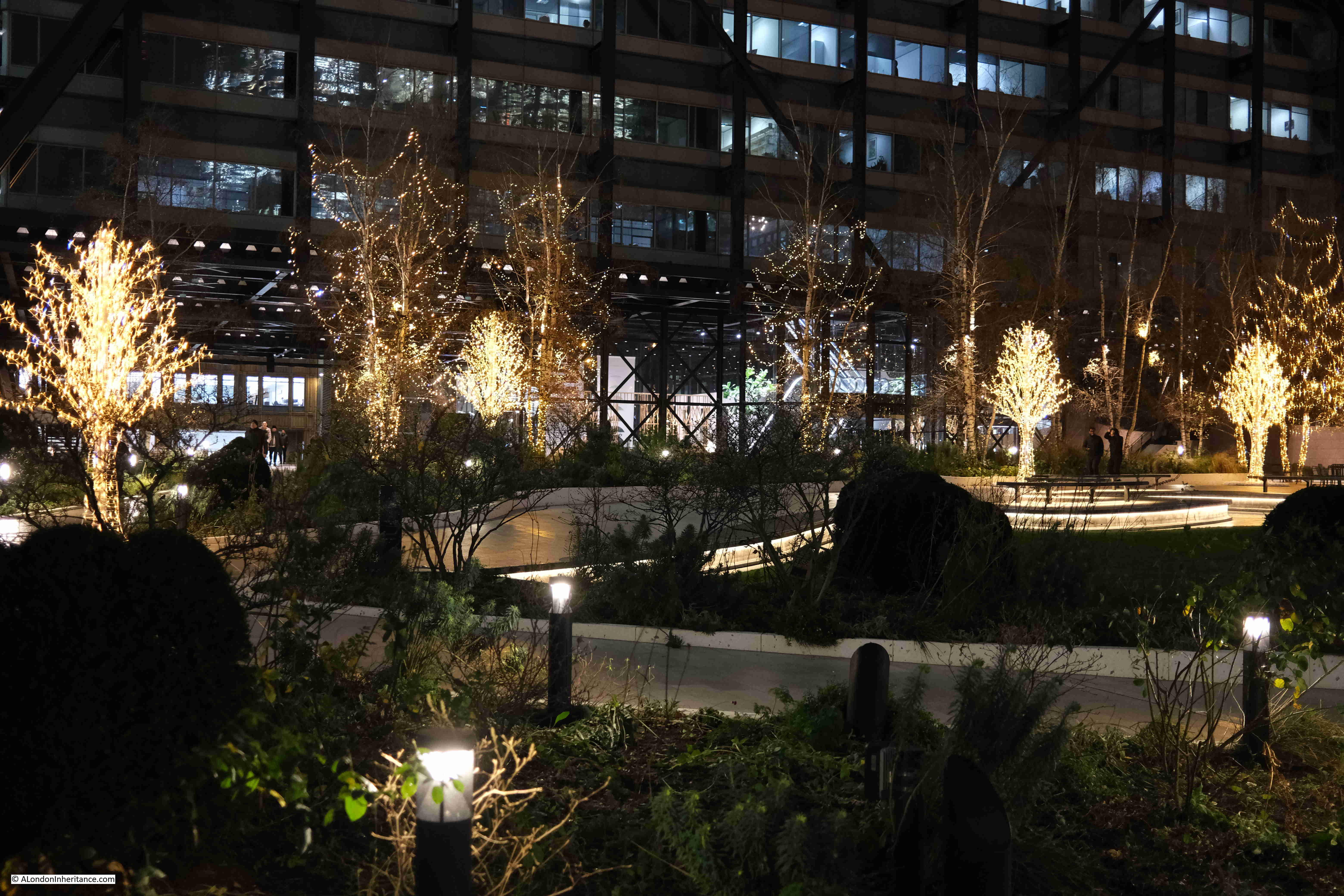
I started at Exchange Square, which is an open space between office blocks at the end of the shed over the platforms of Liverpool Street Station.
The trees in Exchange Square are currently decorated with lights:
The view from this space is good during daylight, but after dark it takes on a very different aspect, with the lights of the square, the station, and the tower blocks behind.
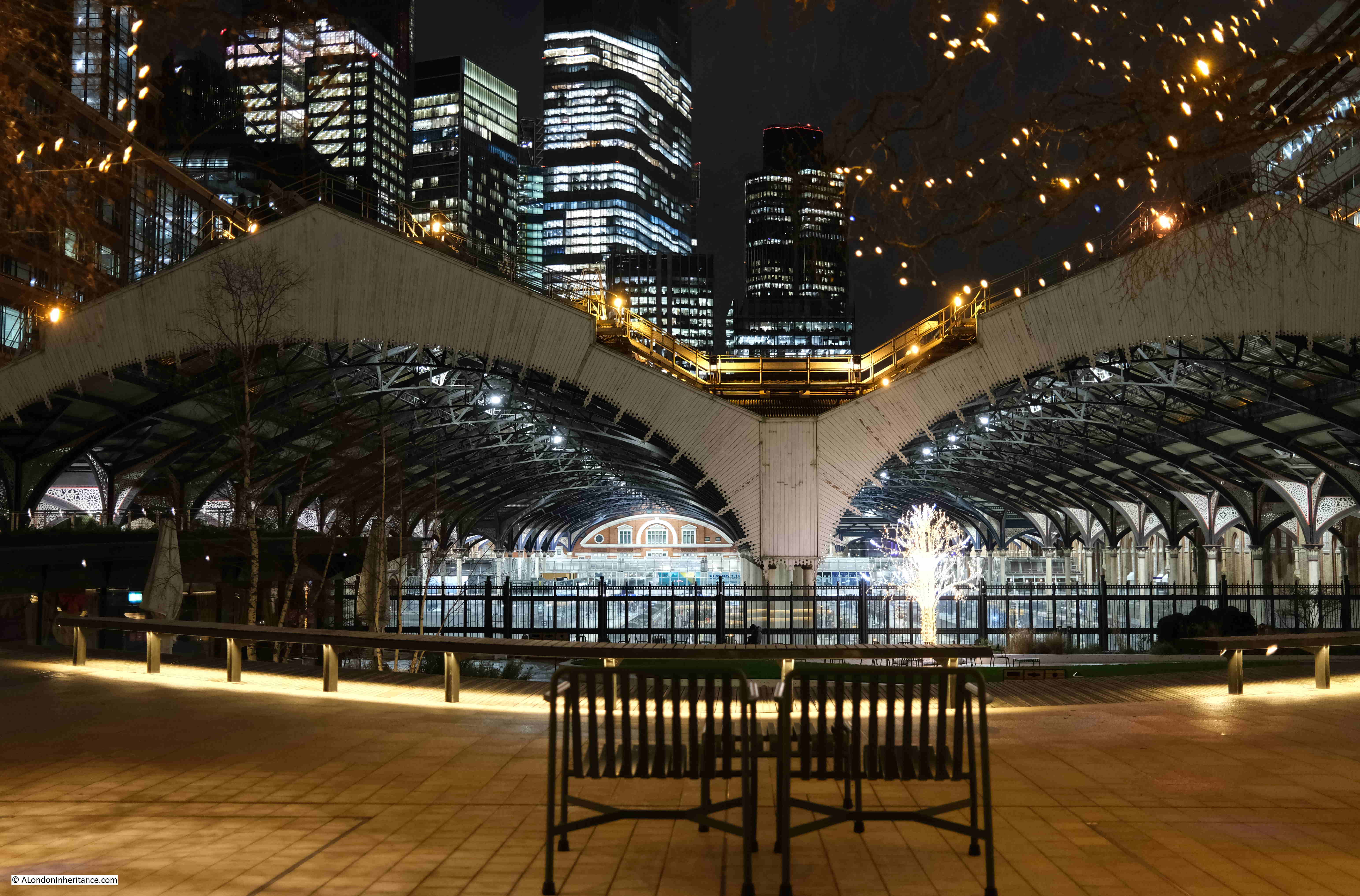
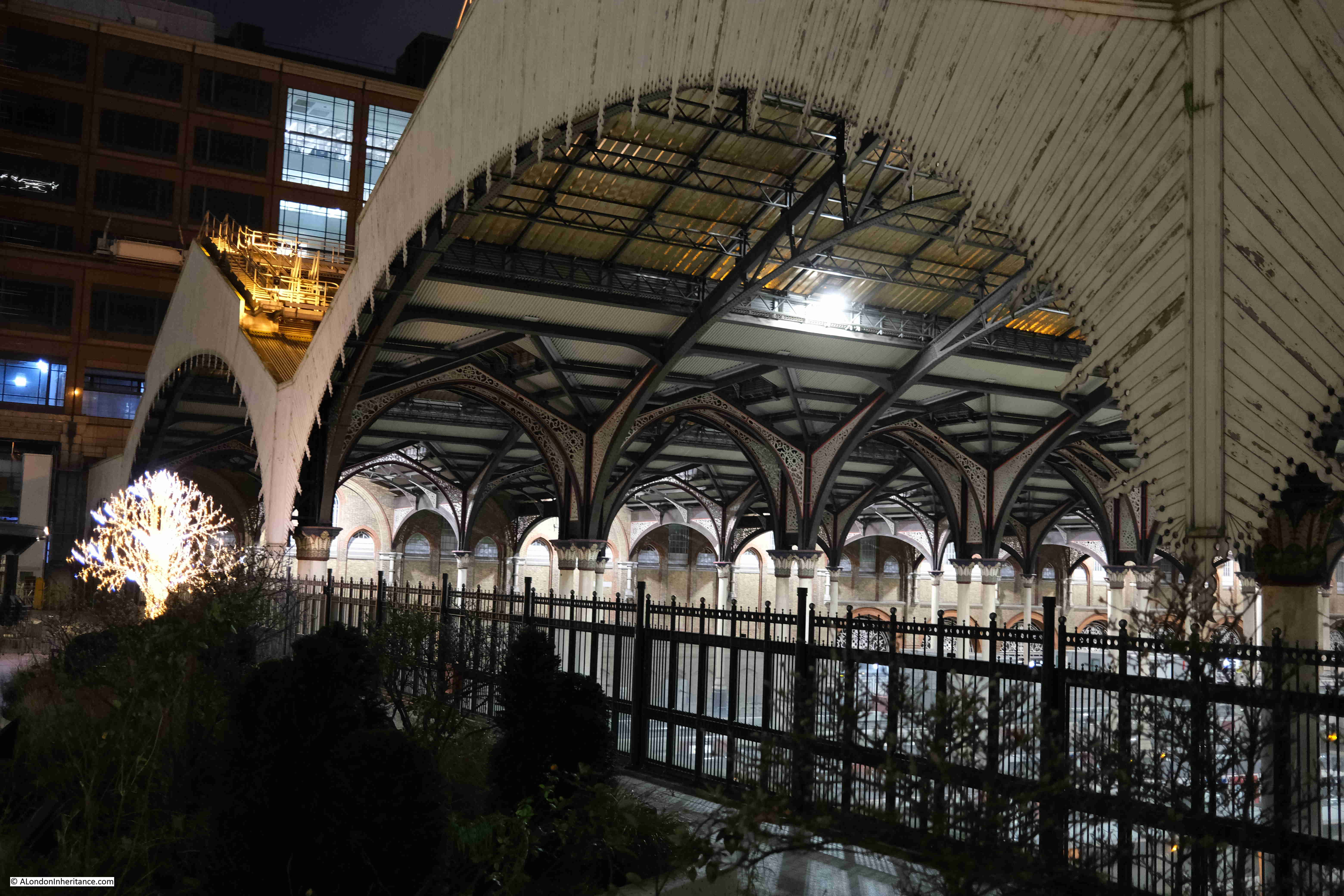
I assume that if the proposed development above Liverpool Street station goes ahead, then the view of the office blocks in the distance will be blocked by the new tower built over the station:
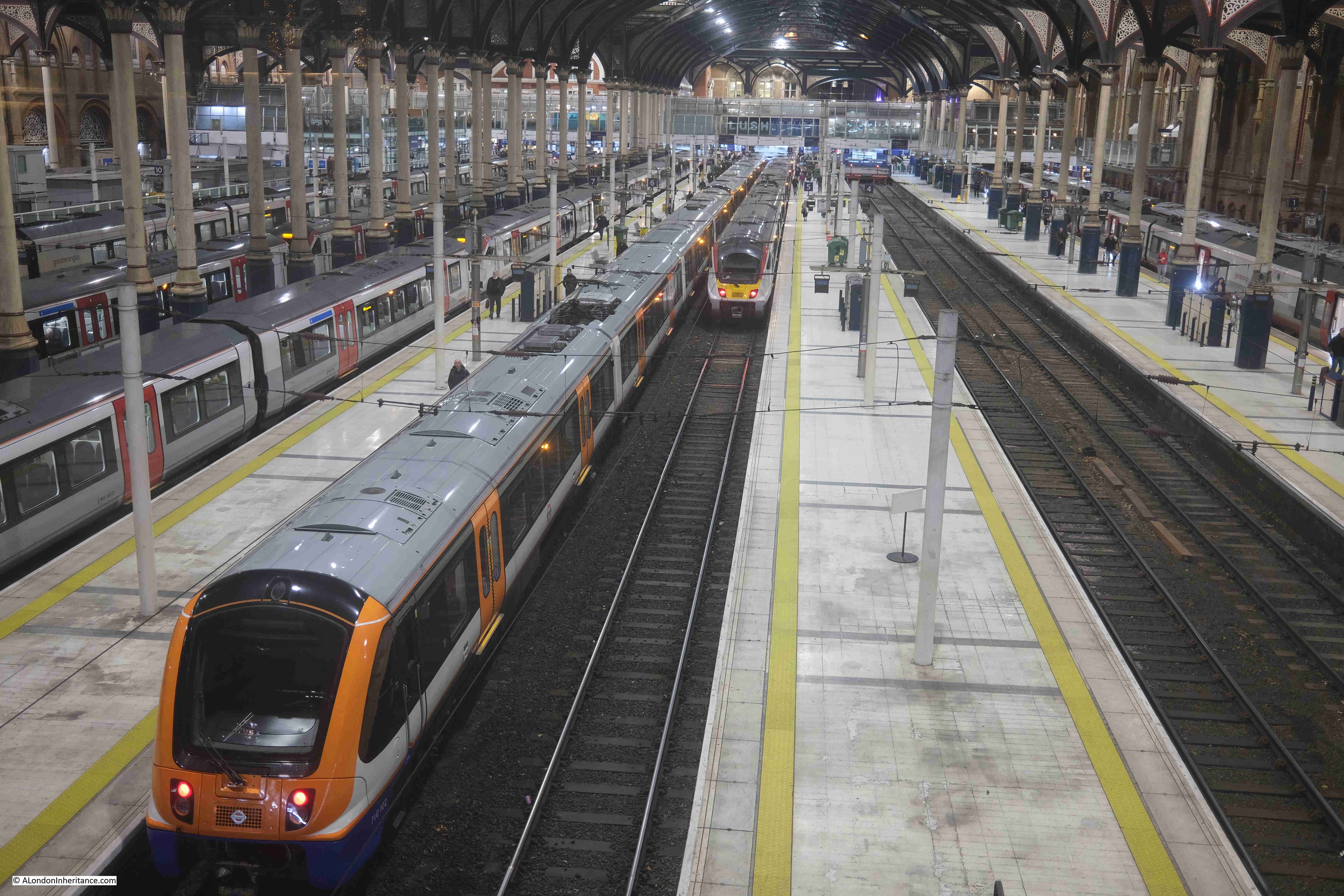
From the fencing between the square and the station, we can look down on the platforms:
Artificial lighting after dark brings out a different level of detail within the roof over the station platforms:
Exchange Square lights:
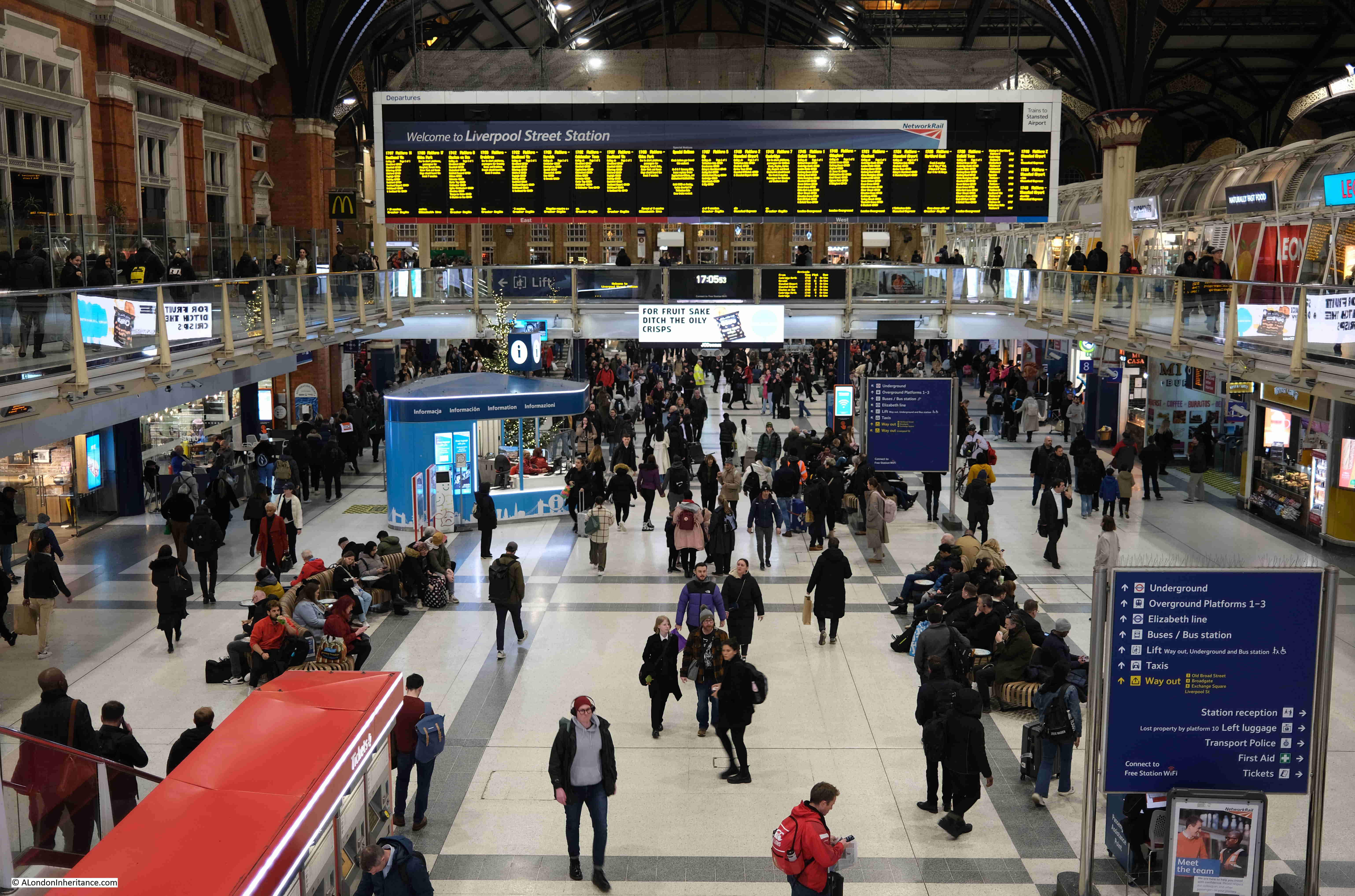
There are plenty of people using the station, but not as busy as on a working day outside of the Christmas / New Year period:
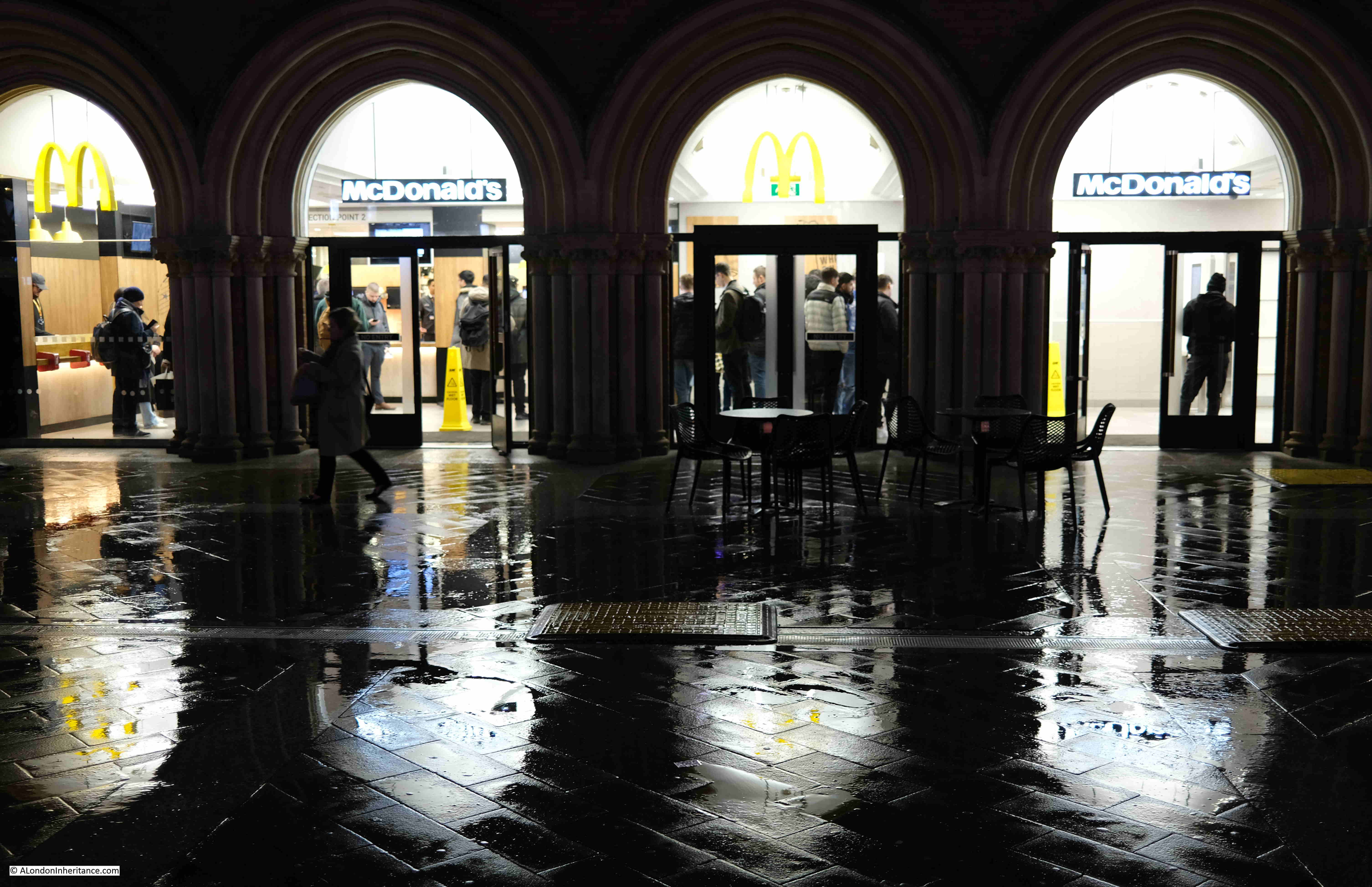
The McDonald’s at the station entrance:
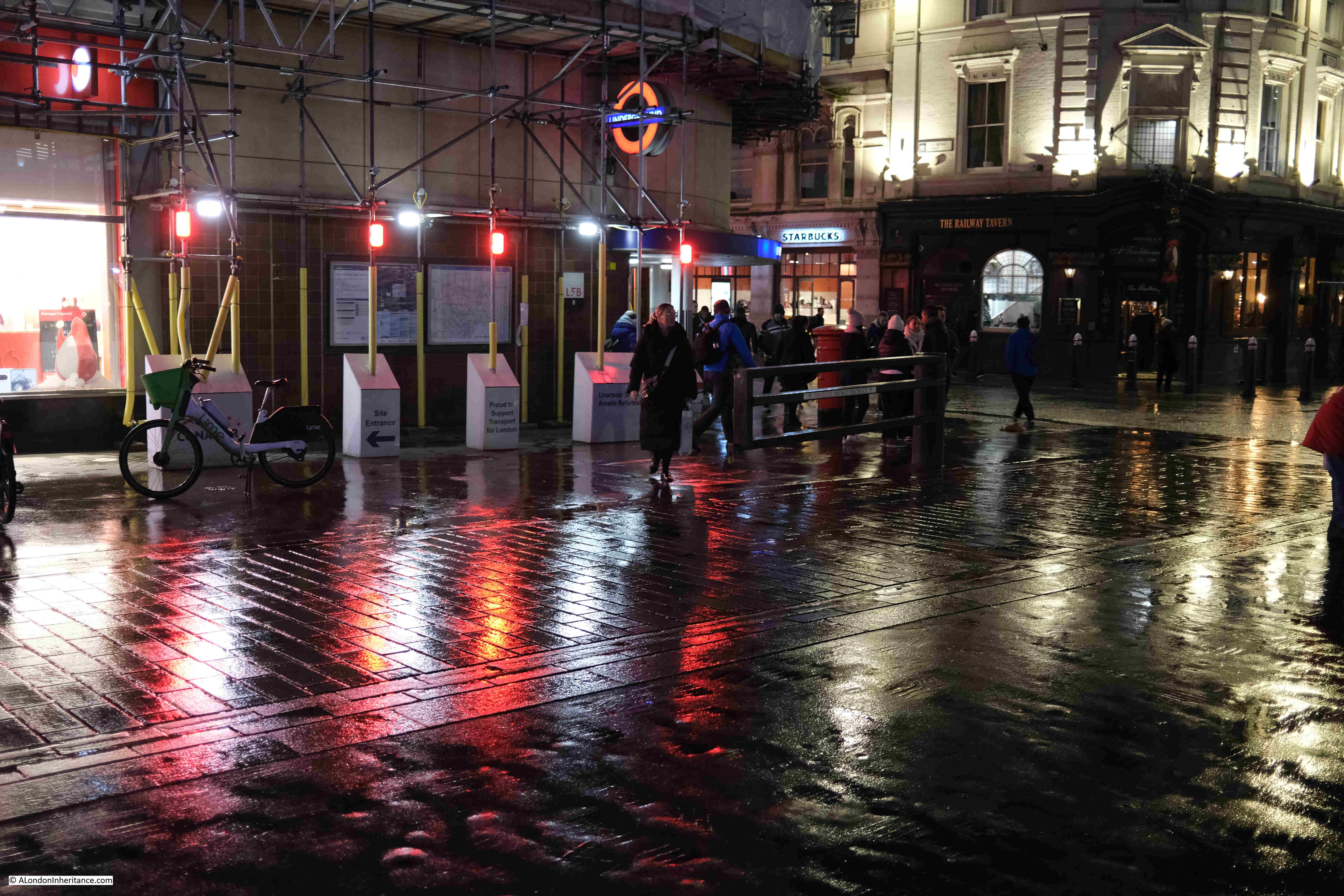
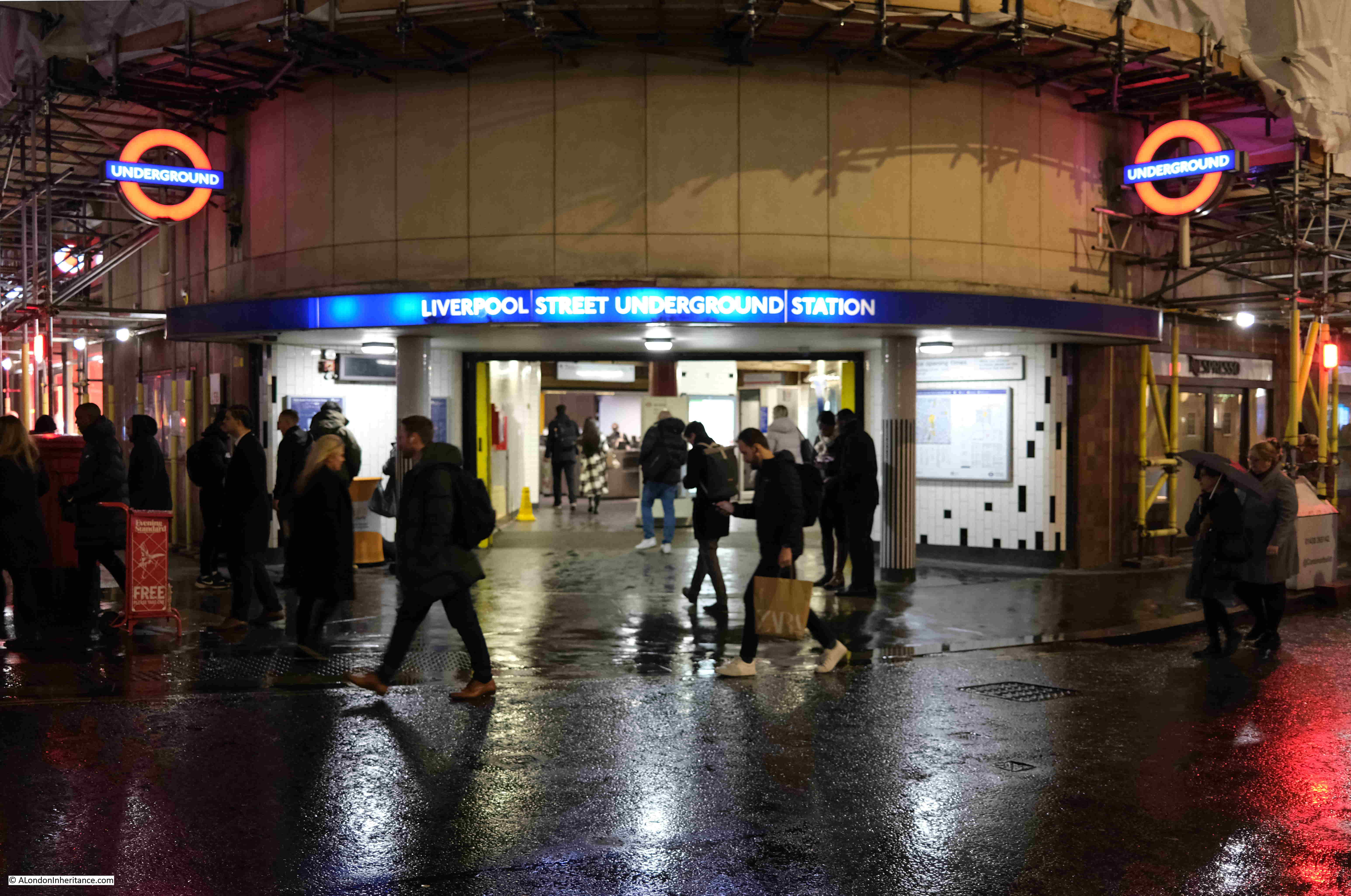
One of the good things about walking while it is raining are the reflections of lights on the surface of the streets, creating pools of colour. This is by one of the entrances to Liverpool Street underground station, with the Railway Tavern at the corner on the right:
Entrance to Liverpool Street Underground Station:
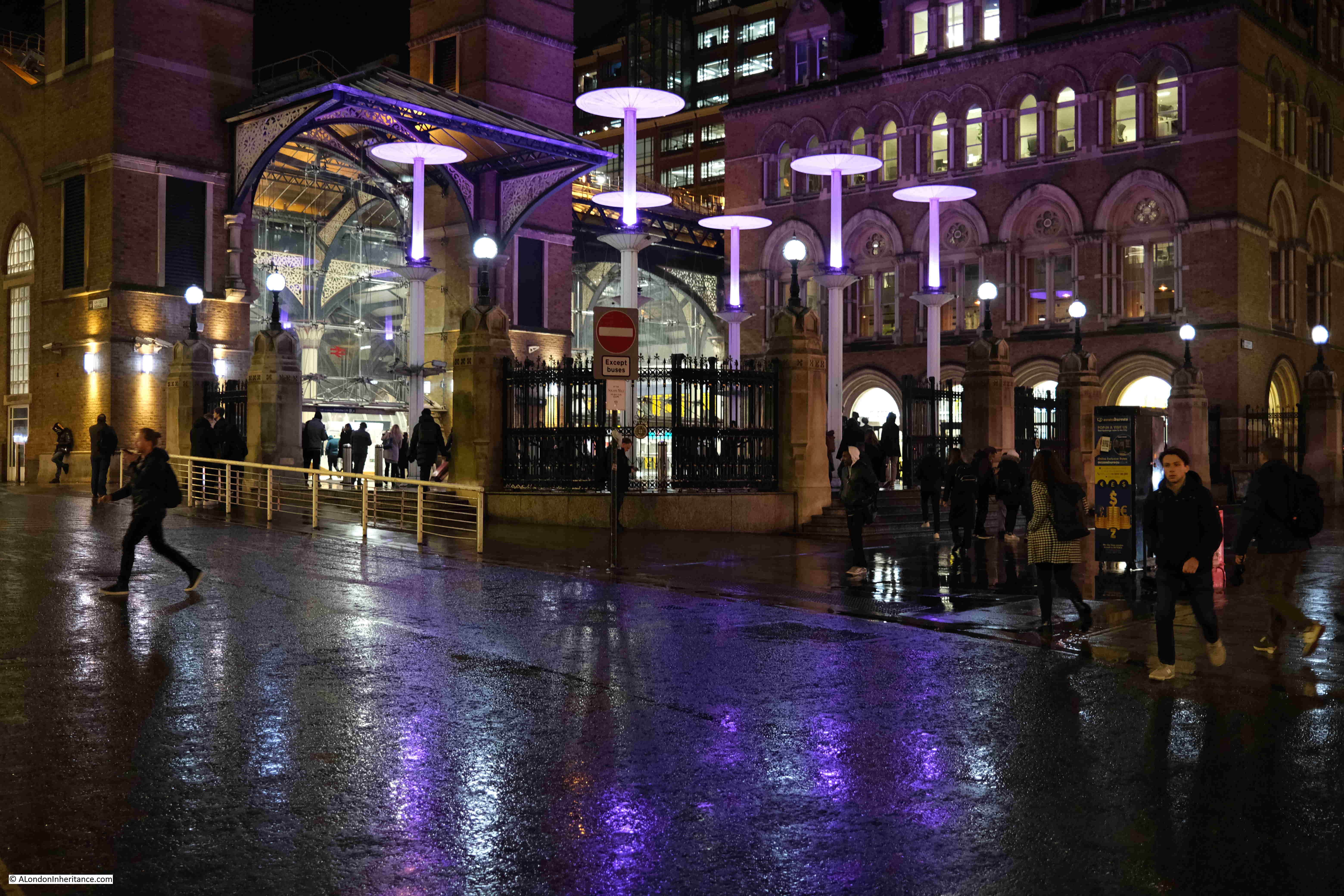
View back to the station entrance, with purple lighting, and the brightly lit interior of the station in the background:
View back towards Liverpool Street Station. The alternative view, if the proposed development goes ahead, can be seen in this pdf. The view does not seem to appear on the projects website, only in the pdf of Exhibition Materials.
Taxis waiting outside the station:
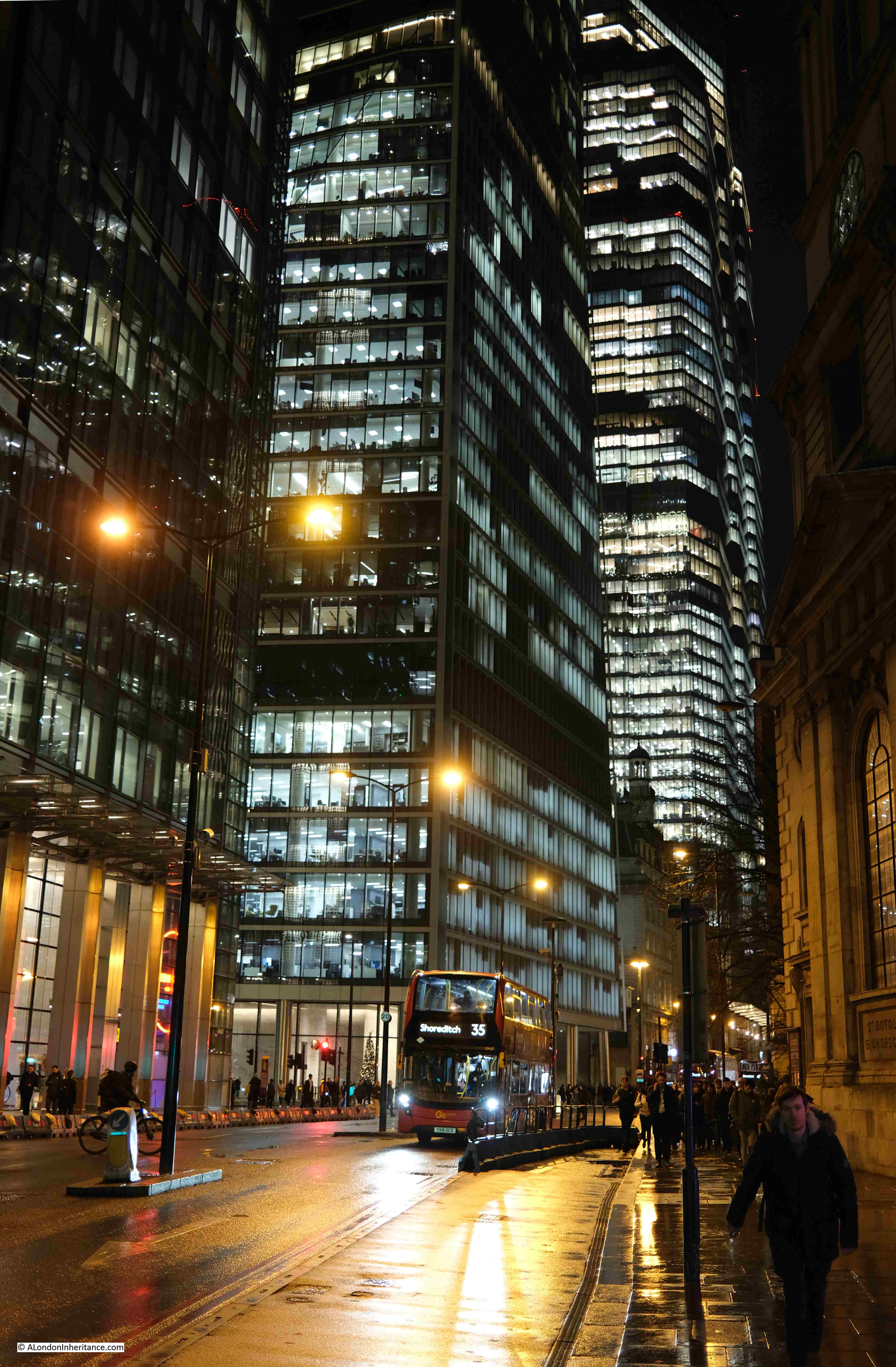
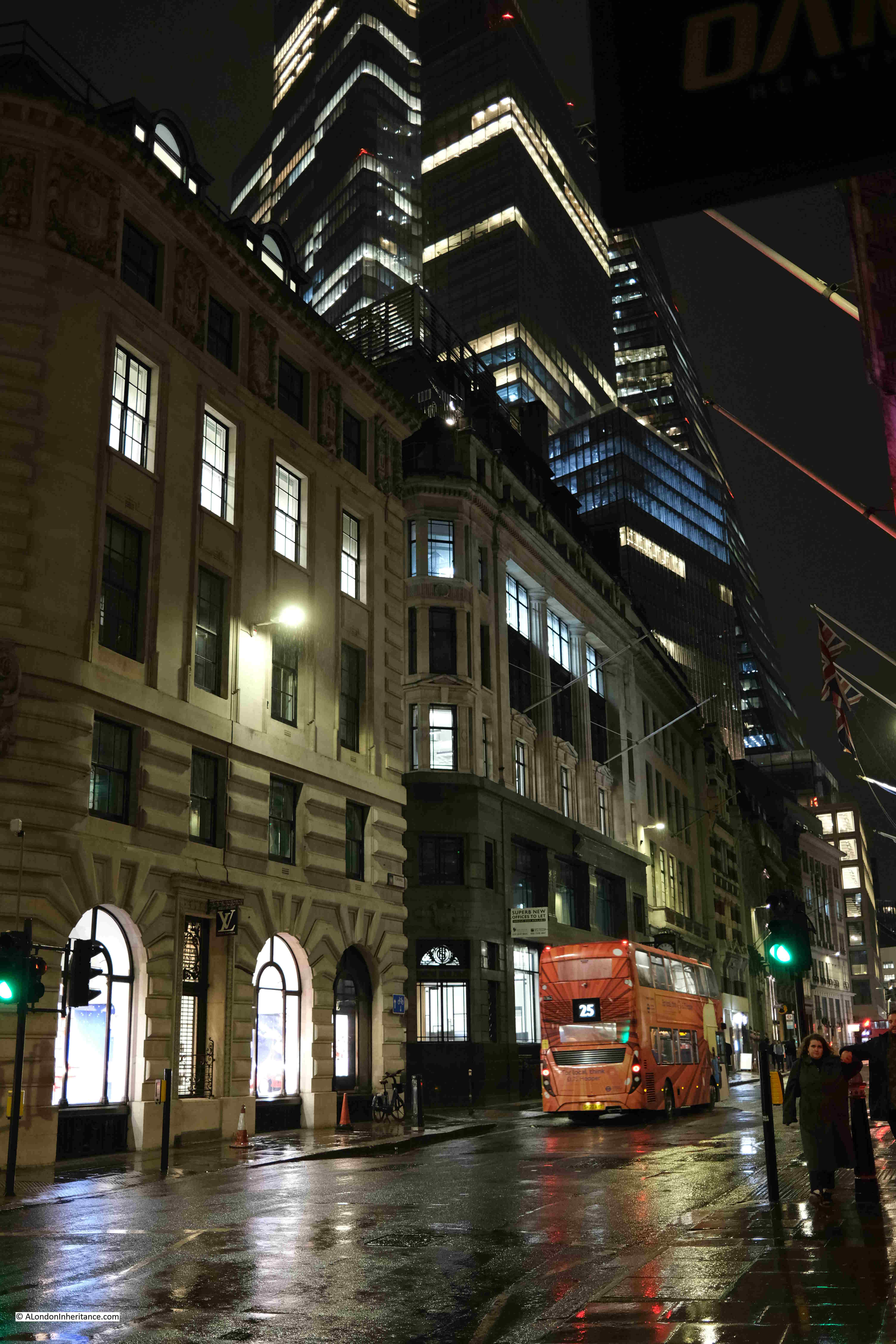
The view along Bishopsgate:
The main streets are much quieter than usual, and the alleys and courts that can be found across the City are dead:
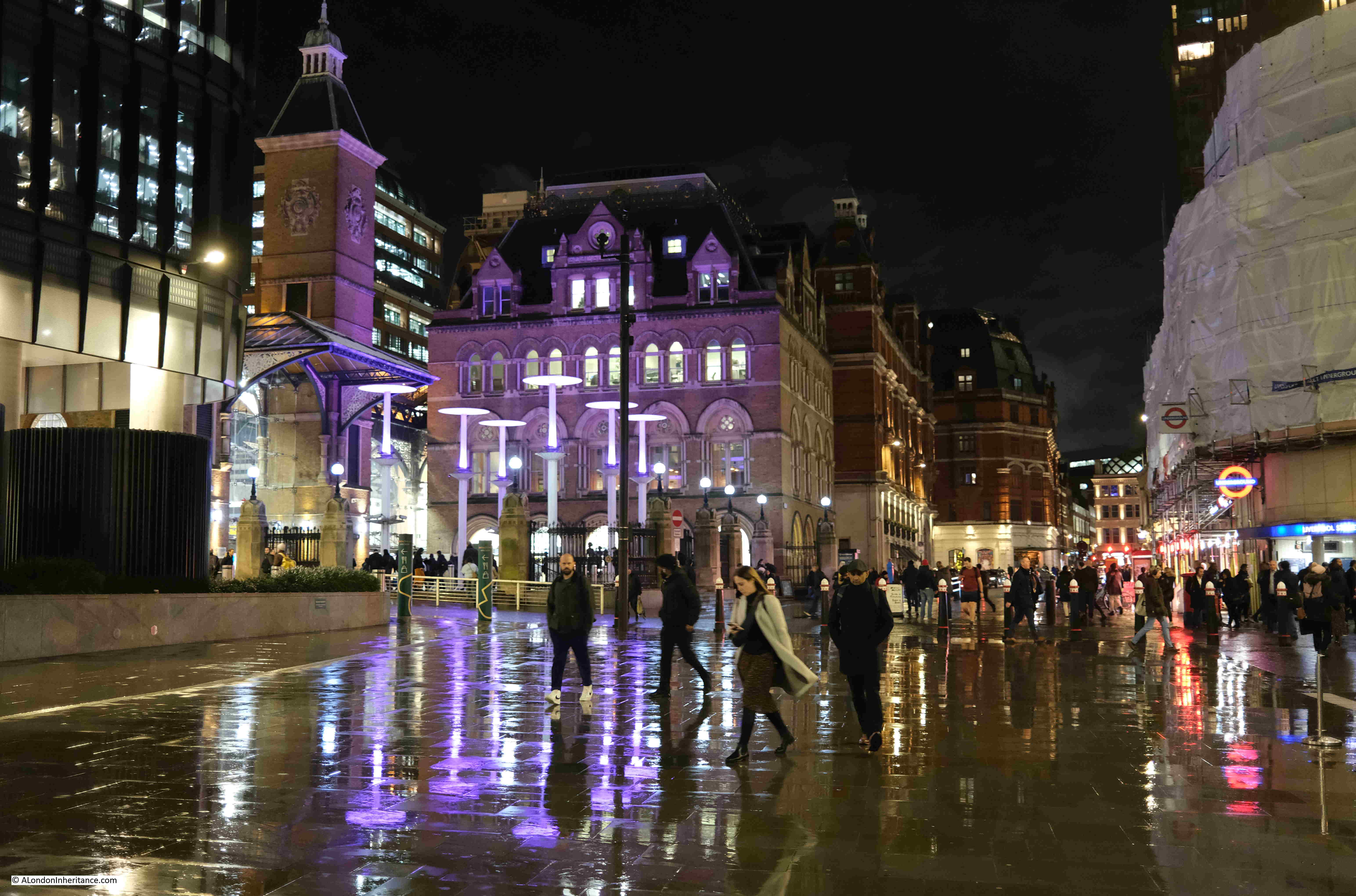
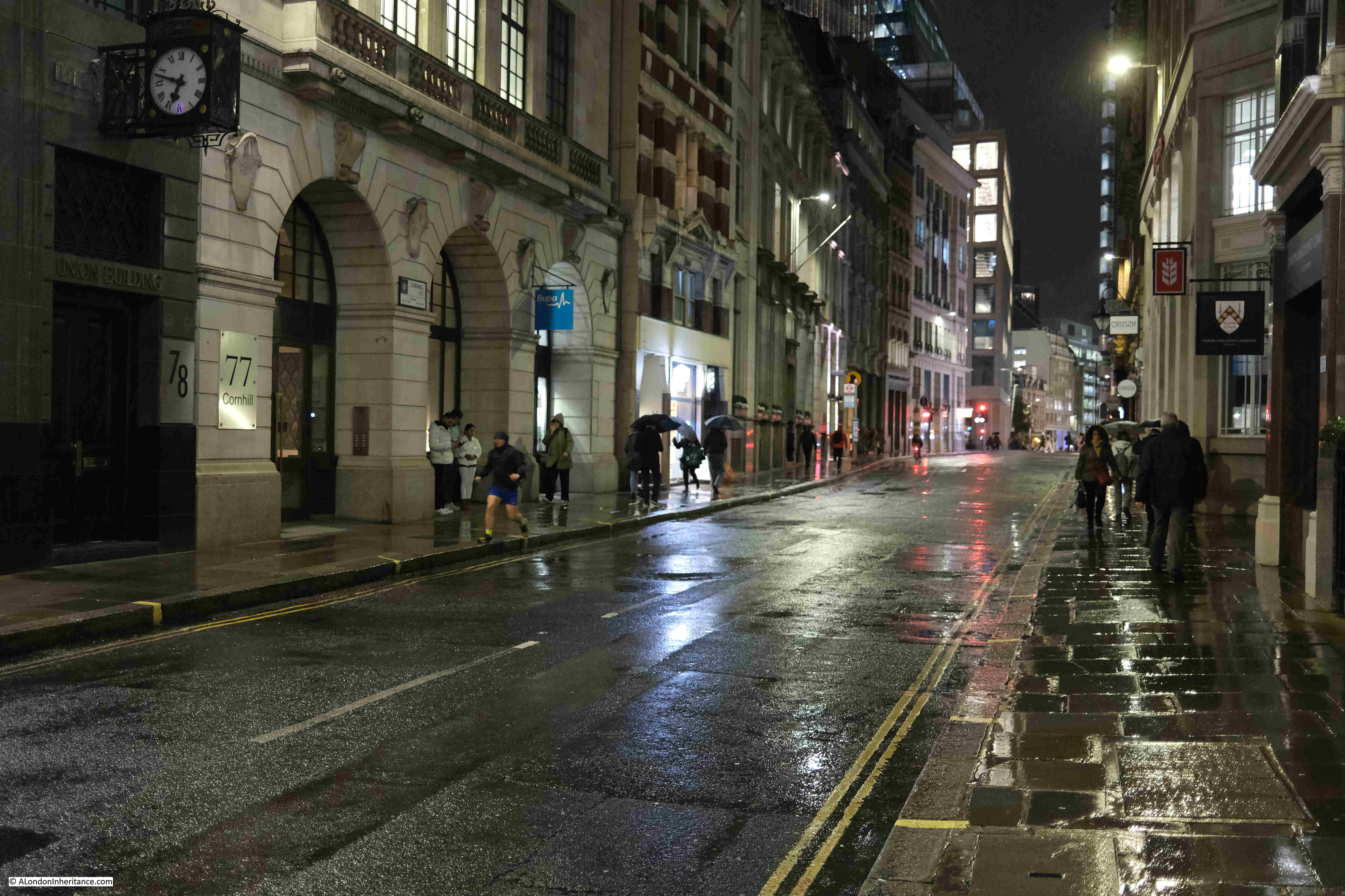
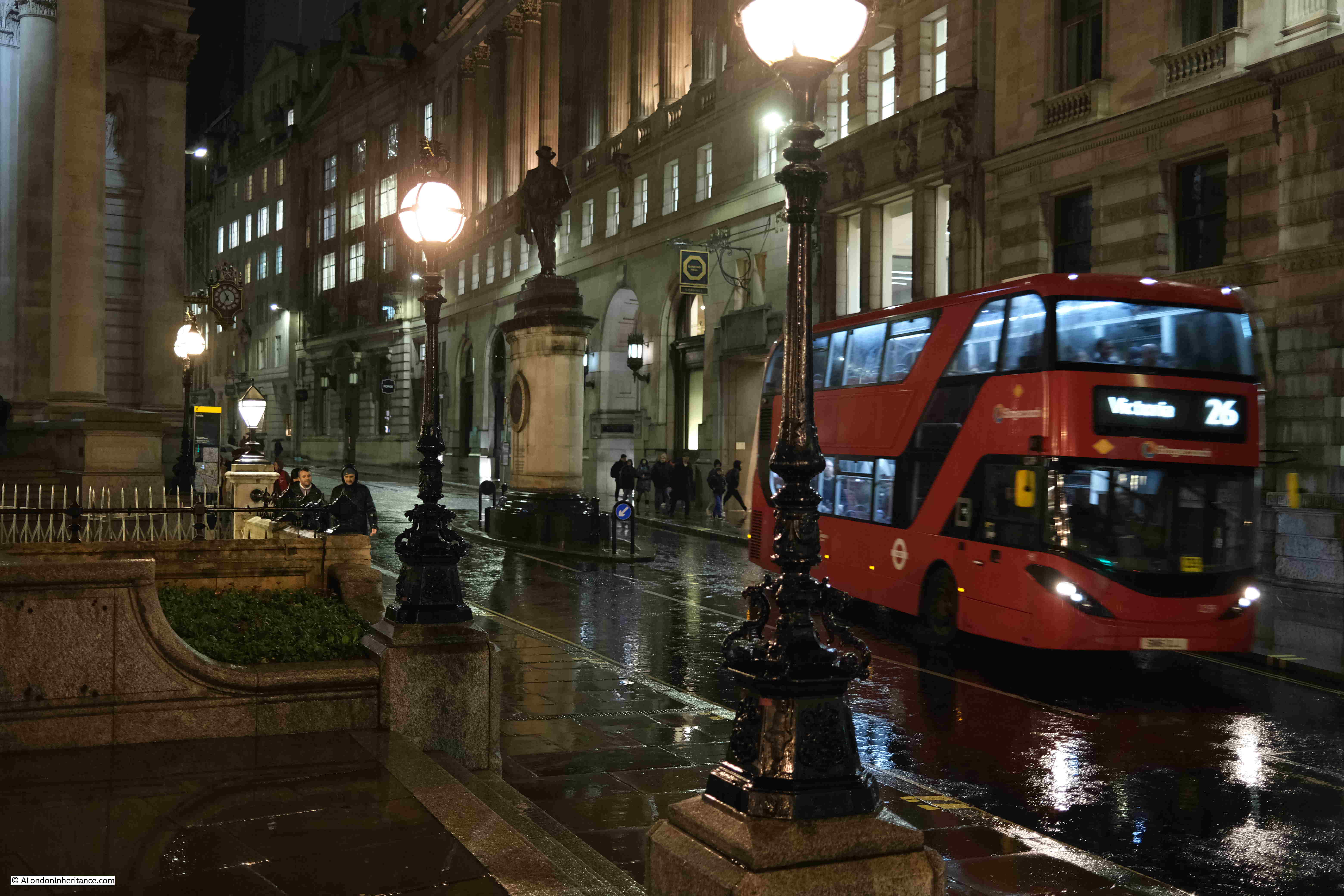
Cornhill looking west towards the Bank junction, with St. Paul’s Cathedral just visible in the distance:
At the rear of the Royal Exchange:
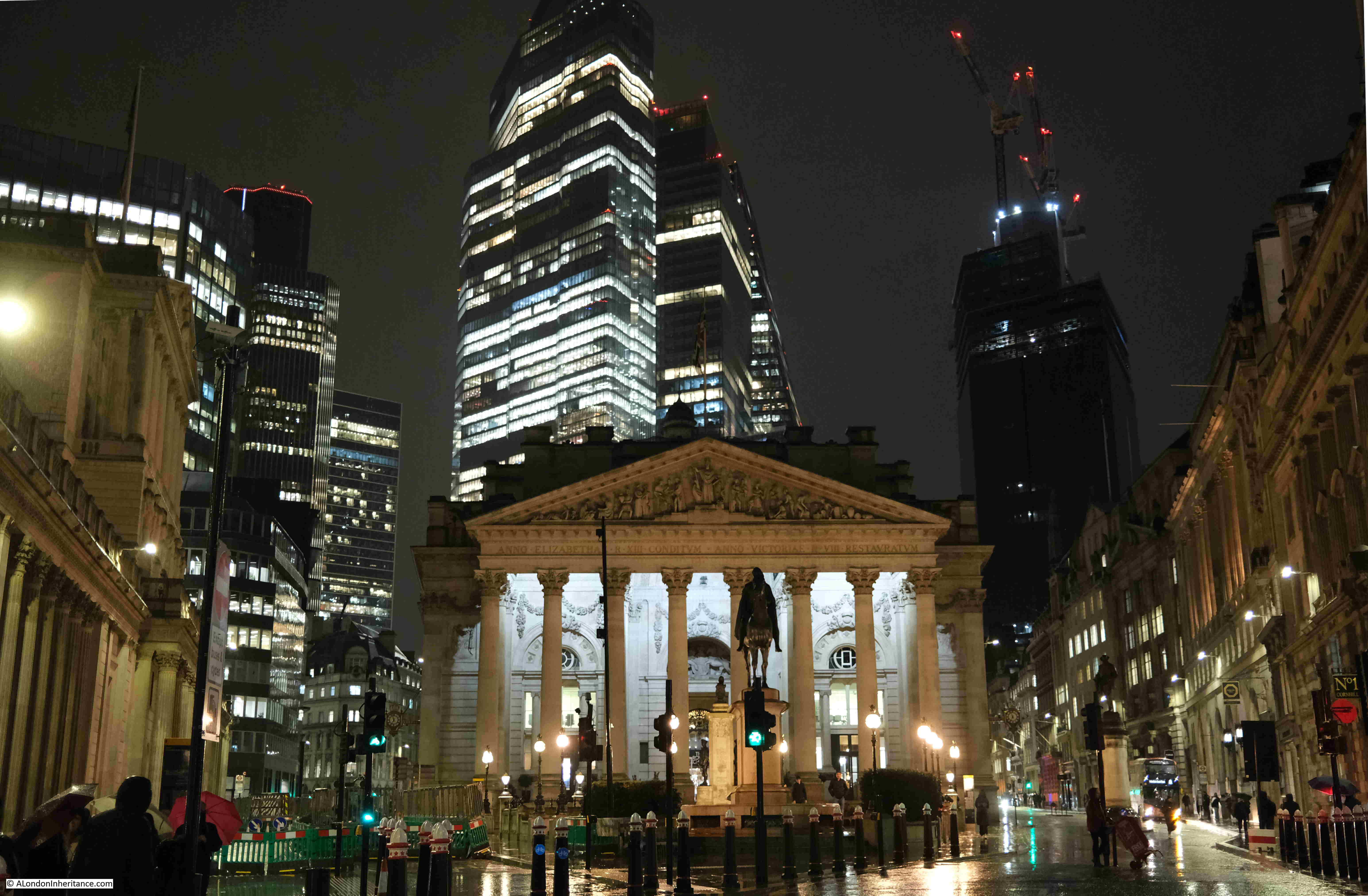
The towers of the City above the “relatively” low rise buildings around the Bank:
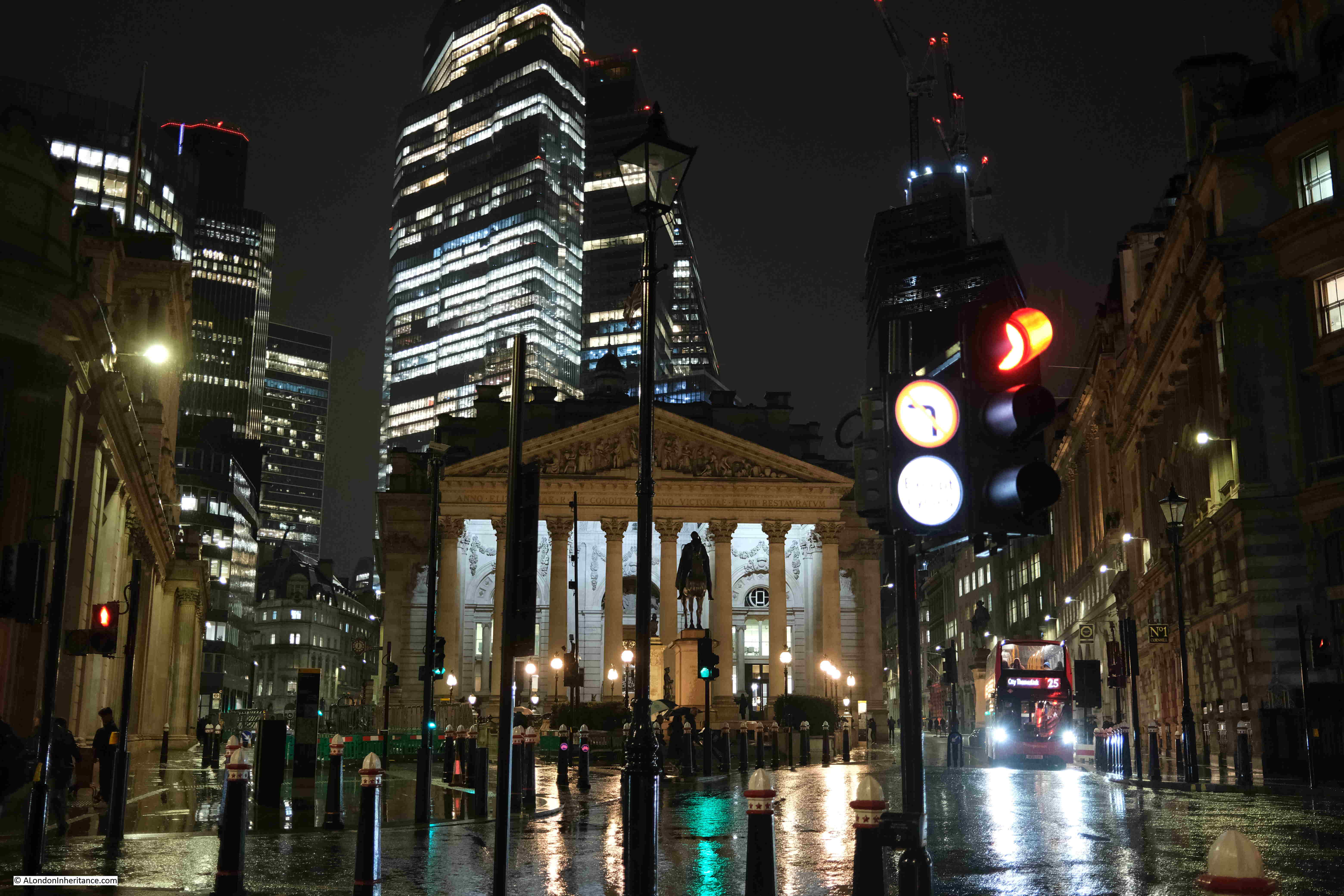
At the Bank junction, in front of the Royal Exchange looking along Cornhill, and the rain was getting heavier:
The Royal Exchange with the towers of the City:
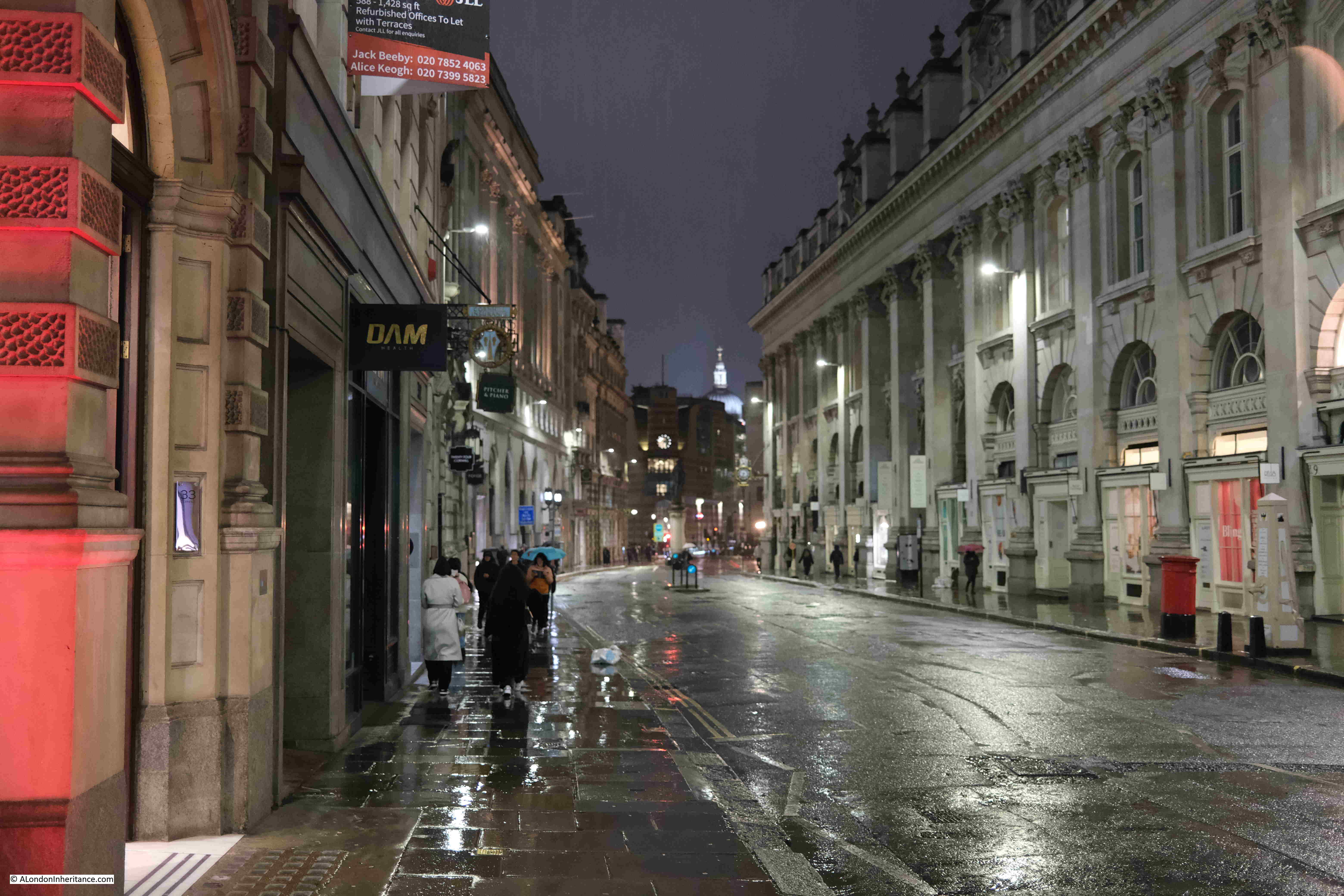
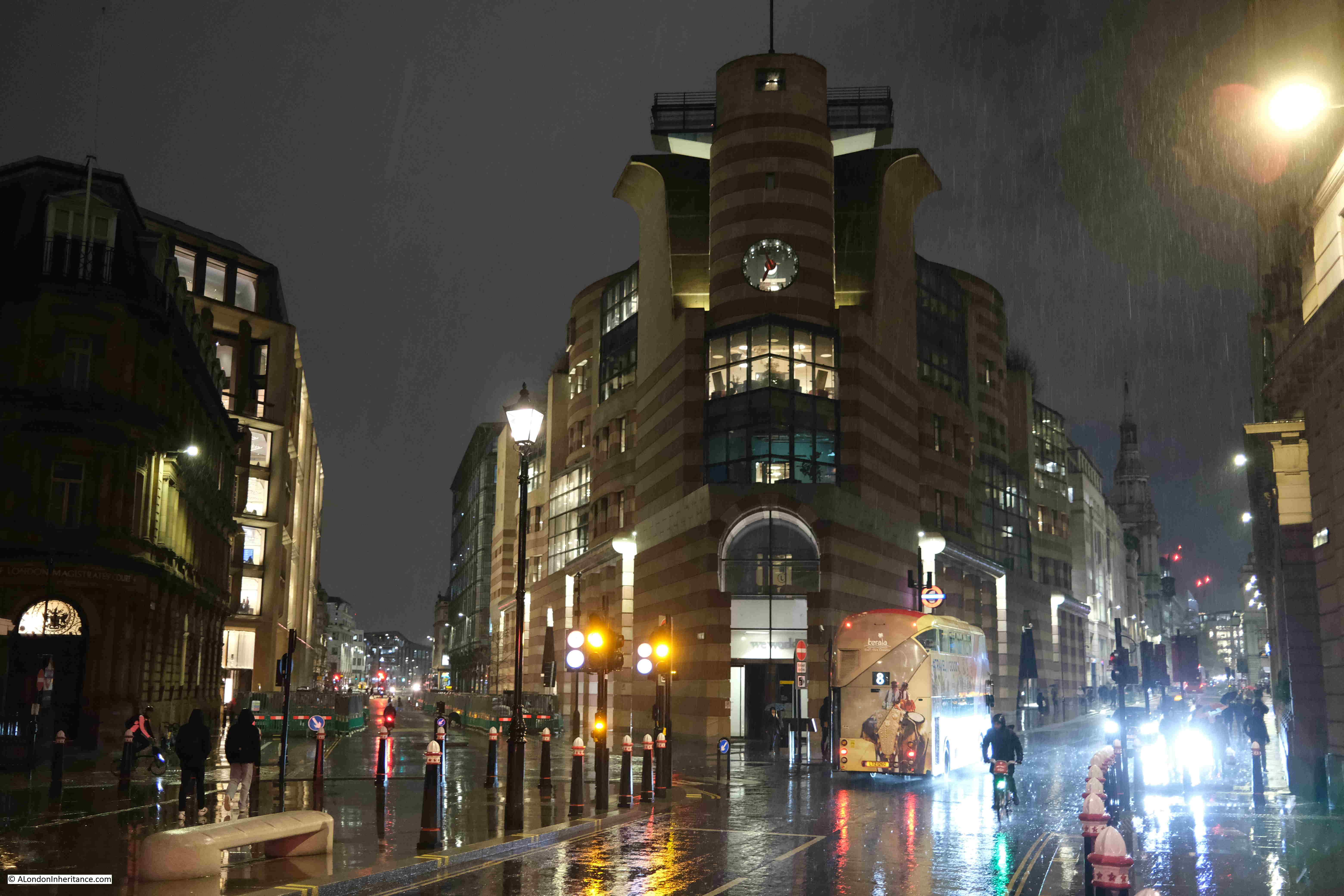
Looking down Lombard Street:
No. 1 Poultry, between Poultry (right) and Queen Victoria Street (left):
A final look back towards the east of the City:
The rain was very heavy by the time I reached the Bank, and as water and the electronics in a camera do not mix that well, I joined the few remaining commuters walking into the Bank station to head home.
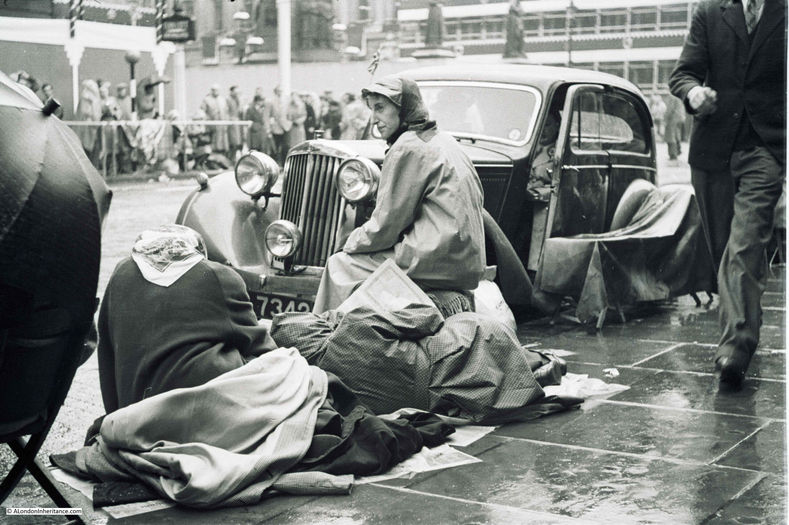
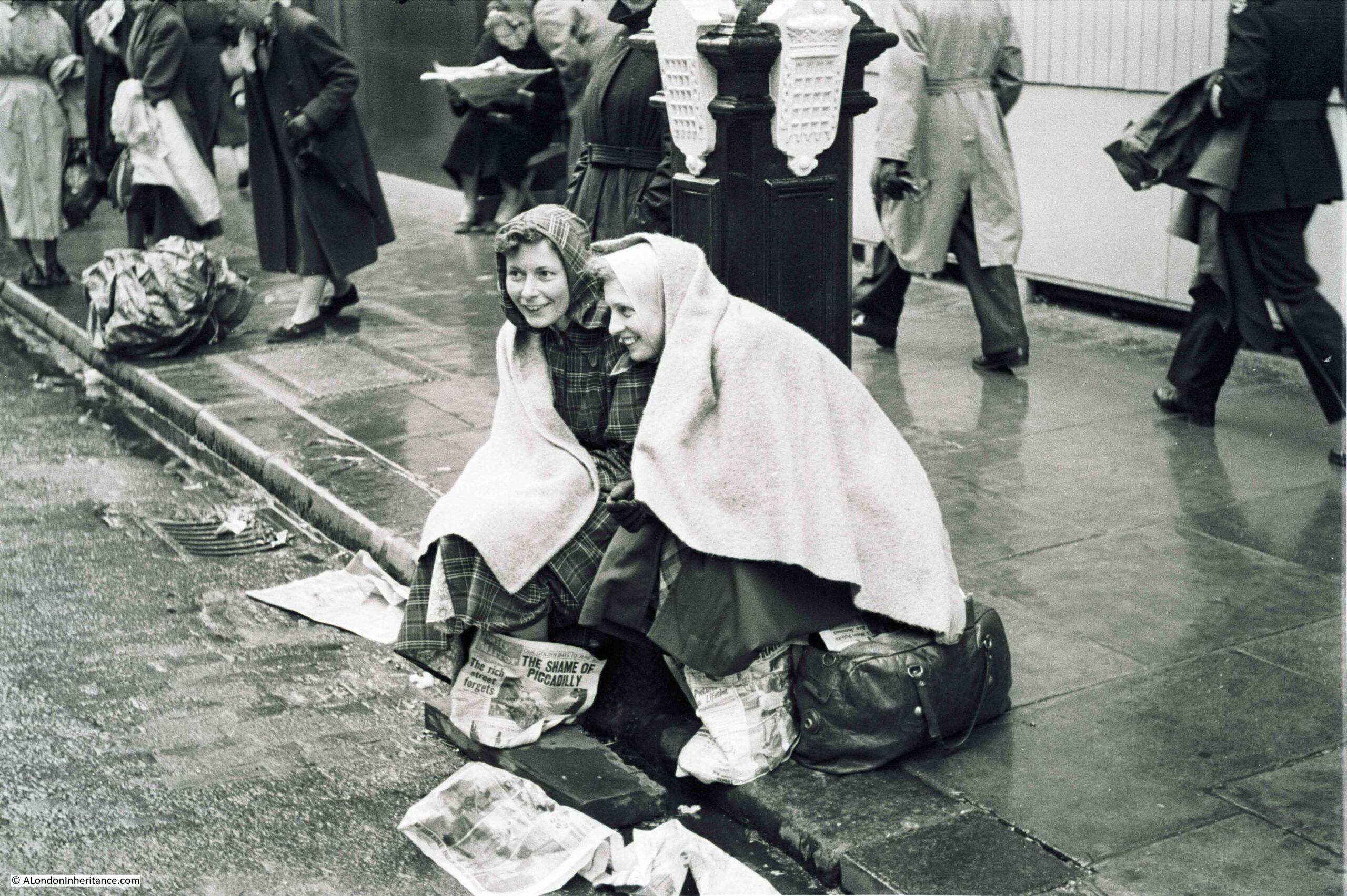
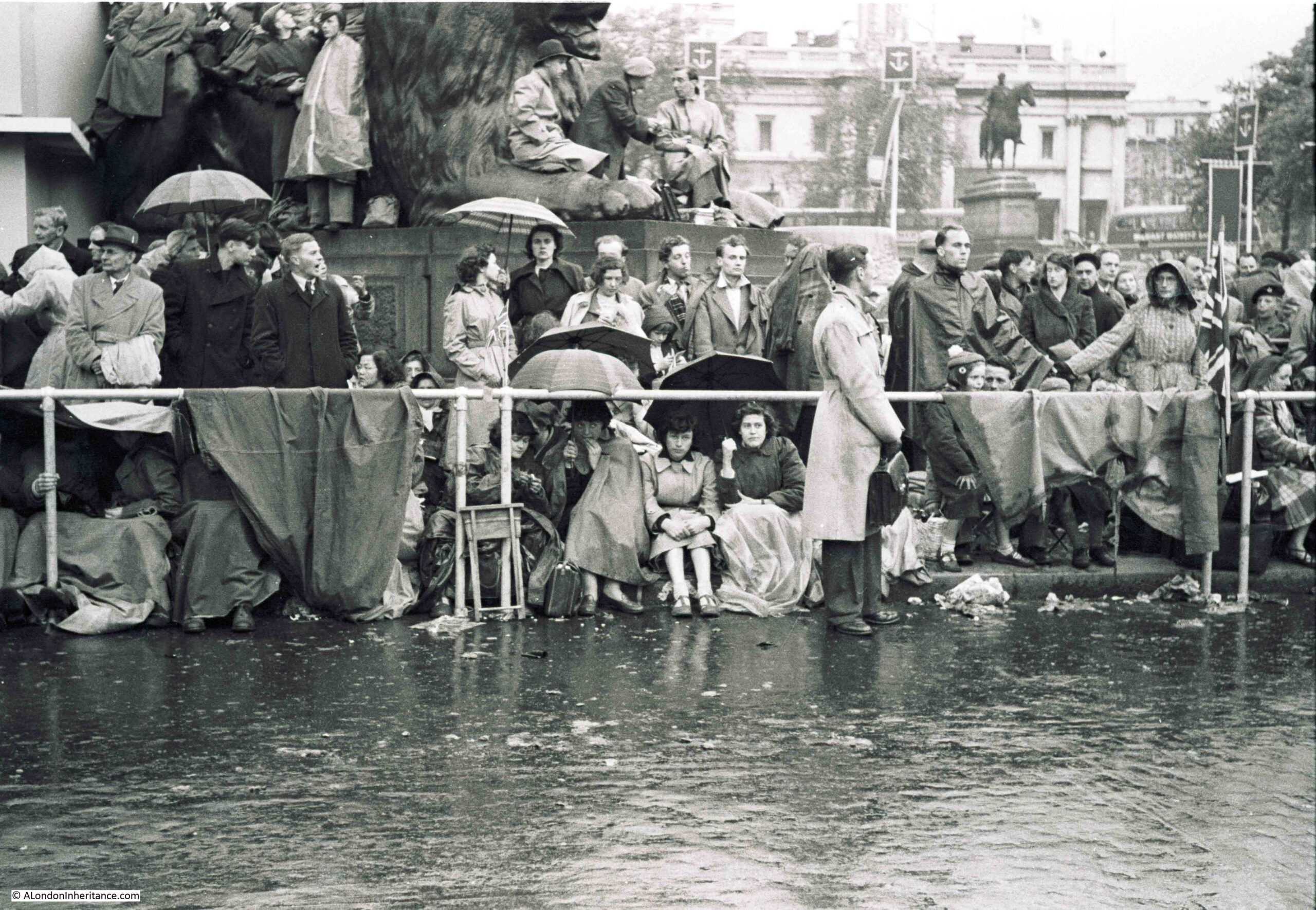
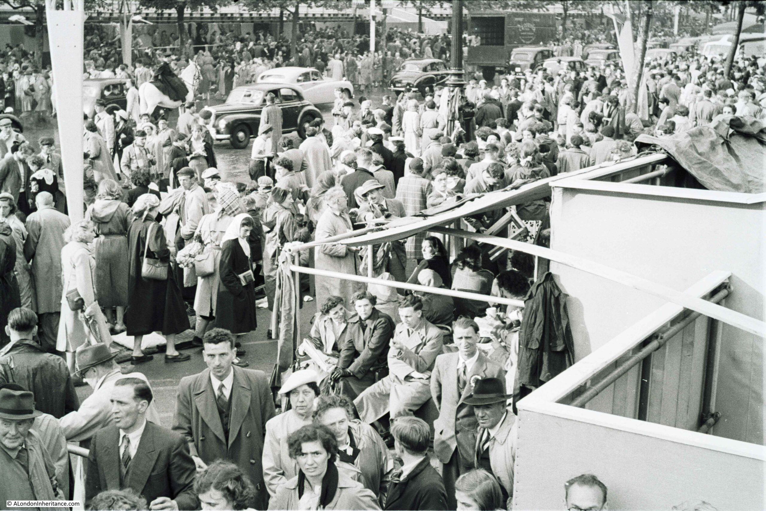
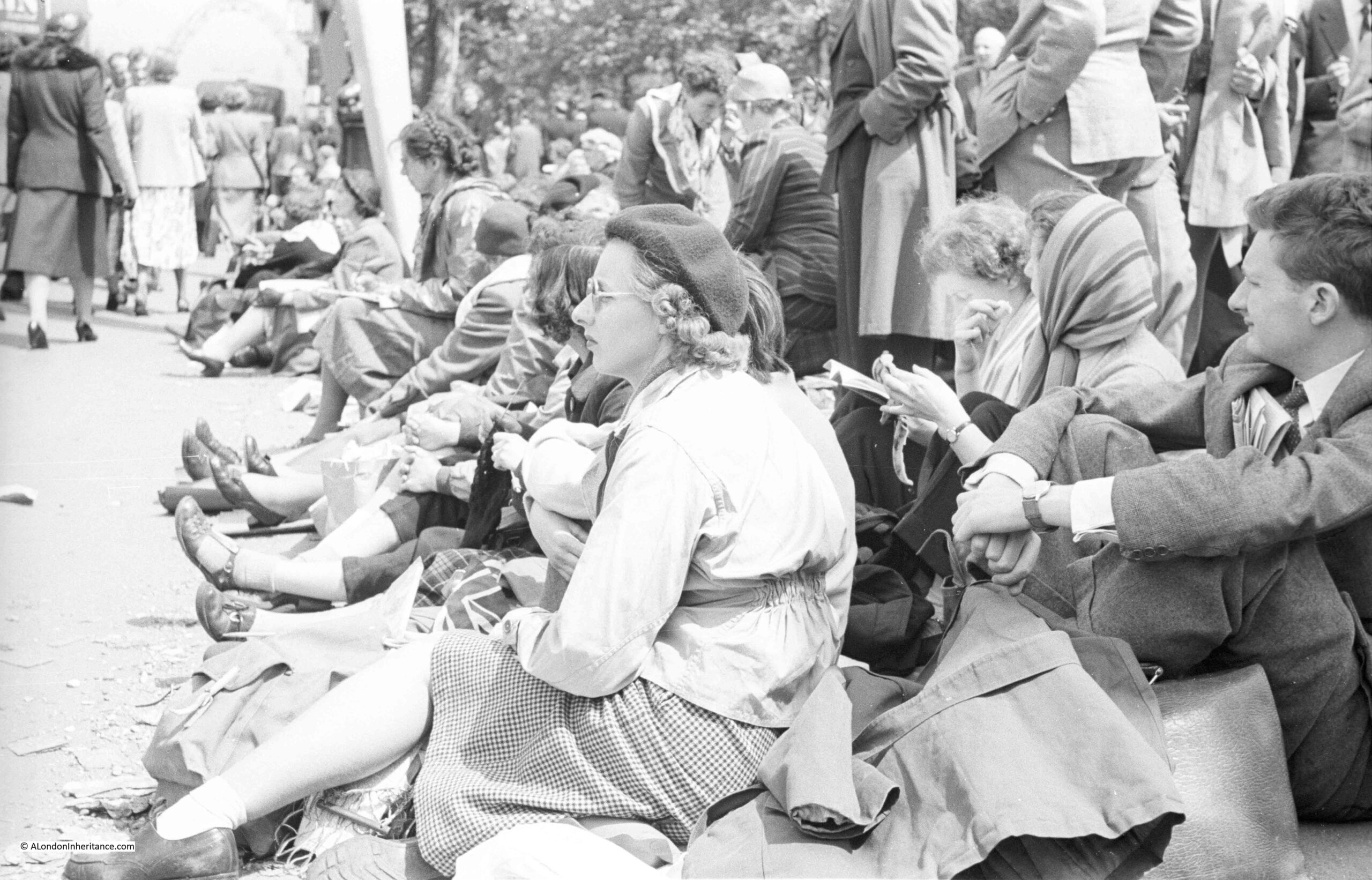
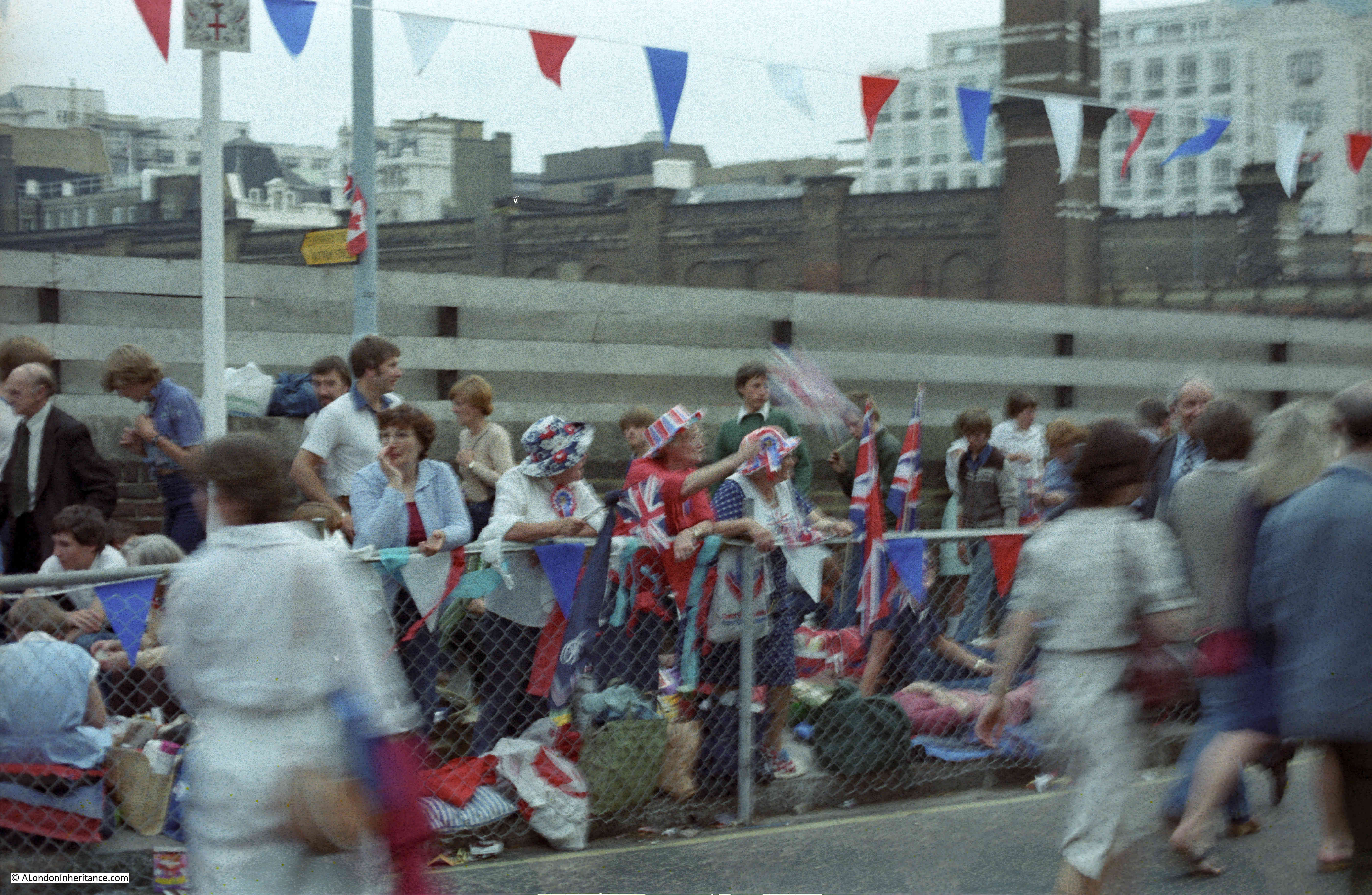
The Festival of Britain – Land Travelling Exhibition
If you have followed the blog for a few years, you will know that I am really interested in the Festival of Britain. The primary site for the festival in 1951, was on the Southbank, in the area between County Hall and Waterloo Bridge.
There were though festival sites all across the country, as the intention was for the country to be involved, not just a London centric festival.
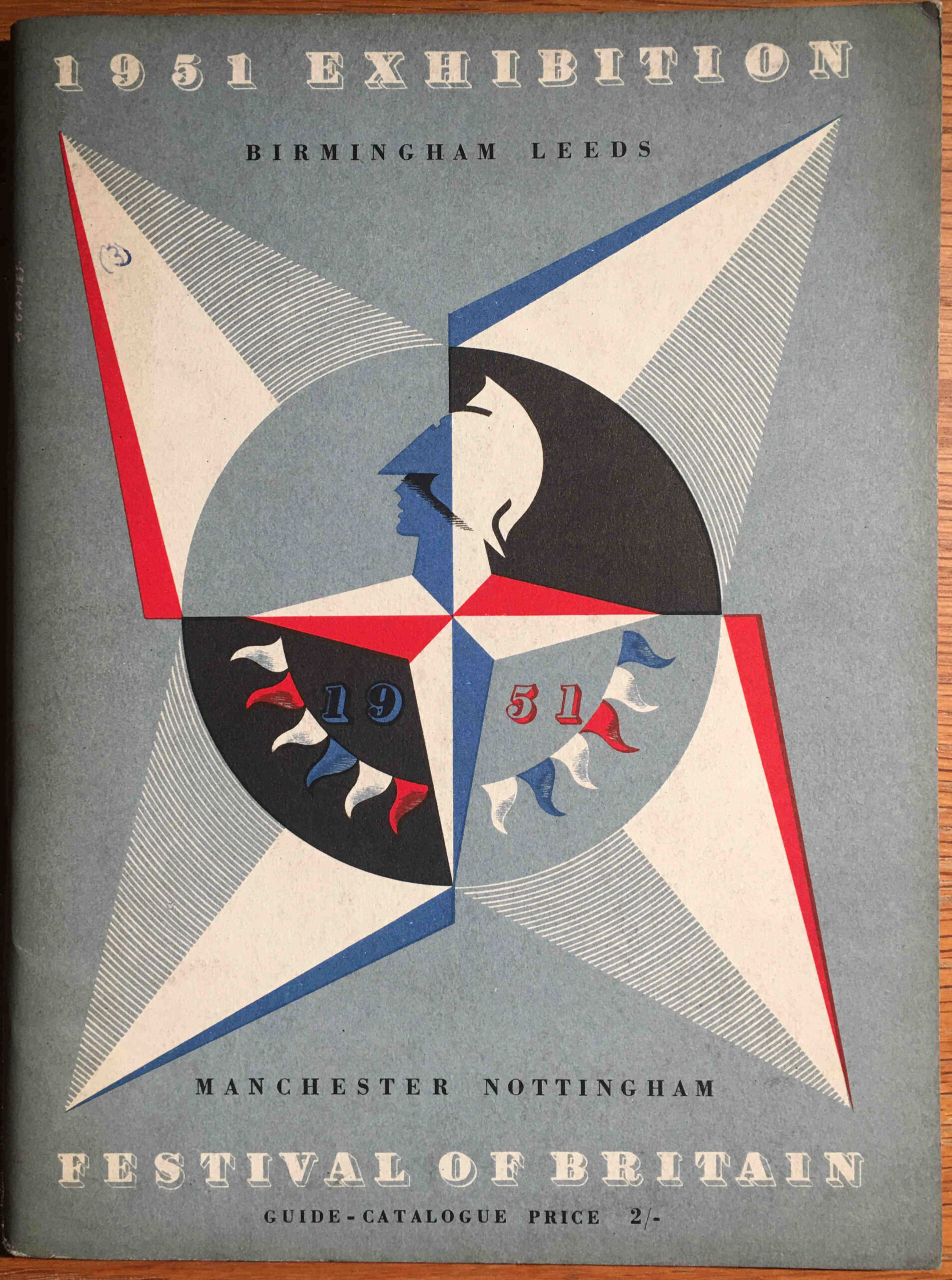
Each of the main festival exhibitions had their own festival guide book. All were based on the same format and design as the Southbank festival site, but with a different colour to the cover page where the Abram Games famous festival emblem featured.
I have been trying to collect all the festival guide books for some years, and I recently got hold of a copy of the guide book for the travelling element of the 1951 exhibition:
This guide book covered the land travelling exhibition, which visited Birmingham, Leeds, Manchester and Nottingham. As the land travelling exhibition, this would reach major inland cities, where the exhibition on an old aircraft carrier covered major coastal locations (link to this at the end of the post).
The introduction provides the background to the travelling exhibition:
“The Festival Exhibition is visiting four of our major inland centres of industry: Manchester, Leeds, Birmingham and Nottingham. It is therefore appropriate that the main theme of this Exhibition should be the British people and the things they make and use: our past and present achievements in technology and industrial design, and how these provide us to day with manifold opportunities to enrich our daily lives.
The things that will be seen in this Exhibition are not ordinary, average products, but some of the best things that this country is producing at the present time. They are things that we can be proud of, that can inspire and fill us with confidence in the future; and they are a challenge to British industry to emulate the achievements shown here.”
For a travelling exhibition, this was a complex undertaking with thousands of display items grouped into sections as the visitor walked through the exhibition.
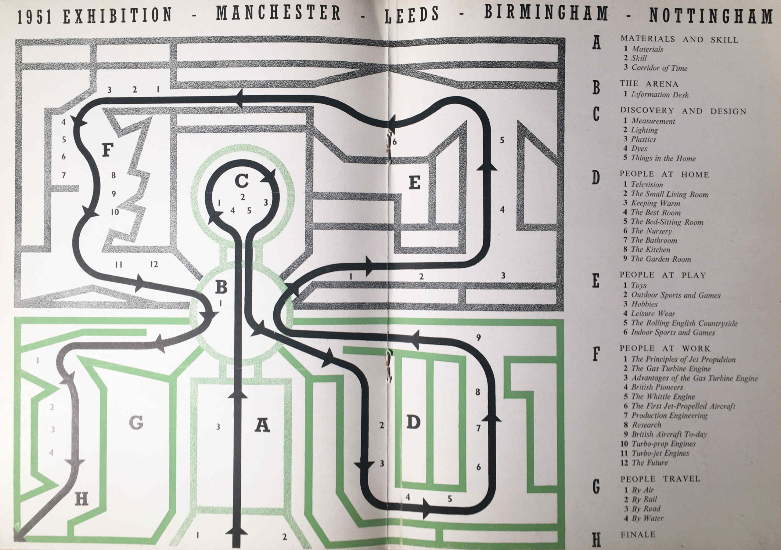
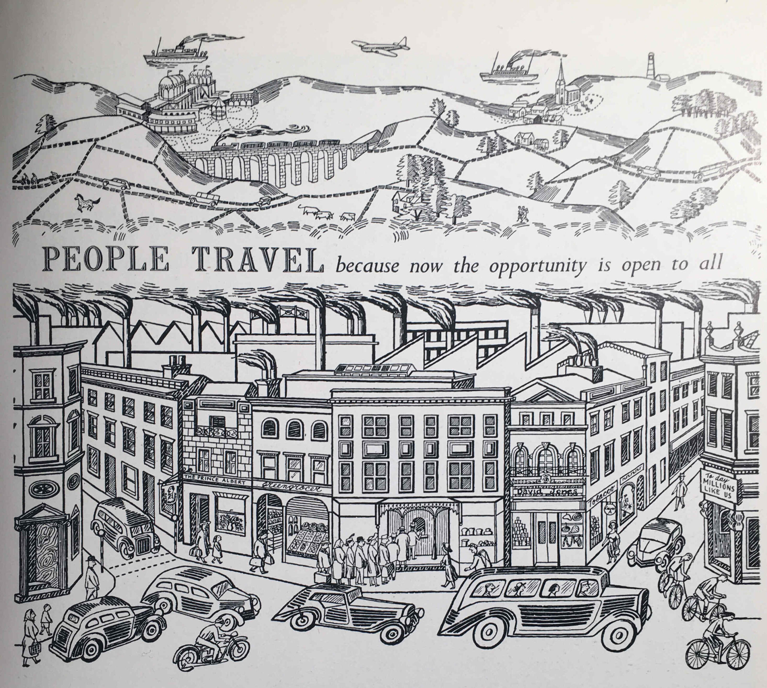
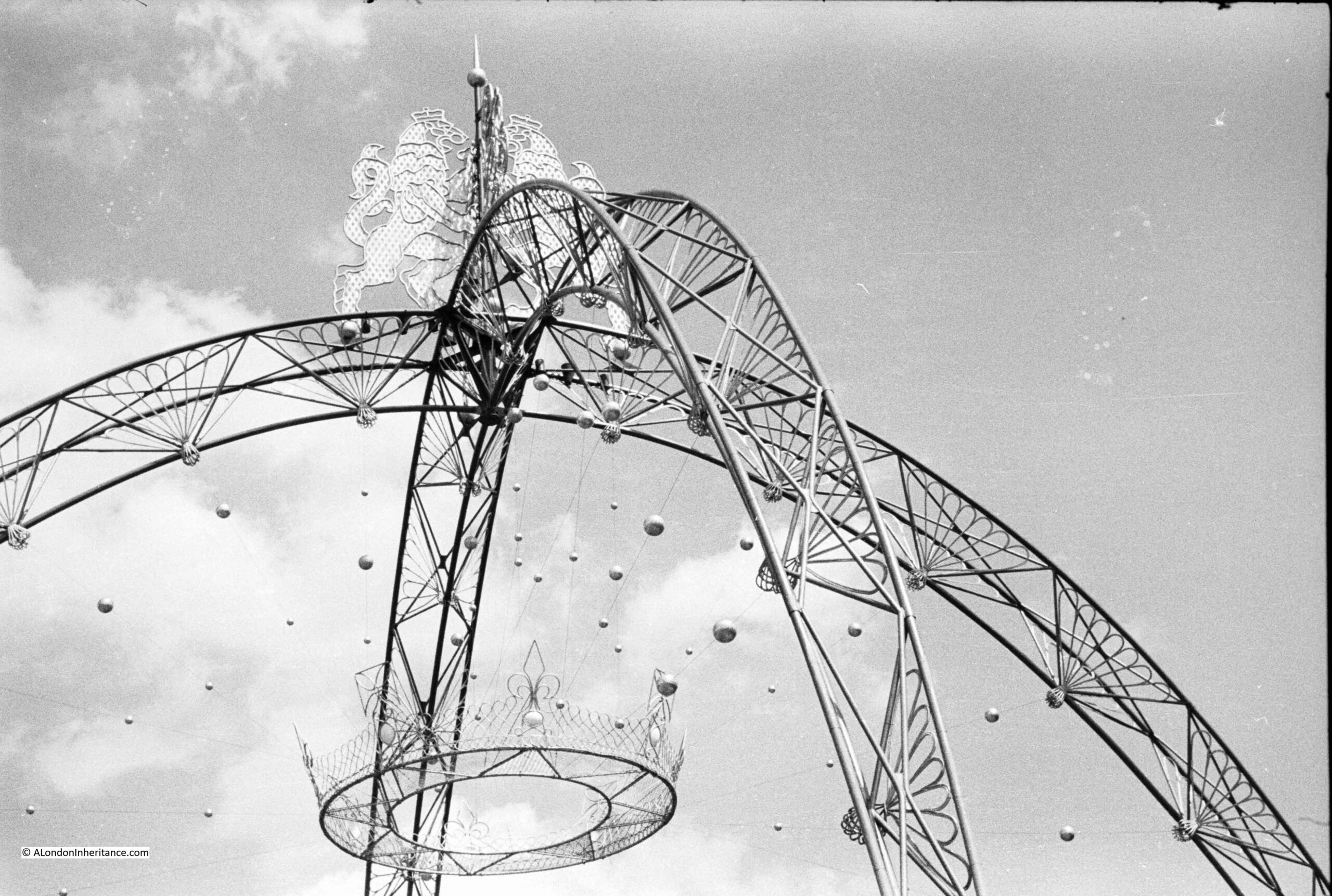
The themes were: Materials and Skill, Discovery and Design, People at Home, People at Play, People at Work, People Travel, and the route and individual displays within each section are shown in the following double page map from the guide book:
The focus on technology and industrial design was appropriate for the locations of the exhibition as these were still major industrial centres. It also followed the overall theme of the future, presenting an optimistic view of the future following years of war, rationing and austerity. An attempt to show what the country could make, as there was still an urgent need to reduce imports, grow exports and sell for foreign currency, and to provide a unifying experience which would involve everyone across the country.
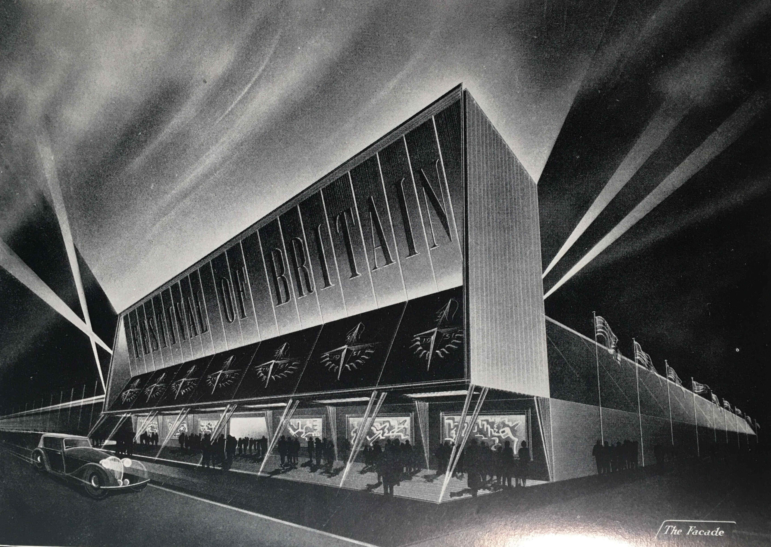
Unlike the Southbank Festival guide book, which contained long written sections describing the displays, the guide book for the Travelling Exhibition was mainly a catalogue of all the individual items on display, however it does contain some brilliant drawings of the exhibition areas.
The following image is titled “The Façade”, and shows the main entrance to the exhibition:
The image looks as if it is a Hollywood film premier rather than an exhibition of technology and industrial design.
The timetable for the travelling exhibition was as follows:
MANCHESTER – At the City Hall, Deangate. Open from Thursday, 3rd May to Saturday, 26th May inclusive
LEEDS – On Woodhouse Moor (Woodhouse Lane and Raglan Road Corner), Leeds. Open from Saturday, 23rd June to Saturday, 14th July inclusive
BIRMINGHAM – At the Bingley Hall, King Alfred’s place. Open from Saturday, 4th August to Saturday, 25th August inclusive
NOTTINGHAM – At Broadmarsh, Lestergate, Nottingham. Open from Saturday, 15th September to Saturday, 6th October inclusive.
The exhibition was open seven days a week, with a morning start, and closing at 11:00 pm, including Sunday, although on Sunday’s the exhibition opened at 2:30pm, as I assume there was still an expectation that people would be going to church on a Sunday morning.
The travelling exhibition was not the only Festival of Britain event organised in these cities, for example, in Birmingham, newspapers were also advertising other Festival of Britain events such as a City of Birmingham Show in Handsworth Park, with events including a dog Show, a Rabbit Show and ending with fireworks. There was also a military tattoo at the Alexandra Sports Stadium and a Festival of Opera and Drama at the Midland Institute and Moseley and Balshall Heath Institute.
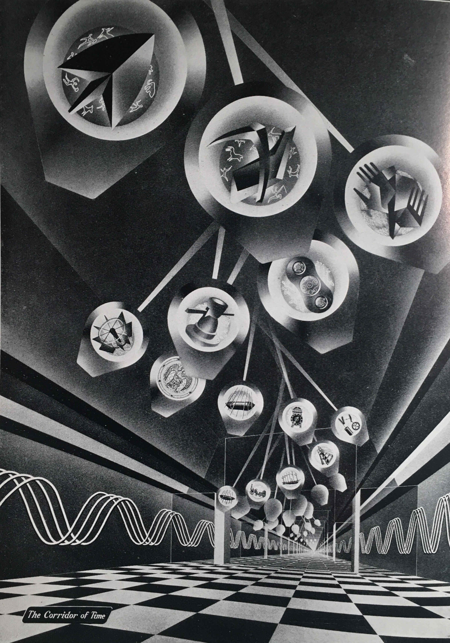
The next image shows the Corridor of Time:
The Corridor of Time was introduced in the guide book as follows:
“The things that have been made in each age have depended upon the degree of man’s mastery over the materials of the earth and the development of his skill in making and using tools and machines. The story of the ascent of man, the ‘tool-using animal’, from the most primitive times to the present day is told in striking and symbolic form in the Corridor of Time. As we advance with time and see the achievements of the past mirrored in the future, we cannot but be optimistic of the possibilities for man that lie ahead.”
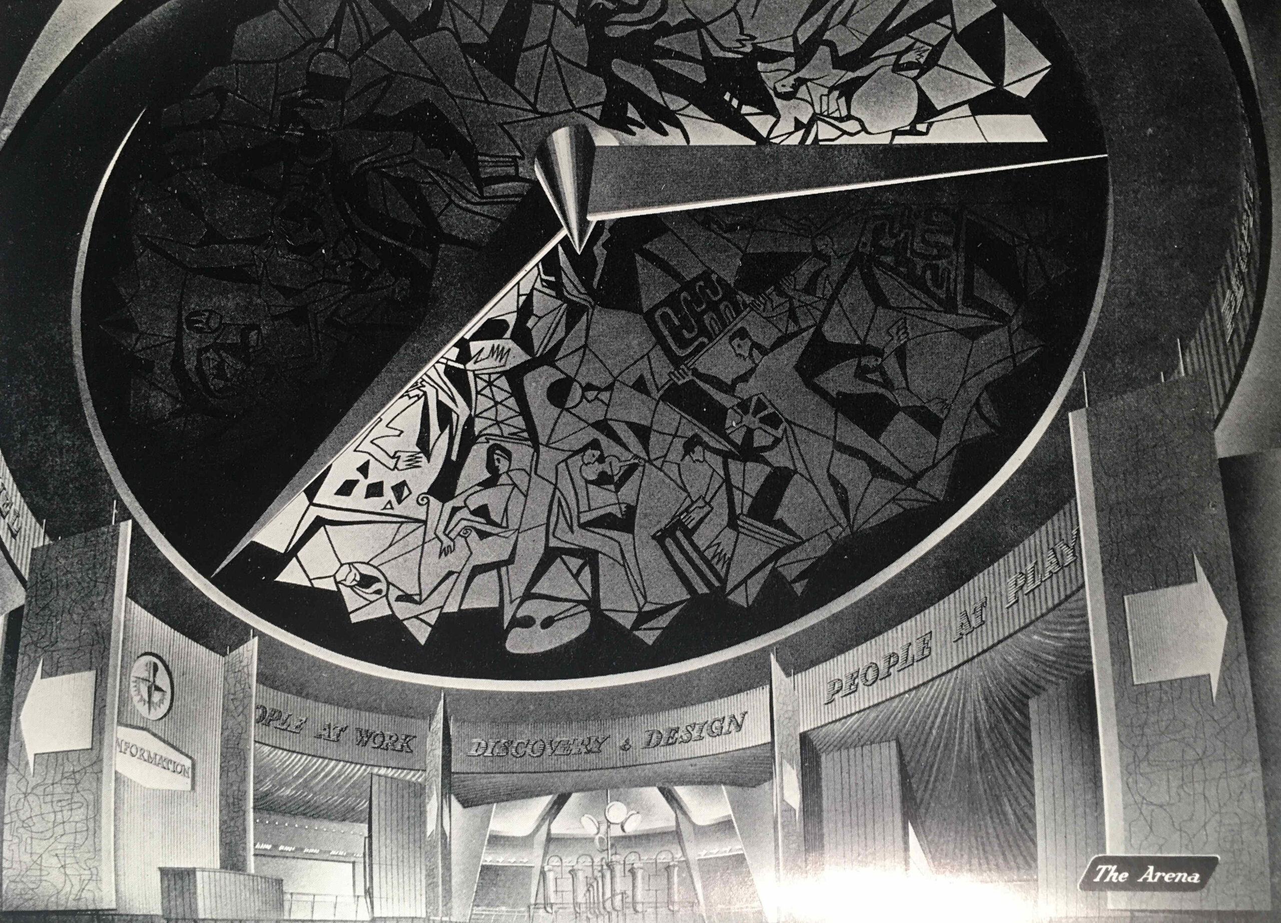
At the end of the Corridor of Time the visitor entered the arena where there was an information desk where “industrial enquiries will be directed to a special information room staffed by representatives of the Council of Industrial Design and of industry”.
It is interesting as to who the exhibition was aimed at, as at times the guide book almost sounds like a description of a trade show, rather than an exhibition that was aimed at the general population.
To help people attend the exhibition from the towns and villages surrounding the four cities, British Rail offered cheap day return tickets, and for Birmingham this offer applied to all stations within an 80 mile radius of the city.
The following image shows “The Arena” which led from the Corridor of Time to the rest of the exhibition:
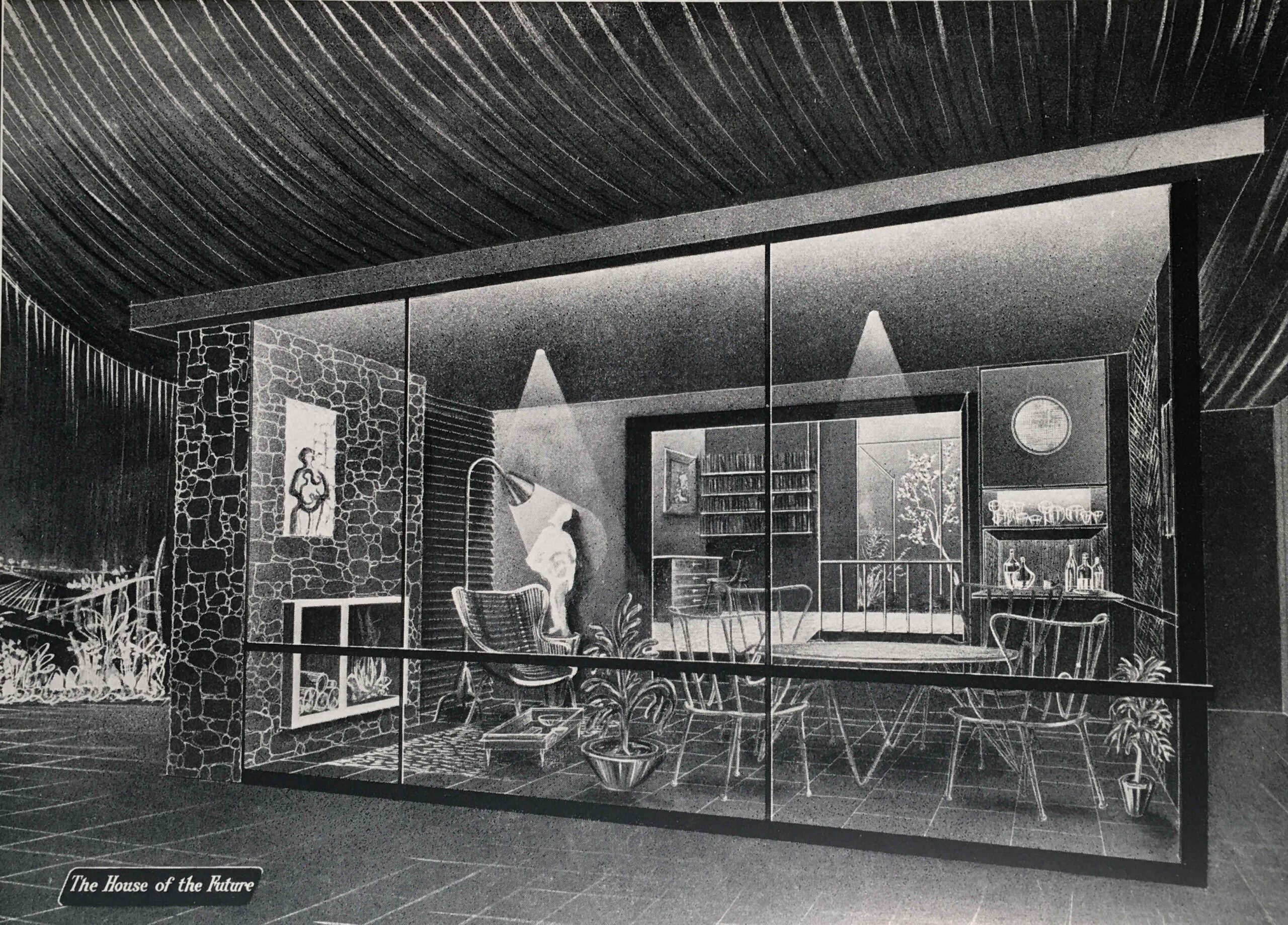
From the Arena, we enter the “People at Home” section of the exhibition, which in the guide book is illustrated by an image of “The Garden Room” of the “House of the Future”:
The Garden Room is a view of what would be happening in the future with the popularity of conservatories and large windows facing onto a back garden, however in the exhibition there was a recognition of the housing problems that the majority of the population continued to face:
“THE BED-SITTING ROOM – With smaller houses and scare accommodation, this form of room has taken on a new importance in recent years. Special efforts and imagination can make the bed-sitting room very congenial, either for the adult living apart from the family or as a place of privacy for the older child.”
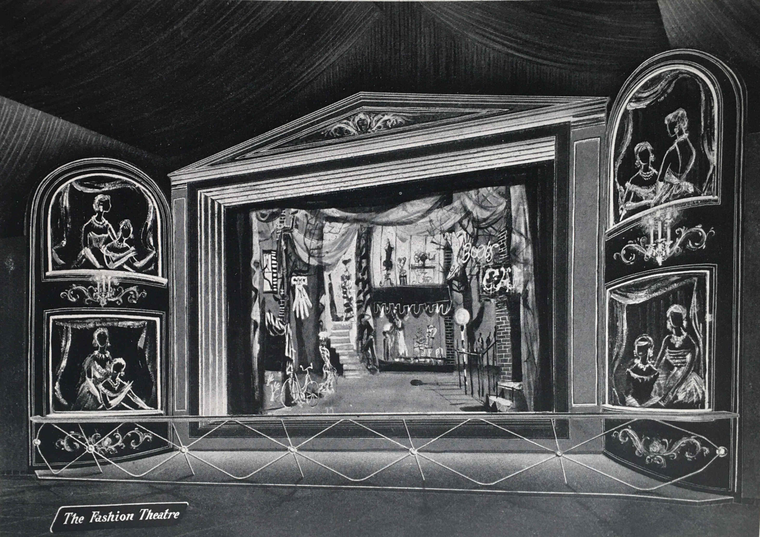
We then come to the “People at Play” section, which is illustrated with “The Fashion Theatre”:
The People at Play section included displays on:
Outdoor Sports and Games
Hobbies (Amateur Photography, Amateur Radio, Painting and Home Cinematography)
Leisure Wear (which was displayed by “actress mannequins” in a continuous performance in the Theatre of Fashion)
The Rolling English Countryside (walking, rambling, mountaineering, cycling , rowing and canoeing)
Indoor Sports and Games
A look at the list above might imply that the exhibition was aimed at the affluent middle class, however taking Amateur Photography and Cycling as two example, that is exactly what my father was doing in 1951. He started off with a Leica camera purchased cheaply from a serviceman returning from Germany after the war, and cycled the country with friends after National Service, staying at Youth Hostels, which was a very cheap way of seeing the country.
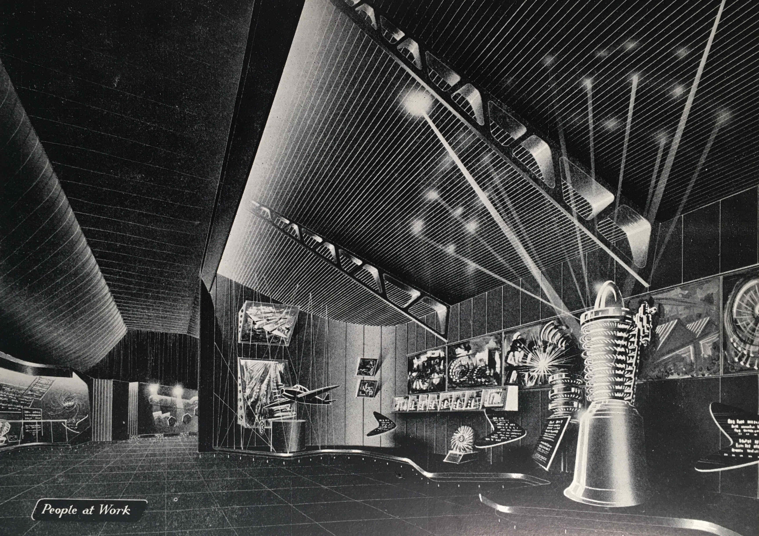
We then come to the “People at Work” section, with an image of the same name:
“Britain’s industrial achievements and engineering skill are renowned throughout the world. We were pioneers and leaders in industrial engineering in the 18th and 19th centuries”, so began the introduction to the “People at Work” section. The guide book featured the jet engine, or the “Whittle Engine” as it was called in the Exhibition Guide after Frank Whittle who was instrumental in the development of the jet engine.
The guide mentions John Barber who had taken out a patent for what would become a gas turbine, the core of a jet engine, as early as 1791.
Barber’s designs were very much in advance of their time, and manufacturing technology was not at the stage where the designs could be turned into a working gas turbine.
In a perfect example of what ever you think the future will be, it will almost certainly be different, in the section on People at Work, there are some paragraphs under the heading “The Future”.
The guide explains that the future of electricity and energy production is with home supplies of coal and peat, and that cheap supplies of these, rather than the expensive oils currently being burned would help power the future.
No understanding in 1951 of the impact of burning large amounts of fossil fuels, and digging up large amounts of peat.
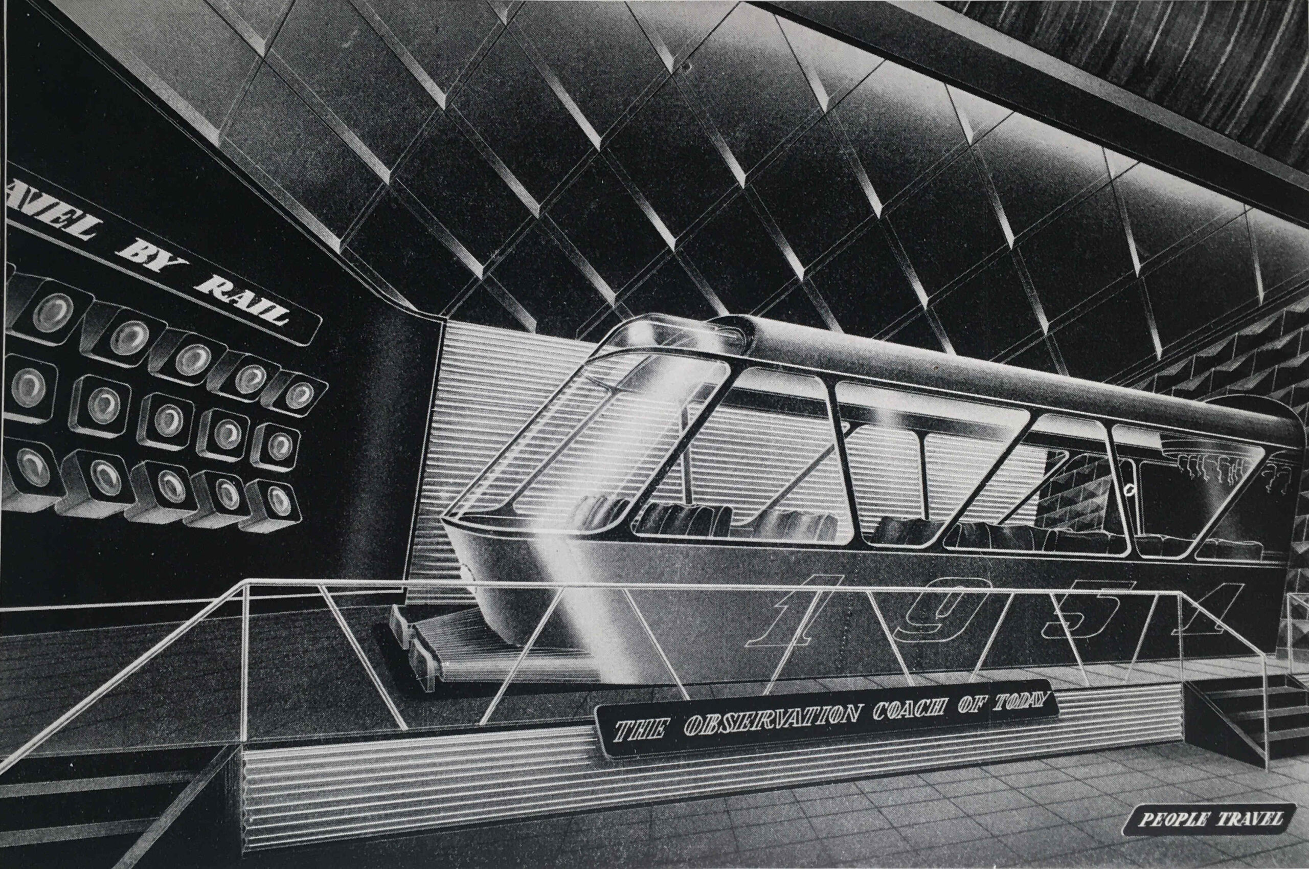
The next section of the exhibition is “People Travel”, with an illustration of the same name:
The guide compares the arduous methods of travel at the time of the 1851 Great Exhibition, with the travel opportunities one hundred years later in 1951, with air travel and the car providing the means to explore the country and the wider world – “the private car has added a new degree of freedom to the mode of life of many people in all countries”.
To show some of the accessories that went with the freedom of travel provided by the car, the exhibition included:
Picnic Basket “Fieldfare”: G.W. Scott & Sons Ltd, 4-10 Tower Street, London W.C.2
Twin cup vacuum flask. British Vacuum Flask Co. Ltd. Lissenden Works, Gordon House, London, N.W.5
Coffee cups and saucers, acrylic. S.C. Errington (Hanwell) ltd, 132a Uxbridge Road, London W.7
So the opportunity in the summer of 1951, if you had a car, was a drive out into the countryside, where you could stop and have lunch from your plastic sandwich box, drink coffee from acrylic coffee cups and saucers kept warm in the vacuum flask, all stored in your Fieldfare picnic basket from Tower Street.
“PEOPLE TRAVEL because now the opportunity is open to all”:
The logistics of the travelling exhibition were impressive. It covered an area of 35,000 square feet, and was the world’s biggest transportable, covered Exhibition ever to be constructed.
It needed to be assembled and disassembled quickly due to the tight time schedule of openings and closings in the four different cities.
The exhibits were designed for quick and easy assembly, and to allow for differences between the sites, such as different floor levels, the exhibition structures were on adjustable footings. All exhibits were also completely wired for connecting up at each site.
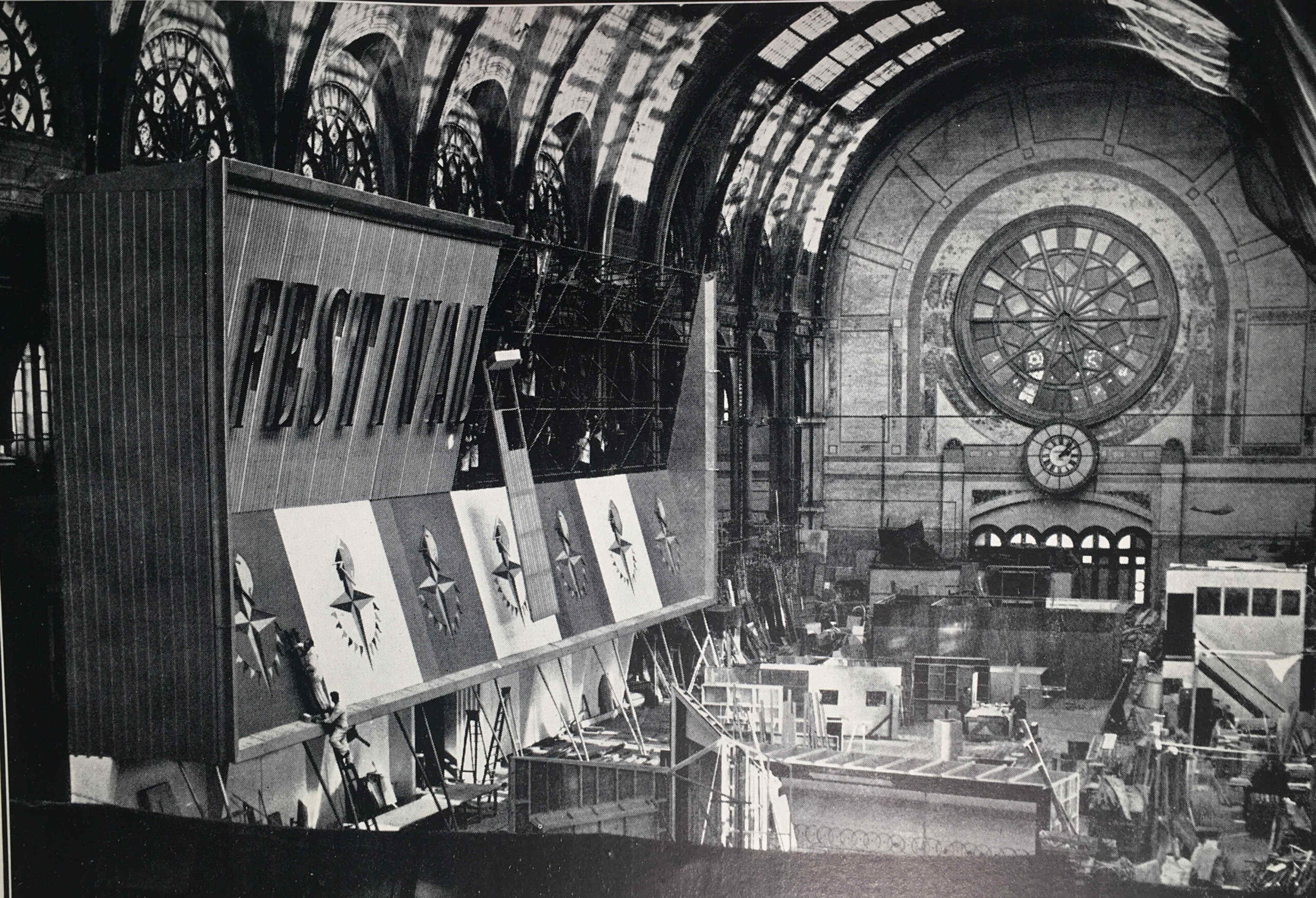
The guide includes a photo of the Exhibition Façade under construction, and I am sure that is the main hall of Alexandra Palace:
Alexandra Palace makes sense as it would have provided a large area for construction of all the exhibits, and the contractors responsible were the City Display Organisation, London.
As with all the Festival of Britain Guide Books, the one for the Travelling Exhibition included a large number of adverts, many in colour, and they feature a range of British industrial enterprises, the vast majority of which have all disappeared in the years since the 1951 festival.
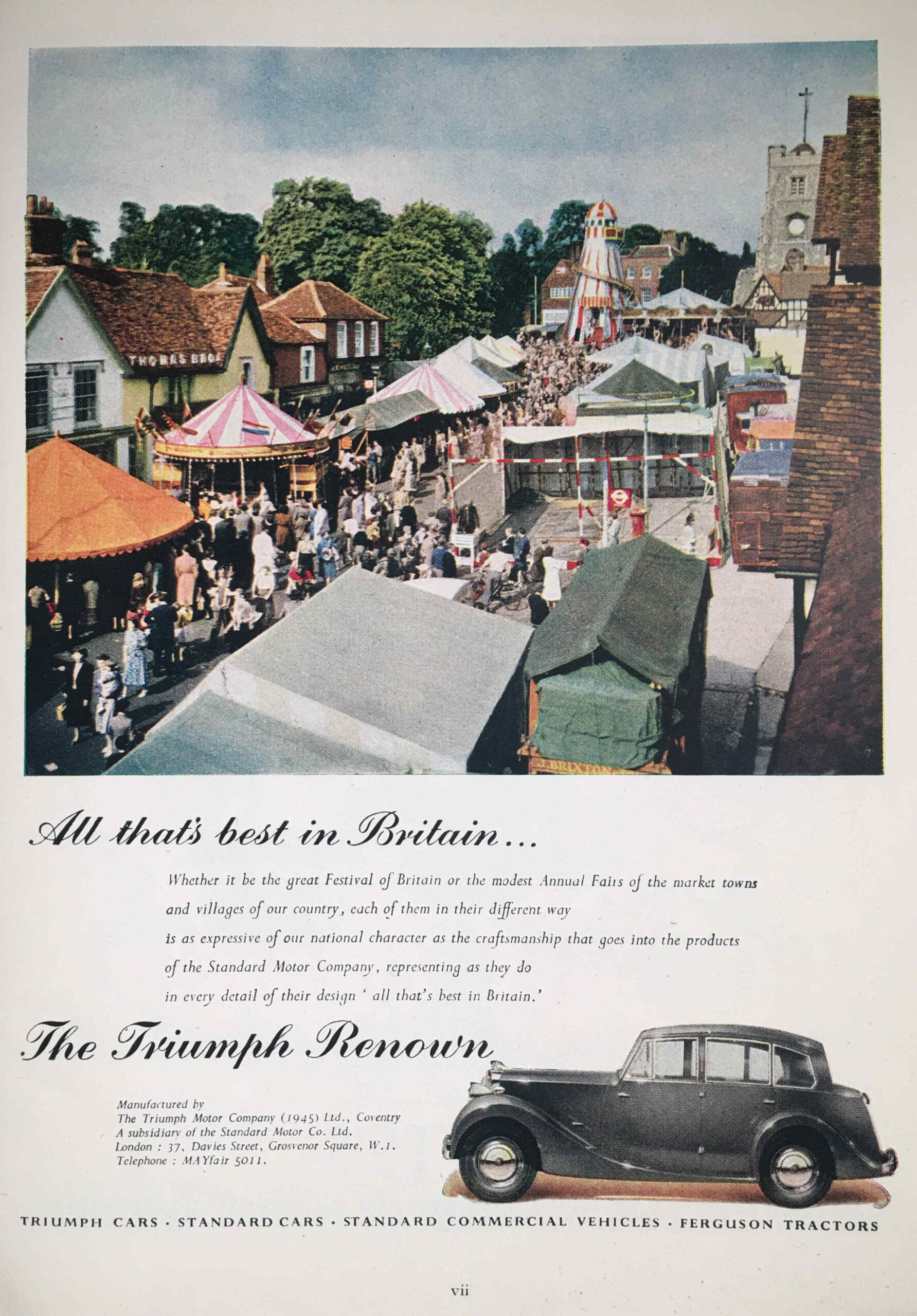
In the Triumph Renown, manufactured by the Triumph Motor Company, you could get out and visit places and events such as displayed in the following photo:
I think that is a location in outer London, as in the photo we can see the following:
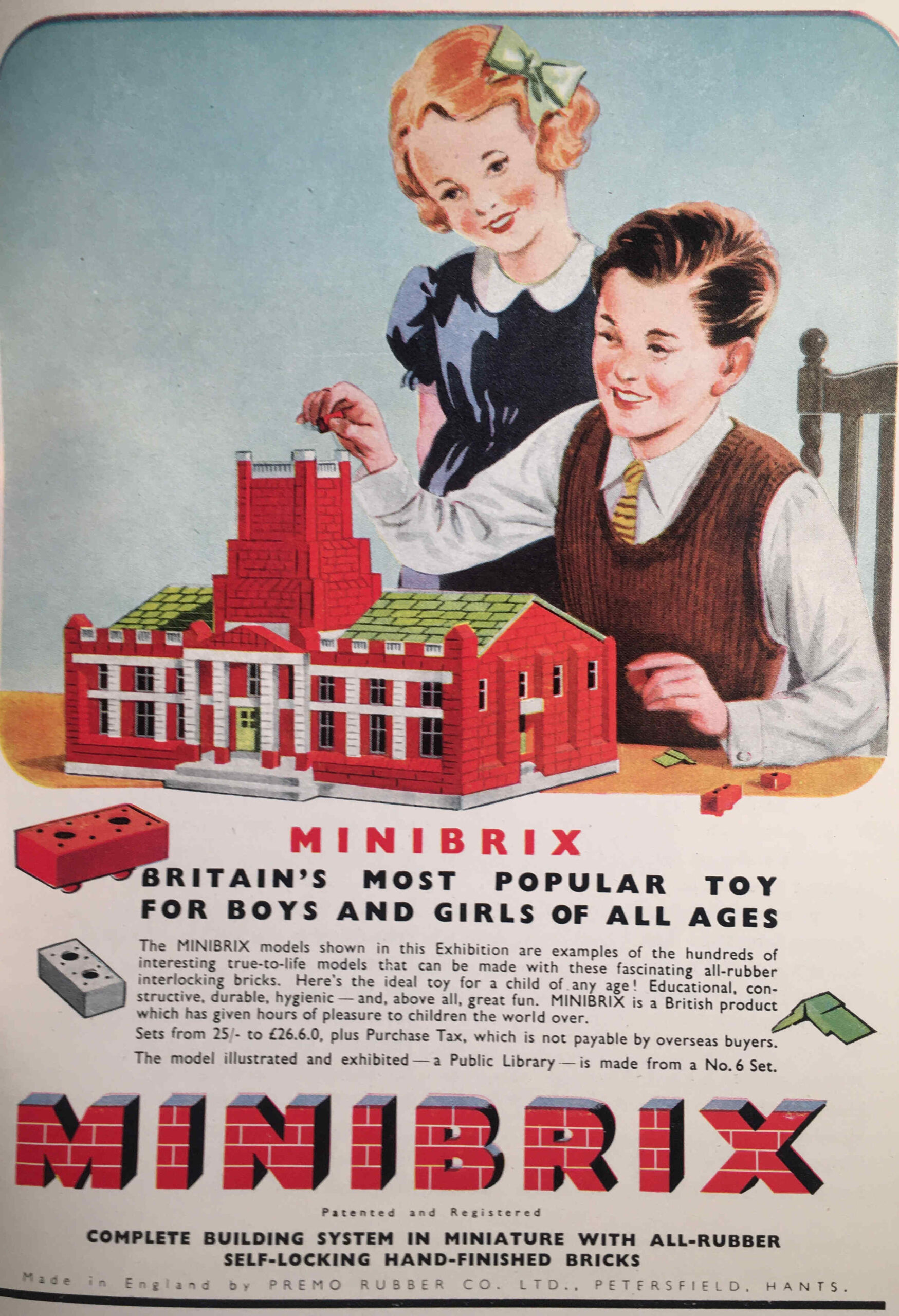
Before Lego, there was Minibrix:
Minibrix were manufactured by the Minibrix Rubber Company, a subsidiary of the I.T.S. Rubber Company of Petersfield in Hampshire. Production started in the late 1920s.
The bricks were made out of solid rubber, and were therefore rather heavy compared to the plastic bricks that Lego would later introduce.
Competition from Lego, who used plastic for their bricks, which was cheaper to produce, and allowed a much wider range of models to be built, meant that Minibrix could not compete, and Minibrix ended production in 1976.
The fate of Minibrix sums up much of the industries and businesses featured in the Festival of Britain, with the majority disappearing in the next 40 years.
One that does still thrive is Rolls-Royce, who continue production of the jet engine in Derby.
I still have a couple of Festival of Britain Guide Books to find, but if you would like to read some of my other posts on the festival, you can find them at the following links:
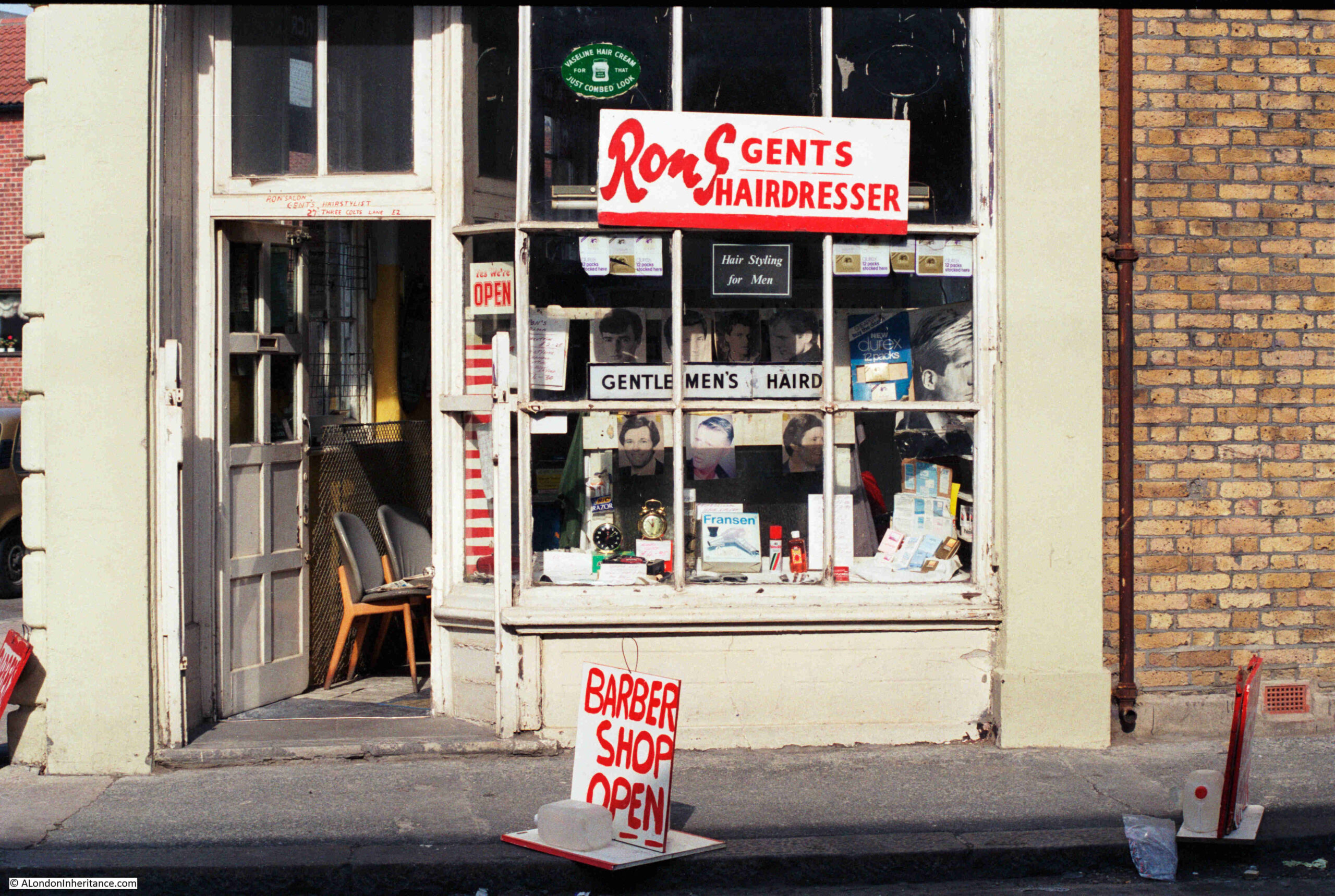
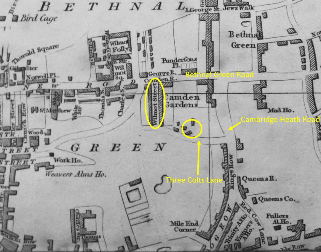
In 1986, my father photographed Ron’s Gents Hairdresser’s in Three Colts Lane, Bethnal Green:
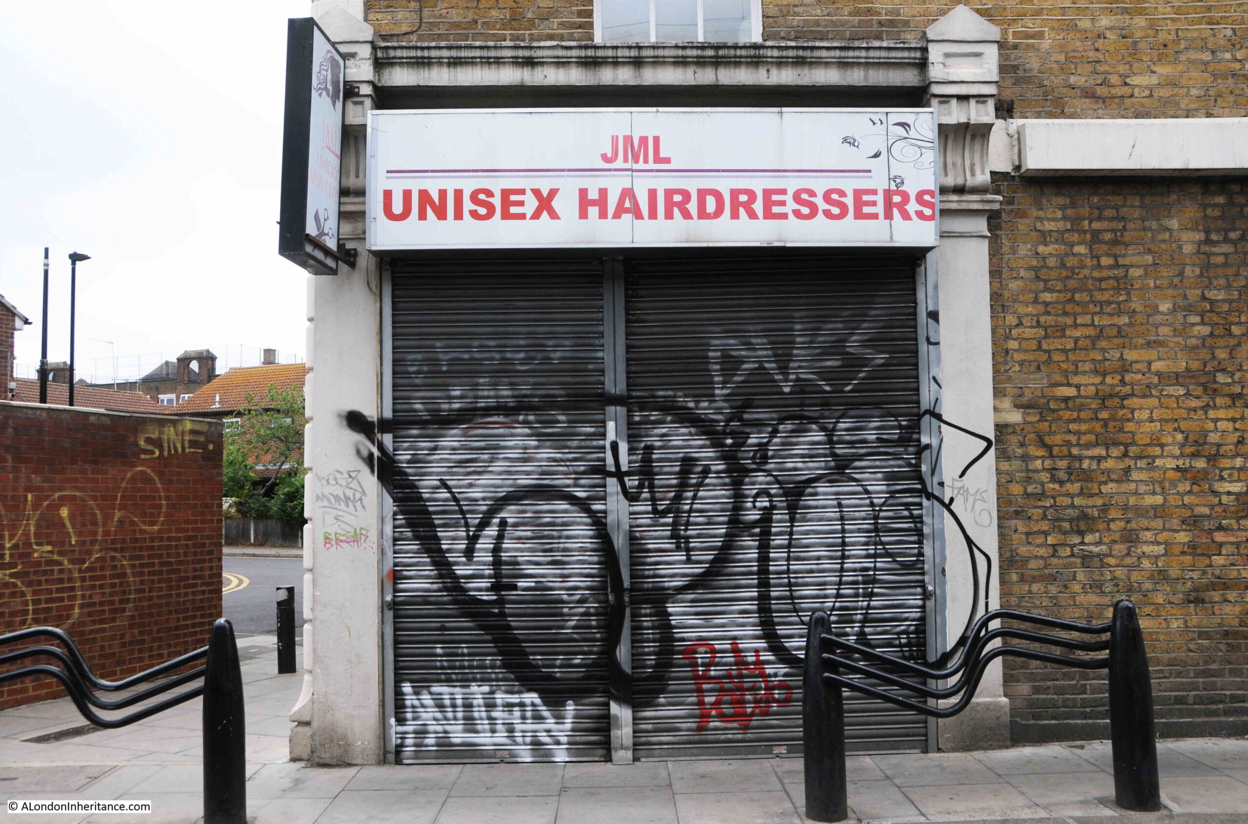
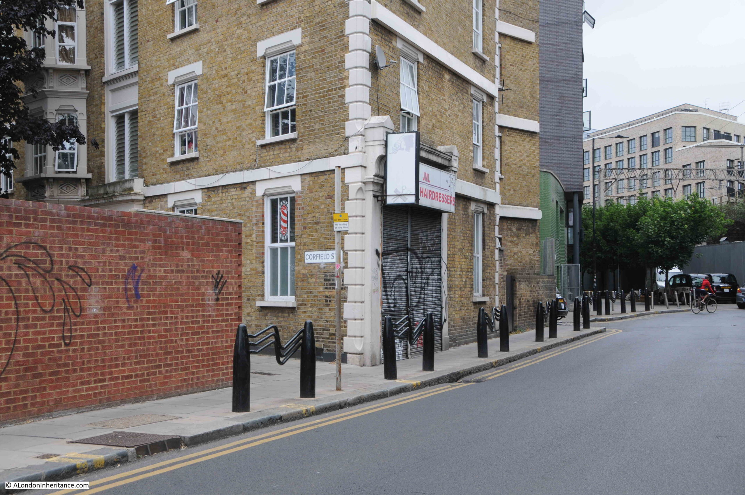
I have walked past the same place over the last few months, hoping that the business which occupies the site today would be open, but gave up last week, so here is a photo of what was Ron’s shop today, JML Unisex Hairdressers, which has not been open when I have been in Three Colts Lane over recent months.
The last review on Google was three months ago, so hopefully this is a temporary closure. It is interesting how businesses such as hairdressers do seem to occupy the same sites for very many years, often through several different owners.
They tend to be local businesses, do not need much space, and are not being replaced by an online service.
Covid probably led to an increase in home haircuts, but I suspect after lockdowns ended there was a rush to get a professional haircut.
It would be good if the shop front behind the shutters is much the same as in the 1986 photo.
I hope I have the name of the business right in the 1986 photo. The large S at the end of Ron threw me a bit, and there is no apostrophe between the end of Ron and the S, but Ron’s would make sense.
Looking above the door, the business is called Ron Salon Gents, Hairstylist:
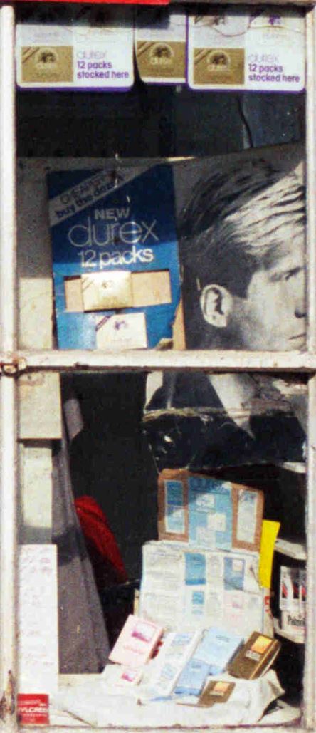
The displays in shop windows from the past often cast a light on life at the time, and the large display on the right of Ron’s main windows shows that the hairdressers were very much of the “something for the weekend” type:
The shop is in the corner of a long block of flats that runs from Three Colts Lane up along Corfield Street. The following photo shows the shop, and in the first window down Corfield Street is one of the red and white striped signs that have long been the symbol for a barbers.
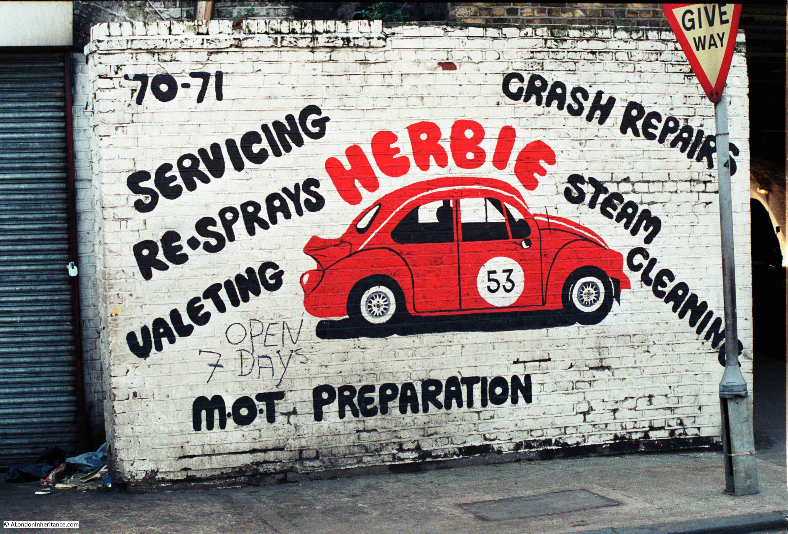
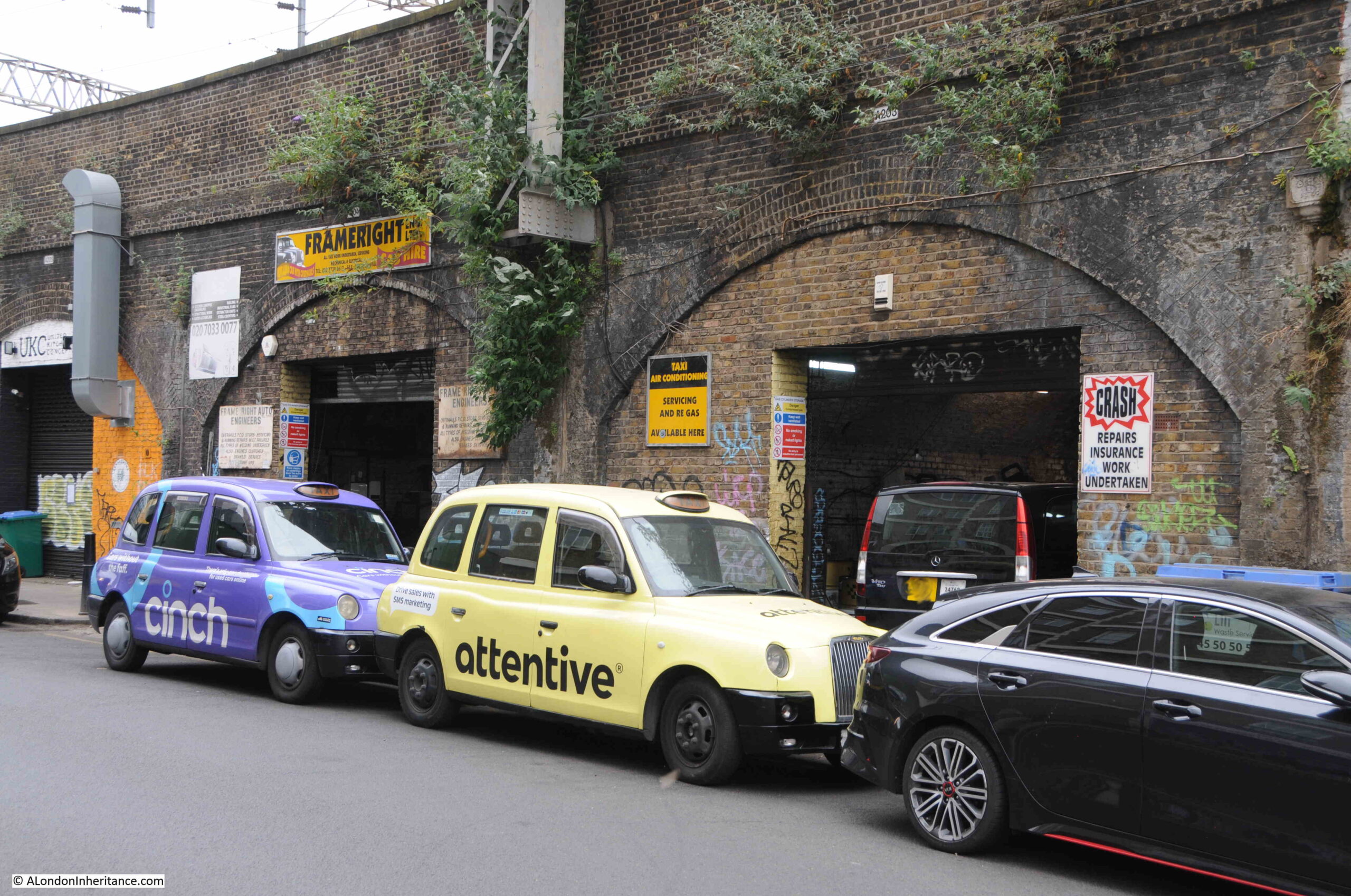
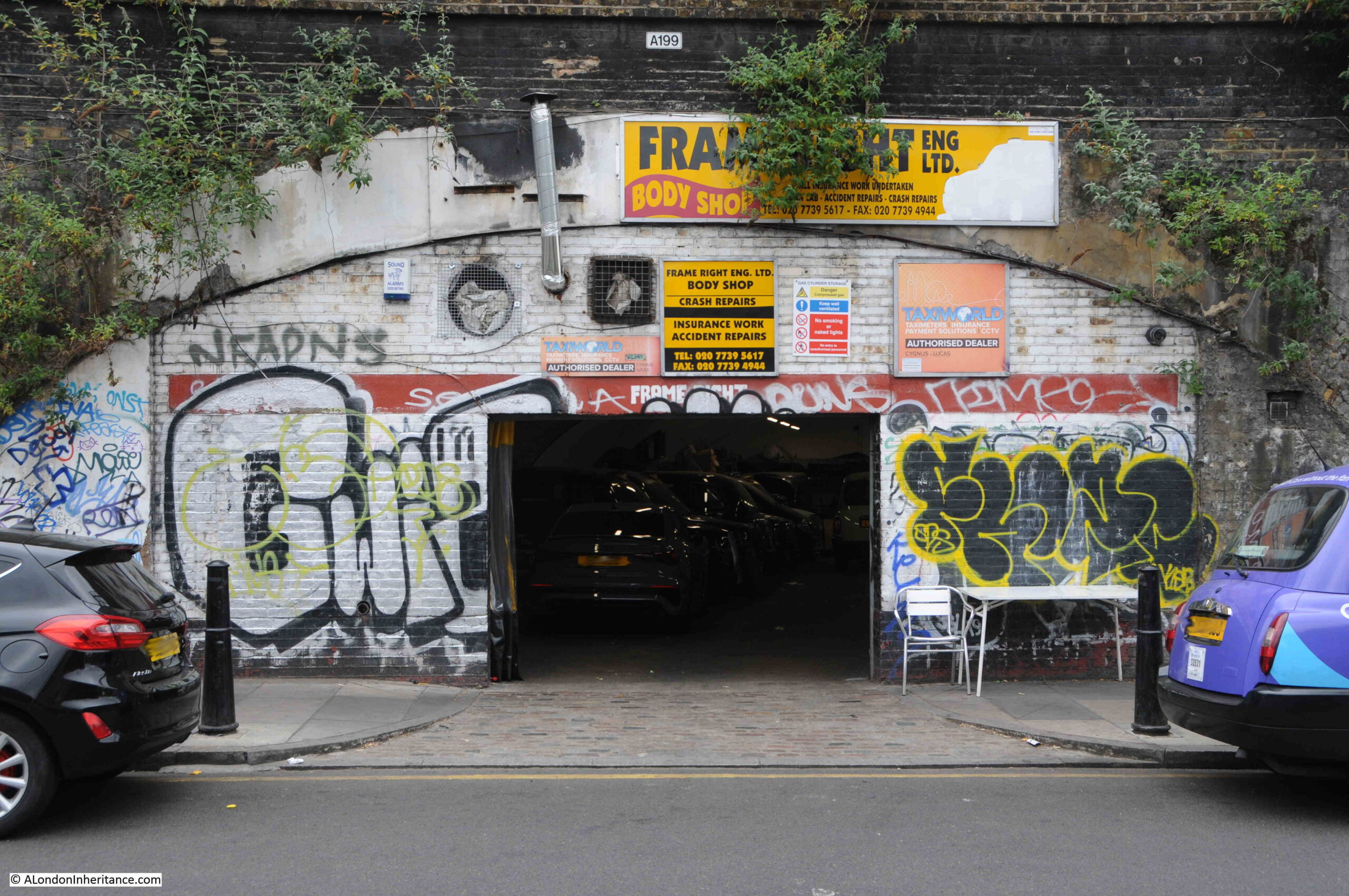
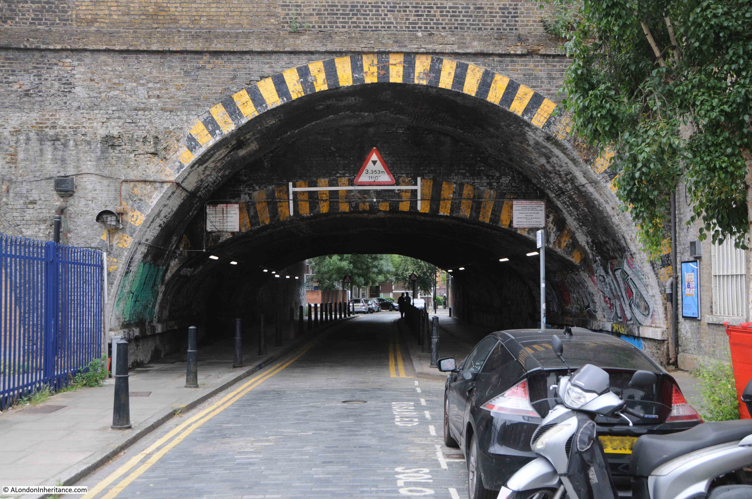
Three Colts Lane runs from Cambridge Heath Road in the east to Brady Street in the west. For a large part the route, the street has the brick viaduct carrying the railway through Bethnal Green towards Liverpool Street Station, along the southern edge.
Within this brick viaduct, there are rows of arches, many of which have been occupied by various businesses, the majority being in the motor trade.
Next to the 1986 photograph of Ron’s Hairdressers on the strip of negatives, there were two photos of signs advertising typical businesses for the area. The first features the Volkswagon Beetle, Herbie, made famous in the 1968 film The Love Bug:
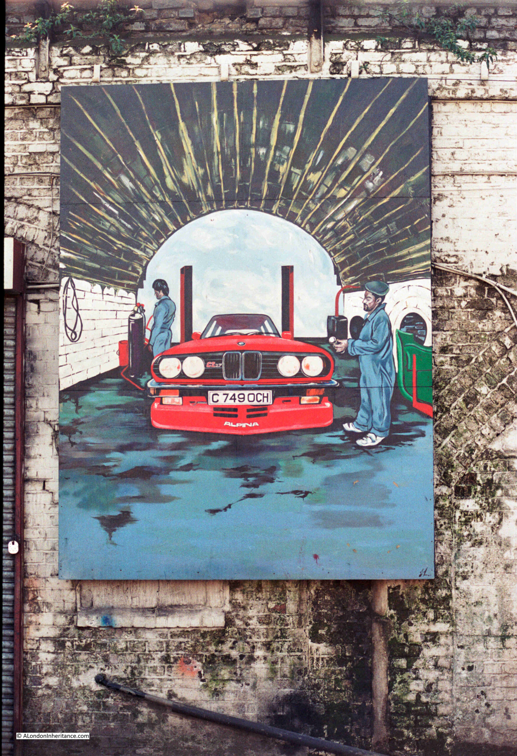
The second was a large mural showing a BMW in one of the arches:
I wondered if there was any relevance to the registration number of the car, and a quick Google found that it was a BMW E30 Alpina C2 2.7 3-Series, and the car was subject to a road test which was published in the 19th of April 1986 issue of Motor magazine, which reports that the car would have cost you just over £19,000.
Although these photos were taken 37 years ago, I took a walk along Three Colts Lane and surrounding streets to see if any trace of them remained. I could not find anything, but the area is still a hub of car and taxi repair businesses, and some rather impressive graffiti and murals, as the following example of the A1 Car Care Centre on the corner of Three Colts Lane and Coventry Road illustrates:
Detail of the mural on the side of the building in Three Colts Lane:
The arches along Three Colts Lane have many businesses which support the taxi trade, and spend a short time in the street and you will see a number of taxis arriving and departing from these arches:
Entrances into these arches show dimly lit interiors where vehicles are serviced and repaired, as at Frame Right Eng. Ltd.’s Body Shop:
The size of these arches can be seen where roads pass through the viaduct. The differing heights of the arches also show how the viaduct into Liverpool Street Station has expanded over time:
At the end of Three Colts Lane, it turns into Brady Street which heads under the viaduct, and Dunbridge Street which continues along the northern side of the viaduct.
At this road junction, there is a derelict patch of land on the left, with another repair business in the arches on the right:
The derelict land on the left of the above photo was once the site of a pub, the Yorkshire Grey, which closed in 1998, and was then in residential use for a while, until the building was demolished around 2014. Surprising that the land has not been developed in the past nine years.
Continuing along Dunbridge Street, and there are a couple of very different businesses operating within the arches, including Urban Baristas:
And Breid Bakers:
I can never resist looking at old maps when I visit a place, and the outline of the street that would become Three Colts Lane seems to date from the end of the 18th century.
The following extract is from Smith’s 1816 New Plan of London. I have marked what would become Three Colts Lane, and the circle is around the area where Ron would open his hairdressing business:
The one constant in the map is Wilmot Street, shown within the yellow oval. The street has kept its original name, and still leads off from Three Colts Lane today, although the houses lining the street are today very different to the terrace houses that were built at the start of the 19th century.
Bethnal Green Road was then New Road, and Cambridge Heath Road was Dog Row and Kings Row.
In the early 19th century, there was still a fair amount of open space in this part of Bethnal Green. Over the next few decades, this would all be built over.
I cannot find a source for the name of the street. In 1818 it was Three Colt Lane, by the end of the 19th century it was Three Colt’s Lane, and today, the street sign has the name Three Colts Lane, so it has been Colt, Colt’s and Colts.
A colt is a young male horse, and as there was open space to the south of the early incarnation of the street, I wonder if there were three colts in this field, and the use of Lane rather than Street or Road may imply a route through what was a semi-rural area? It is this sort of visual imagery that was often used to name a location before streets were formally named, and when literacy levels were low.
There is also a Three Colt Street in Limehouse, but again I cannot find a firm reference as to the source of the name.
Ron’s was very much a barbers of its time, and I doubt that today you would find a barbers where a third of their window is taken up with advertising for contraceptives.
The last week has been really busy, and I am somewhat behind on post research, so for this week’s post I will revisit a set of books I have looked at a couple of times over the years, and discover some of the photos which show London in the 1920s, the 1926 book Wonderful London.
This was a three volume set, edited by the poet and novelist Arthur St John Adcock. The aim of the books was to show “The world’s greatest City. Described by its best writers and pictured by its finest photographers”.
The individual photos are not dated, however they must be from the years immediately before 1926, so these photos show London as it was 100 years ago – a very different place.
As the weather this weekend is forecast to be a hot one, I thought I would start with three photos from a set under the heading “London’s Annual Heat Wave Always Forgotten By The Next Year”
The following photo is captioned that “The road-menders seem uncomfortable at any time of the year”, which is a rather strange comment as the focus is on the hot temperatures – perhaps a miss-print.
It is always difficult to judge how far these were posed photos. The men in the above photo certainly look as if they have been asked to stand in a particular way, although I suspect that preparation for the photo did not go to the length of digging a hole in the road.
The following photo is of a man with an ice-cart, a job that involved pushing a cart around the city streets, loaded with a large block of ice, and making delivers to customers:
Whilst the above two jobs involved exposure to the heat of the city, the book shows a job that would be envied by those working across the streets on a hot summer’s day – the cold storage man, who was responsible for managing and moving the goods stored in a cold storage facility:
A typical summer sporting activity in London “Looking towards the pavilion from the Mound Stand at world-famous Lord’s”:
The books provide a bit of background history to many of the photos, and for the Lord’s photo, there is: “Lord’s the property of the Marylebone Cricket Club, consists of some 10 acres of property acquired at various times. The club originated at Finsbury, where it became known as the Artillery Ground Club. Cricket had been played there since about 1700. In 1780 the Artillery Ground Club moved to White Conduit Fields. There one of the attendants was named Lord. In 1787 the club ground was moved to Dorset Square and called Lord’s. In 1811 another move was made to a site near the Regent’s Canal, and in 1814 the final move to the present site. Lord took up and re-laid the turf at each move. the ground has a character of its own with the dignity of long establishment behind it which appeals to all Londoners.”
If your preferred game was golf rather than cricket, there was, what was described as “the only golf course in the City of London”. Not so much a golf course, but rather a putting green on the roof of Adelaide House, next to London Bridge. A building which is still there, and with the monument just behind:
The books include many photos of London’s streets as they were 100 years ago.
The following photo is captioned: “Turning south from Hammersmith High Road one walks down Hampshire Hog Lane, named after an inn at the corner, eventually reaches High Bridge, seen in the distance. this crosses the Creek, the mouth of the Stamford Brook, and is thought that the earliest settlement of Hammersmith centred here”:
Some of these photos can be a puzzle. For example, the caption to the above photo states that you turn south from Hammersmith High Road to walk down Hampshire Hog Lane, however Hampshire Hog Lane leads south from King Street. It did at the time of the photo and it does still.
Today, Hampshire Hog Lane is a small stub of a street. There is a pub on the corner as there was in the 1920s, the Hampshire, which is now more a restaurant than a pub.
You cannot walk down to where the bridge was, which has also disappeared, as has the creek. The Great West Road, the A4 has now carved across the southern part of the lane, and Furnivall Gardens now covers the location of the southern part of the creek and the bridge.
Although the scene in Hampshire Hog Lane has gone, the building in the following photo taken in Glebe Place, Chelsea can still be found. The book records that it “was probably a cottage used by factory hands in the employ of Bentley, Wedgewood’s partner”:
Streets in central London are also covered, with the following view of “George Court, an alleyway to the Adelphi from the Strand”. Very different buildings now line the alleyway:
Buckingham Palace has been seen on TV screens cross the world this year, however its only gained its current appearance just over 100 years ago – “George III bought Buckingham House in 1762 and in 1825 it was much altered by Nash for George IV. Edward VII was born here in 1841, and six years later the building was extended into a quadrangle. It then appeared as in the photo with an ugly and undignified frontage”:
The following photo of the palace as it is now is captioned “In 1913 Sir Aston Webb undertook to improve the one view that the public ever get of their King’s residence, with the result seen in the photograph”:
One of the trends in how London’s streets have changed over the years, is the grouping together of plots of land, and the construction of a large building on a plot which was once occupied by a number of smaller buildings.
Such an example can be seen where the Albany meets Piccadilly. The Albany was a house occupied by the Earl of Sunderland in 1725, then the first Lord Melbourne acquired it and spent vast sums on the building, only to exchange it with the Duke of York, for a house in Whitehall.
The Albany was set back from Piccadilly, and approached through a narrow driveway. In 1926, this driveway was accessed through an arch leading through a building facing onto Piccadilly:
Today, the house is still there, however, the buildings seen in the above photo have been replaced by two larger buildings, and the access shown in the above photo has been replaced by a narrow, open street. It is opposite the bookshop Hatchards.
I suspect that as long as there has been photography, ‘Then’ and ‘Now’ photos have been a theme, and there were a number in Wonderful London. The following photo is of Oxford Street in the 1880s:
And the following is 40 years later in 1926, with included in the caption that “the only features of the old order left for the new are the two buildings on the right-hand side of the road and nearest the right edge of both photographs”:
The following photo is titled “A Fine Morning In June: The Rose Day Of Queen Alexandra”, with the caption “Rose Day is an annual effort for raising funds for various charitable causes, including hospitals. it was founded by Queen Alexandra in the fiftieth year of her residence in England and persists after her death. The flowers used are made by blind and crippled workers and represent the dog rose, which was the Queen’s favourite flower. London’s streets are extensively patrolled by hundreds of ladies deputed for the task, who in return for two pence, or even a penny, will sell a rose – and a smile”:
The Alexandra Rose Charity is still running, and Rose Days ran between 1912 and 2012. Today, the charity is focused on providing “families on low incomes access to fresh fruit & vegetables in their local communities”.
Many of London’s markets feature in the books. The following photo shows the “Gracechurch Street entrance to Leadenhall Market – City Clearing House for Poultry”:
The book provides some historical background to Leadenhall Market: “In 1411 the Corporation of the City of London obtained the property of the manor of Leaden Hall from Sir Richard Whittington – of pantomime fame – who in turn had purchased it from the Nevilles. The market has flourished ever since, though the Great Fire destroyed it. The present premises date from 1881, when £140,000 was spent on new approaches alone. The market stands on the south side of Leadenhall Street with its main entrance in Gracechurch Street and Lime Street to the south”.
I was in Gracechurch Street a couple of weeks ago, and the main entrance to Leadenhall Market is getting somewhat over shadowed by the new buildings near by:
One of the other London markets featured in the books, is Covent Garden, with a view of “Stalls that display the products of many climes in the fruit department at Covent Garden”:
And this photo of “Early morning in the Covent Garden”, as “soon after their journeys from the market gardens beyond outer London to reach Covent garden in time”:
We just had a few Bank Holidays during May, and in previous Bank Holidays, Hampstead Heath would have been the destination of many Londoners seeking a day away from the streets of the city.
The description in Wonderful London of a Bank Holiday Monday on the heath, reads “It is a scene of riotous joy, the centre of promiscuous revelries. There are merry-go-rounds with loaded horses sinuously revolving, swings that thrill the most blasé patron, and booths where mild games of chance are played. Steam organs , wheezing and panting, grind out different popular airs simultaneously. Men shout, women scream, and children are cacophonous in every possible manner.
Performers on assertive musical instruments, particularly trombones and accordions, abound. The atmousphere is heavy with cheap perfumes, engine oil, the smell of cooking and sun-baked shell fish. Here Cockney London enjoys a ‘fresh air’ holiday.”
Although the book was highly critical of the result of these Bank Holiday revelries: “Garbage-littered tracks of the vandals who invade Hampstead Heath on every Bank Holiday”:
“On the day after a Bank Holiday dirty paper, empty cans, orange peel and banana skins give even the most Arcadian, the most freshly green avenues and glades of Hampstead Heath, and indeed all the parks and commons of London, an air of sordid debauch. The lover of open space is not so much angered by the site as filled with pity for his thoughtless fellow creatures. Many appeals have been made to the trippers, begging them not to cover the grass with rubbish, but all to no purpose. It is all the more extraordinary when we consider that all these defilers of natural beauty have a certain amount of education, and should be able to realize the ugly effects of carelessly throwing refuge in every direction”.
The above commentary to the photo is the most negative of any I can find across the three volumes of Wonderful London. There were many other aspects of London in the 1920s that could have warranted criticism, such as the working conditions of many of the city’s manual workers. poverty and the state of much of London’s poorer housing, but the focus was on the litter on Hampstead Heath.
If you did not want to spend a Bank Holiday on Hampstead Heath, you also had the option to go to Margate, by train:
Or by Paddle Steamer:
Here again the commentary is interesting: “It might be thought that the Cockney would want to have his holiday in the contrast of a comparative loneliness, but no! The first thing he does is to choose an August day, a platform hidden by moist humanity from which a dusty and uncomfortable train will take him to an almost equally crowded ‘watering place’. All this is lucky for the few others since England is not large enough for everyone to be by himself. A more ventilated way to is to go to Margate by boat from the Old Swan Pier just above London Bridge and opposite Fishmongers Hall.”
The commentary seems to lump everyone who was probably working class at the time as a “Cockney”. The commentary also ignores the fact that those who went on such trips often had extremely limited cash for a day away, did not have the time and opportunity to plan anything else, and probably went to places where they were accepted and catered for.
They did not have the means to plan or afford a trip which the lucky few could afford, such as – “All this is lucky for the few others since England is not large enough for everyone to be by himself.“
A couple of months ago I wrote a post about a tram route to Highgate, and included a bit about the Angel pub, not knowing that there was a photo in Wonderful London that included part of the Angel.
The following photo is looking down Highgate High Street (Pond Square is off camera to the right). The Angel is the pub on the right:
Assuming that photo was taken shortly before the books publication in 1926, it must have been one of the last photos of that version of the pub, as it was completely rebuilt between 1928 and 1930, with the pub we see today being the result.
The book also includes a number of photos of life on the canals – a trade that must have been challenging and difficult given the significant decline in canal trade following the transfer of the movement of goods to the railways.
The book paints the people who worked on the canals in a somewhat idyllic light: “Some quiet moments of peaceful canal life”, and comments that “While employment as a whole in England tends to more and more hurry and less of that spirit now old fashioned, but which produced so much fine craftsmanship and an individuality which came to be associated with English craftsmen, yet it is pleasant to reflect that there is still one calling where contemplation is possible.
Here we see an old wife, born and bred on the waters, busily making fast the stern of her barge”:
“While the bargee and his mates are at dominoes in the hold”:
I doubt that the “old wife, born and bred on the waters” had much time for contemplation.
A horse could tow a cargo of twenty-five tons at about three miles an hour:
The following photo is titled “A Canal Washing Day”, and that “On the barges there is no room to stand upright in the cabin, and washing is done in the well. it is to be wondered what happens when it is raining on washing day”:
Barges on the canals into and around London would often carry goods to and from ships in the London docks. A profession that would dissapear in the decades following these photos.
The photo below is of a bargee pushing his boat through the lock at Brentford:
The books also feature some photos of the areas around the fringes of London. Places that were still rural, but were starting to feel the expanding influence of London in the 1920s.
The following photo shows some “elderly timber cottages hard by Hadley Green. the village atmousphere has survived even the advent of the villa and the bus”:
The following photo shows the Cherry Tree at Southgate (the pub which is on the right hand end of the terrace of buildings). The Cherry Tree is still there, as is the whole terrace. The streets in front of the terrace, the street furniture and the traffic look very different to this scene from 100 years ago:
These photos show a very different London in the 1920s. In the following 100 years, the city has changed dramatically. Buildings, street scenes, jobs, entertainment. It is only some of the buildings of state institutions that have stayed the same, such as Buckingham Palace.
It is fascinating to see the city in these old photos, but working with my father’s old photos has really emphasised to me that photos show a snapshot of the city at a specific point in time. London will always change, and someone in 100 years time, looking back on the city of today, will probably find what we take for normal, just as so very different as we view the 1920s.
The end of February marks the time when I first started the blog back in 2014, so this February is the completion of 9 years, a point I did not expect to get anywhere near.
The aim of the blog has always been the same, to provide an incentive to locate, and a means of recording, my father’s photos of London, and occasionally further afield, and to act as an incentive to explore somewhere that I had probably taken for granted for so many years.
What has been wonderful is that so many people regularly read what started out as a rather selfish endeavour, and I would really like to thank the thousands who have subscribed to the blog. It goes out every Sunday to a subscriber list I would not have considered possible when I started.
For me, the blog has also acted rather like a diary. I have never had much luck keeping a diary, with various attempts usually ending in mid January, however looking back on old blog posts, the text and photos act as a reminder of what was happening in the wider world at the time, and what I was doing.
So, for today’s post, a review of the blog from the end of February 2022 to 2023.
Walks
Thank you to everyone who came on one of my walks last year. Not only is it brilliant to meet readers, and take the blog posts out into the streets, the money from ticket sales has been a real help with covering the costs of the blog.
I am planning to add some new walks for 2023, currently working on Limehouse, Bermondsey and / or Clerkenwell, and I will be providing details of these and my existing walks in a future blog post.
Pollock’s Toy Museum in Scala Street also closed due to a change in ownership of the building (read their statement here).
My father had taken a couple of photos of Pollock’s Toy Museum in the 1980s:
And it was on my long list of potential posts.
Hopefully, a new location will be found for the museum.
Whilst change is inevitable, and essential as change is what has made London what it is, the loss of small, unique institutions, and the loss of local character risks turning the city into a place where all the streets are the same.
My greatest concern for London is not so much change, but the “blandification” of the city, where there is no unique local character, no small, unique shops and institutions, streets lined with the same architecture and the same major brands.
No doubt the coming year will throw up more challenges, and it will be interesting to see what happens with the planned redevelopment of the old London Weekend Television Studios on the South Bank and of much of Liverpool Street Station.
Now for a quick run through of the year with a sample of the posts from each month.
February 2022
I have many themes when taking photos of London, one of which is taking photos of the street news stands across London. I have been taking photos of these for years and included in the last few year reviews.
They provide a reminder of significant events, and if the last few years is anything to go by, the news seems to keep coming thick and fast.
I also wonder how long these will be a feature of London’s streets. As well as telephone boxes, they are part of an older technology, where most people now probably get their news from the Internet.
The days of everyone on a train or underground train reading the evening newspaper on their way home are long gone. The mobile phone is now the entertainment device of choice.
The Evening Standard is the one remaining evening newspaper in London. The Evening News has been off the streets for decades, and you originally had to buy these evening papers, where now the Evening Standard is free, trying to use advertising as a way to generate revenue.
At the end of February 2022, the news of Putin’s invasion of Kyiv was across the streets of London:
The photo is titled “Gloom and Grime in the East End: Chinatown”, and has the following description: “A view of Pennyfields, which runs from West India Dock Road to Poplar High Street. There is a Chinese restaurant on the corner. A few Chinese and European clothes are all that are to be seen in the daytime”. The location is very different now.
In March I also completed the New River Walk, following the route of the original New River, which still carries water from Hertfordshire to provide drinking water for London.
The walk included the stretch where the New Rover is carried over the M25:
In April, the Evening Standard was warning that “Shoppers Turn Off The Spending Taps”, and the article on the right of the front page advised that there was “No question of Boris quitting over parties”:
May 2022
In May I was in Greenwich to find “The Sad Fate of Two Greenwich Murals”. One has been lost, however the “Changing the Picture”, which was created for the El Salvador Solidarity Campaign in 1985 is still there, but looking very much faded from the vibrant colours in my father’s photo from the time the mural was completed:
May also saw significant resumption in air travel after the previous two years of lockdown, however this resulted in the almost predictable headlines about airport travel chaos:
The Westminster School Gateway is a historic feature of the school for two main reasons. The age and purpose of the gateway, and the inscriptions of pupil names that cover almost all the stones of which the gateway has been built.
In June I also had a walk along part of the Greenwich Peninsula, another area of London undergoing significant change, and the following 1980s photo is from my post Lovells Wharf and Enderby House, Greenwich Peninsula:
The 21st of June was the first day of the country wide rail strikes, which coincided with a strike on the London Underground. I was in London on the day, and the following photo shows part of the closed platforms at Waterloo Station:
Union members outside Waterloo Station:
Closed underground station:
The Queen’s Platinum Jubilee was also celebrated in early June, as reported in the Evening Standard:
The Evening Standard reported that Cabinet Minister Sajid Javid was telling rail unions to “Grow Up And Drop Rail Strikes Now”:
And the Standard also reported that the Government’s Rwanda plans were hit by “Fresh Disarray”:
The Evening Standard on the 21st of June reported that London was in lockdown 2.0 due to the rail strikes, and that “Boris Braces Britain For Months of Misery as RMT Pledges More Action”:
The summer of 2022 was exceptionally dry, and London’s parks and open spaces were not looking that green. In August I took the following photo in Greenwich showing very little green grass across the park:
He became a fireman in 1881, joining the Metropolitan Fire Brigade (MFB) at Rotherhithe, south east London, later moving to West Ham in 1886 as a Fire Escape man, where he remained for ten and a half years. At the time the MFB recruited only ex seamen and naval personnel as the Brigade was run on Naval discipline with a requirement for familiarity of climbing rigging and working at heights.
In 1896 he became the Superintendent of the new East Ham Fire Station, and the following photo shows the site of the Fire Station in Wakefield Street, East Ham:
The Queen died on the 8th of September, and the Evening Standard reported on her return to London:
Continuing a tradition that I think started with the death of Princess Diana, people left masses of flowers to mark the death of the Queen. An area had been set aside for this in Green Park, and I went to take some photos:
There were also people camped out along the Mall in order to get prime position to see the funeral procession:
And the queue to see the Queen’s coffin stretched far along the south bank of the Thames. View by Lambeth Bridge:
And in October, the Evening Standard was reporting that Liz Truss, who had won the Tory leadership election, was telling the Tories that she would “Get Us Through The Tempest”:
In November, I wrote about a project that I would not have done if I had not been writing the blog – we followed the route of the 13th century funeral procession of Eleanor of Castile, from Harby in Lincolnshire where she had died, to her final resting place in Westminster Abbey.
There seems to be considerable interest in HS2 and Euston as it is one my most read annual posts. It also seems to be a rather marmite project – it is either the best project to free up capacity on the existing rail network between London and Birmingham and improve connectivity to the north, or a waste of a vast amount of money.
It will be interesting to see how it survives and how far the original plans will be cut back, as there is already talk of reducing the numbers of trains and reducing the highest speed they will be able to run.
January 2022
For the past nine years, the majority of blog posts have been about London, north of the river, with the exception of along the south bank of the river from Lambeth to Greenwich. I have loads of photos of south London to revisit and in January I started to address the balance between north and south London with a visit to find Macs Pie and Mash shop in Peckham:
And that was the ninth year of the blog.
As well as learning so much through researching and writing the posts, it has been wonderful to learn far more from the many comments on the blog and the emails I receive provide more detail on many of the subjects covered.
For the tenth year, I will have many more posts on south London, some lengthy posts on a couple of the London Docks which I have not written about so far, posts about London’s impact on the rest of the country, and much more, along with hopefully a couple of special blog related projects.
In the nine years I have been writing the blog, I have not really touched south London. There have been visits to Greenwich, Rotherhithe and Bermondsey and lots of posts along the south bank of the river, but nothing further inland. This is a massive omission that hopefully I can start to correct this year, starting with a visit to Peckham, where in 1986, my father photographed Macs Pie and Mash shop:
Macs Pie and Mash was in Blenheim Grove, which leads west from Rye Lane, right next to Peckham Rye train station.
I cannot find the date when Macs Pie and Mash shop closed, however the building is still there, with the distinctive decoration of horizontal bars on the corner. The building is also undergoing some serious refurbishment.
Before the current works on the building, the location of Macs was occupied by a hair and beauty saloon, so the closure of Macs is not recent.
As well as the closing date of Macs Pie and Mash, I cannot find out when it opened, or anything else about the business, or whether Mac was the name of the owner.
The business occupied 8 – 10 Blenheim Grove. There was a barbers in number 10 in 1959 as the South London Observer carried a report of a break-in, with £60 pounds of razors and equipment being stolen – but that seems to be the only time that the building appeared in the local newspapers
Looking at the building from across Rye Lane, and a rather large, glass paneled extension has been built on the roof.
The planning application stated that the work will consist of “refurbishment and erection of a two storey extension to the building at 2-10 Blenheim Grove / 82 Rye Lane, to provide A1 (retail), A2 (financial and professional), A3 (restaurant / cafe), A5 (hot food takeaway), B1a (offices) and D1 (non-residential institution)”, so almost everything apart from residential, which makes sense as facing onto Rye Lane, if residential, the properties would be looking onto a 24 hour environment, with plenty of noise.
The railway and Peckham Rye station is behind the two buildings in the above photo, and between the two, there is an alley that leads to the station. After the two buildings in Blenheim Grove, we can get a view of the station, up on the top of a brick viaduct:
With many of the arches hosting the type of business that can found in railway arches across London:
The art deco building where Macs Pie and Mash shop was located, was built between 1935 and 1936, when a whole series of buildings around the station were constructed by Southern Railway.
Peckham Rye station was built in 1865, originally for trains of the London, Chatham and Dover Railway, with trains of the London, Brighton and South Coast Railway using the station from the following year.
The original station buildings were impressive. They were design by Charles Henry Driver, and were set back from Rye Lane allowing a large open space between the station entrance and Rye Lane, with the opportunity to view the whole facade of the station building, with three main floors and a large upper roof.
The station sat between two brick viaducts which carried the rail tracks and platforms either side of the station.
As well as the building in Blenheim Grove, between 1935 and 1936 Southern Railways also built on the open space between the station and Rye Lane, with a shop lined arcade providing access from Rye Lane to station. This work also included a building on the northern side of the station and rail tracks, so by the end of 1936, the old station was completely surrounded and could not really be seen from the local streets.
The station facade is therefore really difficult to photograph as there is only a small space in front of the building, with alleys running to left and right, and straight ahead through the acarde to Rye Lane.
To add to the complications of taking a photo of the station during my visit was that it was completely surrounded by scaffolding and plastic sheeting:
I found a photo of the station entrance taken before the scaffolding and sheeting appeared:
It really is a lovely building and a shame to be hidden away and invisible from Rye Lane, but hopefully that will change.
The following photo is looking from the very small station forecourt through to Rye Lane:
There seems to be a plan to demolish the buildings and arcade in front of the station and open up the space to Rye Lane, with the space being available for market stalls and other temporary events. There does not seem to be any evidence of work underway at the moment, however within the arcade leading to Rye Lane, there is a TSB Bank on one side (still open), and the shops / cafes on the other side appear to have been closed for some time:
There is a fruit and vegetable stall open at the end of the arcade:
The following photo shows the 1930s building at the end of the arcade. A similar style to the building in Blenheim Grove. According to the plan to open up Peckham Rye station, these buildings will be demolished leaving a large open space between Rye Lane and the station.
Two of the shops to the left of the arcade entrance:
The buildings between station and Rye Lane are in a very poor condition. They could be refurbished to the standard of the building in Blenheim Grove, but opening up the space to show the station as it was originally meant to be seen would be a far better alternative.
The following map shows the locations of Macs Pie and Mash shop, the station, and the buildings in front of the station shown in the above photos that are planned for demolition.
There is an image of what the open space and view to the station will look like when the project is complete on the Network Rail website here.
Back to Macs Pie and Mash shop. Perhaps better known as an east London establishment, in reality pie and mash shops were once common across much of London.
As can be seen in the windows of Macs Pie and Mash shop, as well as pie and mash, eels were also available.
Eels were once a common and cheap food source for Londoners. Readily available from the Thames and along the estuary, they were sold to be eaten on their own, or within a pie, although pies usually had some form of cheap meat filling and now mainly come with a minced beef filling. The “liquor” that comes with pie and mash is a form of parsley sauce with shops having their own version.
Pie and Mash shops were popular across the streets of London from the mid to late 19th century onwards.
There is still a pie and mash shop not far from the old location of Macs Pie and Mash shop. To find the shop, I walked north along Rye Lane to the junction with Peckham High Street and across the junction with Peckham Hill Street is the Eel and Pie House of M. Manze:
The M.Manze shop is named after Michele Manze, the Italian founder of what grew to be a chain of five shops bearing the M. Manze name (his brothers also opened shops with the Manze surname).
Today, only three M. Manze shops survive, the one at Peckham High Street and a shop on Tower bridge Road, along with a shop in Sutton, which opened in 1998.
The shop in Peckham was almost lost when it was burnt down in 1985 during the Peckham riots. After a long legal battle, the shop finally reopened in 1990, and is still serving pie and mash to the residents of Peckham.
On the strip of negatives that include Macs Pie and Mash shop, there was also the following photo before another Peckham photo, so I know it was taken somewhere in Peckham.
I had a walk around, trying to find the location, but without any luck.
The sign for Lou’s Cafe looks of a similar style to Macs shop, so I did hope they were close together. The car has a sticker for a radio station on 261 metres, which I think was where LBC was broadcasting at the time.
Peckham has a really distinctive character which I plan to explore more over the coming months, along with a number of other south London locations. The redevelopment around Peckham Rye station looks good, but there is always a concern that development results in a gradual loss of the people, shops and buildings that give a place its unique character.
And on the subject of redevelopment (and a completely different location) – approvals of the MSG Sphere in Stratford seem to be getting closer. The Sphere (see here for details of the Sphere) is planned to be covered in LED light panels, and the London Legacy Development Corporation have already granted permission for adverts to be shown across the building using the lighting system.
Although large, bright advertising has long been a feature of a number of London locations such as Piccadilly Circus, there seem to be more sites being built almost with advertising as the sole focus.
Although much smaller than the planned MSG Sphere, the recently opened Now Building is at the northern end of Charing Cross Road, facing one of the entrances to Tottenham Court Road underground station. The sides of the building are covered in really bright advertising:
Advertising which you just cannot miss and which bath the surrounding area in light:
The ground floor of the building includes some genuinely impressive light displays:
Which attracts a constant stream of visitors:
View looking up at the ceiling of the Now building:
Plans for the MSG Sphere are now with the Mayor of London for approval, and it remains to be seen whether he will approve a vast dome covered in LED panels and advertising.
The displays at the Now Building are technically impressive, however it is a concern as to how much of this impossible to miss, incredibly bright advertising proliferates across London.
Many of London’s streets have lost much of their local character over the last few decades. Many long term trends have contributed to this. The spread of global brands, online shopping, local population change, quick profits through a conversion of a building to flats, architectural styles etc.
An example can be found in Penton Street, a turn off from Pentonville Road, just to the west of the Angel, where, in 1985, at number 10 Penton Street could be found the shop of G.J. Chapman:
The same view, 37 years later, in September 2022:
Chapman’s was a very different shop. Whilst there were plenty of general hardware stores, also shops that stocked gardening supplies, they did not usually have so much stock on display outside the shop. I cannot find exactly when Chapman’s closed, I do remember it was still open in the mid 1990s, but after that it became one of the ongoing changes that are so easily missed.
I assume that the building has become flats, with two front doors, mirroring the doors in the original shop. The white paint has been cleaned from the brickwork, and it is not clear how much of the original wooden surround to the shop front remains.
The space behind the BA Concorde advert on the left in 1985 is now occupied by a new block of flats.
Penton Street was one of the first streets built as part of the Pentonville development. The name comes from the owner of the estate on which the development was built, Henry Penton, the MP for Winchester. The addition of the French “ville” to Penton’s name may have been to give an upmarket feel to the estate, which was helped by the rural setting at the time of the original development, with much of the land to the north still consisting of fields.
Penton Street seems roughly aligned with a lane that ran through fields along what is now Amwell Street to the south, then up to Copenhagen Fields, although only a small part of the original lane, along Penton Street retains the original route.
The first terraces along Penton Street were built in the 1770s, and the area between Penton Street and the Angel was fully developed by the end of the 18th century.
The southern end of Penton Street joins Pentonville Road, opened in 1756 as the continuation of the New Road, an 18th century north circular around the north of the city, providing access to the docks, and for drovers driving sheep and cattle to market in Smithfield, whilst avoiding the crowded City streets.
The northern end of the street joins Barnsbury Road which continues north. It is a relatively short street and can be walked in a matter of minutes.
On the corner of Penton Street and Pentonville Road is the Lexington. A pub on the ground floor and music venue on the first floor. It was originally built in 1875 and was named the Belvedere, replacing an earlier pub on the site, with the same name, and dating from the development of Penton Street.
The Lexington today:
Penton Street seems to have been developed as a residential street, with terrace housing, however commercial premises and shops gradually took over parts of the houses, and there has been considerable redevelopment so even when the façade facing onto the street looks original, a glance behind will show a later rebuild, as can be seen in the example in the following photo where later brickwork forms the side wall to an earlier front wall:
Further along Penton Street is another large pub, the Chapel Bar. Again, another pub that has had a recent name change. It was originally the Queen’s Arms, and seems to date from around 1848 which is the year of the first newspaper mention that I can find:
The clown, Joseph Grimaldi, lived in Penton Street at what is now number 44 between 1799 and 1800, although I could not find any plaque on the building. There is a plaque on number 28 recording that the building was the London headquarters of the African National Congress between 1978 and 1994:
Although G.J. Chapman’s shop has gone, if we turn off Penton Street into Chapel Market, we find a street market, and a shop with a similar stock to Chapman’s, but without the impressive display of goods for sale on the street. Chapel Market Building & D.I.Y:
Originally Chapel Street, the street was developed soon after Penton Street and was lined with terrace houses by the 1790s. The street would stay residential for the first half of the 19th century, but would take on a much more commercial character from the 1850s onwards. This was probably down to the rapidly growing local population, and the commercial opportunities that such a population offered.
The ground floors of the large terrace houses were converted into shops which were extended over an original small front yard to bring the shop up to the edge of the street.
As well as shops, the street became the hub for a street market. The market may predate the arrival of shops in the 1850s, but again it was from 1850 onwards that the street became the venue for a large street market.
The mid 19th century also saw the large terrace houses turn into multi-occupancy houses and there were contemporary reports of much poverty and squalor in the street.
Over the years, the street has also seen many of the original terrace houses demolished and replaced with office blocks and large shops.
The following photo sums up the changes to Chapel Market, with stalls of the street market in the foreground, terrace houses to the right, with ground floor shops extended over the original yard to the street, and much later buildings on the left which replaced the original terrace houses:
Both the market and the shops now offer a very wide mix of goods and services from fast food, to fruit and veg, fishmongers, supermarkets, cafes, pharmacies, opticians, florists etc. with the stalls in the market changing during the week.
The name change from Chapel Street to Chapel Market came in 1936 to recognise the size and importance of the market.
The name chapel does not refer to any local chapel. There appears to have been an intention around 1770 to build a chapel of ease around Chapel Market and Penton Street, however a chapel was built much further to the west along Pentonville Road, but the name stuck with the intended original location near Chapel Street, now Chapel Market.
The market was open all day and all evening during the second half of the 19th century. An article in the Clerkenwell News in September 1870 reports on the raging of a “fever” in the area and the precautions that the local Parish Vestry were trying to implement. This included more frequent removal of refuse from Chapel Market and the application of disinfect along the gullies of the street.
The problem was that the market was seldom closed before midnight, so the best that the Vestry could do was to ensure that the street was swept and refuse removed by seven of the following morning, ready for the market to open again.
Chapel Market was the site of the first branch of Sainsbury’s in 1882 following on from their original shop in Drury Lane. The Sainsbury’s archive has a number of photos of the original shop, and Chapel Market in the late 19th century, and can be viewed here.
Marks and Spencer would also arrive in 1930. They now have a Food Hall on the street, and Sainsbury’s have moved to a much larger store, close by in Liverpool Road.
Today, the market sells things that in the 19th century would have been considered science fiction:
The entrance to Chapel Market from Liverpool Road:
So although G.J. Chapman’s shop has gone, and been replaced by a rather bland façade onto Penton Street, there is still a thriving local cluster of shops around the market in Chapel Market, which will hopefully continue to serve the local population for many years to come.
The 1985 photo of G.J. Chapman’s was taken by my father, and when I scanned the strip of negatives with this photo, there were a couple more which brought back the challenges of using film. There were two other photos of the shop, but in each photo a vehicle had just intruded into the photo:
Penton Street has always been a relatively busy road, and framing a photo, then trying to avoid any passing traffic is still a challenge.
I was using a digital camera where the number of photos is limited by the size of memory card, and each photo is basically free. This was not the case with film, and I well remember the challenges of trying to get the wanted photo in a busy environment with a 36 exposure film in the camera. Luckily, my father finally got a vehicle free photo of G.J. Chapman.
In my second post of the Jubilee weekend, I am looking at a couple of royal events in London. The 1953 Coronation and 1981 Royal Wedding. Some of these photos have been in previous posts, some are new, and they show how in many ways royal events in London are much the same today as they were seventy years ago.
Many of my father’s photos were taken on bike rides around the city, early on a Saturday or Sunday. This worked due to periods away on National Service, work during the week, and other commitments. The following photos were taken early on Sunday, 31st May 1953, and look at some of the street decorations for the Coronation.
A decorated café in Hoxton, with my father’s bike leaning against the wall.
The above photo has been in the header to the blog since I started in 2014, however I have not yet found the location, apart from it being in Hoxton. The building has almost certainly been demolished.
Appleby Street, also in Hoxton:
Ivy Street, Hoxton, between Hoxton Street and Pitfield Street:
Shenfield Street, between Kingsland Road and Hoxton Street:
The northern end of Whitecross Street, close to the Old Street junction:
Another view of Whitecross Street:
The expectation at the time was of a new Elizabethan era with comparisons back to Queen Elizabeth I as shown by the following tableau along the route of the procession. The text on the left is abbreviated from a speech given by Queen Elizabeth I to the Houses of Parliament on April 10th 1593 (1558 was the year that Elizabeth I became Queen) and that on the right from Queen Elizabeth II from her first Christmas broadcast in 1952.
A map of the Coronation route was produced jointly by the London Transport Executive and the Commissioner of Police of the Metropolis for the Coronation of Elizabeth II on Tuesday 2nd June 1953:
Some of the elaborate decorations that lined the Coronation route:
Whitehall:
The ornate decorations that suspended a crown over the Mall:
The 2nd of June 1953 was Coronation Day in London and a public holiday. As usual for such an event, people started lining the route between Buckingham Palace and Westminster Abbey well before the procession to ensure a good position to see the new Queen.
The weather during the previous May had been excellent with lots of warm, sunny weather broken only by the occasional thunderstorm. This weather broke by the end of May, for the last week of May and the rest of June the country was under many low pressure areas moving from the Atlantic bringing rain and cold temperatures for June. It was the coldest June for a century.
My father took a number of photos of people as they lined the route, along The Mall and round into Trafalgar Square and surrounding streets.
These show people wrapped up for the weather:
These two look cheerful despite the long wait and the weather:
The newspaper between them was the Daily Mirror from the 29th May. The headline “The Shame Of Piccadilly” and “The rich street forgets” refers to the complete lack of decoration in Piccadilly for the Coronation. There are two photos on the page. The top photo shows Piccadilly without any decoration, the bottom photo shows, what is assumed to be an ordinary working class street decorated with flags and bunting and a Long Live The Queen banner stretched across the road:
The morning of the 2nd of June was more like an autumn day with rain showers and temperatures reaching only 12 degrees centigrade. Very low for early June.
This is Trafalgar Square:
On the left is one of the commentary boxes set-up along the route. This was the first Coronation to be televised:
Photo of the small group of people on the lion. Not sure how long the man on the far left was going to balance in that precarious position:
A wider view of a very busy Mall:
The weather did improve later in the day. Again in The Mall and the crowds are growing. In the top left is the faint outline of one of the arched decorations that spanned the Mall (see earlier photo for the suspended crown), and the legs of one of these decorations can be seen among the crowd sitting at the street edge:
The following two photos were taken on the day before the Coronation as people found their place ready for the next day’s events. Sleeping in The Mall:
This photo was also taken in The Mall. They look well prepared for the wait. The man is obviously not interested in people watching, he looks engrossed in his book. The group in the background also seem very well prepared judging by the number of boxes they have around them.
Royal events have always brought people out to the streets of London, and whilst fashions change and the clothes they are wearing look different, there is a common thread between all the street scenes at this events.
I did photograph the 1977 Jubilee, but cannot find these photos / negatives. Hopefully I have not lost them in the intervening 45 years.
I have found photos of another of London’s Royal events, of crowds building for the wedding of Charles and Diana that took place on the 29th July 1981. On the evening of the 28th July I took a walk from St. Paul’s Cathedral and along Fleet Street and the Strand to take some photos.
Starting at St. Paul’s Cathedral, this is where the best positions were and large crowds had already found their place ready for an overnight stay.
I must have had a couple of photos left on some Black and White film before moving to colour.
Outside St. Paul’s Cathedral:
Crowds at this perfect position looking across at the steps leading into the Cathedral:
I must have then switched to a colour film:
Ludgate Hill:
Looking back up Ludgate Hill. Although this was the evening before, the road had been closed and a large number of people were just walking the route, taking in the atmosphere and watching the people who were settling in for the night along the edge of the route. It was a warm evening and I remember there being a real sense of a big event taking place the following day.
The Old King Lud pub, decorated for the event. This was a lovely Victorian pub, built-in 1870:
Now in Ludgate Circus. This was when the railway bridge still ran across the start of Ludgate Hill. The Old King Lud pub is on the left:
Moving up into Fleet Street. This road was still open and the pavements were busy with those walking and those waiting:
This was when Fleet Street was still occupied by newspaper publishers. The Express offices on the left and those of the Star on the right. I remember walking along Fleet Street and the side roads leading down to the Thames on a late Saturday afternoon / early evening and listening to the sound of the newspapers being printed and the amount of activity to get the next day’s edition distributed. All very exciting when you are young and exploring London.
Most of the decorations were put up by the owners of the buildings along the route. “Official” street decoration was very limited, mainly these pennants hanging from lamp posts. Union Jacks along with red, white and blue bunting was out in abundance:
The George pub in the Strand which fortunately is still there:
Along the side of the Royal Court’s of Justice:
Prepared for a long night’s wait:
Royal events show a rather timeless side to London. Whilst so much in the city changes, the streets repeat previous appearances whenever one of these events take place.
They continue to attract people in their thousands to line decorated streets, many reserving their place on the preceding day, and braving whatever the weather brings down on London.
A shame though that Transport for London no longer issues any special maps for such events.