The 1980s were a boom time for large, colourful murals across London, and for today’s post I am revisiting two of these, to find the sad fate of two Greenwich murals.
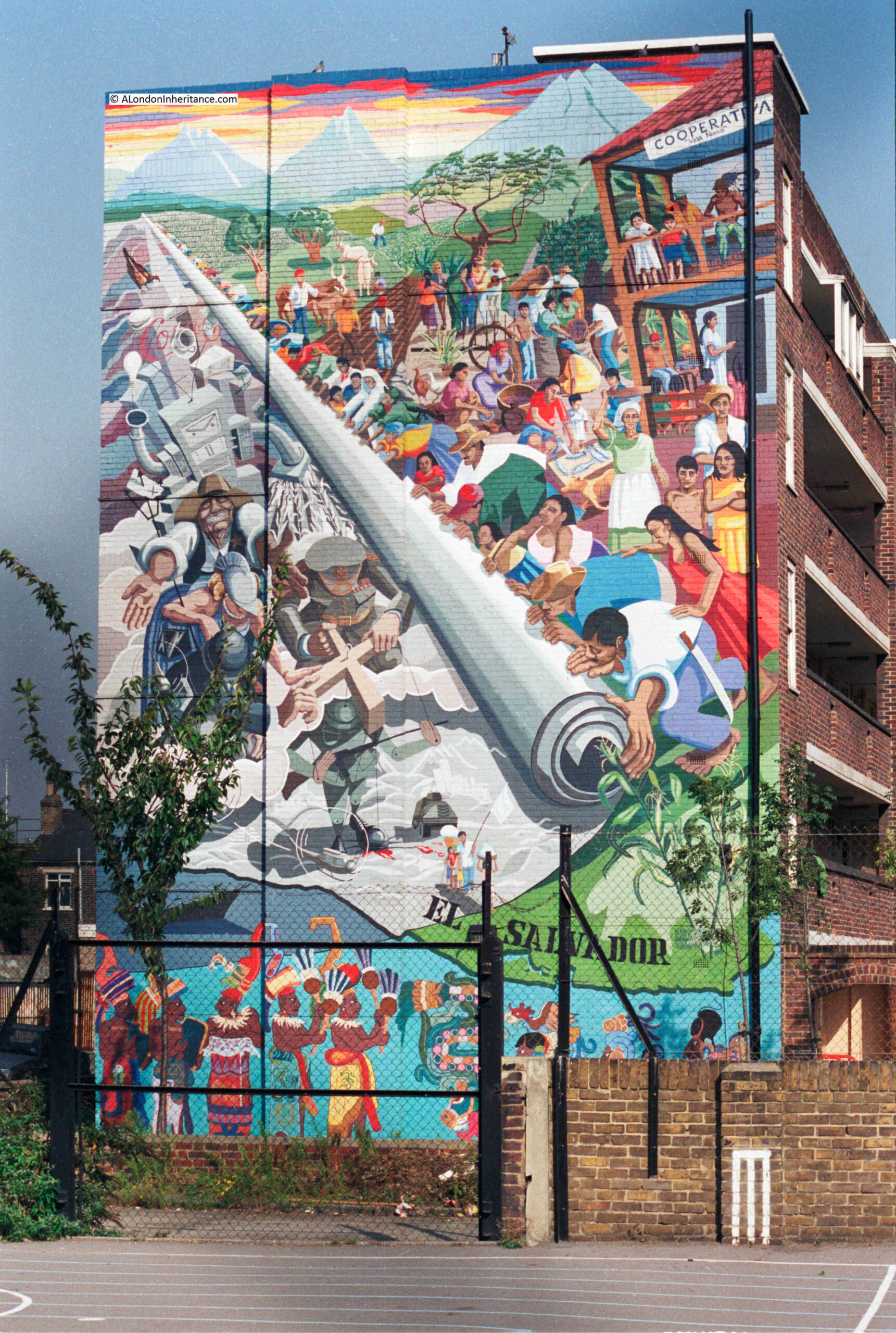
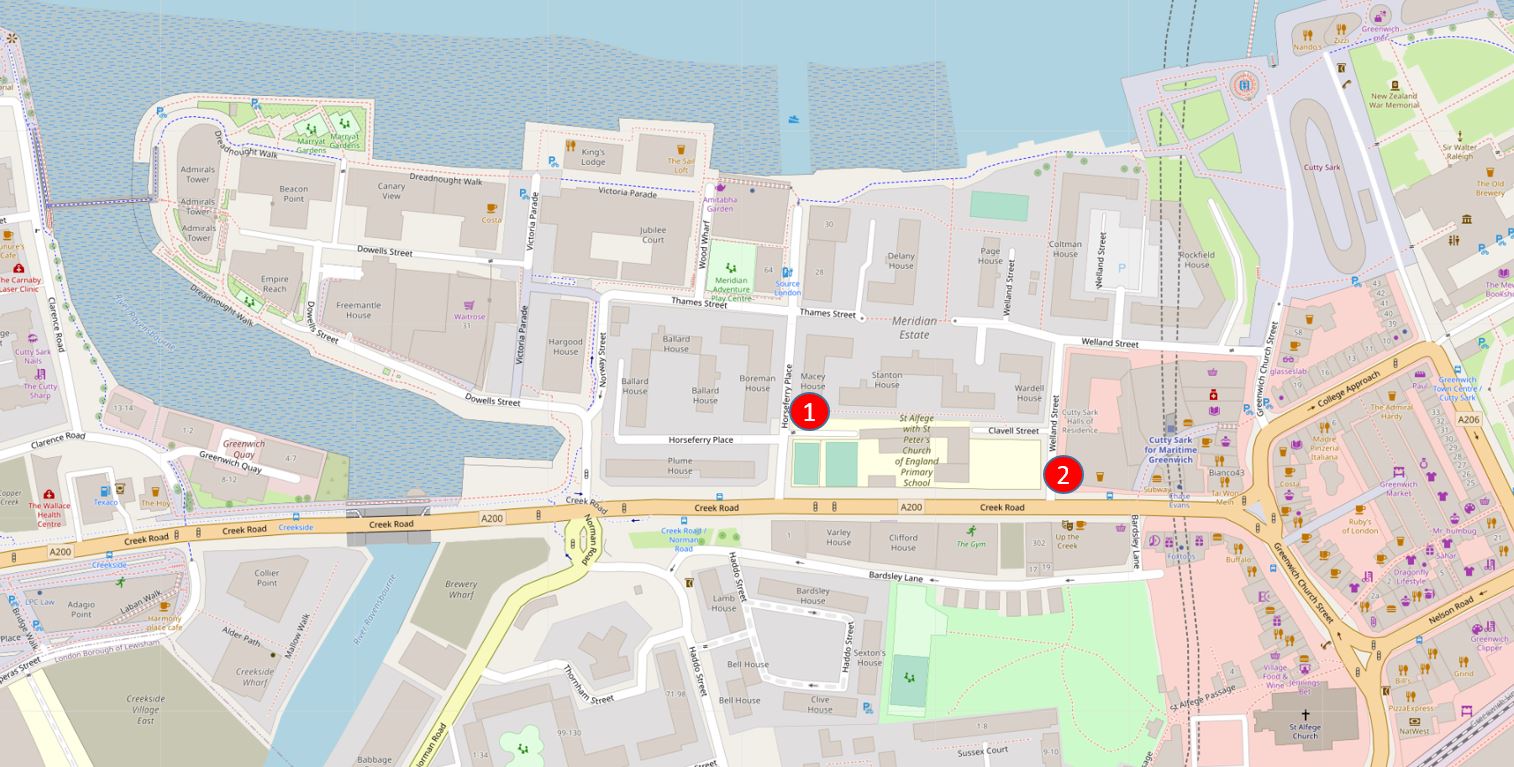
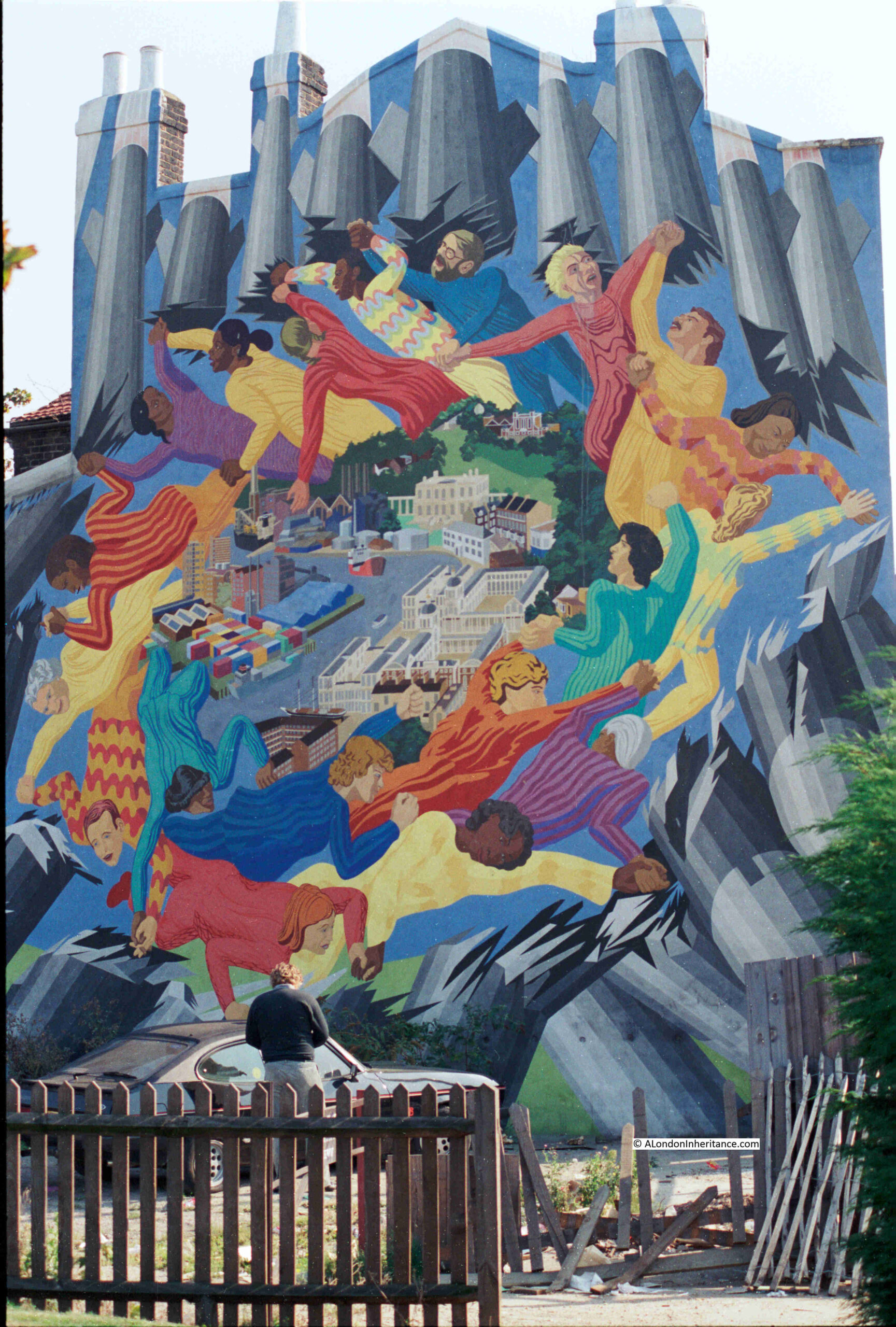
Walk east along Creek Road which leaves central Greenwich near the Cutty Sark DLR station, turn right down Horseferry Place, and in 1986 you would have seen the El Salvador mural in all its pristine colours, as photographed by my father:
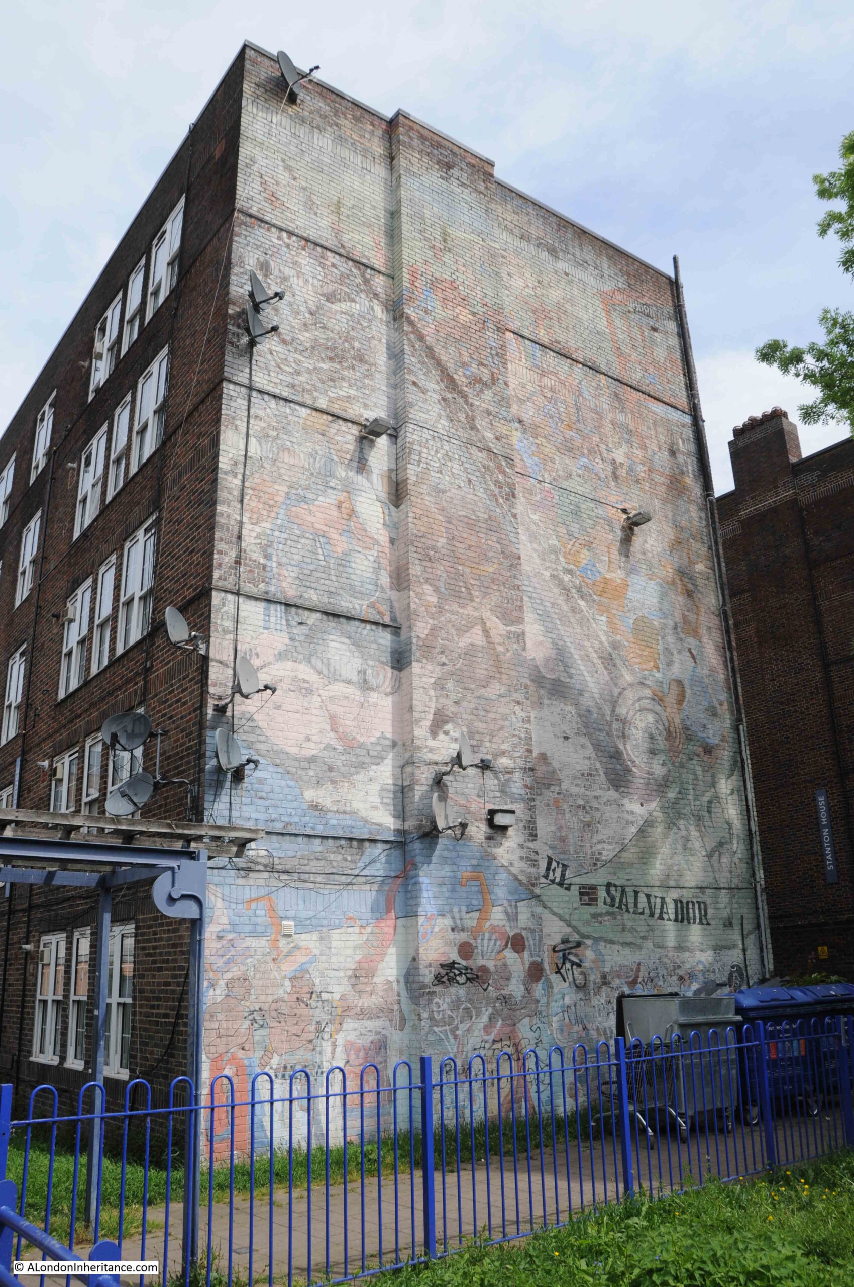
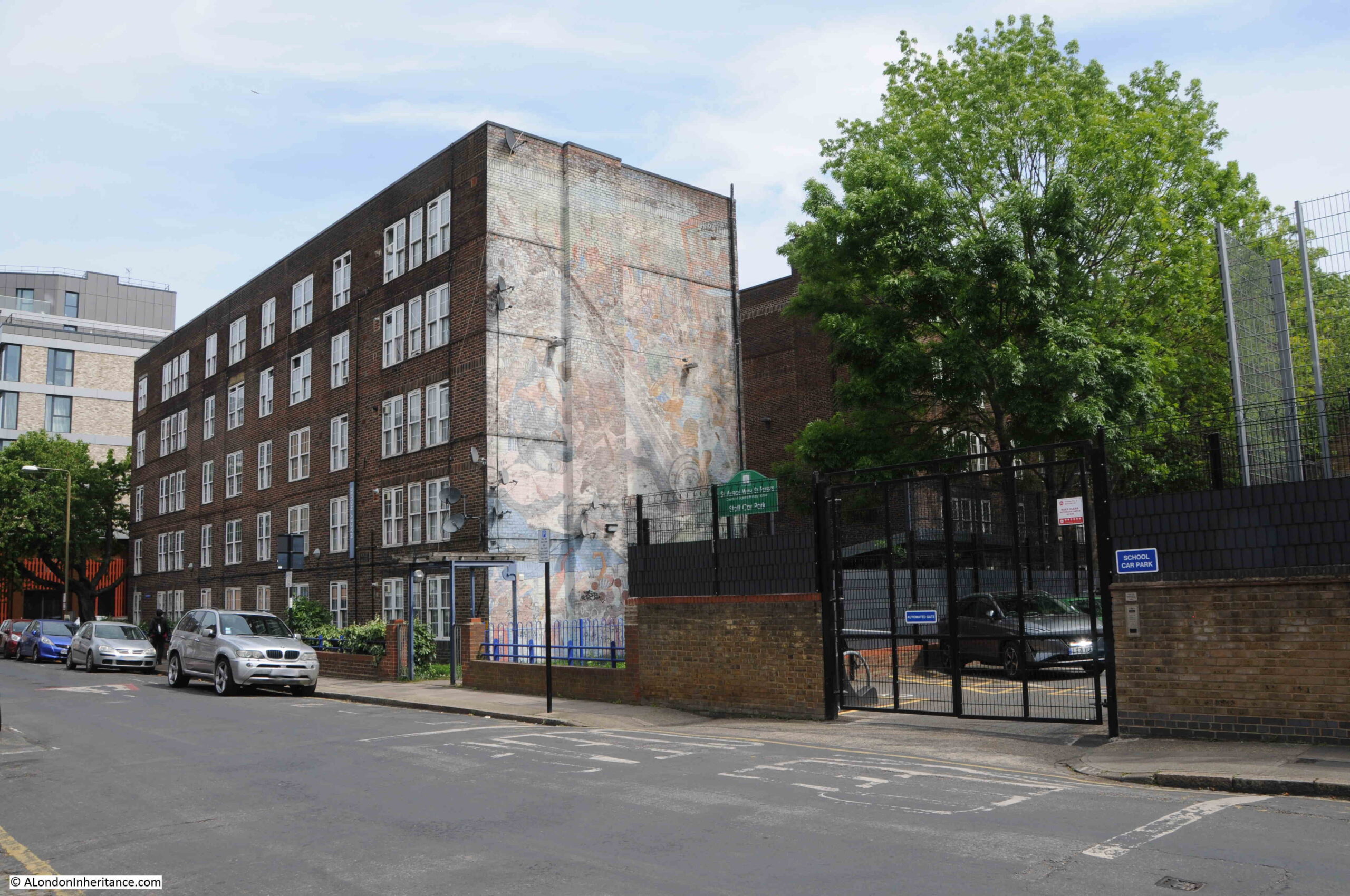
I recently visited the site, and found the mural in a very sad condition. Very faded and with Sky satellite dishes and a number of lights installed across the mural:
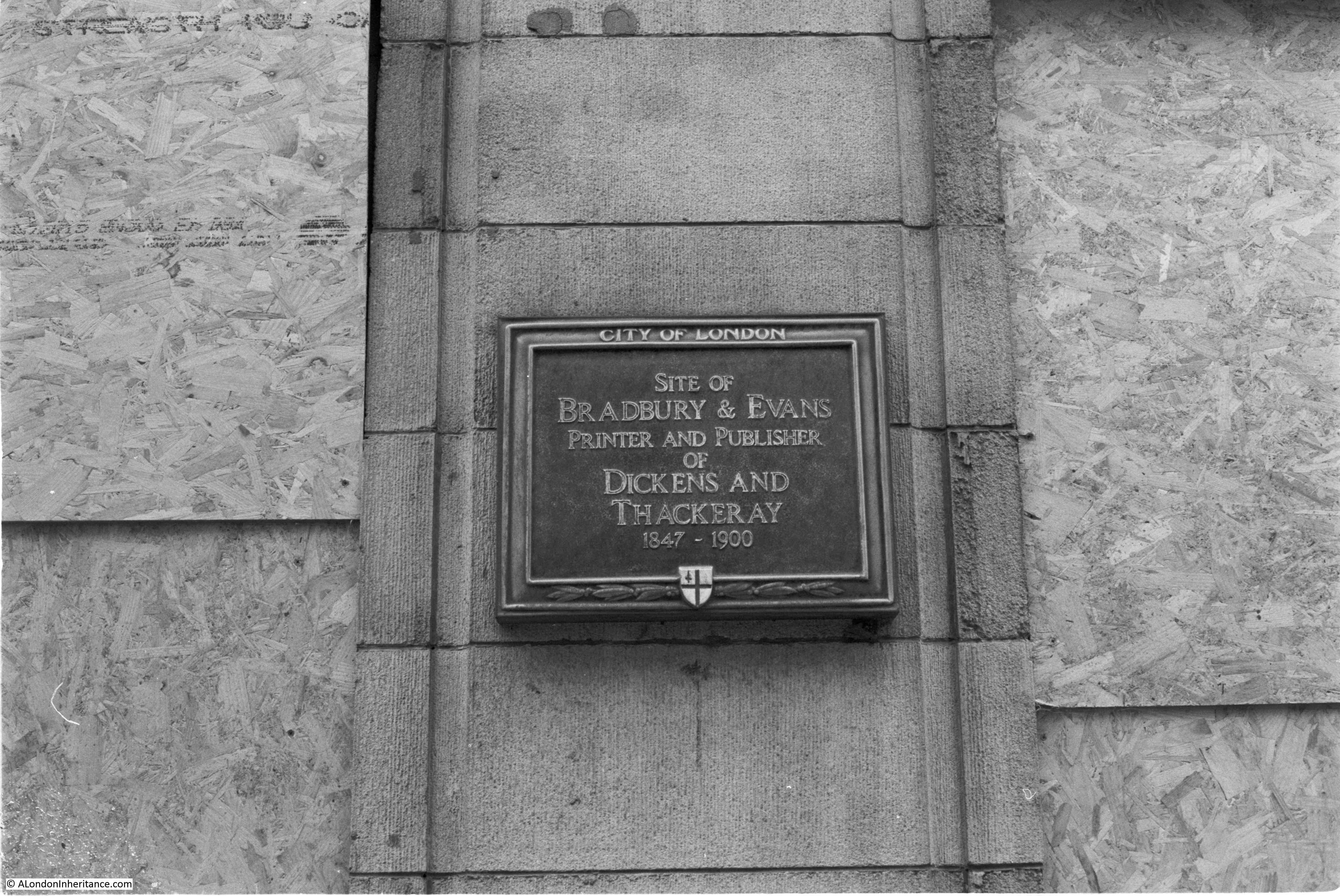
The El Salvador mural, or as it was originally titled “Changing the Picture”, was created for the El Salvador Solidarity Campaign in 1985, the year before my father’s photo.
The El Salvador Solidarity Campaign was based in Islington Park Street and was formed to express support for the people of El Salvador.
El Salvador is a country in central America and during the 1980s was suffering from a violent Civil War that would not really end until 1993, and resulted in the deaths of tens of thousands of the country’s population.
The civil war was mainly a conflict between the left wing Farabundo Martí National Liberation Front (FMLN), supported by the neighbouring countries of Nicaragua and Cuba, and the Government of the country, supported by the United States.
The people of the country paid a terrible price during the civil war. There were atrocities committed by both sides, however the military of El Salvador along with “Death Squads” who operated outside the official knowledge of the military or government, would commit the majority.
As well as the internal issues within the country, it was also a proxy conflict between the US and the Soviet Union, with US concern about the potential growth of Communist supporting governments in central America, which could have been the outcome if the US supported government had fallen to the FMLN.
There were a number of international groups supporting the people of El Salvador and the FMLN, including in the US and the El Salvador Solidarity Campaign in London.
The aim of the mural is to show the ordinary people of El Salvador (on the right) taking back control of their country, lives and future by “rolling up the picture”.
The people on the right are depicted in bright colours, with more muted, grey colours for the military, and the military / industrial support that contributed large quantities of arms to the country.
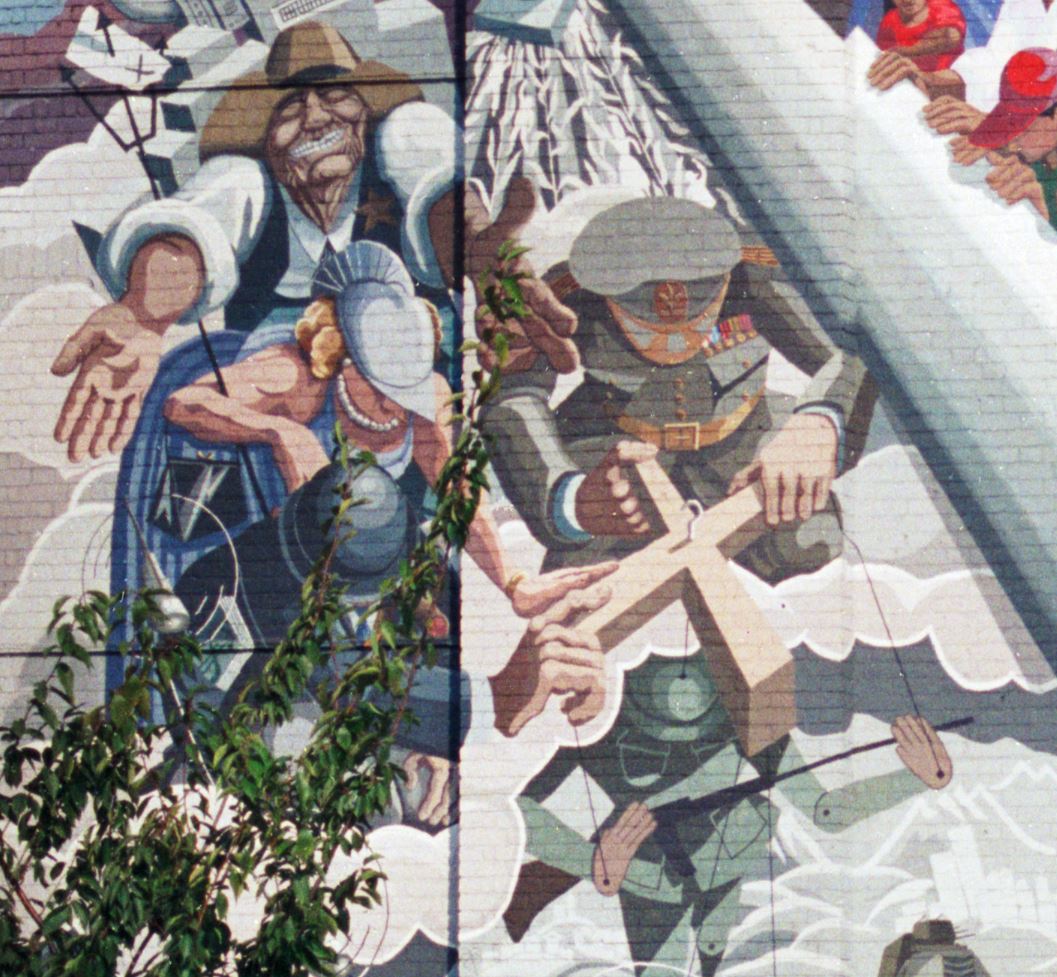
I believe the following extract from the mural shows Ronald Regan and Margaret Thatcher to the left with a figure representing El Salvador’s military on the right, controlling a puppet soldier:
Whilst the mural was commissioned by the El Salvador Solidarity Campaign, it was funded by the Greater London Council (GLC), and support of initiatives such as the mural was one of the many reasons why the Conservative government of the 1980s would abolish the GLC at the end of March 1986.
The mural was created by the artist Jane Gifford, along with Nick Cuttermole, Sergio Navarro and Rosie Skaife D’Ingerthorpe.
I could not get a photo of the mural at the same angle as my father’s. He was standing in the adjacent school playground, and today this is completely fenced.
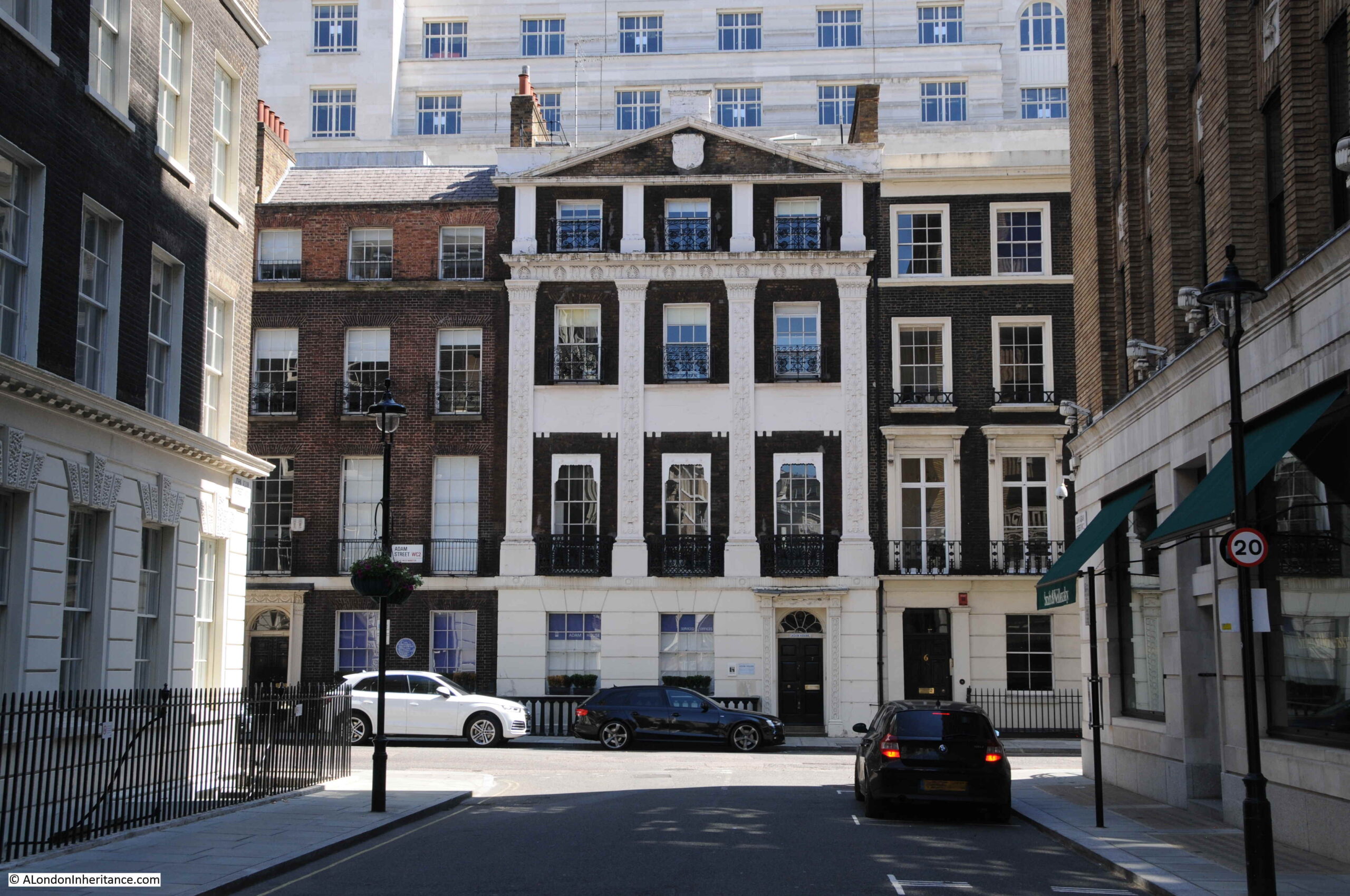
The following view shows a wider view of the El Salvador mural, on the side of Macey House which is part of the Meridian Estate:
Macey House is on Horseferry Place, a road that leads down towards the Thames. The name of the road records a ferry that once ran from near the southern end of the road across to the Isle of Dogs.
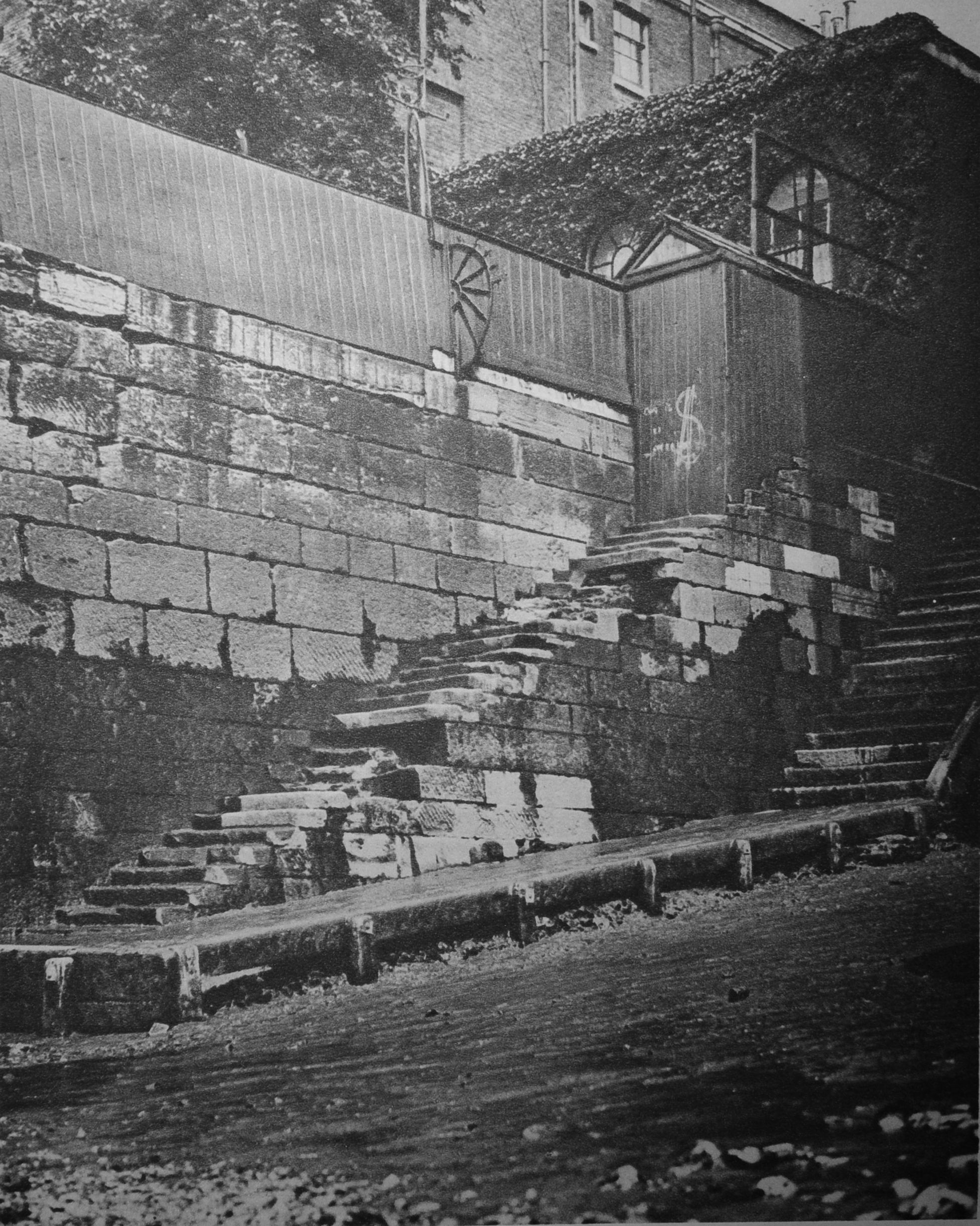
A short distance from the El Salvador mural, heading back towards Greenwich, along Creek Road was the “Wind of Peace” mural, at point number 2 on the above map:
Although the El Salvador mural is very badly faded, the Wind of Peace has suffered an even worse fate – the mural, along with the building on which it was painted, have completely disappeared.
In the photo below, there is a large new building on the left, with a terrace of smaller buildings further back, heading along Creek Road back into the centre of Greenwich.
The mural was on a building which stood where the large building with the clock is now located. The mural was on the side wall and would have been facing the camera.
The development on the left leading back into Greenwich was following the completion of the Cutty Sark DLR station, which is accessed through a pathway to the left of the van, at the junction of the large and smaller buildings.
The Wind of Peace mural was commissioned by the London Muralists for Peace initiative, as part of the 1983, Greater London Council’s Peace Year.
The mural was painted by artists Stephen Lobb and Carol Kenna, and replaced an earlier mural showing the river and the land alongside the river in Greenwich.
The mural has Greenwich in the centre of the mural, with the residents flying around the view of Greenwich, resisting and destroying missiles which symbolised the threat of nuclear war.
The GLC 1983 Peace Year comprised not just murals, but a whole series of events throughout London. A typical newspaper campaign advert covered:
“Peace is the most important issue facing us all. London could not survive a nuclear holocaust, irrespective of whether it is triggered by miscalculation in Washington or Moscow.
The GLC has declared 1983 Peace Year to give Londoners the opportunity of making a personal commitment to this highest of human ideals.
There can be no better way for people to express their desire for peace than through the Arts. That is why a major part of GLC Peace Year activities will involve supporting drama, film and the visual arts.
Come along and enjoy GLC Peace Year events and activities listed below. Support the cause of peace in London and give a peaceful lead to the world.
April 3 Easter Parade featuring specially commissioned Peace Float, Battersea Park at 3pm
May 1 May Day Festival, Victoria Park – at noon
May 5 Songwriters Competition for Peace – launch
June 4 Free Music Concert for Peace, crystal Palace Bowl at noon
July 16 Peace Concert of Classical Music, Kenwood Lakeside at 8pm
August 6 Hiroshima Day Peace Festival, Victoria Park at noon
August 7 Peace Concert of Classical Music, crystal Palace Bowl at 8pm”
There were many more events in addition to those listed above, including a Festival for Peace at Brockwell Park on May the 7th, which included the Damned, Madness and Hazel O’Conner.
As well as the Arts, Peace Year included other projects such as the construction of a number of “peace gardens” across London, such as the Noel-Baker Peace Garden in Islington.
The civil war in El Salvador ended almost thirty years ago, and the mural is gradually fading as are memories of the war (although the country still does suffer from some instability, including the recent bizarre decision to adopt Bitcoin as legal tender within the country).
The Wind of Peace mural disappeared as did the apparent threat of nuclear war, however with current unpredictable world events – perhaps it may be time for another mural.
The end of February marks the end of my 8th year of blogging, so time for a bit of a ramble through some of the themes of the past year, and how these have had an impact on London.
But first, a couple of blog admin comments. Firstly e-mail,
When I set up the blog in 2014 I used all the default WordPress widgets including one for “Contact” where the e-mail address was displayed, and could be clicked on to launch an e-mail client. The problem with this approach was that the address was easily discoverable and found by all the spammers who pollute the Internet.
The original blog e-mail was full of e-mails with dodgy links, attachments full of viruses, all the usual messages trying to fish for bank account details, etc.
There was so much that I have missed many genuine e-mails, so my apologies if you have messaged and I have not replied.
I have now changed to a Gmail address and this can be found down the lower right of the home page of the blog, displayed as a picture, so whilst not as convenient to use, it should stop much of the spam the old account received.
I have also added a “Blog roll” down the lower right of the home page. This is a listing of other blogs, or sites which may be of interest. I will be adding more in the coming weeks.
A London Inheritance Walks
The main blog related event for me during the past year, was the start of my guided walks. Two walks, one covered the South Bank and the other the Barbican and Golden Lane Estates. The walks were a sell-out and it was brilliant to meet so many readers, and my thanks to all who came on a walk.
I have been working on three new walks which will follow the same format, and will cover Bankside, Bermondsey and Wapping, as well as continuing the South Bank and Barbican walks.
The peninsula is under threat of development with the London Resort proposals for a large theme park to be built on much of the land.
The Swanscombe Peninsula has a long industrial heritage, but is now mainly marsh and grasslands. Walking the area provides a wonderful feeling of walking an isolated and natural section of north Kent, an environment that is all the more important as London pushes east along the river.
The Swanscombe Peninsula is an important site of biodiversity, with wetlands and marsh occupying significant parts of the space,
A key decision that may impact whether the London Resort goes ahead, was the decision last November by Natural England to confirm the peninsula as a Site of Special Scientific Interest, and in their announcement stating:
Natural England has today confirmed Swanscombe Peninsula as a Site of Special Scientific Interest (SSSI) in recognition of its national importance for plants, geology, birds and invertebrates – including one of the rarest spiders in the country.
A valuable green space abundant in wildlife lying close to major urban areas, the 260 hectare site alongside the Thames Estuary forms a corridor of habitats connecting Ebbsfleet Valley with the southern shore of the River Thames between Dartford and Gravesend.
It remains to be seen whether confirming the site as an SSSI is sufficient to stop the proposed development, but it was a very hopeful step.
New River Walk
In October, I walked the first part, from Ware to Cheshunt, of the New River Path, a walk that follows the 17th century New River from source near Ware in Hertfordshire to New River Head in Islington (the final part from the east and west reservoirs around Woodberry Wetlands, just south of the Seven Sisters Road to New River Head being a heritage walk along the route of the river).
It was a fascinating walk, along manmade infrastructure and 19th century pumping stations that are still key in providing water for London’s growing population.
Hopefully, in the coming weeks, I will complete the remainder of the walk from Cheshunt to Islington.
The Changing Face Of London
The face of London continues to change with what seems a continuous stream of new glass and steel towers. Last May, I wrote about Three Future Demolitions and Re-developments, one of which was the old ITV Studios on the South Bank (the square tower in the centre of the following photo):
The building is now securely fenced off, and scaffolding surrounds the lower buildings and appears to have started creeping up the tower. presumably in preparation for demolition:
Coin Street Community Builders and the Waterloo Community Development Group have organised a petition in opposition to the planning application. Their page on the proposal can be found here.
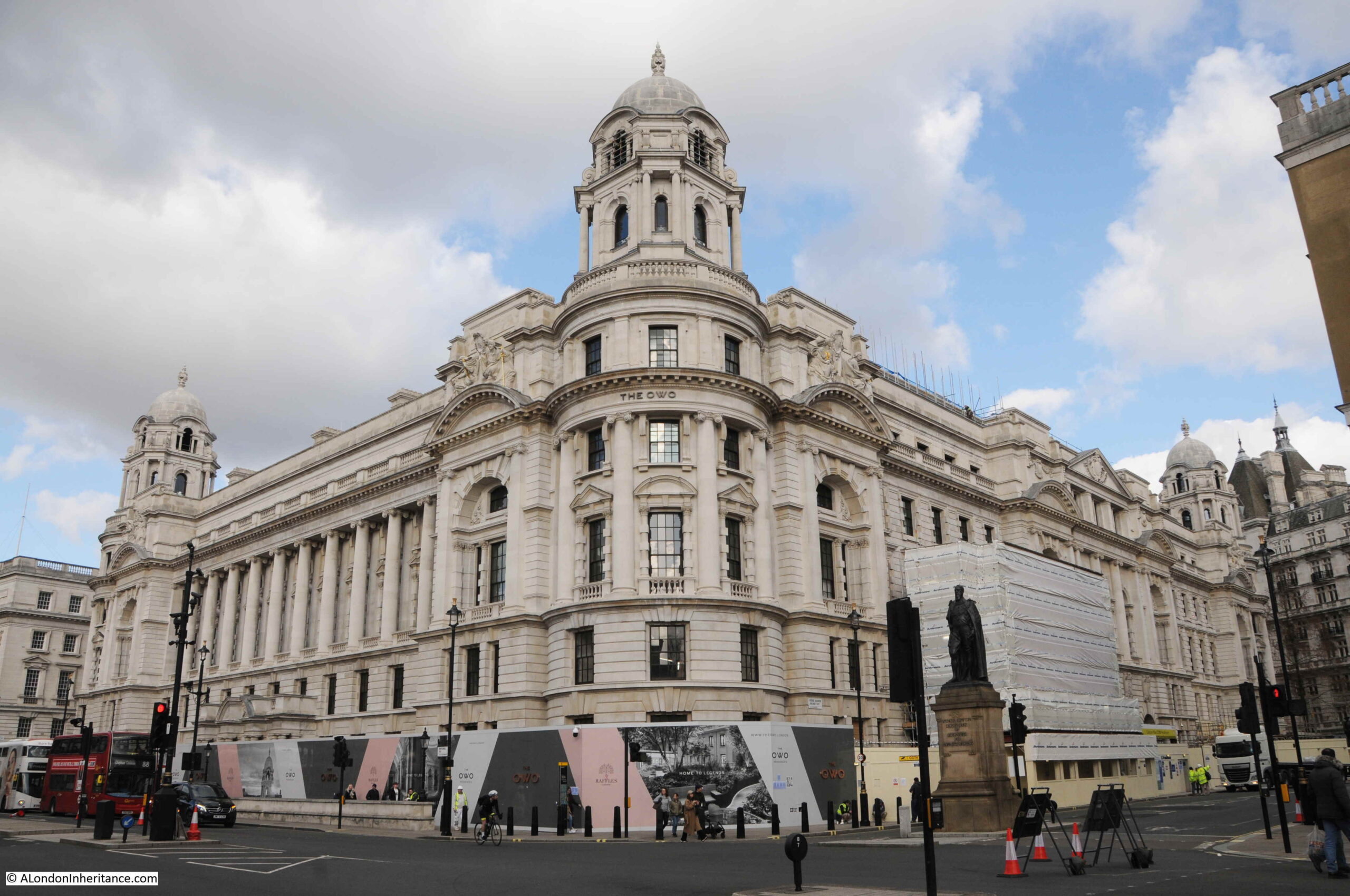
Meanwhile, the transformation of many of the city’s buildings to either expensive apartments or hotels continues. I was in Westminster on Friday and the old War Office building is now being transformed into the “OWO Residences”, and “London’s first Raffles Hotel”, which will offer “Privileges and Amenities Beyond Compare” which gives an idea of the price range and target market.
The former War Office building really is in a prime position, on Whitehall and opposite the Household Cavalry Museum and the tourist trap in front of the Horse Guards building.
The Grade II listed old War Office building:
The only constant in London is the level of change, however it does seem that so much local identity is being lost. There must have been so many other creative uses for such a building. I wonder what has happened to the tunnels that once connected to the building.
My Father’s Photos
The original aims of the blog were rather selfish. To provide me with an incentive to find the current locations of my father’s old photos, and to find out more about London, which I had probably taken for granted for too many years.
I have many more of my father’s photos still to go, and there is so much else of interest in London, so hopefully the blog will be still be going for a few more years.
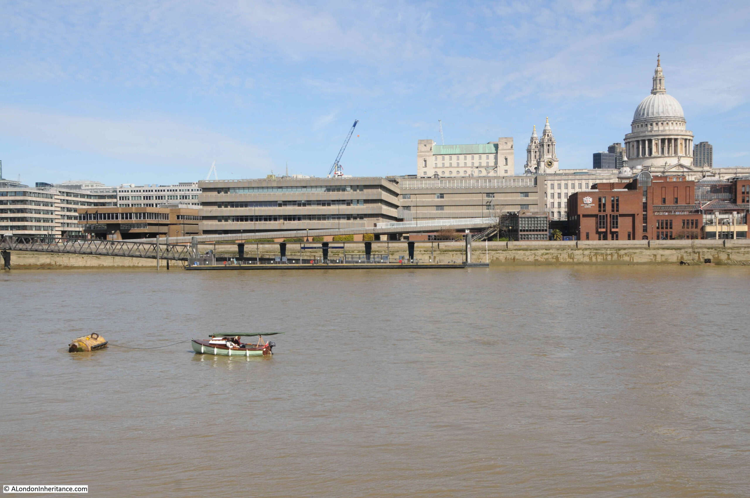
London is fascinating to explore, but sometimes it is just good to sit and watch. Whilst walking through Bankside last year I noticed a couple had moored their boat in the river and were reading and looking at the view.
Not a bad way to spend a Sunday morning.
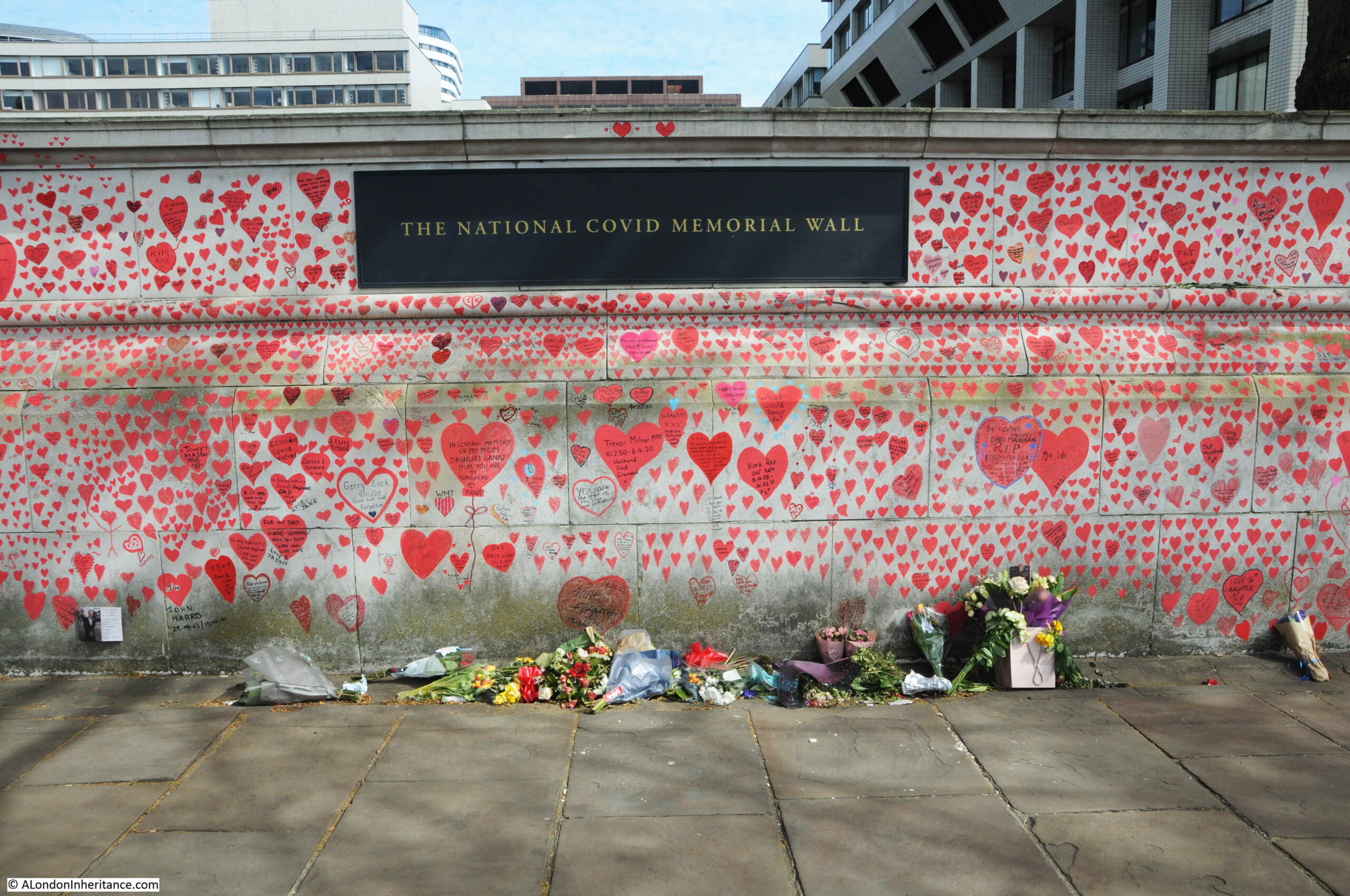
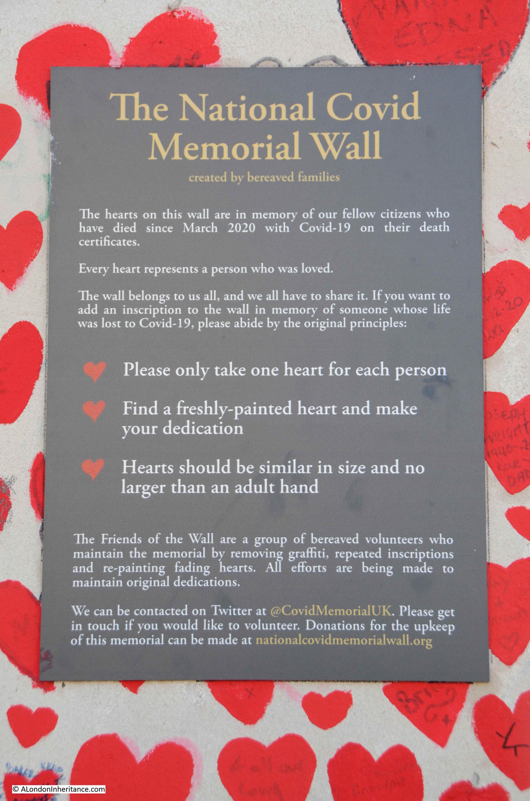
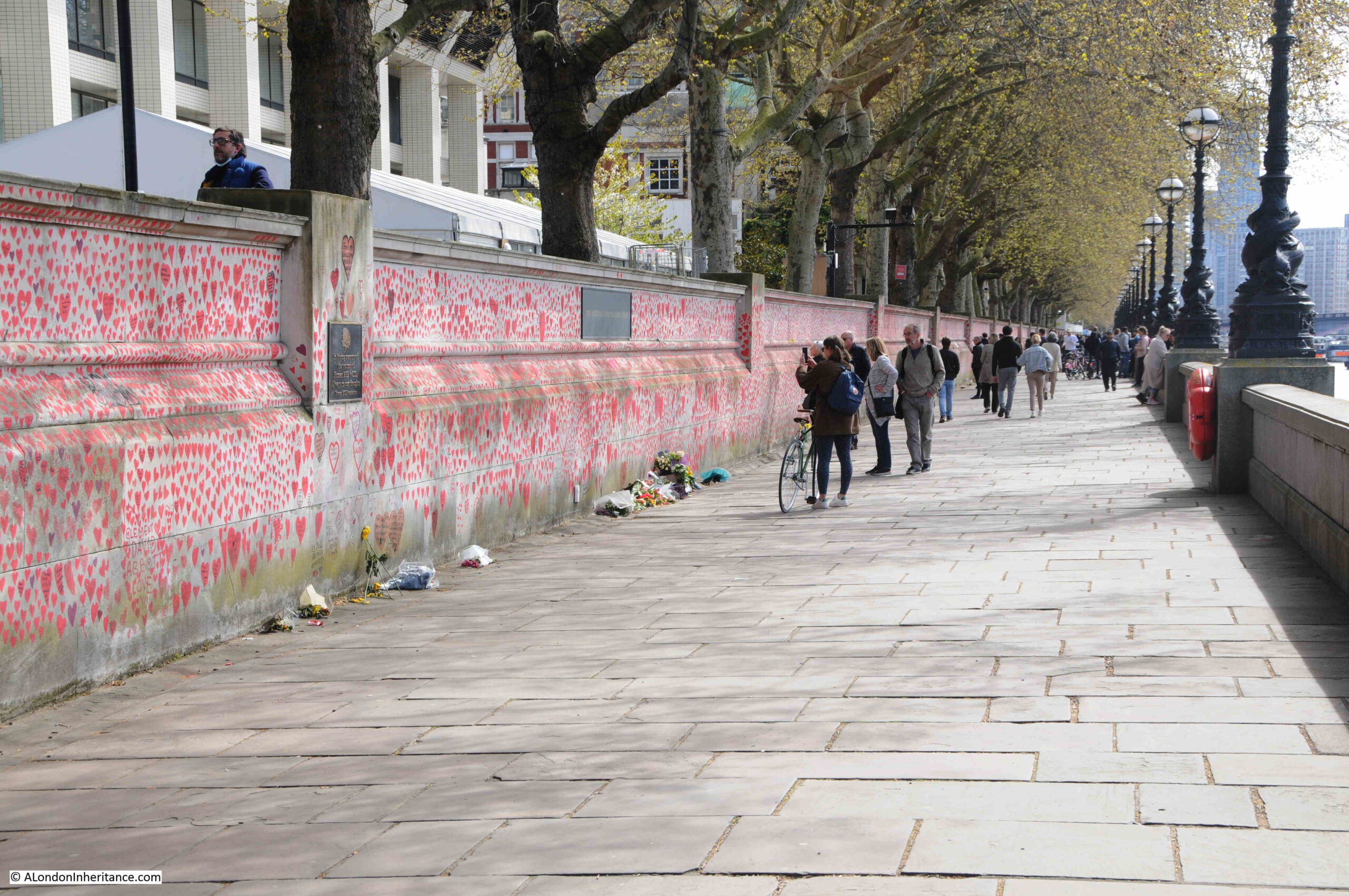
The National Covid Memorial Wall
For a second year running, Covid has had a significant impact on London. The impact to businesses, significantly reduced tourism, working from home, etc. all have a visible impact on the city, however the hidden tragedy is the number of deaths.
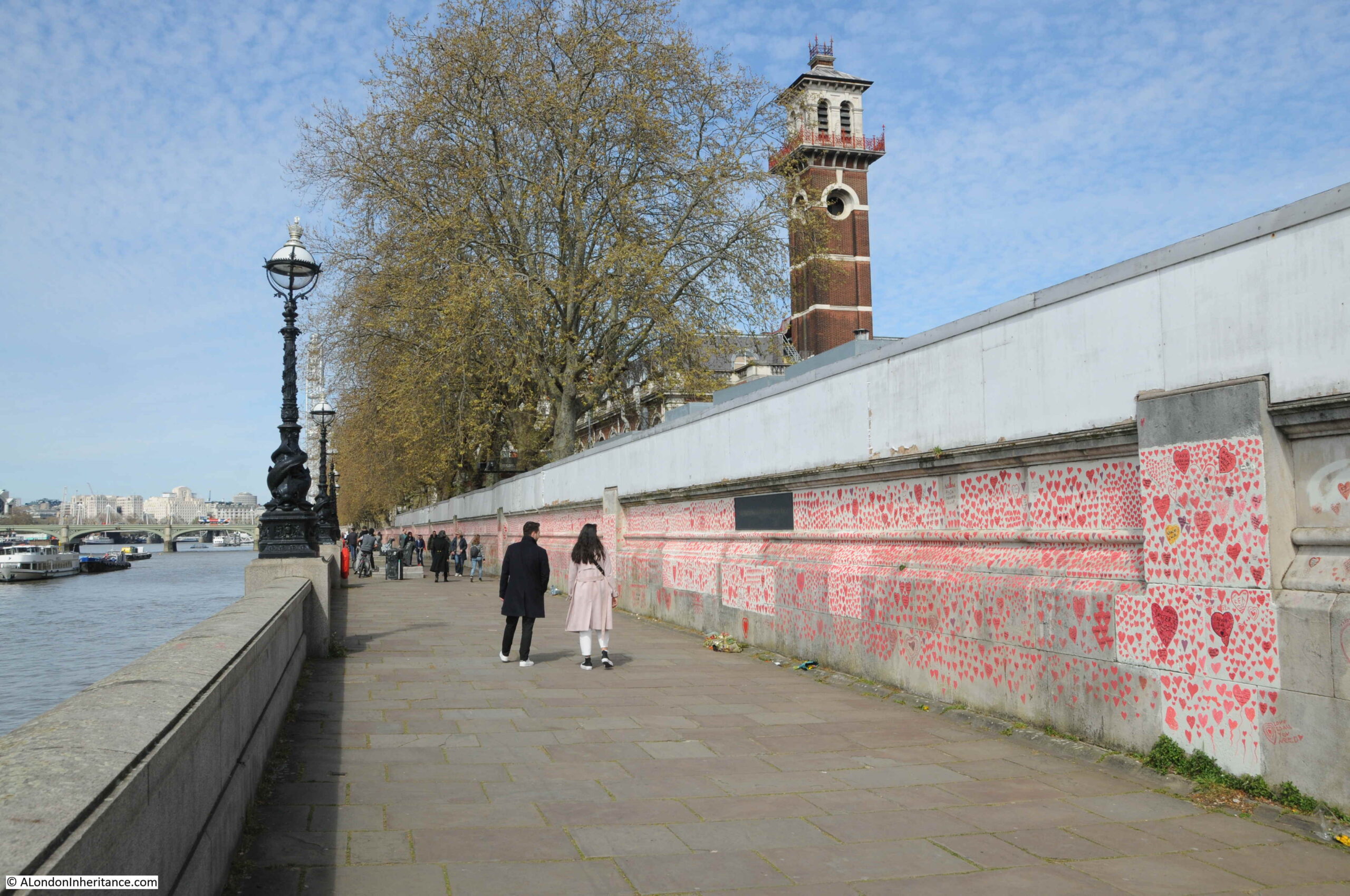
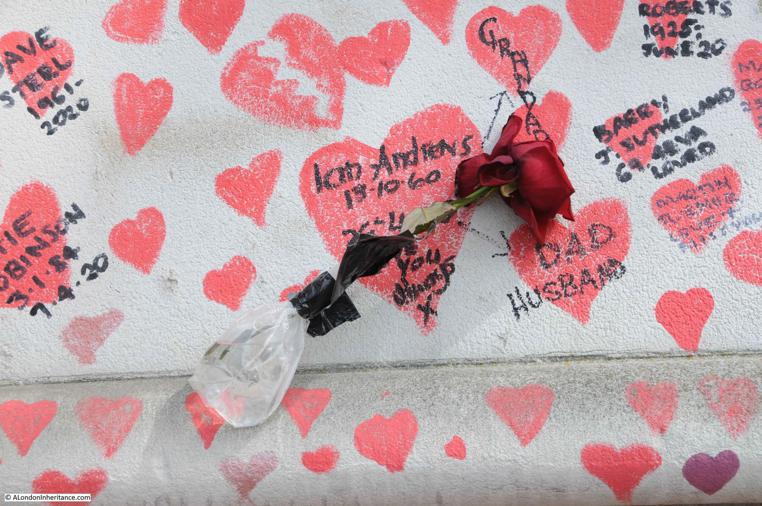
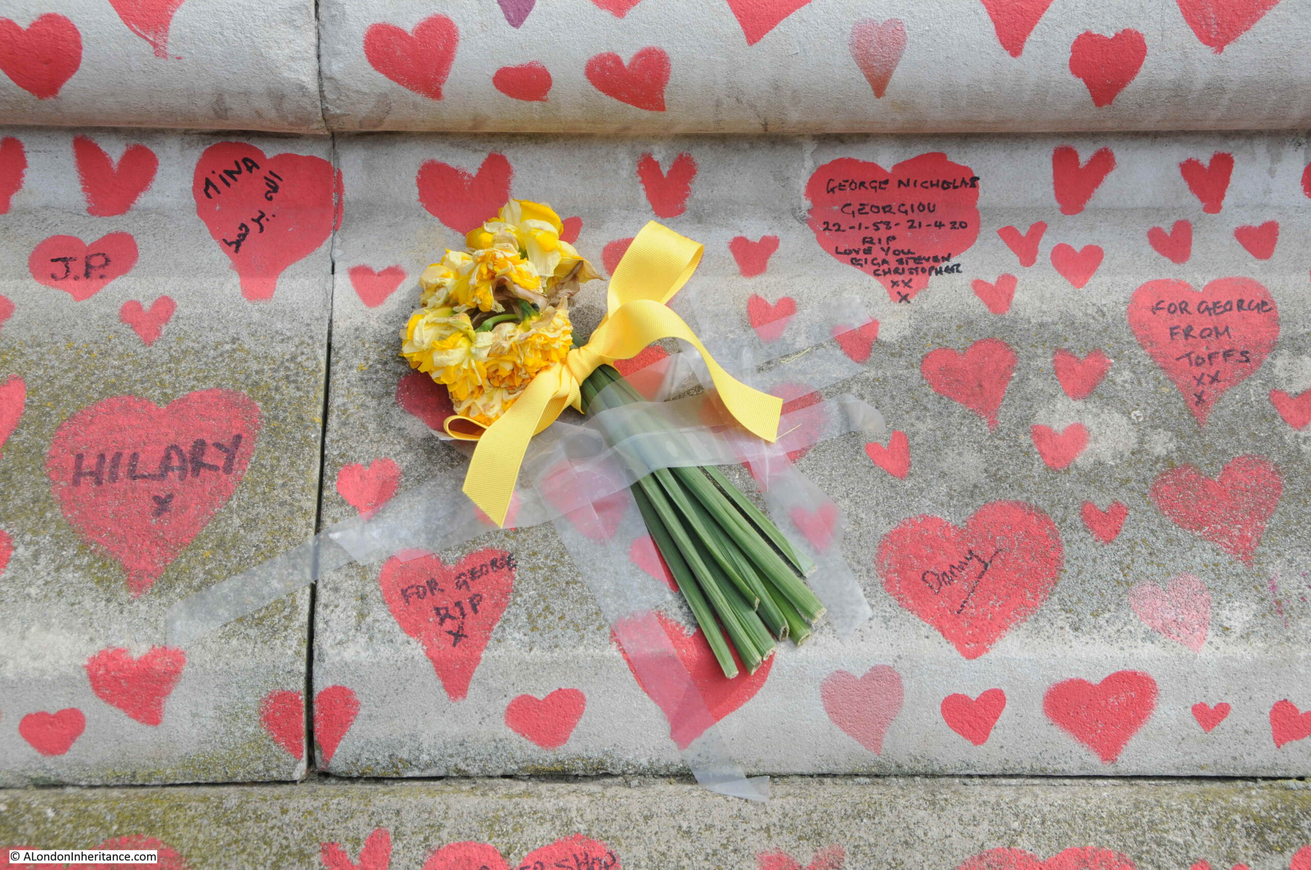
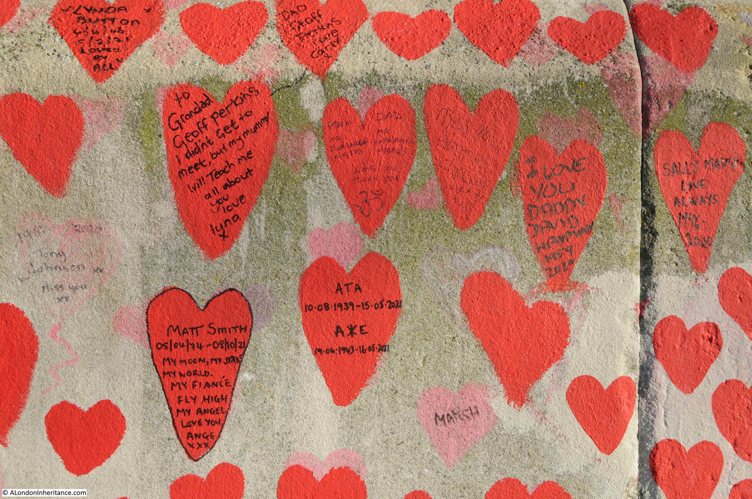
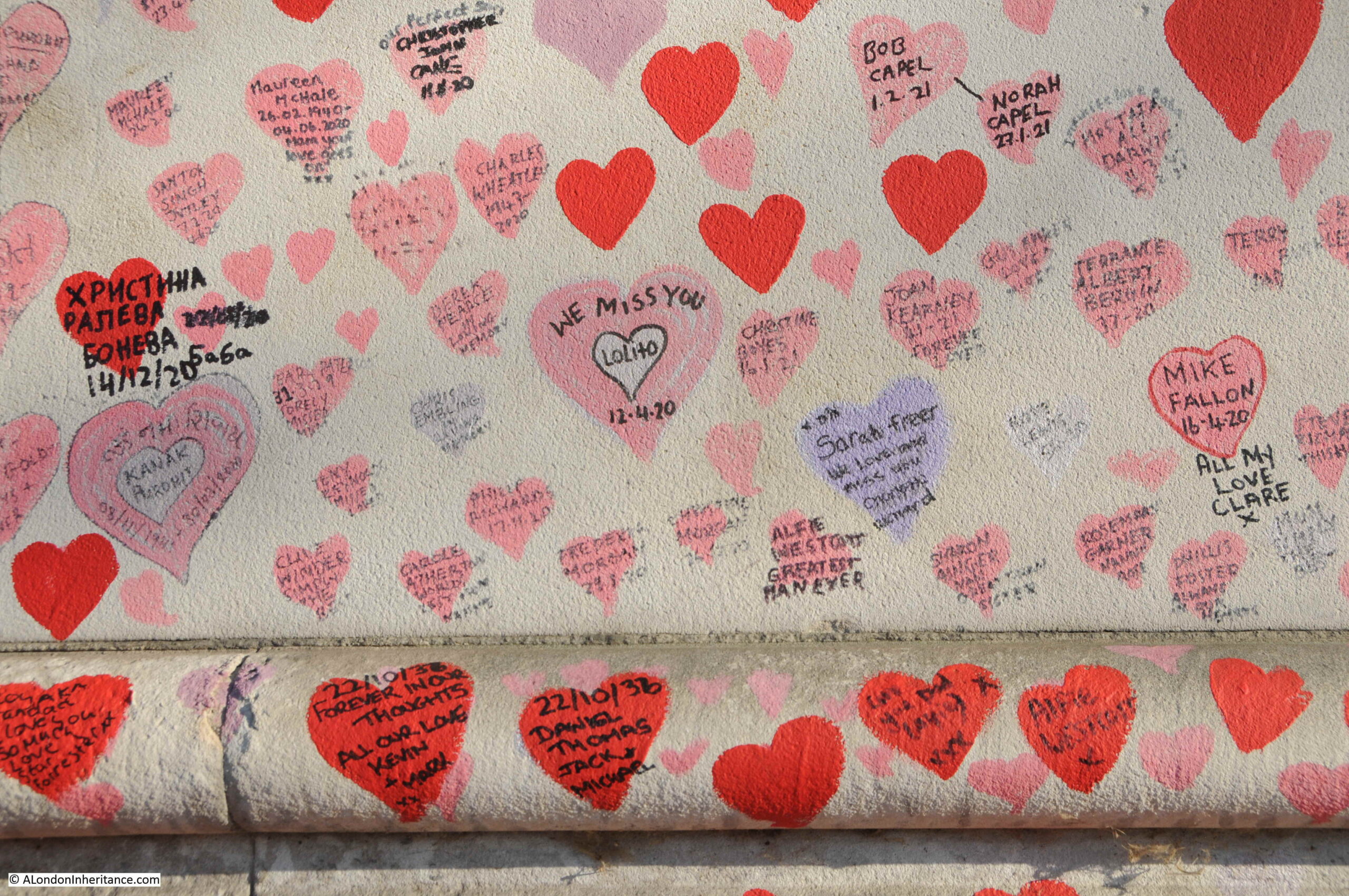
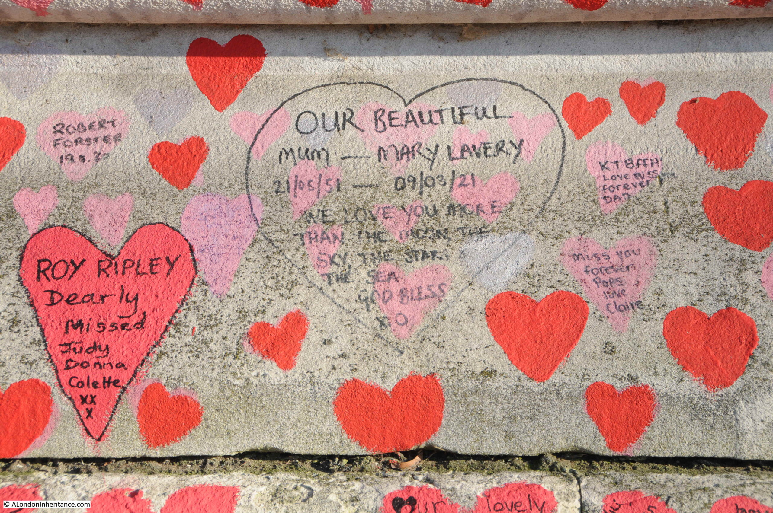
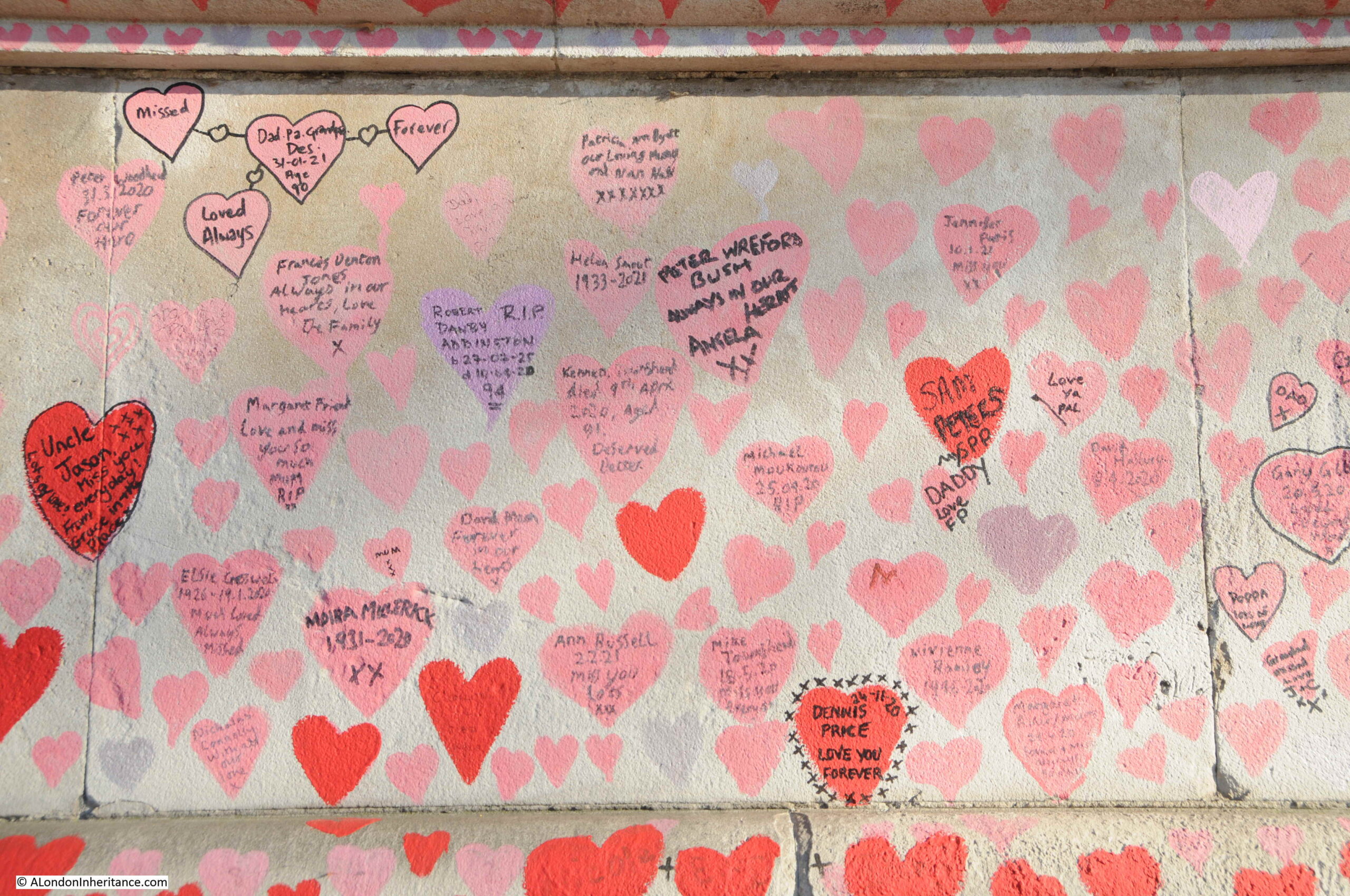
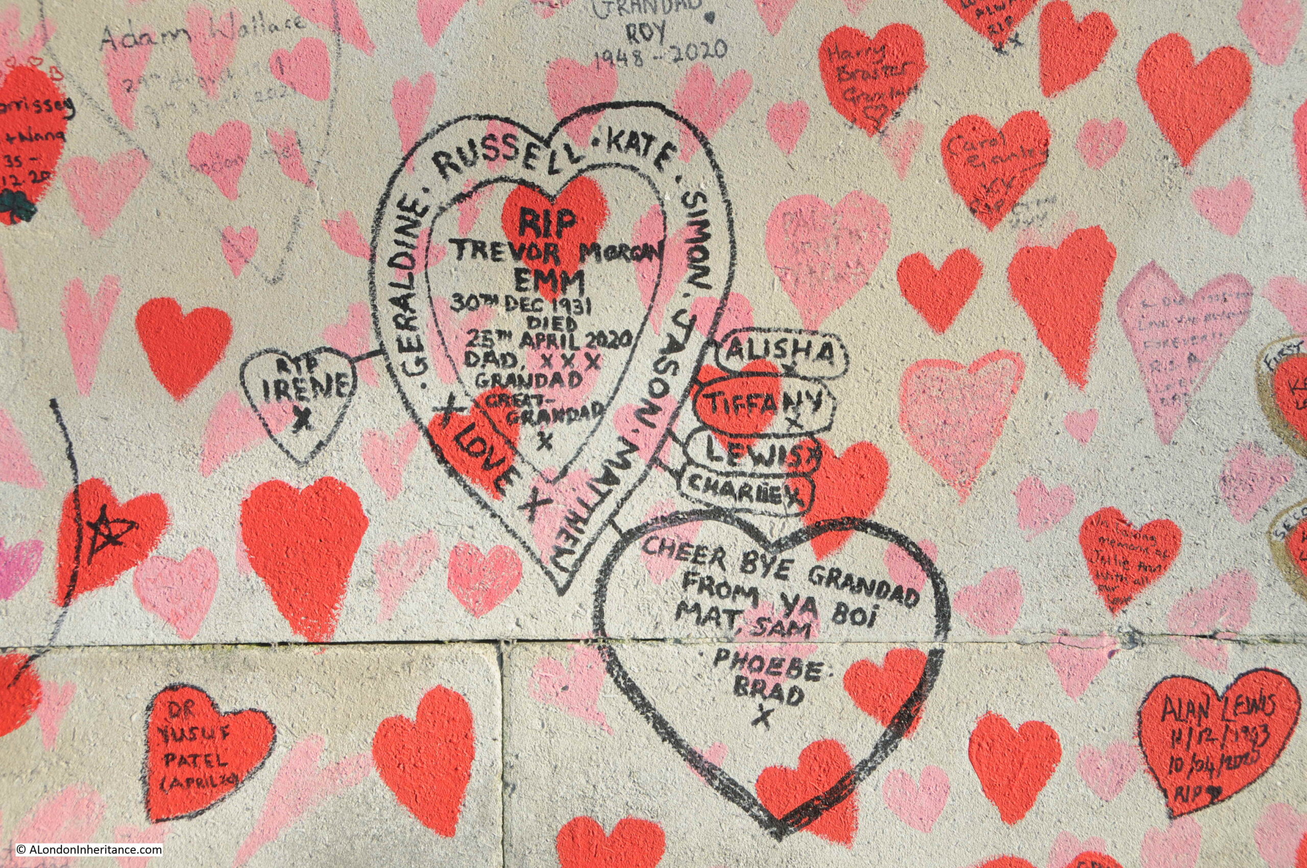
The National Covid Memorial Wall, along the embankment opposite the Palace of Westminster, between Westminster and Lambeth Bridges, really brings home the impact of these figures, with each heart along the wall representing an individual death.
The memorial wall stretches almost the entire length between Westminster and Lambeth Bridges:
Each of the hearts represents an individual death. Families have added the names of those who have died to many of the hearts which really brings home that the daily figures represent the loss of an individual, and the impact on their family.
There are calls to make the wall a permanent memorial, however I suspect this Government will want to move on very quickly from the previous two years.
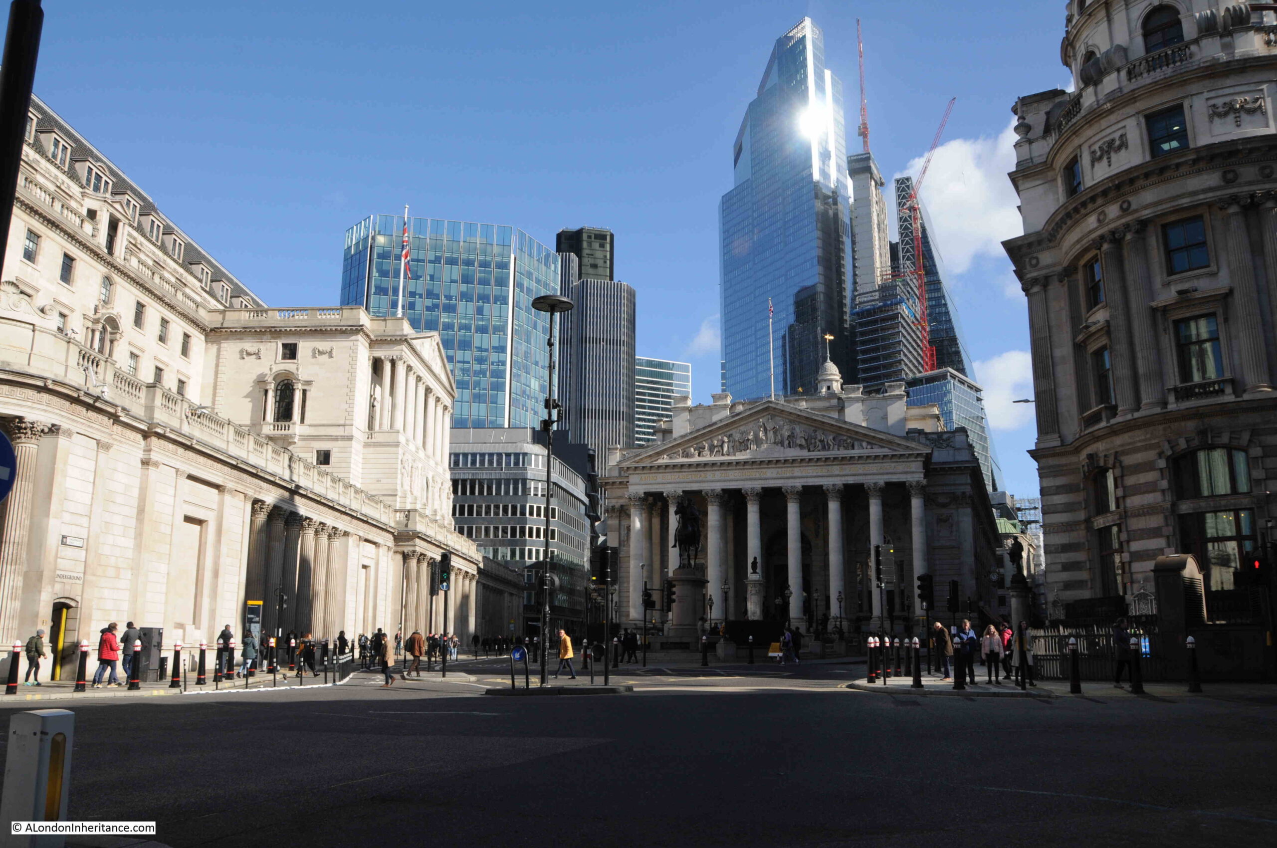
The City of London
Whilst much of London is almost back to “normal”, the City of London is still very quiet compared to pre-pandemic days. Much of this can probably be attributed to the attractions of working from home for at least part of the week. Why spend a fortune on commuting, frequently in a crowded commuter train, when you can work at home for a few days a week.
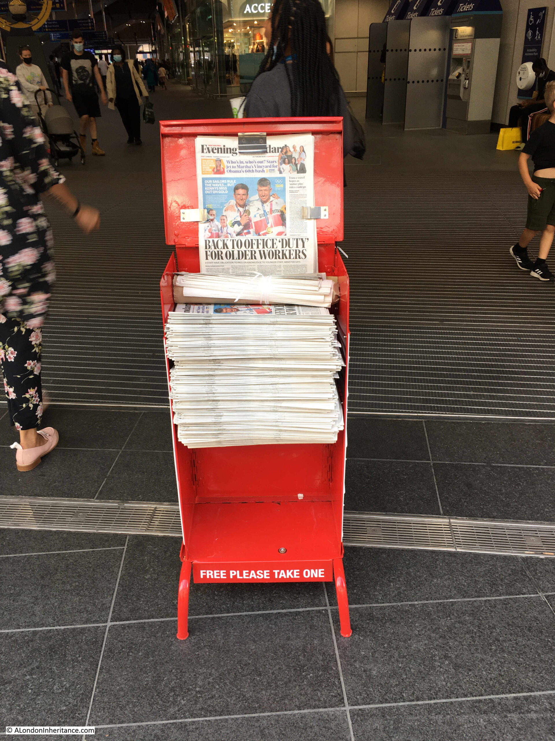
Back on the 3rd of August 2021, the Evening Standard was telling older workers that apparently they had a “duty” to go back to the office:
The impact on Transport for London has been considerable. Probably the only transport system in a capital city that has to rely on fares for the majority of its revenue.
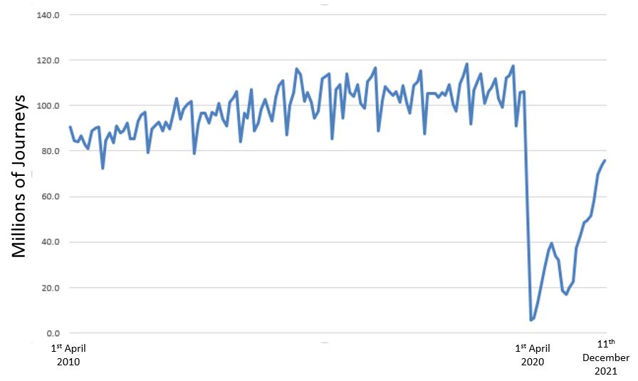
The latest data from the London DataStore, runs up to December 2021 and shows the impact of the last couple of years on travel on the Underground.
I downloaded the data and created the following graph, which shows how travel on the Underground has gradually been rising over the ten years from April 2010 to 2020, and then fell off a cliff at the start of the first lock down.
The above graph uses monthly data, and shows the peaks and troughs of travel patterns through the year, and also that travel volumes have still not returned to their pre-pandemic numbers.
Where a system is so dependent on fare revenue, the graph shows the impact on TfL’s finances and why Government support is needed. The challenges of negotiating this when you have a Labour London Mayor and a Conservative National Government have resulted in only short term solutions, rather than a long term agreement on how London’s transport can be funded for both day to day running costs and future investment.
The impact on the City can be seen walking the streets. There are a number of businesses that are dependent on people, such as cafes, restaurants, dry-cleaners etc, which have closed.
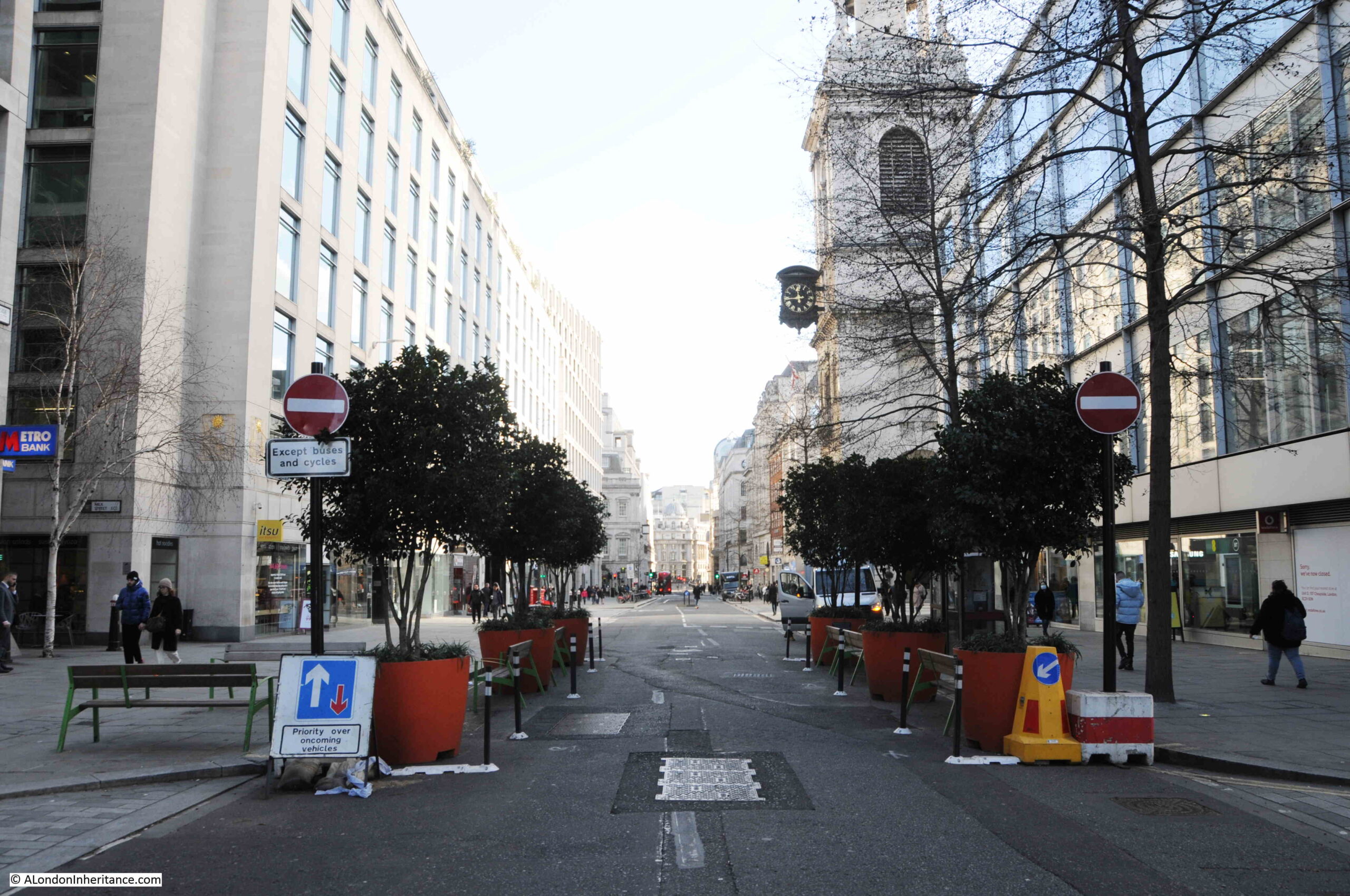
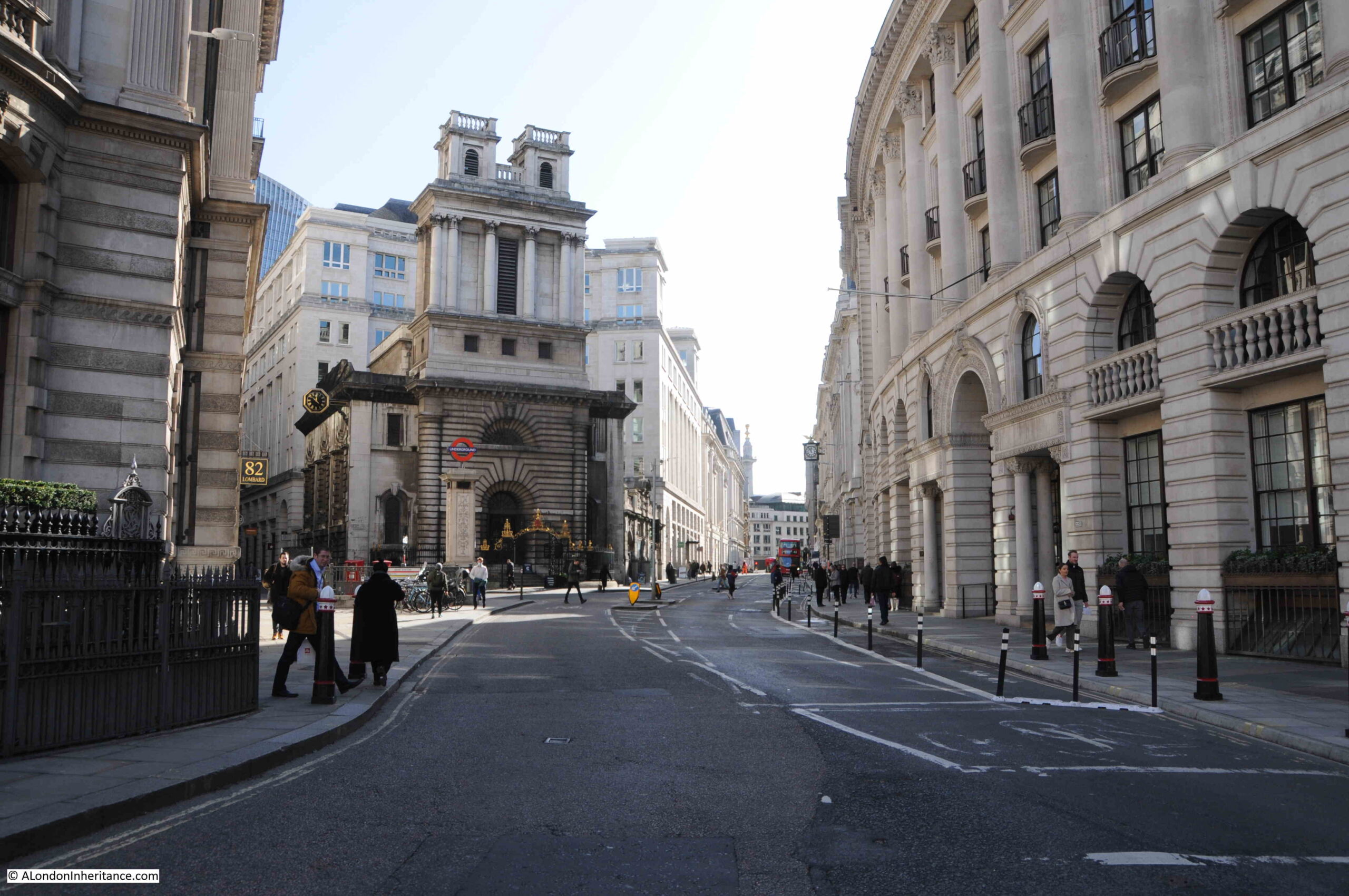
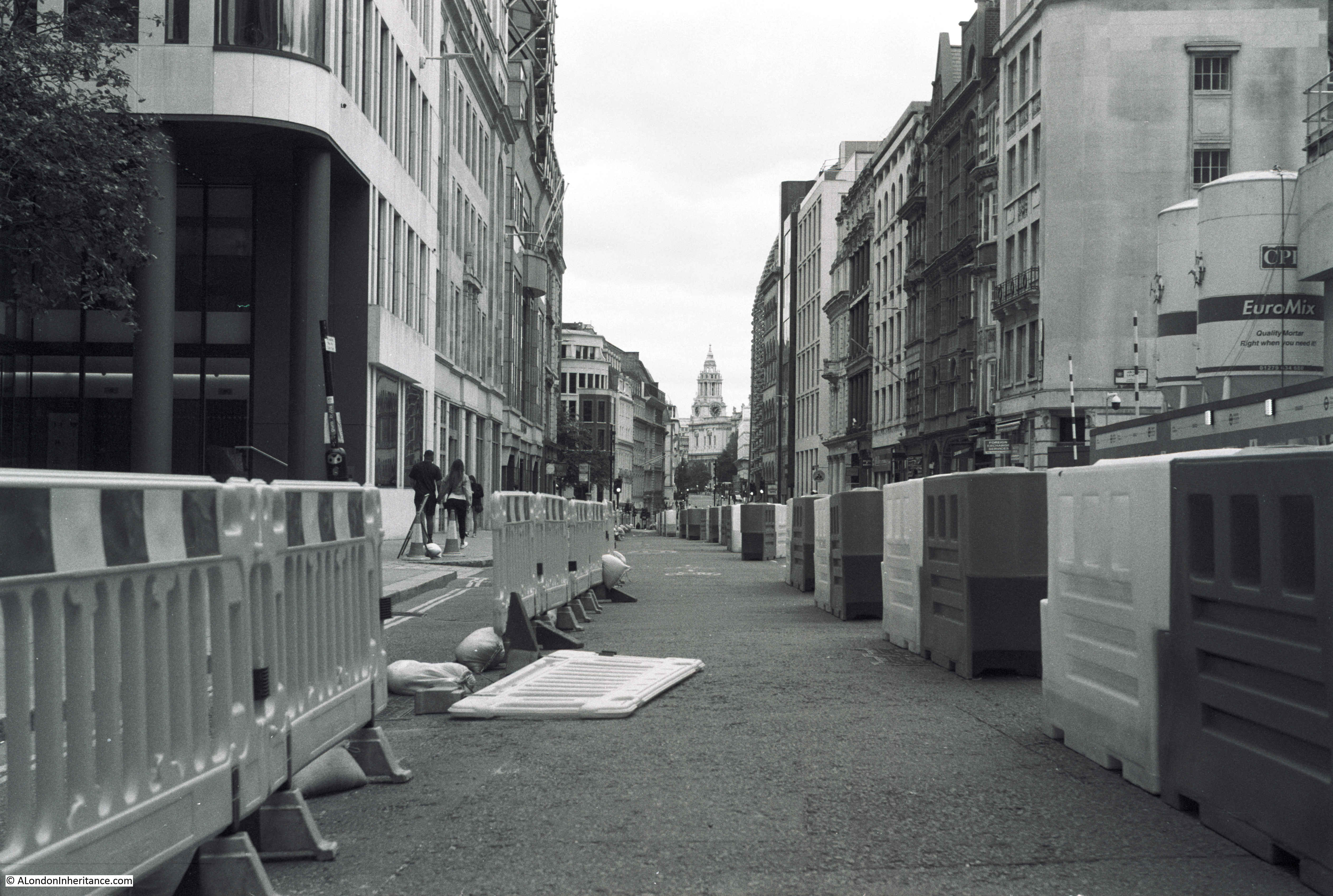
The core of the City is strangely quiet. There is hardly any traffic in Cheapside, as from close to St Mary-le-Bow, the street is closed to traffic apart from buses and cycles:
This appears to include taxis, as whilst walking from Cheapside to Liverpool Street I did not see a single black cab. There was a queue of people waiting for a taxi at Liverpool Street, so I assume taxis in this area are in short supply, perhaps due to the number of road closures.
There are far more people walking the City streets than there has been for the last couple of years, however the City just seems so quiet, more like a Sunday than the working week.
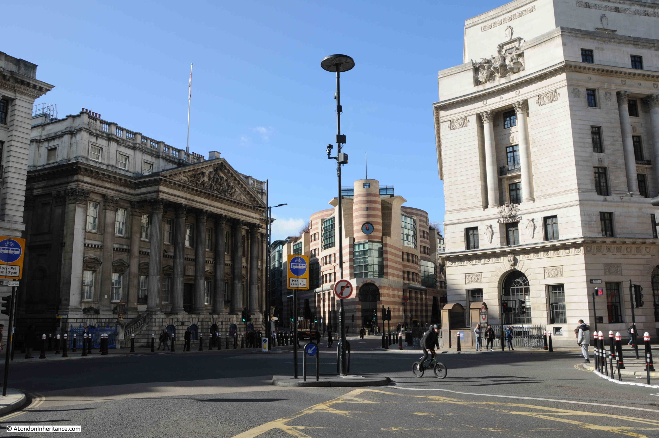
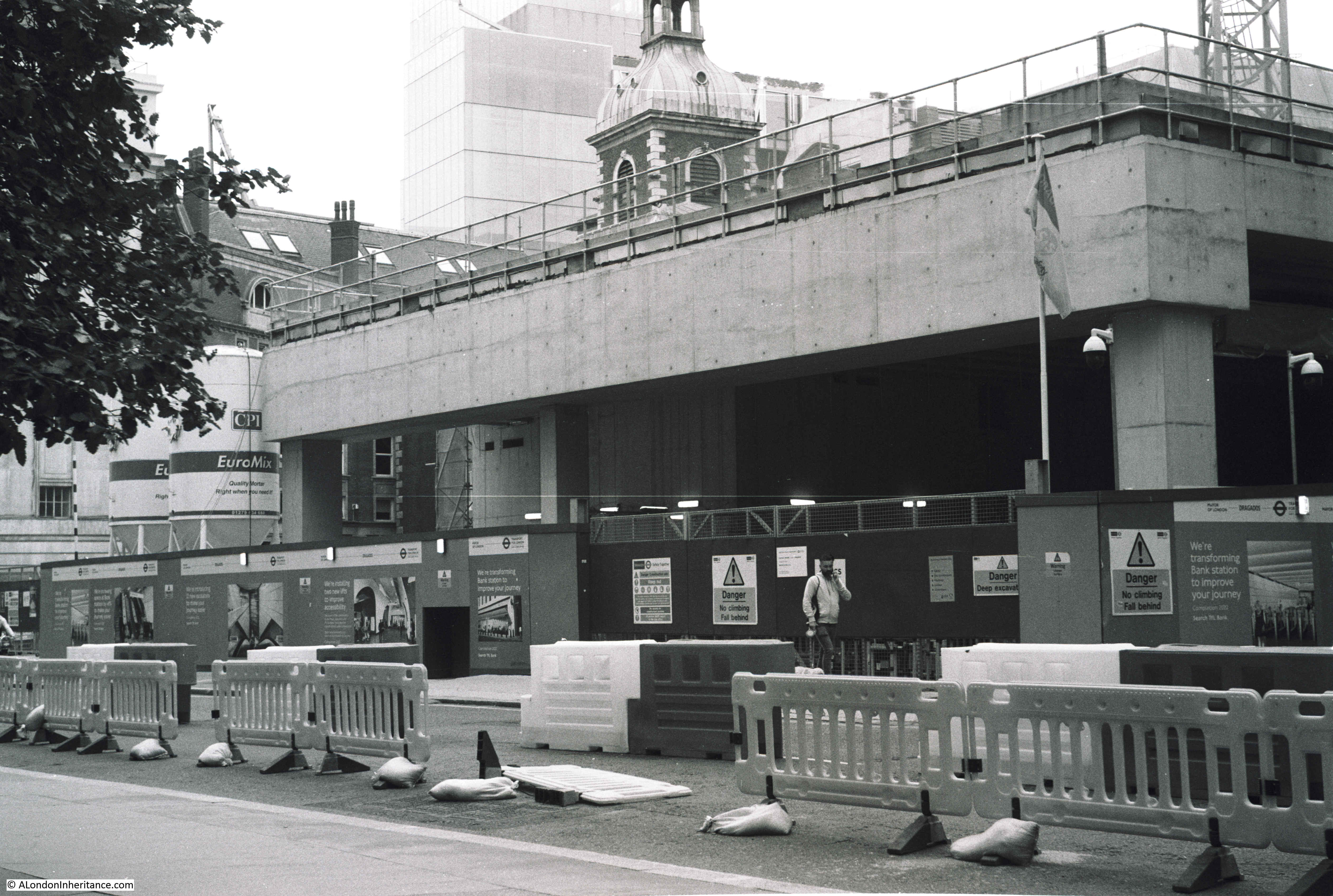
The Bank Junction where only buses and cycles are allowed:
I am in two minds regarding the changes to the City’s streets. It is possible to stand in the middle of the street and take photos, air quality is much better, however the City seems to have lost something which made the City – the City.
The City of London has always been busy during the working week. Pavements busy with people, roads with cars, vans, taxis and buses. That was part of the attraction, what made the City of London unique and different to the rest of London. A busy centre of trade and finance, and in the past, industry and markets.
Looking down Lombard and King William Street:
Other planned changes for the City include the move of Smithfield Market to Dagenham Dock, far to the east of the City, where Billingsgate, New Spitalfields and Smithfield markets would be consolidated into a single site.
Smithfield is the last wholesale market in central London and would be a further change to the historic functions of the City. Many of the tenants are not happy.
Looking back over the Bank junction to Queen Victoria Street and Poultry:
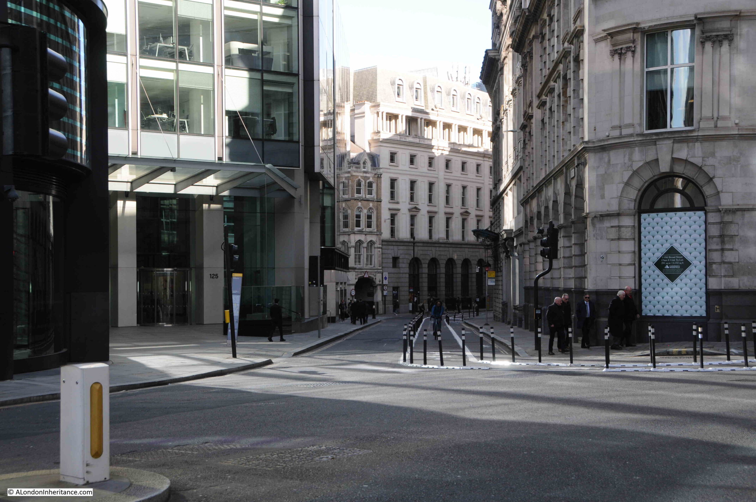
View down Old Broad Street:
Old Broad Street on the left and Threadneedle Street on the right:
In the background of the above photo are the glass and steel towers that continue to be built within the City – will there be enough office workers to support all the space?
It will be interesting to see how the City of London reinvents itself. Will it return to a pre-pandemic “normal” after a few years?
If not, what happens to all the buildings? Conversion to expensive hotels and apartments will contribute to the loss of the City’s distinct identity. Trading too much on tradition could turn the City into a museum.
The move of the Museum of London to the empty Poultry and General Markets in Smithfield is a good move, but what are the benefits to the history and culture of the City by moving the remaining market at Smithfield?
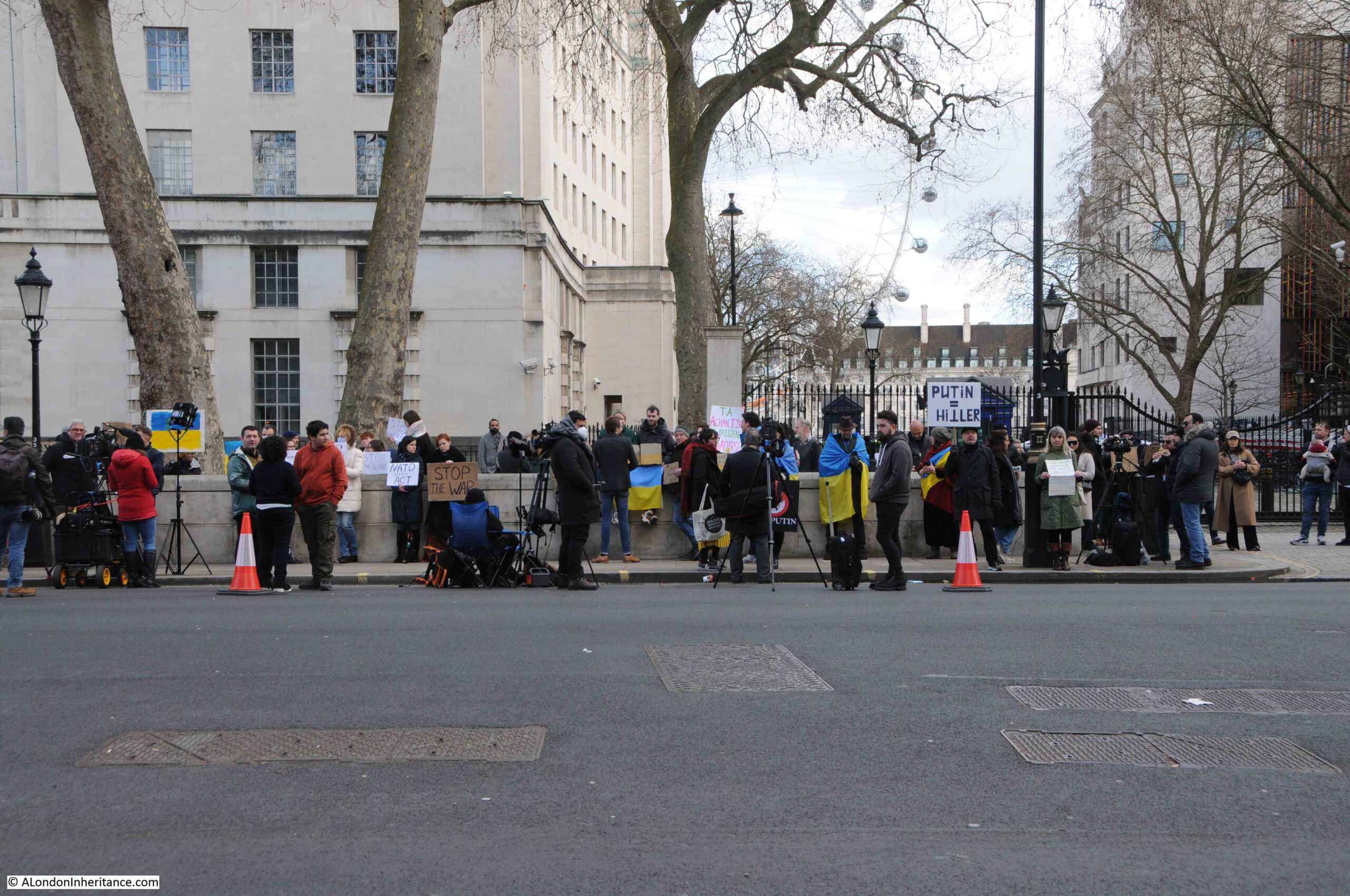
Then just when you think that the last two years of terrible news is coming to an end, Russia starts a horrific invasion of Ukraine.
Walking along Whitehall on Friday, there was a small group opposite the entrance to Downing Street:
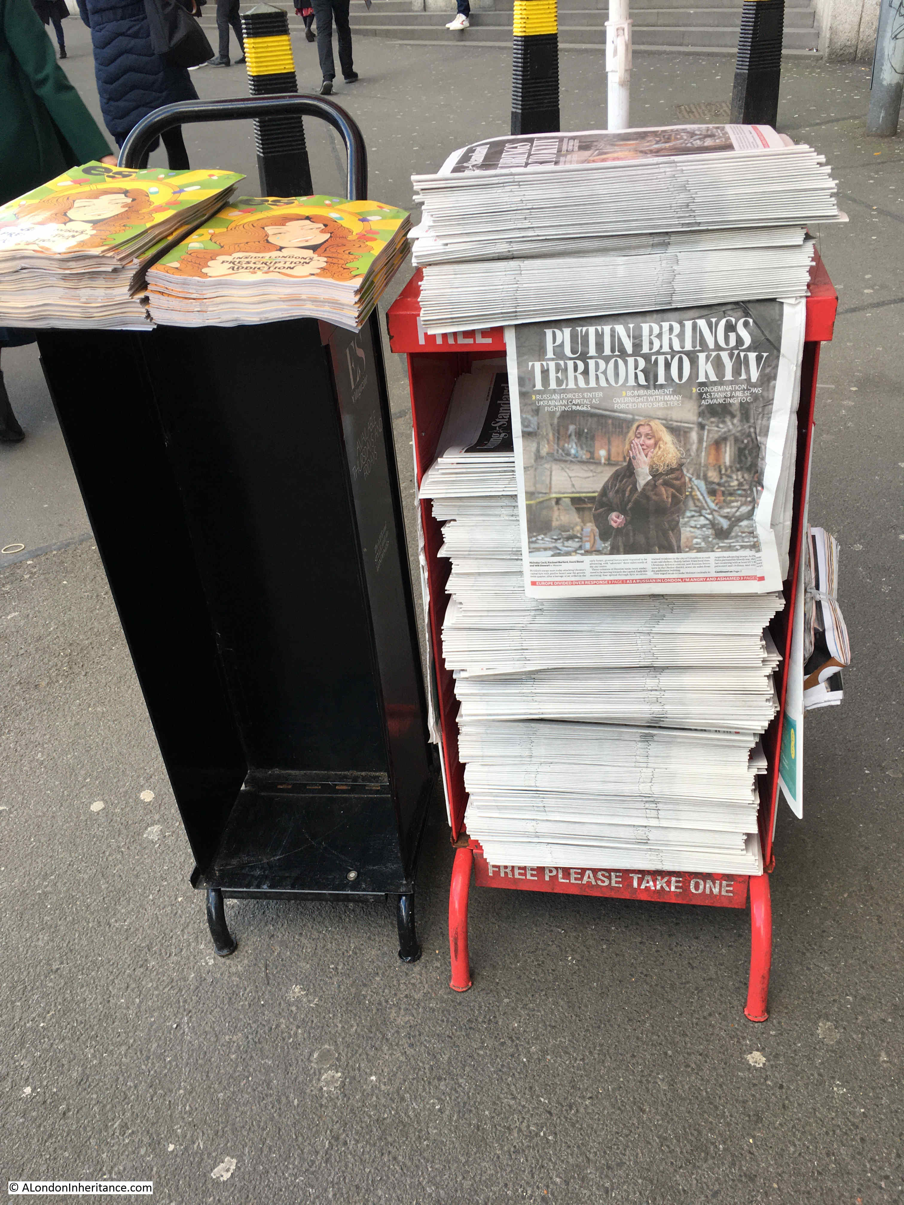
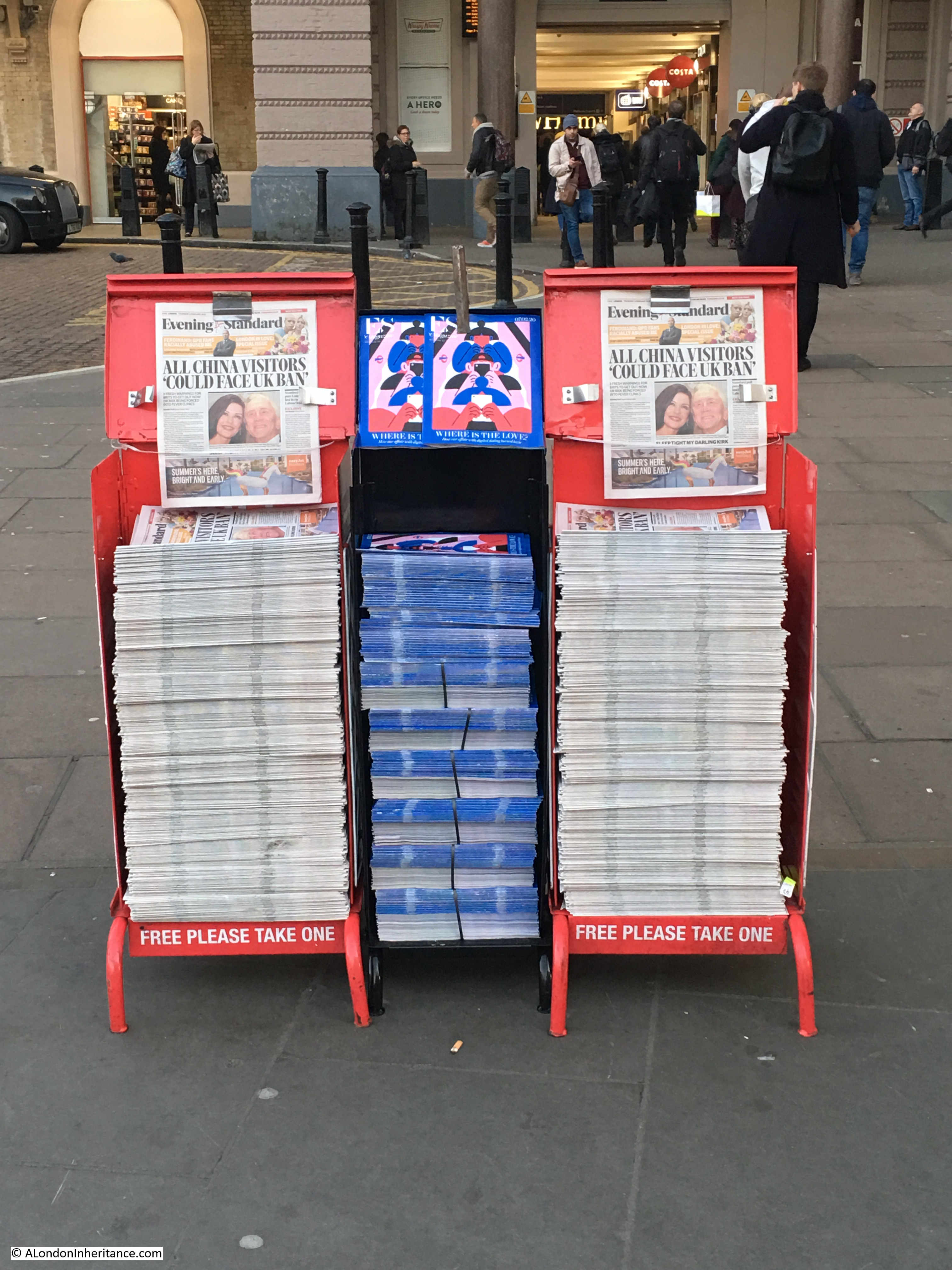
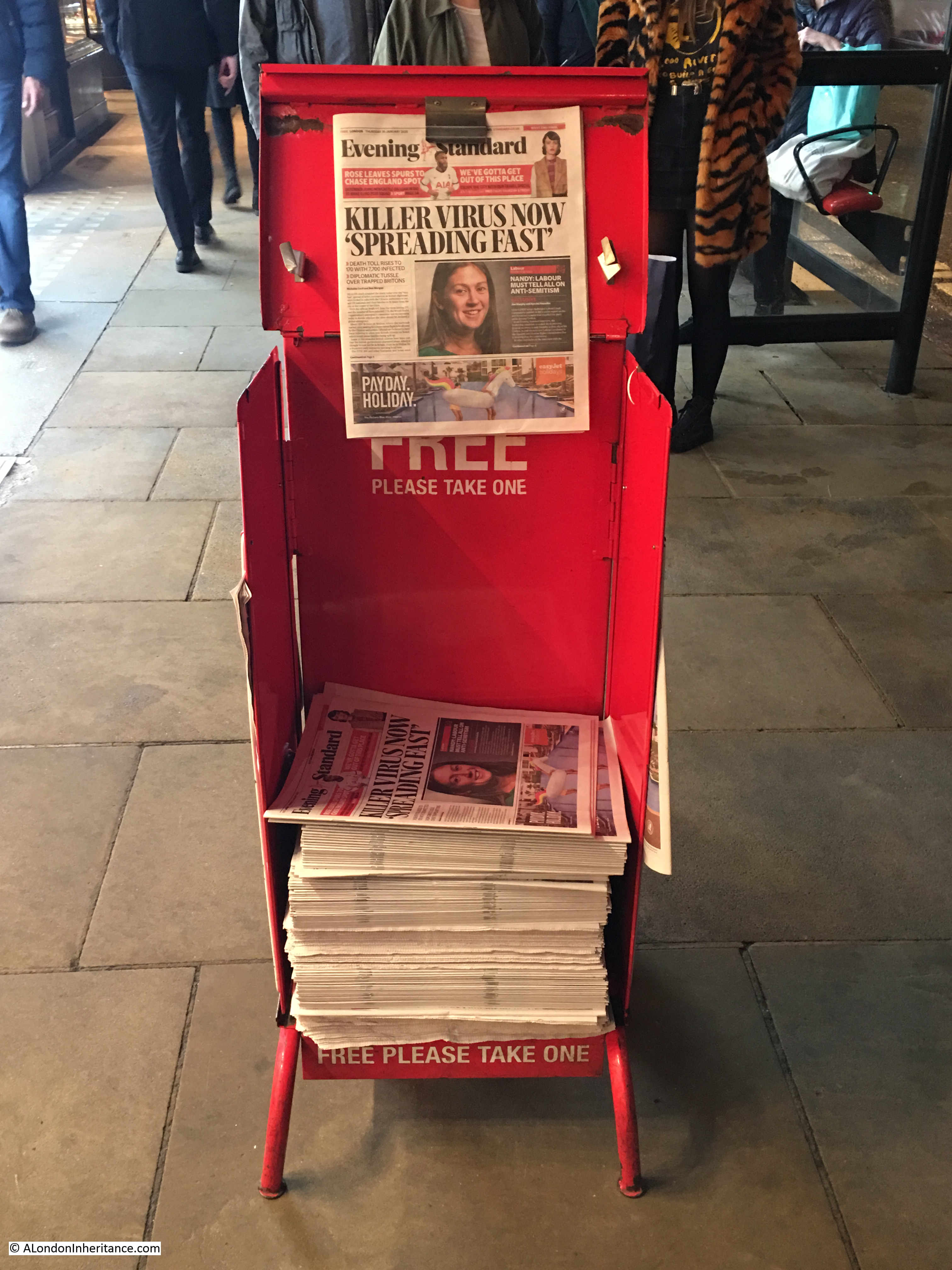
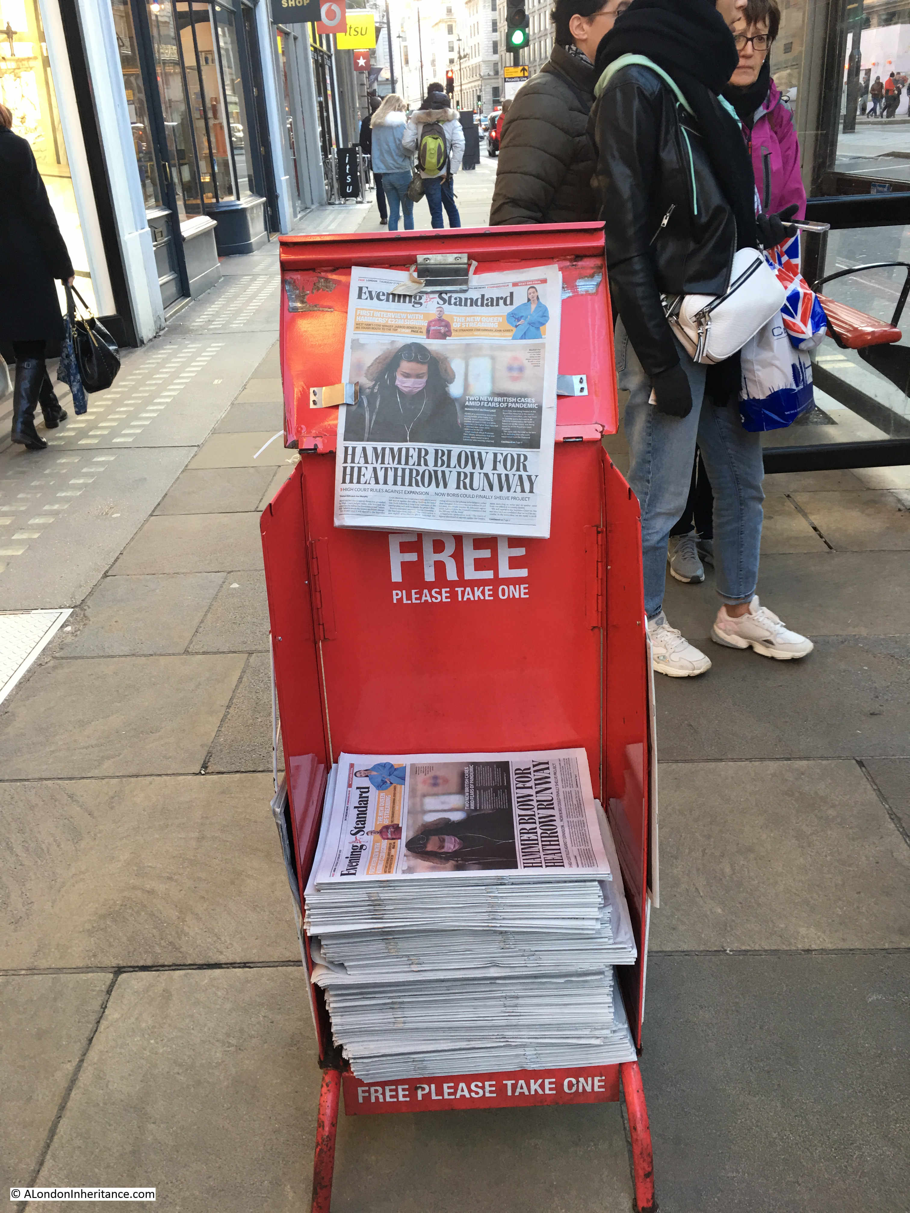
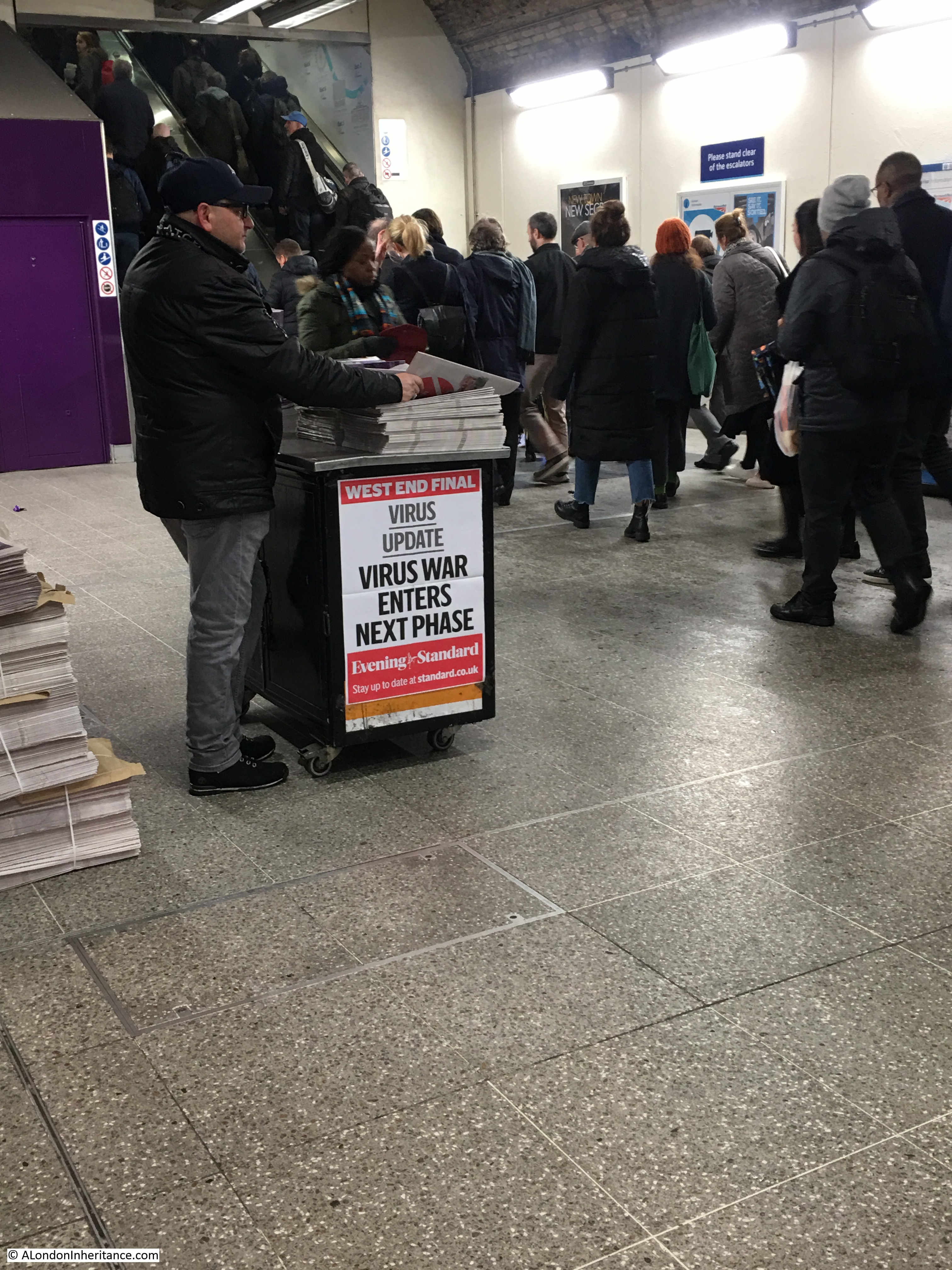
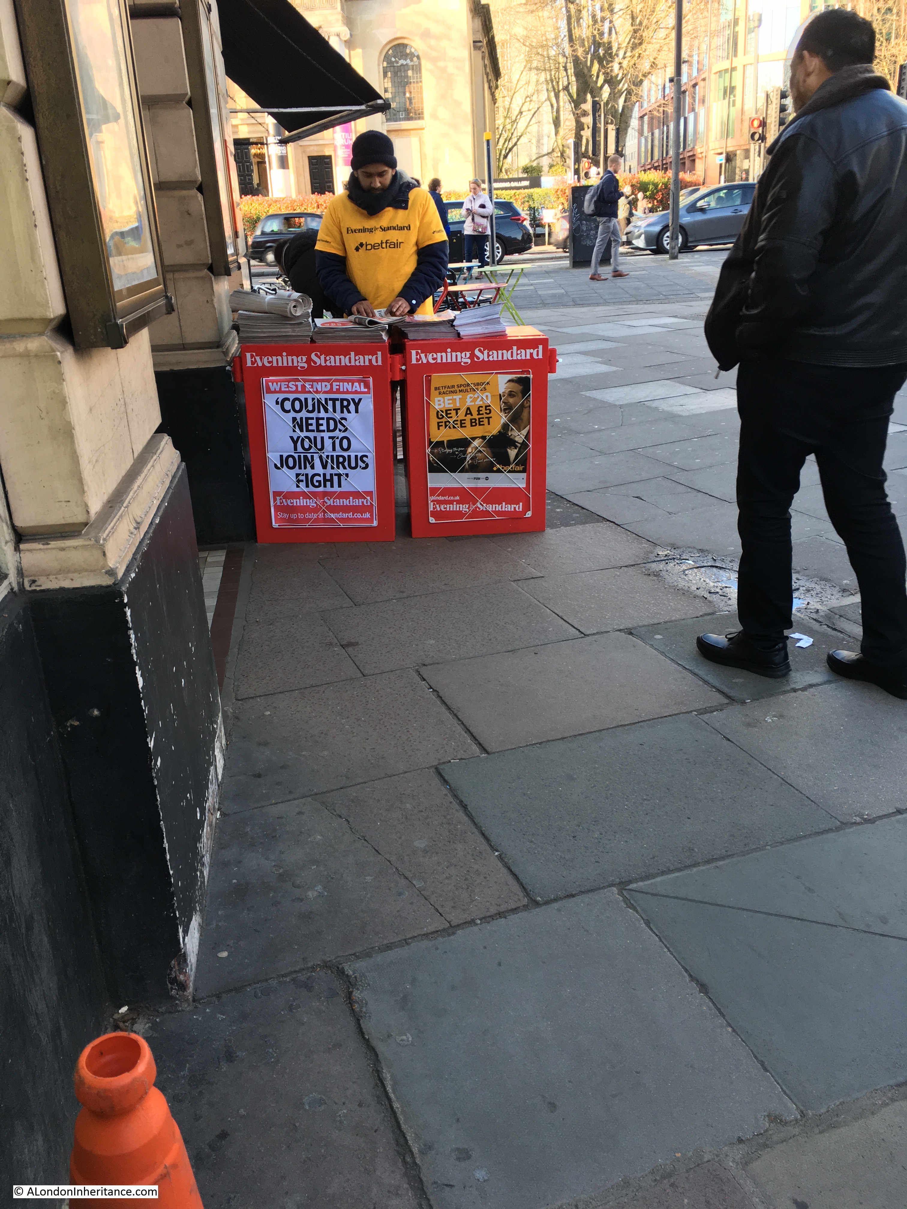
And the news stands across the city continue to provide a record of historical events:
And with that rather rambling review of my 8th year of blogging, can I thank you all for subscribing, commenting and just for reading my weekly explorations of London, and if you feel like a guided walk later in the year, I look forward to meeting you.
Thanks for the feedback to last week’s post. The pub at the top of the stairs leading down to the Thames, next to Westminster Bridge Road was identified as the Coronet, and there is a good drawing of the pub and the stairs on the Closed Pubs site. It was good that I did not get any comments or e-mails that the bronze box beneath the foundation stone of County Hall has been removed, so hopefully it is still there for archaeologists in the distant future to dig up.
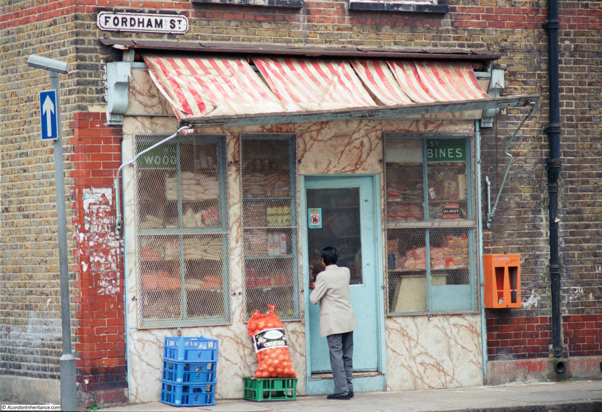
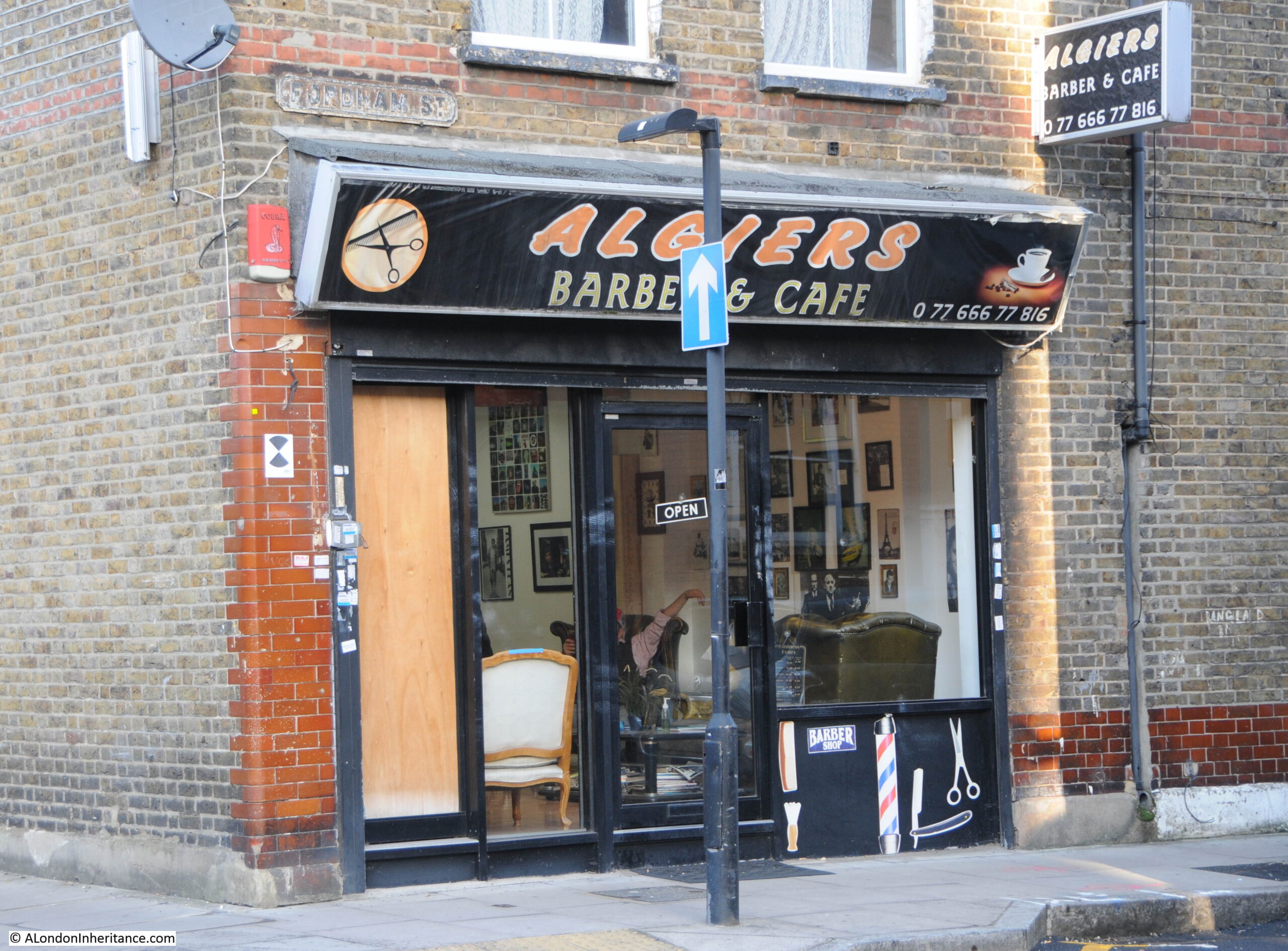
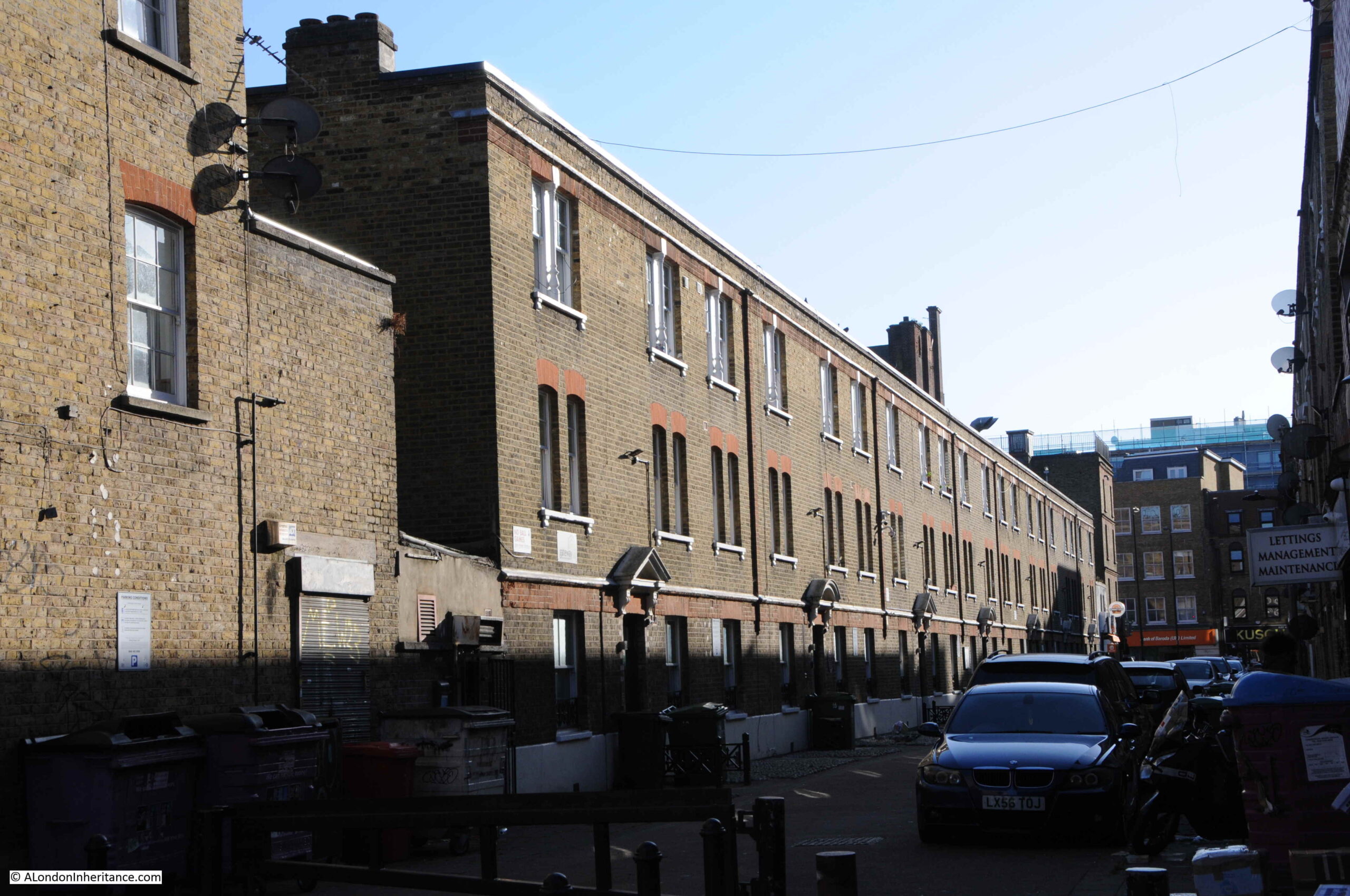
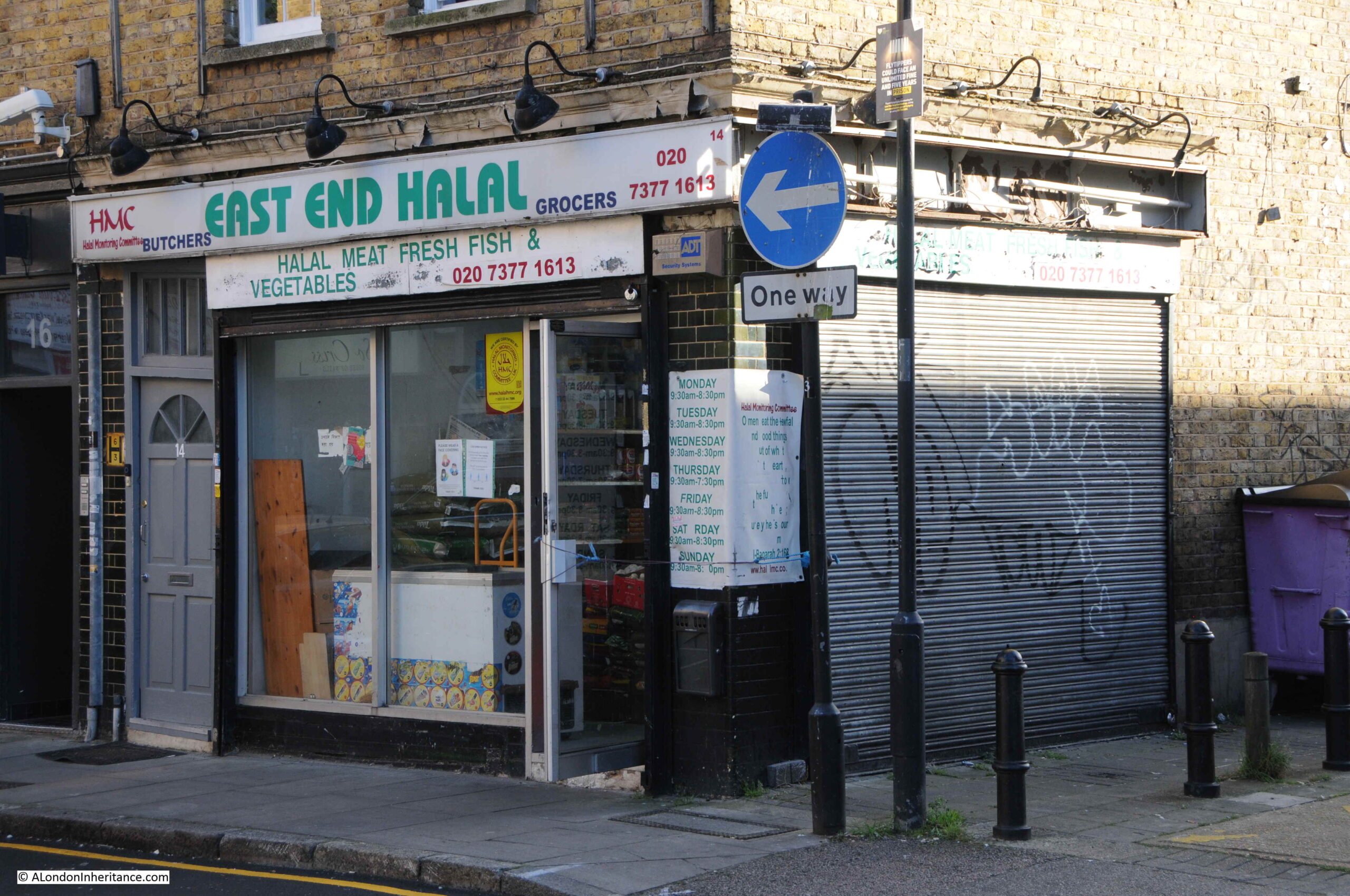
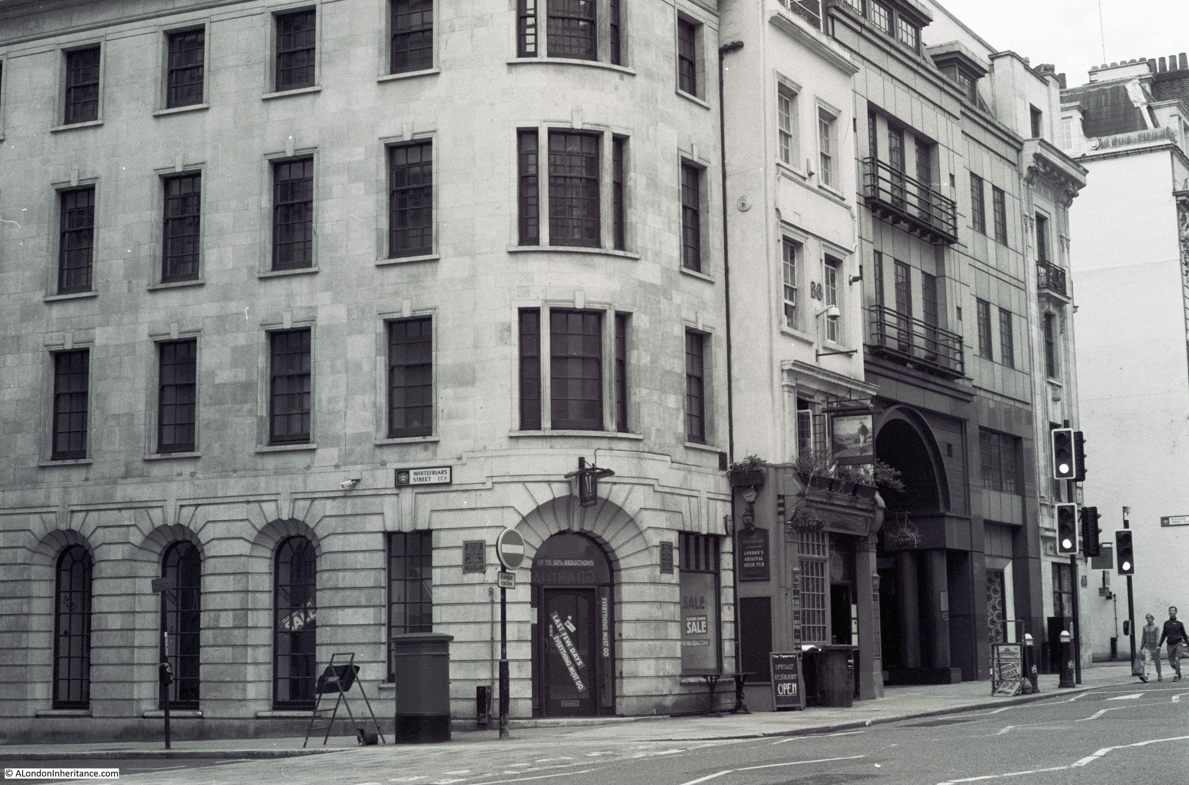
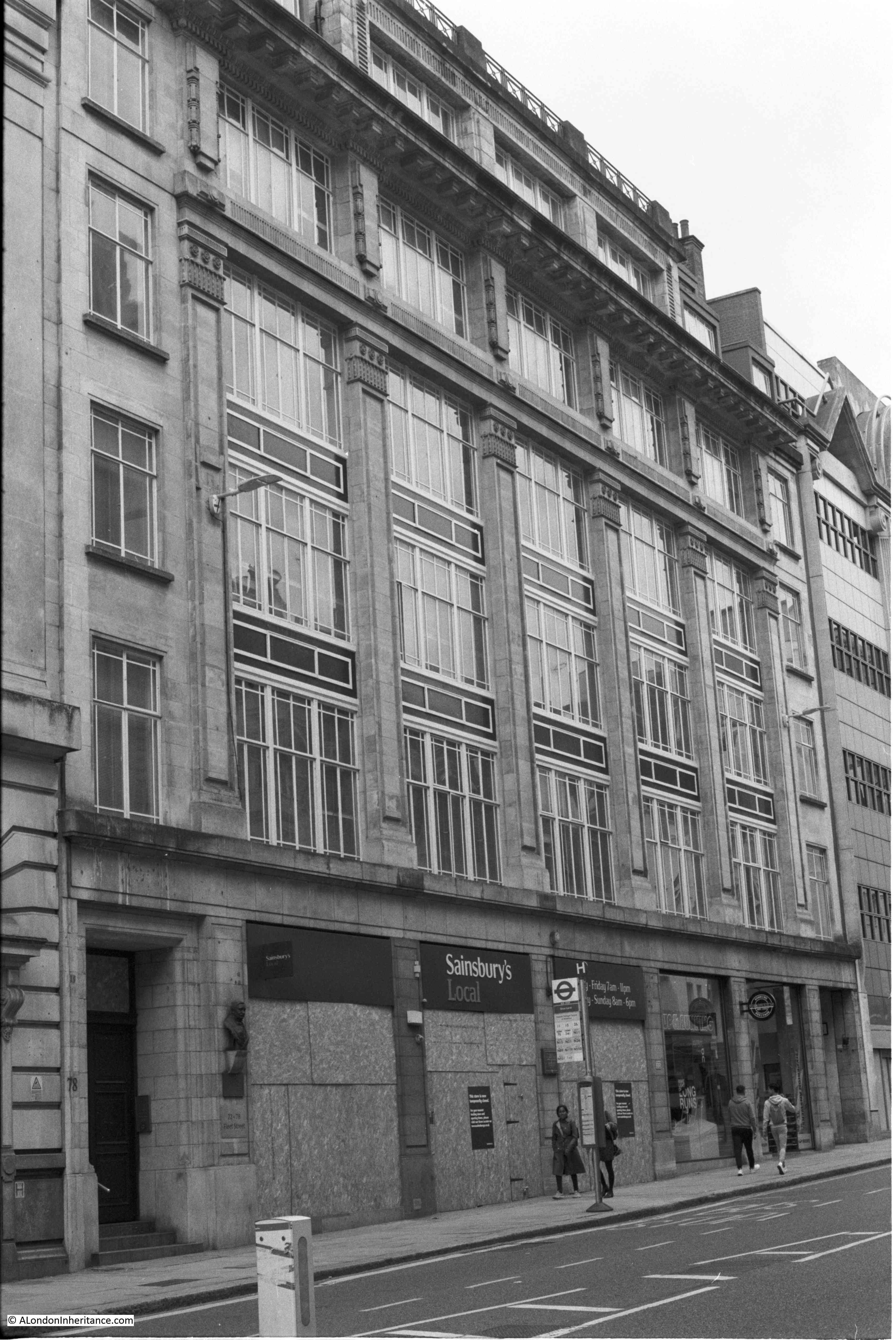
For this week’s post, I am in East London, looking for the location of a shop in Fordham Street, photographed here in 1986:
The same location today. The old general stores type of shop has been replaced by the Algiers Barber and Café:
The 1986 photo is typical of the type of shop. Goods piled high in the window, bread, bottles of Fairy Liquid and Woodbines advertising running along the top of the window.
No idea whether that is a customer entering the shop, or the owner locking or unlocking.
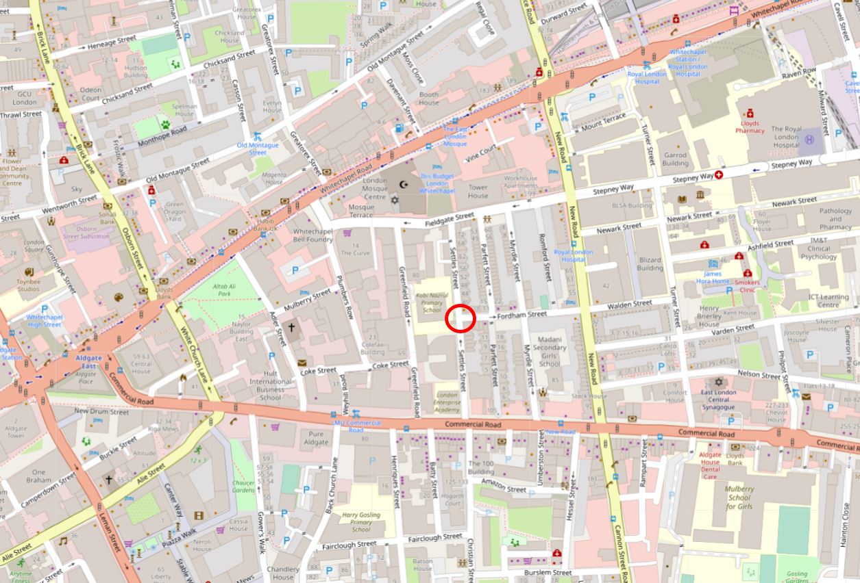
Fordham Street is in the heart of east London, roughly half way between Whitechapel and Commercial Roads. The street leads from New Road which is a main street leading between Whitechapel Road and Commercial Road, and is part of a residential area that has long housed the changing populations of east London.
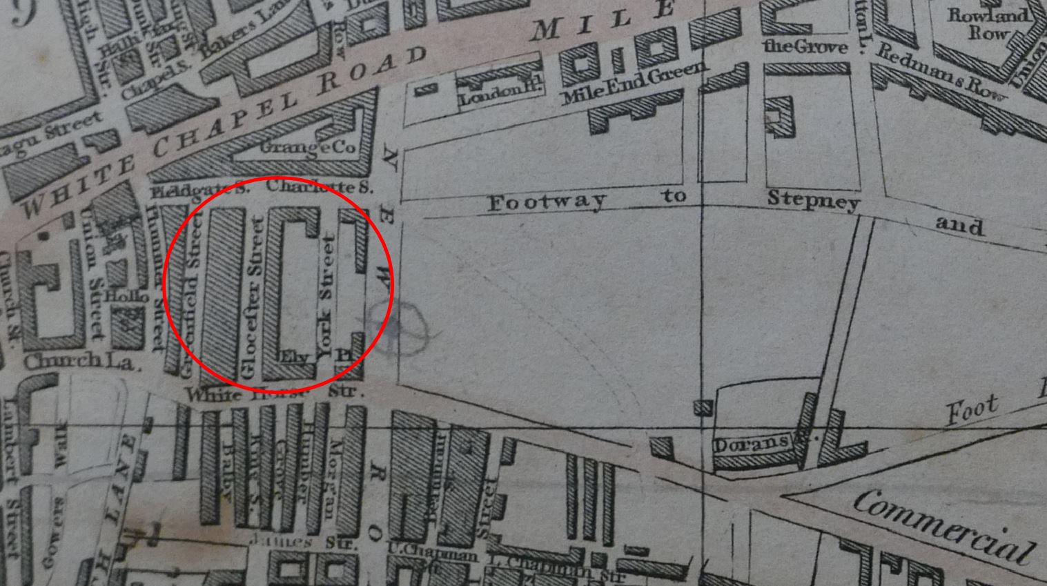
In the following map I have circled the location of the shop photographed at the top of the post:
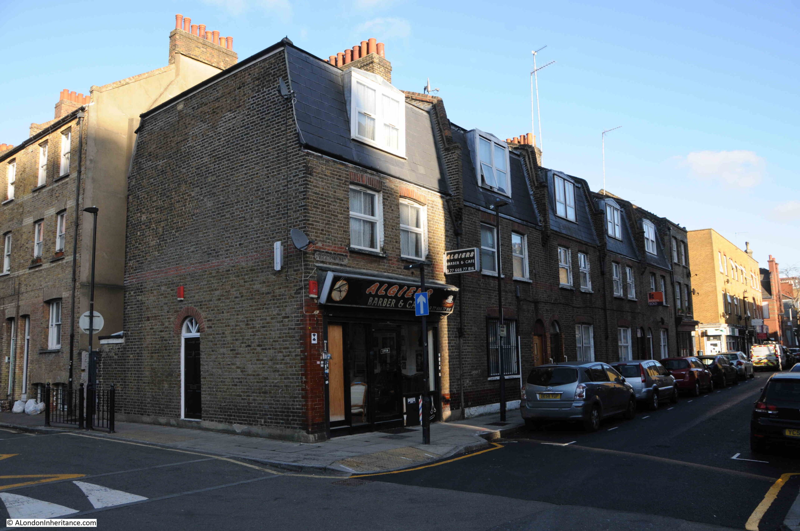
A view of the corner location of the shop, at the end of a short terrace of houses:
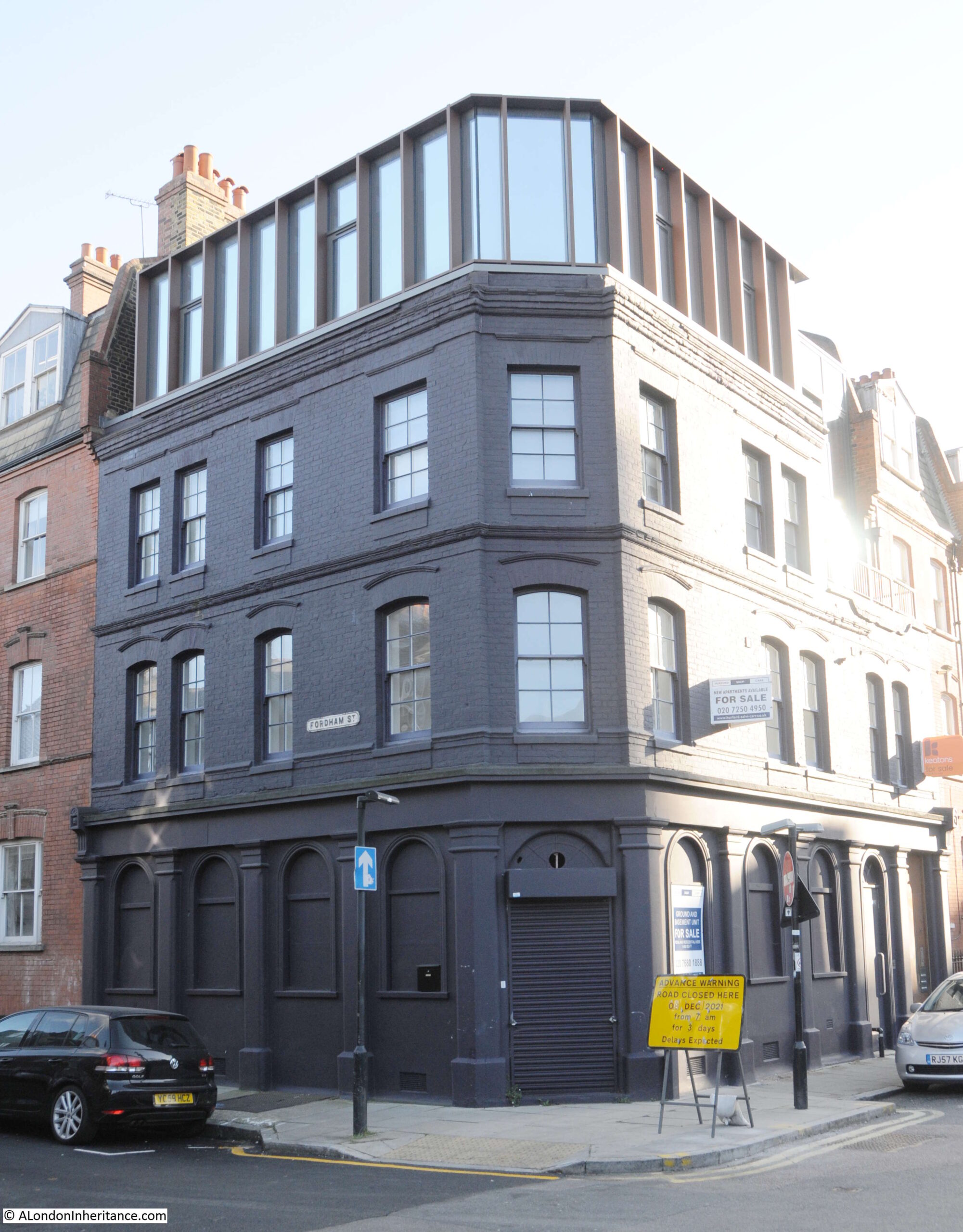
Although a relatively short street, as was typical in east London of old, the street had two pubs, both now long closed. On the corner opposite the shop is the building that housed one of the pubs:
The pub was the Bricklayers Arms. I can find very little information about the pub, and there are only a couple of newspaper reports that mention the Bricklayers Arms. The first is when a 19 year old labourer, Frederick Perrie was sentenced to six months hard labour after trying to use a counterfeit florin in the pub in 1893.
Throughout the first decade of the 20th century, Friday evenings seem to have been the time when the East London (Jewish) branch of the London Central Council met in the pub. Regular adverts about the event featured in newspapers. The licensee at this time appears to have been Isaac Ernest Marks.
The last reference to the pub is in 1911 when Isaac Ernest Marks had his license renewed. It does not appear to have stayed open long after 1911 as Closed Pubs suspects the pub was closed by the 1920s, and there are no newspaper reports mentioning the pub after 1911.
Pubs such as the Bricklayers Arms would have served those living in the densely populated terrace housing that lined the streets around Fordham Street. Whilst many of these have been demolished, some remain, although the following photo shows the challenges of taking photos with a low winter sun on a bright day:
Many of the corner shops in Fordham Street have survived, and have changed over the 20th century to serve the changing population of east London:
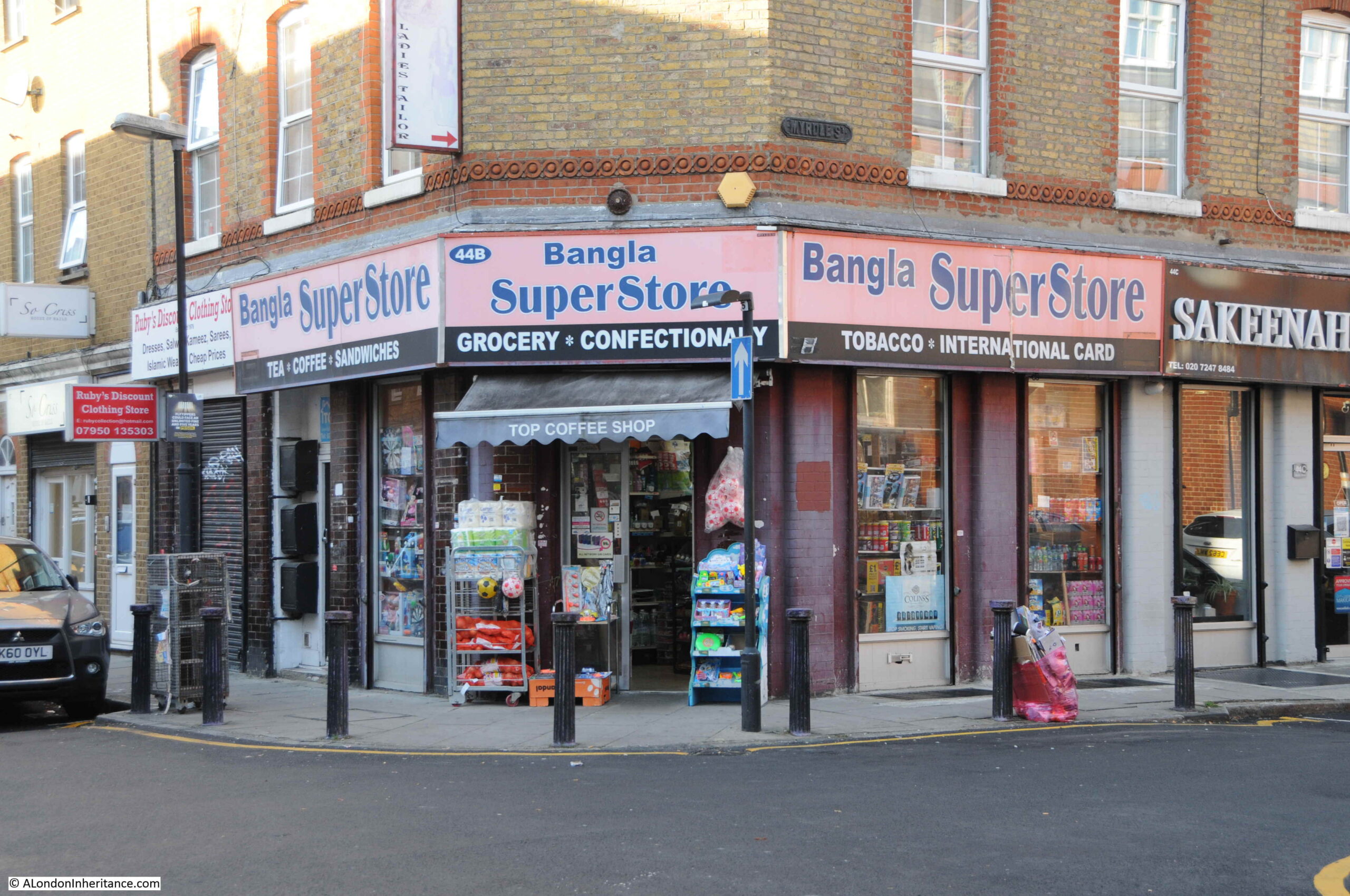
The second pub in the street was the Duke of York. The Bangla Super Store on the corner of Fordham Street and Myrdle Street now occupies the building that was once the pub:
The Bangla Super Store maintains the tradition of a corner shop stacked high with a wide range of goods for the local community.
Rather strangely, I cannot find any newspaper report mentioning the Duke of York, and cannot find any record as to when the pub opened or closed. It is marked as a Public House on the 1894 Ordnance Survey map of the area, and the building has the large, flat corner on the upper floors, so typical of 19th century pubs where their large pub name / advertising signs were located.
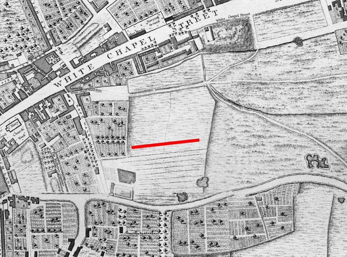
Myrdle Street runs across Fordham Street, and the straight lines of this network of streets indicate that they were laid out as part of a significant development of the area, however the street plan that we see today appears to be the second since the fields that once covered the area were built on.
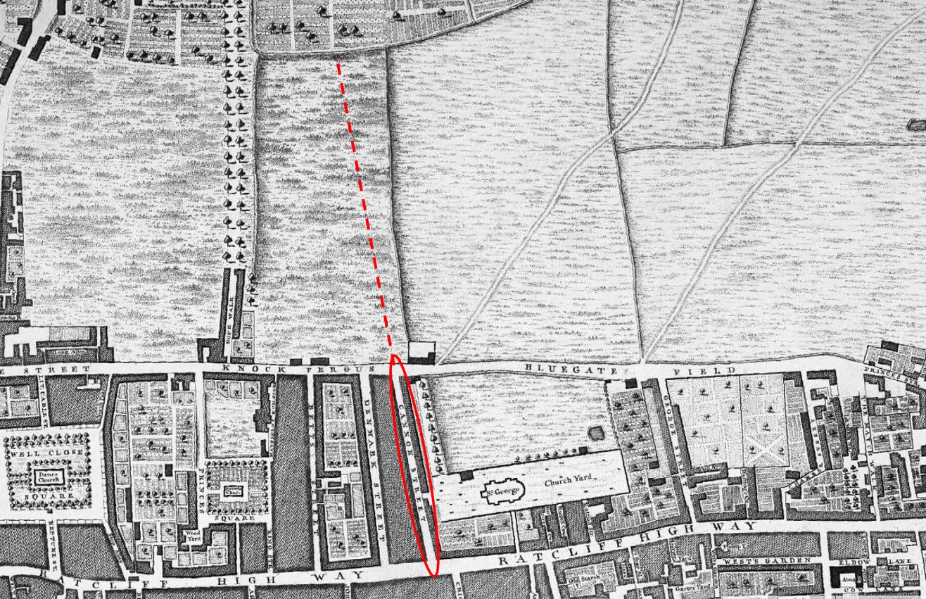
In 1746, John Rocque’s map was showing the area now occupied by Fordham Street as a field, surrounded by other fields, ponds and cultivated land (the red line indicates the future location of Fordham Street):
The following is an extract from the 1816 edition of Smith’s New Plan of London. I have ringed the area now occupied by Fordham Street and surrounding streets:
Comparing with the map of the area today (see below), and the streets, along with their street names are very different. To confirm the location, Whitechapel Road runs along the top of both maps, the start of the Commercial Road development runs along the lower part of the 1816 map, and one of the few consistent street names is Fieldgate Street which runs just south of Whitechapel Road in both maps.
New Road can be seen in both maps, new as this was a major new road built as part of the development of the area.
I cannot find exactly when Fordham Street was initially developed. It is shown in the 1894 OS map. The first newspaper reports which mention the street date to the 1880s, including one from 1886 which advertises a building plot available to be leased in Fordham Street.
Charles Booth’s poverty maps include Fordham Street, with the occupants of the street falling within the classification “Mixed. Some comfortable, some poor”. There was one area described as “Very poor, casual. Chronic want” on part of the land now occupied by Fieldgate Mansions (see further in the post). The street may then date to the early 1880s, however this does seem rather late.
I like that the Footpath to Stepney in the 1816 map is now the Stepney Way, to the upper right of the following map.
So the streets we see today are not those from the original development of the area, and were built in the decades following the 1816 map. Interestingly, in 1816 there was a York Street roughly where Myrdle Street is today, where the Duke of York pub was located on the corner with Fordham Street, so this lost pub may have been named after the name of the original street.
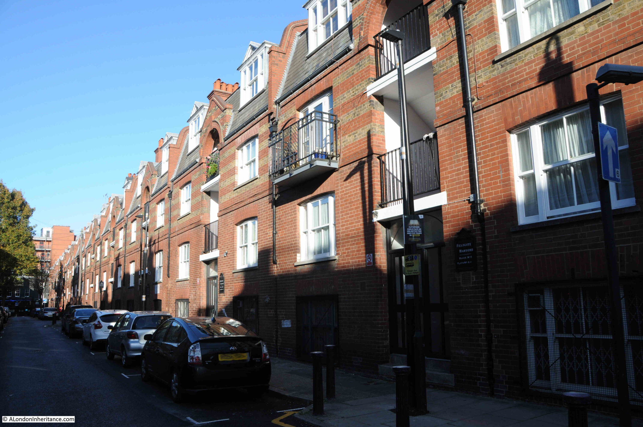
Myrdle Street was a long run of terrace houses, but one side of the street has been replaced by Fieldgate Mansions:
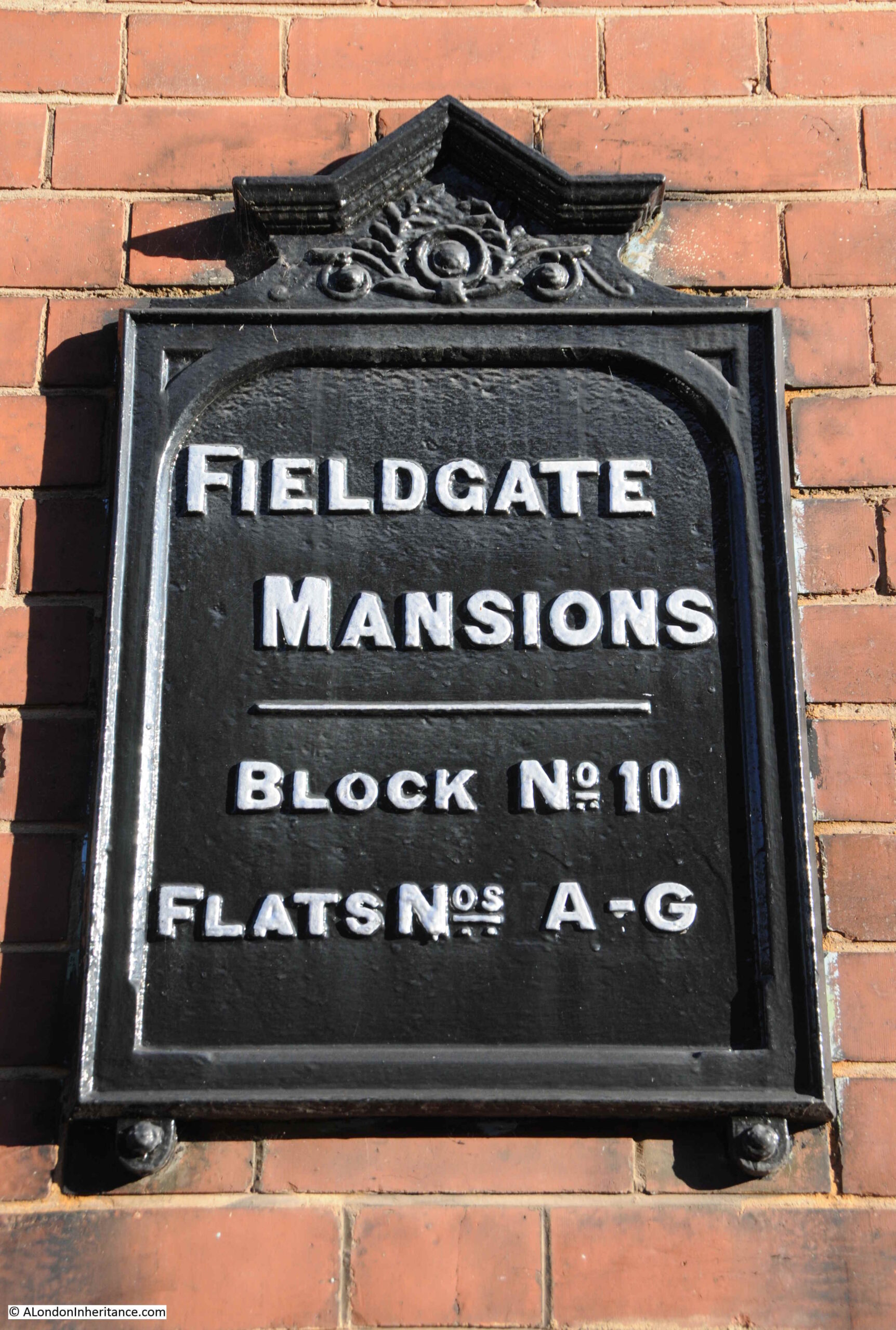
Fieldgate Mansions is a large complex of tenement dwellings that extend along Myrdle Street and further back towards New Road. They were built between 1903 and 1907 to replace the much smaller terrace houses that ran the length of the street. They take their name from Fieldgate Street which runs at the northern end of Myrdle Street.
The original tenants were mainly Jewish immigrants, which probably explains why meetings of the East London (Jewish) branch of the London Central Council were held in the pub at the end of Fordham Street.
Post war, the blocks were neglected by their landlords, some had suffered bomb damage, and by the early 1960s prostitution was a considerable problem in the area.
Many of the apartments in the blocks were empty by the late 1960s and 1970s, and were occupied by squatters campaigning for the restoration and use of derelict property.
They were redeveloped during the 1980s and it is the restored Fieldgate Mansions that we see today:
Unlike the Duke of York pub, there are plenty of references to Fieldgate Mansions in the press, that tell of everyday life, and the challenges of those who lived here.
On the 4th of December 1942, the East London Observer has a Naturalization Notice, where “Notice is hereby given that H. LEVY of 48, Fieldgate Mansions, Myrdle Street, E.1. is applying to the Home Secretary for naturalization, and that any person who knows any reason why naturalization should not be granted should send a written and signed statement of the facts to the Under-Secretary of State, Home Office, S.W.1.”
On the 5th December 1941, Fieldgate Mansions were advertising for “two fire watchers, good references essential”. An important role where fire watchers would look out for fires started by incendiary bombs and then do their best to extinguish fires before they took hold. This was a role my grandfather had in his flats.
A strange case reported on the 31st March 1944 was when Morris Lakin, 32, a traveler of Fieldgate Mansions was in court accused of receiving stolen goods, described as property of the Canadian Army. A strange combination of “five revolvers, 83 rounds of ammunition and 63 pairs of woollen socks”. He was also charged, along with two others of receiving a “quantity of cosmetics, a wireless set and an Eastman cutting machine”.
The tenants of so many east London apartment blocks were subject to rent rises, and there were frequent strikes where tenants refused to pay their rent. On the 4th of July 1939, one rent strike ended and another began “Sixty-four tenants of Fieldgate Mansions, who have withheld their rents for 20 weeks, have reached agreement with their landlord. Rent reductions are to be made from May 1st, some amounting to 3s a week. At Linden Buildings, Brick-lane, Bethnal Green, 68 tenants started a rent strike yesterday”.
Just five years where within Fieldgate Mansions we have rent strikes, protecting the community by fire-watching, stolen goods, and H. Levy’s application for naturalization.
Myrdle Street crosses Fordham Street and on the south-western corner of the junction is another business housed in what was an original corner shop. The wooden decoration just visible around the top and to the right of the current shop signs demonstrates that this has long been a corner shop.
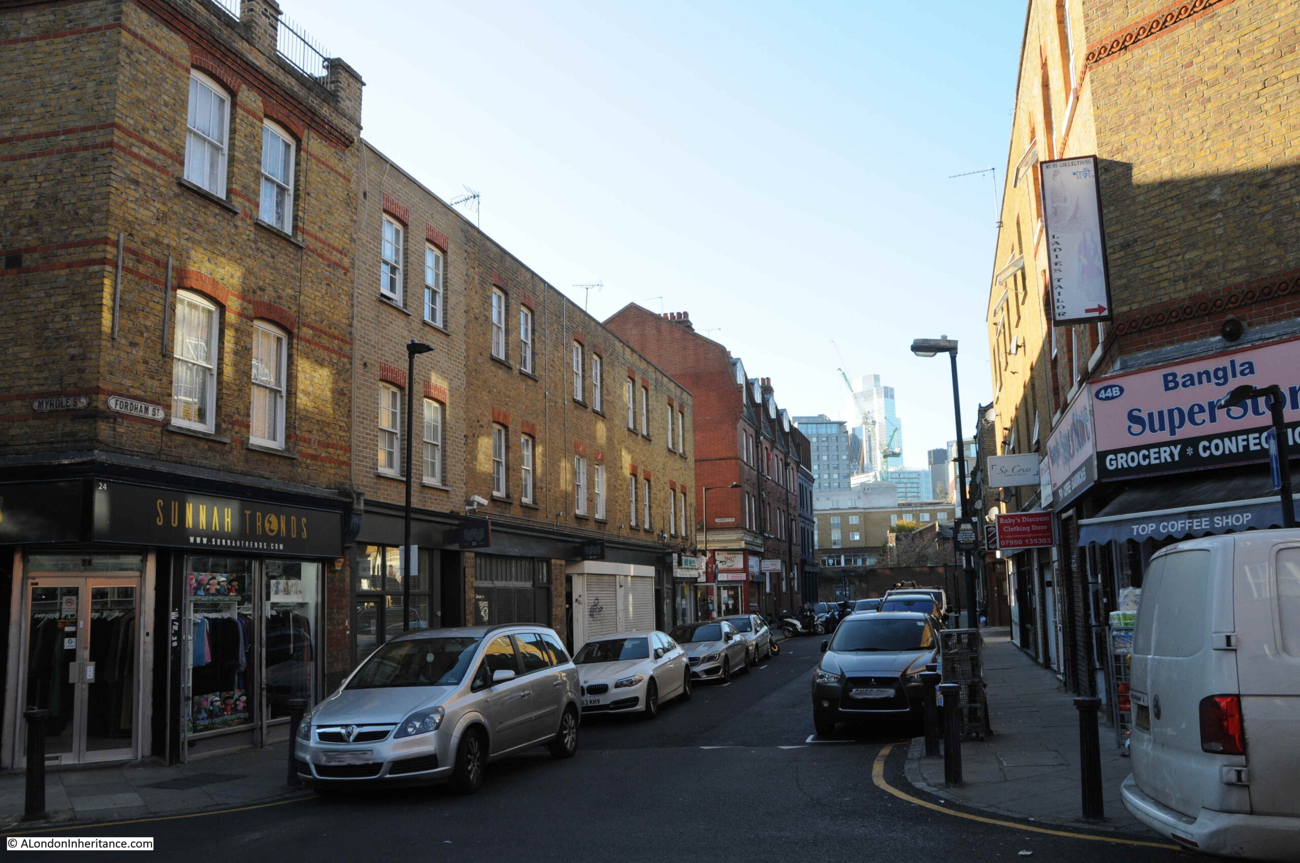
The following photo shows the view west, along Fordham Street at the junction with Myrdle Street. The towers of the City can be seen in the distance.
Fordham Street is a very ordinary east London street, but it can tell so much about how the area has developed from the field of the 18th century to the network of streets we see today.
The demise of east London pubs, changing populations, and snapshots of the lives of people who have made this part of the city home for a brief few years.
Thirty five years is a relatively short time, however during that time so much of London has changed considerably. Back in 1986, a large part of east London was run down. The area was still home to some wonderful communities, people who had lived and worked there for decades, but an area that would soon change. I recently went back to Cannon Street Road to photograph the site of two shops last photographed in 1986.
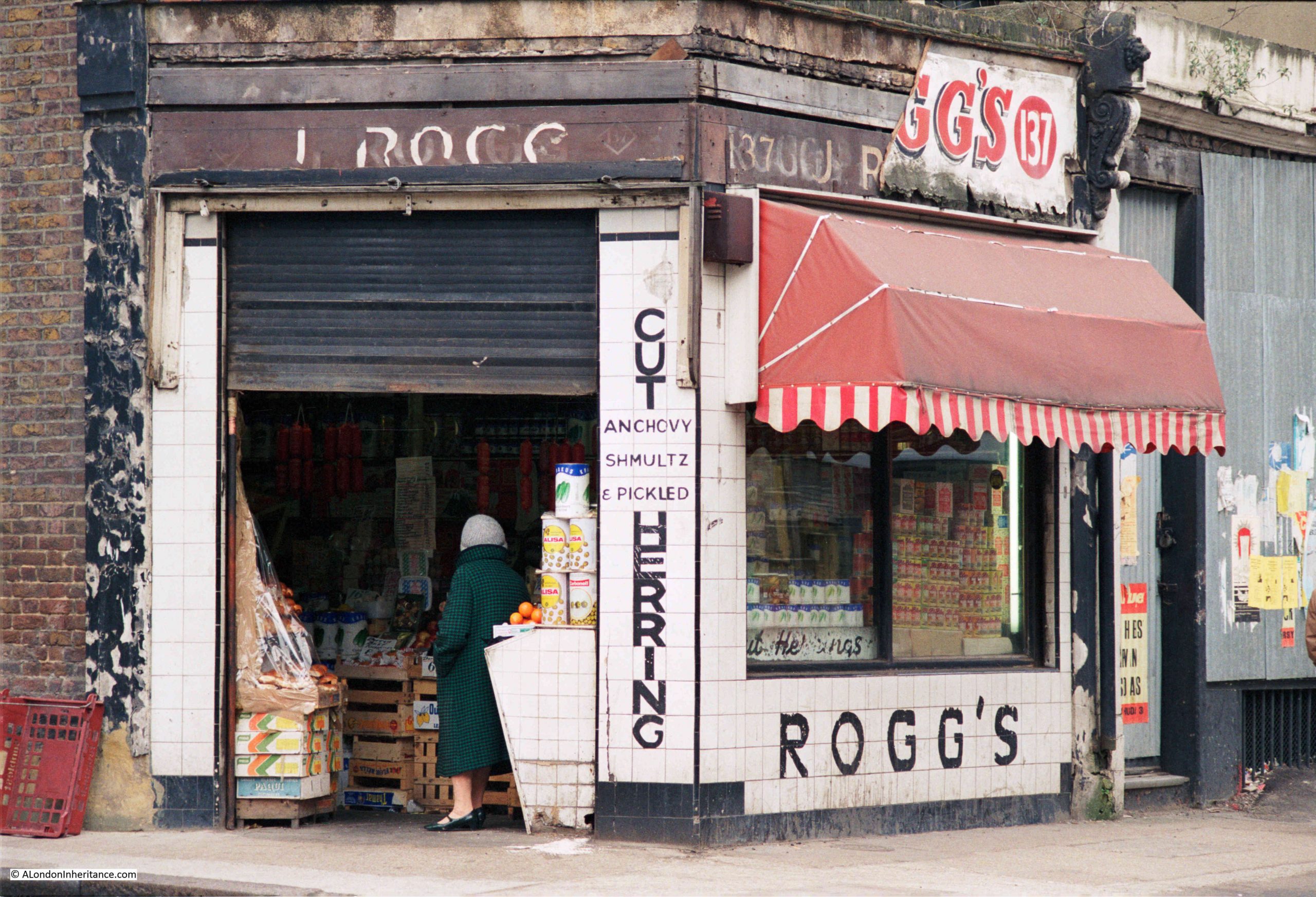
This is Rogg’s at 137 Cannon Street Road:
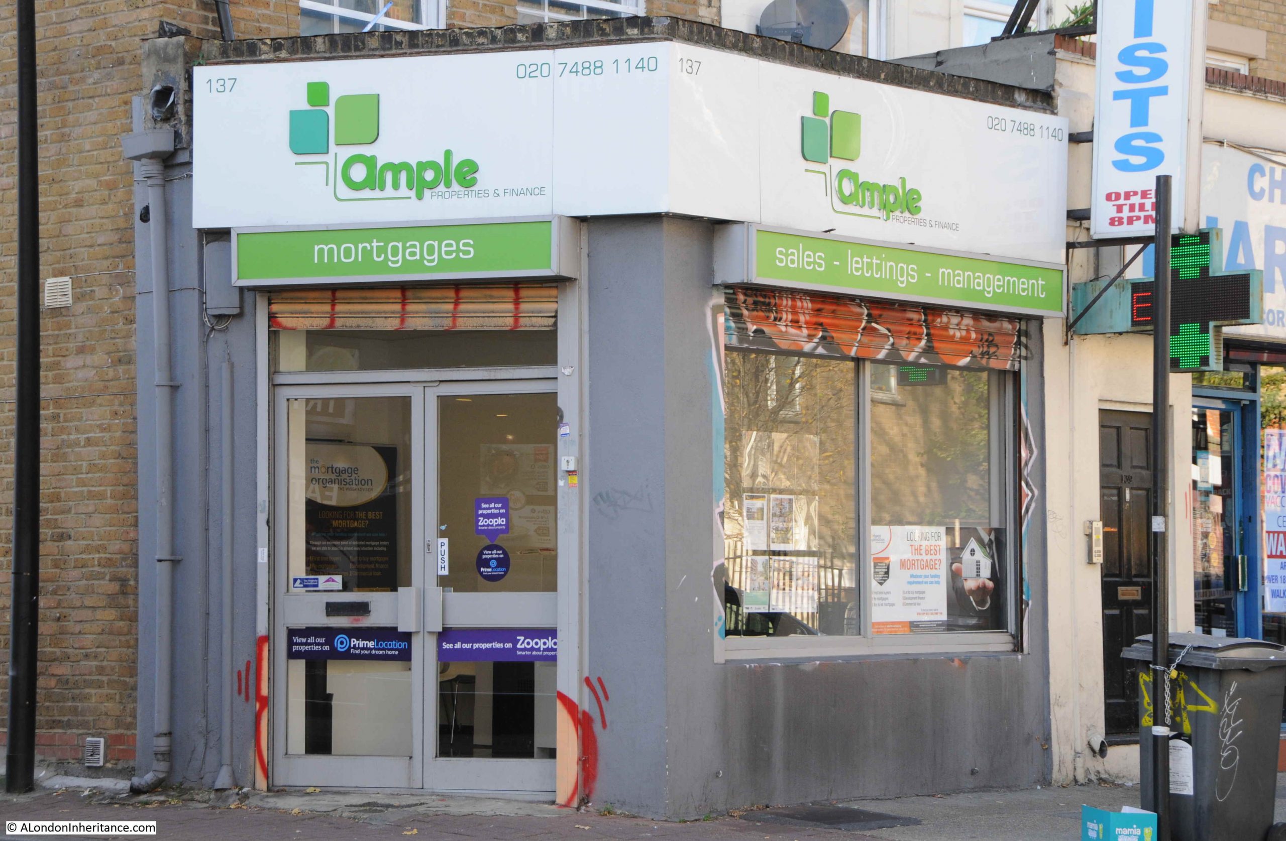
Number 137 is today the home of Ample, a property and finance company:
Rogg’s was on the corner of Cannon Street Road and Burslem Street and had been open since the early 1940s. A typical 1980s corner shop with products piled high in the windows. Inside, there was a wide range of traditional Jewish food.
The shop was at the end of a terrace of mixed date and designs. I am not sure if the building of which Rogg’s was the ground floor shop, has had a rebuild as the bricks look too clean and the corners / sides of the building are a little too sharp and clean for a building of some age:
As well as Rogg selling Jewish food, another building that supported the local Jewish population was a synagogue that occupied the space in the above photo, to the right of the white building with part of a blue sign just above the ground floor.
The Cannon Street Road synagogue opened in 1895, but closed in the early 1970s due to the declining local Jewish population.
There was a rather infamous murder in the street in 1974, when Alfie Cohen, who ran a small all-night cigarette kiosk in Cannon Street Road was murdered during a robbery on his kiosk. The robbers got away with what was in the till and a quantity of ciggarettes, however they missed a considerable fortune.
Alfie had worked 7 nights a week for almost 50 years, and rarely took a night off. Rather than bank the money he made, he kept it under the counter in the kiosk, and when police came to investigate the murder, they found a total of around £100,000 in bags hidden in the kiosk.
A tragic story, but indicative of the characters that could be found in the street, and also of the relatively high level of crime in the 1970s.
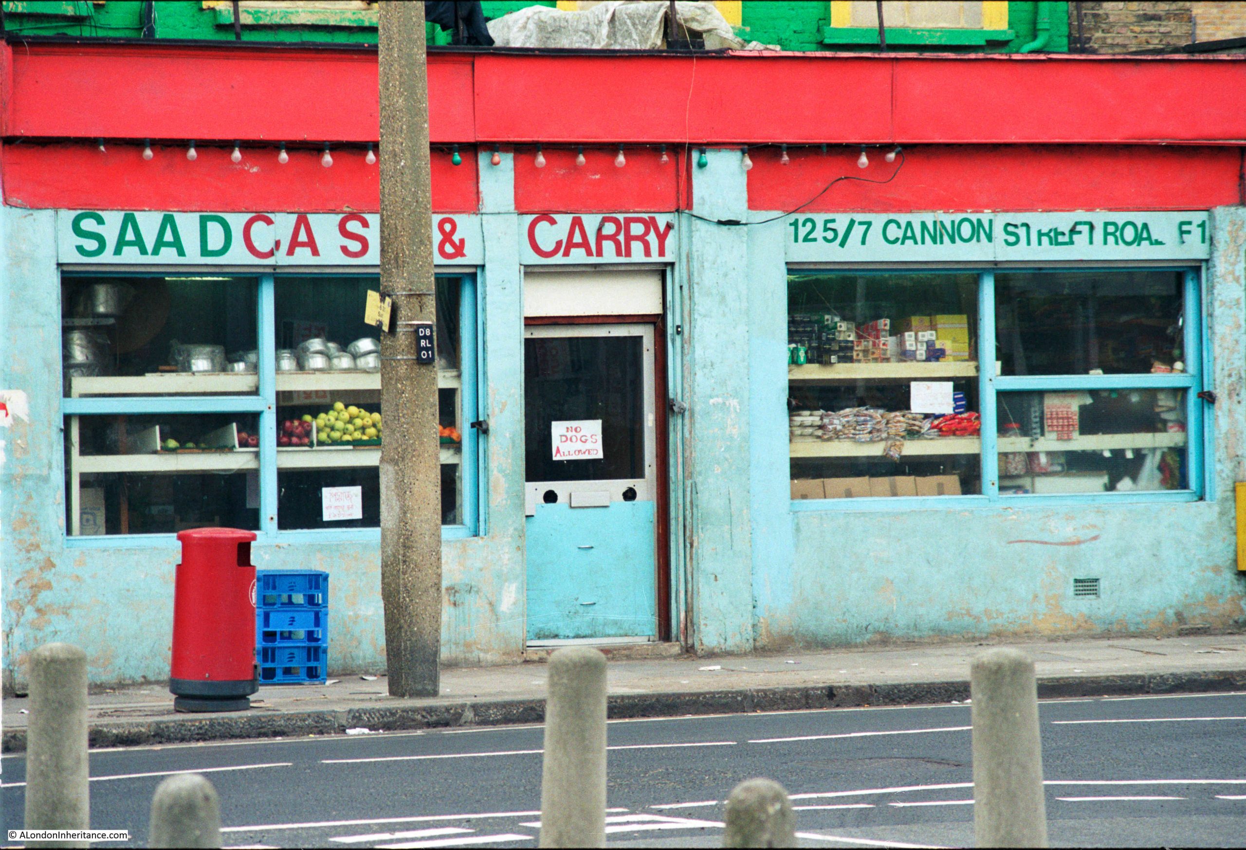
Continuing south along Cannon Street Road, and at numbers 125 and 127 was Saad Cash and Carry:
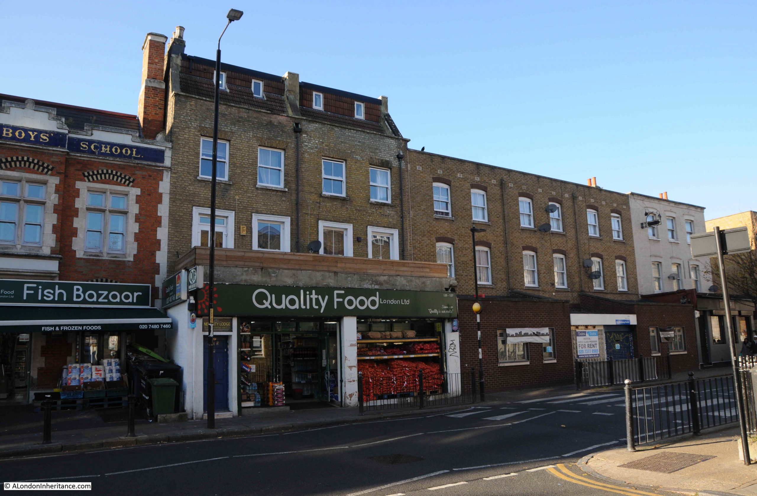
The same building today, now home to Quality Food London Ltd:
A wider view of the terrace with 125 and 127 occupying the ground floor of the largest houses:
Cannon Street Road is a typuical east London street. Shops and businesses catering to a diverse range of local residents, and with an equally diverse range of architecture. The condition of the buildings are much better than they were in the 1980s.
Cannon Street Road runs between Commercial Road to the north, and the Highway to the south, cutting across Cable Street rouighly two thirds along the street.
The lower section of Cannon Street Road is old. The stretch between The Highway and Cable Street is shown in Rocque’s map of 1746. The upper section was then all fields with only the area between Cable Street and the Thames having much development as London’s expansion followed the line of the river.
Rocque’s map shows the street name as simply Cannon Street. I cannot find exactly when, or why, the name changed to Cannon Street Road, however the first mention of the longer name I can find is a newspaper advert from the 24th January 1803, which called for subscribers to the Commercial Road development who could collect their interest from an office in Cannon Street Road.
The following extract from Rocque’s map shows the 1746 length of Cannon Street (red oval), with the red dashed line showing the extension of the street that we see today.
What I did not realise is that the development of Commercial Road appears to have been paid for by subscribers. As well as the advert, there is the following statement in the same 1803 newspaper:
“COMMERCIAL ROAD SUBSCRIPTION – at a MEETING of the TRUSTEES under the Act of Parliament, passed in the 42nd year of the Reign of King George the Third, for making a New Road from the West India Docks in the Isle of Dogs to the City of London, held at the Cannon-street-road office this day; it was ordered, that a further Call or Installment of £25 per cent, on the several Subscriptions, should be paid into the hands of Messrs. Harrison’s, Prickett and Newman, Bankers, Mansion-house-street, on or before the 1st day of February next. Limeshouse, Jan. 18th, 1803. THOMAS BAKER”
Thomas Baker was the Clerk to the Trustees, and the office was somewhere in Cannon Street Road.
I suspect that it was down to the development of Commercial Road, that Cannon Street changed to Cannon Street Road.
As the street provided a route between Commecial Road, Cable Street and The Highway, it would be a busy street (as it is today), and perhaps “Road” was added to avoid confusion with Cannon Street in the City of London.
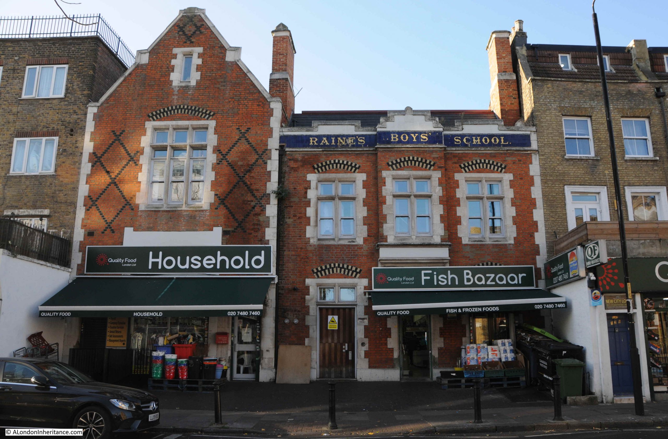
Just to the left of the Saad Cash & Carry / Quality Food shop is an historic building, with the ground floor converted into shops. This was Raine’s Boys School:
The history of Raine’s schools goes back to around 1719, when brewer Henry Raine opened a school for 50 boys and 50 girls. The original school was in what is now Raine Street in Wapping. The building is still there, although was in a poor state in the 1970s and at risk of demolition. I wrote about the building in this post.
As the London Docks were built, the original school found itself rather isolated from the parish that the school was intended to serve, so in 1875 the Boys element of the school moved to the Cannon Street Road building, photographed above.
The building did not serve as a school for too long, as by the first decade of the 20th century, the buildings used by the school were too small, and the school consolidated into a large building in Arbour Square, just north of the Commercial Road. The building still exists as the Tower Hamlets New City College.
Cannon Street Road had already been home to a form of school / childrens home some forty year earlier when within the street could be found the Merchant Seamens’ Orphan Asylum.
This institute was founded in 1827 to care for the children of men lost at sea.
In 1833, an advert appeared in the Public Ledger and Daily Advertiser stating that the orphan asylum was ready to receive applications for the February election. This seemed to be standard practice for many institutions of the time, where applications were made and these were voted on by a Board of Management (see my post on the General Lying In Hospital, where this approach was taken with Subscribers being able to propose pregnant women for admission to the hospital).
In 1833, the orphan asylum had 41 boys and 23 girls. The advert stated that subscriptions and forms of petition for admittance could be had at the school in Cannon Street Road.
We do not often get a glimpse inside the houses of streets such as Cannon Street Road, however another advert from the Public Ledger and Daily Advertiser on the 12th of September, 1833 reports on the sale of the leasehold residence and contents of number 2 Cannon Street Road, at the direction of the Executors of the late Mr. Richard Neale:
“Leasehold Residence, Cannon Street Road, with Immediate Possession. Household Furniture, Plate, three Watches, Linen, China and Effects – By W.S. FRANCIS on the Premises, No. 2, Cannon Street Road, St George’s East, on Tuesday September 17, at 11, by direction of the Executors of the late Mr. Richard Neale.
The Leasehold Residence, with immediate possession, held for a term of 17 years, at the trifling ground rent of £2. The furniture consists of fourpost and other bedsteads and furnitures, goose feather beds and bedding, mahogany double and single chests of drawers, mahogany nail-over chairs, sofa, secretary and bookcase, looking glasses, Brussels carpet, and various other articles”.
If the contents of number 2 are typical of the street, then the residents of Cannon Street Road seem to have been reasonably comfortable. The house was at the southern end of Cannon Street Road, close to the church of St George in the East.
The southern end of Cannon Street Road mainly consists of post war rebuilding. It was the southern end that received the most damage during the Second World War, the northern section of the street appears to have escaped relatively undamaged.
Much of the north of the street still appears to be 19th century terrace housing, however it can be difficult to confirm what is original and what is a later rebuild.
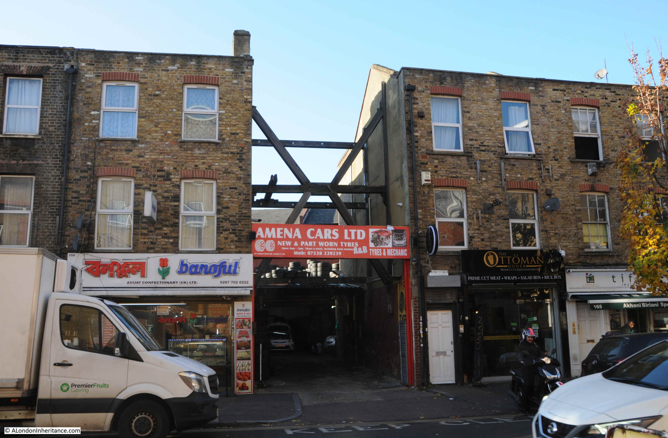
The following photo shows part of the street where I assume a single house within the terrace has gone, to be replaced with an entrance to a car tyre dealers. The houses either side needing some serious support as the terrace has been broken.
Cannon Street Road is part of east London’s expansion north from the original ribbon development along the Thames, and although east London streets have changed considerably over the last few decades, they are still fascinating places to walk as although wartime bombing has resulted in much new building, there is still many of the original terrace houses along the street, along with an ever changing range of shops.
Firstly, thanks for the comments on last week’s post on the Greenwich foot tunnel. Some brilliant personal memories of the tunnel, and the important part it has played in the life of those on either side of the river.
Today is one of those Sunday’s where I ran out of time to research and complete the planned post, so the location in east London will have to wait, and for this week, a photographic tour of London in the first decades of the 20th century from the late 1920s book Wonderful London.
Always good to start with a tour of some pubs, and this is the Running Footman, on the corner of Charles Street and Hays Mews, near Berkeley Square.
The building in the view above would not last much longer. originally dating from 1749, the pub was rebuilt in the 1930s using the type of brick construction typical of many pubs of the 1920s and 30s.
Wonderful London described the source of the name as “named after that special kind of servant whose duty it was to run before the crawling family coach, help it out of ruts, warn toll-keepers, and clear the way generally. He wore a livery and usually carried a cane”.
The 1930s pub is still open, but with a shorter name of just The Footman.
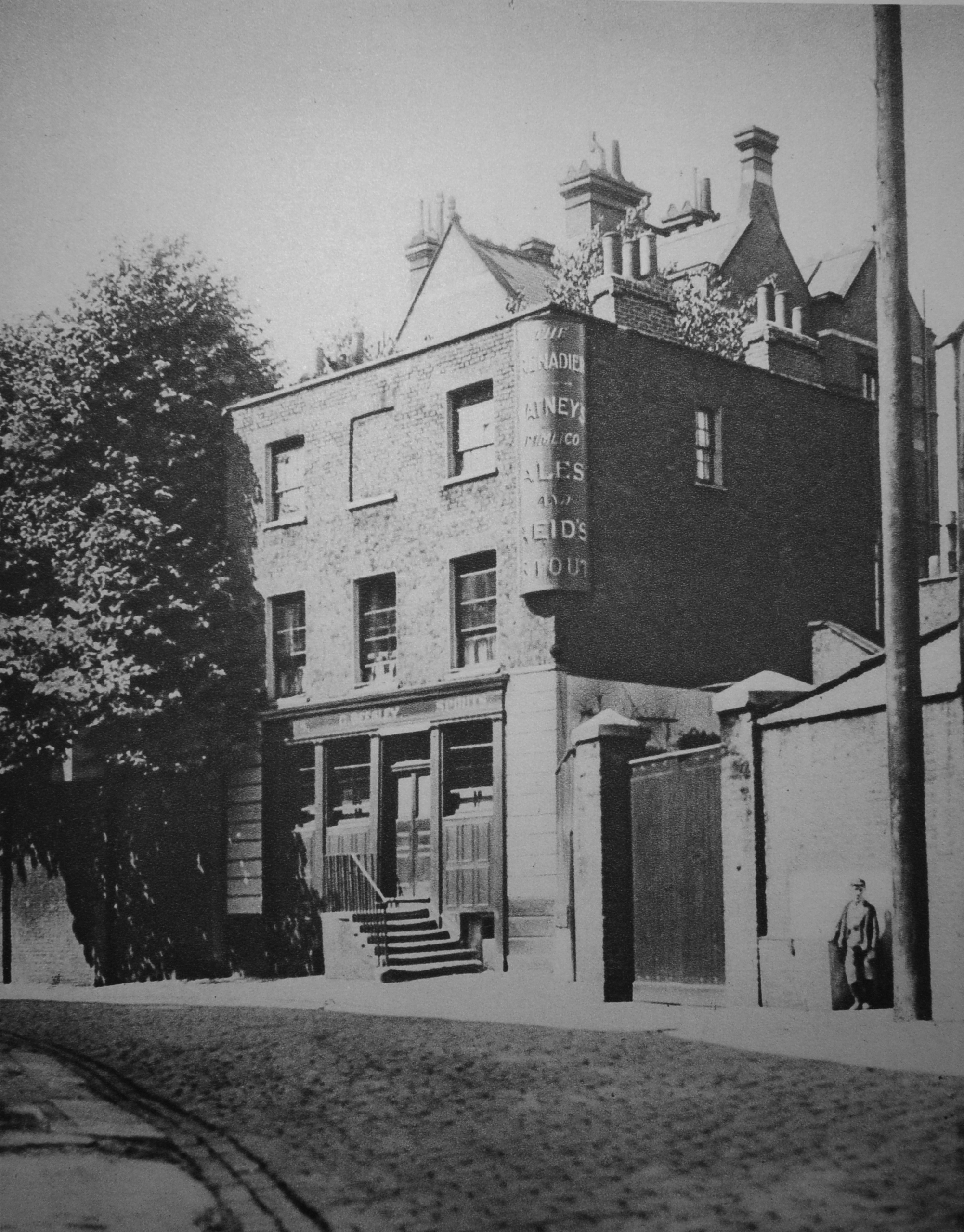
Another pub is the Grenadier in Wilton Mews, near Upper Belgrave Street:
Wonderful London expects that “At any moment it would seem that an ostler with striped waistcoat and straw in mouth might kick open the door and walk out of the place. Just past the wooden gate by the little boy is a doorway in the wall leading to Philips Terrace”.
I took a very similar photo back around 1972. I had been given a birthday present of a book about haunted London and the Grenadier was described as one of the most haunted pubs so it was on the agenda for a family walk where I used my Kodak Instamatic 126 camera. I still have to find and scan the negative.
I did revisit the pub a couple of years ago when writing about Old Barrack Yard and the Chinese Collection. The Grenadier looks much the same, however the tree which had not yet been planted when the Wonderful London photo was taken, now obscures much of the the early 20th century view.
That’s two pubs which can still be found today, and to add a third, this is the Bull’s Head at Strand-on-the Green:
The Bull’s Head is in a wonderful location. Facing the River Thames (behind the photographer in the above photo) and next to Kew Railway Bridge. Wonderful London claims the following “An old river tavern, probably built in the 16th century. There is a tradition that Oliver Cromwell, while campaigning in the neighbourhood, held a council of war here. There is also a record that in 1708 a certain John Newall, presumably the landlord, was so unfortunate as to have his malt house burn down. But beyond these slender records the history of the Bull remains obscure”.
The building is Grade II listed, and the pub’s website also mentions the Oliver Cromwell story, along with the statement that the evidence for his stay is disputed. Whether Cromwell visited the Bull’s Head, or not, it is still a pub in a lovely location as Strand-on-the-Green is a brilliant place for a river walk.
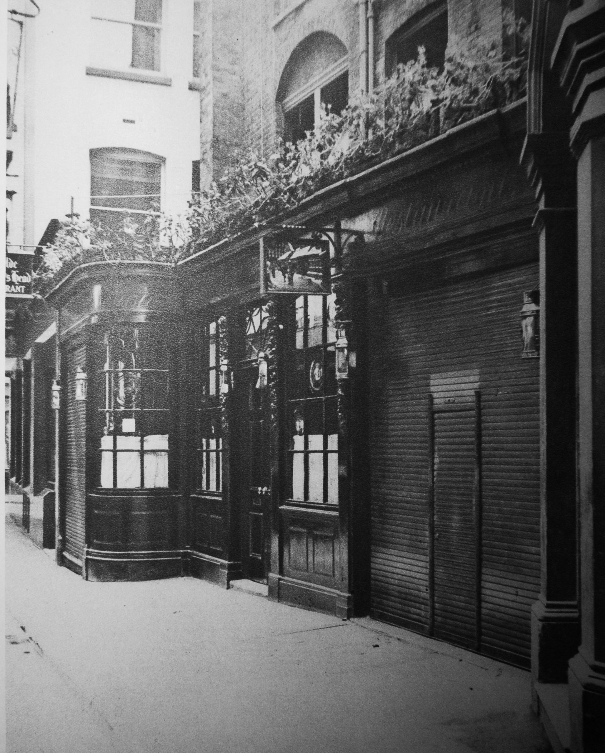
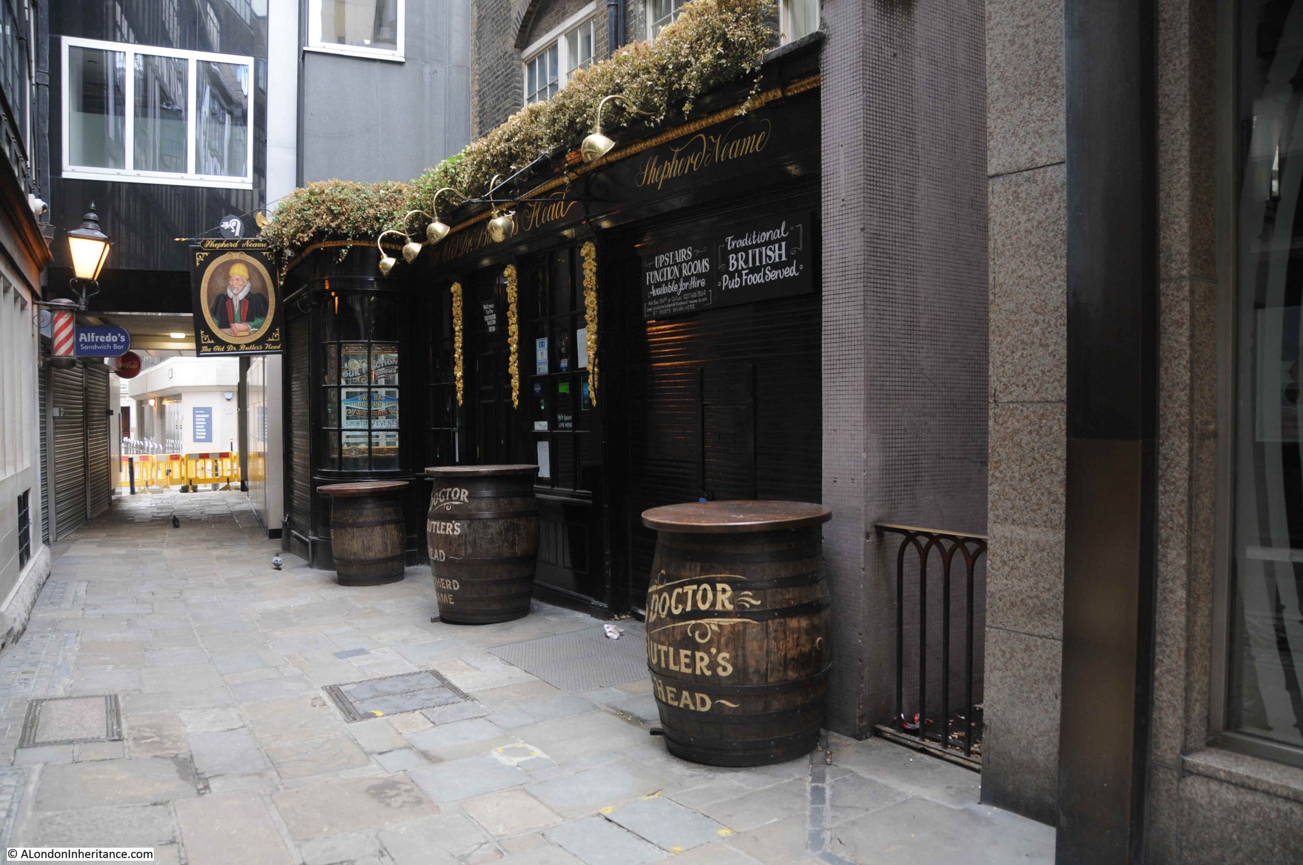
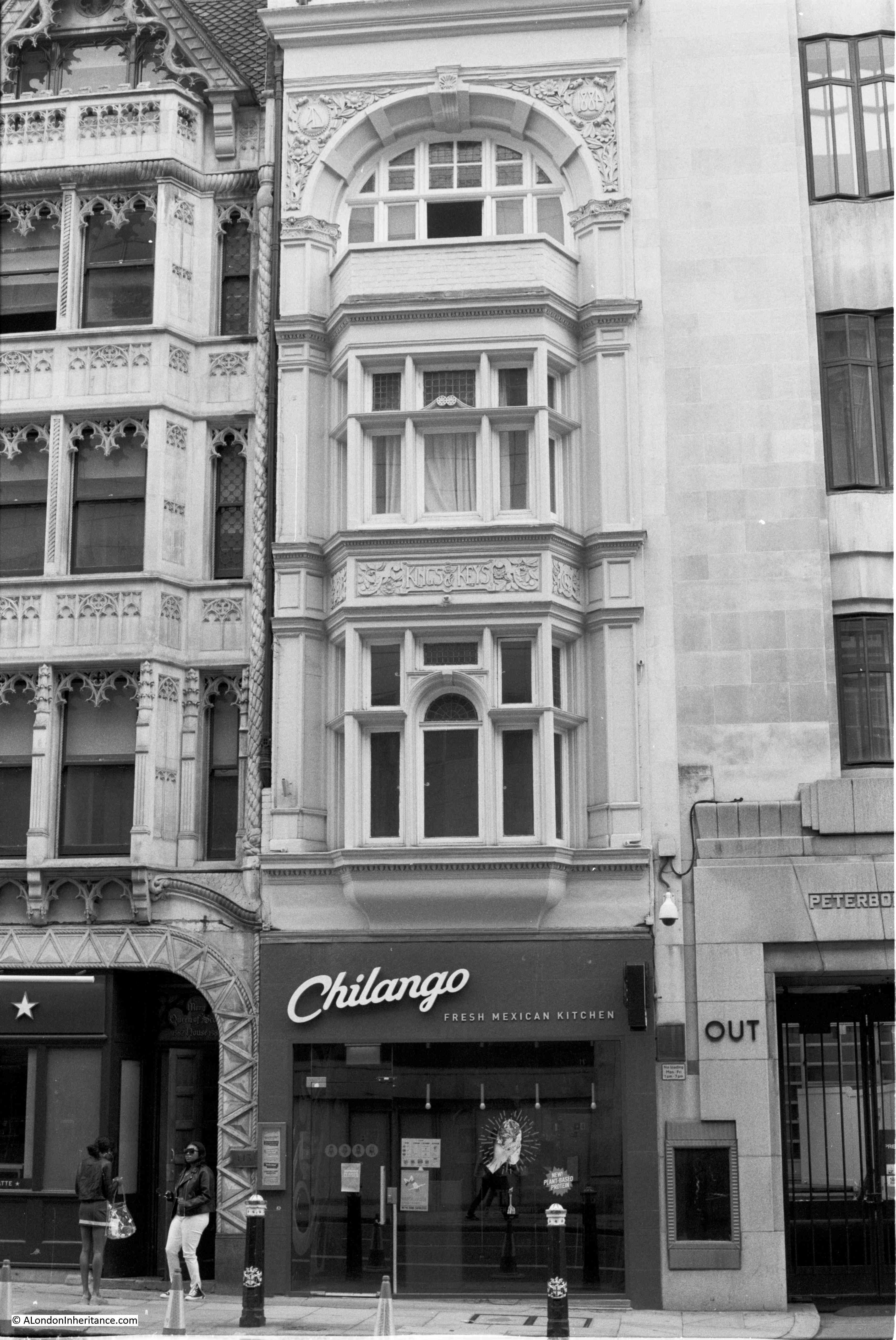
The next pub is the Old Doctor Butler’s Head in Mason’s Avenue in the City of London:
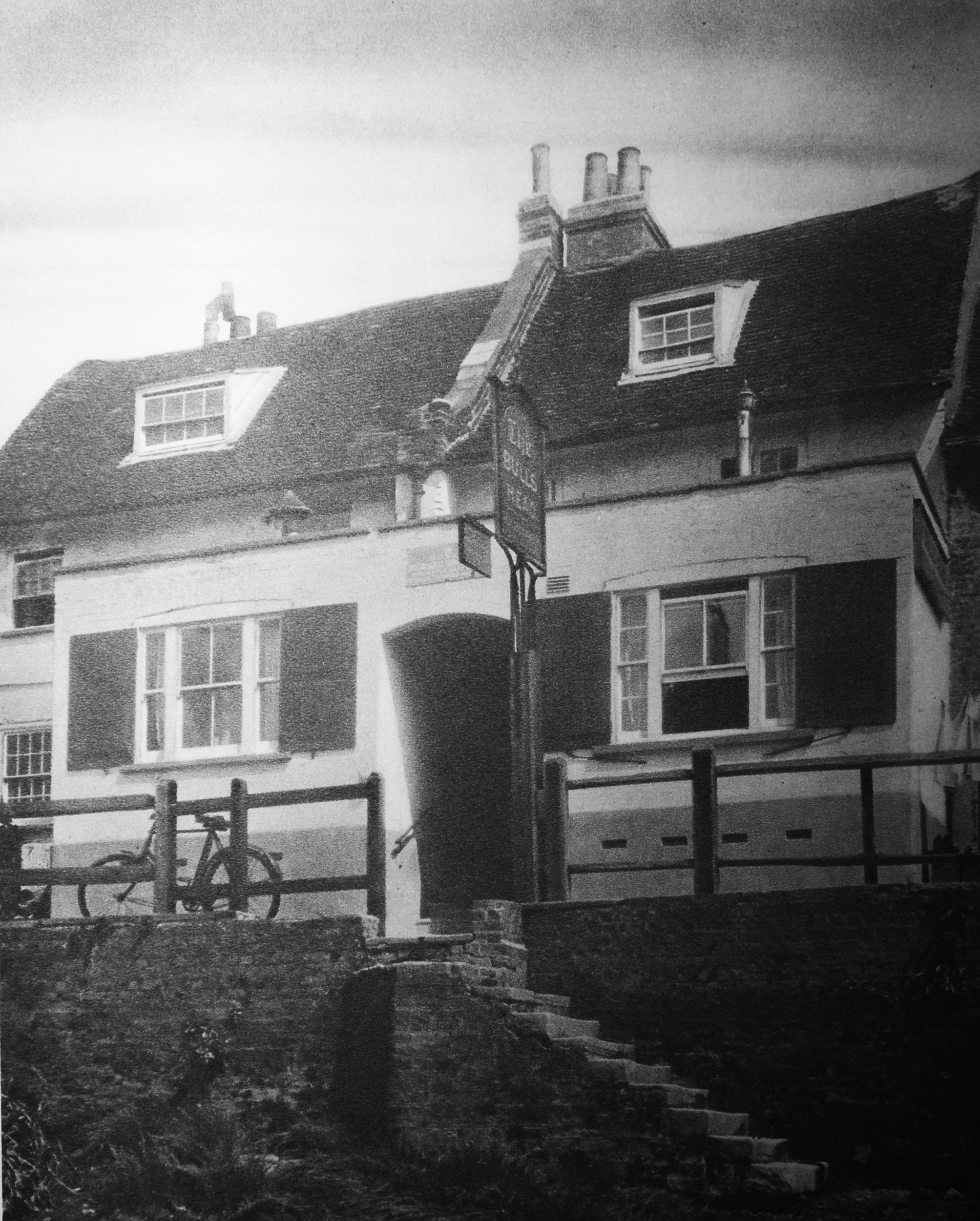
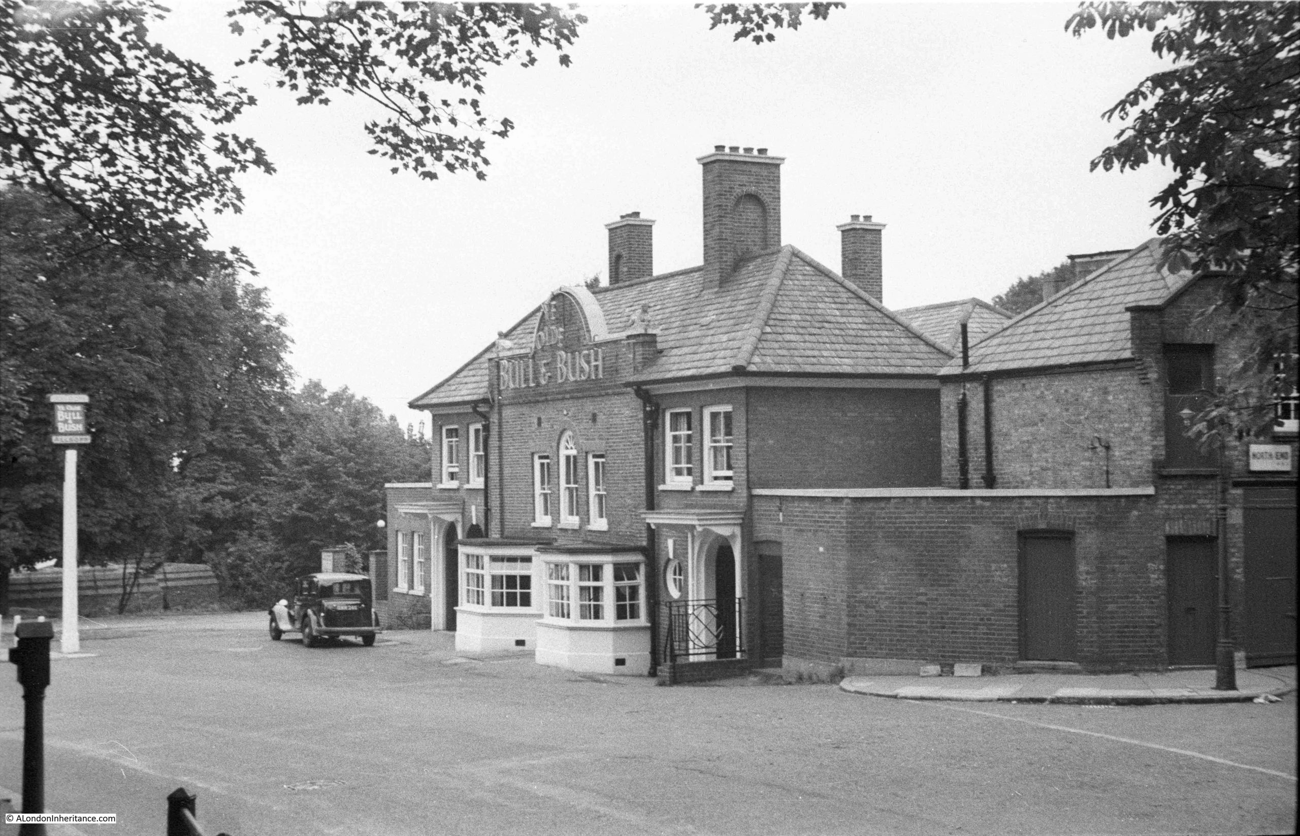
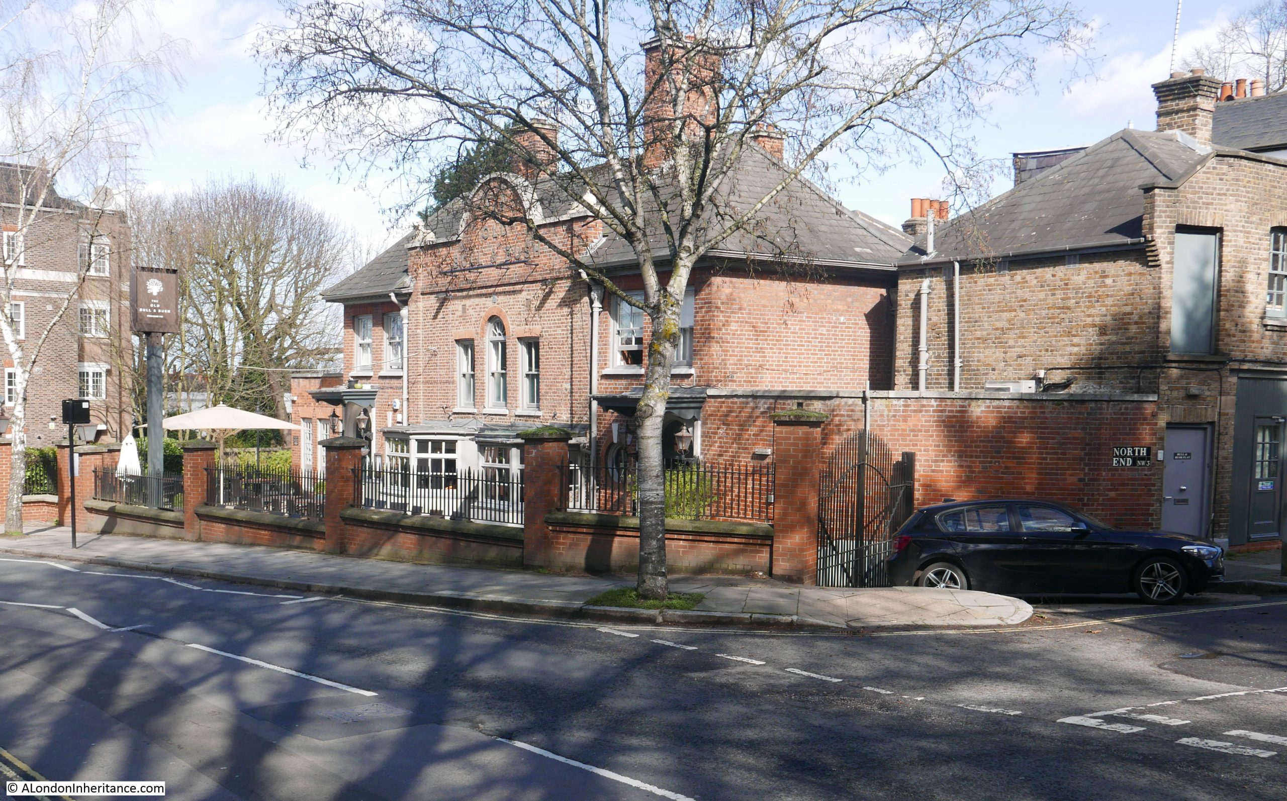
My father photographed the Bull and Bush in 1949, when it faced directly on to the road, and you could pull up outside and nip in for a quick drink:
I photographed the pub for a blog post on the Bull and Bush, 70 years after my father had taken the above photo. The building is still much the same, although there is now a pathway and brick wall separating the pub from the road:
All the above pubs are still open, not a bad record considering the rate of closure in recent years, however they were well known pubs in the early 20th century, and 100 years later are still well known and therefore probably profitable.
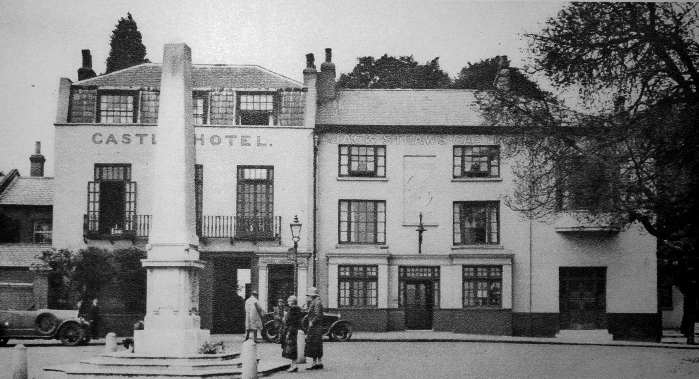
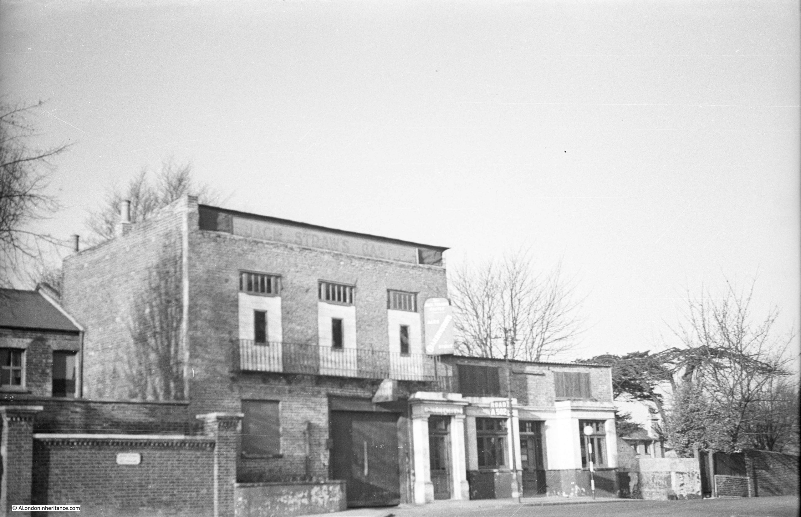
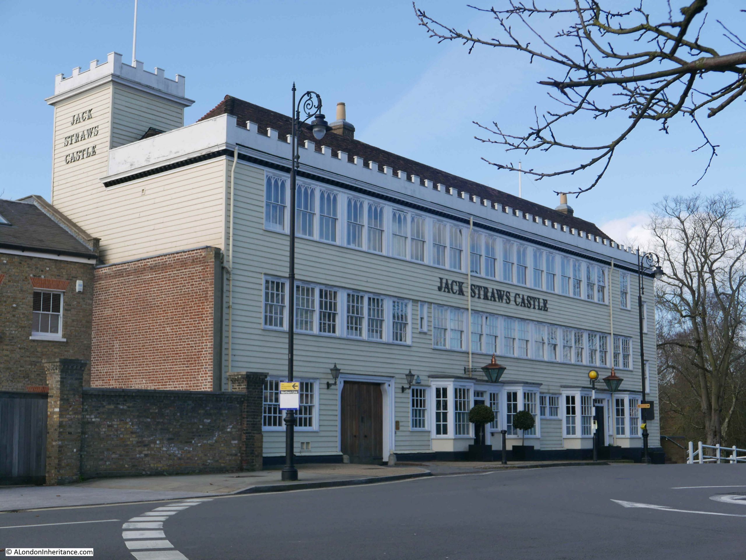
One pub that did not survive is Jack Straw’s Castle, also in Hampstead:
My father photographed the pub in 1949 after bomb damage had left the building in a very sorry state:
The building was demolished and rebuilt in 1964 as a pub, to a rather striking design by Raymond Erith, however it is no longer a pub, having been converted into apartments and a gym. The building is Grade II listed which has helped to preserve key features of Erith’s design, despite developers trying to push the boundaries of how much they could change.
Moving on from London pubs, and in the first years of the 20th century, this is Strand Lane which leads down from the rear of King’s College down to Temple Place.
The view gives the impression of being of the type of slum housing that would be demolished, however the house with the alley has been restored over the years, and still survives, including the ornate iron balcony on the first floor. The high wall on the left, and building on the right also remain, including the iron bars protecting the windows.
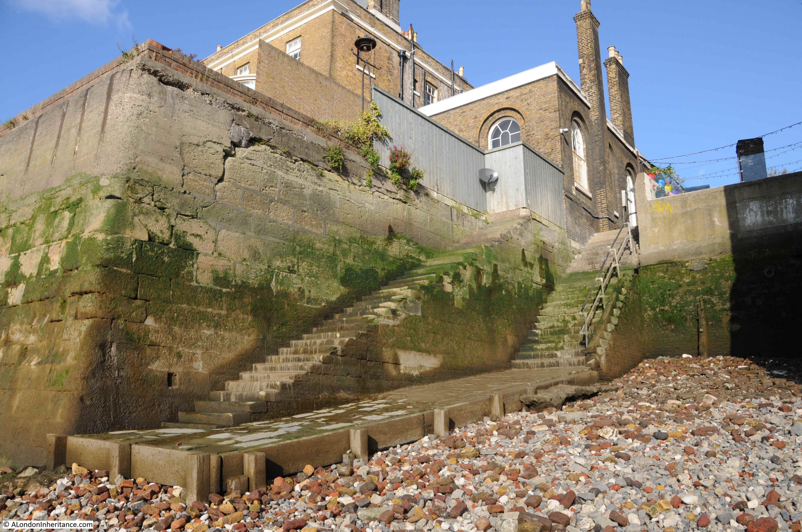
Just proving there are still places in London where you can imagine being back in the 19th century. Another place that has survived are the stairs leading down to the river at Wapping Old Stairs:
Even in the first decades of the 20th century, these stairs were seen as a historical location, as Wonderful London describes “the old riverside annex to the city of the days of the East Indiamen and Nelson’s Ships, has gone and there is little beside these old stairs – leading down to a muddy beach at low tide – left of this, once one of the liveliest spots in the country”.
The following two photos are titled “Present-day scenes on historic Thames-side sites”
The description from Wonderful London that goes with the two photos is as follows “The upper photograph shows Ratcliffe Cross stairs, an ancient and much used landing place and point of departure of a ferry. There is a tradition that Sir Martin Frobisher took boat here for his ship when starting on his voyage to find the North-West Passage. Ratcliffe Cross is the old name for the thoroughfare leading to this landing stage, whence Butchers Row meets Broad Street, Shadwell and Narrow Street, Limehouse.
Shadwell (lower view) is next to Wapping, and its name is supposedly derived from (St) Chad’s Well. It was once famous for its rope-walks”.
Ratcliffe Cross stairs are sort of still there, as there is still river access where the stairs were located. They are today where Narrow Street curves to a dead end just before the Limehouse Link Tunnel. Ratcliffe Cross stairs are on the list for a future post, as these old river stairs have a really fascinating history.
The Sir Martin Frobisher mentioned as using Ratcliffe Cross Stairs was a 16th century sailor and privateer who made a number of attempts at discovering the north-west passage across the north of Canada from Atlantic to the Pacific. As well as allegedly using the stairs, another connection with London is that he was buried at the church of St Giles, Cripplegate, and is why Frobisher Crescent in the Barbican is so named.
The next photo is in the east of the City where “In Houndsditch, where bargains are driven for inexpensive clothes”:
Houndsditch was the location for shops and a market selling every conceivable item of clothing, both new and secondhand. The name came from the ditch that once surrounded the City wall, and was frequently used as a dump for everything, including dead dogs.
Houndsditch continued discount trading into the 1980s, and if you listened to either Capital Radio or LBC during the late 70s / early 80s there were frequent adverts for the Houndsditch Warehouse where “five floors of bargains can be found at our store”. The street is very different today.
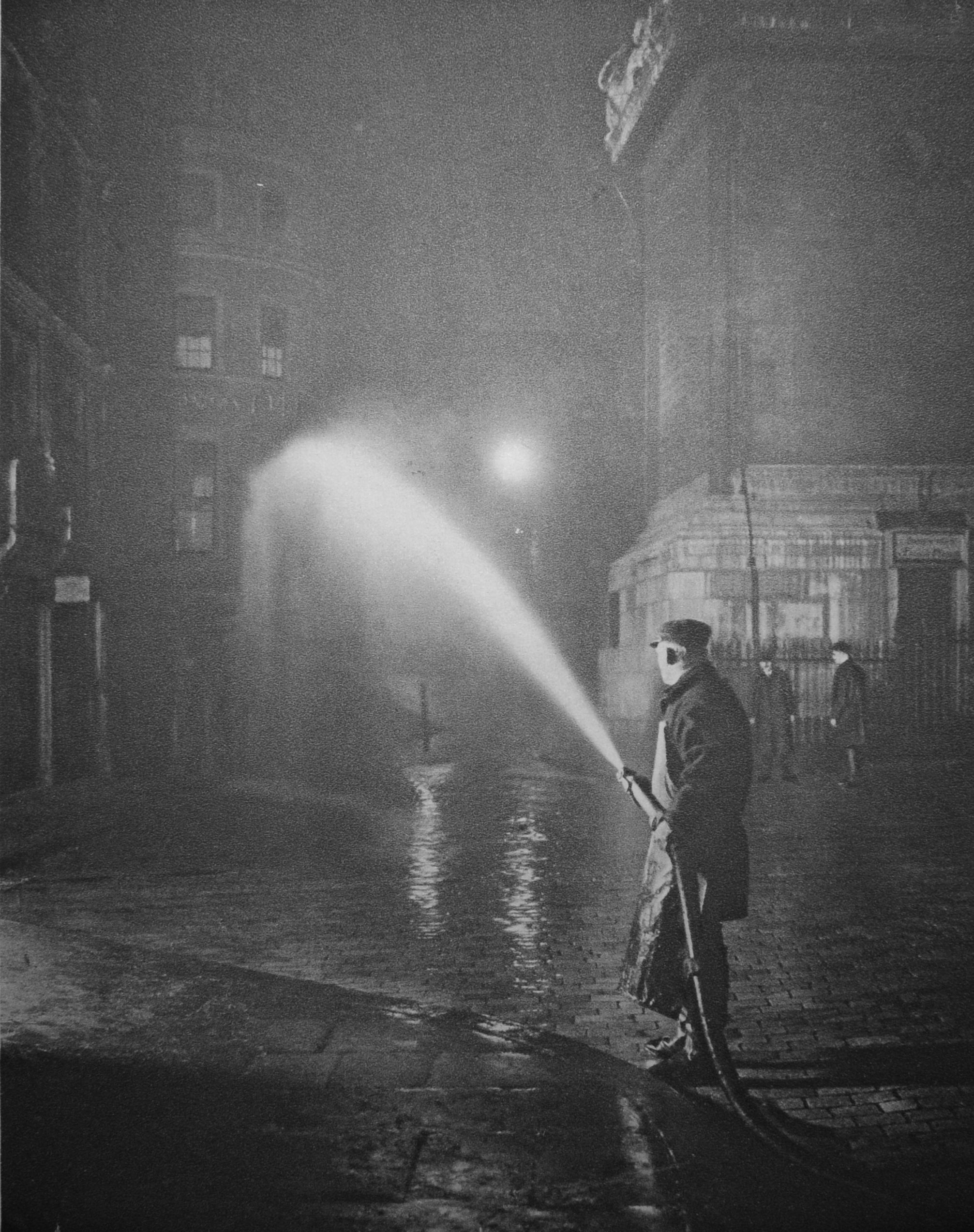
Wonderful London included some night photos of London, including the nightly cleansing of the streets at the base of the Monument, where at “2 a.m. hoses are fitted to hydrants, and men in oilskin aprons wash the day’s filth into the gutter. The neighbourhood of Billingsgate is notoriously unsavoury, but these ministrations keep the fish like smell from becoming too ancient”.
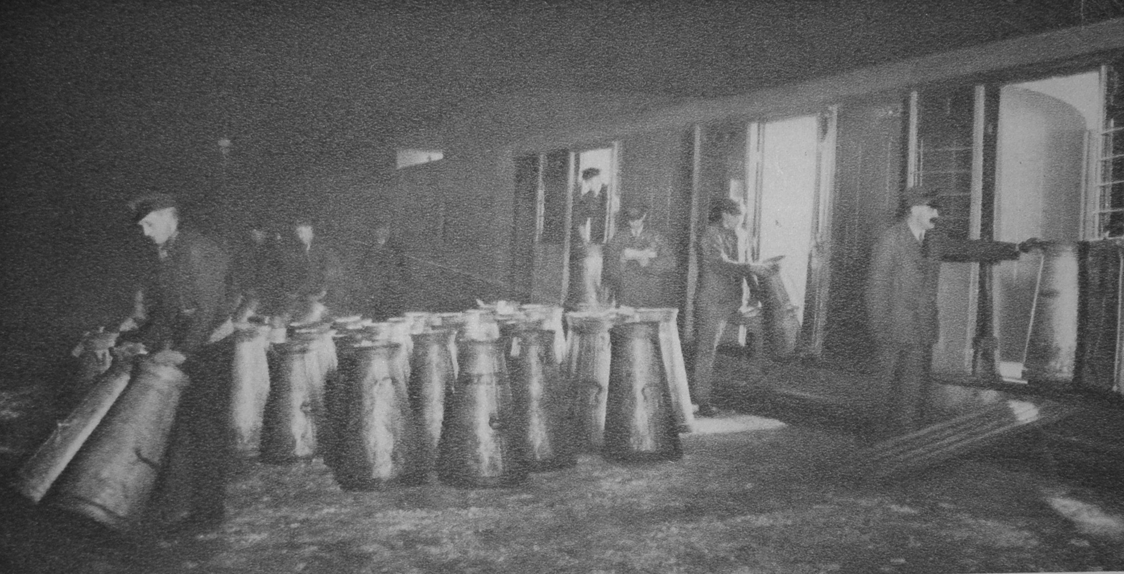
Milk churns being unloaded at Clapham, ready for the city’s tea drinkers:
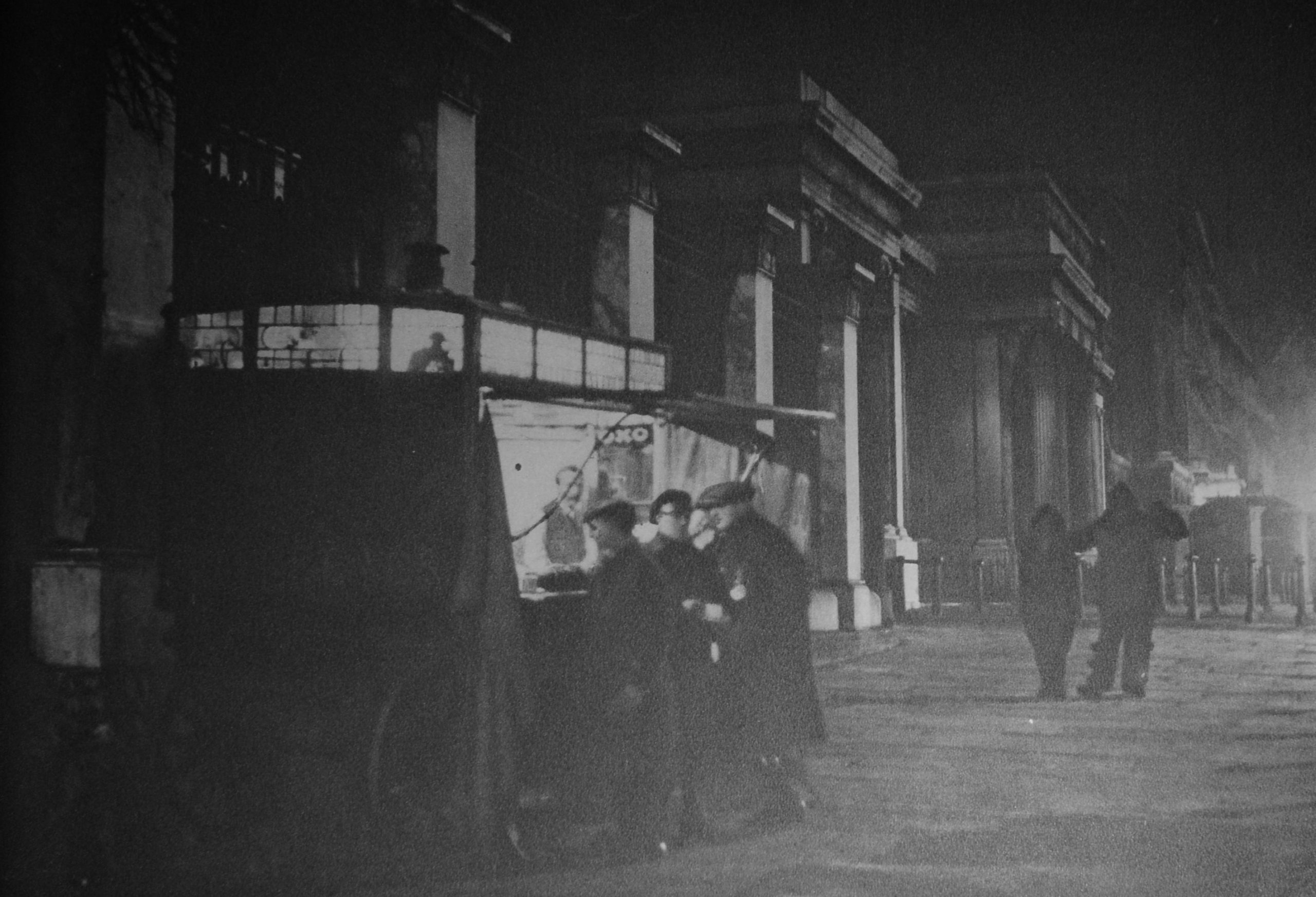
The following photo is titled “The coffee stall at Hyde Park Corner and some of its various patrons”;
Where “just before ten o’clock every night the coffee stall trundles up to its pitch opposite St George’s Hospital. There it remains till about eight o’clock the next morning, and during that time the men behind the little counter watch, as from a box at the theatre, the hundred different types who act in the nightly drama of London after dark. The medicals student from over the way, the tattered nondescript who hopes for a free coffee, a taxi-driver and his two fares, or perhaps a couple of revelers in fancy dress to whom the visit to the coffee stall is the epilogue to their night’s entertainment; all these types pass during the cold, still hours which the coffee stall serves”.
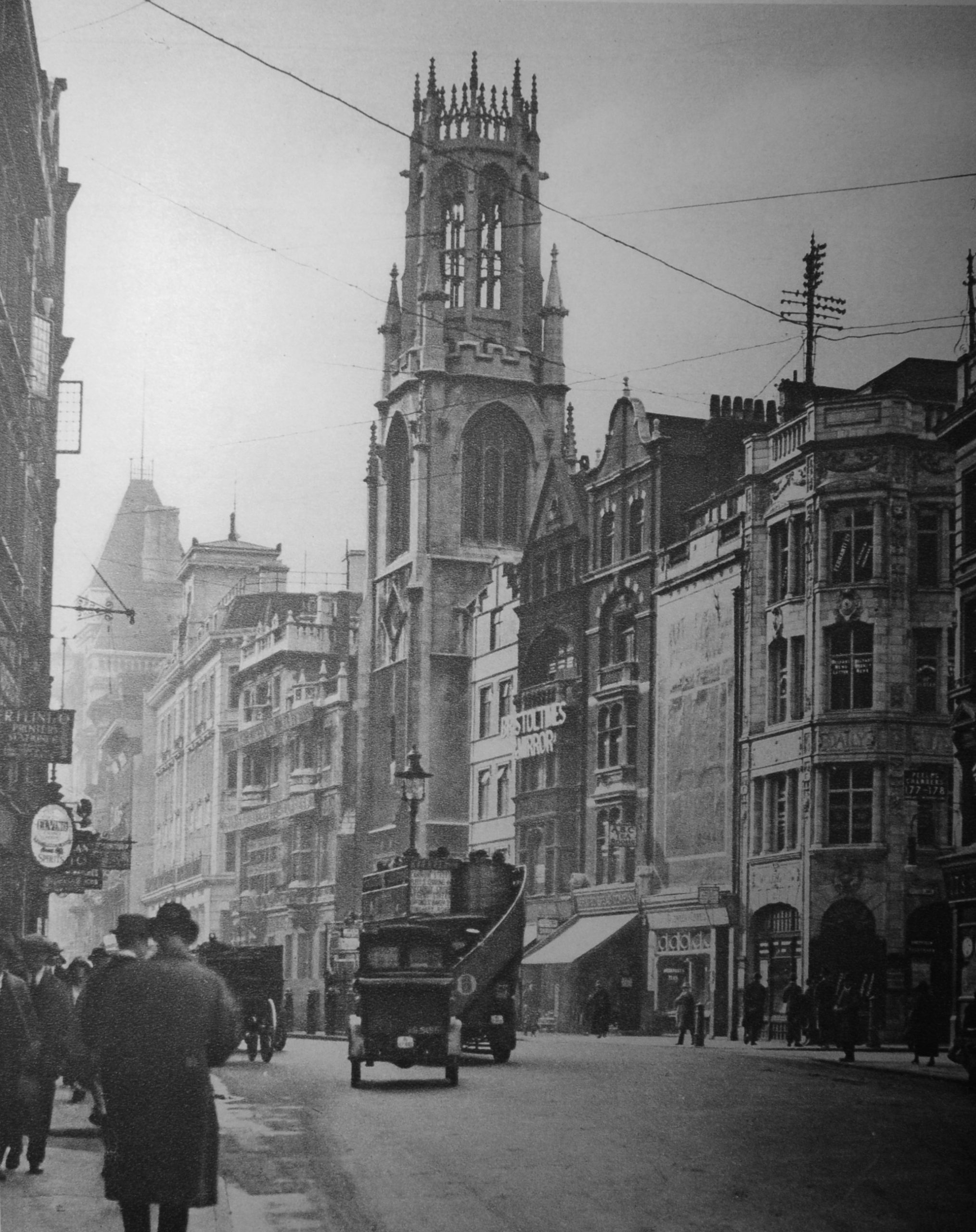
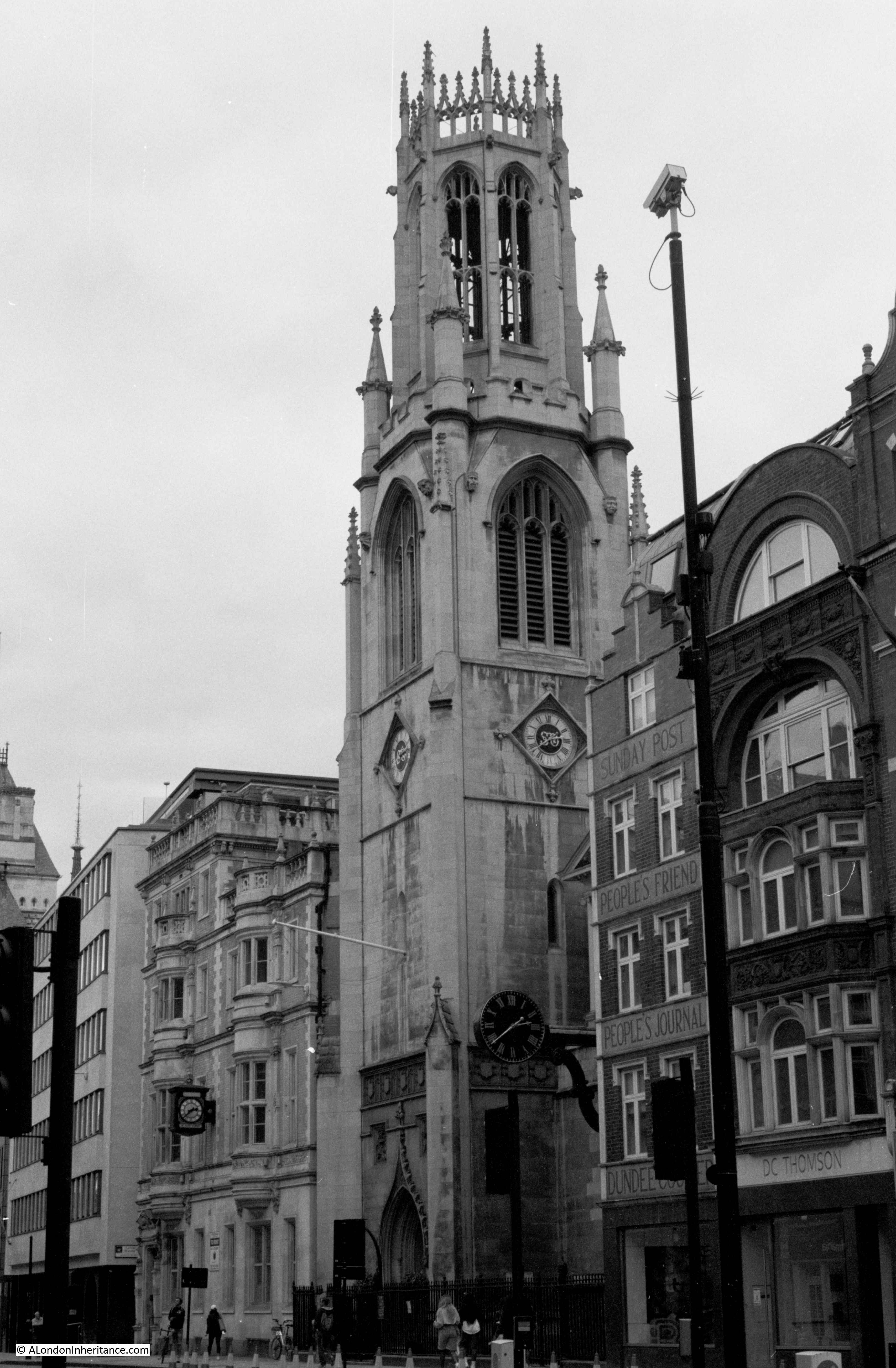
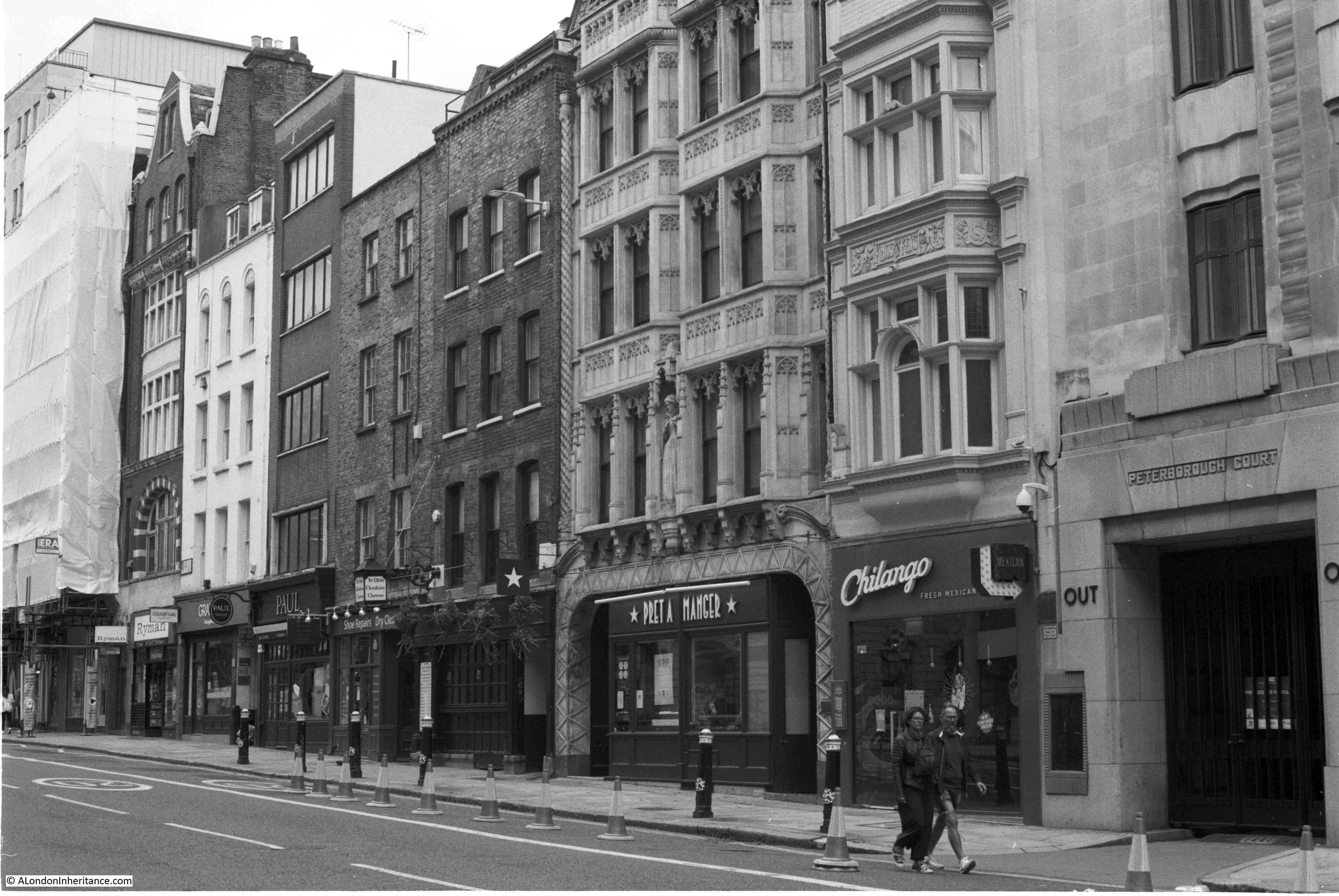
The following view from Wonderful London is of St Dunstan’s, Fleet Street:
What I like about these photos is not just the overall scene, or the people and vehicles in the streets, but small details like the telegraph poles mounted on the roofs of buildings with telephone cables slung across streets and buildings.
In Tower Wharf (the area between the Tower of London and the Thames), Wonderful London has photographed “one of London’s lunch-time gathering grounds”:
The caption to the photo illustrates the popularity and history of the place “Despite the tremendous number and variety of eating places, many hundreds of those who work in the City and its surroundings, prefer , in fine weather, to eat their lunch on a park-seat, or as here, seated on the slippery surface of an old cannon. Tower Wharf, whatever its merits as a restaurant is a fine place from which to view the Tower and also the shipping in the Upper Pool and the opening of Tower Bridge. The wharf was built by Henry III, who also made Traitors Gate. The wharf gave the fortress one more line of protection. On the very ground where the crowd is sitting another London crowd assembled day after day to scream for the trembling Judge Jeffries to be thrown out to them, in quittance for the Bloody Assize”.
Up until the start of the COVID pandemic, the area was usually crowded with tourists rather than City workers having their lunch, and many of the cannons have disappeared. My father photographed the cannons in 1947:
The same view a couple of years ago:
in the background of the Wonderful London photo, ships can be seen passing along the Thames, and the same view could be seen in 1947:
Rather than cargo ships, the view today would be off tourist boats and Thames Clippers.
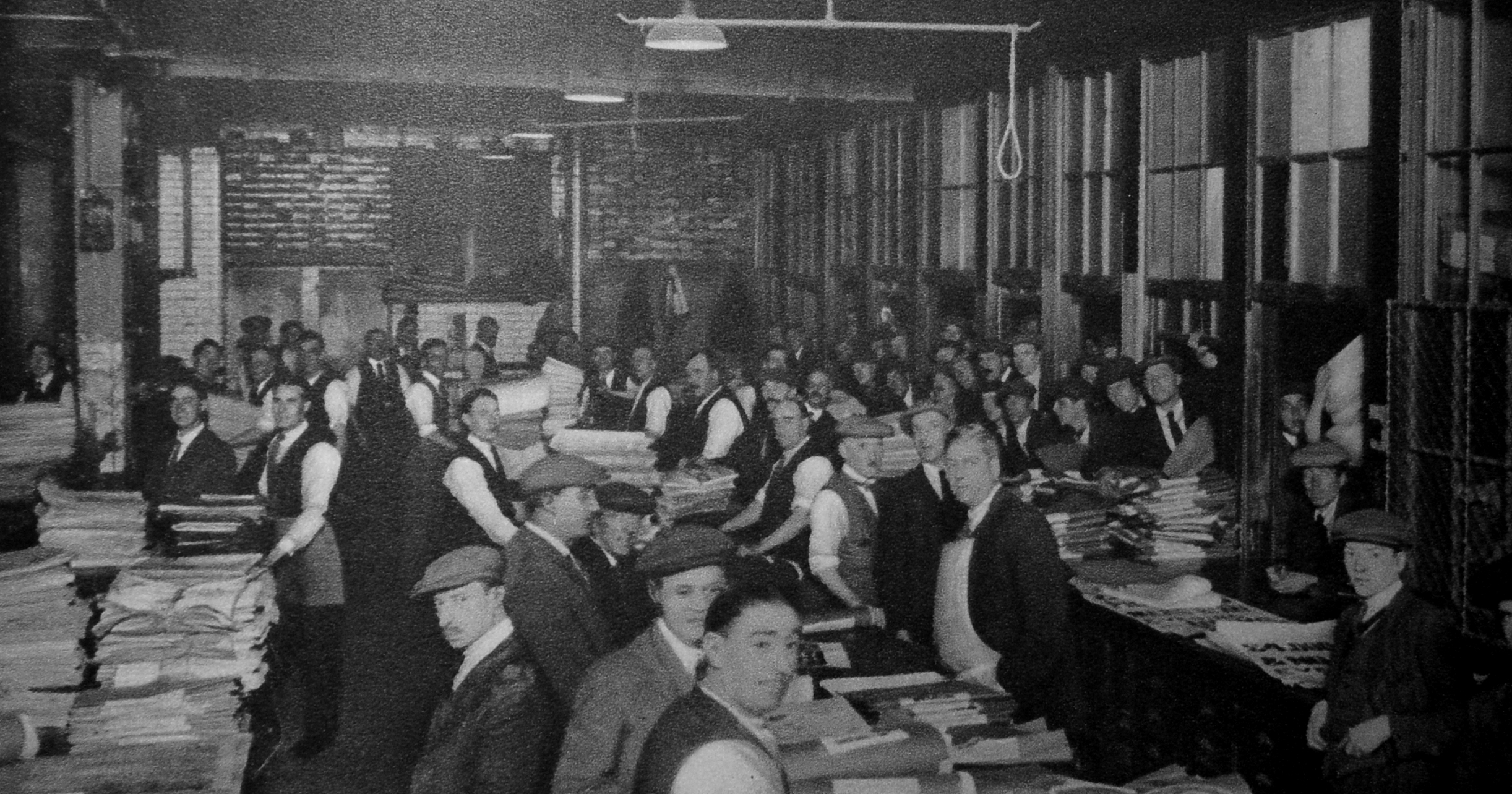
This was the scene in Carmelite Street, which runs from Tudor Street to the Victoria Embankment. The street is a continuation of a street that runs down from Fleet Street, and was the home of newspapers and printing. The photo is outside Carmelite House and shows rolls of paper arriving and being lifted into the building ready for printing.
Today, the evening papers sold across the streets of London are transported by van, however in the early decades of the 20th century there was a very different method.
The following photo shows newsvendors gathering to collect newspapers. The newsvendor collects a quantity of papers along with a voucher for those papers. The publisher also retains a copy of the voucher.
The newsvendor then distributes the papers among his newsboys, who would then sell them on the streets.
At the end of the day, the newsvendor meets his newsboys, collects unsold copies and the money from sales. The next day he then has to pay the publisher the amount specified on the voucher when he collected the papers.
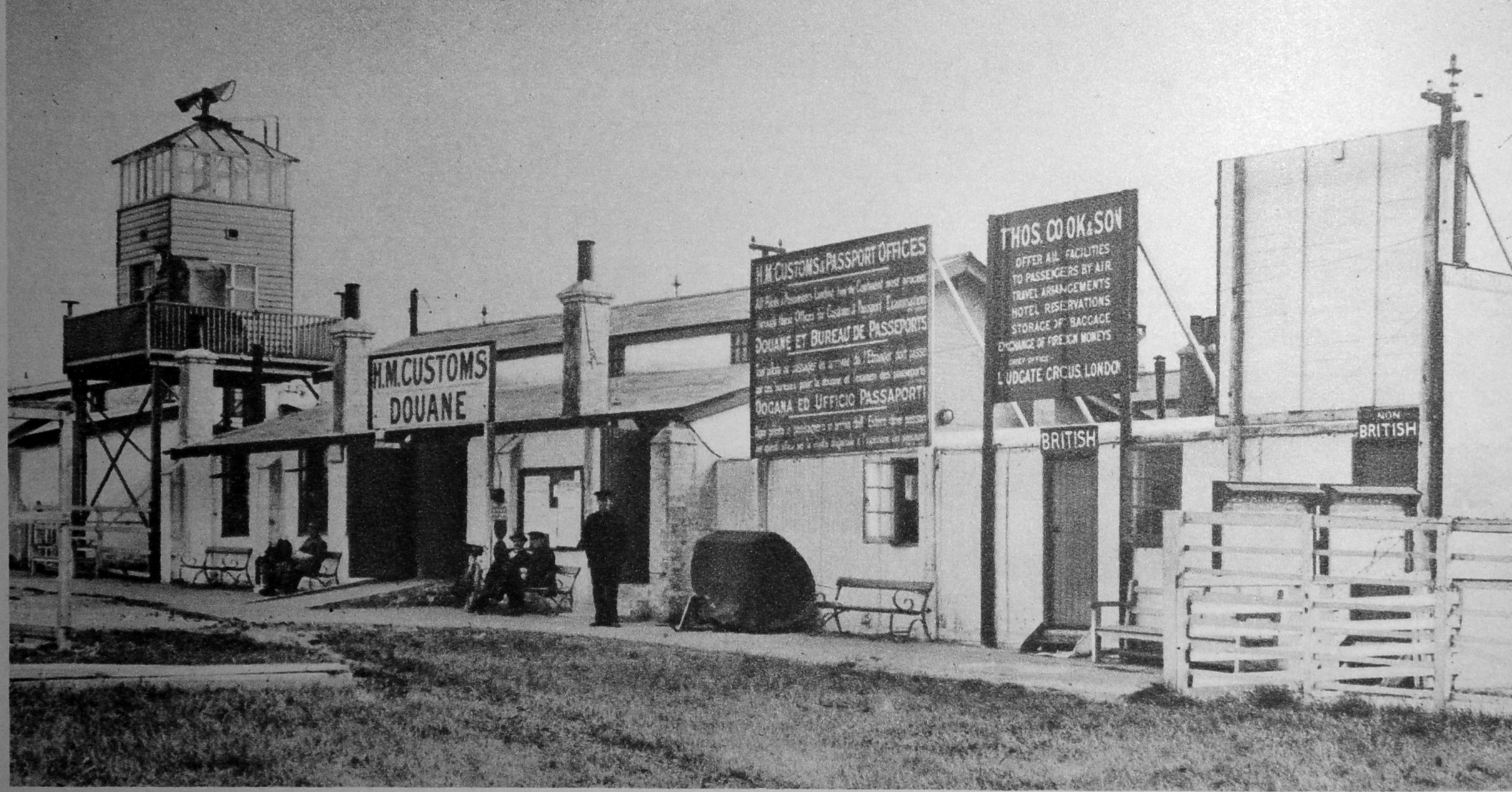
Some of those newspapers could have been transported abroad via the recently opened “Airport of London”, or more popularly known as Croydon Airport.
The following photos shows the arrival facilities for passengers with customs facilities and passport control, with the two doors on the right for “British” or “Non British”:
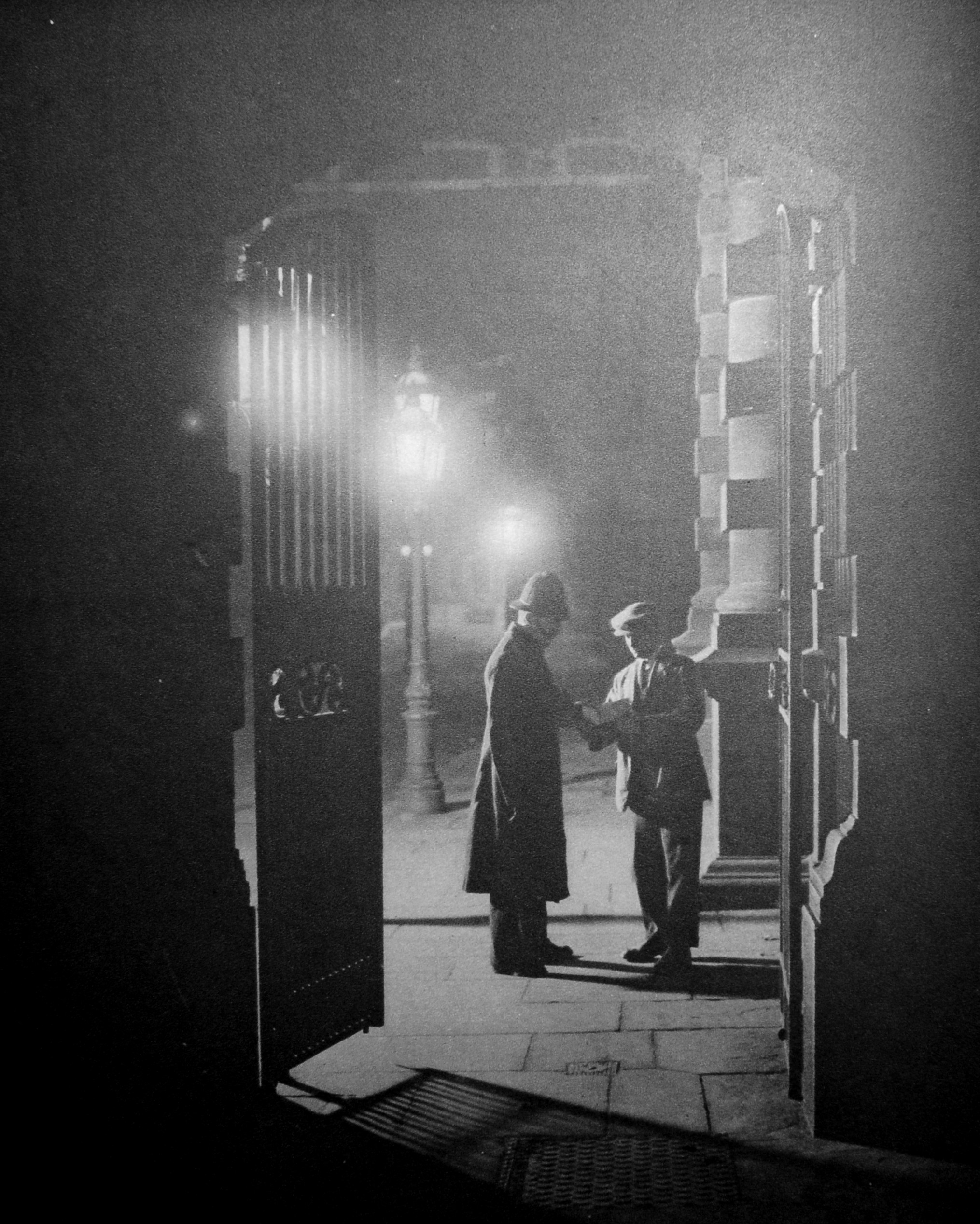
Back to London after dark, and the following photo is showing “An incident at the Yard”:
Apparently a plain clothes officer talking to a Constable at Scotland Yard. It is always difficult to know how many of these old photos were posed or were a real event when the photographer was on site.
The text with the photo does though claim that “The gate is open all night, and anyone in need of police will find ‘The Yard’ ready and waiting”.
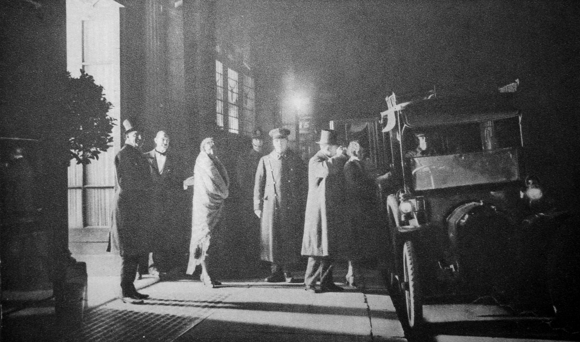
Policing in London during smog conditions must have been rather difficult. Wonderful London describes such an event as “When the minute particles of dust which are always overhanging London become coated with moisture and the temperature falls below what is called the ‘dew-point’, that is, the temperature at which the moisture in the atmosphere condenses, fog blankets the streets”.
When this happened, a number of methods were used to help guide people and traffic around the city, one of which was lighting acetylene flares at key traffic locations as shown in the following photo:
Those who may have needed the help of an acetylene light to navigate the streets of London were those leaving Murray’s Club late at night in Beak Street, Soho:
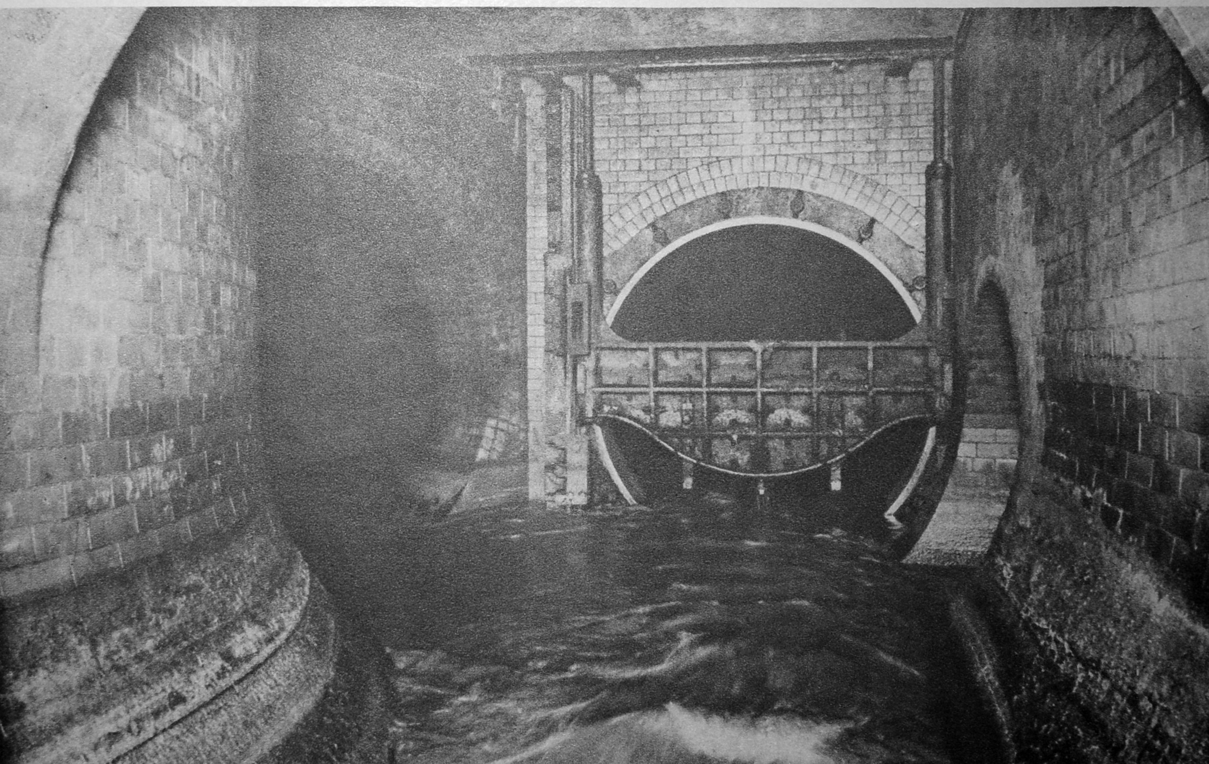
The sewers of London have always been a fascination (at least for me). A parallel world beneath the city’s streets. The following photos show part of the sewer system at Hammersmith. This was the main sewer under Hammersmith Road. Known as the Counters Creek Sewer due to its proximity, and in parts, integration with Counters Creek, the old ditch / stream / sewer / canal that ran from Kensal Green cemetery down to the Thames near the old Lotts Road power station.
The book describes a sewer control system that is basically in use today. Sewers such as the Counters Creek Sewer run north – south, taking water down to interception sewers that run east – west and transport the water for treatment.
When there is too much water for the system to handle, an overflow is needed into the Thames. In the above photo, the overflow sewer is on the right. The device covering part of the sewer entrance is known as a “penstock”, and has been lifted to lower the water level for the photographer.
Normally, this would be lowered to divert water to the tunnel on the left which takes water to the intercepting sewer. When water rises to the top of the penstock, it overflows into the overflow tunnel which then flowed into the river at Chelsea.
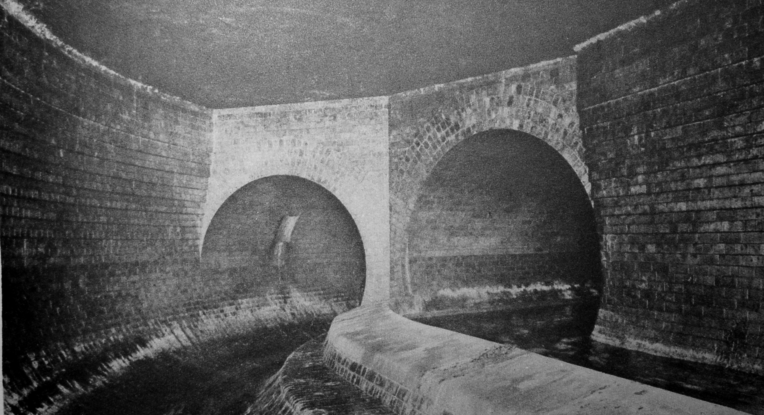
The photo below is the other side of the penstock and shows the two tunnels. The penstock has been lowered, and the overflow channel on the left is dry, with water in the Counters Creek sewer on the right.
Over one hundred years later, the construction of the Tideway Tunnel or Super Sewer is intended to end discharges into the Thames by adding additional capacity on the east – west route
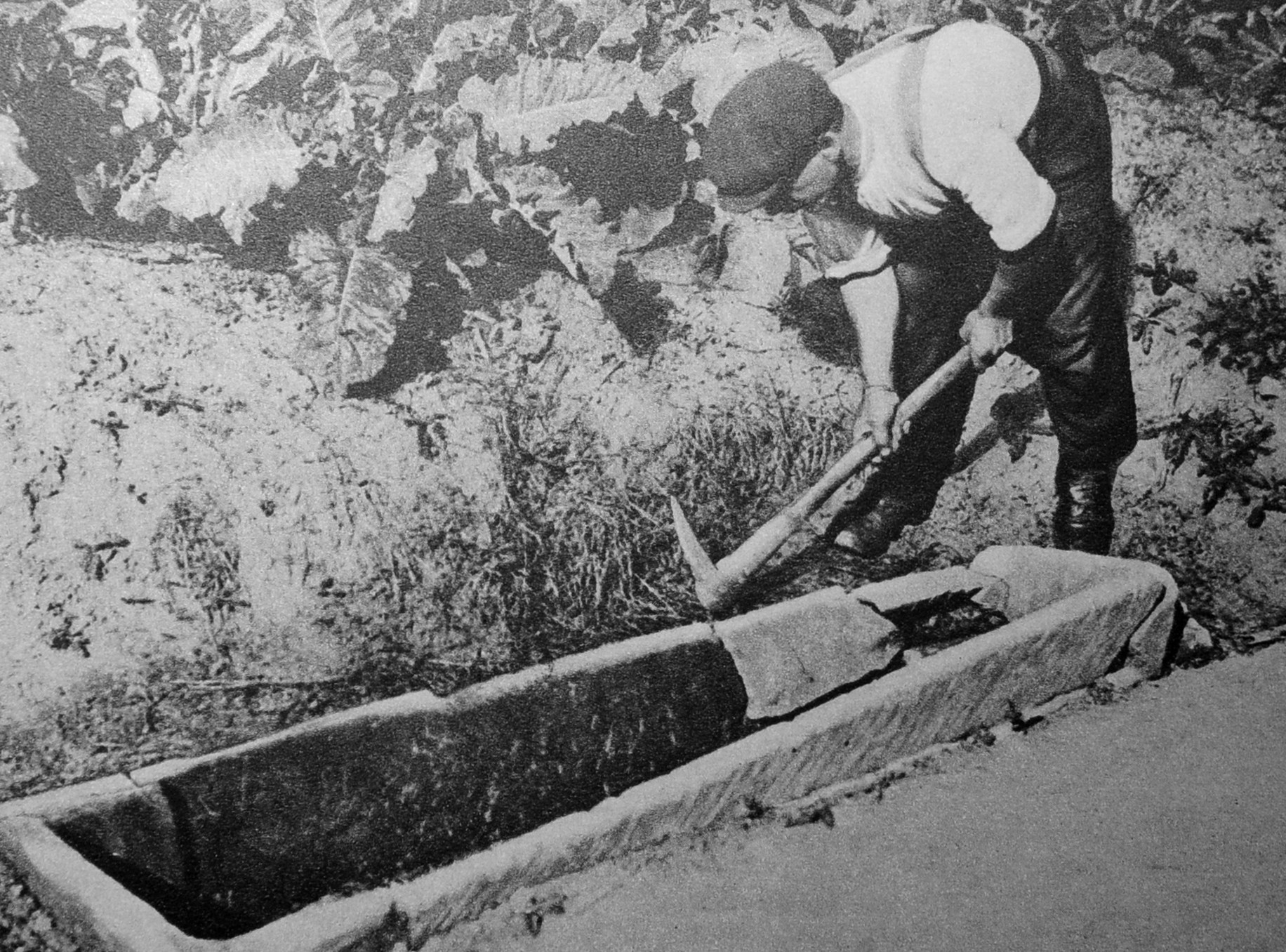
What makes Wonderful London so fascinating is the sheer variety of subjects. There are a couple of photos of the remains of the old Merton priory, but a strange photo is of when a workmen digging in allotments near the mill alongside the River Wandle at Merton discovered an 800 year old coffin underneath the cabbages:
No idea if there was any occupant, what happened to the coffin, or whether any further excavations were carried out. Just one of the random photos in the book that came with just a brief description.
The following photo is of Poplar Almshouse with presumably one of the occupants standing outside:
The almshouses were in Bow Lane (which has been renamed as Bazely Street, and runs south from East India Dock Road, and is to the east of All Saints Church).
The almshouses were founded around 1696 when Hester Hawes left six almhouses on the west side of the street for six poor widows, with a monthly allowance of 2s 6d for each widow.
The almshouses were demolished in 1953, so I suspect they were on the site of the flats, just south of the Greenwich Pensioner pub.
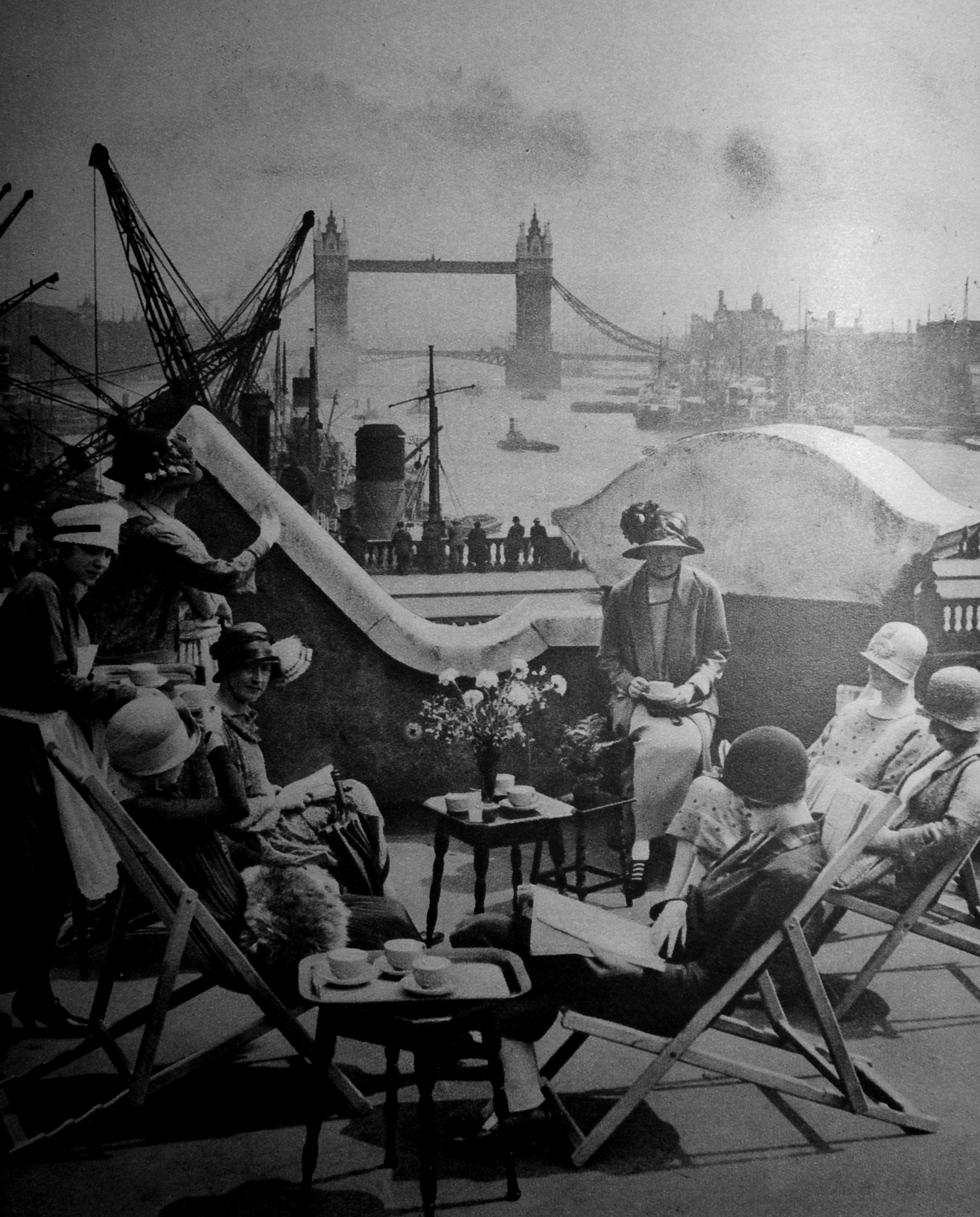
Back to the City, and these are members of the Langbourne Club for City Women relaxing on the roof of Fishmongers Hall, or one of the adjacent building, as part of the parapet of London Bridge can be seen in the gaps between the wall.
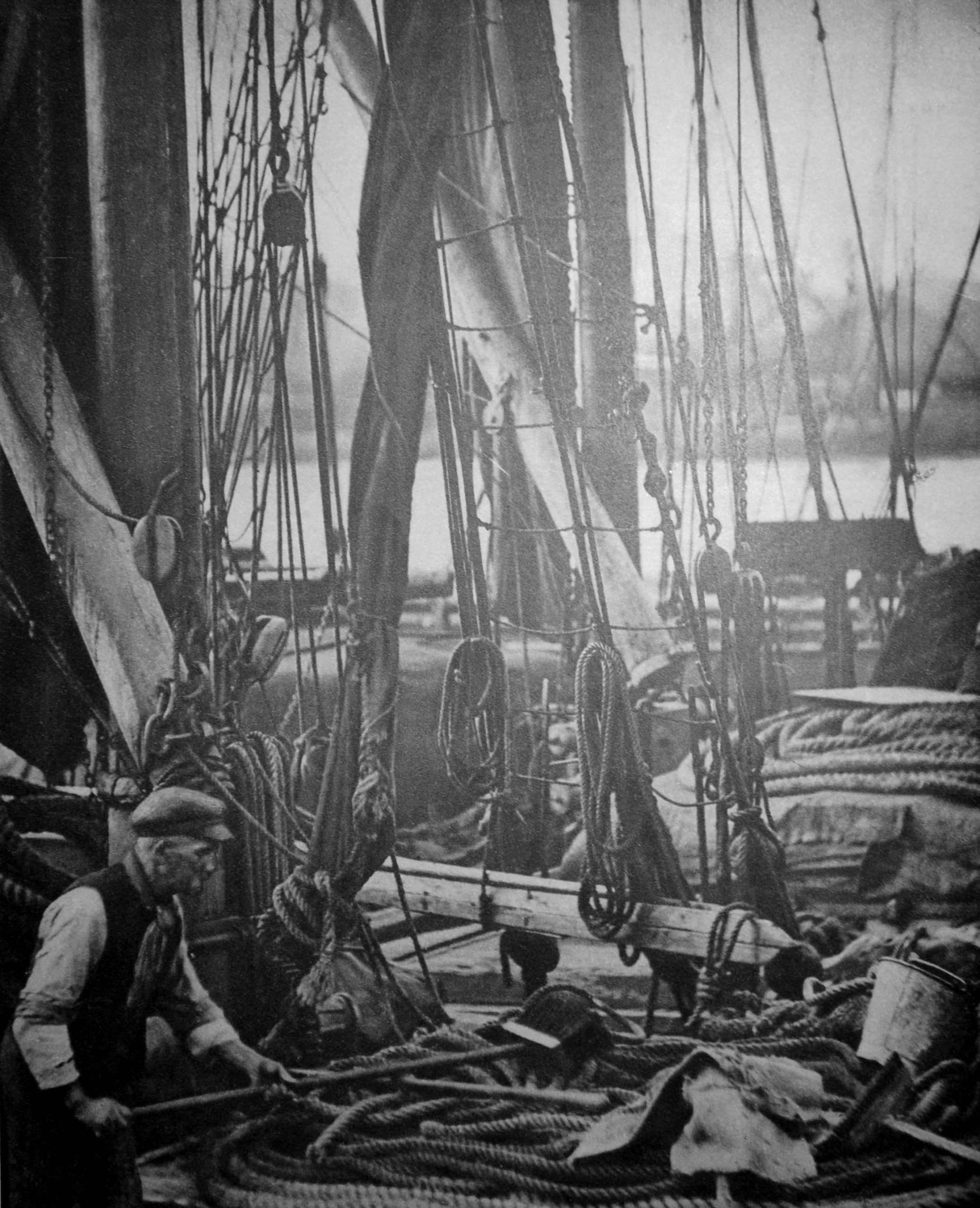
On the river was a Thames Barge:
The text with the photo comments on the apparent confusion of multiple ropes, chains, buckets, fenders and pieces of canvas. I suspect if you sailed these barges there was no confusion, and you knew exactly where everything was, and it was in the correct place.
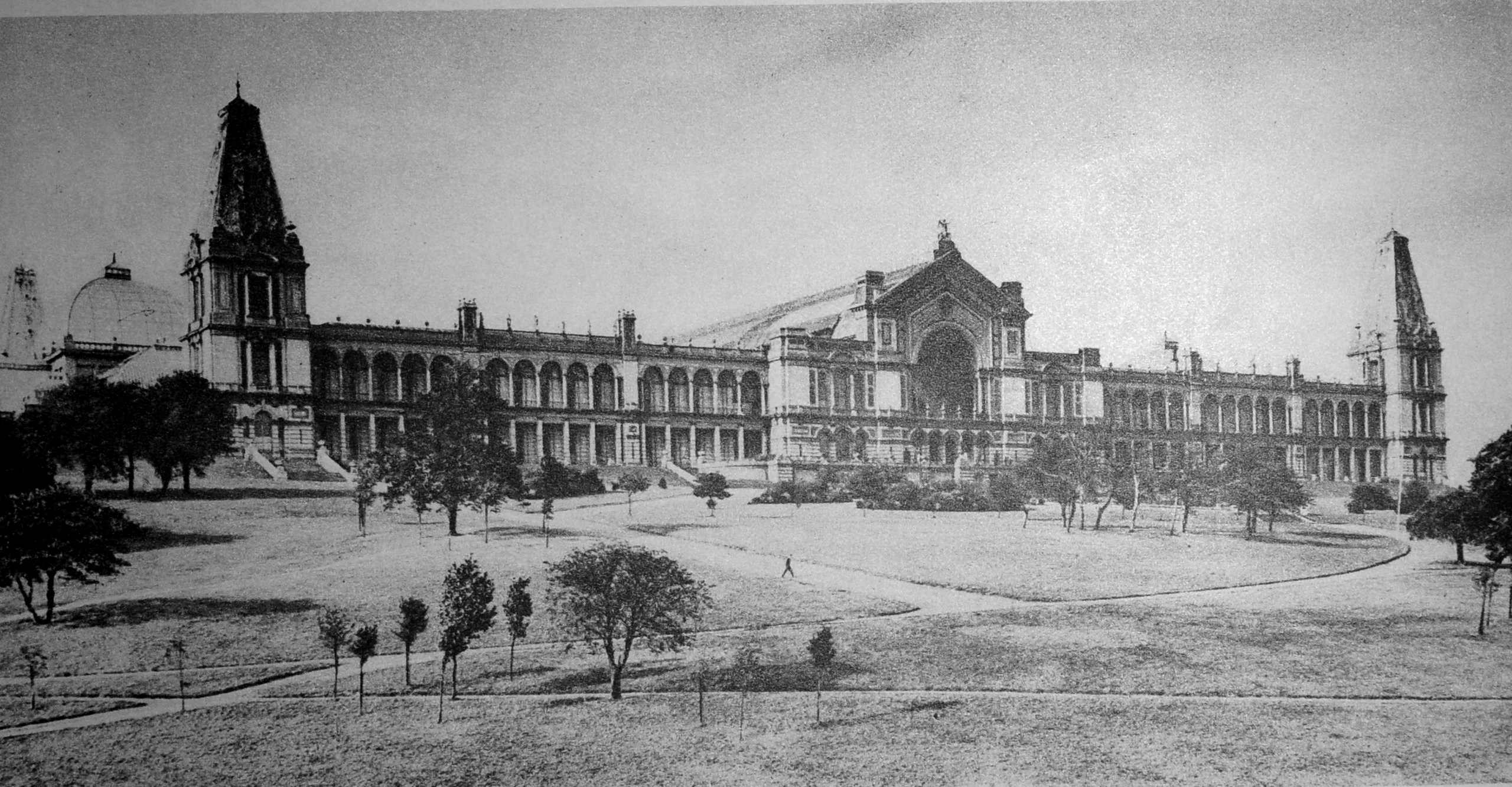
To finish this rather random survey of early 20th century London, a visit to north London and Alexandra Palace:
The Grand Hall which ran back from the taller part of the central façade:
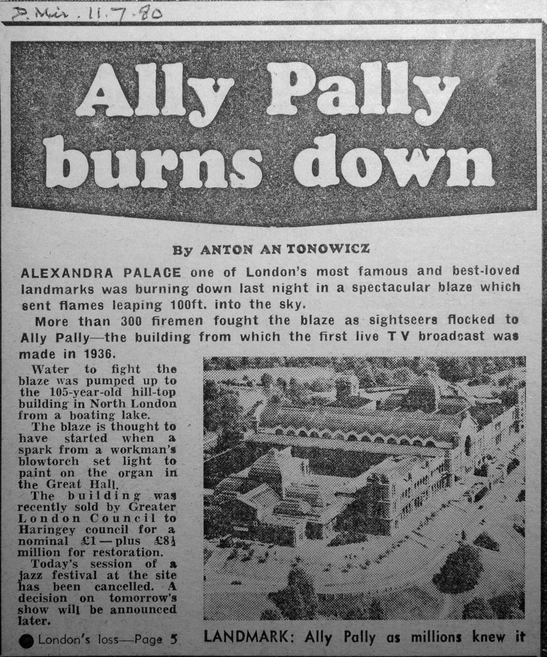
The Alexandra Palace photos are an example of why I love second hand books, as you never know what previous owners have left between the pages.
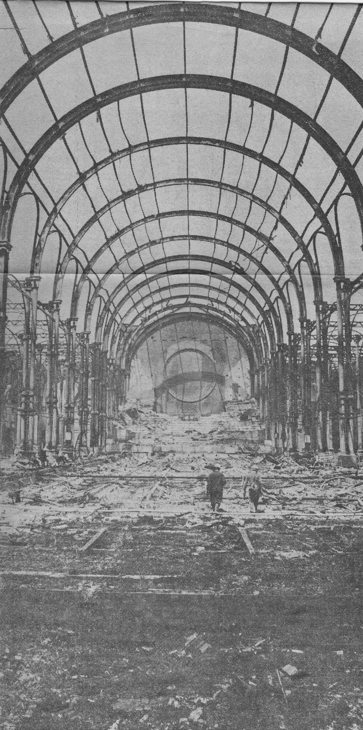
Alexandra Palace suffered a severe fire in 1980, and the previous owner of my copy of Wonderful London put a number of newspaper clippings next to the page with the original photos. These report on, and show the extent of the 1980 fire:
I love the understatement within the last paragraph, that whilst today’s jazz festival had been cancelled, a decision would be taken on the following day’s show.
The damage to the building was extensive:
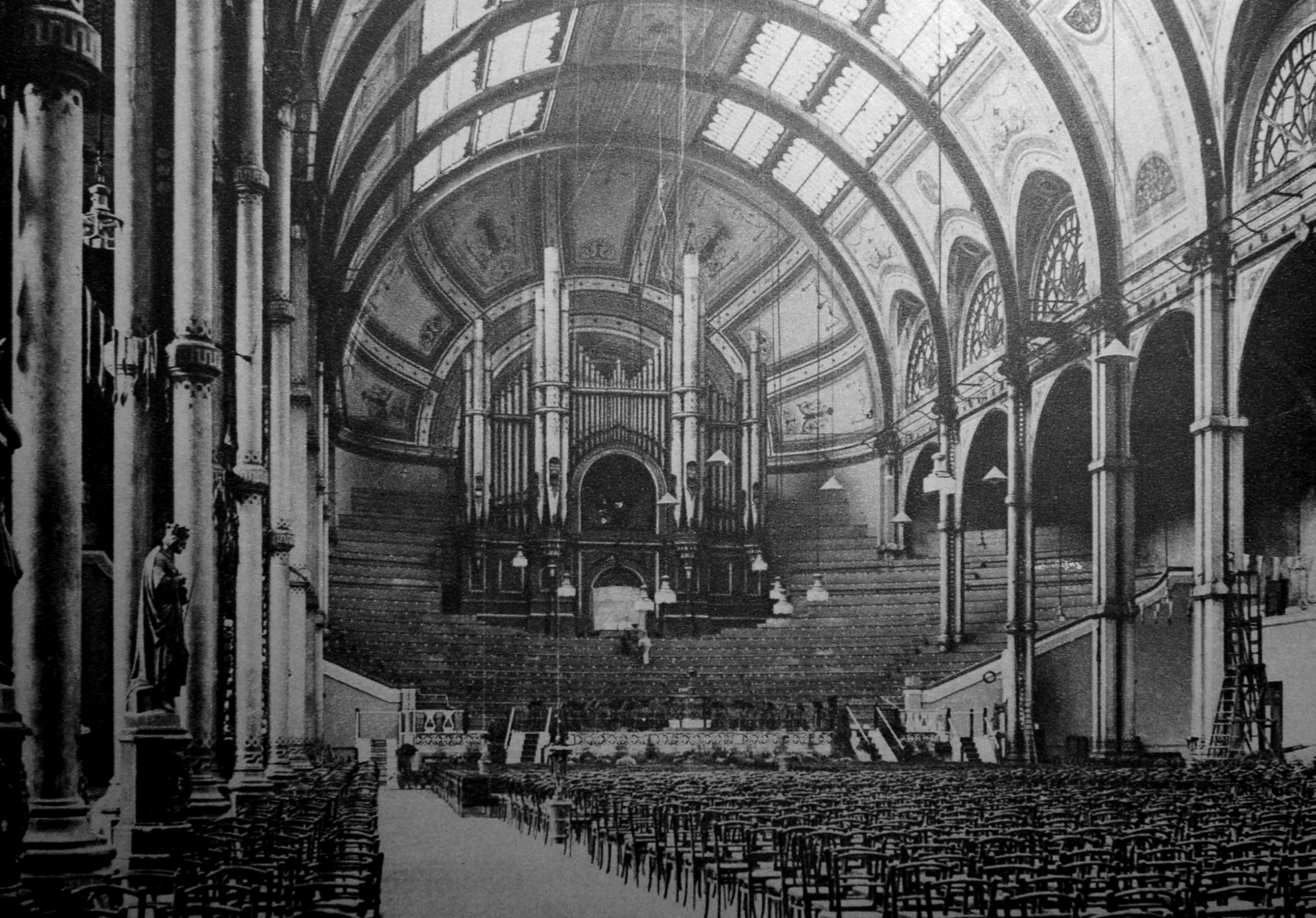
The old Grand Hall was almost destroyed. Compare the following post fire photo with the photo of the hall from Wonderful London.
With the decline in newspaper readership as the Internet takes over, the habit of taking clippings from newspapers and putting them between the relavent pages of books will become a dying art.
A shame, as they provide an extra dimension to the life of a book. Whilst a book is a snapshot of the time it was published, additions by owners over time tell the story of the journey the book has taken to get to its current owner.
Wonderful London offers a brilliant snapshot of the city as it was in the early decades of the 20th century. Around 100 years later, many of the places featured, the way people lived and worked have changed considerably, however many of the views are much the same.
What the book does prove is how rich and diverse the city has always been, and how there is something of interest on almost any street corner, or in the case of Merton, even under the cabbages in an allotment.
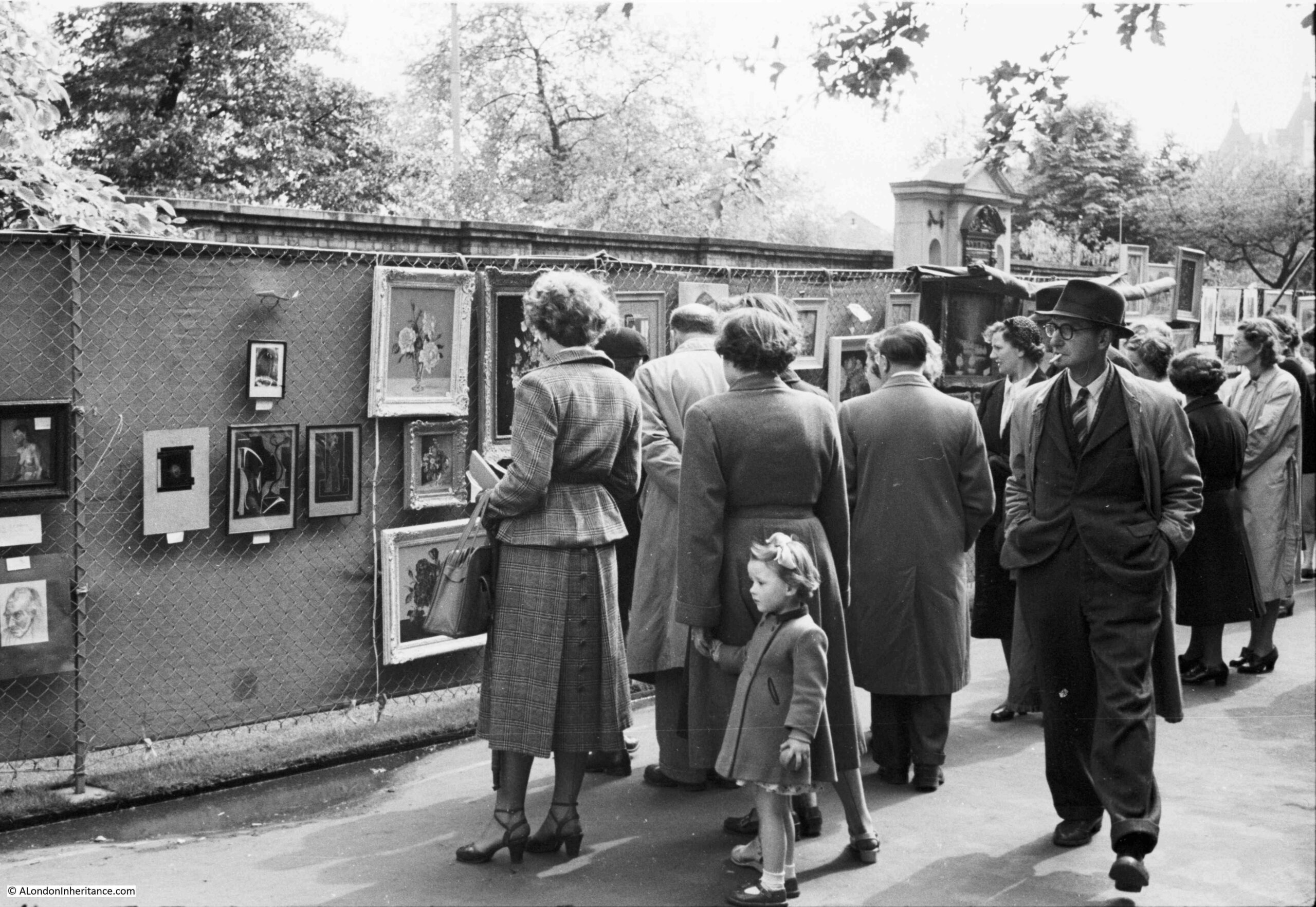
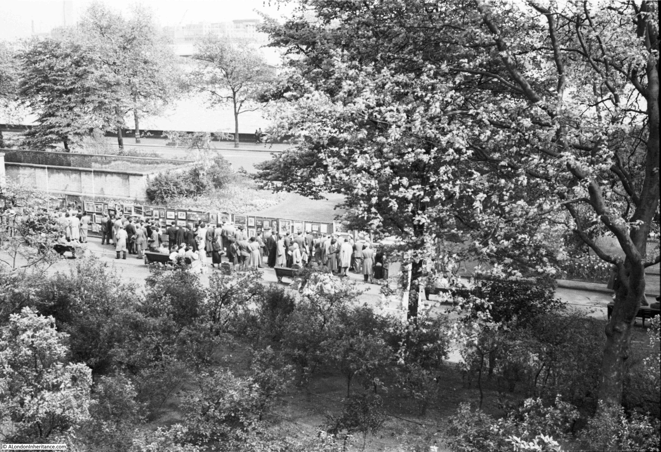
The Victoria Embankment Gardens has often been the location for an open air art exhibition, and a couple of the photos in my father’s collection show the 1952 exhibition:
This could have been a difficult photo to locate, however the feature in the background made it easy to find the exact place. This is the same scene on a very sunny June day in 2021:
The first exhibition appears to have been in 1948, as an article in the Sphere on the 23rd May 1953 describes that year’s exhibition as the sixth annual open air exhibition of contemporary art. The article also states that the exhibitions were sponsored by the London County Council, and that “On all days except the final day the pictures are for sale”, which seems rather strange, not also to sell them on the final day of the exhibition.
Exhibitions also seem to have been during part of the month of May, which would explain the coats worn by those in the photo, although that could really be any summer’s day given typical British weather.
The little girl in the photo looks to be around five or six. She would now be around 75 and the only one from the photo still alive.
The Illustrated London News on the 12th May 1962 describes that year’s exhibition as opening on the 30th April and running to the 12th May, with 700 paintings on display from both amateur and professional artists.
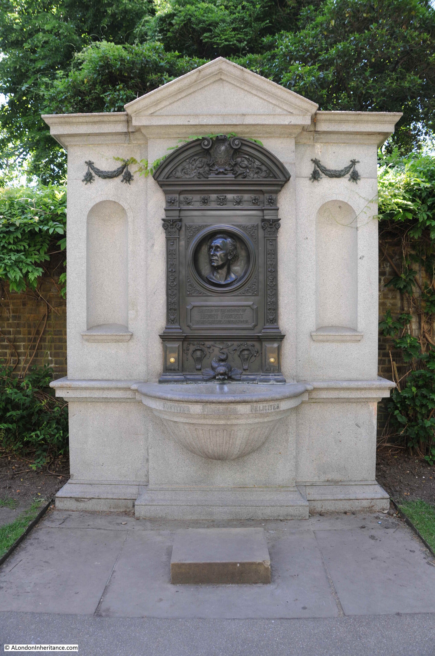
The monument behind the exhibition which enabled the location to be found, is to Henry Fawcett, the rather remarkable blind MP who championed the cause of women’s suffrage. His interests in the cause led him to meet Elizabeth Garrett who rejected his proposal of marriage in order to concentrate on becoming a doctor. He went on to marry Elizabeth’s younger sister, Millicent Garrett.
A statue of Millicent Garret Fawcett was unveiled in Parliament Square in 2018 with the words from one of her speeches “Courage calls to courage everywhere”.
The wall behind the monument is part of one of the air vents to the cut and cover underground Circle and District lines, a short distance below the surface.
The monument to Henry Fawcett:
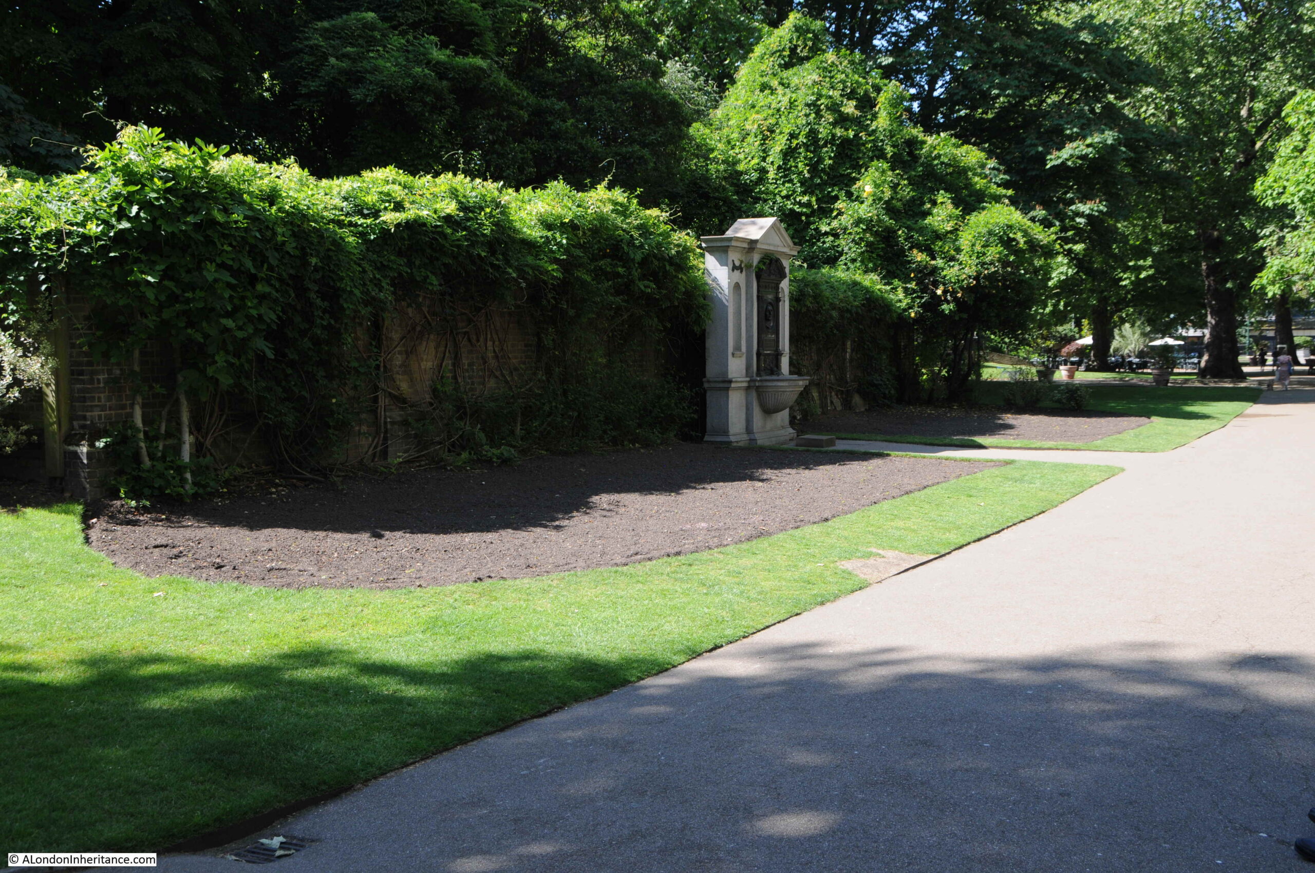
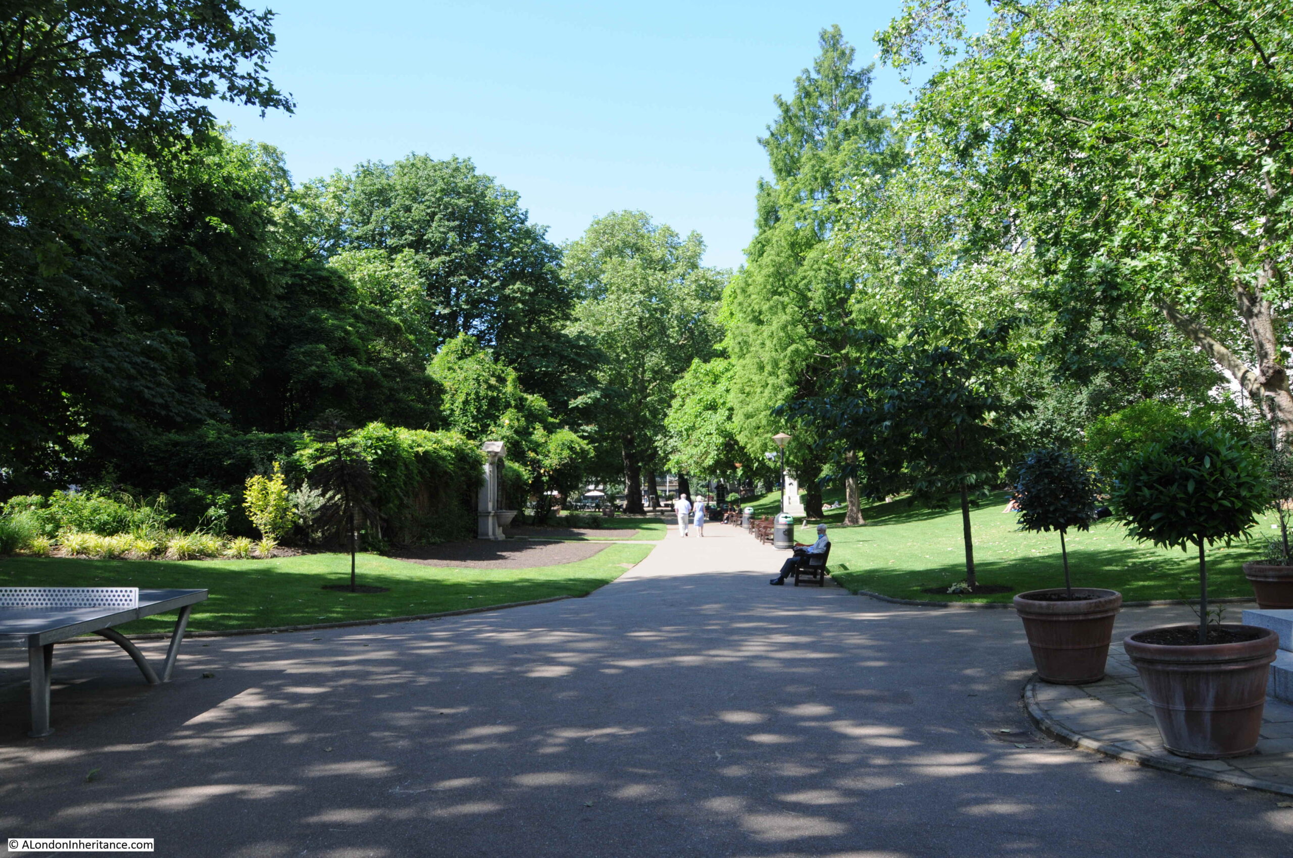
A wider view of Embankment Gardens, with the monument on the left.
The gardens are looking very green with plenty of plants and trees, which would cause a problem trying to recreate the following photo of the art exhibition:
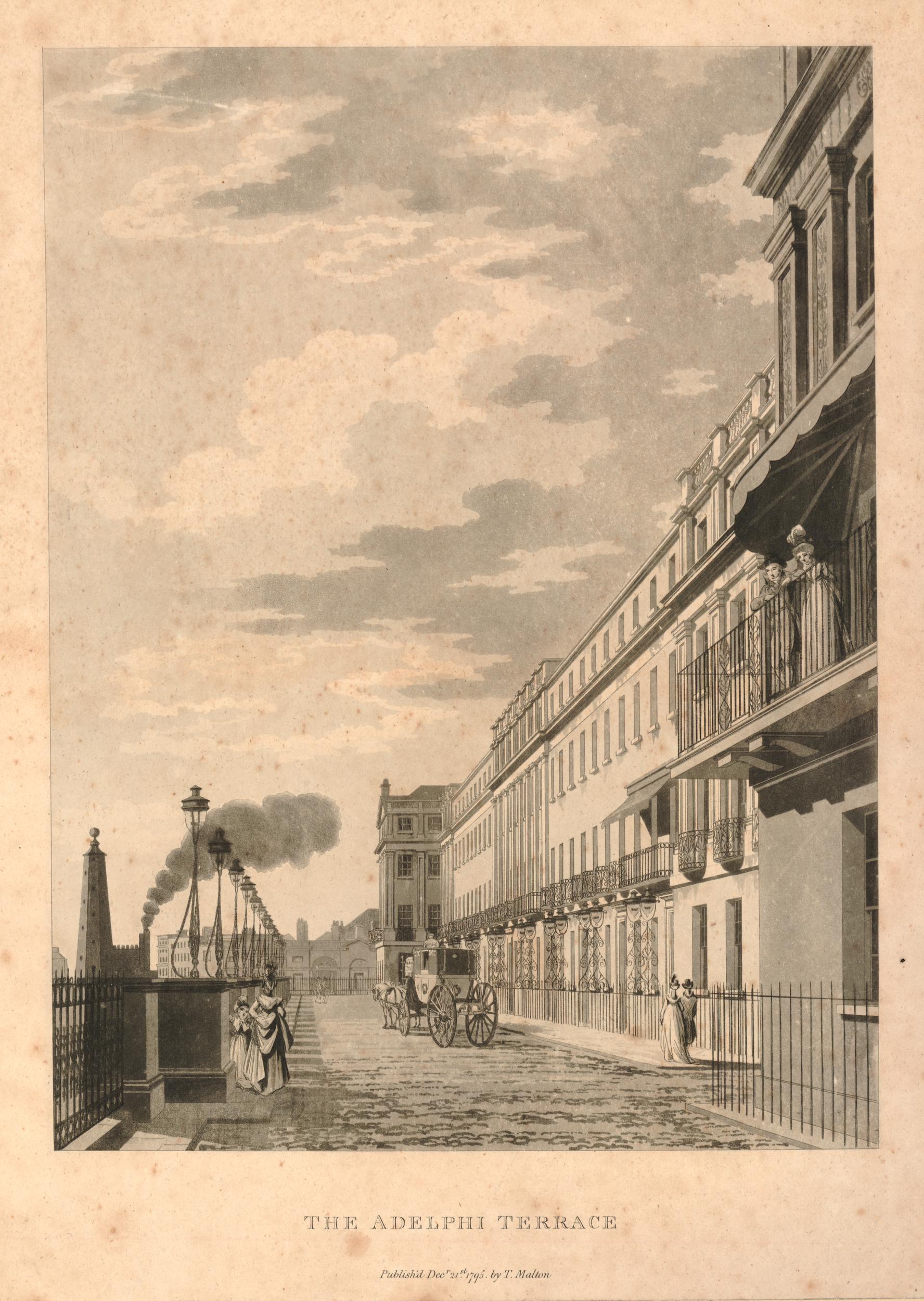
My father took the above picture from the Adelphi Terrace, overlooking the gardens. The art exhibition is running along the pathway through the gardens, and shows how far to the right the exhibition ran, as the edge of the Fawcett monument can just be seen on the very left edge of the photo. The Thames and Waterloo Bridge can be seen in the background.
Adelphi Terrace, from where the above photo was taken is shown in the following photo:
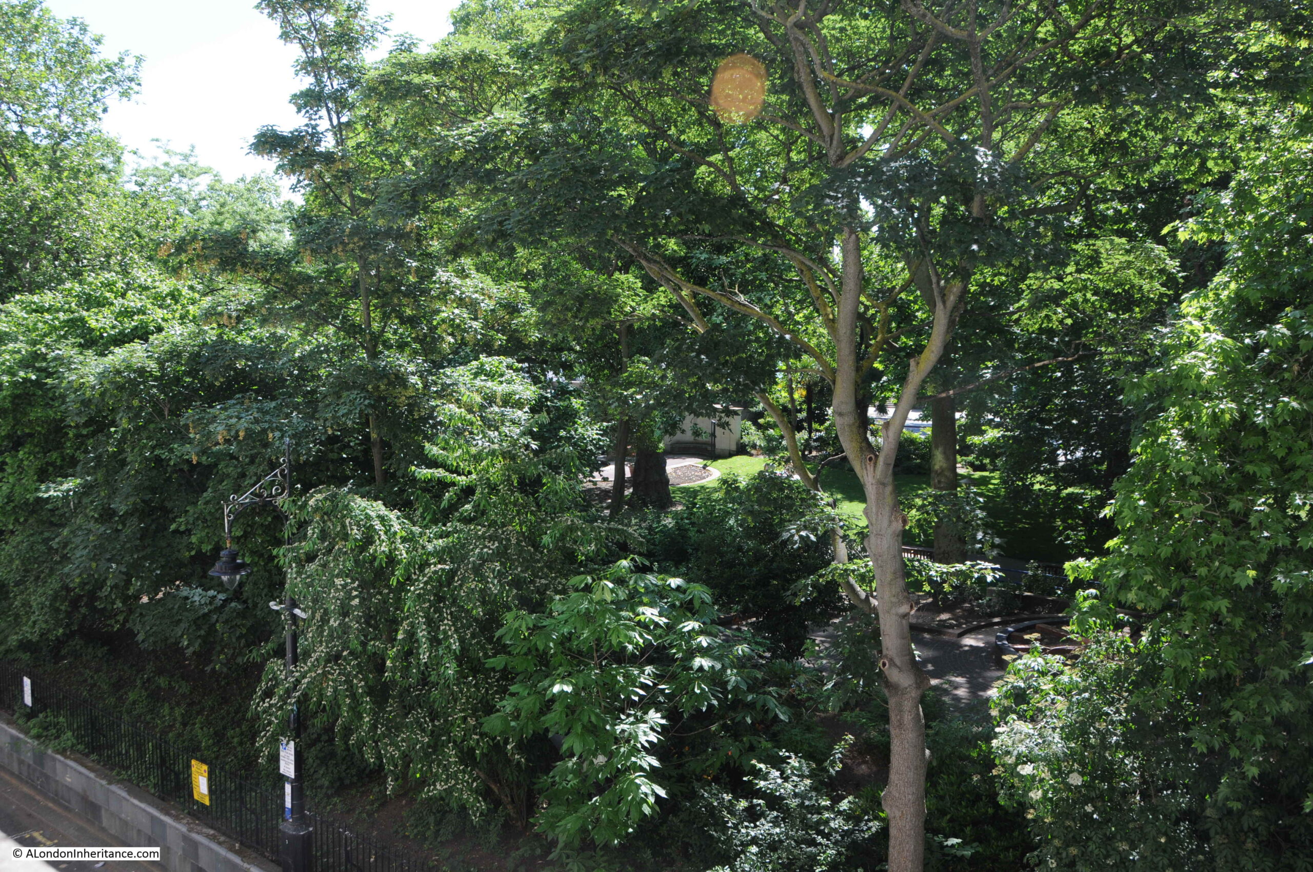
I walked up and down the terrace looking over the wall to the gardens below, trying to recreate my father’s photo, however the trees and bushes have grown considerably since 1952, and the best I could get was the following photo:
There is a small bit of wall visible in the gardens in the centre of the photo. This is not the monument or wall in the 1952 photo, rather a nearby fish pond, a short distance from where the art exhibition was held, and the nearest I could get to recreating the photo.
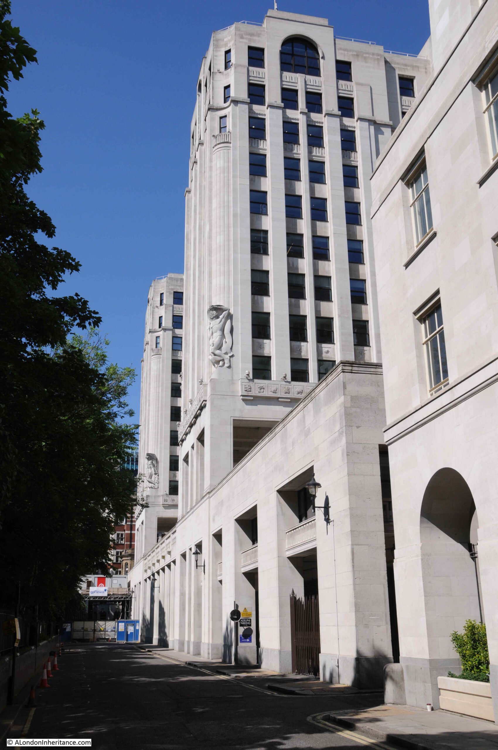
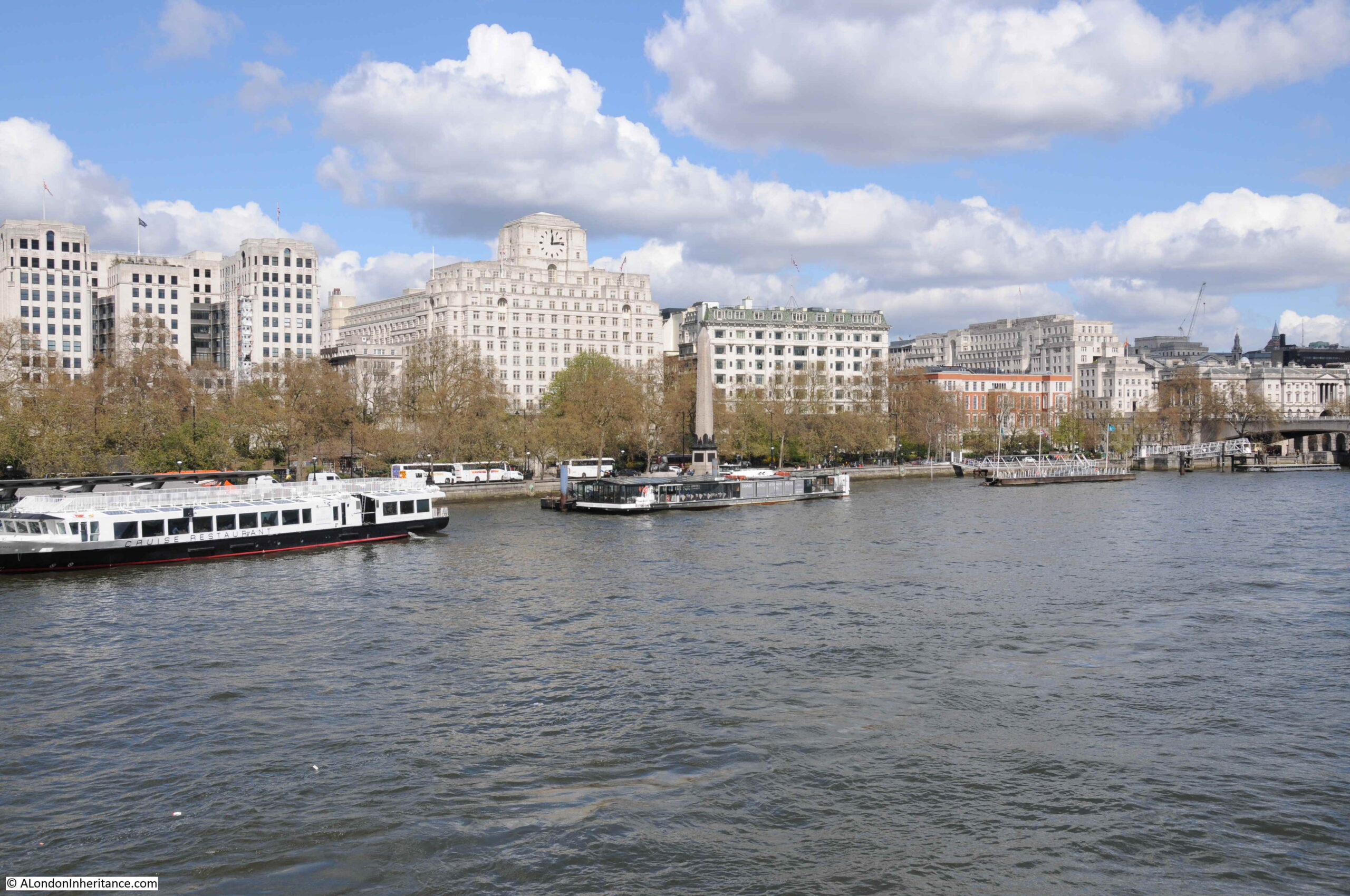
The Adelphi Terrace is in front of the Adelphi building, and raises the street around the Adelphi up above Savoy Place which runs at ground level between the Adelphi building and Embankment Gardens.
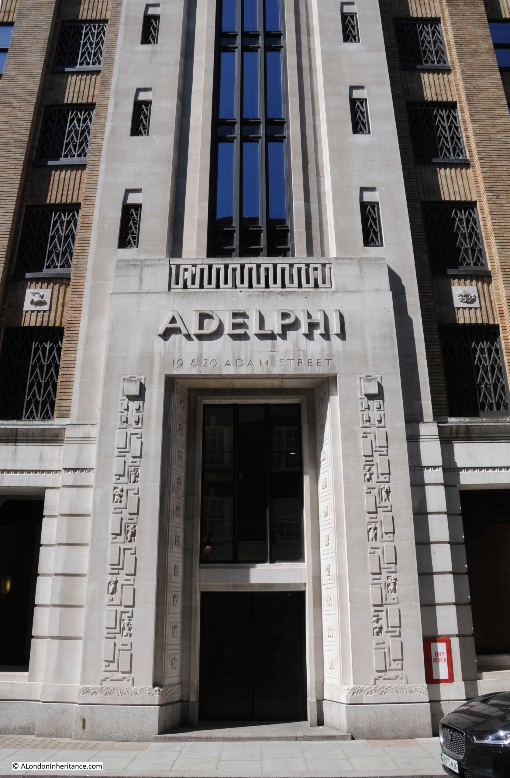
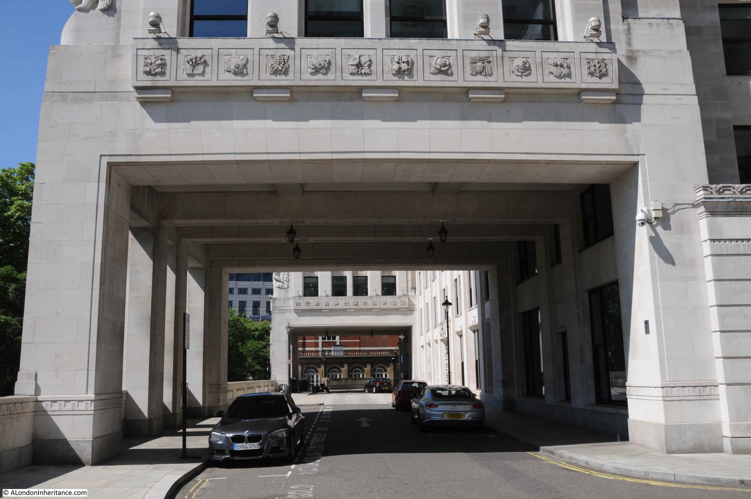
The following photo was taken from Savoy Place looking up at the terrace and the rather magnificent Adelphi building, and shows the height of the terrace:
The main entrance to the Adelphi building is on John Adam Street, and the building consists of two outer wings which extend over the terrace as shown in the above photo, with the core of the building between and behind the two wings, up to John Adam Street.
I thought I had a photo of the Adelphi from across the river, but I cannot find it. I did find a photo I took a few years ago which shows the three wings of the Adelphi as the building on the left of the photo.
From this distance the building does not look that impressive. It is only when you walk around the building that its unique decorative features can be seen.
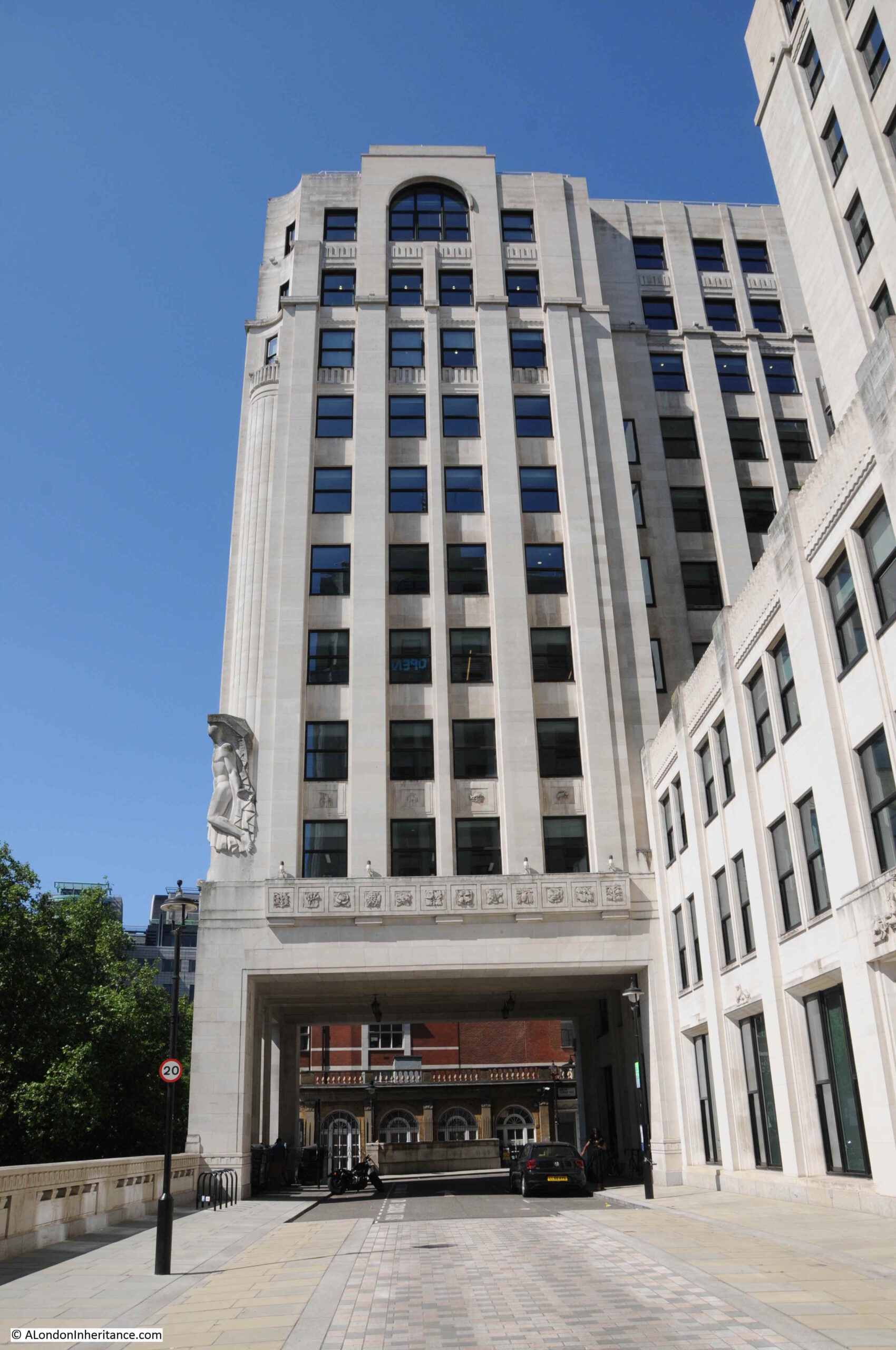
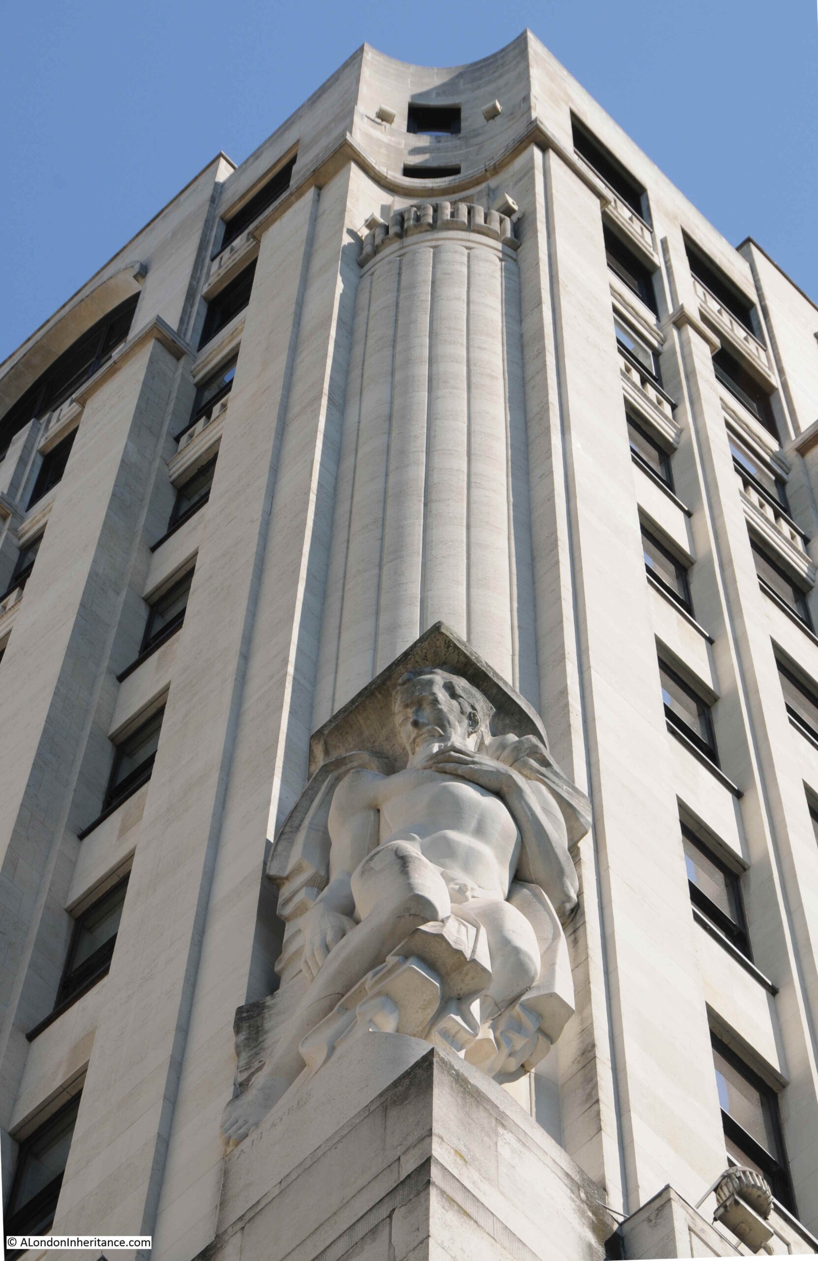
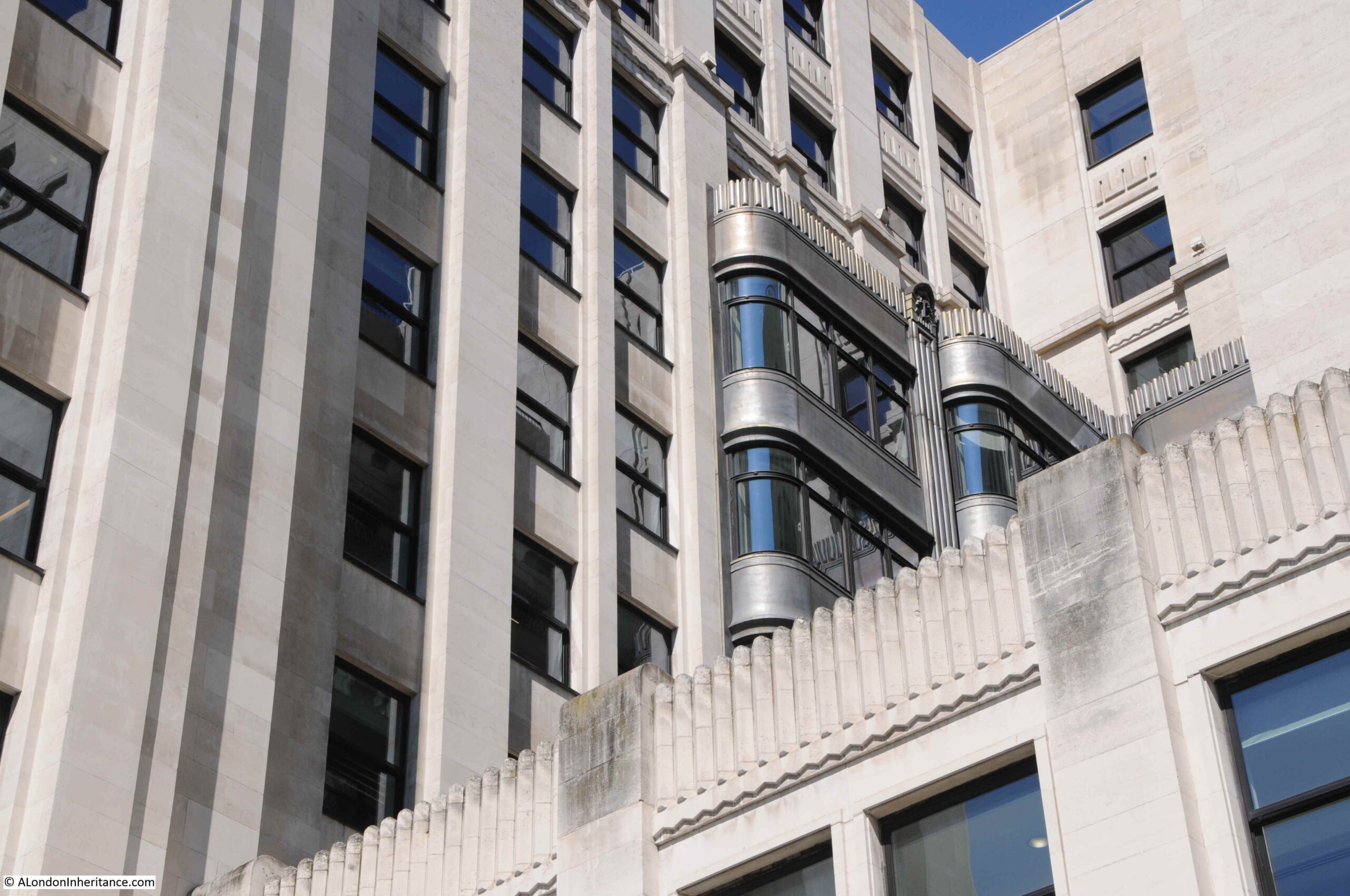
The Adelphi was built between 1936 and 1938, by architect Stanley Hamp of the partnership Colcutt and Hamp.
Of standard steel frame and reinforced concrete construction, what makes the building rather special is the large amount of architectural decoration and design that follow the art deco approach.
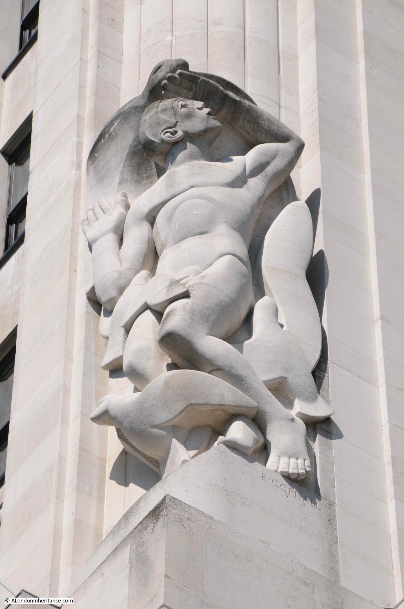
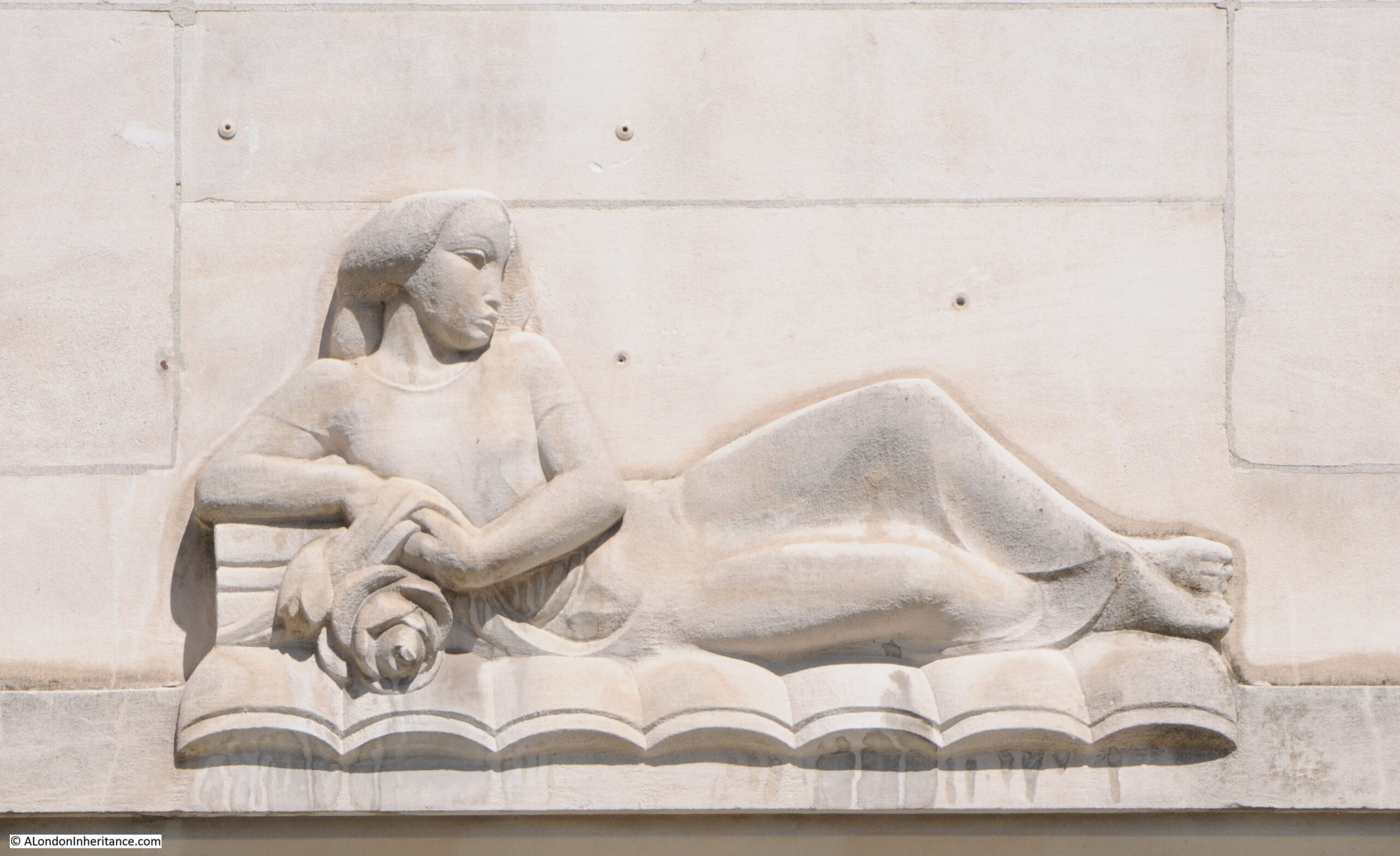
In the photo of the building from Savoy Place, two large allegorical relief figures can be seen on the two wings that extend over the terrace. There are four of these (the other two are on the other corners of the wings). These represent Dawn, Contemplation, Inspiration and Night, with Contemplation and Night being seen in the above photo.
The following photo shows a detailed view of “Night” by the sculptor Donald Gilbert.
The following photo shows “Dawn” by Bainbridge Copnall, with architectural decoration extending above the sculpture to fill in part of the curved corner of one of the wings.
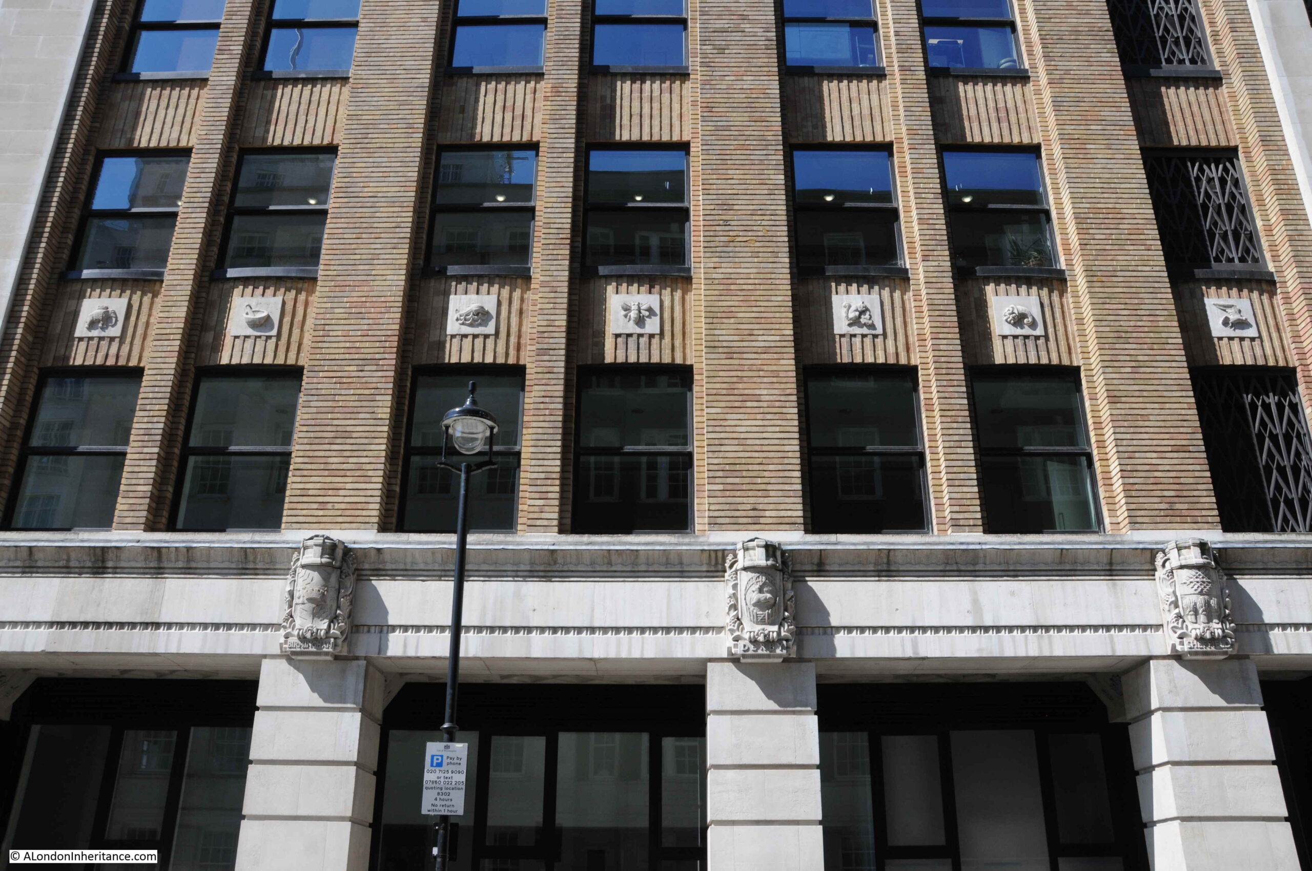
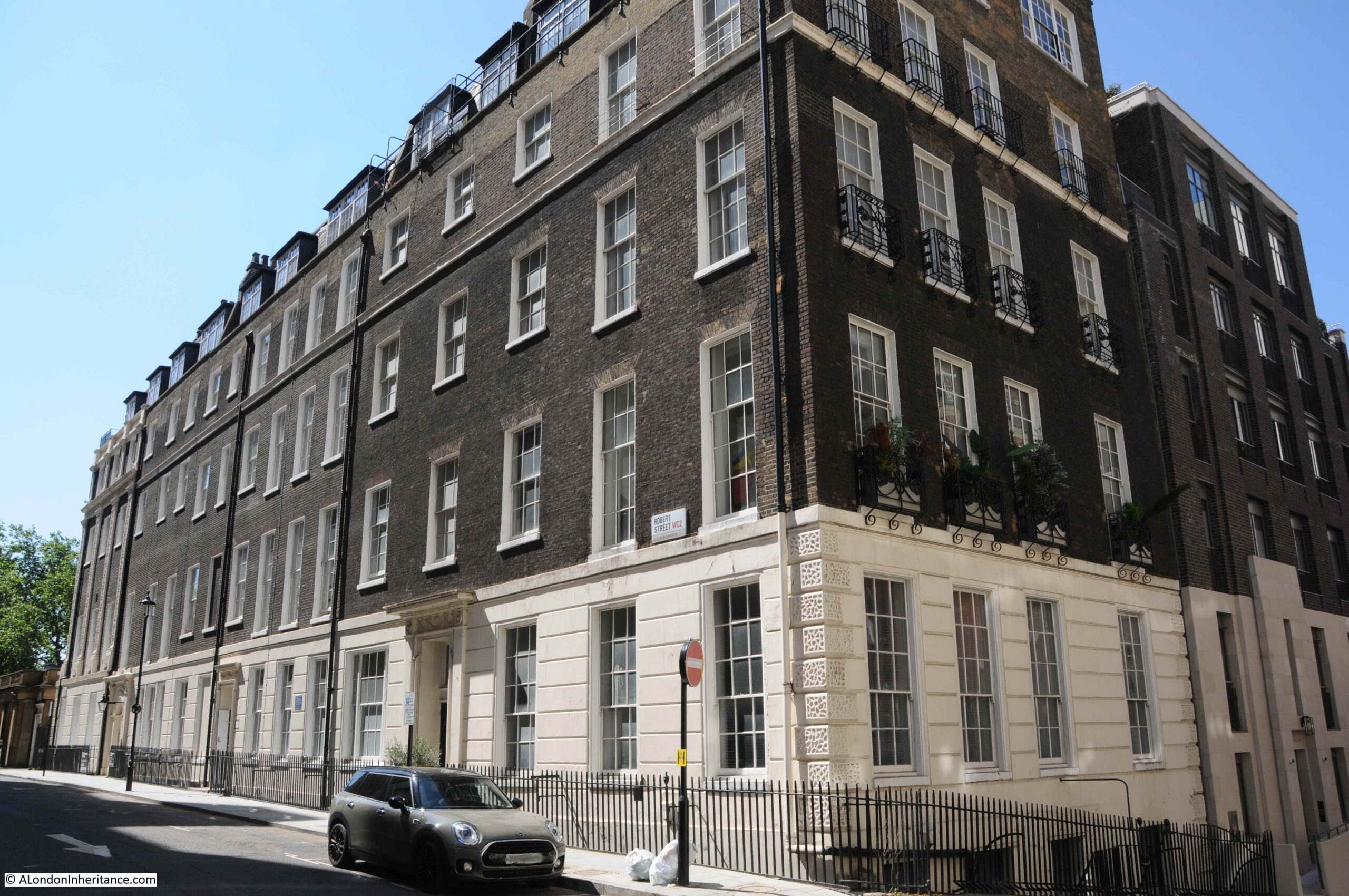
There is detail across the building. The following photo shows a side entrance on Robert Street. Note also that where the building faces towards the river, Portland stone is used, with brick used for the other facades, but retaining Portland stone for the ground floor and architectural detailing.
The sides of the building have small decorative panels between the brick pillars:
And carved coats of arms of UK cities between the ground and first floors. Three of these can be seen in the above photo, and in close up, the arms of Sheffield, Derby and Birmingham can be seen below:
Another view of Adelphi Terrace, which was constructed in part due to the 1930s expectation of the rise of the car as a means transport within the city, as well as replicating the original terrace:
Construction of the Adelphi in the 1930s required the demolition of an historic estate.
The original Adelphi estate was the work of Robert Adams and his three brothers, John, James and William. The name Adelphi comes from the Greek word adelphós, meaning brothers.
In the mid 18th century, the area now occupied by the Adelphi had been a rather run down area called Durham Yard, which had been the location of Durham House. At the time, the Embankment Gardens had not been built, so the space now occupied by the Adelphi was then facing on to the foreshore to the Thames. The damp conditions and flooding at high tide meant that this was not a good area to build the type of quality houses intended by Adams.
The plan developed, mainly by Robert Adams, was to build the houses and streets on a series of arches, which increased in height as the land descended from the Strand down to the river.
However the Adelphi Terrace in the above print is not in the same position as the Adelphi Terrace we can walk along today. In the above print, the block of buildings on the right were demolished to make way for the Adelphi building (not the building at the far end as we shall see).
In preparation for the construction of the Adelphi building, the whole of the block of houses that occupied the area, included the arches and space underneath the houses, was demolished all the way back to John Adam Street. As part of the build of the Adelphi, construction was pushed forward up to Savoy Place, so the terrace is now forward of the terrace in the above print.
The following photo from just before demolition in 1936 shows the Adelphi Terrace on the left, with the block of houses which would also soon be demolished. In the background is the recently completed Shell Mex House (1932) with Savoy Place running to the lower right of Shell Mex House.
With the construction of the new Adelphi building and terrace, the terrace was pushed forward to also run up against Savoy Place, in line with Shell Mex House, so the area in the lower right of the above photo is now under the terrace.
Another view of Adelphi terrace around 1897 before the construction of Shell Mex House:
If you look to the left of the second lamp post in the above photo, you can just see a round plaque. This was a medallion of the Royal Society of Arts recording the fact that the actor David Garrick had lived in the house. It was in one of the back rooms of the house that the actor died in 1779.
The large building on the right on part of the site now occupied by Shell Mex House was the Hotel Cecil.
And if you had been living in one of the houses in the terrace, this would have been your view as you looked along the river to the east, with the corner of Hotel Cecil on the left, and the first Waterloo Bridge crossing the river.
At the time of the above photo, the Adelphi was described as “one of the finest places to live in all London, as well as for pleasantness of situation as for convenience. The noise of the Embankment is sufficiently far away, and the hooters and sirens on the river suggest that sense of freedom and open space which goes with ports and their kinship with the sea. All too uncommon in London, late at night, the loudest noise is often the wind in the trees which move the lights of silent shipping“. Not from an early 20th century Estate Agents description, the quote is from the book Wonderful London.
Continuing a walk around the Adelphi building, and more door surround decoration:
Looking back between the wings of the building, we can see bow windows extending outward, with metallic decoration:
More decorative carvings:
Balconies:
The main entrance to the Adelphi on John Adam Street:
What is confusing is if you look above the doors, is the address John Street, however if you look to the lower right, is the full name John Adam Street.
John Street seems to have been the original name, as it is used on the 1895 Ordnance Survey map, and by the time of the 1951 revision, the current full name John Adam Street is used. I suspect the name change was when the Adelphi was built in the 1930s.
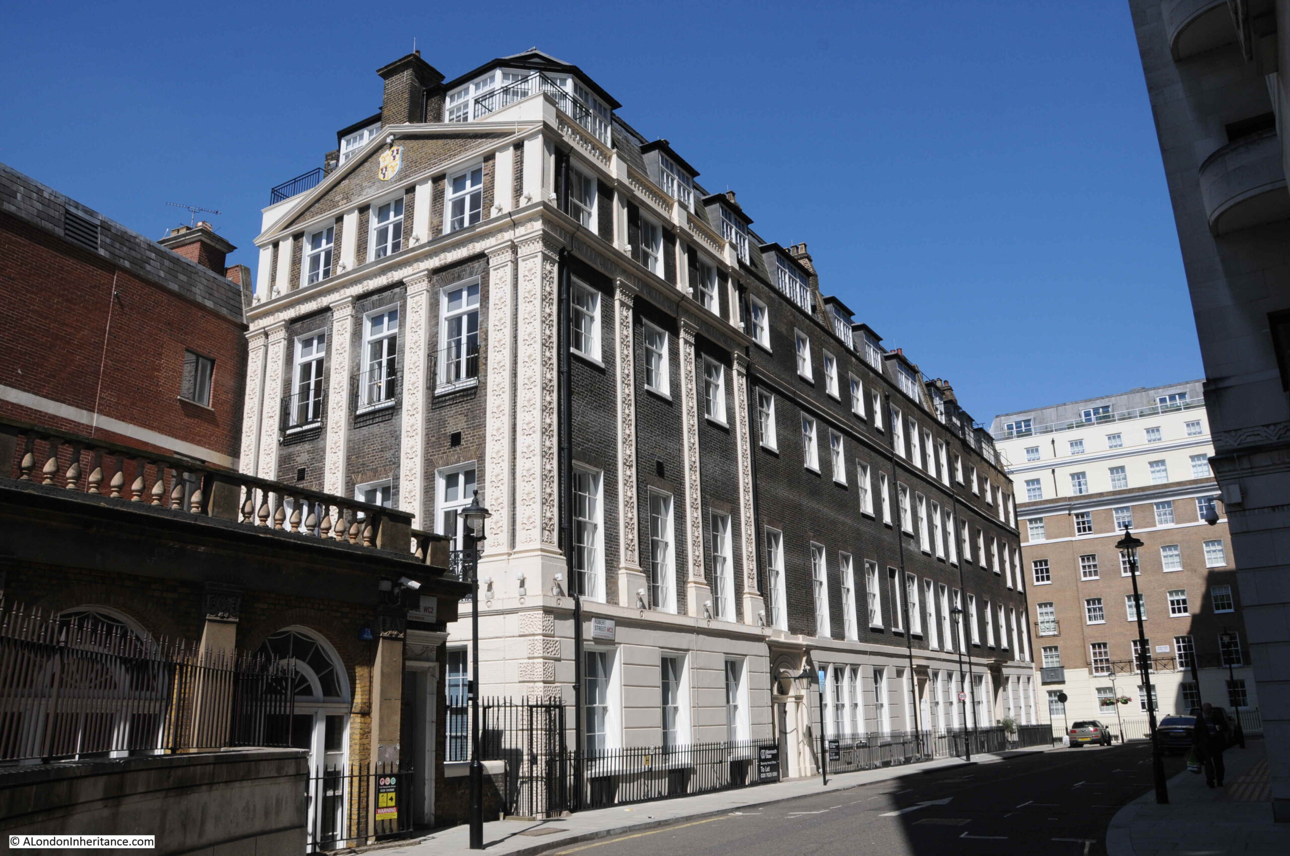
Having had a walk around the Adelphi building, time for a look at what remains of Robert Adam’s original estate. This is the view along Robert Street, with a fine terrace of buildings lining the side of the street. The end of the building on the left would have originally faced onto the original terrace, and is the same building at the far end of the terrace as in the 1795 print.
The scheme proposed by the Adams was highly ambitious. The land was sloping down to the river, and indeed consisted of part of the foreshore. The area would often flood at times of high tide.
Rather than building houses down along a sloping plot of land towards the river, with the resulting problems of damp and flooding, the plan consisted of building brick arches with the houses building on the platform created above.
The space within the arches would be sold or leased, and this approach would create a considerable improvement to the embankment of the Thames.
The plan and construction was ambitious, and the financial side of the project was rather risky, as a lease on the land was only signed a year after construction had begun in 1768, and parliamentary approval to build the new embankment along the river was not granted until 1771.
Costs for the project were so high that the money had run out by 1773 when much of the estate had yet to be completed. To raise additional finance, a method common in the 18th century was used whereby a lottery with 4,370 tickets selling for £50 each raised enough to complete the estate. Prizes for lottery winners included some of the houses on the estate as well as storage space in the arches below.
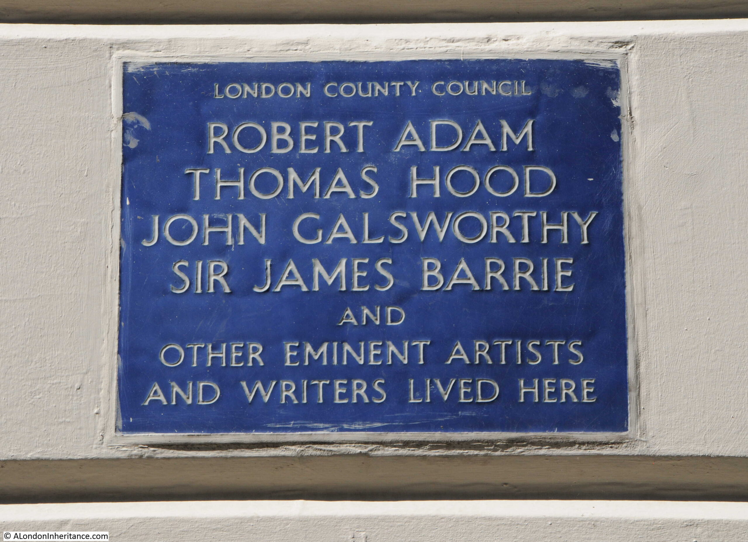
The following plaque on the terrace in Robert Street identifies some of those who have lived in the houses:
View of the terrace in Robert Street from the junction with John Adam Street:
Strange that with street renaming, John Street changed to John Adam Street, however Robert Street kept the original name without a rename to the full Robert Adam.
The houses were highly decorated including Adam fireplaces. Many of the first floor ceilings were also painted by either the Swiss artist Angelica Kauffman or Giovanni Battista Cipriani from Florence.
Walking to the north of the Adelphi, along John Adam Street, and we find this building which was clearly not built as one of the terrace houses:
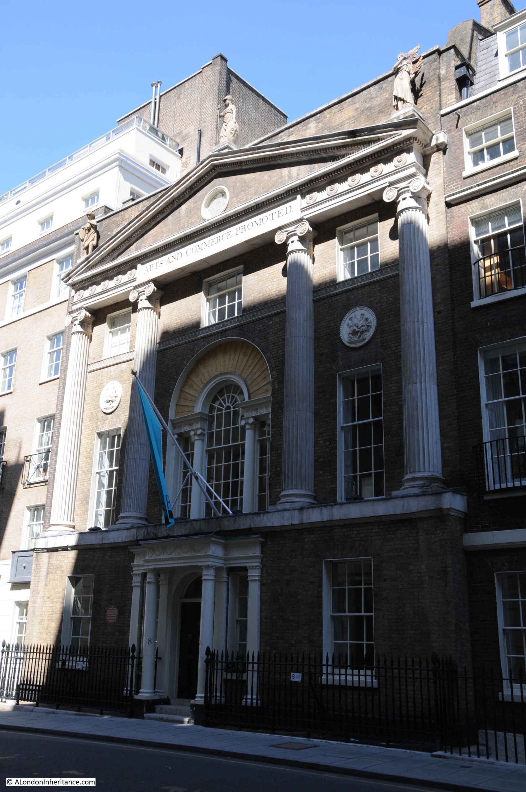
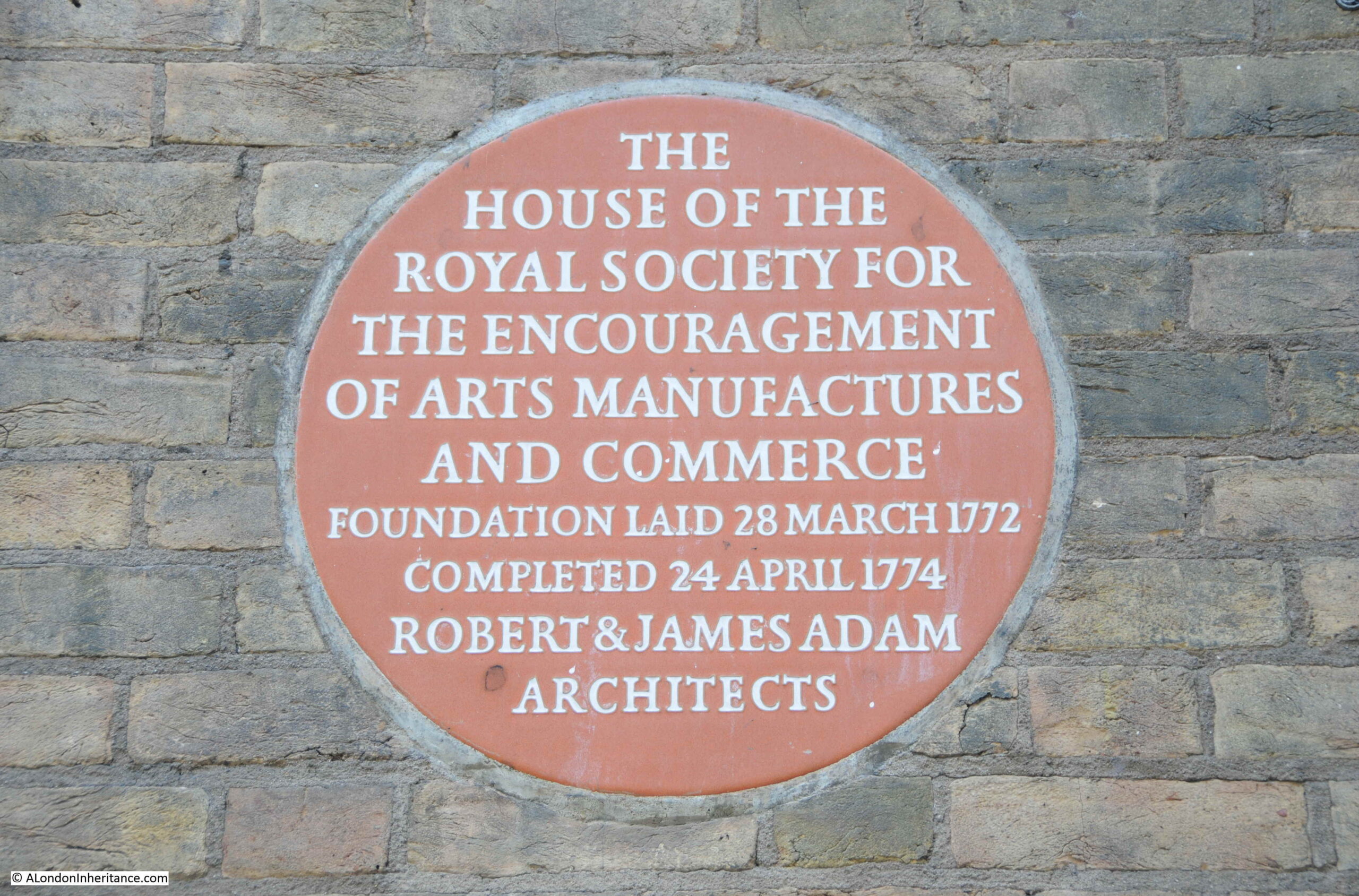
A plaque on the front identifies the building as the home of the Royal Society for the encouragement of arts, manufactures and commerce, which was founded in a coffee house in Covent Garden, and then moved to this building by Robert and James Adam in 1774. The building is still their home.
During the 1930s demolition ready for the construction of the Adelphi, demolition reached to the southern side of John Adam Street, so the street and home of the Royal Society are part of the original build, and the basement of the Royal Society building retains some of the brick arches built to raise the area above the sloping land.
In the 19th century, the arches and vaults below the houses had become somewhat different to what had been intended. The Sketch in 1903 includes the following description “The houses were built on deep arches that rivalled the Catacombs of Paris and these, at one time, were a great thieves kitchen, a tramps paradise, or doss house, that defied Watchmen and Bow Street Runners, and their successors the modern Peelers”.
Looking along John Adam Street to the junction with Adam Street and we can see how the Adam’s plan included focal point houses at the end of the streets, and the type of decoration used.
I should have found the above print before visiting the site as I would then have taken the photo slightly further back to include the Royal Society building. If you stand in the street today, ignore the new Adelphi to the right, and Shell Mex House, the view does look much the same as in 1795.
The following photo is looking up Adam Street. The junction with the Strand is further along the street to the left, with an original house at the end of the terrace with a curved extension to the smaller width of the street. Adam Street was cut through to the Strand as part of Adam’s construction of the Adelphi.
The house behind the white car has a GLC Blue Plaque stating that the 18th century industrialist and inventor Sir Richard Arkwright lived in the house, with English Heritage’s background to the plaque stating that Arwright lived some of the final years of his life here in Adam Street before his death in 1792.
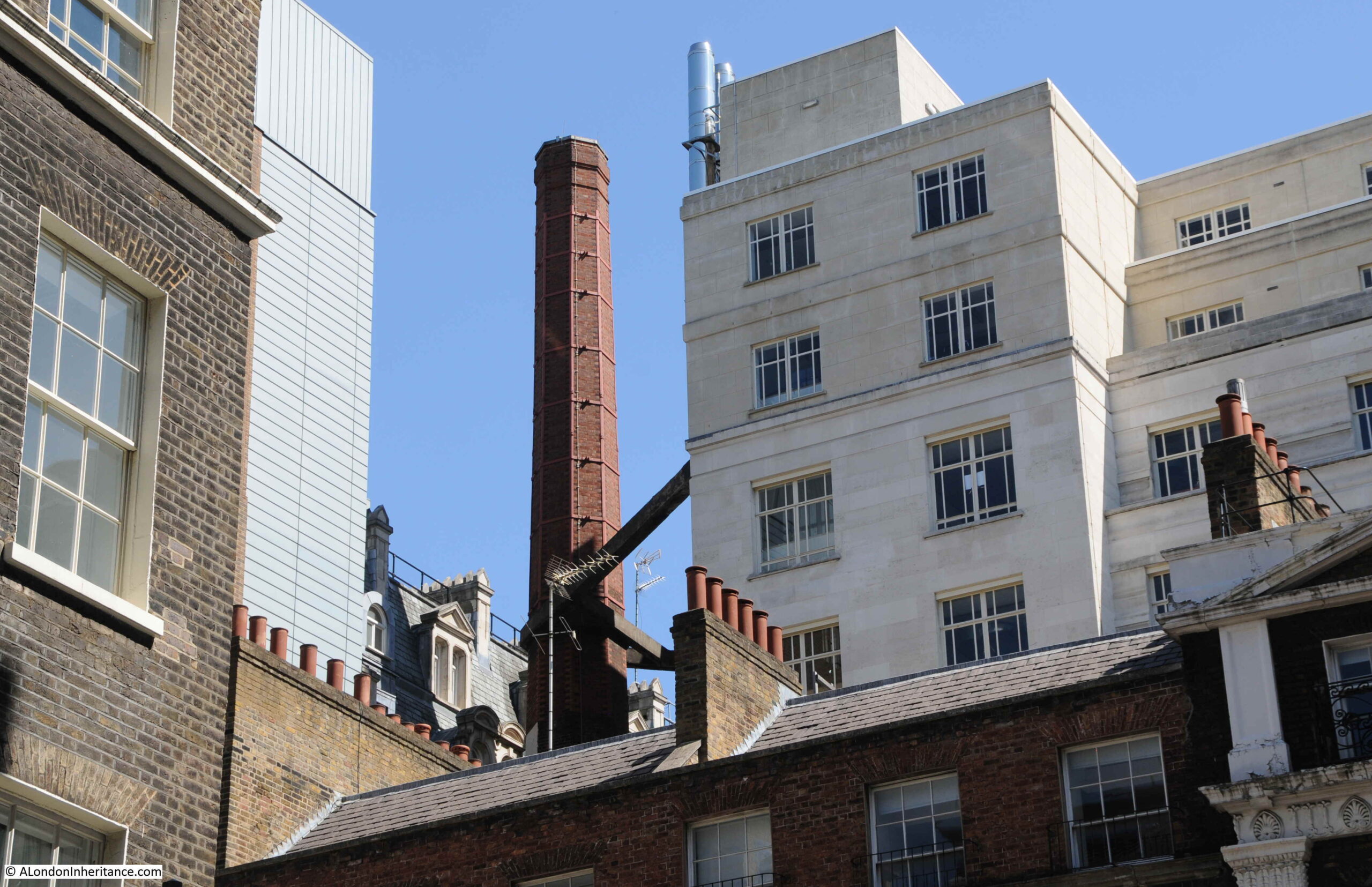
Looking above the houses in the above photo, there is an unusual sight hidden within the dense building of this area south of the Strand. A brick chimney with some robust steelwork providing support from Shell Mex House.
The type of brick chimney seen in the above photo was once relatively common across London, but now is an unusual sight. No idea of the chimney’s purpose, whether it was or maybe still is, part of the Shell Mex House heating system.
That was rather a detour from my father’s original photo of the open air art exhibition in the Victoria Embankment Gardens, but that is why I started the blog, as a means of getting out to find the location of a photo and discovering a wider area.
There is more to the story of the Adam’s brothers and the surrounding area, including the creation of the Embankment Gardens, Shell Mex House, and Lower Robert Street which still routes under part of the estate. The old river stairs that would have entered the river roughly along where Savoy Place is today, and some of the lost streets down to the river – hopefully all subjects for future posts.
And returning to the original photo, I wonder if the little girl in the photo can today remember walking in the gardens and alongside the art exhibition?
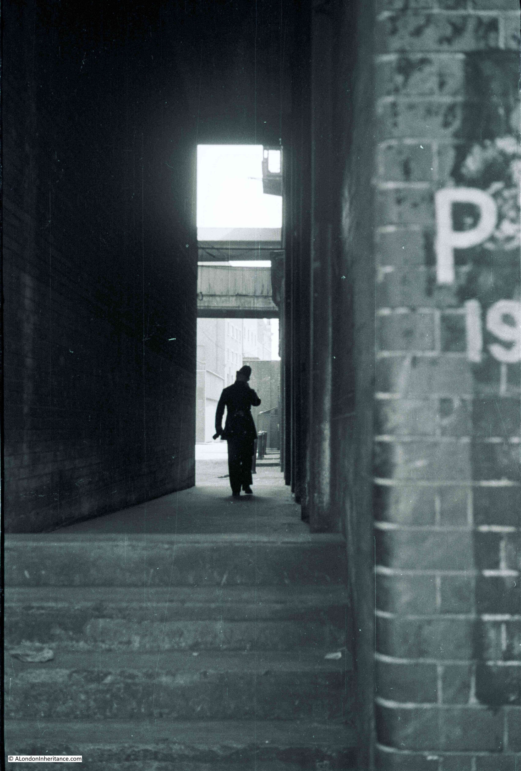
I have no idea of the exact location of the following photo. It is one of my father’s and dates from 1949. Judging by the photos on the strips of negatives that included this photo, it is probably one of a number of Bankside alleys, although there is a chance it is a bit further east.
The photo shows a police officer walking through an alley, probably between warehouses. At the end of the alley, there is one of the typical walkways that were built to connect warehouses on opposite sides of a street.
I love the photo as it captures what must have been a relatively common event – a lone police officer patrolling his beat.
Policing has changed considerably in the 72 years since the photo. Budget cuts have reduced police numbers, streets now have CCTV and there is the ongoing threat of terrorism.
Along Bankside, there are no warehouses full of goods that would tempt a thieve. The river is quiet and is no longer teeming with barges and lighters, although as the tragic events on London Bridge just a week ago demonstrate, the Thames is still a very dangerous place for anyone who enters the water.
The police officer in the photo was probably on his “beat” – a set route around a district that an officer would patrol. They would get to know the streets, the people, activity that was normal, and what was not normal.
Being assigned to a beat was the first step in a police officer’s career after training and being posted to a station as a Police Constable.
In the book “Fabian of the Yard” (1950) by Superintendent Robert Fabian, he provides an introduction to the activity of “being on a beat”:
“On the beat, an officer should normally walk the regulation 2.5 m.p.h. – if he is hurrying he is probably after someone or more likely going home to his supper. Properly carried out, patrol duty is not half so dull as you might imagine. The most ordinary looking street can to the practiced eye be of absorbing interest. Each doorway, shadow at a window, hurried footstep or meaningful glance may have a tale to tell”.
(Fabian of the Yard is a fascinating account of London policing and crime between the 1920s and 1940s)
Crime was frequently reported after the event, however the benefit of being on the beat, was that anything unusual, and a possible crime, could be investigated as it happened. Detailed newspaper reporting of such events tended to reduce in the 20th century, however in the 19th century, papers were full of long accounts of crimes, often including the conversations that had taken place during an inquest, or the words of the police officers involved.
The following three extracts are examples of the type of action that a police officer on the beat would frequently get involved with, when patrolling along the river’s edge.
From the Shipping and Mercantile Gazzete on Thursday the 8th February, 1877:
“THEFT FROM A BARGE – At the Southwark Police-court, Joseph Sadler, 22, a returned convict, was charged with being concerned with two others in stealing three pieces of oak timber from a barge on the River Thames, the property of Messrs. Shuter and Co., coopers and stave merchants, Shad Thames.
George Barnett, police-sergeant 56M, said that between 10 and 11 on the previous night he was on duty in Bermondsey-wall when he saw the prisoner and two others coming from Eaton’s Wharf. They were each carrying a piece of timber and as soon as they saw him they dropped the timber and ran away. He, however, captured the prisoner, but his companions escaped. He made inquiries, and found that the timber had been stolen from a barge lying off Bermondsey-wall. Mr. William Joseph Littell, of the firm Shuter and Co., identified the three pieces of oak timber as the property of the firm. Mr. Partridge committed the prisoner for trial”.
From the St. James Chronicle, August 1855:
“SOUTHWARK. CHARGE OF BURGLARY – John Richard South, a tall young man, partially dressed in military attire, and who stated himself to belong to the Royal Artillery, was charged with being concerned with another, not in custody, with breaking in to the Watermen’s Arms public-house, Bankside.
Joseph Alley, police-constable, 30M, said he was on duty shortly before three o’clock that morning in Bankside, and when passing the Waterman’s Arms he heard something breaking inside, which induced him to stop.
Another constable then came up, when they again heard the breaking noise, and saw the reflection of a light inside. Witness immediately directed the other constable to go to the rear of the house, while he knocked on the door for admittance and rang the bell. While doing so he heard a rushing noise inside, and a minute or two afterwards, the landlord came down and opened the street door. Witness entered and passed through, when he saw two men climbing up a shed. He got up after them, and saw the prisoner concealed behind a chimney, and as he came near him he exclaimed ‘It’s all right, I’ll give myself up’. He took the prisoner into custody, but his companion made his escape”.
From the Morning Post, 2nd July 1833:
“Yesterday two men, named Morrett and Yates, were brought before Mr. Murray, charged on suspicion of drowning a young woman (name unknown), whose body was taken out of the water at Bankside.
A police sergeant of the M division on proceeding over Blackfriars Bridge on Sunday morning, about four o’clock, saw some persons looking through the balustrades, and heard them exclaim ‘That a woman was in the water’. He looked in the direction of Southwark bridge, and perceiving a splashing in the water at some distance off, he ran round to Bankside, and by the time he arrived saw the body of a young female just brought on shore by a waterman.
He observed two men standing upon a barge moored at some distance out in the river, and he had been informed that these two men were with this female at the time she was drowned. Acting upon this intelligence he procured a wherry, and immediately went on board the barge, and took them both into custody.
The accused were examined separately, and Yates made the following statement voluntarily;- he said that he and the other prisoner were brass founders, and worked at a large factory in St Martin’s-lane. On Saturday night after work, they went to the Cart and Horses in Upper St Martin’s-lane which they left at half past eleven o’clock, and then went home together, but did not retire to rest.
At three o’clock in the morning they left home together with the determination of taking an excursion on the water. On their way to Westminster bridge they met a young female near the Horse Guards, and they spoke to her, and told her they were going to have a pull down the river. She expressed her desire to accompany them; they endeavoured to dissuade her, but when they hired the boat, which was at Mr Lyons, near the bridge, she said she was determined to go with them, and accordingly jumped into the boat along with them.
They then proceeded down the rive, the tide running that way, and in the course of their progress, run against a chain or warp to which a barge was made fast. This was about midway between the two bridges, and in an attempt to extricate it the wherry heeled over and the female rolled into the river. One of them (Yates) got hold of the barge and saved himself, and rescued Morrett, who was on the point of being drowned, and would inevitably have shared the fate of the female had not Yates grasped him by the collar and pulled him on board the barge.
in reply to the Magistrate the accused said he never saw the deceased before; that she appeared to be 18 years of age, and that they were unacquainted with who or what she was. She was dressed in a dark half-mourning dress, and wore a straw bonnet with ribands. The other prisoner gave a similar account of the transaction, and they were ordered to be detained in custody, as there were some mysterious circumstances attending the case”.
The following day an inquest was held and a verdict of accidental death was returned. Much of the critiscm at the inquest seems to have fallen on two other parties, not the two men found on the barge.
When the young woman’s body was first found, “two medical men” had been called, but had refused to attend. One of their assistants only arrived an hour later.
The proprietor of the boat was criticised for “letting out a wherry at that hour in the morning without some experienced person to attend to it; and that it was in consequence of this neglect that many casualties occurred in the river”. A deodand of £5 was levied on the boat. A deodand was a forfeit on an object where it has caused, or been involved with, a person’s death.
A scene that a police officer on the beat may have been interested in is shown in the following photo from the same strip of negatives, so around the same bankside area.
A quiet alley and some activity around a car in the distance.
Again, I cannot identify the location of the alley, there are no features that enable identification, and the area has changed so much in the last 72 years that as far as I can tell, the alley has long disappeared.
In the above extract, Tate Modern now occupies the area on the left, and Southwark Bridge is on the right.
From left to right there is: Pike Gardens, leading to White Hind Alley, Moss Alley and Rose Alley, along with narrow streets leading up to the Thames such as Pond Yard and Bear Gardens.
These alleys have now dissapeard when you walk along the Thames, however there are traces further in land, such as Rose Alley, which is now a short stretch of narrow street acting as a service road to the building that now blocks the end of the old alley to the Thames.
There is one alley part remaining, although this is not named on the above map.
Underneath the letter I of the word Bankside (running along the street on the Thames embankment), there is a narrow alley with no name. This is Cardinal Cap Alley, with the entrance being found between two buildings just to the west of the Globe Theatre.
The alley has been controversially gated off for some years, however looking through the bars of the gate we can see the remains of an old Bankside alley.
Cardinal Cap Alley was open in the 1970s, and the view across to St Paul’s was one of my early photographic attempts, with my first camera, a Kodak Instamatic 126 (although the camera did not handle contrast that well, so St Paul’s is only just visible across the river).
I have no idea whether the police officer in my father’s 1949 photo was walking the regulation 2.5 mph, or as Fabian of the Yard also suggested that he may be hurrying home for his supper.
The policing of the river and the land along the river’s edge has changed considerably in the 72 years since the photo was taken, and the majority of Bankside alleys have been replaced with new buildings facing onto the Thames. Both Bankside and the river are today a very different place.
Somehow, I have reached the end of February 2021 without missing a Sunday post for seven years. I really did not expect to get here when I started at the end of February 2014.
At the end of the 6th year of the blog, the COVID virus was across the news, but had not really affected everyday life. A year of lockdowns and restrictions, and the horrendous death toll were yet to come.
It seems rather trivial given the impact on so many people, however it has been a difficult year for walking and exploring London. Luckily I always have a sufficient backlog of posts to cover periods when getting to places is not possible. I still have very many of my father’s photos which need a visit to research and take a comparison photo. I also had a long list of places to visit, long walks to explore and research to carry out which has just not been possible; hopefully later this year.
One thing I did manage to achieve was pass the Clerkenwell and Islington Guide Course.
Walking and exploring London has been a passion for so many years. Writing the blog is a rather solitary activity behind a computer screen and I have been thinking about how to develop the blog and transferring the blog onto London’s streets seemed a perfect combination.
The course was brilliant and I learnt so much from the lecturers and others on the course, and I have to thank those running the course for managing completion in such a difficult year.
I am working on a number of walking tours covering areas such as the Southbank, Bankside, Barbican, Wapping, Bermondsey, Rotherhithe and Islington and hopefully towards late Spring and early Summer, walking in groups will be possible.
So if you really do want to hear me on the streets of London, unfortunately with even more stories and detail than in the blog, I will announce details in the blog during the coming months.
That is for the future, for now a quick review of the last year.
I have a number of photographic themes which I have tried to maintain for many years. Pub’s, hairdressers (no idea why, but a theme my father started in the early 1980s), closed shops, buildings and places about to be demolished etc.
One theme has been newspaper stands. They fascinate me as they represent a specific moment in time. Newspaper headlines are also very transitory; they seem of the utmost importance at the time, but are quickly replaced by the next days news, and soon fade into history. These stands are glanced at by people rushing by, occasionally picking up one of the papers. They have been a feature of the London streets for many years.
They also tell a story of how an event develops, and so it was with the virus.
The 6th February 2020, outside Charing Cross Station, and the virus still seemed to be restricted mainly to China:
Walking round London that evening and the streets were as busy as normal – outside Green Park station in Piccadilly:
Another photographic theme is tracking down some of the hidden views of London. There are so many places which are not normally visible simply walking the streets.
If you walk down Allsop Place, off the Marylebone Road by Madame Tussauds, there is a point where the row of buildings along the street ends and a high brick wall fills the gap. The wall is just too high to look over, but hold your camera above the wall and a hidden world opens up:
Part of Baker Street station is visible, the brightly lit platforms surrounded by the dark walls of the surrounding buildings. In February the underground system was just as busy as usual.
On the 21st February, a news stand in Piccadilly was warning that the killer virus was now spreading fast:
Despite warnings that the virus was spreading fast, by the 27th February, the country’s borders were still wide open and large sporting events continued to go ahead, mixing supporters from home and abroad.
Arsenal were playing Olympiakos in the Europa League on the evening of the 27th February. This was the home match, with Arsenal going into the game with a 1-0 advantage following a win in Greece the previous week.
Olympiakos would go on to win 2-1 and knock Arsenal out of the Europa League. As with any London game, the away fans from Olympiakos were in central London before heading out to the Emirates Stadium and when I walked by, they were loudly clustered in Piccadilly Circus.
Other news did continue to make the headlines, and on the 6th March a “Hammer Blow For Heathrow Runway” was reported:
This referred to a court of appeal decision that the Government’s decision to go ahead with the runway was illegal as they had not considered their climate commitments in coming to a decision.
This decision was overturned by the Supreme Court last December, meaning that the third runway can now move forward to the planning permission stage.
Whether the impact of the pandemic on air travel and the finance of airport operators will influence the need and business justification for a third runway remains to be seen.
Meanwhile, commuters at Waterloo Station were still dashing from Underground to station concourse for the train home as the “Virus War Enters Next Phase”:
On the 12th March outside Great Portland Street station, there was an appeal as the “Country Needs You To Join Virus Fight”:
But on Sunday 15th March, the previous Friday’s headlines were hinting at the coming lockdown, and that the lockdown may risk even more deaths:
Headlines continued in much the same way, and on the 23rd October, headlines had shifted from the risk of the virus to the help needed to overcome the restrictions and challenges of lockdowns:
When a packed underground train was a normal expectation, travelling on the underground, even out of lockdown, was a rather strange experience. Having an empty train carriage became a common, rather than an exceptional event.
And empty stations – this was Highbury & Islington Station at 3:55pm on Saturday 24th October 2020:
Piccadilly Circus – so much quieter than when Olympiakos fans had gathered there less than a month before:
Trafalgar Square:
Travelling across Tower Bridge:
Piccadilly:
I mentioned earlier that pubs are one of my photographic themes. I had long planned to walk around the City to find and photograph all the pubs, and in July 2020 I spent a day doing just that. The majority were still closed, having been closed since the start of the March lockdown. Tiered restrictions and the lack of workers and tourists in the City meant there was no point in reopening – customers were just not there. This continues to be the situation, and even when restrictions are reduced there will probably be a considerable delay until there are sufficient people back in the City to make the number of City pubs economic.
One pub that will not reopen is the Still and Star in Little Somerset Street.
The Still and Star is the one remaining “slum pub” and has been under threat for some years, however in December 2020, the City of London Corporation approved revised plans for a 15-storey tower to be built on the land in Aldgate High Street, including the space occupied by the Still and Star.
The new plans include a “reimagining” of the Still and Star with a new pub built facing onto Aldgate High Street. A very sad loss of a one off City pub.
In August, I climbed the O2 Dome with my 12 year old granddaughter, something that she had wanted to do for some time. In the following photo, the view is looking across to the water of the Royal Victoria Dock. It looks almost certain that the new “City Hall” will be the low, long building to the left.
In 2020 I finally managed to take my father’s old Leica IIIg camera out for a walk around London. The camera that was used for the 1950s photos in the blog, and the lens that was used for all my father’s photos from the 1940s and 50s.
As lockdown ends I will be ordering more black & white film, and an attempt at developing my own films is the next challenge.
I also continued to revisit some of my early photos, including the following photo of the Globe in Borough Market which I had taken in 1977:
The same pub in 2020:
In October, the City was still quiet:
The view down Ludgate Hill from St Paul’s on a Saturday afternoon:
Two of the businesses hit the most by the lockdowns and lack of people in the City – travel and hospitality:
City Thameslink Station:
The majority of my posts were not about the impact of the virus, and my most popular post of the year, in terms of the number of times the page was viewed, was my post on Broad Street Station, a station I had photographed in 1986, not long before the building was demolished:
The same view today:
Whatever happens after the pandemic, London will reinvent and thrive, as it has done so many times before, and it will continue (in my fully biased view) to be the best city in the world to walk and explore.
There will be differences. More home working and reduced numbers of people working 5 days a week in the city. Sir Peter Hendy, chairman of Network Rail has predicted that leisure and holiday travel by train is set to increase, while commuter traffic is likely to continue to fall.
Hopefully many of the trends that have had a negative effect on living and working in the city will change, such as the sale for overseas investment of so many of the flats and apartments being constructed, and there needs to be a reduction in the cost of housing in London.
London also needs its local facilities. it needs local areas with their own specific identity. Some of the recent changes in Soho risk the destruction of the identity of a unique and historic area.
Crossrail (the Elizabeth Line) will finally open. The Museum of London move to Smithfield opens up so many opportunities (and risks) to the area, however the proposed concert hall that was to take the museum’s place at the Barbican has been cancelled due to “unprecedented circumstances” and will be replaced by an upgrade to the Barbican complex.
At the end of the 7th year, can I thank you so much for reading the blog. I learn so much from the comments and am grateful for the corrections when I (thankfully not that often) get something wrong. There is a considerable amount of knowledge and experience of London out there.
I also hope that later in 2021 I get the opportunity to take you on a walk around some of the places I write about and show more of the history and stories of this fascinating city.
Before taking a walk along Fleet Street, a quick update on last week’s post.
Thanks for all the feedback via comments, e-mail and Twitter, which demonstrated that you cannot believe everything that you read in the papers, even back in 1915. Readers identified the following statues as earlier than that of Florence Nightingale, so my list of the first statues of women (not royalty) in London is now as follows:
Sarah Siddons, unveiled at Paddington Green in 1897. Sarah was an actor, also known as the most “famous tragedienne of the 18th century”
Boudicca, unveiled at the western end of Westminster Bridge in 1902. Some discussion about Boudicca as she could be classed as “royal” which the 1915 papers excluded, however I will keep her on the list
Margaret MacDonald, unveiled at Lincoln’s Inn Fields in 1914. Margaret was a social reformer, feminist and member of organisations such as the National Union of Women’s Suffrage Societies
Florence Nightingale, unveiled at Waterloo Place in 1915
So that would put Florence Nightingale’s statue as the 4th public statue of a women unveiled in London (excluding royalty, or perhaps 3rd if Boudicca is classed as royalty).
Leave a comment if you know of any others.
The other point of discussion was the initials on the 1861 lamp post next to the Guards’ memorial. The combination of letters appeared to be SGFCG. Possibilities included the names of Guards Regiments, or a royal link with Saxe-Coburg Gotha (the Prince Consort as Colonel of the Guards was at the unveiling).
I e-mailed the Guards’ Museum and their feedback was that they had not seen the initials of the three Foot Guards Regiments combined in such a way elsewhere, however the initials do appear to fit the Regiments as they were known in 1861 – Grenadier, Coldstream and Scots Fusilier Guards.
Thanks again for all the feedback – there is always so much to learn about the city’s history.
On to todays post. Last summer I took my father’s old Leica camera out for walk. The first time this 70 year old camera had been used in 40 years. To test the camera I had purchased a pack of Ilford black and white film, and as there were some spare, I decided to take my old film camera out, a Canon AE-1 which was my main camera for around 25 years, but last used in 2003.
The Canon AE-1 was a significant camera when it came out in 1976. I purchased mine in 1977 from a discount shop in Houndsditch in the City on Hire Purchase, spreading the cost over a year. It replaced a cheap Russian made Zenit camera which had a randomly sticking shutter as a feature.
The Canon AE-1 was a revolution at the time. The first camera to include a microprocessor, it included a light meter and once the desired speed had been set on the ring on the top of the camera, the aperture (how much light is let in through the lens) would be set automatically. It was also possible to set both speed and aperture manually.
Focus was still manual, via a focusing ring on the front of the included 50mm lens.
My Canon AE-1:
The camera was powered by a battery in the compartment to the left of the lens in the above photo. Having not used the camera for almost twenty years, my main concern was that on opening the compartment, I would be met by a corroded mess, however the battery, although flat, was in good condition, and after replacing with a new battery, the camera came back to life.
Inserting a new film was much easier than the Leica as the film did not need to be trimmed, simply pushing the end of the film into the take up spool and winding on until the rewind knob moved.
I took the camera for a walk along Fleet Street, hence the title of the post – Fleet Street in 32 Exposures. I was using a 36 exposure film, so lost some in initial testing to make sure the film was winding on correctly.
Fleet Street seemed a good choice, as the street is lined with fascinating buildings. Substantial buildings from when newspapers occupied much of the street, to tall, thin buildings which are evidence of the narrow plots of land that were once typical along this important street. Many of the buildings are also ornately decorated.
This will be a photographic look at the buildings rather than a historical walk. Fleet Street has so much history that it would take a few posts to cover.
So to start a black and white walk along Fleet Street. I started at the point where the Strand becomes Fleet Street and the Temple Bar memorial:
The Temple Bar memorial dates from 1880 and was designed by Sir Horace Jones. It marks the location of Wren’s Temple Bar which marked the ceremonial entrance to the City of London. The original Temple Bar now stands at the entrance to Paternoster Square from St Paul’s Churchyard.
Statues of Queen Victoria and the Prince of Wales are on either side of the monument, which is also heavily decorated and shows the Victorian fascination with the arts and sciences, with representations of these lining either side of the alcoves with the statues.
The Grade I listed Middle Temple Gatehouse which leads from Fleet Street into Middle Temple Lane. The building originally dates from 1684:
The Grade II* listed Inner Temple Gatehouse between Fleet Street and the Inner Temple location of Temple Church:
Cliffords Inn Passage and the entrance gate to Cliffords Inn:
The head office building of the private bank of C. Hoare & Co. Founded by Richard Hoare in 1672, the bank has been based here in Fleet Street since 1690:
Offices of publishing company DC Thomson, who still publish the Sunday Post and People’s Friend as well as the Beano. This is their London office, with their head offices being in Dundee (hence the Dundee Courier):
Mitre House, with the entrance to Mitre Court:
The original home of the London News Agency, also known as the Fleet Street News Agency. The business was here in Fleet Street from 1893 until 1972 when the business moved to Clerkenwell, where it was based until the agency closed in 1996.
The entrance to 49 and 50 Fleet Street, a Grade II listed building that dates from 1911. Originally Barristers’ Chambers, in 2018 the building was converted into an extension to the Apex Temple Court Hotel.
The following photo is of 53 Fleet Street and is a good example of where black and white is the wrong film to capture the features of a building. The upper floors are decorated with dark red bricks with green bricks forming diamond patterns, which can just be seen in the photo. It looks much better in colour.
The following building is the Grade II listed former office of the Glasgow Herald built in 1927. The building is relatively thin and tall and the challenges with photographing the building using a fixed 50mm lens are apparent as I could not get in the top of the building without the front being at too oblique an angle.
The 1920’s Bouverie House, with entrance to St Dunstans Court at lower left:
Almost opposite Bouverie House, Whitefriars Street leads off from Fleet Street. A plaque on the wall records that this was the location of the office of the Anti-Corn-Law League between 1844 and 1846.
A wider view of the building on the corner of Whitefriars Street and Fleet Street. The above plaque can be seen on the wall to the left of the corner entrance. The pub just to the right of the corner building is the Tipperary at 66 Fleet Street.
The following photo shows a view along the northern side of Fleet Street and highlights the mix of different building ages, materials and architectural styles that make this street so interesting. One of the oldest building on the street is in the centre of the view. The Cheshire Cheese pub dates from 1538 with the current building dating to 1667.
Next to the Cheshire Cheese is this rather ornate building which is currently home to a Pret on the ground floor. This is the Grade II listed, 143 and 144 Fleet Street. The statue in the centre of the first floor is of Mary, Queen of Scots.
The building in the above photo was constructed in 1905 for Sir John Tollemache Sinclair, a Scottish MP, and designed by the architect R.M. Roe. Whilst researching for the reason why the statue is on the building (Sinclair was a fan of Mary Queen of Scots), I found the following newspaper report from The Sphere on the 17th August 1946 which provides a description of the use of the building:
“Although at first glance, this life-size statue of Mary, Queen of Scots appears to be in an ecclesiastical setting, it is, in fact, situated above a chemist’s shop and a restaurant in one of the older and grimier buildings of Fleet Street. No. 143-144 Fleet Street, known as Mary, Queen of Scots House, contains a typical selection of Fleet Street tenants – newspaper offices, advertising agents and artists agents”
Next to the above building is a lost pub, the building in the following photo was once the Kings and Keys pub.
The name of the pub can still be seen carved in the decoration between the first and second floors.
The Kings and Keys closed in 2007, and in the days when Fleet Street newspapers had their local pub, this was the pub for the Daily Telegraph. Although the building dates from the late 19th century, a pub with the name Kings and Keys had long been on the site. A newspaper report from 1804 highlights the dangers for those travelling through London and stopping at a pub:
“Last week a young midshipman, from Dover, going to Oxford on a visit to his relations, stopped at the King and Keys, in Fleet-street, for refreshment, when a fellow-traveler, whom he had supported on the road, attempted to rob him of his box, containing his money and clothes, which was prevented by the waiter; the ungrateful villain unfortunately made his escape”.
Across the road is a closed and boarded Sainsbury’s Local. One of the casualties of the lack of people travelling to work in Fleet Street during the lock-downs.
On the front of the above building is a plaque recording that it was the site of Bradbury and Evans, Printer and Publisher of Dickens and Thackeray between 1847 and 1900.
And to the left of the building is a memorial to T.P. O’Connor, Journalist and Parliamentarian 1848 to 1929 – “His pen could lay bare the bones of a book or the soul of a statesman in a few vivid lines”.
Next to the old Kings and Keys building is the old offices of the Daily Telegraph newspaper. Built for the newspaper in 1928 and now Grade II listed.
The building is a good example of the power and authority that the newspapers wanted to project when they were still the main source of news, before radio and television had become a mass market source of news.
Next to the Telegraph building is Mersey House, built between 1904 and 1906:
Mersey House is yet another Grade II listed building, and was the London home of the Liverpool Daily Post (which is probably the source of the Mersey name after the River Mersey). The newspaper cannot have been using all the space in the building as in 1941 they were advertising:
“Do you want a London Office with a Central and Appropriate Address? Accommodation can be had in Mersey House, Fleet Street, E.C. 4 – Apply the Daily Post and Echo, Victoria Street, Liverpool”.
There are substantial stone clad buildings on many of the corners of Fleet Street. This is 130 Fleet Street on the corner with Shoe Lane:
And a typical bank building on the corner with Salisbury Court. The plaque to the right of the door records that “The Fleet Conduit Stood In This Street Providing Free Water 1388 to 1666”.
The majority of buildings that line Fleet Street are of stone, however there is one spectacular building of a very different design and using very different materials. The following photo shows the lower floors of the Grade II* listed Daily Express building dating from 1932.
The above photo shows the limitations of using a fixed lens. impossible to get the whole building in a single photo. These are the upper floors:
The art deco building was designed by architects H. O. Ellis & Clarke with engineer Sir Owen Williams. The materials used for the building could not be more different than the rest of Fleet Street.
Vitrolite (pigmented, structural glass) along with glass and chromium strips formed the façade of the building, to give the building a very modern, clean and functional appearance at the start of the 1930s.
Four years after completion, the building was used as an example in an article on “Architecture – the way we are going” in Reynolds’s Newspaper to demonstrate the battle of architectural ideas, and the type of design and materials that will be the future of office and industrial buildings
The building can really be appreciated when seen as a complete building, and the following postcard issued as construction was finishing, shows the building in all its glory:
On the opposite side of the street is the old building of the Reuters news agency, one of the last of the news agencies to leave Fleet Street in 2005. The following photo shows the main entrance to the building and according to Pevsner is recognisable as the work of the architect Sir Edward Lutyens by “the wide, deep entrance niche on the narrower Fleet Street front”. Above the door, in the round window is the bronze figure of Fame.
View looking down Fleet Street, with the dome of St Paul’s Cathedral in the distance:
The following photo is looking back up Fleet Street. in the centre of the road is one of the old police sentry boxes introduced during the early 1990s in response to the IRA bombing campaign in the City of London.
I have now come to Ludgate Circus, where Fleet Street meets Farringdon Street, and where the old river that gave the street its name once ran.
The clock on Ludgate House:
That is Fleet Street in 32 exposures, and it proved that my 44 year old camera is still working.
The Canon AE-1 was a joy to use. Taking photographs with a film camera does feel very satisfying. After each photo, the act of pulling the lever to wind the film feels like you have done something a bit more substantial than just the shutter click of a digital camera.
There is a story that Apple used the sound of the shutter on the Canon AE-1 as the sound when taking a photo on an iPhone – it does sound very similar, but I am not convinced.
Black and White photography is good for certain types of photo. It does bring out the texture in building materials, but I still have much to learn to use this type of film for the right type of photo (when using the Canon I mainly used colour film).
The fixed 50mm lens was also a problem with trying to photograph larger buildings in a confined space. In my early years of using the camera I could not afford any additional Canon lens, but did buy compatible Vivitar 28mm and 135mm lens which I need to find.
Fleet Street has such a rich collection of architectural styles, and the legacy that the newspapers have left on the street is still very clear. It is a fascinating street to walk.
I hope you will excuse a rather self indulgent post this week, but it is a post I have been wanting to write for a long time – my first attempt at using my father’s Leica IIIg camera.
He used two main cameras for the 1940s and 1950s photos. A Leica IIIc for the earlier and a Leica IIIg for the later photos. He sold the IIIc to help pay for the IIIg, and gave the Leica IIIg to me about 20 years ago.
He last used it at the end of the 1970s, when it developed a problem with the shutter sticking, and rather than getting it repaired, he purchased a new SLR camera.
I have been wanting to use the camera for some years. A couple of years ago I had it repaired to fix the sticking shutter problem, and a few weeks ago I finally had the time to learn how to use the camera. I purchased some film, and took the camera on a walk through London to take a reel of film and see how it performed – mainly how I performed using a very different camera to my digital cameras and my old Canon AE-1 film camera.
The Leica IIIg is completely manual. Everything has to be set, shutter speed, the aperture opening of the lens and the focus. The film also needs to be moved to the next frame ready for the next photo.
The Leica IIIg:
The lens is not the lens meant for the camera. It is from my father’s earlier Leica IIIc. He wrote the following in his notes to the camera “the lens is not the standard lens that should accompany the body, but is from my previous Leica IIIc bought, because it was the best lens to be used in both camera and enlarger”.
He developed and printed his own films, therefore the reference to the enlarger is to the item of equipment that you would use to shine a light through the negative and focus onto photo paper during the printing process. The lens would be unscrewed from the camera and placed in the enlarger to allow negatives to be printed onto photo paper.
The lens is therefore the lens through which the majority of my father’s photos which I feature on the blog from the 1940s and 1950s were taken.
Luckily, I have the instruction booklet that came with the camera, and a diagram in the booklet details all the functions of the various knobs, levers and windows on the camera.
You may have noticed there is no light meter on the camera, to measure the amount of light and therefore setting the correct speed and aperture – I will come on to this later.
You may also be asking why on earth I would want to use such a camera, limited to 36 photo films, with the cost of film and developing, when digital cameras are so good, and after buying the camera, the cost of photos is almost zero?
A couple of reasons. Obviously the sentimental one that it was the camera and lens that my father used for so many of his early photographs, but also because using such a camera really forces you to think and perhaps relearn the whole process of photography.
The number of photos available on each roll of film, and the cost of film and processing means you really have to be selective and think about the photo you want to take – I could not take the 200 to 400 photos that I would normally take on a walk around London.
It also makes you really think about light. Having to manually measure the light coming from the scene you want to photograph, deciding the combination of speed and aperture, focusing on the specific object you want to be the focus of the photo, all combine to make you think more about the process. I know all these combinations of manual options are available in many digital cameras, but so often using the auto option is the easiest way, along with the internal light meter.
The first challenge was to load the film.
The choice of film was relatively easy. I went with Ilford FP4 Plus. The reason being it is a very tolerant film which “will give usable results even if it is overexposed by as much as six stops, or underexposed by two stops” (a stop is basically either the halving or the doubling of the light hitting the film, so the film can still give good results if too much or too little light hits the film for the ideal photo).
My first attempt at loading the film in the camera was not good. Firstly, the film has to be trimmed with scissors so there is a long enough length of half width film to avoid the winding mechanism, then the film needs to be securely and accurately wound onto the take up spool.
And you will not know if it has worked correctly until the film is in the camera and you start winding on the film.
The pages from the manual detailing the film loading process:
Trimming the film – Ilford FP4 already comes trimmed, but not enough for the Leica, so I had to measure and cut a longer trimmed length of film. There must be a winding mechanism at the top of the slot behind the lens, which the film cannot be inserted over, but engages with when the film is pulled through the camera.
The end of the correctly trimmed film then needs to be inserted into the take up spool. This is where I had most problems as the film has to be parallel with, and tightly up against the lower end of the take up spool as in the following photo. If the film is not correctly positioned (as I found on the first two attempts), the film does not grip and wind onto the take up spool.
The film cassette, film, and take up spool is then carefully inserted into the slot at the rear of the camera, and the cassette and spool pushed into their positions at the two ends of the camera.
My first two attempts failed. You cannot confirm the film is inserted correctly until you try winding on the film.
There are two knobs at either end of the top of the camera. The Film Transport and Shutter Tensioning Knob – which pulls the film forward, out of the cassette and onto the take up spool after each photo has been taken, as well as tensioning the shutter ready for release. The second is the Rewind Knob that engages with the film cassette and is used to rewind the film back into the cassette when the full length of film has been used.
If the film is inserted correctly, winding the film transport knob, should also result in the rewind knob turning as film is pulled out of the cassette.
With my first attempt, the film had slipped off the take up spool, and with my second, the film was winding on correctly, but there must have been so much slack in the cassette that the rewind knob was not turning. I wasted that film as I was not sure how much film had been wound on and therefore exposed when I opened the camera to see what was going on.
With the film correctly loaded (hopefully) in the camera, there was one final element to learn before taking the camera out on the streets of London – how to set the speed and aperture correctly.
Basically, the aperture sets how much light the lens allows through to the film, and the speed is the speed with which the shutter opens, also changing how much light is let through to the film. They also impact the photo in different ways. Low speed can lead to a blurred photo of a moving object and with aperture you can change the elements of a photo which are in focus, for example by a blurred background with the foreground object in focus.
To know the correct range of settings, you need to know how much light is coming from the scene you want to photograph towards the lens of the camera. Today, cameras have built in light meters, but 1940/50s Leica’s needed a different solution, and this was by using an external, hand held light meter, and along with the camera, my father had given me his Weston Master Exposure Meter.
As the text describes “Your ‘Master’ meter is a photo-electric instrument which measures the reflected light of the subject with scientific accuracy”.
There is a photo cell in the rear of the meter, which generates an electric current dependent on the strength of the light. This electric current drives the pointer on the meter on the front of the meter.
The pointer, points to a scale of numbers. The light meter first needs to be set up correctly with the speed of the film (tab E and window D as described in the instructions), then the exposure dial is turned to point at the number the pointer in the electric meter is pointing at, and the range of aperture and speed combinations can be read from the scales F and G in the instructions.
One of the problems with using the meter was that the pointer would be moving up and down depending on where I was pointing the meter in the overall scene to be photographed. It was relatively stable in a scene where there was little change in light, but looking at a combination of river, buildings and sky, the meter would change considerably with minor changes in position.
The same challenge happens with digital photography, but again using an entirely manual method really gets you thinking about light.
Using the light meter on London Bridge (photo taken on my phone which handled light measurement, speed, aperture and automatically focused without me having to do anything – how photography has changed)
So, with film loaded, a reasonable understanding of how the camera and light meter worked, I went out for a walk to see if the camera worked, did the light meter still give accurate readings, and could I take photos using a Leica IIIg.
Back at home, the film was wound back into the cassette, posted to Aperture (who as well as repairing cameras, also develop and print), and I waited expectantly for 10 days for the negatives and prints to drop through the letter box.
The first photo taken by the Leica IIIg in over 40 years – looking to the north bank of the river from the south bank.
Much to my surprise, the photo came out well. The river, buildings and sky all gave different light readings, so I used an average to see what would happen.
I was not aiming to take photos of specific objects, or scenes of any historic or architectural value, it was just a random walk looking for different scenes to see how the photo would come out. This following photo did not do so well.
The photo is of the Frank Dobson sculpture “London Pride” in front of the National Theatre. The sculpture was backlit with bright sunshine, The photo works well for the National Theatre, but the sculpture is too dark.
A view across the river to St Paul’s:
The following photo did not work well. On the left was the brightly lit view across to the City. The view on the right should have been really good as shafts of sunlight were breaking through the tree cover onto the walkway. I had set the exposure for the view on the left, not the view through the trees.
Really not sure what happened with the following photo, but it seems out of focus.
Focusing needs to be set manually on the Leica IIIg. There is a separate viewing window to focus the view. Looking through this window and if the scene is out of focus, you will see two views of the same object, each slightly apart.
To focus the camera on the scene, you need to turn the lever adjacent to the lens, which should bring the two views of the scene together. When the views of the primary object in the scene meet as one, the camera is correctly focused.
The Anchor pub:
I was starting to get to grips with the light meter and camera, and took the following photo in Winchester Walk. Borough Market on the right and Southwark Cathedral at the end of the street.
I took the above photo as my father had used the same camera, 67 years ago to take a very similar view (I did not have the original with me, so I was not at exactly the right location). The same camera and lens – 2020 above and 1953 below:
The following photo was taken from London Bridge, where the colour photo earlier in the post with the light meter was taken. It was a difficult scene. Point the light meter at the sky and it would shoot up, down at the river and a much lower light reading. Going for an average reading seems to give a reasonable result.
I took the following photo as there was plenty of detail on the base of the monument, a building in the background, and the scene in relative shade due to the surrounding buildings.
View down Fish Street Hill to the church of St Magnus the Martyr:
The view looking up Gracechurch Street from Eastcheap:
Entrance to Monument Underground station in King William Street. I wanted to see if I could get the exposure right for the street scene and the steps below ground, and also focus on a close object and with the rest of the view in focus.
Construction site for the new entrance to Bank Underground station in Cannon Street with the tower of St Mary Abchurch in the background.
Temporary bike lane in Cannon Street. Pleased with this as both the adjacent barriers and the tower of St Paul’s at the end of the street are all in focus.
View down Laurence Pountney Lane:
Entrance to Cannon Street Station – I should have exposed more for the darker interior of the station, but I was trying to get the way the lights swept into the station.
Dowgate Hill at the side of Cannon Street Station, with the Strata Tower at the Elephant and castle in the distance:
One of my favourite City buildings – 30 Cannon Street:
The main entrance to 30 Cannon Street:
Really pleased with the above photo. Architectural photography is one of the areas where black and white photography seems to work well.
The St Lawrence Jewry Memorial Drinking Fountain at the top of Carter Lane. A good spot for skateboarding down into the lane.
Welcome To The City Of London – map near the visitor information center.
I took the above photo as I was interested in the level of detail that could be recorded on film. The map had lots of text and detail within the map, and the photo below is a small extract of the above. It shows that extracting a small part of the photo and enlarging still retains an excellent level of detail.
Walking down Ludgate Hill and I noticed this closed shop. Originally a “traditional” sweet shop, probably catering to the tourist trade on the route to and from St Paul’s Cathedral. Now closed and empty – possibly a victim of the lack of tourists for most of the year.
Looking up Ludgate Hill towards St Paul’s Cathedral – I have never seen it so quiet on a Sunday afternoon in late August.
Road works and temporary traffic lights looking down Ludgate Hill:
The film I was using was theoretically capable of 36 exposures, however I only managed 29 photos from the roll of film. I suspect I lost some at the start of the film by needing to trim an extra long length, then winding the film on too much to make sure it was on the take up spool and the rewind knob on the film cartridge was turning. Whilst this showed that the film was correctly loaded – it did waste some of the total number of photos that should have been available.
The camera does have a dial that shows the number of photos that have been taken, and the dial is manually set to zero before the first photo is taken, however the dial assumes the film is loaded with minimum film on the take up spool to give 36 exposures.
The final couple of photos on the film showed problems with double exposure, the following photo is an example. Not sure why as the film did appear to wind on correctly, but obviously a problem at the very end of the film.
The photos are very routine photos of the south bank of the river and the City of London, however, for me, they are very special.
They show that the Leica camera and the Weston light meter are working well, and that I have a basic understanding of how to use them.
There is something rather special taking photos with such a camera. The lens is over 70 years old, and was already taking photos of London in the late 1940s.
One of the problems of taking the “now” photos to compare with the photos from the 1940s and 1950s is that my current camera is so very different to the Leica. Completely different lens, different method of capturing the photo etc. This means that whilst I can take a “now” photo of the scene, it is never exactly the same as the original. What I hope to do is revisit the sites of my father’s original photos with the Leica and take new comparison photos. With the same lens and camera I should be able to get the new photos to be exact comparisons.
I also still have much to learn. The camera also came with a number of accessories such as an open frame sports viewfinder, red and yellow/green filters to add contrast to a black and white photo etc. I suspect I will be experimenting with the Leica and film far more over the coming months.