Category Archives: London History

The 1954 London Year Book

The Evening News published two London Year Books, one for 1953 and the other for 1954. I cannot find year books for any other years, so I assume it was for just these two.

I wrote about the 1953 edition in this post, and for today’s post, on the eve of 2024, a review of the 1954 edition, taking a look at what London was like 70 years ago, key events of the previous year, and expectations for the coming year.

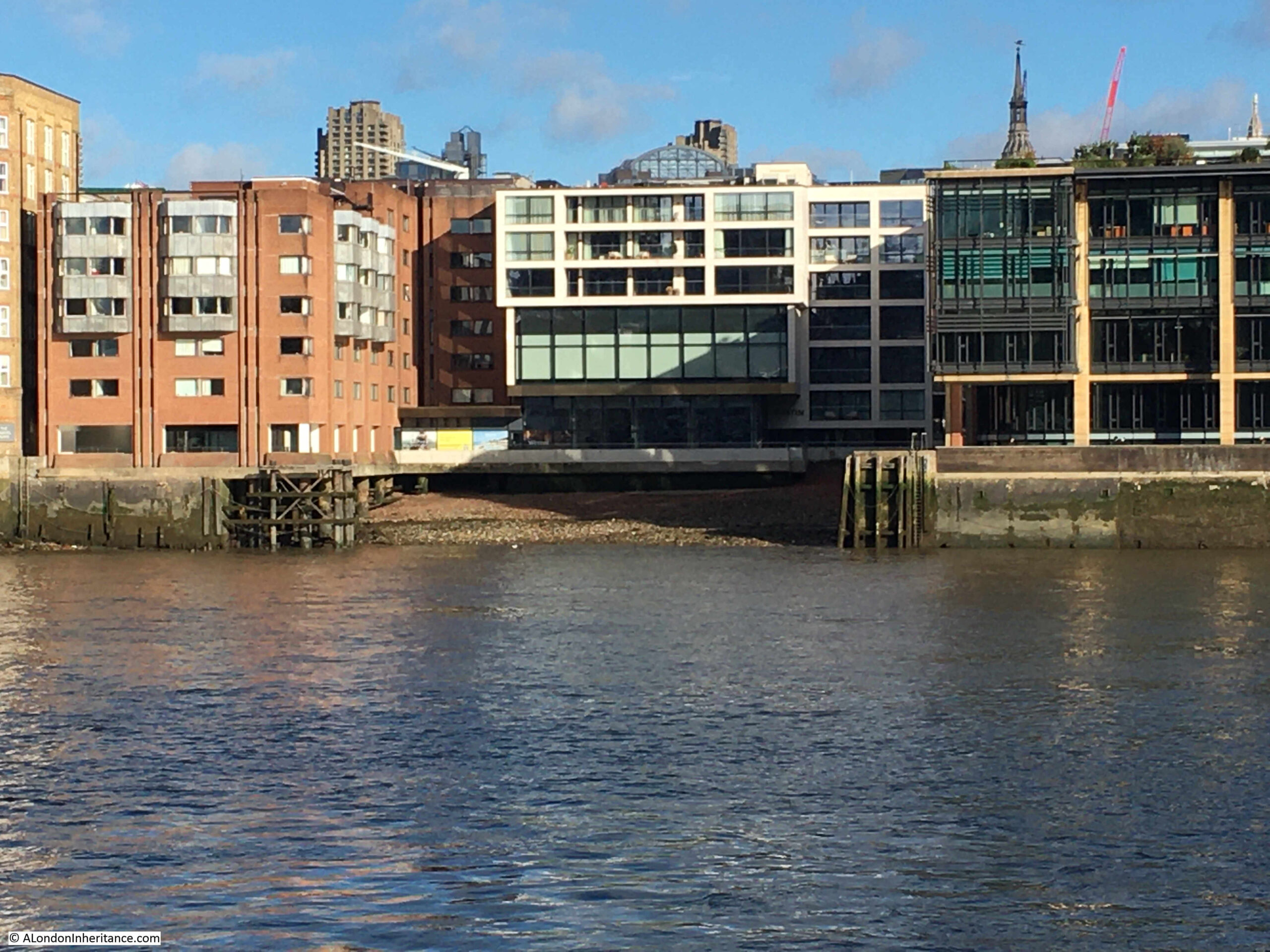
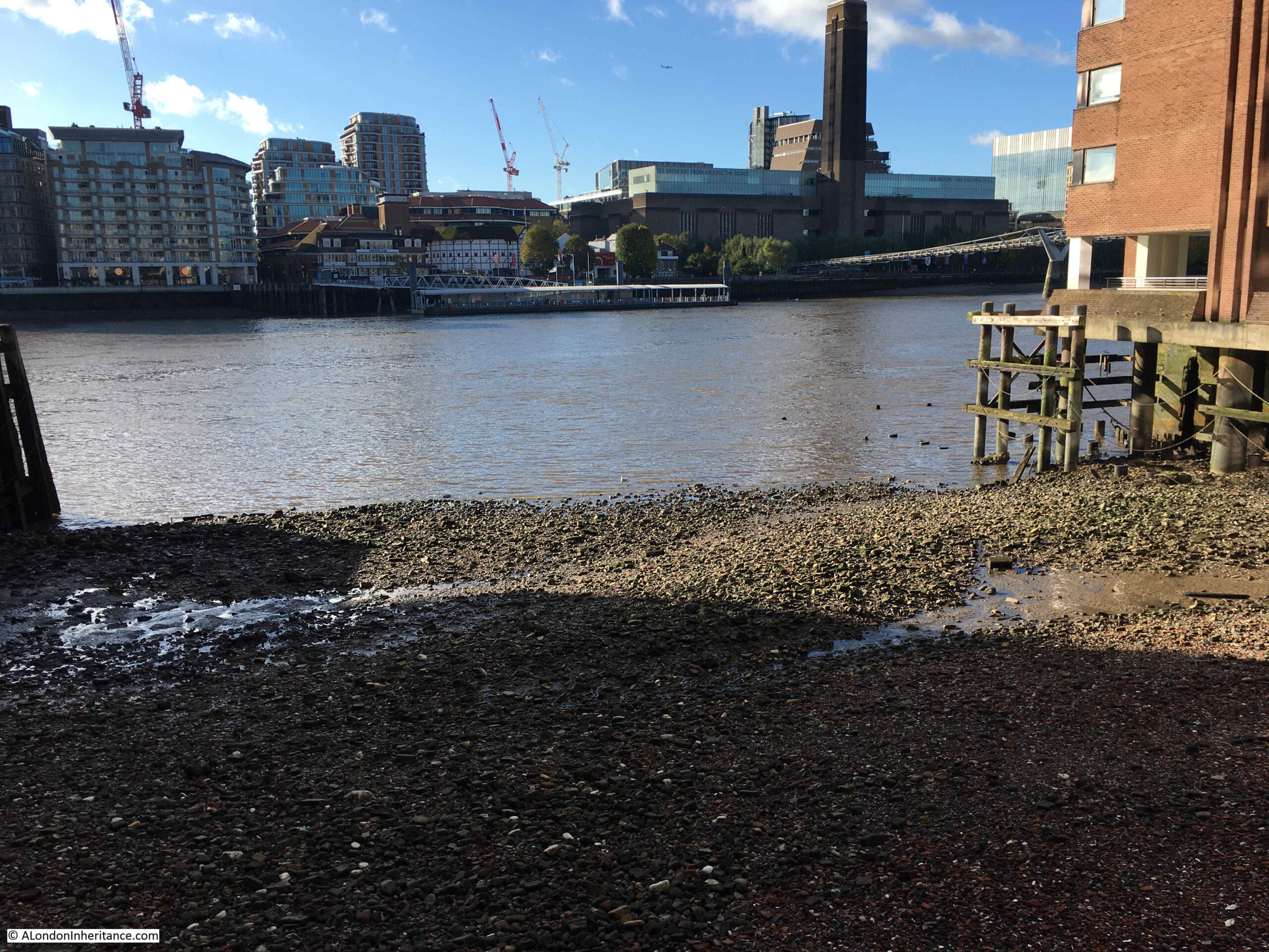
In very many ways, London has changed significantly in the past 70 years, but much else remains the same. In 1954, the city was still recovering from the ravages of the Second World War, a process that would take the following two decades. The Docks were still a major source of trade and employment with the Thames still a busy transport route.

The City of London was a major financial centre, and in 1954 there was no indication at all that the Isle of Dogs would become a rival financial centre (although in 2023, some companies are planning to move back to the City).

The population of London was very slowly recovering from the low levels seen as a result of migrations out during and immediately after the war.

The cover of the Evening News Year Book for 1954:

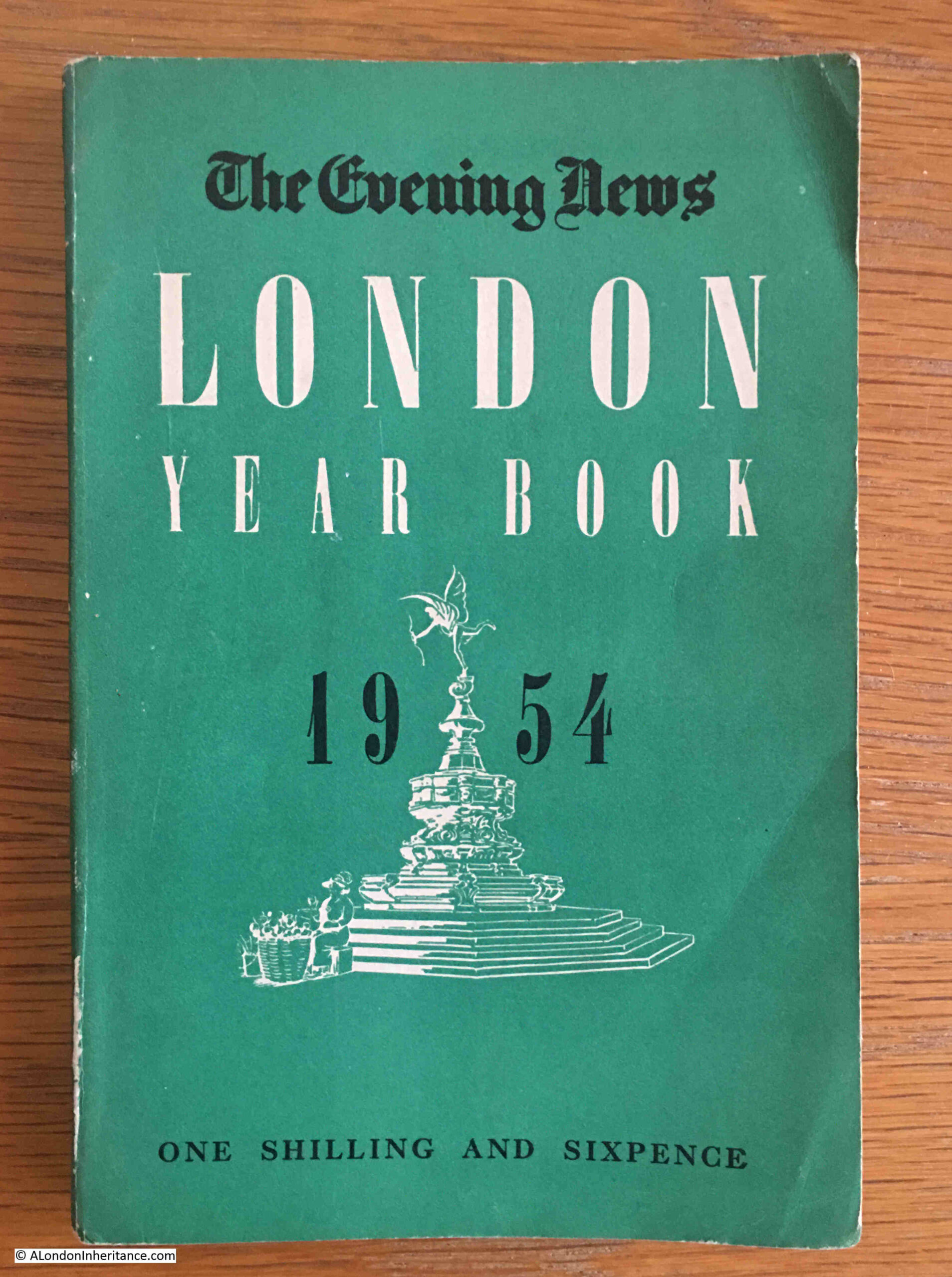
The year book is a densely packed little book about the city, claiming to have 10,000 facts about London within its 192 pages.

The 1954 edition starts with a review of 1953, with the heading “A Glorious London Year”, with, as in 2023, the main event of the year being a Coronation, which the book introduces with:

“‘What fun they had in 1953’. So, I feel, will your grandchildren exclaim when they turn over the pictures you have pasted in the big book, or listen to play-backs of newsreels and the famous films. But we know that it was more than fun. it was a flame that warmed and lit the island in that wet spring and summer.”

Although the Coronation was a highlight, there had been a number of tragic events in the previous couple of years, including in 1952, a major train accident at Harrow and Wealdstone Station:

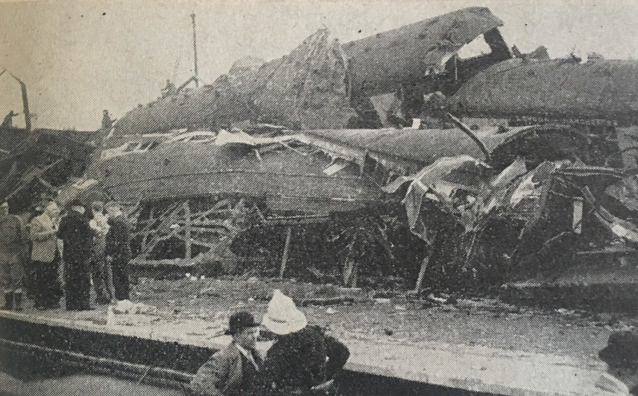
This happened on the 8th of October, when “the Perth to Euston express smashed into a local train standing at Harrow and Wealdstone Station. Seconds later, the Euston to Liverpool Express ploughed into the wreckage. Altogether 111 people died.”

The accident apparently remains the worst peacetime accident on the British rail network. The following British Movietone newsreel provides a view of just how bad the crash was:

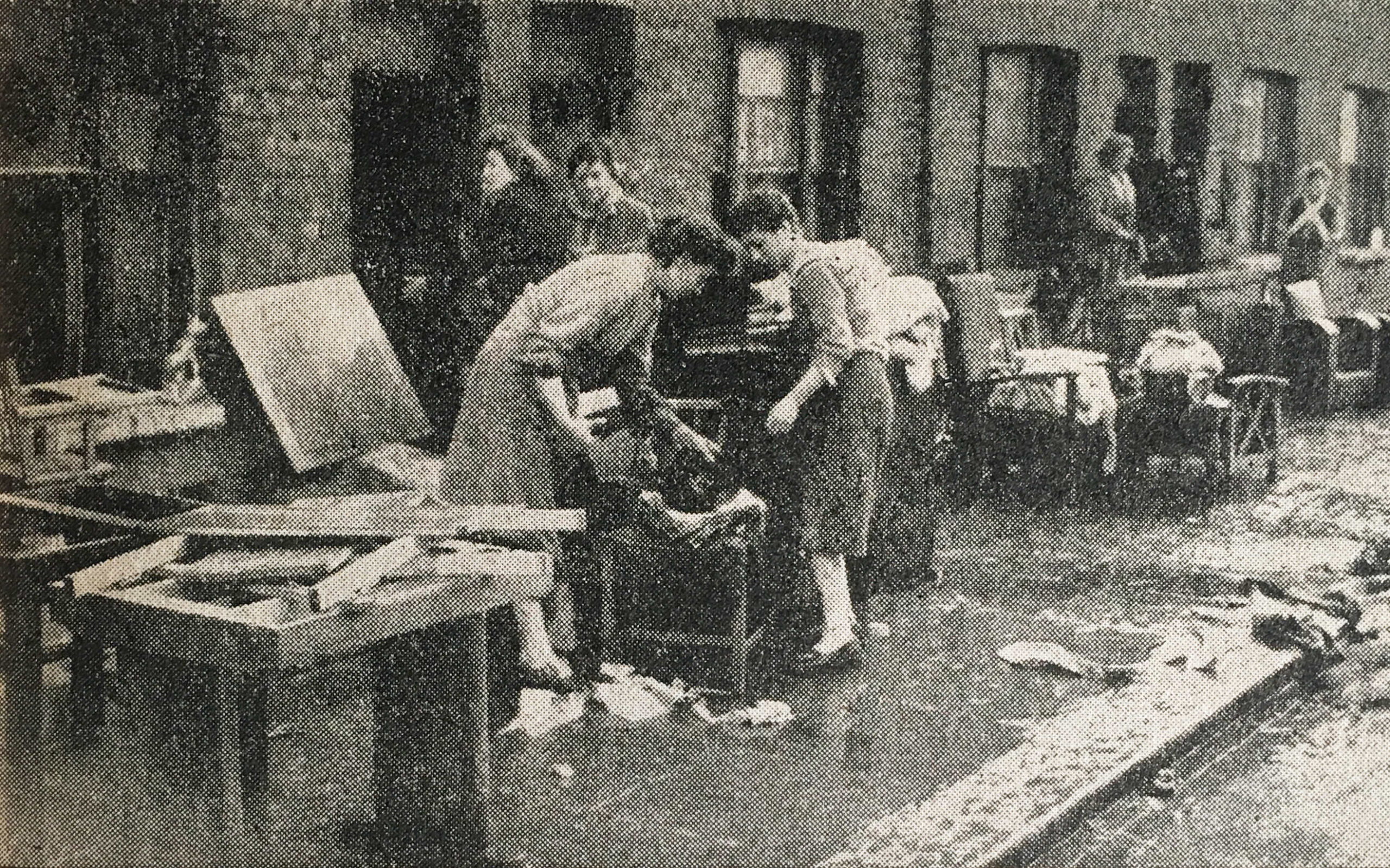
The other significant tragedy of 1953 was the flooding of January 1953, when “On the night of 31st January, nature dealt a savage blow along the East Coast – and London, too suffered. Here are the occupants of houses in Mary Street, West Ham, salvaging their property after flooding”.

The following newsreel provides an overview of the level of devastation caused by the floods across England, the Netherlands and Belgium:

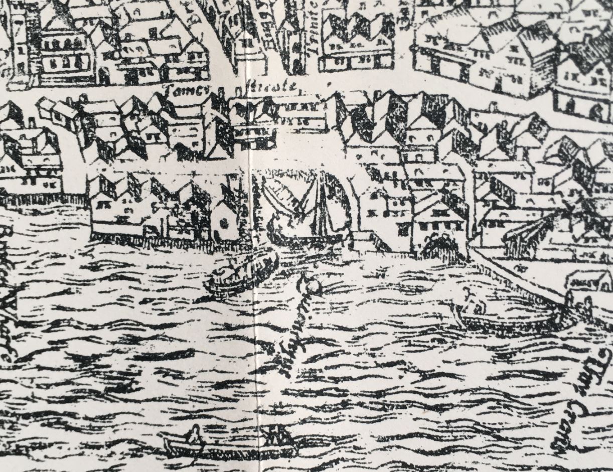
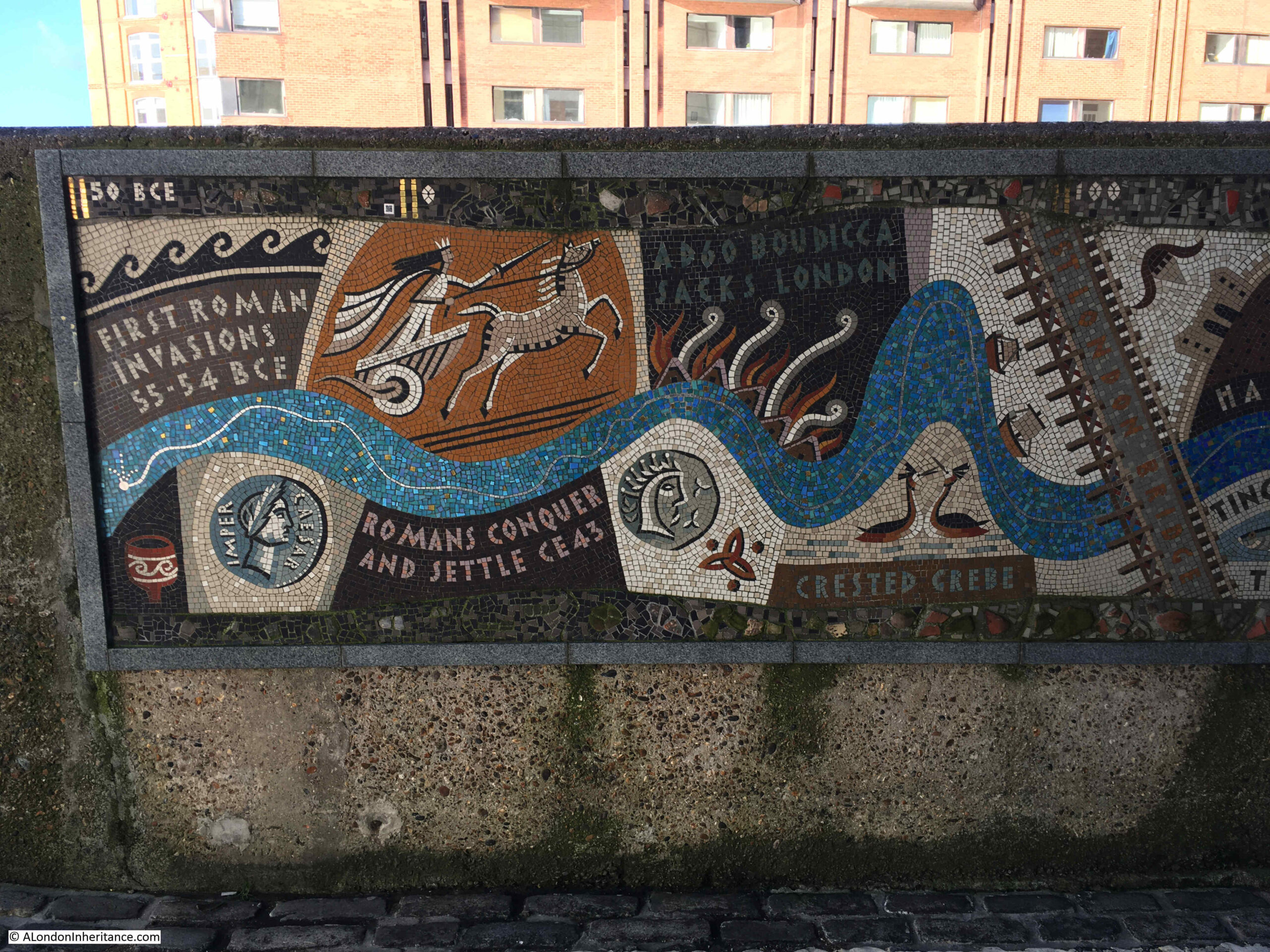
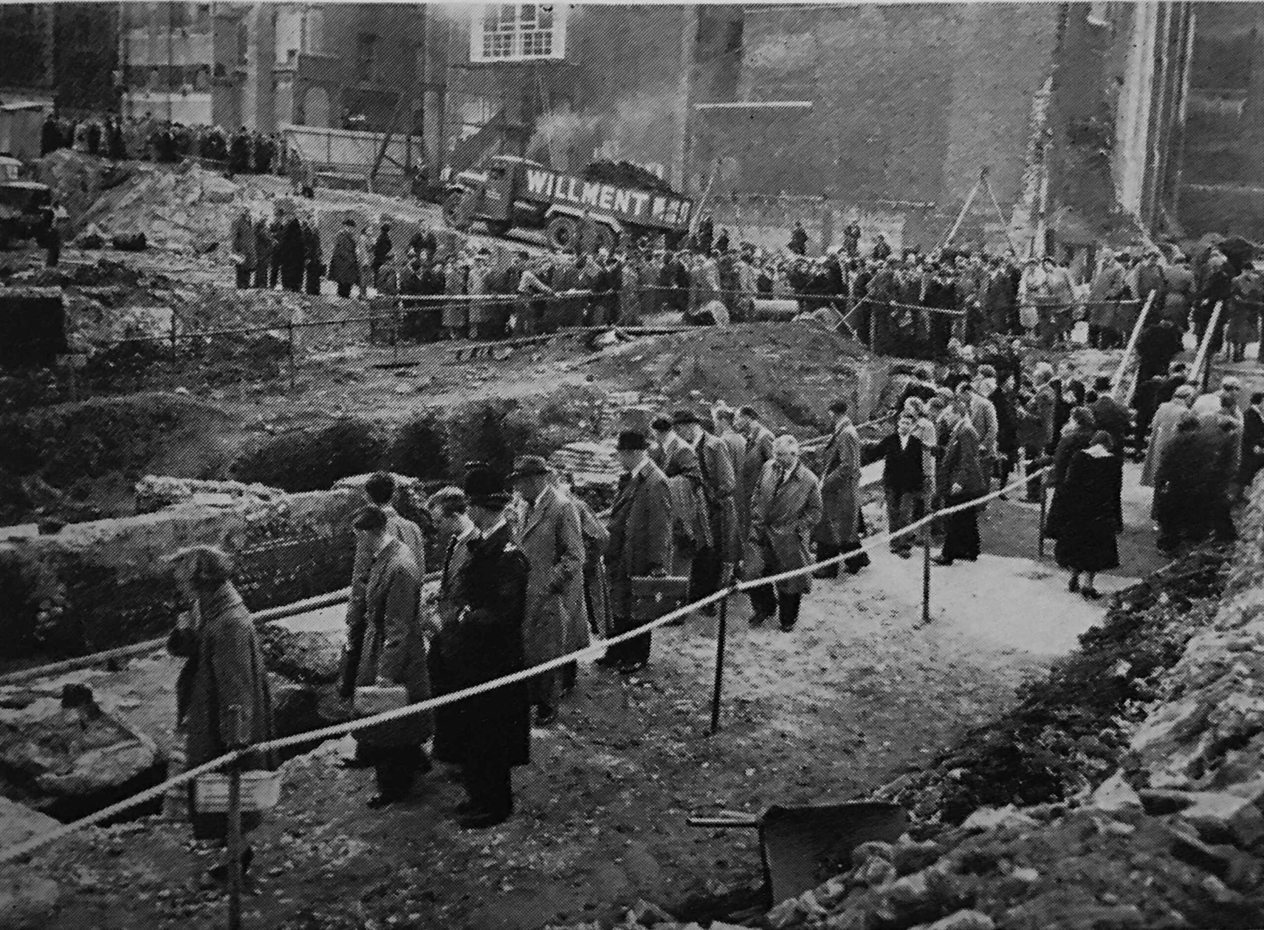
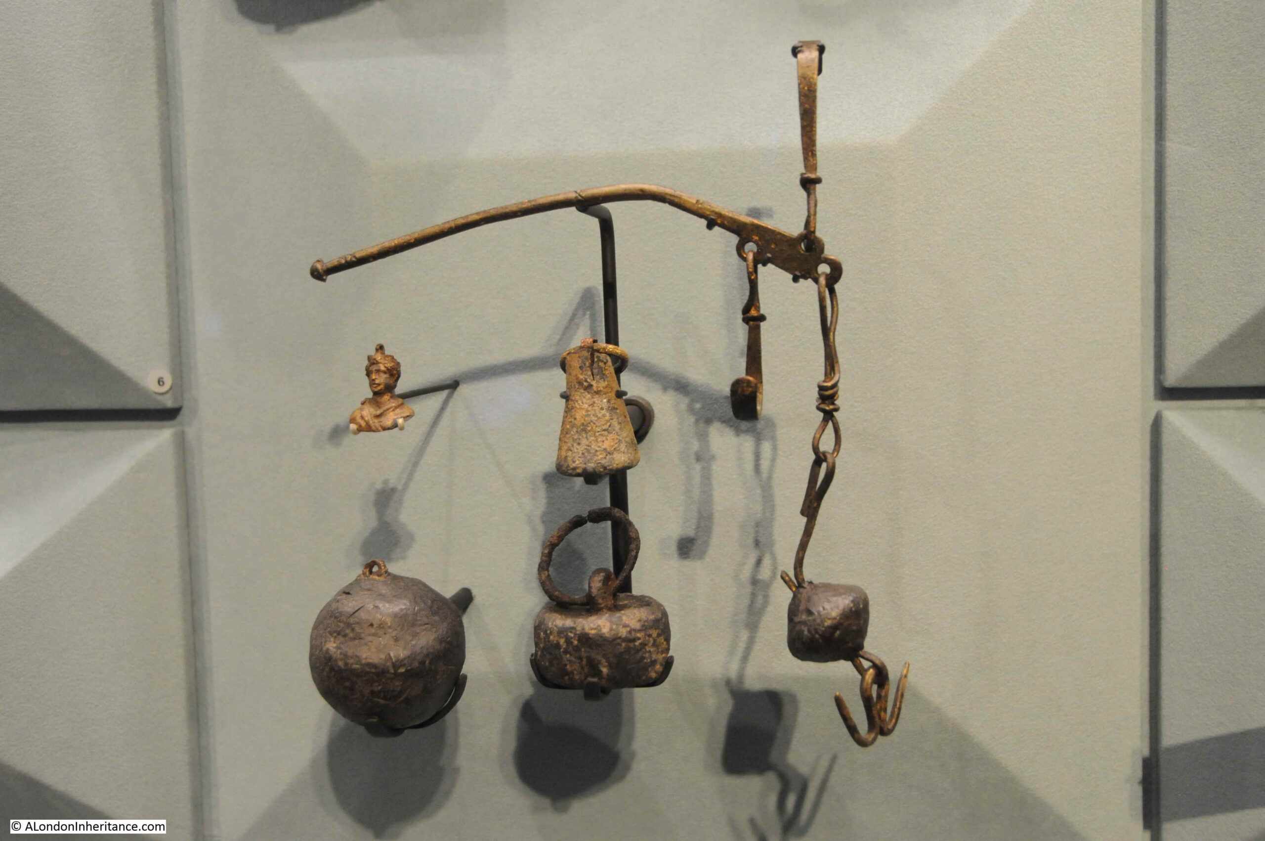
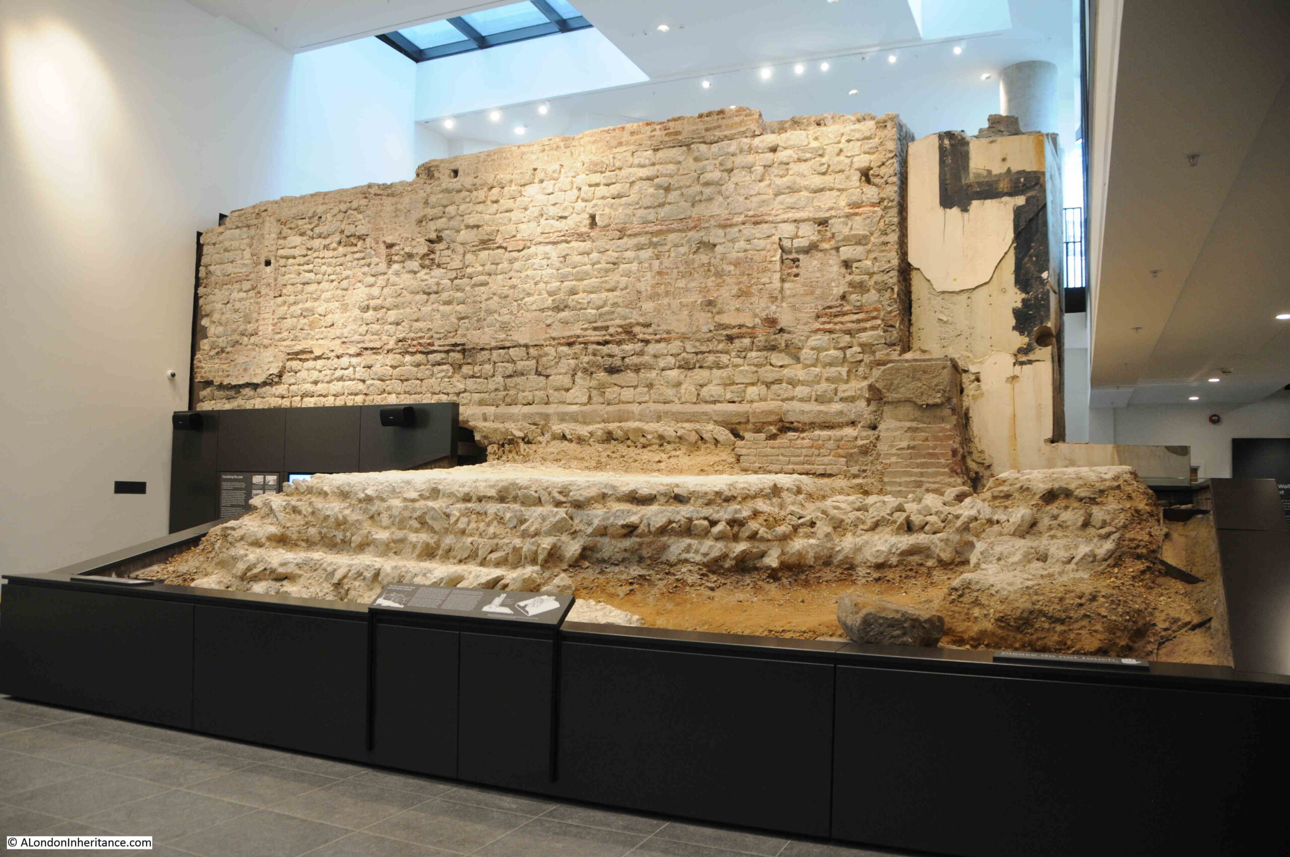
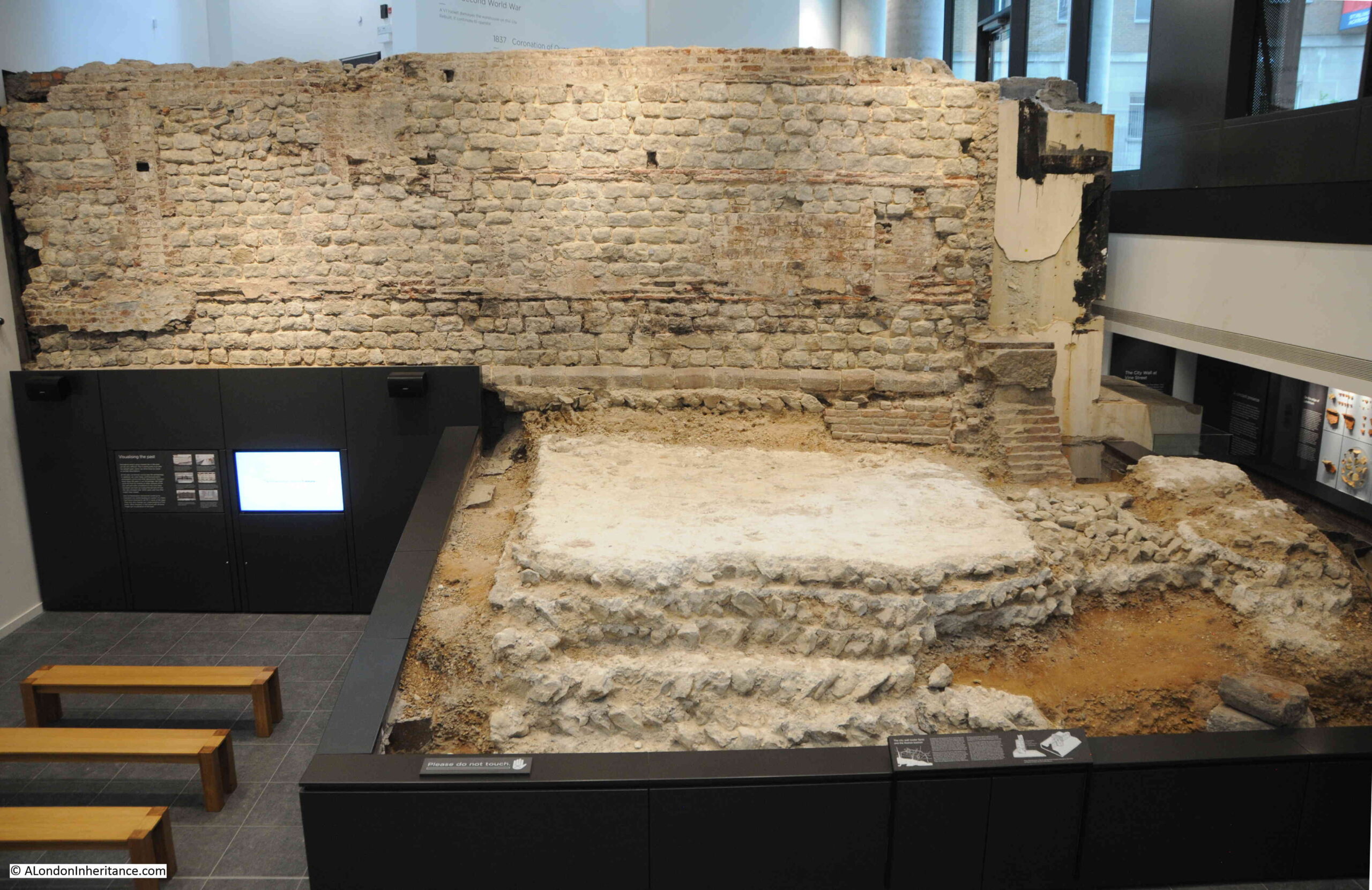
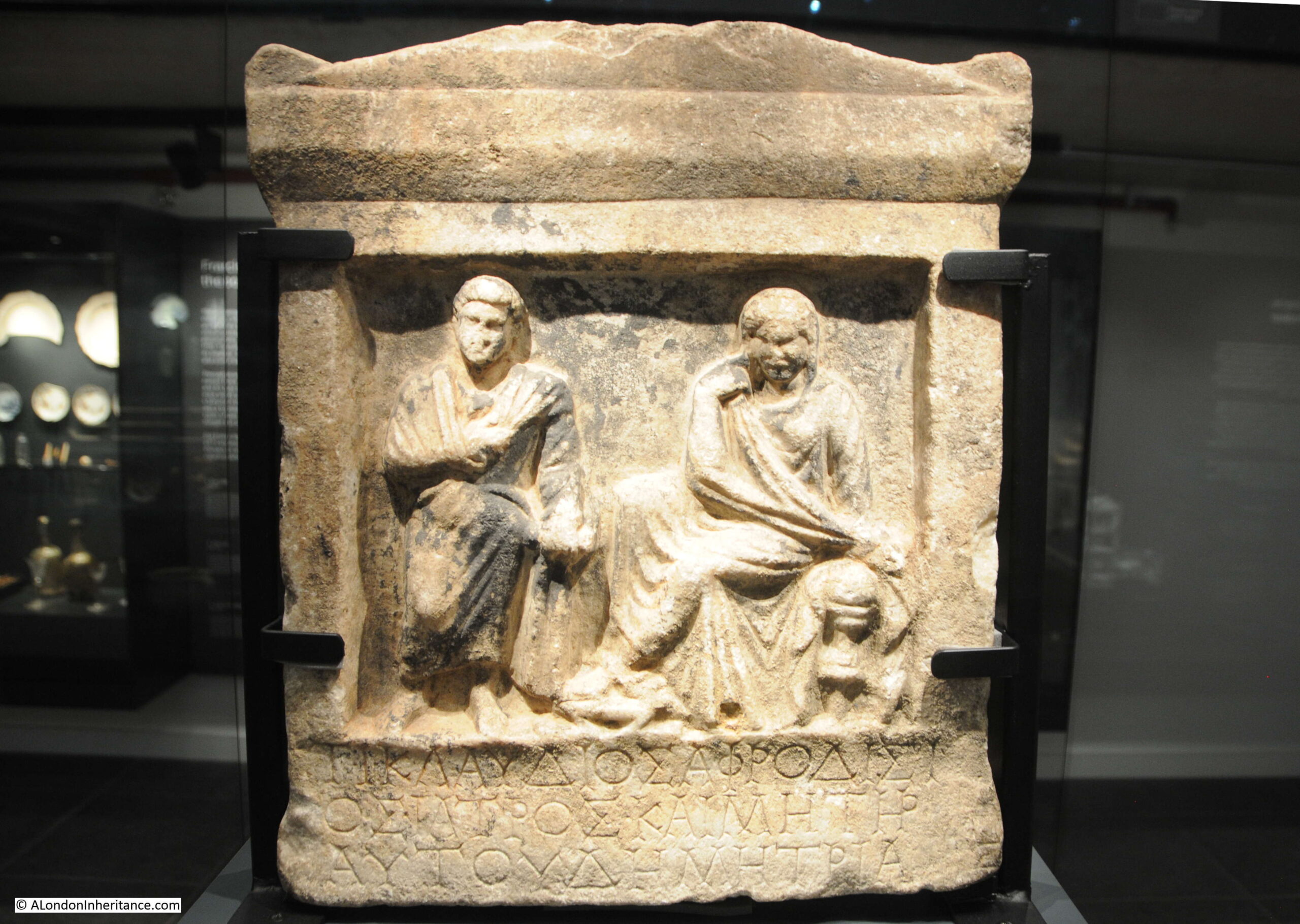
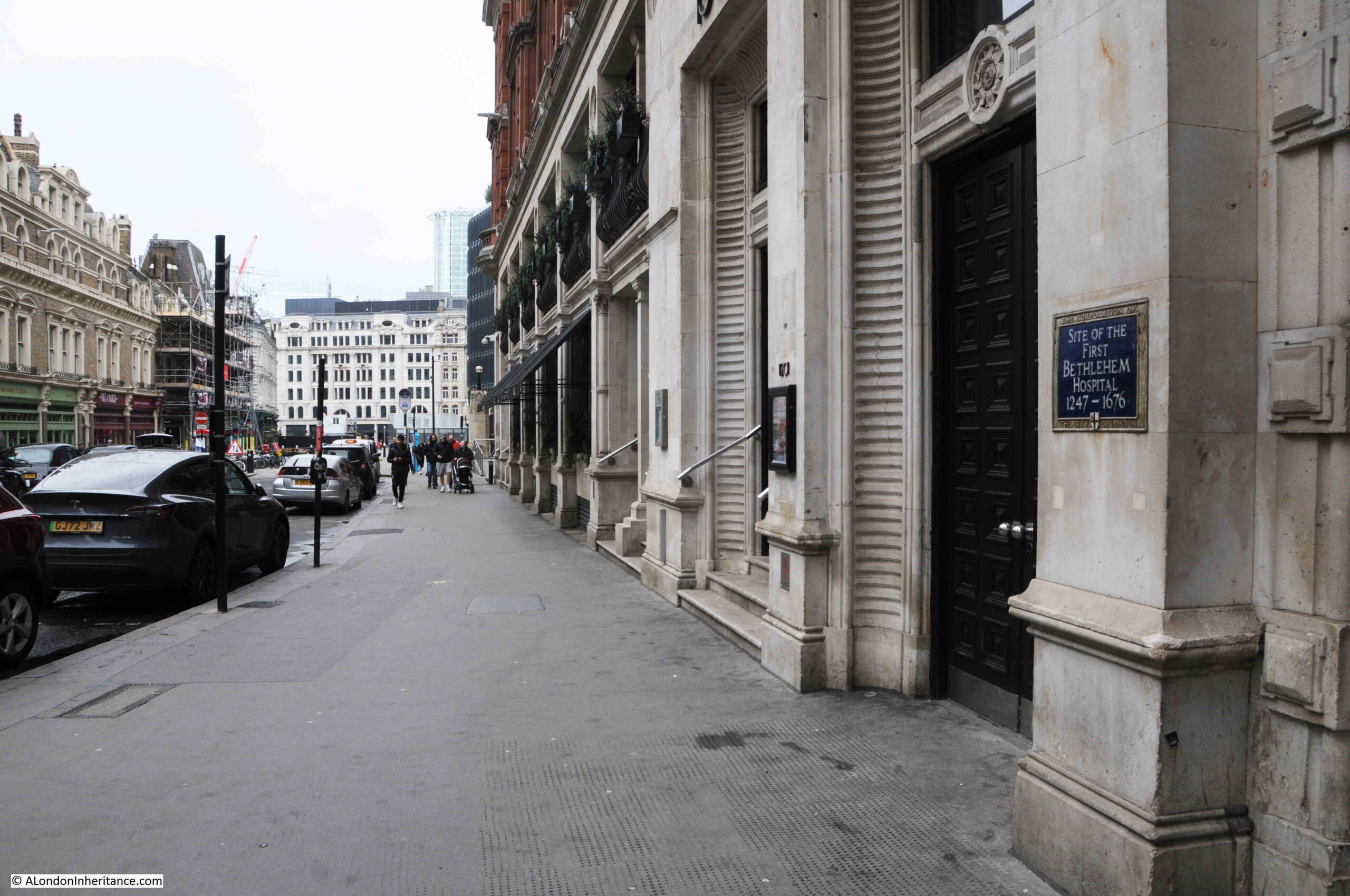
The Year Book included a section on “Excavating Ancient London”. The 1950s were a time of significant archaeological discoveries across London, with so many areas opened up for excavation following wartime bombing.

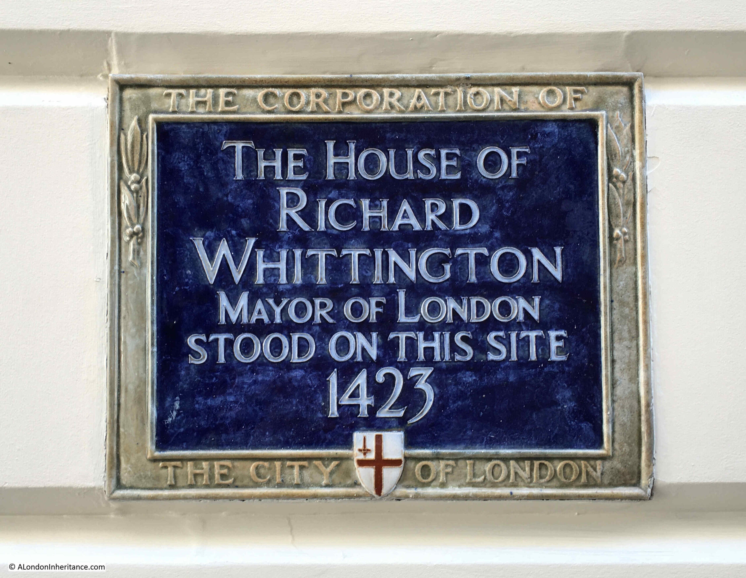
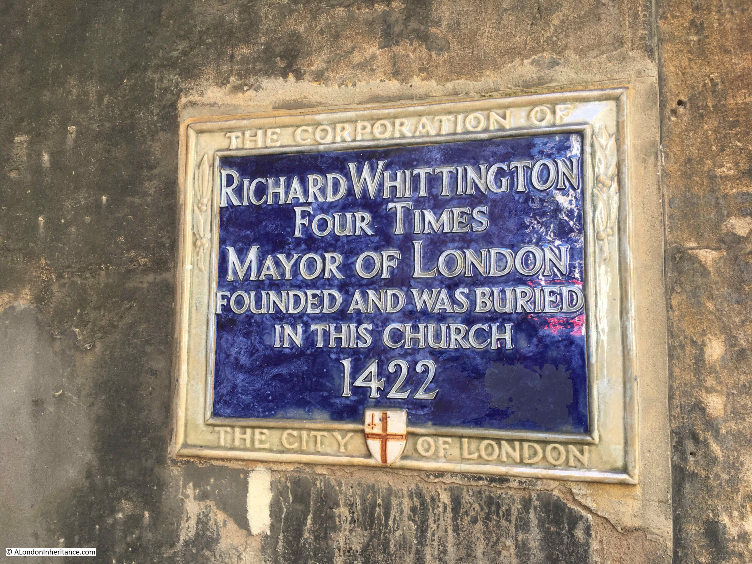
Many of these digs were led by Professor W.F. Grimes, who was Director of the Museum of London, and it was Grimes who wrote the pages in the Year Book on excavating London, starting with:

Almost every year adds to the quota of new discoveries to the store of raw materials upon which the early history of London must be built. Many of these are chance finds, due to accidents of one sort or another; but interesting as they may be, they do not tell the expert anything like as much as finds which have been the outcome of carefully-controlled scientific excavations.”

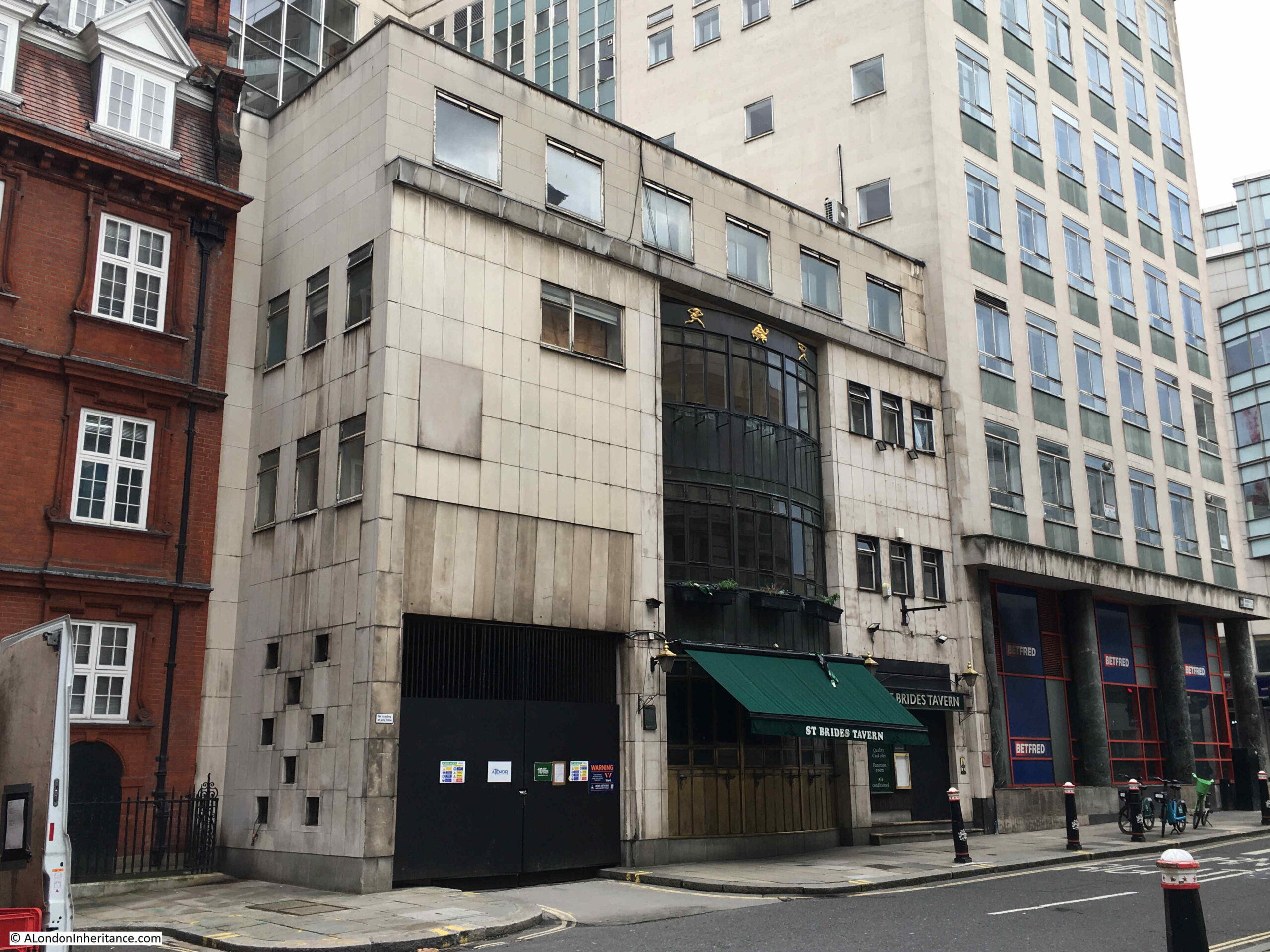
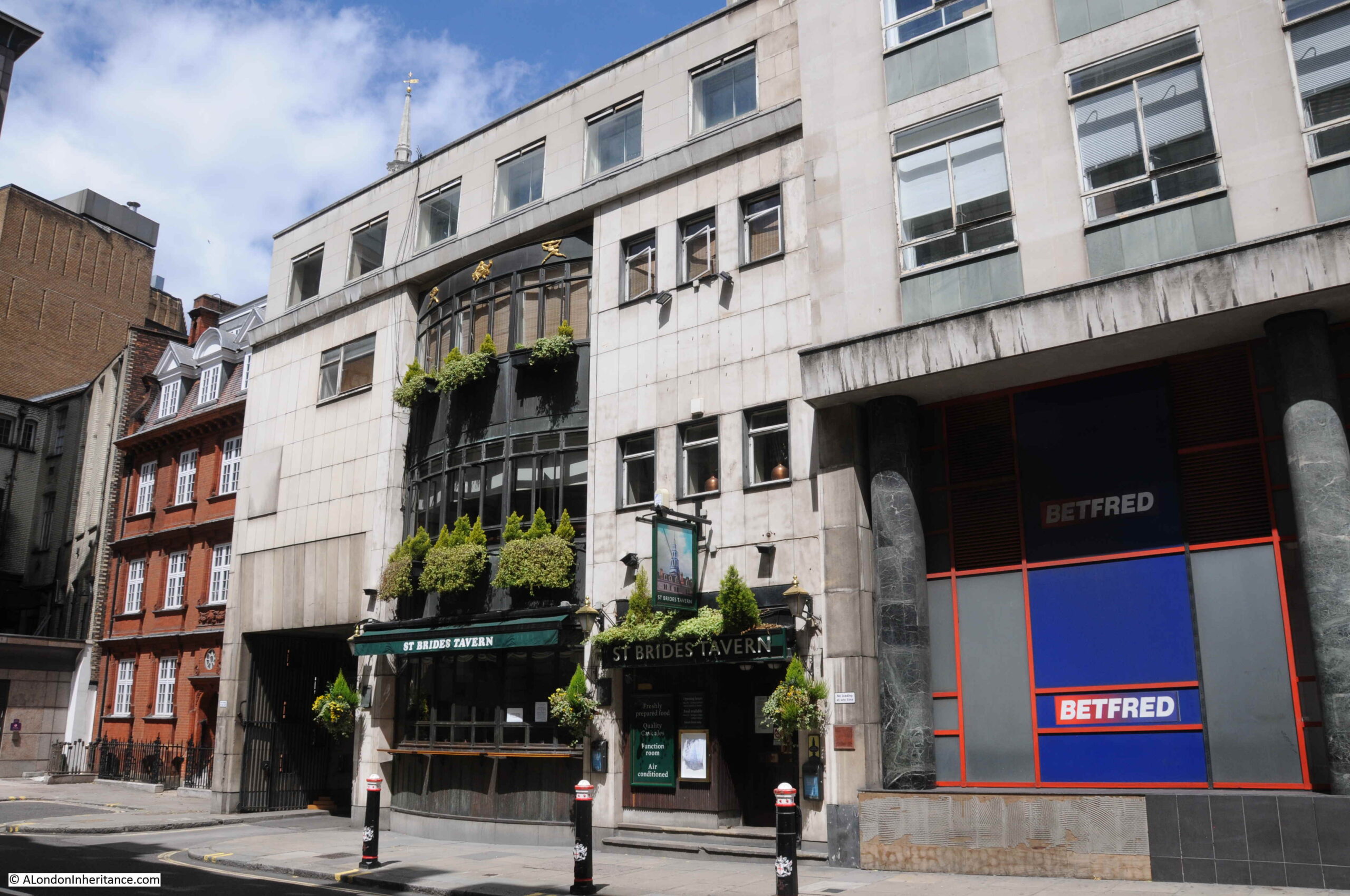
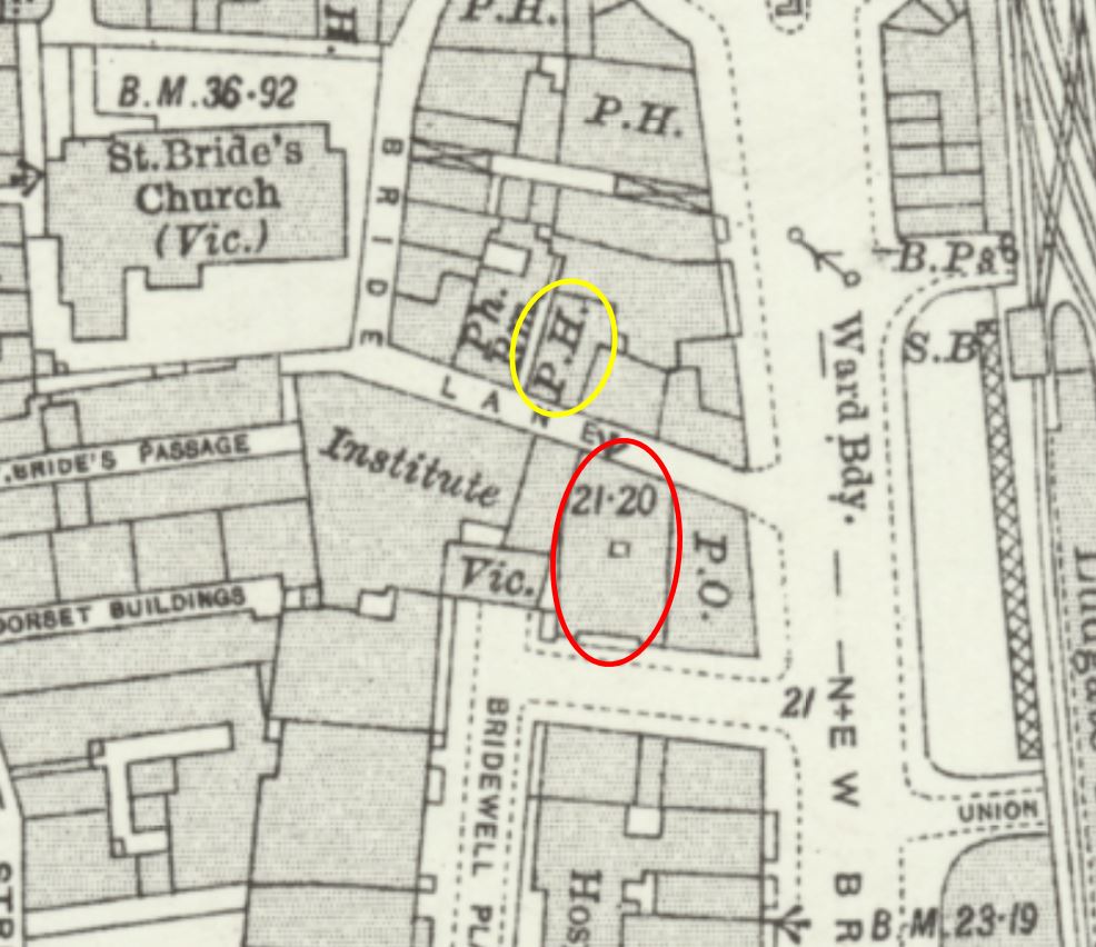
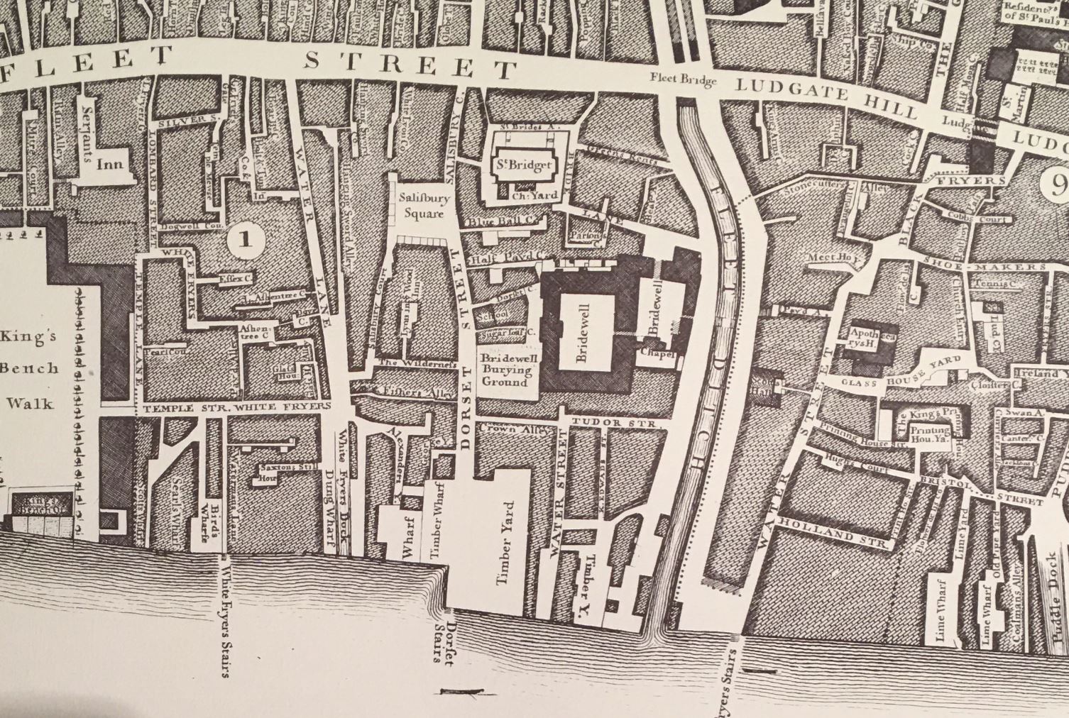
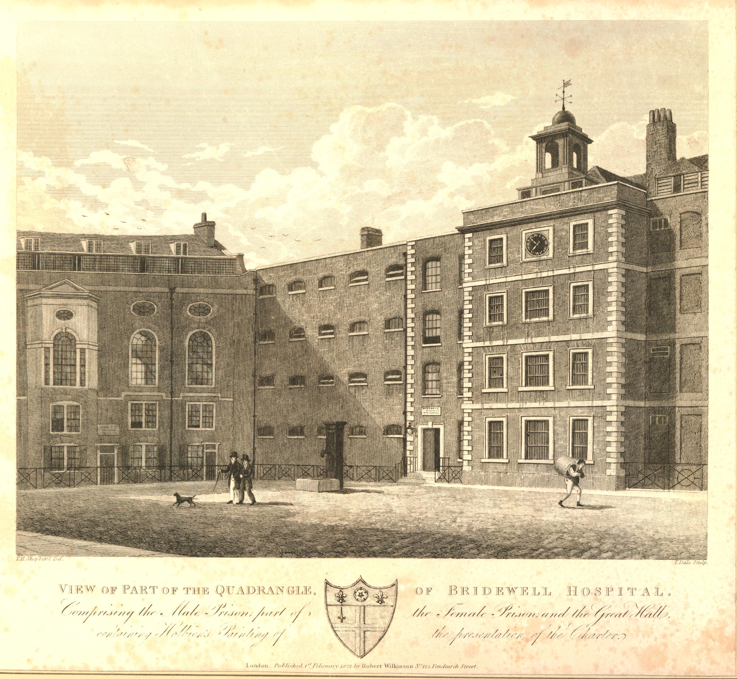
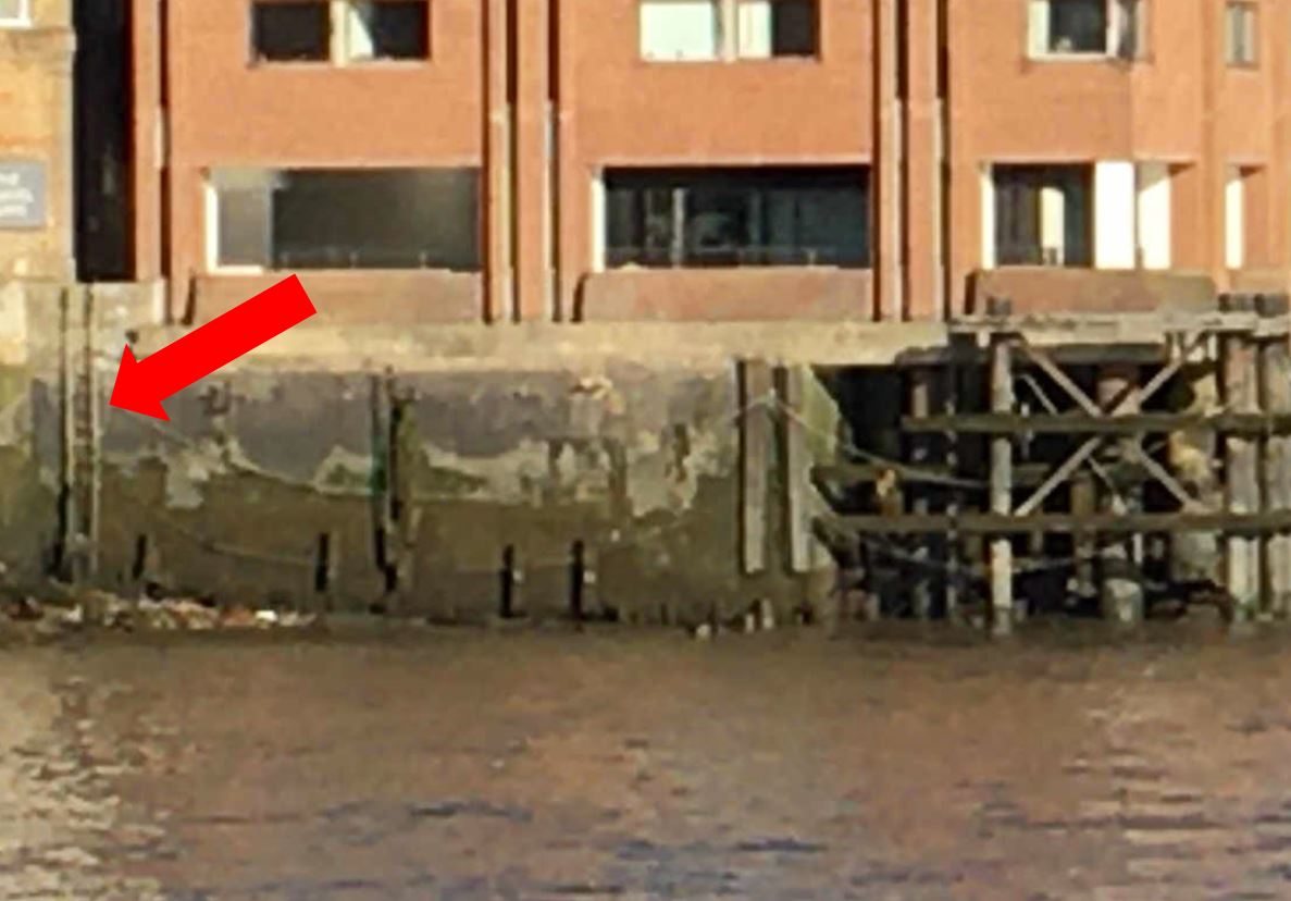
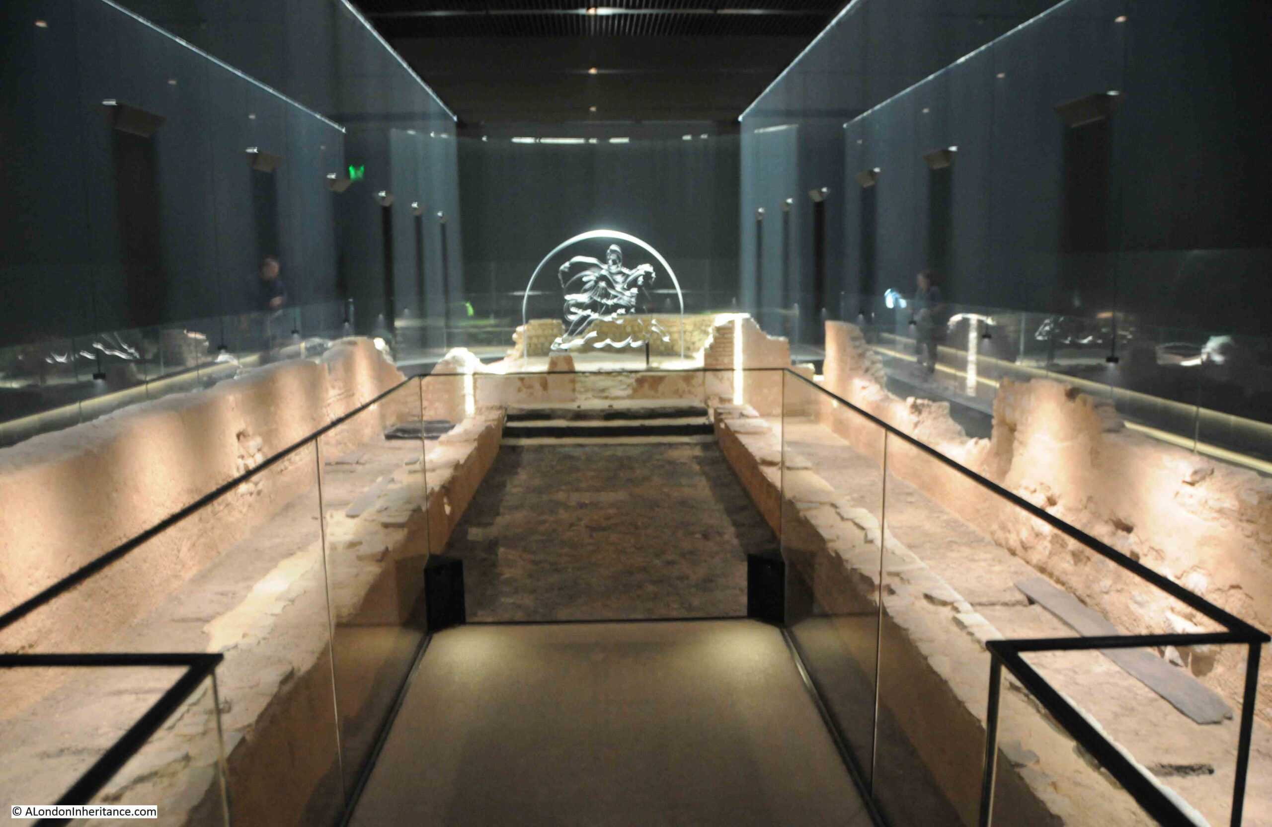
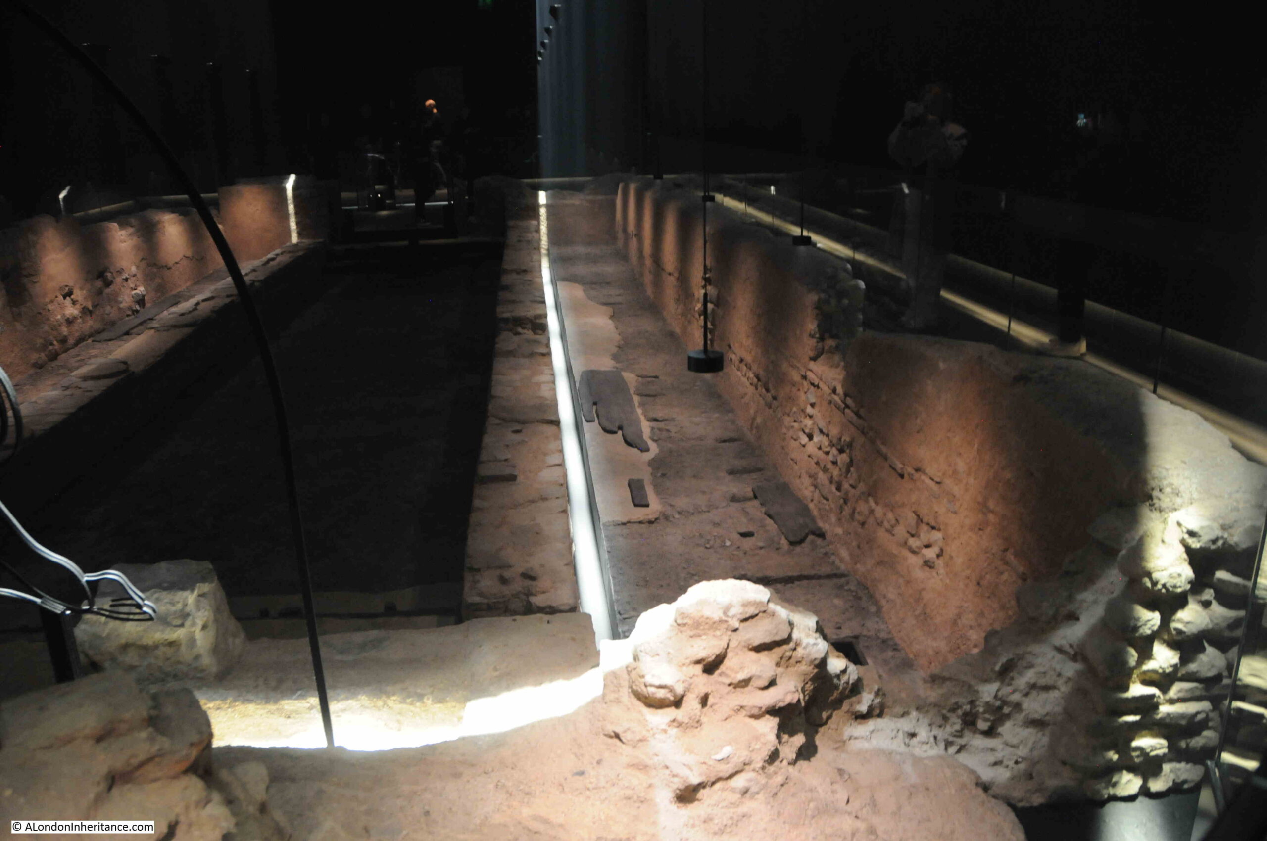
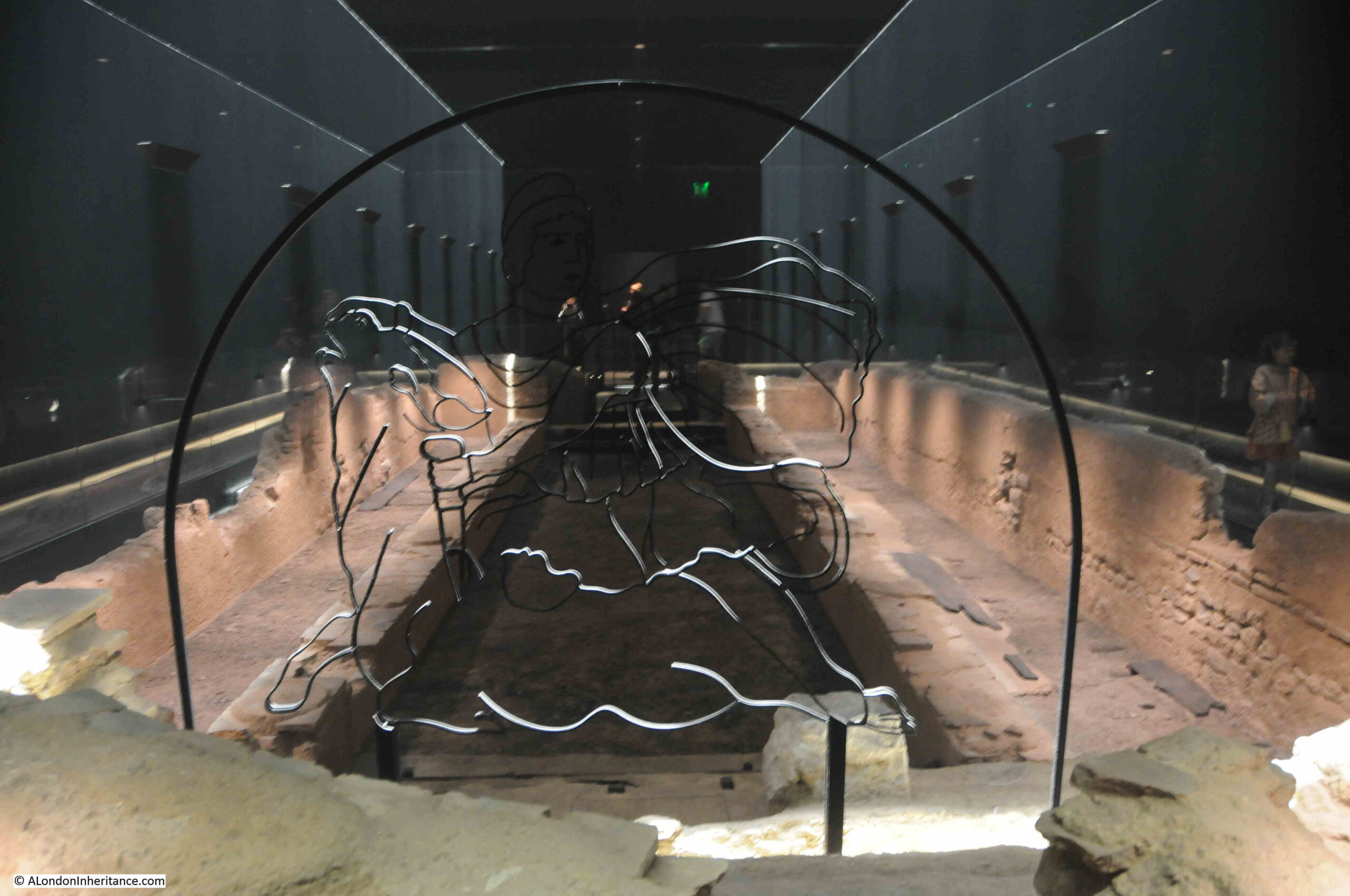
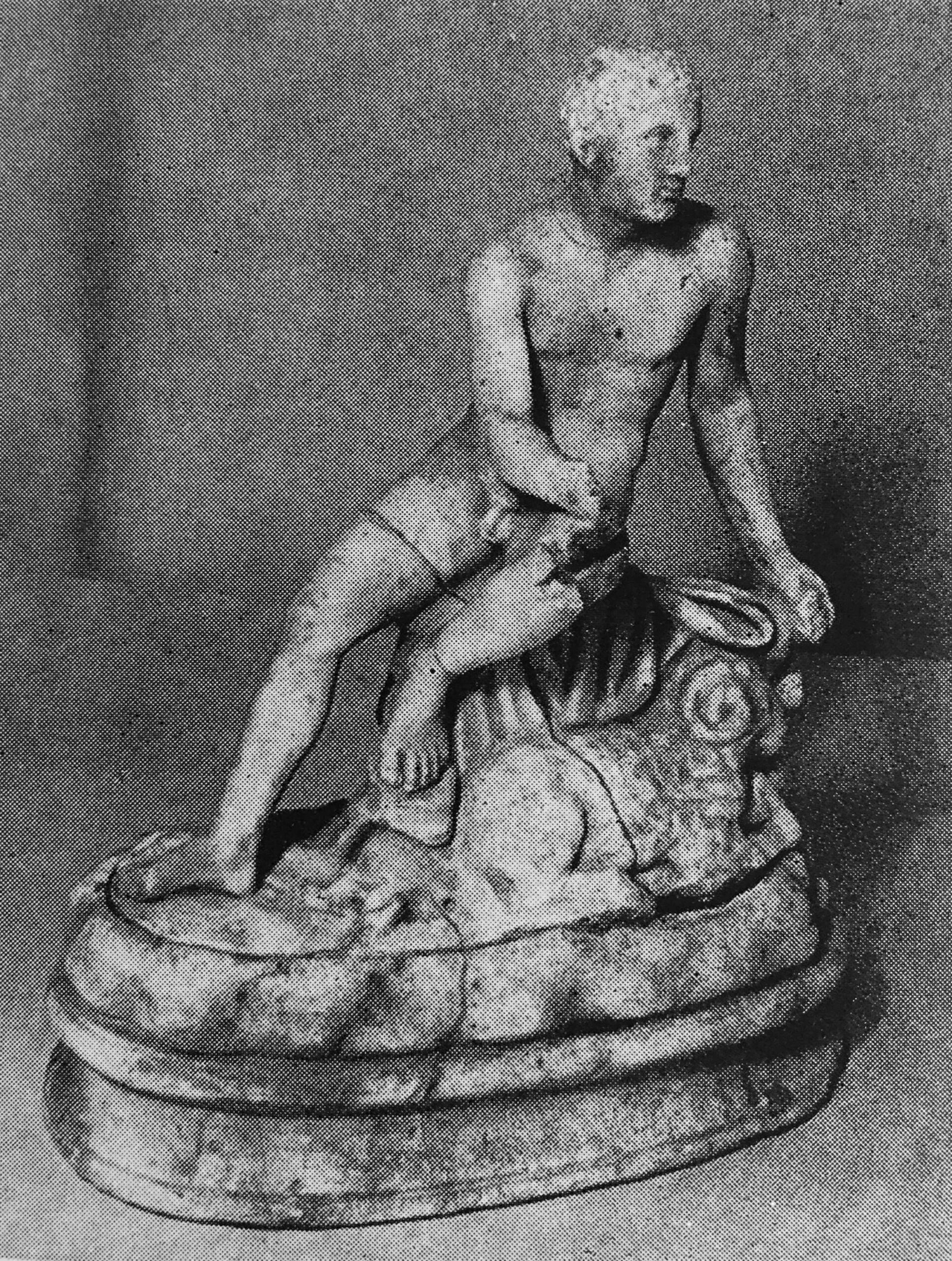
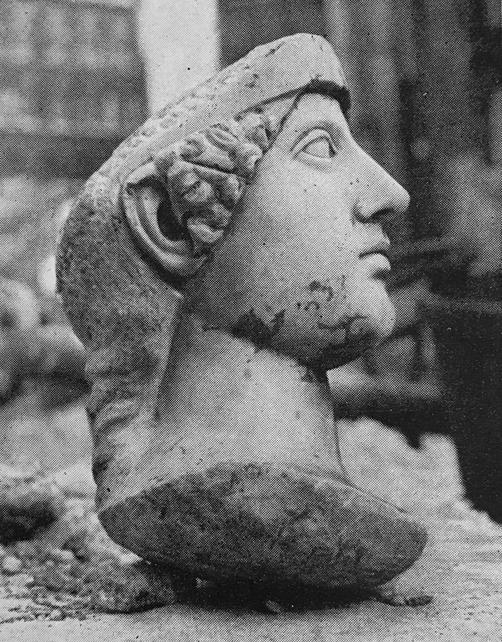
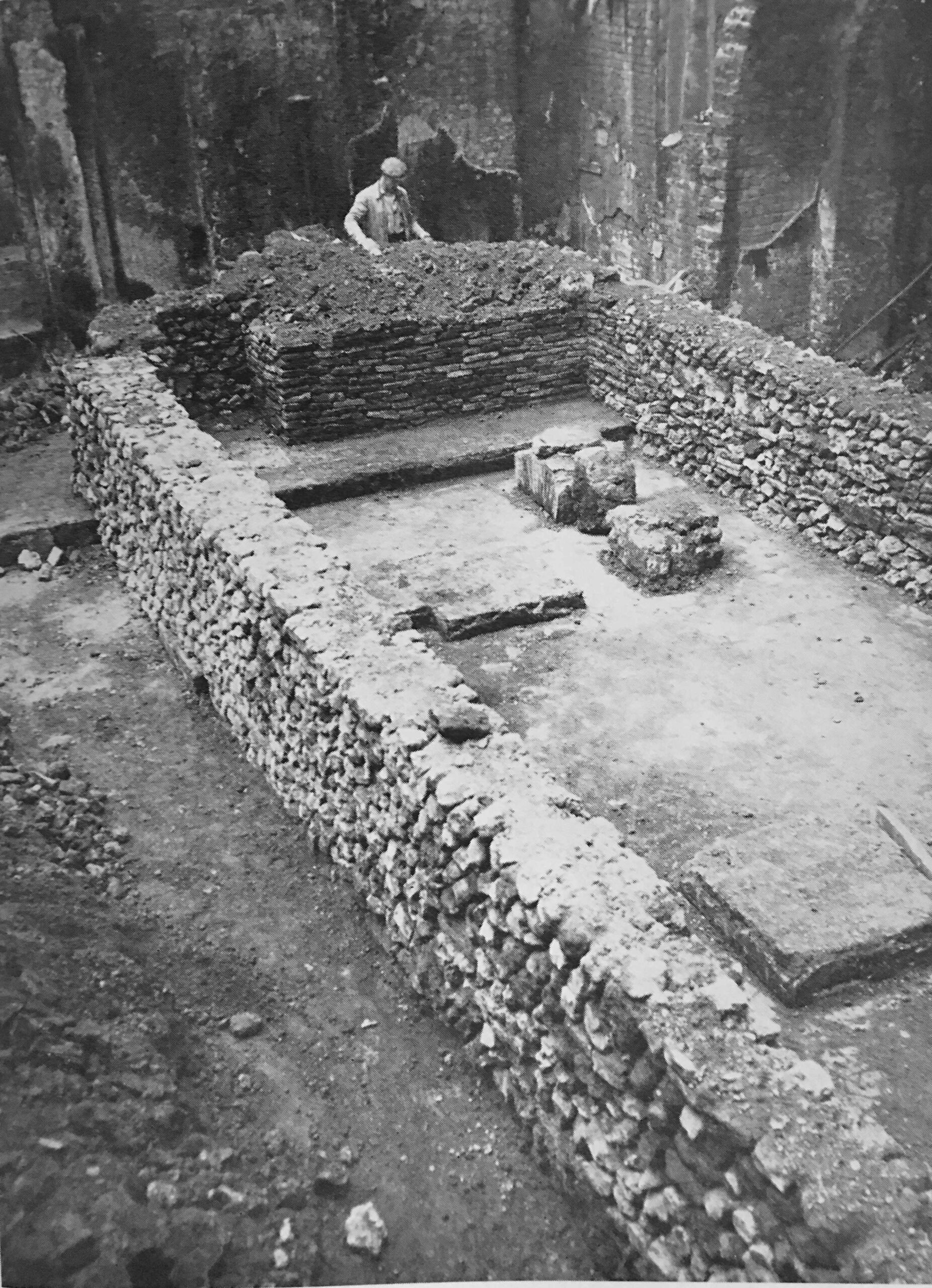
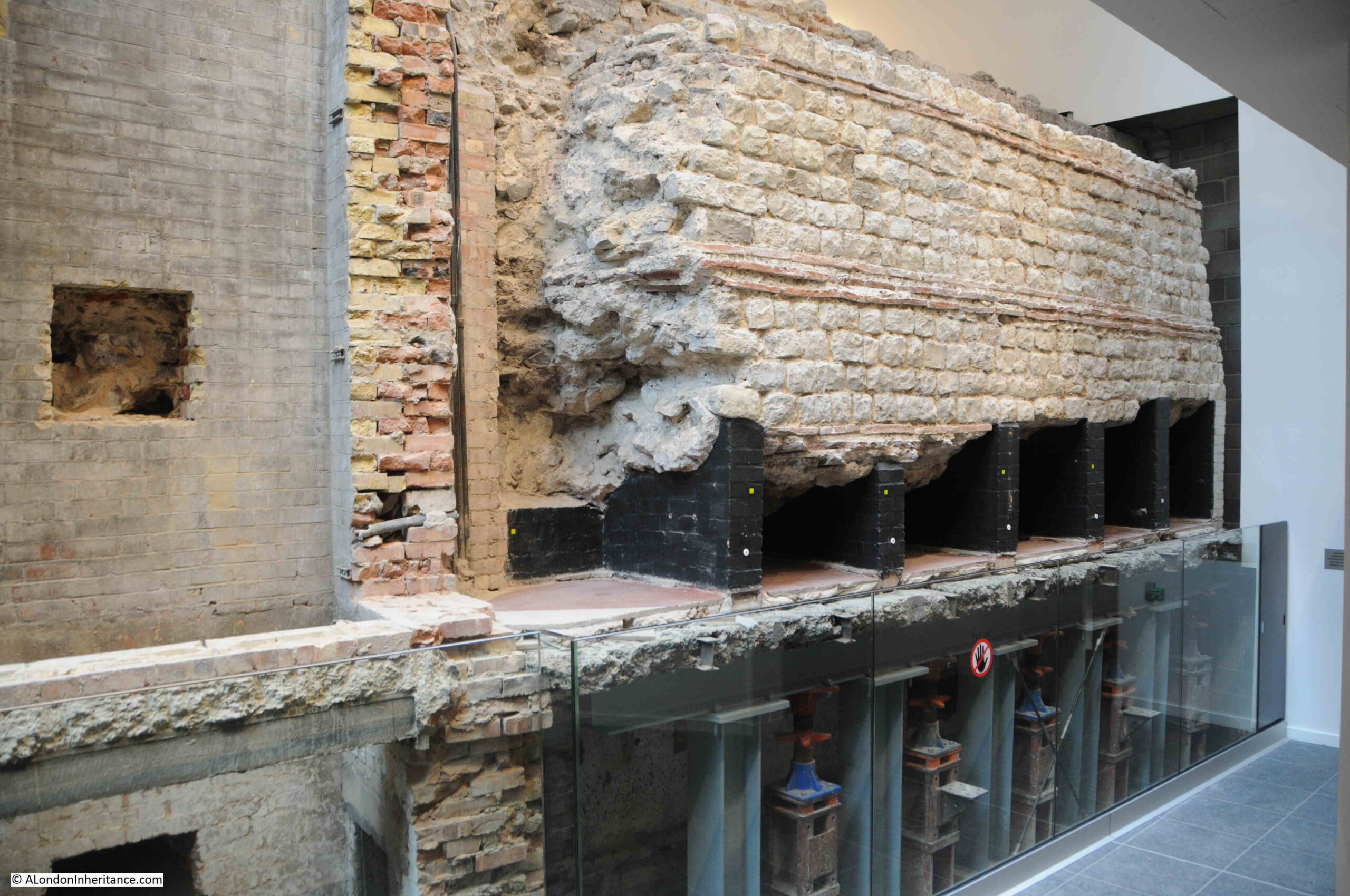
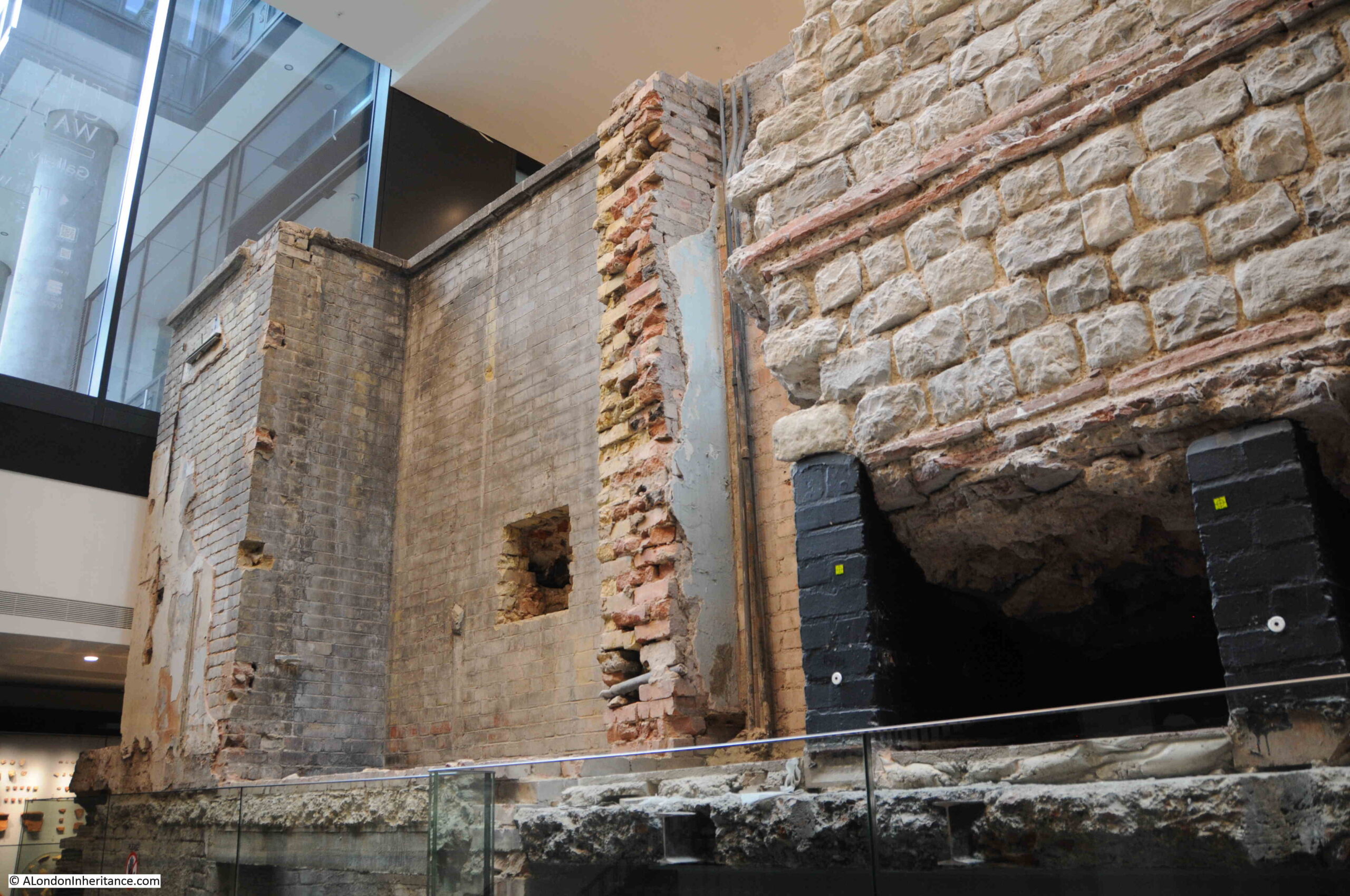
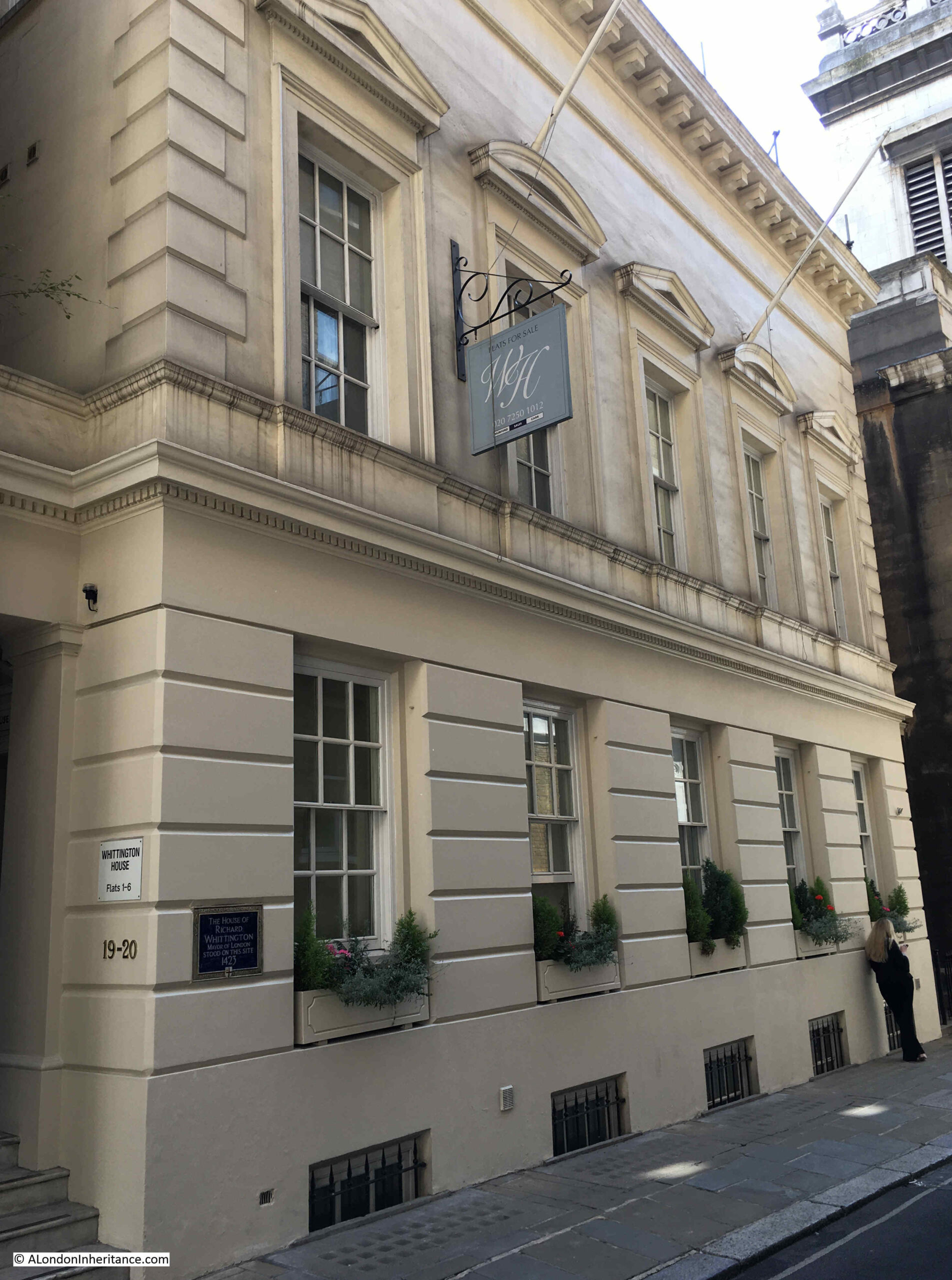
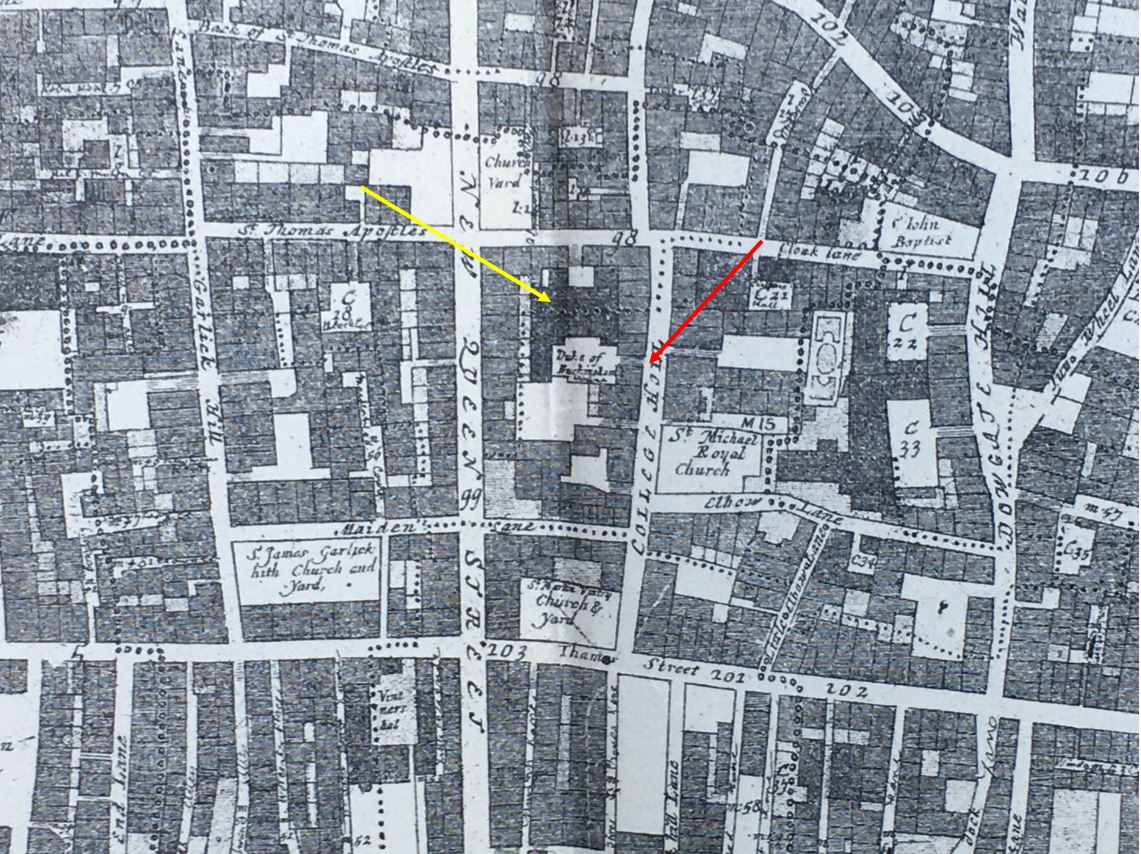
Grimes features two significant sites excavated during 1953. The first was the discovery of Roman mosaic floors in what would have been large houses along the banks of the Walbrook river. The second was at St. Bride’s, Fleet Street, where “discoveries have shed light upon the Roman period, the Anglo-Saxon period and the Middle Ages”.

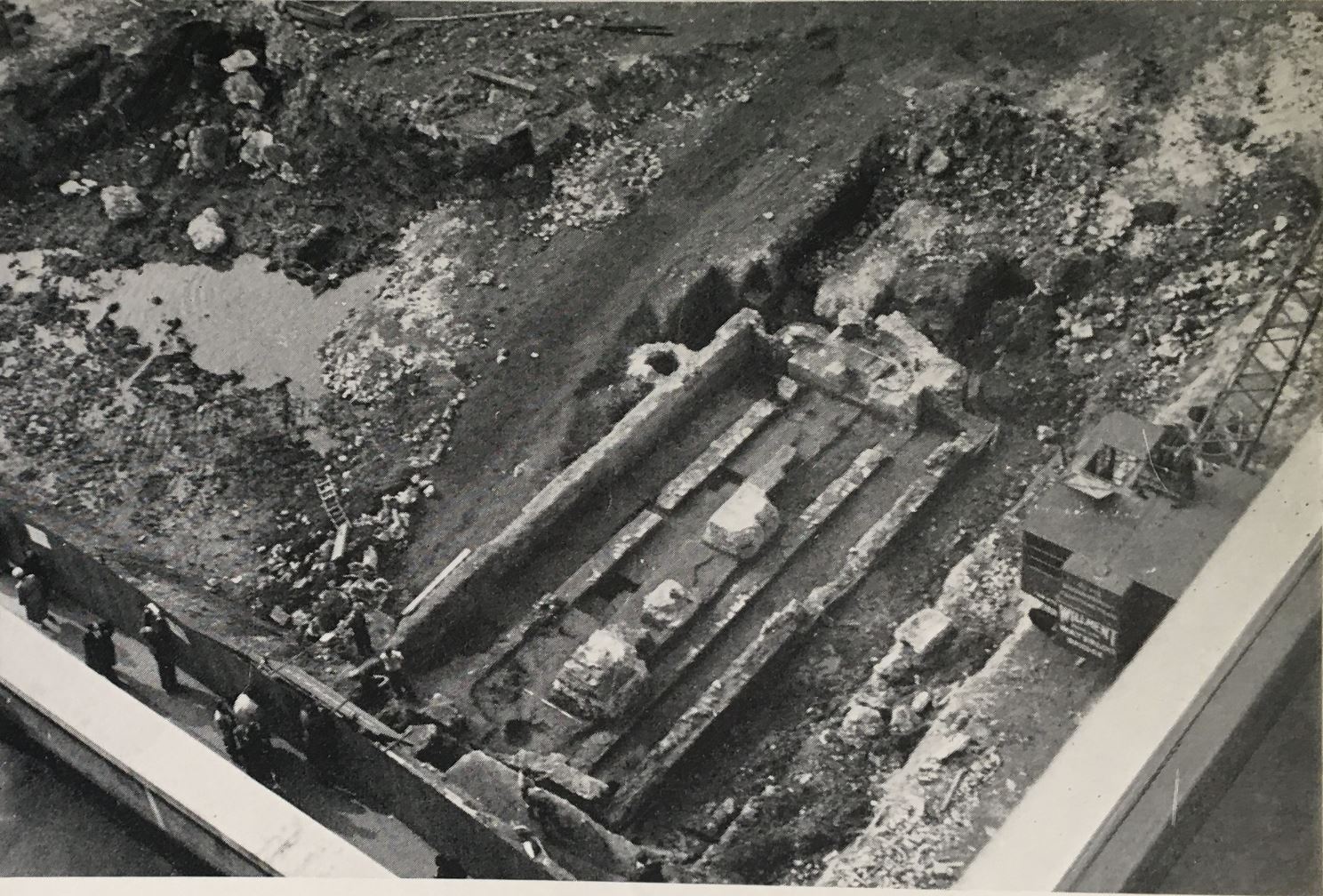
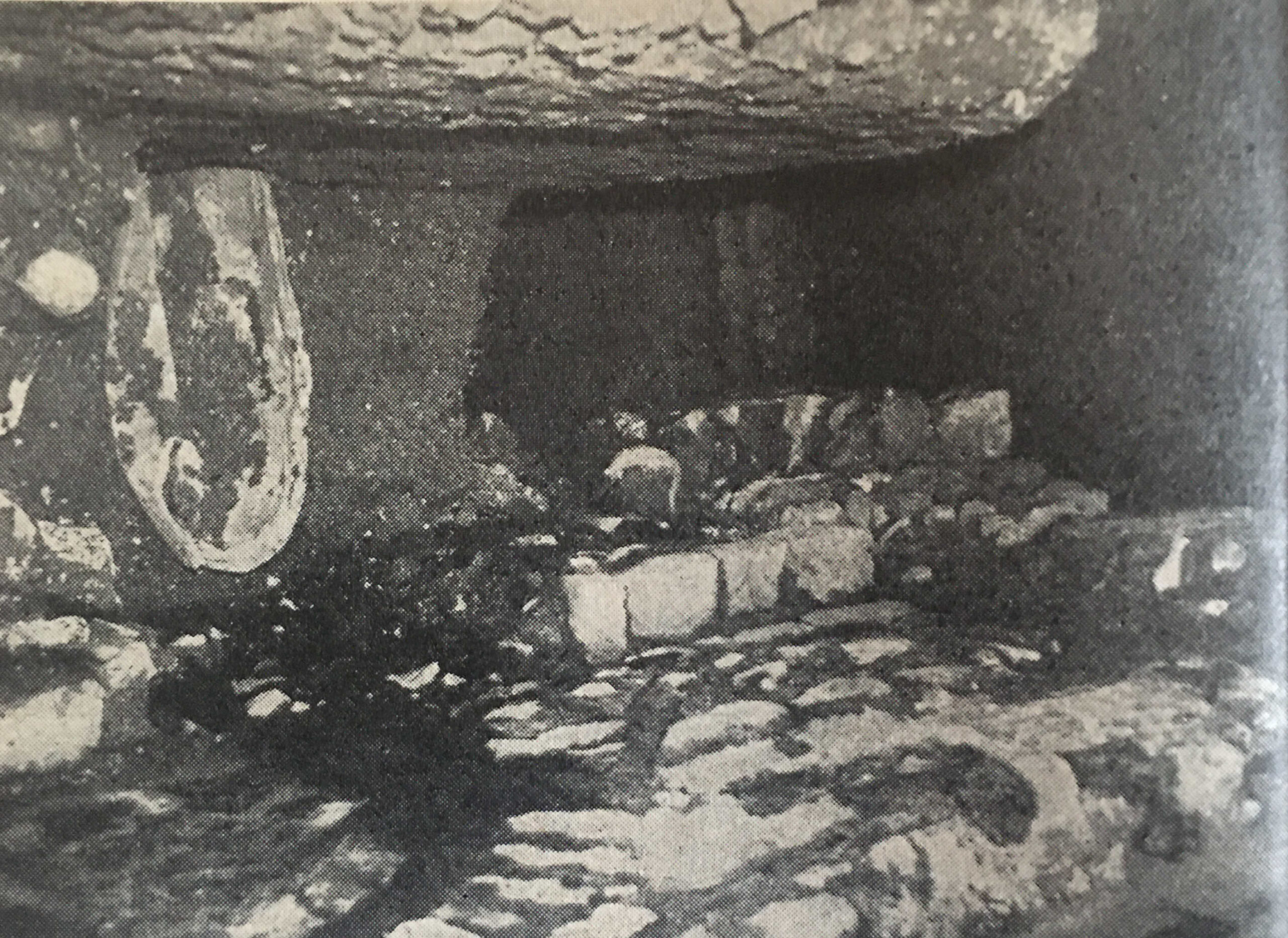
The following photo shows “the excavations at St. Bride’s, Fleet Street, there can be seen in the distance, at right angles to the outside of the east wall, the first trace of the foundation of a Roman building. During excavations inside the church isolated pieces of tessellated pavement were found from time to time”:

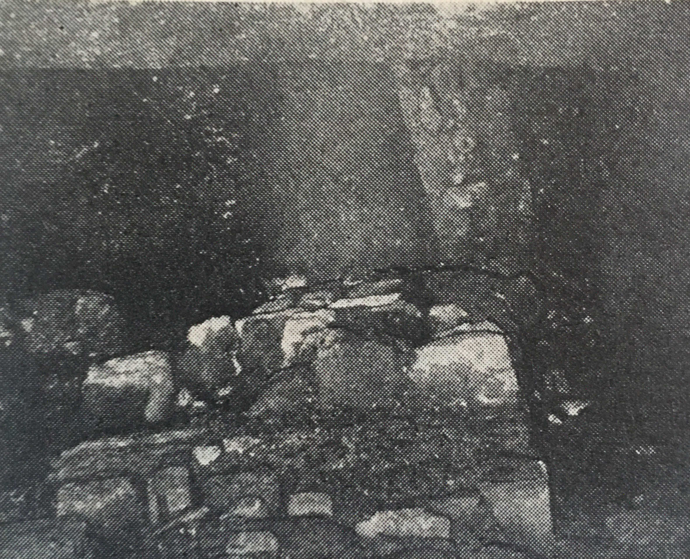
And “the Roman stone foundation which was discovered running underneath the east end of St. Bride’s church”:

Grimes finished his section in the Year Book with “It is gratifying to record the enlightened intention of the Vicar and Churchwardens to undertake the expensive task of preserving these features in their rebuilt church for the benefit of future generations of Londoner’s”.

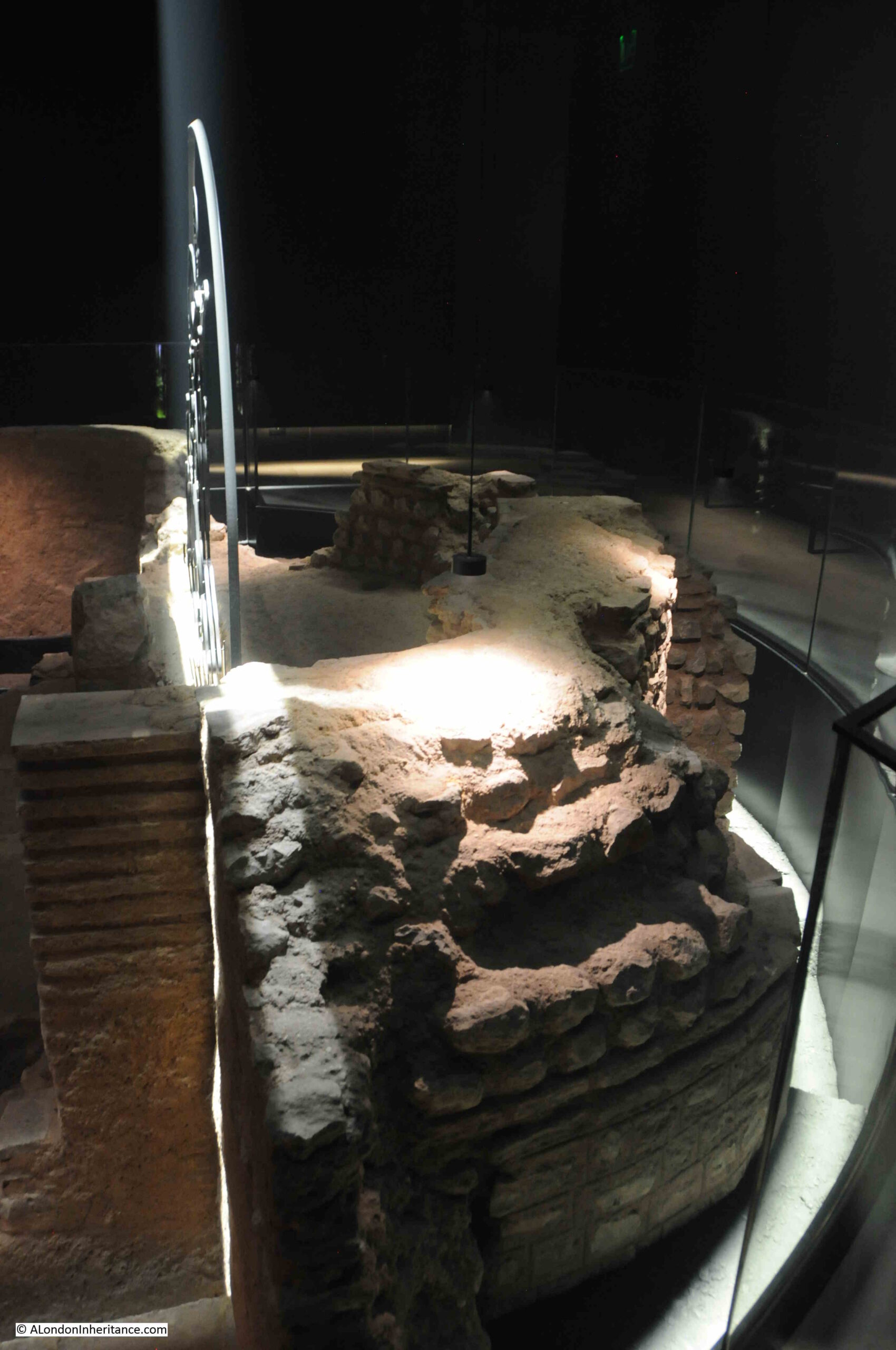
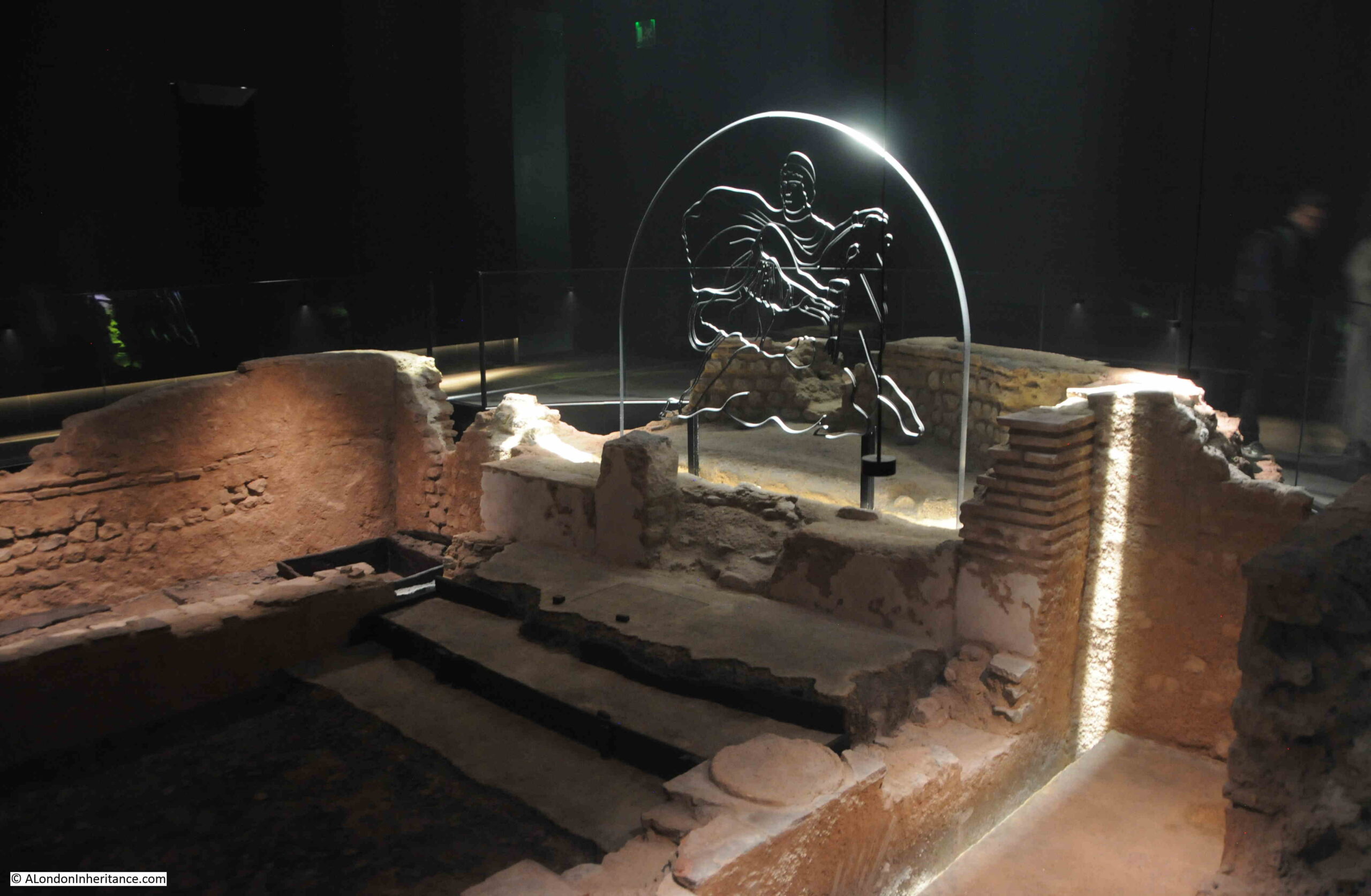
They truly did do a magnificent job with both preserving and displaying these historic features, as I discovered in this post on the church of St. Bride’s.

Another section in the 1954 Year Book looked at the Airports of London.

In the early 1950s, air traffic was gradually increasing, and London was served by seven airports, and the following table shows the 1952 traffic volumes at these airports (at the time, Heathrow had not taken on the name by which it is currently known, and was then called simply London Airport):

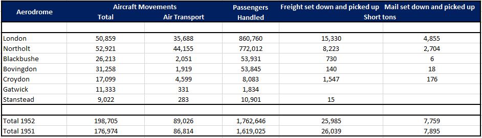
Remarkable when you compare the passengers handled figures that Gatwick and Stansted are now the second and third major airports serving London.

The London Airport / Heathrow was starting to become the major airport that it is today. The Year Book recorded that in the past three years, traffic at the London Airport had more than doubled.

The infrastructure of the airport was also developing with the new access tunnel having been recently completed:

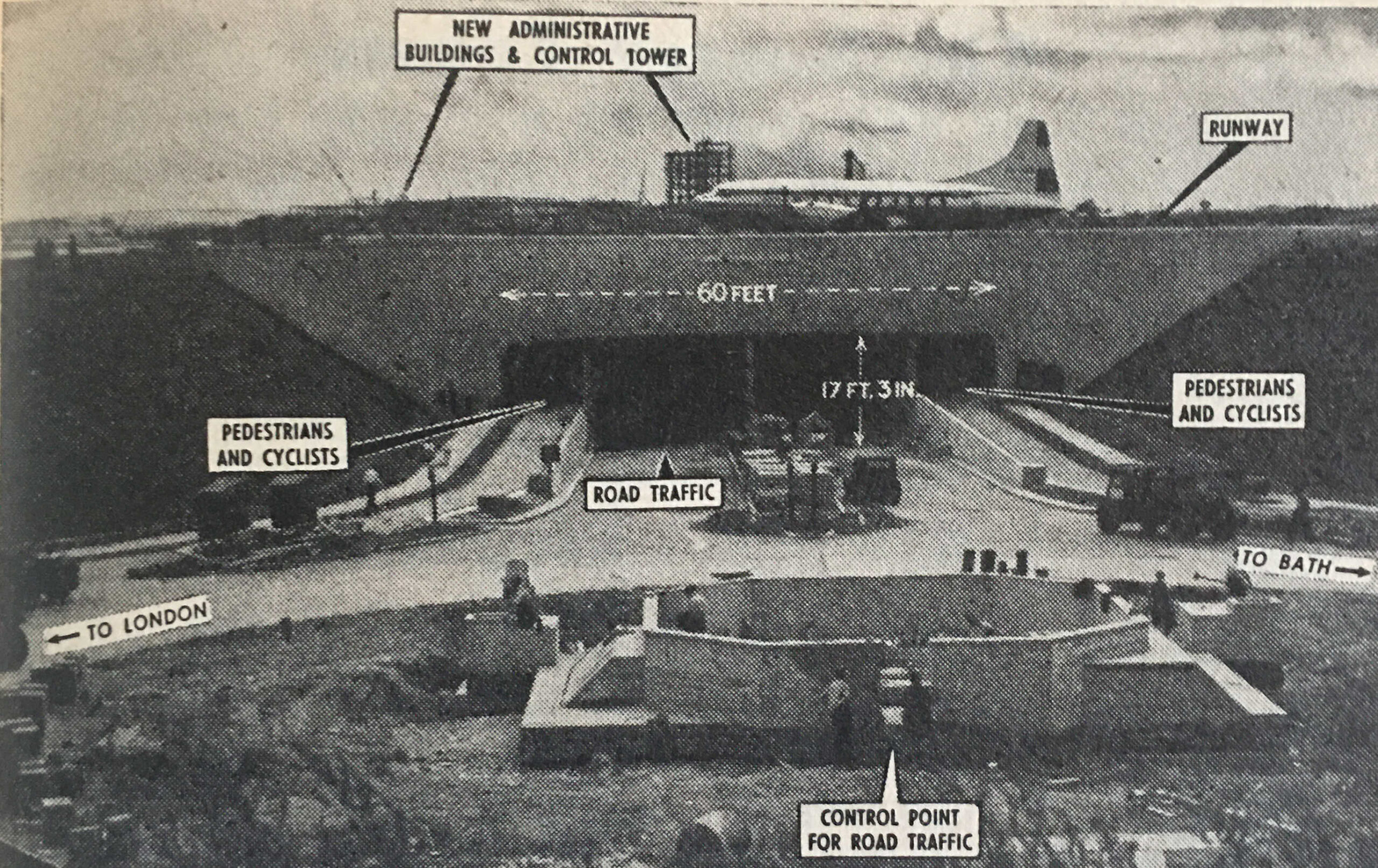
The Year Book reported that the access tunnel was part of a development scheme which was due for completion in 1960 and would cost around £6,700,000 and that by completion of this work, the airport would handle 3,250,000 passengers a year.

That expectation of 3.25 million compares to a pre-pandemic high figure of 80.9 million passengers in 2019.

Whilst the London Airport was developing as a place of international trade and transport, the River Thames was still London’s major route for trade, and the Year Book recorded that the following docks were busy, and administered by the Port of London Authority:

London Docks, St. Katherine Docks, East India Dock, West India Docks, South-West India Dock, Millwall Docks, Royal Victoria Dock, Royal Albert Dock, king George V. Dock, Tilbury Docks, Surrey Commercial Docks.

The Year Book introduced the Port of London, by: “The Port of London comprises 69 miles of the River Thames from the estuary to the landward limit of its tidal waters at Teddington, and five great dock systems which are situated within 26 miles of the tideway between Tilbury, some 24 miles inland from the sea, and Tower Bridge”.

In the early 1950s, the total volume of trade through the London dock system was still higher than pre-war figures, as illustrated by the following figures:

  • 1939: Total Tons – 41,662,063
  • 1952: Total Tons – 49,193,517
  • 1953: Total Tons – 48,284,513

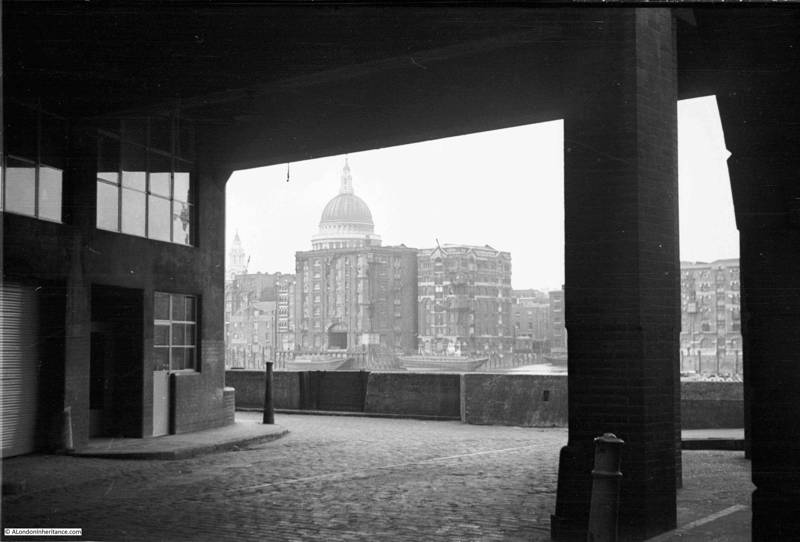
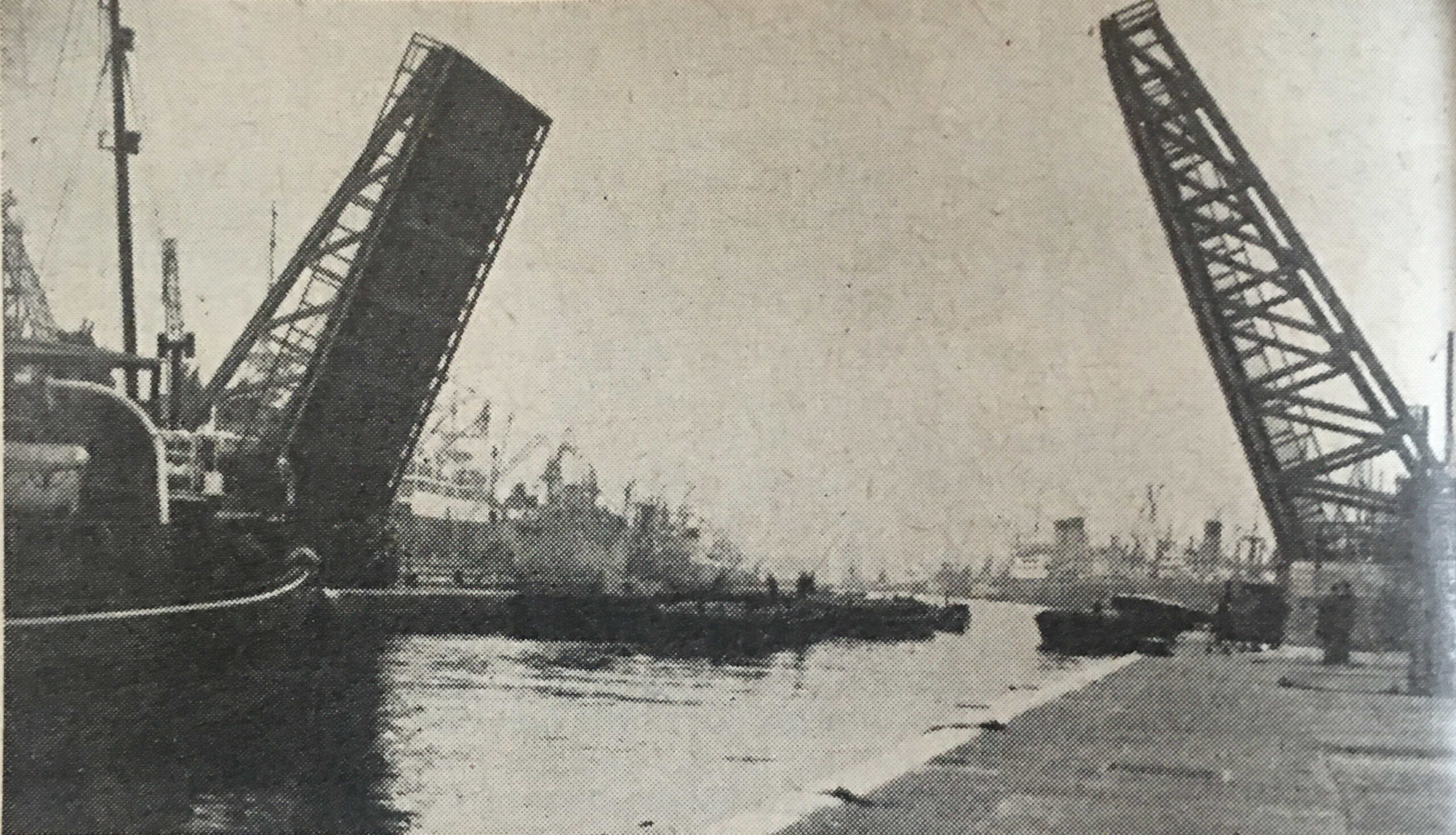
The size and complexity of the London dock system was remarkable. The following photo shows the bascule bridge at the King George V Dock which opens to allow a ship to enter the dock. The view is taken from the entrance lock, showing the dock in the background:

In 1954, the Inland Waterways were still an important part of the transport of goods to and from London, and then to the wider world. A section on the inland waterways shows just how interconnected the system was:

“The Inland Waterways controlled by the Docks and Inland Waterways Executive within the Greater London Area are the former Grand Union Canal and the Lee and Stort Navigation.

These waterways commence amidst London’s dockland and are, therefore, conveniently situated in relation to the Port’s world shipping activities. The principal routes are; London to the Midlands (Grand Union Canal); London to Hertford and Bishop’s Stortford (Rivers Lee and Stort). The route from London to the Midlands has two important junctions with the River Thames, one at Regent’s Canal Dock and the other at Brentford.

Regent’s Canal Dock, situated on the north side of the river at Limehouse, and approached by a sea lock 60ft wide, can accommodate ships of 300ft length. It has a waterway area of about 11 acres and is well equipped for dealing with coal and general merchandise.

From Regent’s Canal Dock goods are shipped by through-water route from London to the interior of Belgium, Holland, France, Switzerland, Canada, America, Scandinavia and the Mediterranean, thus linking England’s waterways with the other great canal systems of the world.”

Although the inland waterways network had been competing with the railways for the best part of a century, in the 1950s it was still carrying a significant amount of trade, with 3,068,000 tones carried in 1952 across the network of the Regent’s Canal, River Lee and the Grand Union Canal.

I doubt whether those working across this network and in the London docks could have foreseen the coming widespread use of the Container as a means of shipping goods, along with the rapid increase in the size of ships that would soon render the London Docks redundant

In the following 30 years after the 1954 Year Book, all the docks, with the exception of Tilbury, would close, resulting in a fundamental change in the relationship between London and the Thames.

The Year Book includes no indication that this would be the future of the docks, rather it gives impressive descriptions of the dock systems and the volume of trade through the Port of London:

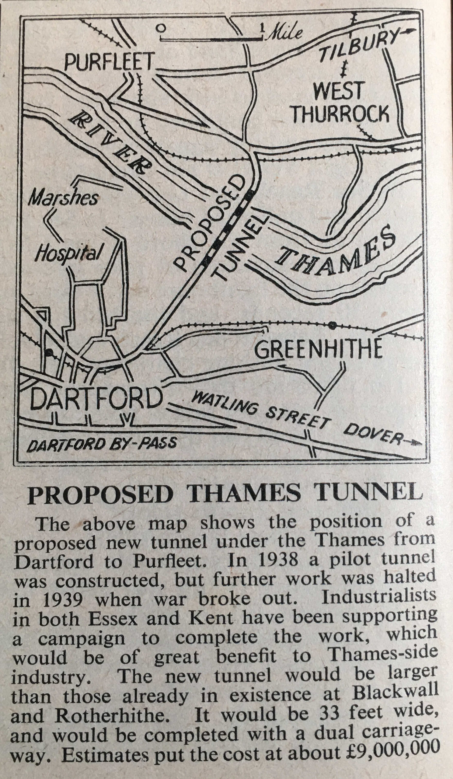
Tucked away in a corner of a page in the section on the Thames, there is a reference to a new infrastructure project that would become part of the most dominant transport method across the country, with the “Proposed Thames Tunnel”, which would become the first tunnel of what is now the twin tunnels and the bridge of the Dartford Crossing:

Although the proposed Thames tunnel would be a future method of crossing the river, other methods were in use, which are still in use today, such as the Woolwich Free Ferry:

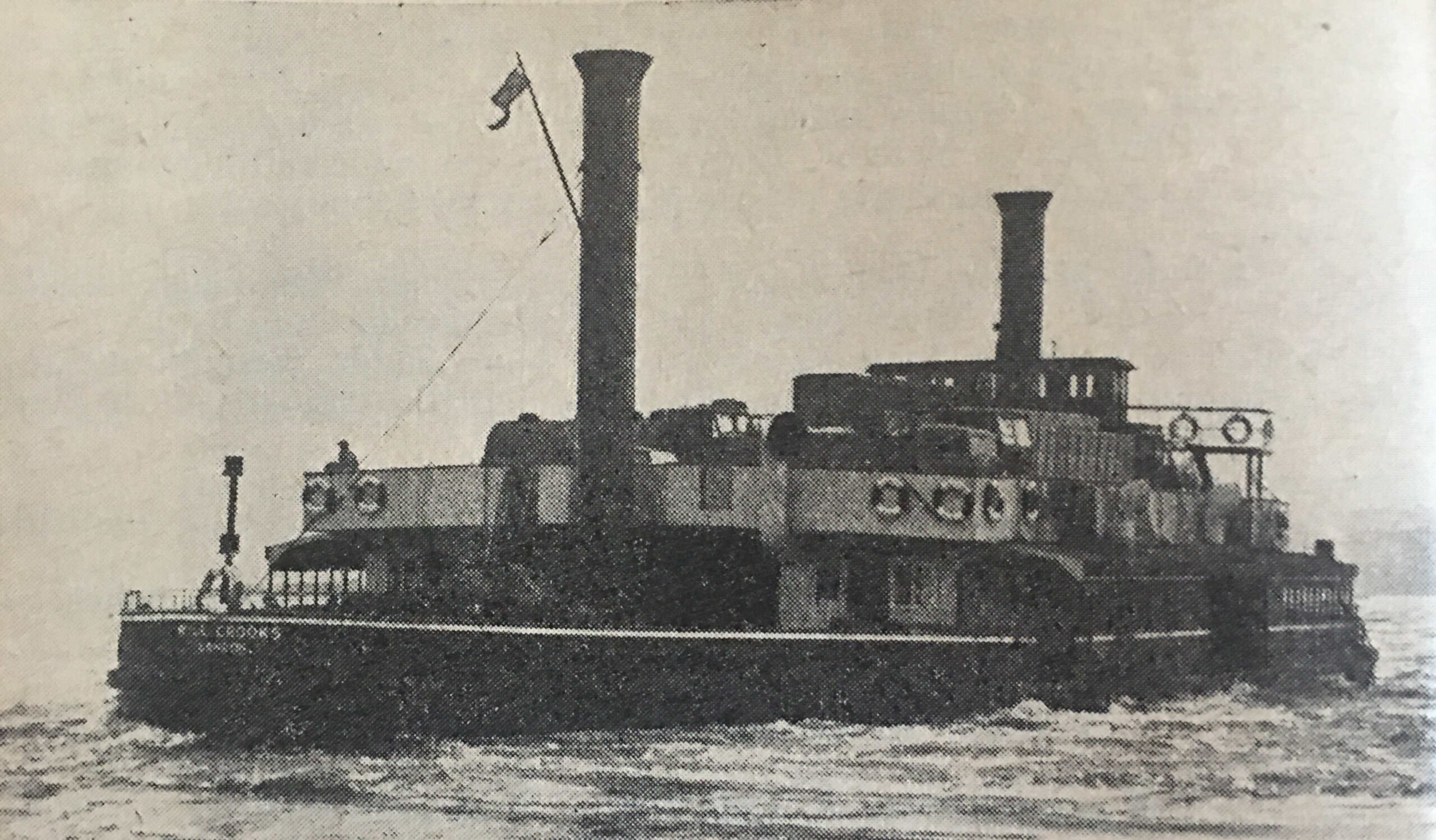
The Woolwich Free Ferry had opened in 1889, and in 1954 was operated by four vessels of the type shown in the above photo, named, John Benn, John Squires, Gordon Crooks and Will Crooks. The vessel shown in the above photo is the Will Crooks.

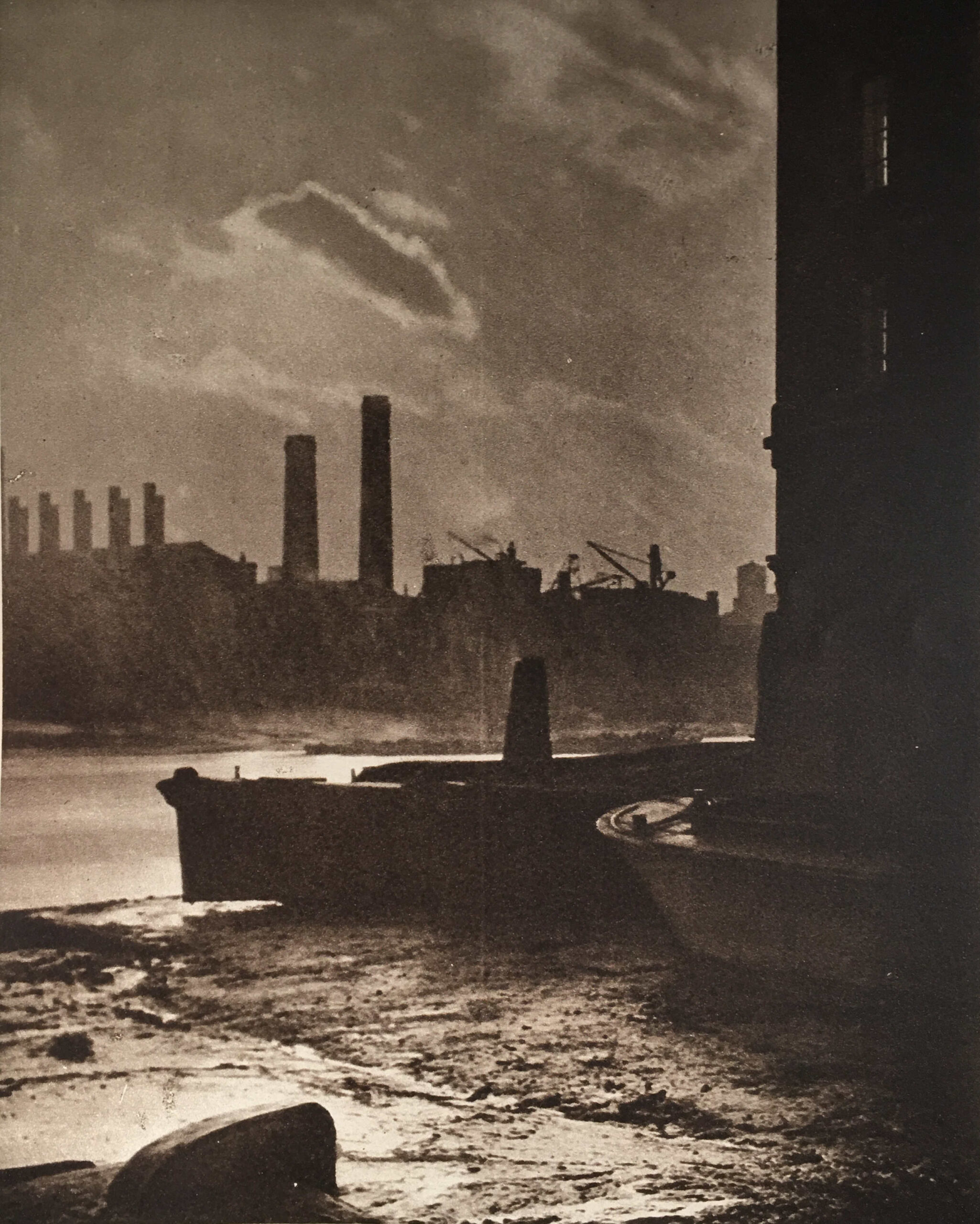
Whilst the Thames supported the majority of London’s trade and industry, it was also a threat to the City, as the 1953 floods had so tragically demonstrated.

Although the 1953 flood was exceptional, London had suffered many minor flooding events, and newspapers hold very many records of these over the previous couple of hundred years.

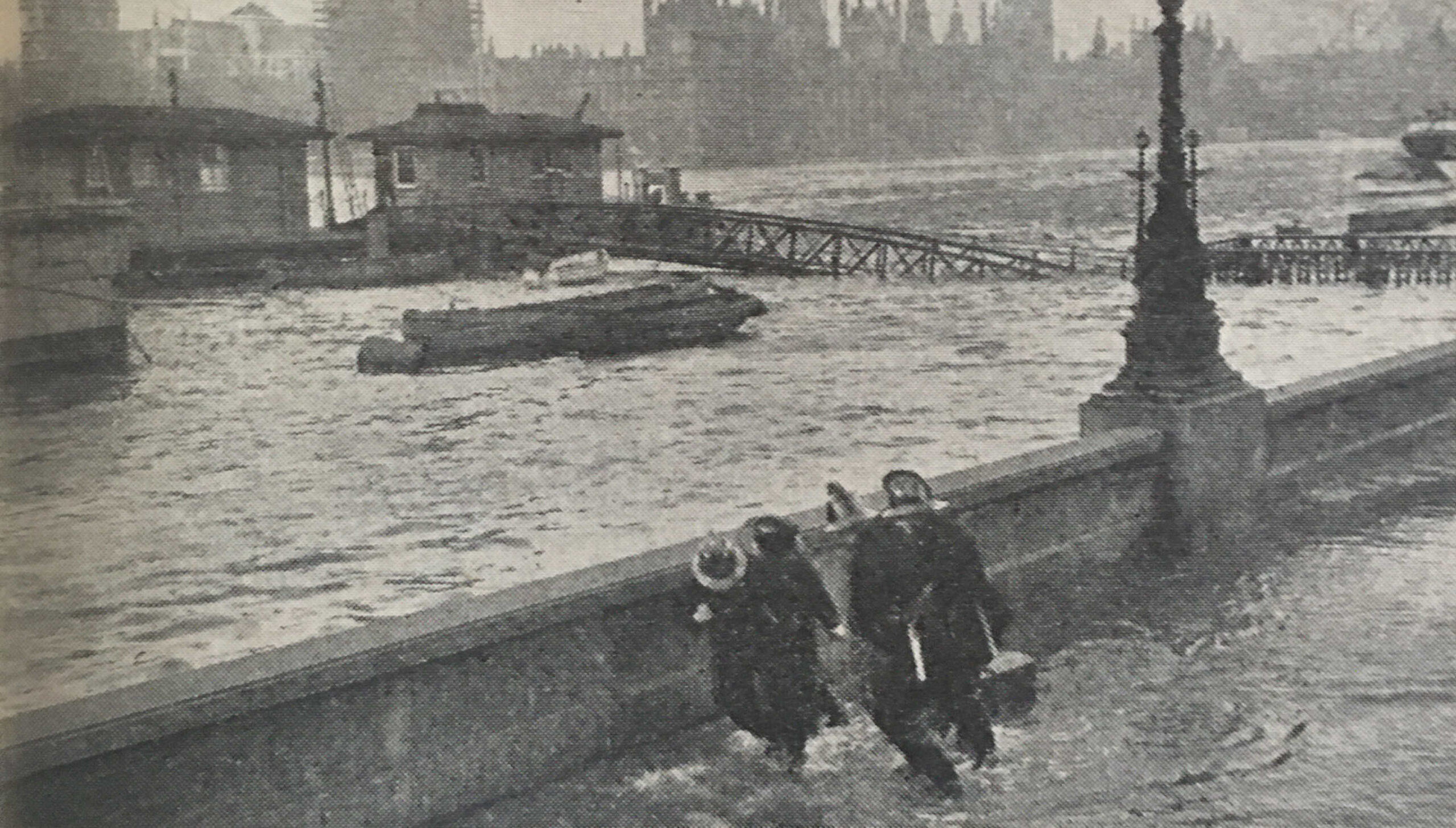
Water would often break the embankment defences, as shown in the following photo, with the caption: “Firemen dragging kerb-stones to buttress the Embankment wall as water comes up at Lambeth Bridge during a Thames flood”:

The 1953 flood, along with the many minor floods, would lead to the construction of the Thames Barrier with the Thames Barrier and Flood Protection Act 1972 enabling the construction of the barrier which became operational in 1982.

Between the sections on the Thames, and a brief section on new arrivals at London Zoo, the Year Book included a London Diary, detailing the dates of major events in the city during 1954:

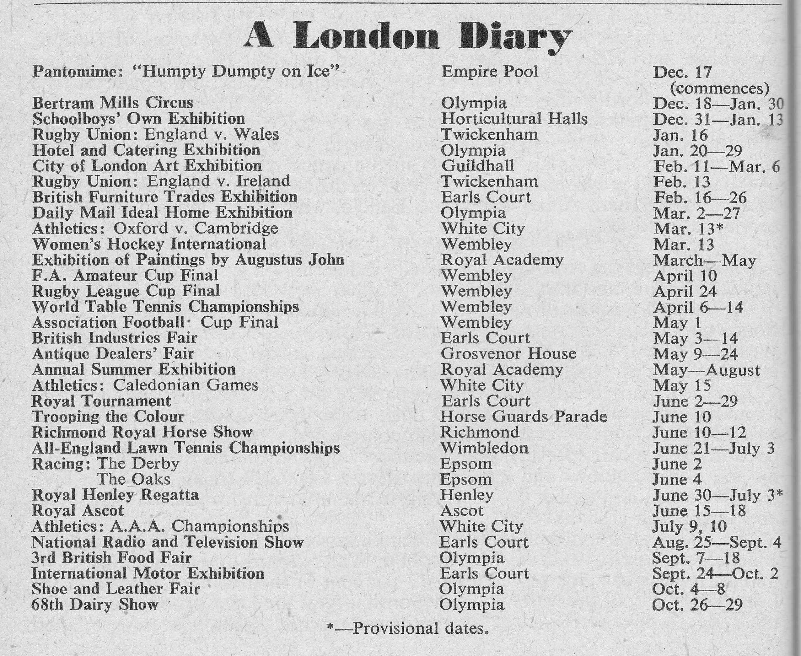
There may not have been too much interest in the 1954 Association Football Cup Final (now known as the FA Cup), as there were no London clubs involved. In the 1954 final, West Bromwich Albion beat Preston North End 3-2.

The Year Book includes a table titled “The Londoner At Work”, which includes a list of the types of work and professions, along with an estimate of the numbers employed in each:

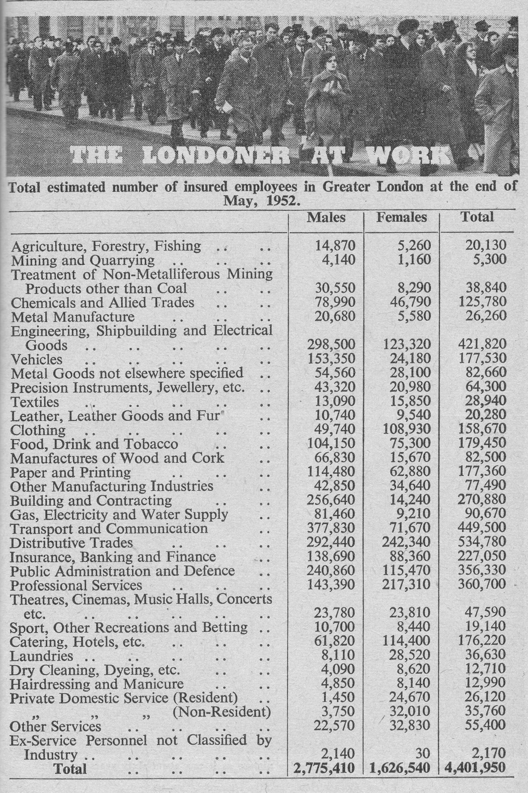
Again, the table shows how London has changed in the last 70 years, with the types of job, and the numbers employed, very different today. At the time of the Year Book, the third highest number of employees, worked in Engineering, Shipbuilding and Electrical Goods. I do not know the equivalent number today, but it must be a very small number when compared to 1954.

Then and Now photos have always been popular, and the 1954 Year Book included a number, showing how London has changed over the years.

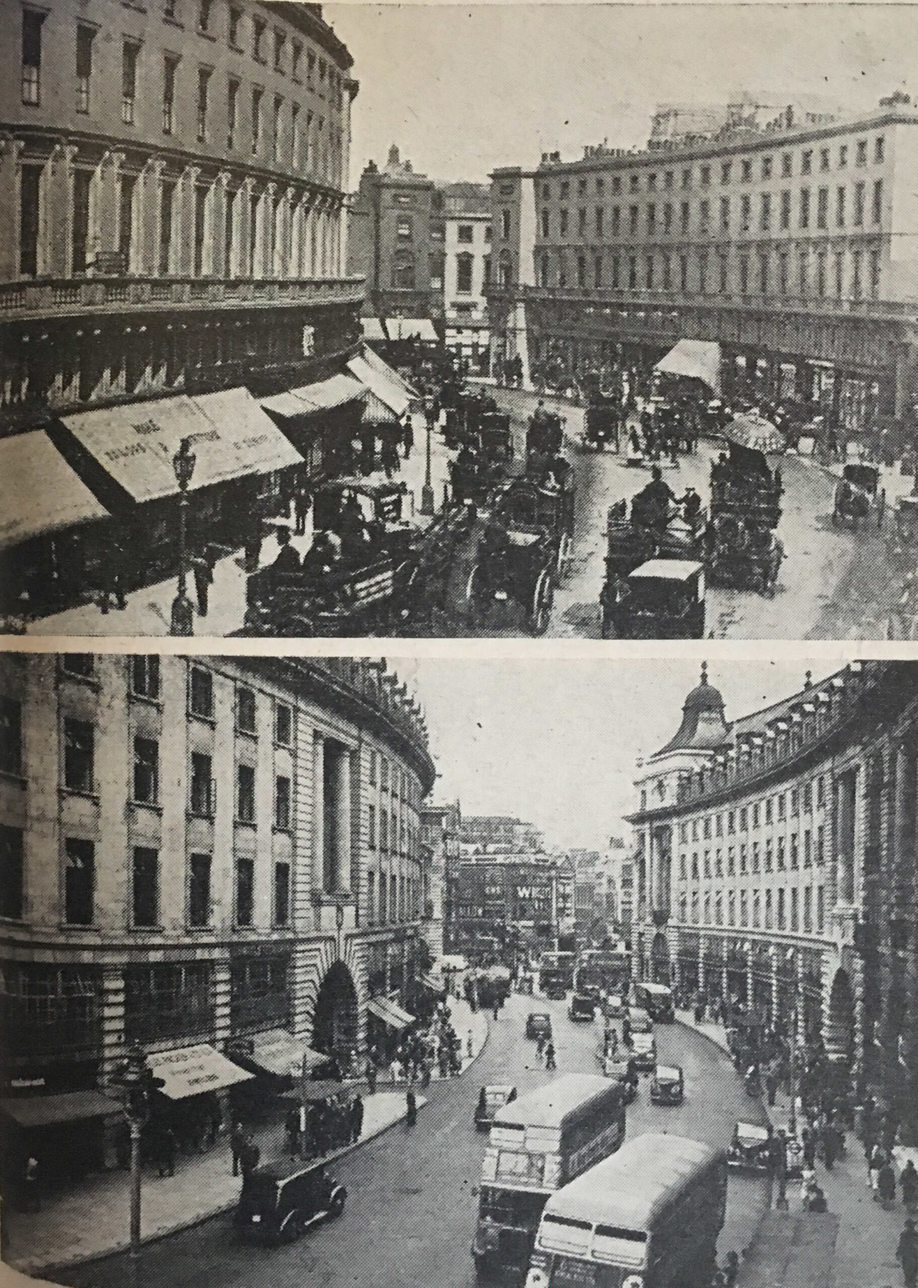
The first is of Regent Street, where the caption to these two photos reads “Apart from the traffic, Regent Street has apparently changed but little – but look again. The buildings are different, and the street at the end seen in the upper picture taken in the 1890s is now gone”:

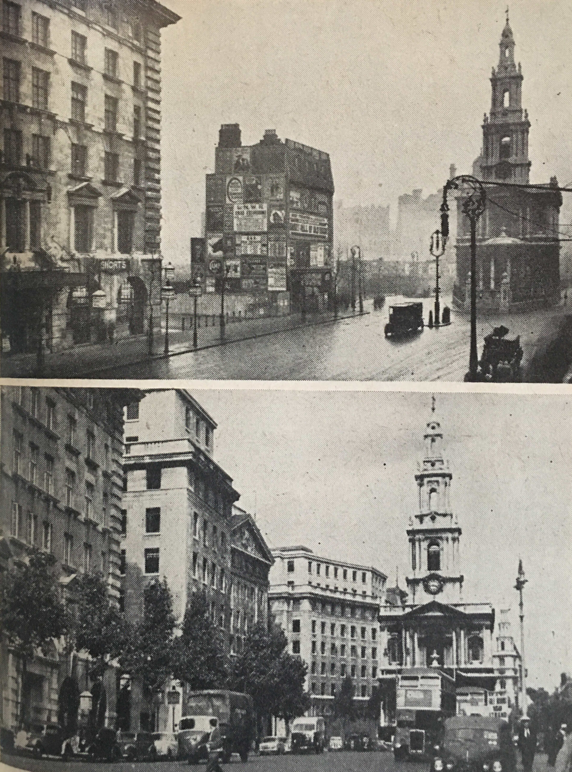
Followed by “The top picture shows the Strand, only 43 years ago. Bush House was not yet built, but a space has been cleared. Posters on the island site inform us that ‘Sweet Nell of Old Drury’ would be running at the New Theatre. Today, only the building on the left, and St. Mary’s church remain”:

And finally “Selling off, premises coming down, says the notice on the shop in Camberwell in 1889. And down came the building, to make way for a theatre. Here, at the Triangle, Camberwell, was built the Empire Theatre in 1894. Today, that too has gone, and a modern cinema takes its place”:

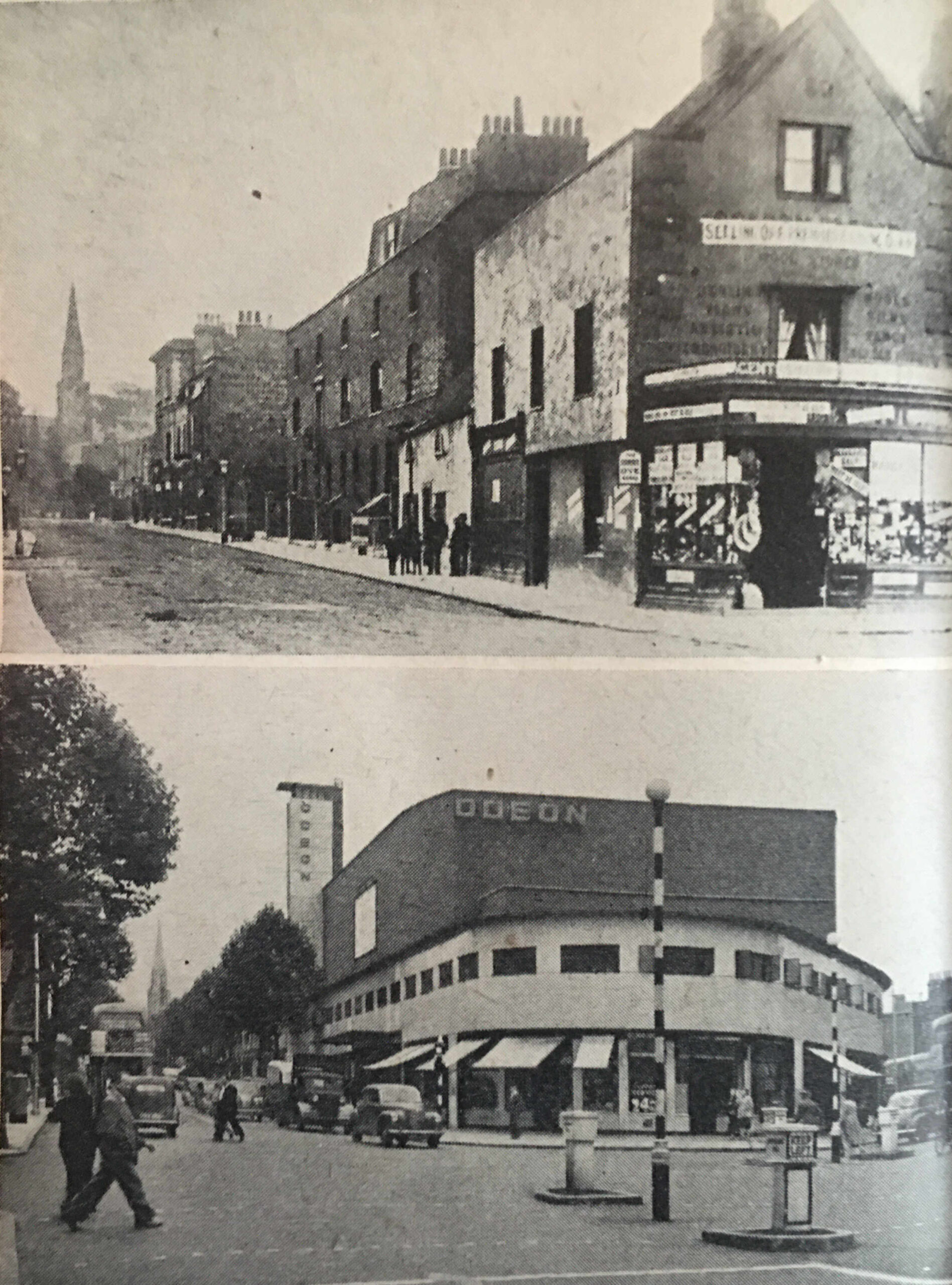
The Odeon Cinema shown in the above photo was opened in 1939, however it closed as a cinema in 1975, with periods of temporary alternative use, along with being empty, until it was finally demolished in 1993. The site is now occupied by a Nando’s and flats. London keeps changing.

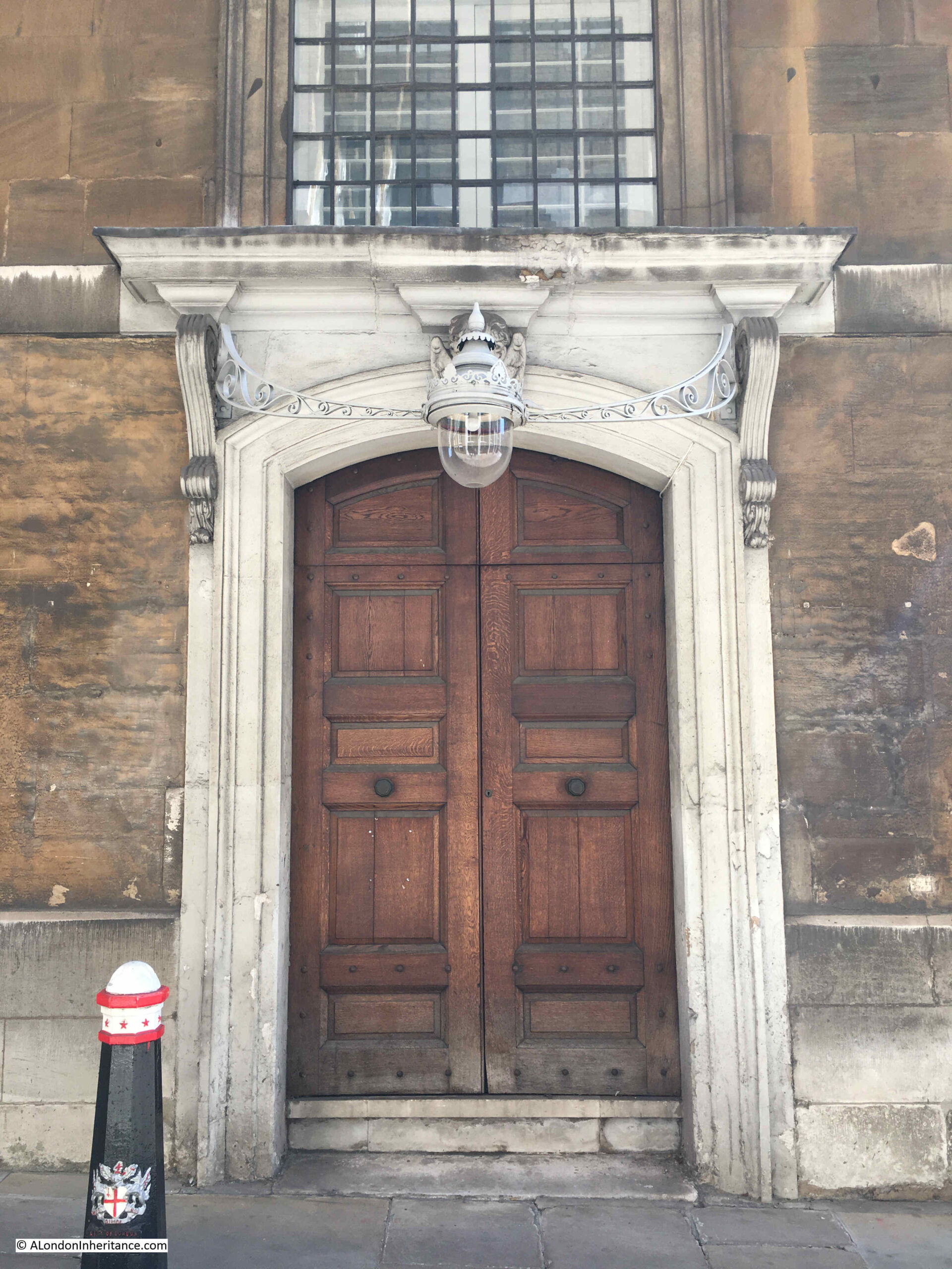
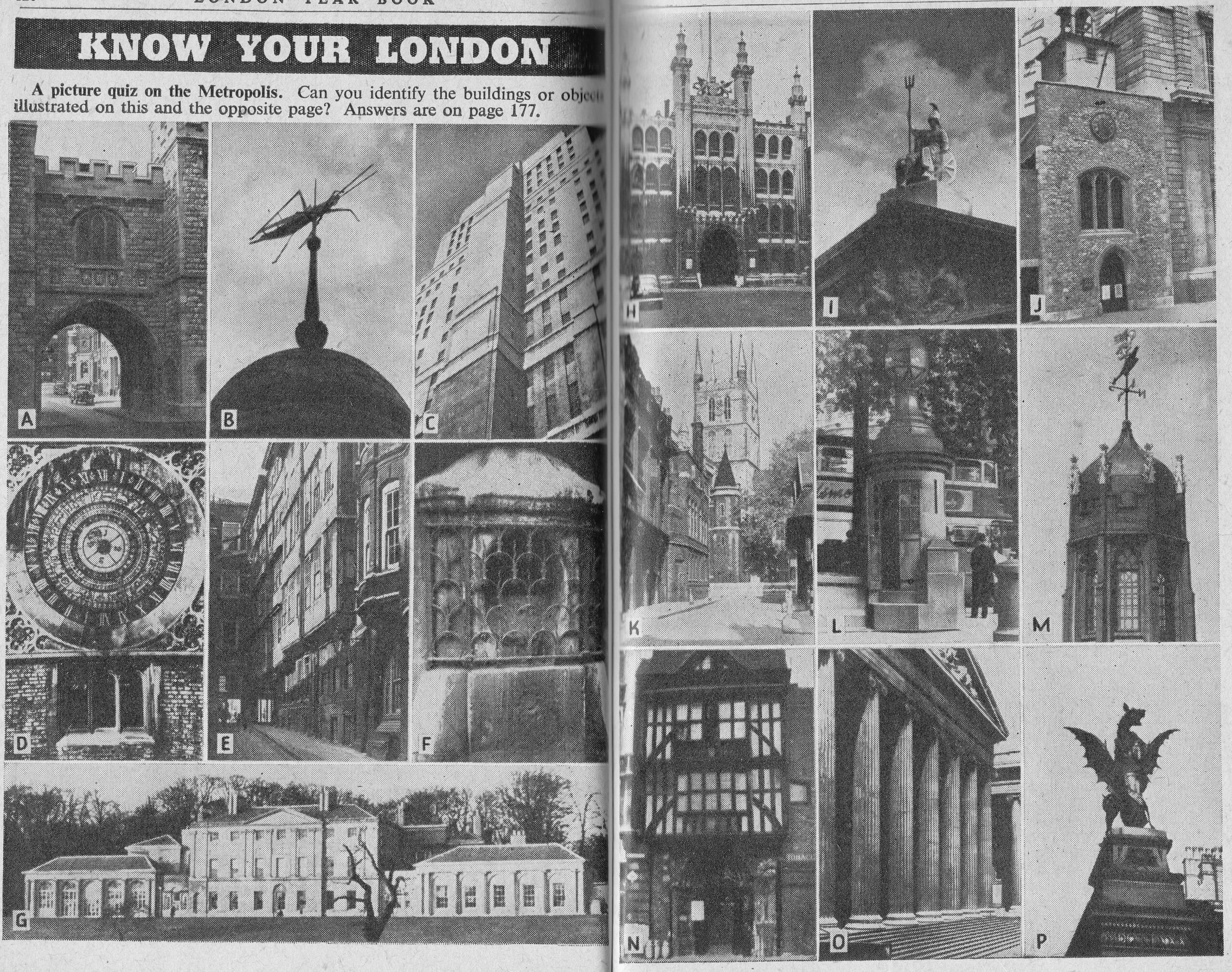
The Year Book included a “Know Your London” section, with a picture quiz of buildings and objects from across the city. Answers will be at the end of the post.

Although the Year Book contains a very large amount of data about London, some of it is partial and does not show a complete picture.

The Year Book includes the following table about passenger numbers at the main London railway termini. The numbers are of Originating Passengers, passengers who began their journey at the station, so does not show the overall number of passengers.

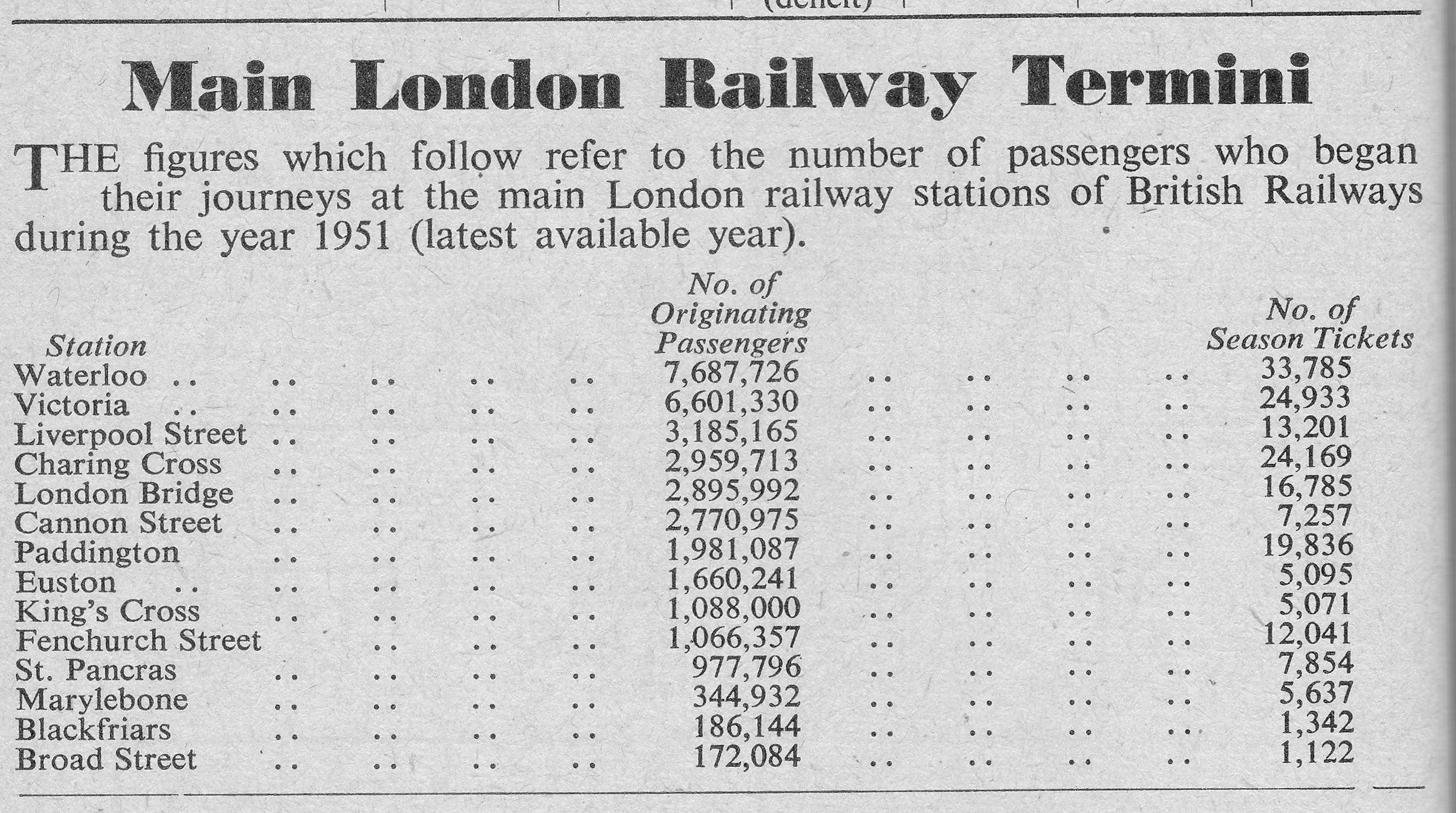
Presumably, to get an estimate of the total number of passengers I could double the figures in the table, as those who depart from the station may well return, and this would certainly apply to the large number of commuters, which I assume is what the Season Tickets figure covers.

Despite the gaps in the above figures, it does show that Waterloo was the busiest station by originating passengers in 1951, a position it would hold in overall passenger numbers for the following decades.

Any guide to London would need to include a map of the Underground network, and the 1954 Year Book included such a map:

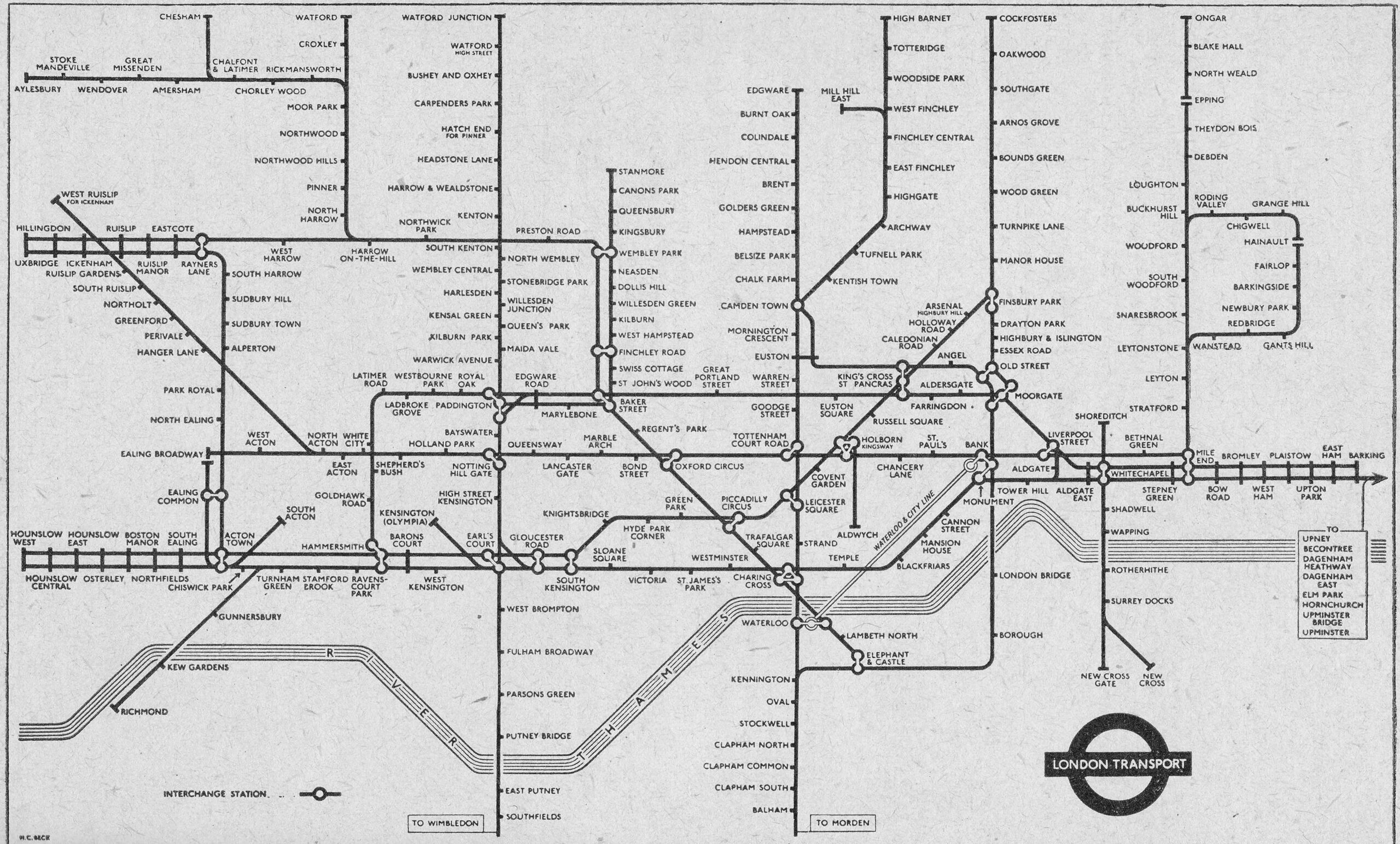
The Victoria and Jubilee lines had yet to be built, and the Embankment Station is shown as Charing Cross, with Charing Cross Station shown as Trafalgar Square.

The Year Book has a vast amount of individual facts and figures, and it is interesting to compare with the same figures of today, however where comparisons are made, I have not had time to confirm the method of measurement is the same, but these figures do give an indication of change and of overall numbers, for example:

  • London had a total of 80,683 hospital beds (compared to 20,746 today)
  • The London Fire Brigade attended to 20,328 calls (I cannot find equivalent data, but in 2022 the LFB responded to 125,392 incidents, comprising 19,298 fires, 46,479 special services and 59,415 false alarms)
  • The London Electricity Board was still changing over customer supplies from legacy DC and non-standard AC supplies to get all consumers on to the standard 230volt supply we use today
  • In 1952, 8,307,345 telegrams had been sent
  • There were 1,845,078 telephones in London
  • 15,209 telephonists connected calls where automatic calls could not be made
  • In 1952, 2,684,248,580 letters and packets had been posted, of which 99,294,832 had been sent at Christmas
  • The City of London Police had 633 officers at the end of 1952, compared to 1,007 today
  • The Metropolitan Police had 16,399 officers at the end of 1952, whilst today there are 34,184 officers (excluding community support and special officers)
  • There were 121,411 registered aliens across London in 1952, the largest population coming from Germany which numbered 10,721
  • There were 1,121 missing persons reported in 1952 with 35 cases outstanding at the end of the year
  • During 1952, 15,684 stray dogs came into the hands of the Police and were sent to Dog’s Homes
  • 570 people had been killed on London’s roads in 1952
  • There were 4,020 taxi-drivers licensed by the Metropolitan Police
  • The daily average of water supplied to consumers across London was 325,090,000 gallons, and the average consumption per head was 49.44 gallons, compared to 144.4 litres (31.76 gallons) per head in 2021/22 (I assume the higher number in the early 1950s was down to the amount of industry in London, which the city does not have today)

As with the 1953 edition, the London Year Book for 1954 is a fascinating snapshot of the city.

As far as I know, these books were only published for 1953 and 1954. I would love to be wrong, and find other editions.

Much equivalent information is made available online today, however whilst today there is the ability to provide much more detailed and granular levels of data, frequently a headline figure is obscured by the amount of detail available.

Information is also often scattered across various organisations as responsibilities for services has been devolved across both the public and private sectors.

A annual Year Book would be a brilliant summary of the state of London.

And with that review of 1954, can I wish you a very happy 2024, and close with the answers to the picture quiz from seventy years ago:

  • A. St. John’s Gate, Clerkenwell
  • B. Grasshopper on top of the Royal Exchange
  • C. Senate House, London University
  • D. Calendar Clock, Hampton Court
  • E. Middle Temple Lane, leading up to Fleet Street
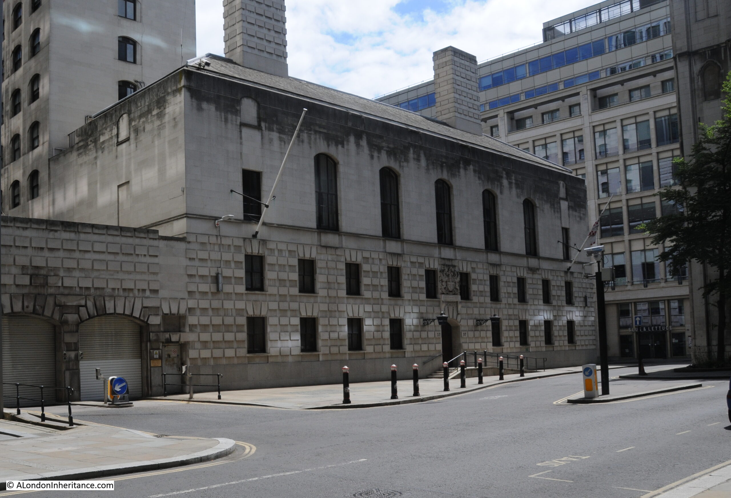
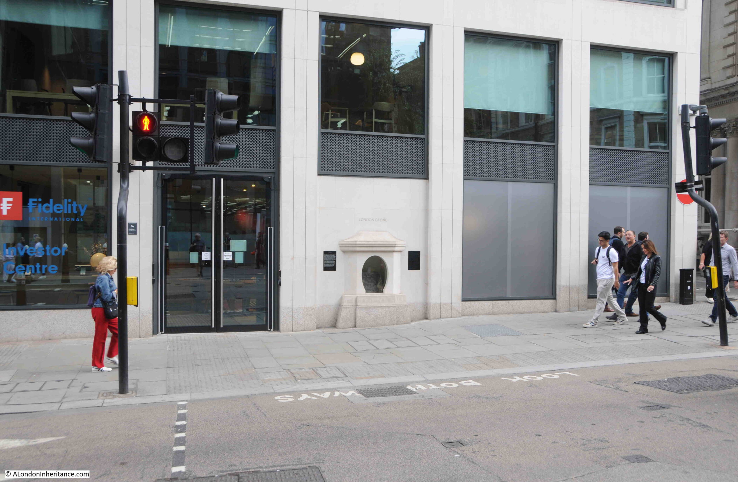
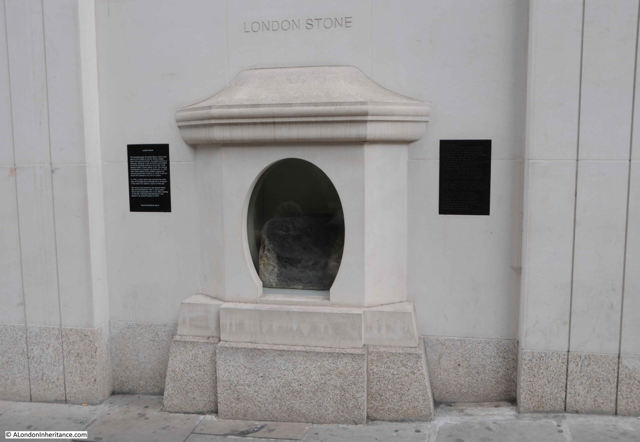
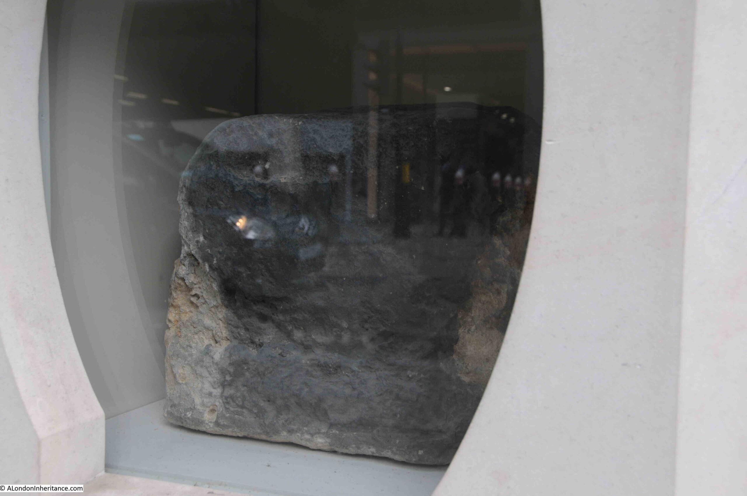
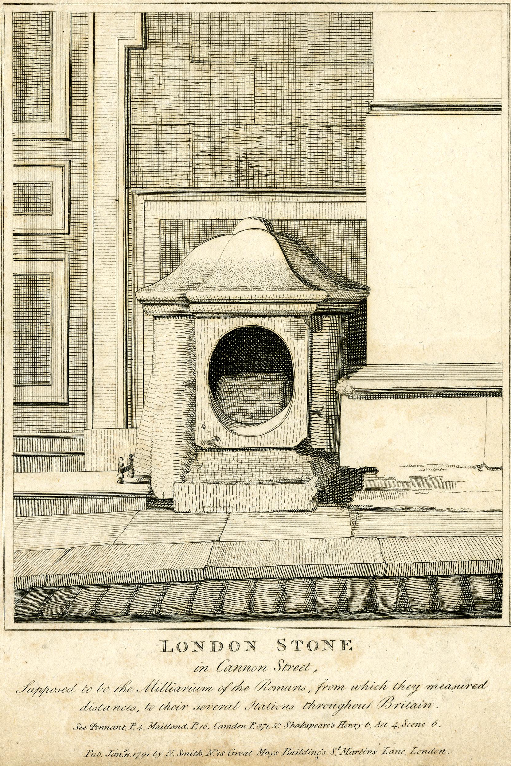
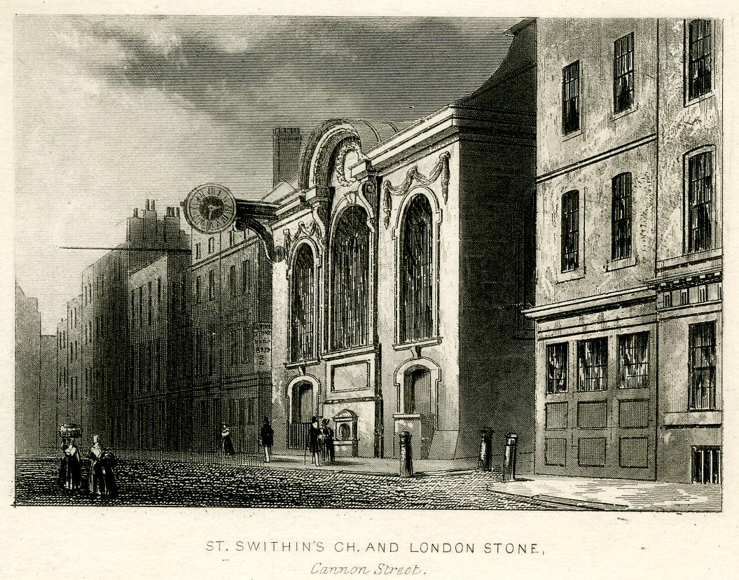
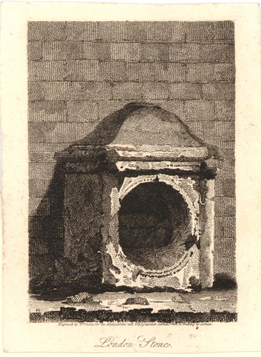
  • F. London Stone, in the wall of St. Swithin’s church opposite Cannon Street Station
  • G. Kenwood House
  • H. Guldhall, City of London
  • I. Figure of Britannia on top of Somerset House
  • J. St. Ethelburga’s Church, Bishopsgate
  • K. Southwark Cathedral
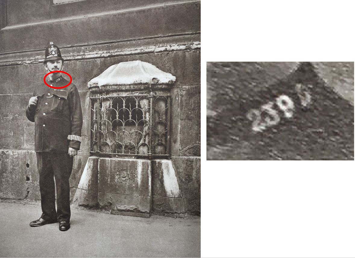
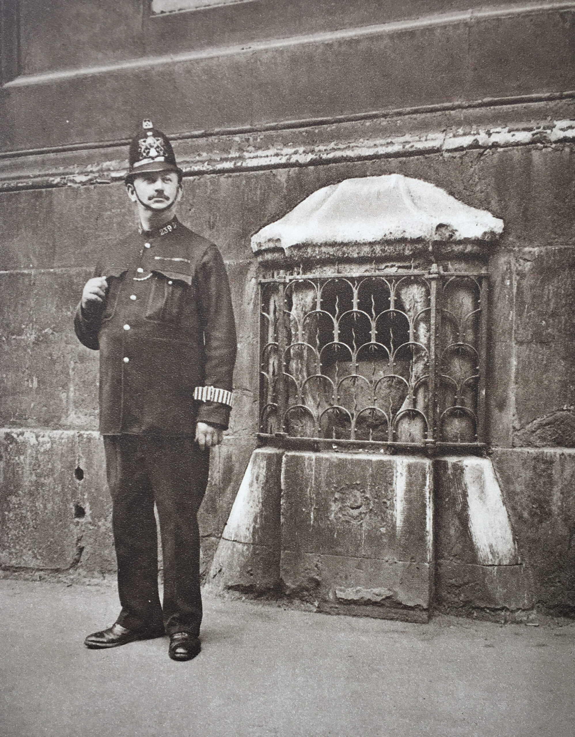
  • L. One-man police station in Trafalgar Square. the lamp is from H.M.S. Victory
  • M. The tower of Middle Temple Hall, surmounted by the Agnus Dei of the Temple

Regarding the one-man police station in Trafalgar Square and the lamp coming from H.M.S. Victory, I have never found any firm evidence for this, so whilst it may be true, it may also be one of those myths that gets retold about the city.

alondoninheritance.com

The Vulgar Tongue and Provincial Words

An extra post this weekend, following up on the post a couple of weeks ago on Captain Francis Grose’s Dictionary of the Vulgar Tongue which was first published in 1785; a fascinating little book that really bring to life the language that would have been heard on the streets of London in the 18th century.

This week I am covering words starting with the letters N to Z, and as with the first post covering A to M, there is the same focus on crime and punishment, and the challenges of everyday life.

There are words and phrases that are still in use today, many others have been redundant for a very long time.

There are also early examples of how we communicate today, with “gentlemen’s visiting cards” showing an early use of the type of text abbreviation used today with text and Whatsapp messaging (see P.P.C and D.I.O).

It was not just the vulgar tongue of London that Grose collected, he also published “A Glossary of Provincial and Local Words used in England” – a collection of words used across the country and show a very different focus than the vulgar tongue with an emphasis on agriculture, the weather and rural life, my favourite being AQUABOB which I will be using should we get any really cold weather this winter.

So, starting with the letter N from Dictionary of the Vulgar Tongue, we find some people that you would not want to meet on the streets of London:

NATTY LADS – Young thieves or pickpockets.

NAVY OFFICE – The Fleet prison. Commander of the Fleet; the warden of the Fleet prison.

Confined in the Fleet Prison, from “A Rake’s Progress” by Hogarth © The Trustees of the British Museum):

NECK STAMPER – The boy who collects the pots belonging to an alehouse, sent out with beer to private houses.

NEW DROP – The scaffold used at Newgate for hanging criminals; which dropping down, leaves them suspended. By this improvement, the use of that vulgar vehicle, a cart, is entirely left off.

NICKNACKS – Toys, baubles or curiosities.

NIGHTMAN – One whose business is to empty the necessary houses in London, which is always done in the night.

NYP SHOP – The Peacock in Gray’s Inn Lane, where Burton ale is sold in nyps.

NIPPER – A cut-purse; so called by one Wotton who in the year 1585 kept an academy for the education and perfection of pickpockets and cut-purses; his second school was near Billingsgate, London. As in the dress of ancient times many people wore their purses at their girdles, cutting them was a branch of the light fingered art, which is now lost, though the name remains.

OAR – To put in one’s oar; to intermeddle, or give an opinion unasked; as, to be sure, you must put in your oar.

OLD HAND – Knowing or expert in any business.

OLD HARRY – A composition used by the vintners to adulterate their wines, also the nick name for the devil.

OLD NICK – The Devil.

ORGAN – A pipe. Will you cock your organ? will you smoke your pipe?

OTTOMISED – To be ottomised; to be dissected. You’ll be scragged, ottomised, and grin in a glass case; you’ll be hanged, anatomised, and your skeleton kept in a glass case at Surgeons Hall.

OVERSEER – A man standing in the pillory, is, from his elevated situation, said to be made an overseer.

OWL – To catch the; a trick practiced upon ignorant country boobies, who are decoyed into a barn under pretence of catching an owl, where, after divers preliminaries, the joke ends in their having a pail of water poured upon their heads.

OWL IN AN IVY BUSH – He looks like an owl in an ivy bush; frequently said of a person with a large frizzled wig, or a woman whose hair is dressed a-la-blowse.

OWLERS – Those who smuggle wool over to France.

P.P.C. – An inscription on the visiting cards of our modern fine gentleman, signifying that they have called pour prendre conge, i.e. ‘to take leave’. This has of late been ridiculed by cards inscribed D.I.O. i.e.’ Damme, I’m off’.

PADDINGTON FAIR DAY – An execution day, Tyburn being in the parish of Paddington. To dance the Paddington frisk; to be hanged.

PALL – A companion. One who generally accompanies another, or who commit robberies together.

PANNIER MAN – A servant belonging to the Temple and Gray’s Inn, whose office is to announce dinner. This in the Temple is done by blowing a horn, and in Gray’s Inn proclaiming the word Manger, Manger, Manger, in each of the three courts.

PARSON – A guide post, hand or finger post by the road for directing travelers: compared to a parson, because like him, it sets people in the right way.

I discovered the Guide Post shown in the photo below, which dates from 1686 and includes a pointing hand at Wroxton, from my post On The Road To Stratford-Upon-Avon

PECKISH – Hungry

PETER GUNNERE – will kill all the birds that died last summer. A piece of wit commonly thrown out at a person walking through a street or village near London, with a gun in his hand.

PETTICOAT HOLD – One who has an estate during his wife’s life, called the apron-string hold.

PETTICOAT PENSIONER – One kept by a woman for secret services.

PIGEONS – Sharpers, who, during the drawing of the lottery, wait ready mounted near Guildhall, and, as soon as the first two or three numbers are drawn, which they receive from a confederate on a card, ride with them full speed to some distant insurance office, where there is another of the gang, commonly a decent looking woman, who takes care to be at the office before the hour of drawing; to her he secretly gives the numbers, which she insures for a considerable sum.

PIMP – A male procurer, or cock bawd; also a small fagot used about London for lighting fires, named from introducing the fire to the coals.

The following print from 1771 is a satire on gullible youths and dishonest prostitutes. The women on the left is picking the man’s pockets, and behind the curtain is the pimp. To emphasize the story being told, the picture on the wall behind the three at the table is of a sheep being fleeced © The Trustees of the British Museum).

PISS POT HALL – near Hackney, built by a potter chiefly out of the profits of chamber pots.

PISS-PROUD – Having a false erection. That old fellow thought he had an erection, but his _______ was only piss-proud; said of any old fellow who marries a young wife.

PITT’S PICTURE – A window stopt up on the inside, to save the tax imposed in that gentleman’s administration.

PURL – Ale in which wormwood has been infused, or ale and bitters drunk warm.

QUEEN STREET – A man governed by his wife, is said to live in Queen Street, or at the sign of the Queen’s Head.

QUEER BIRDS – Rogues relieved from prison, and returned to their old trade.

QUEER PLUNGERS – Cheats who throw themselves into the water, in order that they may be taken up by their accomplices, who carry them to one of the houses appointed by the Humane Society for the recovery of drowned persons; and the supposed drowned persons, pretending he was driven to that great extremity by great necessity, is also frequently sent away with a contribution in his pocket.

QUICK AND NIMBLE – More like a bear than a squirrel. Jeeringly said to any one moving sluggishly on a business errand that requires dispatch.

RABBIT CATCHER – A midwife.

RAINY DAY – To lay up something for a rainy day; to provide against a time of necessity of distress.

RANTALLION – One whose scrotum is so relaxed as to be longer than his penis, i.e. whose shot pouch is longer than the barrel of his piece.

RAREE SHEW MEN – Poor Savoyards, who subsist by showing the magic lantern and marmots about London.

RIDING ST. GEORGE – The woman uppermost in the amorous congress, that is, the dragon upon St. George. This is said the way to get a bishop.

RIGMAROLE – Roundabout, nonsensical. He told a long rigmarole story.

RING – Money procured by begging; beggars so called it from its ringing when thrown to them. Also a circle formed for boxers, wrestlers, and cudgel-players, by a man styled Vinegar; who, with his hat before his eyes, goes round the circle, striking at random with his whip to prevent the populace from crowding in.

ROMEVILLE – London

ROUGH – To lie rough; to lie all night in one’s clothes; called also roughing it. Likewise to sleep on the bare deck of a ship, when the person is commonly advised to choose the softest plank.

ROUND ABOUT – An instrument used in house-breaking. This instrument has not been long in use. It will cut a round piece about five inches in diameter out of a shutter or door.

RUFFLERS – The first rank of criminals; also notorious rogues pretending to be maimed soldiers or sailors.

RUNNING STATIONERS – Hawker of newspapers, trials and dying speeches.

RUSSIAN COFFEE HOUSE – The Brown Bear in Bow-street, Covent Garden, a house of call for thief-takers and runners of the Bow street justices.

SANDWICH – Ham, dried tongue, or some other salted meat cut thin and put between two slices of bread and butter; said to be a favourite morsel with the Earl of Sandwich.

SCAMP – A highwayman. Royal Scamp; a highwayman who robs civilly. Royal foot scamp; a footpad who behaves in like manner.

A Scamp in action © The Trustees of the British Museum):

1894 06 11 79 Maclain the Highwayman robbing Lord Eglington Anon P&D

SCOURERS – Riotous bucks, who amuse themselves with breaking windows, beating the watch, and assaulting every person they meet; called scouring the streets.

SHARK – A sharper; perhaps from his preying upon anyone he can lay hold of. Also a custom-house officer, or tide-waiter. Sharks; the first order of pickpockets. Bow-street term, 1785.

SHOOT THE CAT – To vomit from excess of liquor; called also catting.

SHOPLIFTER – One that steals whilst pretending to purchase goods in a shop.

SHY COCK – One who keeps within doors for fear of bailiffs.

SILVER LACED – Replete with lice. The cove’s kickseys are silver laced; the fellow’s breeches are covered with lice.

SIMPLES – Physical herbs; also follies. He must go to Battersea, to be cut for the simples – Battersea is a place famous for its garden grounds

SNAP DRAGON – A Christmas gambol; raisins and almonds being put into a bowl of brandy, and the candles extinguished, the spirit is set on fire, and the company scrambles for the raisins.

STARVE’EM, ROB’EM AND CHEAT’EM – Stroud, Rochester and Chatham; so called by sailors, and not without good reason.

SUGAR SOPS – Toasted bread, soaked in ale, sweetened with sugar, and grated nutmeg; it is eaten with cheese.

SUNNY BANK – A good fire in winter.

SURVEYOR OF THE HIGHWAYS – One reeling drunk

THIEF TAKER – Fellows who associate with all kinds of villains, in order to betray them, when they have committed any of those crimes which entitle the persons taking them to a handsome reward, called blood money. It is the business of these thief takers to furnish subjects for a handsome execution, at the end of every sessions.

The thief-taker Stephen Macdaniel, 1756 © The Trustees of the British Museum):

THIMBLE – A watch. the swell flashes a rum thimble; the gentleman sports a fine watch.

THREE-PENNY UPRIGHT – A retailer of love, who, for the sum mentioned, dispenses her favours standing against a wall.

THREE THREADS – Half common ale, mixed with stale and double beer.

TILBURY – Sixpence; so called from its formerly being the fare for crossing from Gravesend to Tilbury fort.

TWITTER – All in a twitter; in a fright. Twittering is also the note of some small birds such as the robin &c.

TWO TO ONE SHOP – A pawnbroker’s; alluding to the three blue balls, the sign of that trade; or perhaps to its being two to one that the goods pledged are never redeemed.

The three balls of a pawnbroker’s can be seen in this Hogarth print “Beer Street” from 1751. The drawing shows the collapsing house of “N Pinch Pawn Broker”, and looking at the people shown in the view, one can imagine how the phrases listed in Captain Grose’s Dictionary of the Vulgar Tongue were part of normal street language.

UPPING BLOCK – Steps for mounting a horse. he sits like a toad on a jossing block; said of one who sits ungracefully on horseback

UPSTARTS – Persons lately raised to honours and riches from mean stations.

VAULTING SCHOOL – A bawdy-house; also an academy where vaulting and other manly exercises are taught.

WAITS – Musicians of the lower order, who in most towns play under the windows of the chief inhabitants at midnight, a short time before Christmas, for which they collect a Christmas-box from house to house. They are said to derive their name of waits from being always in waiting to celebrate weddings and other joyous events happening in the district.

WATER SNEAKSMAN – A man who steals from ships or craft on the river.

WATERPAD – One that robs ships on the River Thames

WESTMINSTER WEDDING – A match between a whore and a rogue.

WHETSTONE PARK – A lane between Holborn and Lincoln’s Inn Fields, formerly famed for being the resort of women of the town.

WIBLING’S WITCH – The four of clubs: from one James Wibling, who in the reign of King James I, grew rich by private gaming and was commonly observed to have that card, and never to lose a game but when he had it not.

WINDOW PEEPER – A collector of the window tax.

XANTIPPE – The name of Socrates’s wife; now used to signify a shrew or scolding wife.

YARMOUTH PYE – A pye made of herrings highly spiced, which the city of Norwich is by charter bound to present annually to the King.

ZNEES – Frost or Frozen, Zueesy weather; frosty weather.

A Glossary of Provincial and Local Words used in England

Francis Grose also published “A Glossary of Provincial and Local Words used in England”, and the words and phrases in this publication are very different to those in his Dictionary of the Vulgar Tongue.

Whilst those in the Vulgar Tongue have a number of common themes such as crime and punishment, prostitution, sexual relations, and general street life, those in Provincial and Local Words have mainly agricultural and rural meanings.

It is though impossible to know whether there was any bias in Grose’s collection of words and phrases. Was he looking for words that confirmed the worst of city life for his dictionary of the vulgar tongue, whilst looking for words that confirmed the rural nature of the countryside?

The two books do show the split between City and Country life which was still very marked in the 18th century, and would change significantly during the 19th century with the rapid expansion of industry and migration to the city by very large numbers of those who had lived in the countryside.

Examples from “A Glossary of Provincial and Local Words used in England”, include:

AQUABOB – An icicle

BARSON – A horse’s collar

BERRY – to berry, to thresh out corn

CANDLING – a supper given in some parts by landlords of ale houses to their customers on the Eve of Candlemas-day; part of it is a pie, thence called a CANDLING-PIE

CUSHETS – Wild pigeons

DALLOP – A patch of ground among corn that has escaped the plough; also tufts of corn where dung-heaps have long laid

ERRISH – A stubble field

FEATHERING – Binding a hedge

FLIGGURS – Young birds, just fledged.

GIBBET – A great cudgel, such as are thrown at trees, to beat down fruit.

HOPPER-CAKE – a seed cake with plums in it, with which the farmers treat their servants when seed-time is finished.

IMP – to rob, or disposes a person.

JACK – half a pint.

KING HARRY – A goldfinch

LEASTY WEATHER – dull, wet, dirty.

MAWKIN – a bunch of rags used for cleansing the oven.

NEB or NIB – the nose, also the beak of a bird.

NOON-SCAPE – the time when labourers rest after dinner.

OLD LAND – ground that had laid long untilled, and just ploughed up.

PINGSWILL – a boil

QUAKLED – almost choked, or suffocated.

RANDLE BAWK – an iron gibbet in a chimney, to hang the pot-hooks on.

SEEING-GLASS – a mirror, or looking glass.

TWITTER – to tremble. This is a word of general use. My heart twitters; I am all of a twitter. To TWITTER thread or yarn, is to spin it uneven; generally used also in this sense.

URCHIN – a hedgehog

VELLING – ploughing up the turf, or upper surface of the ground, to lay in heaps to burn.

WARPING – turning a river on land to obtain the mud for manure when it recedes.

YEAVELING – evening.

ZINNILA – a son-in-law

Francis Grose left a wonderful collection of words and phrases in use in the city and country during the late 18th century. The importance of these words is that they provide an insight into life at the time,

I did wonder how many of these terms were invented by those providing them to Grose, however I have found very many of them in newspapers from the 18th and 19th centuries, confirming their use in the way described by Grose.

For example, the first reference I could find of the term SNAP DRAGON dated from 1738, and in the Bristol Mercury dated the 30th of December 1889, there is a feature on Christmas customs, and the following is included:

“SNAP DRAGON – With regards to Christmas fare, snap dragon is a very ancient favourite, although I think it is dying out. A number of raisins are deposited in a shallow disk or bowl, and brandy is poured over them and ignited. The fun is to snatch a raisin through the flames. To this there is such a song as:

Here he comes with flaming bowl, Don’t he mean to take his toll; Snip snap dragon,

Take care you don’t take too much, Be not greedy in your clutch, Snip snap dragon.

Although Grose collected all these words and phrases in the second part of the 18th century, many of them must have had some considerable age, particularly those of the Provincial and Local words as I suspect words in use in the city changed more frequently than those in the countryside..

Both of Grose’s publications help to bring to life the everyday experience of the late 18th century, and provide a very valuable record.

alondoninheritance.com

Dictionary of the Vulgar Tongue

In my last couple of posts, I have used an example from Captain Francis Grose’s Dictionary of the Vulgar Tongue. This is a book I have had for a while, but only just looked through it again in the last month to find some quotes relevant to the subjects of the last couple of weeks.

The book is a fascinating record of street language of the 18th and early 19th centuries, and was collected by Grose during night walks across London, to drinking dens, along the docks, meeting with the crews of ships arriving in the Thames, from criminals and by listening to the conversations he heard across the London streets.

His book was published in 1785, and it was later republished in an expanded form in 1811 as a Dictionary of Buckish Slang, University Witt and Pickpocket Eloquence.

Captain Francis Grose was born in 1731 to a father who had arrived from Switzerland and had set up a jewelry business in London. His mother was from London. He served in the army, from where the title Captain came, and also studied art, however his real interest seems to have been the history of the country in its many forms.

In retirement from the Army, he became a serious antiquarian, and published a six volume set of Antiquities of England and Wales between 1773 and 1787. Two years later he followed up with a two volume set of the Antiquities of Scotland.

Captain Francis Grose © The Trustees of the British Museum):

Captain Francis Grose the antiquarian

His Dictionary of the Vulgar Tongue was put together based on the phrases he heard on the streets, in pubs, the docks, on ships, and from anywhere where those who were not members of so called “polite society” would congregate.

In 1755, a few decades before the Dictionary of the Vulgar Tongue was published, Samuel Johnson had published his Dictionary of the English Language. This was an important and groundbreaking work, and Captain Grose’s dictionary is in many ways equally important, capturing the “vulgar” language and phrases that would not appear in Johnson’s dictionary.

The phrases in the Dictionary of the Vulgar Tongue tell us of the life of those who were poor, who practiced criminality, in tough professions such as the naval and on crews on merchant ships.

Certain themes run through the phrases in the dictionary. Crime and execution being one, prostitution and sexual relations between men and women being another main theme.

Grose, the Antiquarian © The Trustees of the British Museum):

Captain Francis Grose the antiquarian

Many of the phrases recorded in the dictionary are incredibly crude, and it would be interesting to know if all the phrases are genuine, or whether some of those who provided phrases for Grose, made some up to see what they could get away with, and whether they could fool the antiquarian who had come looking for the vulgar language of the working and criminal classes.

There is a wonderful scene in the TV series Blackadder, the episode featuring Samuel Johnson’s Dictionary, when Johnson claims his dictionary is a complete record of the English language, Blackadder starts making up random, meaningless words. You can watch the extract from the programme by clicking here. I can imagine the same scene when Grose was recording entries for his dictionary.

Whilst the majority of the phrases in the dictionary are no longer heard, many still are, for example HUSH MONEY and MUD LARK, although Mud Lark now applies to those who search the foreshore for interest rather than necessity, to try and make some money, as was the case in the 18th century.

Some words described in the dictionary are still in use today, but with a wider meaning. The word HEDGE was in the dictionary, and today is still in use mainly in the financial markets as a risk management approach to avoid losses. The 18th century description by Grose explains in a couple of sentences how this complex financial method works.

Some phrases in Grose’s dictionary come up in surprising places today. The Bruce Willis film Die Hard seems now to be a Christmas film (and yes, it is on Channel 4 on Saturday 23rd December at 9pm). DIE HARD was not a term made up for the name of the film, it was in use in the 18th century, and although slightly different, you can see why the term was chosen for the name of the film.

You had to be careful how you used some phrases as those such as GOOD MAN had a very different meaning depending on where you were in London when you used it. Descriptions such as BUG-HUNTER and MITE provide an idea of living conditions in 18th century London.

So thanks to Captain Grose, here are a selection of the words and phrases from his dictionary, between the letters A to M.

They tell of life on the London streets, who you might meet, the tricks used by the criminal classes, punishments, places across the city, societies, and general day to day life.

I have left out the most vulgar, but you should get an idea from the following, starting with:

AFFIDAVIT MEN – Knights of the post, or false witnesses, said to attend Westminster Hall, and other courts of justice, ready to swear any thing for hire.

ANGLERS FOR FARTHINGS – Begging out of a prison window with a cap, or box, let down at the end of a long string.

ARK RUFFIANS – Rogues who, in conjunction with watermen, robbed, and sometimes murdered, on the water, by picking a quarrel with the passengers in a boat, boarding it, plundering, stripping, and throwing them overboard.

BARBER’S CHAIR – She is as common as a barber’s chair, in which a whole parish sit to be trimmed; said of a prostitute.

BARREL FEVER – He died of the barrel fever; he killed himself by drinking.

BEARD SPLITTER – A man much given to wenching.

BEGGAR MAKER – A publican, or ale-house keeper.

BERMUDAS – A cant name for certain places in London, privileged against arrest, like the Mint in Southwark.

BETWATTLED – Surprised, confounded, out of one’s senses.

BILLINGSGATE LANQUAGE – Foul language, or abuse. Billingsgate is the market where the fish women assemble to purchase fish; and where, in the dealings and disputes, they are somewhat apt to leave decency and good manners a little on the left hand.

BOARDING SCHOOL – Bridewell, Newgate, or any other prison, or house of correction

BOW-WOW SHOP – A salesman’s shop in Monmouth Street; so called because the servant barks. and the master bites.

BUG-HUNTER – An upholsterer.

BULK AND FILE – Two pickpockets; the bulk jostles the party to be robbed, and the file does the business.

BUM BOAT – A boat attending ships to retail greens, drams, &c. commonly rowed by a woman; a kind of floating chandler’s shop.

BURN CRUST – A jocular name for a baker.

CATERWAULING – Going out in the night in search of intrigues, like a cat in the gutters.

CHEAPSIDE – He came at it by way of Cheapside; he gave little or nothing for it, he bought it cheap.

CHELSEA – A village near London, famous for the military hospital. To get Chelsea; to obtain the benefit of that hospital. Dear Chelsea, by God! an exclamation uttered by a grenadier at Fontenoy, on having his leg carried away by a cannon-ball.

CHURCHYARD COUGH – A cough that is likely to terminate in death.

CIT – A citizen of London

CITY COLLEGE – Newgate.

CLINK – A place in the Borough of Southwark, formerly privileged from arrests; and inhabited by lawless vagabonds of every denomination, called, from the place of their residence, clinkers. Also a gaol, from the clinking of the prisoners’ chains or fetters; he is gone to clink.

COLLEGE – Newgate, or any other prison. New College; the Royal Exchange. King’s College; the King’s Bench prison. He has been educated at the steel and took his last degree at college; he has received his education at the house of correction, and was hanged at Newgate.

CONTRA DANCE – A dance where the dancers of the different sexes stand opposite each other, instead of side by side, as in the minuet, rigadoon, lourve, &c. and now corruptly called a country dance.

COVENIENT – A mistress.

COVENT, or CONVENT GARDEN, vulgarly called COMMON GARDEN. Anciently, the garden belonging to a dissolved monastery; now famous for being the chief market in London for fruit, flowers, and herbs. The theatres are situated near it. In its environs are many brothels, and not long ago, the lodgings of the second order of ladies of easy virtue were either there, or in the purlieus of Drury Lane.

COVENT GARDEN ABESS – A bawd.

COVENT GARDEN AGUE – The venereal disease. He broke his shins against Covent Garden rails; he caught the venereal disorder.

COVENT GARDEN NUN – A prostitute.

DINING ROOM POST – A mode of stealing in houses that let lodgings, by rogues pretending to be postmen, who send up sham letters to the lodgers, and whilst waiting in the entry for the postage, go into the first room they see open, and rob it.

DIP – to dip for a wig. Formerly in Middle Row, Holborn, wigs of different sorts were, it is said, put into a close-stool box, into which, for three-pence, any one might dip, or thrust in his hand, and take out the first wig he laid hold of; if he was dissatisfied with his prize, he might, on paying threepence, return it and dip again.

DONE UP – Ruined by gaming and extravagence.

DUCK – A lame duck; an Exchange Alley phrase for a stock-jobber, who either cannot or will not pay his losses, or differences, in which case he is said to ‘waddle out of the alley’, as he cannot appear there again till his debts are settled and paid; should he attempt it, he would be hustled out by the fraternity.

DUFFERS – Cheats who ply in different parts of the town, particularly about Water Lane, opposite St. Clement’s church in the Strand, and pretend to deal in smuggled goods, stopping all country people, or such as they think they can impose on, which they frequently do, by selling them Spitalfields goods at double their current price.

DUTCH FEAST – Where the entertainer gets drunk before his guest.

DIE HARD – To die hard, is to show no signs of fear or contrition at the gallows; not to whiddle or squeak. This advice is frequently given to felons going to suffer the law, by their old comrades, anxious for the honour of the gang.

ESSEX LION – A calf; Essex being famous for calves, and chiefly supplying the London markets.

ESSEX STILE – A ditch; a great part of Essex is low marshy ground, in which there are more ditches than stiles.

FAGGER – A little boy put in at a window to rob the house.

FANCY MAN – A man kept by a lady for secret services.

FINISH – The finish; a small coffee-house in Covent Garden market, opposite Russell Street, open very early in the morning, and therefore resorted to by debauchees shut out of every other house. It is also called Carpenter’s coffee house.

FLY-BY-NIGHT – You old fly-by-night; an ancient term of reproach to an old woman, signifying that she was a witch and alluding to the nocturnal excursion, who were supposed to fly abroad to meetings, mounted on brooms.

FOUNDLING – A child dropped in the streets, and found, and educated at the parish expense.

Image of the Foundling Hospital established in 1739 by Thomas Coram to provide a home for foundlings © The Trustees of the British Museum):

Dictionary of the Vulgar Tongue

FOUSIL – The name of a public house, where the Eccentrics assemble in May’s Buildings, St. Martin’s Lane.

FREE AND EASY JOHNS – A society which meet at the Hole in the Wall, Fleet Street, to tipple porter, and sing bawdry.

GALIMAUFREY – A hodgepodge made up of the remnants and scraps of the larder.

GILE’S or ST. GILE’S BREED – Fat, ragged, and saucy; Newton and Dyot Streets, the grand headquarters of most of the thieves and pickpockets about London, are in St. Giles’s.

Part of the Rookery, St Giles by John Wykeham Archer © The Trustees of the British Museum):

Dictionary of the Vulgar Tongue

GO SHOP – The Queen’s Head in Duke’s Court, Bow Street, Covent Garden; frequented by the under players; where gin and water was sold in three-halfpenny bowls, called Goes; the gin was called Arrack.

GOLD FINDER – One whose employment is to empty necessary houses; called also a tom-turd-man, and night-man; the latter, from that business being always performed in the night.

GOOD MAN – A word of various imports, according to the place where it is spoken: in the city it means a rich man; at Hockley in the Hole, or St. Giles’s, an expert boxer, at a bagmo in Covent Garden, a vigorous fornicator; at an alehouse of tavern, one who loves his pot or bottle; and sometimes, though but rarely, a virtuous man.

GREENWICH BARBERS – Retailers of sand from the pits at and about Greenwich in Kent; perhaps they are styled barbers, from their constant shaving the sand banks.

GREENWICH GOOSE – A pensioner of Greenwich Hospital.

GRUB STREET – A street near Moorfields, formerly the supposed habitation of many persons who wrote for the book sellers; hence a Grub-street writer means a hackney author, who manufactures books for the booksellers.

HEDGE – To make a hedge; to secure a bet, or wager, laid on one side, by taking the odds on the other, so that, let what will happen, a certain gain is secured, or hedged in, by the person who takes this precaution, who is then said to be on velvet.

HELL – A taylor’s repository for his stolen goods, called cabbage. little Hell; a small dark covered passage, leading from London Wall to Bell Alley.

HIGHGATE – Sworn at Highgate; a ridiculous custom formerly prevailed at the public houses in Highgate, to administer a ludicrous oath to all travelers of the middling rank who stopped there. The party was sworn in a pair of horns, fastened on a stick, the substance of the oath was never to kiss the maid when he could kiss the mistress, never to drink small beer when he could get strong, with many other injunctions of the like kind; to all which was added the saving grace of ‘unless you like it best’. the person administering the oath was always to be called father by the juror; and he, in return, was to style him son, under the penalty of a bottle.

Swearing on the horns at Highgate © The Trustees of the British Museum):

Dictionary of the Vulgar Tongue

HOLBORN HILL – To ride backwards up Holborn Hill; to go to the gallows; the way to Tyburn, the place of execution for criminals condemned in London, was up that hill. Criminals going to suffer always ride backwards, as some conceive to increase the ignominy, but more probably to prevent them from being shocked with a distant view of the gallows; as in amputations, surgeons conceal the instruments with which they are going to operate. The last execution at Tyburn, and consequently of this procession, was in the year 1784, since when criminals have been executed near Newgate.

Being taken along Holborn Hill to Tyburn © The Trustees of the British Museum):

Dictionary of the Vulgar Tongue

HOOF – To beat the hoof; to travel on foot. he hoofed it or beat the hoof every step of the way from Chester to London.

HUSH MONEY – Money given to hush up or conceal a robbery, theft, or any other offence, or to take off the evidence from appearing against a criminal.

IMPOST TAKERS – Usurers who attend the gaming-tables, and lend money at great premiums.

IRON – Money in general. To polish the king’s irons with one’s eyebrows – to look out of grated or prison windows.

ISLAND – He drank out of the bottle till he saw the island; the island is the rising bottom of the wine bottle, which appears like an island in the centre, before the bottle is quite empty.

JACK ADAMS – A fool. Jack Adam’s parish; Clerkenwell

JARVIS – A Hackney coachman

JOSKIN – A countryman. The dropcove maced the Joskin of twenty quid means The ring dropper cheated the countryman of twenty guineas.

TO KEEP IT UP – To prolong a debauch. We kept it up finely last night; metaphor drawn from the game of shuttlecock.

KEEPING CULLY – One who keeps a mistress, as he supposes, for his own use, but really for that of the public.

KICKS – Breeches. A high kick; the top of the fashion. It is all in the kick; it is the present mode. Tip us your kicks, we’ll have them as well as your lour; pull of your breeches, for we must have them as well as your money.

KIDNAPPER – Originally one who stole or decoyed children or apprentices from their parents or masters, to send them to the colonies; also called spiriting, but now used for all recruiting crimps for the king’s troops, or those of the East India company; and agents for indenting servants for the plantations, &c.

KNIGHT OF THE ROAD – A highwayman.

KNIGHT OF THE WHIP – A coachman.

KNOCK ME DOWN – Strong ale or beer.

KNOT – A crew, gang, or fraternity. He has tied a knot with his tongue, that he cannot untie with his teeth; i.e. he is married.

LACED MUTTON – A prostitute.

LADYBIRDS – Light or lewd women.

LAG FEVER – A term of ridicule applied to men who being under sentence of transportation, pretend illness, to avoid being sent from gaol to the hulks.

LAVENDER – Laid up in lavender; pawned.

LAWFUL BLANKET – A wife.

LAYSTALL – A dunghill about London, one which the soil brought from the necessary houses is emptied, or, in more technical terms, where the old gold collected at weddings by the Tom turd man is stored.

LIKENESS – A phrase used by thieves when the officers or turnkeys are examining their countenance. As the traps are taking our likeness; the officers are attentively observing us.

LITTLE BARBARY – Wapping

LITTLE EASE – A small dark cell in Guildhall, London, where disorderly apprentices are confined by the city chamberlain: it is called Little Ease from its being so low that a lad cannot stand upright in it.

LUMPERS – Persons who contract to unload ships; also thieves who lurk about wharfs to pilfer goods from shops, lighters &c.

LUSH – Strong beer.

MACCARONI – An Italian pasta made of flour and eggs. Also a fop; which name arose from a club called the Maccaroni Club, instituted by some of the most dressy travelled gentlemen about town, who led the fashions; whence a man foppishly dressed, was supposed a member of that club, and by contraction styled a Maccaroni.

MAN OF THE TOWN – A rake, a debauchee.

MEN OF KENT – Men born east of the river Medway, who are said to have met the Conqueror in a body, each carrying a green bough in his hand, the whole appearing like a moving wood; and thereby obtaining a confirmation of their ancient privileges. the inhabitants of Kent are divided into Kentish men and men of Kent. Also a society held at the Fountain Tavern, Bartholomew Lane, A.D. 1743.

MINOR CLERGY – Young chimney sweepers.

MISCHIEF – A man loaded with mischief, i.e. a man with his wife on his back.

MITE – A nick name for a cheesemonger; from the small insect of that name found in cheese.

MOBILITY – The mob; a sort of opposite to nobility.

MONEY DROPPERS – Cheats who drop money, which they pretend to find just before some country lad; and by way of giving him a share of their good luck, entice him into a public house, where they and their confederates cheat or rob him of what money he has about him.

MOON CURSER – A link-boy; link-boys are said to curse the moon, because it renders their assistance unnecessary; these gentry, frequently, under colour of lighting passengers over kennels, or through dark passages, assist in robbing them.

MUD LARK – A fellow who goes about the water side picking up coals, nails, or other articles in the mud.

MUNSTER PLUMS – Potatoes

I hope that gives you an idea of the contents of Captain Grose’s Dictionary of the Vulgar Tongue, and the colourful language that was once heard across the streets of London.

I will explore letters N to Z in a future post.

alondoninheritance.com

St Bride’s Tavern, Bridewell Place, Prison and Palace

In 2020 I wrote a couple of posts on City of London pubs. It was in the middle of the Covid pandemic, and between a couple of lock downs I walked a very quiet City of London, photographing all the old pubs. A project based on what I have learnt from exploring all my father’s photos – it is the ordinary that changes so quickly, and we seldom notice trends or significant changes until they have happened.

Since that post, just three years ago, three pubs have closed. The White Swan in Fetter Lane has been demolished, the Tipperary in Fleet Street has been closed for some time and it is doubtful if it will reopen, and the latest pub to close is the St. Bride’s Tavern in Bridewell Place, which I photographed a couple of weeks ago:

St. Bride's Tavern

It was not down to a post pandemic lack of trade, or any financial problems with the pub, it was that the owner of the property would not let the pub renew the lease in January 2023, so the pub closed on Friday the 23rd of December 2022.

The owner of the land plans to strip back the office block to the right of the pub in the above photo, demolish the pub, and rebuild the building on the right with a new extension where the St. Bride’s Tavern is now located. to create a much large office block.

There was a well supported application to the City of London Environment Department to nominate the St. Bride’s Tavern as an Asset of Community Value, however this did not work, and closure went ahead.

With the trend of recent years for greater working from home, and a general decline in the need for office space, I really do wonder why establishments such as the St. Bride’s Tavern need to be demolished to create new office space.

The City of London was also planning to pivot more towards heritage, culture, arts and tourism as a response to post pandemic working, and retaining pubs would align with this strategy, however the City is being reasonably successful in tempting businesses to move back to the City from Canary Wharf as companies such as HSBC let go of large office space in the Isle of Dogs, in favour of smaller offices in the City.

An image of the new development can be seen on the website of the company that secured planning approval for the development. Click here to see the news item.

The image at top left shows the smaller extension of the new development to the rear of the main building on New Bridge Street, and the details of the development include the statement that there will be a “re-provided public house at ground-floor and part-basement level”, however a pub as part of the ground floor and basement of a modern office block just does not have the character and attraction of a dedicated building.

The building in which the St. Bride’s Tavern was located is not particularly attractive. A post-war development, which does have a rather unusual central bay of windows that runs up to include the second floor. This always looked good in the evening when the bay windows were lit.

The following photo shows St. Bride’s Tavern when it was open back in 2020:

St. Bride's Tavern

Decoration at the top of the bay windows:

St. Bride's Tavern

The pub sign has been removed, however I did photograph the sign back in 2020, which showed the tower of the church after which the pub was named:

St. Bride's Tavern

The pub is a post war building as the pre-war buildings on the site had been damaged during the war.

I am not sure that the site of the pub today is the original site of the pub as in the 1894 Ordnance Survey map it was not marked as a Public House and the building on the site appears to have been occupied by a Police Station of the 3rd Division.

Searching through old newspaper reports about the pub and a St. Bride’s Tavern appears to have been in the street behind the current pub – Bride Lane, for example in the Daily News on Saturday October the 19th, 1901, the pub was up for sale: “Freehold ground rent of £100 per annum, exceptionally well secured upon those fully-licensed premises, licensed as the White Boar, but also known as the St. Bride’s Tavern, Bride-lane, Fleet-street”.

Also, in the East London Observer on the 8th of December, 1900, there was a report on the marriage of Charles Seaward who was the Licensed Victualler of the Drum and Monkey pub in Whitecross-street and Miss Clara C. Wilkins, the manageress of the St. Bride’s Tavern, Bride-lane, Ludgate Circus. The wedding took place at St. Bride’s Church and the wedding breakfast was held in the St. Bride’s Tavern, from where the newly married couple would leave, later in the day, for a honeymoon in Brighton.

In the following extract from the 1894 OS map, I have ringed the current site of the St. Bride’s Tavern in red (and not labelled as a public house), and the pub that I believe was the original White Boar / St. Bride’s Tavern in yellow, and in the 1951 revision of the OS map, the pub in Bride Lane is still marked, with the space of the current pub an empty space (‘Reproduced with the permission of the National Library of Scotland“):

St. Bride's Tavern

The current St. Bride’s Tavern building does extend all the way between Bridewell Place and Bride Lane, so I suspect that the original pub may have wanted a larger site, and had available the land almost directly opposite, with the new pub still retaining an aspect (although the rear) onto Bride Lane.

If the site of the current pub was also the site of the original, it would have faced onto Bride Lane so could have had that address, but it was not marked as a public house in the OS map.

I have marked the site today of the pub with a red circle in the following map (© OpenStreetMap contributors):

St. Bride's Tavern

The St. Bride’s Tavern is named after the nearby church, as the image on the pub sign confirms, however the pub is in Bridewell Place, which is a very historic name and location.

The name Bridewell originally came from a well between Fleet Street and the Thames, which was dedicated to St. Bride. The name Bridewell was also given to what was described as a “stately and beautiful house” built by Henry VIII in 1522.

London Past and Present, by Henry B. Wheatley (1891) provides the following information: “Built by Henry VIII in the year 1522 for the reception of Charles V of Spain. Charles himself was lodged at Blackfriars, but his nobles in this new built Bridewell, ‘a gallery being made out of the house over the water (the Fleet) and through the wall of the City into the Emperor’s lodgings at the Blackfriars”

The Agas map includes an image of Bridewell, alongside the Fleet and part of which looked onto the Thames. In the 16th century the bank of the river was further in land than the river is today:

Bridewell

The following print from 1818 shows Bridewell Palace as it appeared in 1660 © The Trustees of the British Museum):

Bridewell

We can see what was by the 17th century, the narrow entrance to the Fleet, Bridewell on the left bank and part of Blackfriars on the right.

The print provides the following background: “Bridewell in its original state , was a building of considerable magnitude, as well as grandeur, extending from the banks of the Thames southward, as far north as the present Bride Lane, and having a noble castellated front towards the river, the interior was divided into different squares or courts with cloisters, gardens &c. as represented in the vignette. King Henry VIII built this Palace for the entertainment of the Emperor Charles V, but it retained the dignity of a Royal residence only during the former, being converted into an Hospital by Edward VI who gave it to the City for the maintenance and employment of vagrants and Idle Persons and of Poor Boys uniting it in one cooperation with Bethlem Hospital. A very small part of the original structure now remains.”

So if Henry VIII’s Bridewell extended as far north as Bride Lane, then the St. Bride’s Tavern of today is located inside the very northern edge of the old palace.

London Past and Present, by Henry B. Wheatley (1891) provides the following regarding the change in use of the building: “Bridewell, a manor or house, so called – presented to the City of London by King Edward VI, after an appeal through Mr. Secretary Cecil and a sermon by Bishop Ridley, who begged it of the King as a workhouse for the Poor, and a house of Correction ‘for the strumpet and idle person, for the rioter that consumeth all, and for the vagabond that will abide in no place”.

The problem for the new institution was that the availability of food and lodgings in the workhouse attracted people from across London, and it was “found to be a serious inconvenience. Idle and abandoned people from the outskirts of London and parts adjacent, under colour of seeking an asylum in the new institution, settled in London in great numbers, to the great annoyance of the graver residents.”

A number of children that were housed at Bridewell ended up being transported to the United States following a petition in 1618 from the Virginia Company for 100 children of the streets, who have no homes or anyone to support or provide for them. These children became part of the new colony at Jamestown. 

In response to complaints about the numbers attracted to the institution, the City changed parts of the buildings of the Bridewell into a granary, however in 1666 the original house and precincts were destroyed in the Great Fire.

A new house was built in a “more magnificent and convenient manner than formerly”, and these new buildings, based around two central courtyards, can be seen in the centre of the following extract from Rocque’s 1746 map:

Bridewell

In the early 18th century, Bridewell was a place where are “maintained and brought up in the diverse arts and mysteries a considerable number of apprentices”, however “vagrants and strumpets” were still being committed into Bridewell with an average of 421 per year, with a peak of 673 in 1752.

Bridewell took on the role of a prison, and as well as holding a City Magistrates Court, the buildings also had seventy cells for male offenders and thirty for female.

Taking one year, 1743, we can get a view of some of the reasons why Londoners were being taken to Bridewell;

  • Margaret Skylight (a Fortune Teller) was committed to Bridewell for stealing a pair of diamond ear rings
  • On Saturday last a Man was committed to the Bridewell of this City for retailing Spirituous Liquors without a licence
  • Last Wednesday Francis Karver, alias Blind Fanny was committed to Old Bridewell for hawking newspapers, not being duty stamped, contrary to Act of Parliament
  • On Sunday Night last, a Parcel of Link-Men, who generally ply about Temple-Bar, made a sham Quarrel near that place, and got a great number of people together, several of whom had their pockets pick’d, by another Gang of Roques, who mingled with the Crowd, as has been very often practiced. We hear four Rogues have been since committed to Bridewell
  • Yesterday James Williamson was committed to Bridewell by Mr. Alderman Arnold, for attempting to pick the Pocket of one William Burris, last Saturday Night of his Handkerchief; while he was carrying him to the Constable, one of the Gang picked his Pocket of his Watch.

I hope I have the location of all the above correct, as by the early 18th century, the name Bridewell had become a common term for a prison, or place where someone was remanded before being put up before a judge.

In London there was a Bridewell in Clerkenwell and one at Tothill Fields, Westminster, and there were several so called Bridewell’s across the country, including one at Oxford and another at Colchester.

In newspaper reports, the name was often given as Clerkenwell Bridewell or Oxford Bridewell, whereas the original establishment seems to have been referred to as simply Bridewell or Old Bridewell.

The large numbers of apprentices at Bridewell also seem to have caused much trouble in the surrounding area. They were called Bridewell Boys, and also in 1743: “On Thursday Night last about Nine o’clock, as some Bridewell Boys were coming through Shoe-lane, they attacked two women, who ran for refuge into the Salutation Tavern near Field Lane End, the Boys followed them, and to get at them, broke the glasses of the Bar, on which one of them was seized, whereupon the others retired, but soon returned in greater numbers, armed with broomsticks, &c. and demanded their Companion; which being refused, they broke all the Windows, Lamps, and whatever else they could get at; however at length, several of them were secured, and it is hoped will meet with a Punishment due to their Crime.”

Bridewell also makes an appearance in Captain Grose’s “Dictionary of Buckish Slang, University Wit and Pickpocket Eloquence”, or the “1811 Dictionary of the Vulgar Tongue”, with the term Flogging Cove, which was used to describe the beadle, or whipper, in Bridewell.

This print dating from 1822 shows part of the quadrangle at Bridewell, with the male prison, part of the female, and the Great Hall. Note the bars over the windows in the central block, and small windows in the block to the left © The Trustees of the British Museum):

Bridewell

The end of Bridewell as a prison came in the 1860s when the City Prison at Holloway was built in 1863, following which, the materials of Bridewell were sold at auction and cleared away by the following year, with the chapel being demolished in 1871.

Bridewell featured in one of the prints by Hogarth in his 1732 series “A Harlot’s Progress”, and in this print we see Moll, the women featured through the series, still in her finery, as she is beating hemp, along with other inmates, under the watchful eye of a warden © The Trustees of the British Museum):

Bridewell

Although Bridewell prison has long gone, the 1805 former offices of the Bridewell Prison / Hospital and entrance from New Bridge Street survives.

I have taken a photo of the building and its associated plaque several times, but cannot find them (if you knows of a cheap and efficient application for sorting and indexing thousands of digital photos, I would be really grateful), however the wonderful Geograph site came to the rescue, and the Grade II* listed building can be seen here, between the traffic lights:

Bridewell

Looking south down New Bridge Street cc-by-sa/2.0 – © Basher Eyre – geograph.org.uk/p/923440

The St. Bride’s Tavern will soon be similar to Bridewell – just a memory on the ever changing streets of London.

The development proposals apparently include a pub within the ground floor and basement of the new office block, but this will not be the same as the dedicated pub that currently stands on the site.

Three City of London pubs have now closed since my walk in 2020. How many more over the coming years will suffer the same fate?

alondoninheritance.com

Queenhithe – The Original London Dock

The following photo was taken by my father from the south bank of the river, looking across to the north bank, it is where the walkway along the river turns slightly inland to pass under Southwark Bridge:

Queenhithe and the north bank of the River thames

The same view today:

View to the north bank of the River Thames from Bankside

The layout of the place is the same today, with the pillars (although today much more substantial) supporting the building overhead, being in the same place. The building on the left is now a Zizi Italian restaurant, replacing the warehouses and industrial buildings that once lined this stretch of the river.

The view is across to the north bank of the river, where a number of warehouses can be seen. Of these, there is only one building that remains today. That is the large warehouse directly underneath the dome of St. Paul’s Cathedral.

The subject of today’s post, is a feature on the north bank, that is just visible in the above photo.

Whilst the warehouses form an almost continuous line along the river, there is one place where the river cuts slightly in land to form a small dock. This can just be seen to the right of the following enlargement from the above photo and is Queenhithe Dock:

North bank of the River Thames

The view across the river today. Queenhithe can just be seen as the indention in the river wall, just to the right of centre. The tall brick building to the left is the warehouse seen below the dome of the cathedral in the above photos:

North bank of the River Thames

A closer view showing Queenhithe Dock. The building at the back of the dock is a recently completed hotel:

Queenhithe

Queenhithe’s importance comes from the fact that it is a surviving dock space dating back to the Saxon and Medieval period.

The dock is believed to have been established by King Alfred after he reoccupied the area within the City walls in 886. At that time, it was called Ethelredshythe after King Alfred’s son in law, when it was a place where boats were pulled up on the foreshore with goods being sold from the boats.

The name Queenhithe comes from Queen Matilda, the wife of Henry I, who was granted the taxes generated by trade at the dock. Hithe means a small landing place for ships and boats.

Matilda also had built London’s first public lavatory at the dock, which was available for the “common use of the citizens” of London, and was no doubt built at the dock so the output of the lavatory could flow directly into the river – some things do not change.

Queenhithe is shown in the Agas map (from around the mid 16th century to the early 17th century), with one boat with a sail, and a smaller boat being within the dock:

Agas Map

The map appears to show some open space between the end of the dock and the houses lining Thames Street, and this space was presumably used for holding cargos being moved between the ships on the river and the land, and for conducting sales.

Writing in London Past and Present (1891), Henry Wheatley describes Queenhithe as:

“It was long the rival of Billingsgate and would have retained the monopoly of the wharfage of London had it been below instead of above bridge. In the 13th century it was the usual landing place for wine, wool, hides, corn, firewood, fish and indeed all kinds of commodities then brought by sea to London.”

The dock today is a much smaller part of what was the original dock and trading area. Excavations beneath some of the buildings surrounding the dock have found remains of a Roman quay along with the 9th century shore where trading took place, along with a series of medieval waterfronts, showing how during the medieval period the river wall was gradually being pushed further into the river.

The edge of the dock as it enters the Thames:

Queenhithe

Queenhithe is classed as a Scheduled Ancient Monument, and is one of the areas along the river where any form of mudlarking or disturbance of the dock or foreshore is prohibited.

The Historic England description of the reason for designating Queenhithe as a Scheduled Ancient Monument provides a good explanation of the importance of the place:

“Quays are structures designed to provide sheltered landing places with sufficient depth of water alongside to accommodate vessels over part of the tidal circle. The features and complexity of quays vary enormously depending partly on their date but also on their situation and exposure, the nature of the underlying geology and alluvium, and the volume and types of trade they need to handle. By their nature, quays also tend to occur in proximity to centres of trade and administrative authority, usually in locations already sheltered to some extent by natural features. Basic elements of quays may include platforms built up and out along a part of the coast or riverside that is naturally deep or artificially dredged, or along an artificial cut forming a small dock on a riverside or coast.

Urban waterfront structures and their associated deposits provide important information on the trade and communication links of particular periods and on the constructional techniques and organisation involved in the development of waterfronts. Artefacts recovered through excavation and the deposits behind revetments will retain evidence for the commodities which were traded at such sites.

Major redevelopment schemes along the Thames in the past have meant that the site at Queenhithe Dock is a rare survival of a sequence of waterfront constructions dating from the Roman period. The timber quays, revetments and the occupation levels are well preserved as buried features. It will provide evidence for the riverside development of London including archaeological and environmental remains and deposits. These deposits will provide information about the river and riverside environment and, by extension, about the people who lived alongside and have used it. The site is of particular significance as one of the few early medieval docks recorded in London.”

At low water, the full extent of the foreshore within Queenhithe can be seen:

Queenhithe

Queenhithe featured in a range of newspaper reports which help to give an idea of what life was like at the dock, and in London. Some examples:

3rd December 1741: “On Friday a wealthy Baker near Bishopsgate Street, was by two Money-Droppers, deluded into a Public House by Queenhithe, and there at Cards tricked out of above £100. Tis strange this stale Cheat should still prevail.”

According to the rather wonderful “The 1811 Dictionary of the Vulgar Tongue” by Francis Grose, a Money Dropper was a cheat who would drop some money, and then pretend to find it in front of someone, who he would then entice into a pub to share in his good luck at apparently finding the money.

Once in the pub, the Money Dropper would then cheat or rob the person he had enticed into the pub out of any money they had on them, and with the Baker, it was £100, a considerable sum of money in 1741.

Interesting that in 1741 it was thought that the was a “stale” cheat, so must have been a method employed by cheats for many years before.

The Lord Mayor’s procession (now the Lord Mayor’s show), when the new mayor took office was once a very riotous affair across the City. Crowds, fighting, fatal accidents – all very different to today. A long account of the November 1774 procession included the following reference to Queenhithe: “A man was run over by a coach at Queenhithe, and killed. A boat was overset near Queenhithe Stairs by the Watermen attempting to row passengers nigh enough to see the Lord-Mayor take water, and, it is said, six people were drowned”.

A reference to Queenhithe in 1799 adverts headed “Important Inland Communication” highlights how, in the days before the railways, goods arriving or departing from the river around Queenhithe could transfer goods across the rest of the country.

The advert stated that “The Public are respectfully informed, that Goods are regularly conveyed from Queenhithe, London, to Newbury, and from thence o Andover and Salisbury, and also down the Andover Canal to Southampton, and vice versa”.

It cost 11d (old pence) to send a hundredweight (about 112 pounds or 50kg) to Newbury, 2shillings and 6d to Salisbury and 2shillings to Southampton.

The advert shows how in 1799 there was an integrated transport system to transfer goods between London and surrounding counties and towns, as it also states the company “affords a regular communication with the following market and borough towns, and their respective neighbourhoods: Amesbury, Blandford, Cranborne, Christchurch, Dorchester, Downton, Fordingbridge, Fareham, Gosport, Havant, Kingscleare, Lymington, Mere, Newport, Poole, Portsmouth, Ringwood, Romsey, Shaftesbury, Whitchurch, Wilton, Wimborne and Yarmouth”.

It is often overlooked that the success of London as a trading port and as a commercial centre was only possible because of an interdependent relationship with a complex transport network between London and the rest of the country.

It was no good if people or goods arriving in London could not travel to destinations across the country with reliability and with a reliable timetable and cost.

One of my many unfinished projects is mapping out all the 18th century coach routes out of London. It was a very extensive network, equal in its day to the train network we have today.

As well as a reliable transport network, another important factor in the success of trade along the river was transparency in the pricing of key goods, so a market could develop based on pricing transparency. Here again, Queenhithe featured in many newspaper reports on the previous day’s prices:

“The Price of Flour for Bread at Queenhithe, from 4s, 9d per Bushel, Second Sort from 4s 4d to 4s 8d per Bushel. Windsor Beans £8, 2s per Quarter. Common Ditto £2 per Quarter.”

Sometimes the flour brought up for sale did not always sell as in 1757: “Last week several Mealmen at Queenhithe loaded their barges with the Flour that they had brought up for Sale, and sent it back”.

A “Mealman” was the name given to those who traded in grains and flour.

In the following photo, I am looking across the Thames from the north east corner of the dock:

Queenhithe

There was a very similar view in the book Wonderful London, published in the 1920s, which shows lighters moored at the entrance, and inside the dock:

Queenhithe

The description that goes with the above photo reads “Old Queenhithe, Once The Principal Dock Of London Port – All that is left of Queenhithe is an indentation in the line of wharves backing onto Upper Thames Street. But this, with Billingsgate, once formed the Port of London. It was called by its present name in the reign of Henry II, but as a dock it is centuries older, for we first hear of it in 899 during Alfred’s reign. To encourage its prosperity taxes were levied on foreign vessels discharging cargo elsewhere in the city. By Stow’s time it had fallen into disuse. It is now used for floating lighters to the surrounding warehouses”.

Queenhythe as a trading dock gradually lost its usefulness as the size of ships increased and the docks grew along the river, both within the City of London, and along the rest of the Thames.

As shown by the Wonderful London photo above, it did continue to be a place where lighters could be moored, with the relatively flat bottom of the dock allowing a lighter to be settled at low water, rather than being moored in the river. Space along the foreshore would have been at a premium during the 18th and 19th centuries, and partly into the 20th.

The Wonderful London photo shows the bed of Queenhithe appearing to be a level layer of mud. Today. the bed of the dock is mainly stone, broken bricks and the other detritus that gets carried along the river.

I suspect that the mud has gone as there is no activity in the dock today, and the lack of moored lighters and shipping along the river has increased the flow of the river, which has led to erosion of the mud.

If you look at the dock today, it gives the appearance that the mud has been cleared, and the incoming tide has pushed some of the old dock surface, and rubbish from the river, up to a pile at the back of the dock. Even an old scooter looks as if it is now becoming part of the buried history along the river:

Rubbish on the foreshore

Along the eastern wall of the dock is the Queenhithe Mosaic, which provides “A timeline displaying the remarkable layers of history from Roman times to Her Majesty’s Diamond Jubilee”:

Queenhithe Mosaic

The mosaic was design by Tessa Hunkin and Southbank Mosaics created the installation in 2014, and next to the river, it starts with the first Roman invasion:

Queenhithe Mosaic

Then we see the first reference to Queen Matilda and Queenhithe:

Queenhithe Mosaic

And that Queenhithe was London’s Grain Dock, a role it still had in the 18th century:

Queenhithe Mosaic

Other key London events are included such as when St. Paul’s Cathedral was first built in stone, and when London became a Saxon town:

Queenhithe Mosaic

There is then the 19th century “Big Stink” and World War 2 and the Blitz, which damaged so much of the area surrounding Queenhithe:

Queenhithe Mosaic

And finally the Millennium Bridge and the Jubilee. The mosaic is mainly a timeline, although the Thames flows along the length of the mosaic and at the end. as well as covering events in 2012, we also see the river opening out into the estuary, and four turbines from the wind farms that have covered parts of the wider estuary:

Queenhithe Mosaic

Rocque’s map of 1746 shows Queenhithe Dock with a small area of open space at the top of the dock, labelled Queen Hith (earlier references to the dock often spelt the Hith part without an e):

1746 map of Thames Stairs

There are a number of boats which look as if they could be either sailing into, or away from the dock. There are also two sets of stairs. On the right are Queen Hith Stairs, and on the left are Queen Hith Little Stairs.

I can find a number of references to Queenhithe Stairs over the last few centuries. I quoted one earlier in the post with the story of the “boat was overset near Queenhithe Stairs“, when a Waterman was taking people out into the river to see the new Lord Mayor take to the river.

The Port of London Authority listing of all the steps, stairs and landing places on the tidal Thames does not have any reference to these stairs, however, they are still there. Not the nice set of stone steps leading down to a causeway on the foreshore, rather Queenhithe Stairs now consist of a vertical metal set of steps right up against the river wall, with a short set of steps providing access over the river wall as can be seen in the following photo, in exactly the same place as in the 1746 map:

Queenhithe Stairs

Looking over the edge of the river wall, and we can see the vertical steps heading down to the foreshore:

Queenhithe Stairs

There is a high river wall around Queenhithe, an essential bit of infrastructure to keep the surrounding land dry during times of very high tide, and building embankments along the river has been a continuous project in keeping the City of London dry.

I found a mention of Queenhithe Stairs in a reference to building an embankment wall, when in 1856 the London Weekly Chronicle had an article on an Act of Parliament to progress a whole series of infrastructure projects across London, including;

“An embankment along the Middlesex side of the River Thames, which said embankment will commence at or near certain stairs called Queenhithe Stairs, in the parish of St. Michael, Queenhithe, in the city of London, and from thence run in a westerly direction along and in front of the north bank of the river, and terminate on the river bank at or about a point in the parish of Saint Margaret in the City of Westminster, in the county of Middlesex.”

Other parts of the Act included building a railway within the embankment, so this was one of the enabling acts for both creating a new wall along the river and building what has now become the Circle and District underground railway lines along the Embankment.

The embankment as actually built ended at Blackfriars and did not extend to Queenhithe Stairs. The warehouses along the river, with their need for easy access directly onto the river prevented the new embankment being built as far as Queenhithe, but it is one of those “what ifs” with the development of London over the centuries.

From the walkway along the side of the river, there is nothing to be seen of Queenhithe Little Stairs, and I cannot find any written reference to the stairs, however looking across from the south bank of the river, we can see a set of steps vertically up against the river wall in the place shown in Roqcue’s 1746 map:

Thames Stairs

Interesting how there is a rise in the height of the foreshore around the bottom of the steps, and how these stairs survive despite having very little practical use these days, although I suspect that with the height of the river wall, having stairs along the foreshore is a sensible precaution for anyone stranded on the foreshore as the tide comes in, or having fallen in the river, although with the tides in the river, getting to the stairs would be a challenge.

Queenhithe is an interesting survivor, as what survives is the space, rather than any physical structure such as a building, wall, paving, etc. Whilst there are remains of the use of the dock below the surface, Queenhithe’s importance is as a reminder of how the City and the Thames developed and for so many centuries, were interdependent.

Given the level of 19th century rebuilding of the City, I am surprised that Queenhithe survived, and was not replaced by new warehouses, however the dock had already given its name to a Ward, so the importance of the place must have long been clear, and removing the place that was the source of the Ward’s name was probably too much, even for Victorian commercial redevelopment of the City of London.

alondoninheritance.com

The Temple of Mithras and Vine Street Roman Wall

The City of London has been occupied in one form or another for around 2,000 years, and those centuries of occupation have left their mark, whether it is in the pattern of the streets, pushing the embankment wall into the river and reclaiming parts of the foreshore, churches, rising ground levels, and the buried remains of buildings along with the accumulated rubbish, lost possessions, burials and industrial waste of the centuries.

In today’s post, I am visiting two places where the remains of Roman occupation are on display. two very different structures and methods of display, but each telling a story of London’s long history, and how these remains have survived, and their discovery, starting with:

The Temple of Mithras

The Temple of Mithras was one of the major post-war discoveries in the City of London as archaeologists rushed to excavate sites, although they had very limited funds and time.

The Temple of Mithras tells an interesting story of Roman occupation of the City, post-war archaeology, and how we value such discoveries.

The Temple of Mithras is now on display at the London Mithraeum, built as part of the construction of Bloomberg’s new European headquarters.

The remains of the temple have been displayed in a really imaginative way. Subtle lighting, a recreation of the sounds of activity in the temple during the Roman period and an image of the god Mithras overlooking the temple from the location of the apse and the block where the final altar in the temple was located.

The view on entering the Temple of Mithras:

Temple of Mithras

The Temple of Mithras was discovered in 1954 by the archaeologist W.F. Grimes.

The post-war bomb sites across the City of London offered a one off opportunity to excavate and explore for remains of occupation of the City from previous centuries, and in 1946 the Society of Antiquaries of London sponsored a short trial session, and then established the Roman and Mediaeval London Excavation Council in order to more formally establish a long term series of excavations.

These continued through to December 1962, with the majority being led by W.F. Grimes.

There were two main challenges to this work, both of which almost resulted in the failure to discover the Temple of Mithras – money and time.

The Excavation Council was able to raise funds from private donors, and in 1968 Grimes published “The Excavation of Roman and Medieval London”, a brilliant book providing an initial record of the work between 1947 and 1962. In the back of the book is a list of donors, which included the Government Ministry of Works (£26,300) and the Bank of England (£2,750) as the top two donors, down to two pages of donors who contributed £1. There were also a large number of donors who gave less than a £1, but were not recorded in the book.

By 1954, donor funds were growing short, and in the many newspaper reports of the discovery, it was reported that “Mr. Grimes had only found the temple because, after private subscriptions fell off, a grant from the Ministry of £2,000 a year had kept him going”.

There was also the challenge of time, and the walls of the temple were found towards the very end of the period agreed with the developer to excavate the site. Such was the importance of the find, that the developers allowed an extra two weeks for excavation.

At the temple today, there are two walkways along the sides of the temple, and at the end of these, we can look back at the interior of the temple:

Temple of Mithras

From the location of the apse, and where the altar was located:

Temple of Mithras

The area that was being excavated, and where the Temple of Mithras was found, was a large almost triangular plot bounded by Queen Victoria Street in the north, Budge Row to the south and Walbrook to the east. Budge Row sort of exists, but is now a covered walkway between two sections of the Bloomberg building, and appears to be called the Bloomberg Arcade.

The importance of the site was that it was part of the valley of the old Walbrook stream, and at the time, very little was known of the extent and nature of the stream and the surrounding valley.

Prior to the temple being found, work had focused on identifying the location of the stream, and sectional cuts were taken across the site which found that the Walbrook was in a shallow basin of around 290 to 300 feet across, and that the stream was around 14 feet wide and relatively shallow.

Excavations also found that the process of raising the land surface had started at a very early date, with dumping of material in the basin of the stream, mainly on the western edge of stream.

A number of timber deposits were found, mainly floors, and also contraptions such as guttering, all to deal with the wet conditions of the land surrounding the Walbrook stream.

There were very few stone structures, and apart from the temple, only one other stone building was found on the site, so although the site was in the centre of Roman London, it was very different to what could have been expected, with no concentration of stone buildings, and probably an area which had a stream running through, and was wet and marshy.

The main body of the temple was found to be rectangular and around 58.5 feet long and 26 feet wide, and consisted of a semi-circular apse at the western end.

In Grimes book, he mentions that the eastern end of the building consisted of a narthex or vestibule, which projected beyond the side walls of the building, and that part of this vestibule lay, and in 1954 at the end of excavation, remained under the street Walbrook. I need to find out if that is still the case, or whether it has since been excavated.

Photo from the book “The Excavation of Roman and Medieval London” by W.F. Grimes showing the Temple of Mithras as finally excavated. The photo was taken from the north east, so would have been next to the street Walbrook:

Temple of Mithras

The photo below is a view of the apse, which was at the western end of the temple, the upper right of the temple in the photo above:

Temple of Mithras

The excavated temple was opened to the public for a short period between excavation and the removal of the stones, and very long queues formed to get a glimpse of this Roman survivor:

Temple of Mithras

However, you can forget all the stories of polite British queuing, as the News Chronicle reported on Wednesday the 22nd of September 1954: “Sightseers Storm the Cordon. When darkness came, hundreds were still queuing. They got angry and dozens stormed through police barriers to see the Temple of Mithras.

Instead of the 50 to 500 people expected at the half acre bomb site near Mansion House, where last week a marble head of the god was unearthed, there were 10,000.

Police reinforcements were called as they milled around. At 6:30 when the site was due to close, thousands were still queuing. Then the contractors – who are to build London’s tallest office block on the site – decided to keep it open till seven.

There was an angry scene when the police announced half an hour later that no more people could be allowed. By then, darkness was falling and hundreds were still queuing. The disappointed crowd shouted ‘We’ve been waiting more than an hour’.”

Looking back at the apse:

Temple of Mithras

There were a number of finds at the site of the temple, including, Mercury, a messenger god, seated on a ram:

Temple of Mithras

Mable head representing the godess Minerva:

Temple of Mithras

And then there was the head and neck of Mithras. This was found by one of the excavators on the site, Mrs. Audrey Williams, and I found a photo of her, holding the head of Mithras, in the book “Buried London” by William Thomson Hill (1955):

Temple of Mithras

Audrey Williams was a highly experienced archeaologist, but was, and still is, rather unrecognised.

She was mentioned in some newspaper reports about the temple, a typical report being “Excavators were about to put aside their trowels when Mrs. Audrey Williams, second-in-command to Mr. W.F. Grimes, director of the London Museum in charge of the excavations, scraped the side of a marble cheek”.

There is a biography of Audrey Williams on the excellent Trowel Blazers site, which also records that it was Audrey who was on site every day, and her work makes up much of the archive as Grimes was also working on another site.

Mithras was one of many Roman gods, and the cult of Mithras started in Rome and eventually spread across the Roman empire. It seems to have attracted those who were administrators, merchants and soldiers within the empire, and meetings were held in temples, often below ground. Dark, windowless places, which the presentation at the London Mithraeum demonstrates well.

The location of the temple, on the banks of the Walbrook stream would have added an extra dimension to the place.

At the end of the time available for the excavation, there was concern about the future of the temple, and whether the cost of preserving or moving the temple would be supported by the Government. A solution was found thanks to the owners of Bucklersbury House, the building that would be constructed on the site, as reported in the Courier and Advertiser on the 2nd of October, 1954:

“The Temple of Mithras, recently uncovered in the City of London, is to be moved, brick by brick, and re-erected on a site 80 yards away.

A Ministry of Works statement yesterday said – It has been decided that the cost of preserving the remains of the Temple of Mithras in its present position, estimated at more that £500,000 cannot be met from public funds. Happily, however, Mr. A.V. Bridgland, and the owners of the site of Bucklersbury House, have made a most generous proposal, which the Government believe will be widely welcomed.

The temple is to be moved from its present low level and put up again in an open courtyard on the Queen Victoria Street front of Bucklersbury House site.

Estimated cost of the removal is £10,000 which is to be borne by the owner of the site.”

Photo from the book “Buried London” by William Thomson Hill (1955), showing the Temple of Mithras being rebuilt in its temporary location in October 1954 before being moved to Temple Court in Queen Victoria Street where it was put on open air, public display in the early 1960s:

Temple of Mithras

It is interesting to speculate just how original many of these early buildings remain.

Grimes, in his book states that the individual stones of the temple were not numbered, rather the walls were photographed and the rebuild of the temple was based on these photos.

The reconstruction in the London Mithraeum also used new mortar between the stones, but using a formula which would have been used at the time..

The Temple of Mithras remained in the open until the Bloomberg building was constructed on a large site, which included the location of the post-war Bucklersbury House.

The Temple of Mithras is not in exactly the same position as when discovered as it is a small distance to the west, but it is close enough, and at the level below ground to its original location.

There is also an exhibition of many of the finds from the site, including a steelyard balance and weights, used for measuring the weight of goods which would have been suspended from the hook on the right:

Temple of Mithras

And rings:

Temple of Mithras

The Temple of Mithras is well worth a visit. As well as the physical remains of the temple and finds from the site, the presentation as part of the London Mithraeum provides a good impression of how the temple may have been used, when it was sitting on the banks of the Walbrook, some 1800 years ago.

Details can be found at the site of the London Mithraeum, here.

There is a British Pathe film of the discovery here.

There is an absolutely fascinating lecture by Sadie Watson on the Return of the Temple of Mithras in London, part of the Gresham College series of lectures. It can be found here.

The Vine Street Roman Wall

The City Wall at Vine Street is the name of a new exhibition of part of the Roman London wall in the basement area of a new building complex that seems to consist of student accommodation and offices.

Although the name of the exhibition includes Vine Street, the entrance is at 12 Jewry Street. The overall building complex sits between Jewry Street and Vine Street.

After entering at ground level, a walk down to the lower level reveals the section of London wall:

Vine Street Roman Wall

The face of the wall in the above photo is the side that was on the inside of the City of London.

The presentation of the wall is really very good, because it shows not just the Roman wall, but also tells the story of how it has survived for so long.

Today, in preparation for a new building, the existing building on the site is usually fully demolished, down to a big hole in the ground. The new building is then constructed without any use of parts of the structure of the previous building.

This is starting to change, for example the old BT building on Newgate Street is being completely remodeled, and the building’s structural frame will be mainly retained in a building that will look completely different from the outside.

In the past, where there were existing walls, it was often very cost effective to incorporate these into a new building. I have written about a couple of examples in previous posts such as St. Alphage on London Wall, the Bastions and Wall between London Wall and St. Giles, Cripplegate, and the Roman Wall on Tower Hill, and it was only by being included in much later buildings that these earlier structures have survived.

The Roman Wall did continue in use during the medieval period, when medieval brick and stone work extended the height of the wall as the ground level in many parts of London was gradually rising, but it was becoming redundant.

The City was expanding outside the wall, so although parts were demolished and stones often reused as building material, other parts of the wall were built against, and included in new structures, and the section on display became part of a number of buildings on the site.

In the construction of a new building on the site in 1905, the wall was exposed, and thankfully it was preserved in the basement.

In the above photo, the black piers supporting the wall are from the 1905 construction, and underneath are jacks installed as part of the build of the current building on the site.

And to the left of the Roman wall in the above photo, and more clearly in the photo below, can be seen the walls of the last building on the site, and how they butted up to the Roman wall:

Vine Street Roman Wall

Walking to the other side of the wall and we are now presented with the wall that would have faced outside of the City:

Vine Street Roman Wall

And we can also see the remains of a bastion, a small building on the side of the wall, usually with a semi-circular end, that was used for defensive purposes:

Vine Street Roman Wall

As with the London Mithraeum, there is a large display of the many finds from the site and surrounding area:

Vine Street Roman Wall

The finds represent the whole period that the wall has stood on the site. As the level of the ground increased in height, centuries of London’s rubbish, broken pottery and china, accidently lost personal items, animal bones and the waste from industrial activities have all accumulated:

Vine Street Roman Wall

One of the finds is a bit of a mystery. It was found further to the south in 1957, during construction work in Crosswall. It appears to be a stele (an upright stone slab bearing a relief and / or an inscription, and often used as a gravestone):

Vine Street Roman Wall

It is believed to have come from the eastern Mediterranean and dating from around 200 BC, with the inscription perhaps being added a couple of centuries later.

It is unclear how the stone came to be in the City of London, and one of the theories put forward was that the stone was brought to London many centuries later during a Grand Tour, when those rich enough and still relatively young, would embark on a tour through the major cultural and historical centers of Europe and bring back artifacts from their travels.

The Vine Street Roman wall is also very well worth a visit. A different form of presentation to the Temple of Mithras, but it shows how the wall survived by becoming part of much later buildings.

Details can be found at the website of the Vine Street Roman Wall, here.

alondoninheritance.com

College Hill – The Street With Four Plaques

A walk along College Hill in today’s post, but first, if you would like to come on one of my walks, a couple of places have just become free on two of my final walks until late next spring next year. Details and links are:

2 places available on the walk Bankside to Pickle Herring Street – History between the Bridges on Sunday the 5th of November

1 place available on the walk Limehouse – A Sink of Iniquity and Degradation on Sunday the 12th of November

College Hill is a short street that runs from Cloak Lane to College Street, to the west of Cannon Street Station in the City of London.

It is only 238 feet in length, but within that distance there is a considerable amount of history and four City of London plaques commemorating people and places within the street. I cannot yet confirm, but I suspect this is the highest number of plaques in such a short street.

This post will explore the street based on the stories that the plaques tell, and also hopefully show some of the difficulties in being able to be certain of the truth, and that whilst the sources on the Internet require a degree of scepticism, this also applies to many written books on the history of London.

I will also find a plaque that appears to commemorate someone’s burial before he was actually dead.

So, turning into College Hill from Cloak Lane in the north, the first plaque is to:

Turners’ Hall

The first plaque along is on the left of a very ornate doorway on the east side of College Hill:

Turners Hall

Recording that “On or near this site stood the second Turners’ Hall. 1736 to 1766”:

Turners Hall

Turners’ Hall was the home for only 30 years of the Worshipful Company of Turners.

Members of the Tuners’ were those who specialised in wood turning on a lathe, and whilst this would have included the manufacture of furniture, a key product of the Turners’ appears to have been wooden measuring vessels, a device that would hold a set quantity of liquids such as wine or ale, and therefore able to show that an expected quantity (such as a pint or a quart) was being provided.

The trade of a Turner seems to date back many hundreds of years. According to “The Armorial Bearings of the Guilds of London” by John Bromley (1960):

“In 1310 six turners were sworn before the mayor not to make any other measures than gallons, pottles and quarts, and were enjoined to seize any false measures found in the hands of others whether free of the City or not.”

The problem with false measures was still a problem a couple of hundred years later, when in 1547 Turners were again summoned before the mayor and ordered to make only measures which conformed to the standard.

The mayor is still indirectly responsible for measures in the City of London, although rather than being hauled up before the Mayor, today it is the City of London Corporation Trading Standards team that manage this, and the sale of ale is still on their agenda as they have a web page dedicated to the Pub trade within the City of London and “Was your pint a short measure?”.

In 1604, King James the 1st granted the Turners’ their first Royal Charter.

The first Turners’ Hall was in Philpot Lane, off Eastcheap, where the company leased a mansion in 1591.

The Turners’ occupied this hall until 1736 when they had o leave their Philpot Lane location due to the landlord and the legal representative of the landlord’s estate both going bankrupt, apparently as a result of the South Sea Bubble.

The hall in College Hill was basically a merchants house. It was small, so did not have room for large, formal dinners, and at the same time the trade of the Turners’ was in decline, so in 1756 the building was let, and the Turners’ finally sold the building in 1766.

Today, the Turners’ do not have their own hall and now use halls of other City companies for their formal functions.

The Arms of the Turners’ are shown below:

Turners

The hatchet at the bottom and the columns on either side represent tools of the Turners’ craft, however the wheel in the centre has a much more gruesome origin.

It is a torture or execution wheel, also known as an execution wheel. It was used to break the bones and execute those convicted of crimes such as murder, and was also the device intended for the execution of St. Catherine of Alexandria in the early 4th century, by the Roman emperor Maxentius for converting people to Christianity.

Allegedly, when Catherine touched the wheel intended for her execution, it broke into many pieces, although rather than being set free, she was then beheaded.

“The Armorial Bearings of the Guilds of London” provides the following regarding the link between the Turners’ and St. Catherine:

“Because of her eloquence and learning St. Catherine is generally regarded as the patroness of students and philosophers, but she has also, as a result of her emblem, been adopted as the tutelary saint of wheelwrights and mechanics. Whether the emblem was used by the Turners’ on account of its traditional use by other similar crafts, or whether the Company was originally founded as a fraternity with vows to St. Catherine has not been determined.”

Catherine appears at the top of the Turners’ arms.

St. Catherine also gave her name to the firework known as a Catherine Wheel, so if you see one of these spinning round on November the 5th, recall that the origins of the name go back to an instrument of torture and execution and a 3rd century saint.

The plaque is on the far left of the following rather intriguing building:

College Hill

Two massive entrances lead to courtyards behind. The doorways have impressive sculpture above.

This is number 22 College Hill and the building is Grade II* listed. The Historic England listing details are:

“Circa 1680 probably by Nicholas Barbon. Double gatehouse with inexplicably grand stone front now painted. 2 principal storeys. 2 round arched entrances with double gates and wooden tympanum. Bolection moulded surrounds and segmental pediments on carved brackets with richly carved ornament above each arch. Circular windows above with carved surrounds. Small shop inserted in centre with square and round arched windows over. Plain parapet. Rear of red brick (partly rendered) with wooden eaves cornice to tiled roof. Dormers. Central part set forward but whole much altered.”

I like the comment “inexplicably grand stone front” in the listing. The shop mentioned in the listing in the centre is now a restaurant, the India, and photos on their website show the restaurant is within a long, brick arched room, rather like the arch under a railway viaduct, which looks very unexpected when compared to the front of the building.

The entrances on either side of the building lead through to a courtyard and offices at the rear:

College Hill

The following print dating from 1837 shows one of the entrances to the building, along with the building next along the street, which has a sign above the first floor windows stating that it is the Mercers School © The Trustees of the British Museum):

College Hill

The Mercers School dates from 1542, and was in College Hill from around 1805 until the school moved to High Holborn in 1894.

There is another print which shows the building, but adds some confusion, The following print is dated to between 1829 and 1831 and is titled “Whittington’s College, College Hill”  © The Trustees of the British Museum):

College Hill

The text on the British Museum collection website for the photo reads “View of Mercers’ School, founded by Whittington, c.1419, rebuilt c.1668; a cart laden with barrels stands outside the grand arched entrances to the college, a tower rises in the background.”

The text states that it is a view of the Mercers’ School, however the previous print shows the school in what is the empty plot of the above photo, so I wonder if the school originally moved into the building with the ornate entrances before a purpose built building was completed next door.

The text also states that Mercers’ School was founded by (Richard) Whittington c1419, however according to the Mercers’ School History, the school was started in 1542, over one hundred years after Whittington’s death.

There was though a Whittington College in College Hill, however it was dissolved in 1547 during Henry VIII’s dissolution of religious establishments. It was revived after his death by Mary, but finally wound up during the reign of Elizabeth I, so long before the building was constructed in 1680.

So the British Museum text appears to have errors, and whoever published the print of the building appears to have wrongly assumed that it was Whittington College, when by the time of the print the Mercers’ School was in College Hill.

The House of Richard Whittington

At numbers 19 to 20 College Hill is another Grade II listed building, dating from the mid 19th century:

Richard Whittington

On the left of the building is a plaque which states that “The House of Richard Whittington Mayor of London Stood on this Site in 1423”:

Richard Whittington

There has been much written about Richard Whittington, and many of these stories are myths. There was no cat (this was added centuries later), he was not poor, and whether he turned again as he was leaving the City to the north is probably unlikely.

Where he did have a challenge is that he was the younger son of Sir William Whittington, from Pauntley in Gloucestershire, and being a younger son, he would not have inherited his father’s wealth and lands.

On his arrival in London, he was apprenticed to a mercer, and gradually grew a reputation as a successful trader and also sold to the King. Between 1392 and 1394 Richard II purchased around £3,475 worth of goods from Whittington. He exported wool and also lent money to the King, all activities which built his wealth and reputation within the royal court.

His future reputation would be sealed when he became Mayor of London. It was his money lending, friendship and loyalty to the King, Richard II which enabled this, as in 1397 the City of London was being badly governed.

The King confiscated much of the City’s land, and selected Richard Whittington to be Mayor of the City, a choice which was confirmed by a vote of those eligible to vote within the City of London.

He appears to have been liked by the people of London, he carried out a number of improvements to the City, which apparently included rebuilding parts of the Guildhall, and according to the Museum of London, he built a communal ‘longhouse’, a communal privy which would have overhung the Walbrook river. He also ensured that the City was able to buy back the land that the King had confiscated.

Although he did own property, he did not own large estates, including a large estate outside of London, as would have been normal at the time for a person of his position and wealth.

He was Mayor of the City of London in 1397, 1406 and 1419, and he was also an MP, as well as being a member of the Mercers Company.

He wife Alice died in 1410, and Whittington died in 1423, and as they had no surviving children, much of Whittington’s wealth was left for charitable purposes.

The date on the plaque is 1423 for Richard Whittington’s house being on the site. This is the year that he died, and it highlights one of the problems with these plaques, in that they do not explain the relevance of the date.

Whilst it was the year he died, was he living in the house at the time, how long had he owned or lived in the house, why is 1423 important as regards the house?

But there is a much stranger date on the next plaque.

Richard Whittington Founded and was Buried in this Church 1422

The plaque can just be seen on the corner of the church, highlighted by the red arrow:

College Hill

So, there is an immediate problem with this plaque, according to nearly all the sources I have read, Richard Whittington died in 1423, not 1422, so at the time of the date on this plaque, claiming burial in the church, he seems to have been very much alive.

Richard Whittington

I may be wrong that the date on the plaque refers to his year of death, it may be something to do with the church. According to records in the London Metropolitan Archives, Whittington paid for the rebuild of the church in 1409, so did it take thirteen years to complete, and was being reconsecrated / reopened in 1422?

This is one of the problems with some of the plaques in the City of London, they do not provide any context to some of the dates listed.

The sources stating his death was in March 1423 include:

Along with many others books and websites. An example of a book which could perhaps be expected to have the correct date is Old and New London by Walter Thornbury, where in a comprehensive listing of Lord Mayor’s of the City, Whittington is stated as having died in 1627, four years after what appears to have been his correct year of death.

An early 17th century “true” portrait of Richard Whittington  © The Trustees of the British Museum):

Richard Whittington

Two hundred years after his death, the story of the cat seems to have been established as he is shown stroking a small cat in the above print, which also lists his good works:

“Thrice Mayor of London, a virtuous and godly man full of good works and those famous he builded the Gate of London called Newgate which before was a miserable dungeon. He builded Whittington College and made it an almshouse for poor people. Also he builded a great part of the hospital of St. Bartholomews in West Smithfield in London. He also builded the great Library at Grey Friers in London called Christes Hospital. Also he builded the Guilde Halle Chapel and increased a great part of the east side of the said hall, beside many other good works.”

The plaque is on the corner of the church of St. Michael Paternoster Royal, and there are a number of stories regarding the founding and age of the church.

The plaque claims that the church was founded by Richard Whittington, but that is not quiet true.

The first reference to a church on the site dates from 1219. The name of the church comes from the sellers of paternosters or rosaries who were based in College Hill, which was then called Paternoster Lane. The Royal element of the name comes from a now lost nearby street called Le Ryole, which was a corruption of the name of a town in Bordeaux called La Reole. The street was apparently home to wine sellers, which presumably explains the Bordeaux connection.

Richard Whittington’s involvement with the church dates from 1409 when he paid for the rebuilding of the church, and the extension of the church by the purchase of a plot of land in the street Le Ryole.

Although he was not responsible for the founding of the original church, Whittington did found a College within the extended church for the training of priests, the College of St Spirit and St Mary. The association of the church with the college enabled St Michael’s to become a collegiate church, so perhaps this is what the plaque is referring to.

The college is also the reason why the street is called College Hill.

The church was destroyed in the 1666 Great Fire, and rebuilt by Wren, with Nicholas Hawksmoor adding the steeple between 1713 and 1717.

The church was badly damaged during the last war, and there was a proposal to demolish all of the church except for the tower, however this was opposed by the Corporation of the City of London, and the church was finally rebuilt and restored in the late 1960s, the last City church to be rebuilt after the damage of the early 1940s.

The tower and steeple of St. Michael Paternoster Royal:

St. Michael Paternoster Royal

St. Michael Paternoster Royal as it appeared in 1812  © The Trustees of the British Museum):

St. Michael Paternoster Royal

And by 1859, houses and a pub appear to have been built on the open space to the south of the church, down to Upper Thames Street, with a pub, the White Swan on the corner  © The Trustees of the British Museum):

College Hill

The main door to the church:

St. Michael Paternoster Royal

Every time I have walked past the church, it has been closed. I hope at some point I will be able to get in and write a more comprehensive post on the church.

Although there is nothing left of Richard Whittington’s tomb, there is apparently a marked stone on the floor near the altar recording the location of his burial place.

The view looking up College Hill is shown in the following photo. The hill is an indication that the street is sloping down towards the Thames.

College Hill

The following history of the street name is from one of the books on London that does seem accurate and well researched, Harben’s “A Dictionary of London” (1918):

“The earliest name Paternosterchurch Street (1232) commemorated the church, then in all probability its distinguishing feature.

The subsequent name ‘La Reole’ recalls the memory of the foreign merchants assembled there for purposes of their trade of whom a great number are said to have imported wine from the town of ‘La Reole’ near Bordeaux and to have named the street in which they resided after their native town. The name appears to have been given in the first instance to one principal messuage or tenement, and only later applied to the whole street.

The present name commemorates the great foundation of Whittington College in the church of St. Michael Paternoster Royal.”

There is one more plaque to find in College Hill, and this is on the left / west side of the street, so I walked back up the street to find the site of:

The Duke of Buckingham’s House

As you walk back up College Hill, on the left, on a large brick building, next to an entrance to a courtyard, is another plaque, arrowed in the following photo:

College Hill

The plaque states that this is the site of the Duke of Buckingham’s House, 1672:

Duke of Buckingham's House

The information on this plaque does not really explain which Duke of Buckingham, and the relevance of the date. Was 1672 when the house was built, when it was demolished, or when the Duke of Buckingham lived in the house, and if it was only for a single year, why does it need a plaque?

Firstly, who was the Duke of Buckingham?

The Duke of Buckingham in the 17th century refers to two generations of the Villiers family.

George Villiers purchased a number of large estates in the early 17th century, He was a favourite of King James I, and one history of the county of Rutland (where Villiers primary country estate was located) states that “It was his elegant legs that first brought George Villiers to the adoring attention of James I”.

George Villiers was made the first Duke of Buckingham in 1623.

James I died in 1625 and Charles I then took the throne and George Villiers continued to have royal favour, although it appears he was not a popular man, and was often used as a scapegoat for poor decisions.

Villiers end came about due to failed naval battles. He had the position of Lord Admiral, and led a naval force to attempt the relief of La Rochelle. The attempt was a failure and there were around 5,000 casualties in the forces led by Villiers.

A second expedition also failed, and following these two naval disasters sailors and soldiers were left unpaid, fed up with Villiers command and willing to mutiny. In the naval town of Porrsmouth, sailors rioted even though Villiers promised to provide their pay from his own funds.

Such was the feeling among the sailors of the navy, that one of their number, John Felton assassinated Villiers on the 23rd of August 1628, and that was the end of the first Duke of Buckingham.

Seven months prior to his death, his first son George was born, and it was to this infant that the title of the second Duke of Buckingham passed.

George Villiers, the second Duke of Buckingham grew to follow in his father’s footsteps and continue to support the king, Charles I. He fought on the Royalist side during the Civil War and escaped to Europe with the future Charles II he was later captured and prisoned in Jersey, Windsor and the Tower of London.

After Cromwell’s death in 1658, Buckingham was released from the Tower in 1659, and with Charles II restored to the throne, Buckingham had his estates restored and became a rich man, and was also at the centre of the royal court.

Buckingham did though have very expensive and extravagent tastes, and also racked up large gambling debts.

George Villiers, the Second Duke of Buckingham died in 1687, and his estates were sold to pay off his debts.

He had no legitimate heir, so the 17th century father and son, both George Villiers and the first and second Dukes of Buckingham ended in 1687, so the plaque refers to one or both of these two men.

I have read in some well respected blogs that the house belonged to George Villiers, the first Duke of Buckingham, with no mention of the second Duke. The first Duke died almost 50 years before the date on the plaque.

The book “A Handbook for London, Past and Present” by Peter Cunningham (1849) states that Buckingham House was “A spacious mansion on the east side of College Hill, for some time the city residence of the second, and last Duke of Buckingham“.

There is an error in this statement, as if the plaque is in the right position, Buckingham House was on the west side of College Hill, not the east.

The City of London Queen Street Conservation Area document states that “The Dukes of Buckingham owned a substantial property accessed from the west side of College Hill until its redevelopment in 1672”.

Strype, writing in 1720, stated “Buckingham house, so called as being bought by the late Duke of Buckingham and where he some time resided upon a particular humour: It is a very large and graceful Building, late the Seat of Sir John Lethulier an eminent Merchant; some time Sheriff and Alderman of London, deceased“.

Buckingham House was shown on Ogilby and Morgan’s 1676 map of London. The yellow arrow in the following extract points to the house which was a substantial building for the area, between College Hill and New Queen Street:

College Hill

The building appears to have been accessed through an alleyway from College Hill which the red arrow points to, and as far as I can tell by aligning maps, an alley still exists in the same place today (the Buckingham House plaque is on the left of the entrance to the alley):

Duke of Buckingham's House

At the end of the alley is the small space of Newcastle Court, surrounded by offices, but occupying a small part of the space that was once in front of Buckingham House.

So after reading many different sources, there is still no final answer as to which Duke of Buckingham owned Buckingham House, or whether it was both of them. And no firm answer as to the relevance of the date 1672.

In writing these posts, I try and avoid stating what may appear to be simple statements of truth, when in reality there are many different versions, and I suspect it would only be after some considerable effort in various archives, that the correct story could be revealed, if documents covering the period, the two Dukes of Buckingham, and the house on College Hill still remain.

alondoninheritance.com

Cloak Lane Police Station

All my walks have sold out, however I have had a request to run the “South Bank – Marsh, Industry, Culture and the Festival of Britain” walk on a weekday, so have added a walk on Thursday, the 9th of November, which can be booked here.

I have now been writing the blog for nine and a half years, and it has changed the way I look at things when walking the streets of the city. I now take far more notice of all the little indicators to the history of an area, a street or a building.

Whether it is the way that streets dip and rise, and the sound of running water rising from below a drain cover, both hinting at a lost river, the way the shape of a building hints at an early street pattern before a Victorian road improvement, or the numerous plaques and architectural features telling of a building’s former use.

A typical example of this was when I walked along Cloak Lane in the City a couple of weeks ago. Although I have walked through the street numerous times over the years, I had not noticed this foundation stone on a building on the corner of Cloak Lane and College Hill:

Cloak Lane police station

What caught my attention with this foundation stone is that it was laid by a Deputy Chairman of the Police Committee.

The building does not seem to have any current connection with the Police service and is now an office block, and appears to be on sale for offers in excess of £14.7 million.

The building looks as if it was once home to an institution of some form. Plainly decorated and mainly brick with stone cladding on the ground floor, the building still projects a strong, functional image onto Cloak Lane.

The foundation stone on the building is now the only reminder that this was built for the City of London Police and opened as Cloak Lane Police Station:

Cloak Lane police station

As the foundation stone records, Cloak Lane Police Station dates from 1885.

At the time, Cloak Lane was one of six police divisions across the City. They were centered on police stations at Cloak Lane, Minories, Bishopsgate, Bridewell Place, Snow Hill and Moor Lane.

The City of London Police came into being in 1839 when the City of London Police Act was passed on the 17th of August 1839. Before this act, policing in the City was built around a Day Patrol of Constables, and a Night Patrol which started with elected Ward Constables and Watchmen, with Watch Houses that later became the first Police Stations located across the City.

The 1839 Act provided statutory approval of the City of London Police, appointed a Commissioner of Police who was selected by the City’s Court of Common Council, and probably of more importance to the City of London, the Act ensured that the City’s police would be kept separate and not merged with the Metropolitan Police. A separation which continues to this day.

The City of London Police seems to have been funded by the Corporation of London, and funded by a police rate paid by the businesses and residents of the City.

There appears to have been some concern about the extra costs of the new building as in the City Press in 1885 there was the following: “There is every probability of an increase in the city rating, which is already exceedingly heavy. A new police-station is about to be erected in Cloak Lane which will involve an additional penny in the police rate, unless the cost of the building is spread over several years”.

I cannot find the exact date when the new station opened, however it appears to have been built quickly as by 1886 newspapers were starting to carry reports about events involving the station, including what must have been a most unusual use for the new police station:

“AN ADDER CAUGHT IN A LONDON STREET. There is now to be seen at the Police Station, Cloak Lane, City, an adder, about 15 inches long, which was seen in Cannon Street a morning or two ago basking in the sun on the foot pavement, although large numbers of persons were passing to and fro at the time.

A constable’s attention was drawn to the strange sight, and he managed to get it into a box and take it to the station. It is conjectured that it must have been inadvertently conveyed to town in some bale or other package of goods. The creature, which is pronounced to be a fine specimen, has been visited by large numbers of persons.”

I could not find any record of what happened to the adder after its appearance at Cloak Lane police station.

Cloak Lane is to the south of Cannon Street, and runs a short distance west from Cannon Street Station.

The building did suffer bomb damage during the war (although it is not marked on the LCC Bomb Damage Maps). A high explosive bomb did penetrate the roof and caused considerable internal damage. There are a number of photos of the damage in the London Picture Archive, including the photo at this link.

As a result of this damage, there may have been some repairs and rebuilding of the structure, and it is hard to be sure how much of the building is the original 1886 station.

The longest axis of the building is on Cloak Street, with the shortest axis running down College Hill as the building is on the corner of these two streets.

What is strange is that the main entrance to the building is on Cloak Lane, and the building was known as Cloak Lane police station, however as can be seen to the left of the door in the following photo, it has an address of 1 College Hill:

Cloak Lane police station

The arms of the City of London can be seen in the pediment above the door. I am not sure who the figure on the keystone is meant to represent, however it could be Neptune / Old Father Thames, as Cloak Lane police station covered the area along the river not far to the south of the building.

I find it fascinating to use these fixed points in London as a reference to finding out about life in the City over the years, and Cloak Lane police station tells us much about crime in the City of London.

Financial crime seem to be a feature of many of those of who found themselves in Cloak Lane police station. Probably to be expected given the businesses within the City. Two examples:

In September 1952, Colin Vernon Ley was awaiting trial, charged with “while being a Director of Capital Investments Ltd. he unlawfully and fraudulently applied £3,000 belonging to that body to his own use”.

The report of his arrest reads as you would perhaps expect of an arrest in the 1950s:

“At 6.45 p.m. yesterday, said the Inspector, I was with Detective Sergeant Reginald Plumb in Bruton Street, Mayfair, when I saw the prisoner outside the Coach and Horses public house.

I said to him ‘You know who we are, and I hold a warrant for your arrest issued at the Mansion House today.

I cautioned him, and he said ‘I suppose I have to come with you now’. At Cloak Lane Police Station, the warrant was read to him, and he said ‘You were in a position to prove it, no doubt before you got the warrant’. I was present when he was charged and he made no reply.”

On the 10th of October 1959, papers were reporting on the arrest of a solicitor for one of the largest, in value, financial frauds. Friedrich Grunwald, described as a 35 year old Mayfair solicitor was arrested and charged under the Larceny Act with the fraudulent conversion of £3,250,000 entrusted to him by the State Building Society to secure mortgages on properties owned by 161 companies. His arrest was described that:

“At a nod from a colleague, a bowler-hatted Detective-Superintendent Francis Lee, head of the City Fraud Squad, intercepted him on the Embankment near Temple Underground Station and escorted him to a car which drove to Cloak Lane police station”

In January of the following year, Herbert Murray, secretary and managing director of the State Building Society was also arrested and taken to Cloak Lane and would later appear in court with Grunwald.

The problem with using old newspapers for research is that there are so many random interesting articles to be found on the same page. If you have ever wondered why and when the Guards at Buckingham Palace moved into the secure area behind the railings, then on the same page as the above article there was:

“PALACE GUARD TO RETREAT BEHIND RAILINGS – Sentries at Buckingham Palace are to retreat behind the railings. They are making their tactical withdrawal to prepared positions to avoid clashes with sight-seers.

It will stop fashion photographers posing scantily dressed models under the men’s noses. It will stop those pictures of kindly small boys tie sentries undone bootlaces. Too often the boys tied the laces of both boots together.”

The River Thames features in a number of events that involved Cloak Lane police station. These normally involved some form of tragedy, due to the nature of police work, and the dangers of the river, such as in April 1924:

“POLICEMAN VANISHES – BELIEVED TO HAVE BEEN BLOWN INTO THE THAMES. Police Constable Albert Condery is believed to have met with a tragic death by being blown into the Thames during a storm last night.

It is learned that Condery, who has been in the City Police Force for 20 years, left Cloak Lane Police Station last night to go on duty at Billingsgate Market. He was seen there by the sergeant, but later he was missed, and his helmet was found floating on the Thames near the market. The body has not been recovered.”

The above report was from a time when lone police officers patrolled the city’s streets. Although the following photo was taken by my father in Bankside, not the area covered by Cloak Lane, it does show the traditional image of a policeman patrolling their beat:

London policeman

There were many strange events across the City in which Cloak Lane was involved. In November 1902, papers had the headline “EXTRAORDINARY AFFAIR AT BANK OF ENGLAND – ATTEMPT TO SHOOT THE SECRETARY. A sensation was caused in the Bank of England yesterday by the firing of a revolver by a young man who had entered the library. As he seemed about to continue his firing indiscriminately the officials overpowered and disarmed him. The police were called in, and he was removed to the Cloak Lane Police Station.”

He was unknown by anyone in the Bank of England and whilst at Cloak Lane, he was examined by a Doctor, who came up with the diagnosis that “the man’s mind had given way at the time”.

In August 1891, there were reports of a “Raid on a Cheapside Club”, which officers from Cloak Lane had been watching for some time, with a couple of Detectives having infiltrated the club. Finally there was a raid, when: “A party of 14 plain-clothes officers made a descent upon the premises. At first, admission was refused, and the officers proceeded to smash the glass paneling in the upper portion of the door. Resistance being of course in vain, the door was thrown open, and the detectives rushing in, arrested everyone found in the establishment. twelve persons were taken into custody, and removed to Cloak Lane Police Station.”

The report does not mention why the club was illegal, however reports in later papers when those arrested were in court reveal that it was an illegal betting club, known locally as the United Exchange Club, held in the basement in Cheapside that had been home to the City Billiard Club.

Another view of the old Cloak Lane Police Station. College Hill is the street leading down at the left of the photo. Cloak Lane is where the longest length of the building can be seen, but strangely the address on the main entrance is 1 College Hill:

Cloak Lane police station

In 1914, two of the original six divisions were closed, and the City of London police force was reorganised into four Divisions. These were changed from numbered divisions 1 to 6 to lettered divisions A to D, with Cloak Lane becoming D Division.

In last week’s post on the London Stone, I included a photo from the 1920s publication Wonderful London where a policeman was standing guard over the London Stone.

City of London police had their individual number, followed by a letter for their division on their collar, and looking at the collar number of the policeman shows he was from D Division based at Cloak Lane, which makes sense as Cloak Lane covered Cannon Street.

Cloak Lane Police Station survived until 1965, when it closed and Wood Street became the D Division police station.

The very last report mentioning Cloak Lane Police Station was from December 1965 when an article titled “Foolish Driver in The City” reported on a driver who was seen driving down Friday Street and only just stopping at the junction with Cannon Street. He was arrested on suspicion of being drunk and taken to Cloak Lane Police Station, where he “had to be supported by two officers because he was unsteady on his feet”.

And so ended 80 years of policing from Cloak Lane.

Wood Street (designed by McMorran and Whitby, and built between 1963 and 1966), and which took over from Cloak Lane is shown in the photo below:

Wood Street police station

Wood Street Police Station has in turn been closed.

In the announcement from the Corporation of the City of London, it is stated: “The Grade II* Listed building has been sold to Wood Street Hotel Ltd (wholly owned by Magnificent Hotels) after it was declared surplus to operational requirements by the City of London Police. The developers have purchased the property on a 151-year lease and will turn it into a boutique 5-star hotel, subject to planning permission.”

The architects plans for the building can be seen at this link.

The only indication that the building on the corner of Cloak Lane and College Hill was a police station is the foundation stone laid by the deputy chairman of the police committee.

It now has a very difference use, and those who enter the building are now presumably doing so voluntarily, unlike very many of those who entered the building between 1886 and 1965.

alondoninheritance.com

Myths and Legends of the London Stone

In its ability to attract myths and legends, the London Stone is far more powerful than its physical size suggests. A long time resident of the area around what is now Cannon Street Station, but with the distance of time, it is impossible to know the truth about the block of stone, which can now be found in a new housing with a glass front:

London Stone

The new housing for the London Stone was completed in 2018, along with the building of which the stone is part of the ground floor frontage onto Cannon Street:

London Stone

The plaque to the left records some of the key stories about the London Stone:

  • It may be Roman and related to Roman buildings to the south
  • It was already known as the London Stone by the 12th century
  • Jack Cade, the leader of a rebellion against the government of Henry VI in 1450 struck the stone with his sword and claimed to be Lord of London

The plaque on the right tells the story in braille which is rather good.

The previous building on the site was an early 1960s office building, which was demolished 2016, when the London Stone was moved to the Museum of London where is was put on temporary display, before being moved to its new home.

A view of the London Stone through the window at the front of the housing:

London Stone

The site was originally occupied by St. Swithin’s Church, however the church was destroyed by bombing in 1940. The stone walls of the church, with the London Stone, survived, and continued to stand on the site until being demolished for the 1960s office building.

Wonderful London has a photo of the London Stone in its housing on the front of St. Swithin’s Church, I doubt that the stone usually had a police guard:

London Stone

The Wonderful London description below the above photo reads: “Set in a stone casing in the wall of St. Swithin’s, Cannon Street, is this block of oolite, guarded by a grille. It was placed there in 1798, having been transferred from the other side of the road. Camden, the historian, 1551 – 1623, held that it was the milliarium, or milestone, from which distances were calculated on the main roads in days when London was Londinium Augusta. There was a similar stone in the Forum at Rome. If Camden is right, Roman lictors may have stood, like this policeman, in front of the stone 1,600 years ago”.

The text mentions that the stone is a block of oolite, which is a form of limestone, and was used in Roman London for building and sculpture, but may also have arrived in the City in the Saxon and early medieval period.

There was a large Roman building where Cannon Street Station now stands, so it may have formed some part of this building, or some of the decorative sculpture or statues that would have been part of the building.

There is no way to be sure.

The Roman milliarium or milestone story is repeated in multiple accounts of the stone. Sir Walter Besant in his 1910 book on the City of London includes the milestone story, but goes further by saying that some have supposed the stone to be the remains of a British druidical circle or religious monument. He quotes Strype as saying that Owen of Shrewsbury gave rise to the assertion that “the Druids had pillars of stone in veneration, which custom they borrowed from the Greeks”.

Besant also records that “Sir Christopher Wren was of opinion that ‘by reason of its large foundation, it was rather some more considerable monument in the Forum; for, in the adjoining ground to the south, upon digging for cellars after the Great Fire, were discovered some tessellated pavements, and other extensive, and other remains of Roman workmanship and buildings.”

The problem with all these stories about the original Roman use of the London Stone is that there is no firm evidence that it was a milliarium or milestone, when it arrived in the City, whether it was Roman, or the original use of the stone.

What seems to be certain is that the stone has long been in this part of Cannon Street. It was originally on the south side of the street and was also in the street, where it was an obstruction to the traffic flowing along the street.

The Wonderful London quote references that the stone was moved to St. Swithin’s Church, and guarded by a grill in 1798. This was urgently needed to protect the stone, as it appears to have been frequently under attack by those who used the street, as this report from several papers on the 2nd of July 1741 records:

“Thursday a Carman and a Drayman contending for the Way in Cannon-street, made a shift between them to throw down the little Building that covers London Stone (as ’tis call’d) and then pull the said Stone out of the Earth. this being presently known, great Numbers of People flocked to see it, and many curious Observations, Conjectures, and Prognosticks were believed by the Wiseacres present, on so extraordinary an Accident.”

The 16th century historian John Snow, who first published his Survey of London in 1598 included the following reference to the London Stone which explains how it was fixed in position, and why it was a significant obstruction for those who used Cannon Street:

“On the south side of this high street, near unto the channel is pitched upright a great stone called London stone, fixed in the ground very deep, fastened with bars of iron, and otherwise so strongly set, that if Carts do run against it through negligence, the wheels be broken, and the stone it self unshaken.”

The London Stone seems to have been a well known feature of Cannon Street, as it was often used as part of an address, such as in the following from an advert in the Kentish Gazette on Friday, November the 6th, 1795, where a contact was given as “Mr. Sergeant, Number 86, London Stone, Cannon Street”.

And on the 26th of February 1788 there was an announcement in the Kentish Gazette of the marriage at “St. Swithin’s, London Stone, of W.T. Reynolds’s Esq. of Great St. Helen’s to Miss Sands of St. Dunstan’s Hill”

The following print from 1791 shows the London Stone in a casing up against St. Swithin’s church, as although Wonderful London mentioned 1798 for the positioning of the stone against the church, it had been moved to this safe location some years earlier, and in 1798 the church went through a major set of repairs, which included proposals for the stone to be removed as a nuisance, however there were many objections and the stone was kept up against the front of the church © The Trustees of the British Museum):

London Stone

The above print repeats the milliarium story and provides sources from a number of historians, who, to an extent are repeating the same story, but not providing any firm evidence.

The print also includes a reference to Shakespeare’s Henry Vi, Act 4, Scene 6, and it is from this scene that Shakespeare amplified the story of Jack Cade’s association with the London Stone.

Jack Cade led a rebellion in 1450, from the south east of the country against the corruption, poor administration and the abuse of power by the King’s local representatives.

He led a large group of men from the south-east who headed into London in an attempt to raise their grievances, remove from power those they held responsible for corruption and abuse of power, and to reform governance.

Once within the City, the rebellion turned into looting, and the residents of the City turned on the rebels

The rebels were offered a pardon to return home peaceably. Cade as the leader was captured in a fight and died of his injuries as he was being returned to London for trial.

The connection between Jack Cade and the London Stone comes from the rebellion’s entry into the City of London. Cade pretended to use the name of Mortimer, (the family name of ancestors of one of Henry VI’s main rivals), and on reaching the London Stone, he struck his sword on the stone and according to Holinshed (a 16th century English chronicler), he exclaimed “Now is Mortimer Lord of this City”.

Describing the London Stone in Old and New London, Walter Thornbury embellished the story of Jack Cade by adding that “Jack Cade struck with his bloody sword when he had stormed London Bridge”.

This drawing from the late 18th century shows Cade in the act of striking the stone © The Trustees of the British Museum):

Jack Cade

There is no reason why Cade would have used the London Stone in such a way. It was not a tradition for Kings or Lord Mayors of the City to strike the stone for any form of recognition.

Accounts imply that Cade did do this, but it was Shakespeare who really amplified and spread the story, including Cade using the stone as a sort of throne from where he issued proclamations and judgments. All part of the myths surrounding the London Stone.

The above print of Cade does show the stone in the street, not against the church, which appears to have been its location until the 18th century.

The following early 19th century print shows St. Swithin’s Church with the London Stone in the centre of the church, at ground level, facing onto Cannon Street © The Trustees of the British Museum):

London Stone

Another view from the early 19th century which appears to show the housing of the London Stone in a rather poor state © The Trustees of the British Museum):

London Stone

The Illustrated London News on the 13th of March 1937, reported that the London Stone was to be moved to a worthier setting, that it would be moved into an arched recess higher up the church, and flood lit at night.

Unfortunently, these plans were not carried out due to the start of war in 1939.

The Illustrated London News did repeat one of the apparent myths concerning the London Stone, that it “is believed to have originally been a tall prehistoric menhir, and later a Roman milliarium or milestone”, so not just tracing the stone back to Roman origins, but attributing a very much earlier origin as a prehistoric standing stone.

As well as prehistoric origins of the London Stone, there are also a number of myths about spiritual associations with the stone, the position of the stone at a centre of the City, and that if anything ever happens to the London Stone, the City will fall.

The following saying which is alleged to date from the medieval period has been repeated in a number of books about London:

So long as the Stone of Brutus is safe

So long will London flourish

John Clark in Folklore, Vol. 121, No. 1 found that this saying only existed from 1862.

A Brutus Stone seems to have been found in a number of places, for example in the Dartmouth and South Hams Chronicle on the 4th of March 1898: “Mr. Page rather made fun of the Brutus Stone set in the pavement of the High-street in Totnes, and of the claim that it was the stone on which Brutus of Troy landed when he came to Britain.”

Kipling used the name London Stone for a poem published in the Times on the 10th of November 1923. The poem was an elegy on grieving for the dead, however the poem referred to the Cenotaph, rather than the stone in Cannon Street (although the name of the poem was changed in different publications, as explored by the Kipling Society).

Many of the stories associated with the stone are just that, myths and stories, and there is very little to confirm the history of the stone prior to the medieval period.

Wherever stones are found, from the complexity of Stonehenge to a single prehistoric standing stone in a field, they always attract myths and legends.

I used a reference from Sir Walter Besant’s 1910 book on the City of London earlier in the post, and opposite the page on the London Stone was this view looking west along Cannon Street towards St. Paul’s. Part of St. Swithin’s church is on the right, with the London Stone just out of shot:

Cannon Street

One hundred and thirteen years later the street is just as busy. Apart from St. Paul’s there is only one building that is in both views. In the photo below, on the immediate right is a building with distinctive arches over the windows. In the above photo, you can see the same building on the right, a little further down the street.

Cannon Street

The first written reference to the London Stone appears to be from the late 11th century, so the stone is old, but as to its origins and purpose, we can only make educated guesses, and whilst it has moved slightly around its current location in Cannon Street over the centuries, it has looked out on an ever changing street scene.

alondoninheritance.com

Bethlehem Hospital, Life Assurance, a Botanist, Church and City Inn

This Sunday, I am continuing with my search for all the plaques commemorating events, people and places in the City of London. The plaques that have been the subject of previous posts can be found on the map at this link.

A mix of very different subjects this week, starting with:

Bethlehem Hospital

On the wall of the old Great Eastern Hotel on Liverpool Street, where the station is also located, is the following plaque marking the site of the first Bethlehem Hospital:

The Bethlehem Hospital (also know as Bethlem or Bedlam) was founded in 1247 when a Sheriff of London, Simon FitzMary donated a parcel of land to the Bishop of Bethlehem.

On this land was founded the Priory of St Mary of Bethlehem. As well as being a religious establishment, the priory also cared for the poor who were sick.

The hospital occupied a space of around 2 acres where Liverpool Street Station now stands. The Historic England record for the hospital states that it was “centred around a courtyard with a chapel in the middle, it had approximately 12 ‘cells’ for patients, a kitchen, staff accommodation and an exercise yard.”

The hospital was taken over by the City of London in 1346, and later in the 14th century and early 15th century, it seems to have gradually changed from being a hospital for the poor, to a hospital that treated “lunatics” – not that any realistic treatment was available.

The term lunatic was a catchall for anyone who had any form of mental illness, and the term would continue to be in use for centuries to come. As an example, in a previous post where I looked at 18th century Bills of Mortality, there were frequent deaths due to “lunatic”, and you were automatically assumed to have this condition if you committed suicide, for example with the following record from January 1716 “Hanged himself (being Lunatick) at St. Olaves Southwark”.

Conditions were harsh at Bethlehem Hospital, and it seems to have been more a place to keep people off the streets rather then to provide treatment, with those in the hospital frequently being restrained and chained.

By the middle of the 17th century, the site was considered too small, run down, and in a very crowded area, so in 1676 the Bethlehem Hospital moved to Moorfields.

The following image uses embedded code, not sure if it will display in the emails. If not, go to the home page of the website.

The image shows “Construction work in the extension to Liverpool Street Station by the Great Eastern Railway, 1894 on the foundations of the first Bethlem Hospital. © Historic England BL12561B”:

The following photo shows the plaque on the side of the building with the street Liverpool Street on the left:

The plaque is a reminder of the harsh treatment of people with conditions of which there was no understanding at the time.

Parsonage of St. Nicholas Acons

In Nicholas Lane in the City of London is a plaque recording that Scientific Life Assurance began at the site in 1762.

Assurance is cover for something that will happen, whilst insurance is for something that may happen, and with life assurance, a payout is inevitable, as along with taxes, the only other certainty in life is death.

However the problem with life assurance is being able to calculate the profile of death in the population being covered. Basically, for how long will people be paying their premiums and when will payout be expected after their death.

Unless this could be fully understood, those offering life assurance ran the risk of making it so expensive that no one would buy the cover, or too cheap and the business running at a loss.

The first company to use a statistical approach to calculating life assurance premiums and payouts was the Society for Equitable Assurances on Lives and Survivorships, which was established in the parsonage of St. Nicholas Acons in 1762.

Work on a statistical approach to mortality had been underway before 1762, with Edmund Halley (after whom the comet is named), having created mortality tables in 1693. A mortality table is basically a table of ages, and for each age a probability is given of death before the next birthday, so for someone aged 45, it would show the probability that they would die before their 46th birthday.

The mathematician James Dodson took Halley’s work further, and although he had died before the founding of the Society for Equitable Assurances on Lives and Survivorships, the society took his work as the basis for their calculations of premiums and payments.

Edward Rowe Mores was instrumental in the use of Dodson’s work, and he was one of the group that founded the company. Mores was a typical 18th century scholar, as his interests ranged from mathematics, typography, history and statistics.

In establishing the company it was Mores who first used the term “actuary” for the person responsible for making the calculations of mortality, premiums and payouts.

The plaque can be seen on the wall in Nicholas Lane, near to Nicholas Passage:

The Society for Equitable Assurances on Lives and Survivorships was known for trying to be fair to its customers, and allocated some of their financial surplus back to their policy holders. The following from the London Evening Standard on the 6th of December, 1851 illustrates their approach:

“Society for Equitable Assurances on Lives and Survivorships, New Bridge-Street, Blackfriars. Instituted 1762.

At the end of every ten years two-thirds of the Surplus Funds of the Society are appropriated to the oldest 5000 Policies, and one-third is reserved as an accumulating fund.

At the last investigation – on the 31st December, 1849 – the Capital of the Society exceeded Eight Millions Sterling, invested in Three per Cents and on Mortgages.

The surplus amounted to £3,215,000, of which £2,113,000 were appropriated to the oldest 5000 Policies, and the remaining £1,102,000 were added to the reserves.”

The Society for Equitable Assurances on Lives and Survivorships eventually became Equitable Life, and the plaque records where the use of statistics were used in financial services, and where the profession of actuary was formalised.

I wrote about Bills of Mortality, and an earlier work by John Gaunt, published in 1676, who took an earlier statistical approach to mortality in my post Bills of Mortality – Death in early 18th Century London.

William Curtis, Botanist. Gracechurch Street

In Gracechurch Street there is a plaque recording that the botanist William Curtis lived in a house at the site of the plaque:

It is low down on the wall of a building at the southern end of Gracechurch Street, as can be seen at the bottom left of the following photo:

William Curtis was a Quaker, who was born in the town of Alton in Hampshire in 1746. He appears to have had an interest in the study of plants and insects from an early age, and after arriving in London he had a position as a Demonstrator of Botany at the Chelsea Physic Garden (see this post for my visit to the Chelsea garden).

Such was his success that he opened his own garden, the London Botanic Garden in Lambeth, where he is reported to have grown and exhibited in the order of 6,000 plants.

The 18th century was a time when plant collectors were bringing back specimens from across the world. Collectors such as Joseph Banks, who would become President of the Royal Society encouraged the activity.

This influx of foreign specimens did concern William Curtis though, who was worried that they would take over from indigenous species. This led him to publish a set of books that would make his name.

The six volume set was called Flora Londinensis, which had the following full title:

“Flora Londinensis, or, Plates and descriptions of such plants as grow wild in the environs of London : with their places of growth, and times of flowering, their several names according to Linnæus and other authors : with a particular description of each plant in Latin and English : to which are added, their several uses in medicine, agriculture, rural œconomy and other arts.”

The six volumes, published during the last quarter of the 18th century aimed to record all the plants to found within an area of roughly ten miles around London. Each plant was described and illustrated, such as the following example:

The above image is from the Biodiversity heritage Library, where the books are available for download and marked as “not in copyright”.

After publishing Flora Londinensis, William Curtis went on to publish The Botanical Magazine, which contained illustrations and descriptions of various plant species along with other botanical articles.

The magazine continued after his death in 1799 and is still published today by the Royal Botanic Gardens in Kew, as Curtis’s Botanical Magazine, and it is believed to be the oldest botanical magazine in the world, still in publication.

William Curtis:

His magazine made him very financially successful, and along with Flora Londinensis, and his work in London’s gardens, his place was secured in 18th century botanical history, and he is now remembered by the plaque in Gracechurch Street.

St. Dionis Backchurch

In Lime Street, there is a plaque recording the site of St. Dionis Backchurch:

St Dionis was Dionysus the Areopagite, who was a judge in Athens during the first century AD. He converted to Christianity and was said to have been a follower of St. Paul.

He is the patron saint of France, where he is also known as St. Denis, as a result of having converted the French to Christianity.

In the 1870s there were proposals for the demolition of a number of City churches. The local population was insufficient to justify so many churches, and the aim was to consolidate parishes and congregations.

Newspapers had lengthy articles about some of the churches, and the City Press on Saturday the 16th of September, 1871 had a full column on the history of St. Dionis Backchurch. The following is from the beginning of the article and provides an overview of its history:

“This parish is first mentioned in the records of the Corporation, Letter-book H, folio 105. John Fromond, in 1379, being charged before John Philpot, Lord Mayor, for stealing the dagger or knife called a ‘baselard’ from his girdle, for which charge, it being proven, he, the said John Fromond was adjudged the punishment of the pillory, and then to be banished from the City.

The foundation of the church is of great antiquity; Reginald de Standen was rector in 1283; he was succeeded by Richard Grimston in 1350. The church was newly built early in the reign of Henry VI., 1427-30, John Derby, Alderman, added a fair isle or chapel on the north side, in which he was buried in 1466. Lady Wych, widow of Sir Hugh Wych, who was Mayor of London in 1461, gave some other benefactions; John Bugg also contributed to the new work of restoration. The structure falling into decay, it was partially rebuilt in 1628 – 32, the middle isle of the same being laid in 1628 and a new turret and steeple were added in 1630, and in 1632 new frames were made for the bells. The church was destroyed in the Great Fire of 1666.

It was rebuilt, all but the tower, from the designs of Sir Chistopher Wren, and was finished in 1674; and about ten years afterwards it was found necessary to rebuild the tower, which was done under the direction of the great architect. The building consists of a nave and two aisles formed by Ionic columns, which support the entablature; and arched ceiling in which, under groined openings, small circular lights are introduced on either side. the length of the church is 66 feet, and the breadth about 70 feet; the tower is 90 feet high. At the west end is situated the organ gallery.”

The later half of the 19th century was a time of great change in the City of London. The City was growing rapidly in terms of global influence, trade and finance. Victorian architects wanted to build a City that reflected this, and in 1877 the Society for the Protection of Ancient Buildings was founded by William Morris to try and preserve many of the buildings at risk, including the church of St. Dionis Backchurch, however in their second annual meeting in 1878, they reported that:

“Amongst the objects the Committee had taken in hand was the preservation of the City churches, and in this respect they were able, to a certain extent, to report favourably, for, although St, Dionis Backchurch had been demolished, the interesting church of St. Mary-at-Hill, Eastcheap, has been saved, in spite of strenuous opposition.”

I wrote about the church of St. Mary-at-Hill in this post. Incredible to think that the church could have been demolished.

The following print of the church, dating from 1813, provides some detail as to the origin of “Backchurch” in the name as “given to distinguish this church as standing behind a row of houses from that of St. Gabriel’s, which previous to the fire of London, stood in the middle of Fenchurch Street” ( © The Trustees of the British Museum):

I wrote about the church of St. Gabriel Fenchurch, in this post. The description of the origins of the name again illustrates how many City churches they were, and how close together.

The plaque can be seen on the wall on the left, in Lime Street, a short distance north of the junction with Fenchurch Street:

As well as the plaque, in the above photo you can see one of the Lime hire bikes across the walkway. This was not how the bike was originally left, and it is interesting how much anger these seem to generate.

I have seen them left in some ridiculous places, blocking pavements, in the middle of the road etc. however whilst I was photographing the plaque, a cyclist arrived at the cycle stand. Saw the Lime bike in the rack, threw it angrily (along with some choice language) out onto the pavement (narrowly missing a pedestrian), putting his own bike in its place, and walking off.

All rather strange.

Crosskey’s Inn

In Gracechurch Street, at the entrance to Bell Inn Yard, is a plaque recording the location of the Crosskeys Inn:

In the 16th century City of London, there were four main locations where plays were performed. These were the Bell Savage off Ludgate Hill, the Bell at Bell Inn Yard (the location of the above plaque), the Bull off Bishopsgate Street, and the Crosskeys Inn.

Inn’s were perfect locations for the performance of plays. They frequently had a large yard which was normally used for the arrival and departure of coaches and wagons, but could also provide the space for actors and an audience.

They were places were people could congregate, and the Inns benefited from the sale of food and drink before, during and after a performance.

There has been some research that suggests that the Crosskeys were one of the few locations that put on plays inside rather than in the yard, however this is difficult to confirm.

Actors of the time were frequently grouped in a company that was financed by a wealthy sponsor, and the company took on the name of sponsor.

At the Crosskeys Inn, Lord Strange’s Men performed in 1589, when William Shakespeare may have been with the company. Lord Strange was Ferdinando Stanley, the 5th Earl of Derby, and after Stanley’s father died, and he became the Earl of Derby, they became known as the Earl of Derby’s Men.

The Lord Chamberlain’s Men are also believed to have played at the Crosskeys Inn in 1594.

The use of these inns for performances seems to have ended around 1593 and 1594, when they were banned following an appeal by the Lord Mayor to the Privy Council. This is believed to have been due to an increase in the plaque, and they moved out of the City to the Theatre in Shoreditch and the Globe on the south bank of the river. 

It may also have been due to the rowdy behaviour that sometimes accompanied a play, which the City may well not have appreciated within their boundaries.

The Crosskeys Inn continued in use during the 17th century, until it was destroyed during the Great Fire of 1666.

What is confusing is why the plaque to the Crosskeys Inn is at the entrance to Bell Inn Yard.

Morgan’s map of London from 1682 shows the location of the inn (the inn was rebuilt after the fire).

In the following map, the red circle is around the location of the Crosskeys Inn and the yellow circle around Bell Yard:

The key to Morgan’s map includes the number and location:

I have checked a number of maps, and tried to accurately align them along Gracechurch Street, and as far as I can tell, the Crosskeys Inn was located along the current Bell Inn Yard, and Bell Yard was just a bit further north and has been lost under the larger buildings that now line the west of the street.

The Crosskeys Inn was rebuilt after the Great Fire, and continued as one of the City’s busy coaching Inns. The name appears on Rocque’s map of 1746, and there are numerous newspaper reports referencing the inn.

It appears to have closed in 1850 and been demolished soon after. There is a newspaper report in the Illustrated London news on the 24th of May 1851, which referring to Gracechurch Street states:

“On the west side of that thoroughfare, and on the site of the old Cross Keys, an Inn from which the licence was withdrawn some twelve months ago”.

The newspaper report was about the collapse of a building which was under construction and covered a wide area along Gracechurch Street, including the site of the Crosskeys Inn.

The building using a frame of iron girders, collapsed when one of the girders snapped. There were around 80 workmen on the building, with many injured and 3 deaths.

So the plaque refers to the version of the Crosskeys that was part used for putting on plays in the later part of the 16th century. The inn was rebuilt and continued in use as a coaching inn to the mid 19th century.

The name Crosskeys comes from the arms of the papacy, where the crossed keys are St. Peter’s keys, and the keys to heaven.

Attribution: Coat of arms of the Holy See, Public domain, via Wikimedia Commons

And there is now a Wetherspoons on this part of Gracechurch Street called the Crosse Keys. It is in the former premises of the Hong Kong & Shanghai Banking Corporation, which was designed by W. Campbell Jones and dates from 1913.

It has a rather splendid interior and is well worth a look.

That is about 25 of the roughly 170 plaques within the City of London covered, so still a number to go.

alondoninheritance.com