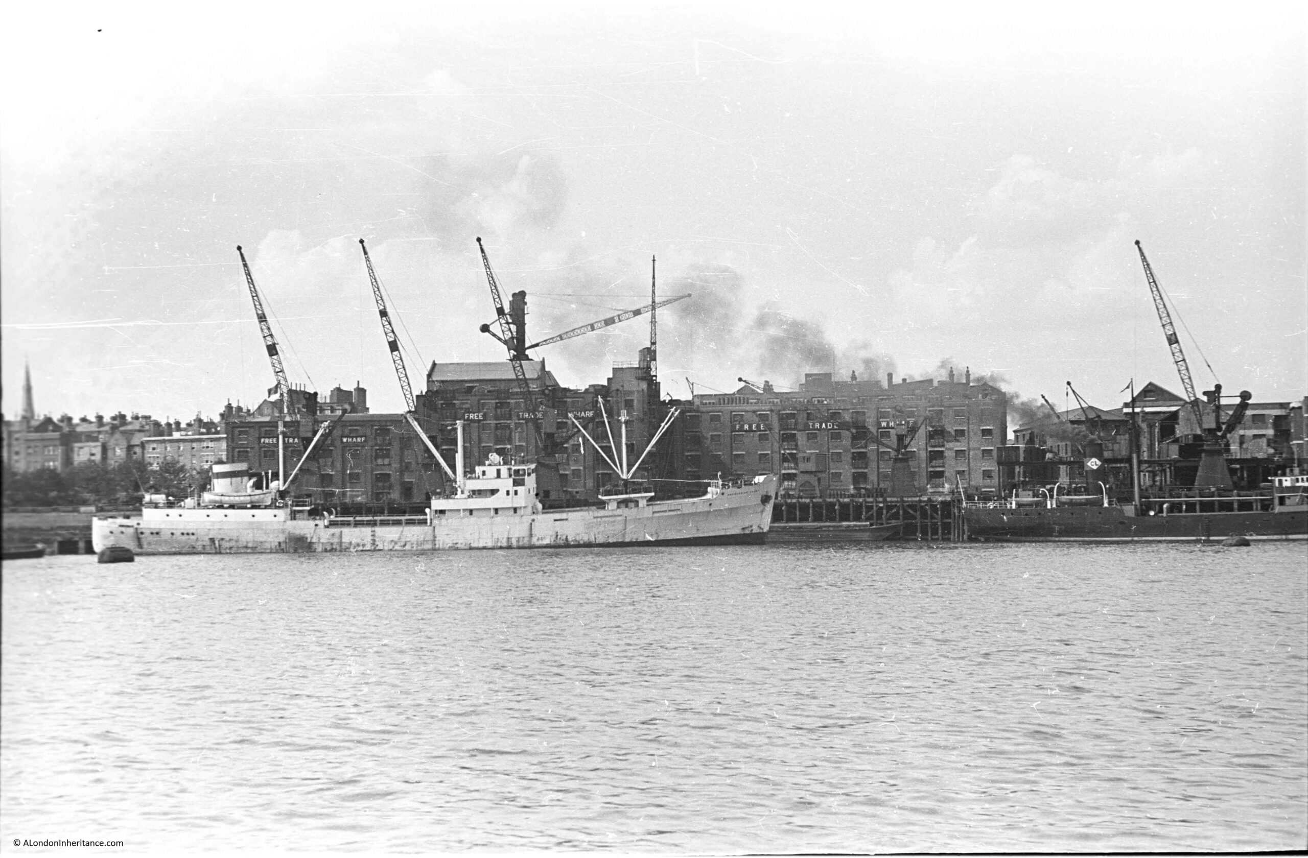
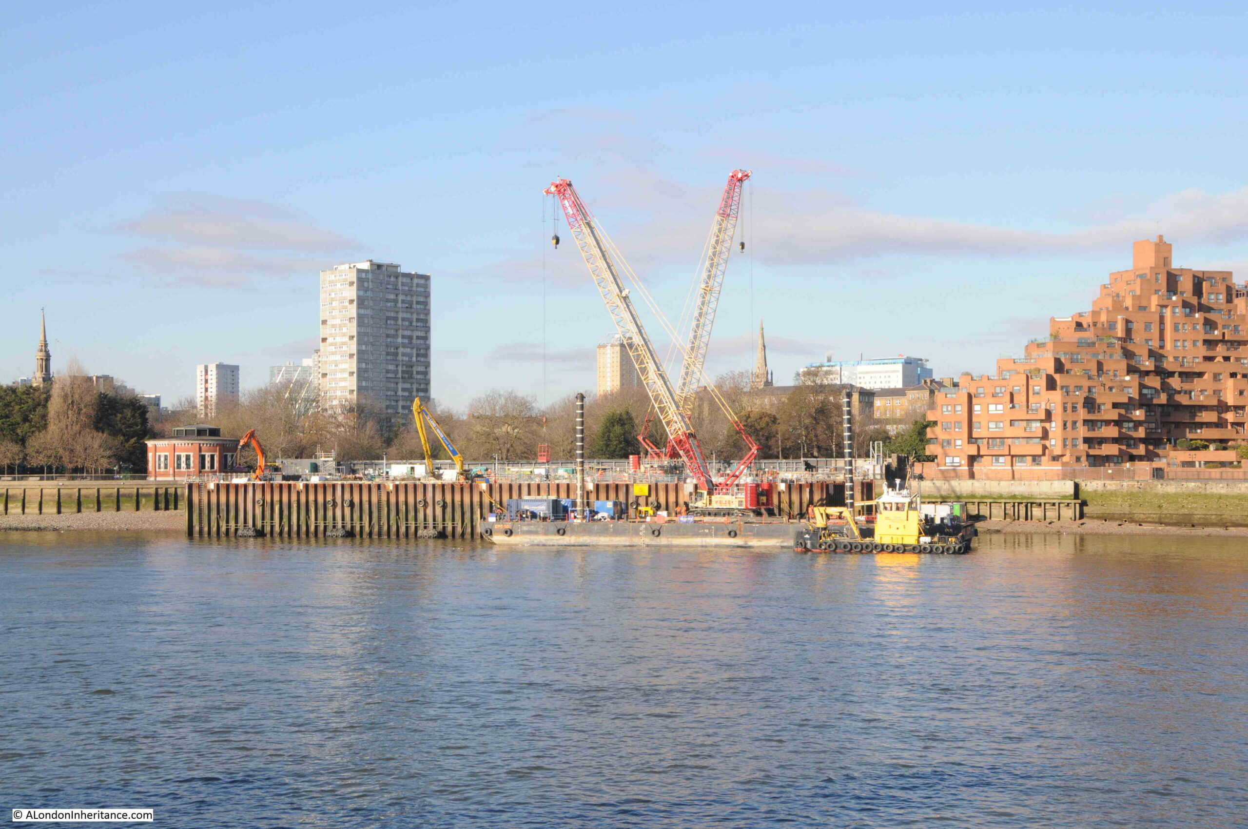
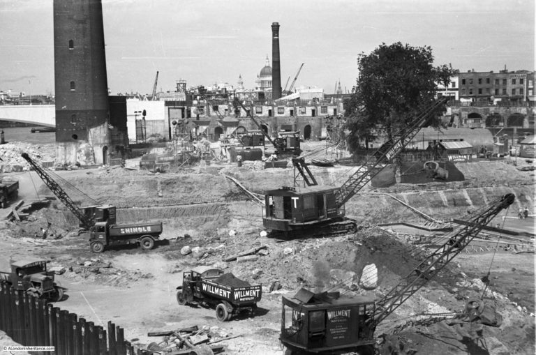
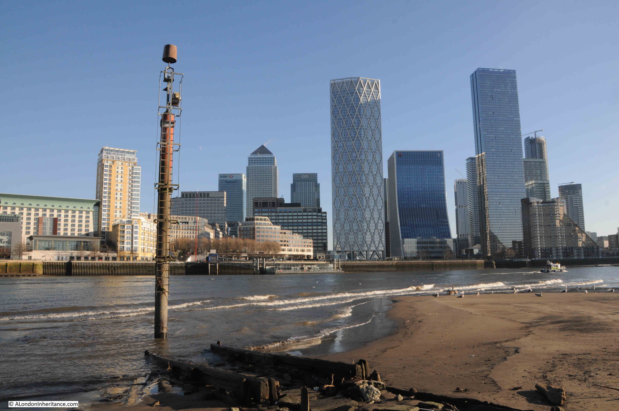
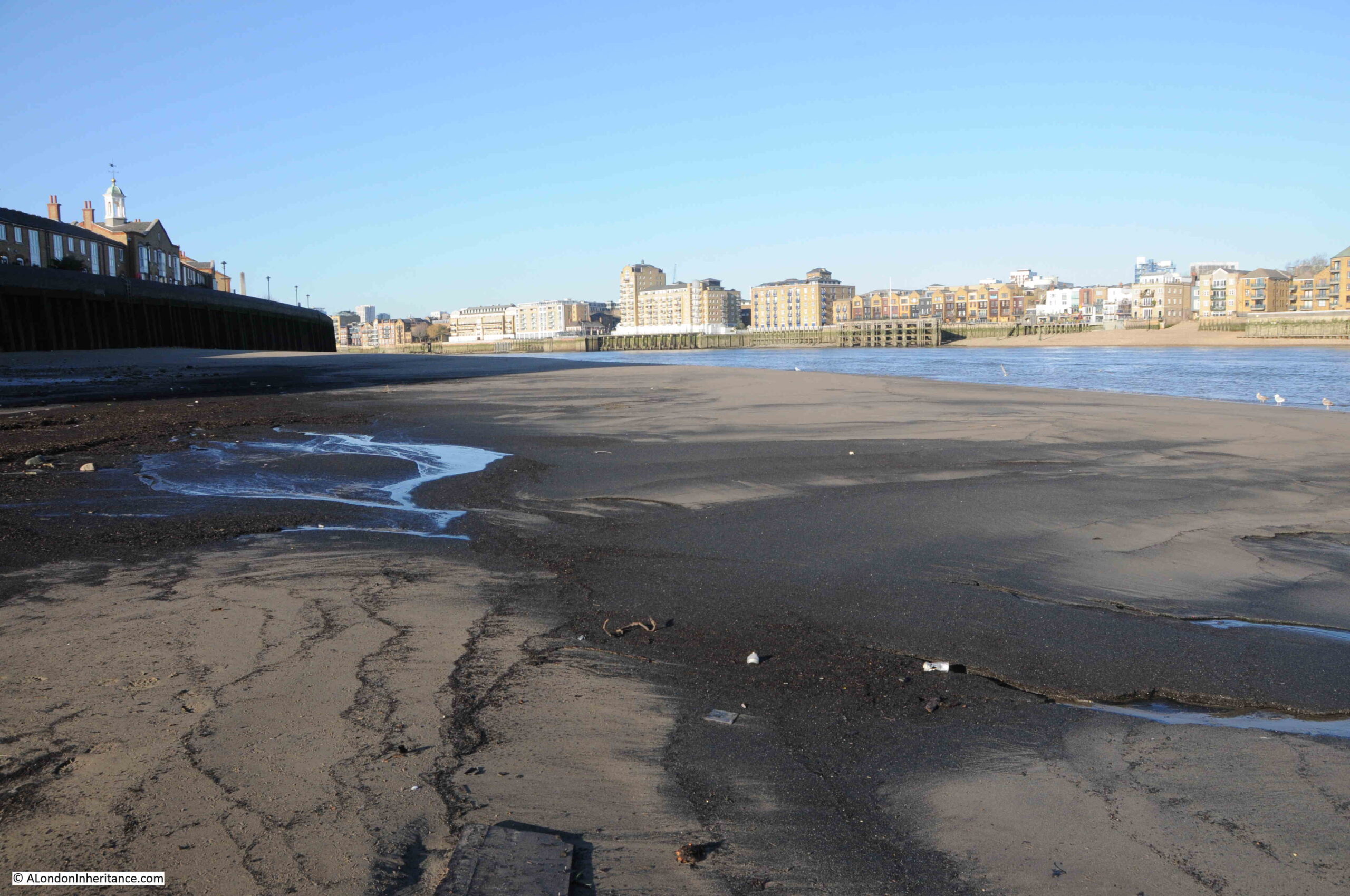
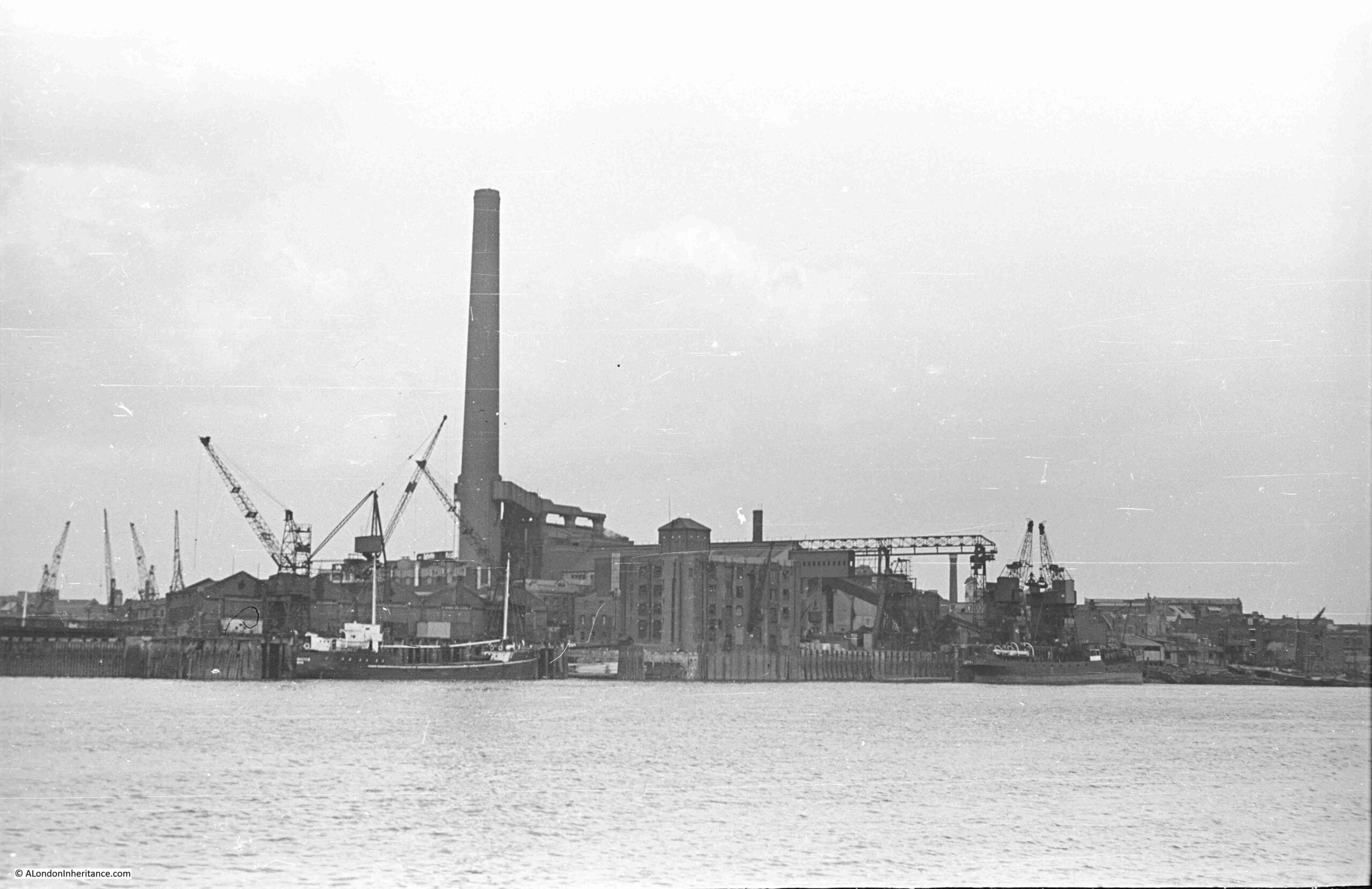
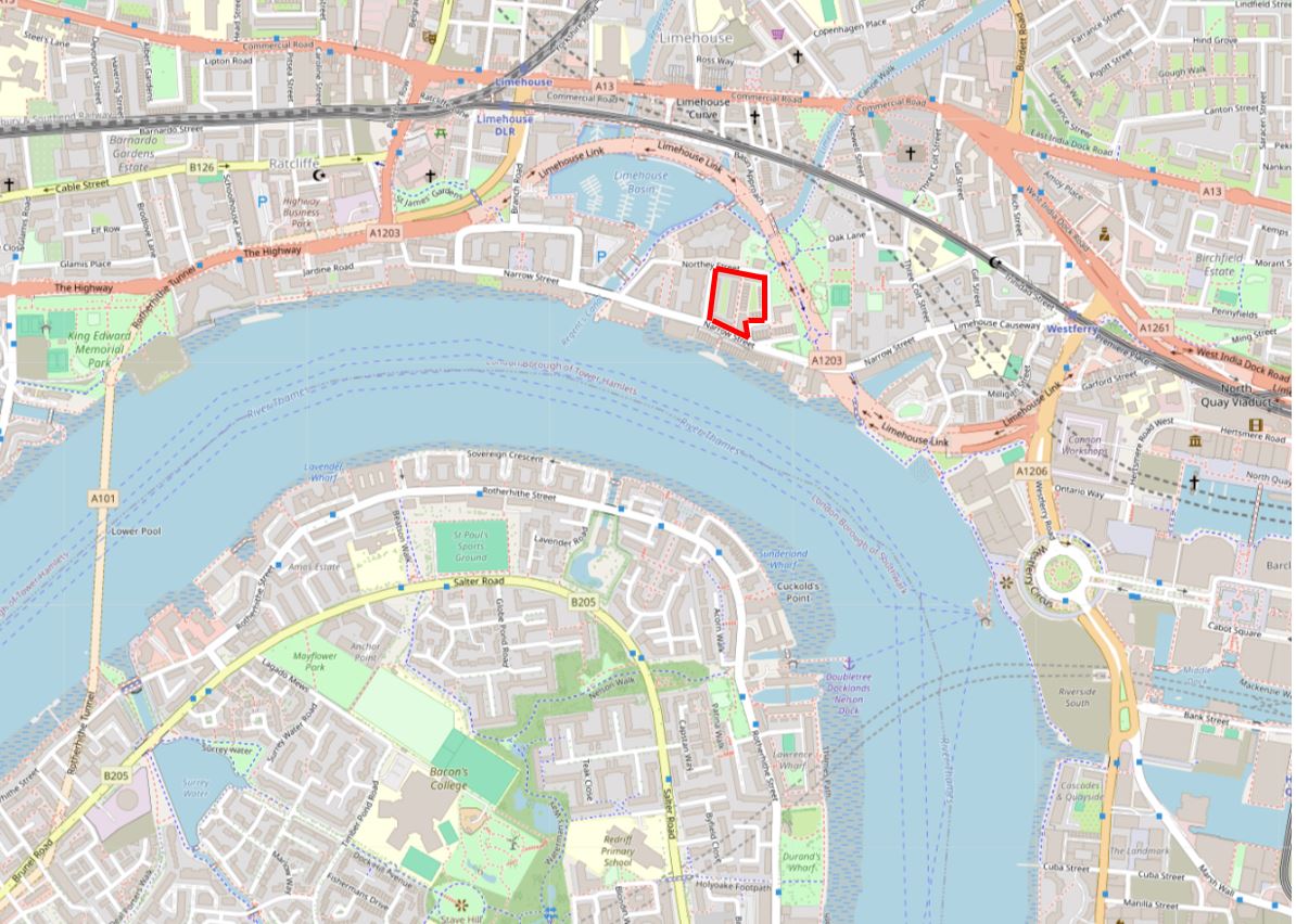
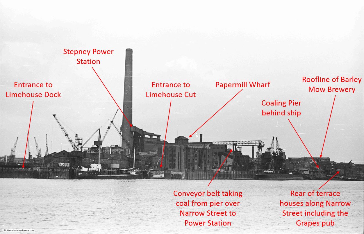
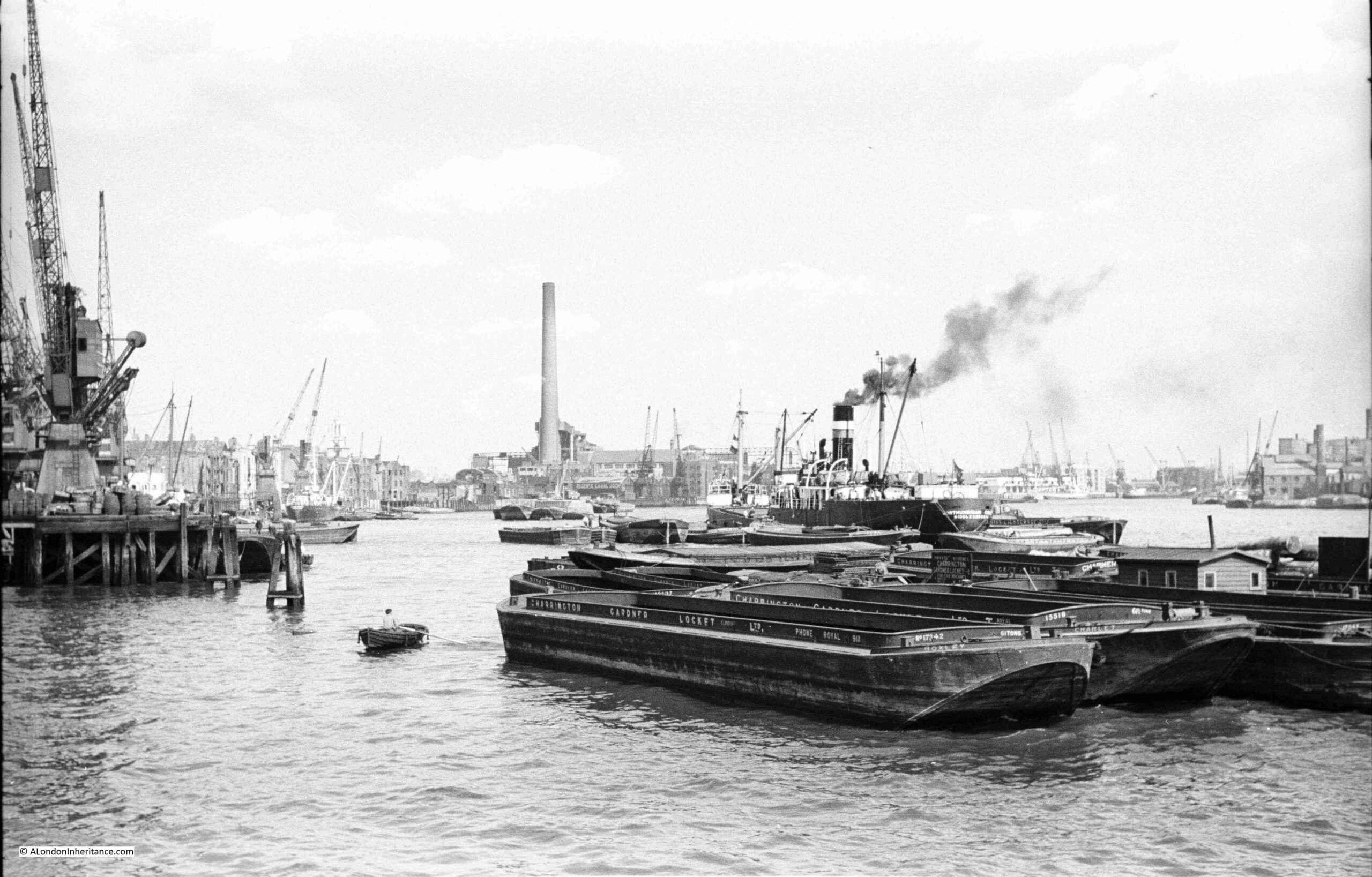
The following photo was taken by my father in August 1948, and shows the buildings of Free Trade Wharf in the old area of Ratcliffe:
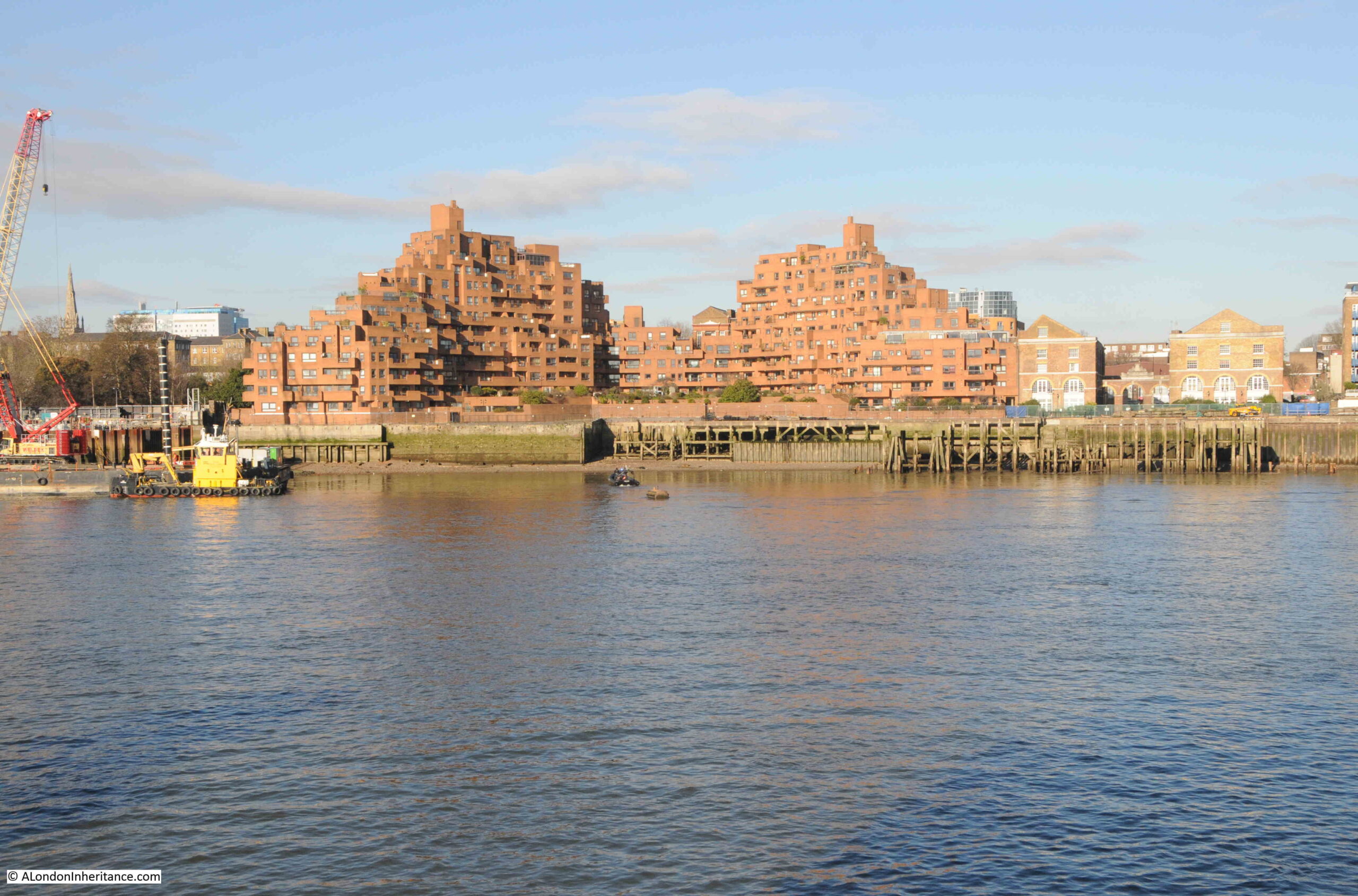
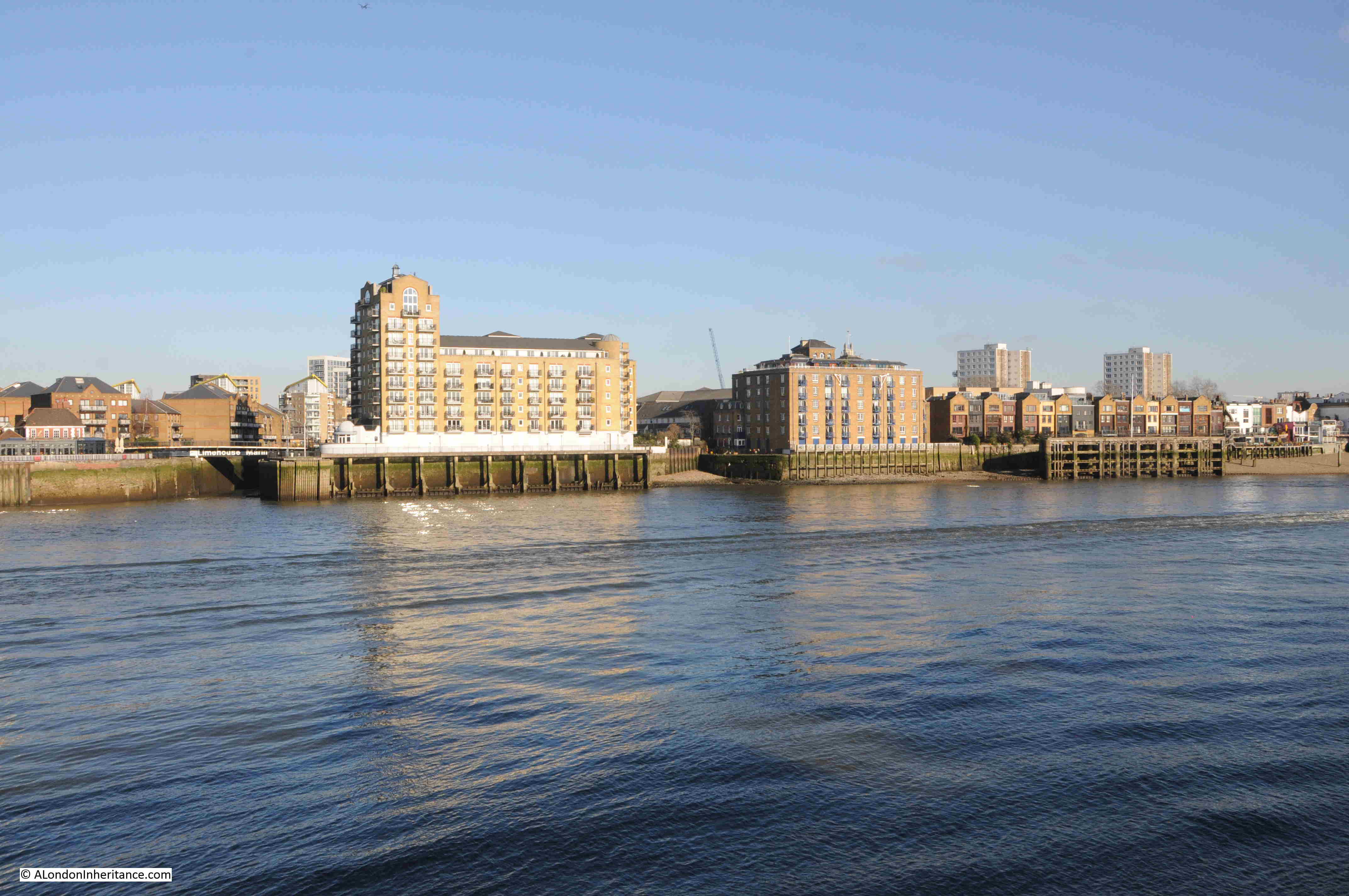
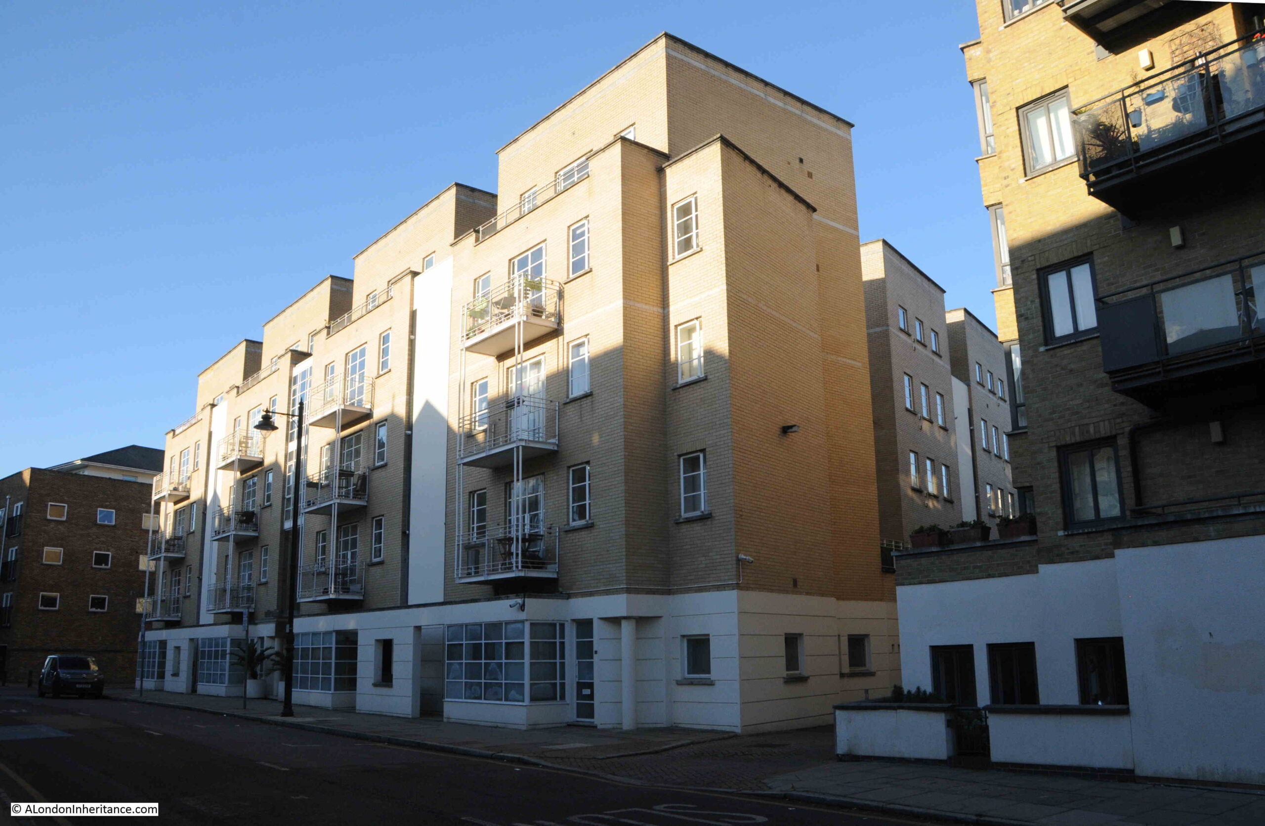
The same view, seventy six years later in 2024:
Despite the loss of the central Free Trade Wharf buildings, there are some features that can be found in both photos.
On the left of both photos, there are no buildings along the edge of the river, and trees can be seen in an open space leading back from the river. This is the King Edward VII memorial park.
Staying on the left of both photos, a church steeple can be seen in the background. This is St. Mary’s Cable Street.
The central part of the photo is very different. The Free Trade Wharf was purchased by the Inner London Education Authority in 1977 with the intention of building a campus for the City of London Polytechnic, which had been formed in 1970 with the consolidation of the City of London College, Sir John Cass College and the School of Navigation.
These plans did not follow through, and the site remained vacant until the early 1980s when the growing trend for the construction of residential properties along the banks of the Thames resulted in the purchase of the site for residential development, and the building on the site we see today was built.
It is one of the more distinctive residential buildings along the river, and was designed by the architects Holder Mathias Alcock, who are still practicing today, although the name Alcock has been dropped.
Their distinctive design has been described as being of “dramatic ziggurat-style terraces”, and also looking as if it could have been made out of Lego.
Faced by red brick, the building does look good in direct sunlight, and the from what I have read, one of the reasons for the shape of the building, where the sides step back towards the centre, was to maximise the number of apartments that had a river view, rather than being a flat building along the river.
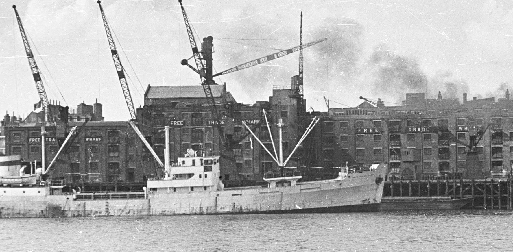
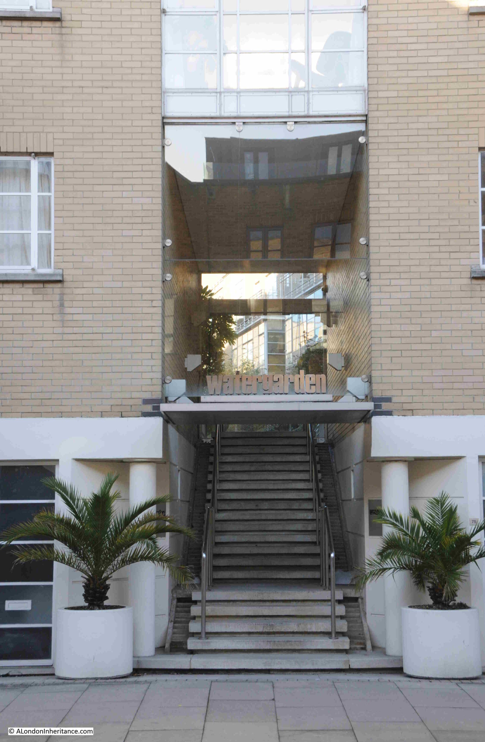
This new development retains the name Free Trade Wharf, and looking at an extract of the 1948 photo, we can see this name was displayed in white lettering along the side of the building facing the river:
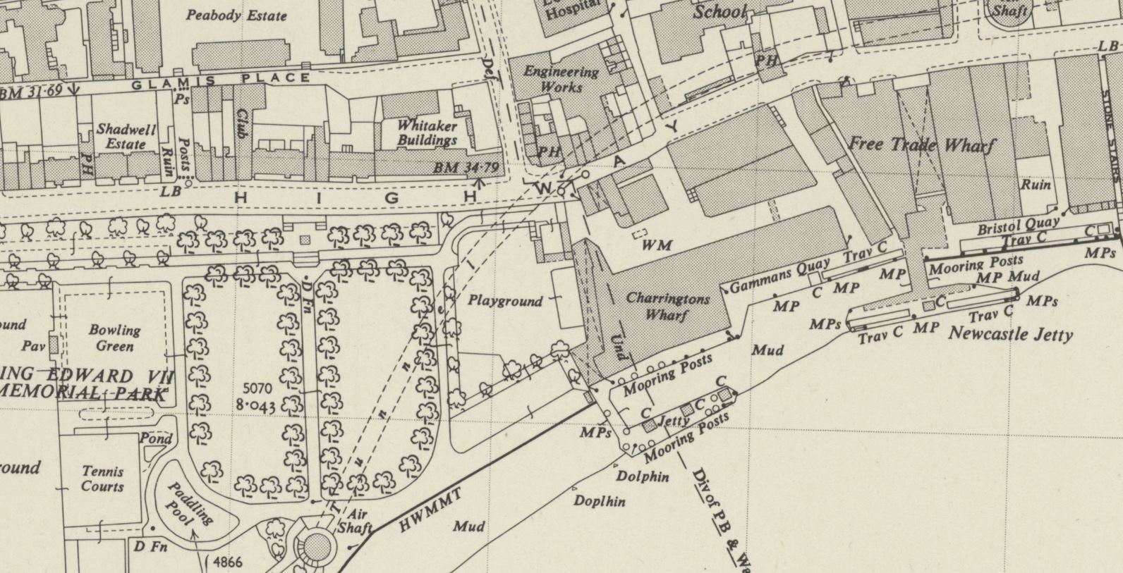
Although this very clear naming of the Free Trade Wharf did throw me into a momentary bit of doubt about whether I had identified the correct location for the photo, as in the OS map, published a couple of years after my father’s photo, the building is marked as Charringtons Wharf, as can be seen in the following map, along the river and to the right of the park (‘Reproduced with the permission of the National Library of Scotland“):
To confirm, I checked in the book “London Wharves and Docks”, published by Commercial Motor in 1953, and the entry for Charringtons Wharf included a reference that “Occupier: Free Trade Wharf Co. Ltd”.
The Charringtons name came from the ownership of the site by Charrington, Sells, Dale and Company, who traded in coal and coke. I cannot find exactly when this part of the site became known as Free Trade Wharf, however as you can see from the above map extract, this name was also in use for the buildings to the right, which are on the right of my father’s photo, but hidden behind the cranes, and the black coloured ship on the right.
The Commercial Motor book provides some detail on trade at the wharf in 1953:
“Facilities: a. General, b. Rubber, matches, canned goods. Maximum cranage (cwt) 45, Storage space (cubic feet, covered); 869,450, Storage Space (cubic feet, uncovered): 5,000.
Customs facilities included Sufferance Wharf, Dry Bond, Captain’s Imperfect Entry (a Sufferance Wharf is a licensed private wharf where goods can be kept until the duty is paid. A Dry Bond is where goods can be stored before customs duty is paid. Dry refers to the type,, so dry goods unlike wet goods such as alcohol. Captain’s Imperfect Entry is a strange one. Captain’s Entry is where the Captain of a ship has provided the details of the goods he wants to unload to the warehouse, but I am not sure what Imperfect refers to).
The wharf had a jetty and a quay, with 250 feet being the maximum length of ships accommodated at the jetty and 210 feet at the quay. and the depth of water went from 24 feet at high water down to 2 feet at the jetty, and from 19 feet to drying out at the quay. “
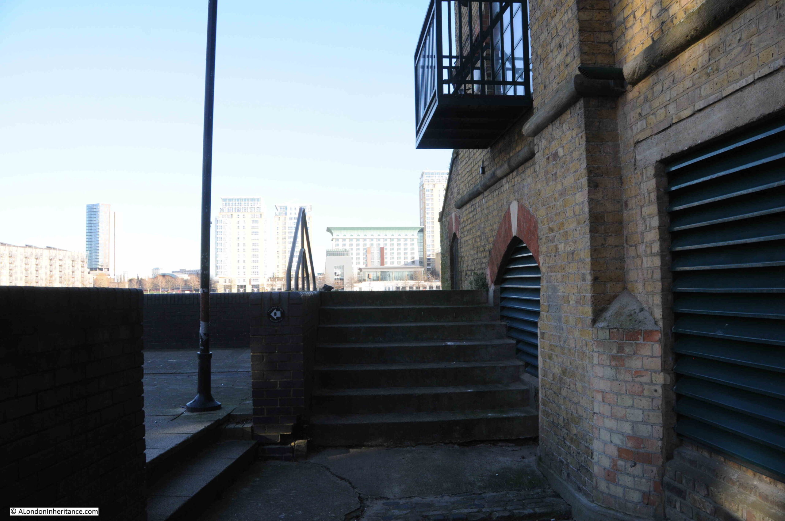
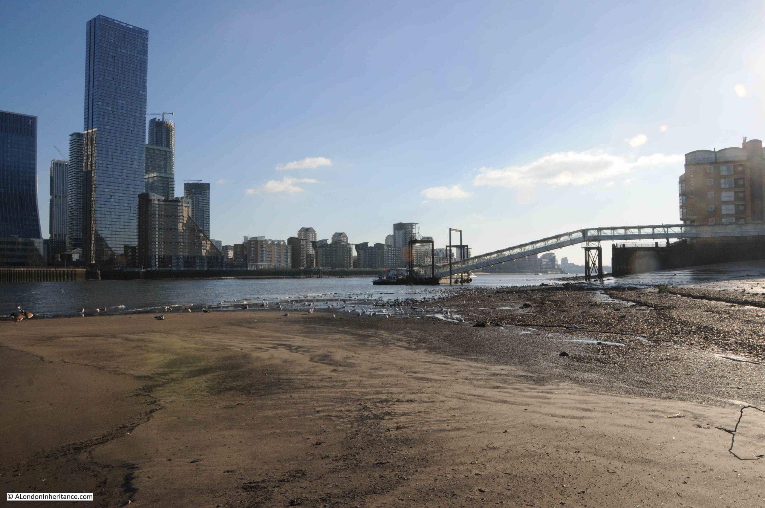
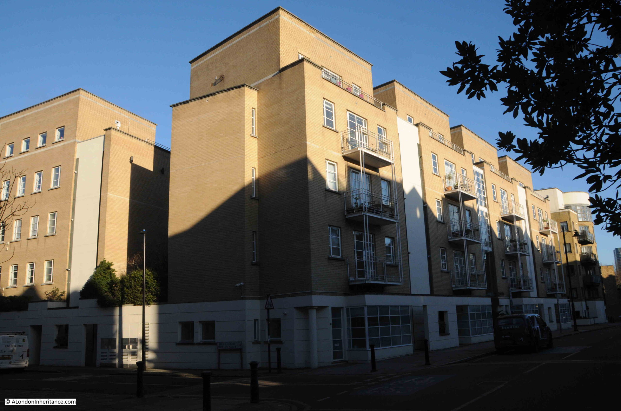
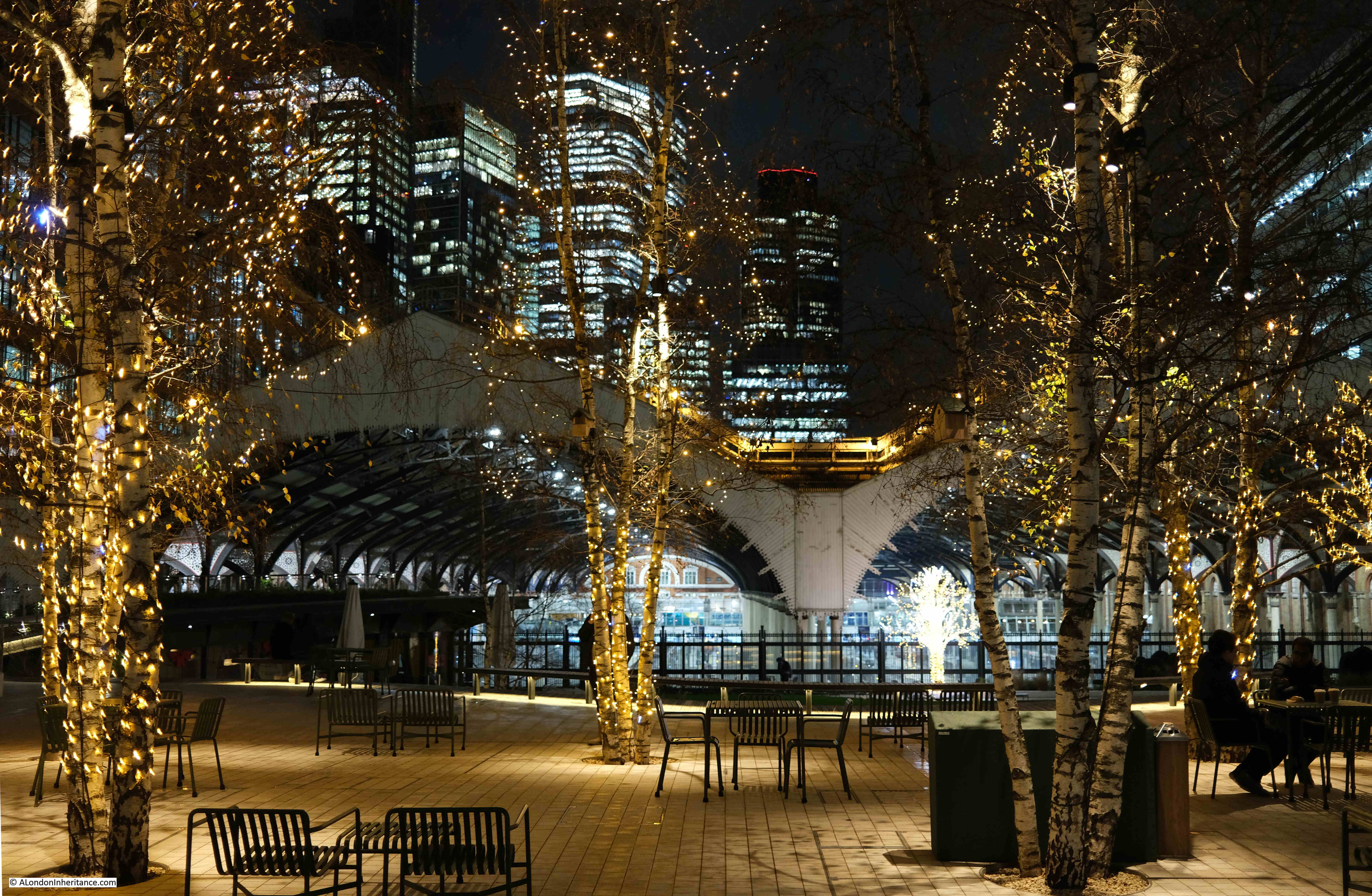
Just to the left of the site today, is one of the construction locations for the Thames Tideway Tunnel:
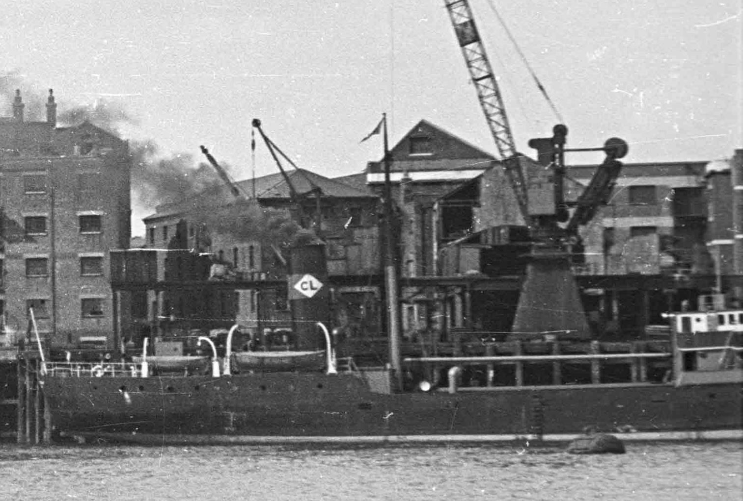
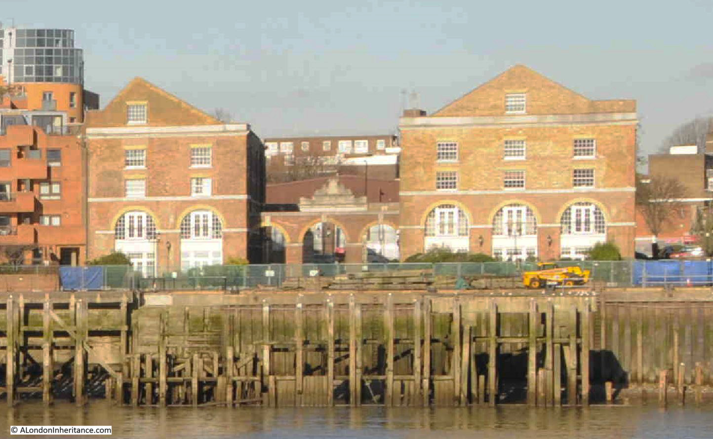
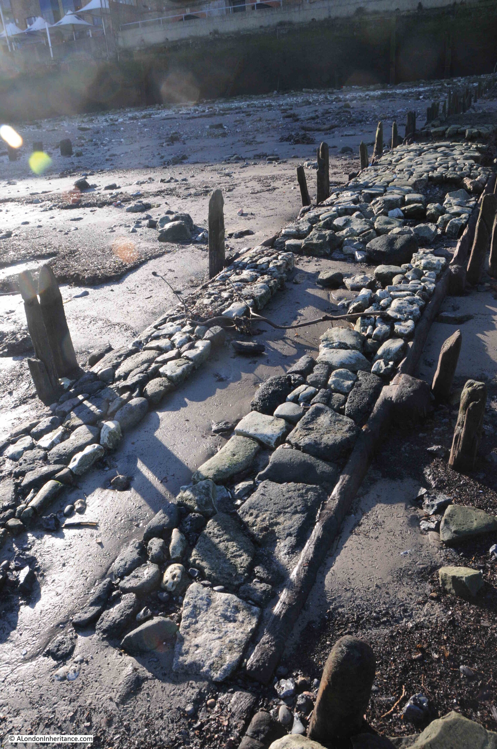
The OS map shows the buildings to the right of my father’s photo, labelled as Free Trade Wharf. These buildings are much earlier than the main block, but are hidden behind the ship and cranes in my father’s photo.
An extract from this photo showing the dark coloured ship, with part of these buildings just visible in the background:
The buildings, the ones labelled as Free Trade Wharf in the OS map as can be seen in 2024:
These buildings are Grade II listed and they date from 1796, although there have been many alterations over the years.
They were built for the East India Company, and handled a variety of goods, including saltpeter, which was used in the manufacture of gun power.
The site later became a place where colliers from the coal fields in the north east of the country would unload, and is presumably where the Charringtons connection comes from.
There are two ships in the 1948 photo. the ship on the left has no visible feature to help with identification. I use a high resolution scan for my father’s photos, and despite this, I cannot read the name of the ship on the bow.
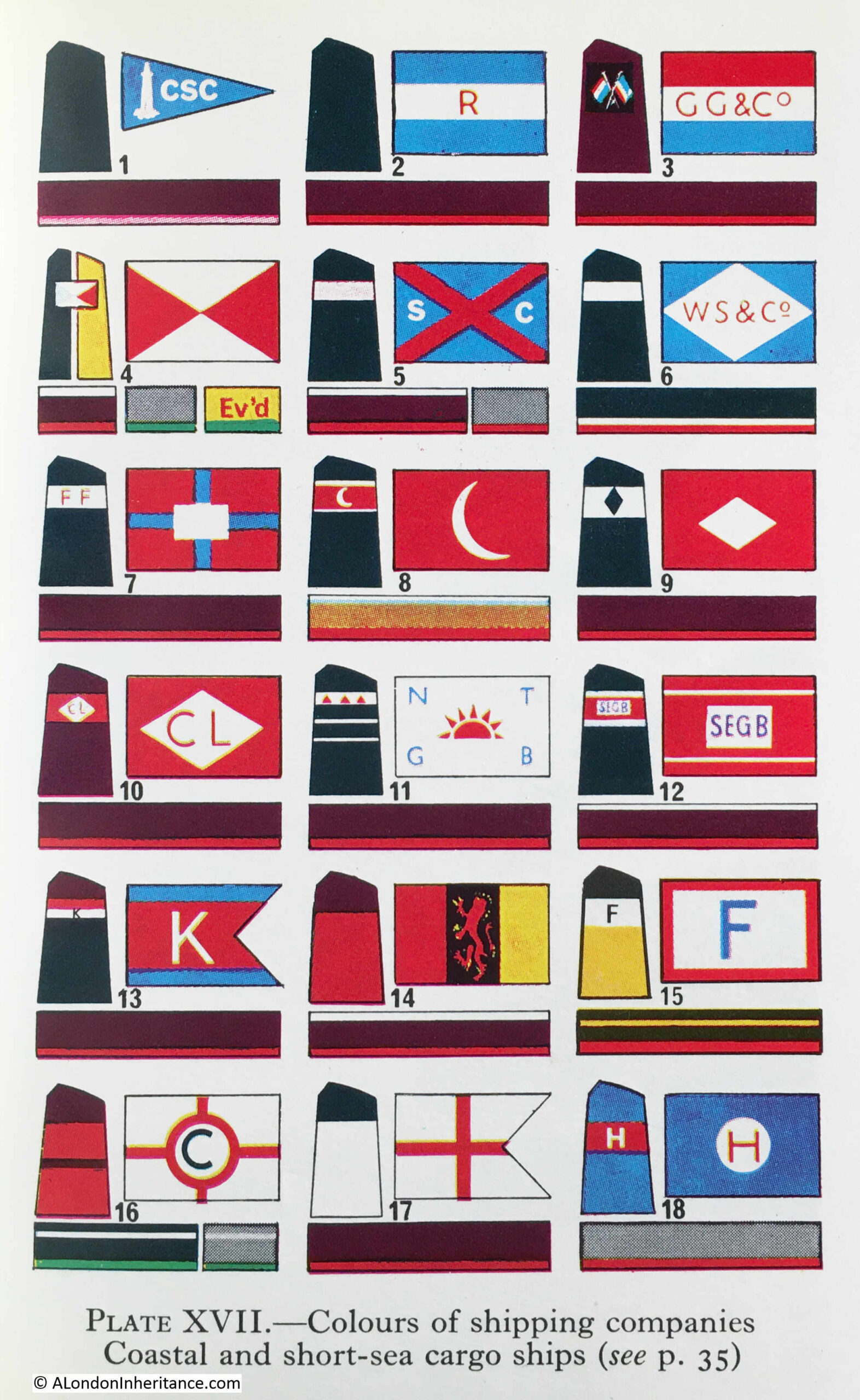
The ship on the right has no visible name, presumably it is on the bow and only the rear section of the ship is visible in the photo. What can be seen is the funnel, and this has the letters CL in a white diamond.
Ships with the identifier of the owning / operating company were once a frequent sight on the Thames, and as kids in the late 1960s / early 1970s, we would often go down to the Thames by Coal House Fort, through East Tilbury (which always fascinated with its village and Bata shoe factory in this isolated part of Essex).
I had the Observer’s Book of Ships and used this to check of the passing ships. I still have the book and checked it to see if the CL in a white diamond is listed, and fourth down, on the left column, I found it:
Turning to page 35, and CL is for Comben Longstaff & Co. Ltd of London, and who were listed as Colliers.
The company was named after William Comben Longstaff, who was born in Lambeth in 1896.
Comden Langstaff & Co. Ltd was originally involved in a range of maritime services including insurance, owning, managing and operating a fleet of ships that delivered raw materials and goods to the ports around the coast of the UK.
Newspapers of the time have many references to the purchase of new ships, sale of older ships, trade, routes etc. and the company seems to have been reasonably active.
The majority of their ships seem to have been built by John Lewis of Aberdeen, and the following article from the Aberdeen Press and Journal on the 9th of June 1948 is typical of the company’s coverage in the press:
“STEAM COASTER LAUNCHED – I have great faith in this country, but its only salvation is hard work, said Mr. Comben Longstaff at a gathering after the launching yesterday of the steam coaster Lancasterbrook, built by Messrs John Lewis and Sons Ltd, Aberdeen, for his firm, Messrs Comben Longstaff and Co. Ltd, London.
Mr. Andrew H.S. Lewis said the Lancasterbrook was a sister ship of the Londonbrook, built by his firm two years ago. She was an oil burner and was fitted with patent steel hatch covers.
They were building two other ships for the same owners.
Mrs. Comben Longstaff named the vessel which is 200ft in length and is of the raised quarterdeck type. The rudder is semi-balanced and streamlined and was made to the owners’ own design.”
The article mentions the Londonbrook, which had been built by the firm two years earlier, so presumably in 1946, and from checking photos of the Comben Longstaff ships, I believe the ship to the right of my father’s photo is the Londonbrook.
The company was sold in 1954, and William Comben Longstaff died in 1966.
Their ships continued operating around the coast of the country and in the late 1970s, two new ships were built, the Durhambrook and Devonbrook, continuing the Comben Longstaff tradition of adding “brook” to the end of their ship names.
The company ended operations in 1981, and all the ships were sold.
Both the Free Trade Wharf and the ships that docked at the wharf are from a time when you could sit on the river wall at Tilbury on a summer’s evening, and watch the ships passing along the river, checking them off in your Observer’s book.
The last weekend in February marks the annual anniversary of the blog, and this year, 2024, it is ten years since my first post on A London Inheritance.
The blog started as a way to find and document the locations of the photos my father started taking in 1946, along with just generally exploring the city, and I hope it has kept true to this approach.
I have learnt so much about the city in the ten years, discovering the story of places that I have walked past for years, with the blog now providing the incentive to stop, explore and discover the history of places that I once took for granted.
I have also learnt so much from the comments to the posts, so thank you to everyone who has left a comment on a post – they are all read with interest.
And my thanks to you for reading the blog, to the thousands who subscribe to the Sunday morning post. I try to keep them below 4,000 words (which is probably too long), so sorry for some of the longer posts.
Readership has and still does, continually increase, and the blog is now getting well over 500,000 views a year – a figure that I could never have expected when I started back in 2014.
Thank You.
Walks
I started doing guided walks based on the blog a couple of years ago for a number of reasons.
There are blog posts about individual stories or an area scattered across the ten years of posts. They do not come together to tell a comprehensive story of a specific area, such as Wapping, Limehouse, or the Southbank and Barbican, and the walks enable me to do this.
It is also brilliant to meet readers, and to show some of my father’s photos from the place where they were taken.
And again, I learn much from those who are on the walk.
I will be continuing walks this year, and hope to start a new walk in the coming months which explores an area of the City which could well be significantly redeveloped in the coming years, and is a place with a long and complex history, going back 2,000 years.
To record the fact that the blog has reached ten years of continuous Sunday morning posts, I thought I would take a look back through a sample of posts over the years.
It is a random sample, apart from the post for 2014, which has to be the post that started A London Inheritance (click on the headings to visit the post):
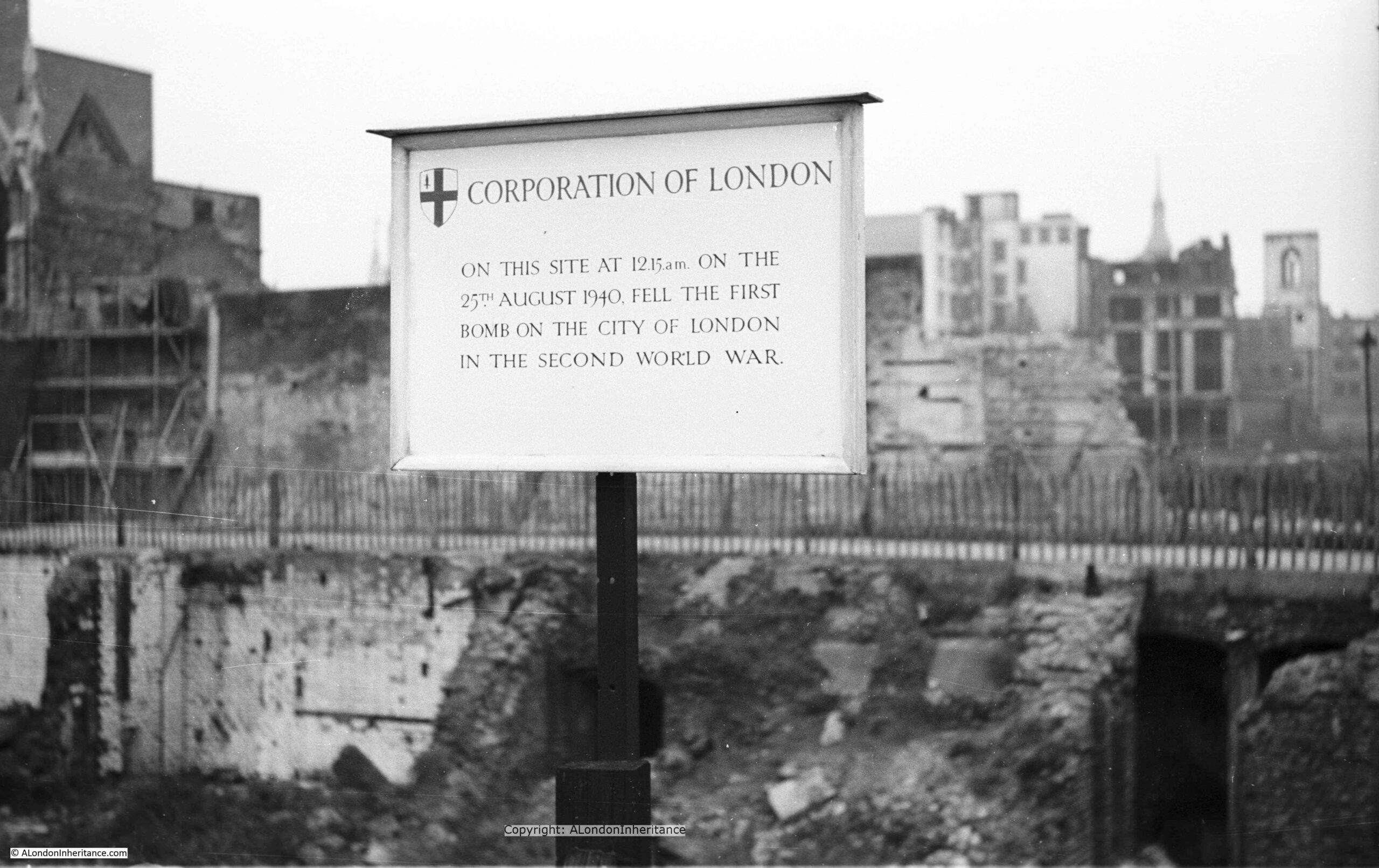
My very first post started with a photo of a plaque put up by the Corporation of London recording the first bomb to fall on the City of London. It seemed an appropriate photo to start the blog, as so many of my father’s photos show the impact of the war on the city.
He grew up in London during the war. He was evacuated for a couple of weeks, however his parents wanted him to return home, and he left a written record of both the terror and excitement of growing up in London in wartime, and started taking photos in 1946.
After this first attack on the 25th August 1940, heavy bombing started on Saturday September 7th and continued for the next 57 nights. London then endured many more months of bombing including the night of the 29th December 1940 when the fires that raged were equal to those of the Great Fire of 1666. Hundreds of people were killed or injured, damage to property was enormous and 13 Wren churches were destroyed. Or the night of the 10th May 1941 when over 500 German bombers attacked London. The alert sound at 11pm and for the next seven hours incendiary and high explosive bombs fell continuously across the city.
Behind the sign is a devastated landscape, not a single undamaged building stands, to the right of the photo, the shell of a church tower is visible. All this, the result of months of high explosive and incendiary bombing.
The Thames is the reason why London is located where we find it, and why it has developed into the city we see today, however with the closure of the docks and the industries that depended on the river, we seem to have lost that connection.
I had my first trip along the river from the City out to the sea in 1978, and since then it has been fascinating to watch how the river has changed. I also have a series of photos that my father took on a similar journey in the late 1940s. I am working to trace the exact locations and will publish these in a future post.
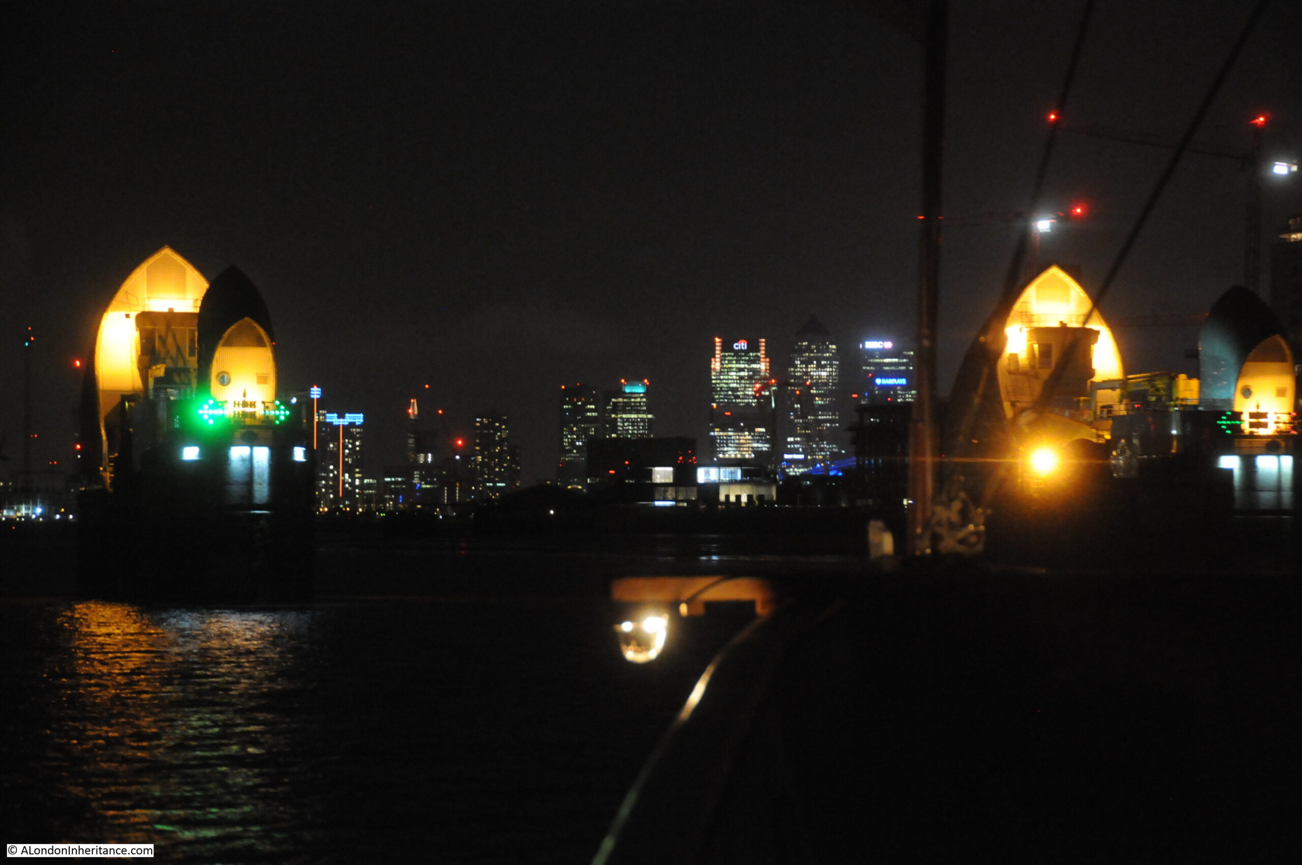
In 2015 I took the opportunity for another trip down the river aboard the Paddle Steamer Waverley, from Tower Pier out to the Maunsell Forts.
The Paddle Steamer Waverley is the last sea going paddle steamer in the world, built on the Clyde in 1947 to replace the ship of the same name sunk off Dunkirk in 1940.
Five posts covered the journey from Tower Pier, out to the Maunsell Forts in the Estuary.
The following photo is from the return journey in the evening, with the ship about to pass through the Thames Barrier. Green direction arrows clearly point to the channel that should be used to navigate through the barrier. The office blocks on the Isle of Dogs can be seen in the distance:
It really was an interesting journey, and the Waverly appears to be making a return visit to London later this year.
In 2015, I went Goring lock, to see one of the stops in that year’s Swan Upping route.
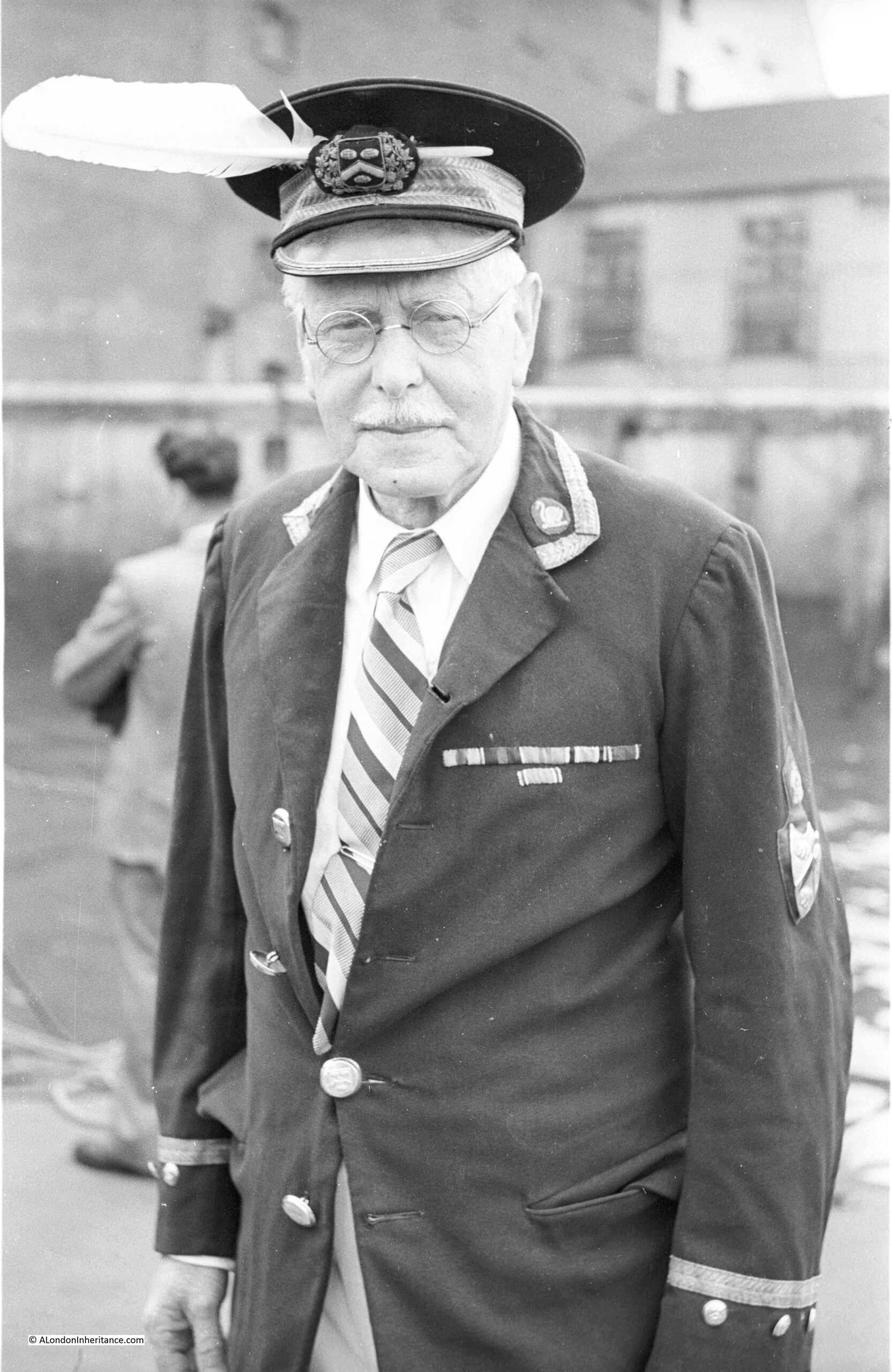
This is my father’s photo of Mr. Richard Turk who was the Vintners Swan Marker and Barge Master. He held this position from 1904 to 1960. A remarkable period of time to hold the role and the changes he must have seen along the Thames as Swan Upping was performed each year must have been fascinating.
Swan Upping is an event which takes place in the third week of July each year. Dating back many centuries, the event has roots in the Crown’s ownership of all Mute Swans (which dates back to the 12th century), ownership which is shared with two of London’s livery companies, the Worshipful Company of Vintners and the Worshipful Company of Dyers who were granted rights of ownership in the 15th century.
Swan Upping is the annual search of the Thames for all Mute Swans, originally to ensure their ownership is marked, but today more for conservation purposes (counting the number of swans and cygnets, checking their health, taking measurements etc.), although the year’s new cygnets are still marked.
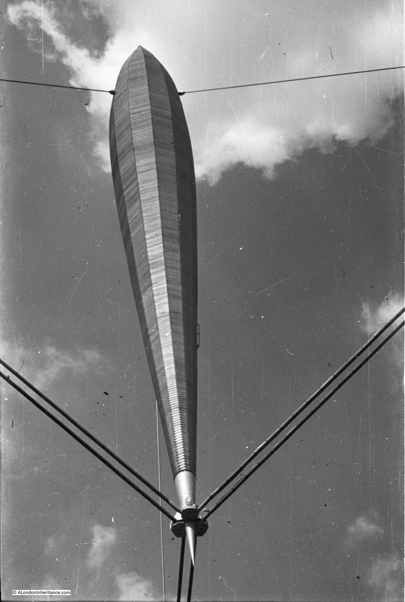
This was my father’s photo taken from the base of the Skylon, looking up at the structure:
The design for the Skylon was the result of a competition for a “vertical feature” for the festival site. Of 157 entries, the design by Philip Powell and Hidalgo Moya along with the engineer Felix Samuely was chosen.
The main body of the Skylon was 250 feet in height, add in the suspension off the ground and the total height was 300 feet. Three sets of cables held the Skylon in a cradle at the lowest point, and half way up at the thickest point a set of guy wires held the Skylon in a vertical position.
Aluminium louvered panels were installed on the outer edge of the Skylon and lights were installed inside, so during the day, the Skylon would sparkle in sunshine and at night it would be lit from the inside.
The name for the Skylon was also chosen in a competition. The winning entry was from a Mrs. Sheppard Fidler and the name was a combination of Sky and the end of Nylon (the latest modern invention), which when combined gave the futuristic sounding name of Skylon.
Another of my 2016 Festival of Britain posts was on the construction of the Royal Festival Hall, the only building that remains on the Southbank from the Festival. My father had taken a number of photos both before the site was cleared and during the building’s construction, including a series showing the foundations being prepared:
Work on the foundations started in May 1949 with bulk excavation of the whole area – as clearly seen in the photos above that my father took of the area. Bulk excavation was used as the easiest way to clear the area needed for the foundations. The centuries of previous construction on the site included the remains of the old water works along with the brewery which was built on a 6 foot thick mass concrete raft.
There was a large amount of work to prepare, which included sinking well points and then pumping out water which started on the 17th June 1949, when, within four days the ground water level was reduced to 13ft below the ordnance datum. A huge volume of water was extracted, with at the start of pumping 150,000 gallons of water per hour were being pumped out, and even after the site had been “de-watered”, pumping was still needed of 80,000 gallons per hour to keep the area of the foundations dry.
A total of 63,000 cubic yards of materials were removed for the foundations.
I will take any opportunity to see London from a high point, including flying above the city, and in 1979 and 1983, I took a couple of flights in a vintage de Havilland Dragon Rapide, and I have published a number of posts with some of the photos from these flights, including this example:
The above photo shows parts of Poplar at the top, and the northern end of the Isle of Dogs with from the top, the West India Dock (Import), the West India Dock (Export) and the South Dock. If you look just above the top dock, over to the right is the spire of a church, this is All Saints Church, Poplar. The Balfron Tower can be seen just behind the spire of the church.
Hard to believe that this is now the Canary Wharf development and One Canada Square is now in the centre of these docks.
In 2017, I started an annual post, recording the construction of the new HS2 station at Euston, starting with St. James Gardens, which would close soon after I had taken the photos in this blog post.
Before construction could start, the gardens, which had been a cemetery, needed to be excavated to remove the many thousands of bodies that were still buried beneath the grass, footpaths and gardens.
As well as London, my father also took very many photos of places visited during Youth Hostel / cycling trips in the late 1940a / early 1950s with friends from National Service.
I have also been trying to visit all these locations.
One of the sites he photographed was the Clifton Suspension Bridge, and in 2017 I had the opportunity to look inside the hidden vaults beneath one of the abutments supporting the bridge, and I posted some of these photos, along with my father’s 1952 photos of this bridge.
Although the bridge is in Bristol, there is still a significant London connection, as recorded in this report on the bridge from 1864:
“Mr. Brunel, as it happened, had been the engineer of Hungerford Bridge; and when, therefore, its chains had to be pulled down and to give place to the bridge of the Charing-cross Railway, it occurred to Mr. Hawkshaw to have them applied to the completion of one of Mr Brunel’s bridge designs. For such a purpose the money was soon forthcoming. A new company, under a new Act and presided over by Mr. Huish was started, with a capital of £35,000. The chains of Hungerford Bridge were purchased for £5,000; the stone towers built by Mr Brunel for the old company, for £2000. Two years ago the work of slinging these chains began and the bridge is now finished.“
Hungerford Bridge was the bridge built across the Thames to the old Hungerford Market, on the site of Charing Cross Station, before the current railway bridge was built.
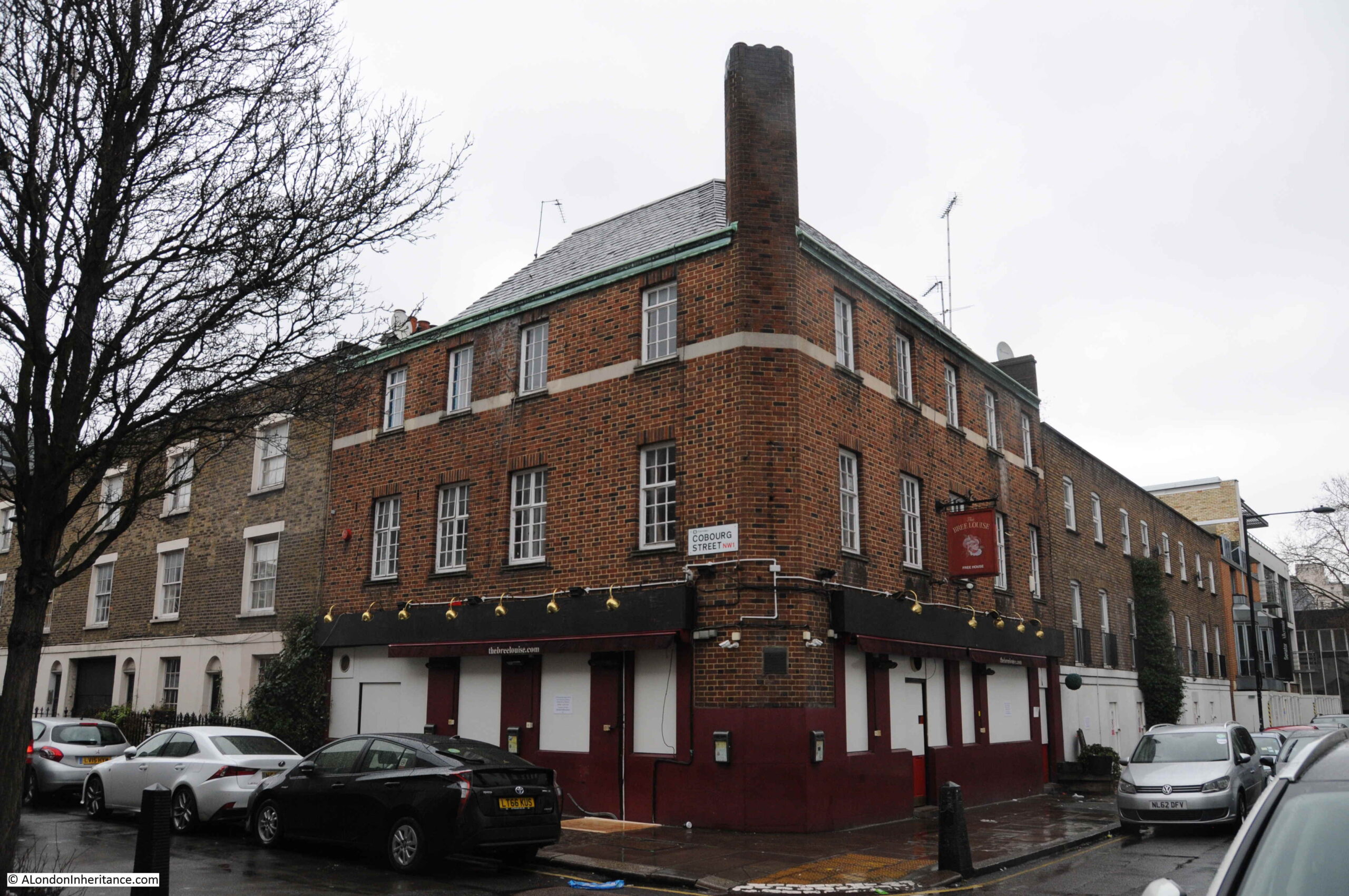
In 2018 I walked the streets to the west of Euston that would soon be demolished as part of the HS2 project. The following photo shows the Bree Louise pub, at the junction of Euston Street and Cobourg Street, which had closed not long before the photo:
The pub dates from the early 19th century and was the Jolly Gardeners until being renamed by the most recent landlord as the Bree Louise, the name of the landlord’s daughter who died soon after birth.
The Bree Louise was a basic, but superb local pub and it was sad to see how quickly after closing at the end of January, the pub has taken on such air of being abandoned.
Everything in the above photo has now been demolished and is part of the HS2 construction site.
2018 included a rather somber post, describing a return to a location I was last at forty years earlier.
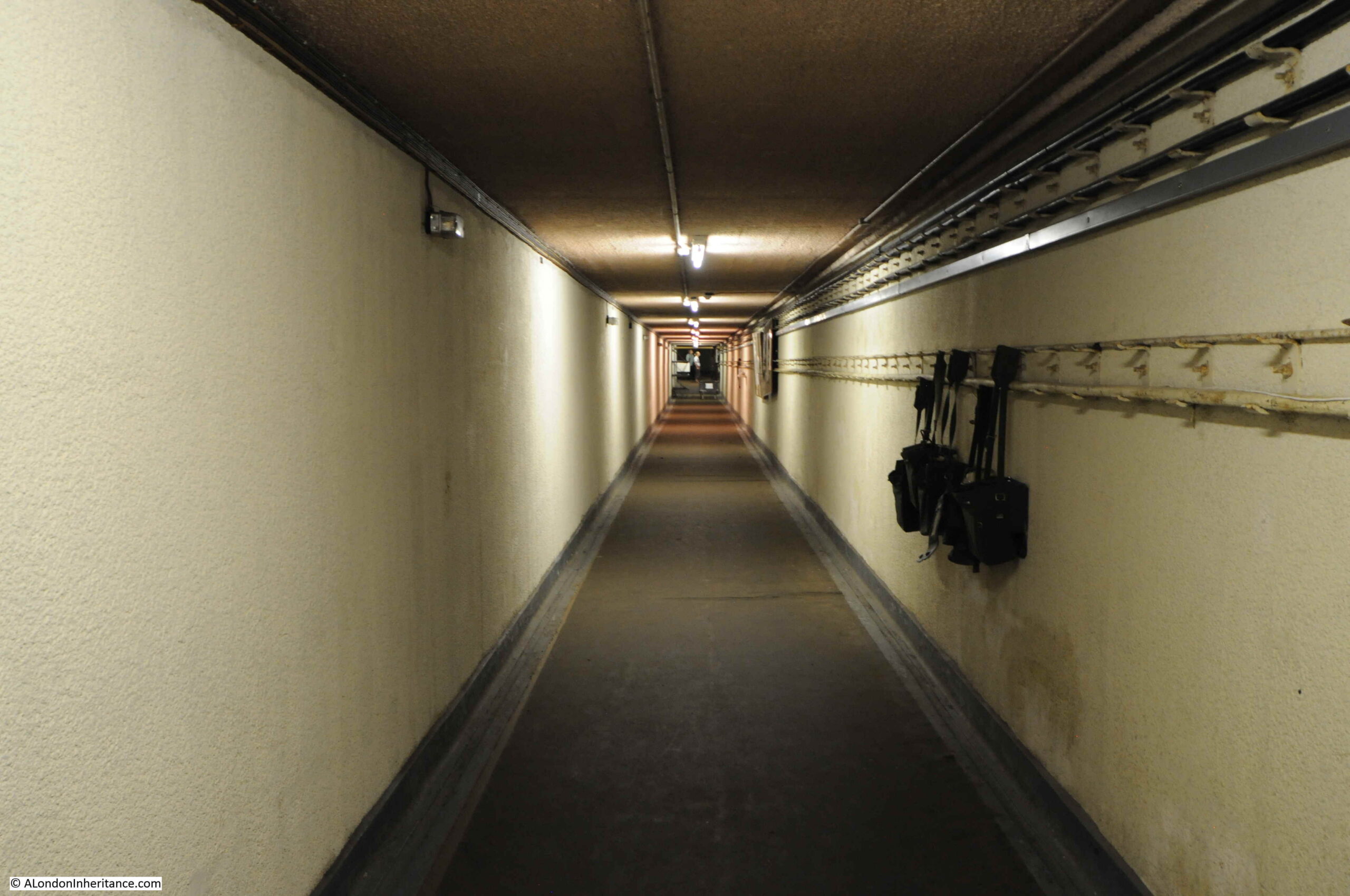
In the late 1970s, after leaving school, I started an apprenticeship with British Telecom (or Post Office Telecommunications as it was then). It was a brilliant three year scheme which involved both college and practical experience moving through many of BT’s divisions and locations. For a couple of months I was based at the telephone exchange at Brentwood, Essex. A typical day would involve maintenance and fault fixing on the telephone exchange equipment, however at the start of a day that would be rather different, the Technical Officer in charge was giving out jobs, and one job involved fixing a fault at a rather unique location – a secret nuclear bunker.
These were the years when a nuclear war was still a possibility, when the Government issued the Protect and Survive booklet, and in 1984 the BBC drama Threads appeared on TV – one of the most unsettlingly programmes I think I have ever watched.
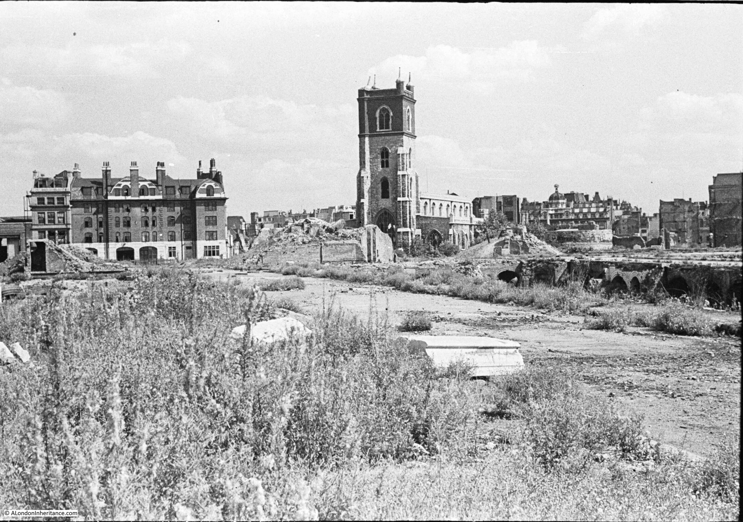
The subject of this post, was a photo taken in 1947, looking across a rather devastated landscape to the church of St Giles Cripplegate:
There are three main features in the photo, two of which survive to this day, although the area is now completely different following the development of the Barbican.
The church of St Giles Cripplegate is in the centre, the church looks relatively unscathed, however it suffered very badly and lost the main roof and contents of the church.
To the right of the church is a pile of rubble, and to the right of this, is the round shape of a Roman bastion, which can still be seen.
The large building on the left was the Red Cross Street Fire Station, demolished as part of the final land clearance in preparation for the build of the Barbican.
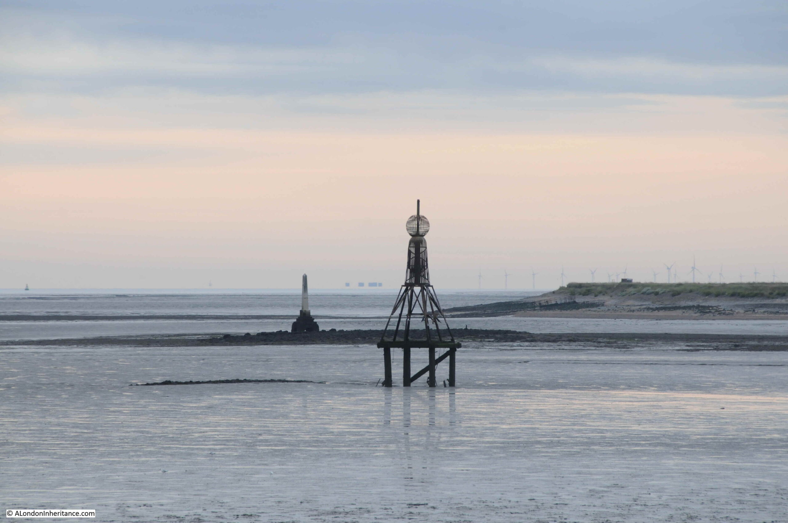
In this post, I finally managed to get to a place I had been wanting to visit for years. It took a bit of planning, but took me to a location that still has evidence of the City of London’s original jurisdiction over the River Thames.
To the west of Southend, on the borders with Leigh, and by Yantlet Creek on the Isle of Grain, there is a line across the River Thames which marked the limits of the City of London’s power. Where this line touched the shore, stone obelisks were set up to act as a physical marker.
The above photo shows the London Stone at Yantlet Creek. The early 4 am start to get there was well worth it – standing at the London Stone at 6:45 as the sun rose over the Thames Estuary, in such an isolated location, was rather magical.
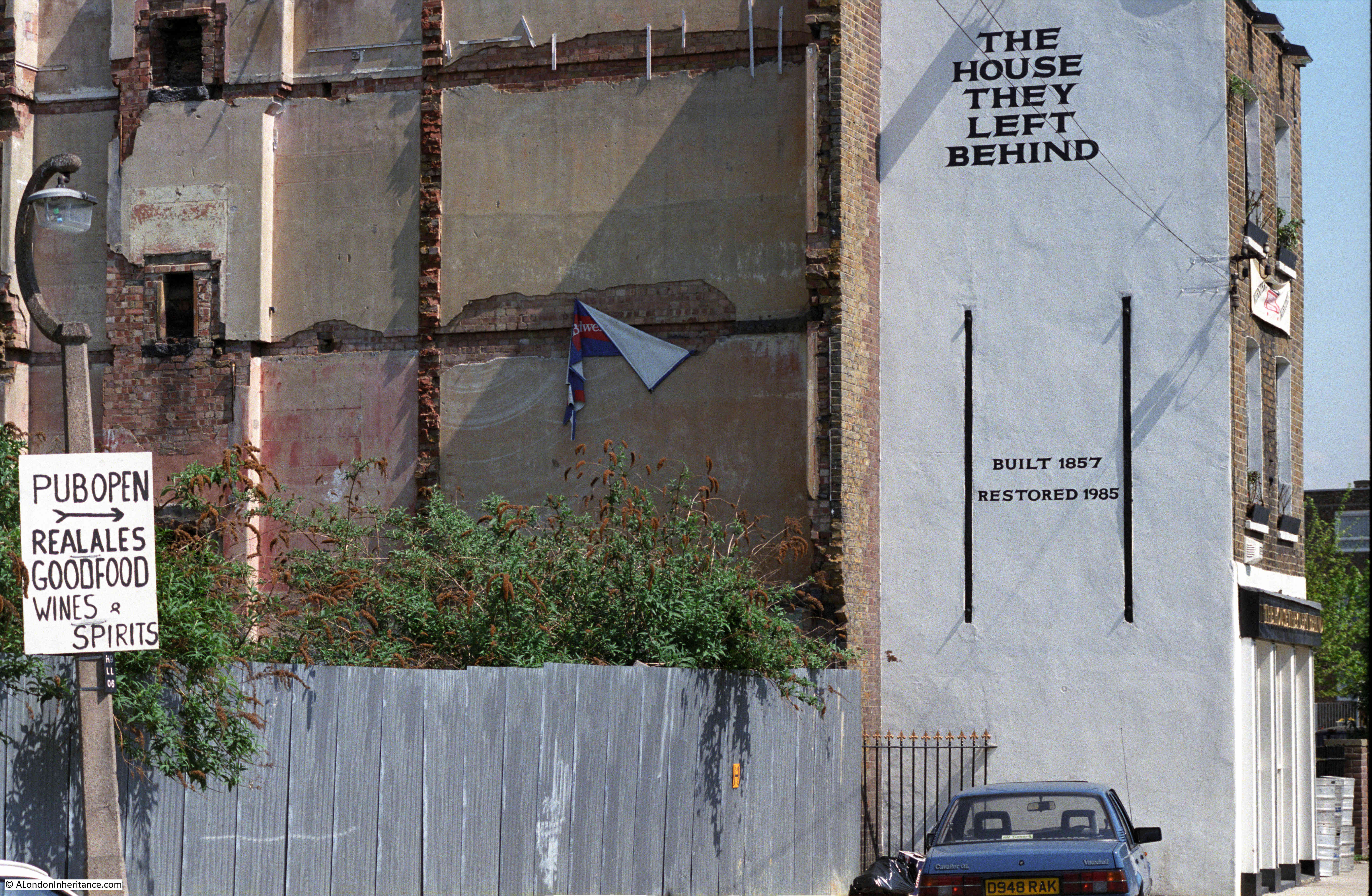
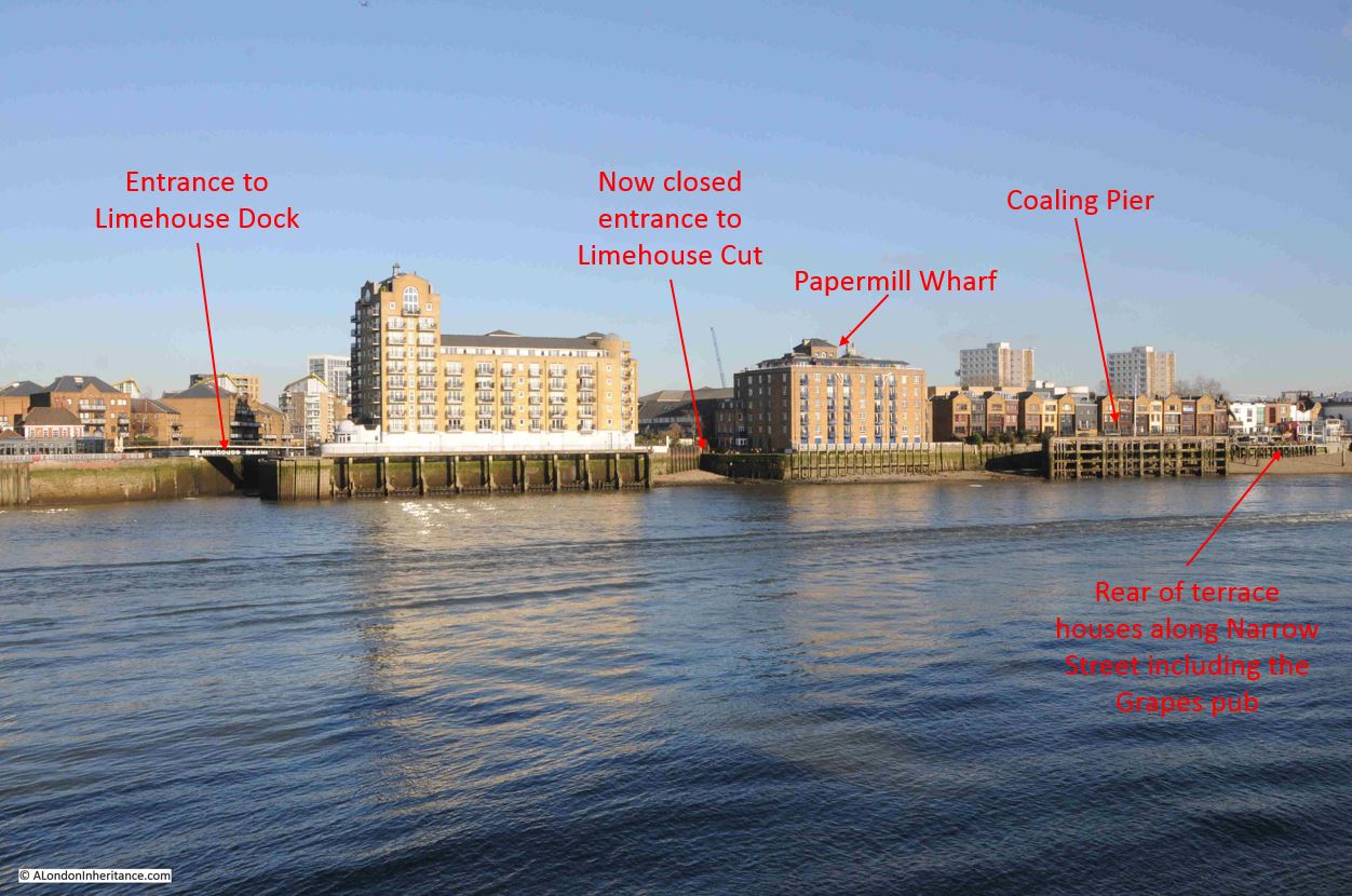
One of 2020’s posts included a trip to Limehouse, to find the site of the following photo from1986, which shows the side of a building where the adjacent buildings have obviously been demolished. The building has “The House They Left Behind” painted in bold black letters on a white background, with below, the original build date and a restoration date of the year before the photo was taken.
The pub was originally called the Black Horse, and was one of four in a small area of Narrow Street and Ropemakers Fields. Today, the only pub remaining is the Grapes.
The name change from Black Horse was to describe the position of the pub after demolition of every other building on Ropemakers Fields, and the Barley Mow Brewery, when the pub became “The House They Left Behind”. It is now residential.
2020 was the start of COVID, with the first lockdown starting in March. London became a very differenet place, and the city is still reacting to the impact of the virus and lockdown.
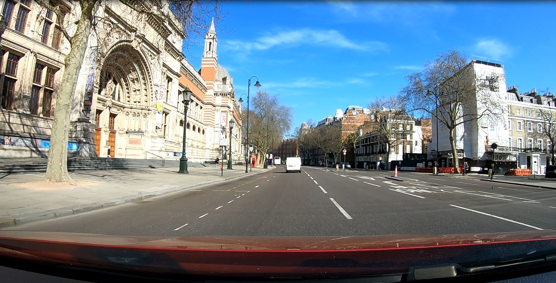
The following photo was taken along a very quiet Cromwell Road, with the Victoria and Albert Museum on the left:
On the Monday afternoon before the first lockdown, I had to take a relative to Guy’s and St Thomas Hospital at London Bridge (fortunately nothing to do with the Coronavirus). The hospital had advised not to take public transport, so the only other option was to drive.
Although this was before the formal lock down and the direction to stay at home, I had already stopped walking around London and was missing the experience of walking the city, particularly as the weather was so good.
To take advantage of a drive up to London Bridge, I mounted a GoPro camera on the dash of the car and left it filming the journey there and back.
It was a London I had not seen before on a Monday afternoon, more like a very early Sunday morning. Very few people on the streets and not much traffic. I cannot remember driving in central London on a weekday without any queues. The only time I needed to stop was at traffic lights.
A frightening reminder of the impact of the virus.
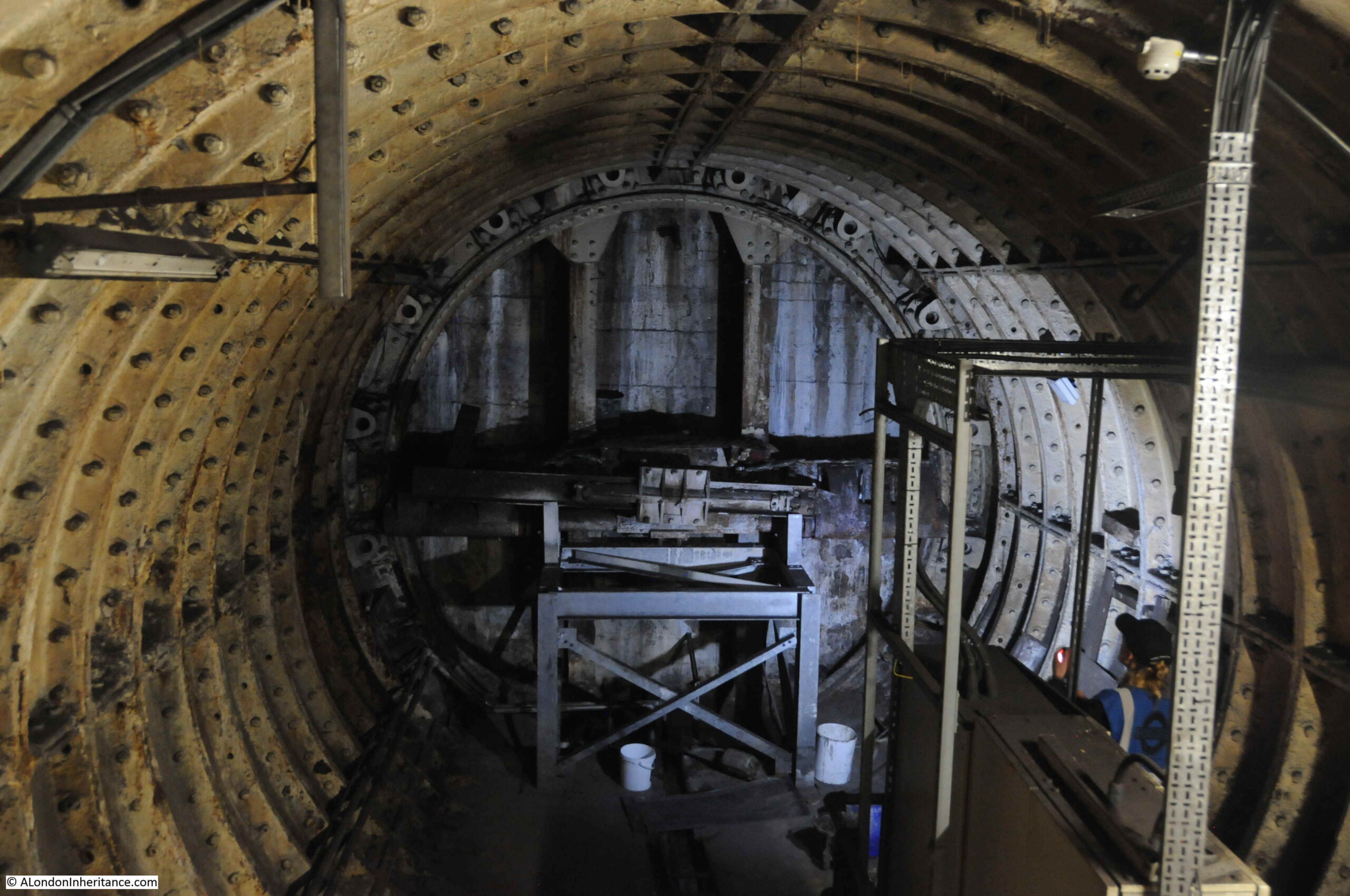
The London Transport Museum have run a brilliant series of tours of the hidden side of London’s transport infrastructure, and in February 2020, on a chilly Saturday afternoon, I arrived at Moorgate looking forward to walking through the hidden tunnels of another London underground station.
The above photo shows the remains of a Greathead Tunneling Shield at Moorgate. This was the invention of James Henry Greathead, who developed Brunel’s shield design, from rectangular, with individual moveable frames, to a single, circular shield. Screw jacks around the perimeter of the shield allowed the shield to be moved forward as the tunnel was excavated in front of the shield, with cast iron tunnel segments installed around the excavated tunnel immediately behind the shield.
Greathead’s first use of his shield was on the Tower Subway.
He died in 1896, before the Lothbury extension at Moorgate, however his shield design was so successful that it became the standard design for shields used to excavate much of the deep level underground system.
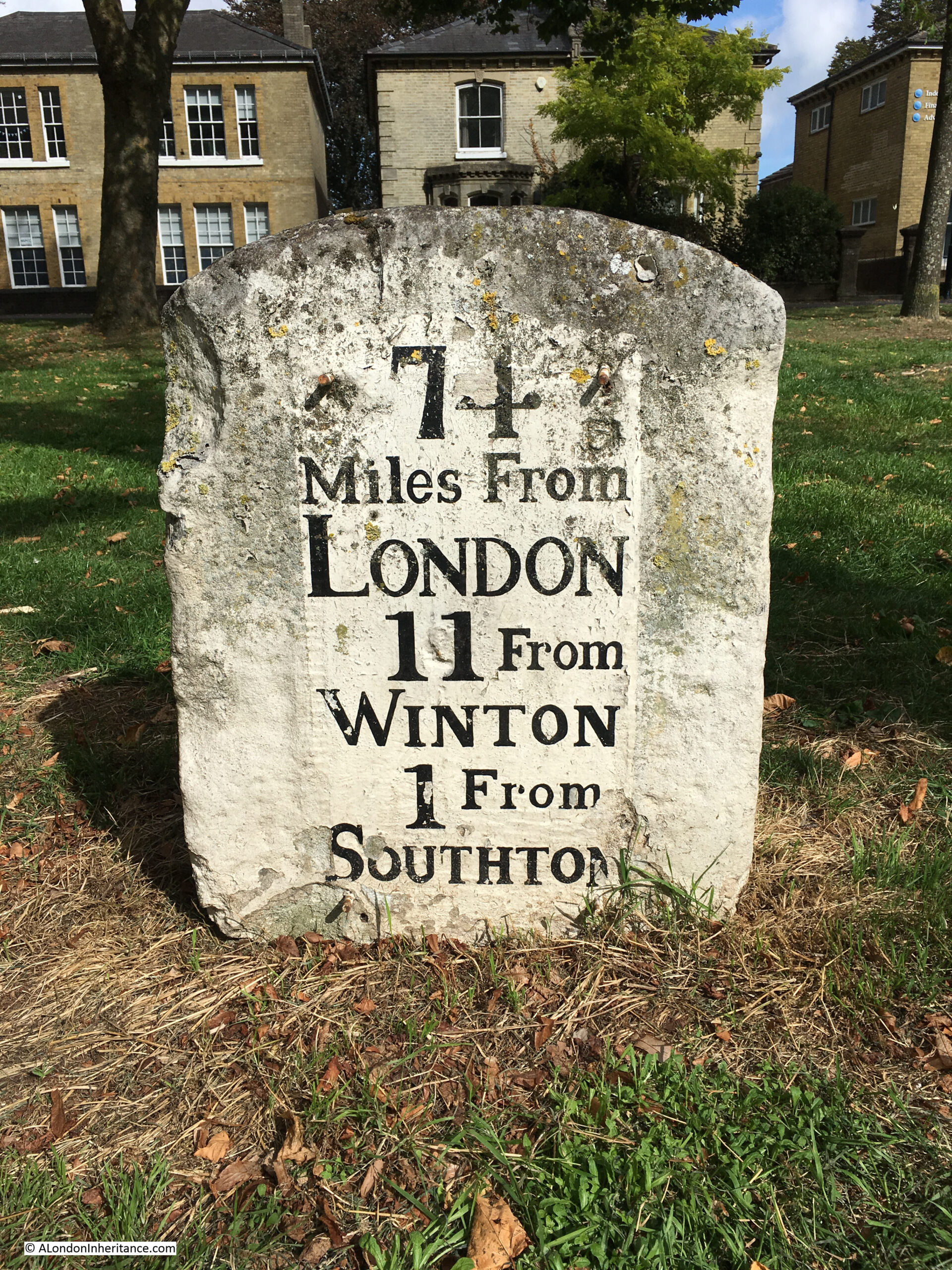
This post started with an 18th century milestone to be found in Southampton, indicating that it is 74 Miles from London:
I have always been interested in London’s relationship with the rest of the country. Frequently, this is seen as a negative. The north / south divide, London getting the majority of available infrastructure investment, higher wages in the city etc.
London’s central role in the country started many hundreds of years ago with the founding of the Roman City of London, located on a crossing point on the Thames, and where the new city was accessible from the sea.
Roads spread out from London, and the city became a cross roads for long distance travel. This was accentuated with the city becoming the centre for Royal and Political power, the Law and also a centre for trade and finance.
Look at a map of the country today, and the major roads that run the length and breadth of the country still start in London (A1 – London to Edinburgh, A2 – London to Dover, A3 – London to Portsmouth, A4 – London to Bath and Bristol, A5 – London to Holyhead).
Many of these major roads have been upgraded and follow new diversions, but their general routes have been the same for many hundreds of years, and a milestone is an indication of the age and importance of the route.
The old stairs leading down to the River Thames have been a long running theme to the blog. These stairs mark a place that has been important for centuries, where access between the land and river was available.
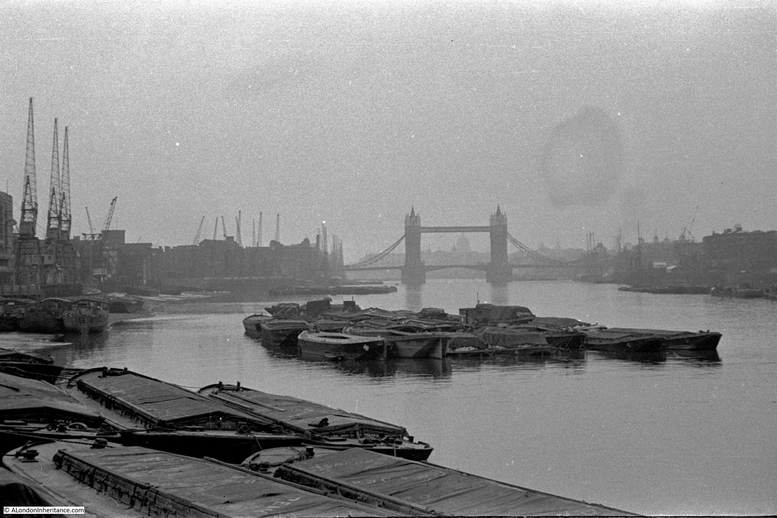
My father took the following photo from Cherry Garden Stairs, Bermondsey, looking along the river towards the City, with the dome of St Paul’s Cathedral visible through Tower Bridge.
When the photo was taken, in 1946, the river bank was lined by warehouses, wharves and docks, with cranes along the river. A large number of lighters and barges are moored on the river, and directly in front of the camera, which would have been on the foreshore.
These stairs are very quiet today, however countless thousands of people have used these stairs to get to and from work, to take a Waterman’s boat, to leave London, to arrive in London, or to flee from the consequences of a criminal act, or to escape persecution.
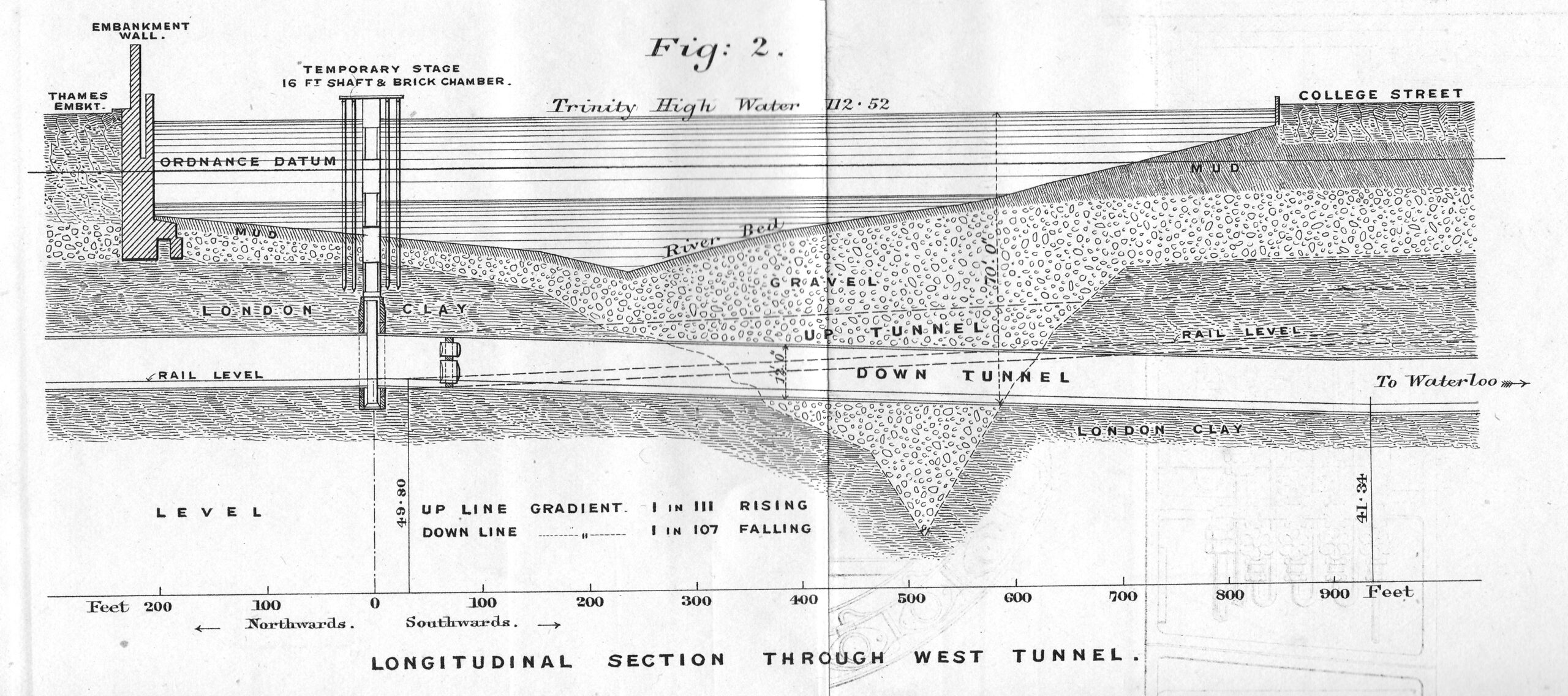
The route of the Baker Street and Waterloo railway ran beneath the Baker Street Station of the Metropolitan District Railway, by Regent’s Park and Crescent Gardens into Portland Place, through Langham Place to Oxford Circus (where the tunnels pass over those of the Central Line with a clearance of only 6 inches at one point), down Regent Street to Piccadilly Circus, along Haymarket and Cockspur Street to Charing Cross, along Northumberland Avenue, then under the Thames to College Street, Vine Street and Waterloo Station.
The majority of the tunnel went through London Clay and was a relatively easy construction project, however there was a challenge where the tunnel went underneath the Thames.
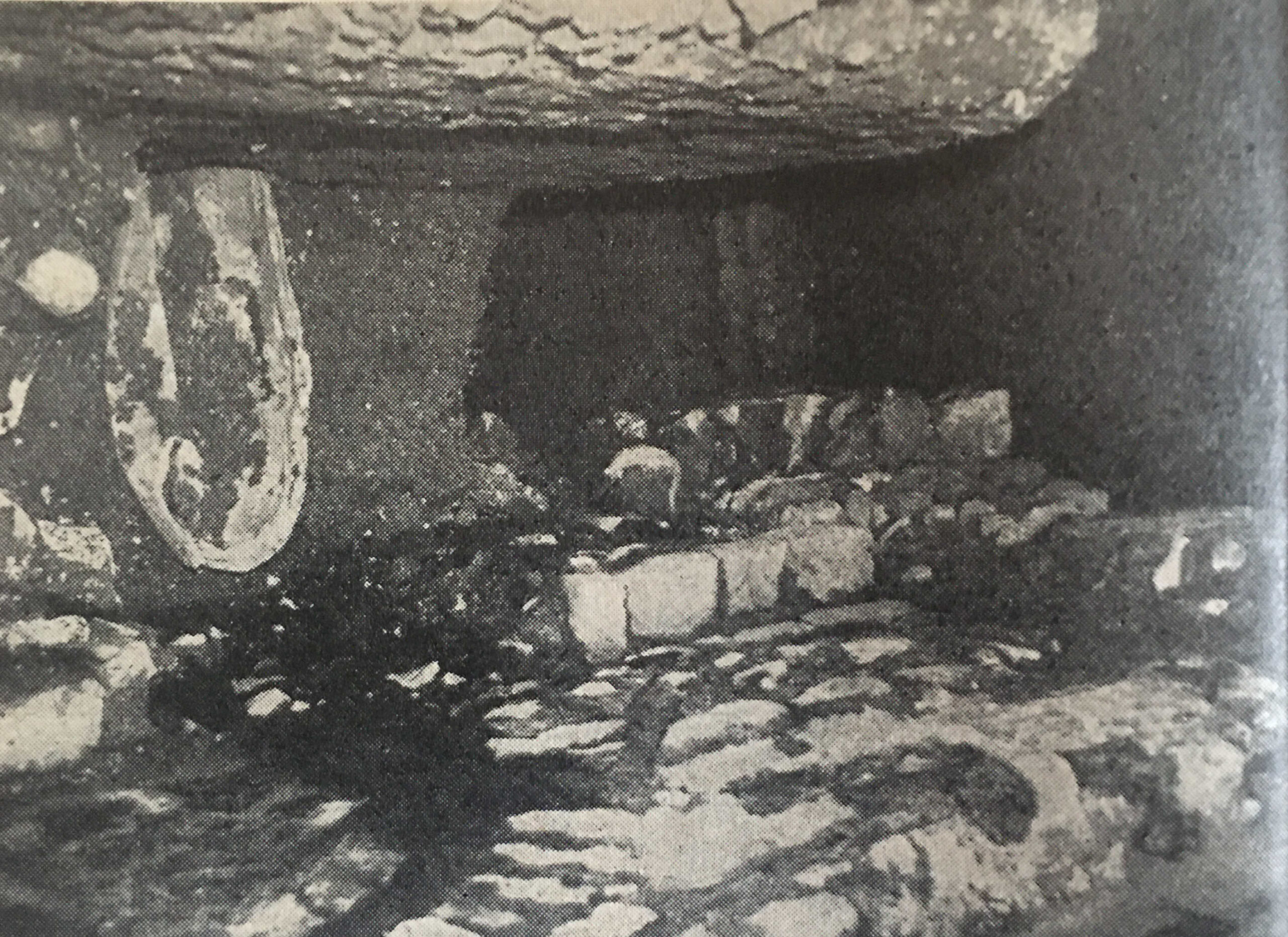
The above diagram shows the route under the Thames of the Baker Street and Waterloo railway, a depression in the London Clay and short distance of gravel through which the tunnel would need to run.
The tunnel passes under the river as seen in the following photo, and the blog post tells a story of the challenges of digging the tunnel in very difficult conditions.
My Great Grandfather was born in 1854, and as a young man, he went to sea and travelled the world.
He became a fireman in 1881, joining the Metropolitan Fire Brigade (MFB) at Rotherhithe, south east London, later moving to West Ham in 1886 as a Fire Escape man, where he remained for ten and a half years. At the time the MFB recruited only ex seamen and naval personnel as the Brigade was run on Naval discipline with a requirement for familiarity of climbing rigging and working at heights.
In 1896 he became the Superintendent of the new East Ham Fire Station, and in 2022, I completed one of the many tasks on my to-do list by visiting the site of the Fire Station in Wakefield Street, East Ham:
I cannot find the exact year when the fire station was demolished, it was at some point after 1917, and the location is now occupied by the flats shown in the above photo, but I did find lots of references to the fire station, and the work of the crews based there. which I wrote about in the post.
One of the many historical journeys across the country that ended in London was that taken by the funeral procession of Queen Eleanor of Castile, a remarkable 13th century woman.
The procession started from the site of her death, in Harby, Nottinghamshire. On the journey to London a cross was built at each of the places where the procession stopped overnight, and in 2022 I followed the route through Lincoln, Grantham, Stamford, Geddington, Hardingstone, Stony Stratford, Woburn, Dunstable, St. Albans, Waltham and then into Central London at Cheapside, Charing Cross and finally Westminster Abbey, where her body was buried.
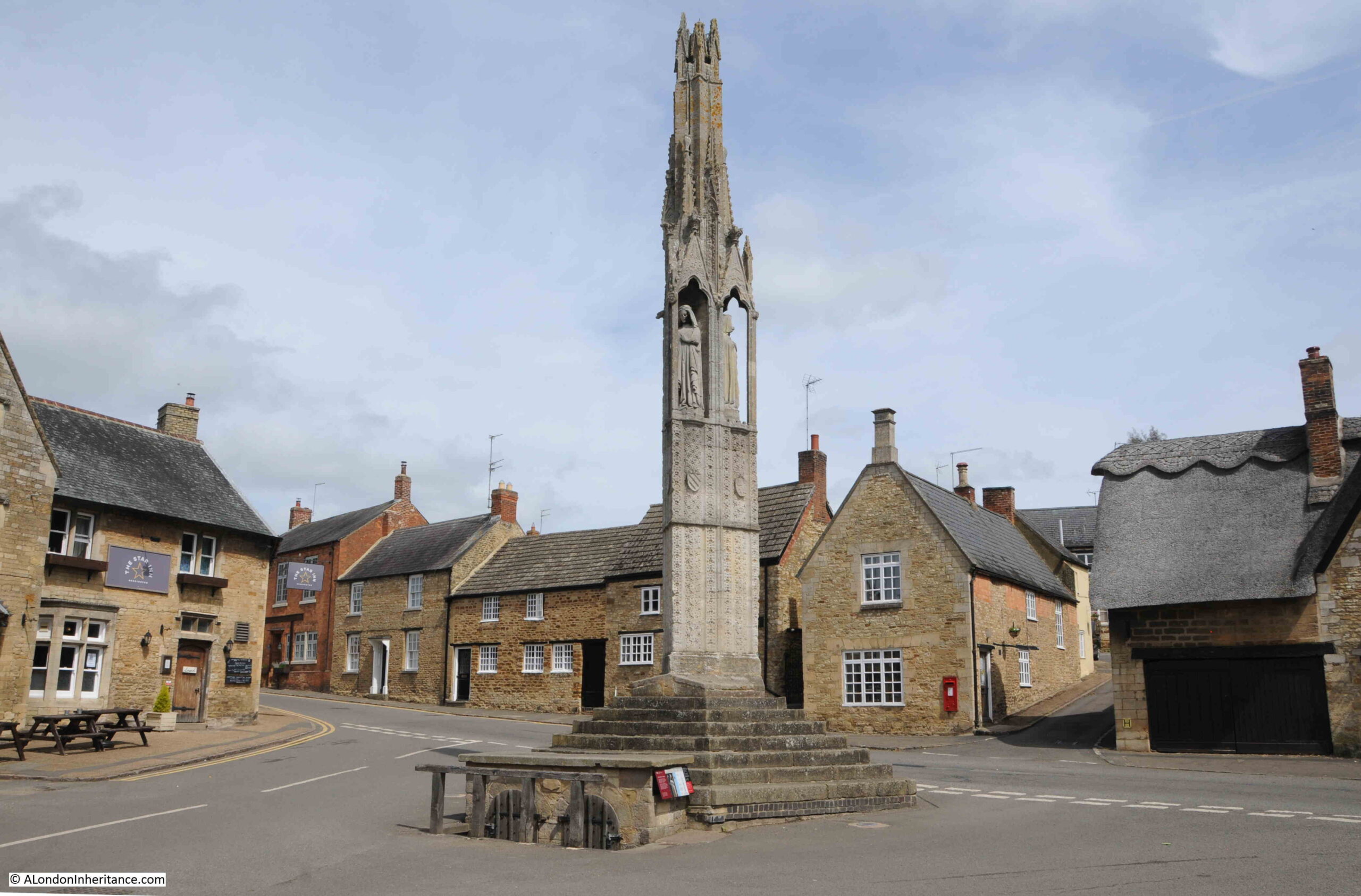
Geddington has the best preserved of all the remaining Eleanor crosses, which is located in an open space at the centre of the village:
The procession arrived at Geddington on the 6th of December 1290. Geddington is a small village, and the reason for choosing the village as a stop is that a royal hunting lodge was close by, just north of the church. The lodge had been built in 1129 and was used by royal hunting parties in the local forests, indeed Edward and Eleanor had stayed at the lodge in September of 1290.
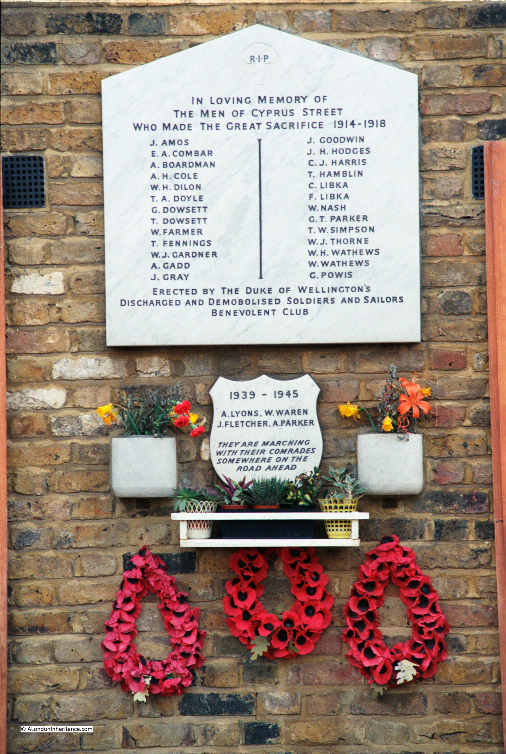
One of my father’s 1980s photos was of the war memorial in Cyprus Street, Bethnal Green:
Forty years later, I went back to take a new photograph, and explore the story of the memorial and the names recorded.
The reference on the memorial to the Duke of Wellington’s Discharged And Demobilised Soldiers And Sailors Benevolent Club refers to the Duke of Wellington pub in Cyprus Street. The pub was built around 1850 as part of the development of Cyprus Street and surrounding streets.
The pub closed in 2005 and is now residential, but today still very clearly retains the features of a pub, including a pub sign.
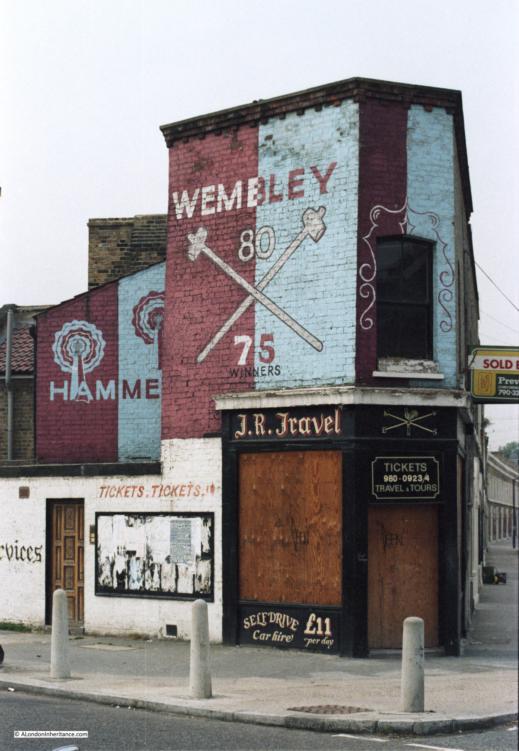
Variations of the search term “London in the 1980s” resulted in this post being the most read post on the blog in the last ten years, with people using search terms about London in the 1980s being regularly directed to the post from Google.
One of the photos featured in the post was this tribute to West Ham:
London has changed considerably since the 1980s, and will continue to change, it is the one constant throughout the whole of the city’s long history and it is fascinating to see how London has responded to so many internal and external factors over the centuries.
Thank you for reading the blog, and I hope the coming years continue to be of interest.
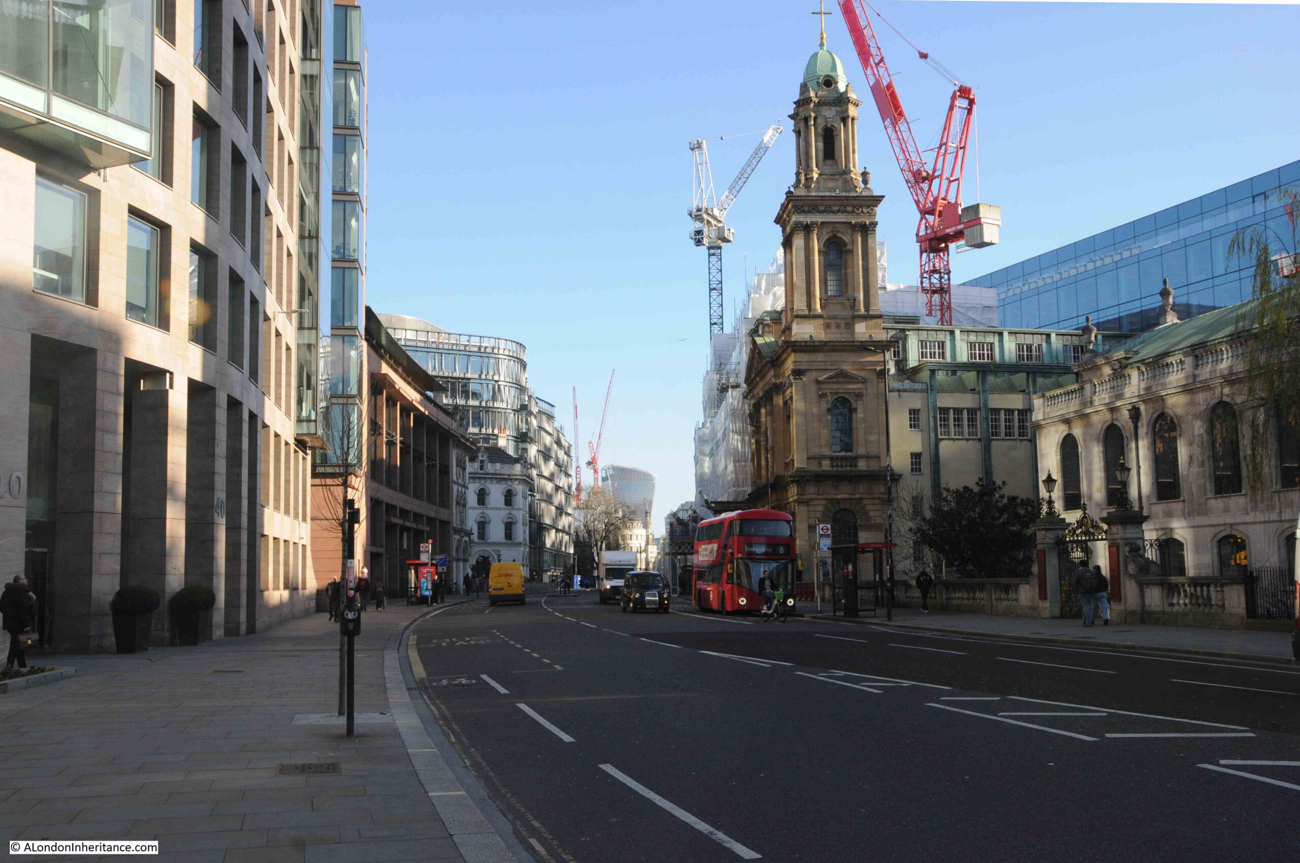
This is the church of St. Andrew, Holborn, photographed in the low sun of a bright winter’s afternoon:
I will be exploring the church later in the post, but to start, let’s look at the location of St. Andrew, because I suspect the church is here due to its proximity to the River Fleet, and it is one of a number of London’s churches that are located at key boundaries, crossings and entry and exit points, of a much earlier City of London.
In the following photo, I am looking along Holborn Viaduct, towards the bridge over Farringdon Street, the old route of the River Fleet. Part of St. Andrew is on the right of the photo (the ornate tower is part of the City Temple Church, a much later Nonconformist church which is currently undergoing significant rebuilding works):
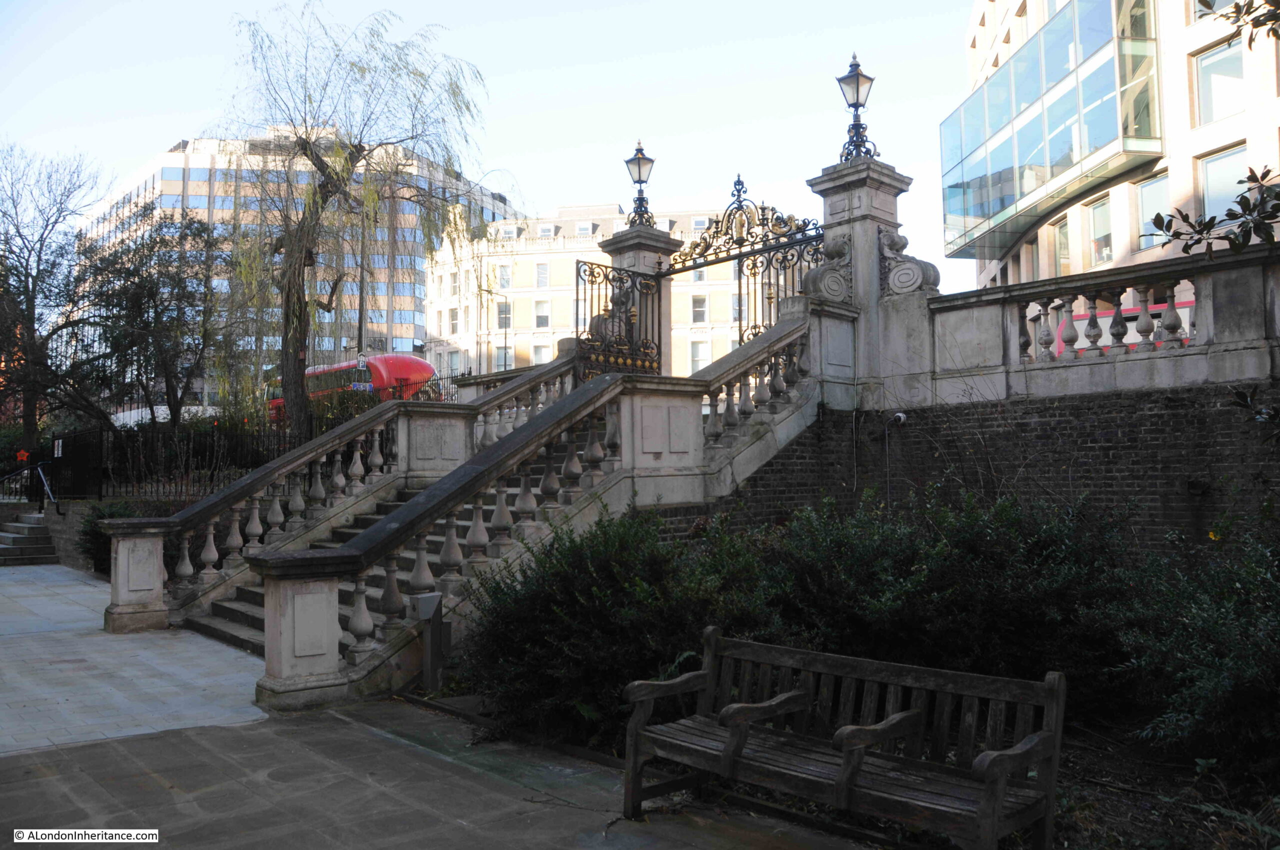
If we stand in what remains of the churchyard around St. Andrew, we can see that Holborn Viaduct is much higher than the churchyard, which marks the original surface level of the area. Today there are steps up from the churchyard to Holborn Viaduct:
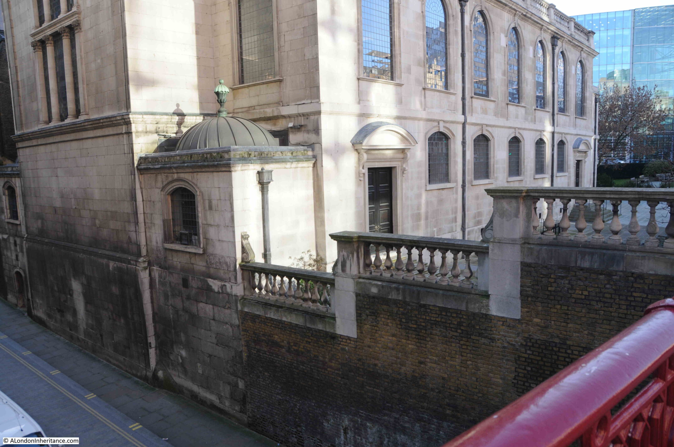
And because of the height of Holborn Viaduct, a bridge is needed to take the street over Shoe Lane, which runs alongside the eastern boundary of the church, a view which again shows how surface levels have changed around the church:
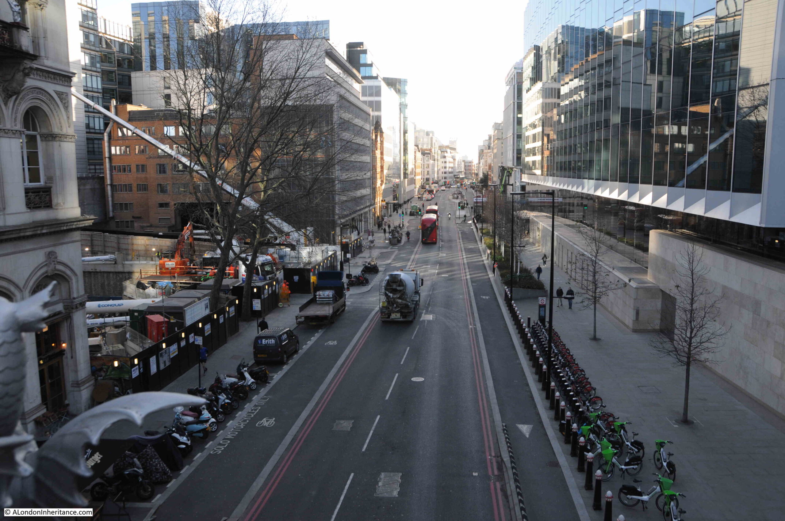
A short walk east from the church, and we can look over the bridge down to Farringdon Street, a view which shows the height difference between the upper road, and the original route of the River Fleet (which would have been lower than the current road surface due to building over the original water course):
The bridge over Farringdon Street is part of Holborn Viaduct, the 427m long viaduct designed to provide a bridge over the valley of the Fleet River and a level road between Holborn Circus and Newgate Street.
The construction contract for Holborn Viaduct was awarded on the 7th May 1866 and on the 6th November 1869 it was opened by Queen Victoria. One of the many 19th century “improvements” to the City, designed to address growing congestion along the streets, and to build a City that mirrored London’s global position.
Before the construction of the viaduct, there had been a hill which ran down from Holborn, down to the original route of the Fleet.
To get the level street surface of Holborn Viaduct, with sufficient clearance for the bridge over Farringdon Street, the level of the street needed to be raised, and is why the street is now higher than the churchyard around St. Andrew’s.
The church also lost part of the churchyard, as the new Holborn Viaduct was much wider than the street running down the hill, that it had replaced.
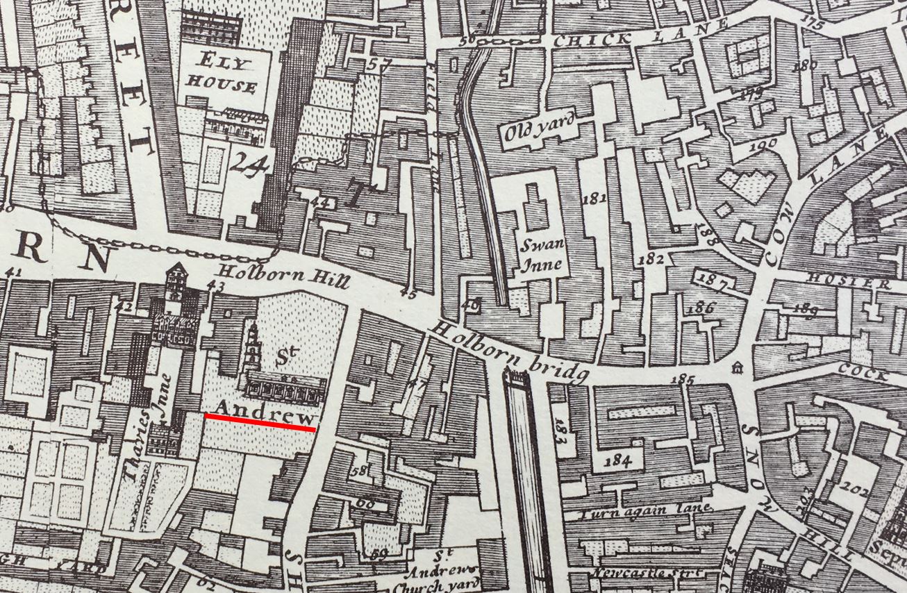
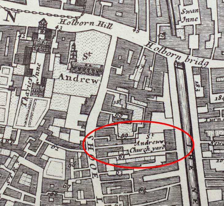
Whilst Holborn Viaduct now carries the street over a large road below, there has long been a bridge here, earlier versions of stone and wood, that carried the road from Holborn towards the City, and we can get an idea of how this looked in the following extract from William Morgan’s map of London from 1682:
I have underlined the location of St. Andrew’s with a red line, and you can see it had a large churchyard up to what was then called Holborn Hill, indicating that this was a hill from the higher ground of Holborn, down to the lower lying River Fleet.
The river can be seen to the right of the church, with Holborn Bridge spanning the river. In the late 17th century, the wide channel of the Fleet down to the Thames became a smaller river running north, although by this time, and with all the surrounding building, it was more an open sewer than a river.
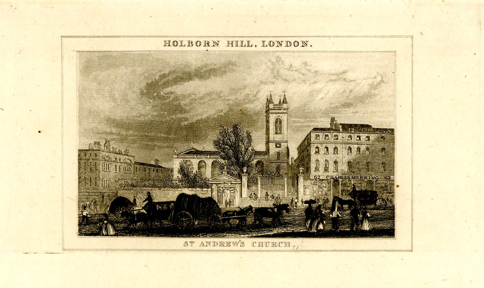
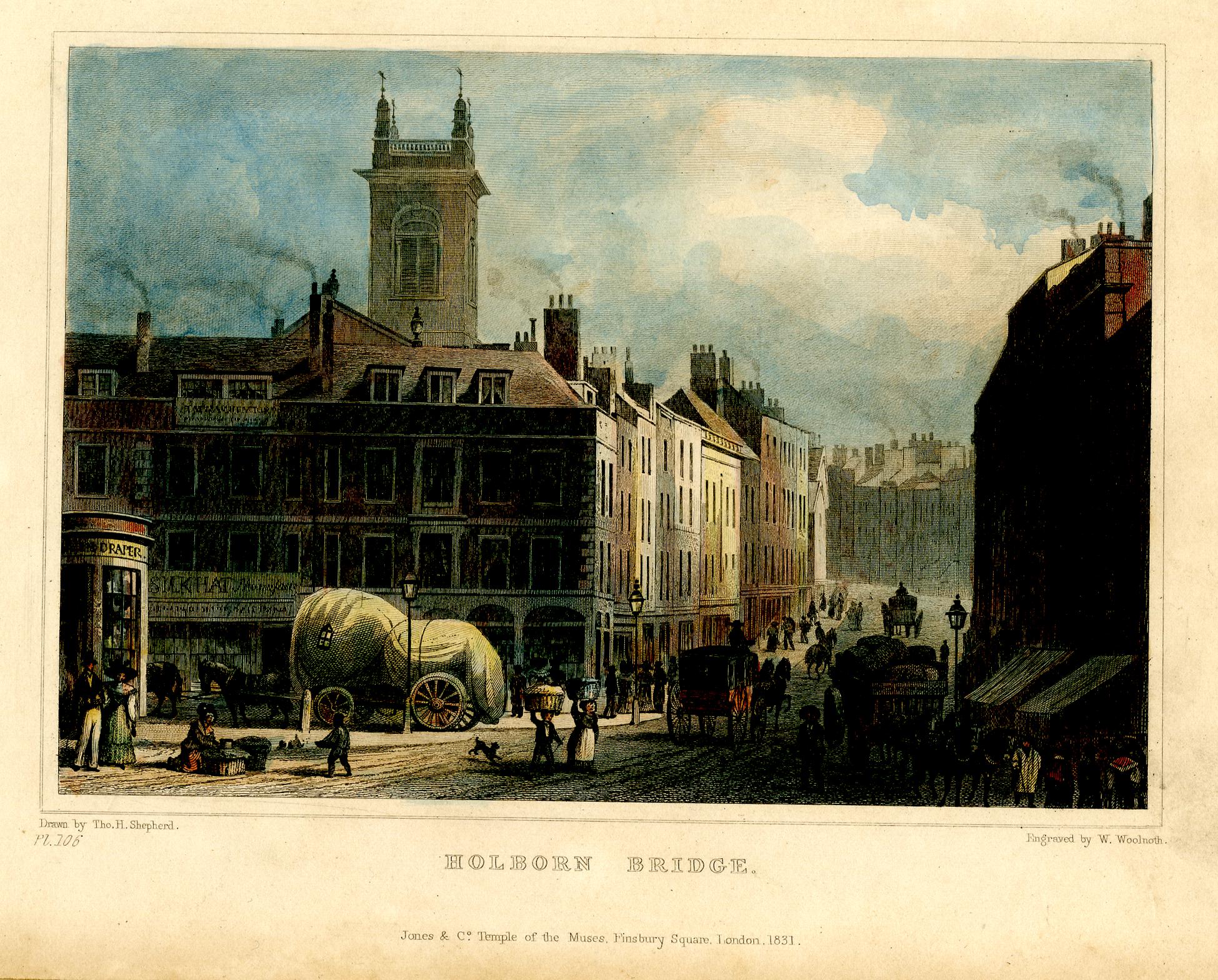
We can get an idea of the gradient of Holborn Hill from the following two prints.
In the first, from the early 1800s, we can see the church and the surrounding churchyard, was originally higher than the street, and you can see the slope of the street outside the church as it heads down towards where the Fleet was once located:
In the second print (from 1831), we are looking across Holborn Bridge (which was roughly at the level of Farringdon Street today), up Holborn Hill, with the tower of St. Andrew on the left:
The above two prints show just how significant the impact of the 19th century Holborn Viaduct was on the area, and in the above print, we can imagine the River Fleet flowing in the foreground, marshy land on either side, then a hill rising up to the church – it would have been in a very prominent position.
St. Andrew occupies a place that has been the site of a religious building for very many centuries. The church we see today is just the latest version of the church.
The first written records of a church on the site date back to the year 959, when a charter of Westminster Abbey refers to an “old wooden church”’ on the hill above the River Fleet.
There was probably a church on the site for some years before the first written record, and we can imagine the scene with a small wooden church sitting on the high ground at the top of a hill from where the land runs steeply down to the River Fleet. A river that would have been wider prior to the buildings shown in the 1682 map, and with marshy banks.
So if you were heading towards the City, St. Andrew’s would have been just before the road descended down a hill to the Fleet, and if you were leaving the City, as you walked up the hill from the Fleet, you would come to St. Andrew’s.
Perhaps if you were entering or leaving the City, crossing the boundary of the Fleet, you would have wanted to pray, perhaps to ask for protection on the next stage of your journey.
Despite the amount of building across London over very many centuries, we can still see churches at what were major boundaries between the original City of London, and the rest of the city and the wider country. Churches are one of the few fixed points in the City’s landscape that have not moved for often over one thousand years.
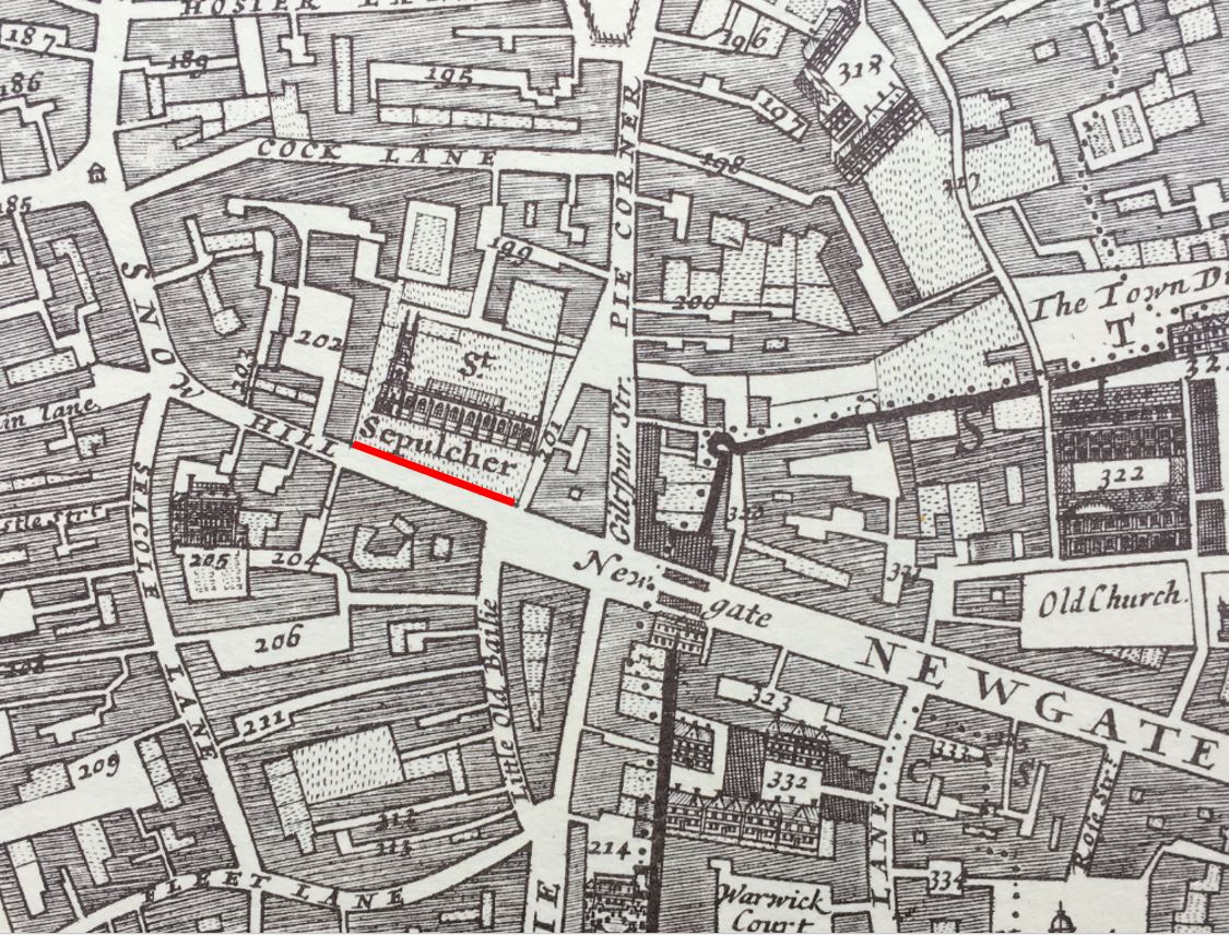
Headimg back north, and just to the west of the entrance to the City through Newgate, we find St. Sepulcher:
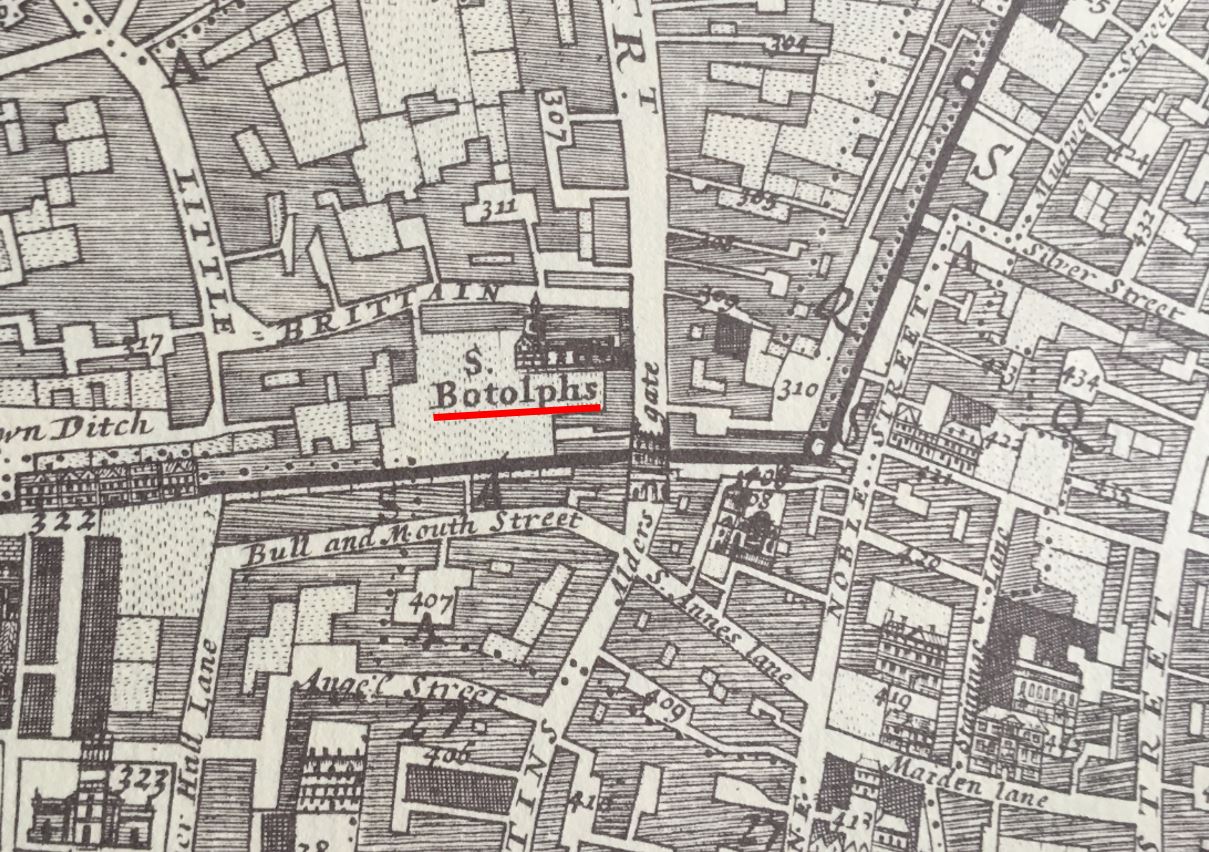
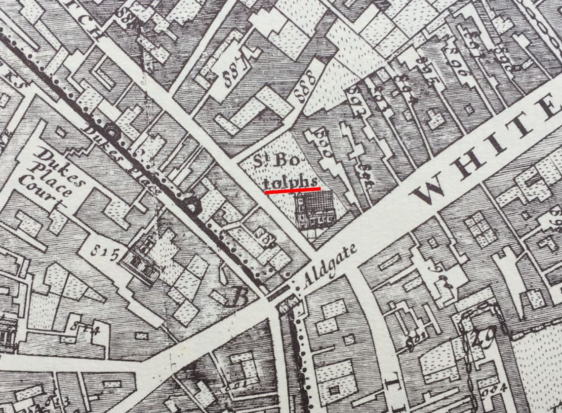
We then come to Aldersgate, and just outside the gate we find St. Botolphs (there are three St. Botolphs outside the gates of the City of London. The relevance of the dedication will become clear later in the post):
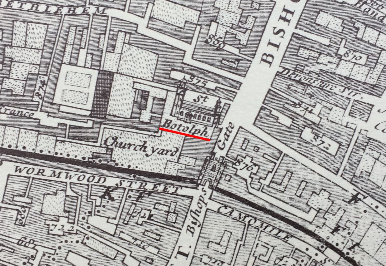
On the approach to Bishopsgate, we find St. Botolph, which claims to have been built on the site of an earlier Saxon church:
St. Botolph is the patron saint of travelers, so a church dedicated to the saint would often be found where there are boundaries, or city gates, and another church dedicated to St. Botolph can be found just outside Aldgate, so three with the same dedication, to be found by gates in the old City wall:
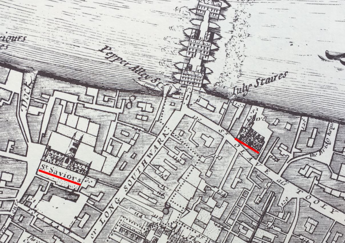
Churches located at major boundaries, crossings, entry and exit points can be found south of the river, and in the 1682 map, close to the southern end of London Bridge, we find two churches, St. Olave’s on the right, and St. Savior’s, now Southwark Cathedral on the left:
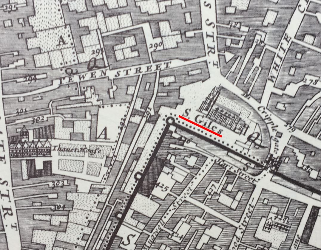
There is no church just outside the old Moorgate. I suspect that this may have been due to the marshy nature of the fields outside this gate in early centuries, a moor which gave its name to the area we know today, and which was only drained in the 16th century.
So a church close to a gate into the City of London, or where you would have had to have crossed either the Thames or the Fleet is a feature we can still see today, although the gates or crossing points they marked (with the exception of the Thames) are long gone.
Now let’s walk back to the church, and to get an idea what the hill was like up from the River Fleet in the 18th century, this report from the 11th of February, 1743 gives an indication:
“It is hoped proper Care will be immediately taken to destroy this Gang of Thieves; who to the Number of 20 and upwards assemble every Night, and plant themselves on each Side of the Way, from St. Andrew’s Church to Holborn Bridge, commit all kind of Villainies, and make that Passage the most dangerous of any in the Town”.
You probably would have wanted to nip into St. Andrew for a quick prayer before risking the “Gang of Thieves” waiting for you as you walked down Holborn Hill.
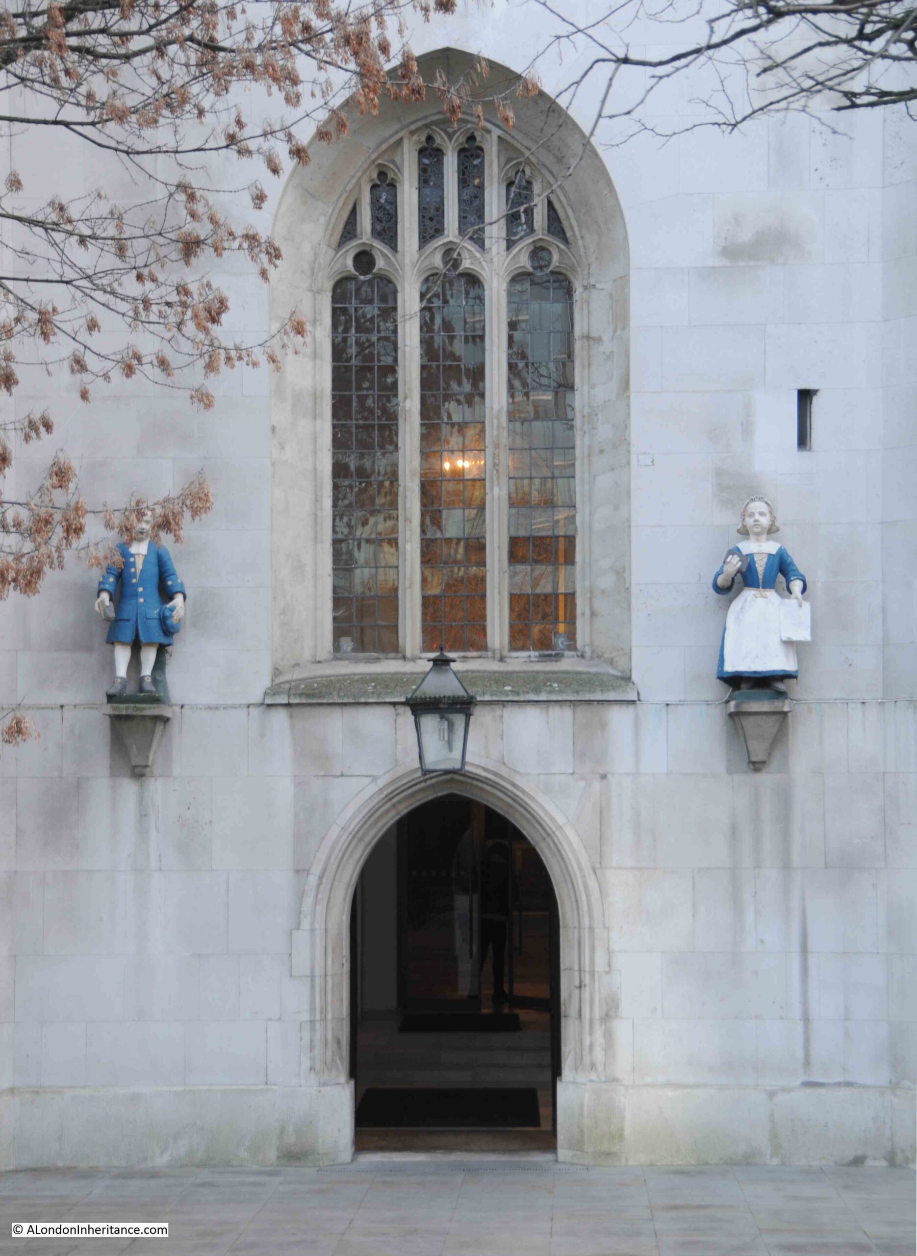
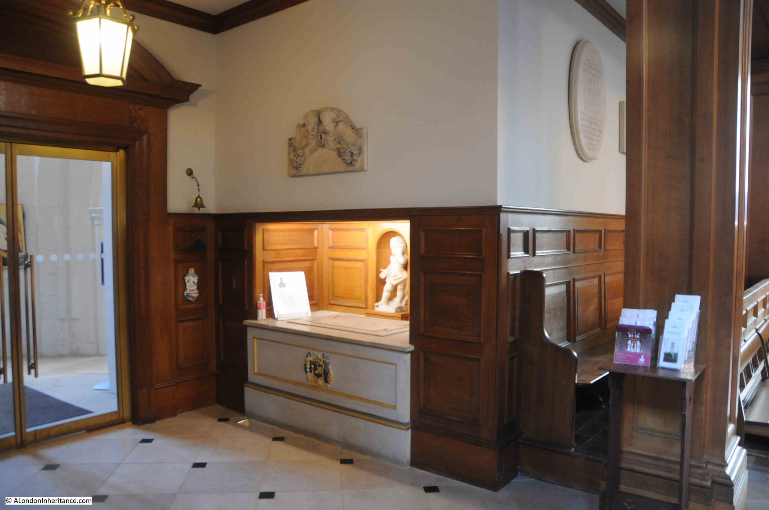
No such dangers today, and as we walk towards the entrance to the church, there are two figures on either side:
The figures are not in their original location, they came from St Andrew’s Parochial School for children of the poor dating from the 1720s. The school was based in a Chapel of Ease built in Hatton Garden in the 1670s. The building is still there today, and I will return to it in a future post.
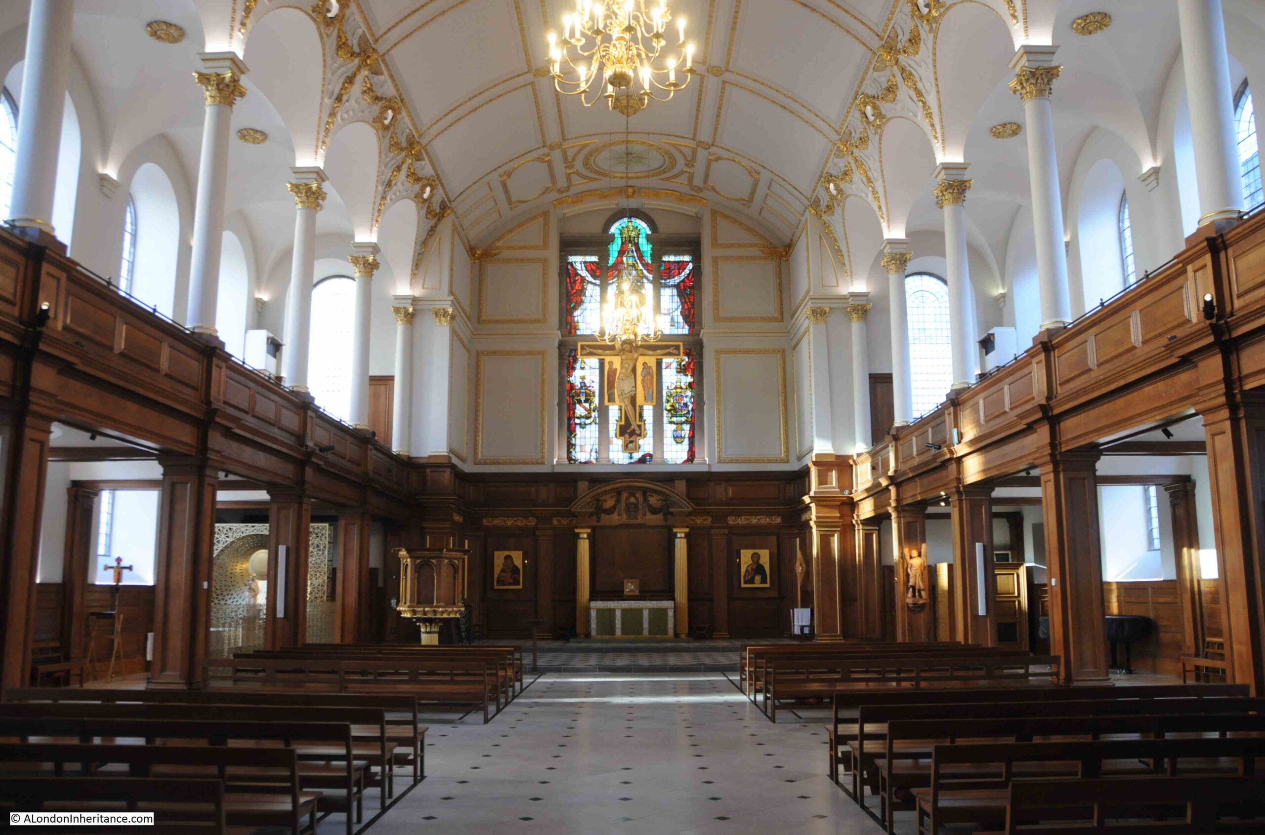
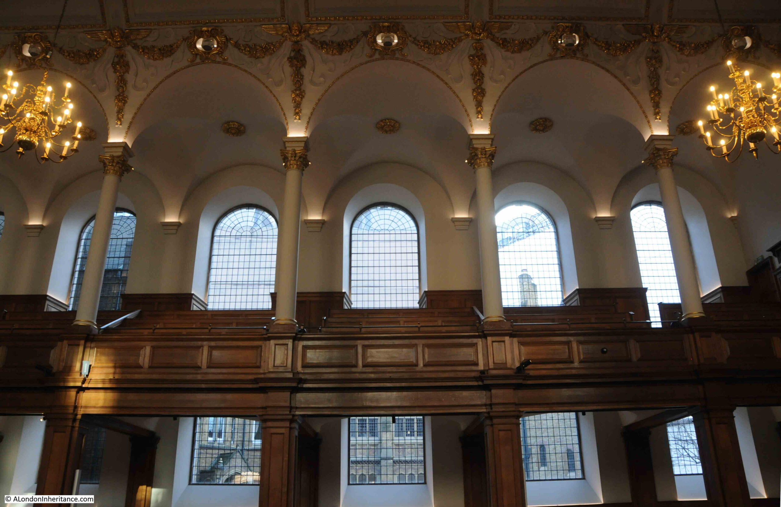
The interior of the church has white upper walls with gold decoration, and wood paneling around the columns and side walls on the ground floor, which lead up to a gallery with tiered seating on either side:
The interior of the church looks very new, and was the result of a rebuild by the architects Seely and Paget between 1960 and 1961 to repair the very considerable wartime damage to the church.
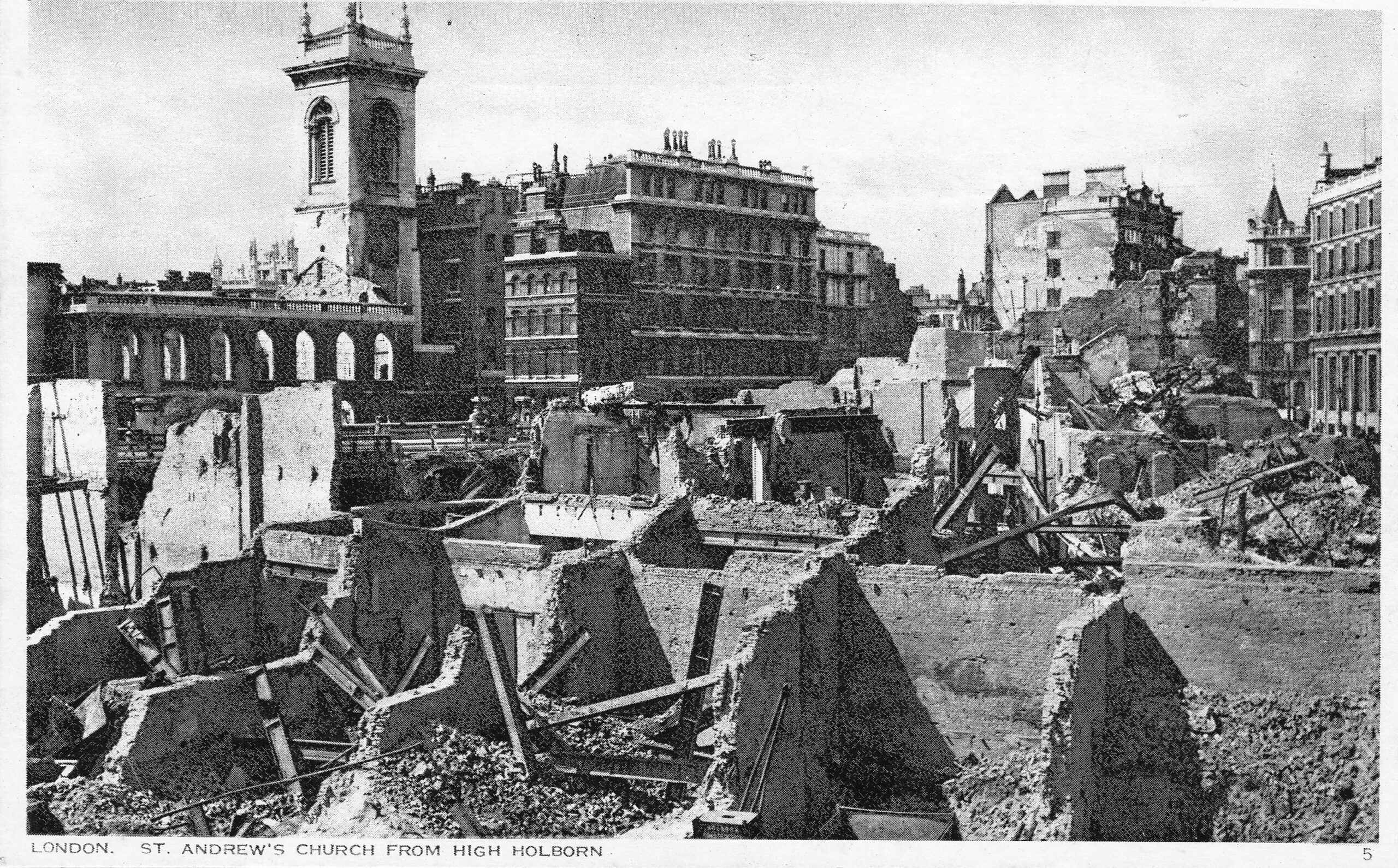
The church featured in one of a series of postcards called London under Fire, showing damage to the city. In the postcard, the church can be seen on the left. the roof gone and the interior gutted. The side walls and tower surviving. The result of an incendiary bomb falling on the church:
The church we see today, and the walls and tower in the above photo are from Christopher Wren’s rebuild of the church between 1684 and 1690. The previous church escaped any damage from the Great Fire, however it was a 15th century rebuild of an earlier medieval church, and was in need of significant repair.
Looking up to one of the galleries that run either side of the church:
Today, St. Andrew is a non-parochial Guild Church, meaning that the church serves the local working population rather than any resident population, so you will not find a Sunday service held at the church.
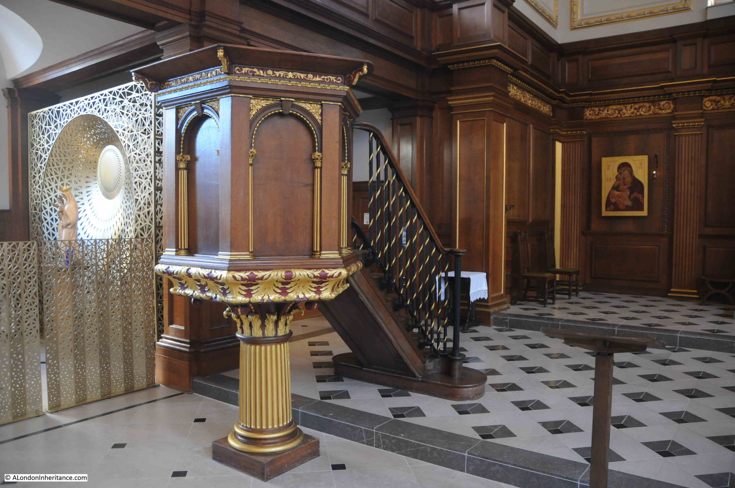
The pulpit:
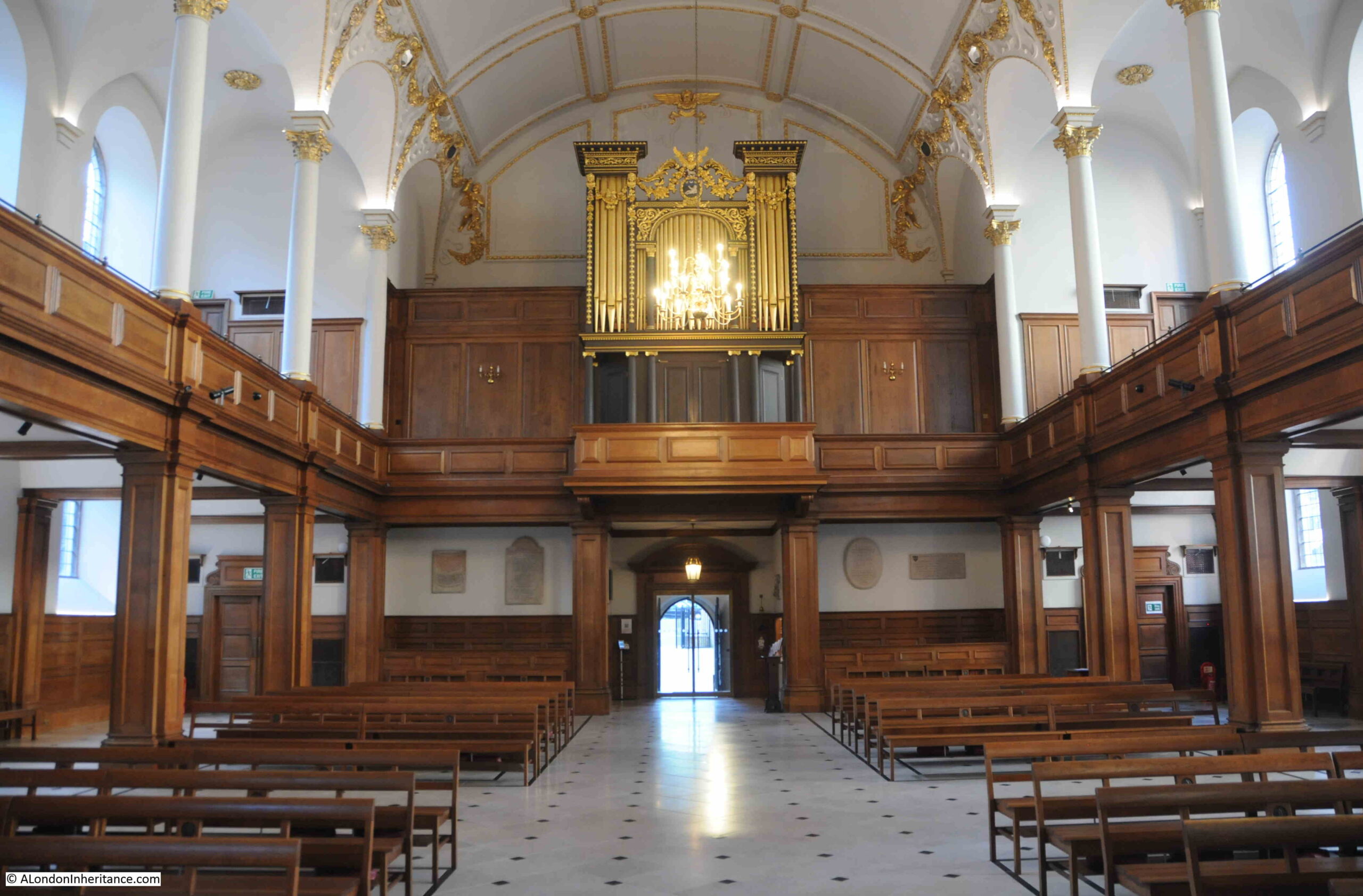
The interior of the church looking back towards the main entrance and the organ:
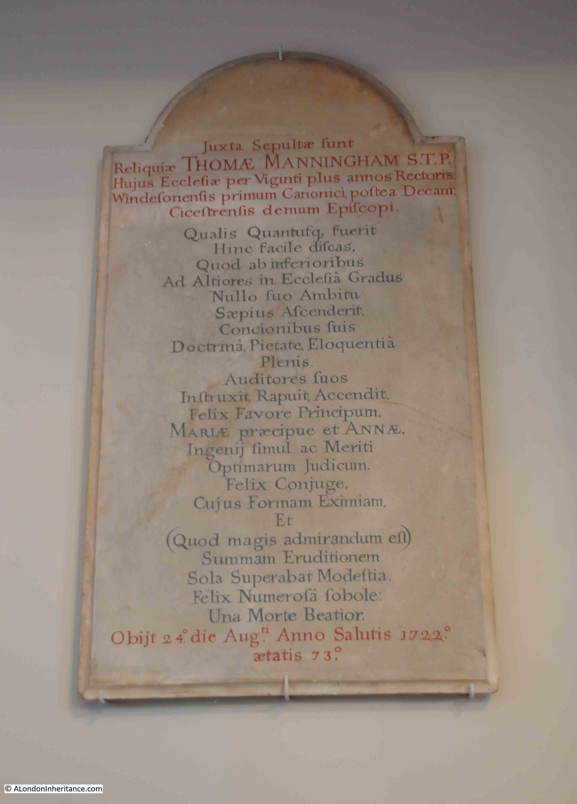
There are very few memorials in the church, perhaps because of the destruction of the interior during the last war. There are a few on the wall, on either side of the main entrance, including one that dates from 1722:
St. Andrew, Holborn does have a wide range of associations with people and events over the years.
In 1799, Marc Brunel, the father of Isambard Kingdom, was married in the church, and in 1817 Benjamin Disraeli, a future Prime Minister, was christened in the church at the age of 12.
Another story connects the church with the founding of the Royal Free Hospital. The story concerns a local surgeon, William Marsden, who found a young girl dying from exposure in the churchyard on a winter’s night in 1827.
Marsden tried to get the girl into a hospital, however none would accept her, and she went on to die. Hospitals at the time usually required a letter of recommendation from a subscriber to the hospital
Marsden was so appalled by the attitude of these hospitals, and the lack of any care for those who had no ability to pay, that he decided to open a new hospital for those who could not pay or provide a letter of recommendation..
Marsden had the support of the Cordwainers Company, and in April 1828 he opened the Royal Free Hospital in a small house in Greville Street, Hatton Garden (originally just the Free Hospital, with Royal added not long after through the patronage of the Duchess of Kent and Princess Victoria).
I could not find any reference from the time to the founding story of the discovery of the girl in the churchyard, however reports of annual general meetings of the hospital do confirm the aims of providing free care for those who could not afford to pay, and who could not get a letter of recommendation from a subscriber. For example, from the record of the 1837 anniversary dinner:
“This institution has been established to afford immediate assistance to all applicants, but more particularly to meet the wants of the poor and diseased, whose wretched situation and circumstances render them, in most instances, unable to procure the recommendations required to obtain admission or assistance from the hospitals and dispensaries of the metropolis, and from which this institution differs in these important facts – that its doors are always open to the poor and afflicted, without any passport save their own infirmities.
No ticket or recommendation from a subscriber is necessary; poverty and disease are alone the wretched qualifications which entitle them to the benefit the charity is capable of affording.”
The Royal Free Hospital is now in Pond Street, Hampstead, and William Marsden would also found, in 1851, the Brompton Cancer Hospital, which would become the Royal Marsden Hospital.
St. Andrew’s has another connection with someone who would try and help the poor of the city.
Just inside the main entrance to the church is the tomb of Thomas Coram, the founder of the Foundling Hospital, which started out in a temporary building in Hatton Garden in 1741.
Foundlings were abandoned very young children, or the young children of single mothers or poor parents, who could not afford to bring up their child.
The Foundling Hospital deserves a full post, but in the entrance to St. Andrew’s, we can see Coram’s tomb. He was originally buried on the site of the original Foundling Hospital, but in 1955 his tomb was moved to St. Andrew’s when the hospital buildings in Berkhampsted (the location of the Foundling Hospital after moving from where Coram Fields is today) were demolished:
The font and pulpit from the Foundling Hospital chapel were also moved to St. Andrew’s.
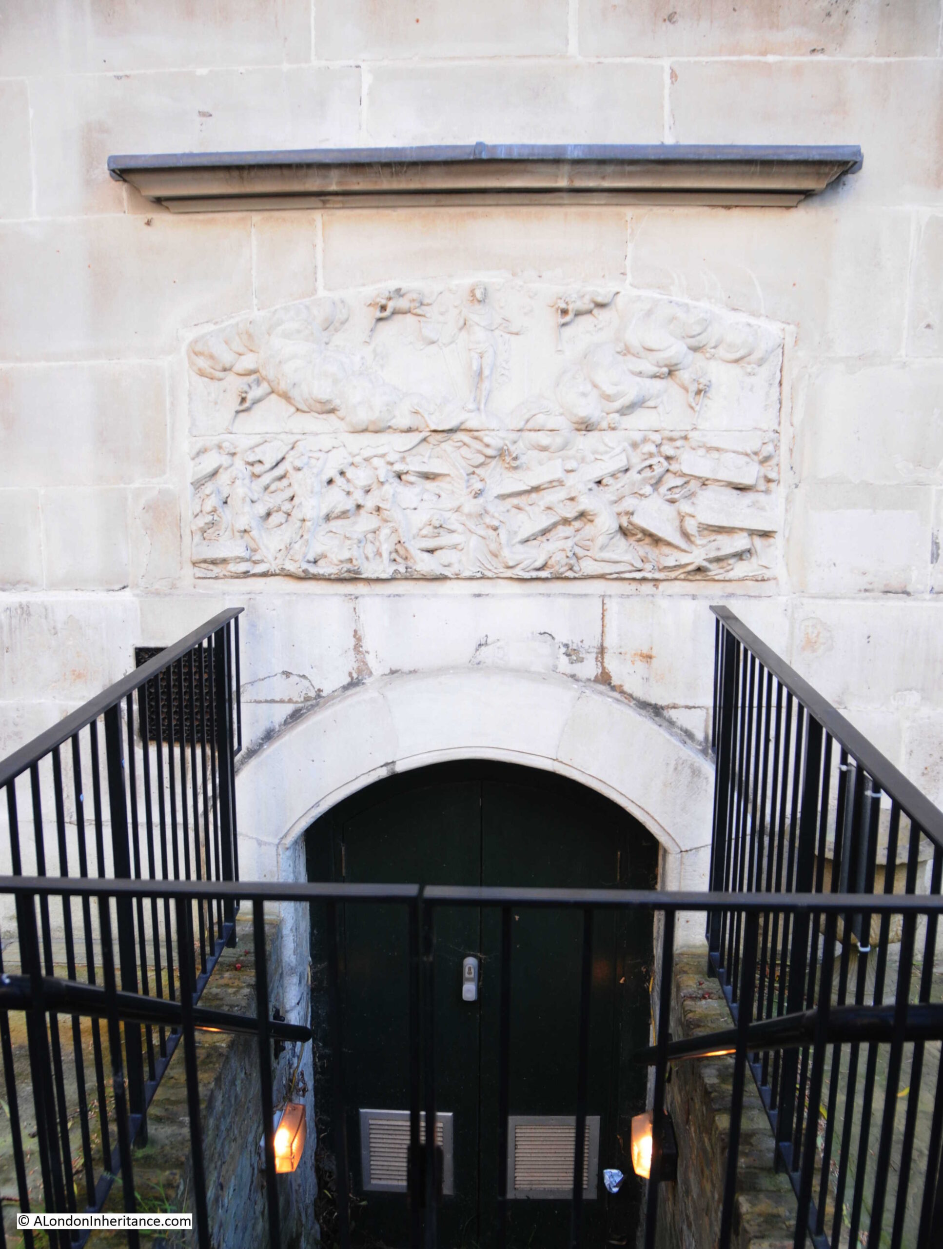
Another survivor from another place at St. Andrew’s is a resurrection stone, showing Christ standing over the dead, as they rise from their coffins preparing for the final day of judgment:
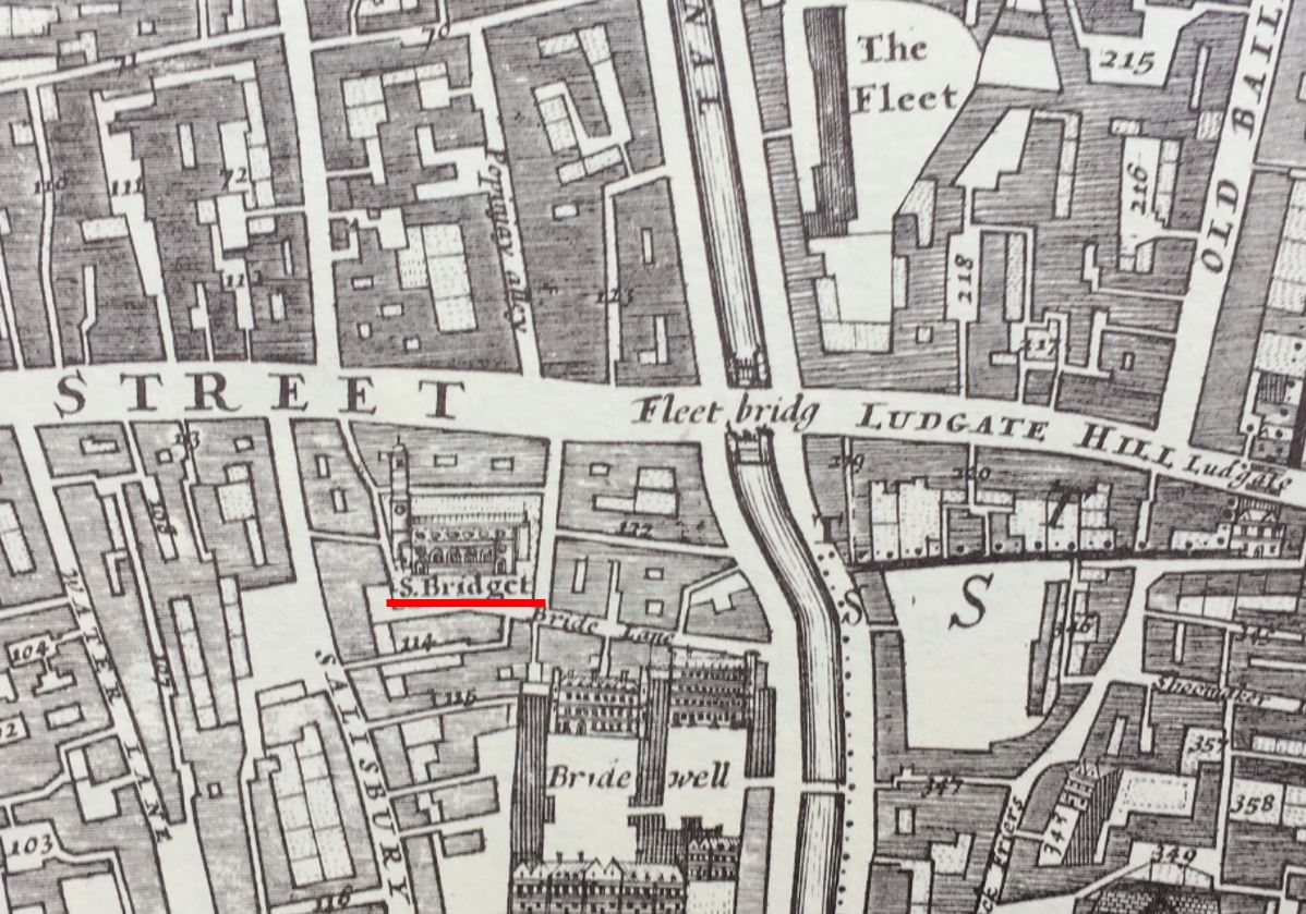
The resurrection stone came from the entrance to a cemetery used by St. Andrew’s for burying the poor, located a short distance from the church with an entrance from Shoe Lane, ringed in the following extract from Morgan’s 1682 map:
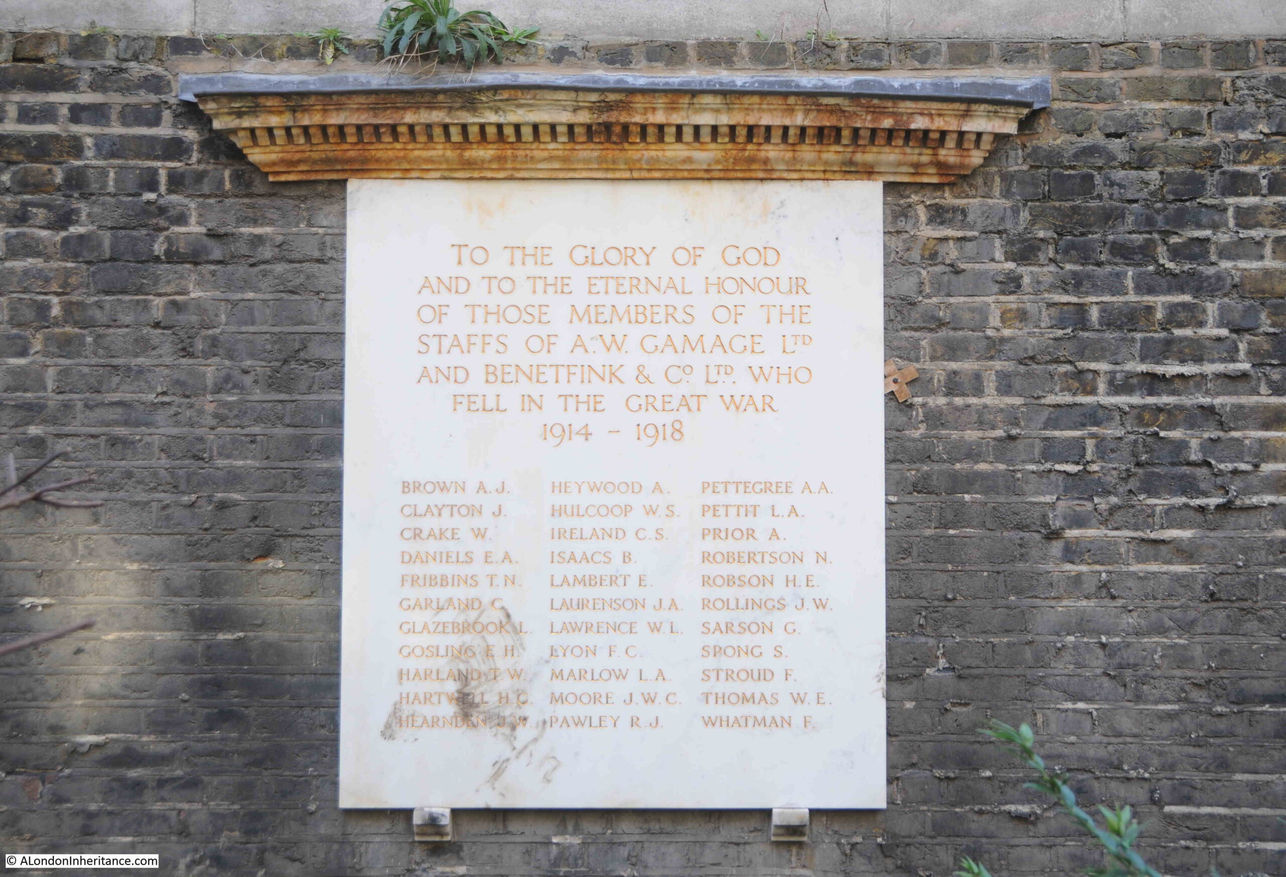
Another survivor, very different, but no less interesting, is the war memorial from the stores of A.W. Gamage and Benetfink & Co:
Not exactly what you would expect to find hidden in a City churchyard. Gamages was a large department store in Holborn and Benetfink were a Cheapside based ironmongers, taken over by A.W. Gamage in 1907.
Gamages closed in March 1972, and the war memorial was moved to St. Andrew’s churchyard.
I have no idea why it is in the churchyard rather than inside the church, however it is good that it remains in Holborn, and is the last trace of the Gamages company and department store to be found in Holborn.
As usual, a quick run through some fascinating history, and St. Andrew, Holborn is an interesting example of how churches were located at important boundary points, boundaries that are not (with the exception of the Thames) visible today.
We cannot get into the minds of mediaeval inhabitants of London, so it is difficult to fully understand the importance of a church at such a location, but given the number of churches through the City, it does show how important religion was, including at places where you were crossing a boundary, entering or leaving the City, crossing the Fleet or the Thames.
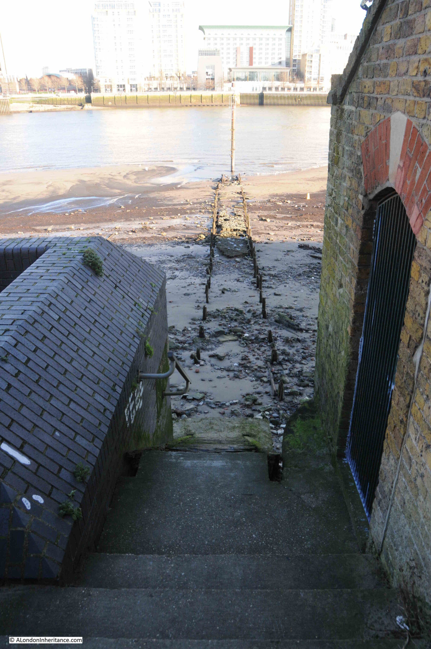
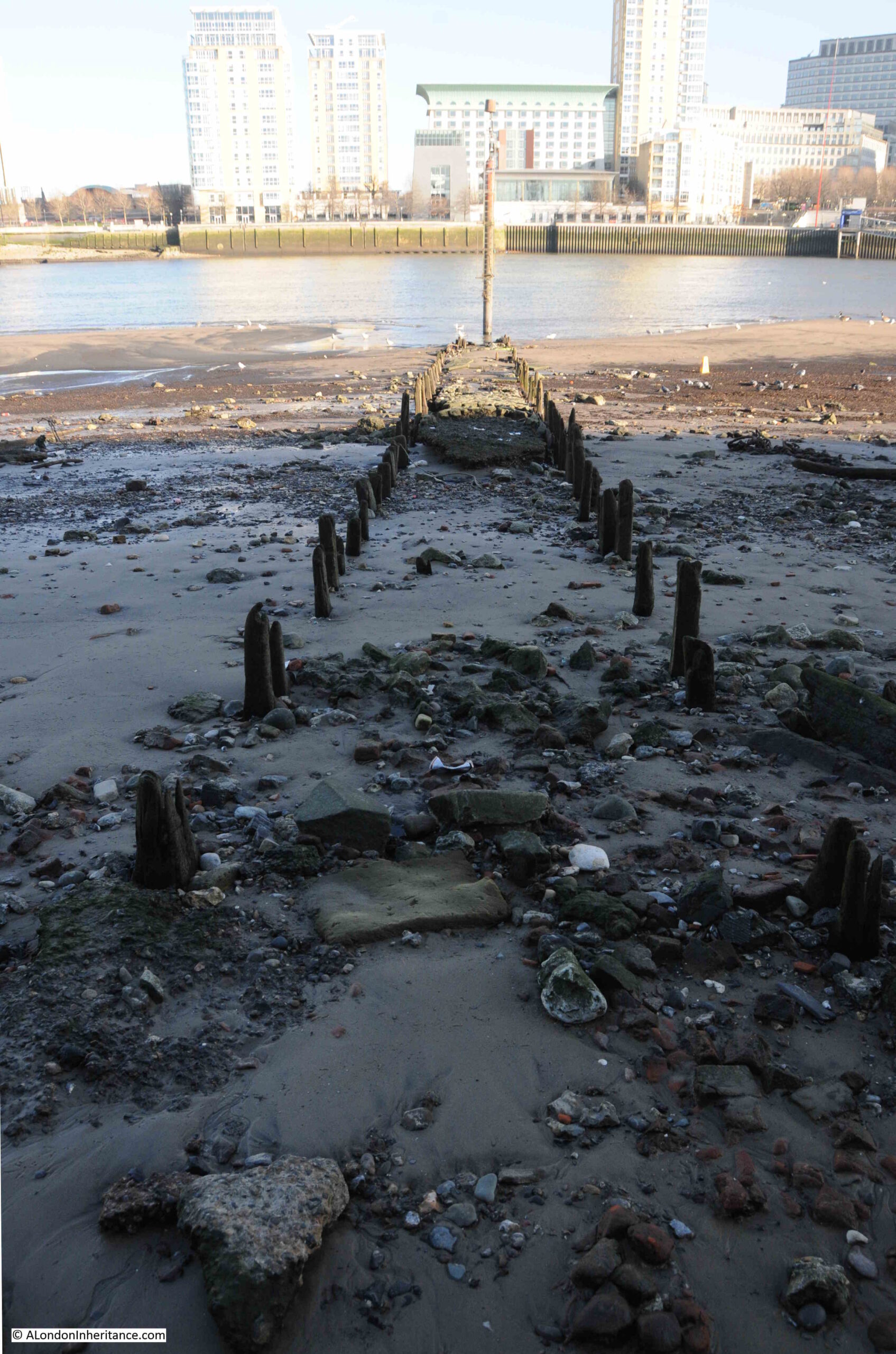
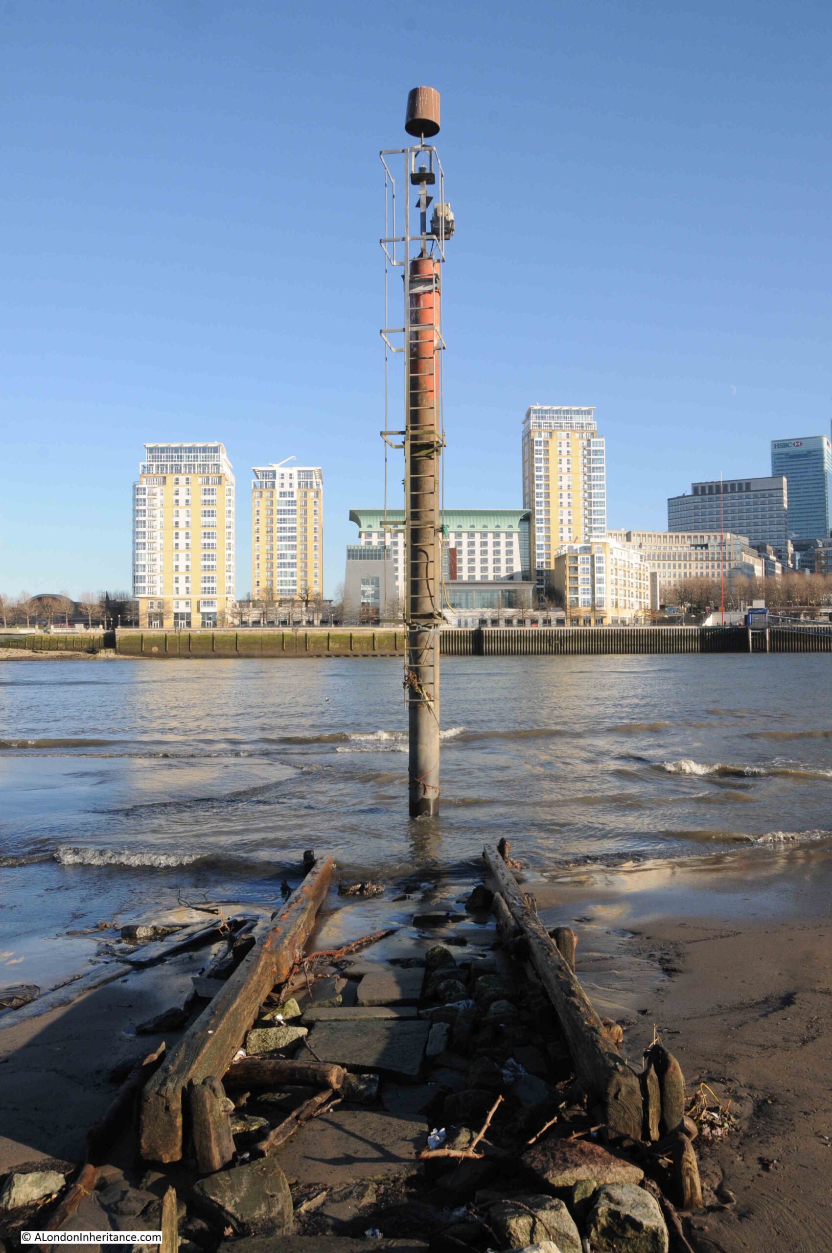
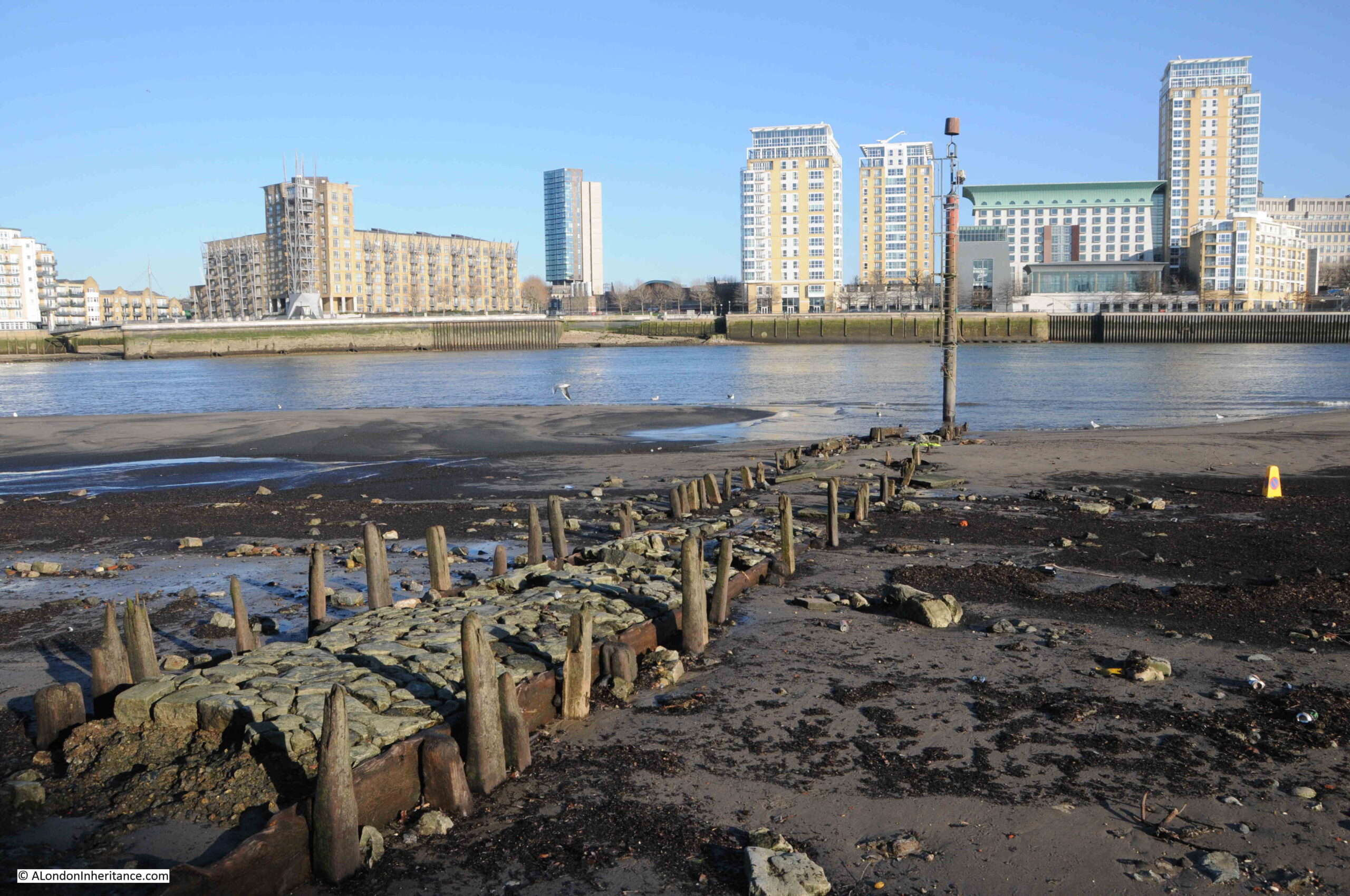
If you wanted to visit somewhere in London on a very cold January morning, a bright day, but with ice having formed overnight on standing water, the last place you may think of is the Thames foreshore, however, on such a day, I went to one of my favourite places on the river – Horn Stairs and Cuckold’s Point:
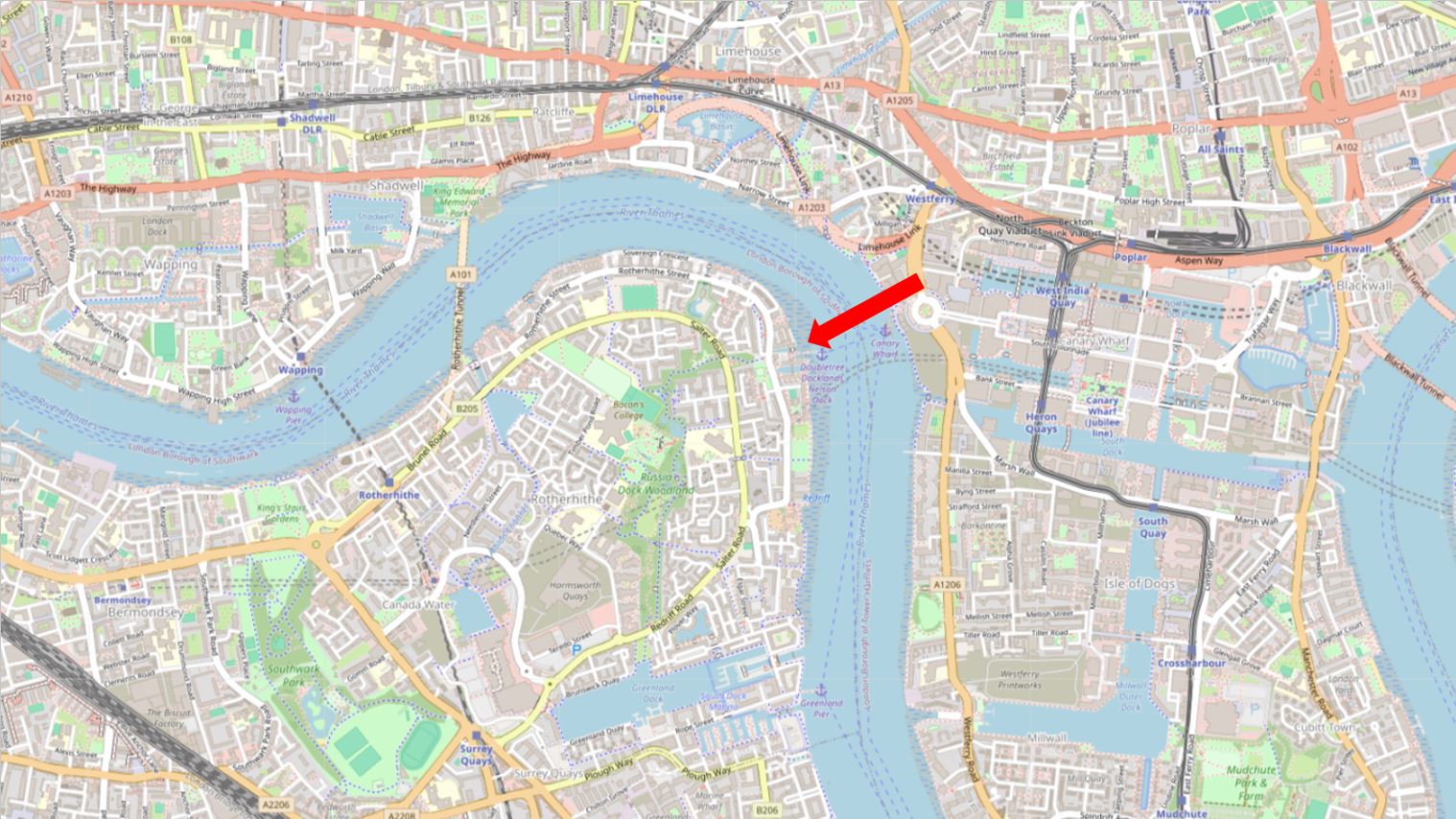
Horn Stairs and Cuckold’s Point are in Rotherhithe, opposite Limehouse and the north-eastern part of the Isle of Dogs, on the inside of a bend in the river where it curves past Rotherhithe.
Cuckold’s Point is the area of the river / foreshore slightly to left and right of the arrow head in the above map, and where, when the tide is low, there is a broad beach of sand and mud running down to the water.
I was walking from the west, and there were some stunning views across the river, and as I reached the stairs, the outline of the causeway running from Horn Stairs could be seen, with a pole towards the end of the causeway:
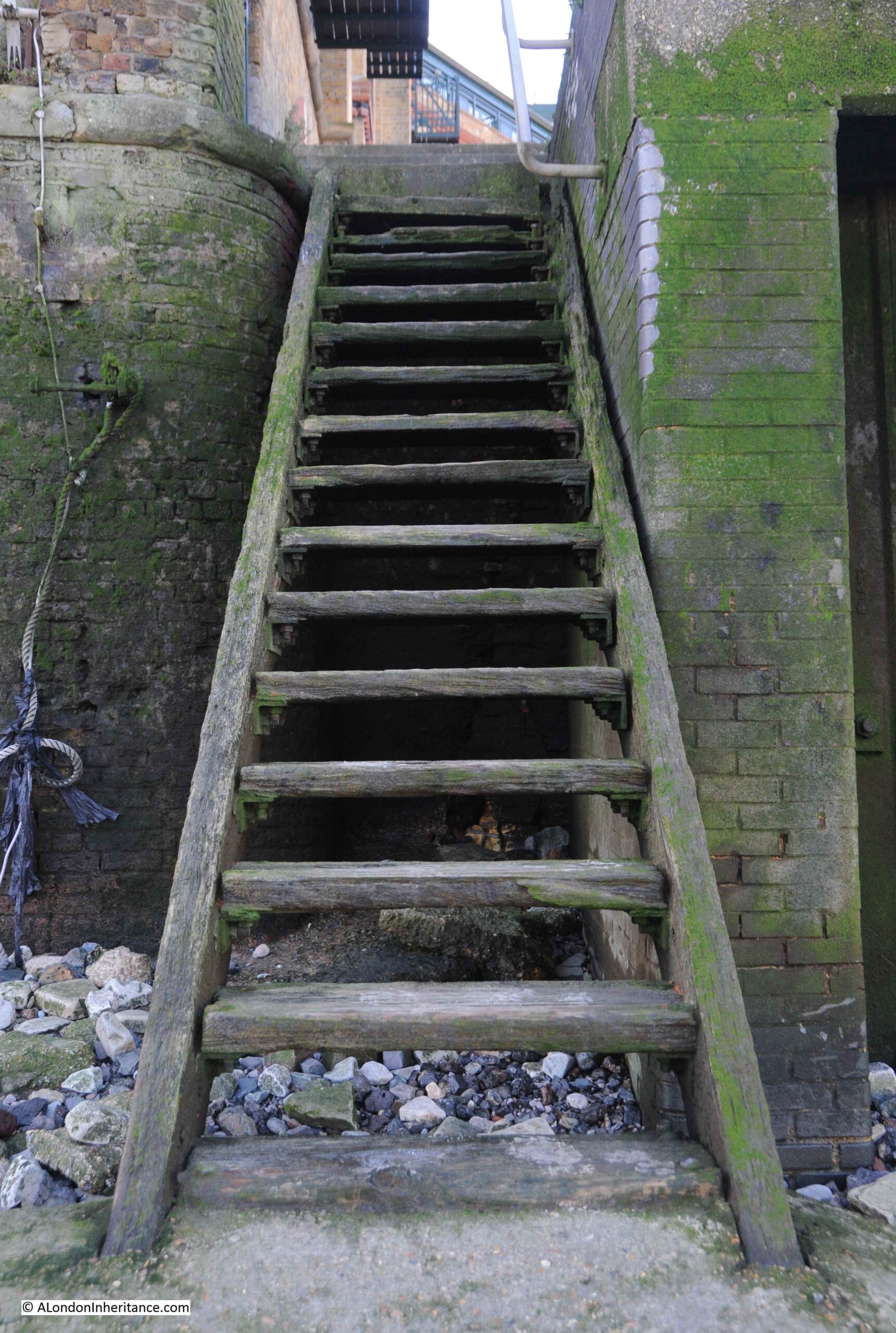
The steps over the river wall that lead to Horn Stairs:
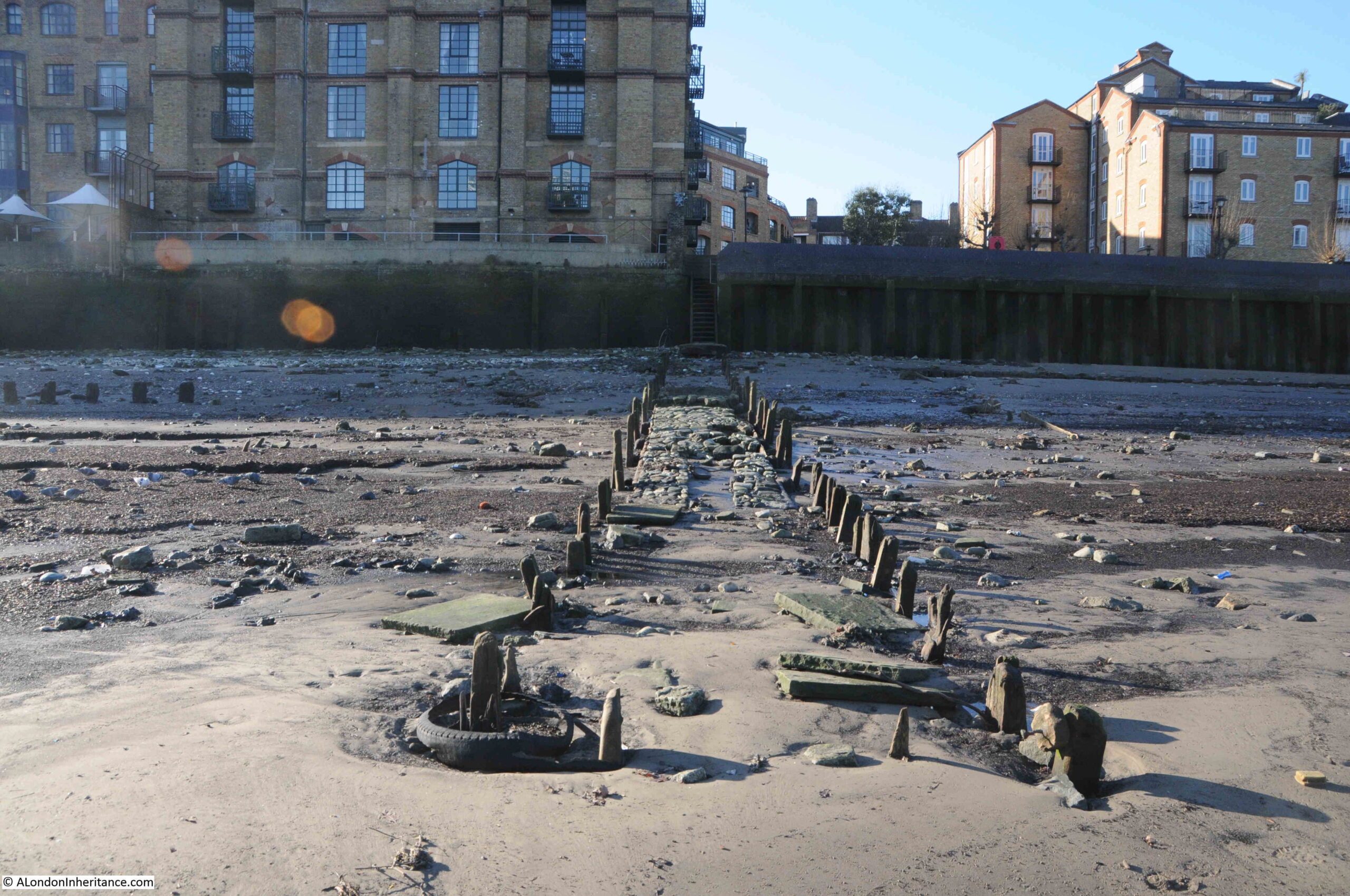
From the top of these steps, we get a view of the remains of the causeway leading off across the foreshore from the foot of the stairs:
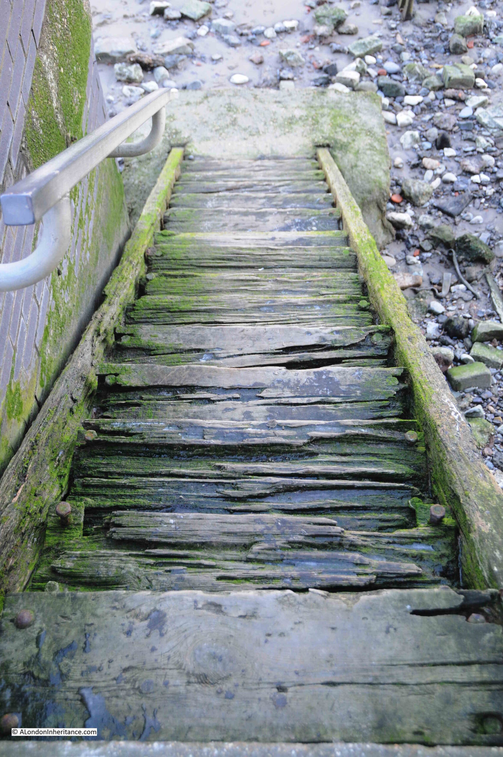
The upper part of the stairs, where they run over the river wall, are off concrete, with the main part leading down to the foreshore being a set of wooden stairs:
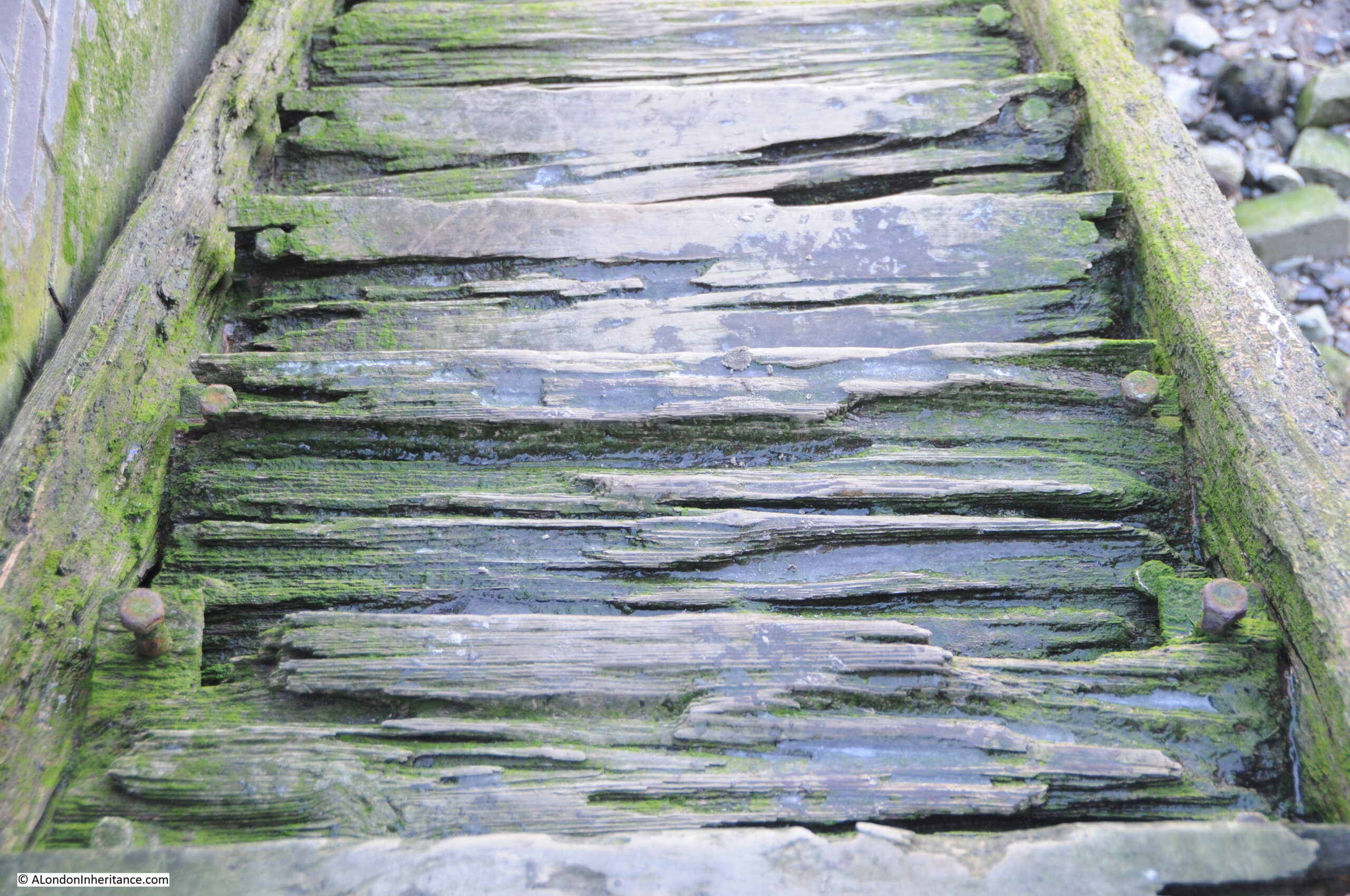
The upper part of the stairs look rather dodgy. From the top of the stairs it is difficult to tell how thick each of the steps is, and whether it will hold your weight if you walk down the stairs.
In the following photo of the top steps, you can see from the bolts on either side of each step, just how much appears to have eroded, or perhaps the wood has shrunk, also on the day I was at the stairs, there was ice in the hollows in each of the steps:
At the bottom of the stairs, we can see the remains of the causeway leading out towards the water:
The Port of London Authority (PLA) has very little information on the stairs in their listing of all the Steps, Stairs and Landing Places on the Tidal Thames (published around 1995), there is just a remark that the stairs are in “Reasonable” condition and that they were still in use.
The PLA does not record any early dates for when Horn Stairs were in use, and there are not that many references to the stairs, with Cuckold’s Point being the name used for any reference to the location.
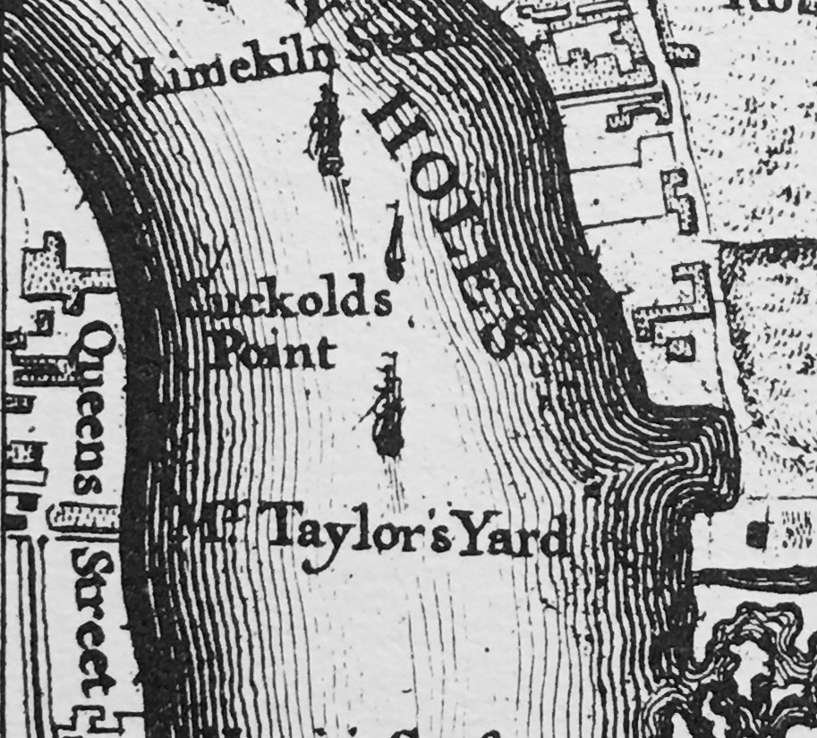
In Rocque’s map of 1746, the stairs are not shown, but Cuckold’s Point is marked:
The earliest written reference I have found was in a newspaper article on the 25th of October, 1832 when the name Horn’s Stairs were used in a legal action against the owners of the Eclipse, a steam packet which ran between London and Margate, and was accused of running down a barge off Horn’s Stairs.
The name of the stairs did often appear as Horn’s or Horns rather than the singular Horn, and one of the possible sources of the name could be a Horns Tavern which was to be found near the stairs – although an unresolved question is what came first, the tavern or the stairs.
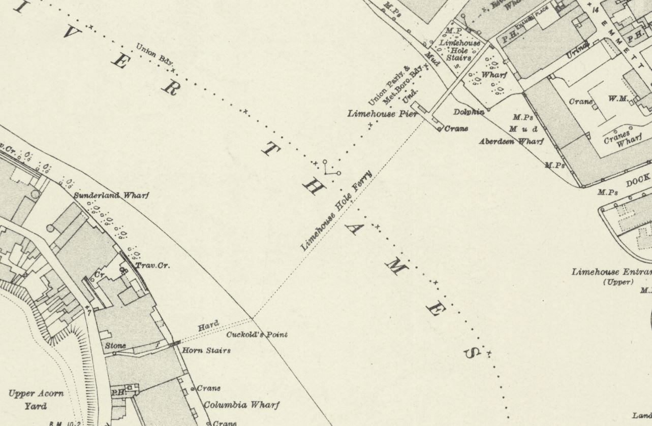
The name Horn is used in the majority of references from the late 19th century onwards, as shown in the following extract from the 1896 revision of the OS map, where Horn Stairs can be seen bottom left (‘Reproduced with the permission of the National Library of Scotland“):
In the above map, the causeway leading out from the stairs is labelled “Hard”, and would have provided a hard surface above the sand and mud of the foreshore, to walk to and from a boat at nearly all states of the tide.
Also in the above map a dotted line leading across the river to Limehouse Pier can be seen, and labelled as Limehouse Hole Ferry. This was a regular ferry that had run for a good few centuries between the two sides of the river. I wrote about the ferry in my post on Limehouse Hole Stairs and the Breach.
The fact that Horn Stairs does not appear in the 1746 map, and I can find no written references to the stairs earlier than 1832 does not mean that the stairs and a causeway have not been here for much longer.
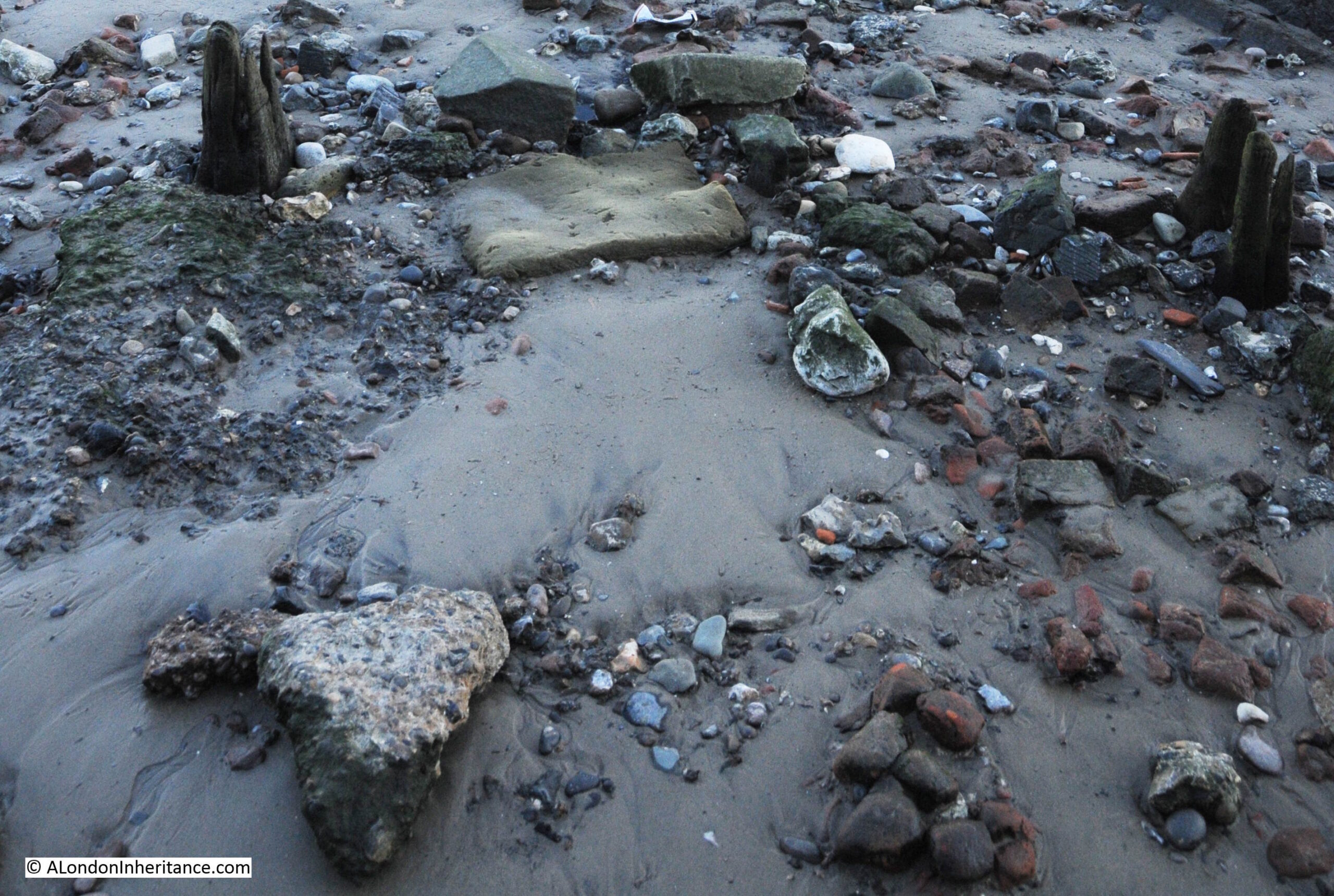
The City of London Archaeological Society has a fascinating post on surveying stairs, which included a section on Horn Stairs, and in the post, 16th or 17th century hand made bricks were identified which may have formed an early hard standing on the foreshore.
Although I could not find the bricks exactly as shown in the photo in the City of London Archaeological Society’s post, (the foreshore is a constantly changing environment), I did find a number of this type of red brick, which can be seen in the photo below, to the right side of the causeway:
At the end of the causeway, and at the point just before where the Thames will recede to at low tide, is a pole labelled as a navigation marker on the PLA chart for this section of the river. The marker has a light at the top of the pole to ensure the marker can be seen in the dark:
At the end of the causeway:
Looking back to the river wall and the stairs down to the foreshore, which is a distance of some 50 metres, and the dark colouring along the river wall shows how high the water is when the tide comes in along Cuckold’s Point:
The naming of Cuckold’s Point is interesting, and the true source of the name cannot really be confirmed given the centuries that the name has been in use.
The word Cuckold means, according to the online Cambridge Dictionary “If a man is cuckolded, his wife has a sexual relationship with another man”, and the most repeated story about the use of the word Cuckold for the foreshore in Rotherhithe goes back to King John, who was on the throne between 1199 and 1216.
There are a number of variations to the story, but it generally goes that King John was hunting around Shooters Hill, Blackheath and Greenwich. He seems to have found himself in Charlton, and entered the house of a Miller, where he found the Miller’s wife alone.
The Miller soon returned home, but found his wife “in flagrante” with the King.
The Miller attacked the King intending to kill him, and to defend himself the King revealed who he was, and came to an agreement with the Miller that he could have all the land to the west that he could see from his house, which extended all the way to what is now Cuckold’s Point, where, at the time, there was a pole with a pair of horns mounted on the top.
The Miller, in some stories, also had to walk to Cuckold’s Point once a year, with horns on his head.
So the name Cuckold’s Point came from the position that the Miller had been put in by King John.
The King also gave the Miller the right to have a fair on the 18th of October, and this fair became known as the Horn Fair and was held in Charlton.
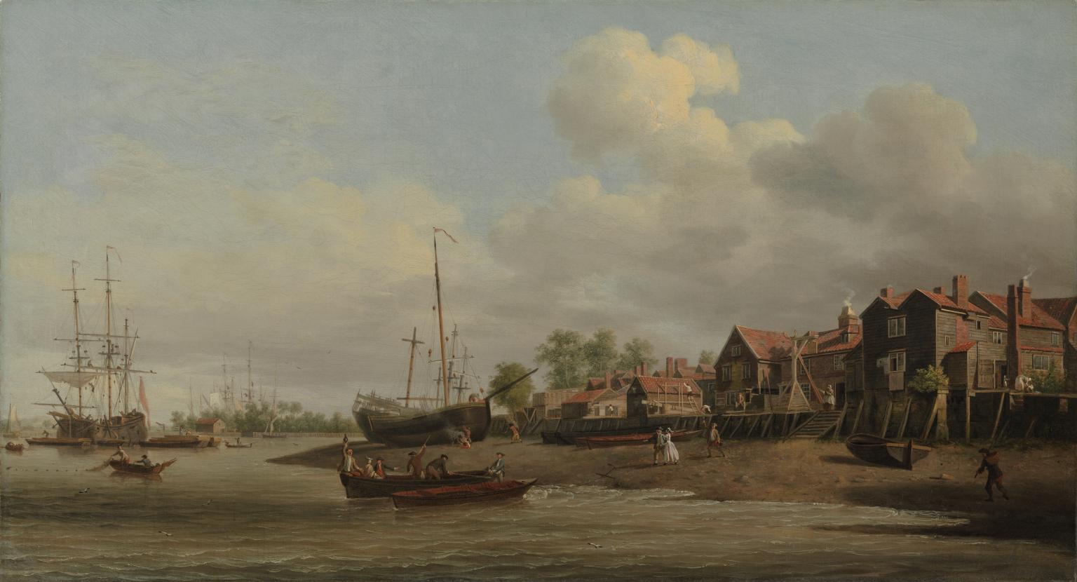
An early view of Cuckold’s Point can be seen in a painting by Samuel Scott in his work “A Morning View of Cuckold’s Point“, painted between 1750 and 1760:
A Morning, with a View of Cuckold’s Point c.1750-60 Samuel Scott c.1702-1772 Presented by H.F. Tomalin 1944 http://www.tate.org.uk/art/work/N05450
The challenge with confirming that this is Cuckold’s Point is that there are no features which can be found today, however there is a set of wooden stairs leading down to the foreshore, and the slope and shape of the foreshore is very similar to that of today.
The painting does though give a very good impression of what Cuckold’s Point probably did look like. There are two Waterman’s boats where the water meets the foreshore, and there is a third approaching the same point.
There are people on the foreshore walking down to the boats from the stairs, presumably either to meet the people arriving on the boats, or to take one of the boats along the river.
The ships on the foreshore are in the location of Mr. Taylor’s Yard, as shown in Rocque’s 1746 map.
The river appears to bend to the right, which indeed it does, as it heads along the eastern side of Rotherhithe towards Deptford.
The painting does provide some support to an alternative theory as to the name Cuckold’s Point. Just to the left of the stairs can be seen a wooden frame, and this is believed to show a ducking, or cucking stool, which was use to punish and humiliate women, who were labelled as a scold, or had committed some form of sexual offence, such as cheating on a husband.
As was usual, there was no similar punishment or humiliation for the man involved.
As the site of a cucking stool, where the wife of a cuckold would have been punished, this may also be the source of the name, however this story does not seem to have gained much support over the years.
The broad sweep of the foreshore at Cuckold’s Point, looking west along the river in the direction of the City of London:
Standing at Cuckold’s Point on a cold January morning is a lonely experience. There is no one else around, and the river is also very quiet, with just the regular Thames Clippers causing a run of waves up to the foreshore.
These places were once busy, both along the rivers edge, the foreshore, and along the river, and it is fascinating to stand at these places, thinking of all the people that have stood in the same place, and the events that have taken place here.
I searched newspaper records for reports mentioning Cuckold’s Point for three decades in the first half of the 18th century, the 1720s, 30s and 40s and there are many references. The following is a sample of what went on around Cuckold’s Point in these years:
17th June 1721 – On Thursday last in the Afternoon Mr. Bailey, a Coasting officer, and Mr. Purser, a Custom-House waterman, made a seizure in the River near Cuckold’s Point of 1900 Weight of Tea, artfully wrought up in the sides of a Mackerel Boat filled with Fish, and supposed to come of Ostend.
11th of May 1726 – The Execution of Capt. Jeane, condemned at the late Sessions of Admiralty for the Murder of his Cabin Boy, is appointed for next Friday, he will be hanged in Chains over against Cuckold’s Point.
6th of October 1736 – On Monday last a Fisherman caught in his Common Net, near Cuckold’s Point, a Salmon 38 inches long and about 17 inches round, and sold the same to Capt. Bond, who was in sight when the fish was caught, and was going on board the East-India Man at Gravesend. The Fisherman being unable to hold his net, begged assistance of a man in the Captain’s Boat, who accordingly went; but as he was helping he fell accidentally into the Thames, from whence it being low water, he took the Fish in his Arms and threw it into the boat. The Fish was sold for 36 shillings out of which the Fisherman gave the Waterman 6 shillings for his Trouble.
23rd April 1737 – On Tuesday last, the Wind being very high, and the Tide rough, two boats, overladen with Passengers, were cast away between Cuckold’s Point and Deptford, and 17 persons drowned. Two other boats, near the same place, with 16 persons in them, and another at the Isle of Dogs, with six and a Waterman, overset, and seven of the former and all the layer were drowned,
23rd October 1742 – Yesterday a new ship, of 220 Tons and 20 Guns, intended for the West India Trade, was launched at Mr. Taylor’s Dock at Cuckold’s Point, and named the Anna Maria (see earlier extract from Rocque’s map of 1746 for location of Taylor’s Dock)
10th December 1743 – Last Tuesday upwards of 1000 Pairs of French Gloves with some Skins, were brought to the custom House. They were seized by Mess. Smith and Harris, Customhouse officers, as they were attempting to land them at Cuckold’s Point.
4th February 1744 – On Tuesday 200lb of Cocoa Nuts, 200 Weight of Tea and 20 Pieces of Cambrick, with some Lace, were seized at Cuckold’s Point, and brought to the Custom House; This seizure is valued at £300. (Cambric is a finely woven, plain cloth that came from France)
7th of March 1747 – Tuesday in the Afternoon as a Boat was going to Greenwich with six Passengers, it was overset near Cuckold’s Point by running foul of a Ships Anchor, by which accident Mrs. Sims and her Daughter, of St. Catherine’s Lane, were unfortunately drowned.
27th of March 1749 – On Monday last thirteen prisoners were tried at Kingston in Surrey, three of whom were capitally convicted, viz. John Rayner, for Robbery on the Highway, Thomas Pattin and William Walker, two Watermen, for knocking down Mr. Alison, in a Boat on the River Thames, near Cuckold’s Point, and robbing him of a Silver Coffee Pot, a Watch, and a Guinea and Half in Money.
These quiet places along the Thames were once full of life, and also unfortunately, death.
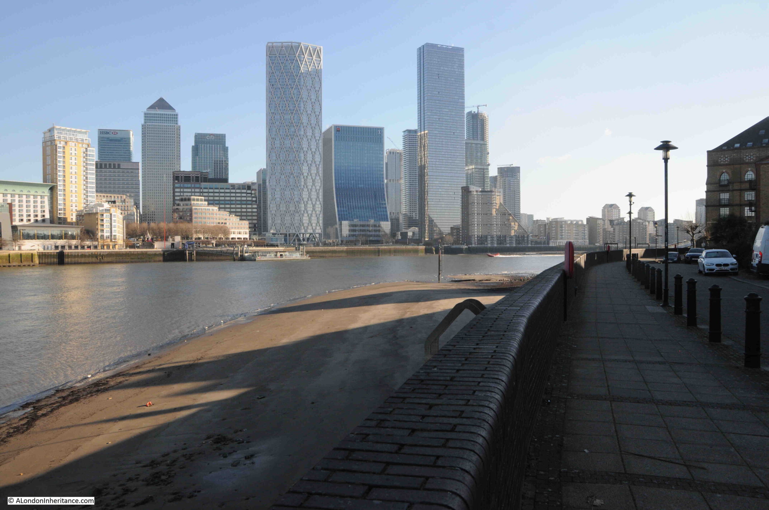
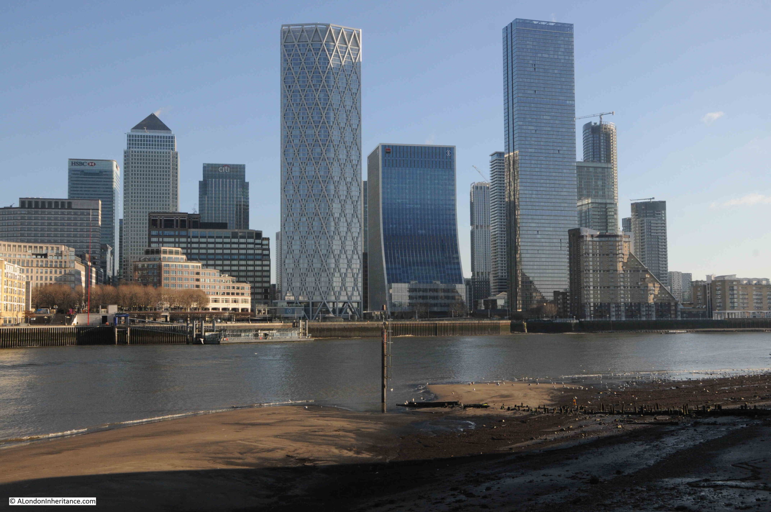
Looking along Cuckold’s Point to the east and there is a pier that reaches out over the foreshore. This is where you can catch the Thames Clipper RB4 service that runs between this pier at the Doubletree Docklands Hotel, across the river to the pier at Canary Wharf – a brilliant way of crossing the river.
A rather good example of historical continuity in London, the Thames Clipper RB4 service has almost exactly the same route as the old Limehouse Hole ferry that ran from Horn Stairs.
Some of the long length of the causeway still has a layer of stones that would have provided the hard surface to walk down to catch your boat:
I visited Horn Stairs and Cuckold’s Point in January, and this was probably the left over of some New Year’s Eve celebrations:
Returning to the story of the Miller and King John, one of the rights allegedly granted to the Miller was the right to hold a fair in Charlton.
Whatever the truth in the story of the Miller and King, a fair was held each year, on St. Luke’s Day, the 18th of October, and the following article from The Sun on the 20th of October, 1846 hints at the antiquity of the fair, and also provides a good overview of the event.
There is also a reference to Cuckold’s Point towards the end of the article, which I have highlighted in bold:
“HORN FAIR – This scene of popular amusement was held yesterday, according to ancient custom, in the healthful and pleasant village of Charlton.
In former times it was generally distinguished by riot and obscenity. Some of the worst class in London made parties to carry out the vulgar joke of cornuted husbands and wives (cornuted means to bear or have horns).
Horn Fair (the common name) is now changed to Charlton Fair, and the visitors, more enlightened that their ancestors, seldom indulge in those disorderly transactions which bore the stigma of indecency. It was formerly a mart for various forms of utensils made of horn, and tradition ascribes the origin to King John. An armour carried out by that licentious and infamous Prince with the wife of an honest miller was the foundation for the fair. John, surprised by the enraged husband, would have perished under the uplifted dirk of the miller, had he not saved his life by promising to redress the injury. The compensation was a grant of land the miller could see westward from the top of his mill. Agreeable to the royal donation, a fair was to be held annually, on St.-Luke’s-day, for ever.
Such is the oral account of the fair from year to year, and there is, we believe, at the present day, an aquatic custom at Cuckold’s-point, where it is said the mill stood, which bears out the story. The waterman, as he passes the stairs, or landing place, frequently tells his fare that a spider is crawling on his hat. The person naturally takes it off his head, and then Old Charon, with a laugh, requests he will put it on again, having properly paid his respects to the Horns at Cuckold’s Point.”
Note in the above article that the mill is described as being at Cuckold’s Point, however the majority of references refer to the location being in Charlton, and that Cuckold’s Point, where horns were mounted on a pole, was the place furthest west that the Miller could see from his place in Charlton.
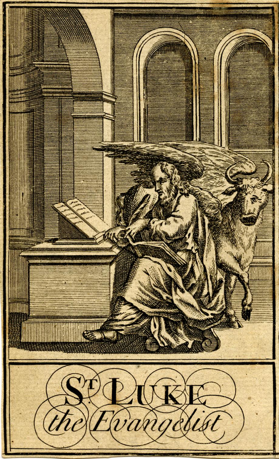
The article also mentions that Horn Fair was held on St. Luke’s Day. The connection with St. Luke comes from ecclesiastical art, where St. Luke is often painted with an Ox, an example being this early 18th century print which shows St. Luke seated at a desk, with a winged ox with horns, behind him.
There are very many references to Horn Fare, including some which describe events such as the following from 1742:
“Monday being St. Luke’s Day, a large Body of Cuckolds, both real and reputed, attended the King, the Miller, and his Wife, from the Sun Yard in Bishopsgate-street, to Horn Fair, held at Charlton in Kent, according to annual Custom.”.
In the 18th century, the Press Gang took advantage of Horn Fair, as this report from the 27th of October, 1746 explains:
“Last Saturday Night a large Press Gang, with Horns on, and Music playing before them, came through Greenwich, Deptford and Rotherhithe, &c. from Horn Fair, which drew a great many Sailors out of their Retreats to see the Procession, several of whom were pressed for his Majesty’s Service, and sent directly on board the Tenders in the River.”
The stairs today look almost like archaeological remains, washed from under layers of mud and sand by a strong tide, a bit like Seahenge, discovered in Norfolk in 1998. I checked on the Historic England directory, and the stairs are not listed, and it is unclear who, if anyone, is responsible for these features. Sadly, they will probably continue to erode away. A great loss for future generations.
Temporary structures were erected for Horn Fair, and we can get a glimpse of these from reports about the fair, including one from 1819 where there was an unexpected heavy snow fall, which caused much damage to the fair, including temporary structures for “The Freemasons Tavern” and “The Crown and Anchor”, which had apparently been “fitted up with great splendor , and the proprietor had omitted to take down his lamps and lustres” – which along with bottles, crockery, furniture etc. were all badly damaged by the snow.
The Horn Fair was abolished in 1872. By then Charlton had ceased to be the “healthful and pleasant village of Charlton“, and was being rapidly developed.
Horn Fair did not fit in with the Victorian narrative of improvement, and riotous assemblies such as fairs, were seen as a threat to those living nearby, to law and order, and to the social structures of the time.
In the Morning Advertiser on the 27th of February, 1872, in between lists of the prices of coal, hops, potatoes, the cattle market, and an article listing the days of the arrivals of the mail from Australia, New Zealand, the Falkland Islands, Mexico, Egypt (all symbols of a new Victorian London), there was a brief article reporting on the official abolition of the Horn Fair at Charlton and the Blackheath Fair, both of which had “survived all other suburban pleasure fairs”.
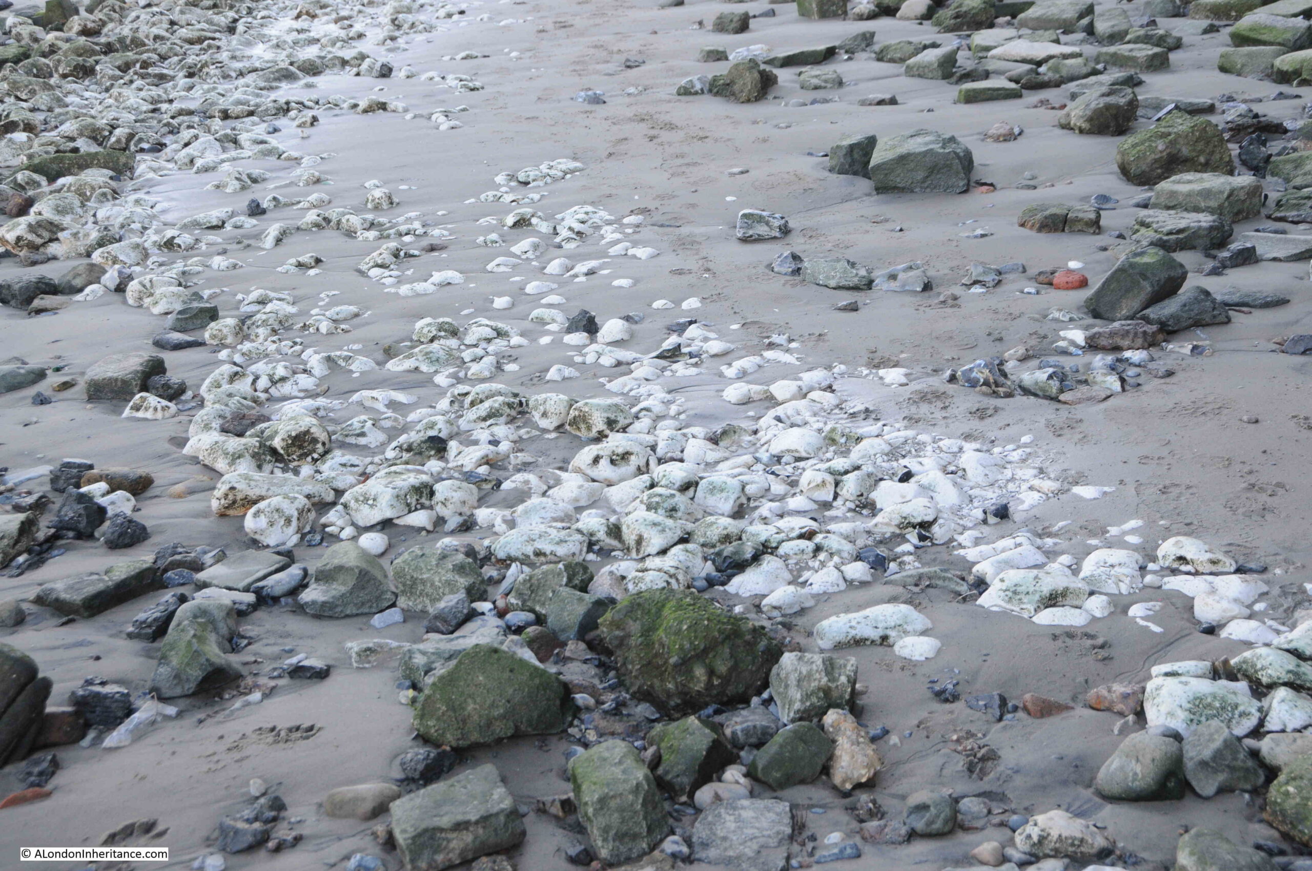
Chalk on the foreshore at Cuckold’s Point, left over from a time when chalk was used to build a flat platform on which barges could be grounded:
The wooden steps of Horn Stairs. The condition of the individual steps seems to get worse with height, with those at the very top appearing to be in very poor condition. I assume this is because those at the top are much more open to the atmosphere, are washed by the river rather than being covered, and suffer more wave action.
Horn Stairs and Cuckold’s Point are wonderful places to take in the river, views across to Limehouse and the Isle of Dogs (but walk down the stairs at your own risk !!).
It is a place with a long history, shared with the history of the river, and a connection with a Miller and King in Charlton, and a historic fair held in the “pleasant village of Charlton“, which does still have a Hornfair Road near the original location of the fair
What ever the truth of the story of the Miller, his Wife and King John, it is a fascinating part of London’s long history, and tells much about life in London over the centuries.
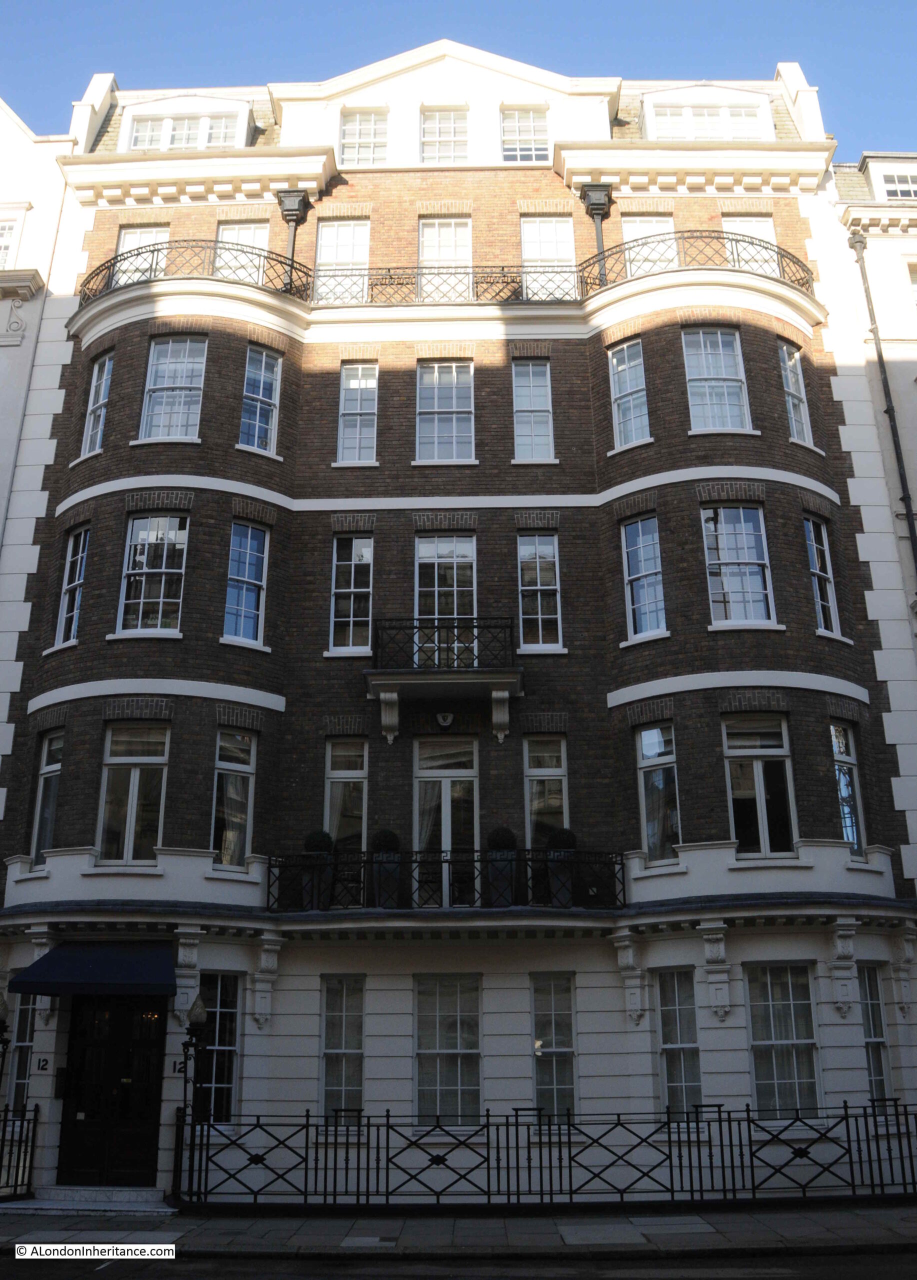
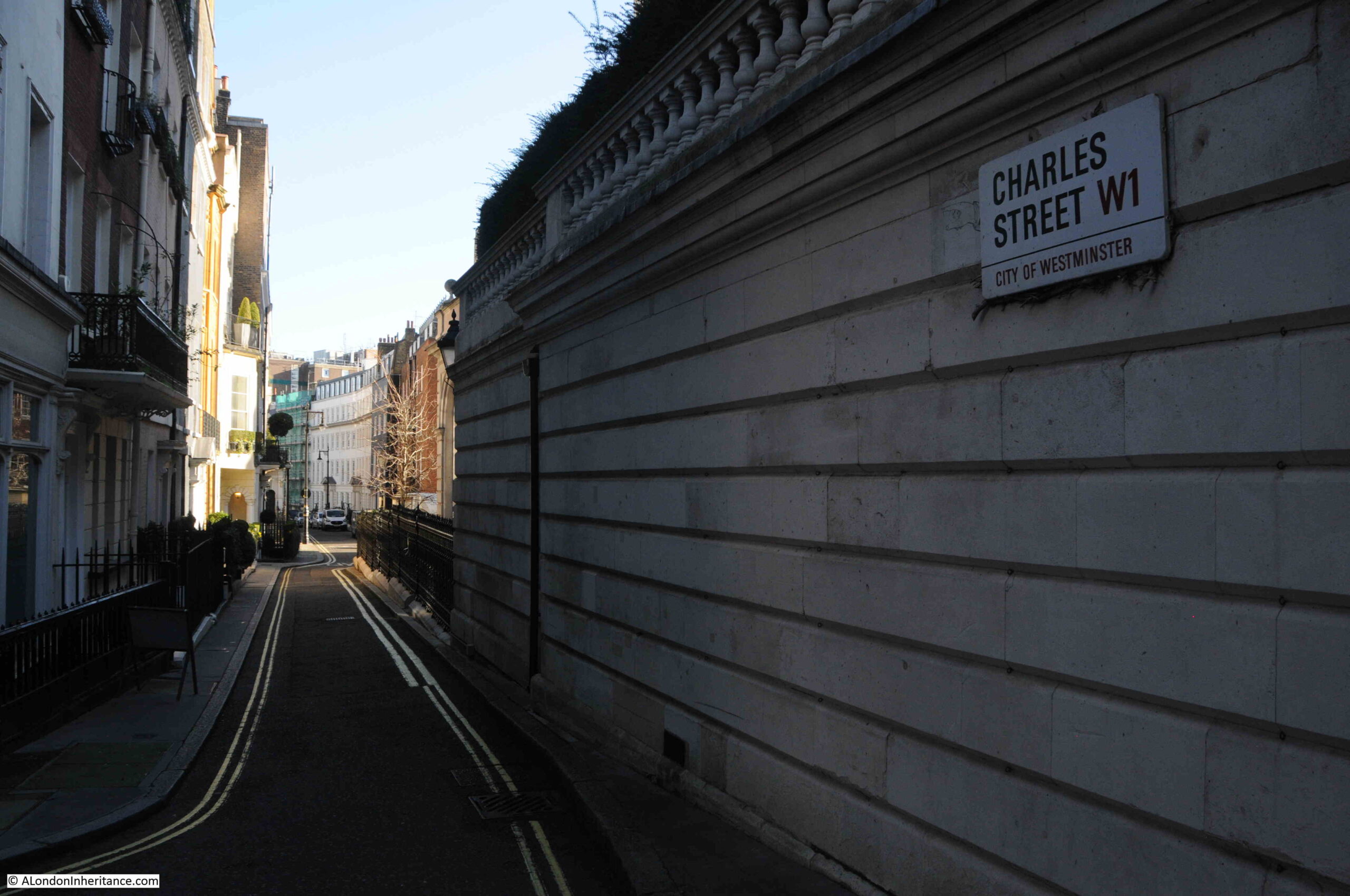
Charles Street is a typical Mayfair street. A varied range of architecture, a hotel, private houses, investment and wealth management companies, corporate offices, embassies, and much more hidden behind the facades of tall buildings that line the street.
I recently went for a walk along the street to find two pubs, the Footman and the Red Lion.
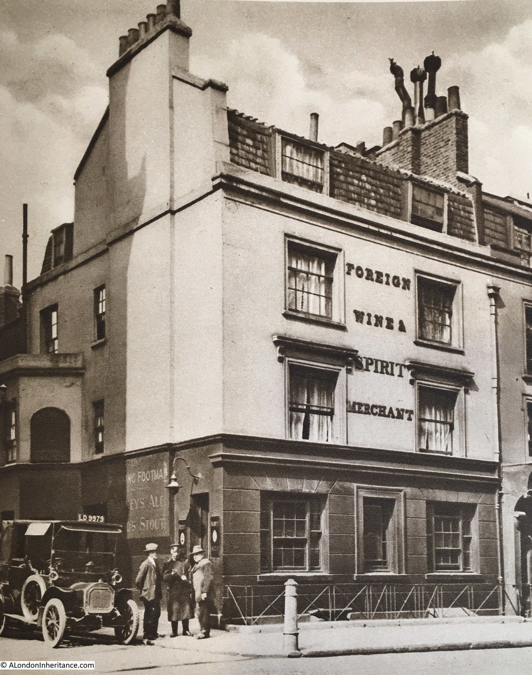
A photo of the Footman appeared in the 1920s three volume set of Wonderful London, when it was known as the Running Footman:
The following text is the commentary to the above photo in Wonderful London:
“THE RUNNING FOOTMAN, A PICTURE OF THE OLD MAYFAIR – Charles Street, off Berkeley Square, retains a pub named after that special kind of servant whose duty it was to run before the crawling family coach, help it out of ruts, warn toll-keepers, and clear the way generally. He wore a livery and usually carried a cane. The last person to employ a Running Footman is said to have been ‘Old Q.’ the Duke of Queensbery who died in 1810. The faded sign is fixed to the bay in the side street and appears here, over the taxi. The tavern is a bit of London from the days of ‘the Quality’, whose servants it served.”
Wonderful London has a rather rose tinted view of the role of a running footman. I suspect in reality it was really difficult and exhausting to keep ahead of a coach, and carry out any other manual activities such as lifting the coach out of outs.
I found an alternative description of the role of a running footman, which is probably more realistic:
“The Running Footman – men have adopted various inhuman methods to increase their self-importance at different epochs, but few more inhuman than that of the running footman, of whom Mr. John Owen writes in his new novel, published today under the title of ‘The Running Footman’.
This 18th century barbarism, whereby a man was forced to run 30 yards in front of his master’s coach for incredible distances, naturally resulted in the runners death from heart disease or consumption.”
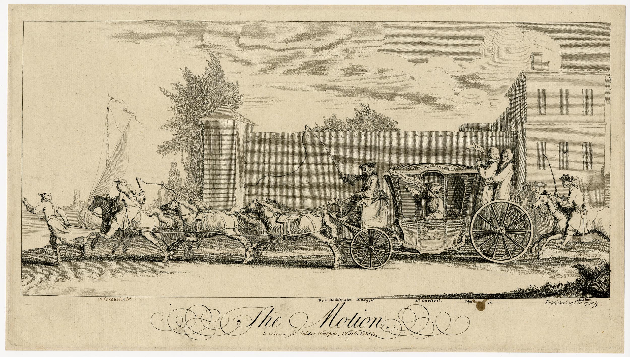
The following print from 1741 is a satirical interpretation of the opposition methods in the parliamentary motion to remove Robert Walpole from office, and shows a Running Footman at the left of the print, running in front of a team of horses and the coach.
There was an interesting story of a Running Footman in the newspapers on the 5th of October, 1728, which hints at how fast they could run:
“A Foot Race of two Miles being Advertised to be Run last Thursday on the Marshes near Hackney River by young Women for a Holland Shift, as three were dressing in order to start, one of them was discovered to be a Running Footman to a Person of Quality, who seeing he was betrayed found means to re-mount the Horse he rode on with a Side-Saddle. The Mob understanding the matter pursued him in order to duck him in the River, but to make more speed, he dismounted, rid himself of his Petticoats, took to his Heels and got clear of them, after much more Diversion than the Race, which was afterwards run by the other two.”
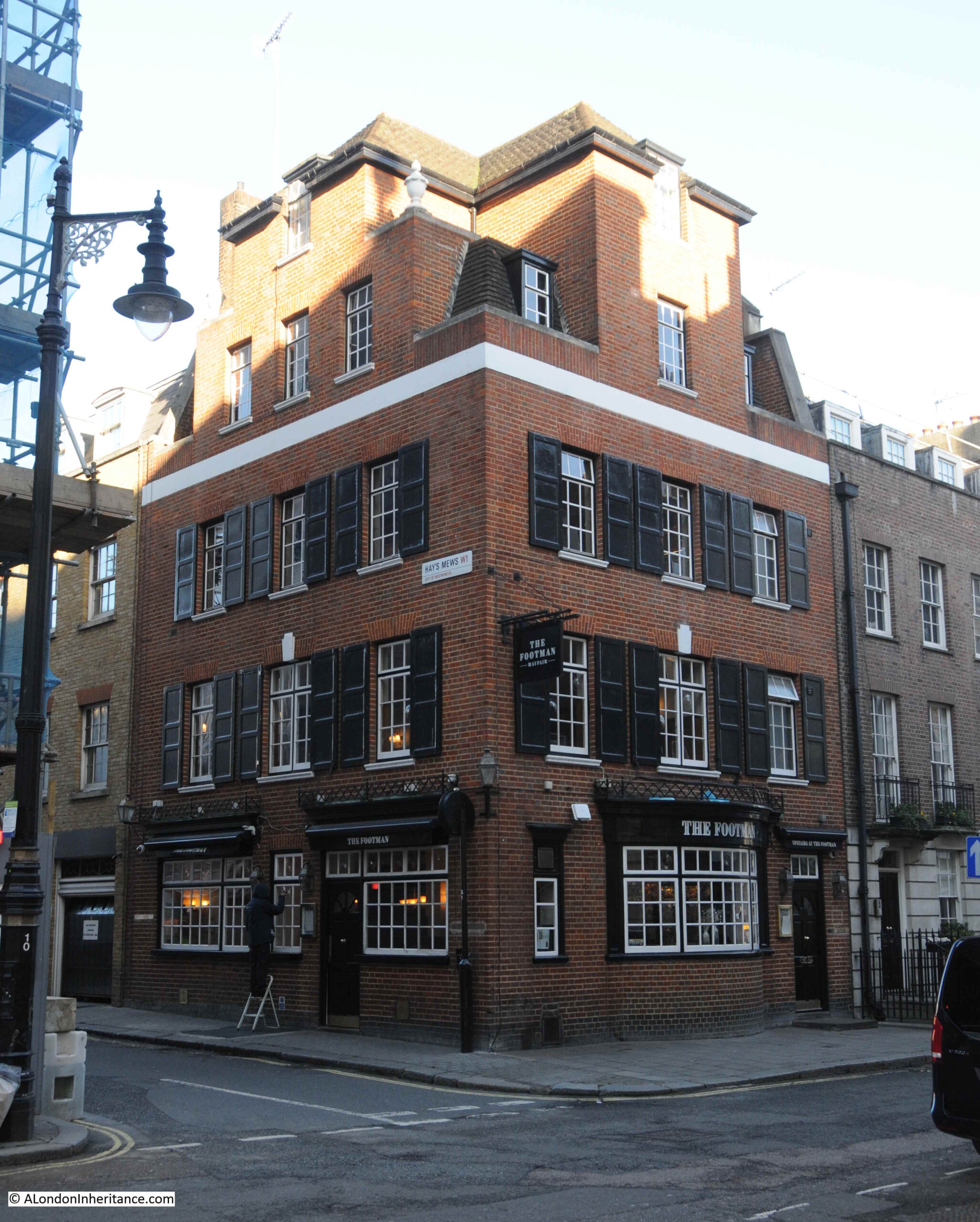
The pub that is shown in the Wonderful London photo would only last for around another 10 years, as in the 1930s, the Running Footman would be rebuilt in the red brick style of pubs of the time, and it is this version of the pub that we find in Charles Street today, with the name truncated to just The Footman:
The shorter name is relatively recent as the pub also had the names “The Only Running Footman” and “I am the Only Running Footman”.
The original pub dates from the mid-18th century, and there are online references to the pub originally being called the Running Horse, although I cannot find any references from the late 18th century of a pub in Charles Street with this name.
The first newspaper references to the Running Footman date from the first decades of the 19th century, for example in May 1821 there were stables for sale in Charles Street, and the Running Footman was given as one of the places were details of the sale could be found.
The 1930s rebuild features an interesting extension to the roof, and the building is now taller than the rest of the terrace of which it was part:
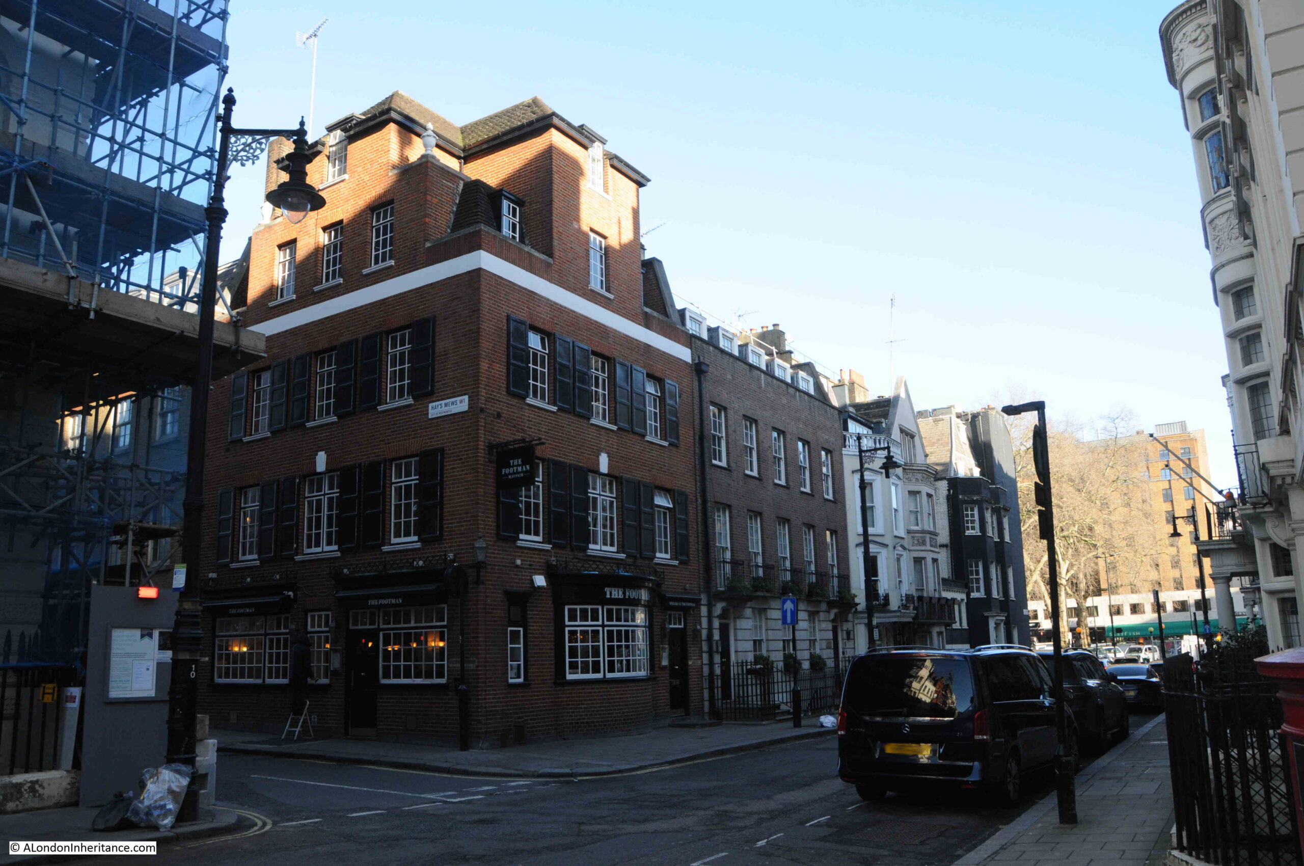
The above photo shows the eastern end of Charles Street, with the southern end of Berkeley Square to the right.
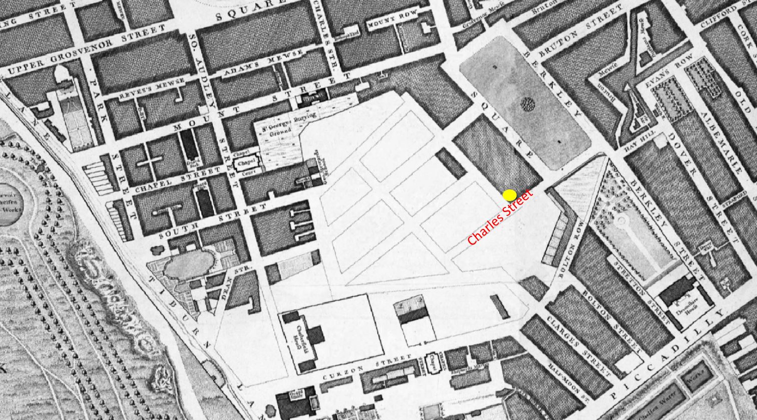
Charles Street seems to have been laid out during the later part of the 17th century. Rocque’s map of 1746 shows the surrounding built area, the upper eastern part of Charles Street has been built, and a blank space with street outlines covering the area west and north of Charles Street. The yellow circle marks the location of the Running Footman:
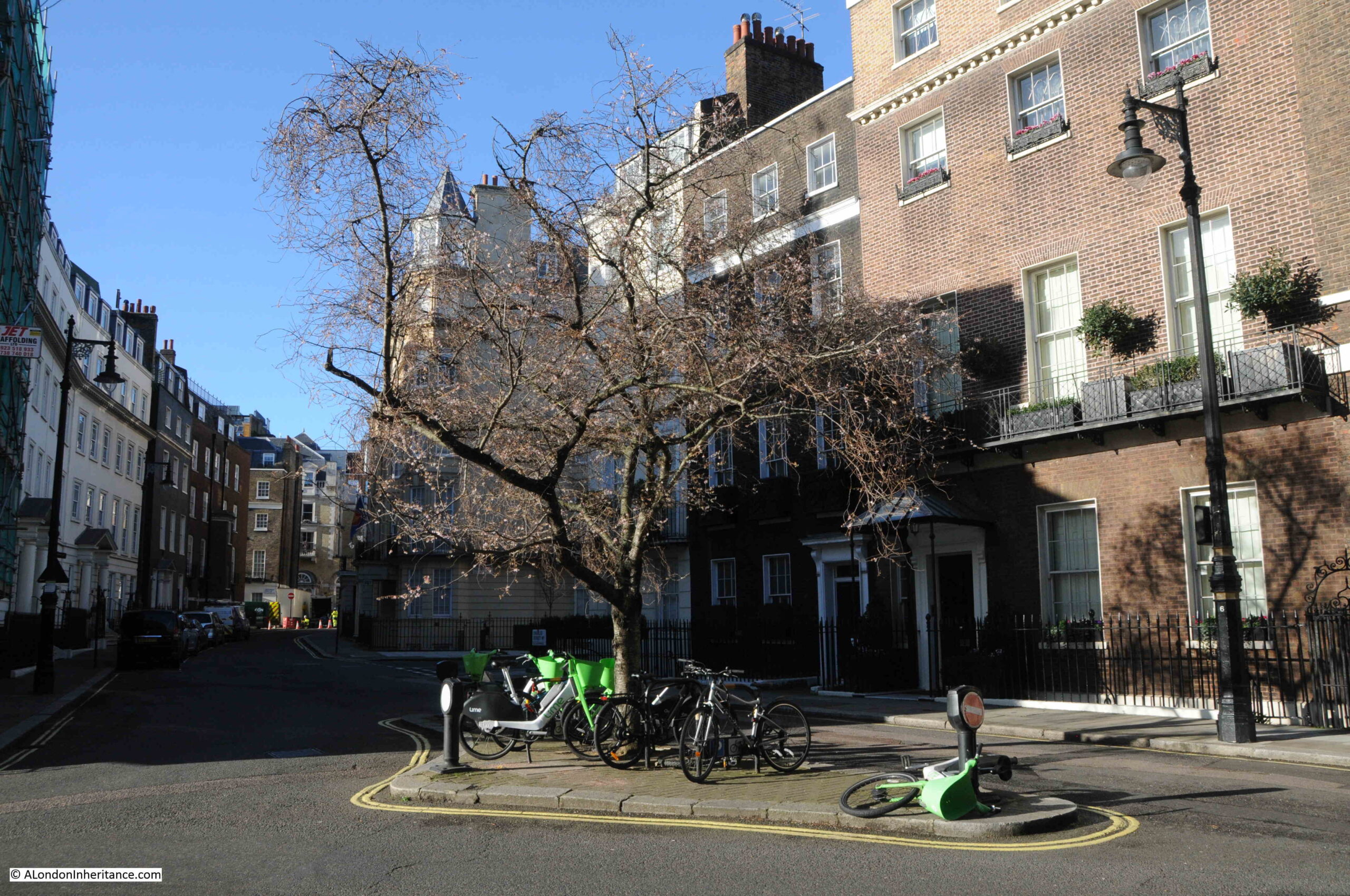
Although the map shows street outlines, the layout today is slightly different, and Charles Street extends to the corner of the space occupied by the large house at left, where it turns north. It was here I was heading next to find another pub, and to look at the mix of architecture along the street.
The original build of Charles Street was mid to late 18th century / early 19th century, brick terrace houses, and over the following decades many of these would be combined and rebuilt to leave the mix of architectural styles and periods that we see today:
At the junction with Queen Street, there is an open space with a tree in the centre, with the street turning slightly to the north. This point was the original end of Charles Street as shown in Rocque’s 1746 map, so the street may have originally terminated here, before being extended on as development of the area completed.
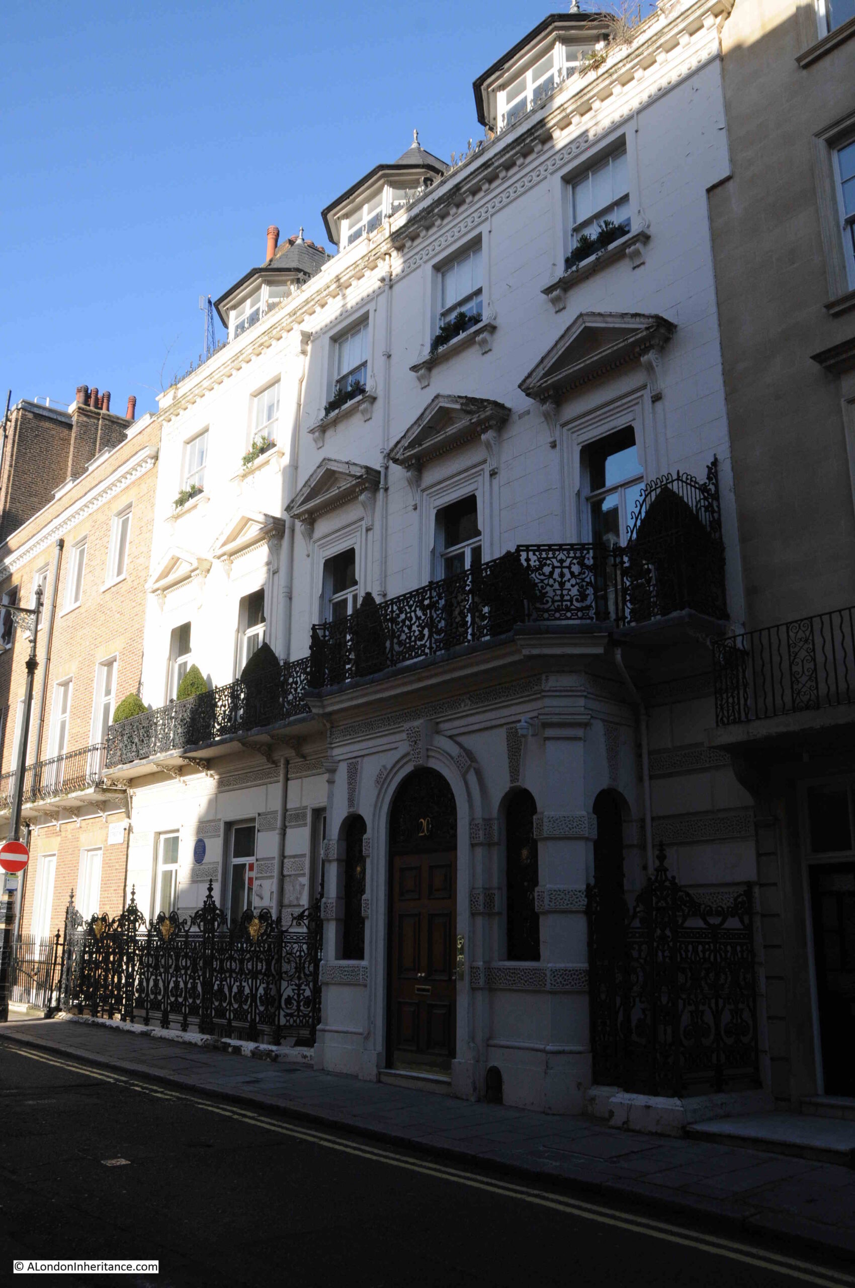
And as we walk along Charles Street, we continue to see the mix of architecture, including where original terrace houses have been combined and a new stone façade has been built over the original brick:
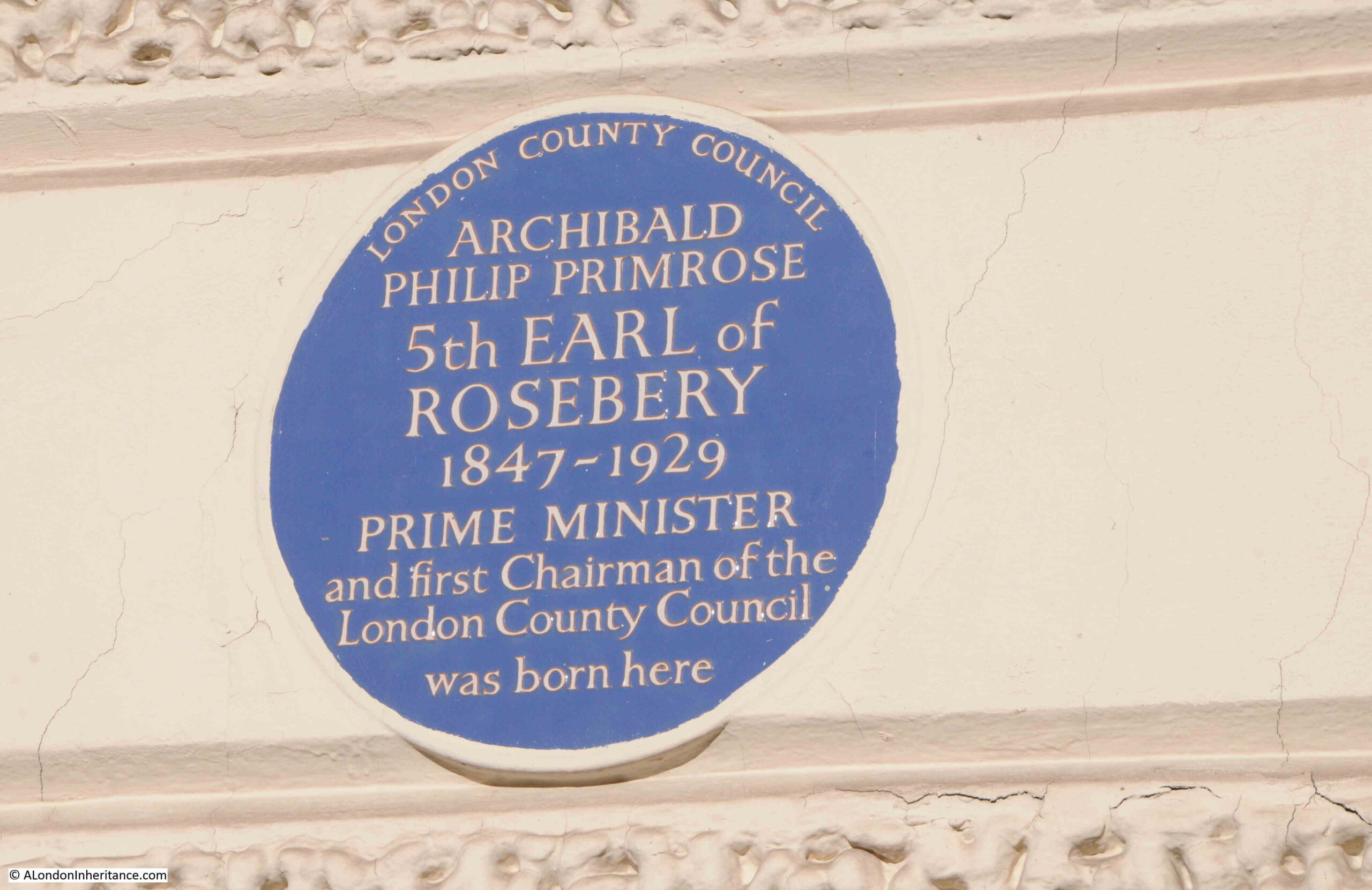
On the house shown above, there is a London County Council plaque stating that Archibald Philip Primrose, the 5th Earl of Rosebery was born in the house in 1847:
Towards the western end of Charles Street, the street suddenly narrows as it turns to run along the northern edge of large, terrace houses. This change in the street marks the point where the original gardens of Chesterfield House (see the extract from Rocque’s map earlier in the post) extended, with the street turning along the north east corner of the old gardens:
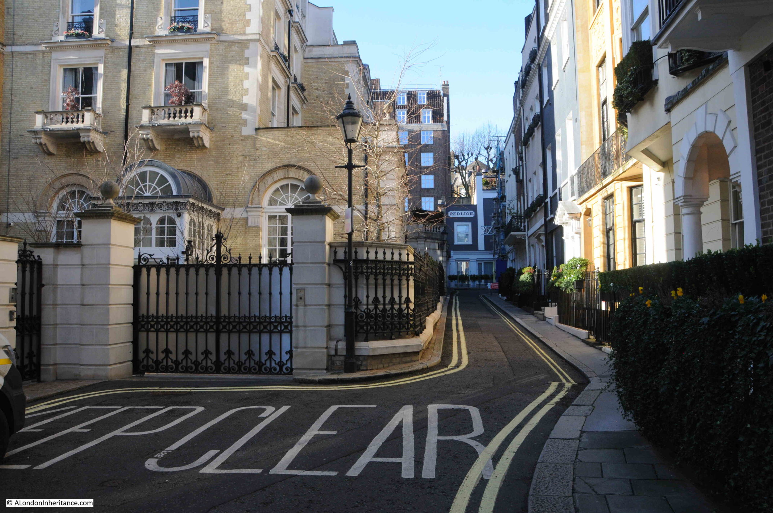
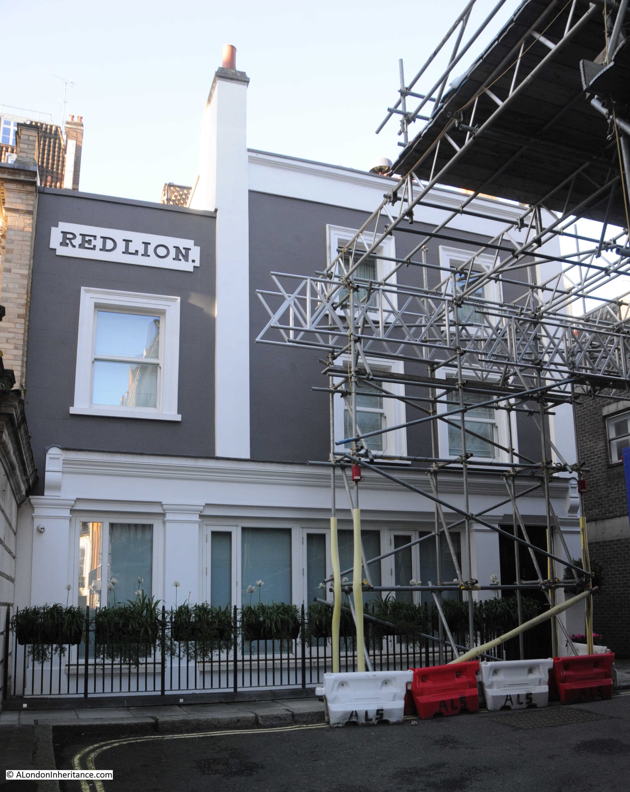
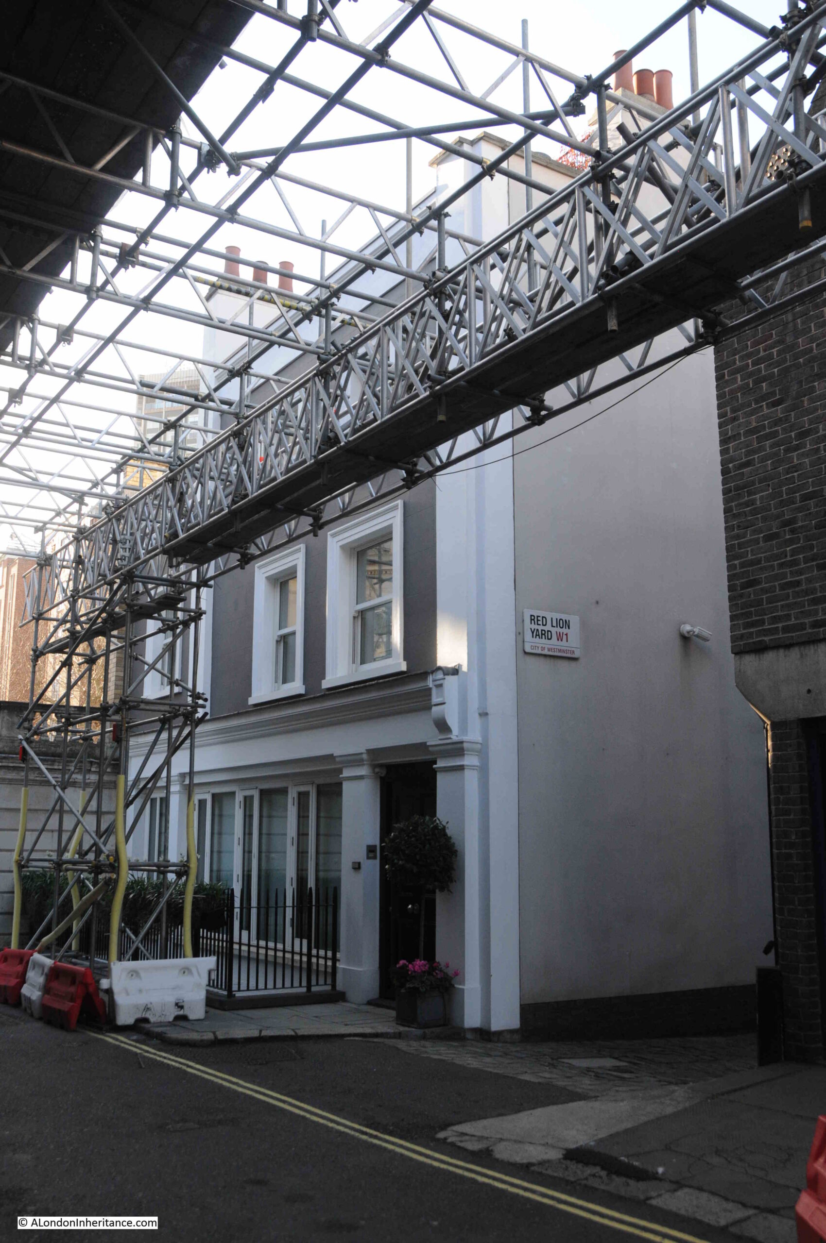
At the end of the narrow section of Charles Street, where there is a sharp bend up towards Waverton Street we can see what remains of the Red Lion, the second pub I was looking for in Charles Street (the scaffolding is on the building opposite, not on the old pub):
The Red Lion is now a residential property, having closed as a pub in 2009.
The building still retains some of the features of a London pub on the facade facing the street, however the rest of the building is very different.
After closing as a pub, it underwent a very significant rebuild, both above and below ground to create a very different space behind the façade.
I would not normally put a link to the Mail Online in the blog, however this is where I found an article on the conversion of the building from pub to residential, which includes a number of photos of the interior of the building, which are hard to reconcile with the view when you stand outside, and shows what can be done if you have £25 million to spare (in 2009).
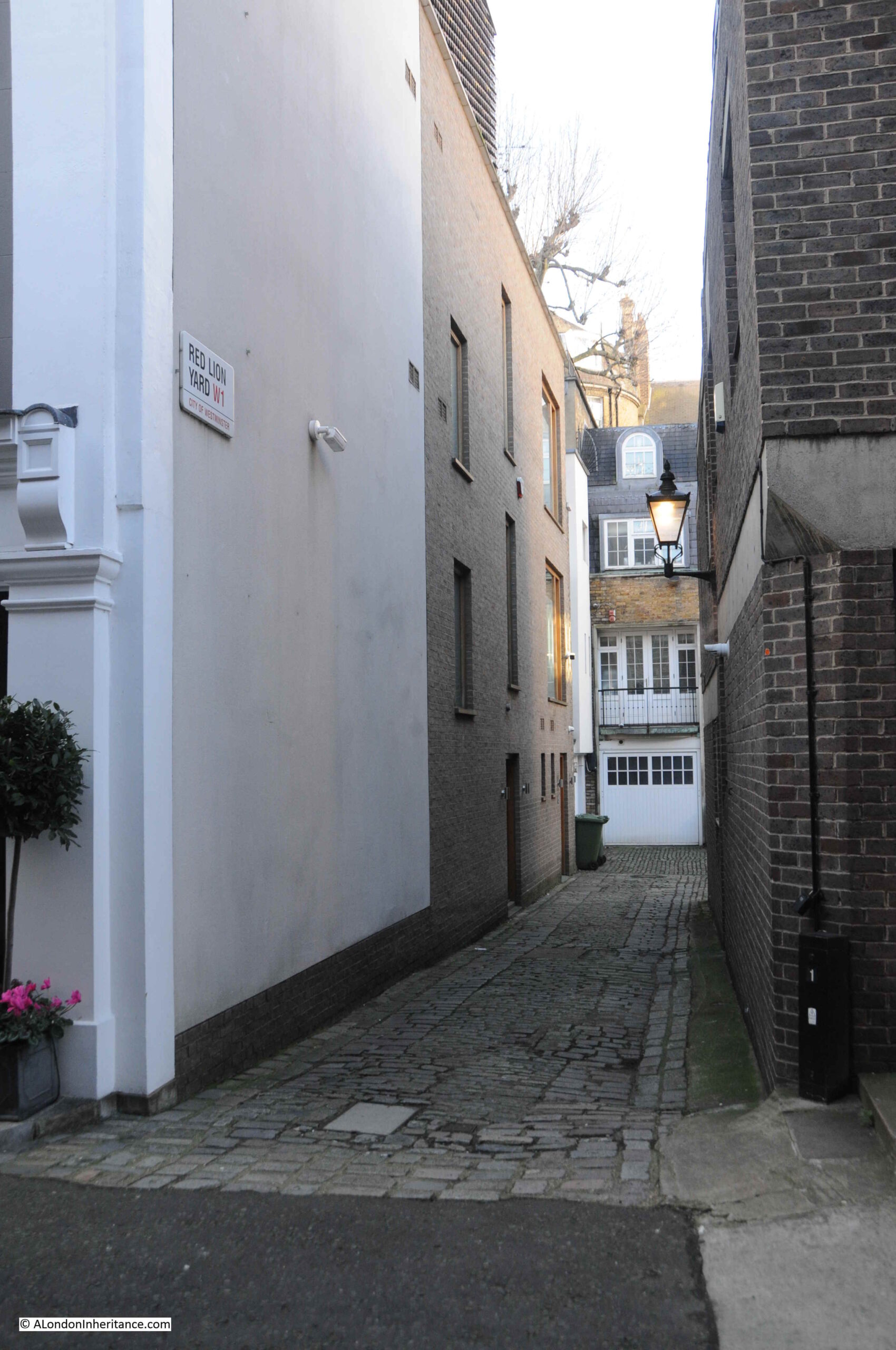
A look down Red Lion Yard at the side of the old pub shows the way that the building has been extended above ground, in addition to the two levels below ground which doubled the overall space:
The article described the pub as a “dingy drinking establishment“. It did seem to have been left to run down over the last few years of being a pub, but in the few times I went in, it always seemed to be reasonably busy.
Unlike the Running Footman, the Red Lion was in a rather hidden part of the local streets, and it was a “local” pub so perhaps trade was not enough to keep the pub viable.
I suspect that when the company that owned the pub was offered a good sum of money, it was worth selling for development rather than retaining as a pub.
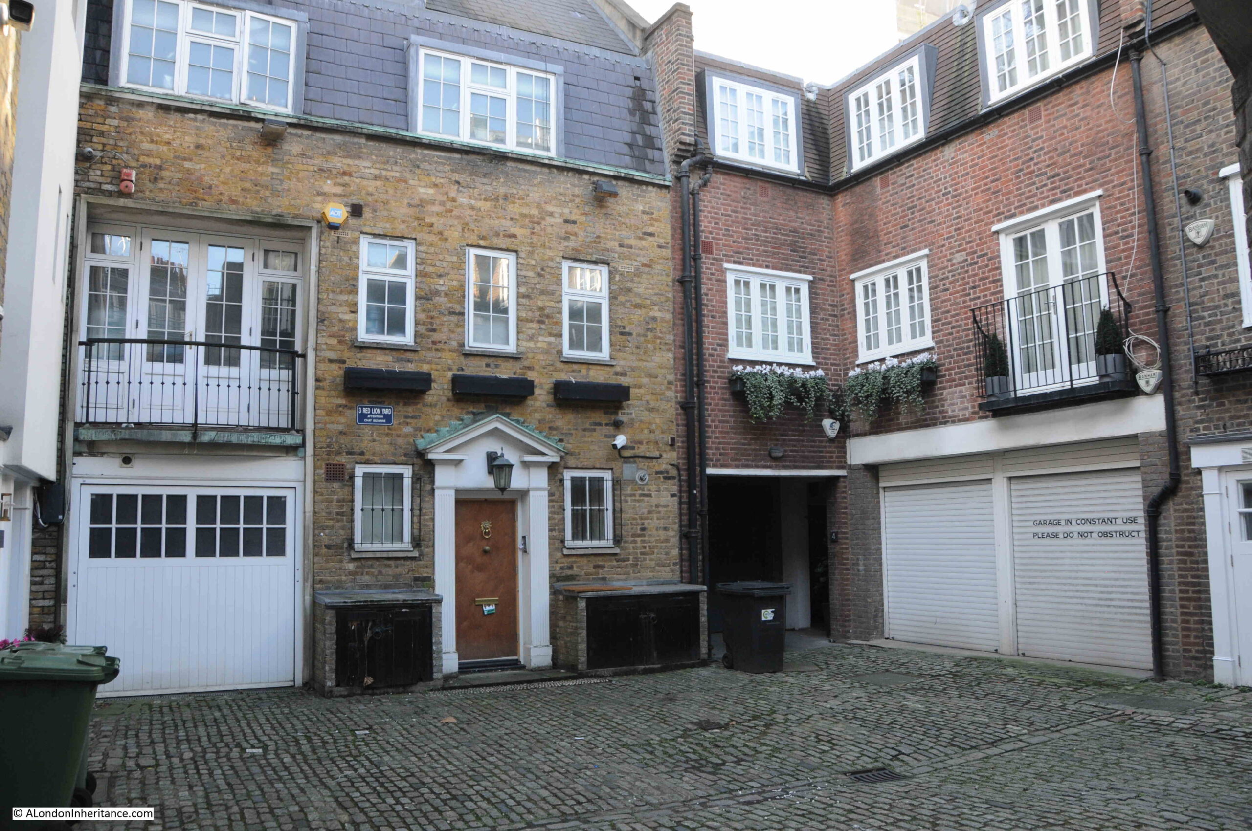
At the end of the alley leading into Red Lion Yard is this square of buildings, which again shows a level of redevelopment:
Entrance to Red Lion Yard alongside the old Red Lion:
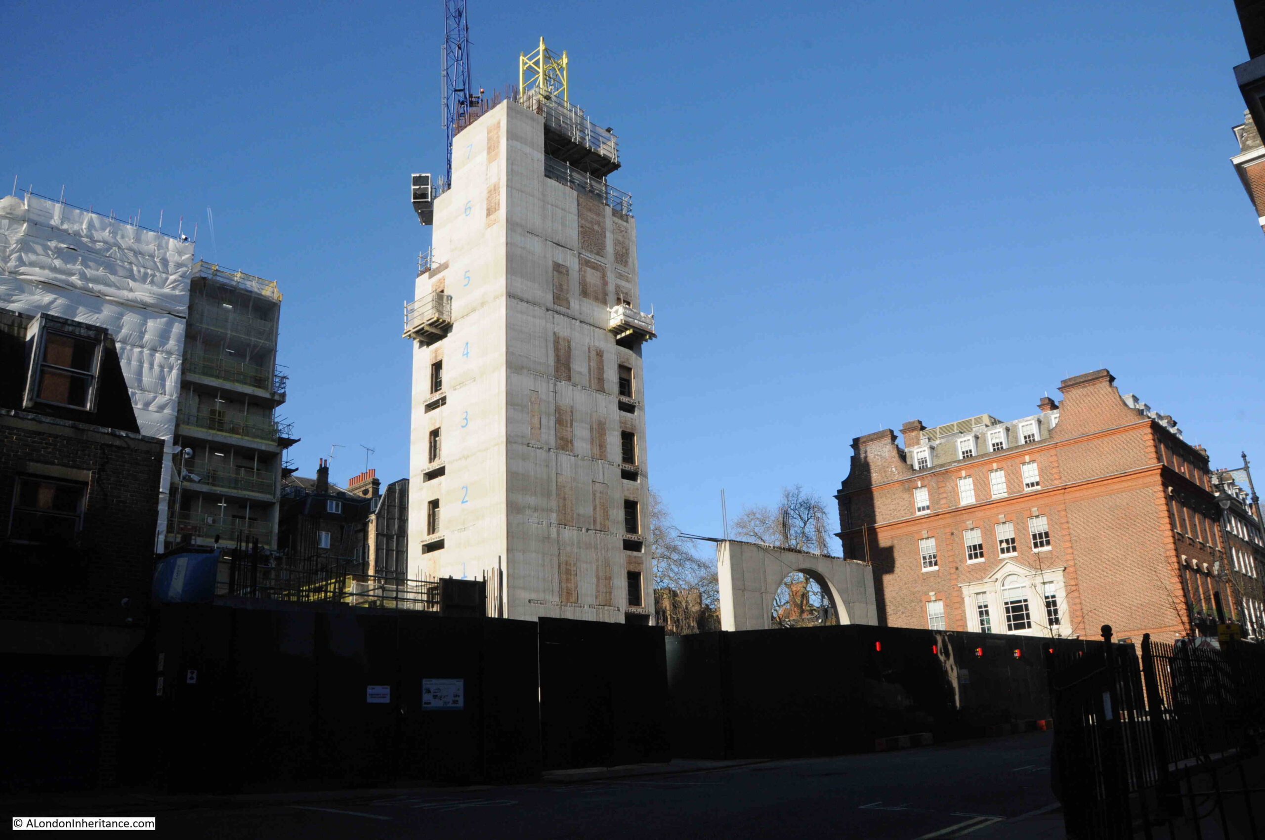
Although the Red Lion is at the end of Charles Street, it is also in the southern edge of Waverton Street, with a short section leading up to Hill Street before continuing northwards. A short distance from the Red Lion in Waverton Street, significant development continues:
Looking back from in front of the Red Lion, along Charles Street. Again this narrow section of the street once had the gardens of Chesterfield House on the right:
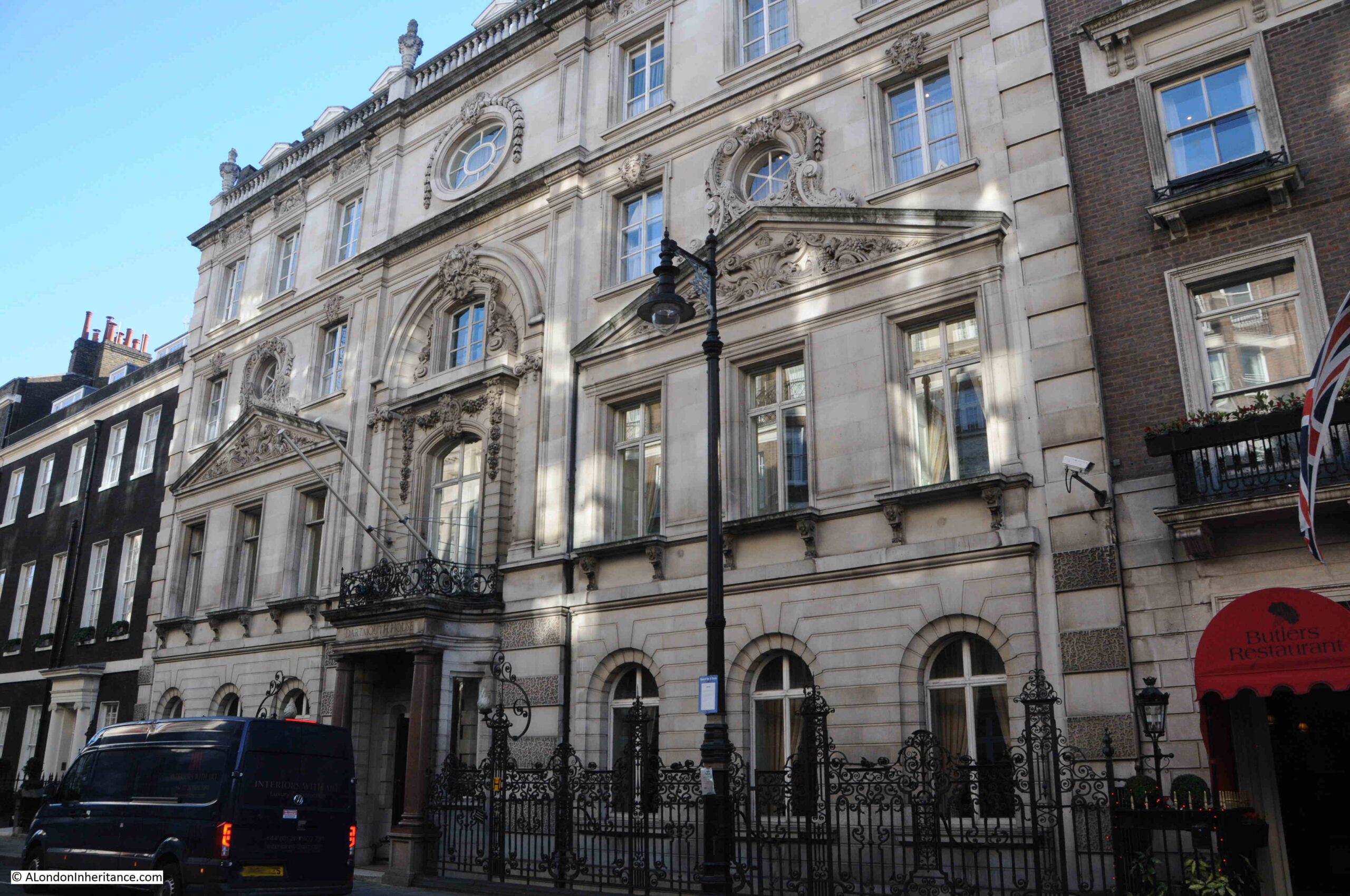
Walking back along Charles Street, and this is Dartmouth House:
Dartmouth House is another building which started off as part of a brick terrace of houses, but after combining individual houses, extending the resulting building and constructing a new stone façade, we get the building we see today.
the first recorded resident was the Dowager Duchess of Chandos in 1757, and for the following centuries the house has been occupied mainly by a succession of Dukes, Earls, a Dowager and a Marquis – or “The Quality” as Wonderful London and other early references to the role of a Running Footman would have referred to them.
Since 1926, Dartmouth House has been the headquarters of the English Speaking Union (ESU).
The ESU have published a brief history of the house, and within this they reference the River Tyburn and that the brook runs under Dartmouth House and caused serious damage to papers stored in the basement in the 1990s.
According to “The Lost Rivers of London” by Nicholas Barton and Stephen Myers the Tyburn runs slightly to the east and south. Under the south eastern corner of Berkeley Square towards Curzon Street, rather than running under Dartmouth House, however the basement of Dartmouth House is within what would have been the marshy area surrounding the Tyburn and any remaining springs, a high water table after heavy rains etc. could still result in basement flooding.
Just one of the ways in which the pre-built environment, when the area was all fields streams and ponds, occasionally still bursts through to the 21st century.
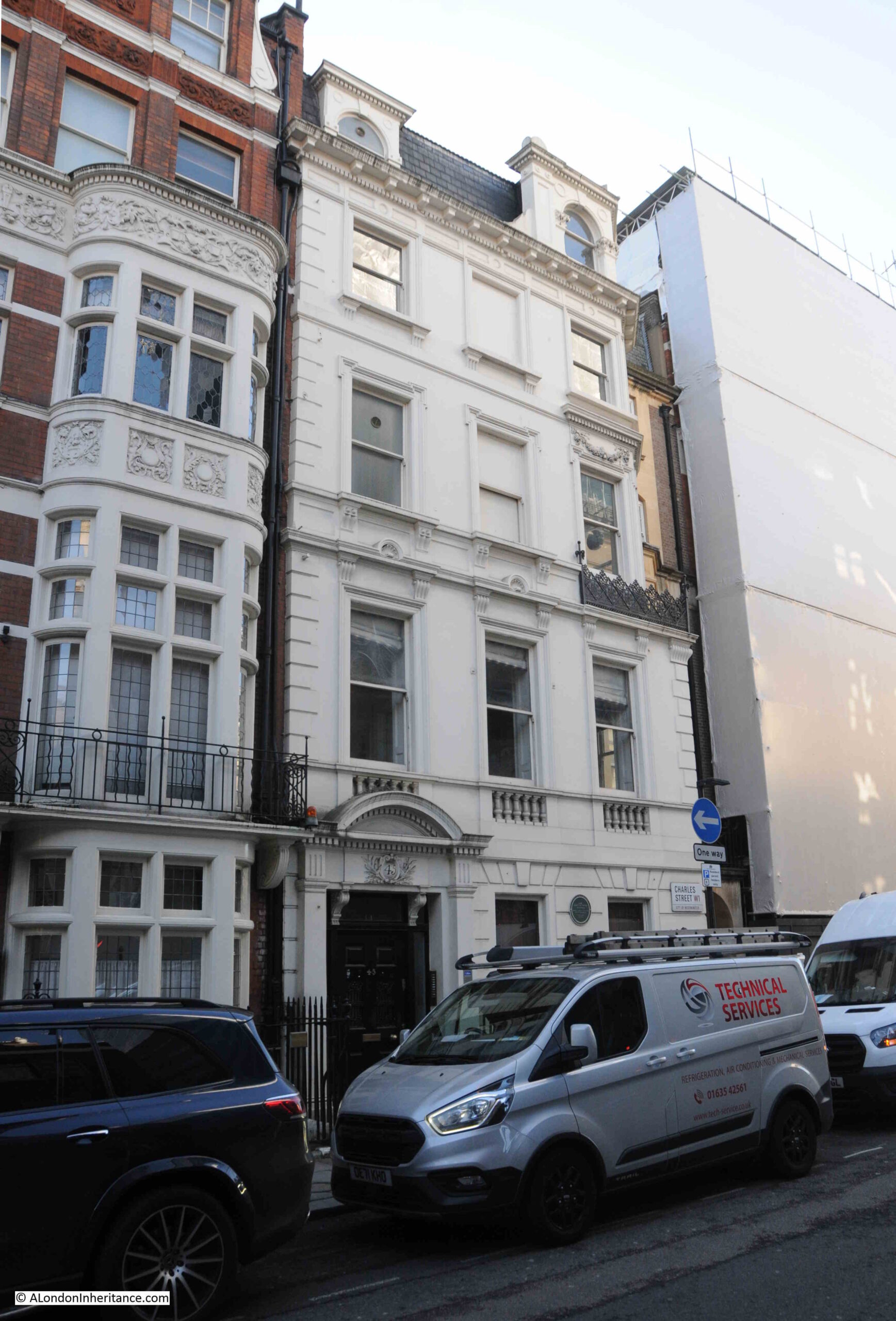
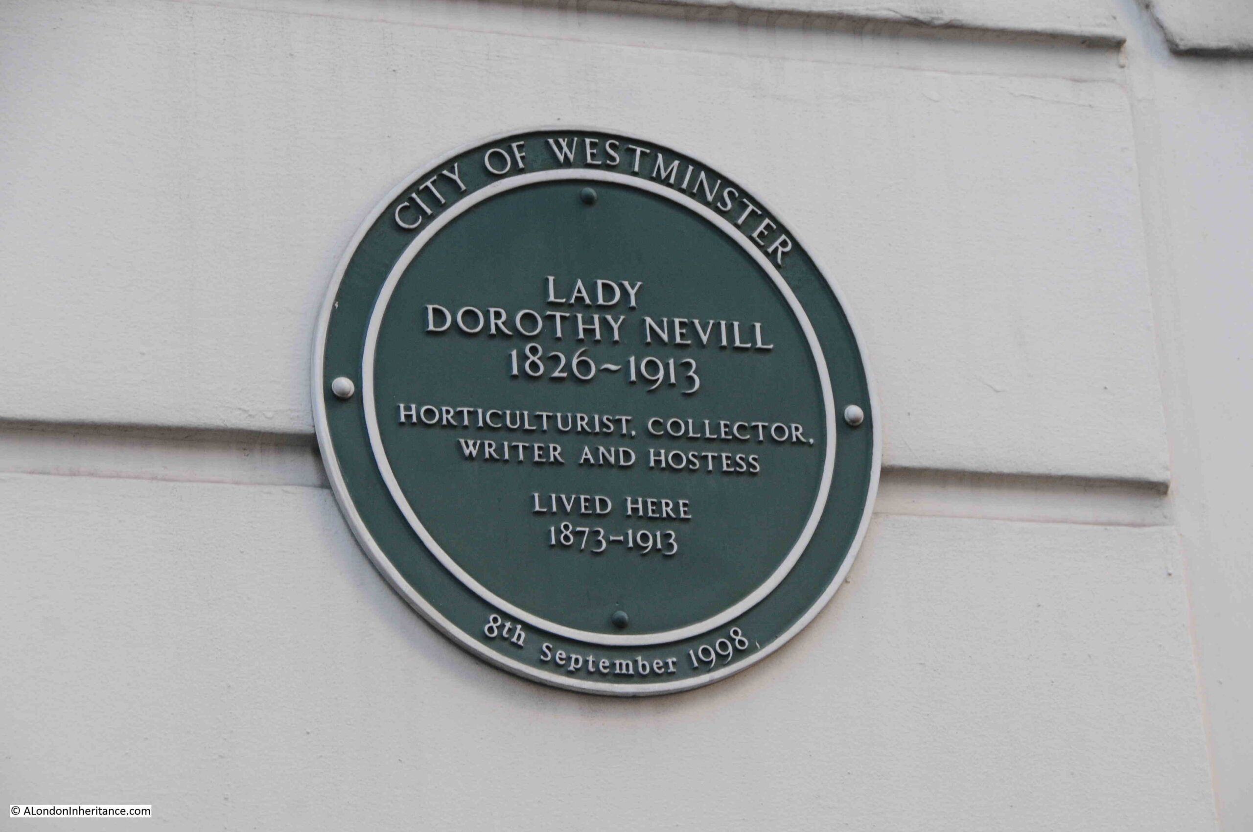
A house with a green City of Westminster plaque on the ground floor:
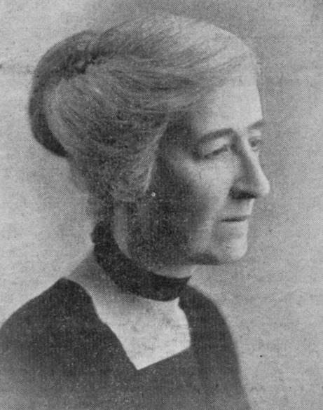
The plaque states that Lady Dorothy Nevill lived in the house from 1873 to 1913:
Born in 1826, she was the daughter of Horace Walpole and Mary Fawkener.
When she died in 1913, obituaries stated that she was one of the more important links between the Victorian and present eras, and that she had lived through the reigns of George IV, William IV, Victoria, Edward VII and George V.
Her obituaries stated that she was “profoundly conscious of the fact that she was connected in blood with many of the leading families in England; but unlike most British aristocrats (remarks the Times), though a keen Conservative in politics, fully alive to the changes that time had brought upon English Society.”
Her support of Conservative politics was such that she “was one of the two or three ladies responsible for the founding of the Primrose League; indeed it is said to have been first suggested at her luncheon table; and every year on April 19 her windows and balconies were covered with primroses”.
The Primrose League (named after the favourite flower of Benjamin Disraeli) was founded in 1883 and was a Conservative supporting, mass membership organisation, formed to promote the aims of the Conservative party across the country, and support the election of Conservative candidates.
The success of the league was such that in ten years, membership had reached over one million, and there were members across the country, including the industrial towns of the north.
There were however, many sceptical of the organisation, and the Edinburgh Evening News on the 2nd of February 1884 was reporting that:
“That latest of Conservative follies, the Primrose League, is pushing its way. A considerable number of people have joined it, and its organisors assert that it will in the course of time become a powerful element of Tory reaction. It has been decided to start a branch of the League at Birmingham, with a view of assisting the candidature of Lord Randolph Churchill.
A correspondent suggests however, that an institution like the Primrose League is more suited for the atmousphere of Belgravia than Birmingham.
It was established by some rather weak-minded Conservatives in the West End of London, and it is not likely that it will be largely supported by the artisans of Birmingham. The League intends to hold a great demonstration on April 19th, the anniversary of Lord Beaconsfield’s death. There is some talk of its members walking through the metropolis in a monster procession.”
Surprisingly, the Primrose League lasted until 2004, when it was disbanded.
Her obituary also remarked that “The Sunday luncheon parties at her little house in Charles Street were the meeting place of people of all kinds of opinion, drawn from many walks of life, though she herself was fond of saying that her society was exclusive, dull people being never admitted”.
I like the description of her house in Charles Street being described as “her little house”, but I suppose that all things are relative for “The Quality”.
Whilst many of the buildings along Charles Street have changed significantly since the street was first developed, there are some original houses, and some of these have had some rather strange additions, such as this terrace house with a stone bay window that looks as if it has been randomly stuck on the building:
At the Berkeley Square end of the street there is, what the Historic England listing describes as “Two full height canted bays of 3 sashes each per floor and a 2 storey 2 window extension to left hand”. This is the rear of the Grade II listed 52 and 52A Berkeley Square, which date back to around 1750 and form part of the first development along Charles Street:
Charles Street is an interesting little street. Many of the buildings have an aristocratic heritage, as does the origins of the name of the Footman pub.
It is brilliant that the Footman survives, and the loss of the Red Lion is a shame. I do not know the reasons for the pub’s closure, but I often wonder in the planning decisions for pub conversions, just how much consideration is given to the change in use, and the loss of a community asset.
These converted properties often become trophy assets that add very little to the area.
Theoretically, it should now be much harder to get planning permission for the conversion of a pub.
The London Plan, published by the Mayor of London, includes “Policy HC7 Protecting public houses” which does appear to provide a strong framework for resisting the conversion of a pub to alternative uses, however I suspect there are always ways and means to get around such constraints.
On a positive note for the area, Charles Street is in the City of Westminster, which in the 2017 London Pubs Annual Data Note (part of the Greater London Authorities Cultural Infrastructure Report), and Westminster had the highest number of pubs of any borough in London with 430,
In second place was Camden with 230 and in third place was Islington with 215. Barking and Dagenham had the fewest number of pubs, with just 20.
I did not take any photos of the Red Lion when it was open, which I regret. You do not appreciate places until they are gone, and this is now one of the reasons why I probably take too many photos of even the most mundane street scene, as you know for sure, that within London – at some point it will have changed.
The banks of the Thames was not just full of docks and warehouses, but was also a place of industry, attracted by the easy transport of raw materials and goods along the river. Many of these industries were very dirty, polluting the local area and blighting the lives of those who lived nearby.
One of these was Stepney Power Station, a coal fired electricity generator, that can be seen in the following photo taken by my father in August 1948 on a boat trip from Westminster to Greenwich:
As can be seen, the power station is next to Limehouse Dock (originally Regent’s Canal Dock), and the name Stepney Power Station comes from the power station being in, and originally built, by the Borough of Stepney. It was occasionally referred to as Limehouse Power Station, which more accurately referred to its geographic location.
At the start of the electrification of London, lots of small electricity generating stations sprung up across the city, funded and built by a mix of private and public bodies.
These would supply their local area, with limited, if any, connection to other power generators.
London’s Boroughs were under pressure to develop and build electricity services to provide this new power source to homes, industry, the lighting of streets etc. and there were a large number of power stations built at the end of the 19th and the first decades of the 20th century.
Stepney Power Station formerly opened on the 27th of October, 1909, as recorded by a report in the Morning Leader on the following day;
“An extension of the Stepney electricity undertaking was opened yesterday by the Mayor and Mayoress (the Hon. H.L.W. and Mrs. Lawson).
The new generating station is situated at Blyth’s Wharf on the river, which gives the advantages of cheap sea-borne coal and an ample supply of condensing water.
Councilor Kay mentioned yesterday that the whole station had been erected by the council’s officials, so that it was in every respect a municipal undertaking.”
The 1909 power station was relatively small, but in the following years it would rapidly grow as demand for electricity increased and the cables needed to carry electricity across Stepney were installed and spread out across the Borough.
The version of the power station in my father’s 1948 photo shows the power station at its maximum size, with the tall chimney, which was added in 1937. There would be further upgrades in the following years, but from the river, this is how the station would have looked.
To help identify the location of the power station, features of the power station, and a comparison with the same view today, I have marked up the following two photos, starting with the view in August 1948:
And January 2024:
The following extract from the OS map shows the location of Stepney Power Station, labelled as “electricity works”. The conveyor transporting coal from the coaling pier to the power station can be seen, and between the coaling pier and Narrow Street, there is an open space. In the 1909 report of the opening, there is a reference that the “new generating station is situated at Blyth’s Wharf on the river”, and this open space was Blyth’s Wharf (‘Reproduced with the permission of the National Library of Scotland“):
Being right next to the river was a perfect location for the power station. It enabled supplies of coal to come from the north east of the country, via sea then along the Thames. The river also provided ample supplies of cooling water and water for steam generation in the boilers.
As the generation capacity increased, and therefore the demand for coal, the coaling jetty was built in 1923 to simplify the transport of coal from ship to where it would be burnt.
Newspapers in the 1920s were full of adverts by Stepney Borough Council advertising that their supply of electricity was the cheapest in London due to the prime location of their power station.
Whilst good for the price of electricity, the location was not good for those who lived, worked, and went to school near Stepney Power Station. There were many complaints about the dirt and pollution from the power station, and if you look at the above map, just to the top right of the power station, there are two buildings marked “school”. These are mentioned in the following newspaper article.
From the East End News and London Shipping Chronicle on the 2nd of December, 1949:
“COAL DUST COMPLAINT – Stepney Council is joining the L.C.C. in ‘strong representations’ to the British Electricity authority about nuisances caused by the Stepney power station.
It is said that coal dust dispersed by the movement of coal at the power station can penetrate into class rooms at the Cyril Jackson school even when the windows are closed and the schoolkeeper’s house – about six yards away from the station – cannot be occupied.
Another nuisance is caused by grit from the chimney of the station, the council was told last week. The council point out that when they were in control of the chimney as electrical supply undertakers in 1935 they improved conditions there.”
As the article highlights, it was not just pollution from the chimney, it was also the dust created by the use of coal.
Coal had to be unloaded from ships, transported across Narrow Street, stored, and then pulverised reading for burning. All these activities would have created coal dust, much of which would have contaminated the local area.
Another example can be found in the East End News and London Shipping Chronicle on the 6th of April 1950:
“GRIT AND COAL DUST, COMPLAINT ABOUT STEPNEY POWER STATION – The public health committee reported to the last meeting of Stepney boro council:
Representations have been made to the Minister of Fuel and Power and the British Electric Authority with a view to securing an abatement of the nuisance caused by the emission of grit from the chimney of the Stepney power station and by coal dust distributed as the result of the movement of coal.
The representations have been duly acknowledged by the Ministry and British Electric Authority, in a communication to the Minister dated January 24, 1950, deprecates the suggestion that the condition has worsened since this station vested in the Authority; state that the Authority is fully alive to the responsibility for ensuring that only the minimum interference is caused in the vicinity; and suggest that the chief engineering inspector of the Ministry should visit the site for the purpose of determining whether any further remedial measures are practicable.
We are fully alive to the fact that the operation of a generating station in a highly congested district must, to some extent, detract from the amenities of the persons residing therein but we are seriously concerned that the health of the children attending the Cyril Jackson school, which adjoins the station, may be prejudiced by the emission of grit and coal dust. We understand the extent of the coal dust nuisance varies with the climatic conditions and, it appears to us that since pulverised fuel is being used the coal storage bunkers should be effectively covered in. before making further representation, however, we have directed that inquiry be made of the Minister of Fuel and Power as to whether the Ministry’s chief inspector has visited the site, if so, what further remedial measures are considered necessary.”
I can only imagine what the long term impact on the health of the children attending the Cyril Jackson school would have been. The mention in the above article to the “British Electric Authority” is to the post-war nationalisation of the country’s electricity generating and distribution industries, which brought together all the private and public generating stations, and their distribution networks, into single bodies.
The British Electricity Generating Authority would late become the Central Electricity Generating Board, which would build the national transmission network (the pylons, or towers as they should be known), which allowed the small power stations in London to be closed, and electricity transported from much larger stations across the rest of the country.
In this 1928 photo, we can see the power station as the white building, with a number of chimneys rising from the roof. Note that the chimneys are relatively low in height:
The low height of the chimneys did not help with the dispersion of smoke, gases and grit from the chimney so by 1937 a much taller chimney had been built, which can be seen in the following 1949 photo and is the chimney seen in my father’s photo:
There was a rather glowing report about the new chimney in the Evening Telegraph and Post on the 2nd of August 1937:;
“An Almost Invisible Chimney – There is nothing mars a city more than unsightly chimneys sprouting from factories and power stations. London’s East End must have hundreds of these chimneys, which are, of course, necessary to carry away dangerous smoke and fumes.
There is, however, one chimney in London, its 354 feet making it one of the highest in Britain, which cannot be called unsightly, for it cnnot be seen a mile away. It is situated in Limehouse, and is part of the Stepney Power Station.
The reason for its invisibility is that it is constructed of square bricks, some brown, some a light creamy colour. At close quarters it looks spotty, but from the distance it seems to have no real colour of its own, and is just a faint shadow on the sky.”
I know for certain that it could be seen from more than a mile away, as the chimney appears in other photos taken by my father, and the “light creamy colour” would have turned dark in a short time due to the level of pollution in the air in the industrial West End of London.
For example, this is my father’s photo of the view from the east of King Edward VII Memorial Park in Shadwell, and clearly shows a very visible chimney rising above Stepney Power Station:
Stepney Power Station would continue in operation until 1972 when it was decommissioned.
During the 1950s and 1960s large new coal and oil fired power stations had been build along the Thames, and a distribution network connected London up with the rest of the country, so there was no need for small power stations in congested areas of London.
All that remains today of Stepney Power Station is the coaling pier. The buildings and chimney were all demolished years ago, and the building that now occupies the majority of the site is the Watergarden complex of apartments.
This is the view of the Watergarden apartments facing onto Narrow Street:
Stepney Power Station was instrumental in providing electricity to the factories, warehouses, docks and homes of the borough, and in 1917, Stepney had entered into an agreement with Bethnal Green Council, under the London Electricity Supply Act of 1908, to help develop and supply electricity in Bethnal Green.
The growing dependence on electricity can be seen by the impact that failures in supply had on the local area.
On the 8th of May, 1926 it was reported that:
“LIGHT CUT OFF, London Hospitals Have To Stop X-Ray Work: Three important London hospitals are still without electric current owing to the Stepney power station cutting off the supply. They are the London Hospital, the Whitechapel Infirmary, and the Whitechapel Dispensary for the Prevention of Consumption.
The work of these hospitals becomes more and more hampered by the loss of electrical power, and all X-ray has had to be stopped.”
And on the 27th if July, 1955, the Daily Herald reported that:
“POWER FAULT BLACKS OUT HOSPITALS: Three East London hospitals and the whole borough of Stepney were blacked out last night by a four-hour power failure.
It was the third in a week, and the third time cinema audiences get their money back. Police were sent in vans to all major crossings because traffic lights failed.
And while engineers sweated at Stepney power station, hospitals, homes and public houses switched to candles.
At the London Jewish Hospital the water supply failed too. It is kept up to pressure by electric pumps.”
From the London Daily Chronicle on the 22nd of August, 1922:
“STEPNEY IN DARKNESS – Two Men Injured at the Electricity Works: Two workmen named as Tindall and Armstroong were injured last evening in a mishap at Stepney Borough Council’s electricity generating station in Narrow-street, Limehouse.
The switchboard burst into flames, and the two men sustained burns in trying to put out the fire. Their injuries, however, were not serious, and after treatment at Poplar Hospital they were allowed to go home.
For a time part of the district was deprived of Light and Power.”
The view today, looking into the Watergarden complex from Narrow Street, into what was the core of the power station:
The view from the west – no coal dust, dirt, smoke or grit covering Limehouse today:
To the west of the power station site was Shoulder of Mutton Alley, which can still be found today, as can be seen in the following photo where the power station would have been on the right, and a paperboard mill on the left, with the power station chimney being at the far end of the street:
Walking along Narrow Street today, it is hard to imagine just how much industry there was along these now quiet streets, along with the noise and dirt which these industries generated. In just the above photo there was the power station and a paper mill on opposite sides of the street.
Stepney Power Station does help tell the story of how electricity came to London, and became an essential part in the ability of the city to operate in the modern world.
The Cyril Jackson school is still in Limehouse, however it has moved slightly east to a site along Limehouse Causeway, where today the children breath much cleaner air than their predecessors.
Jays Stores was a store in Lower Road, Rotherhithe, that had a large sign advertising Jays for Jeans at the top of the building, above an illustration of a man presumably dressed in clothes available from the store.
My father photographed Jays Stores and the Jays for Jeans sign in 1986:
I could not get exactly the same view as in 1986 due to road works occupying the space directly opposite, however an almost the same view of Jays for Jeans, 38 years later in January 2024:
I am not sure exactly when Jays Stores opened, but the store closed in 2016. I suspect that the location of the store opposite the shops of the Surrey Quays shopping centre, Internet shopping, and the loss of local industry, with the resulting loss of trade for industrial wear, donkey jackets etc. (as advertised in the 1986 window) resulted in the store being economically unviable.
The store did make it onto the Internet though, as the surviving sign on the top of the building in 2024 shows that Jays for Jeans had a.co.uk address for the store, a different sign to the one in 1986.
The central panel has either completely faded, or perhaps been over painted.
To the right of the store, in the 1986 photo, can be seen part of one of the estate agents set-up to market the new properties being built as part of the redevelopment of the docklands.
Jays for Jeans is one of those local landmarks that defines an area for a specific period of time.
I walked down to the location of Jays for Jeans from Canada Water station, having arrived on the Jubilee Line.
It was a short walk, by the most direct route (that avoided the Surrey Quays shopping centre), but a route that confirmed that you can find things of interest in almost any London street, and is one of the joys of walking.
Staring with the wonderful drum structure over Canada Water station, a design which allows a large amount of natural light to get into the station below. The drum is above the escalators which run between the ticket hall and the platforms below:
From Canada Water Station, I headed down Surrey Quays Road, a street which was one of the main entrances into the Surrey Commercial Docks which once occupied the majority of this part of Rotherhithe.
Along this street is one of the very few remaining buildings from the docks – the Dock Manager’s Offices:
This glorious buildings is Grade II listed, and dates from 1892 when it was built by the Surrey Commercial Dock Company.
The building is very well preserved, and when in use as the dock offices, it consisted of three main parts: the Superintendent’s Office with clock tower, a Janitor’s House, which is the smaller block closest to the camera with the Dock Offices signage, and a large open plan General Office, which can be seen in the above photo receding to the right.
The building is now owned by British Land, and I believe part of the interior has been designed to showcase the flats that are being built as part of the significant redevelopment going on around the Surrey Quays area.
There is a plaque on the side of the Dock Manager’s Office which records a major event during the last war:
I am going to save the story of the docks here in Rotherhithe for some later posts as there is so much to tell about this part of London, and for now, I will continue on to Jays for Jeans.
At the end of Surrey Quays Road, the street meets Lower Road, and on the western side of Lower Road is the Seven Islands Leisure Centre:
Opened as the Rotherhithe Bath and Assembly Hall on the 27th of November, 1965, the building included a swimming pool, assembly hall with stage and dressing rooms, crèche and play area for children and a place for sunbathing.
The name comes from what were believed to have been seven islands in-between the streams that drained Rotherhithe and Bermondsey into the Thames.
The building retains a wonderful example of the coat of arms of the old Metropolitan Borough of Bermondsey:
Bermondsey, as a Metropolitan Borough existed from 1900 (when it brought together the old parishes of Bermondsey, Rotherhithe and St. Olave), until 1965 when it was replaced by the London Borough of Southwark.
Within the coat of arms, the lion and the two letter B’s on either side, are from the Bermondsey Vestry and have their origins in Bermondsey Abbey.
Rotherhithe and the docks are represented by the ship at bottom right.
The Latin motto at the bottom of the arms, “prosunt gentibus artes” means “Arts profit the people”
On the opposite side of Lower Road is a brick built block of apartments, with a blue plaque between the first and second floors, above the central arch:
The blue plaque is to King Edward Frederick Muteesa II, the first President of Uganda:
Muteesa was the Kabaka (king or ruler) of Buganda, one of the individual kingdoms that make up the country of Uganda.
When Uganda became independent from Britain in 1962, Milton Obote became the Federal Prime Minister, and Obote negotiated an agreement with Muteesa that he would become President of Uganda, an agreement which was implemented by secret vote in Parliament on the 4th of October, 1963.
In the following years, there was infighting between the coalition that made up Parliament and between Obote and Muteesa, and it finally got to the point where in February 1966, Obote suspended the Federal Constitution and declared himself President, thereby deposing Muteesa.
Muteesa fled into exile and arrived in London, penniless, and without any support from the Government of Uganda.
During his earlier years he had been educated at Cambridge, where he also joined the university’s officer training corps, which led to a commission as a Captain in the Grenadier Guards.
It was this military connection that was to help with accommodation in London, and an old military contact provided him with the apartment in Orchard House, Lower Road.
He was temporarily buried in England until the political situation changed in Uganda when Idi Amin overthrew Milton Obote and Muteesa’s body was returned to Uganda and given a state funeral and burial.
As with so much of London, there are a number of closed pubs in Lower Road, places that recall the working class history of the area.
The first of these is the Prince of Orange:
The pub seems to have opened around the late 1830s / 1840s as it is during these years that I find the first mentions of what appears to be the Prince of Orange pub.
In the following decades there are all the usual mentions of events that you would expect to find in a London pub in the docks, with crime, fights, jobs available etc.
in the pubs last few decades, it seems to have been a venue for jazz, as in newspapers there are plenty of adverts, such as for Pete Boulter’s Blues Jam session (1995), and Mr. B Plays Basie (1983). In the Stage and Television Today in October 1982, it was reported that “on the pub front, let us applaud the Prince of Wales, Buckhurst Hill and the Prince of Orange, Rotherhithe, both presenting jazz practically every night of the week”.
At times, the pub was on BBC Radio 2, for example the listings for the 25th of January, 1988, included “Jazz Score, where Benny Green is in the chair at the Prince of Orange, Rotherhithe, and on the panel are Acker Bilk, Peter Clayton, Alan Elsdon and Ronnie Scott”.
The Prince of Orange is now apartments.
A short distance further along Lower Road is another closed pub, the China Hall:
There has been a pub on the site for a number of centuries and in 1719 a pub on the site was apparently called the “Cock and Pye Ale House.”
The earliest written reference I can find to the name China Hall is in the Oracle and Daily Advertiser, on the 27th of February, 1802, when “A few afternoons since, about half past four o’clock,, as Mr. Witts of the Europa Inn, Rotherhithe, was travelling near China Hall, in the lower Deptford Road, he was stopped by a single foot-pad, who robbed him of a £2 note and his cash”.
The road was originally called Lower Deptford Road, but has since dropped Deptford and is now simply Lower Road.
The site of the pub has a long history. In 1776 the pub appears to have been leased to a trader in tea and china called Jonathan Oldfield, and who built a theatre next to the pub, called the China Hall. The name may have come from his trade in china, and the name appears to have transferred from the theatre to the pub.
Edward Walford, writing in Old and New London (1878), has the following to say about the China Hall: “In former times a narrow pathway, called the ‘Halfpenny Hatch’ extended through the meadows and market-gardens from Blue Anchor Road to the Deptford Lower Road, where it emerged close by an old and much-frequented public-house called the ‘China Hall’. The ancient tavern, which was a picturesque building partly surrounded by an external gallery, was pulled down within the last few years, and in its place has been erected a more modern-looking tavern, bearing the same sign.
Our old friend Pepys mentions going to China Hall, but gives us no further particulars. It is not unlikely, says Mr. Larwood in his History of Signboards, that this was the same place which, in the summer of 1777, was opened as a theatre. Whatever its use in former times, it was at that time a warehouse of a paper manufacturer.
In those days the West End often visited the entertainments of the East, and the new theatre was sufficiently patronised to enable the proprietors to venture upon some embellishments. The prices were – boxes 3s; pit 2s, gallery 1s; and the time of commencement varied from half-past six to seven o’clock, according to the season. The Wonder, Love in a Village, the Comical Courtship and the Lying Valet were among the plays performed. The famous Cooke was one of the actors in the season of 1778. In that same year the building suffered the usual fate of theaters, and was utterly destroyed by fire”.
The China Hall pub closed at the end of 2018, after a local campaign failed to save it, although it appears to have been a going concern, was wanted by the local community and had publicans who wanted to continue.
The ownership of the pub has been very controversial, and since closure the upper floors have been converted to residential, with extra space from the addition of a mansard roof.
The ground floor did appear to be undergoing conversion however council planners issued a warning notice to stop. A planning application was made for conversion of the ground floor, this was turned down, and the council issued an enforcement notice requiring removal of residential partitions and fixtures.
The owner has since appealed against the planning refusal – I do not know the status of this appeal.
The China Hall illustrates the sad fate of many London pubs, that even when they are still viable businesses, and wanted by the local community, they are all too easily sold to a developer who can find more profit in the conversion of the property to residential.
Continuing down Lower Road, and on the eastern side of the street is a row of late 19th century, terrace houses. The second house on the left has a plaque to Ada Salter, just above the ground floor bay window, directly above where green bins can be seen:
Ada Brown was born in 1866, a child within a Wesleyan Methodist family in Raunds, Northamptonshire. She moved to London in 1896, where she joined the West London Mission of the Wesleyan Sisters of the People, before moving to their Bermondsey Settlement in 1897.
Alfred Salter was a student at Guy’s Hospital when he met Ada at the Bermondsey Settlement. They married in 1900 and lived in Bermondsey. Both Ada and Alfred worked tirelessly to improve conditions in Bermondsey and Rotherhithe.
The house with the plaque is at 149 Lower Road, and was the Women’s House of the Bermondsey Settlement. Ada lived in the house for two periods in 1897 and 1898.
The plaque is very recent as it was installed on the house in 2023:
Ada became a Labour councilor, the first woman councilor in Bermondsey in 1909 and set about recruiting women workers to trade unions to organise against the terrible working conditions in the area’s factories.
Alfred was elected MP for Bermondsey in 1909, the same year as Ada was elected Mayor.
A view of Ada’s campaigning approach to improving the living conditions of Londoner’s, can be seen in the following first two sections from an article she wrote in the Daily Herald on the 28th of February, 1934, titled: “Don’t forget the HIDDEN LONDON”:
“London is the most wonderful and romantic city in the world. London leads. What London thinks to-day Great Britain will do to-morrow.
Underlying its romance, its magnificence, its power, its wealth and its resources, is a vast morass of sorrow and misery, of poverty and struggle, of unrequited toil and unmerited suffering.
Watch some hundreds of thousands of citizens pouring each evening out of their office and work places in the centre of London and follow them to their homes. You will have glimpses of drab, featureless streets, rows of Early Victorian terrace houses, huge blocks of tenement dwellings. In these industrial dormitories the workers are not housed, but warehoused. Observe the daily fight for tram or bus and all the discomfort that it involves. Note the imperfect education given to children, too large classes, insufficiency of secondary schools, inadequacy of playing space in all working-class quarters.
Compare the dullness and ugliness of grace and colour which constitute the environment of the poor with the stateliness and magnificence of the West End and the pleasing amenities of the middle-class suburb.
Contrast the narrow, shut-in back yards with the spacious gardens surrounding the houses of the well-to-do. Remember the acres and acres of playing fields attached to all the public schools of England where the sons of the rich are educated, and then turn to the cramped, asphalted play grounds of the elementary schools in Bermondsey, Southwark, Bethnal Green, Stepney and Poplar.
It is this London of the mean streets to which our thoughts should turn at a London County Council Election rather than the ‘show’ London which visitors from the country and abroad come to see.”
Ada Salter in the early 1920s:
Ada was also featured in “The VOTE -THE ORGAN OF THE WOMEN’S FREEDOM LEAGUE” on the 1st of December 1922, when she was the fifth in a series of features on women mayors. In the article, she wrote:
“As the first woman in London to be offered the position of Mayor, I am proud that I live and work in a borough, the elected representatives of which are prepared to choose an individual who belongs to what is sometimes described as the weaker sex. As a woman, I am naturally eager that the woman’s share in responsibility of government should be a direct one. There is still a tremendous leeway to be made up in all departments of life that affect women, but the failure to catch the vision of a free humanity, where men and women can act together, and not in antagonism, is not confirmed to one sex.
By common consent, the Bermondsey Borough Council has for some years dispensed with the wearing of the Mayoral and Aldermanic robes, but I also do not intend to wear the chain of office. This, of course, is a purely personal matter. For brilliant colouring, and for the brightness of gold, I have the greatest admiration, but I desire them not as symbols of place and power. The ideal for which we must strive is to secure respect for the authority and decisions of the Chair, rather by personality and character, than by decorations of office.”
I suspect we need more Ada’s in politics today.
Ada Salter died on the 4th of December, 1942. One of the newspaper reports of her death started with “The death of Mrs. Ada Salter, who was London’s first woman Mayor, is a reminder of the many hitherto exclusively masculine fields in which women have now staked out a claim”.
Continuing down to the site of Jays for Jeans, and the third pub in this short walk. This is still open as a bar and restaurant but with a new name of the Yellow House:
The was the Caulkers, originally the Jolly Caulkers, and in a couple of references, the Merry Caulkers.
A Caulker was the person who had the job to fill in any gaps in a ship, to make it watertight. Filling the gaps between originally wooden planks and later the metal sheets that would make up the hull of a ship.
A profession that would have been found across the docks of Rotherhithe.
The earliest reference I can find to the pub is in the 1840s, however the design of the pub does not look 19th century, and I suspect it may have been rebuilt in the 1910s, as in the South London Gazette in 1919 there are references to the New Jolly Caulkers, and which therefore may be a reference to the pub we see today.
And a very short distance on from the Yellow House / Caulkers, was Jays for Jeans.
A short walk, which has revealed one of the few remaining buildings from the time when Rotherhithe was covered in docks, the coat of arms of the Metropolitan Borough of Bermondsey, the first President of Uganda, Ada Salter, a campaigner for the living conditions of London’s working class and London’s first woman mayor, and three historic pubs.
There is so much more to write about this area, and the large dock complex that once occupied much of this part of Rotherhithe, and I hope to return in future posts.
For this week’s post, I am returning to the plaques that can be found around the City of London. I originally started this series of posts with just the City Blue Plaques, however there are so many interesting stories to be found in other types of monuments and plaques around the City of London, that I have since broadened the scope of these posts.
Today’s post starts with a monument to Admiral Arthur Phillip, who provides the connection that is the title of the post – From Bread Street to Australia.
Admiral Arthur Phillip, R.N. Citizen of London
If you walk to the western end of Watling Street in the City of London, towards St. Paul’s Cathedral, you will come to an open space, with gardens on the left and the shops of One New Change on the right.
Tucked in the southern part of the space, up against the gardens is a small monument:
The monument is to Admiral Arthur Phillip, Royal Navy, and it is a bronze bust of Phillip that sits at the top of the monument. The bust was rescued from the church of St. Mildred, Bread Street, after the church had been destroyed by bombing in 1941.
A plaque below the bust provides some background:
As the plaque states, Admiral Arthur Phillip was born in the ward of Bread Street on the 11th of October 1738. He went to the Royal Hospital School at Greenwich, and joined the Royal Navy in 1755.
In his time in the Navy, he was involved in the Battle of Menorca and the Battle of Havana, but after these battles he was left without a ship, and as was the custom at the time, naval officers had to find other sources of employment and Arthur Phillip took up farming in Hampshire.
In 1769, he rejoined the Royal Navy, and in the following years was involved in a number of battles around the world.
Although his time in the Navy appears to have been successful, if he had not been appointed the first Governor of Port Jackson, which he also named Sydney, after his friend Lord Sydney, his name would probably have been very little known today, and not commemorated in the City of London.
The following portrait shows Captain Arthur Phillip, as he was in 1786. The portrait is by Francis Wheatley:
I found a newspaper report from 1936 regarding a commemoration service to be held in St. Mildred’s, Bread Street for Admiral Arthur Phillip, and the article provides some additional information on his expedition to Australia, and the founding of the settlement at Port Jackson, which would later become part of the city of Sydney.
“Admiral Arthur Phillip, for whom a commemoration service will be held at St. Mildred’s Church, Bread Street, London on Tuesday, commanded the Sirius on an expedition to New South Wales some years after it had been discovered in 1770 by Captain Cook.
The expedition, which first arrived at Botany Bay, consisted of an armed trader, three store ships, and six transports. The persons on board the fleet included 40 women, 202 marines of various ranks, five doctors, a few mechanics, and 756 convicts. The live stock included cows, a bull, a stallion, three mares, some sheep, goats, pigs, and a large number of fowl. Seeds of all descriptions were provided for planting in the strange land, but Botany Bay was found unsuitable for settling upon. The expedition finally ended at Port Jackson, near the present site of Sydney.
Later on, other convict ships arrived, and in 1793 came the first free settlers, who were presented with grants of land.
The memorial service in London to the admiral will be attended by the Lord and Lady Mayoress of London, Lord Wakefield of Hythe, and the Sheriffs of the City, while Sir Archibald Weigall, Governor of South Australia from 1920 to 1922, will give the address”.
As the plaque states, St. Mildred’s, Bread Street, was destroyed during the Second World War, and was not rebuilt.
Although the original church has been lost, the memorial service continues to this day, and is currently held annually in St. Mary-le-Bow, Cheapside.
Arthur Phillip was in charge of the first fleet of convicts that had sailed from England to start the first colony in Australia.
The first fleet was the result of ideas that had been put forward for how Australia should be colonised, and what to do with the numbers of convicts which were seen to be a cost to the state, and how they could be usefully employed.
The following newspaper extract is from the 5th of November 1784:
“A plan has been presented to the minister, and is now before the cabinet, for instituting a new colony in New Holland. In this vast tract of land, which is so extensive as to participate of all the different temperaments or climates which affect the globe, every sort of produce and improvement, of which the various soils of the earth are capable, may be expected.
It is therefore proposed to send out the convicts to this place, under such regulations as may tend to the establishment of a new colony.
The only inhabitants which are thought to possess New Holland, are a few tribes of harmless uncultivated people, who loiter on the shore, and are only to be found in some creeks which seem convenient at once for shelter and provision, so that from there the European can have but little to fear, especially as it may be supposed no settlement will be attempted without sufficient force, at least in the first instance, to protect it from every species of surprise or depredation.”
It is horrendous to read, 240 years later, the lack of any interest in the history and culture of the indigenous population, and to understand what their fate would be over the years after the first fleet’s arrival.
The name New Holland in the above article is the first European name given to the continent of Australia in 1644 by the Dutch explorer Able Tasman who was employed by the Dutch East India Company, and after whom the island of Tasmania would be named.
There are a couple of reliefs on the monument, one on each side. The following shows “The discovery and fixing of the site of Sydney on Wednesday 23rd January 1783. Reading from left to right, Surg. J, White, R.N. Capt. Arthur Phillip, R.N. Founder, Leut. George Johnston, Marines, A.D.C. Capt. John Hunter, R.N. and Capt. David Collins, Marines”.
The second relief shows “The founding of Australia at Sydney on Saturday, 26th January 1788. Figures in rowing boat leaving H.M.S. Supply are Capt. Arthur Phillip, R.N. Lieut. P. Gidley King, R.N. and Lieut. George Johnston, Marines A.D.C.”:
Whilst the reliefs show a heroic view of the arrival at Port Jackson / Sydney, the reality of living at the settlement in the years after was rather challenging.
The following letter is from the Kentish Gazette on the 2nd of June, 1789. It provides a very honest view of the terrible conditions of the first settlers, and also their interaction with the indigenous population, who are described as “savages”.
“The following from Port Jackson, is written by a female pen; and as from a particular circumstance it seems an upright picture of the place, we lay it before our readers.”
The letter was written in Port Jackson on the 14th of November, 1789, and the author of the letter is not named.
“I take the first opportunity that has been given us, to acquaint you with our disconsolate situation in the solitary waste of the creation. Our passage, you may have heard by the first ships, was tolerably favourable; but the inconveniences since have suffered for want of shelter, bedding &c. are not to be imagined by any stranger. However, we have now two streets, if four rows of the most miserable huts you can possibly conceive, deserve the name; windows they have none, as from the Governor’s house, &c. now nearly finished, no glass could be spared; so that lattices of twigs are made by our people to supply their places.
At the extremity of the lines, where, since our arrival, the dead are buried, there is a place called The Church Yard; but we hear as soon as a sufficient quantity of bricks can be made, a church is to be built, and named, St. Philip’s after the Governor’s namesake. Notwithstanding all out presents, the savages still continue to do us all the injury they can, which makes the soldiers duty very hard, and much dissatisfaction among the officers. I know not how many people have been killed. As for the distress of the women, they are past description, as they are deprived of tea and other things they were indulged in, in the voyage by the seamen; and as they are all totally unprovided with clothes, those with young children are quite wretched. Besides this, though a number of marriages have taken place, several women who became pregnant on the voyage, and are since left by their partners, who are returned to England, are not likely, even here, to form any fresh connections.
We are comforted with the hopes of a supply of tea from China, and flattered with getting riches when the settlement is complete, and the hemp the place produces is brought to perfection. Our Kangaroo cats are like mutton, but is much leaner; and here is a king of chickweed so much in taste like our spinach, that no difference can be discerned. Something like ground ivy is used for tea; but a scarcity of salt and sugar makes our best meals insipid. The separation of several of us to an uninhabited island was like a second transportation. In short, every one is so taken up with their own misfortunes that they have no pity to bestow on others. All our letters are examined by an officer; but a friend takes this for me privately. The ships sail tonight.”
The following map is from 1789, the same year as the above letter, and shows how small the settlement at Sydney Cove Port Jackson was, and features from the letter can be seen in the map. Arthur Phillip’s ship, the Sirius, is shown in the bay. The ships are numbered and identified at top left.
The description to the map is “Sketch & description of the settlement at Sydney Cove Port Jackson in the County of Cumberland taken by a transported convict on the 16th of April, 1788, which was not quite 3 months after Commodore Phillips’s landing there”.
When looking at the above map, it is remarkable that this small settlement developed into what is now the city of Sydney.
The majority of people arriving in the new settlement in the years at the end of the 18th century were convicts, and these featured in many prints of the time.
In the print, the jailer is shown urging the two convicts to get on the ship which will take them to Australia, and perhaps to remind them of what they have escaped, there is a gallows on a hill in the background.
After a challenging start for the colony at Port Jackson, the rest of Australia would gradually be colonised, and the original site of Port Jackson would grow into the city of Sydney that we see today.
In just under two weeks time, on January the 26th it will be Australia Day, which commemorates the landing of the First Fleet, and the day on which Arthur Phillip from Bread Street in the City of London raised the Union flag at the first colony.
St. John the Evangelist, Friday Street
Next to the monument to Arthur Phillip is one of the City of London blue plaques, recording that it was the site of the church of St. John the Evangelist on Friday Street, and that the church was destroyed in the Great Fire of 1666:
There is not much to be found about the history of the church. In “London Churches Before The Great Fire” by Wilberforce Jenkinson (1917), there is the following paragraph about the church:
“At the end of Friday Street, at the corner of Watling Street, stood the church of St. john the Evangelist, one of those known as a ‘Peculiar’. In 1361 a chantry was founded by William de Augre. The first rector was Joh. Hanvile, who retired in 1354. The income of the benefice was returned in 1636 as £76, 10 shillings. After the Fire the parish was annexed to that of All Hallows, Bread Street. A small portion of the churchyard at the corner of Watling Street may still be seen.”
The church was known as a ‘Peculiar’, and the book gives the following definition:
“Peculiars were exempt from ordinary jurisdiction. The name of Peculiar was given to thirteen churches, of which Bow Church was the chief, and signified that they were exempt from the jurisdiction of the Bishop of London and were under the Archbishop of Canterbury”.
The plaque can be seen in the following photo on the wall on the right. One New Change is the building in the background, and the monument to Arthur Phillip is on the left, behind the greenery.
The church stood in Friday Street, and according to “London Past and Present” by Henry Wheatley (1891), the origin of the name is:
“So called, says Stow of fish mongers dwelling there, and serving Friday’s market.”
The location of the church was still marked in this 1772 Ward map of Breadstreet and Cordwainer’s Wards:
In the lower right corner of the above map is a view of St. Mildred’s, Bread Street. This was the church that was bombed during the last war, and from where the bust of Arthur Phillip was recovered from the ruins.
St. Paul’s School, Founded by Dean Colet
A very short walk to the west from the site of the above monument and plaque is the street New Change, and on the western side of this street is the following plaque, recording that St. Paul’s School, stood near the site of the plaque, from 1512 to 1884:
Although the plaque states 1512, there has been a school associated with the cathedral for many centuries before the 16th century.
Some form of school where those who sung in the cathedral were taught was probably in existance at some point after the cathedral’s founding in the early 7th century.
In the early 12th century, a Choir School was established where boy choristers were taught. The boys were typically those in need, and as well as being taught, the Choir School provided them with food and a place to live. The boys in the Choir School would have sung in the Cathedral.
As the school developed, two forms of education emerged. There was the Choir School and a Grammar School, the later concentrating less on the teaching of singing.
This is where Dean Collet comes in, and where the plaque may need a bit more detail for those casually looking at it.
Dean was not a first name. The plaque refers to John Colet who was Dean of St. Paul’s Cathedral. John Colet was the son of Sir Henry Colet, who had been the Lord Mayor of London for two terms.
On Sir Henry Colet’s death, John inherited a substantial fortune, and with part of this inheritance, endowed and refounded the Grammar School at St Paul’s.
Dean Collet’s refounding of the church is interesting as he seems to have taken a very “renaissance” approach to education and governance of the school.
As would have been expected, education was based on Christian principles, but also employed a humanist approach. He also started a separation of the school from the Cathedral, as he chose members from “the most honest and faithful fellowship of the mercers of London” as school governors, rather than clergy from St. Pauls.
The choir and grammar schools continued to diverge and have separate premises, and today, the school founded by Dean Collect has been based in Barnes, West London since 1968.
The location of the plaque is shown in the following photo:
Although St. Paul’s School has moved to Barnes, the building where the plaque can be found is still as school, as the St. Paul’s Cathedral School, which is the school that the original Choir School has evolved into.
St. Paul’s School in 1807 is shown in the following print, looking across St. Paul’s Churchyard (part of the cathedral is on the right):
Although Dean Colet’s school has moved to west London, the survival of a school on the site, associated with the Cathedral, is one of the places of centuries long continuity that can be found across the City.
Water Fountain by the Company of Gardeners of London
If you walk from the location of the plaque to Dean Colet’s school, you will find to the south east of St. Paul’s Cathedral a grassed area, with fountains, surrounded by paving and seats:
Set into the surrounding wall is a plaque that records that the wall fountain was the gift of the “Master Wardens, Assistants and Commonality of the Company of Gardeners of London – 1951”.
The year of 1951 should offer a clue as to why the gardens are here. They were part of efforts to improve the post-war environment of the City, and their completion was timed to coordinate with the Festival of Britain, which is why they are called Festival Gardens.
The following photo shows the gardens soon after opening in 1951:
The street at the top of the above photo that runs to the right was St. Paul’s Churchyard, and this street, along with the circular feature at the very top of the photo, have since disappeared in the creation of gardens running along the south side of the cathedral.
Another street that has been lost is also recorded:
Site of Old Change – A City Street Dating From 1293
At the western end of the gardens is a wall, with fountains facing onto the grassed area. At the back of this wall there is a plaque on the northern corner of the wall:
The plaque records that this was the site of Old Change, a city street dating from 1293, and as you walk along the paved area to the side of the wall and plaque, in the lower right of the above photo, you are walking along part of the original route of Old Change:
“London Past and Present” Henry Wheatley (1891), provides some historical background to the street, along with its original name, and the source of the name:
“Old Change, Cheapside to Knightrider Street, properly Old Exchange, but known by its present name since the early part of the 17th century.
Old Exchange, a street so called of the King’s Exchange there kept, which was for the receipt of bullion to be coined. Stow, p.129.
The celebrated Lord Herbert of Cherbury lived in the reign of James I, in a ‘house among the gardens near the Old Exchange’. At the beginning of the last century the place was chiefly inhabited by Armenian merchants. At present (1890) it is principally occupied by silk, woolen and Manchester warehousemen. On the west side were formerly St. Paul’s School and the church of St. Mary Magdalen, on the east is the church of St. Augustin.”
As I have mentioned before on the blog, it is always difficult to know what is really true. The above extract states that the name Old Change applied from the early part of the 17th century, however the reference to the street in “A Dictionary of London” by Henry Harben (1918) states that “First mention ‘Old Change’ 1292-4”, however Harben’s book does confirm the name Old Exchange also applied, and that the name came from the Kings Exchange, which was “situated in the middle of the street”.
I have marked the location of Old Change in this ward map from 1755.
The uppermost red arrow shows the section from Watling Street to Cheapside, and the lower arrow shows the section from Watling Street down to the junction of Old Fish Street and Knightrider Street.
The map shows how built up the area immediately surrounding the cathedral was, and which lasted until the post-war development, which opened up some of the surroundings of the cathedral.
I have marked the location of Old Change in the following photo which is from my father’s series of post-war photos from the Stone Gallery of St. Paul’s Cathedral:
The wall at the back of the fountain on which the plaque is mounted is along the side of the street at the position of the arrow head in the above photo.
The plaques and monuments to be found across the City of London tell some remarkable stories of the City’s history, and of those who were born and have lived in the City.
Well worth more than a quick glance when walking the City’s streets.
Firstly, if you would like to hear me say erm far too many times whilst I talk about the blog, I had a chat with Liam Davis who hosts a weekly podcast on Shoreditch Radio, where he invites guests from all walks of life to talk about London.
There is also a good discussion with Feargus Cribbin of the London Pub Map.
Not the most promising of headings, but hopefully I will show you why it is worth it.
The period between Christmas and the first full working week in the new year is a strange one in the City of London.
There are not too many people around, there will be those who have taken an extended break over Christmas and the first few days in January, also, working from home is a very attractive way of working at this time of year.
Although Christmas is rapidly fading from memory, there are still plenty of decorations and lights. Add to that a very wet start to the year, and an evening when the rain gets heavier by the hour, and the City takes on a very melancholy appearance.
The majority of people on the City’s streets are taking the sensible approach of heading home as quickly as possible, however it is also a good time for a little exploration.
Personally, I prefer the summer. A bit of warmth, plenty of sunshine, long evenings, however London looks good at almost any time of year, and to demonstrate, I took a walk from Liverpool Street down to the Bank, taking a series of photos as I went, with light rain to start, and heavy rain at the Bank preventing a longer walk.
I started at Exchange Square, which is an open space between office blocks at the end of the shed over the platforms of Liverpool Street Station.
The trees in Exchange Square are currently decorated with lights:
The view from this space is good during daylight, but after dark it takes on a very different aspect, with the lights of the square, the station, and the tower blocks behind.
I assume that if the proposed development above Liverpool Street station goes ahead, then the view of the office blocks in the distance will be blocked by the new tower built over the station:
From the fencing between the square and the station, we can look down on the platforms:
Artificial lighting after dark brings out a different level of detail within the roof over the station platforms:
Exchange Square lights:
There are plenty of people using the station, but not as busy as on a working day outside of the Christmas / New Year period:
The McDonald’s at the station entrance:
One of the good things about walking while it is raining are the reflections of lights on the surface of the streets, creating pools of colour. This is by one of the entrances to Liverpool Street underground station, with the Railway Tavern at the corner on the right:
Entrance to Liverpool Street Underground Station:
View back to the station entrance, with purple lighting, and the brightly lit interior of the station in the background:
View back towards Liverpool Street Station. The alternative view, if the proposed development goes ahead, can be seen in this pdf. The view does not seem to appear on the projects website, only in the pdf of Exhibition Materials.
Taxis waiting outside the station:
The view along Bishopsgate:
The main streets are much quieter than usual, and the alleys and courts that can be found across the City are dead:
Cornhill looking west towards the Bank junction, with St. Paul’s Cathedral just visible in the distance:
At the rear of the Royal Exchange:
The towers of the City above the “relatively” low rise buildings around the Bank:
At the Bank junction, in front of the Royal Exchange looking along Cornhill, and the rain was getting heavier:
The Royal Exchange with the towers of the City:
Looking down Lombard Street:
No. 1 Poultry, between Poultry (right) and Queen Victoria Street (left):
A final look back towards the east of the City:
The rain was very heavy by the time I reached the Bank, and as water and the electronics in a camera do not mix that well, I joined the few remaining commuters walking into the Bank station to head home.
The Festival of Britain – Land Travelling Exhibition
If you have followed the blog for a few years, you will know that I am really interested in the Festival of Britain. The primary site for the festival in 1951, was on the Southbank, in the area between County Hall and Waterloo Bridge.
There were though festival sites all across the country, as the intention was for the country to be involved, not just a London centric festival.
Each of the main festival exhibitions had their own festival guide book. All were based on the same format and design as the Southbank festival site, but with a different colour to the cover page where the Abram Games famous festival emblem featured.
I have been trying to collect all the festival guide books for some years, and I recently got hold of a copy of the guide book for the travelling element of the 1951 exhibition:
This guide book covered the land travelling exhibition, which visited Birmingham, Leeds, Manchester and Nottingham. As the land travelling exhibition, this would reach major inland cities, where the exhibition on an old aircraft carrier covered major coastal locations (link to this at the end of the post).
The introduction provides the background to the travelling exhibition:
“The Festival Exhibition is visiting four of our major inland centres of industry: Manchester, Leeds, Birmingham and Nottingham. It is therefore appropriate that the main theme of this Exhibition should be the British people and the things they make and use: our past and present achievements in technology and industrial design, and how these provide us to day with manifold opportunities to enrich our daily lives.
The things that will be seen in this Exhibition are not ordinary, average products, but some of the best things that this country is producing at the present time. They are things that we can be proud of, that can inspire and fill us with confidence in the future; and they are a challenge to British industry to emulate the achievements shown here.”
For a travelling exhibition, this was a complex undertaking with thousands of display items grouped into sections as the visitor walked through the exhibition.
The themes were: Materials and Skill, Discovery and Design, People at Home, People at Play, People at Work, People Travel, and the route and individual displays within each section are shown in the following double page map from the guide book:
The focus on technology and industrial design was appropriate for the locations of the exhibition as these were still major industrial centres. It also followed the overall theme of the future, presenting an optimistic view of the future following years of war, rationing and austerity. An attempt to show what the country could make, as there was still an urgent need to reduce imports, grow exports and sell for foreign currency, and to provide a unifying experience which would involve everyone across the country.
Unlike the Southbank Festival guide book, which contained long written sections describing the displays, the guide book for the Travelling Exhibition was mainly a catalogue of all the individual items on display, however it does contain some brilliant drawings of the exhibition areas.
The following image is titled “The Façade”, and shows the main entrance to the exhibition:
The image looks as if it is a Hollywood film premier rather than an exhibition of technology and industrial design.
The timetable for the travelling exhibition was as follows:
MANCHESTER – At the City Hall, Deangate. Open from Thursday, 3rd May to Saturday, 26th May inclusive
LEEDS – On Woodhouse Moor (Woodhouse Lane and Raglan Road Corner), Leeds. Open from Saturday, 23rd June to Saturday, 14th July inclusive
BIRMINGHAM – At the Bingley Hall, King Alfred’s place. Open from Saturday, 4th August to Saturday, 25th August inclusive
NOTTINGHAM – At Broadmarsh, Lestergate, Nottingham. Open from Saturday, 15th September to Saturday, 6th October inclusive.
The exhibition was open seven days a week, with a morning start, and closing at 11:00 pm, including Sunday, although on Sunday’s the exhibition opened at 2:30pm, as I assume there was still an expectation that people would be going to church on a Sunday morning.
The travelling exhibition was not the only Festival of Britain event organised in these cities, for example, in Birmingham, newspapers were also advertising other Festival of Britain events such as a City of Birmingham Show in Handsworth Park, with events including a dog Show, a Rabbit Show and ending with fireworks. There was also a military tattoo at the Alexandra Sports Stadium and a Festival of Opera and Drama at the Midland Institute and Moseley and Balshall Heath Institute.
The next image shows the Corridor of Time:
The Corridor of Time was introduced in the guide book as follows:
“The things that have been made in each age have depended upon the degree of man’s mastery over the materials of the earth and the development of his skill in making and using tools and machines. The story of the ascent of man, the ‘tool-using animal’, from the most primitive times to the present day is told in striking and symbolic form in the Corridor of Time. As we advance with time and see the achievements of the past mirrored in the future, we cannot but be optimistic of the possibilities for man that lie ahead.”
At the end of the Corridor of Time the visitor entered the arena where there was an information desk where “industrial enquiries will be directed to a special information room staffed by representatives of the Council of Industrial Design and of industry”.
It is interesting as to who the exhibition was aimed at, as at times the guide book almost sounds like a description of a trade show, rather than an exhibition that was aimed at the general population.
To help people attend the exhibition from the towns and villages surrounding the four cities, British Rail offered cheap day return tickets, and for Birmingham this offer applied to all stations within an 80 mile radius of the city.
The following image shows “The Arena” which led from the Corridor of Time to the rest of the exhibition:
From the Arena, we enter the “People at Home” section of the exhibition, which in the guide book is illustrated by an image of “The Garden Room” of the “House of the Future”:
The Garden Room is a view of what would be happening in the future with the popularity of conservatories and large windows facing onto a back garden, however in the exhibition there was a recognition of the housing problems that the majority of the population continued to face:
“THE BED-SITTING ROOM – With smaller houses and scare accommodation, this form of room has taken on a new importance in recent years. Special efforts and imagination can make the bed-sitting room very congenial, either for the adult living apart from the family or as a place of privacy for the older child.”
We then come to the “People at Play” section, which is illustrated with “The Fashion Theatre”:
The People at Play section included displays on:
Outdoor Sports and Games
Hobbies (Amateur Photography, Amateur Radio, Painting and Home Cinematography)
Leisure Wear (which was displayed by “actress mannequins” in a continuous performance in the Theatre of Fashion)
The Rolling English Countryside (walking, rambling, mountaineering, cycling , rowing and canoeing)
Indoor Sports and Games
A look at the list above might imply that the exhibition was aimed at the affluent middle class, however taking Amateur Photography and Cycling as two example, that is exactly what my father was doing in 1951. He started off with a Leica camera purchased cheaply from a serviceman returning from Germany after the war, and cycled the country with friends after National Service, staying at Youth Hostels, which was a very cheap way of seeing the country.
We then come to the “People at Work” section, with an image of the same name:
“Britain’s industrial achievements and engineering skill are renowned throughout the world. We were pioneers and leaders in industrial engineering in the 18th and 19th centuries”, so began the introduction to the “People at Work” section. The guide book featured the jet engine, or the “Whittle Engine” as it was called in the Exhibition Guide after Frank Whittle who was instrumental in the development of the jet engine.
The guide mentions John Barber who had taken out a patent for what would become a gas turbine, the core of a jet engine, as early as 1791.
Barber’s designs were very much in advance of their time, and manufacturing technology was not at the stage where the designs could be turned into a working gas turbine.
In a perfect example of what ever you think the future will be, it will almost certainly be different, in the section on People at Work, there are some paragraphs under the heading “The Future”.
The guide explains that the future of electricity and energy production is with home supplies of coal and peat, and that cheap supplies of these, rather than the expensive oils currently being burned would help power the future.
No understanding in 1951 of the impact of burning large amounts of fossil fuels, and digging up large amounts of peat.
The next section of the exhibition is “People Travel”, with an illustration of the same name:
The guide compares the arduous methods of travel at the time of the 1851 Great Exhibition, with the travel opportunities one hundred years later in 1951, with air travel and the car providing the means to explore the country and the wider world – “the private car has added a new degree of freedom to the mode of life of many people in all countries”.
To show some of the accessories that went with the freedom of travel provided by the car, the exhibition included:
Picnic Basket “Fieldfare”: G.W. Scott & Sons Ltd, 4-10 Tower Street, London W.C.2
Twin cup vacuum flask. British Vacuum Flask Co. Ltd. Lissenden Works, Gordon House, London, N.W.5
Coffee cups and saucers, acrylic. S.C. Errington (Hanwell) ltd, 132a Uxbridge Road, London W.7
So the opportunity in the summer of 1951, if you had a car, was a drive out into the countryside, where you could stop and have lunch from your plastic sandwich box, drink coffee from acrylic coffee cups and saucers kept warm in the vacuum flask, all stored in your Fieldfare picnic basket from Tower Street.
“PEOPLE TRAVEL because now the opportunity is open to all”:
The logistics of the travelling exhibition were impressive. It covered an area of 35,000 square feet, and was the world’s biggest transportable, covered Exhibition ever to be constructed.
It needed to be assembled and disassembled quickly due to the tight time schedule of openings and closings in the four different cities.
The exhibits were designed for quick and easy assembly, and to allow for differences between the sites, such as different floor levels, the exhibition structures were on adjustable footings. All exhibits were also completely wired for connecting up at each site.
The guide includes a photo of the Exhibition Façade under construction, and I am sure that is the main hall of Alexandra Palace:
Alexandra Palace makes sense as it would have provided a large area for construction of all the exhibits, and the contractors responsible were the City Display Organisation, London.
As with all the Festival of Britain Guide Books, the one for the Travelling Exhibition included a large number of adverts, many in colour, and they feature a range of British industrial enterprises, the vast majority of which have all disappeared in the years since the 1951 festival.
In the Triumph Renown, manufactured by the Triumph Motor Company, you could get out and visit places and events such as displayed in the following photo:
I think that is a location in outer London, as in the photo we can see the following:
Before Lego, there was Minibrix:
Minibrix were manufactured by the Minibrix Rubber Company, a subsidiary of the I.T.S. Rubber Company of Petersfield in Hampshire. Production started in the late 1920s.
The bricks were made out of solid rubber, and were therefore rather heavy compared to the plastic bricks that Lego would later introduce.
Competition from Lego, who used plastic for their bricks, which was cheaper to produce, and allowed a much wider range of models to be built, meant that Minibrix could not compete, and Minibrix ended production in 1976.
The fate of Minibrix sums up much of the industries and businesses featured in the Festival of Britain, with the majority disappearing in the next 40 years.
One that does still thrive is Rolls-Royce, who continue production of the jet engine in Derby.
I still have a couple of Festival of Britain Guide Books to find, but if you would like to read some of my other posts on the festival, you can find them at the following links:
The Evening News published two London Year Books, one for 1953 and the other for 1954. I cannot find year books for any other years, so I assume it was for just these two.
I wrote about the 1953 edition in this post, and for today’s post, on the eve of 2024, a review of the 1954 edition, taking a look at what London was like 70 years ago, key events of the previous year, and expectations for the coming year.
In very many ways, London has changed significantly in the past 70 years, but much else remains the same. In 1954, the city was still recovering from the ravages of the Second World War, a process that would take the following two decades. The Docks were still a major source of trade and employment with the Thames still a busy transport route.
The City of London was a major financial centre, and in 1954 there was no indication at all that the Isle of Dogs would become a rival financial centre (although in 2023, some companies are planning to move back to the City).
The population of London was very slowly recovering from the low levels seen as a result of migrations out during and immediately after the war.
The cover of the Evening News Year Book for 1954:
The year book is a densely packed little book about the city, claiming to have 10,000 facts about London within its 192 pages.
The 1954 edition starts with a review of 1953, with the heading “A Glorious London Year”, with, as in 2023, the main event of the year being a Coronation, which the book introduces with:
“‘What fun they had in 1953’. So, I feel, will your grandchildren exclaim when they turn over the pictures you have pasted in the big book, or listen to play-backs of newsreels and the famous films. But we know that it was more than fun. it was a flame that warmed and lit the island in that wet spring and summer.”
Although the Coronation was a highlight, there had been a number of tragic events in the previous couple of years, including in 1952, a major train accident at Harrow and Wealdstone Station:
This happened on the 8th of October, when “the Perth to Euston express smashed into a local train standing at Harrow and Wealdstone Station. Seconds later, the Euston to Liverpool Express ploughed into the wreckage. Altogether 111 people died.”
The accident apparently remains the worst peacetime accident on the British rail network. The following British Movietone newsreel provides a view of just how bad the crash was:
The other significant tragedy of 1953 was the flooding of January 1953, when “On the night of 31st January, nature dealt a savage blow along the East Coast – and London, too suffered. Here are the occupants of houses in Mary Street, West Ham, salvaging their property after flooding”.
The following newsreel provides an overview of the level of devastation caused by the floods across England, the Netherlands and Belgium:
The Year Book included a section on “Excavating Ancient London”. The 1950s were a time of significant archaeological discoveries across London, with so many areas opened up for excavation following wartime bombing.
Many of these digs were led by Professor W.F. Grimes, who was Director of the Museum of London, and it was Grimes who wrote the pages in the Year Book on excavating London, starting with:
“Almost every year adds to the quota of new discoveries to the store of raw materials upon which the early history of London must be built. Many of these are chance finds, due to accidents of one sort or another; but interesting as they may be, they do not tell the expert anything like as much as finds which have been the outcome of carefully-controlled scientific excavations.”
Grimes features two significant sites excavated during 1953. The first was the discovery of Roman mosaic floors in what would have been large houses along the banks of the Walbrook river. The second was at St. Bride’s, Fleet Street, where “discoveries have shed light upon the Roman period, the Anglo-Saxon period and the Middle Ages”.
The following photo shows “the excavations at St. Bride’s, Fleet Street, there can be seen in the distance, at right angles to the outside of the east wall, the first trace of the foundation of a Roman building. During excavations inside the church isolated pieces of tessellated pavement were found from time to time”:
And “the Roman stone foundation which was discovered running underneath the east end of St. Bride’s church”:
Grimes finished his section in the Year Book with “It is gratifying to record the enlightened intention of the Vicar and Churchwardens to undertake the expensive task of preserving these features in their rebuilt church for the benefit of future generations of Londoner’s”.
Another section in the 1954 Year Book looked at the Airports of London.
In the early 1950s, air traffic was gradually increasing, and London was served by seven airports, and the following table shows the 1952 traffic volumes at these airports (at the time, Heathrow had not taken on the name by which it is currently known, and was then called simply London Airport):
Remarkable when you compare the passengers handled figures that Gatwick and Stansted are now the second and third major airports serving London.
The London Airport / Heathrow was starting to become the major airport that it is today. The Year Book recorded that in the past three years, traffic at the London Airport had more than doubled.
The infrastructure of the airport was also developing with the new access tunnel having been recently completed:
The Year Book reported that the access tunnel was part of a development scheme which was due for completion in 1960 and would cost around £6,700,000 and that by completion of this work, the airport would handle 3,250,000 passengers a year.
That expectation of 3.25 million compares to a pre-pandemic high figure of 80.9 million passengers in 2019.
Whilst the London Airport was developing as a place of international trade and transport, the River Thames was still London’s major route for trade, and the Year Book recorded that the following docks were busy, and administered by the Port of London Authority:
London Docks, St. Katherine Docks, East India Dock, West India Docks, South-West India Dock, Millwall Docks, Royal Victoria Dock, Royal Albert Dock, king George V. Dock, Tilbury Docks, Surrey Commercial Docks.
The Year Book introduced the Port of London, by: “The Port of London comprises 69 miles of the River Thames from the estuary to the landward limit of its tidal waters at Teddington, and five great dock systems which are situated within 26 miles of the tideway between Tilbury, some 24 miles inland from the sea, and Tower Bridge”.
In the early 1950s, the total volume of trade through the London dock system was still higher than pre-war figures, as illustrated by the following figures:
1939: Total Tons – 41,662,063
1952: Total Tons – 49,193,517
1953: Total Tons – 48,284,513
The size and complexity of the London dock system was remarkable. The following photo shows the bascule bridge at the King George V Dock which opens to allow a ship to enter the dock. The view is taken from the entrance lock, showing the dock in the background:
In 1954, the Inland Waterways were still an important part of the transport of goods to and from London, and then to the wider world. A section on the inland waterways shows just how interconnected the system was:
“The Inland Waterways controlled by the Docks and Inland Waterways Executive within the Greater London Area are the former Grand Union Canal and the Lee and Stort Navigation.
These waterways commence amidst London’s dockland and are, therefore, conveniently situated in relation to the Port’s world shipping activities. The principal routes are; London to the Midlands (Grand Union Canal); London to Hertford and Bishop’s Stortford (Rivers Lee and Stort). The route from London to the Midlands has two important junctions with the River Thames, one at Regent’s Canal Dock and the other at Brentford.
Regent’s Canal Dock, situated on the north side of the river at Limehouse, and approached by a sea lock 60ft wide, can accommodate ships of 300ft length. It has a waterway area of about 11 acres and is well equipped for dealing with coal and general merchandise.
From Regent’s Canal Dock goods are shipped by through-water route from London to the interior of Belgium, Holland, France, Switzerland, Canada, America, Scandinavia and the Mediterranean, thus linking England’s waterways with the other great canal systems of the world.”
Although the inland waterways network had been competing with the railways for the best part of a century, in the 1950s it was still carrying a significant amount of trade, with 3,068,000 tones carried in 1952 across the network of the Regent’s Canal, River Lee and the Grand Union Canal.
I doubt whether those working across this network and in the London docks could have foreseen the coming widespread use of the Container as a means of shipping goods, along with the rapid increase in the size of ships that would soon render the London Docks redundant
In the following 30 years after the 1954 Year Book, all the docks, with the exception of Tilbury, would close, resulting in a fundamental change in the relationship between London and the Thames.
The Year Book includes no indication that this would be the future of the docks, rather it gives impressive descriptions of the dock systems and the volume of trade through the Port of London:
Tucked away in a corner of a page in the section on the Thames, there is a reference to a new infrastructure project that would become part of the most dominant transport method across the country, with the “Proposed Thames Tunnel”, which would become the first tunnel of what is now the twin tunnels and the bridge of the Dartford Crossing:
Although the proposed Thames tunnel would be a future method of crossing the river, other methods were in use, which are still in use today, such as the Woolwich Free Ferry:
The Woolwich Free Ferry had opened in 1889, and in 1954 was operated by four vessels of the type shown in the above photo, named, John Benn, John Squires, Gordon Crooks and Will Crooks. The vessel shown in the above photo is the Will Crooks.
Whilst the Thames supported the majority of London’s trade and industry, it was also a threat to the City, as the 1953 floods had so tragically demonstrated.
Although the 1953 flood was exceptional, London had suffered many minor flooding events, and newspapers hold very many records of these over the previous couple of hundred years.
Water would often break the embankment defences, as shown in the following photo, with the caption: “Firemen dragging kerb-stones to buttress the Embankment wall as water comes up at Lambeth Bridge during a Thames flood”:
The 1953 flood, along with the many minor floods, would lead to the construction of the Thames Barrier with the Thames Barrier and Flood Protection Act 1972 enabling the construction of the barrier which became operational in 1982.
Between the sections on the Thames, and a brief section on new arrivals at London Zoo, the Year Book included a London Diary, detailing the dates of major events in the city during 1954:
There may not have been too much interest in the 1954 Association Football Cup Final (now known as the FA Cup), as there were no London clubs involved. In the 1954 final, West Bromwich Albion beat Preston North End 3-2.
The Year Book includes a table titled “The Londoner At Work”, which includes a list of the types of work and professions, along with an estimate of the numbers employed in each:
Again, the table shows how London has changed in the last 70 years, with the types of job, and the numbers employed, very different today. At the time of the Year Book, the third highest number of employees, worked in Engineering, Shipbuilding and Electrical Goods. I do not know the equivalent number today, but it must be a very small number when compared to 1954.
Then and Now photos have always been popular, and the 1954 Year Book included a number, showing how London has changed over the years.
The first is of Regent Street, where the caption to these two photos reads “Apart from the traffic, Regent Street has apparently changed but little – but look again. The buildings are different, and the street at the end seen in the upper picture taken in the 1890s is now gone”:
Followed by “The top picture shows the Strand, only 43 years ago. Bush House was not yet built, but a space has been cleared. Posters on the island site inform us that ‘Sweet Nell of Old Drury’ would be running at the New Theatre. Today, only the building on the left, and St. Mary’s church remain”:
And finally “Selling off, premises coming down, says the notice on the shop in Camberwell in 1889. And down came the building, to make way for a theatre. Here, at the Triangle, Camberwell, was built the Empire Theatre in 1894. Today, that too has gone, and a modern cinema takes its place”:
The Odeon Cinema shown in the above photo was opened in 1939, however it closed as a cinema in 1975, with periods of temporary alternative use, along with being empty, until it was finally demolished in 1993. The site is now occupied by a Nando’s and flats. London keeps changing.
The Year Book included a “Know Your London” section, with a picture quiz of buildings and objects from across the city. Answers will be at the end of the post.
Although the Year Book contains a very large amount of data about London, some of it is partial and does not show a complete picture.
The Year Book includes the following table about passenger numbers at the main London railway termini. The numbers are of Originating Passengers, passengers who began their journey at the station, so does not show the overall number of passengers.
Presumably, to get an estimate of the total number of passengers I could double the figures in the table, as those who depart from the station may well return, and this would certainly apply to the large number of commuters, which I assume is what the Season Tickets figure covers.
Despite the gaps in the above figures, it does show that Waterloo was the busiest station by originating passengers in 1951, a position it would hold in overall passenger numbers for the following decades.
Any guide to London would need to include a map of the Underground network, and the 1954 Year Book included such a map:
The Victoria and Jubilee lines had yet to be built, and the Embankment Station is shown as Charing Cross, with Charing Cross Station shown as Trafalgar Square.
The Year Book has a vast amount of individual facts and figures, and it is interesting to compare with the same figures of today, however where comparisons are made, I have not had time to confirm the method of measurement is the same, but these figures do give an indication of change and of overall numbers, for example:
London had a total of 80,683 hospital beds (compared to 20,746 today)
The London Fire Brigade attended to 20,328 calls (I cannot find equivalent data, but in 2022 the LFB responded to 125,392 incidents, comprising 19,298 fires, 46,479 special services and 59,415 false alarms)
The London Electricity Board was still changing over customer supplies from legacy DC and non-standard AC supplies to get all consumers on to the standard 230volt supply we use today
In 1952, 8,307,345 telegrams had been sent
There were 1,845,078 telephones in London
15,209 telephonists connected calls where automatic calls could not be made
In 1952, 2,684,248,580 letters and packets had been posted, of which 99,294,832 had been sent at Christmas
The City of London Police had 633 officers at the end of 1952, compared to 1,007 today
The Metropolitan Police had 16,399 officers at the end of 1952, whilst today there are 34,184 officers (excluding community support and special officers)
There were 121,411 registered aliens across London in 1952, the largest population coming from Germany which numbered 10,721
There were 1,121 missing persons reported in 1952 with 35 cases outstanding at the end of the year
During 1952, 15,684 stray dogs came into the hands of the Police and were sent to Dog’s Homes
570 people had been killed on London’s roads in 1952
There were 4,020 taxi-drivers licensed by the Metropolitan Police
The daily average of water supplied to consumers across London was 325,090,000 gallons, and the average consumption per head was 49.44 gallons, compared to 144.4 litres (31.76 gallons) per head in 2021/22 (I assume the higher number in the early 1950s was down to the amount of industry in London, which the city does not have today)
As with the 1953 edition, the London Year Book for 1954 is a fascinating snapshot of the city.
As far as I know, these books were only published for 1953 and 1954. I would love to be wrong, and find other editions.
Much equivalent information is made available online today, however whilst today there is the ability to provide much more detailed and granular levels of data, frequently a headline figure is obscured by the amount of detail available.
Information is also often scattered across various organisations as responsibilities for services has been devolved across both the public and private sectors.
A annual Year Book would be a brilliant summary of the state of London.
And with that review of 1954, can I wish you a very happy 2024, and close with the answers to the picture quiz from seventy years ago:
A. St. John’s Gate, Clerkenwell
B. Grasshopper on top of the Royal Exchange
C. Senate House, London University
D. Calendar Clock, Hampton Court
E. Middle Temple Lane, leading up to Fleet Street
F. London Stone, in the wall of St. Swithin’s church opposite Cannon Street Station
G. Kenwood House
H. Guldhall, City of London
I. Figure of Britannia on top of Somerset House
J. St. Ethelburga’s Church, Bishopsgate
K. Southwark Cathedral
L. One-man police station in Trafalgar Square. the lamp is from H.M.S. Victory
M. The tower of Middle Temple Hall, surmounted by the Agnus Dei of the Temple
Regarding the one-man police station in Trafalgar Square and the lamp coming from H.M.S. Victory, I have never found any firm evidence for this, so whilst it may be true, it may also be one of those myths that gets retold about the city.