Category Archives: Cycling Around Britain

Peterborough – Then (1952) and Now

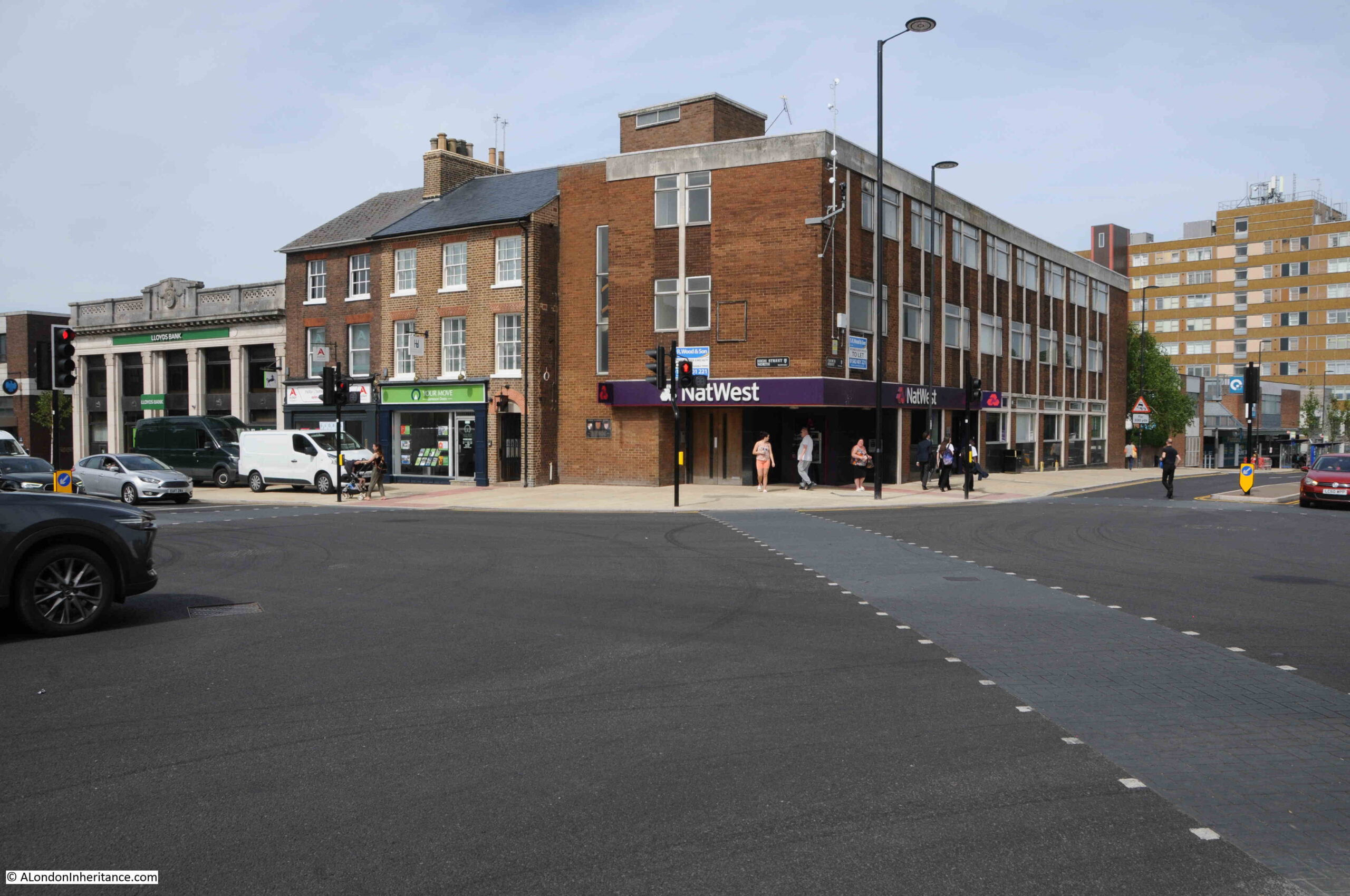
All my walks have sold out, however I have had a request to run the “South Bank – Marsh, Industry, Culture and the Festival of Britain” walk on a weekday, so have added a walk on Thursday, the 9th of November, which can be booked here.

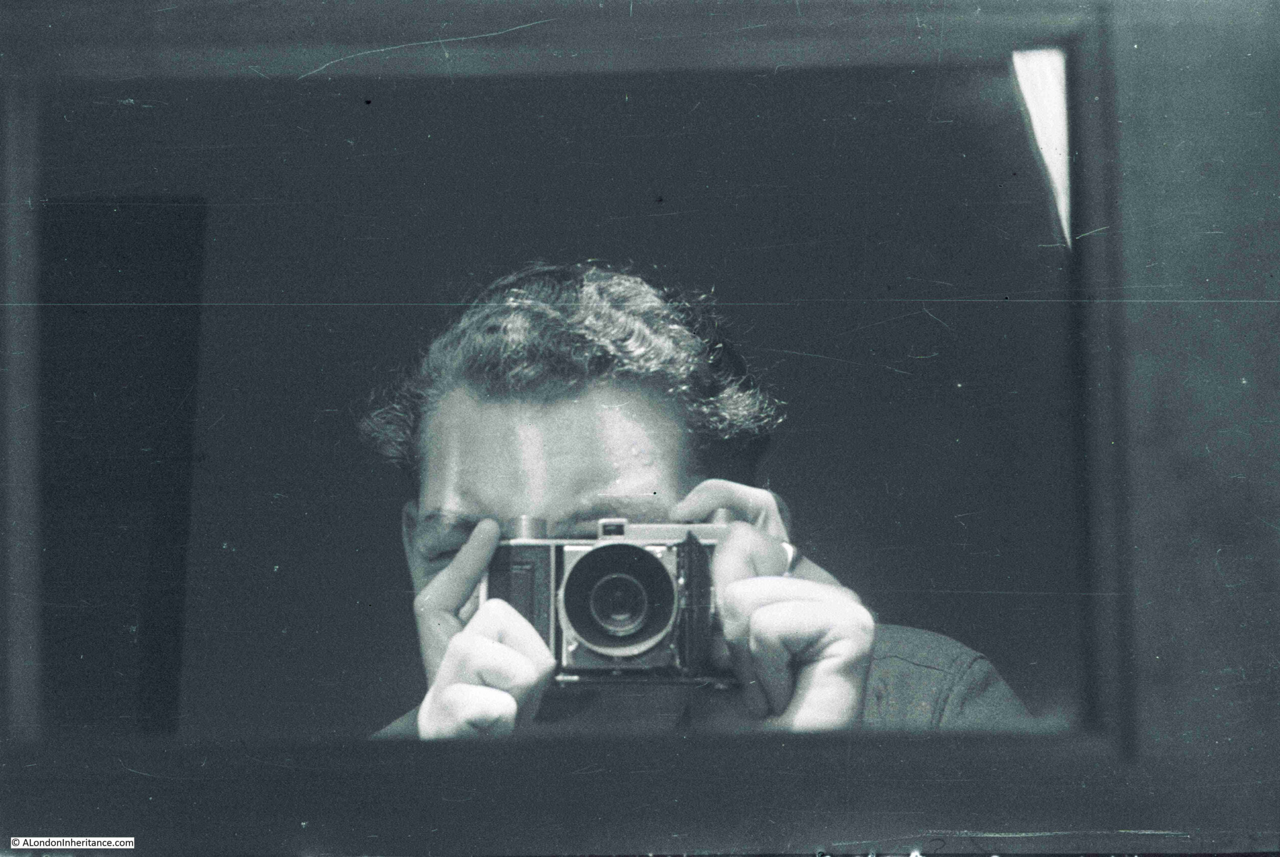
In 1952 my father was in Peterborough. It was one of the cycling trips he did with friends after National Service. Cycling and staying in Youth Hostels was a very popular means for young people to explore the country. It was cheap, much quieter roads ensured that cycling was safer and more enjoyable than it would be today, and for those who had been born, and grown up in London, it provided an ideal opportunity to see the rest of the country.

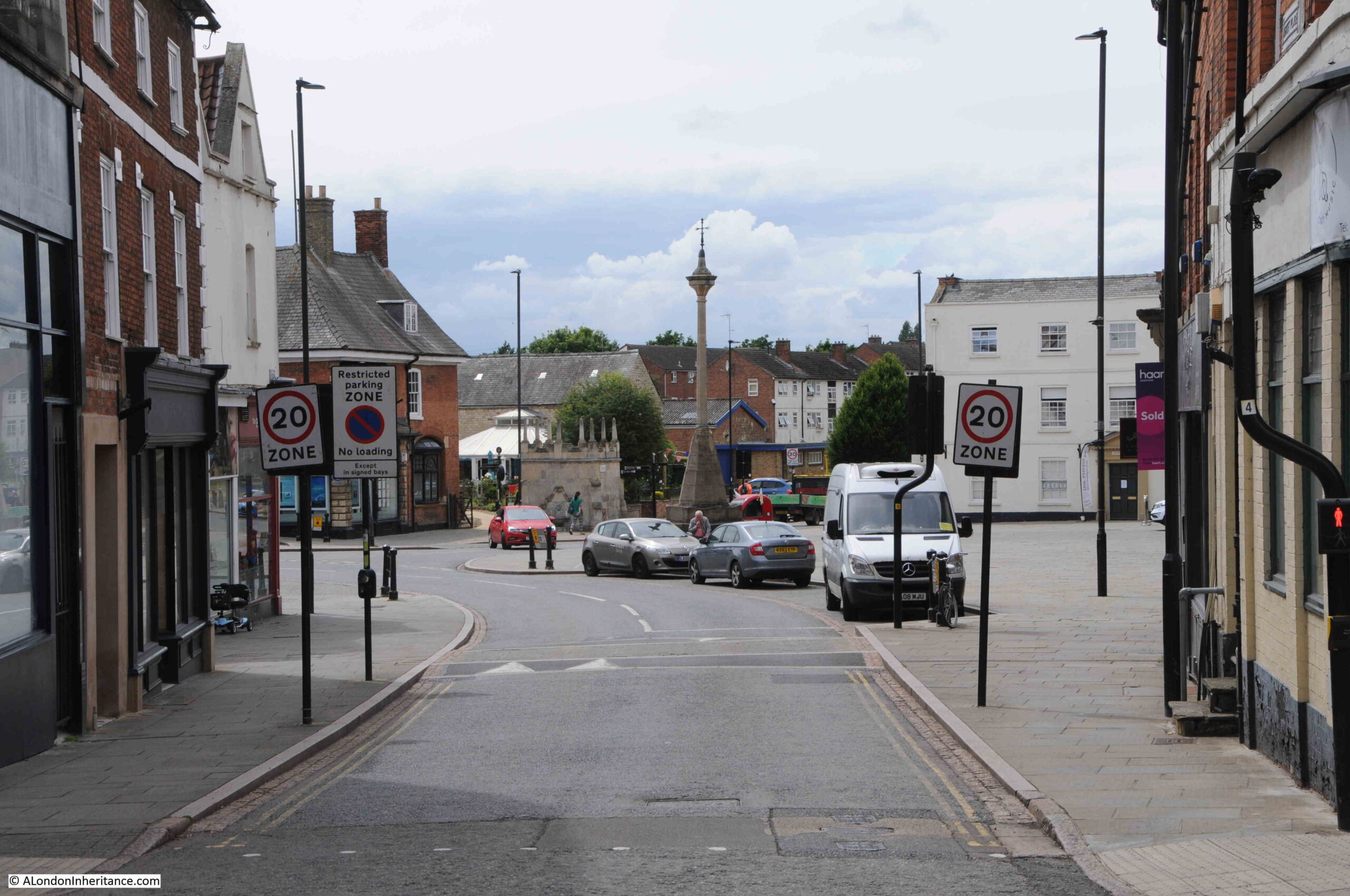
Although it was probably not realised at the time, it was also a time to see much of the country before the coming decades brought significant change. For example, when my father visited Peterborough, the population was around 54,000 and today it is well over 200,000. The city centre would also have a large new shopping centre, the Queensgate, in the late 1970s and early 1980s, which resulted in the loss and demolition of part of the historic street network.

Peterborough also has a connection with many of the buildings in London, as the city is the home of the London Brick Company, the name of the company dating from 1900 following the purchase of a local brick company by John Cathles Hill, who developed large parts of suburban London, using bricks from the Fletton deposit of lower Oxford Clays found around Peterborough.

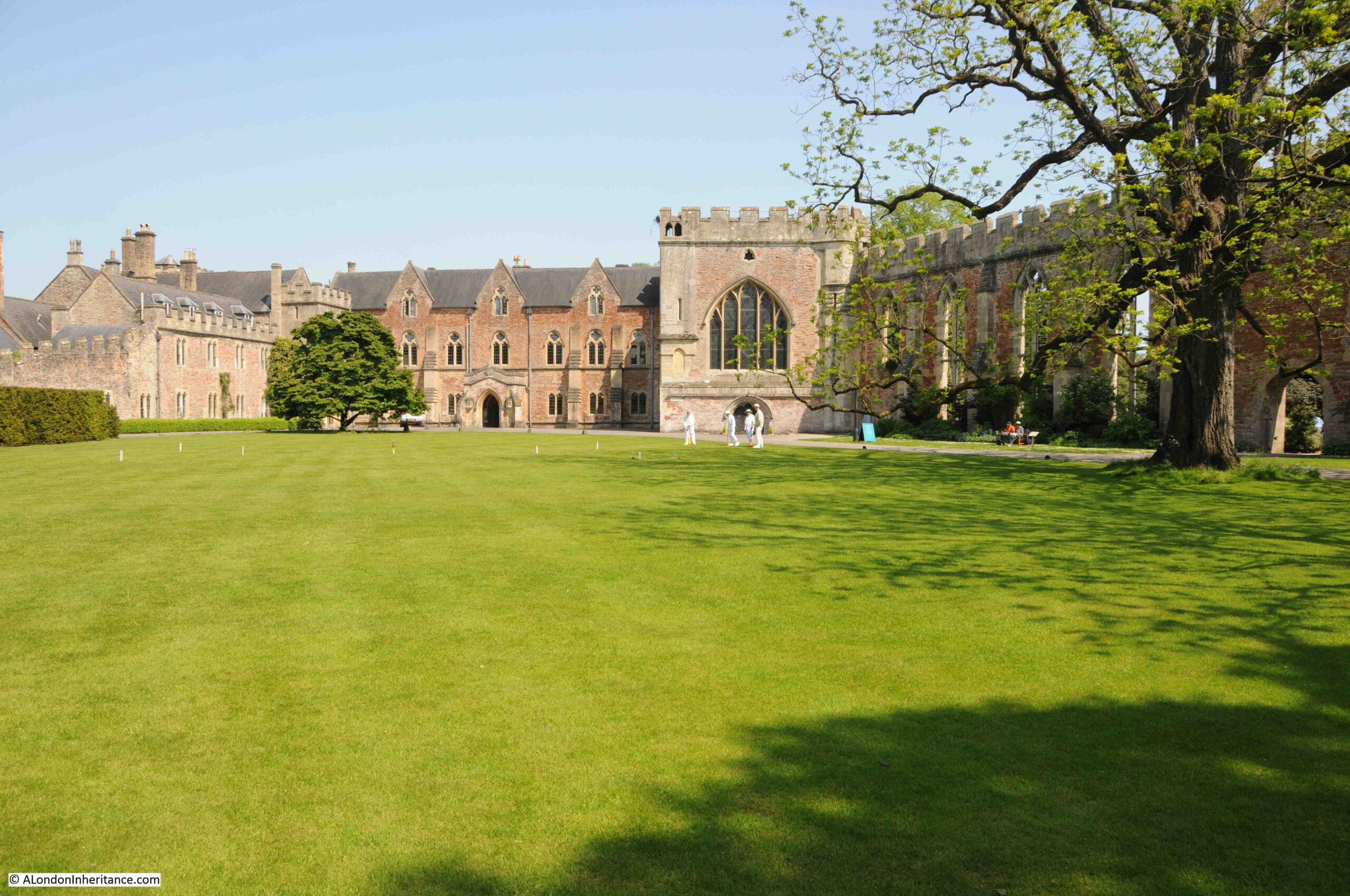
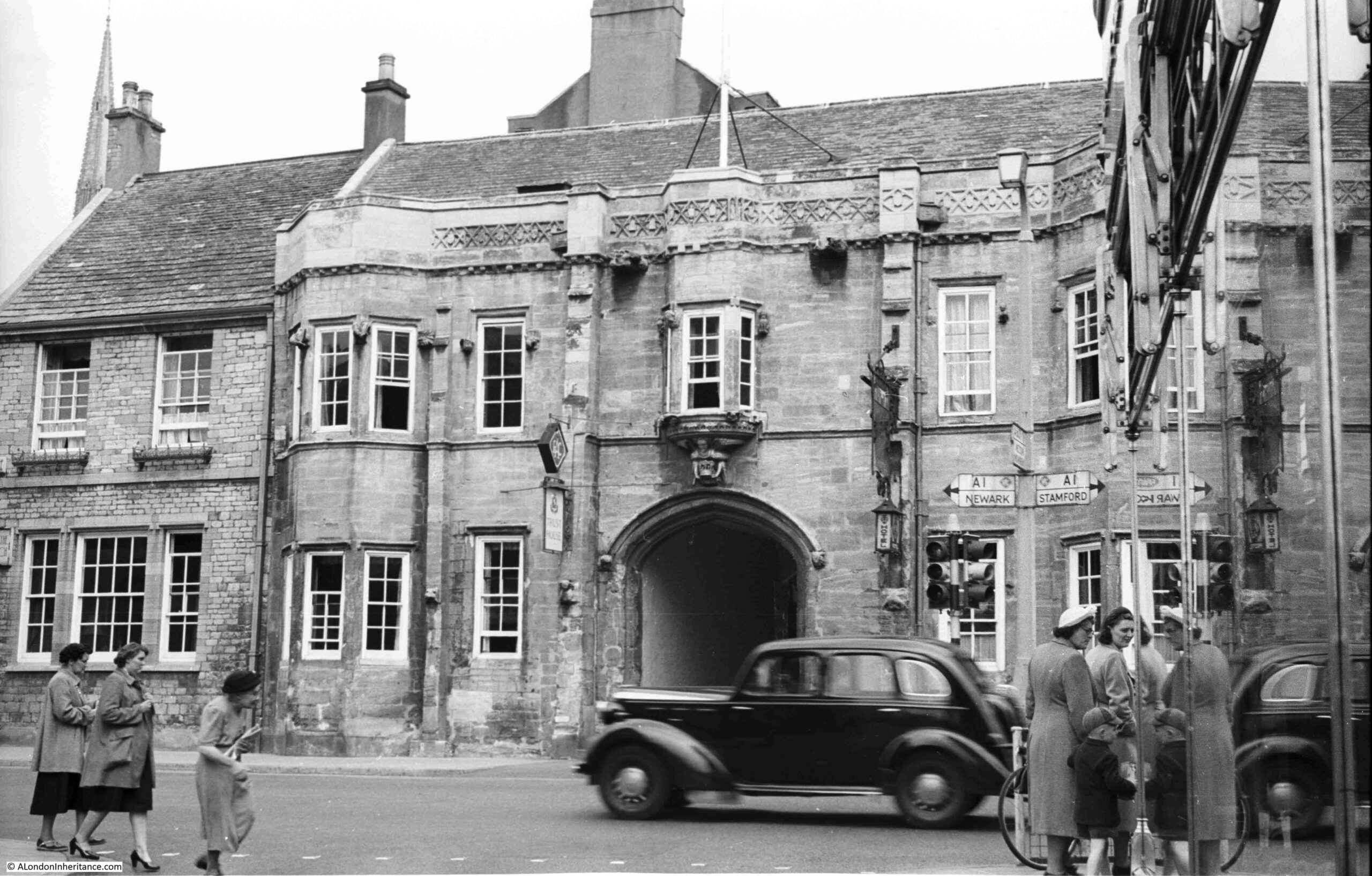
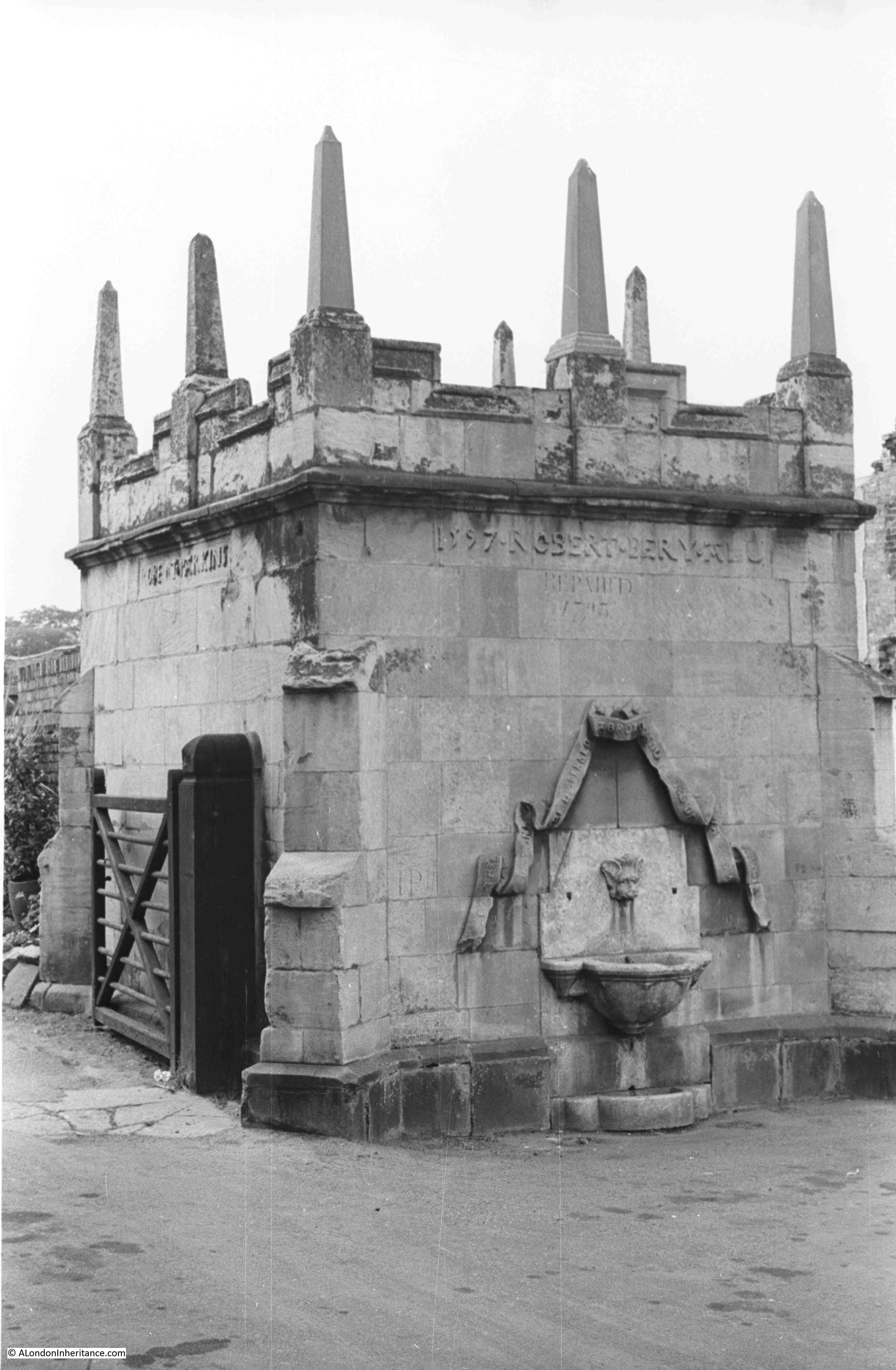
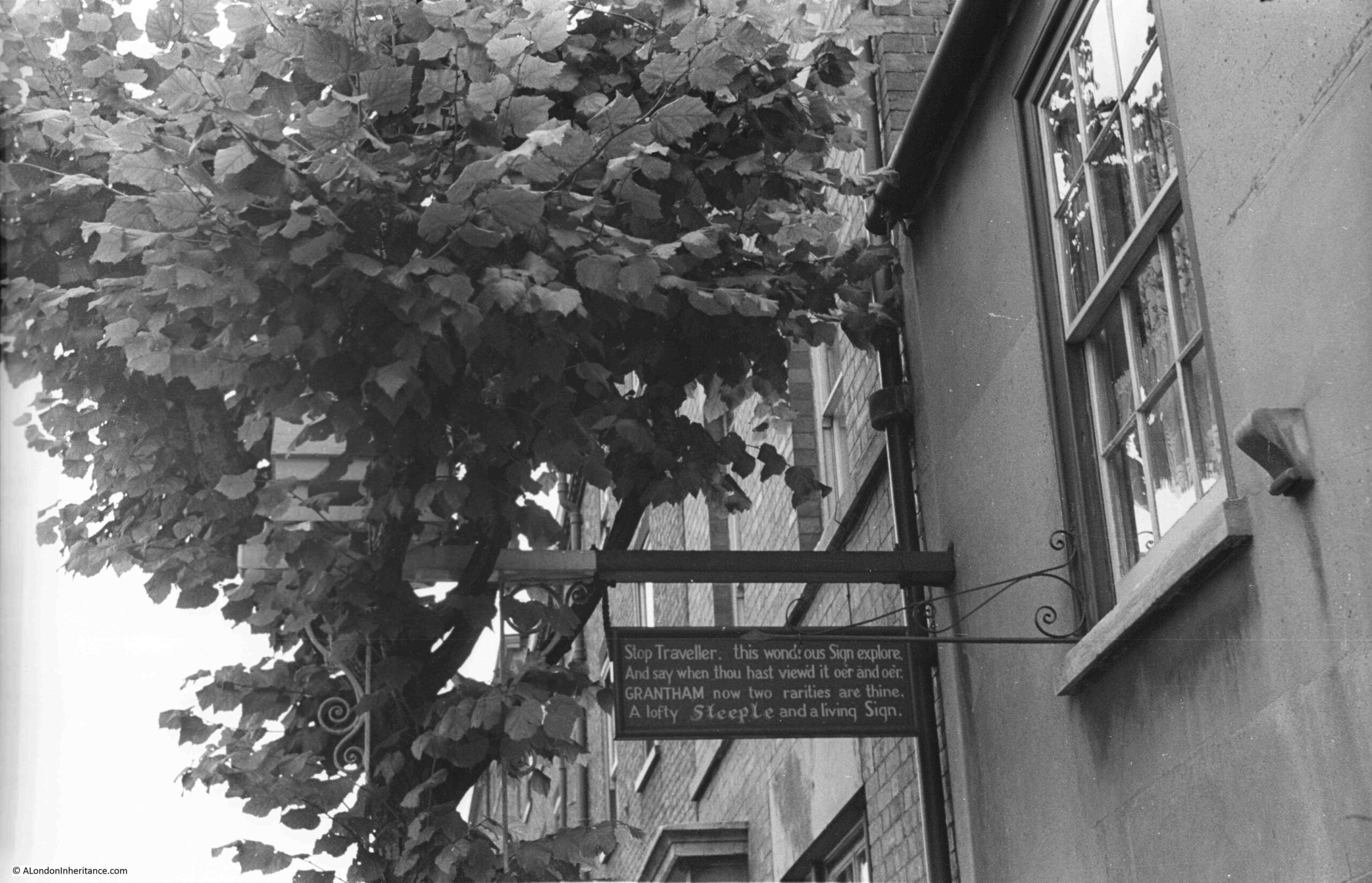
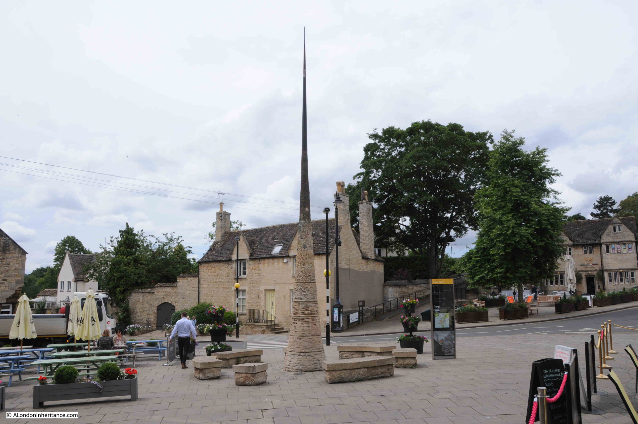
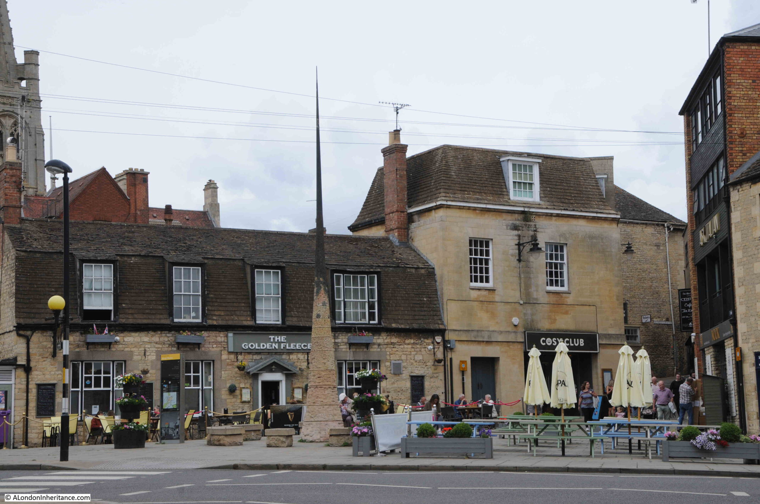
I am going to start my tour of Peterborough, in the old market place, with a view from 1952 of the Guildhall:

Guildhall

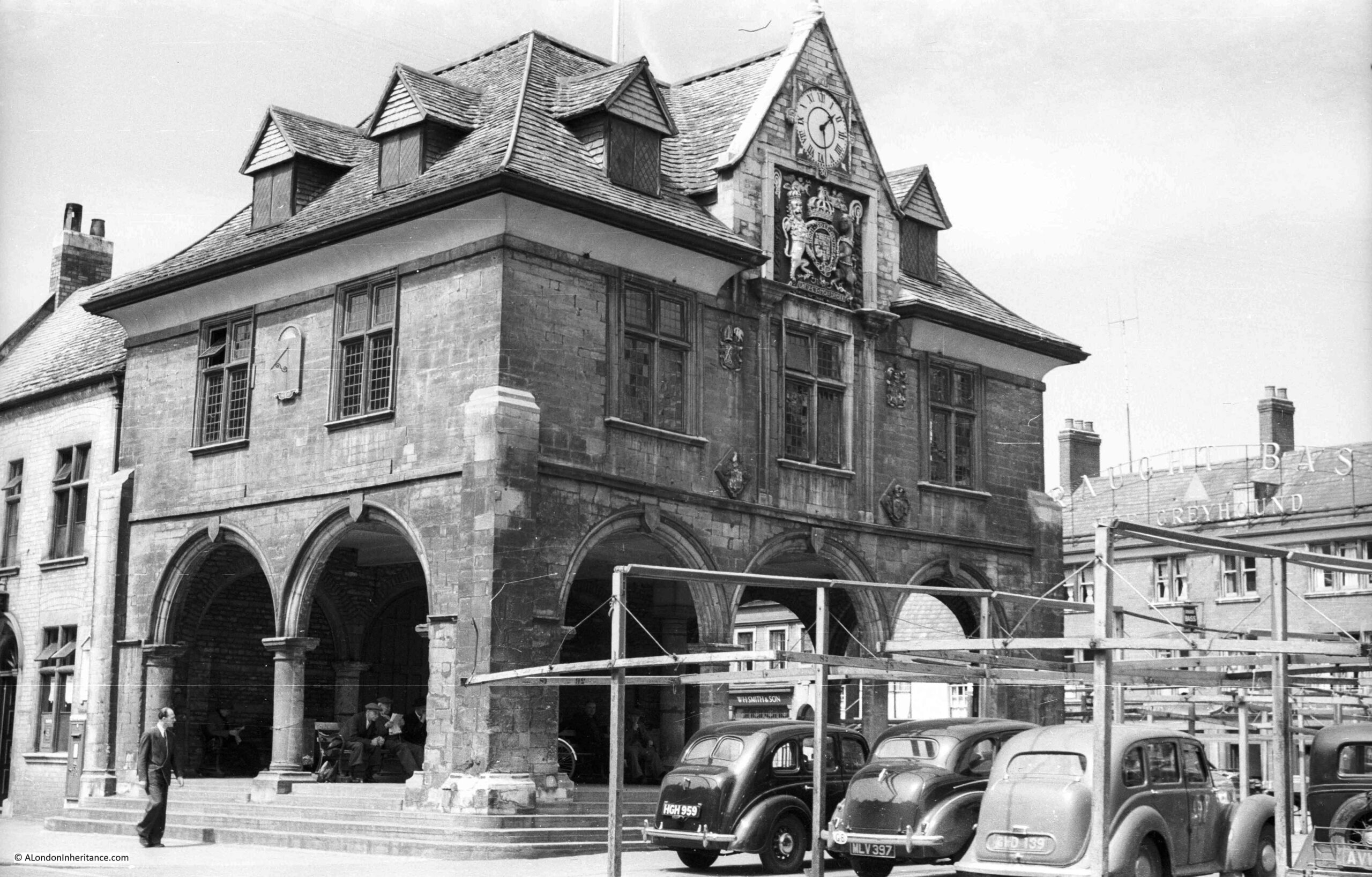
The Guildhall dates from 1671 and has an open space at ground level for the market, and assembly rooms on the first floor, which were also used for meetings of the local council.

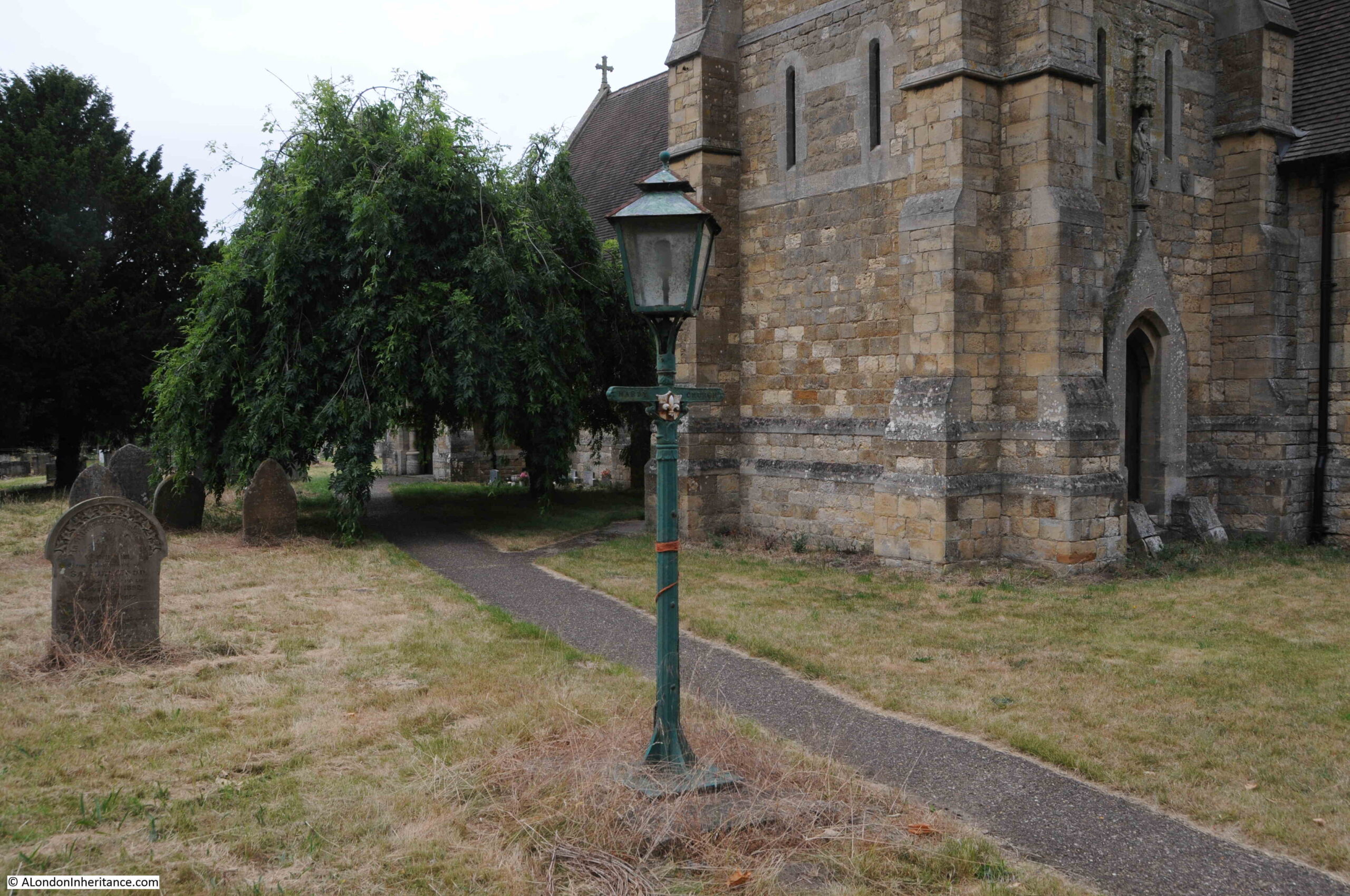
The Guildhall is at the eastern end of the Market Place and faces the entrance to the cathedral Minster Close.

It was obvioulsy not market day when the above photo was taken, as cars were parked under the framework for the market stalls.

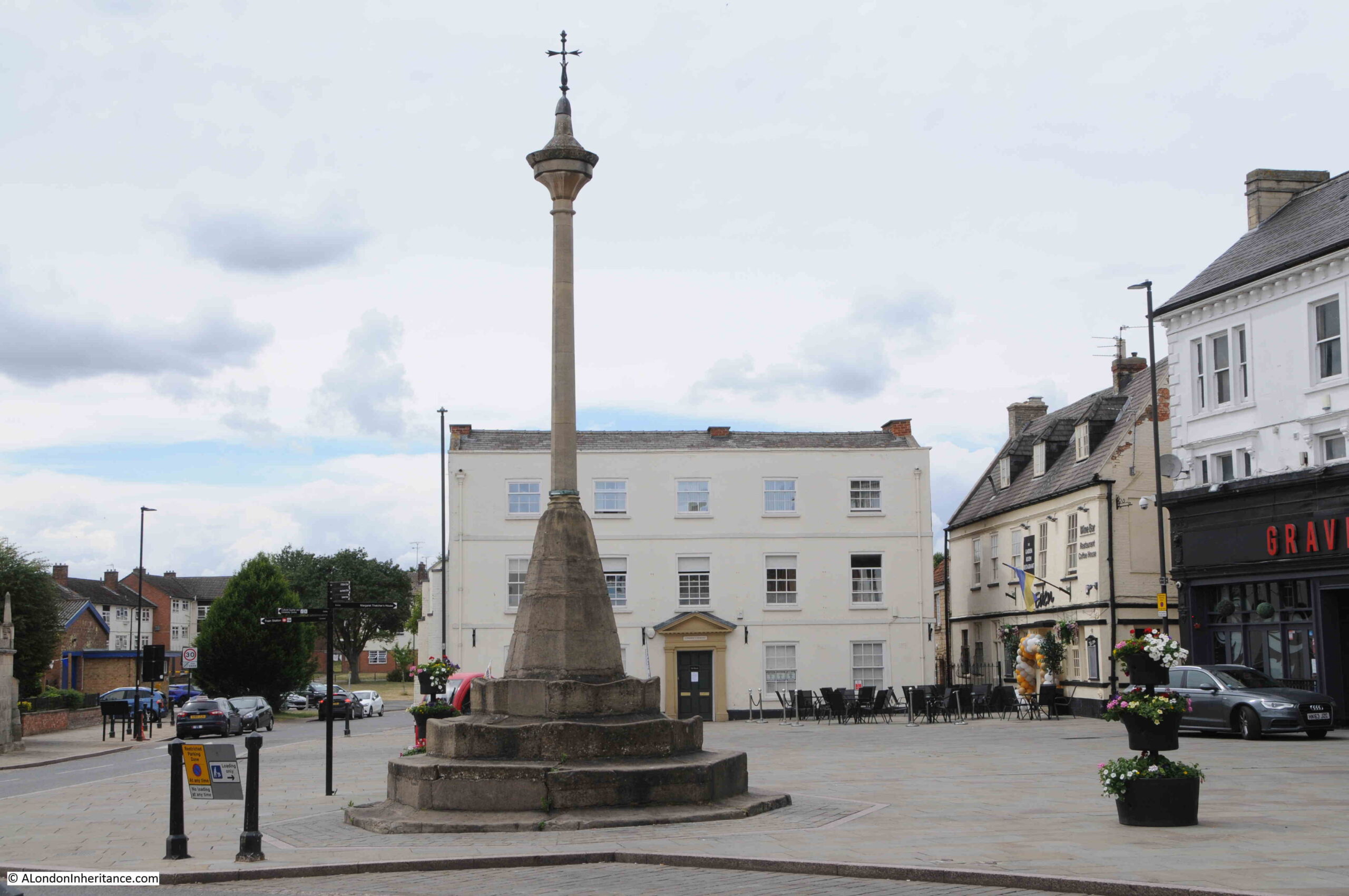
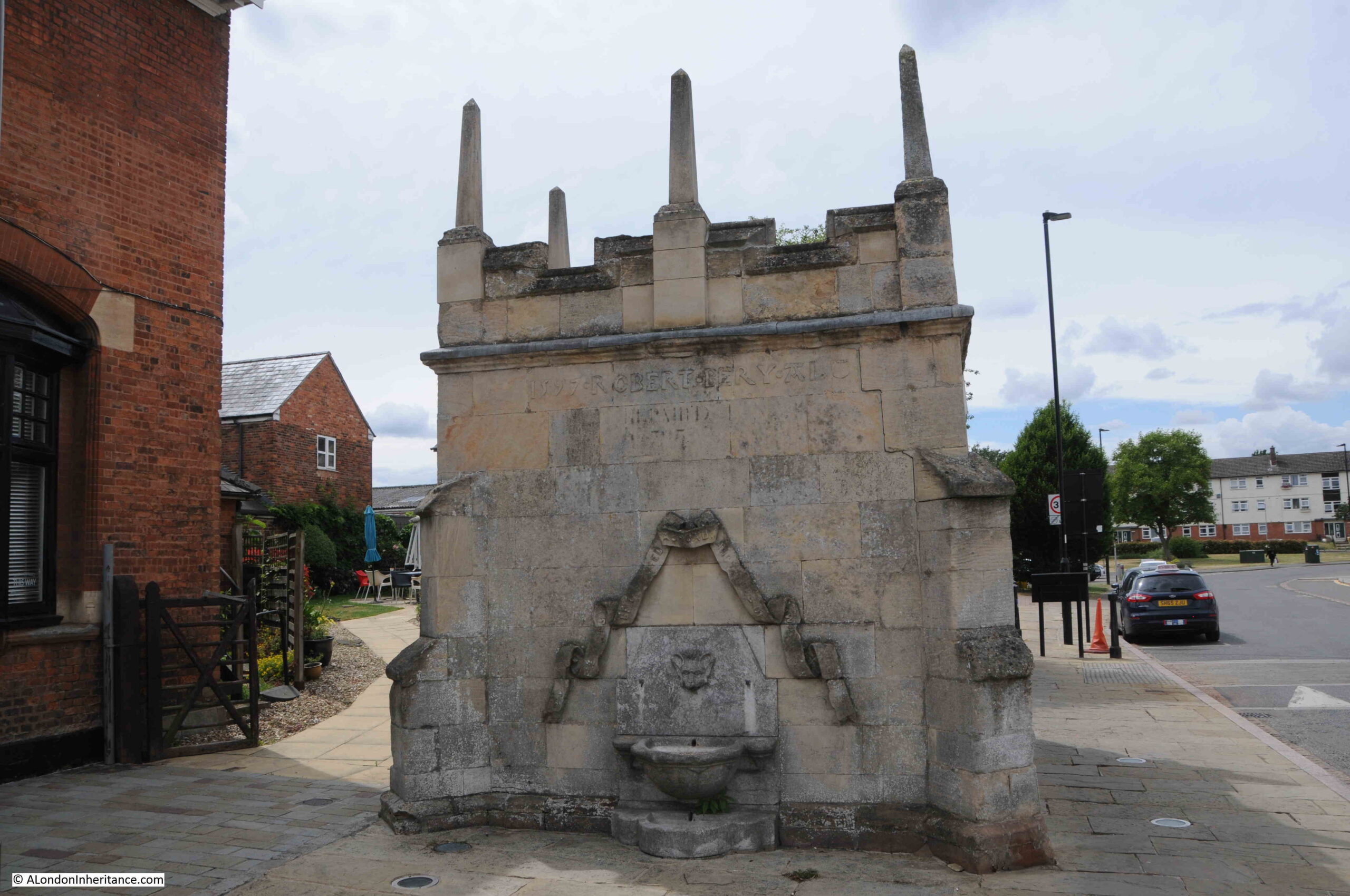
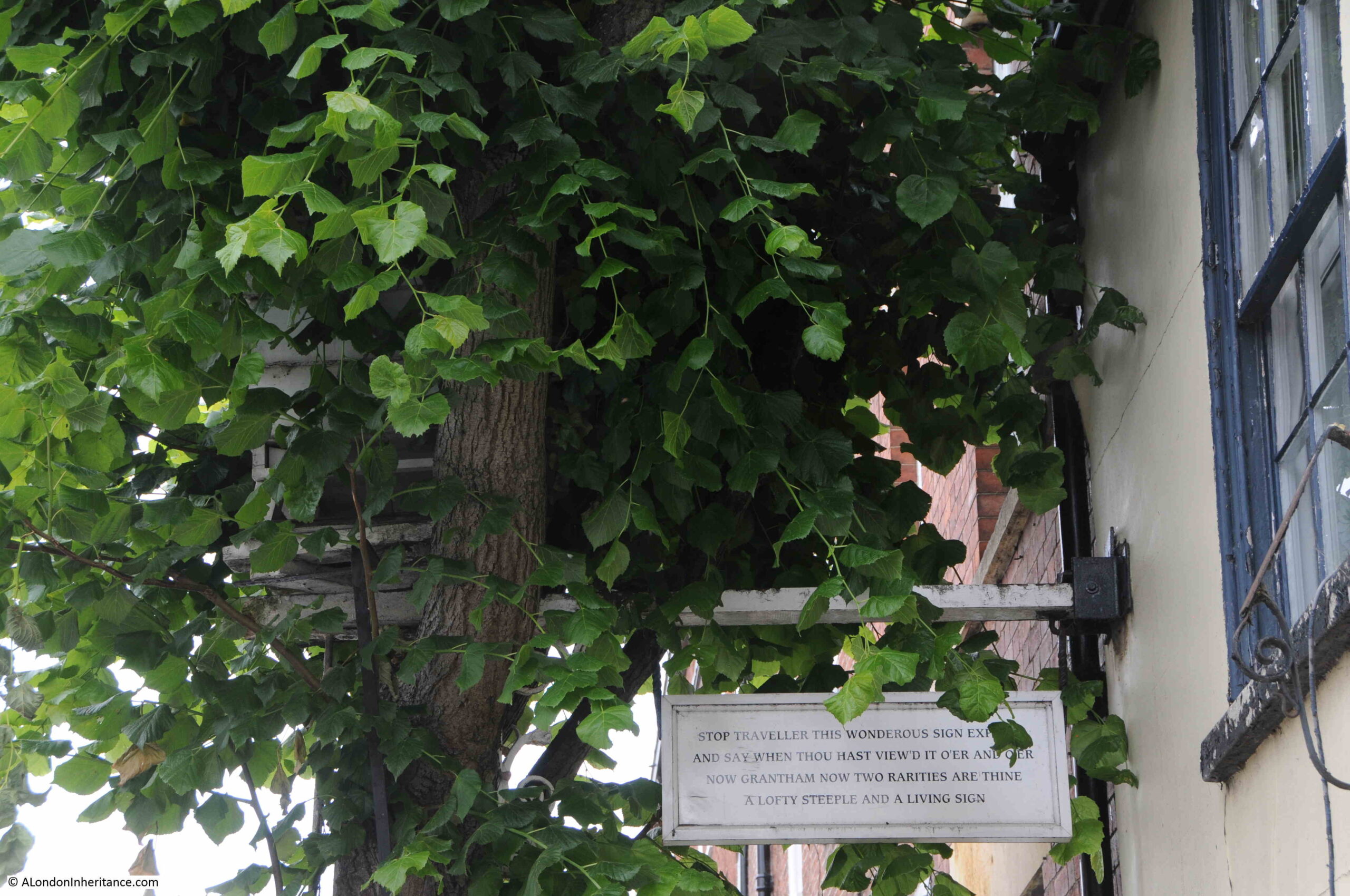
Also, to the left of the Guildhall, you can see a building up close to the rear of the Guildhall, and to illustrate the scene today, I took a wider view to show how this has changed:

Guildhall

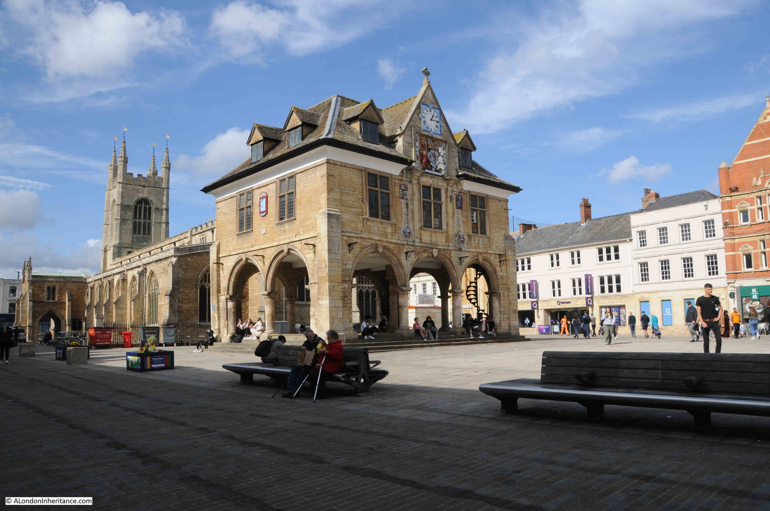
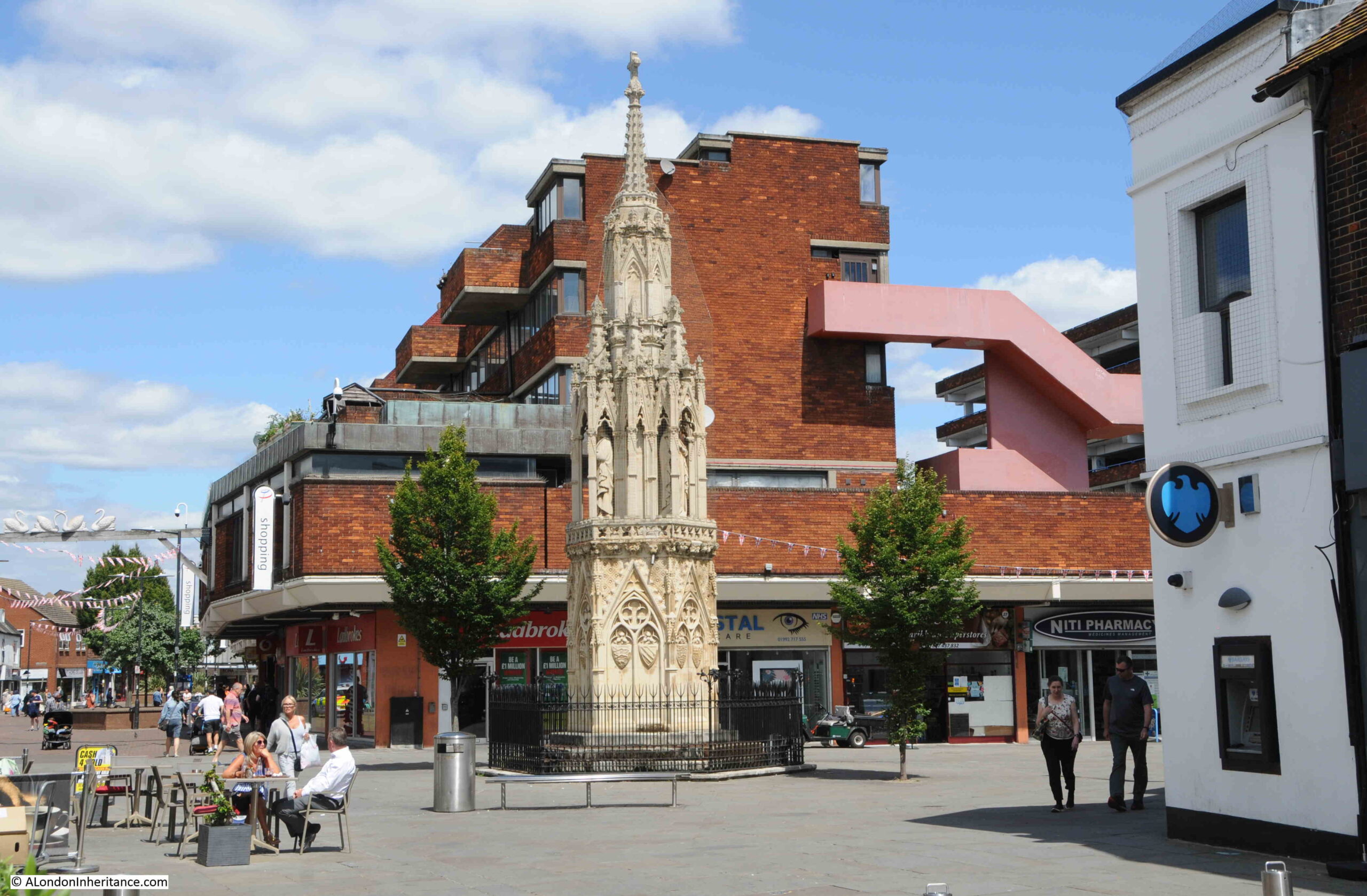
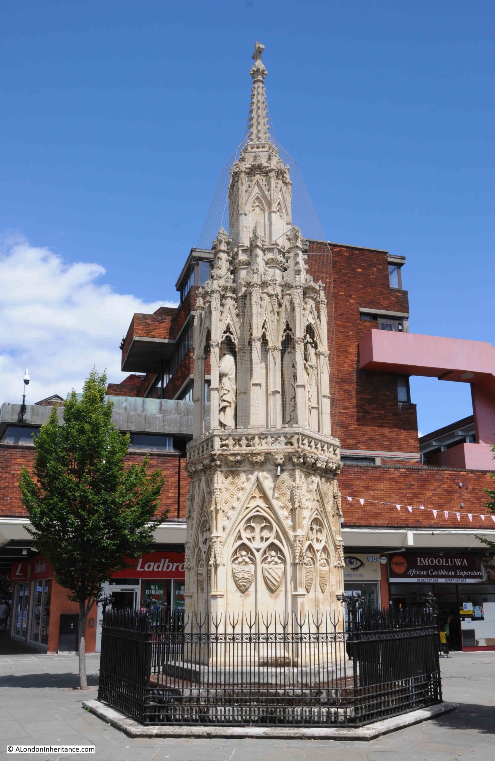
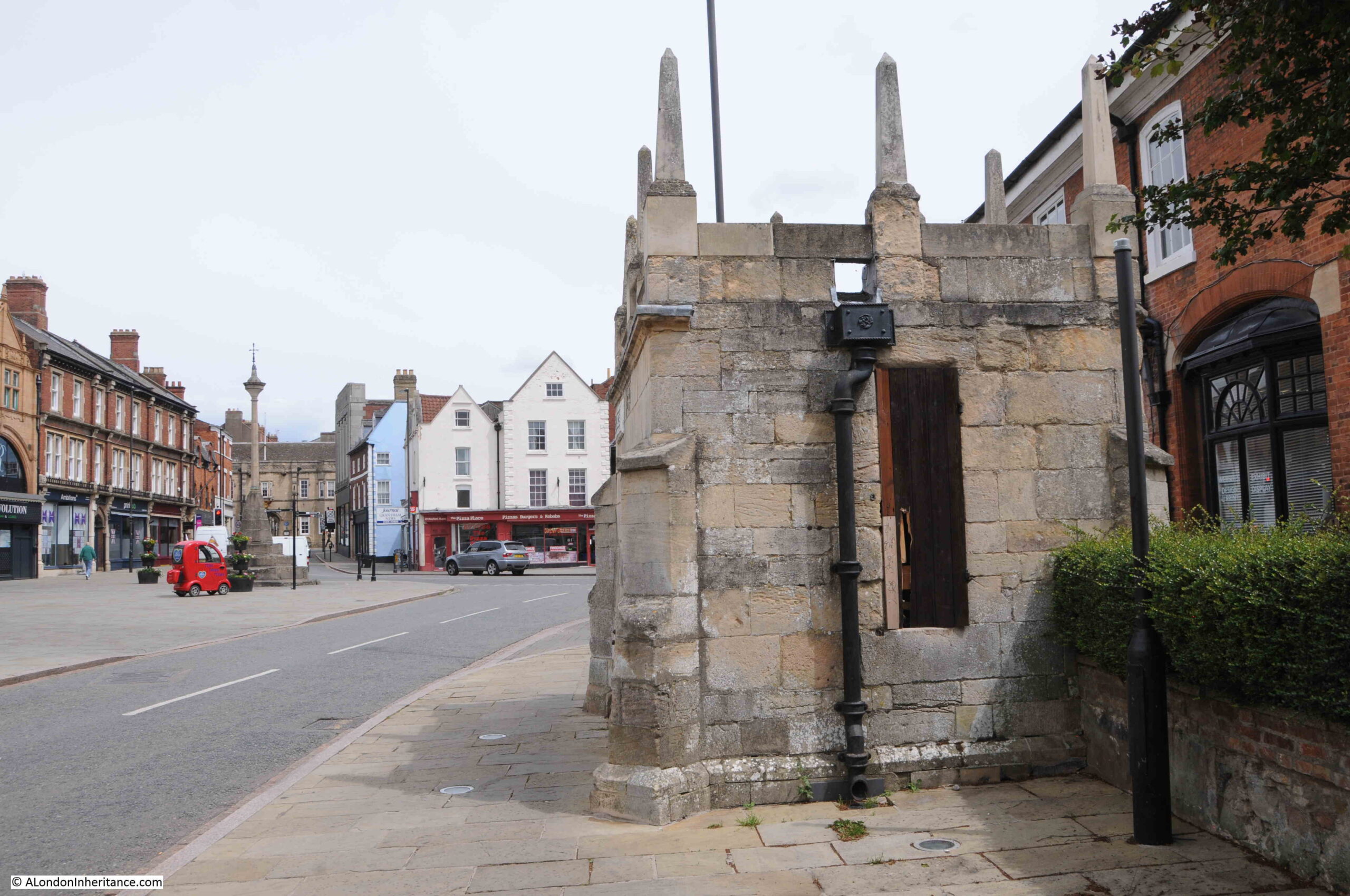
The Guildhall is still there and looks as it did in 1952. As shown in the 1952 photo, there were buildings up close to the rear of the structure between the Guildhall and the parish church of St. John. These have now been demolished. The market has also been moved to a dedicated market building and Market Square is now named as Cathedral Square.

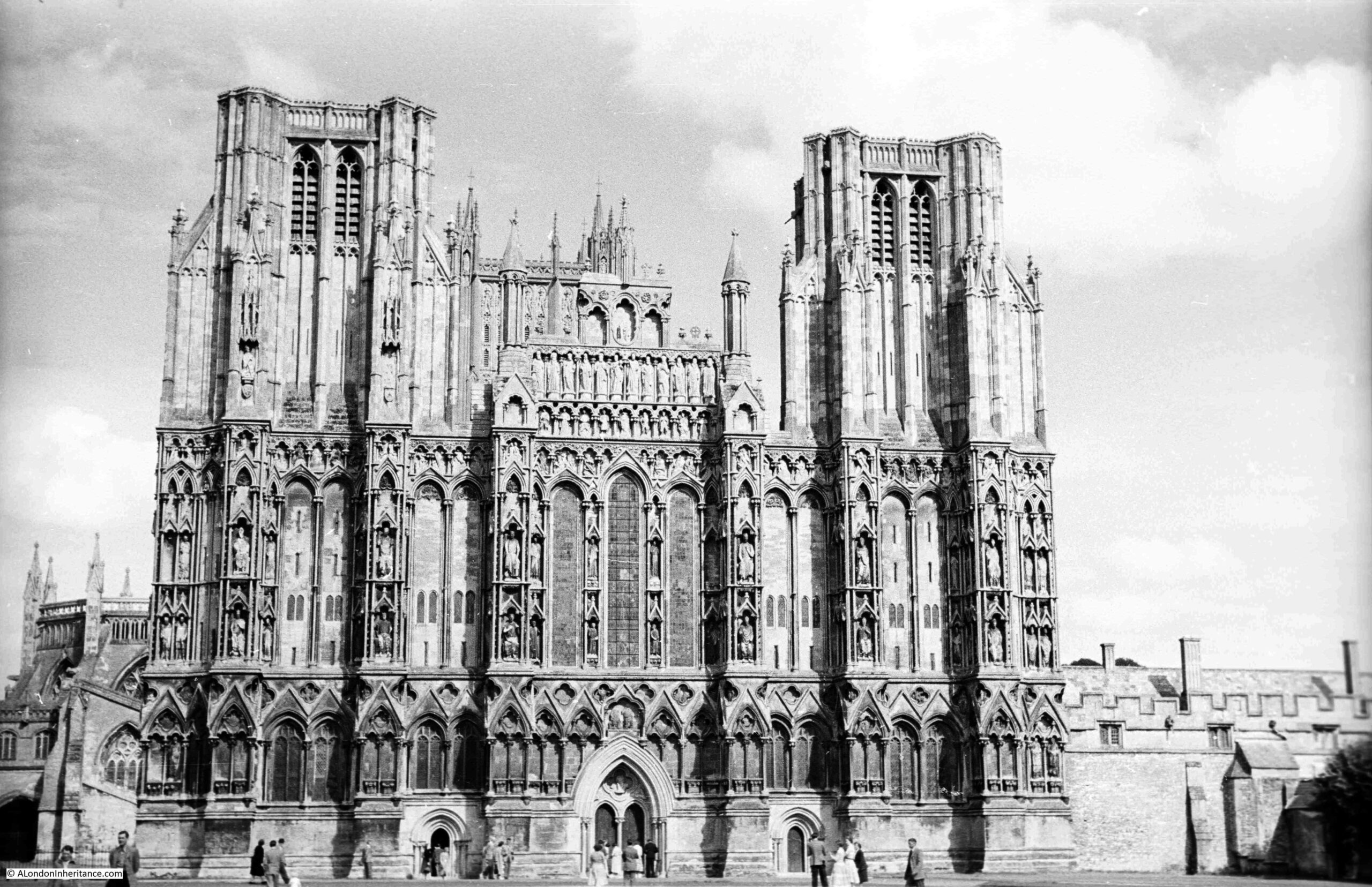
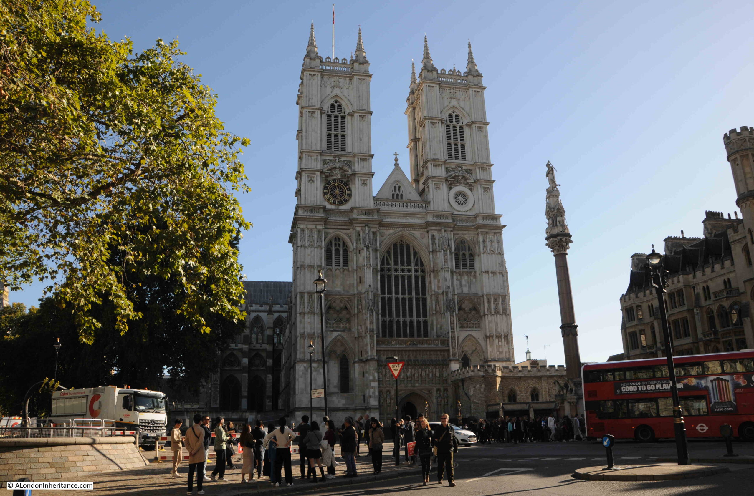
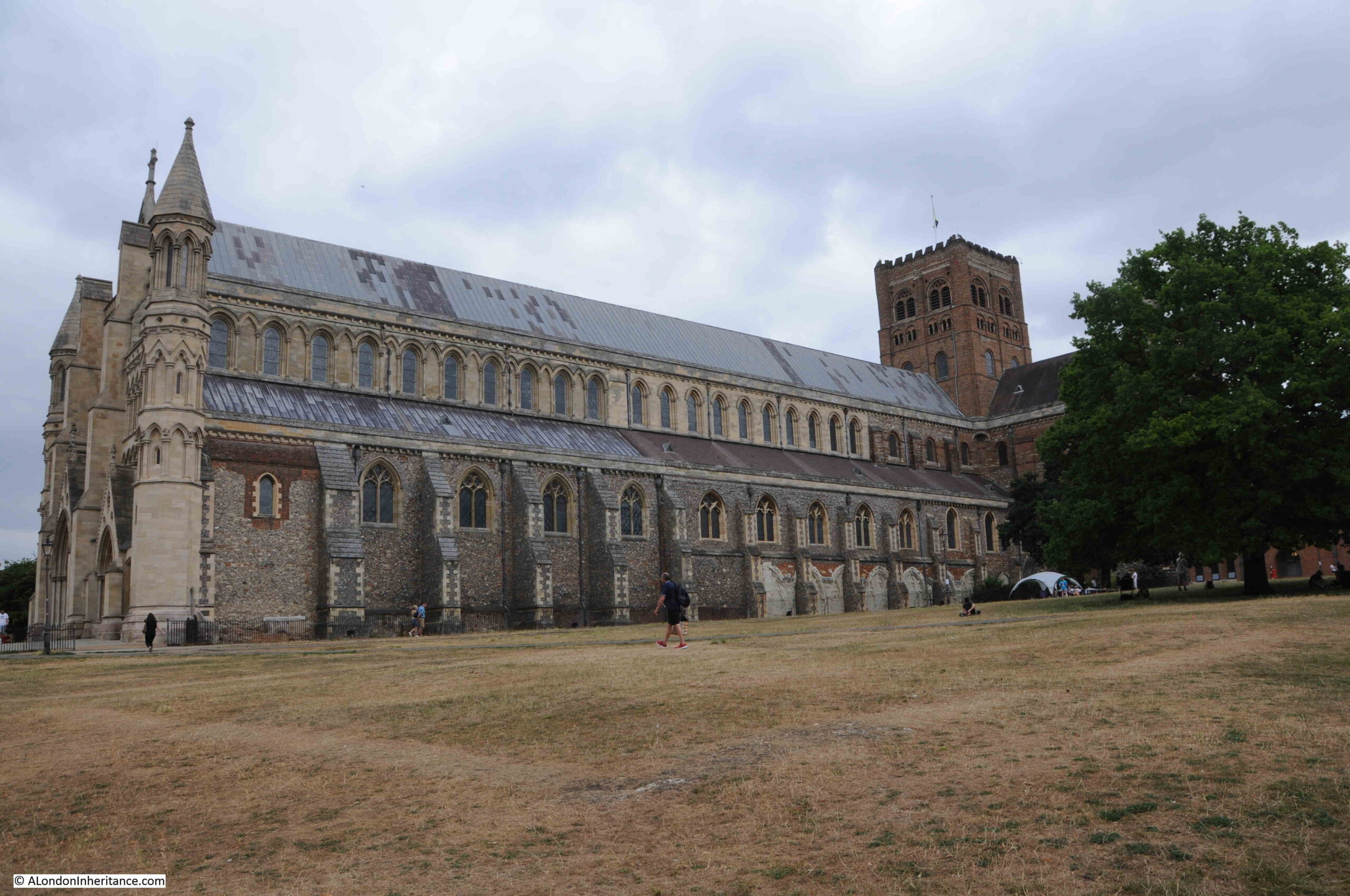
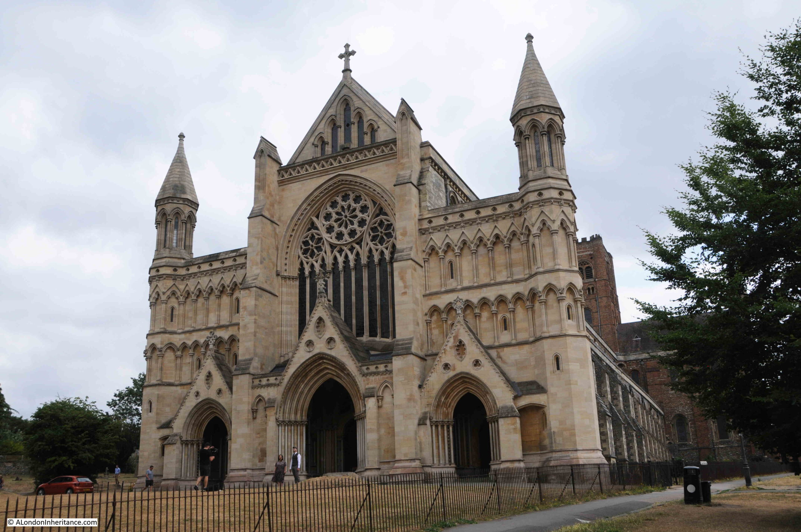
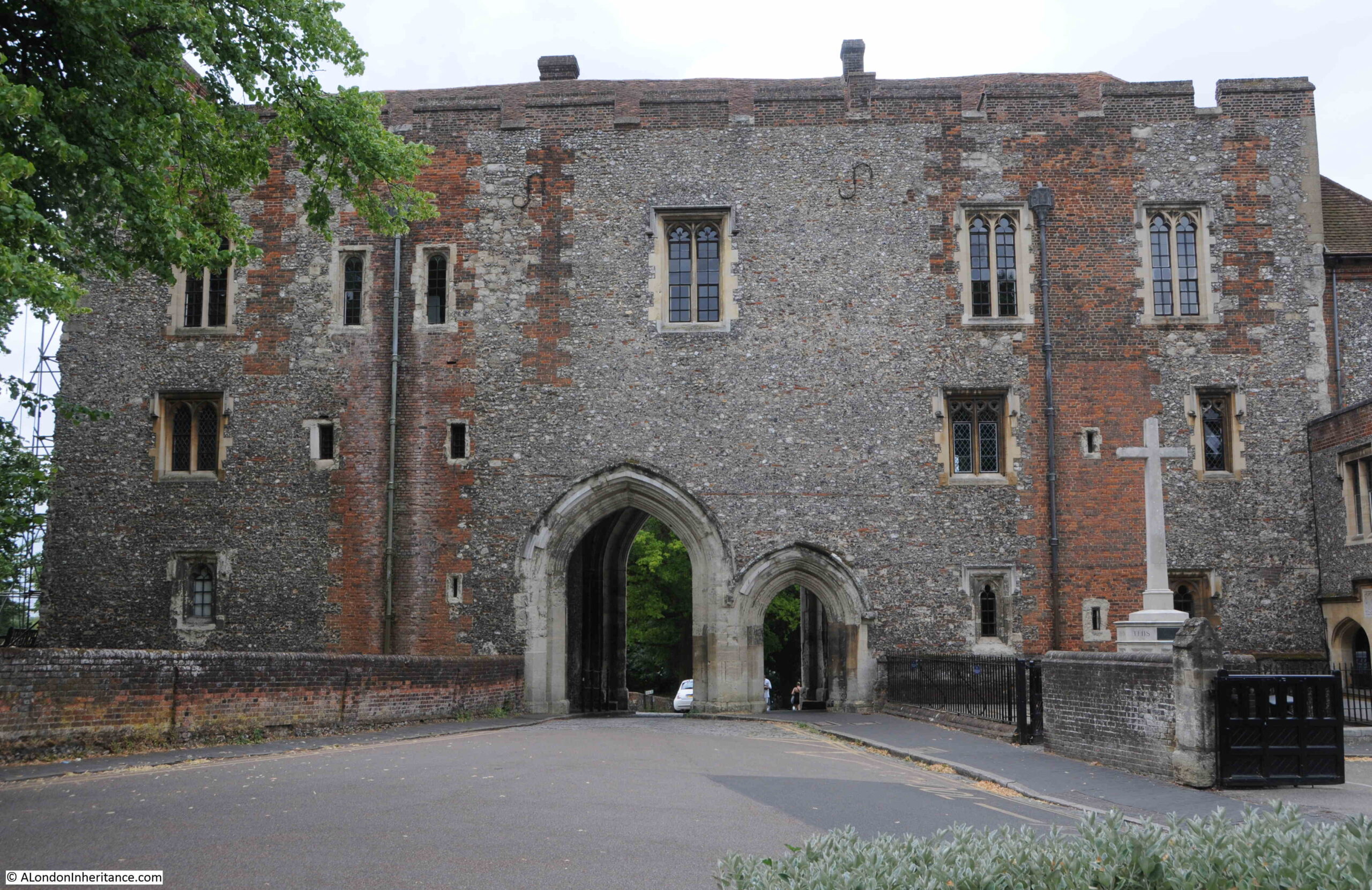
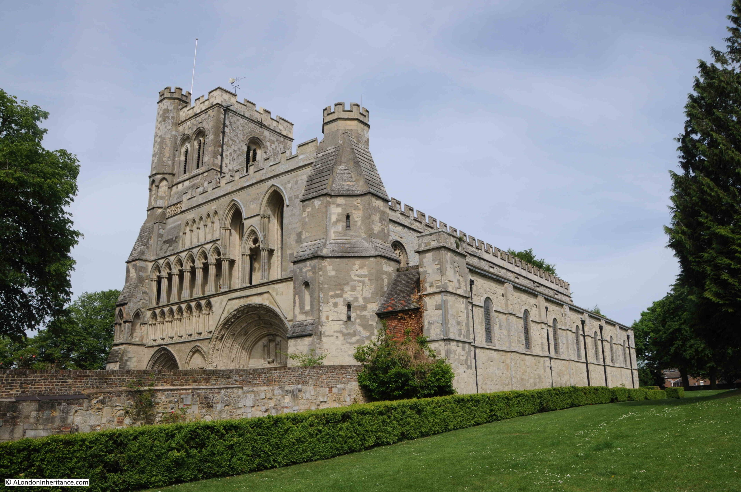
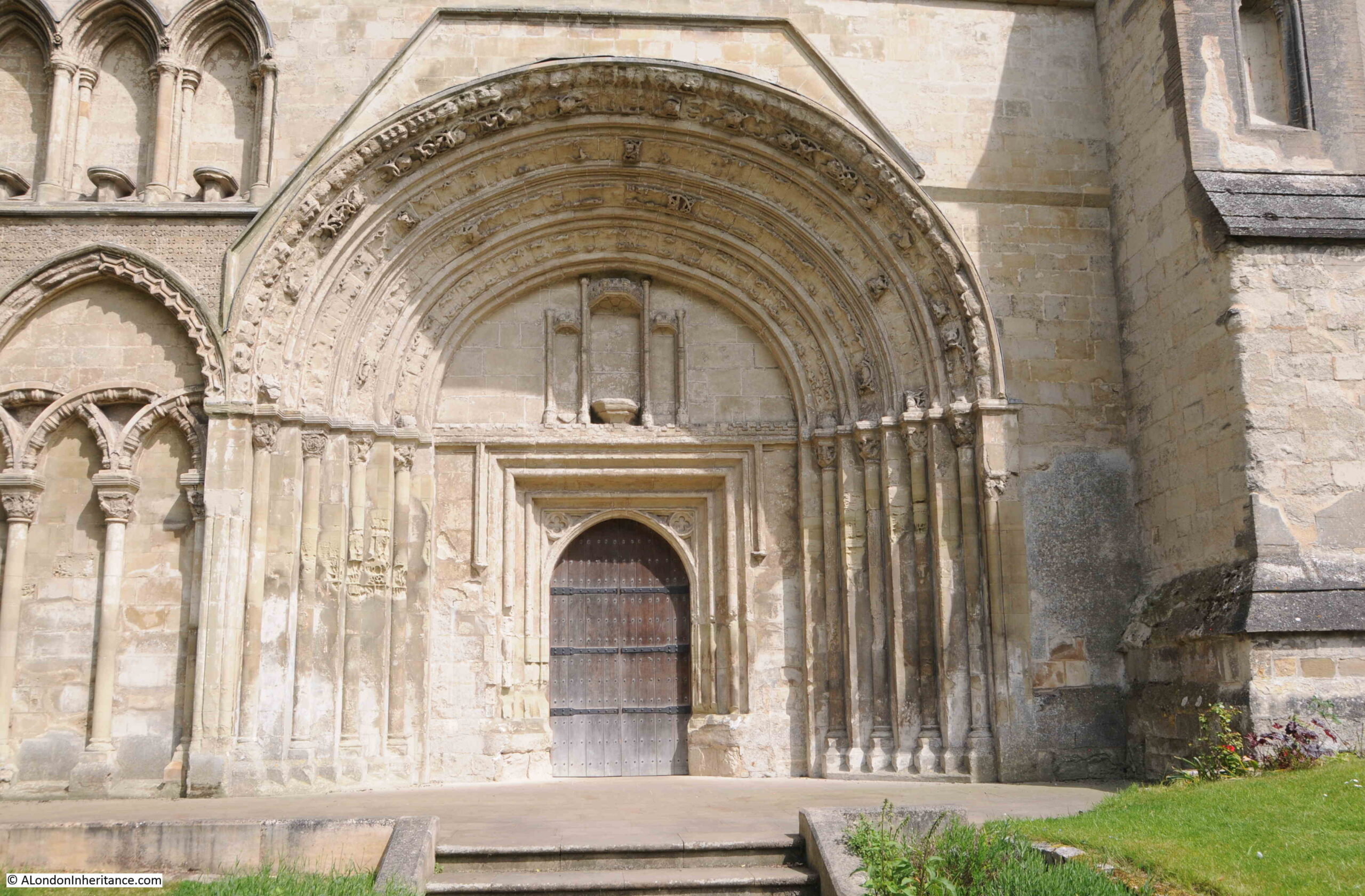
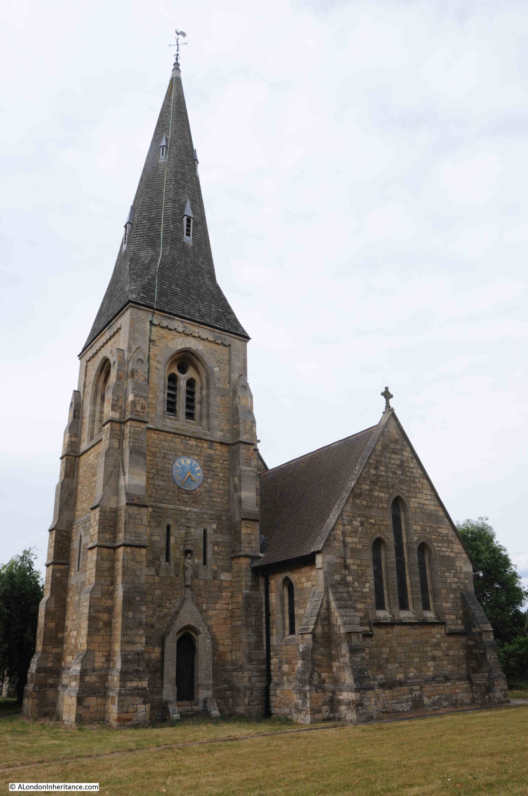
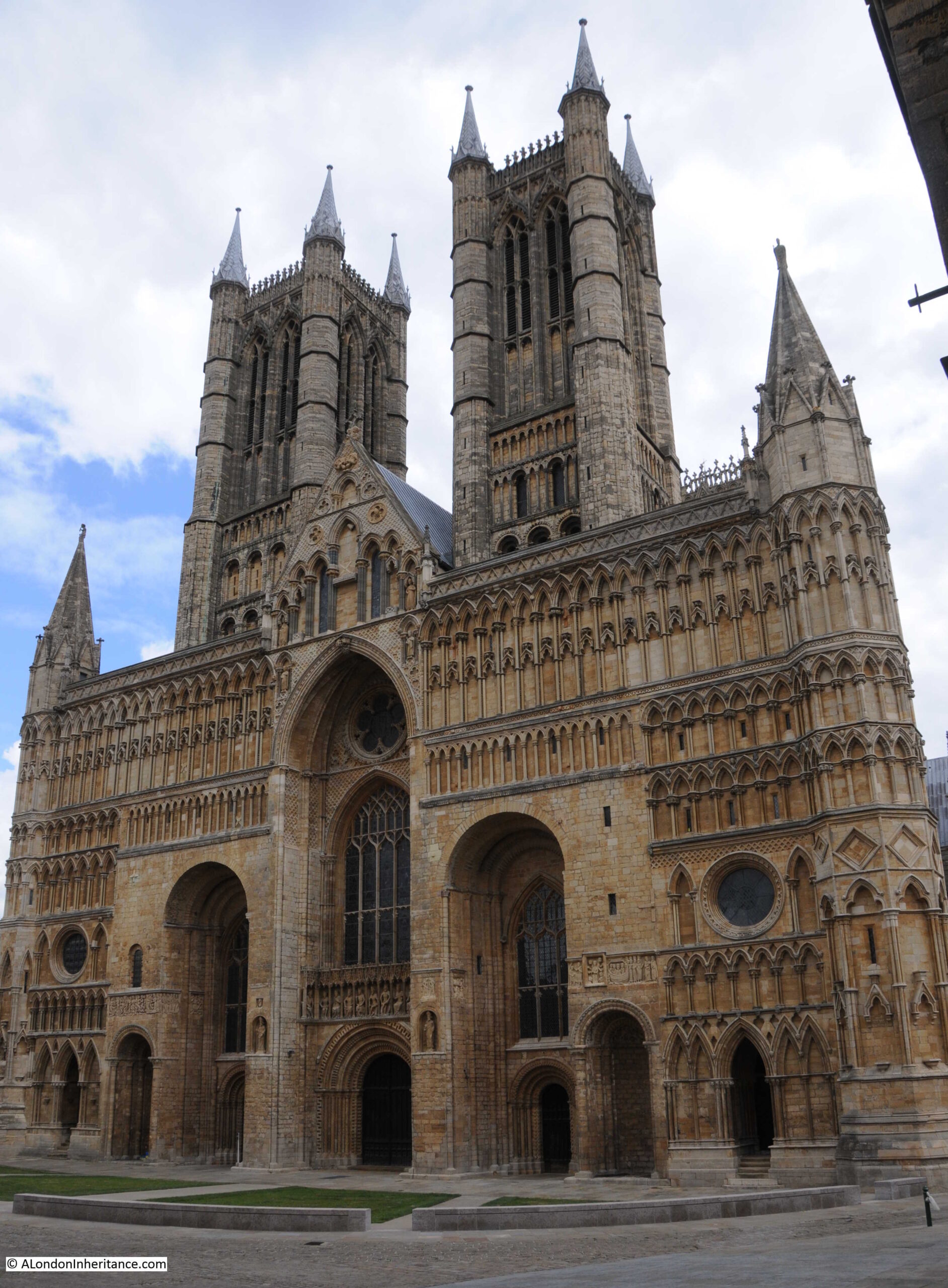
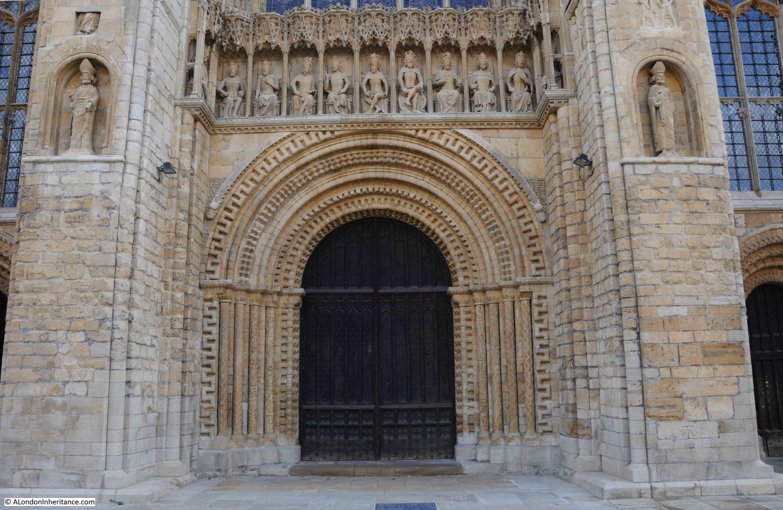
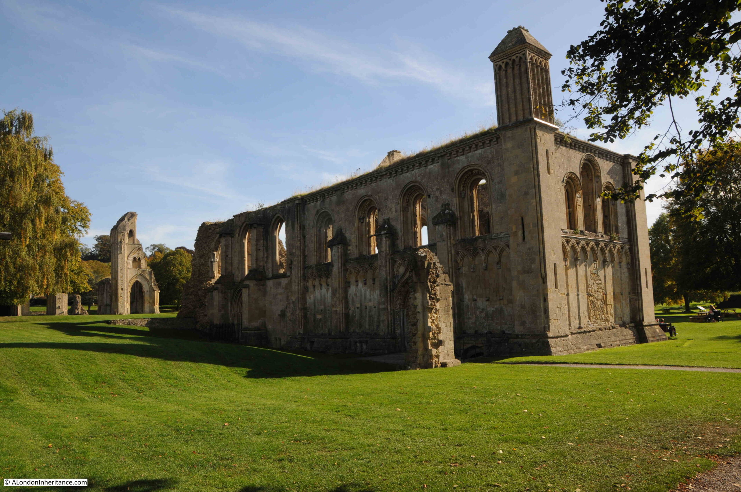
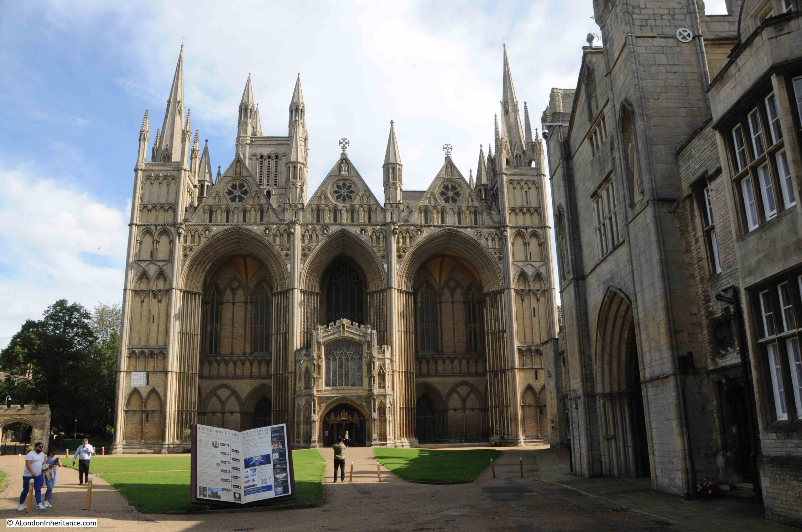
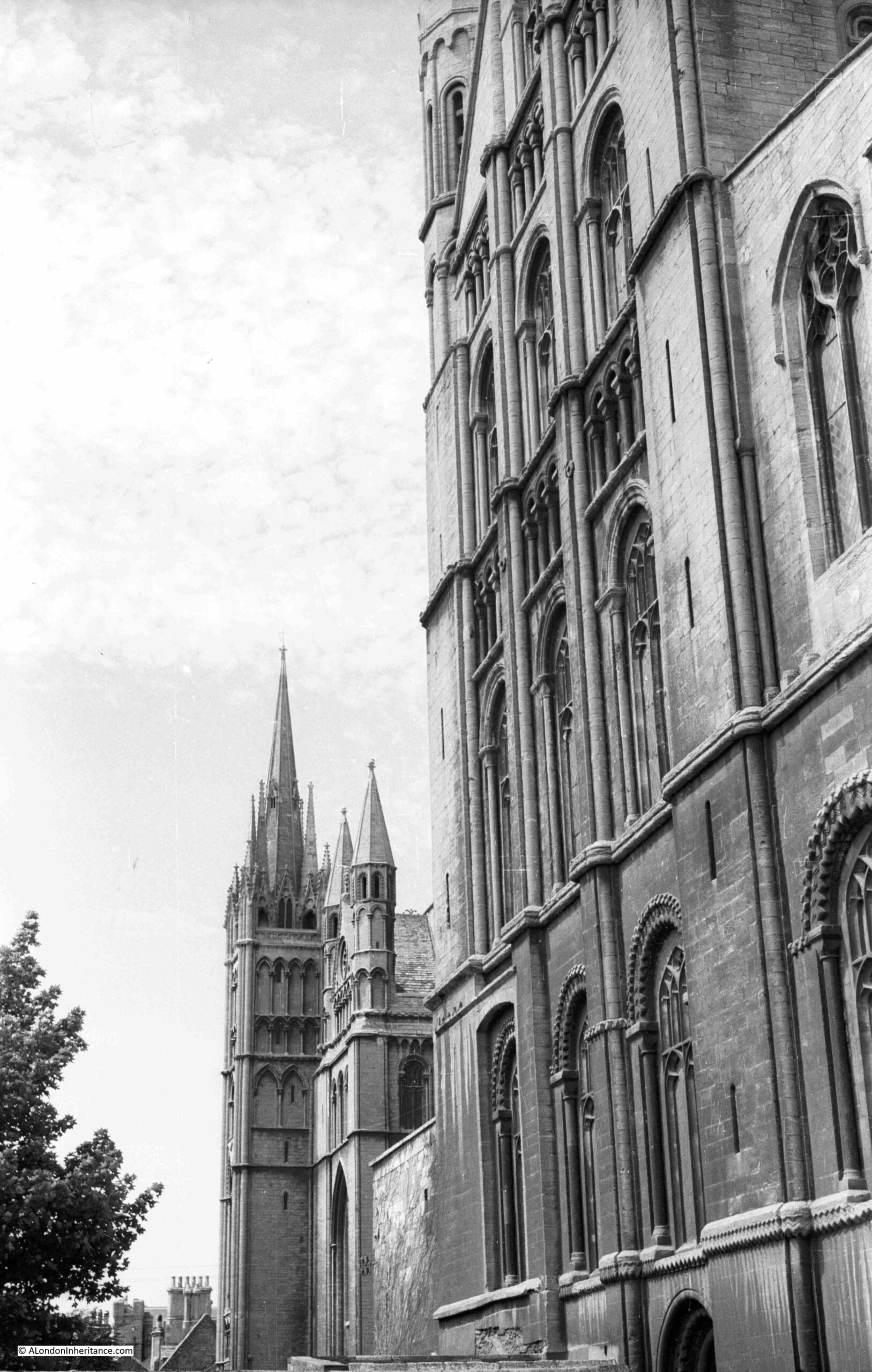
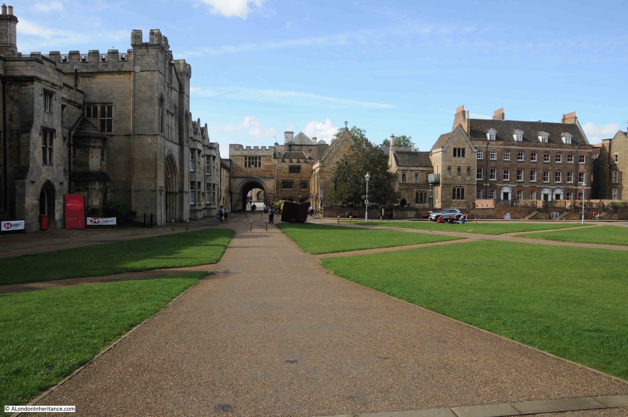
The cathedral is at the opposite end of Cathedral Square, and is reached through a gateway into Minister Close where the western front of the cathedral can be found, here photographed in 1952:

Peterborough Cathedral

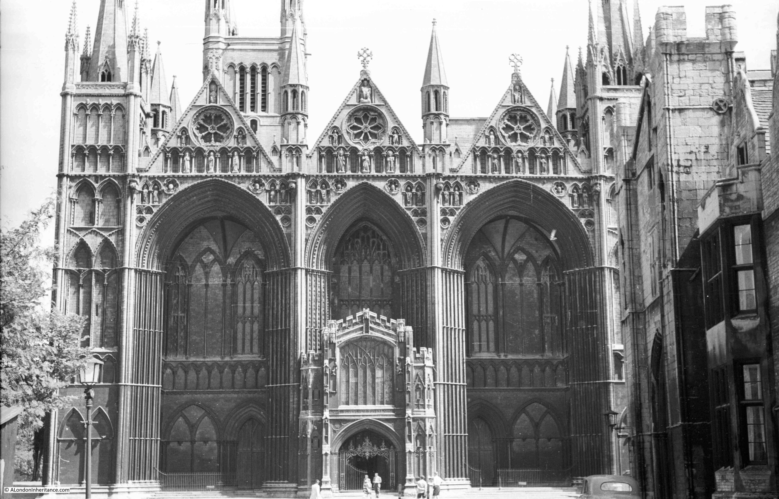
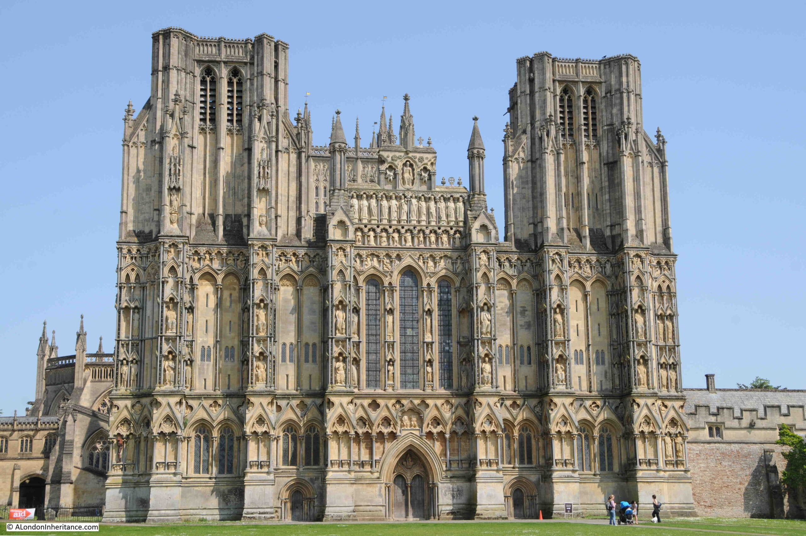
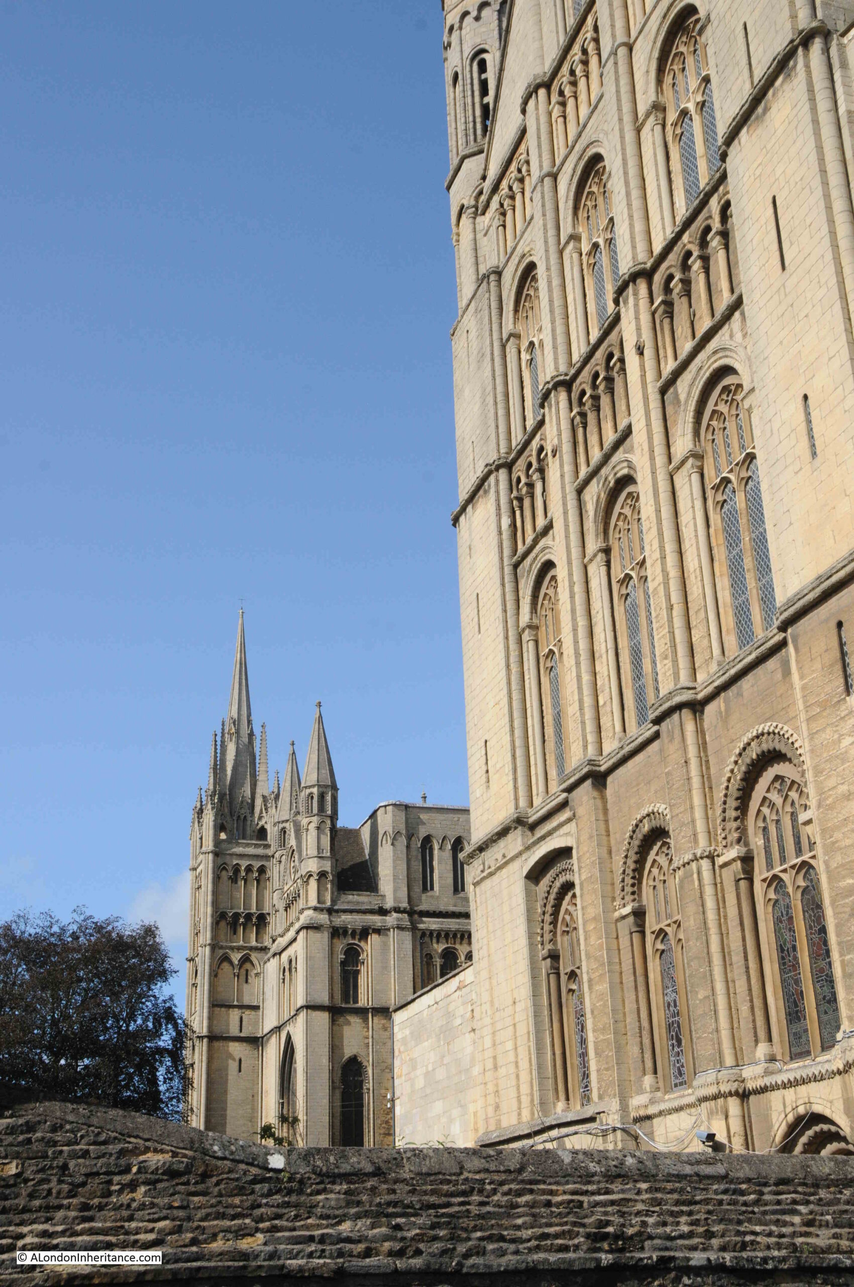
The cathedral today. The open book features key dates in the history of the cathedral:

Peterborough Cathedral

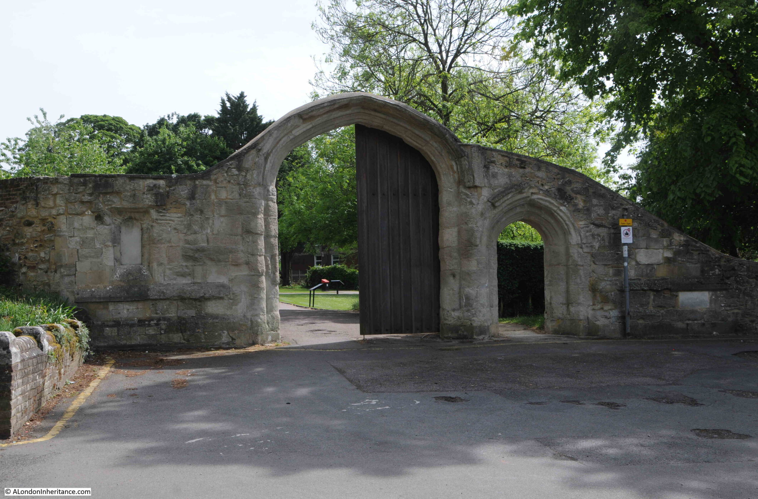
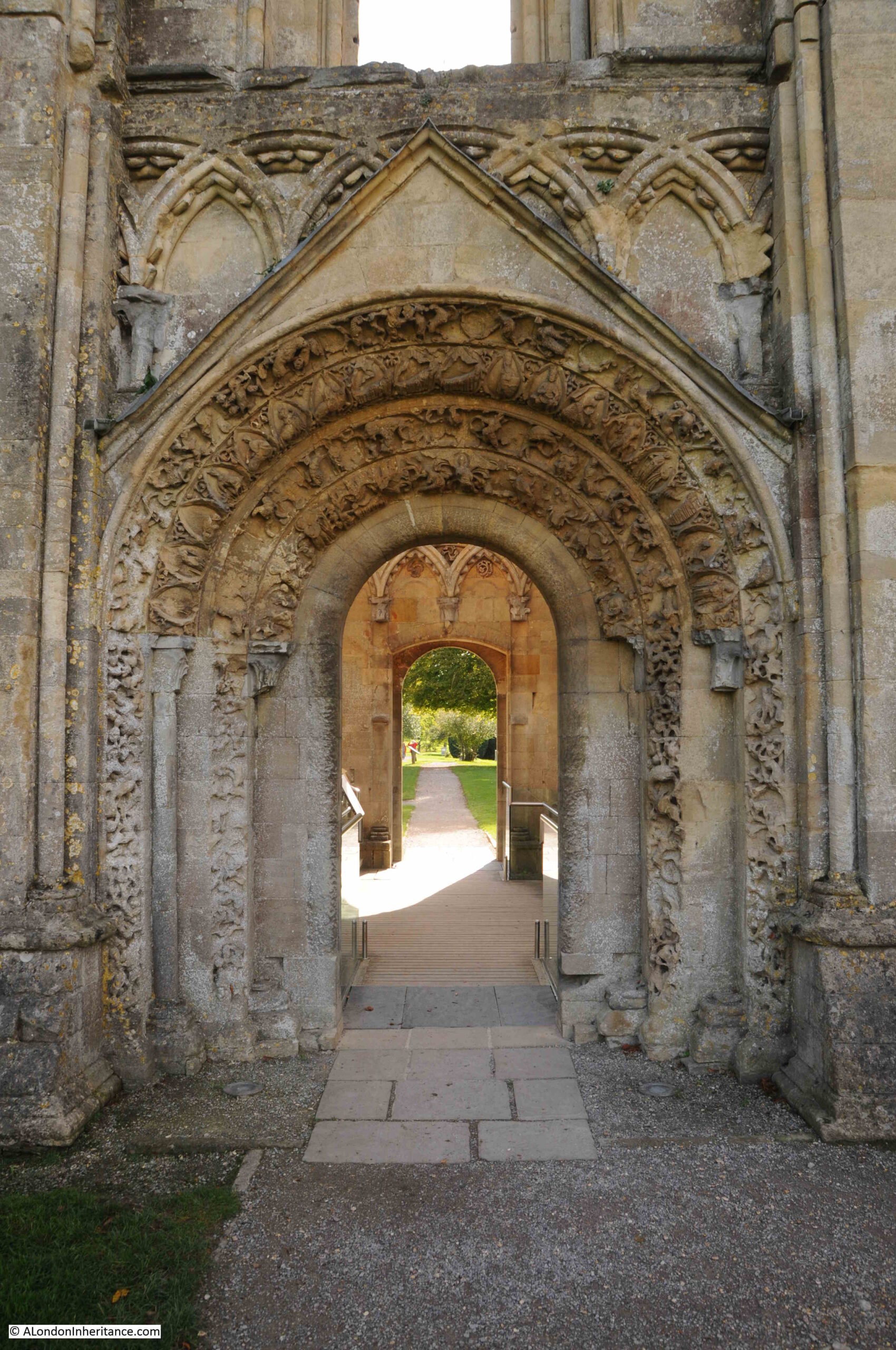
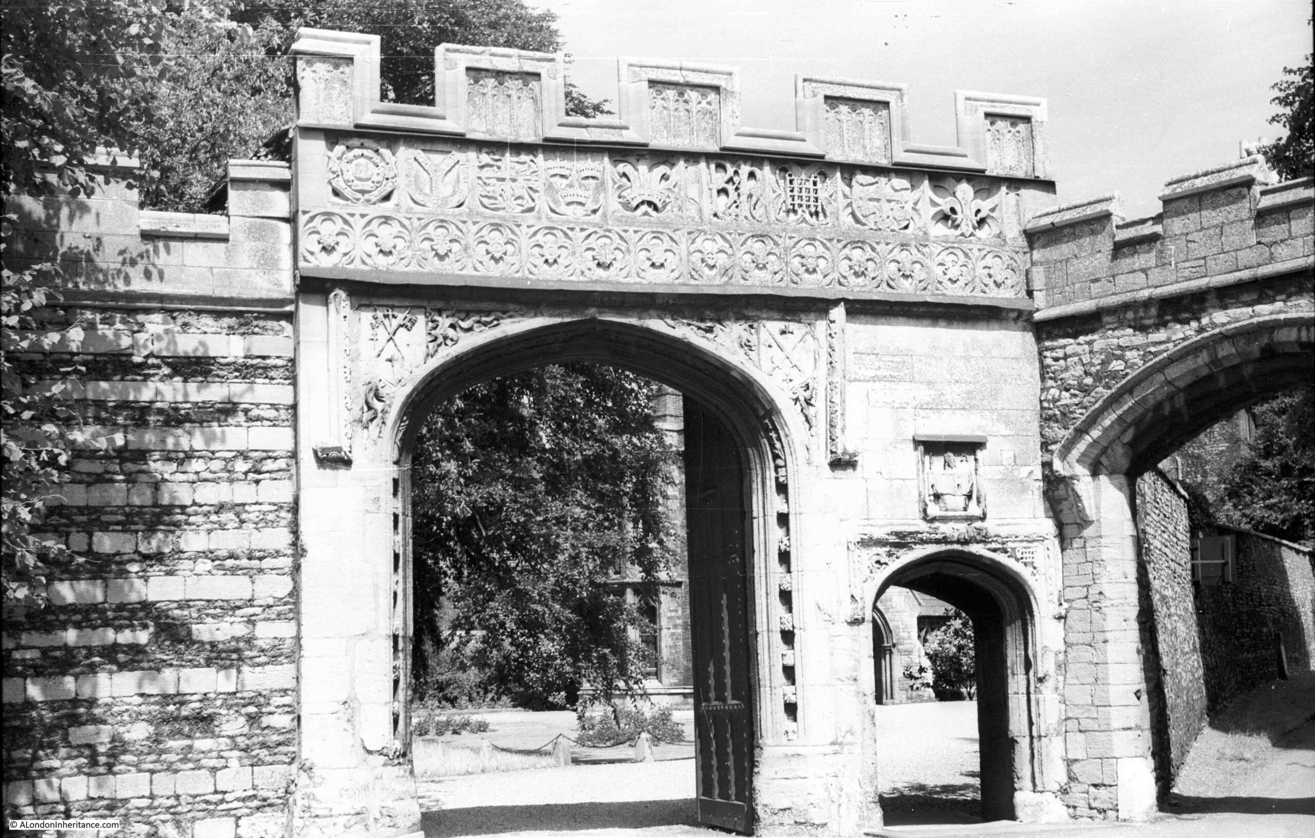
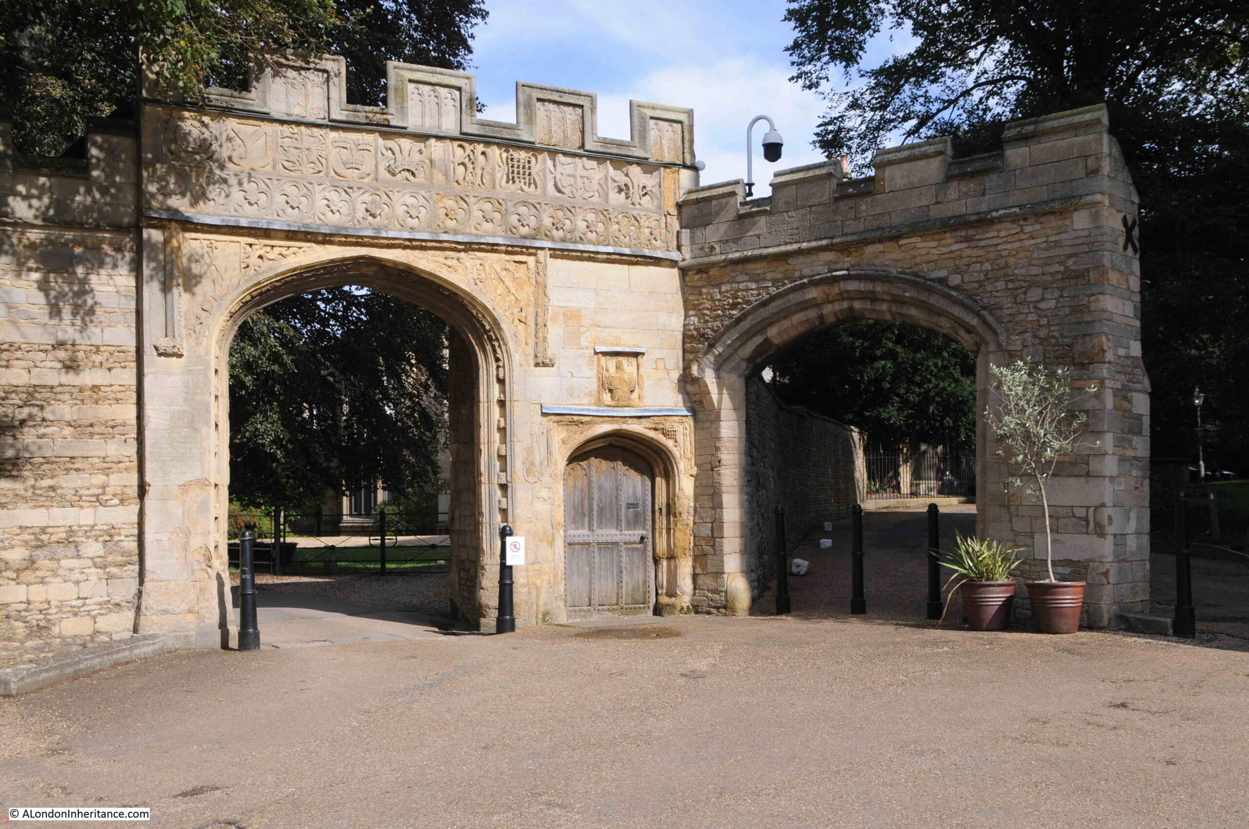
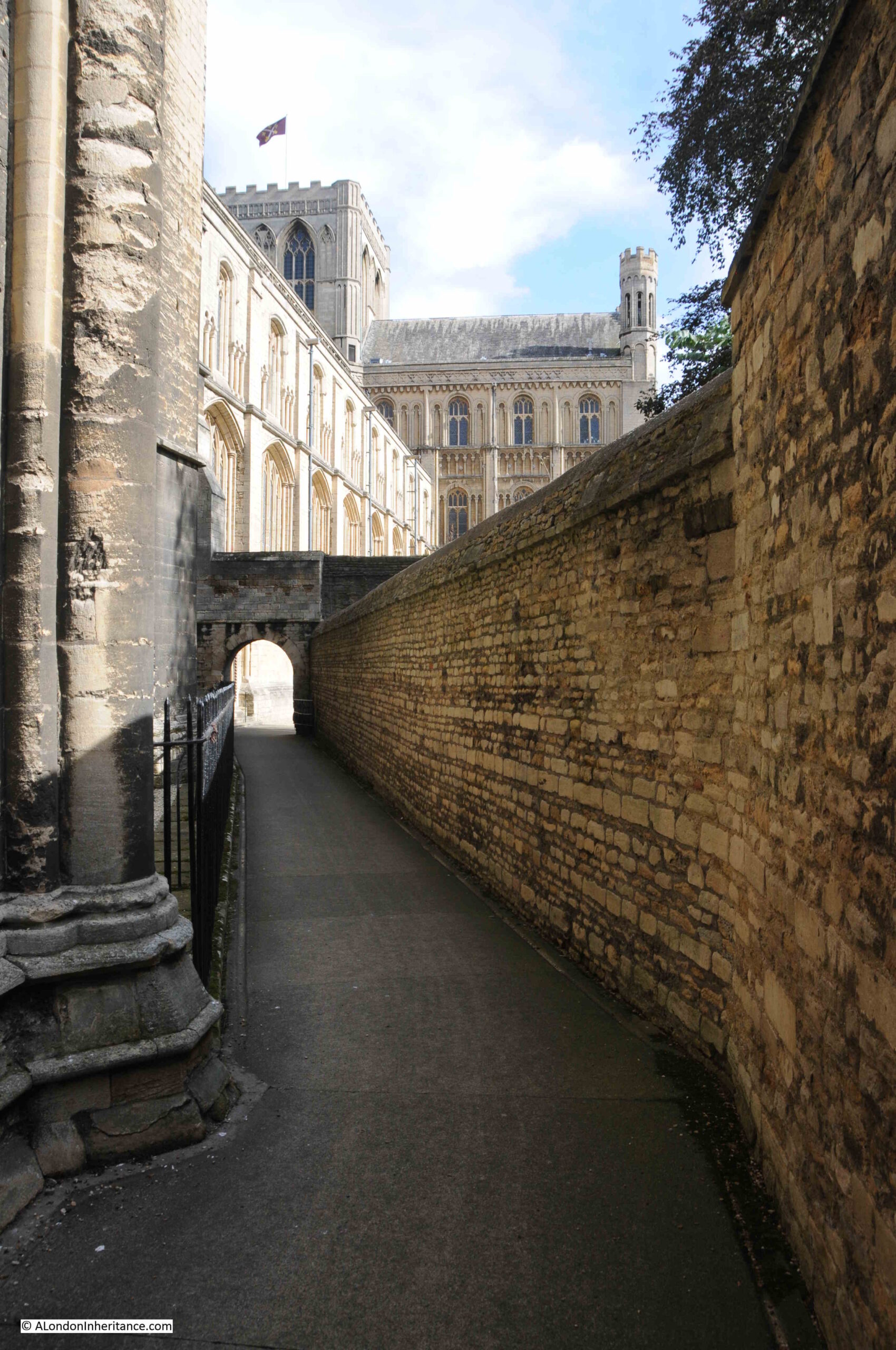
Gateway into the area where the Deanery is located:

Old gate and walls

Seventy-one years later:

Old gate and walls

Peterborough is a Cathedral City, and the cathedral has been at the heart of the city for very many centuries.

Long before the current cathedral, a monastery was founded in 655 at what was then called Medeshamstede, on the edge of the Fens, a large area of eastern England, with much of the land being waterlogged or marsh. The site of the monastery was on dry land overlooking the Fens, and was an ideal location as the Fens provided supplies of fish, wildfowl, and reeds for thatching.

Viking raids across eastern England resulted in the deaths of all the monks in the monastery in 870, and the Christian church was wiped out as a functioning organisation.

The monastery was refounded just over 100 years later in 972 by King Edgar and Aethelwold, Bishop of Winchester, and the community needed to service the monastery, and that formed the start of Peterborough, began to grow around the cathedral.

In the year 1116, the monastery buildings, and much of the early town was destroyed in a fire which was believed to have started in a bakery (a parallel with the Great Fire of London), and the loss of the monastery buildings resulted in the construction of the building we see today, which commenced in 1118.

The need for funds to help with the construction of the new building led the monks of the monastery to create the market to the west of the cathedral, and the development of streets to attract commercial activity.

The monastic church would take decades to construct, and was finally consecrated in 1238, with additions and modifications continuing to be made during the following centuries.

In 1539 the monastery and abbey church were closed by King Henry VIII, who also confiscated the land and buildings.

Two years later in 1541, the church was reopened as Peterborough Cathedral, with the foundation charter for the cathedral being established on the 4th of September, 1541.

Time for a walk around the cathedral in 1952:

Peterborough Cathedral

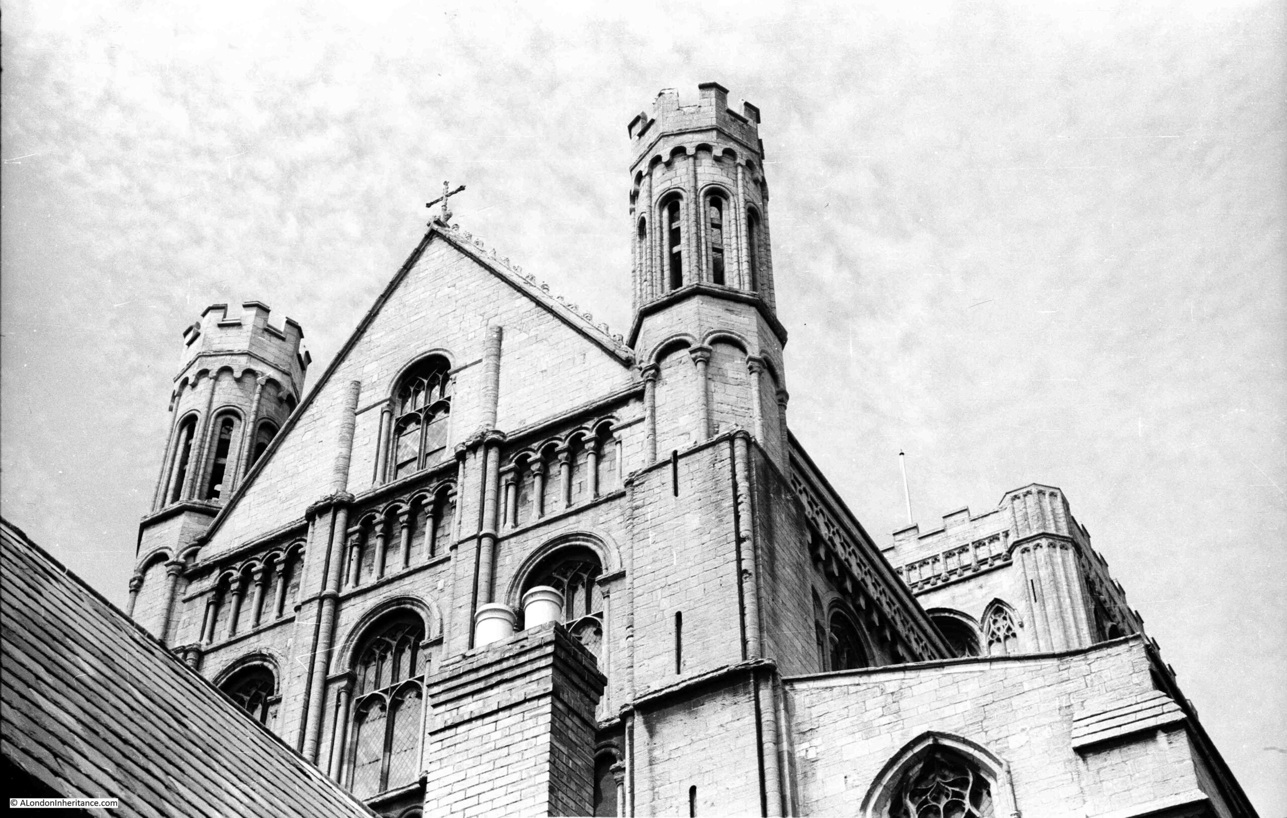
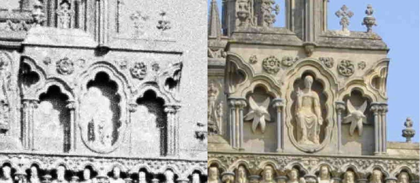
I could not easily take the same views as the two photos above, due to trees which have since grown around the cathedral and obscure some of the views.

Peterborough Cathedral

However I could recreate the above photo:

Peterborough Cathedral

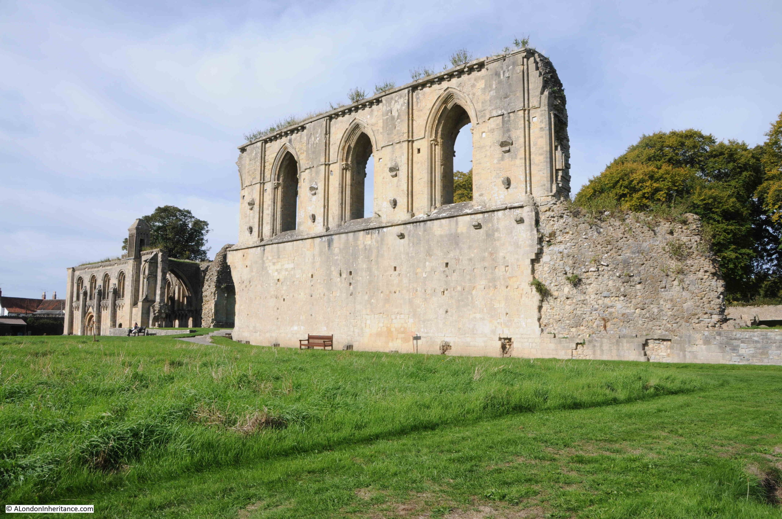
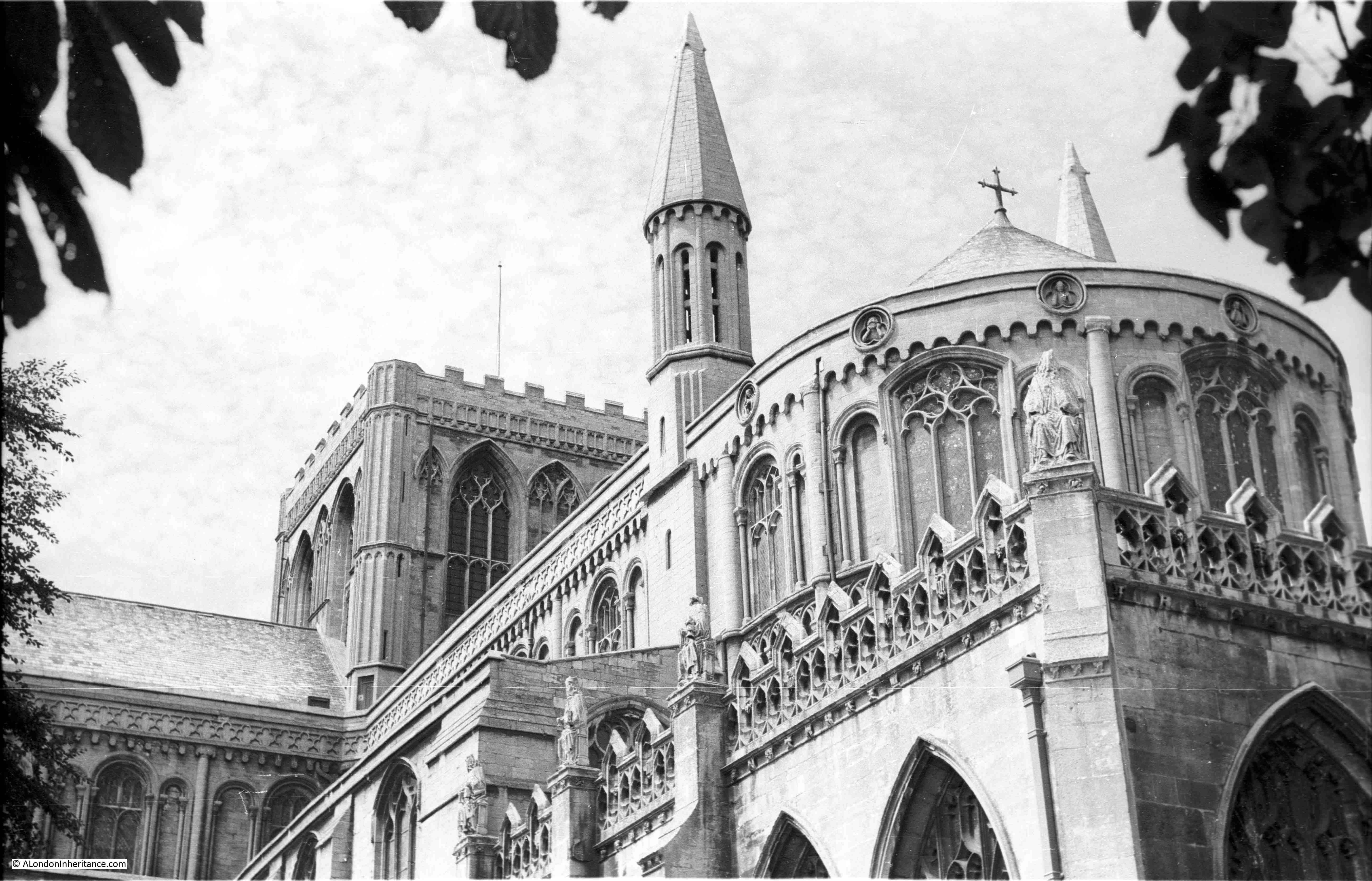
The eastern end of the cathedral is the subject of the following photo. The section in the lower right of the photo is known as the New Building and dates from a programme of building work carried out between 1496 and 1509.

Peterborough Cathedral

The view today is almost identical:

Peterborough Cathedral

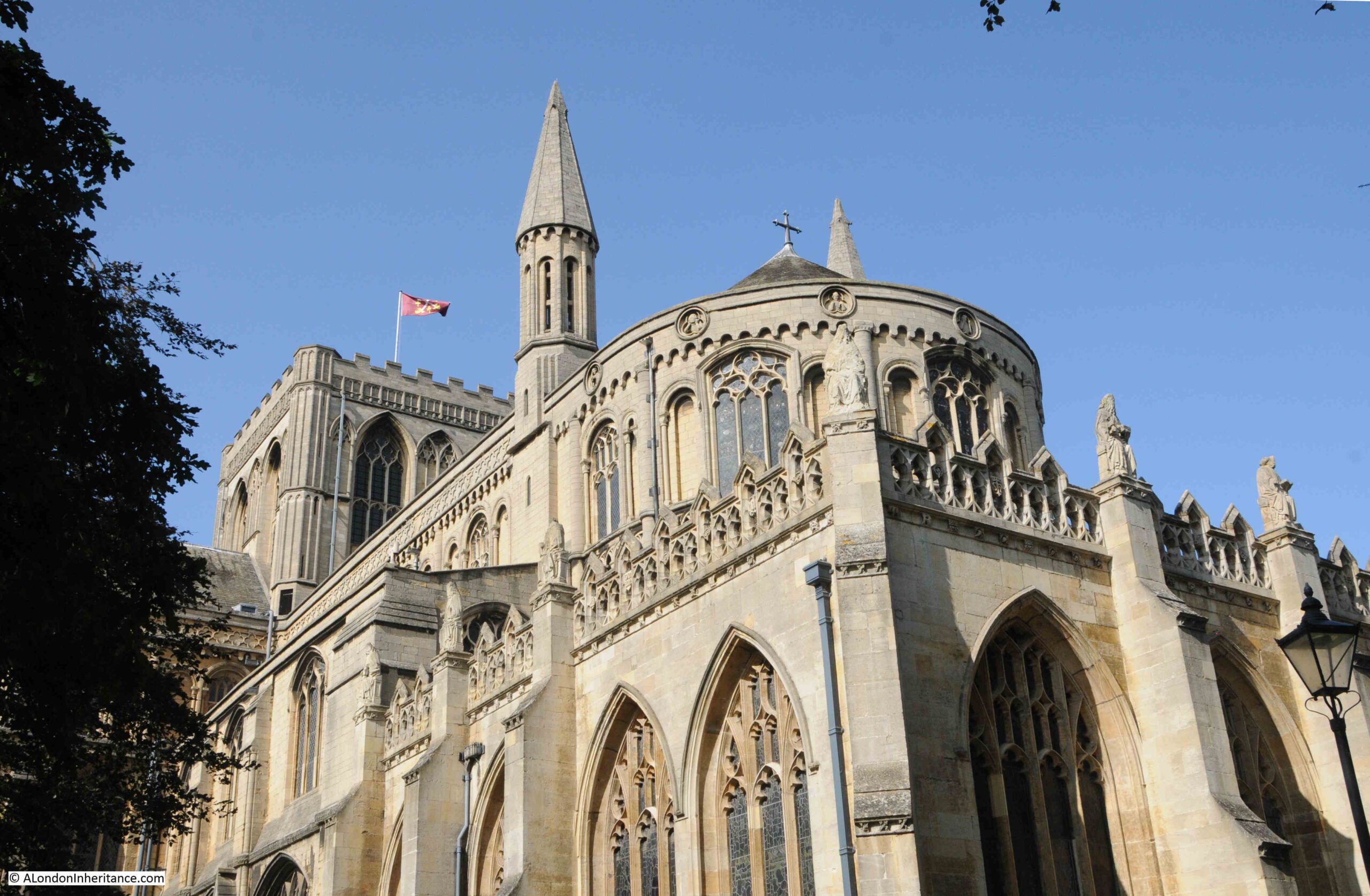
When I can get these Then and Now photos as closely aligned as possible, given the very different cameras in use, and the view has hardly changed in 70 years, it is always a moment to stop and think just how many people have seen the same view over the centuries, and how many will do so in the future.

Buildings such as the cathedral, and the Guildhall in the Market Place, anchor the city’s history and provide a physical link with the past. Whilst shopping centres, office blocks etc. will come and go, these buildings are so much more than their physical appearance.
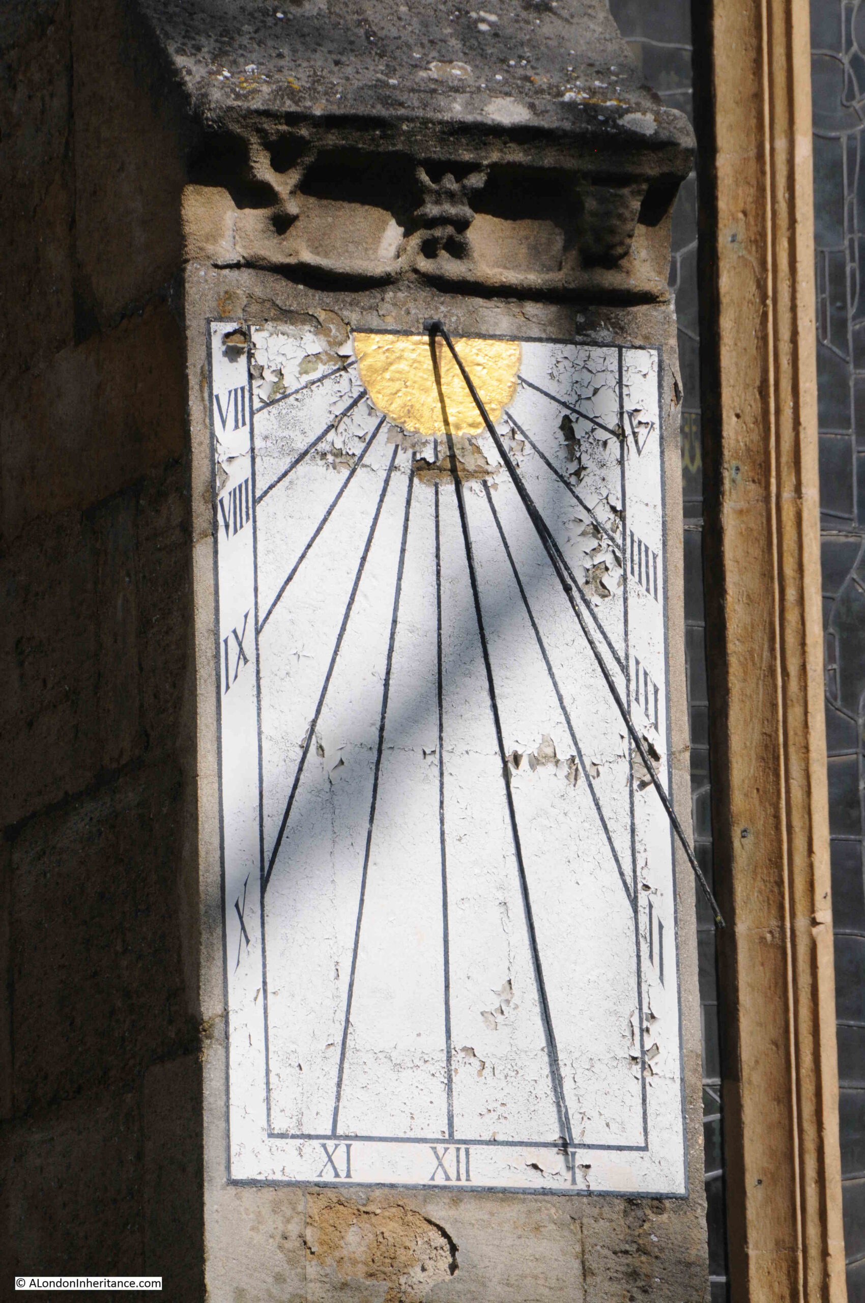
Painted sun dial:

Sundial

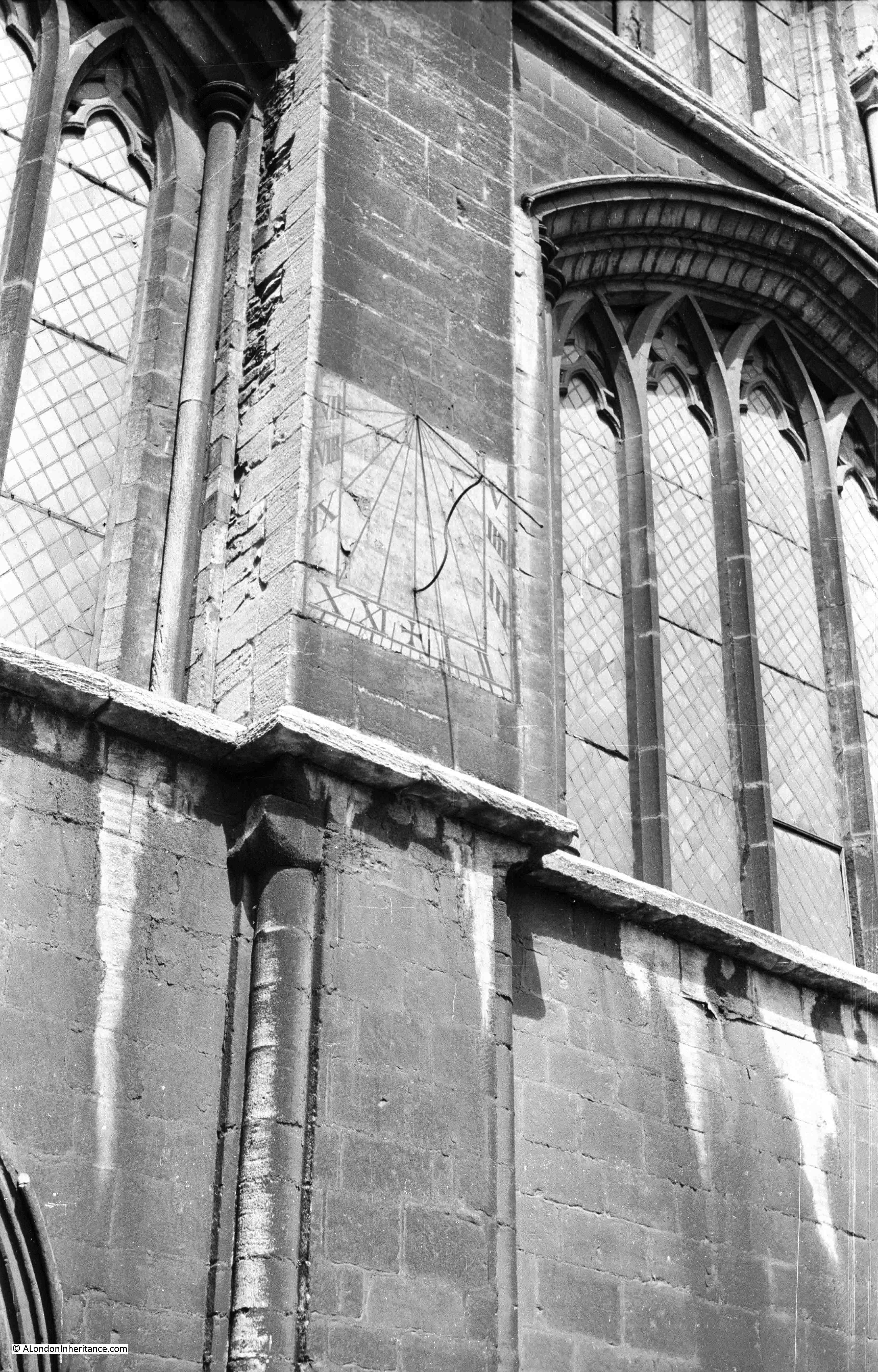
I found a couple of sundials on the cathedral. One of the west facing front of the building and one of the south, however they were not in the same position as the above 1952 photo. I did find the sundial in the following photo on the southern side of the cathedral, which would be the correct location for such a device.

Sundial

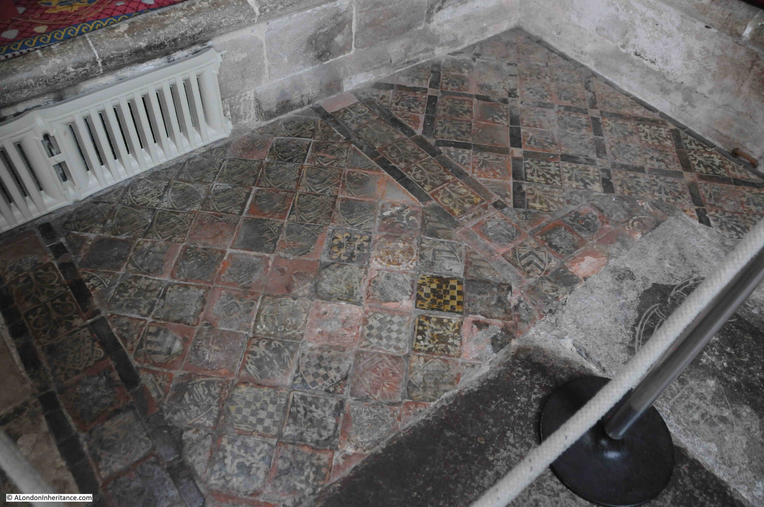
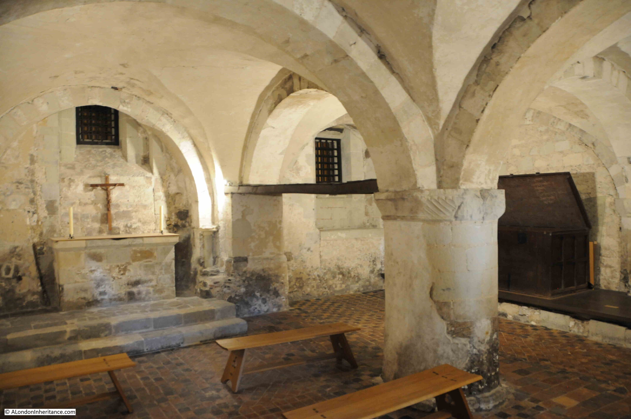
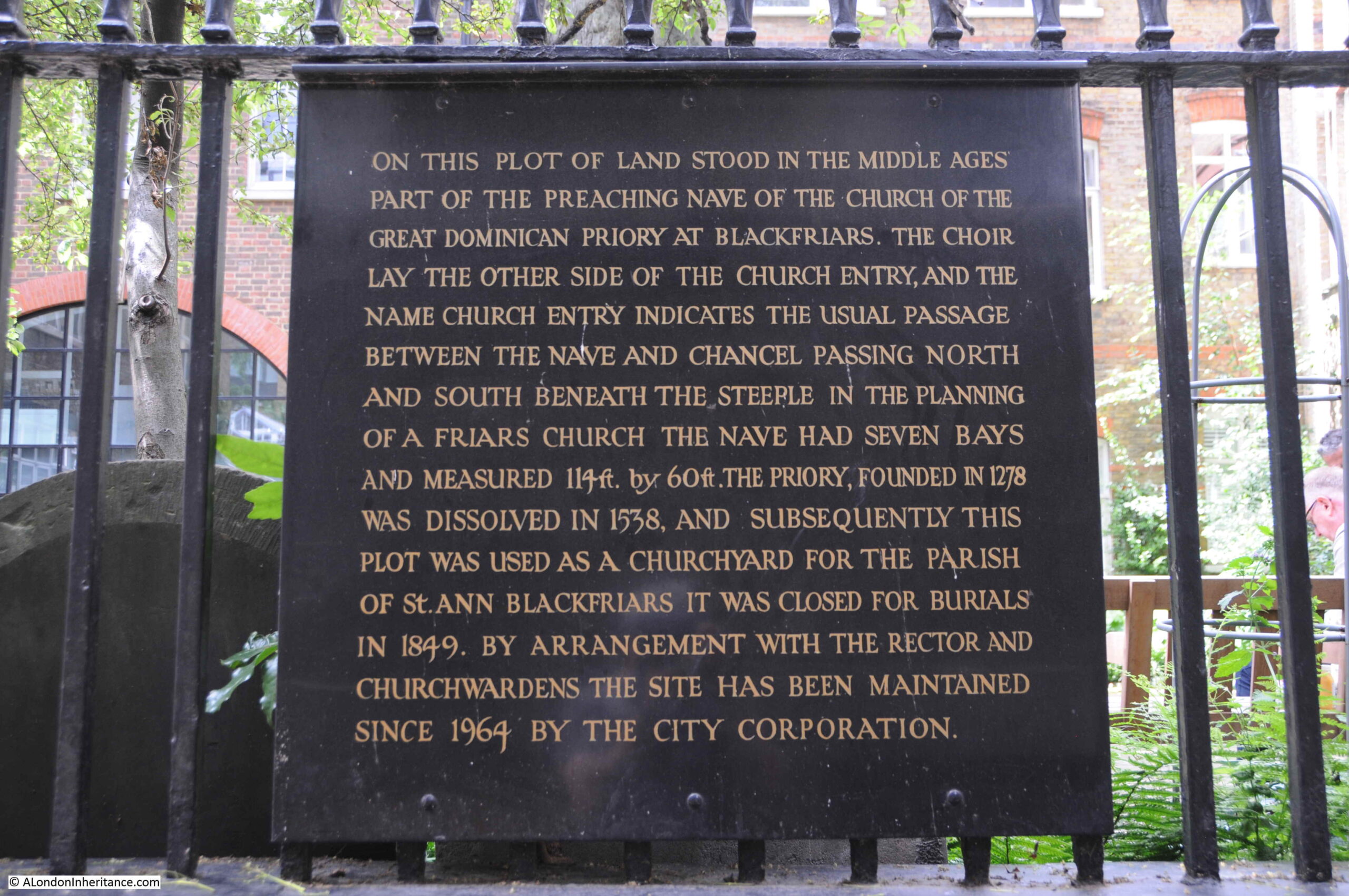
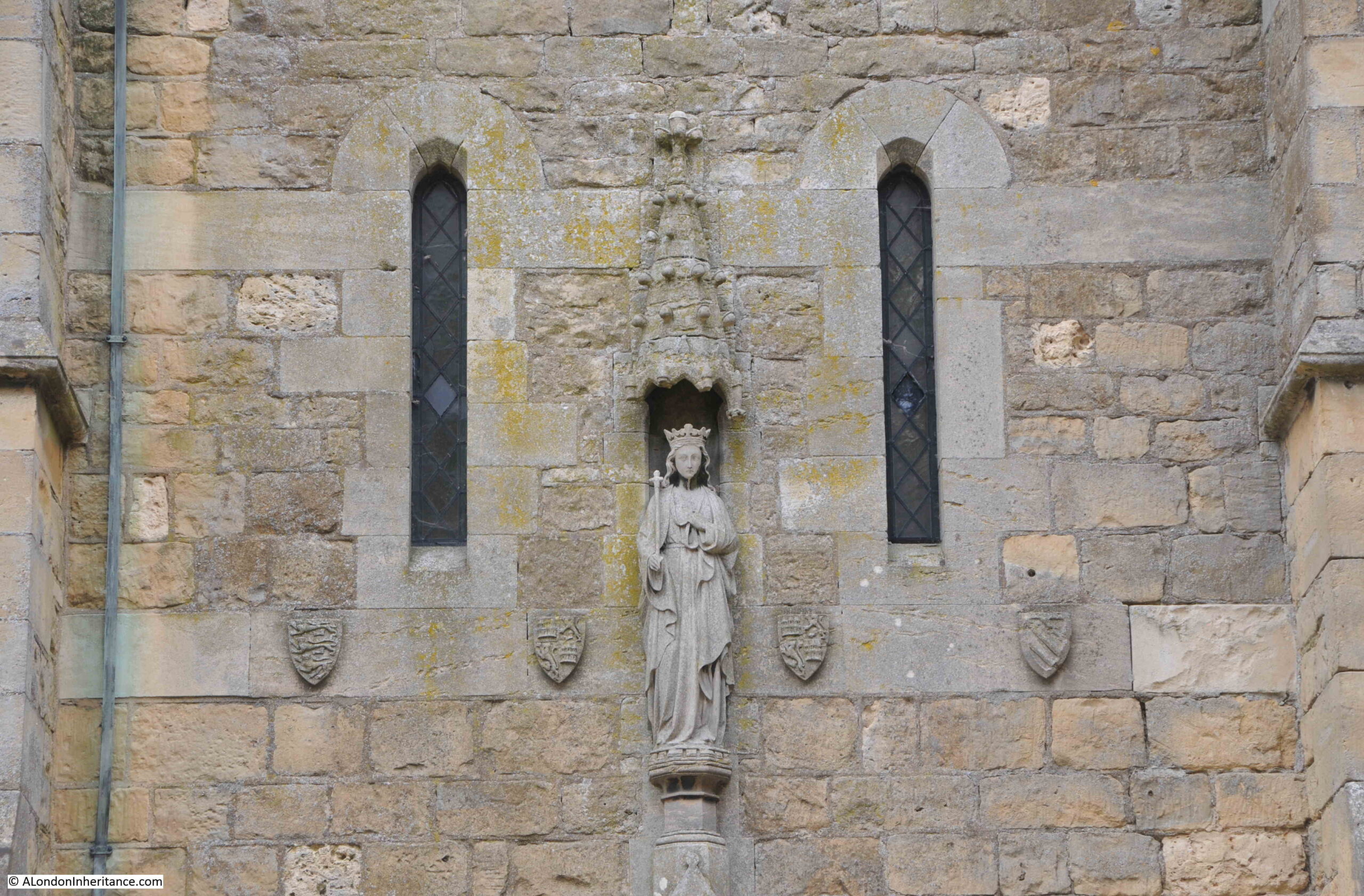
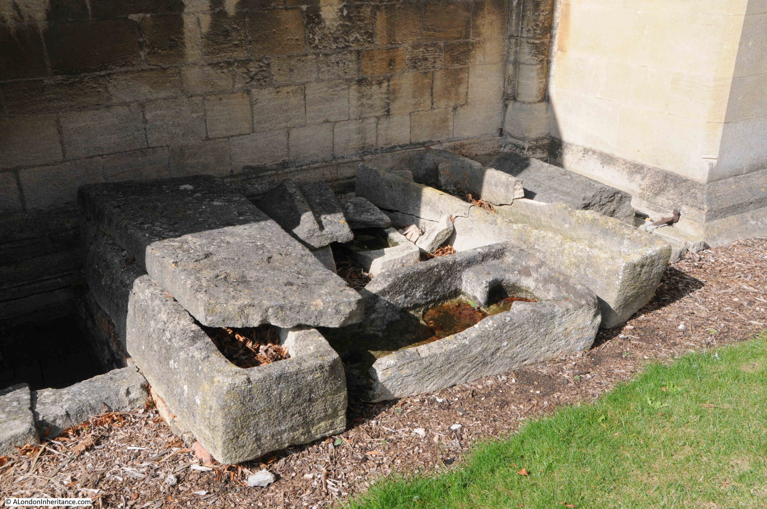
The grounds around the cathedral have long been used as a place of burial. On the southern side are a number of medieval stone coffins which were discovered during 19th century restoration works, and could be 12th century when the area was being used as a graveyard for the abbey community:

Medieval coffins

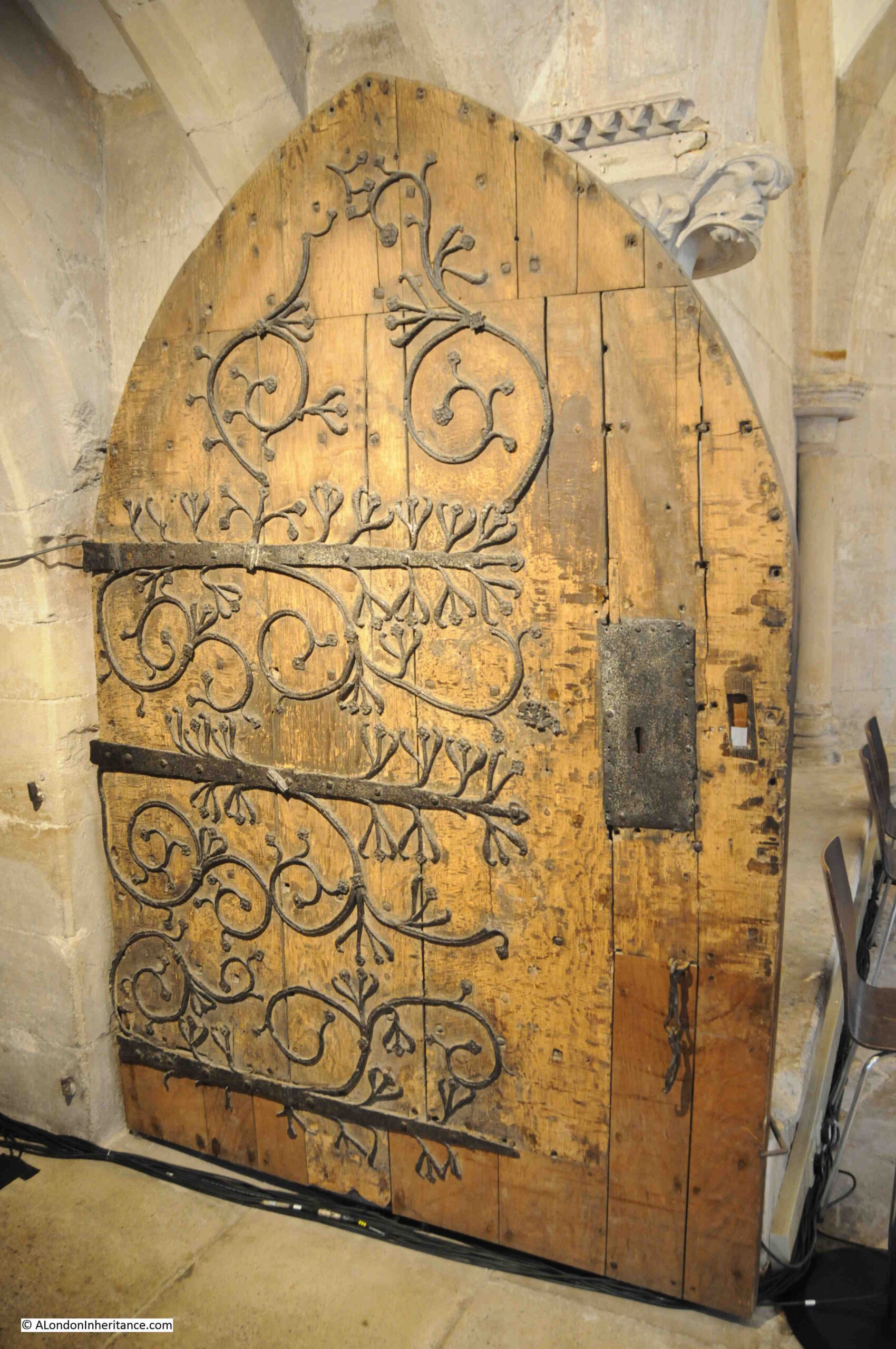
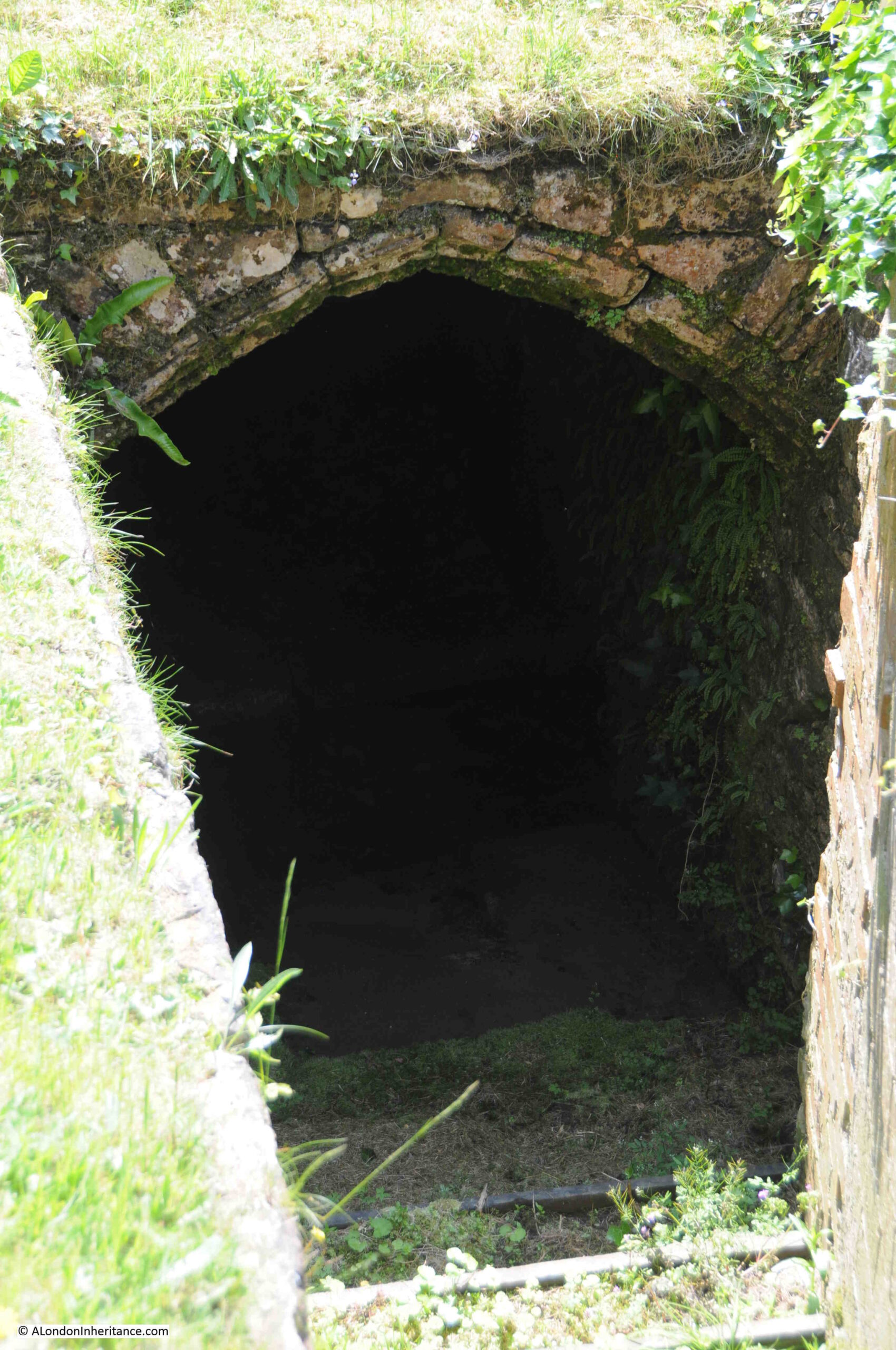
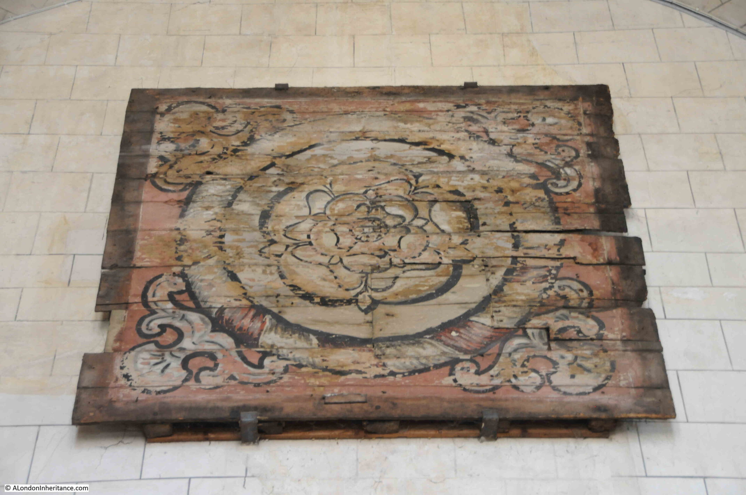
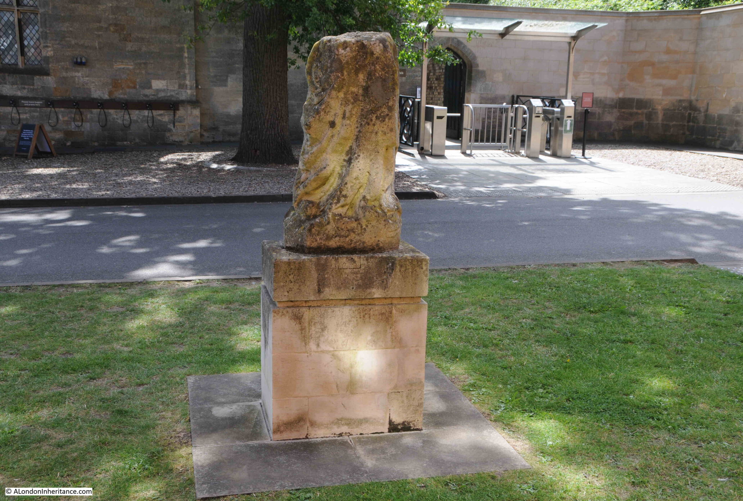
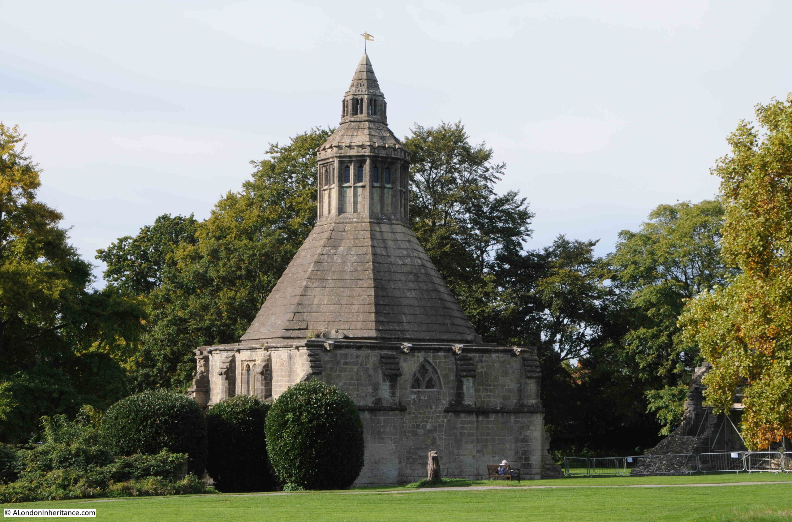
I could not find the location of the following photo:

Monks Lavatory

I did ask one of the guides in the cathedral, who thought is was probably in the Cloisters, which were closed at the time of my visit due to tiles falling from the roof in recent winds.

The plaque in the above photo reads “The Monks Lavatory as renewed in the 14th Century”.

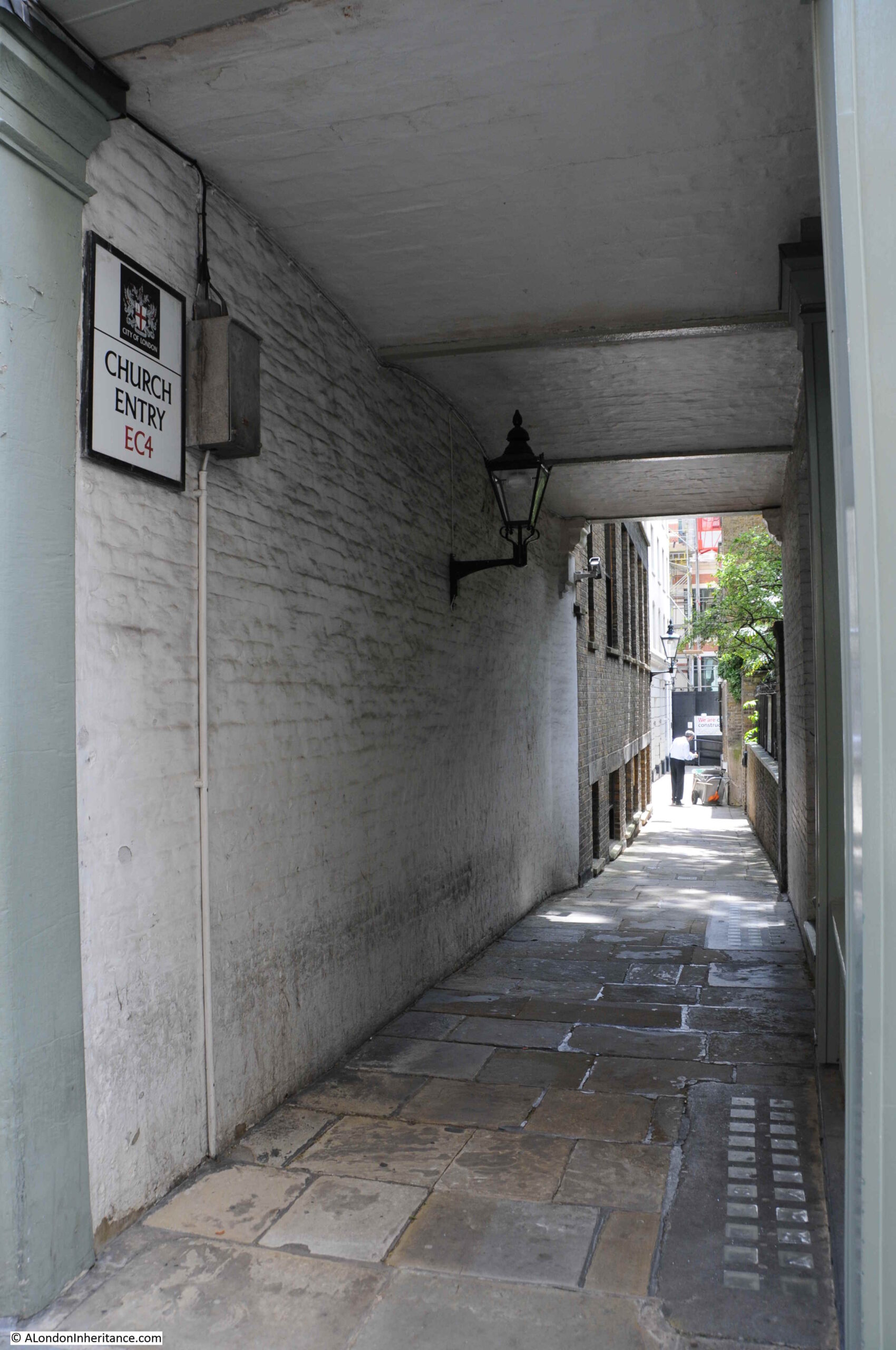
Peering through the gate to the Cloisters:

Cloisters

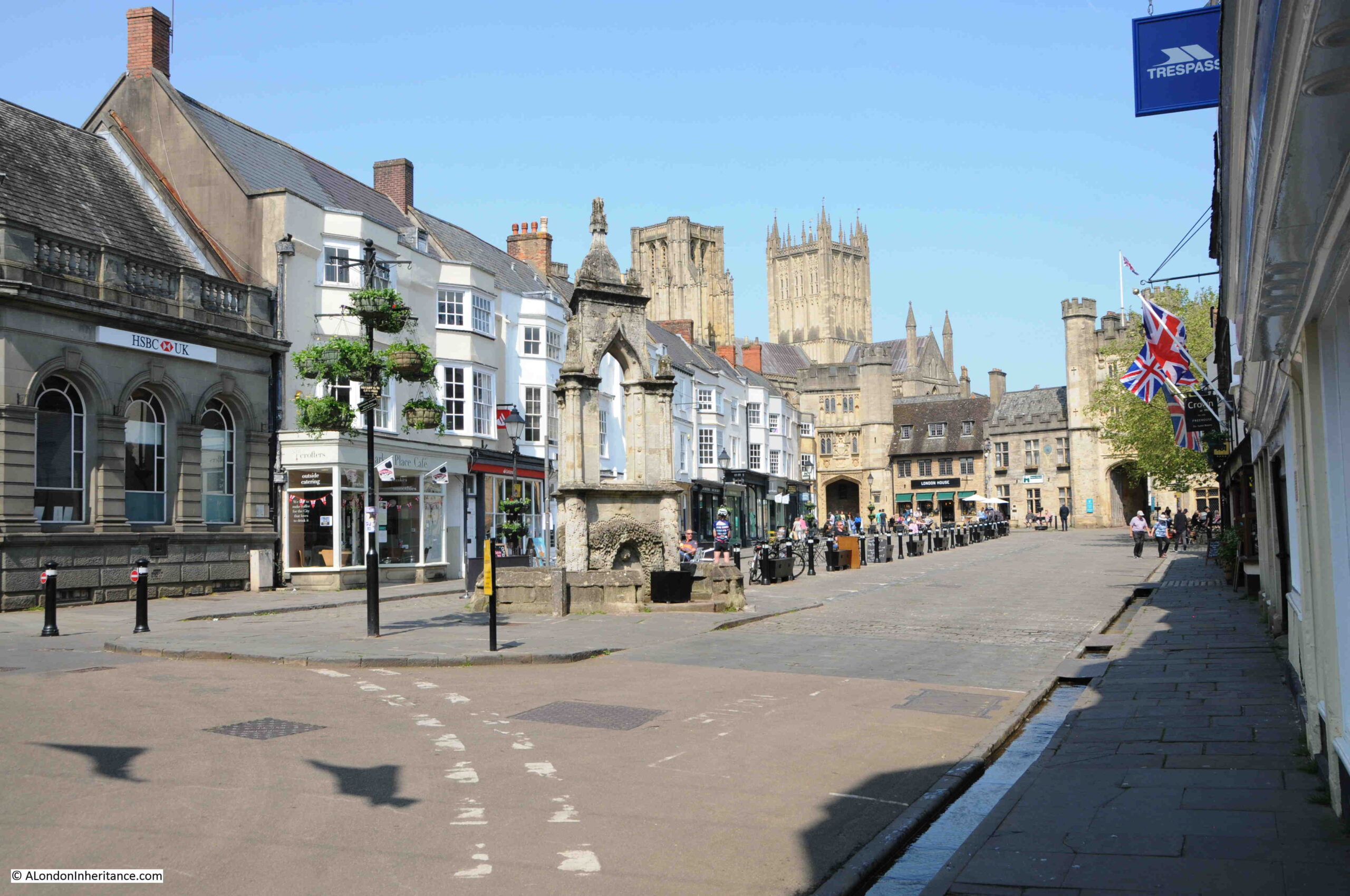
The view from the western front of the cathedral, looking back to the entrance gate which leads into the old Market Place where the Guildhall is located:

Cathedral grounds

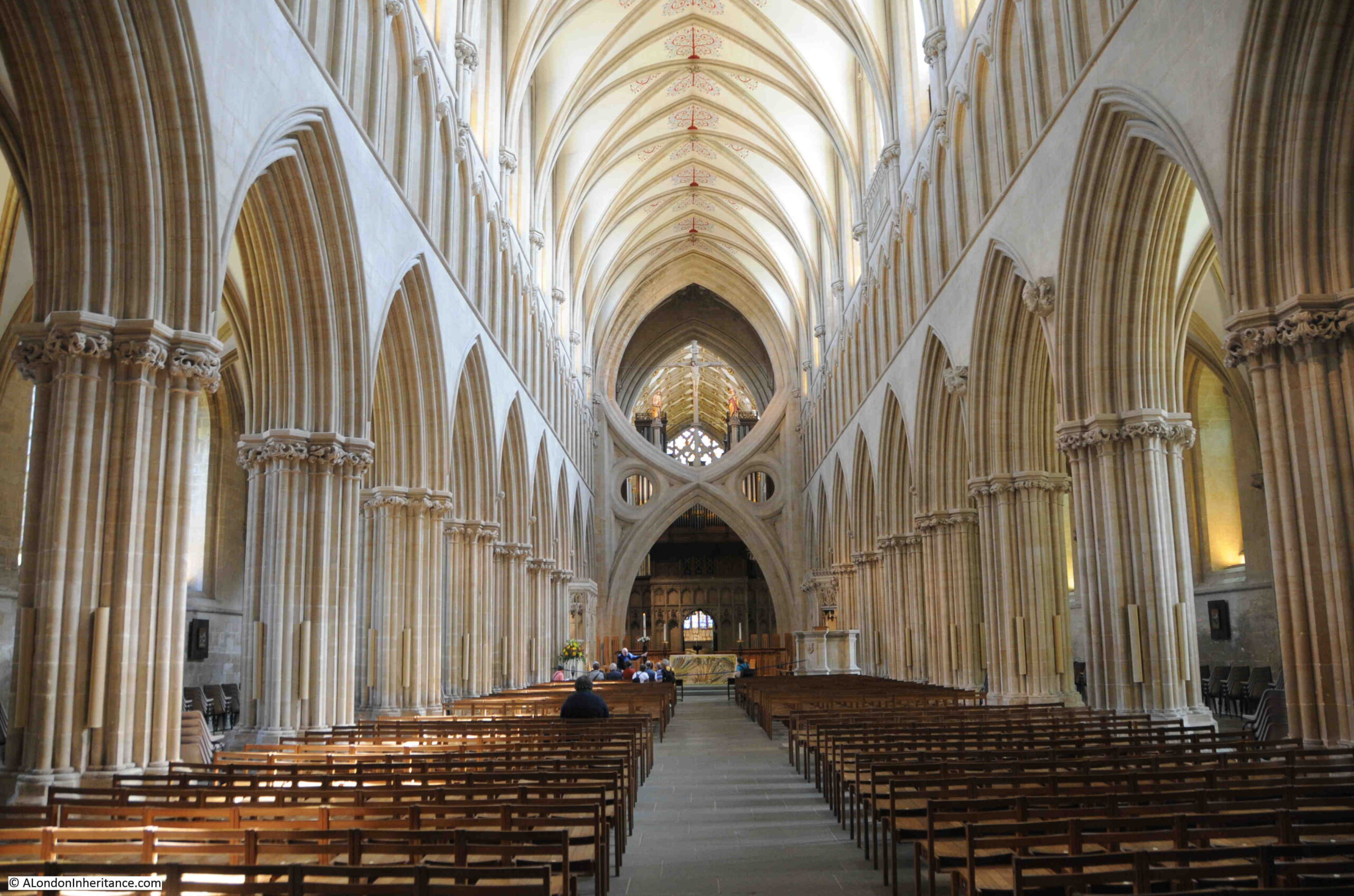
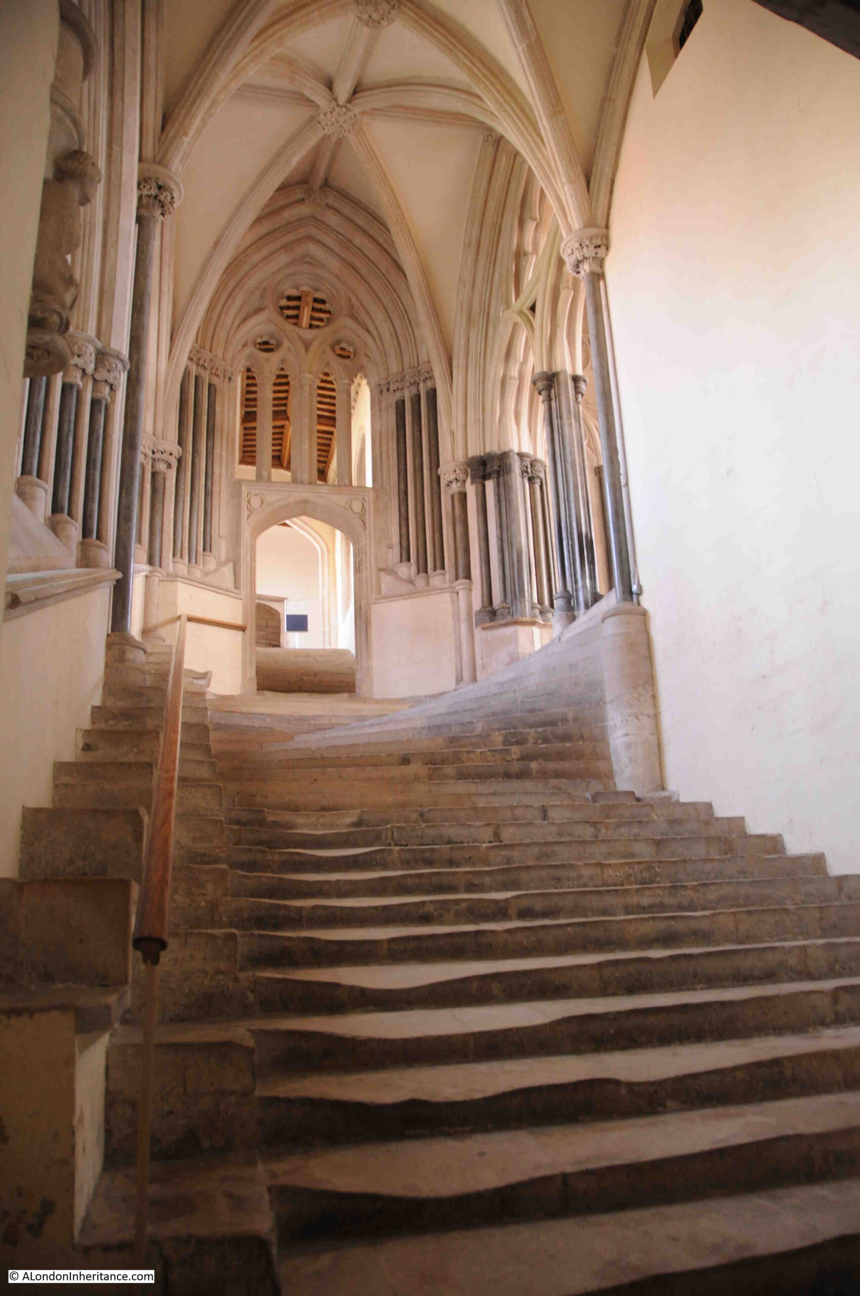
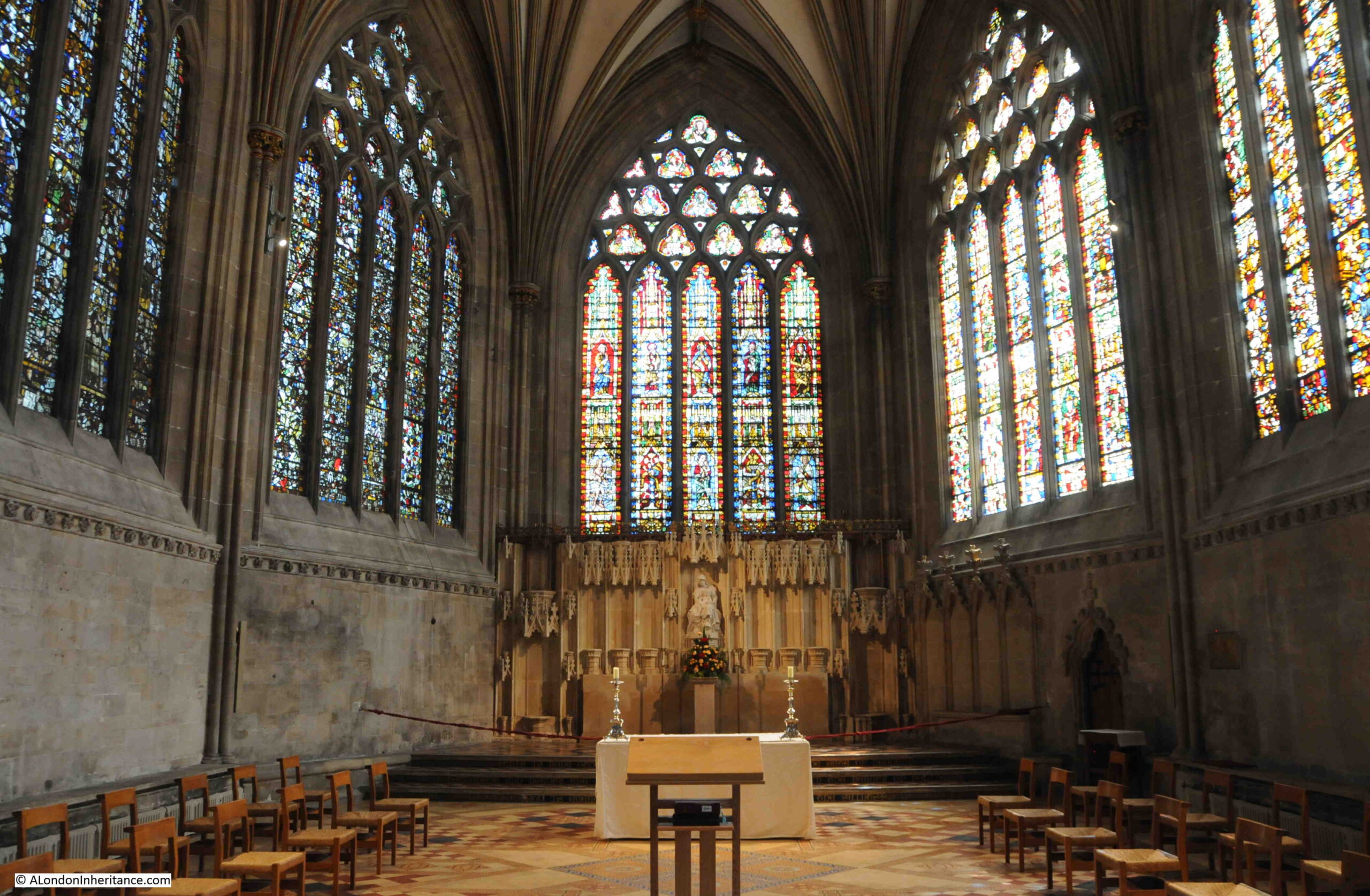
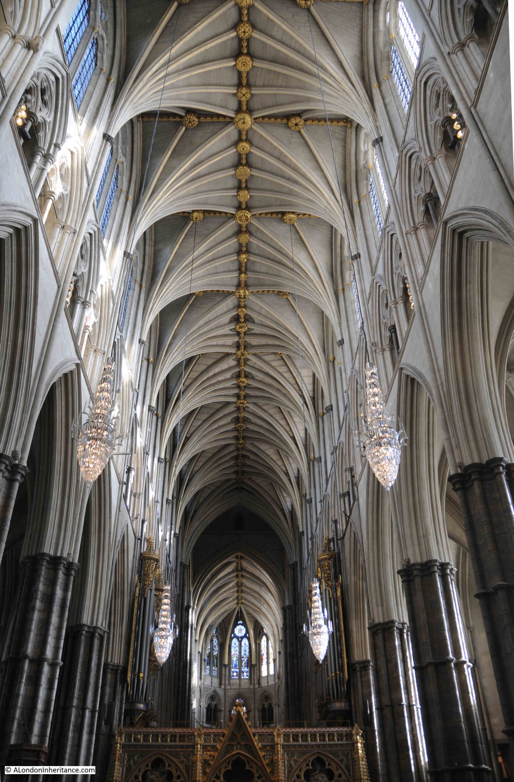
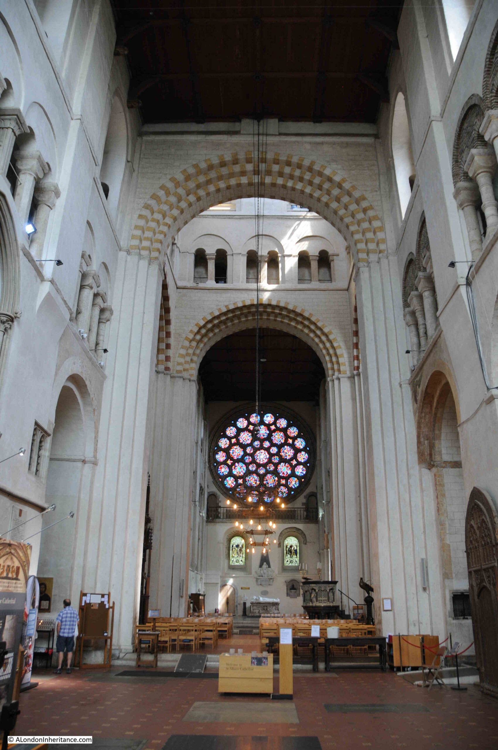
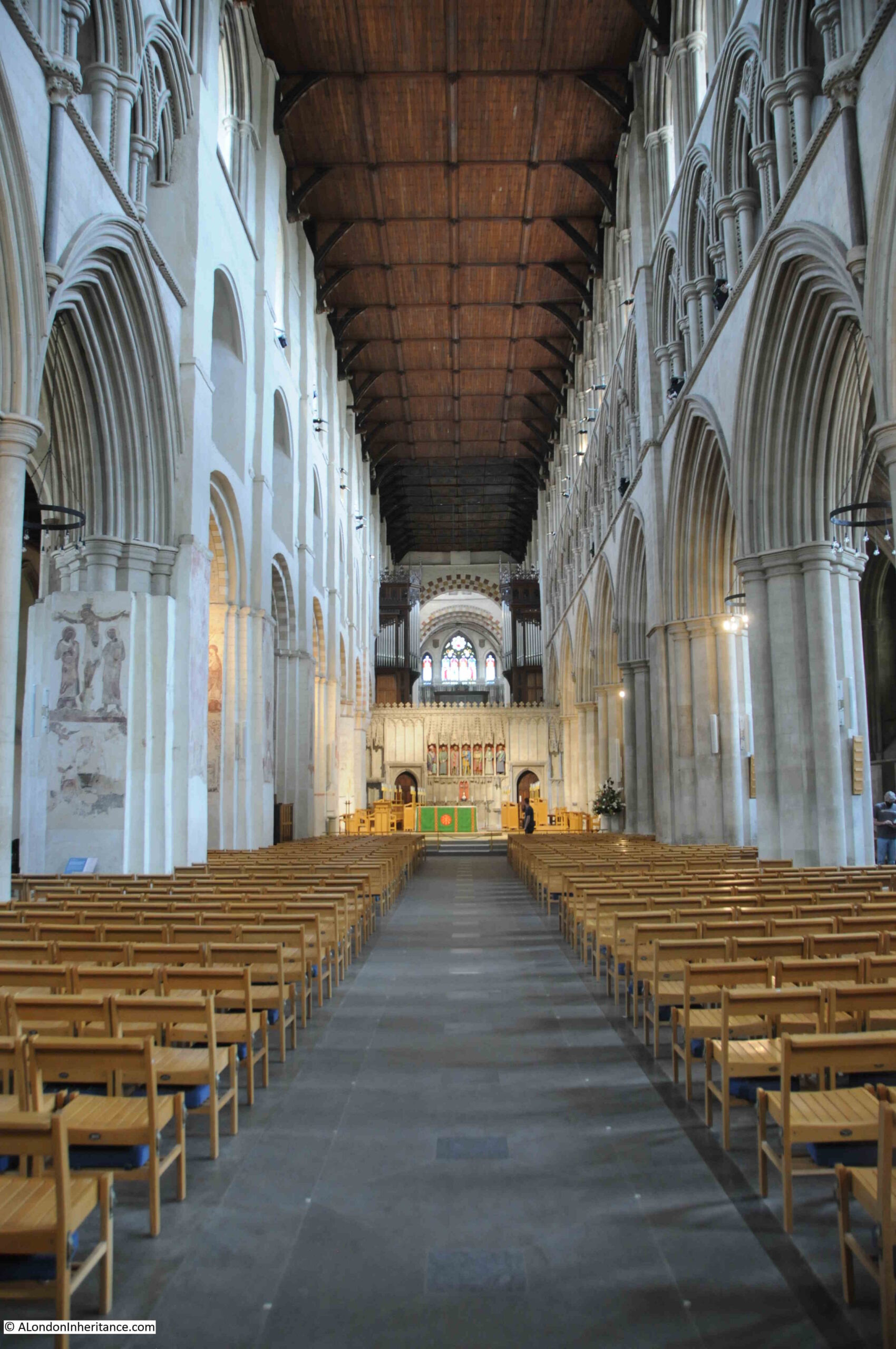
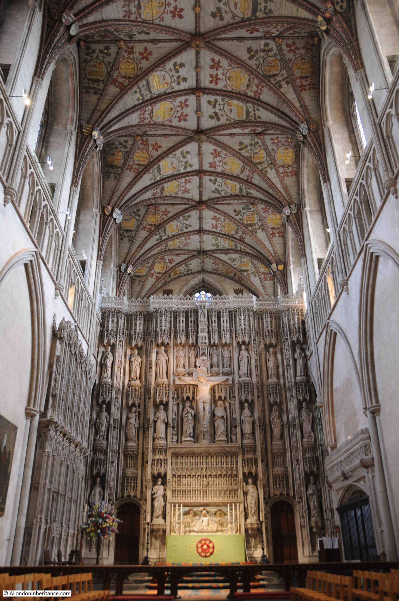
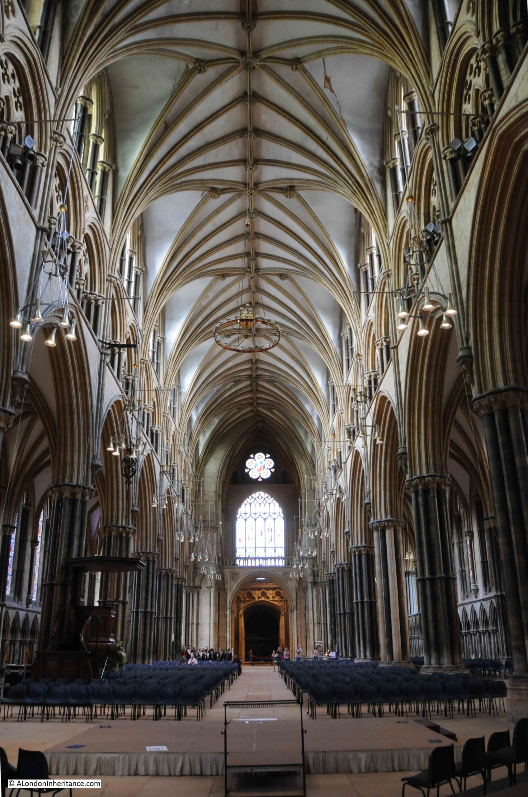
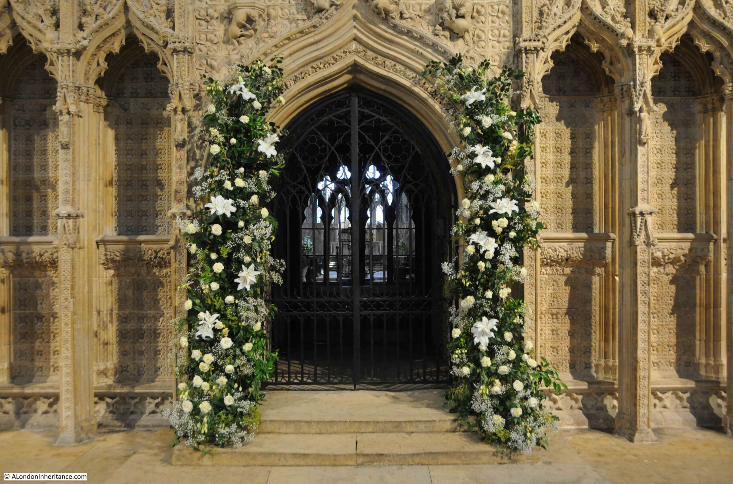
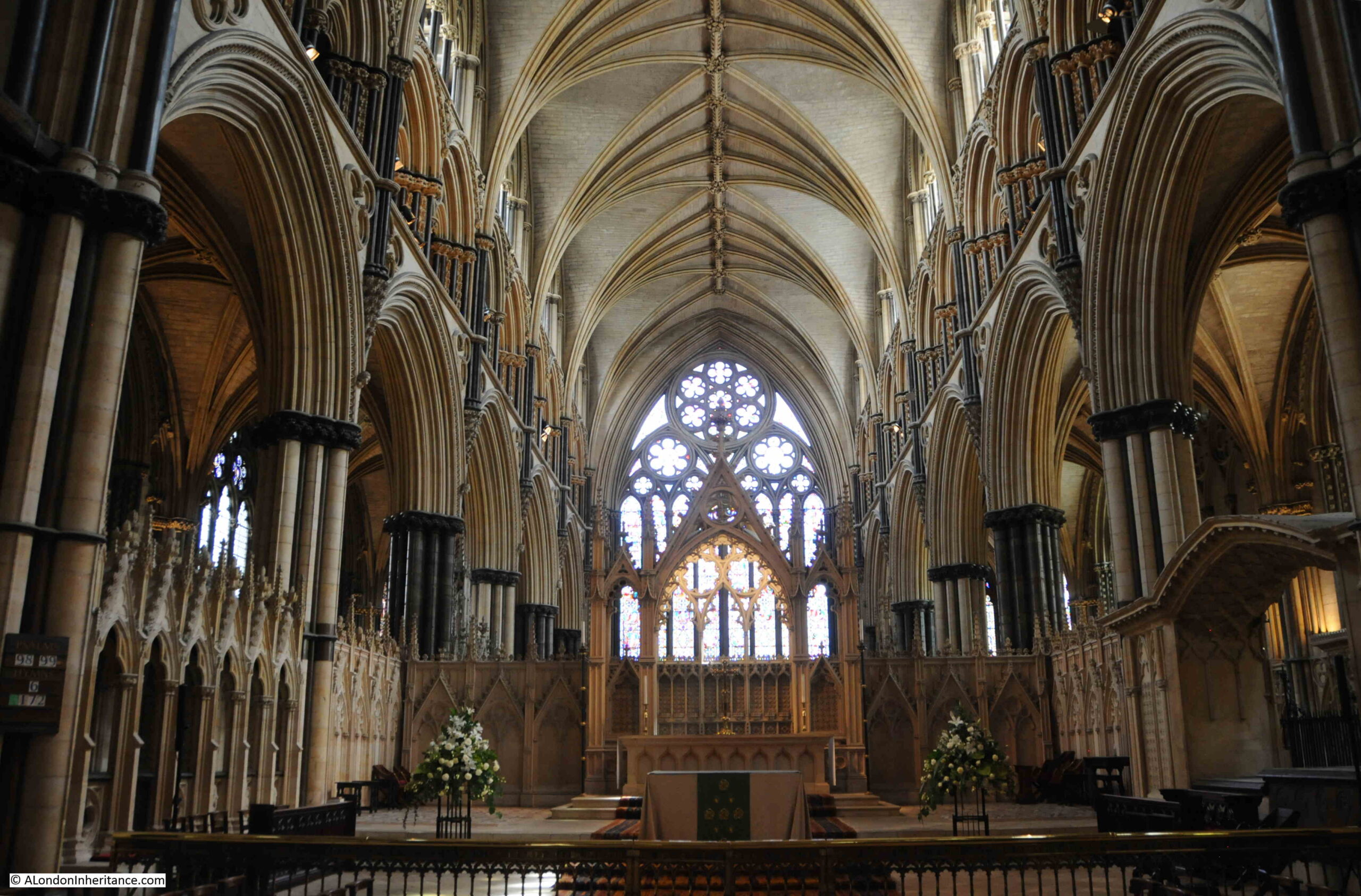
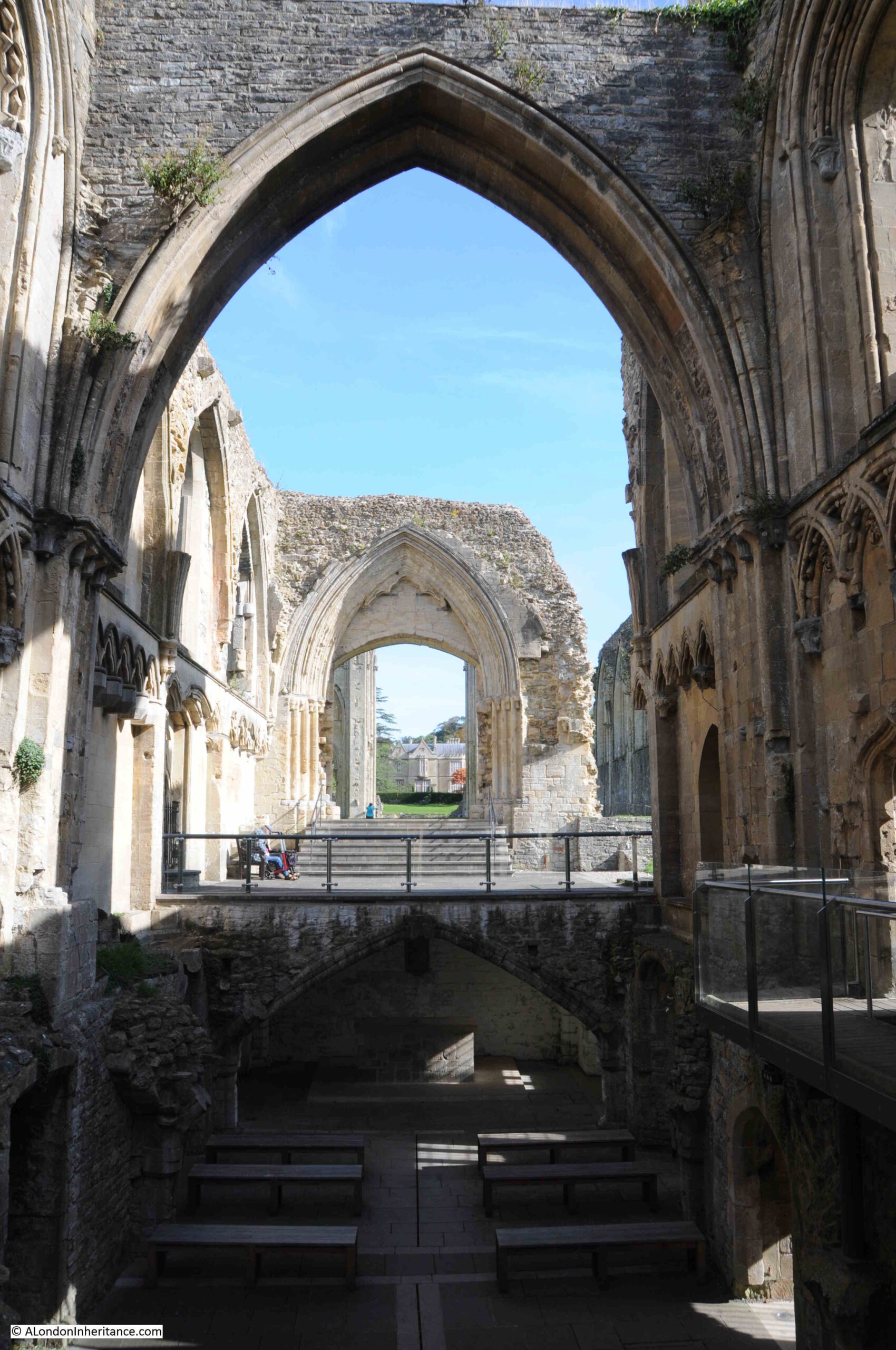
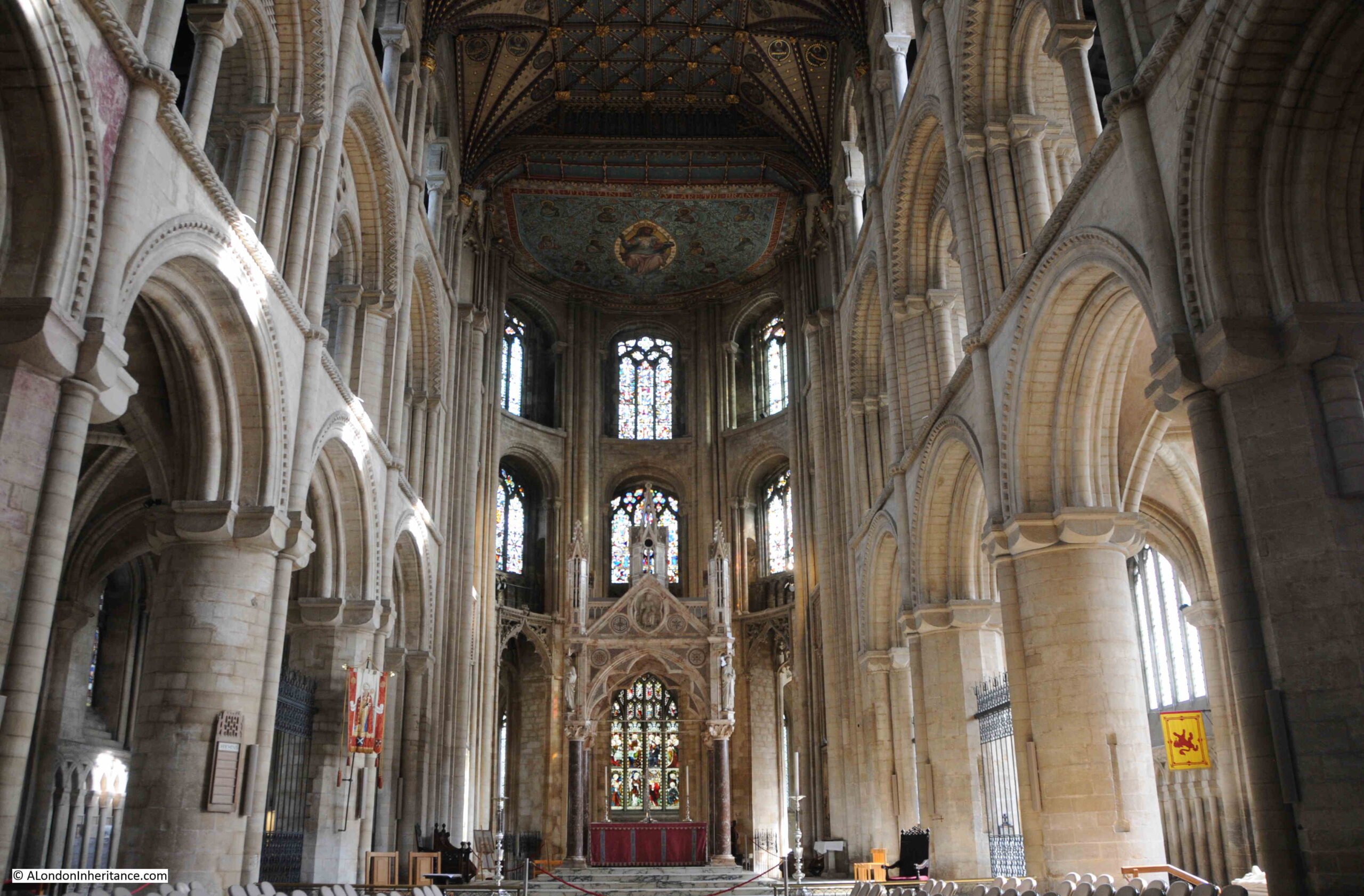
As could be expected, the interior of Peterborough Cathedral is magnificent. The view looking toward the altar:

Peterborough Cathedral

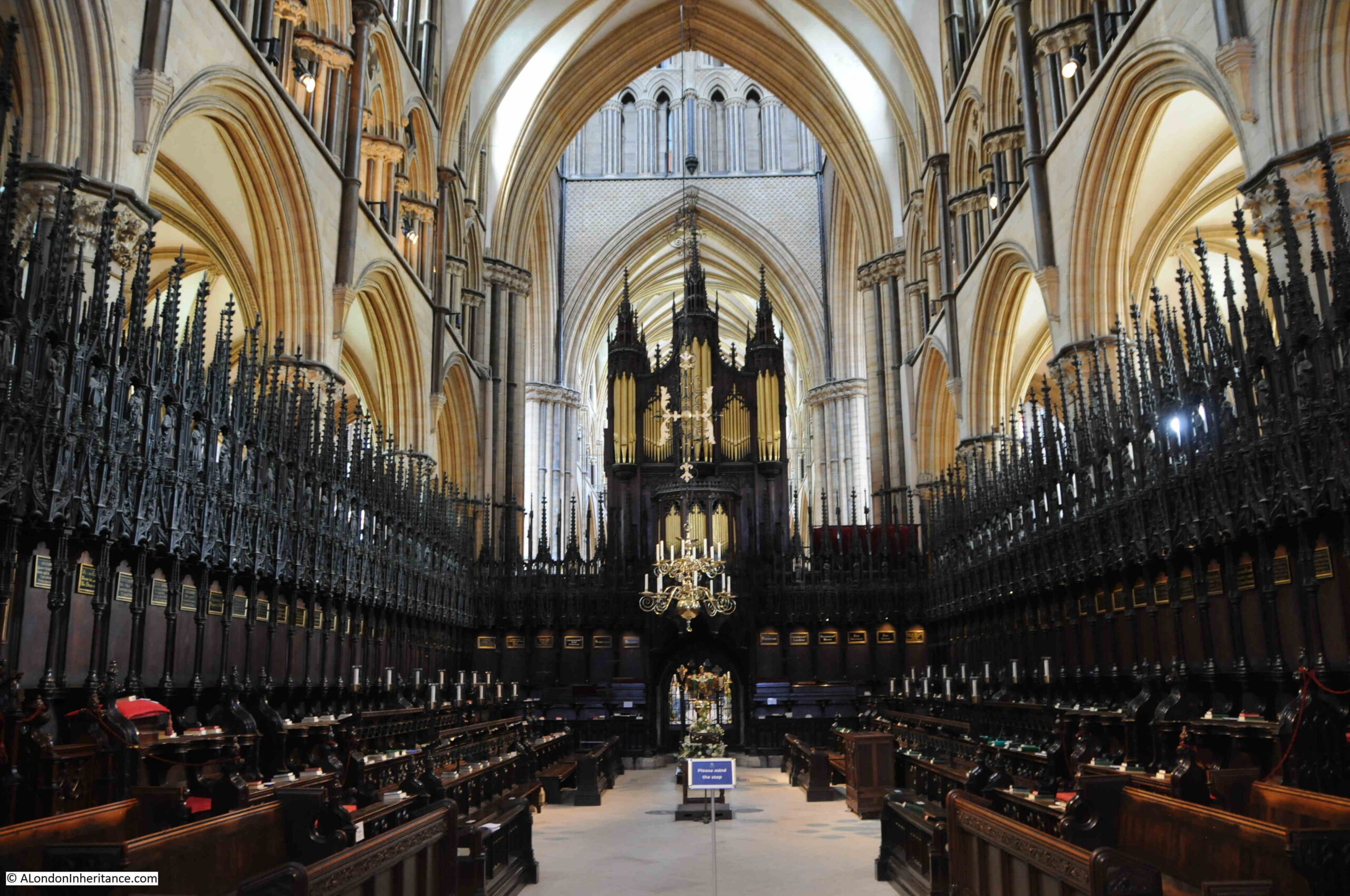
The following photo is looking west along the Nave. Whilst the Nave is a wonderful example of 12th century architecture, the key feature of this part of the cathedral is the 13th century painted wood ceiling:

Peterborough Cathedral

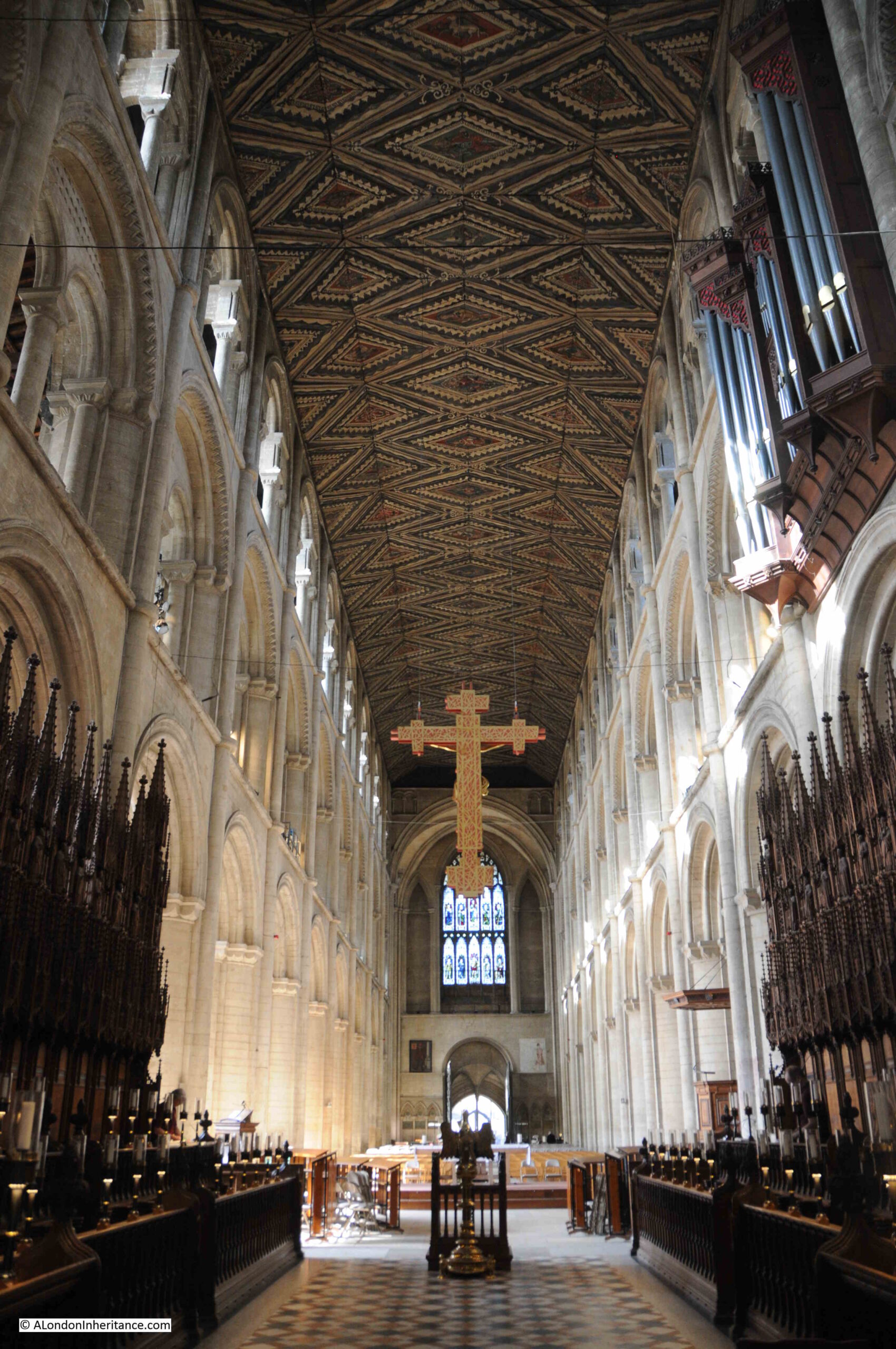
Although is has been painted a few times in the last 800 years, the wooden structure, style and carving is original, and makes the ceiling a unique example of such a ceiling within England, and indeed is one of only four wooden ceilings of this period surviving across the whole of Europe.

Peterborough was bombed during the last war, and the cathedral had a narrow escape from incendiary bombs, which would have devastated the wooden ceiling. As with St. Paul’s Cathedral in London, a team of fire watchers protected the cathedral in Peterborough.

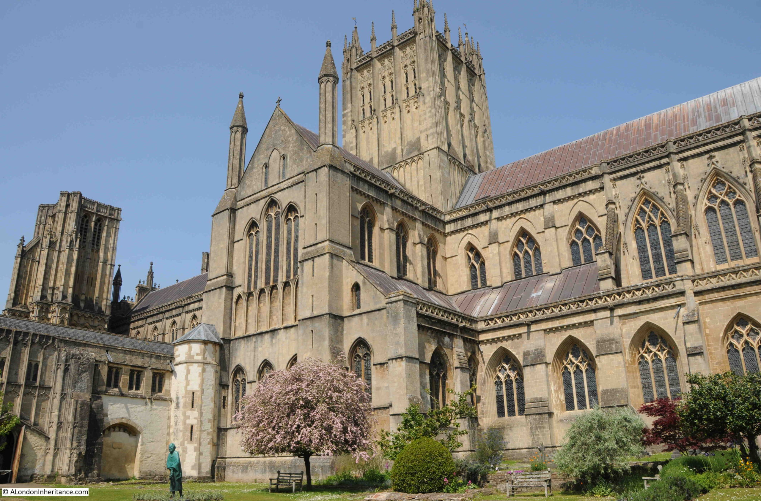
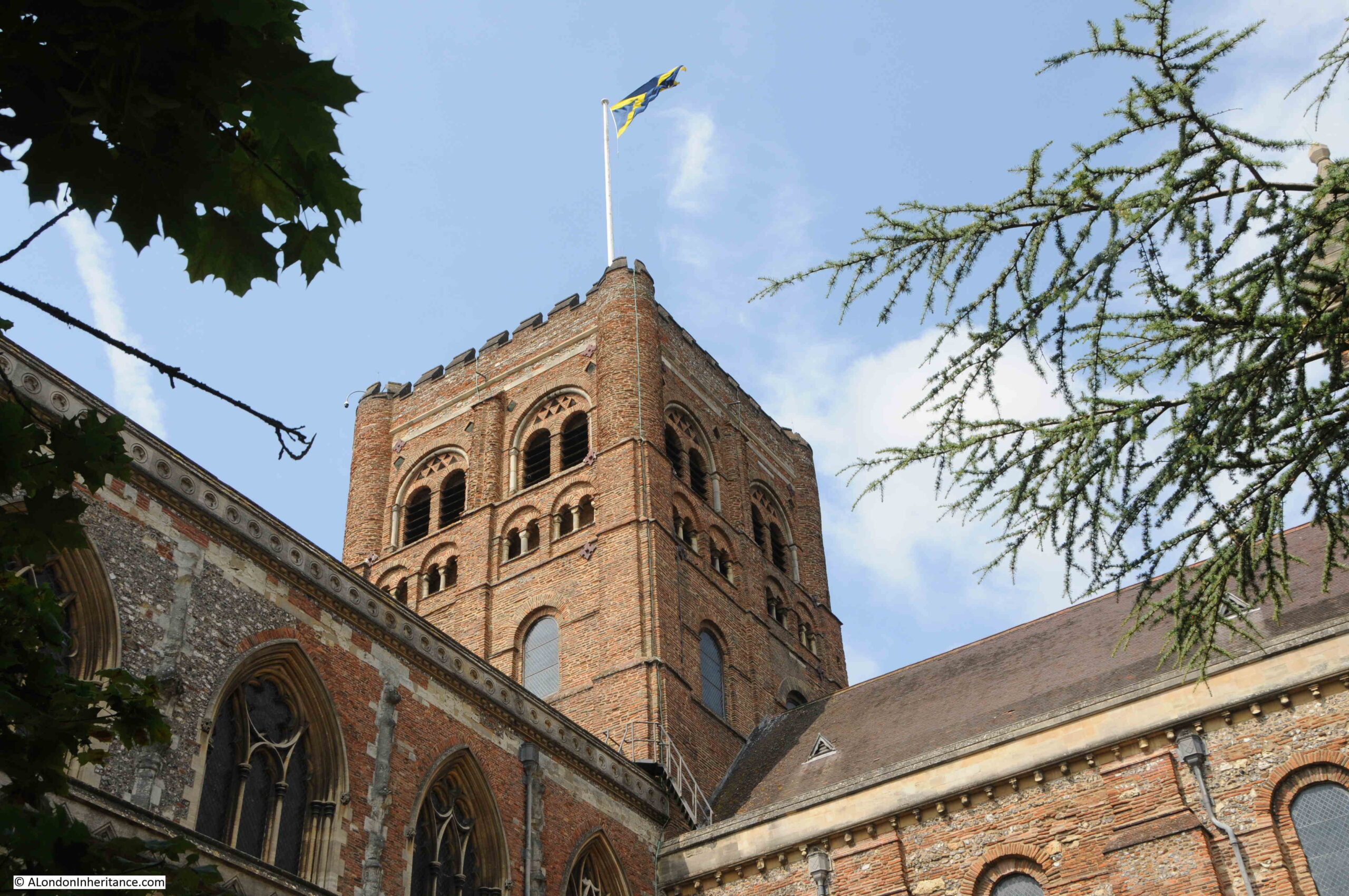
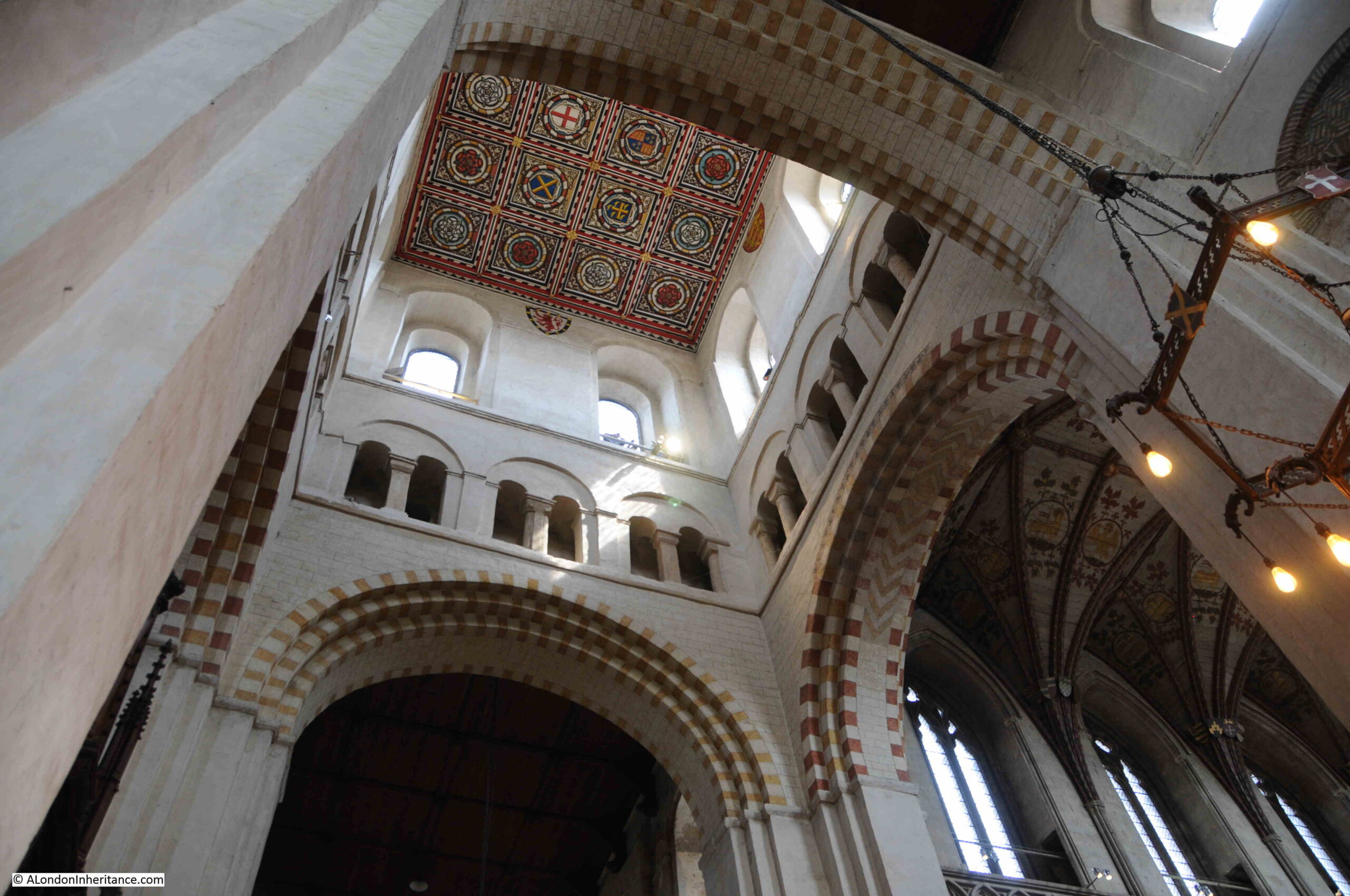
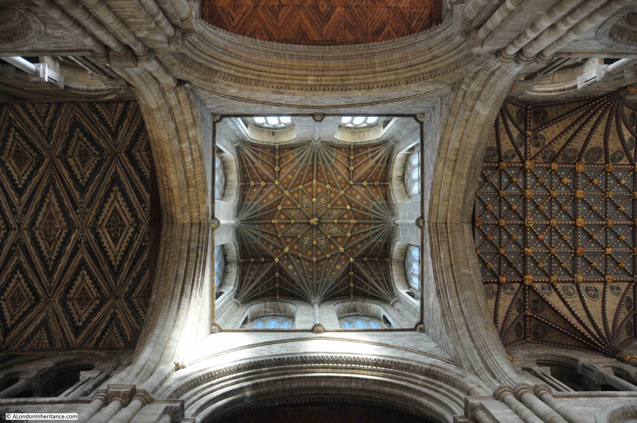
As can be seen from outside, the cathedral has a relatively short central tower.

Many medieval cathedrals did have much higher towers and steeples, however the weight of these was often too much for the supporting structure and foundations, or often were badly damaged by high winds

The original 12th century tower was much higher. Just a couple of hundred years later in the 14th century, the tower was lowered due to stability problems.

Over the following five hundred years, the weight of the tower continued to cause stability problems and by the mid 19th century there were wide cracks developing in the pillars supporting the tower.

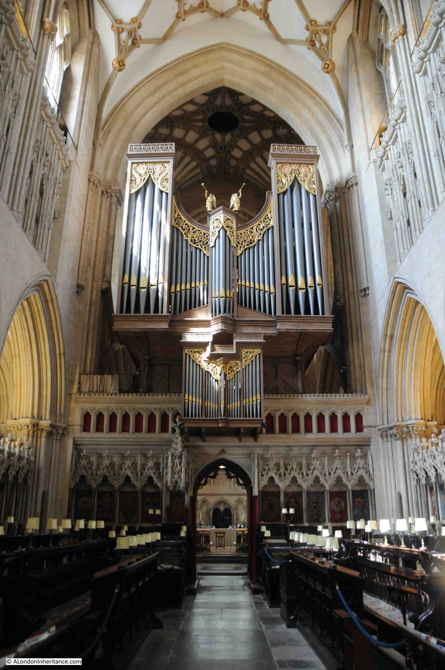
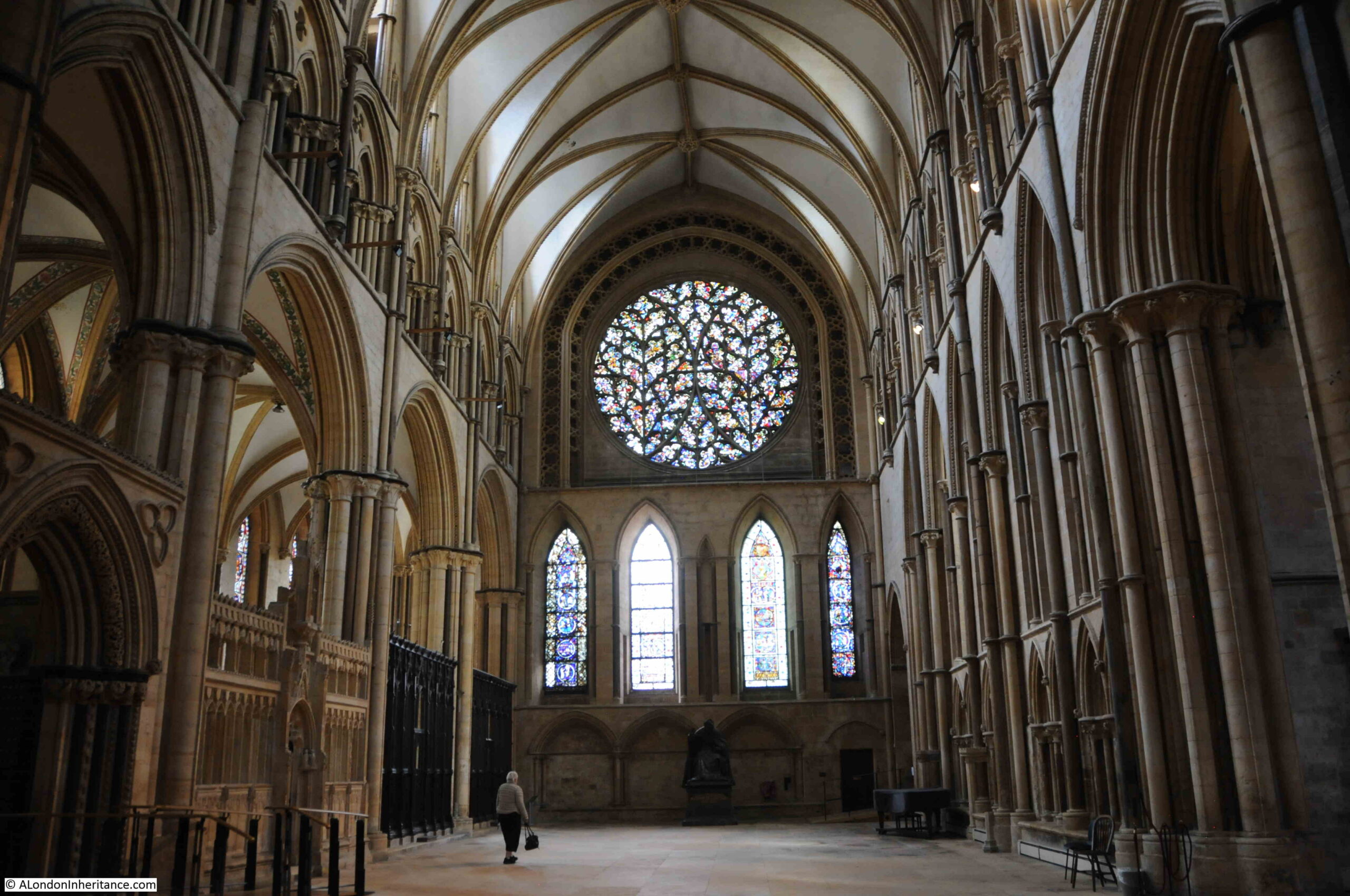
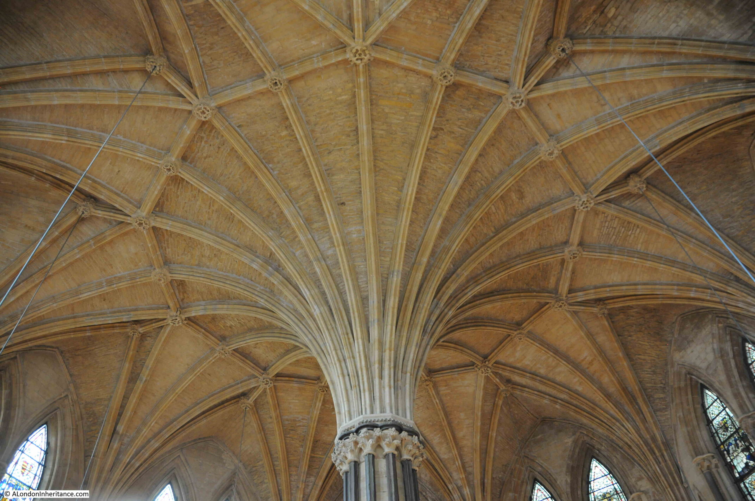
This required urgent work, and the tower was dismantled and rebuilt, and whilst not that dramatic a structure from outside, looking up at the tower from inside the cathedral we can get a wonderful view of the supporting pillars, the tower, windows (the tower is in the form of a Lantern Tower), and the decorated ceilings:

Peterborough Cathedral

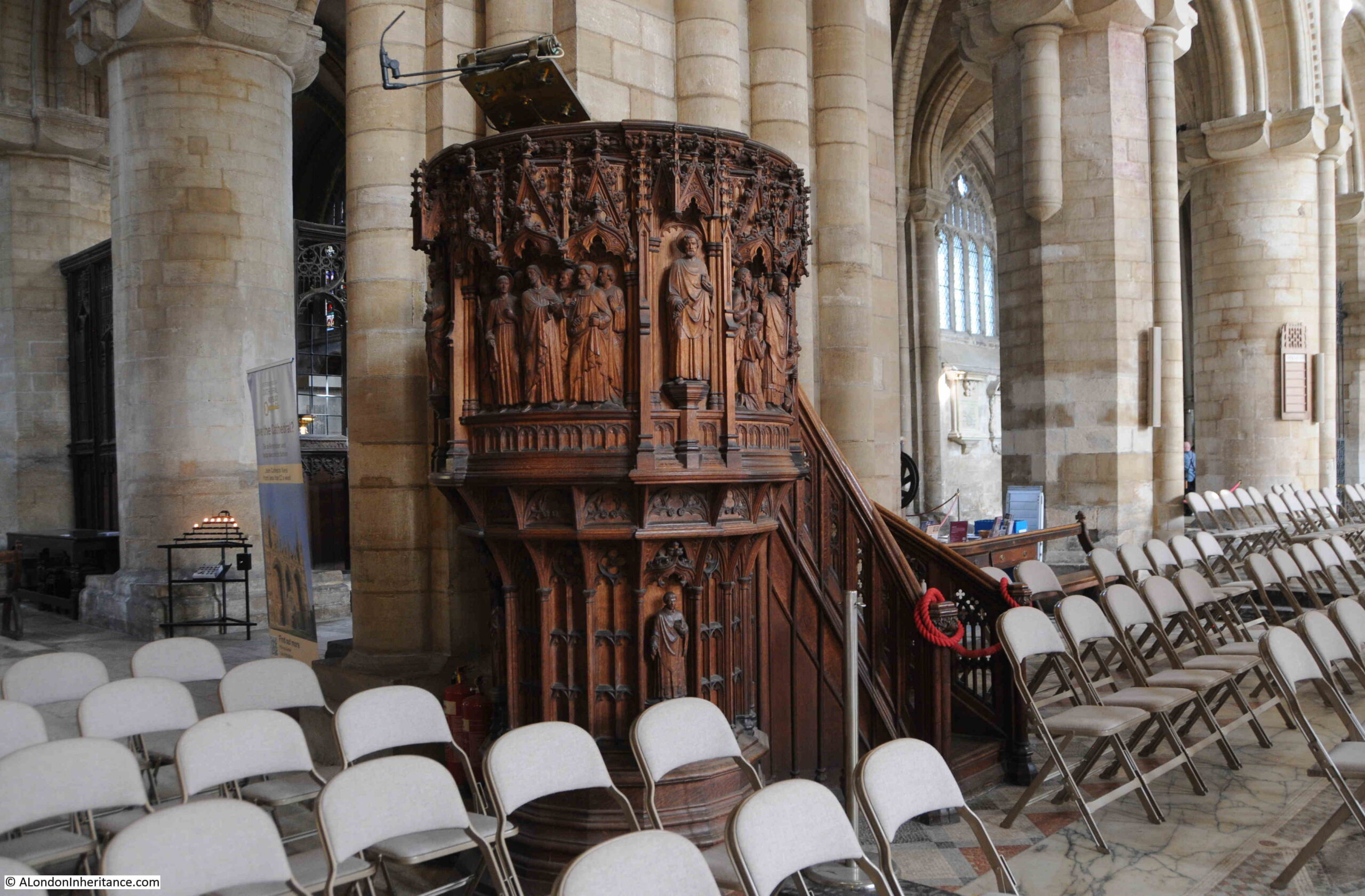
The ornately carved wooden pulpit dates from restoration works in the cathedral during the 1880s:

Peterborough Cathedral

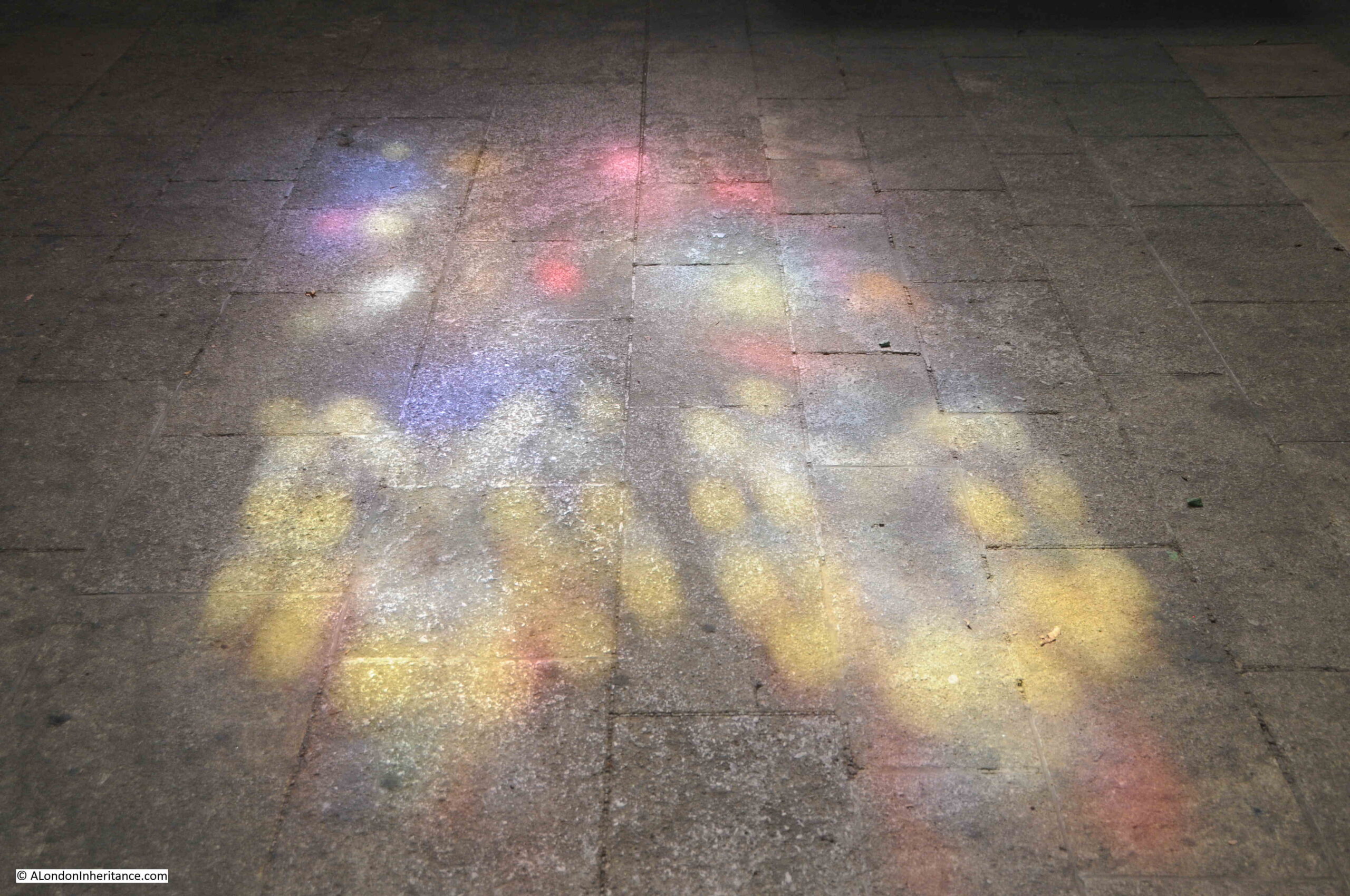
Cathedrals take on a different atmousphere at different times of the year, and in different weathers.

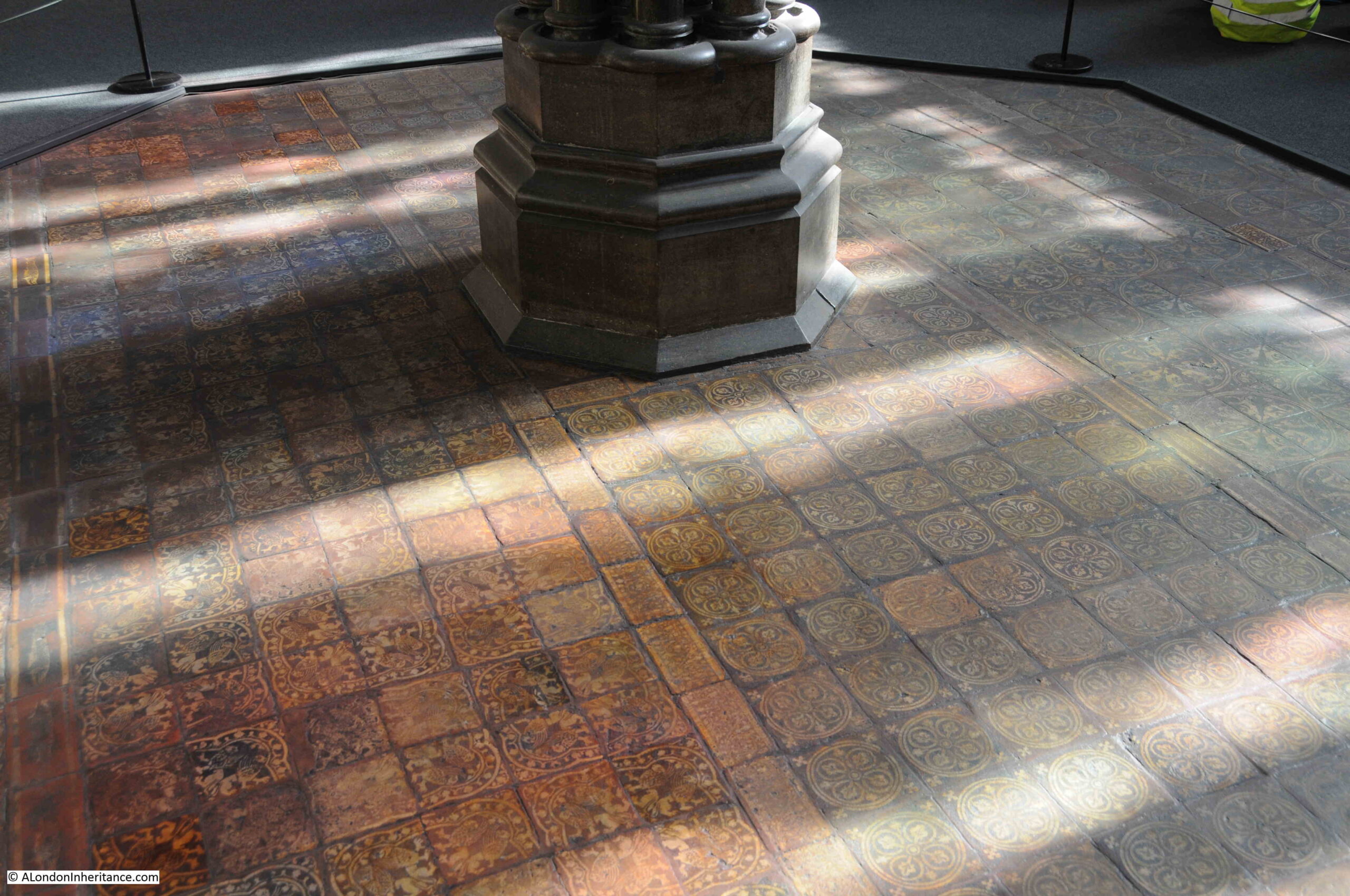
September sunshine brought plenty of light into the building, and every so often, on the stone floor, on medieval pillars, an array of coloured light filtered through the stained glass windows:

Peterborough Cathedral

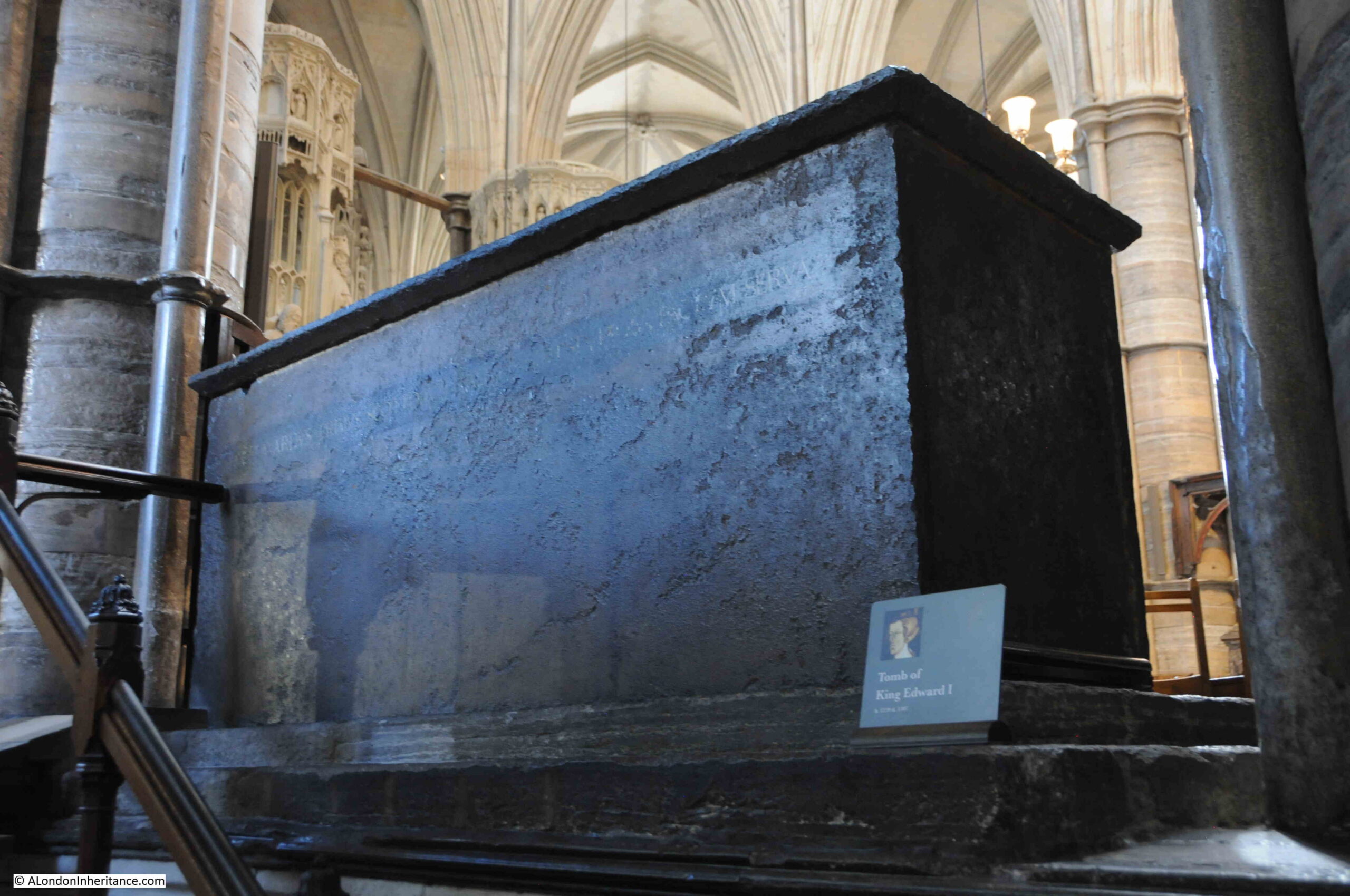
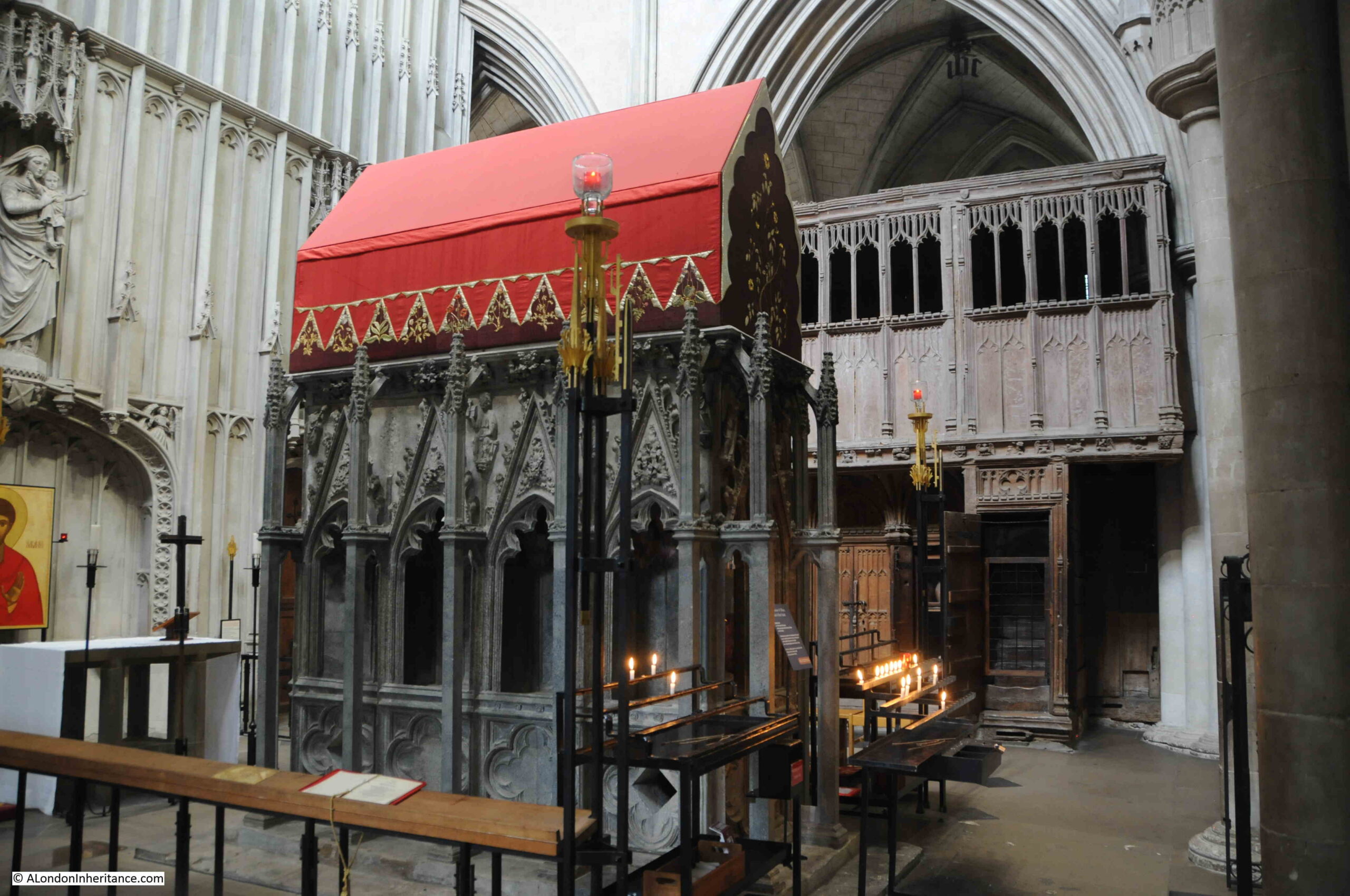
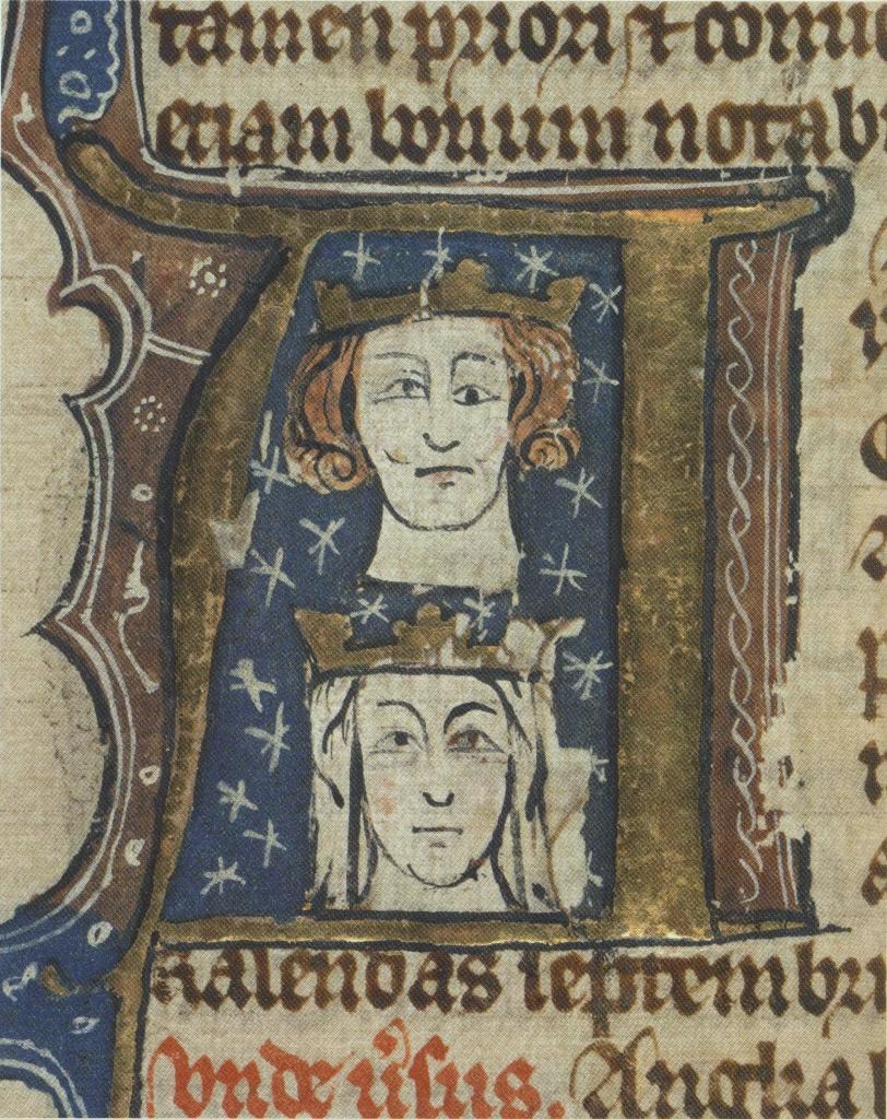
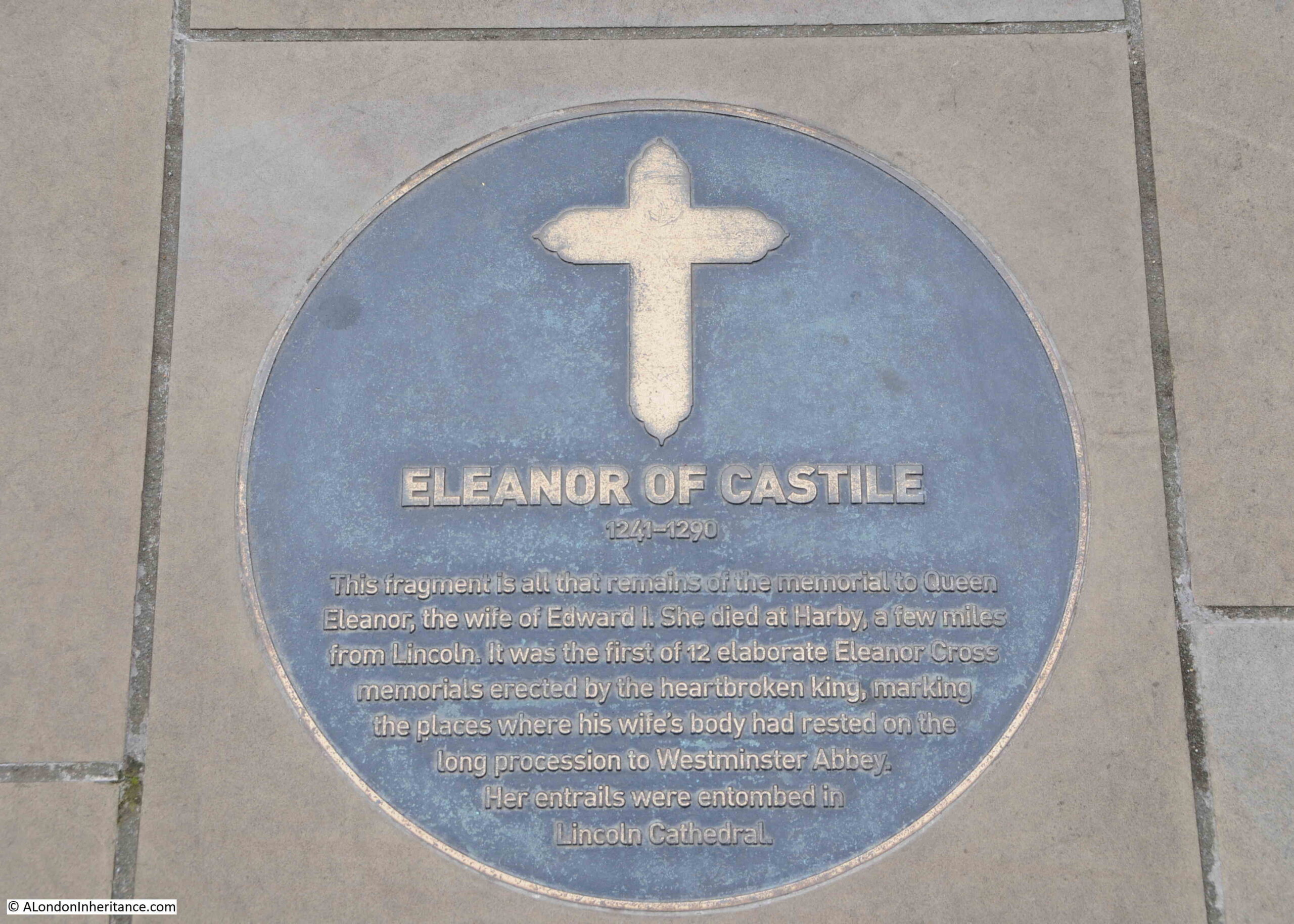
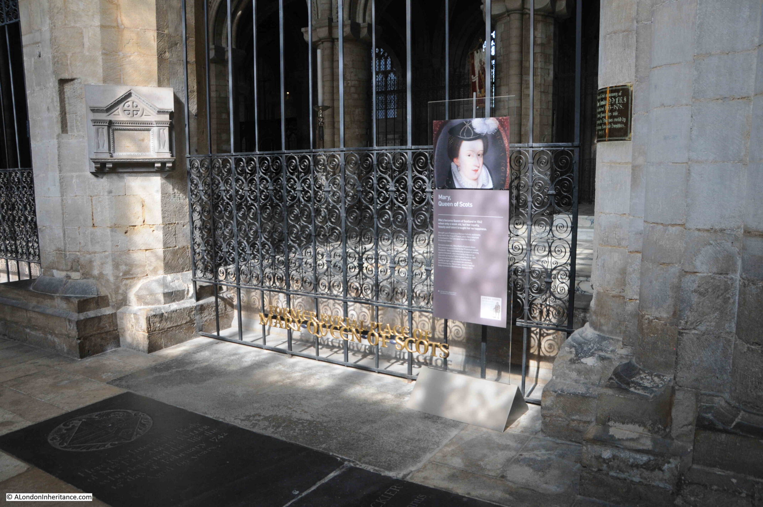
The original burial place of Mary Queen of Scots was in Peterborough Cathedral.

Mary was only 6 days old when she inherited the throne of Scotland after the death of her father, James V. For much of her early life Scotland was governed by Regents, and Mary lived in France and raised as a Catholic as she was seen to be at risk from the English.

Even after returning to Scotland and taking the throne, governing a mainly Protestant country did not go well. She was imprisoned and forced to abdicate. Mary fled to England, hoping to get protection from Elizabeth I, however Mary was also considered a legitimate claimant to the English throne, so Elisabeth had her imprisoned in a number of different places across the country.

After over 18 years of imprisonment, Mary was found guilty of attempting to assassinate Elizabeth, and beheaded in 1587 at Fotheringhey Castle in Northamptonshire.

She was buried in Peterborough Cathedral a few months later in 1587, and remained in Peterborough until 1612, when her son who was now James I arranged for her body to be reburied in Westminster Abbey.

The location of her burial in Peterborough Cathedral is still marked:

Mary Queen of Scots

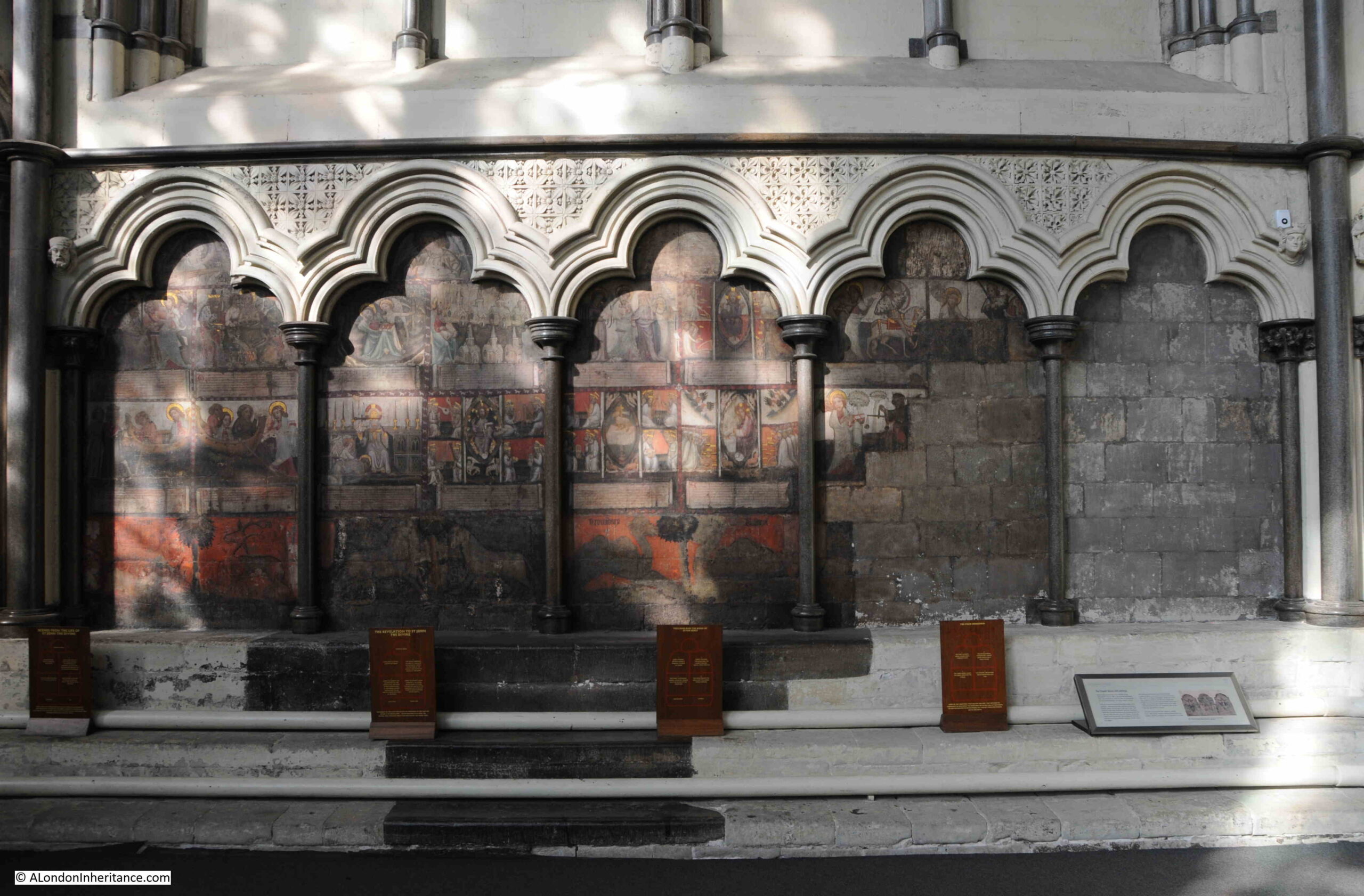
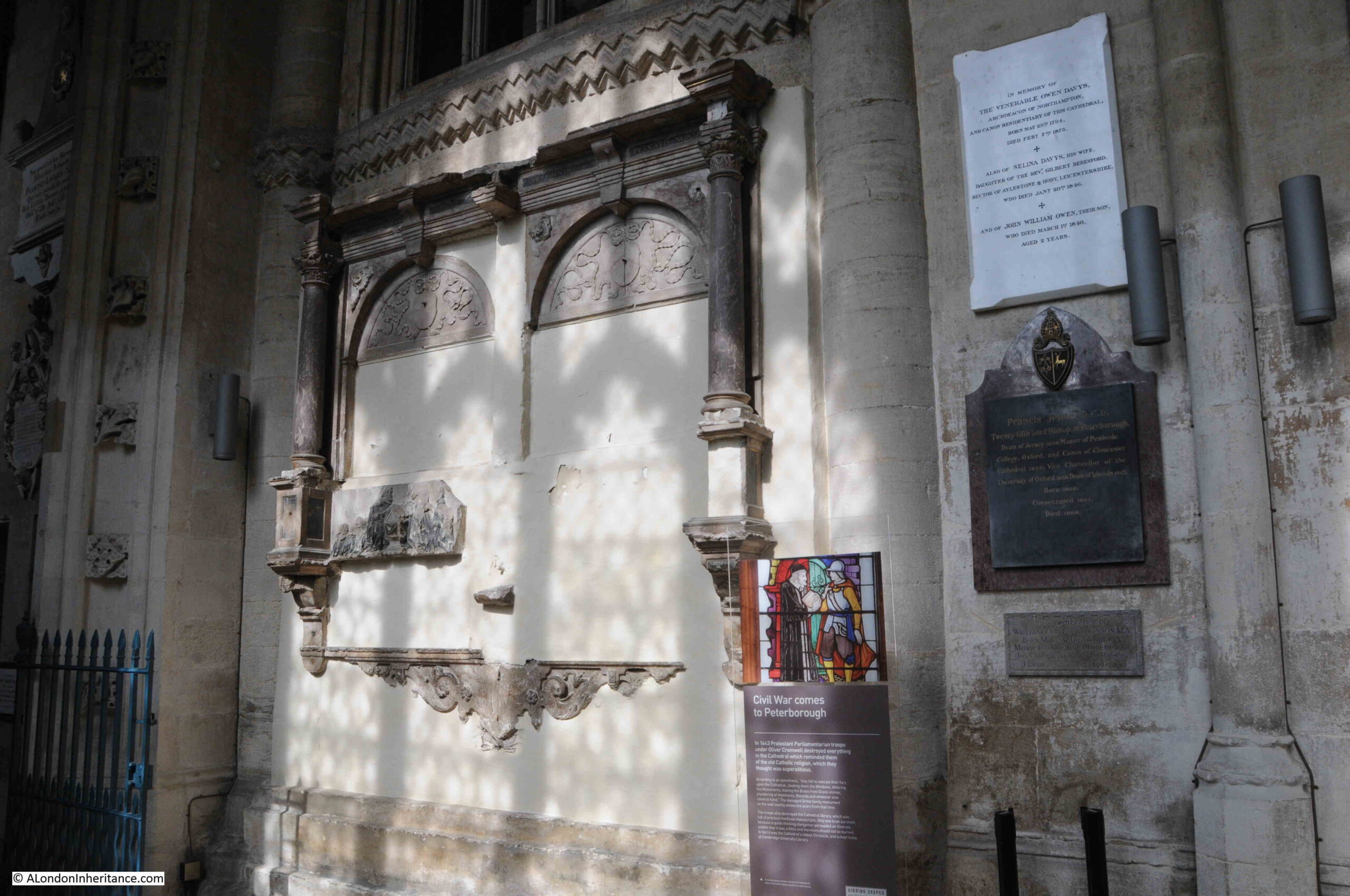
Peterborough Cathedral suffered badly during the English Civil War when the Parliamentary soldiers under Oliver Cromwell entered the town.

The cathedral was ransacked, and everything that could be associated with the old Catholic faith was destroyed. The cathedral’s library was also destroyed with the exception of a single book, the story being told at the cathedral that a clergyman persuaded an illiterate solider that it was a bible and should not be burnt.

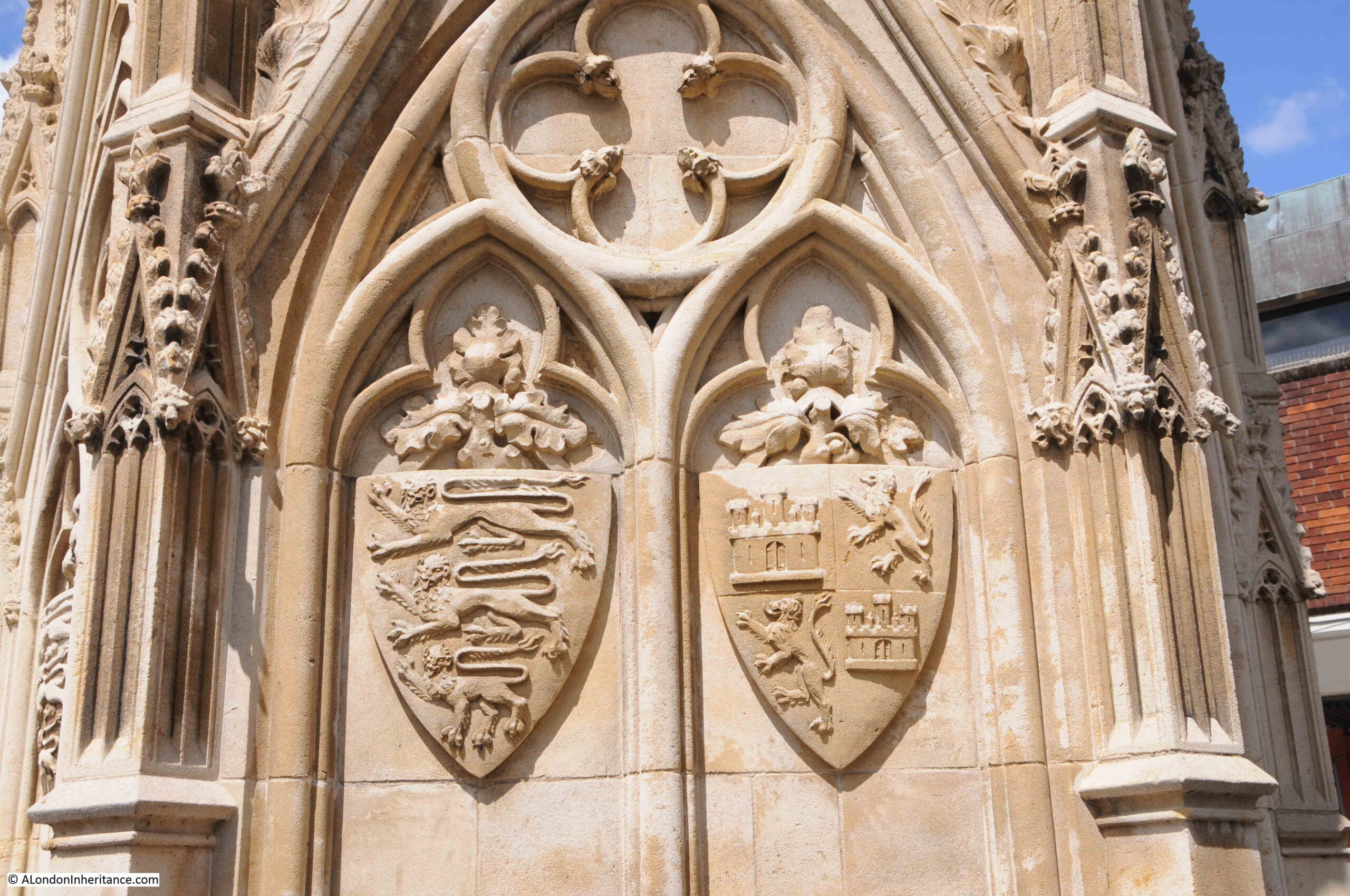
Parts of the cathedral still show the damage from the Civil War, including the remains of a family monument shown in the photo below:

Civil war damage

There is nothing visible of the early monastery built on the site of the present cathedral, however there is a single stone on display. This is the Hedda Stone and dates from around the year 800, and may have marked the grave of an Anglo-Saxon saint or king:

The Hedda Stone

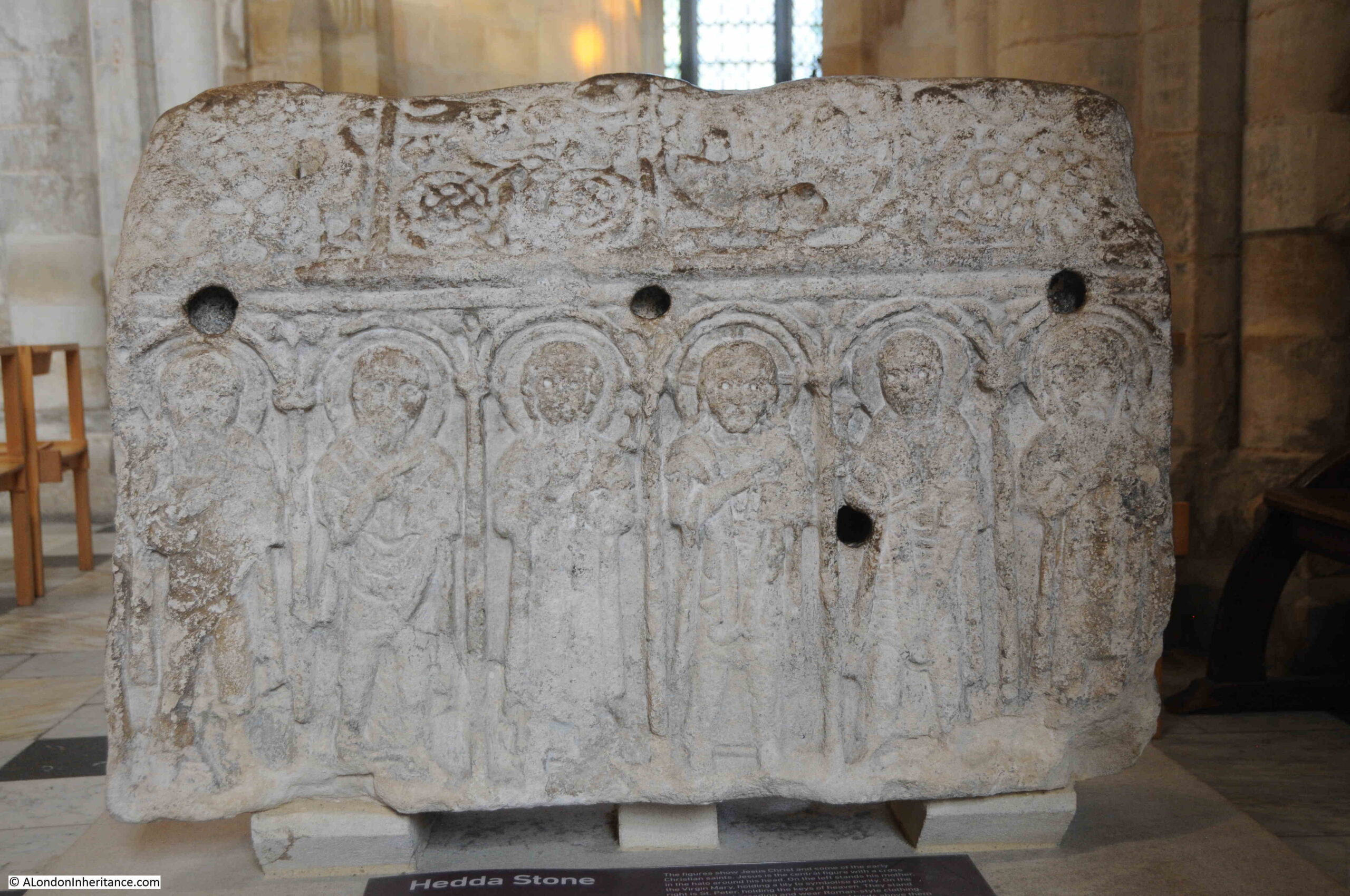
The stone is solid, so would not have held any relics or bones, and may have been part of a larger feature. It does provide an indication of the degree of decoration that may have featured in an early 9th century monastary.

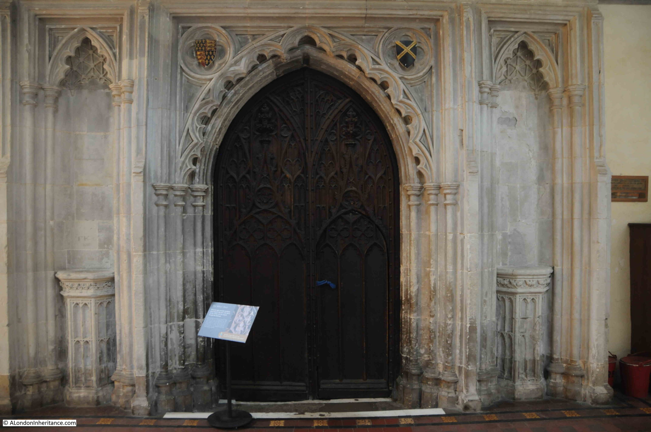
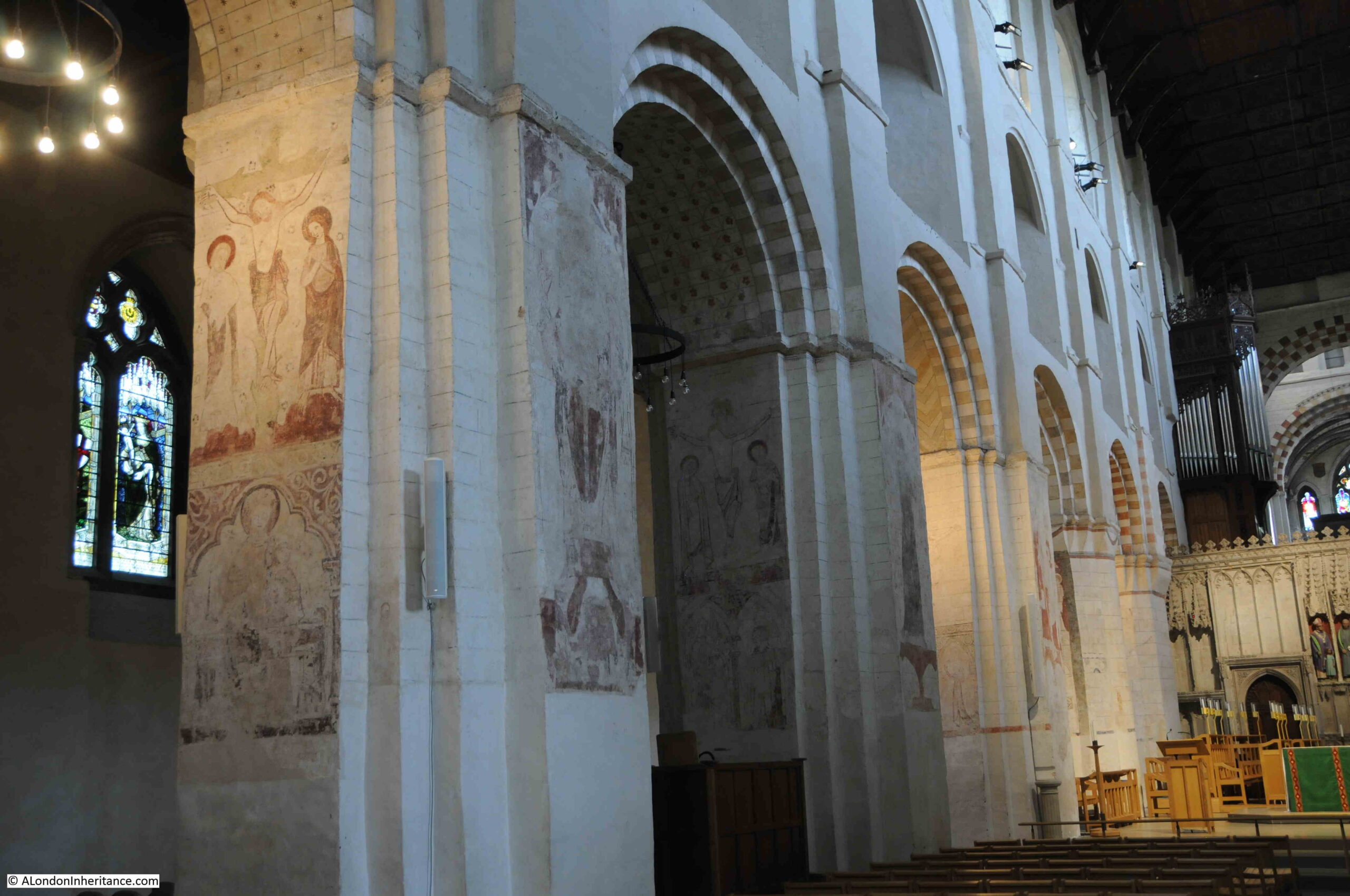
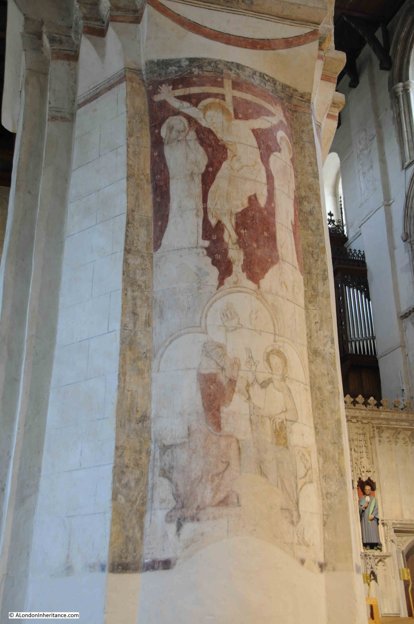
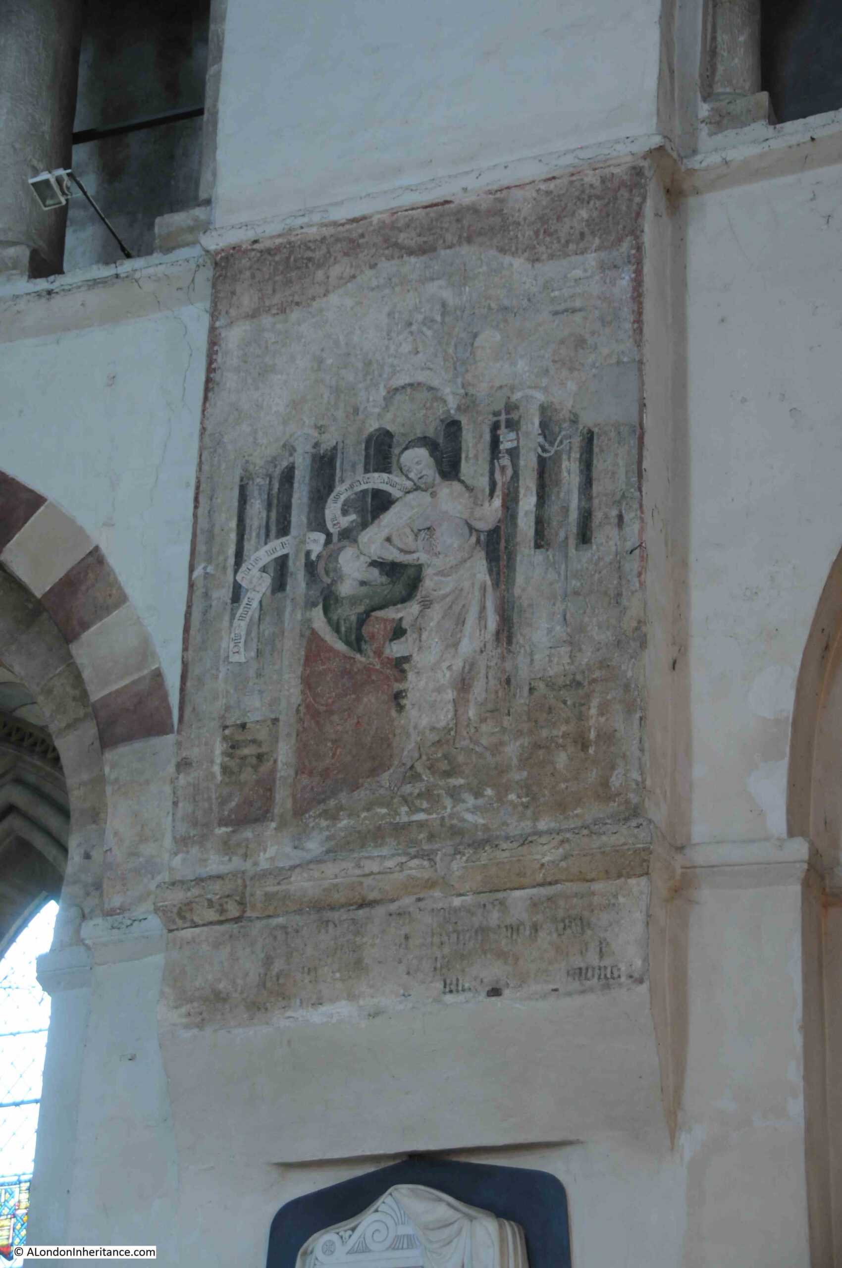
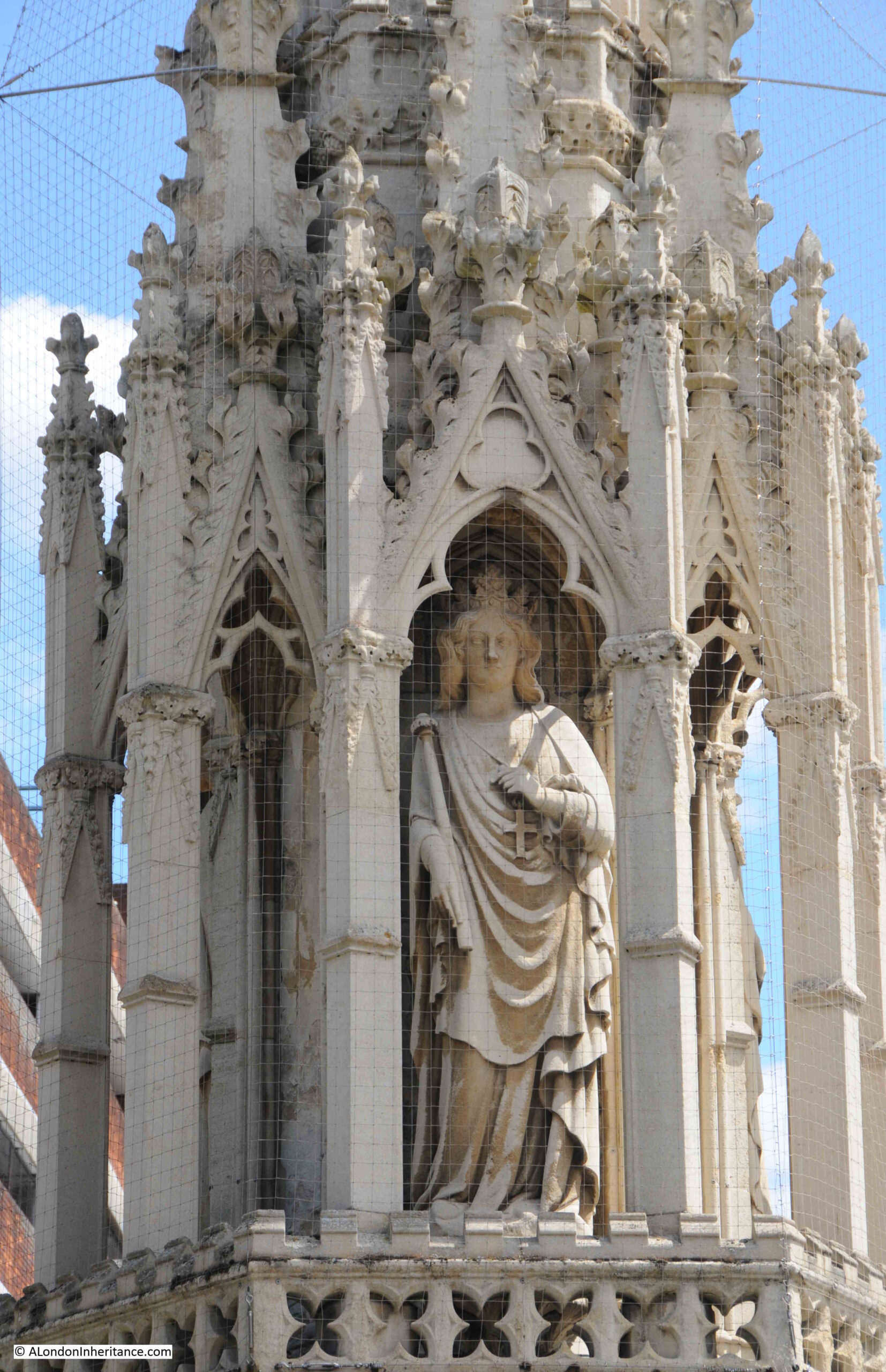
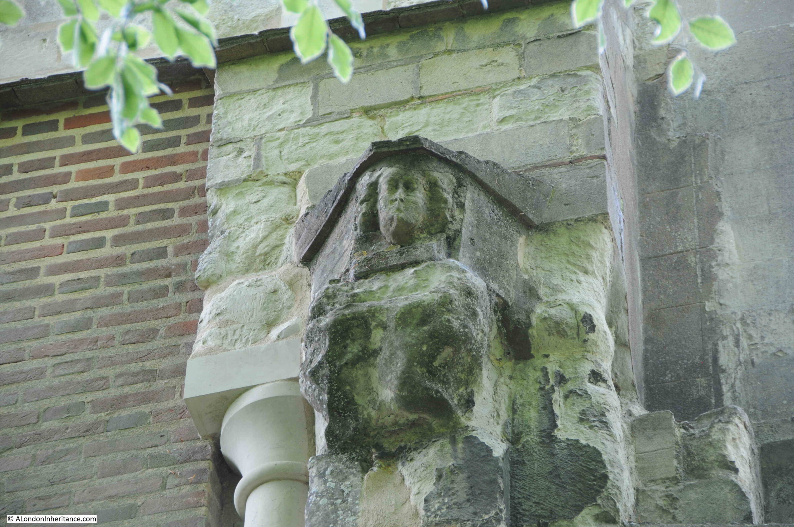
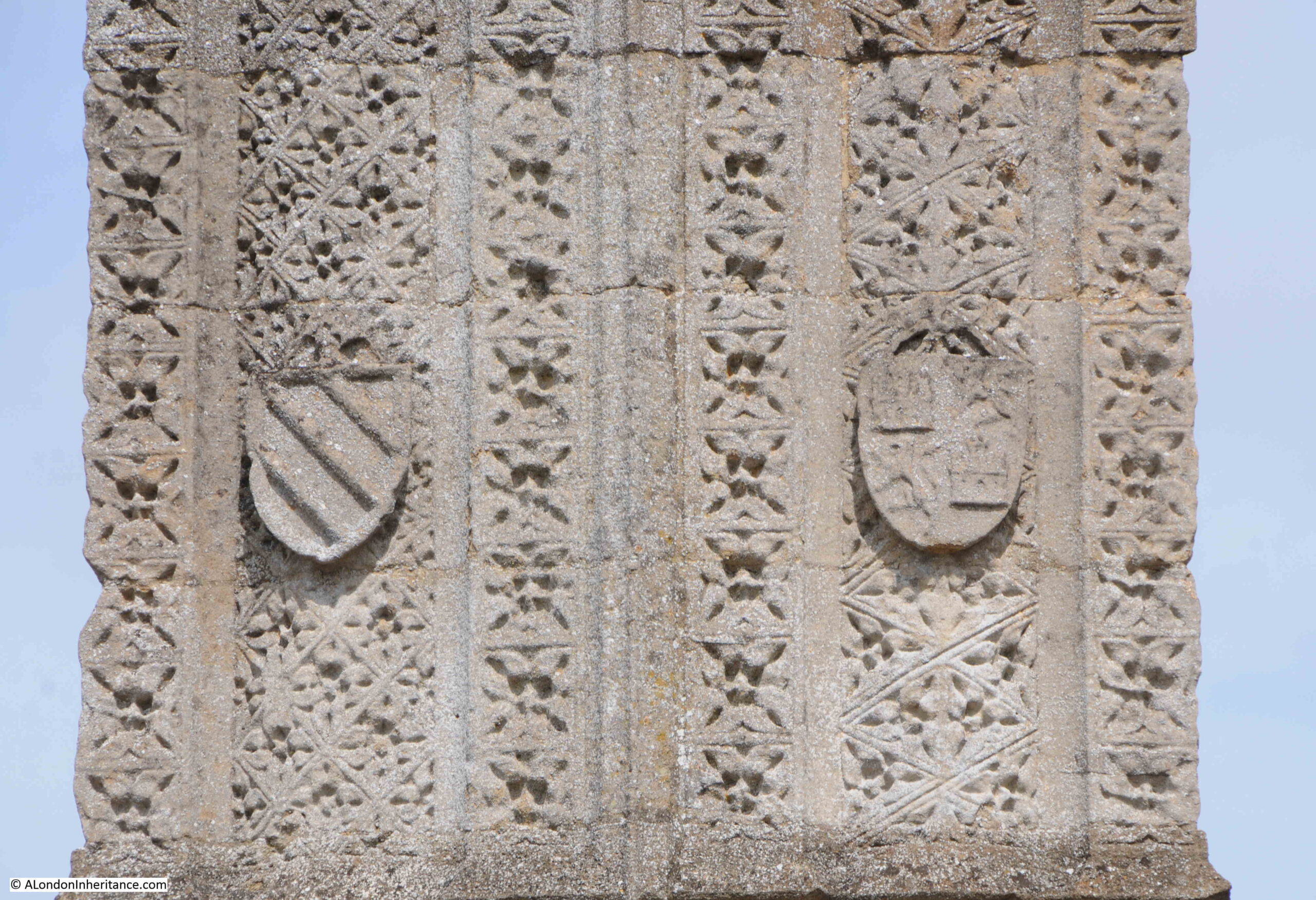
As with many cathedrals, many of those who have passed through the building in previous centuries have left their mark:

Graffiti

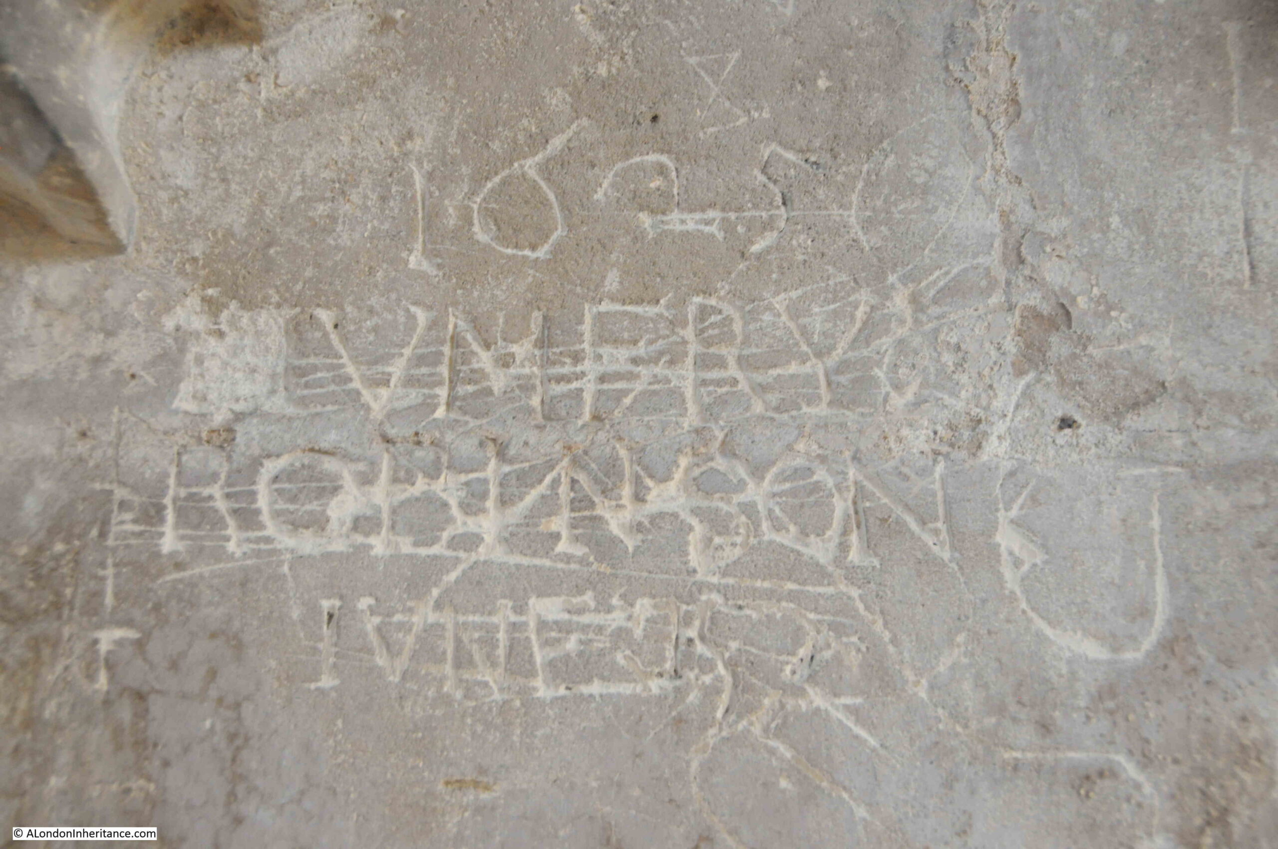
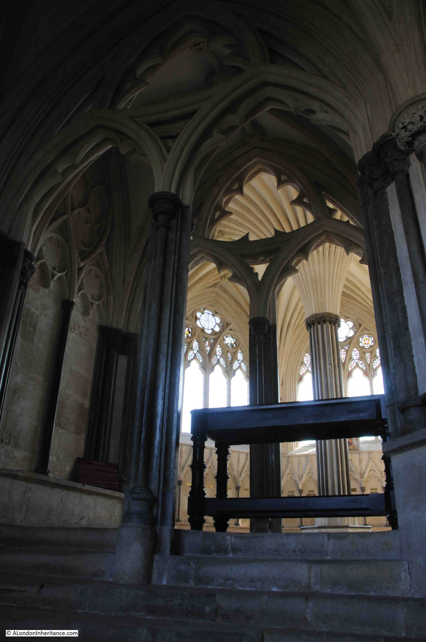
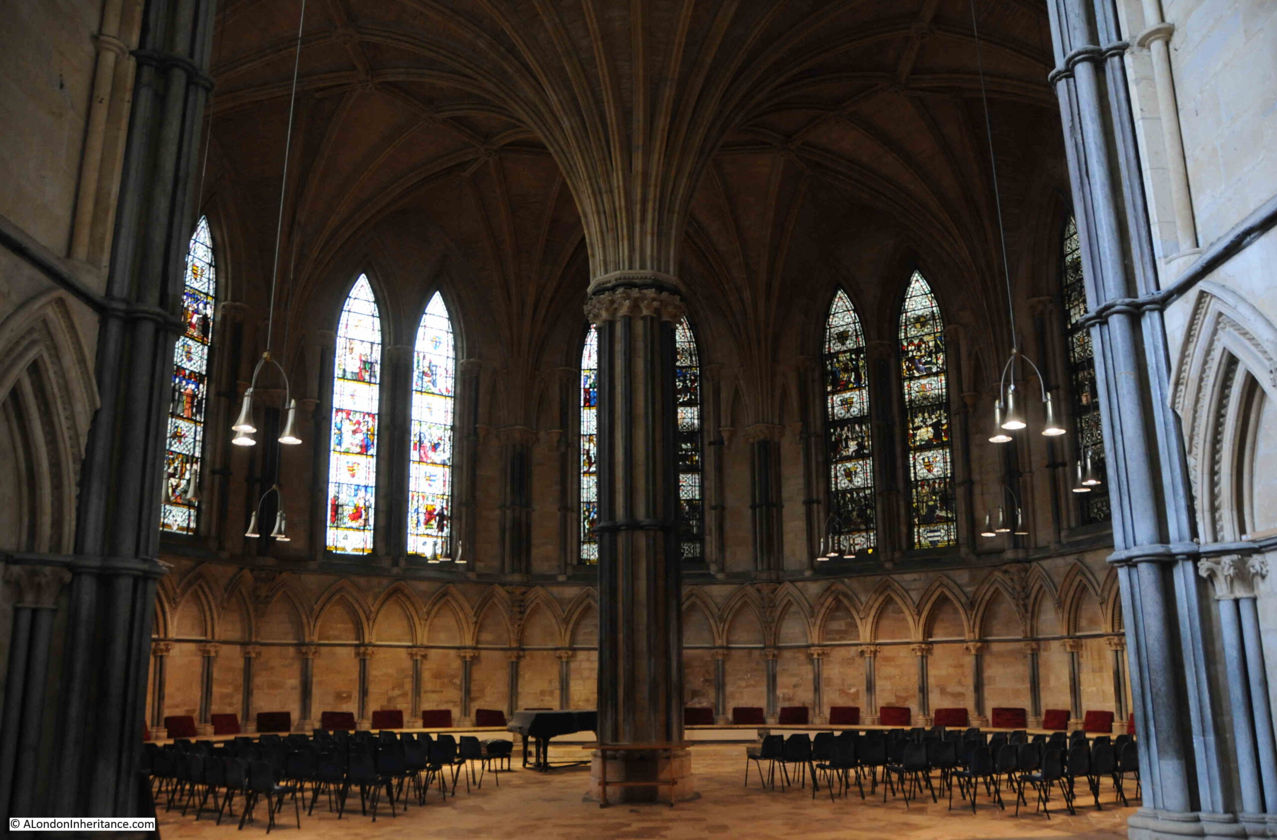
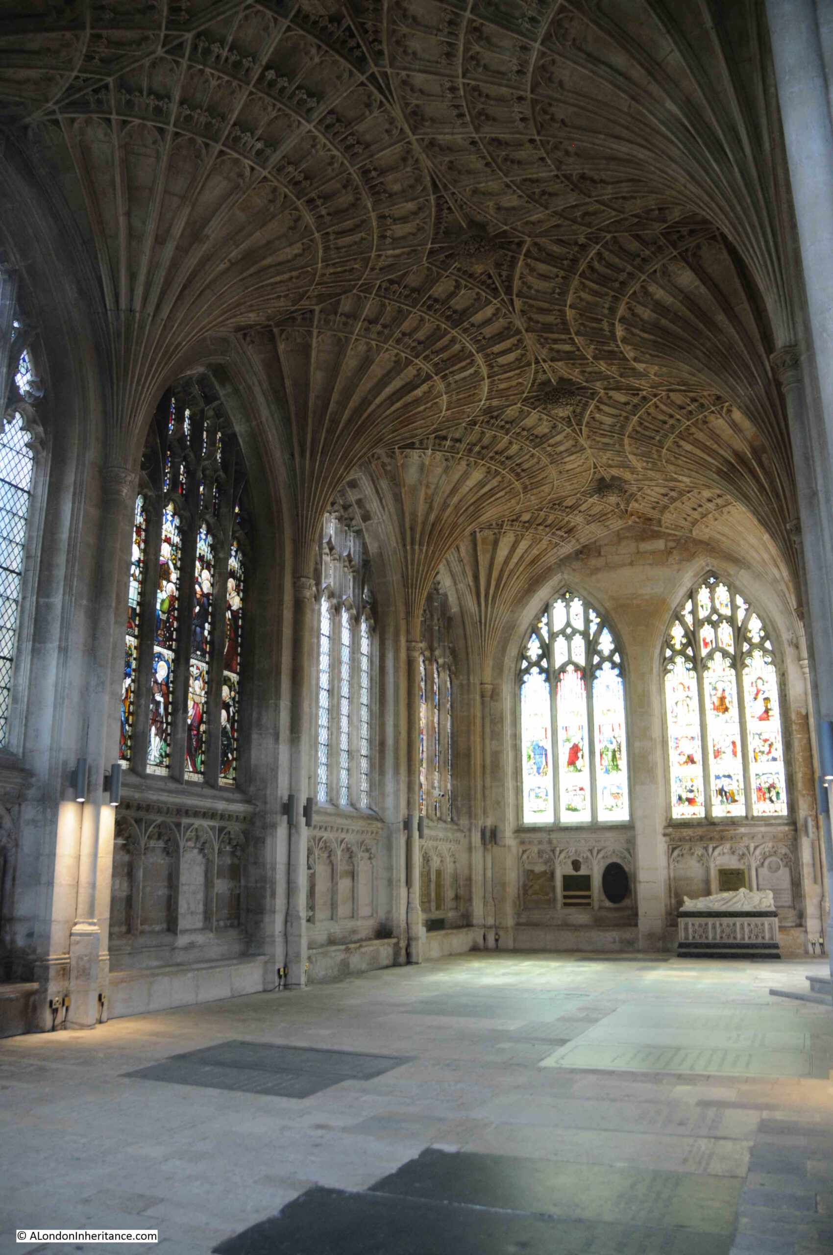
Between 1496 and 1509 there was an extensive programme of work across the cathedral, and the eastern end of the building saw an extension, which is still known as the “New Building”, which is rather impressive for a building that is 500 years old.

Perhaps the most impressive part of the New Building is the fine fan vaulting of the roof, which can be seen in the following photo:

Peterborough Cathedral

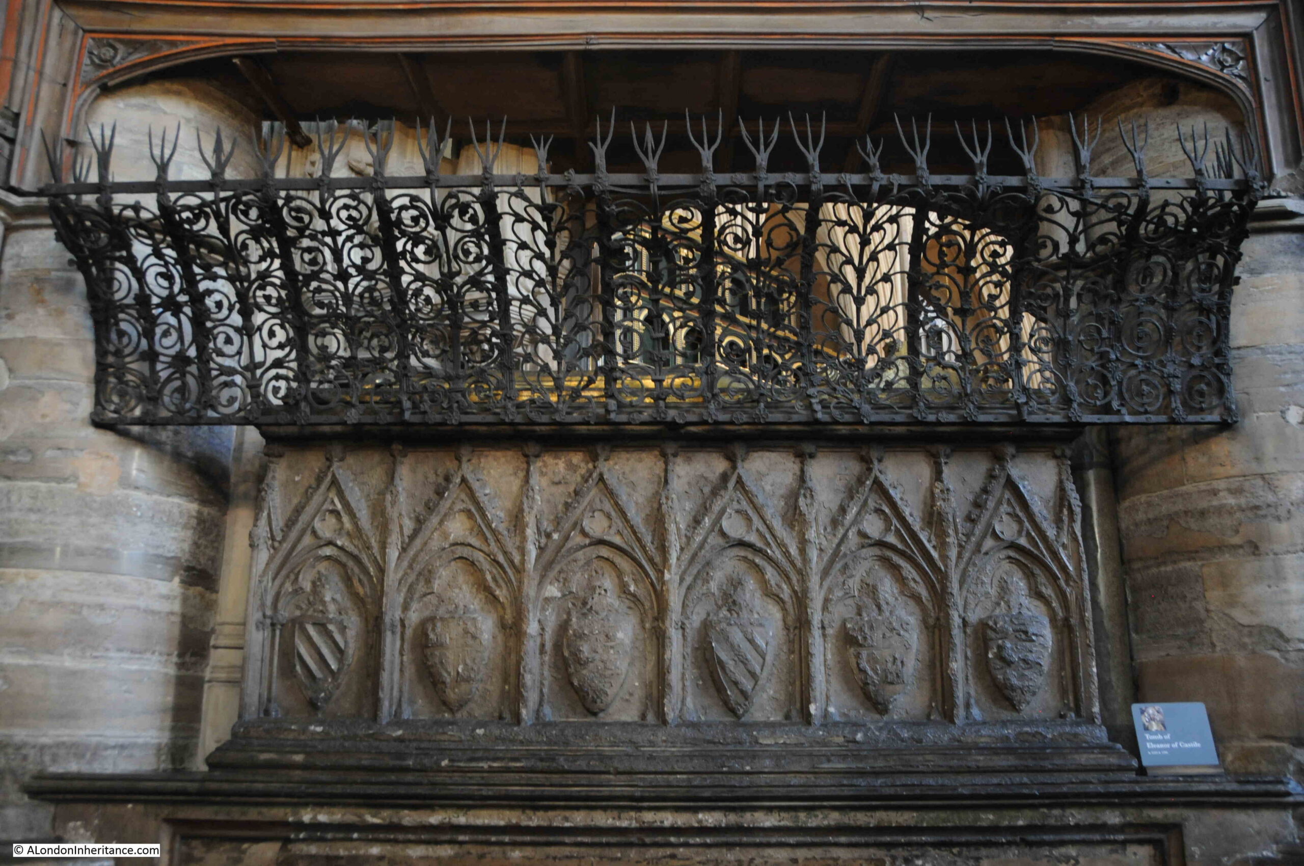
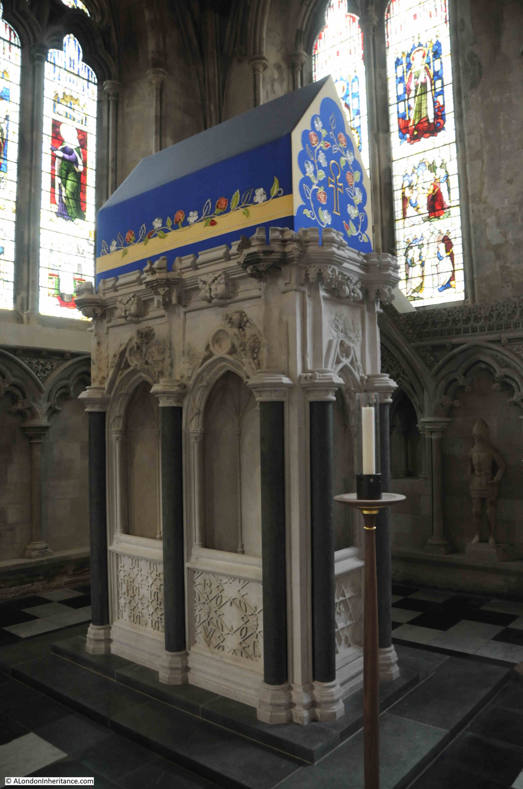
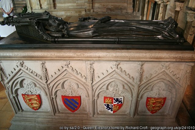
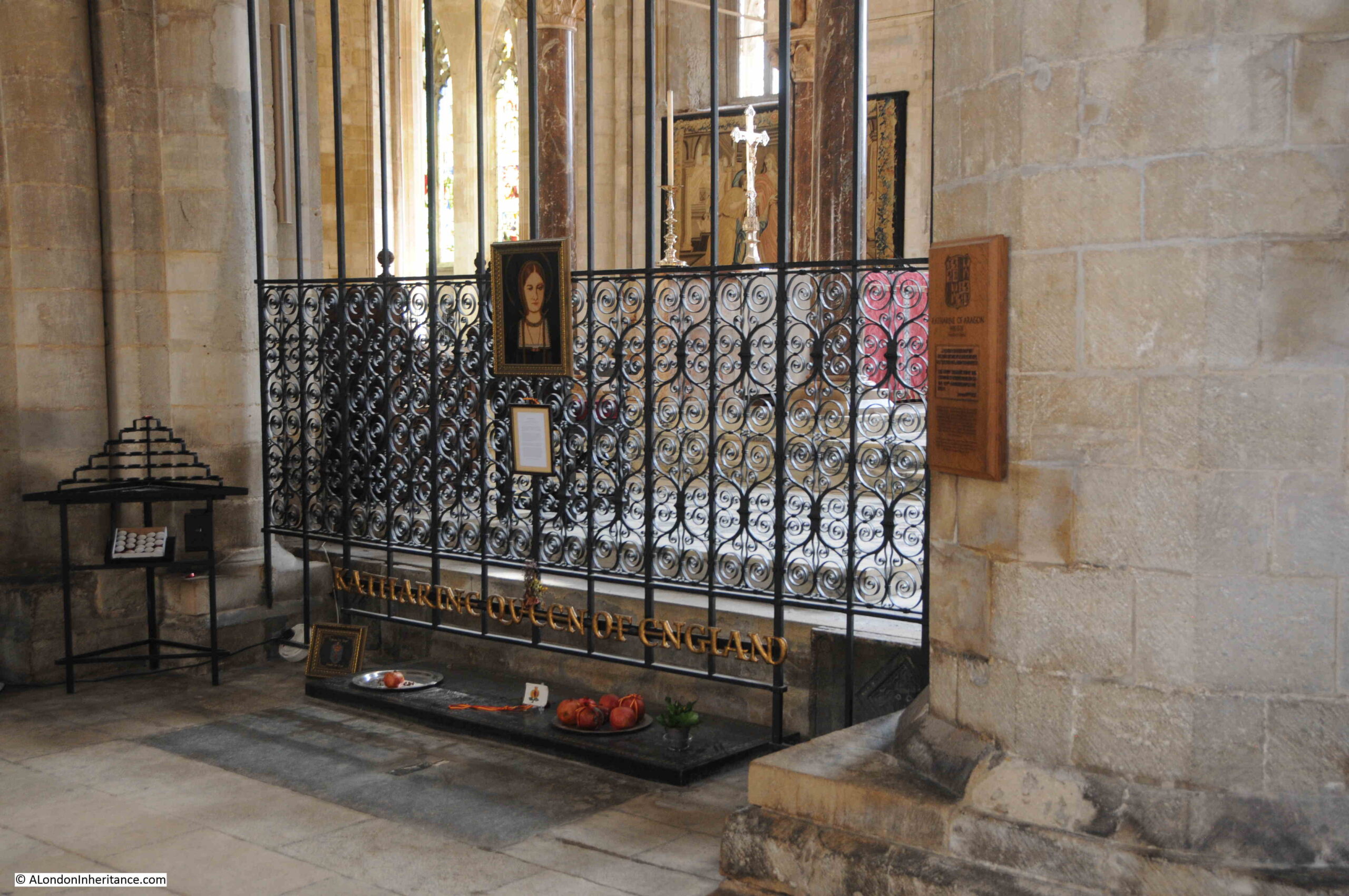
Peterborough Cathedral is where Henry VIII’s first wife, Katherine of Aragon was buried. Her tomb was destroyed during the Civil War, however her body was undisturbed and the grave is now marked by a marble slab and memorials to Katherine.

Katherine of Aragon's tomb

Katherine of Aragon was born in 1485 to King Ferdinand of Aragon and Queen Isabel of Castile. At the age of 16 she was married to Henry’s older brother Arthur, however after his death at a young age, his younger brother Henry was in line for the throne, and Katherine’s future looked uncertain.

Her future looked secure when she married Henry when he became King in 1509. She ruled when Henry was aboard, usually fighting in France, and must have been a formidable woman as she governed when a Scottish army was defeated at the Battle of Floden.

It was Katheryn’s apparent inability to provide Henry with a son that led to her downfall. Henry VIII was desperate for a son and heir, and whilst married to Katherine, his eye was already on Anne Boleyn.

Without the Pope’s approval, he could not divorce Katherine, so this led to the separation of the Church in England from the Church in Rome. Henry divorced, married Anne Boleyn, and Katherine was sent to stay in a number of houses across England, almost in a form a house arrest.

She died in Kimbolten Manor (to the south of Peterborough) in 1536, and following her death Henry refused a state funeral in London, so Katherine was buried in Peterborough Cathedral in a ceremony that included four bishops and six abbots, a large number of mourners, with the ceremony being lit by 1,000 candles.

Katherine of Aragon is at a point in history where it is interesting to speculate “what if?”. If she had given birth to a son, Henry would probably not have needed to divorce Katherine, and the separation with Rome and the dissolution of all the religious institutions across the country, and the establishment of the Church of England, may not have happened.

Henry did divorce though, and for almost 500 years, Katherine of Aragon’s body has rested in Peterborough Cathedral.

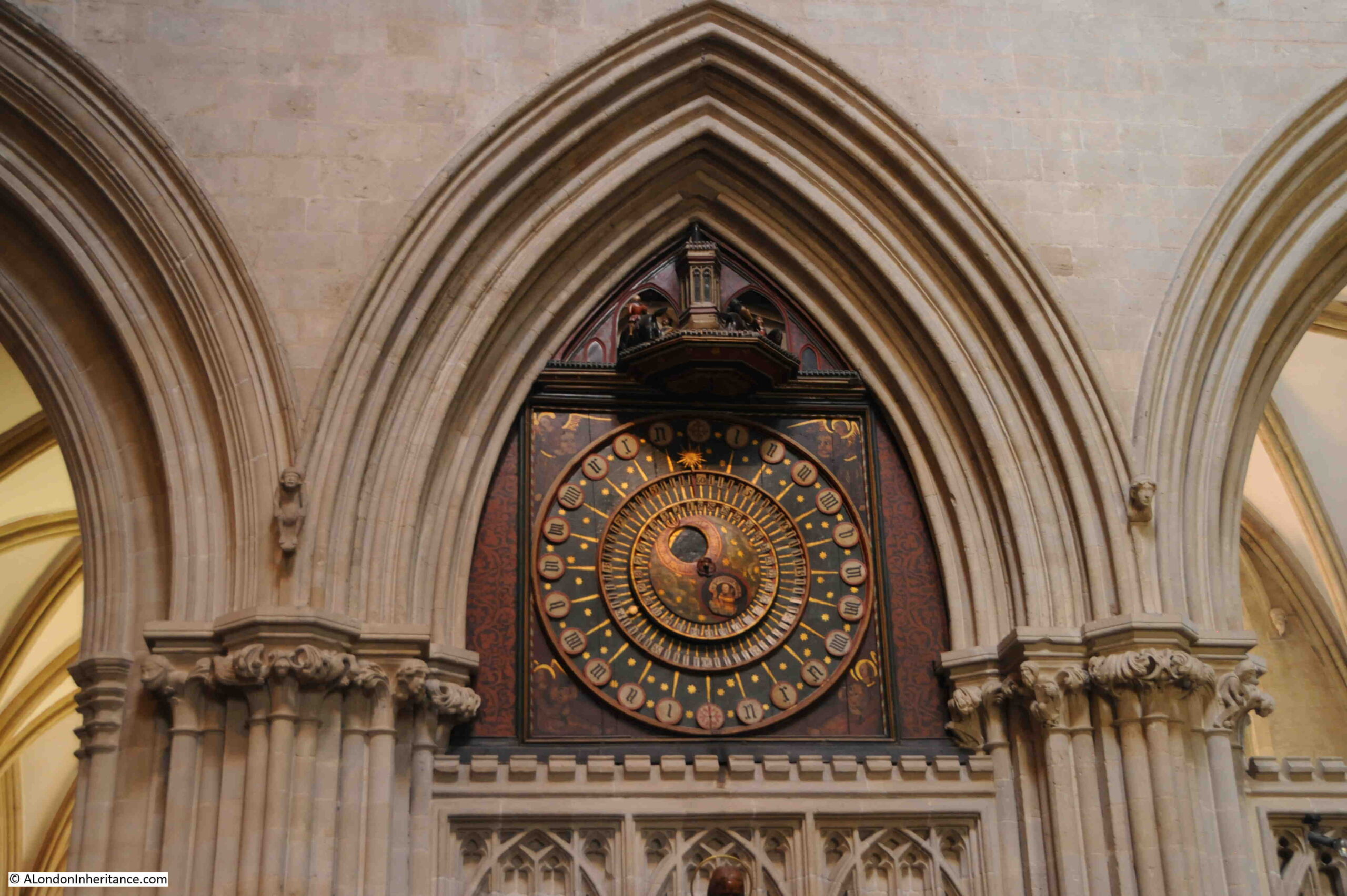
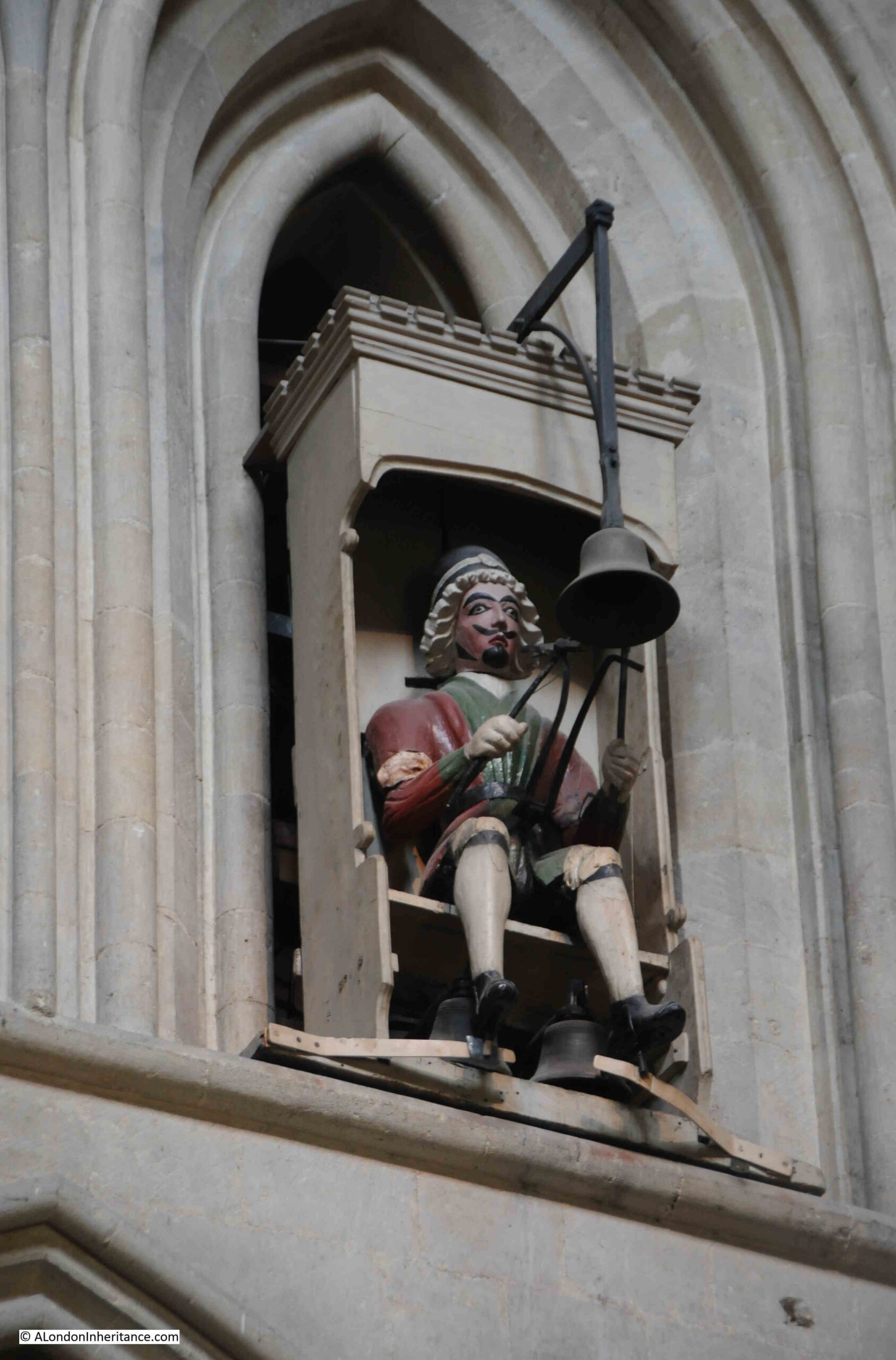
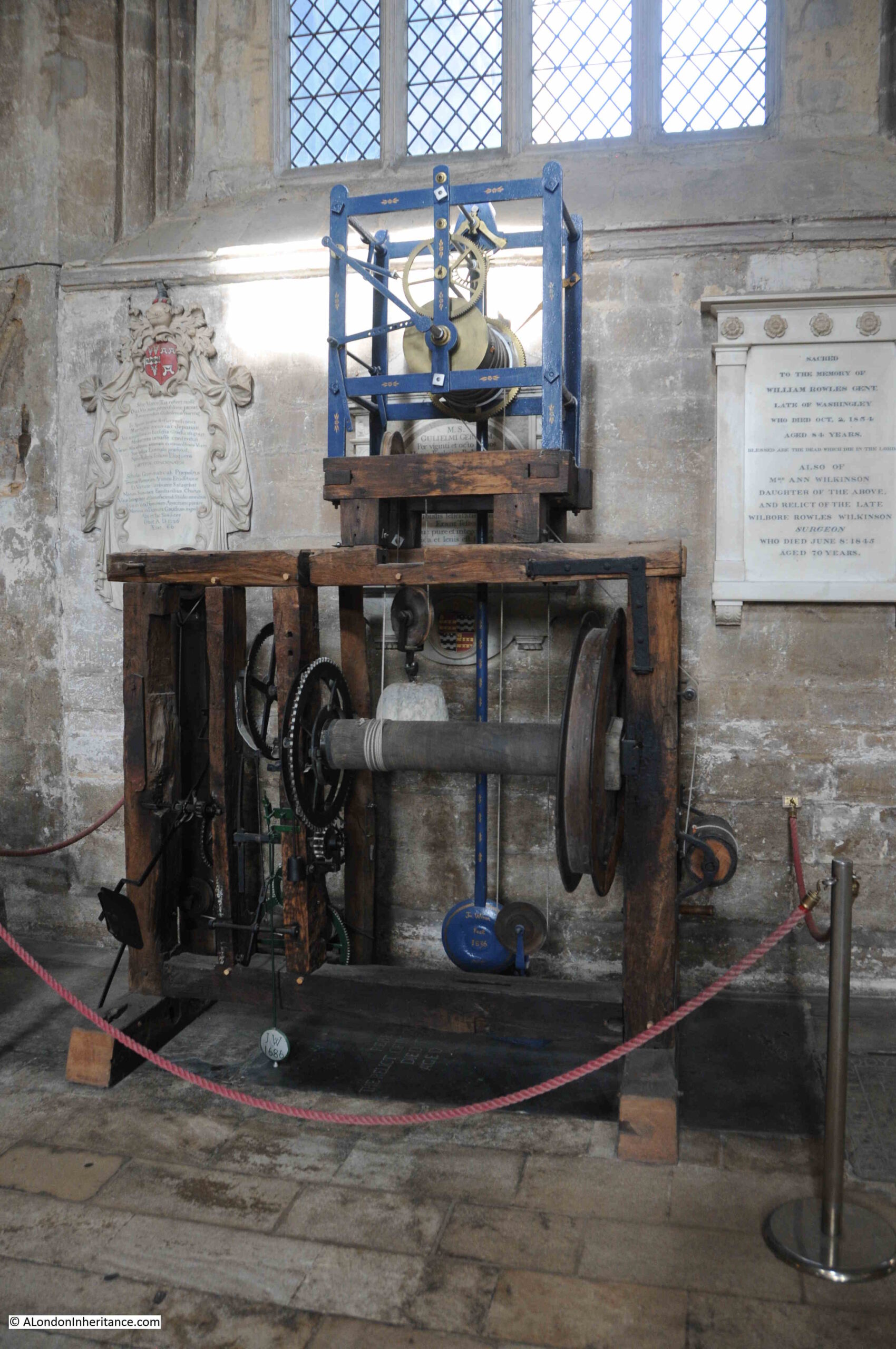
There is a clock mechanism in the cathedral that has the name of “The clock with no face”, as the clock does not have any clock face or hands. The mechanism instead would strike a bell every half hour so the monks would know when to pray, although how they new what the specific time was, I have no idea.

Parts of the mechanism date from about 1450, and it was installed in the bell tower until 1950, when it was replaced with an electronic device. Still able to work, it is now on display in the cathedral:

The clock with no face

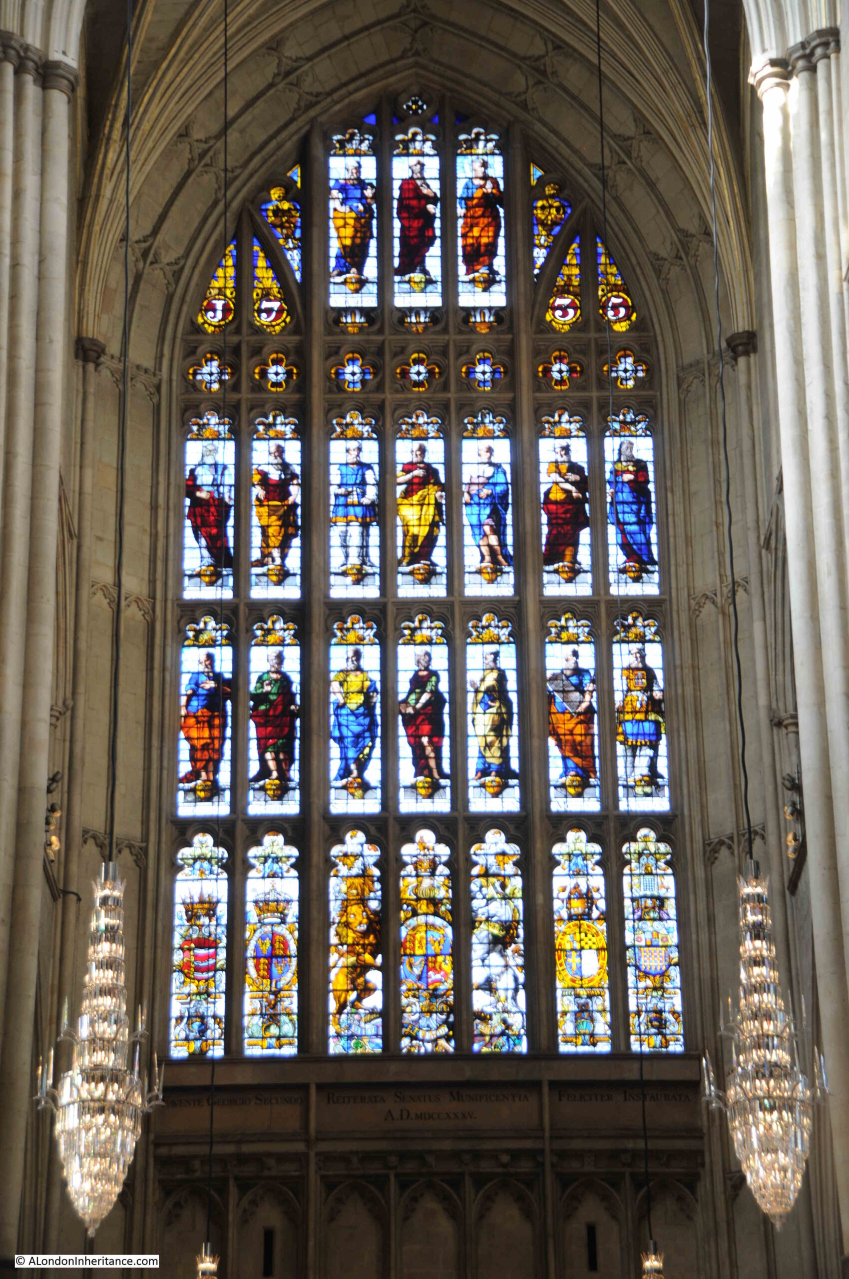
A magnificent painted ceiling above the altar:

Peterborough Cathedral

A final look back towards the eastern end of the cathedral. This is the earliest part of the building as construction started in the east and worked towards the west:

Peterborough Cathedral

Peterborough cathedral is magnificent. The old Guildhall building hints at what the old town of Peterborough may have looked like, before a combination of wartime bombing and post war development changed much of the core of the city.

Very much worth a visit though, and I am pleased to have visited the location of some more of my father’s photos.

I shall be returning to his London photos in next week’s post.

alondoninheritance.com

Wells, Somerset – A Cathedral, Water and Swans

In August 1953, my father was cycling / youth hosteling around Somerset, as part of his post National Service trips with friends around the country. One of the places visited was the City of Wells in Somerset, and this is his photo of Wells Cathedral:

Wells Cathedral

Seventy years later, and the view is the same:

Wells Cathedral

Apart from the loss of a couple of chimneys to the right of the Cathedral, the view has not changed, not really surprising given the age of the building and its significance. The only feature that will confirm the top photo dates from 1953 are the clothes worn by the people at the very bottom of the photo.

There are a couple of minor changes and restorations to the façade. For example, in 1953, some of the niches at the top of the central part of the façade were empty. Today, there is a statue and carved objects in these niches:

Wells Cathedral

Wells is a smallish town in Somerset, not that far to the north of Glastonbury. The town’s status as a City dates back to the medieval period and the importance of the Cathedral. This was formally recognised in 1974 when Queen Elizabeth II confirmed city status on Wells.

Evidence of a Roman settlement at Wells illustrates the long history of the place, and the name provides a clue as to why people would want to settle here, and why the city has such a significant Cathedral.

Wells takes its name from wells that can still be found, wells that seem to provide an almost continuous flow of large amounts of water, and water makes it presence known across the city, including along the High Street and the Market Place where channels of water flow between the road and the pavement:

Wells Market Place

The Market Place today is today mainly lined with shops and cafes targeting visitors, however there were a large number of locals in the cafes during our visit. The Market Place, with the towers of the Cathedral in the background, does look like the dream location for a tourism advert, but it has not always been so peaceful.

After the Monmouth Rebellion, in 1685, Judge Jeffreys held what were known as the Bloody Assizes in the Market Place and condemned 94 people to death for supporting the Monmouth rebellion. Judge Jeffreys would later be found hiding in Wapping, where he was recognised by someone who had the misfortune to come up before him. See this post for the story.

Even if you have not been to Wells, you may find some of the places in the city familiar. Wells was the location for many of the exterior scenes of the film Hot Fuzz by Edgar Wright (who grew up in Wells) and Simon Pegg.

The Cathedral was digitally removed from the film, but many other locations are recognisable, including the pub, the Crown at Wells (or Sandford as the town was named in the film):

The Crown at Wells and Hot Fuzz

View looking back along the Market Place, close to the entrance to the Cathedral. The board in front of the bin advertises both a Heritage Walk and a Hot Fuzz Location Walk:

Wells Market Place

There may have been some form of religious establishment on the site of the Cathedral before the first known church to be built close to the current site when around the year 705, Ine, the Saxon King of Wessex built a Minster.

The first documented reference to the Minister dates from 766 when the Minster was recorded as being near the “Great Spring of Wells”, highlighting that the wells have always been a focal point for having both the church and a settlement here.

Wells prospered due to its surrounding agricultural land, the wells, and the growing importance of the church, and in the year 909, Wells became the centre of a new Somerset diocese.

Wells has long had a religious relationship with Bath, and in 1088, King William Rufus granted the estates to Bishop John of Tours, who relocated to Bath, and the church at Wells ceased to be a Cathedral.

Wells was still an important church, and in 1175, construction of the new church commenced. Work on the church continued for the next few centuries, resulting in the magnificent building we see today.

Whilst the front of the church, seen in my father’s and my photos, is really impressive, in the Medieval period it would have been even more so, as it was brightly painted, and some small remaining traces of paint have been found in niches among the statues.

The interior of the Cathedral would also have been brightly painted, however over the years it was painted over, whitewashed, and any remaining traces of paint were lost in the 1840s when the building was vigorously cleaned.

Of the statues on the front of the church, three hundred of what were around 400 of the original medieval statues survive.

The interior of the Cathedral is magnificent, and at the end of the nave there is a scissor shaped structure:

Wells Cathedral scissor arch

The scissor arches were built between 1338 and 1348 to provide additional support to a high tower and spire that had been built above the Cathedral in 1313.

The weight of the tower caused large cracks to appear in the tower structure, and the scissor arches were the innovative solution to provide additional support. 

Dating from around 1390, the Cathedral has what is believed to be the second oldest working clock in the world. The mechanism was replaced in the 19th century, however the dial is the original from the 14th century. The original mechanism is now on display in the Science Museum.

Wells Cathedral clock

Above the clock face there is a turret, where every quarter hour, jousting knights appear and circle the turret. The same figure of the jousting knight has been knocked down for over 600 years.

To the right of the clock, and high up on the wall, is a figure, dressed in Stuart costume, that strikes the bell at every quarter:

Wells Cathedral clock

Steps leading up to the Chapter House:

Steps leading to the Chapter House

At the top of the stairs is the entrance to the Chapter House, which has a remarkable roof, consisting of thirty two ribs or tiercerons (which give the name of tierceron vault to the structure), which spring from the central pillar:

Chapter House at Wells Cathedral

The Chapter House was completed in 1306, and provided a place for the governing body of the Cathedral (called the Chapter), to meet.

Above each of the seats around the edge of the room are brass plaques which name the “Prebend” which was the farm or estate from where the income came to fund the “Prebendaries” who were the priests who were part of the Chapter.

The Chapter House did have stained glass, however it is believed that these were smashed by Cromwell’s soldiers during the English Civil War.

Interior of the Chapter House:

Chapter House at Wells Cathedral

Wells Cathedral organ:

Wells Cathedral

Seating for the choir, with covered seats at the rear for Cathedral officials:

Wells Cathedral

Wooden door within the Cathedral:

Old door with ornate ironwork

I could not find a date for the door, however the decoration is impressive. The decorative ironwork gives the impression of plants growing across the door:

Door ornate ironwork

Many of the floors within the Cathedral would have once been covered with colourful floor tiles, however today, only the following small patch of medieval floor tiles remain:

Floor tiles at Wells Cathedral

The Lady Chapel:

Lady Chapel at Wells Cathedral

The Lady Chapel was ransacked during the English Civil War, when many of the Puritan soldiers thought that the decoration and stained glass of the Lady Chapel was still adhering to the Catholic faith.

In the Cathedral gardens:

Wells Cathedral

There are a number of wells and springs surrounding the Cathedral, and in the following photo I am looking down into one of these in the Cathedral gardens. The sound of running water rises from the darkness of the entrance:

Well

The Bishop’s Palace was the next place in Wells to find the location of one of my father’s photos.

This is the entrance to the Bishop’s Palace, across a moat that surrounds much of the palace:

Wells Bishop's Palace

This is my father’s photo from 1953 showing the moat, a couple of swans and part of the surrounding wall / gatehouse, in which there is an open window:

Swan bell at Bishop's Palace

The open window is the point of interest, as zooming in on this, it is just possible to see a bell mounted on the wall, and a rope hanging down to just above the level of the water:

Swans pulling the bell at Bishop's Palace

The bell is still there today, although in a slightly different position, and the rope had been taken inside the window.

Swan bell at Bishop's Palace

There is a tradition with the swans at wells, which is believed to date back to the 1850s, when a Bishop’s daughter taught the swans to ring the bell for food.

The swans still ring the bell for food, however to stop them doing it at random times throughout the day, the rope hanging from the bell is tucked into the window, until the time for feeding.

Once through the gatehouse, we can see the Bishop’s Palace. The Chapel in the centre, and the walls of the ruined Great Hall on the right:

Lawn in front of Bishop's Palace

And what must be one of the most tourist friendly scenes – croquet on the lawn of the Bishop’s Palace, with Wells Cathedral in the background:

Croquet on the lawn

Inside the Chapel of the Bishop’s Palace. The Chapel was built between 1275 and 1292 for Bishop Burnell who was Lord Chancellor for Edward I. The Chapel has been used by the Bishop of Bath and Wells for many centuries.

Chapel at the Bishop's Palace

Interior of the Bishop’s Palace:

Bishop's Palace

In the gardens of the Bishop’s Palace, between the palace and the cathedral, we find the main evidence of the wells and springs that gave the city its name and led to the original religious establishment.

The Bottonless Well

The wells and the streams running from the wells have been enclosed, with large gardens around the main wells. Originally, water would have risen from the ground here, and flowed away through a number of streams and marshy land.

There are five large springs that rise through the artificial pond seen in the photos above and below. Four of these springs rise through the sand and gravel at the bottom of the pond. The fifth source of water is at the far end of the pond in the above photo, and is water that is piped from wells beneath the lawns close to the cathedral.

In the photo below is the spring that was once called the Bottomless Well, due to the assumed depth of the well. It has been partly filled and lined with gravel, to prevent the flow of water from undercutting the stone walls of the pond.

The features where the water rises up through the ground at the bottom of the pond are known locally as “pots”, and after periods of heavy rain, the surface can be seen to bubble with the flow of the rising water.

The Bottomless Well

The waters that rise through the ground in Wells originate across the southern side of the Mendip Hills, to the north and east of Wells.

A story of farmers in a hamlet to the east of Wells throwing waste chaff from their corn threshing, into a swallet hole, where a stream sinks into limestone, with the chaff reappearing at the springs in Wells was one of the first demonstrations of where the water was coming from, a distance of three miles.

Later tracing activities would identify eight or nine underground streams that were feeding the springs, with the time taken to travel underground dependent on the amount of rain that had fallen.

An experiment with one of the more remote swallets demonstrated that water would normally take 24 hours to reach Wells, however at times of drought it could take up to a week or more.

When dye has been used to trace the flow of water, the concentration of dye is the same at any of the springs in Wells, from any of the sources of water. This proves that the water from the remote swallets, where streams disappear below the surface, is carried to Wells along a single underground river, where it then rises to form a number of springs.

As the underground river rises in height, it breaks through the surface at different places to form the “pots” where it rises up from the limestone, through marl and finally through the gravel just below the surface.

The average daily output of the springs is about 4 million gallons. This can fluctuate between 40 million gallons after periods of high rainfall and flood, down to 1 million gallons during a drought.

Water is drawn of from the pond through an underground tunnel and a separate sluice, that both feed water into the moat around the Bishops Palace.

Water in Bishop's Garden Place

Some of the water from the springs is used to feed the streams running along the gutters of the High Street, as seen in one of the photos earlier in the post.

Whilst the springs and water from the springs rose in the land owned by the Bishop, in 1451, Bishop Beckington built a well house and laid lead pipes from the well house into the Market Place to provide water for the inhabitants of Wells.

The 15th century well house in the foreground of the following photo, surrounded by plants:

Bishop's Palace gardens

Part of the moat surrounding the Bishops Palace, with the cathedral in the background:

Moat around Bishop's Palace

The above scene creates the impression of a smooth and calm flow of water, however there have been times when the level of rainfall has created some very dramatic conditions at Wells, such as this description of the springs from 1937, when “a torrent bursting up and even heaping sand above its level, making in gardens gaping holes out of which water gushes, at times leaping into the air, overflowing lawns and, with impetuous torrent, doing its best to sap ancient foundations”.

The closest part of the cathedral to the ponds and springs is the Lady Chapel, and there has been concern over the years that the amount of water in the springs after periods of high rainfall, could damage the buildings and undermine the structure.

Pipes take water from the springs closet to the cathedral away to the ponds, but at times in the past, water has been seen to erupt through the lawns.

On a sunny and warn late spring day, the gardens are glorious and the constant presence of water provides a connection with the geology below the ground and the water flowing in from the surrounding countryside.

There was one last place that I wanted to visit, and to find it, we walked to the side of the Cathedral, where there is another clock:

Cathedral Clock

The clock on the exterior of the Cathedral is driven by the same mechanism as drives the clock inside the Cathedral. This clock is believed to have been added around the 14th and 15th centuries, but has been restored a number of times since.

Not far from the clock is Vicars Close, dating from 1348, it is believed to be the oldest, mainly original, medieval residential street in Europe:

Vicars Close

The houses were originally built to accommodate vicars, however since the 1660s, some of the houses have been leased out to other residents.

At the end of the street (see above photo), is a chapel. The Chapel, as well as a number of the houses are now used by Wells Cathedral School.

All the houses are Grade I listed.

View from the chapel end of the street, looking back to the Cathedral:

Vicars Close

Wells is a really fascinating place to visit. I wish my father had taken more photos of the place in 1953, however the cost and limitations of film at the time, as well as how much could be carried on a bike probably limited the number.

What I like about Wells is it reminds us that towns were usually built at a location due to what was there at the time. Wells was built at this site because of the springs / wells that gave the place its name. Wells that are only there due to the unique geology of this part of Somerset.

You may also be interested in my visit to nearby Glastonbury, which can be found here.

alondoninheritance.com

London to Portsmouth Semaphore – Chatley Heath

A couple of weeks ago I wrote about the route that the body of Eleanor of Castile took to reach London, and the crosses that were built to mark the route. For today’s post I am tracing another of the historic routes that link London with the rest of the country.

Back in the 18th century, the speed of communication was mainly dependent on how long it took a horse and rider to travel between the source and destination of a message. Routine mail would be carried by stage coach and urgent messages would travel via a horse and rider who could travel much faster, but would still be limited by the speed of the horse, conditions of the roads, weather need to change and rest horses etc.

In 1770, the average time taken between London and Portsmouth was around 17 hours, but with improvements to road surfaces and coach building, by around 1820 this had improved to 9 hours for the fastest coaches.

The very best horse and rider could cover the route in just under 5 hours.

It seems remarkable when today we can make an instantaneous mobile phone call from almost anywhere in the country to the other side of the world, that just two hundred years ago it would take a day to get a message and answer between London and Portsmouth.

Portsmouth was important as it was the site of a major naval dockyard, and with the frequent wars of the late 18th and early 19th centuries there was need to devise a system which could rapidly send messages between the Admiralty in London, and the naval dockyards.

The Napoleonic Wars of the later 18th century resulted in the Admiralty building a telegraph system that copied a system already set up by the French. This used a method where signaling stations were based at high points along the route between London and Portsmouth. At each station, there was a wooden shed with a shutter frame built above. The frame held six shutters in two columns, and each shutter could be opened or closed to send a message to the next station along the route.

It was claimed that a message could be sent between London and Portsmouth in just under 8 minutes.

At the end of the Napoleonic Wars the system was dismantled, with Napoleon being held on the Isle of Elba.

Not long after, Napoleon escaped and returned to France, and the state of war between England and France resumed. The Admiralty needed another, and more permanent line of communication between London and Portsmouth, rather than the temporary wooden sheds set up for the shutter system.

The Admiralty created a new signaling line comprised of stations using a semaphore system, where the positions of two moveable arms would signify a message to be sent along the chain.

The following print shows the Admiralty building in Whitehall. On the roof at the rear of the building, a tall post can be seen with two arms. This was the London end of the chain of stations between London and Portsmouth  (© The Trustees of the British Museum).

The Admiralty semaphore tower

Signaling stations were needed at high points on the route between London and Portsmouth. Each station was equipped with a post and signaling arms, and had an observer with a telescope to keep an eye on the adjacent stations in the chain for any message that needed to be sent onwards.

The following map shows the chain of stations from the Admiralty at top right down to the dockyard in Portsmouth at lower left  (© OpenStreetMap contributors):

London to Portsmouth semaphore route

The system was opened two hundred years ago, in 1822, and an article in Bell’s Weekly Messenger in September 1822 listed the stations as;

The Admiralty, Chelsea, Putney Heath, Kingston Hill, Cooper’s Hill, Chatley Hill, Pewley Hill, Bannicle Hill, Haste Hill, Holner Hill, Beacon Hill, Compton Down, Portsdown, Lumps Fort (Southsea) and Portsmouth naval dockyard.

In 1822 it was claimed that a message could be conveyed between the Admiralty in London to Portsmouth in one minute and a few seconds. This seems remarkable and must have been in ideal conditions, perfect visibility, and the staff at the stations were ready for the receipt and forwarding of a very short message. Reports of normal transmission times state that around 15 minutes was the time taken to send a message from one end of the chain to the other – still a remarkably short time.

There is one remaining, complete, semaphore tower on the line between London and Portsmouth, at Chatley Heath in Surrey. Indeed it is the only remaining complete semaphore tower in the country. It has recently been restored by the Landmark Trust who held an open day in the summer. so I went along to see this remaining example of two hundred year old communications technology that linked London with the south coast.

In the above map of the whole chain of stations, I have marked Chatley Heath with a red circle around the red dot.

The following map shows the exact location of the Chatley Heath semaphore tower, a very short distance from the M25 and slightly to the east of the A3  (© OpenStreetMap contributors):

Chatley Heath semaphore tower

Chatley Heath is part of a wider area of 800 acres of commons and rare heathland that is managed by the Surrey Wildlife Trust. There are paths across the heath, some of which are signposted to show the route to the semaphore tower:

Chatley Heath semaphore tower

The open day was on one of the hot days of summer, where the land was so dry following weeks with no rain, a big contrast as I type this, as it is cold, cloudy and there has been much rain over the last few weeks.

Following the path to the semaphore tower:

Chatley Heath semaphore tower

The following photo shows the first glimpse of the semaphore arms at the very top of the tower, just showing above the tree line in the distance in the centre of the photo:

Chatley Heath semaphore tower

Finally reaching the Chatley Heath semaphore tower. The one remaining, fully restored tower, and the tallest on the line between the Admiralty in London, and Portsmouth.

Chatley Heath semaphore tower

Each semaphore station was manned by a retired navy lieutenant and an observer, usually a retired sailor of the lieutenants choosing. The lieutenant would be in charge of the station, and the observer was responsible for using a telescope to keep an eye on adjacent stations to check for messages to be forwarded.

The very first officer at the Chatley Heath tower when it opened in 1822 was Lieutenant Edward Harris.

The Chatley Heath tower included accommodation with a small house built onto the base of the tower. The blocked up windows in the tower were probably done to save the cost of building and installing windows. The navy was exempt from window tax, so this would not have been the reason. The shape of the tower was also more cost effective than the complexity of building a circular tower.

The semaphore system used a code devised by Rear Admiral Sir Home Riggs Popham.

It was Popham who created the code using flags, allowing messages to be sent between ships at sea, and it was his code that sent the message from Nelson at the Battle of Trafalgar that “England expects that every man will do his duty”. He was involved in a number of naval actions, and assaults on enemy land forces across the world, but must have spent some time at home as his wife had at least ten children.

Popham’s semaphore code used two arms on a wooden post. Each arm could assume any position on either side of the post, so could be either horizontal, vertical, or at an angle of 45 degrees, pointing up or down the post.

This arrangement created enough positions using the two arms that every letter of the alphabet, along with the numbers 0 to 9, could all be transmitted.

The two arms and vertical post:

Chatley Heath semaphore tower

From 1963 until 1988 the tower was left empty. It was vandalised and had suffered a major fire. It was restored in 1988 by Surrey County Council and then passed to the Surrey Wildlife Trust.

The age and very exposed position of the tower resulted in further, gradual deterioration, with water being a problem, getting into the tower around the base of the post, and around the windows.

The Landmark Trust then took on the tower and commenced a full restoration project in 2020. The Landmark Trust has restored and runs some remarkable buildings across the country, and following a restoration, they rent out the buildings for short stays, and this is now the future of the Chatley Heath semaphore tower.

The restoration including fitting out the tower so that it would include accommodation, so today, walking up the tower to the roof includes a walk through a number of rooms, which include a lounge:

Chatley Heath semaphore tower

Kitchen:

Chatley Heath semaphore tower

And bedroom:

Chatley Heath semaphore tower

There is a second bedroom (the tower now sleeps 4) and a bathroom.

In the kitchen, the restored mechanism used to control the position of the arms can be seen:

Chatley Heath semaphore tower

Once on the roof, it is easy to see why this was the chosen location for the station. It is one of the highest points in the local area at 59 meters above sea level, with the land dropping by 10 to 20 meters in the area surrounding the station.

This is the view looking towards London:

Chatley Heath semaphore tower

Zooming in from the roof of the tower, we can see the towers of London in the far distance, the Shard to the right is just over 31km from the Chatley Heath semaphore tower.

Chatley Heath semaphore tower

The semaphore post and arms seen from the top of the tower:

Chatley Heath semaphore tower

Operating the semaphore was not without its dangers. The Hampshire and Southampton County Newspaper reported on the 15th of August 1825 that: “During the thunder storm on Wednesday last, E. Oke, the signal man belonging to the semaphore in Portsmouth, was knocked down and remained insensible for several minutes. The semaphore was at work at the time, and the man had his hand on the wheel, which turns the arms to communicate intelligence to the next station. The whole apparatus is composed of metal, which, of course, attracted the lightning. The Lieutenant, who was standing close by, did not experience the slightest inconvenience, neither was any serious injury sustained by the man or the buildings”.

View looking towards the south, the next station at Pewley Hill was somewhere in the distance:

Chatley Heath semaphore tower

Chatley Heath was to be the branching point for another chain of semaphore stations, which would have run all the way to Plymouth, however this chain was only completed a short distance after Winchester.

The London to Portsmouth semaphore system ran from 1822 until 1847 when it was made redundant by the coming of the railways and the electric telegraph. The London & South Western Railway connected London to the south coast at Southampton, Gosport and Portsmouth and the new electric telegraph was laid alongside the railway. This provided a far more reliable and cost effective means of sending messages between the Admiralty and the naval dockyard at Portsmouth.

The semaphore line was closed at the end of 1847, and the staff made redundant, which must have been a blow to them as the staff were usually at the end of their naval careers and other opportunities for employment would have been limited.

The views from the tops of the semaphore tower show what a high location this is relative to the surrounding land. As well as the towers of the city shown in an earlier photo, from the top of the tower we can just about see the arch over the Wembley stadium in the distance:

Chatley Heath semaphore tower

The location of the semaphore stations can often be found in local naming, with Telegraph Hill being used at a couple of the old station locations. there is a Telegraph pub in Putney named after the original shutter telegraph on Putney Heath. There are a number of Telegraph Roads and Telegraph Houses along the route.

The London to Portsmouth semaphore / telegraph route was one of many that were built during the early decades of the 19th century. The admiralty built a number of chains to enable communication with key dockyards.

There were also commercial telegraph chains set-up. One, by a Lieutenant Watson was created between Holyhead and Liverpool and reported the names of ships passing Holyhead on their way to the docks at Liverpool. This would enable ship owners to have advance information of when their ships would be arriving in port.

Lieutenant Watson devised his own code for the telegraph system. He may have also been responsible for creating another system from London to the coast. The following print shows Watson’s Telegraph, near Tooley Street  (© The Trustees of the British Museum).

Watsons Telegraph

This has a similar arrangement to the semaphore route between London and Portsmouth, however it uses two rather than one post, and it appears that one of the posts had two arms at the top. Presumably this arrangement was to allow more complex messages to be sent at a faster rate.

The Chatley Heath semaphore tower is a wonderful reminder of a time, only 200 years ago, when it took hours to send a message the distance from London to Portsmouth, and the technological change that started to speed up communication.

If you fancy a stay in an early 19th century semaphore tower, the page on the Landmark Trust site with information and booking is here.

alondoninheritance.com

Eleanor Crosses – The End of the Journey in London

The procession carrying Eleanor’s body now commenced the final part of the journey, which would take Eleanor’s coffin through the City of London, then west towards Westminster Abbey where she would be buried.

In the following map, three of the key places in London are highlighted with blue circles – Cheapside, Charing Cross and Westminster Abbey, however there were a number of other places which were involved with Eleanor’s funeral, which I will also cover (© OpenStreetMap contributors):

Journey of Eleanor of Castile from Harby to London

The map also shows the distance covered by the procession taking Eleanor’s body from the site of her death in the small village of Harby at the very top all the way to London. Each of the red circles indicates one of the overnight stopping points which I have covered in previous posts.

The procession left Waltham Abbey on Thursday the 14th of December 1290, headed to the location of the future Waltham Cross, where it turned south towards London.

The aim of the easterly diversion to Waltham Abbey may have been due to the importance of the Abbey, and it may also have been to allow an entry into the City from the east, as the procession entered the City of London through the gate at Bishopsgate.

Once in the City of London, the procession stayed in the east of the City, and headed to Holy Trinity Priory in the Minories, which I wrote about in an earlier post here and here.

Eleanor’s coffin rested in Holy Trinity Priory overnight, and the procession set off again the following day to head west. Passing along Cheapside, one of the main streets of the City, the procession headed to the Franciscan friary of Grey Friars, which I have touched on in this post.

After Grey Friars, Eleanor’s coffin was taken to the old St Paul’s Cathedral, where it probably stayed overnight as it would not head to Westminster until the following day.

An Eleanor Cross was built in Cheapside, possibly confirming that Eleanor stayed overnight in St Paul’s, also because the procession had passed along Cheapside, and also because Cheapside was a major City street, and it has been clear from finding the sites of the previous crosses that they were placed in prominent positions. Edward I wanted Eleanor remembered, so putting a cross in a prominent place would ensure that Eleanor was kept in the public memory for centuries to come.

There are no remains of the Cheapside cross today, however we do have a record of its location.

The so called Agas map of around 1561 (probably wrongly attributed to the surveyor Ralph Agas), shows the cross in Cheapside, circled in the following extract:

Eleanor Cross Cheapside

The cross was located just to the west of where Wood Street joins Cheapside, as can be seen in the followed detailed extract from the Agas map:

Eleanor Cross Cheapside

The Eleanor Cross is to the left, and Wood Street can be seen heading north from Cheapside. There appears to be another, much smaller cross just to the east, and Bow Church can be seen in the lower right of the map.

In the following photo, I am standing in the middle of Cheapside, looking west. The tree on the right is in Wood Street, so the Eleanor Cross would have stood in the middle of the road, just behind and to the right of where the person is crossing the road.

Eleanor Cross Cheapside

Just in Wood Street, and to the right of where the tree is located, was the church of St Peter, West Chepe, and in the book “London Churches Before The Great Fire” by Wilberforce Jenkins (1917), the old church was described:

“The ‘Church of St Peter, West Chepe, stood on the corner of Wood Street, Cheapside, and was not rebuilt after the Fire. The well-known tree in Cheapside marks the spot, and a small piece of the churchyard remains. It was sometimes called St Peter-at-Cross, being opposite the famous Cross which stood in the middle of the street, and was at one time an object of pride and veneration, and at a later period the object of execration and many riots, until pulled down and burnt by the mob. The date of the ancient church is uncertain, but there would appear to be a reference to it in 1231. In the ‘Liber Albus’, one Geoffrey Russel is mentioned as having been present when a certain Ralph Wryvefuntaines was stabbed in the churchyard of St Paul’s and being afraid of being accused, fled for sanctuary to the Church of St Peter.

Thomas Wood, goldsmith and sheriff, is credited with having, in 1491, restored or rebuilt the roof of the middle aisle, the structure being supported by figures of woodmen. Hence, so tradition says, came the name of the street, Wood Street.”

The “famous Cross” mentioned in the above extract in bold text, was the Cheapside Eleanor Cross.

The cross was a large structure and had been rebuilt in the late 15th century when it was decorated with religious iconography including images of the Pope and the Virgin. From the mid 16th century onwards, the cross was the subject of attack by puritans who objected to the religious symbols on the cross.

On the 2nd of May, 1643, the cross was demolished, an act which was illustrated in the following print produced by Wenceslaus Hollar in the same year  (© The Trustees of the British Museum):

Eleanor Cross Cheapside

1643 was one of the early years of the English Civil War, and was a time when many of the Eleanor Crosses were destroyed. They were seen as being religiously symbolic and it was also the royal references which led to damage and destruction of the crosses.

The Cheapside Cross had been rebuilt and by the end of the 15th century appears to have been more a religious monument than the original design dedicated to Eleanor, The text that goes with the above print states that “Leaden Popes burnt in the place where it stood”, which must have been lead statues of the Pope which had been placed on the cross.

The lower part of the print shows the “Boocke of Sportes” being burnt where the cross stood on the 10th of May.

The Book of Sports was a controversial book originally published by James I in 1618. This was in response to the growing Puritan influence on the church, which tried to ban sports and pastimes on Sundays. Not a popular action given that Sunday was the only day off for much of the population. The Book of Sports was a declaration confirming the right of all persons to engage in ‘lawful recreation’ on Sundays after they had attended a church service.

The book was reissued by Charles I in 1633, and he ordered the document to be read in churches to make clear that people could continue with their normal recreations after service.

The growing Puritan influence brought about by the Civil War enabled the restrictions on Sunday recreations to be imposed, and the Book of Sports was often burnt as shown in the print.

On the assumption that Eleanor’s coffin stayed in St Paul’s Cathedral overnight, if not, it must have been a nearby religious establishment, the procession left on Saturday the 16th of December 1290, and headed to the Dominican Priory at Blackfriars, where a mass was held.

If you remember back to the first post in this series, Eleanor’s heart had been one of her organs removed in Lincoln, and the box containing the heart had travelled separately to London, where it was held at Blackfriars. We shall return here at the very end of the post.

Leaving Blackfriars, the procession then continued west to Westminster Abbey, passing through the village of Charing, the name of which appears to have come from the old English word for a bend in a river.

Charing was the site for the last of the Eleanor Crosses, built by the King’s Mason Richard Crundale between 1291 and 1293. Richard was helped by his son, and here is another example of how difficult it is to be sure of names and facts. The English Heritage references to the cross refer to his son Robert, however The London Encyclopedia by Ben Weinreb and Christopher Hibbert, refers to his son as Roger. A minor detail, but I do find that unless you can find an original, primary resource, it is very difficult to be absolutely sure of facts.

The Charing Cross was apparently the most impressive of all the crosses, which would have made sense given the location of the cross.

It was taken down on the orders of Parliament in 1647, and the stones were allegedly used in various building works in Whitehall.

The site of the cross was where the statue of King Charles I stands today, on the edge of Trafalgar Square, seen slightly to the right of the following photo:

Eleanor Cross Charing Cross

The Agas map also shows the Charing Cross, and as can be seen in the following extract, it stood in a very prominent position. Much of the area was still undeveloped, however it stood in the centre of the junction of a major road to the north, east to the City and west to Westminster. Again so that Eleanor’s memory would be kept in the public memory for many centuries to come.

Eleanor Cross Charing Cross

Following the restoration of Charles II, one of the Regicides (those who had signed the death warrant of Charles I), was executed on the site of the Eleanor Cross. This was Colonel Thomas Harrison who was hung, drawn and quartered on the site of the cross.

A closer view of the statue of Charles I where the Eleanor Cross once stood:

Eleanor Cross Charing Cross

Just behind the statue is a plaque set into the ground which records that the site of the statue was the site of the Eleanor Cross.

Eleanor Cross Charing Cross

The plaque also states that mileages from London are traditionally measured from the site of the original Eleanor Cross, so another example of how the influence of Eleanor’s death can be found today.

As well as adding the word “Cross” to the original village name of “Charing”, Eleanor’s influence can also be seen outside the station of Charing Cross where a Victorian reproduction cross stands in front of the old station hotel:

Charing Cross

This reproduction Eleanor Cross was designed by Edward Barry and finished in 1865.

Edward Barry was building on a mid 19th century trend for crosses based on the surviving Eleanor Crosses. This trend was started by the architect George Gilbert Scott. He was working in Northampton in the 1830s and therefore may well have seen the Hardingstone cross.

He would go on to design a number of similar crosses, including the Martyrs Memorial in Oxford, which looks very much like an Eleanor Cross.

Charing Cross:

Charing Cross

The lower part of the cross displays the arms of England, Ponthieu and of Eleanor of Castile. Above are statues of Eleanor looking out from the cross:

Charing Cross

Reminders of the Eleanor Cross extend below as well as above ground at Charing Cross. If you use the Northern Line at the station, you will be greeted by murals running the length of the station platform:

Charing Cross Northern Line

These were created in 1979 by David Gentleman. He researched in detail how a mason would have built the crosses, and the murals run the length of the platform telling the story of the crosses from quarrying the stone, through to completion:

Charing Cross Northern Line

The man on the left is holding a pair of dividers which were used for measurement. In the middle, a stone mason is working on a statue of Eleanor:

Charing Cross Northern Line

Pulling a statue of Eleanor towards a cross, not sure what the two people are doing who appear to be fighting:

Charing Cross Northern Line

A statue of Eleanor arrives at the cross, ready to be installed:

Charing Cross Northern Line

Passing the future location of the cross at Charing, the procession with Eleanor’s body continued on to Westminster Abbey where it stayed overnight.

The funeral was held on Sunday the 17th of December 1290. The service was conducted by the Benedictine monks of the abbey, and Eleanor was buried in a temporary coffin in the abbey as with the suddenness and early age of her death, a fitting tomb for a Queen of England had not yet been prepared.

Westminster Abbey, much modified since Eleanor’s funeral in 1290:

Westminster Abbey

The history of Westminster Abbey deserves several blogs, so for today’s post, the main aim of my visit is to find Eleanor’s tomb rather than explore the history of the abbey.

The interior of the abbey:

Westminster Abbey

Stained glass:

Westminster Abbey

Eleanor’s tomb was built in the chapel of St Edward the Confessor at Westminster Abbey. I contacted the abbey to see if it was possible to take a photo of the tomb with the bronze effigy of Eleanor, however they do not allow photography within the chapel as it is the spiritual heart of the abbey.

You can see the tomb from outside the chapel, as the tombs in the chapel are arranged around the edge, so after following the route of Eleanor’s body from the small village of Harby where she died, through all the towns and villages where Edward I ordered a cross to be built in memory of Eleanor, I finally stood alongside the tomb where her body was placed:

Eleanor of Castile's tomb in Westminster Abbey

The tomb was built by Richard Crundale, who was also responsible for the Eleanor Cross at Charing. On the top of the tomb, the gilt bronze effigy of Eleanor, cast by goldsmith William Torel in 1291, is just visible.

On the side of the tomb are the arms which have also been found all along the journey from Harby. The arms of England, of Ponthieu (Eleanor’s mother and which Eleanor also inherited) and of Eleanor of Castile.

Nearby is the tomb of Eleanor’s husband, Edward I, who died almost 17 years later in July 1307:

Edward I tomb in Westminster Abbey

There is so much to discover at Westminster Abbey, but for now, a couple of highlights, including a door that is believed to date from 1050, so would have been from the time of Edward the Confessor:

The oldest door in England Westminster Abbey

The interior of the Chapter House, believed to have been built by Edward’s father, Henry III:

Westminster Abbey

Decorated seating for the monks around the outer wall of the Chapter House:

Westminster Abbey

The floor of the Chapter House is one of the finest medieval tile pavements in England, and contains the arms of Edward’s father, Henry III:

Westminster Abbey

Eleanor and Edward could well have walked on this tiled floor.

Nearby is the Pyx Chamber, one of the oldest parts of the abbey, dating from around 1070:

Westminster Abbey

The funeral of Eleanor at Westminster Abbey was not however the final act in the long funeral of Eleanor of Castile, there was one last act for Edward I to attend to, and that was the burial of Eleanor’s heart at the Dominican Priory at Blackfriars on Tuesday the 19th of December, 1290.

The priory at Blackfriars was well known to Edward and Eleanor as they had refounded the friary in the 1270s. The heart of their son Alfonso who had died in 1284 at the age of 10 had already been buried at Blackfriars, so Eleanor probably had been planning for her heart to be buried with that of her son.

Apart from the name, there is not much left of Blackfriars today. I did visit a place where the ceremony during the burial of her heart may have taken place, in a previous post on Carter Lane.

An alley by the name of Church Entry turns off from Carter Lane:

Blackfriars

There is a small garden on the western side of the alley:

Blackfriars

With a plaque that states that this plot of land is where the preaching nave of the church of the Great Dominican Priory of Blackfriars once stood, so standing in the garden you are in the general area of where the last acts in the funeral of Eleanor of Castile played out in 1290.

Blackfriars

Standing at Blackfriars marked the end of my journey from the village of Harby, all the way to London. A fascinating story of a fascinating woman.

There are two main books I have read to research the life of Eleanor of Castile. The first is Eleanor of Castile – The Shadow Queen by Sara Cockerill:

Sara Cockerill Eleanor of Castile The Shadow Queen

Eleanor of Castile – the Shadow Queen is a thoroughly researched and comprehensive book on the life of Eleanor, highly recommended.

Another book is The Eleanor Crosses by Decca Warrington:

Decca Warrington

This book is more focused on the life of the crosses, but also contains sections on the life of Eleanor. Recommended as a shorter introduction to Eleanor and the story of the crosses.

For Edward I, the book “A Great and Terrible King: Edward I and the Forging of Britain” by Marc Morris is an excellent read, and for a more academic study of Edward I, the book “Edward I” by Michael Prestwich and published by Yale University Press is an in depth read.

To research the journey and the posts, I also used some of the Victoria County History volumes for the appropriate counties (these can be found online), as well as various publications on the churches and abbeys on the route.

Edward I did remarry after Eleanor’s death. Nine years later in 1299 he married the 20 year old Margaret of France. Edward was 60.

Margaret and Edward had three children (Edward therefore had 19 children in total). The first two were boys. The third was a daughter born on the 4th of May 1306. This daughter was named Eleanor, and whilst this was a common name for women in royal families at the time, she must have been named Eleanor after Edward’s first wife who had died almost 16 years before.

Unfortunately, Eleanor did not live for too long, dying in 1311.

Edward I died in 1307 at the age of 68. Margaret of France was 26 when widowed, but never remarried. Edward I was followed by Eleanor’s eldest son, Edward II, who had a troubled reign, was forced to abdicate, and had a mysterious death in 1327.

Eleanor of Castile was a fascinating woman – one of those from history who would have been brilliant to meet.

Born into a Spanish royal family, highly educated, and with older brothers who were involved in military campaigns when Eleanor was growing up, and whilst her father was reclaiming much of Spain.

Edward was educated, although the English court did not tend to educate their children to the same level as Castile. Much of Edward’s childhood was also spent in Windsor Castle, and he was not so involved with military activity, beyond the basic training needed by a future king.

Edward was though successful when it came to military campaigns. His conquest of Wales led to the building of the string of Welsh castles such as Caernarfon and Harlech castles.

Edward was also brutal in his campaigns in Scotland, focusing brutally on those he thought were disloyal, to such an extent that he acquired the nickname of Hammer of the Scots.

How much of Edward’s success was due to Eleanor would be interesting to discover.

As usual, there is so much I have had to leave out from the format of a blog post (the books mentioned above are well worth a read), but thank you for accompanying me on this journey, alongside Eleanor of Castile.

alondoninheritance.com

Eleanor Crosses – St Albans and Waltham Cross

We are getting closer to London in our journey following the route of the funeral procession of Eleanor of Castile. There are just two overnight stops remaining before the procession heads to the City of London and then Westminster Abbey. These stops are at St Albans and Waltham Cross, shown as blue dots in the following map (© OpenStreetMap contributors):

Route of Eleanor of Castile

Before stopping at St Albans, there is more to discover about the life of Eleanor of Castile.

The marriage of Eleanor and Edward was based on rival claims for the Duchy of Gascony, part of Aquitaine in southern France, which was part of the Angevin Empire and ruled over by English kings through the House of Plantagenet. The marriage settled these rival claims by uniting the English throne with that of Castile through the marriage.

Medieval royal marriages also had another key purpose – to produce an heir to the throne.

Having a son to take over the throne was a key concern for medieval kings. If there were no children from a royal marriage then on the death of a king there would be many competing claims from rival factions within the extended family. This would often result in conflict and confusion in the country until a new monarch was finally agreed.

Edward, being the eldest son of Henry III, therefore had an undisputed claim to the throne. The fact that he had also distinguished himself in many of the conflicts that his father had with the Barons and also on campaigns in Wales, along with Edward’s time on Crusade in the Middle East, also helped support his claim to the English Crown.

The fact that it was just under two years from Henry III’s death, to Edward’s return to England and his coronation shows that there was no competition for the crown.

In carrying out this expectation of a Queen, Eleanor had 16 children, the first, a stillborn girl, when she was at the ridiculously young age of 14.

Thankfully there then appears to have been a gap of 9 years before the first of her remaining 15 children would be born.

Her children are listed in the following table:

Eleanor of Castile's children

The table shows that from 1263 to 1284, Eleanor was in an almost permanent state of pregnancy. This was in addition to travelling with Edward on his various campaigns and royal visits, including his time on Crusade, when Eleanor was still giving birth as they travelled across Europe and the Middle East.

The table shows the very high early death rate among her children. Her last child, Edward, born in April 1284 would be the surviving son, who would become Edward II. All Eleanor’s other sons died at a relatively young age. The only other son that lived to any age was Alfonso who died at the age of 11. If he had of lived, England would have had a King Alfonso I rather than an Edward II.

Her children are part of one of the two main criticisms of Eleanor. She was said to be rather detached from her children, and would not hurry to be by their side, even when one was close to death.

The other criticism is in how she acquired an extensive holding of properties across the country. One of the methods used was that if a property owner was in debt, and could not pay, she would cancel the debt, and take the property.

It is obviously impossible to know the true character of someone from the 13th century, however, from my reading (sources in the final post), Eleanor comes across as an educated, strong woman, finding her own way to survive in the challenging environment surrounding a medieval queen.

Regarding her children, the fact that she was pregnant almost continuously for twenty years must have been a considerable burden, both mentally and physically. During this period, she was travelling with Edward at a time when travel was not that easy.

Children would not always have accompanied a King and Queen. Boys would have been kept at safer locations until they were of fighting age, girls would have been prepared for the royal marriage market of alliances between families and countries. Boys and girls would both have been given experience of life at Court when they were at an appropriate age.

Eleanor’s approach to her children may also have been a defence mechanism given the number that died so young.

Regarding her property holdings, which were extensive, these were encouraged by Edward. Usually a Queen would have outlived a King, and it appears that Edward encouraged Eleanor to have sufficient properties so that after his death, she would have been financially independent.

Again, it is impossible to really know a person at a distance of over 700 years, and who lived in a period of the country’s history that is so very different to today.

Back to the route that the procession followed, and after leaving Dunstable, the next overnight stop was at:

St Albans

St Albans would have been a logical destination for the procession carrying Eleanor’s body to London, due to the important religious monastery that was at the heart of the town.

This had been founded in around 793 by King Offa as a Benedictine monastery. The reason for the monastery goes back to the Roman period, and Britain’s first saint who would give his name to the town.

Alban was apparently a resident of the Roman city of Verulamium in the 3rd century. Verulamium was located not far from the centre of the current town. Alban gave shelter to a Christian priest who was fleeing from Roman persecution. Alban learned more about the Christian faith from the priest and decided to swap clothes, let the priest escape and to take his place.

The priest was later caught, however Alban would not renounce his new found faith, so he was given the same death sentence as the priest, taken outside the Roman city and beheaded.

The monastery and church was rebuilt after the Norman conquest, and is unusual in that it made use of the bricks from the old Roman city, for a large part of its construction, and this is still very evident today.

An Eleanor cross was built to mark Eleanor’s overnight stop at St Alban’s, however this was destroyed, parts remaining until 1703 when these were replaced by a new market cross, which has also since been taken down.

To find the site of the cross, we had to find the site of the clock tower, which was easy to find to the south of the town:

St Albans Clock Tower

There are two plaques on the tower. The first records that the tower is near the site of the Eleanor Cross:

St Albans Eleanor Cross

The second provides some detail on the clock tower:

St Albans Clock Tower

The clock tower is a scheduled ancient monument and is Grade I listed.

The clock tower appears to have been built due to a conflict between the abbot of St. Albans and the rest of the town. The clock tower allowed the town to sound their own hours, and the time of a curfew, independently of the abbot and the church.

The plaque makes two claims regarding French Row and the Fleur de Lys Inn. French Row is adjacent to the clock tower:

French Row

The plaque makes the claim that French troops (the Dauphin was the heir to the French throne) occupied French Row in 1216. This may be true, although I cannot find any firm confirmation. French troops did land in England in support of the Barons during their conflict with King John, and there was a French claim to the English crown at the time.

The second claim, that John, King of France was detained in the Fleur-de-Lys pub is repeated on a large sign on the front of the pub:

Fleur de Lys pub St Albans

The St Albans Architectural and Archaeological Society has researched this claim and can “find no primary evidence for the French king’s staying in or on the site of the Fleur”.

St Albans Cathedral is a very large building that hints at the importance of the site in past centuries.

St Albans Cathedral

The original monastery buildings occupied the land surrounding the church. The church, and one other building which we will find later, are all that have survived, and there is a large open space south of the church that runs down to the River Ver.

As with many of the other religious buildings we have met on this journey, the monastery was surrendered to Henry VIII in 1539 during the dissolution, and the monastery and church buildings were plundered for valuables and building materials.

The church was at risk, but was brought by the town of St Albans in 1551 to become a parish church, although it appears that the church was not maintained and rather neglected. Too large a church for a small market town to support.

The church became an Abbey in 1877, and then went through a period of expensive and insensitive Victorian restoration.

The west front of the Abbey today:

St Albans Cathedral

A view of the tower and upper part of some of the walls shows the use of brick in the construction of the abbey, much from the Roman town of Verulamium.

St Albans Cathedral

The interior of the abbey is much as you would expect of a medieval building, but has some unique decorative features:

St Albans Cathedral

Looking up towards the base of the tower:

St Albans Cathedral

There are features within the abbey that hint at the former size of the monastery. The following door once led to external monastic buildings and the Abbot would lead monks into the church through the doorway:

St Albans Cathedral

Graffiti which appears to date from 1668:

St Albans Cathedral

The nave of St. Albans Cathedral is the longest in the country at 85 metres:

St Albans Cathedral

On many of the columns along the side of the nave are medieval wall paintings, many of which date from the early 13th century:

St Albans Cathedral

So it is possible that many of these paintings were there when Eleanor’s coffin rested overnight in the cathedral.

St Albans Cathedral

Luckily these paintings survived the 19th century “restoration”, and serve to illustrate how decorated and colourful abbeys and churches were before the dissolution.

These highly decorated interiors suffered during the dissolution, then during the English Civil War, and again during 19th century, Victorian restoration. All these periods of change resulted in rather plain church interiors, often white washed walls, and very simple decoration at best.

St Albans Cathedral

The interior of the roof of the church was also decorated, and on the wall is a panel taken from the roof of the tower, that was decorated in the fifteenth century:

St Albans Cathedral

The Shrine of Saint Alban:

St Albans Cathedral

St Alban was buried on the site of the church, and a shrine was built in 1308, however this shrine was destroyed during the dissolution. Parts from the original shrine were used to build the new shrine in 1872 with additional work in 1993.

Relics of St Alban were lost during the dissolution.

The Abbey has a second shrine, this to St Amphibalus who was the Christian priest protected by St Alban. Again this is an 1872 rebuild of an earlier mediaeval shrine:

St Albans Cathedral

The High Altar:

St Albans Cathedral

The High Altar was considerably restored during the 19th century, including replacement of the statues that had originally stood in the niches across the Altar Screen.

Eleanor’s body would have spent the night in front of the High Altar, with a watch being kept over her coffin and prayers being said during the night.

Apart from the Abbey, the only other building that survived from the original monastery is the Great Gateway:

St Albans Gatehouse

The size of the Great Gateway, as well as the Abbey, helps us understand the overall size and construction of the original monastery, as it was when Eleanor stayed there in December 1290.

Leaving St. Albans, the procession headed to the last town prior to entering the City of London. This town would modify its name due to Eleanor’s visit and became:

Waltham Cross

The destination of the procession was Waltham Abbey, a short distance to the east of Waltham Cross. The church at Waltham Abbey was an important religious centre and was reputed to be the place where King Harold Godwinson, the last Anglo-Saxon king of England was alleged to have been buried after his body was brought back to the church after the Battle of Hastings.

Waltham Abbey is to the east of St Albans, and the route south from St Albans would have been a shorter route into London, however by heading east, the procession would have been able to enter the City from the north east and therefore head through the City on the route to Westminster.

Edward I also had to leave the procession at St Albans and head directly to London, presumably to arrange the final details of the procession through the City, and the funeral at Westminster Abbey.

Waltham Cross is the site of one of the few remaining crosses, and it was built at a key cross roads where the procession would have passed from St Albans to Waltham Abbey, and then from Waltham Abbey back to pick up the road to the City

Today, the crossroads have disappeared, and the cross stands in the middle of a pedestrianised area:

Waltham Cross

The cross has the same standard design as the other surviving crosses, with the lower tier consisting of decoration and coats of arms, above are statues of Eleanor, and above a decorated section leading to a cross.

Waltham Cross

The arms of England and Ponthieu:

Waltham Cross

The cross looks to have been significantly restored. The stone of the lower section looks to be a slightly different colour to the upper sections, and is very clean. The arms and surrounding carvings show no sign of the type of erosion which would have occurred to stone over centuries.

The arms of England and Eleanor of Castile:

Waltham Cross

Eleanor looks out from the mid tier of the cross:

Waltham Cross

That the cross has been considerably restored, and how the area around the cross has changed, can be seen in early prints of the cross, for example the heavy state of decay in the following 18th century print  (© The Trustees of the British Museum):

Waltham Cross

The cross in 1720  (© The Trustees of the British Museum):

Waltham Cross

The cross in the early 19th century is shown in the following print. This illustrates that, as with the other surviving crosses, and probably with all the crosses that have been lost, they were placed in prominent positions where they could be seen by both locals, and those traveling along the roads of the country (© The Trustees of the British Museum).

Waltham Cross

A photo of the cross from 1864  (© The Trustees of the British Museum):

Waltham Cross

Comparing the photo of the cross in 1864, and the previous prints of the cross, it would appear that significant restoration took place during the first half of the 19th century. The cross in 1864 (with a clean up) looks much the same as the cross we see today, although without the houses and the road.

As with Stamford, Waltham Cross retains an inn sign across what was the road:

Waltham Cross

This was for the Four Swans Hostelry, which was a coaching inn on the road through Waltham Cross. There was an inn sign hanging below the length of timber across the street, and on the sign was a claim that the inn dated from 1260, so if this claim was true, it would have been there when the procession carrying Eleanor’s body passed by on the way to Waltham Abbey.

Comparing the prints and 1864 photo of the cross shows a remarkable change in the area surrounding the cross. Once a cross roads, with an inn and houses, the cross now standards in the middle of a pedestrianised shopping centre:

Waltham Cross

On Thursday the 14th of December 1290, the procession left Waltham Abbey, passed through the crossroads that would later become Waltham Cross (the area in the above photo), and headed towards London, which will be the subject of the final post of this series.

alondoninheritance.com

Eleanor Crosses – Hardingstone, Stony Stratford, Woburn and Dunstable

Having left Geddington in the last post, today’s post will visit the next four sites where the procession taking Eleanor of Castile’s body to Westminster Abbey stopped overnight. The stops are shown as blue dots in the following map and are at Hardingstone, Stony Stratford, Woburn and Dunstable (© OpenStreetMap contributors):

Hardingstone Eleanor Cross

Leaving Geddington, the procession headed towards:

Hardingstone

Just south of Northampton, Google maps shows this as a distance of 22 miles, however they probably went through Kettering rather than taking the bypass, so the distance was around 20 miles.

Hardingstone has now been swallowed up in the suburbs of Northamption, but in 1290 it was a very small village, and the destination of the procession was Delapre Abbey, to the south of Northampton, and north-west of Hardingstone.

Delapre Abbey was founded around the year 1145. It was a Cluniac nunnery, which followed the Benedictine Cluny Abbey in France.

In 1290, the abbess was Margery de Wolaston, and she would have looked after Eleanor’s coffin and arranged for prayers to be said throughout the night. Being a nunnery, Edward would have been unable to stay, so he retired to Northampton Castle for the night.

A cross was built, not in the grounds of the nunnery, but on a high point alongside a road that ran along the western perimeter of the nunnery’s grounds.

That road today is the A508, with the name of London Road, implying that it was the main road leading out of Northampton in the direction of London.

Travelling along the A508, it was easy to spot the Eleanor Cross:

Hardingstone Eleanor Cross

The Hardingstone cross is one of the few survivors, and although it has lost the very top of the cross, it is still an incredibly impressive monument, and is more substantial than the Geddington cross.

Hardingstone Eleanor Cross

Possibly because of their care of Eleanor’s body, Edward I gave the abbess a grant of royal protection in 1294, although by 1300 the abbey’s standards seemed to have slipped as according to the Victoria County History edition for Northampton, “The bishop in 1300 issued a mandate to the archdeacon of Northampton to denounce Isabel de Clouville, Maud Rychemers, and Ermentrude de Newark, professed nuns of Delapré, who had discarded the habit of religion and notoriously lived a secular life, as apostate nuns, also to inquire as to who had aided them in their apostasy.”

The abbey was surrendered to the Crown in 1538 during the dissolution of the monasteries, and a few years later it was in private ownership where it would remain for the next few centuries.

Northampton Corporation purchased the building in 1946, and the building soon housed the County Records Office. It is now owned by the Friends of Delapré Abbey, and is open to visit.

In the 1897 revision of the Ordnance Survey, Delapre Abbey is shown, with Queen Eleanor’s Cross marked towards the lower left of the abbey grounds. The village of Hardingstone is lower right. Apart from the abbey grounds, today, much of this area of the map has been built over (‘Reproduced with the permission of the National Library of Scotland“).

Hardingstone Eleanor Cross

The following print shows the Eleanor Cross, when there was still a cross at the very top. The print is dated 1802 (© The Trustees of the British Museum).

Hardingstone Eleanor Cross

The cross is missing in this photo from later in the 19th century (© The Trustees of the British Museum):

Hardingstone Eleanor Cross

I crossed over the London Road to take a closer look.

Hardingstone Eleanor Cross

There is a plinth on the grass which adds some confusion to the top of the cross as it states that “The design of the original top is unknown. the present broken shaft having been placed in position in 1840”. I am not sure how that works with the earlier print, and whether there was a cross on the top when the print was made, or whether this was some artistic license being used.

On the wall to the side of the cross, along the edge of the old grounds of Delapre Abbey, there is a set of stones:

Hardingstone Eleanor Cross

The large stone on the left of the panel has some very faded text. Fortunently, the panel at the top has a copy of the text:

“In everlasting memory of conjugal love, the honourable assembly of judges of the County of Northampton resolved to restore this monument to Queen Eleanor when it had nearly fallen down by reason of age in that most auspicious year 1713 in which Anne, the Glory of Mighty Britain, the most powerful avenger of the oppressed, the arbitress of peace and war, after Germany had been set free, Belgium made more secure in her defences, the French overcome in more than ten battles by her own and by the arms of her allies, made an end of conquering and restored peace to Europe after she had given it freedom.”

Well that confirms that the cross was significantly repaired in 1713, followed by some major crawling to Queen Anne.

The panel also states that the three stones to the right are the original stones from around 1291 when the cross was built, removed from the cross during restoration in 1984. The stones were the bases for three of the statues of Eleanor.

The text from 1713 starts with “In everlasting memory of conjugal love“, and it is the love between Eleanor and Edward that has really defined their story.

Royal marriages were almost always marriages aimed at establishing relationships between different royal families, to cement alliances, to prevent war etc. They were very rarely for love, and although Eleanor and Edward’s marriage was arranged for them, and they were incredibly young at the time, they do appear to have been devoted to each other.

Very unusually for medieval Kings, Edward I appears to have been faithful to Eleanor. He did not have any mistresses which was considered normal practice at the time.

Eleanor travelled widely with Edward, including when in 1270 Edward left the country to join the French King Louis IX on Crusade.

The French King died of the plaque before Edward could join him, so Edward continued to Acre (in what is now Israel) to free the city from Islamic control.

Edward’s force was relatively small, so had very little success, and he had to agree a truce with the Baibars or Baybers – Egyptian rulers of much of the eastern Mediterranean.

During his time in the middle east, he narrowly survived a murder attempt, when he was stabbed by a dagger which was believed to be poisoned. The person who attempted to murder Edward was an Assassin, from an order or sect of Shia Islam that existed middle ages, and from where the term used to describe a hired or professional murderer has come from.

Edward and Eleanor left Acre for Sicily, and it was here that news finally reached them that Edward’s father, Henry III had died on the 16th of November 1272.

On the death of a king, what would frequently happen was a rush back to one of the main centers of Royal power, such as London or Winchester to claim the throne. This was a time when there were often many competing claimants for the throne, however Edward as the eldest son of Henry III, and because of the way he had supported his father during many previous rebellions, and his exploits on Crusade, was proclaimed King in his absence, and it would be just under two years before he finally arrived back in London and where he was crowned at Westminster Abbey in August 1274.

Eleanor has been with Edward during all this time away on Crusade, whilst in Sicily, and on the journey back

Returning to the Hardingstone Cross, and it has the same recurring features that are found on many other original or later monuments to Eleanor.

The arms of England, Eleanor of Castile and the arms of Ponthieu:

Hardingstone Eleanor Cross

Whilst the Hardingstone cross is more substantial than the cross at Geddington, it follows the standard design of having a lower section with coats of arms, with above a section with statues of Eleanor. I assume due to the wearing of the stone, these statues are original, and they have been looking out from the cross for around 730 years:

Hardingstone Eleanor Cross

The Hardingstone cross is a remarkable survivor and an unusual sight for those travelling along the A508. A reminder of the area’s medieval history.

Leaving Hardingstone, the next stop is:

Stony Stratford

I have read some accounts that state that the stop at Stony Stratford was not the intended destination for the night, and that the procession had planned to continue on to Woburn. Stony Stratford is a short journey of around 14 miles from Hardingstone, much shorter than the typical 20 miles a day that the procession had been achieving.

As with some of the other places on the journey, Stony Stratford is the location of a crossing point over a river, the River Great Ouse, so it may be the crossing that dictated the route via the town, as well as the road that runs through the town.

There is no record as to where either Edward or Eleanor’s body stayed during the stop in Stony Stratford. A cross was built here between 1291 and 1293 by John of Battle, however it was destroyed during the English Civil War and there is nothing left of the cross today. There is a plaque on a building marking roughly where the cross was located, towards the northern end of the main street, so stopping in Stony Stratford, the plaque was my first destination, seen in the following photo on the white wall:

Eleanor Cross Stony Stratford

Details of the plaque:

Eleanor Cross Stony Stratford

Stony Stratford is a wonderful town, with a very long high street. I have not been here since the late 1970s when as a BT apprentice I was training at nearby Bletchley and the pubs of Stony Stratford were an attraction.

The view along Stony Stratford High Street:

Eleanor Cross Stony Stratford

Stony Stratford is one of those towns, like Grantham in the previous post, that is on a major, long distance road. Before being bypassed, the A5 ran through Stony Stratford.

The A5 runs from Marble Arch, through Shrewsbury, and on to the Holyhead ferry terminal in Anglesey. This latter part was an extension of the road in the early 19th century by Thomas Telford.

For this reason, Stony Stratford has a number of large hotels and inns which would have been coaching inns when stagecoaches passed through the town. One of these is the Cock Hotel:

Cock Hotel Stony Stratford

Another is the Bull Hotel:

The Bull Hotel Stony Stratford

Which has a plaque on the wall recording the age of the hotel and a link with the Grand Union Canal:

Grand Union Canal Stony Stratford

Stony Stratford also has some wonderful shops, including Odell & Co, the type of hardware store that has many of their products on view on the pavement outside:

Stony Stratford

The Old George, an old pub which has a secret that explains why the A5 runs through Stony Stratford:

The Old George Stony Stratford

A plaque on the side of the pub explains that the ground floor dates from 1609 and remains at the original Watling Street road level:

The Old George Stony Stratford

Watling Street is an incredibly old road, parts of which may predate the Roman period, but it was the Roman’s that established the road as a paved route from Dover, passing by Reculver, crossing the Thames in London, then heading up to Wroxeter. (I wrote about Reculver here, and Wroxeter here).

The area to the south west of Stony Stratford is now extremely built up, as this was the site where the new town of Milton Keynes was built. The street that was Watling Street, and then the A5 is now partly buried within the Milton Keynes development, however if we look at one of the old Bartholomew Contour maps of the country, we can see Watling Street as one of the easily identifiable, very straight, Roman roads.

In the following extract, Stony Stratford is just off the top left corner (it was just on the edge of a different map), and Watling Street can be seen running diagonally across the map from top left to bottom right:

Watling Street

The A5 / Watling Street was an important road for centuries, and is why Stony Stratford High Street is long and straight and is why the town has so many large inns and hotels.

There is another plaque on a building that was once a pub:

Rose and Crown Inn Stony Stratford

Where the plaque tells another Royal story that has touched Stony Stratford:

Rose and Crown Inn Stony Stratford

Stony Stratford is a wonderful, historic town, however the 21st century does roam the streets, in the form of Starship delivery robots, following their 2020 launch in Northampton, and expansion across towns in the area.

Starship Stony Stratford

Leaving Stony Stratford, the procession with Eleanor’s body continued south on the A5 / Watling Street, and then made a small detour to head to:

Woburn

The destination was Woburn Abbey, a Cistercian monastic establishment founded in 1145. The Eleanor Cross marking the overnight stay in Woburn has disappeared, and there is no record of its appearance or a confirmed location.

One place to visit in the town to find a reference to the cross is the old St. Mary’s church which is now run by the Woburn Heritage Centre Trust:

Woburn Eleanor Cross

Where there is a sign by the entrance that records Eleanor’s stop in Woburn, and that the cross could have been built in frount of the chapel that was originally on the site of the current church building:

Woburn Eleanor Cross

Woburn Abbey, where the body is believed to have stayed overnight, and which is the obvious location being a religious establishment, lasted until the mid-16th century, when it was taken by Henry VIII during the dissolution of the monasteries.

In 1290, Woburn Abbey was a Cistercian monastic establishment and had been founded in 1145.

Henry VIII gave the property and the surrounding lands to John Russell, the 1st Earl of Bedford, and the lands and house that was built following the demolition of the original abbey buildings, is still in the possession of the Russell family. A prime example of how many large land owners today, owe their holdings to being in favour with the monarch in previous centuries.

The Russell family have very many London connections, for example with the development of parts of Bloomsbury, and with locations such as Russell Square, named after the Russell family, which I wrote about here.

Woburn has a wonderful high street, mainly built of brick:

Woburn High Street

Many of the buildings in Woburn have a listing, and the building in the centre of the following photo with the Woburn China Shop is Grade II listed:

Woburn High Street

The majority of buildings to left and right of the following photo are also Grade II listed:

Woburn High Street

After leaving Woburn Abbey, the procession must have returned to the A5 / Watling Street and continued on the route to London for the next overnight stop at:

Dunstable

As with Stony Stratford, the original A5 / Watling Street ran through the town of Dunstable, and although now partly by-passed by the M1, the main street through Dunstable remains very busy.

There are no remains of the Eleanor Cross built in the town, however there is a plaque recording the approximate location. There is a large cross roads to the south of the town, and the following photo was taken from the south west corner of the cross roads, looking at the NatWest Bank on the opposite corner.

Dunstable Eleanor Cross

A plaque can just be seen in the above photo, to the left of the NatWest Building.

This plaque records that the cross roads was the site of an Eleanor Cross, built between 1291 and 1291 by John of Battle.

Dunstable Eleanor Cross

William Camden, the 16th / 17th century antiquarian, recorded the cross as being engraved with heraldic arms and statues of Eleanor, so as the cross was built by the same stone mason as earlier crosses, and based on William Camden’s description, it must have been very similar to the cross at Hardingstone.

The cross was destroyed during the Civil War by soldiers of Sir Thomas Fairfax, who was Lord General of the New Model Army.

The plaque records that Eleanor’s body rested in the Priory Church for the night of the 11th of December 1290.

Part of the Priory Church of Dunstable Priory still remains and it would have been in the following church where Eleanor’s body rested:

Dunstable Priory Church

The Priory Church looks incredibly impressive today, but it is only part of the original church (the nave), which in turn was part of the overall priory buildings and grounds.

Dunstable Priory had been founded in 1132 as an Augustinian monastic establishment. It really is remarkable how many religious properties there were across the country in the medieval period, however as with so many others, Dunstable Priory was taken by the Crown in the mid 16th century.

The priory then fell into decay, stones of the buildings were taken for other construction projects, and the remains of the Priory Church became a parish church.

Apart from the church, not much else of the Priory remains. One of the few examples being what is left of the Priory Gatehouse:

Dunstable Priory Church

The size, detail and quality of carving of what remains of the Priory Church gives an impression of what the overall Priory site must have looked like when Eleanor’s body was rested here overnight in frount of the high altar.

Dunstable Priory Church

The rear of the Priory Church is bricked up. This is where the church would have continued, and there are carved remains that show how the church was decorated. This figure could well have looked on as Eleanor was in the church:

Dunstable Priory Church

From Dunstable, there were only two more stops before reaching the City of London, and these stops will be covered in the next post, before an exploration of the London crosses, and Eleanor’s final resting place, in the final post of the series.

alondoninheritance.com

Eleanor Crosses – Grantham, Stamford and Geddington

Having left Lincoln, following the route that the procession taking the body of Eleanor of Castile to Westminster Abbey, in today’s post, I am visiting Grantham, Stamford and Geddington, marked with blue circles in the following map, which shows the overall route:

Eleanor Cross route

In two of these places, the original cross was destroyed many years ago, however I also find the most complete example of an original Eleanor Cross.

I also find three interesting places, the site of some of my father’s photos, and what is believed to be the only living pub sign in the country.

The first stop is at:

Grantham

Grantham, roughly 25 miles to the south of Lincoln, was the first of the overnight stopping places on the journey to London.

There is no exact location of the cross that was built to mark the overnight stop, or where Eleanor’s body rested for the night. English Heritage states that the cross was in the widest part of the High Street, by St Peter’s Hill.

Eleanor’s body may have rested at the parish church of St Wulfram, or in the Grey Friars property where the Franciscans had recently settled. The Victoria County History of Lincoln, published in 1906 records that Edward I “gave these friars 12s. 8d. for two days’ pittance and 21s. for three days’ pittance”, so they must have been in favour and therefore they could have looked after the body.

The Eleanor Cross was destroyed during the Civil War in the 1640s, and there are no confirmed remains of the cross to be seen, however English Heritage state that some of the stones from the Eleanor Cross may have been used to repair / rebuild Grantham’s market cross, so this was the first destination on arriving in Grantham.

Grantham’s market cross seen from the main street running through the town:

Market Cross Grantham

My father visited Grantham on the 25th of July 1952, almost 70 years to the day of our visit. Grantham has been on the list for a visit so I can track down the location of his photos, and the project to follow the route of the 1290 procession also provided the opportunity for some then and now photos.

At the road junction from where I had photographed the market cross shown above, is the Angel Inn. A plaque on the wall by the Grantham Civic Society states that the gatehouse inn dates from the 15th century and that King Richard III received the Great Seal here in 1483, and that over the years other monarchs have also stayed in the inn.

A1 Grantham

Seventy years ago, my father took a photo of the same view:

A1 Grantham

The road that runs through Grantham, and is the road in front of the Angel Inn in the above two photos is now the B1124, however if you take a look at the direction sign in the photo, this was originally the A1, or the Great North Road – the main road to the north from London.

If I look at a London street atlas of the time, the A1 is shown starting at the junction of St Martin’s Le Grande and Cheapside, and Aldersgate Street is still marked as the A1. Detail of the 1952 direction sign:

A1 Grantham

Walking down to the market cross, and it is located in a large open space, which at one time held the town’s local market.

The cross is Grade II listed, and along with the surrounding space are classified as a scheduled ancient monument, and intriguingly the listing states that this does not cover the surrounding paving stones, but does cover the ground below due to the lack of development probably preserving ancient remains from the construction of the cross.

The cross is believed to be medieval in origin, but with later repairs and restorations, when some of the stone from the Eleanor Cross may have been used.

View of Grantham’s market cross:

Market Cross Grantham

On his 1952 visit to Grantham, my father also photographed the market cross, and the photo below shows roughly the same view as my 2022 photo above.

Market Cross Grantham

In 1952, the large building behind the cross was the Blue Lion Hotel. Today, the building appears to be a private house. The van to the left of the cross was Welbourns Ices and Snacks.

A minor detail of how things change, the cross on the top of the market cross appears to have turned by 90 degrees at some point over the last 70 years.

Another feature that my father photographed near the cross was a water conduit:

Conduit Grantham

A conduit is a building that contained a cistern, or holding tank for water, and allowed water to be taken via a form of tap on the building by the local population.

The conduit has its origins with the Grey Friars who purchased the land around a spring outside of Grantham and piped the water to their property.

In 1597 the water supply was extended by pipe to the conduit in the market place. The conduit and pipeline was constructed by the Corporation of Grantham.

The conduit has seen many repairs since it was built, in 1927 the roof was replaced, along with three of the distinctive pinnacles.

Conduit Grantham

The conduit today:

Conduit Grantham

View from the front of the conduit, with the date near the top, and the bowl below where water was drawn off from the conduit:

Conduit Grantham

Rear of the conduit in the corner of the market place with the cross in the background:

Conduit Grantham

Grantham has a number of interesting historical features, and there was a pub I wanted to find, so we went for a walk.

A brick building on the corner of the street down to the market cross has a plaque:

Grantham

The plaque records that a parcel of land was given to the “Commonality of Grantham” by Richard Curtis in 1494:

Grantham

An end of terrace house has a blue plaque that records that the early antiquarian Rev. Dr. William Stukeley lived in a house near the site of the plaque between 1726 and 1730:

William Stukeley Grantham

William Stukeley was the first to accurately record Stonehenge, and the stones at Avebury, and he also wrote a memoir of Grantham resident Isaac Newton.

Another of my father’s photos in Grantham was of a pub which was, and I believe still is, known as the only pub in the country with a living pub sign.

This is the Beehive in 1952:

Beehive pub Grantham

The Beehive has a beehive in the tree directly outside the front of the building. It was visible in my father’s photo above, however in my 2022 photo from the same side of the tree, it was covered with leaves:

Beehive pub Grantham

View from the other side of the tree:

Beehive pub Grantham

Not really visible in my 2022 photos, but there were bees flying within the branches of the tree.

The same view in 2022, where the beehive is just visible to the left of the tree:

Beehive pub Grantham

The sign was restored in 2017, and reads: “Stop traveler this wonderous sign explore and say when thou hast view’d it o’er and o’er now Grantham now has two rarities are thine a lofty steeple and a living sign”.

The Beehive pub sign:

Beehive pub Grantham

I have found various dates for the age of the pub. The restoration of the sign was by the Grantham Civic Society, and a newspaper article in the Grantham Journal states that the pub dates back to at least 1783 when the pub was drawn by John Claude Nattes, with the beehive being in existence at that time.

My father took the following photo of the pub in 1952:

Beehive pub Grantham

Visiting the sites photographed by my father has taught me that you cannot always believe what you see. The following photo shows the Beehive pub in 2022. in the above 1952 photo is appears to be only the smaller part on the left of the pub in 2022. In 1952 there was a building with a very different frontage to the right of the first ground floor window.

Beehive pub Grantham

I do not know if the building on the right of my father’s photo was part of the pub, but it appears to have been a very different building to the right half of the pub today.

A recent statue in Grantham has resulted in some rather mixed feelings – the statue of Margaret Thatcher, who was born in Grantham in 1925:

Margaret Thatcher Grantham

Soon after being unveiled, people started throwing eggs at it, and an enterprising individual started selling eggs in front of the statue. CCTV was installed and there was a prosecution. The statue was very egg free on the day of our visit.

Another statue is that of Isaac Newton:

Isaac newton Grantham

Newton was educated at the King’s School in Grantham, and today, as well as the statue, he has a shopping centre named after him:

Issac Newton Grantham

A blue plaque can be seen to the right of The George in the following photo. The plaque states that it is on the site of a house owned by Mr Clarke, the Apothacary, and that Isaac Newton lodged in the house whilst he was attending school in Grantham between 1655 and 1660.

The George Grantham

The George was built in 1789 as a coaching inn, servicing the considerable traffic that would have run through the town when the Great North Road / A1 ran through the town. It is now a shopping centre.

The next stop as the body of Eleanor was carried towards London would be further south along the old Great North Road, at:

Stamford

The Stamford Eleanor Cross was another of the those probably destroyed during the English Civil War, it seems to be the period most commonly referenced in a number of the books I have consulted.

The English Heritage page on the cross states that it is not known exactly when the cross was destroyed, although it was before the mid 18th century. The page also refers to William Stukeley recording the hexagonal steps of the cross, which is all that survived in 1745.

We have already seen a plaque to Stukeley in Grantham, which was his destination after he moved out of London. Whilst in Grantham he married, and found that his income was insufficient to support a family, and when he saw that the living of All Saints in Stamford was vacant and provided an income of £589 per annum, he used his contacts to secure the role, and moved the Stamford.

There is no confirmed location for either the original cross, or where Eleanor’s body was rested overnight whilst in Stamford.

In 2008. to commemorate the original Eleanor Cross, a representative spire was installed in Stamford’s Sheep Market:

Eleanor Cross Stamford

Part of the spire has a spiral of roses. These were the personal badge of Edward 1st.

Eleanor Cross Stamford

Another view of the spire in Stamford’s Sheep Market:

Eleanor Cross Stamford

Stamford is another very old town, and like Grantham, it was on the old Great North Road / A1, which now bypasses the town, and the high street is now pedestrianised which makes for a very pleasant environment:

Stamford

Stamford shows its age through the buildings that line the streets of the town. Many built of local stone, with the following house dating from 1655 according to the small plaque above the upper window:

Stamford

The vacuum store:

Stamford

Stamford is roughly 22 miles from Grantham, and this seems to be about the average distance travelled by the procession carrying Eleanor’s body in a day.

Eleanor died at the end of November, so the procession to London took place during the first weeks of December. These were weeks of short days and long nights. possibly cold and wet with poor road conditions so this must have been a difficult journey.

Nightly stops needed to be at a place where Eleanor’s body could be rested in a suitable place, and that there were appropriate lodgings for Edward I, and those who accompanied him on the journey to London.

The route also needed to avoid major obstacles such as rivers, and this is one of the reasons why Stamford was on the route, as in Stamford, the Great North Road crossed the River Welland, and still today, with the exception of the A1 by-pass of the town, the route over the Welland is the only crossing for some distance.

The following photo shows the bridge over the Welland on the approach into Stamford:

Stamford

View from the bridge to the west, where the River Welland splits into two before joining again in a couple of miles:

Stamford

Looking in the opposite direction, away from the town, along the old Great north Road:

The George Stamford

This stretch of the road is unique in retaining a wooden inn sign that stretches across the road. This is for the George Hotel which is on the right in the above photo.

The George is an old inn, again one of many coaching inns that were on the old Great North Road. The sign across the road, as well as the current view of the George dates from the 18th century.

The George Stamford

The George is certainly on the site of a centuries old inn, however the George’s claim that an ancient hostelry existed on the site in 947 is difficult to confirm. A hostelry could well have been next to a key river crossing on the main road from London to the north for many centuries.

A plaque on the hotel states “In medieval times when the house of the Holy Sepulcher stood on this site knights of Saint John of Jerusalem were entertained here. In the garden at the rear Crusaders in their black robes with white cross walked and talked. The gnarled mulberry tree dates from the time of James I. The main block of the hotel was erected in 1597 by Lord Burghley, Lord High Treasurer to Queen Elizabeth I. At least three kings and many other famous travelers have stayed here”.

Next to the George are a row of almshouses that have their origins back in the 12th century, when they formed part of the medieval hospital of St John the Baptist and St Thomas:

Stamford

For the next stop on the route to London, the procession left the Great North Road and headed across country to a small village, where I finally find a surviving Eleanor cross, at:

Geddington

The procession arrived at Geddington on the 6th of December 1290. Geddington is a small village, and the reason for choosing the village as a stop is that a royal hunting lodge was close by, just north of the church. The lodge had been built in 1129 and was used by royal hunting parties in the local forests, indeed Edward and Eleanor had stayed at the lodge in September of 1290.

Geddington has the best preserved of all the remaining Eleanor crosses, which is located in an open space at the centre of the village:

Geddington Eleanor cross

The cross has been repaired a number of times, and has been used for a rather gruesome, local custom. The book Old Crosses and Lynchgates by Aymer Vallance, published in 1933 reports that:

“Tradition says that a favourite sport of the place used to be squirrel-baiting. A sufficient number of wild squirrels having been caught for the purpose, would be turned loose in the village, where the crowds, surrounding them in a ring, with shouts and all manner of hideous noises, proceeded to hunt and beat the helpless victims to death. Sometimes the terrified little creatures would vainly seek refuge by running up the cross and trying to hide behind the pinnacles and tabernacle work. but their cruel tormentors ruthlessly dislodged them thence, pelting them with stones until they were driven forth and killed. The only marvel, in the circumstances, is that any part of the original stonework of the cross should have survived such reckless violence.”

Rather hard to believe that such a cruel activity took place in this quiet village space, however the past was a very different place.

The cross dominates the centre of the village. It is roughly 42 feet in height and can be seen from surrounding side streets, and from the raised graveyard of the nearby church:

Geddington Eleanor cross

English Heritage state that whilst Edward I stayed overnight in the hunting lodge, Eleanor’s body rested in the parish church of St Mary Magdalene:

Statues of Eleanor look out from half way up the cross:

Geddington Eleanor cross

On the body of the cross, we can see again the arms of Ponthieu and of Eleanor of Castile, along with the level of decoration on the cross:

Geddington Eleanor cross

Geddington has another treasure to find, a bridge that dates from around 1250, 40 years before the procession carrying Eleanor’s body passed through the village:

Geddington bridge

The Geddington bridge is over the River Ise and is a Scheduled Ancient Monument with a Grade II* listing. The Historic England listing states the bridge is “Circa 1250, with later repairs”, and some of those later repairs date from 1784 as there is a key stone in the middle arch with the date.

There was a wonderful little series of books published in 1932 by the Architectural Press titled Ancient Bridges, with each of the three books covering a different region. There is an entry covering the bridge in the volume for Mid and Eastern England:

“Three of its four arches are pointed in shape; but at least one of these appears to have been rebuilt, and the southern arch has been repaired with blue bricks. The cut-waters are immense, with correspondingly large recesses for foot-passengers, but these were neccessary as the parapets are less then 11 feet apart. The total span is 29 yards. A by-pass bridge has recently been built a short distance upstream of this ancient bridge.”

The bridge is too narrow for vehicles, and a ford is in the river alongside the bridge, where the water of the River Ise flows over a concrete base, allowing vehicles to cross. The large features projecting from the bridge are what were described as cut-waters in the above description.

Geddington bridge

The River Ise flowing away from the bridge on a summer’s day:

Geddington bridge

There is no way of knowing whether the procession carrying Eleanor’s body crossed the bridge. Geddington is today bypassed by the A4300, which crosses the River Ise over what must be the by-pass bridge mentioned in the 1932 book.

If the A4300 is not there, the bridge at Geddington is the only bridge over the river for a reasonable distance, so it is probably safe to assume that the procession did cross the bridge in 1290.

It would be interesting to know what the villagers of Geddington thought of the arrival of the procession with King Edward I, the body of Eleanor of Castile and the supporting party. Being December, they probably arrived after dark.

It must have been with a mix of fear and fascination that the villagers watched such a solemn procession arrive in their village, with the King of England, and the body of his dead Queen.

View from the bridge looking back to the cross in the centre of Geddington:

Geddington bridge

Geddington is a very different place to the location of the rest of the Eleanor crosses, and it has the Royal Hunting Lodge to thank for putting the village on the map with the superb 13th century cross.

The next post will continue the journey to Eleanor of Castile’s resting place at Westminster Cathedral.

alondoninheritance.com

Eleanor of Castile – A 13th Century Journey to London

I have always been fascinated by London’s place in the wider country. One aspect of this has been London as a destination for journeys over the centuries, which in the past has been driven by London’s role as a centre of royal, political, judicial, religious and commercial power. One such journey was in the 13th century, when the body of Queen Eleanor of Castile was brought from the place of her death near Lincoln, for burial in Westminster Abbey.

This was a long journey, and where the procession with Eleanor’s body stopped for the night, a cross would later be built to commemorate the journey, the Queen and provide a focal point for prayers for the Queen.

I have long wanted to follow the route, to find the remaining crosses, and the sites where they are missing, so this summer, we traveled the route, starting at Harby, the location of Eleanor’s death, through to Westminster Abbey.

Starting today, and with some additional posts during the coming week, join me on a trip across the country, from a small village in Nottinghamshire to a tomb in St Edward the Confessor’s chapel at Westminster Abbey, with the stopping points identified in the following map (© OpenStreetMap contributors):

Eleanor of Castile route of Eleanor crosses

The first red dot is at Harby, Nottinghamshire, then Lincoln, Grantham, Stamford, Geddington, Hardingstone, Stony Stratford, Woburn, Dunstable, St. Albans, Waltham and then into Central London at Cheapside, Charing Cross and finally Westminster Abbey.

Today’s post covers the first two red dots, Harby and Lincoln.

Harby is a very small village, which although being very close to Lincoln, is on the edge of the county of Nottinghamshire. Harby is ringed on the left of the following map, showing a small village in a very rural location. Lincoln is the city on the right:

Eleanor of Castile

Arriving at the village of Harby, and the name sign at the entrance to the village includes a plaque to Queen Eleanor:

Eleanor of Castile

So who was Queen Eleanor of Castile, and how did she end up in the small village of Harby?

Eleanor of Castile was a remarkable woman.

Born in 1241 in Burgos, Spain, Eleanor was the daughter of Ferdinand III of Castile and Joan, Countess of Ponthieu.

Ferdinand III was responsible for the considerable expansion of Castile as he took back much of the south of what is now Spain that had been taken by the Almohad Caliphate, who had originally come from north Africa where they ruled extensive lands.

Ferdinand III took back the area then known as Al-Andalus, and the current name Andalusia is derived from the earlier Arabic name.

During Eleanor’s early life, her father Ferdinand was away for considerable periods of time, however he was responsible for ensuring his children’s education, and unusually for a royal daughter of the time, Eleanor was highly educated.

When not on military campaigns, Ferdinand and Joan would travel across Castile and Andalusia, and their children would often come with them along with the royal court. It is from her upbringing that Eleanor probably saw the role of a Queen as being expected to accompany the King and royal court on their travels, and she did travel with Edward I on his campaigns and journeys across his British kingdom, and abroad.

Ferdinand III died in Seville in 1252, and Eleanor’s half-brother, Alfonso X took over the Castilian crown.

As was standard in medieval royal families, children were often seen as important in establishing relationships through marriage with other royal families, with the settling and prevention of disputes, and to bring key European areas of land under the control of a royal family looking to expand their power.

This is what Eleanor would have been brought up to expect, and what did indeed end up happening, although unlike many royal marriages, Eleanor’s appeared to have been a very happy one, with Edward and Eleanor being devoted to each other.

The marriage that Alfonso arranged for Eleanor was based on rival claims for the Duchy of Gascony, part of Aquitaine in southern France, which was part of the Angevin Empire and ruled over by English kings through the House of Plantagenet. Europe at the time was a complex web of kingdoms and families, most of which also were part of a complex web of family relationships.

The marriage arranged by Alfonso X of Castile and Henry III of England resulted in the marriage of thirteen year old Eleanor with Henry’s son Edward, then aged fifteen and put together a relationship between the two royal families that would avoid a potential Castellan attack on Gascony.

They were married in the Abbey of Santa María la Real de Las Huelgas in the city of Burgos, after which they spent a year in Gascony, with Eleanor then travelling to England, followed soon after by Edward. One wonders what a fourteen year old must have felt travelling to a new country, on her own, and without any supporting family members, although she must have had some members of Edward’s court with her.

The following image from an early fourteenth-century manuscript shows Edward and Eleanor, Source: https://commons.wikimedia.org/wiki/File:Edward_I_and_Eleanor.jpg Attribution: Unknown author, Public domain, via Wikimedia Commons

Eleanor of Castile

I will cover more about Eleanor’s life as queen in the coming posts, but for now I will jump forward to the time of her death.

Prior to her death she had been in Gascony, and it seems she may have contracted a form of malaria whilst there. Following her return to England, along with Edward, she started a tour of the north with the intention of visiting many of the properties that Eleanor owned.

She was heading towards Lincoln, but became too unwell to continue travelling, and stopped at the house of Richard de Weston in the village of Harby, and it was here that she died on the 28th of November 1290.

Although an Eleanor Cross was not erected in Harby, as the place of her death, the village seemed the appropriate place to start if I was to follow her route back to Westminster Abbey.

Harby is a small village in the flat, agricultural lands to the west of Lincoln. Although very close to Lincoln, it is in the county of Nottinghamshire, not far from the border.

in the 2011 census, the village had a population of 336, and the village dates back to at least 1086, when Harby was mentioned in the Doomsday book. The Primary School in Harby is named after Queen Eleanor.

Very little has happened in Harby. Apart from the death of Eleanor of Castile, and more recently, the crash of an RAF Meteor jet into the centre of the village, killing the pilot, one person on the ground, injuring a number of others, and destroying some houses.

The site of the house of Richard de Weston is close to Harby church. The current church is not that old, having been built between 1874 and 1877. It has a rather impressive side tower and spire for a relatively small village church.

Eleanor of Castile Harby Church

Eleanor of Castile features prominently at the base of the tower:

Eleanor of Castile on Harby Church

The arms on the left are the three lions of the Royal Arms of England. It is interesting that the origins are these arms date back to the Plantagenet’s, a royal family who had their origins in Anjou, France.

The arms on either side of the statue are those of Eleanor of Castile (the arms of Leon and Castile). To the right are the arms of Ponthieu (Eleanor’s mother was Joan, Countess of Ponthieu and Eleanor became Countess of Ponthieu in her own right in 1279 following her mother’s death). We will see these arms many times on the journey to London.

Path and lamppost in Harby churchyard heading to the rear of the church:

Eleanor of Castile Harby Church

The moated house of Richard de Weston where Eleanor of Castile died is just to the west of Harby church, and the following view is to the west from the edge of the churchyard. An outline of the site is apparently still visible, believed to be the area surrounded by the small trees / bushes:

Eleanor of Castile Harby

In the hours following Eleanor’s death, Edward must have been at a complete loss. She had died at the age of 49, and should have expected a longer life despite the early mortality of the age. Her mother was still alive and Edward was probably expecting to spend more years with his wife. They had been married for 36 years.

Edward finally agreed to leave Harby, and a procession headed towards Lincoln, where the start of Eleanor’s last journey to London would begin, so Lincoln was my next stop.

The procession headed to St Katherine’s Priory which was to the south of Lincoln, just outside the City walls.

The priory was part of the Gilbertine Order, founded in the 12th century by a local Lincolnshire saint, St. Gilbert. On the arrival of the body of Eleanor, the monks had the task of removing many of the internal organs and then embalming the body of Eleanor, ready for the long journey to London. Her heart was placed in a box, and remaining internal organs in another box.

Eleanor’s coffin was then carried in procession up the steep hills through the centre of Lincoln that lead to Lincoln Cathedral.

We had stayed in Lincoln overnight, and getting up early had the benefit of walking the quiet streets of Lincoln up to the cathedral, before the shops and cafes opened, and lots of other people followed the same route.

The route from lower Lincoln up to the cathedral is via the High Street, the Strait, and then along the appropriately named Steep Hill.

Glimpses of the cathedral in the distance:

Steep Hill

Eleanor’s body was taken along these streets twice. Firstly from priory to the cathedral, then leaving the cathedral on the start of the journey to London.

Eleanor of Castile

Remarkably there is a house still standing that would have seen Eleanor’s body pass by. This is Jews House on the Strait:

Jews House

Jews House is believed to have been built between 1150 and 1160, so was already over 100 years old by the time of Eleanor’s death. Lincoln had a thriving Jewish community in the 11th and 12th centuries, and as Christians were not allowed to be moneylenders, Jews were known, and resented for holding this occupation.

1290, the same year as Eleanor’s death, was the year that the Jews were expelled from England, as Edward I had issued the Edict of Expulsion on the 18th of July 1290 requiring all Jews to be expelled from the country by All Saints Day (1st November).

This was the culmination of years of anti-Semitic attacks and persecution by both the population and the state.

Houses owned by the Jews were seized by the Crown at the time of expulsion, so Edward I may have been the owner of Jews House at the time of Eleanor’s death.

Continuing up Steep Hill, with Well Lane (and water pump) to the right:

Eleanor of Castile

Almost at the top:

Eleanor of Castile

There are two 12th century buildings on the streets leading up to Lincoln Cathedral. The first is Jews House, and the second is Norman House:

Norman House Lincoln

This house would also have seen Eleanor’s body pass. as it was built between 1170 and 1180, however the plaque on the wall to the right reveals some confusion between the two 12th century houses:

Norman House Lincoln

The plaque explains that Norman House is mistakenly known as “Aaron the Jew’s House”, and this confusion appears to extend to English Heritage, who have a photo of the building, but with the following text (see this link):

“This is probably the best known Norman house in England. It had a first-floor hall with shops below. It was built in 1170-80. It is particularly important as an example of 12th century domestic architecture. The house is also known as The Jew’s house. 900 years ago the Jews were able to work as money lenders and Christians were not. This led to discrimination and persecution. A period known as the Jewish Expulsion in 1290 resulted in violence against and murder of Jewish people including the female owner of the Jews House who was executed.”

Wikipedia’s entry on Aaron the Jew also states that Norman House “is sometimes associated with Aaron of Lincoln”.

I am going with the plaque on the house, as the other house I photographed earlier does have the name Jew’s House on a large name sign on the wall.

Further along the street is a much later house with another plaque:

T.E. Lawrence

The plaque records that the soldier and author T.E. Lawrence (Lawrence of Arabia) lived in the house in 1925. It is now Browns Restaurant and Pie Shop.

At the top of Steep Hill, and at the highest point in Lincoln is an open space, and at either side of this space are the two symbols of medieval power. The cathedral:

Lincoln Cathedral

And Lincoln Castle:

Lincoln Castle

Lincoln Castle was my first destination. An Eleanor cross had been built by Richard of Stowe in the vicinity of St Katherine’s Priory, however it had been destroyed during the dissolution of the monasteries in the mid 16th century. The land and buildings of the priory were taken by the crown, and the site would later become the location of a Wesleyan chapel and then a parish church. The church closed in the 1970s and the building is now used as an events space.

Although what was the first Eleanor cross on the route to London had been destroyed in the 16th century, a small part has survived and can be seen in the grounds of Lincoln castle, and finding this was my aim in visiting the castle.

The surviving part of the Lincoln Eleanor cross, which has the folds of Eleanor’s dress visible:

Eleanor of Castile

A plaque on the ground confirms that this is part of the cross, and also confirms that her entrails, which were removed at St Katherine’s Priory, were entombed in Lincoln Cathedral:

Eleanor of Castile

The cathedral would be my next stop, however time for a look around the magnificent Lincoln Castle.

The castle dates back to 1068, when the Normans constructed a motte and bailey castle (earthen mound topped with wooden defensive walls). This would soon be replaced by a larger stone built castle.

This was an important location, on high ground, commanding the town of Lincoln, and with impressive views over the surrounding countryside. It was meant to be a statement that the Normans were now in charge, and to also act as a base from which to subdue the rebellious northern parts of the country.

The castle has been involved in many military actions during the medieval period, and came under siege a number of times. The last was during the English Civil War, when in 1644 the occupying Royalist force was under siege from Parliamentary forces, who eventually captured the castle.

The castle occupies a large space. Much of the central space is now open and covered in grass. There are a fine set of walls around the perimeter with a walkway along the top. There are a number of interesting artifacts scattered around.

One of these artifacts has a London connection.

The heathland to the south of Lincoln was considered a treacherous and dangerous place to be after dark, in the days before decent roads and street lighting.

In 1751 Sir Francis Dashwood commisioned what was a land based lighthouse to be built to provide some reassurance to travellers. Standing 92 feet tall, the lighthouse had a lantern at the top, which would be lit after dark.

The lantern was destroyed by a storm in 1808, and was replaced by a statue of King George III. The bust was made by the Coade stone company, run by Eleanor Coade, who was based in London.

As far as I know, Coade stone was only made in London, with the main factory being on the Southbank, just to the west of the Royal Festival Hall.

The lighthouse was reduced in size by about 40 feet during the early years of the Second World War. The flat land of Lincolnshire was the site for a number of RAF bases, and the height of the lighthouse was considered a risk to aircraft.

The bust of King George III was saved, and this Coade stone bust, probably made on the Southbank of the Thames in London, is now on display in Lincoln Castle:

Within Lincoln castle is a brick built, Victorian Prison. The view of the front of the prison:

Lincoln Castle Victorian Prison

And the more austere rear view of the prison:

Lincoln Castle Victorian Prison

The prison was in use between 1848 and 1878, and you could have been imprisioned here for all manner of crimes, from the most trivial all the way up to murder. The prison housed men, women and children and employed a seperation system which the Victorians believed would prevent prisoners becoming corrupted and further criminalised by contact with fellow prisoners.

The most remarkable example of this system which we can see today is in the chapel. Each seat for a prisoner was screened from the prisoners who would have sat either side, and from prisoners in the seats above and below. The system ensured that prisoners could attend a service with other prisoners, but without coming into contact with any of them.

Visiting the prison chapel, you can stand in the pulpit and survey the prisoners in their individual place:

Lincoln Castle Victorian Prison

It was rather weird walking into the chapel. You enter from the door at the top of the steps in the above photo, then walk down the steps. You can just see the tops of the heads of the prisoners – for one unsettling moment you are not sure whether or not they are real.

The walk along the top of the walls provides good views over the surrounding town and countryside, including across to the cathedral:

Eleanor of Castile

And down into the centre of the castle with the prison on the left and the Lincoln Crown Court building in the centre of the view:

Lincoln Castle

View along the walls:

Lincoln Castle

Courts have been held in the castle ever since it was first built. A castle was the seat of Royal power and was therefore the place where Royal justice would be dispensed.

The current building was completed in 1823 to a design by Sir Robert Smirke. Remarkably, this building in the centre of a castle is still a Crown Court. There have been a number of attempts to move the court out of the castle grounds, however the latest attempt was abandoned in 2020 when Her Majesty’s Courts Service claimed that a moved to new premises would not offer value for money, or any benefits to the public or court users.

Lincoln Crown Court, providing some hundreds of years of continuity of use within the castle grounds:

Lincoln Castle Crown Court

The Observatory Tower offers fine views over the surrounding countryside:

Lincoln Castle Observatory Tower

Including views down into the centre of Lincoln, which is why the Normans originally built the castle on this high point.

View from Lincoln Castle

After a visit to the castle, my next stop was the cathedral, to find Eleanor’s tomb:

West front of Lincoln Cathedral

The above photo is of the western front of the cathedral. Remarkably the two towers once had wooden spires adding considerable height, and from the 14th century, for two hundred years, Lincoln cathedral was the tallest building in the world. The top of the spires were about 10 feet taller than old St Paul’s Cathedral in London.

The author A. F. Kendrick, who wrote a comprehensive description of the architecture and fabric of the cathedral in 1898 did not think much of this view of the cathedral:

“The West Front is massive and imposing, and possesses some features of considerable interest; beyond this, little can be said for it, as it is architecturally somewhat of a sham.

His view was that the west front was basically a large screen wall, that obscured the view of the rest of the cathedral, and whilst impressive, once you view it as a screen, you realise what the original architects could have achieved. I suspect this is looking at the building with a 19th century view, many hundreds of years after construction.

The origins of Lincoln Cathedral, as with the castle, date back to the Norman Conquest, after which William the Conqueror gave the land to a Benedictine monk by the name of Remegius. He had been a supporter of William during the conquest, and this was his reward, although he then had the task of constructing the cathedral.

Work started in 1071, and twenty years later the cathedral was consecrated.

Lincoln Cathedral

The cathedral suffered a fire and an earthquake in the 12th century, and then Hugh of Avalon (his birthplace in France) was appointed as Bishop of Lincoln in 1186.

He commenced a rebuilding project in 1192, and it is substantially this cathedral that we see today.

Eleanor of Castile

Lincoln cathedral is a magnificent building, but I wanted to see Eleanor’s tomb. Not where her body was laid to rest, rather where her entrails that had been removed at St Katherine’s Priory were buried. The monks at the priory also served in an adjacent hospital, and it is probably because of this that they had the skills needed to prepare and embalm Eleanor’s body.

And it was here that I had a problem with my camera. I dropped it a while ago, and dented the lens. Since then the anti-vibration and focus functions sometimes play up, particuarly in low light, and this happened when I photographed the tomb, resulting in a couple of unusable photos, one of which was Eleanor’s tomb.

A lesson in checking photos after taking, but thankfully I found a good photo on the Geograph site which allows reproduction under a Creative Commons License, so here, thanks to Richard Croft is a photo of Queen Eleanor’s tomb in Lincoln Cathedral:

Tomb of Eleanor of Castile

Queen Eleanor’s tomb cc-by-sa/2.0 – © Richard Croft – geograph.org.uk/p/241010

The tomb is rather impressive given that it contained only some of her organs. As with the church in Harby, the side of the tomb has the Royal arms of England on either side, the arms of Ponthieu and those of Queen Eleanor of Castile in the middle.

Following the interment of her organs, which presumably was accompanied by a religious service, Eleanor’s body was then taken out of the cathedral, and the long journey to London began.

The architecture and scale of Lincoln Cathedral is a fitting place for the first of her tombs.

Eleanor of Castile

The exterior of the cathedral is impressive enough, however internally the cathedral is magnificent, with some wonderful carved stone decoration:

Lincoln Cathedral

The cathedral treasury contains a collection of valuable objects. The majority of these have been assembled over the last few hundred years as many of the cathedral’s valuable artifacts including gold, silver and books were taken by the Crown during the dissolution of the monasteries by Henry VIII. View through the entrance to the treasury:

Treasury

A number of the objects in the treasury have been found during archeological excavations in the cathedral, including a couple of silver chalice, one of each were recovered from two tombs of 13th century bishops of Lincoln who were buried in the cathedral.

View of the Choir, looking to the west:

Lincoln Cathedral

The following photo is looking towards the Father Willis Organ which stands proud above the choir screen

Lincoln Cathedral

The Chapter House at Lincoln Cathedral is one of the earliest of the polygonal chapter-houses in England. Construction was started in 1219, and employed a large central pillar as at the time architectural and building methods had not yet devised a method to support the whole roof from the side walls.

Chapter House

Surrounding the Chapter House are alcoves built into the lower part of the side wall, each one being a seat for use when meetings and other ceremonies were held in the room. One of which was the Parliament of 1301 which met in Lincoln.

Petitions were heard at the Lincoln Parliament for restoration of the city’s liberties which had been taken away in 1290 by Edward I due to issues with corruption and poor management within the city, that had caused a violent response within the city.

The internal roof of the Chapter House, which has been restored since being built in the early 13th century.

Chapter House

There was much more to see in both the Castle, the Cathedral and throughout Lincoln, however we had eleven more places to find where a cross had been erected to commemorate one of the places where the procession carrying Eleanor’s body stopped for the night, on their way to Westminster Abbey.

We left the cathedral and headed back down Steep Hill, following the assumed route of the procession as it left the cathedral back in 1290, although we had an early stop off at a Steep Hill cafe.

I will continue the journey in posts during the coming week, and also learn more about Eleanor of Castile, Edward I and England during the reign of Edward I.

alondoninheritance.com

Glastonbury

You may be wondering why a blog about London is featuring a post on Glastonbury. Long time readers will be aware that as well as London, my father also took many photos around the country, starting with a post National Service series of bike rides with friends. Starting from London, these journeys crossed much of the country, and one stop was in Glastonbury, to climb, and take some photographs of, Glastonbury Tor.

Glastonbury Tor

And as with the London photos, I am trying to work my way around the locations of these photos, although it is a much slower process. The above photo is of Glastonbury Tor and was taken on the 16th of August 1953, as are all the black & white photos in this post.

We visited Glastonbury on a sunny autumn day in 2022, and this was the first glimpse of Glastonbury Tor from a distance:

Glastonbury Tor

Walking through the town of Glastonbury towards the Tor:

Glastonbury Tor

The walk from the centre of Glastonbury took us along Chilkwell Street to Wellhouse Lane (wells are a feature of the legends of Glastonbury), where the south-western footpath to the top of the Tor starts. The Tor is managed by the National Trust who have created a path up the Tor to direct walkers and prevent erosion on the surrounding land.

Glastonbury Tor

The path continues to the very top of the Tor, with steps or a flat path, depending on how steep the ascent.

Glastonbury Tor

I thought it would be easy to recognise where I needed to take the “now” photos to compare with my father’s, however in many ways, the appearance of the Tor’s landscape is very different. In 1953 there was no path to the top of the Tor. It appears to have been grassland, grazed by cows, and I suspect there were very few walkers to the top of the Tor compared with today.

The above photo is my very rough comparison photo to the photo below. Very different cameras and lens used for the two photos result in a different perspective, however the shape of the ground can be compared. The construction of the path may have included flattening of the land around the path to create a smoother ascent.

Glastonbury Tor

At the top of the Tor is the tower of St Michael’s Church, the only part that remains of a church and monastic buildings that were on the top of the Tor. The tower dates from the 14th century, but with many later modifications and repairs.

Glastonbury Tor

The above photo is a 2022 comparison with the following 1953 photo:

Glastonbury Tor

In the above 1953 photo, the top of the Tor has a much more natural appearance. No footpath, although the grass leading up to the tower does look flattened. Cows are on the grass, and the tower is surrounded by railings, preventing access. This may have been down to the condition of the tower in 1953. Today the tower is open and you can walk through.

Glastonbury Tor is a remarkable geological feature. Rising around 520 feet above the surrounding landscape, the Tor dominates the area.

The low lying surrounding landscape, the Somerset Levels, is composed of layers of marl (a mixture of clay and lime), limestone and clays. Midford Sandstone forms the highest ground in the area, including that of the Tor. The surrounding landscape was originally much higher, however erosion over very many thousands of years has reduced the land to the height we see today.

The Tor is believed to have resisted much of this erosion due to a higher level of iron content in the sandstone, which produced a harder material, better able to resist erosion from wind and water.

The following map (from the excellent topographic-map.com) shows land height as different colours, with blue as the lowest height, up through green, orange, red and pink as the highest. The Tor can be seen in red in the centre of the map, showing Glastonbury as an island in much lower land:

Glastonbury Tor

Taking a much wider view of the area, Glastonbury is the area of green to the lower right of centre of the map. The Bristol Channel is the dark blue to the left of the map, and the lighter blue between Glastonbury and the Bristol Channel shows that parts of Glastonbury and the Tor were once an island in an area of low lying water and marsh, before much of this was drained.

Glastonbury Tor

The dark red feature to the north are the Mendip Hills, and to lower left, the red in the corner indicates the Quantock Hills. The whole of the light blue area in the above map once suffered frequent floods from the sea, and much was very marshy land, which has now mainly been drained leaving high quality agricultural land.

The views from the top of the Tor are superb. In the following photo the cathedral city of Wells, roughly five miles north of the Tor can be seen, with the cathedral standing out to the right. The tall feature in the background is a radio and TV transmitting mast on the higher land of the Mendips.

View from Glastonbury Tor

Wonderful views surround the Tor in all directions:

View from Glastonbury Tor

Looking south:

View from Glastonbury Tor

A circular plaque provides directions and distances to features in the distance:

View from Glastonbury Tor

The town of Glastonbury at the base of the Tor:

View from Glastonbury Tor

Compared to the quiet scenes in my father’s photos, on our visit there was a steady stream of walkers to the top of the Tor.

Glastonbury Tor

The history of the Tor is complex. There have been some Roman tiles found on the Tor, but no firm evidence of any occupation. There may have been a fortified structure on the top of the Tor around the year 500, and it is between the years 450 and 540 that the legends of King Arthur associate him with Glastonbury. whether he was a real person or an idea of the continuation of Romano-British culture after the Romans have left.

There appears to have been a small monastic settlement on the top of the Tor around the tenth century. Excavations on the Tor have found the top of a Celtic cross. The style of the cross is similar to others from around the 10th and early 11th centuries, and the standing cross may have been a feature at the top of the Tor.

The monastic community appears to have grown in size, and during the 12th and 13th centuries, a substantial community was established at the top of the Tor with a church occupying the highest point.

The original church was destroyed by an earthquake in 1275. Despite the substantial appearance of the church today, there are many fissures in the limestone below which somewhat weakens the foundations of buildings on the Tor. Excavations have found that previous builders have attempted to use old building material to plug these fissures.

The church was rebuilt at the end of the 13th century, and the present tower was added around the year 1360.

The niches on the tower for statues were added in the 15th century. Most of these have disappeared, however on the right is a statue of St Dunstan, and on the left is the lower part of a statue of St Michael.

Glastonbury Tor

There are a couple of reliefs on the tower, above the entrance arch. The relief on the left is that of an angel watching over the weighing of a soul, the relief on the right shows St Brigit milking a cow.

The following photo is looking through the entrance to the church within the tower. The view at the far end of the tower would have been into the nave of the church:

Glastonbury Tor

Walking through the tower and a look up reveals that the tower is open to the elements:

Glastonbury Tor

The church on the Tor was taken by the Crown during the dissolution of the monasteries by Henry VIII in 1539.

The Tor played a gruesome part in the dissolution. Richard Whiting, who was aged around 80 was the Abbot of Glastonbury Abbey, which was the last remaining of the Somerset monasteries during the dissolution.

On the 19th of September 1539, the royal commissioners arrived at Glastonbury without warning with the intention of finding treasure held by the Abbey and evidence against the Abbot for concealment of treasure.

The royal commissioners ransacked the Abbey and the Abbot’s rooms and papers. They spent time searching for treasure and eventually found a significant amount which was taken by the Crown.

Richard Whiting was taken to the Tower of London for interrogation, then sent back to Wells where a show trial took place and he, along with two others from the Abbey community, were found guilty.

On the of 15th November 1539, Richard Whiting, along with two of the Abbey’s monks, John Thorne, the Abbey Treasurer and Roger James, the Sacrist who had also both been found guilty, were taken on a hurdle through the streets of Glastonbury and dragged to the top of the Tor, where they suffered the barbaric execution of being hanged, disemboweled, beheaded and quartered.

Whiting’s head was stuck on a spike in front of the now closed Abbey.

Following the dissolution, the church on the Tor fell into gradual decay. Stones being removed for other building work, and left to the wind and rain blowing across the Somerset Levels.

The tower did survive, but has needed repair both to the structure and foundations due to ongoing erosion. By 1985, the foundations of the tower had been exposed by several feet, and hardcore and concrete was used to build up the area around the foundations.

The following photo from the Britain from Above website is dated 1946 and shows the railings around the church as in my father’s photo:

Glastonbury Tor

In the above photo, terraces can be seen running around the Tor. The origin and purpose of these terraces has never been fully explained. They could be due to natural dropping of the land, or possibly man-made terraces or strip-lynchets, which were created to support medieval agriculture by providing terraces of reasonably horizontal land on which to grow crops.

This may have been of importance to a growing monastic community, when much of the surrounding Somerset Levels were still marshy and had not be drained sufficiently to support farming.

There are also myths that the terraces were some sort of processional route to the top of the Tor, however there is no firm evidence to support this, and it is just one of the many myths associated with Glastonbury.

The top of the Tor is frequently the scene of numbers of people at solstice events, for example welcoming the longest day of the year, and the Tor features in many theories about earth powers and magic, for example with the Ley Line theory popularised by Alfred Watkins in his 1924 book “The Old Straight Track” where he wrote about his theories of prehistoric lines in the landscape that marked out long routes across the land, marked by key features such as standing stones, churches and landscape features.

One long Ley Line bisects the tower on the Tor and is named the St. Michael’s ley-line after the number of features along the route with a connection to St Michael.

There is no scientific prove regarding Ley Lines, and whilst Watkins saw them more a marking out of routes for travel, from the 1960s onwards they have taken on a more spiritual meaning as a route of earth powers.

The tower at the top of the Tor adds to this sense of difference to the Tor and to Glastonbury, and has long been a feature worth recording, for example it is seen in the following print of the view towards Glastonbury dating from 1655 (© The Trustees of the British Museum):

1655 print of Glastonbury Tor

Water adds to the sense that Glastonbury is a special place. Wells and springs have long featured around the base of the Tor, and the most well know Well is Chalice Well, which can be found a short distance from the Tor.

Chalice Well is spring that comes from deep underground and flows at a remarkably consistent rate of 25,000 gallons per day at a temperature of 11 degrees Centigrade. The well is also known by the name of Blood Well due to the red tinge to the water from its high iron content.

Myths around the well go back to some of the founding myths of Glastonbury when Joseph of Arimathea came to Glastonbury, perhaps with the chalice used at the last supper, or with vials of Christ’s blood, which some stories tell were put into the well.

Walking along Chilkwell Street (believed to be from Chalice Well Street), there are other flows of natural water running into drains:

Well

Although my father had not photographed the site of the Abbey, a visit was essential to understand more about the history and myth of Glastonbury.

The founding story about Glastonbury is that it was followers of Christ who had settled in Glastonbury and built the first church on the site in the first century AD.

A variation of these stories is that Joseph of Arimathea. who was entrusted with the Holy Grail, was passing through the land that would become Glastonbury. he set his staff on the ground whilst he slept, and the staff took root and burst into life and became the tree known as the Glastonbury Thorn.

There is obviously no way to know whether there is even a hint of fact behind these stories, and most of them seem to originate in the medieval period.

There does though appear to have been some form of monastic establishment at Glastonbury in the 7th century, and in that period it must have seemed a special place with the Tor rising high above the surrounding water and marsh covered land. The high ground of the Tor and around Glastonbury rising above the water is also why the name Isle of Avalon has also been used for the area around the Tor.

By the 10th century, Glastonbury was sufficiently important to have been the burial site of two Saxon kings, Edmund 1st and Edgar.

After 1066 , the Abbey came under Norman influence, but it was not until the 12th century, and Abbot Henry of Blois that Glastonbury Abbey became one of the major monastic sites in the country.

I mentioned the dissolution of the Abbey and the fate of the last Abbott, Richard Whiting earlier in the post. After the takeover of the Abbey by the Crown, it was given to the Duke of Somerset.

Stone was removed from the Abbey buildings and used in the construction of other buildings, hardcore for roads around Glastonbury, etc. and the buildings of the Abbey began a long decline into ruin.

The Abbey was originally a very substantial collection of buildings, and the remaining ruins provide a glimpse of the impressive size of the Abbey before the dissolution:

Glastonbury Abbey

The doorway in the following photo is the north entrance to the 12th century Lady Chapel. The Lady Chapel stands on the site of an earlier timber church that is claimed to have been founded by Joseph of Arimathea.

Glastonbury Abbey

There are bands of carvings around the doorway, with the outer most band displaying animals and figures in combat. the inner bands show biblical scenes from the Life of the Virgin Mary, which include St Bridget milking a cow (as can also be seen on the tower on the Tor).

View from inside the Lady Chapel looking along the full length of the old Abbey. The upper parts of the view date from mainly the 12th and 13th centuries. Below ground level is the late 15th century St Joseph’s Crypt.

Glastonbury Abbey

View towards the walls that once stood either side, and supported, the main tower of the Abbey:

Glastonbury Abbey

Just inside the two walls in the above photo is the relic of another of Glastonbury’s myths.

In 1184 much of the earlier Abbey was destroyed in a fire. King Henry II supported the rebuild of the Abbey, with the Lady Chapel and much of the church being completed by his death. The rest of the Abbey complex still needed to be rebuilt and royal funding dried up after Henry II’s death, and then the monks of the Abbey miraculously found the bodies of King Arthur and his queen, Guinevere.

Such a find raised the profile and importance of the Abbey, funds became available to complete the rebuild and by the end of the 13th century works were complete and the bodies of Arthur and Guinevere were reburied in a ceremony attended by King Edward I and Queen Eleanor.

Although the black marble tomb and bones were lost in the dissolution and subsequent ruin of the Abbey, the site where the bodies were reburied is marked today:

King Arthur's grave at Glastonbury Abbey

Whether the bodies were really those of Arthur and Guinevere is impossible to confirm, and it has always raised suspicion that the bodies were found just at the time that the Abbey was in urgent need of funds to complete rebuilding works.

Having the tombs of King Arthur and Guinevere in your Abbey does wonders for the institution’s prestige.

The site where the bodies were found is also marked by a smaller plaque which states that it stands at the “site of the ancient graveyard where in 1191 the monks dug to find the tombs of Arthur and Guinevere”.

Site of grave of King Arthur at Glastonbury Abbey

King Arthur and Guinevere’s black marble tomb was just in front of the high altar, which is marked out on the grass today. It must have been a really impressive sight.

Glastonbury Abbey High Altar

Impressive side walls to the nave of the abbey:

Glastonbury Abbey

I found a rather strange London connection at Glastonbury Abbey, in the Abbot’s Kitchen, one of the best surviving example of a monastery kitchen:

Abbot's Kitchen

The view inside the kitchen, which has been set-up to show what a medieval monastery kitchen may have looked like:

Abbot's Kitchen

There is a large window to the left of the above photo. At the base of the window a sloping wall runs down to the vertical wall, and along this there are a series of stones which have graffiti across them.

Rather than show the stones in a line as the detail is not that clear at a distance, I photographed each stone and stacked them above each other in the following image, where the top stone was on the left and bottom stone on the right:

Graffiti in the Abbot's kitchem

The top stone appears to have an incomplete date, possibly from the 18th century. The next two stones have a much clearer inscription of Piccadilly London.

I have no idea why there should be an inscription of Piccadilly London in the Abbots Kitchen in Glastonbury. Whether this was a tourist, or some other connection, it is very strange.

Leaving Glastonbury Abbey, the High Street probably has one of the more unusual range of shops for an English town. Shops selling crystals and stones, bookshops covering every form of mysticism and early religion, standing stones and stone circles, witchcraft and paganism. Shops with names such as the Goddess and Green Man sit opposite an estate agent.

At one end of the High Street there is a Market Cross. A Grade II listed 1846 cross that replaced an earlier 16th century cross that had fallen into disrepair:

Glastonbury Market Cross

The oldest building in the High Street is that of the Glastonbury Tribunal, a 15th century stone town house with an early Tudor façade. The building now houses the Glastonbury Lake Village Museum, which was closed on our visit, only being open at weekends:

Glastonbury Tribunal

Glastonbury is a remarkable town, it is the sort of place where you come away believing some of the myths and legends surrounding the place. Standing at the top of the Tor, imagining how it must have seemed centuries ago, with the Tor standing tall above the surrounding low lying Somerset Levels, covered in water it is easy to see how myths attached to the place.

The Tor is also a magical place to photograph, and for the best photographs of, and from the Tor, can I recommend the work of Michelle Cowbourne, who frequently posts incredible photos on her Twitter account @Glastomichelle and on her website.

alondoninheritance.com

National Service, Chepstow, 1947

A bit of a different post this week. Many of my posts have featured my father’s photography, mainly London, but also some of the places he visited whilst cycling across the country in the late 1940s and early 1950s. A number of years ago, one of his friends told me that he always had his camera with him. This included his time on National Service.

The photos in today’s post are from 1947 and were taken at the Military Hospital in Chepstow, South Wales where he was stationed with the Royal Army Medical Corps.

They are the equivalent of the millions of mobile phone photos we take today. Simple photos documenting our everyday lives. I must admit to preferring this type of photo to the more carefully constructed, artistic photo, or even worse, a posed photo.

This type of photo documents what everyday life was like.

I have very few notes to go with these photos. The majority had not been printed, so after scanning, this is the first time they have been seen in 74 years. I have met just one of the people in the photos. I do not know the names of the rest. Who they were, where they came from, and what happened to them in the following 74 years.

If still alive, they would now be in their early nineties, rather than the fresh faced late teenagers in military uniform:

National Service
National Service

There was a note to the following photo which read “troop of 18 and 19 year old National Service recruits leaving for a p*** up” :

Chepstow Military Hospital

As well as the Military Hospital in Chepstow, there was also a local Army Training Centre and Chepstow Racecourse had been used to hold German Prisoners of War.

I have not yet been able to find the location of the Military Hospital. The following photo was taken from the entrance, looking into the site:

Chepstow Military Hospital

Group photo:

National Service

Today, we take millions of photos on mobile phones. These get saved on the phone, stored in Apple or Google’s cloud storage service, or used on Facebook, Instagram or Twitter. I suspect an incredibly small percentage get printed.

I do wonder what will happen to all these photos in the years to come. Will someone in 74 years time be able to access your photos? Will Facebook, Instagram, and even Apple and Google still exist in 74 years time. Will descendants have access to the accounts of today’s users?

The fact that Facebook may not exist may seem fanciful, however, consider the technical, cultural and social changes between 1947 and 2021, as well as how many companies have lasted those 74 years.

All these photos have been scanned from 74 year old negatives. Recovering them is basically shining a light through them using a scanner. If the source material still exists there is nearly always a method of recovering the data, although this can be incredibly difficult given format changes (for example the BBC’s 1984-6 Doomsday project which created laserdiscs of material to produce a new “survey” of the country to mark the 900 year anniversary of the original Doomsday book. A significant amount of work was needed to access the data stored on these discs, following the end of production of laserdisc players, a technology, like Betamax that only lasted for a short time).

Football:

National Service Football

There seems to have been a reasonable amount of free time, as many of the photos show:

Chepstow Military Hospital

Cleaning and maintenance work appears to have been one of the duties at the hospital for National Service recruits:

Chepstow Military Hospital
National Service

Different uniforms for nursing staff:

Chepstow Military Hospital nurse

Many of the photos are just messing around in uniform:

National Service

Including attention to a casualty:

National Service
National Service
National Service
National Service

The Military Hospital appears to have had a division between medical staff and those on National Service who were there in support roles. Guarding the hospital (although I doubt there were many problems at a hospital in south Wales after the war), driving military ambulances, general maintenance of the site and administration, which seems to have been one of the core tasks.

National Service
Chepstow Military Hospital

Thoughtful staring into the distance:

National Service

Ferry in the Bristol Channel:

Bristol Channel

Apparently, cleaning the pond was a penalty for some minor misdemeanor:

Cleaning the pond
National Service

The pipe – adding an element of seriousness to the photo:

National Service

Medical staff:

Nursing Staff
National Service

Group photo with the military ambulances behind:

National Service

Out and about – Chepstow Castle:

National Service
National Service
National Service

Looking to the future:

National Service

I do know that a number of those in the photos were from London, and for the majority, apart from short trips, National Service was their first time away from the city for a substantial period of time.

If still alive, the youngest would be in their early nineties, and they would have had a life time of experience since their time in Chepstow.

The photographer and his camera – how to take a selfie in 1947:

National Service

Whilst serving at Chepstow, there were a number of local trips and so far I have written about:

Chepstow Castle

Chepstow And The River Wye

The Newport Transporter Bridge

Tintern Abbey

As well as the original negatives, these photos are now in digital form.

For all my photos and scans, I keep multiple copies on different devices at home, and use a paid for offsite backup service as the ultimate backup of several terabytes of photos and scans going back 75 years.

I have no idea whether the digital versions will still be available and viewable in 74 years time, however I suspect the negatives, safe in their boxes, will still be able to reveal their everyday view of the mid 20th Century.

alondoninheritance.com