Yearly Archives: 2017

Regents Park Basin, Cumberland Market Estate And Wartime Bombing

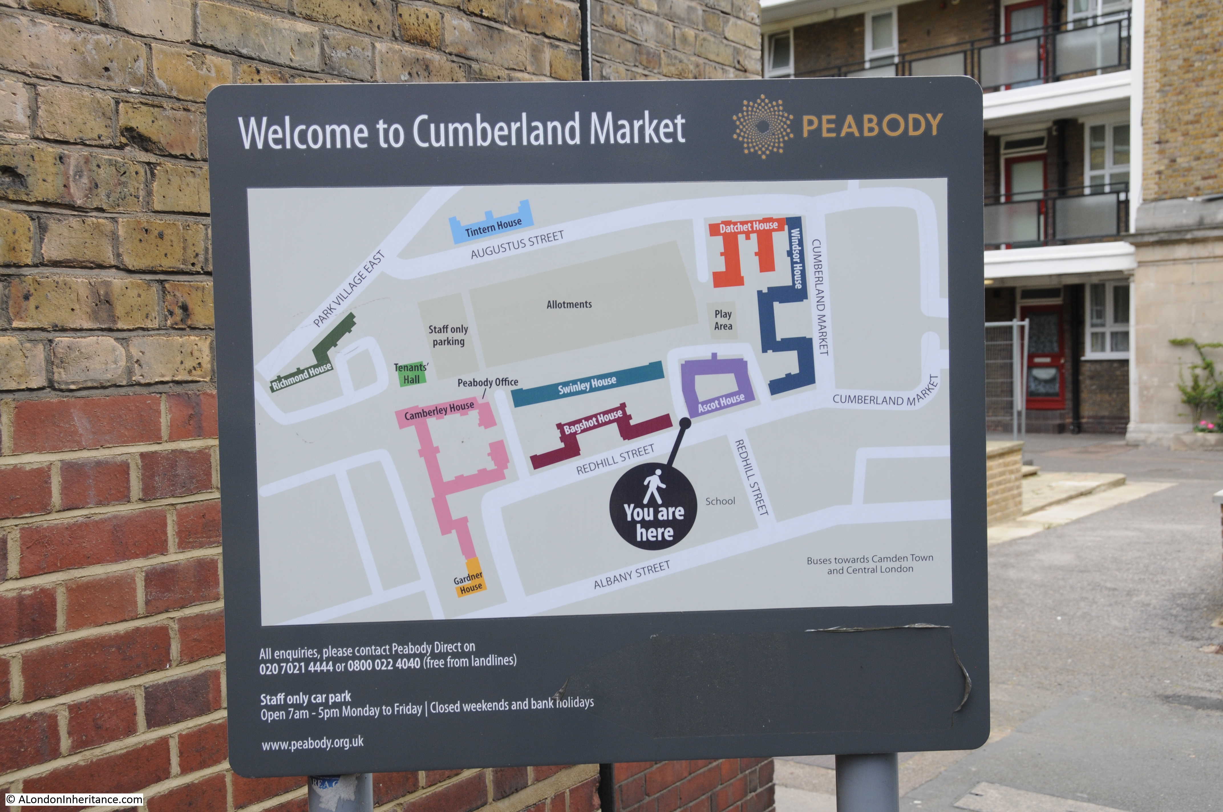
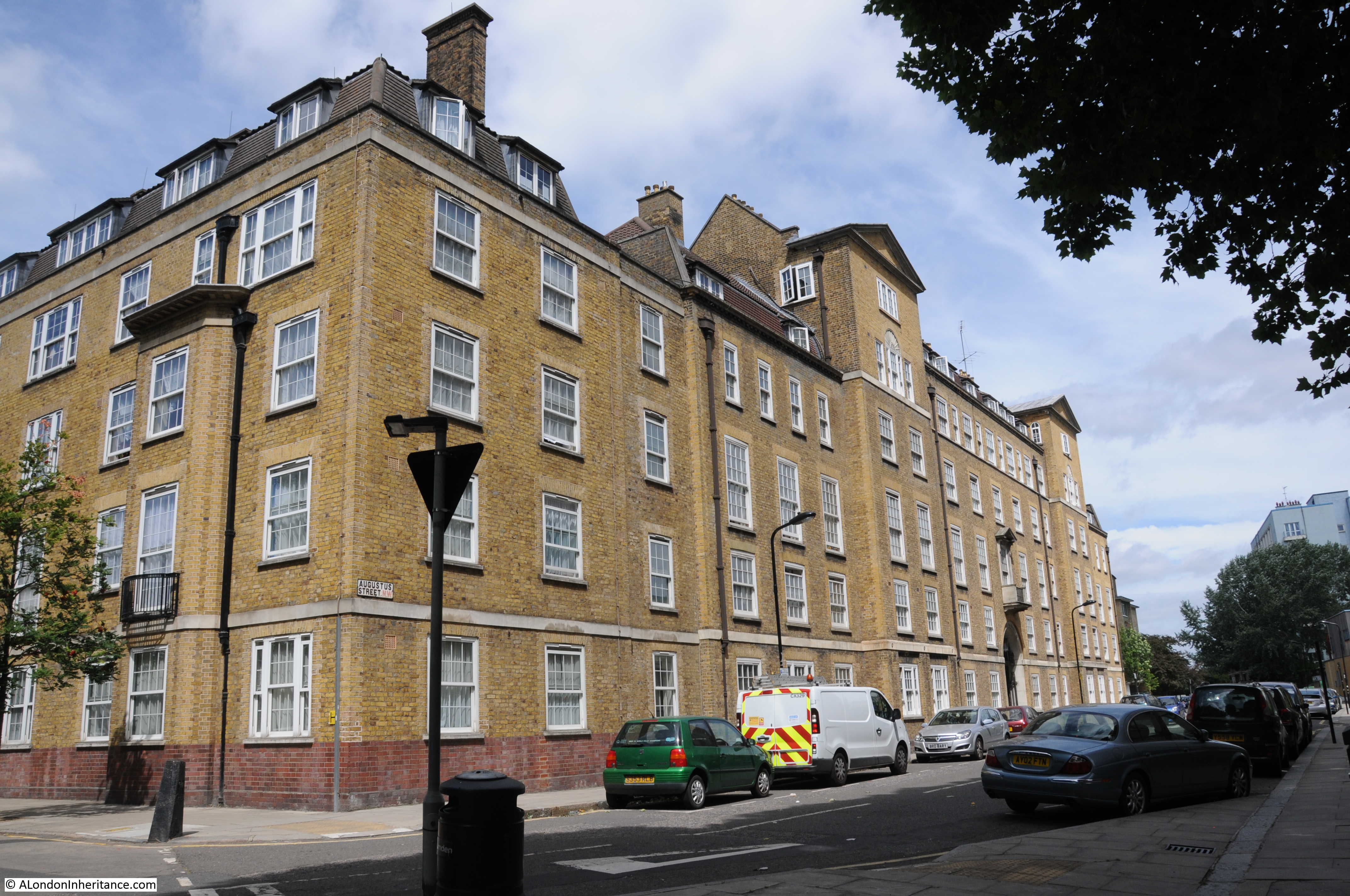
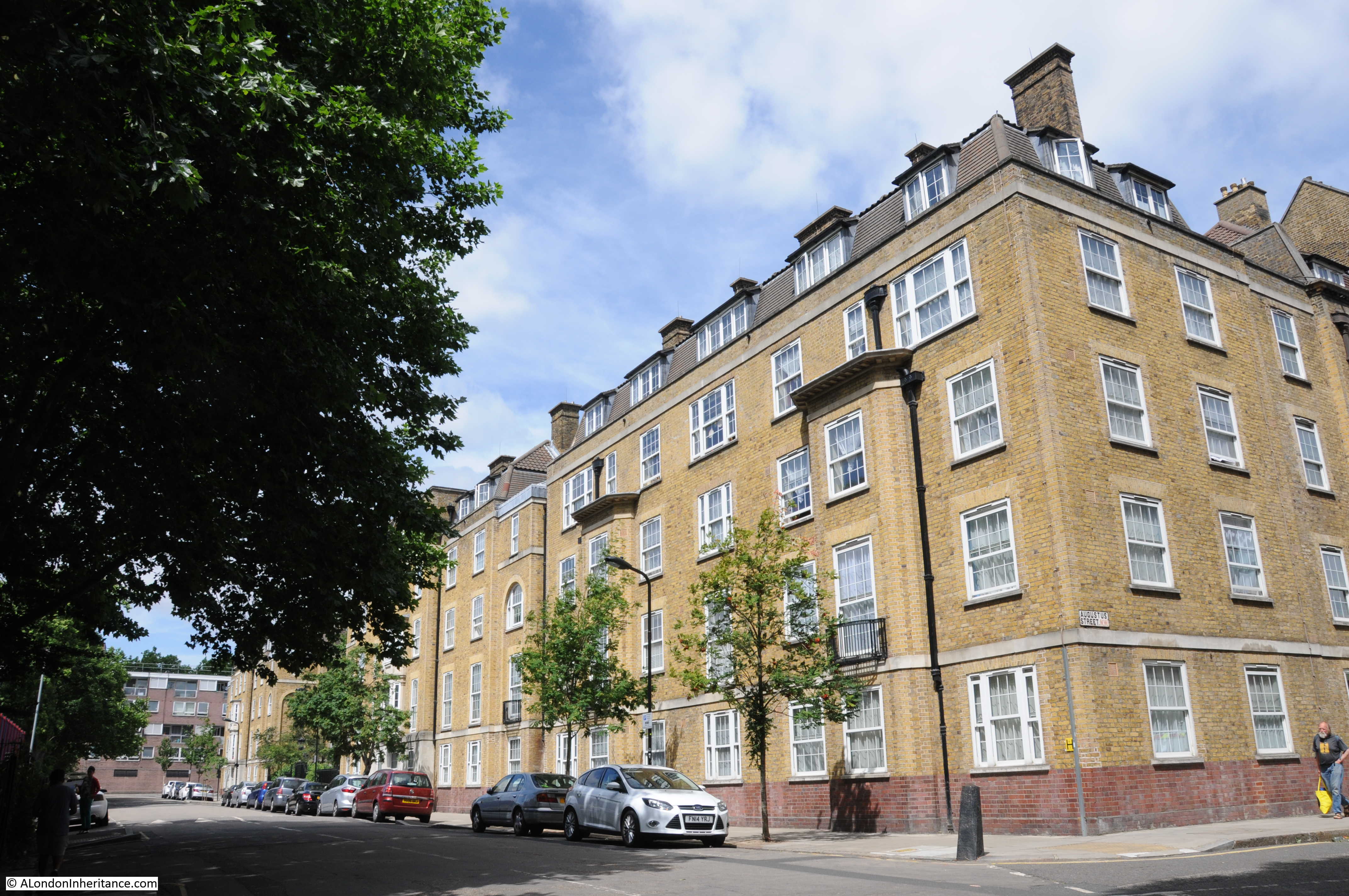
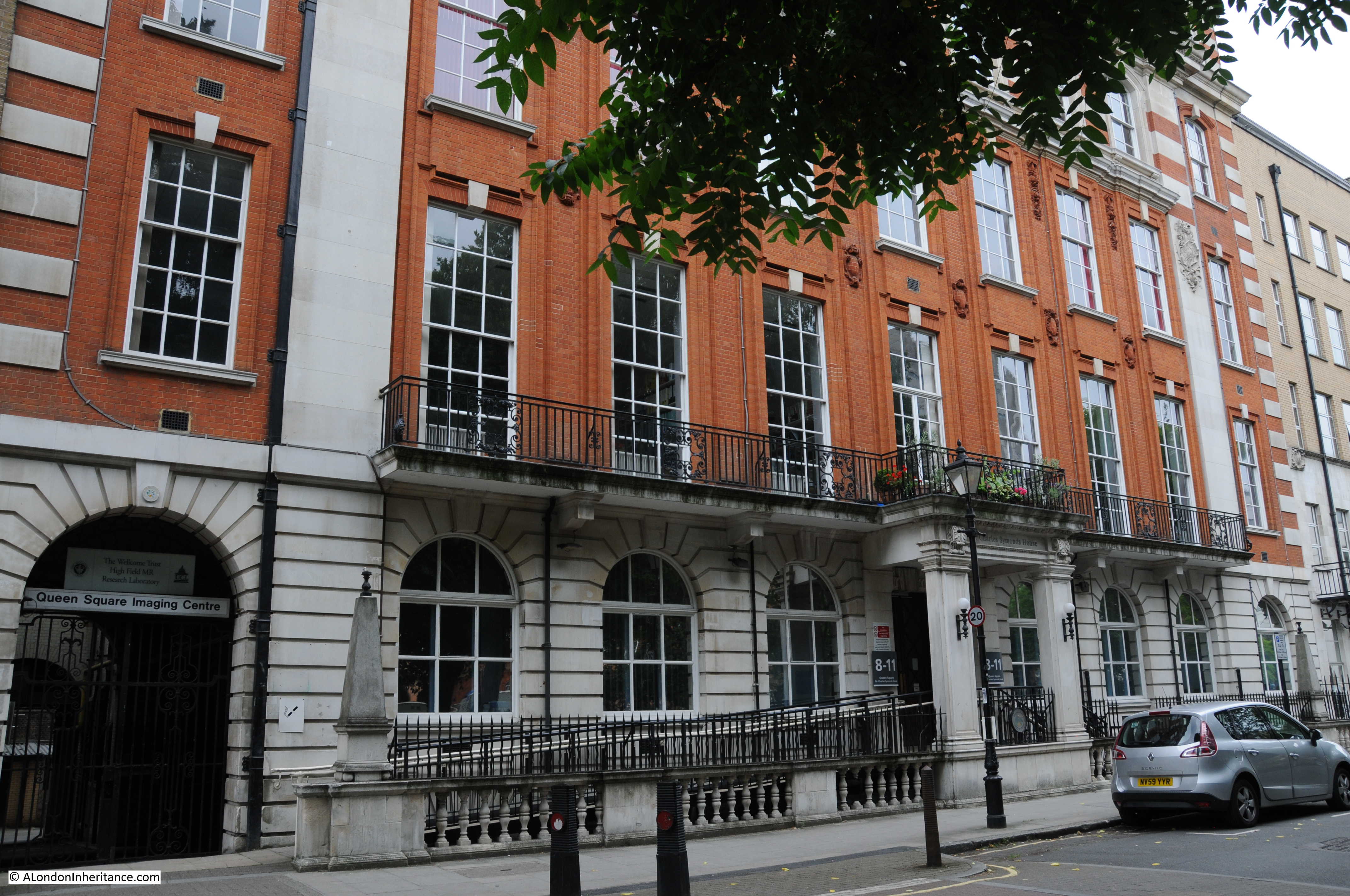
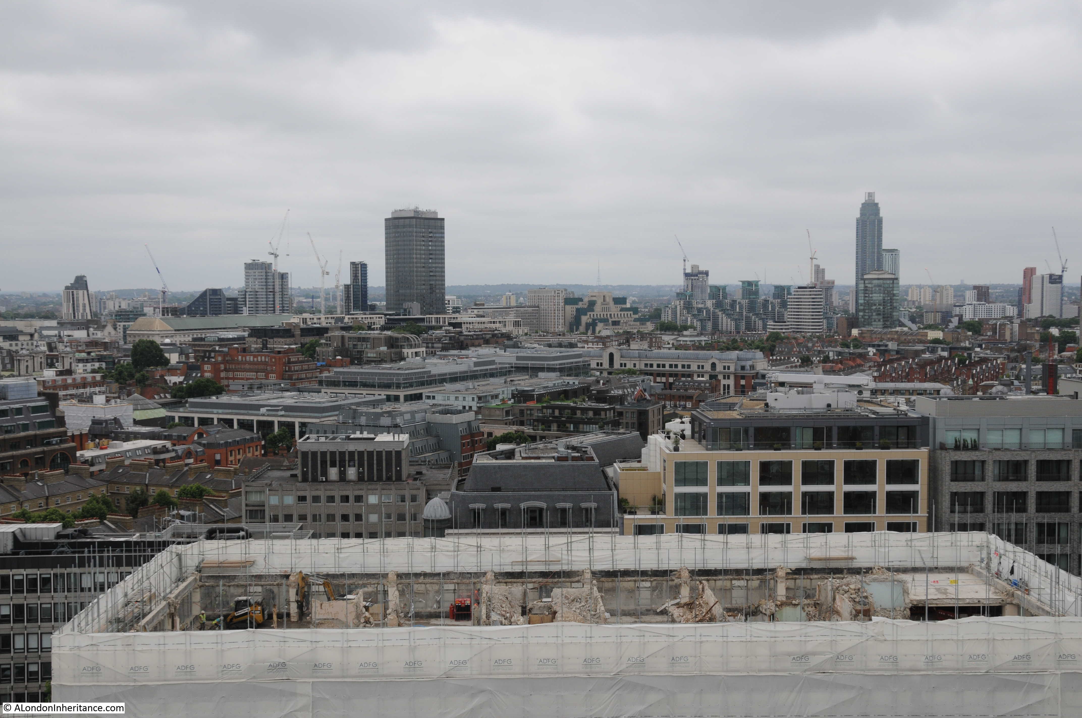
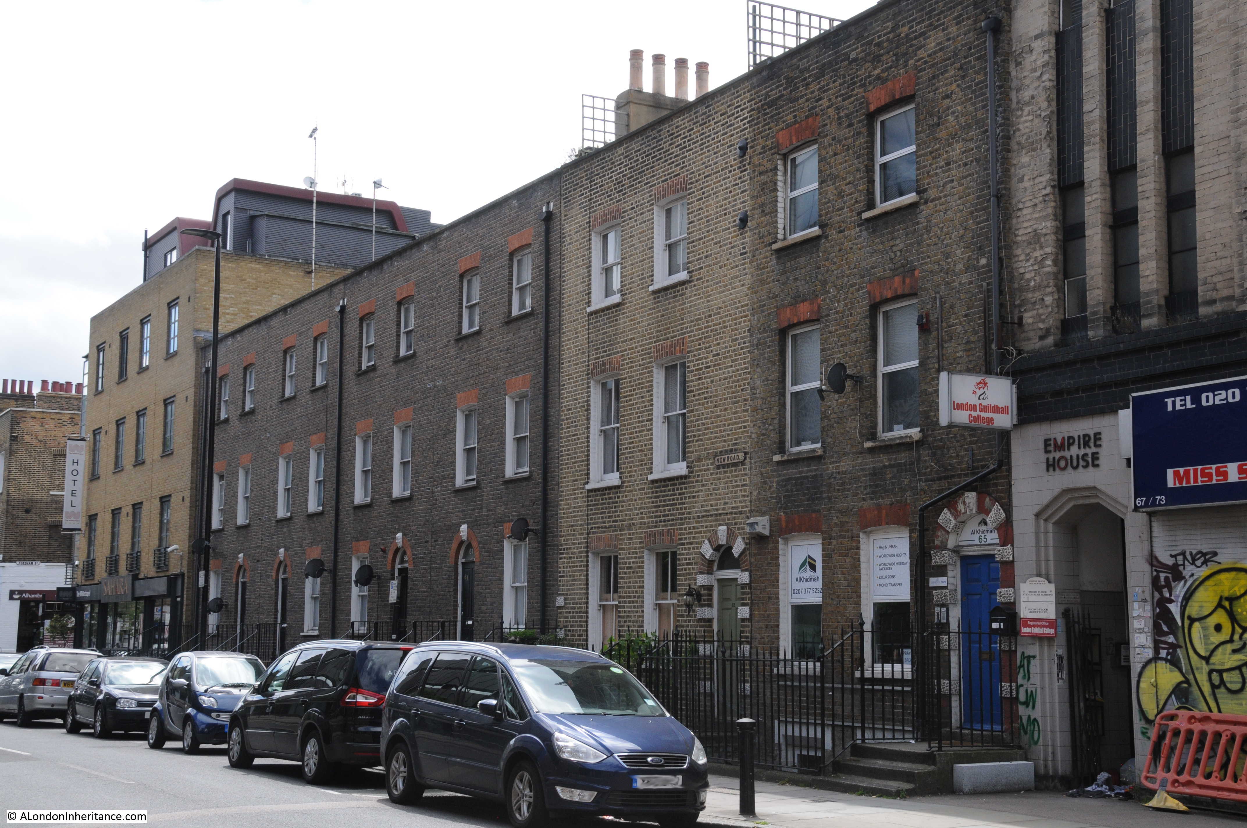
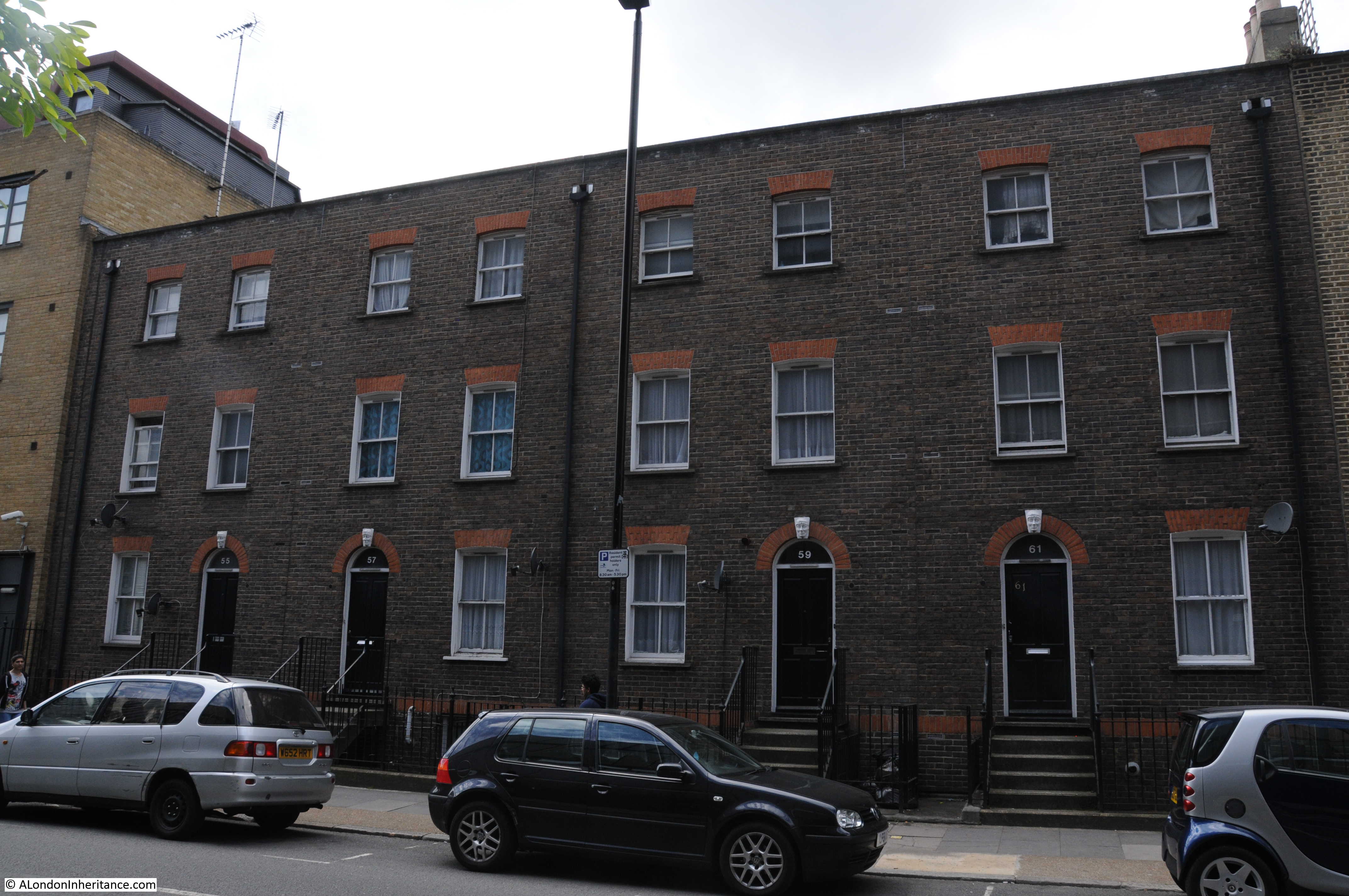
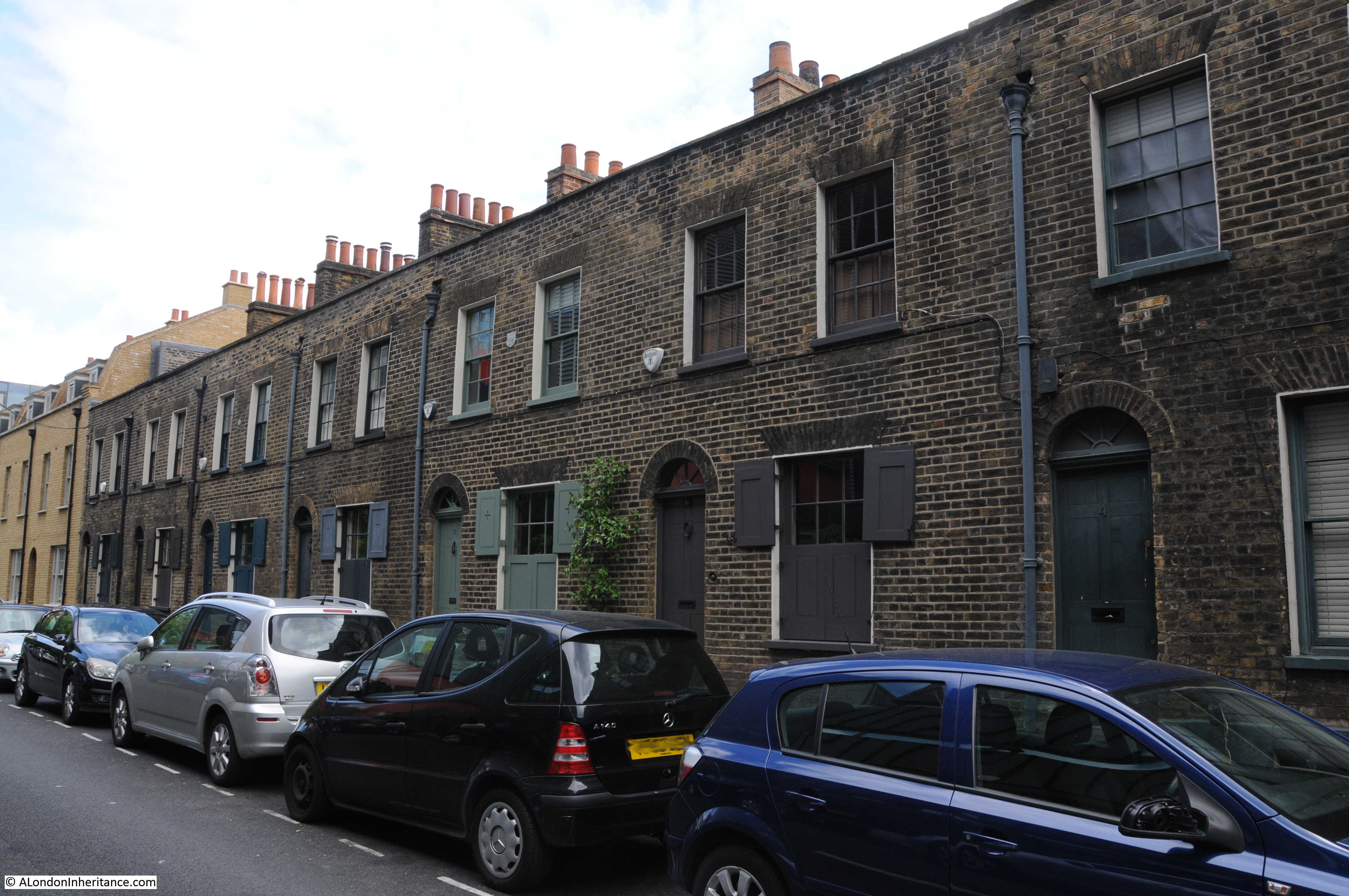
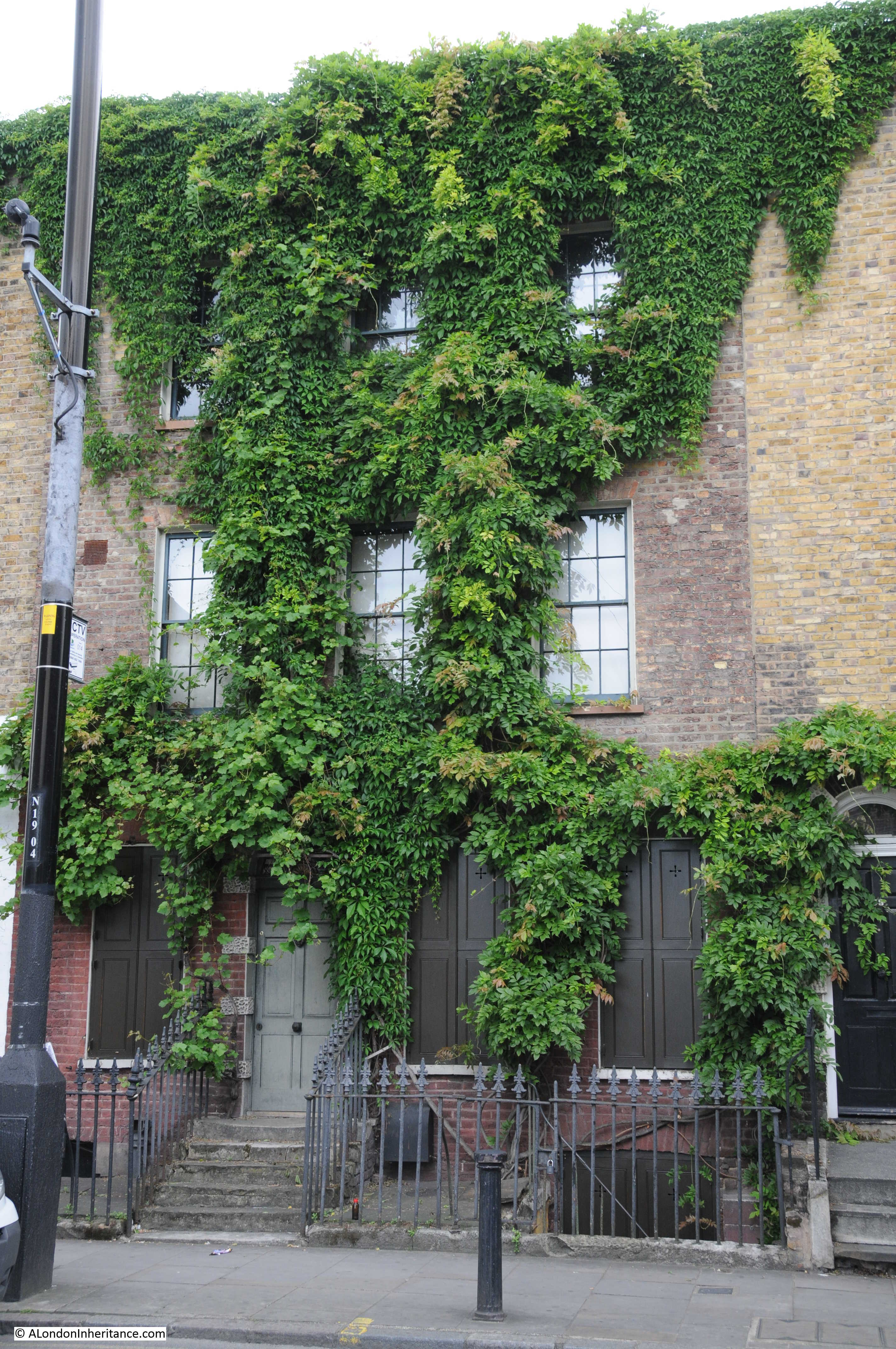
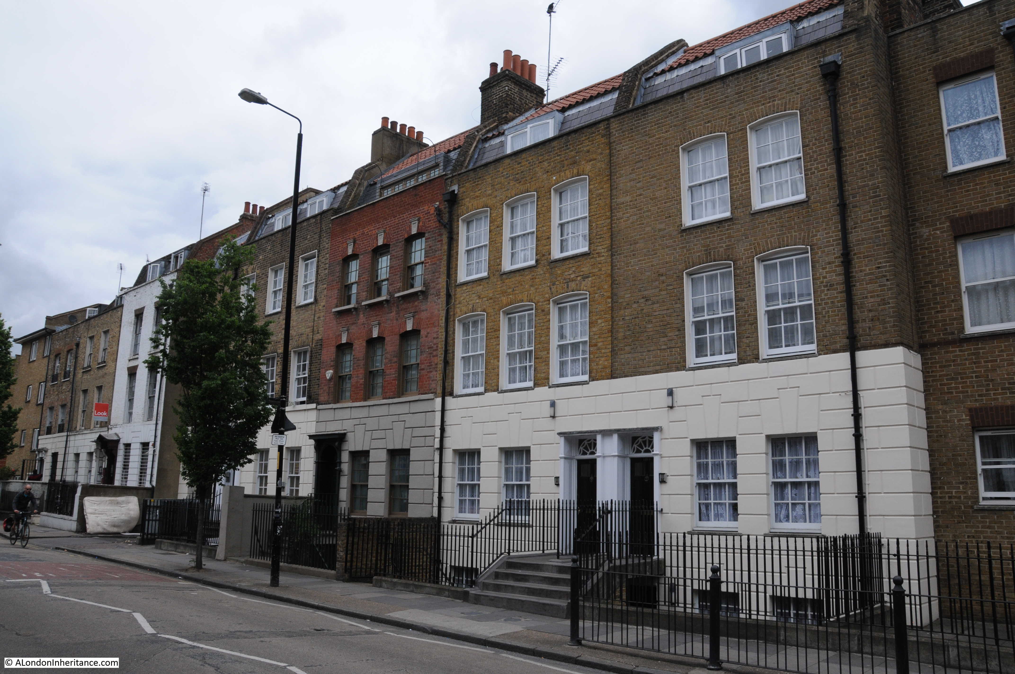
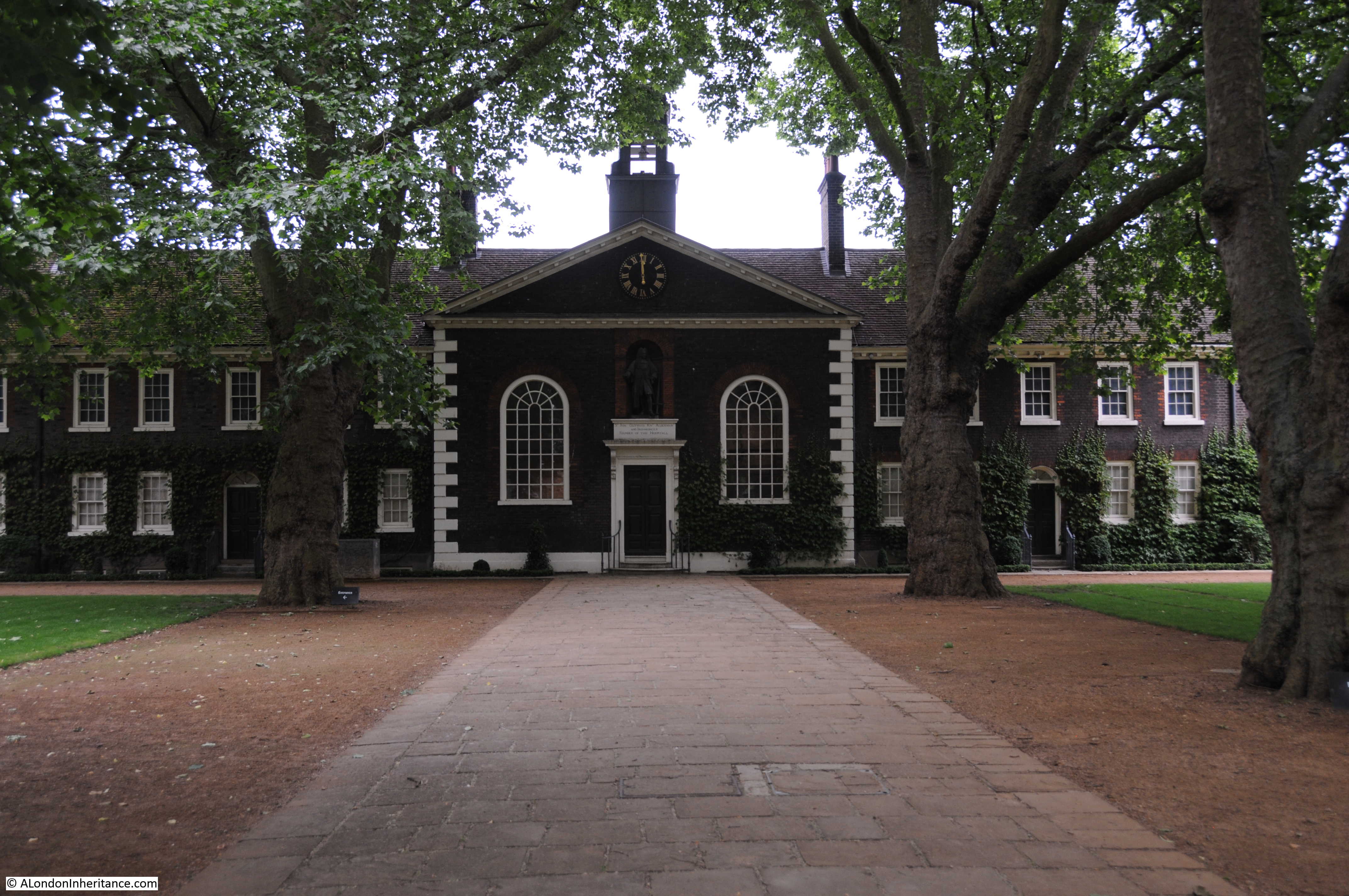
For this week’s post, I am in for me, a rather special place. This is the Peabody Cumberland Market Estate, a large estate of flats, mainly completed by 1937 and built around the old Regents Park Basin, also known as the Cumberland Market Basin, built to facilitate delivery of hay, vegetables, ice and loads of other goods to Cumberland Market, which was located at the end of the basin.

It is a special place for me as my father moved into Bagshot House as a child in 1939, lived here throughout the war (apart from about 2 weeks of evacuation), and continued living here until the early 1950s.

Regents Park Basin

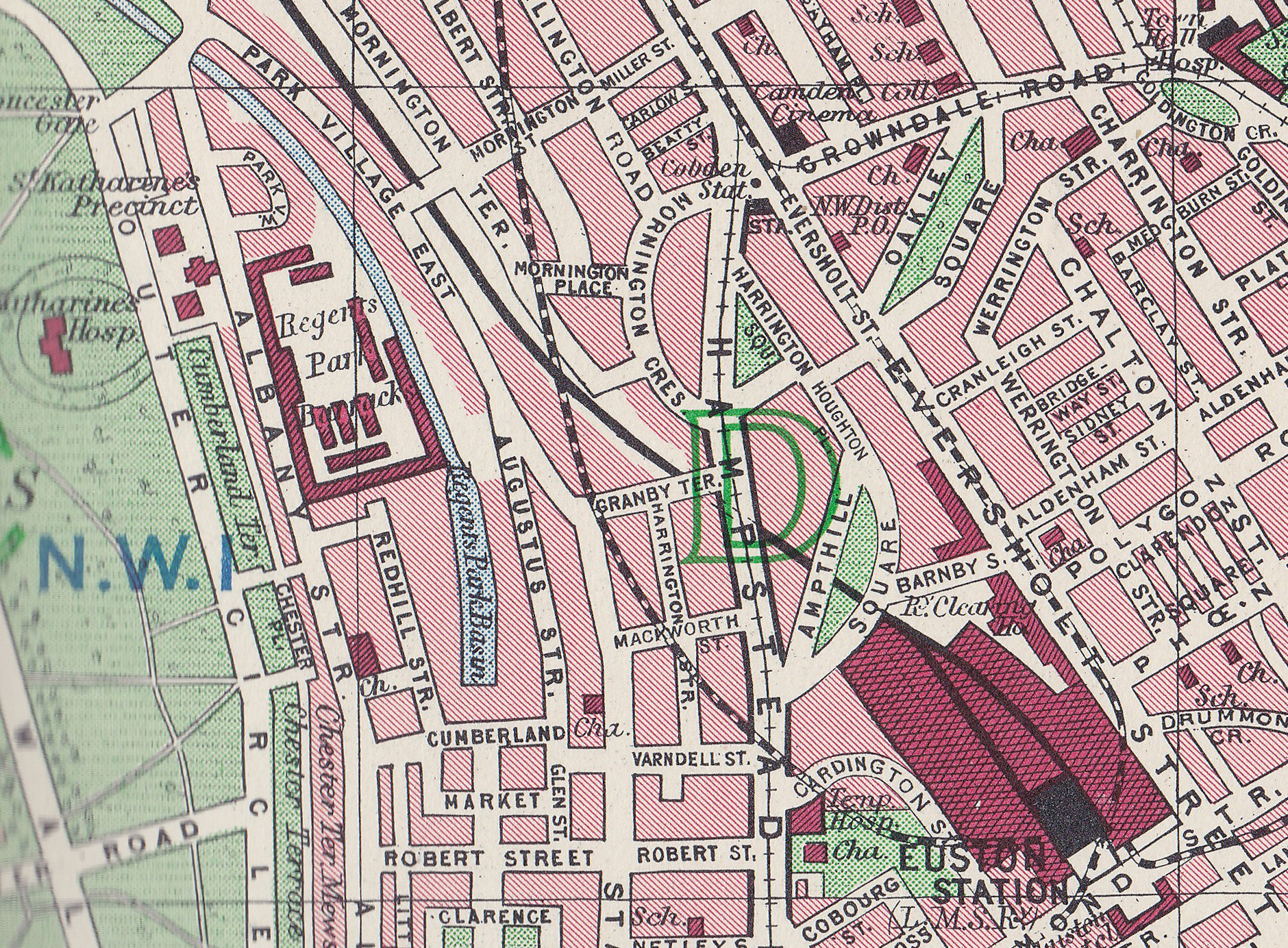
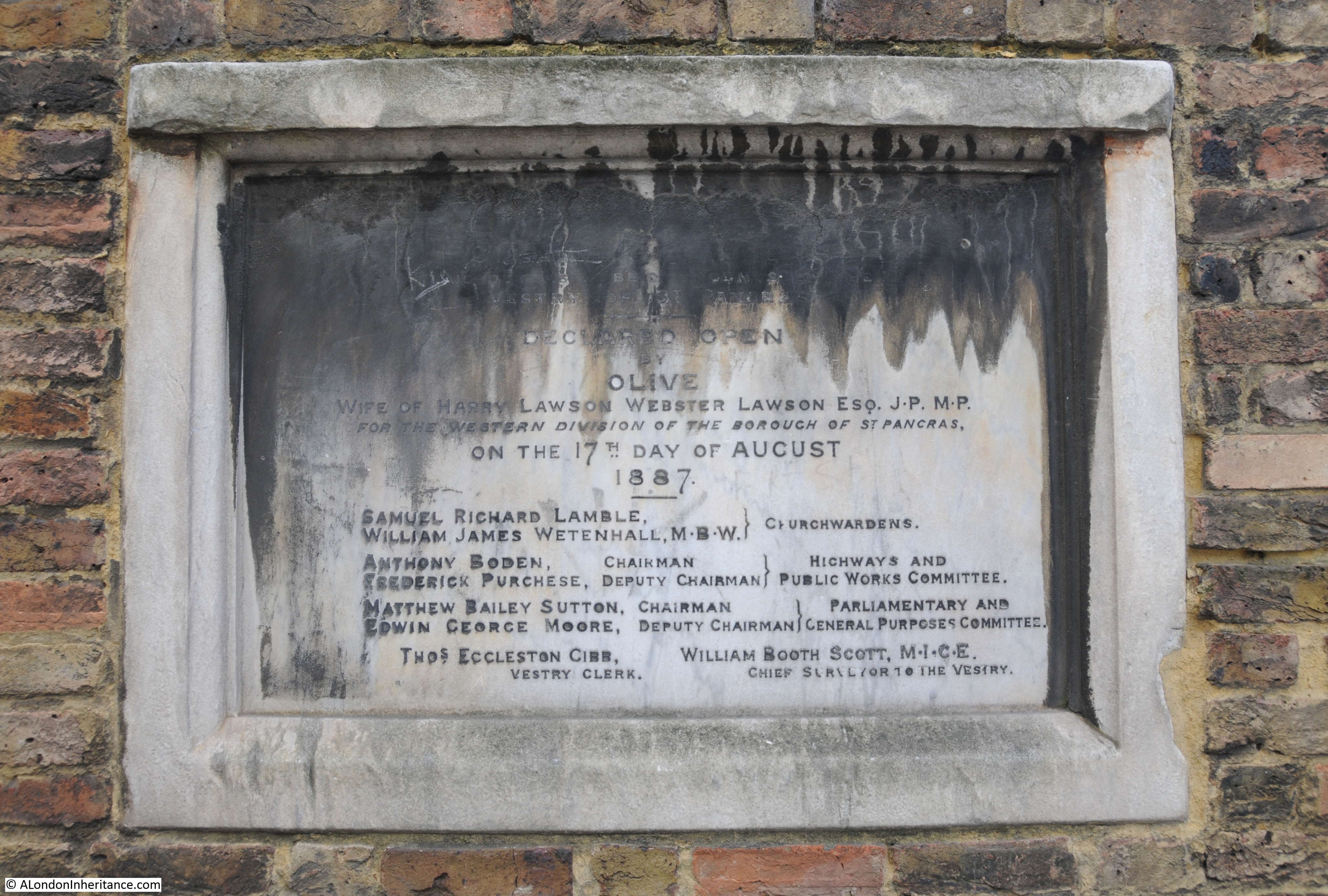
Construction of the flats was started in the mid 1920s on land owned by the Crown Estate. The flats were built on land once occupied by warehouses, workshops and houses, all surrounding the Regents Park Basin. The basin was connected to the Regents Canal by a short run of canal that passed through Regents Park, then alongside the Regents Park Barracks. Cumberland Market was at the end of the basin. This extension of the canal was built in 1830.

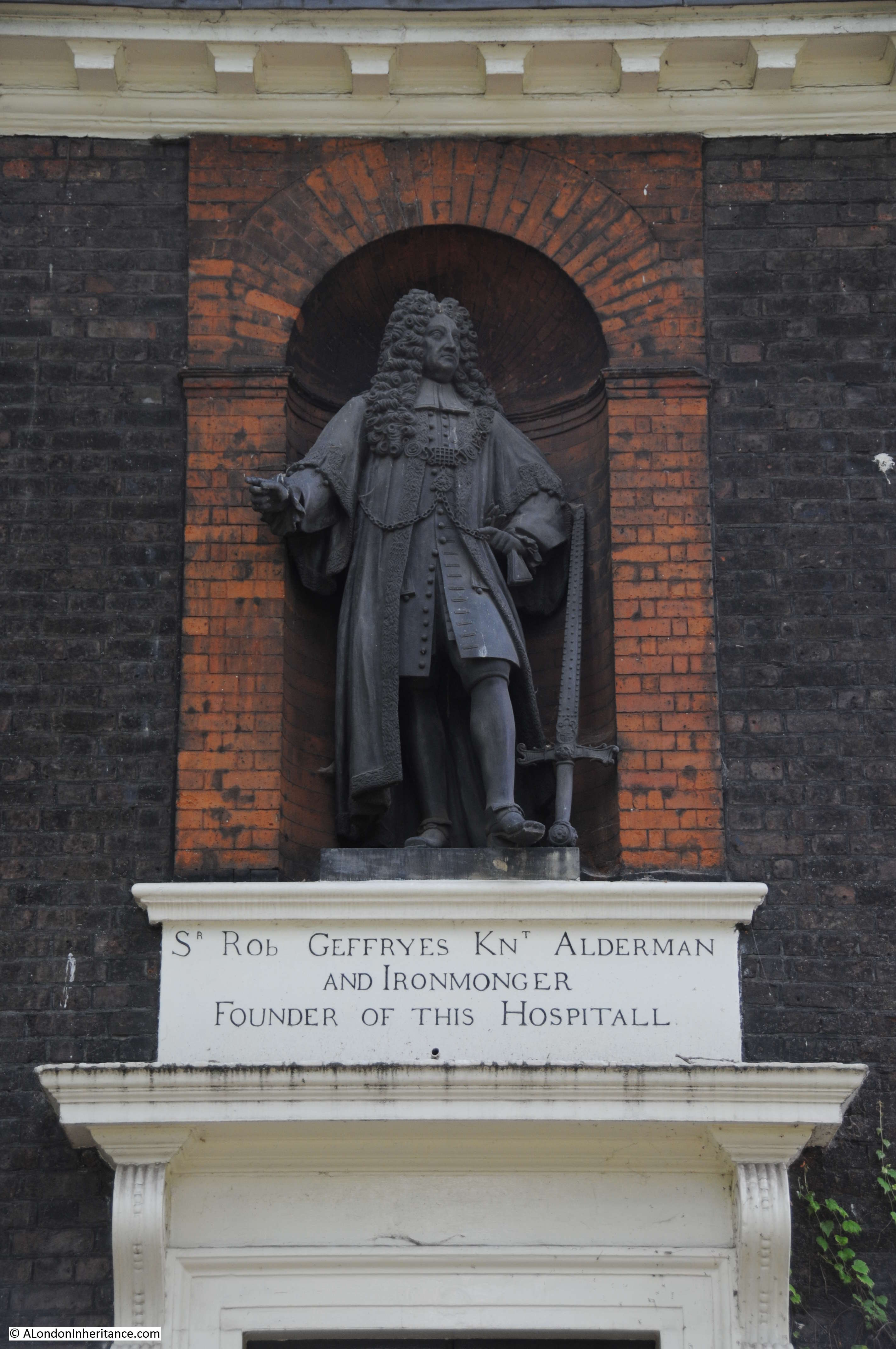
The architect of the estate was C. E. Varndell and there is a street named after him running from Cumberland Market to the Hampstead Road.

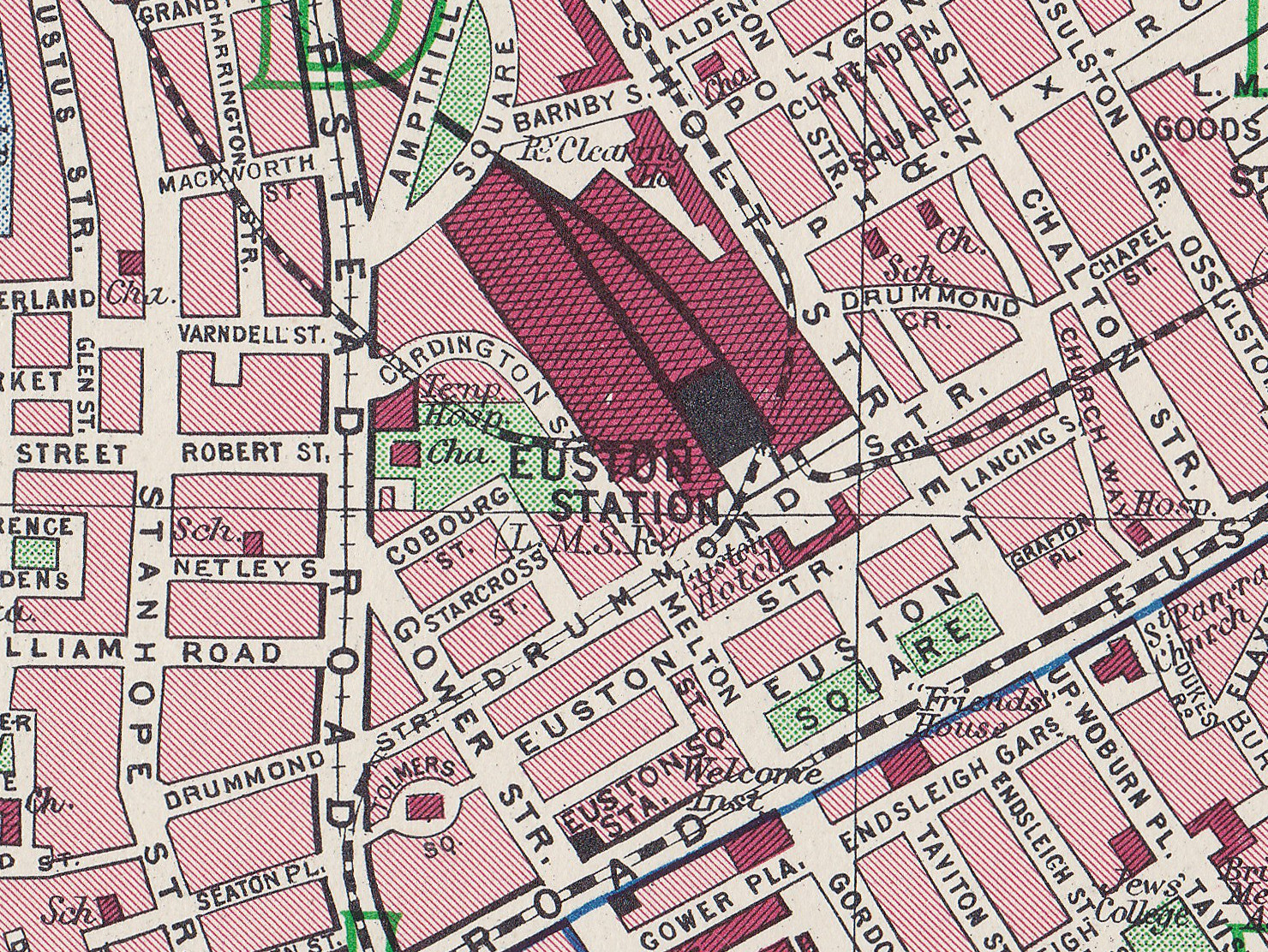
The following map from the 1940 Bartholomew Atlas for Greater London shows the basin to the left of centre. In the above Peabody map you can see Redhill Street and Augustus Street with allotments now running through the centre of the estate on the area once occupied by the basin.

Regents Park Basin

It was from these flats that for a child the rest of London was a playground, where the impact of war would be seen both in the distance and in his own block of flats and where a 14 year old would see the horrendous human consequences of the bombing of a civilian population.

It was also from the flats that immediately after the war he would set out walking and cycling to photograph London and a few of these photos include views of the estate.

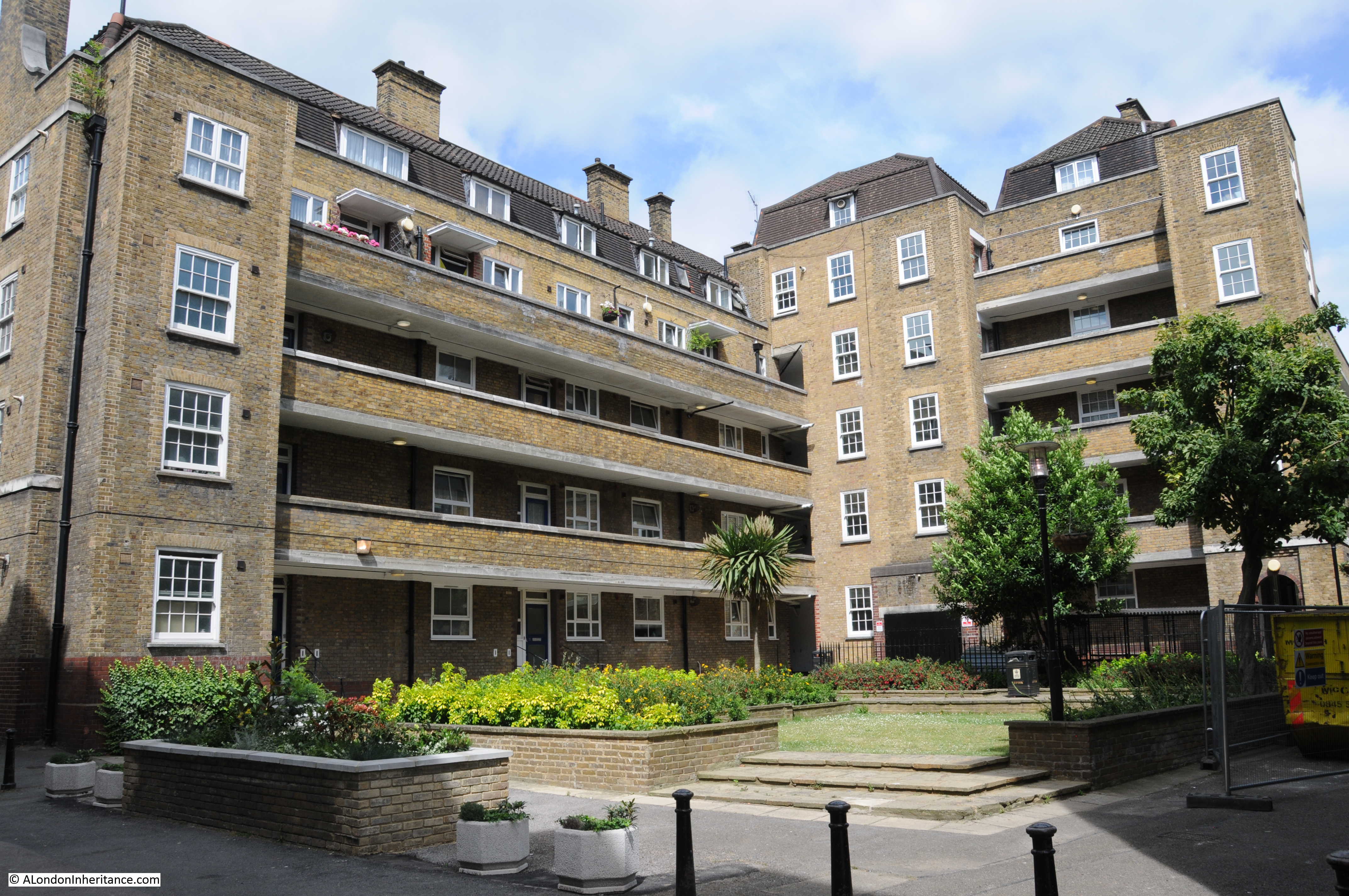
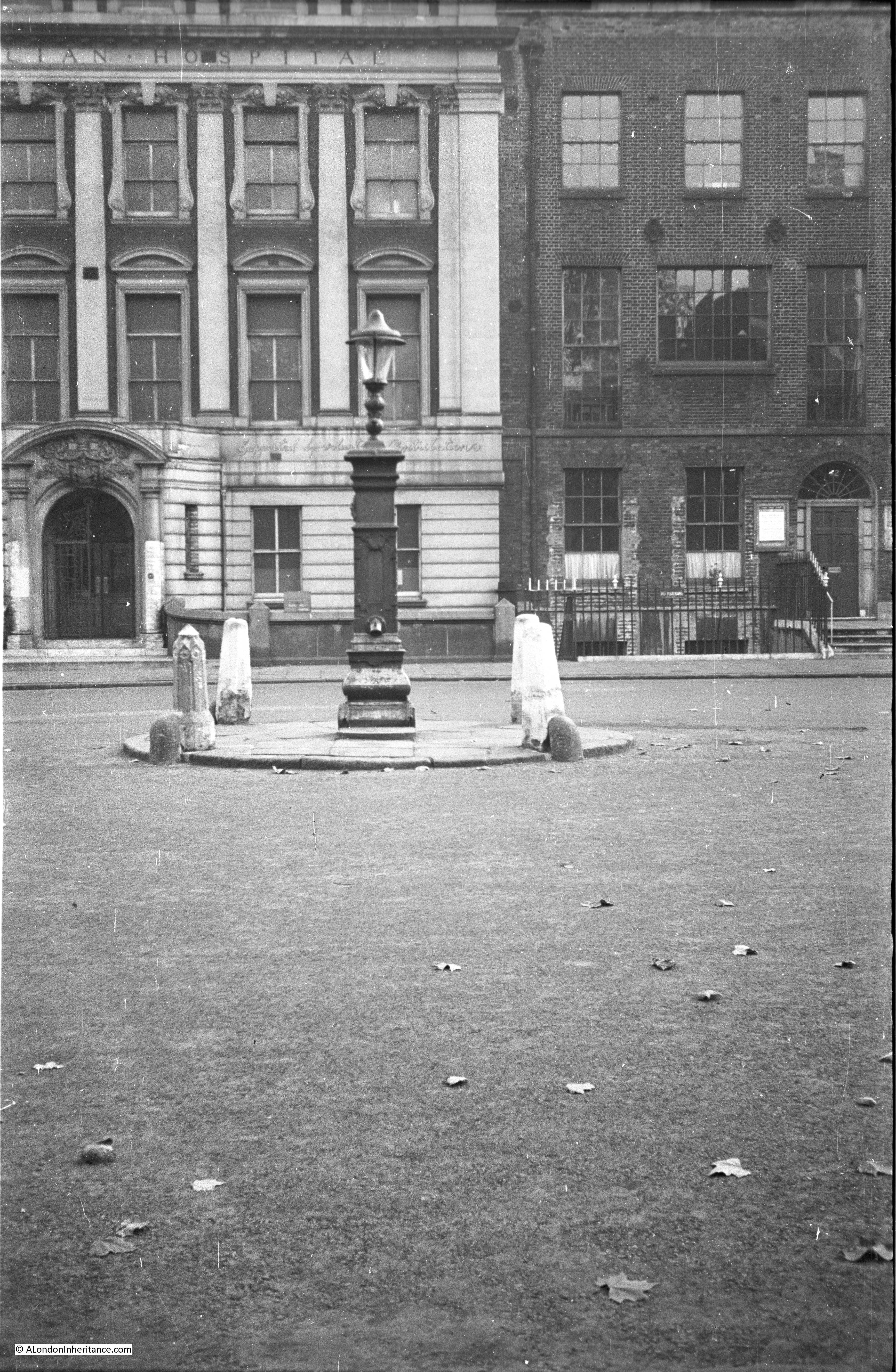
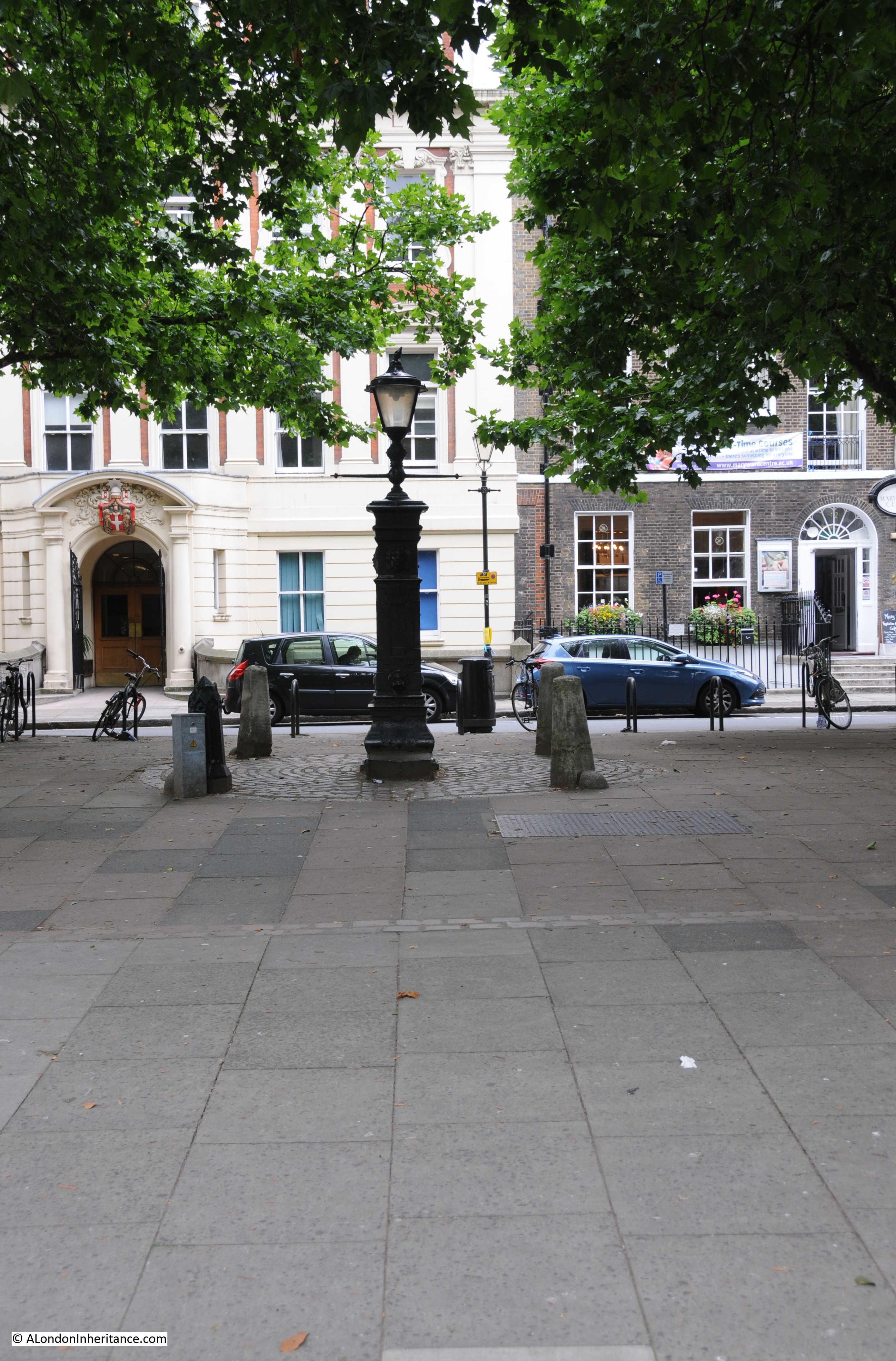
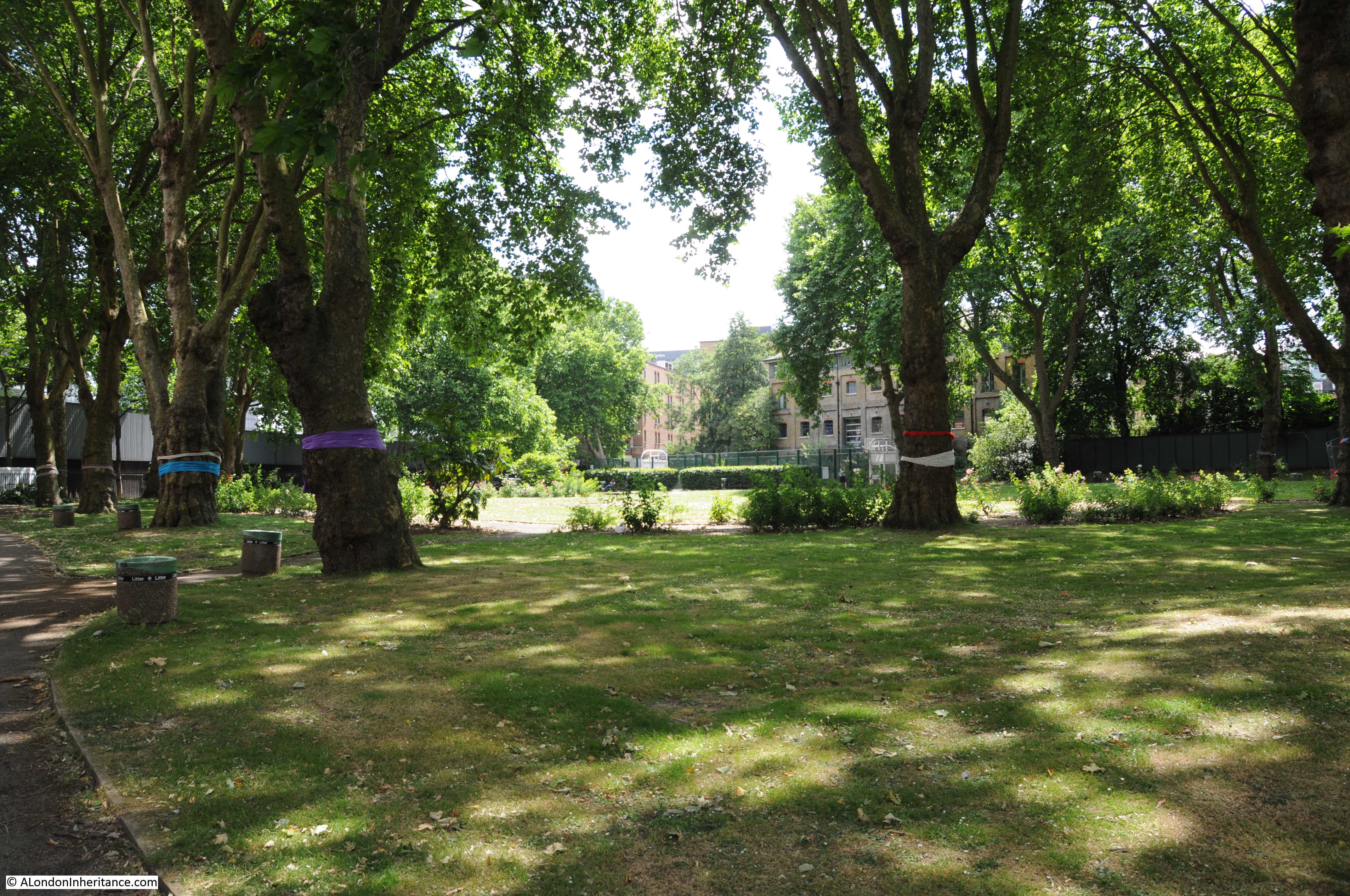
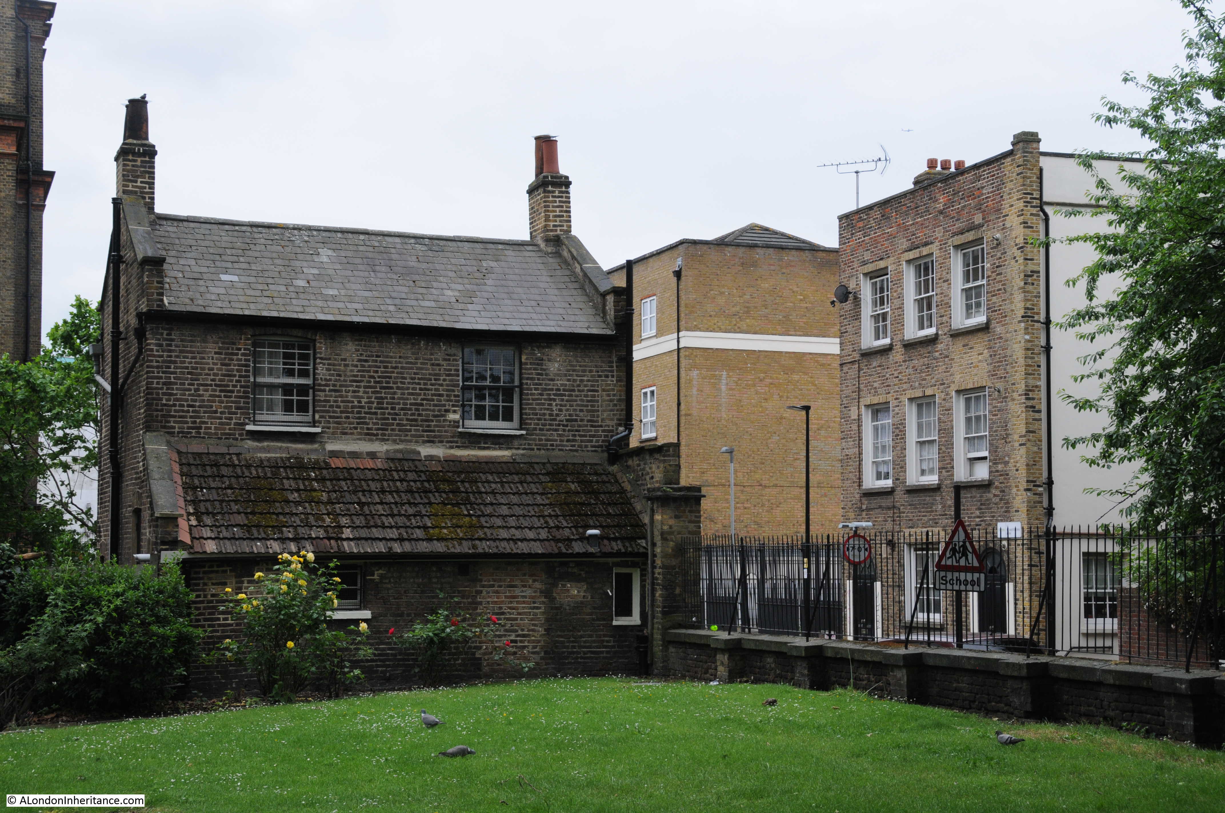
If you return to the Peabody estate map at the top of the post, you will see Redhill Street, then Bagshot House, then Swinley House.

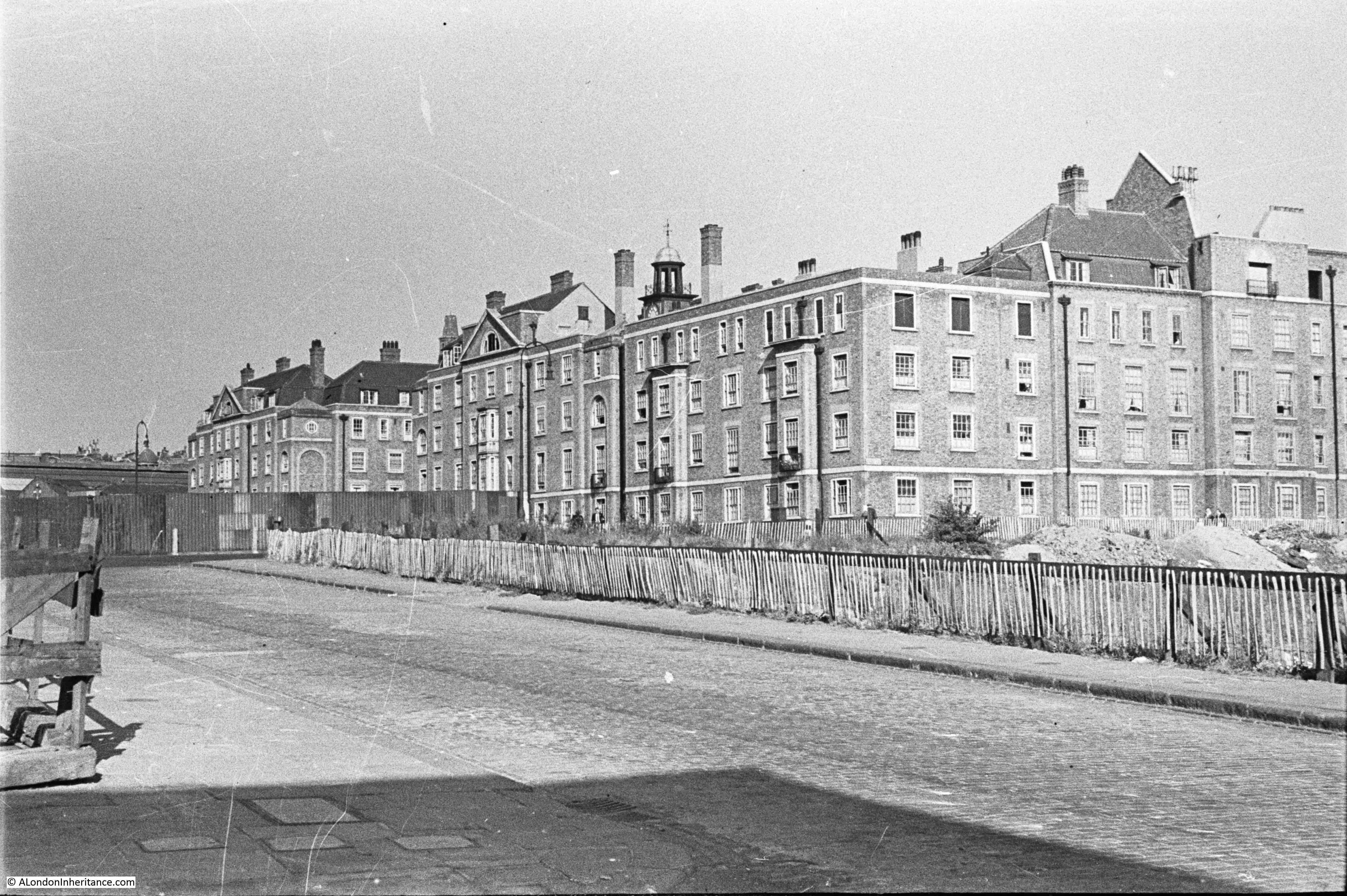
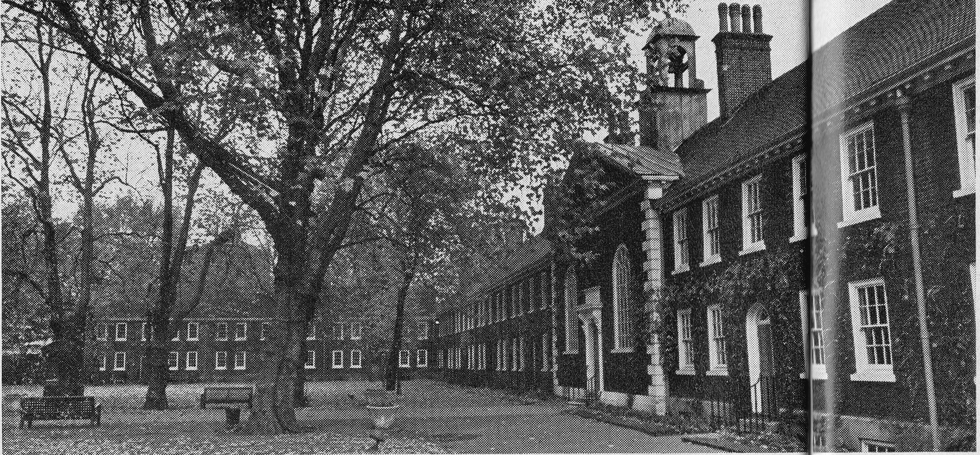
Swinley House was a long row of flats that faced onto the Regents Park Basin. When built, the basin was still full of water, however this was the post war view across what was the Regents Park Basin looking towards Swinley House.

Regents Park Basin

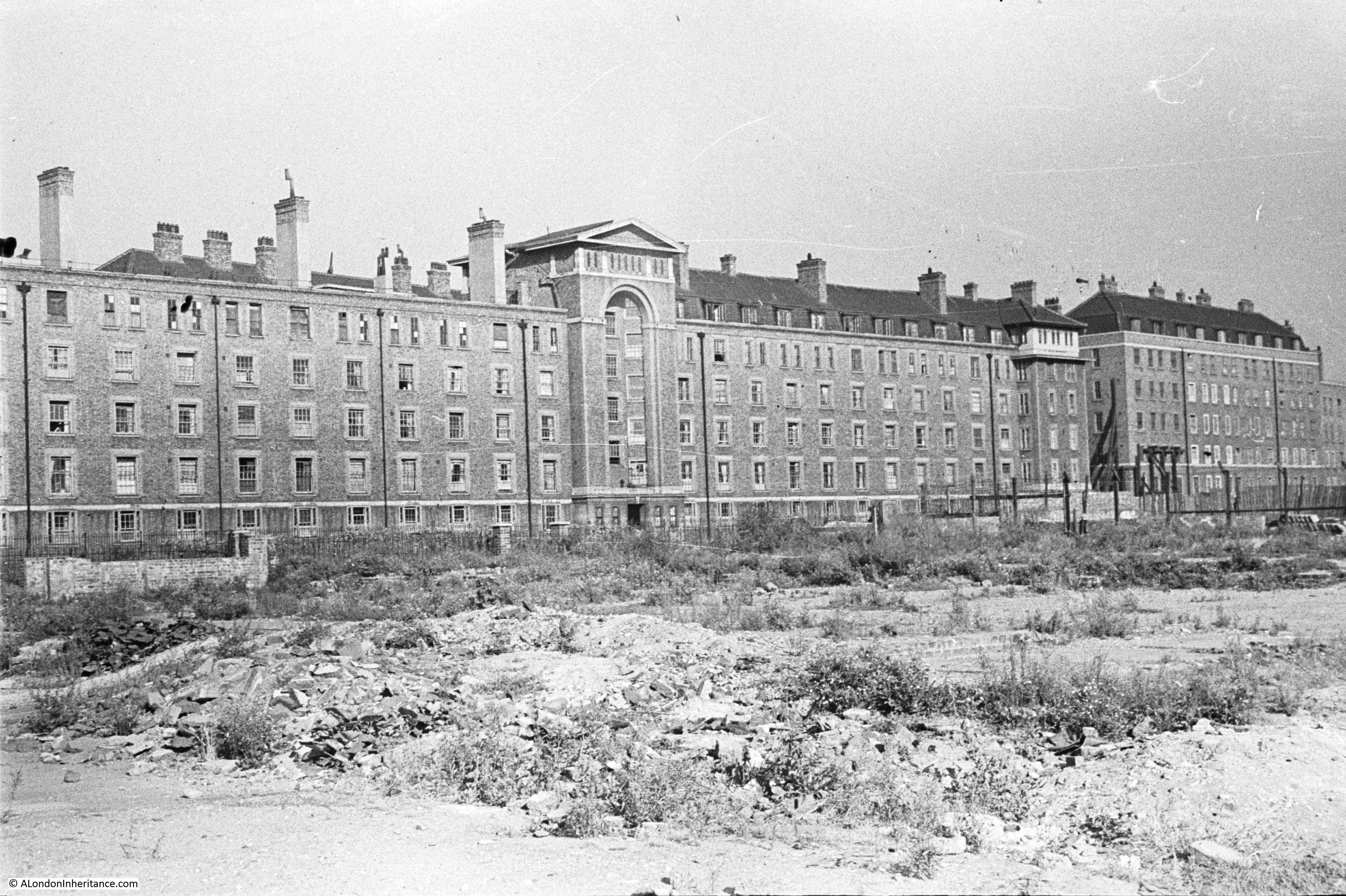
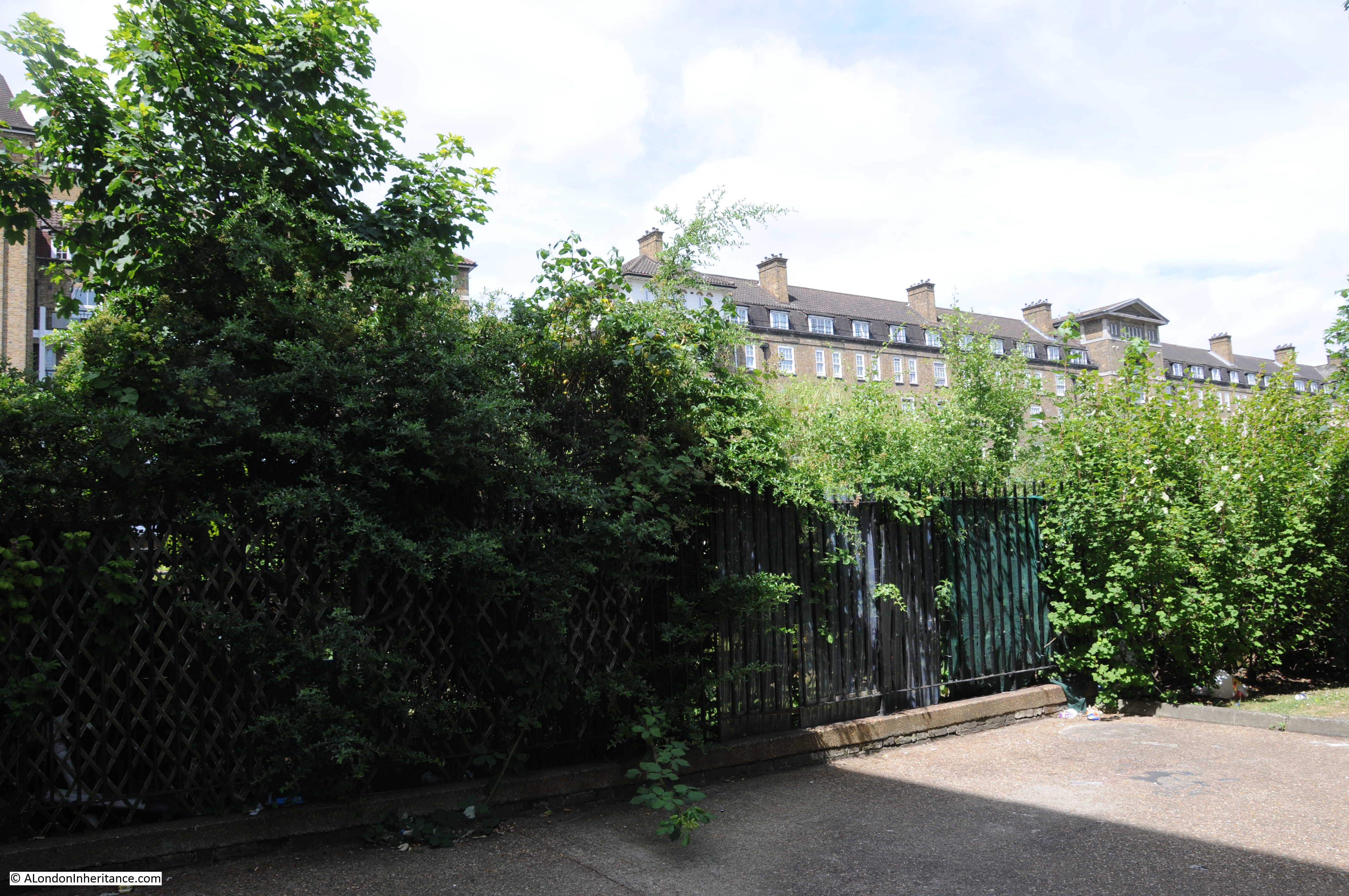
I could not get to the exact same location, however this is roughly the same view today – I will explain why the views are so different after the photo below.

Regents Park Basin

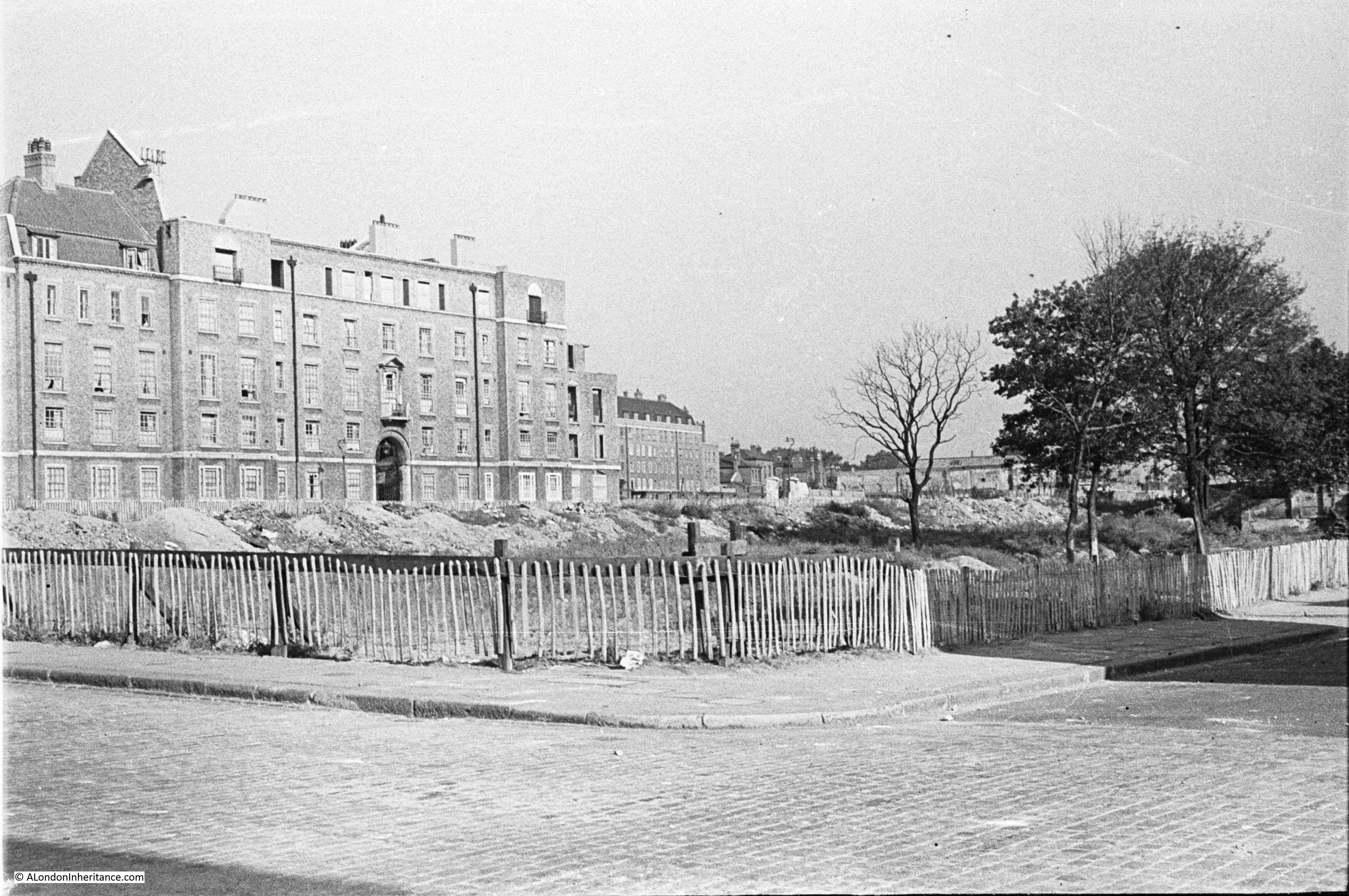
Firstly, if you look along the top of Swinley House, the roof level flats are missing along the left of the building in the post war photo. This was as a result of incendiary bombing in 1940 which I will describe later in this post.

Also in the post war photo all the land in front of Swinley House is full of rubble. This had once been the Regents Park Basin, however, during the war the basin and canal extension was gradually filled with the considerable volumes of rubble caused by bombing across the city.

As Cumberland Market had closed, the basin served no purpose, and therefore provided a convenient dumping ground.

The following extract is from my father’s account of his experiences in London during the war, written in the summer of 1945, and mentions the in filling of the basin. This was the year 1943.

London’s bomb sites continued to be cleared and building repairs carried out. The number of static water tanks increased as sites and basements became available, and huge piles of brick and masonry rubble appeared where buildings had once stood. 

That section of the Regents Canal from its Camden Town branch to the Regents Park Basin had been filed in over a period of many weeks. The water had not been drained but remained beneath the layer of rubble which had been dropped from a continuous fleet of lorries reversing towards the basin and tipping the contents into the water until one very small area of water remained, massed with gasping fish. Luckily all the ducks had flown.

I often wondered what personal belongings and perhaps human remains were buried with the filling, and thought the loss of water foolhardy as air raids might well resume.

Cumberland Market became a Council Depot for building materials, huge mounds of sand and bags of cement, the site enclosed with old doors which were plentiful.

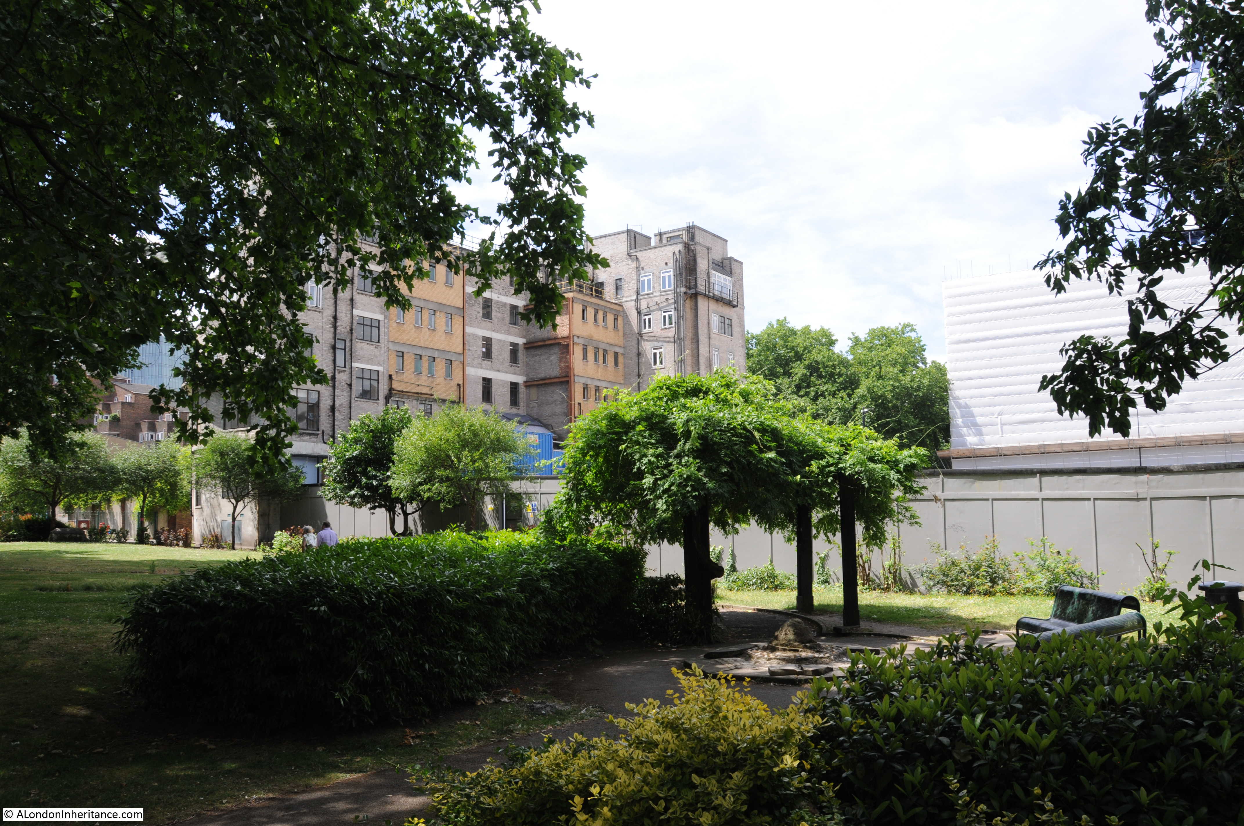
The large area in front of Swinley House is now occupied by allotments, as topsoil was placed over the rubble.

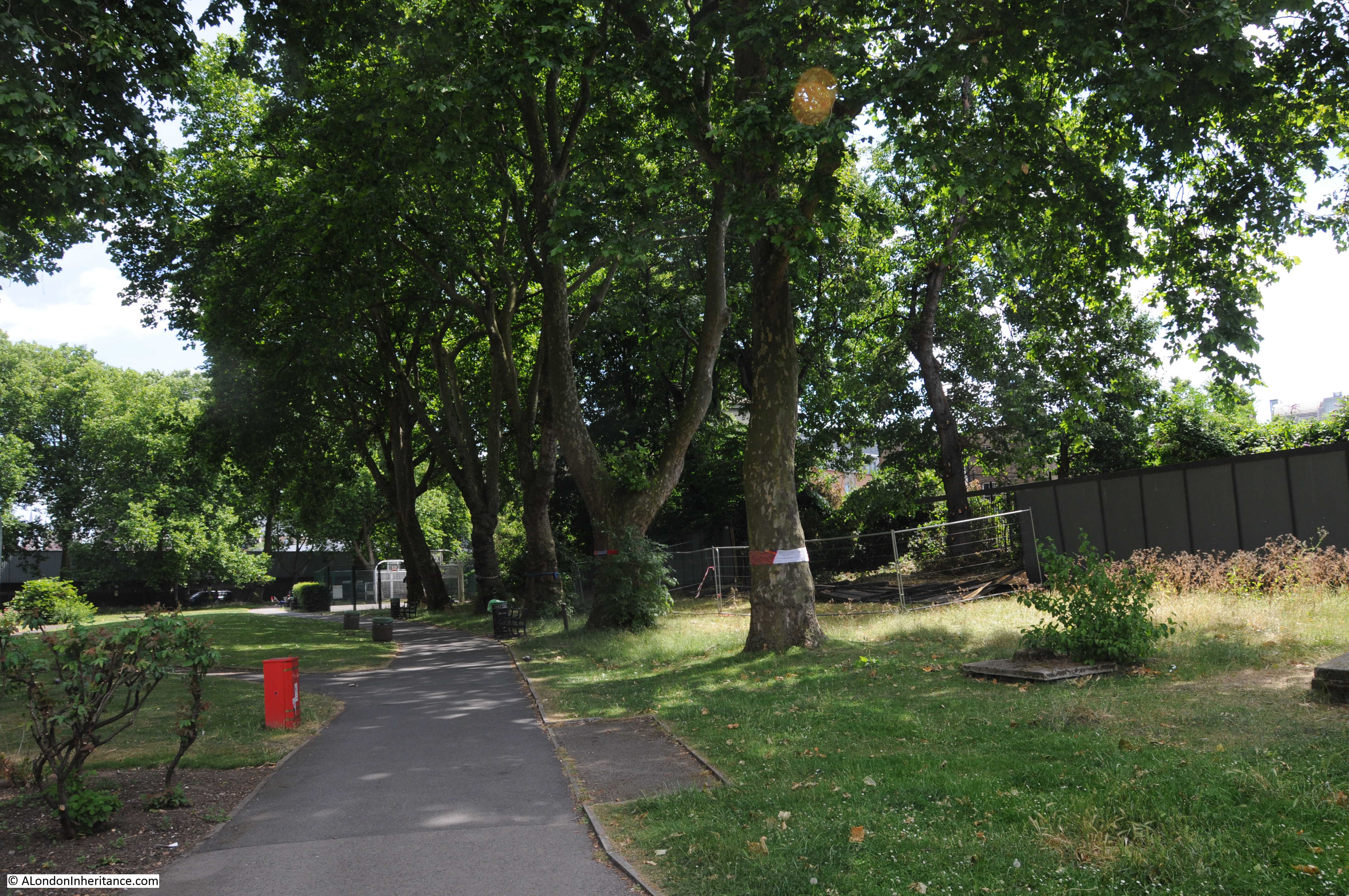
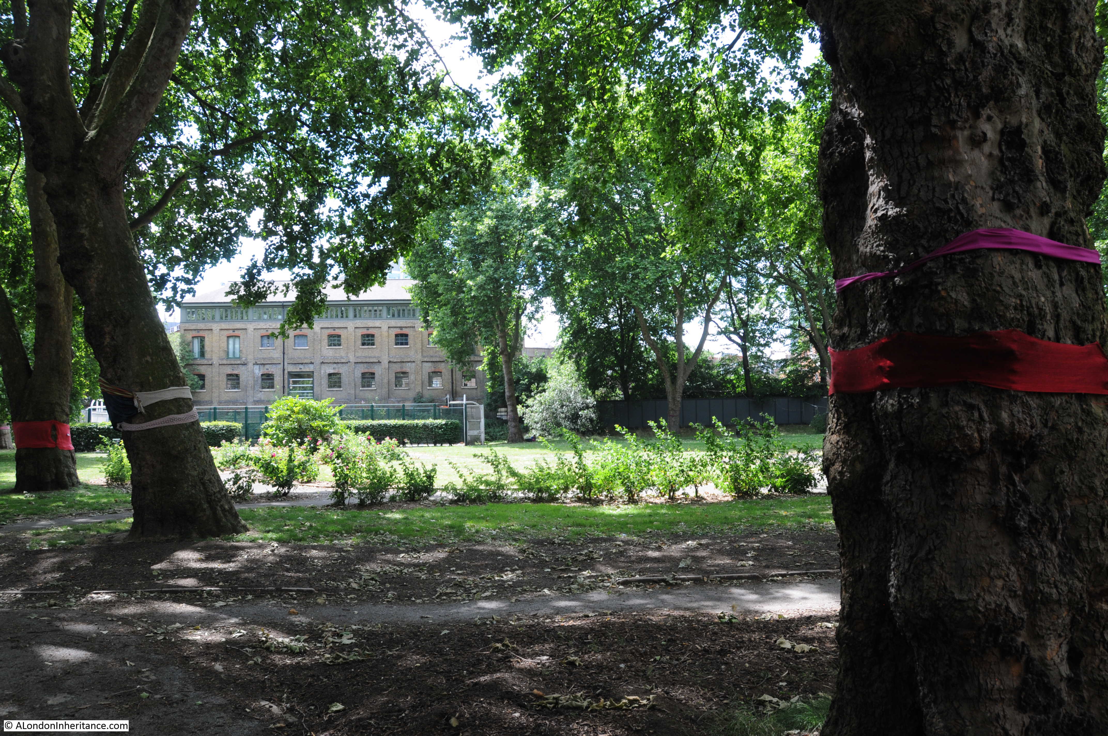
The following view is looking down the full length of the old Regents Park Basin towards where Cumberland Market would have been just after the flats at the very end. Swinley House is on the right.

Regents Park Basin

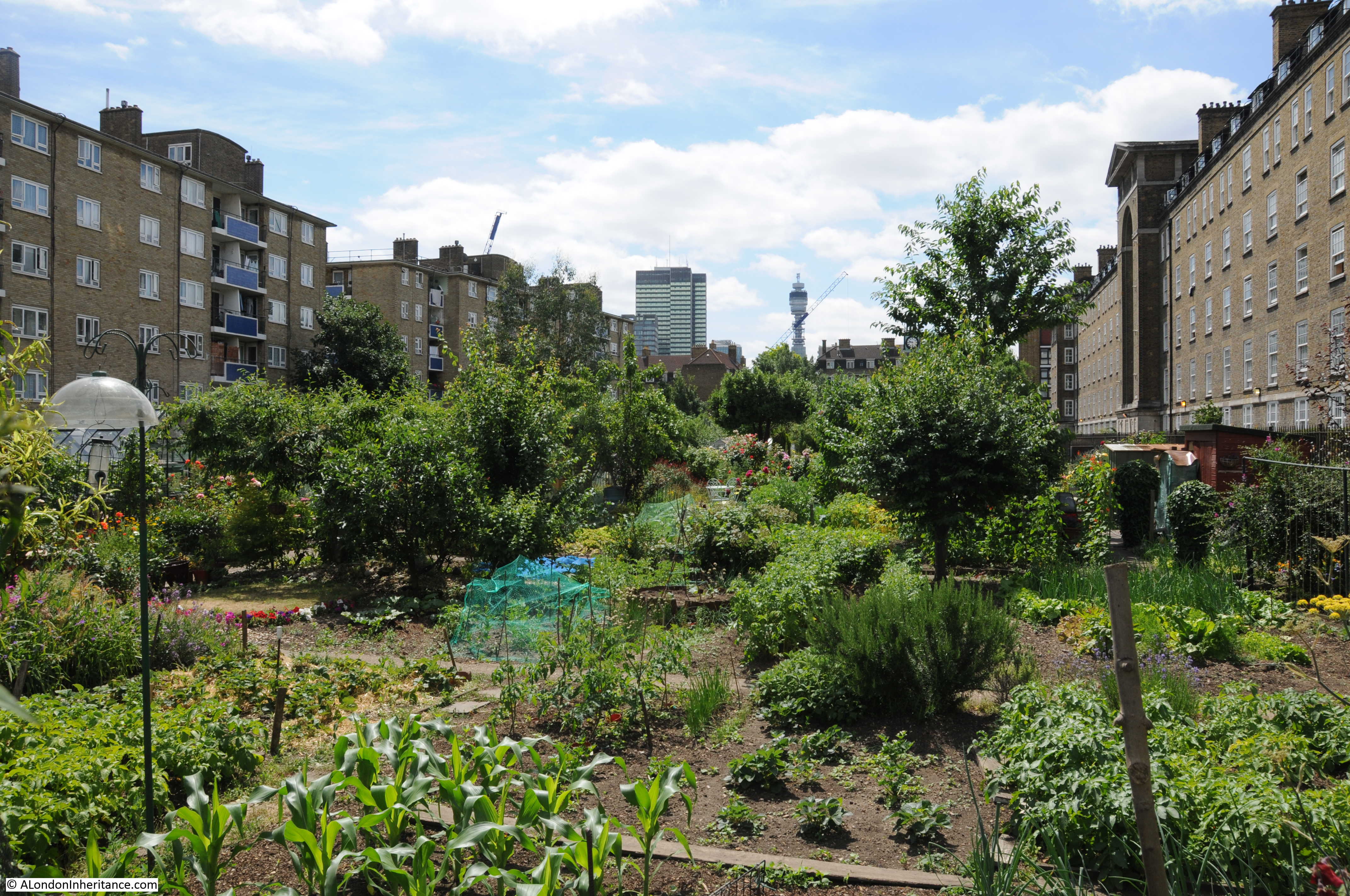
The two buildings in the distance in the above photo are Euston Tower on the left and the BT Tower on the right which should help with the location and orientation of this area.

Walking back into the courtyard area, this is part of Bagshot House. My father lived in a flat along the first floor balcony on the left.

Regents Park Basin

I stood in the courtyard imagining the scenes here in 1940. This extract from my father’s account is about the heavy bombing during the later half of 1940:

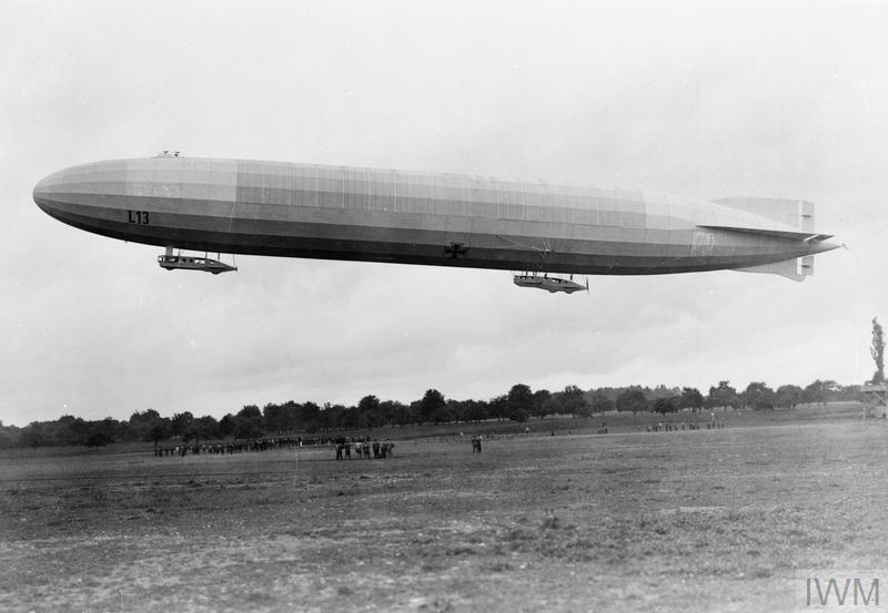
“On another night during this period our block of flats and Swinley House directly opposite were showered with incendiaries. As father was on day shift at the time we were all in our beds resting as well as we were able, until the characteristic incendiary noise had us quickly out of bed. Father, a big man over six feet tall, the son of a fire chief officer and born in a fire station, was no man to hang about if a fire was in the offing. Donning his steel helmet, dressing gown over his pyjamas and a pair of slippers on his feet he rushed out of the doors and disappeared along the balcony towards the stairs. Mother called out to him in anguish but to no avail, the days of the horse drawn appliance rushing to a fire was in his blood. Up to the top floor directly above us he went, grabbing a stirrup pump in one hand and a bucket of water in the other. A pump with buckets of water and sand were normally available at each stair landing. An incendiary had crashed through the roof above, entering the top most flat, and in short time would no doubt have burnt its way through to us or at least have ruined all our possessions with water. However with the help of the occupier who was panicking for the A.F.S. (Auxiliary Fire Service) father soon had both the fire and the bomb extinguished.

Meanwhile, the incendiaries which had fallen on Swinley House went unnoticed. In one top floor flat bedroom windows could be seen the now familiar dazzling white light, soon turning to orange, as I watched from the bedroom window. Presently the roof began to burn through. Noticing figures in the courtyard below, now beginning to be illuminated by the flames, father could be seen rushing across to the stairs to grapple with this new challenge. The top floor balcony soon became doted with silhouettes of men throwing what they could salvage down to the courtyard, a dangerous and pointless task carried out in desperation, as anything of value would be looted before daylight. This fire was too advanced for stirrup pumps and buckets of water and due to the great number of fires that night a trailer pump did not arrive until the fire was well underway. In the meantime, my father and others carried on as best they could, eventually arriving home with blackened face, wet and filthy, his dressing gown and pyjama trousers singed, and slippers ruined. Concrete floors and stairways saved the block from complete destruction, the rooms and furniture directly beneath the top floor remaining soaked with sooty water for weeks. As for salvage, bedding was hung over balcony walls to dry, an unsatisfactory and lengthy process without an alternative. Furniture carried down to the courtyard and left to the elements until it could be carted away, that is what remained after further looting.”

The comments on looting are interesting, even within a reasonably enclosed estate. There are many examples of the “Blitz spirit” in my father’s accounts, but they also demonstrate that there will always be people willing to take advantage of the misfortune of others.

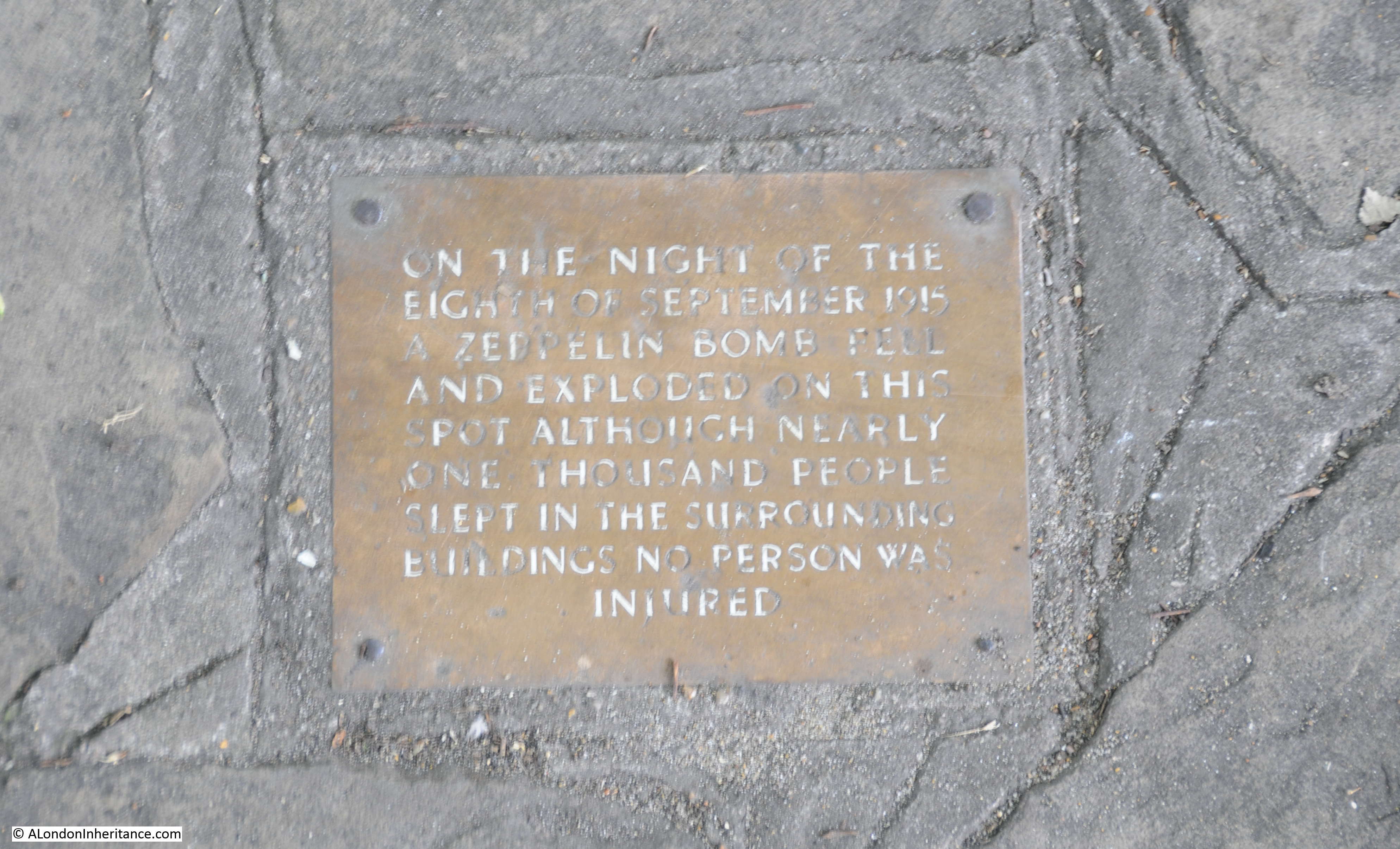
There are many accounts of happenings throughout the war on the estate in his written records, another extract from early 1944 during the “little blitz” again covers bombing directly on the estate:

” I wasn’t going to miss this chance of rushing out and extinguishing as many incendiaries as could be found, and after a short argument with mother over the chances of not coming back I shot out of the front door followed by father, although at this stage of the war he had become weary and lost some of his enthusiasm for fighting fires.

From all sides came the familiar sights and sounds. A mile or so over King’s Cross way was the great orange glow of many fires taking hold where the first missiles had fallen, and below in our courtyard and all around lay the incendiary bombs, burning with that intense incandescent, white light. Already many people were running from bomb to bomb with sandbags, dousing the bombs as best they could. Then came pandemonium. Explosions, cries and shouts from all sides. it seemed as though all hell had been let loose as there came hundreds of explosions from all around in quick succession. 

Instinctively father and I dropped to the balcony floor behind the brick parapet wall that separated the balcony from the 20 foot drop to the courtyard below. For a minute or so we were completely dazed. The explosions had come suddenly and without warning and now, hot, steel fragments were whining in all directions. 

As the explosions became less frequent I shakily joined father to peer over the wall to the courtyard below. Realisation came that these were not the old incendiaries which could be picked up or kicked into the gutter to burn out, these weapons were fitted with some anti-personnel device of explosive fitted to the original type of bomb, so timed to explode about three minutes after the bomb had ignited. In other words, just as some likely person, it could have been me or father, was stooping over to extinguish the bomb, which is exactly what had happened.

By the time the two of us had reached the courtyard, most of the bombs had thankfully blown themselves to pieces, saving the effort of having to extinguish them, but with the penalty of perhaps having a body riddled with white hot steel and burning magnesium.

The device had proved very successful as we watched lifeless and injured residents being carried away.”

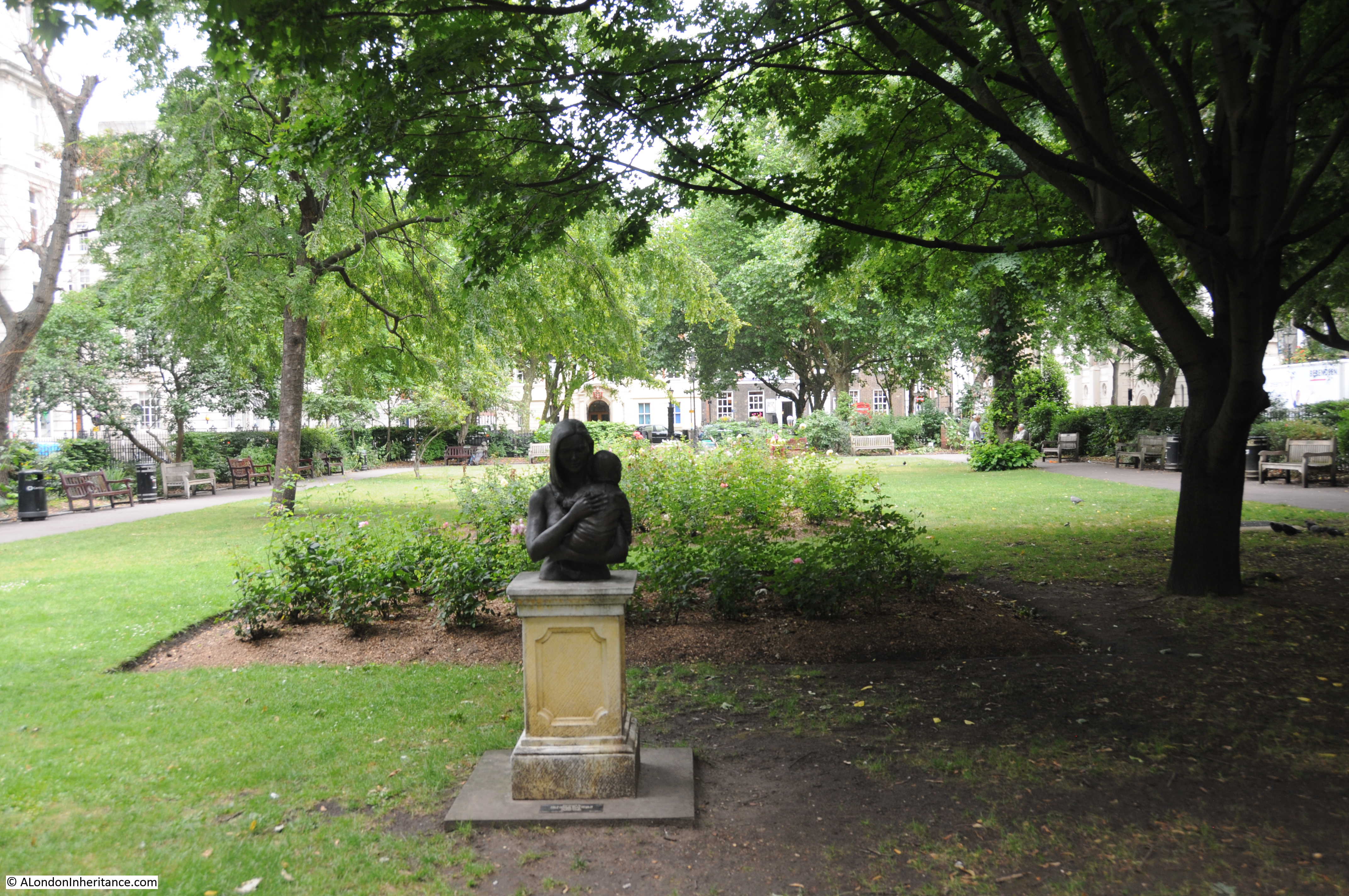
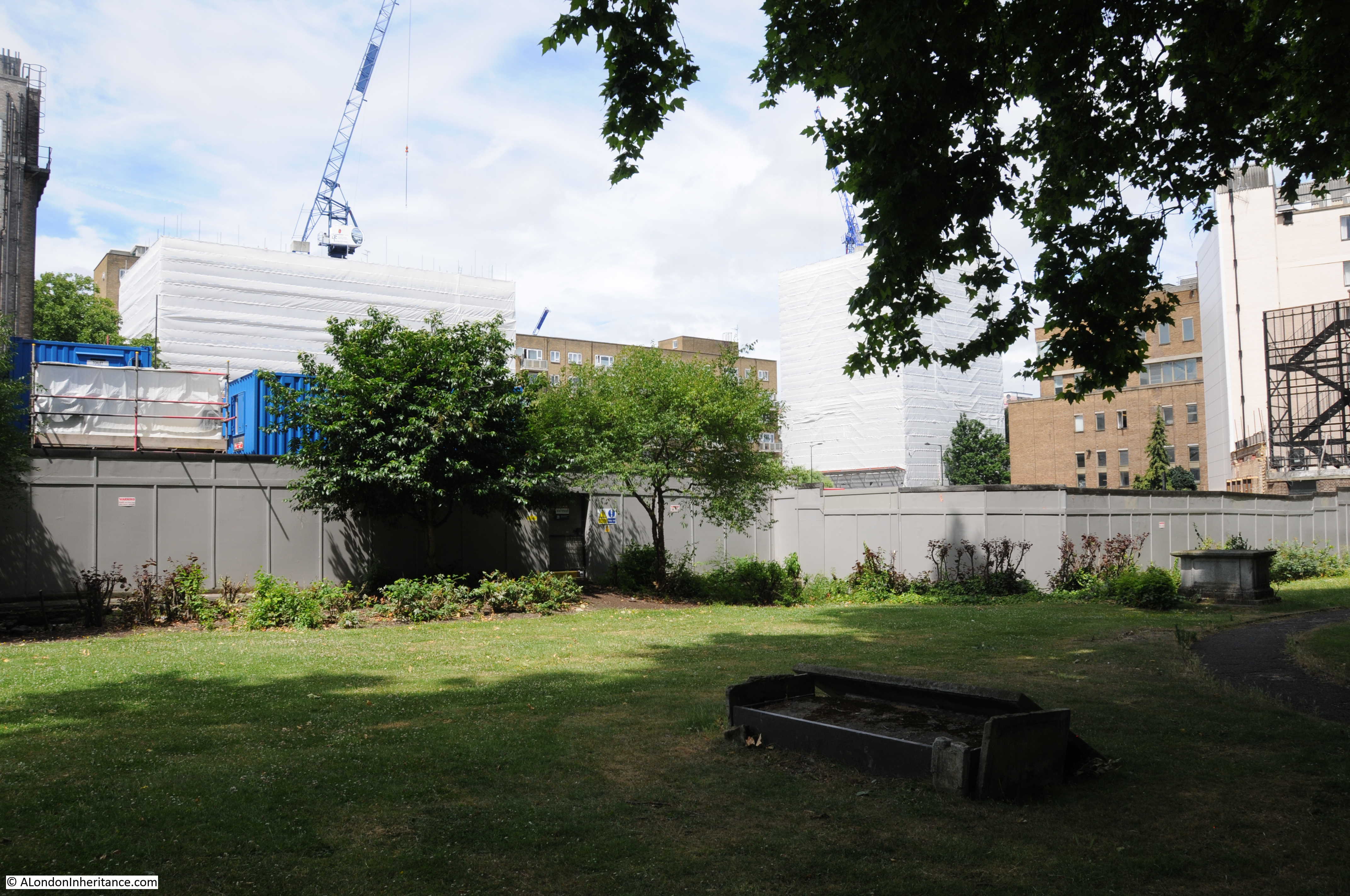
Thankfully the courtyard is very peaceful today.

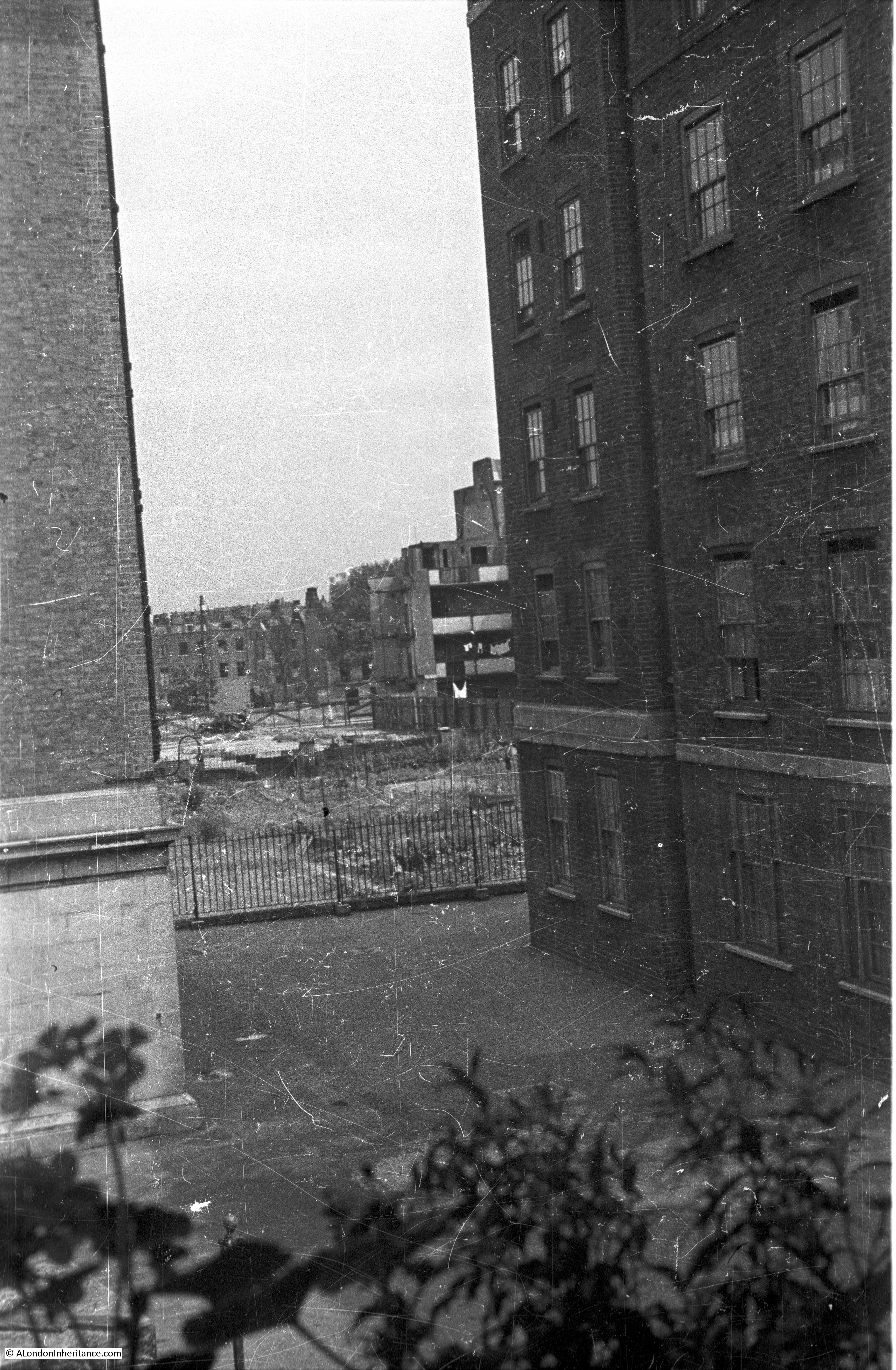
The following photo was taken on the balcony outside my father’s flat. looking out through the gap between Swinley House and Ascot House. The old Regents Park Basin is behind the railing, land where bombed buildings have been cleared is behind that, with houses along Stanhope Street in the distance.

Regents Park Basin

I did consider walking up and along the balcony to take a photo of the above scene today, but this would be immediately outside people’s homes so decided not to, although I would love to have walked along the balcony and look down on the courtyard below.

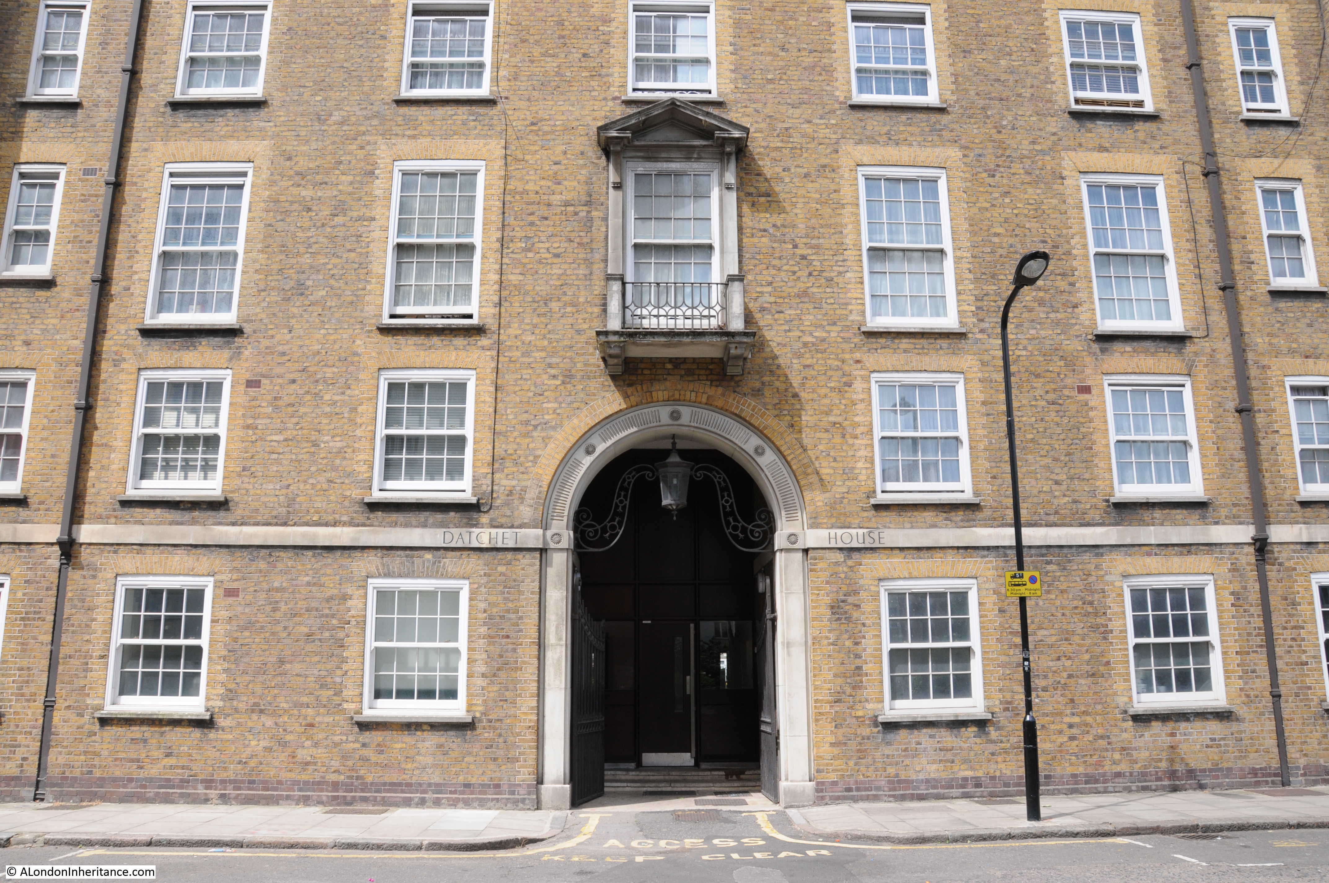
The next photo is off Datchet House, along Augustus Street (see the estate map at the top of the post). I could not get a photo from the same position today as land in front of Datchet House which was a derelict bomb site when my father took the post war photo, has since been built on.

Regents Park Basin

This is the view of Datchet House from the corner of Augustus Street and Cumberland Market. The entrance arch and ornate window help identify the position. Compare also the roof on the part of the building above the entrance arch in the photos above and below. You can see in the above photo the result of incendiary damage. the top floors of the building have since been rebuilt as shown in the photo below.

Regents Park Basin

As with the rest of the estate Datchet House is in fine condition and the archway and ornate window seen in the above photo are still looking good.

Regents Park Basin

The following photo is of the end of Datchet House (on the right of the photo) with Windsor House running along Cumberland Market, the large block that runs to the left of the photo.

Regents Park Basin

Again, due to building on the derelict land in front of the flats there was no view of the flats from the position of the above photo today, so the photo below is of Windsor House from the corner of Augustus Street and Cumberland Market.

Regents Park Basin

The original photo was taken on the corner of Stanhope Street and Varndell Street. This is the view today looking in the same direction – new building completely obscuring the view, however if you look to the bottom left or both the photo below and the post war photo you will see the same rectangular manhole cover on the corner of the pavement.

Regents Park Basin

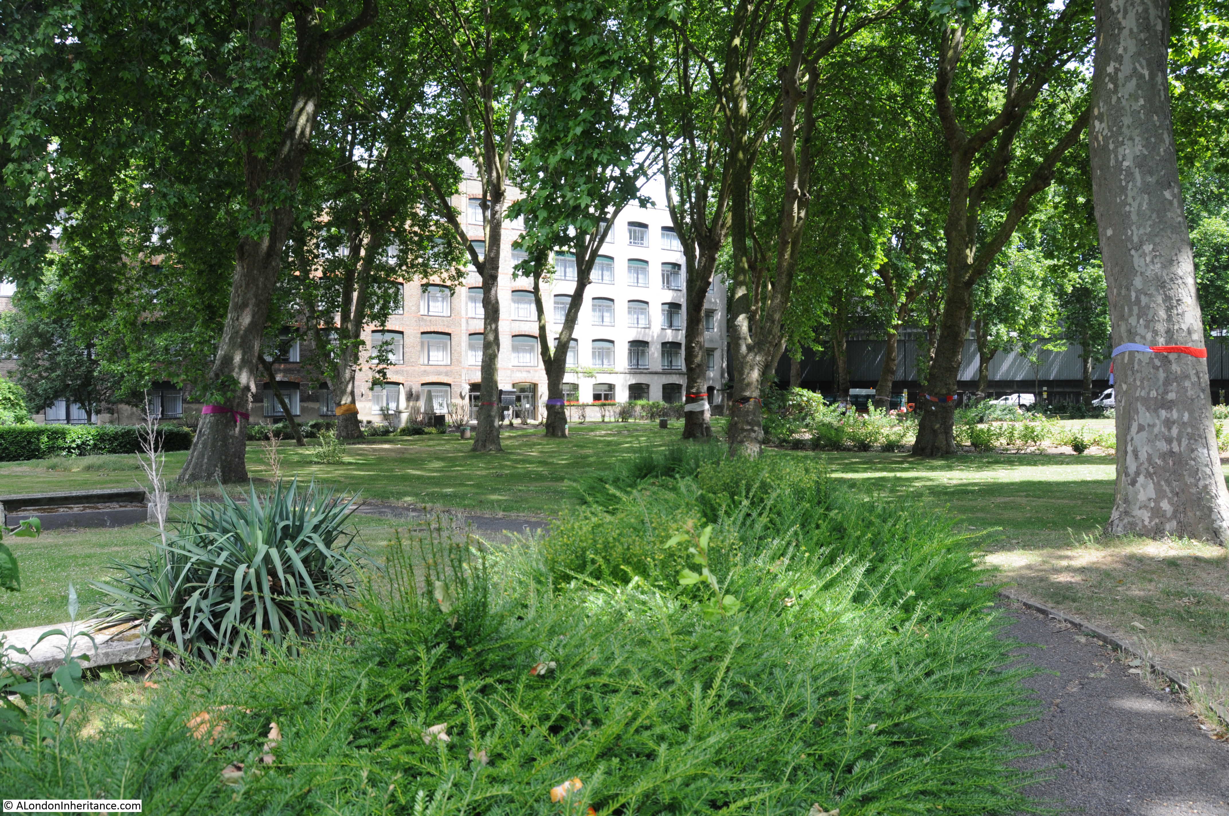
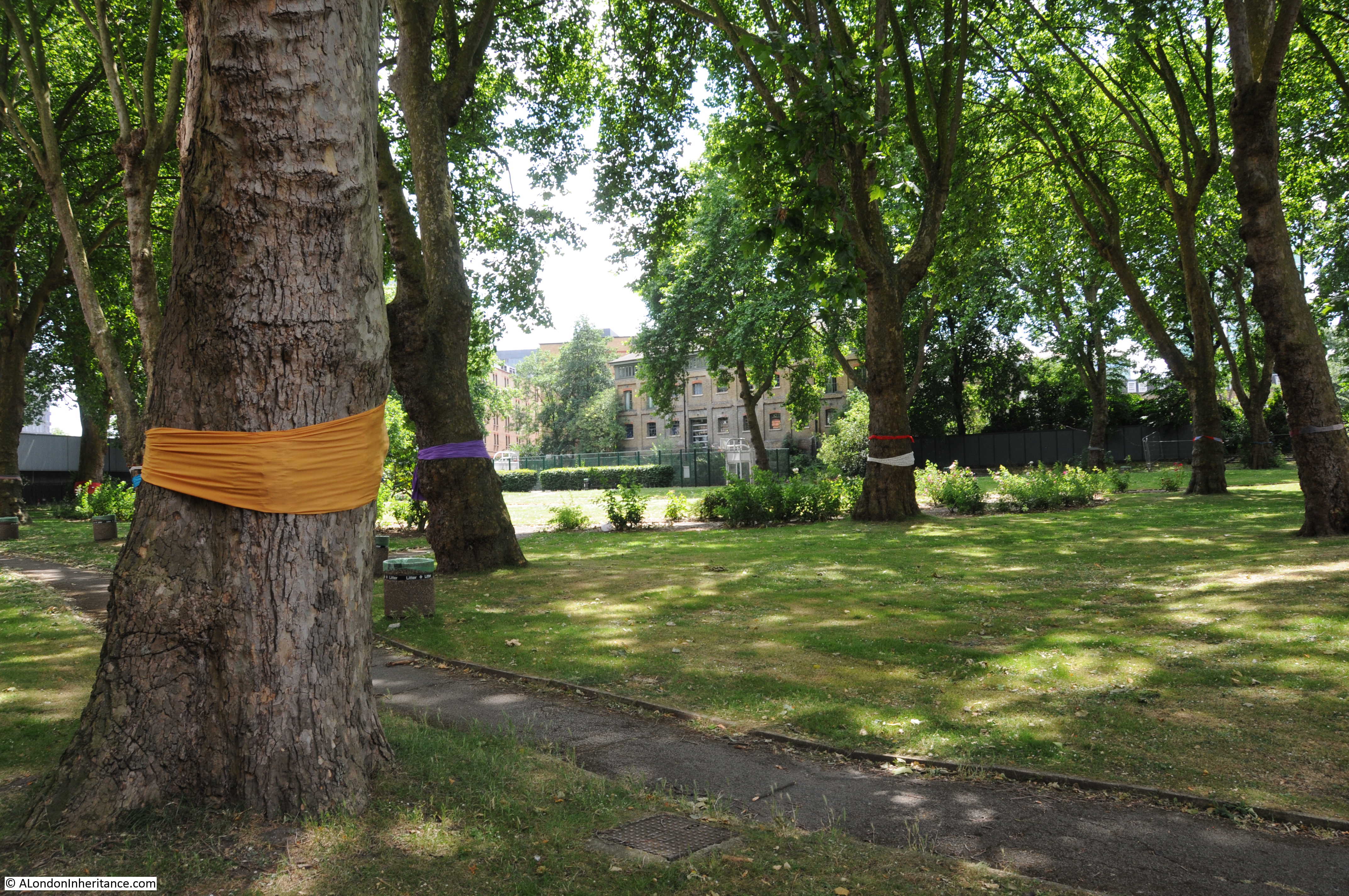
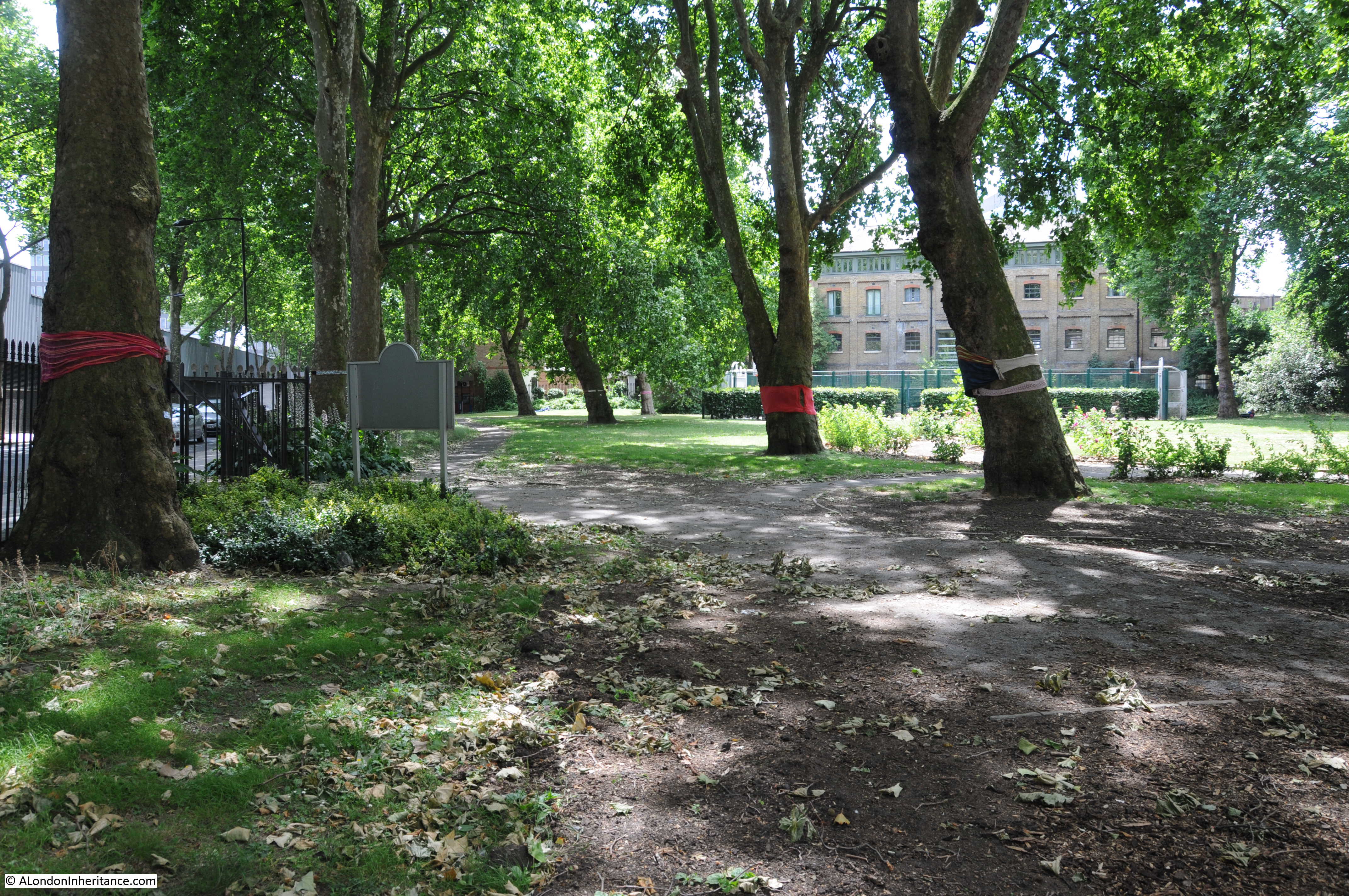
Returning to Swinley House, this is the view along the front facade of Swinley House that once faced the basin and now the allotments. The railings are along the original edge of the basin.

Regents Park Basin

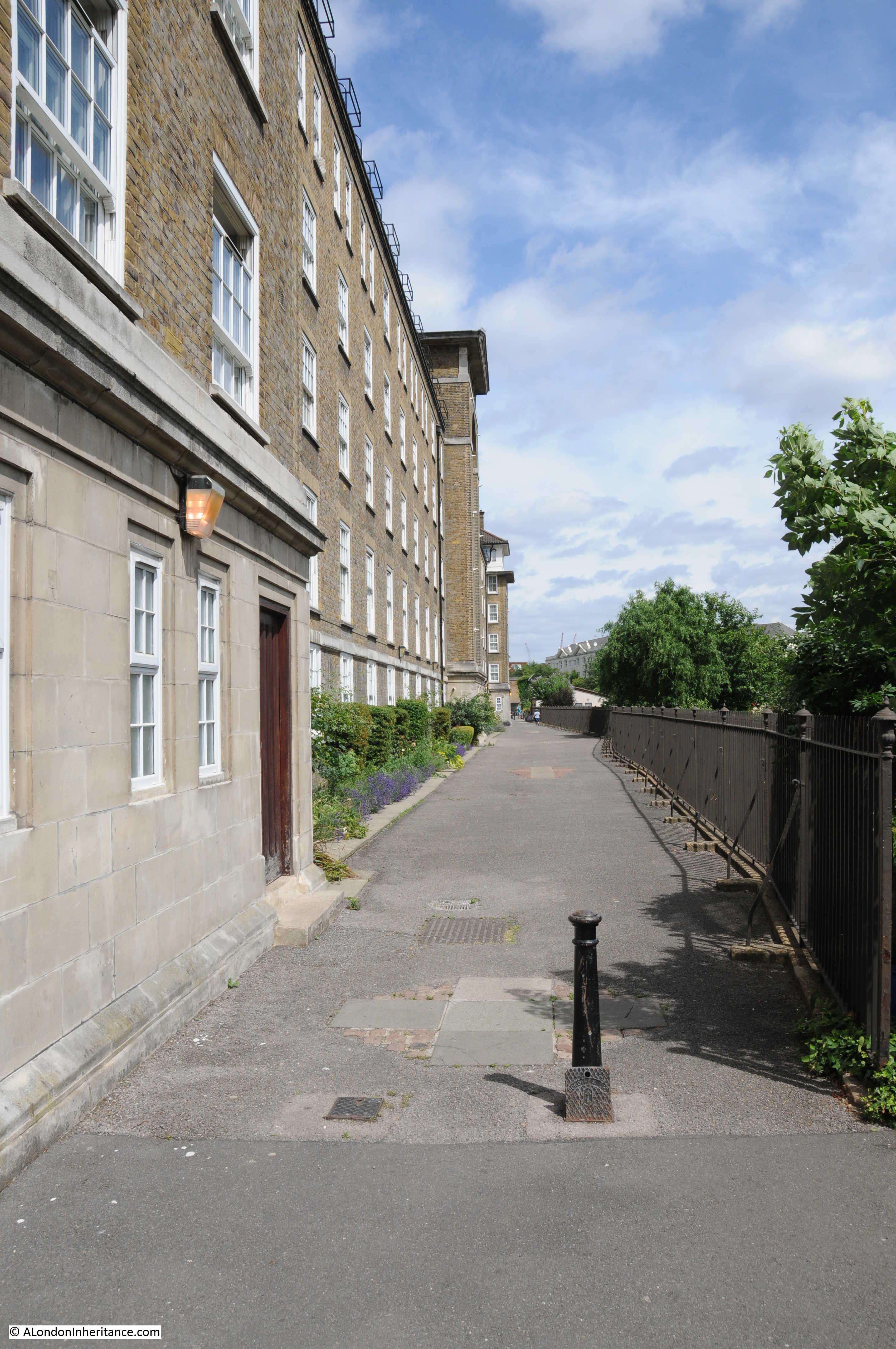
This is the view from the opposite end to the above photo, the whole allotment area on the left was once the Regents Park Basin.

Regents Park Basin

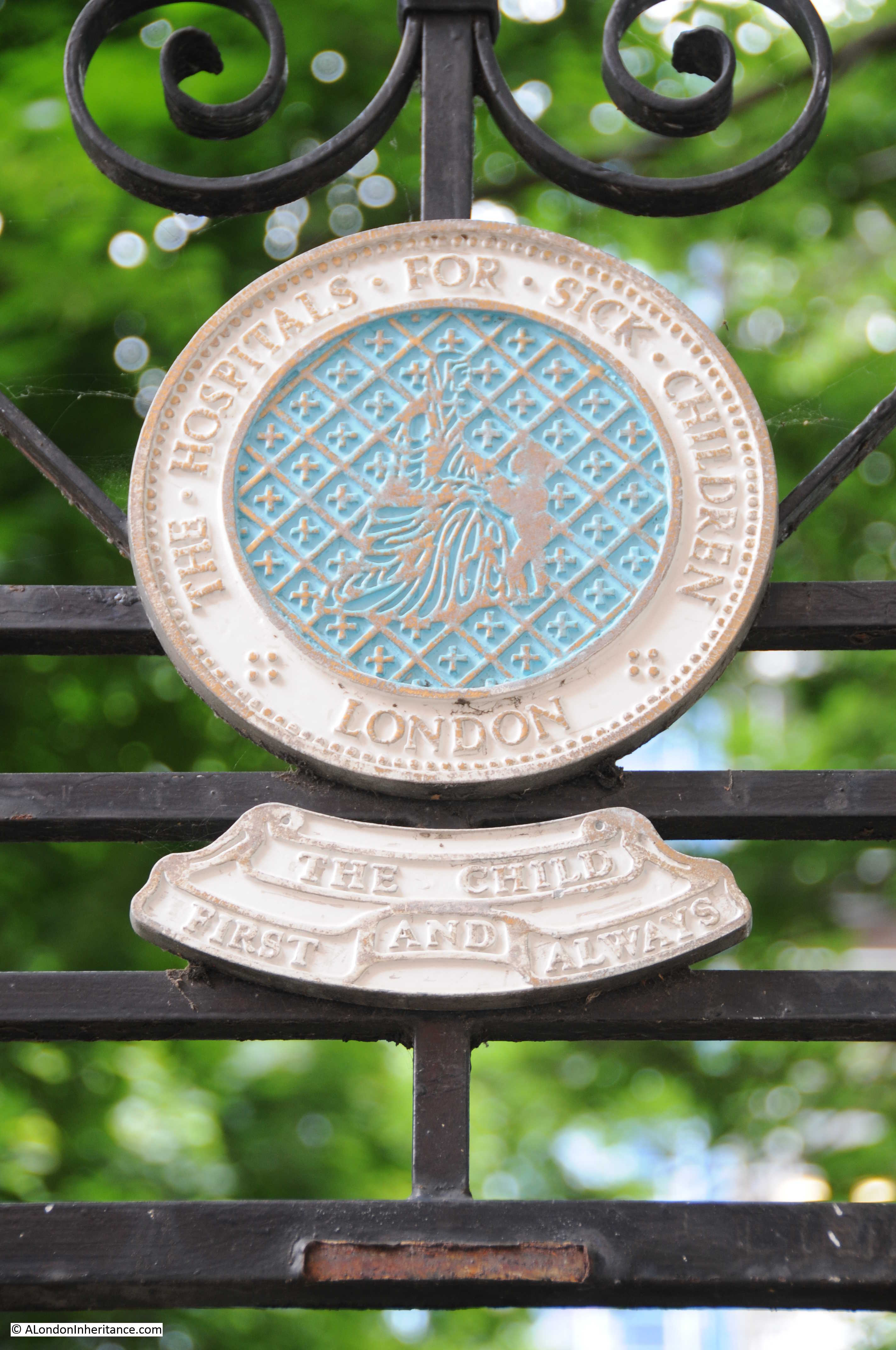
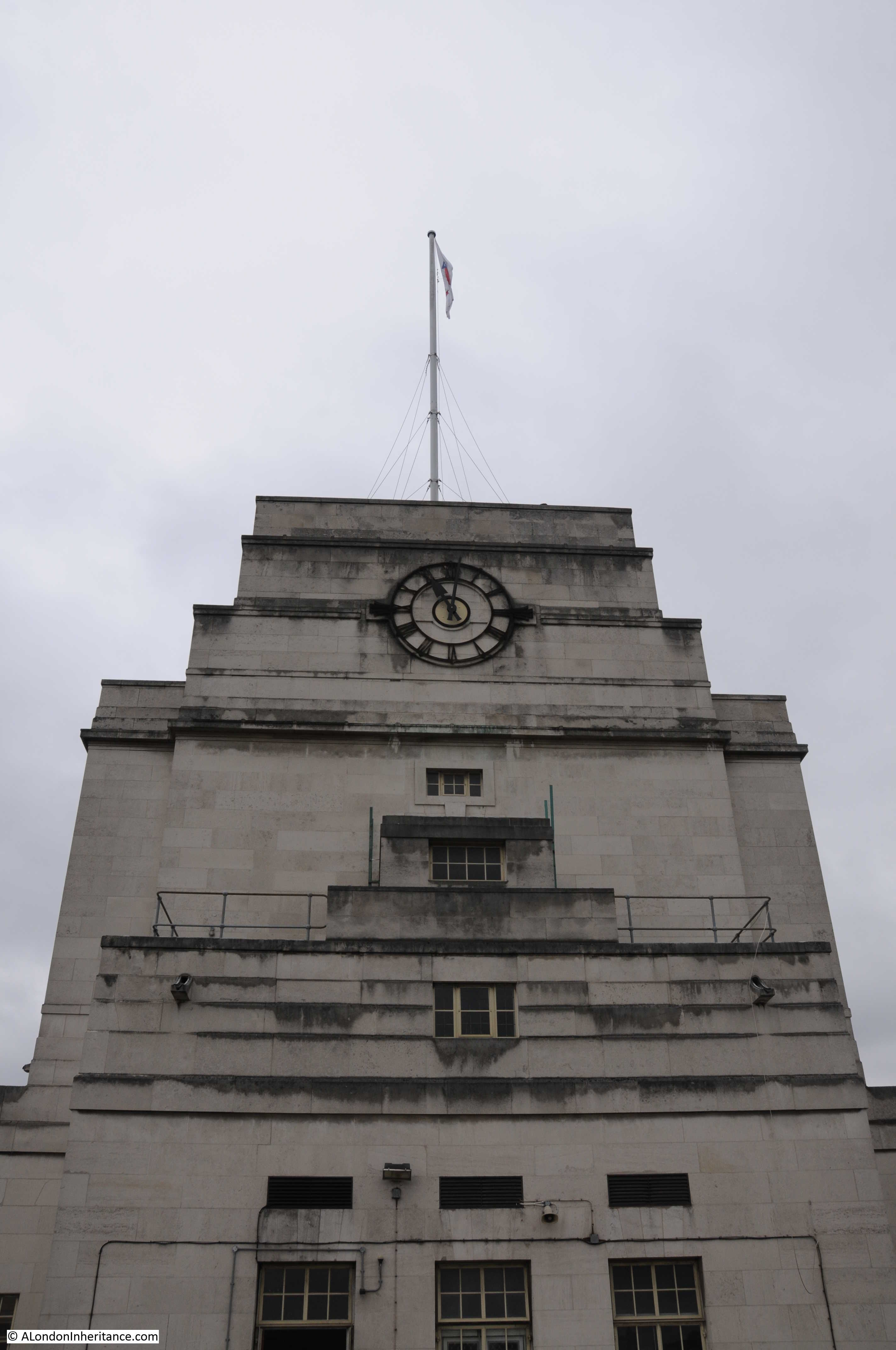
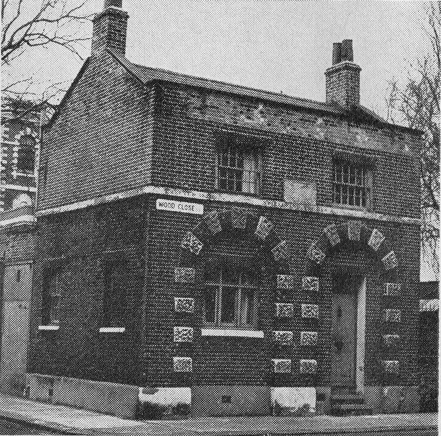
At the far end of what was the Regents Park Basin, and now the allotments, in between the basin and the old Cumberland Market is a rather ornate block of flats with a clock tower:

Regents Park Basin

This is the view from the opposite side, this is all Windsor House, but this section is indented with gardens and an ornate gateway facing onto Cumberland Market.

Regents Park Basin

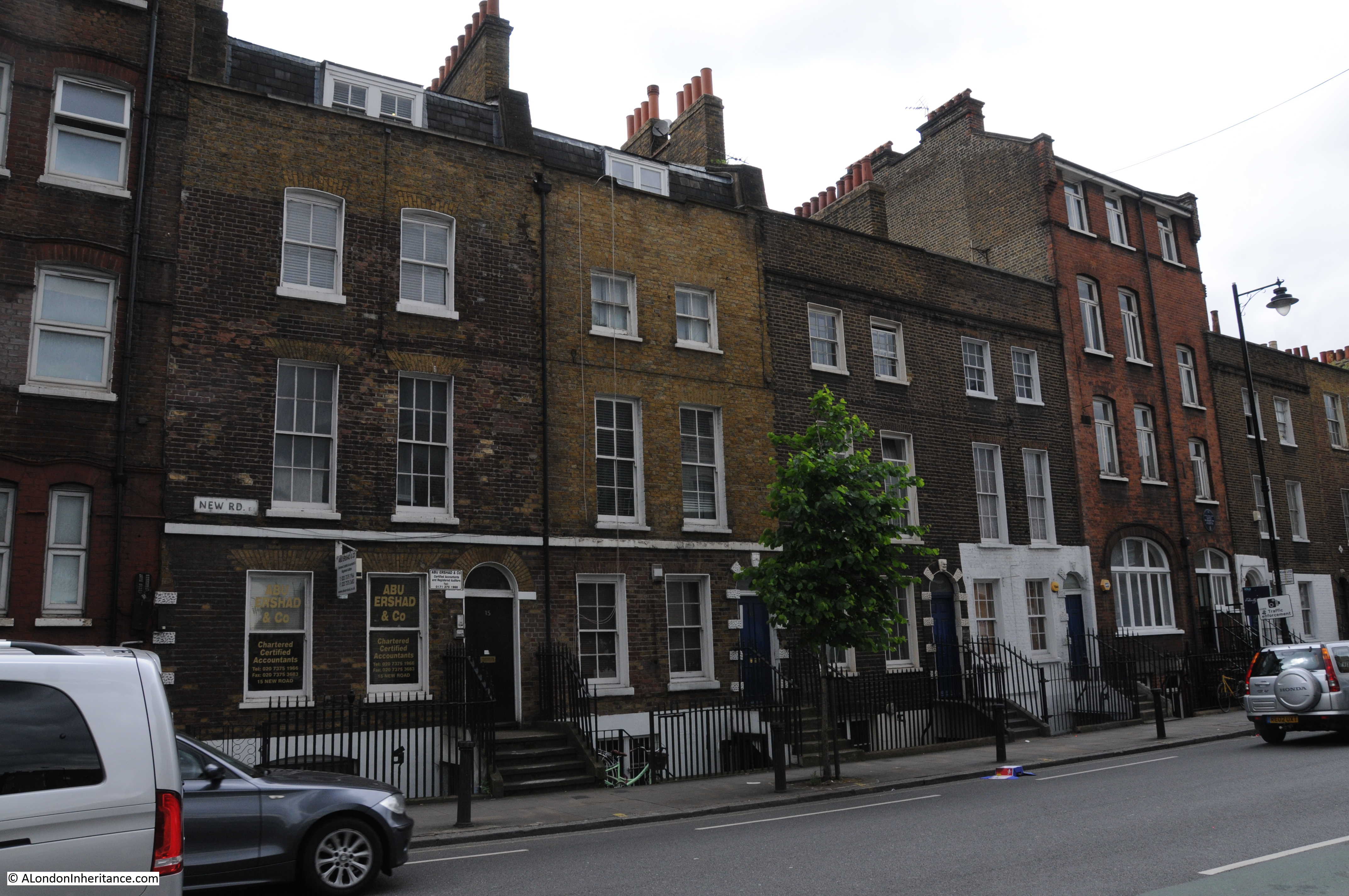
Bagshot House is one of the very few homes or workplaces that remain in London where my family have lived in or worked over the years. Most of these places have long since been demolished.

The Crown Estate attempted to sell the estate in 2011, however a campaign to resist the sale to developers resulted in Peabody taking over the estate and it looks incredibly well run. It is good to see the flats looking externally much as they would have when my father lived there during the war.

alondoninheritance.com

Chepstow Castle

After visiting the town of Chepstow and the River Wye in last Sunday’s post, in this post I explore Chepstow Castle – one of the earliest Norman castles in the country.

Chepstow Castle is on a large limestone cliff overlooking the river and town. Construction started in 1067, the year after the Battle of Hastings and the coronation of William the Conqueror as King William I.

William had given Chepstow to William Fitz Osbern, the Earl of Hereford and it was William Fitz Osbern who started construction of the castle. The castle passed to William Marshall in 1189 and stayed in the Marshall family until 1245 when the Marshall estates were divided between five daughters with Chepstow going to Maud Marshall and through Maud’s marriage to Hugh Bigod, the 3rd Earl of Norfolk, it passed to the Bigod family.

As the castle passed through various families, it was extended considerably, existing buildings were remodeled and the castle lived a relatively peaceful life until the Civil War.

This is the 1947  view of the castle from across the River Wye. The castle is rather hard to see, but is behind the bridge, on the left bank of the river. The castle from a distance can appear to blend in with the cliffs on which it is built.

Chepstow Castle

And this is the view in 1947 taken from one of the castle towers looking back towards where the above photo was taken.

Chepstow Castle

The same view today. The buildings at both ends of the bridge are the same, however the buildings at the bottom of the 1947 photo have been cleared to make way for a large car park and the visitor centre which are located directly in front of the entrance to the castle.

Chepstow Castle

A 1947 view of the external walls and towers of the castle:

Chepstow Castle

Another view from inside the castle looking over the river and bridge.

Chepstow Castle

The same view today:

Chepstow Castle

My father took these photos during his National Service when he was at an Army base just outside Chepstow, and he was at the castle with a number of his colleagues from the army – there are photos of them in and around Chepstow and the castle, including this one rather precariously sitting on the edge of the cliff lookiing back towards the castle.

Chepstow Castle

The lighting was not ideal in the above photo to show the height of the cliffs on which the castle was built, however this photo shows the height of the cliffs and the sheer vertical ascent above the river.

Chepstow Castle

The setting of Chepstow Castle high on the cliffs over the river has attracted many artists over the centuries to paint and draw different views of the castle. The following painting by the Flemish artist Hendrik-Frans De Cort shows a rather overgrown and ruined castle. The bridge in the background is the version of the bridge prior to the existing bridge.

Chepstow Castle

Cellars underneath the castle provided storage and also access to the river. The following 1947 view is of the large opening from the cellar overlooking the river. From this opening, goods could be winched up from boats on the river below.

Chepstow Castle

The view from the cellar in 2017:

Chepstow Castle

Chepstow Castle was further fortified in the early 15th century to prevent any attacks by Owain Glyndwr, the last Prince of Wales to be a native Welshman, and who led a number of revolts against the rule of Wales by the English.

In the 16th century the castle become more of a home than a castle and was modified for a more comfortable form of living, however it was during the English Civil War in the 17th century that the castle was to see considerable action.

During the Civil War, much of Monmouthshire and South Wales supported Charles I, and Chepstow was the main Royalist base in the area.

Parliament briefly gained control of the castle in 1643, but for the majority of the Civil War the castle remained loyal to the Royalist cause. In 1645 the castle was besieged and surrendered without waiting for a full attack.

In November 1647 whilst being held at Hampton Court Palace, Charles I briefly escaped. News of his escape triggered a number of Royalist rebellions across the country, including at Chepstow where Sir Nicholas Kemeys captured the castle in a surprise attack with 160 soldiers.

On May 11th 1648 Cromwell arrived in Chepstow and captured the town but not the castle. He left part of his army at the castle to commence a siege.

The siege lasted for two weeks, when Kemeys was offered terms for surrender which he refused until only unconditional surrender was offered.

Kemeys realised he could not continue to hold the castle and he arranged to escape by boat, however the boat was seen by Royalist soldiers who captured the boat before Kemeys could escape.

The Parliamentary forces then breached the walls of the castle, and in a last desperate fight, Kemeys was killed. Of his original force, only 40 survived and surrendered.

A plaque on the interior wall of Chepstow Castle records where Sir Nicholas Kemeys met his death.

Chepstow Castle

After the Civil War, Chepstow Castle entered a long period of peace and gradual decay as illustrated by this print from 1787 (©Trustees of the British Museum):

Chepstow Castle

View inside the castle in 1947:Chepstow Castle

Along the top of the ramparts:

Chepstow Castle

View across the castle to the cliffs on the opposite bank of the River Wye. In the bottom right hand corner is the Georgian Castle Terrace (see the photo in last week’s post of the street facing facades of these lovely buildings)

Chepstow Castle

I could not find the exact location that the above photo and the following two photos were taken from, a task that should have been easy given the number of obvious landmarks, however I suspect the point where the above photo was taken is now closed off, and the following two photos may have been taken just outside of the castle on land that rises behind and now looks to be mainly wooded.

Chepstow Castle

Chepstow Castle

Back in Chepstow Castle, the following photo shows the remains of the Great Tower. It originally consisted of a two storey tower built between 1067 and 1115 making this the earliest stone structure in the castle.

Chepstow Castle

It was extended over the years and as the rest of the castle developed, the Great Tower moved from being a purely defensive structure to being ornate private apartments and ceremonial space. The photo below shows some of the decoration that remains within the Great Tower. In the centre there is the remains of a decorated arch. Part of a pair that crossed the width of the hall.

Chepstow Castle

The ornate east doorway to the Great Tower is shown in the photo below. Note the layer of Roman tiles running along the wall and over the arch of the door. There is no evidence of a Roman building on the site of the castle, however there were Roman buildings nearby and the tiles probably came from one of these buildings.

Chepstow Castle

The interior of Marten’s Tower which was built between 1288 and 1293 by Roger Bigod. Possibly intended as a guest suite for a king, it contained grand private rooms on three floors along with a private chapel.

Chepstow Castle

Recent tree ring dating tests have identified a gate that until 1962 still hung at the main castle gateway, as being the oldest castle doors in Europe. Tree ring dating identified the doors as having been made no later than the 1190s. Just image the people that have passed these doors and the events they have witnessed over the almost 800 years that they were in place.

Chepstow Castle

That concludes my all too brief visit to Chepstow Castle, one of the oldest Norman castles in England and Wales, and indeed my visit to Chepstow.

There are more photos from 1947 and 1948 taken in the areas around Chepstow so I hope to return one day and track these down, but I was really pleased that tracking down the locations of the photos in these two posts gave me a reason to visit Chepstow and discover a wonderful town that is really worth a visit.

alondoninheritance.com

Chepstow And The River Wye

In addition to photos of London, my father took lots of photos of the rest of the country whilst cycling and staying at Youth Hostels (a very popular post war pursuit) and during National Service. As well as tracking down all the locations of the London photos, I have a side project to track down this geographically wider set of photos. I have already featured a number of these locations in previous posts and this week I am visiting Chepstow and the River Wye.

These photos were taken in 1947 whilst my father was based with the army near Chepstow as part of his National Service. The post will be in two parts, today covering the town of Chepstow and the River Wye. A mid-week post will visit Chepstow Castle. Construction of the castle started in 1067 which makes Chepstow one of the earliest Norman castles in the country. I will be back in London next Sunday.

The River Wye runs up from the River Severn and here forms the boundary between England and Wales. Chepstow is located in one of the many loops of the River Wye, just on the Welsh side of the river, not far from the River Severn.

The following extract from a 1930s edition of Bartholomew’s Revised Half Inch Contour Maps shows the location of Chepstow. These are wonderful maps, their use of colour to show the height of the land, the typeface used for the lettering and the symbols used for landscape features produced maps that are lovely to look at as well as highly functional.

Chepstow And The River Wye

The River Wye between Goodrich, Monmouth and Chepstow runs through several sections of limestone, with deep valleys, large meanders and densely forested cliffs. Meanders are usually associated with a sluggish river, but this is not so with the Wye. It is a fast running river and also has one of the highest tidal ranges in the world with a range of up to 44 feet (13.4m) at the bridge in Chepstow. Large volumes of water are therefore moved up and down the river each day.

Despite the large tidal range, Chepstow was once a thriving port. The town’s location within the Welsh Marches meant that imports and exports were free from duties to the Crown, providing that the ships did not call at Bristol.

Such was the success of the port of Chepstow that in 1791 there were 31 ships belonging to the town of 2,495 tonnage which grew to 75 ships with a tonnage of 5,782 in 1824.

Trade from Cheptow was with the rest of the UK as well as the Continent and ships from Chepstow carried spirits, wines, wheat, barley, flour, cider, iron, millstones and timber for the navy from the forests that lined the Wye Valley. The level of trade justified a Customs House at Chepstow which was in operation until the mid 1850s. Goods were also transferred from sea going ships at Chepstow onto lighters which would transfer goods further up the River Wye, to towns such as Monmouth, Hereford and Hay on Wye.

The port went into decline after the 1850s, probably due to the arrival of the railway at Chepstow in the same decade. Isambard Kingdom Brunel’s railway bridge across the Wye at Chepstow was a remarkable engineering achievement and whilst a new support structure was put in place in 1962, Brunel’s original cast iron pillars still support the bridge.

Time to take a walk to explore Chepstow and the River Wye. According to my father’s notes all the Chepstow photos were taken over two weekends, the 5th and 6th and the 12th and 13th of July 1947, so I assume these were periods of leave. In the collection there are also many photos of army life at Chepstow, including one of a troop of 18 and 19 year National Service recruits leaving “for a p*** up”, so I am not sure if the inhabitants of a quiet Welsh market town appreciated having the army so close. My visit to Chepstow was on Saturday the 8th July so as close as I could get to being exactly 70 years between the two sets of photos.

I will start just outside the original town, at the entrance to the Town Gate, originally the only landward entry to Chepstow in the walls that surrounded the town and port.

The original town gate was built in the 13th century at the same time as the walls. The gate in place today dates from the 16th century with the usual repairs, part rebuilds and modifications that would be expected for a building in such a prominent position in over 400 years.

On the right of the town gate is the George Hotel. An Inn has been here since the early 17th century however the current building dares from 1899.

Chepstow And The River Wye

The same view today, 70 years later. Mainly cosmetic changes to the buildings. The increase in road traffic is such that traffic lights now control traffic through the town gate.

Chepstow And The River Wye

Walking through the Town Gate takes us into the High Street. This is the view looking up the High Street back towards the gate.

Chepstow And The River Wye

And looking down the High Street from the same position. These two photos show the slope of the land as it descends down towards the River Wye.

Chepstow And The River Wye

Thankfully Chepstow retains the feel of a local town with individual businesses rather than being overrun with national chains, although one national coffee chain has established a prominent position at the bottom of the High Street.

Along the High Street, I found a connection with London, although a rather derogatory reference:

Chepstow And The River Wye

The text is from a poem by the Rev. E. Davies:

Unlike the flabby fish in London sold,
A Chepstow Salmon’s worth his weight in gold,
Crimps up delightful to the taste and sight,
In flakes alternate of fine red and white,
Few other rivers such fine Salmon feed,
Nor Taff, nor Tay, nor Tyne, nor Trent, nor Tweed.

The earliest references to this poem I have found are from the early 19th Century so this was written at a time when salmon were relatively abundant in the River Wye at Chepstow. Salmon numbers have fluctuated considerably over the centuries, periods of over fishing and poaching as well as environmental factors have contributed to reductions in numbers however salmon seem to recover well and the 1960s and 70s were record decades with salmon weighing in excess of 30lbs and measuring over 4ft long being caught and over 6,000 being caught each year in the late 1980s.

Salmon numbers plummeted dramatically soon after so by 2002 only 357 salmon were caught. Numbers are gradually recovering and in 2016 there was a spring catch of over 500 as salmon returned to the river in numbers not seen for 20 years.

I did not get a chance to try a Chepstow salmon so cannot compare with the flabby fish in London.

From the High Street, I walked into Middle Street and immediately along the pedestrianised St. Mary Street.

This is the view looking up St. Mary Street. The Chepstow Bookshop is on the left of this street – a brilliant independent bookshop where I bought a couple of books on the history of the area.

Chepstow And The River Wye

At the end of St. Mary Street is Upper Church Street and this was the view in 1947:

Chepstow And The River Wye

And the same view in 2017 which stupidly I took in landscape rather than the portrait format of the original.

Chepstow And The River Wye

Again the scene is much the same with only cosmetic differences. There is however one remarkable difference between the two. All my photography of street scenes and buildings today are generally plagued by cars. Roadside parking and street traffic generally obstructing the view of a building or scene, however in the above pair of photos there are three cars in 1947 and nothing in 2017. Traffic in Chepstow is much lighter than London and I was lucky that there was no parking in the marked bay in front of me, but it did seem strange not to be trying to take a photo in between parked and passing traffic.

Staying in the same position as the above two photos, but turning to look in the opposite direction is this large old building in Bridge Street at the end of Upper Church Street.

Chepstow And The River Wye

These are the Powis Alsmhouses. The plaque above the door states that the almshouses were built following an endowment in 1716 from Thomas Powis, a Vintner from Enfield in Middlesex for six poor men and six poor women of the town and parish. His connection with Chepstow is that he was born in the town. The cellars underneath the almshouses were used by wine merchants during the 18th century.

The almshouses are now Grade II listed and the following photo shows the full building, which again is little changed from 1947.

Chepstow And The River Wye

Above the plague there is a sundial projecting from the edge of the roof. This was also in the 1947 photo.

Chepstow And The River Wye

Bridge Street, as the name suggests is the road that leads down to the original bridge over the River Wye, linking Chepstow to England. One side of the street is lined by 3 storey houses. This is Castle Terrace and consists of an unbroken row of 14 Georgian houses built between 1805 and 1822. The rear of the houses look out onto the castle. They are also Grade II listed.

Chepstow And The River Wye

At the end of Bridge Street is the bridge over the River Wye. This was the view in 1947 a short distance on the bridge looking back towards Chepstow.

Chepstow And The River Wye

70 years later the view is much the same.

Chepstow And The River Wye

The building at the end of the bridge surrounded by scaffolding was the Bridge Inn, a Grade II listed pub, however the pub has now closed and the building is being converted into a cafe, shop and apartments. Just one of the twenty one pubs that are closing each week according to a Campaign for Real Ale report.

The bridge provides a very dramatic view of the River Wye and Chepstow Castle. This is the 1947 view with a high tide showing the full width of the river.

Chepstow And The River Wye

Similar view in 2017 – rather more ornate lights have replaced the 1947 versions.

Chepstow And The River Wye

The tidal range of the River Wye at Chepstow is one of the largest in the world. The lowest astronomical tide is 1.2m and the highest is 14.6m giving a maximum tidal range of 13.4m (44 ft). The highest tidal range of 16.2m is at the Bay of Fundy in eastern Canada, 15m at Ungava Bay in north eastern Canada, followed by 14.7m across the Severn Estuary, then Chepstow at 14.6m.

The following photo was taken as the tide was receding – low tide had not yet been reached. Tide height can be seen by the height of the mud banks and also by the tide line on the cliffs in the distance.

Chepstow And The River Wye

There is a much later road bridge carrying the A48 into Chepstow, however this is the original road bridge.

Chepstow And The River Wye

There has been a bridge on the site since the 13th century, the first built of wood and with a central stone arch it was subject to frequent damage requiring a ferry to provide transport across the river until it was repaired. There was also an earlier Roman bridge further upstream.

The current bridge was built between 1815 and 1816 and is the largest remaining iron arch bridge built prior to 1830. The original Ironbridge in Shropshire is about 35 years older but is a shorter bridge than the one at Chepstow.

The bridge was designed and built by John Urpeth Rastrick – an engineer who has been rather overshadowed by the likes of Brunel and Thomas Telford.

Born in 1780 in Morpeth, Northumberland, Rastrick built steam engines, including the first engine to be run in the USA. He was the chairman of the judging panel for the Rainhill Trials in 1829 where 5 engines competed along a mile of track at Rainhill. Stephenson’s Rocket was the only engine to complete the trials. He was also the engineer for the extension of the London to Brighton railway from Croydon to Brighton.

If you look back at the map at the top of the post, the bridge carried the A48 across the River Wye and was the only road bridge to cross this section of the river. Also, if you follow the River Wye down to where it meets the River Severn you can see there is a ferry at Beachley. This was long before the Severn road crossings were built and the only route across was via the ferry or a long detour via Gloucester.

The bridge has a very elegant design and looks remarkable during a very high tide when the water fully covers the concrete piers and the white arches appear to be floating on the water.

As well as the high tide, the Wye has been known to flood. In the photo below there is a plaque at the bottom of the white pillar at the end of the railings. The plaque marks the high tide level on the 17th October 1883.

Chepstow And The River Wye

The River Wye is home to a growing population of salmon, and there have been very occasional sightings of seals who have come up from the River Severn to hunt fish. Remarkably on the day of my visit there was a seal hunting for fish in the muddy water slightly downstream of the bridge.

Chepstow And The River Wye

A short distance from the bridge, there is a small wine bar / restaurant along the banks of the Wye. A July day with a beer and some food sitting outside along the banks of the River Wye was hard to beat.

Directly opposite are these limestone cliffs. There is a large, square hole in the cliffs. This opens out onto a much larger chamber. There are a number of possible origins and use of the chamber, one of the most credible uses was to unload and provide a temporary storage place for goods that could not be unloaded from ships at the shallower wharves across the river.

If you look just below and to the right of the hole is a Union Jack. This was originally painted in 1935 for the Silver Jubilee of King George V. The flag has been repainted a number of times since.

Chepstow And The River Wye

The tide mark for a high tide is very visible in the above photo and in January 2014 heavy rains and flooding caused the River Wye to reach above the flag.

My father took the following photo from the top of the cliffs shown in the above photo, looking back onto Chepstow and the River Wye. I tried to get up to the same spot, however housing seems to have been built along the cliff and I could not find the same view point, although I was by then short of time, so an excuse for another visit.

Chepstow And The River Wye

There are rows of benches along the river’s edge in the above photo. Then as today, this is a lovely place to sit on a summer’s day and watch the rise and fall of the tides.

I assume the following photo was from around the same spot as the above. This is looking downstream and the railway bridge across the river can be seen on the left. The white painted building towards the right of the photo facing the river is now the Riverside Wine Bar. The photo again gives a good view of the tidal range at Chepstow.

Chepstow And The River Wye

Chepstow and the River Wye is a wonderful place to visit and I was really pleased that tracking down the locations of the old photos provided the motivation to make the journey. There was much more to see – I will cover the castle in my next post, however the town also has a museum (which I did not get time to visit), there are long walks along the River Wye and Chepstow has some excellent pubs and restaurants (one of which I did get the time to visit).

From London, Chepstow is roughly a three hour train journey, or by car, straight down the M4 then turn right after crossing the River Severn – it is well worth the journey.

alondoninheritance.com

St James Clerkenwell

It is 11:30 on a sunny Sunday morning, the 6th September 1953 and my father is in Clerkenwell Green and took the following photo looking down Clerkenwell Close towards the church of St James Clerkenwell.

St James Clerkenwell

One of the doors to the church is open, perhaps there is, or has been a Sunday service. I doubt the man walking his dog would have attended, he was probably more interested in when the pub on the corner would open.

And this is the same view in the summer of 2017 (although a week day rather than a quiet Sunday morning).

St James Clerkenwell

A wider view of the area:

St James Clerkenwell

The church of St James Clerkenwell we see today was built between 1788 and 1792. It replaced a much earlier church, parts of which dated back to the twelfth century. Prior to the reformation there was an Augustinian nunnery dedicated to St Mary on the site, and after the reformation parts of the building were used by the parish as the parish church. The following print from Old and New London shows the old church of St. James.

St James Clerkenwell

The old church originally had a steeple but appears to have suffered a common problem of London’s churches, due to their age and poor maintenance of the fabric, as the steeple collapsed in 1623 and there was a later second collapse due to poor construction of the replacement. Repair work was carried out and the church was left with the squat tower shown in the above print rather than a steeple.

I am always fascinated by the growth of London and how parts of the city were once on the boundary. The following map produced in 1720 for Stowe’s Survey of London shows the parish of St James Clerkenwell. The red ring marks the location of what at this time would have been the original church and not much further north were open fields.

St James Clerkenwell

The street in the centre running from top to bottom of the map is St. John Street which retains the same name today. In 1720 St. John Street was labelled as “the road to Chester” which is an interestingly distant location to mark on a parish map.

The new church was designed by the architect James Carr. It cost nearly £12,000 and was consecrated by Bishop Porteus in 1792.

St James Clerkenwell in 1812, twenty years after completion (©Trustees of the British Museum) .

St James Clerkenwell

In my father’s 1953 photo there is a pub on the corner of Clerkenwell Green and Close and the pub is still there today and does very well on a summer’s day.

St James Clerkenwell

This is the Crown Tavern and occupies the corner plot, but if you look at the above photo, the houses on the right and left of the pub are of exactly the same style and construction – these buildings were originally part of the pub and although internally they have been subject to major reconstruction, externally they maintain the link. These building are of mid 19th century construction with some reconstruction in the late 1890s.

The Crown Tavern is allegedly where Lenin and Stalin first met in 1905.

Although the front of the church and main entrance is on the end of the church where Clerkenwell Close bends around the church, the entrance today is the side entrance looking back towards Clerkenwell Green. A flight of steps lead up to the church entrance, which as can be seen in the photo below, is well above street level.

St James Clerkenwell

The interior of the church was subject to Victorian “restoration” so is very different to the original interior. Today the church appears to rent out work space so I thought it best to avoid walking round the church taking photos and disturb those working. This is the view from the entrance.

St James Clerkenwell

There is still a large churchyard surrounding the church, although any original gravestones are long gone.

On a summer day, the churchyard is now a major lunchtime attraction for local workers.

St James Clerkenwell

The church is surrounded by a number of mature trees which help to distance the churchyard from the surrounding busy streets.

St James Clerkenwell

One of the trees has a sculptural installation of bird boxes by London Fieldworks and dating from 2011.

St James Clerkenwell

Before leaving St. James, it is good to see that the tower and steeple still rise above the surrounding buildings. Too many central London churches are now in the shade of their surroundings. This is the view of the church from Clerkenwell Road.

St James Clerkenwell

St James Clerkenwell and the area around Clerkenwell Green deserves a much longer write up, however I have had too many other commitments this past week so I shall have to return in the future – perhaps on a Sunday morning at 11:30.

alondoninheritance.com

Queen Square – A Water Pump, Zeppelin And Medical Imaging

For this week’s post, I am in Queen Square, Bloomsbury tracking down the location of the water pump that my father photographed in 1947;

Queen Square

The view from the same position 70 years later:

Queen Square

The cast iron fountain dates from 1840 (although the lamp at the top is of a later date). On the base of the water pump on both sides are the coats of arms of St. Andrew and St. George. The strange white and black symbol half way up is a temporary survey marker.

Queen Square

The above view is looking west towards the church of St. George’s Holborn and in the photo below looking east towards where Great Ormond Street meets Queen Square:

Queen Square

The fountain is surrounded by four bollards, three of Portland Stone and one of cast iron – no idea why there is this single iron bollard. The same set of bollards appear in the 1947 photo. I wonder if the single cast iron bollard is original being of the same material as the fountain and the stone bollards are latter replacements following damage to the other three cast iron bollards?

The water pump sits within a large paved area at the southern end of Queen Square with the gardens running north and occupying the majority of the centre of the square.

Queen Square

Construction of Queen Square started in around 1706. The square was built on the gardens of Sir Nathaniel Curzon’s house, which was typical of the expansion of London in this area with new houses and squares taking over the from the large houses that were once surrounded by countryside. The square was completed by 1725 but buildings only occupied three sides, the northern side was left empty so that the inhabitants of the square could enjoy the views over open countryside to the hills of Hampstead.

The following extract from John Rocque’s map of 1746 shows Queen Square in the centre, just below the line formed by the page fold. All the land to the north of the square is still open country. The map indicates that at the northern end of the square there were some ornamental gardens and trees to provide a boundary between the square and the lane running from left to right named Powis Wells in the map, this would later become Guildford Street.

Queen Square

The map also shows that in 1746, gardens occupied the centre of the square north from the junction with Great Ormond Street with the large paved area occupying the southern end of the square as it does today.

Behind the water pump in my father’s photo are two buildings of very different style. The same buildings remain to this day as shown by my photo, although they are now somewhat obscured by the trees that have grown around the water pump.

The building on the left has a rather large and ornate coat of arms above the door and along the width of the building, below the top floor windows, is written “The Italian Hospital”.

Queen Square

The Italian Hospital dates from 1884 when it was founded by the local Italian businessman Giovanni Batista Ortelli to provide medical care for sick Italians living in London who could not afford to pay for health care. It originally started operation in Giovanni’s home in Queen Square but moved into the purpose built building shown above following construction in 1898 to 1899.

It closed in 1990, but is now part of Great Ormond Street Hospital.

The buildings on the right are two Georgian houses that are now occupied by the Mary Ward Centre. Although there have been considerable changes to these two buildings, they are some of the few remaining original buildings with the first lease being granted on the 19th June 1703 by Sir Nathaniel Curzon.

Queen Square

At the junction of Queen Square and Old Gloucester Street is the St. George the Martyr Parochial School. Built in 1877 as a church school aligned with the adjacent church. The school has long closed and the building appears locked and empty. Just to the rear of the building on the top floor can be seen the metal frame of the meshed cover over an outside playground – the only way to provide outside play areas at inner city schools.

Queen Square

Queen Square

The plaque on the corner of the building records the year of opening and also that the school was for 200 boys.

Queen Square

Next to the school and in the south west corner of Queen Square is the church of St. George, one of the first buildings on the square The church dates from 1706, its construction having been funded by some of the wealthy inhabitants of the new square.

Queen Square

There was no space available for a graveyard adjacent to the church, this was instead provided in the land just to the north of the Foundling Hospital and is marked on the Rocque map shown above.

The antiquarian Dr. William Stukeley was rector of St. George from 1747 until his death in 1765. It was Stukeley who popularised the association of Stonehenge and Druids and in Old and New London, Edward Walford records Stukeley as also being known as the “arch druid”. For some reason, he had requested to be buried in East Ham rather than the burial ground of the church of which he was rector.

Opposite the church and to the right of the above photo is another of the original buildings. This is the pub “The Queens Larder”. The building now occupied by the pub was first let by Sir Nathaniel Curzon to Matthew Allam, a stationer.

George III stayed in Queen Square whilst under the care of a Dr. Willis whilst he was suffering from the mental illness that would impact so much of the later years of his reign. Queen Charlotte would apparently store the food that the King preferred in the cellar underneath the building which gave the pub its name during the King’s reign.

Although Queen Square is built with houses on three sides which were occupied by the business and professional classes who could afford homes on the edge of the city with the benefits of the countryside and clean air, during the 19th century the square and many of the surrounding streets were rapidly occupied with charities and medical institutions which resulted in rebuilding of much of the square.

Old and New London provides some background to the institutions that occupied the square in the years leading up to publication:

“Queen Square, as well as Great Ormond Street which we shall shortly pass, seems to be a favourite centre of charitable institutions. At the corner of Brunswick Row is the Hospital for Hip Diseases in Childhood, which was founded in 1867. At No. 22 was for many years located the oldest of Ladies’ Charitable Schools. This institution, for although called a school, it is in reality one of our oldest institutions, was established in 1702 for educating, clothing and maintaining the daughters of respectable parents in reduced and necessitous circumstances. The Ladies’ Charity School was removed in 1883 to new quarters in Notting Hill; and the site of the building here is being utilised in an extension of the National Hospital for the Paralysed and Epileptic, which adjoined it. This hospital was instituted in the year 1859.

At No. 29 is the College for Men and Women, with which is incorporated the Working Women’s College, both offshoots of the Working Men’s College established in 1874 with the object of supplying to men and women occupied during the day a higher education than had hitherto been within their reach.

No. 31 formed the head-quarters of some Roman Catholic charitable institutions, among which are the Aged Poor Society.

A large double house on the south side of the square is the College of Preceptors, founded in 1846, its object is to afford to commercial and other public and private schools those tests of results which were afforded to other schools by the university local examinations. “

This is just a sample of the institutions that were operating in the area in the later half of the 19th century. These also included the London Hospital for Sick Children which opened on the 2nd of January 1852. The hospital is today better known as Great Ormond Street Hospital.

Plaque above one of the entrances into the central gardens:

Queen Square

Inside the gardens, the following view is looking south towards the location of the water pump. The sculpture is titled “Mother and Child” and is by Patricia Finch. It was installed in the gardens in 2001 in memory of Andrew Temple Meller who was a Director of the Friends of Great Ormond Street Hospital from 1995 to 2000.

Queen Square

Nearby there is a plaque set into the ground that is rather easy to miss. It records the night of the 8th September 1915 when a bomb dropped by a Zeppelin fell on the location of the plaque. The Zeppelin was the L13 commanded by Heinrich Mathy.  The Zeppelin’s route over the city resulted in bombs being dropped in Golders Green, close to Euston Station, Bloomsbury, Clerkenwell, Smithfield and the railway lines into Liverpool Street,

Queen Square

As the plaque states, there were many people asleep close to the bomb in Queen Square, but luckily there were no casualties. This was not the case at other locations as there was a death in Lambs Conduit Passage, along with deaths in Clerkenwell (four children) and in Smithfield.

The following photo (© IWM (Q 58456)) shows the L13 Zeppelin.

Queen Square

The L13 was decommissioned in 1917 however Heinrich Mathy died on the 2nd October 1916 when he was commander of L31 which was shot down near Potters Bar. Mathy along with his entire crew died after jumping from the burning Zeppelin.Queen Square

Queen Square is named after Queen Anne, the monarch at the time of the construction of the square and there is a statue at the northern end of the square which was originally thought to be have been Queen Anne however as the plaque on the pedestal (shown below) states it is now thought to be of Queen Charlotte, who was also responsible for the naming of the Queens Larder pub.

Queen Square

At the north eastern end of the square there is a recent statue of Lord Wolfson, the chairman of Great Universal Stores (remember them ?) and also founder with his father of the Wolfson Foundation in 1955 which was endowed with £6 million of Great Universal Stores shares.

Queen Square

The Wolfson Foundation is a charity that provides grants to individuals and organisations in the fields of science, health, education and the arts and humanities. I assume that the medical institutions that now surround Queen Square have benefited from the Wolfson Foundation, hence the statue.

The square dates back to the start of the 18th century, however standing at the north eastern corner it was strange to hear a 21st century sound with the rhythmic thumping of an MRI scanner working in a large container parked in the street. There are other reminders of the functions of the buildings surrounding the square. Whilst I was there, patients in wheelchairs were being pushed around the square. As well as being a historic square this is also a centre of medical research and treatment.

Queen Square

Along the eastern side of the square are buildings of the National Hospital for Neurology and Neurosurgery.

Queen Square

The plaque below is on the building shown above.

Queen Square

Next to the above building, there is a later building, also part of the same hospital, that was opened in 1937. The majority of the building was covered in scaffolding and sheeting, however one of the doors to the street was clear and there is an excellent relief above the door.

Queen Square

This is by A.J.J. Ayres who was born in Paddington in 1902 and worked from a studio in Hampstead. There is a second door from the building which also has another relief by Ayres, however this door was covered when I walked past.

This was the second photo I had taken of this door and relief. When taking the first I surprised a doctor coming out the building who was faced by someone taking a photo at as distance of a couple of feet. he had not noticed the relief before – it is strange how you do not notice things when you pass them so many times.

On the west side of Queen Square is this building – St. John’s House.

Queen Square

Build in 1906 for an organisation of the same name which was founded in 1848 as a ‘Training Institution for Nurses for Hospitals, Families and the Poor’. St. John’s House recruited and trained nurses for many of the major London Hospitals, however in the early 20th century recruitment into a religious training organisation was falling as hospitals were starting to recruit and train their own nurses and the St. John’s House organisation closed in 1919. The building was then used as a centre for nurses who had been trained at St Thomas’ Hospital.

St. John’s House is now occupied by the Wellcome Trust Centre for Neuroimaging.

There are some rather nice decorative features on the building. At the top of the first floor on the right is the following plaque which records that St. John’s House was founded in 1848 and rebuilt in 1906.

Queen Square

Just below the above plaque is this small stone which records the date of 1906, however the name of the builders appears to be now unreadable.

Queen Square

The plaque on the left of the building:

Queen Square

The building below is the Queens Square Imaging Centre. Owned by the University College London Hospitals Charity it is strange to think that behind this rather ornate facade are some of the latest medical imaging systems.

Queen Square

Reliefs from the top of the second floor of the above building:

Queen Square

The final buildings in my tour of Queen Square are these in this view of the northern side of the square. It is here that during the first decades of the 18th century when the square was built that the square was open to provide views across open countryside up to the hills of Hampstead.

Queen Square

The building on the left was the head offices of the Royal Institute of Public Health and now houses private consulting rooms.

The building on the right is the 1930s apartment block Queen Court. There is a blue plaque on the building for Forest Frederick Edward Yeo-Thomas who lived in Queen Court for a short period. Yeo-Thomas was a Special Operations Executive agent who went on a number of missions to occupied France during 1942 and 1944, ending with his betrayal and capture in Paris. He suffered severe torture by the Gestapo and was sent to Buchenwald Concentration Camp. Following further transfers and a number of escape attempts he managed to escape and made it back to Allied lines in April 1945. After the war he participated in the Nuremberg War Crime Trials, then settled in Paris where he died in 1964.

A couple of years ago in 2015 a potential developer paid £150,000 for the ground beneath Queen Court, presumably with the expectation of building large basement apartments. It seems crazy that the ground beneath existing buildings can now be sold for such ridiculous figures, presumably with no regard for the occupiers of the building above ground.

Limited work has started, however the residents obtained an injunction forcing the developers to halt the work. It will be interesting to see where this goes.

That was a brief run around Queen Square. It is one of the locations in London I like to walk through when I am feeling cynical about London and the over priced apartment buildings that are being built at every opportunity, bland architecture, the loss of local character and disconnection with the past

Queen Square does what London does best. Loads of history, a wide mix of different architectural styles dating back to the first building in the area as London expanded, a concentration of expertise, institutions and professions, all still very relevant today – and a good pub.

Long may it continue.

alondoninheritance.com

St. James Gardens – A Casualty Of HS2

The rate of change within London is such that streets can take on a very different appearance within a matter of months, however it is unusual for a public park and old burial ground to disappear, however this has been the fate of St. James Gardens.

St. James Gardens are alongside Euston Station, between Cardington Street and Hampstead Road. They were used as a burial ground for the parish of St. James Piccadilly between 1790 and 1853. In 1887 the majority of the monuments and tombstones were removed and St. James opened as a public garden.

The location of St. James Gardens is the green space to the left of Euston Station in the map extract below from the 1940 Bartholomew’s Atlas of Greater London. I have used this map as the gardens have now disappeared from Google Maps (apart from an unlabelled small green rectangle). The gardens are still visible on Streetview which also has the ability to rollback to historic views of a location, however I believe this is not a feature with the basic map so it is interesting to consider how locations will be recorded long term if we rely on Internet mapping services.

St. James Gardens

The following extract from the 1895 Ordnance Survey map clearly shows St. James Gardens and also shows how what was once a rectangular burial ground had already been cut through by Cardington Street and the original Euston Station.

St. James Gardens

The land occupied by St. James Gardens is needed for the expansion of Euston Station to accommodate HS2, so the gardens closed at the end of June to enable preparatory work to be undertaken prior to HS2 construction.

This will primarily involve the exhumation of the bodies buried across the gardens, the removal of the monuments that remain along with the trees that line the gardens.

I have seen various estimates for the number of bodies that are thought to be buried, anything between 30,000 and 60,000 which clearly means no one really knows, however it will be a major task for the exhumation and reburial of such as large number bodies. The first phase of work will be the excavation of archaeological trial trenches so that the scale of the task can be better understood.

A week before the planned closure, I managed to get down to St. James Gardens and photograph a historic space that will soon be lost from the landscape of London for ever.

The plaque at the entrance from Hampstead Road recording the opening of the burial ground as public gardens on the 17th August 1887.

St. James Gardens

The Camden Council welcome sign:

St. James Gardens

The majority of the original gravestones and monuments were removed when the burial ground was converted into public gardens and only a few now remain. These were already fenced off.  The HS2 statement of the archaeological work to be carried out across the garden states that the remaining gravestones and monuments will be recorded, then removed and safely stored. There is no indication of their long term fate.

St. James Gardens

View across the gardens:

St. James Gardens

One of the most significant remaining monuments is that to the Christie family:

St. James Gardens

The memorial is to James Christie (the founder in 1766 of Christie’s auctioneer’s), who was buried in St. James Gardens. The memorial also records his wife and children (although I cannot find out who the John Chapman is, the only one on the memorial without a Christie surname).

St. James Gardens

John Christie, who was buried in St. James Gardens in 1803 (Source: Thomas Gainsborough [Public domain], via Wikimedia Commons)

St. James Gardens

He had four sons, who are recorded on the monument. His eldest son, also James Christie took over the Auction business is recorded as are the other three who, I assume not being the eldest and therefore not inheriting the family business had to make their way in other professions.

Edward Christie is recorded as having been a Midshipman on HMS Theseus when he died at Port Royal, Jamaica of fever whilst on board a captured slave ship on the 18th July 1802, aged 19 years.

Albany Henry Christie is recorded as aged 39 when he died on the 3rd October 1821, but with no information on his profession or location, although I have found references to him being an articled clerk so he may have been in the legal profession.

St. James Gardens

The monument also records the death of his second son, Captain Charles Christie of the 5th Regiment, Bombay Native Infantry, killed in Persia by the River Aras in an attack made by a body of Russian troops on the 1st November 1812.

St. James Gardens

Captain Charles Christie had an adventurous life as part of the Bombay Regiment. In 1810, disguised as horse dealers, he was exploring a possible route through what is now Afghanistan and Iran to explore if a route was possible for European armies to invade India.

Christie was also part of an officer corp that entered Persian service following an 1809 treaty with the Shah of Persia. This included training Persian infantry and commanding one of the Persian regiments.

He was also involved in a number of military actions between Persia and Russia, as Russia was trying to take control of the area to the north of modern day Iran.

This involvement with Persia formally ceased in 1812 after an agreement between Great Britain and Russia, however a number of officers, including Christie, remained with the Persian army.

In a battle between the Persian and Russian armies in what is now Iran, Christie was shot in the neck, but refused to surrender and apparently killed six men before he was finally killed by the Russian forces. He was buried where he died close to the village of Aslan Duz which today is on the border between Iran and Azerbaijan on the River Aras.

The monument provides a snapshot of the careers of sons of the business and professional classes in the late 18th century. The eldest son would take on the family business, the route to financial success for the other sons would then often be the Navy, Army or Legal professions, as shown by the Christie family.

Unfortunately for Edward and Charles, their careers did not end with success, but with an early death a long way from home.

If you look back at the 1895 Ordnance Survey map shown above, you will see St. James Church between the burial ground and Hampstead Road. The print below from Old and New London shows the church facing a very rural Hampstead Road:

St. James Gardens

Edward Walford writing in Old and New London provides some more information on the church and who is buried in the burial ground, a location which does not get a very positive description:

“St. James’s Church, formerly a chapel of ease to the mother church of St. James’s, Piccadilly. It is a large brick building, and has a large, dreary, and ill-kept burial ground attached to it. Here lie George Morland, the painter, who died in 1804; John Hoppner, the portrait-painter, who died in 1810; Admiral Lord Gardner, the hero of Port l’Orient, and the friend of Howe, Bridport and Nelson; and without a memorial, Lord George Gordon, the mad leader of the Anti-Catholic Riots in 1780, who died a prisoner in Newgate in 1793.”

This was published in 1878 and the description of the burial ground as dreary and ill-kept probably explains why it was cleared and turned into public gardens in 1887.

View across St. James Gardens with some of the mature trees that will be lost:

St. James Gardens

Although the gravestones do not now exist, many of those who have unmarked graves in St. James Gardens played a significant part in late 18th and early 19th century history.

Captain Matthew Flinders, the navigator who led the first circumnavigation of Australia was buried here in 1814.

Lord George Gordon who led the protest from St. George’s Fields to the Houses of Parliament and which evolved into what became known as the Gordon Riots was buried here in 1793.

St. James Gardens

View over to the location of the London Temperance Hospital, the majority of which has now been demolished.

St. James Gardens

Walking around the gardens I found that the occasional solitary grave remains:

St. James Gardens

The mature tress have large, colourful cloths wrapped around their trunks. This was the result of a “yarn bombing” where hand knitted scarves are wrapped around the trunks of trees to draw attention to their fate.

St. James Gardens

St. James Gardens

The open space between the park and the Hampstead Road that was occupied by the London Temperance Hospital:

St. James Gardens

A few more of the remaining monuments and gravestones. The gravestone to lower right is to Catherine Griffiths and Griffith Griffiths along with their daughter Elizabeth and their son Daniel who is recorded as being drowned in the Thames on the 18th June 1852 at the age of 16.

St. James Gardens

View across the gardens from the edge of the gardens adjacent to Cardington Street:

St. James Gardens

Cardington Street on the left:

St. James Gardens

Cardington Street entrance to St. James Gardens with an HS2 poster announcing the closure of the gardens:

St. James Gardens

View across Cardington Street to the entrance:

St. James Gardens

St. James Gardens are now closed. Hoarding will hide the archaeological investigations across the site and the eventual removal of the monuments and the remains of those buried. St. James Gardens will eventually disappear beneath the development of Euston for HS2.

I hope that the few remaining memorials are moved to a location where they still have some relevance and with public access. It would be a shame if Captain Charles Christie, buried on the border between Iran and Azerbaijan, looses his remaining tangible connection with London.

alondoninheritance.com

55 Broadway – London Underground’s Modernist Head Office

I have been on the majority of the London Transport Museum’s Hidden London tours, but until a couple of weeks ago had not been on the tour of 55 Broadway. Built in 1929 as the head office of the Underground Group, 55 Broadway continues to serve this role through the descendants of the original company, London Transport and Transport for London.

55 Broadway is reached from Westminster by walking up Tothill Street to where Broadway divides past the building, which is also above St. James’s Park underground station. Despite being almost 90 years old, 55 Broadway is still a very impressive building.

55 Broadway

In the first decades of the 20th century, the London Underground was expanding rapidly and the company needed a headquarters building that suited a forward looking and innovative company. The architecturally overly decorative and fussy buildings of the 19th and early 20th centuries did not meet the aspirations of those running the Underground Company, the Chairman of the Board, Lord Ashfield and Frank Pick the Managing Director (although these aspirations did not include moving away from the hierarchical structure of the company as will be seen when touring the building).

The modernist architect Charles Holden had already worked with the Underground Company and was commissioned to work with Ashfield and Pick on the design for 55 Broadway.

The site for the new building was a rather complex shape and had to accommodate the underground station and the station entrance at ground level.

Holden designed the main building in the shape of a crucifix with the longest wing leading back from where Broadway met Tothiil Street to provide the imposing view seen above when walking from Westminster.

The crucifix shape of the building also makes best use of natural light within the building with all the offices being close to large windows, made possible as the external walls are not load bearing as the building uses a structural steel frame for support.

Just above the main entrance facing Tothil Street is the name of the building, the station and between these is the Royal Institute of British Architects, London Architecture Medal for 1929, the year the building was completed.

55 Broadway

In the following photo from the Britain from Above website, 55 Broadway can be seen slightly above and right the centre of the photo. The crucifix shape of the building is clear in an aerial view. The photo is from 1928 and whilst the main body of the building is complete, the steel frame for the central tower shows that this part was still awaiting completion.

55 Broadway

The large windows can be clearly seen in this view looking towards the centre of the building with two of the wings of the crucifix shape and the central tower. Note also just over half way up, the buttress between the two wings to provide additional structural strength by tying these two wings together.

55 Broadway

Although the building was intended to be of a modernist design and not to be covered with the decorative features so common in buildings of the previous century, Holden and Pick did want the building to create a visual impact and therefore commissioned a number of modernist sculptors to provide a small number of sculptures for the building which would complement rather than overwhelm the design of the building.

On the two main sides of the building are statues by Jacob Epstein. These were highly controversial at the time and divided opinion among the public and art critics.

The statue in the photo below was the first of the pair to be finished and is titled “Night”.

55 Broadway

The following extract from the Illustrated London News on the 1st June 1929 is typical of newspaper reporting of the statues:

“THE MUCH-DISCUSSED EPSTEIN STATUARY ON A NEW LONDON BUILDING; ‘NIGHT’ – A GROUP WHICH THE SCULPTOR HIMSELF DESCRIBES AS ‘AN EMBODIMENT OF THOUGHT IN PLASTIC FORM’. Mr Jacob Epstein has again provided London with a public work in sculpture that has aroused a storm of aesthetic controversy. ‘Night’ is the first finished of the two companion groups (the other being ‘Day’) executed for the new Underground Railways Building over St. James’s Park Station. It is about 9ft high, and represents a mother (called by the sculptor a ‘Madonna’) soothing a child to sleep. While some critics hail it as his finest work, others denounce it as repellent, formless, and distorted. Mr Epstein himself is reported to have said: ‘Sculpture can only live as long as it is the embodiment of thought in plastic form….I do not distort the human form more than is necessary to force my main idea. All the greatest sculptors of the world have modified nature to suit the purpose of the subject – Michelangelo especially. The sculptor must understand anatomy from A to Z; but he is not a surgeon – he is an artist.”

The unveiling of “Day” continued the controversy with campaigns for the two statues to be removed, however Epstein robustly defended his work. In a newspaper article titled “Epstein Defends His Night” he wrote:

“If the man in the street does not like the look of my ‘Night’ on his daily way to work he can always avert his eyes from it. In any case the artist who considers that the taste of the masses is a goal is stultifying his own art. Why ask the opinion of the man in the street at all? One does not ask this man in the street his opinion of good music, one goes to hear it oneself, and forms an opinion of the work on its own merits. So why ask him about sculpture?”.

Epstein’s work did seem to generate very divided and strong opinions, one of his works in Hyde Park was tarred and feathered soon after installation.

As a compromise to let the Night and Day statues remain, Epstein did remove 1.5 inches from his statue “Day” shown below:

55 Broadway

In addition to these two main features, there were other sculptures with the theme of the four winds.

West Wind by Henry Moore:

55 Broadway

South Wind by Eric Gill:

55 Broadway

North Wind by Eric Gill:

55 Broadway

West Wind by Samuel Rabinovitch:

55 Broadway

North Wind by Alfred Gerrard:

55 Broadway

East Wind by Allan Wyon:

55 Broadway

There are also a couple of unusual foundation stones, laid by a long standing employee:

55 Broadway

And by one of the foreman stonemasons employed on the construction of 55 Broadway:

55 Broadway

On entering the ground floor reception of the building there is an original Train Interval indicator. The information on the central panel reads “The passing of a train at a given point on each Underground Railway causes a stroke to be marked on the dial of the clock. These strokes therefore indicate the number of trains run in each hour.”

There is a clock display for the District, Metropolitan, Central, Bakerloo, Piccadilly and Northern Lines. 

55 Broadway

The interior of 55 Broadway retains many of the original features. Wood frame doors with glass panels leading off each lift lobby to the office areas.

55 Broadway

View from the lift lobby to the wood paneled Directors corridor:

55 Broadway

The Directors corridor. The Underground Company, along with many other large companies of the time, was very hierarchical and the status of the employee was reflected in their surroundings. The high ceilings and expensive wood paneling of the Directors offices clearly show their status within the company.

55 Broadway

The quality of the workmanship and the cost of the materials is still very apparent after almost 90 years. Note the original brass door handles and the very long door finger plates:

55 Broadway

The largest office on the floor at the end of the corridor:

55 Broadway

Original stairwell features:

55 Broadway

Original lighting feature:

55 Broadway

Looking from the stairs at the doors which lead into the lift lobby, again the original doors. This is the 6th floor as indicated by the number which was needed as each of the floors looks identical.

55 Broadway

Signs from London Underground’s past have been added to the stairwell.

55 Broadway55 Broadway

Even in the stairwell, the level of detail in the tiling indicates the amount of work and money that went into 55 Broadway:

55 Broadway

There are two external levels at the top of the building. The first provides a good view of the tower:

55 Broadway

And the clock:

55 Broadway

But it is from the top of the tower that the best views of London can be found. Here looking towards Westminster with the Shard in the background, London Eye to the left and the towers of the Barbican on the left edge of the photo:

55 Broadway

Around the edge there are panels providing information about the view and the key features to be seen:

55 Broadway

The view at this level allows some of the external features to be seen slightly better than from the ground. Here is one of the original rainwater hoppers which displays the year 1929, but also includes the underground symbol with the large U and D letters that began and ended the uppercase UNDERGROUND with a smaller size of the font used for the letters between the U and D.

55 Broadway

View towards the north-east. The BT Tower on the left across to the Barbican on the right. The green trees of St. James’s Park provide a contrast with the built city.

55 Broadway

On the day of my visit, the weather was overcast with the threat of rain, so the views were rather hazy, but I always find it interesting to look across London from a high point.

The BT Tower with Euston Tower in the background:

55 Broadway

The Ministry of Defence buildings in the foreground and the towers of the Barbican in the background:

55 Broadway

A hazy St. Paul’s Cathedral. It is from these high points that the topography of an area becomes clear. 55 Broadway being close to Victoria and north of the river, you might expect to look along the north of the city to see St. Paul’s, however as can be seen the view is across the south bank of the river and the Royal Festival Hall:

55 Broadway

The London Eye with the towers of the City in the background. The cranes immediately behind the London Eye are constructing the new towers that will soon surround the old Shell Centre tower.

55 Broadway

As a slight diversion from 55 Broadway, the Shell Centre Tower has the most complex scaffolding I believe I have ever seen, stretching from ground to the top of the tower. I walked past the Shell building earlier this past week and took the photo below. No idea what construction work demands this level of scaffolding.

55 Broadway

Yet more cranes, this time round the Battersea Power Station development:

55 Broadway

Towers of existing apartments at Vauxhall:

55 Broadway

The information panels around the top of 55 Broadway’s tower show how quickly the view can change. In this panel looking towards the south-west, a large office block is shown obscuring much of the view:

55 Broadway

The office block is currently being demolished, revealing a view from the top of 55 Broadway which has not been visible for many years, although no doubt an equally high tower will soon be built.

55 Broadway

55 Broadway is an extraordinary building and its design reflects the ambitions of the London Underground in the 1920s and how the Underground was seen as the modern way of travelling across the city.

Transport for London, the current descendant of the 1920s Underground Company are relocating to new headquarters in the Olympic Park, which is understandable given the limitations of a 1920s building for today’s ways of working requiring flexibility of space and a dependency on IT services across the building.

I understand that whilst Grade I listing protects much of the internal and external features and structure of the building, the future use of the building is still uncertain. I suspect, given what typically happens to redundant buildings in central London, the future of 55 Broadway will be either luxury apartments or as a hotel. A sterile and repetitive outcome which will be a waste of such a wonderful building.

The London Transport Museum’s Hidden London tours of 55 Broadway are currently sold out, however if more become available I really recommend taking a tour of this fascinating building.

alondoninheritance.com

The View From Blackfriars Bridge, Birds And A Fountain

This week I am on the southern end of Blackfriars Bridge, looking along the river towards the west. This was the view that my father photographed in 1952:

Blackfriars Bridge

And the view from the same location, 65 years later in 2017:

Blackfriars Bridge

The buildings on the north bank of the river stand out well in my father’s photo, he had timed the sun perfectly. Shell Mex House, the Savoy, Waterloo Bridge and Somerset House provide a contrast with the south bank of the river.

In 1952, the south bank of the river was still an industrial landscape with warehouses lining the river’s edge and jetties sticking out into the river. All this has long since disappeared and the occasional remains of some of the jetties can be seen above the water, or on the muddy edge of the river at low tide.

Whilst the south bank of the river has changed dramatically, the north bank along this stretch of the river has hardly changed. A closer examination would show there have been cosmetic changes to the buildings, but at this distance the view looks much the same.

Blackfriars Bridge is the second bridge across the river at this location. It was designed by Joseph Cubitt, who was also responsible for the original Blackfriars Rail Bridge, the columns of which can still be seen in the river between the road bridge and the later rail bridge.

It was opened by Queen Victoria in 1869, on the same day as she opened Holborn Viaduct – a perfect illustration of how much development of the city’s infrastructure was taking place in the later half of the 19th century.

The top of the bridge is rather plain. The view to the east is obscured by the Blackfriars Rail Bridge and the new building work along the top of the bridge. To the west is the open view towards Waterloo Bridge along the stretch of the river known as King’s Reach.

It is always interesting to look over the side of a bridge, and if you peer over the edge and look at the tops of the columns supporting Blackfriars Bridge you will find a series of beautifully carved birds. These were by the sculptor J.B. Philip and are carved in Portland Stone.

The birds along the west-facing side of the bridge are apparently fresh water birds and those on the eastern side of the bridge are salt water birds. I have read that the bridge marks the boundary of salt water penetration up the Thames, however I doubt this is correct, or that there is a clear boundary.  The Port of London Authority puts the boundary of river water and salt water at Barking, however this will move up or down river dependent on tides and the volumes of fresh water coming from the upper Thames. Theoretically, the river could have a gradually reducing salt content all the way to the tidal limit at Teddington Lock.

Starting from the northern end of the bridge, these are the four sets of birds that look out over the river, upstream towards the west:

Blackfriars Bridge

Blackfriars Bridge

Blackfriars Bridge

Blackfriars Bridge

And walking back along the eastern side of the bridge, these are the birds looking along the river towards the estuary and the sea (although their view is blocked by the railway bridge):

Blackfriars Bridge

Blackfriars Bridge

Blackfriars Bridge

Blackfriars Bridge

A plaque at the north-eastern corner of the bridge records that the current Blackfriars Bridge is on the site of the original 1760 bridge which was named after William Pitt the Elder who was Prime Minister during the construction of the bridge from 1760 to 1769. The name did not catch on and the location of the bridge gradually gave the name to Blackfriars Bridge.

Blackfriars Bridge

The plaque also records that the bridge was widened in 1909. This was done by adding 9 meters on the western edge of the bridge to allow tram lines to be run across the bridge. The following postcard shows a bus running along the western side of the bridge.

Blackfriars Bridge

The last time I took photos along the bridge was in 2014 and the building at the north-east corner of the bridge was empty and boarded up. I was rather worried about the wonderful fountain in front of this building after seeing building work and construction hoarding hiding the fountain from the pavement. The fountain was provided by the Metropolitan Free Drinking Fountain Association and erected by the Association in July 1861 by the Chairman Samuel Gurney MP.

The hoarding is now coming down with wire fencing remaining and it is good to see the fountain still looking good after 156 years.

Blackfriars Bridge

I have always been fascinated by the River Thames. Despite being the reason for London being where it is, and for the success of the City, today the river is often seen either as a flood risk or as a valuable scenic addition to the luxury apartments that continue to line the river.

Blackfriars Bridge is a means to cross the river, however the birds along the edges of the bridge acknowledge the river and the differences between the upstream and downstream sections of the river, pointing inland or down to the sea. The birds show that the river is not just a barrier to be crossed, but a living part of the city’s landscape.

alondoninheritance.com


New Deal For East London – Sclater Street To St. George-In-The-East

Following on from last week’s post, here is the second part of my walk through the category B sites (Medieval village centres) considered at risk in the January 1972 article “New Deal for East London” in the Architects’ Journal.

This week I am walking from site 37 (Sclater Street) to site 43 (the church of St. George-in-the- East). The map extract from the 1972 article below shows the location of the sites:

At the end of last week I was in Shoreditch High Street. To get to the next site, I turned into Bethnal Green Road and then into Sclater Street to look for:

Site 37 – Weaver’s House In Sclater Street. Now Derelict

Although the title for this site is singular, the map shows a run of buildings along the south side of Sclater Street adjacent to the railway lines. In the same location as in the original map are these buildings, which if they are the same, can still be given the description of derelict.

These houses once ran the length of Sclater Street and the 1972 map shows them continuing towards where I took the photo below. Apart from the derelict run of buildings that still remain, most were demolished to make way for a car park.

Sclater Street shows its age at the junction with Brick Lane where on the side of the building at the junction is the plaque shown in the following photo which reads “This is Sclater Street 1798”.

I then crossed over Brick Lane to get to Cheshire Street. A little way along Cheshire Street, I turned left into St. Matthews Row to find the next location:

Site 38 – George Dance’s St. Matthew’s And Watch House

Walking towards the church of St. Matthew’s, I firstly found the Watch House on the corner of the churchyard:

Which looks almost the same as in the photo from the 1972 article:

According to the Architect’s Journal, the Watch House dates from 1820, however on the web site of the church there is an earlier date of 1754, which I suspect, is correct.The article explains why it was built “A watch-house stands at the corner of the churchyard. Body-snatching reached its peak during the 1820s and most London graveyards have, or had, watch-houses dating from that period. The Anatomy Act of 1832 put body-snatchers out of business. before that doctors could legally have only corpses of criminals for dissection.”

The church web site states that “by 1792 a person was paid 10s 6d per week to be on guard. A reward of 2 guineas was granted for the apprehension of any body snatchers.”

This is one of the finest examples of a watch house that I have seen.

A short distance past the watch house is the church of St. Matthew’s.

The original church was completed in 1746 to a design by George Dance. It was badly damaged by fire in 1859, reopening two years later. It was again badly damaged in 1940, with bombing reducing the church to a shell. It was not until 1961 that the church we see today was finally rebuilt and opened as recorded in this plaque in the foyer of the church.

The church has an association with some of Bethnal Green’s criminal past. Joseph Merceron was a churchwarden (see The Boss of Bethnal Green by Julian Woodford) and the funerals of Ronnie and Reggie Kray were all held at St. Matthew’s, the church being central to the area in which they grew up and commenced their criminal activities.

The interior of St. Matthew’s following the post war rebuild.

View of the rear of the watch house from the church yard.

The view of the church and churchyard from the rear of the watch house. Imagine being paid 10s 6d a week to watch over the churchyard overnight to stop any body snatchers.

Walking back down St. Matthew’s Row, the Carpenter’s Arms is on the corner with Cheshire Street. Once owned by the Kray’s, the pub now has a far more relaxed atmosphere.

The area around Cheshire Street is fascinating. It was originally named Hare Street as can be seen in the following extract from John Rocque’s map of 1746. The name came from Hare Fields, the open space that was here before the development of the streets, the beginnings of which can be seen in the map.  Leading south from Hare Street is a small street named Hare Marsh – the street is still in existence retaining its original name. The church of St. Matthew’s can be seen on the right with still large open spaces to east and west.

Cheshire Street is relatively quiet. Brick Lane seems to form a boundary between the busier streets to the west and the quieter streets to the east. In a few places Cheshire Street still retains the same feel as this area did when I first started walking here over thirty years ago.

In the following photo, an alley off Cheshire Street leads to a graffiti covered footbridge.

I was here for about 15 minutes and did not see a single person.

Peer carefully over the top of the bent metal spikes along the top of the metal panels along the edge of the bridge and there is a view of the rail lines into Liverpool Street station.Looking in the other direction and a Stanstead Express train heads from Liverpool Street towards the airport.

The far end of the bridge.

Another turn off from Cheshire Street is Chilton Street and just along this street is St. Matthias Church House.

This was originally the parish rooms and hall for St. Matthias Church which was directly opposite as shown on the following extract from the 1895 Ordnance Survey map.

In the 1895 map above, Cheshire Street was still Hare Street, however by 1940 as shown in the following extract from the 1940 edition of Bartholomew’s Atlas of Great London, it had changed to Cheshire Street. No idea why or when the street changed name, but I prefer Hare Street as a reminder of the open fields that these streets have now covered. To the right of the church, crossing the Great Eastern Railway is a footbridge – the same (although of later construction) as the footbridge I walked across earlier.

The 1940 map also shows St. Matthias Church (the church marked above the first ‘E’ of Cheshire. I have not been able to confirm, however I suspect the church was damaged during the war and became one of the many churches that were not rebuilt.

Stone laid by Princess Christian on the 20th April 1887 on the front of St. Matthias Church House.

Entrance to Grimsby Street from Cheshire Street – another graffiti covered street running alongside the railway.

I walked the route of this and the previous post just before the 2017 General Election. This was the only election advertising that I saw.

Long terrace of Victorian buildings with shops running the length of the terrace along Cheshire Street coming back to the junction with Brick Lane.

FAX number of Bashir & Sons above their shop. It is the pre-April 1995 071 number. According to their web site they still use FAX, but the number now has the 0207 prefix. Cannot be many users of FAX in 2017 and I suspect it will become rare to see a phone number above a shop.

My next stop was in Whitechapel Road, so I walked south along the length of Brick Lane then turned east along Whitechapel Road to reach my next destination:

Site 39 – Mid To Late 18th Century Whitechapel Bell Foundry

It is somewhat ironic that a site that the Architects’ Journal was concerned about in 1972 survived the intervening 45 years, only to be at risk in 2017.

The bell foundry was established in Whitechapel in 1570 and has occupied the current premises since 1738, however production at the site ceased earlier this year. The announcement on the website of the bell foundry provides a number of reasons for the closure, including some that tell of the changes to the area, including “In recent years the area in which we are located has changed from commercial use to almost entirely residential use. New developments now in the process of being built adjacent to our site will give us neighbours who would find difficulties with our industrial output and noise.”

It is very noticeable how areas such as Whitechapel are changing from a mix of different industries, commercial business, retail and residential, to mainly residential developments. Whilst the shortage of housing within London is critical, districts turn rather bland and their local character is lost without a range of different activities.

The bell foundry seen from across Whitechapel Road.

The foundry buildings along Fieldgate Street:

Taking a break:

With the closure of the business at Whitechapel, I can only hope that the buildings will stay substantially as they are (Grade II listing should help) and that some form of industrial activity continues at the site.

Continuing along Feldgate Street, I turned into New Road to look for:

Site 40 – Late 18th Century Terraces

The 1972 map shows two rows of terraces either side of the junction of Fordham Street with New Road. The first row of terraces:

Within the terrace are two pairs of identical houses.

With some of the most cheerful keystones above the doorway that I have seen:

Opposite Fordham Street is Walden Street and although not mentioned in the Architects’ Journal, there is this lovely terrace of houses along one side of the street. There are so many architectural gems to be found walking around east London.

Walking back along New Road, these buildings are the next section, past the junction with Fordham Street marked on the Architects’ Journal map:

I imagine that the top floor is rather dark in this building:

Continuing along New Road:

In the photo above, there is a red brick Victorian building on the right of the photo, taller than the others in the terrace. A plaque on the front of the building records a meeting held here in 1865:

To find the next location, I continued to the end of New Road, crossed over Commercial Road into Cannon Street Road, where a short distance along, opposite the junction with Burslem Street I found the next buildings.

Site 41 – Late 18th Century Group

The Architects’ Journal map, has a line marked along Cannon Street Road, directly opposite Burslem Street and here I found this lovely terrace of buildings.

It was interesting walking the length of Cannon Street Road as I did not notice any buildings with more than five floors, even the post war housing. Keeping buildings to a similar height along a street does help integrate very different architectural styles and materials.

A short distance along Cannon Street Road from the above photo is the junction with Cable Street. It is at this junction that John Williams, the alleged murderer in the Ratcliffe Highway murders was buried after he apparently committed suicide whilst awaiting trial.

The Ratcliffe Highway murders caused panic within this small area of east London in December 1811 following the brutal murder of two households. The investigation to find the murderer was somewhat chaotic and confused, but finally the trail seemed to lead to a seaman called John Williams. He apparently committed suicide whilst waiting trial, which was taken as admission of guilt and a show burial took place with his body paraded around the scenes of his crimes prior to being dumped into a pit dug at this junction.

The newspaper reports of the time provide a vivid account of his burial:

“INTERMENT OF JOHN WILLIAMS, On Monday, at midnight the body of this wretch was removed from the House of Correction, Coldbath Fields, to the watch-house near Ratcliffe Highway; and on Tuesday morning, at about ten o’clock, he was placed on a platform, erected six feet above a very high cart, drawn by one horse. The platform was composed of rough deals battened together, raised considerably at the head, which elevated the corpse. A board was fixed across the lower end, standing up about six inches, to prevent the body from slipping off. On this platform the body was laid; it had on a clean white shirt, quite open at the neck, and without a neck-handkerchief or hat, but the hair neatly combed, and the face clean washed. The countenance looked healthful and ruddy, but the hands and the lower part of the arms were of a deep purple, nearly black. The whole of the arms were exposed, the shirt being tucked quite up. The lower part of the body was covered with a pair of clean blue trowsers, and brown worsted stockings, without shoes. The feet were towards the horse, on the right leg was affixed the iron Williams had on when he was committed to prison. The fatal mall was placed uptight by the left side of his head, and the ripping chisel  or crow-bar, about three feet long, on the other side. About 10 o’clock the procession, attended by the head constable and head boroughs of the district, on horseback, and about 250 or 300 constables and extra constables, most of them with drawn cutlasses, began to move and continued at a very slow pace.”

The article goes on to describe the route of the procession which passes the murder scenes until reaching the junction on the photo above, where:

“a large hole being prepared, the cart stopped. After a pause of about 10 minutes, the body was thrown into its infamous grave, amongst the acclamations of thousands of spectators. the stake which the law requires to be driven through the corpse had been placed in the procession under the head of Williams, by way of pillow, and after he was consigned to the earth, it was handed down from the platform, and with the maul was driven through the body. The grave was then filled with quick lime, and the spectators very quietly dispersed.”

A rather strange scene to imagination, standing at the junction today. The book “The Maul and the Pear Tree” by P.D. James and T.A. Critchely provides a fascinating account of the Ratcliffe Highway Murders along with alternative theories as to the real murderer.

Either side of the above scene is:

Site 42 – Late 18th Century Terrace And Shop Front

The map shows two markers for this site, one along Cable Street and the other along Cannon Street Road down towards The Highway.

This is the terrace along Cable Street:

This is a lovely terrace of houses along Cable Street from the junction with Cannon Street Road, until the entrance to St. George’s Gardens.

A little way along, the terrace is broken by the entrance to Hawksmoor Mews.

The blue plaque on the right is to Dr. Hannah Billig, a rather remarkable doctor who was born in Hanbury Street, Spitalfields in 1901 and moved to the above house from 1935 until 1964. The plaque records that she was known locally as “The Angel of Cable Street” and was honored with a George medal and MBE for her bravery in World War II and for Famine Relief Work in India.

At the end of the terrace, is the entrance to St. George’s Gardens. Alongside the entrance is the mural commemorating the Battle of Cable Street.

Work started in the mural in 1976, but it was not finally completed until 1983. Vandalism caused delays to the project, and this continued to take place after the mural was finished. My father took the following photo of the mural in 1986 showing a typical problem with white paint having been thrown at the mural.

Sclater StreetThe other marker on the map for this site was along the eastern side of Cannon Street Road between Brick Lane and The Highway, where a long terrace of houses, of slightly different design run along the street.

Sclater Street

Including this building at number 44 which is Grade II listed and built in 1810, so would have been here when John Williams was buried at the road junction.  I have not been able to find out who was the “Thomas” named on the parapet, but it is the only building in the street with this type of decoration.

Sclater Street

At the end of Cannon Street Road is the final site in this walk around east London:

Site 43 – Hawksmoor’s St. George-in-the-East And Rectory

St. George-in-the-East was one of the 50 churches planned for London under the New Churches in London and Westminster Act of 1710. Only twelve were built of which St. George was one.

Work started on the church in 1714 and the church was consecrated in 1729, providing a new church for the rapidly expanding population of east London.

Sclater Street

Although east London’s population was expanding rapidly, it was mainly running along the river, south of the Ratcliffe Highway, north of this road it was still relatively rural. The extract below from John Rocque’s map of 1746 shows the new church in the lower left with the Ratcliff Highway running below the church from west to east. North of the church is Bluegate Field (now Cable Street) and it is rather tempting to imagine that where a track is shown running diagonally across the fields, there was a blue gate between the track and the road.

Sclater Street

The rectory referred to in the Architects’ Journal listing for the site is shown by the black rectangle in front and to the left of the church in the 1746 map above. The rectory building is still there:

Sclater Street

The church suffered considerable damage during the war and was gutted by an incendiary bomb in May 1941 with only the external walls and tower still standing. The church was rebuilt after the war and rededicated in 1964. The rebuilding though was rather unusual.

Rather than rebuild the church to the same original Hawksmoor design. the external walls and tower were left standing and a new church building was constructed within the interior, therefore when you walk through the main entrance under the tower expecting to walk into the church, there is an open space, open to the sky with the post war church building to the rear of the original church.

Sclater Street

A rather clever use of space as the original church was probably far too large for post war congregations and the new building provides a more intimate space. This was achieved whilst also preserving the external walls and tower so that externally the church still appears as when originally built.

The view from across The Highway:

Sclater Street

Within the churchyard is an old mortuary building. This was converted into a Nature Study Museum in 1904 with the aim of providing local people with more contact with the natural world.  The museum included live fish, stuffed birds and mammals and displays of butterflies. The information plaque in front of the building records that during the summer months up to 1,000 people, mostly local school children, would visit the museum each day. It was closed during the war, did not reopen and has since fallen into the state of disrepair that we see today.

Sclater Street

This last site concludes my walk to find (along with last week’s post) the sites in category B between Shoreditch and St. George-in-the-East.

It has been a brief walk, there is so much more to write about this area of east London, but I did achieve my aim of checking to see if the sites of concern in 1972 have survived, and it is good to see that the majority are still here, and looking in good condition.

The Whitechapel Bell Foundry is a reminder that these buildings, along with so many other historical buildings across London, will always be at risk from the constant threat of demolition, or an unsympathetic development.

The Architects’ Journal wrote about these sites in 1972, 45 years ago. It will be interesting to take the same walk in 2062.

alondoninheritance.com

New Deal For East London – Shoreditch And Hoxton

A few months ago I started a series of posts following the sites that were identified as at risk in an Architects’ Journal article written in January 1972. This was a point in time when East London had been through a period of post war decline, and the changes that have developed East London to the area we see today could just be seen on the horizon.

A key focus of the article was a concern that should there be comprehensive development of the area in the coming years, then a range of pre-1800 buildings should be preserved. The article included a map that identified 85 locations where there are either individual or groups of buildings that should be preserved. The area includes parts of south London, although still to the east of the central city area, therefore considered as being east London.

The 85 locations were divided into different categories based on how the locality had developed. I have already written about the Category A sites, and part of Category B. For this week’s post I am starting on the Category C sites which the Architects’ Journal classified as “Medieval village centres”. The article describes these as:

“Inland villages grew more slowly than those on the ‘industrial’ riverside. They remained a series of basically rural communities, with a heavy smattering of rich Londoners’ country retreats until London’s great expansion in the early 19th century. However this countryside, even in the 17th and 18th centuries, was not totally unaffected by its proximity to the City whose dwellers used it for relaxation – Hoxton in the 17th century was a popular fresh air resort and Pepys would walk there across fields from Seething Lane – and also exploited it for industrial purposes. Hanway wrote in 1767: ‘we have taken plans to render its (London’s) environs displeasing both to sight and smell. The chain of brick-kilns that surround us, like the scars of smallpox, makes us lament the ravages of beauty and the diminution of infant ailment'”.

An extract of the map from the article is shown below. For this post I will be walking from site 31 in Shoreditch to site 36 with a detour via Hoxton, covering the sites listed in the Architects’ Journal along with a few of the features I found whilst walking in this fascinating area of East London.

Hoxton

Site 31 – 1725 House In Charles Square, Shoreditch

I walked to Charles Square from Old Street station, with the square being found just north of the junction of Old Street and Great Eastern Street. A small park in the centre of the square is surrounded on all sides with post war housing, however the 1725 house identified in the article stands out clearly.

Hoxton

In 1972 this was the view across the square to the house:

Hoxton

I could not take a similar photo as the trees were in leaf and they obscured the view of the house so I had to get closer, however the house looks much the same today (including the buildings on either side).

Hoxton

The house in Charles Square is a remnant of attempts in the late 17th and early 18th centuries to start a West End type of development that would attract rich City merchants. The house is a very different architectural style to the rest of the buildings that line the sides of the square, however all the later buildings are of roughly the same height as the 1725 house which helps the different styles to integrate.

Leaving Charles Square I headed to the next site in Hoxton Square, firstly crossing Pitfield Street where on the corner with Coronet Street is one of the many old Truman’s pubs that can be found across London. This is “The Hop Pole”. Closed in 1985 and now converted into flats.

Hoxton

Coronet Street leads into a large open area bounded by Coronet Street and Boot Street. At one end is a large brick building that is now the home for the National Centre for Circus Arts:

Hoxton

However originally this was an electricity generating station for the Vestry of St. Leonard Shoreditch. The building dates from 1896, a time when electricity generation was mainly the responsibility of the individual Vestries across London who constructed generation stations to serve the growing electricity requirements of their local area.

The original function of the building is still recorded above the main entrance.

Hoxton

The plaque on the building records that the generating station burnt rubbish to create the steam needed to generate electricity. This was a rather unique power source at the time as the majority of other London electricity generating stations burnt coal.Hoxton

The Shoreditch Electricity Generating Station operated until 1940 then post war developments with the national grid and construction of large power stations meant that this type of local station was redundant.

The building was derelict for some years, but today, as well as the Circus Arts school, the building is also an event venue for hire with the large rooms needed to house the original equipment providing the perfect space for the uses to which the building is now put.

As well as the National Centre for Circus Arts, the square has a statue of a “Juggling Figure” by Simon Stringer, created to “Commemorate the traditions of Theatre and Music Hall in Hoxton and Shoreditch”

Hoxton

From Coronet Street, it was a very short walk to my next location:

32 – A Few Late 17th Century Relics In Hoxton Square

The text is not specific as to where these “relics” can be found in Hoxton Square, however the map shows a black marker at the location on the south western corner of the square where Hoxton Square connects to Coronet Street.

At this location I found the following single building which looks to be of around the right date.

Hoxton

Hoxton Square is a fascinating area that deserves a dedicated post to cover the history of the area. The central garden was laid out in 1709 and the surrounding housing was largely finished by 1720. Although the Architects’ Journal shows the building(s) at a different location, it may just be a mapping error as probably the oldest remaining building on the square is number 32, on the eastern side of the square, probably dating from around 1690. This is the building on the right in the photo below:

Hoxton

Hoxton Square has a variety of buildings of different ages and architectural styles as shown in the following photos:

Hoxton

Hoxton

Hoxton

Hoxton

Walking around Hoxton Square, it is possible to trace how the square has developed from the earliest buildings at the end of the 17th century, when the square was mainly residential, as industry such as furniture making took over many of the buildings, the construction of St Monica’s Catholic Church in 1865 (on the right in the above photo) to serve the poor local Irish population through to the present day.

Hoxton

I could have stayed in Hoxton Square for some time, and I will write further on this fascinating area in the future, however I had many other sites on the map to walk to.

The next location was in Hoxton Street, where firstly I found the following crest of the London County Council on the side of Follingham Court. I love finding these as they are a reminder of a time when London housing was being built for Londoners as genuinely affordable, rather than the so called luxury apartments that now take over almost any available plot of land, or disused building.

Hoxton

The Macbeth – thankfully still a music venue as locations such as these seem to be disappearing from London’s streets.

Hoxton

I was not expecting to see the following plaque on the side of a recent building at the junction of Hoxton Street and Crondall Street:

Hoxton

William Parker, Lord Monteagle had a house here in Hoxton and it was here that he received the letter revealing the details of the gunpowder plot.

The opposite corner of Crondall Street – these are the types of buildings and food outlets that I will always associate with Hoxton.

Hoxton

Site 33 – Early 18th Century Pair

Based on the map in the Architect’s Journal, I believe that the buildings shown in the photo below are the early 18th Century pair.

Hoxton

I assume that when built, these buildings were set back from Hoxton Street with perhaps an ornamental garden between house and street, or given that the other two, much lower status, buildings on the right are also set back from the street, this may have been a small square set back from the road. The 1893 Ordnance Survey map does not help as it shows two buildings set back, one of which (on the left) also has a building extending to the street.

There is also no photo in the Architects’ Journal showing these buildings in 1972 so difficult to tell how long they have been sealed off from Hoxton Street in this manner. A shame that these buildings are hidden in this way.

Also in Hoxton Street – Hayes and English – funeral directors since 1817:

Hoxton

F. Cooke pie and mash shop, the family business started in 1862 by Robert Cooke in Sclater Street.

Hoxton

Leaving Hoxton Street, I walked down Falkirk Street to Kingsland Road to find:

Site 34 – Geffrye Almshouses

The Geffrye Almshouses, or as they are better known today as the Geffrye Museum look much the same today:

Hoxton

As they did in the 1972 Architects’ Journal article:

Hoxton

The Geffrye Museum was originally built as almshouses for the Ironmongers’ Company in 1715. Early in the 20th century, the Ironmongers’ Company moved their almshouses out of Hoxton and there was a serious risk in 1913 that the buildings could have been demolished.

Purchased by the London County Council, they were converted into a museum and are now run by the Geffrye Museum Trust.

I am surprised that the Geffrye Almshouses were included in the Architects’ Journal list as their definition of sites to be included was “buildings that should be considered for preservation if comprehensive redevelopment of East London were undertaken.” Even in 1972, and with the buildings in apparently good condition, I would have thought that there would be no question that these buildings would be preserved.

The article did use the Geffrye Museum as an example of how “Learning and Looking” could be distributed across London, rather than in the overcrowded museums and art galleries in west and central London, The article comments that:

“Indeed it is a matter for astonishment that museums run on the lines of the Geffrye Museum in Kingsland Road, London, E13, are not a recognised part of our education system in every city. As a result of the Geffrye’s aim of interesting and involving children, all sorts of stimulating knowledge-hunts are provided there. As a result it has the unique distinction among museums of having sometimes had to close its doors on Saturdays, declaring ‘ house full’ because the children pour into it in such crowds. 

There seems to be absolutely no serious reason why our great museums and art galleries should not establish new branches, colonising – if you like – such regions as east London, by siting their much needed expansions in that area. This would be good not only for those who live there, and above all their children, it would also bring a number of tourists into this half of London with all the advantages already discussed here, including that of relieving the summer congestion in the West End.” 

A sensible aim which unfortunately did not progress any further than the article.

Hoxton

Above the main entrance to the almshouses there is a statue of Sir Robert Geffrye. He was a former Lord Mayor of London and also a previous Master of the Ironmongers’ Company. Geffrye’s bequest after his death provided for the construction of the almshouses.

Hoxton

Again, the Geffrye Almshouses / Museum justifies a dedicated post however I had more sites to visit on the Architects’ Journal map. I left via the entrance at the northern end of Kingsland Road, adjacent to the small cemetery for those associated with the almshouses.

Hoxton

Hoxton

Adjacent to the northern entrance to the almshouses is this old water fountain dated 1865 and the gift of the Hon. Mrs Rashleigh of Berkeley Square. The only Rashleigh’s I can find are a family from Prideaux in Cornwall. Early in the 19th century Philip Rashleigh was the MP for Fowey. In 1873 a Sir Thomas Rashleigh died, again from Cornwall. I can find no reference that they had a house at Berkeley Square, however Robert Geffrye had been born in Cornwall so perhaps there was some association between them.

Hoxton

At the southern end of the almhouses, the adjacent building retains a large advertisement for Bloom’s Pianos.

Hoxton

I then walked south along Kingsland Road to the junction with Hackney Road to find:

Site 35 – George Dance’s St. Leonard’s Church and 1735 Clerk’s House

St. Leonard’s Church stands in a prominent position at the junction of Kingsland Road, Hackney Road and Shoreditch High Street. A church has been on the site for many centuries, possibly earlier than the 11th century.

Hoxton

The present church was opened in 1740 after the previous church partly collapsed.  Designed by George Dance the Elder the church has an impressive portico topped by an ornate tower.

Walter Thornbury writing in Old and New London however was not impressed with the new church “The present St. Leonard’s Church, Shoreditch, occupies the site of a church at least as old as the thirteenth centruy. The old church, which had four gables and a low square tower, was taken down in 1736, and the present ugly church built by the elder Dance, in 1740, with a steeple to imitate that of St. Mary-le-Bow, Cheapside, and a fine peal of twelve bells. The chancel window, the gift of Thomas Awsten, in 1634, and a tablet to the Awstens, are the only relics left of the old church. St. Leonard’s is the actor’s church of London; for in the days of Elizabeth and James the players of distinction from the Curtain in Holywell Lane, and from “The Theatre,” as well as those from the Blackfriars Theatre and Shakespeare’s Globe, were fond of residing in this parish. Perhaps nowhere in all London have rooms echoed oftener with Shakespeare’s name than those of Shoreditch.”

As with the Geffrye Almshouses I am surprised that the church was included in the Architects’ Journal article as I would have thought there was no threat to the church, even in 1972. The article does though mention several times the risks of “wholesale demolition”, covering large areas without any thought to the buildings that would be demolished – the risks to remaining 18th century buildings in East London seemed very real in 1972.

What may have been at risk was the Clerk’s House which dates from around the same time as the church. This small building is in a corner of the churchyard with a frontage directly onto the street.

Hoxton

A short distance along Shoreditch High Street, at the junction with Calvert Avenue is Syd’s Coffee stall. Both myself and my father have included Syd’s while taking photos around the area over many years. This is from my walk round in 2017:

Hoxton

And in 1986. The car is obviously of the time, but the rest of the photo could be today rather than 30 years ago.  The only other obvious change is the phone number for Hillary Caterers from an 01 number in the photo below to an 0181 today.

Hoxton

Syd’s dates from 1919 and there is an excellent article on SpitalfieldsLife covering the history of the coffee stall.Hoxton

A short distance in Shoreditch High Street from the junction with Calvert Avenue is the last of the locations in today’s post on the category C sites:

Site 36 – All That Remains Of Pre-Victorian Shoreditch High Street

The Architects’ Journal is not that specific regarding these buildings, just stating “all that remains” so it is not possible to check whether all the buildings in 1972 remain in 2017, although I suspect not.

There are a number of pre-Victorian buildings that remain, including this interesting building on the corner with Boundary Passage with a strange set of windows along the side passage included one rather large, blocked up window.

Hoxton

And opposite is this rather nice row of pre-Victorian buildings:

Hoxton

That completes the first part of my walk through the Architects’ Journal category C sites and 45 years after the article was published it is good to confirm that the sites listed as worthy of preservation are still here.

In my next post, I will continue from Shoreditch High Street, via Bethnal Green and Whitechapel to the edge of Shadwell.

alondoninheritance.com