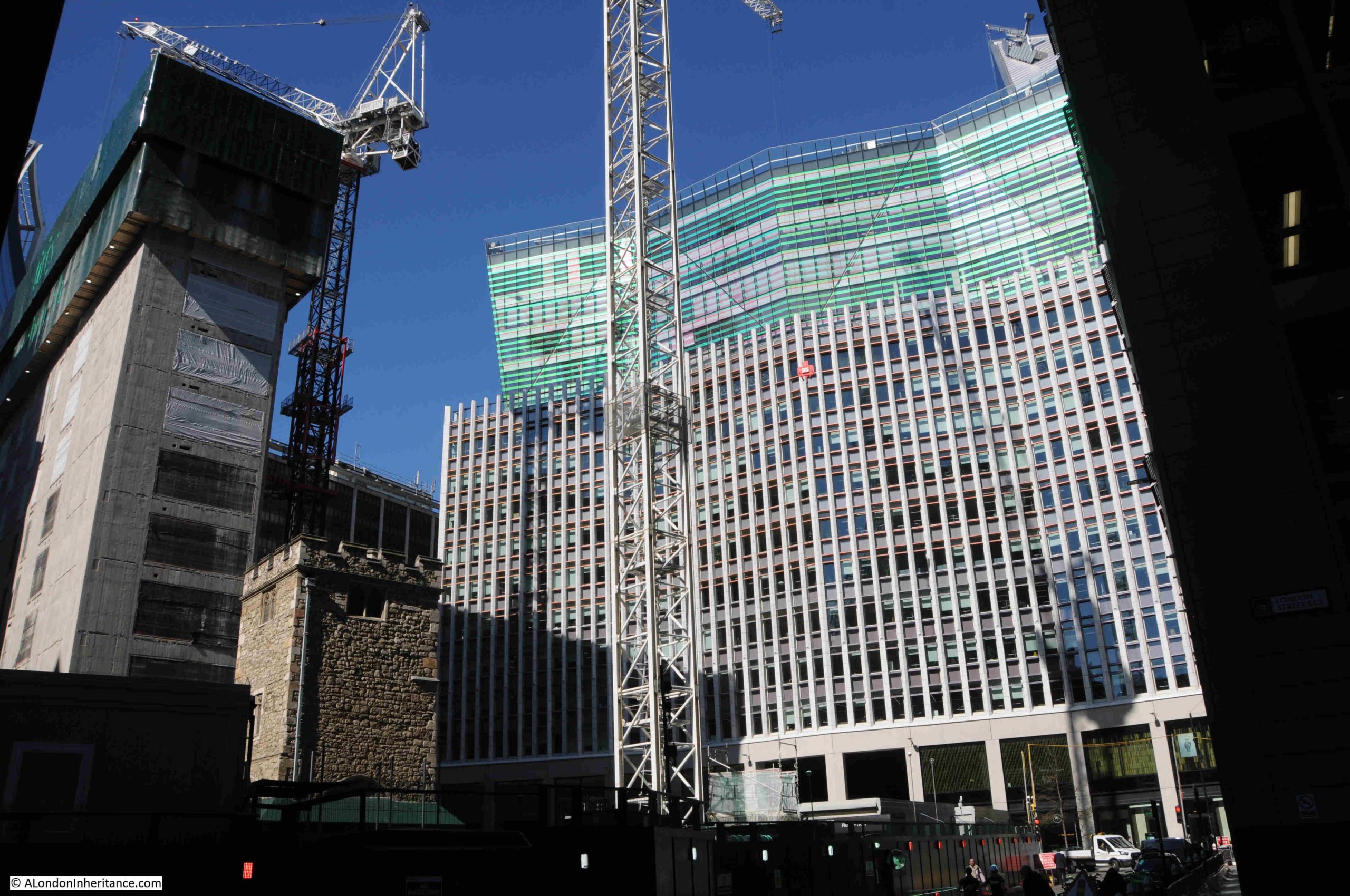
Back in October, in a post on two London churches and a Battersea Gas Holder (no connection between them – just some random features of London), I wrote about All Hallows Staining and the 50 Fenchurch development. I was rather frustrated that you could not get a view of the tower of the church on stilts as the main development went on around the ancient remains of All Hallows Staining.
A comment from a reader (thanks Brian J) informed that a view of the building site and the church was available from the viewing area at 120 Fenchurch Street – one of the new public viewing spaces on top of a recent City development.
The Garden at 120, to give the space its correct name, has been on my list of places to visit, but stupidly I had not made the connection between the viewing area and the building site directly in front.
I fixed that last week, with a visit to explore another view across the City.
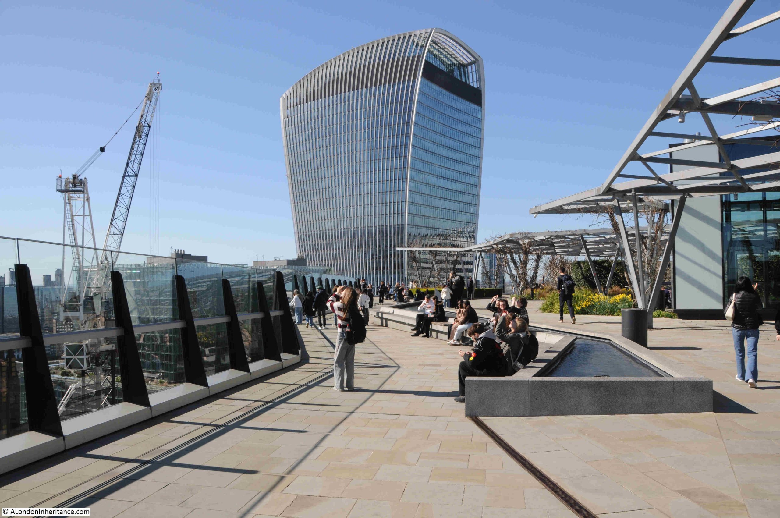
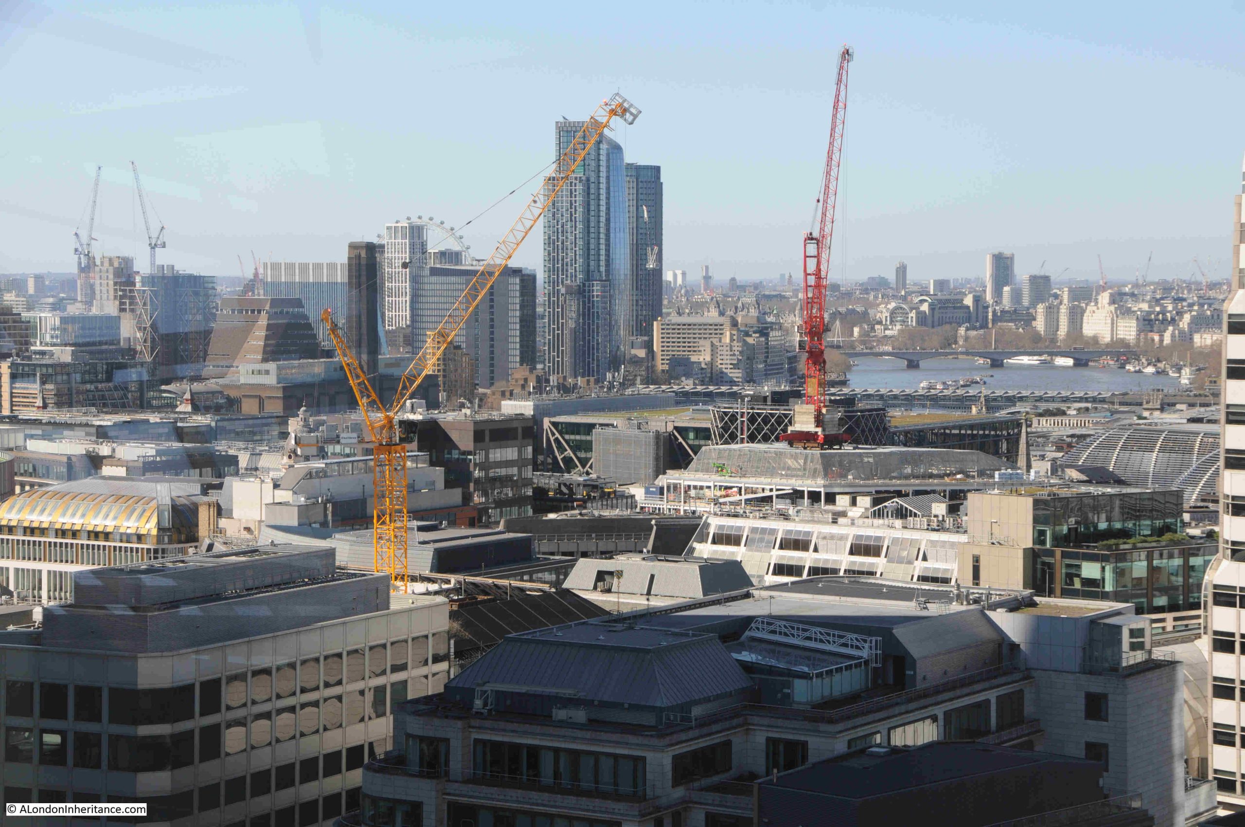
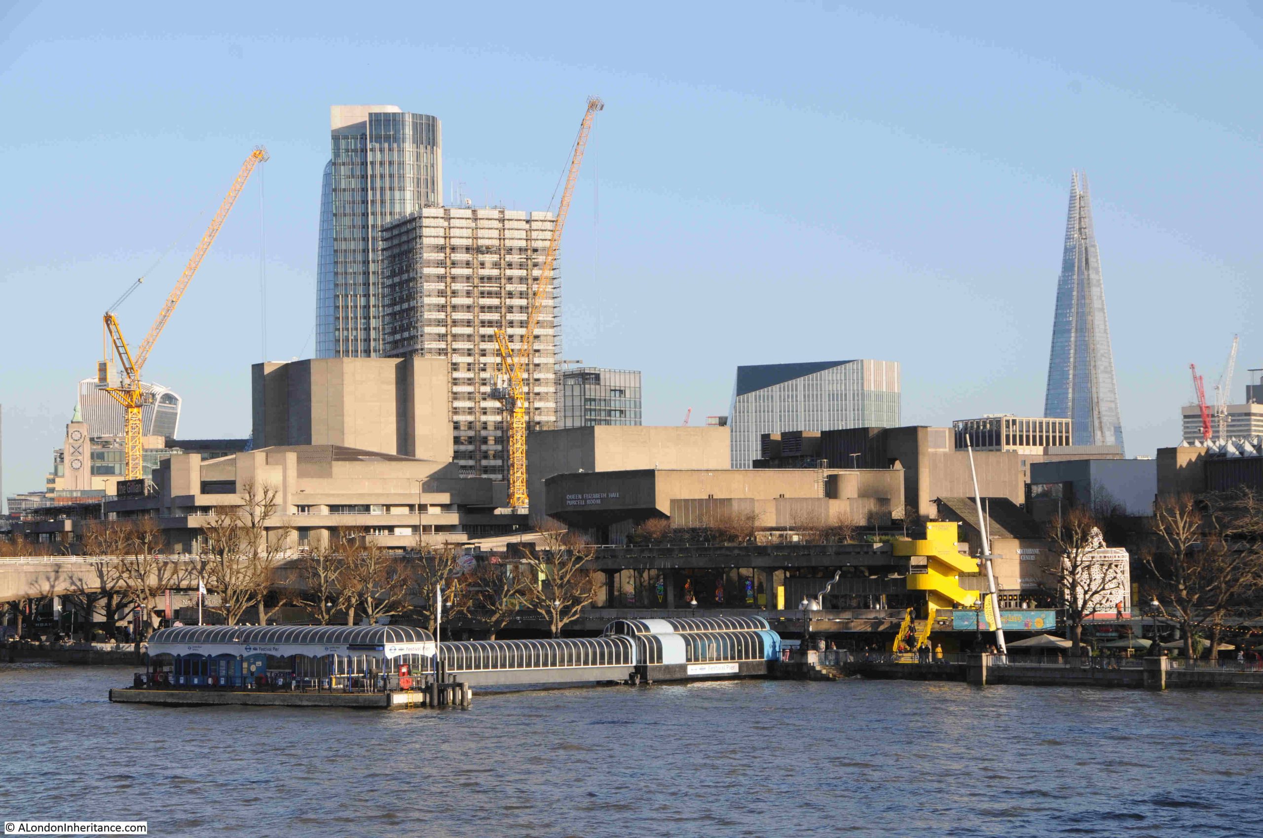
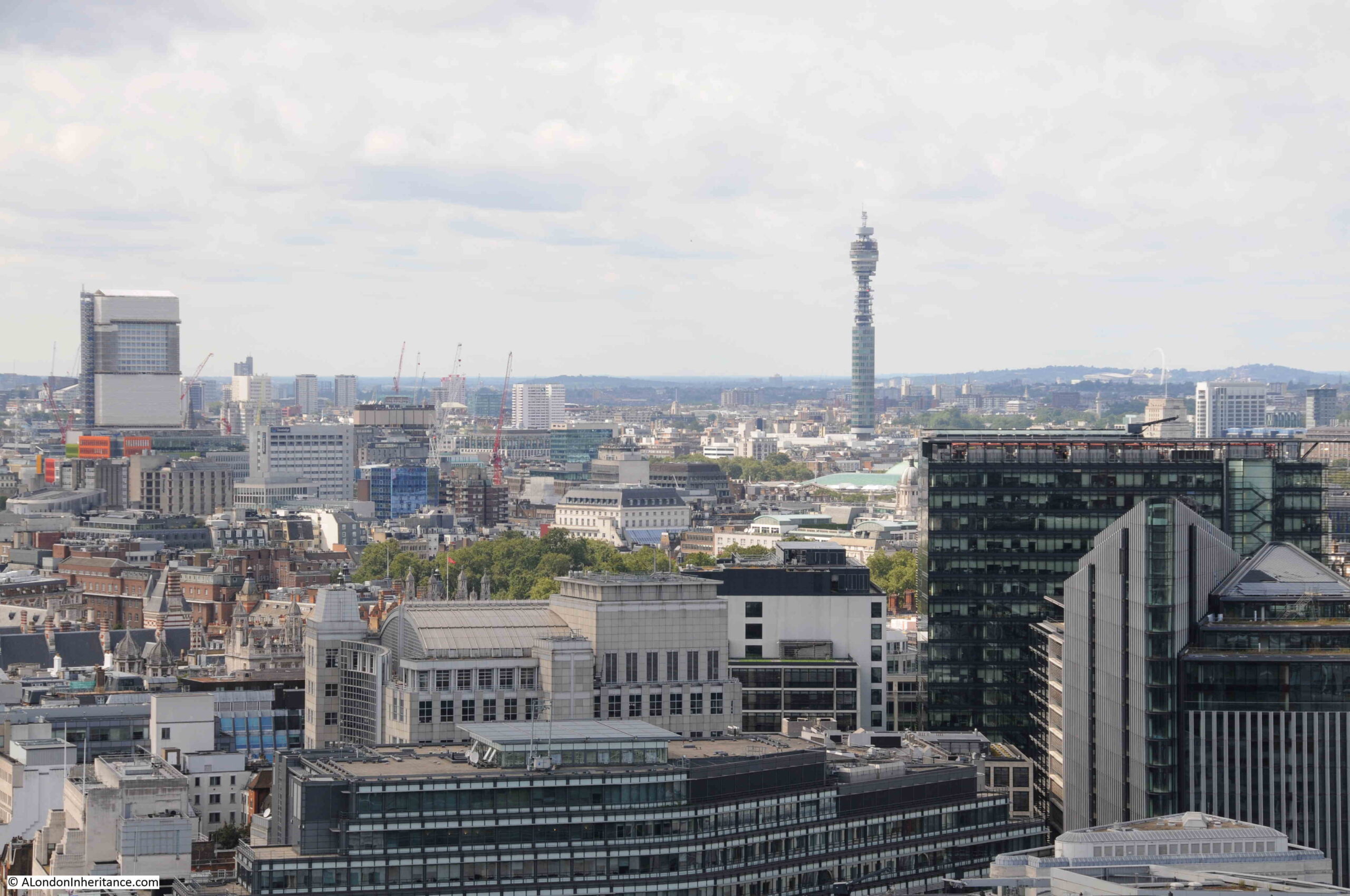
The Garden at 120 is free, does not require a ticket and following a very brief wait in a small queue, the inevitable security check, then the lift took me to the 15th floor, which leads directly out to the viewing area:
The above view is of the south facing part of the viewing area, which also runs around all four sides.
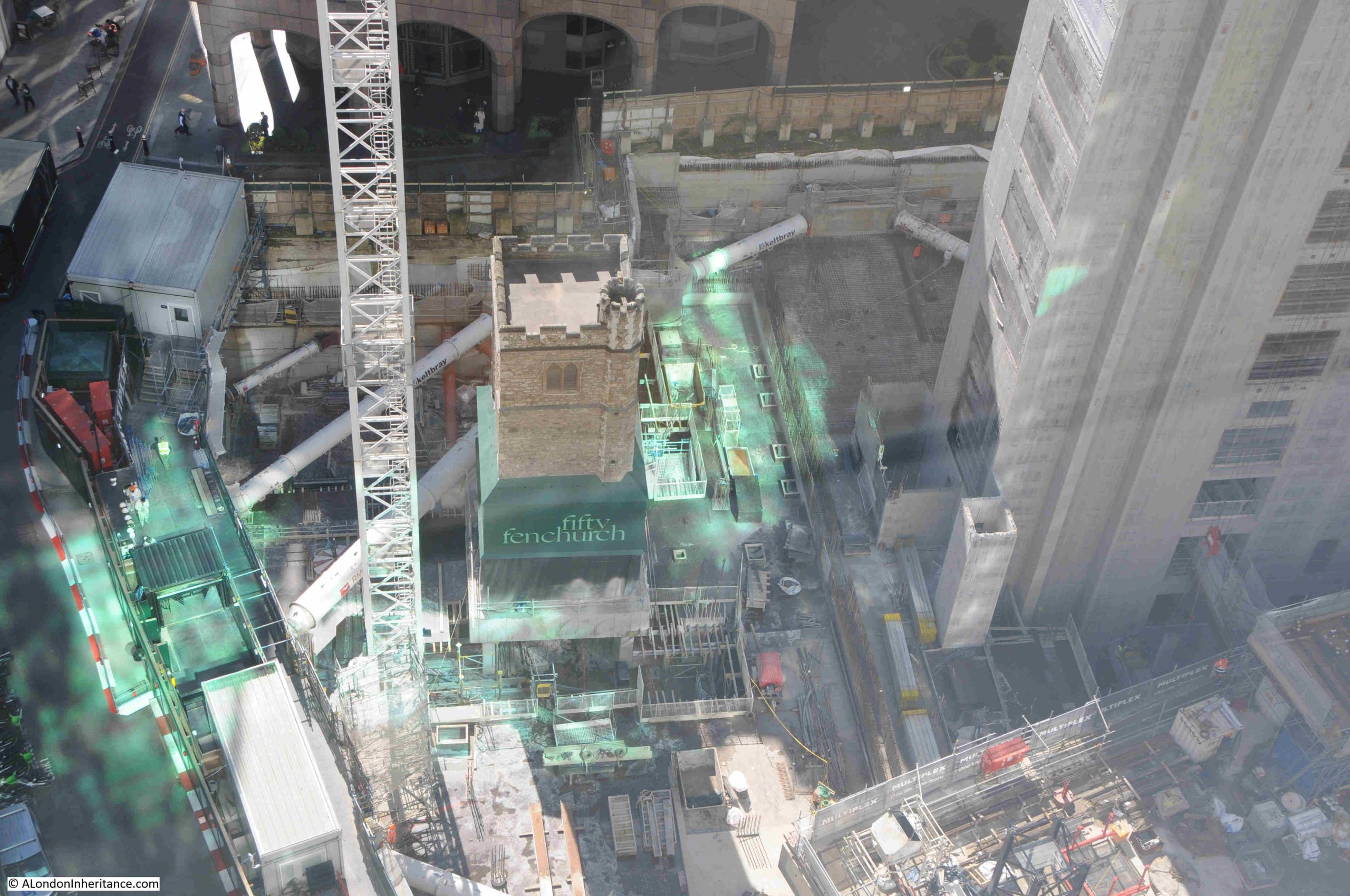
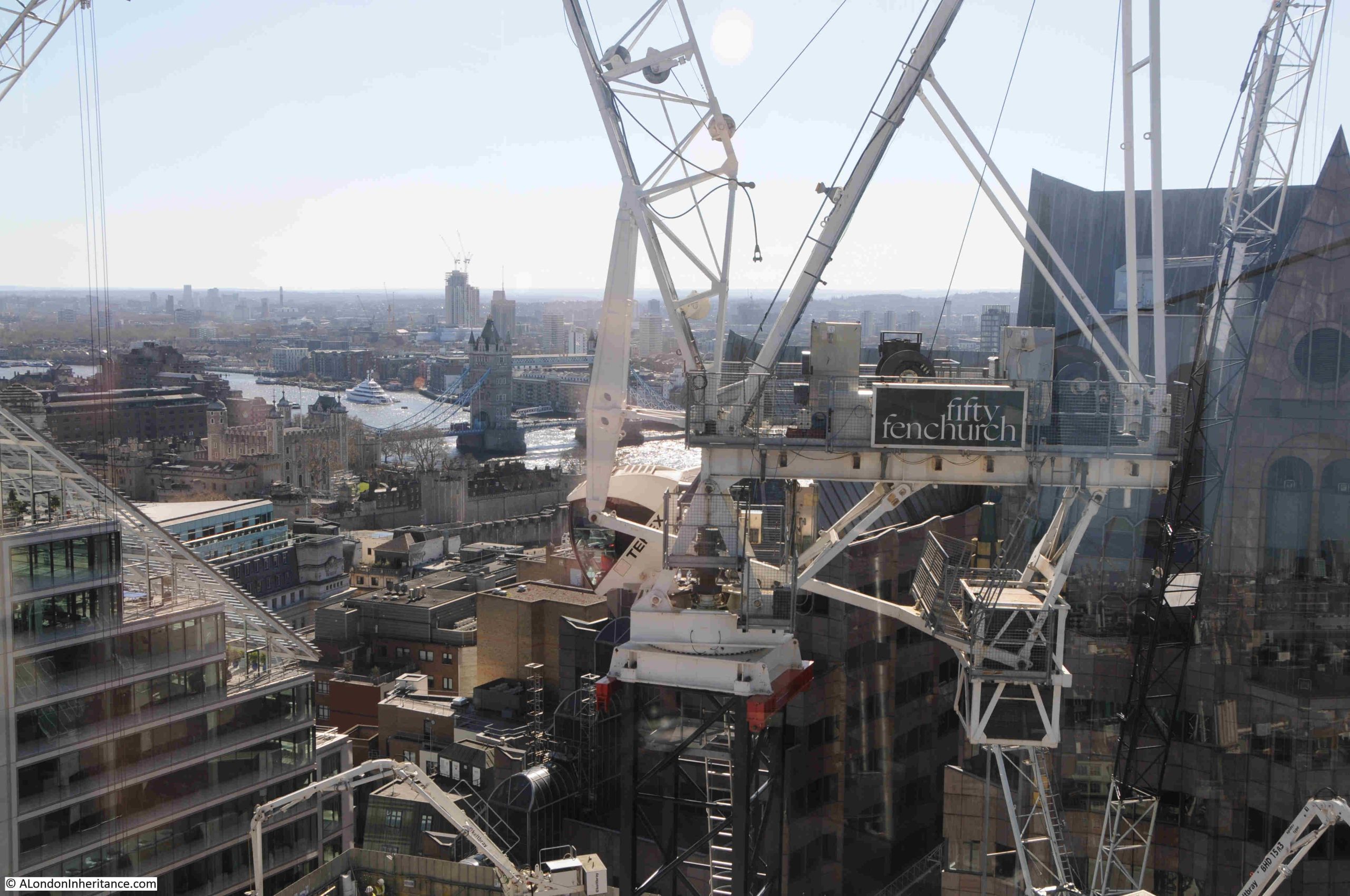
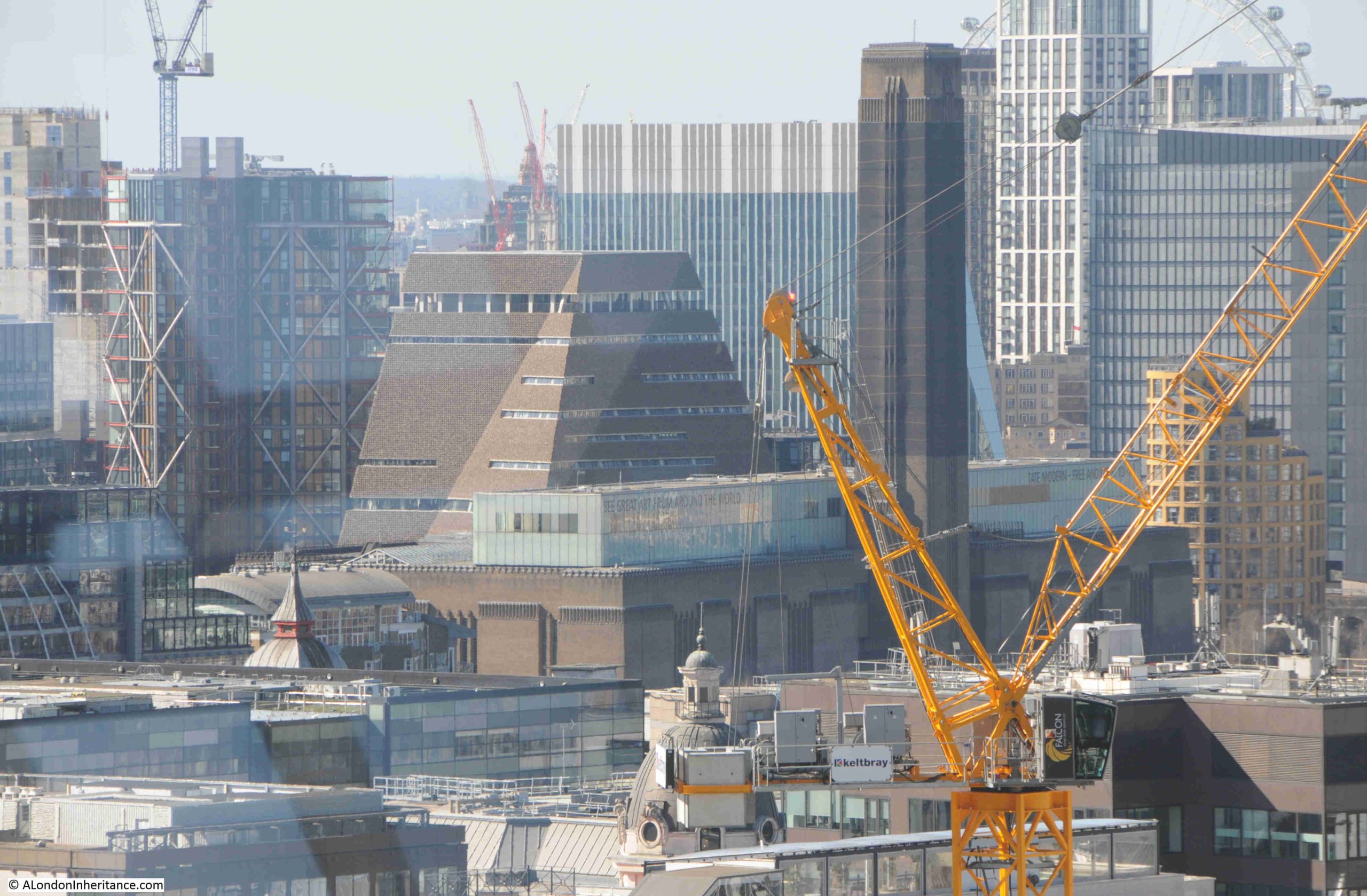
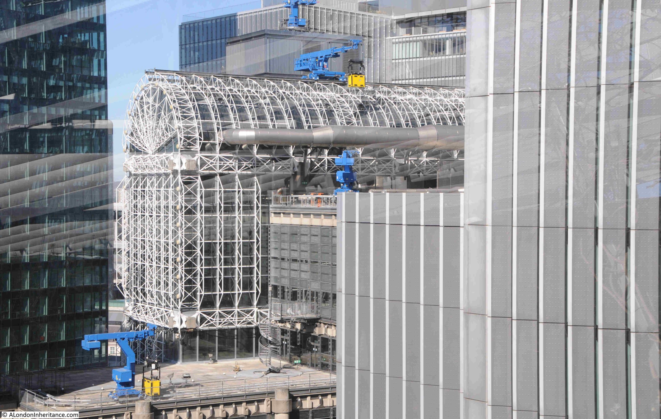
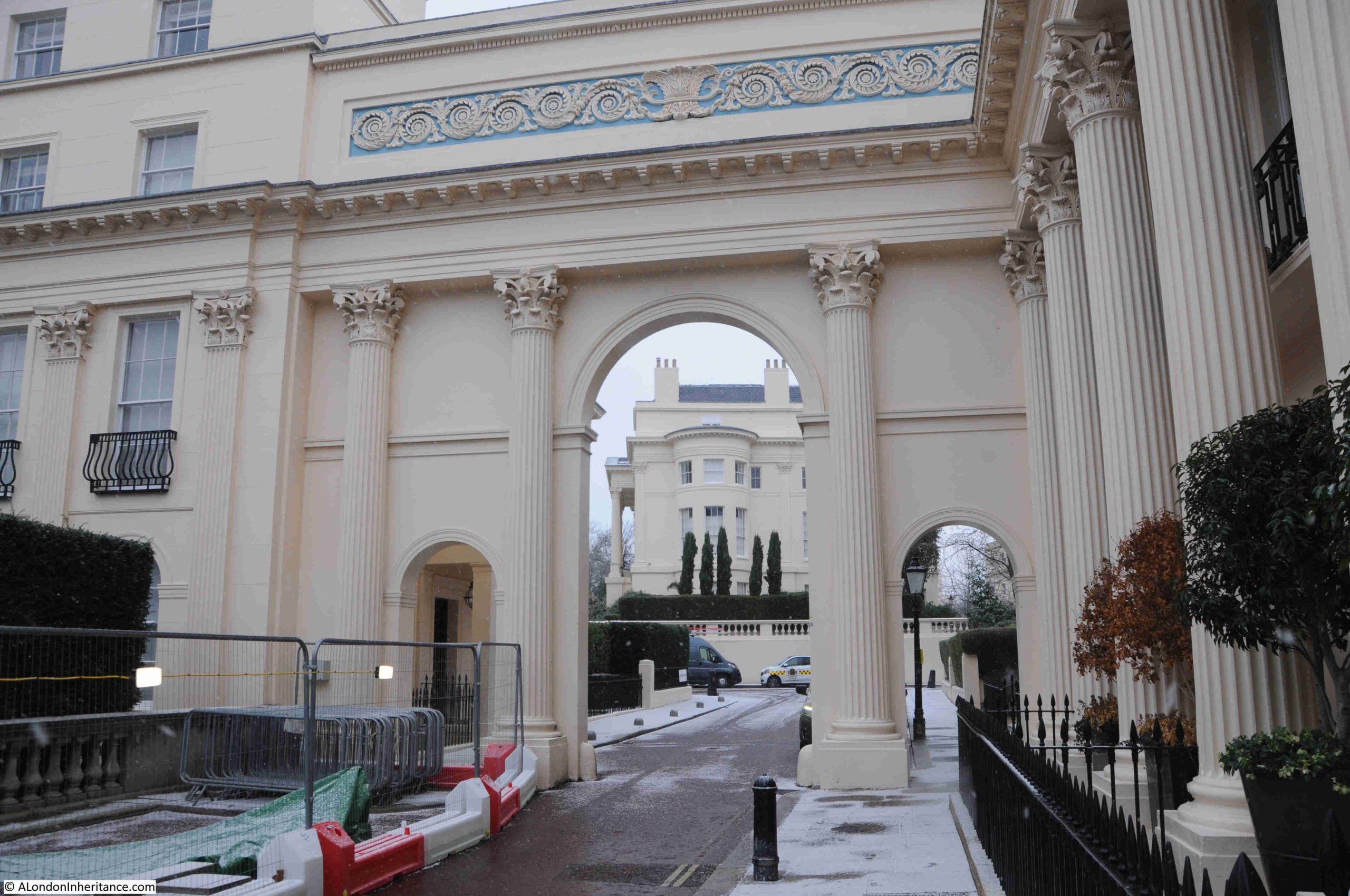
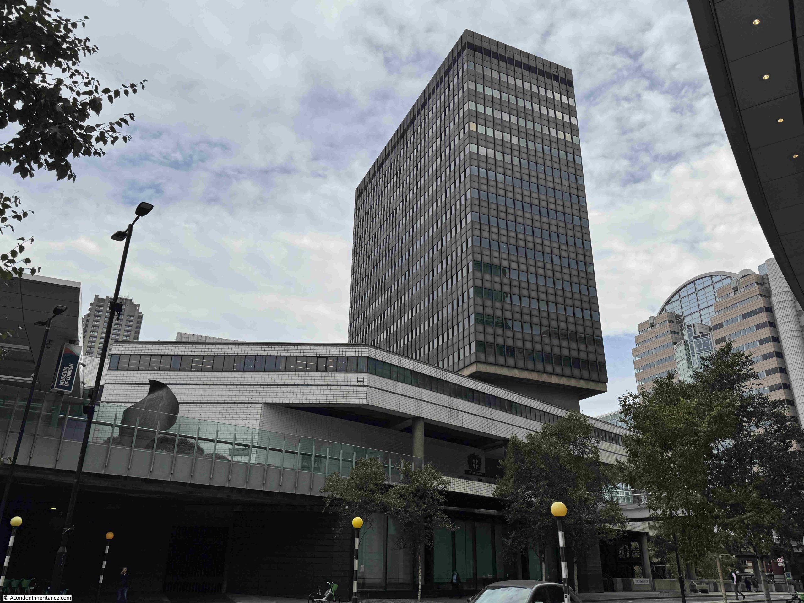
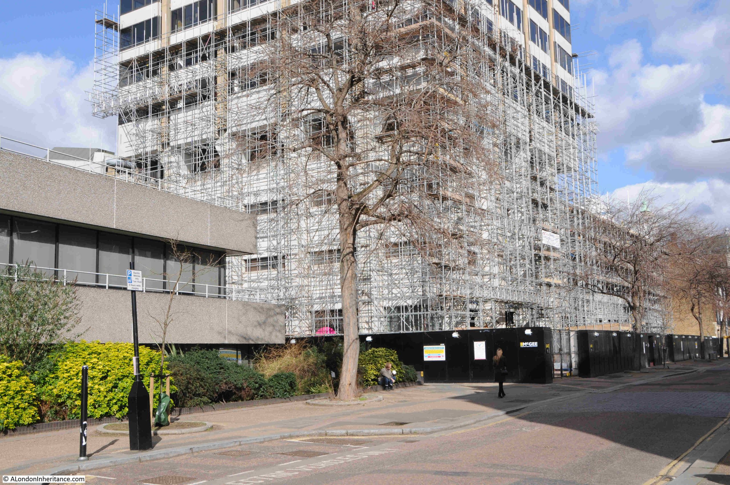
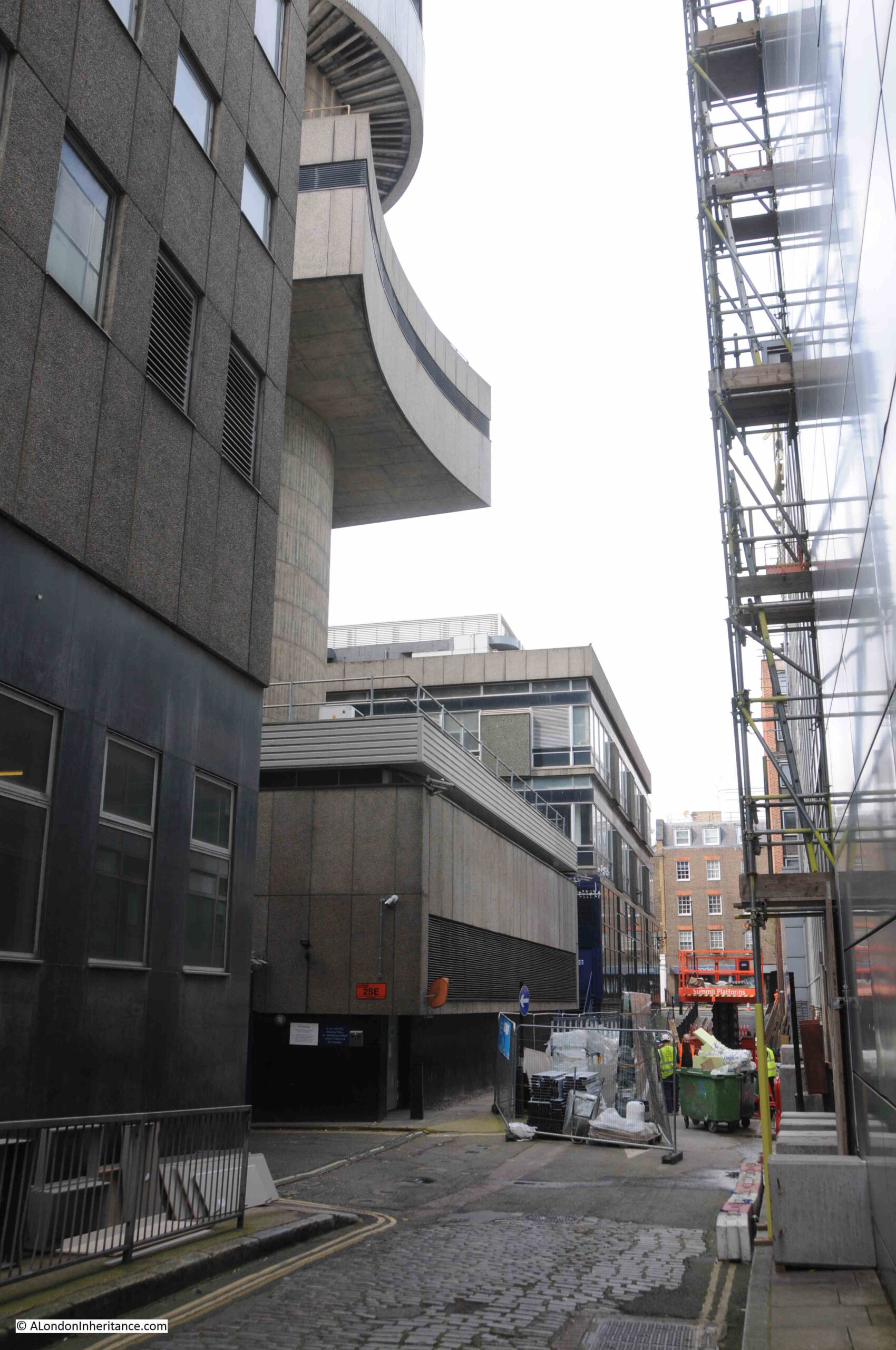
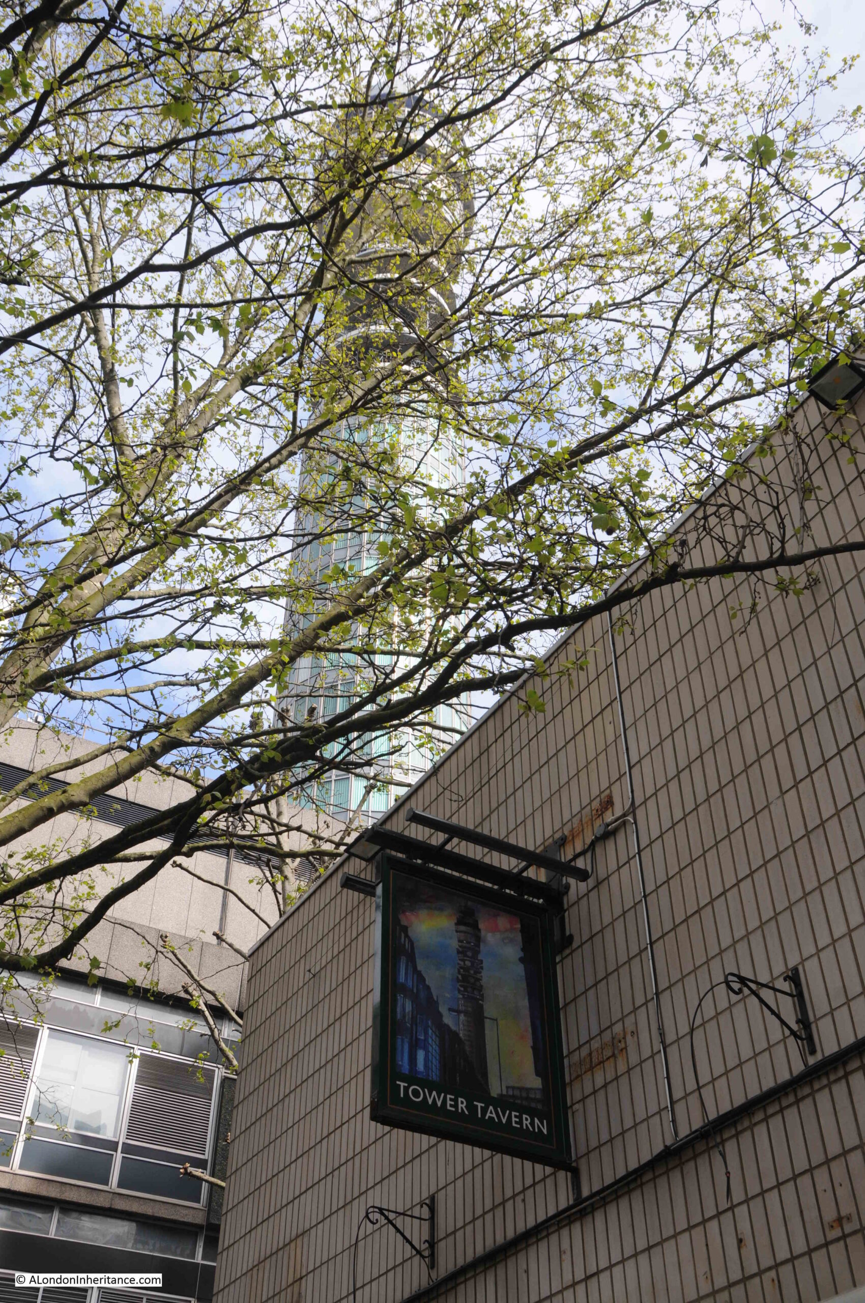
The weather was superb, however I immediately found some problems with taking photos through glass panels looking south, with the sun shining directly into the panels – lots of reflections and strange optical effects, which can be seen in the following photo looking directly down onto the tower of All Hallows Staining:
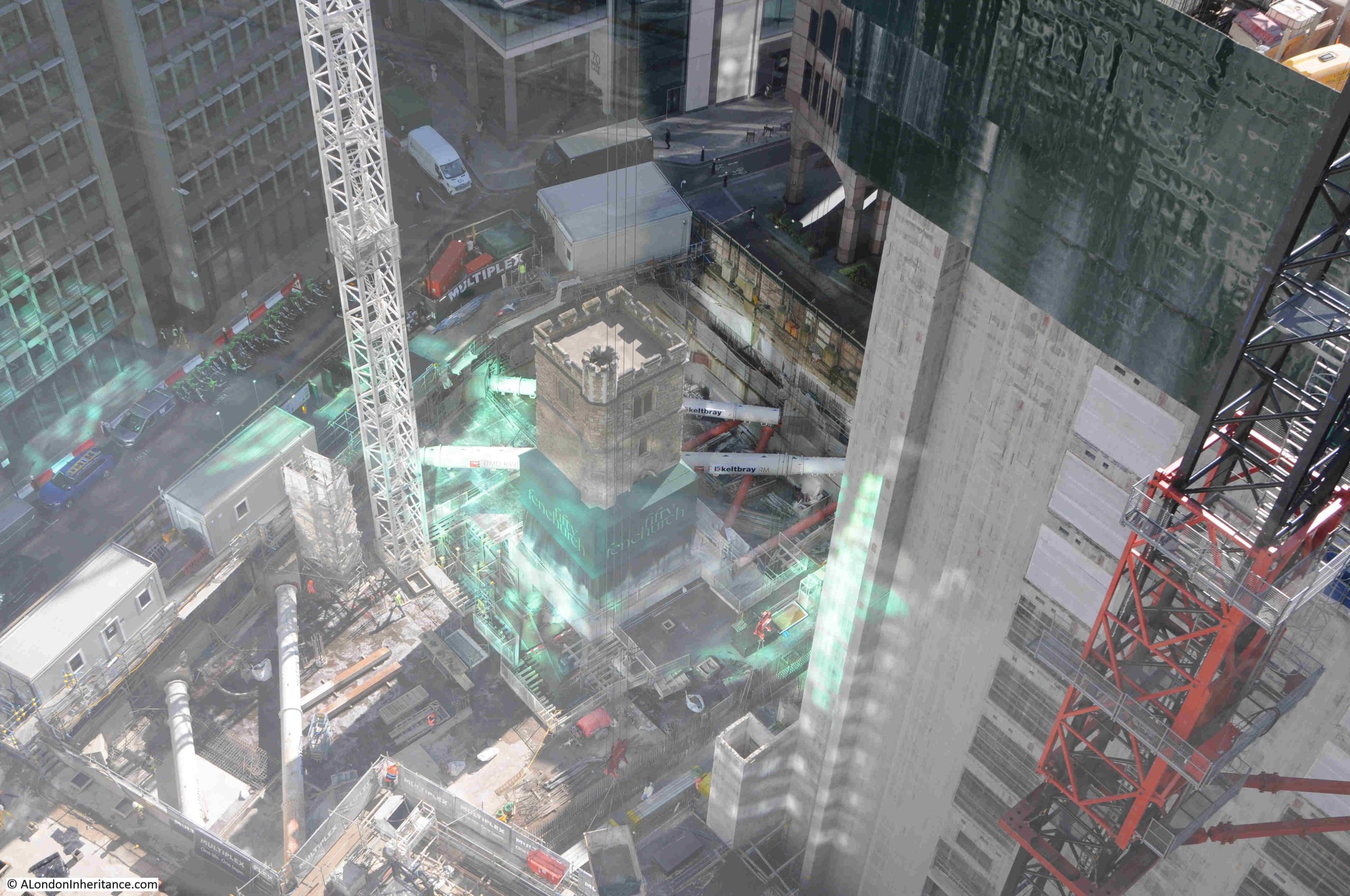
It is just possible to see the tower, standing isolated in the middle of an extensive building site, with the large round metal excavation support struts supporting the retaining walls around the excavation. A view from another angle:
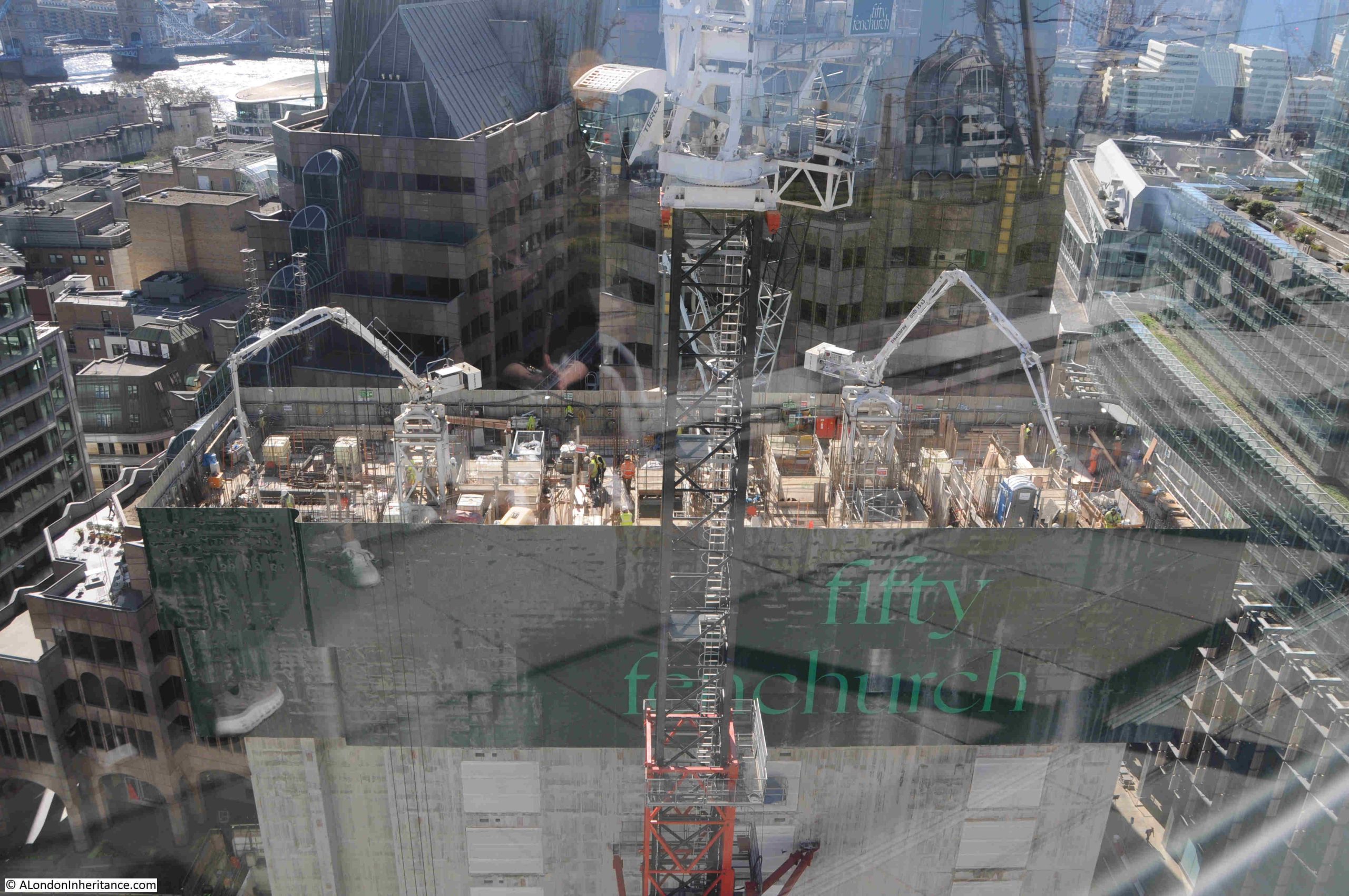
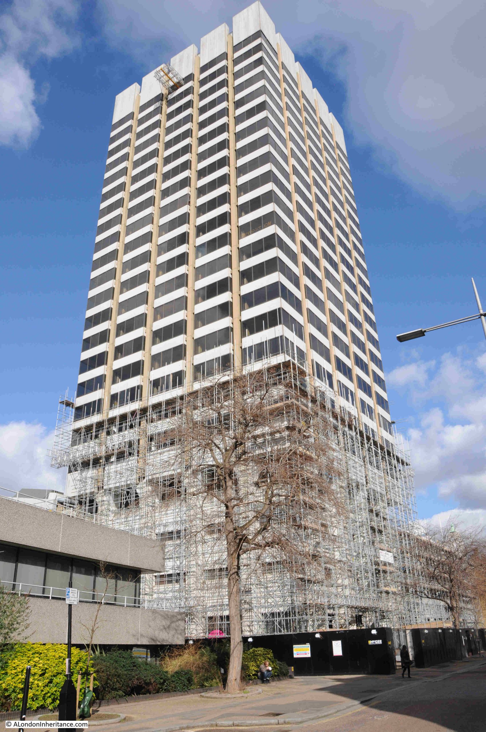
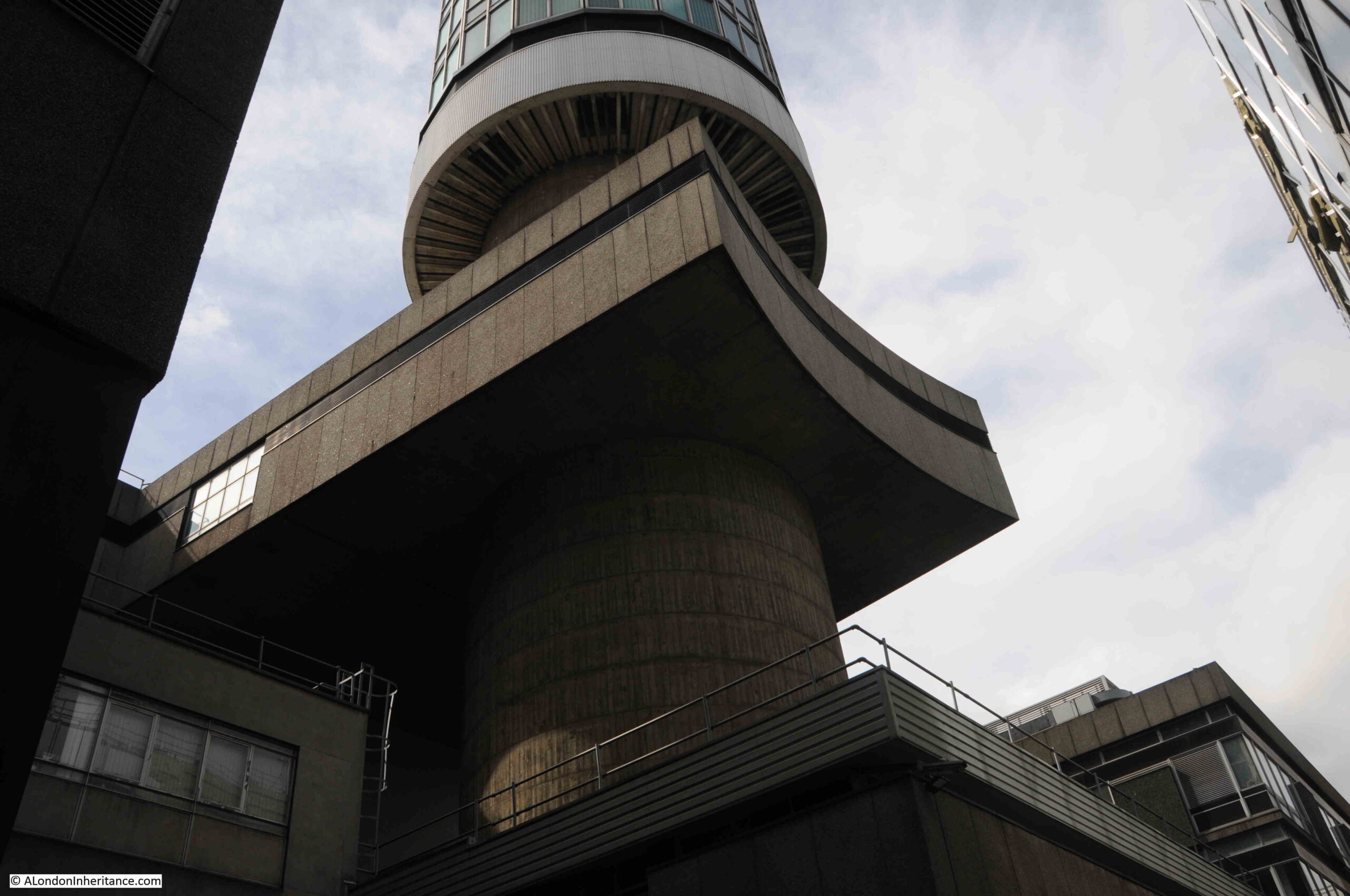
The development in front of 120 Fenchurch Street is Fifty Fenchurch, and when complete will be a 36-storey building, so will be much taller than 120 Fenchurch Street and will block part of the view to the south from the 15th floor garden.
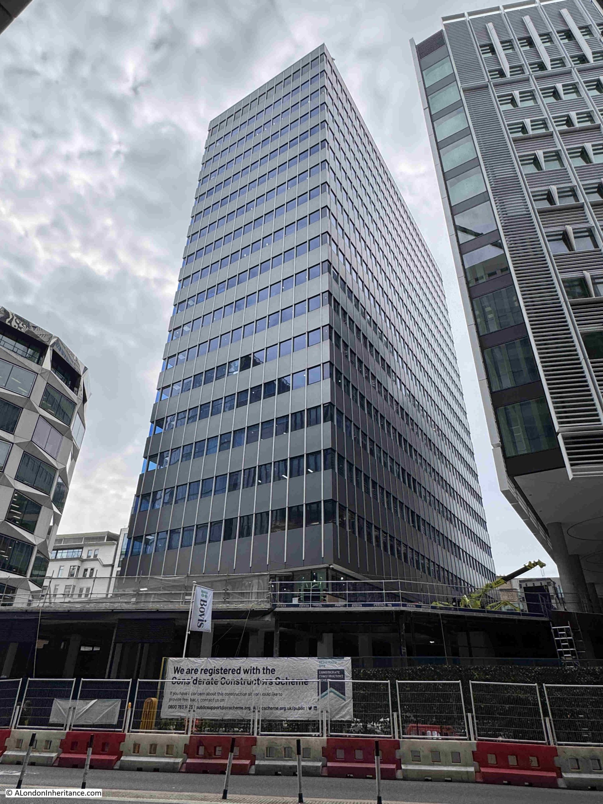
As with almost all new towers in the City, Fifty Fenchurch will also include a public viewing gallery, but strangely this will be at level 10 rather than the roof or upper floors of the building, so the viewing gallery will be lower than the Garden at 120.
The current upper level of Fifty Fenchurch – the inner concrete core, which still has someway to go:
If you have a head for heights, then a job as a crane operator must provide some fascinating views of both construction sites and the wider area, although I would not fancy the climb up the ladders within the central frame to reach the cabin:
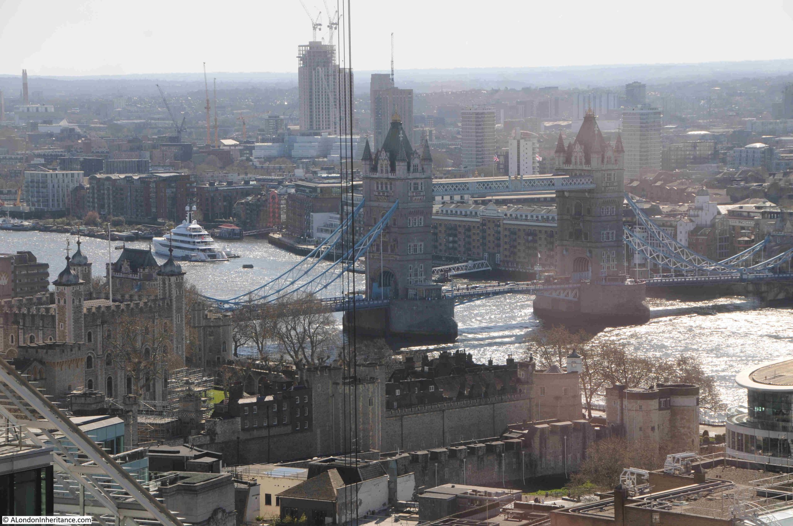
Tower Bridge:
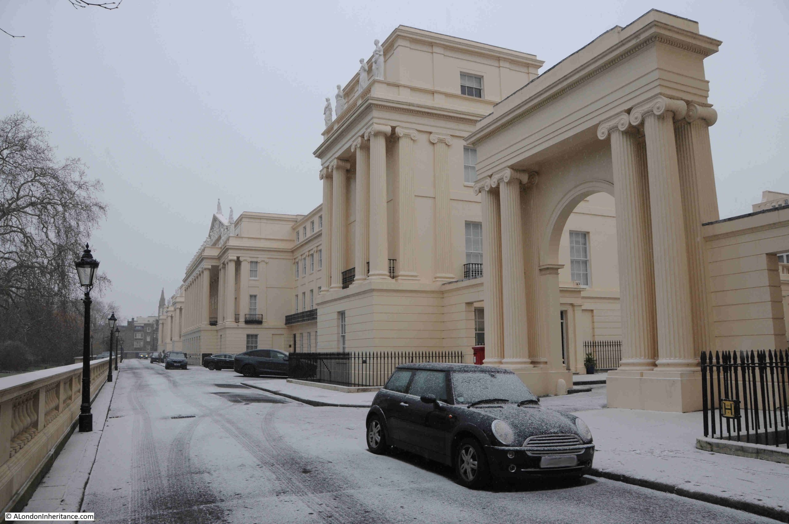
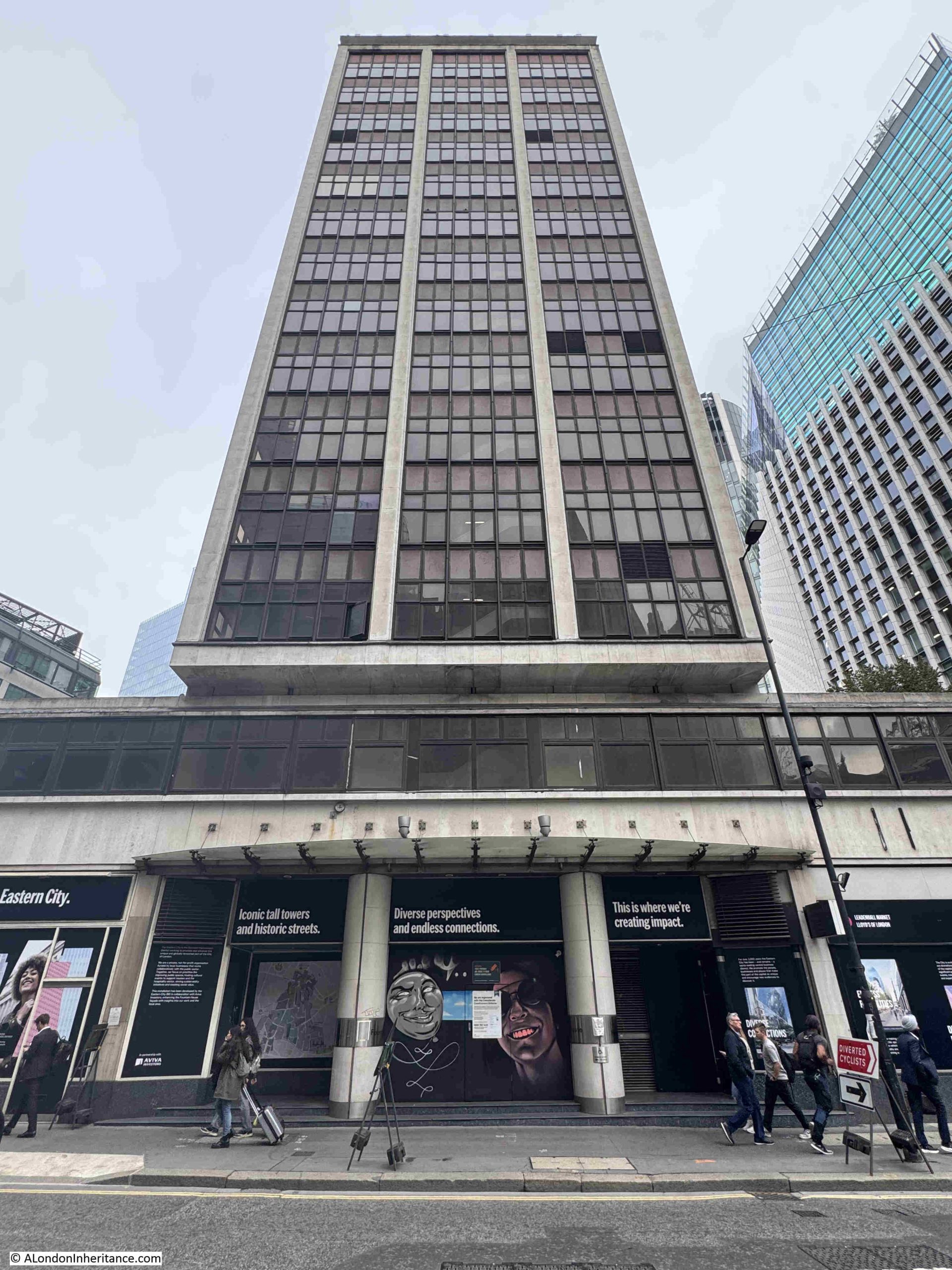
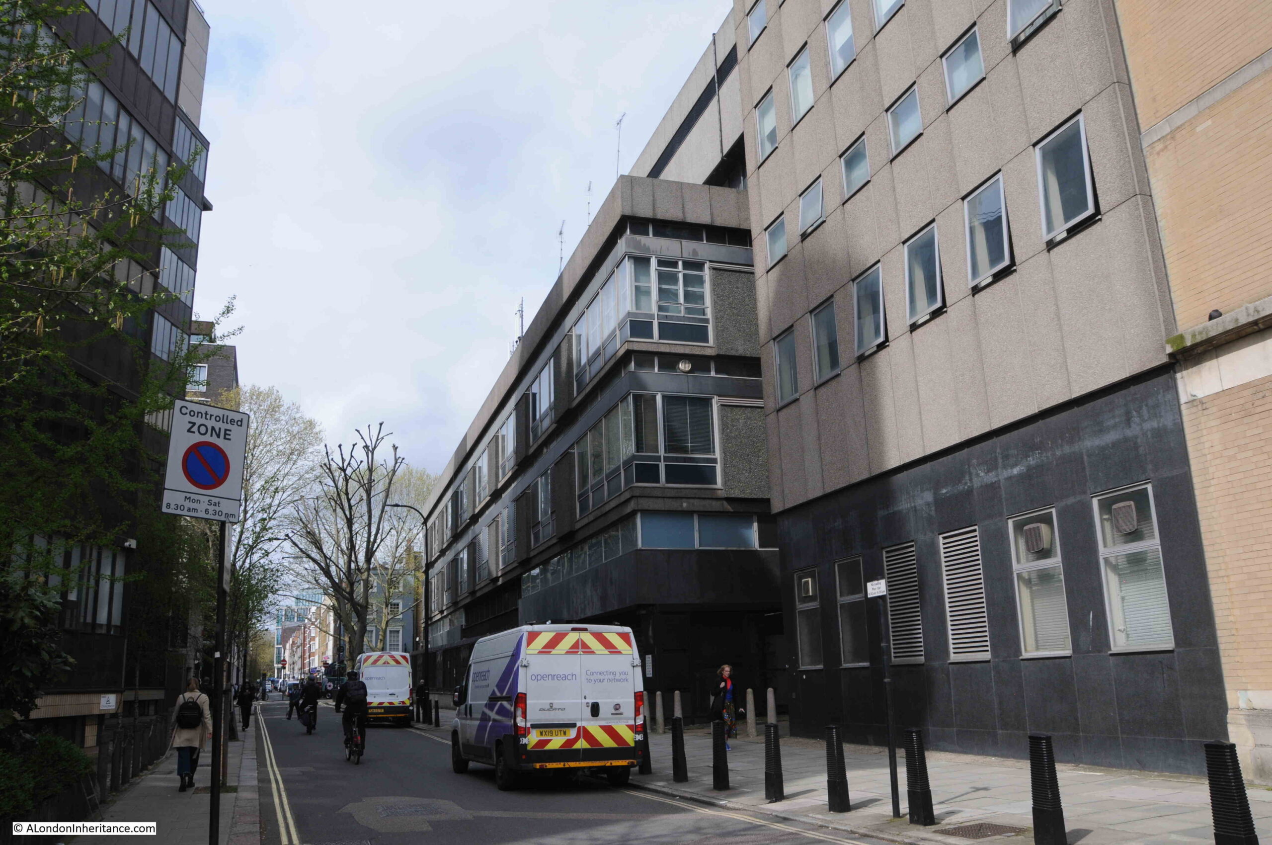
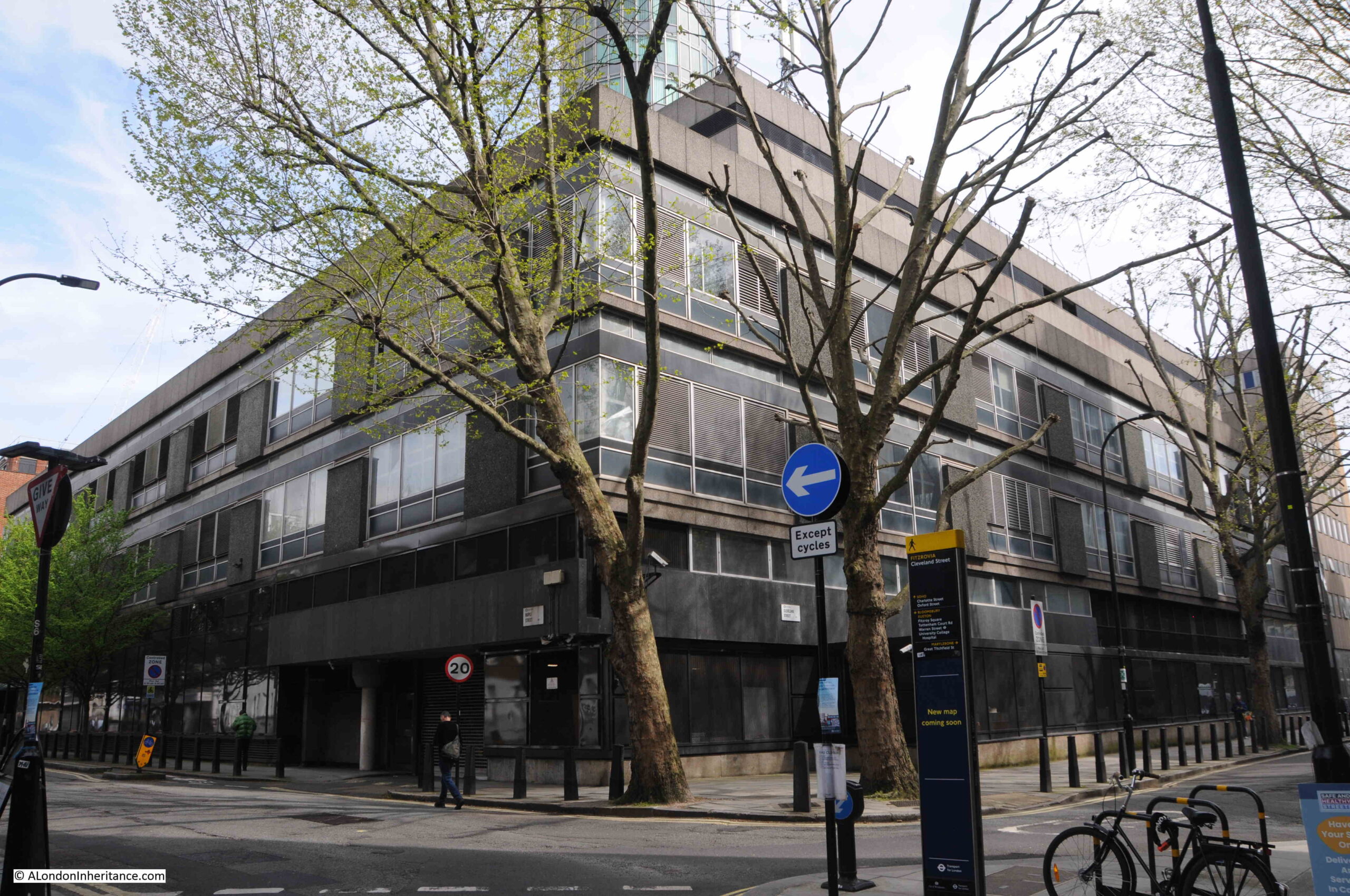
Immediately to the west of 120 Fenchurch Street is Fountain House:
Fountain House was built between 1954 and 1958 to a design by W.H.Rogers and Sir Howard Robertson (Consulting). It was the first London building constructed to the tower and podium formula where a large podium occupies the full area of the plot of land, with a much small central space occupied by a tower block. I have written about the building in this post.
It will probably not be there for much longer, as the City of London Corporation has approved a new development with two new towers, one of 31 storeys and the other with 34, and on the 17th floor there will be a publicly accessible external garden terrace, so there will be three public viewing terraces all next to each other, so visitors to one, will be able to look across to visitors at the other two.
The development replacing Fountain House will also be much taller than 120 Fenchurch Street, so with Fifty Fenchurch to the south, Garden at 120 will be slowly surrounded by higher blocks.
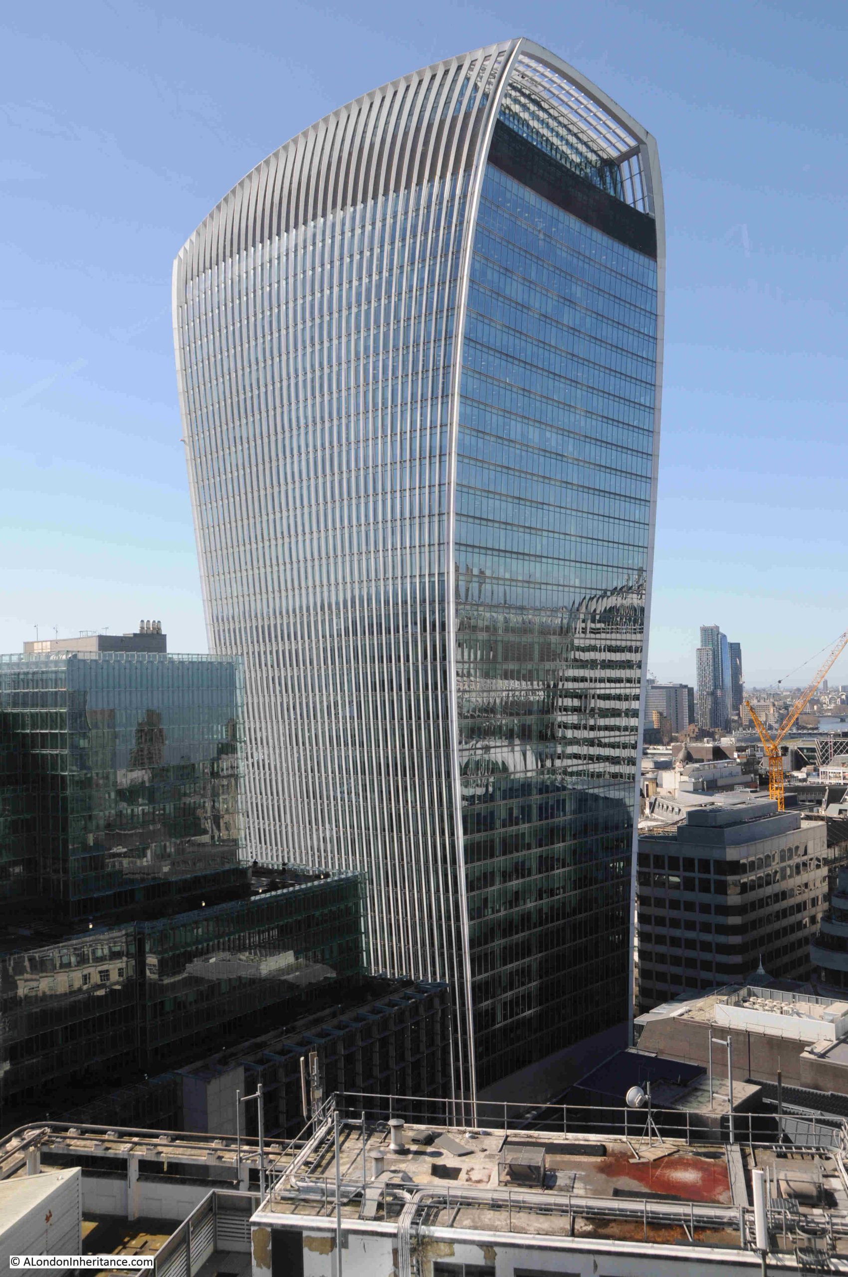
Another building, also with a public viewing gallery is the Walkie Talkie, or more officially. 20 Fenchurch Street. The plan for the replacement of Fountain House implies that the following view of the Walkie Talkie will be obscured from the Garden at 120:
In a few years, you will be able to spend an entire day out visiting the four public viewing terraces all within a short distance along Fenchurch Street.
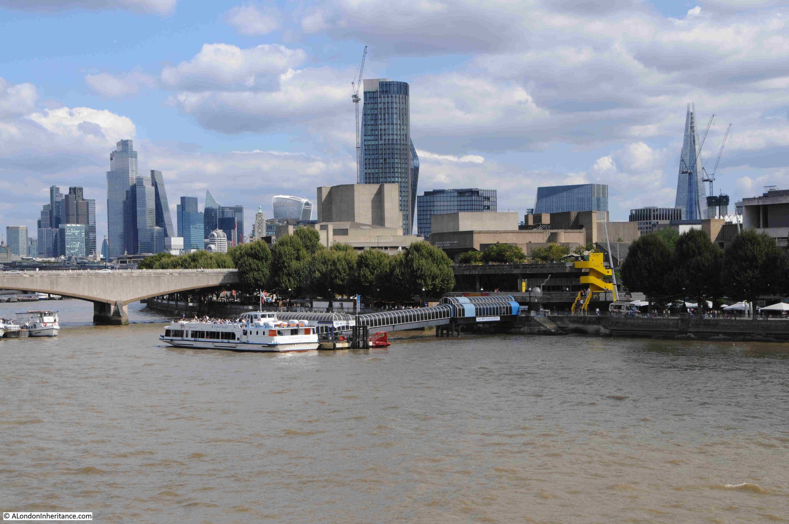
View towards the west with a small stretch of the Thames from Blackfriars Railway Bridge up to Waterloo Bridge:
There is another viewing gallery in the above photo, just to the left of the yellow crane, is the Blavatnik Building of Tate Modern, and on the 10th floor is a viewing gallery:
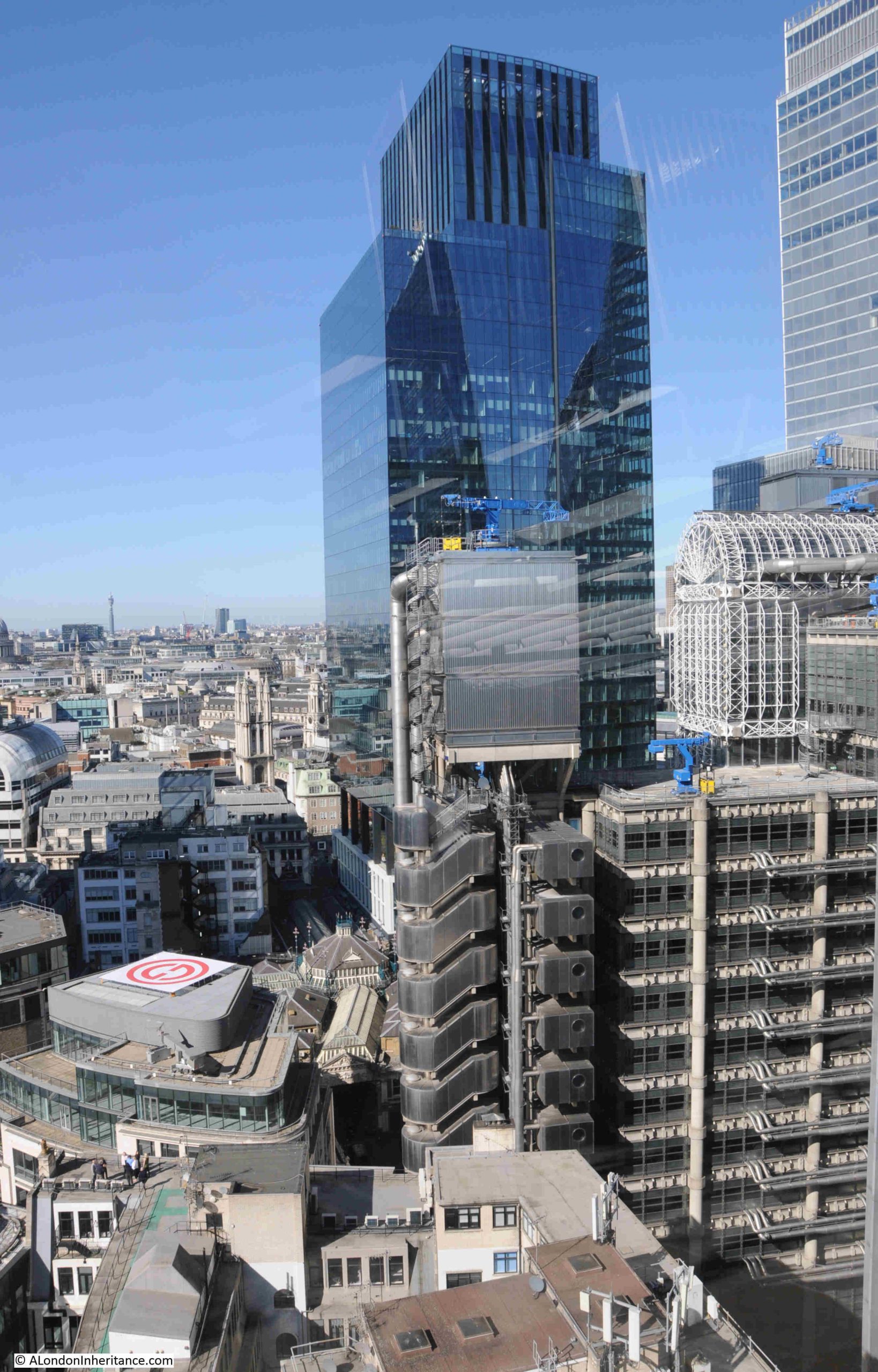
The following photo illustrates how the scale of the modern City has grown exponentially from the historic City, and how historic buildings are reduced to filling in the ever decreasing gaps.
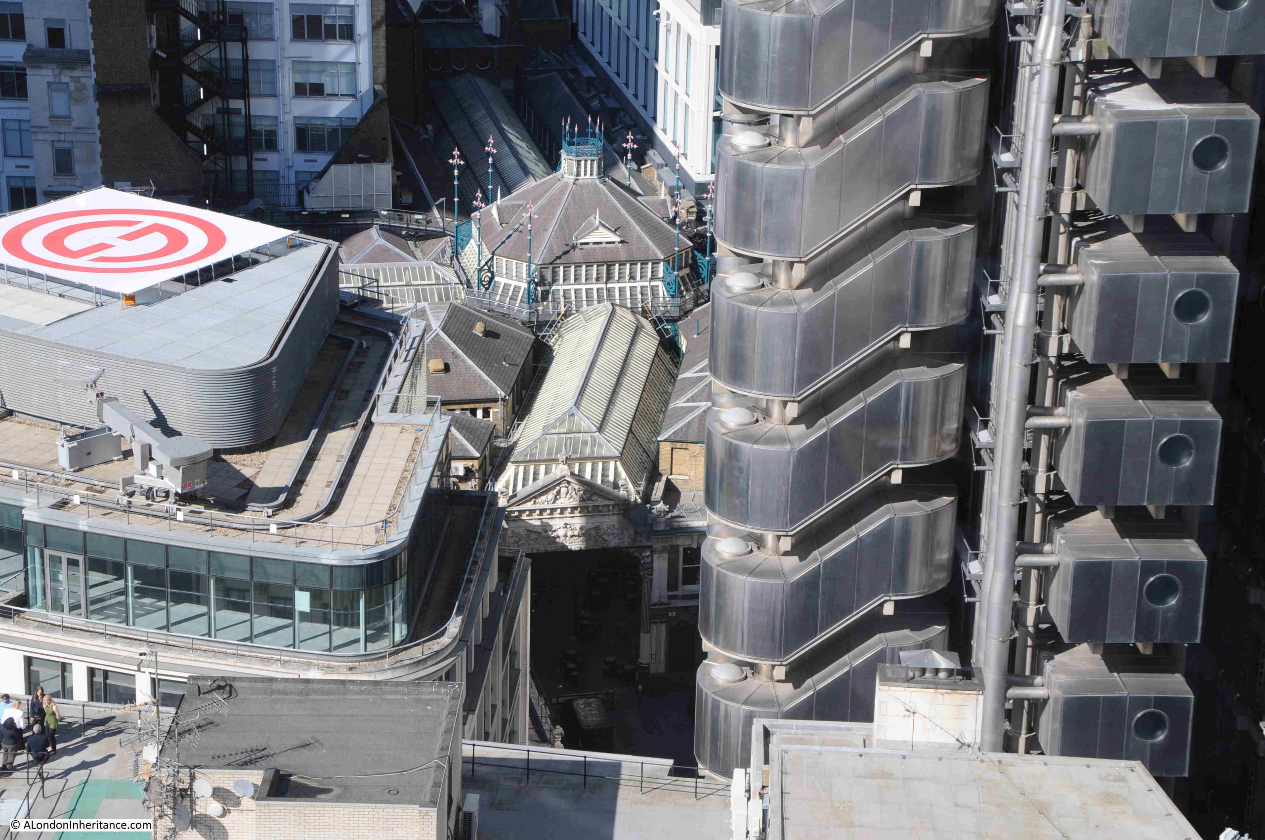
The Lloyd’s of London building is on the right, with the blue cranes along the roof, and the tall tower in the centre is the recently completed One Leadenhall:
If you look to the lower left of One Leadenhall and the Lloyd’s of London building, you will see a very different structure – the roof of Leadenhall Market:
Although a market has been at the site for centuries, the current market buildings date from 1881, and the height and footprint of buildings in the City has grown so much in the following 145 years, at a scale that, whilst Victorian architects and builders were ambitious, would probably have been beyond their imagining.
There is a brief sequence early on in the 2013 Star Trek film – Into Darkness, where a bomb explodes in an underground facility in the City, and the CGI generated view of the City still shows St. Paul’s Cathedral, but it is surrounded by incredibly tall towers, much higher than we see in the City today.
The film is based in 2259, in 233 years time, and based on the rate of growth since the current Leadenhall Market buildings were completed, the CGI in Star Trek will probably be an accurate vision of the future London.
More of the Lloyd’s of London building – watching the blue crane along the top slowly moving along the roof line was interesting:
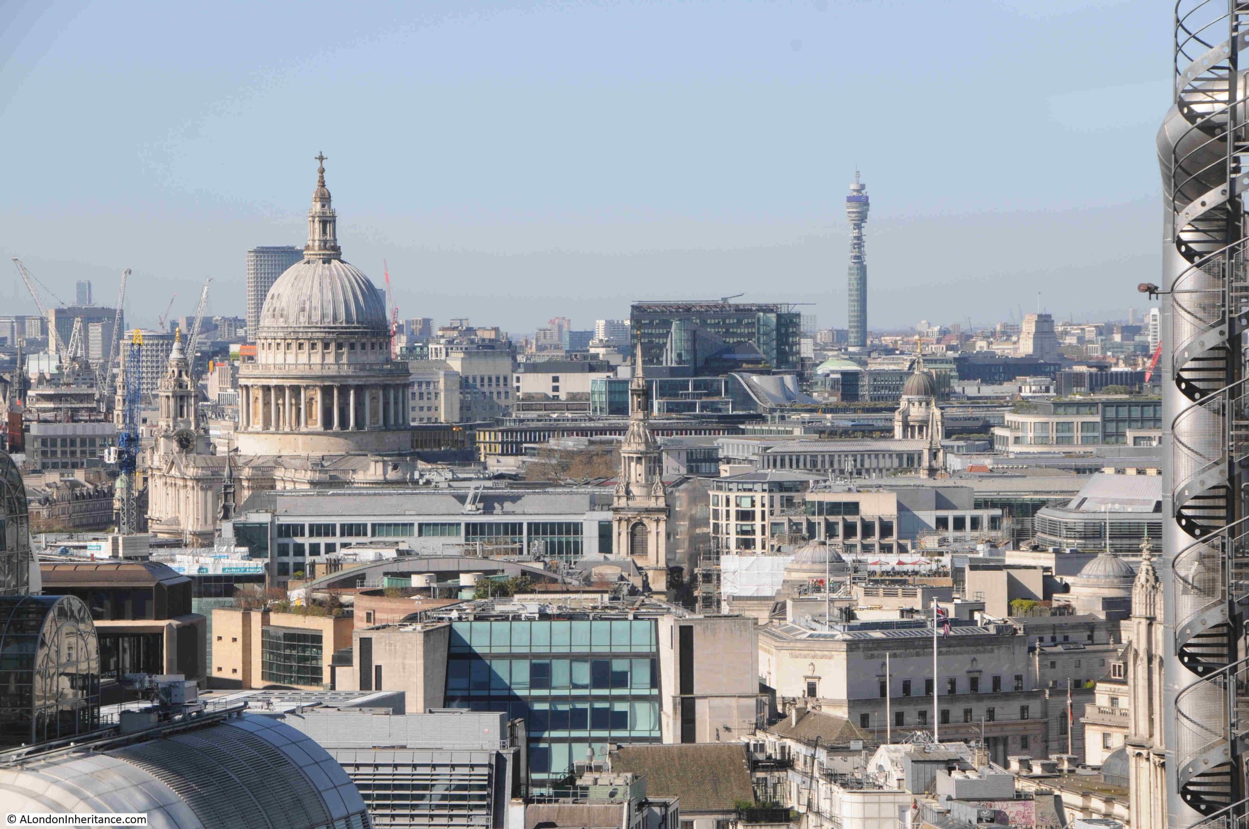
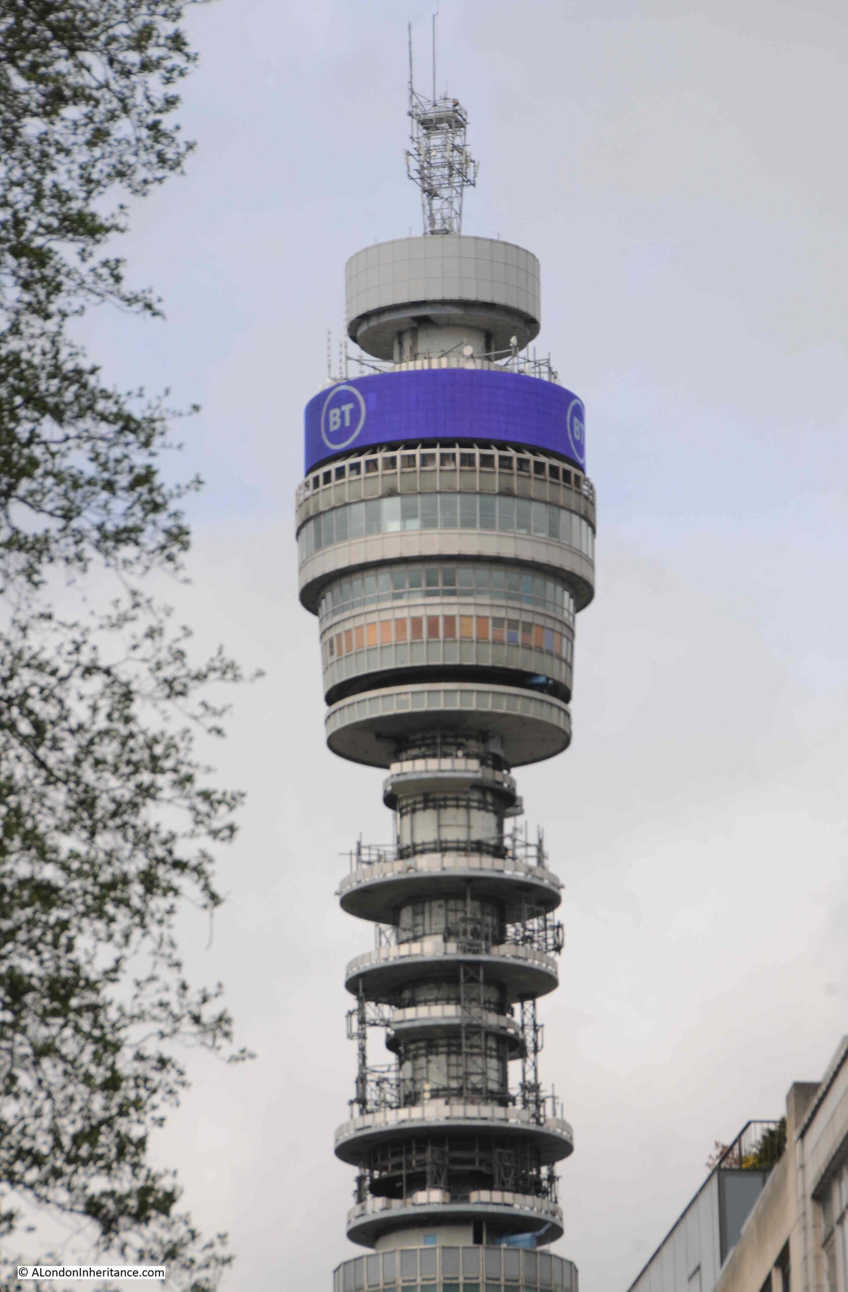
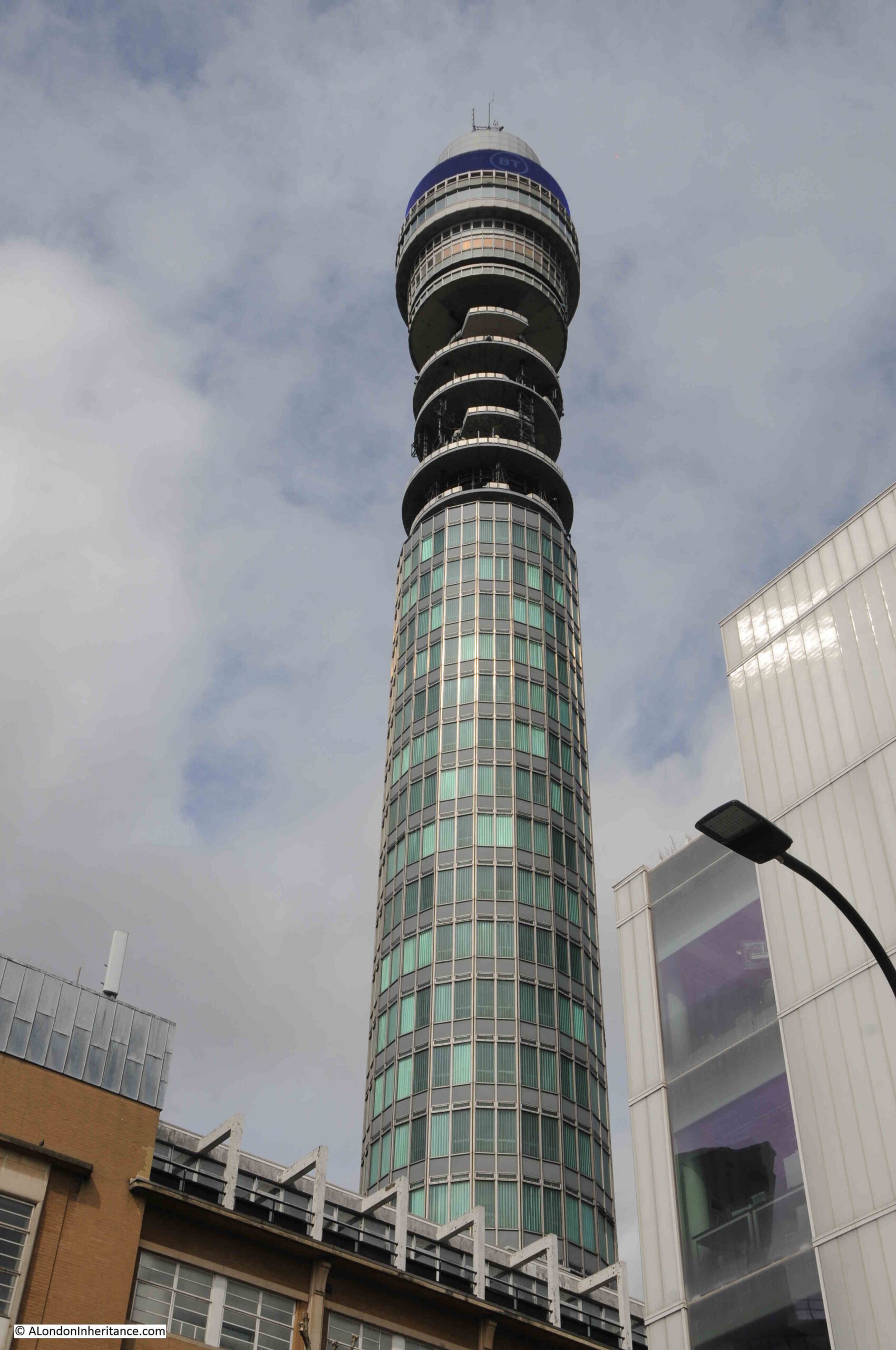
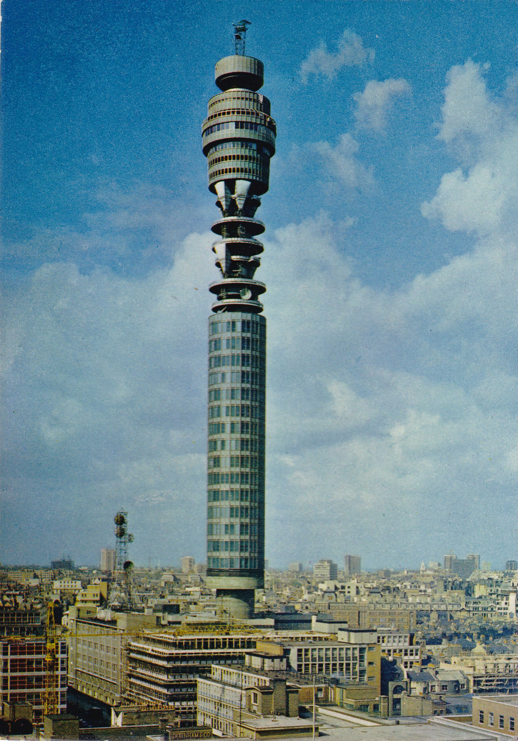
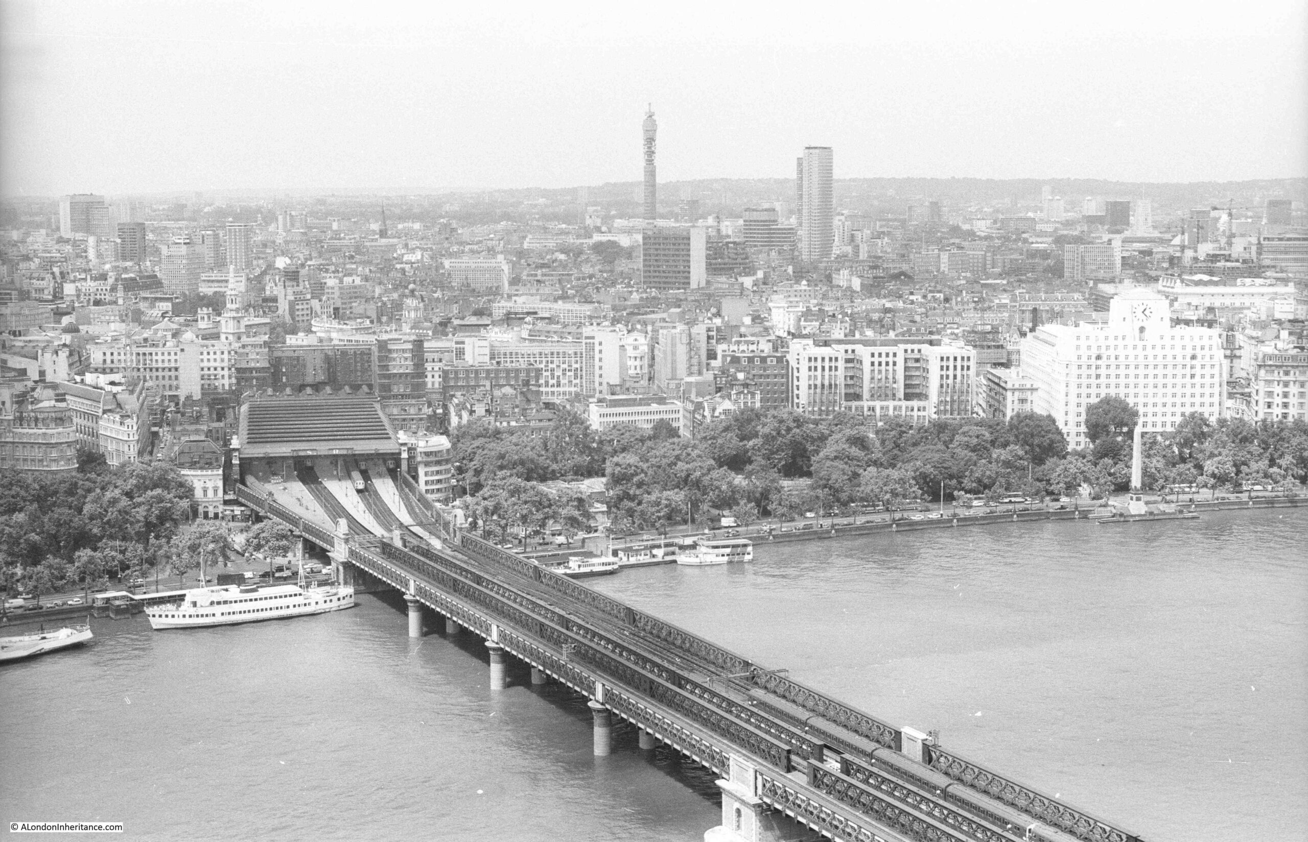
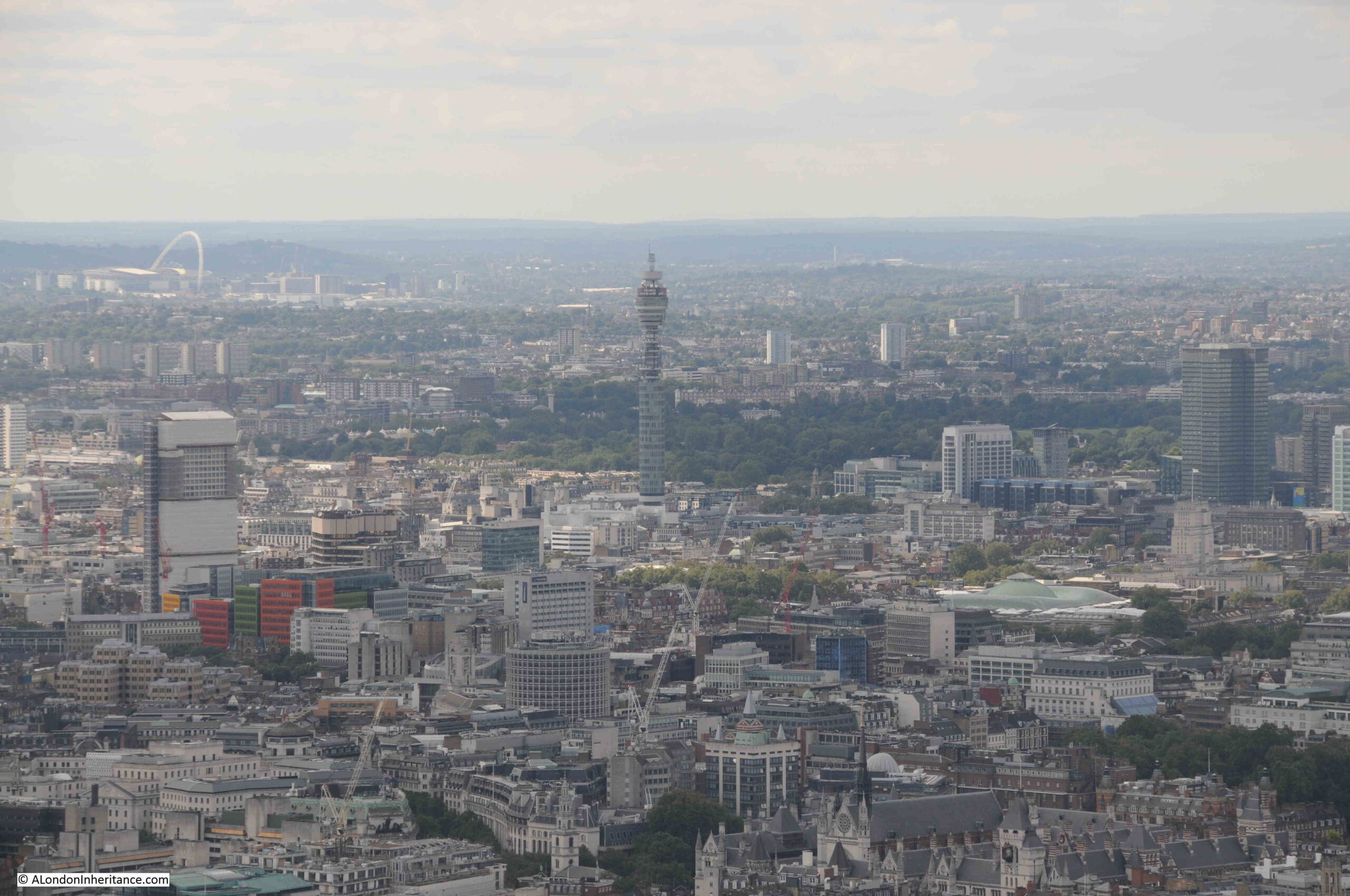
St. Paul’s Cathedral and the Post Office / BT Tower:
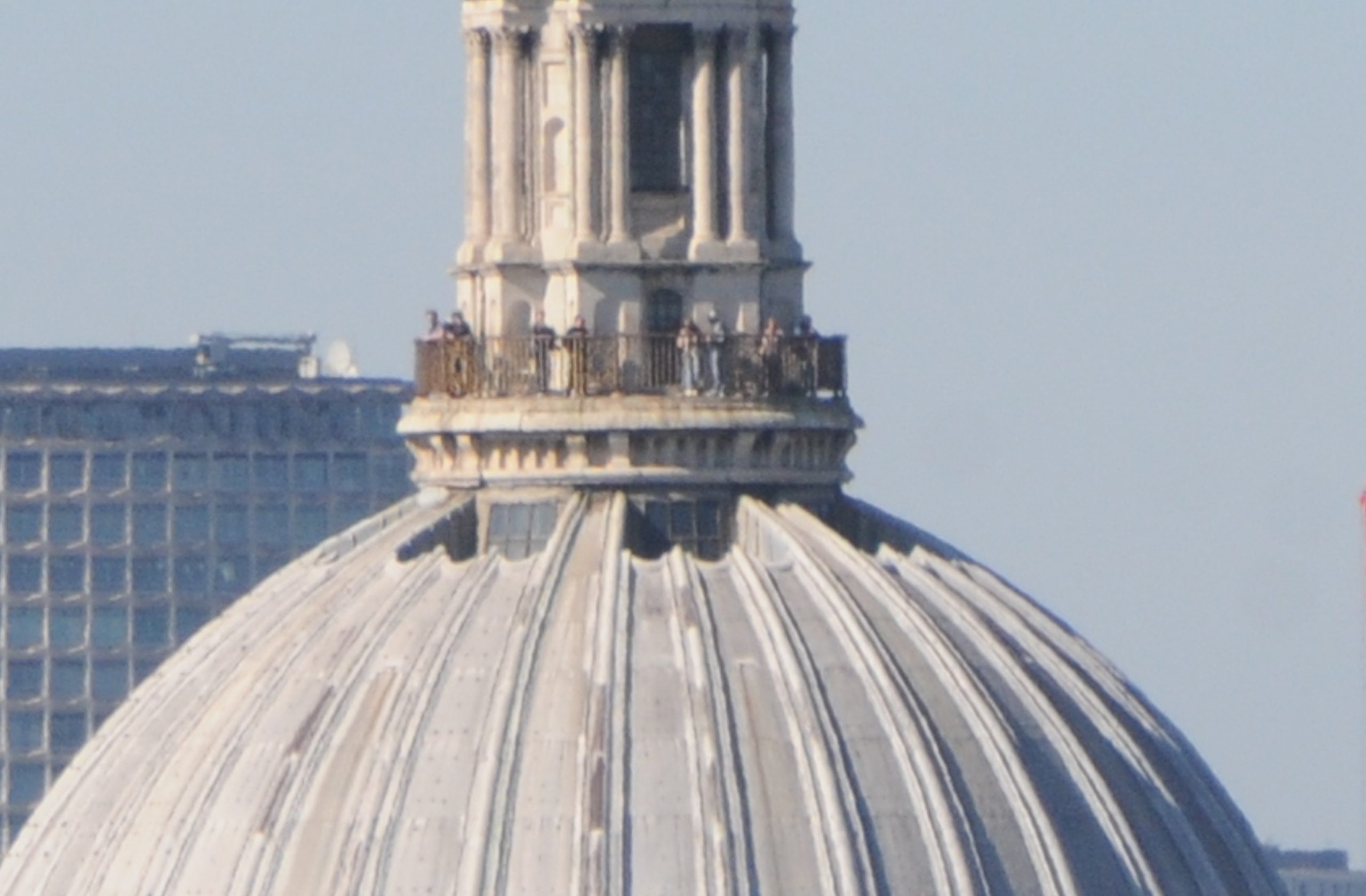
St. Paul’s Cathedral also has a couple of viewing galleries, including the Golden Gallery at the top of the dome, and from the Garden at 120 you can look across at other people enjoying the view of the city:
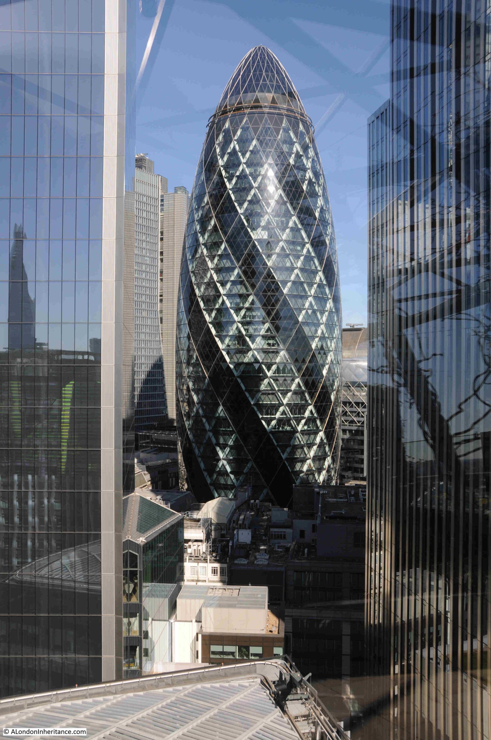
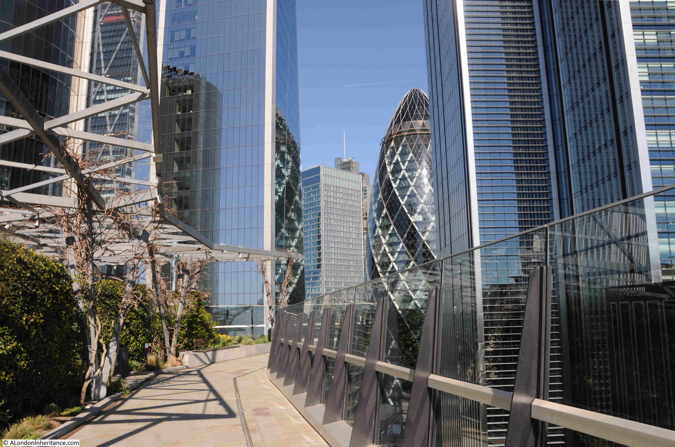
Because The Garden at 120 is on the 15th floor of, by recent standards, a relatively modest building, as you walk to the north of the garden you are looking between gaps in much taller buildings, although this does provide some interesting compositions, where other buildings are framed between towers, including this view of the Gherkin – 30 St. Mary Axe, a building which does not have a viewing gallery at the top, although it did have a bar at the top, which offered good views across London. The bar closed at the start of the year for renovations:
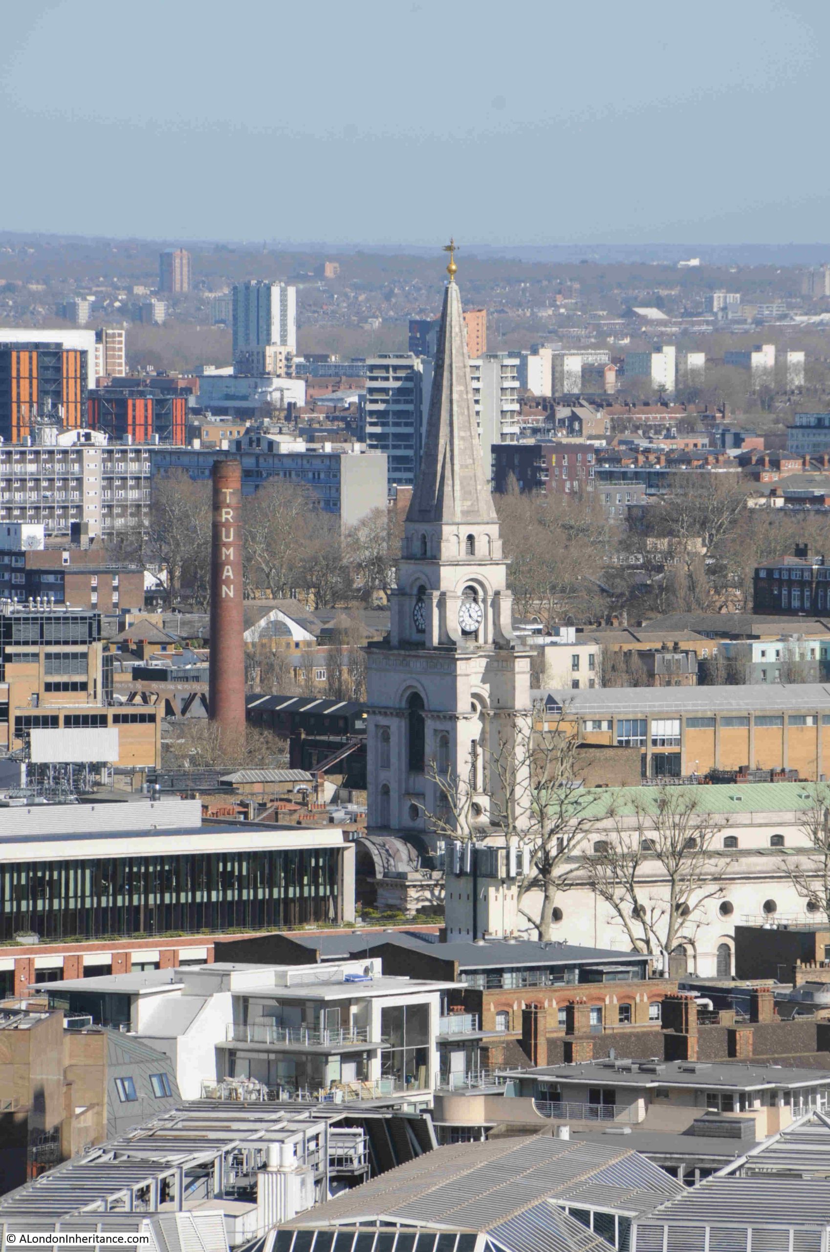
Through another gap we can see Christ Church Spitalfields and the chimney of the old Truman brewery:
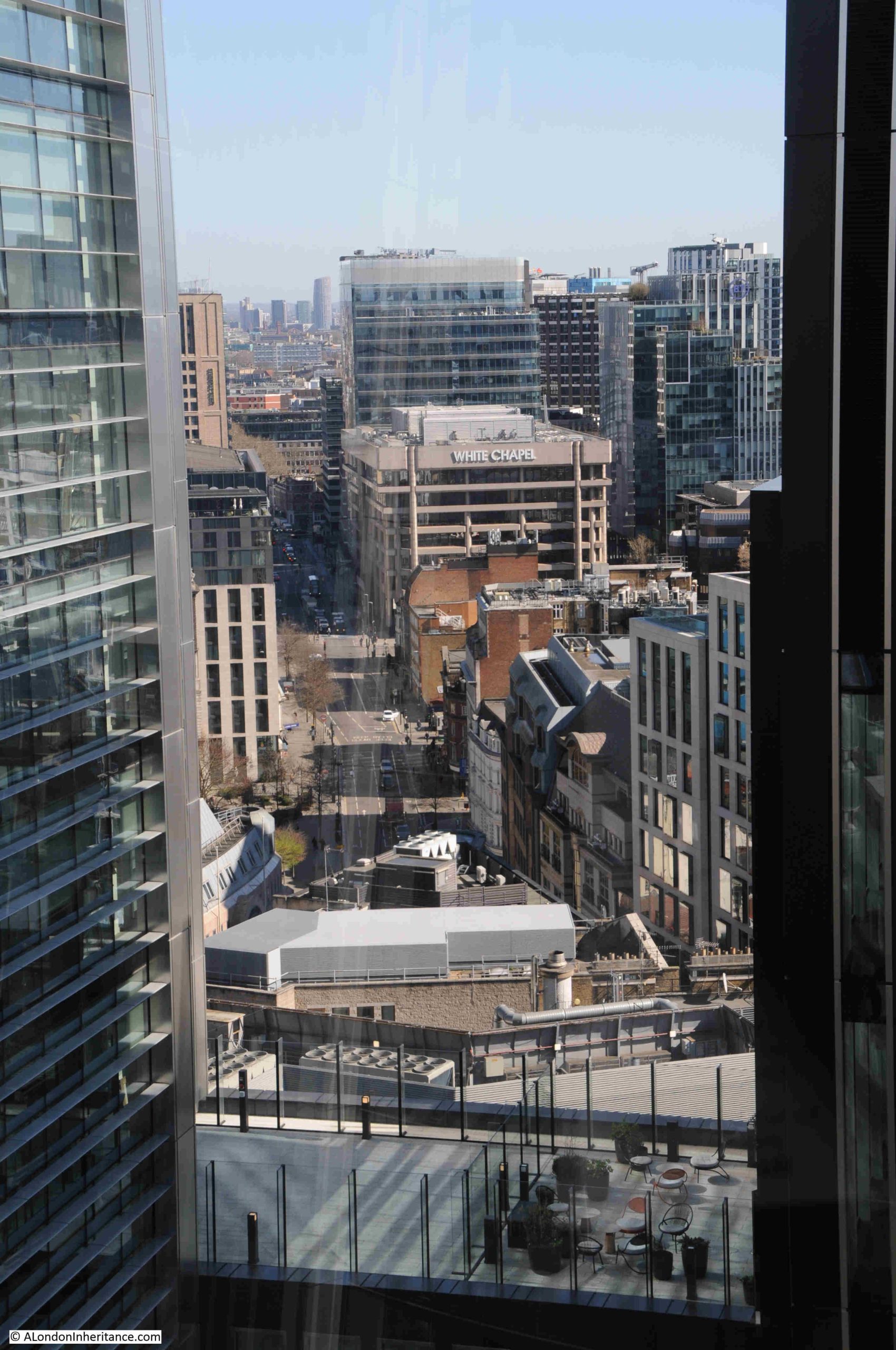
The Whitechapel building stands out on the corner of Whitechapel High Street (the road to the left of the building), and Mansell Street:
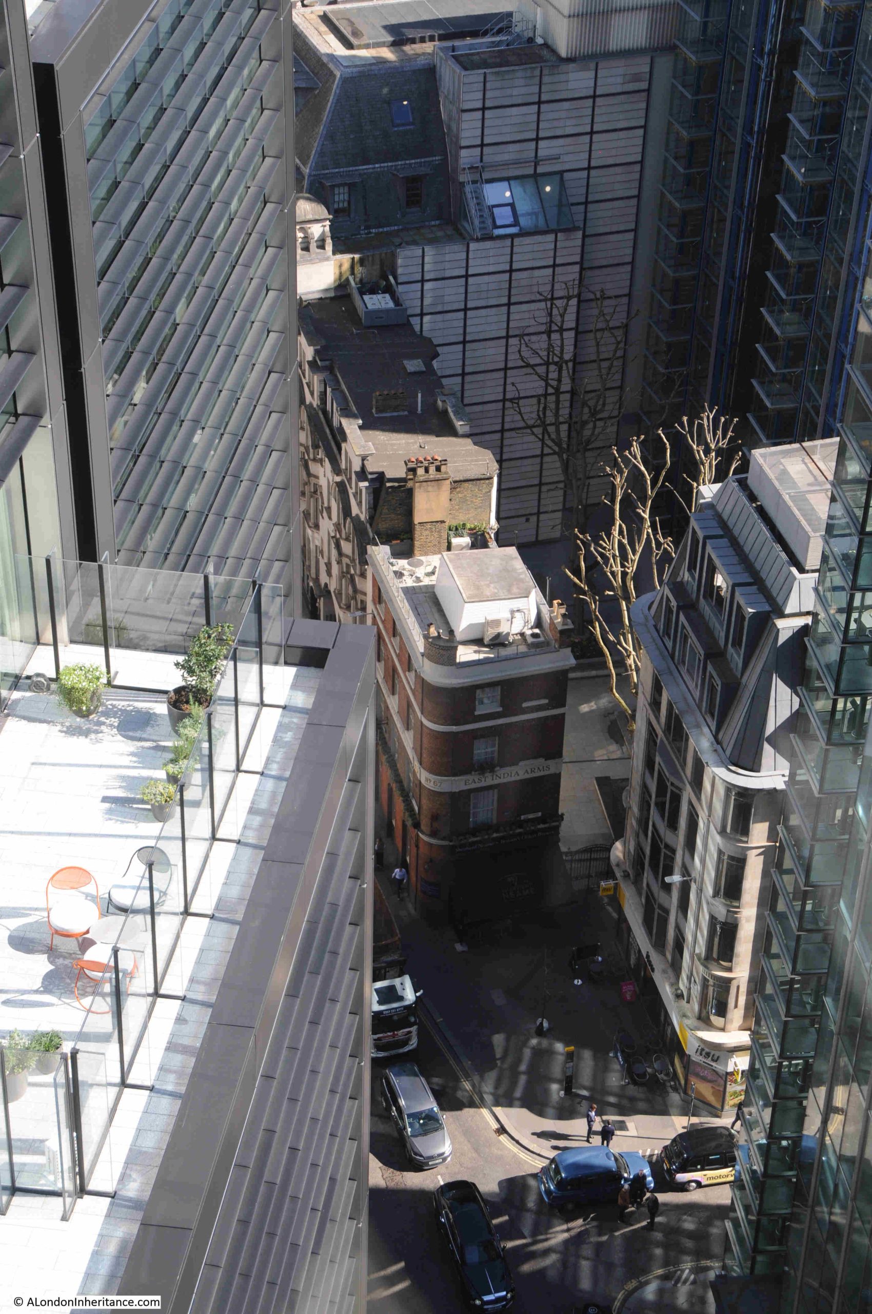
Looking down to a very small part of Fenchurch Street, at the junction with Fenchurch Place, we can see a small part of a terrace of 19th / early 20th century offices, with the distinctive brick built East India Arms pub on the corner:
View to the east:
The office and residential towers of Canary Wharf and the Isle of Dogs:
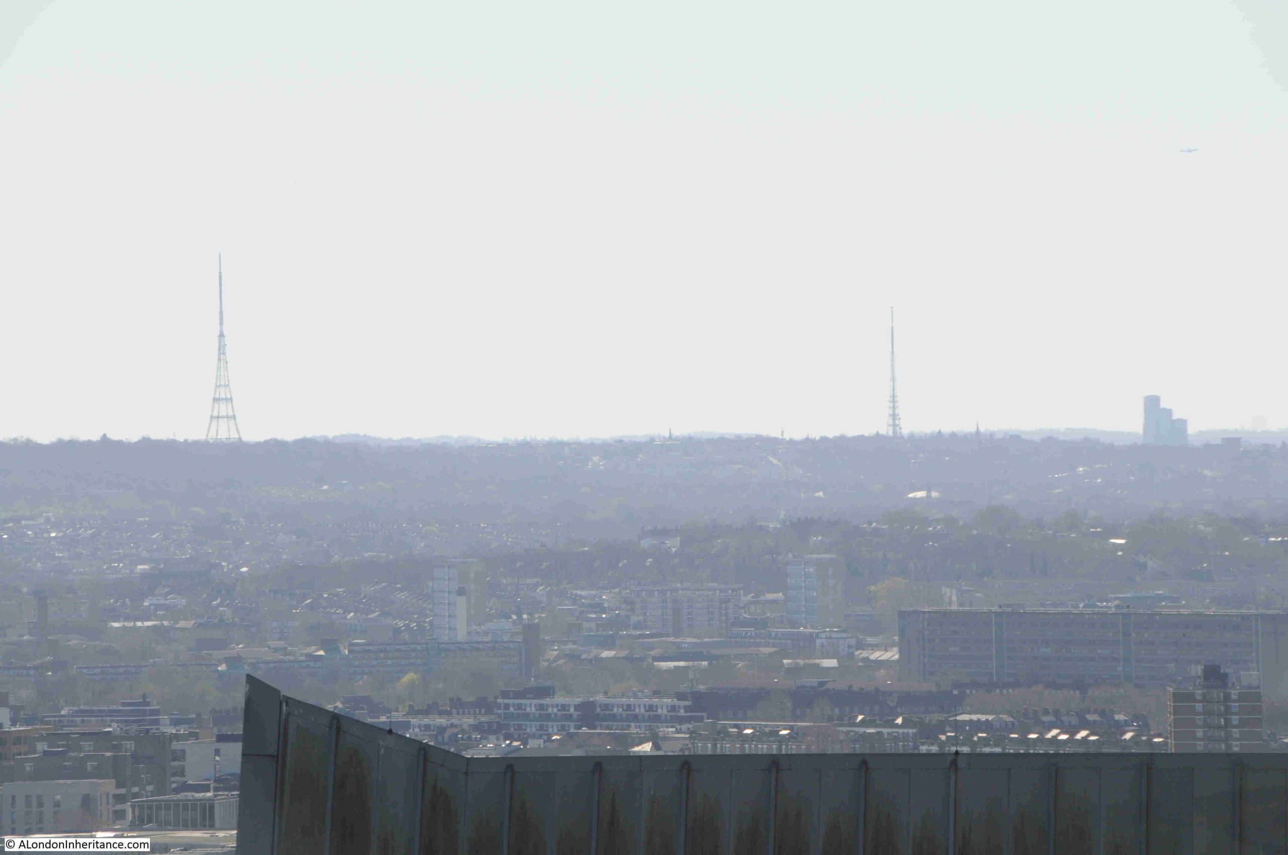
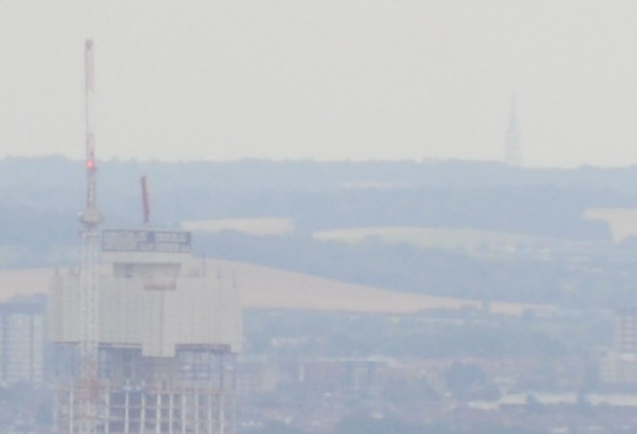
On the horizon, looking to the south, there are two tall radio masts. The one on the left is at Crystal Palace. The mast to the right is at Beaulieu Heights, next to South Norwood Hill:
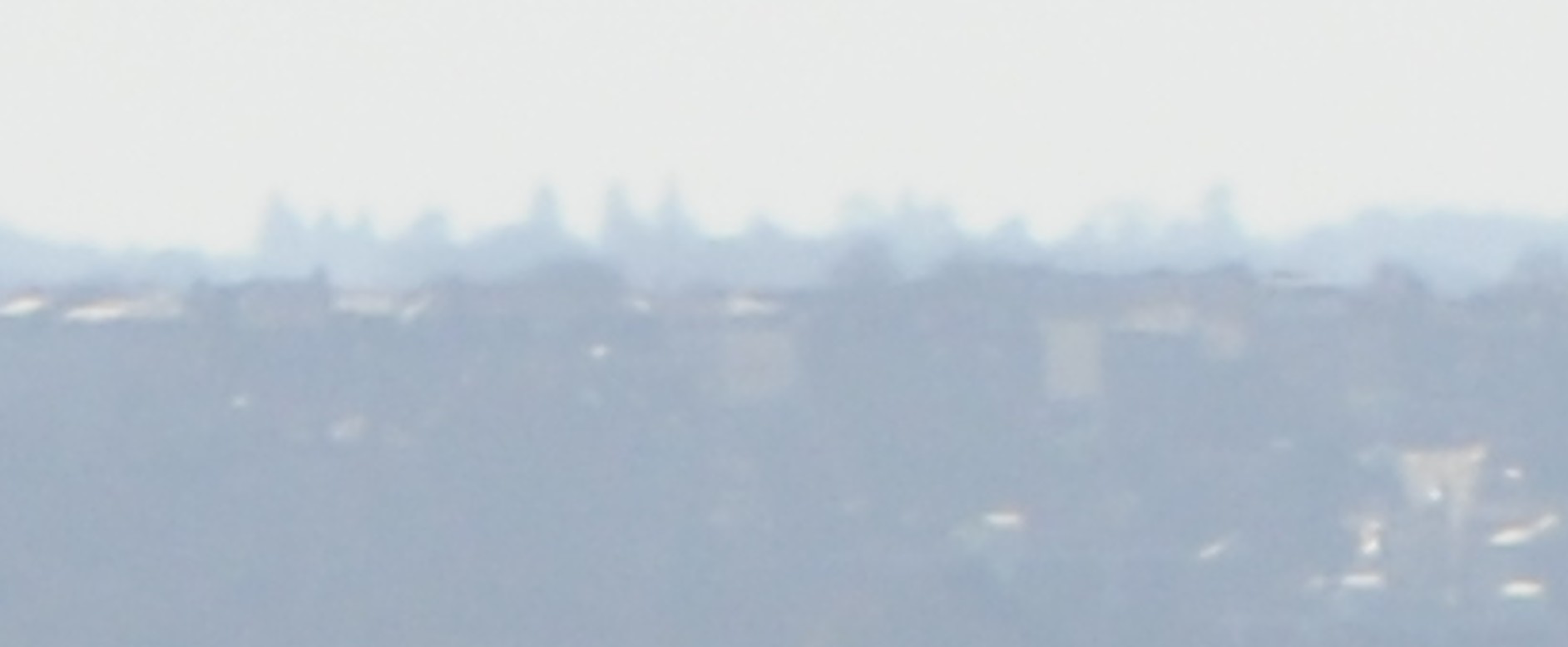
I find it fascinating to see how far you can see from height, and zooming in between these two masts is the following view:
I have no idea what the shadows are on the distant horizon. I did wonder if it was Croydon, however checking on a map, and Croydon is further to the right, and following the line between the two masts from Fenchurch Street, there are no significant clusters of buildings, so I have idea what they are.
I have not mentioned the Garden part of the name of the Garden at 120.
The garden is around the central core of the roof space, with a walkway around the perimeter.
The garden was designed by landscape architects Latz+Partner, and does consist of a good amount and variety of plants. View along the walkway on the eastern side of the roof, with planting on the left:
Having various forms of planting seems to be a core part of the majority of proposals for new towers in the City.
Fifty Fenchurch will include a public roof garden and winter garden at level 10, whilst the Fountain House replacement will have an external garden terrace.
Whilst this may be viewed as greenwashing, it does follow the approach of Fred Cleary, who campaigned and worked for much more planting, flowers and gardens as part of the post war redevelopment of the City, and as described in his 1969 book “The Flowering City”.
The southern side of the Garden at 120, with the main viewing area looking south and planting to the right:
Back on ground level, I walked across to the east of the Fifty Fenchurch building site, next to the tower of All Hallows Staining and looked back at the building with the Garden at 120 on the roof:
There are a growing number of places across London to look across the city from above, and each offers a different perspective of an ever changing city.
It is also interesting to visit these places across the years to see the rapid change taking place, and the view from the Garden at 120 will change significantly in the coming years when Fifty Fenchurch and the Fountain House site developments are completed.
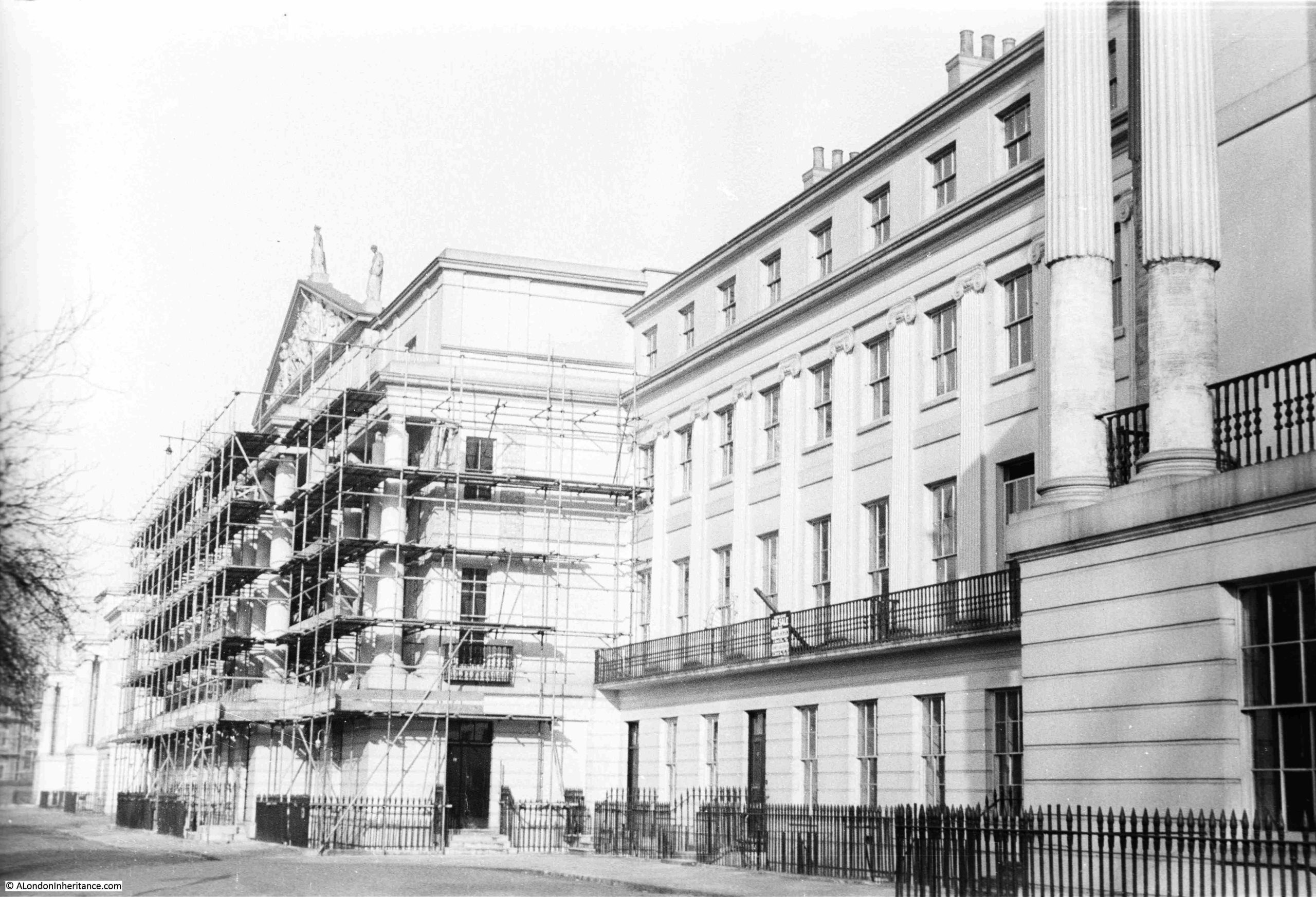
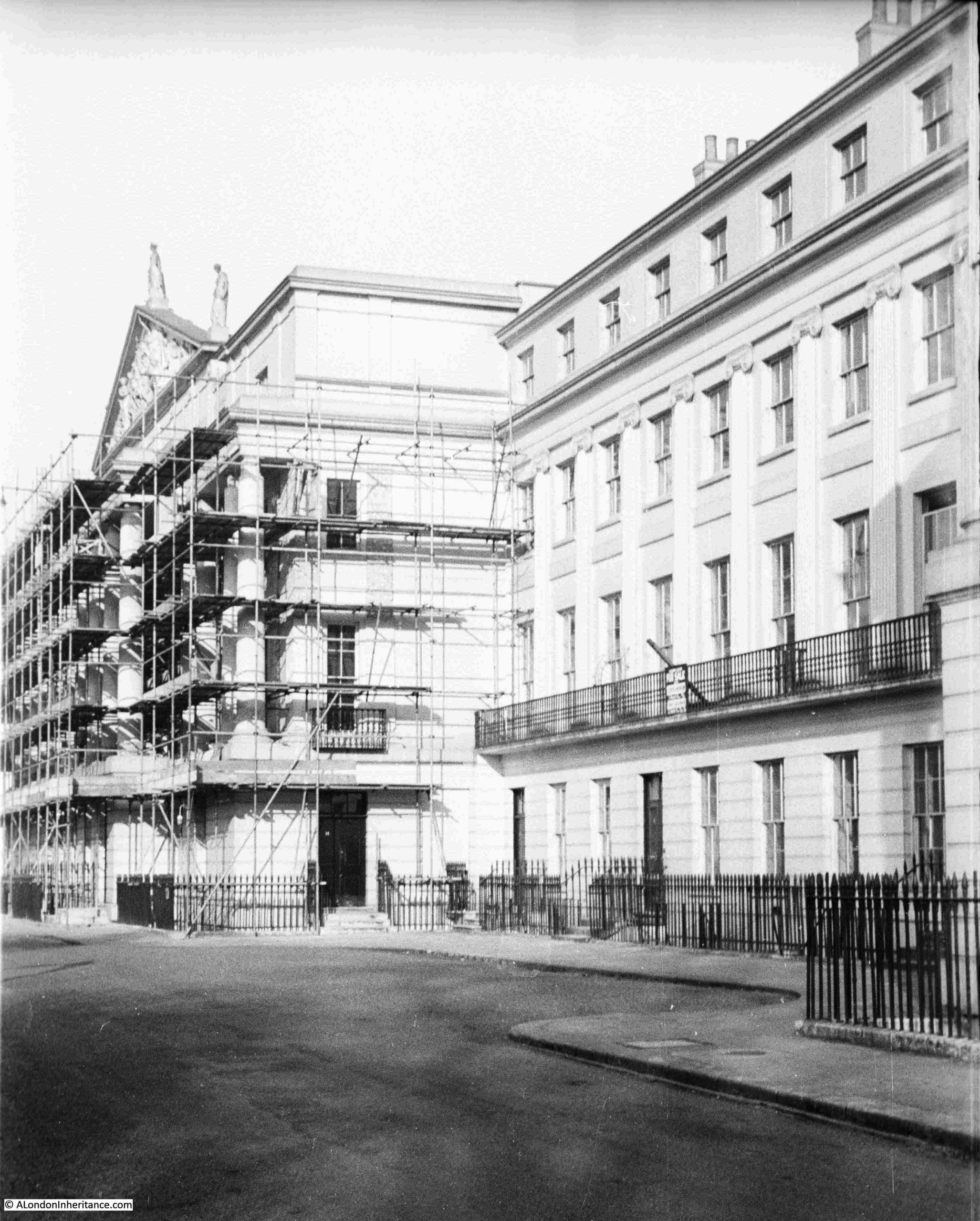
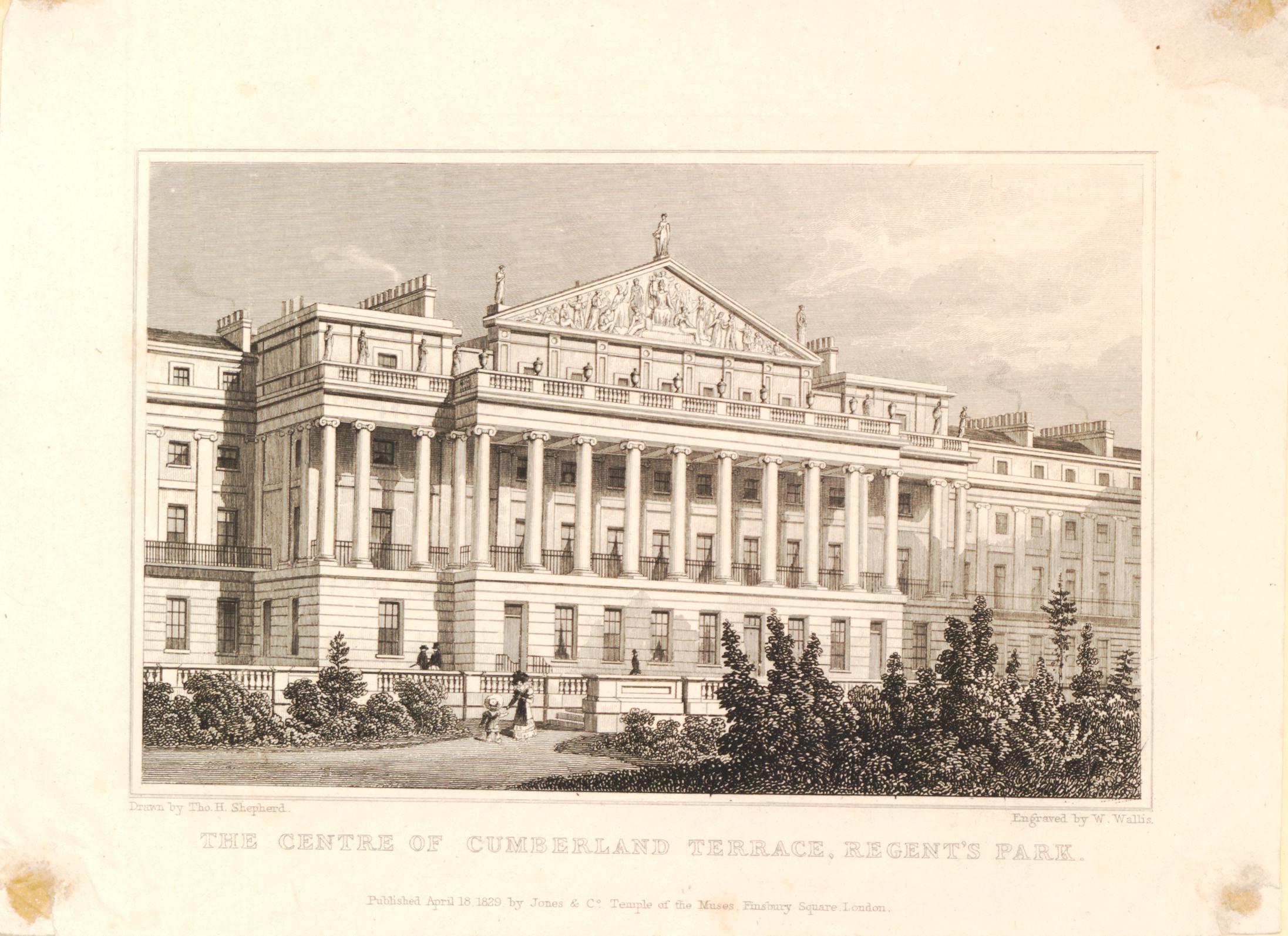
In 1948, my father took a couple of photos of repair work underway to the rather impressive Cumberland Terrace to the east of Regent’s Park:
Bomb damage seems to have been rather superficial to the terrace, with the main damage being to the rear of the buildings, and I suspect that the scaffolding was there due to urgently needed repair and refurbishment work, as the buildings had deteriorated significantly during the first decades of the 20th century, which was not helped by lack of maintenance during the war.
The central building in the terrace has a large sculptural pediment, which can be seen above the scaffolding in the above photo.
Walking past the central building, and the northern section of the terrace (which mirrors the southern section), can be seen, where three large blocks with Ionic columns, project towards the street:
Cumberland Terrace is the most impressive of the terraces and large houses along the eastern edge of Regent’s Park.
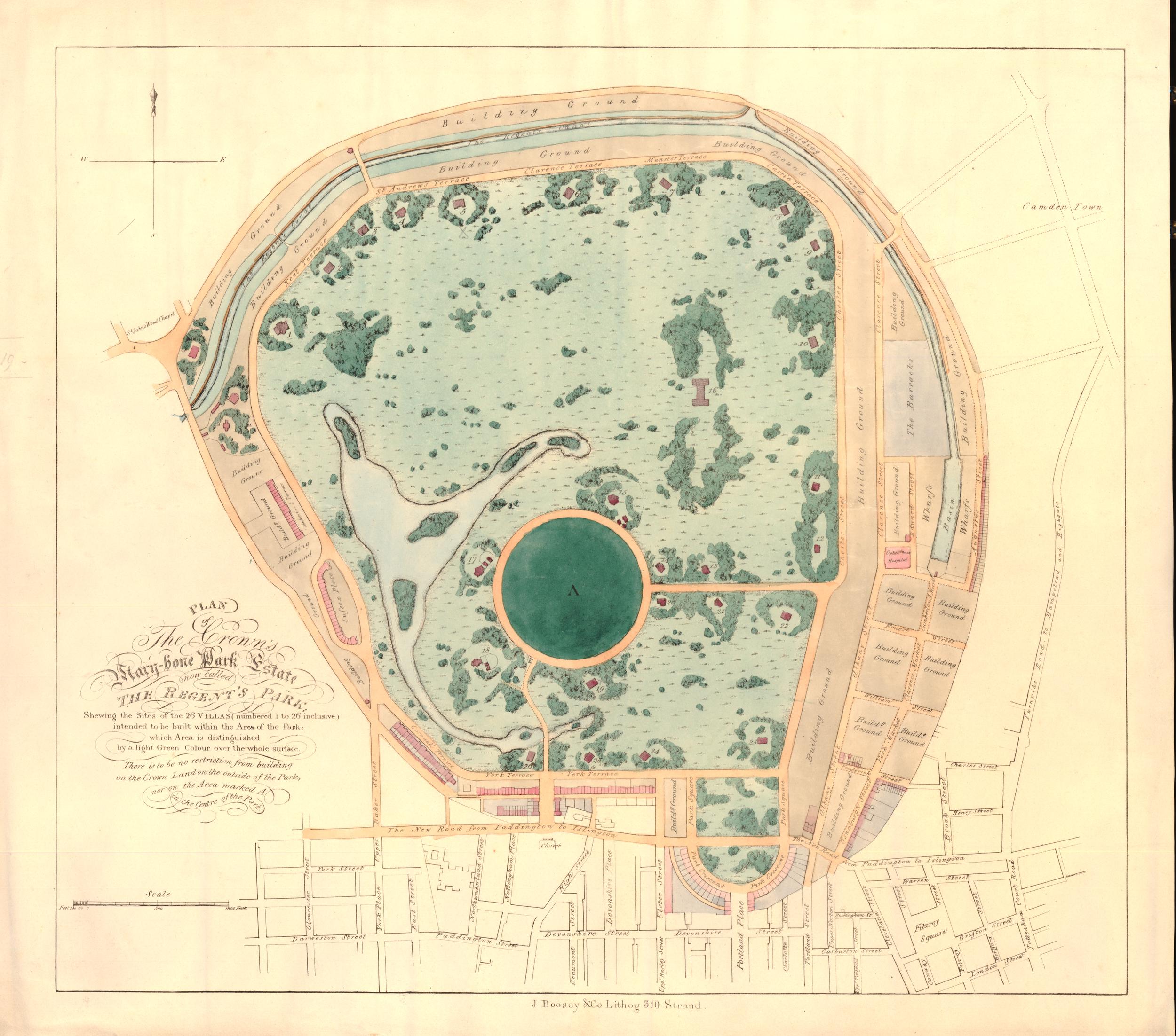
Regent’s Park was originally part of a Royal hunting ground created by Henry VIII, when he took the land formerly known as Marylebone Park, which was part of the large mix of common and forest land to the north and west of London.
During the Civil War in the mid 17th century, much of the land was sold off to tenant farmers, and by the end of the 18th century, the growth of London was such, that as with much of west and north London, the land which is today now occupied by Regent’s Park was becoming a valuable area for building.
Luckily, the Prince Regent (the future King George IV) was looking for a site to build a summer palace, along with extensive gardens, and to provide space for this, much of the old tenant farming land was partitioned off to become Regent’s Park.
The Prince Regent commissioned the architect John Nash to design the new park, the summer palace and the surroundings of the park.
Nash was one of the major architects of the late 18th / early 19th century. Born in Lambeth, and probably the son of engineer and millwright William Nash, his first experience within the architectural profession was with Sir Robert Taylor where he became an assistant draughtsman.
By 1777, he was an architect and speculative builder in London, but was better at architecture than finance as he soon went bankrupt.
He then joined another partnership in Wales working on small projects, and by 1796, he had returned to London, where he formed a partnership with the landscape gardener Humphrey Repton (who was responsible for the original design of Russell Square).
The partnership with Repton had been dissolved by 1802, and by this time, Nash was considered a fashionable architect, and was responsible for a large number of projects across the country.
His involvement with the planning of Regent’s Park came about because of his appointment in 1806 as architect to the Department of Woods and Forests, the department responsible for the development of the land that was to become Regent’s Park, which had recently reverted to Crown ownership.
The plan for the Regent’s Park was that it would be a landscaped open space with the Prince Regent’s summer palace, a small number of private villas and surrounded by handsome terraces.
This approach would mean that Regent’s Park was not just a new park, but was also a new fashionable residential area for London.
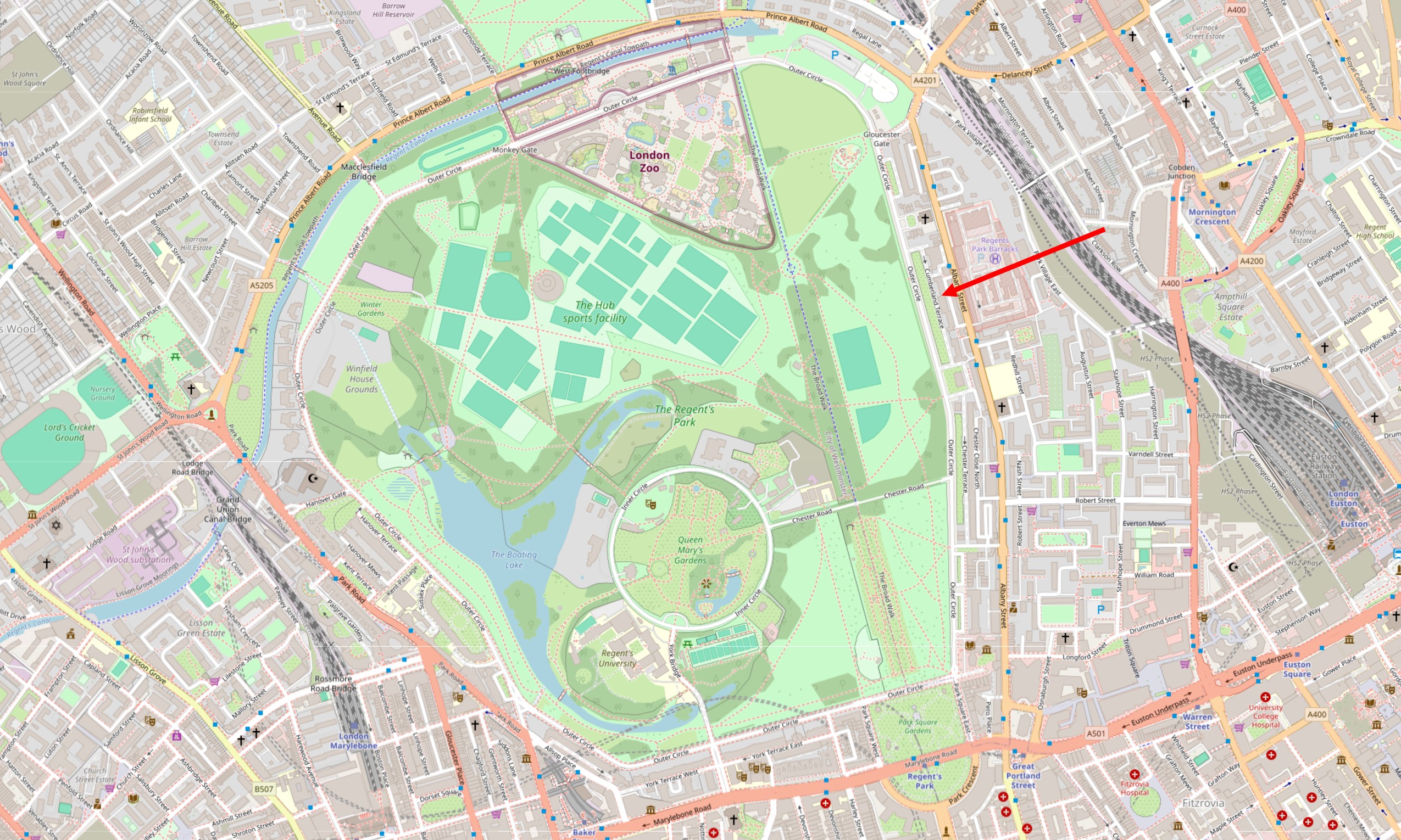
The following map shows Regent’s Park as it is today. The arrow points to Cumberland Terrace:
The Regent’s Canal runs along the northern boundary of the park (Nash also had some involvement with the canal). London Zoo is at the north of the park. Terraces and large houses occupy much of the eastern boundary of the park, there are a number of villas to the north, and more terraces and houses along the western boundary.
The Prince Regent’s planned summer palace did not get built, he appears to have lost interest, and there were not as many of the large, individual villas as originally planned, however as designed by Nash, the park and the surrounding buildings are an impressive example of Regency architecture from the start of the early 19th century.
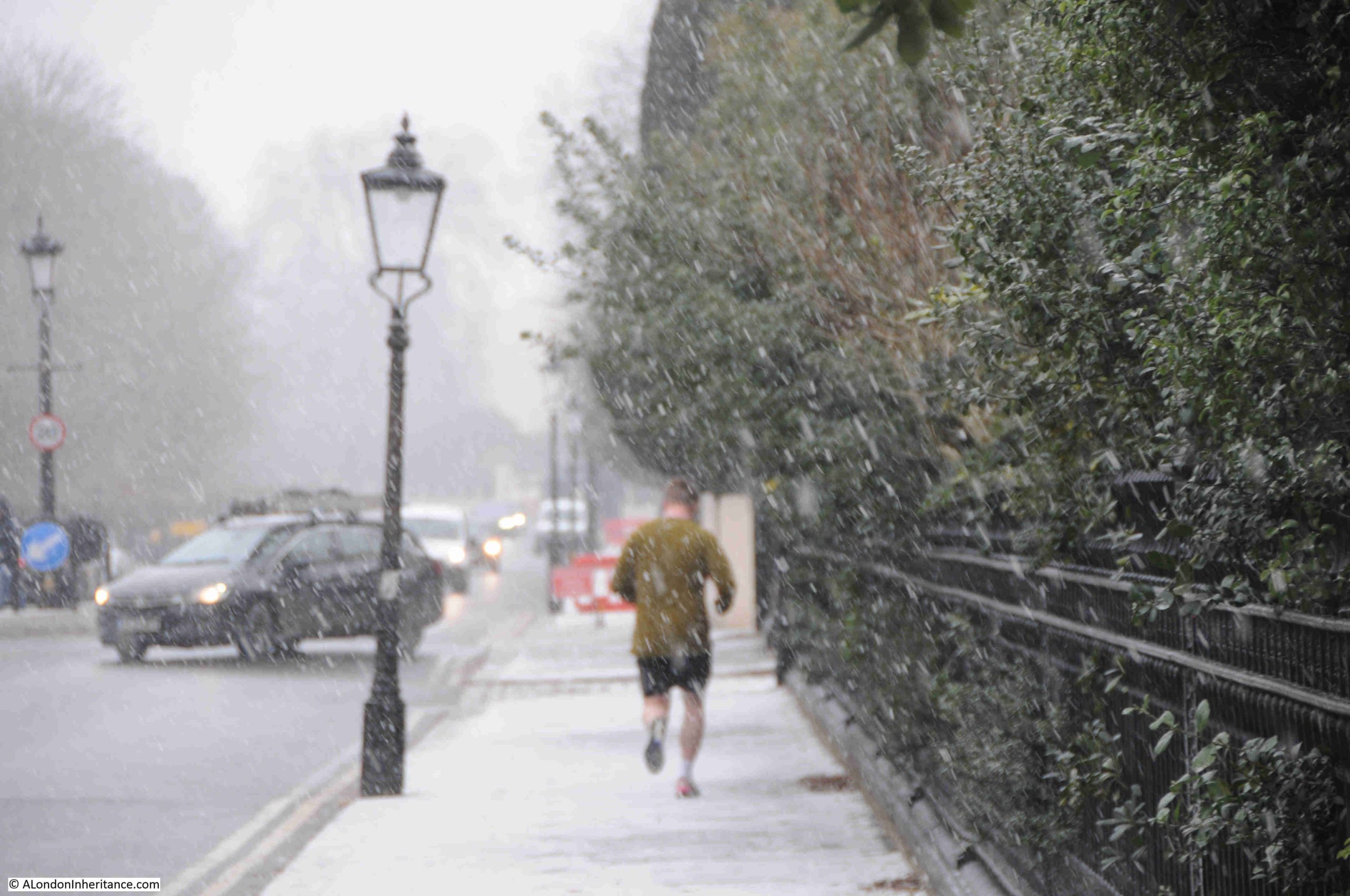
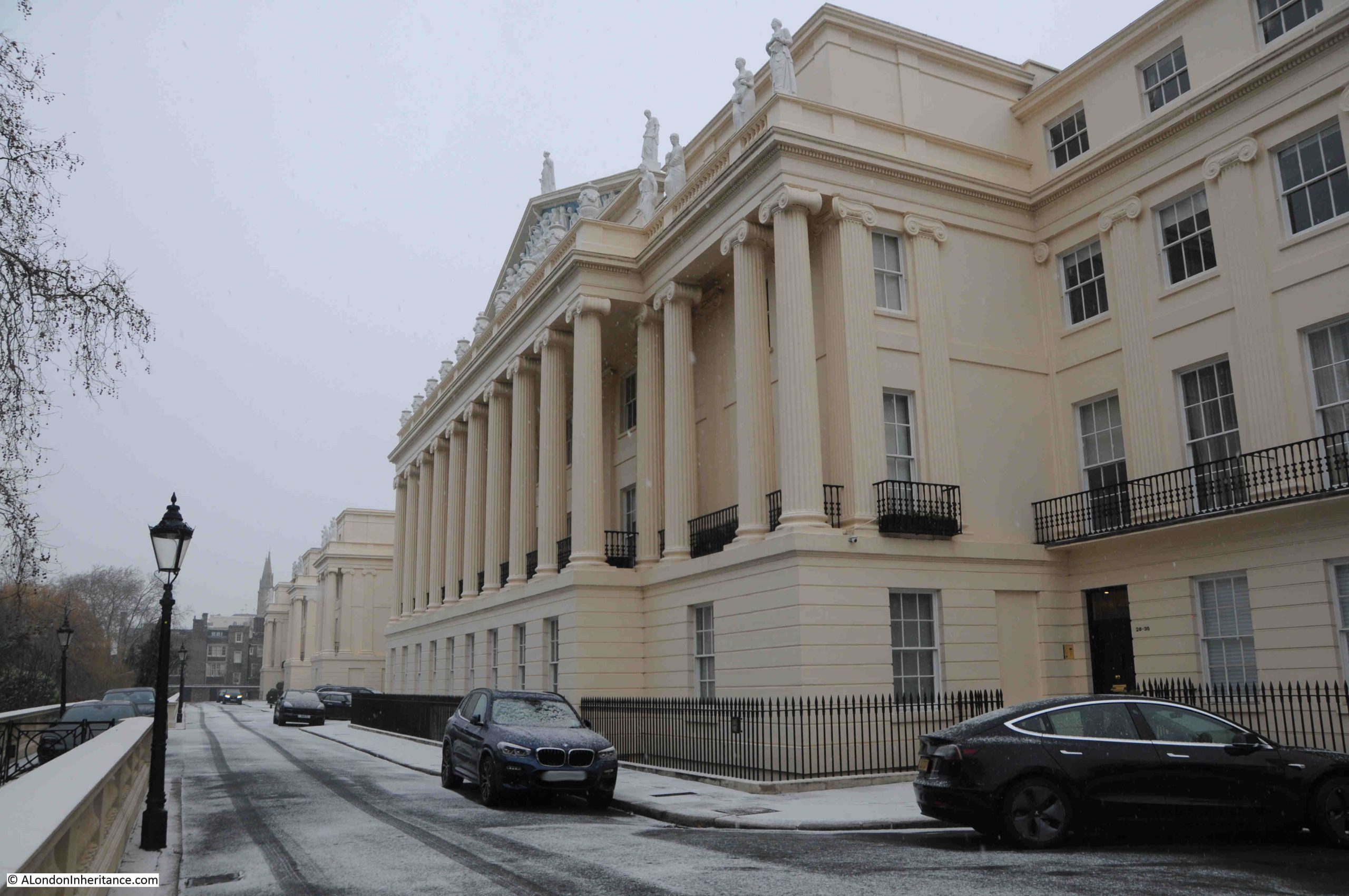
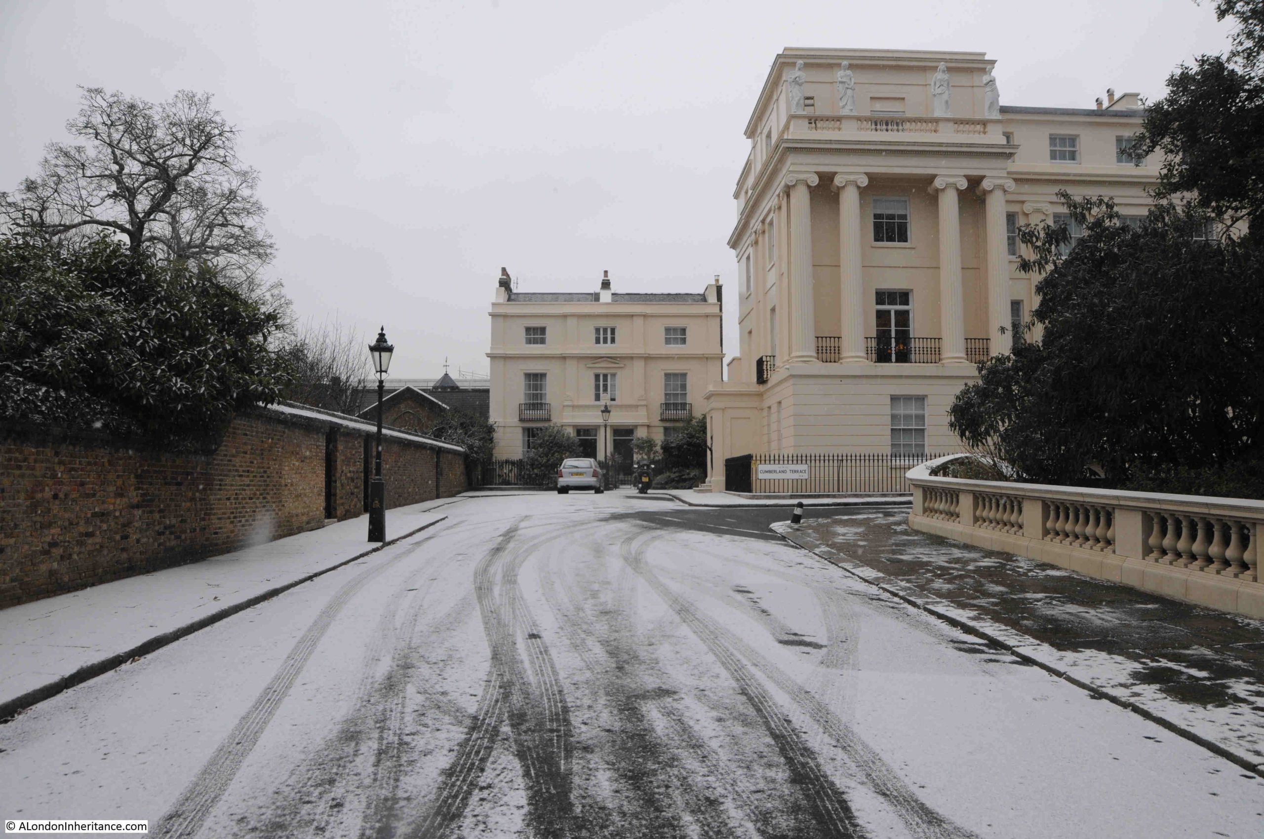
It is some time since I last walked through the terraces that line the eastern boundary of Regent’s Park, so last week I planned a visit. The weather on Monday was clear and bright, but I was not free for a day of walking. Tuesday though looked good, the forecast showing a mix of light cloud and sunny intervals, but such is the nature of weather forecasts that when I reached the Outer Circle (the road that forms the boundary to the central park), it had started snowing:
The walk up from Euston Road to find Cumberland Terrace, along the eastern boundary took me through and past a number of very impressive houses and terraces.
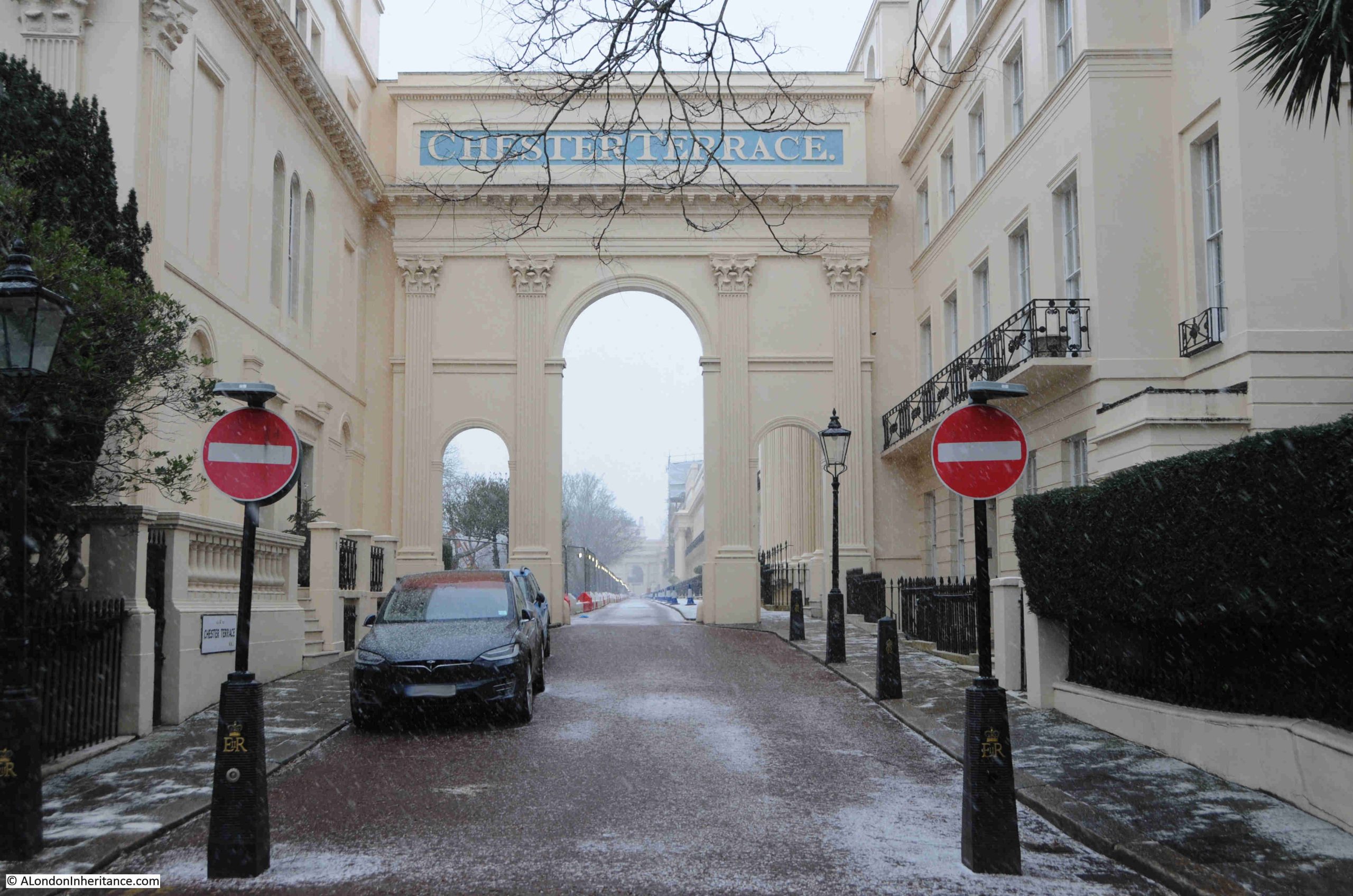
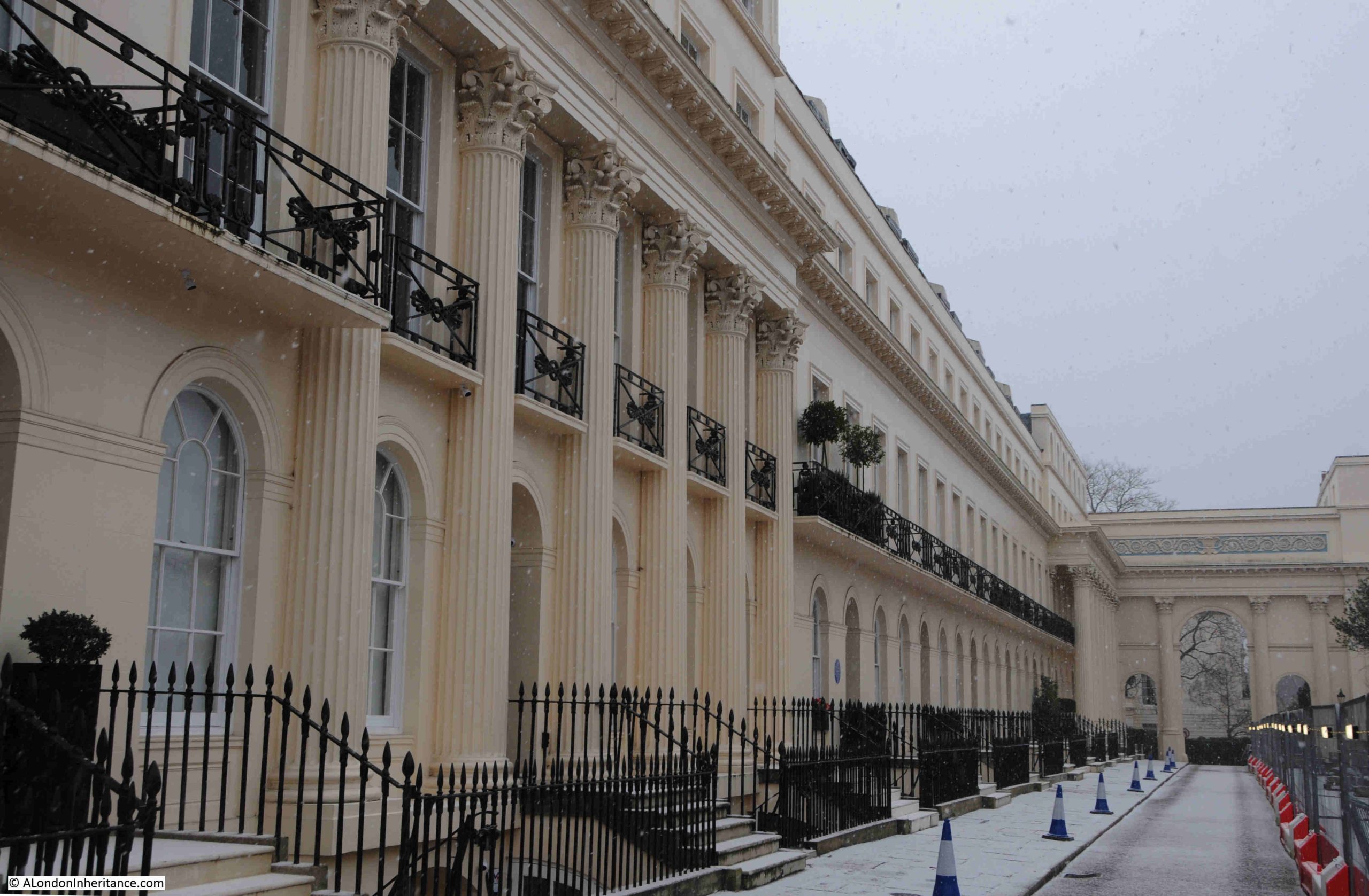
The first is the Grade I listed Chester Terrace, where the entrance to the road that runs in front of the terrace has a triumphal arch proclaiming the name of the terrace:
Chester Terrace, designed by Nash and built by James Burton is around 280 metres in length and is the longest unbroken façade in the Regent’s Park development.
The terrace consists of 37 houses and 5 semi-detached houses, and is at a raised level to the Outer Circle, and is separated from this street by private gardens. Chester Terrace dates from around 1825:
Given that the terraces to the east of Regent’s Park are around two hundred years old, and provided what must have been highly desirable homes in an equally desirable part of London, there are very few blue plaques across the terraces.
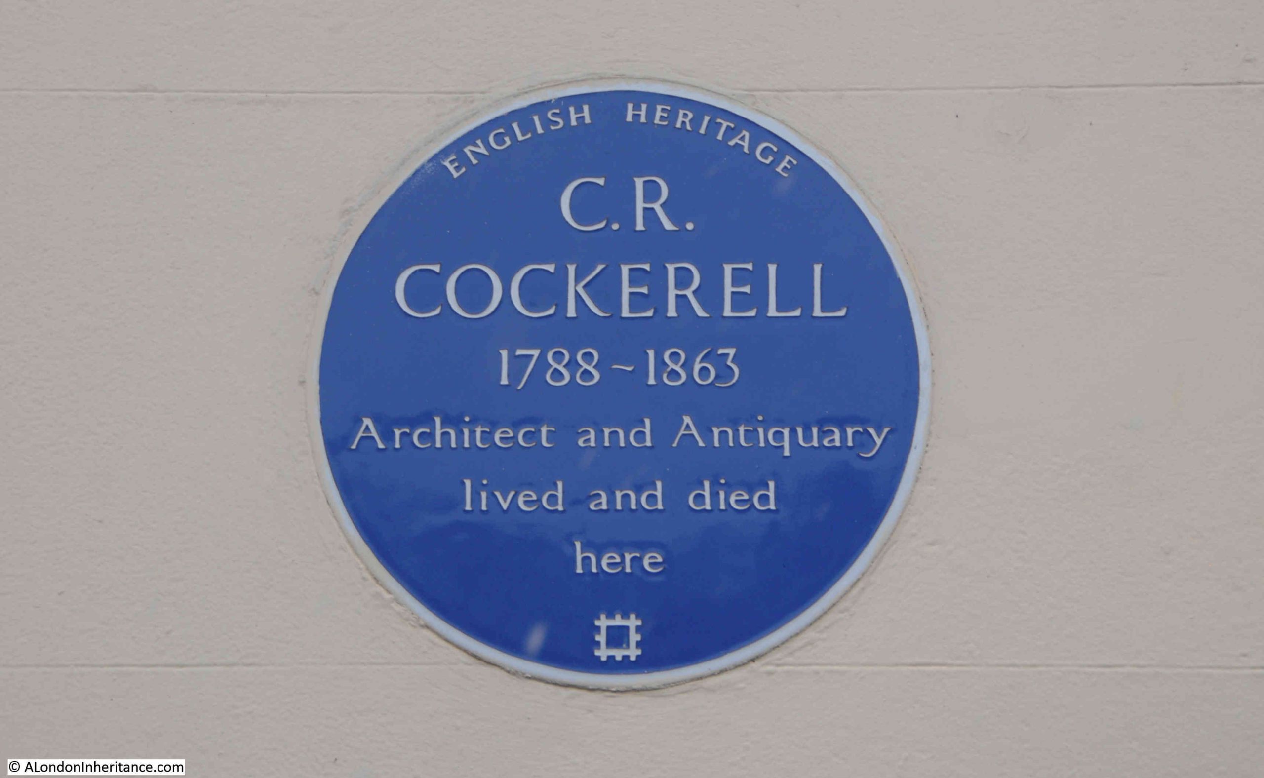
Chester Terrace has two, the first to the architect Charles Robert Cockerell, who was responsible for a large number of works across the country, and in London he worked on the Sun Fire Office in Threadneedle Street, the London and Westminster Bank in Lothbury, the Westminster Insurance Company’s offices in the Strand, the Hanover Chapel in Regent Street, the 1821 new ball and cross on St. Paul’s Cathedral, and many more:
Looking back to the southern arch to Chester Terrace, Cockerell’s blue plaque can just be seen on the left:
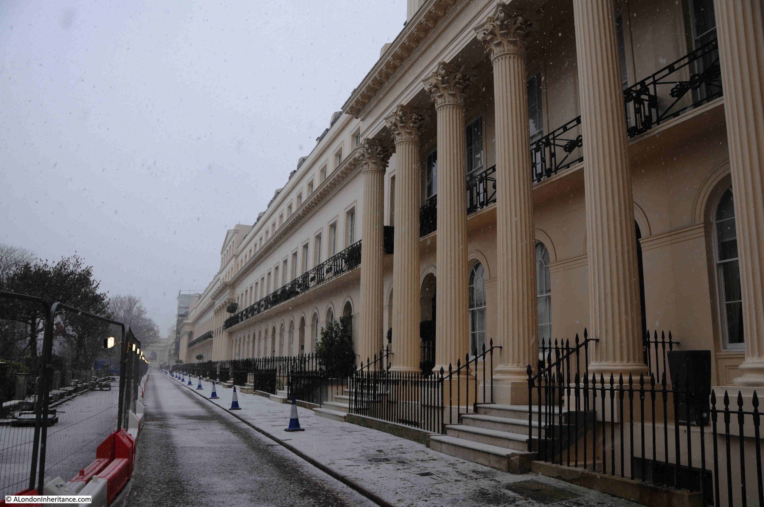
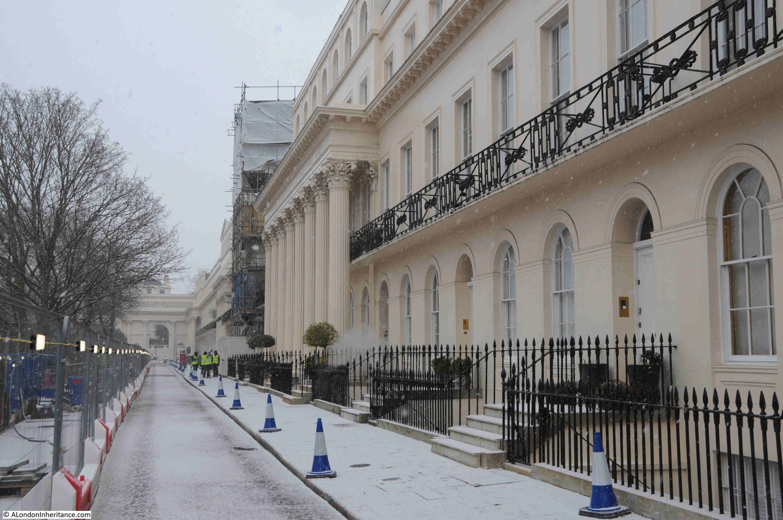
Looking along Chester Terrace, building works were taking place on the road and boundary wall to the gardens on the left:
In the above photo, there is a building with 8 free-standing, fluted Corinthian columns, then a building undergoing work and covered in scaffolding.
(A comment on Ionic and Corinthian Columns as I use both terms in this post. With my limited architectural understanding, the easiest way of confirming the type of column is that Corinthian have decorated work at the top of the column, while Ionic have a more simple finish, often looking rather like a scroll at the top of the column. As always, more informed feedback than I can provide is appreciated in the comments to the post).
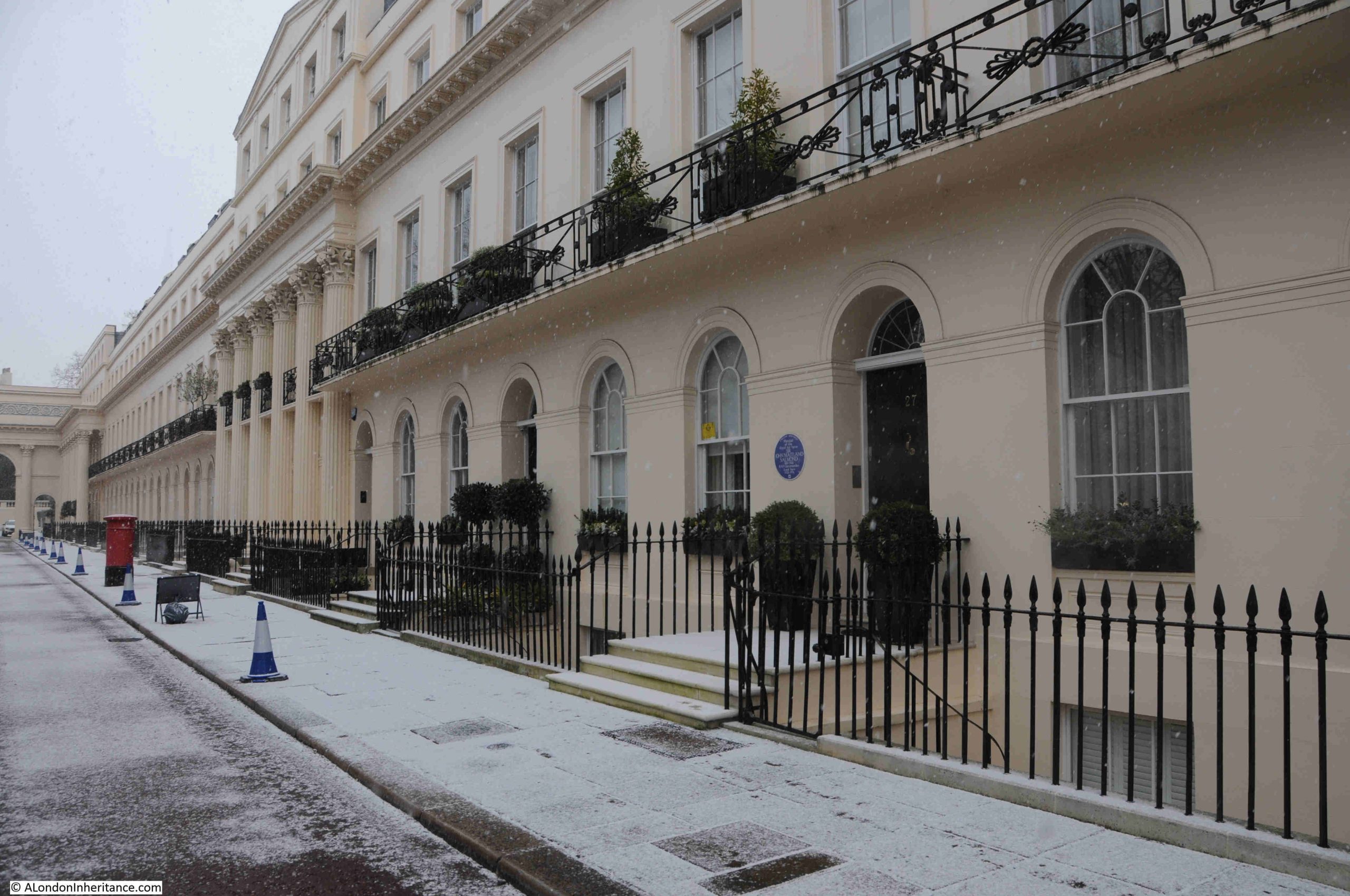
Walk past the building with scaffolding, and there is another building with Corinthian columns, although with 6 rather than 8, and not projecting as far from the façade of the building. The pattern of columns alternates along the terrace, starting with from the south, 8, then 6 then 8, then 6, then finally 8 at the northern end of the terrace:
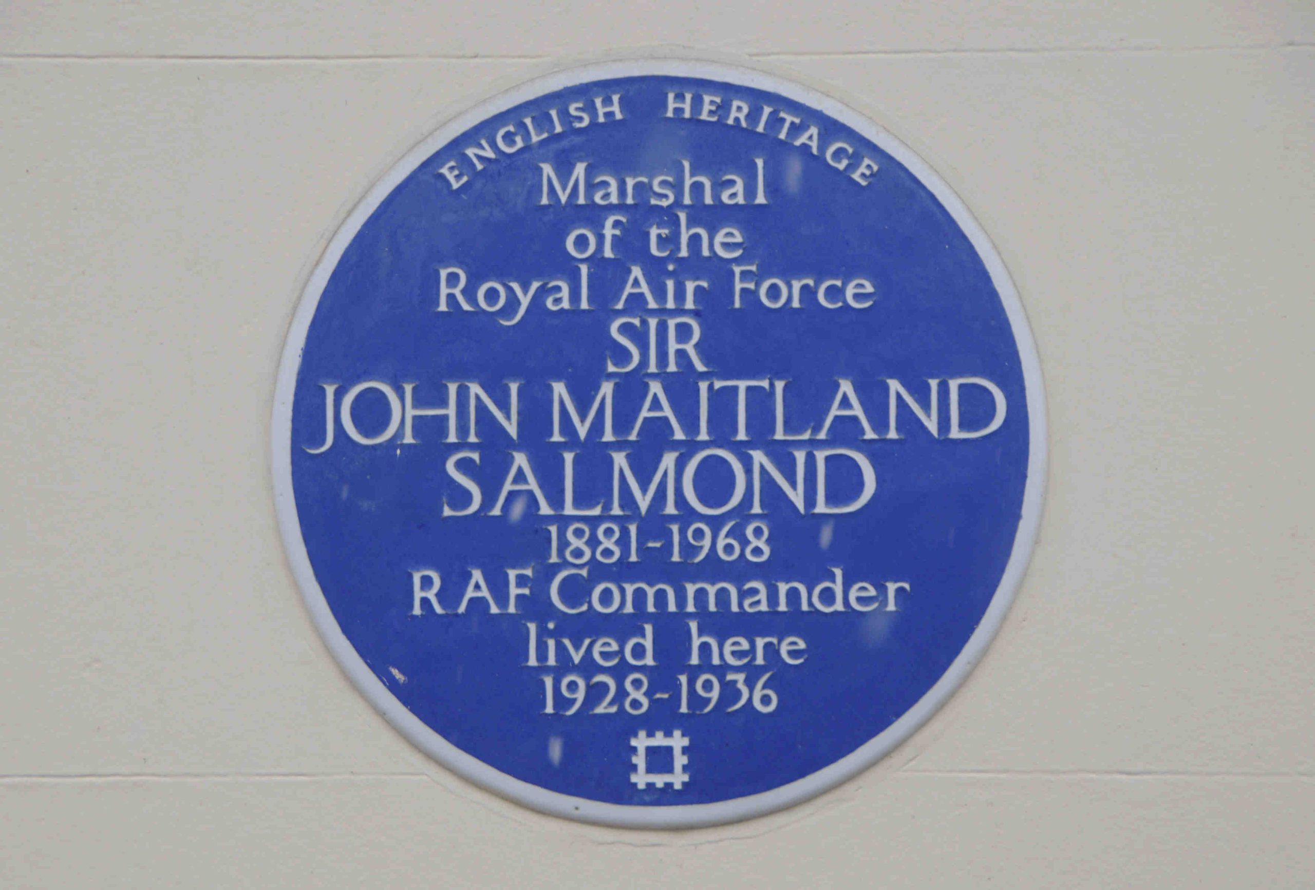
In the above photo there is another blue plaque, to Sir John Maitland Salmond, Marshal of the Royal Air Force. Salmond was one of the early pilots of the Royal Flying Corp, and in the Register on the 14th of March 1914, it was reported that: “For a flight 13,140 feet high in a B.E. (government built) biplane, Captain J.M. Salmond of the Royal Flying Corp has been granted by the Royal Aero Club the British altitude record”:
The thought of flying at over 13,000 feet in a government built biplane is a rather scary one.
At the end of Chester Terrace is another triumphal arch, and through this we can see one of the large houses that are also part of the development along the eastern boundary of Regent’s Park:
Walking to the end of Chester Terrace, and looking to the right, there is another arch that leads away from the Nash developments down towards Albany Street:
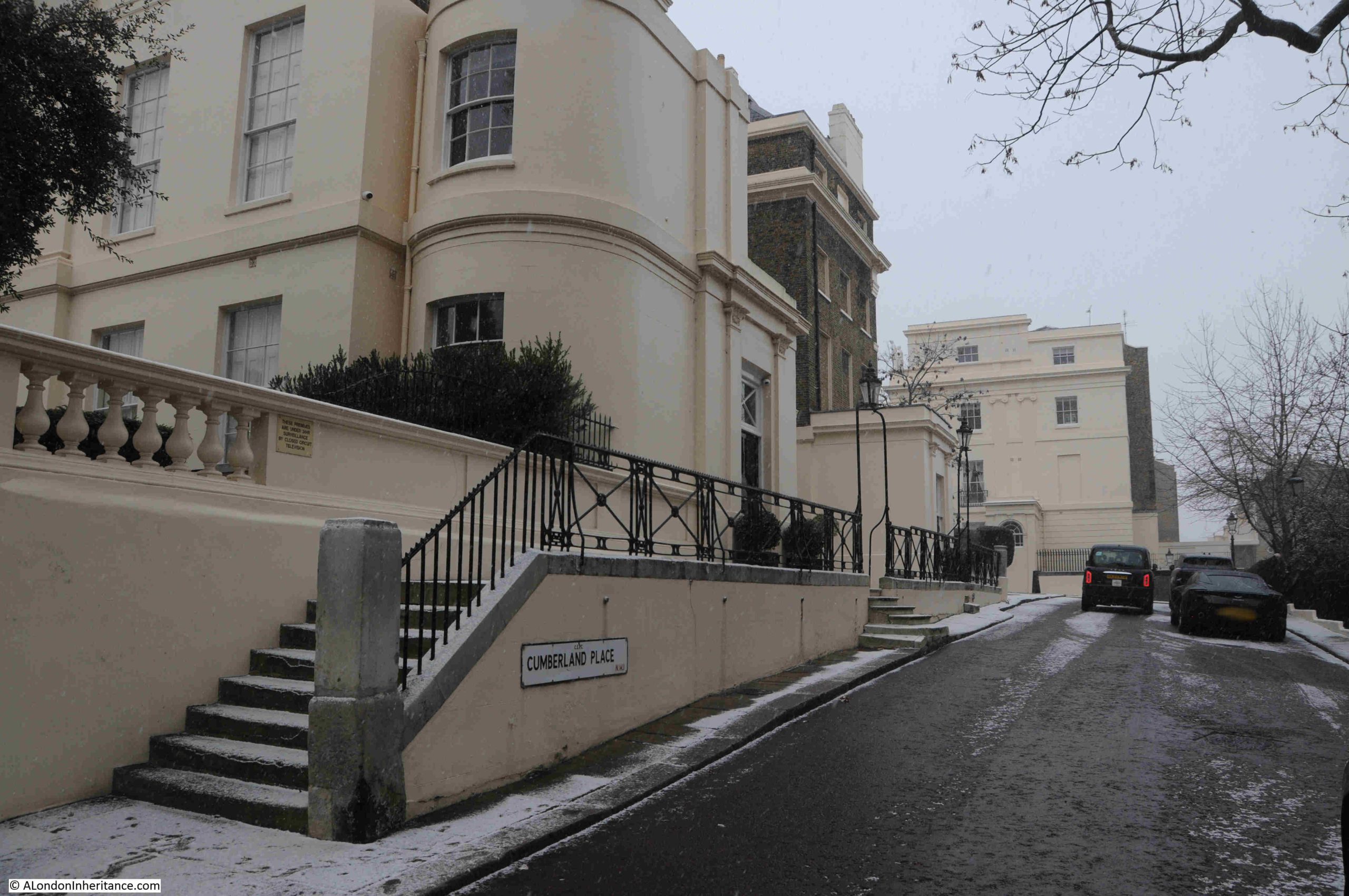
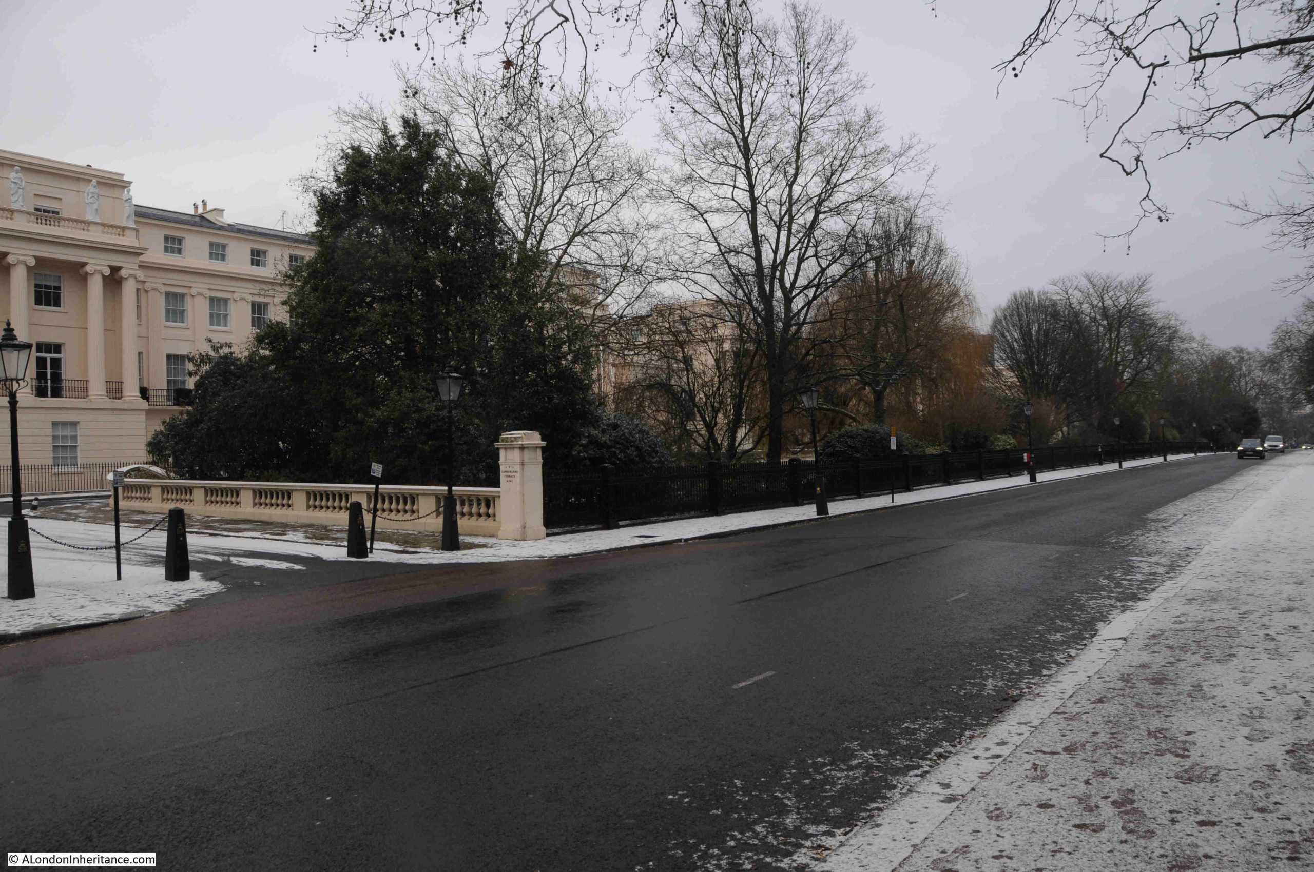
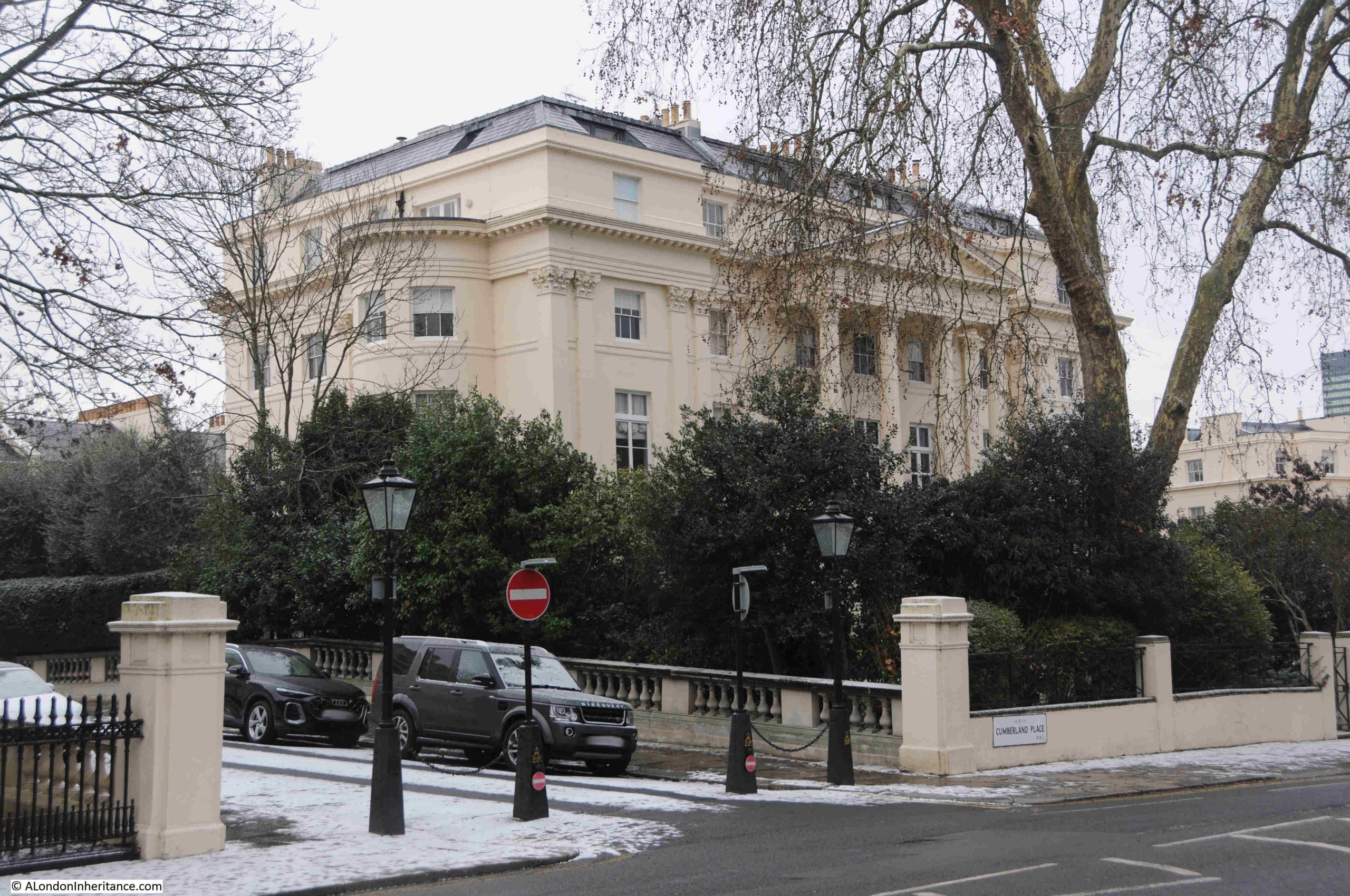
Cumberland Place, which leads round to Cumberland Terrace:
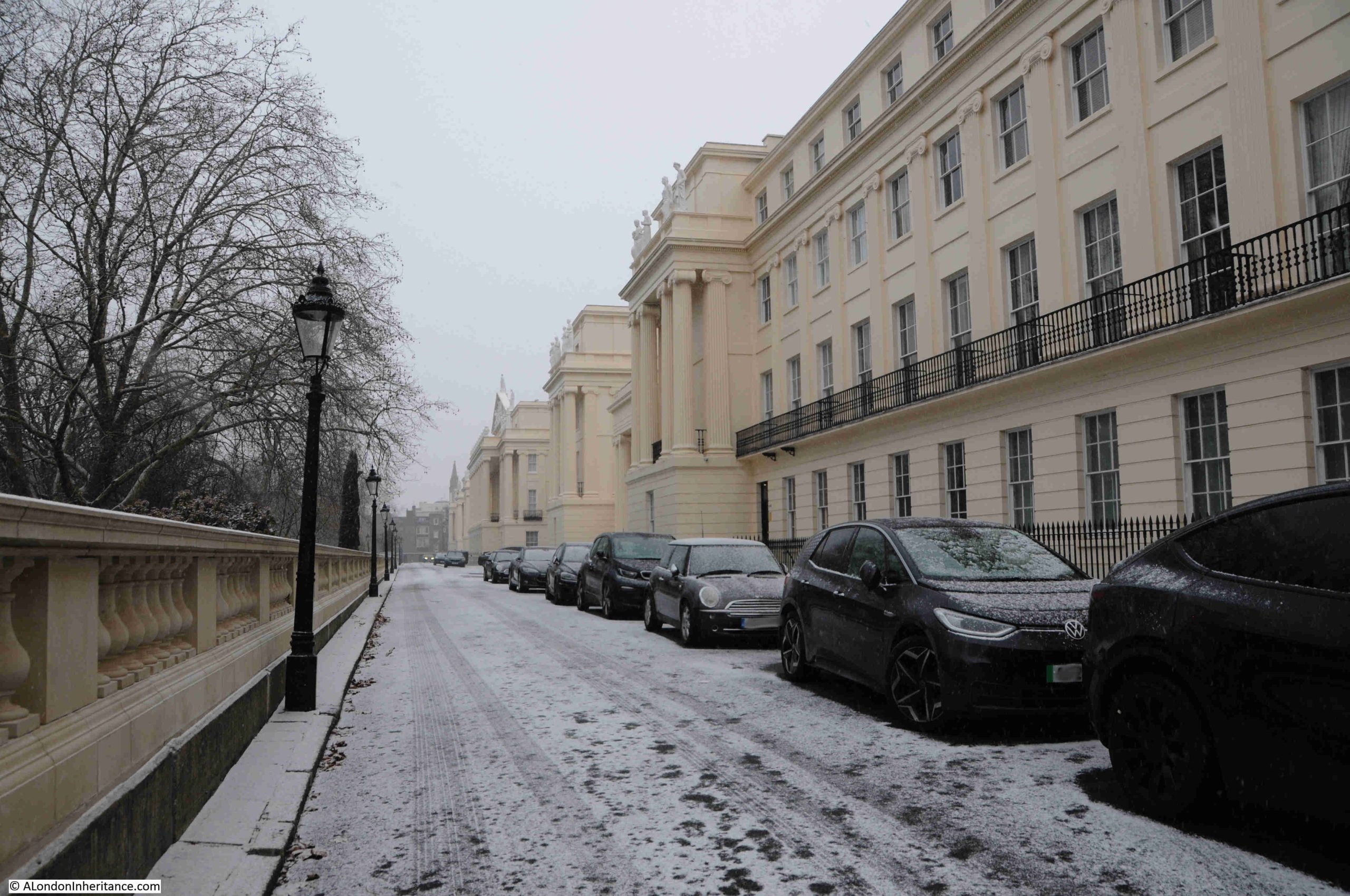
The full length of Cumberland Terrace from the southern end:
Cumberland Terrace was the work of John Nash and James Thomson. It is difficult to know who was exactly responsible for what, and how much of the design was down to Nash or Thomson, however the overall design was certainly down to Nash, as the terrace was part of his vision for grand terraces along the boundary of Regent’s Park.
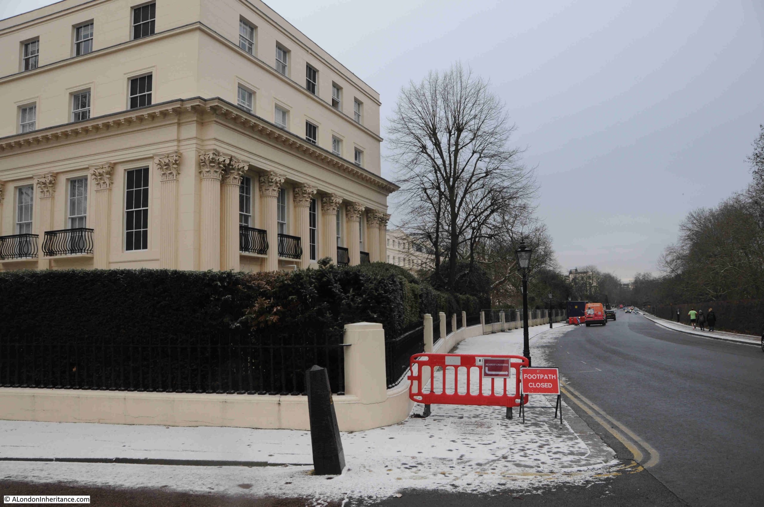
The terrace consist of 59 houses and was completed in around 1827. If differs from Chester Terrace in that it is not a continuous row of houses and there are two triumphal arches which lead into courtyards, not over the entrance road, but within the terrace, as shown in the following photo:
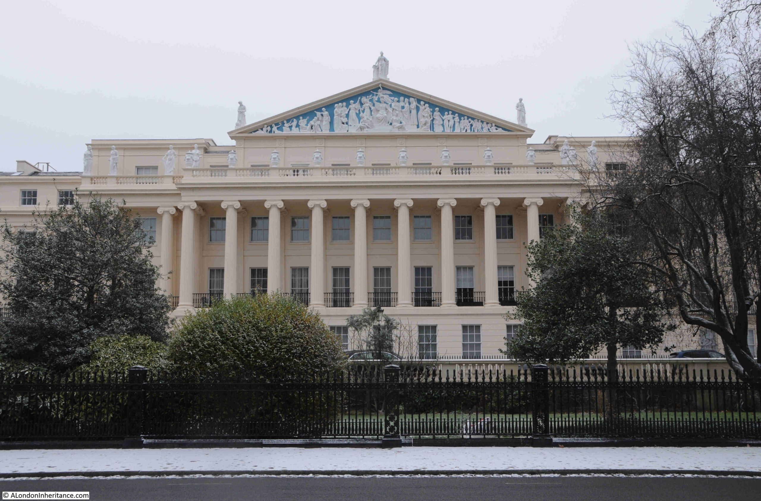
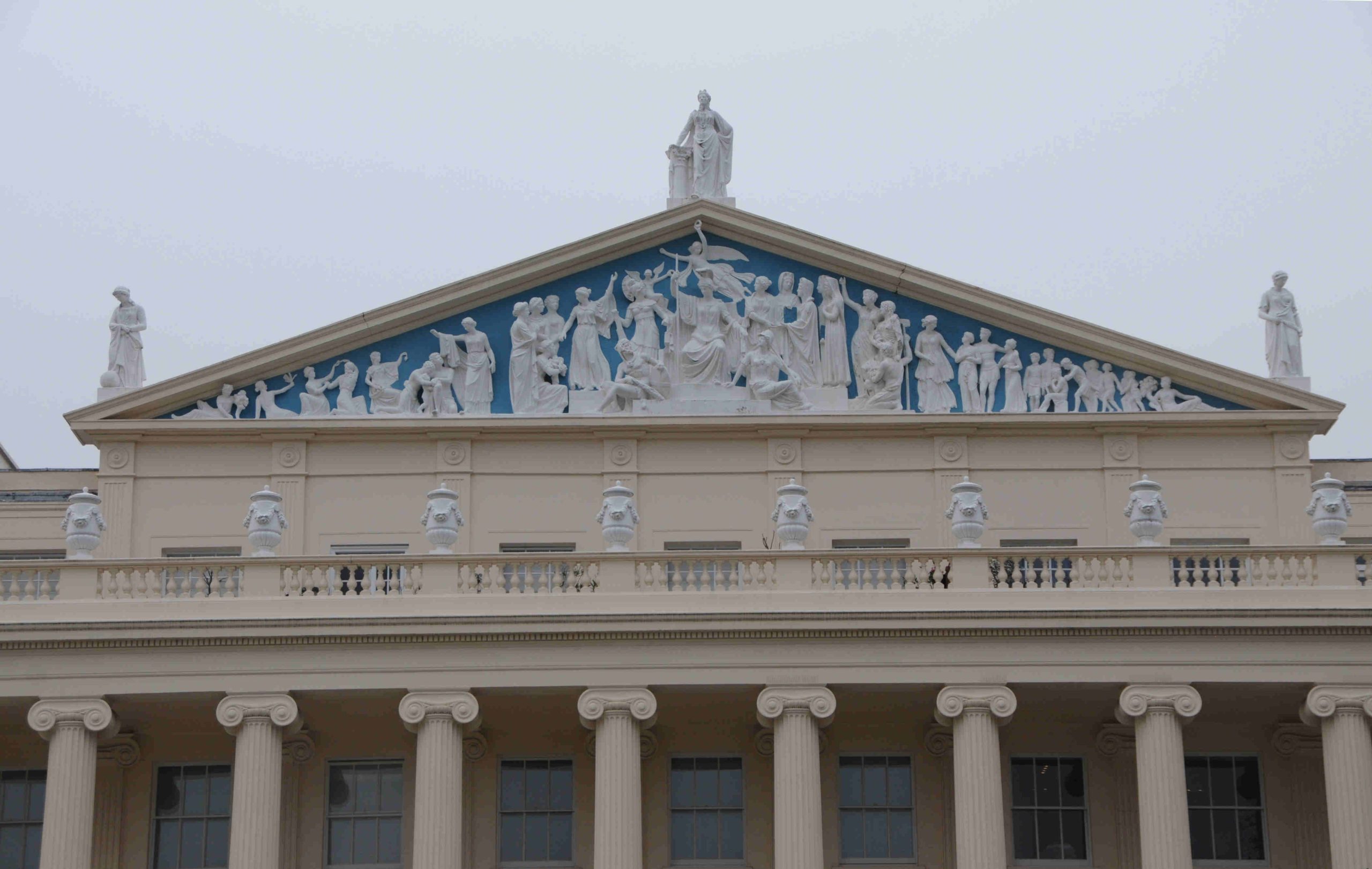
Cumberland Terrace was intended to be the most impressive of all the terraces, and at the centre is the building that was planned to give the impression of being a palace, looking out from its elevated position, over Regent’s Park. Only just visible in the following photo, at the top of the central building, above the Ionic columns is a Tympanum full of sculpture. A tympanum is the triangular space within a pediment that is frequently decorated, as in Cumberland Terrace:
This central building was the one covered in scaffolding in my father’s photos, another of which is shown below:
There had been some limited bomb damage to Cumberland Terrace, mainly to the rear rather than the front of the buildings. The main reason for repair work was the poor condition of the buildings after a long period of relatively limited maintenance, and years of wartime deterioration.
There was a risk that the buildings were going to be demolished, however they found another immediate post-war use, as reported in the Daily London News in April 1946:
“The Nash Houses To Be Spared – Terraces of houses designed by John Nash in Regent’s Park, which it was feared might be demolished, are to become an annexe of Whitehall.
The News Chronicle recently reported a protest by three writers, Elizabeth Bowen, Cyril Connolly and H.G. Wells, who all live in the Nash terraces in the Park, against the possible demolition of these fine specimens of Georgian building.
Last year a committee under Lord Gorell was appointed by the Prime Minister to report on the future of these buildings. Now the Government has already decided to take over 200 houses in Sussex Place, Cornwall Terrace, York Terrace, Chester Terrace and Cumberland Terrace.
Various Ministries will move departments there, freeing their present premises for use as offices and flats.”
What the above article did not report, was that Lord Gorell’s committee had stated that the terraces were an important part of the Nation’s architectural and artistic heritage, that they should be preserved as far as was possible, and that they should be residential and not offices, and the Government occupation should cease at the earliest possible time.
This was reported in the Illustrated London News on the 24th of May 1947, which included concerns about the physical state of the terraces. They had been built at a time when “the contemporary quality of building was at a very low ebb from a structural point of view. The quality of the maintenance of the houses has varied greatly, but dry-rot is very extensive and some of the serious outbreaks were prior to 1939”,
A further article in April 1950 in the Illustrated London News confirmed that repairs to the terrace had been underway, and the scaffolding which my father photographed must have been part of this work.
Some of the photos in the Illustrated London News show much of the internal woodwork being exposed and removed due to dry-rot.
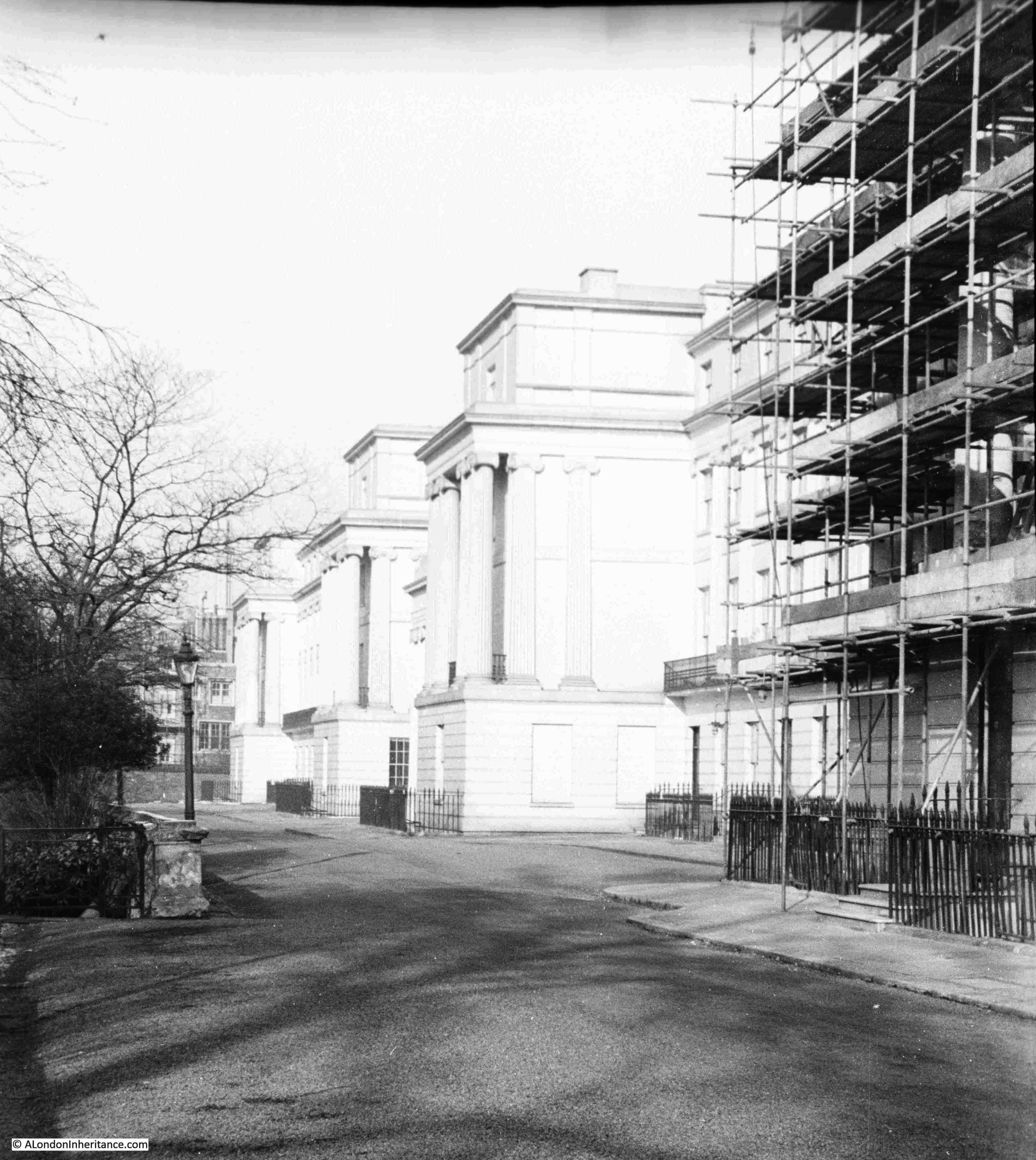
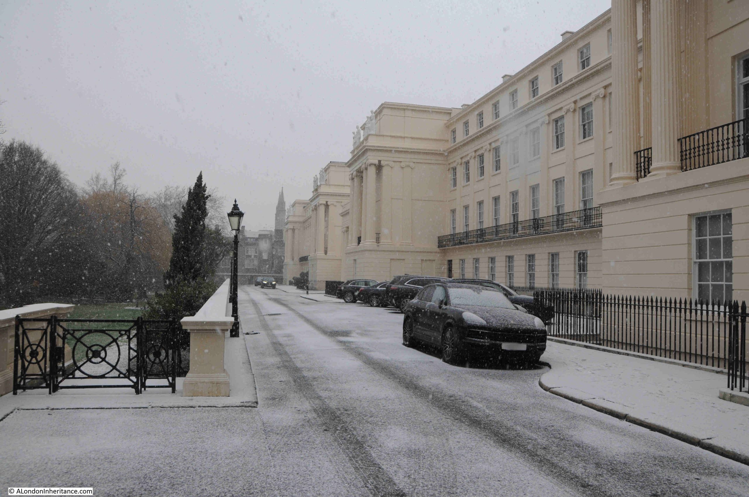
The northern part of Cumberland Terrace:
In the above photo, the gardens that separate Cumberland Terrace from the Outer Circle can be seen, as well as the drop in height from the terrace down to the gardens, the Outer Circle and the rest of the park, which gave the terrace an elevated view over the park, and also made the terrace look more impressive from the park.
The above view includes the area covered by another of my father’s photos:
At the end of the terrace, the road leads down to the Outer Circle, with another example of the houses that make up the estate as well as the terraces, at the far end of the road:
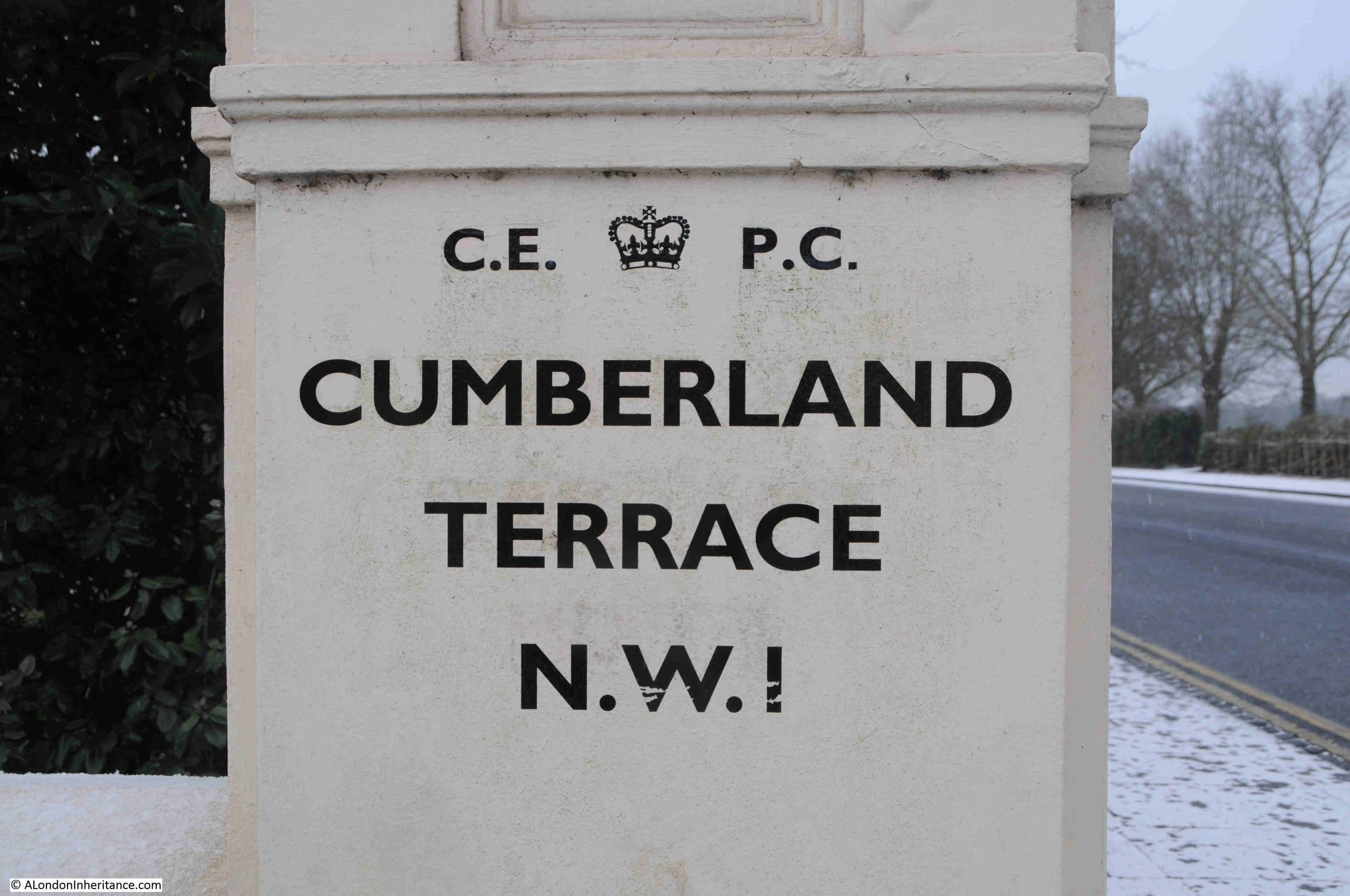
Although there are modern street names signs, the terraces and their surrounding streets are mainly a place of black painted name signs:
The names of all the terraces and other significant buildings around the park, as part of Nash’s development, all come from the Royal Family, so Cumberland Terrace is named after Ernest Augustus, the King of Hanover and Duke of Cumberland. He was the fifth son of George III.
Chester Terrace comes from George IV, as the Earl of Chester was one of his titles before he became king.
As far as I can tell, the majority of the Nash terraces and houses are still owned by the Crown Estate.
Following a quick search, I could not find any detailed listing of the properties owned by the Crown Estate, however they do state on their website that Regent’s Park is one of the areas where they hold a residential portfolio of properties.
In the following photo, I am looking along the Outer Circle, the road that forms the boundary to Regent’s Park. The gardens to the left provide privacy to the terrace, and Cumberland Terrace can be seen behind the gardens:
Cumberland Terrace is all Grade I listed, and the Historic England listing record describes the terrace as “Monumental palace-style terrace”, and from the Outer Circle we can see how the terrace, especially the central part of the terrace, was meant to be seen – an impressive, ornamental palace, overlooking the Prince Regent’s new park, and part of a fashionable new housing estate for London:
The following print dates from 1829, only a couple of years after completion of the terrace, and shows the central part of the terrace looking much the same as it does today:
The decoration within the pediment is hard to see when walking along Cumberland Terrace, and it is only from the Outer Circle and the park that this impressive work can be seen fully:
The Public Ledger on the 29th of September 1827 included the following description of the terrace and pediment soon after completion:
“Among the very numerous embellishments to our Metropolis which have so closely succeeded each other since the commencement of the Regency, and which will, when the whole in present progress, and these to which these must inevitably give rise, shall be completed, render it still more the wonder of foreigners, we view with peculiar pleasure the improvements in the Regent’s Park.
In that delightful spot, the Cumberland Terrace must ever be an object of admiration. The pediment to that long length of handsome dwellings is nearly finished, and we expect will be viewed with much admiration.
The subject is boldly conceived, and the work is, we think, well executed. Britannia appears crowned by Fame. She is seated on her throne, supported by the emblems of Valour and of Wisdom. On one side, Literature, Genius, Manufacture, Agriculture and Prudence. On the other Navy surmounted by Victory, and attended by Navigation, Commerce and Freedom, extends blessings to the world; and the interesting group is surrounded by the symbols of Plenty.
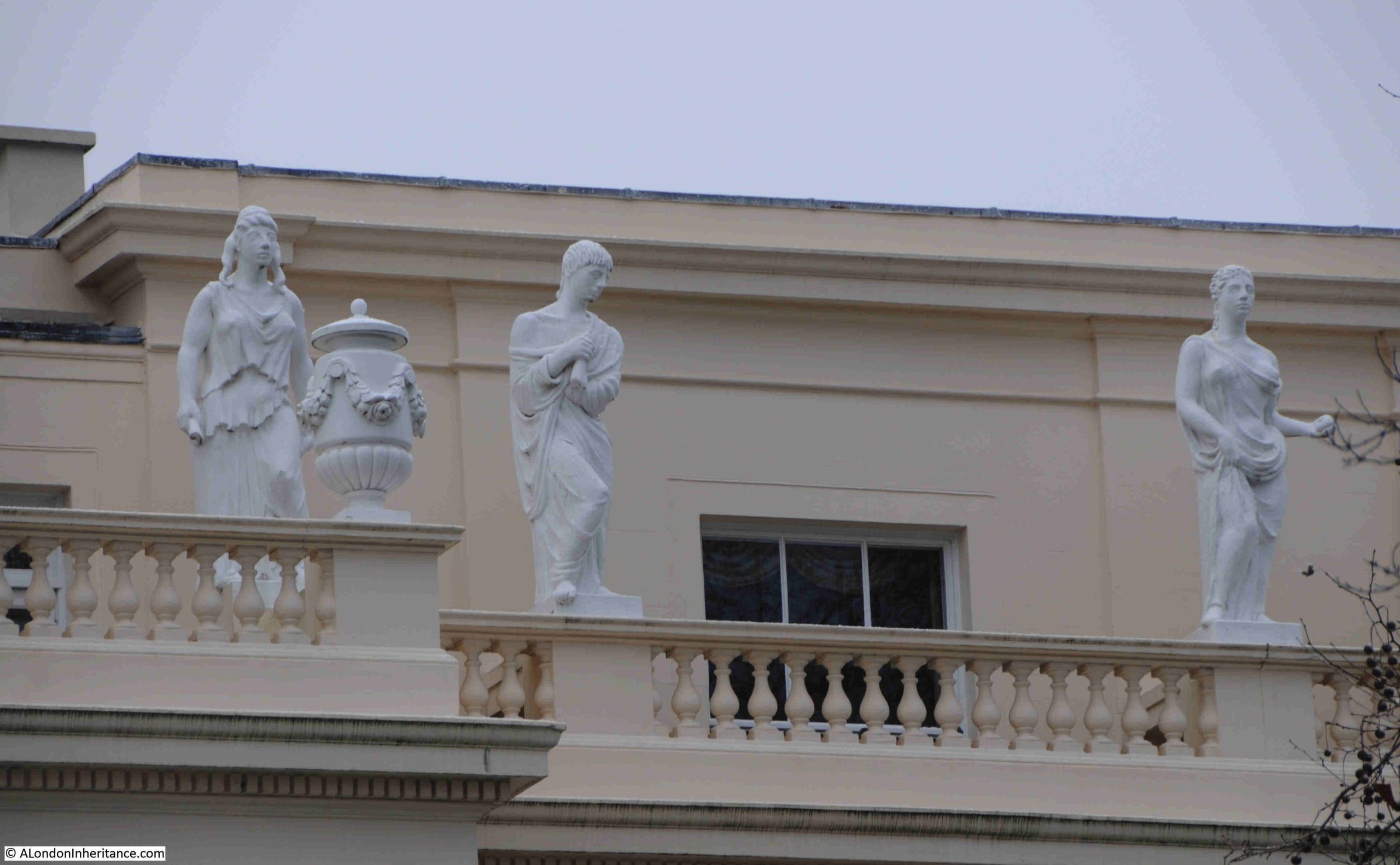
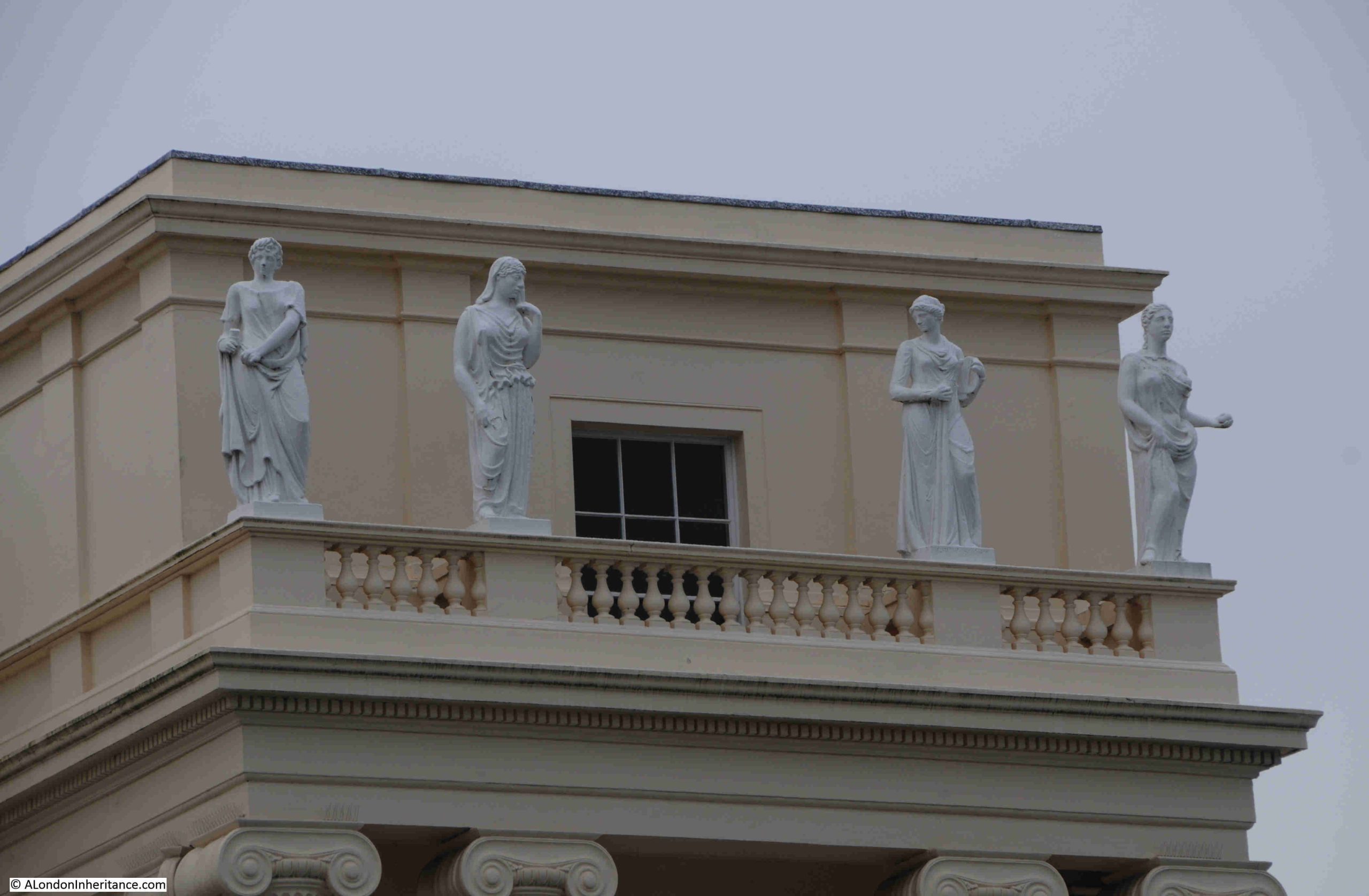
Not only will the pediment be attractive, but over the 32 columns there are to be as many statues with a quantum sufficit of sphynxes, vases and other decorations.”
And the many statues listed in the article, as well as the sphynxes and vases are still to be seen:
And here:
Cumberland Terrace is a very impressive example of Nash’s work around Regent’s Park, and Cumberland Terrace was often used as an example of quality design.
In the second half of the 1940s, the luxury car brand Lagonda was advertising that “Cumberland Terrace, Regent’s Park, by John Nash characterises a flourishing period of design. As with this noble early 19th century building, so with the new 2 litre Lagonda designed by W.O. Bentley. Lasting merit has been achieved through time and genius expended on conception and construction”.
Large house facing onto the Outer Circle:
The above photo shows that it was not just the terraces that had features such as Corinthian or Ionic columns and pediments. Other buildings facing towards Regent’s Park had many of the same features, to give the impression of the park being surrounded by large and small palaces or stately homes.
London has always had a housing shortage, and there was an interesting proposal for Cumberland Terrace in 1959 (from the Holloway Press):
“Tory Cllr, says FLATS NOT SUITABLE – Cumberland Terrace. Although Cllr, Miss I.C. Mansel maintained that flats in Cumberland Terrace would be unsuitable for council tenants, St. Pancras Borough Council agreed on Wednesday to a housing management committee recommendation that the Crown Estate Commissioners be asked to receive a council deputation to discuss the future of the flats.
Previously the council had asked the Lord Privy Seal to place the flats at the disposal of the council for housing families on the waiting list. The council were then told that it was proposed to let the flats at the best rates obtainable.
Cllr. Miss Mansel said the Conservative group were against the recommendation. ‘I feel these flats would be quite unsuitable for council tenants’.
The committee chairman, Cllr. Mrs Peggy Duff said there was a desperate shortage of housing accommodation and she had no doubt people would be glad to have one of these flats.”
The principle of the “best rates obtainable” still stands, as for example, there is a three bedroom, leasehold apartment in Cumberland Terrace currently on sale for £7,500,000. You can see the listing on Rightmove by clicking here.
View south along the Outer Circle, with another large house with Corinthian columns – a standard feature throughout the estate:
The road in the above photo is again the Outer Circle, the road that circles the boundary of Regent’s Park.
The Outer Circle, or Outer Drive as it was also known, was laid out as defined in Nash’s plans, between 1811 and 1812.
The two mile long road was described as a “fine broad gravel road”, and was one of the first features of the park, forming the boundary between the open parkland, and the land that would be developed into the terraces and houses covered in this post.
The following map shows Regent’s Park in around 1815, before the terraces and houses were built. The Outer Circle is in place, however it is named in sections, with some of the names that the future terraces would take, so for example, the section of Outer Ring in front of the future Chester and Cumberland Terraces is called Chester Street.
The land just outside the Outer Ring is labelled as “Building Ground”, and this would go on to be developed in the 1820s as shown by the photos in the post.
The Outer Circle was open to the public until ten in the evening, when it was closed to the public, but continued to provide access for residents. The road was designed so as you passed along the road on your horse, in your carriage, or on foot, you passed a changing series of views, of both the open parkland on one side, and the large houses and terraces on the other side, which must have seemed extraordinary and magnificent to the average Londoner.
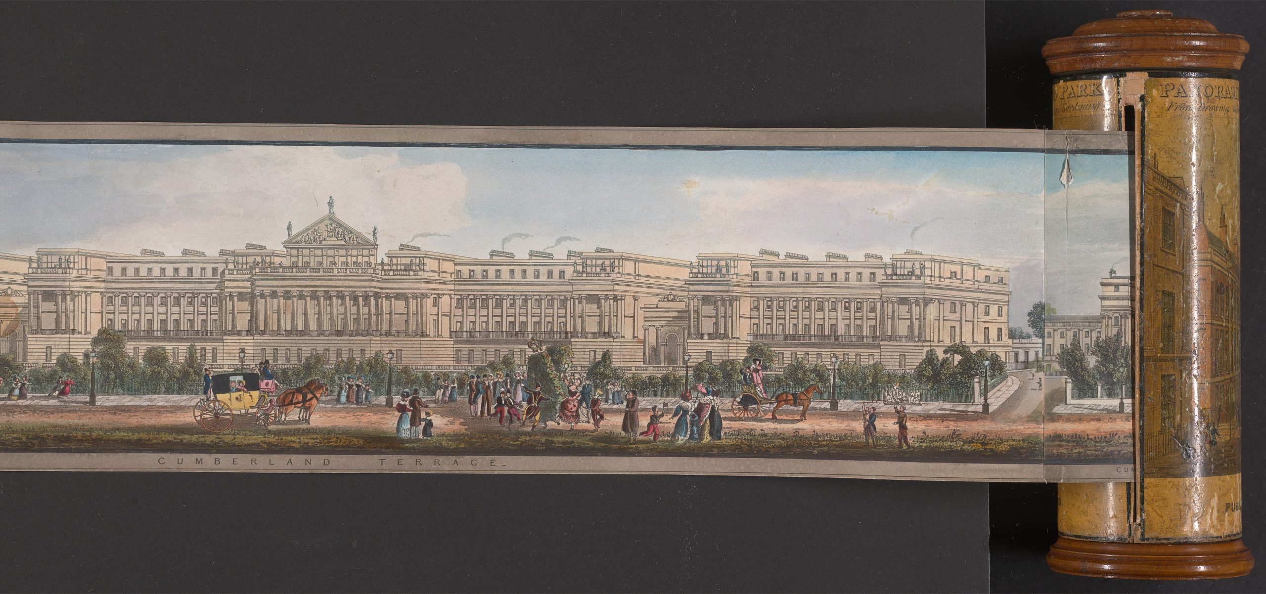
In 1831, the artist Richard Morris created a panorama of the view around the Outer Circle.
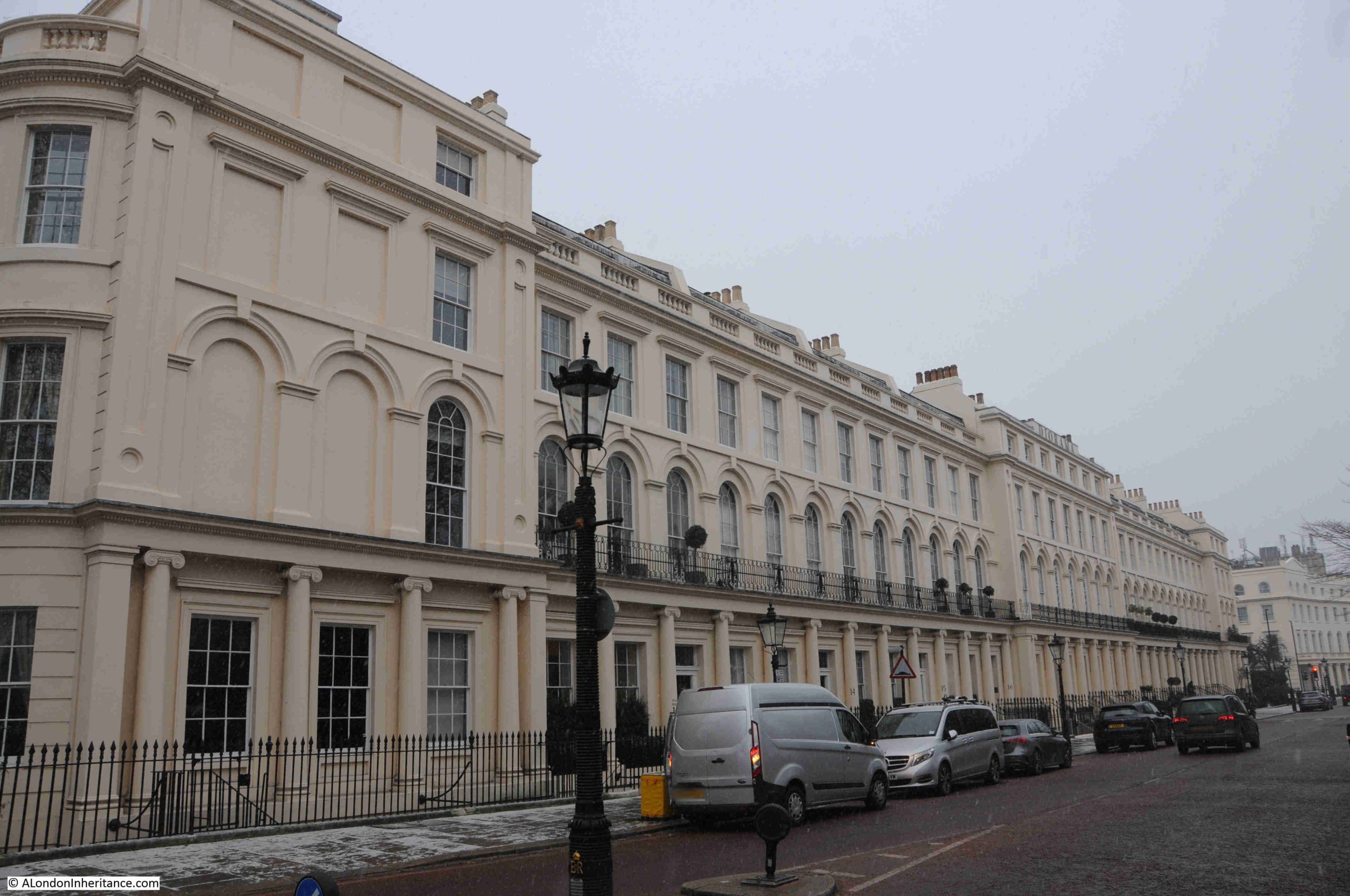
An interesting part of the overall development is much further south, along Park Square East, which connects Marylebone Road to the Outer Circle, where we find this terrace:
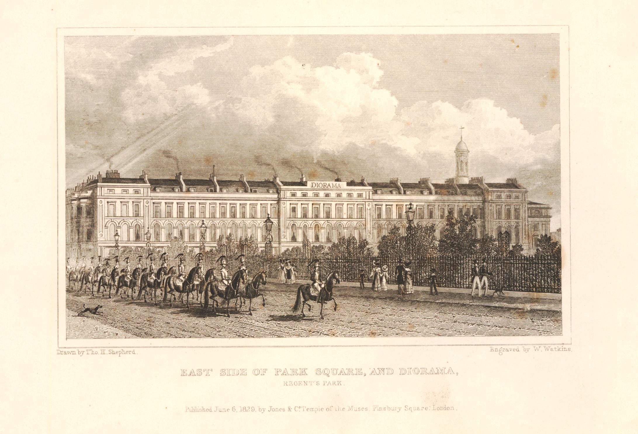
The following print from 1829 shows the above terrace. Park Square is to the right, and the mounted soldiers are travelling along the southern section of the Outer Circle:
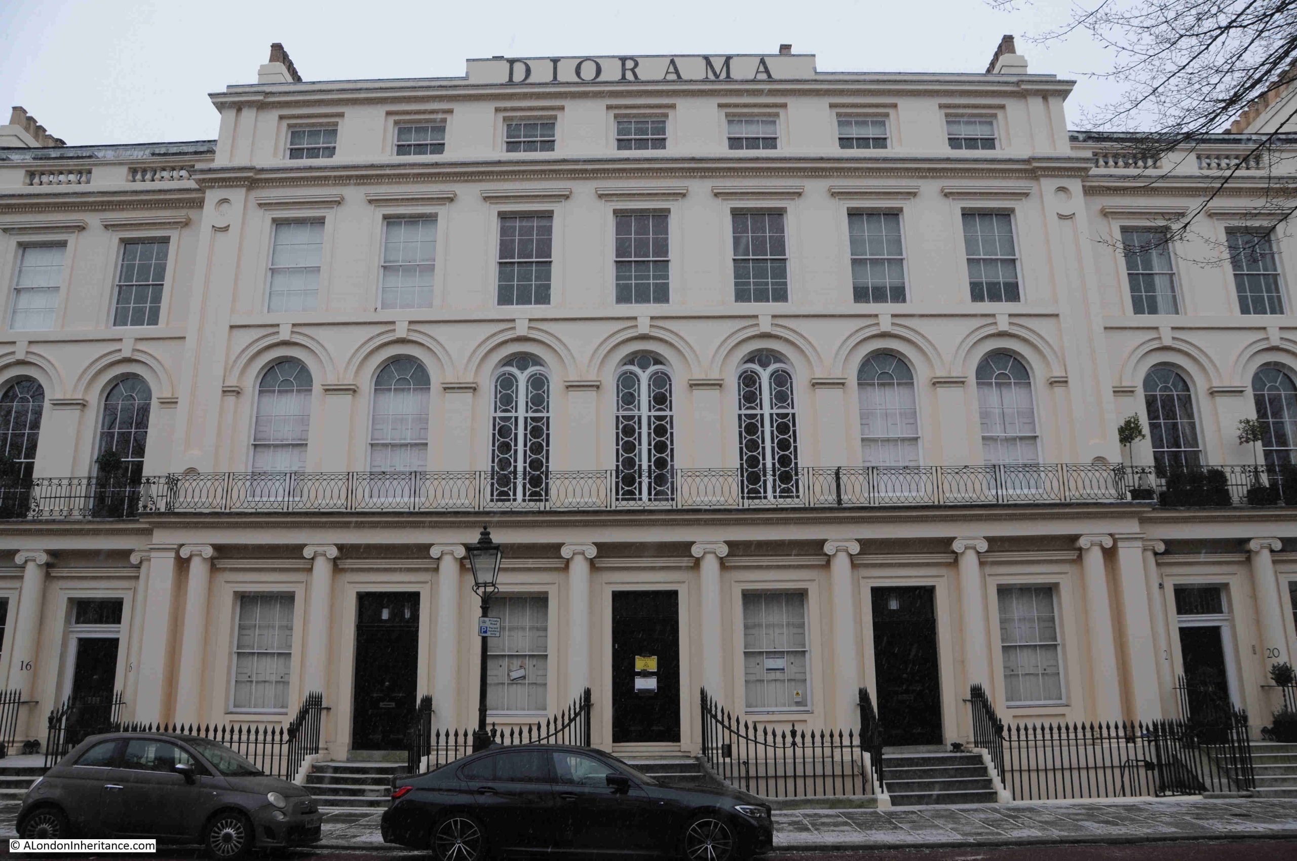
In the centre of the terrace shown in the above print and photo is a slightly larger building, with a sign along the roof line. This was the Regent’s Park Diorama, and the building survives to this day:
Again, Grade I listed, and by John Nash, the central Diorama was one of a number operating in London in the early 19th century.
A Diorama consists of a painting, drawings or models which are so arranged and lit, that they give the viewer the impression that they are looking at the real life scene.
Flemings Weekly Express on the 2nd of November 1823 had a description of the Regent’s Park Diorama, as follows:
“On entering the place of exhibition, you find yourself in a small circular theatre, fitted up with balconies, seats and a kind of parterre in the centre; and hung round with rich draperies; and overhead is a transparent ceiling superbly painted in arabesque, which lets in a ‘dim, religious light’.
The theatre or apartment in which you stand, is enclosed on all sides, with the exception of what seems to be about one-fourth of the circle; and this space, from the ceiling to nearly the floor, is entirely open, as if into the air. it is through this opening that you see, at what appears to be a considerable distance, the scenes which are the objects of exhibition.
One of them consists of a lovely valley in Switzerland; and it really is no exaggeration to say, that, seen from the open window of an apartment in its immediate neighbourhood, the scene itself could not produce a more enchanting effect. It is true, the feeling of being able to leave the room, and walk into it is wanting; but perhaps this is nearly compensated for by the indistinct pleasure arising from the sentiment alluded to, that what you behold is a pure creation of human art and ingenuity.”
To keep customers returning, the Diorama would provide a continually changing programme of views, with natural landscapes from Britain and the wider world, city scenes, battles, historical events etc.
By 1852, the Diorama had closed. The contents of the building were sold off the following year, and in May 1855, the building opened as a Baptist Chapel, with the first “solemn services” held to convert the space into a chapel.
The façade of the building hides the structure of the Diorama which was behind, and remarkably this structure still exists today.
The following link is to Google Maps, where the structure of the Diorama is still clearly visible behind the terrace:
The Nash terraces are one of the things that make walking around London so fascinating – the considerable diversity of architectural style and landscape planning. It is important to consider the terraces and large houses as part of the overall design of Regent’s Park, and with Cumberland Terrace, it is clear that the terrace was designed to provide the impression of a palace overlooking the park.
London’s changeable weather also makes walking interesting, and whilst these terraces look magnificent in the sun of a summer’s day, they look just as good in the light of a dull January day, with a dusting of snow across the streets and pavement.
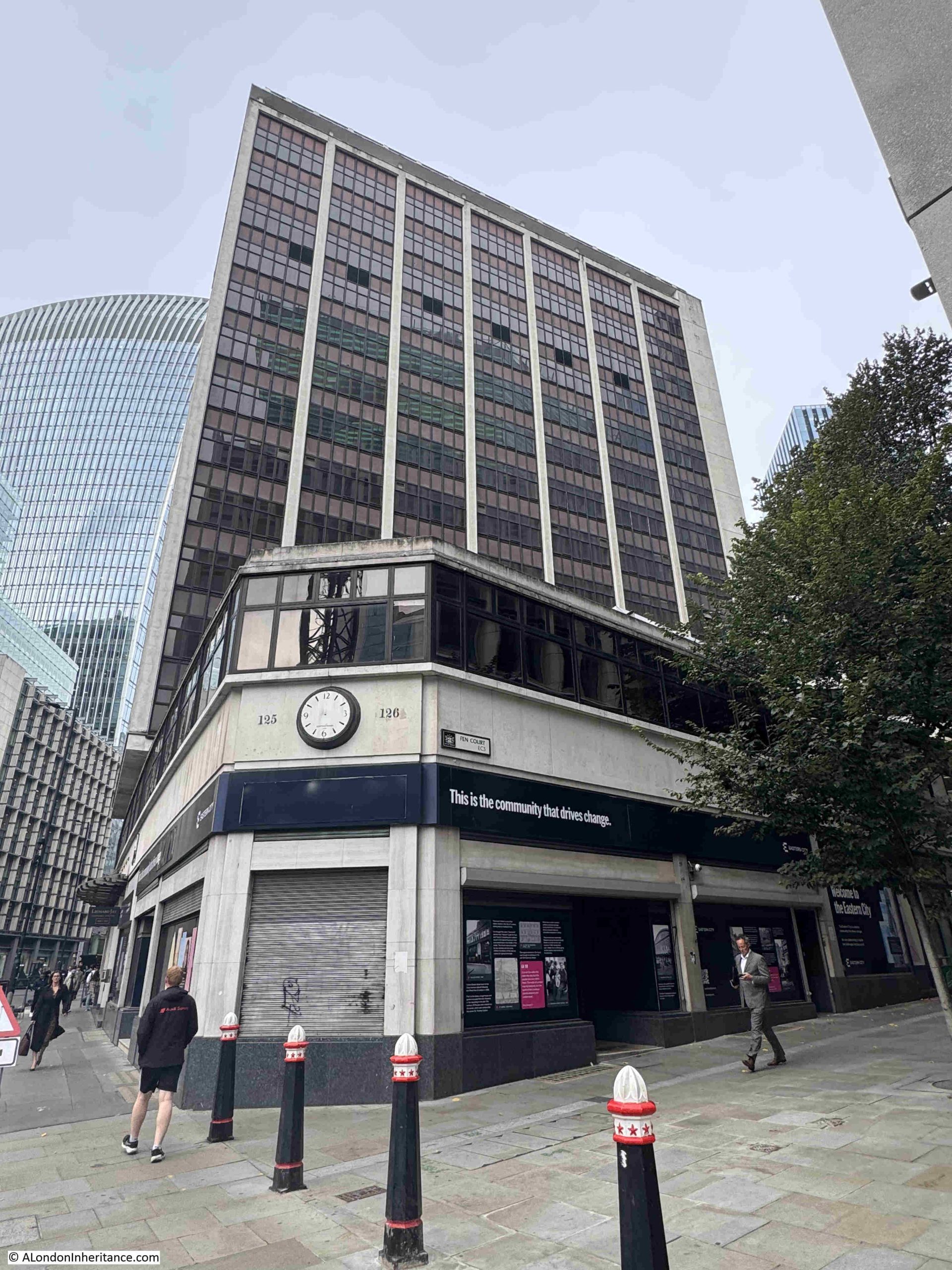
The inspiration for this week’s post came from a tweet (if that is still the correct term for a post on X or what was Twitter), from the City of London, stating that the “Planning Committee has unanimously approved plans for a 31-storey officer tower at 130 Fenchurch Street”.
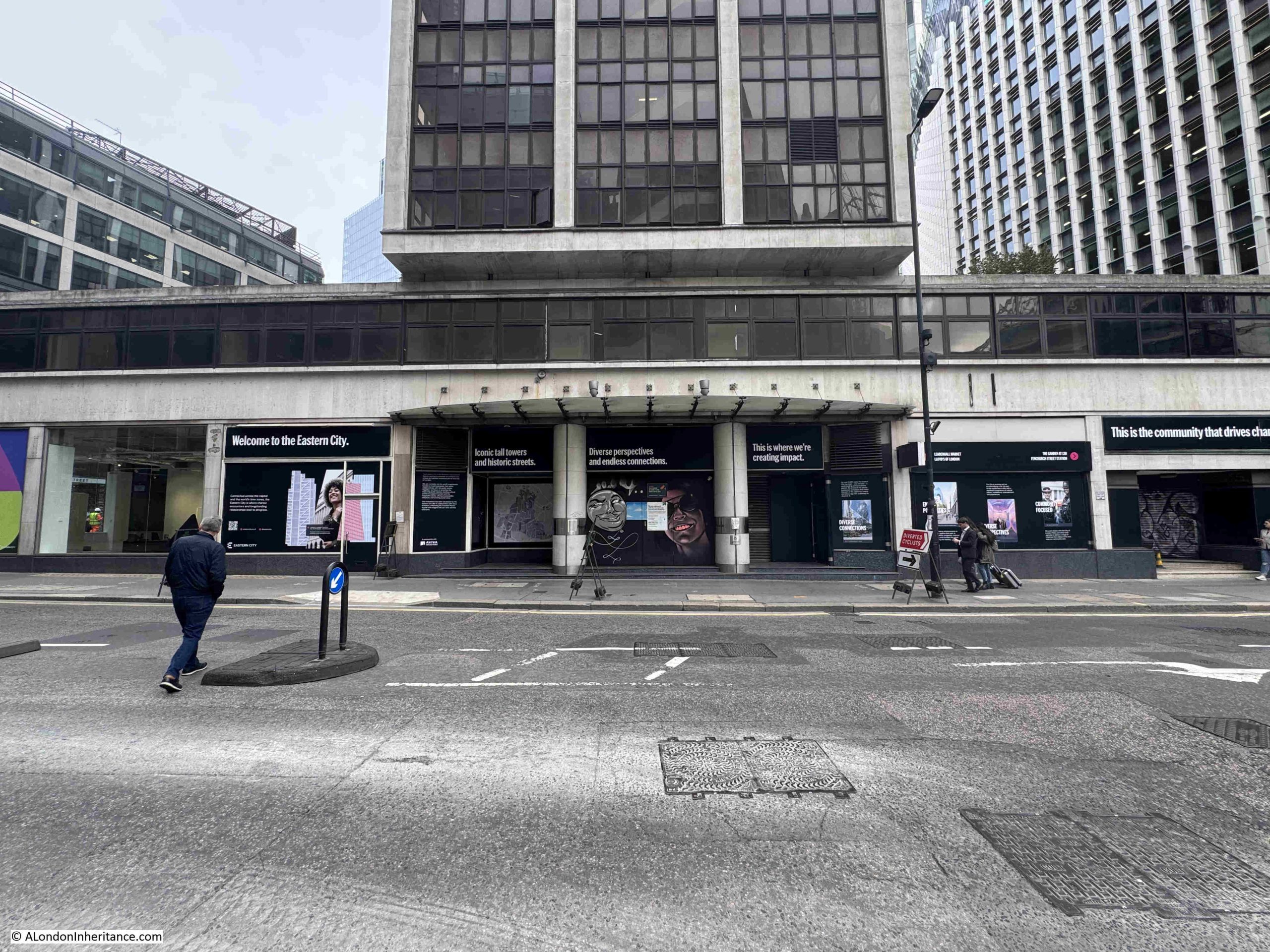
130 Fenchurch Street is better known as Fountain House, a rather unique building in the City of London, and one I wrote a bit about in 2018 when demolition was expected in the next couple of years, however I suspect that Covid delayed any work, and seven years later it looks as if Fountain House will finally become one of the many City buildings that become a memory for those that worked in the building, or remember the building from walks along Fenchurch Street:
This section of Fenchurch Street is changing rapidly. Fountain House is on the left of the above photo, and will soon be replaced by the building shown in the City of London’s tweet, also in the project’s website, here: https://130fenchurchstreet.co.uk/
Where the crane can be seen on the right of the above photo is where the development I featured in last week’s post at All Hallows Staining and 50 Fenchurch is taking place. Two large and transformative developments in a small section of Fenchurch Street.
Fountain House was constructed between 1954 and 1958 to a design by W.H.Rogers and Sir Howard Robertson (Consulting). It was the first London building constructed to the tower and podium formula where a large podium occupies the full area of the plot of land, with a much small central space occupied by a tower block.
The lower podium block is occupied by a central entrance foyer and around the street level of the podium there is space for a range of retail units.
The corners of the podium are almost triangular in shape to fit within the surrounding streets. As the central tower only occupies a small percentage of the overall plot of land, today’s developers would no doubt consider this to be wasted space and the modern replacement will see a glass and steel tower occupying the full width and depth of the land available.
The view looking up at the tower of Fountain House rising above the Podium, with what was the main entrance to the building:
Wider view showing a section of the podium. The entrance to the building is in the middle, retail units to left and right along the street level of the podium:
The Pevsner guide describes Fountain House as:
“The first office tower in London to repeat the motif of Gordon Bunshaft’s Lever House, New York (1952), that is a low horizontal block with a tall tower above, here set end-on to the street. With its podium curving to the street and lower return wing along Cullum Street, the composition is tentative compared with later versions of the formula.”
When Fountain House opened in the 1950s, it must have been viewed as the most modern of office blocks, and a symbol of the City of London’s post war transformation from mainly Victorian and early 20th century office buildings, to the very latest architectural designs, mirroring what was happening in places such as New York, and offering a new format for office work, and the growing trend for retail along the streets of the City.
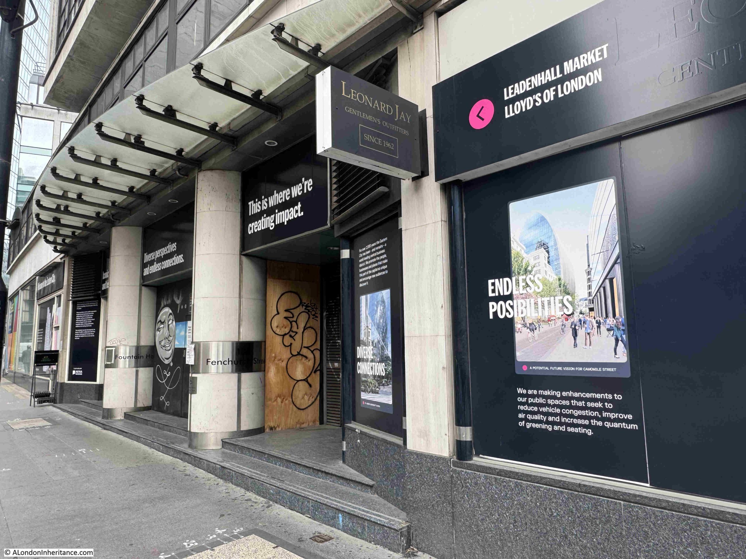
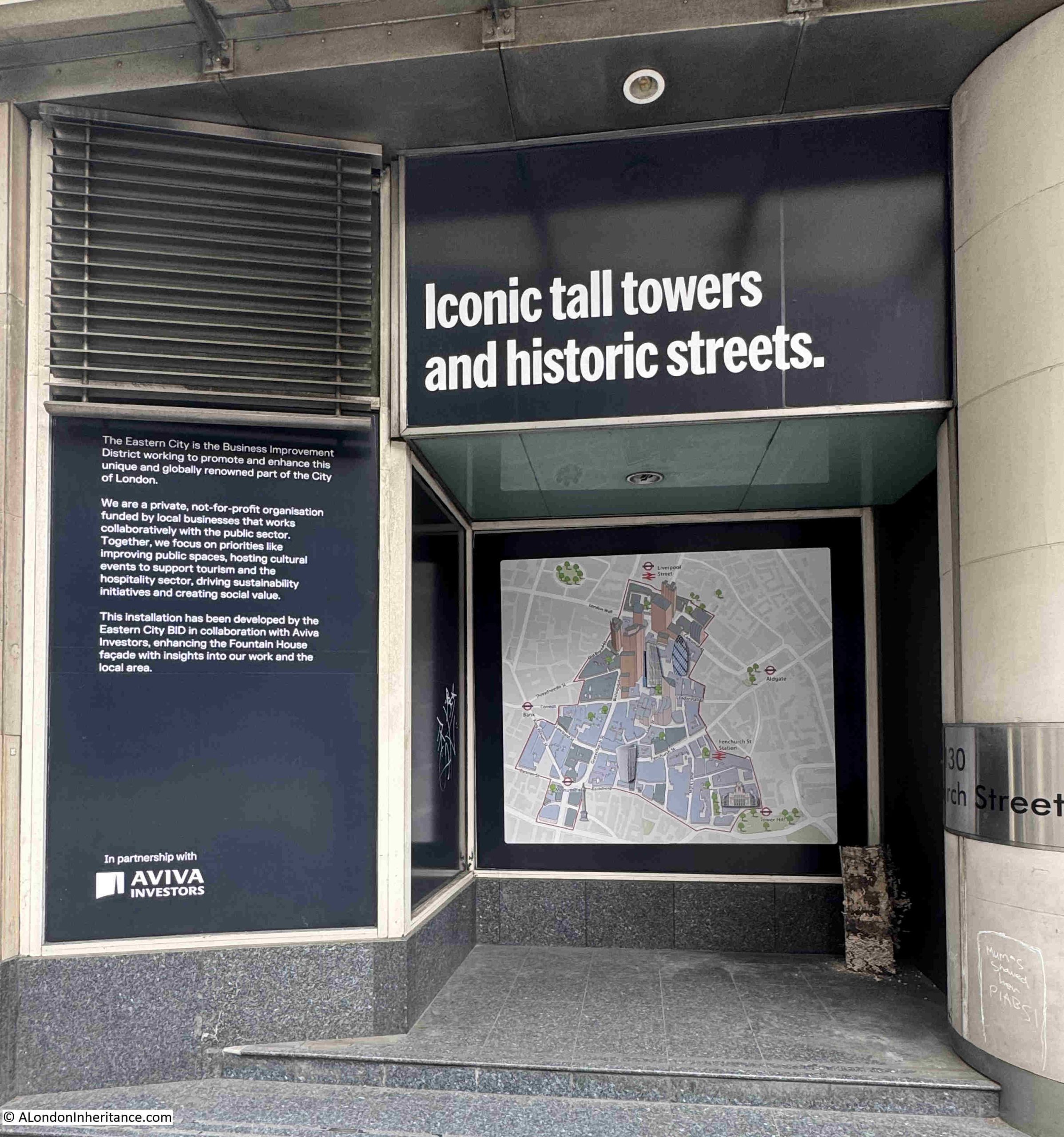
The ground floor of the podium today, along with the main entrance, is covered with advertising about the local area:
This advertising display’s one of my pet hates about the way parts of London are often rebranded, as apparently the area surrounding Fountain House is now “Eastern City”:
Eastern City is a BID or Business Improvement District.
A BID is a business led and funded (through a levy of the business rates) organisation, set-up to provide improvements within the local area, and the services delivered in that area.
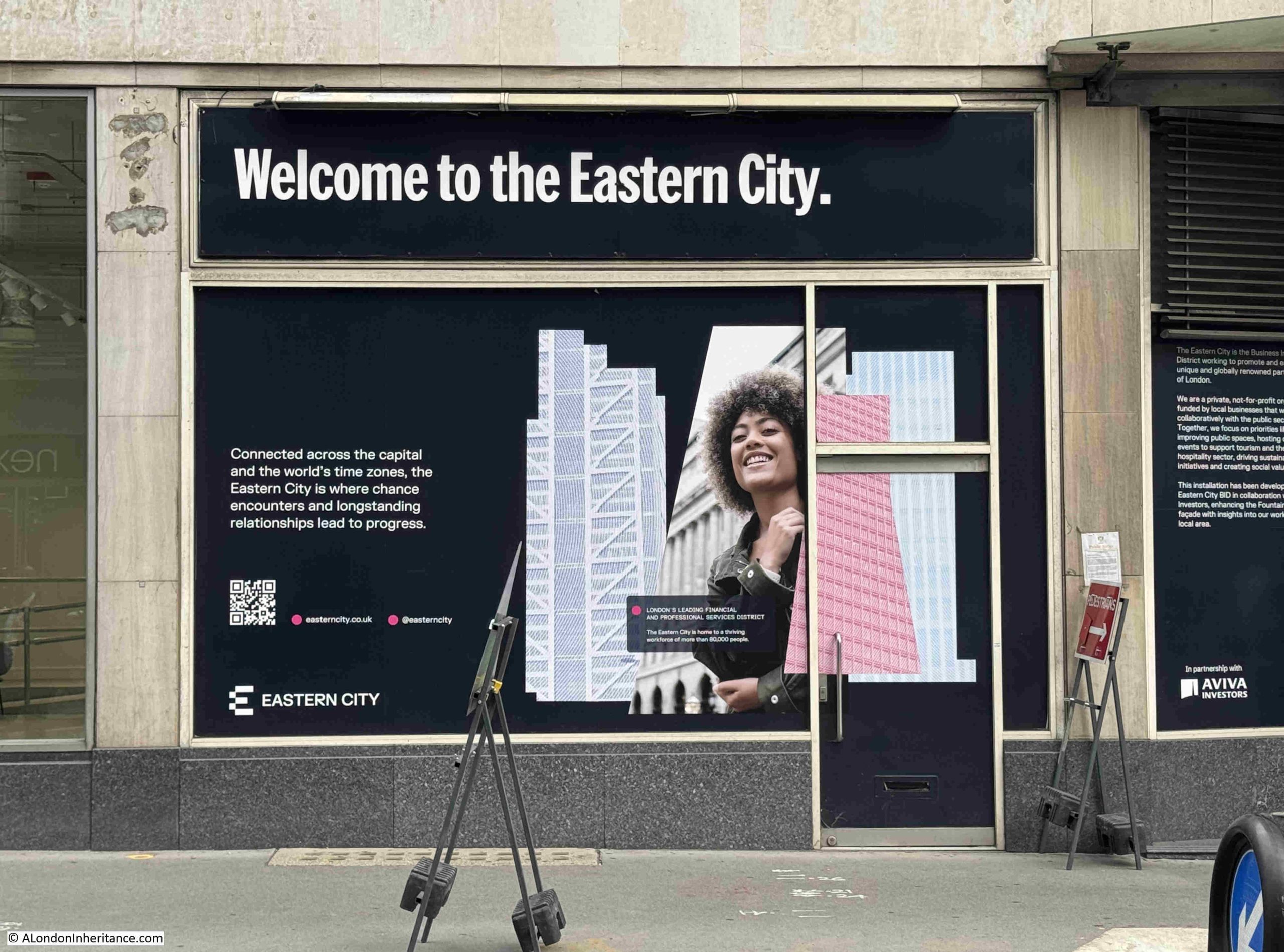
The concept of a BID is good one. Local businesses working together to improve their local area. I just find the almost arbitrary renaming of a local area rather frustrating. A name not rooted in any history of the area and not really defining the key aspects of an area. For example, in the above photo, Eastern City is defined as:
“Connected across the capital and the world’s time zones, the Eastern City is where chance encounters and longstanding relationships lead to progress”
The above slogan could equally apply to the whole of the City of London and nothing in the slogan is unique to “Eastern City” (I assume the rest of the City of London would argue that it is connected the the world’s time zones).
There are currently five BIDs within the City of London, with each having a defined term of operation. They are:
These are not just within the City. Across the wider London area, there are over 70 BIDs.
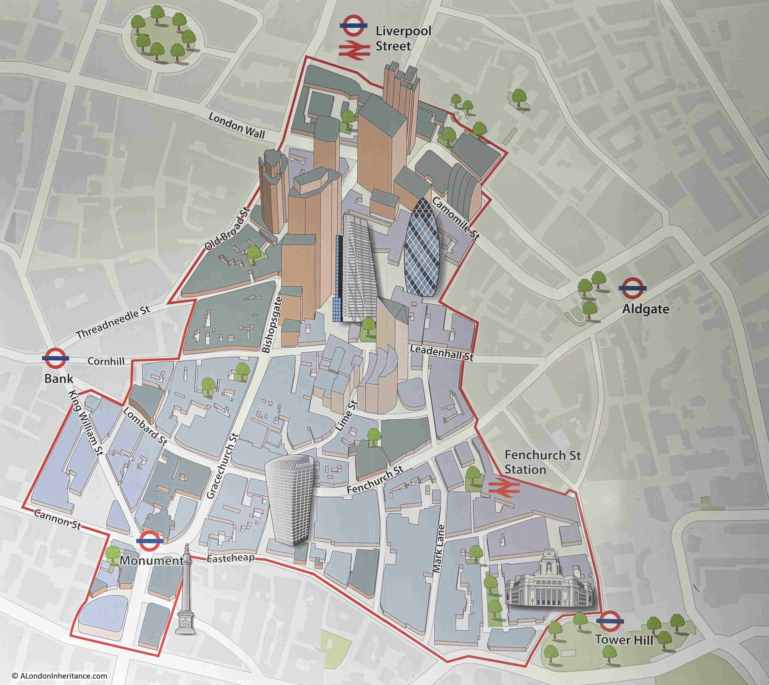
In another panel, there is a description of the Eastern City BID and a map showing the area, with “iconic tall towers and historic streets”:
Map from the above photo showing the area of the Eastern City – again I have no issues with the concept and work of a BID, it is just the arbitrary boundaries and name to define the area:
The BIDs overlap an existing structure within the City, which, for very many centuries, has been divided into Wards with an Alderman and a number of Common Councillors.
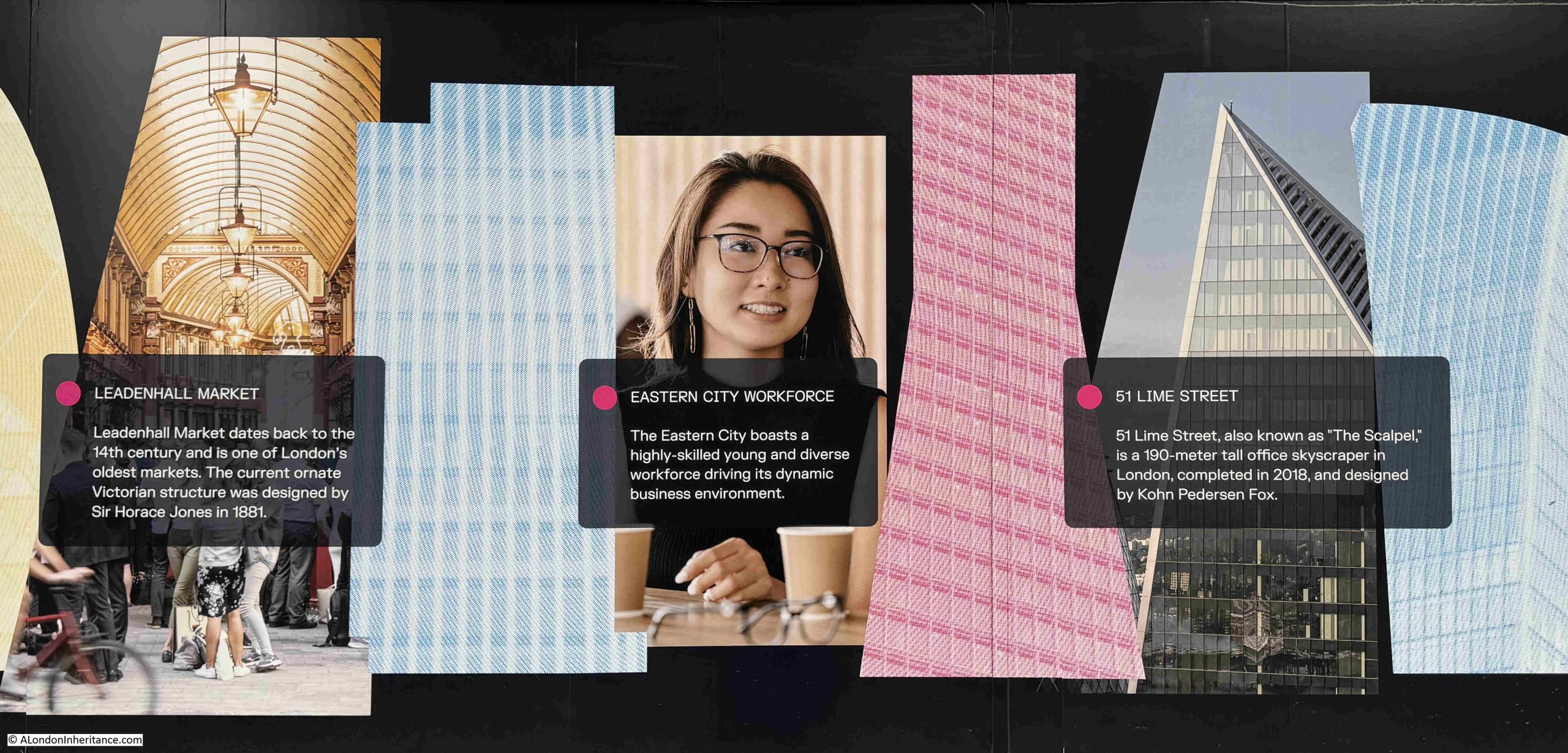
More from the panels around the street level of Fountain House:
And some history:
I wonder how many City workers have glanced up at the clock on the corner of the Fountain House podium to check the time:
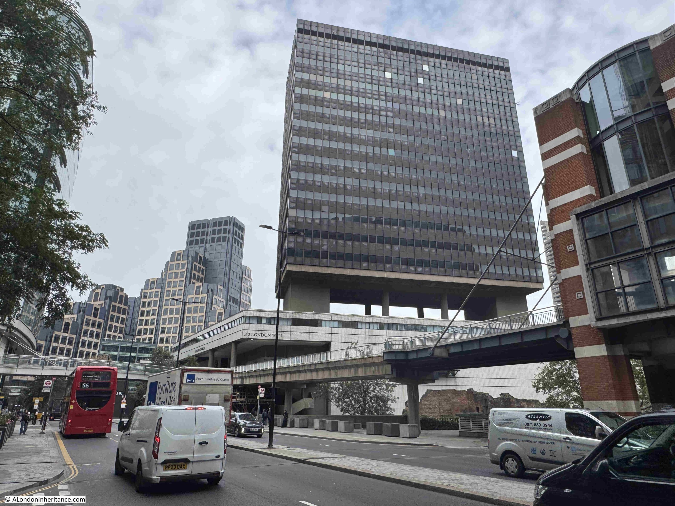
Another, similar tower and podium building that may well soon be demolished is Bastion House (140 London Wall), which sits on top of the old Museum of London site. The photo below shows the building, and also highlights how the office block is suspended above an open space, with only a few central support columns, along with the wider blocks at the two sides of the structure for additional support, lifts and services, for the 17 storeys of the building above:
Bastion House was part of the redevelopment of the area, which included forming the new London Wall street, as a dual carriageway between the junction with Aldersgate Street to the west and with Moorgate to the east, following a slightly more southern route than the original street by the name of London Wall.
The new developments included several almost identical office tower blocks along either side of London Wall, along with raised pedestrian walkways and the dual carriageway with a long car park below.
These office Towers were built between 1961 and 1976, with Bastion House being one of the last to be completed.
The site was to have included a Centre for Music and Concert Hall by the American architectural practice of Diller, Scofidio & Renfro, however post Covid, funds for such a building seem to have dried up, so the focus of the site will now be commercial, with the City of London identifying the ongoing need for new office space across the City as one of the justifications for the development.
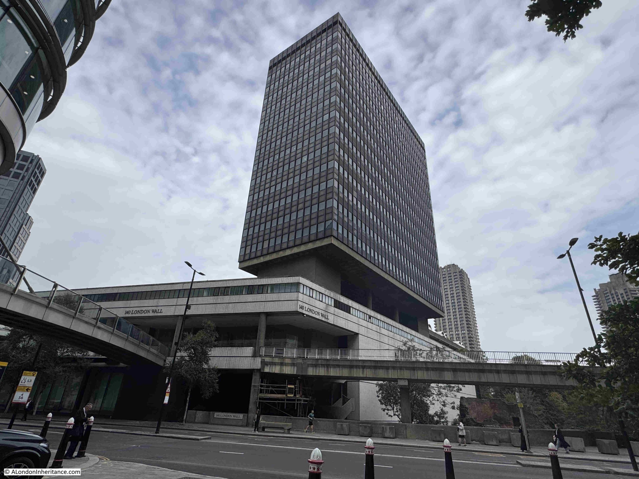
Bastion House and the old Museum of London below, seen from the west:
The Museum of London building was also by Philip Powell and Hildago Moya, so with overall demolition, two of their buildings will be lost.
This will leave one remaining office tower from those that once lined London Wall, and this is further to the east on the southern side of London Wall and is shown in the photo below:
This block is now called City Tower, but the original name when completed in 1964 was Britannic House (although I am not sure if there is some confusion with another Britannic House, built as the head office of BP in 1967 next to Ropemaker Street, which has also changed name and is now City Point).
There is work on the ground floors of City Tower, however I cannot find any plans to demolish this building, so after the demolition of Bastion House, this will be the one remaining office block of the identical towers that once lined both sides of London Wall.
The proposed demolition of Fountain House and Bastion House follow the centuries long tradition of how the City of London has redeveloped and renewed, adapting to changing models of commerce, ways of working, demands for space, changing architectural designs, use of new materials etc.
So the loss of these two buildings follow this process, however I cannot help thinking that in their own way, they are unique, and their loss would result in the further loss of architectural variety across the City.
There are also arguments about the impact of demolition and rebuild with environmental factors such as the CO2 embedded in the existing building, and that generated by a new build.
Both proposals aim to maximise the amount of office space. The replacement to Bastion House and the Museum of London site will consist of three new blocks, the highest being of a similar height to Bastion House. Proximity of this development to the Barbican will probably have a significant impact on the view towards the south west from the estate.
All part of a changing City, and how familiar streets and views can be totally transformed in the space of a couple of years, but how we decide what is worth preserving and what justifies demolition is an important discussion.
On a totally different, but vaguely related subject on preservation of old things, I have long suspected that in the future, despite the enormous number of photos we take today, there will be some form of a digital dark age.
With my father’s photos from over 70 years ago, and my photos from the 1970s, 80, and 90s, it is a matter of basically shining a light through the negative and scanning the view to bring these photos back to life, but with the digital format of photos, will the media still be available and readable, will Cloud based storage still be accessible decades in the future, and who will know your Facebook, Instagram, Apple, Flickr etc. userids and passwords to access, if these services are still available in the future.
I was going to continue my journey along the Limehouse Cut in today’s post. However, it is the first post of a new month, when I feature a Resources section in the post, looking at resources to help with researching and exploring London, so to keep the post to a reasonable size, I am starting with a different subject.
Also, the problems with the blog that I mentioned a few weeks ago have been reoccurring, with the site occasionally going off line, and also with very slow performance. I hope to be able to bring in some additional technical support to try and get this resolved this coming week, but if the blog and posts disappear for a while, it will be back.
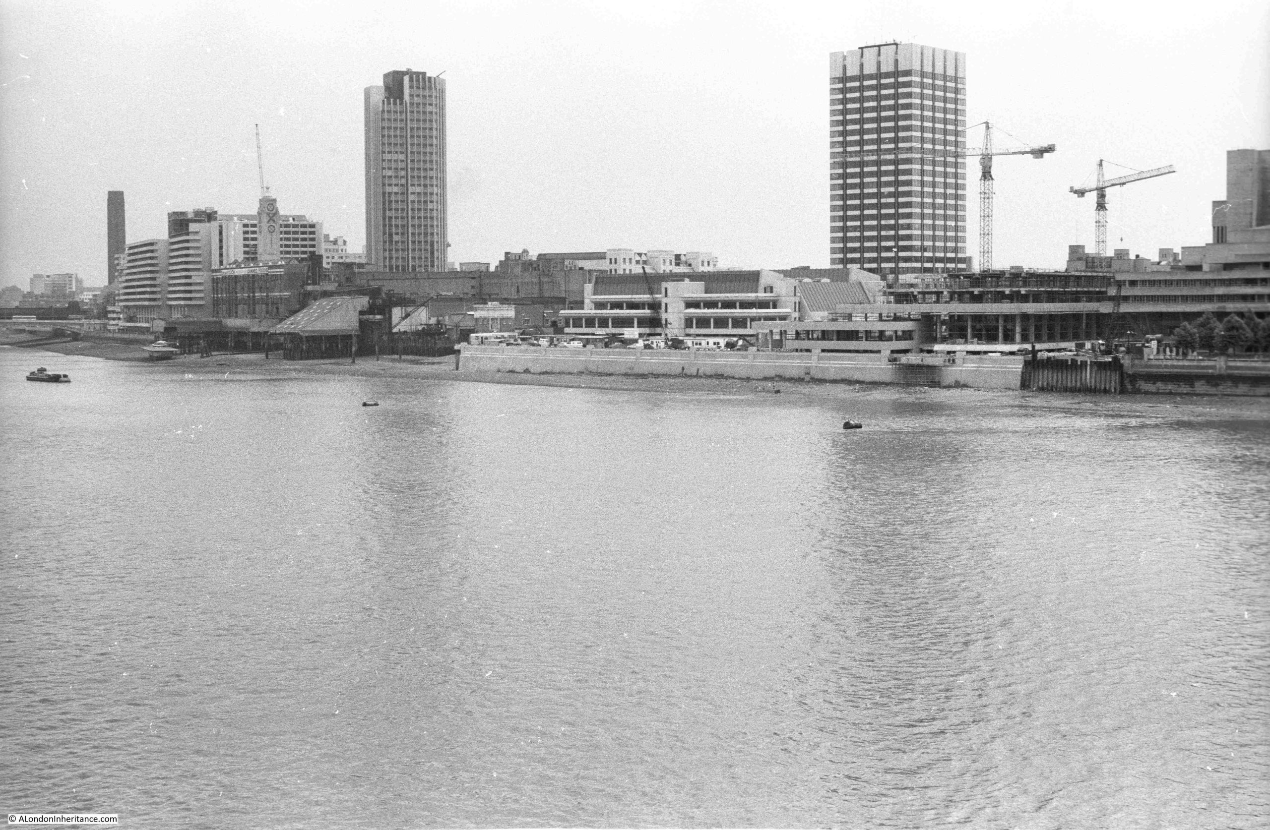
Last weekend I was walking across the footbridge alongside Hungerford Bridge, looking over at the very familiar view towards Waterloo Bridge, the City and along the Southbank, when I noticed that there was something missing:
For those of a certain age, the following clip may offer a clue:
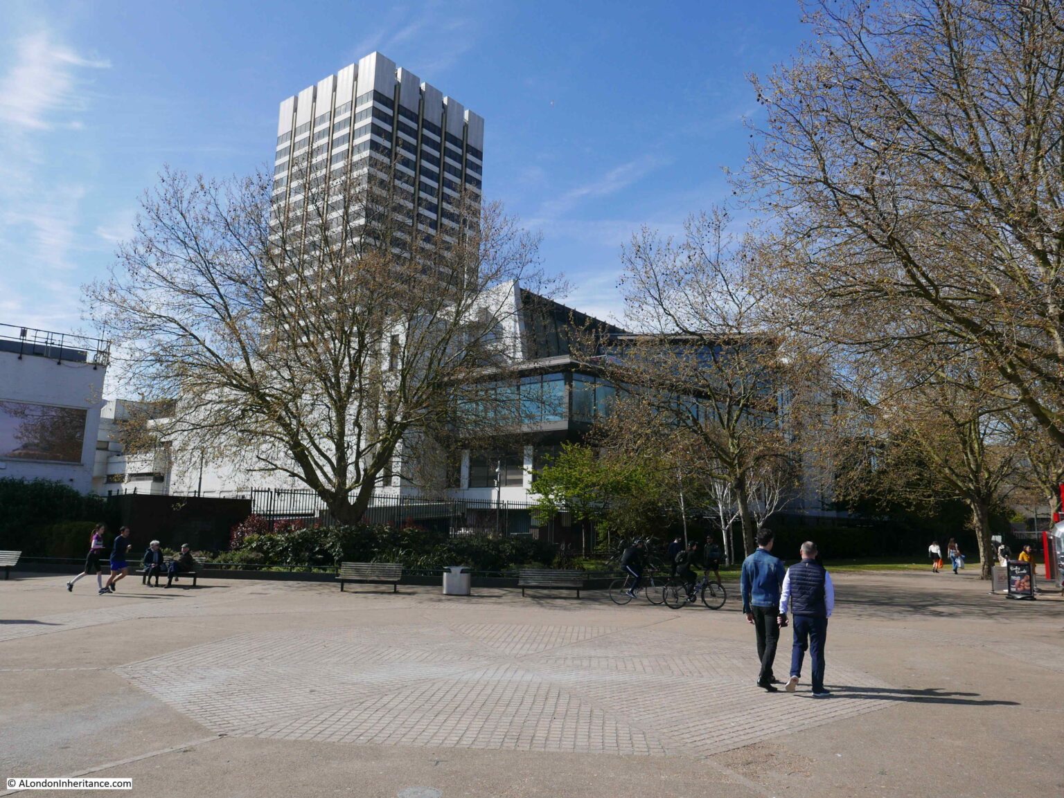
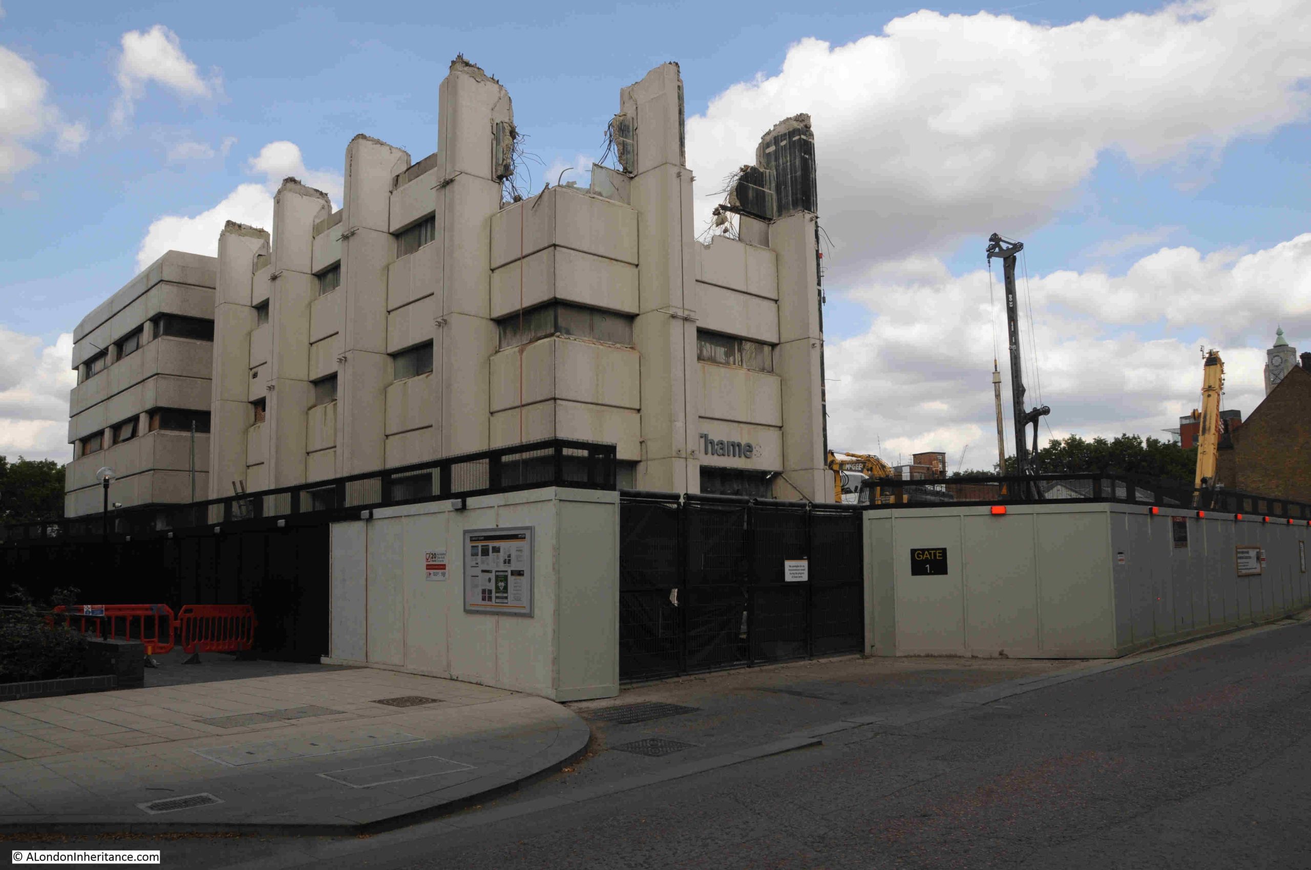
The missing feature is the white, square tower seen in the following photo, behind the right hand yellow crane, covered in scaffolding ready for demolition:
The tower was Kent House / the Southbank Television Centre / the London Studios, the original home of London Weekend Television, and in recent decades of ITV, with much of their national and local output coming from the studios that clustered around the base of the tower.
The building dates from a time when there were two independent TV stations covering London and the surrounding Home Counties. Thames Television broadcast from Monday to Friday, when on Friday evening Thames would handover to London Weekend Television who would broadcast until the following Monday morning.
London Weekend Television (LWT) took over the franchise for providing London’s weekend television service from ATV in 1968, with LWT’s first studios being at Wembley at facilities rented from Rediffusion.
LWT’s intention had been to have their own, purpose built, modern television studios along with space for offices so the company could be located in one place.
A site on the Southbank was available close to the National Theatre, and development of the new studios would continue the westward development of the south bank, and followed the 1944 Abercrombie plan for London which had proposed cultural, offices, residential and open space to replace the old industrial sprawl alongside the river.
The first transmission of TV programmes from the new studios was in 1972, with the site being fully complete two years later.
The tower block was mainly offices, although there was a studio higher up the tower for a number of years, when use was made of the view over London as a backdrop for programmes.
Surrounding the base of the tower were a number of studios used for the production of LWT and wider ITV national output as providing space which other broadcasters could use.
If you have watched almost any ITV live productions, game shows, dramas such as Upstairs, Downstairs, ITV’s World of Sport, BBC shows such as Have I Got News For You, QI, the Graham Norton Show, they were all filmed in the studios at the base of the tower on the Southbank.
The studios were also used by many other production companies and broadcasters.
The tower has been a feature of many of my photos, dating back to the late 1970s. This is a photo from 2017 when it was still occupied by ITV:
This photo from 2022 shows the tower standing in isolation on the Southbank (the Shard is hidden behind the tower):
As the local independent television regions went through a period of change and consolidation, LWT was taken over by Granada in 1994. Carlton Communications had previously won the franchise for the London weekday service from Thames Television, and by 2004 Granada and Carlton merged all their operations which included the many regional operators they had taken over such as LWT, to form ITV as a public limited company.
The studio complex also went through some changes from the South Bank Television Centre to The London Studios.
in 2018, ITV announced that the studios were to be closed allowing the buildings to be demolished to make way for new office and production facilities. ITV’s live broadcasts, mainly their daytime programmes would temporarily move to the old BBC Television Centre at White City as the BBC had moved out with the centre “donut” of offices being converted to apartments, and some of the studios remaining, and available for hire.
Later in the same year, it became clear that ITV would not be returning to any refurbished site, and they would use the studios at White City as a long term resource.
ITV had earlier purchased the freehold of the site from the properties division of the Coal Pension Fund, and I suspect they realised that the site was far more valuable if sold to developers, rather than the costs of refurbished studios and remaining on the South Bank.
The site was sold to Mitsubishi Estate, the Japanese property developer, and owner of a number of buildings across London.
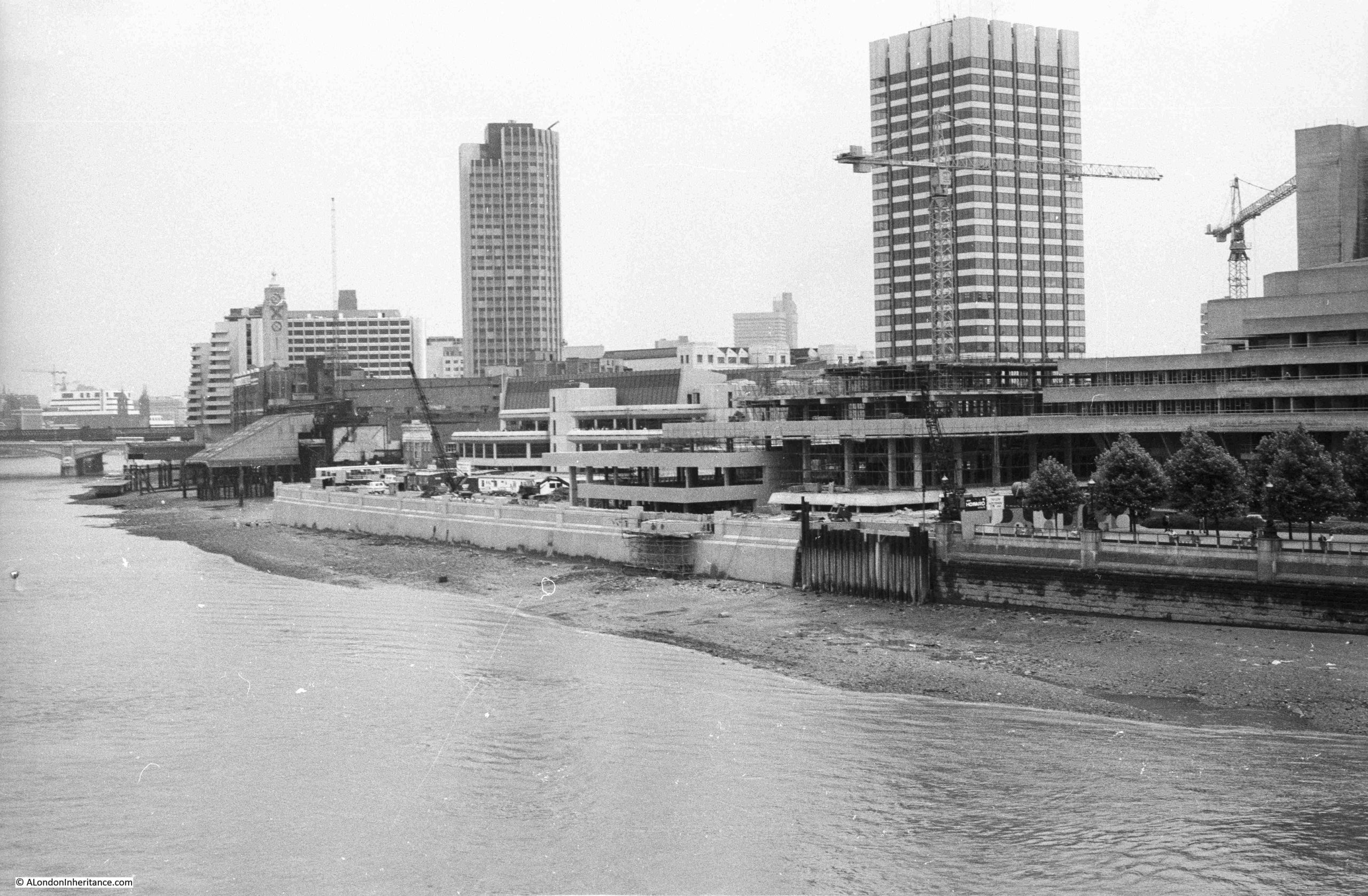
The view as was of the tower and the studios from the Embankment walkway:
The view now that the tower and studios have been demolished:
My first photo of the LWT tower and studio complex was in 1980, from the old walkway that ran alongside Hungerford Bridge:
In the above photo, the tower is towards the back of the complex, with the lower studios surrounding the tower and facing on to the river.
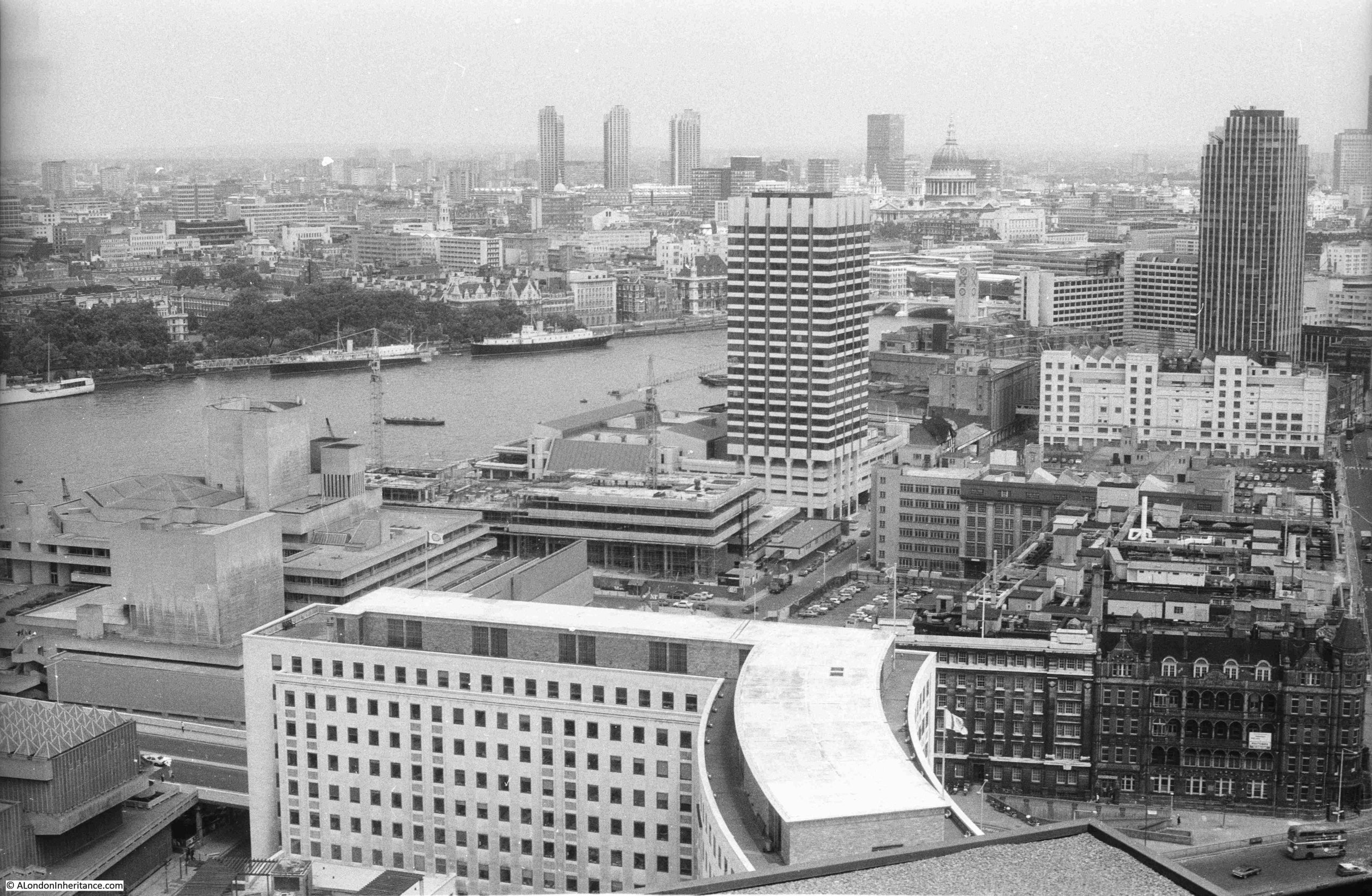
The Embankment wall and walkway was being extended in front of both the LWT studios and the new IBM building which was under construction just to the right of the ITV studios.
A different angle to the above view, further along the walkway, with the studios as the white building, and to the right, the IBM building under construction, a building designed by Denys Lasdun, who had also designed the National Theatre, seen to the right of the photo:
The tower to the left of the above two photos is Kings Reach Tower, formerly the home of IPC Magazines / IPC Media, now extended upwards and known as the Southbank Tower and converted to residential.
There is a bit of a mystery in the above two photos which I will come to later in the post.
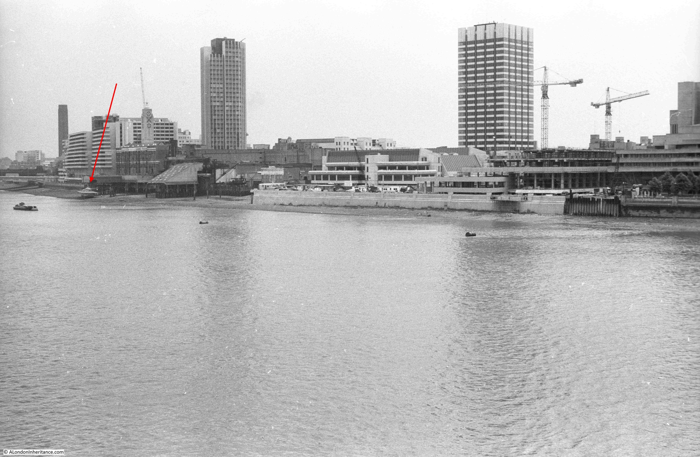
In 1980 I also took the following photo from the Shell Centre viewing gallery looking down on the LWT tower and studios:
As can be seen in the above photo, the tower is a distance back from the river, with low rise studios between the tower and river. The tower faces onto the street Upper Ground, and this was the view from the street of the base of the tower a couple of years ago, with the first scaffolding that would eventually cover the tower:
A look up at the tower from Upper Ground (personally, I think it was a really well designed and visually pleasing building):
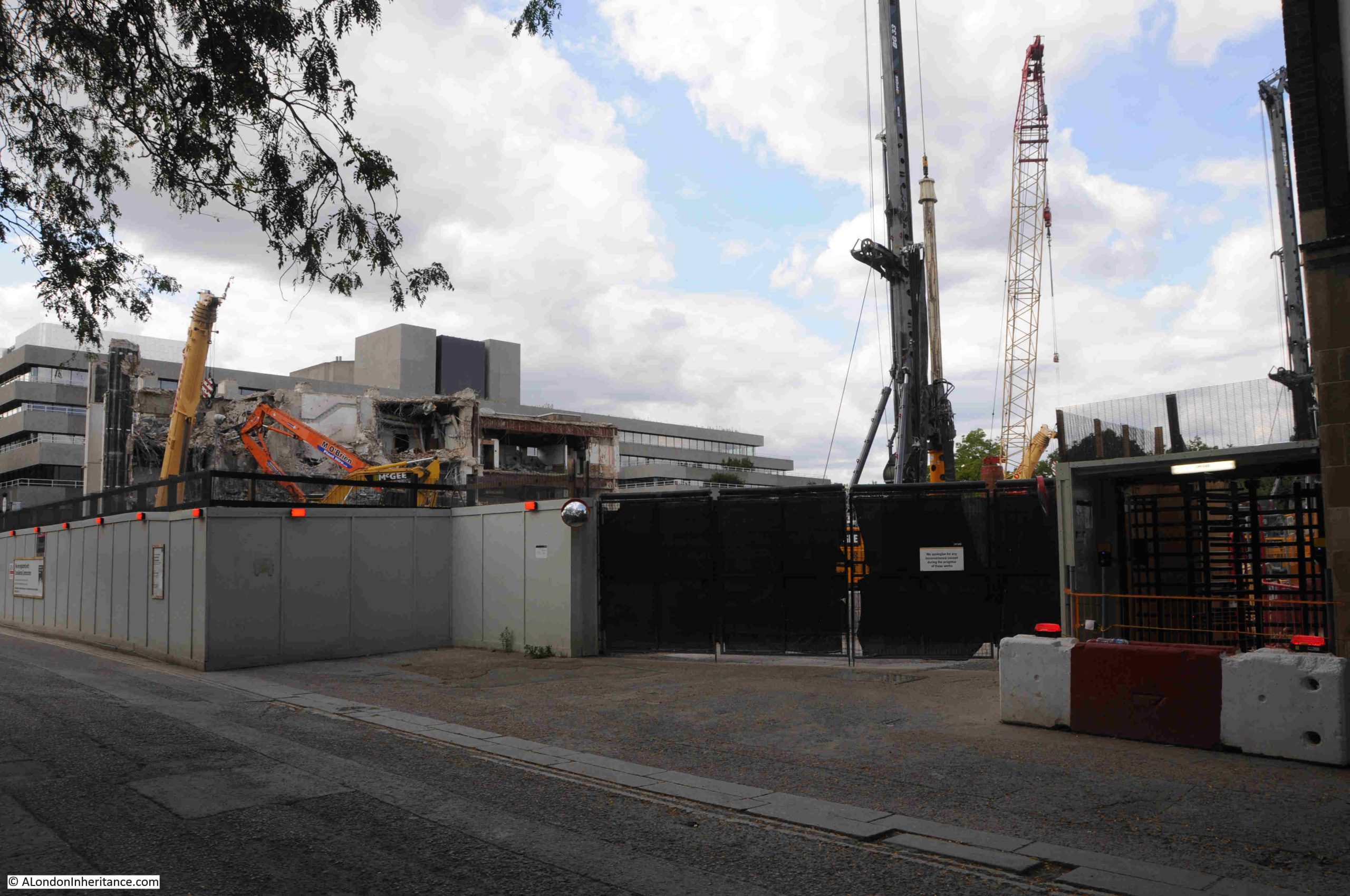
Demolition and development of the site had been delayed due to a large number of objections. Michael Gove approved the proposals at the start of 2024, and the High Court upheld Gove’s decision in December 2024, and the owners of the site then moved quickly to award a £500 million contract to Multiplex to redevelop the site, with demolition of the tower and studios being the first stage.,
A walk along Upper Ground last weekend showed that demolition is now almost complete:
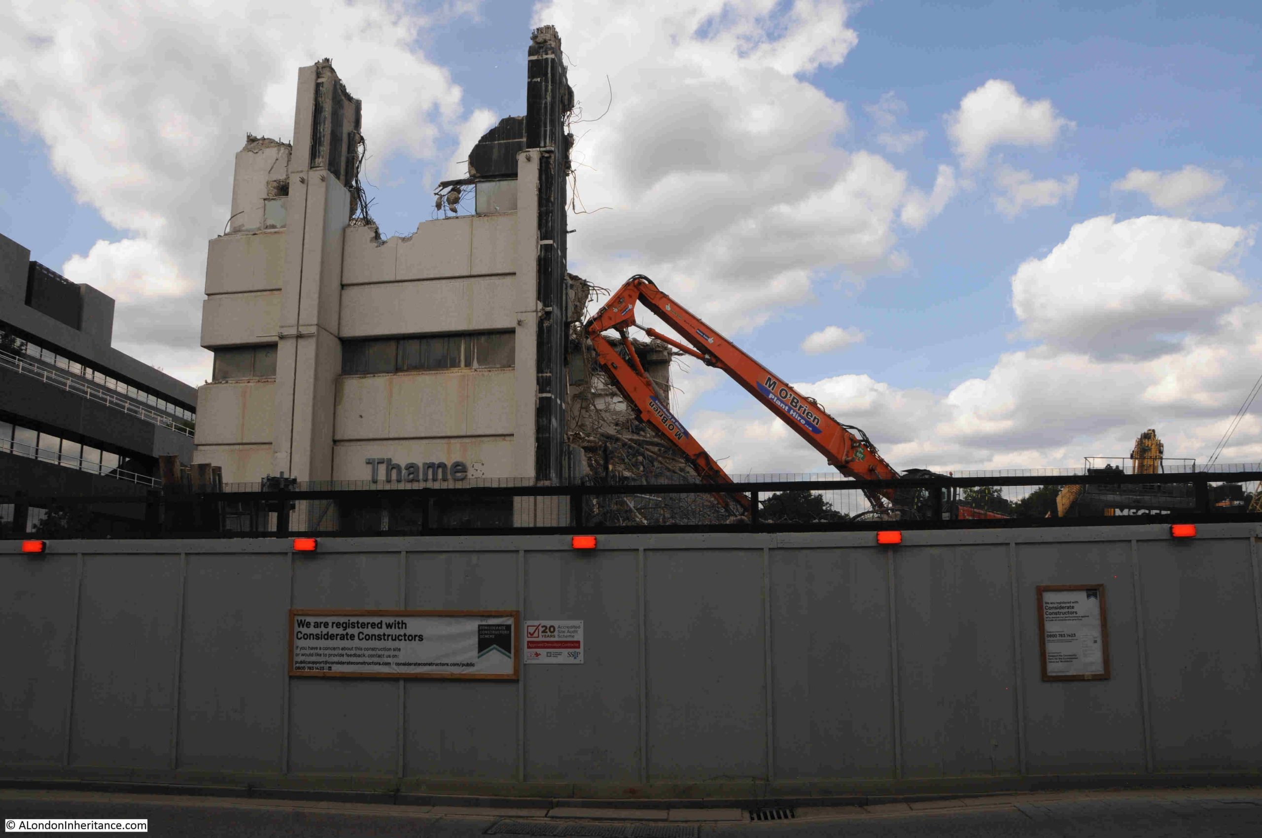
The south west corner of the complex was the only part remaining, and I suspect that by the time you read this, this remaining section will have gone.
In the following photo, the main entrance was underneath the “Thame” lettering. A couple of years ago this was the name Thames Television, as one of the last productions filmed in the building was a recreation of the infamous Bill Grundy interview with the Sex Pistols in December 1976, which had been filmed in a Thames Television studio next to Euston Tower. This was for the 2022 TV mini series on the band.
The remaining section looks almost like the ruins of a medieval castle. When I worked in the area in the late 1990s, it was common to see a queue of audience participants lining up along the base of the left of the building in the following photo, waiting to see what ever was being filmed that evening:
The new development will be very different, and will consist of a 25 storey office building, which will be connected to two further buildings of 14 and 6 storeys.
The space will provide offices and workspace, along with space “tailored to the needs of Lambeth’s emerging creative industries”. There will also be the obligatory open space, cafes, restaurants and a “cultural venue”.
See the page at the following link on the Matrix website (the company responsible for the development) to see an image of what the site will look like after completion, currently planned for 2029:
The image on the above page shows probably the most attractive view of the development, rather than the view looking across the river to the site where the new towers will dominate the area.
The image at the above page does not show the restaurants currently located at Gabriel’s Wharf, so whether these are hidden below the edge of new development, or whether the land will be included in the new development, I do not know.
In many ways, the new development does continue the intentions of the 1944 Abercrombie plan regarding the use of the South Bank. The key issue is the sheer size of the development. If you look along the South Bank there is a reasonably consistent building height from County Hall down to the old IBM building, which has recently been refurbished, and is Grade II listed.
Kent Tower, the tower block of the LWT studios complex was the first tower along this sectionion of the South Bank, and as shown in my 1980s photo, it did stand out. It was though, set back from the river and did not dominate the IBM and National Theatre buildings.
I suspect that the new development will be very different, as will the view from the walkway alongside Hungerford Bridge in 2029.
A Southbank Mystery
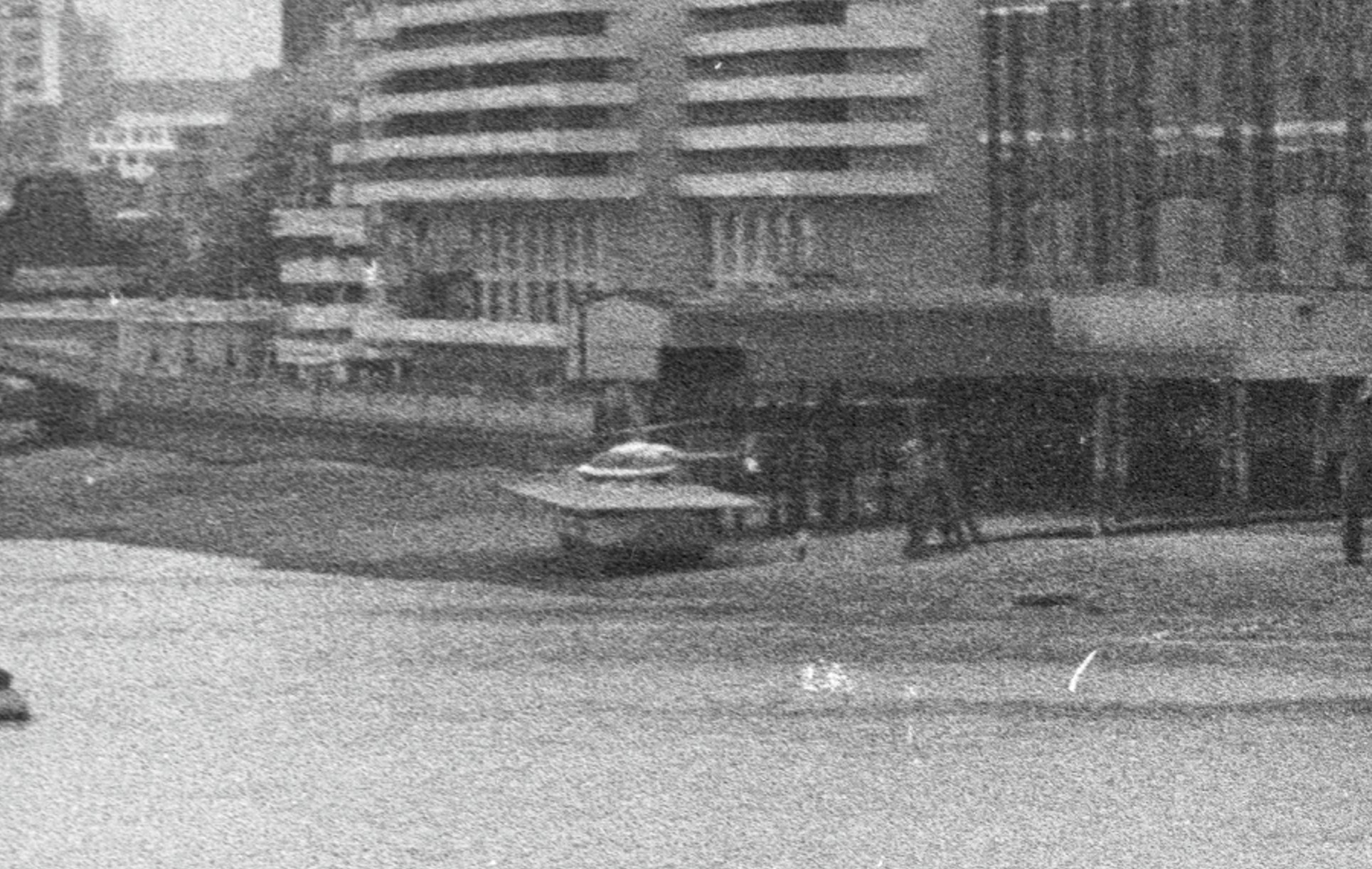
I mentioned earlier in the post that there is a mystery in two of my 1980s photos.
Despite looking at these photos a number of times, there is a feature I had not noticed, and I cannot remember it from the time.
There is something on the foreshore at the end of the red arrow:
On a raised platform above the foreshore is a helicopter, the platform looks to be towards the end of Old Barge House Stairs:
I cannot remember ever seeing or hearing about a helicopter here. The location looks rather precarious, and the platform appears to be below the high tide level.
I did wonder if it was a model, but it looks very realistic in these grainy extracts from my film photos.
Whether it was a one off, temporary, or provided a service for some time, again I just do not know, but it is always interesting to discover stuff I did not know.
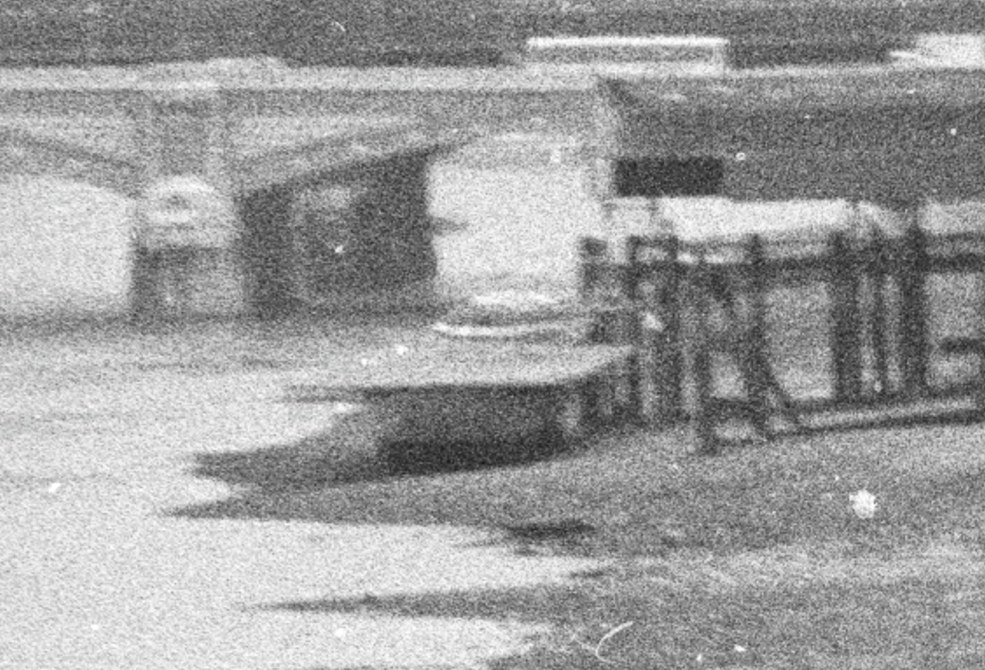
An even grainer view of the helicopter from a different angle:
The southern side of the river has frequently been used for helicopter services.
The London Heliport at Battersea has been providing a helicopter service since 1959, and in the early 1950s, after the closure of the Festival of Britain, where the Jubilee Gardens is located today was the site of a helicopter service linking central London with Heathrow Airport.
You could check for your flight opposite Waterloo Station, board your helicopter, and be speeding above the traffic to the airport.
I found the following Pathe news film about the helicopter service from the South Bank:
Resources – Britain from Above
Continuing my monthly look at the resources available to research and explore London’s history, and for this month I am looking at the Britain from Above website, which can be found here:
Many of the resources I am covering are easy ways to get diverted and spend a whole evening looking at what is on the site, and Britain from Above is another example. There are very many photos covering the early to mid 20th century, not just of London but of the whole country.
The homepage:
The first thing to do is register, which is free. By registering, you are able to go full screen and zoom in to images at much greater detail.
The easiest way to then get started is to enter the name of a location in the Image Ref or Keywords box on the menu bar, and then click search.
This will bring up all photos which fit the search criteria.
To demonstrate, I searched for the Limehouse Cut, the subject of last Sunday’s post, and of the many images available, the following is an example from 1951, which shows the Limehouse Cut, on the left side of the photo, and highlights that this was a very straight canal through former rural land which in the following years had been surrounded by industry and housing. Zooming in allows detail of the industry along the side of the Limehouse Cut to be seen:
Searching for Limehouse Cut also brings up any images with the word Limehouse, and in the same search is this 1928 image of Regent’s Canal Dock. In 1928, the Limehouse Cut still used the original route into the Thames, and by zooming into the photo, this can still be seen, just to the north of the Regent’s Canal Dock (with the later redevelopment of the area, the Limehouse Cut would be diverted into the Regent’s Canal Dock, now known as the Limehouse Basin / Marina):
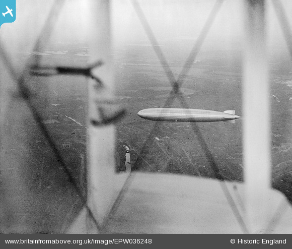
When searching, there are frequently some unusual photographic finds. In the same Limehouse Cut search is the following image of the Graf Zeppelin in flight over Limehouse in 1931, photographed through the wings of the biplane used by the photographer. The Limehouse Cut can be seen below and to the left of the wing. This must have been a remarkable sight for anyone on the ground at the time:
The archive covers much of the country, for example the following image is of St Mary’s Cathedral, Lincoln in 1921:
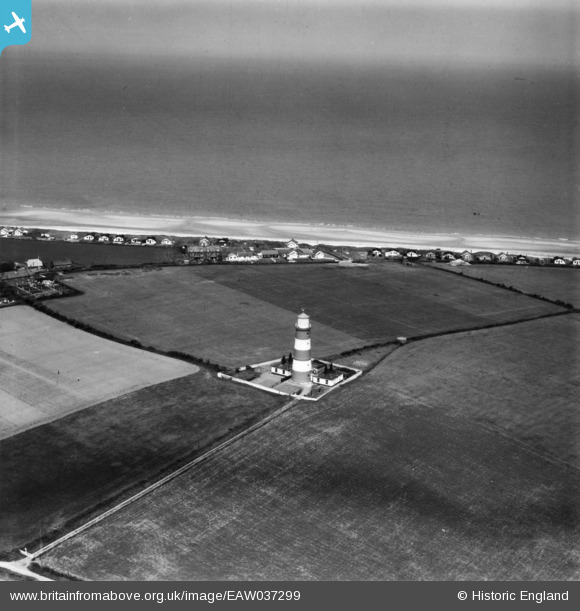
Land changes over the decades can be seen. The following image is of the Lighthouse at Happisburgh on the Norfolk coast in 1951. All those building along the edge have since been lost to coastal erosion.
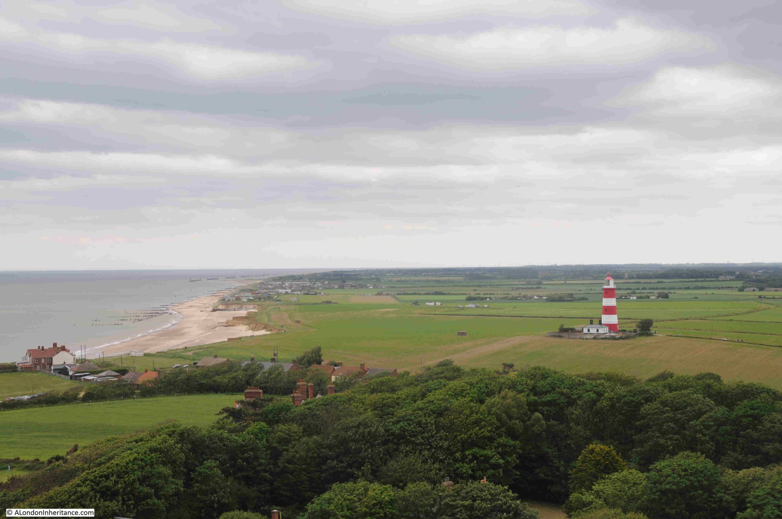
A few years ago, the Happisburgh lighthouse and the nearby Church of St Mary the Virgin, both had open days, when you could climb to the top of bother the lighthouse and the church tower. The following photo from the church tower shows the impact of coastal erosion on this part of the Norfolk coastline:
The Britain from Above archive is a wonderful archive of photos showing London and the rest of the country as it was. The use of photography helps provide an understanding of how places have changed. Aerial photos transforms maps into houses, industry, streets, fields, churches and cathedrals, canals and rivers, the coast, and even lighthouses.
Britain from Above allows reuse of the images, such to very reasonable rules of non-commercial use, no sale, no sub-licensing or use for advertising, making sure the link to the original image is shown and not clipped out of the image, which is really useful for a personal blog such as alondoninheritance.
An image from the site helped with the correct location of one of my father’s photos when I got the original location wrong in a post. Luckily there are readers who know far more about London than I do and provided an indication of the correct location.
Britain from Above is a really wonderful resource.
What I Am Reading – The Sun Rising by Anna Whitelock
The Sun Rising – James I and the Dawn of a Global Britain by Anna Whitelock was a speculative buy after seeing the book, which was published this year, on the shelfs of a bookshop.
The book focuses on the reign of James I, the first Stuart king after the Tudor dynasty came to an end with the death of Queen Elizabeth. A critical time in the country’s history as the Queen had not had any children.
What makes this book different is that it is not just an account of James I, but as the subtitle to the book highlights, it is about Great Britain starting to play catch up with other European powers such as the Netherlands, Spain and Portugal, in establishing networks of world trade.
London does feature heavily in the book, not just with accounts of the processions through the City, but also as the place where many of the trading companies were established to further trade with the rest of the world.
The book does cover domestic events, such as the Gunpowder Plot, trying to unify England and Scotland, Protestant – Catholic conflict, and James’ attempts at trying to unify European Christian powers etc. but the clear emphasis is on Britain’s global trade.
There is the Virginia Company of London, trying to establish settlements in the US, the Plantation of Ulster, the Muscovy Company and the East India Company. Trade with the Shah or Persia, early trade with India.
William Adams from Gillingham, and apprenticed in Limehouse features as a key player in attempts to trade with Japan. See my post on Adams, here.
Pocahontas arrived in London from Virginia, and was taken seriously ill near Gravesend at the start of her return journey. She died in 1617 and was buried at Gravesend.
Although the British trading companies focus was trade, not taking land, we see the start of how this would develop with the first African slaves arriving in the Virginia Plantation in 1619 – the start of the triangular slave trade between Britain, Africa, the Caribbean and America.
We also see the failure in the management of the colony at Virginia by the Virginia Company of London leading the the take over of the land and colony by the Crown – again a sign of what would take place across the world in the coming centuries.
What I did not realise was just how far and how extensive, the network of trade was at the start of the 17th century. Attempts to trade in with Persia, India, the far East, to China, Japan and the Spice Islands.
Some of the horrors inflicted on indigenous populations in the name of trade are covered, including the Dutch massacre of thousands of Bandanese people (on one of the Banda Islands, now part of Indonesia and the source of large quantities of nutmeg, mace and cloves).
My fascination with Thames Stairs and the river includes the lives of people who have travelled out from the stairs and the river on journeys across the world, and this book is full of them – ambassadors, traders, explorers, and settlers – it is quite remarkable how extensive these journeys were in the early 1600s.
The book is a really good read, and helps to provide an understanding of how Britain’s early steps in global trade would develop over the following three hundred years, and many of the horrors that went with this expansion.
And at its root was money. King James I for the revenues that trade would bring to the Crown, and the London trading companies, for the profits of trade. It always comes down to money.
Thanks for the feedback to last week’s post where I had used plaque rather than plague. I think I was being a bit too quick with a spelling check. All hopefully now corrected.
I do not usually cover topical issues in the blog, however today’s post looks at a site which could well have a controversial transformation in the coming years, as well as a bit of the history of the site.
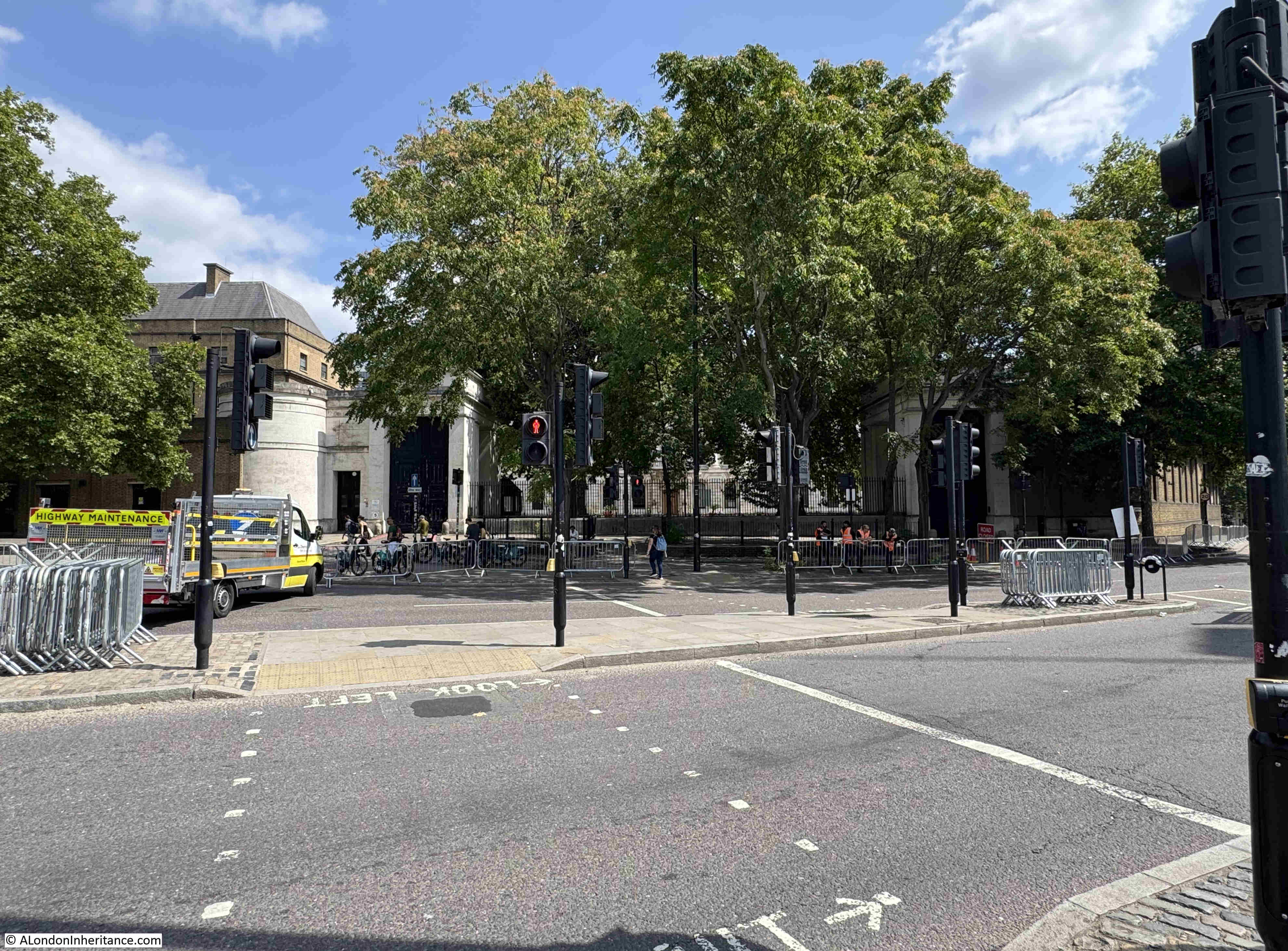
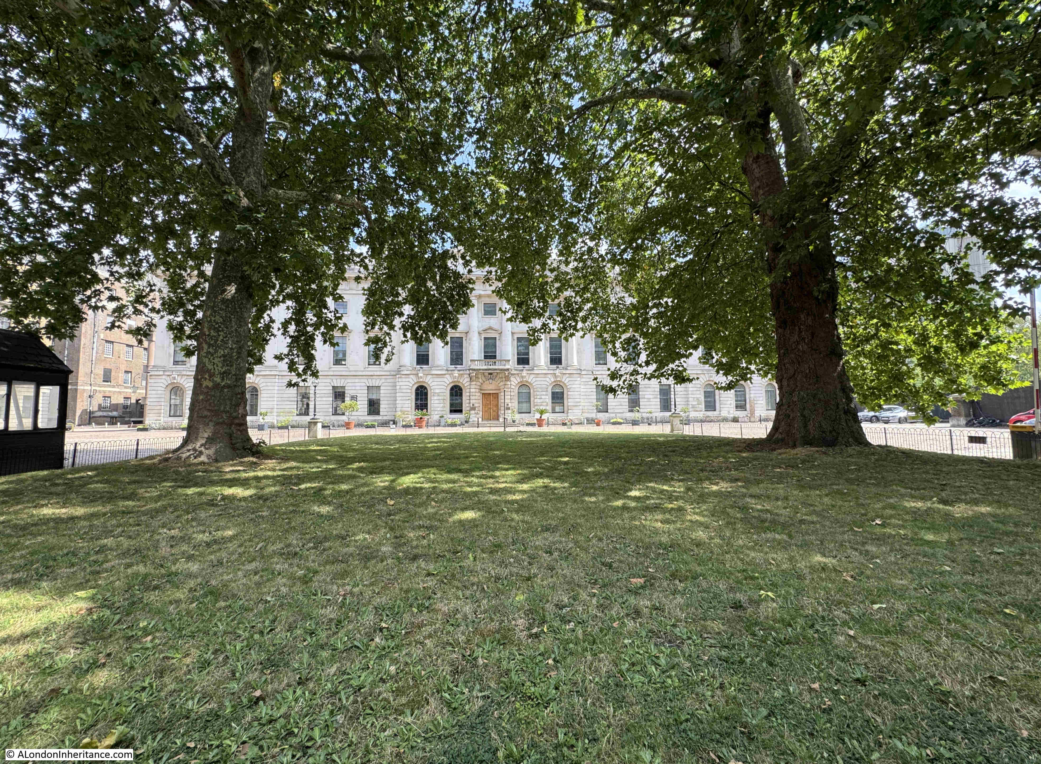
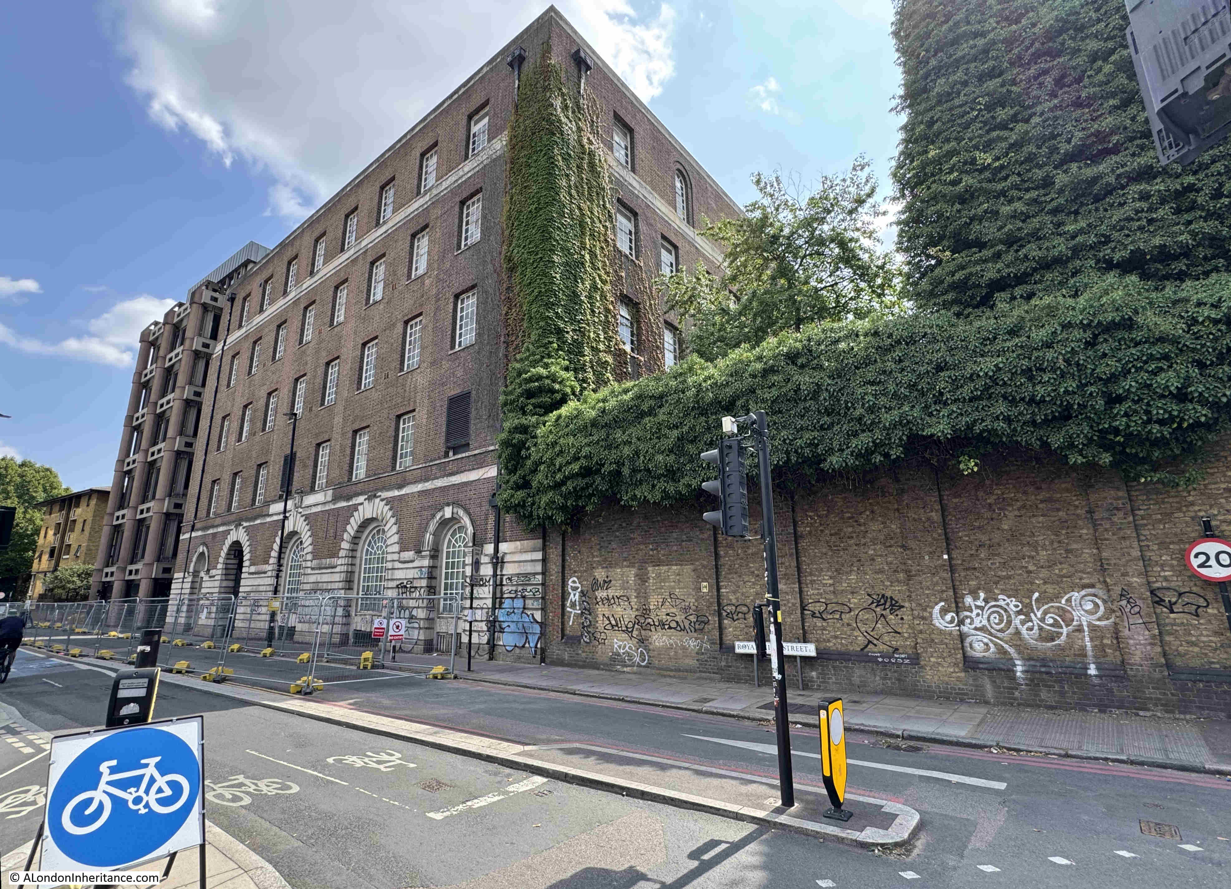
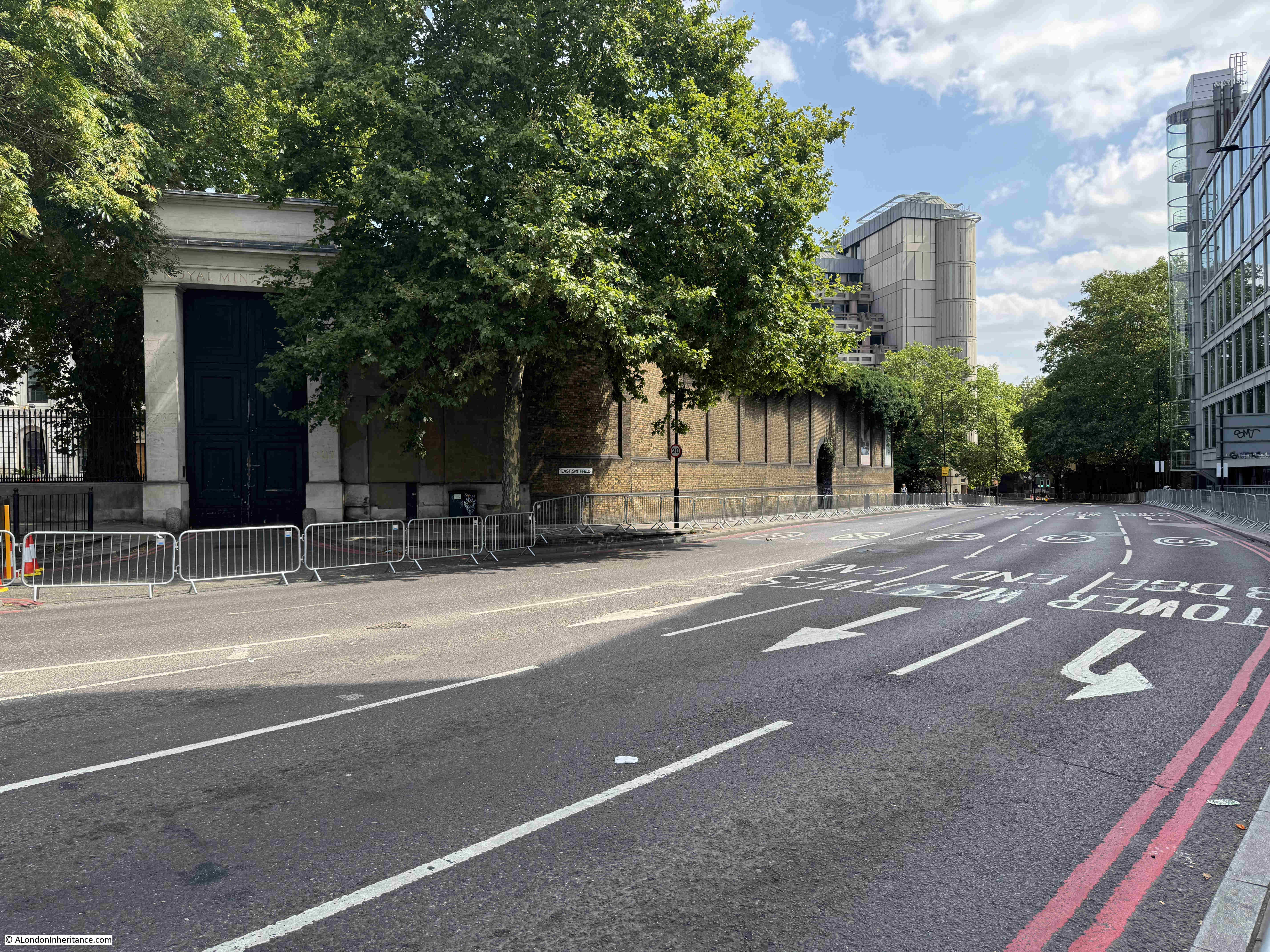
This is the tree hidden view of the old Royal Mint building, looking across East Smithfield:
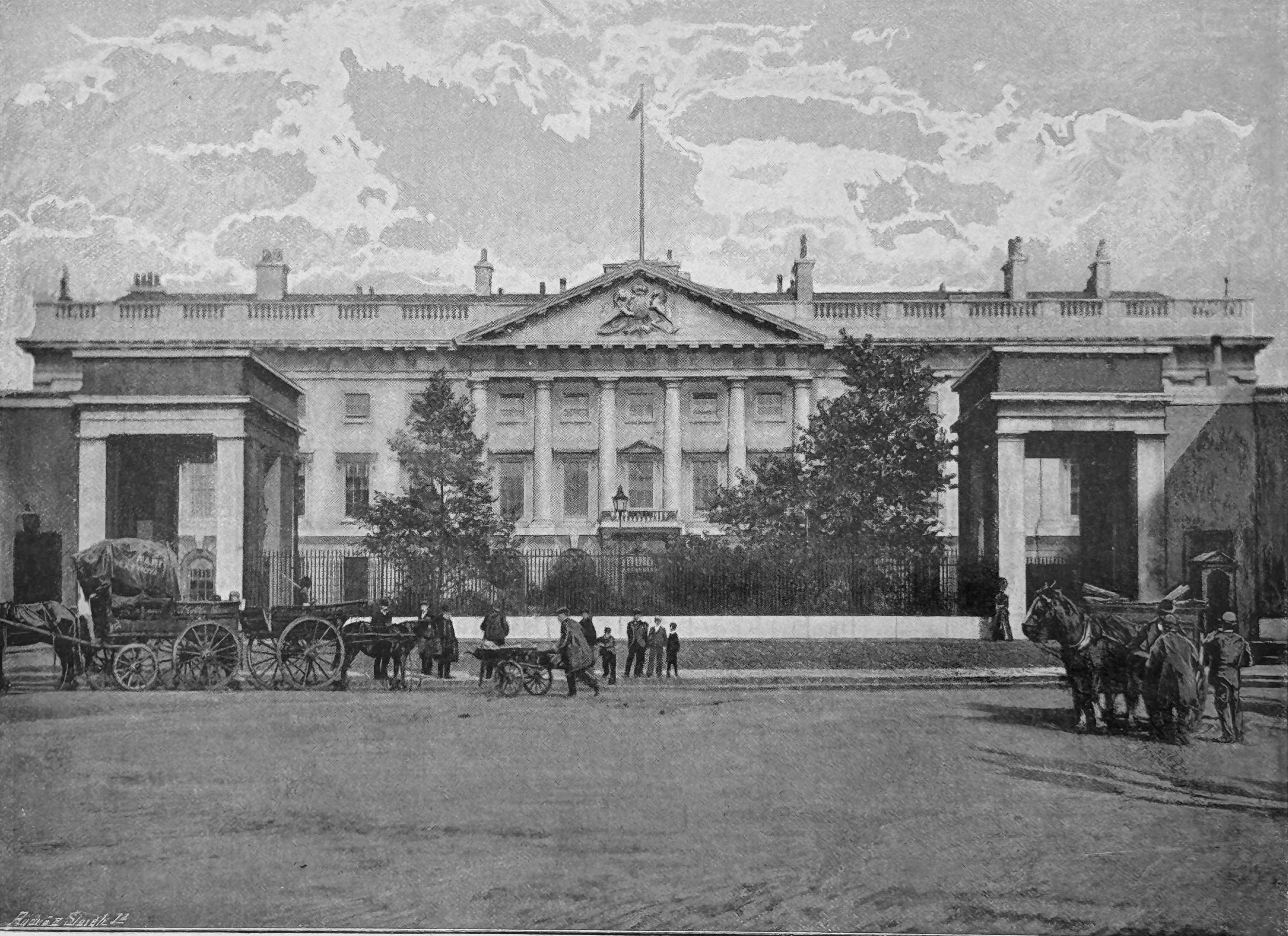
The 1890s book “The Queen’s London” has a much clearer view of the building. I assume the two trees we see in the following image will grow into the two we see today:
The story of the Royal Mint goes back many centuries, and for much of the time, the Royal Mint in London was based within the Tower of London. A suitably secure place for the minting of the nation’s coinage.
By the end of the 18th century, steam power was taking over many industrial processes, and with the country’s growing international commerce, much of it based around the London Docks, the demand for coinage was growing.
The Tower of London was far too small a site to accommodate the new steam technology that could be used for the manufacture of growing amounts of coinage.
In 1798, King George III appointed a committee of the Privy Council to look into the future of the Royal Mint and the committee decided that a new location and building was required.
The site would, ideally, still be within central London and close to the Tower of London, and also where a sizeable amount of land was available.
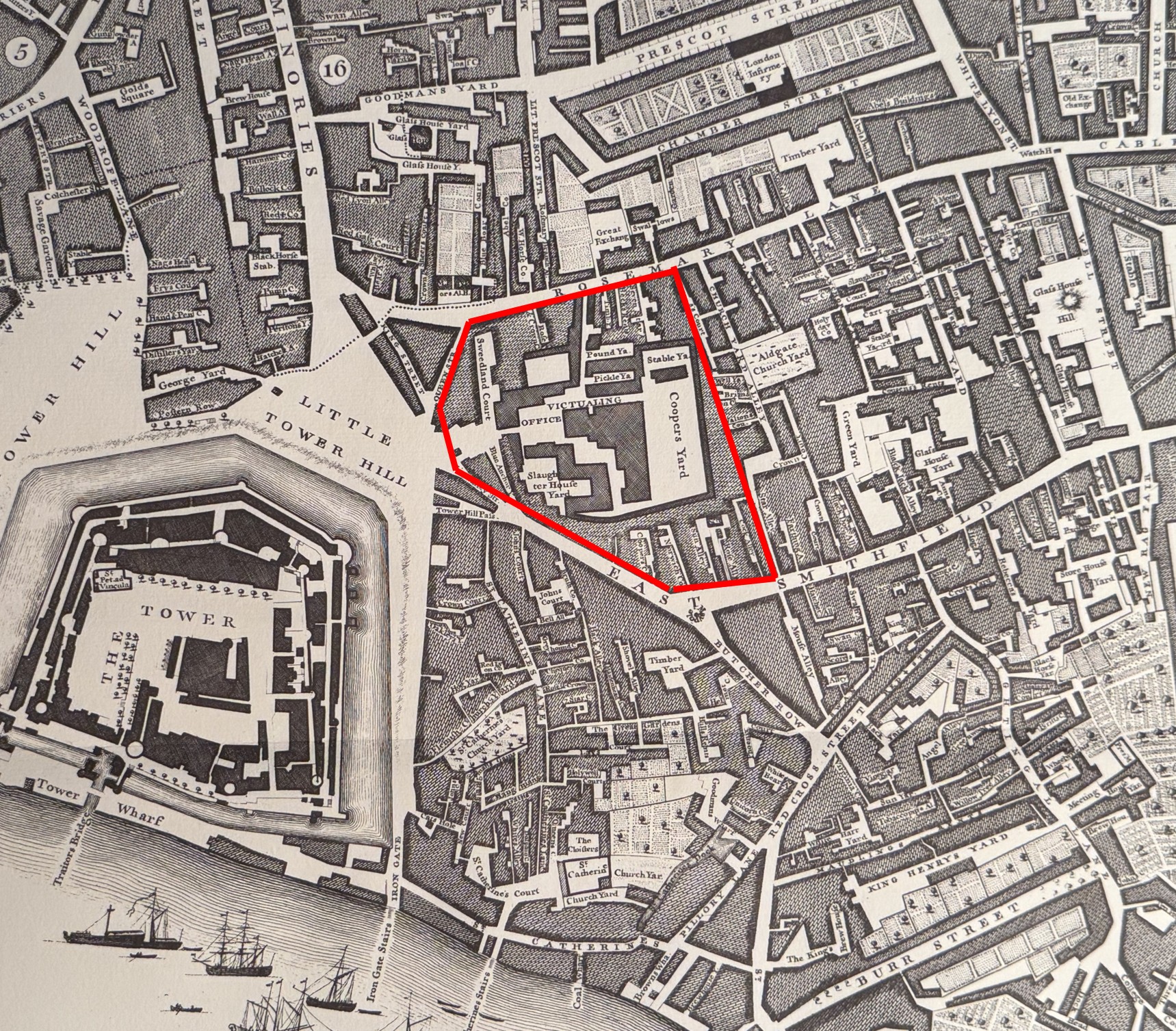
One such location was just to the north east of the Tower of London, a site which consisted mainly of a Royal Navy Victualling Yard, along with a number of small side streets, courts, workshops and housing.
I have marked the area which would become the site of the Royal Mint on the following extract from Rocque’s 1746 map of London, where it can be seen that the Victualling Yard occupied a large amount of the future space of the Royal Mint. The map also shows the size of the future site compared to the Tower of London, the Mint’s original home where only a proportion of the space was available to the Mint:
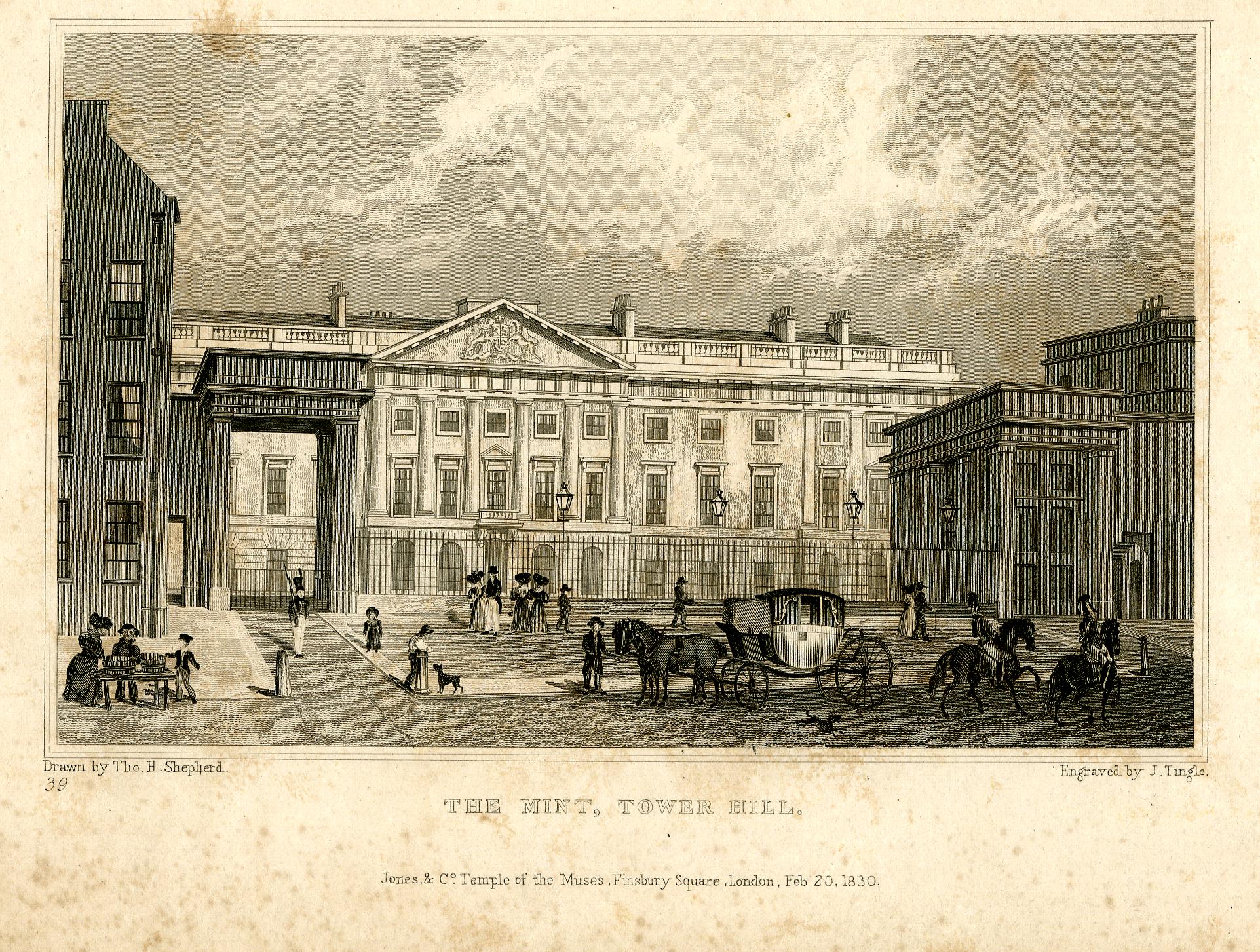
It took a while to clear the site, plan the new Mint and complete the build, and it was finally complete in 1809, with the Royal Mint moving out of the Tower of London, where it had been since 1279 when a small Mint was first established within the secure walls of the Tower.
The new building was the work of surveyor James Johnson along with his successor Robert Smirke.
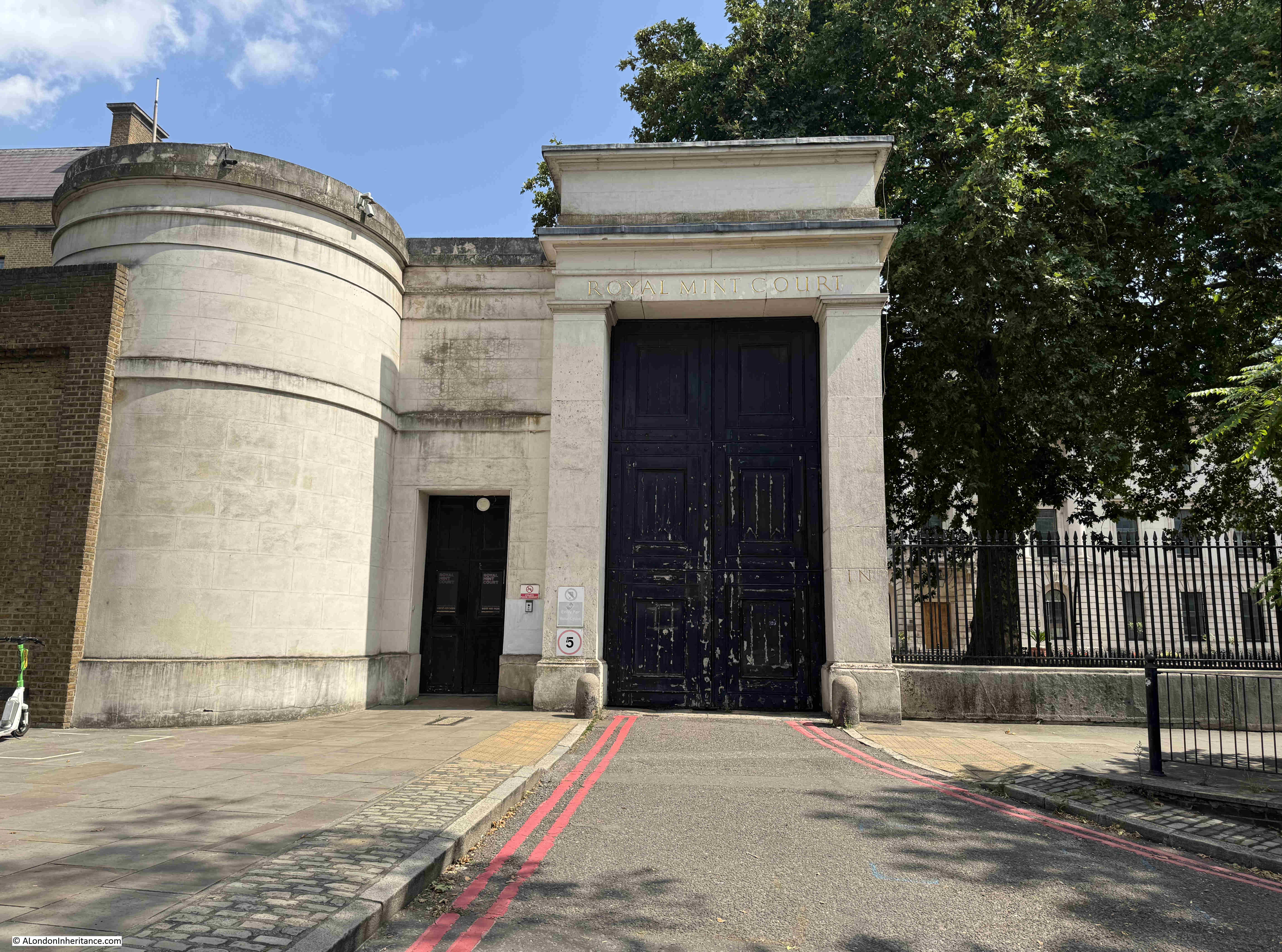
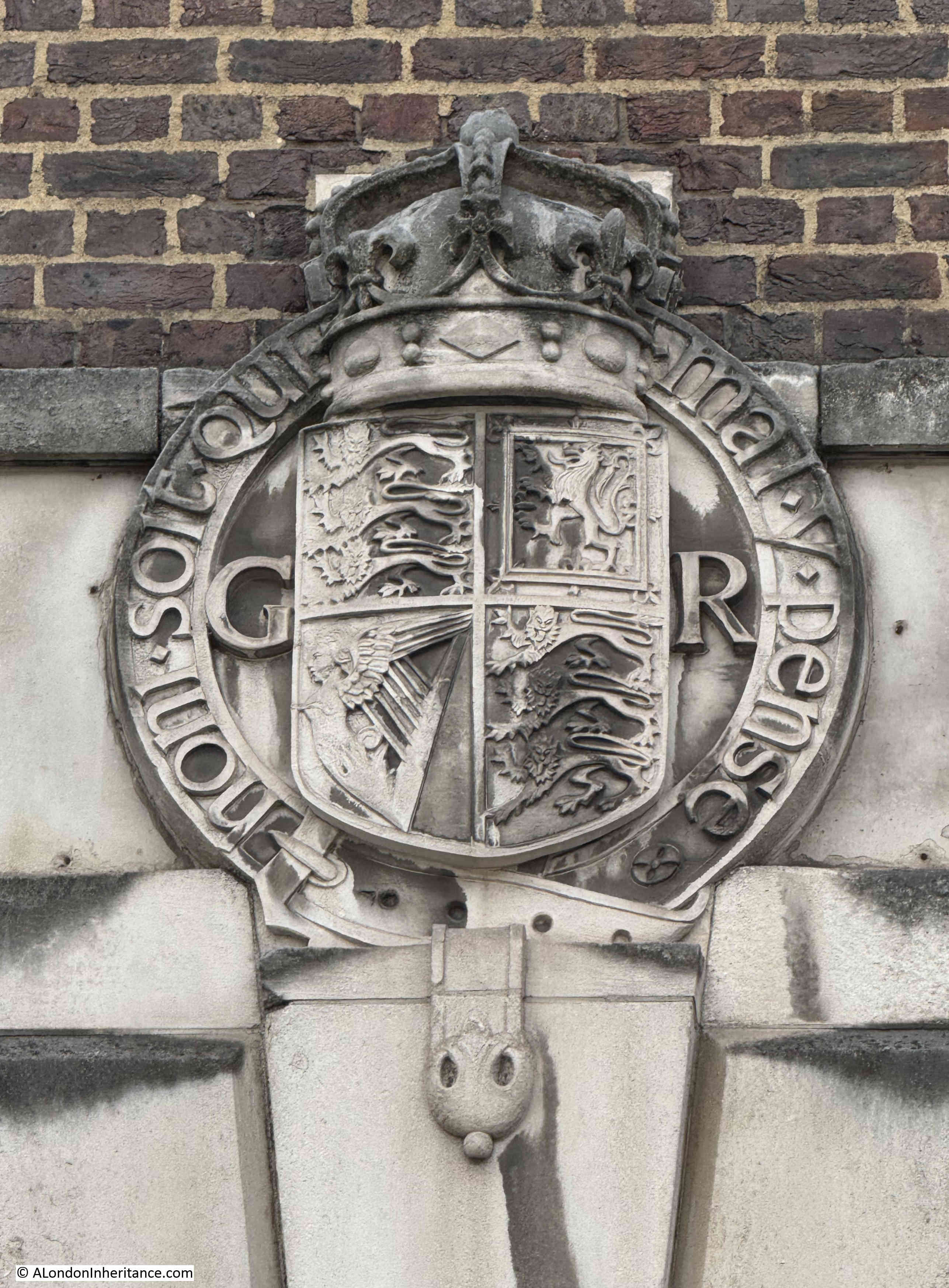
The main Royal Mint building is Grade II* listed, the white entrance arches and lodge to either side are Grade II listed.
The early 19th century building is the main visible part of the complex (only just visible between the trees), and there is far more to the site as it expanded and adapted to post Royal Mint use over the years.
Looking through the railings, we can get a slightly better view:
I have a bit of a thing about the placement of some trees in London. Whilst I certainly believe that many more trees are needed across the city, there are some where they obscure the original view intended by the architects of a building. The Royal Mint building is a prime example, another is the Royal Festival Hall where the trees on the walkway in front of the building obscure the view of the Royal Festival Hall from across the river (see this post).
The Royal Mint was at Tower Hill until the Mint started to move out of the Tower Hill location in the late 1960s. Production of new decimal coinage along with a growing business producing coinage for other countries required a larger site, and in 1968, Queen Elizabeth II opened the new Royal Mint works at Llantrisant, South Wales, and the last coin was produced at Tower Hill in 1975.
Not everyone was happy to see the Royal Mint leave London, for example an H.J. Arlett of Peckham wrote to the London Evening News on the 1st of September, 1967:
“The business of producing coinage by the Royal Mint has now expanded to such an extent that it is proposed to move to a larger site in Glamorganshire. Why?
Why not keep this Chief Department appropriately enough in our Capital City? Subsidiary departments can always be opened in other areas should the need arise. Why should the defacement of this interesting capital of ours be allowed to continue and prove to the detriment of overseas visitors and our places of interest.
Which of our landmarks will be next, the Bank of England, the Royal Exchange, the Mansion House? How long before the Tower of London becomes another tower of Blackpool.
Let us keep our capital a centre of interest, not just blocks of offices.”
Questions about London’s purpose and future have probably been asked for as long as London has been the Capital City of the country.
Since the Royal Mint left the building, it has had a number of uses, including office space and I remember that a number of tech start-ups were based there in the late 1990s early 2000.
The controversial transformation I alluded to at the start of the post is the future use of the old Royal Mint site, with China planning that the whole site will become their new Embassy complex, having purchased the site in 2018 for £255 million.
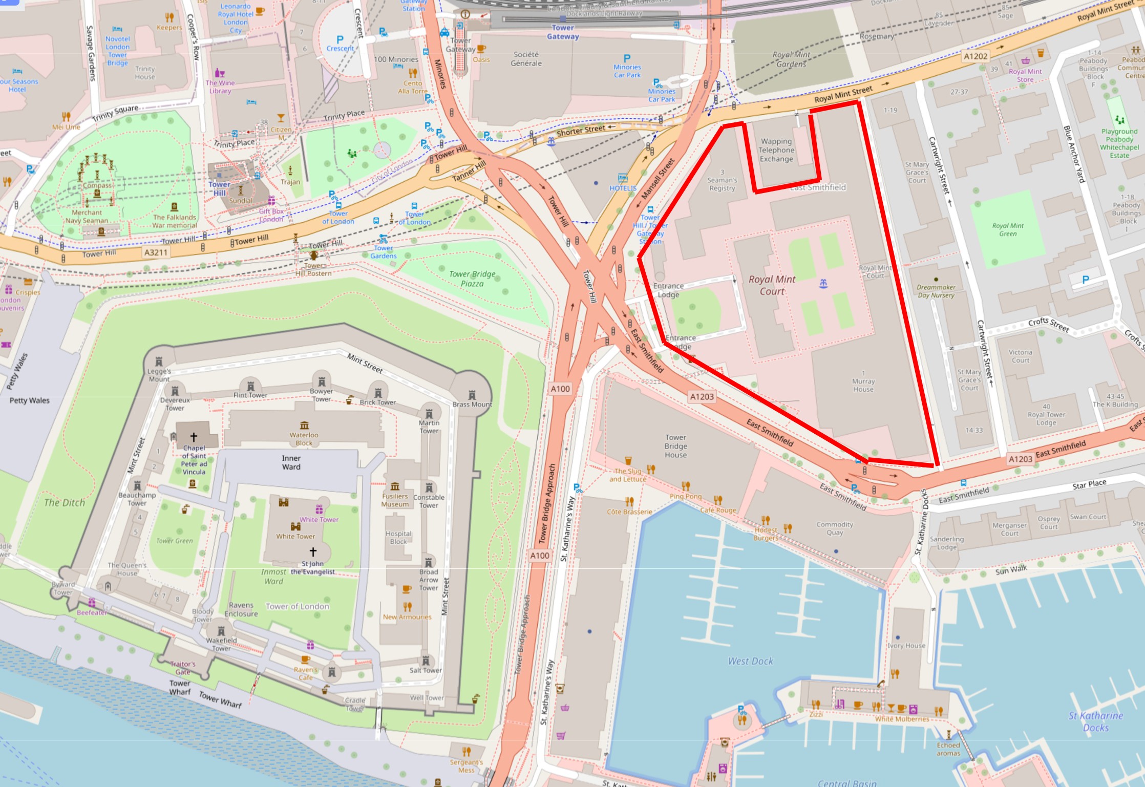
The site is a considerable size of 2.10 hectares or over 5 acres. It comprises the original building that faces on to Tower Hill, as well as a complex of 1980s buildings onwards that were built around the site as it was used for office space. There is also the Grade II listed Seaman’s Registry, designed by James Johnson and built in 1805 as staff accommodation for the Royal Mint.
The site also contains some preserved remains of a Cistercian Abbey, the St. Mary of Graces monastery which date from the 14th century (which also illustrates how many religious establishments there once were in London, as just to the south, where St. Katherine Dock is now located, was the St. Katherine Hospital and Church, founded in the 12th century by Matilda, Countess of Boulogne, the wife of King Stephen who reigned from 1135 to 1154).
There is also a 14th century Black Death burial ground, many other archaeological remains as well as remains from the Royal Navy Victualling yard which occupied the site prior to the Royal Mint.
The overall scope of the site is shown in the map below where I have marked the planning application boundaries with the red line. The square indentation along the northern boundary is a BT telephone exchange. When three letter codes were used as part of the telephone number, this exchange was ROY for ROYal, due to the exchange’s location next to the Royal Mint.
The telephone exchange is apparently due to cease all operations in 2033 and to be empty the same year. Its future use will be interesting given the location of the building as being almost part of the proposed Chinese Embassy estate:
To add to the importance of the site, it is within the Tower of London Conservation Area and is also within the boundary of the Tower of London UNESCO World Heritage Site.
The proposed embassy would not only be the largest embassy complex in the UK, but would also be China’s largest embassy in Europe, as well as being around 20% larger than their embassy in the US.
The proposed plans for the embassy complex include some very limited public access, as well as a small area for historical information and interpretation displays and exhibits.
The planning application has been turned down by Tower Hamlets Council, and the current status is that the application has been called in by the Government and is now under review by Angela Ryaner who oversees planning matters in her role as housing secretary.
The latest from early August is that Angela Raynor has asked the Chinese to explain why parts of the building plans are greyed out and marked “redacted for security reasons”.
The Grade II listed entrance arch and lodge:
There are very valid views on whether the site should be used as an embassy for China, and also why China needs such a large complex for their London embassy, but I also think that the future use of the building shows the lack of ambition (and money) that we have as a country, for the use and redevelopment of such an important site, at a very key location.
The clustering effect of the Tower of London, Tower Bridge, St, Katherine Docks and the old Royal Mint buildings would make the site ideal for redevelopment for cultural / historical use, even with the redevelopment of some of the buildings at the rear of the estate as residential to help fund, it would preserve the listed James Johnson and Robert Smirke building and the Seaman’s Registry for public use.
It would also have been aa brilliant location for the Museum of London (although the Smithfield site is equally good), and perhaps this shows the challenge of a City where too many historic sites such as Smithfield Market, the old Customs House in Lower Thame Street etc. are looking for a future use, and in reality is an embassy so very different to the site being redeveloped with apartment blocks and hotels, which would probably be the alternative.
This was part of the original intention for the site after client funds of two real estate investment companies had purchased the site from the Crown Estate in 2010, and who then received planning permission for new retail and leisure accommodation, 1.8 acres of landscaped public space, and a large amount of high specification office space.
The owners received an unsolicited offer from China in 2018, and it was probably too good an offer to refuse.
View looking along Mansell Street, the north western boundary to the site, with part of the brick Seaman’s Registry building visible along with 1980s additions:
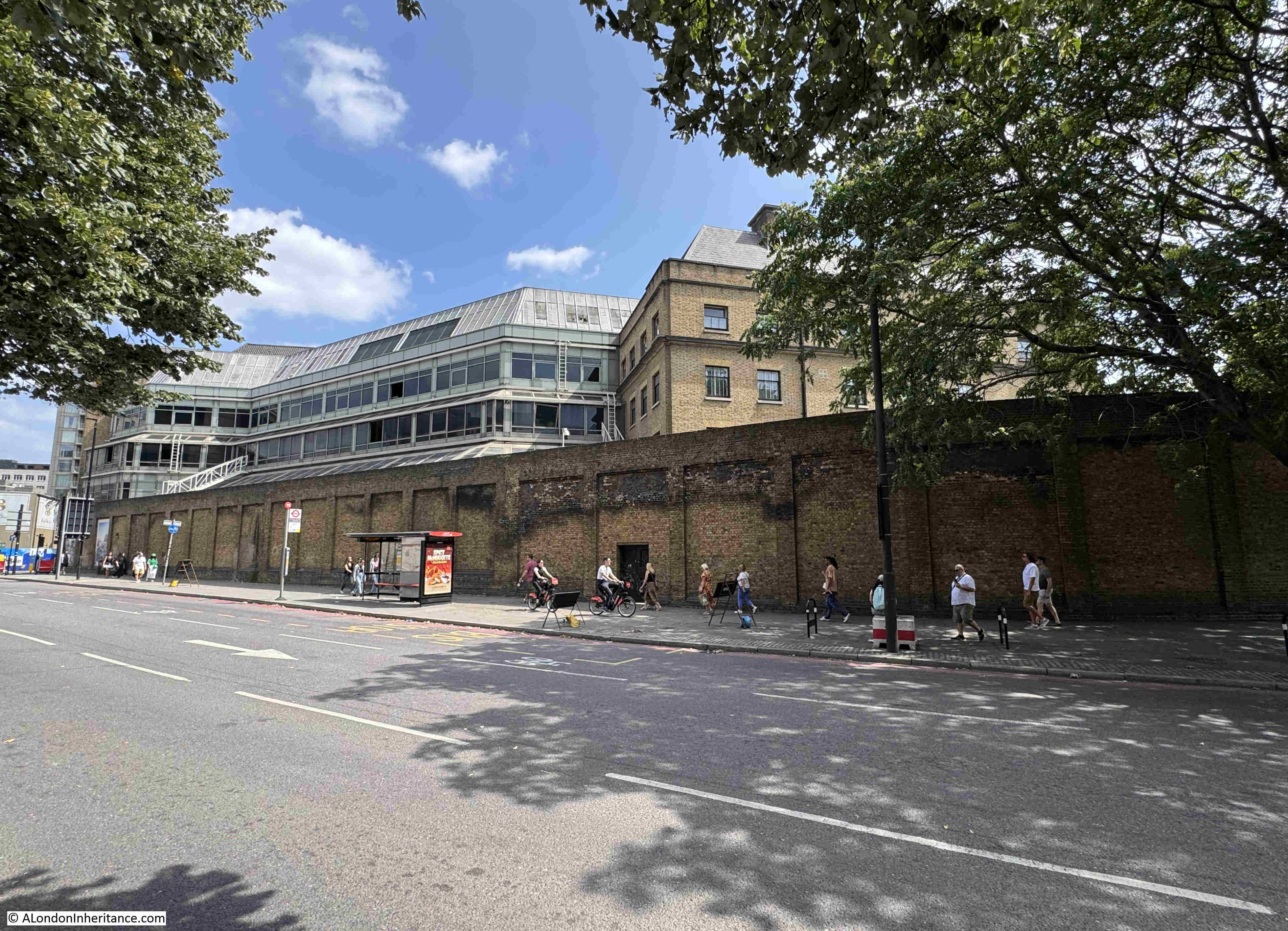
The high brick wall seen in the above photo still surrounds much of the site, and was there to prevent access to a place where large amounts of coinage, gold and silver were being stored and processed.
Despite the walls intended to keep people out, much of the reported theft was by employees, and the following from the London Dailey Chronicle in November 1912 is typical of the small amounts of theft by employees of the Mint:
“THEFT FROM THE ROYAL MINT. A sad story of the downfall of a trusted employee at the Royal Mint was told at the Thames Police court yesterday, when Charles James, aged 55, a foreman packer, was sent for trial on a charge of stealing silver coins to the value of over £36.
James, it was said, had been 29 years at the Mint, and next year would have been entitled to retire on a pension. His salary was £2 a week, with 6s. extra for searching suspected persons.
He was seen by a packer to plunge his hand several times into bags of worn silver coins which were being emptied, and £36 3s 6d was found in his pockets. When accused James said, ‘I must have been mad’. He was stated to have recently been ill, and to have borne an excellent character. Bail was allowed.”
The following photo is along Royal Mint Street, along the northern boundary of the complex, and the tall brick building where the wall ends is the old Telephone Exchange:
The GR cypher on the arms on the building indicate that it was built in the reign of King George V, between 1910 and 1936:
The Royal Mint at Tower Hill was used for many other related purposes, not just for the production of coinage.
Go back to the end of the 18th century, and Britain was a country with a growing trade with the rest of the world. One of the problems with trade was knowing what you were actually buying from a producer in another country. France had only just started to use the metric system at the end of the 18th century, and the rest of the world used a number of different, localised systems.
In 1819, the Government tried to take the lead in establishing the relationship between weights and measures of different countries, and this work was to be done at the Royal Mint on Tower Hill. From the Morning Herald on the 6th of February 1819:
“The commercial world will learn with satisfaction that a plan has been commenced, under the auspices of the British Government, for determining the relative contents of the weights and measures of all trading countries. This important object is to be accomplished by procuring from abroad correct copies of Foreign standards, and comparing them with those of England at his Majesty’s Mint. Such a comparison, which could be effected only at a moment of universal peace, has never been attempted on a plan sufficiently general or systematic; and hence the errors and corrections which abound in Foreign tables of weights and measures, even in works of the highest authority.
In order, therefore to remedy and inconvenience so perplexing in commerce, Viscount Castlereagh, has, by recommendation of the Board of Trade, issued a circular directing all the British Consulates abroad to send home copies of the principal standards used within their respective consulates, verified by the proper authorities, and accompanied by explanatory papers and other documents relative to the subject. The dispatches and packages transmitted are deposited at the Royal Mint, where the standards are to be forthwith compared.”
Looking along East Smithfield, the street that forms the southern boundary to the Royal Mint estate, part of the upper floor of the James Johnson and Robert Smirke building can just be seen:
As well as the metals used for day to day coinage, the Royal Mint was responsible for measuring the quality of, and the production of gold and silver coins.
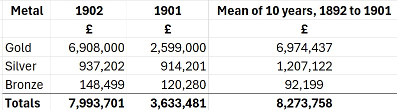
All coinage minted at the Royal Mint was sent to the Bank of England for distribution, and the Royal Mint issued an annual report on the quantity of types of coins and metals that they had produced, as well as coins that had been returned to the Royal Mint as worn or withdrawn. In the 1903 report, the Royal Mint stated that they had produced in the previous two years:
These numbers may not look large by today’s standards, however using the Bank of England inflation calculator, £7,993,701 as the total for 1902, would today be £851,292,858 (although this is not an easy comparison, as the value of different metals such as Gold have changed in a different way to inflation).
The report also includes details of the significant amounts of gold and silver that were being brought into the country as well as being exported.
There were complex rules for those involved with the smelting of precious metals such as Gold at the Royal Mint. These once included not allowing workers out of their work place for the entirety of their shift, and only releasing them to go home when the amount of gold had been checked against that at the start of the shift, with the worker then being issued with a certificate releasing them from their day’s work.
Whilst today Gold coins are not in common usage, they are still produced at the Royal Mint’s south Wales facility, although this is mainly for investment and collecting purposes.
You can today buy a quarter ounce Britannia Gold bullion coin (999.9 fine gold) for £680. The Royal Mint also produces Gold bullion bars, however if you sell, these are subject to Capital Gains Tax, whilst Gold Bullion coins are exempt from CGT due to their classification as legal British currency, although the £680 Britannia Gold bullion coin has a denomination of £25, so I doubt you will get one of these in your change, the value today being aligned with the metal of the coin rather than the denomination.
The view looking east along East Smithfield, the tall building on the left of the street is part of the Royal Mint estate, and is planned to be demolished, and replaced by a new building that runs along the eastern side of the estate:
Although a large site, the growth of the Royal Mint has raised questions about the location over many years. In 1881 there was the possibility of moving to a site on the Thames embankment, which had been completed in the previous decades. This proposal was turned down by the Select Committee on the London City Lands Bill who determined that the existing site and buildings were more than sufficient for the demands likely to made on the Royal Mint, with a few alterations made to the existing buildings.
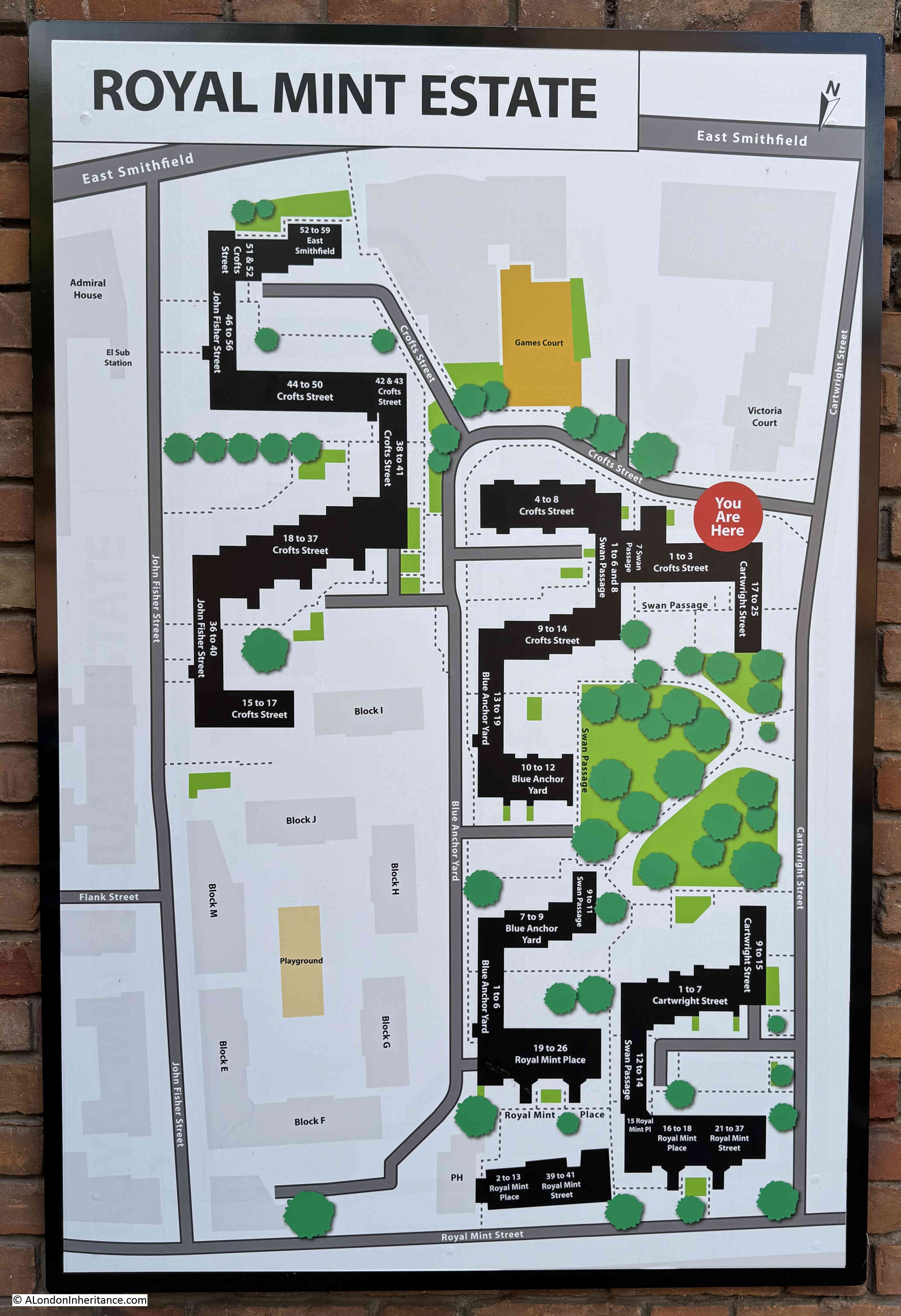
To the east of the Royal Mint is the appropriately named Royal Mint Estate:
There are concerns about the impact of the embassy development on the Royal Mint estate, privacy, security, the potential impact of any demonstrations against the embassy etc.
In the above estate plan, Cartwright Street is the street along the right hand edge. There is a narrow row of flats along the right of this street, and then the existing buildings of the Royal Mint estate loom large, buildings that will be replaced by those of the Chinese Embassy.
The Royal Mint tells us a number of stories.
The move to south Wales after several hundreds of years in London was about the need for more space and the city being less of an attractive site for industrial processes. There was probably also a financial factor with the new site being cheaper, and less expensive than an update to the London site.
The Royal Mint continues to operate in south Wales, however the centuries of growth is now probably followed by decline with the growing reduction in the use of cash, and today the Royal Mint is now building on the demand for gold, a metal whose price has risen considerably over the last few years.
The future story of the Royal Mint, Tower Hill site also tells the story of changing global politics, the rise of China, and the decisions that the Government makes on the future of the site will show how we respond to changing global politics and how we make use of key, landmark historical sites in the city.
It will be interesting to see the decision making in the coming months and the eventual outcome for this historic site.
Charterhouse Street runs along the northern edge of Smithfield Market. St. John Street is one of the streets that turns off north from Charterhouse Street, and from the junction, we can look up St. John Street, to the point where the street widens out, and there is a tree in the centre:
The following photo shows this relatively large area of open space, with the widened street passing either side of a central tree and bike racks:
I mentioned in the post on Blackfriars a couple of weeks ago how streets often retain the outline of what was there many years ago, and so it is with this space in St. John Street:
As it was in this space that Hicks’s Hall was built, and in Rocque’s 1746 map of London, we can see the building in the middle of the space, opposite Peter’s Lane and St. John’s Lane, showing that Hicks’s Hall was where the tree and bike rack are located today:
Hicks’s Hall was the first, dedicated Middlesex Sessions House. A place where a court sat, and criminal trials took place.
Hicks’s Hall was built in 1612 by Sir Baptist Hicks, a rich silk merchant, who lived in Soper Lane in the City, as well as having a house in Kensington.
There was a need for a dedicated Sessions House, as prior to the construction of Hicks’s Hall, Middlesex magistrates had used a number of local Inns, places which were not ideal to carry out a trial and to dispense justice.
An account of the opening of Hicks’s Hall reads: “Sir Baptist Hicks, Knight, one of the justices of the county builded a very stately Session House of brick and stone, with all offices thereunto belonging, at his own proper charge, and upon Wednesday, the 13th of January, this year, 1612, by which time this house was fully furnished, there assembled twenty-six justices of the county, being the first day of their meeting in that place, where they were all feasted by Sir Baptist Hicks, and then they all with one consent, gave it a proper name, and called it Hicks’s Hall, after the name of the founder, who then freely gave the house to them and their successors for ever. until this time, the Justices of Middlesex held their usual meeting in a common inn, called the Castle (Smithfield Bars).”
Numerous trials of many different types of criminal cases were held at Hicks’s Hall, and just a brief search of newspaper records reveals hundreds of reports. The following are a small example as crimes also illustrate life in the city. They are all from the 50 years from 1700 to 1750:
24th January, 1723 – This Day, Mr. Ogden was tried at Hicks’s Hall for Cursing the King, which was plainly proved, but some of the evidence disposed that he was very much in Drink, and that he was esteemed a person very much effected to His Majesty, and often drank his Health. The Jury, after a short stay, brought him in Guilty
21st October, 1727 – Two Men who had been convicted at Hicks’s Hall of a Misdemeanour in assaulting the Countess of Winchester in her Coach at Chelsea, with intent to Rob, and were sentenced to be whipt from Westminster Hall Gate to the end of Cabbage Lane in Petty France for the same (the sentence was not carried out as there appears to be a problem with the way the trial was carried out).
15th April, 1730 – On Thursday at the Sessions at Hicks’s Hall, a Soldier having made Oath directly contrary to what he had sworn before, was taken into custody, and a Bill of Indictment for Perjury ordered to be brought against him
24th May, 1733 – On Thursday at Hicks’s Hall, one Dwyer an Irishmen, and a Serjeant in the French Army, was convicted on several Indictments, for seducing Men to list themselves in the Service of the King of France; the Fact was proved very plain upon him, and the Court upon an Indictment sentenced him to pay a Fine of 1s and to suffer one year’s Imprisonment, and upon further Indictment a Fine of £50 and to find Sureties for his good behaviour for five years
21st December, 1734 – Yesterday eight Butchers, who exposed to Sale on the Lord’s Day quantities of Beef and Mutton in a Place called Cow-Cross, near Smithfield, were by the Court of Justices at Hicks’s Hall fined 13s, 4d each, and some of them for a second offence, £1, 6s, 8d and were severely reprimanded by the Justices for such vile practices, and acquainted, that if they ever did so again, the Punishment would be more severe
13th July, 1745 – Last Tuesday three Master Barbers were committed to Clerkenwell Bridewell by the Justices at Hicks’s Hall, for exercising their trades on the Lord’s Day and refusing to pay the fine
Hicks’s Hall from Old and New London. The print is recorded as being of the hall in 1750:
Thousands of cases were tried at Hicks’s Hall, and these were mainly of local crimes, however Hicks’s Hall was also used for trials of national importance and notoriety, for example when Hicks’s Hall played a prominent part in the actions of King Charles II against those who were responsible for the death of his father, King Charles I.
The trial of twenty nine of these Regicides (the Commissioners who had signed the warrant for the King’s execution, or who had a major part in his trial or execution) commenced at Hicks’s Hall on Tuesday the 9th of October 1669, and ended at the Old Bailey on Friday the 19th of October 1660.
Just ten days, including a weekend, which was not long for the trial of 29 people who were charged with crimes that carried some of the most extreme punishments, however I suspect there was little doubt as to the outcome.
The full account of the trial was published in a book which recorded the details of the trial, exchanges between prosecution and those charged, words of the Judge, background to the trial, a brief biography of those charged etc.
The long Preface to the books make an interesting read. It provides a whole range of justifications as to why the crimes committed by the Regicides were against the unity of the country, Christian religious principles, and the preface also tries to explain how those accused could have found themselves in such a position.
The following couple of paragraphs from the Preface are perhaps just as relevant today, as it was then:
“But let us examine a little into this Mystery of Enthusiasm and see by what means People arrive to this high Degree of Infatuation, and what are the several Steps which they take towards it.
The main Foundation of it is, no doubt, a large Stock of Pride, and a singular Fondness, which Men are apt to have for their own Sentiments and Opinions. Nothing is more common than for Men of this Spirit to run into Parties and Factions, and struggle hard for Superiority.”
To set the scene, the book also has a “Summary of the Dark Proceedings of the CABAL at Westminster, preparatory to the Murder of His Late Sacred Majesty, taken out of their own Journal-Book”.
The trial commenced at Hicks’s Hall on Tuesday the 9th of October 1660. The Court was directed by a large number of the great and the good, those who supported the restored Monarchy, including the Lord Mayor of the City of London, the Lord Chancellor of England, the Lord Treasurer of England, Dukes, Earls, Knights, Baronets and Justices.
A jury of 21 was sworn in consisting of Baronets, Knights, Esquires and Gentlemen.
To open the trail at Hicks’s Hall, the Lord Chief Baron, the head of His Majesty’s High Court of Exchequer spoke to the Jury.
Much of his speech was about the position of the King. That the Law Books describe the King as “the Lieutenant of God”, that the “King is immediate from God and hath no superior”, and that “If the King is immediate under God, he derives his authority from no body else; if the King has an Imperial Power, if the King ne Head of the Commonwealth, Head of the Body Politick, of the Body Politick owes him Obedience, truly I think it is an undenied consequence he must needs be Superior over them”.
Basically, although this was a trial, there could only be one outcome, and that those involved in the execution of King Charles I were automatically guilty, as only God was superior to the King.
The book also includes a brief biography of all those on trial. These are fascinating as they show the contempt in which the regicides were held. Below is a sample from the biographies from four of those on trial:
Colonel Thomas Harrison was the Son of a Butcher or Grasier at Newcastle-under-line in Staffordshire. After he had been educated in some Grammar Learning, he was placed with a Hulk, or Hulker, an Attorney in Clifford’s Inn, and when out of his Time became a kind of Petty-fogger. But finding little Profit arise from that, he took Arms for Parliament at the Breaking-out of Rebellious War, and by his Enthusiastical Preaching, and great Pretence to Piety, he so far recommended himself to the deluded Army, that he was advanced from one Post to another till he became a Major. He was Cromwell’s great Friend and Confident in all his Designs
Col. Adrian Scroop was descended of a Good family in Buckinghamshire. He was a great Puritan, and Stickler against Episcopacy, which made him take Arms against the King. Though he was no Parliament Man, yet he was drawn in, as he pretended by Oliver Cromwell, to be One in the Black List for Trying the King.
Mr. John Carew was born in Cornwell, of a very ancient family there, but had the Misfortune to be educated in Factious Principles, and was, like Harrison, a Fifth Monarchy Man, as appears in his trial. This made him an utter Enemy, not only to the King, but to all Government as a single Person, so that Oliver’s Usurpation was as hateful to him as the Royal Sovereignty, which he had destroyed
Gregory Clement is hardly worth mentioning. He was at first a Merchant, but failing in that, he sought to thrive by a New Trade in Bishops Lands, wherein he got a considerable Estate. He was turned out of the Rump-Parliament for lying with his Maid at Greenwich, but was taken in again when they were restored after Oliver’s Interruption. His guilty Conscience, and his Ignorance, would not suffer him to make any Plea at the Bar, or any Speech or Prayer at the Gallows
Poor old Gregory Clement seems to have been singled out for special contempt.
John Carew was considered especially dangerous as he was described as a Fifth Monarchy Man. Fifth Monarchists were a non-conformist religious sect that believed the killing of King Charles I marked the end of the fourth monarchy (the rule by kings), and would herald in the fifth monarchy when rule would be by Saints and by those “saved”, and would lead to the Second Coming.
The above four examples of those on trial were all found guilty and were all executed along with other Regicides during three very bloody days at Charing Cross::
Colonel Thomas Harrison was hanged, drawn and quartered at Charing Cross on the 13th of October, 1660
Col. Adrian Scroop was hanged, drawn and quartered at Charing Cross on the 17th of October, 1660
Mr. John Carew was hanged, drawn and quartered at Charing Cross on the 15th of October, 1660
Gregory Clement was hanged, drawn and quartered at Charing Cross on the 17th of October, 1660
Others on trial at Hicks’s Hall and then at the old Bailey had a mix of sentences ranging from execution, life imprisonment down to a limited term of imprisonment.
Hicks’s Hall is also shown in William Morgan’s 1682 Map of London:
But why was there an open space in St. John Street allowing Hicks’s Hall to be built in 1612?
I suspect to answer that question, we need to go much further back in history, to the founding of the Priory of the Order of St John of Jerusalem in 1144 when 10 acres of land was granted to Jordan de Bricet in Clerkenwell. The following map from my post on the Priory and St. John’s Gate shows the boundary of the Priory.
So if there was a gatehouse here, there would probably have been some degree of open space in front of the gatehouse, and this would have been where Hicks’s Hall was built centuries later, and is still a wider open space in the street today, with a tree in the centre.
Looking back at the location of Hicks’s Hall, and the possible location of a Gatehouse to the Priory of the Order of St John of Jerusalem is to the right of the tree:
Hicks’s Hall was used as a Session House until the late 1789s. By which time it was in a very poor state, was a bit on the small side for the work being conducted in the building, and the location of the building in the middle of St. John Street was not ideal, given the increase in traffic along the street since the building had originally been constructed.
Hicks’s Hall had been an important building in London, for as well as being a place where criminal cases were tried, it was also one of the places in the city from where distances were measured, and Hicks’s Hall was the measuring point for many places to the north of the city.
There is an interesting story from 1773 which shows how Hicks’s Hall was an important landmark, and also a staggering example of endurance and long distance travel.
On Monday the 29th of November 1773, Mr Foster Powell set off from Hicks’s Hall to deliver a letter to a Mr. Clarke, a watchmaker in York. Rather than travel on a horse, Foster Powell walked the entire route, including the return.
Staring at Hicks’s Hall, on the first day he covered the 88 miles to Stamford, on the second the 72 miles to Doncaster. On day three, Wednesday he set off from Doncaster and arrived in York in the afternoon where he delivered the letter. He then went to the Golden Anchor for some refreshment and an hour and a half of sleep, then later the same afternoon he set off for the return journey.
He reached Hicks’s Hall on the Saturday at four in the morning, having covered 394 miles in slightly over 5 days.
Foster Powell was known for his long distance walks, and it was reported that on many of these, locals would try and keep up with him on the route, but no one could for anything more than a couple of minutes. Off his other walks, one was a bet that he could not walk from London to Canterbury and back within 24 hours. He manged the return journey in 23 hours, 53 minutes, winning a bet of 100 Guineas.
At some point in the 1780s, Hicks’s Hall was demolished. It was because of the state of repair, size and location, and also because a new Middlesex Sessions House had recently been completed, and to find this building we need to take St. John’s Lane, the street opposite the location of Hicks’s Hall.
Walk down this street, and through St. John’s Gate:
Turn left on reaching Clerkenwell Road, and a short distance along, the following building can be seen on the northern side of the street:
The building is the Grade II* listed Old Sessions House, and a walk up from Clerkenwell Road to Clerkenwell Green provides a view of the front of the building. A far more impressive and substantial building than its predecessor, Hicks’s Hall, appears to have been:
Following my post on Archway last week, where the Arms of the old county of Middlesex can still be seen on the bridge, the Arms can also be seen on the pediment above the columns at the front of the Middlesex Sessions House:
Although the Sessions House at Clerkenwell Green was a completely new building, for some years after the transfer to the new building, it was also known as Hicks’s Hall, as this image from 1805 shows by the title of the print:
Credit: London Museum. Used under Creative Commons Licence CC BY-NC 4.0
The use of the name Hicks’s Hall for the new Middlesex Sessions House seems to have been common until the late 1840s, with the last newspaper report I could find of a trial using the name Hicks’s Hall being in 1848.
Many reports from the time recorded that the new building included a “fine Jacobean chimney piece” from the old Hicks’s Hall. The following inscription was apparently on the chimney piece: “Sir Baptist Hicks of Kensington in the county of Middlesex, knight, one of the justices of the peace of this county of Middlesex of his worthy disposition and at his own proper charge built this session house in the year of our Lord 1612 and gave it to the justices of the peace of this county and their successors for the sessions house for ever, 1618”.
The new building is Grade II* listed, and I can find no reference to the chimney piece in the listing.
I find it strange that, although the space occupied by the original Hicks’s Hall remains, I could not find any plaque recording that the building once stood in St. John Street.
Given that it was the first dedicated Sessions House for the County of Middlesex, that it was a place where lots of trials took place, and where many of those involved in the execution of King Charles I started the trials that would lead to executions and life imprisonment for many, the site of Hicks’s Hall must deserve some form of site record.
There are a number of options for the centre of London, almost all dependent on how you define the centre of a city such as London. For today’s post, I am going to go for the Bank Junction as the historic centre of London – that point where several key roads meet in the City, in front of the Bank of England, Royal Exchange and Mansion House, which until recently, has been a place busy with traffic and people, as this image from the late 19th century illustrates, looking across from outside the Mansion House to the Royal Exchange, when it was described as “The open space bounded by the Exchange, the Bank, and the Mansion House is perhaps the busiest in all the City:
And it was much the same in the 1920s, although there are some subtle differences, including the war memorial that now stands in front of the Royal Exchange as the photo below was taken not that long after the First World War:
This is a very old part of the City, once at the heart of the Roman City, with very many Roman remains having been found deep below the current surface level.
The 16th century “Agas” map shows the key streets of Cornhill, what is now Threadneedle Street, and Poultry, and by the 1682 map of William Morgan, we can see the area around the Bank junction (which is slightly left of centre in the following extract), with the second iteration of the Royal Exchange (after the first was lost during the Great Fire of 1666), and where Poultry and Cornhill meet, we can see the Wool Church Market, at the site of the future Mansion House (see this post on St Mary Woolchurch, and the wool market):
By the time of Rocque’s 1746 map, we can see that the Wool Market has now been replaced by the Mansion House, and the first building of the Bank of England is shown in Threadneedle Street, simply labelled as “The Bank”:
By Horwood’s map of 1799, we can see how the rapid expansion of the Bank of England has taken up so much space between Threadneedle Street and Throgmorton Street:
In all the above maps, there are only four streets converging on the Bank junction – Cornhill, Lombard Street, Poultry and Threadneedle Street. The junction would get far more complex with the “improvements” to the City implemented by the Victorians during the 19th century, which would leave us with the junction we see today in the centre of the following map:
Where we can now see that Queen Victoria Street joins the junction via Poultry, King William Street has been built, with Lombard Street now joining the junction via this new street, and finally Princes Street, which was widened and straightened along the western side of the enlarged Bank of England.
And this was why the Bank junction was so busy. Cornhill to Poultry and Cheapside was for long a significant east – west route. The new Princes Street and King William Street added a north – south route to London Bridge, and Queen Victoria Street provided a direct route down to Blackfriars Bridge along with the Embankment route to Westminster.
To these through routes was added all the local traffic to the offices, shops and businesses across the City of London.
The geology of the area is one of the reasons why the City was established where it is. In the following extract from the brilliant topographic-map.com, the height of the land across the City is colour coded so that the blue / greens represent decreasing height and yellow to red indicates increasing height:
We can see the Bank junction just to the lower right of the centre of the map, and Cornhill is a hill that runs up to the highest land just to the right of Leadenhall Market.
The higher land around and to the right of the Bank junction is not as pronounced today as it was many centuries ago. Building and street levelling over the centuries has resulted in higher ground being much less pronounced, and originally, the land at and to the right of the Bank was one of the two main hills of the City, with the other being around St. Paul’s Cathedral, before the drop down to the Fleet River.
One of the City’s lost rivers, the River Walbrook once flowed slightly to the west of the Bank junction, cutting across where Queen Victoria Street, Poultry and Princes Street now run, at a much lower level to the current street surface.
Bank junction today, looking across to the Royal Exchange, with the Bank of England on the left:
There are two main differences between the view across the junction of today, and that of the recent past.
Firstly, and most obviously, are the tower blocks in the background. Secondly it is the lack of road traffic.
Over recent few years, the City of London Corporation have been restricting vehicle access across the City, and the impact of this can be plainly seen at the Bank. The part of Threadneedle Street to the left of the Royal Exchange has been pedestrianised, and the complex restrictions are summarised in the following extract from the City of London’s website:
I have mentioned this before, but whilst these restrictions have resulted in a much more pleasant place to walk, better air quality, and providing an environment where it is much easier to see the buildings surrounding the junction – it does leave this central part of the City lacking a sense or urgency and activity, of a vibrant and thriving place. It is probably though just the change from the City that I knew for many decades.
Apart from the new Victorian streets, the layout of the Bank junction has not changed that much, just the buildings that line the streets.
This was the view from outside Mansion House, looking across to the Royal Exchange in 1804, where the open space we see today in front of the Royal Exchange, was then occupied by Bank Buildings. The Bank of England is on the left and the tower of the version of the Royal Exchange rebuilt after the Great Fire is on the right:
So there has been major rebuilding of the buildings that surround the junction, but the layout of the junction has remained much the same for centuries, with the addition of new streets in the 19th century.
The times when the actual junction has needed a rebuild is when the Bank underground station arrived, and when the junction, and the station below, was seriously damaged by a bomb on the night of the 11th January, 1941, when the bomb went through the road surface and exploded in the booking hall of the station, as illustrated in the following photo:
Many of those in the station at the time where sheltering, and the bomb caused the death of 56 people, with many more being injured, and today there is a plaque in the station recording the event:
Time for a walk around, to look at the streets and the buildings that surround the junction, starting with the streets. In the following photo is the Royal Exchange, and Cornhill is the street leading of to the right of the photo:
Cornhill is an old street, and one of the principal streets of the City. The earliest written record of the street dates from around 1125 when it was recorded as Cornhilla.
The “hill” element of the name is due to the street running up the western slope of the hill that peaks north-east of Leadenhall Market and “Corn” comes from the association with a corn market that was “held here time out of mind”, as recorded by Stow.
In the following photo is Princes Street, running along the western edge of the Bank of England:
An earlier Princes Street can be seen in the 18th century maps shown earlier in the post, however the Princes Street we see today has been straightened with the loss of a northern section, by the 19th century extension of the Bank of England.
In the following photo, the red bus is in Poultry, which is the street leading west out of the junction:
Poultry is another old street, with first mentions being in the 12th and 13th centuries. The name comes from the markets that were held here where poulters sold their produce.
In the above photo, the River Walbrook once ran across the street, in front of the new building in the centre of the view, the Grade II* listed No 1 Poultry, designed by James Stirling in the 1980s, although the building was not completed until 1997.
The photo shows how much land levels have changed over the centuries, as today there is no sign of the small valley in which the Walbrook ran, which was well below the current level of the street surface, which can be seen by a visit to the Temple of Mithras, now on display at the London Mithraeum, built as part of the construction of Bloomberg’s new European headquarters, a short distance to the south.
A slightly different view, with Queen Victoria Street running to the left of the new building:
Queen Victoria Street was built to help with the growing levels of traffic in the City, and to provide a direct route from the Bank junction, down to Blackfriars Bridge, and the new Embankment.
Construction was recommended in 1861 and included in the Metropolitan Improvement Act of 1863. The new street opened in 1871.
The new street resulted in the loss of numerous courts and alleys, as well as streets of a larger extent, which were swept away for its formation. Amongst those which had occupied the site of the new street were Five Foot Lane, Dove Court, Old Fish Street Hill, Lambeth Hill (part), Bennet’s Hill (part), St Peter’s Hill (part), Earl Street, Bristol Street, White Bear Alley and White Horse Court.
To the left of the above photos is Mansion House:
A permanent building for the official residence of the Lord Mayor of the City of London was one of the considerations for rebuilding the City after the Great Fire, however these plans were not realised until the 18th century.
The site of the old market was appropriate as it was located at a junction of important streets, which did not have any significant monuments.
The architect was George Dance the Elder, who at the time was the City of London’s Clerk of Works. and who took on the challenge of designing a building fit for the Lord Mayor of a growing City and which was able to accommodate both ceremonial functions as well as providing rooms for a private residence.
Work started in 1739, with completion in 1758, and the first Lord Mayor to take up residence was Sir Crispin Gascoigne.
The main reception room was (and still is) the Great Egyptian Hall. Not strictly speaking an Egyptian Hall, rather one based on an account by the Roman writer Vitruvius of what such a room may have looked like. The room today has a barrel roof which was the later work of George Dance the Younger in 1795. as the elder Dance had built a large upper storey, which must have looked out of place, and is shown in the following print of the Mansion House after completion:
The large blocks on the roof were intended to give the impression of a complete upper floor as a backdrop to the Corinthian portico at the front of the building, but they look more of a distraction than an improvement.
There have been minor changes to the building since the end of the 18th century, but essentially, when viewed from the Bank junction, the building looks much the same today as it did when it was the first major City building at this important junction.
Moving around the junction, and this is the view looking down King William Street, built after approval was given in an 1829 Act of Parliament as part of improvements to the approach to London Bridge. The street was later widened between 1881 and 1884.
In the following photo, the church is St Mary Woolnoth, (see this post for the story of the Church with the Underground in the Crypt). King William Street is to the right of the church, with Lombard Street to the left. Before King William Street was built, Lombard Street ran up to the Bank junction. Lombard Street is an old City street, with a first mention back in 1319, and dependent on spelling, there may have been an earlier record of the street in 1108.
This is the view along Cornhill:
There is a statue in the middle of the road in the above photo, and it is rather appropriate given that much of the Bank junction sits on top of Bank underground station.
The statue is to the inventor of the Greathead tunnelling shield – James Henry Greathead:
Greathead was a South African, who came to London at the age of 15 and in 1864 he was apprenticed to the civil engineer Peter Barlow.
Five years later at the age of 24, in 1869, Greathead took on the construction of the Tower subway, the pedestrian tunnel under the river from outside the Tower of London.
Tunneling under the river was a challenge, given the soft, waterlogged nature of the ground, not that far below the bed of the Thames.
To address this challenge, Greathead devised what became known as the Greathead Shield, although it was based on a shield design originally used by Brunel, but with a number of improvements.
Greathead went on to work on other tunnelling projects, a number of which route through the Bank, including the City & South London line, which at the time terminated at King William Street (now part of the Northern Line), and the Waterloo and City Line, which now has its City termination at the Bank underground station.
The statue of Greathead is relatively recent, dating from 1994, when it was placed there for a specific reason. If you look below the statue of Greathead, at the area between the feet of the statue and the stone plinth, there is a grill that runs the full circumference of the statue, revealing its true purpose, as it is an air vent for the station beneath, and rather than just have a plain air vent, the statue of a person who was one of those responsible for the continuous improvement in tunnelling under London was a suitable addition to sit on top of Bank underground station.
We now come to the Royal Exchange:
The history of the Royal Exchange goes back to the City of London’s position as a major trading centre.
Long before the days of electronic communications, trading was a person to person business, with traders meeting and agreeing on prices, terms etc. All these embryonic activities led to institutions such as Lloyds of London, the London Stock Exchange, and all the other various exchanges for metals, coal etc.
In the 16th century, much trading was carried out on the street, or in the small houses and shops that lined streets such as Cornhill and Lombard Street, and there had been calls for a dedicated place where people could meet to trade, agree prices, and generally conduct business of all types.
Enter Sir Richard Gresham who became aware of the opening of a Bourse, or trading centre in Antwerp, one of the major trading centres of Europe. Gresham pushed for such a building to be constructed in the City of London, however despite the project receiving royal support, there was no suitable space available.
The proposal was taken up by his son, Sir Thomas Gresham, who also knew of the Antwerp Bourse, as he was based in the city for a number of years as a trader, working on behalf of the Crown, and trading on his own behalf.
Gresham put his own money into the project, along with significant funding generated through public subscriptions, which supported the purchase of a block of land in Cornhill Street, a short distance from what is now the Bank junction, and occupying the same site as the current Royal Exchange.
The building was opened by Queen Elizabeth I in January 1570, and it was the first, large, Renaissance style building in the City.
This first Royal Exchange was destroyed during the 1666 Great Fire, and was soon rebuilt following a design by Edward Jarman, but, as shown in the maps at the top of the post, it still faced onto Cornhill, and in the area in front of today’s Royal Exchange, there was a triangular cluster of buildings.
The following print shows the Royal Exchange as rebuilt following the Great Fire, with the main entrance facing onto Cornhill:
The Royal Exchange consisted of a large central courtyard, surrounded by four wings which held offices for meetings, shops, cellars below for the storage of goods etc, as shown in the following print:
This second iteration of the Royal Exchange lasted until 1838, when, as with the first, it was also burnt down, with the following print showing the still smouldering remains of the building:
The Royal Exchange was soon rebuilt, following a competition to find a design. The competition was won by the architect William Tite, who seems to have also been one of the judges of the competition.
Tite’s design follows the layout of the original two Exchanges, with a central courtyard surrounded by four wings of offices and shops, however Tite’s design changed the main entrance from facing onto Cornhill, now to face onto the Bank junction.
The buildings that had once occupied the triangular space in front of the building were demolished, and it was opened up so that the full Corinthian portico of the new building faced directly onto the Bank junction, and seems almost to mirror the Mansion House across the junction.
The new Royal Exchange was opened in 1844 by Queen Victoria, with the following print showing the opening ceremony, and also how the new building had opened up the space around this important meeting place of City streets:
Within the pediment above the columns in the front of the building, there is a sculpture with the words “The Earth is the Lord’s, and the Fulness Thereof”, which was carved by Richard Westmacott the younger (his father of the same name was also a sculptor), and shows traders, historic, from across the world and from London. There are also small details such as a ships anchor to the left and pots to the right:
The Latin inscription, picked out in gold just below the pediment can be translated as “founded in the thirteenth year of Queen Elizabeth, and restored in the eighth of Queen Victoria”, to recall the founding of the first exchange, and the build of the third exchange to occupy the site.
There are numerous small details around the building, for example, the following has the date of the opening of the building as 1844 in Roman numerals:
And the cipher of Queen Victoria, the monarch who opened the latest version of the Royal Exchange:
It is interesting that the Royal Exchange is the only building that I am aware of in London where both the first version, and the latest, were both opened by Queens. Elizabeth I in 1570 and 274 years later, Victoria.
The steps in front of the Royal Exchange are also where the City of London proclaims a new monarch.
The current Royal Exchange has a glittering gold grasshopper from the arms of the Gresham family:
The Royal Exchange was not the only institution founded by Sir Thomas Gresham. His time travelling and working in Europe had also fostered an interest in learning, in trade, and in the benefits that the arts, technical and scientific achievements could bring to trade.
After his death, the executors of his Will founded Gresham College, to provide education across the arts and sciences, and which opened in 1597. A key aspect of the new college was that teaching was in English rather than Latin, which opened the college up to a much wider cohort of potential students.
The college originally operated from Sir Thomas Gresham’s old mansion in Bishopsgate, and then, rather appropriately for a period at the end of the 18th through the early 19th century, the college was based in the Royal Exchange.
There are very many fascinating lectures and Gresham’s college continues to provide a wonderful resource for learning.
Thomas Gresham was perhaps the first person who truly understood international money markets and international trade. He served three monarchs, Edward VI, Mary and Elizabeth, helping to keep them financially solvent, and during Elizabeth’s reign, his methods and contacts helped to stabilise the national currency.
He apparently could be rather unscrupulous in his dealings, including with his own family, and despite using his own money for the Royal Exchange, and leaving money for Gresham College, he appears to not have been particularly charitable during his life.
His name can also be found in the City with the naming of Gresham Street.
Returning to the Royal Exchange, the use of a building as a place for general trading faded later in the 19th century as specialist trading exchanges were set up to provide a place where trades could be made, meetings held, and news received in a specific and related set of commodities or services.
In 1939, the building became the offices of the Guardian Royal Exchange Assurance Company, and in the late 1980s, the company made substantial changes to the interior of the building, which included replacing the original roof, and an additional upper floor.
In 2001, the building was again refurbished, and reopened as a centre for luxury shops, restaurants and bars, and the Royal Exchange retains this function today.
Entering the Royal Exchange from the open space in front of the Bank junction:
The courtyard interior and roof today:
Next to the Royal Exchange, across Threadneedle Street is the Bank of England:
The Bank of England occupies a significant area of land of some three and a half acres. It has reached this size through a series of rebuilds and extensions over the years since the founding of the institution in 1694 as the Government’s banker, and arrival in Threadneedle Street in 1734, into a Palladian building designed by George Sampson, as the first, purpose built building for the Bank of England.
You can see the first Bank building marked in Rocque’s map of 1746, so much smaller than the complex of today.
The Bank of England has a number of key functions:
As the Government’s banker, the Bank of England is the only institution authorised to issue bank notes
Although they have shrunk over the past few decades, the Bank of England is responsible for looking after the country’s gold reserves
And although the Bank of England is owned by the Government, since 1997 the Bank has been responsible for independently setting monetary policy, for example, by setting interest rates
Rapid expansion of the Bank of England commenced after 1788 when Sir John Soane was appointed as architect to the Bank of England, continuing work on consolidating and expanding the Bank of England and working on the large curtain wall that was finished after Soane stopped working for the Bank in 1833, and which completed the security of the Bank’s complex.
The Bank of England buildings that we see today are the result of a rebuilding programme carried out between 1923 and 1939 by the architect Sir Herbert Baker, and which resulted in the demolition of most of Sir John Soane’s work, and resulted in a rebuild described by Nikolaus Pevsner as “the greatest architectural crime, in the City of London of the twentieth century”.
The Bank of England, facing on to Threadneedle Street, as it was before the rebuild that started in 1923:
A photo showing the extent of the rebuilding between 1923 and 1939, from the 1920s books “Wonderful London” (as is the above photo):
The photo above shows just how the curtain wall surrounding the bank forms an almost castle like structure. Also in the foreground, there appears to be a deep excavation, presumably part of the extensive below ground areas of the Bank.
The castle like curtain wall was supplemented by a Brigade of Guards detachment, who had barracks at the Bank to provide over night security, continuing this service until 1973.
The Bank of England partly faces on to the open space in front of the Royal Exchange, and as mentioned earlier, this was covered in buildings up to the construction of the 1844 building we see today.
There are two large monuments in this open space. The first is a memorial to the “officers, non-commissioned officers and men of London who served King and Empire in the Great War 1914 – 1919”:
The memorial was erected after the First World War, and an additional inscription was added at the bottom of the memorial for the Second World War.
The memorial records the names of all the London Battalions that fought in the Great War, and it is a reminder of how battalions were formed from local areas and of people with specific interests, so you have the 11th Battalion Finsbury Rifles, the 17th Battalion Poplar & Stepney Rifles, the 28th Battalion Artists Rifles etc.:
The second monument is to the Duke of Wellington, which was unveiled on June the 18th, 1844:
The monument is here, in front of the Bank of England and Royal Exchange as a thank you from the City of London for the Duke’s help in getting the London Bridge Approaches Act of 1827 through Parliament. There is a full explanation on a plaque on the monument:
The Duke of Wellington also now sits on an air vent to the station below, as can be seen by the grill in the above photo.
The plaque mentions that a piece of granite from London Bridge was set into the pavement by the statue prior to the removal of the bridge to Arizona:
Each of the buildings and institutions covered in this post deserve a dedicated and much more comprehensive post, such is the history at this key City of London road junction. The other aspect that deserves a much fuller write up is the underground station that sits beneath the road junction.
Bank Station was one of very few London Underground Stations that had no above ground buildings, however Bank can no longer claim this distinctive feature following additional entrances to the station across an ever expanding area, including the entrance to Bank Underground Station that is now on Cannon Street.
But as you walk around the Bank junction, there are a number of access points, where stairs lead you down to the station below:
Whether or not you agree that the Bank junction is the historic centre of London, it is a place where major routes across and out of the city all join, and it is a place where three key and early City of London Institutions have and are based.
The Royal Exchange, although no longer supporting its original purpose, once represented the trading heart of the City, Mansion House continues to be the public face of the City’s independent governance, and the Bank of England represents the City’s role in the financial management of the country.
If you are interested in a bit of a deep dive into two of the places covered, I can recommend:
Till Time’s Last Sand – A History of the Bank of England, 1694 – 2013 by David Kynaston
Gresham’s Law: The Life and World of Queen Elizabeth I’s Banker by John Guy
Sir Thomas Gresham and Gresham College: Studies in the Intellectual History of London in the Sixteenth and Seventeenth Centuries, edited by Francis Ames-Lewis
In addition to the Gresham lectures, you may also be interested in the following film that I found whilst researching today’s post at the Imperial War Museum collection.
Titled Britain at War, it is a film which unusually is mainly in colour, and has a lengthy section on London starting at 8 minutes, 30 seconds (it will probably not appear in the emailed versions of this post. Click here to go to the website where the film will appear in the post.)
If you have been on my Puddle Dock walk, you will recognise this location, the old Mermaid Theatre alongside Puddle Dock.
Although I have written about Puddle Dock before (there is a link at the end of the post), I have not covered the Mermaid Theatre, so time to remedy that omission in today’s post.
The Mermaid Theatre is the brick building in the centre of the following photo:
Upper Thames Street is the road in the foreground. This was constructed on land reclaimed from the Thames foreshore as part of the late 1970s / early 1980s redevelopment of the whole area in the photo.
The street Puddle Dock, which occupies the site of the original Puddle Dock is the street to the left of the photo.
Another view of the Mermaid Theatre. This is not the original theatre, it was part of the redevelopment of the area when the surrounding office blocks were built, along with Upper Thames Street:
The following photo shows the original Mermaid Theatre building, the smaller building in the centre of the photo, alongside the edge of the Thames:
In the above photo, all the land in front of the theatre would be reclaimed to allow the move of Upper Thames Street to a new dual carriageway. New office blocks were built around the theatre and Puddle Dock, which can be seen to the left of the theatre, was filled in and the street with the same name constructed.
The story of the theatre, how it came to occupy this bomb damaged site, and its transformation to the place we see today, is the subject of today’s post.
The Mermaid Theatre was the dream of Bernard Miles and his wife, Josephine Wilson.
Bernard Miles was born in Uxbridge to a father who was a market gardener and mother who was a cook.
He went to school in Uxbridge and then Pembroke College, Oxford, and after university he took a job as a teacher, but he would not stay for long in this profession.
His first acting role was as the second messenger in a revival of Richard III, after which he joined a number of repertory companies taking on roles from a carpenter to an actor. He had London stage roles in the late 1930s and early 1940s, including touring with the Old Vic.
He also had a number of film roles starting with the 1932 film, Channel Crossing, and the films that followed included In Which We Serve (1942) and Great Expectations (1946), and he continued to have film roles through to his final film in 1988, The Lady and the Highwayman.
He also appeared on TV, with one of his best known roles as Long John Silver in a TV series and later TV film of Treasure Island. He would also play the role of Long John Silver when Treasure Island was put on at the Mermaid Theatre.
He perhaps overplayed the role of a pirate when he “kidnapped” the Governor of the Bank of England on a short river journey on the Thames, when he “relived” the Governor of a cheque for £25 in support of the Mermaid, and then used the event to claim that the Mermaid Theatre was supported by the Bank of England.
It was down to Bernard Miles enthusiasm for the Mermaid Theatre, his ability to fund raise, and his sheer hard work throughout the whole process, that took the Mermaid Theatre from idea through to a working theatre, opening in 1959.
To explore the story of the Mermaid Theatre, I will use the Press Information document issued for the official opening of the theatre at 6p.m. on Thursday the 28th of May, 1959:
The press pack starts with the background to the Mermaid:
“‘See the players well bestowed’, says Hamlet, and the City has obeyed his solemn injunction by helping to bring to fruition a dream born on Acacia Road, St. john’s Wood, nine years ago.
In the dream Bernard Miles and his wife, Josephine Wilson saw one of the most exciting small theatres in Europe rising against the blitzed warehouses of the City’s riverside. They saw a new and vital centre of entertainment thriving in the great business hub of the Commonwealth.
In that summer of 1951, they had built a small theatre in their back garden. Its stage and fittings had been planned by two brilliant young designers, Michael Stringer and Walter Hodges, and early in September the Mermaid Theatre opened with Kirsten Flagsted singing twenty-six performances of Purcell’s ‘Dido and Aeneas’. Her salary for the season was a bottle of stout a day.
This first season was such a success that it was decided to have another one the following year. This time Bernard and Josephine Miles had no idea that before long they would be building a real bricks and mortar theatre in E.C.4. But during the second Mermaid season, a good friend of the Miles’ brought the Lord Mayor, Sir Leslie Boyce, to see the production of Macbeth. It was the Lord Mayor who suggested that the Mermaid be brought to the City for Coronation Year.
So it came about that between May and August 1953, the Mermaid Company played 13 weeks on the Piazza of the historic Royal Exchange in the very heart of a City, theatre less for nearly 300 years. And 70,000 people paid to see the four productions. This solid support led the Miles’s to believe that there was a very real demand for drama in the City.
From this point the ball began to roll towards Puddle Dock. It was argued that if they could persuade the City Corporation to lease them a bombed site for a token rent and then build the theatre by public subscription, they could set it fee from rent and so bring the price down to a real pubic service and habit forming level.
And since the entire Box Office takings could then be spent on the productions, this freedom from rent would also act as a negative subsidy, giving vital artistic elbow room.
In 1956, the Corporation generously granted a lease of the Puddle Dock site, so rich in theatrical associations. Then began the task of raising the £62,000 required to build and equip the theatre.”
The Puddle Dock site provided by the City Corporation really was a bombed warehouse, as can be seen in the following photo with the warehouse that would become the Mermaid Theatre on the left, with Puddle Dock, with a moored barge, to the right of the warehouse:
Looking up what was Puddle Dock today, with the old Mermaid Theatre buildings on the right:
Following the provision of the warehouse site, the next step was to try and raise the money needed to build and equip the theatre. The press pack continues:
“COLLECTING THE MONEY: The Mermaid has been financed entirely by public subscription. By donations from banks, shipping companies, insurance companies, stockbrokers, the City livery companies, ordinary men and women all over the United Kingdom, indeed all over the world – in America, Australia, New Zealand, Africa, Spain, Portugal, France, Canada, Bermuda, Norway and Sweden.
The launching of the ‘buy-a-brick’ campaign in 1957 carried the Mermaid appeal across the world. Nearly 60,000 people have paid their half-crown for a brick in the venture.
There have been many delightful instances of individual generosity, many heart-touching stories of a very real and practical interest in the living theatre.
There is the old-age pensioner who write saying she would like to donate £5. Not having the ready cash, she asked to be allowed to subscribe on the ‘never-never’ – a down payment consisting of a savings book containing five shillings worth of 6d. savings stamps followed, and the installments are paid whenever she finds she has a bit to spare.
There is the 10-year-old boy in Hampstead who sent two half-crowns – ‘the profit I made on the pantomime Aladdin which I staged in my bedroom at Christmas’.
There is the man working next door to the theatre who every week for 2.5 years has clocked in to give his half-crown.
There is the school-girl who sent her 10 shilling birthday money – ‘It was given to me to spend on whatever I wanted most, and most of all I want four bricks in your theatre.”
There is the New Zealander who sent money for four ‘bricks’ on behalf of his ancestors who lived and worked in the City during the 18th and 19th centuries.
In addition to cash, covenants etc., the Mermaid has received many gifts of materials. Window frames, lavatory and wash basins, bricks, radiators, timber, electrical equipment, bars, tiles, piping, furniture, carpet. And the neighboring firms have helped by lending office accommodation and storage space; by donations of paper for our printing; by the free use of office machinery and facilities.”
A bit further up Puddle Dock and we can see where the entrance to the theatre dives under the 1980s office block:
Development of the Mermaid Theatre progressed as follows:
OCTOBER 1956; The Mermaid Theatre Trust is granted a lease of a bombed site in Puddle Dock. It is decided to incorporate the existing 4-ft thick walls in the design and simply bridge them with a concrete barrel roof. An appeal is launched for the £60,000 needed to complete and equip the building.
JULY 1957. Sufficient money has been collected for work to start on the site. An open-air concert is held on the site to mark the launching of the building programme. Artists include Amy Shuard, Denis Matthews, Harold Jackson, Larry Adler and Max Bygraves. Some 1000 people sat on park chairs on a bombed site open to the sky, and a mercifully fine evening gives a good send off to the Mermaid project.
SEPTEMBER 1957. The Lord Mayor of London launches a ‘buy-a-brick’ campaign to raise further funds for the theatre. He throws the first half-crown into a trunk on the steps of the historic Royal Exchange and appeals to the rank and file of City workers to support the venture. The two-week campaign brings some of the biggest names in show business into the streets and pubs of the City selling ‘bricks’. Over £3,000 is raised,
DECEMBER 1957. Work on the building advances. The site is a sea of scaffolding as work begins on the roof. Meanwhile the work of collecting money continues. Cheques roll in from the great mercantile exchanges, from banks and shipping companies, from stockbrokers, charitable trusts and insurance companies. From a host of firms and individuals.
MARCH 1958. The roof is on, A roof-warming party is held on the site. A torch lit at the stage door of the Theatre Royal, Drury Lane (London’s oldest theatre) is run through the streets to Puddle Dock by relays of the John Tiller Girls. on arrival at the Mermaid it is taken over by Norman Wisdom who casts it into the faggots beneath a 15-gallon cauldron of punch which is then served to the 1000 guests. Later, Norman joins the builders on the roof to drink a toast. Meanwhile, Sir Donald Wolfit, in a speech to the crowd, declares the roof ‘ well and truly no longer open’. The first stage of the building is complete.
JUNE 1958. Members of the Moscow Art Theatre Company pay a visit to the site. At tables under the new roof they sit down to a traditional English meal – roast beef and ale from the wood. During their visit, the director of the company, Mr. A. Golodovnikov, traces the M.A.T.’s seagull emblem in a block of cement as a permanent reminder of the visit. The Mermaid is made an honorary member of the M.A.T.
AUGUST 1958. the building is well advanced. the restaurant and dressing room area overlooking the river is nearing completion. Work has started on the seating ramp in the auditorium.
APRIL 1959. The auditorium and restaurant are complete. Work continues in the foyer.
MAY 1959. All is ready. A two year battle is won.
Before continuing with the story of the Mermaid Theatre, lets have a look at the location of the theatre, as the place today is very different compared to when the theatre opened in 1959.
The area around Puddle Dock was completely redeveloped in the late 1970s / early 1980s. New office blocks were built around the theatre, Puddle Dock was filled in, and replaced by the road that retains the name of the old dock, and the theatre was completely redeveloped.
This redevelopment resulted in the building that we see today, with a larger block to the south, overlooking the river, where the Mermaid Theatre restaurant and bar were located, the auditorium running back along the site of Puddle Dock, and the entrance to the theatre under the office block that spans Puddle Dock.
In the following photo, I am looking across the street Puddle Dock to the theatre entrance under the office block:
A close-up showing the glass windows of the entrance foyer, and a small passage running between the theatre and an office block to the left:
The late 1970s / early 1980s redevelopment of this whole area was significant, and included the reclamation of some of the Thames foreshore, and the rerouting of a historic London street.
The following map extract is from an early 1950s edition of the OS map. I have circled the word “ruin”, and this is the location of the ruined warehouse in the photo earlier in the post, and also the location of the Mermaid Theatre (Map ‘Reproduced with the permission of the National Library of Scotland“):
You will see that Upper Thames Street runs to the north of the ruined warehouse, and further along to where it joins Queen Victoria Street.
As part of the 1970s / 1980s redevelopment, the foreshore in front of the 1959 build of the Mermaid Theatre was reclaimed, and Upper Thames Street rerouted to run along this reclaimed land as a dual carriageway (the route of the red line in the above map), part of the Lower and Upper Thames Street changes that provided a dual carriageway from north of the Tower of London to join with the Embankment.
And where Upper Thames Street once ran – a typical Victorian street lined by large warehouses and offices, today, in front of the Mermaid Theatre, there is a short passageway. Upper Thames Street once ran along here:
A wider view:
When the Mermaid Theatre opened in 1959, the main entrance to the theatre was onto the original alignment of Upper Thames Street, where the short passageway is in the above photo.
The following photo shows the main entrance to the theatre, with Upper Thames Street (as confirmed by the street sign on the theatre) in front of the building – now a short, dark passageway:
if you walked into the entrance shown above, through the foyer and then into the auditorium, then this would have been your view down to the stage, with the original warehouse walls to left and right, and the new concrete roof above:
The view of the auditorium in the above photo may look rather basic, however at opening, the Mermaid Theatre had:
500 theatre seats on a single sharply-raked tier
A stage of 48 feet wide by 28 feet deep
An extensive stage lighting system
The Mermaid was the first theatre in the country to have a stereophonic sound system, a donation from the Decca Record Company
Restaurant and snack bars
Eight dressing rooms with total accommodation for 50 to 60 actors. The dressing rooms were named after Wards of the City of London – Castle Baynard, Candlewick, Newgate, Cordwainer, Dowgate, Cripplegate, Broad Street and Queenhithe.
After opening, and throughout the 1960s and 1970s, the Mermaid Theatre was generally successful. An almost continuous run of different productions, apparently able to attract many of the leading actors of the time, as well as good audience numbers, although finances were always a challenge.
Bernard Miles and Josephine Wilson had the role of artistic directors, and Bernard Miles would occasionally also appear in one of the Mermaid’s productions.
The symbol of the Mermaid Theatre, on all their programmes, advertising etc., from the 1959 opening, was a mermaid, as shown on the cover of the programme for the 1972 production of Noel Coward’s Cowardy Custard:
The Mermaid was often struggling financially, so as well as the revenue from ticket sales, the theatre was always looking for additional sources of revenue, and as with theatres today, food and drink made up a large part of this.
In the Mermaid Theatre, there was the Riverside Restaurant, the Tavern Restaurant, the Whitbread Bar, the Charrington Bar and a Snack Bar:
The cast list from the 1972 production of Cowardy Custard:
When the area around the Mermaid Theatre was redeveloped, the theatre had to close for an extended period of time. This work involved the reclamation of the foreshore, build of a new embankment and the move of Upper Thames Street from the north of the theatre to the new dual carriageway to the south, filling in Puddle Dock, and build of the new road alongside the theatre, and the build of all the new office blocks that today surround the theatre.
The new route of Upper Thames Street is shown by the red line on the earlier OS map extract.
Bernard Miles was able to get some support for the rebuild of the Mermaid Theatre out of the developers of all the change, and this resulted in the slightly enlarged theatre building that we see today. However it also cost the Mermaid a considerable sum of money, and in the programmes that went with their early 1980s productions, they advertised the:
“MERMAID APPEAL – The Mermaid Theatre Trust offers warn thanks to those who have contributed in cash and in kind to the rejuvenation of the theatre. BUT, the hard winter of 1979 and the medieval and Victorian obstacles underground slowed up our rebuilding and combined with inflation to push up the cost of completing our existing building by £100,000. PLEASE HELP TO TOP US UP.”
The medieval and Victorian obstacles underground highlights that when the 1959 Mermaid was built, it was mainly built within the ruins of an existing building, and there was no need to go down below the surface for the majority of construction work.
When the Mermaid reopened in 1981, the first production was a musical version of the 17th century play Eastward Ho. This was a financial disaster and lost £80,000, and over the next two years, losses kept increasing to reach a total of £650,000.
One of the 1981 productions was “Children Of A Lesser God”, which opened on the 25th of August, 1981:
Which starred Trevor Eve, Elizabeth Quinn, and Irene Sutcliffe:
The above programme was one of the last to list Bernard Miles and his wife Josephine Wilson as Artistic Directors.
Two years after reopening, debts were so bad that the Trustees were forced to put the Mermaid up for sale.
Bernard Miles and Josephine Wilson stepped down as Artistic Directors.
The Mermaid Theatre was purchased by Ugandan Asian businessman Abdul Shamji through his property company Gomba Holdings.
Shamji was sentenced to 15 months imprisonment in 1989 following the collapse of the Johnson Matthey Bank, and the Mermaid Theatre then went through a series of different owners, and with different artistic directors and managers, however the theatre never reached the success in terms of productions, actors and audiences that it had done under Bernard Miles (although it had always struggled financially).
In 2000 it was basically a redundant building, and in 2002 it was scheduled for demolition as part of a redevelopment plan for the area (which never materialised), and in 2003 the Mayor of London blocked any demolition.
The theatre was used for a number of BBC concerts, and the formal end of the building as a theatre came in 2008 when the Corporation of London City Planning Committee removed the theatre license from the Mermaid Theatre.
When the Mermaid was opened in 1959, it was the first theatre in the City of London for almost 300 years, by the time the theatre was redundant, the City of London had a theatre at the Barbican, so there was probably no perceived need to, or interest in financially supporting the smaller Mermaid.
Bernard Miles was recognised for his work both as an actor and with the Mermaid Theatre as in 1953 he was made a CBE, he was knighted in 1969 and in 1979 he was made a Life Peer as Lord Miles of Blackfriars in the City of London.
His choice as being titled “Lord Miles of Blackfriars” probably indicates his deep connection with Blackfriars and the Mermaid.
Whilst the Mermaid building is a reminder of Bernard Miles’ original dream of a new theatre in the City of London, there is almost nothing to remember Bernard Miles or Josephine Wilson around Puddle Dock.
The one exception requires a walk up to the walkway on Baynard House (one of the office blocks that were built as part of the major redevlopment of the area – the walkway can be accessed from stairs on Queen Victoria Street, and provides access to Blackfriars Station).
In this gradually decaying space can be found the Seven Ages of Man sculpture by Richard Kindersly:
A plaque on one of the side plinths near the sculpture records that the work was unveiled by Lord Miles of Blackfriars on the 23rd of April, 1980:
Bernard Miles continued to act after stepping down from the Mermaid Theatre, but these roles must have been difficult given his previous 30 years involvement with the Mermaid, from the initial idea through to stepping down as artistic director.
In 1983, he took on the role of Firs, the old retainer, in Lindsay Anderson’s production of the Cherry Orchard, at the same time as what could have been considered his very own cherry orchard, the Mermaid, was being sold.
Bernard Miles and his wife Josephine Wilson had put almost all their own money into the Mermaid Theatre, and in 1989 they had to move from their four bedroomed house in Canonbury to a flat.
Josephine died in 1990, she had been Bernard Mile’s strongest and most consistent supporter throughout their life together, and during the whole period of the Mermaid, from the original idea through to the loss of their roles with the theatre.
After the death of his wife, Bernard moved into a Middlesex nursing home, and it was rumoured that he only had his state pension to live on.
The Mermaid Theatre’s new management staged a gala benefit in his honour, and despite being confined to a wheel chair, and also partially deaf, we was able to hear the many tributes that were paid to him, whilst in the theatre that had been his main life’s work.
Bernard Miles died on the 14th of June, 1991. Obituaries after his death celebrate his role in the founding of the Mermaid Theatre and the challenges that he overcame in getting the idea of the theatre from a bomb damaged warehouse through to a working theatre in the City of London.
They also identify a number of shortcomings, that perhaps he never recognised his shortcomings as an actor, that he wanted to take on the great roles of theatre, but in the words of one obituary “he played them and was terrible in all of them”.
He was strongly loyal to his old actor and director friends, but again was blind to their inadequacies.
He also failed to listen to advice when he had an idea and wanted to see it through, which was one of the reasons why the Mermaid frequently struggled financially.
Despite these shortcomings, he was widely remembered with affection and for his achievement in bringing the Mermaid to the City of London, long before the Royal Shakespeare Company were established at the Barbican.
I have tried to visit the Mermaid, and to take some photos, however there has been no response to my requests.
A walk around the outside of the theatre shows the Mermaid surrounded by the developments of the 1970s / 80s, but this could all change as there are proposals for a wholesale redevelopment of the area, and it is one part of London that does need to change – one of the most unfriendly pedestrian places you will find in the City of London.
Nothing appears to remain from before the theatre was built (although I would love to know what is underneath the Mermaid), however I did find these two strange red painted metal objects to either side of one of the doors to the theatre:
They appear to be made of iron, and are completly out of place with their surroundings. Two thirds of the way up, there is a slot on both objects, the type of slot that looks as if a wooden plank would have been inserted to bar the way.
It would be interesting to know if these are survivors from the time before the Mermaid was built.
The Mermaid Theatre is a fascinating story of how one man’s single minded devotion to an idea, led to the founding of the first new theatre in the City of London in almost 300 years, and in many ways, also led to its downfall.
I hope in the redevelopment of the area, the story of Bernard Miles, Josephine Wilson, and the Mermaid Theatre does not get lost.
The following photo is from 1984 and shows one of the many Blue Coat figures which can be seen on surviving charity school buildings from the late 17th and 18th centuries across London:
Forty years later, the statue is still there, looking good and has obviously been restored since the 1984 photo:
The figure is on the building that was once a Bluecoat School in Caxton Street, Westminster, and as recorded on the plaque in the above photo, the building dates from 1709.
The figure in the above two photos is on the front of the building, however most first views of the old school are probably of the rear and side of the building, seen as you walk along Buckingham Gate. I was walking from Victoria Street along Buckingham Gate, so this was my first view of the building:
Although the surroundings have changed beyond all recognition, the building itself has hardly changed, as can be seen in the following print of the rear of the school, from 1850:
In the above print, the school appears to have had railings and a wall surrounding its boundary, and also had a grassed area to the rear – possibly a small open space for the children of the school. Today, this is paved over:
The plaque on the first two photos of the front of the school dates the building to 1709, however the school was founded 21 years earlier in 1688 at the expense of “Divers well disposed persons Inhabitants of ye Parish of St. Margaret Westminster”.
The aim of the school was to teach the children of the poor the doctrines of the Church of England, and enable them to move on to an apprenticeship, or to gain an occupation.
As well as a limited form of education, children at the school were also given some degree of medical care, as in 1835, in a listing of physicians at the Royal Metropolitan Infirmary for Sick Children in Broad Street, Golden Square, a Mr. George S. Lilburn, M.D. was also listed as a “Physician to the Bluecoat School, Westminster”.
The school must have been successful in its first 21 years as the new school building was constructed in 1709 on land leased from the Dean and Chapter of Westminster Abbey, and funded by William Greene, a local brewer who paid for the school..
The interior of the building was simple, with a single school room above a basement. the exterior of the building was off brick, and was described as being of in a similar style to William Greene’s brewery.
Attendance at the school was initially for 20 boys who would be educated and clothed for free. The clothing was of the style shown on the figures around the building. As well as being the children of the poor, the parents or grandparents of the children would also have had to have lived in the parish of St. Margaret’s or St. John’s for at least a year.
A girls school appears to have been added not long after the new boys school was completed, as donations were being raised for a girls school of 20 pupils between 1713 and 1714.
Nothing today exists of the girls school, however recent research suggests that the girls school was located on the western side of the paved area at the rear of the boys school.
There were other buildings associated with the school that have been lost, including a headmaster’s house, so the single building we see today was part of a cluster of buildings forming a school for boys and girls.
The school was founded in 1688, and whilst this is just a date on a stone block on the school building, it is interesting to consider the state of the country when the school was founded, as both the charity and building did not exist in isolation. They were partly in response to what was happening in the country at the time.
The school was founded not long after the English Civil War (1642 to 1648), execution of Charles I (1649), the Commonwealth (1649 to 1660), restoration of the Monarchy with Charles II (1660), the Great Fire of London (1666), the reign of William and Mary (William III, 1689 to 1702), to prevent a Catholic succession after the death of James II, so the preceding 46 years had been one of considerable change, and the school was founded in the same year that James II’s wife, Mary of Moderna, gave birth to a son, James Francis Edward Stuart, who was next in line to the throne and would perpetuate a pro-Catholic approach by the English Crown.
The following is from the London Sun on Saturday the 29th of June, 1844, and announces a meeting where the audience will be asked for funds to support the Blue Coat school charity, and the article also provides some background as to the worries in the country when the school was founded, and concerns about the religious education of the young at such as time:
“BLUE-COAT SCHOOL, WESTMINSTER – The Rev. Dr. Colls will advocate the claims of the charity next Sunday morning at St. Peter’s Episcopal Chapel, Queen-square, St. James’s Park, in compliance with the particular request of a large body of Governors of that institution.
It may not, perhaps, be generally known that the Westminster Blue-coat School was the first of the kind in England, having been founded in the year 1688. a few months previous to the landing of King William, while this country was in a ferment at the impending danger to the Church and Constitution.
A few persons, grieved at the state of ignorance and irreligion in which the rising generation were then growing up, determined to make an effort to ground them thoroughly in the doctrines and the duties of the Christian religion, considering that this was the only effectual way to preserve the young from the sophistry of the infidel and the contamination of the profane.
In the choice of their advocate on the present occasion, the Governors of the charity have been fortunate, since the Rev. Dr. Colls is himself a practical example of the benefit and the blessing of early religious principles; and we hope he will be successful in opening the hands and hearts of his audience next Sunday morning in favour of the excellent charity.”
The plaque on the school building recording the original founding date of the school, one year before William and Mary landed from the Netherlands, and the “Glorious Revolution”:
Roughly 35 years after the new school building was constructed, Rocque’s map of 1746 shows the school (within the red circle), facing onto Chapel Street (the old name for Caxton Street), and alongside Horse Ferry Road (the old name for Buckingham Gate). Victoria Street will cut across the map in the mid 19th century:
What is interesting about the above map is the number of charity schools in the area, each with their own different coloured coat. I have marked the Green Coat School with the green circle and the Gray Coat School in the orange circle (a grey circle did not stand out well on the map).
The blue colour for the coats of the Blue Coast School seems to have been in use by 1700, when the uniform for the school was decided, and blue was chosen as “the most convenient colour would be Blew, being different from the other schools in the parish”.
When children went to, or left the charity schools in this small area, it must have been a scene of some colour with blue, green and grey coats being worn on the streets.
Also on the map, to the right of the Blue Coat School there is St. Margaret’s Burying Ground, showing an open space with a small chapel. The reference to the original founding of the school quoted earlier in the post states is was through “Divers well disposed persons Inhabitants of ye Parish of St. Margaret Westminster“.
St. Margaret’s was (and still is) the smaller church that is within the grounds of Westminster Abbey, in the north east corner, next to Parliament Square. The burying ground shown on the map was St. Margaret’s extra space for burials.
Part of this burying ground can still be found, the small, open space alongside Victoria Street, now known as Christchurch Gardens, which occupies roughly the middle third of the original burying grounds. The lower third is under Victoria Street and the upper third long built over. The remains of the burying ground today:
There were a number of Blue Coat Schools across London, and there seems to have been some competition, or confusion as to which school was founded first.
The following letter is from the Morning Herald on the 27th of July, 1830, and is in response to a previous comment about the schools of St. Botolph, Aldgate being older than the school facing Caxton Street::
“Sir, – In the Morning Herald of yesterday I observed a notice of a sermon for the charity schools of St. Botolph, Aldgate, it was appended a statement that these schools were the earliest of the kind instigated.
I should be extremely sorry to say one word which might be injurious to so excellent an institution, but justice to another admirable establishment compels me to deny the truth of the statement that the first charity school was established at St. Botolph.
The Blue-Coat School, Westminster, is beyond doubt the earliest of these institutions, having been established in the year 1688. Having been lately called upon to preach for that excellent charity I was led to investigate the matter, and obtained the following results:- The Blue Coat, Westminster, was established in 1688; a school in Norton Folgate in 1691, and that of St. Botolph, Aldgate, in 1697. In 1704 the number of schools had so increased that a general meeting of the children was held in St. Andrew’s Church, the number being about 2,000; the sermon was preached by Dr. Weller, Dean of Lincoln.
In 1716 the number of schools in London and Westminster was 124; the number of children 4,896; the entire number of schools in Great Britain and Ireland was1,239; the number of children 24,941; the greater part established within about 20 years.
To several of the early printed reports is attached the following note, (I copy from the sermon and report for 1716):- ‘All schools above mentioned have been set-up since 1697, except that belonging to the New Church in St. Margaret, Westminster, by the name of the Blue Coat School, which was set up Lady-day, 1688, for 50 boys, and the school of Norton-Folgate, erected in 1691, for 60 boys’.
I conclude with repeating that I have no wish to detract from the merits of St. Botolph’s school, but its friends have no right to claim for it that honour which so clearly belongs to another. I am, sir, your obedient servant, Thos. Stone, M.A. Assit. Curate St. john the Evangelist, Westminster.”
Whilst the Blue Coast School in Westminster may have been the first of this type of charity school, the problem with being a charity school was the constant need to raise funds, and the frequent shortage of sufficient funding to provide all the services that were intended by the trustees.
The following article from the Westminster and Chelsea News on the 28th of January, 1882 shows both one of the benefits of attending the school and the impact of a lack of funding (also note the use of Blew rather than Blue which seems to have been used a number of times):
“THE ‘BLEW COAT SCHOOL, WESTMINSTER. The annual dinner to the children of the ‘Blew’ Coat School, Westminster, the gift of John Lettsom Elliot, a former treasurer of the Charity, took place on the 20th inst. in the large school room, where the children were plentifully supplied with roast beef and plum pudding. This old and very useful Westminster Charity is, we are sorry to hear, sadly in need of support, the Governors being compelled to reduce the benefits in consequence, and singular to state this is the only ‘free’ school in Westminster, all the others having been closed. Mr. James Sarsons, the head master, conducted everything in his usual kind manner.”
The article highlights the precariousness of providing a service through a charity, in that the charity will always be after new funding, and that being dependent on charity funding, the services provided can only match the money available.
The article also states that the Blue Coast School was the only free school available in Westminster, so the other schools shown in Rocque’s map must have closed.
I have got this far in the post, and I have not yet shown the front of the school, so here is the building as it faces onto Caxton Street, with the blue coated figure shown in the photos at the start of the post:
The location of parked cars and a delivery lorry in the road opposite the school made it a bit difficult to photograph, but it is a lovely building and very different to the school’s surroundings.
The article above from 1882 was getting towards the end of the school’s history as a charity school as the provision of education was changing in the late 19th century, with the provision of free education for all children and the creation of the London School Board, which was responsible for many of the wonderful large brick late 19th century schools we can still see across London.
The location of the school was also suffering with the constant development of the area, for example with the construction of the District Line which resulted in the loss of part of the school’s land and buildings.
In 1898 the Governors of the school requested and received authorisation to close the school and transfer the land and building to the Vestry of St. Margaret and St. John, Westminster, who then transferred the school to the Christchurch National Schools, as part of the national church school system. The school then became the Infants department of Christchurch School, and attached to the church which has since been demolished, and which stood on the corner of Caxton Street and Broadway.
During the Second World War, the school was used by the Forces, after the war for community use such as the Girl Guides and as a Youth Club, as well as continuing use as an infant school until 1954.
The building was purchased by the National Trust in 1954, and was then restored and opened to the public.
Further restoration work was needed in 1974, when the Trust also installed offices in the basement.
The National Trust closed their shop along with public access to the old Blue Coat School building in 2013, when it then became a showroom for bridal wear designer Ian Stewart.
The building is Grade I listed. I am not sure if the building is still owned by the National Trust. The Historic England official list entry for the building does have National Trust in brackets after the name of the building, however the date of the most recent amendment is 1987, when the building was an open, National Trust property.
In the National Trust Heritage Records Online record for the building, the Most Recent Monitoring section has “None Recorded”, which implies that it is not a National Trust property as I assume they would be monitoring the building.
The building is now occupied by Studio Ashby, who appear to be residential and commercial interior designers, and on their website they state that they have “become the next custodians of this magical and historic site”, which implies the building is now privately owned.
From photos on Studio Ashby’s website, the interior still includes the following features from the Historic England listing “Fine interior forming single tall space with pilasters and niches to walls, entablature and coved ceiling; four fluted Corinthian columns mark entrance; fireplace to opposite end” – although the fireplace is not visible, and the whole of the interior is painted white.
The building’s Grade I listing should help preserve the building into the future, and it is good to see the statue and plaque on the front looking better today than they were in 1984.
The Blue Coat School in Caxton Street is an important reminder of the development of education in London, and how the aim of these charities was to give the children of the poor a religious education, along with gaining the skills needed to get an apprenticeship, or to work.
A wonderful survivor given how much this area has changed, and continues to change.
In February, BT announced the sale of the BT Tower to MCR Hotels for a sum of £275m, and that MCR Hotels plan to “preserve BT Tower as an iconic hotel, securing its place as a London landmark for the future”.
The BT Tower has been a significant London landmark since completion in 1964, and opening for operations the following year, however in the intervening 60 years, the original technical requirements for the tower’s design and construction have become redundant, and as I will explore in today’s post, the tower has now outlived its original purpose, and it will be interesting to see how it transforms over the coming years.
In this post, I am going to call the building the Post Office Tower rather than the BT Tower, simply because that was the original name of both the tower, and the organisation responsible for building the tower, and I must admit (probably age), but I still think of the building as the Post Office Tower.
Located just to the west of Tottenham Court Road, and south of Euston Road, the Post Office Tower is a major landmark within the surrounding streets:
The above photo is from April 2024, and towards the upper part of the tower, there is an open section which looks almost as if the tower is still being built, however it is this open section of the tower which was the reason why the tower was built.
I took the following photo in 1980 of the Champion pub, at the junction of Eastcastle Street and Wells Street, with the Post Office Tower in the background, and at time of the photo, there were some strangely shaped objects fitted to this open section:
The following photo of the top section of the tower shows the upper part where the kitchen, cocktail bar, revolving restaurant and public observation floors were originally located. Below these floors is the open section with the round, concrete core of the building at the centre:
View from close to the base of the Post Office Tower:
I have one of the wonderful large (A0 I think) posters produced by the General Post Office (GPO), after the opening of the building. The GPO was the combination of what is now BT, the Post Office and Royal Mail, and was then a state run organisation before being broken up and privatised.
The poster shows in detail the functions of the Post Office Tower:
The poster records that “the Tower is 620 feet high, and weighs 13,000 tons. It is constructed of concrete reinforced with high tensile and mild steel and has no less than 50,000 square feet of glass on its outside covering. It will withstand high winds with the minimum of deflection – so as not to upset the alignment of the radio beams. Gusts of 90 mph are estimated to induce a deflection of only 15 inches at the very top of the Tower!”.
It was built between 1961 and 1965 and was designed by the Ministry of Public Building and Works Architect’s Department with Eric Bedford as the Chief Architect and G.R. Yeats as the Senior Architect in Charge.
The core of the tower is a reinforced concrete cylinder with a height of 582 feet. Not that obvious when looking at the Post Office Tower, however this concrete cylinder does taper, starting at 35 feet in diameter with two foot thick walls at the base, tapering to 22 feet in diameter and one foot thick walls at the top of the tower. This taper means that the lower floors are smaller than the upper floors.
This tapering of the central core is not that visible from outside the tower, but look at the poster above and the difference in the size of the core is very obvious between the lower and upper parts.
Reinforced concrete floors surround the concrete cylinder, with seventeen floors of equipment rooms and offices below the level where the radio antennas were mounted.
Working down from the top of the Tower, there was a storm warning radar mounted at the very top of the Tower, below which there was a circular room where lift and ventilating equipment was housed, along with water tanks. Below this was the kitchen, cocktail bar, revolving restaurant and public observation floors:
The restaurant was appropriately named as the “Top of the Tower” and was opened on the 19th of May 1966 by the Postmaster General, Anthony Wedgwood Benn, and Sir Billy Butlin, as the Butlin Organisation were the operators of the restaurant.
It was Britain’s first revolving restaurant, with the arrows in the above image showing the direction of travel, with one revolution taking 25 minutes.
The restaurant and viewing area were a huge success with over one million visitors in the first year of operation. The intention of the GPO was that entry fees to the Tower would help cover some of the costs of the building.
Public access came to an end after a bomb exploded in the men’s toilets in the restaurant on the 31st October of 1971. There was limited public access until 1981, but after that, the floors at the top of the Tower were used for invited meetings, presentations, charity events etc.
We then come to the section of the tower which is the reason for the Post Office Tower’s existence, height and shape. This is where the radio antennas were mounted:
In the post war period, the amount of telephone use was growing rapidly, and this was joined by the growth of television, services which both required a method of transmitting telephone calls and television signals across the country.
This had traditionally been achieved by copper cables running the length of the country, and connecting key cities from where further networks of cables ran out eventually reaching individual homes and telephones.
TV signals were distributed between outside events, studios and transmitter sites.
The copper cable network was not a cost effective or technical means of supporting this rapid growth through the 1960s and 1970s, so a new network was designed whereby both telephone calls and TV transmissions would be carried across the country using microwave radio signals – linking up key locations where signals would then be converted back from microwave radio signal to electrical signal for local transmission via copper cable.
The key problem with microwave radio is that the signal is line of sight. The sending antenna needs to see the receiving antenna, so to send a signal between geographically spread locations, antennas had to be mounted on high towers, capable of seeing their adjoining towers without any obstructions in-between – hence the height of the Post Office Tower.
This diagram from the above poster shows graphically how this worked:
For the Post Office Tower, the height of the antenna platforms was dictated by the height needed to “see” a surrounding network of towers, and the space where they were mounted was circular to give maximum flexibility for moving and pointing antennas in any direction, as well as the space to add additional antennas, as and when needed.
This circular shape was then mirrored across the whole of the tower, and it was a shape that also resulted in minimum wind resistance. The tower needed to be stable, as a small change could mean that the microwave radio beam between the Post Office Tower and an adjacent tower would become out of alignment.
To support this new, cross country communications system, a network of towers sprang up across the country.
But the towers had another, more secretive purpose.
I have a copy of The Sunday Times Magazine published on the 28th of January 1973, and in the issue there is an article titled “The National Guard”, by Peter Laurie and developed from his book “Beneath the City Streets”.
The article explored what else the towers supported, in addition to telephone and television signals.
At the time of the Post Office Tower’s construction, the Cold War was in full flow between the West and Russia. The risk of a nuclear war was all to real, and the Cuban Missile Crisis took place in October 1962, whilst the tower was being built.
There were a number of radio networks across the country, as well as telephone and television, the Gas and Electricity boards had a network to control their nations grids, there was a network for Civil Air Traffic Control, and a separate network for the United States Air force for their fighter and bomber control.
Peter Laurie’s article explained that the towers also included a network to “safeguard vital national communications in the interests of defence” – which seemed to include both air defence warning and control systems against an attack by Russian nuclear bombers, and to provide Government communications to dispersed underground national and regional seats of Government across the country.
The Sunday Time Magazine article included a collection of photos of towers across the country, of which the Post office Tower was part:
You can still see how the network works today. If you go to the Sky Garden at 20 Fenchurch Street on a clear day, and look to the east, on the far horizon who can see the ghostly outline of a tower.
This is the tower at Kelvedon Hatch in Essex, and in the above matrix of photos, it is the tower in the top row, second from the left.
My photo shows the tower, just visible on the horizon to the right:
As can be seen in the above photo, being up a high point in London, enables a line of site to another, distant high point, over which a microwave radio signal could be transmitted.
Other towers surrounding London include a tower near High Wycombe, which is next to the M40 and very visible if you drive along this motorway, along with another tower at Bagshot in Surrey. These are both in the matrix of photos above.
The network extended across the whole country, with each tower serving as a local connection into the network, as well as the relay point to surrounding towers.
In the matrix of photos above, the caption to the Kelvedon Hatch tower states that it was “near a regional seat of government, north of Brentwood”.
This was the underground bunker at Kelvedon Hatch which would have formed a regional seat of Government in the event of nuclear war. I worked in the bunker a couple of times as a Post Office Apprentice in the late 1970s, and wrote about the bunker in this post.
The microwave radio network was a vast improvement in the volume of data that could be transmitted across the country over the previous copper network, however technology does not stand still and during the 1980s and 1990s, a network of fibre optic cables was being laid across the country.
Fibre optic cables were relatively cheap, and small bundles of cables could carry very large volumes of data, considerably more than a microwave radio network, and with the coming of the Internet, data volumes started to increase exponentially, therefore the new fibre optic network started to take over from the microwave radio network.
The last elements of the radio network were switched off between 2006 and 2007, and the radio dishes and horn antennas were removed in 2011 due to concerns regarding their condition and the safety of the surrounding area.
Permission for removal was needed because the tower is Grade II listed, and planning approval was granted by Camden Council. There was a proposal to install dummy dishes to replicate the appearance, however BT rejected this on the grounds of cost.
This is why this section of the tower looks almost as if it is an unfinished part of building works.
Postcard from the 1960s soon after completion of the Post Office Tower showing the horn and dish antennas mounted on the tower, and at the base is the Museum telephone exchange, with the small tower providing some of the local radio links:
The Post Office Tower was opened in October 1965, and the following news report is typical of the reporting of the opening of the tower:
“FROM BIG BEN TO BENN’S BIG TOWER – The Post Office Tower symbolises 20th century Britain in much the same way as Big Ben symbolised 19th century Britain, said Postmaster General, Mr. Anthony Wedgwood Benn, today.
Both speak eloquently for the age in which they were built.
He added: Big Ben represents the fussy grandeur of the Gothic revival that epitomised Victorian imperial influence, built on the foundation of the first industrial revolution.
The Post Office Tower, lean, practical and futuristic, symbolises the technical and architectural skill of this new age.
Mr. Wedgewood Benn was speaking at the ceremony at which the Prime Minister, Mr. Harold Wilson, inaugurated the operational working of the Tower.
Mr. Wilson talked over a microwave telephone link from the Tower to the Lord Mayor of Birmingham; and audiences in each city watched the ceremony by means of a closed circuit television link via the Tower.
Mr. Wedgwood Benn continued: This new, bigger Big Ben captures the sprit of our time, and visitors to London will remember it as the dominating feature of our capital city. Significantly, it is a great communications centre, that will allow the vast expansion in telephony, telegraphy, data transmission and the distribution of sound and television programmes, linked to the world satellite system.
He added that there was a great growth in telephone traffic. Trunk calls were increasing at a rate of about 17 per cent a year.”
Birmingham also had its own microwave tower, connected into the national network, and which was 500 feet tall, and cost £3 million to build.
We can now continue down the Post Office Tower, and the poster shows the apparatus rooms on each of the floors, which contained apparatus for telephone and television systems, and any other systems that would have used the microwave radio network:
These rooms continued down through all the floors wrapped around the central concrete column:
Since its’ completion, the Post Office Tower has been a significant feature on London’s skyline. Apart from Centre Point (which was built over the same period as the Post Office Tower), there are no other tall buildings in the immediate vicinity.
In 1980, I took the following photo from the viewing gallery of the Shell Centre building on the South Bank, showing the Post Office Tower:
This photo was from a few years ago, taken from St. Paul’s Cathedral:
And this is from the viewing galleries of the Shard, where unusually, you are looking down on the Post Office Tower:
One question about the tower I have not answered is why it is located where it is in London?
The answer comes from London’s historic distribution of telephone exchanges, as the site of the tower was the site of the Museum Telephone Exchange.
Prior to the all number system of telephone numbers we use today, London’s telephone system used a combination of three letters and four numbers. This was called the Director system and used due to the large number of telephone exchanges in London, with three letters identifying each exchange, so if you had a telephone connected to the Museum Exchange, your number would be of the format MUS 1234 (this was when telephone dials had letters as well as numbers around the edge of the dial).
The Museum Telephone Exchange was already a hub for London’s telecommunications network, including audio and video circuits, and the Museum exchange included a link to the BBC’s Broadcasting House, so it was the logical site for a tower that would network and connect London with the rest of the country.
Before the Post Office Tower, the Museum Telephone Exchange already had small mast on the roof, and a name used in the early days of planning for the Post Office Tower was the Museum Exchange Tower.
After construction had been completed, Peter Lind, the company responsible for construction, had large adverts in many newspapers advertising that they had constructed “Britain’s Tallest Building” and although calling it the G.P.O. Tower in the headline, in the text under a photo of the tower it was called the “Museum Telephone Exchange and Radio Tower”.
The tower is still surrounded at its base by a number of BT buildings which have long been used for telecommunications equipment. Whether any or all of these are included in the sale of the Post Office Tower is not clear.
Whilst the tower is listed, the surrounding buildings at the base are not, so it will be interesting to see what happens to these in the coming years:
The above photo shows the view along Cleveland Street with BT buildings on the right, and in the following photo are more BT buildings at the junction of Cleveland Street and Maple Street:
Whilst we can see the majority of the Post Office Tower from the surrounding streets, there is one really interesting part of the structure that can only be seen from one side street
Walk down Cleveland Mews, and this is the view:
As mentioned earlier, the tower needs to be as stable as possible so the microwave radio beams could maintain their alignment with distant masts. To help provide this stability, towards the base of the tower there was a “collar” which extended from the ground level buildings around the central concrete column. As well as providing stability, the collar also provided access to the tower:
The collar can be seen in this extract from the poster, where it is described as a connecting bridge and brace for the tower:
in the above image, we can also see the concrete conical pyramid on which the tower was built, and which helped spread the load over the concrete foundations below.
The foundations of the tower below the conical pyramid consisted of a large layer of reinforced concrete, below this was a layer of oil which formed an anti-friction gasket, below which was a thin layer of concrete, and then natural ground.
Looking up at the Post Office Tower from Cleveland Mews, and we can see the central concrete column at its widest diameter, then the collar / brace, and then the tower rising above London.
The Post Office Tower is a remarkable bit of engineering and construction, all to raise a set of antennas to a sufficient height so that they could communicate with a network of relay towers in the counties surrounding London.
The Post Office Tower seen from Fitzroy Square:
Many historic landmarks have a local pub named after them, and the Post Office Tower is no different as at the junction of Cleveland Street and Clipstone Street, is:
The Tower Tavern
The Tower Tavern is not exactly the most attractive pub in London, and the style of the building probably comes from the period when it was built, as the pub dates from around 1970:
It was built following the demolition of an adjacent pub (the subject of a future post about the area), and was a pub frequented by Post Office / BT workers as well as those who lived and worked in the area, and despite its outward appearance was a perfectly decent pub.
Soon after opening, the Tower Tavern was regularly advertising in the papers that you should “Make a date to meet at The Tower – a fine Bass Charrington House”, and in 1971 it claimed to have a model of an original telephone box in the pub.
In 1993 the Tower Tavern was advertising that you could buy:
Carling Black Label 80p per pint
Tennents Pilsner 80p per pint
Tennents Extra 95p per pint
Bitters £1.20 per pint
Double Spirits £1.50
Indian curries and rice £3.00
The Tower Tavern closed in 2021, possibly due to the impact of COVID / rent increases etc. The pub is owned by the University of Westminster who also have the buildings that surround the pub.
The pub has a lovely sign, with a rather dramatic painting of the Post Office Tower with its full compliment of microwave radio dishes and horns across the upper levels:
The Tower Tavern pub sign with the real Post Office Tower behind:
I do not know what plans the University of Westminster has for the old Tower Tavern, but I would be surprised if it opens again as a pub. I hope the pub sign is saved though, and put on public display as a reminder of the Post Office Tower’s history.
The Post Office Tower in Film
As you would expect, the Post Office Tower features in numerous films, TV reports etc. Below are a selection that provide an overview of the tower’s design, construction, purpose and use, visiting the tower, the restaurant, and how the tower often appeared in popular culture.
This 19 minute film has some wonderful aerial shots of London, covers the purpose, design and construction of the tower, with some good technical detail, along with visiting the tower and the restaurant:
Top Of The Tower
This 2 minute video again has some wonderful views of London from above, and within the Post Office Tower, the film focuses on the restaurant at the top of the tower:
Look At Life – Eating High
This film includes an overview of other restaurants at the top of tall structures as well as a detailed look at the Post Office Tower restaurant.
The film also includes the mechanism that rotated the restaurant, and shows how remarkably simple this was:
GPO Tower Construction
This silent film shows views from the tower, as well as construction of the tower. If you work in construction health & safety, then best not to watch:
The Goodies
And finally, the Post Office Tower frequently appeared in popular culture, one example was when it was demolished by a giant kitten in an episode of the Goodies:
The Post Office Tower is an iconic London landmark and when you look at the tower, you are looking at something built to serve the explosion of telephone calls, television distribution, and data from the late 1950s and through the 1960s.
You are also looking at something where the design, height and shape was dictated by the leading edge telecommunications technology of the early 1960s.
You are looking at a building in a specific location that was dictated by how the telephone network had developed across London, and where a key telephone exchange was located, and it was part of a network of towers that spanned the country, and linked to Europe via a microwave radio link across the Channel, and the rest of the World via the Goonhilly satellite station in Cornwall.
And it also had a resturant.
Whatever happens to the tower in the future, I hope that some of this heritage survives.