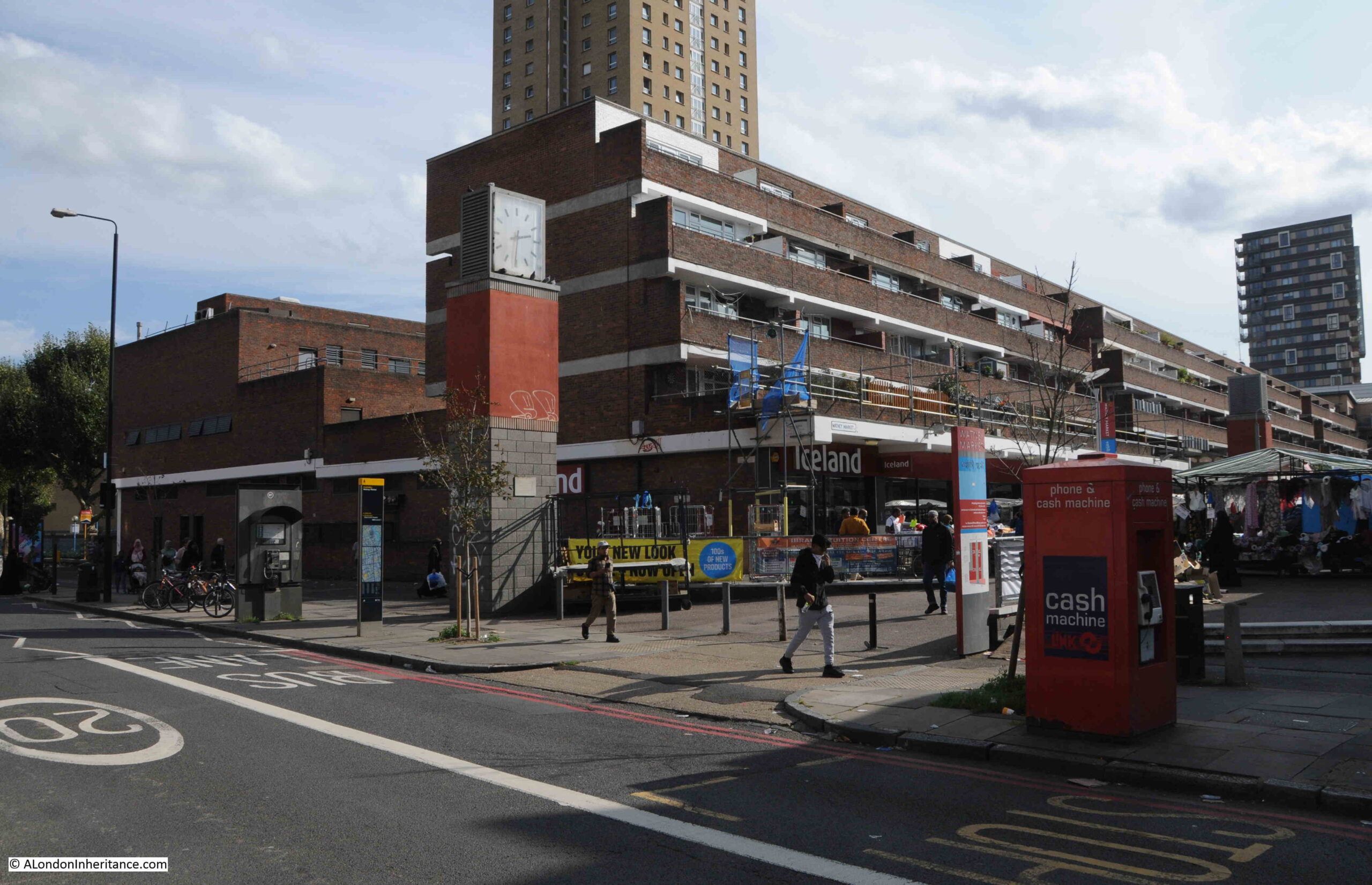
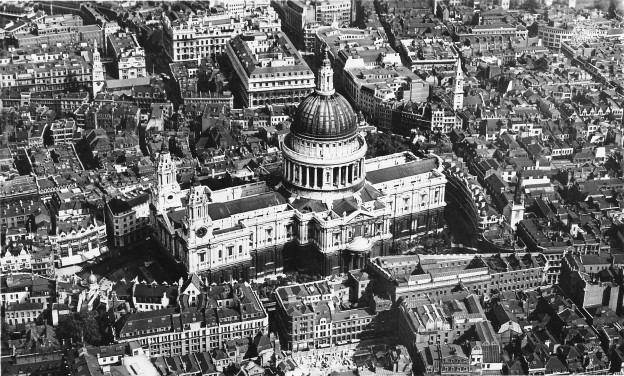
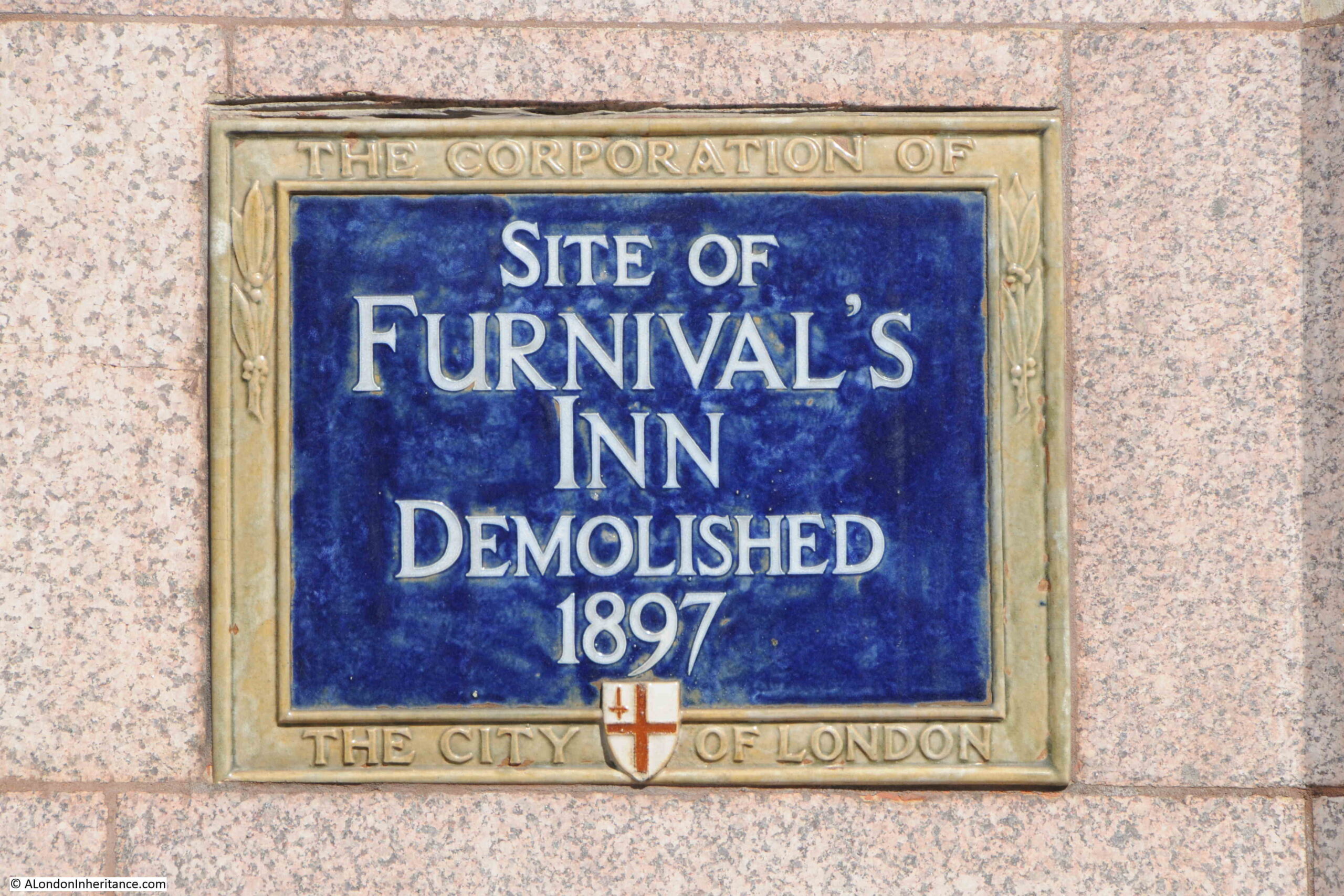
If you would like to explore the history of Puddle Dock, Thames Street and the area between Queen Victoria Street and the Thames, one place has just become free on my walk this coming Thursday, the 25th click here for details and booking, and one place on Sunday the 28th, click here for details and booking.
In February, BT announced the sale of the BT Tower to MCR Hotels for a sum of £275m, and that MCR Hotels plan to “preserve BT Tower as an iconic hotel, securing its place as a London landmark for the future”.
The BT Tower has been a significant London landmark since completion in 1964, and opening for operations the following year, however in the intervening 60 years, the original technical requirements for the tower’s design and construction have become redundant, and as I will explore in today’s post, the tower has now outlived its original purpose, and it will be interesting to see how it transforms over the coming years.
In this post, I am going to call the building the Post Office Tower rather than the BT Tower, simply because that was the original name of both the tower, and the organisation responsible for building the tower, and I must admit (probably age), but I still think of the building as the Post Office Tower.
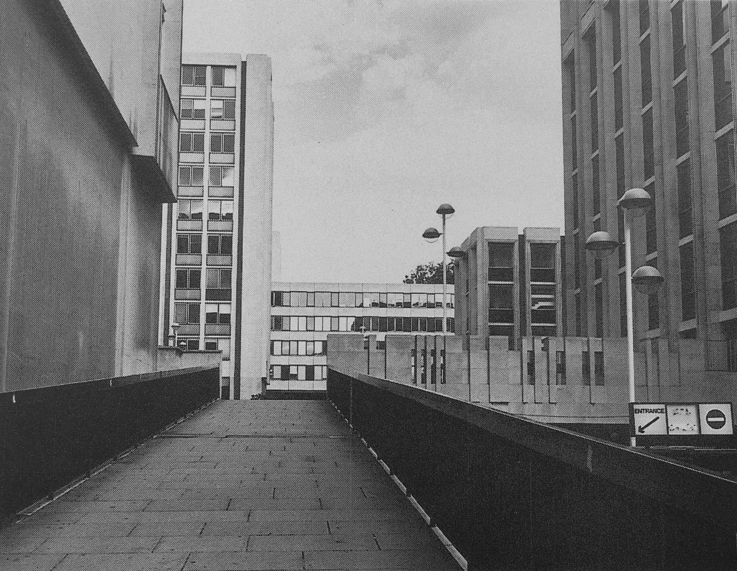
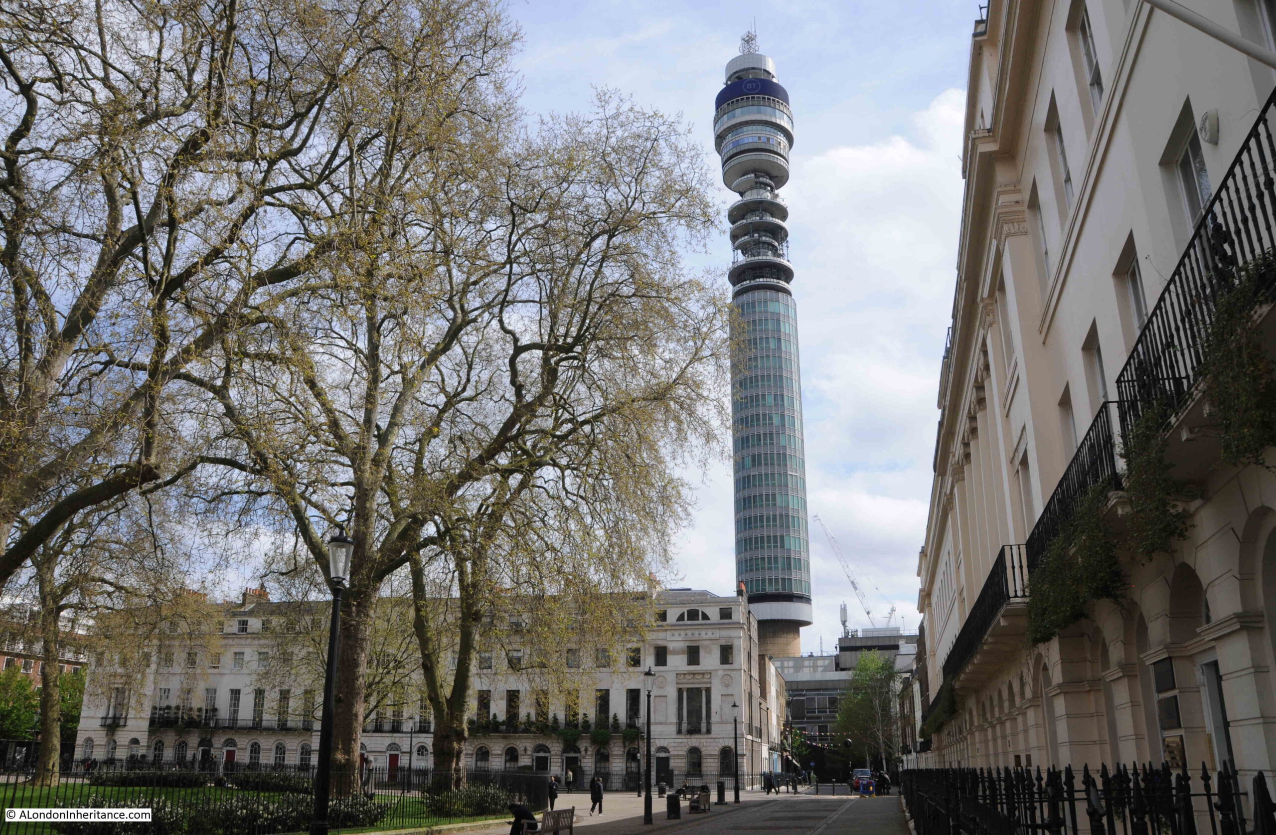
Located just to the west of Tottenham Court Road, and south of Euston Road, the Post Office Tower is a major landmark within the surrounding streets:
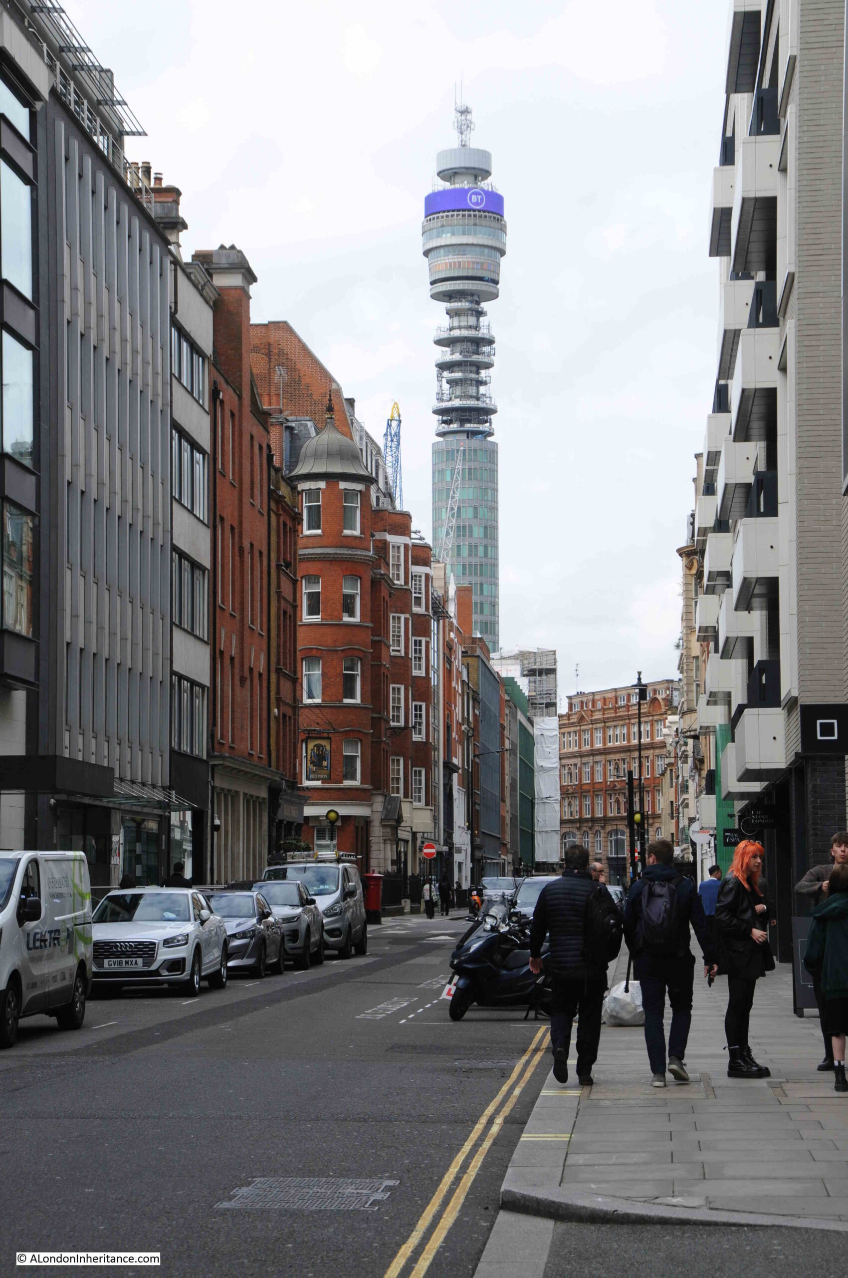
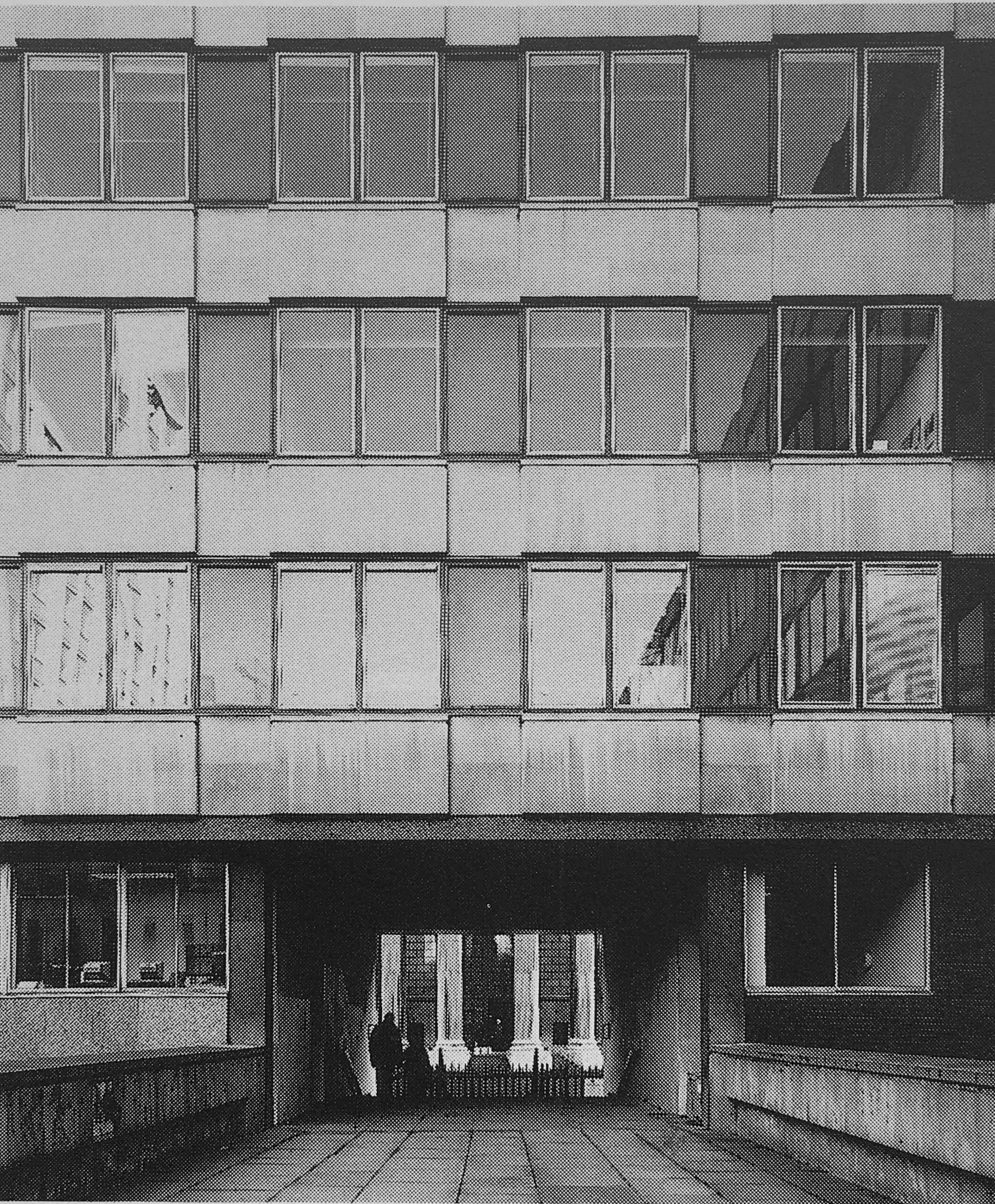
The above photo is from April 2024, and towards the upper part of the tower, there is an open section which looks almost as if the tower is still being built, however it is this open section of the tower which was the reason why the tower was built.
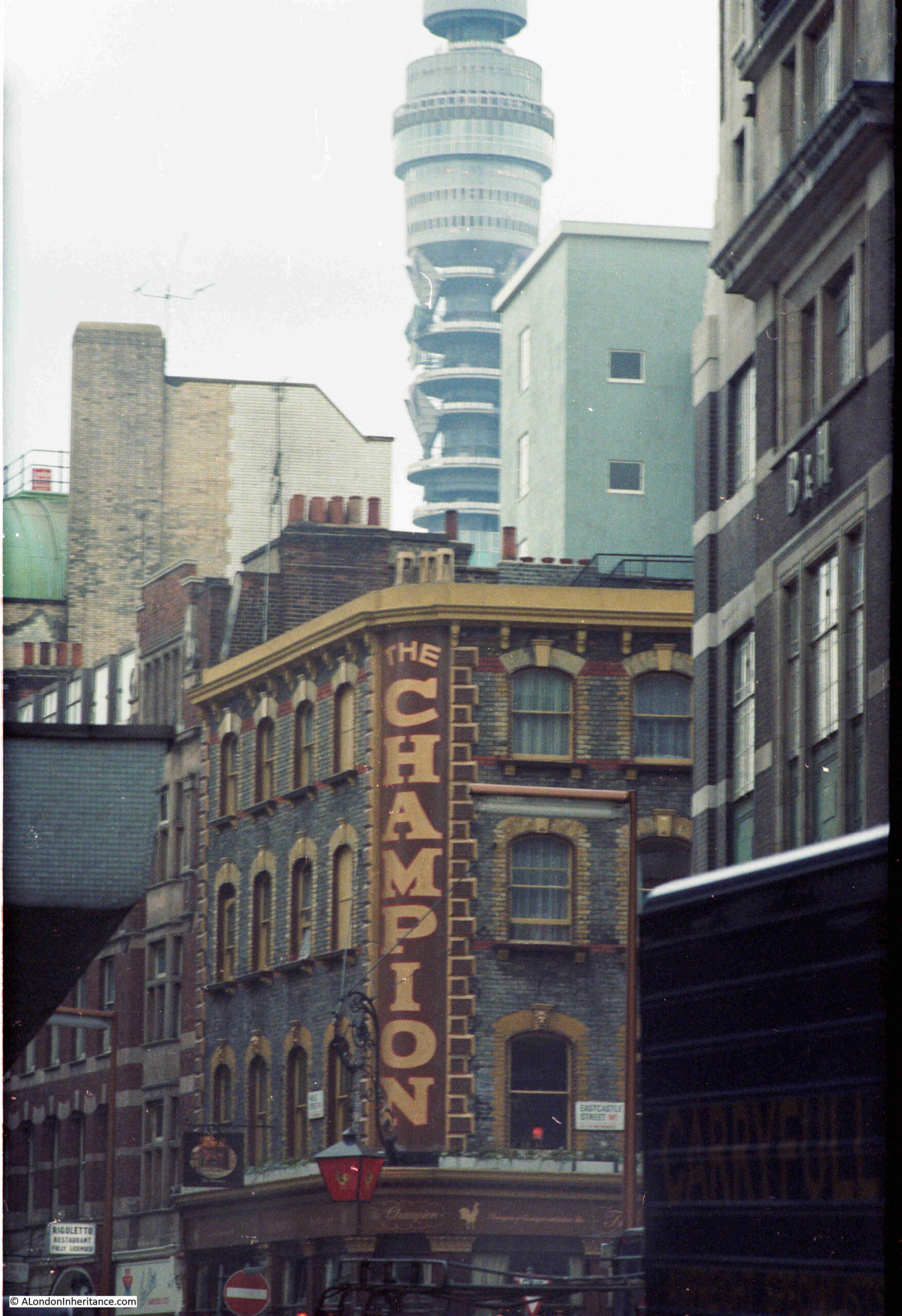
I took the following photo in 1980 of the Champion pub, at the junction of Eastcastle Street and Wells Street, with the Post Office Tower in the background, and at time of the photo, there were some strangely shaped objects fitted to this open section:
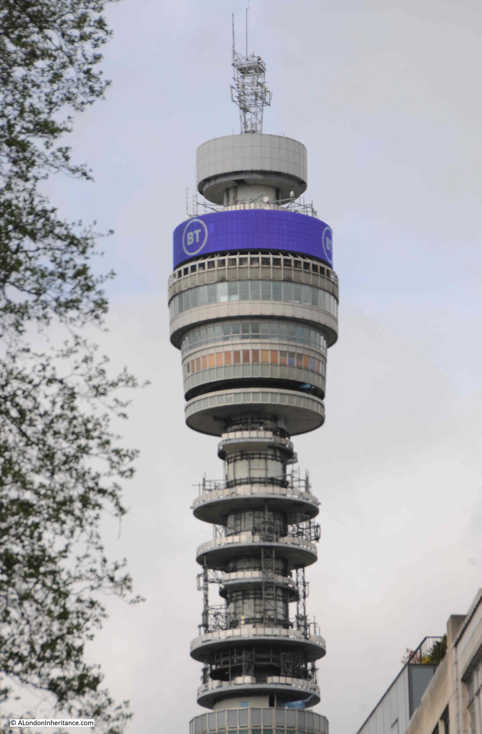
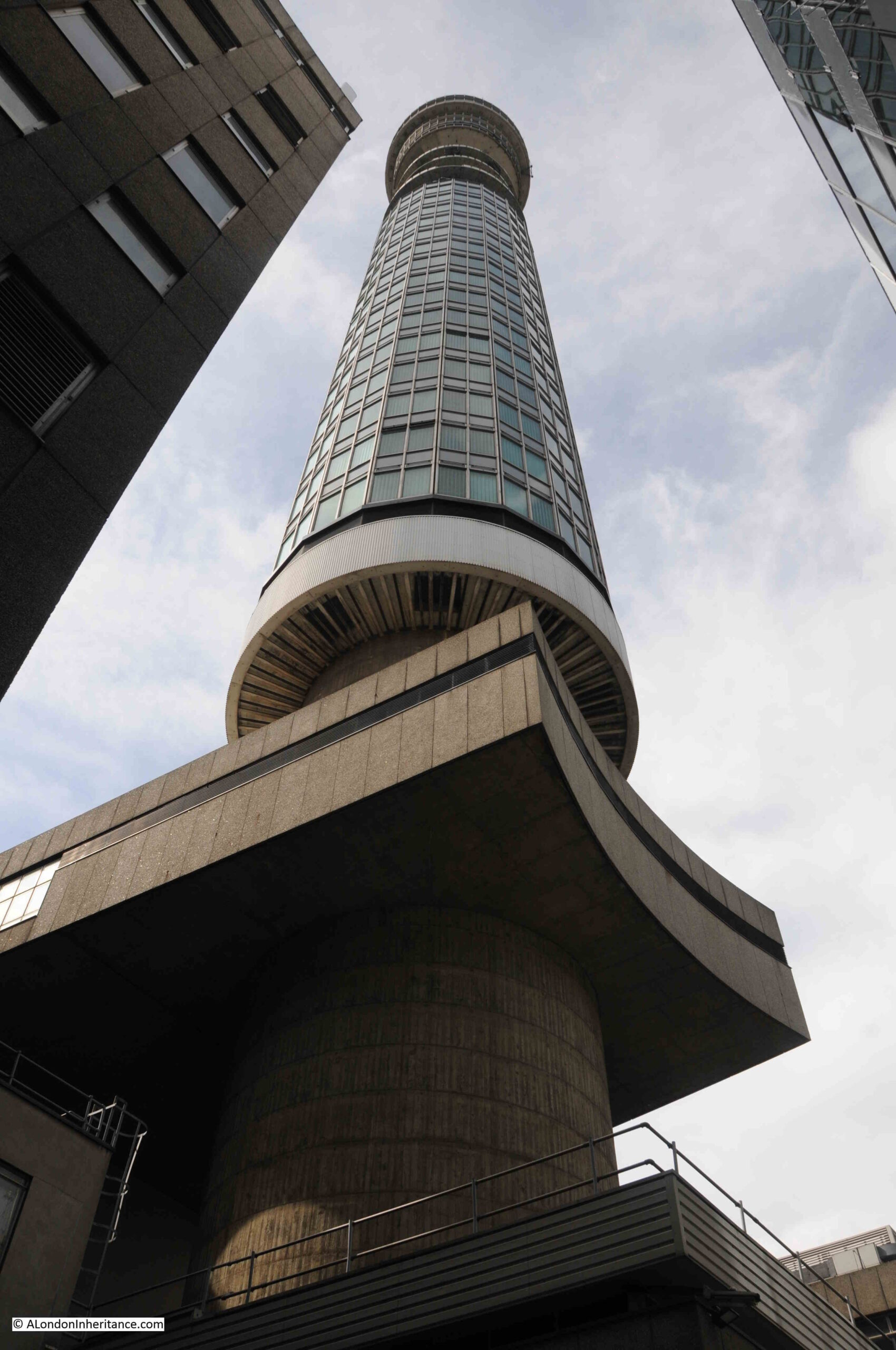
The following photo of the top section of the tower shows the upper part where the kitchen, cocktail bar, revolving restaurant and public observation floors were originally located. Below these floors is the open section with the round, concrete core of the building at the centre:
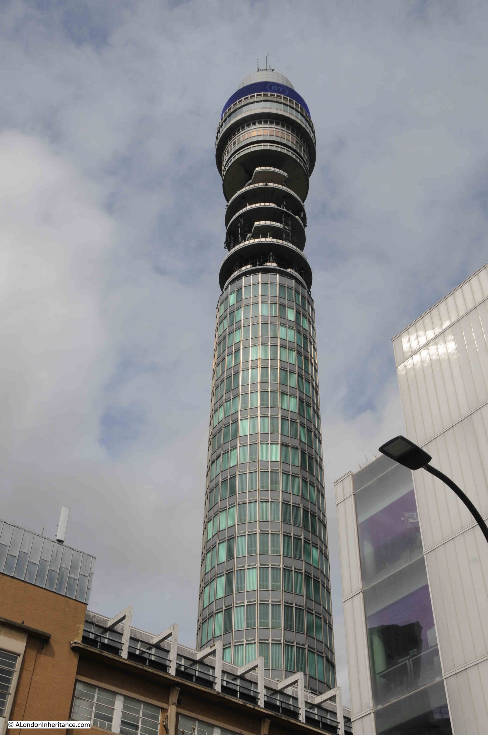
View from close to the base of the Post Office Tower:
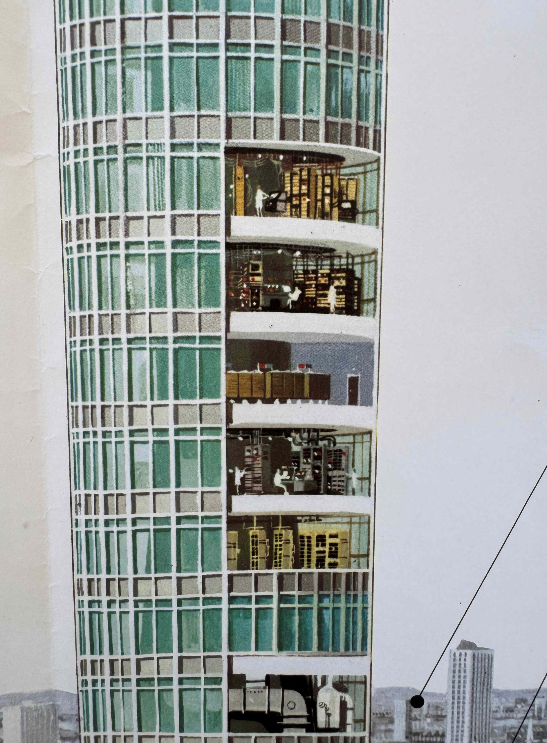
I have one of the wonderful large (A0 I think) posters produced by the General Post Office (GPO), after the opening of the building. The GPO was the combination of what is now BT, the Post Office and Royal Mail, and was then a state run organisation before being broken up and privatised.
The poster shows in detail the functions of the Post Office Tower:
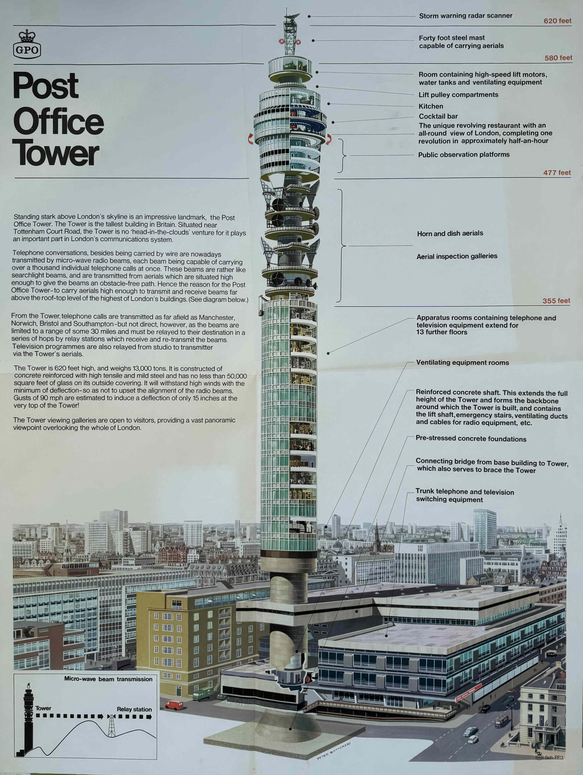
The poster records that “the Tower is 620 feet high, and weighs 13,000 tons. It is constructed of concrete reinforced with high tensile and mild steel and has no less than 50,000 square feet of glass on its outside covering. It will withstand high winds with the minimum of deflection – so as not to upset the alignment of the radio beams. Gusts of 90 mph are estimated to induce a deflection of only 15 inches at the very top of the Tower!”.
It was built between 1961 and 1965 and was designed by the Ministry of Public Building and Works Architect’s Department with Eric Bedford as the Chief Architect and G.R. Yeats as the Senior Architect in Charge.
The core of the tower is a reinforced concrete cylinder with a height of 582 feet. Not that obvious when looking at the Post Office Tower, however this concrete cylinder does taper, starting at 35 feet in diameter with two foot thick walls at the base, tapering to 22 feet in diameter and one foot thick walls at the top of the tower. This taper means that the lower floors are smaller than the upper floors.
This tapering of the central core is not that visible from outside the tower, but look at the poster above and the difference in the size of the core is very obvious between the lower and upper parts.
Reinforced concrete floors surround the concrete cylinder, with seventeen floors of equipment rooms and offices below the level where the radio antennas were mounted.
Working down from the top of the Tower, there was a storm warning radar mounted at the very top of the Tower, below which there was a circular room where lift and ventilating equipment was housed, along with water tanks. Below this was the kitchen, cocktail bar, revolving restaurant and public observation floors:
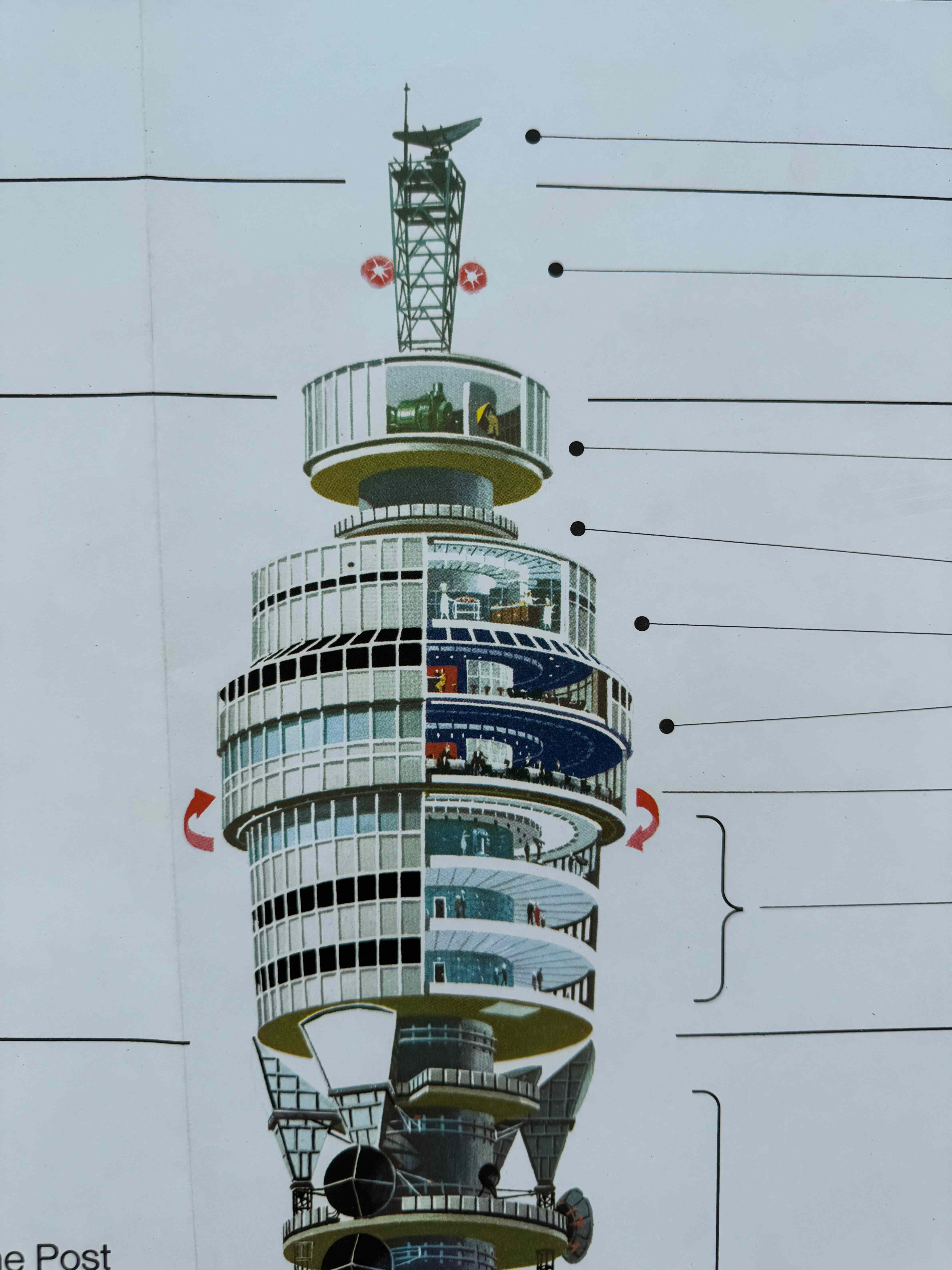
The restaurant was appropriately named as the “Top of the Tower” and was opened on the 19th of May 1966 by the Postmaster General, Anthony Wedgwood Benn, and Sir Billy Butlin, as the Butlin Organisation were the operators of the restaurant.
It was Britain’s first revolving restaurant, with the arrows in the above image showing the direction of travel, with one revolution taking 25 minutes.
The restaurant and viewing area were a huge success with over one million visitors in the first year of operation. The intention of the GPO was that entry fees to the Tower would help cover some of the costs of the building.
Public access came to an end after a bomb exploded in the men’s toilets in the restaurant on the 31st October of 1971. There was limited public access until 1981, but after that, the floors at the top of the Tower were used for invited meetings, presentations, charity events etc.
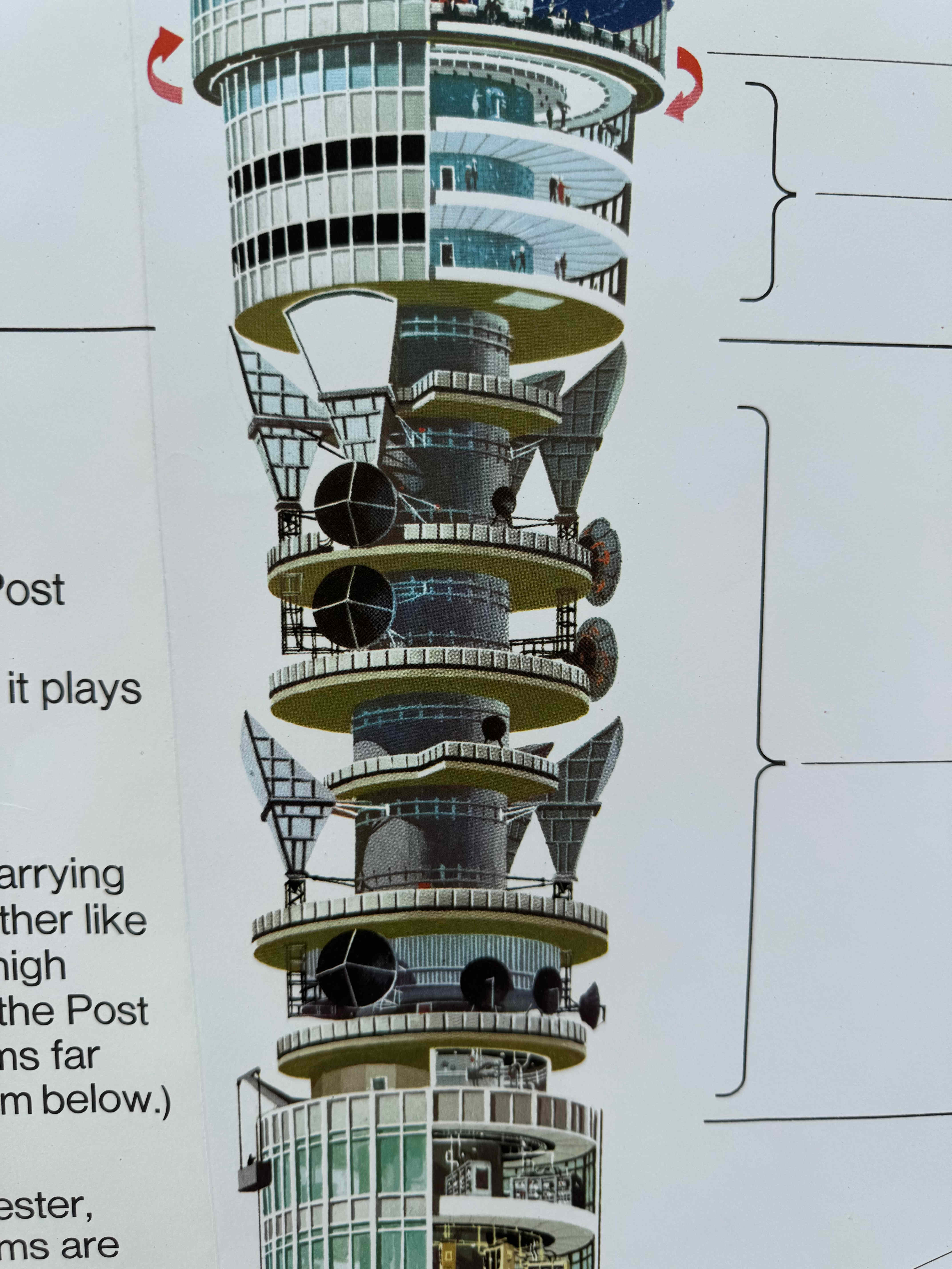
We then come to the section of the tower which is the reason for the Post Office Tower’s existence, height and shape. This is where the radio antennas were mounted:
In the post war period, the amount of telephone use was growing rapidly, and this was joined by the growth of television, services which both required a method of transmitting telephone calls and television signals across the country.
This had traditionally been achieved by copper cables running the length of the country, and connecting key cities from where further networks of cables ran out eventually reaching individual homes and telephones.
TV signals were distributed between outside events, studios and transmitter sites.
The copper cable network was not a cost effective or technical means of supporting this rapid growth through the 1960s and 1970s, so a new network was designed whereby both telephone calls and TV transmissions would be carried across the country using microwave radio signals – linking up key locations where signals would then be converted back from microwave radio signal to electrical signal for local transmission via copper cable.
The key problem with microwave radio is that the signal is line of sight. The sending antenna needs to see the receiving antenna, so to send a signal between geographically spread locations, antennas had to be mounted on high towers, capable of seeing their adjoining towers without any obstructions in-between – hence the height of the Post Office Tower.
This diagram from the above poster shows graphically how this worked:
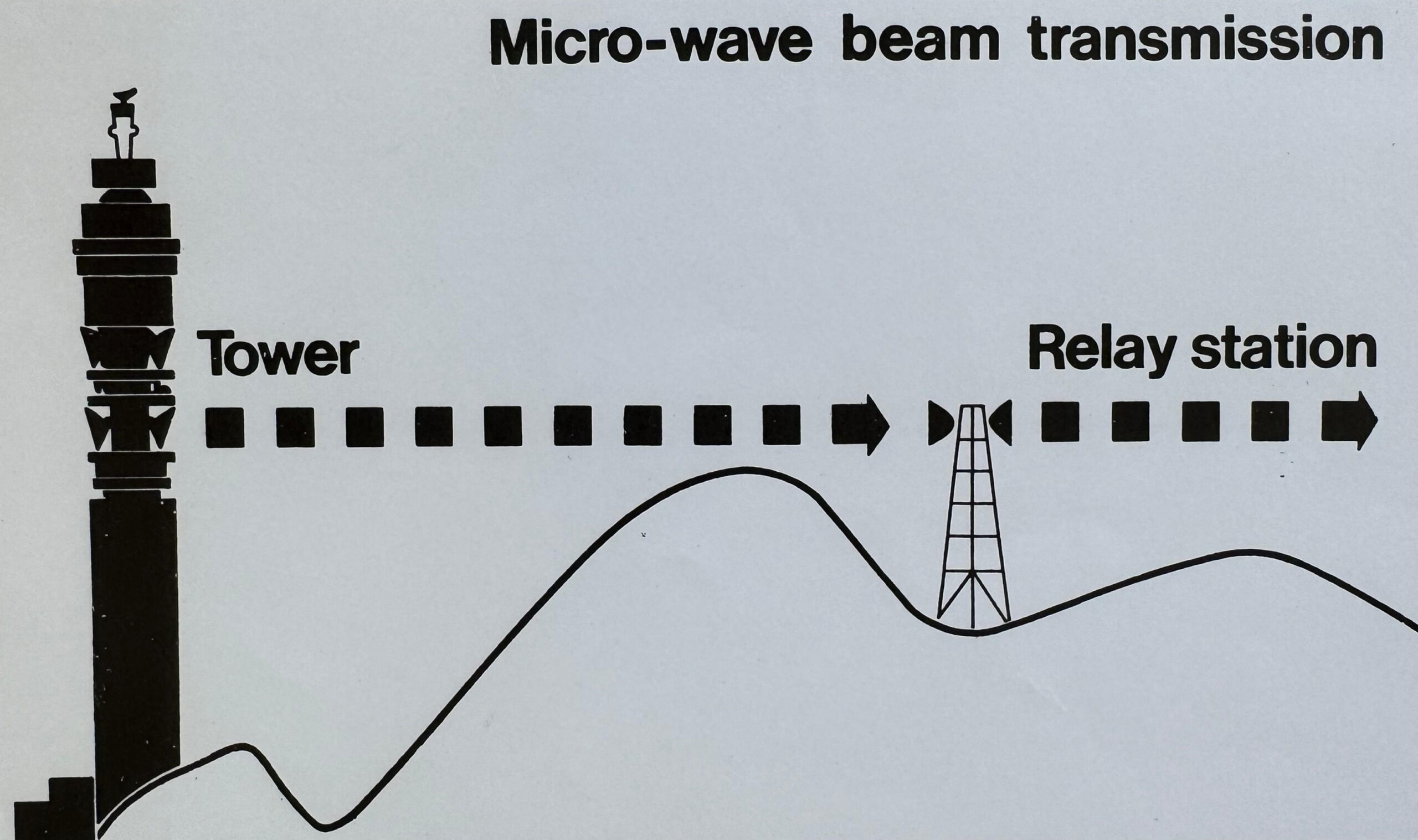
For the Post Office Tower, the height of the antenna platforms was dictated by the height needed to “see” a surrounding network of towers, and the space where they were mounted was circular to give maximum flexibility for moving and pointing antennas in any direction, as well as the space to add additional antennas, as and when needed.
This circular shape was then mirrored across the whole of the tower, and it was a shape that also resulted in minimum wind resistance. The tower needed to be stable, as a small change could mean that the microwave radio beam between the Post Office Tower and an adjacent tower would become out of alignment.
To support this new, cross country communications system, a network of towers sprang up across the country.
But the towers had another, more secretive purpose.
I have a copy of The Sunday Times Magazine published on the 28th of January 1973, and in the issue there is an article titled “The National Guard”, by Peter Laurie and developed from his book “Beneath the City Streets”.
The article explored what else the towers supported, in addition to telephone and television signals.
At the time of the Post Office Tower’s construction, the Cold War was in full flow between the West and Russia. The risk of a nuclear war was all to real, and the Cuban Missile Crisis took place in October 1962, whilst the tower was being built.
There were a number of radio networks across the country, as well as telephone and television, the Gas and Electricity boards had a network to control their nations grids, there was a network for Civil Air Traffic Control, and a separate network for the United States Air force for their fighter and bomber control.
Peter Laurie’s article explained that the towers also included a network to “safeguard vital national communications in the interests of defence” – which seemed to include both air defence warning and control systems against an attack by Russian nuclear bombers, and to provide Government communications to dispersed underground national and regional seats of Government across the country.
The Sunday Time Magazine article included a collection of photos of towers across the country, of which the Post office Tower was part:
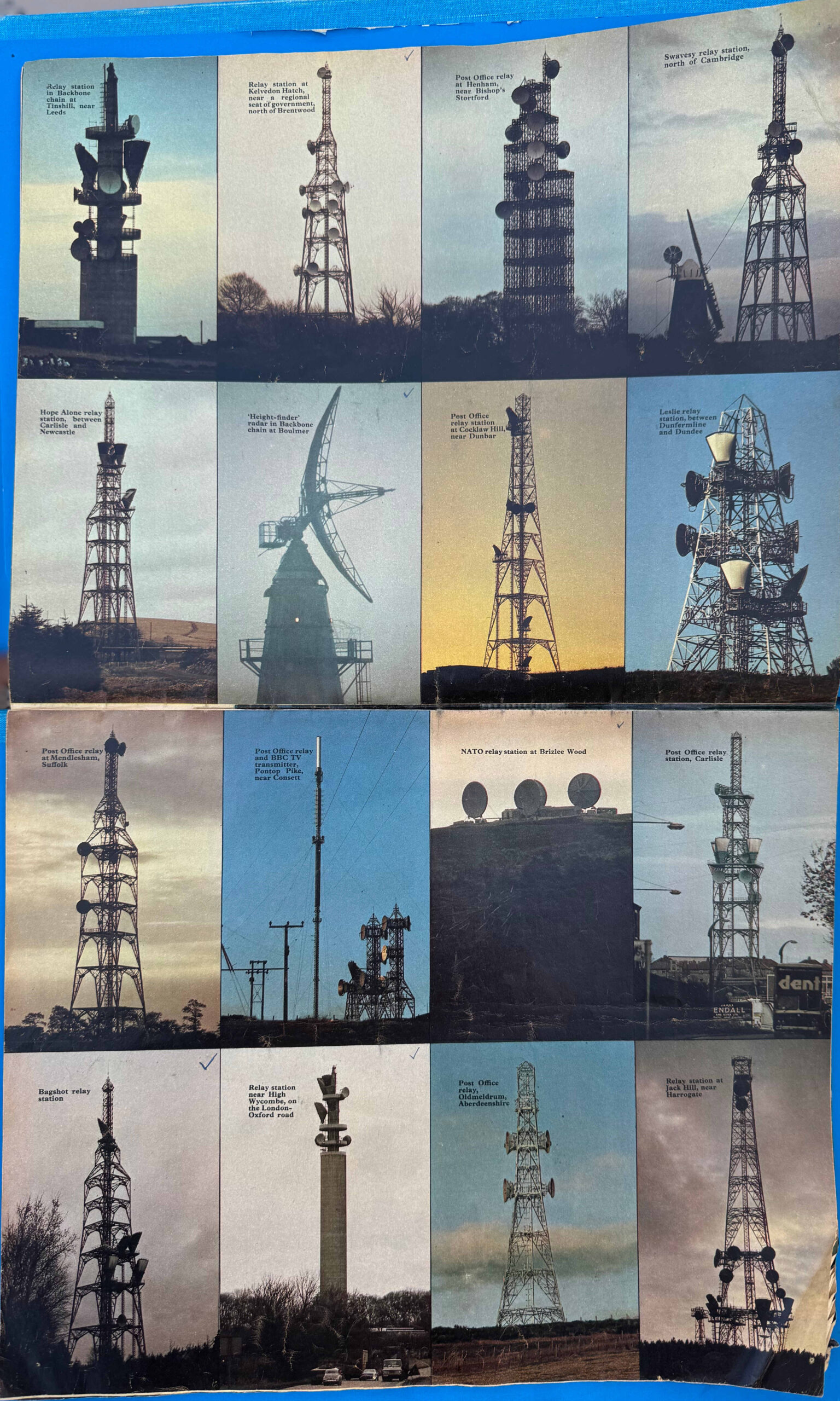
You can still see how the network works today. If you go to the Sky Garden at 20 Fenchurch Street on a clear day, and look to the east, on the far horizon who can see the ghostly outline of a tower.
This is the tower at Kelvedon Hatch in Essex, and in the above matrix of photos, it is the tower in the top row, second from the left.
My photo shows the tower, just visible on the horizon to the right:
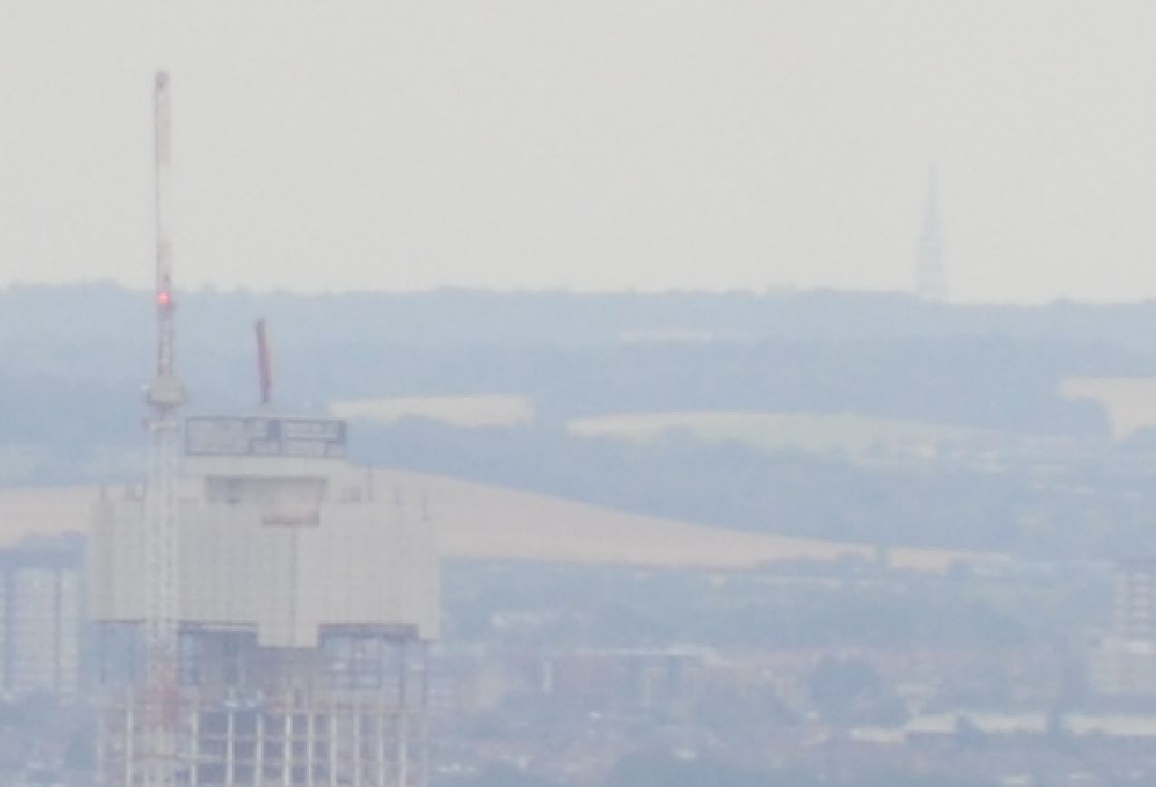
As can be seen in the above photo, being up a high point in London, enables a line of site to another, distant high point, over which a microwave radio signal could be transmitted.
Other towers surrounding London include a tower near High Wycombe, which is next to the M40 and very visible if you drive along this motorway, along with another tower at Bagshot in Surrey. These are both in the matrix of photos above.
The network extended across the whole country, with each tower serving as a local connection into the network, as well as the relay point to surrounding towers.
In the matrix of photos above, the caption to the Kelvedon Hatch tower states that it was “near a regional seat of government, north of Brentwood”.
This was the underground bunker at Kelvedon Hatch which would have formed a regional seat of Government in the event of nuclear war. I worked in the bunker a couple of times as a Post Office Apprentice in the late 1970s, and wrote about the bunker in this post.
The microwave radio network was a vast improvement in the volume of data that could be transmitted across the country over the previous copper network, however technology does not stand still and during the 1980s and 1990s, a network of fibre optic cables was being laid across the country.
Fibre optic cables were relatively cheap, and small bundles of cables could carry very large volumes of data, considerably more than a microwave radio network, and with the coming of the Internet, data volumes started to increase exponentially, therefore the new fibre optic network started to take over from the microwave radio network.
The last elements of the radio network were switched off between 2006 and 2007, and the radio dishes and horn antennas were removed in 2011 due to concerns regarding their condition and the safety of the surrounding area.
Permission for removal was needed because the tower is Grade II listed, and planning approval was granted by Camden Council. There was a proposal to install dummy dishes to replicate the appearance, however BT rejected this on the grounds of cost.
This is why this section of the tower looks almost as if it is an unfinished part of building works.
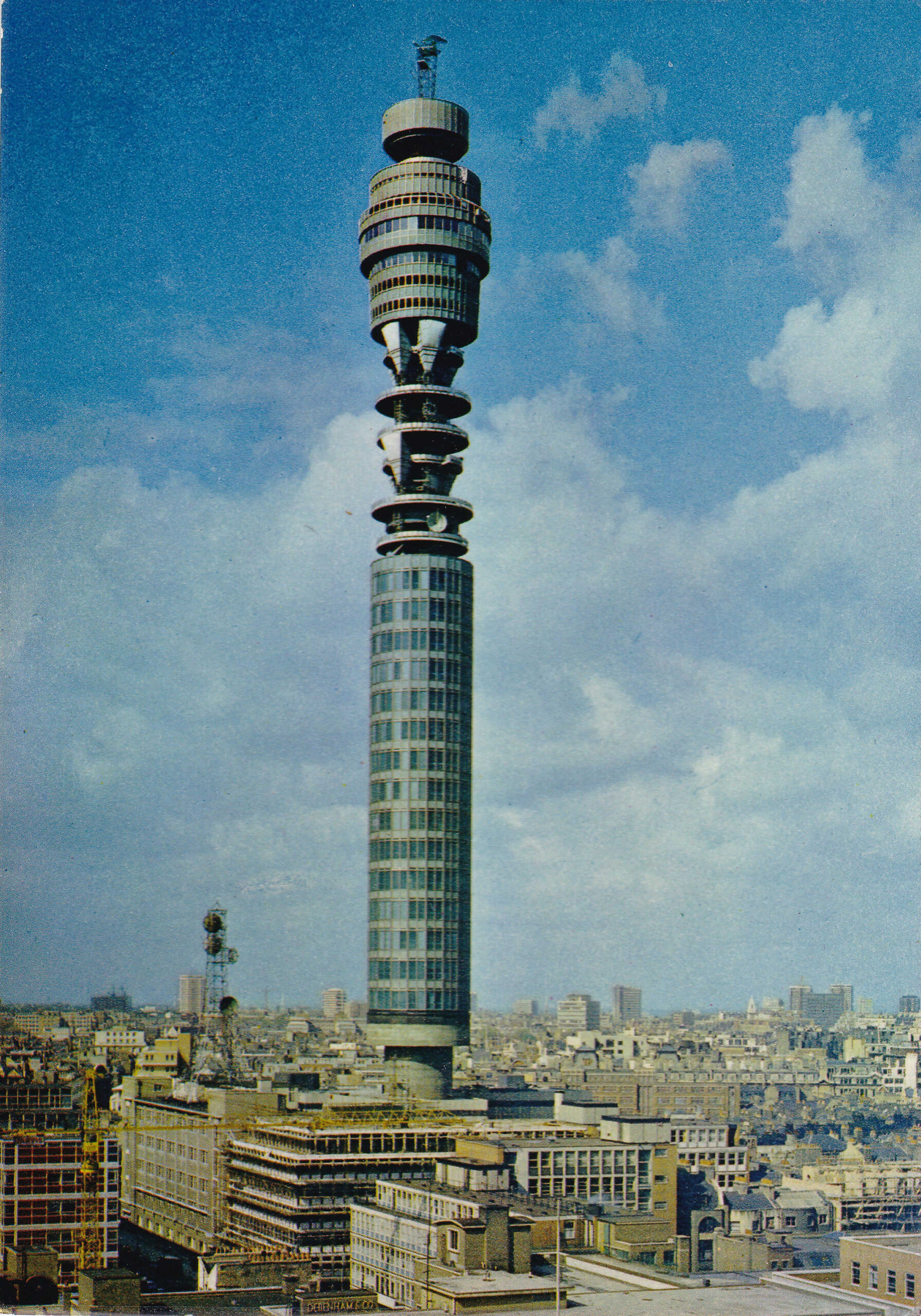
Postcard from the 1960s soon after completion of the Post Office Tower showing the horn and dish antennas mounted on the tower, and at the base is the Museum telephone exchange, with the small tower providing some of the local radio links:
The Post Office Tower was opened in October 1965, and the following news report is typical of the reporting of the opening of the tower:
“FROM BIG BEN TO BENN’S BIG TOWER – The Post Office Tower symbolises 20th century Britain in much the same way as Big Ben symbolised 19th century Britain, said Postmaster General, Mr. Anthony Wedgwood Benn, today.
Both speak eloquently for the age in which they were built.
He added: Big Ben represents the fussy grandeur of the Gothic revival that epitomised Victorian imperial influence, built on the foundation of the first industrial revolution.
The Post Office Tower, lean, practical and futuristic, symbolises the technical and architectural skill of this new age.
Mr. Wedgewood Benn was speaking at the ceremony at which the Prime Minister, Mr. Harold Wilson, inaugurated the operational working of the Tower.
Mr. Wilson talked over a microwave telephone link from the Tower to the Lord Mayor of Birmingham; and audiences in each city watched the ceremony by means of a closed circuit television link via the Tower.
Mr. Wedgwood Benn continued: This new, bigger Big Ben captures the sprit of our time, and visitors to London will remember it as the dominating feature of our capital city. Significantly, it is a great communications centre, that will allow the vast expansion in telephony, telegraphy, data transmission and the distribution of sound and television programmes, linked to the world satellite system.
He added that there was a great growth in telephone traffic. Trunk calls were increasing at a rate of about 17 per cent a year.”
Birmingham also had its own microwave tower, connected into the national network, and which was 500 feet tall, and cost £3 million to build.
We can now continue down the Post Office Tower, and the poster shows the apparatus rooms on each of the floors, which contained apparatus for telephone and television systems, and any other systems that would have used the microwave radio network:
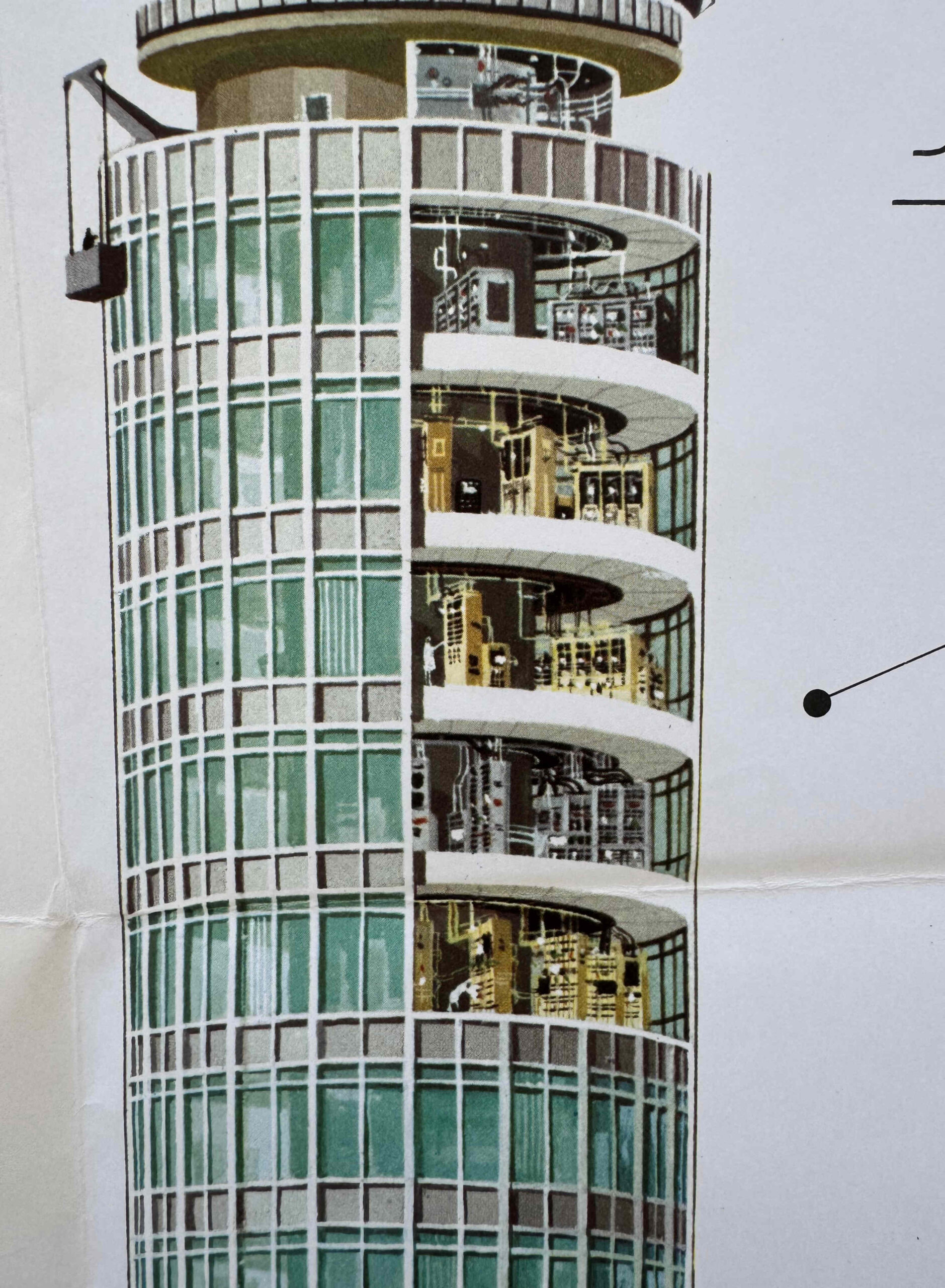
These rooms continued down through all the floors wrapped around the central concrete column:
Since its’ completion, the Post Office Tower has been a significant feature on London’s skyline. Apart from Centre Point (which was built over the same period as the Post Office Tower), there are no other tall buildings in the immediate vicinity.
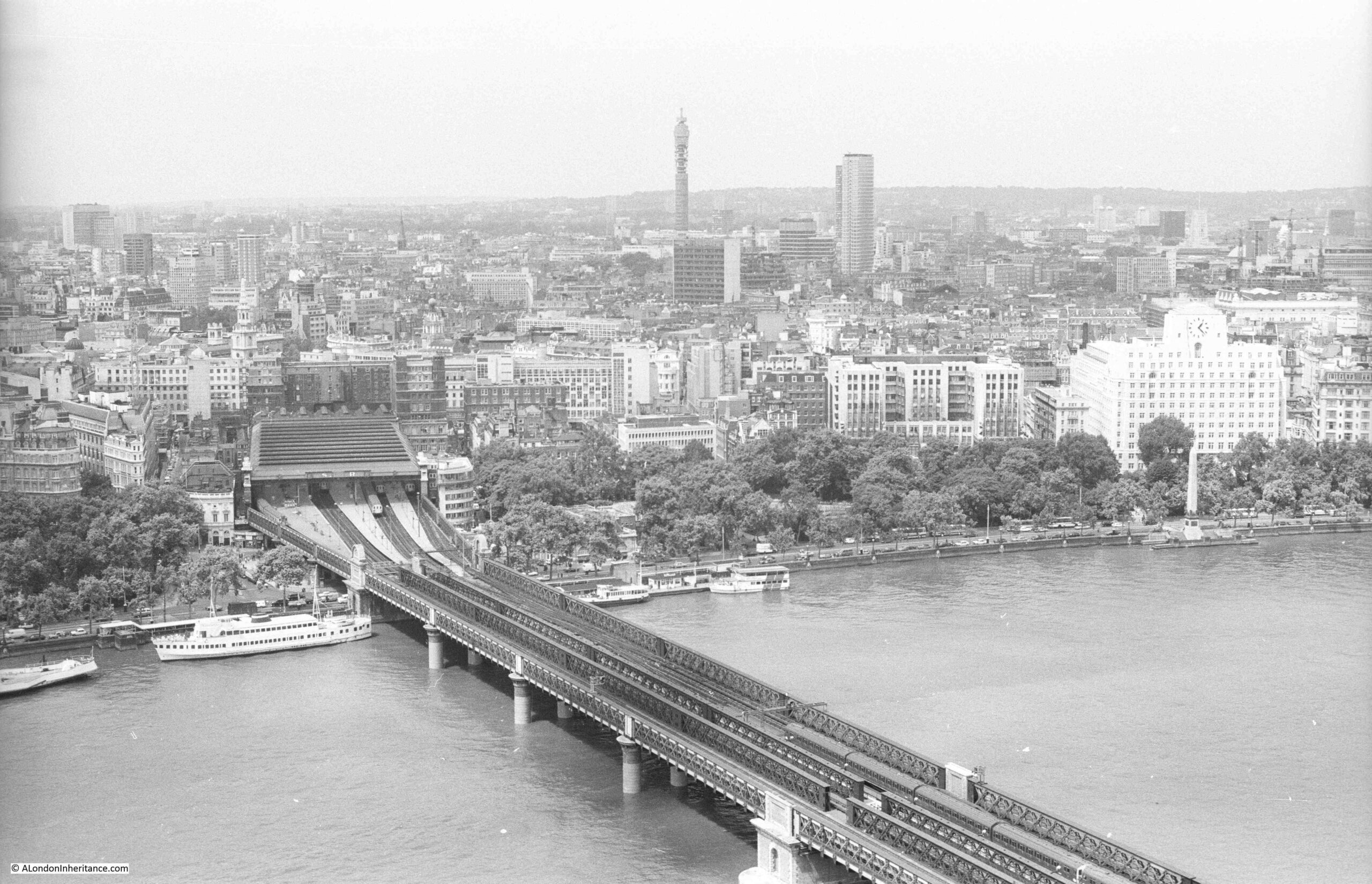
In 1980, I took the following photo from the viewing gallery of the Shell Centre building on the South Bank, showing the Post Office Tower:
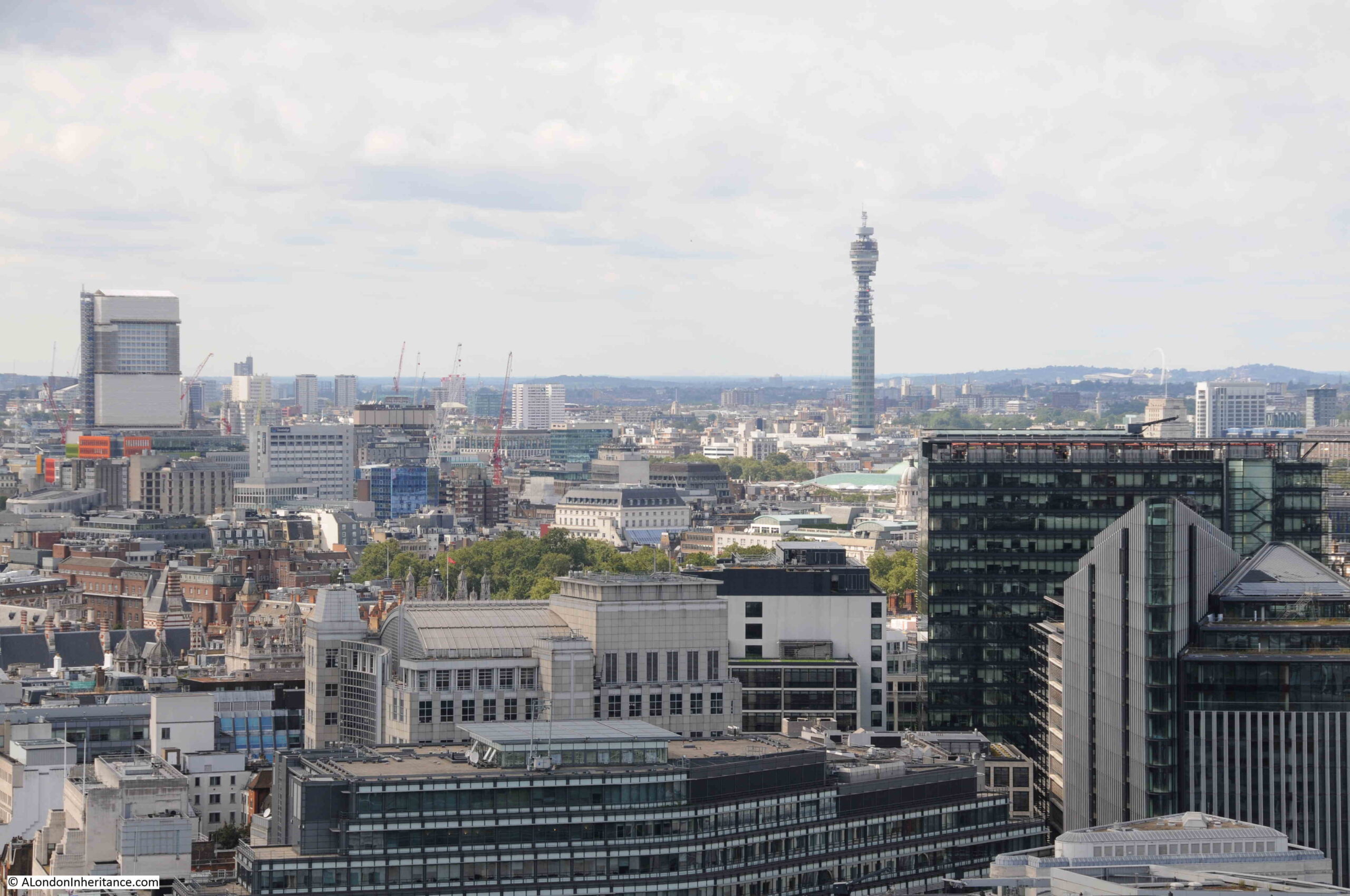
This photo was from a few years ago, taken from St. Paul’s Cathedral:
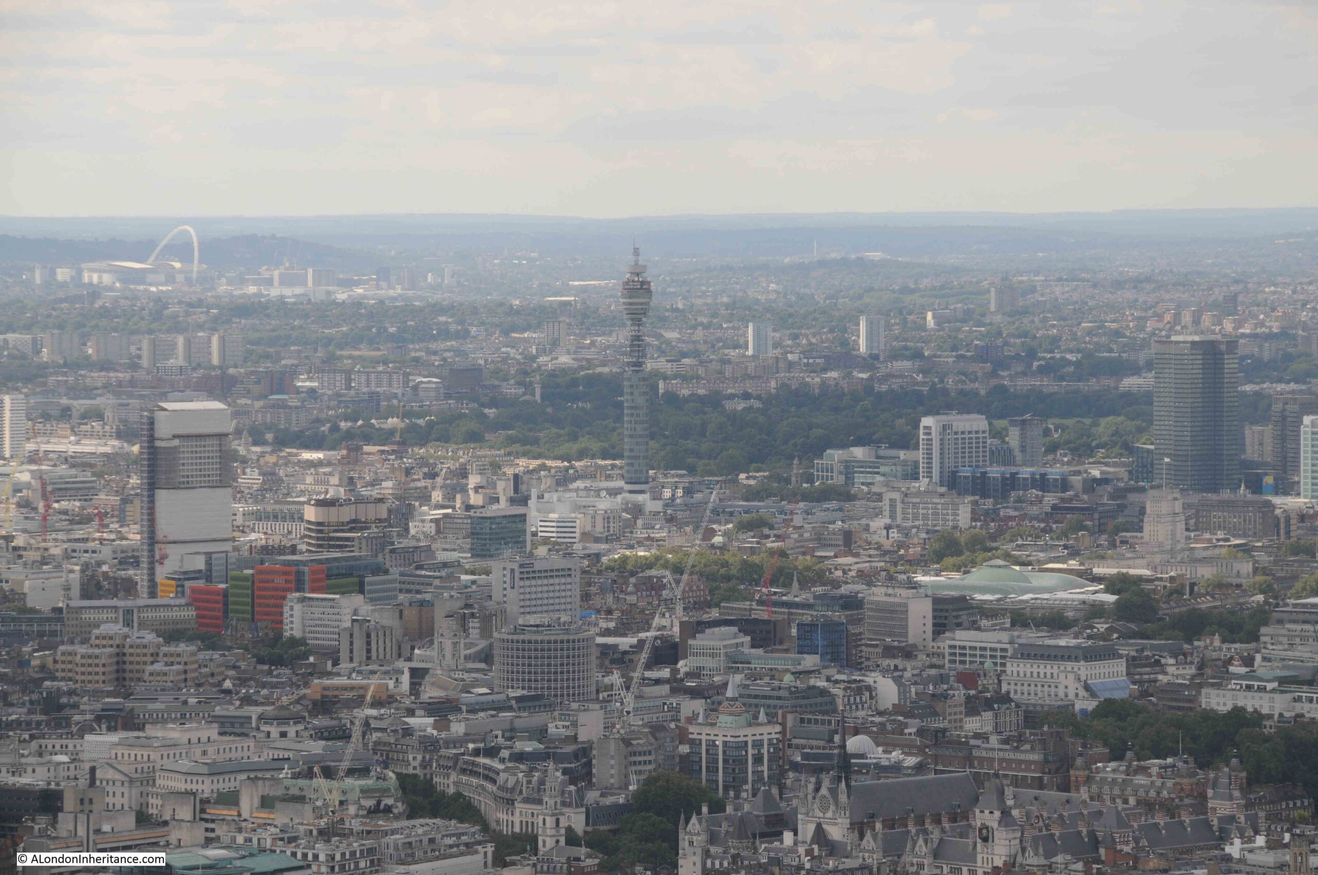
And this is from the viewing galleries of the Shard, where unusually, you are looking down on the Post Office Tower:
One question about the tower I have not answered is why it is located where it is in London?
The answer comes from London’s historic distribution of telephone exchanges, as the site of the tower was the site of the Museum Telephone Exchange.
Prior to the all number system of telephone numbers we use today, London’s telephone system used a combination of three letters and four numbers. This was called the Director system and used due to the large number of telephone exchanges in London, with three letters identifying each exchange, so if you had a telephone connected to the Museum Exchange, your number would be of the format MUS 1234 (this was when telephone dials had letters as well as numbers around the edge of the dial).
The Museum Telephone Exchange was already a hub for London’s telecommunications network, including audio and video circuits, and the Museum exchange included a link to the BBC’s Broadcasting House, so it was the logical site for a tower that would network and connect London with the rest of the country.
Before the Post Office Tower, the Museum Telephone Exchange already had small mast on the roof, and a name used in the early days of planning for the Post Office Tower was the Museum Exchange Tower.
After construction had been completed, Peter Lind, the company responsible for construction, had large adverts in many newspapers advertising that they had constructed “Britain’s Tallest Building” and although calling it the G.P.O. Tower in the headline, in the text under a photo of the tower it was called the “Museum Telephone Exchange and Radio Tower”.
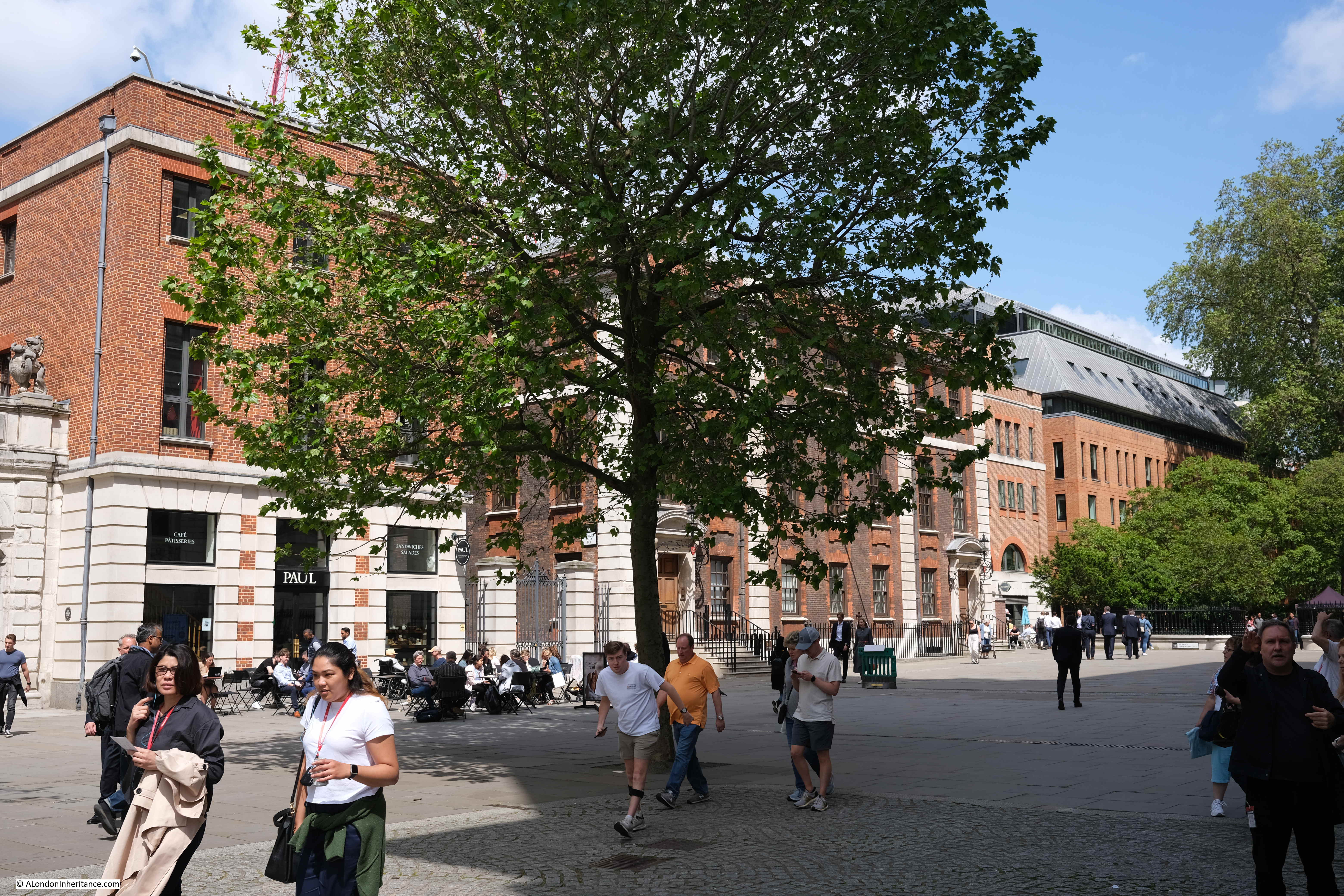
The tower is still surrounded at its base by a number of BT buildings which have long been used for telecommunications equipment. Whether any or all of these are included in the sale of the Post Office Tower is not clear.
Whilst the tower is listed, the surrounding buildings at the base are not, so it will be interesting to see what happens to these in the coming years:
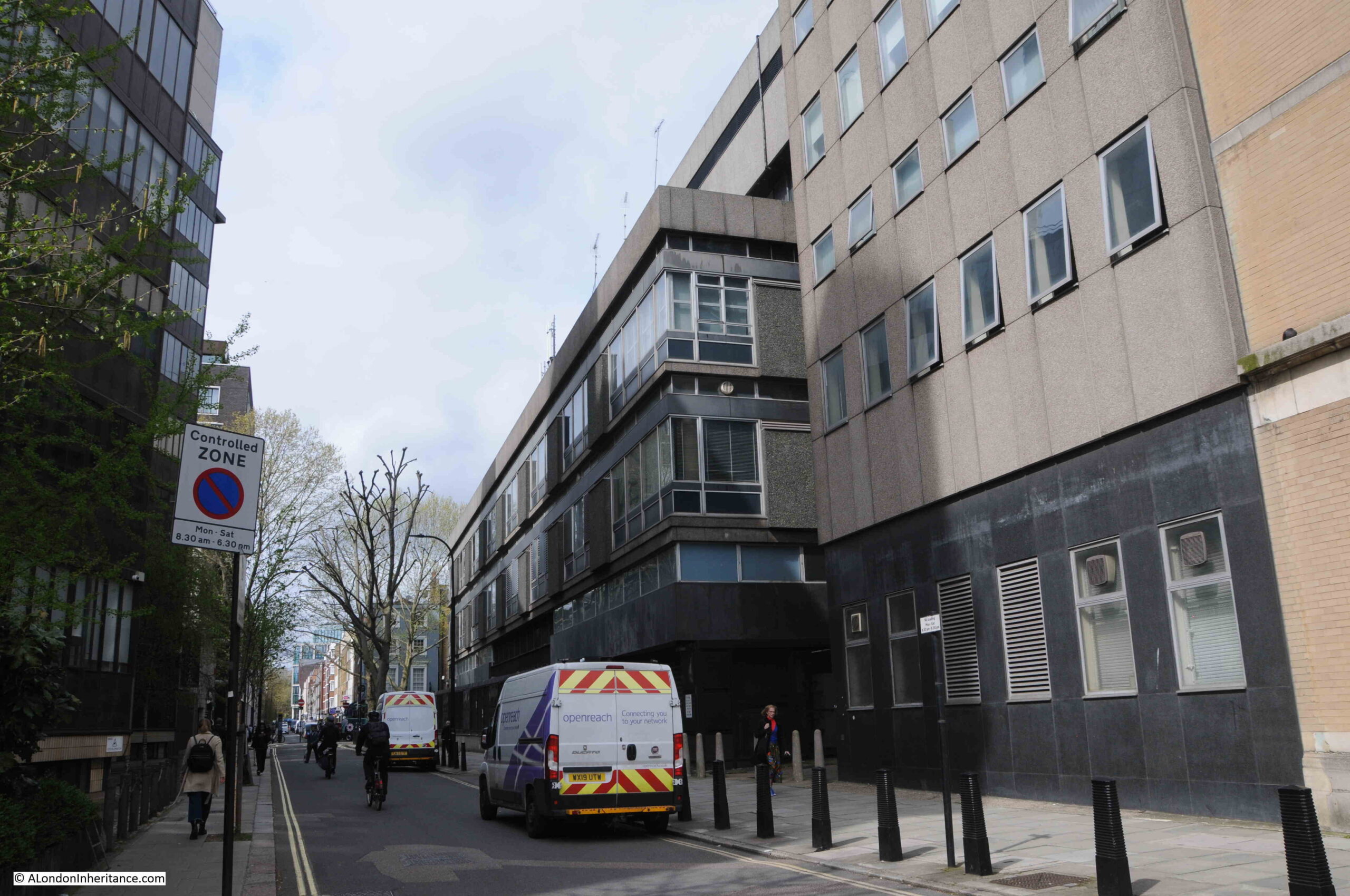
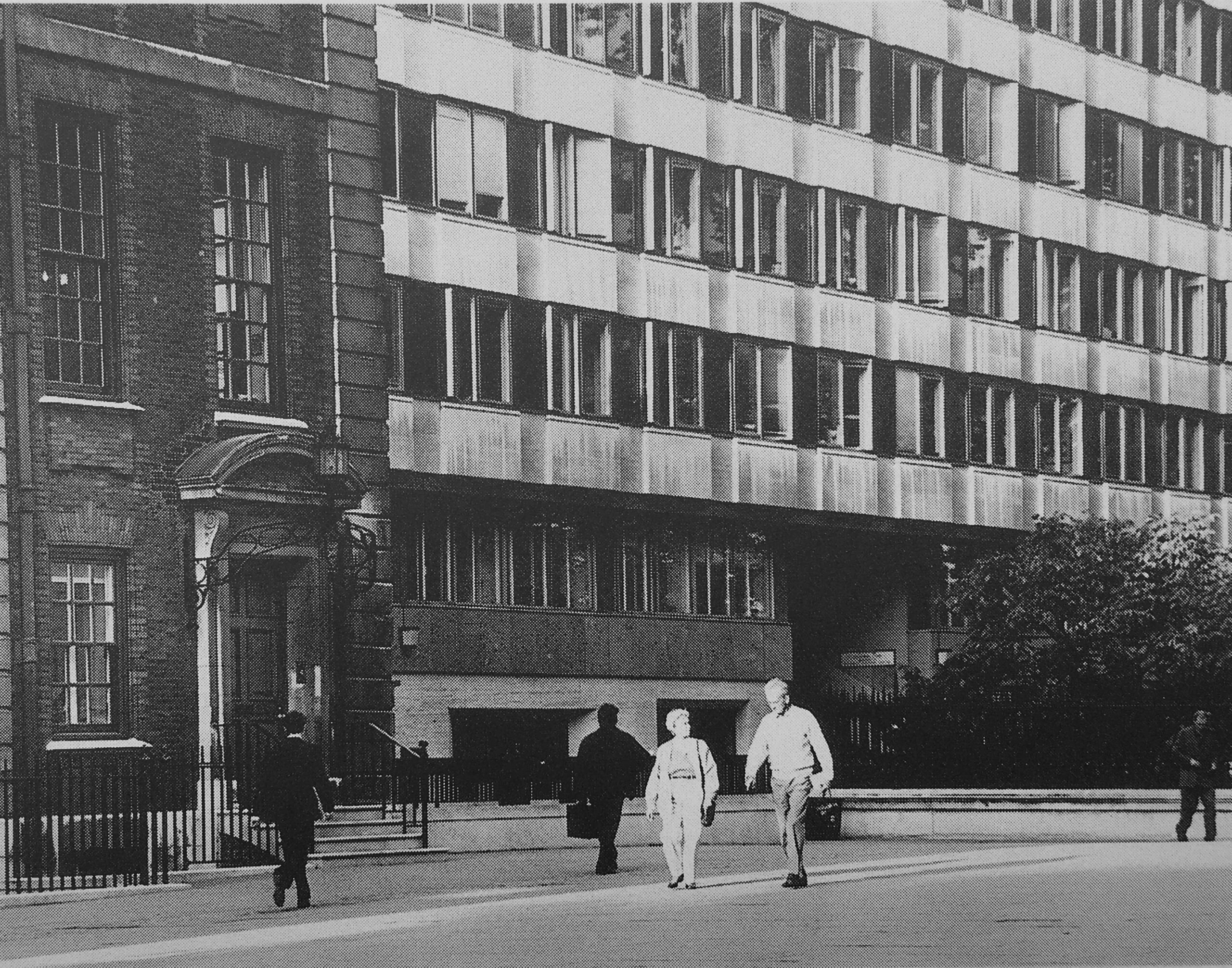
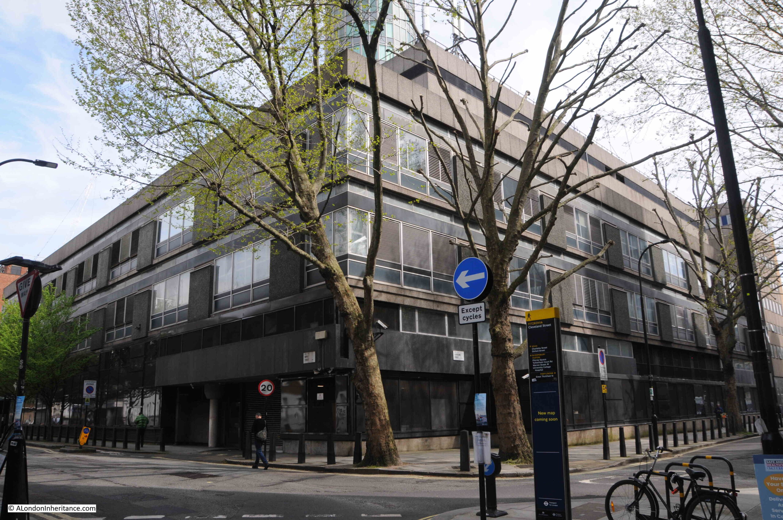
The above photo shows the view along Cleveland Street with BT buildings on the right, and in the following photo are more BT buildings at the junction of Cleveland Street and Maple Street:
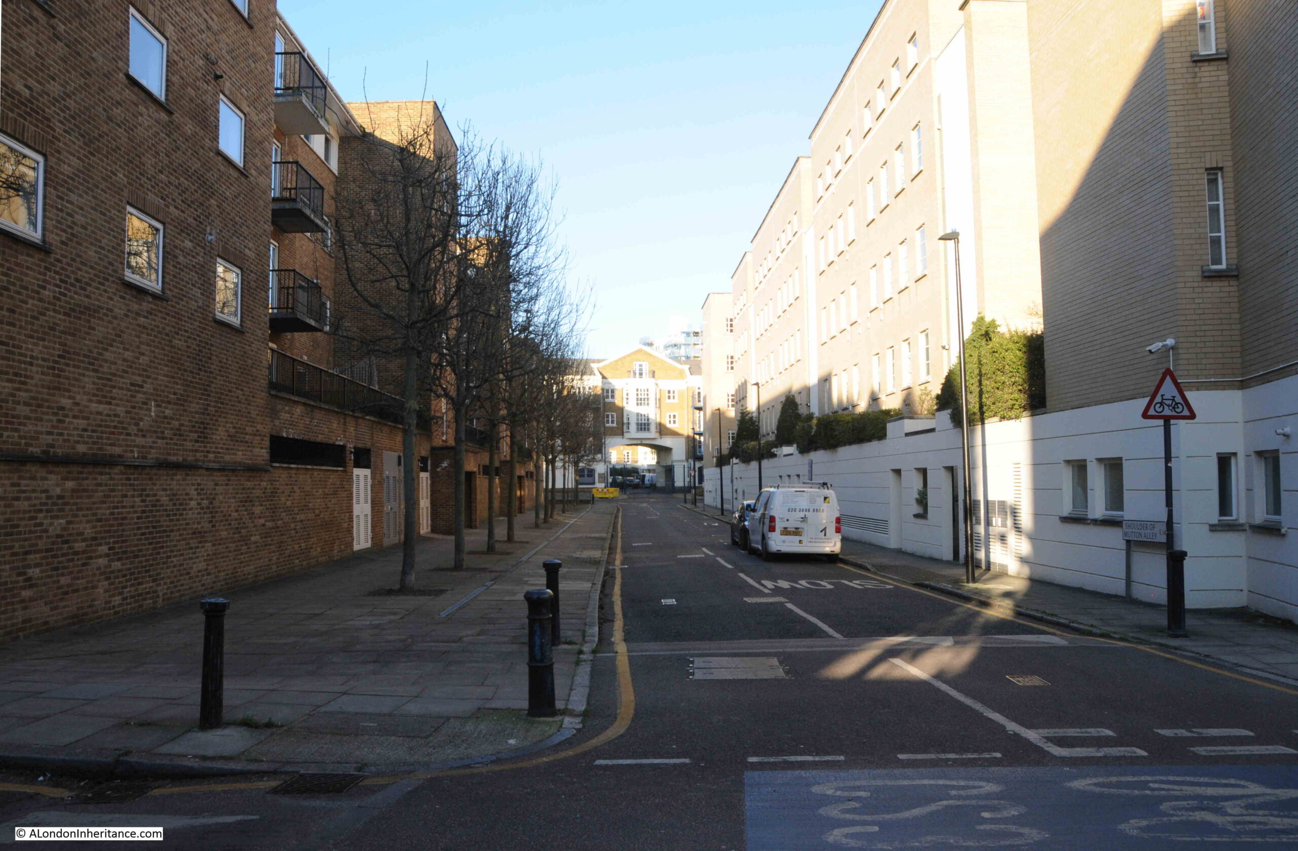
Whilst we can see the majority of the Post Office Tower from the surrounding streets, there is one really interesting part of the structure that can only be seen from one side street
Walk down Cleveland Mews, and this is the view:
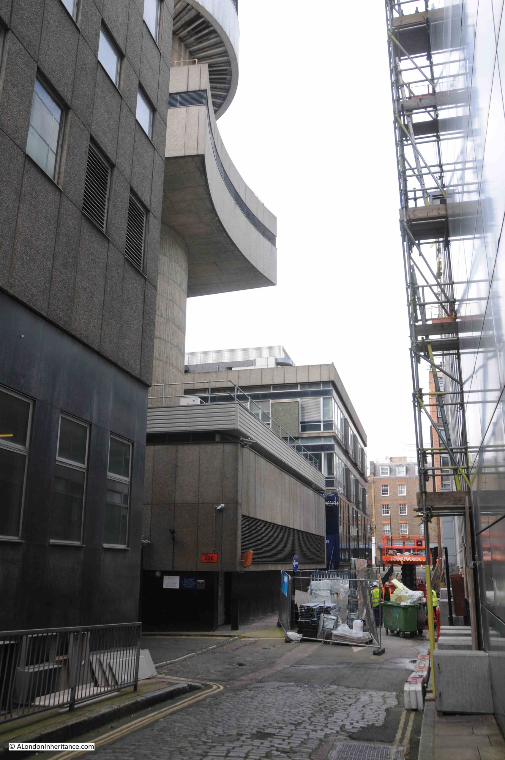
As mentioned earlier, the tower needs to be as stable as possible so the microwave radio beams could maintain their alignment with distant masts. To help provide this stability, towards the base of the tower there was a “collar” which extended from the ground level buildings around the central concrete column. As well as providing stability, the collar also provided access to the tower:
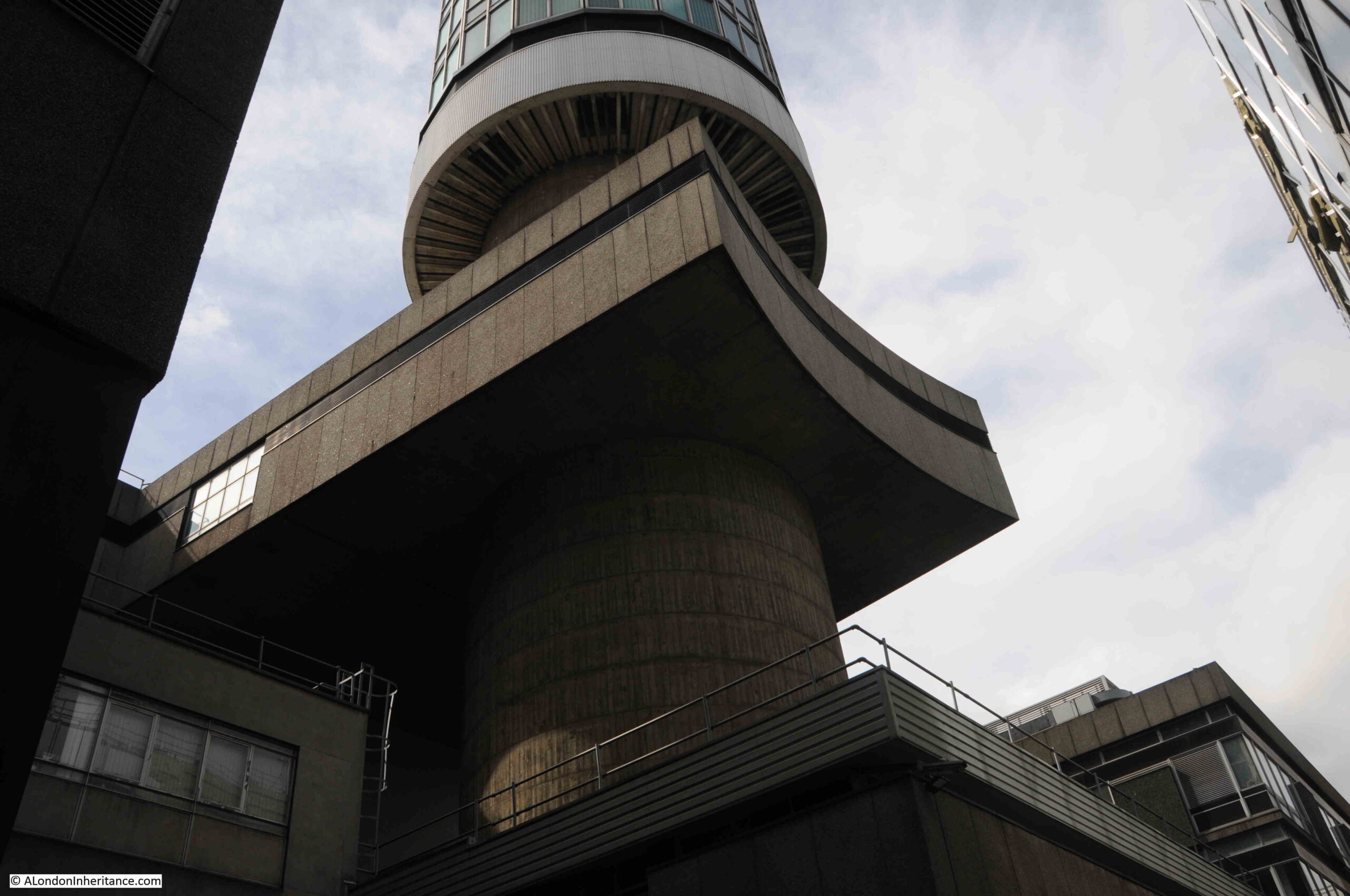
The collar can be seen in this extract from the poster, where it is described as a connecting bridge and brace for the tower:
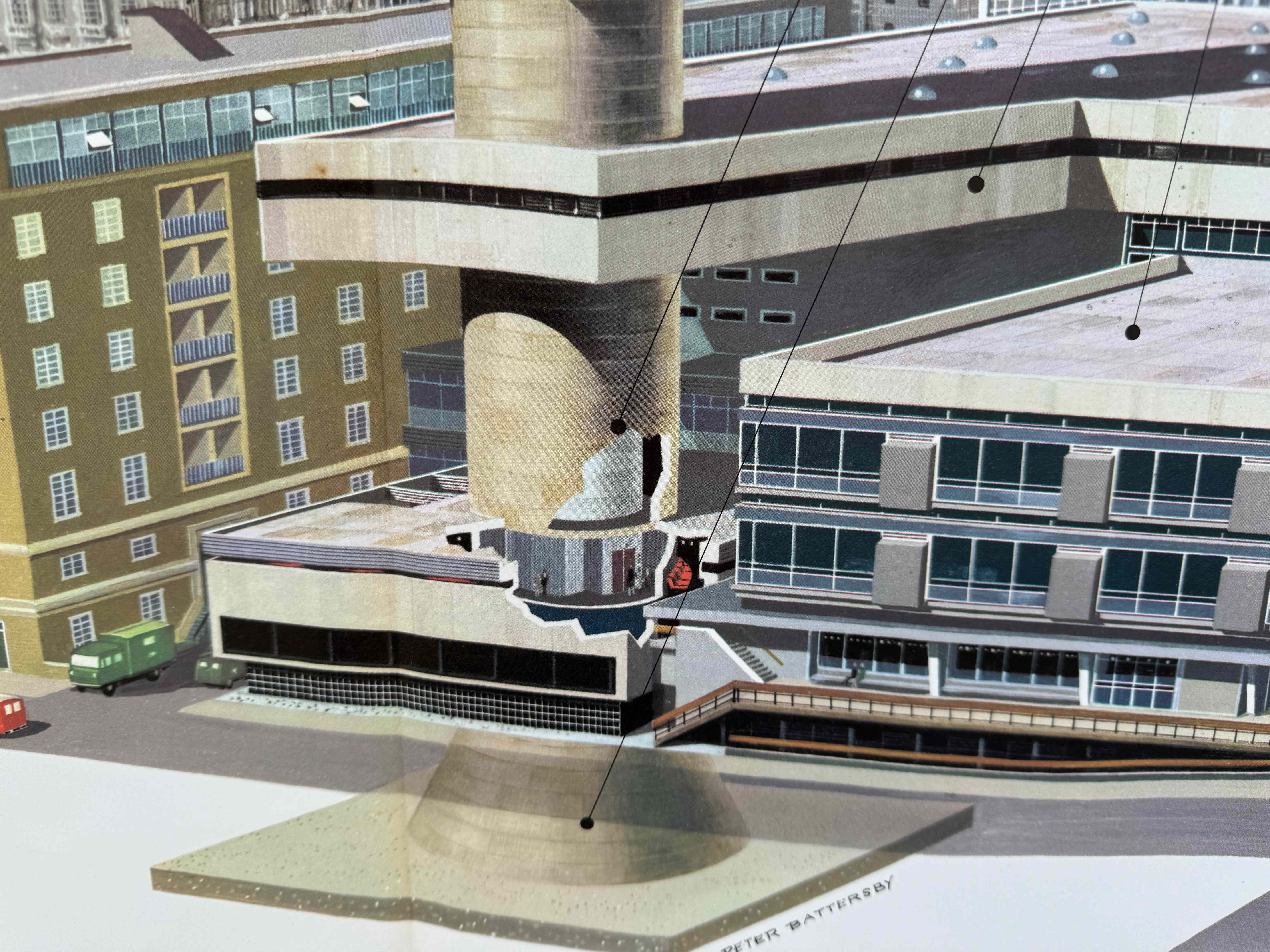
in the above image, we can also see the concrete conical pyramid on which the tower was built, and which helped spread the load over the concrete foundations below.
The foundations of the tower below the conical pyramid consisted of a large layer of reinforced concrete, below this was a layer of oil which formed an anti-friction gasket, below which was a thin layer of concrete, and then natural ground.
Looking up at the Post Office Tower from Cleveland Mews, and we can see the central concrete column at its widest diameter, then the collar / brace, and then the tower rising above London.
The Post Office Tower is a remarkable bit of engineering and construction, all to raise a set of antennas to a sufficient height so that they could communicate with a network of relay towers in the counties surrounding London.
The Post Office Tower seen from Fitzroy Square:
Many historic landmarks have a local pub named after them, and the Post Office Tower is no different as at the junction of Cleveland Street and Clipstone Street, is:
The Tower Tavern
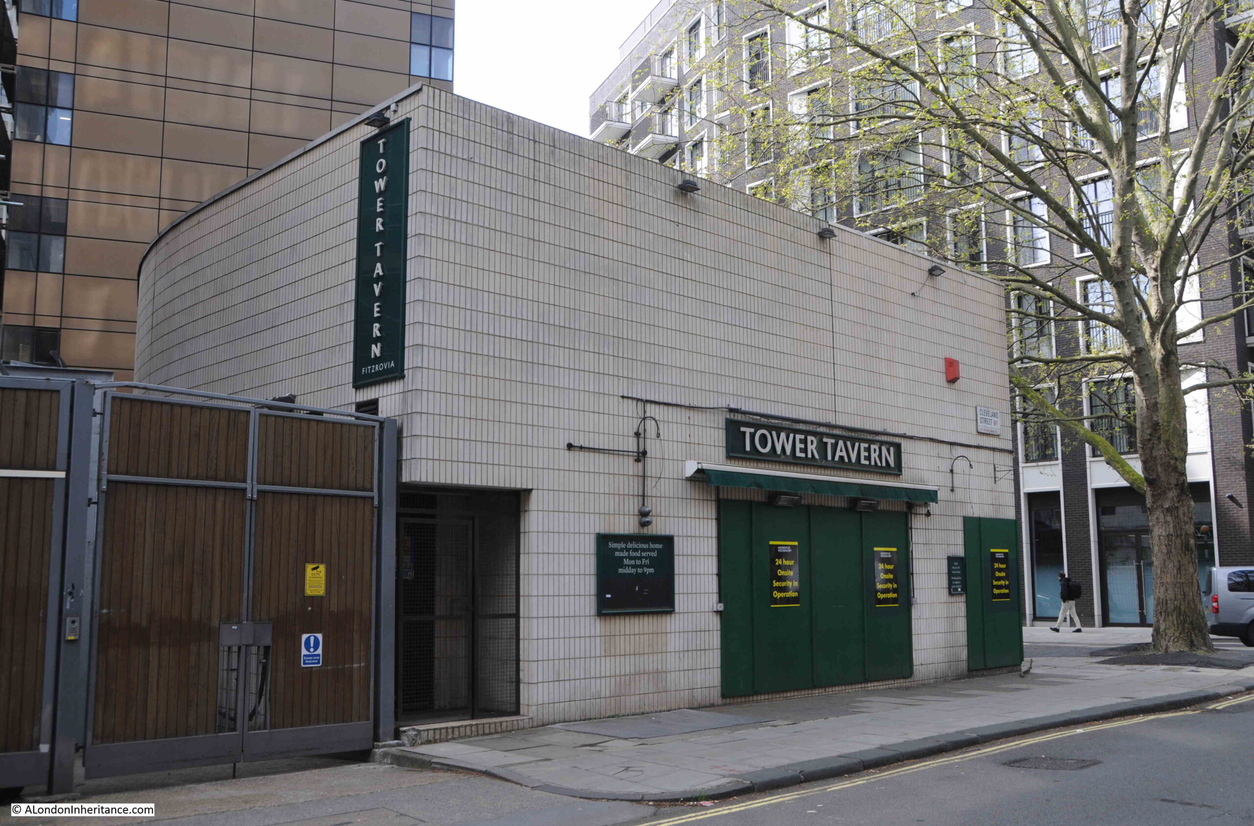
The Tower Tavern is not exactly the most attractive pub in London, and the style of the building probably comes from the period when it was built, as the pub dates from around 1970:
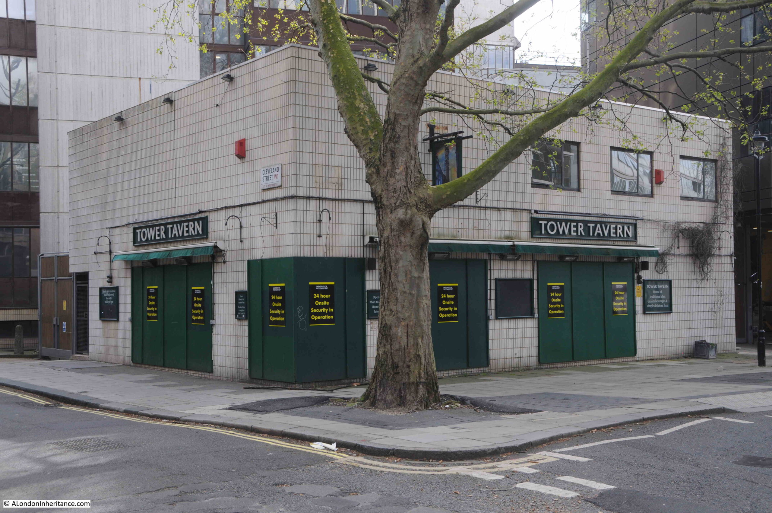
It was built following the demolition of an adjacent pub (the subject of a future post about the area), and was a pub frequented by Post Office / BT workers as well as those who lived and worked in the area, and despite its outward appearance was a perfectly decent pub.
Soon after opening, the Tower Tavern was regularly advertising in the papers that you should “Make a date to meet at The Tower – a fine Bass Charrington House”, and in 1971 it claimed to have a model of an original telephone box in the pub.
In 1993 the Tower Tavern was advertising that you could buy:
- Carling Black Label 80p per pint
- Tennents Pilsner 80p per pint
- Tennents Extra 95p per pint
- Bitters £1.20 per pint
- Double Spirits £1.50
- Indian curries and rice £3.00
The Tower Tavern closed in 2021, possibly due to the impact of COVID / rent increases etc. The pub is owned by the University of Westminster who also have the buildings that surround the pub.
The pub has a lovely sign, with a rather dramatic painting of the Post Office Tower with its full compliment of microwave radio dishes and horns across the upper levels:
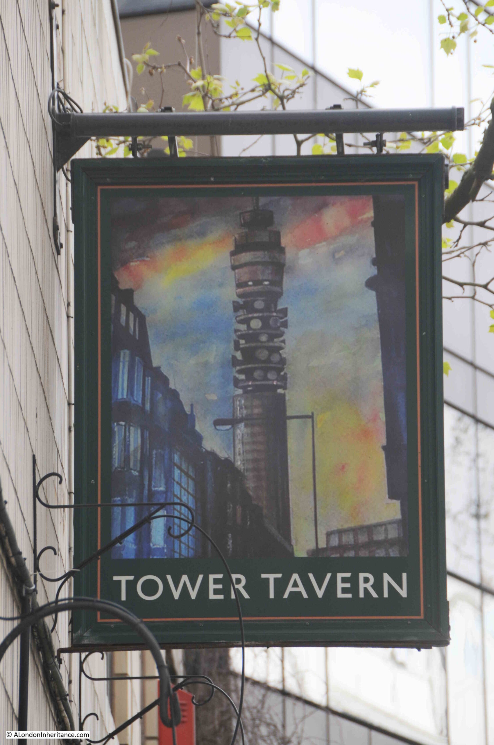
The Tower Tavern pub sign with the real Post Office Tower behind:
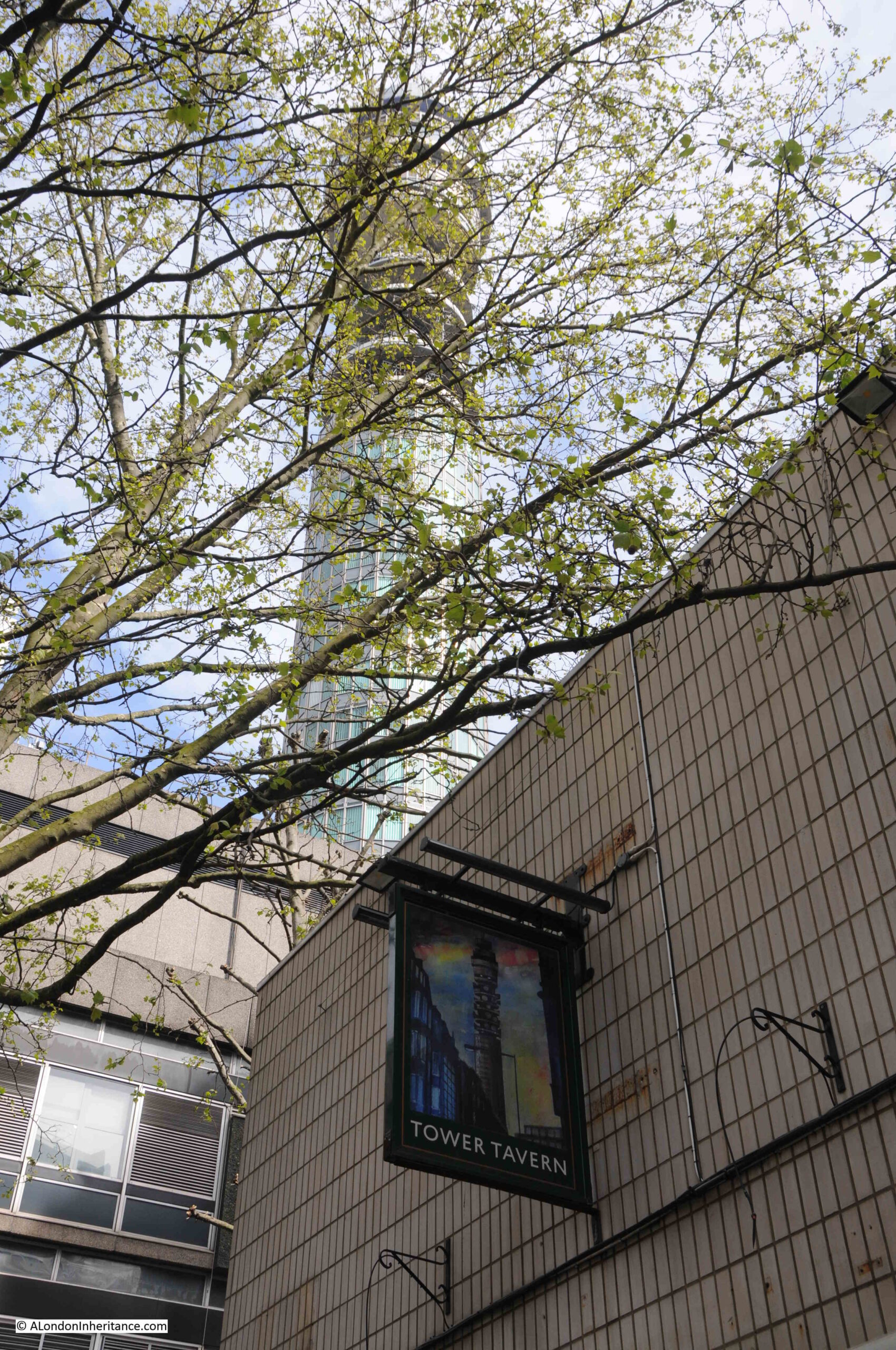
I do not know what plans the University of Westminster has for the old Tower Tavern, but I would be surprised if it opens again as a pub. I hope the pub sign is saved though, and put on public display as a reminder of the Post Office Tower’s history.
The Post Office Tower in Film
As you would expect, the Post Office Tower features in numerous films, TV reports etc. Below are a selection that provide an overview of the tower’s design, construction, purpose and use, visiting the tower, the restaurant, and how the tower often appeared in popular culture.
The Post Office Tower of London
This 19 minute film has some wonderful aerial shots of London, covers the purpose, design and construction of the tower, with some good technical detail, along with visiting the tower and the restaurant:
Top Of The Tower
This 2 minute video again has some wonderful views of London from above, and within the Post Office Tower, the film focuses on the restaurant at the top of the tower:
Look At Life – Eating High
This film includes an overview of other restaurants at the top of tall structures as well as a detailed look at the Post Office Tower restaurant.
The film also includes the mechanism that rotated the restaurant, and shows how remarkably simple this was:
GPO Tower Construction
This silent film shows views from the tower, as well as construction of the tower. If you work in construction health & safety, then best not to watch:
The Goodies
And finally, the Post Office Tower frequently appeared in popular culture, one example was when it was demolished by a giant kitten in an episode of the Goodies:
The Post Office Tower is an iconic London landmark and when you look at the tower, you are looking at something built to serve the explosion of telephone calls, television distribution, and data from the late 1950s and through the 1960s.
You are also looking at something where the design, height and shape was dictated by the leading edge telecommunications technology of the early 1960s.
You are looking at a building in a specific location that was dictated by how the telephone network had developed across London, and where a key telephone exchange was located, and it was part of a network of towers that spanned the country, and linked to Europe via a microwave radio link across the Channel, and the rest of the World via the Goonhilly satellite station in Cornwall.
And it also had a resturant.
Whatever happens to the tower in the future, I hope that some of this heritage survives.