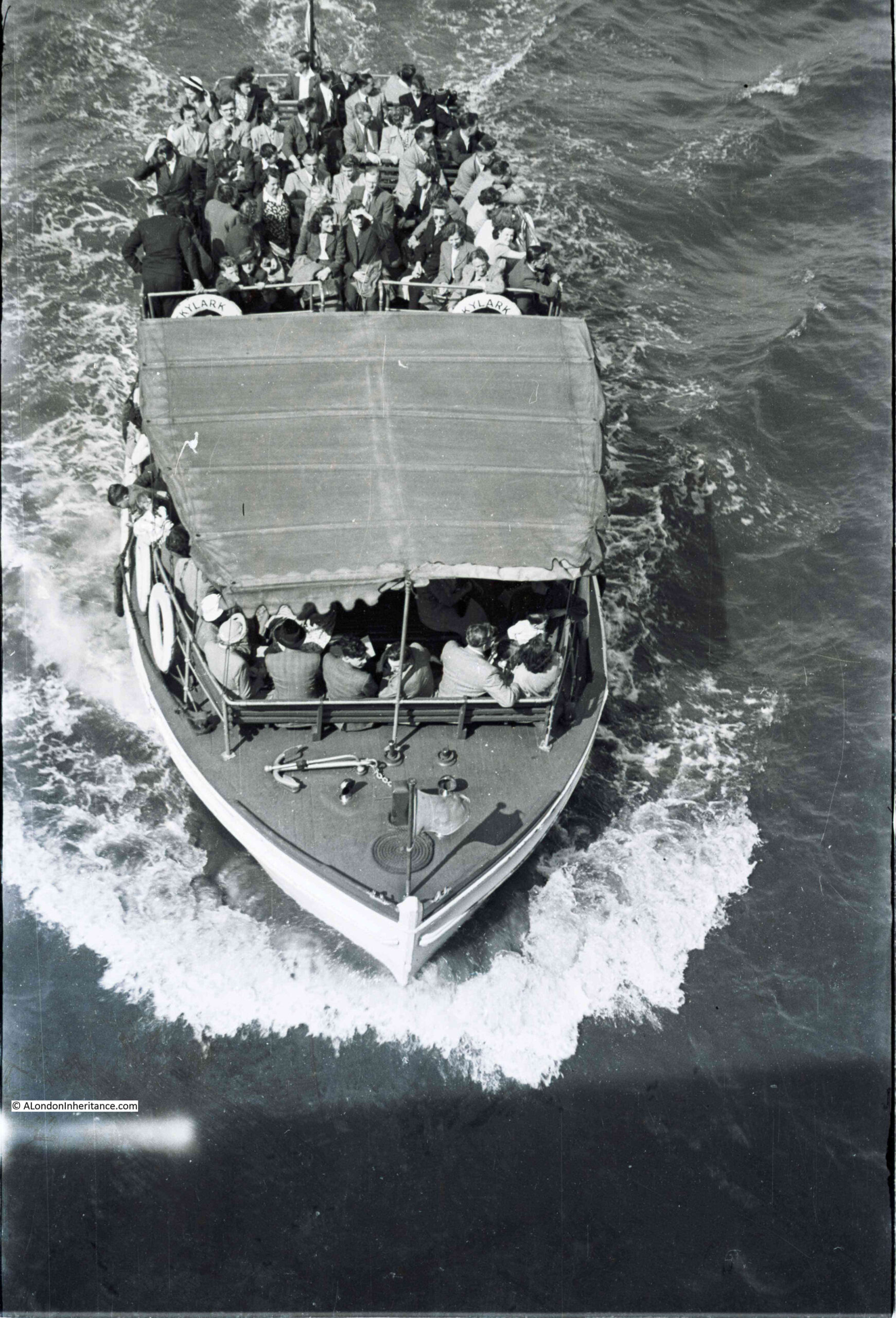
This photo was taken by my father in 1951, from one of the bridges over the Thames (no idea which one), and shows one of the pleasure boats that have been a feature of London’s river for many years.
It was the only photo featuring the Thames on the strip of negatives, so I suspect he was walking over the bridge, saw the boat about to pass under the bridge, and quickly took the photo.
It is one of those photos that probably seemed of not much importance at the time. A scene that was, and continues to be, very common on the river, but 71 years later it is a snapshot of a group of people travelling along the River Thames.
The boat was called the Skylark. I cannot find any details about the boat, however the year was 1951 and I vaguely remember reading somewhere that the Skylark was one of the boats that served the Festival of Britain site on the Southbank, taking people to and from the pleasure gardens at Battersea. I have checked the indexes in my books on the Festival, but cannot find a reference to the Skylark so it may be my memory playing tricks – a lesson to keep better notes.
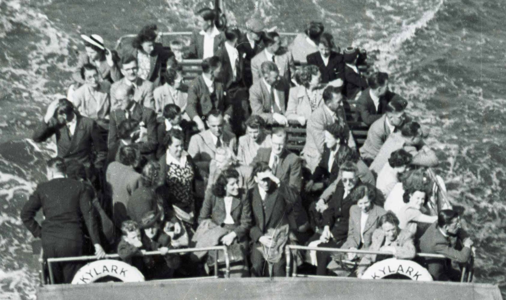
The following extract from the photo shows the people on the rear deck. Mainly adults, a couple of children, and all rather formerly dressed for a trip on the river:
Pleasure boats have been a feature of the Thames since the 19th century, when newspapers were full of adverts for pleasure trips on the river. The majority of these seemed to be a trip to somewhere, rather than a trip along the river with no stopping point, apart from a final return to the point of departure.
For example, in 1899, a return trip in the “magnificent new steamers Boadicea or Cleopatra” from Westminster to Gravesend to see the gardens could be had for one shilling and six pence.
The number of ships on the river did cause passengers some concern. A letter writer to the London Evening Standard complained of two steamers appearing to race each other on the river, and one almost crashing into his boat in attempt to overtake. He finishes off his letter with “I for one, will never again take a pleasure trip on the Thames”.
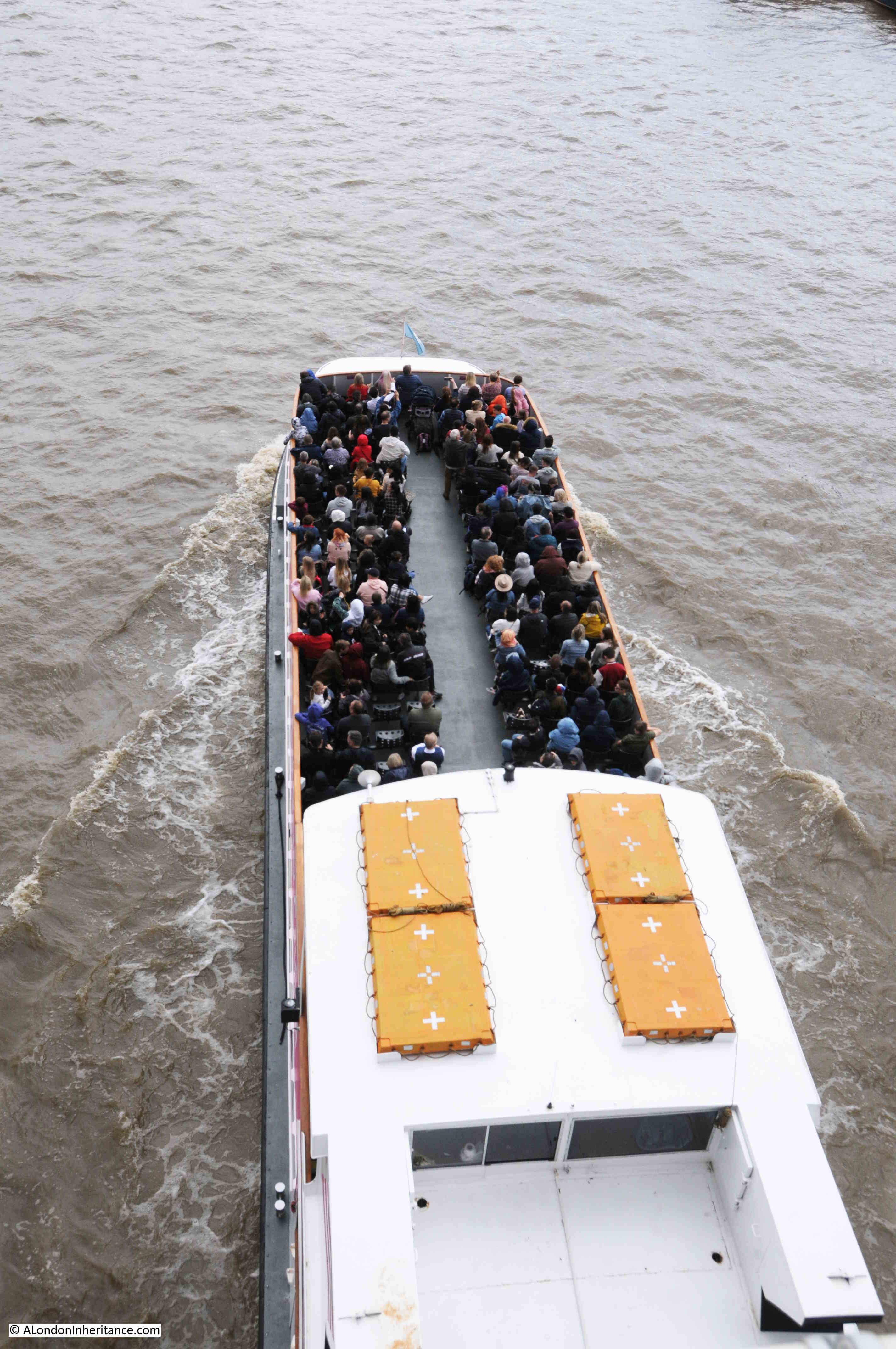
The river is much quieter today, but with the return of tourism to London, the pleasure boats are again filling up and can be seen taking passengers on tours up and down the river.
This was my attempt to emulate my father’s photo:
This is the view from Waterloo Bridge showing one of the mooring places for pleasure boats:
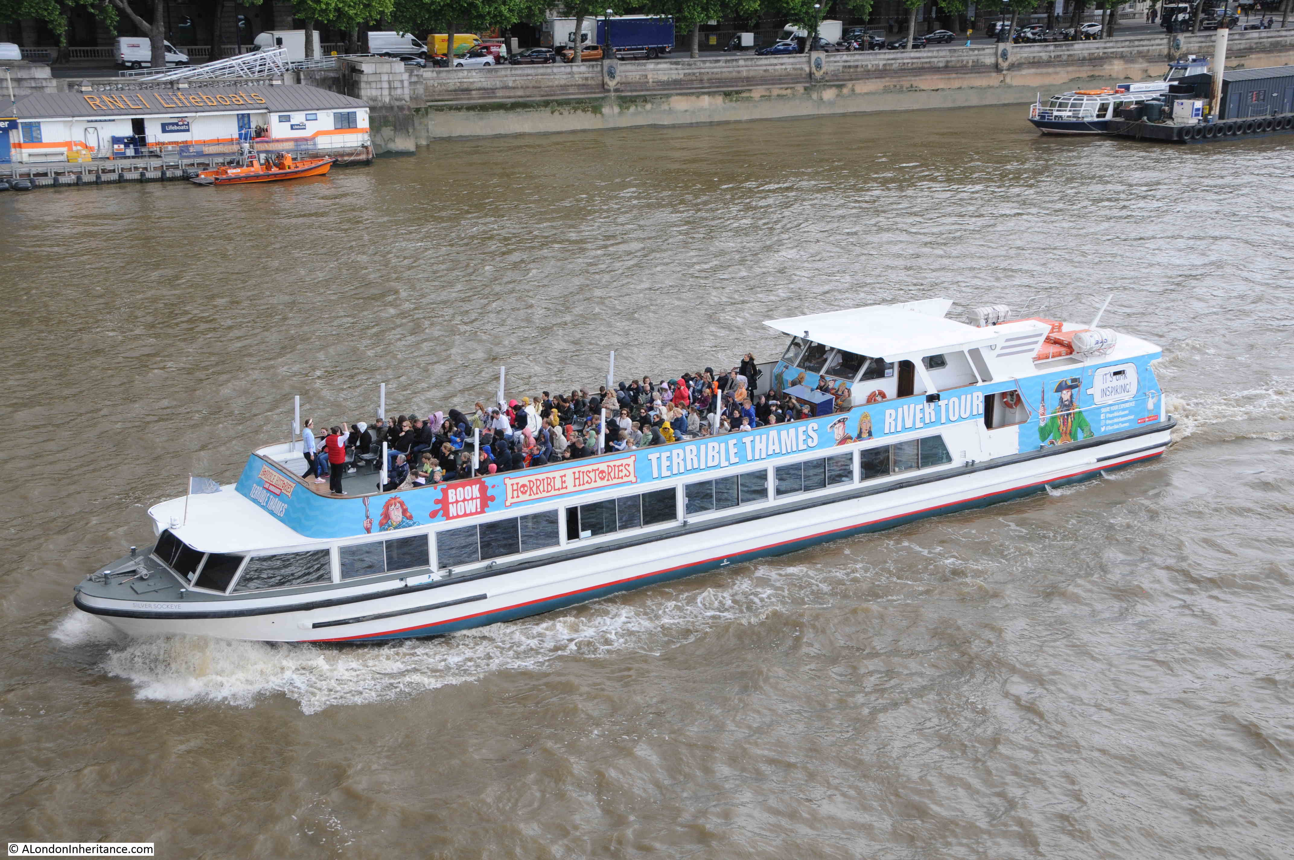
As well as general tours, you can take a Horrible Histories themed tour telling the story of the Terrible Thames:
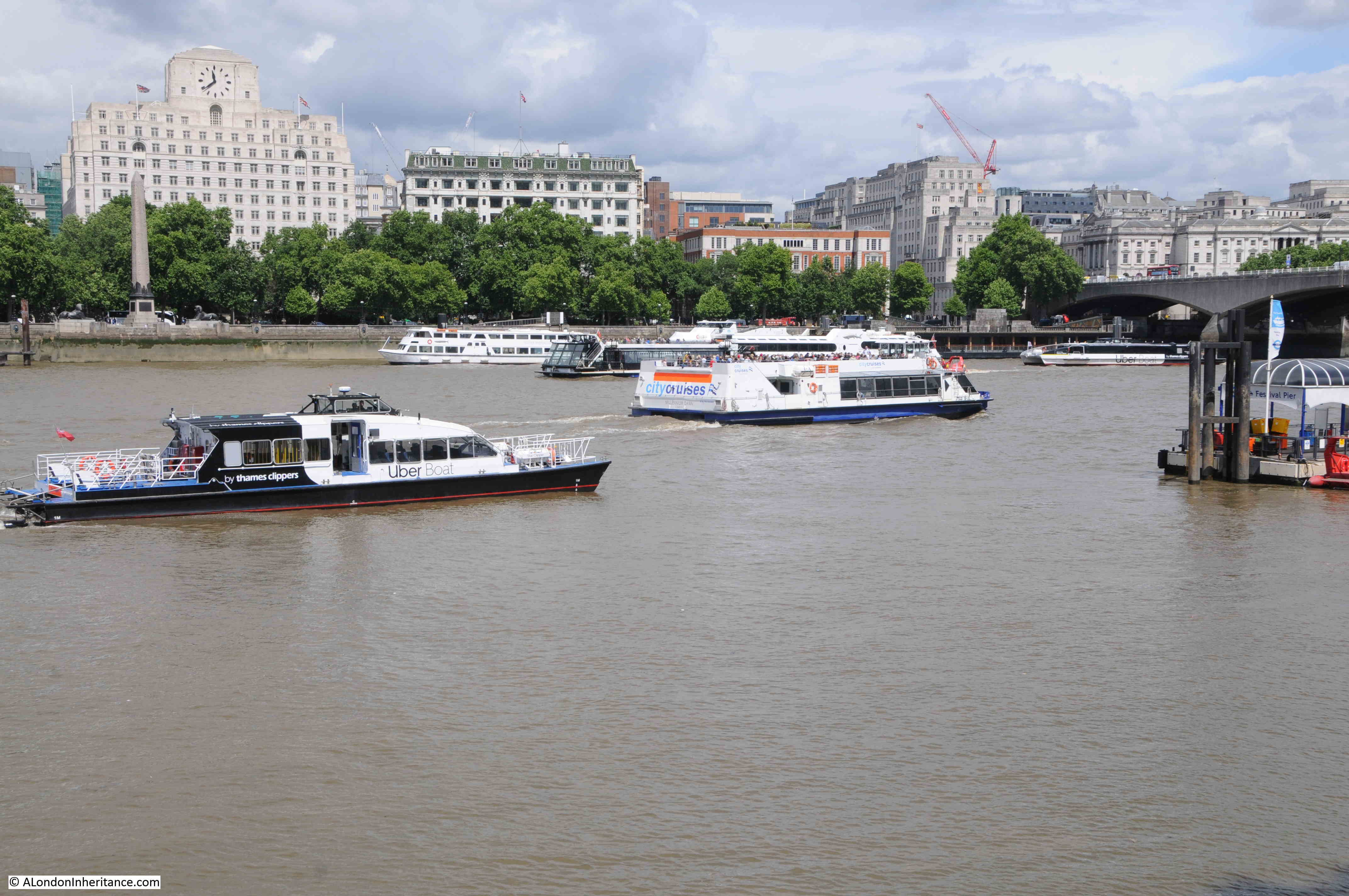
A full City Cruises boat with one of the smaller Thames Clippers on the left:
The small Thames Clipper boat seems to have a specialised role to shuttle passengers from the cruise ships that moor alongside HMS Belfast, across the river to Tower Stairs.
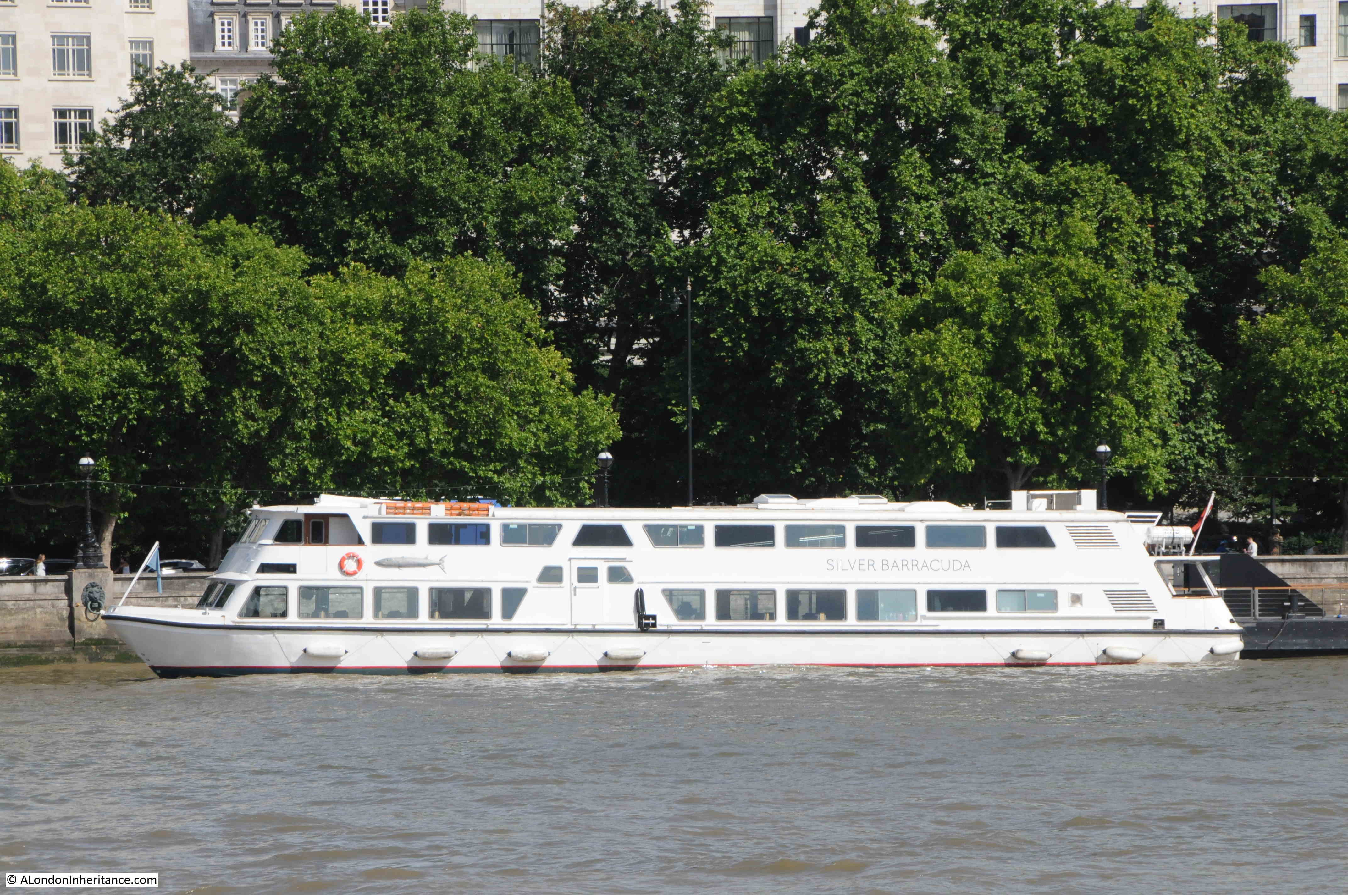
The Silver Barracuda, one of the Woods Silver Fleet, owned by a family who have been Thames Watermen for over 150 years:
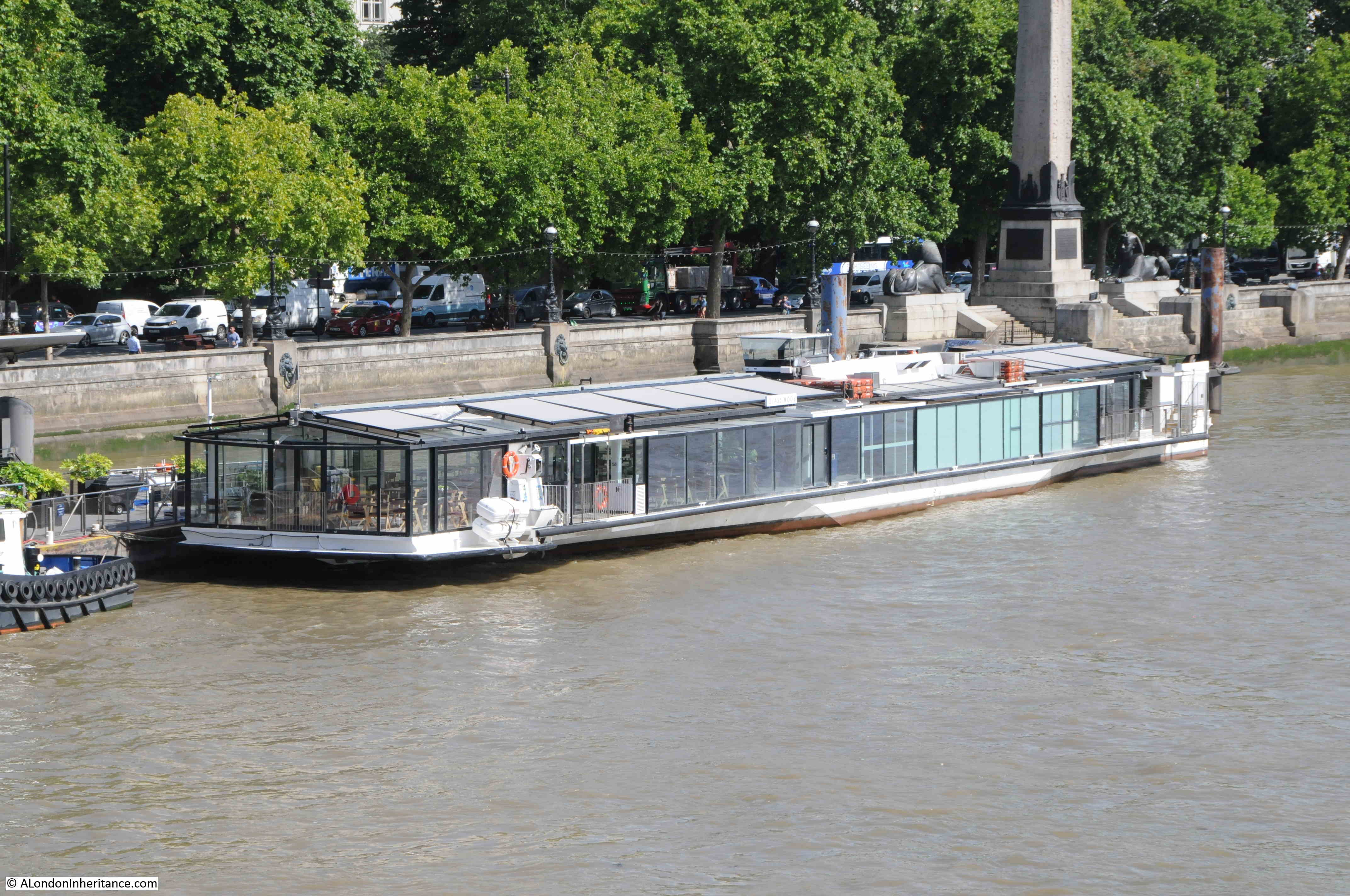
One of the dining boats that cruise up and down the river:
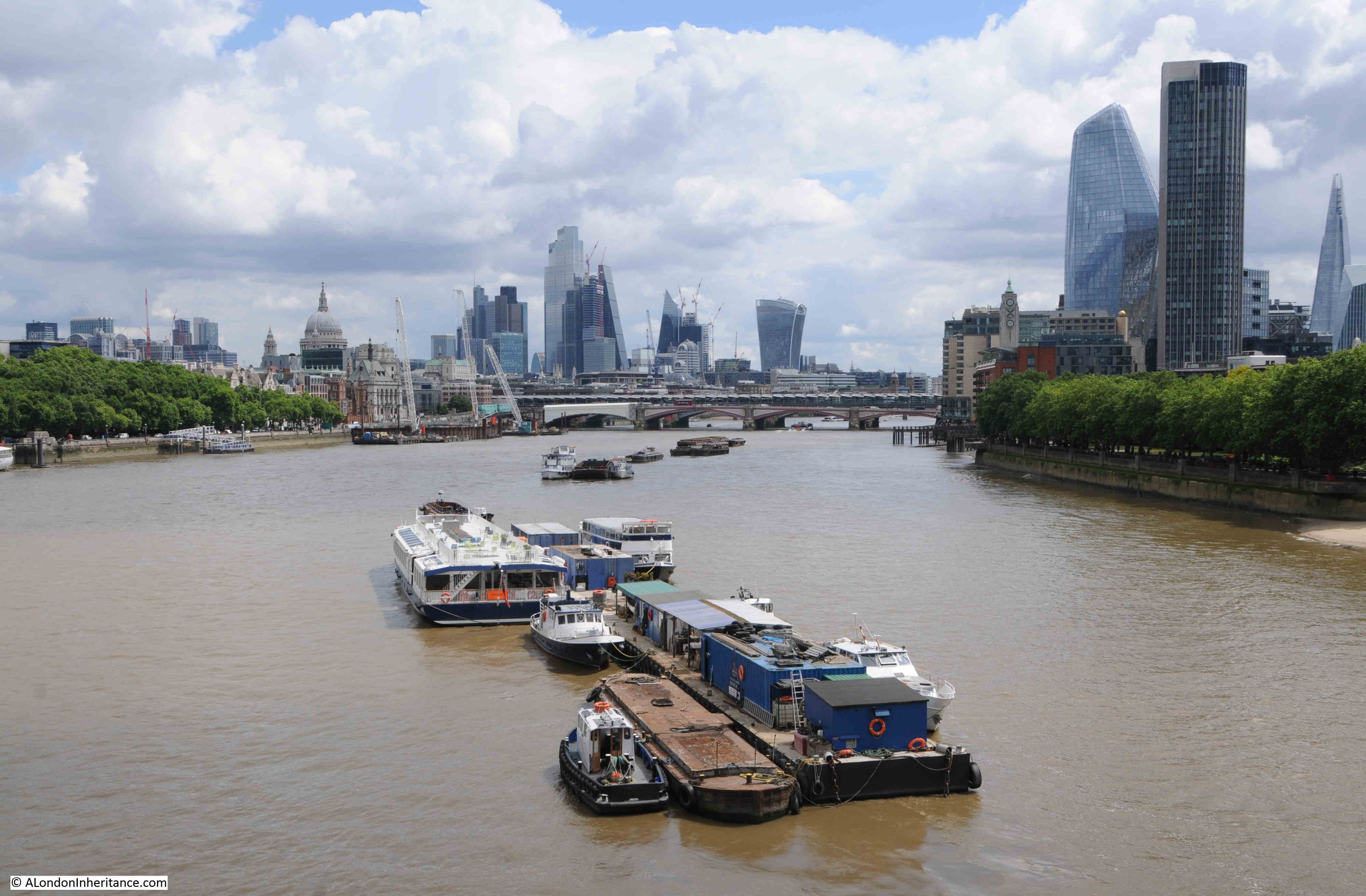
With the closure of the London docks, traffic on the river significantly declined with the late 1970s and early 1980s being a period where it was so sad to see the quiet river.
The river has though, long been a way to travel across London – a liquid Central Line.
Going back centuries, it was often the fastest and safest method of travel, with watermen being the taxis of the day, rowing passengers between the numerous Thames stairs. Although they did have frequent accidents, and negotiating a fixed price was often a challenge until the gradual regulation of watermen services on the river helped to clamp down on poor practices.
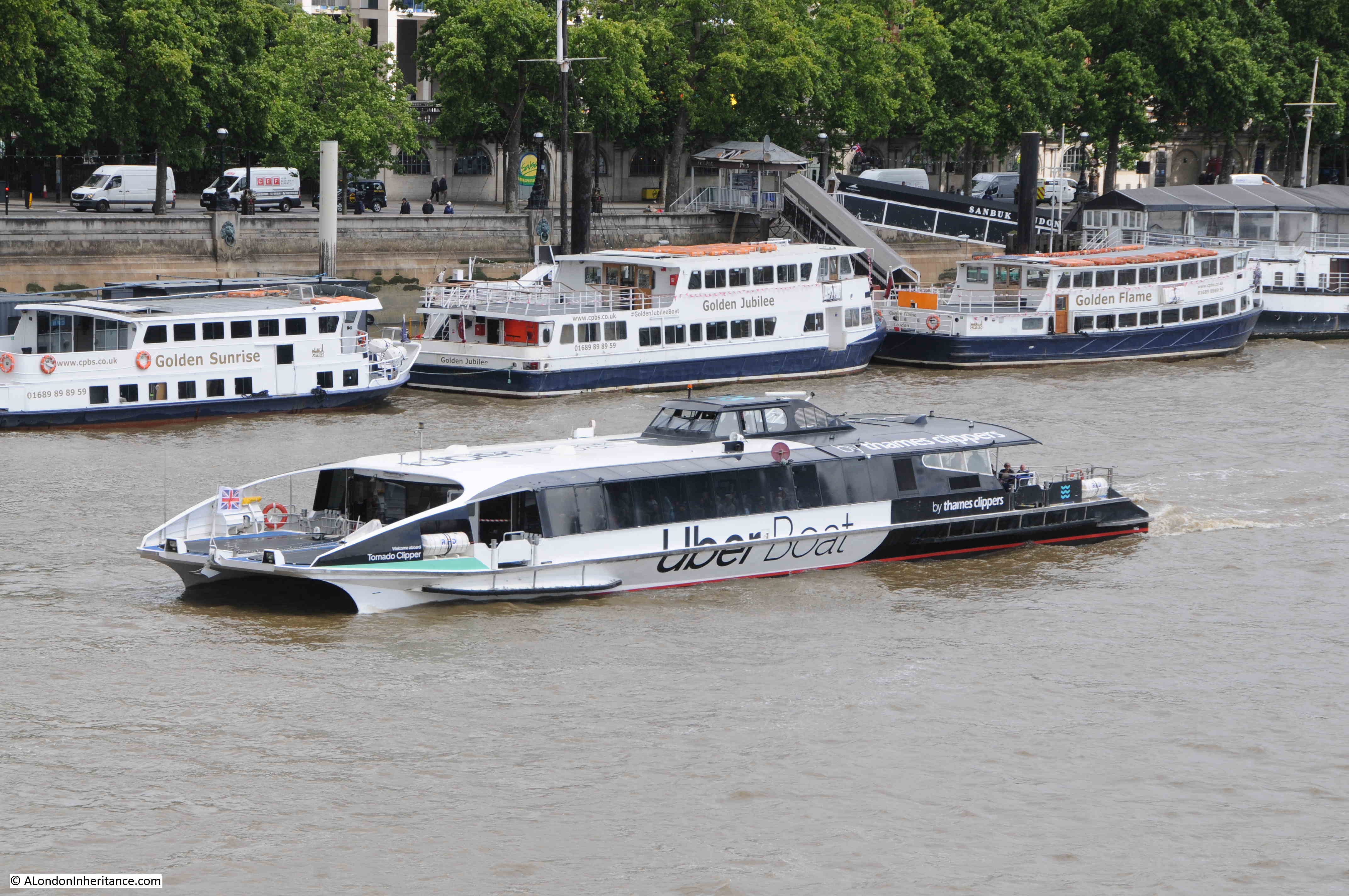
Today, the ferry services once provided by a waterman rowing you along the Thames has been replaced by the Uber Boats run by Thames Clippers:
The Thames Clippers have been a 21st Century success story along the Thames. Since starting with a single boat in 1999, the company now has around 20 boats serving passengers on the Thames. The majority were made in Australia, however three, Jupiter, Mercury and Venus, were built on the Isle of Wight.
Each of the boats has their own unique flash of colour on the side of the bow (front) of the boat. In the above photo, the colour is (I think), mint, which identifies the boat as the Tornado Clipper (helpfully the name is also above the flash of colour, however the colour helps with identification at a distance).
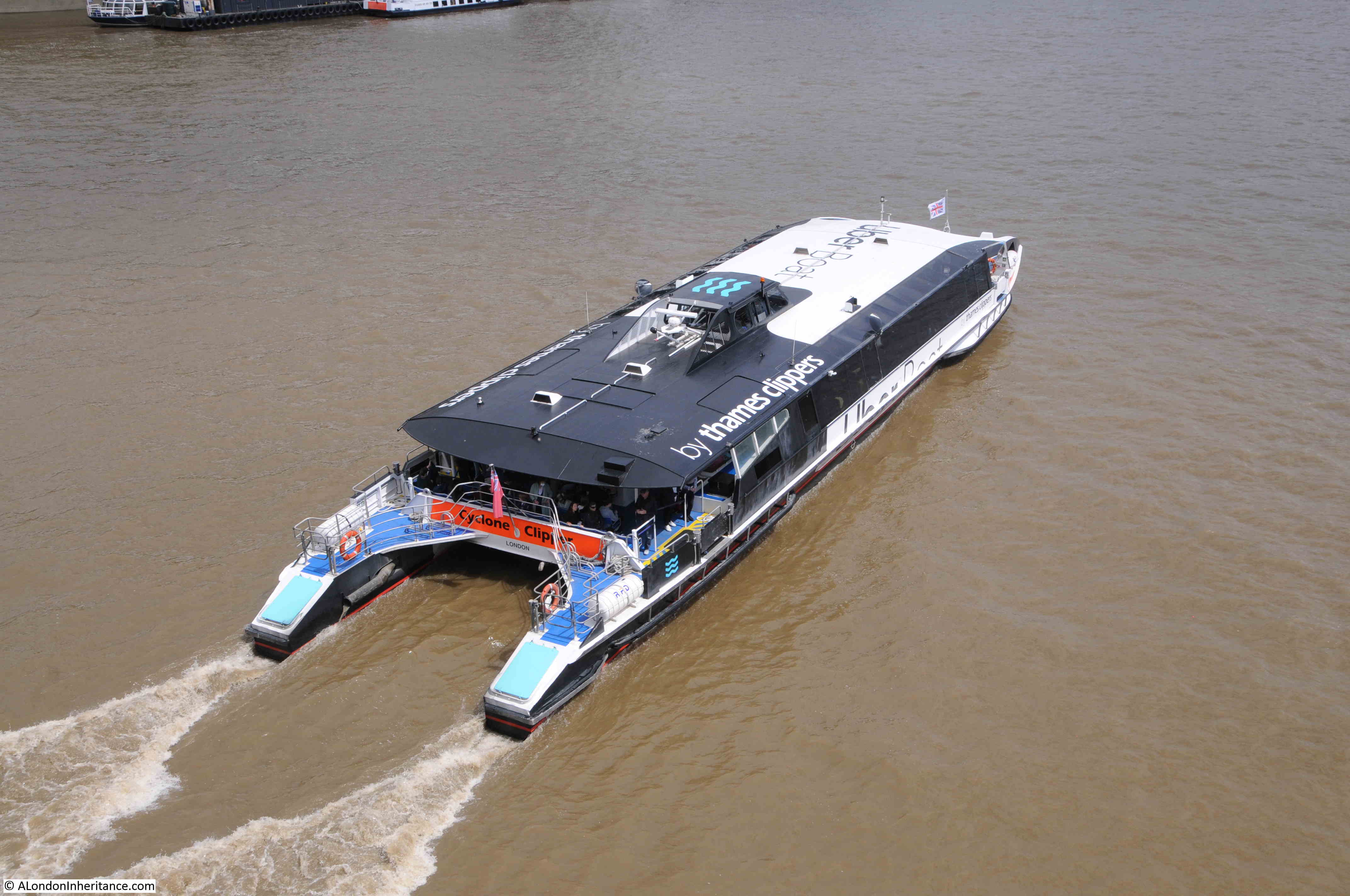
Cyclone Clipper:
The Thames Clippers are the latest in a series of post-war attempts at running passenger services on the river. Some more successful than others.
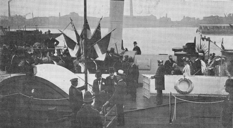
Starting in 1905, the London County Council launched a number of steam-boat ferries along the Thames, with 30 boats at the peak of services. The following photo shows the “Opening of the L.C.C Steamboat Service by H.R.H The Prince of Wales”.
The post-war reduction in the population of east London, along with the closure of industry and docks along the river reduced the need for a ferry service, however there were a number of attempts at launching ferry services.
1968 saw a Hovercraft service along the river. The first hydrofoil, Shearwater 5 started passenger services in 1969. In 1988 Thamesline offered a service between the developing docklands and the City and a limited River Bus service was launched in 1989.
The launch of the Thames Clippers in 1999 came at a time when the redevelopment of the docklands resulted in increasing populations of residents and office workers, as well as significant increases in tourist numbers. investment by the company that owned the O2 also helped with the growth of the Thames Clipper services that we see today.
In 2019, the last year before Covid, Thames Clippers carried a total of 4.3 million passengers.
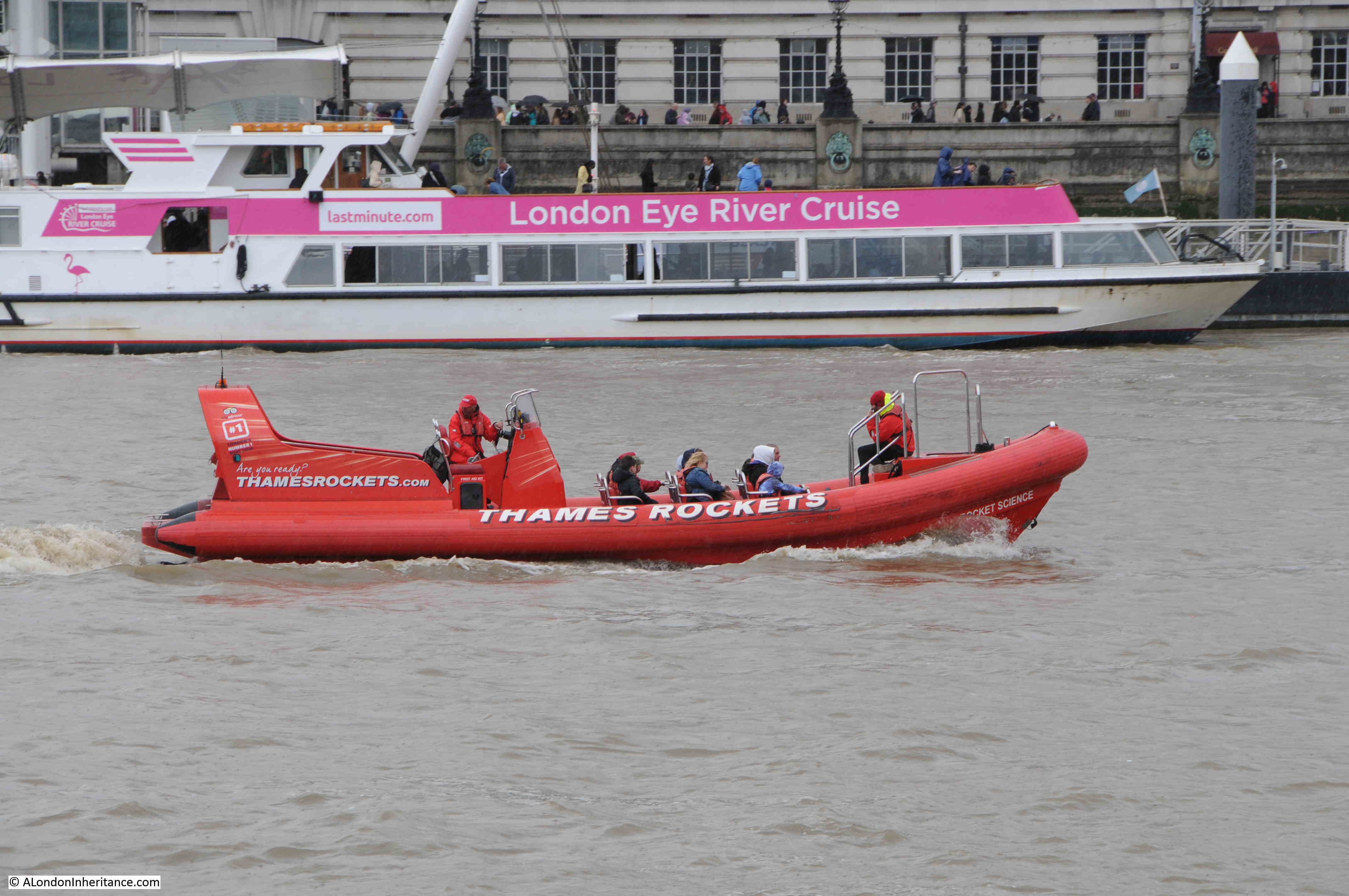
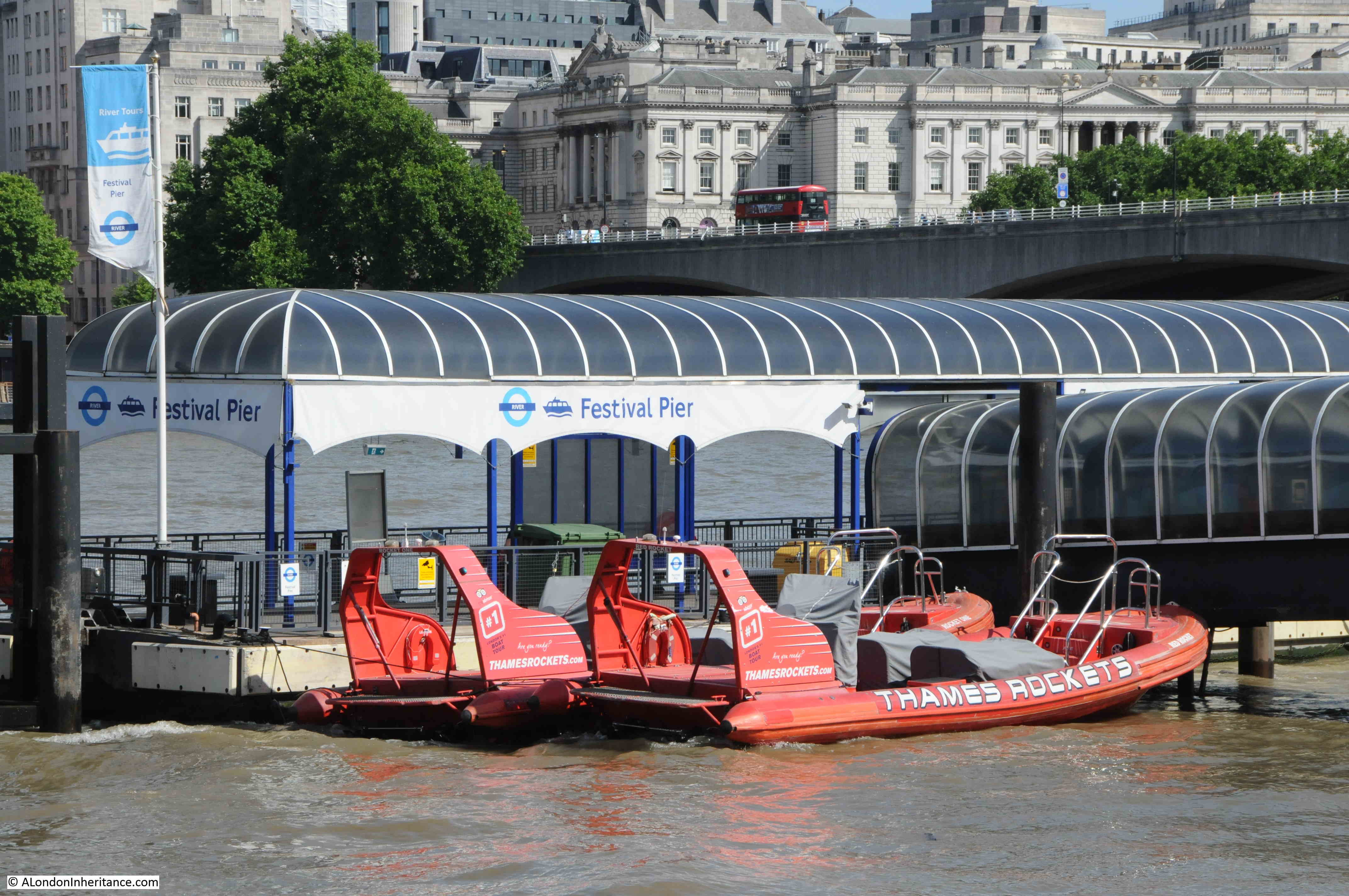
An addition to the Thames over recent years has been the ribs that offer visitors a high speed trip down the river to the east of Tower Bridge. Yellow ribs:
And red ribs, with a London Eye River cruise moored at the London Eye pier in the background:
Ribs moored up at the Festival Pier on the Southbank:
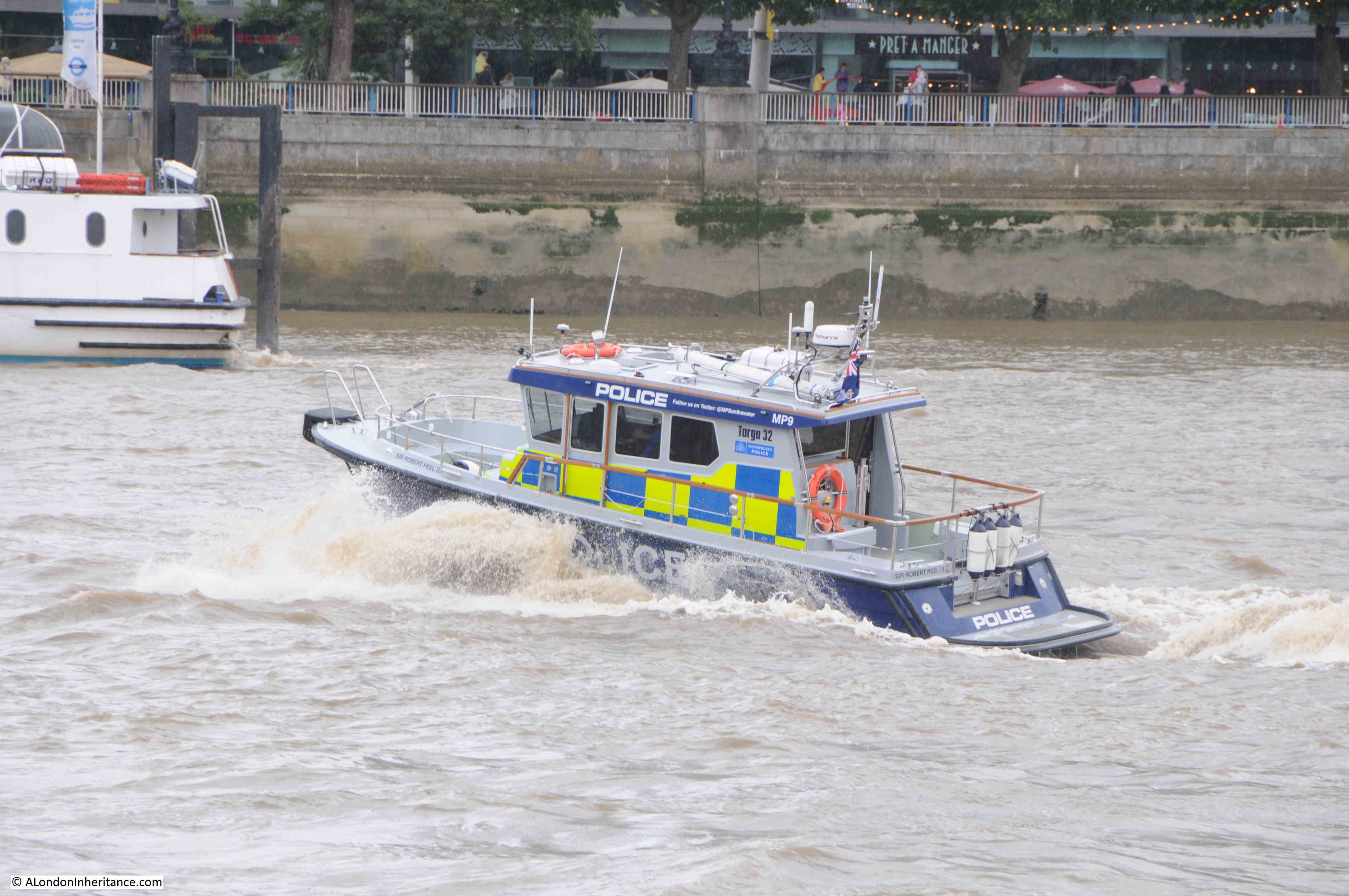
As well as tourist and passenger traffic, there are many other users of the Thames.
The Thames River Police can frequently be seen speeding along the river:
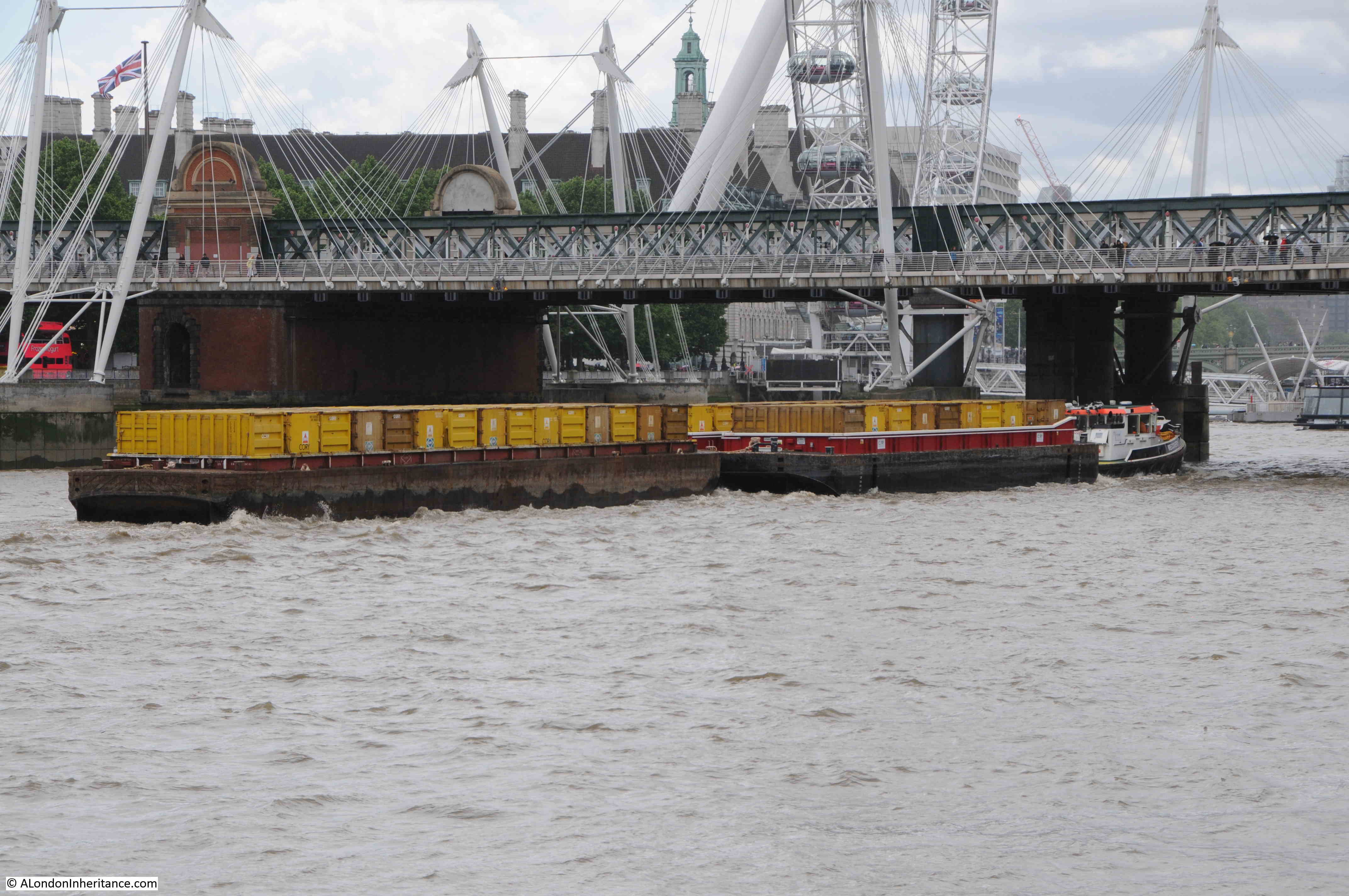
And much of London’s waste is compacted into containers at depots along the river, from where it is then transferred by barge to an incinerator in Belvedere, where it is burnt to generate electricity.
Although the central Thames alongside the City will not see the cargo shipping that was a feature of this part of the river for centuries, it is good to see that the river is busier than it was in the late 1970s.
Tourist boats, work boats, and the Thames Clippers, ensure that there is much to see along the river.
One of the best Twitter accounts and blogs for monitoring the range of traffic on the Thames, is the Tidal_Thames95 Twitter account and the Tidal Thames blog, both by Patricia Stoughton.
Hopefully there will be pleasure, ferry and work boats on the River Thames for many years to come.
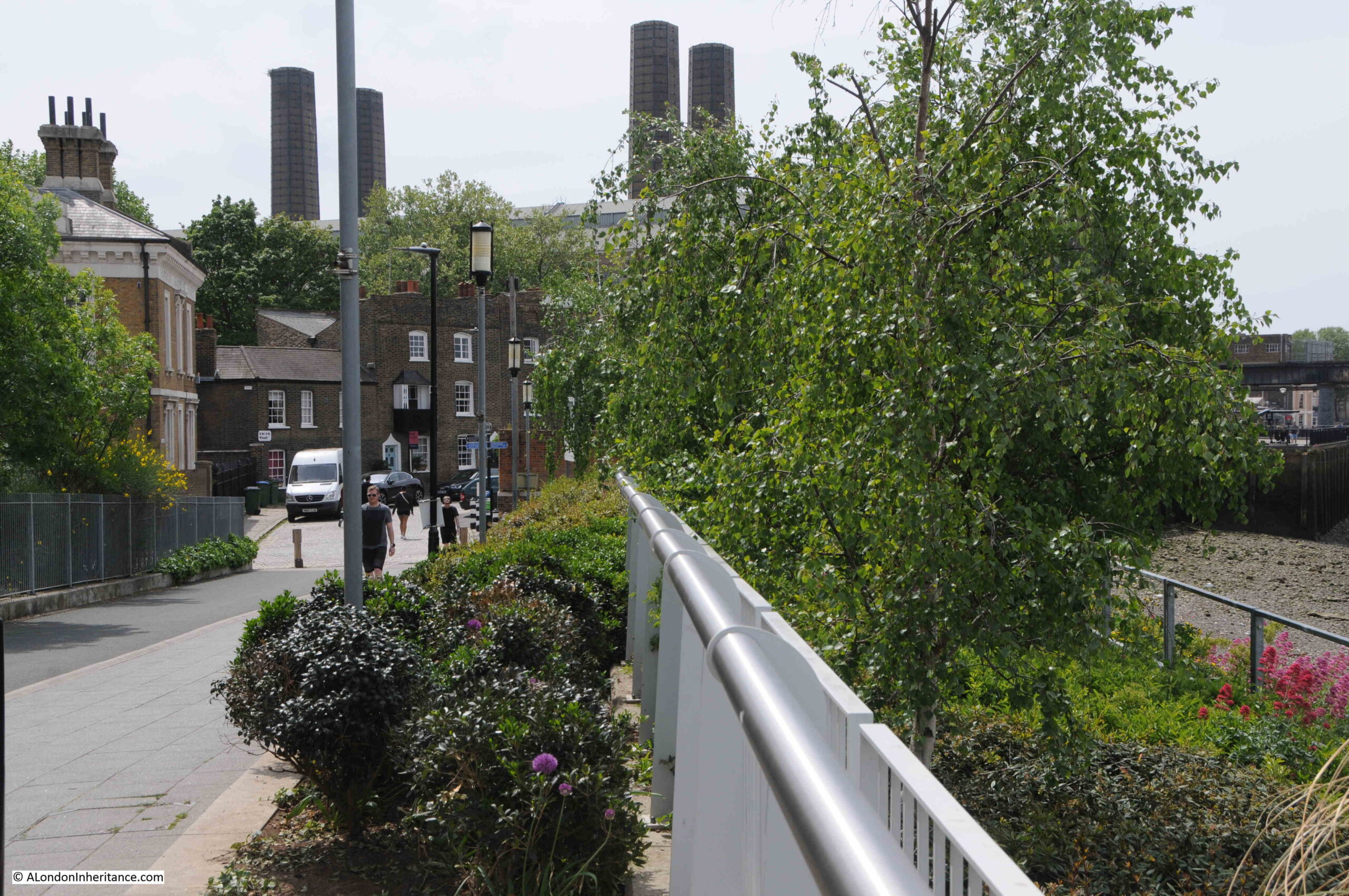
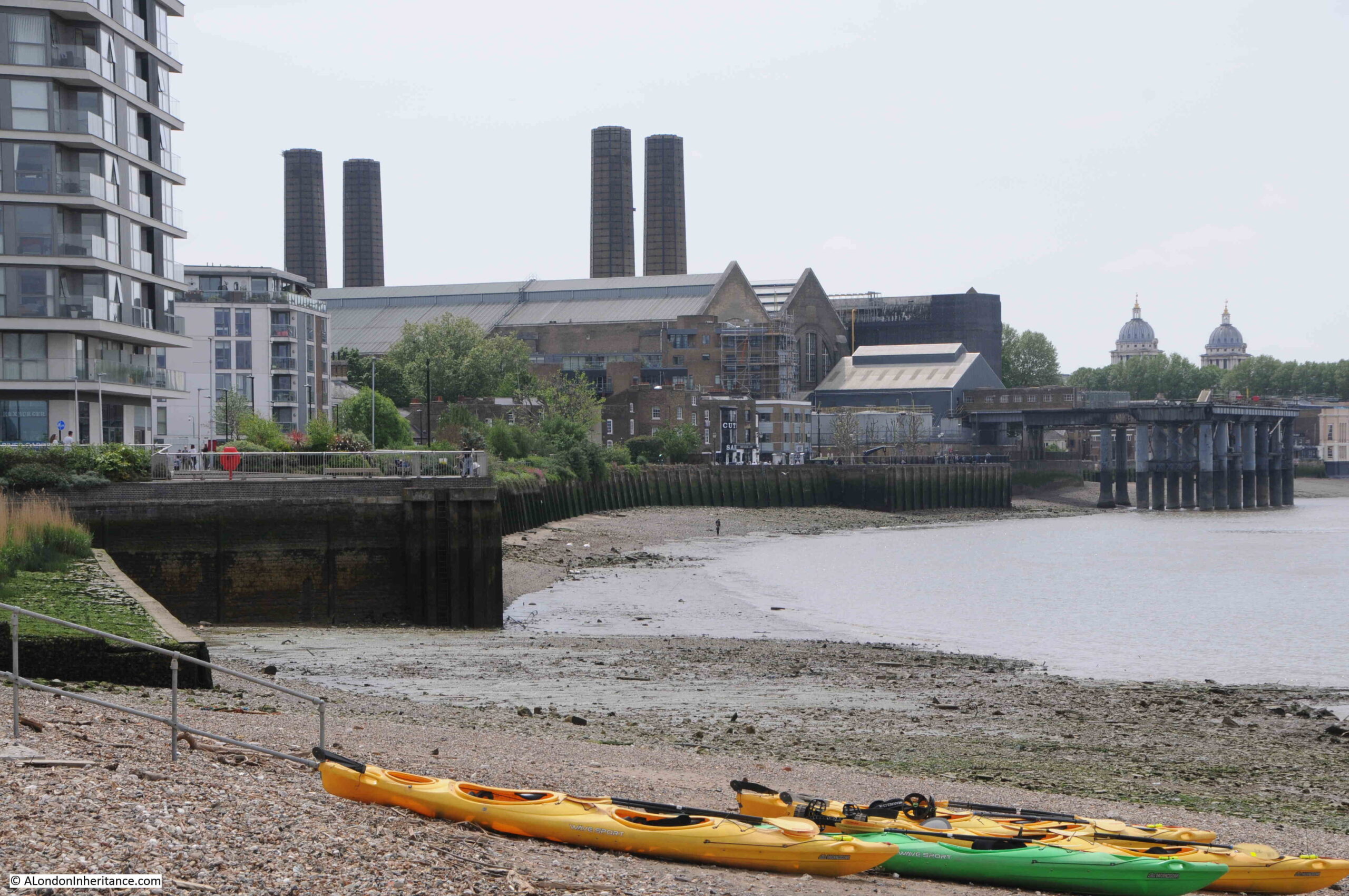
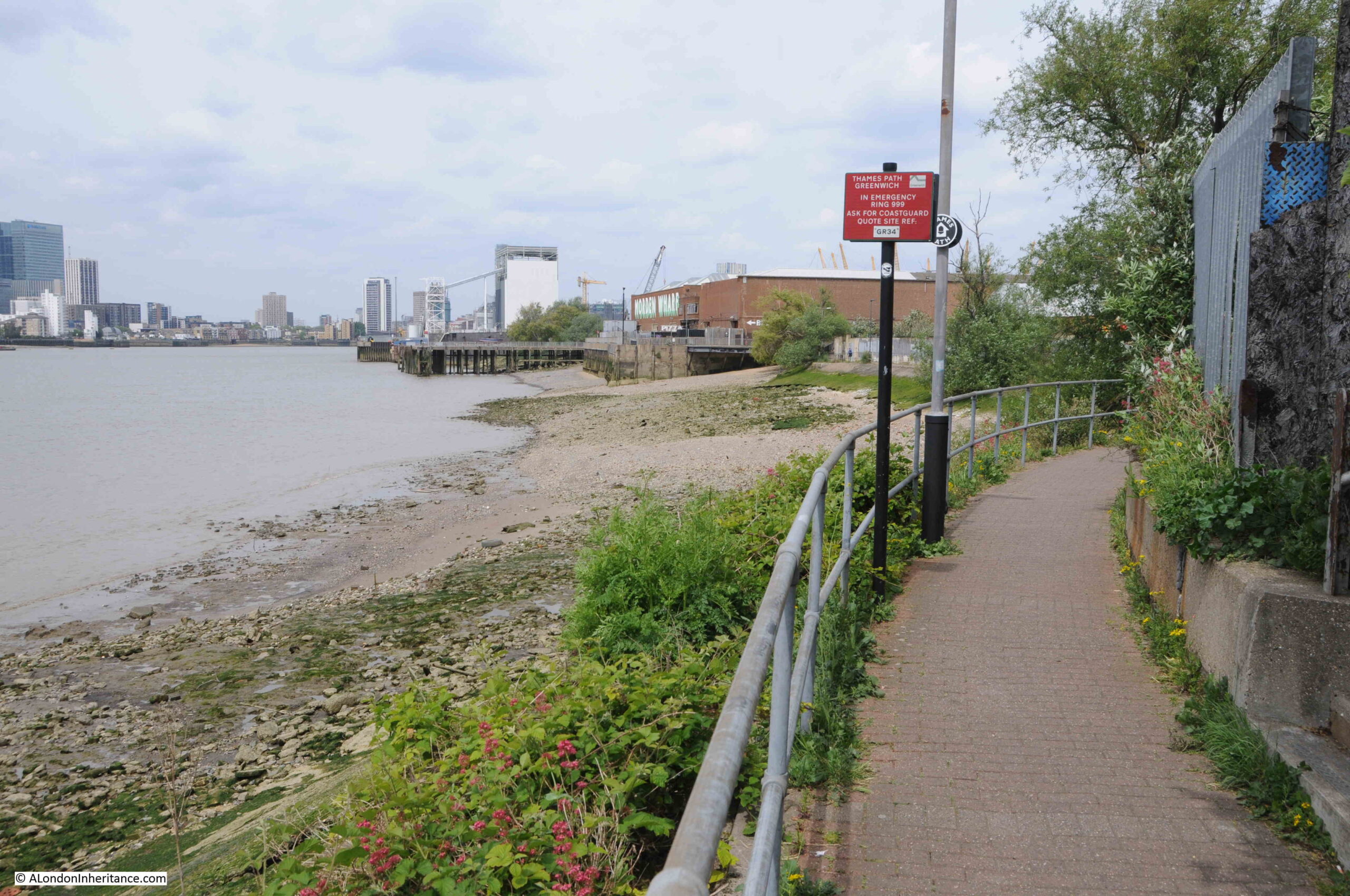
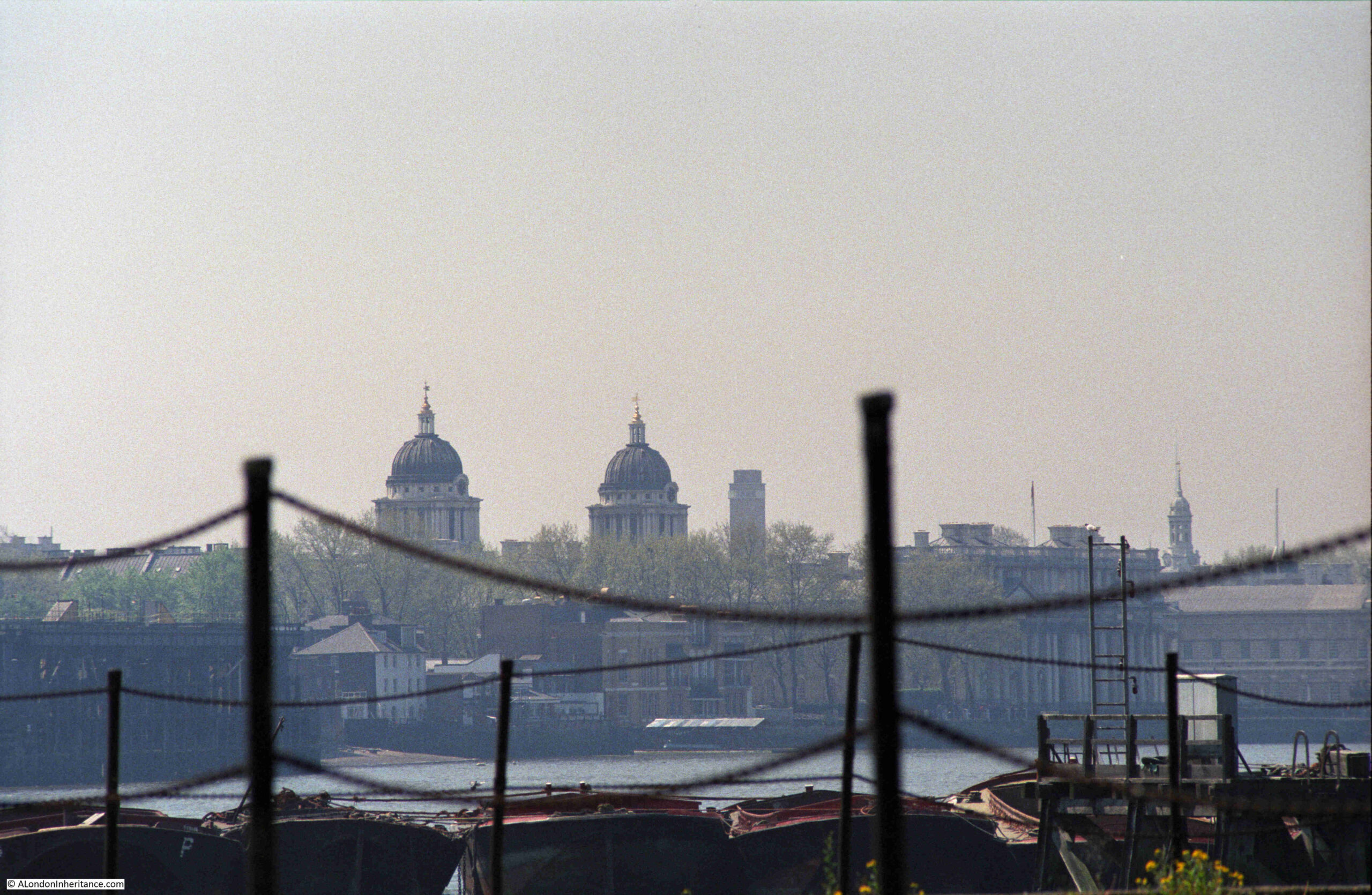
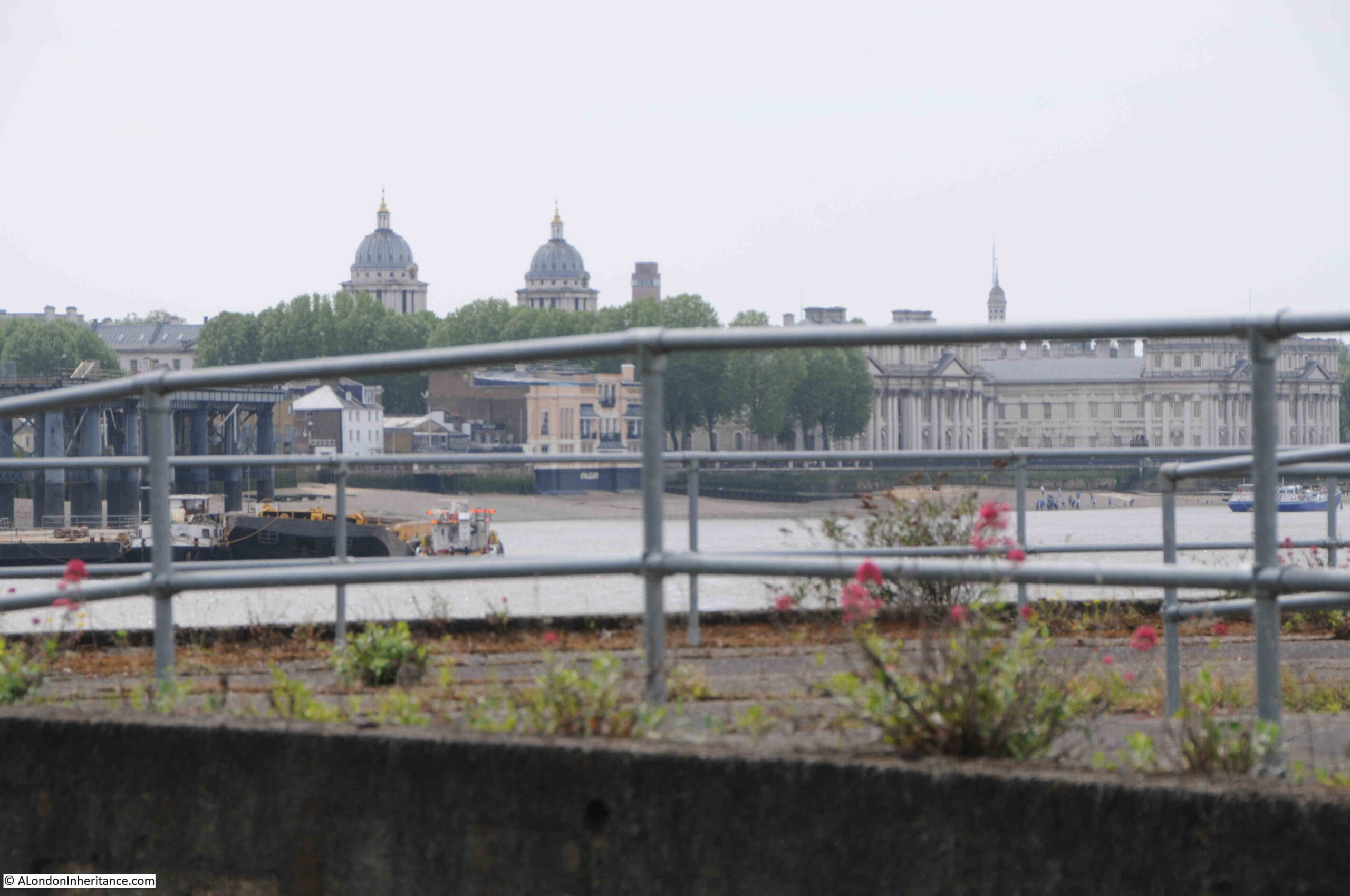
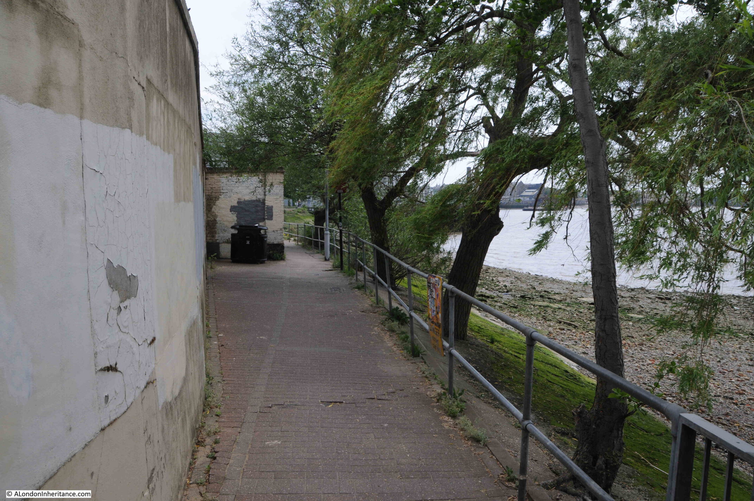
I recently scanned some negatives from 1986, and came across three photos taken in Greenwich, where the walk along the river heads past the power station and the Cutty Sark pub, and joins the Greenwich Peninsula. This is the first of the three:
Very roughly the same view today – despite lots of walking around I could not get exactly the same view, as the area has been remodeled considerably since the mid-1980s.
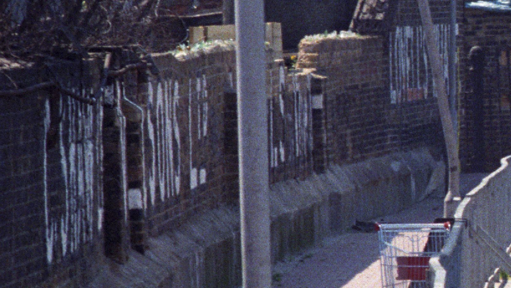
Along the wall in the 1986 photo there were painted white letters for C. Shaw & Sons Ltd and Lovell’s Wharf:
For a detailed history of the peninsula and the considerable industrial heritage of the area, the book is invaluable.
The book states that the company Shaw Lovell leased the site in the 1920s. A company with a Bristol heritage, their business was as a “Shipping and Forwarding Agent”.
The company handled non-ferrous metals, including in the 1920s, scrap from the Great War battlefields.
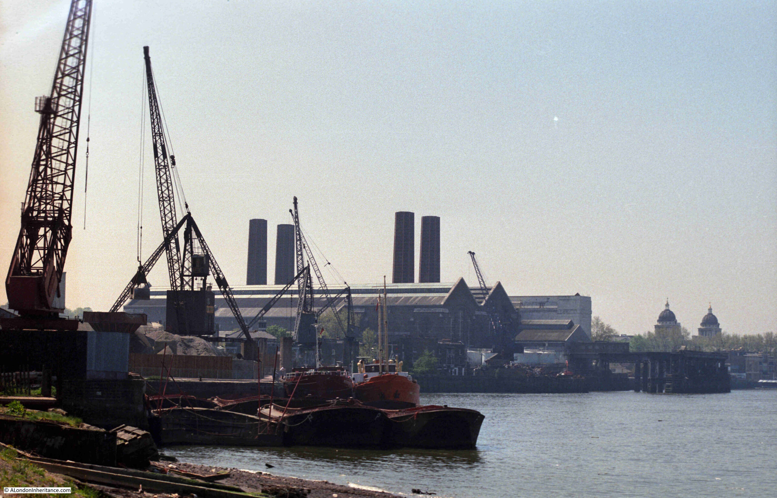
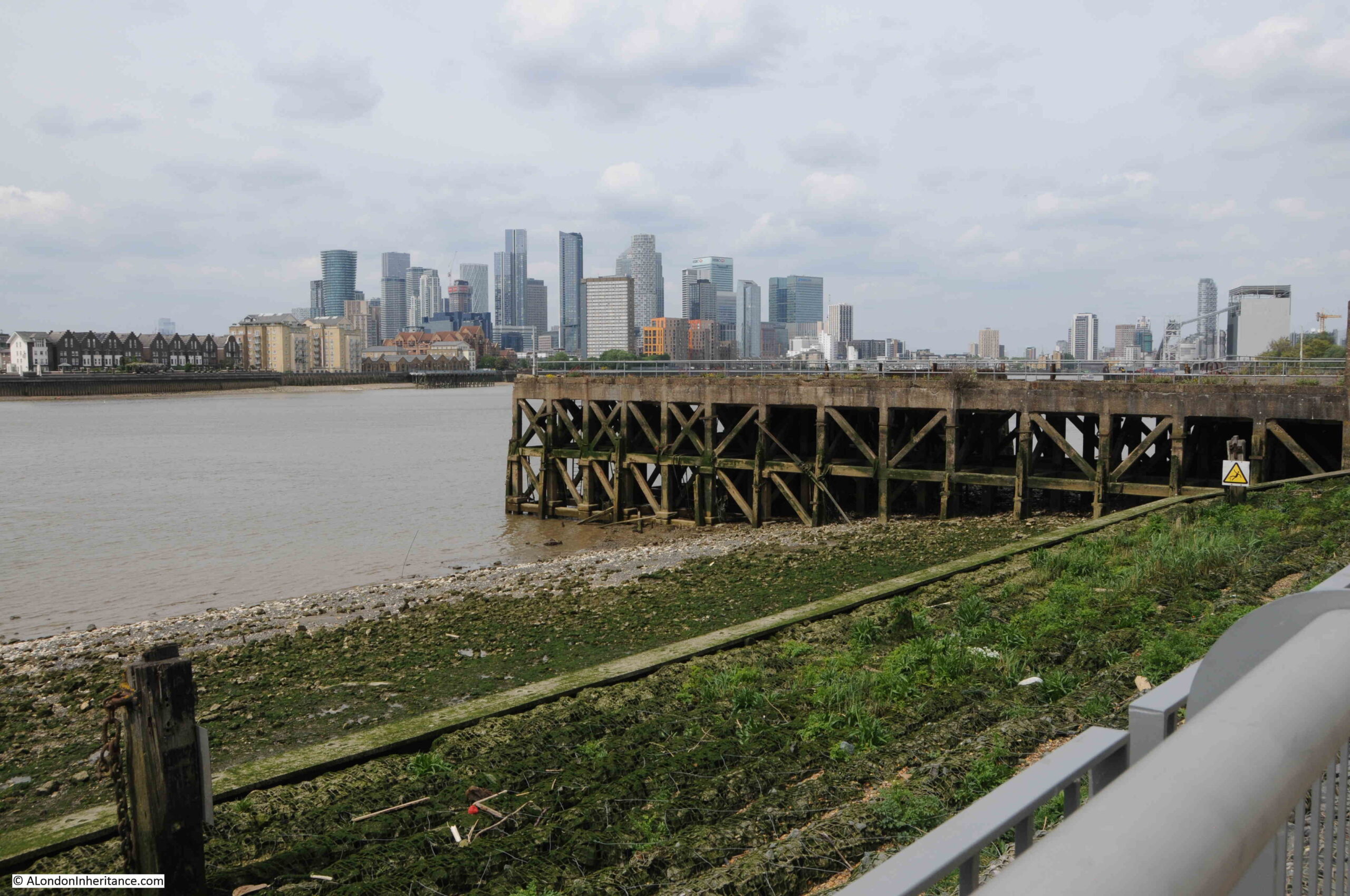
A view of the methods that the company used to transport material between shipping on the river and the land is shown in the following photo from a bit further along the Greenwich Peninsula:
The same view today:
I found the exact position for the above photo. The chimneys of the power station, and domes to the right help, but in the foreground there is the low concrete wall on the left, and behind the barges in the 1986 photo is where the shore wall extends out into the river. If I had timed my visit better, I could have got the tide in the same position.
The main differences between the two photos is the lack of shipping moored alongside the wharf, and the cranes being used to transport materials.
The cranes were significant local landmarks. They may have dated from around 1950 and were originally in use in Dublin. The cranes moved to Greenwich in the 1970s, and remained on site until 2000, when the owner of the land had them removed.
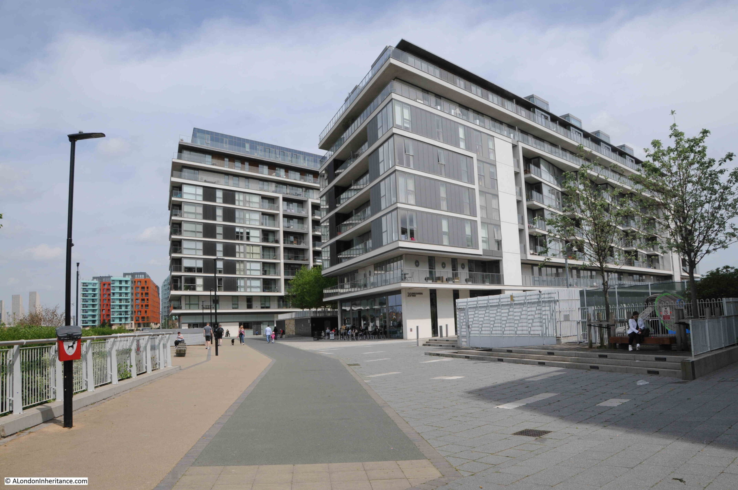
As can be seen by comparing the above then and now photos, the area has changed considerably. What was an area of considerable industry has been derelict for some years, and over recent years the northward expansion of apartment buildings has started along the western side of the peninsula, and will no doubt meet the southward run of buildings close to the O2 dome.
Looking along the foreshore towards the dome at the northern tip, with new apartment buildings replacing the industries that once occupied the area:
View across the river to the towers of the Isle of Dogs:
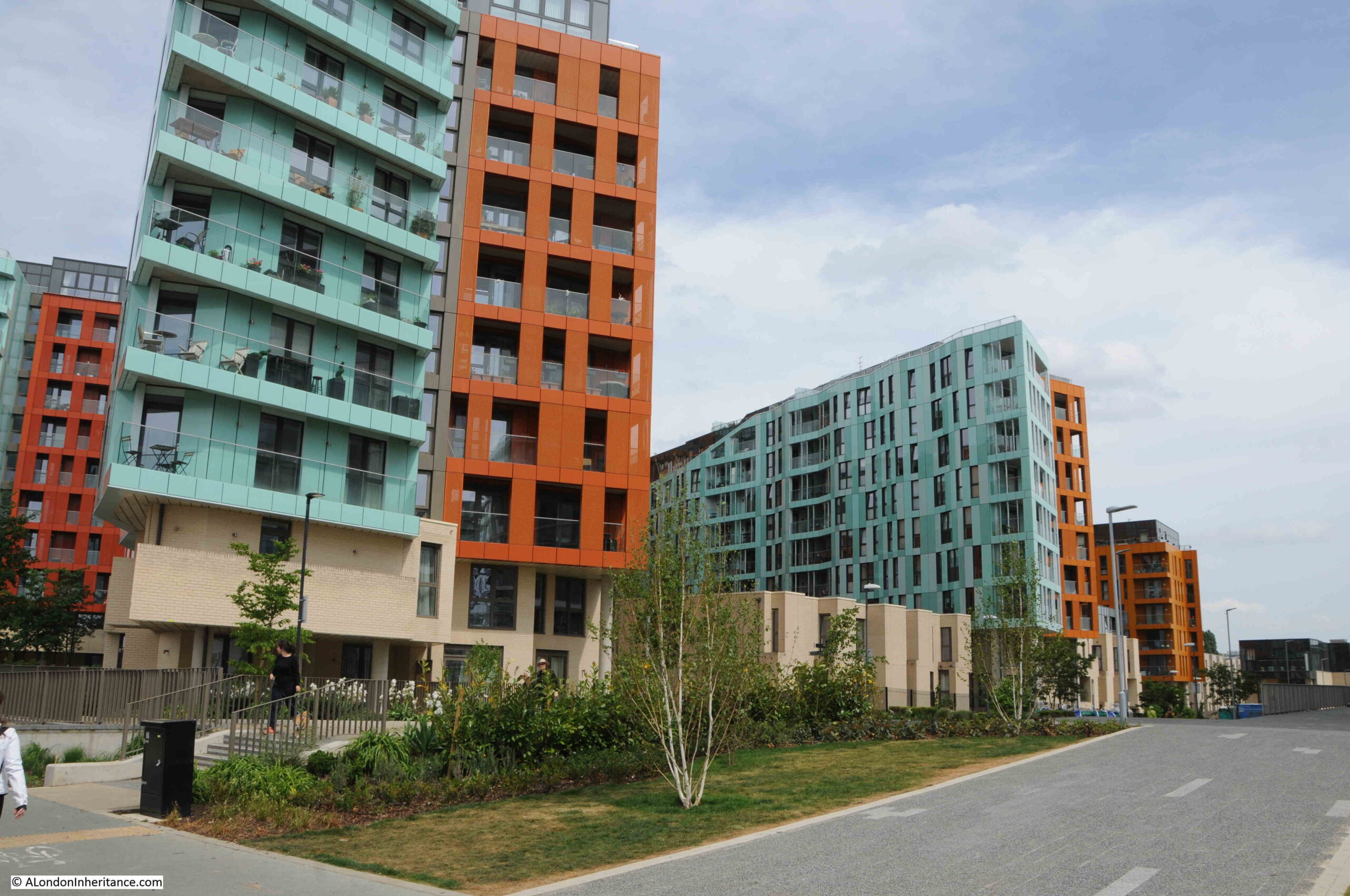
Two colour apartment blocks:
Of the many industries along this stretch of the river, one was a company that was key in the provision of a technology that enabled communications across the world. This was the manufacture of submarine communication cables which took place at Enderby Wharf and it is here that we can see the remains of some of this activity.
Here was manufactured the first cable to cross the Atlantic and up until the mid 1970s much of the world’s subsea communication cables had been manufactured here. The web site covering the history of the Atlantic Cable and Undersea Communications has a detailed history of Enderby Wharf.
The tower structure that can still be seen is part of the mechanism, along with the smaller wheel on the left, used for transferring cable from the factory on the right to cable ships moored in the Thames on the left. Cable would be run across the walkway to the top of the tower then to the round hold-back mechanism on the left then onto the ship:
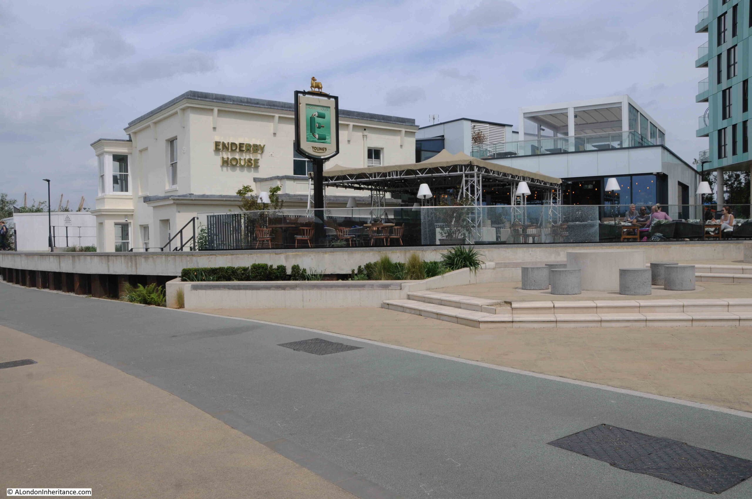
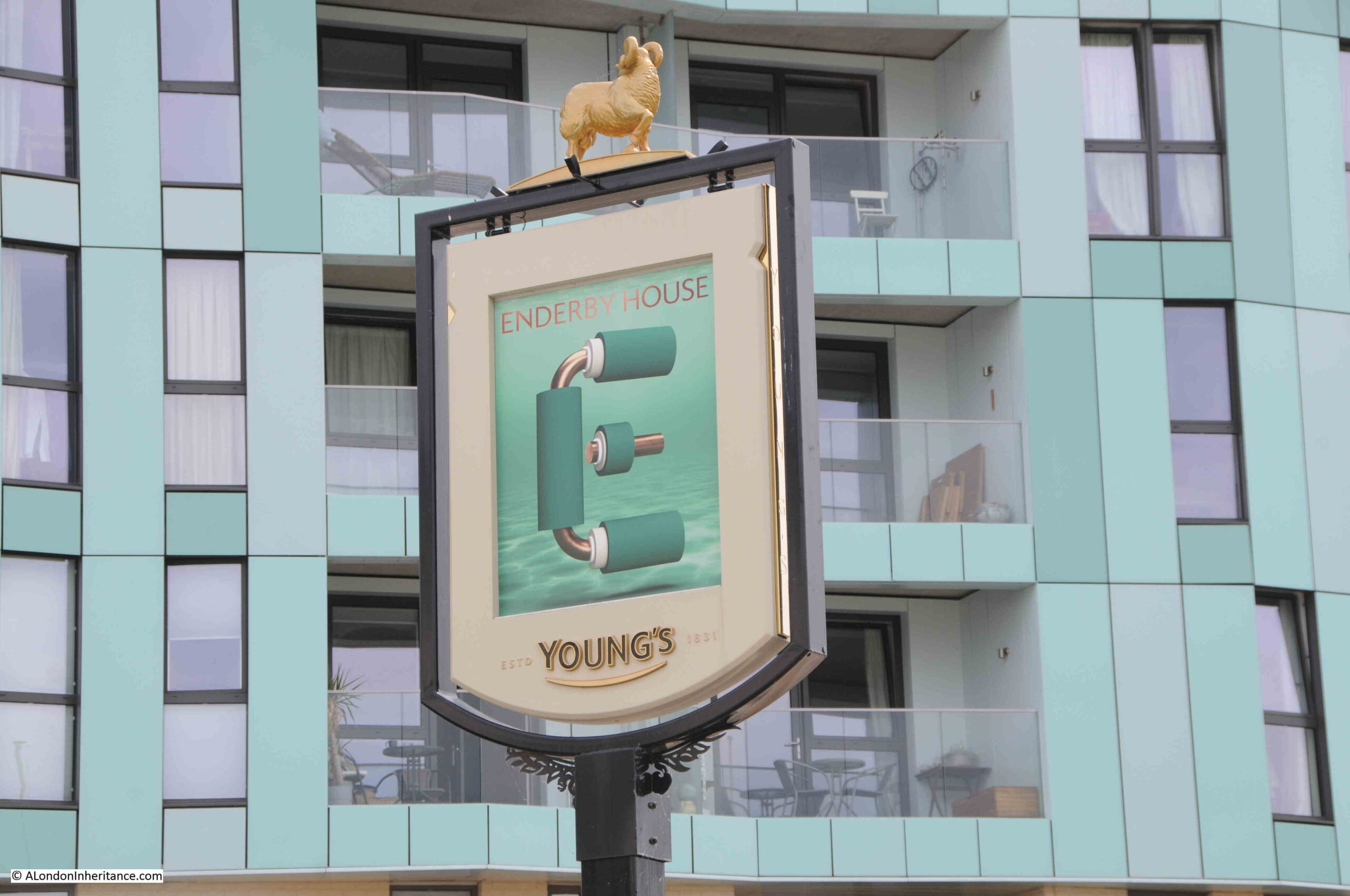
It was here that I was really surprised to see a new pub – Enderby House:
“Enderby House belonged to the firm of Samuel Enderby, the largest whalers and sealers in Britain, and pioneers of Antarctic exploration. Hermann Melville describes their flagship and crew in “Moby Dick”. The decline of British whaling led to the Enderbys ceasing to have an interest in Enderby’s Wharf in 1854. It was then taken on by Glass, Elliott and Company, a contractor for the first transatlantic telegraph cable (lost while being laid in 1857) then the second in 1858 which operated for a few weeks. The business was reconstituted in 1864 as the Telegraph Construction and Maintenance Company, who manufactured cable at Enderby’s Wharf to an improved design for another attempt in 1865, and a fourth in 1866, both times with the Great Eastern as the cable-laying ship, and by the end of 1866 had achieved the first successfully working transatlantic telecommunications cable connection. “
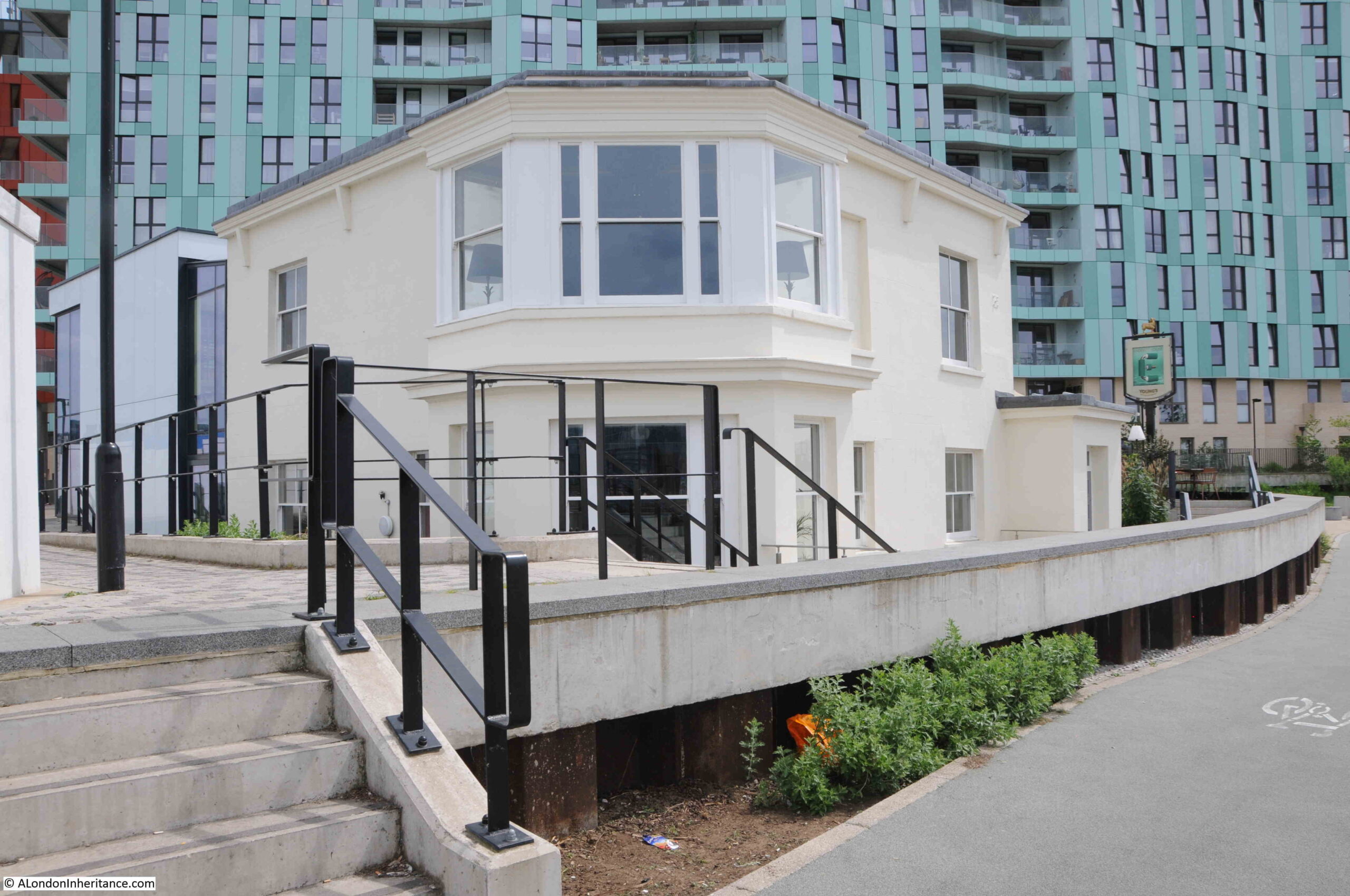
The last time I walked along this stretch of the peninsular in 2015, from Cutty Sark pub to O2 dome, Enderby House was looking in a very poor condition:
I walked around the outside of the pub, but could not see any references to the history of the site, or to the impact on communication technologies that the products manufactured here would bring, however the pub sign did appear to illustrate what I assume to be a representation of a telecommunications cable:
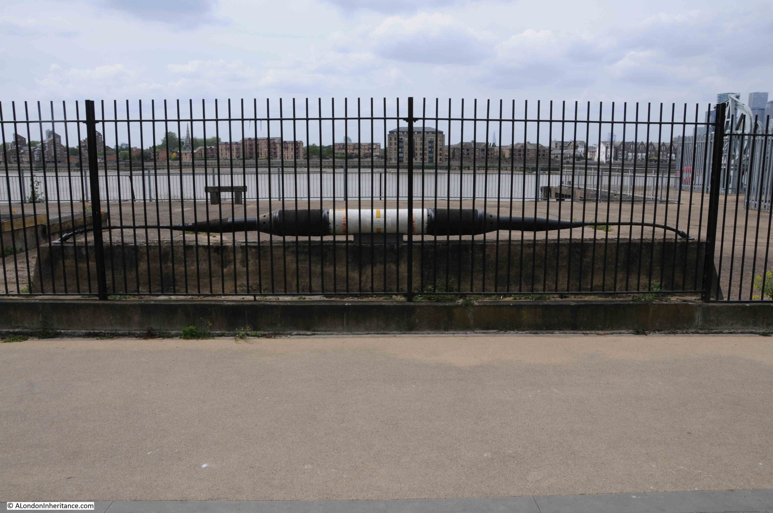
Opposite, within the fenced off wharf, was an example of a length of cable and the housing for the repeater equipment that would amplify the signal as it travelled for thousands of miles under the sea:
I get really conflicted when I see a building such as Enderby House. I am pleased that it is still there, and that it is a new pub (too many of these are closing), however it appears to be heavily altered, and does not appear to offer any information as to the importance of the site, apart from retaining the name and the pub sign.
Perhaps there is information inside and I am being unfair. I did not have time for a visit, having a meet arranged at the Cutty Sark pub on the walk back.
View of the northern side of Enderby House – if I was responsible for decorating the building I would have an artwork representing a trans-Atlantic cable running along the side of the building to break up the rather bland cream paintwork.
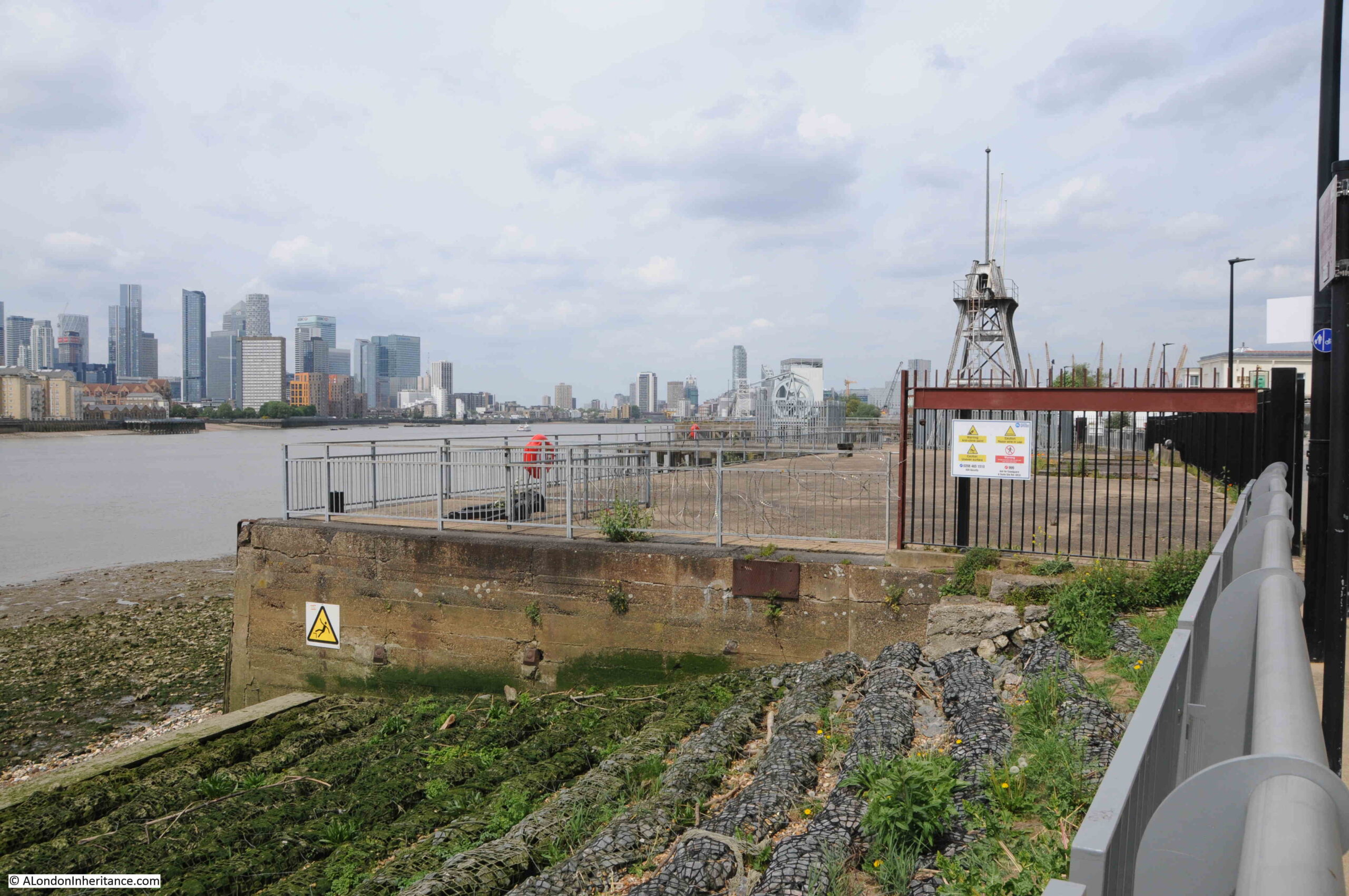
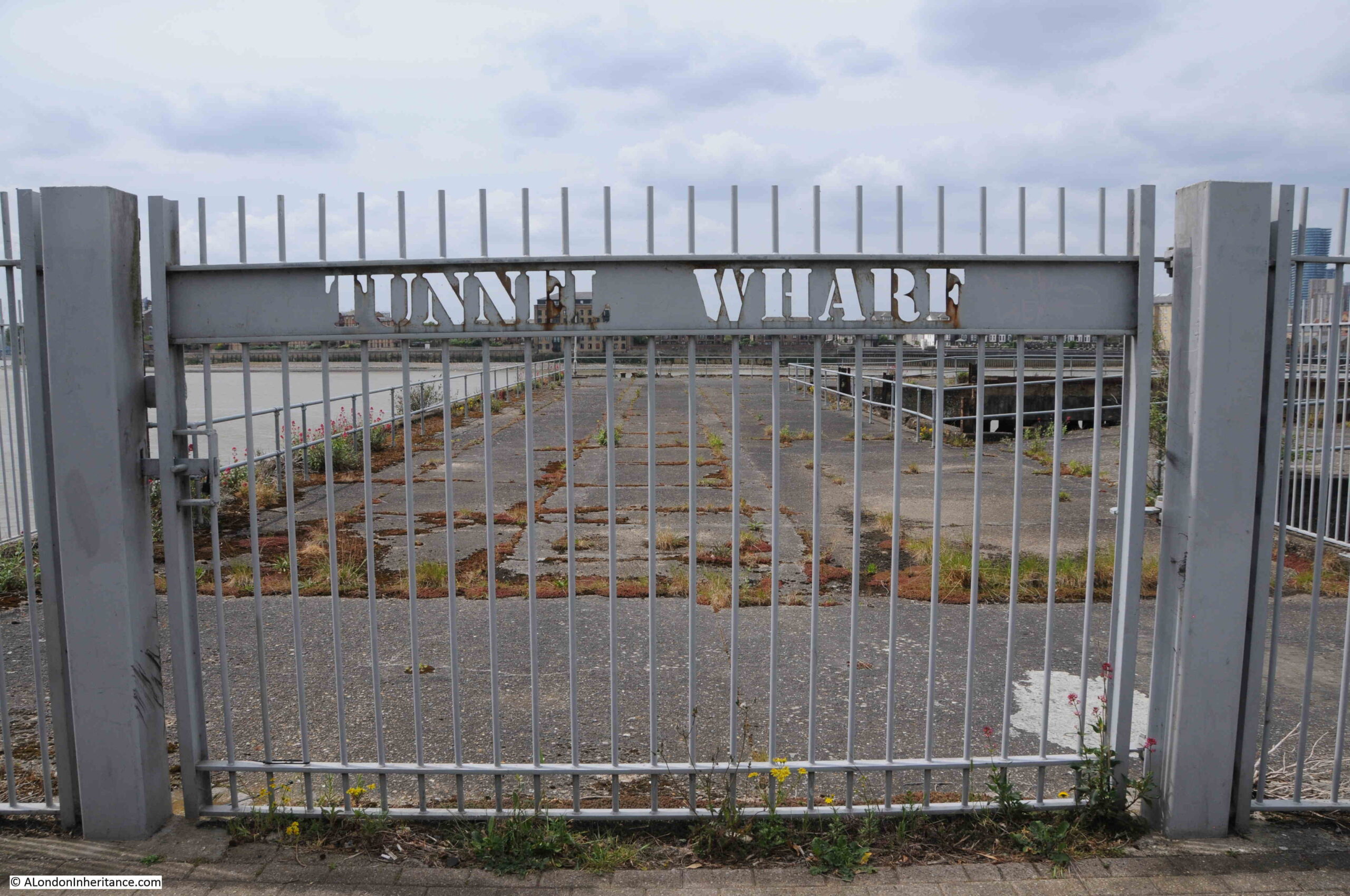
Fenced off access to the wharfs near Enderby House:
There is a flat wall of stone to be found among the apartment buildings and facing on to the walkway along the river:
Rather than repeat what the information panel to the right of the wall states, I will summarise Mary Mills comments from her book.
There was a road that ran underneath the new apartment buildings between Lovell’s and Granite Wharf (which was to the north of Lovell’s).
Much of the boundary wall of Granite Wharf along this roadway was made up of an extraordinary range of what appeared to be random stone, and was thought to have been quarried in Dorset, shipped to Greenwich where it was stored until it was sold for use in a construction project. Some of this stone had been used to construct the wall.
This stone wall was important as it was a visual demonstration of the stone trade from along the English Channel.
When the wall, along with the rest of the site was being demolished, Mary Mills was instrumental in getting the importance of the stone recognised, however the wall created by the developer using the stone is very far from how it was originally used, and what had been rough stone had been tided up considerably and placed in what is now a smooth wall of stone. Again, good that it has been retained, but it could have been so much better.
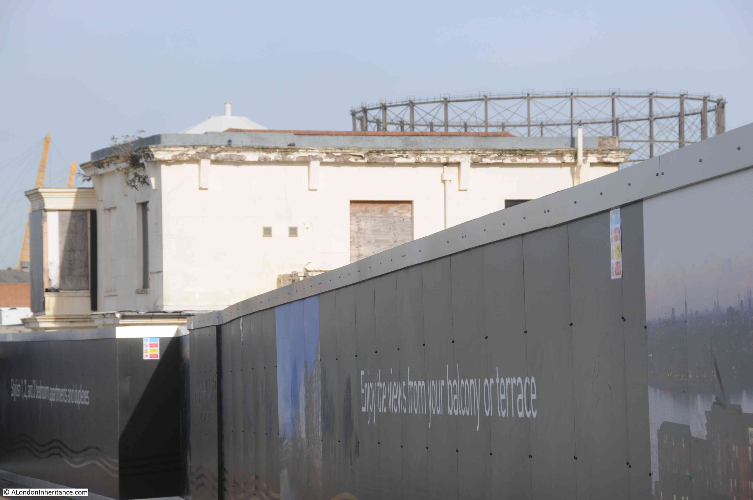
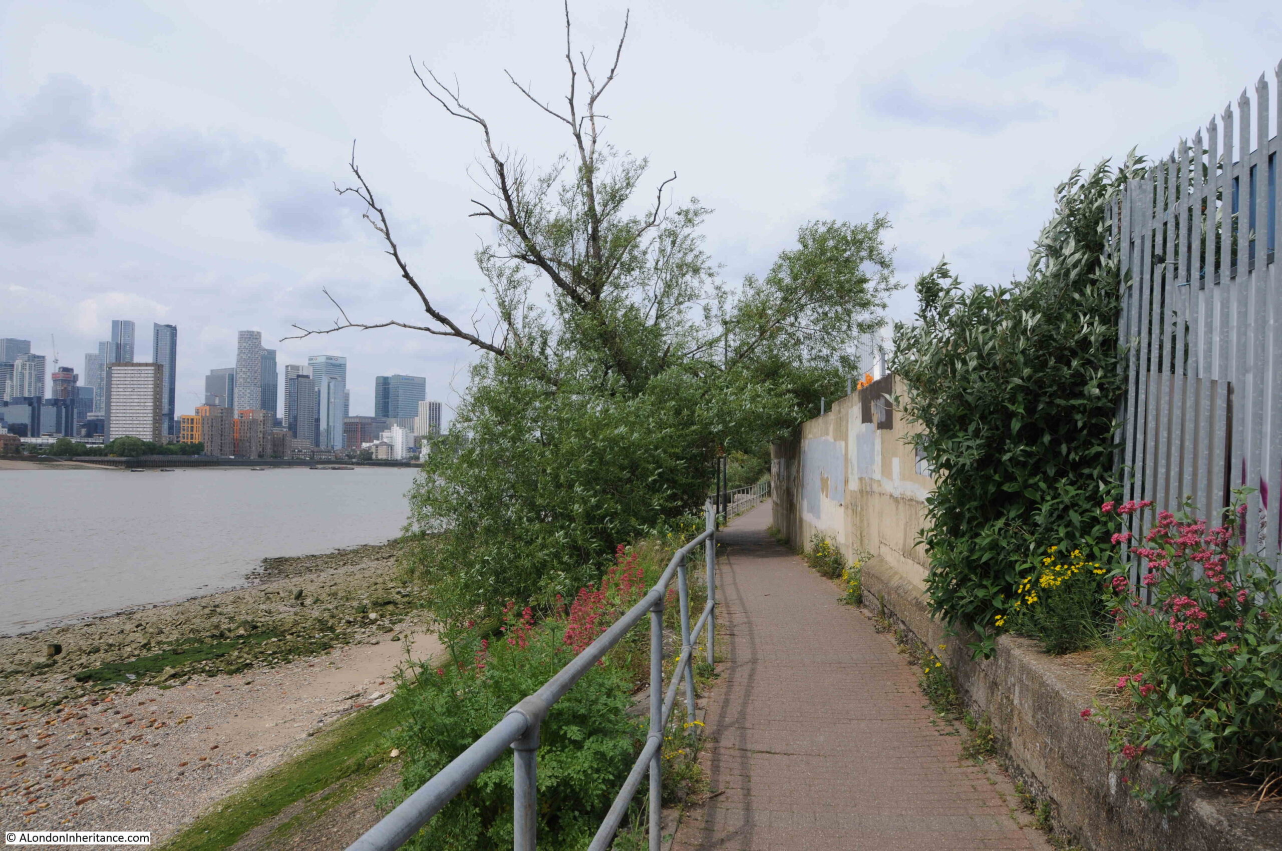
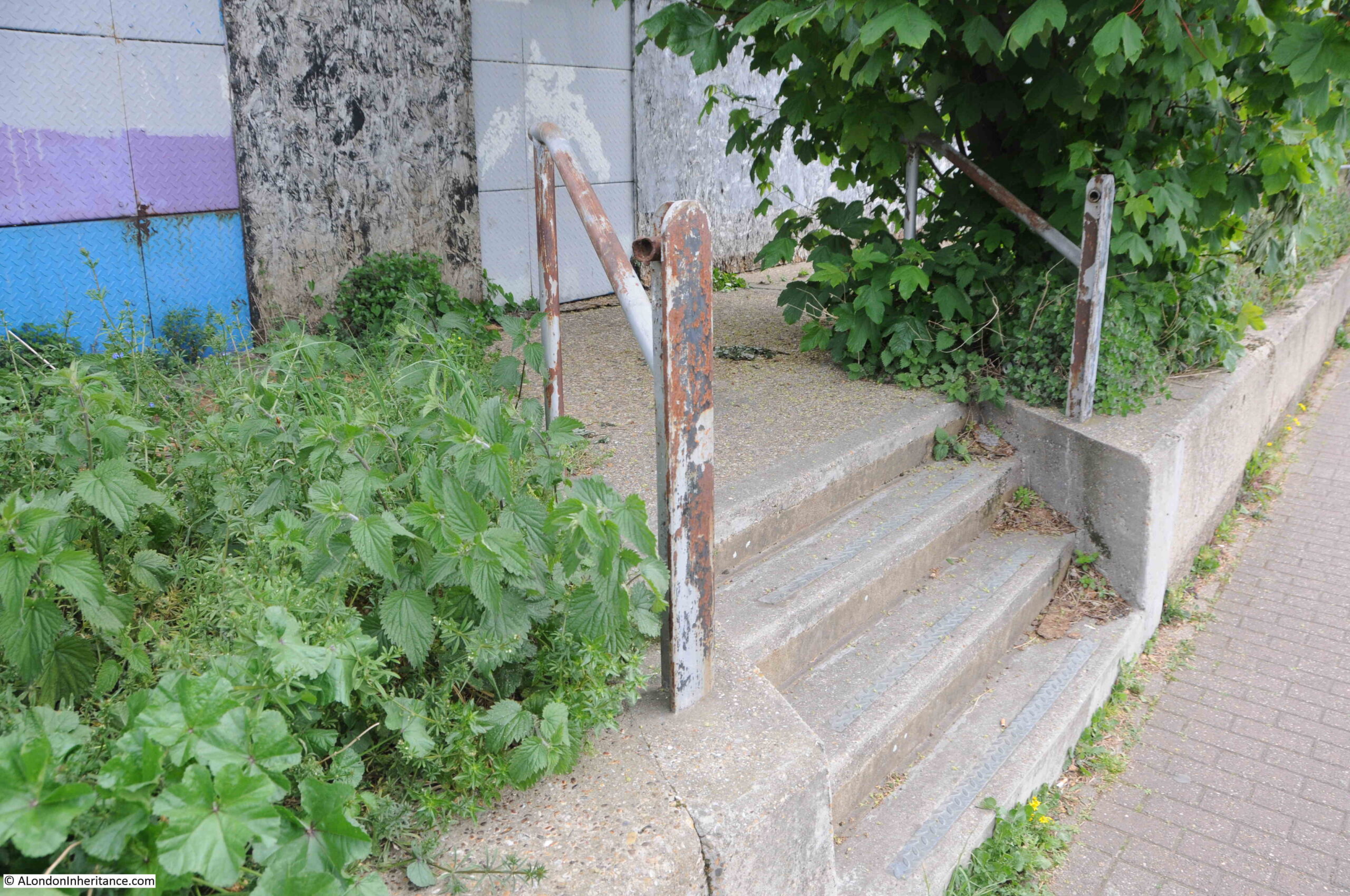
Soon after walking past Enderby House, development has stopped and the river path changes from a new, wide path in front of apartment buildings, to a narrow path alongside the derelict sites that are probably scheduled for development:
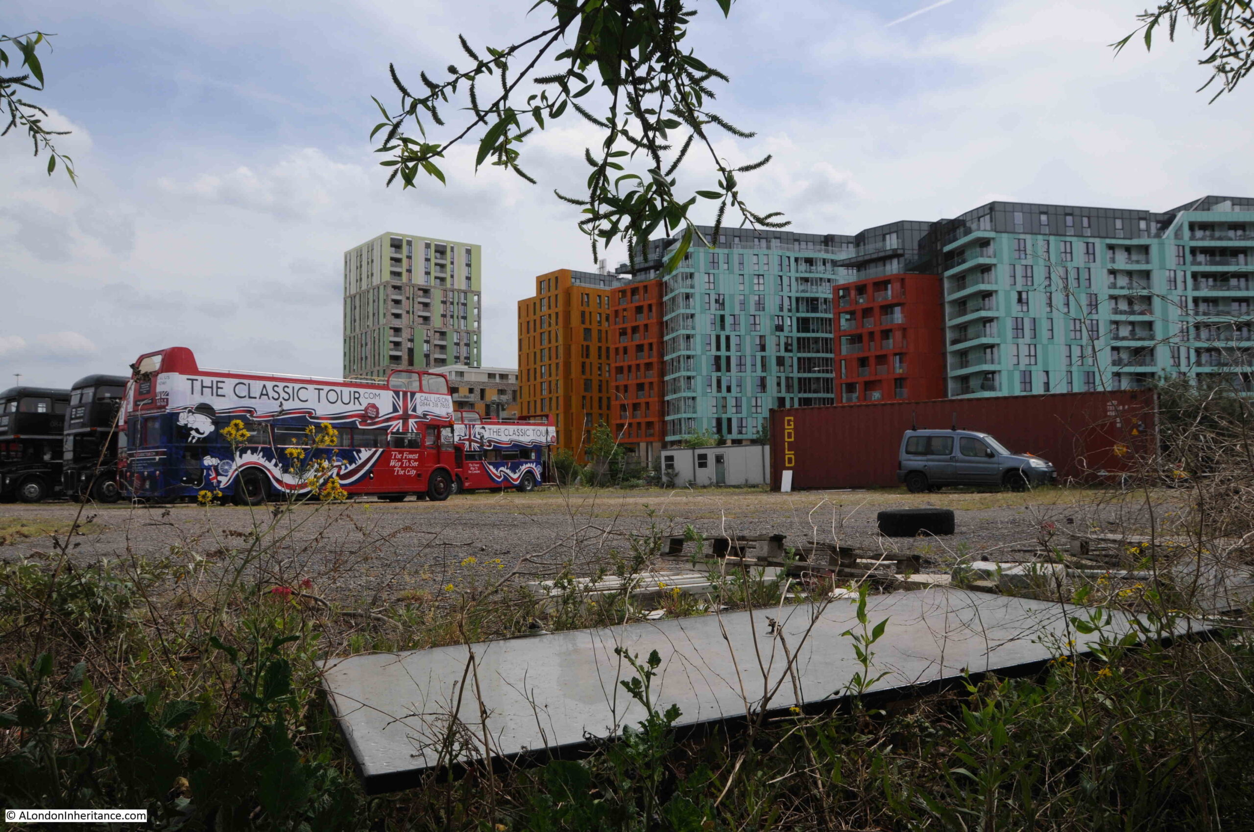
Where tour buses go to park:
I really love this part of the walk along the peninsula. A narrow path along the river’s edge, quiet, and a chance to think about what was here:
I still had my third 1986 photo to track down, and I suspect it was taken from the following pier:
This was the view looking back towards central Greenwich in 1986:
The following photo was the closest I could get to recreating the above. The landmarks of Greenwich all line up reasonably well. The barges moored alongside the pier in 1986 have all disappeared.
To the side of the footpath, there are the remains of structures that once provided access to the long gone industrial premises that lined the river:
A long closed gateway:
Looking back along the footpath – this stretch of the river is so very different to that which has already been developed, and I assume that at some point in the future, this footpath will become the same wide pedestrianised area next to new apartment buildings, as found at the start of the post:
A welcome sign:
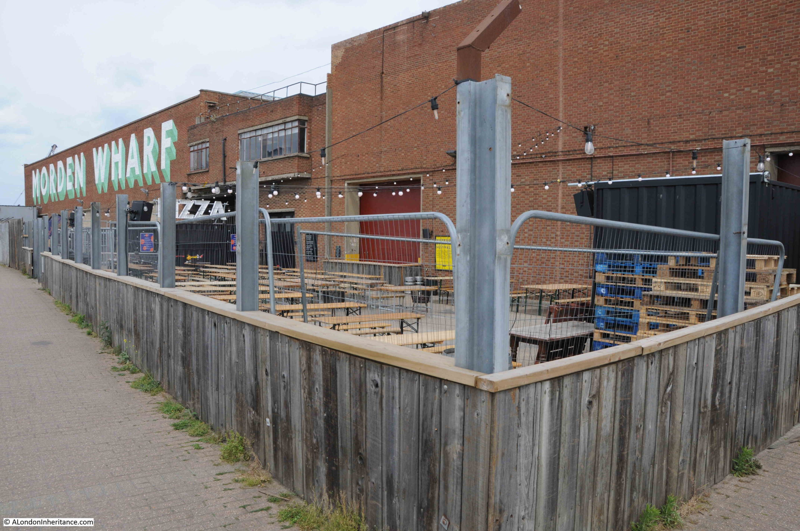
The sign points to what looks like a temporary bar / pizza area built in front of Morden Wharf:
Morden Wharf was named after Morden College, the freeholder of much of the land in the vicinity of the wharf.
The last time I walked along the peninsular, Morden Wharf was fenced off from the footpath with high, wooden panels, these have now been removed with only their vertical metal supports remaining.
Having reached Morden Wharf, I turned back towards Greenwich.
The area that I have walked which has not yet been developed, is planned to undergo a significant transformation. The footpath winding its way between the river and the derelict industrial sites will disappear and large new towers will be built.
Scroll to the bottom of the page, on the Morden Wharf website, and the area I have walked can be seen to the right of the old brick Morden Wharf building, and the bar and pizza area will apparently become “The reinstated Sea Witch pub”, a very different recreation of a pub that was once close to the river, and that was badly damaged by a V1 flying bomb on the 12th of July 1944.
The 1986 photos captured some of the last years of some of the industry along this side of the Greenwich Peninsula. It would then remain derelict for some years, and is now undergoing a significant transformation. It is a good time to walk the western side of the peninsula before this happens.
In 1949, my father photographed the Westminster School Gateway:
I am really grateful to the Archivist at Westminster School who provided access during the Spring half term, and told me about the history of the gateway and the surrounding area (although any errors are down to my memory).
The same photo of the Westminster School Gateway at the end of May 2022:
There has been very little change in the 73 years between the two photos. The main change being a couple of CCTV cameras to the left of the gateway.
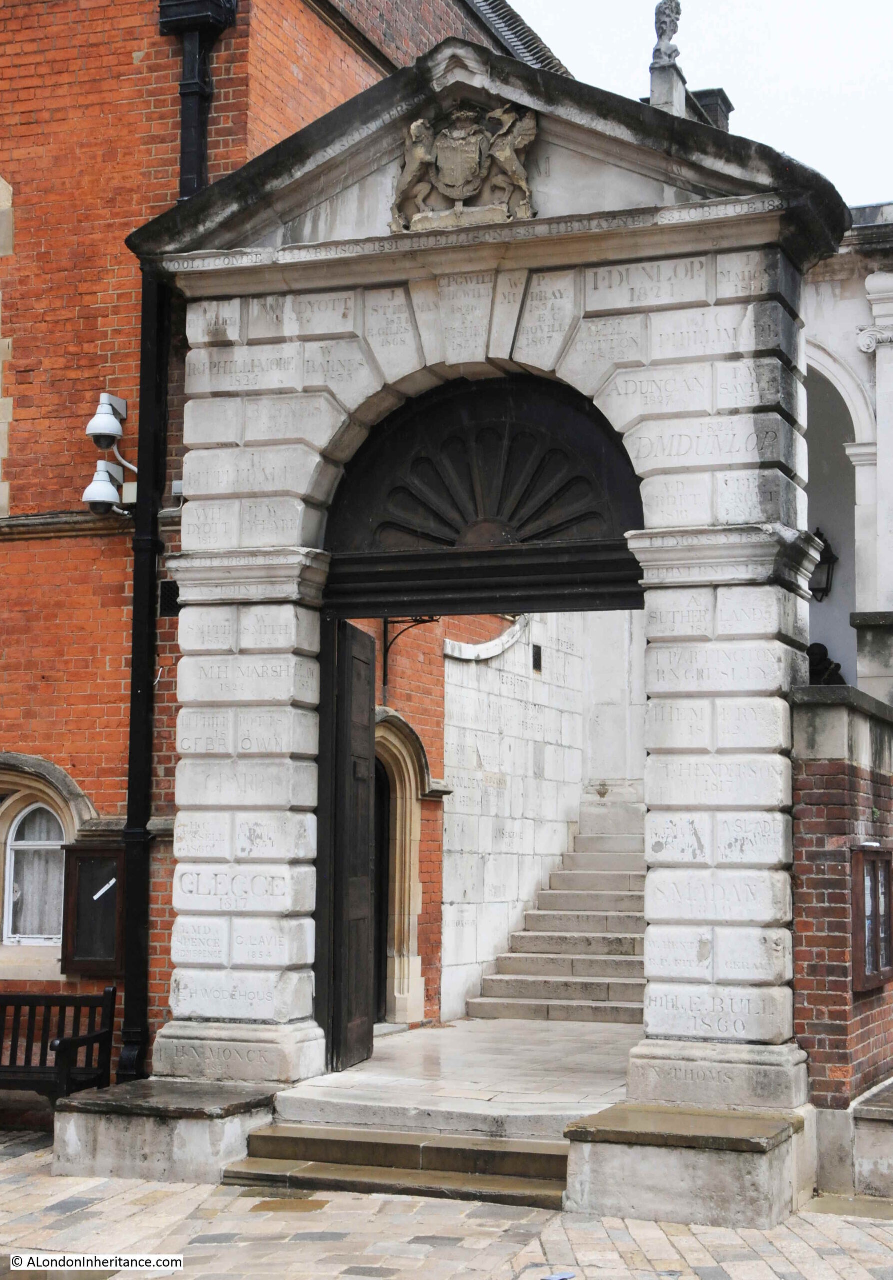
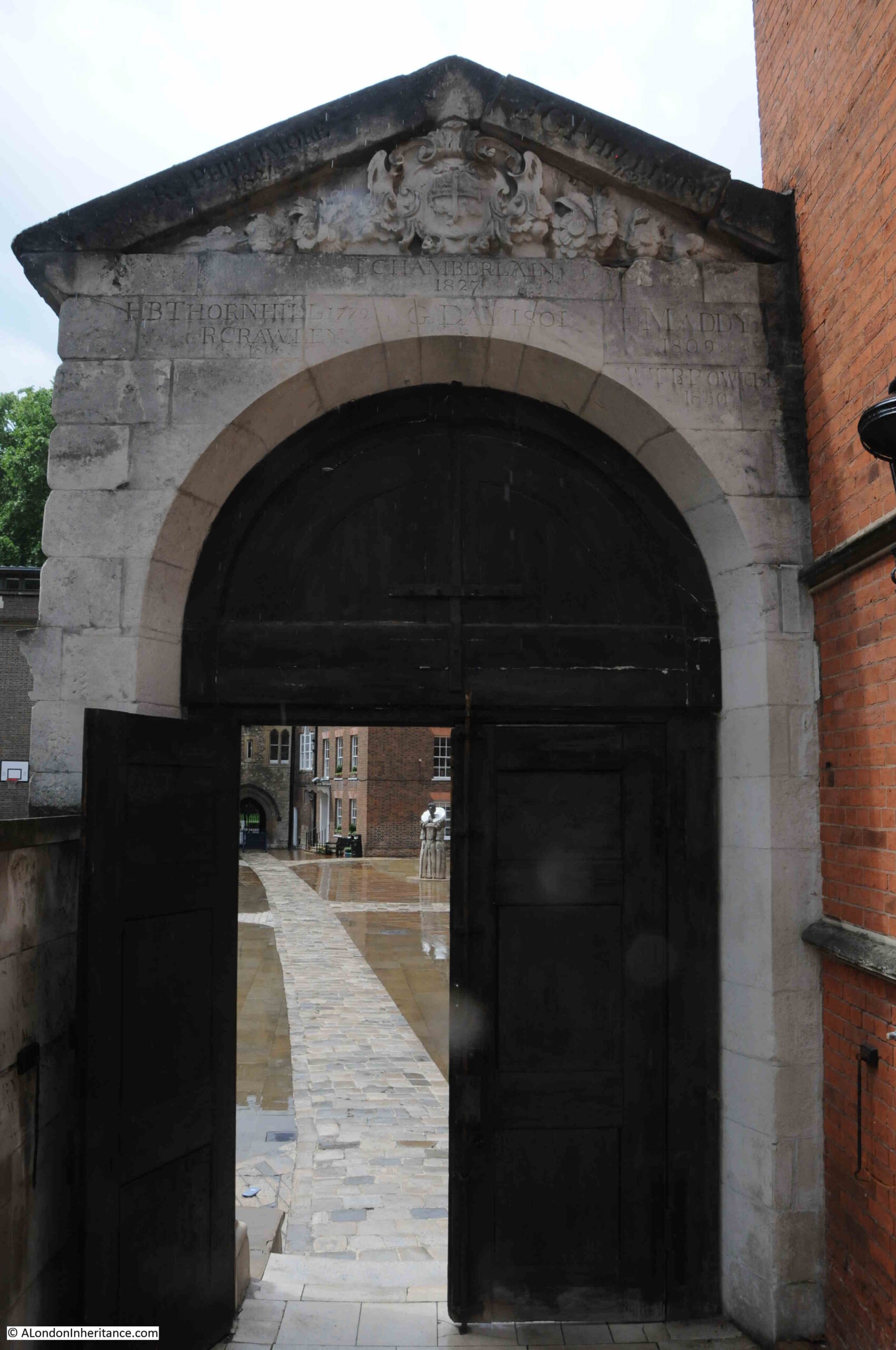
The Westminster School Gateway is a historic feature of the school for two main reasons. The age and purpose of the gateway, and the inscriptions that cover almost all the stones of which the gateway has been built.
The day of my visit was one of those days where London weather changes from sunshine to pouring rain in a matter of minutes, and that is exactly what happened when I arrived. The sky clouded and the rain fell, resulting in an overcast view of the gateway in my photo, compared to my father’s photo taken in bright sunshine.
Due to the different lighting conditions, the inscriptions are far more visible in my father’s photo than mine. In the 1949 photo, the stones are generally dirtier due to the amount of pollution from coal fires and other industrial sources across London. This blackened the inscriptions in the 1949 photo which helps them to stand out.
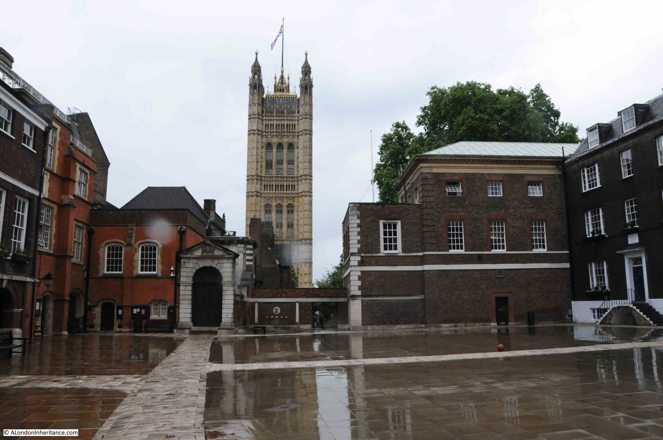
The view looking across Little Dean’s Yard towards the gateway, with the Victoria Tower of the Palace of Westminster in the background:
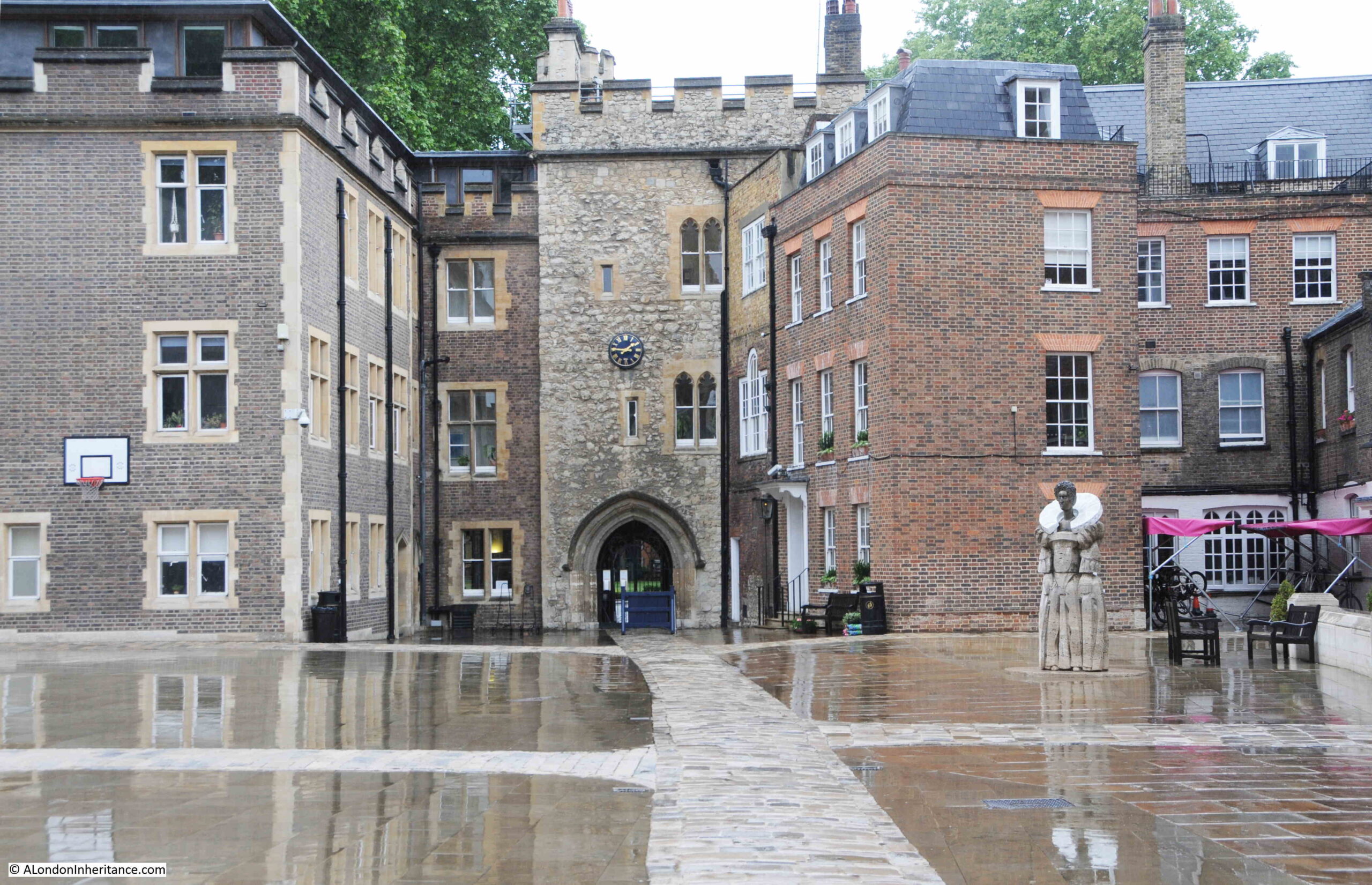
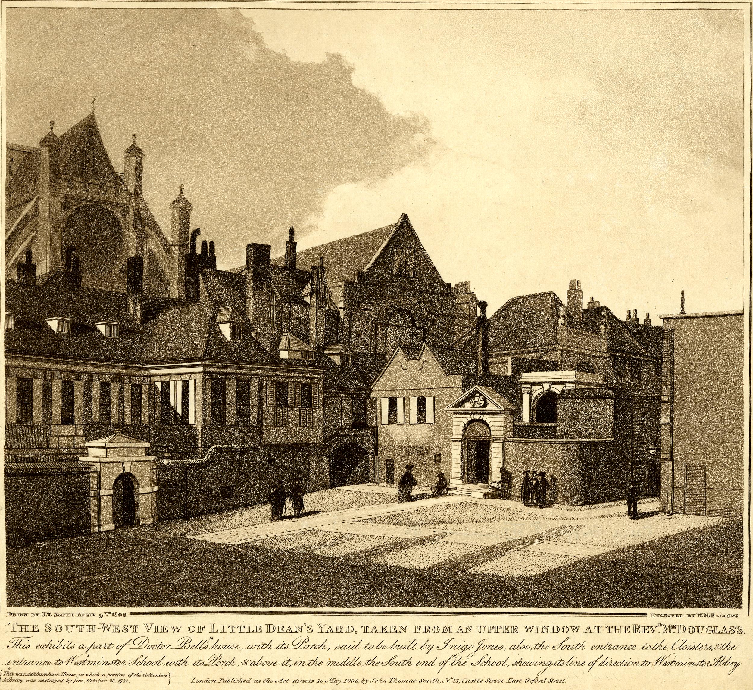
The School Gateway was built in 1734 and was the main entrance to the school. Little Dean’s Yard was originally occupied by buildings, and a passageway led from Dean’s Yard (via Liddell’s Arch) through these buildings to reach the school gateway.
The gateway is believed to have been built by Lord Burlington. This was Richard Boyle, the 3rd Earl of Burlington, who as well as the gateway, was responsible for the construction of a dormitory at the school between 1722 and 1730.
The school gateway is therefore also known as Burlington’s Arch.
The view looking back towards Liddell’s Arch from near the school gateway:
On the right of the above photo is a sculpture of Queen Elizabeth I, who became the royal patron of the school in 1560 and is celebrated as the founder of the school, although the foundations of the school are much earlier, the school having its origins in a charity school run by the Benedictine monks of Westminster Abbey.
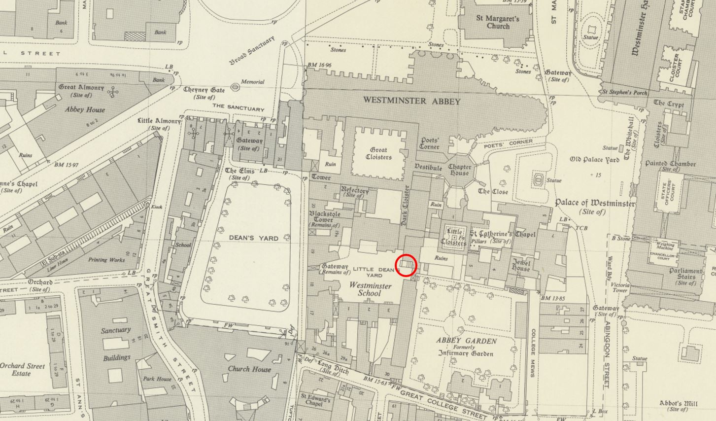
The following map is an extract from the 1950 edition of the Ordnance Survey (a year after my father’s photo). The school gateway is circled, and the map shows the area in detail as it was, and within the area of the school, as it is today (‘Reproduced with the permission of the National Library of Scotland“).
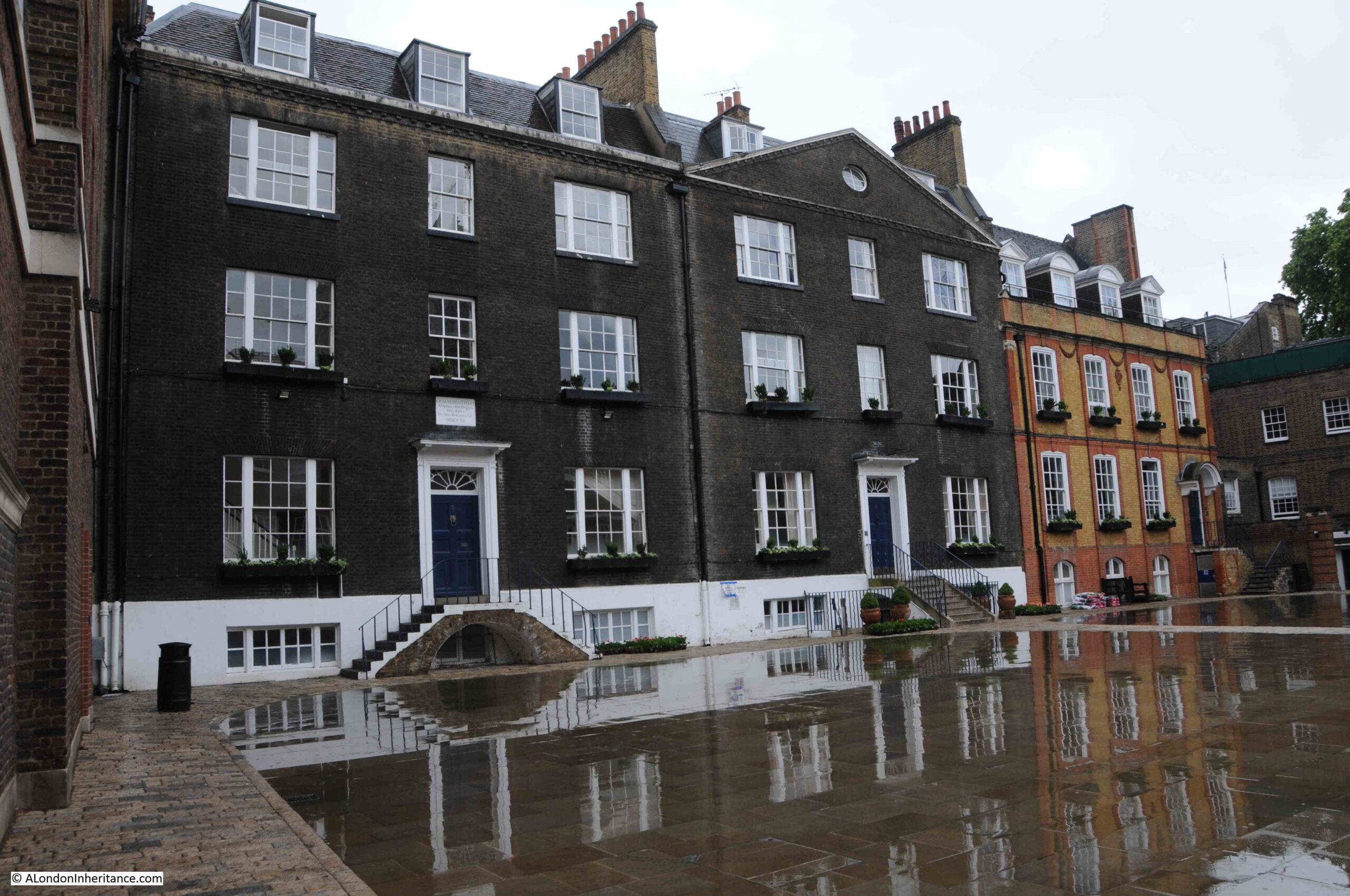
To the south of Little Dean’s Yard are the two remaining buildings of an 18th century terrace of three. This is the Grade I listed numbers 2 and 3 Little Dean’s Yard:
The building on the right of the above terrace, which has broken up the symmetry of the original terrace is a rebuild of 1896, and is Grade II listed number 1 Little Dean’s Yard.
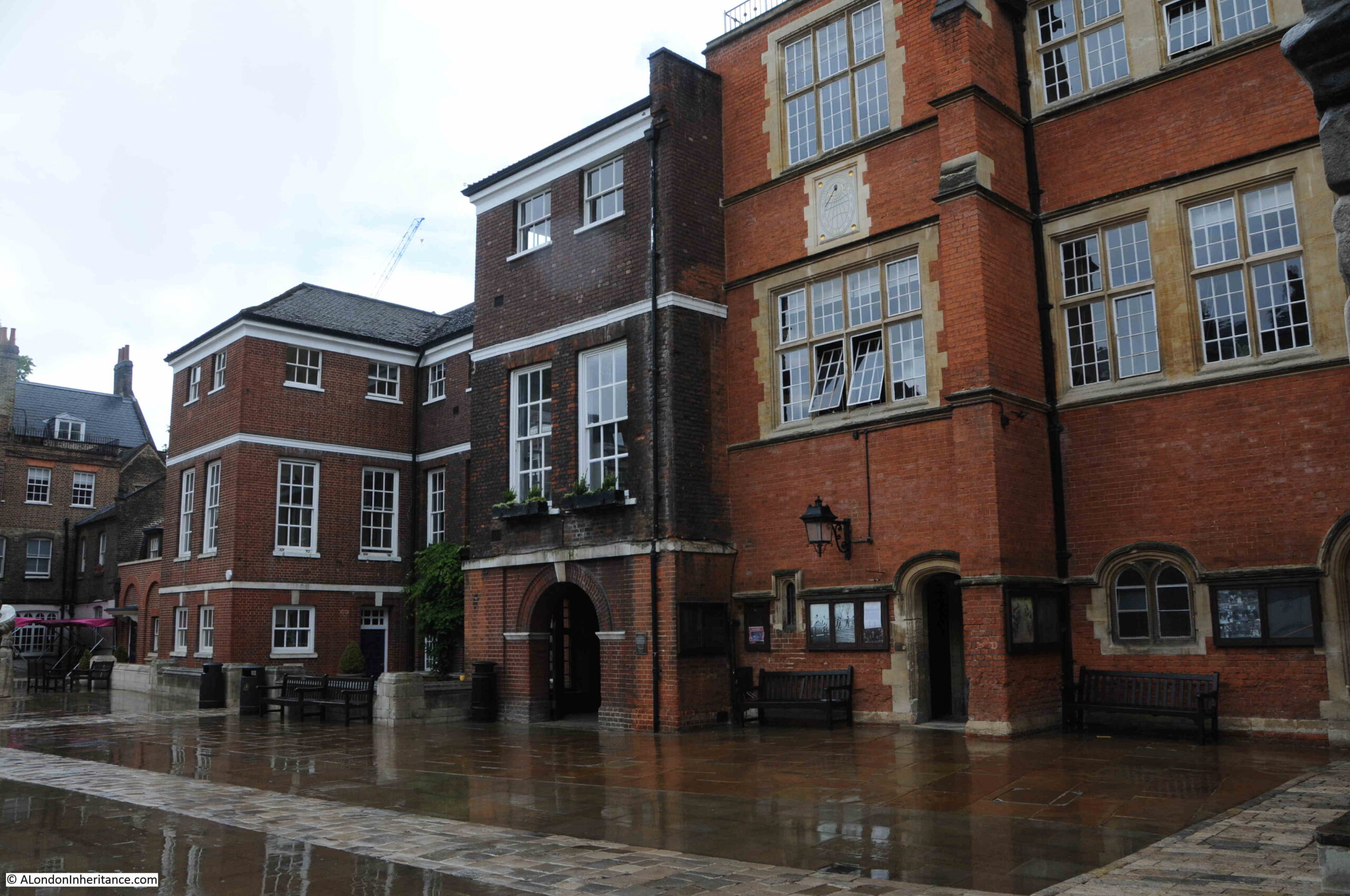
Listed buildings continue on the northern side of the yard, with the Grade II listed Turle’s House, dating from 1884 on the right. This building was built over fragments of an 11th century reredorter (a communal latrine), and part of the original monastery’s cloisters.
On the left of the above photo is the Grade I listed Ashburnham House, which includes parts of various structures that have occupied the site over the centuries.
The building includes the masonry structure and kitchen and hall walls from the 14th century Prior’s Lodging. The building became a substantial town house in the mid 17th century, when red brick was added to the 14th century rubble walls.
A west wing (furthest from the camera) was added in 1910, and this later wing can be seen in a slightly different colour brick, and the arched entrance on the ground floor of the earlier wing.
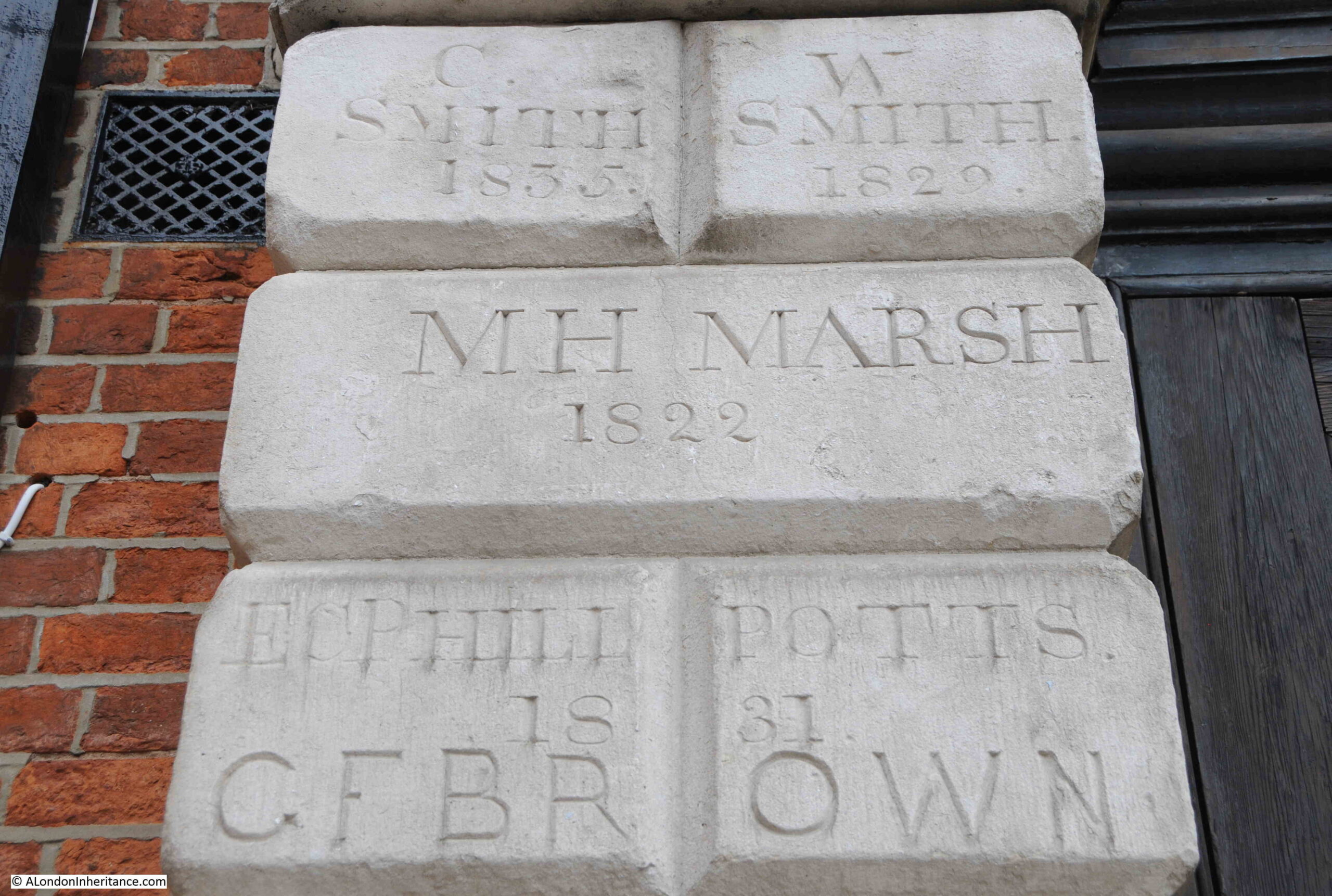
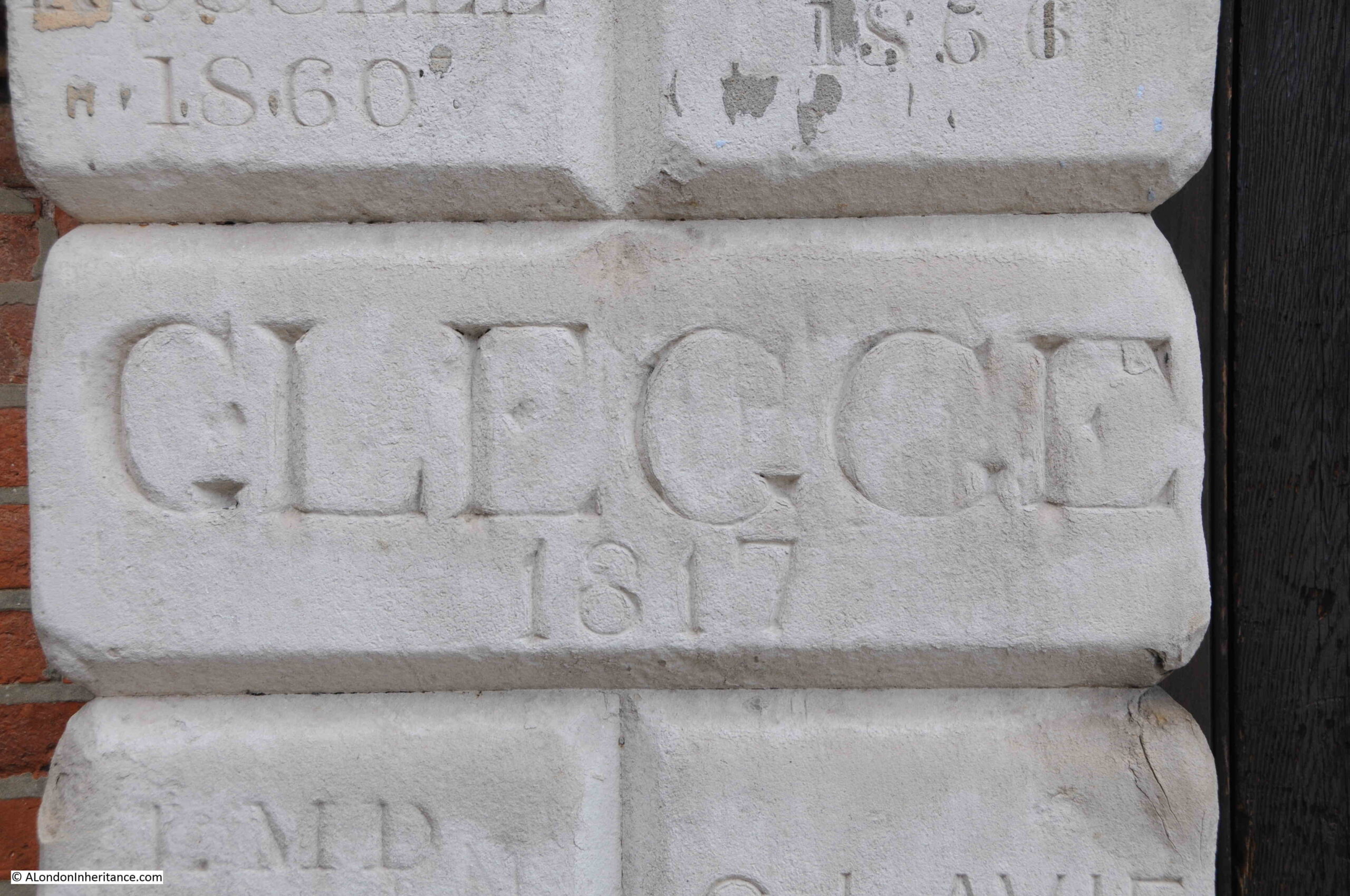
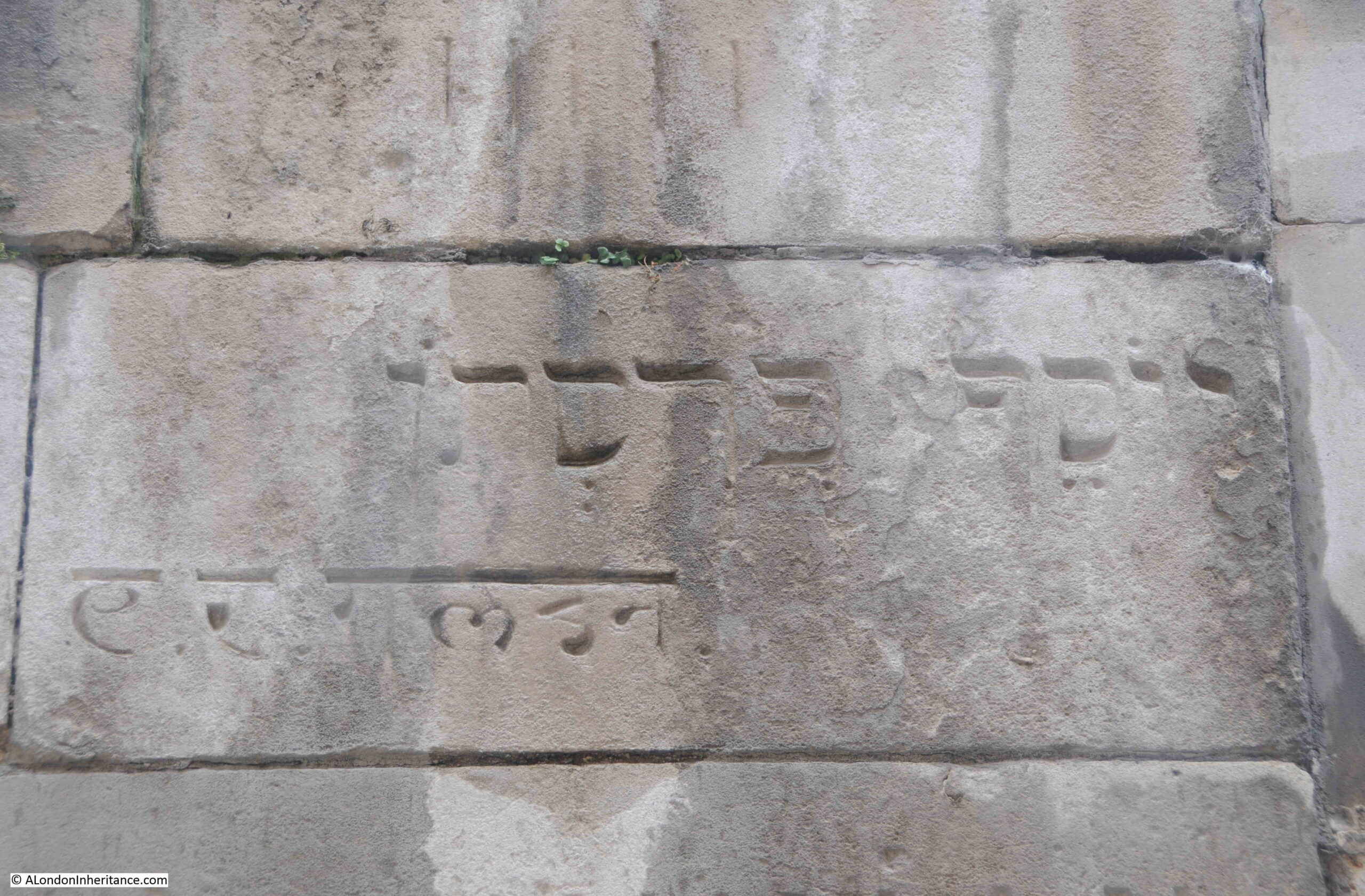
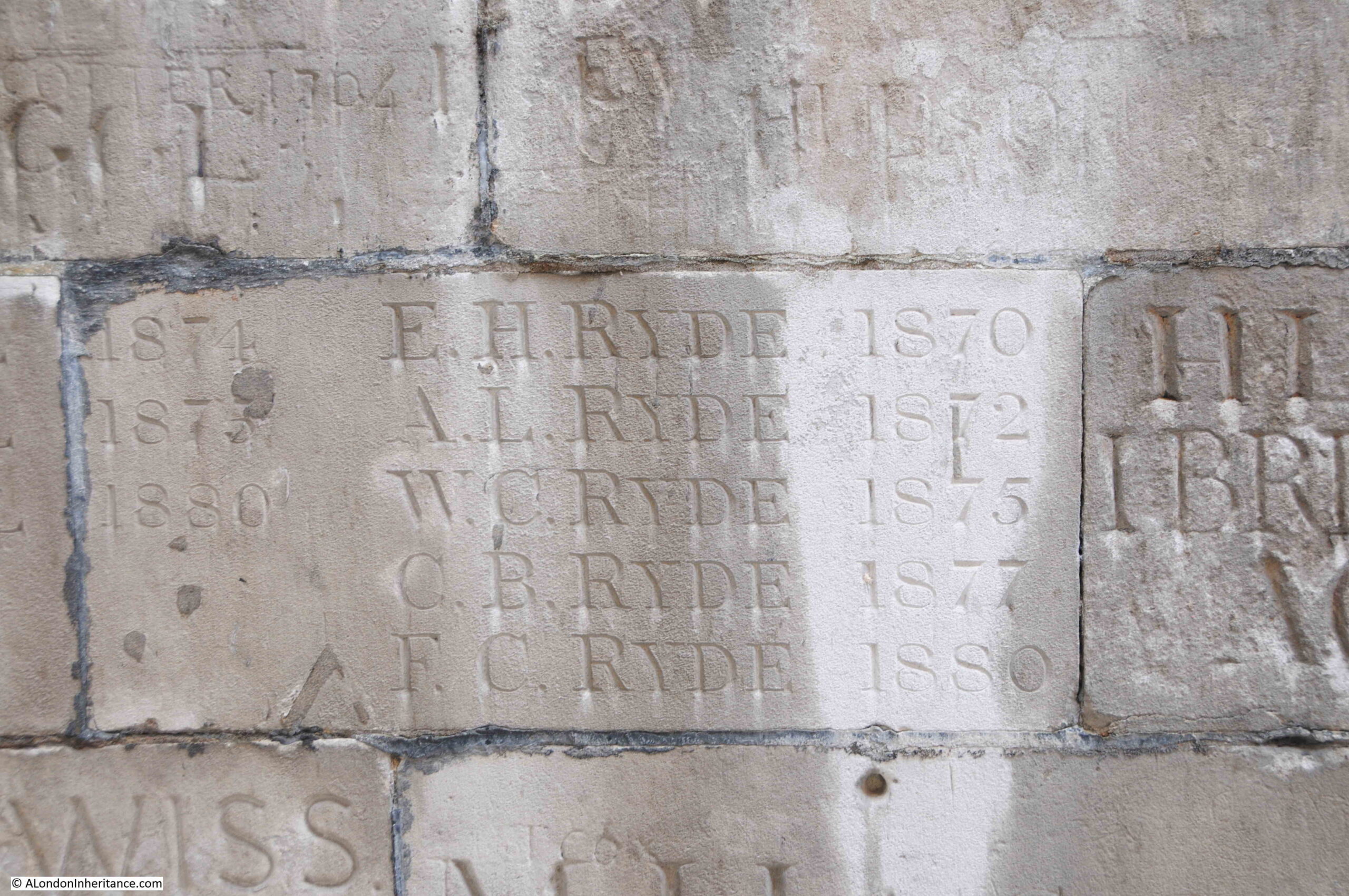
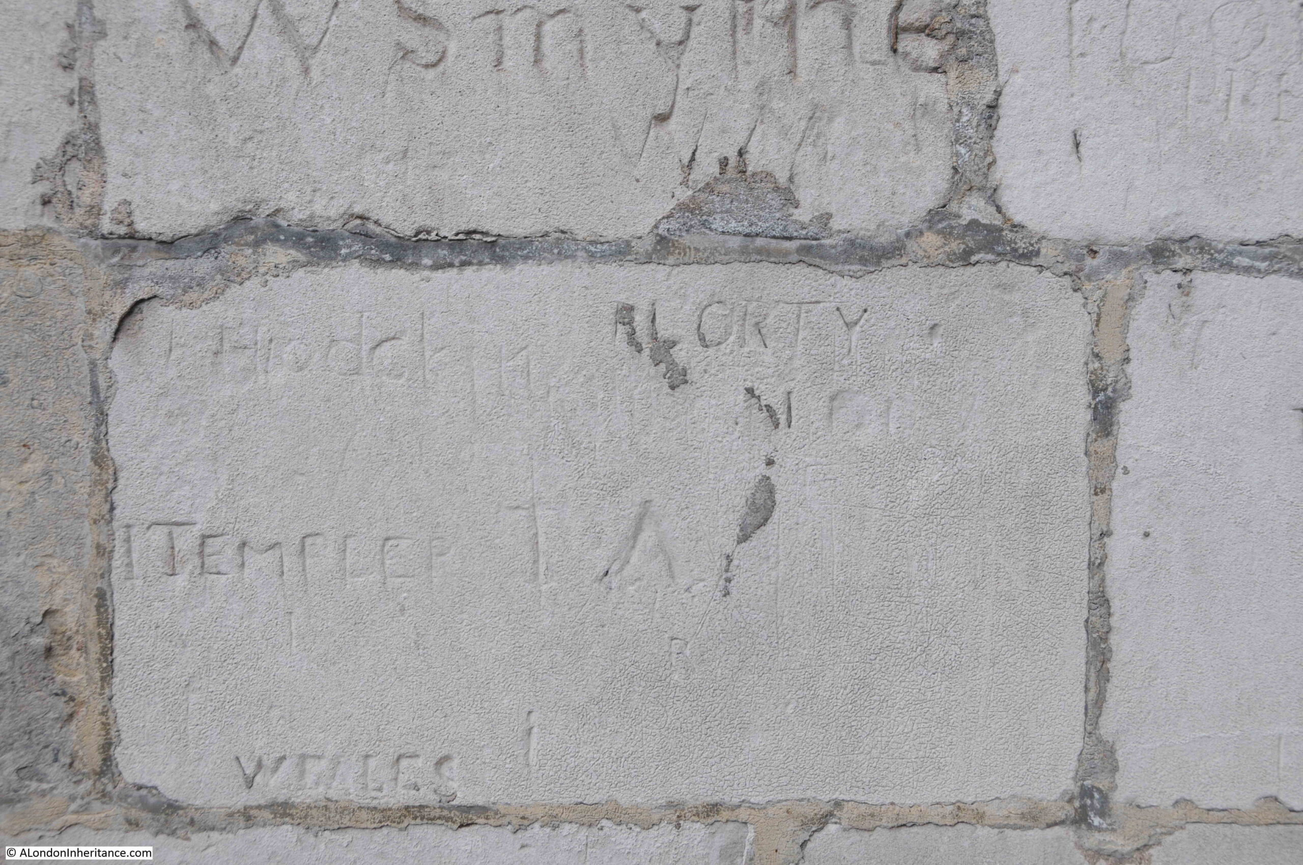
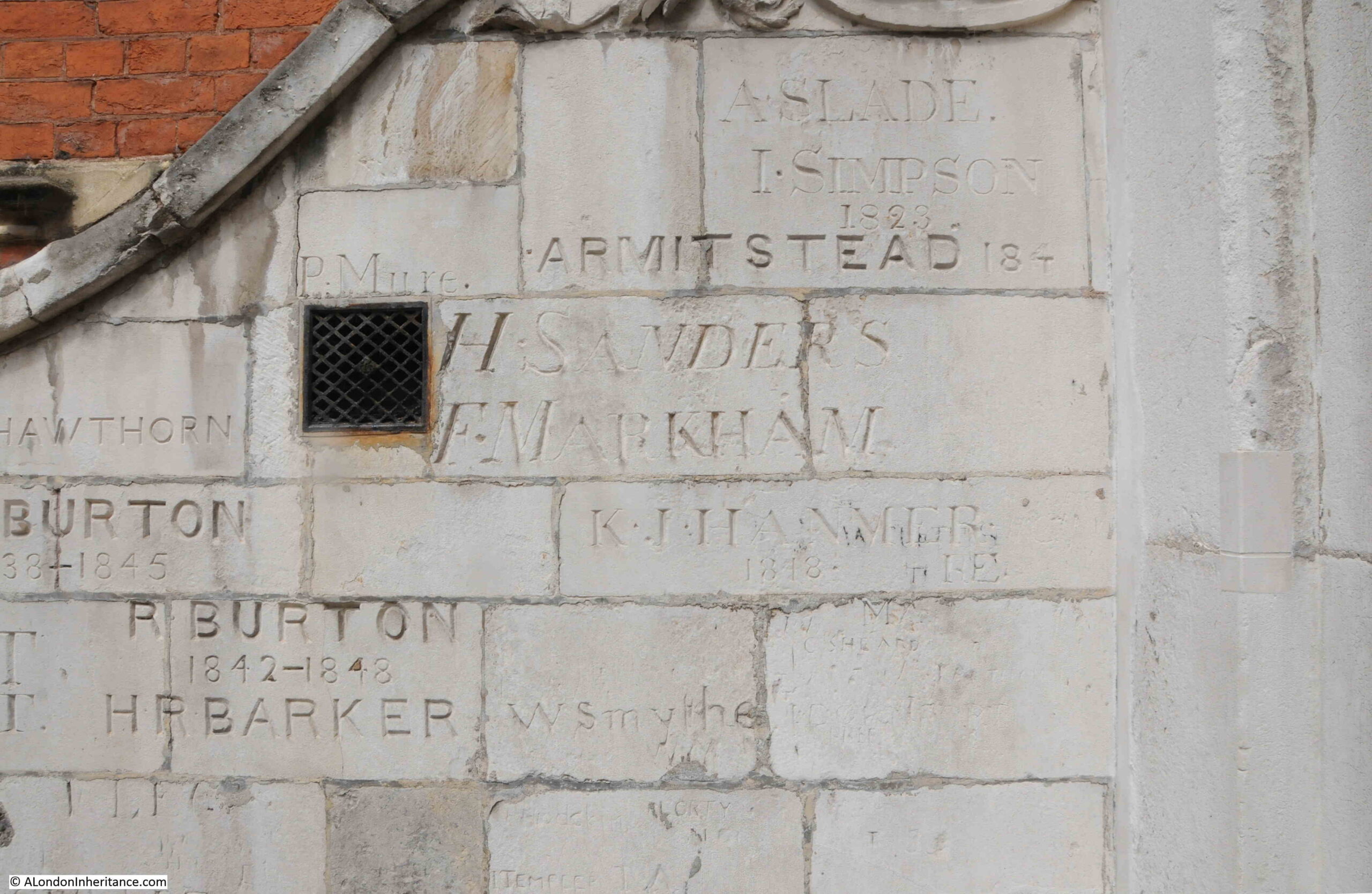
Westminster School Gateway is a fascinating historical structure simply as a gateway, but what adds further interest are the names and dates carved onto the gateway on almost every available space:
Westminster School has created a dedicated website to the gateway, which includes a remarkable degree of research to provide an inventory of the names carved on and around the gateway, with background details to the names.
An example from the inventory, covering the name in the following photo:
LEGGE, GEORGE AUGUSTUS, eldest son of Hon. and Rev. Augustus George Legge FSA, Chancellor of Winchester, and Honora, eldest dau. of Walter Bagot
The website also provides advice for those aspiring to leave their mark, and uses George August Legge’s carving as an example of why punctuation is important and that his name really needs a “.” between the initial and surname.
There are a couple of inscriptions in non English languages, as shown in the following photo with inscriptions in Hebrew and Devanagari (a North Indian script):
The quality of the carving on the gate is excellent, the reason being is that the majority of the inscriptions were carved by stonemasons from Westminster Abbey, paid by the pupil to carve their name.
This is obvious when looking at the five Ryde brothers in the above photo as each instance of Ryde is identical to the other four.
There are a number of names which have obviously been carved by the pupil, and the quality of these is very different from those by a trained stonemason as shown in the following photo:
As well as the main body of the gateway, the side walls running up the stairs behind the gateway also have plenty of names:
And they are also on the rear of the gateway:
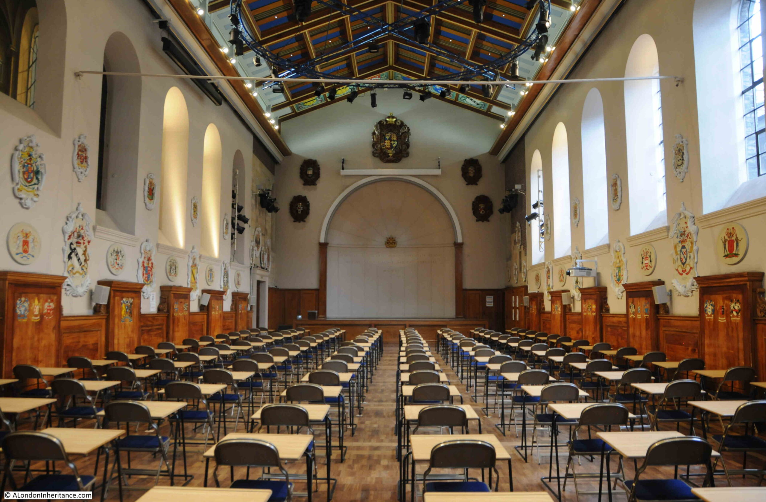
The school gateway leads to a small flight of stairs, a left turn which then opens out into the main school room, which on my visit was set-up for exams:
This room was originally part of the monks dormitory in the time of the Benedictine monastery and it was first used as a schoolroom in 1599.
The LCC Bomb Damage maps show damage to some of the buildings on the eastern side of Little Dean’s Yard, including the schoolroom. This resulted in the refurbishment of the space, including the installation of a new roof which can be seen in the above photo.
On the walls between the windows there appear to be lots of inscriptions, so I assume the approach of carving inscriptions on the school gateway extended also into the schoolroom.
I could not see these inscriptions in the schoolroom today, so I suspect they were covered up during restoration work following the wartime bomb damage.
I was really pleased to recreate my father’s photo, one of those rare places in London where the view is almost exactly the same.
My thanks to the Archivist for providing access and information.
I have kept the post relatively high level as the school’s website dedicated to the gateway is comprehensive and fascinating.
In my second post of the Jubilee weekend, I am looking at a couple of royal events in London. The 1953 Coronation and 1981 Royal Wedding. Some of these photos have been in previous posts, some are new, and they show how in many ways royal events in London are much the same today as they were seventy years ago.
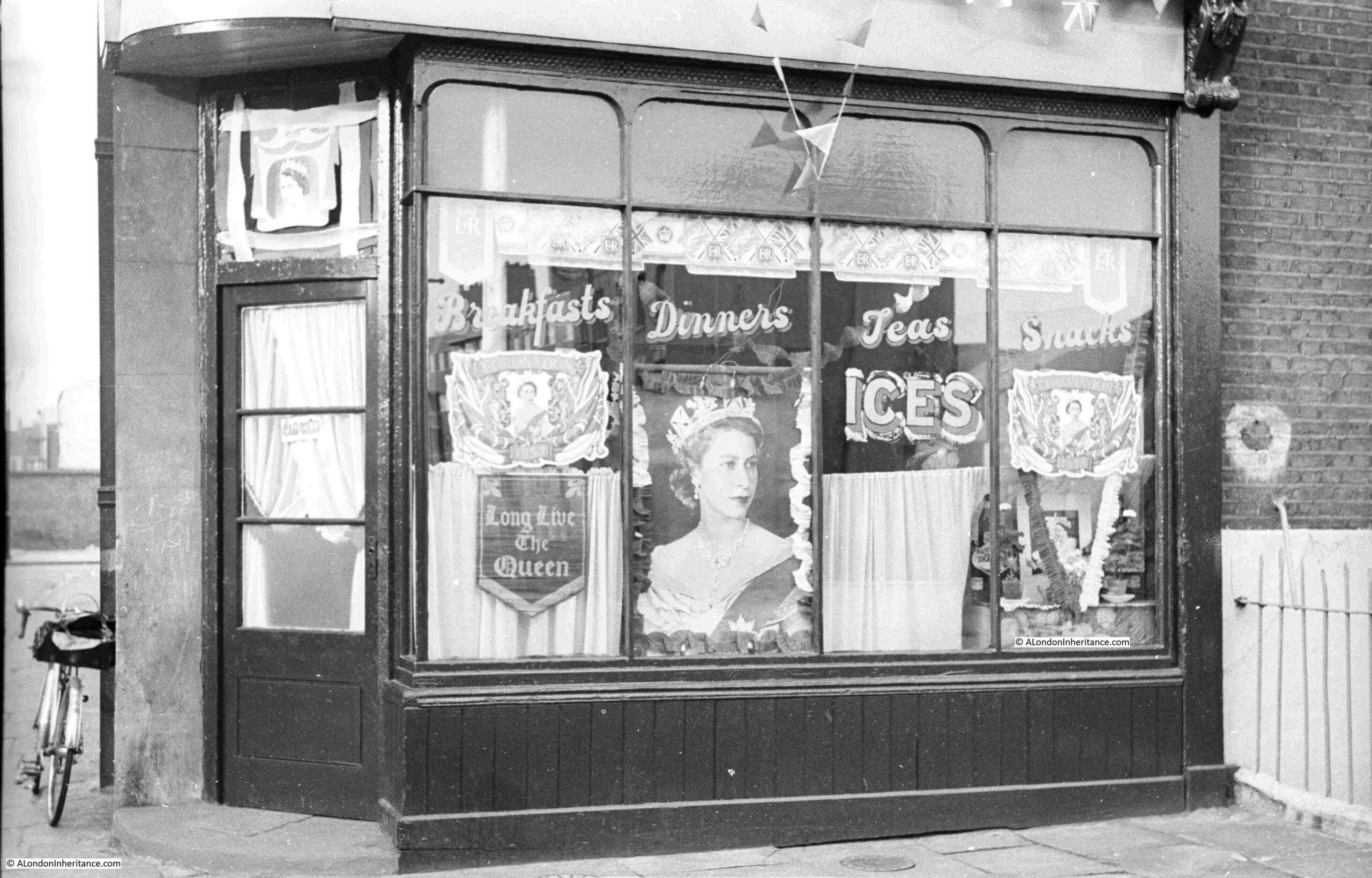
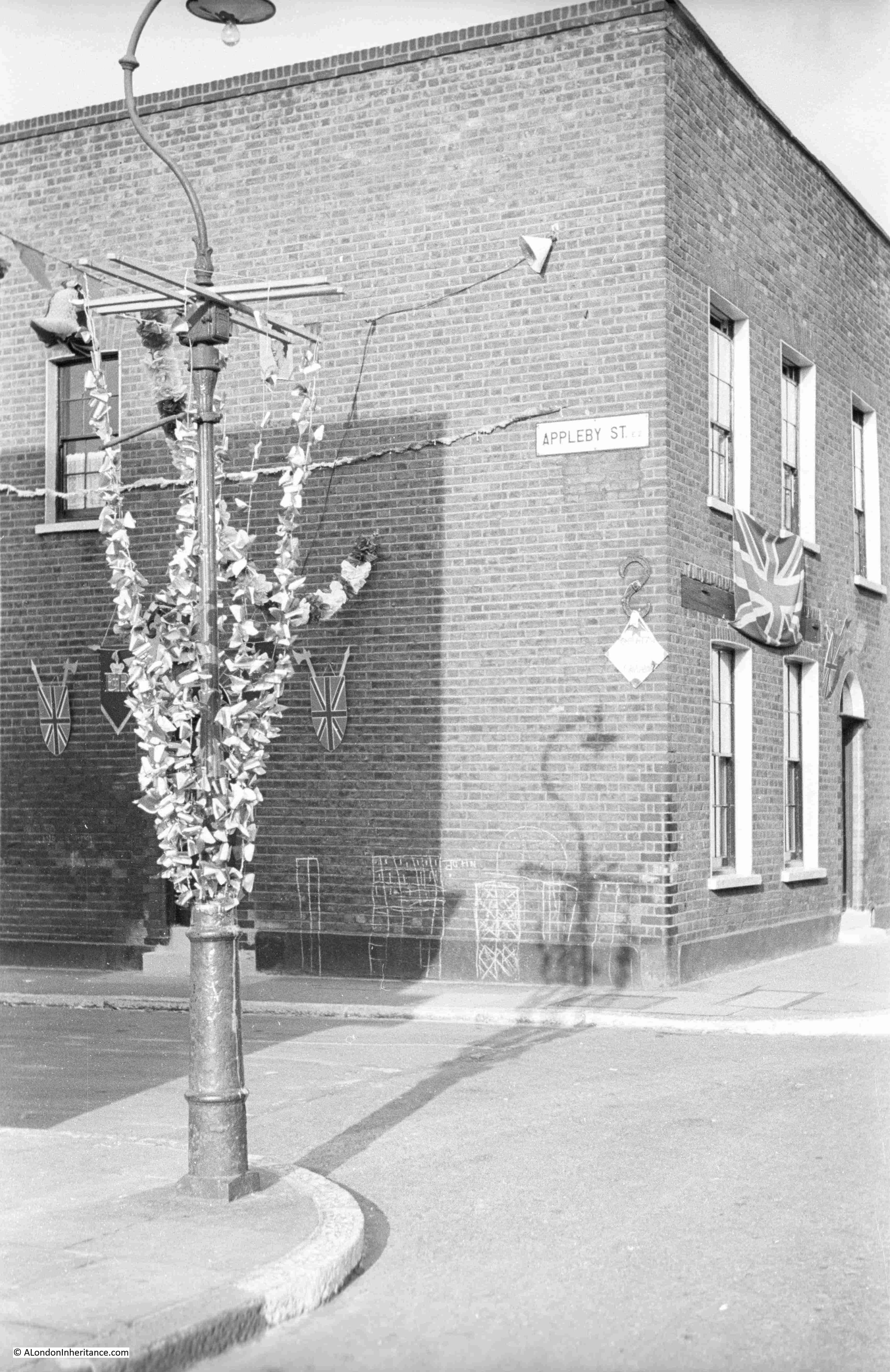
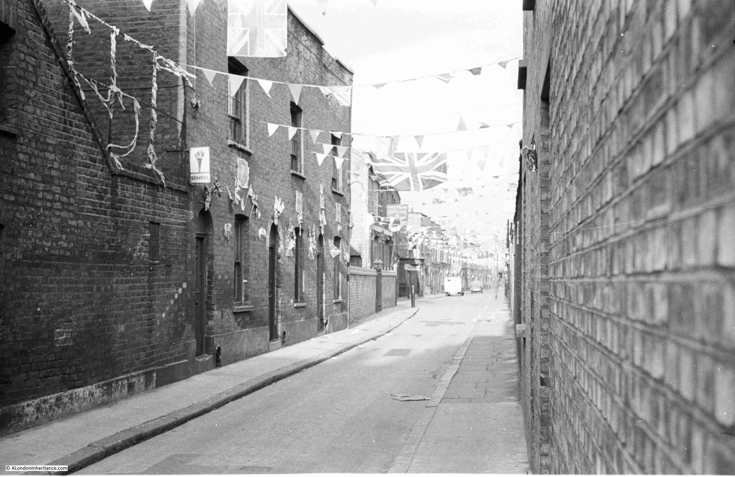
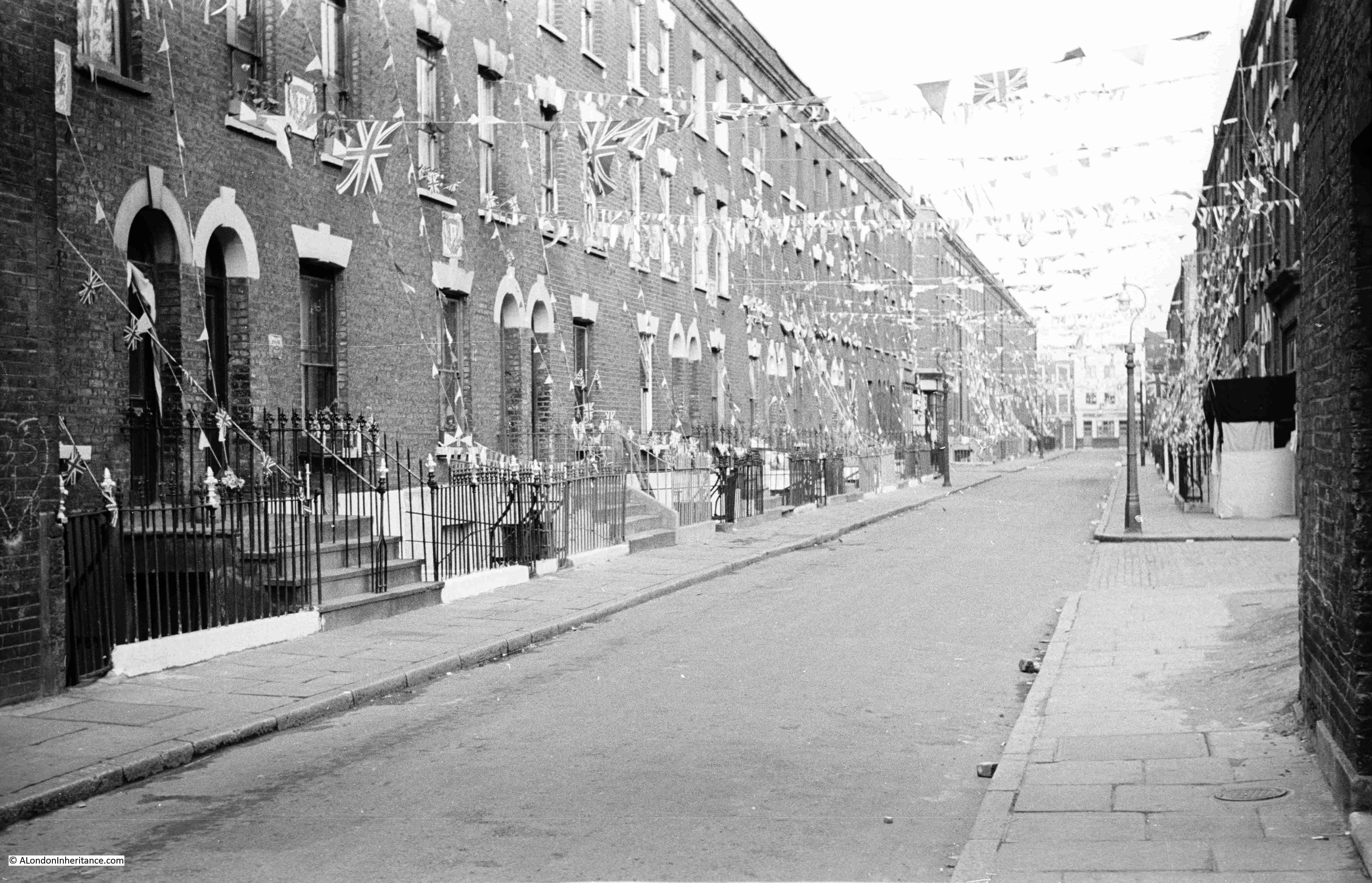
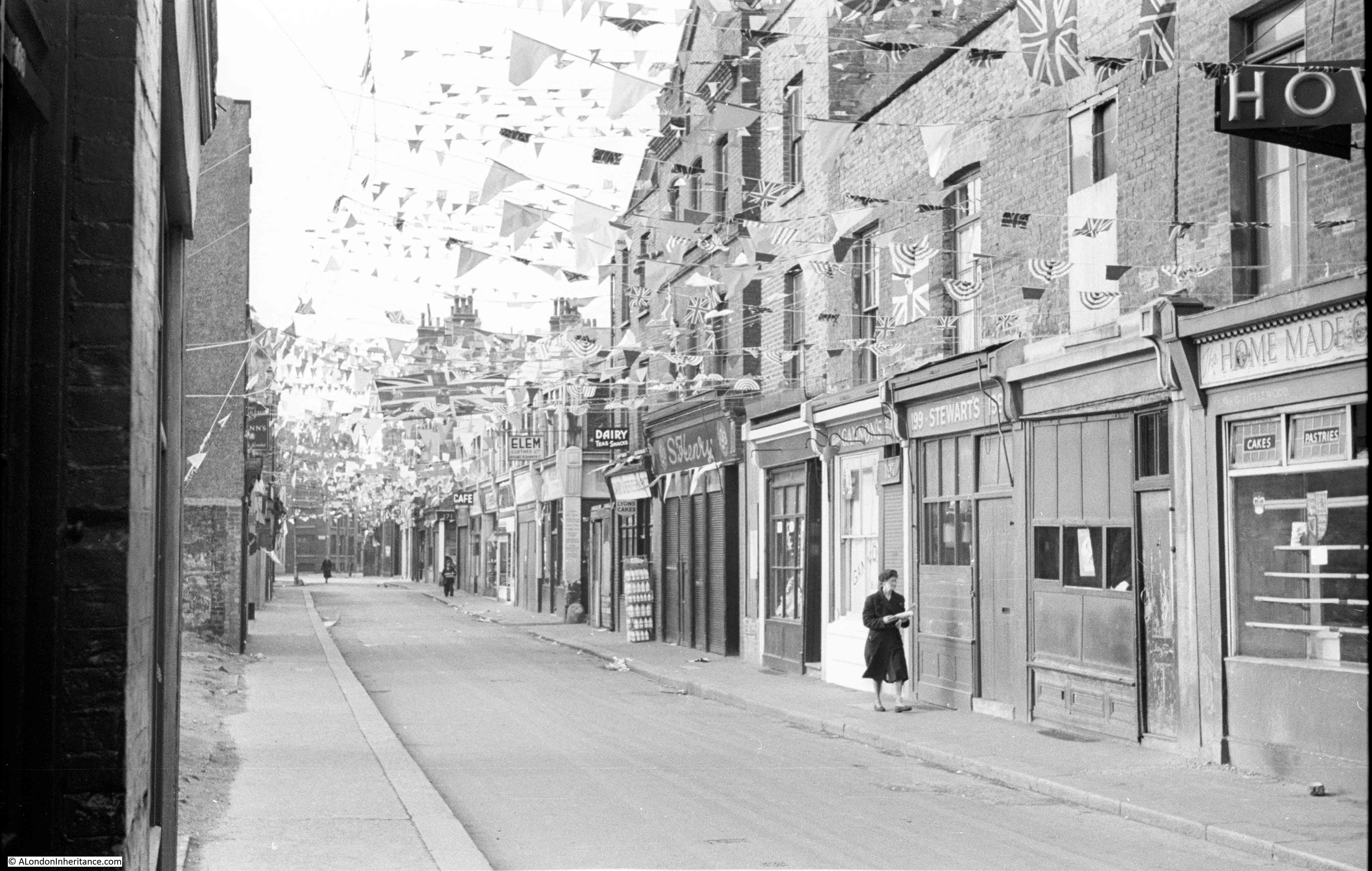
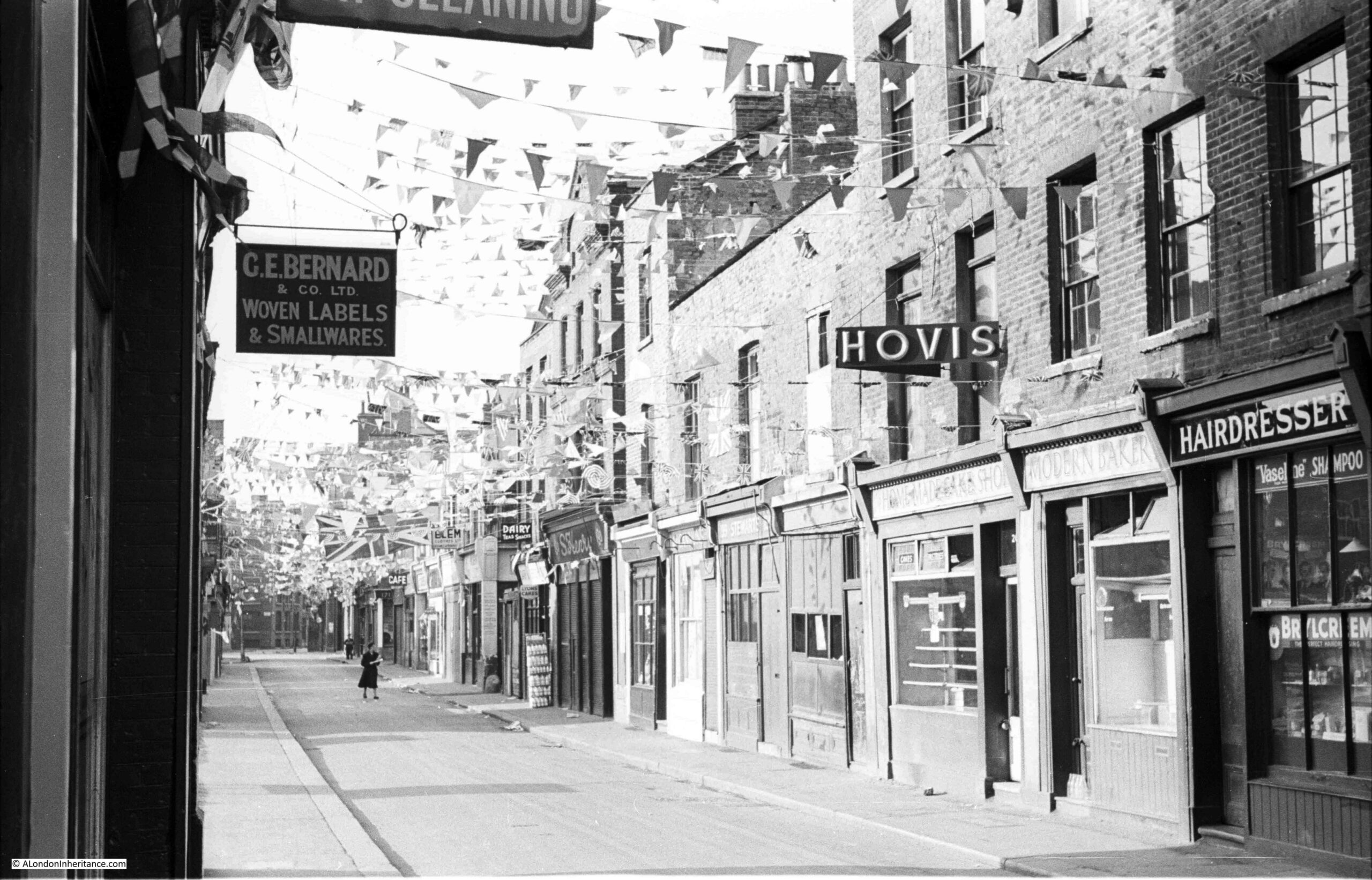
Many of my father’s photos were taken on bike rides around the city, early on a Saturday or Sunday. This worked due to periods away on National Service, work during the week, and other commitments. The following photos were taken early on Sunday, 31st May 1953, and look at some of the street decorations for the Coronation.
A decorated café in Hoxton, with my father’s bike leaning against the wall.
The above photo has been in the header to the blog since I started in 2014, however I have not yet found the location, apart from it being in Hoxton. The building has almost certainly been demolished.
Appleby Street, also in Hoxton:
Ivy Street, Hoxton, between Hoxton Street and Pitfield Street:
Shenfield Street, between Kingsland Road and Hoxton Street:
The northern end of Whitecross Street, close to the Old Street junction:
Another view of Whitecross Street:
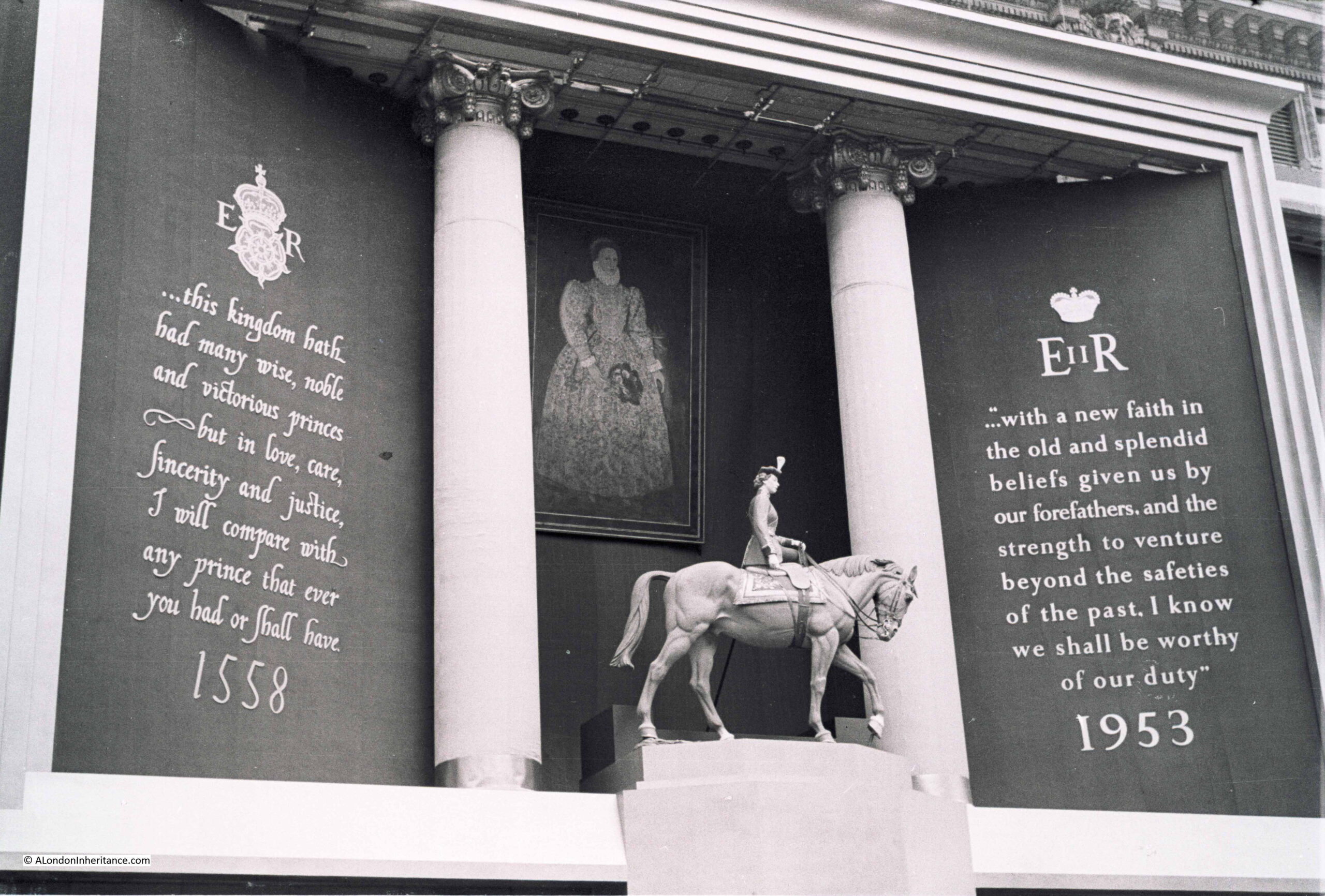
The expectation at the time was of a new Elizabethan era with comparisons back to Queen Elizabeth I as shown by the following tableau along the route of the procession. The text on the left is abbreviated from a speech given by Queen Elizabeth I to the Houses of Parliament on April 10th 1593 (1558 was the year that Elizabeth I became Queen) and that on the right from Queen Elizabeth II from her first Christmas broadcast in 1952.
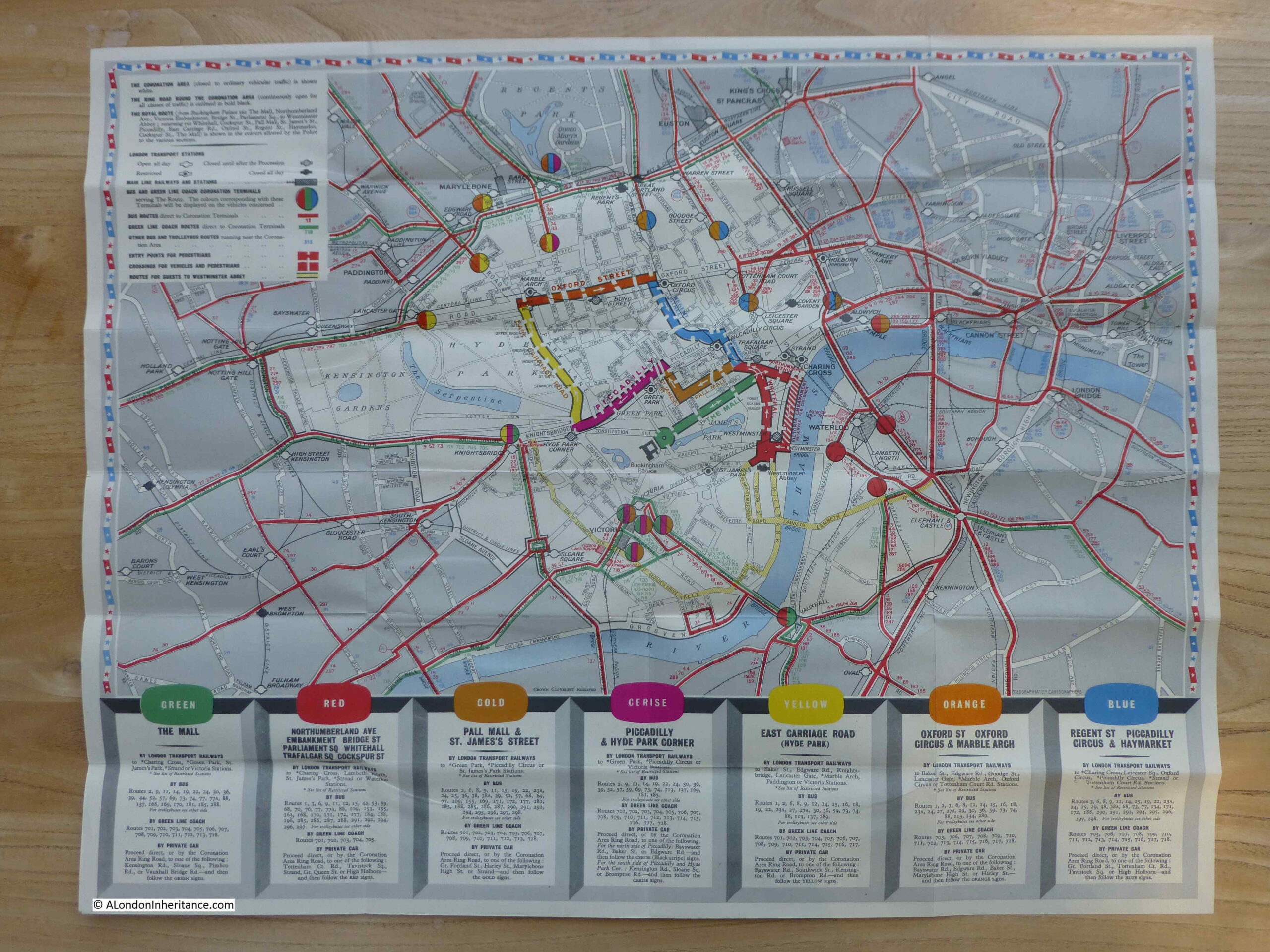
A map of the Coronation route was produced jointly by the London Transport Executive and the Commissioner of Police of the Metropolis for the Coronation of Elizabeth II on Tuesday 2nd June 1953:
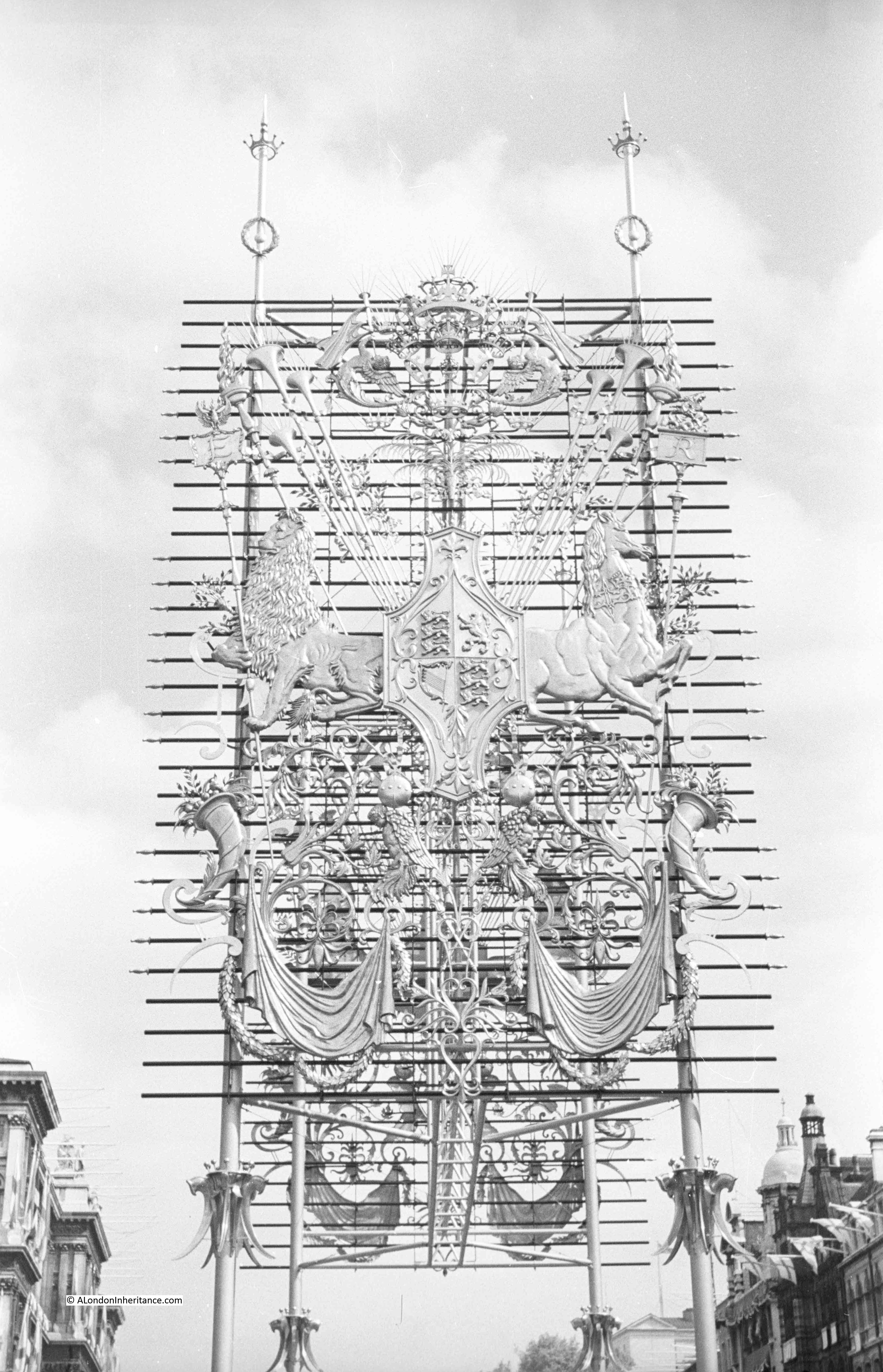
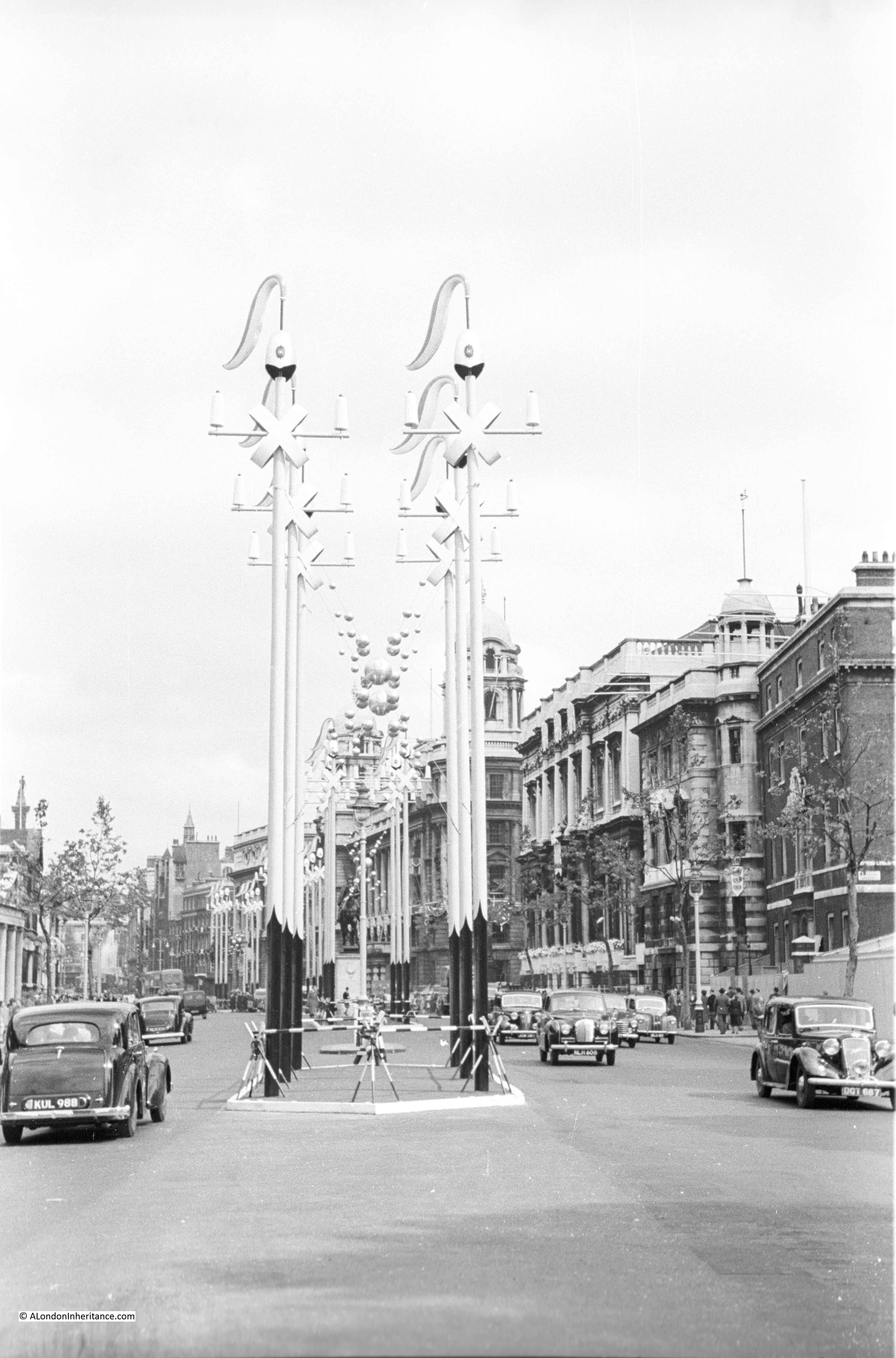
Some of the elaborate decorations that lined the Coronation route:
Whitehall:
The ornate decorations that suspended a crown over the Mall:
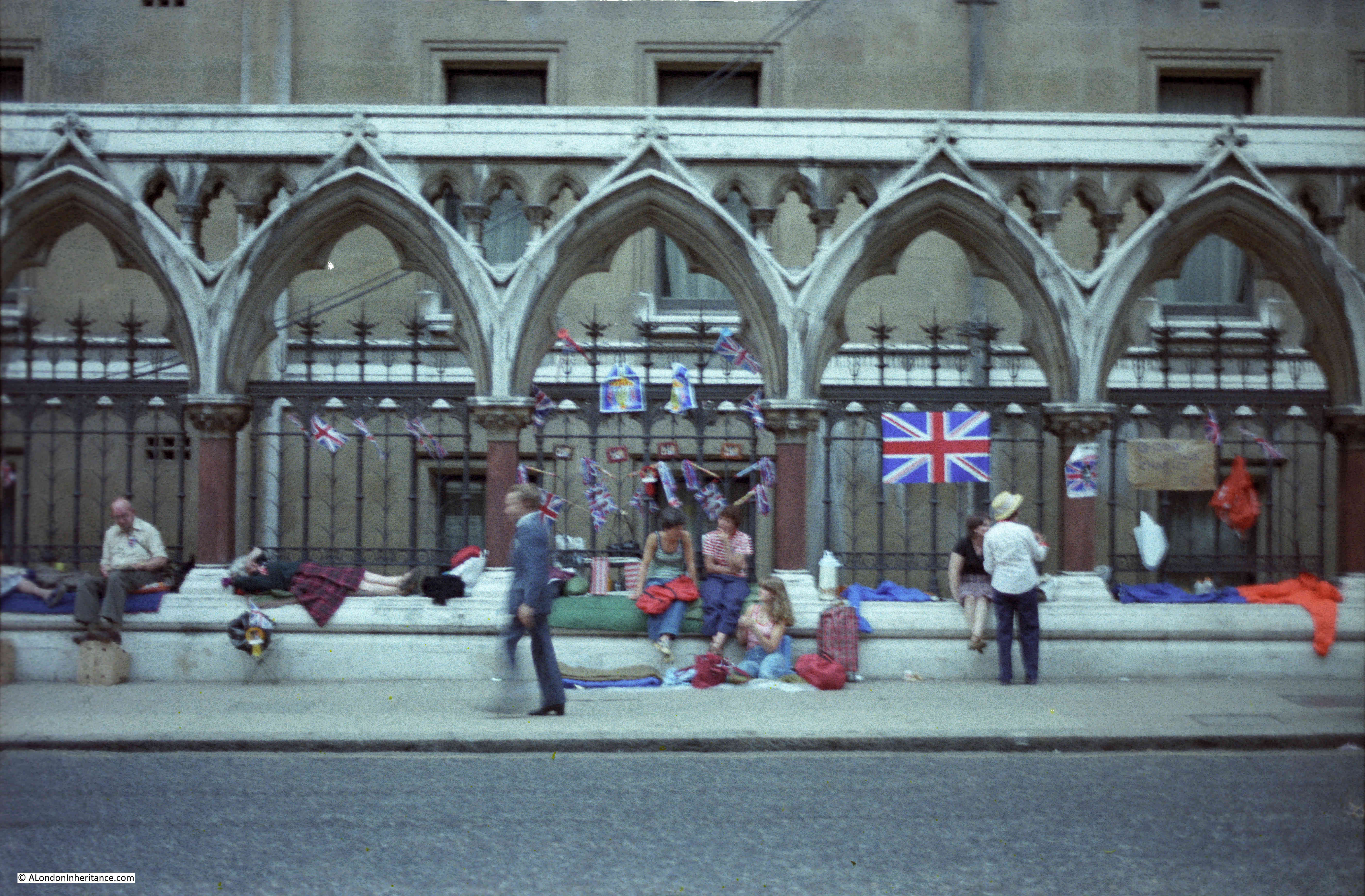
The 2nd of June 1953 was Coronation Day in London and a public holiday. As usual for such an event, people started lining the route between Buckingham Palace and Westminster Abbey well before the procession to ensure a good position to see the new Queen.
The weather during the previous May had been excellent with lots of warm, sunny weather broken only by the occasional thunderstorm. This weather broke by the end of May, for the last week of May and the rest of June the country was under many low pressure areas moving from the Atlantic bringing rain and cold temperatures for June. It was the coldest June for a century.
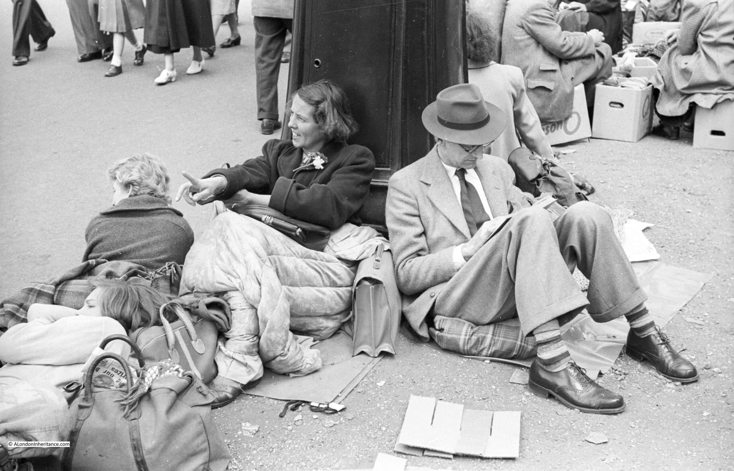
My father took a number of photos of people as they lined the route, along The Mall and round into Trafalgar Square and surrounding streets.
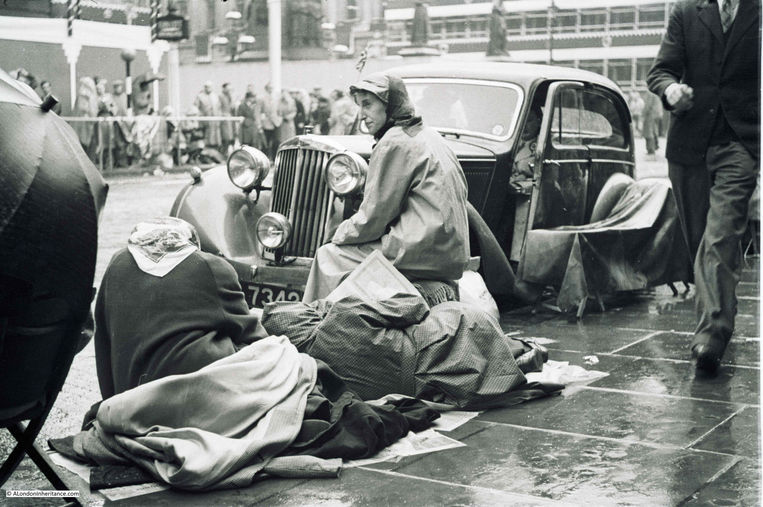
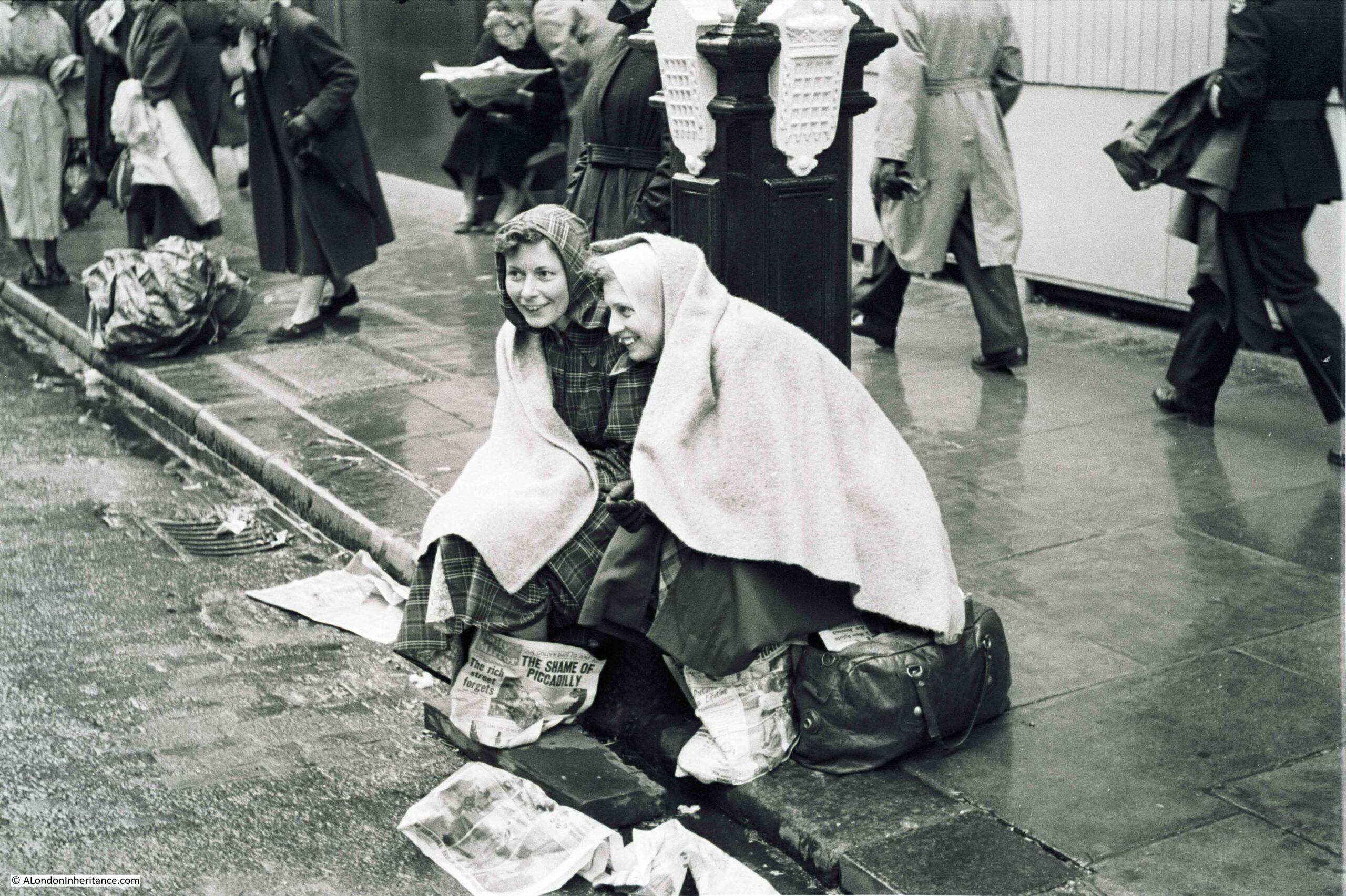
These show people wrapped up for the weather:
These two look cheerful despite the long wait and the weather:
The newspaper between them was the Daily Mirror from the 29th May. The headline “The Shame Of Piccadilly” and “The rich street forgets” refers to the complete lack of decoration in Piccadilly for the Coronation. There are two photos on the page. The top photo shows Piccadilly without any decoration, the bottom photo shows, what is assumed to be an ordinary working class street decorated with flags and bunting and a Long Live The Queen banner stretched across the road:
The morning of the 2nd of June was more like an autumn day with rain showers and temperatures reaching only 12 degrees centigrade. Very low for early June.
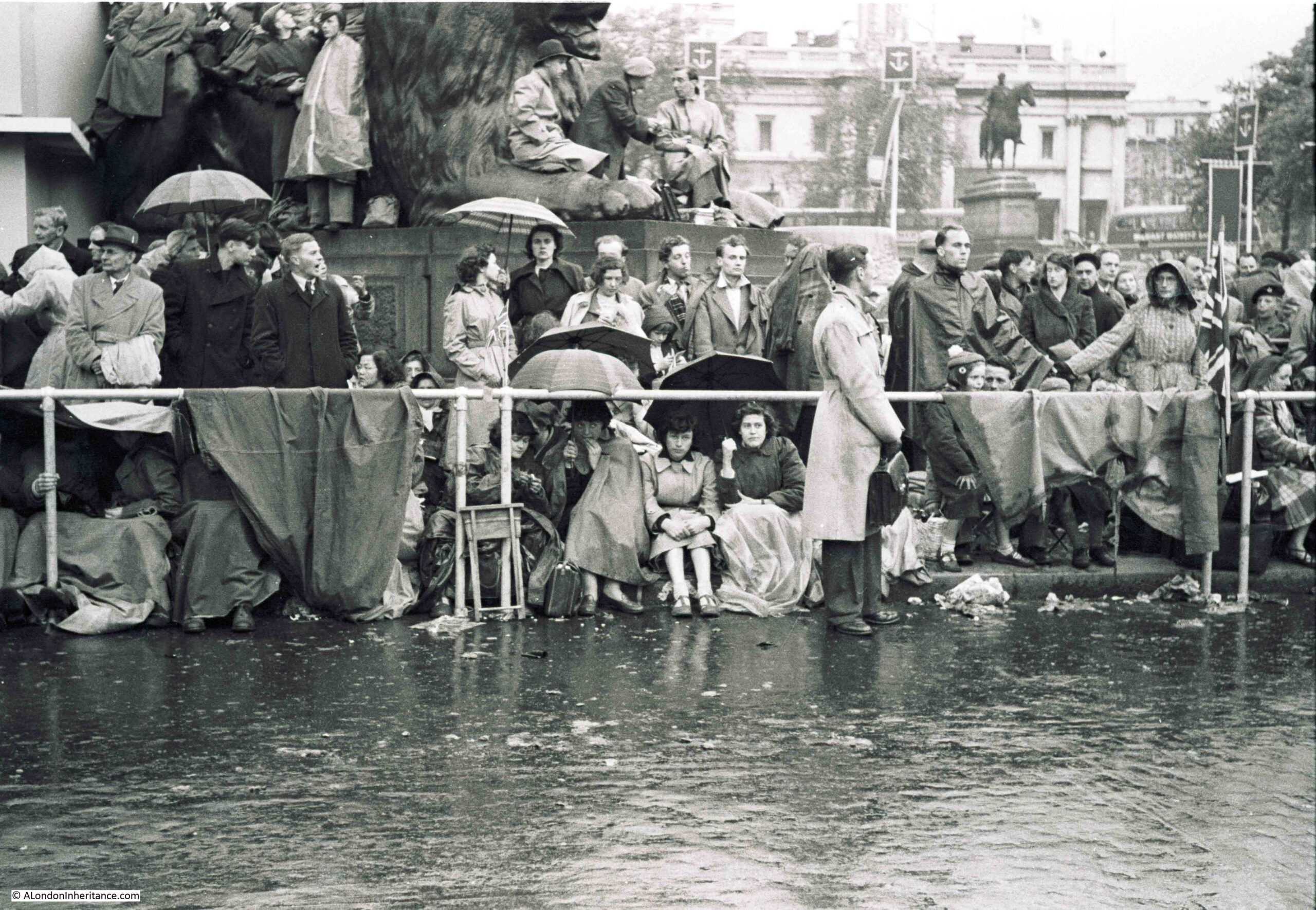
This is Trafalgar Square:
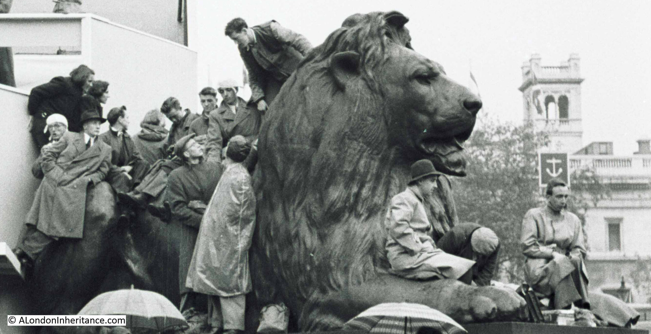
On the left is one of the commentary boxes set-up along the route. This was the first Coronation to be televised:
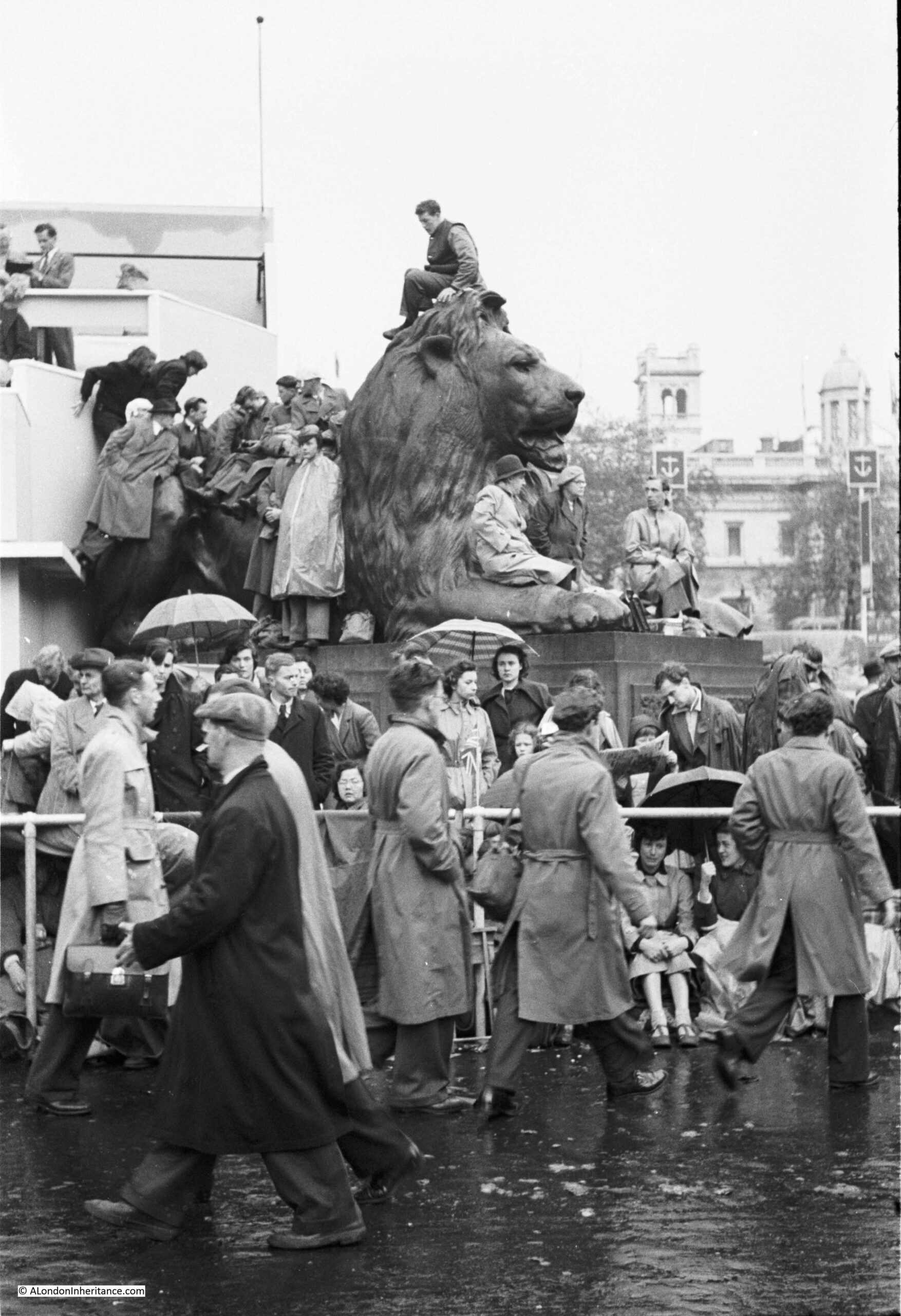
Photo of the small group of people on the lion. Not sure how long the man on the far left was going to balance in that precarious position:
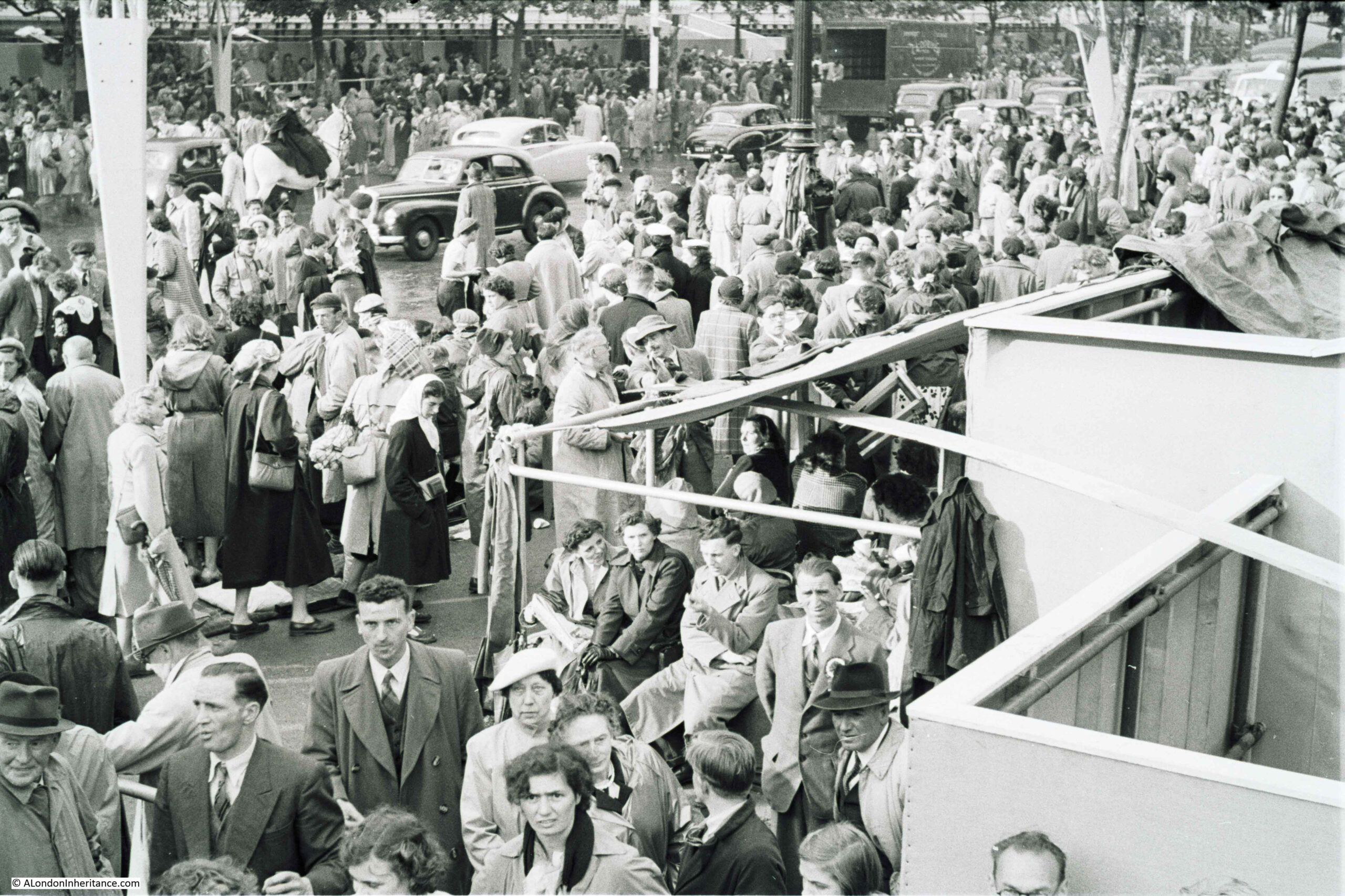
A wider view of a very busy Mall:
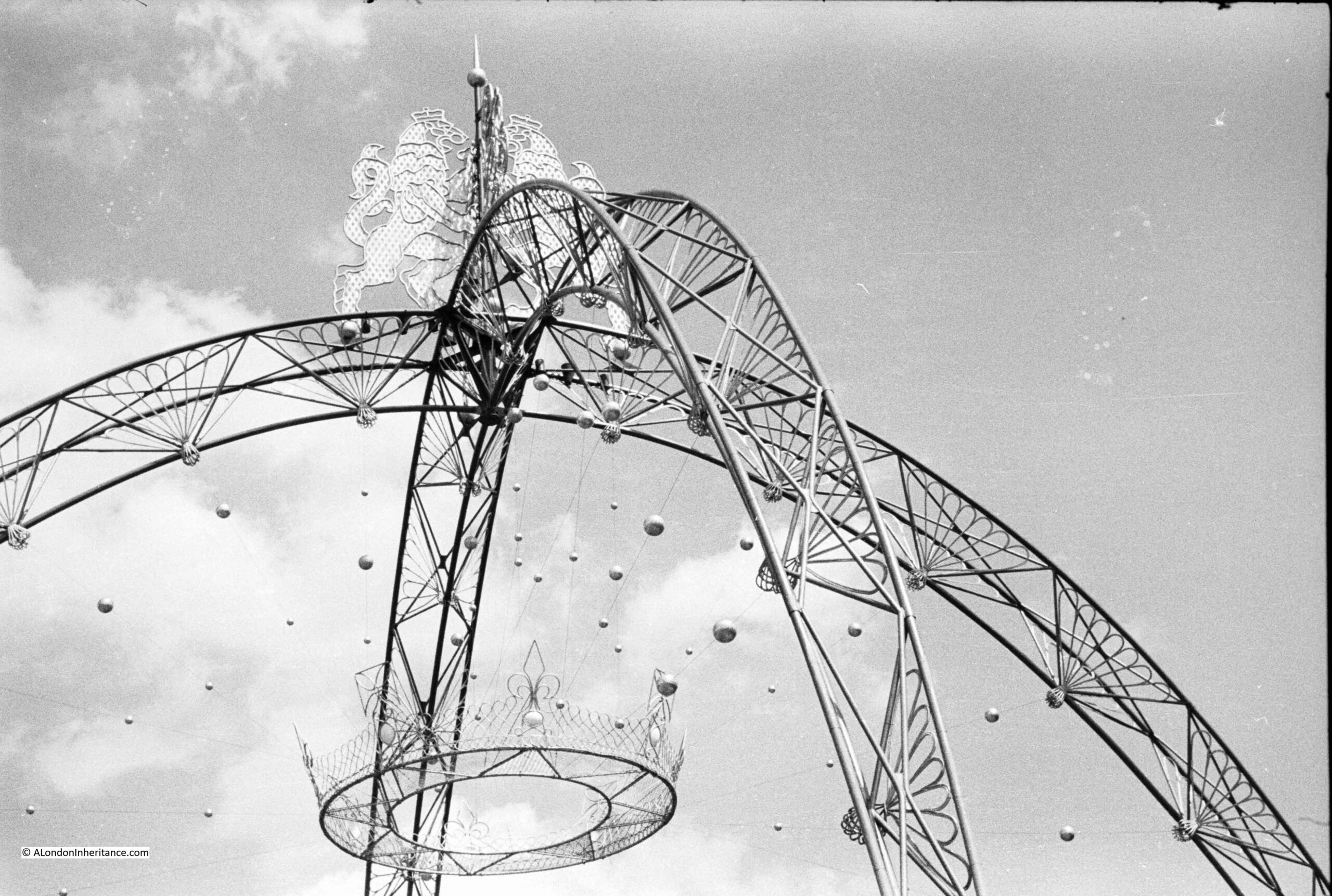
The weather did improve later in the day. Again in The Mall and the crowds are growing. In the top left is the faint outline of one of the arched decorations that spanned the Mall (see earlier photo for the suspended crown), and the legs of one of these decorations can be seen among the crowd sitting at the street edge:
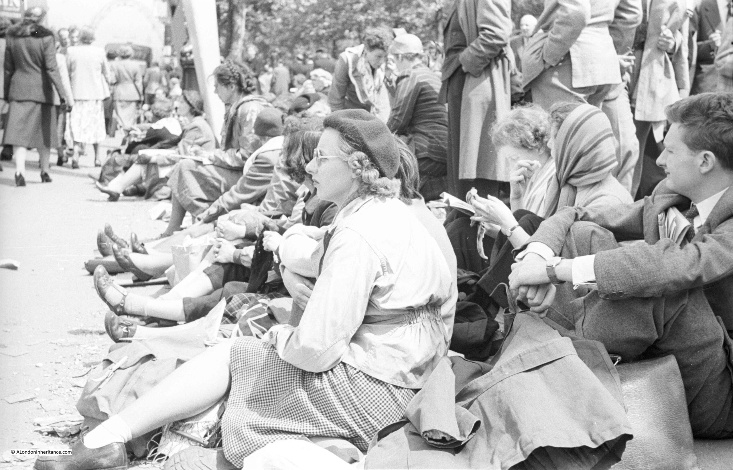
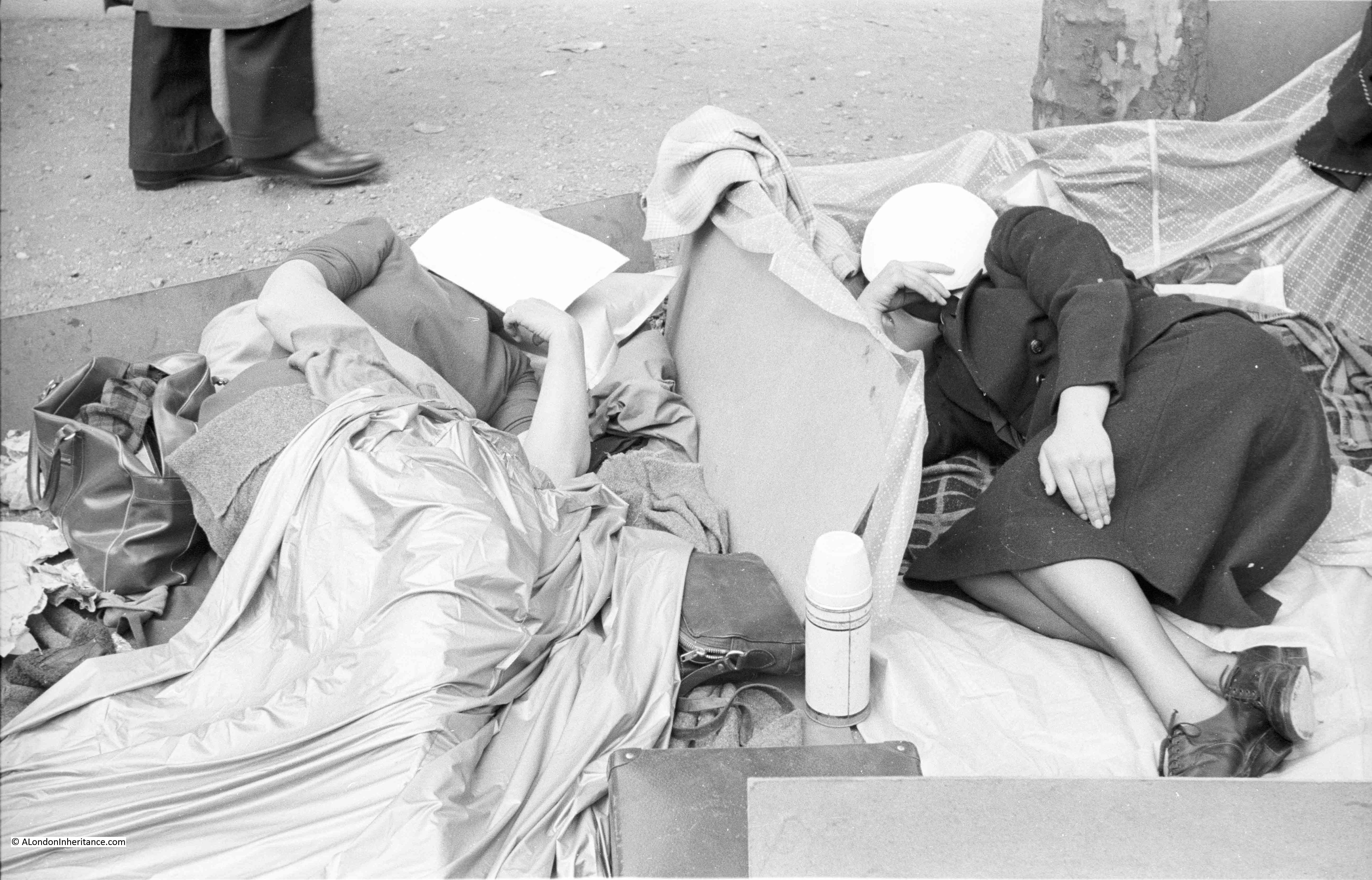
The following two photos were taken on the day before the Coronation as people found their place ready for the next day’s events. Sleeping in The Mall:
This photo was also taken in The Mall. They look well prepared for the wait. The man is obviously not interested in people watching, he looks engrossed in his book. The group in the background also seem very well prepared judging by the number of boxes they have around them.
Royal events have always brought people out to the streets of London, and whilst fashions change and the clothes they are wearing look different, there is a common thread between all the street scenes at this events.
I did photograph the 1977 Jubilee, but cannot find these photos / negatives. Hopefully I have not lost them in the intervening 45 years.
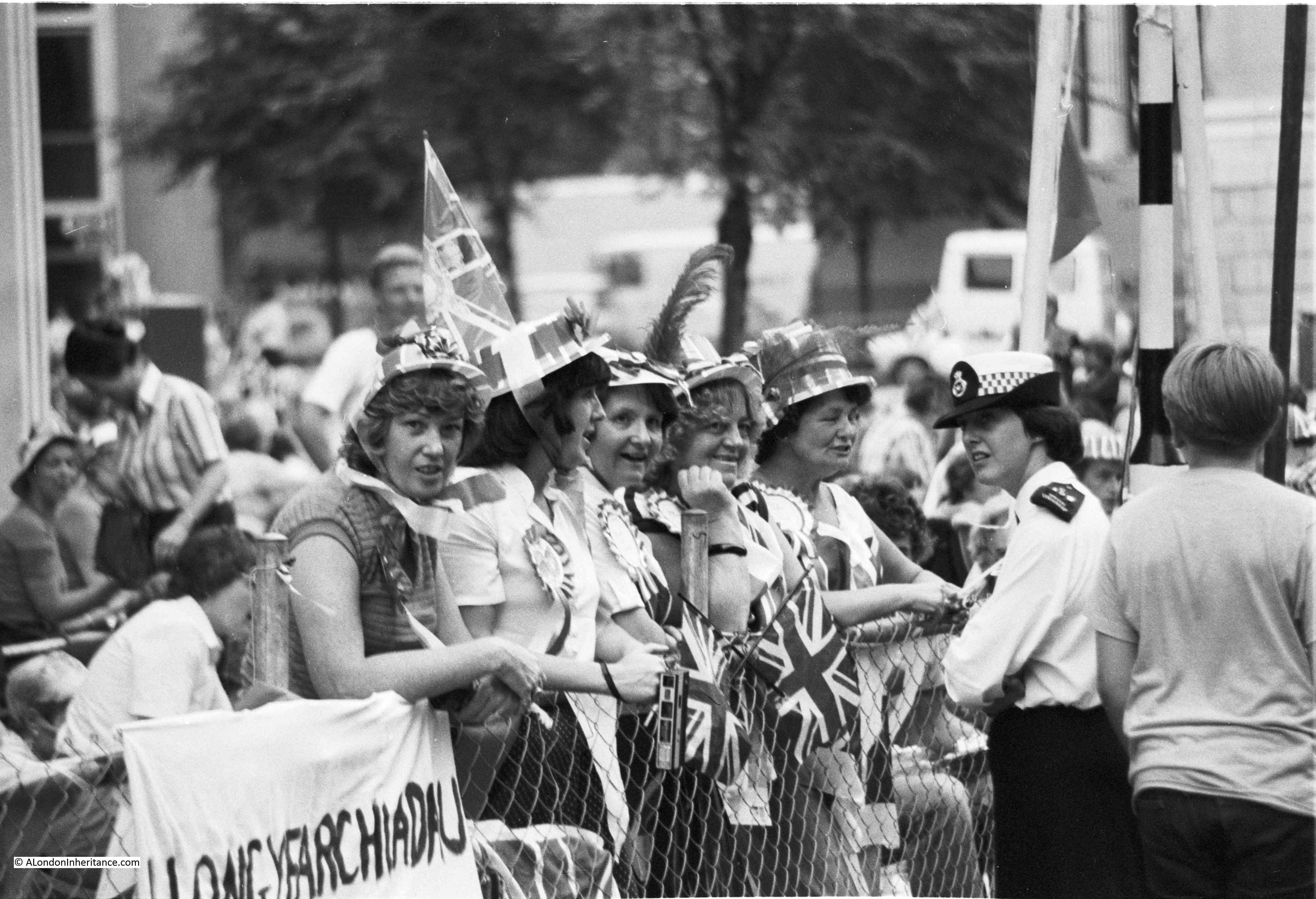
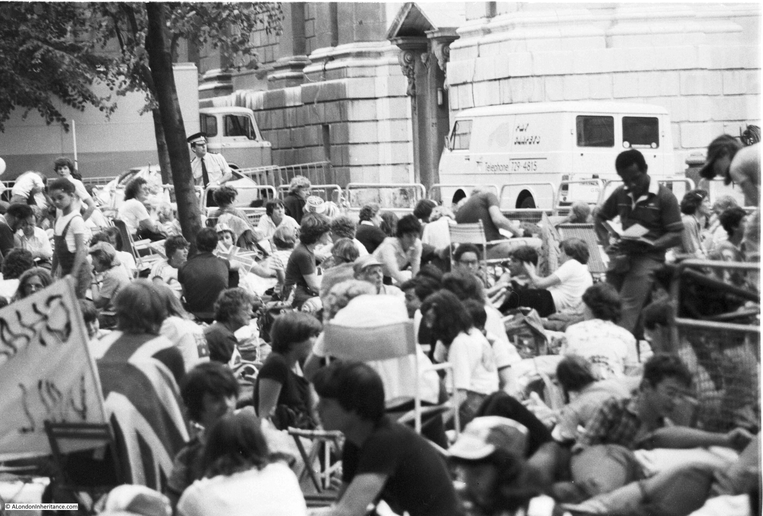
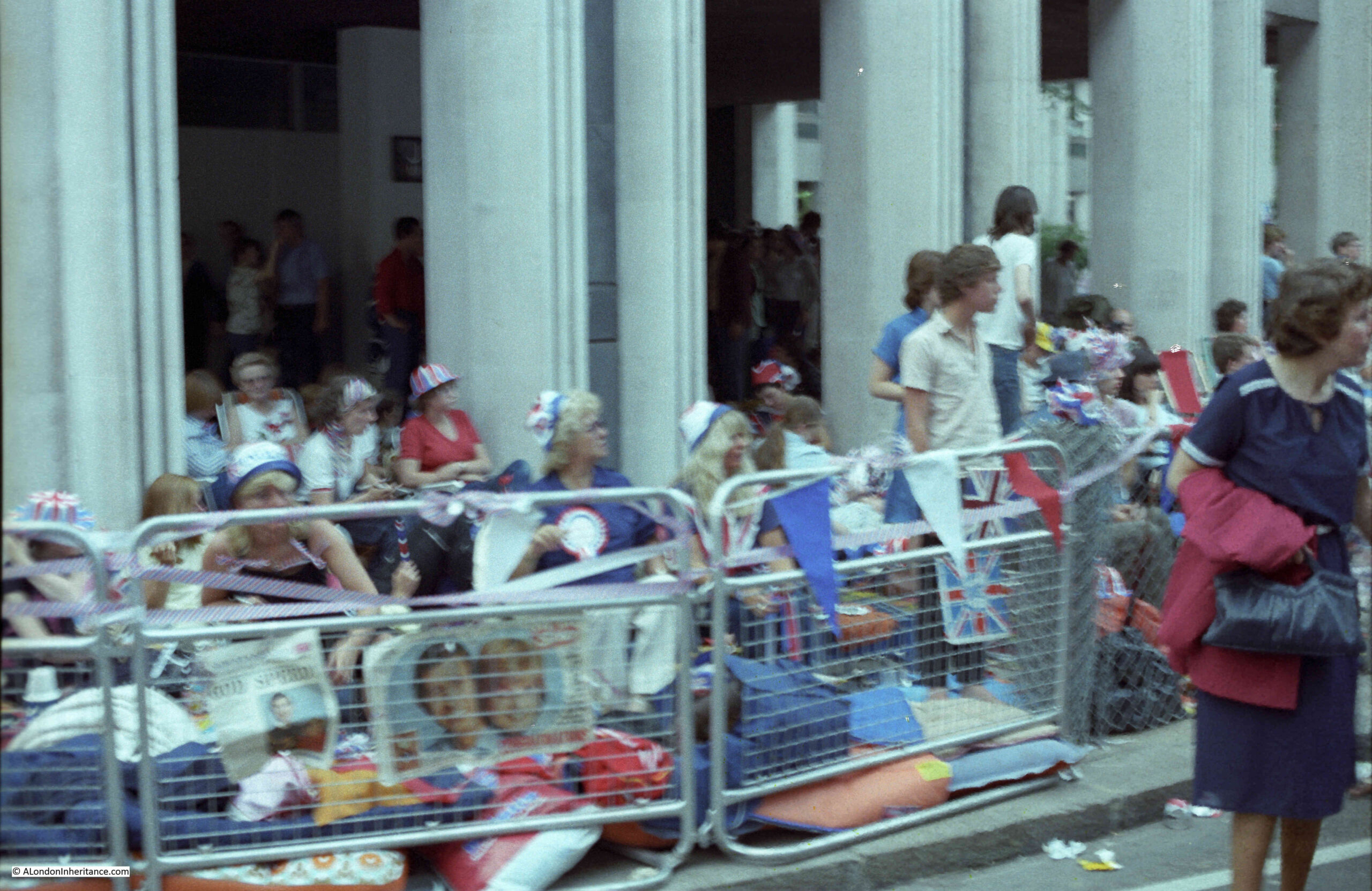
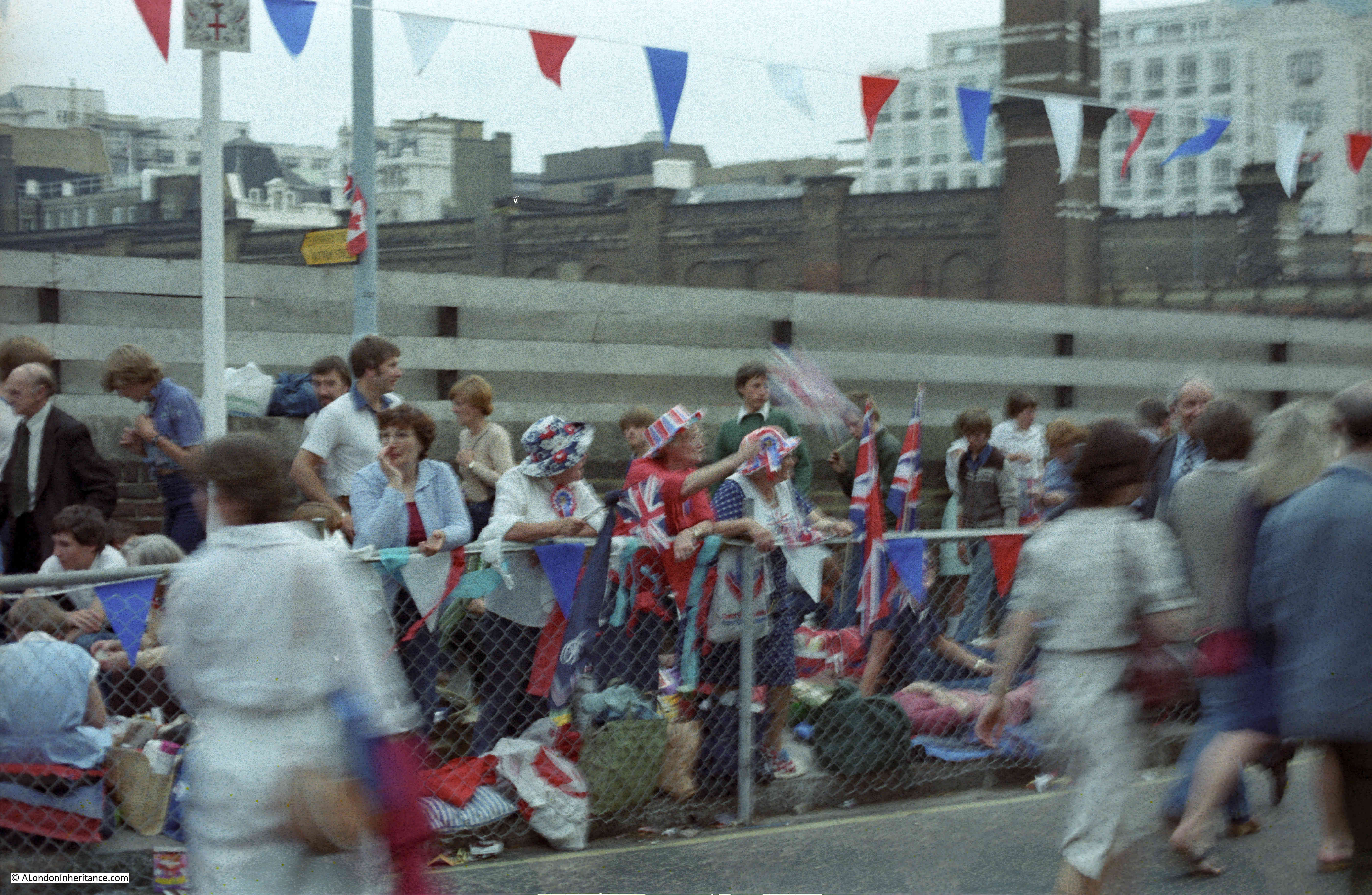
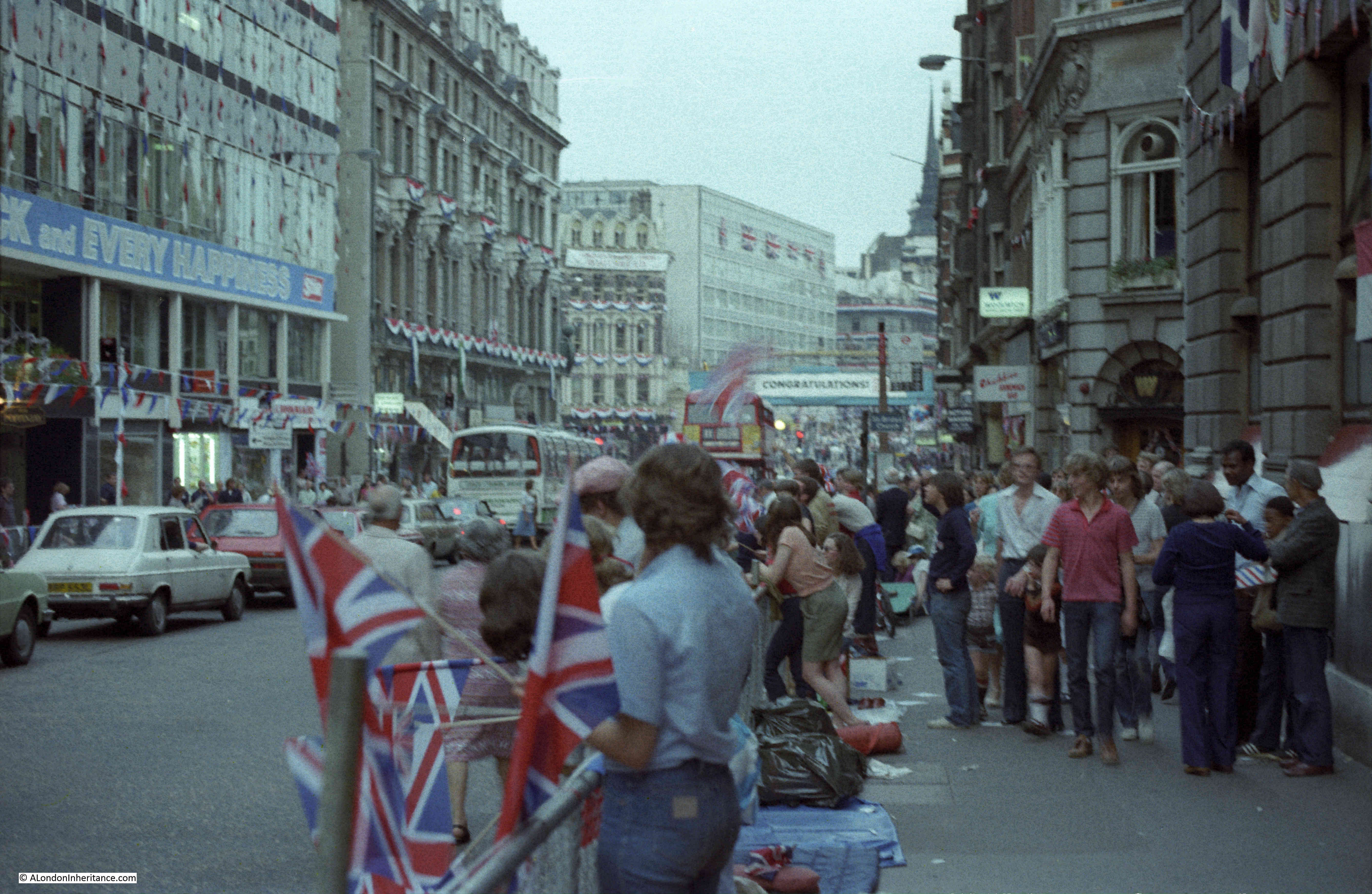
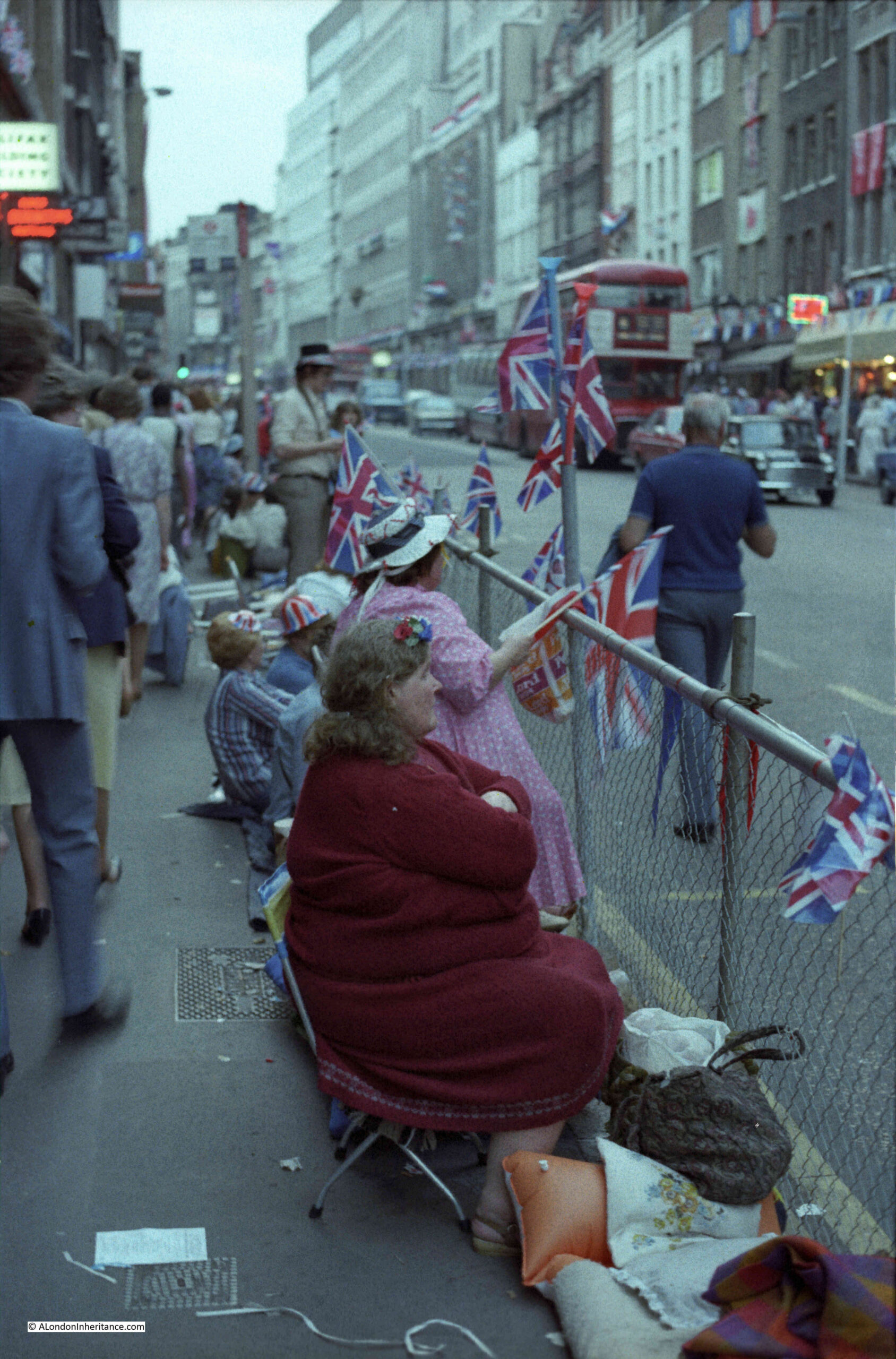
I have found photos of another of London’s Royal events, of crowds building for the wedding of Charles and Diana that took place on the 29th July 1981. On the evening of the 28th July I took a walk from St. Paul’s Cathedral and along Fleet Street and the Strand to take some photos.
Starting at St. Paul’s Cathedral, this is where the best positions were and large crowds had already found their place ready for an overnight stay.
I must have had a couple of photos left on some Black and White film before moving to colour.
Outside St. Paul’s Cathedral:
Crowds at this perfect position looking across at the steps leading into the Cathedral:
I must have then switched to a colour film:
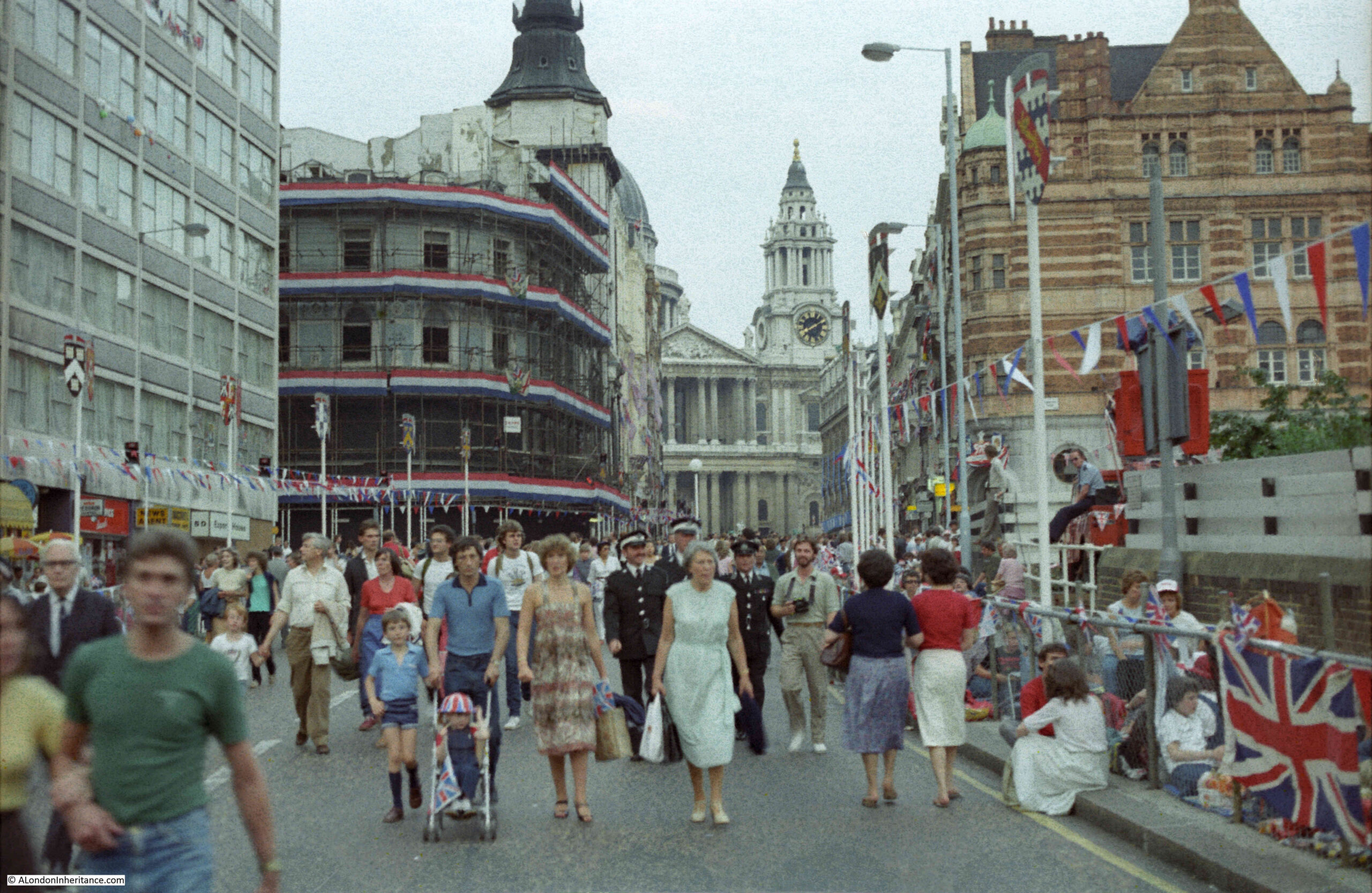
Ludgate Hill:
Looking back up Ludgate Hill. Although this was the evening before, the road had been closed and a large number of people were just walking the route, taking in the atmosphere and watching the people who were settling in for the night along the edge of the route. It was a warm evening and I remember there being a real sense of a big event taking place the following day.
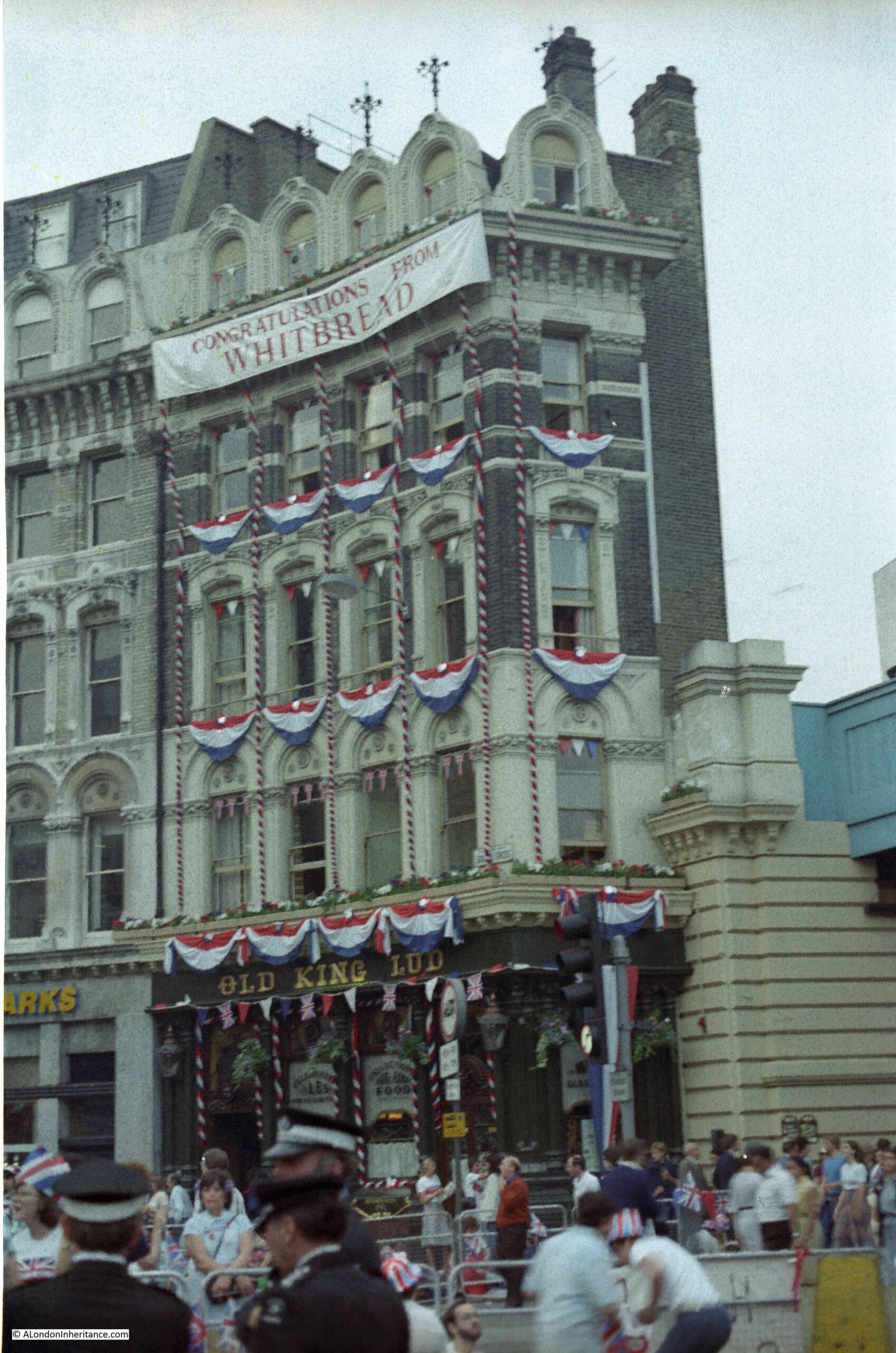
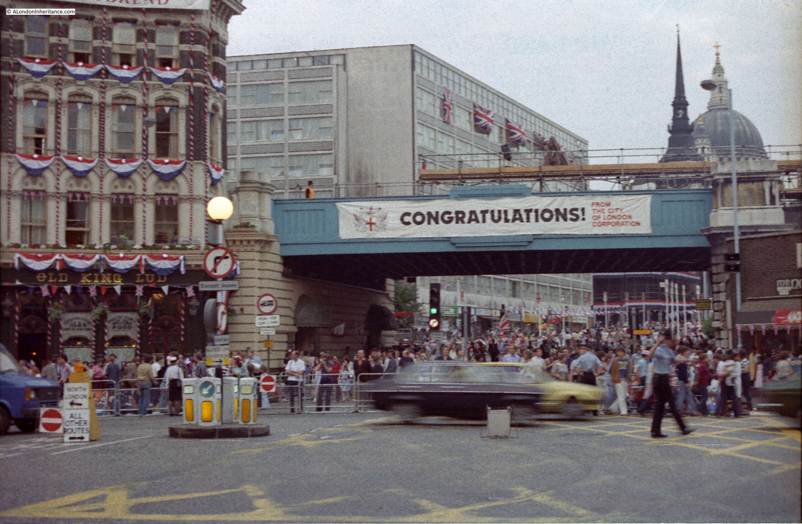
The Old King Lud pub, decorated for the event. This was a lovely Victorian pub, built-in 1870:
Now in Ludgate Circus. This was when the railway bridge still ran across the start of Ludgate Hill. The Old King Lud pub is on the left:
Moving up into Fleet Street. This road was still open and the pavements were busy with those walking and those waiting:
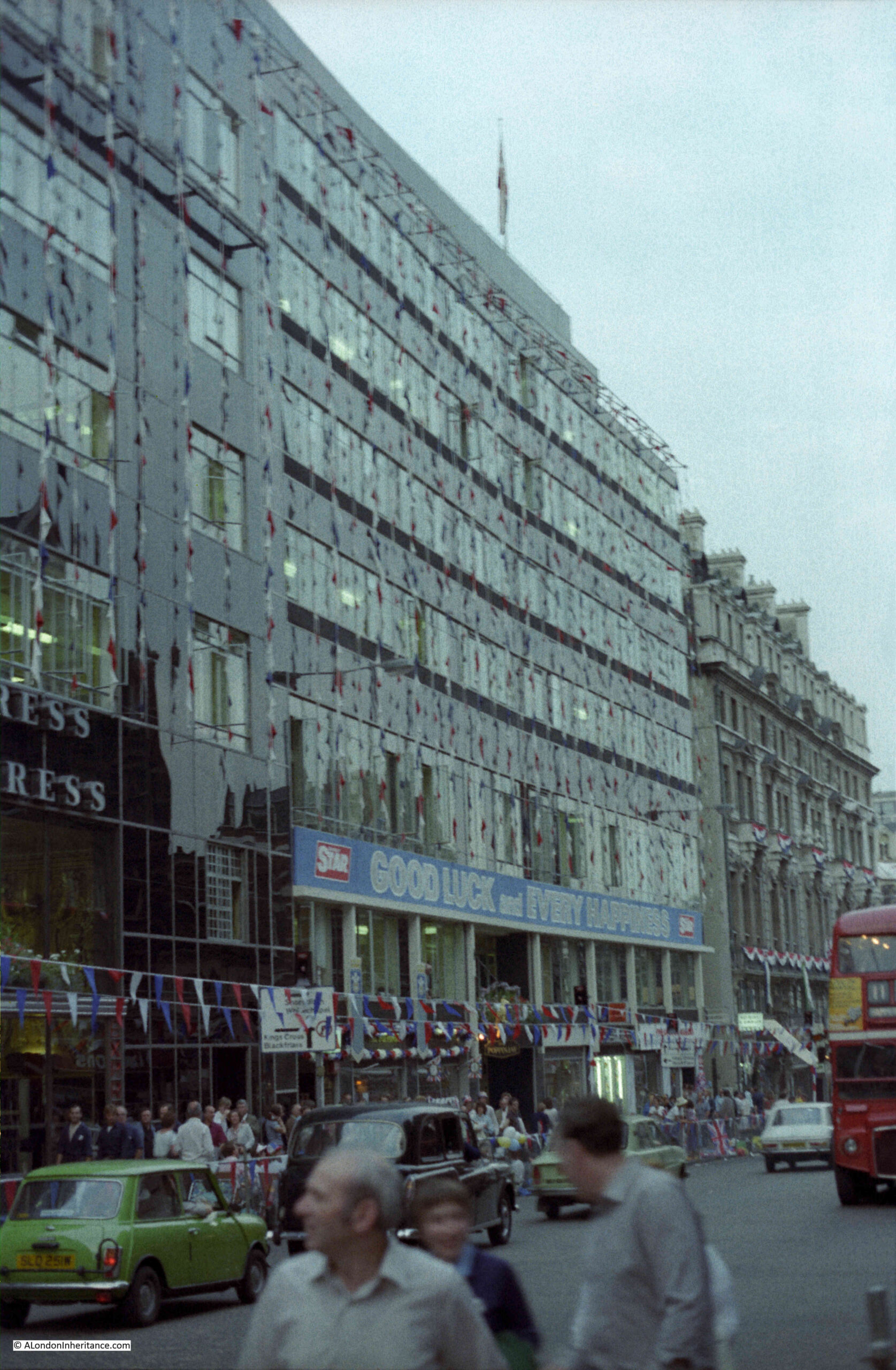
This was when Fleet Street was still occupied by newspaper publishers. The Express offices on the left and those of the Star on the right. I remember walking along Fleet Street and the side roads leading down to the Thames on a late Saturday afternoon / early evening and listening to the sound of the newspapers being printed and the amount of activity to get the next day’s edition distributed. All very exciting when you are young and exploring London.
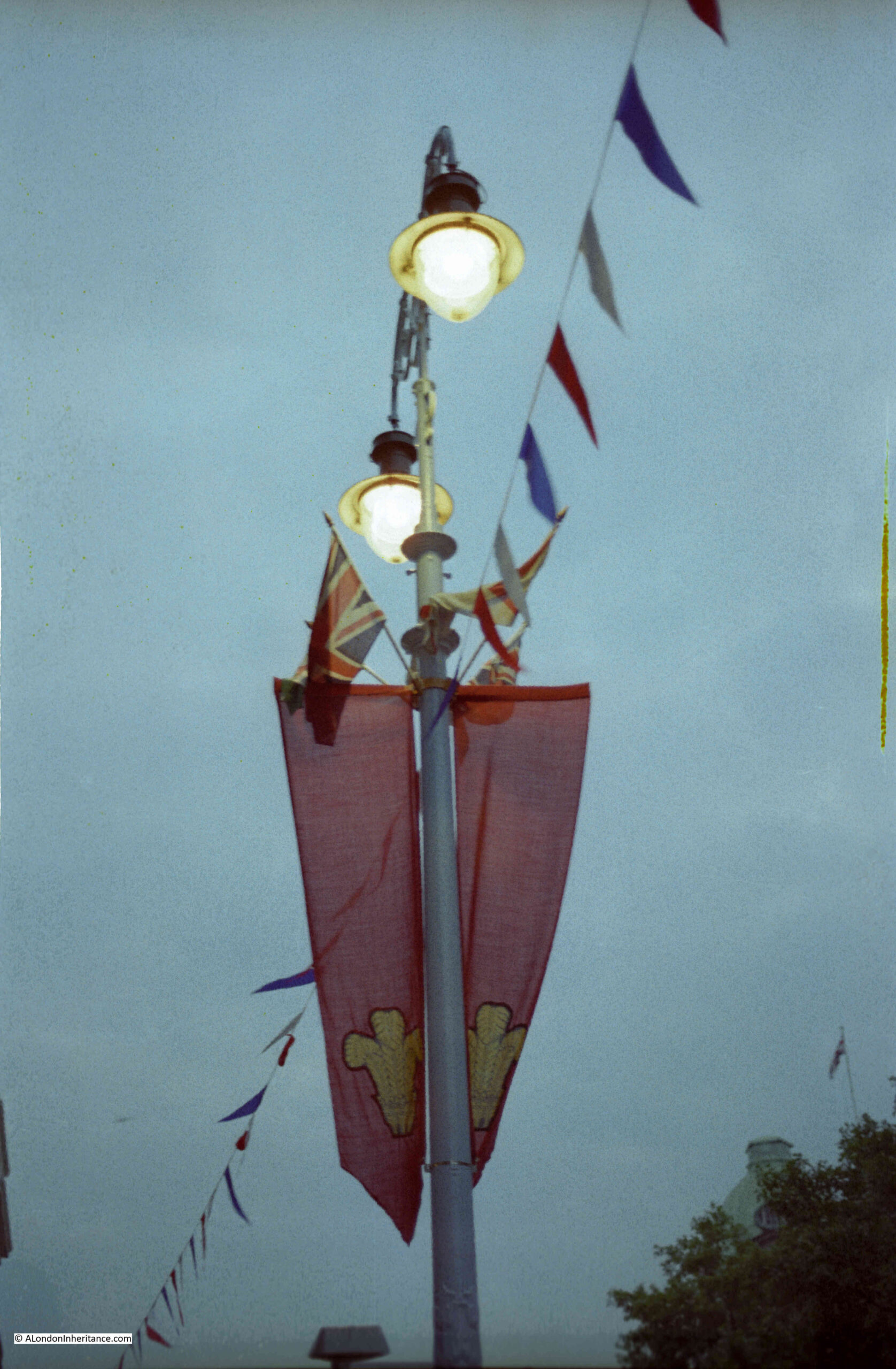
Most of the decorations were put up by the owners of the buildings along the route. “Official” street decoration was very limited, mainly these pennants hanging from lamp posts. Union Jacks along with red, white and blue bunting was out in abundance:
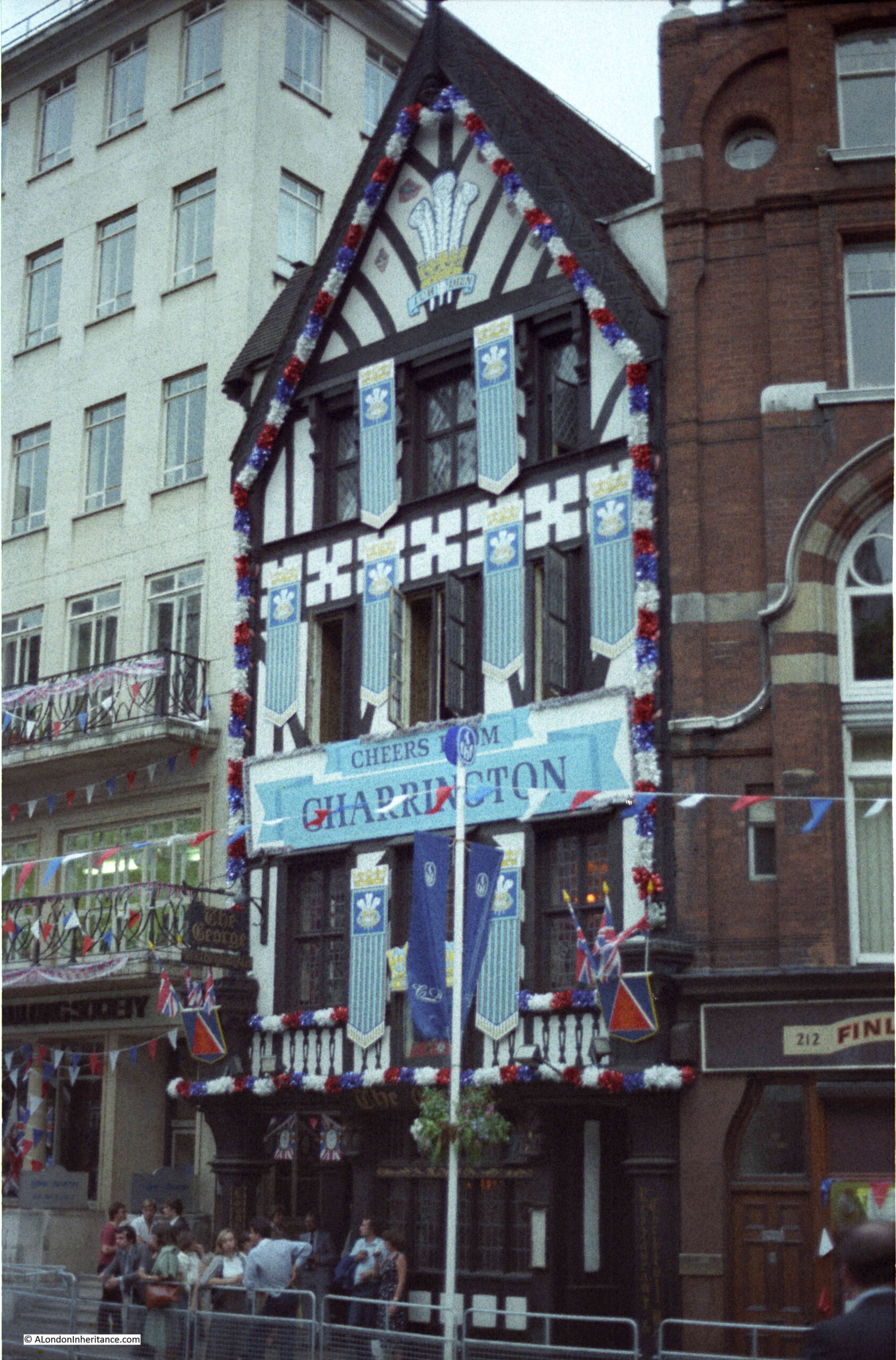
The George pub in the Strand which fortunately is still there:
Along the side of the Royal Court’s of Justice:
Prepared for a long night’s wait:
Royal events show a rather timeless side to London. Whilst so much in the city changes, the streets repeat previous appearances whenever one of these events take place.
They continue to attract people in their thousands to line decorated streets, many reserving their place on the preceding day, and braving whatever the weather brings down on London.
A shame though that Transport for London no longer issues any special maps for such events.
As it is the Jubilee Weekend (or rather four days), I have a Jubilee related post on both Saturday and Sunday. Tomorrow’s post is one of my usual posts, with photos of previous events. For today’s post, I dug out my collection of 1977 Jubilee beers and 1981 Royal Wedding beers from the cobweb filled corner of the garage.
The late 1970s and early 1980s involved a lot of pubs. For some reason that I cannot really remember, in 1977 I collected any special Jubilee beer that I could find in pubs across London and Essex. Probably the novelty of finally being able to legally buy alcohol in a pub without any issues.
They have been boxed and stored away for the last 45 years, but I thought I would get them out for this weekend and see how many of the breweries, brewing Jubilee beer in 1977 still exist.
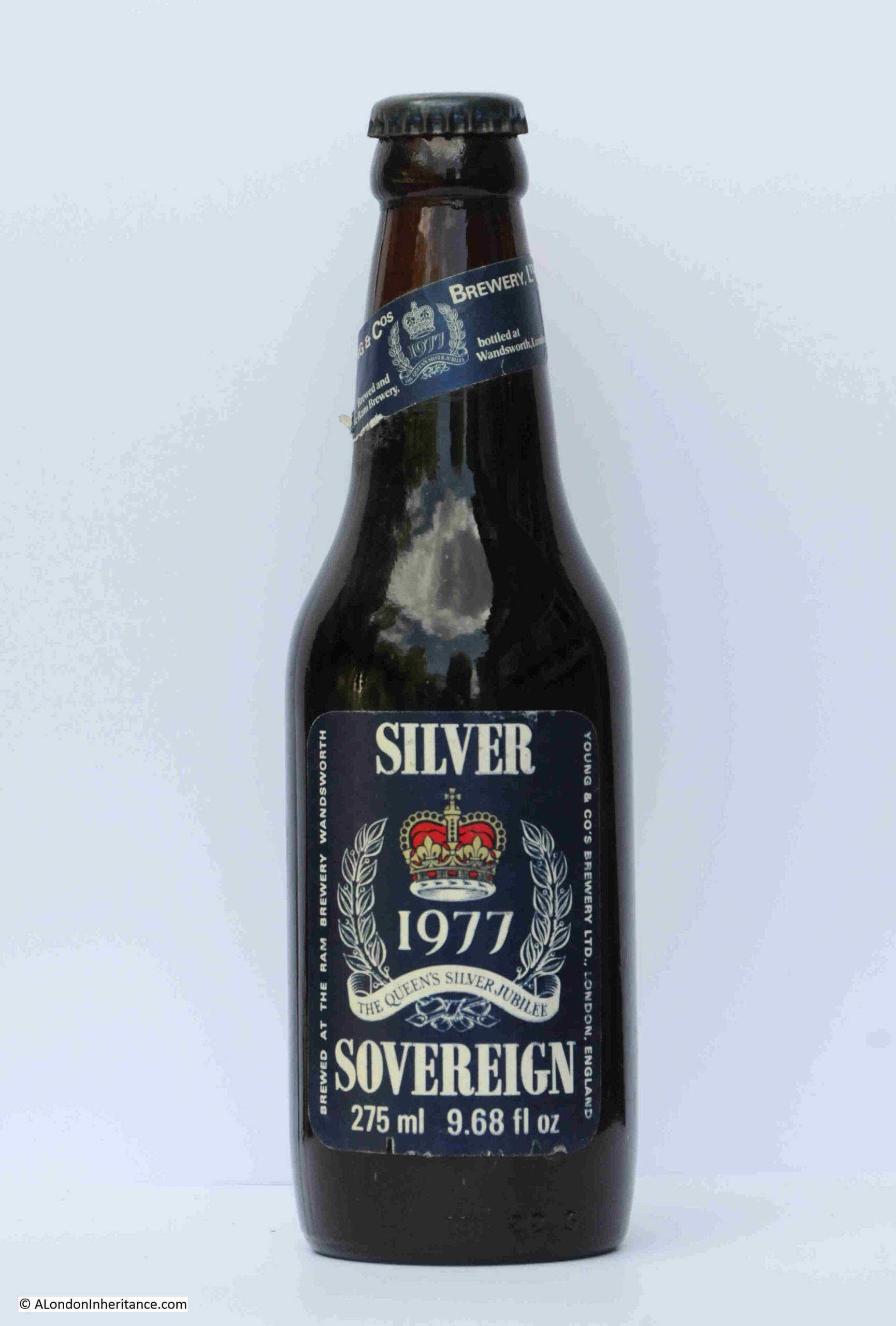
Young & Co – Silver Sovereign, brewed at the Ram Brewery in Wandsworth:
Young’s closed the Ram brewery in 2006, and are now a pub company. Their beers were initially brewed by a joint venture with Charles Wells in Bedford, but they have since sold their share in the brewery venture.
They still have a head office in Wandsworth, close to the location of their original brewery.
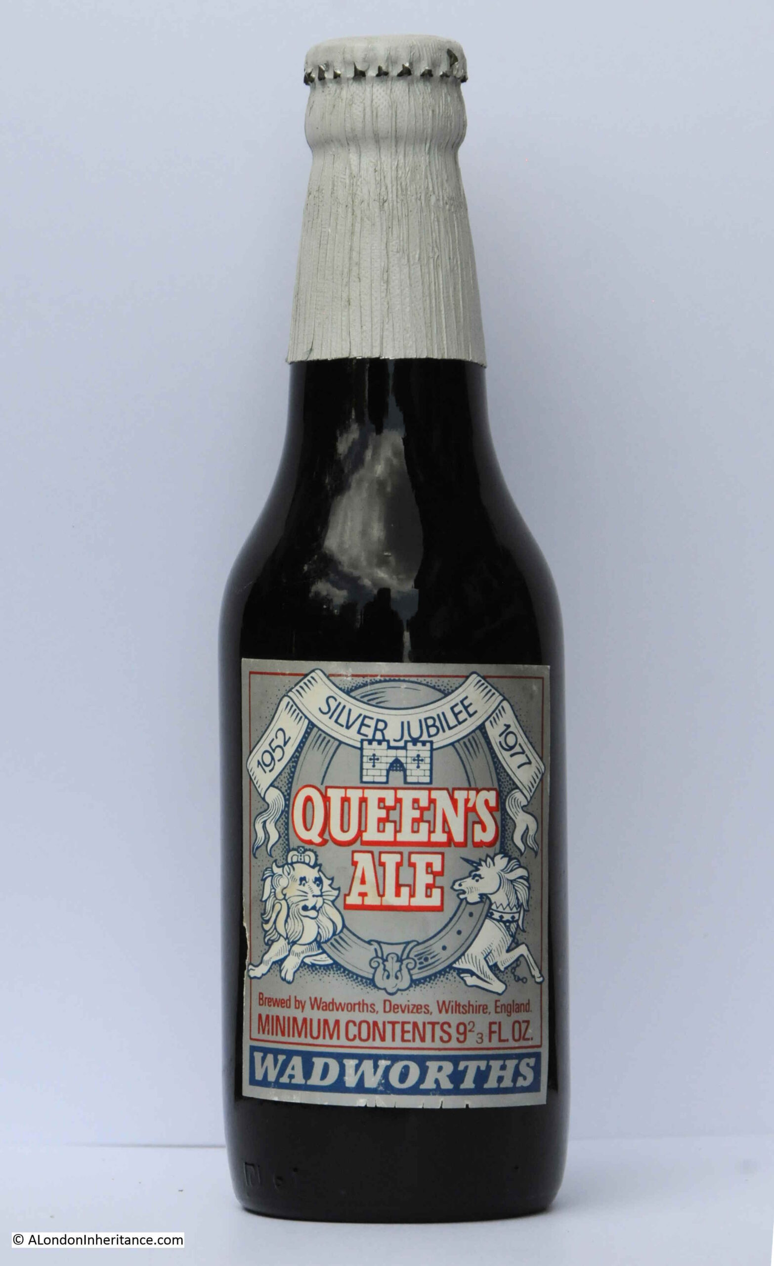
Wadworths – Queen’s Ale:
Wadworths are still brewing beer at their brewery in Devizes, Wiltshire, but according to their website, they do not appear to have a Jubilee beer for 2022. They had an impressive beer label in 1977.
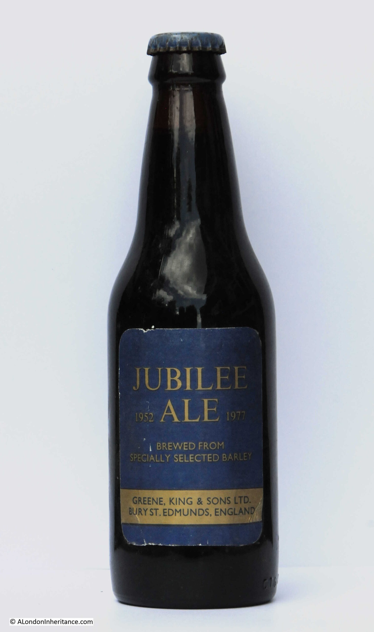
Greene, King & Sons – Jubilee Ale
Greene, King & Sons are still brewing at their brewery in Bury St. Edmunds, however again according to their website they do not appear to have a Jubilee beer for 2022.
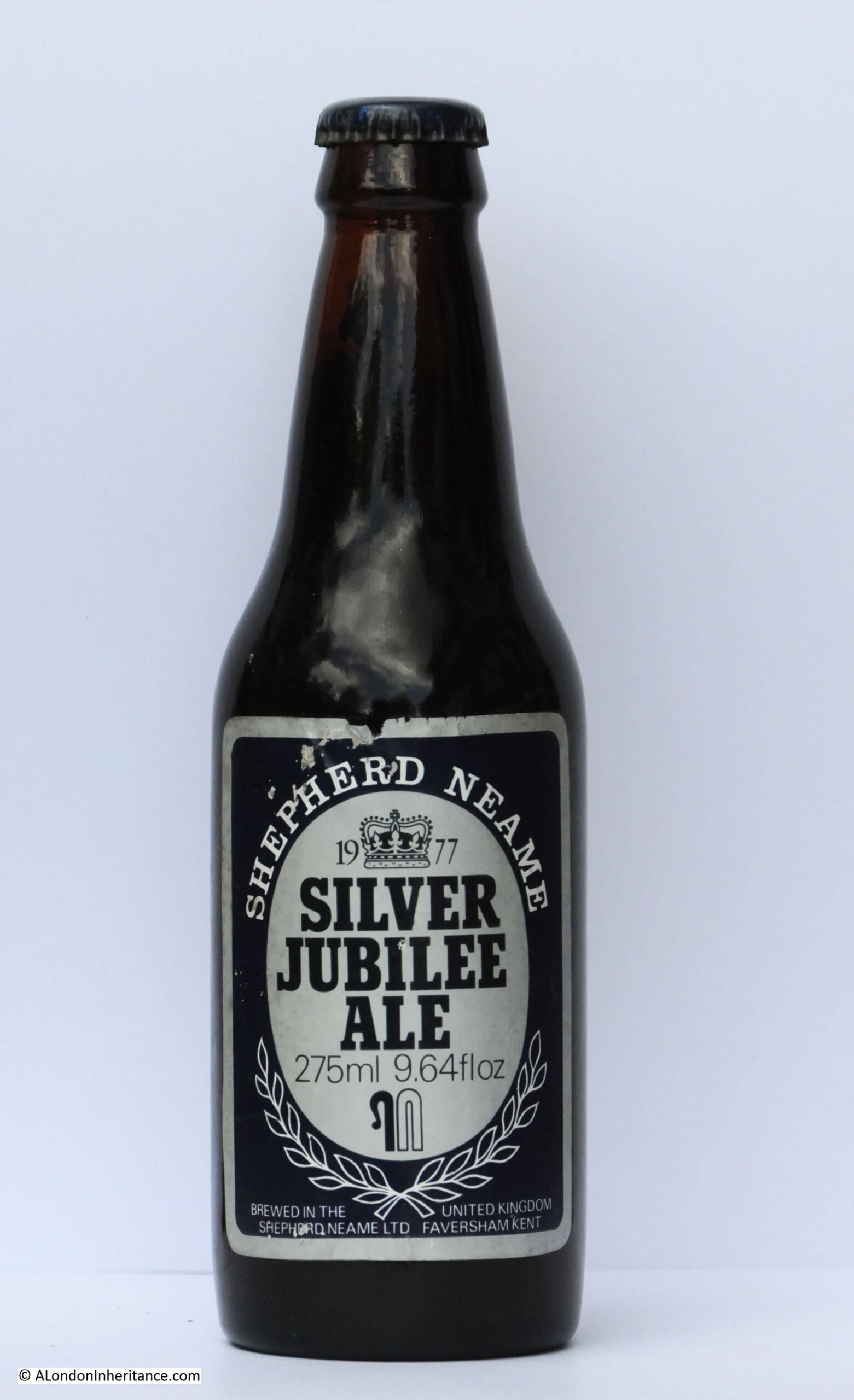
Shepherd Neame – Silver Jubilee Ale
Shepheard Neame are also still brewing at Faversham, Kent, and have produced a “Celebration Ale” for the 2022 Jubilee, however this is only available in casks in pubs rather than bottled.
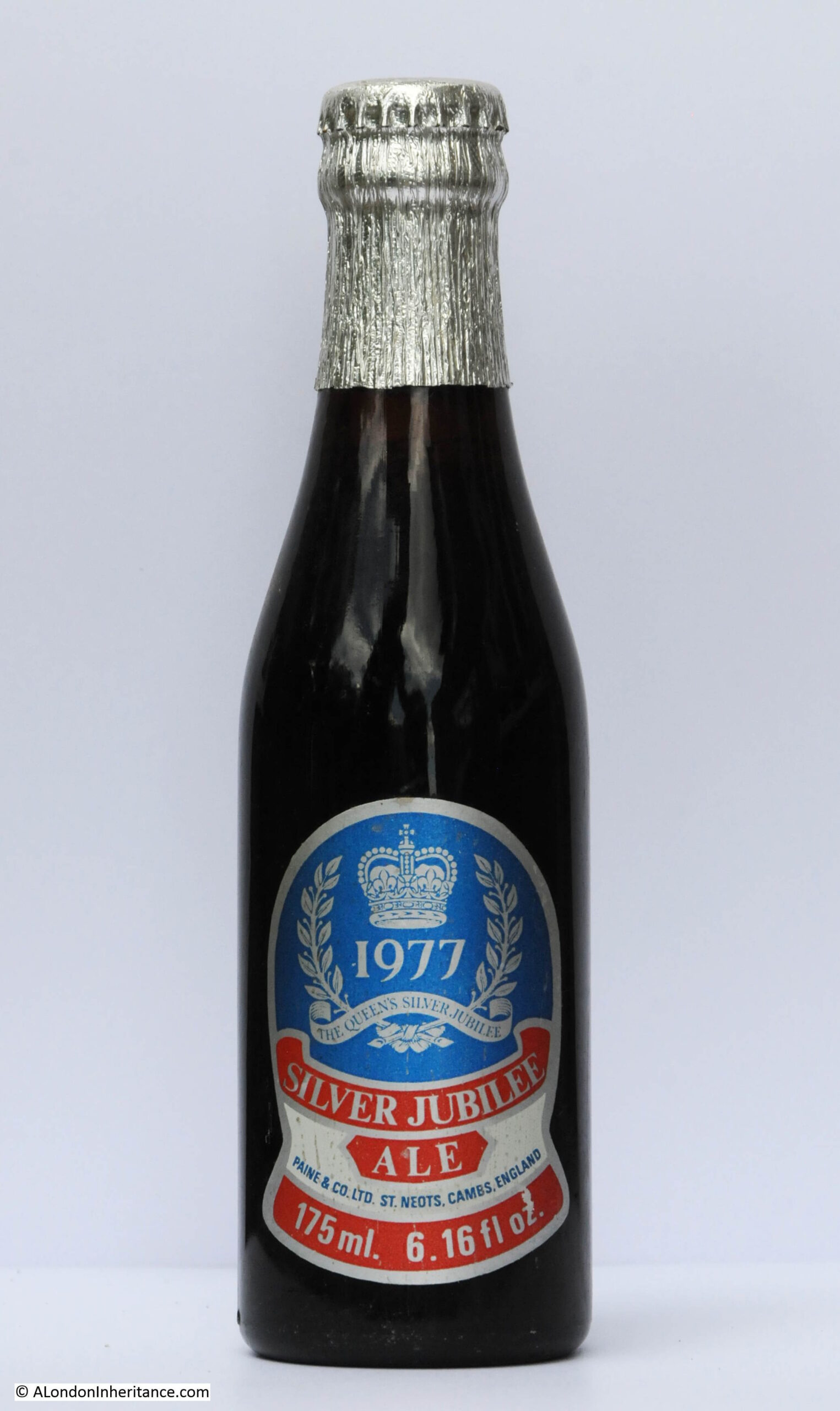
Paine & Co – Silver Jubilee Ale
A company that appears to have sold their pubs and brewery to a rival brewers in the 1980s. The name disappeared and the brewery would later close.
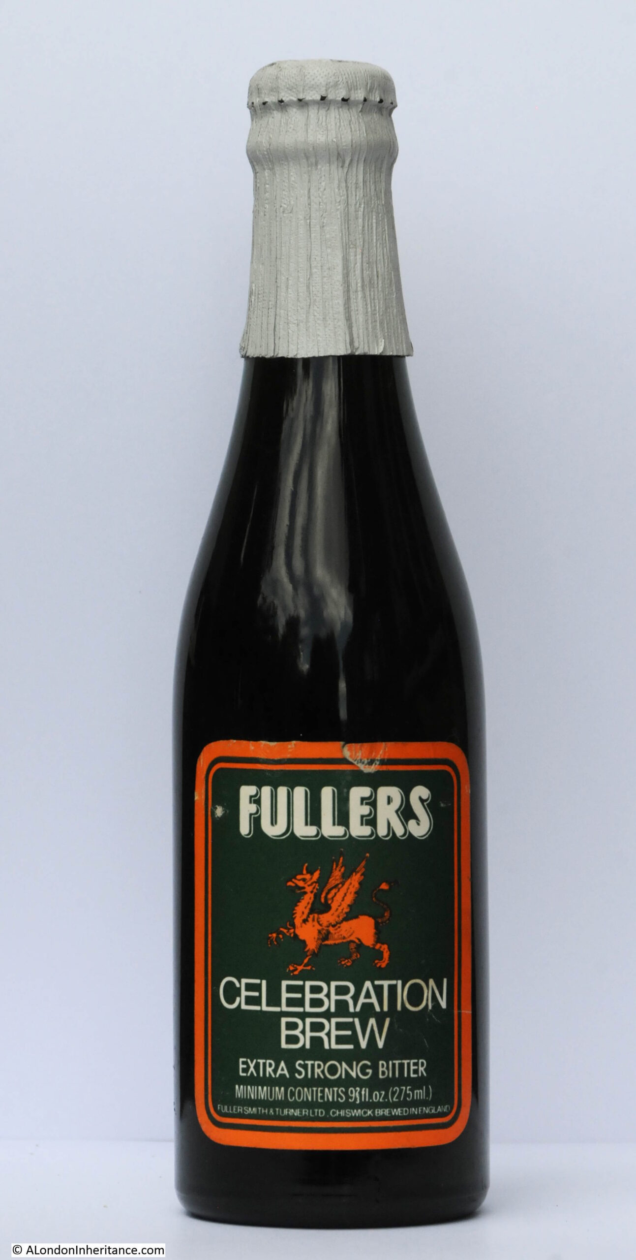
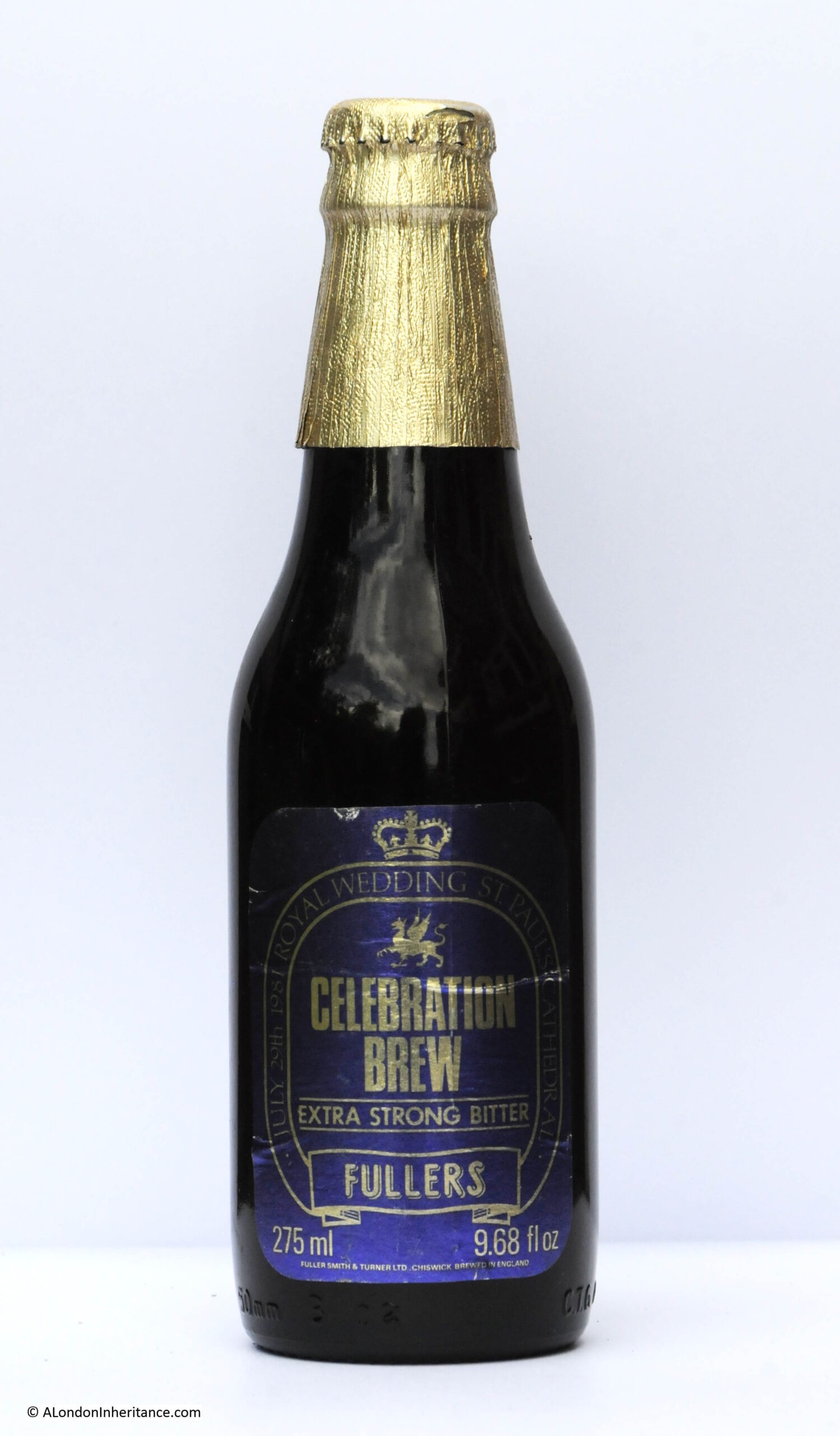
Fullers – Celebration Brew
Fullers seem to have gone with a rather basic label for their Celebration Brew, although is does include a picture of a Griffin, from their Griffin brewery in Chiswick. They are still at the Chiswick brewery, however the Fullers company sold the brewery to Japanese international drinks company Asahi, and Fullers are now just a pub company with Asahi owning the brewery and producing beers under the Fullers name.
Fullers do not appear to be brewing a beer for the 2022 Jubilee.
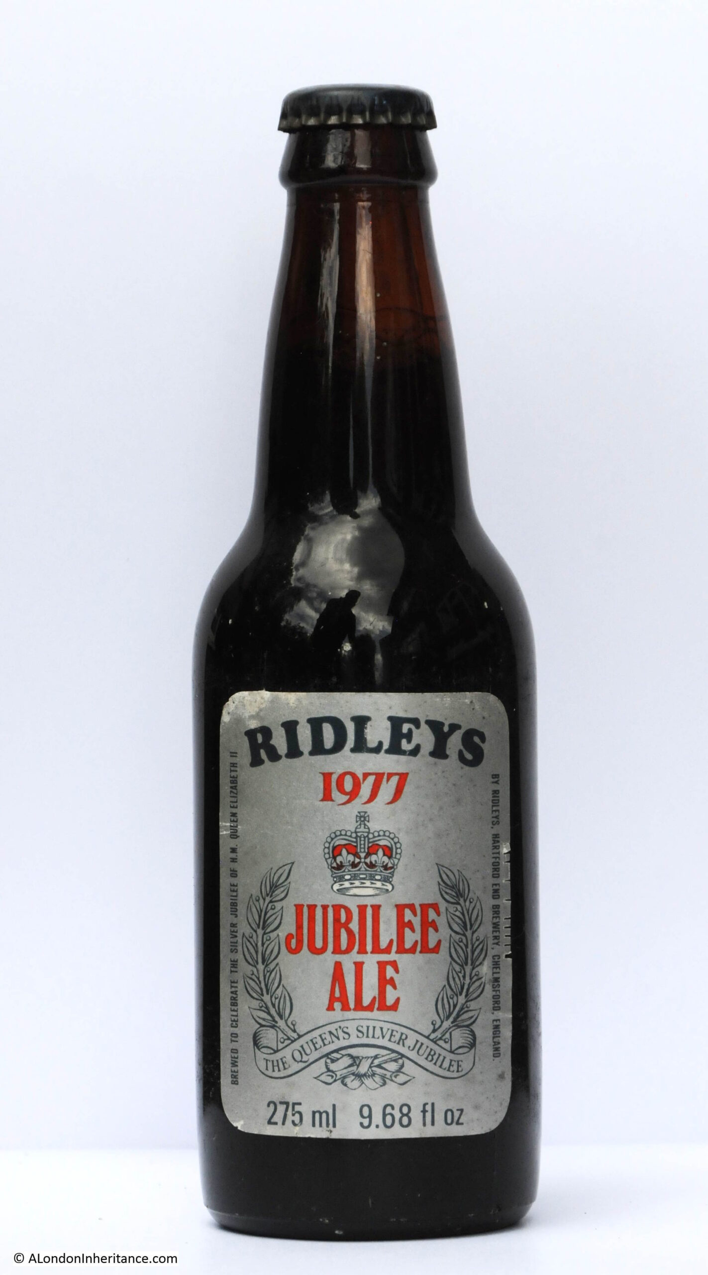
Ridleys – Jubilee Ale
Ridleys were brought by Greene King, who then closed their brewery near Chelmsford, Essex, and stopped producing the majority of beers under the Ridleys name. A rather nice silver label for their Jubilee Ale.
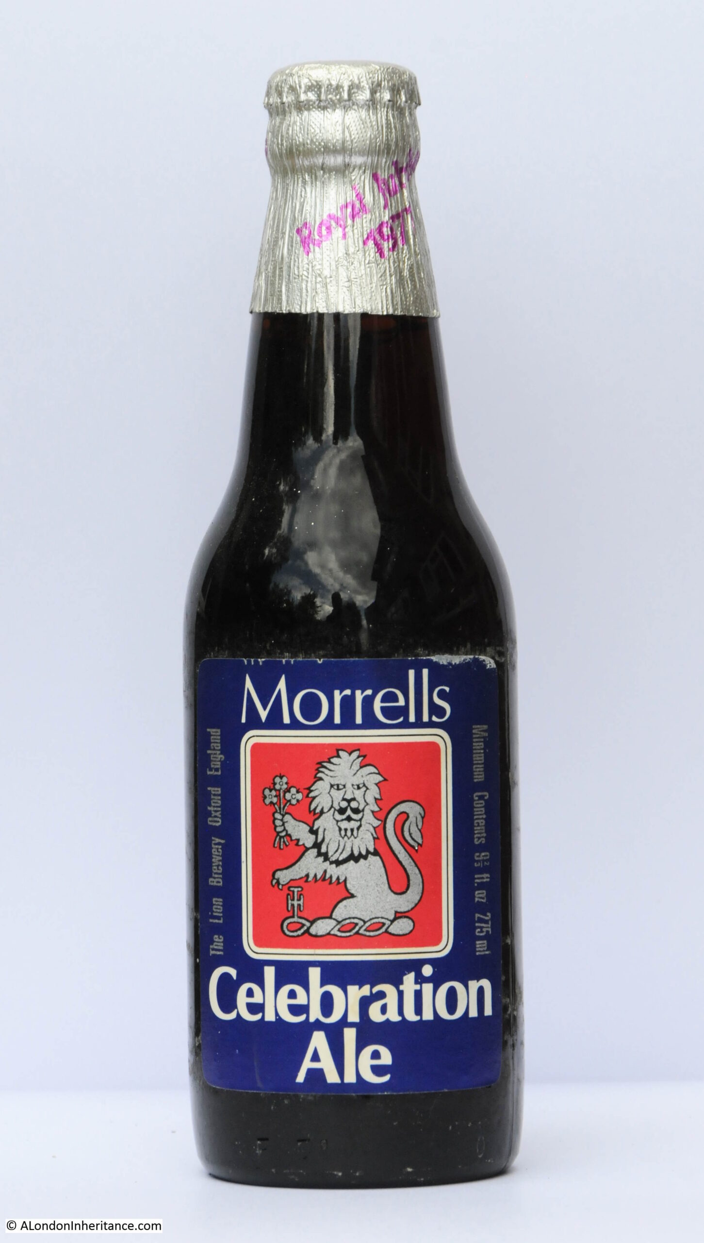
Morells – Celebration Ale
The Morells company, along with their Oxford brewery closed in 1998.
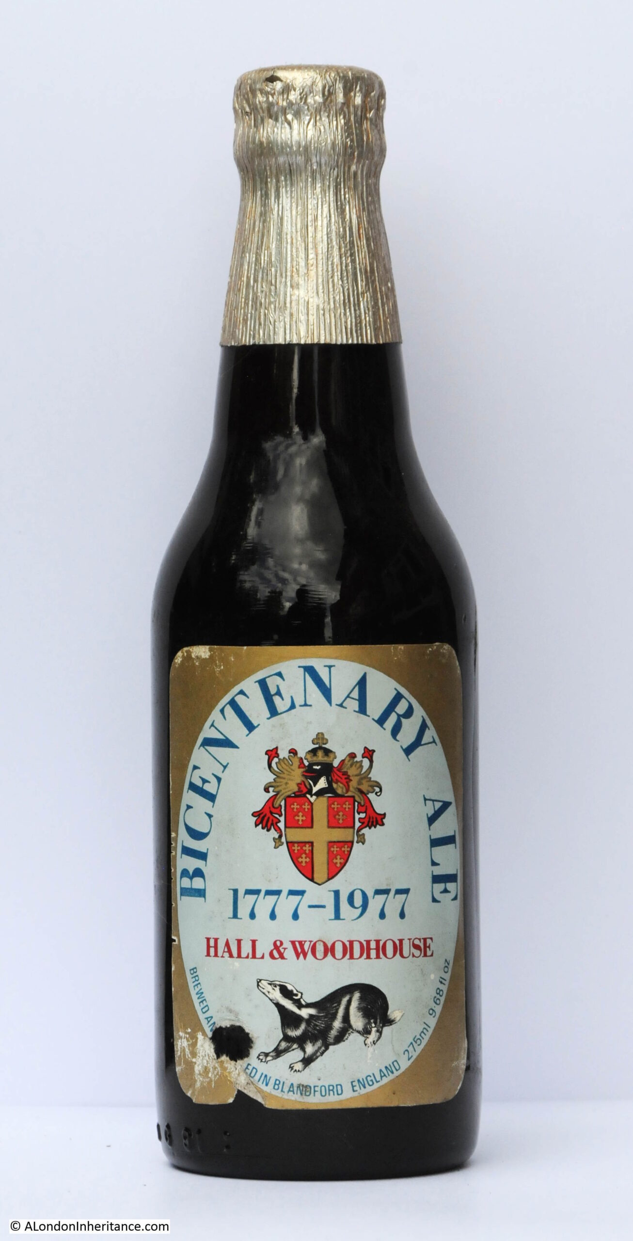
Hall & Woodhouse – Bicentenary Ale
Hall & Woodhouse appear to have ignored the 1977 Jubilee, preferring to celebrate their 200 year anniversary.
They are still in business with pubs and the same brewery in Blandford, Dorset, however as with the 1977 Jubilee, they do not appear to have a Jubilee beer for 2022.
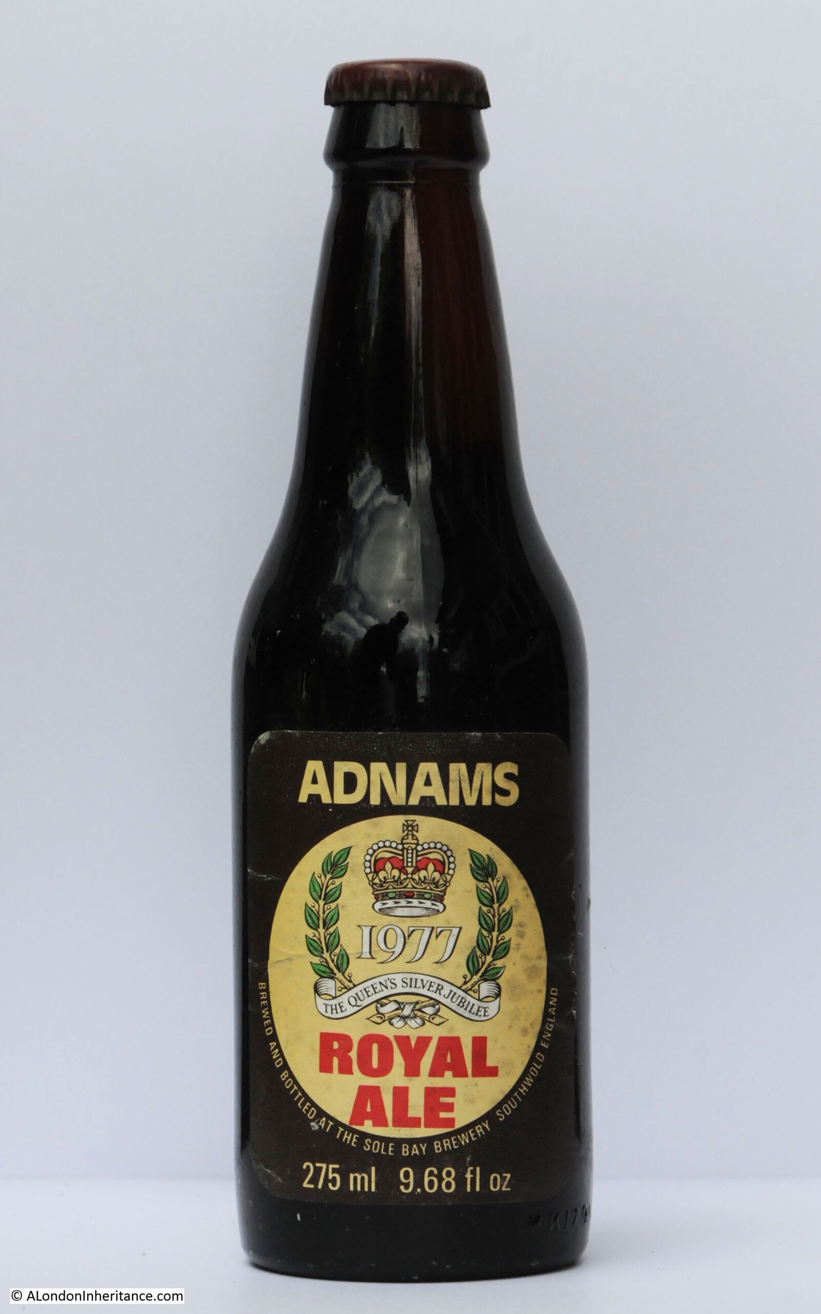
Adnams – Royal Ale
Adnams based in Southwold, Suffolk are still in operation, and producing beers from their own brewery. Unfortunately there appears to be no Jubilee Ale for 2022, although Adnams have branched out to produce Gin and Vodka as well as beers.
Royal Wedding Beers – 1981
On the same theme, the Royal Wedding in 1981 between Charles and Diana also resulted in a number of breweries producing special beers to commemorate the event.
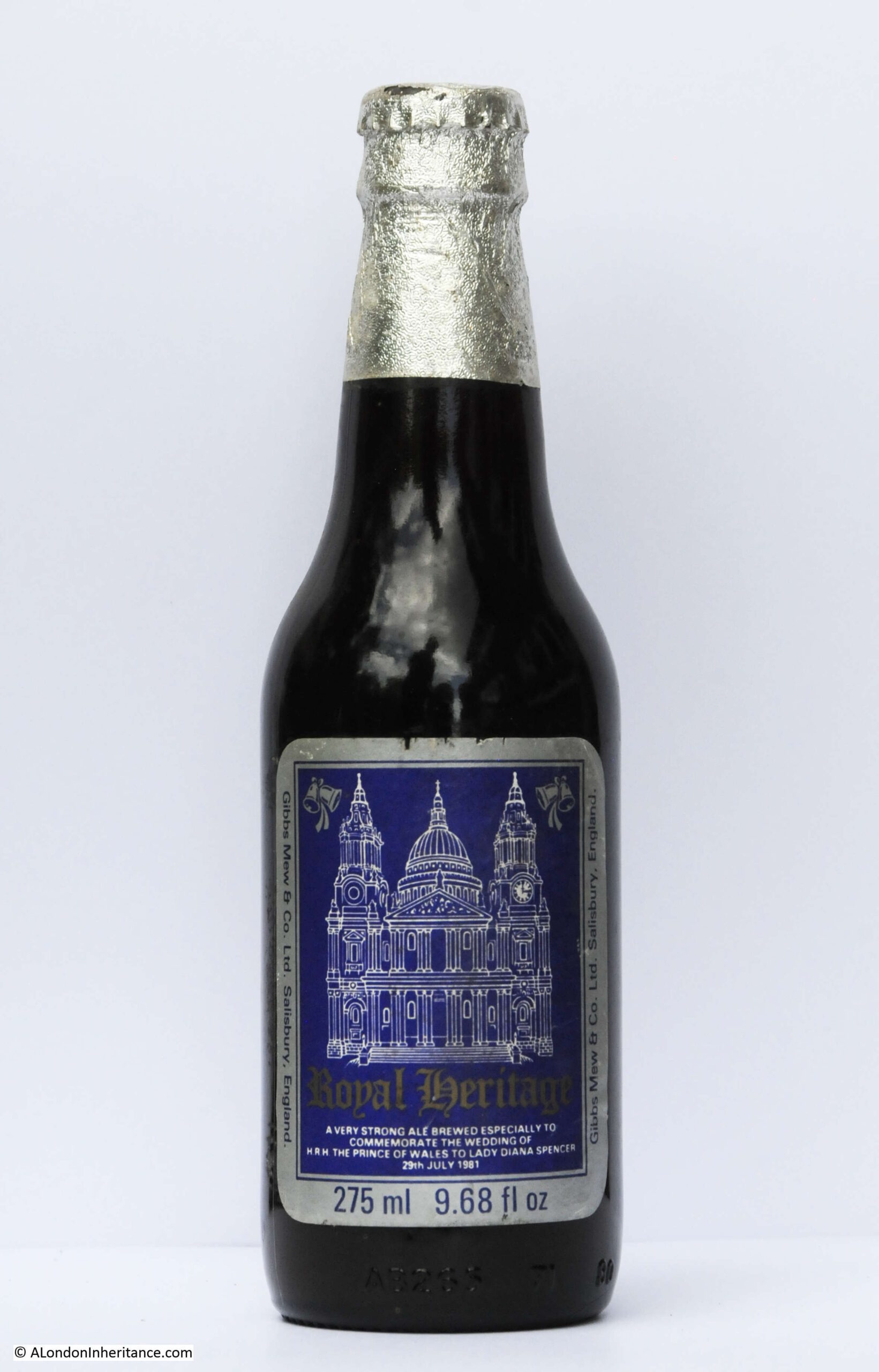
Gibbs Mew & Co – Royal Heritage
Gibbs Mew & Co of Salisbury brewed a Royal Heritage beer, and their bottle featured St Paul’s Cathedral.
The company closed their Salisbury brewery in 1997 and continued as a pub chain, however the pubs and the company were sold to Enterprise Inns in 2011.
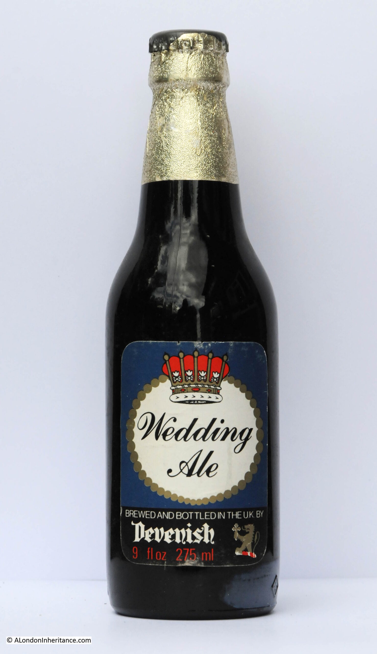
Devenish – Wedding Ale
Devenish was another Dorset brewery, and followed the same fate as Gibbs Mew.
Devenish closed their brewery in 1985, and continued as a pub operator until 1993 when the company was sold to Greenalls.
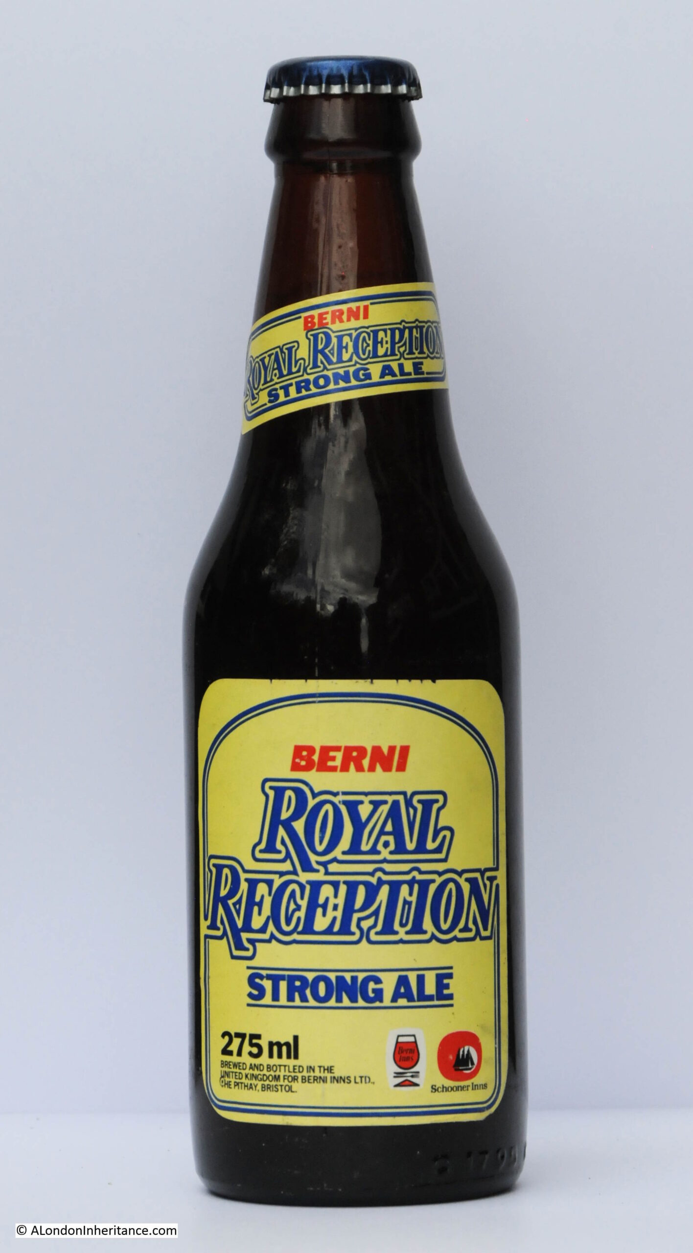
Berni – Royal Reception
If you fancied a beer in 1981 to go with your Berni Prawn Cocktail, Steak and Chips and Black Forest Gateau, then a bottle of their Royal Reception strong ale could be yours.
Berni was one of the pub / restaurant chains that would bring the experience of going out for a meal in the 1970s to the masses. Relatively cheap, good service and a simple, standard menu helped with the popularity of the chain, and the most brought meal of Prawn Cocktail, Steak and Chips and Black Forest Gateau becoming representative of eating out in the late 1970s.
Berni Inns was sold to Whitbread in 1995 who rebranded the chain to become part of the Beefeater resturants.
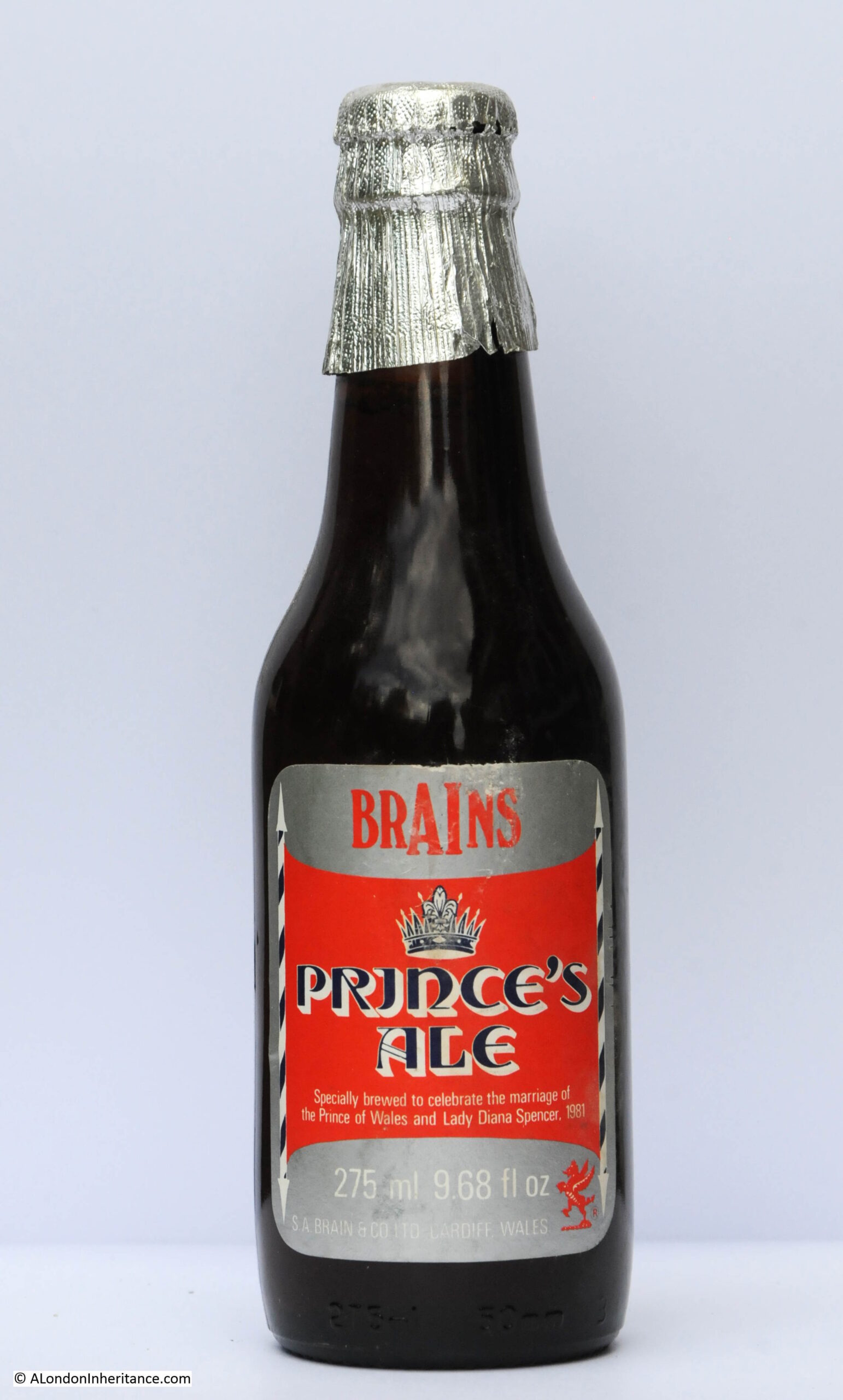
Brains – Prince’s Ale
Brains offered their Prince’s Ale in 1981. The brewery was based in Cardiff, where they are still brewing, but no special beers for the Jubilee that I can find on their website.
Fullers – Celebration Brew
Fullers Jubilee beer had a rather simple label, however they went with a more ornate label for their Celebration Brew to mark the 1981 Royal Wedding.
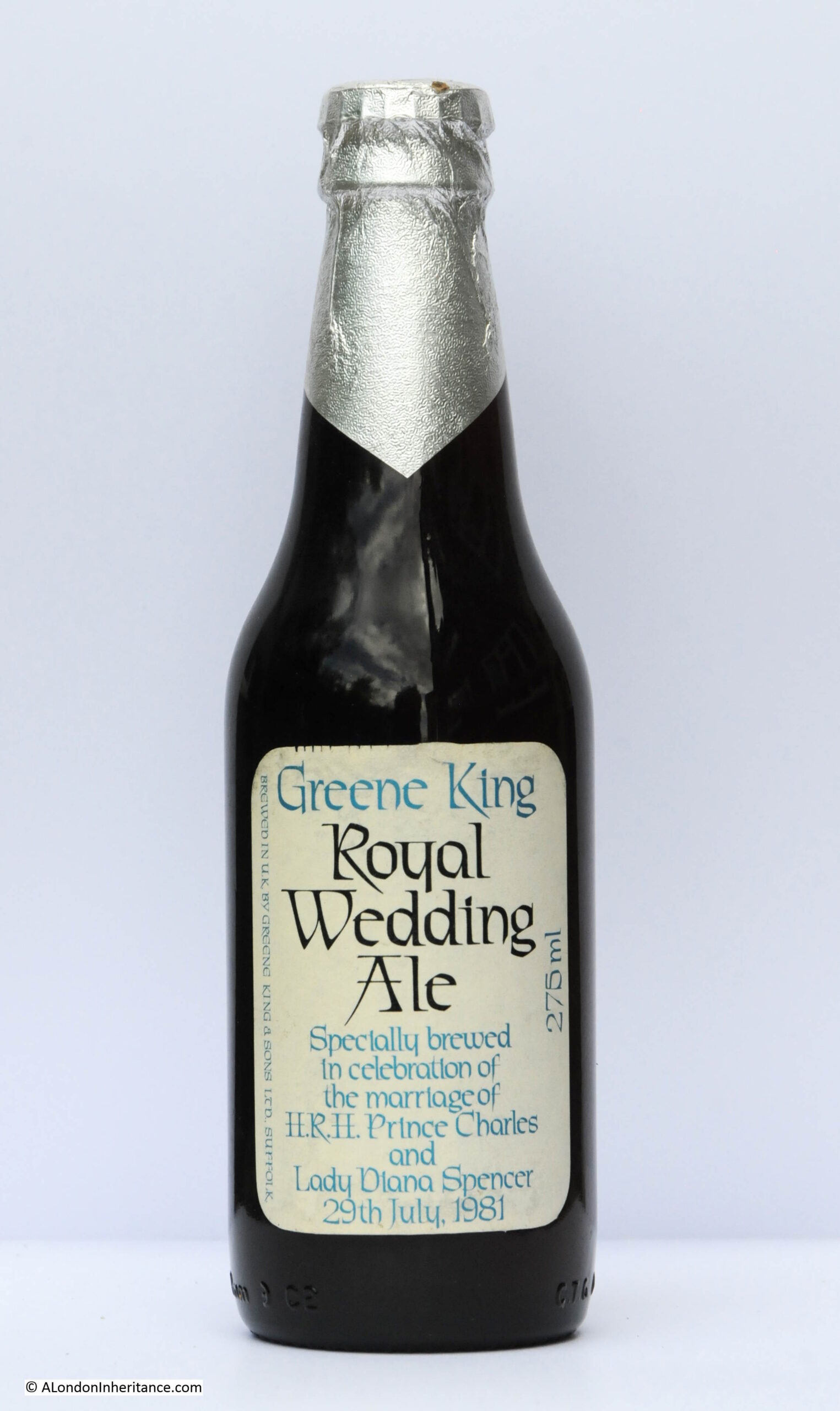
Greene King – Royal Wedding Ale
Greene King produced their Royal Wedding Ale. The label looks as if it was only designed at the last moment when it would have been too late to produce a more ornate label, so they went with a simple text based label.
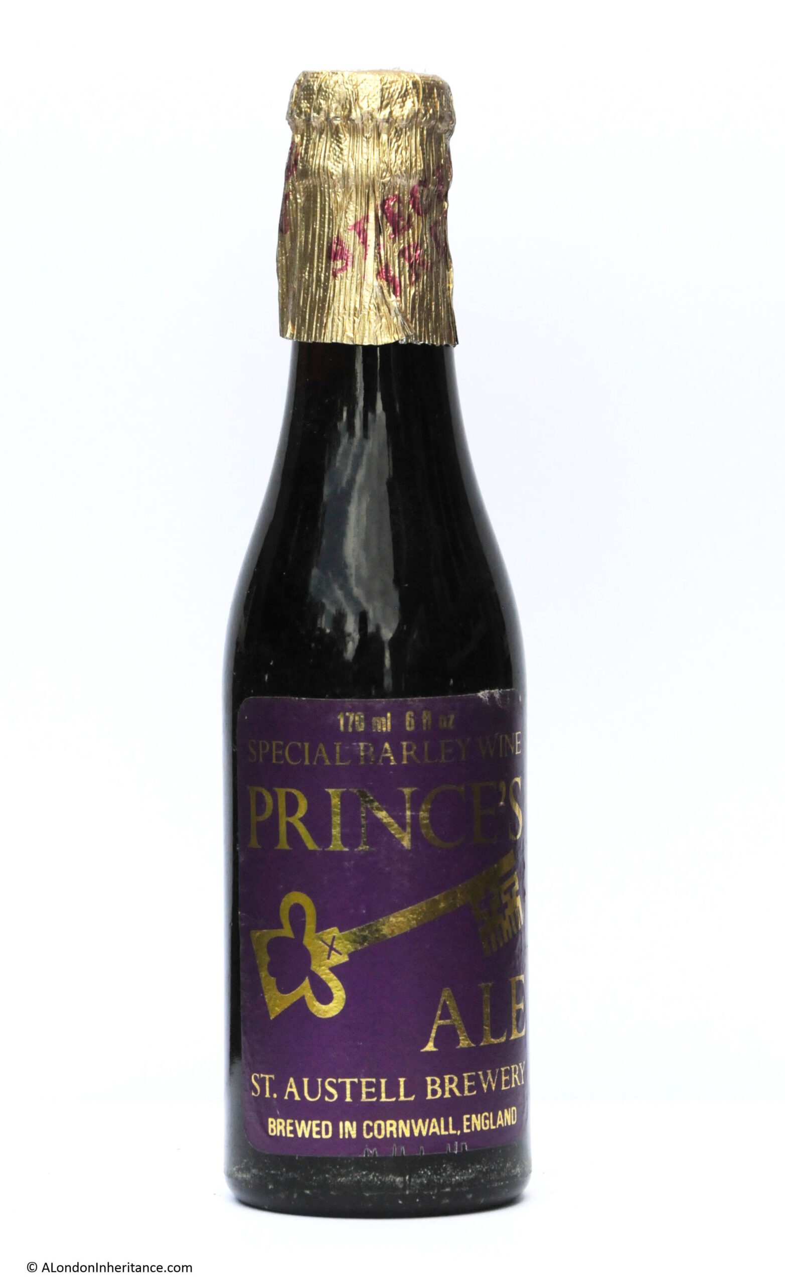
St Austell Brewery – Prince’s Ale
The St Austell Brewery’s Prince’s Ale was rather unusual in that it was a Barley Wine.
Barley Wine is a type of beer, but is generally much stronger than a normal beer, probably why their bottle was smaller than the typical bottle of the time.
The St Austell Brewery is located in St Austell, Cornwall and the brewery and company are still in operation. They do have a Jubilee Beer called “Thank Brew” which apparently is part of an initiative by breweries, pubs and communities to produce a special beer for the Jubilee, and they are selling a bottled Platinum Jubilee Ale, which has a rather nice label.
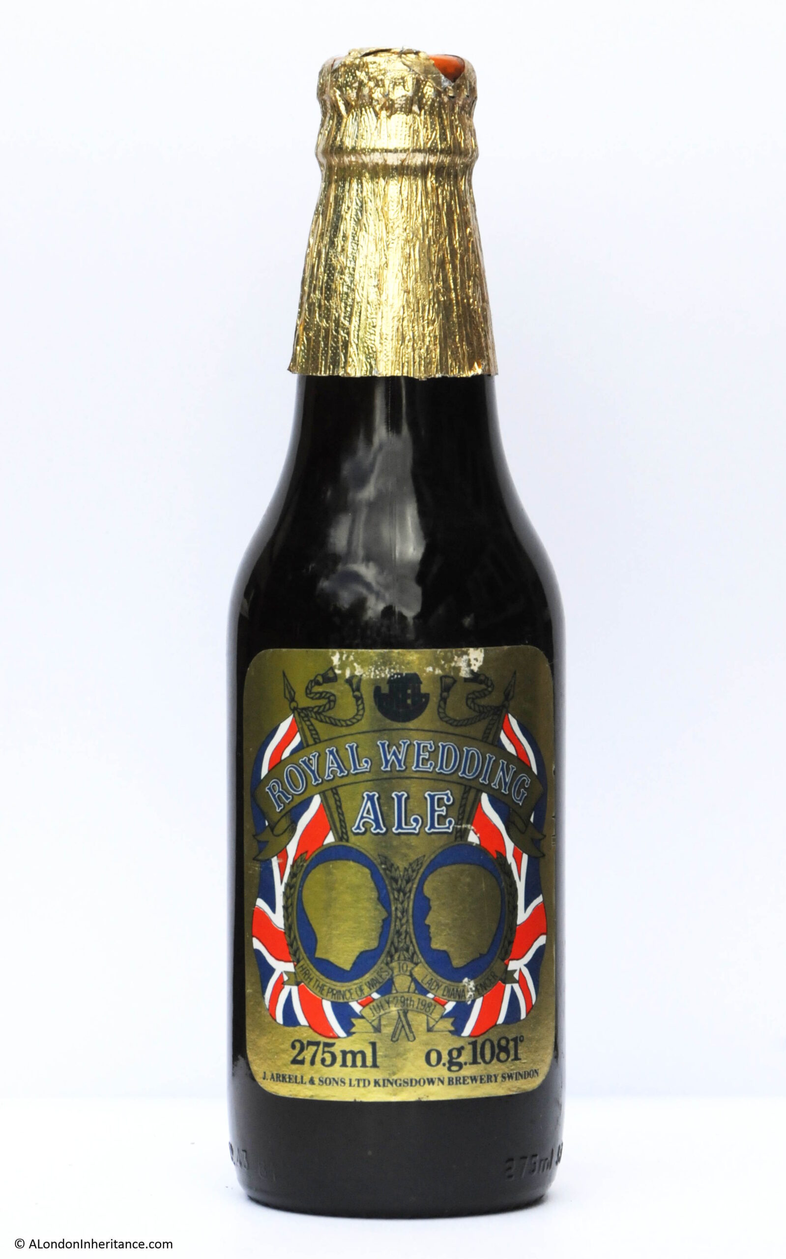
J. Arkell and Sons – Royal Wedding Ale
Arkell’s had a rather impressive, gold label to their Royal Wedding Ale.
The company, based in Swindon is still brewing beer, but does not appear to be brewing a Jubilee beer.
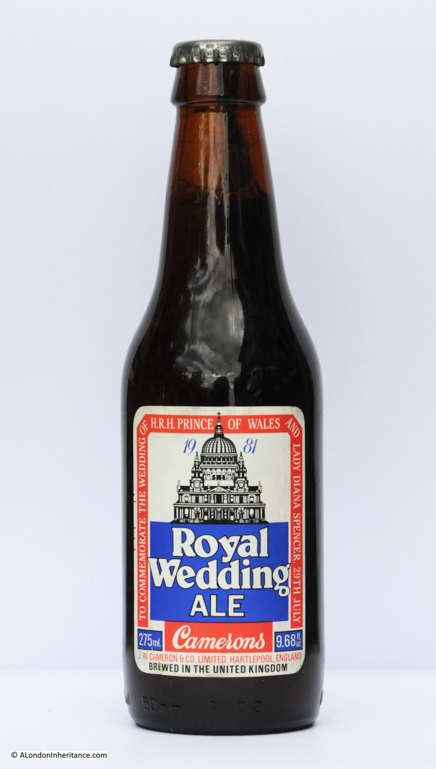
Camerons – Royal Wedding Ale
Camerons featured a drawing of St Paul’s Cathedral on the label of their Royal Wedding Ale.
Camerons are still brewing in Hartlepool, Teeside, and whilst they do not appear to have a Jubilee beer, they have teamed up with the band Motorhead and have a Road Crew beer available both in draft and bottles.
Based on that small survey it seems that there are a very small number of beers brewed for the 2022 Jubilee, and I have not seen any on recent pub visits.
Probably brewers have to be more commercially focused these days, and the costs of producing a one off product outweigh the potential benefits.
What I did notice when revisiting all these bottles was that the labels do not show the alcohol content / ABV. If you were drinking a bottle of Berni’s Royal Reception Strong Ale, then you had no idea what strong actually meant.
The excellent Boak & Bailey site has researched the introduction of this labelling and found that it was a result of the UK implementing an EEC (European Economic Community) directive, and that labeling beers with the alcohol content became law on the 17th July, 1989.
All these 1977 Jubilee beers and 1981 Royal Wedding beers are unopened, although I very much doubt their contents are drinkable. and probably very unwise to try.
They will now be returned to a very dusty corner of the garage.
Whatever you are drinking (or not), I hope you are having a very good Jubilee four days.
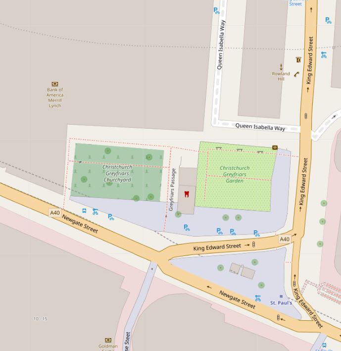
Before heading to Christchurch Greyfriars, if you are interested in a walk exploring the history of Bankside, I have had one ticket returned from someone who cannot now attend the walk on Sunday 5th of June, and a couple of tickets are available for the walks later in July. The walk can be booked here.
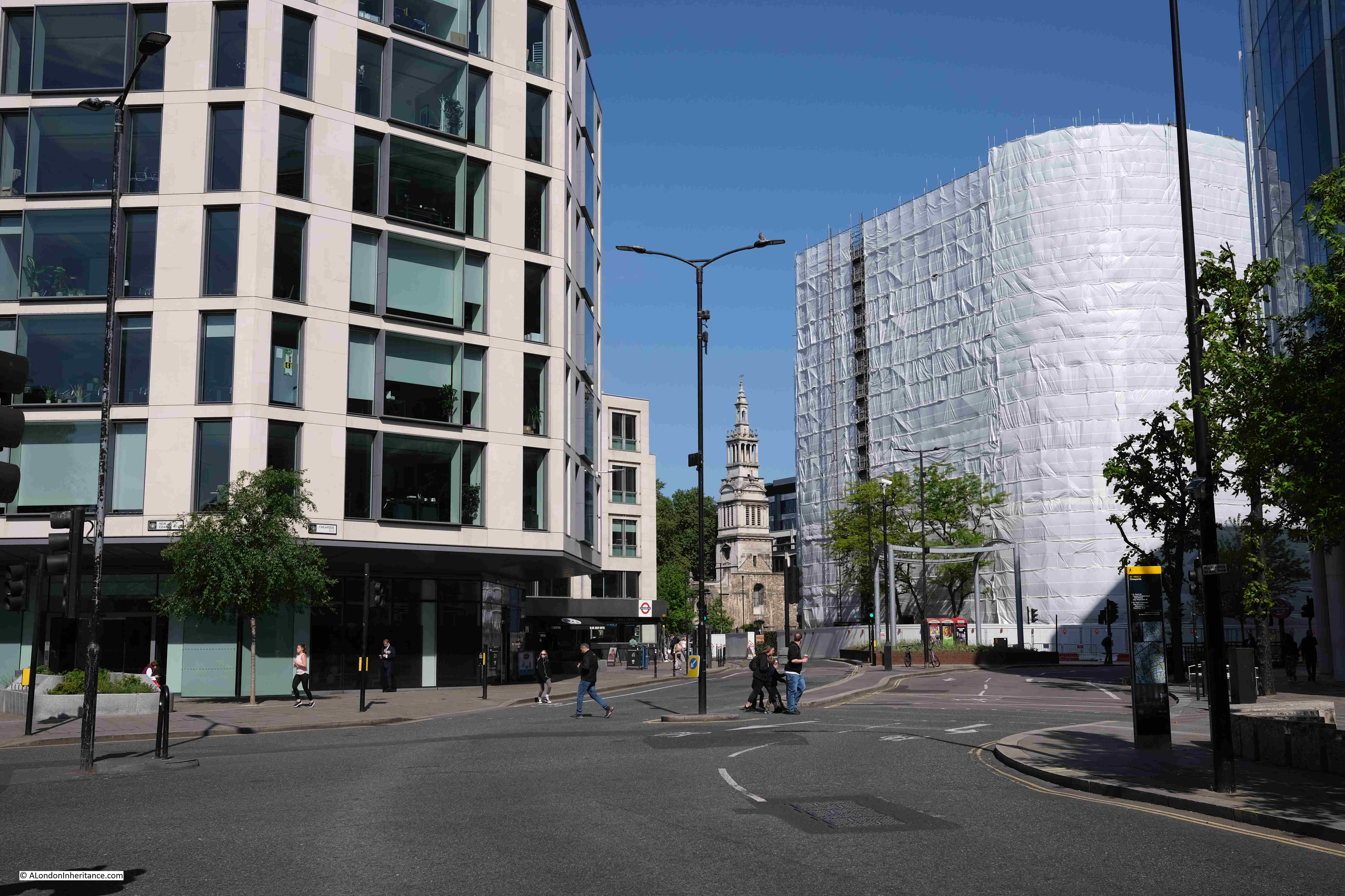
I took the following photo in 1973, taken from Cheapside, looking towards the church of Christchurch Greyfriars using my very first camera, a simple Kodak Instamatic:
Not a very good photo, the Kodak Instamatic was a very simple camera. All the film was contained within a large cartridge, which included the exposed film. Pre-set focus and the only setting for exposure and speed were a single switch which could be moved either to sunny or cloudy. A very child friendly camera.
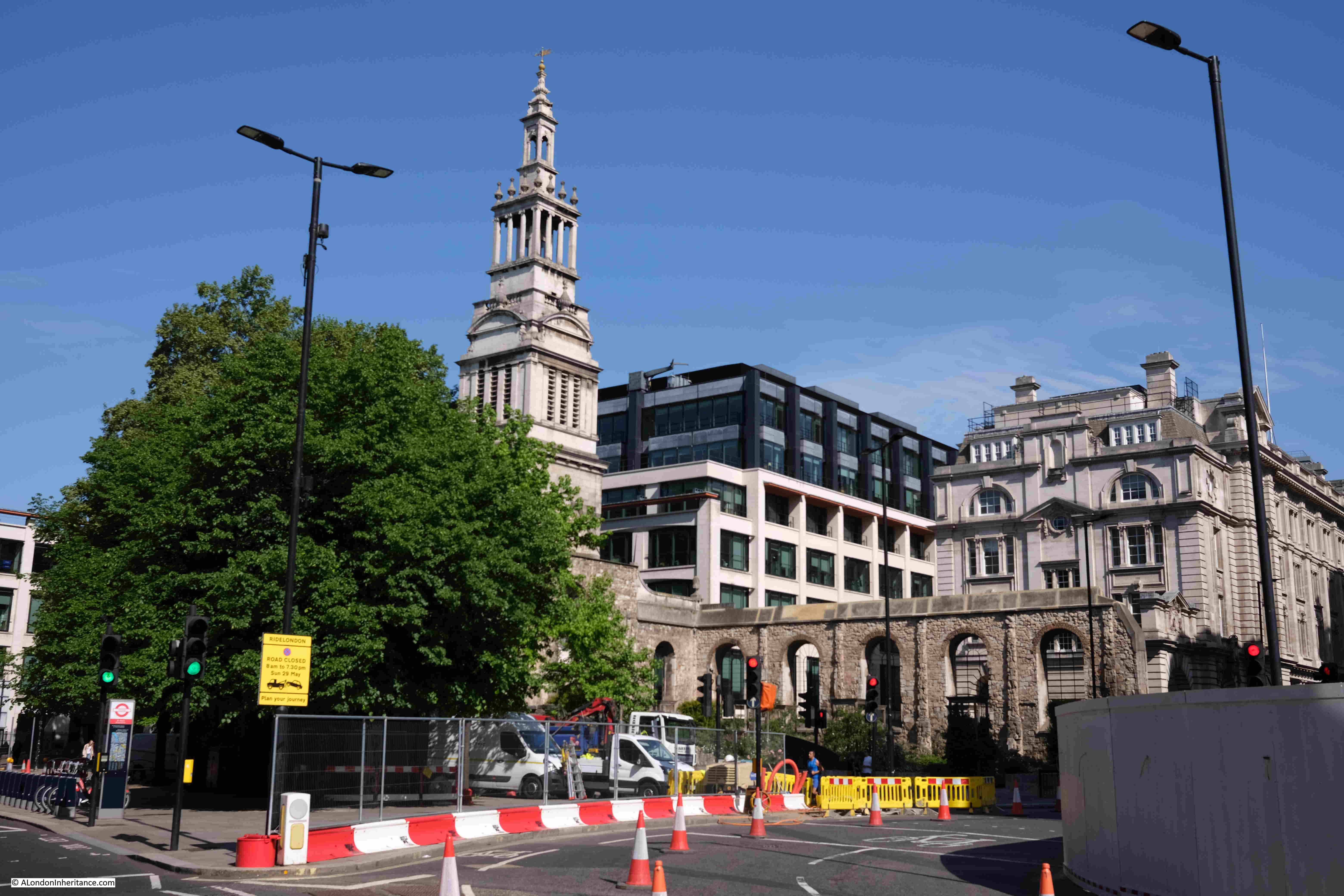
Roughly the same view, around 50 years later, in 2022:
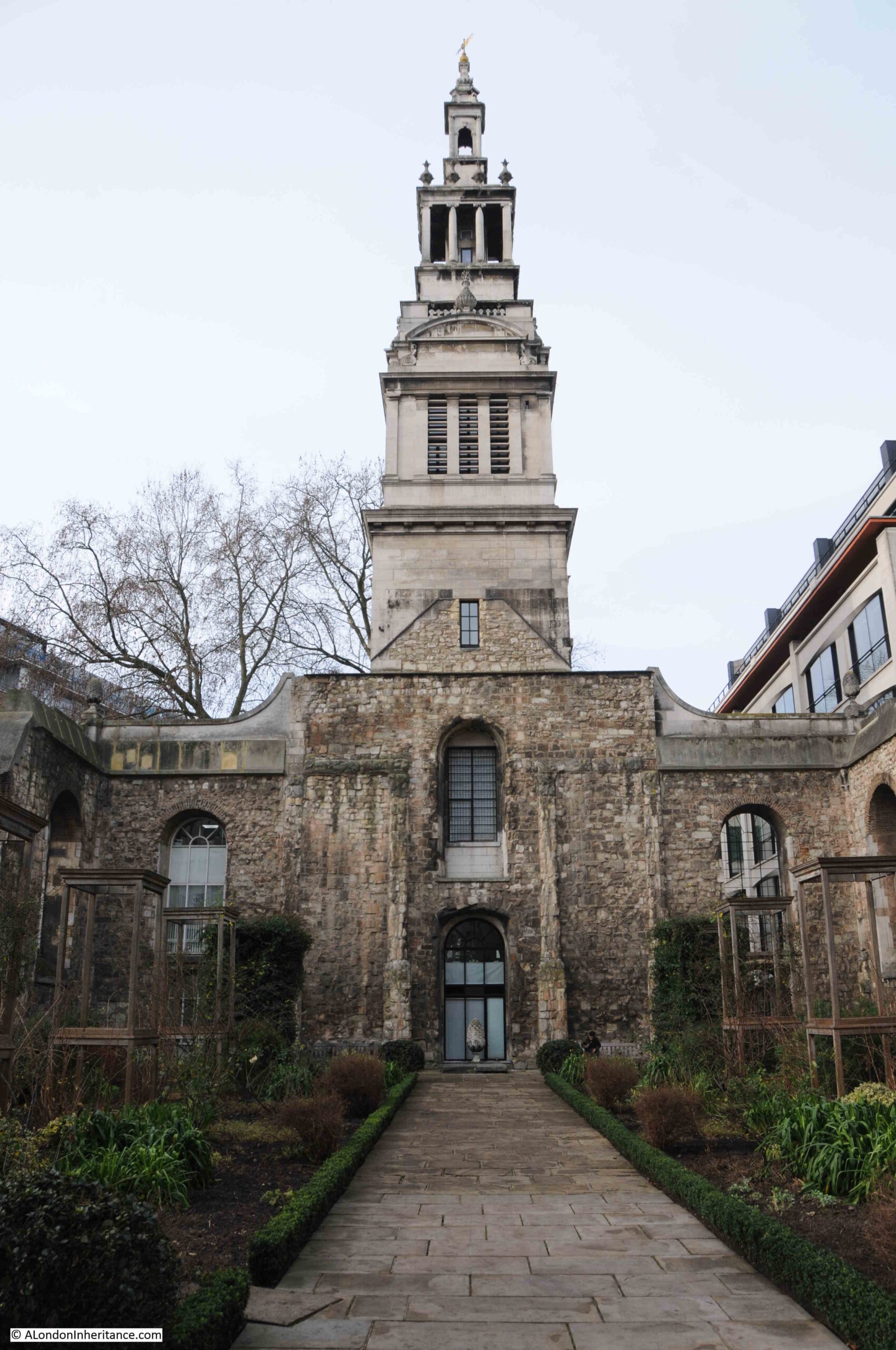
Christchurch Greyfriars is an interesting, and distinctive church. A very different history to many other City churches.
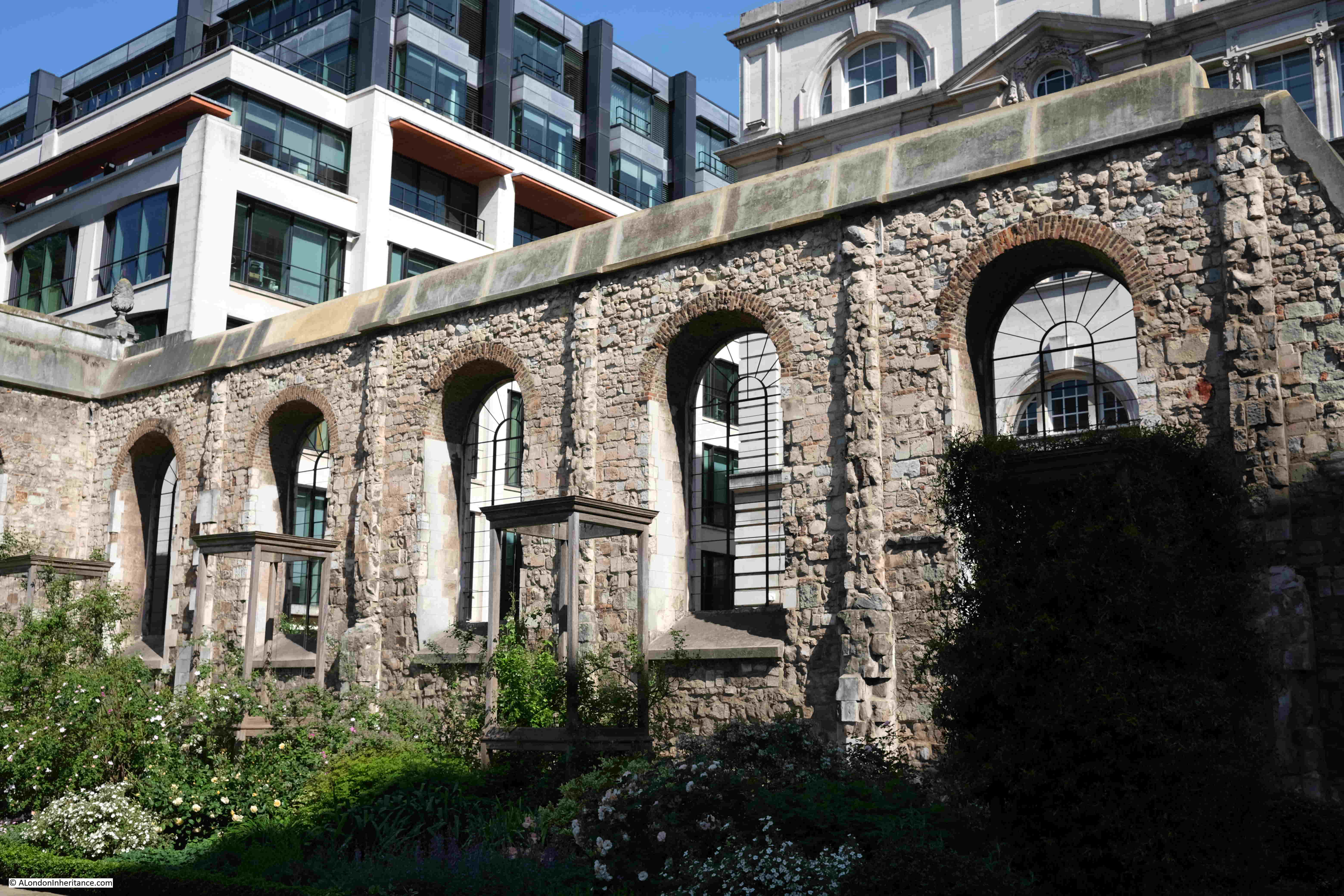
It is distinctive, as whilst the tower of the church is intact, the body of the church is now a garden, with only one main side wall standing, and a short stub of the other sidewall. The rear wall is completely missing.
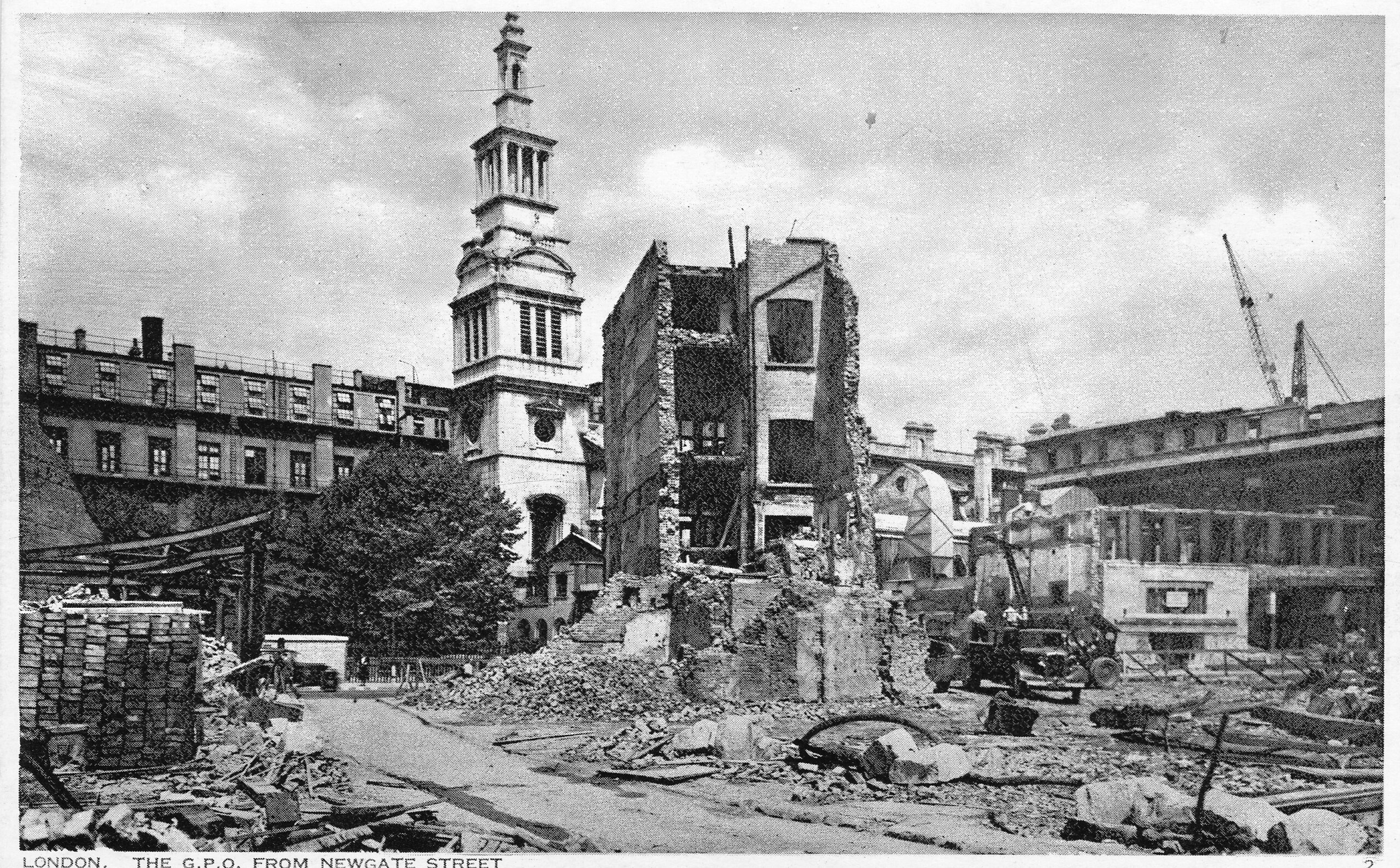
The church was destroyed during the night of the 29th December 1940, when much of the area surrounding, and to the north and south of St Paul’s Cathedral, was engulfed by the fires started by incendiary bombs. This was the raid that destroyed the area that would later be rebuilt as the Golden Lane and Barbican estates.
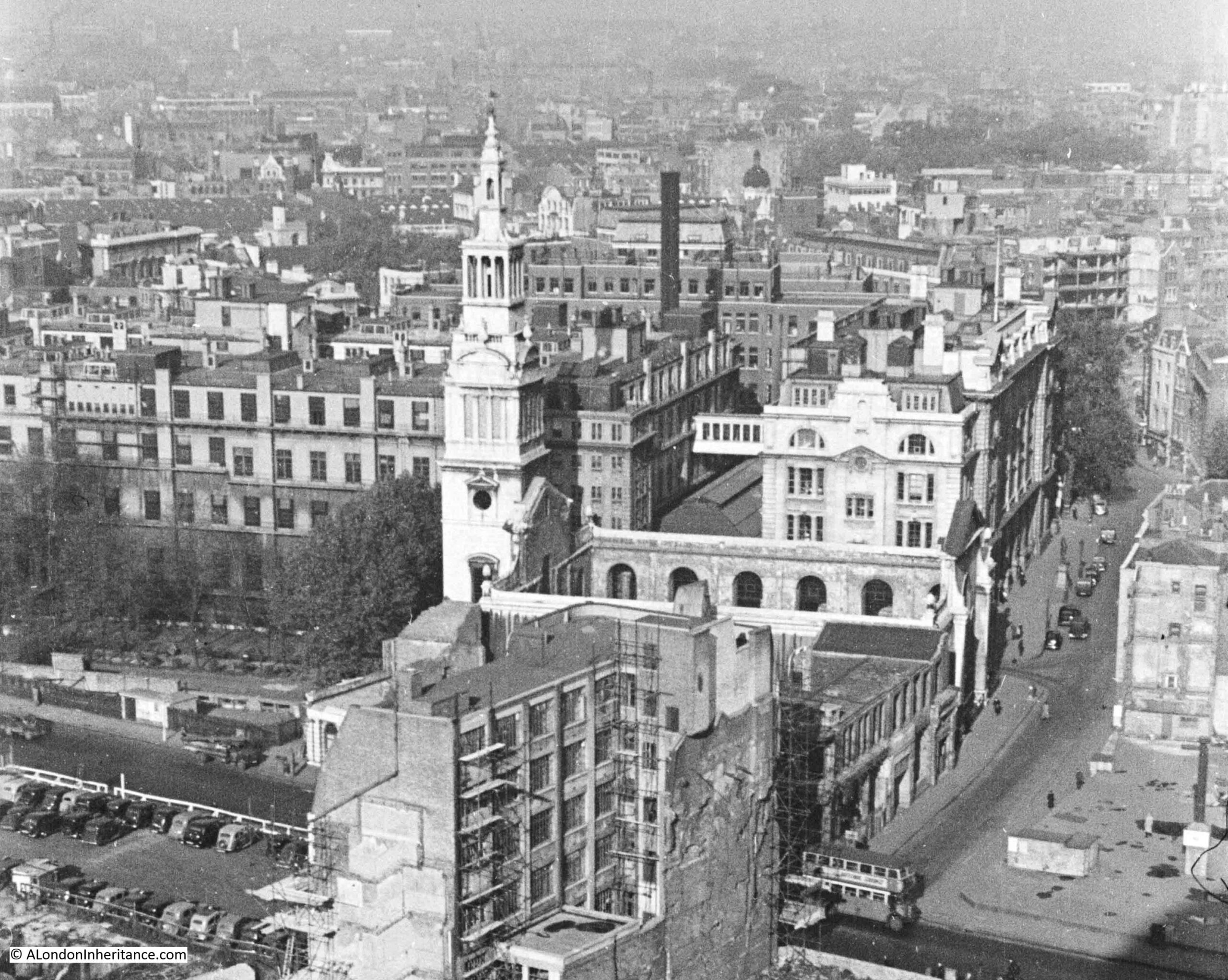
Christchurch Greyfriars was in one of my father’s photos taken from St Paul’s Cathedral just after the war, and can be seen in the following extract from one of the photos (the full series can be seen in this post, and this post):
As can be seen in the above photo, the church still retained its four walls. The church was destroyed by fire which burnt the contents of the church along with the roof, but left the walls standing.
In my 2022 photo you can count 5 windows in the remaining side wall. In the above photo, there are 6 windows (part of the 6th window on the right can just be seen to the left of the end wall of the church). There is also a two storey building which runs south from the end wall of the church.
The reason for these differences, and for the loss of the rear and southern side wall were changes in 1973 to allow the widening of King Edward Street, and the construction of a spur from Newgate Street into King Edward Street.
Christchurch Greyfriars was Grade I listed in 1950, however this protection appears to have been insufficient to prevent the demolition of much of the surviving walls.
The church was included in the series of postcards “London under Fire”, issued during the war:
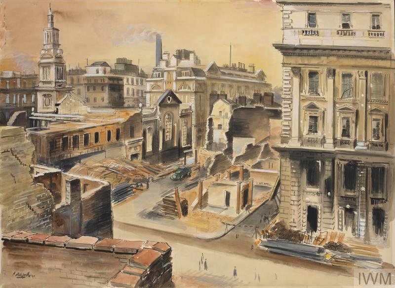
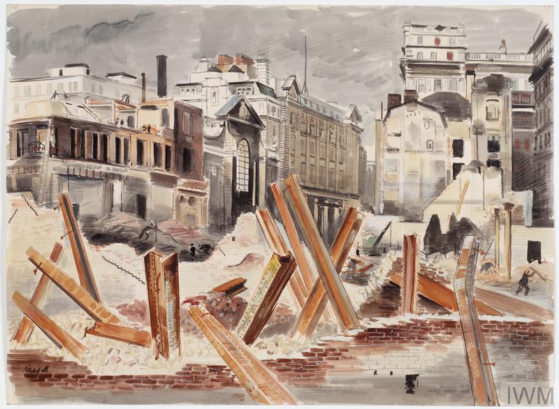
The church was also included in a couple of works by the artist Roland Vivian Pitchforth for the War Artists Advisory Committee. Both show the burnt out church with the surviving tower and walls:
Note that in the Imperial War Museum commentary for the above two prints, the focus in on the Post Office Buildings, one of which was the large building to the right of the church.
The Post Office, or British Telecom has had a long association with King Edward / Newgate Street, but has now moved away. In my 2022 photo there is a large building covered in white sheeting. This was the 1980s head office of British Telecom. It is now being converted into a mixed use development, and is unusual in the City in that the new building will retain the structural framework of the original rather than the usual full scale demolition and complete rebuild.
What has no doubt helped this approach is the height limitation around St Paul’s Cathedral so the usual high glass and steel tower was not an option.
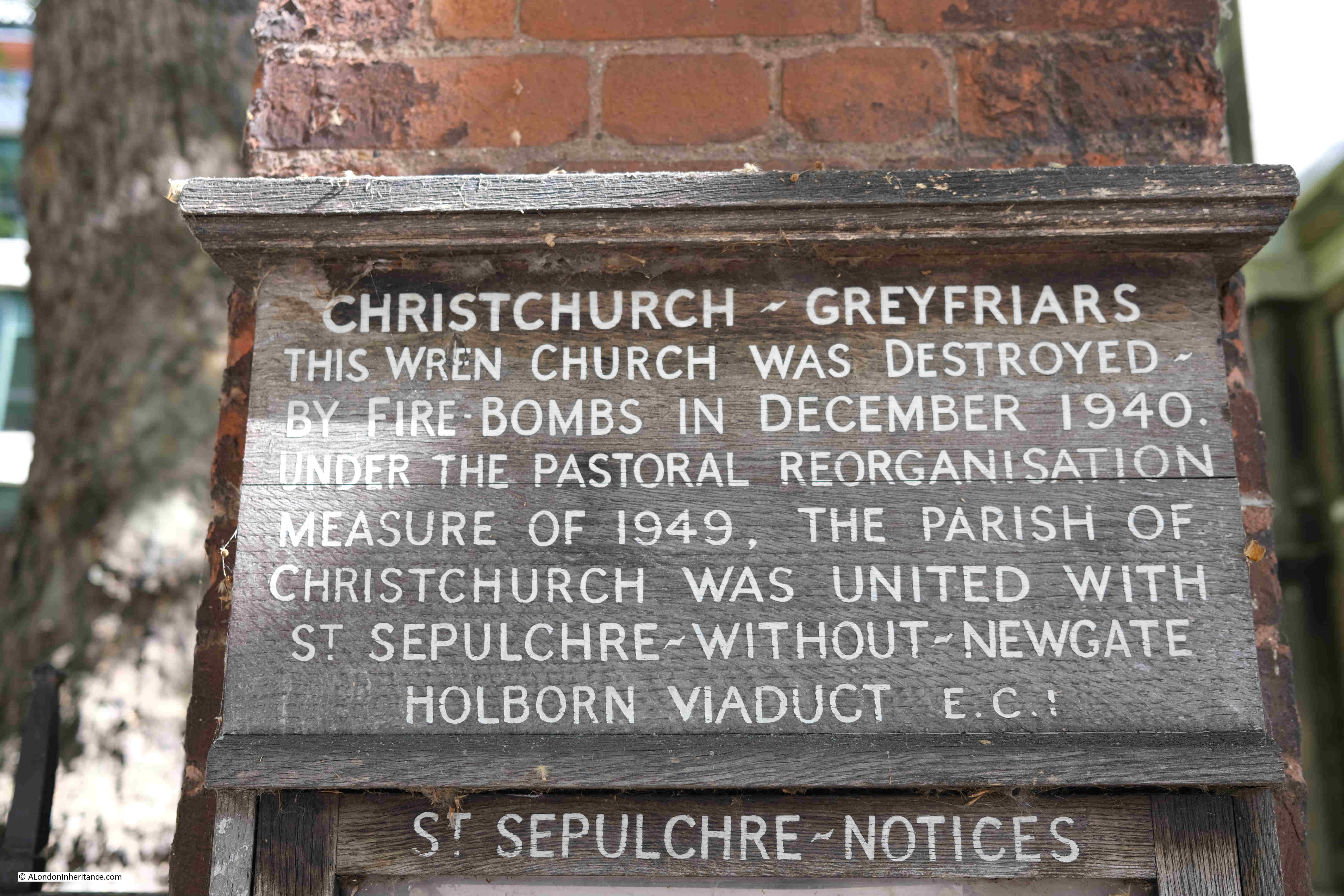
A sign close to the tower of the church confirms when and how Christchurch Greyfriars was destroyed (perhaps there should be a second plaque explaining how and why some of the walls disappeared).
The plaque also informs why there was no requirement to rebuild the church, as the old parish of the church was united with that of St Sepulchre-without-Newgate. The number of people living in the City had reached a point where there was an insufficient number of parishioners and regular church attendees to justify many of the old City churches.
A wooden font cover was rescued from the burning church on the 29th December 1940, and it can now be seen in the church of St Sepulchre.
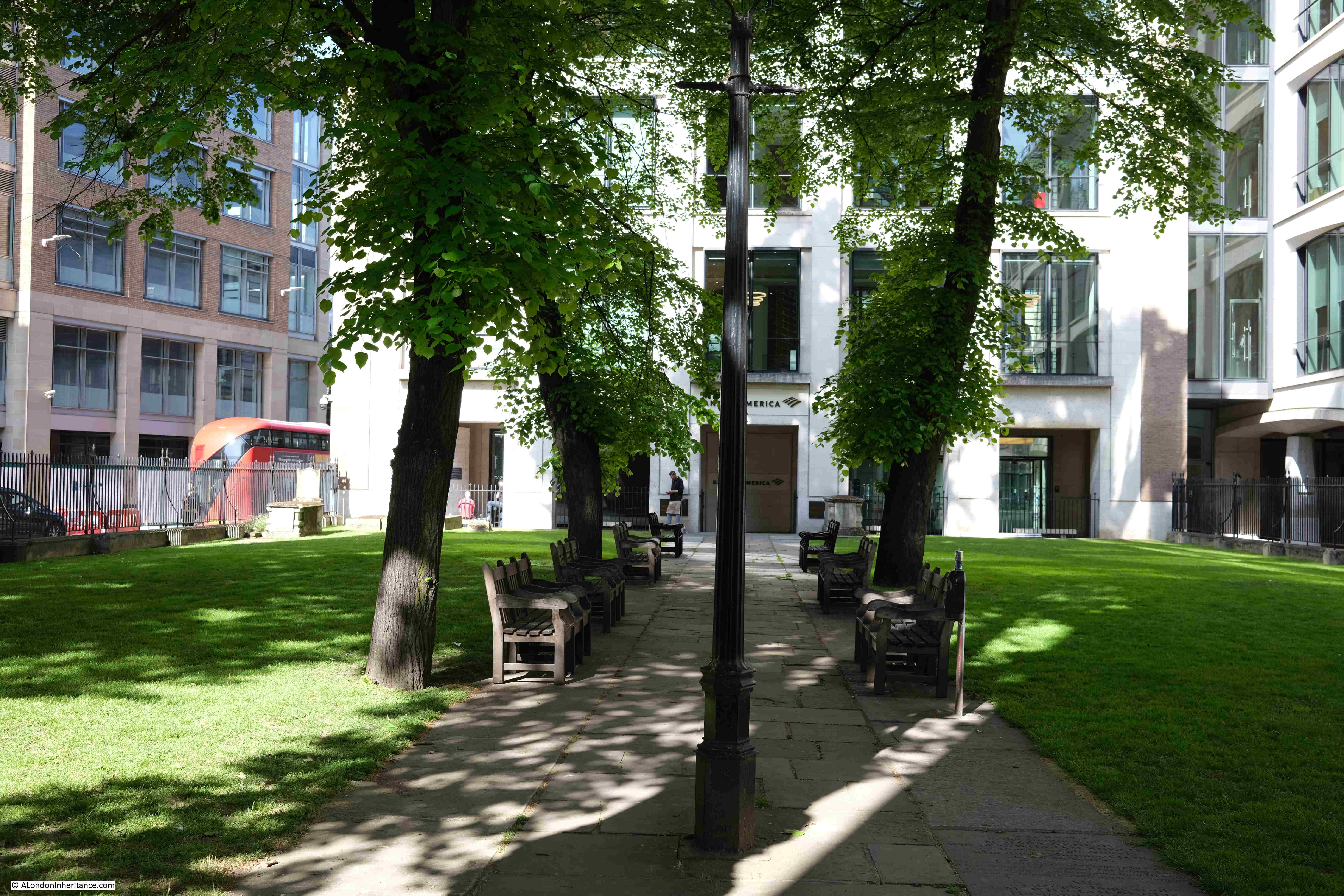
To the west of the church is a small open space – the Christchurch Greyfriars churchyard:
This is not the traditional churchyard. William Morgan’s 1682 map of London provides a clue:
The church can be seen to the right of centre (although it is facing the wrong way), and to the left of the picture of the church, there is a rectangle labelled “Old Church”.
The original church was the church of a monastery established around 1228 on land to the north of the church by the Franciscan’s, or Greyfriars.
The first church on the site was built in the 13th century, demolished in 1306, and a new church built in 1325. This church was much larger than the church we see today, and as well as the space occupied by the current church ruins, also occupied the green space to the west of the church, hence the comment “Old Church” in the map extract.
The church attached to the monastery was of some size. According to “London Churches Before The Great Fire” (Wilberforce Jenkinson, 1917), the church was described as being “300 feet in length, in breadth 89 feet, and in height 64 feet”.
The book also states that “no other parish church contained the remains of so many of the great, there being there buried four queens, four duchesses, four countesses, one duke, two earls, eight barons, thirty-five knights, etc”.
The queens I can identify are:
Queen Margaret, the second wife of King Edward I
Queen Isabella, the wife of Edward II
Queen Eleanor of Provence (just her heart so not sure if this really counts)
Cannot find who the fourth queen was, some sources reference Queen Joan of Scotland, however most sources state that she was buried in Perth.
Whether it was two and a bit queens, three or four, the church appears to have been a large and important church, as was the Franciscan monastery, with only St Paul’s Cathedral being greater in size.
The monastery was taken by the Crown during the Dissolution when Henry VIII took the properties of religious establishments across the country in the mid 16th century, and after a short period when the building was used for storage, the church became a local, although rather impressive, parish church.
“London Churches Before The Great Fire” records that Sir Martin Bowes, mayor of the City, sold all the ornate alabaster and marble monuments from the church for £50 in 1545.
Ornate memorials did continue after the church became a parish church, and the same book also records a memorial to Venetia, the wife of Sir Kenelm Digby who was buried in the church:
“Her husband tried to preserve her beauty by cosmetics and after her death had her bust of copper-gilt set up in the church. The bust was injured in the fire and was afterwards seen in a broker’s stall. She was painted by Vandyke.”
Bit of a lesson there on fame and beauty, that no matter how good looking, or famous, eventually we may all end up on the equivalent of a broker’s stall.
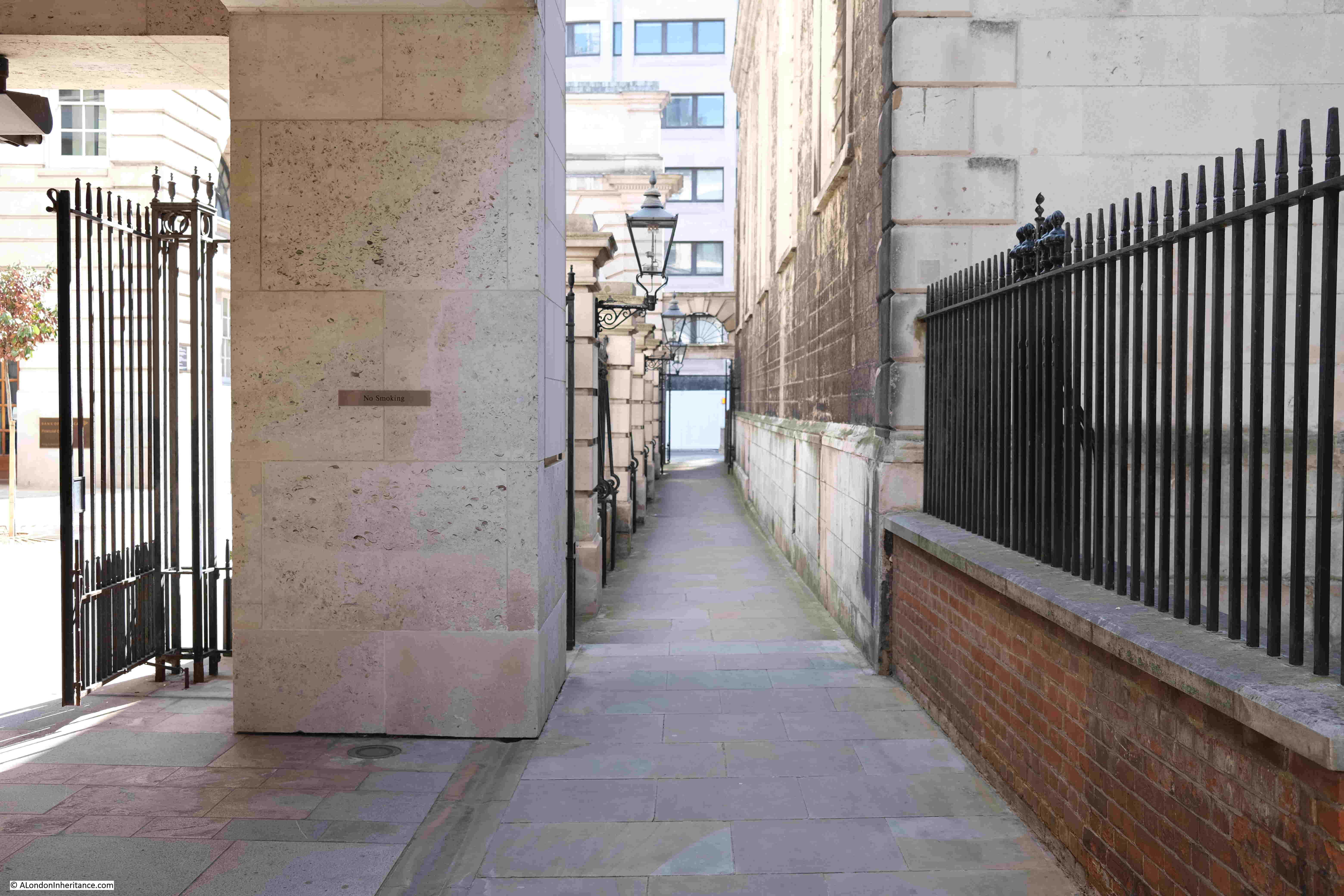
View down the alley between the remaining side wall to the north, and what were the old Post Office buildings:
The church was one of those lost during the Great Fire of London in 1666.
It was rebuilt by Wren between 1687 and 1704 on the foundations of the chancel of the original church. There was no need for a parish church to be the same size as the pre-fire church, and it was also expensive to rebuild with even the smaller church being one of Wren’s most expensive at a cost of over eleven thousand pounds.
It is remarkable just how many churches there were in the City of London. Today it seems as if you only need to walk a short distance to find another church but there were many more in previous centuries.
When Christchurch Greyfriars was rebuilt after the Great Fire, the church absorbed two smaller parishes, the parish of the wonderfully named St Nicholas in the Shambles, and that of St Ewin or Ewine. The churches for these two smaller, adjacent parishes were not rebuilt.
The base of the tower has a number of monuments which were rescued from the war damaged church:
After the church and the monastic buildings of the Franciscans were taken by the Crown, the buildings continued to have a close relationship.
There was always a need to provide help for London’s poor. There were many children throughout the city who did not have a father, or were part of a family that was struggling to feed them. In 1552 King Edward VI responded to this need by working with the mayor of the City to form a charitable organisation to provide for some of these children.
The result being that the old buildings of the Franciscans were taken over, donations were received, a Board of Governors set-up and in November 1552, Christ’s Hospital opened with an initial 380 pupils.
There is a sculpture on the southern side of the church of some of the children of Christ’s Hospital in their traditional school uniform:
Christchurch Greyfriars became the church for Christ’s Hospital.
The buildings of Christ’s Hospital were damaged during the Great Fire, rebuilt after, with a frontage designed by Wren.
The text below the print provides some background on the school in the early 18th century:
“This Hospital, formerly a House of Grey Friars was first founded by that pious Prince Edward the 6th and has since received many donations from other persons by which Charities poor Children to the number of about 820 boys and 80 girls are not only provided with Lodging, Diet, Clothing and Learning, but when discharged of the House are bound out Apprentices and some of the Boys who have made large advances in Learning are sent to University. The House is divided into handsome Wards, where the Children lodge and a particular Ward where the sick are removed. For their instruction, here are a Grammar School, a Mathematick School a Writing School, a School where Girls learn to Read, Sew and Mark, and of late years, Boys have been taught to Draw. This Hospital is under the care and patronage of the City and by prudent care taken therefor it has produced many famous for Wealth, Learning and Servicableness to the public.”
Christ’s Hospital school left the site in 1902 and moved to Horsham in West Sussex where the school continues to this day.
View from next to the tower into the old body of the church:
View looking south towards St Paul’s where only one window and surrounding part of the southern wall remains:
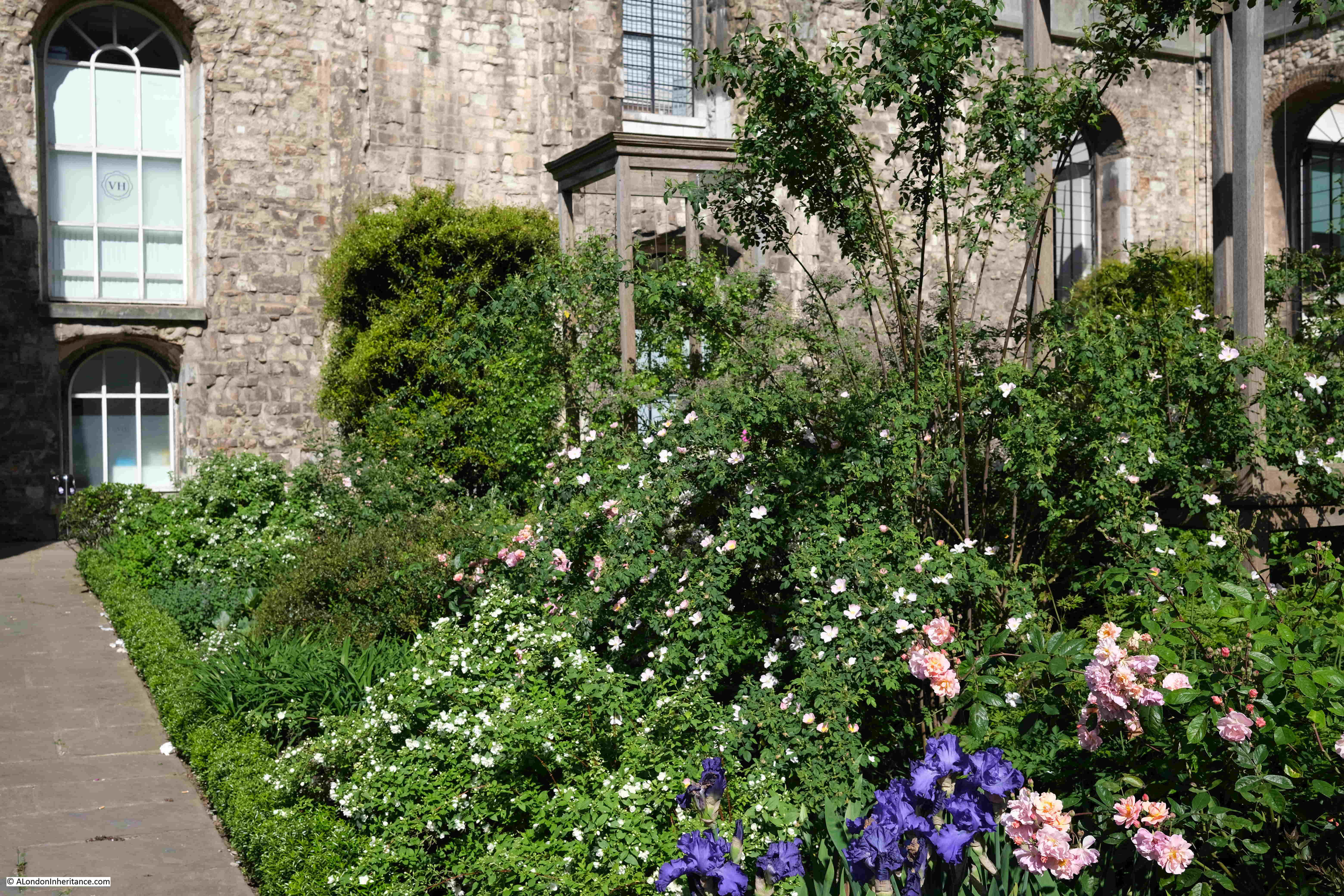
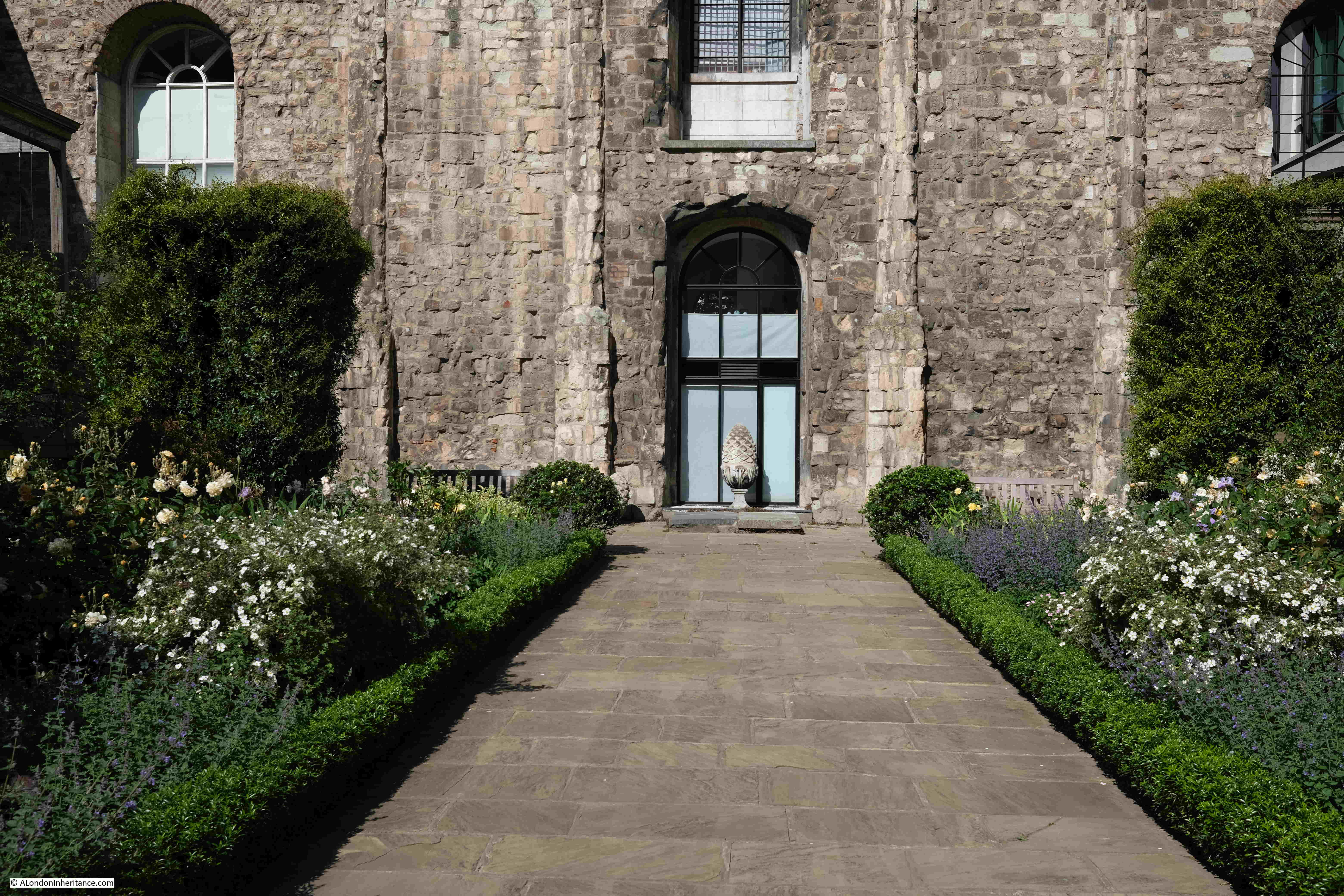
What was the interior of the church was laid out as a rose garden in 1989, with a major update to the gardens in 2011. The configuration of this garden is intended to reflect the Wren church with the position of pews marked by the box edges and wooden towers where the old stone columns were located:
The northern wall of the church from what was the interior of the church:
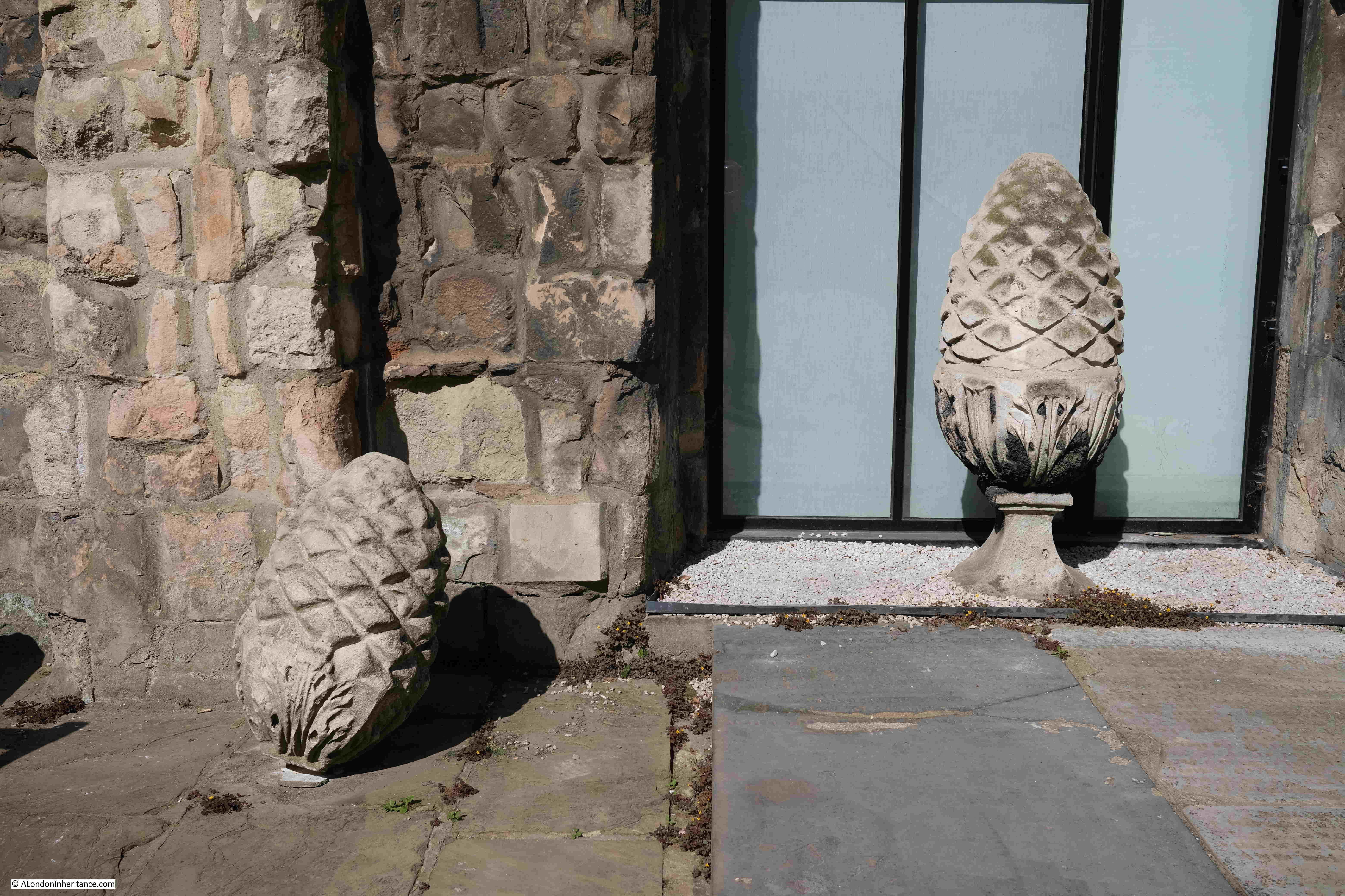
If you return to my father’s photo of the church, you can see at the top corners of the church walls, there were stone pineapples. The ones rescued from the demolished walls can be found on the ground in the garden, next to the tower:
View along the centre of the church, pews would have been on either side with the small box hedges marking the edge of the pews:
A view of the tower of the church and part of the garden earlier in the year:
Christchurch Greyfriars is a survivor. Originally dating from the 13th century, it has survived being part of a Franciscan monastery, a charitable hospital / school, the Great Fire, the London Blitz and post war road construction and extension.
During many of these events, the church has shrunk in size, leaving the view we see today.
There was a campaign a number of years ago to rebuild the missing walls of the church, and for the church to become a memorial “to honour all Londoners who have been the victims of bombings in wartime and peacetime during the modern era”, however nothing seems to have come of this.
On a sunny spring or summer’s day, the gardens are a wonderful place to sit and contemplate the history of the church, surrounded by plants, flowers and bees.
All my walking tours have sold out, with the exception of a few tickets on the Bankside to Pickle Herring Street tour. Details and booking here.
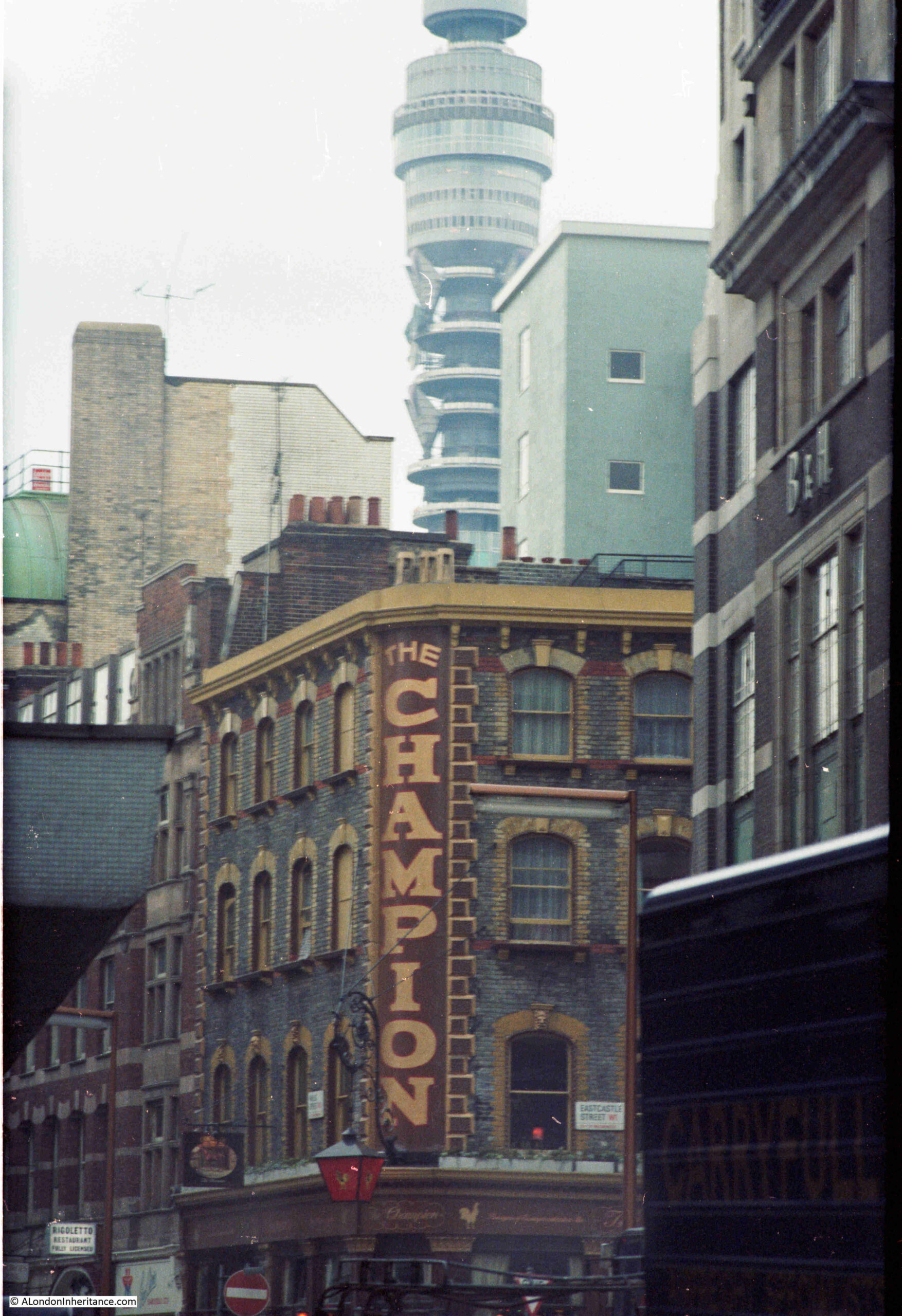
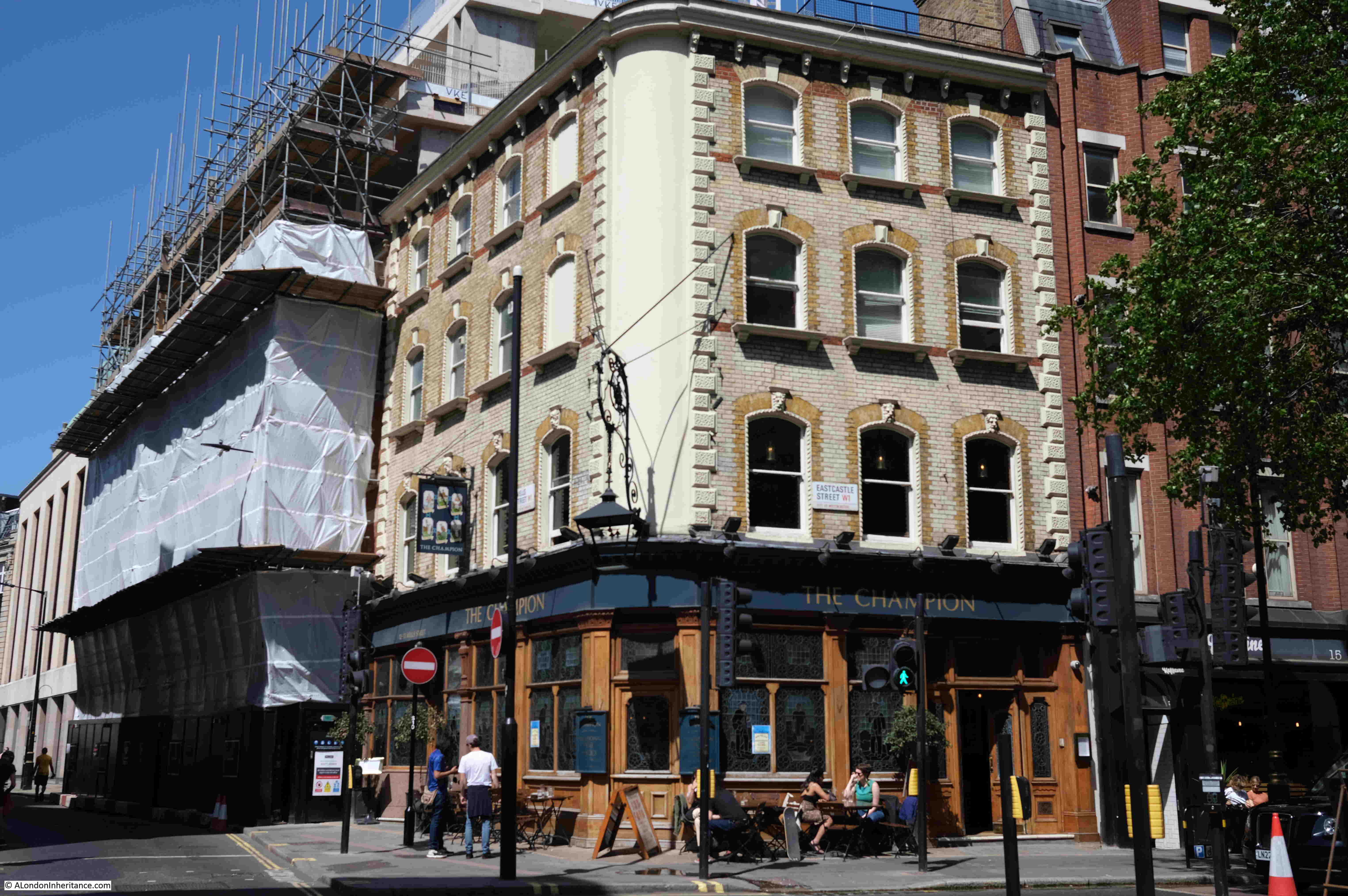
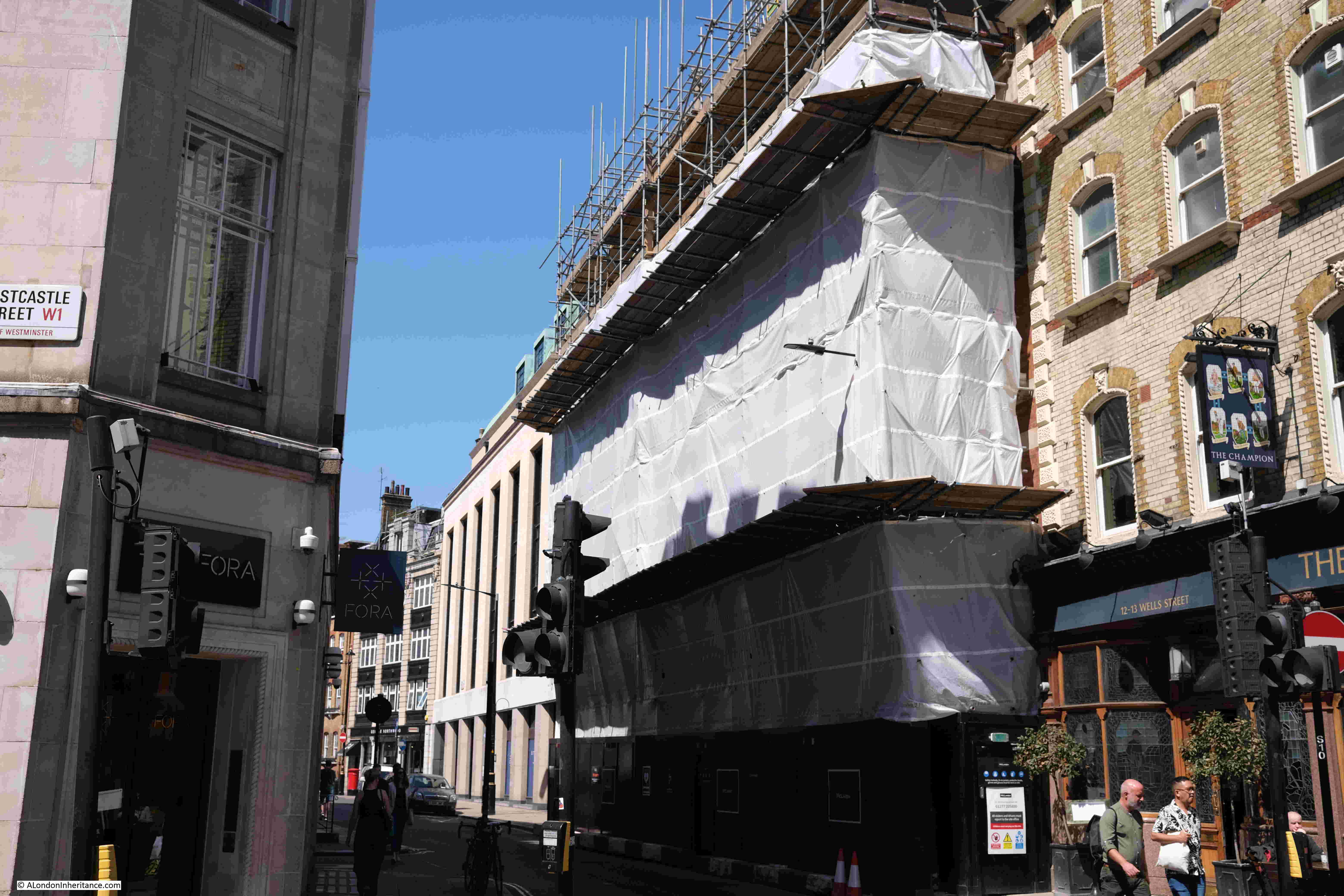
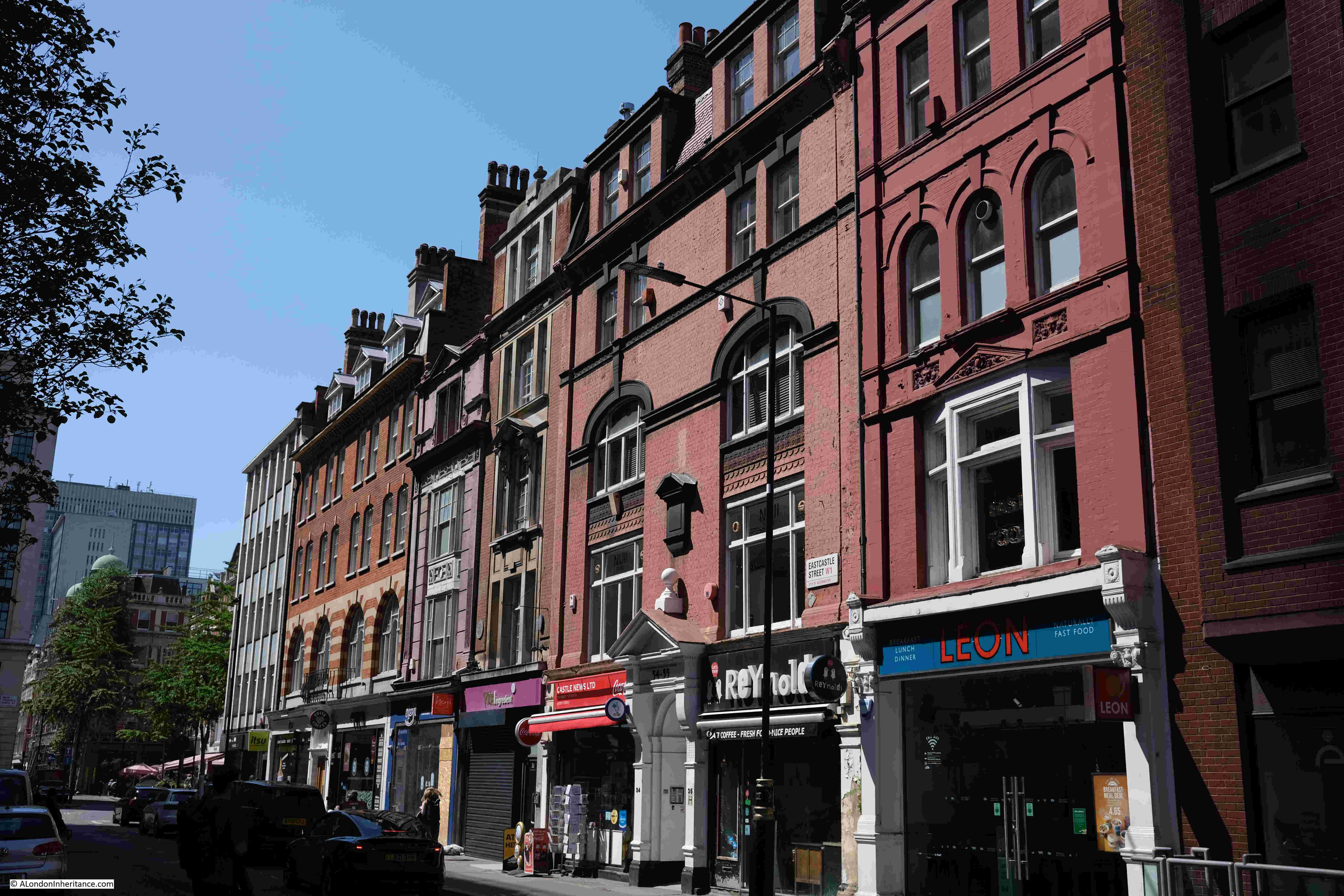
In 1980 I was wandering around London trying out a new zoom lens for my Canon AE-1 camera, taking some not very good photos. One of these was of the Champion Pub at the junction of Eastcastle Street and Wells Street, with the Post Office Tower in the background:
The photo was taken from the southern end of Wells Street towards Oxford Street, and a sign for Eastcastle Street can be seen on the right of the Champion pub. I think I was trying to contrast the old pub and the new telecoms tower.
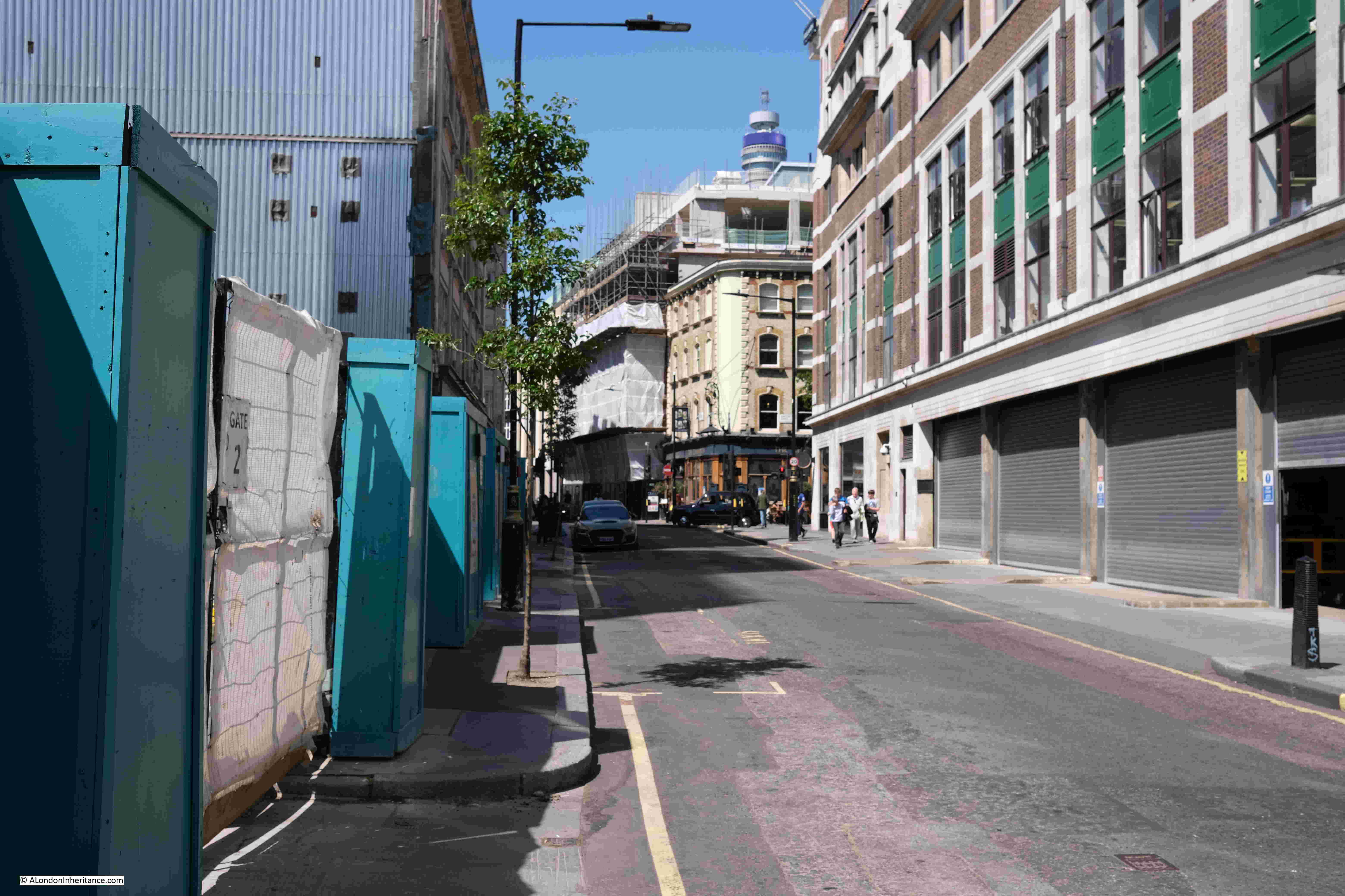
A wider view of the same scene today, with the BT Tower as it is now known, starting to disappear behind the new floors being added to the building behind the Champion:
A closer view of the pub in 2022, 42 years after my original photo:
Given how many pubs have closed over the last few decades, it is really good that the Champion has survived, although it is a shame that the curved corner of the building has been painted, and it has lost the name which ran the full length of the corner of the pub.
The large ornamental cast iron lamp still decorates the corner of the building.
The curved corner to the upper floors was a key feature of many 19th century London pubs. They were meant to advertise the pub, the name could be seen from a distance on crowded streets, and the name would often give an identity to the junction of streets.
For an example of a pub which had a very colourful corner in the 1980s, and today displays the current name of the pub on the curved corner, see my post on the Perseverance or Sun Pub, Lamb’s Conduit Street.
“Corner public house. c.1860-70. Gault brick with stucco dressings, slate roof. Lively classical detailing. 4 storeys. 3 windows wide to each front and inset stuccoed quadrant corner. Ground floor has bar front with corner and side entrances and fronted bar windows framed by crude pilasters carrying entablature- fascia with richly decorated modillion cornice. Upper floors have segmental arched sash windows, those on 1st floor with keystones and marks. Heavy moulded crowning cornice and blocking stuccoed. Large ornamental cast iron lamp bracket to corner. Interior bar fittings original in part with screens etc, some renewal.“
The “some renewal” statement refers to a few changes to the pub since it was built.
The first post-war renewal came in the 1950s. As with so many Victorian pubs across London, the Champion was in need of some refurbishment. Over 80 years of serving Wells Street, and open during the years of the second world war, resulted in the owners, the brewers Barclay Perkins, engaging architect and designer John and Sylvia Reid.
The Reid’s were better known as interior, furniture and lighting designers rather than architecture, and their changes to the Champion were mainly of design.
The large Champion name down the curved corner of the pub was a result of their work. The lettering was in 30 inch Roman, and the letters were shaded to give the impression that they had been engraved rather than painted. The new name replaced a number of old wooden signs that were mounted on the corner. The corner of the pub was floodlit at night, which must have looked rather magnificent, and ensured the pub stood out if you looked down Wells Street when walking along Oxford Street.
The interior had been rather plain and was painted in what were described as drab colours.
The Reid’s divided what had been two bars to form three, added button leather seating around the edge of the bars, restored the bar and some of the original iron tables, and they added new glass windows consisting of clear glass for the upper half and frosted, acid cut glass for the lower half.
Features inside the pub included the use of mahogany panels, etched and decorated glass windows between bars, and textured paper on the ceiling. refurbishment also included the first floor dining room.
Their refresh of the Champion pub did get some criticism as there were views that it was returning to Victorian design themes. The early 1950s were a time when design and architecture were looking at more modern forms, typified in the themes and designs used for the 1951 Festival of Britain.
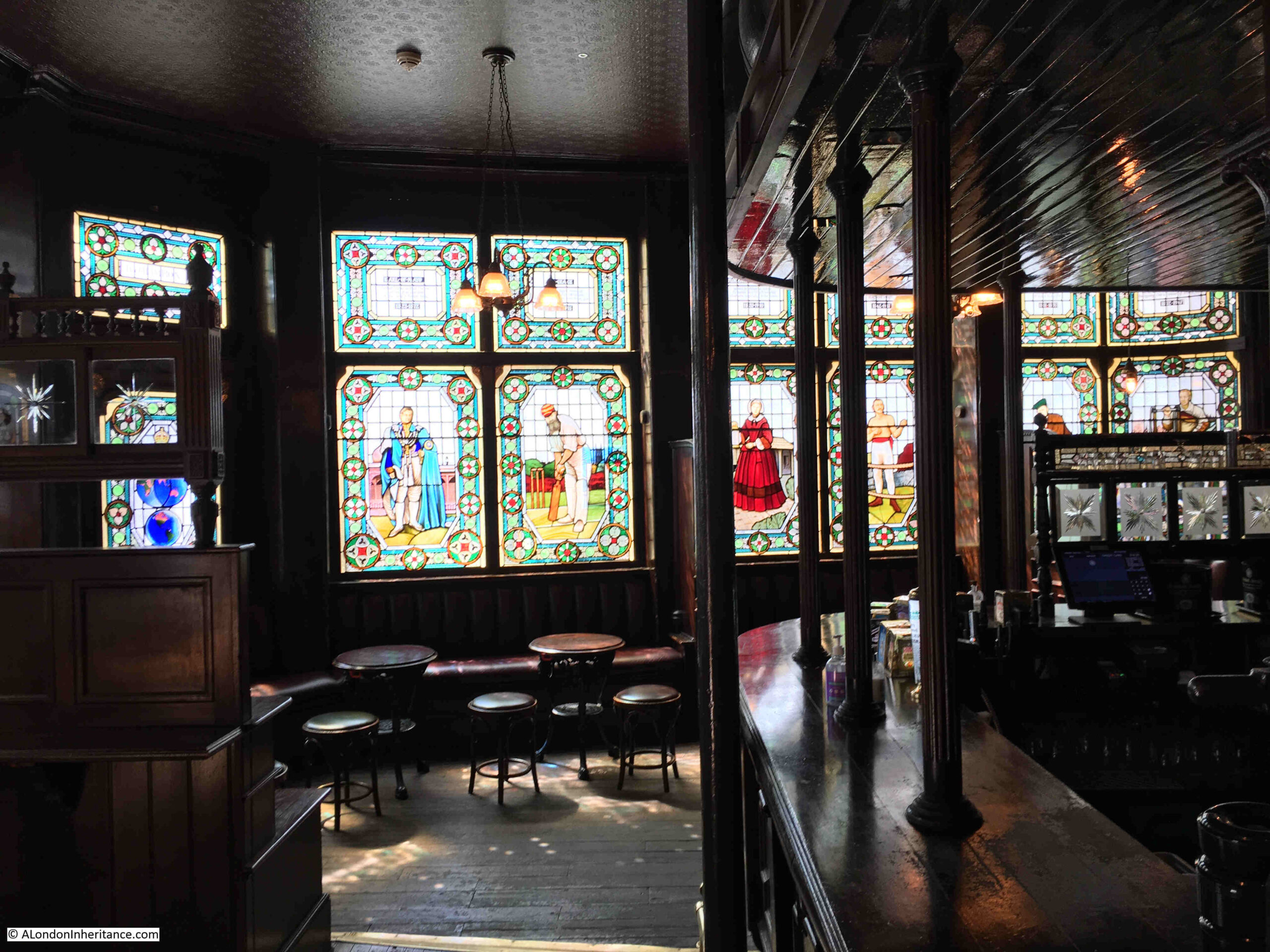
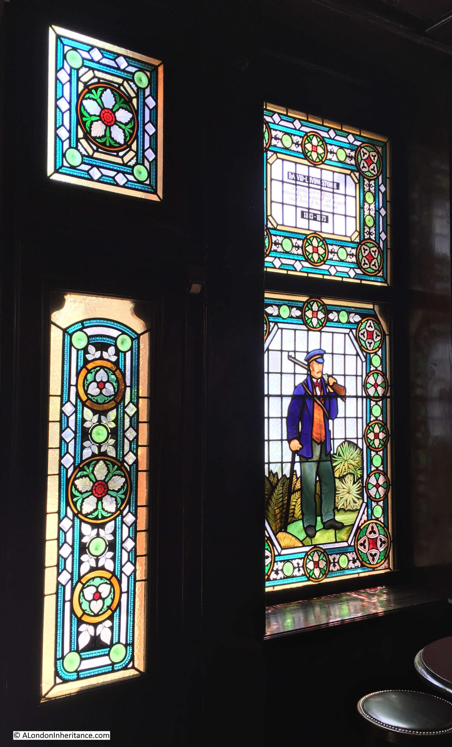
The early 1950s update to the pub included plain and frosted glass on the external windows, not the remarkable, stained glass windows that we see today. These are the work of Ann Sotheran, and were installed in 1989.
They feature a series of 19th century “champions”, with figures such as Florence Nightingale and the cricketer W.G. Grace.
On a sunny day, these windows are very impressive when seen from inside the bar:
The missionary and explorer David Livingstone:
Newspaper reports mentioning the Champion cover all the usual job adverts, reports of crime and theft etc., however I found one interesting article that hinted at what the inside of the pub may have been like in the 1870s.
In September 1874, the Patent Gas Economiser Company held their first annual general meeting, where they reported that they had installed 50 lights in the Champion. Seems a rather large number, but spread across three floors, entering the pub in the 1870s would have been entering a reasonably brightly lit pub, with the hiss of gas lamps and the associated smell of burning gas.
The same report also mentions that the company had installed 1000 lights at the Royal Polytechnic Institution in Regent Street, 600 lights in the German Gymnastic Society in St Pancras Road, and 50 lights in the Hotel Cavour in Leicester Square.
To the left of the Champion pub, along Wells Street, building work is transforming the building that was here, and is adding additional floors to the top, which partly obscures the view of the BT Tower from further south along the street:
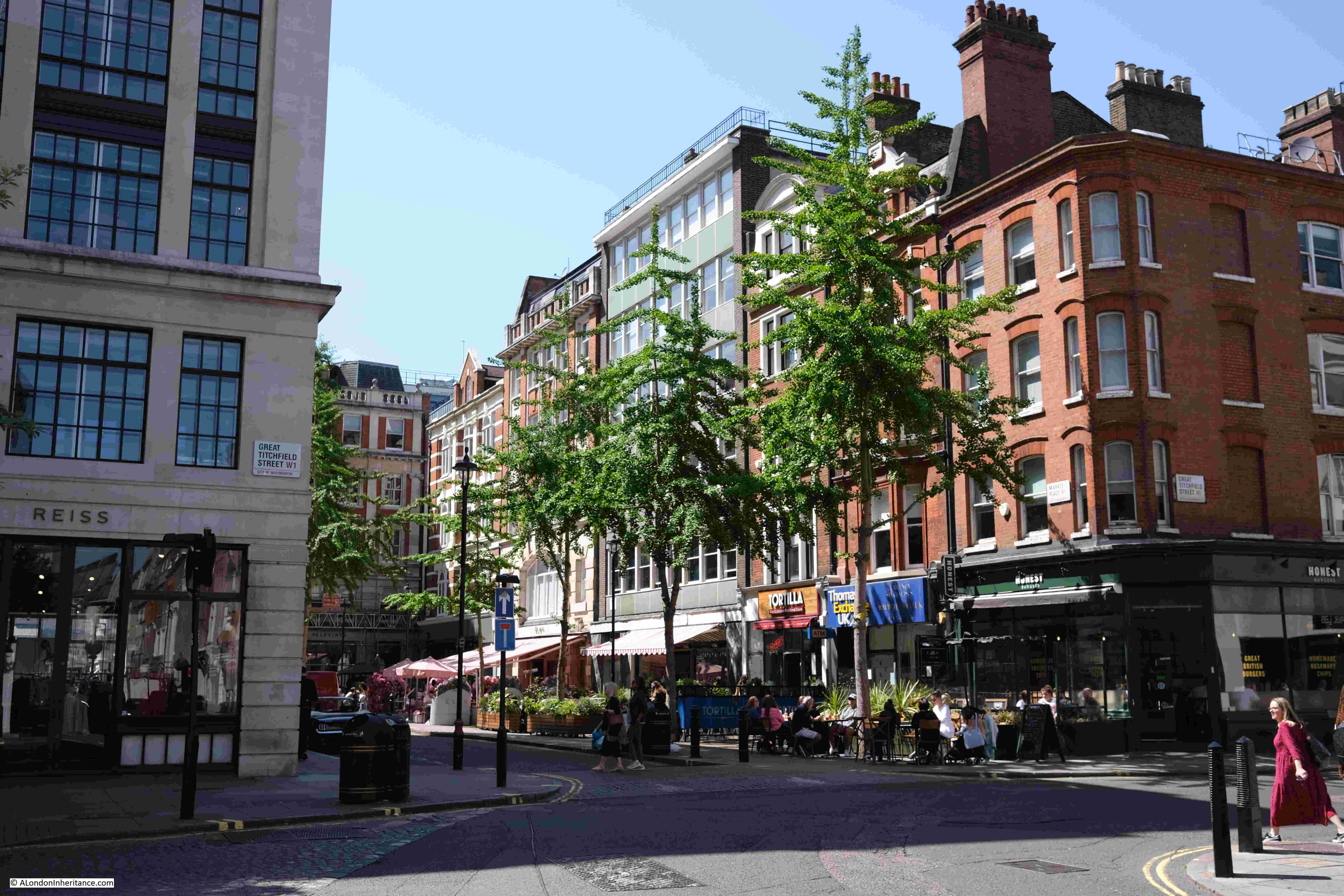
There was one further site that I wanted to find, and this required a walk west, along Eastcastle Street.
Eastcastle Street was originally called Castle Street, a name taken from a pub that was in the street. The name change to Eastcastle Street happened in 1918. I cannot find the reason for the name change, but suspect it was one of the many name changes across London in the late 19th / early 20th centuries, to reduce the number of streets with the same name.
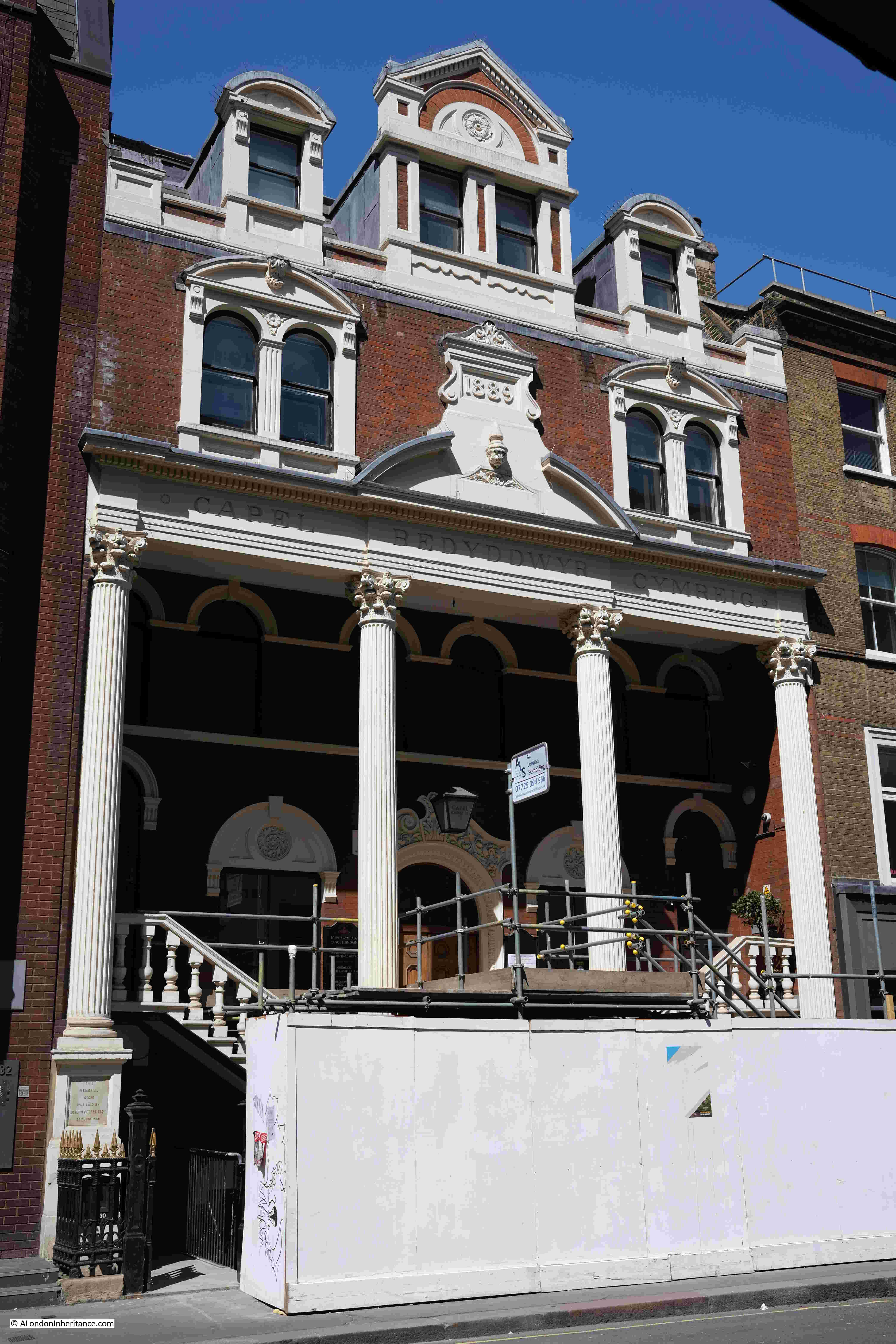
At 30 Eastcastle Street is this rather ornate building:
Dating from 1889, this is the Grade II listed Welsh Baptist Chapel, the main church for Welsh Baptists in London.
Eastcastle Street is a mix of architectural styles. Narrow buildings that retain the original building plots, buildings with decoration that does not seem to make any sense, and rows of the type of businesses that frequent the streets north of Oxford Street.
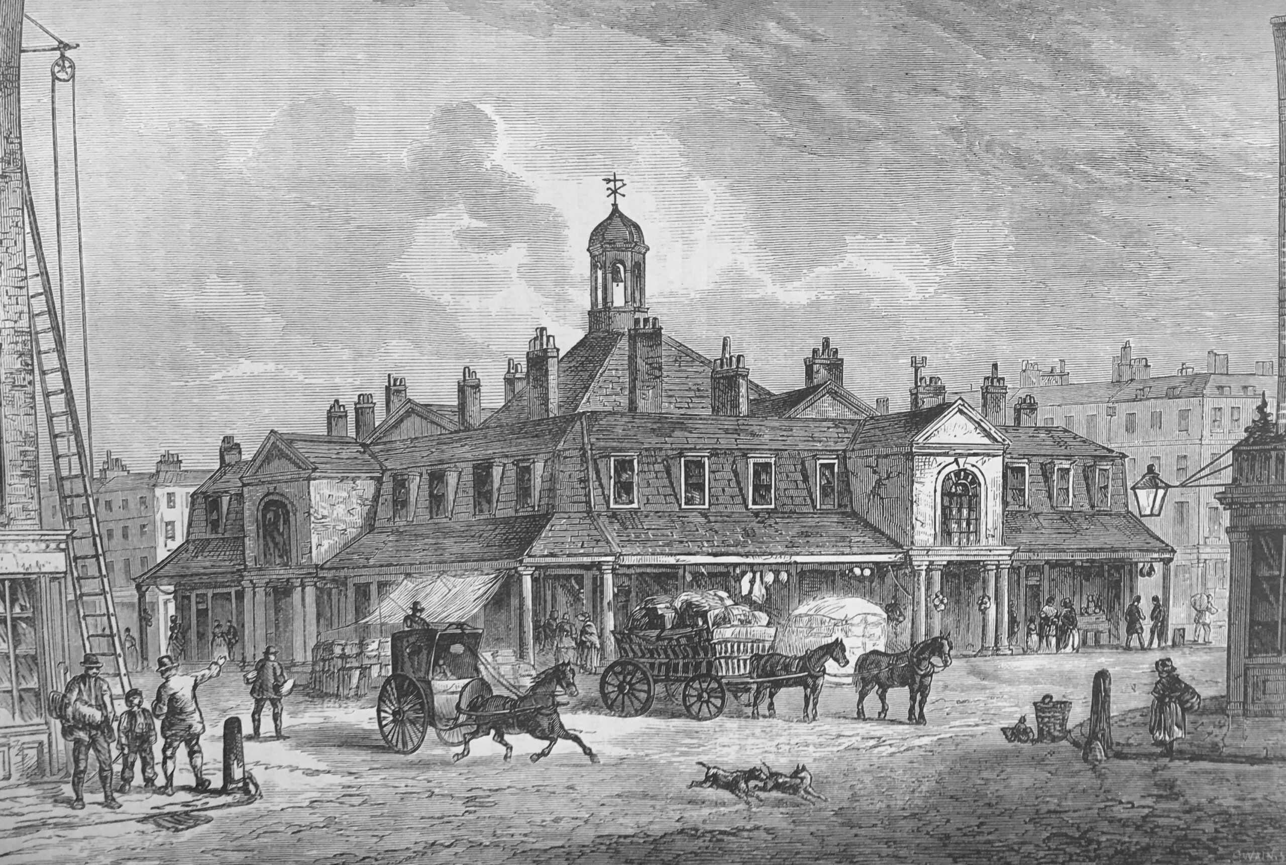
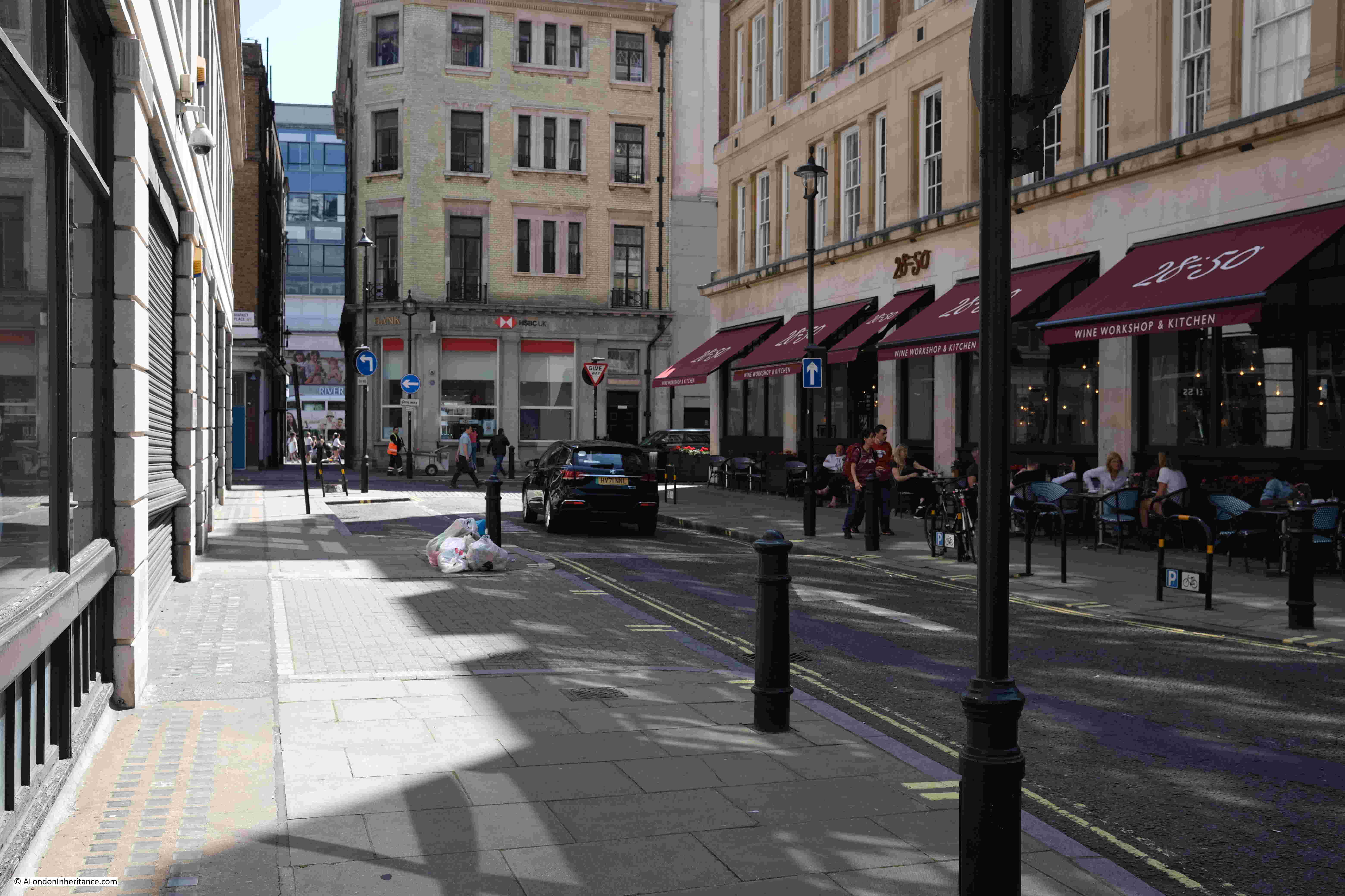
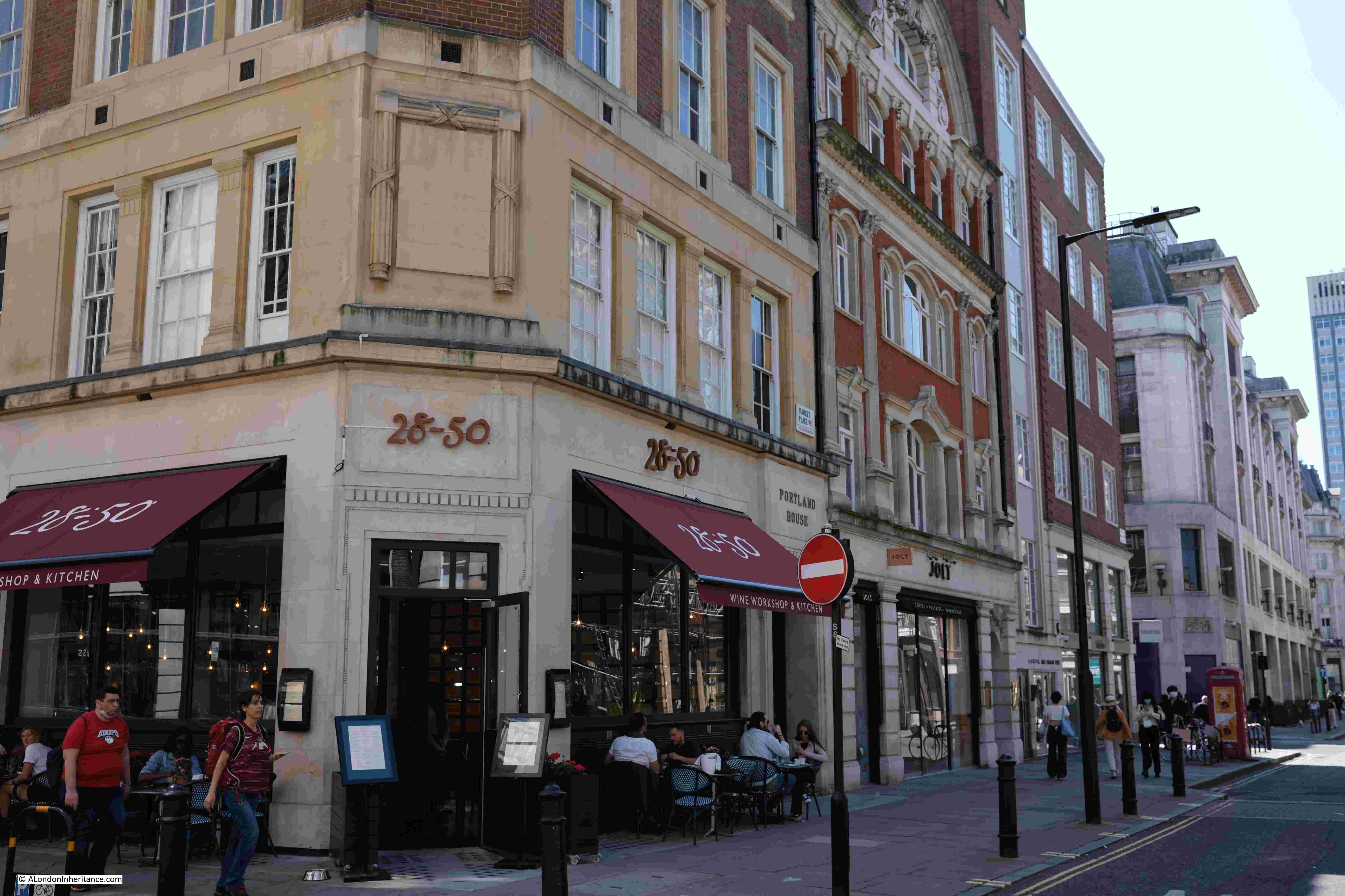
At the end of Eastcastle Street is the junction with Great Titchfield Street and Market Place:
In the above photo, Great Titchfield Street runs left to right, and the larger open space opposite is part of Market Place.
The name comes from Oxford Market, a market that originally occupied much of the space around the above photo, with the market building on the site of the building to the left, and the open space in the photo being part of the open space around the market building.
Rocque’s map of 1746 shows Oxford Market, just north of Oxford Street:
Oxford Market had been completed by 1724, however the opening was delayed as Lord Craven, who owned land to the south of Oxford Street feared what the competition would do to his Carnaby Market, however Oxford Market was finally granted a Royal Grant to open on Mondays, Wednesdays and Saturdays.
The market was built to encourage activity in the area, as the fields to the north of Oxford Street were gradually being transformed into streets and housing.
The market took its name, either from Oxford Street to the south, or more likely, Edward, Lord Harley, the Earl of Oxford who was the owner of the land on which the market was built as well as much of the surrounding land.
Harley had come into possession of the land through his wife, Lady Henrietta Cavendish Holles, who was the only child of John Holles, the Duke of Newcastle, the original owner of the farmland around Oxford Street.
The original market buildings were of wood, and the market was rebuilt in a more substantial form in 1815. The following view of the second version of Oxford Market comes from Edward Walford’s Old and New London:
We can get a view of what was for sale at Oxford Market from newspaper reports:
February 8th, 1826 – john Wollaston & Co were selling their Gin in quantities of no less than 2 gallons at a price of 15 shillings per gallon
January 20th, 1824 – A “Great Room” of 45 feet square in the interior of the market was being advertised as being suitable for upholsterers, warehousemen and flower gardeners. The room was fitted with an ornamental stone basin and fountain and was suited for a flower garden
April 25th, 1841 – The Oxford Market Loan Office was advertising loans of Ten Guineas, Ten and Fifteen Pounds, which could be had from their office at the market
May 18th, 1833 – Rippon’s Old Established Furnishing Ironmongery Warehouse was advertising Fire Irons, Coal Scuttles, Knives and Forks, Metal Teapots and Tea Urns for sale from their warehouse at the market
December 15th 1827 – The lease of a Pork Butcher and Cheesemonger store at the market was being advertised. The store had been taking in £3,800 per year
June 27th, 1801 – Several lumps of butter, deficient in weight, were seized by the Clerks of the Oxford Market and distributed to the poor
So traders in the Oxford Market were selling a wide range of products, butter, pork, teapots and coal scuttles, flowers and gin, and you could also take out a loan at the market.
Nothing to do with Oxford Market, however on the same page as the 1801 report of butter being seized, there was another report which tells some of the terrible stories of life in London:
“Wednesday were executed in the Old Bailey, pursuant to their sentences, J. McIntoth and J. Wooldridge, for forgery, and W. Cross, R. Nutts, J, Riley and J. Roberts, for highway robbery. The unfortunate convicts were all men of decent appearance, and their conduct on the scaffold was such as became their awful situation.
Some of the above prisoners attempted on Monday to make their escape from Newgate through the common sewer – they explored as far as Milk-street, Cheapside, when the intolerable stench and filth overpowered their senses; with great difficulty they found their way to the iron-grating and intreated by their cries to be liberated. assistance was immediately procured, when they were released without much difficulty.”
These two paragraphs say so much: that you could be hung for forgery, the statement that their conduct on the scaffold was “such as became their awful situation”, and their desperation in seeking an escape via the sewer. Milk Street is roughly 568 metres from the site of the Old Bailey so they had travelled a considerable distance in an early 19th century sewer.
Back to Oxford Market, and the following view is looking down Market Place towards Oxford Street which can be seen through the alley at the end of the street:
In the above photo, the market building was on the left, and open space in front of the market occupied the space where the building is on the right, the corner of which is shown in the following photo. The block was all part of the open space in front of Oxford Market.
Oxford Market was never really a financial success. For a London market it was relatively small which may have limited the number of suppliers and the range of goods available.
By the late 1830s, part of the market had been converted into offices from where out-pensioners of Chelsea Hospital were paid.
The market buildings was sold in 1876, demolished in 1881, and a block of flats built on the site.
Although Oxford Market is long gone, the street surrounding three sides of the old market building is still called Market Place, and the footprint of the building, and the surrounding open space can still be seen in the surrounding streets, and the wider open space and restaurants along the northern stretch of Market Place.
The 1980s were a boom time for large, colourful murals across London, and for today’s post I am revisiting two of these, to find the sad fate of two Greenwich murals.
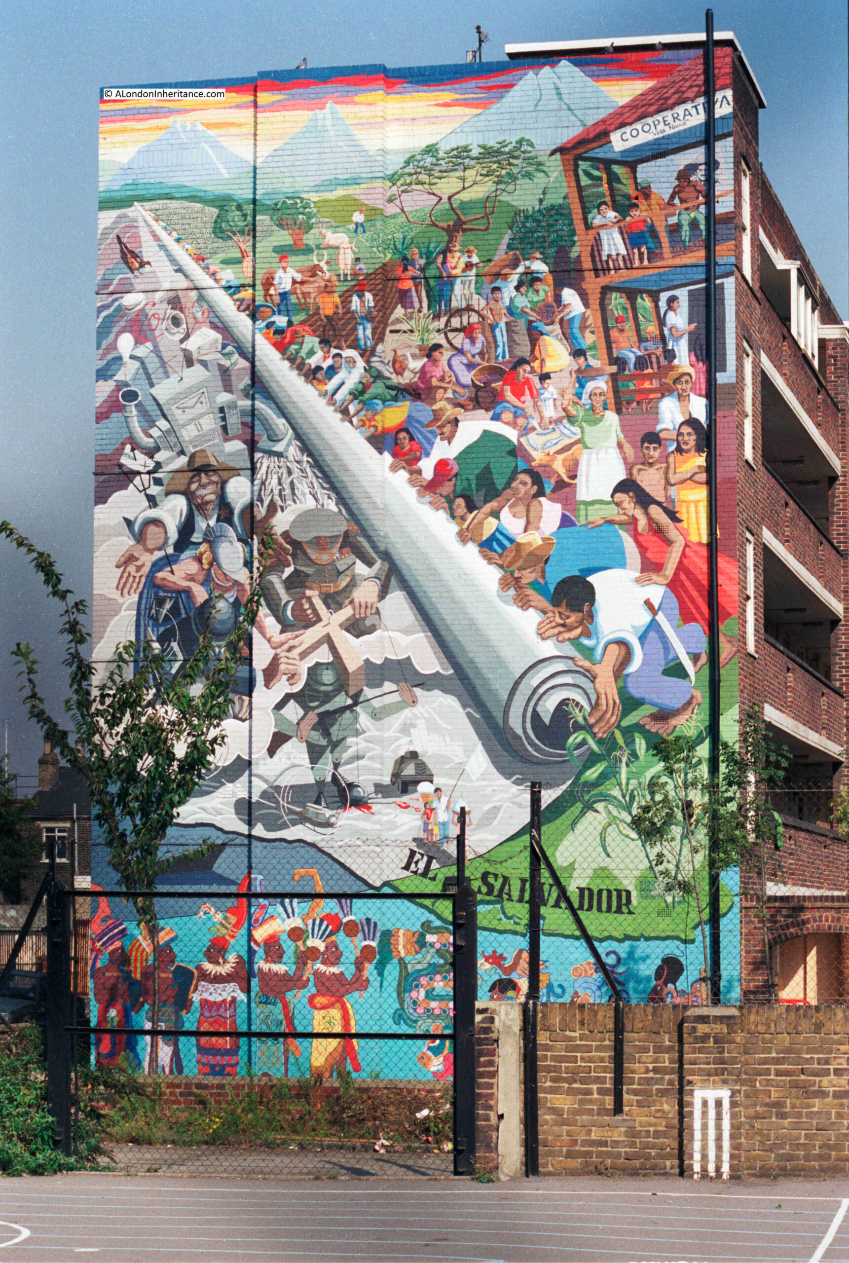
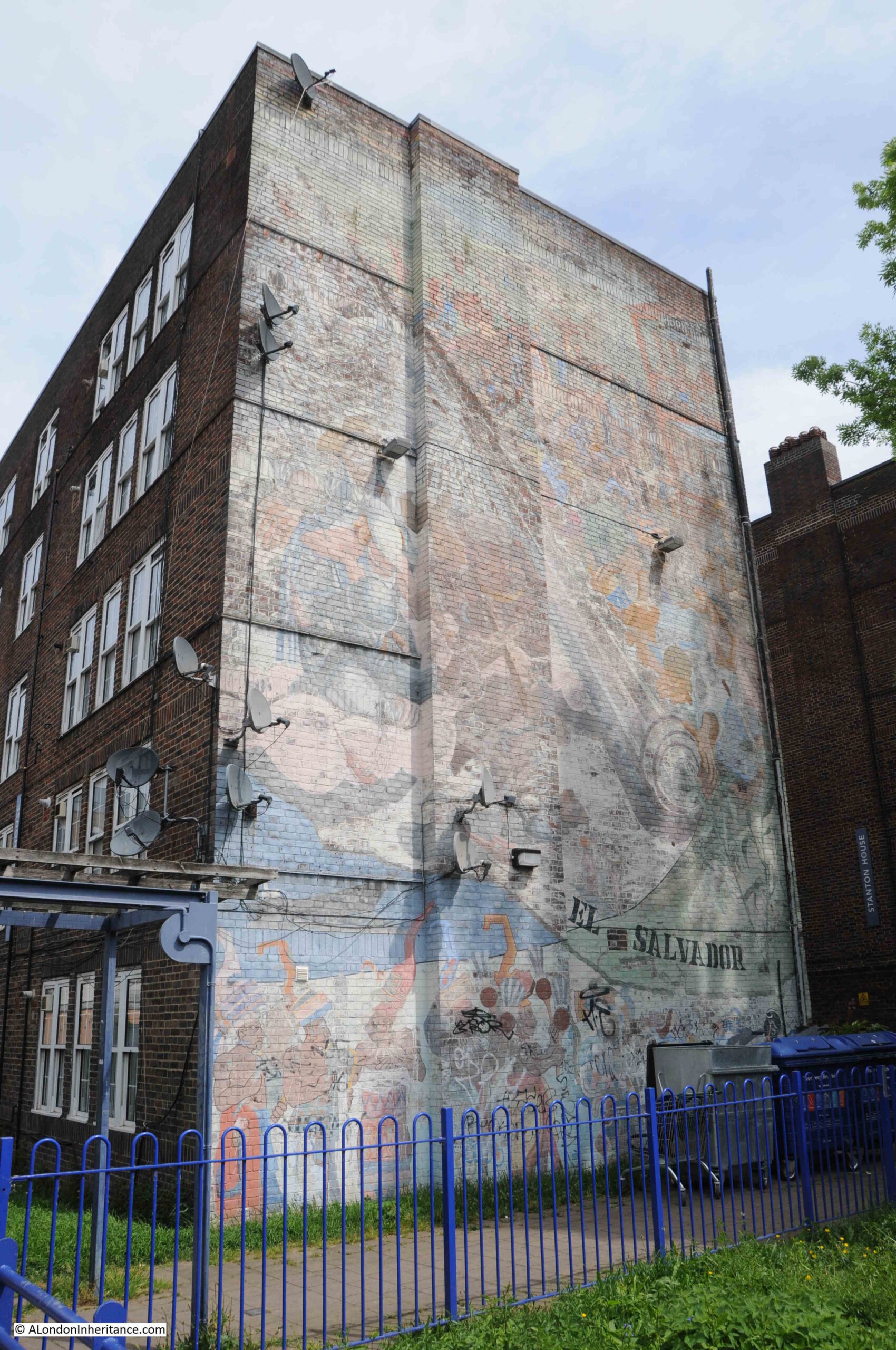
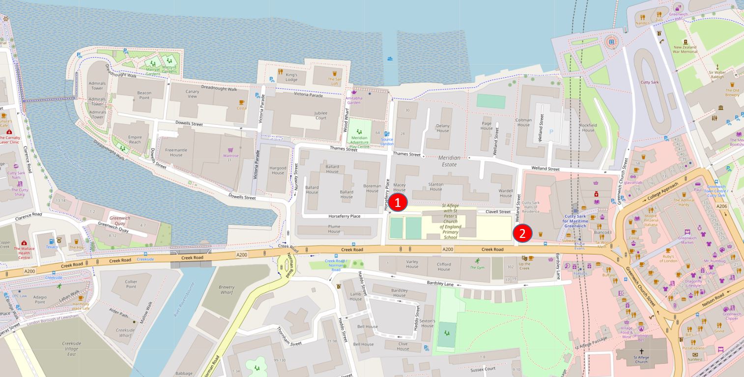
Walk east along Creek Road which leaves central Greenwich near the Cutty Sark DLR station, turn right down Horseferry Place, and in 1986 you would have seen the El Salvador mural in all its pristine colours, as photographed by my father:
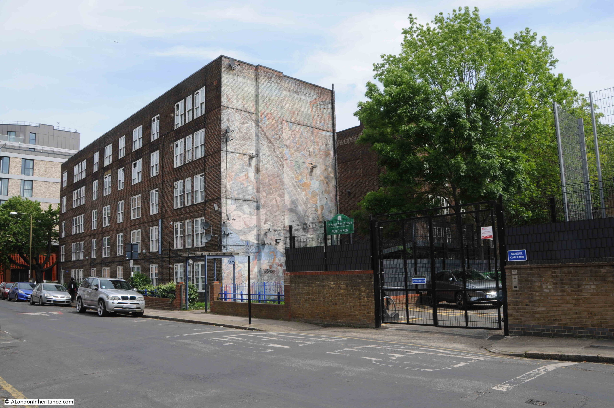
I recently visited the site, and found the mural in a very sad condition. Very faded and with Sky satellite dishes and a number of lights installed across the mural:
The El Salvador mural, or as it was originally titled “Changing the Picture”, was created for the El Salvador Solidarity Campaign in 1985, the year before my father’s photo.
The El Salvador Solidarity Campaign was based in Islington Park Street and was formed to express support for the people of El Salvador.
El Salvador is a country in central America and during the 1980s was suffering from a violent Civil War that would not really end until 1993, and resulted in the deaths of tens of thousands of the country’s population.
The civil war was mainly a conflict between the left wing Farabundo Martí National Liberation Front (FMLN), supported by the neighbouring countries of Nicaragua and Cuba, and the Government of the country, supported by the United States.
The people of the country paid a terrible price during the civil war. There were atrocities committed by both sides, however the military of El Salvador along with “Death Squads” who operated outside the official knowledge of the military or government, would commit the majority.
As well as the internal issues within the country, it was also a proxy conflict between the US and the Soviet Union, with US concern about the potential growth of Communist supporting governments in central America, which could have been the outcome if the US supported government had fallen to the FMLN.
There were a number of international groups supporting the people of El Salvador and the FMLN, including in the US and the El Salvador Solidarity Campaign in London.
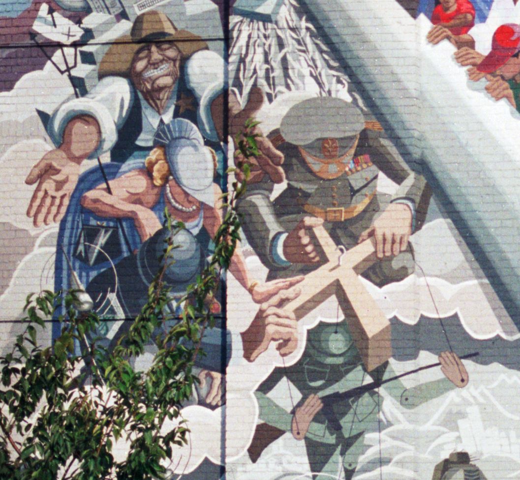
The aim of the mural is to show the ordinary people of El Salvador (on the right) taking back control of their country, lives and future by “rolling up the picture”.
The people on the right are depicted in bright colours, with more muted, grey colours for the military, and the military / industrial support that contributed large quantities of arms to the country.
I believe the following extract from the mural shows Ronald Regan and Margaret Thatcher to the left with a figure representing El Salvador’s military on the right, controlling a puppet soldier:
Whilst the mural was commissioned by the El Salvador Solidarity Campaign, it was funded by the Greater London Council (GLC), and support of initiatives such as the mural was one of the many reasons why the Conservative government of the 1980s would abolish the GLC at the end of March 1986.
The mural was created by the artist Jane Gifford, along with Nick Cuttermole, Sergio Navarro and Rosie Skaife D’Ingerthorpe.
I could not get a photo of the mural at the same angle as my father’s. He was standing in the adjacent school playground, and today this is completely fenced.
The following view shows a wider view of the El Salvador mural, on the side of Macey House which is part of the Meridian Estate:
Macey House is on Horseferry Place, a road that leads down towards the Thames. The name of the road records a ferry that once ran from near the southern end of the road across to the Isle of Dogs.
A short distance from the El Salvador mural, heading back towards Greenwich, along Creek Road was the “Wind of Peace” mural, at point number 2 on the above map:
Although the El Salvador mural is very badly faded, the Wind of Peace has suffered an even worse fate – the mural, along with the building on which it was painted, have completely disappeared.
In the photo below, there is a large new building on the left, with a terrace of smaller buildings further back, heading along Creek Road back into the centre of Greenwich.
The mural was on a building which stood where the large building with the clock is now located. The mural was on the side wall and would have been facing the camera.
The development on the left leading back into Greenwich was following the completion of the Cutty Sark DLR station, which is accessed through a pathway to the left of the van, at the junction of the large and smaller buildings.
The Wind of Peace mural was commissioned by the London Muralists for Peace initiative, as part of the 1983, Greater London Council’s Peace Year.
The mural was painted by artists Stephen Lobb and Carol Kenna, and replaced an earlier mural showing the river and the land alongside the river in Greenwich.
The mural has Greenwich in the centre of the mural, with the residents flying around the view of Greenwich, resisting and destroying missiles which symbolised the threat of nuclear war.
The GLC 1983 Peace Year comprised not just murals, but a whole series of events throughout London. A typical newspaper campaign advert covered:
“Peace is the most important issue facing us all. London could not survive a nuclear holocaust, irrespective of whether it is triggered by miscalculation in Washington or Moscow.
The GLC has declared 1983 Peace Year to give Londoners the opportunity of making a personal commitment to this highest of human ideals.
There can be no better way for people to express their desire for peace than through the Arts. That is why a major part of GLC Peace Year activities will involve supporting drama, film and the visual arts.
Come along and enjoy GLC Peace Year events and activities listed below. Support the cause of peace in London and give a peaceful lead to the world.
April 3 Easter Parade featuring specially commissioned Peace Float, Battersea Park at 3pm
May 1 May Day Festival, Victoria Park – at noon
May 5 Songwriters Competition for Peace – launch
June 4 Free Music Concert for Peace, crystal Palace Bowl at noon
July 16 Peace Concert of Classical Music, Kenwood Lakeside at 8pm
August 6 Hiroshima Day Peace Festival, Victoria Park at noon
August 7 Peace Concert of Classical Music, crystal Palace Bowl at 8pm”
There were many more events in addition to those listed above, including a Festival for Peace at Brockwell Park on May the 7th, which included the Damned, Madness and Hazel O’Conner.
As well as the Arts, Peace Year included other projects such as the construction of a number of “peace gardens” across London, such as the Noel-Baker Peace Garden in Islington.
The civil war in El Salvador ended almost thirty years ago, and the mural is gradually fading as are memories of the war (although the country still does suffer from some instability, including the recent bizarre decision to adopt Bitcoin as legal tender within the country).
The Wind of Peace mural disappeared as did the apparent threat of nuclear war, however with current unpredictable world events – perhaps it may be time for another mural.
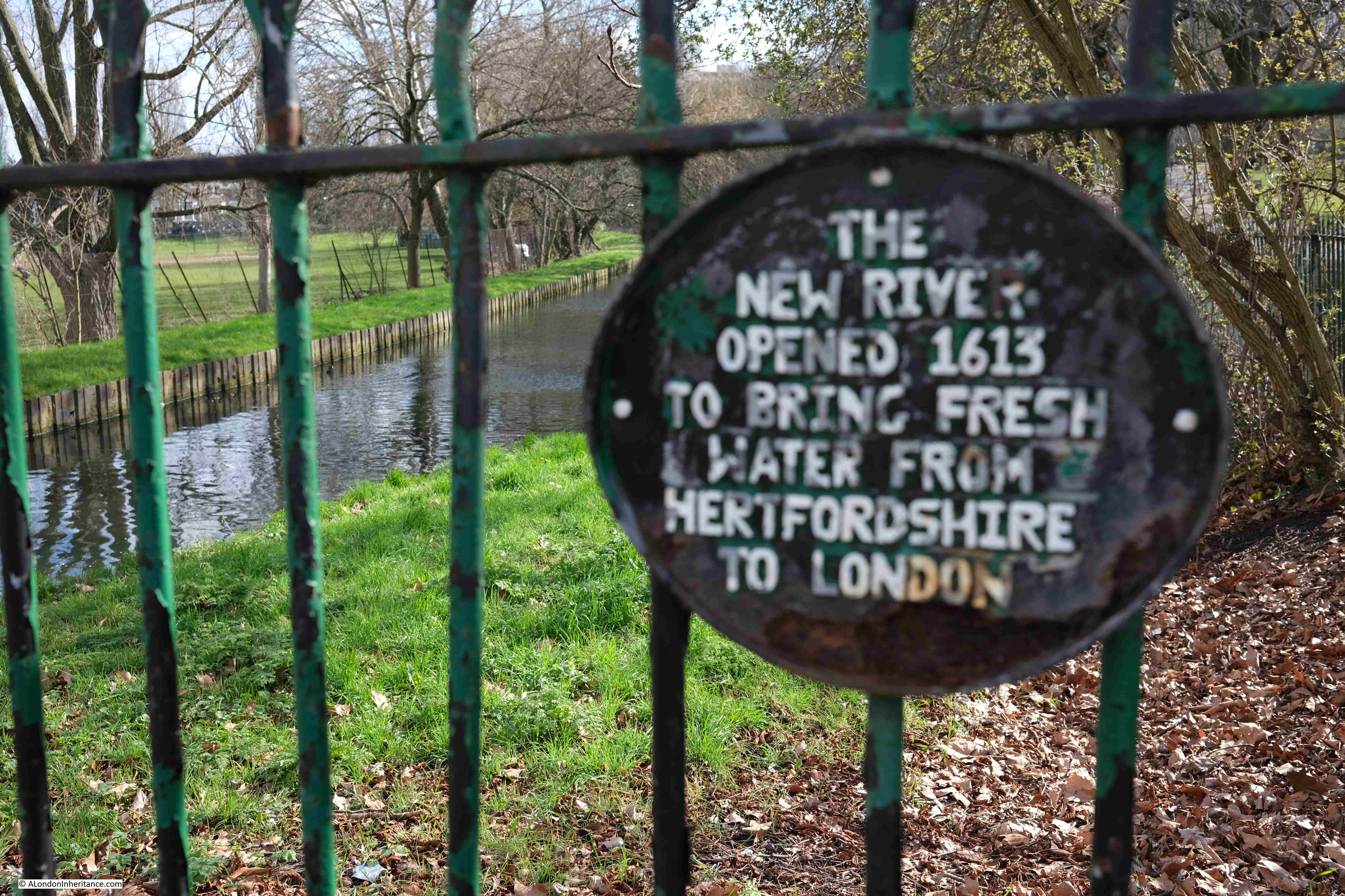
I have finally completed the post covering the last stage of the New River Walk, which covers from Alexandra Palace to New River Head in north Clerkenwell.
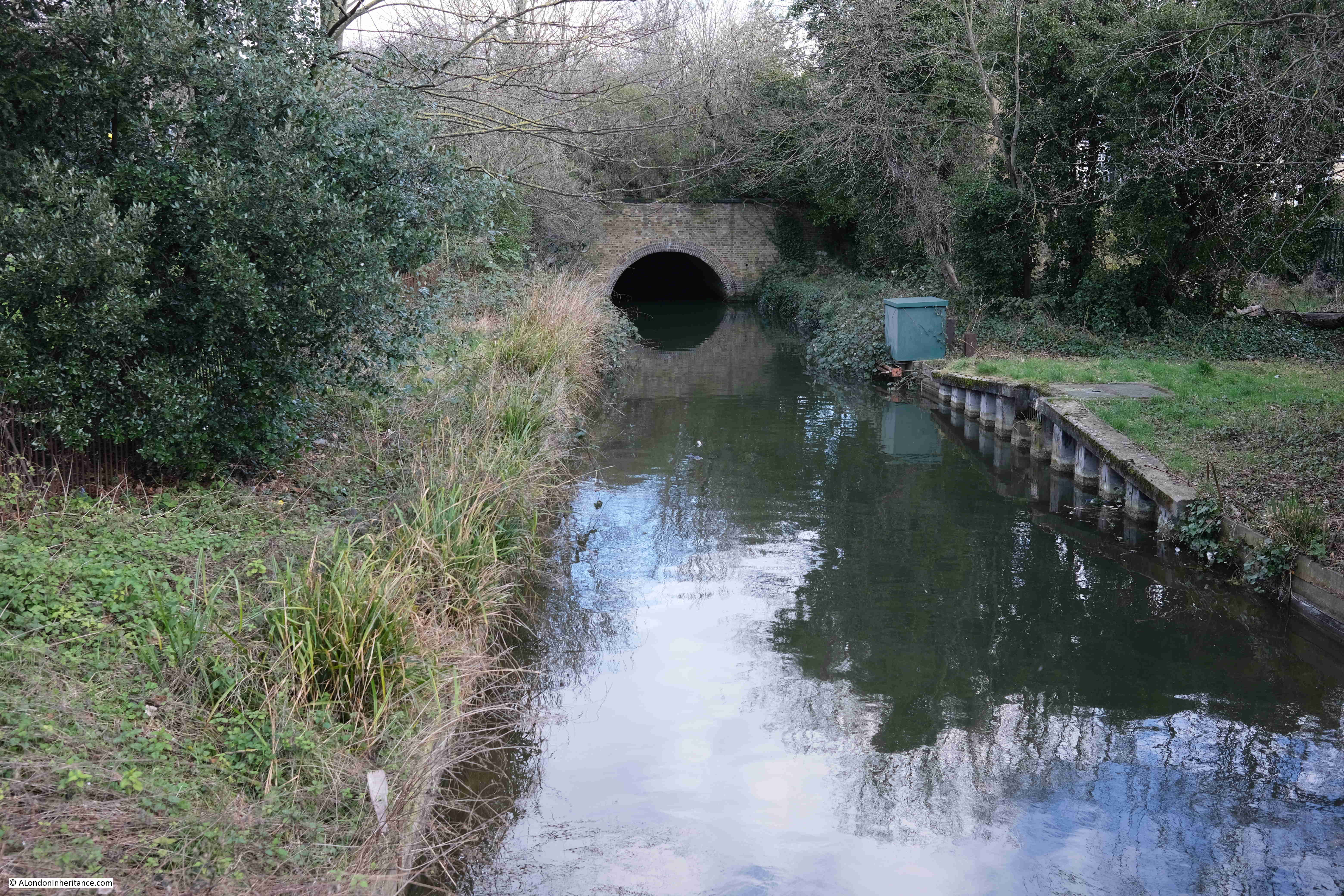
At the end of the previous stage, we had reached Bowes Park, where the New River disappeared in a tunnel, and for today’s post, we rejoin the New River where it exits the tunnel, opposite Alexandra Palace station.
This stage of the walk will follow the New River from Alexandra Palace to the east and west reservoirs, just south of the Seven Sisters Road, where it ends as a river. Then, the walk follows a Heritage Walk that follows the original route of the river to New River Head before the river was truncated at the reservoirs.
Point S on the map: Alexandra Palace station is at the north west tip of a patch of open, green space, and at the south east corner of this space, the New River exits the tunnel through which it has flowed from Bowes Park:
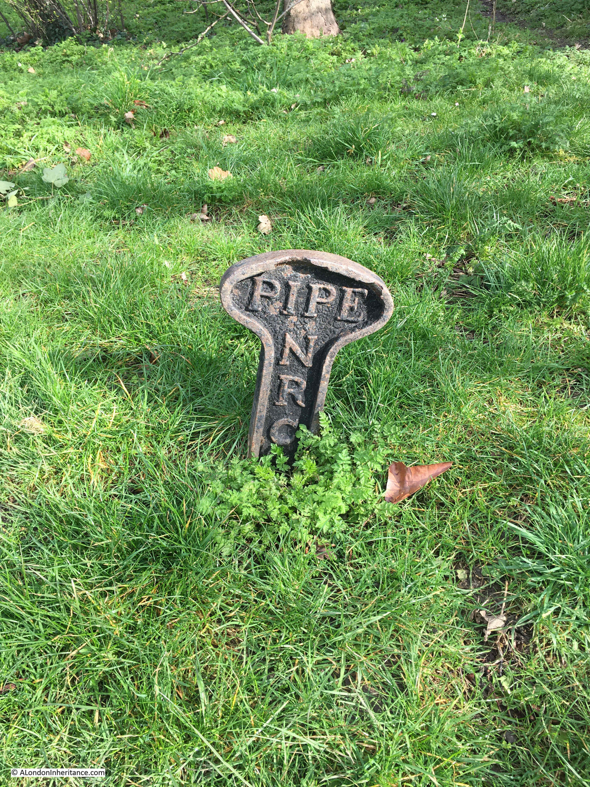
There is nothing to see of the actual river between Bowes Park and Alexandra Palace, however there are a number of these New River Company pipe markers:
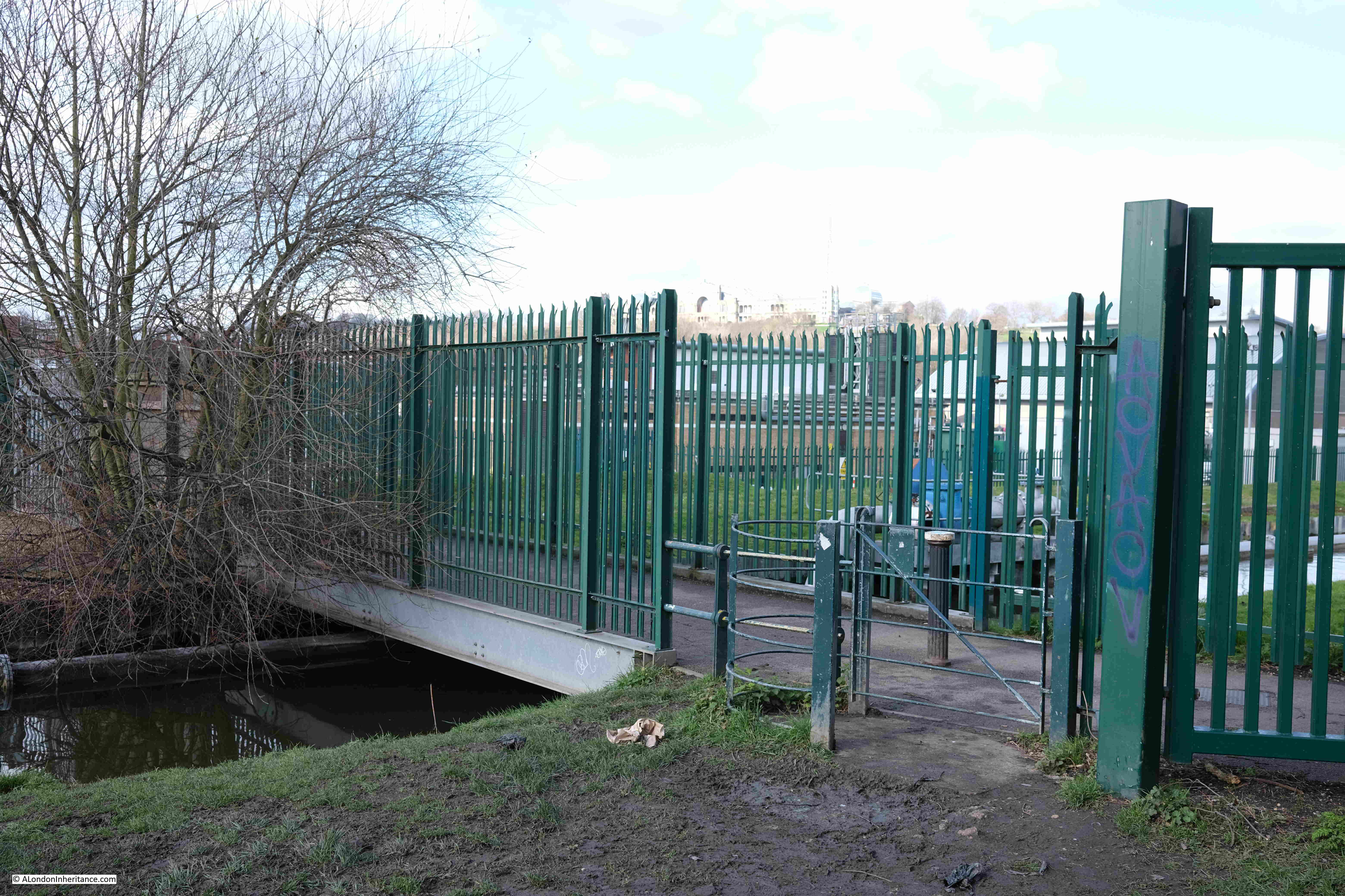
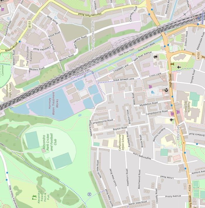
Point 1 on the map: Here, a rather over exposed Alexandra Palace can be seen on the high ground in the distance. Hornsey Water Treatment Works are behind the green metal fencing and the New River runs under the footbridge between the fencing:
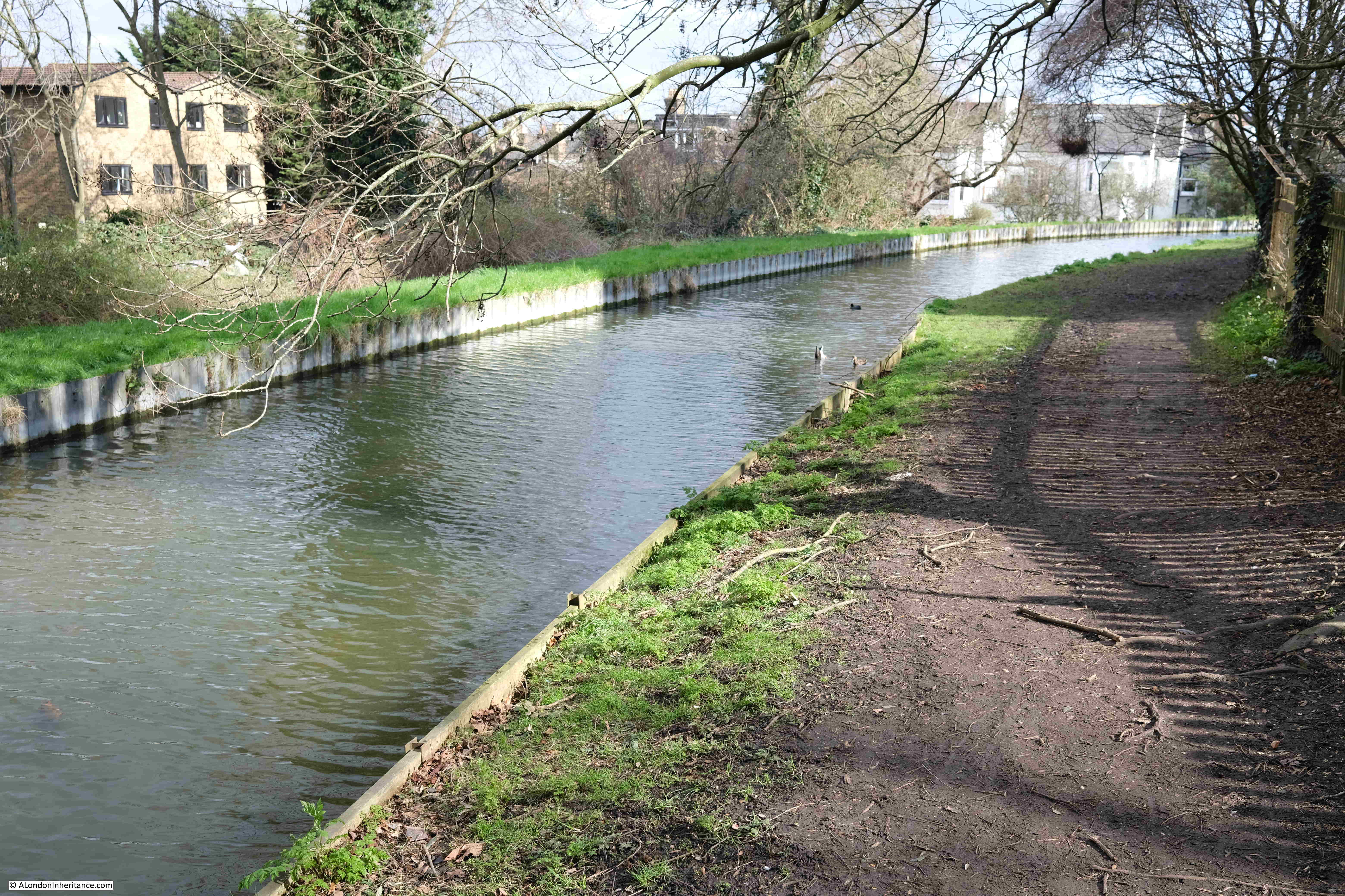
The route through Hornsey is an example of where the New River has been straightened and does not follow the original early 17th century route.
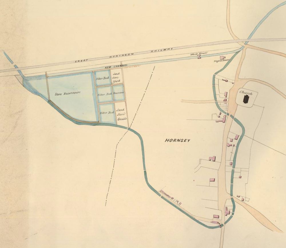
The following map from 1861 shows the original early 17th century route (dark blue), along with the proposed new straightened route (light blue):
Hornsey Water Treatment Works are to the left, and the New River runs at the bottom of these works, and heads to Hornsey High Street which it crosses, before turning and crossing Middle Lane. It then heads towards the church and crosses the High Street again, heading up to the junction with Tottenham Lane.
Towards the top of the map, the Great Northern Railway runs from left to right, and below the railway can be seen the proposed new route of the New River, which is straight, and cuts of the large loop around Hornsey.
There are a number of similar examples on the New River Walk where the route follows where the river has been straightened rather than the original route. It would be an interesting exercise to follow the early 17th century route, however I think I will put that walk on the long list of London walks.
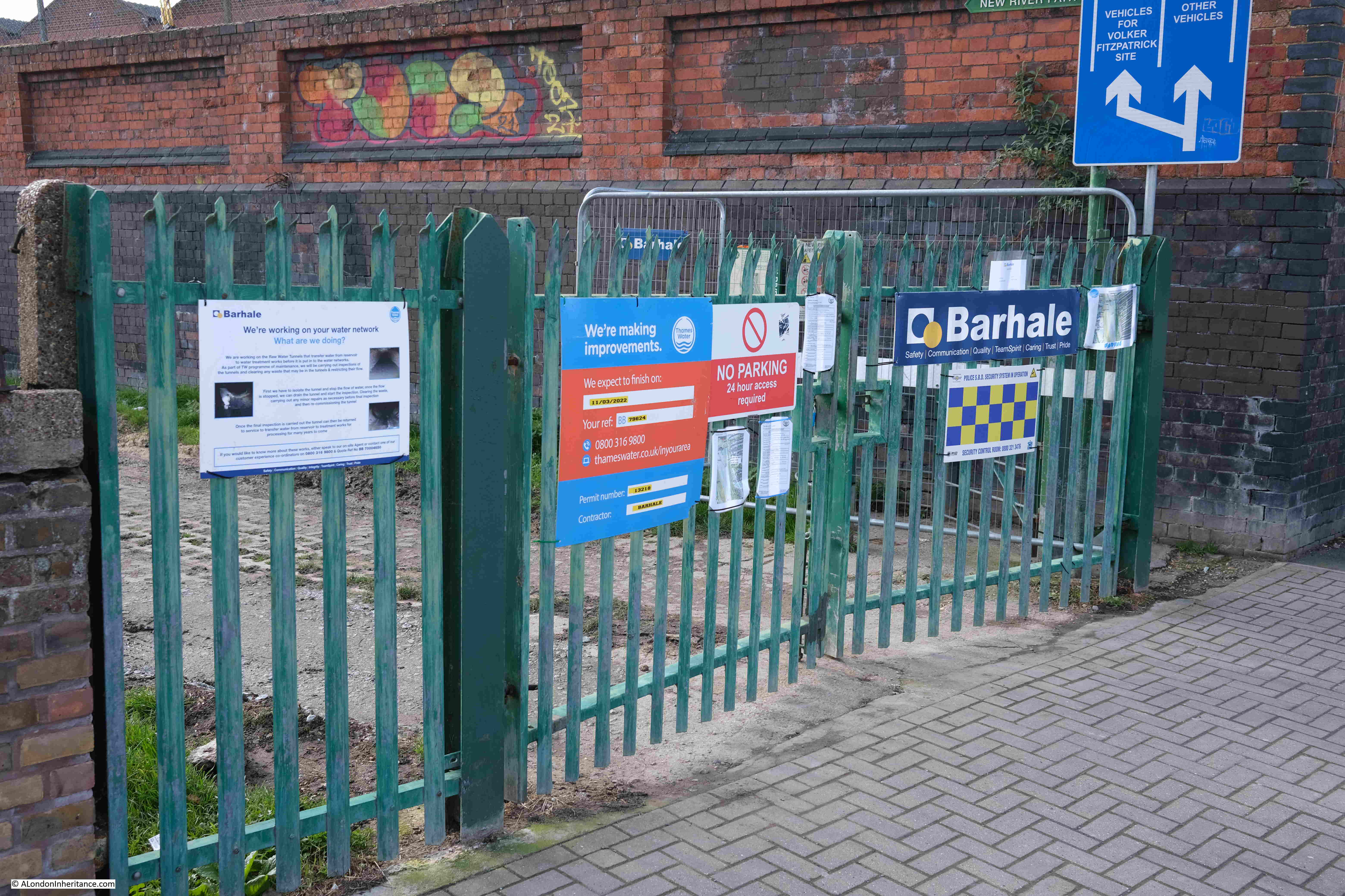
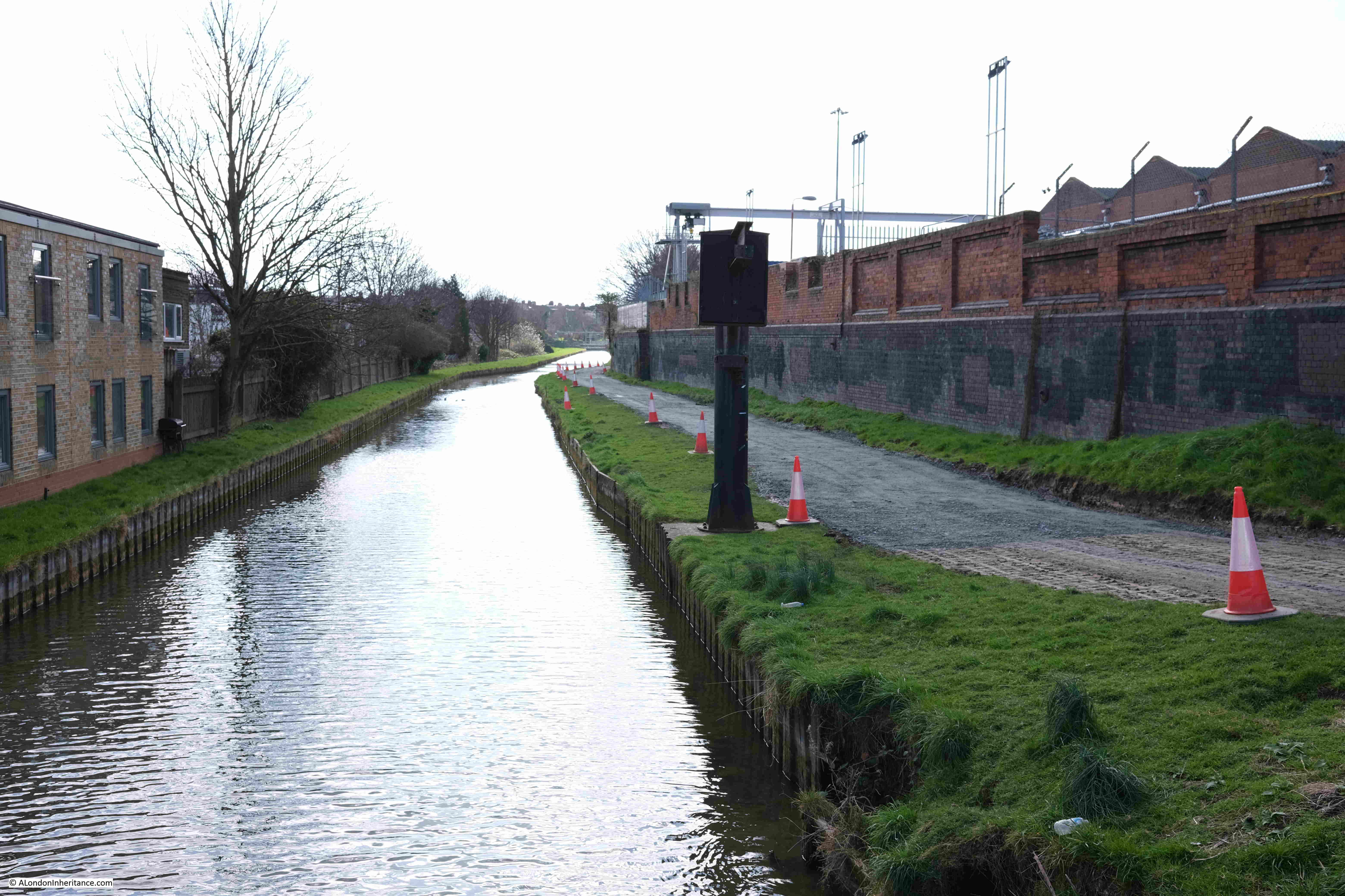
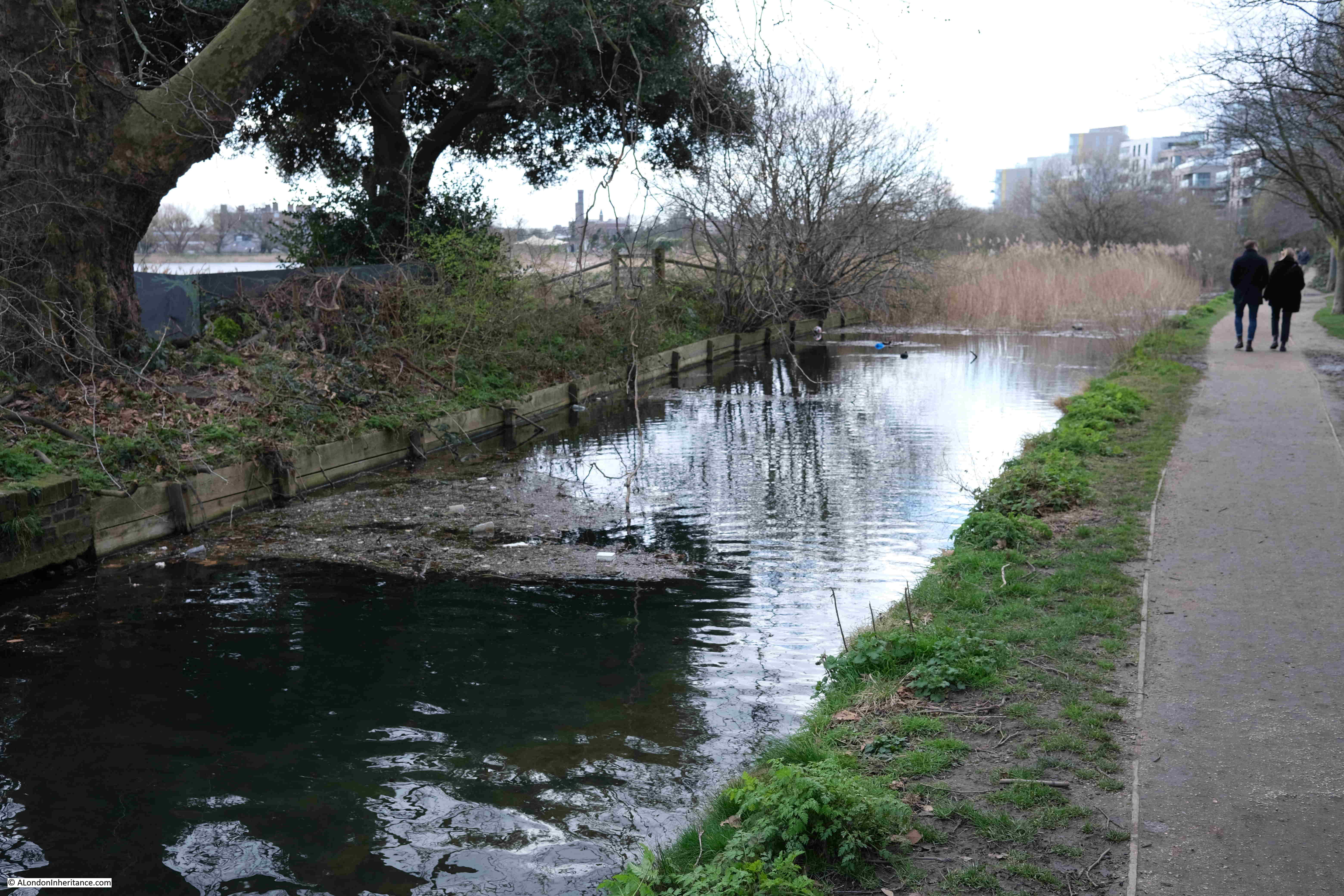
Point 2 on the map: There were very few places on the entire route where it was not possible to follow the New River walk, however one place on this final stretch was also in Hornsey where the path had been closed off as Thames Water are carrying out some repair works on the river:
Following photo is looking along the closed section of the walk. This is another straightened section of the New River:
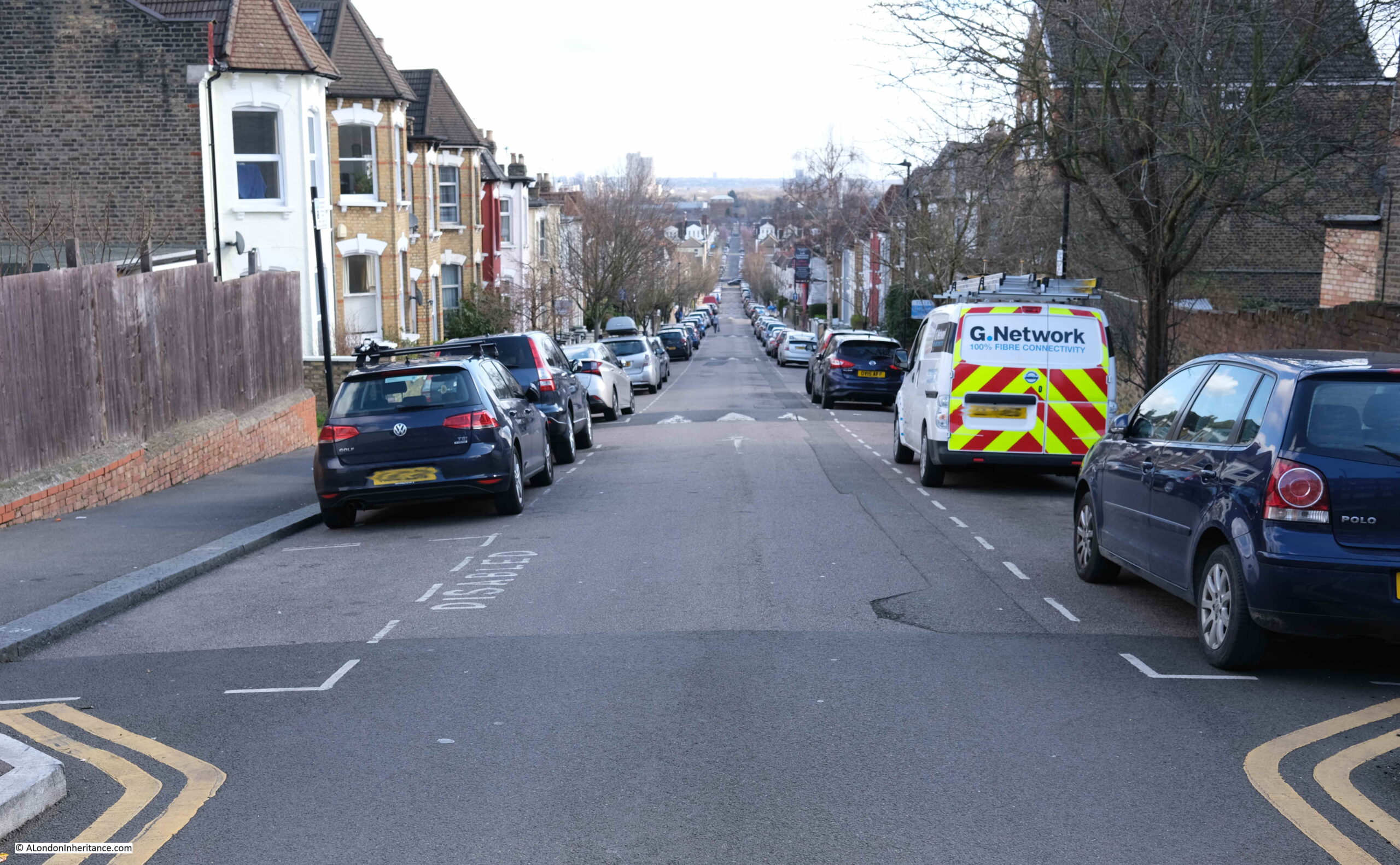
The view looking down one of the streets from Wightman Road, the New River crosses the street half way down:
In the above photo, the streets is dropping in height towards the point where the river crosses about half way down. This stretch of the New River demonstrates how the river follows the contours of the land, from the source in Ware to New River Head. A considerable distance which needed some careful planning, and is remarkable given the survey technologies available in the early 17th century.
The following map shows land height by colour, with blue being lower land, then increasing in height through green, yellow and red (from the excellent topographic-map.com):
I have marked the route of the New River which is following the boundary between the higher land on the left (around Crouch Hill station), and the lower land on the right (south Tottenham and Seven Sisters station).
At one point in the map, an area of higher ground (yellow) juts out, and the New River has been tunneled under this, before emerging and running through the streets to the east of Wightman Road.
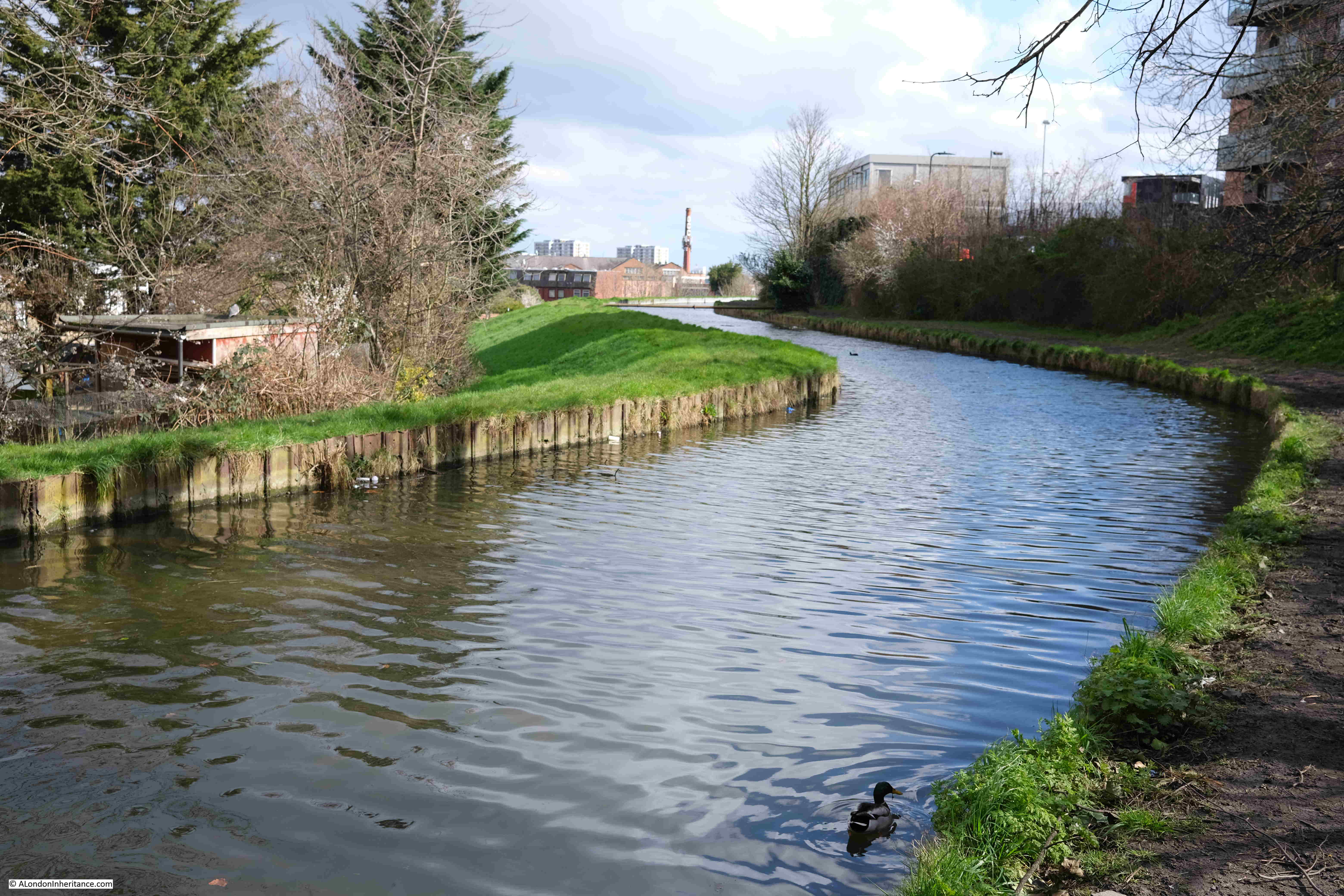
Point 4 on the map: After weaving through the streets of terrace housing, the New River emerges into the north east corner of Finsbury Park:
Where there is a plaque recording the origins and purpose of the river:
The New River stays in just the north east corner of Finsbury Park, before crossing under Green Lanes, and reaching:
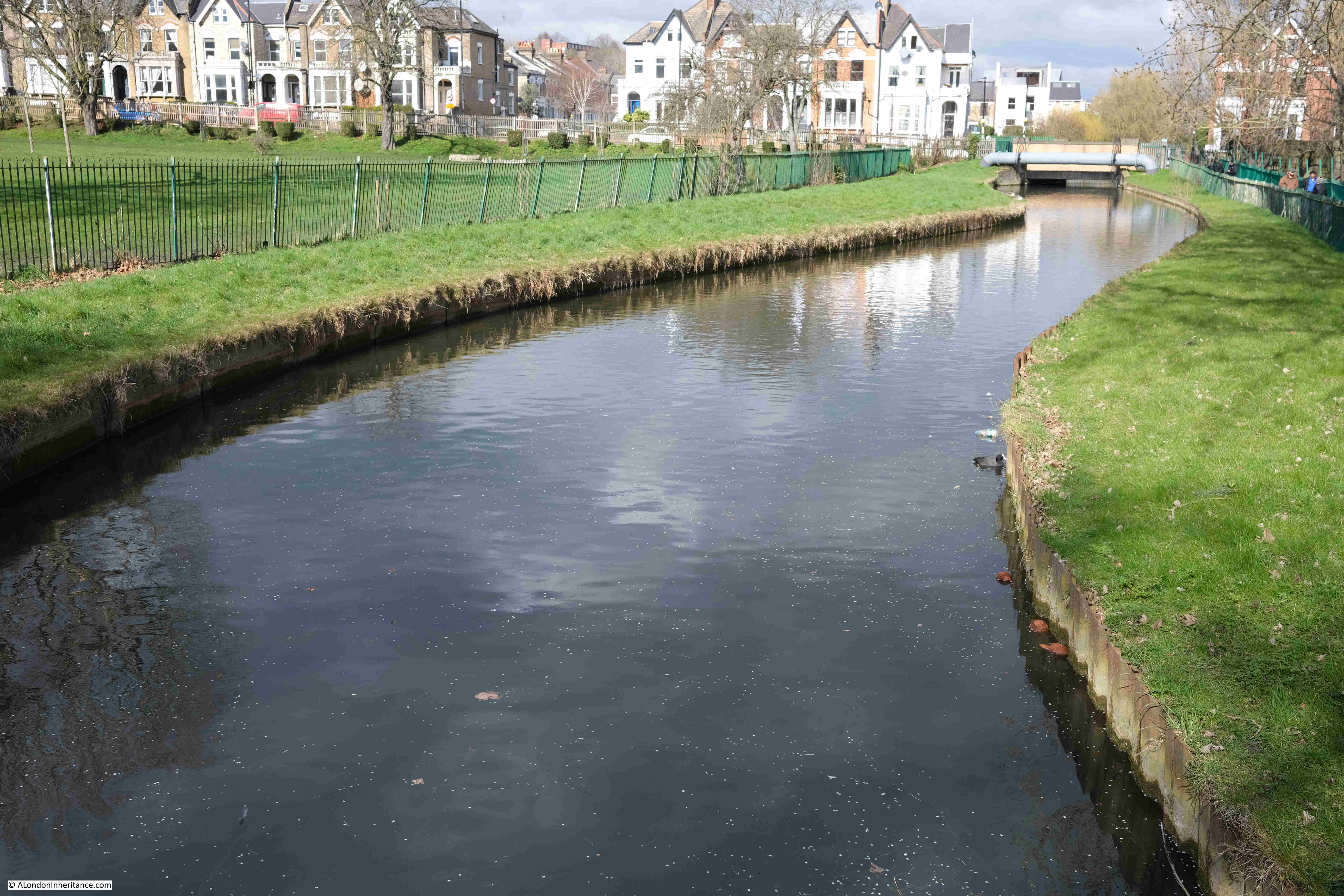
Point 5 on the map: where the river runs along a narrow green space between an industrial area to the north, school and housing to the south:
In the height map above, the New River is heading towards the reservoirs and is skirting around some higher land to the south, and this is visible as we walk alongside the river, with a downward slope from right to left requiring the river to be banked on the northern side:
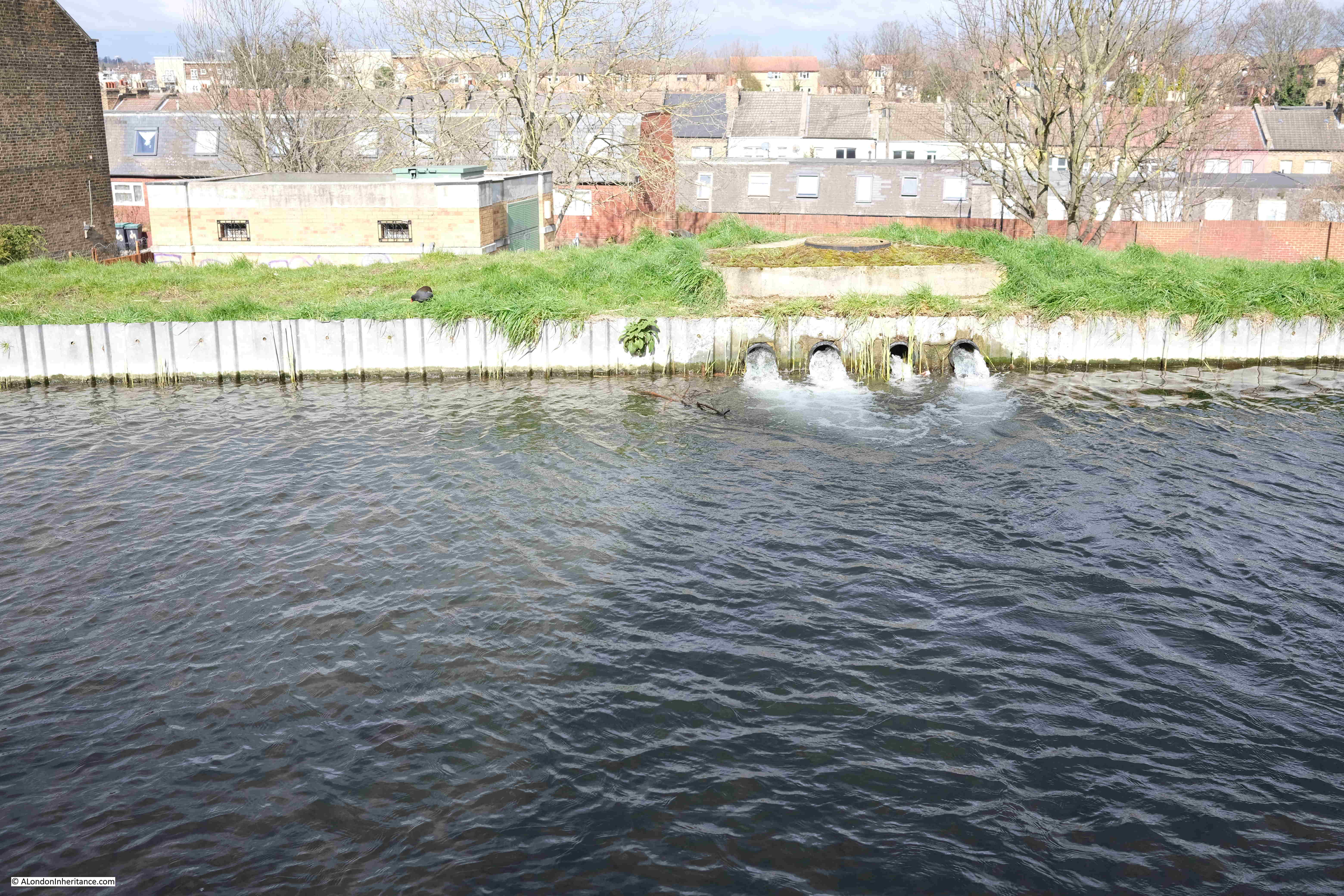
North of the M25, between Cheshunt and Ware, there were a number of points where water was being extracted from boreholes and pumped into the New River. There were no examples of this south of the M25, except for one point along this stretch of the walk where four pipes were pumping water into the river, although it was not clear from where this was being extracted.
There is a brick building visible just to the left of where the water is pouring into the river. This is on Eade Road. It houses infrastructure of some sort, and has a 2003 plaque on the outside, but no indication of its function.
The British Geological Survey borehole map lists a borehole under this building, however it is marked as “Confidential” with no data available.
I assume the water running into the New River is from this borehole, however it is strange as to why the record is confidential.
This section of the walk was incredibly muddy, with some sections rather difficult to pass.
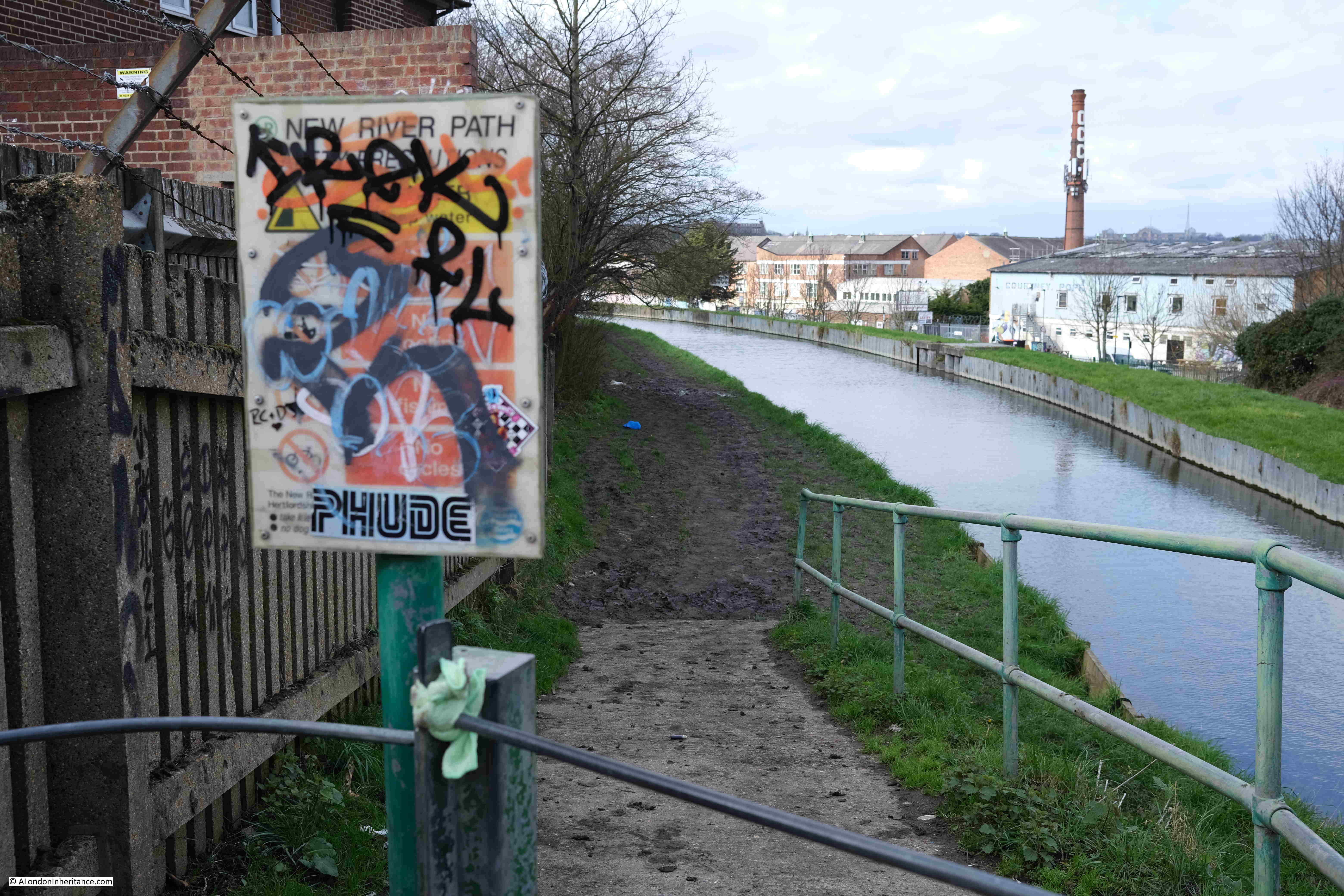
At the end, the path runs up to meet Seven Sisters Road, with an information panel covered in graffiti:
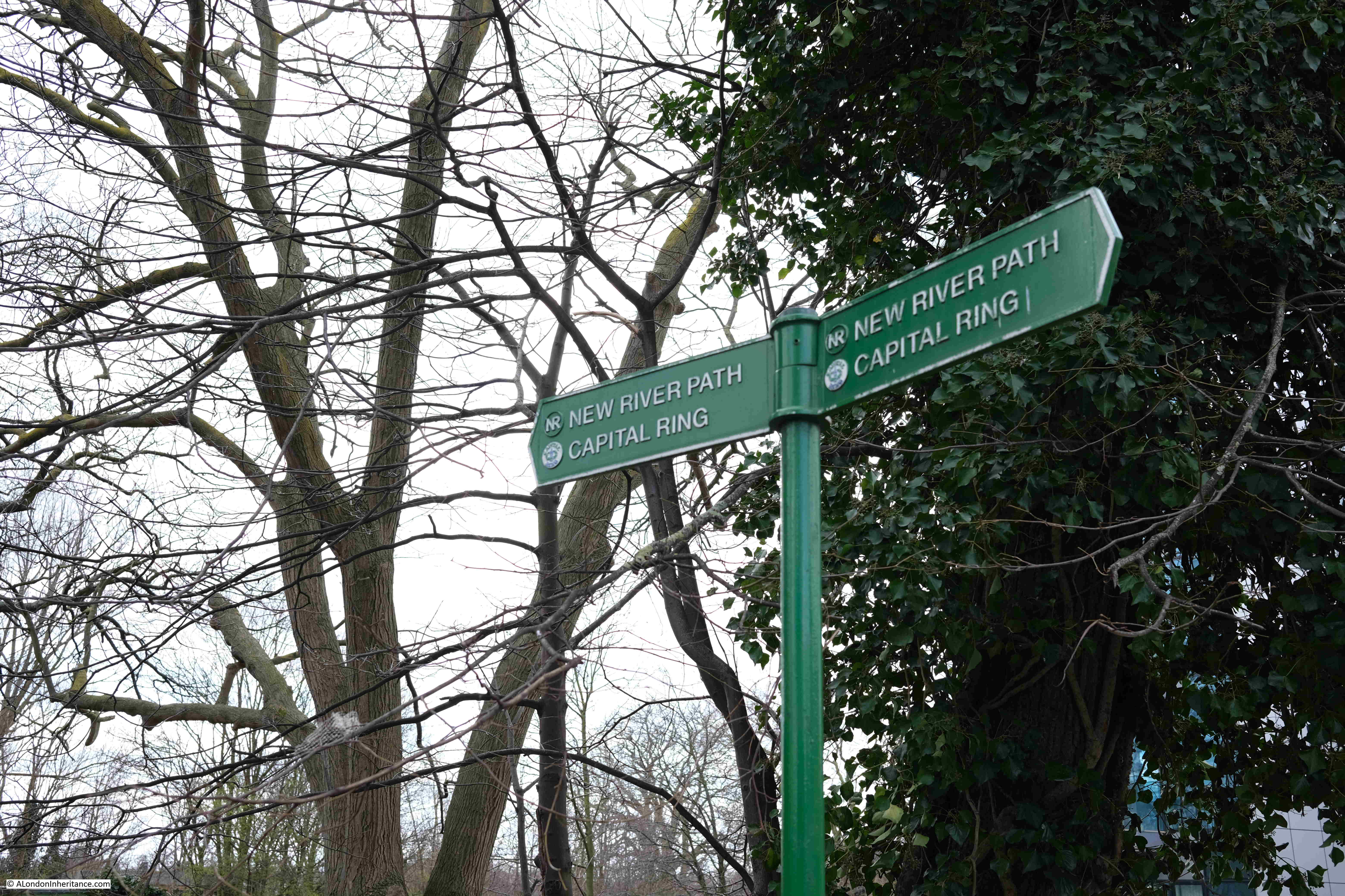
For a short distance, the New River Path has joined with another walking route, the Capital Ring:
And one final loop through housing, with a rather muddy path:
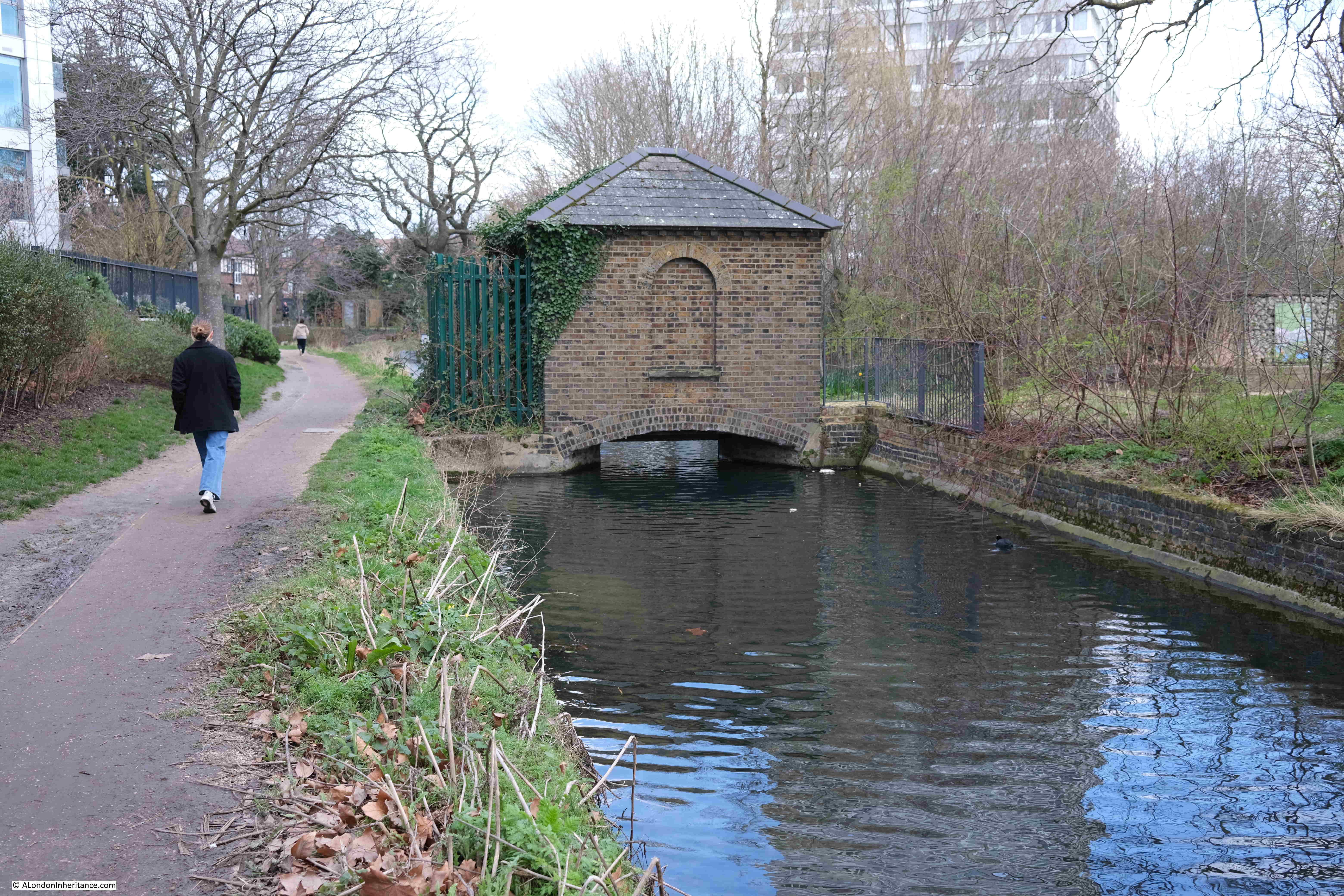
Point 6 on the map: The New River now reaches the reservoirs, with what must have been a gauge house, some means of regulating or measuring the flow of the river, straddling the New River just before the reservoirs:
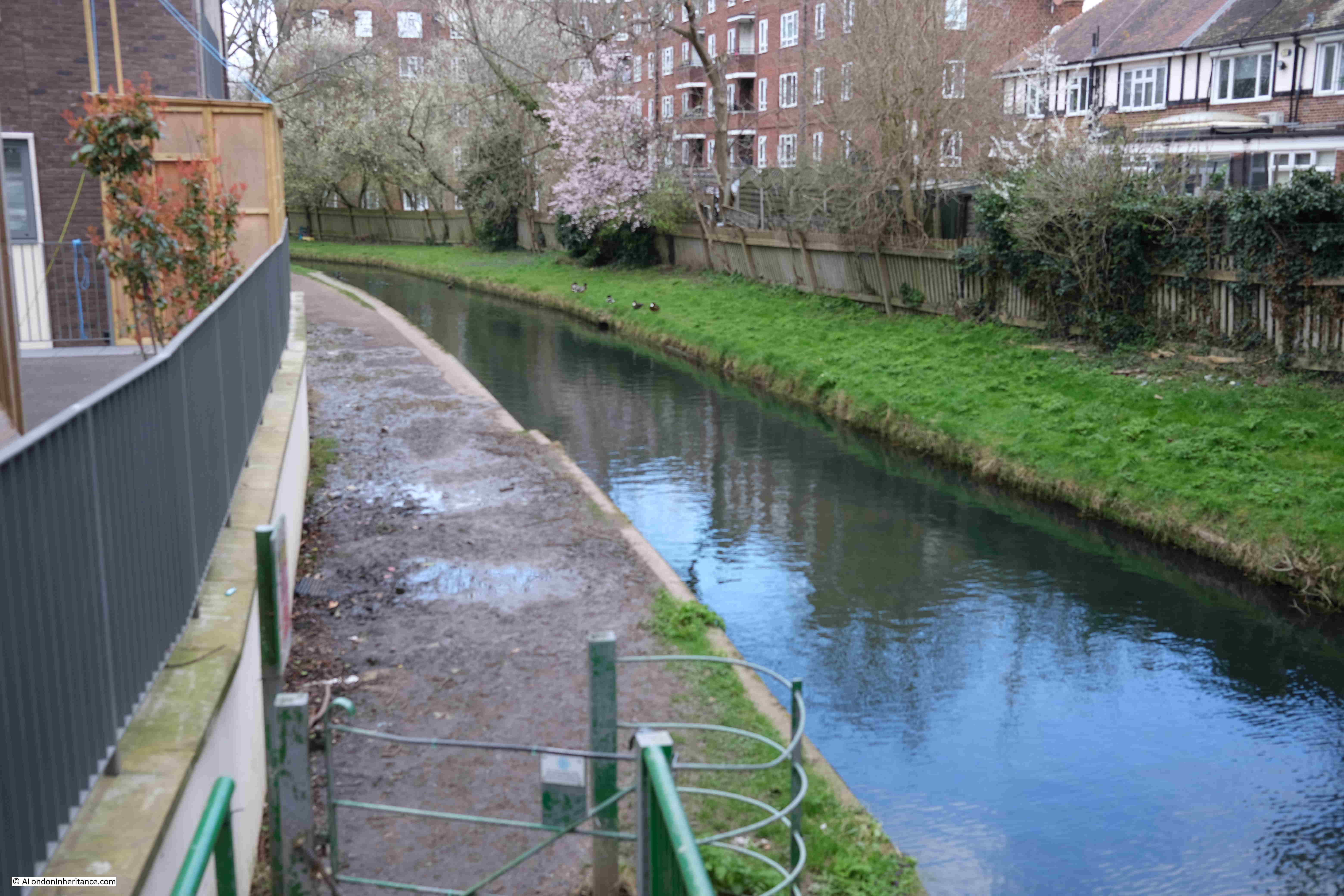
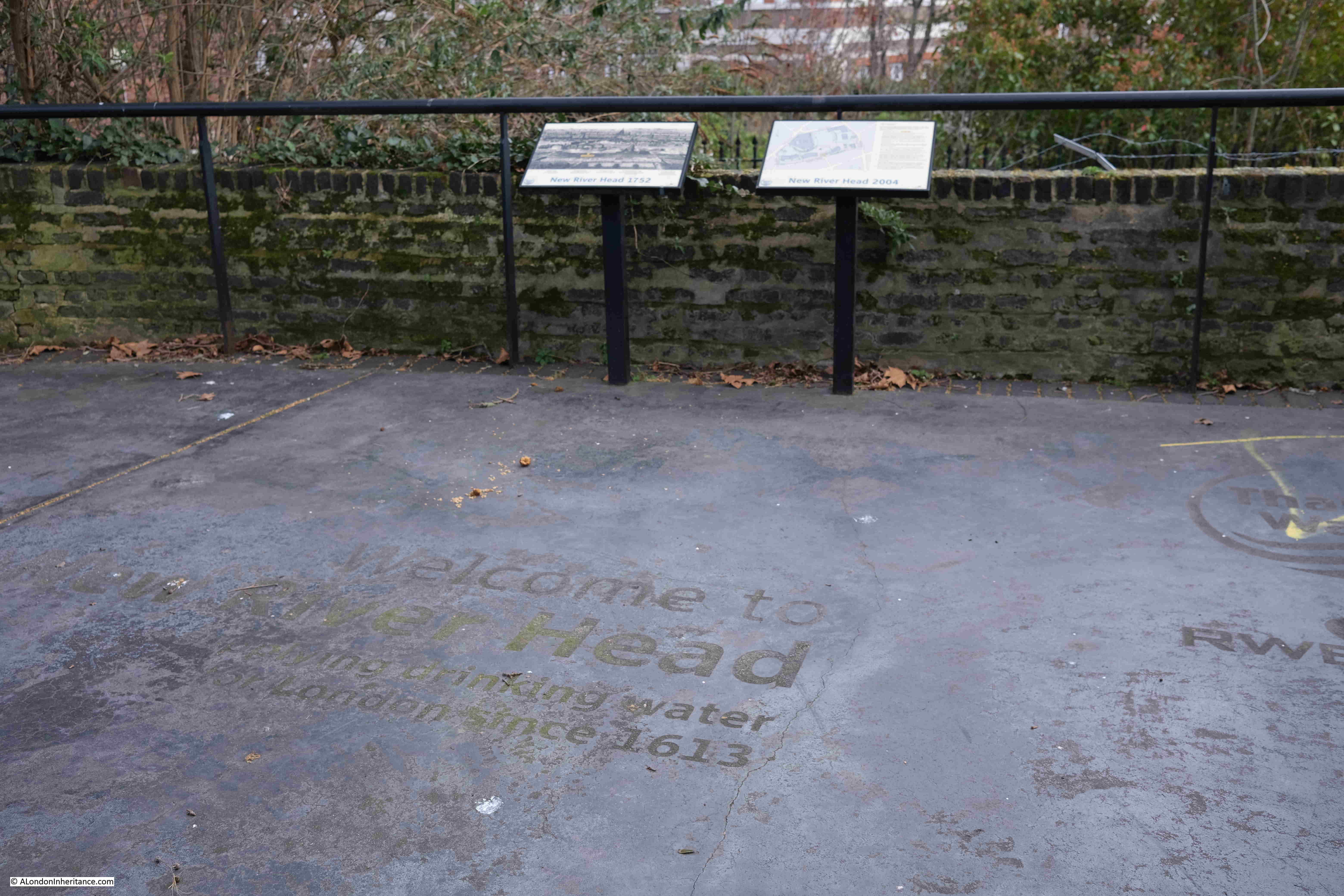
The New River was truncated at the reservoirs at Stoke Newington in 1946, and now feeds water into the reservoirs, as well as running to their north, through the Woodberry Wetlands, an area surrounding the reservoirs that is now managed as a wildlife haven:
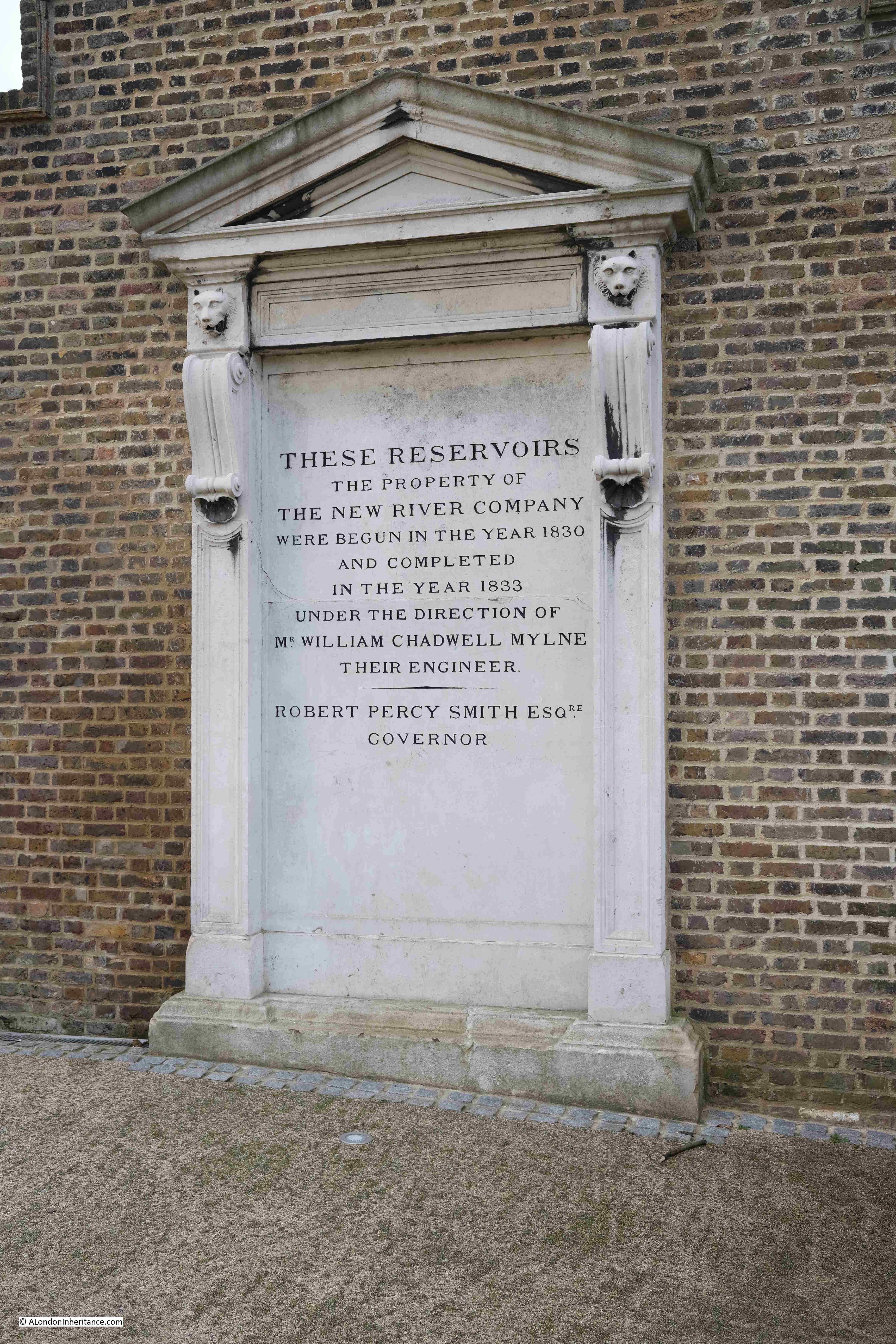
Between the east and the west reservoirs is a building that was once part of the New River infrastructure and has now been refurbished as the Coal House Café. The area outside the café was full of families, so I will not include a photo online, however at the side of the building is a record of the creation of the reservoirs by the New River Company:
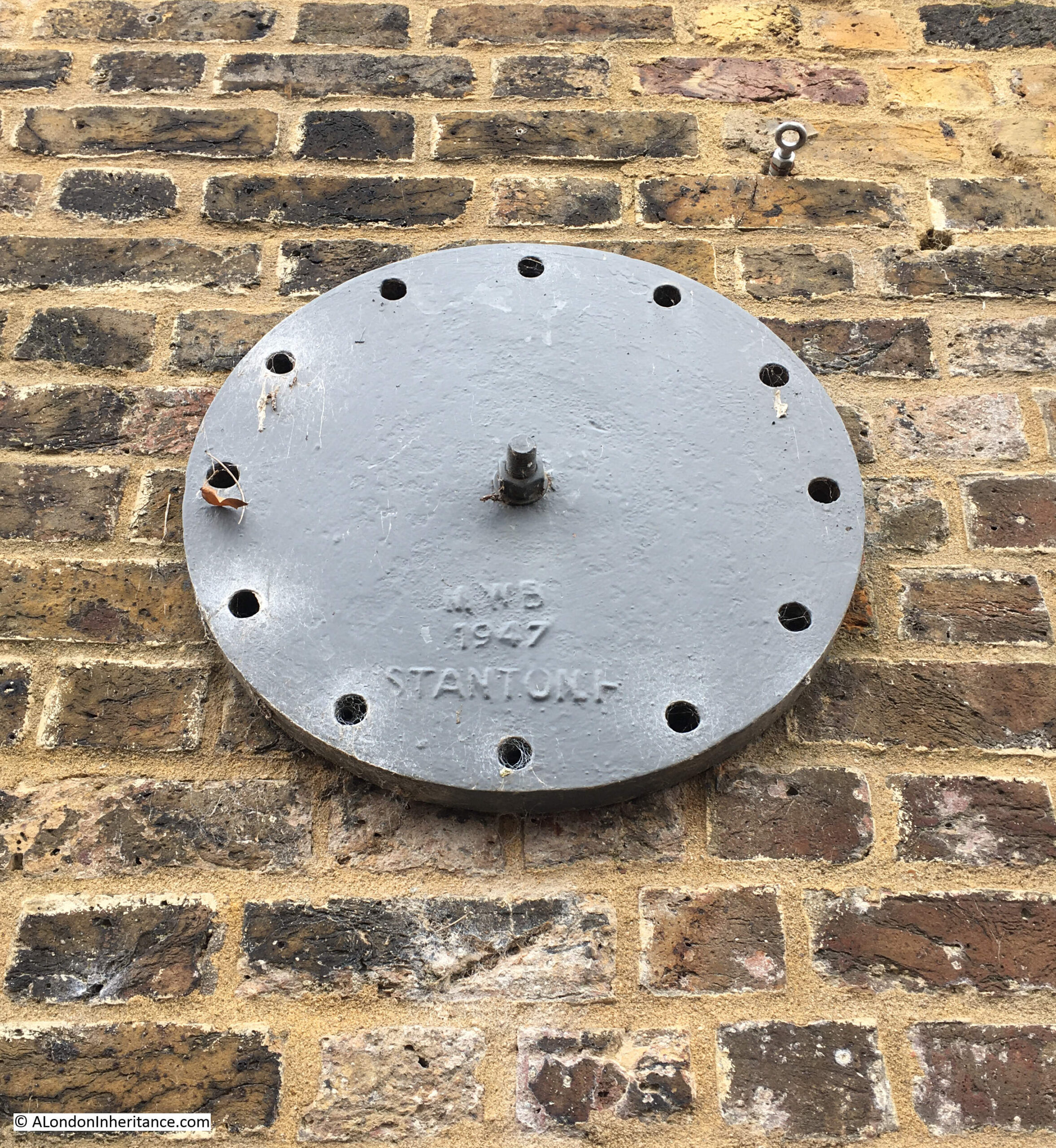
Also on the side of the building is a wall tie with the initials of the Metropolitan Water Board, the organisation that took over the running of the New River Company’s assets:
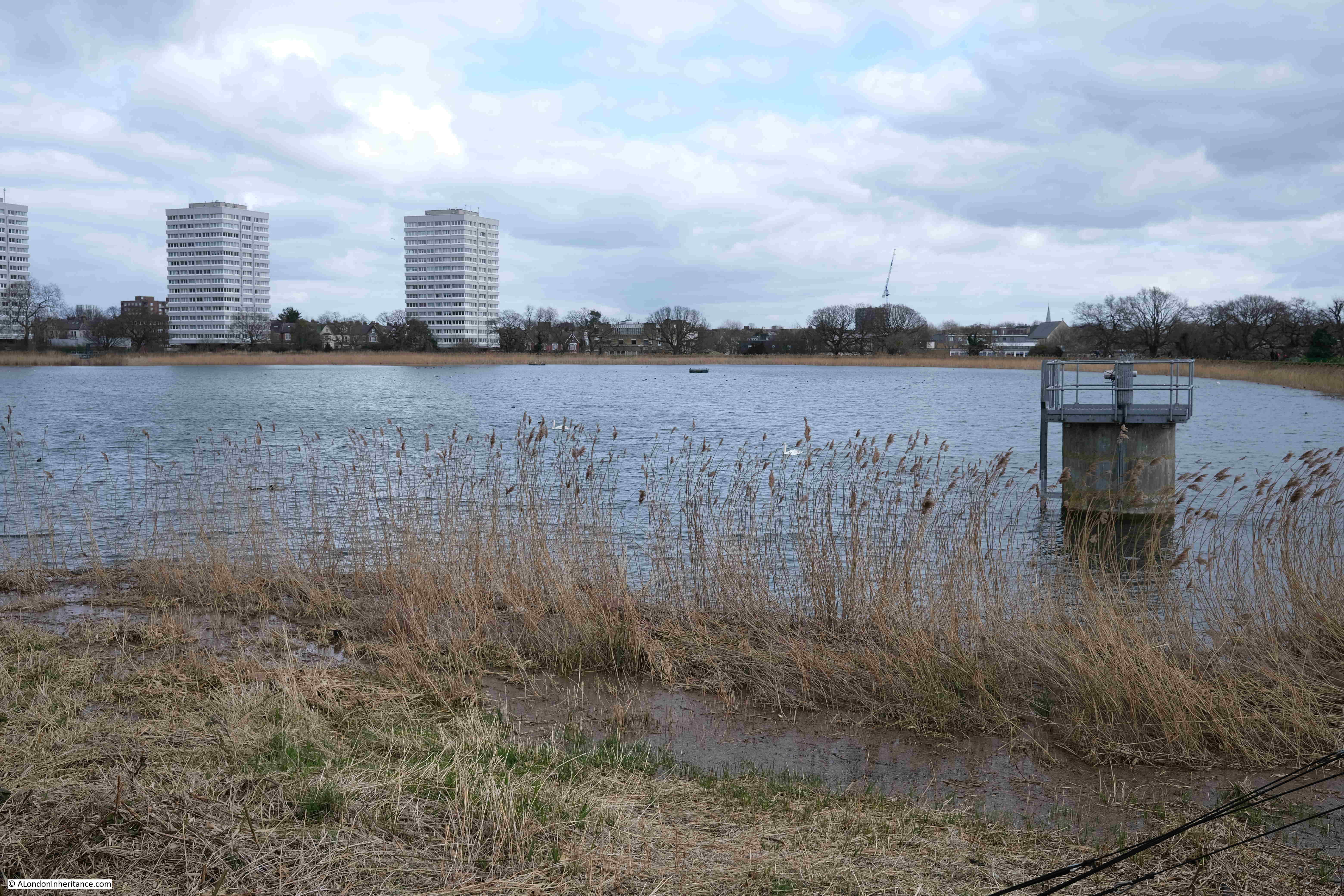
View across the east reservoir:
View across the west reservoir:
And a short walk from the west reservoir, we reach the very end of the remaining route of the New River. The last point in the walk from Ware in Hertfordshire, where the river can be seen above ground. It ends in a rather sad dead end:
Just to the left of the above photo is the wonderful 19th century pumping station built by the New River Company:
The Metropolis Water Act of 1852 required that water companies supplying water to London, filter the water prior to distribution, and that any subsequent reservoirs after filtering be covered. The aim was to improve the quality of water and prevent much of the pollution from an industrial city from entering the water supply.
Prior to the act, the New River Company was supplying water directly from the reservoirs, however the act now required filter beds to be constructed, along with infrastructure such as a pumping station, and the building in the above photo was built between 1852 and 1856 by William Chadwell Mylne, the Surveyor for the New River Company.
The building housed steam engines and boilers until 1936 when these were replaced by diesel engines.
By 1971, the pumping station was rather dated and too small, and the design of the building did not support an upgrade, so the Metropolitan Water Board applied for permission to demolish the building.
There was considerable local support to retain the building as it was such a local landmark, resembling an industrial castle alongside Green Lanes.
This campaign resulted in the building being given a Grade II* listing in 1972, however it would continue to stay empty, and under threat.
The Historic England listing record provides a perfect description of the old pumping station, and why it is known as the Castle (Historic England source here):
“Large building designed to resemble a mediaeval fortress with keep and bailey. 1854-6 by Chadwell Mylne. Stock brick with stone dressings. Battlements and large stepped buttresses all around. The “keep” is of 2 storeys with a tall basement plinth. 6 windows on main south-west front. At north-east and south-west corners round towers with square bartizans the former with a tall conical roof and both having battlements crow-stepped up towards them. Continuous quasi-entablature, with cable moulding, running right around towers. Taller octagonal chimney tower to east. 8 steps (the top one with bootscraper!) to entrance in forebuilding running along north wall and into “bailey” building, which is lower with segmental arcading and 2 slit windows in each bay. Important picturesque landmark.”
The building was empty until 1994 when it was converted into a climbing centre. The large internal spaces perfectly suited for such a use. If you walk past, it is worthwhile having a quick look inside, as the building is still the Castle Climbing Centre.
Leaving the pumping station, we are now following the heritage section of the New River Walk. This section of the route has not seen the New River as a stream of water for many years, as the river was buried in pipes during the 19th century, and since 1946, New River water has ended at the reservoirs.
Point 7 on the map: Here we turn off from Green Lanes and into Clissold Park.
The park retains a couple of stretches of the New River, however these are for decorative purposes only, and start and end within the park.
There is a bridge across one of these decorative runs of the river, which has the arms and motto of the New River Company on the side. “ET PLUI SUPER UNAM CIVITATEM” or “And I caused it to rain upon one city” indicated by the hand reaching down from a cloud, and showering rain drops on the city below.
Part of the decorative New River feature running up to Clissold House:
Leaving Clissold Park, and walking along Stoke Newington Church Street, there is another reminder of the New River with the New River Café on the corner with Clissold Crescent:
Walk a short distance along Clissold Crescent, and there is a reminder of the New River:
The plaque reads “The Park Lane bridge was demolished and the road widened June 1881”.
Park Lane was the original name of Clissold Crescent, and the bridge carried Park Lane over the New River.
A version of the Ordnance Survey map from the 1890s shows the Park Lane bridge and the New River, although by this time, the New River should have been carried underground in pipes, and as the plaque reads, the bridge was demolished in 1881 and the road widened, so I suspect the OS map was not updated at this point (‘Reproduced with the permission of the National Library of Scotland“).
In the above map, the New River heads south between houses, and the route has been preserved and now forms a series of allotments running along the old course of the river:
The path between the allotments ends at Green Lanes (again, almost a constant companion on the southern section of the walk). We cross over Green Lanes to reach;
Point 8 on the map: this is Petherton Road where the New River once ran down the centre of the street, and is now a walkway with trees and grass on either side:
A rather nice ghost sign for Barnes Motors along Petherton Road:
At the end of Petherton Road, the green space gives way to a street which still follows the route of the New River, past Canonbury Station and cross over St Paul’s Road into another section of the New River route that has been transformed into a long green space, with a decorative water feature running the length of the space:
Towards the end of this green space is:
Point 9 on the map: where there is a round brick building alongside the original route of the New River:
The building appears to be a late 18th century watch hut. To protect the New River, the New River Company had a watchman or linesman stationed at points along the route of the river to keep the river clear of debris and also to prevent fishing and swimming in the water, or anything that could pollute the supply.
The brick hut is an example of where such a person would have been stationed to keep watch over the river.
The final stretch of the ornamental water that follows the original route of the New River:
Where the above green space ends, we then walk south along Essex Road, and turn off just before reaching Islington Green, to find Colebrooke Row.
This is another street where the houses were built facing on to the New River, and the space occupied by the river is now a green space running the length of the street.
In the following photo, the houses on the right once looked onto the New River where the grass and trees now run, with the street being on the left:
The white house on the right in the above photo was occupied by the poet and essayist Charles Lamb in the 1820s. The following print shows the house as it was, with the New River running directly in front of the house:
At the end of Sadlers Wells, turn right into Arlington Way, then left into Myddelton Passage, where we come to the official end of the New River Walk, at the viewing platform looking over what was New River Head:
The route is marked on the ground of the viewing platform:
And that completed the New River Walk, over four days / two weekends, from Ware in Hertfordshire to New River Head, Clerkenwell.
It was a fascinating journey, and whilst the route has been straightened at a number of points and does not fully trace the original early 17th century route, it did leave me with considerable admiration for those in the early 17th century who surveyed and built the route, following the contours of the land so it would only fall by roughly 20 feet along the entire route ( 5.5m in total or 5 inches per mile). This enabled the water to flow naturally without the need for any pumping.
You can find my posts covering the first two stages of the walk at the following links:
In the following panorama from the viewing platform at New River Head, I have labeled some of the key features. On the right are the engine and pump house which will soon become the new Quentin Blake Centre for Illustration, a wonderful new use for these historic buildings.
David Fletcher creates remarkable 3D photogrammetry captures of heritage sites and has one for the historic buildings at New River Head. Hopefully this will work as I have embedded the model in the post (if you do not see this in the e-mail, click here for the post on the website).
You can walk through the site, both inside and out to see this remarkable, historic site in detail:
Before heading to St Saviour’s Dock, a quick thank you for ordering tickets for this year’s walks. At the time of writing, the Barbican walks and Wapping walks are sold out. Many of the Bankside dates have sold out, but there are some tickets remaining on later dates, and there are a few on the Southbank walks.
St Saviour’s Dock is an inlet from the Thames in Bermondsey, just to the east of Tower Bridge on the south bank of the river. We can look across the river near Hermitage Moorings on the north bank, and see St Saviour’s Dock just to the left of Butlers Wharf.
Cross over to the south bank of the river, and on approaching the dock, there is a walkway spanning the entrance:
View from the footbridge across to the north bank of the river, at low tide, with thick mud across the foreshore:
Looking along St Saviour’s Dock – a carpet of mud:
St Saviour’s Dock is a very old feature of this section of the river. Originally the mouth of the River Neckinger, although it is very hard to pin down exactly where the Neckinger ran with any certainty, and how much of the water course was a natural river.
There were many streams and ditches in this area of Bermondsey and much of the land was low lying marsh. Some of the ditches which may have once been part of the Neckinger can be seen on 18th century maps, which I will come to later in the post.
Looking south along St Saviour’s Dock, the bends in the dock give the impression of a natural feature. Early maps show the sides of the dock as relatively straight, so the curves we see today may have been the result of extending some of the warehouses that line the dock as an attempt to maximise warehouse space.
At the far end of the dock, it comes to an abrupt halt at “Dock Head” at the junction of Jamaica Road and Tooley Street.
It is impossible to know for sure as to the origins of St Saviour’s Dock. It appears to have been part of the lands of Bermondsey Abbey, and what was then a natural watercourse, had banks created on either side, and a mill built on one side of the dock by the abbey at some point around the 13th century.
Just to the east of St Saviour’s Dock is Mill Street, apparently named after a mill stream which ran along the route of the street and which powered the mill, which was used to grind corn for the abbey. Mill Street is on the other side of the warehouses that line the eastern side of the dock, so is very close and complicates the mapping of waterways in the area.
The land around St Savoiur’s Dock was fully developed between the 16th and start of the 19th centuries, as maps from the 17th and 18th centuries confirm.
The following is an extract from William Morgan’s map of London from 1682. St Saviour’s Dock is located just to the lower right of centre of the map:
Note that the name of the dock in the map is Savory’s Dock. This may be a simple corruption of the name, or it could have been a rather sarcastic description of the dock given that there was much pollution from the surrounding buildings, and Bermondsey’s growing industry, that ended up in the dock.
I like the depiction of a small boat in the dock. It looks too wide to be a waterman’s boat, and could have been a lighter that transported goods between boats moored in the river and the warehouses lining the dock.
By the time of Morgan’s map in the late 17th century, it appears that buildings were lining the majority of the dock, and streets had been built to the east.
If you click on the above map to enlarge, you can see that to the right of St Saviour’s Dock were a number of water channels, and that to the lower centre edge of the map, there are what appear to be two water channels either side of a road, with a name of “The Neckincher” along the street. presumably this name applies to the water channels, and is a version of the name Neckinger.
This is the problem with being sure as to the route of the Neckinger, and how much of the route was a natural feature, and how much were artificial channels and ditches used to perhaps provide water to the industries in the area, or to drain what was low lying, marshy land.
Seventy three years after Morgan’s map, a 1755 map has St Saviour’s Dock on the edge of the map, with the surrounding area looking much the same as in 1682:
It is interesting that the name Savory Dock was again used on this later map. This name does not appear to be used when reporting anything about the dock in newspapers. For example on the 10th of January 1730, the Kentish Weekly Post used the name Saviour in a report that “Last Sunday, a Man, well dressed, was found drowned in St Saviour’s Dock”.
I can find no newspaper reference to the Savory spelling of the dock’s name.
Newspaper’s do give us an idea of the type of businesses and properties that surrounded the dock in the years around the publication of the above map. For example, on the 11th of January 1762 there was a report of a fire in one of the buildings along the dock:
“Thursday morning a fire broke out in a granary belonging to Mess. Hemmock and Co. Corn Lightermen, at St. Saviour’s Dock, near Dock Head, which was consumed, together with 8 dwelling houses, and a great many warehouses, and other out-buildings; three other dwelling houses were greatly damaged. Mr Allport, a biscuit maker, and his family, ran into the street almost naked, not having time to save anything. It being low-water, it was with difficulty a whole tier of ships was preserved, as they lay upon the mud close to the Dock, and nothing parted them from the flames but a crane house, which took fire several times, but by the activity of the firemen was prevented from getting to a head. We hear no lives were lost.”
So in 1762, St Saviour’s Dock was surrounded by a granary, dwelling houses, and a great many warehouses, which does align with the view presented in the above maps. As well as the granary, there are also mentions of a “Mr John Robinson’s Rope Warehouse” in the dock in the mid 18th century.
The following map is dated 1813 and includes the names of the wharfs along the dock. Only two also have the names of products stored, with a granary at lower left of the dock and a lime yard at upper right.
What is interesting about the above map is the area to the left (east) of St Saviour’s Dock.
On this map there are a number of streams / ditches shown, along with bridges over these. I have highlighted the waterways with arrows.
The area between the waterway on the left and St Saviour’s Dock is the area that would become known as Jacob’s Island (after Jacob Street running through the centre). It was Charles Dickens who would bring some notoriety to this small patch of Bermondsey when he apparently located Fagins den and Bill Sykes death in Jacob’s Island in his novel, Oliver Twist.
The above map does confirm that the area was still a place of ditches and streams in the early 19th century, all possibly once part of the Neckinger, but would disappear during the rest of the 19th century as new warehouses and roads were built. The ditches do not appear to have any connection to St Saviour’s Dock or the River Thames, so must have just held stagnant water.
Underneath the name St Saviour’s Dock is the name “Southwark” rather than Bermondsey. The above print is really of the dock just to the north west of Southwark Cathedral, where the replica of the Golden Hind is now located.
Southwark Cathedral was originally the church of St Mary Overie. The church was renamed St Saviour’s at some point around the Dissolution of the Monasteries in 1539, and this name would remain in place until 1905 when it became Southwark Cathedral.
The small dock just to the north west of Southwark Cathedral was originaly Mary Overie Dock, but with the renaming of the cathedral, the dock took on the name of St Saviour’s Dock and is shown with this name in Rocque’s map of London from 1746, and in this 1811 print which shows the church of St Saviour (Southwark Cathedral) at lower centre, and St Saviour’s Dock to upper left.
The 1895 OS map continues to show the Southwark dock as St Saviour’s Dock.
So there were two St Saviour’s Docks, and we need to be careful with references to the name. Today the Southwark dock is the location of the Golden Hind replica, and the address on the Golden Hinde’s website is back to the original name of St Mary Overie Dock.
The 1895 Ordnance Survey map of the Bermondsey St Saviour’s Dock shows that the dock was lined with warehouses, wharfs and factories, including a flour mill, coal wharf, packing case factory and lime wharf – the typical mix of industries that you would find along any stretch of the industrial Thames in the 19th century.
As with so much of the London docks, St Saviour’s Dock went into decline after the war. Warehouses located down a narrow inlet just were not suitable for the size and type of ships, and containerisation would kill off any hope of using warehouses such as those found in the dock.
St Saviour’s Dock remained as an open inlet to the Thames, but the buildings along the edge of the dock started a path to dereliction.
St Saviour’s Dock has been used in a number of films. One of these in the years before the buildings were transformed is Derek Jarman’s 1978 film Jubilee.
Jarman lived for a time in Butler’s Wharf, between the dock and Tower Bridge, and the film, which is still available as a DVD, whilst a typical Jarman film and very much of its time, is good to watch for one interpretation of punk and the late 1970s, but also for some London location spotting.
In the following clip, the characters Bod, Mad and Chaos are about to throw a body over the side of St Saviour’s Wharf, to the mud below, with the empty warehouses in the background:
From the 1980s onwards, the majority of the wharfs lining St Saviour’s Dock would be converted to apartments and offices. A walk along the side streets that follow the dock to the east and west reveals how many have survived.
Starting in Mill Street which runs along the eastern side of the dock, and to the north east corner is New Concordia Wharf:
New Concordia Wharf was originally built in 1882 as St. Saviour’s Flour Mill, however after one of the fires that seemed to be a frequent risk to the wharfs along the river, it was rebuilt between 1894 and 1898.
St. Saviour’s Flour Mill / New Concordia Wharf included a flour / corn mill, continuing a tradition of milling flour that goes back to the original mill built on the banks of the dock by Bermondsey Abbey in the 13th century.
Rather than being powered by water, the mill was steam powered, and the water tank and chimney remain, although the water tank has been somewhat hidden by changes to the roof of the building.
The chimney was truncated in 1979, and now looks rather ungainly with what appears to be a concrete slab on the top of the chimney, but is still an unusual sight on the end of a warehouse.
Conversion of New Concordia Wharf to apartments was carried out between 1982 and 1983 and was one of the first examples of the warehouse conversions that would become the standard for the type of building along the Thames.
We then come to Grade II listed St. Saviour’s Wharf:
St. Saviour’s Wharf was built in 1868, and was for sale by auction in 1870. The advert for the auction provides some details of this 1868 building:
“Saint Saviour’s Sufferance Wharf, together with the modern pile of warehouses in MillStreet erected in 1868 in the most substantial manner under the superintendence of an eminent architect and so arranged as to fulfil all the requirements of the Metropolitan Buildings Act and of the Fire Insurance Companies. The premises comprise three double warehouses each with five floors and basement, having a frontage of 117 feet next Mill-street.
The various floors are carried on columns from basement to roof, and are strongly timbered. The ground floor is asphalted. The party walls are 2 feet 3 thick, and there is no communication between the three warehouses, except on the basement.
There are two staircases to each warehouse, and loophole doors and windows on each floor fronting the land and waterside.
The floors of two of the warehouses are divided by brick walls 2 feet 3 thick, communicating by chambers, enclosed by wrought iron folding double doors.”
The details of the construction of the buildings were important for potential buyers. Not just to show the strength of the building, but also that the building was designed to limit the spread of fire.
Fires in warehouses were a continual risk. Buildings on top of each other, all crammed with highly combustible goods resulted in frequent fires, and the newspapers almost always had reports of fires in warehouses along the Thames (for example, see my post on the “The Great Fire at London Bridge”).
No idea what the purchaser of St Saviour’s Wharf paid for the buildings, however today, a 2 bedroom apartment is for sale at £1.2 million.
The view along the southern end of Mill Street, with more wharfs and warehouses. Unity Wharf nearest.
Unity Wharf is Grade II listed and is now mainly office / commercial space. In the 1953 publications “London Wharves and Docks”, Unity Wharf is listed holding Canned and Cased Goods, Bagged produce and General.
To the side of Unity Wharf is the entrance shown in the following photo:
It was gated half way along on my visit, but appears to be one off, if not the only passage through the wharfs to the side of St Saviour’s Dock.
In the 1895 Ordnance Survey Map, the passage is shown, and marked as “Free Landing Way”, which I assume meant that it could be used by anyone to land something by boat in St Saviour’s Dock, and the passage provided a route between water and Mill Street. I would have loved to have got to the end of the passage and looked over the edge into the dock.
At the end of Mill Street, we reach the junction of Jamaica Road and Tooley Street. In the following photo, the steps to the left of the red bins lead up to the wall at the very end of St Saviour’s Dock – the point labeled Dock Head in the 17th and 18th century maps earlier in the post.
Climb the steps, look over the wall, and we can look down on St Saviour’s Wharf:
Towards the northern end of the dock where it meets the River Thames and is spanned by the footbridge:
We can now walk along Shad Thames, the street that runs along the wharfs on the western edge of the dock.
The buildings have a couple of footbridges between the wharfs on the right and additional warehouse space on the left. These were used to transport goods between buildings without having to travel up and down floors and across the street, although looking closely at one of the bridges, I doubt these are original, they look either very good restorations or new copies of what would have spanned the street.
The following photo shows the “B” warehouse of St Andrew’s Wharf:
This building dates from 1850 and is Grade II listed, but as can be seen by the changes in brickwork, it has been partially rebuilt a number of times, most recently when it was converted for residential use.
We then come to the point in Shad Thames where it leaves the wharfs that line St Saviour’s Dock, and turns west to head towards Tower Bridge.
At this corner point is the much rebuilt and restored Butler’s Wharf:
And that brings me to the end of a look at St Saviour’s Dock, and the wharfs and warehouses that line this ancient inlet from the River Thames.
Although the buildings have been converted to residential and commercial, they do still provide a really good impression of what the dock would have looked like from the late 19th century onwards.
The thing that is missing is noise and activity. Walking the area today and it is quiet. No lighters in the dock, no goods being loaded and unloaded and very few people walking the streets.
The dock itself is always thick with mud, and I have never seen anyone searching the dock or foreshore. A good thing as it looks highly dangerous, but intriguing to imagine what is buried beneath the mud given the centuries of use of St Saviour’s Dock.