For the past four years, I have written an annual post on the work around Euston to create the extension to the station for HS2, recording the area from before work started to at some point in the future, when the new station will be operational.
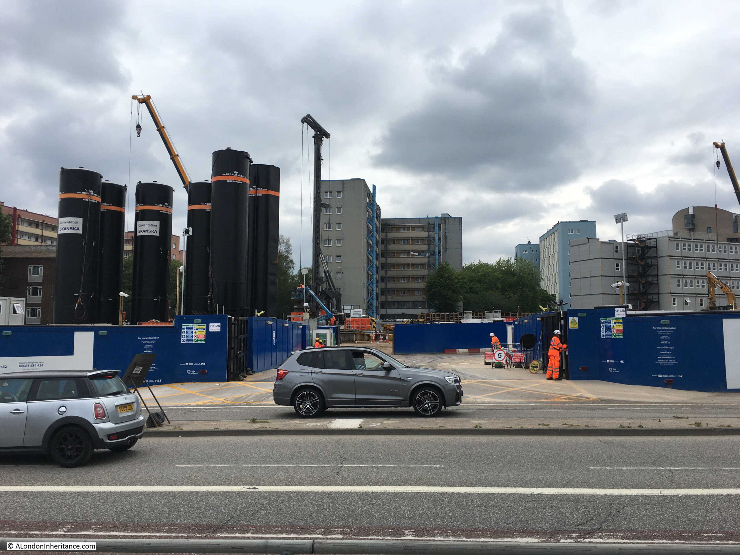
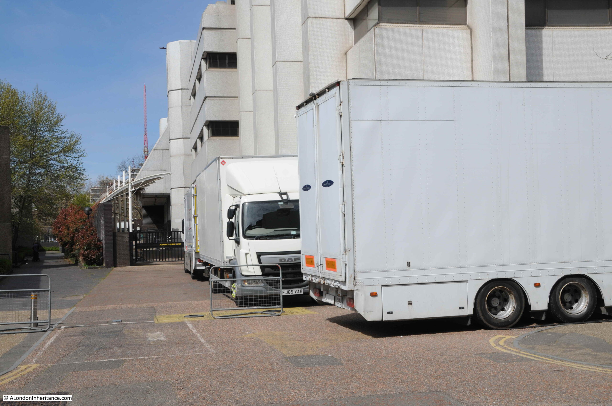
One year on, and in 2021, the majority of the buildings in the surrounding streets have now been demolished, and work has extended to the west of Hampstead Road, along with the grounds between Euston Station and Euston Road. Walking the area now provides an indication of just how large an area is being developed for HS2’s London terminus at Euston station.
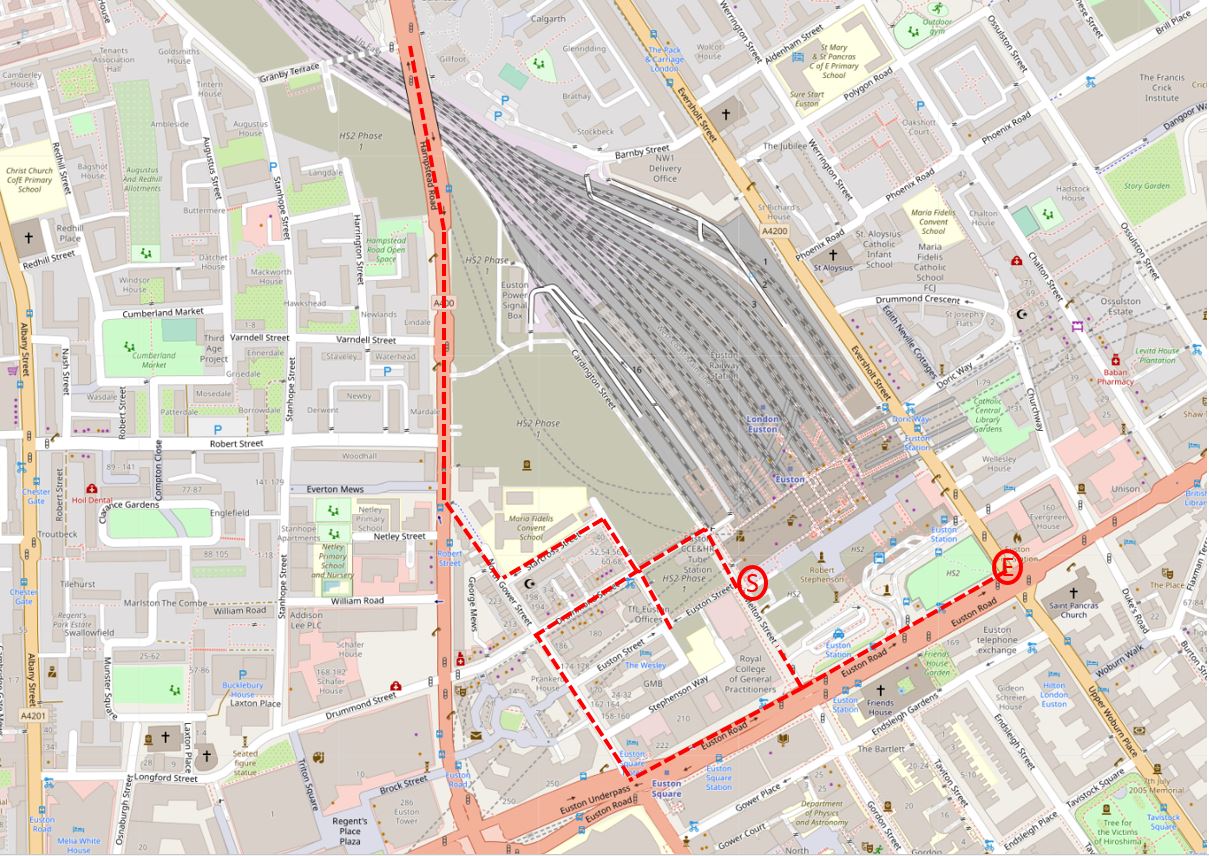
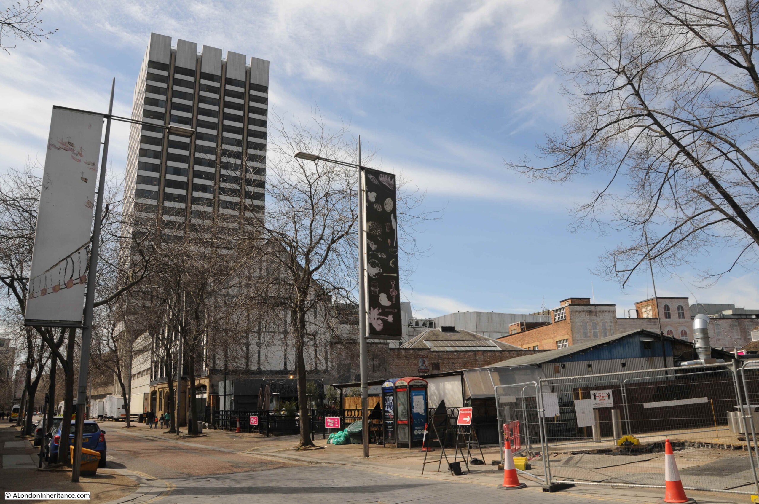
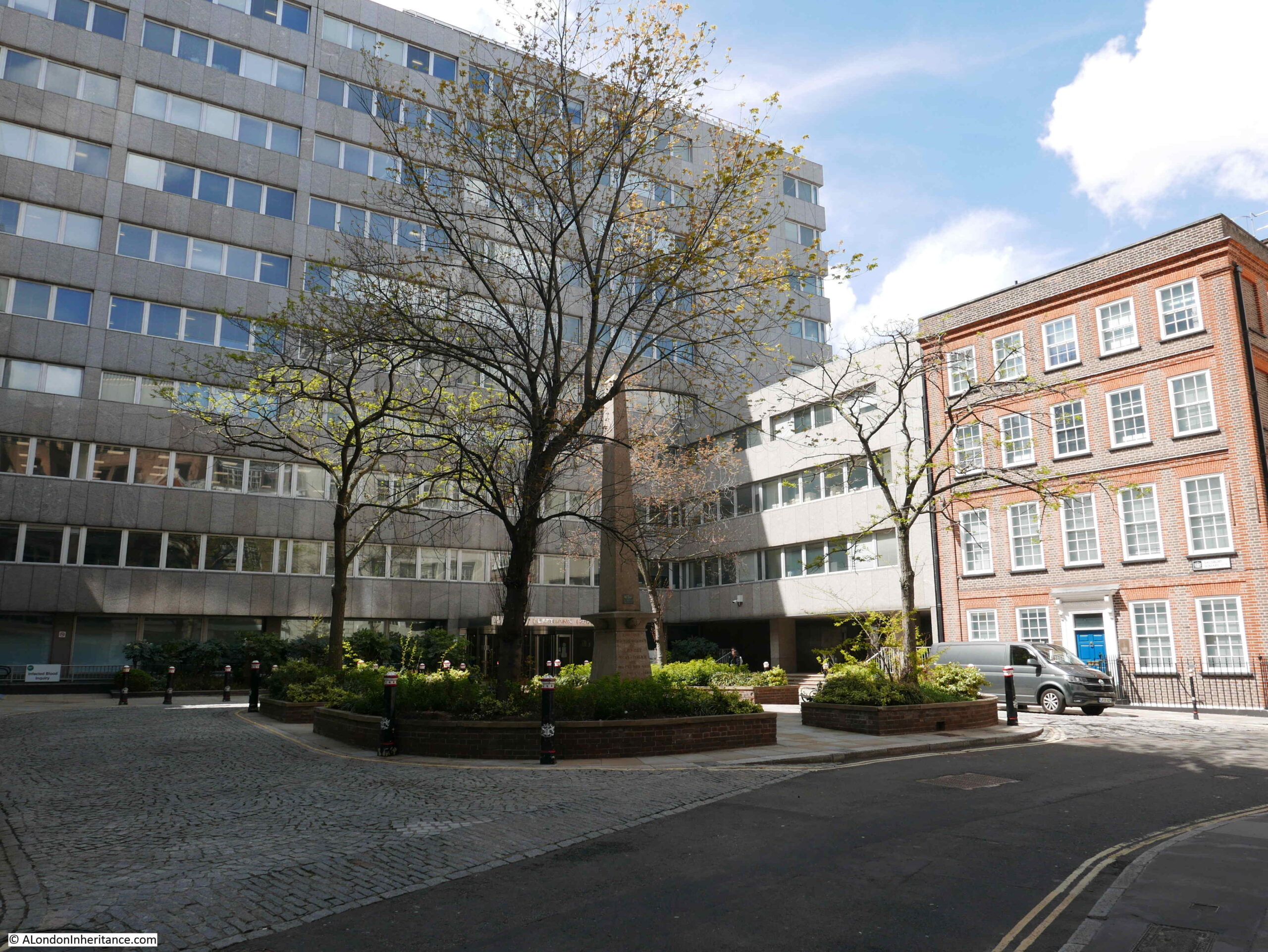
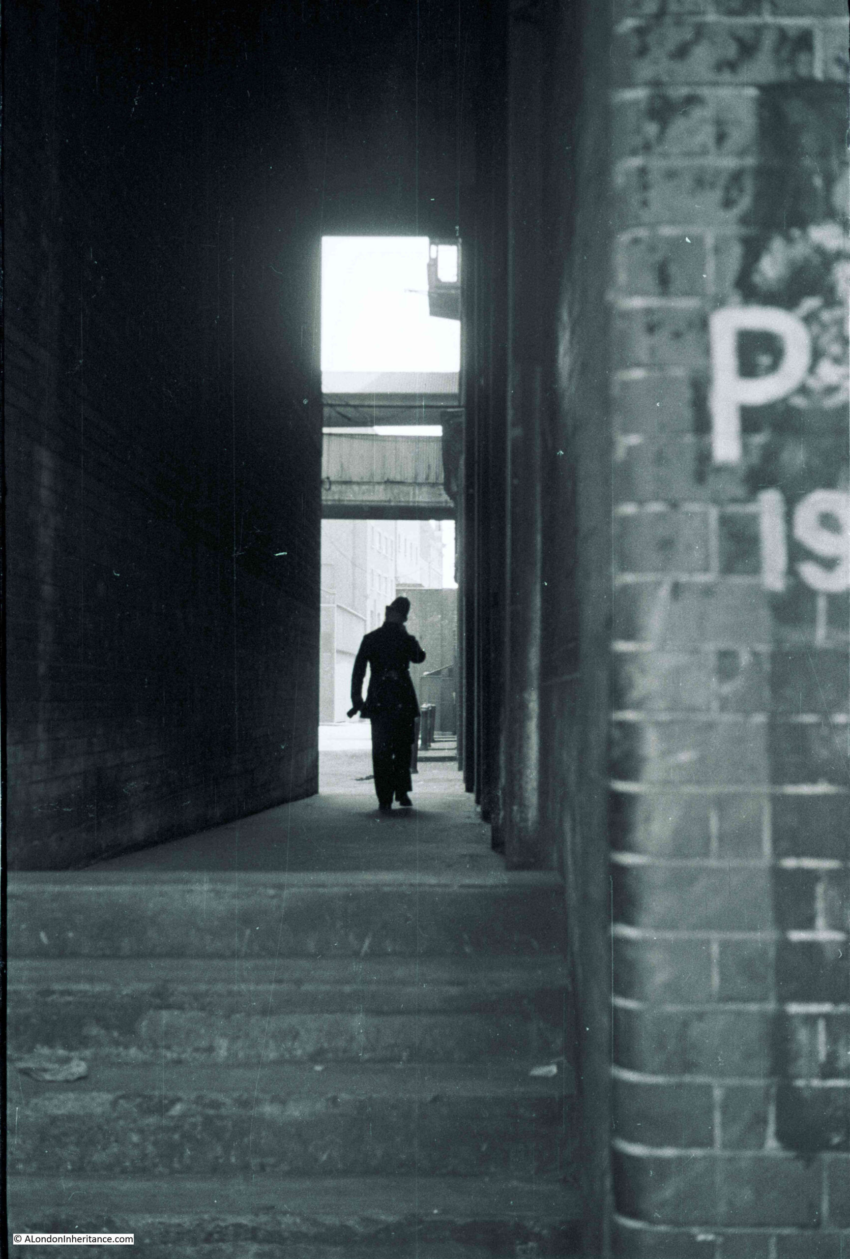
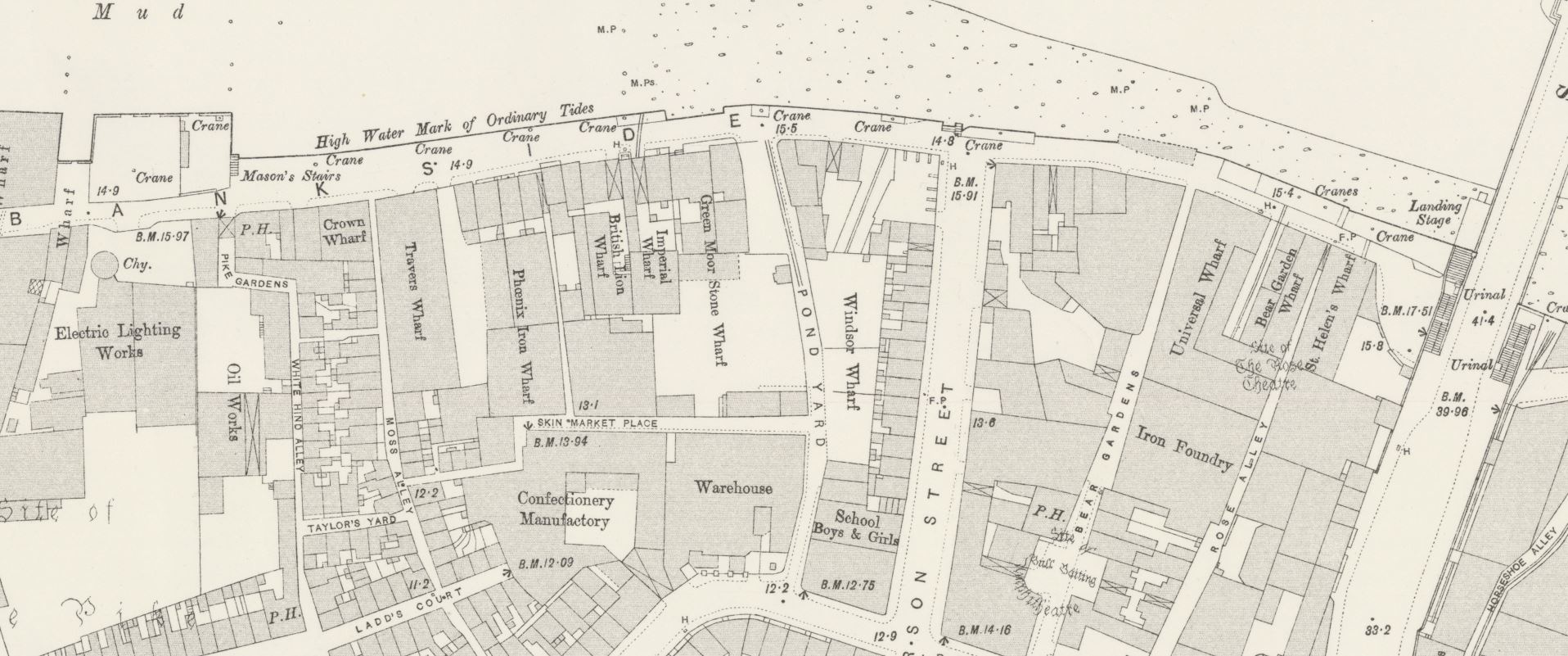
This is the view looking west from point S in the above map, at the south western corner of the station.
The road in the foreground is what was Melton Street, which now provides one of the access routes into the works.
From this point, there are a couple of pedestrian walkways that have been created through the site:
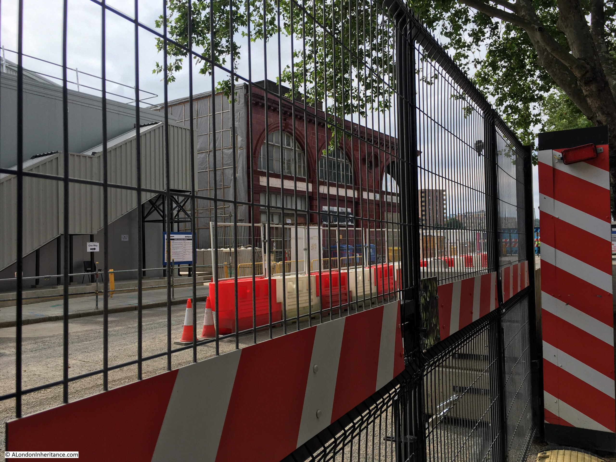
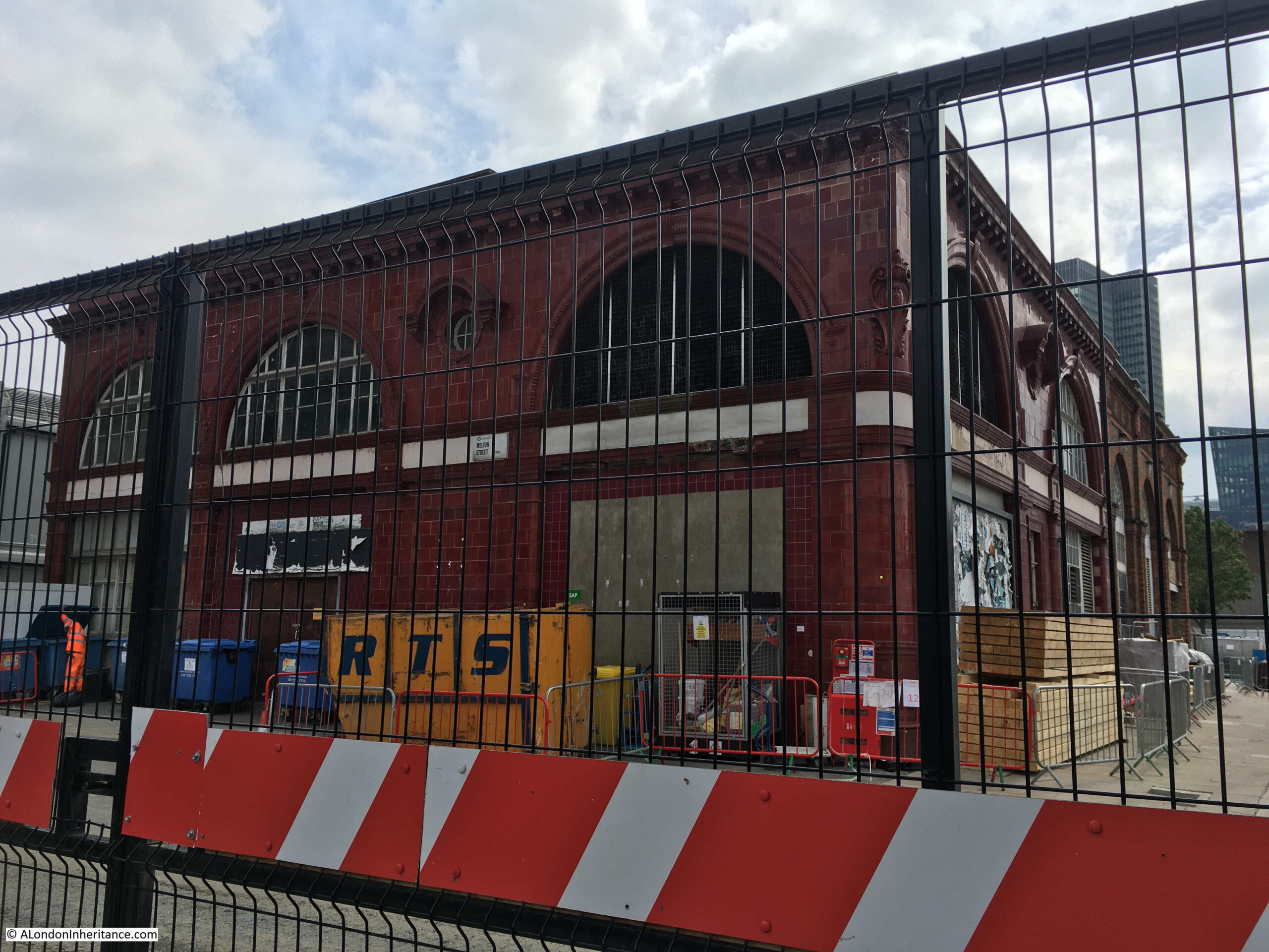
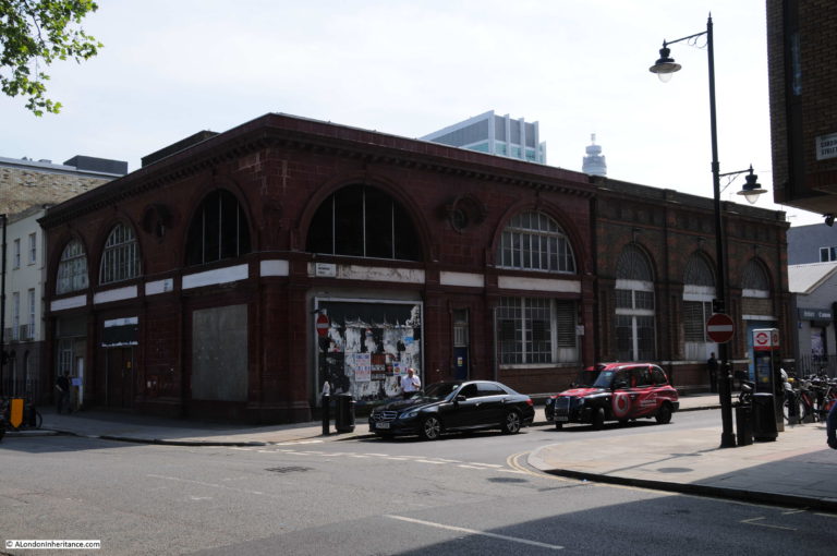
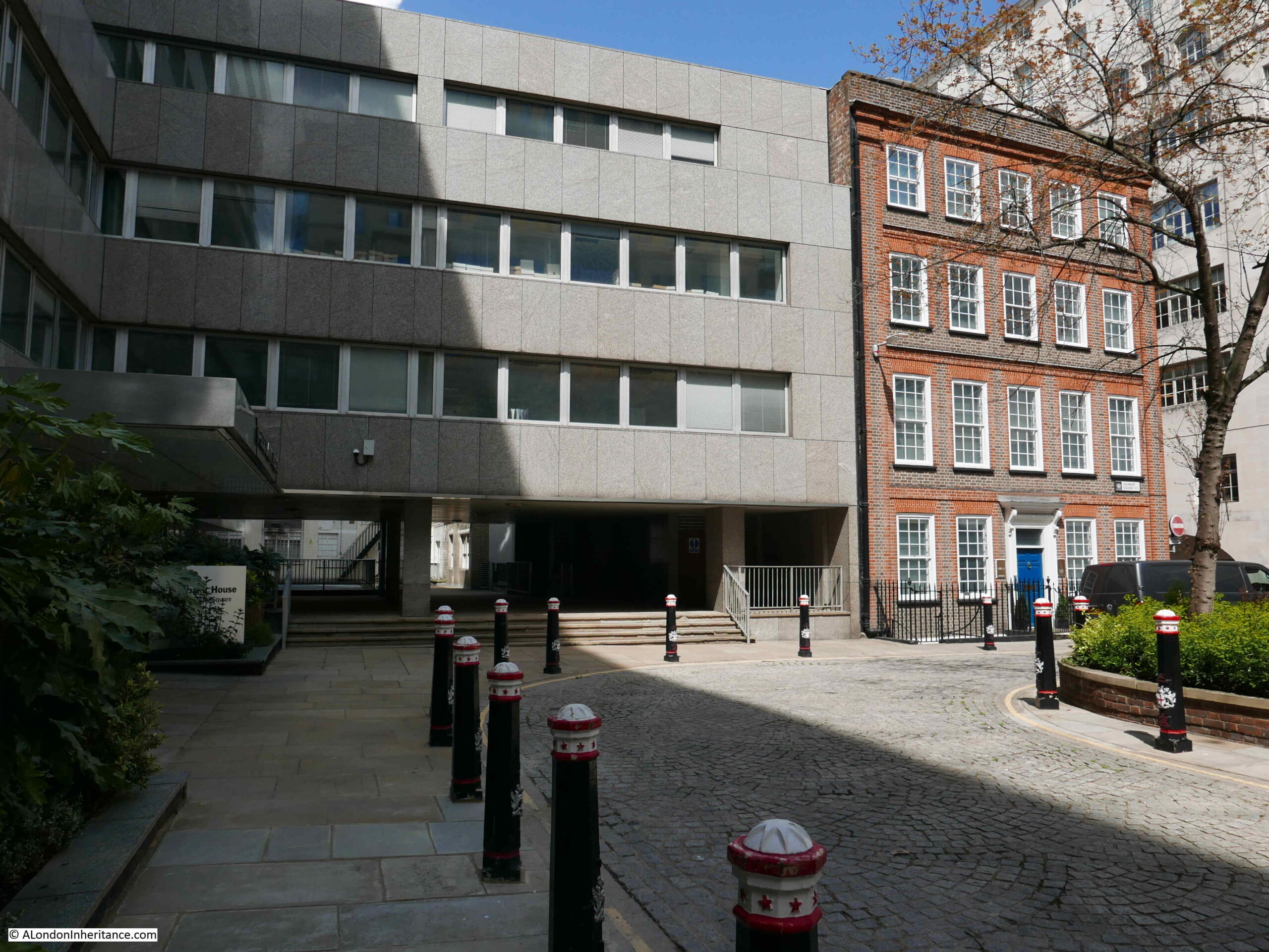
I turned right to head towards Drummond Street. The following photo is looking along the closed Melton Street. The old Euston Underground station of Leslie Green’s distinctive design is the one remaining building on the corner of Melton Street and Drummond Street.
View across Melton Street to the left of the above photo:
Here is the turning which takes you across Melton Street to Drummond Street:
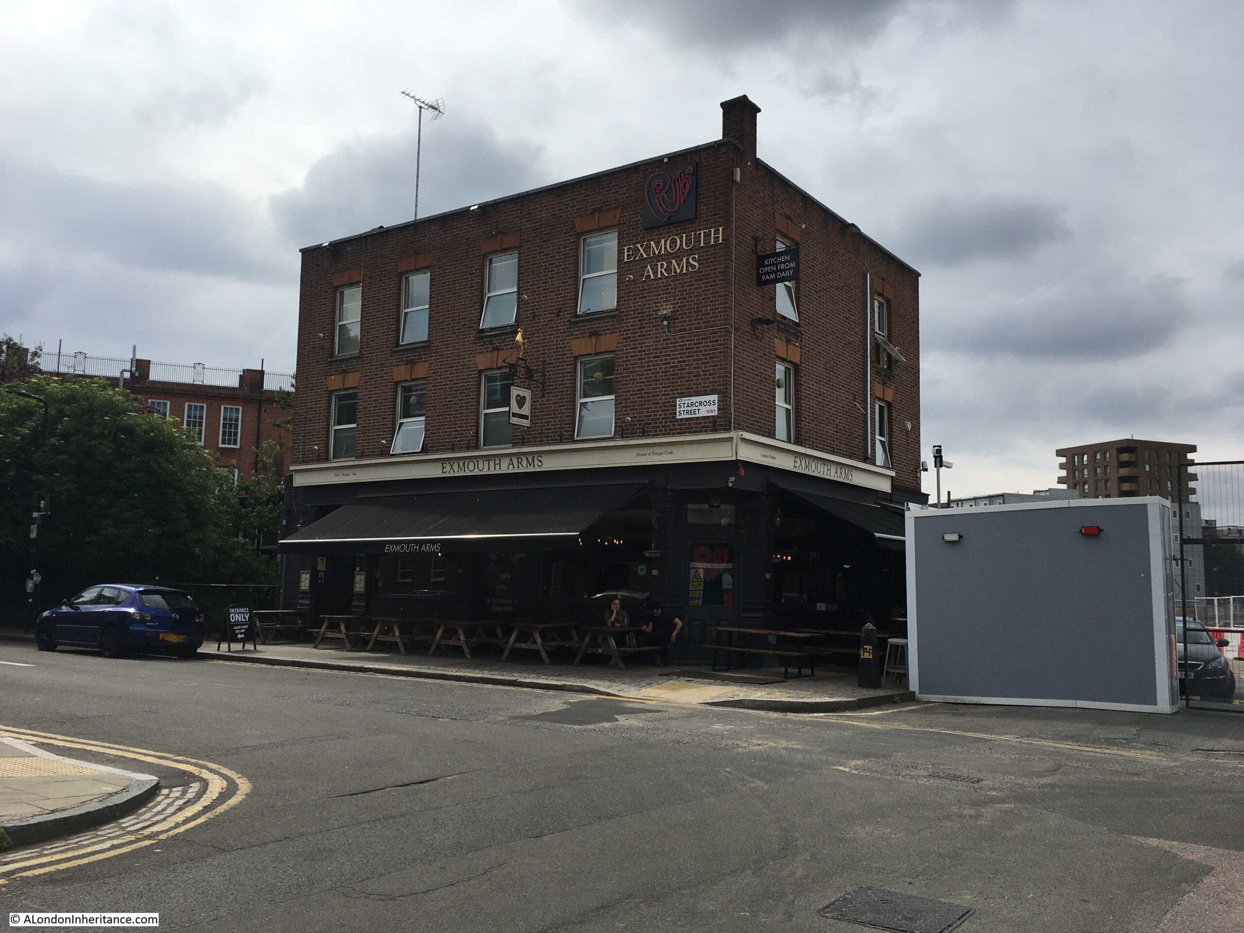
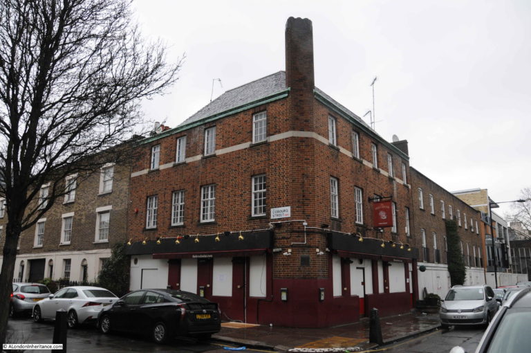
Into Cobourg Street and the Exmouth Arms is still open, on the edge of the construction site.
Another access gate at the end of Cobourg Street:
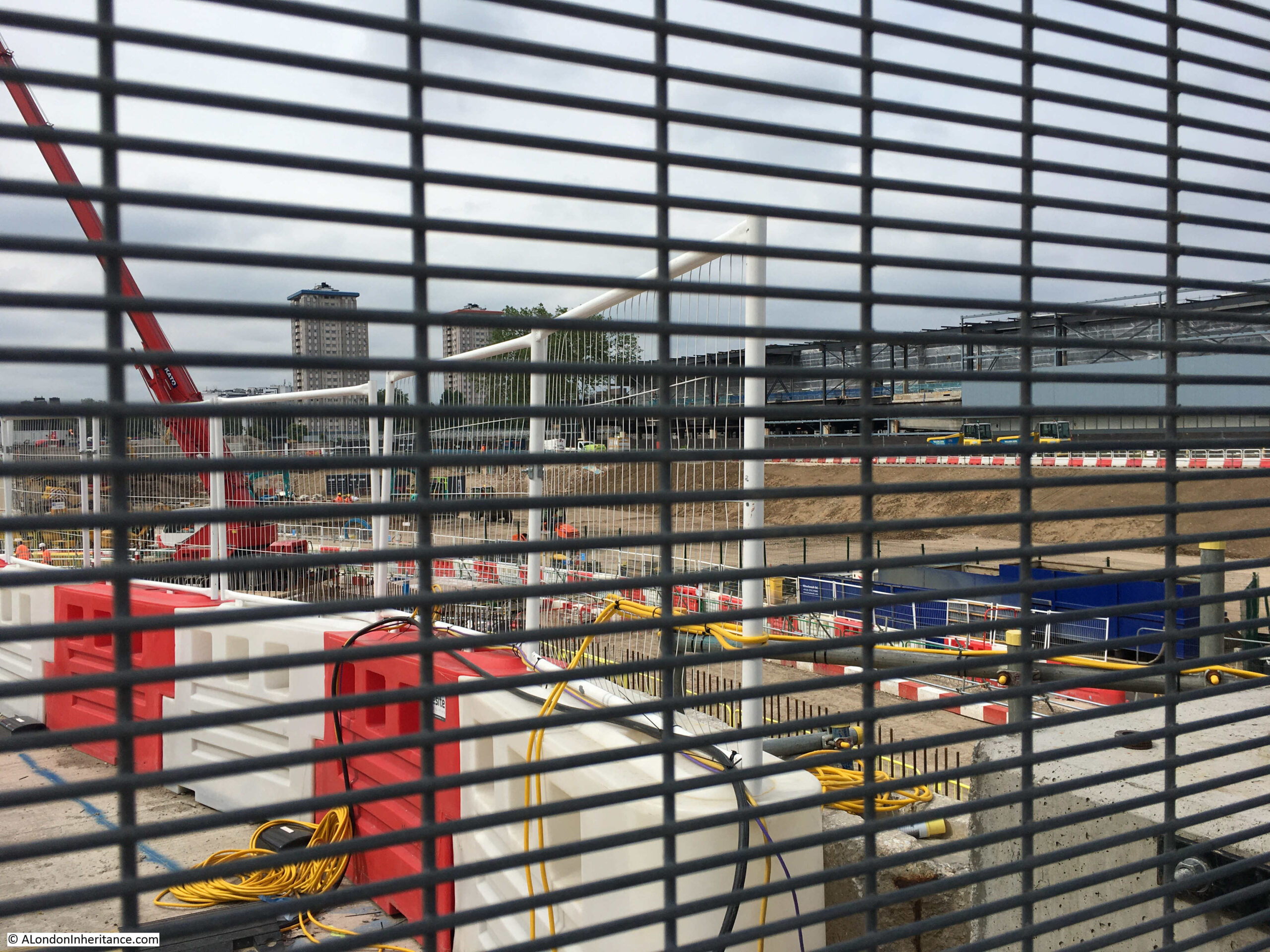
From where we can look out over what was St James Gardens, which is now a large hole:
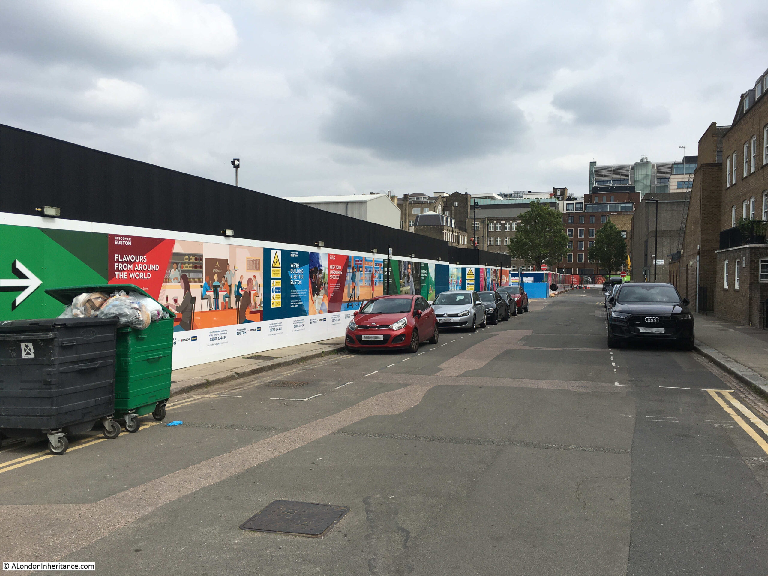
View back along Cobourg Street showing on the left the large and continuous hoardings that have been erected along the edge of the construction site:
I cut through to the Hampstead Road and started walking north. This is the junction of Cardington Street with Hampstead Road:
Walking further north along Hampstead Road and the area to the left of the street, south of the rail lines out of Euston are now another major construction site:
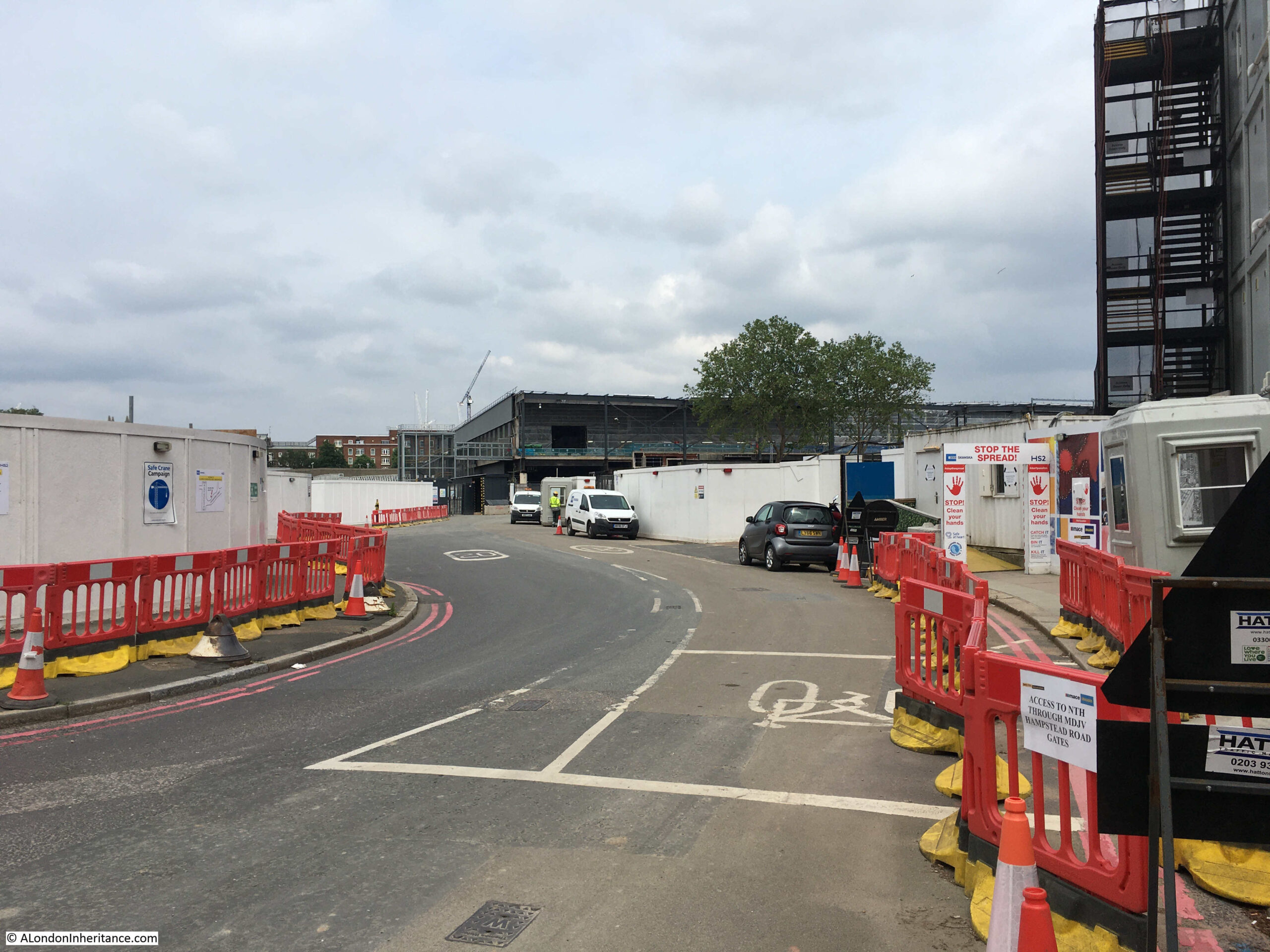
Work had not started here back in February 2020, and now demonstrates how large an area is being covered by the work to create the new Euston Station and HS2. The entrance to the new work area:
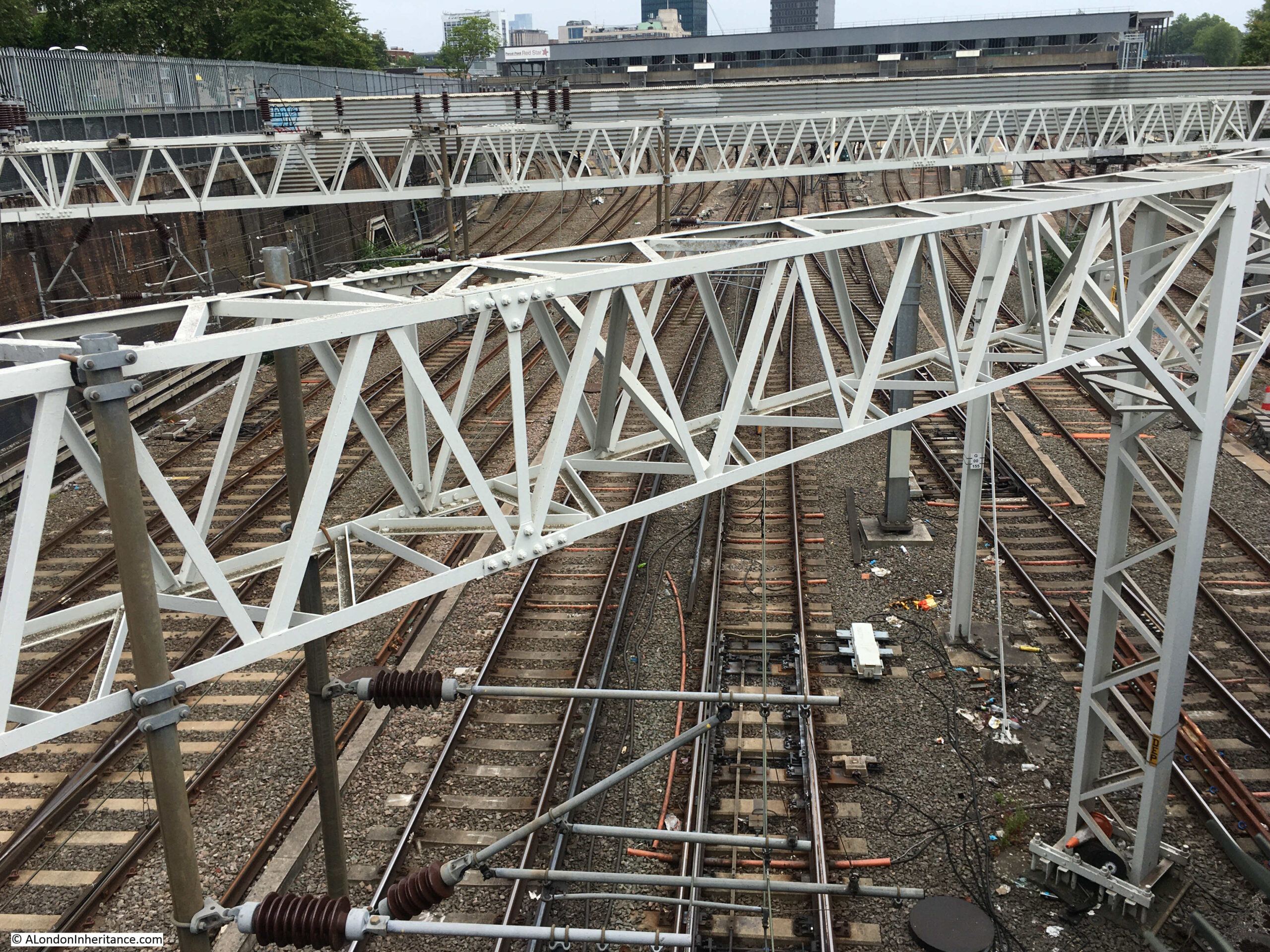
Obligatory camera over the wall shot to see the existing tracks running into Euston:
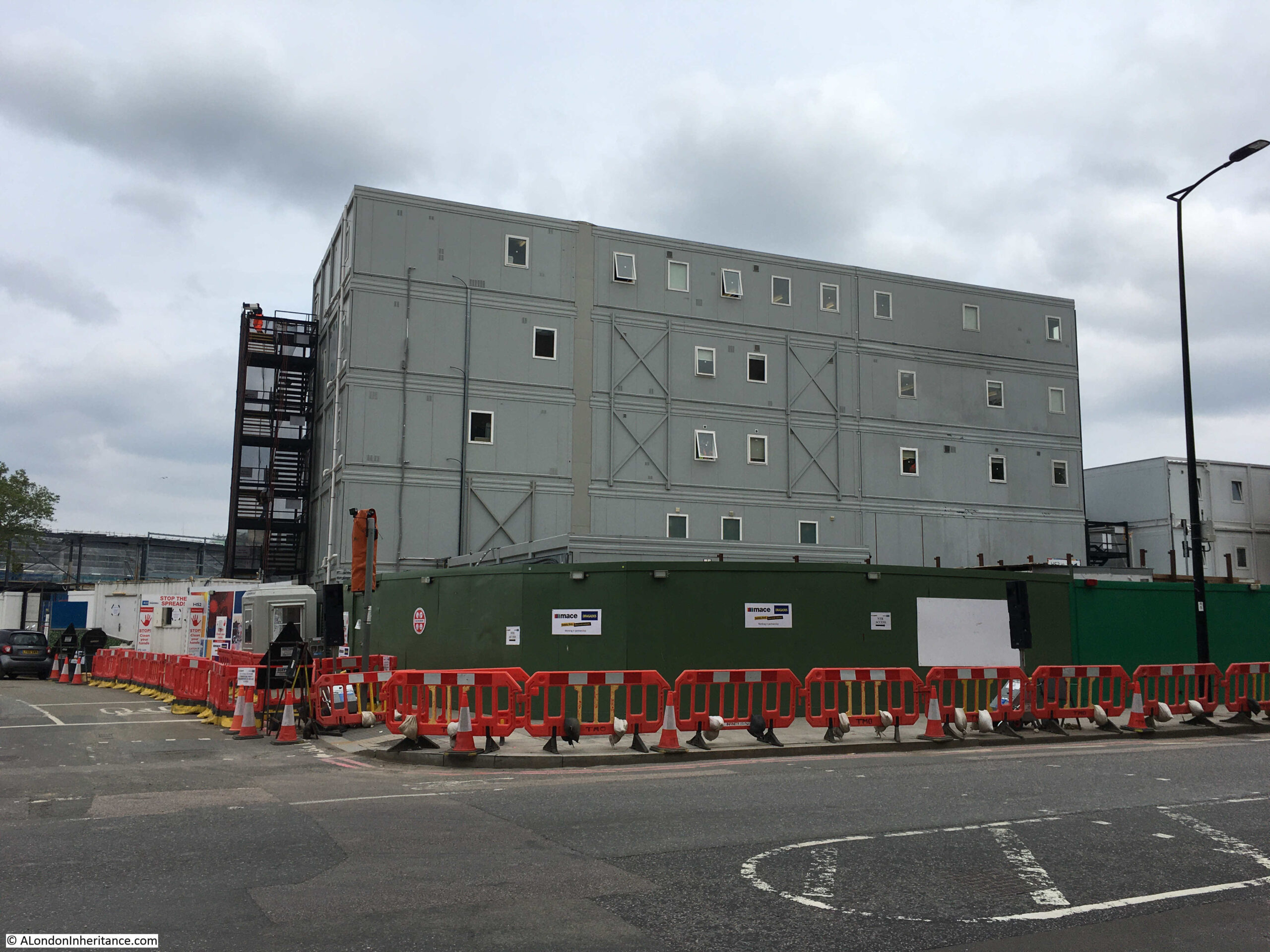
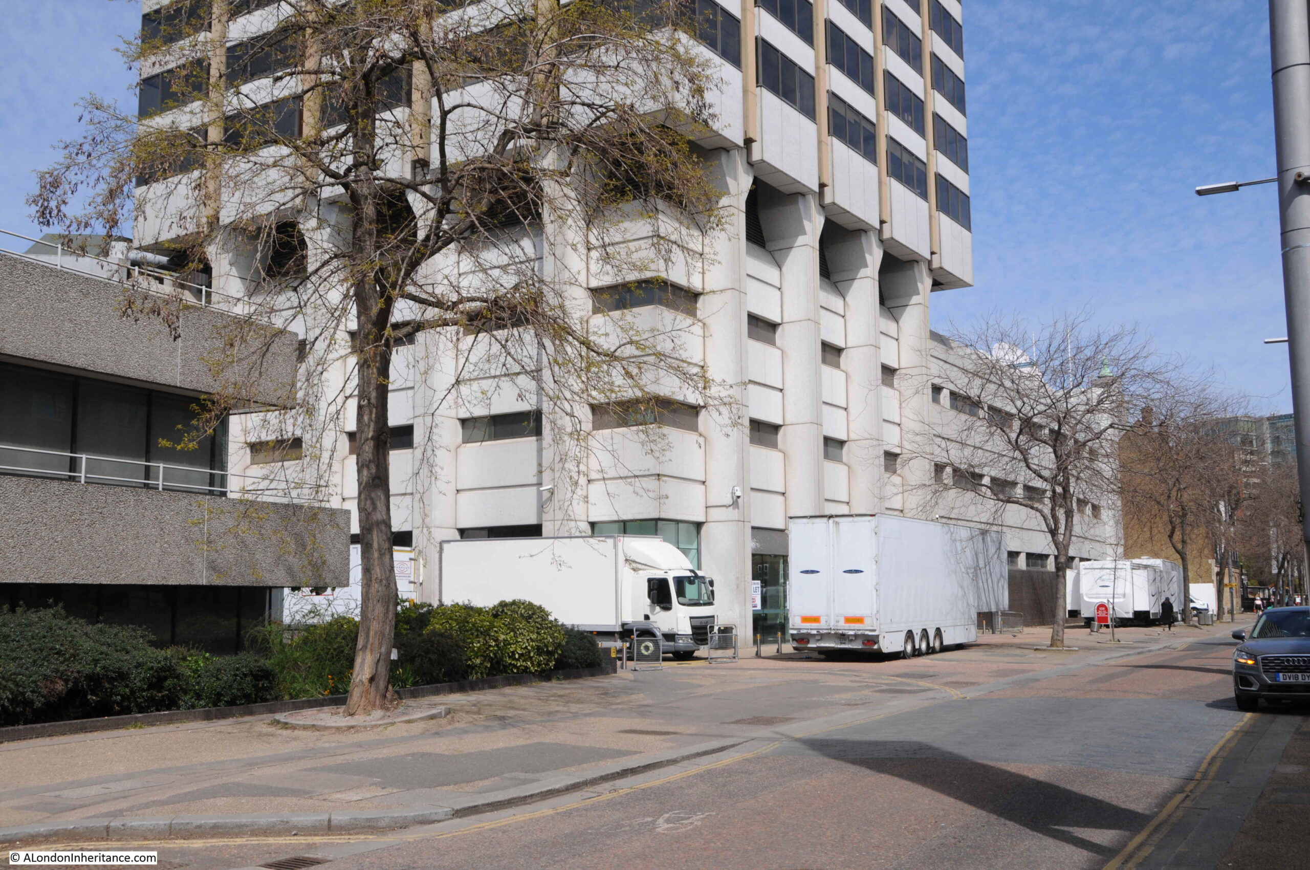
Walking back south along Hampstead Road, and it is not just the geographic size of the construction work, but the related infrastructure, with a number of large, temporary buildings constructed for those working on the site:
Back into Drummond Street and this is looking from the part of the street that has not been touched, through to the demolished section which now forms the pedestrian walking route to Euston station:
Although the western section of many of the surrounding streets are not being demolished, there are several works taking place along their length:
The following photo is from the junction of Euiston Street (which once went straght on) and Cobourg Street on the left:
The above photo was the location of the Bree Louise pub, here photographed just after the pub closed in 2018:
With hoardings in place in 2019:
Work blocking off Regnart Buildings:
View along Cobourg Street from the end of Euston Street:
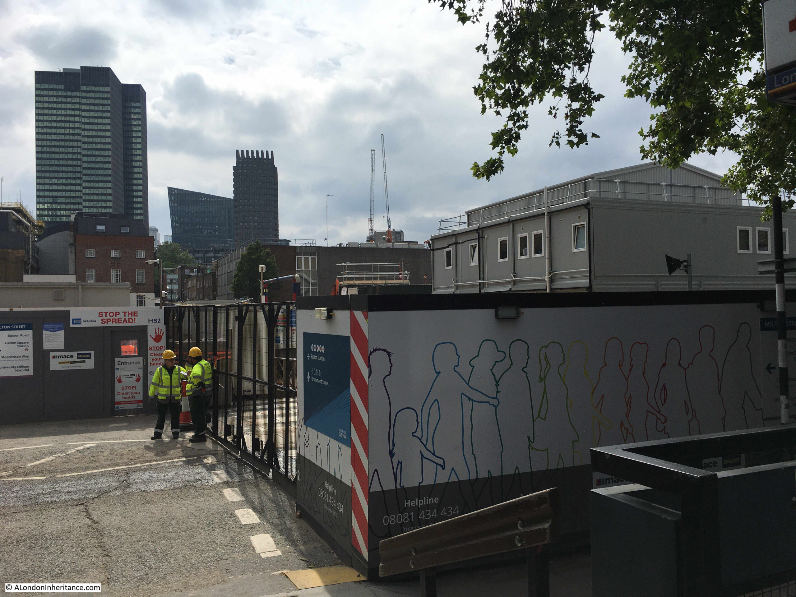
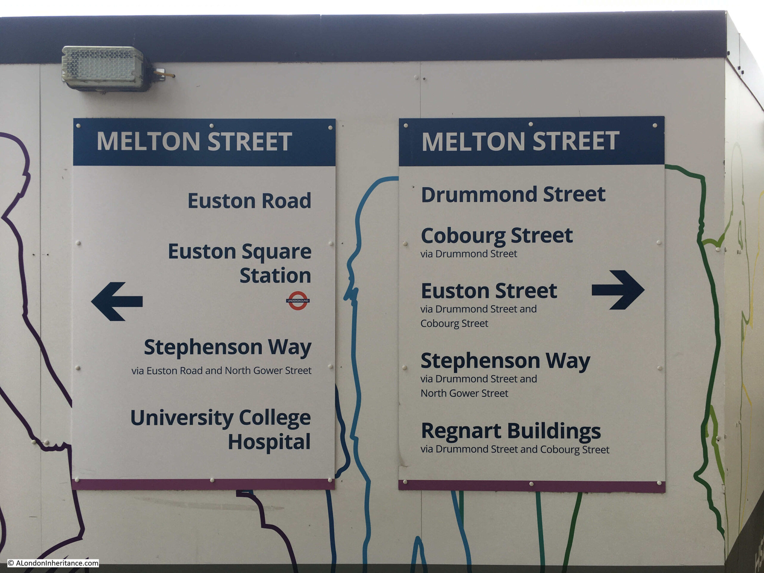
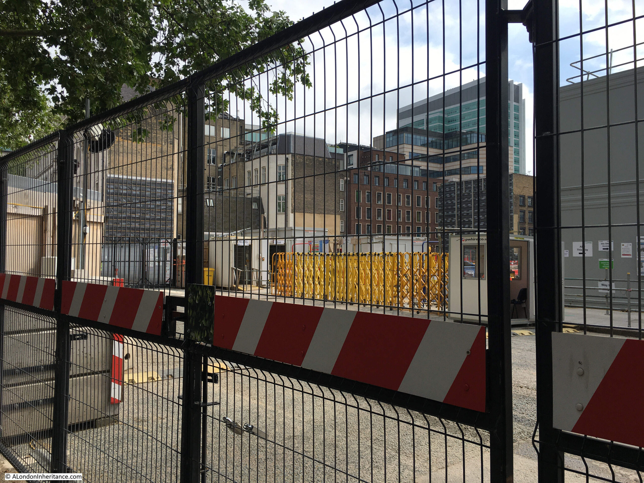
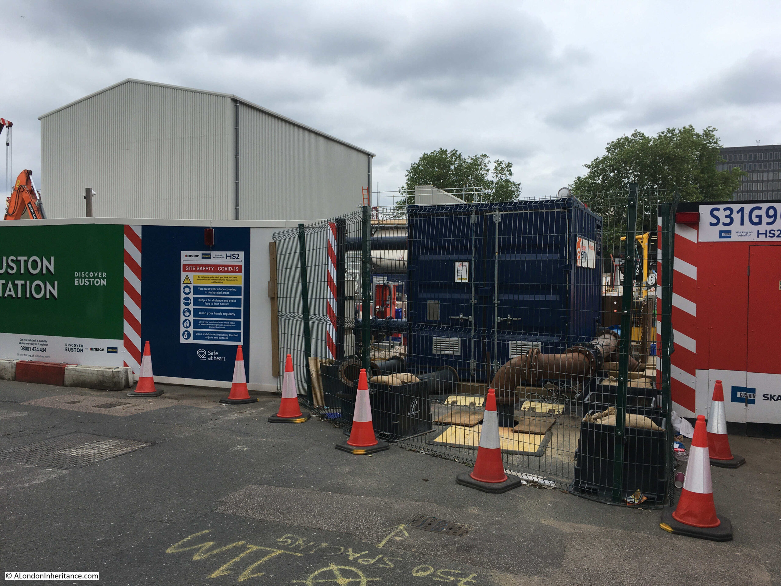
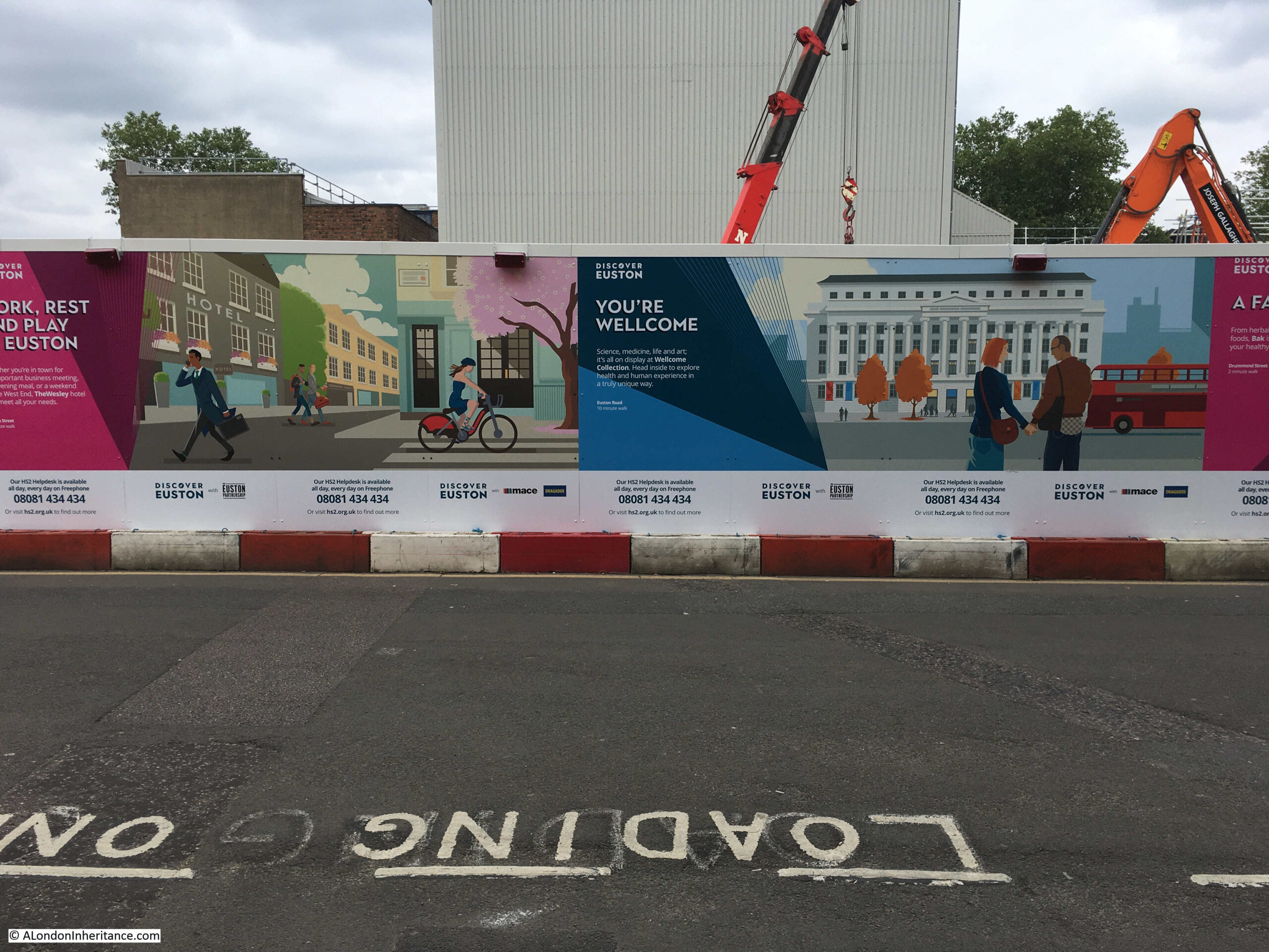
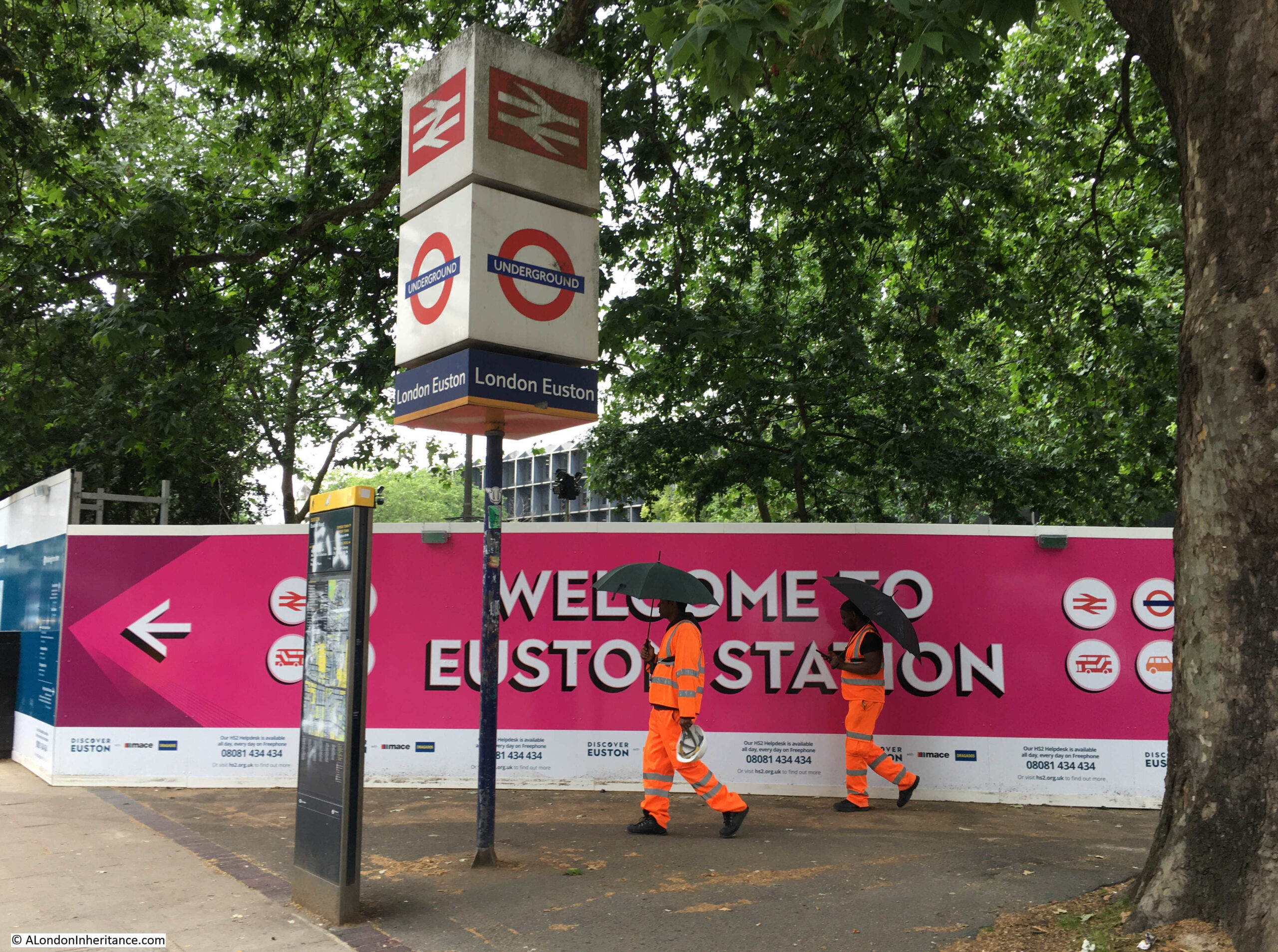
The whole construction site is very secure, with very few points to look in and see the work underway. Tall hoardings with information about local businesses and institutes, what there is to find in the area, the history of Euston station, the future HS2 etc. line the entire site, with well protected work access points the only means of access:
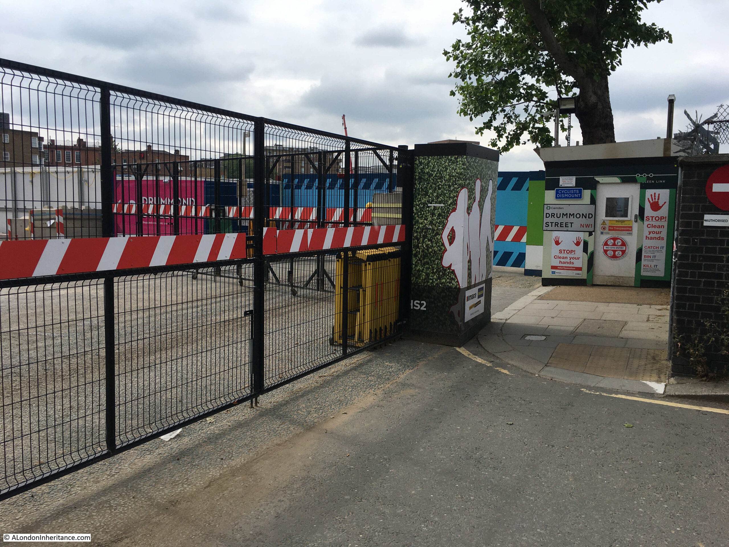
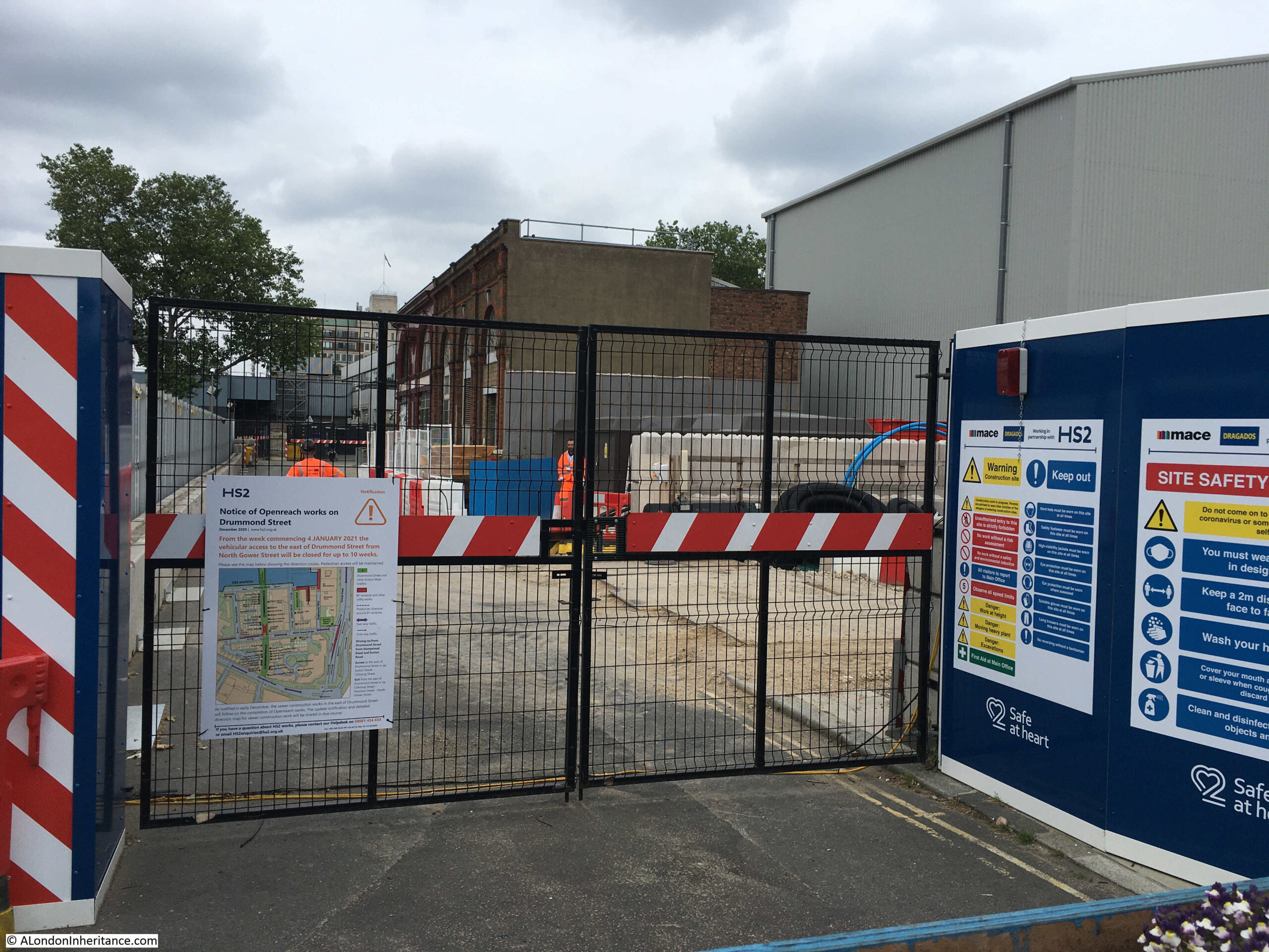
Work access point at the entrance to what was the eastern section of Drummond Street:
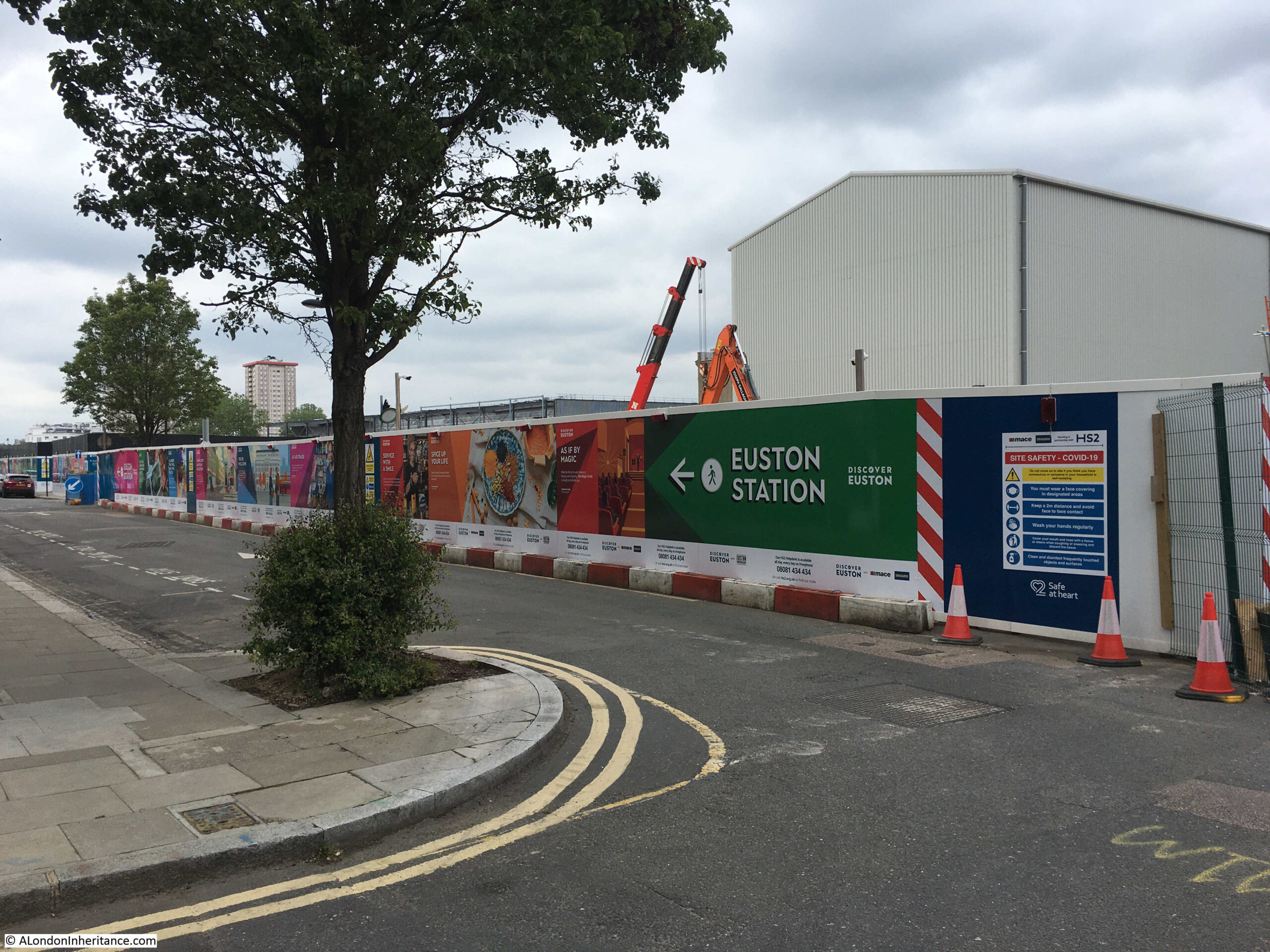
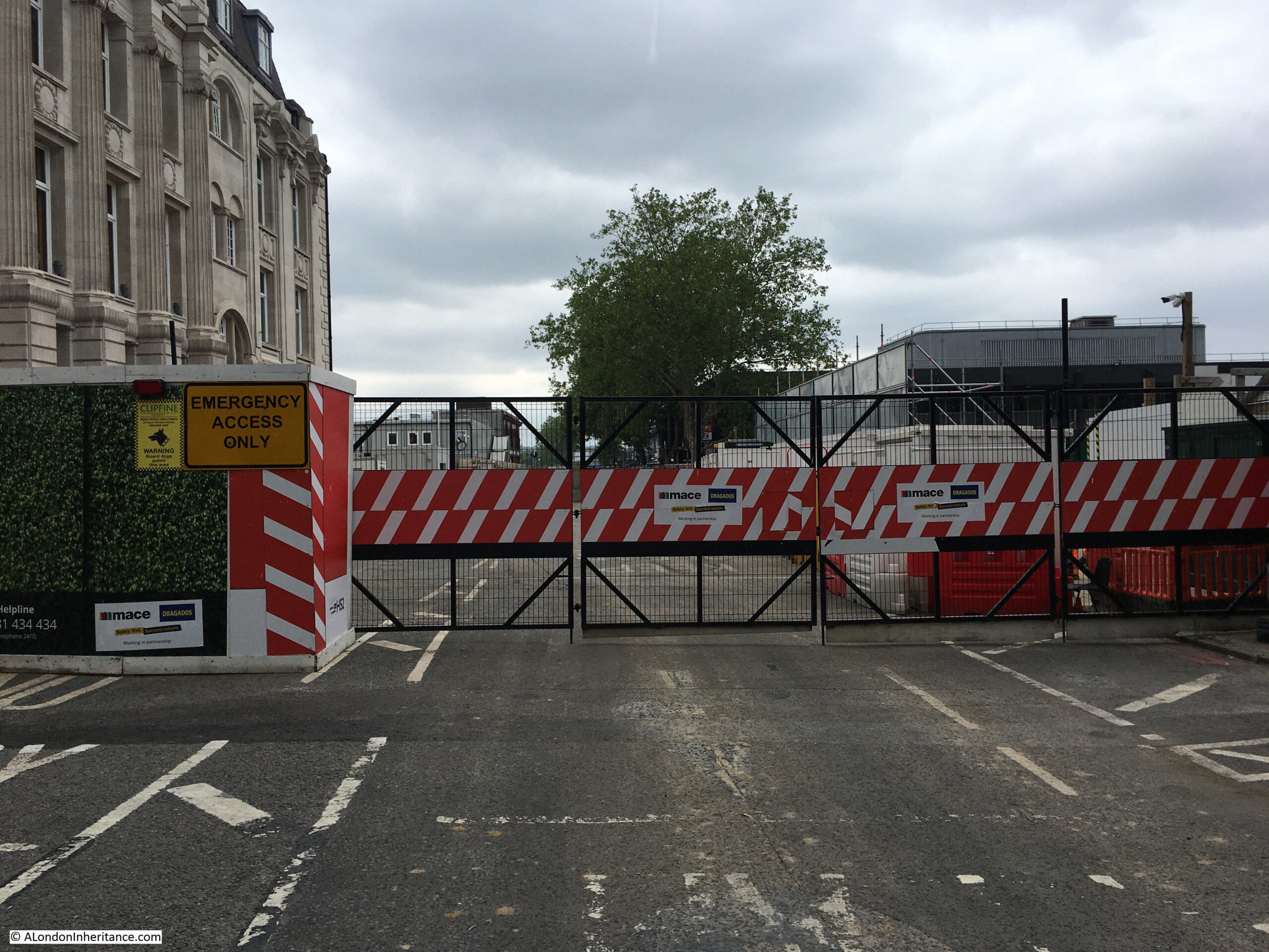
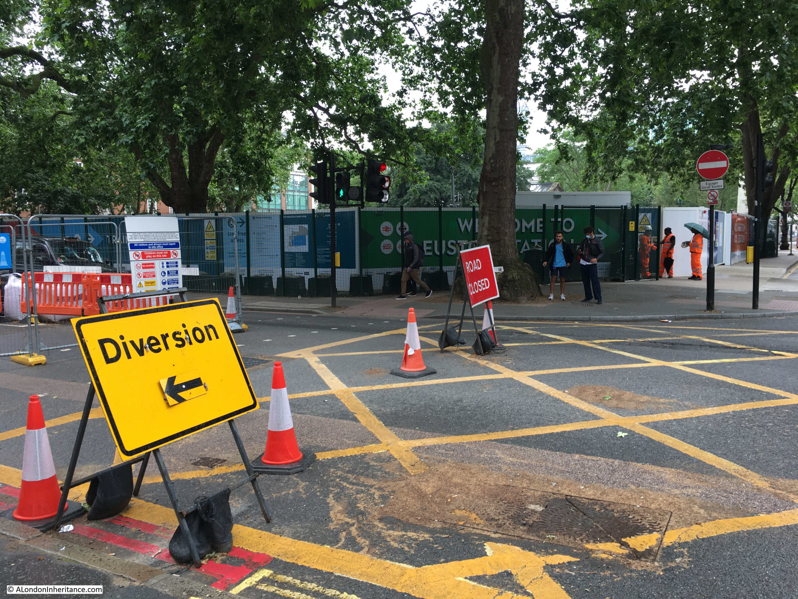
Walking back to Euston Road, and this is the Melton Street access point:
There is now only a short length of Melton Street in use, providing access for taxis and drop offs at the station to the immediate right. The traffic lights providing access to Euston Road only seem to change to green for a couple of vehicles, resulting in a number of rather irate drivers.
Further along Euston Road, and this view is looking across the bus access road to the station, to what was green space in front of the station:
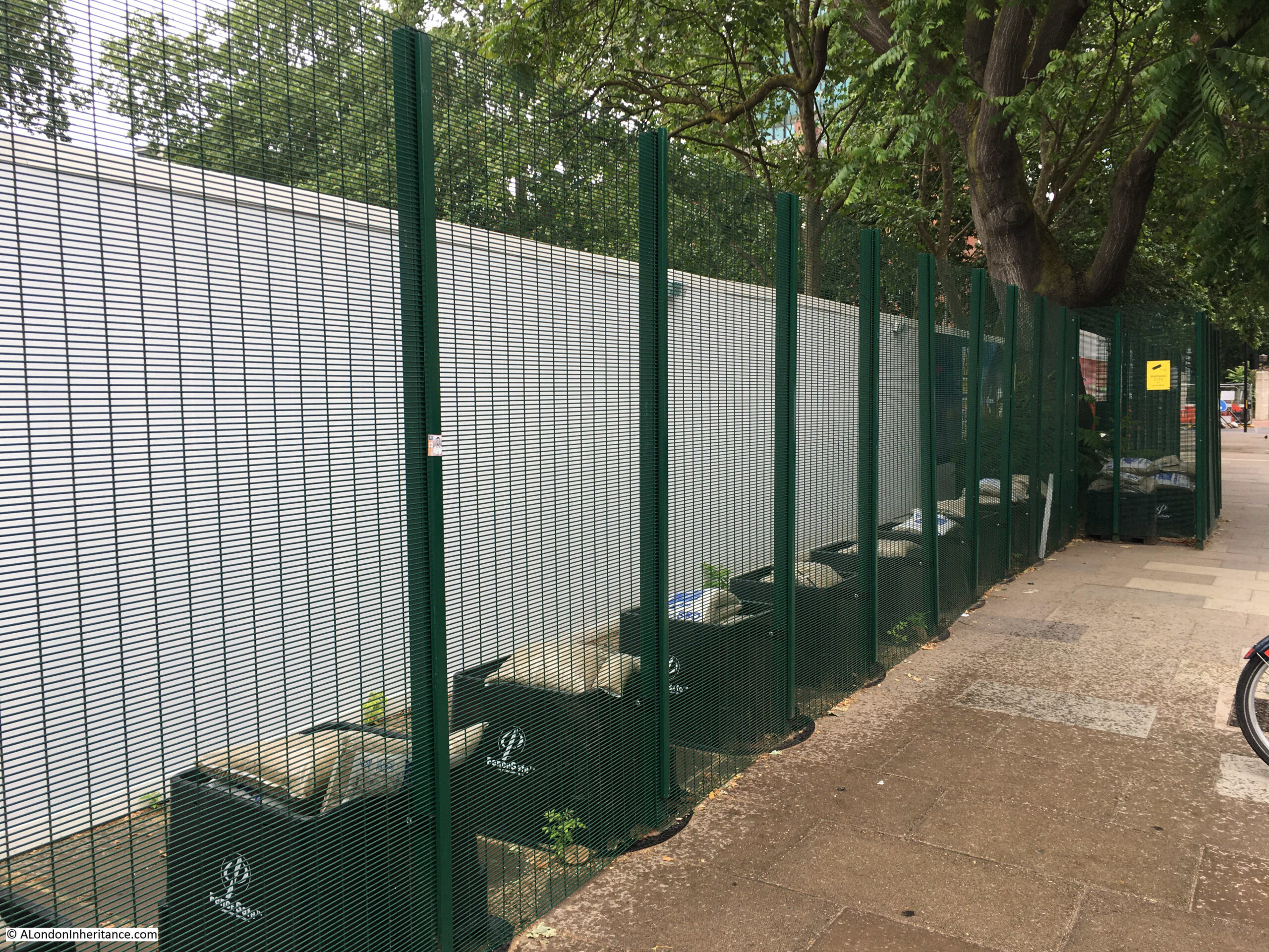
This green space is where demonstrators occupied the trees and dug tunnels a few months ago. Fencing around the site now seems to resemble some form of high secure establishment rather than a constructiion site.
Two layers of fencing, with an outer green mesh metal fence, and inner hoardings:
Indeed the whole Euston Station and HS2 construction site is the most secure of this type of construction site that I have seen. As well as the metal fencing and continuous hoardings through the site, there are plenty of orange high-vis security staff guarding entrances and walking the boundaries.
North east corner of the green space in front of the station. Closed Euston Square leading up to Euston Road on the left resulting in buses coming out of the station having to divert around Grafton Place adding to the congestion in the area:
The corner of Euston Square and Euston Road:
From the walkways and streets available to the public, there is really not much to see. The construction phase has reached what appears to be the end of demolition, there are plenty of big holes in the ground and temporary structures, but nothing yet of the new station.
According to the HS2 web site, “Phase One will open between 2029 and 2033”, so a minimum of eight more annual posts walking around Euston Station and HS2, more probably around twelve. By 2033 this area will look very different.
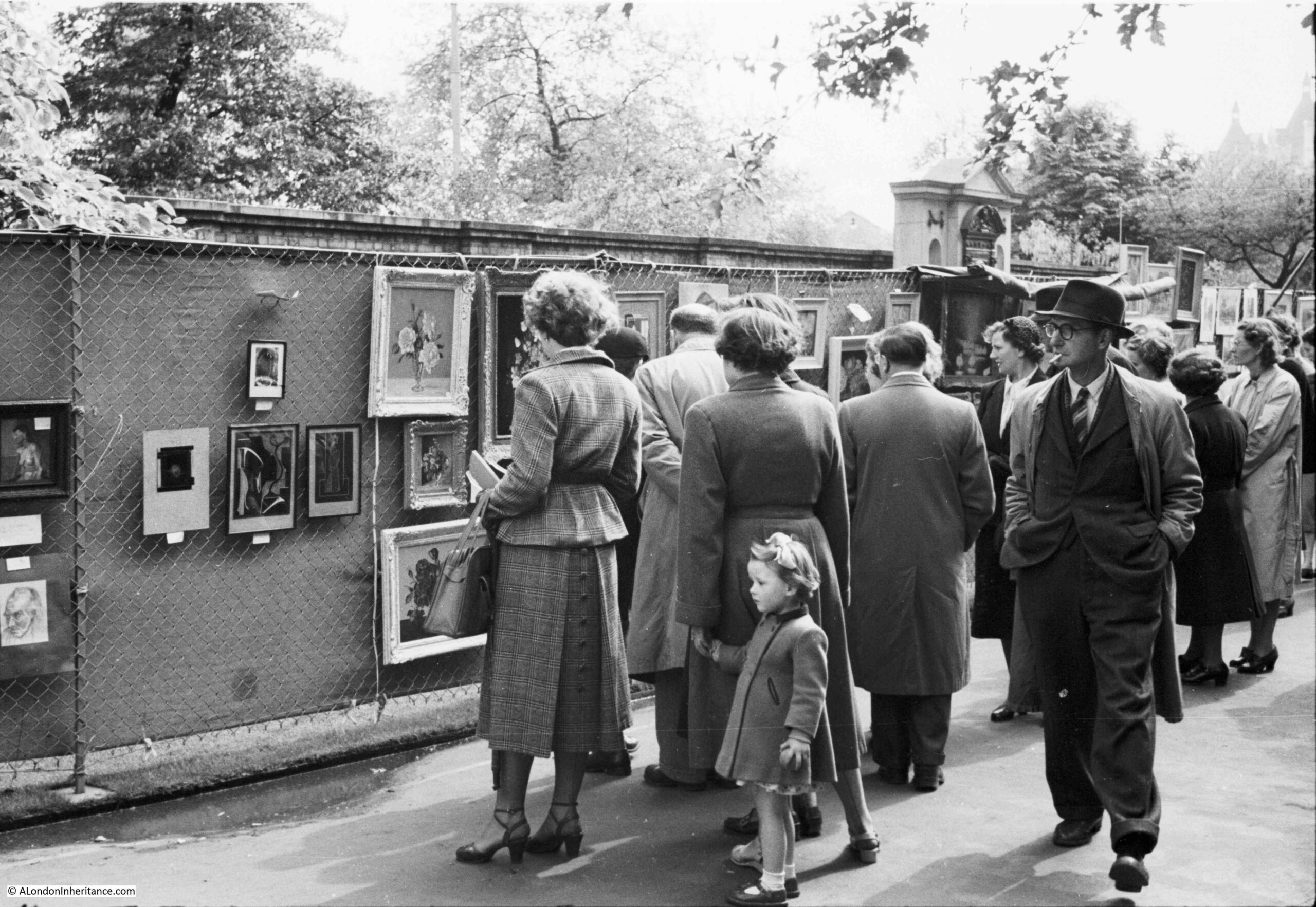
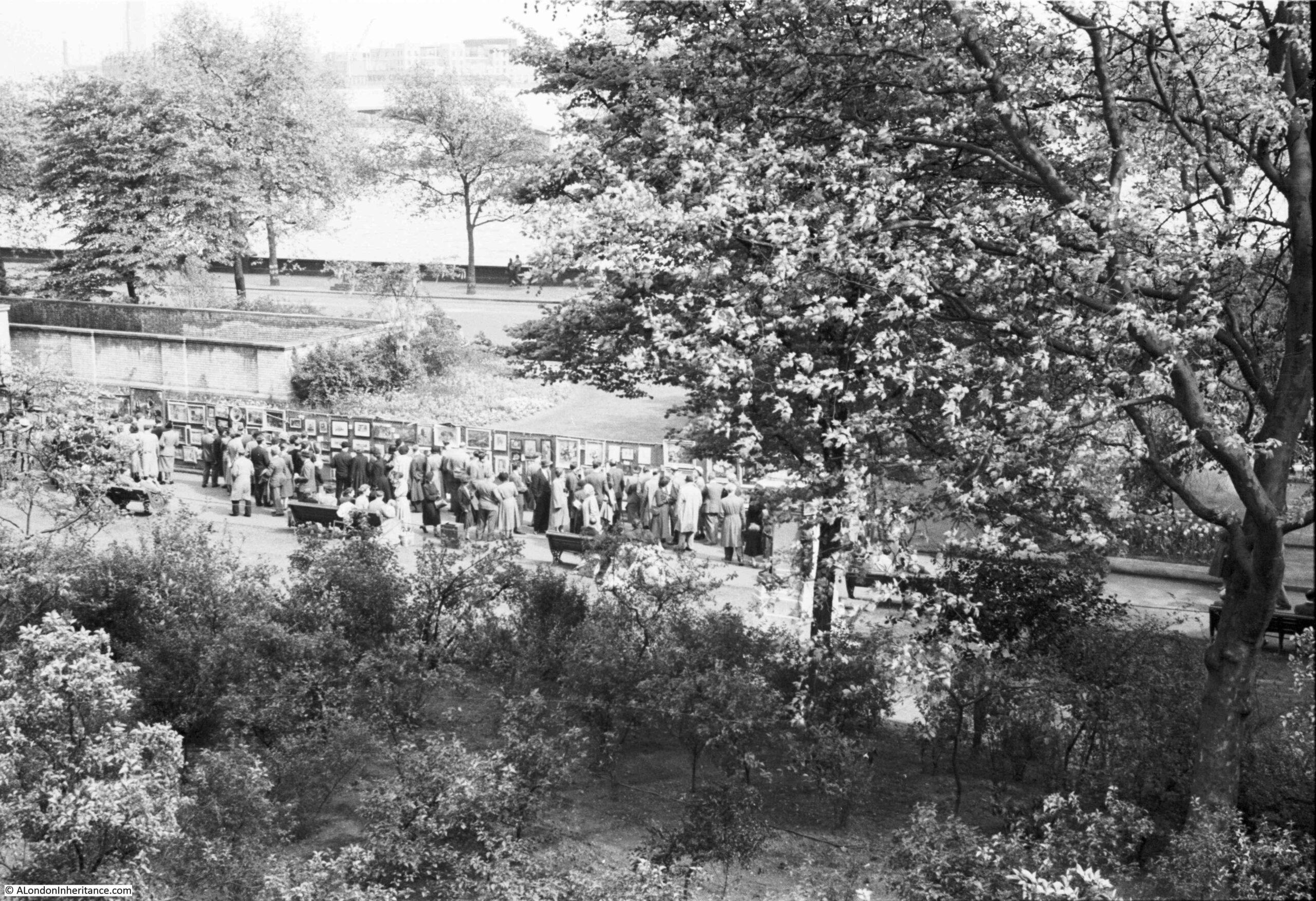
The Victoria Embankment Gardens has often been the location for an open air art exhibition, and a couple of the photos in my father’s collection show the 1952 exhibition:
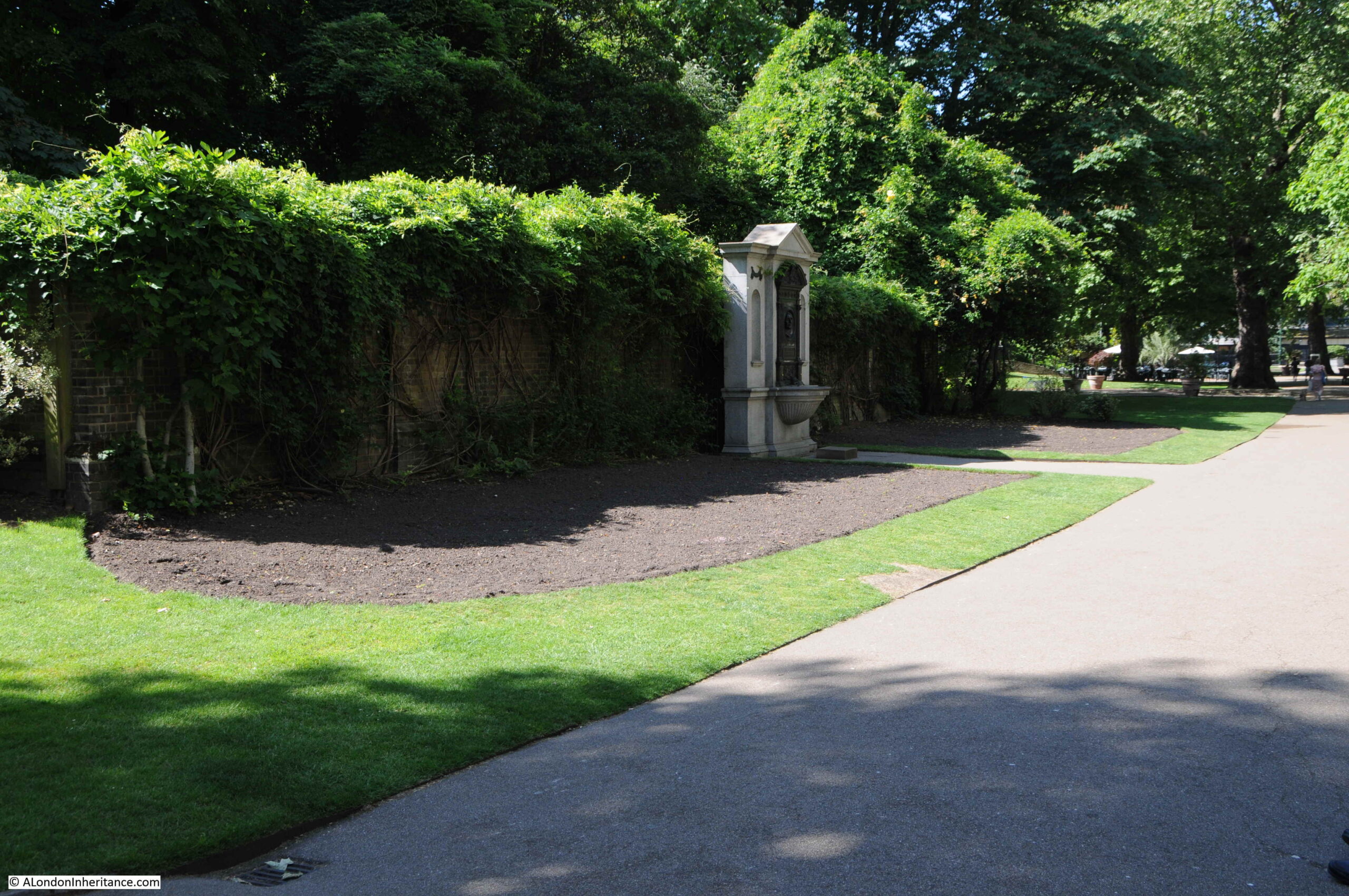
This could have been a difficult photo to locate, however the feature in the background made it easy to find the exact place. This is the same scene on a very sunny June day in 2021:
The first exhibition appears to have been in 1948, as an article in the Sphere on the 23rd May 1953 describes that year’s exhibition as the sixth annual open air exhibition of contemporary art. The article also states that the exhibitions were sponsored by the London County Council, and that “On all days except the final day the pictures are for sale”, which seems rather strange, not also to sell them on the final day of the exhibition.
Exhibitions also seem to have been during part of the month of May, which would explain the coats worn by those in the photo, although that could really be any summer’s day given typical British weather.
The little girl in the photo looks to be around five or six. She would now be around 75 and the only one from the photo still alive.
The Illustrated London News on the 12th May 1962 describes that year’s exhibition as opening on the 30th April and running to the 12th May, with 700 paintings on display from both amateur and professional artists.
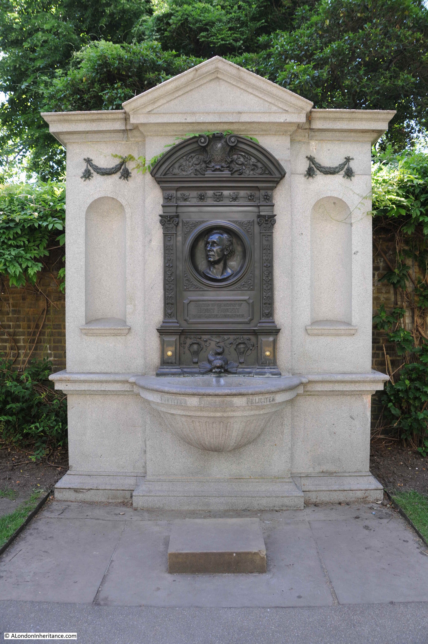
The monument behind the exhibition which enabled the location to be found, is to Henry Fawcett, the rather remarkable blind MP who championed the cause of women’s suffrage. His interests in the cause led him to meet Elizabeth Garrett who rejected his proposal of marriage in order to concentrate on becoming a doctor. He went on to marry Elizabeth’s younger sister, Millicent Garrett.
A statue of Millicent Garret Fawcett was unveiled in Parliament Square in 2018 with the words from one of her speeches “Courage calls to courage everywhere”.
The wall behind the monument is part of one of the air vents to the cut and cover underground Circle and District lines, a short distance below the surface.
The monument to Henry Fawcett:
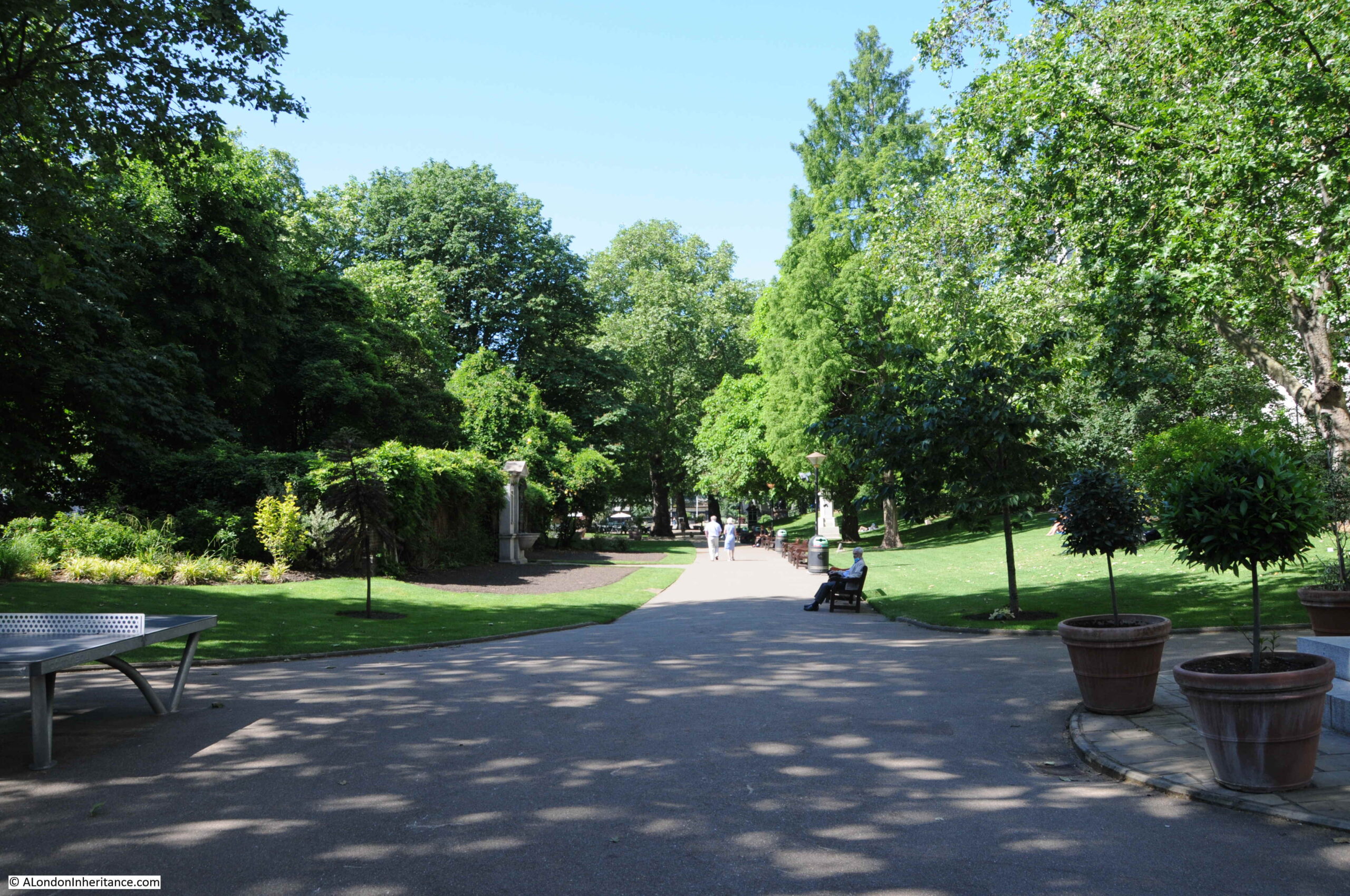
A wider view of Embankment Gardens, with the monument on the left.
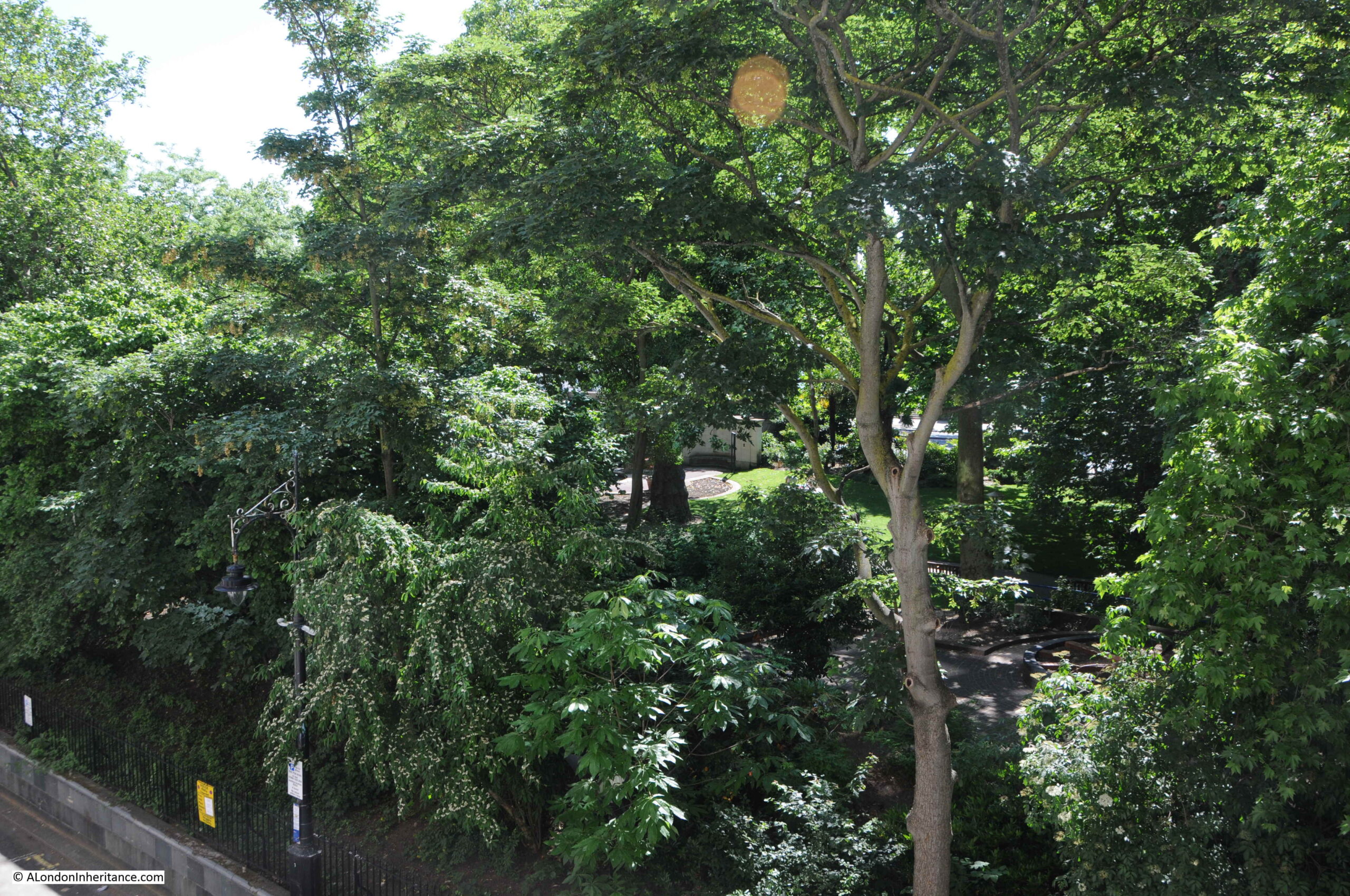
The gardens are looking very green with plenty of plants and trees, which would cause a problem trying to recreate the following photo of the art exhibition:
My father took the above picture from the Adelphi Terrace, overlooking the gardens. The art exhibition is running along the pathway through the gardens, and shows how far to the right the exhibition ran, as the edge of the Fawcett monument can just be seen on the very left edge of the photo. The Thames and Waterloo Bridge can be seen in the background.
Adelphi Terrace, from where the above photo was taken is shown in the following photo:
I walked up and down the terrace looking over the wall to the gardens below, trying to recreate my father’s photo, however the trees and bushes have grown considerably since 1952, and the best I could get was the following photo:
There is a small bit of wall visible in the gardens in the centre of the photo. This is not the monument or wall in the 1952 photo, rather a nearby fish pond, a short distance from where the art exhibition was held, and the nearest I could get to recreating the photo.
The Adelphi Terrace is in front of the Adelphi building, and raises the street around the Adelphi up above Savoy Place which runs at ground level between the Adelphi building and Embankment Gardens.
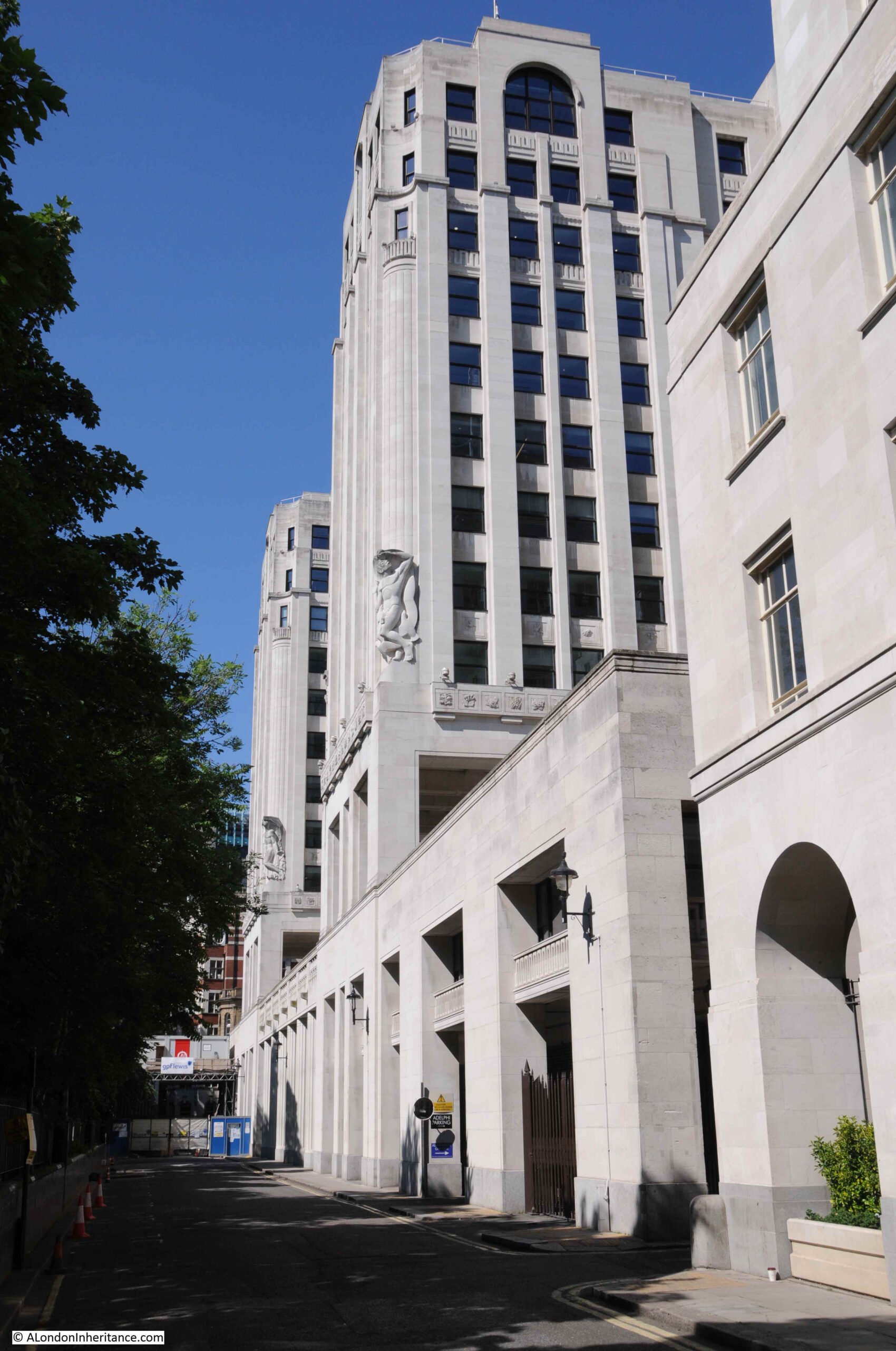
The following photo was taken from Savoy Place looking up at the terrace and the rather magnificent Adelphi building, and shows the height of the terrace:
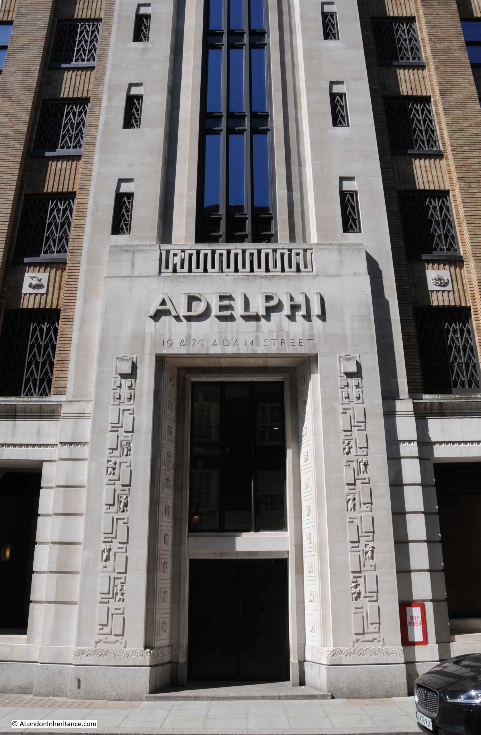
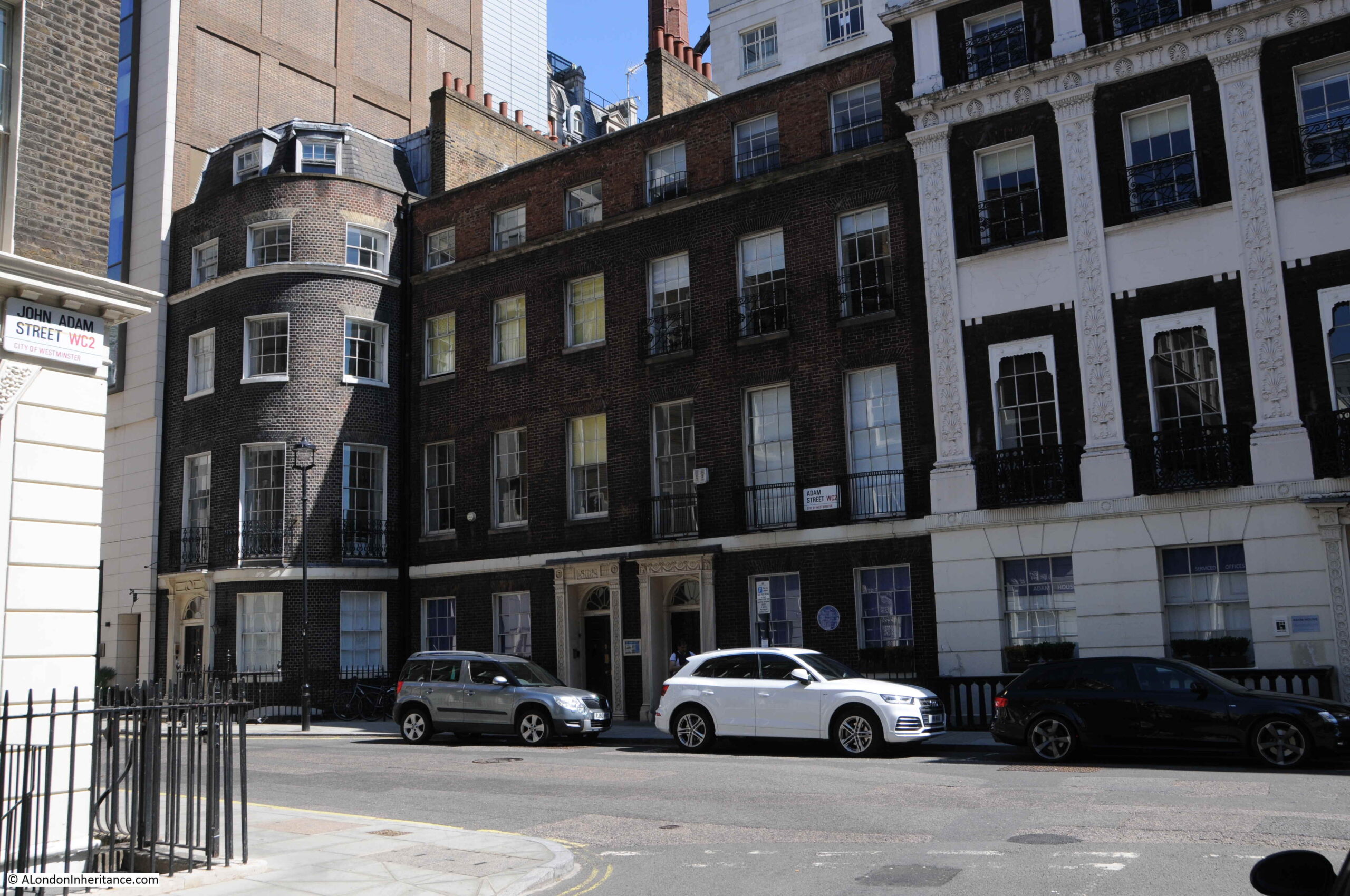
The main entrance to the Adelphi building is on John Adam Street, and the building consists of two outer wings which extend over the terrace as shown in the above photo, with the core of the building between and behind the two wings, up to John Adam Street.
I thought I had a photo of the Adelphi from across the river, but I cannot find it. I did find a photo I took a few years ago which shows the three wings of the Adelphi as the building on the left of the photo.
From this distance the building does not look that impressive. It is only when you walk around the building that its unique decorative features can be seen.
The Adelphi was built between 1936 and 1938, by architect Stanley Hamp of the partnership Colcutt and Hamp.
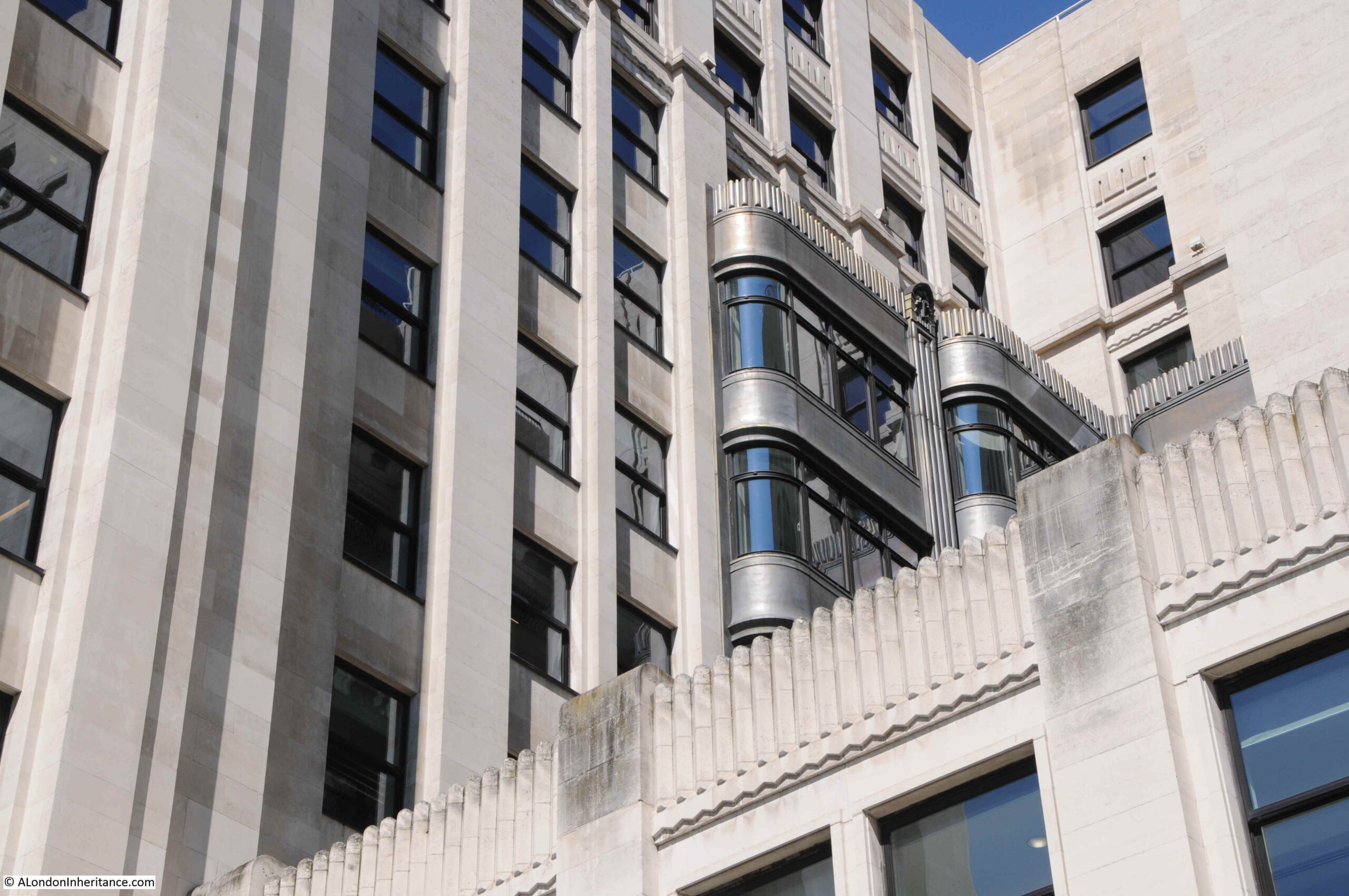
Of standard steel frame and reinforced concrete construction, what makes the building rather special is the large amount of architectural decoration and design that follow the art deco approach.
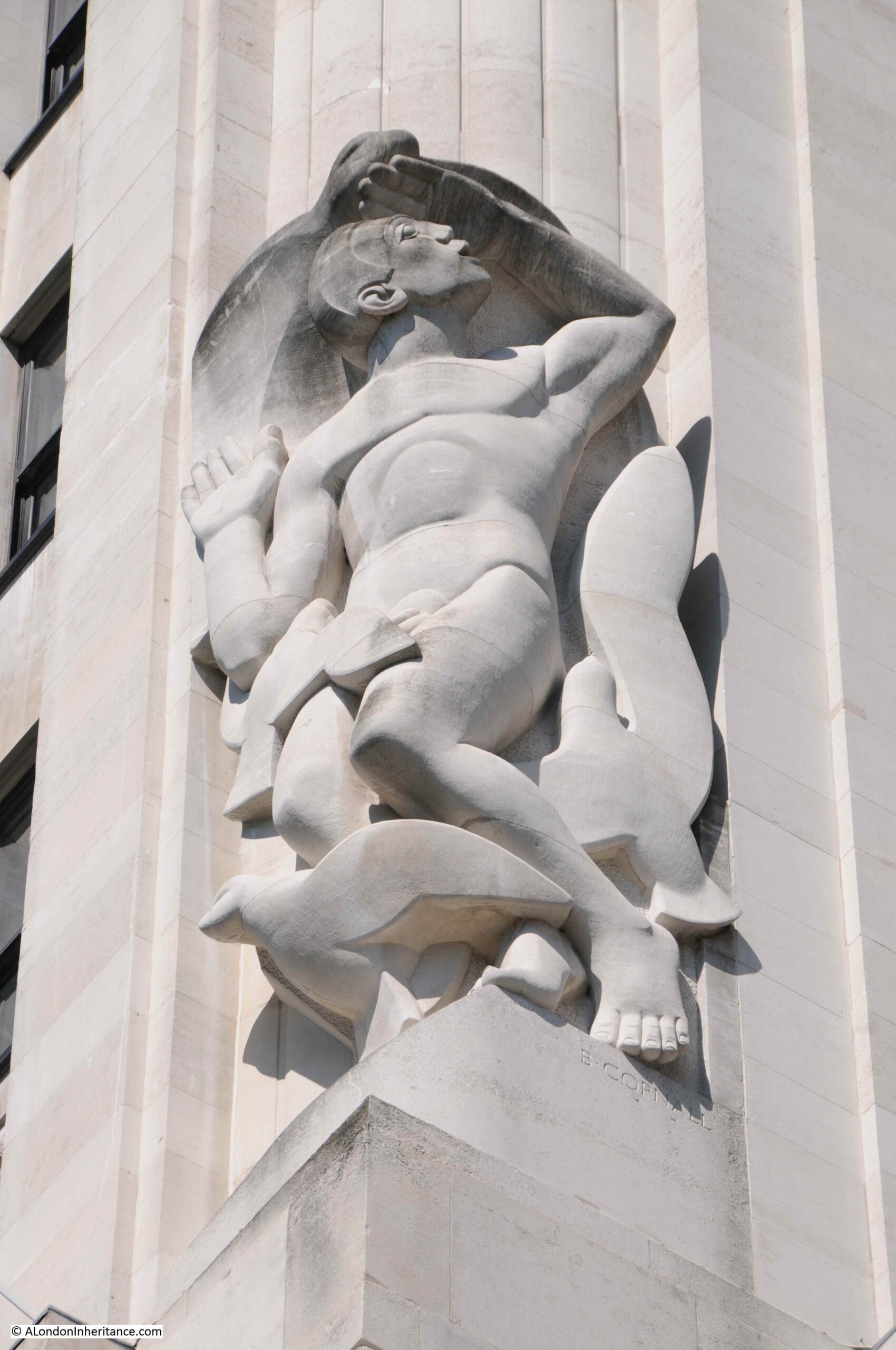
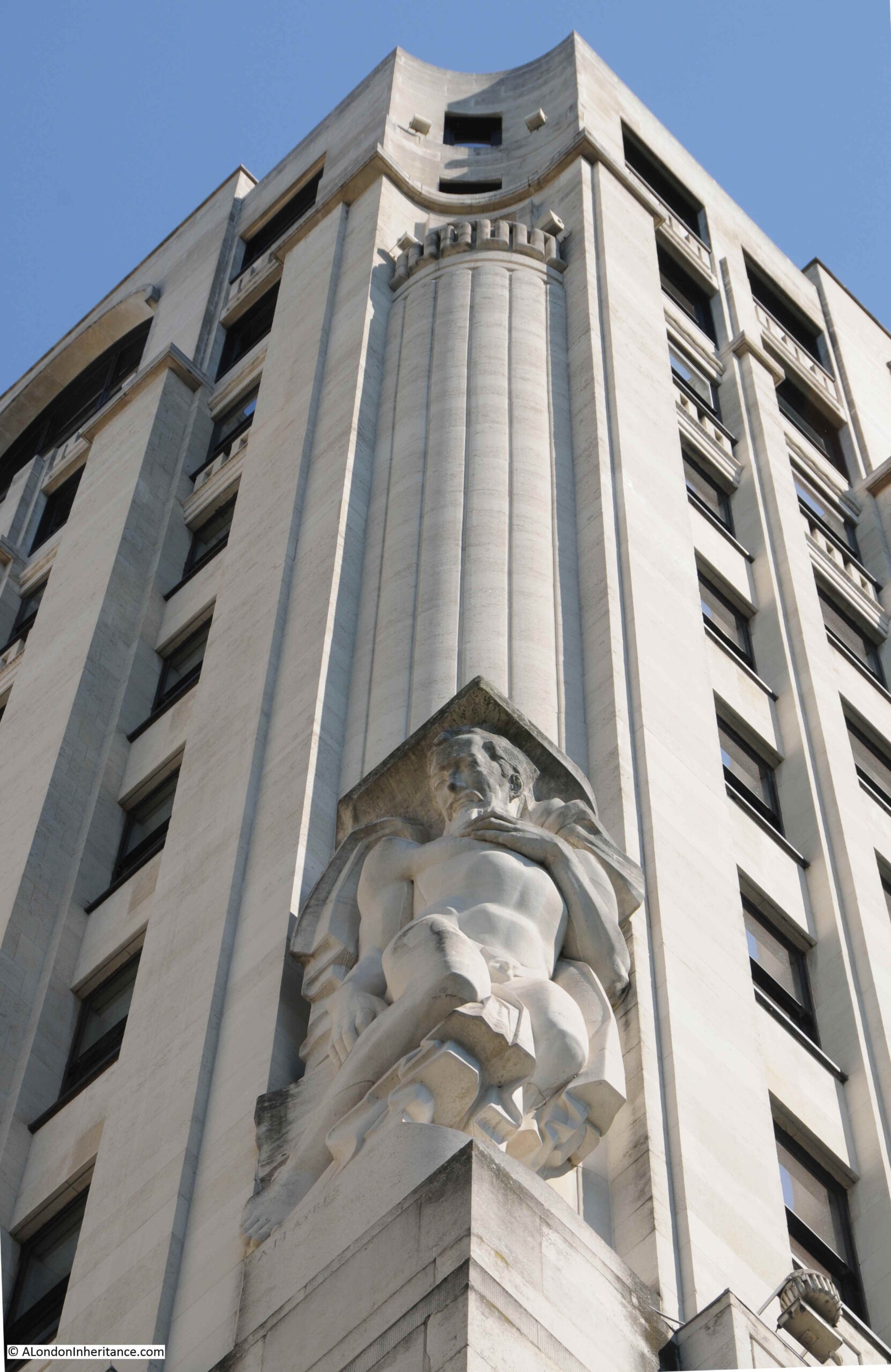
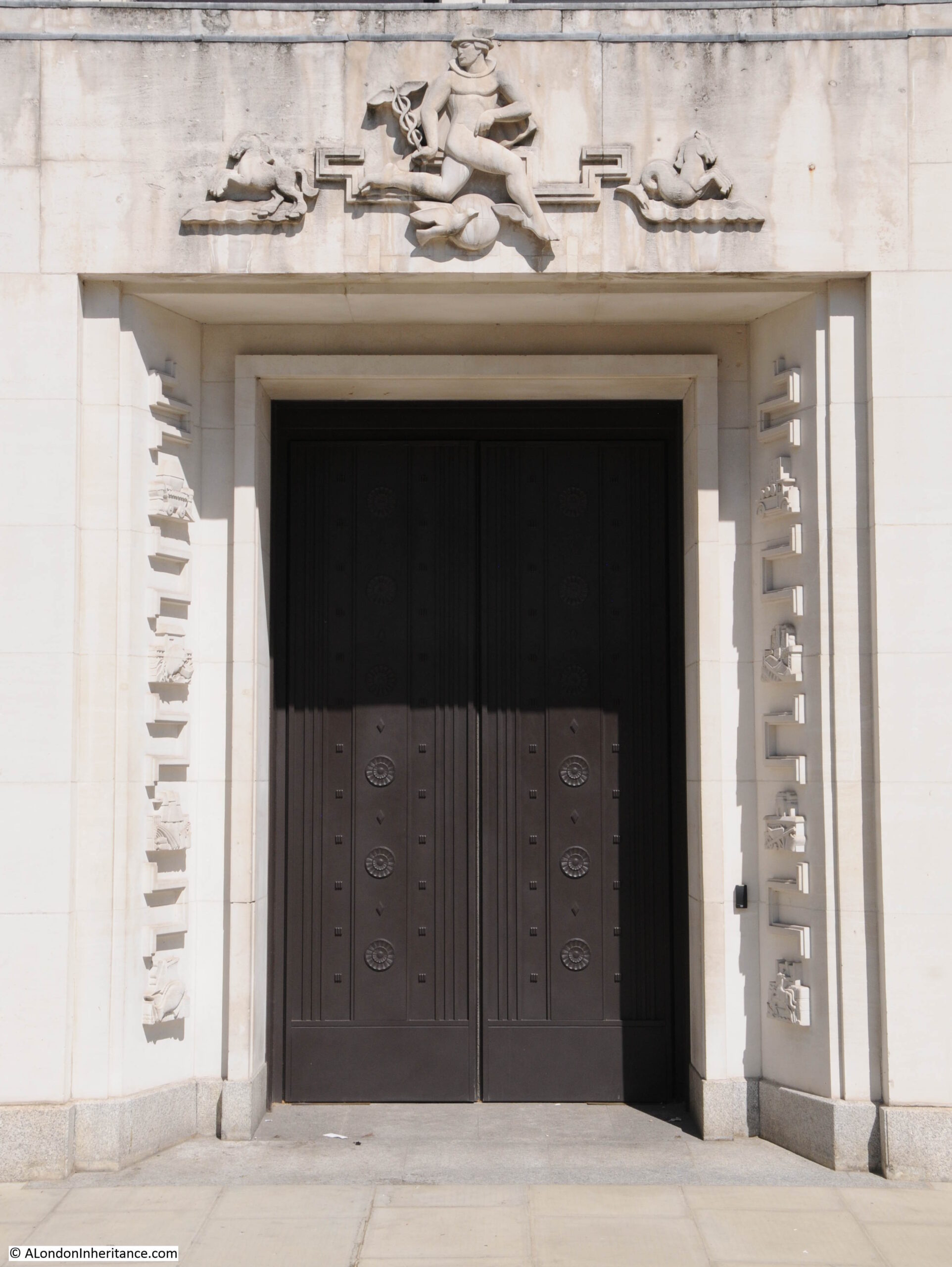
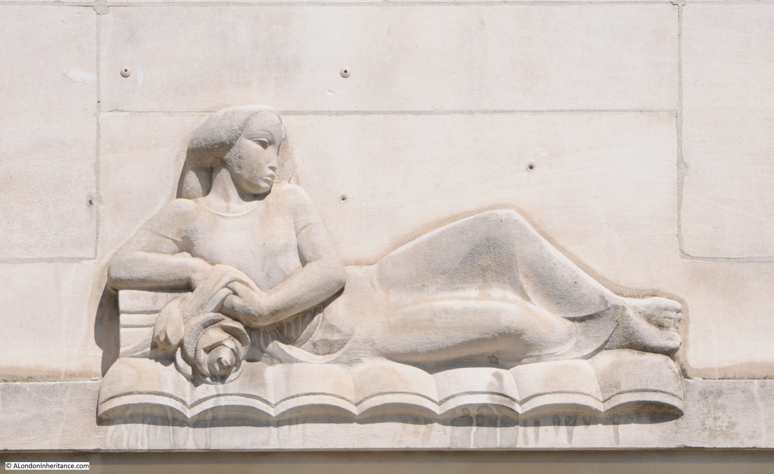
In the photo of the building from Savoy Place, two large allegorical relief figures can be seen on the two wings that extend over the terrace. There are four of these (the other two are on the other corners of the wings). These represent Dawn, Contemplation, Inspiration and Night, with Contemplation and Night being seen in the above photo.
The following photo shows a detailed view of “Night” by the sculptor Donald Gilbert.
The following photo shows “Dawn” by Bainbridge Copnall, with architectural decoration extending above the sculpture to fill in part of the curved corner of one of the wings.
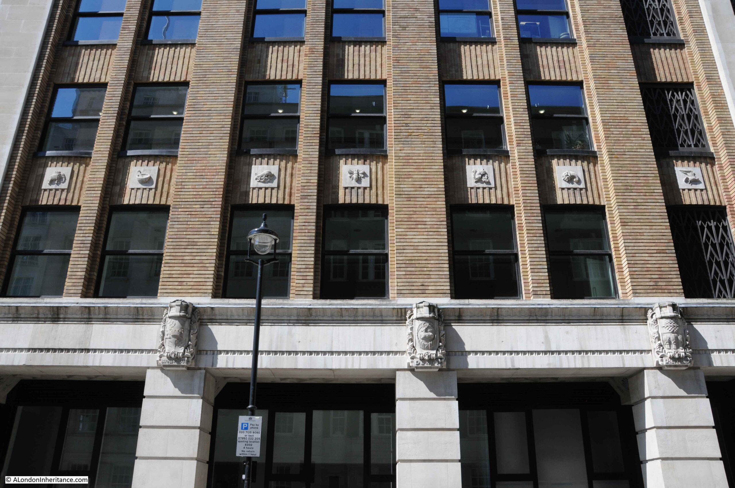
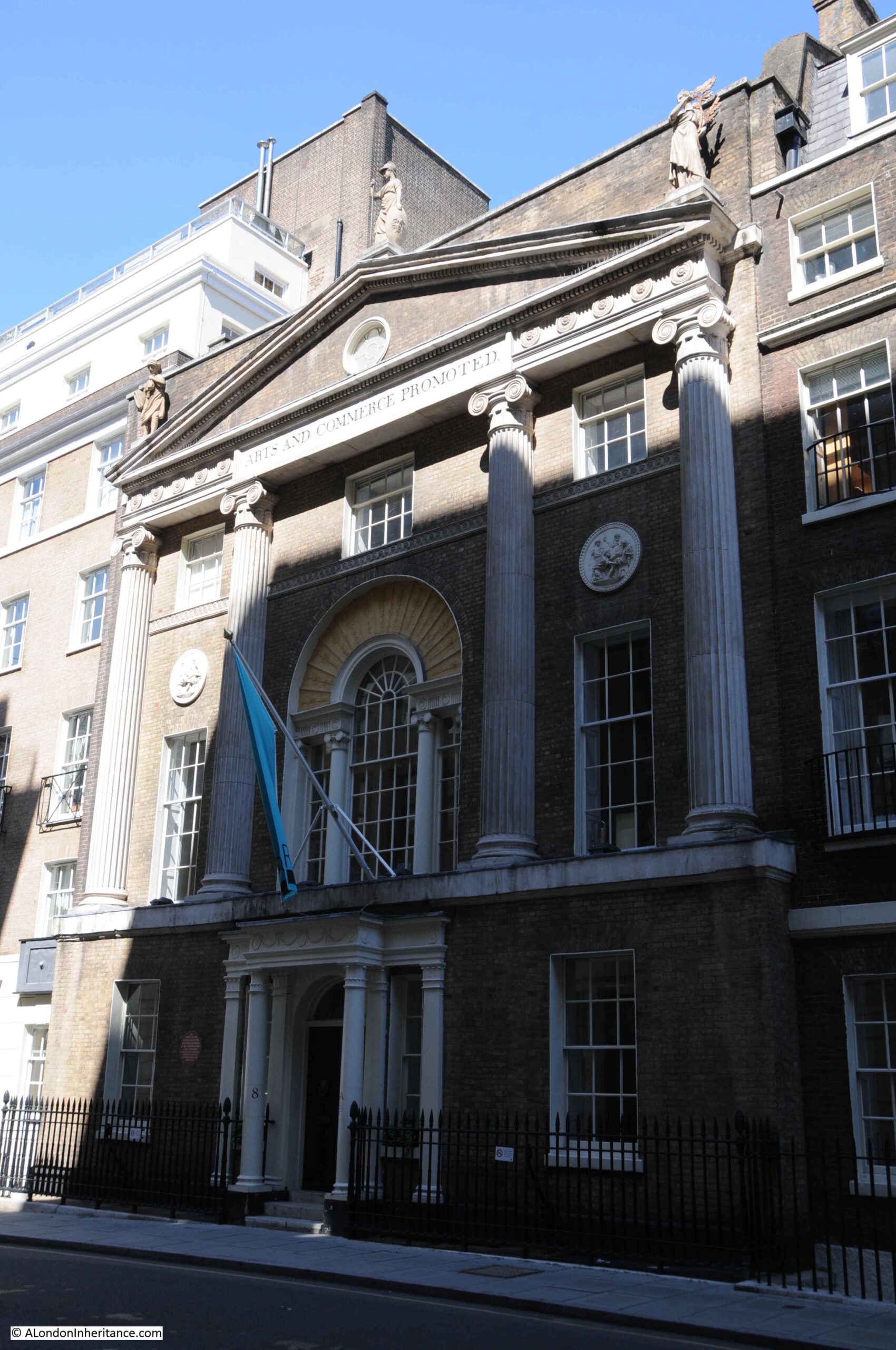
There is detail across the building. The following photo shows a side entrance on Robert Street. Note also that where the building faces towards the river, Portland stone is used, with brick used for the other facades, but retaining Portland stone for the ground floor and architectural detailing.
The sides of the building have small decorative panels between the brick pillars:
And carved coats of arms of UK cities between the ground and first floors. Three of these can be seen in the above photo, and in close up, the arms of Sheffield, Derby and Birmingham can be seen below:
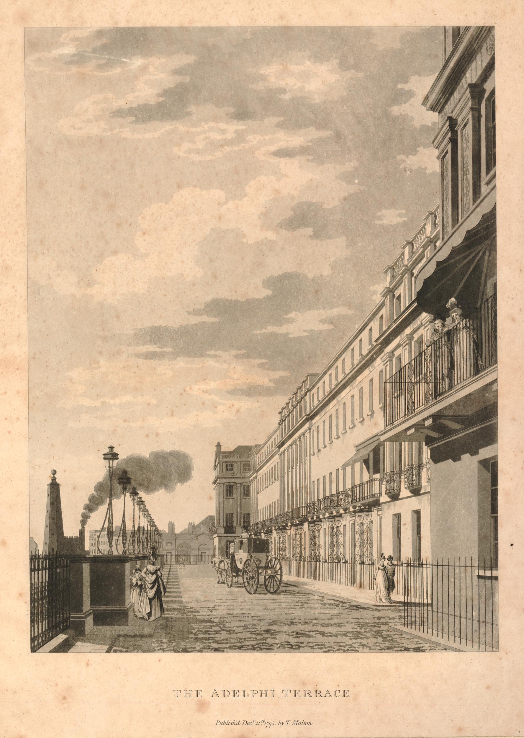
Another view of Adelphi Terrace, which was constructed in part due to the 1930s expectation of the rise of the car as a means transport within the city, as well as replicating the original terrace:
Construction of the Adelphi in the 1930s required the demolition of an historic estate.
The original Adelphi estate was the work of Robert Adams and his three brothers, John, James and William. The name Adelphi comes from the Greek word adelphós, meaning brothers.
In the mid 18th century, the area now occupied by the Adelphi had been a rather run down area called Durham Yard, which had been the location of Durham House. At the time, the Embankment Gardens had not been built, so the space now occupied by the Adelphi was then facing on to the foreshore to the Thames. The damp conditions and flooding at high tide meant that this was not a good area to build the type of quality houses intended by Adams.
The plan developed, mainly by Robert Adams, was to build the houses and streets on a series of arches, which increased in height as the land descended from the Strand down to the river.
However the Adelphi Terrace in the above print is not in the same position as the Adelphi Terrace we can walk along today. In the above print, the block of buildings on the right were demolished to make way for the Adelphi building (not the building at the far end as we shall see).
In preparation for the construction of the Adelphi building, the whole of the block of houses that occupied the area, included the arches and space underneath the houses, was demolished all the way back to John Adam Street. As part of the build of the Adelphi, construction was pushed forward up to Savoy Place, so the terrace is now forward of the terrace in the above print.
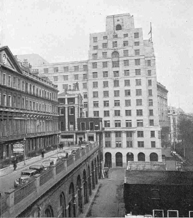
The following photo from just before demolition in 1936 shows the Adelphi Terrace on the left, with the block of houses which would also soon be demolished. In the background is the recently completed Shell Mex House (1932) with Savoy Place running to the lower right of Shell Mex House.
With the construction of the new Adelphi building and terrace, the terrace was pushed forward to also run up against Savoy Place, in line with Shell Mex House, so the area in the lower right of the above photo is now under the terrace.
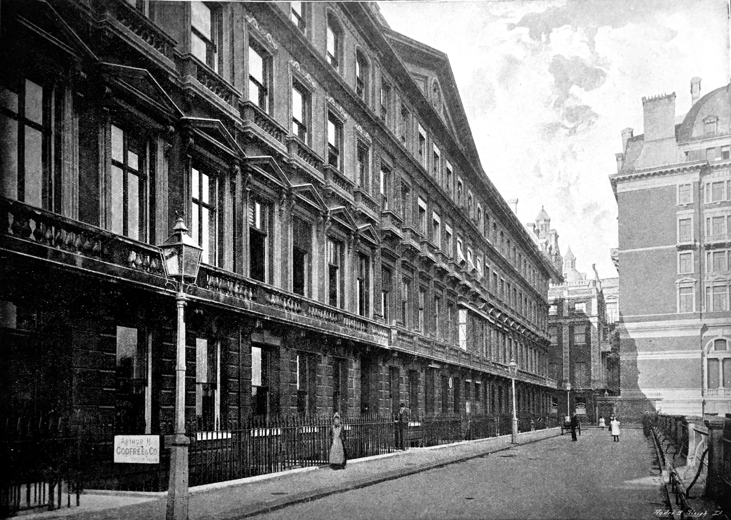
Another view of Adelphi terrace around 1897 before the construction of Shell Mex House:
If you look to the left of the second lamp post in the above photo, you can just see a round plaque. This was a medallion of the Royal Society of Arts recording the fact that the actor David Garrick had lived in the house. It was in one of the back rooms of the house that the actor died in 1779.
The large building on the right on part of the site now occupied by Shell Mex House was the Hotel Cecil.
And if you had been living in one of the houses in the terrace, this would have been your view as you looked along the river to the east, with the corner of Hotel Cecil on the left, and the first Waterloo Bridge crossing the river.
At the time of the above photo, the Adelphi was described as “one of the finest places to live in all London, as well as for pleasantness of situation as for convenience. The noise of the Embankment is sufficiently far away, and the hooters and sirens on the river suggest that sense of freedom and open space which goes with ports and their kinship with the sea. All too uncommon in London, late at night, the loudest noise is often the wind in the trees which move the lights of silent shipping“. Not from an early 20th century Estate Agents description, the quote is from the book Wonderful London.
Continuing a walk around the Adelphi building, and more door surround decoration:
Looking back between the wings of the building, we can see bow windows extending outward, with metallic decoration:
More decorative carvings:
Balconies:
The main entrance to the Adelphi on John Adam Street:
What is confusing is if you look above the doors, is the address John Street, however if you look to the lower right, is the full name John Adam Street.
John Street seems to have been the original name, as it is used on the 1895 Ordnance Survey map, and by the time of the 1951 revision, the current full name John Adam Street is used. I suspect the name change was when the Adelphi was built in the 1930s.
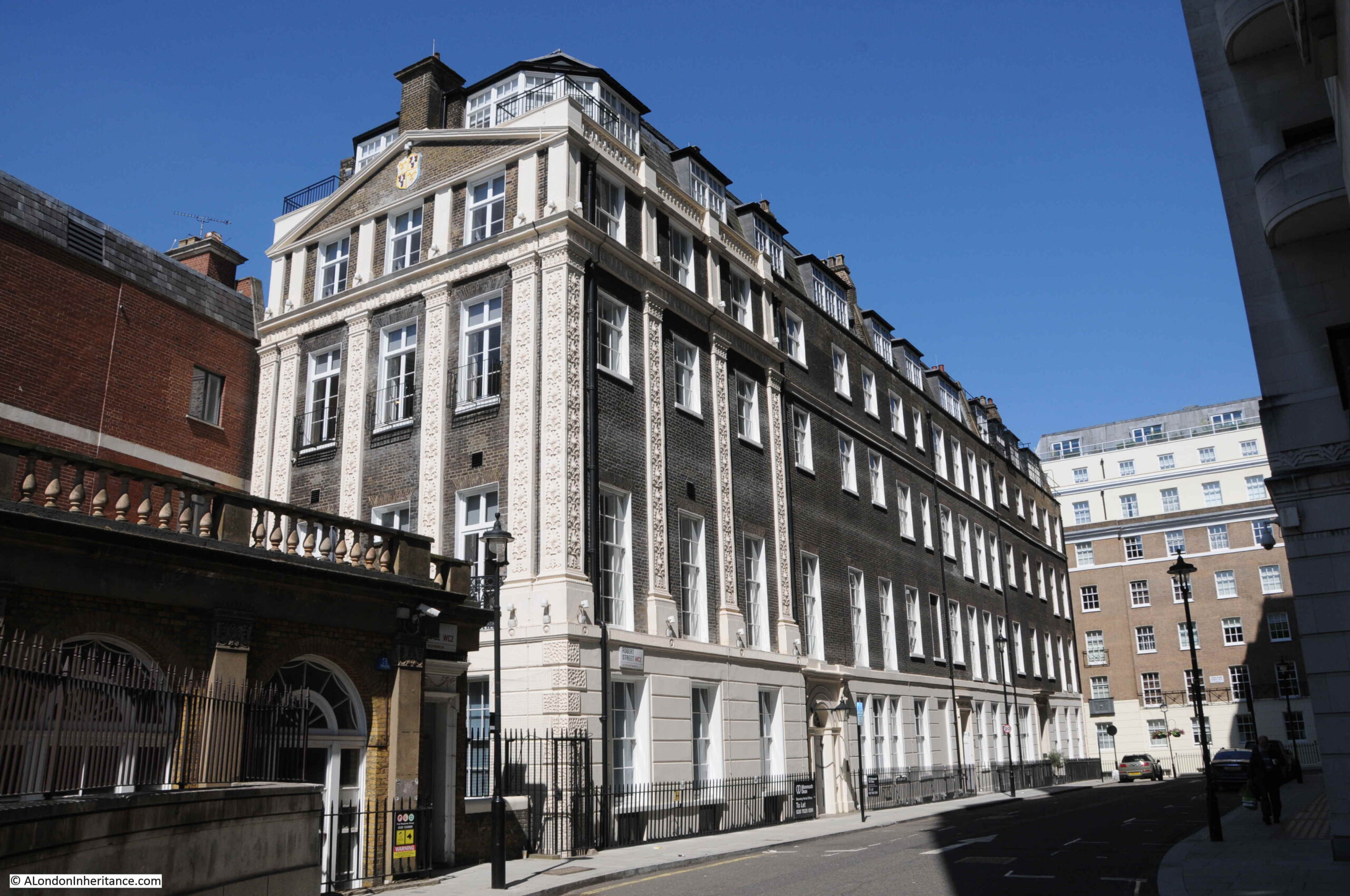
Having had a walk around the Adelphi building, time for a look at what remains of Robert Adam’s original estate. This is the view along Robert Street, with a fine terrace of buildings lining the side of the street. The end of the building on the left would have originally faced onto the original terrace, and is the same building at the far end of the terrace as in the 1795 print.
The scheme proposed by the Adams was highly ambitious. The land was sloping down to the river, and indeed consisted of part of the foreshore. The area would often flood at times of high tide.
Rather than building houses down along a sloping plot of land towards the river, with the resulting problems of damp and flooding, the plan consisted of building brick arches with the houses building on the platform created above.
The space within the arches would be sold or leased, and this approach would create a considerable improvement to the embankment of the Thames.
The plan and construction was ambitious, and the financial side of the project was rather risky, as a lease on the land was only signed a year after construction had begun in 1768, and parliamentary approval to build the new embankment along the river was not granted until 1771.
Costs for the project were so high that the money had run out by 1773 when much of the estate had yet to be completed. To raise additional finance, a method common in the 18th century was used whereby a lottery with 4,370 tickets selling for £50 each raised enough to complete the estate. Prizes for lottery winners included some of the houses on the estate as well as storage space in the arches below.
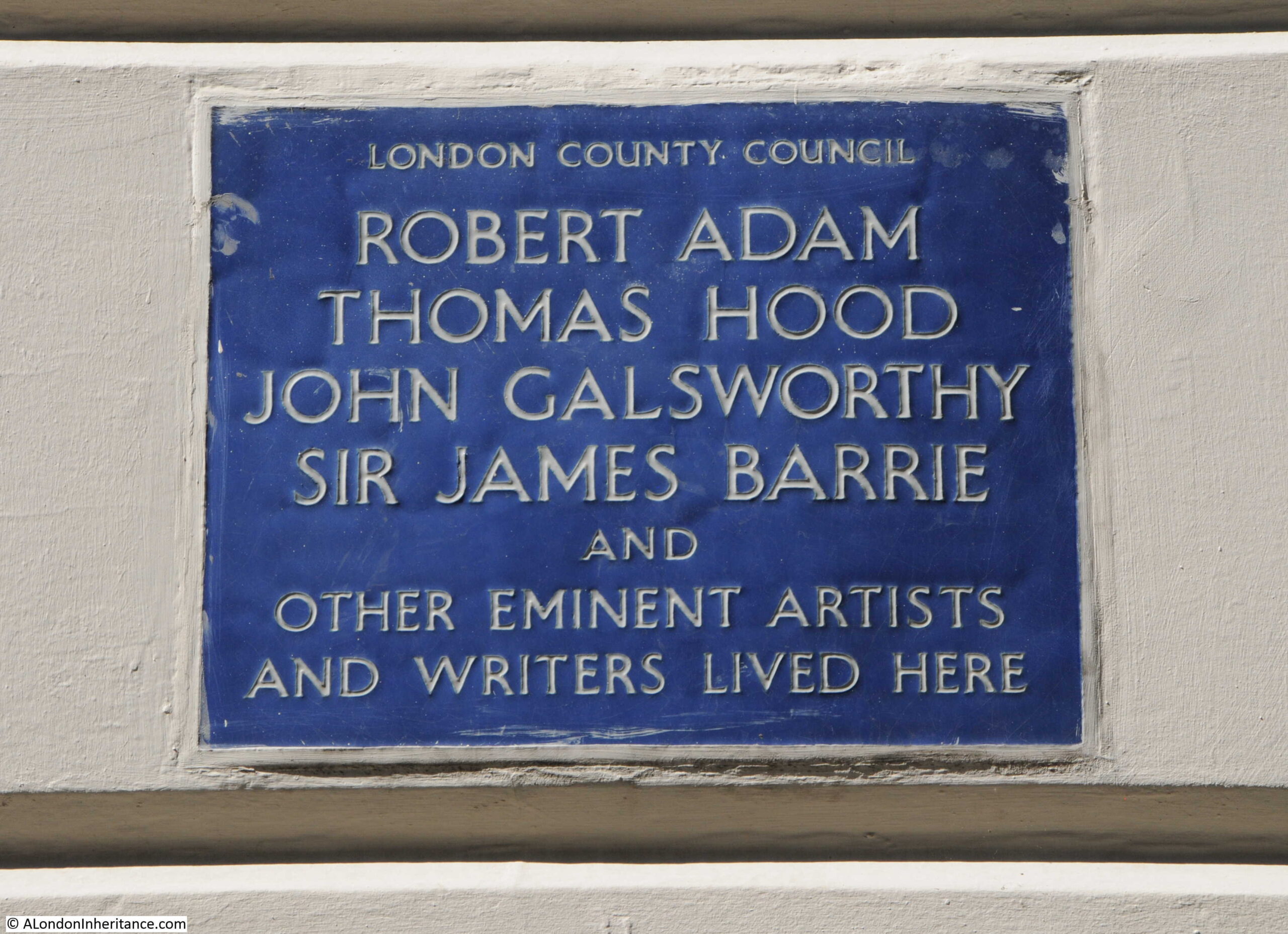
The following plaque on the terrace in Robert Street identifies some of those who have lived in the houses:
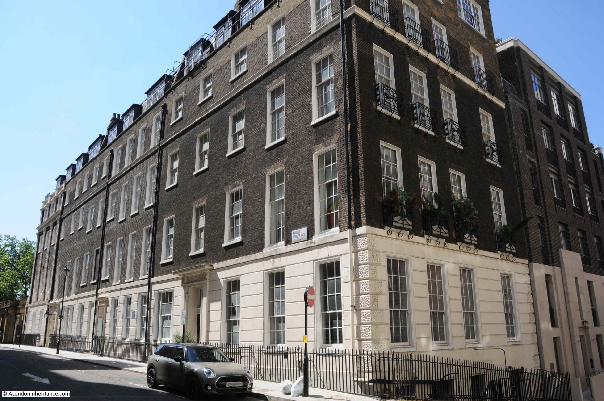
View of the terrace in Robert Street from the junction with John Adam Street:
Strange that with street renaming, John Street changed to John Adam Street, however Robert Street kept the original name without a rename to the full Robert Adam.
The houses were highly decorated including Adam fireplaces. Many of the first floor ceilings were also painted by either the Swiss artist Angelica Kauffman or Giovanni Battista Cipriani from Florence.
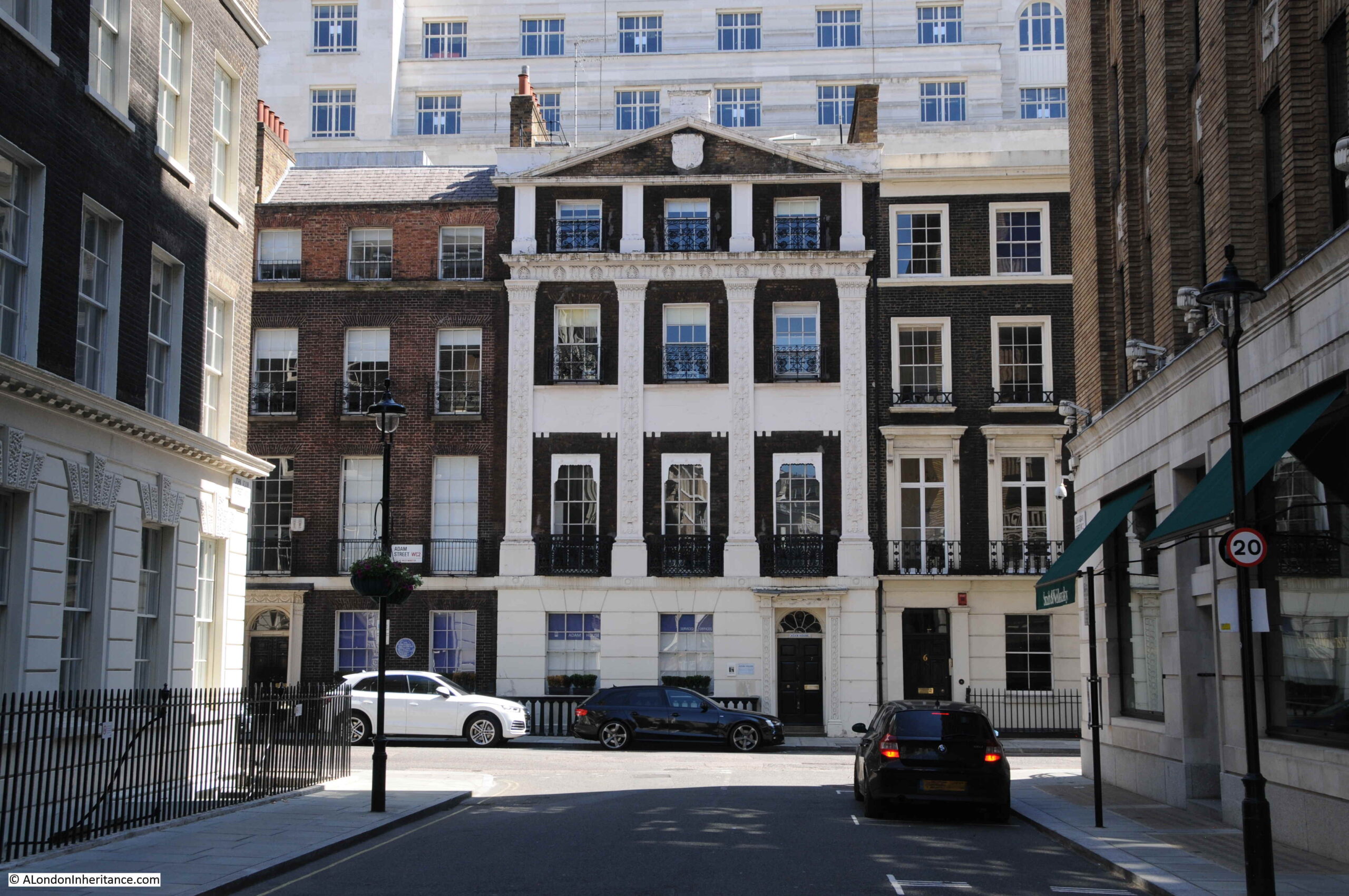
Walking to the north of the Adelphi, along John Adam Street, and we find this building which was clearly not built as one of the terrace houses:
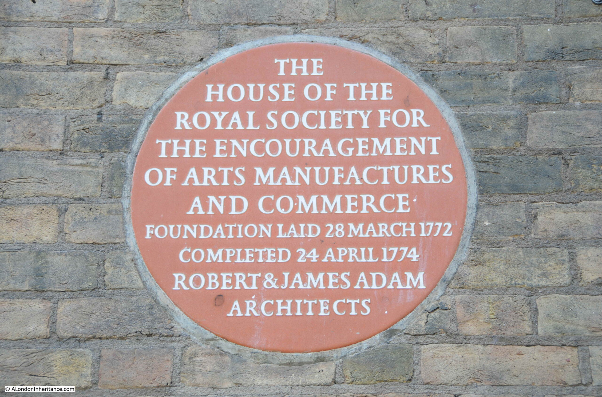
A plaque on the front identifies the building as the home of the Royal Society for the encouragement of arts, manufactures and commerce, which was founded in a coffee house in Covent Garden, and then moved to this building by Robert and James Adam in 1774. The building is still their home.
During the 1930s demolition ready for the construction of the Adelphi, demolition reached to the southern side of John Adam Street, so the street and home of the Royal Society are part of the original build, and the basement of the Royal Society building retains some of the brick arches built to raise the area above the sloping land.
In the 19th century, the arches and vaults below the houses had become somewhat different to what had been intended. The Sketch in 1903 includes the following description “The houses were built on deep arches that rivalled the Catacombs of Paris and these, at one time, were a great thieves kitchen, a tramps paradise, or doss house, that defied Watchmen and Bow Street Runners, and their successors the modern Peelers”.
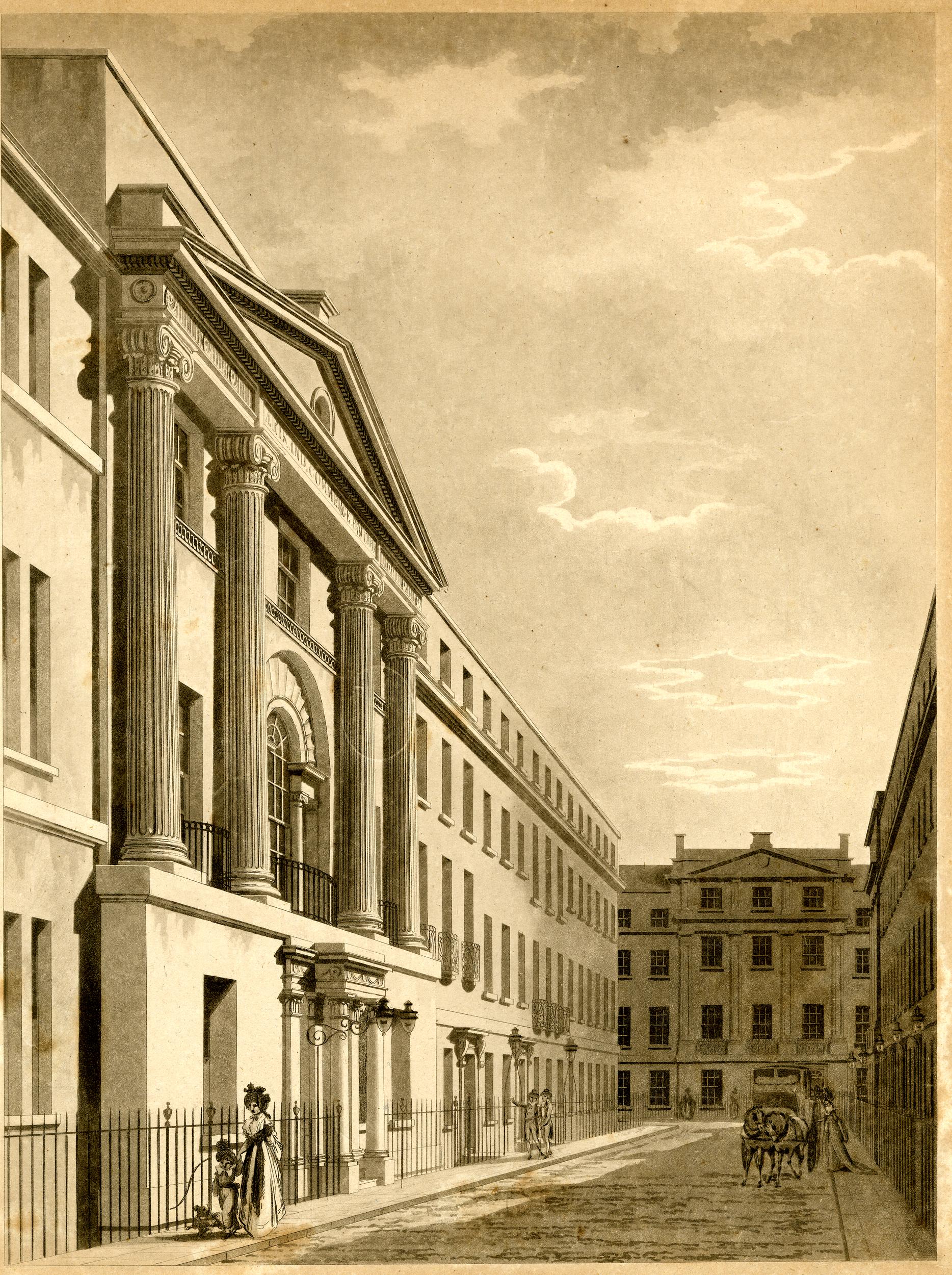
Looking along John Adam Street to the junction with Adam Street and we can see how the Adam’s plan included focal point houses at the end of the streets, and the type of decoration used.
I should have found the above print before visiting the site as I would then have taken the photo slightly further back to include the Royal Society building. If you stand in the street today, ignore the new Adelphi to the right, and Shell Mex House, the view does look much the same as in 1795.
The following photo is looking up Adam Street. The junction with the Strand is further along the street to the left, with an original house at the end of the terrace with a curved extension to the smaller width of the street. Adam Street was cut through to the Strand as part of Adam’s construction of the Adelphi.
The house behind the white car has a GLC Blue Plaque stating that the 18th century industrialist and inventor Sir Richard Arkwright lived in the house, with English Heritage’s background to the plaque stating that Arwright lived some of the final years of his life here in Adam Street before his death in 1792.
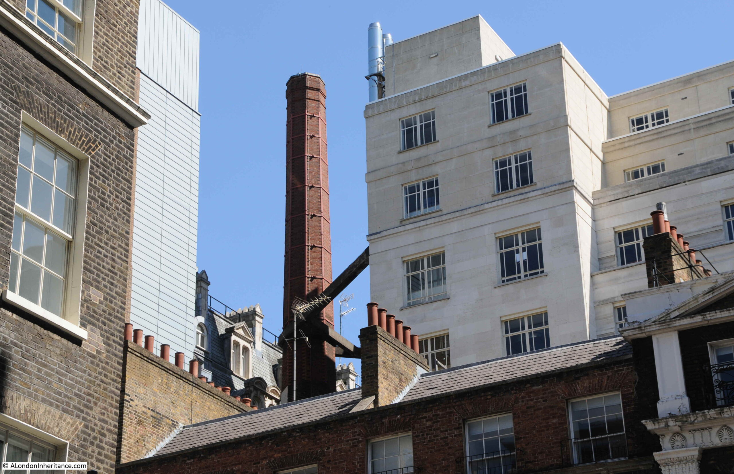
Looking above the houses in the above photo, there is an unusual sight hidden within the dense building of this area south of the Strand. A brick chimney with some robust steelwork providing support from Shell Mex House.
The type of brick chimney seen in the above photo was once relatively common across London, but now is an unusual sight. No idea of the chimney’s purpose, whether it was or maybe still is, part of the Shell Mex House heating system.
That was rather a detour from my father’s original photo of the open air art exhibition in the Victoria Embankment Gardens, but that is why I started the blog, as a means of getting out to find the location of a photo and discovering a wider area.
There is more to the story of the Adam’s brothers and the surrounding area, including the creation of the Embankment Gardens, Shell Mex House, and Lower Robert Street which still routes under part of the estate. The old river stairs that would have entered the river roughly along where Savoy Place is today, and some of the lost streets down to the river – hopefully all subjects for future posts.
And returning to the original photo, I wonder if the little girl in the photo can today remember walking in the gardens and alongside the art exhibition?
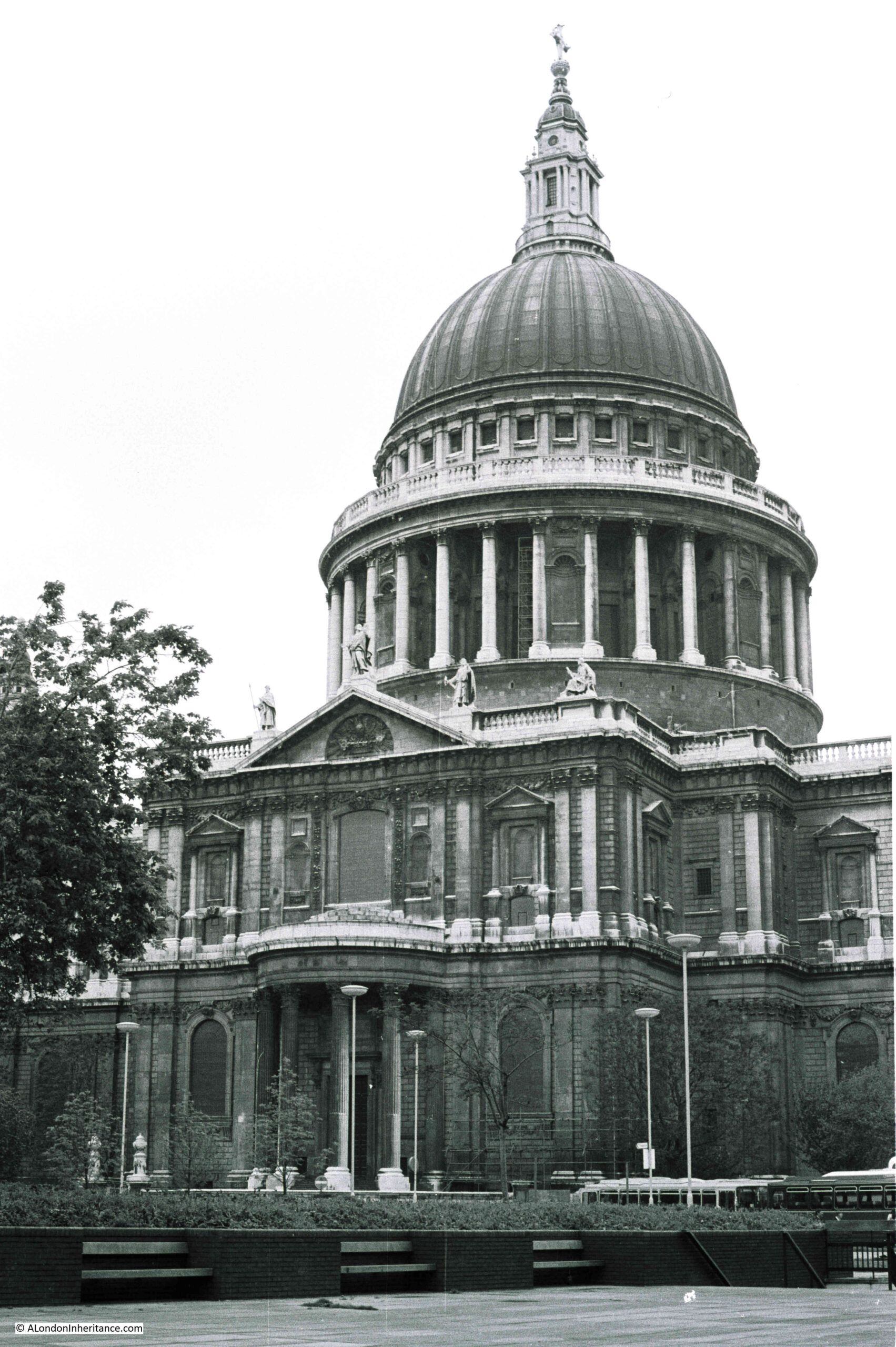
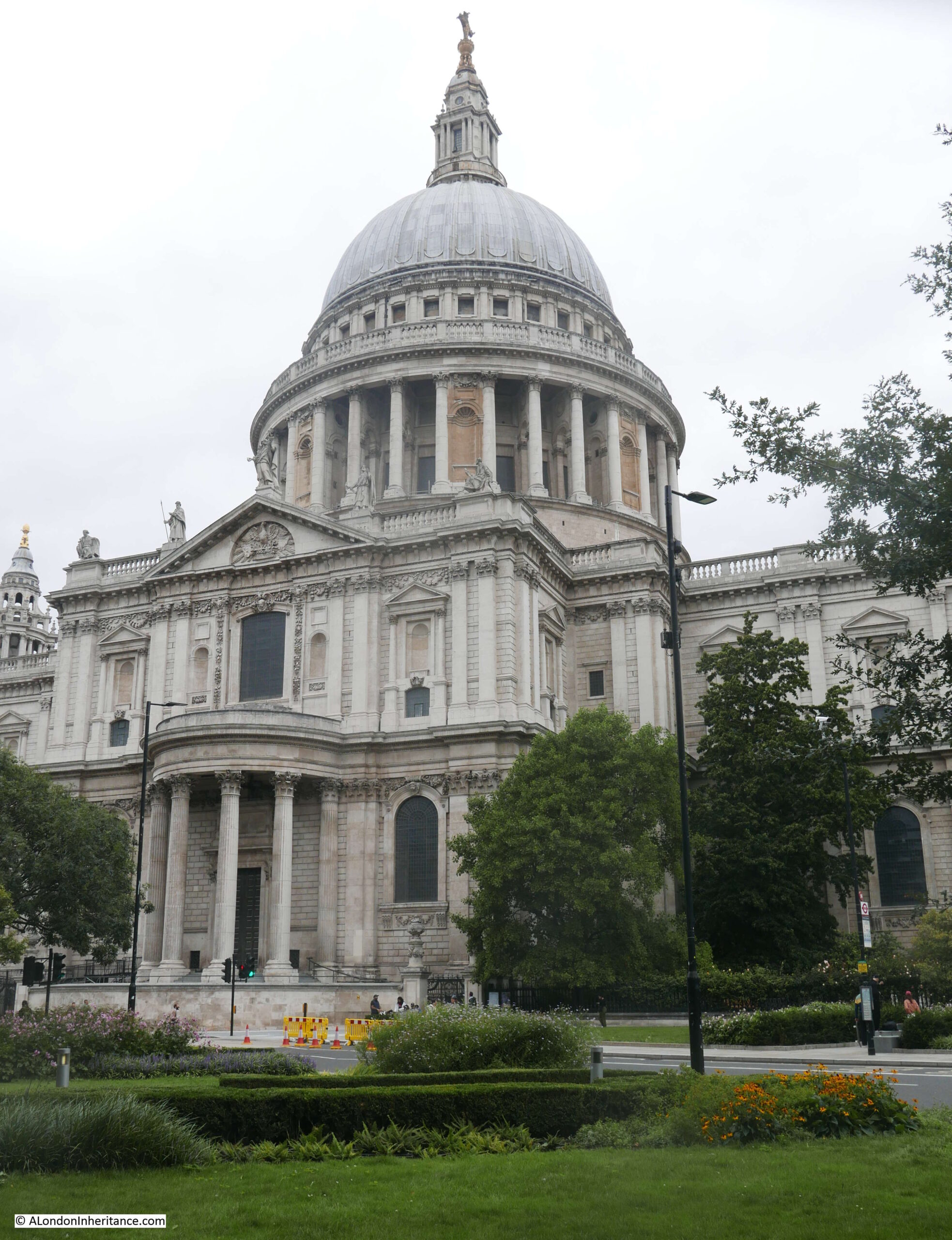
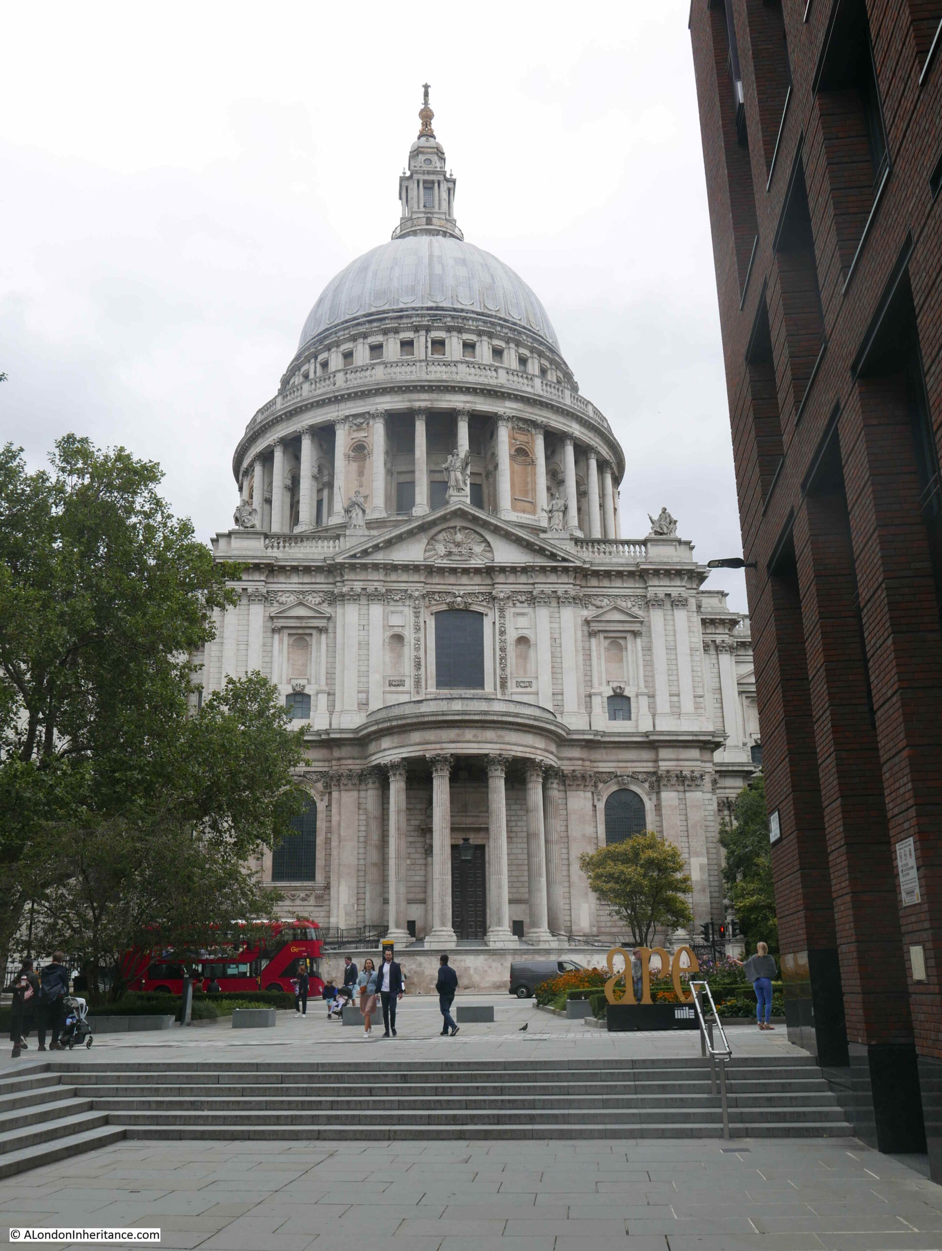
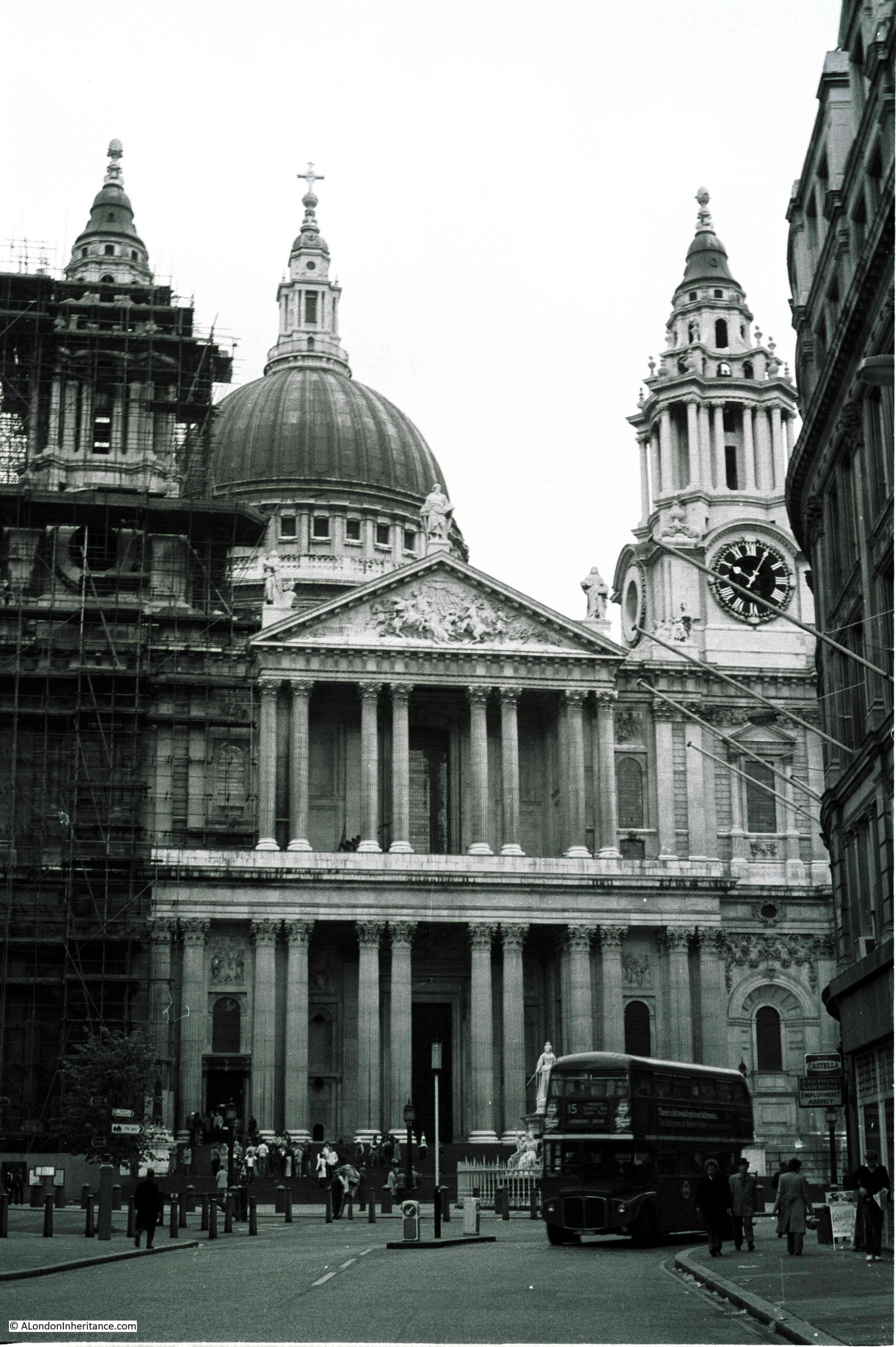
I was looking through some of my old negative scans and found four photos of St Paul’s Cathedral dating from 1977. Nothing special about the photos, and the cathedral is one of the buildings in the City that has not changed, however they did highlight how much dirt the cathedral had accumulated, and in comparison, how clean it looks today.
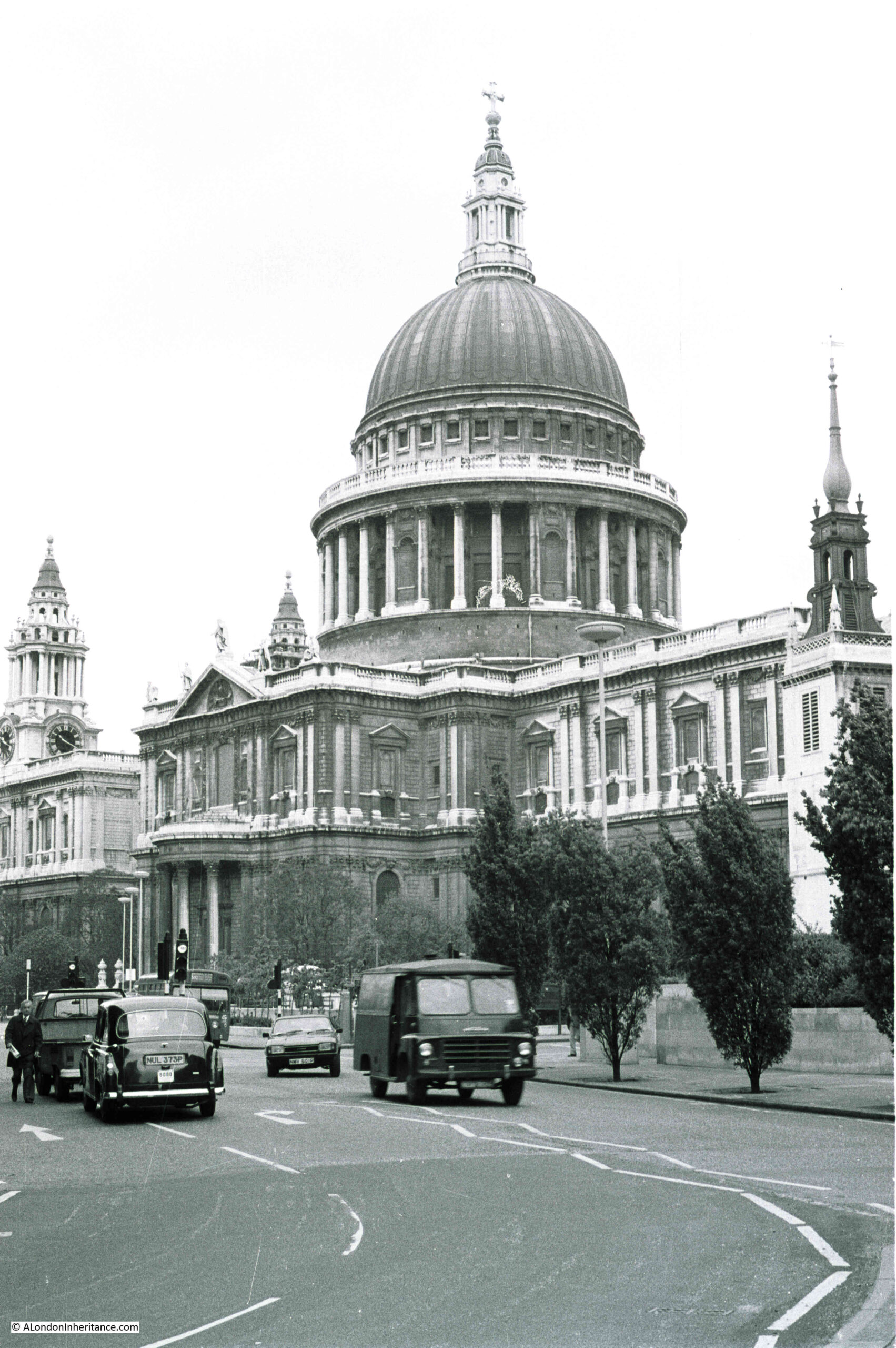
The following photo shows the view of the cathedral from the junction of Cannon Street and New Change in 1977:
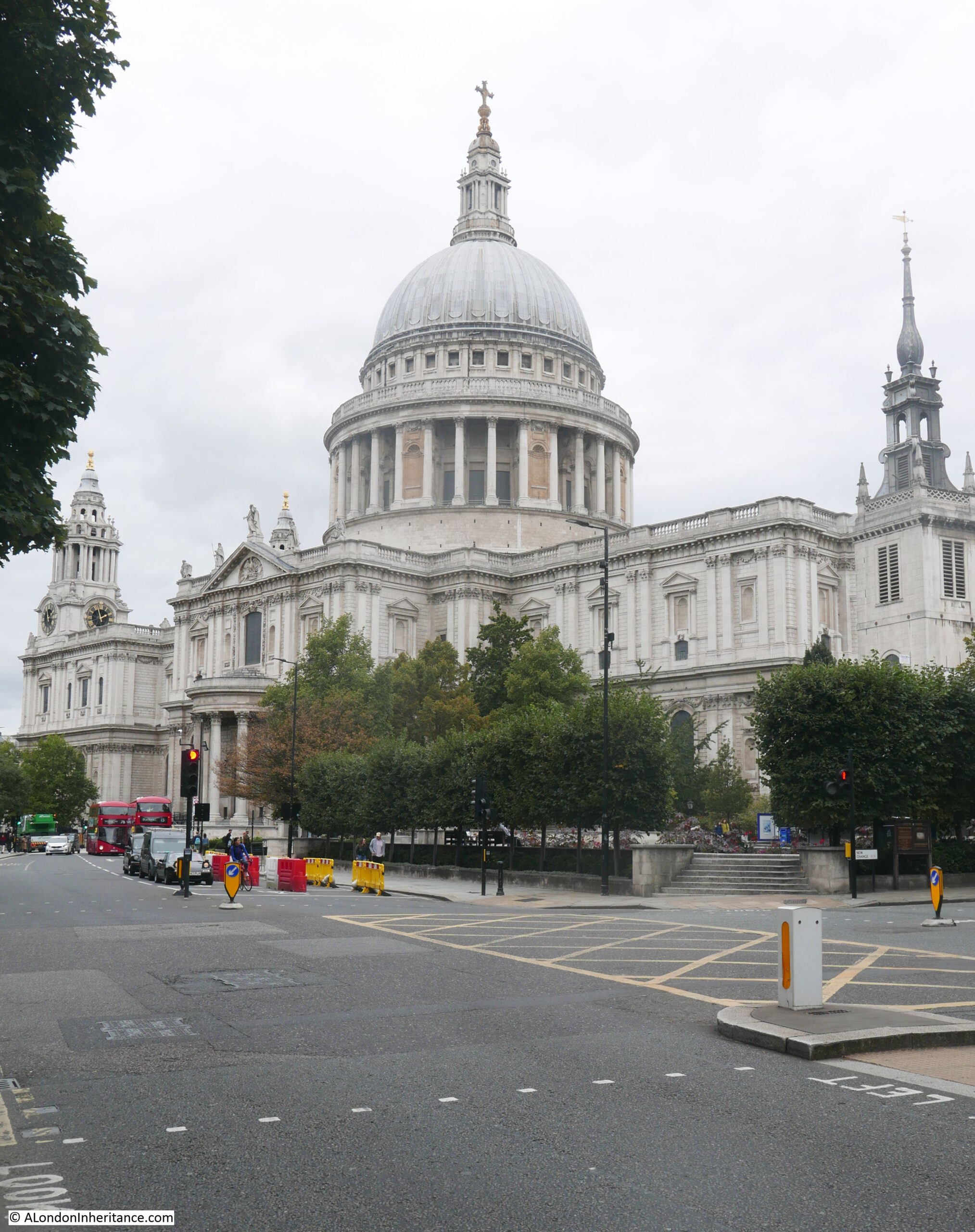
The following photo shows the same view, forty four years later in 2021::
St Paul’s Cathedral has had a number of extensive cleaning and restoration projects over the years, however the state of the cathedral in 1977 was probably not what those who worked on the mid 1960s cleaning project would have expected.
At the end of the 1960s cleaning, it was expected that with recent clean air legislation, and the City of London being designated a smokeless zone the cathedral would remain clean and there was a possibility that in “250 years time, St Paul’s Cathedral will look as Sir Christopher Wren would have liked to have seen it”.
The above quote and the following still is from a fascinating BBC programme from 1965, when “Tonight” had a lengthy feature on the cleaning of St Paul’s Cathedral. The full programme can be watched here, and also highlights the 1960s approach to health and safety (as illustrated in the still below) as well as the rather basic method of cleaning employed. At times the wind lifted the sheets preventing cleaning water from falling to the streets, resulting in some very annoyed City Police Officers who threatened those cleaning the cathedral with a summons if they did not stop work as water was blowing as far as Cannon Street.
Only 11 years after completion of the mid 1960s clean, the cathedral was again looking rather dirty.
The above photo is the south facing side of the cathedral in 1977 and the photo below is the same view in 2021:
In my 1977 photos, the cathedral appears cleaner towards the top, and dirtier towards the bottom of the building. Although central London was a much cleaner place than it had been for many centuries, vehicles were emitting far more pollutants than they do now, and pollution would still be blowing in from the surrounding area.
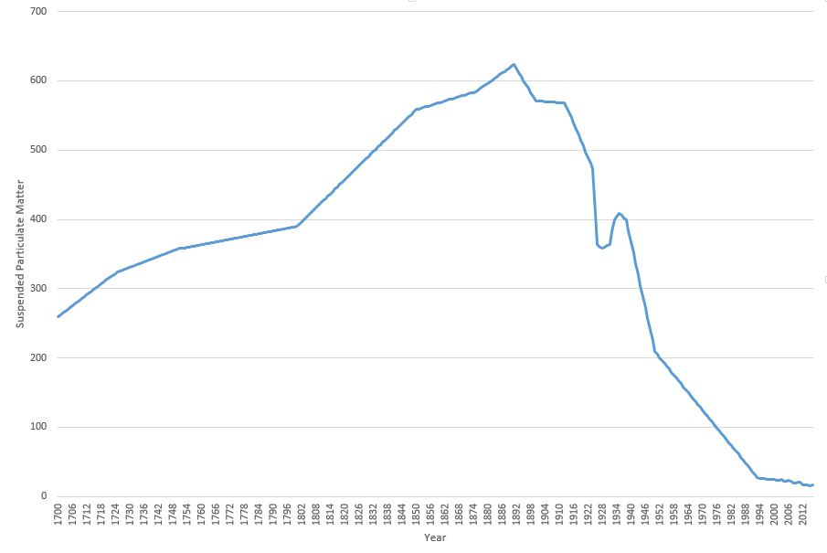
It is hard to appreciate just how dirty London was up until the late 1960s. Coal burning in homes, offices and factories along with electricity power stations, and industries producing gas from coal all contributed to a significant smog of pollution and dirt.
The 1960s cleaning of the cathedral had to deal with dirt that was over an inch thick in places, and we can get an idea of the impact of this amount of dirt from a Parliamentary question asked on the 06 April 1955 by Mr. George Isaacs, MP for Southwark, when he states that based on measuring equipment installed next to Bankside Power Station, and at the Town Hall in Walworth Road, they found that over a year, the “deposit recorded at that time was the equivalent to 235 tons to the square mile on Bankside and a mile away in Walworth Road the deposit was 60 tons to the square mile”.
In the written question, he states that it is necessary to live in the area to really know what the impact of this level of pollution to everyday life means, which he describes as: “Our people have grit in their eyes and grit in their food; there is grit underfoot and grit in the laundry on washing day. I know that what I say has happened. There are the large blocks of the Peabody Buildings less than 150 yards from the station. The only place there for women to dry their laundry is on the roof. They put their laundry on the roof, and the grit comes down. Father comes home to tea, and mother goes upstairs to take in the washing, and when she comes down father knows all about it because she is not in a good humour if she finds that she has to do her laundry all over again. I can say with some justification that this is a nuisance not only physically but in the way it upsets amenities and family life in the area”.
Whether these figures could have been accurately measured going back to 1700 is an interesting question, however the key point of the graph is the overall shape, and the rapid decrease in the second half of the twentieth century, confirming that the air is London is now much cleaner than it has been for many centuries.
The cathedral featured in classroom material produced by the National Society for Clean Air. A chart was produced which included a before and after the recent cleaning view of St Paul’s Cathedral. The chart also included a picture of a boy and girl in clean country air, as well as devices such as smokeless domestic heating equipment. Rather scarily, the chart also included drawings of the sections of the lungs of those living in the city and in the countryside, showing the damage that was being done to the lungs of city dwellers.
School education continues, with the Mayor of London now producing toolkits for schools focusing on air pollution and the dangers of high levels of Nitrogen Dioxide, which particularly affects children, and those with breathing difficulties.
Whilst the clogging grit and smoke that quickly blackened London’s buildings may no longer be a problem, invisible gases such as Nitrogen Dioxide, and very small particulate matter are now the main problem.
Another view of the south facing side of the cathedral in 1977:
The same view today of a much cleaner building:
The most recent full clean of St Paul’s Cathedral completed in 2011 ready for the 300th anniversary of the cathedral.
This had been a 14 year project which cleaned both the interior and exterior of the building. There were some controversial methods used to clean the cathedral, including a latex paste that was applied to the interior stone, which absorbed the layer of dirt and allowed this to be pulled away with the latex layer.
New methods have frequently been used for cleaning the building. In 1903, an American method of stone cleaning where a blast of pitsand was blown at the cathedral walls through a tube at a pressure of 30lb to the square inch, to try and remove the soot and dirt that was ingrained on the Portland stone of the building.
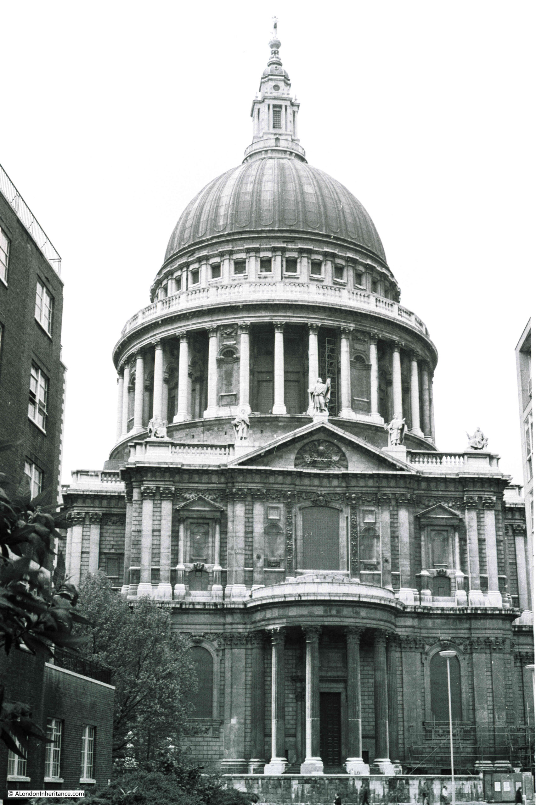
The main west facing entrance to the cathedral in 1977, photographed from Ludgate Hill.
The same view today:
My early memories of walking through the City are of a grey and dirty place, although it is also difficult to be sure how real some of these memories are. What is certain is that the buildings of the City are now much cleaner. The air in many places is better, but there are still many places where pollution levels are too high, generally close to busy roads as London today does not have the same polluting industries as it did.
Hopefully George Isaacs, MP for Southwark would be happy with the change, as well as Sir Christopher Wren who would now recognise the cathedral as it was when it was built.
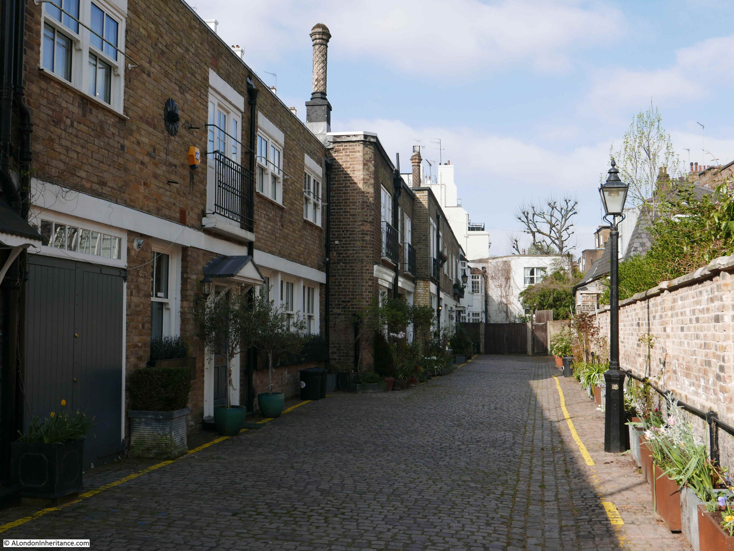
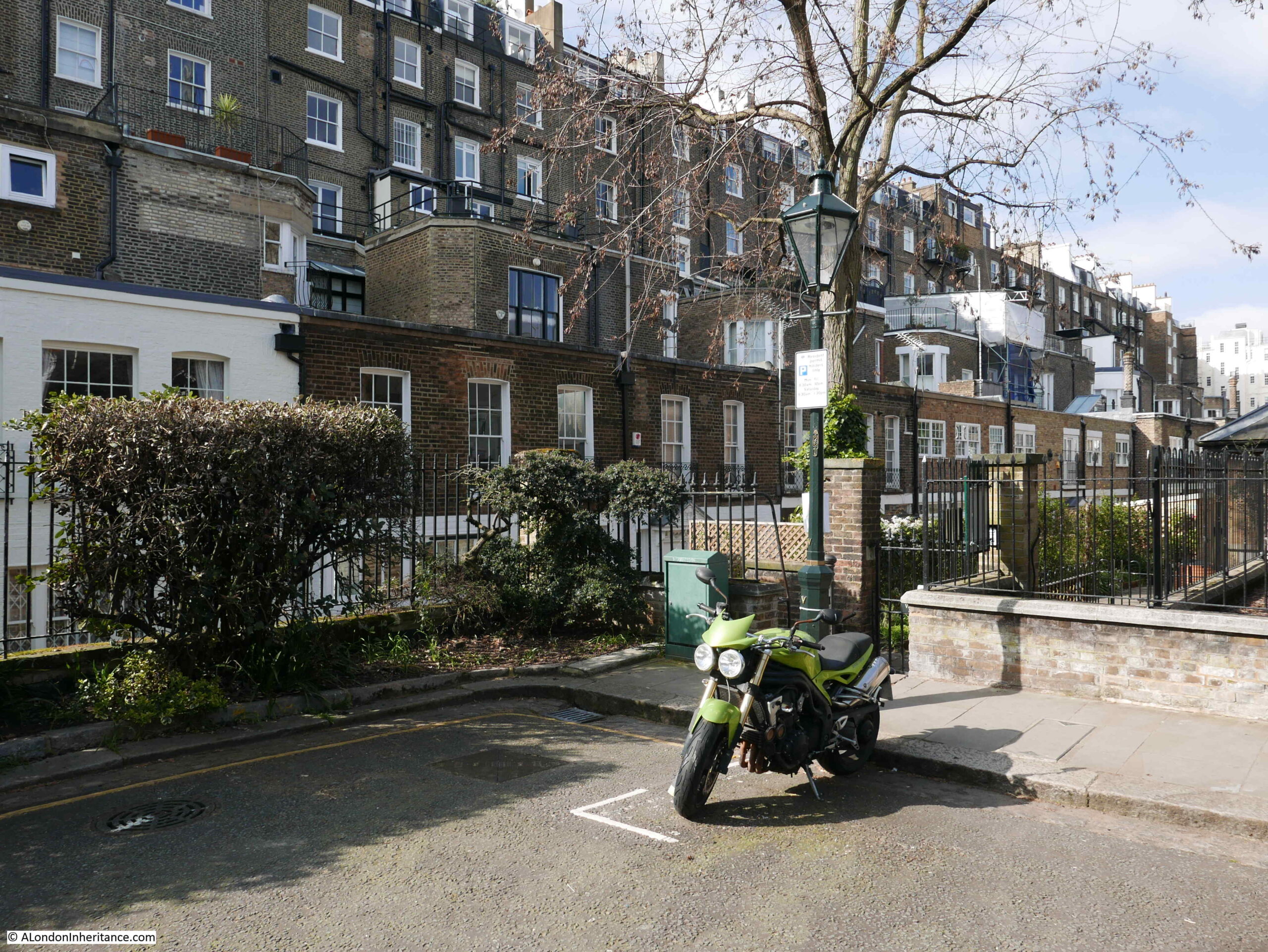
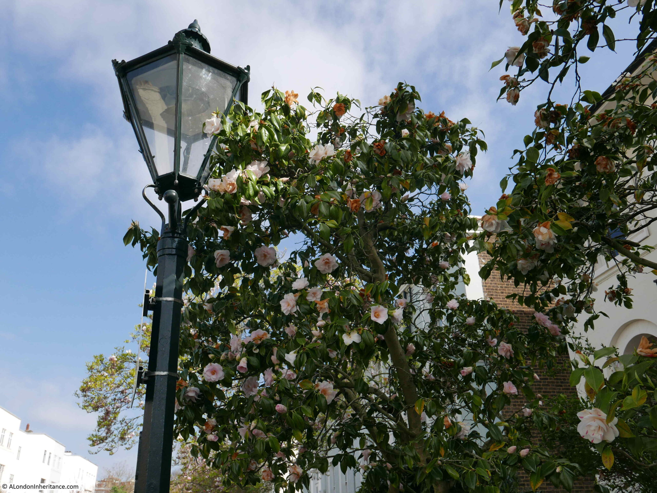
One of the pleasures of walking in London is turning off a very busy road and finding a very different place. The Cromwell Road in west London carries four lanes of traffic in and out of London, with the road being the main road route from Heathrow Airport to central London. It is the A4 that leads to the start of the M4 motorway. Lined with hotels, including the world’s largest Holiday Inn hotel. The road also passes the Natural History and V&A museum.
However, turn off the Cromwell Road opposite the Holiday Inn and after a four minute walk you will find one of the most picturesque of London’s mews.
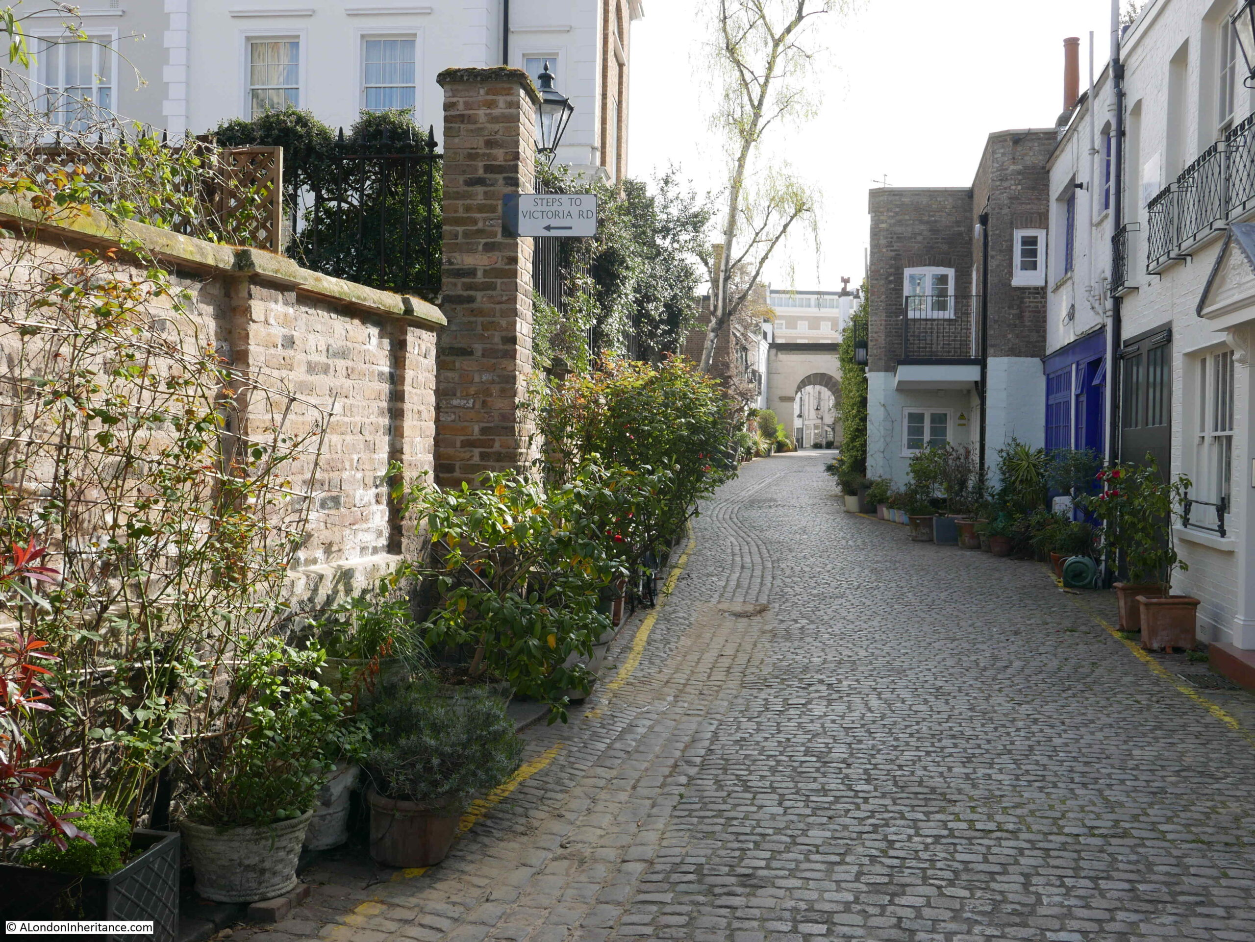
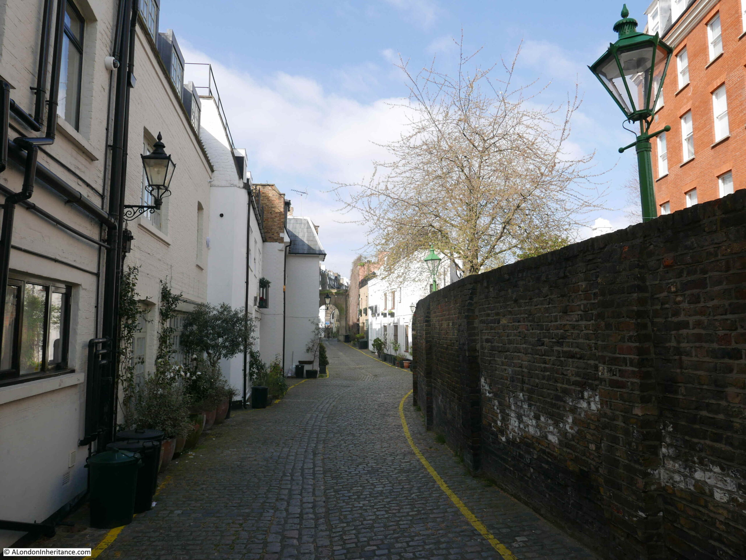
This is Kynance Mews, which my father photographed in 1986:
The same view thirty five years later:
The mews are a favourite of “travel and lifestyle” bloggers as well as on Instagram. I resisted the temptation to take any selfies whilst posing in front of the many picturesque locations along the mews.
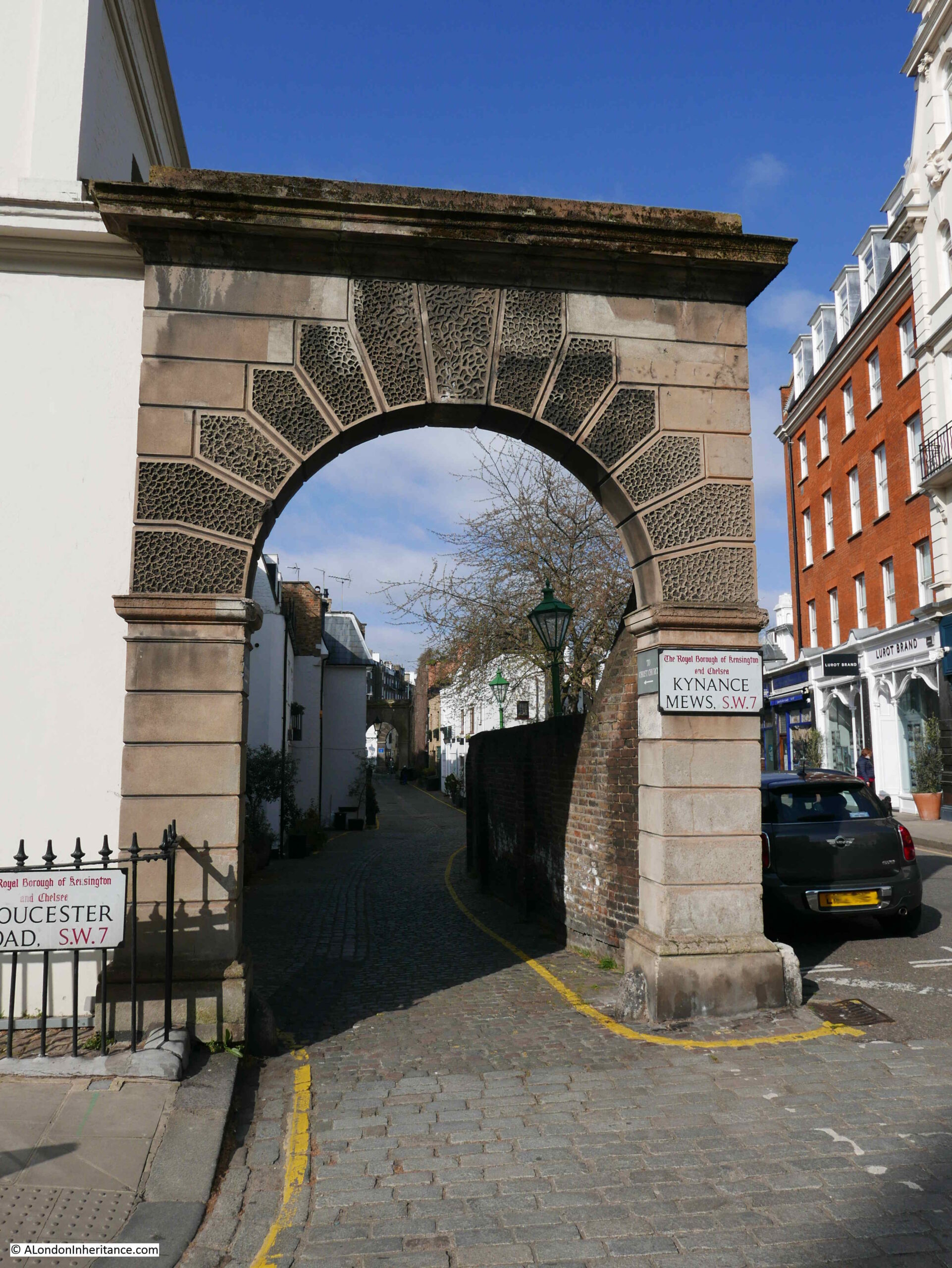
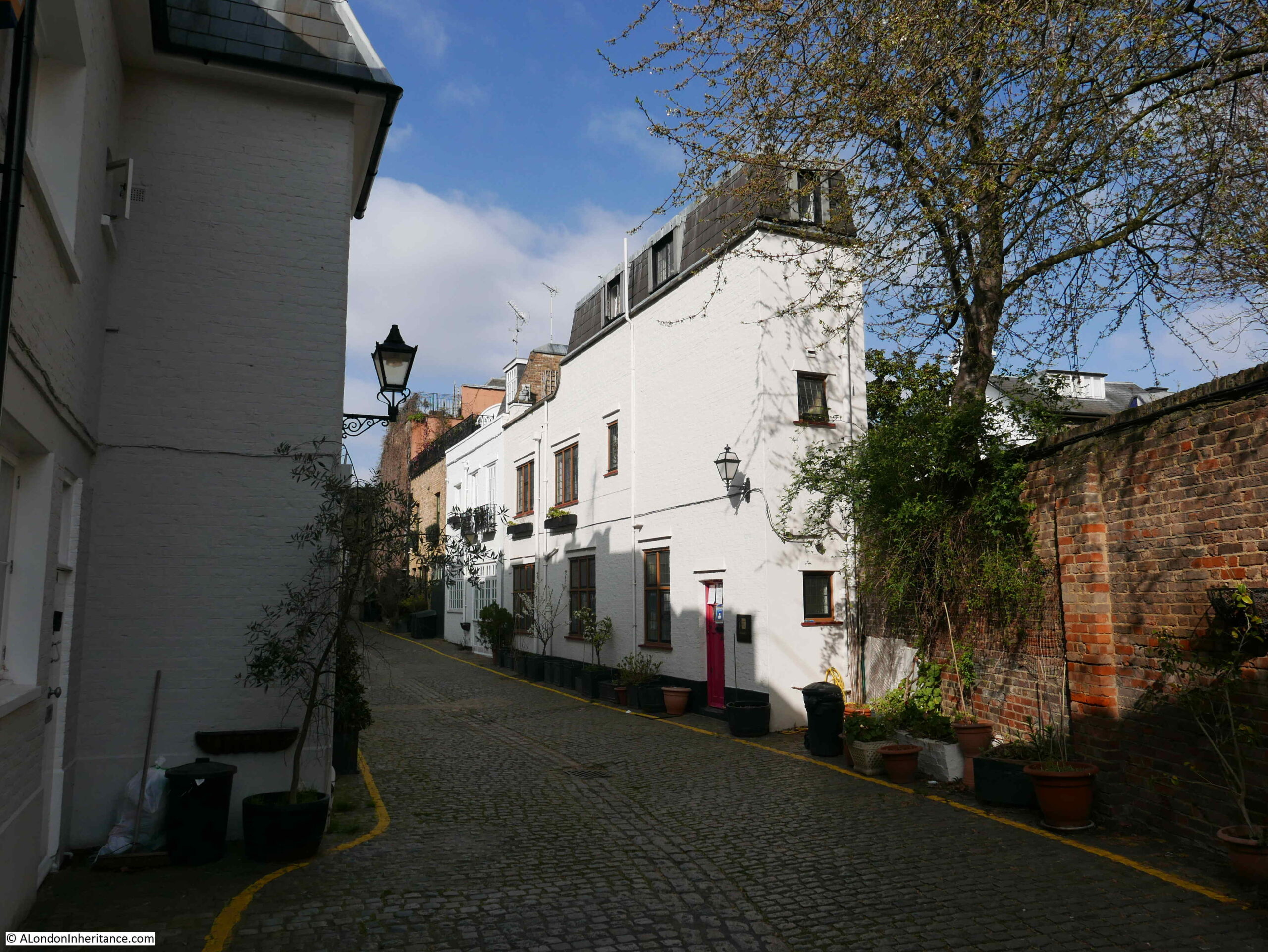
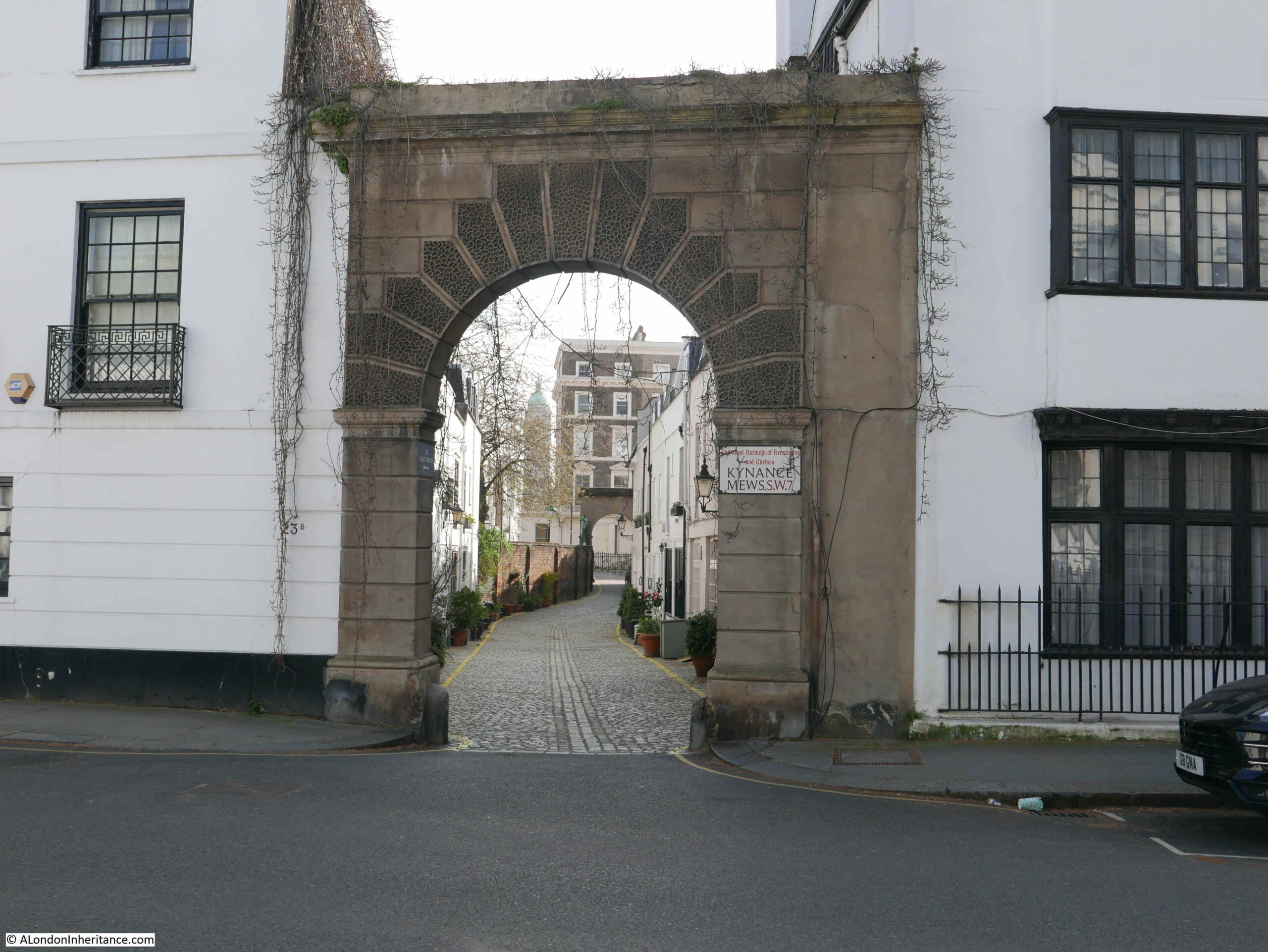
Kynance Mews starts on the Gloucester Road, where an arch can be found leading into the mews. The road on the immediate right of the entrance to the mews is called Kynance Place.
Looking through the arch and we can see Kynance Mews disappearing into the distance.
Kynance Mews is a few feet lower than Kynance Place and separated by a high brick wall.
Kynance Mews date from the 1860s, and owes its existance to the estate that was built to the south. The name is also not the original name for the mews.
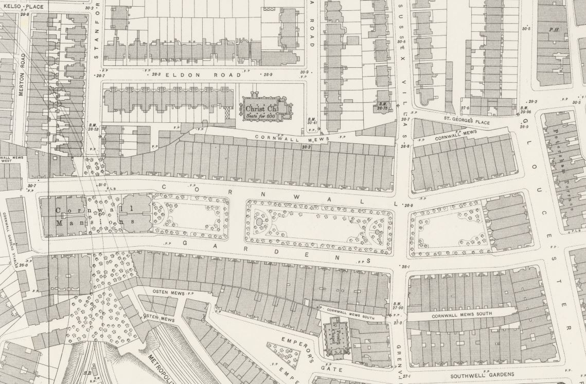
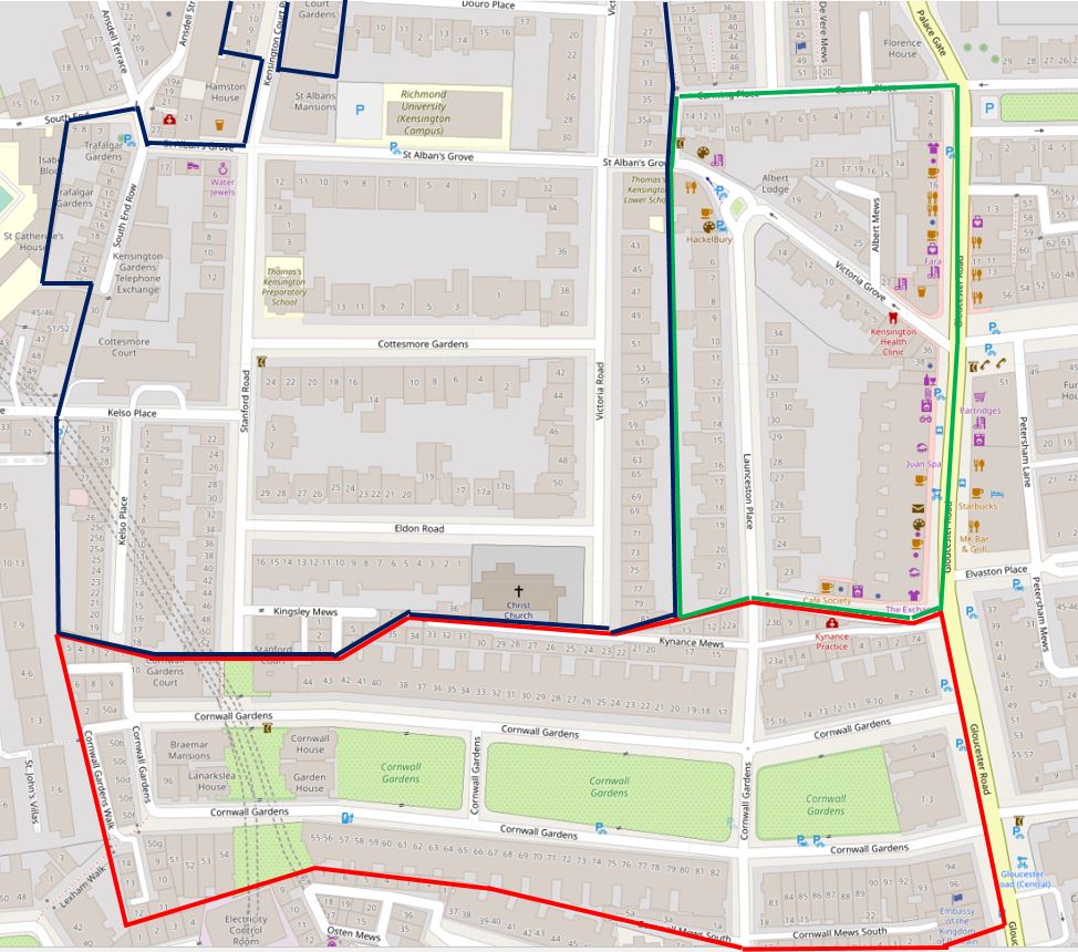
The following extract from the 1895 Ordnance Survey map shows the area thirty years after completion. In the centre of the map is the centre of the development – Cornwall Gardens, and behind the large houses on the north of the gardens is Cornwall Mews (‘Reproduced with the permission of the National Library of Scotland’).
The central area from Gloucester Road on the right and the edge of the map on the left was owned by Thomas Broadwood from 1803. By the 1850s, the area surrounding Broadwood’s land was being developed, and in 1862, Thomas Broadwood’s son (also called Thomas) decided to develop their own estate on the land.
After laying sewers in 1862, construction started on the houses and this work would continue until the mid 1870s. Work included the construction of Cornwall Mews which were built to provide stables to the large houses that the mews backed on to, the houses which formed the northern side of Cornwall Gardens.
The name Cornwall Gardens was chosen as the year when construction started (1862) was also the 21st birthday of the Prince of Wales, who also had the title of the Duke of Cornwall (the future King Edward VII).
The mews seem to have changed name from Cornwall to Kynance Mews around 1924. Kynance retains the Cornish connection with Kynance Cove on the Lizard, near Helson in Cornwall.
The entrance to Kynance Mews from Gloucester Road, with Kynance Place on the right of the mews entrance is one of the many strange street and building configurations on the estate. Kynance Mews is truncated in length and does not run the full length of Cornwall Gardens. Building lengths vary, and there are some rather odd alignments with the houses of neighbouring streets.
The reason comes down to Thomas Broadwood’s original land holding, with these early boundaries dictating the street and house plans we still see today.
In the following map, I have outlined Thomas Broadwood’s land holding, and the boundaries of the Cornwall Gardens development in red. Cornwall / Kynance Mews runs along the top right of the boundary, but stops short as the end of the mews hit another land boundary, with the length of the houses at this point decreasing to align with the boundary (‘Reproduced with the permission of the National Library of Scotland’).
The red line of Broadwood’s boundary reveal some very strange street and building configurations. As we walk into Kymamce Mews, one of these can be seen with the first building in the mews that borders Kynance Place (then St Georges Place).
In the following photo the end of the boundary wall is on the right, followed by the first building, which starts of narrow and then does widen out slightly as Kynance Mews and Kynance Place diverge (see the above map).
The first section of Kynance Mews is relatively short, with Launceston Place cutting across (another Cornish connection with the Cornish town of the same name).
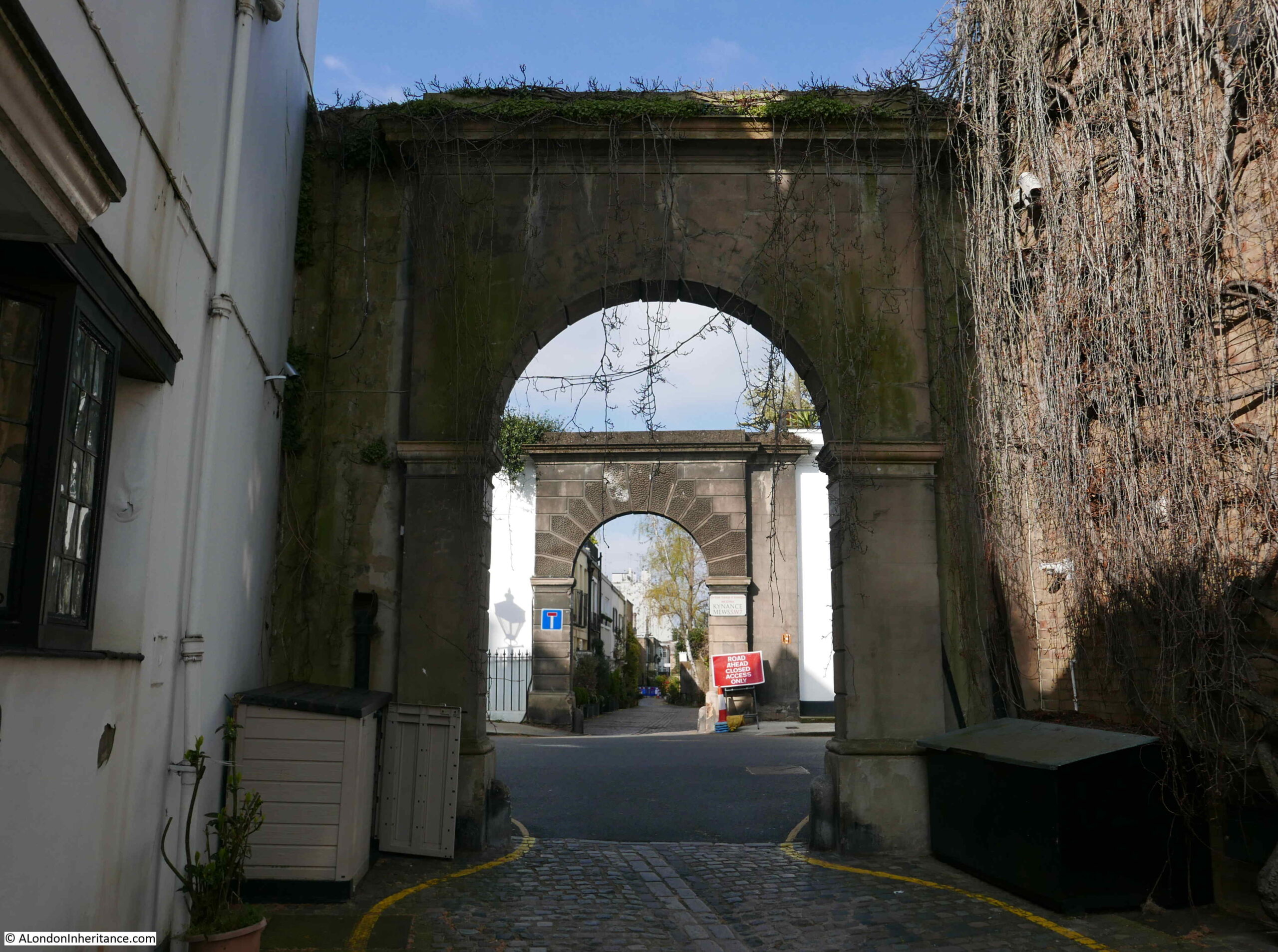
At the end of the first section, and start of the second section are two more arches that frame the entrance to Kynance Mews:
All three arches are Grade II listed, with their Historic England listing describing them as “Archway. Circa 1860. Simple stucco arch with rusticated piers and vermiculated architrave, cornice over”.
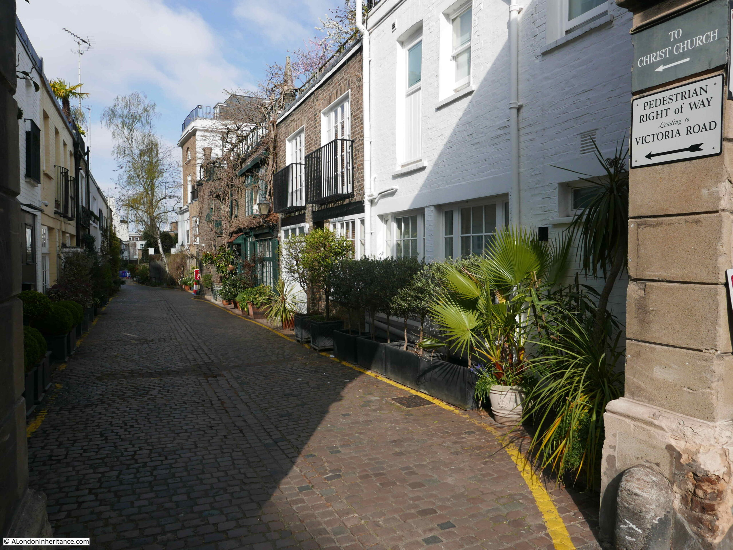
Crossing Launceston Place, and we can look back at the shorter section of Kynance Mews:
I visited the mews in April, before the plants and trees along the mews had come into leaf or flower. The two arches in Launceston Place should by now be topped with hanging green branches – part of what makes the mews popular with the Instagram and Lifestyle / Travel communities.
Walking through the arch and there is a sign on the right of the arch that points to a Right of Way and some hidden steps that provide a walking route out of the mews.
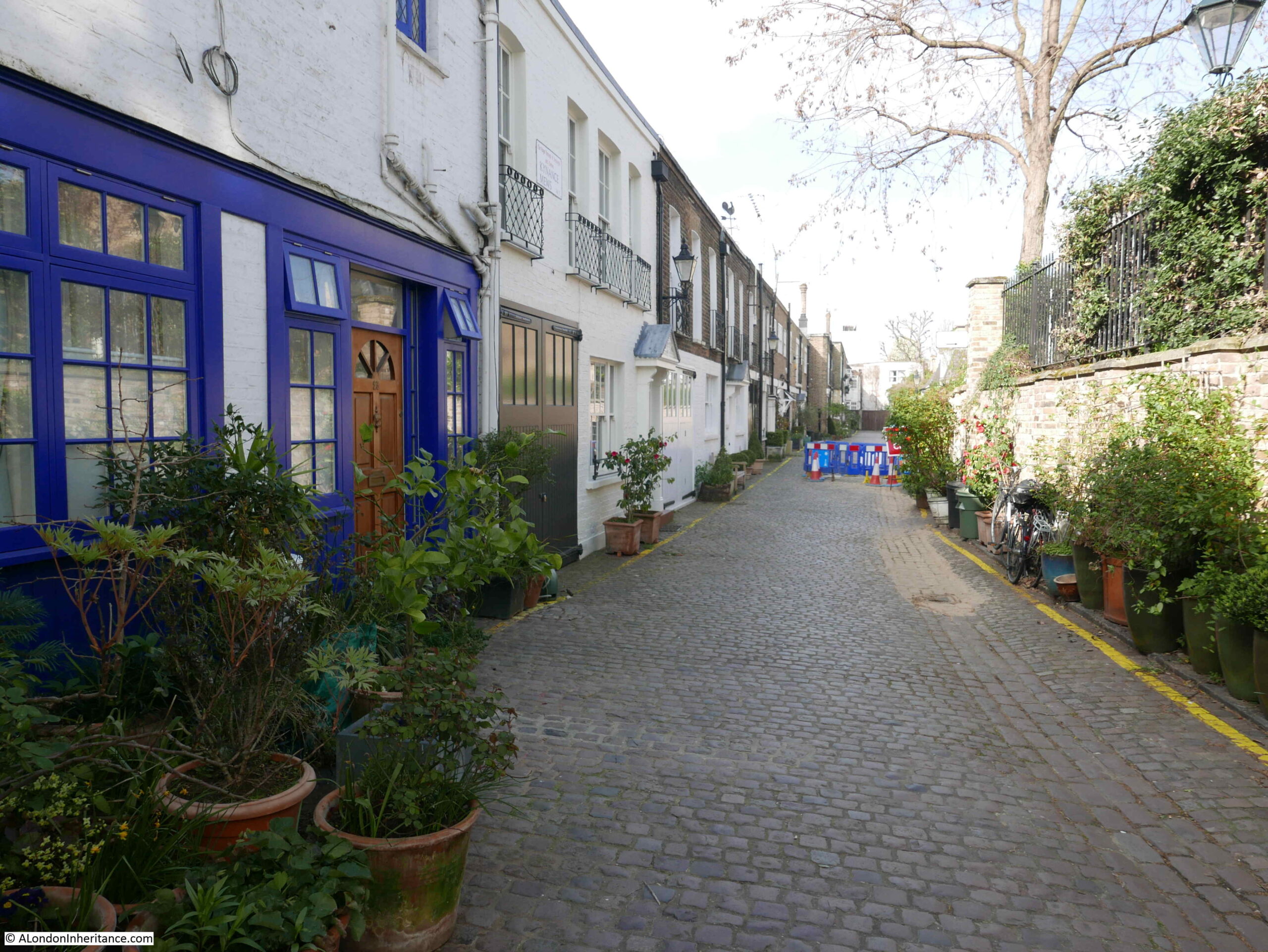
Walking further along Kynance Mews and we can see the two storey buildings that back onto the houses in Cornwall Gardens. A number of these retain the large doors that once would have been part of the stables.
The census of 1911 provides a view of the employment of those who lived in the mews:
Groom Domestic
Caretaker
Coachman Domestic
Farrier
Carman
Chauffer Domestic
Horse Keeper
The majority of those living in the mews had jobs that seem to have involved some aspect of providing the transport for those who lived in the large houses in Cornwall Gardens, there were also a number of trades people who were probably employed in local building and maintenance works.
The transition from horse to motor transport can be seen in newspaper reports from the 1910 onwards, including one from the 14th July 1928 when Lady Grace Indja Thomson of Bell Cottage, Kynance Mews was fined 10 shillings for driving without a licence.
Lady Grace Indja Thomson was the wife of Sir Basil Home Thomson, who was typical of many of the residents of the Cornwall Gardens estate, having passed through Eton and Oxford then working in the Colonial Service where he was posted as a Colonial Administrator in Fiji and Tonga. After resigning from the Colonial Service and returning home, he took up appointments first with the Prison Service, then the Metropolitan Police.
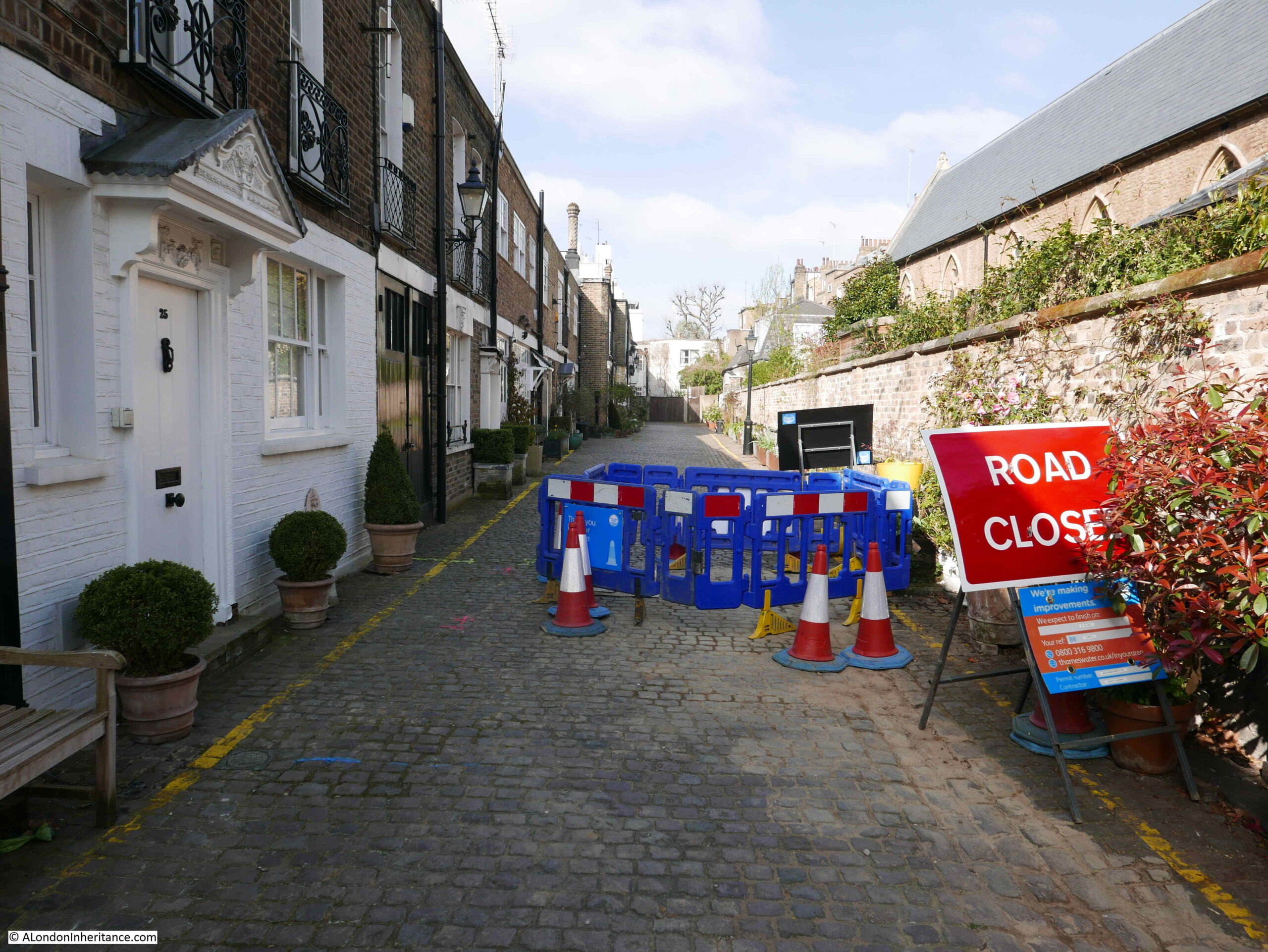
I suspect that the original occupiers would have been stunned by the prices the houses in Kynance Mews now sell for, and the rate at which they are increasing. A typical terrace house in the mews sold for £975,000 in 2001 and was sold again in 2020 for £2,175,000.
Despite these prices, and being in a mews, the houses still suffer with road works. This is the reason why my 2021 photo is slightly different to my father’s, which, as far I could work out, was taken in the middle of the road works.
The western end of Kynance Mews terminates in a dead end, with houses on another estate, not part of Thomas Broadwood’s original land holding and Cornwall Gardens development on the other side of the wall.
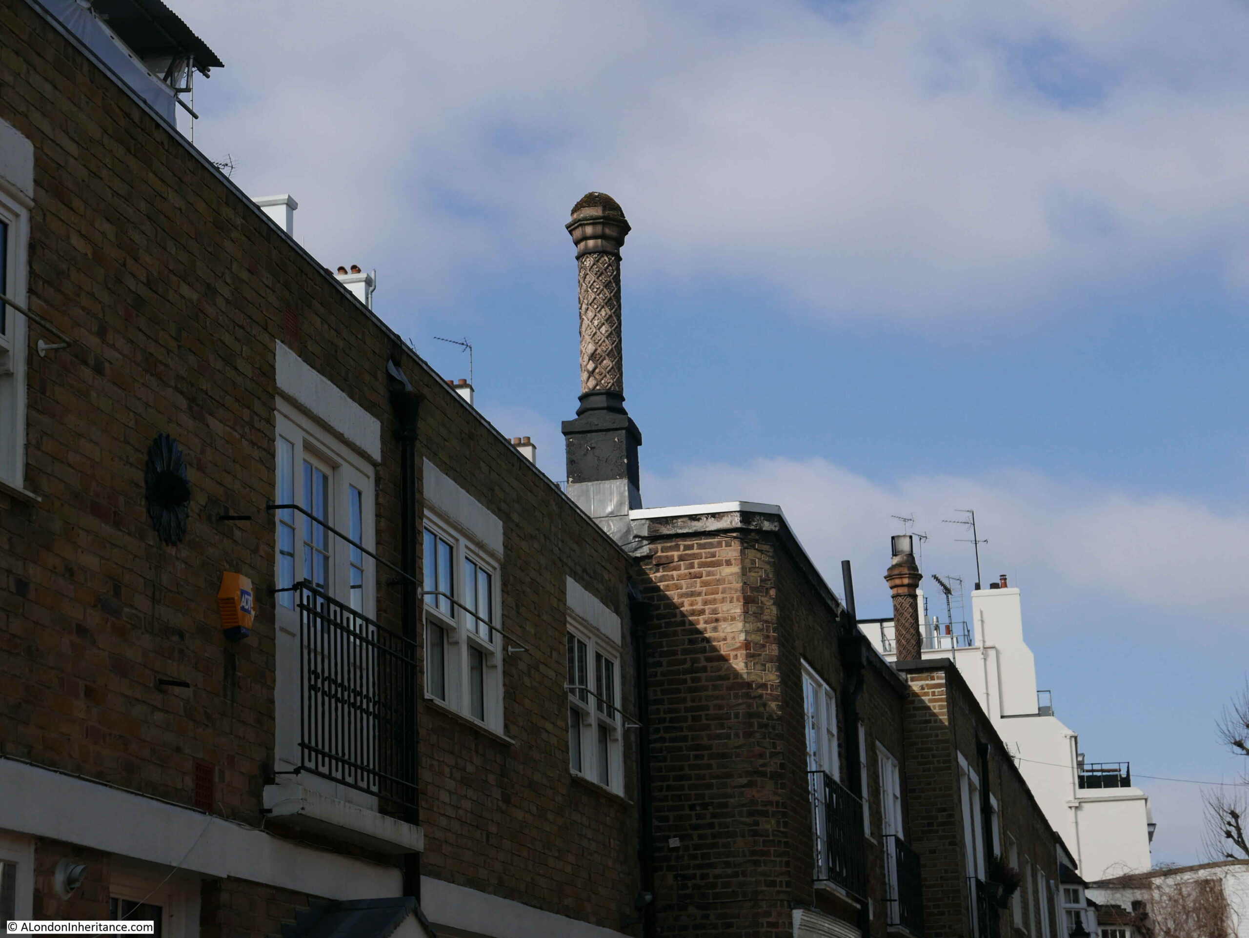
There are some rather ornate chimneys lining the roofs of some of the houses in Kynance Mews:
To the north of Keynance Mews, on the other side of the boundary wall is Christ Church, Kensington:
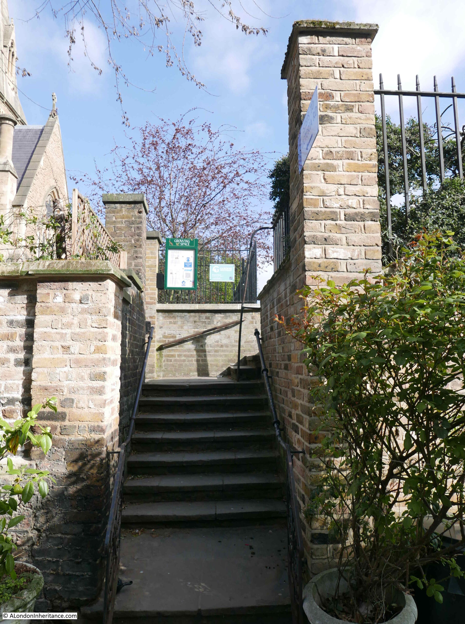
In my father’s 1986 photo, there is a sign projecting from the wall on the left. The sign directs the walker to a set of stairs leading up to Victoria Road, on the eastern boundary of the church. The stairs form part of the pedestrian right of way seen on the sign on the arch leading to this section of the mews.
There are a number of stubs of roads in this part of Kensington which reflect the original estate boundaries. Victoria Road has a short stub that passes the church and ends at the boundary wall with Kynance Mews, and this stub of road provides access to the stairs which can just be seen behind the motorbike and adjacent to the lamp post.
The above photo also helps to demonstrate the difference between the size of the mews houses in the foreground, and the much larger houses to the rear which faced onto Cornwall Gardens, and that the mews buildings were built to serve.
For the rest of the post, I will take a walk in the streets to the north of Kynance Mews, as the stairs were part of the original 1986 photo and the mews and land to the north show how original owners and land boundaries influenced the current layout of streets and buildings in this part of Kensington.
The land to the north of Kynance Mews was known as the Vallotton estate, as it was developed by the Vallotton family.
John James Vallotton purchased the first parcel of land in the area in 1794. His son Howell Leny Vallotton continued with land purchases to form a significant block of land amounting to around 20 acres.
Development of Victoria Road seems to have started around 1829, and development of the area would continue through the 1830s to 1850s.
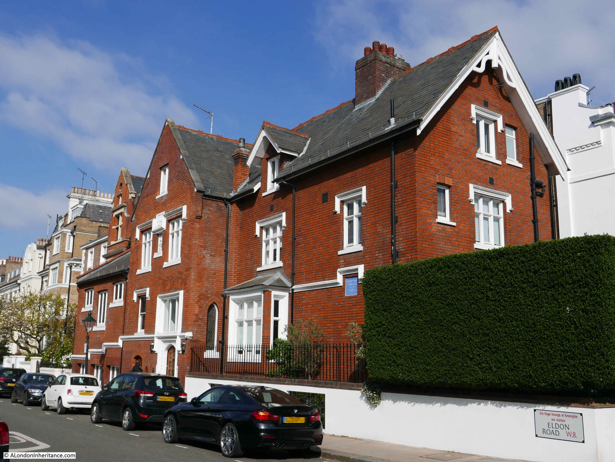
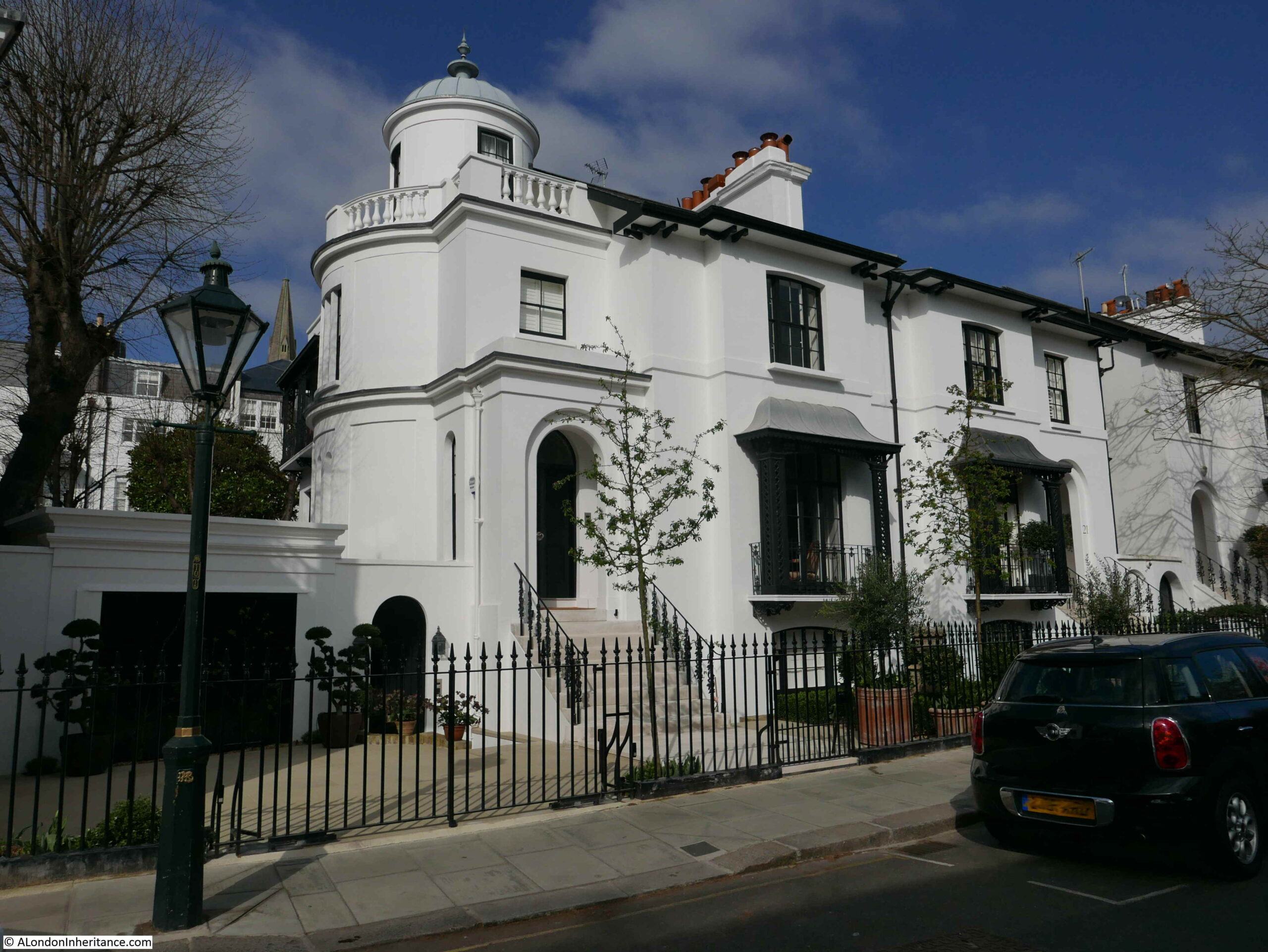
The Vallotton estate has a varied mix of architectural styles and construction materials. On the corner of Eldon Road and Victoria Road is number 52 Victoria Road:
Built between 1851 and 1853 for the painter Alfred Hitchen Corbould, the building has a square blue plaque recording his residence here, and that he was Art Tutor to the children of Queen Victoria.
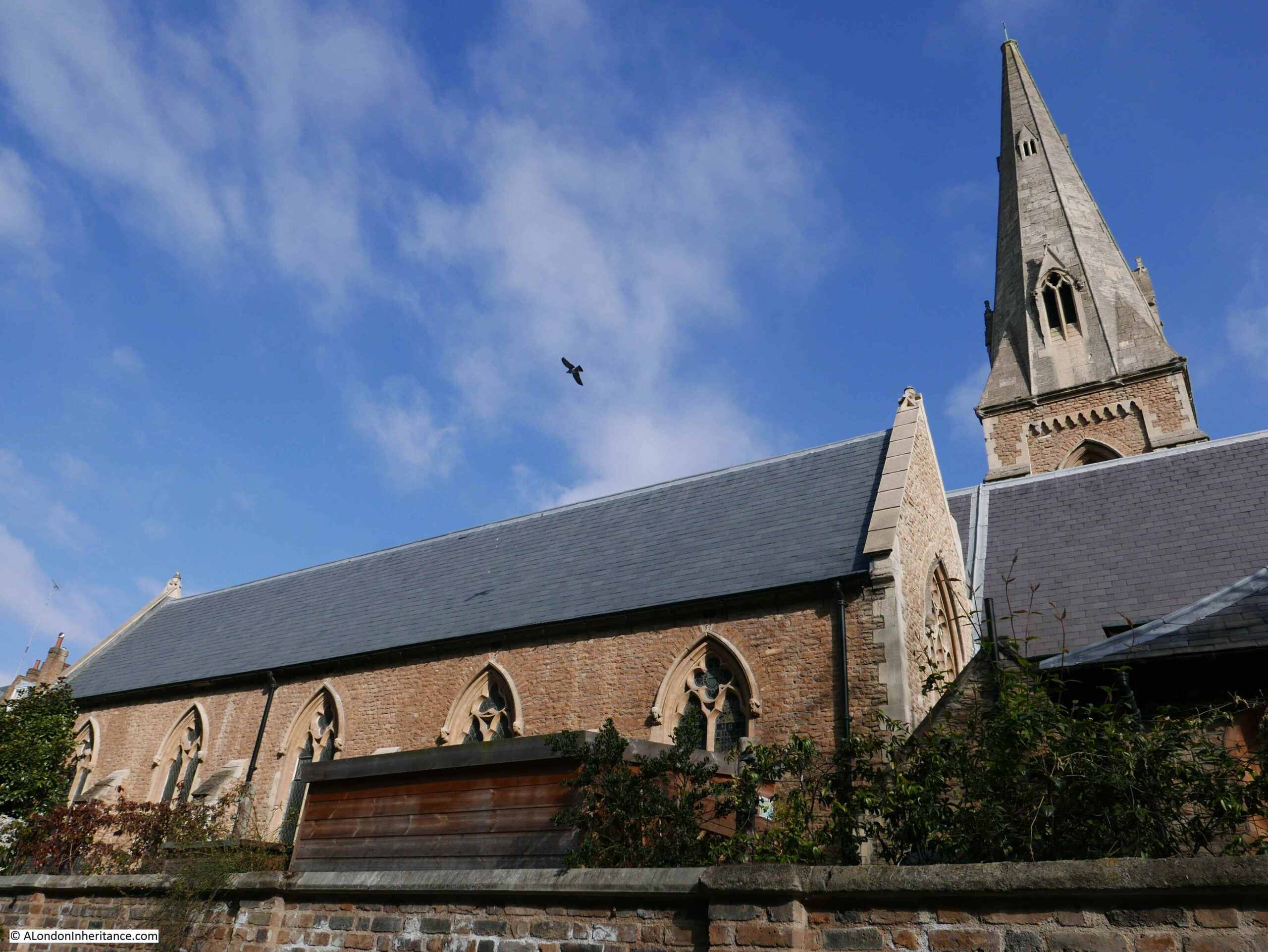
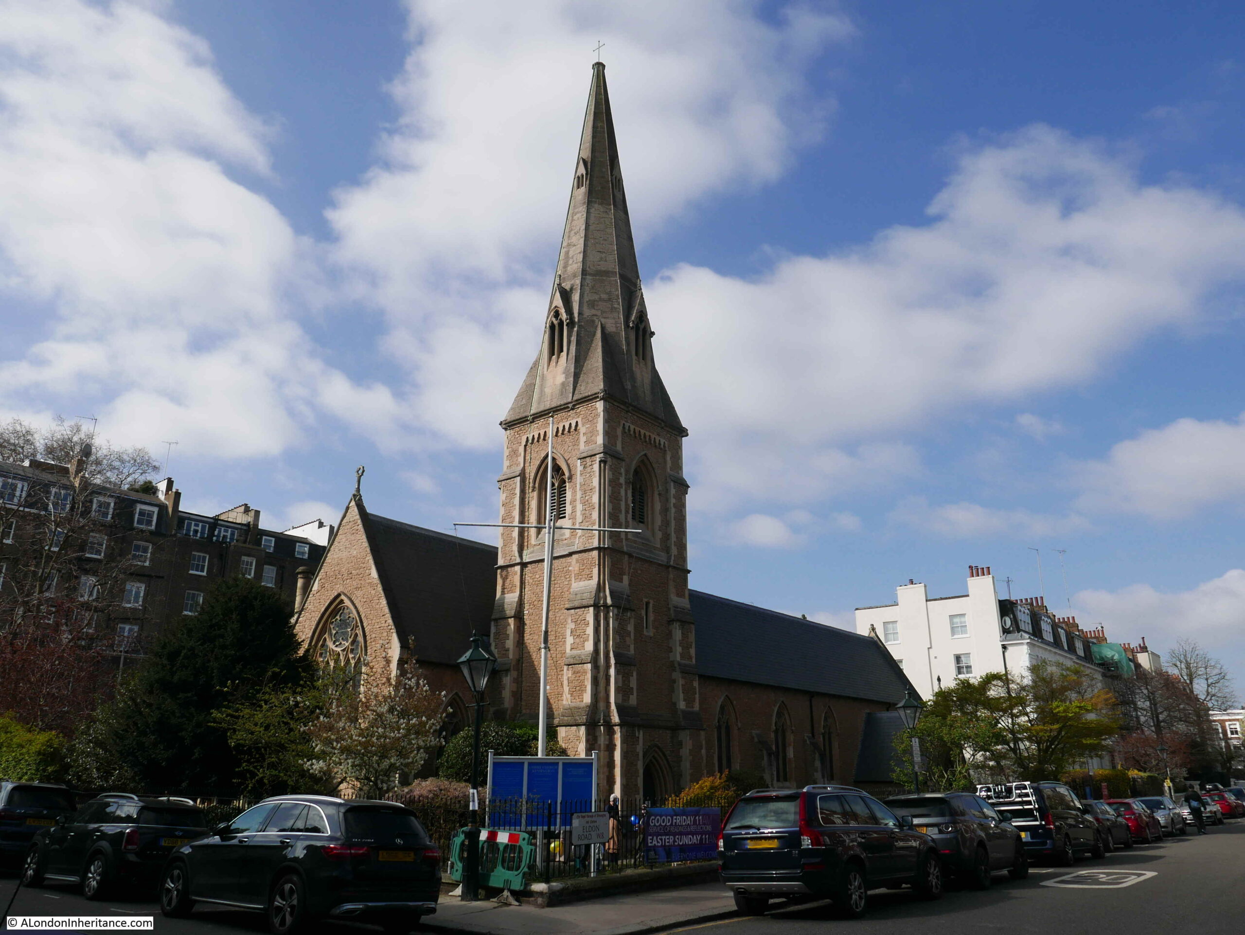
Opposite the above house, and on the corner of Eldon and Victoria Street is Christ Church Kensington, the church that backs onto Kynance Mews.
The church was built to a design by Benjamin Ferrey between 1850 and 1851 to serve the growing population of Vallotton’s estate. Vallotton had donated the land, and subscriptions were raised to fund the £3,540 bid for the work from builder George Myers of Lambeth.
Very few changes have been made to the church in the 170 years since completion and the church still looks as it was designed and completed.
Christ Church Kensington also serves the Cornwall Gardens estate, and is possibly one of the reasons why there is a public right of way between Kynance Mews and Victoria Road, to provide easy walking access to the church from the mews and Cornwall Gardens.
A church had been planned on the western end of Cornwall Gardens, however whilst the estate was being developed, the Metropolitan and District Railway was also being built and used land through the western end of the gardens where the church had intended to be placed.
The railway used the cut and cover method of construction and therefore prevented any work on the western end of the estate whilst it was being built, and complicated any construction on the land above when the railway was completed.
From the church, I continued to walk north along Victoria Road, the street that was the first part of the development of the Vallotton estate.
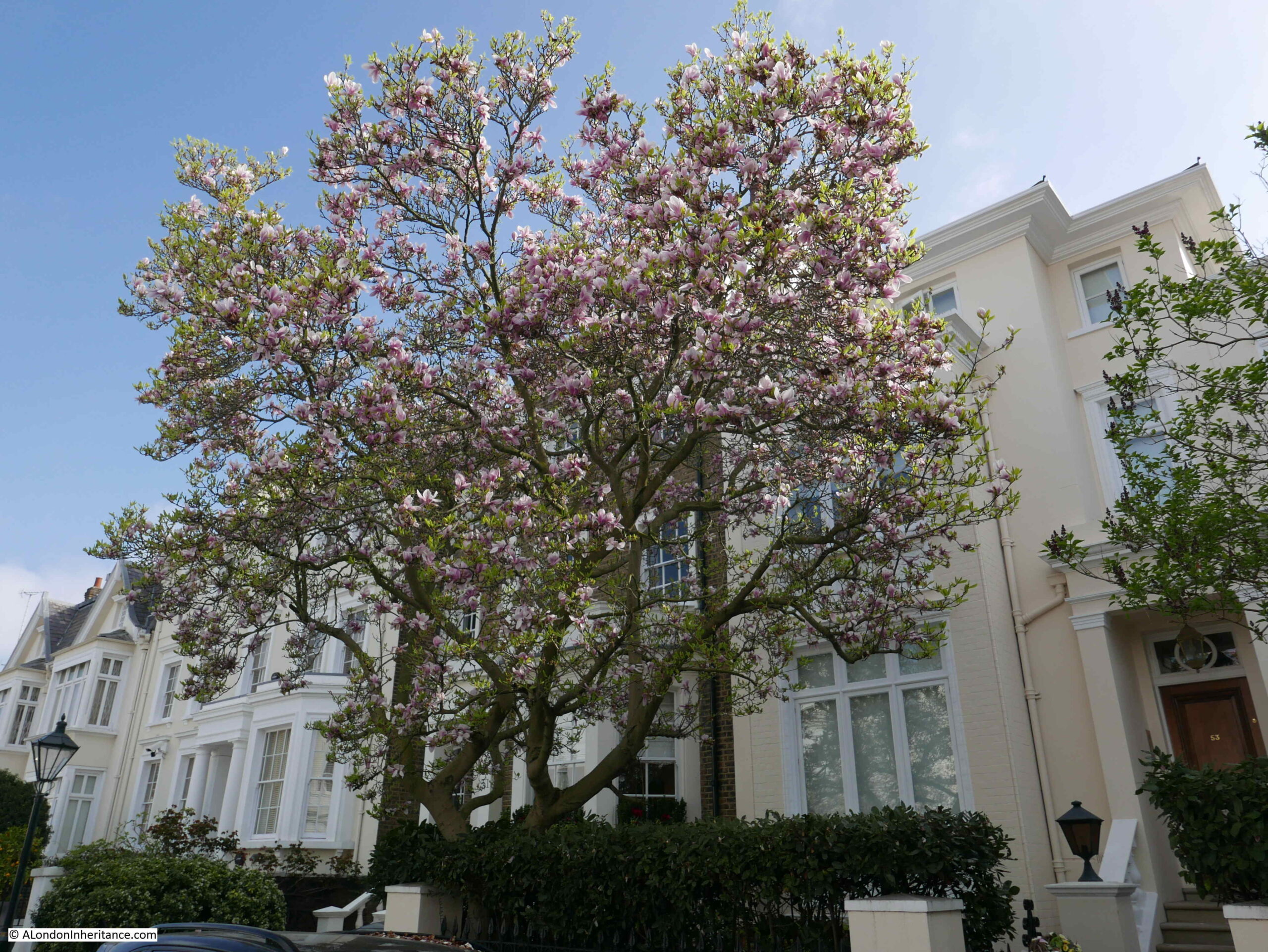
Victoria Road originally consisted of semi-detached pairs of villas, surrounded by substantial gardens. There has been a fair amount of ongoing development of the houses resulting in few being exactly as built.
Despite changes since their original construction, the houses still look magnificent. The street is quiet as the design of the estate and boundaries with other estates mean that it is not a through road.
The flowers and spring blossom on the trees add to the photogenic appearance of the estate.
Victoria Road is a long street that runs all the way north to Kensington Road, and I do not intend to walk that far, rather head back to the start of Kynance Mews, so at the road junction with St Albans Grove, I turn right.
It is here that I cross into another of the original estates that developed this part of Kensington.
In the following map, I have marked the three estates that I am walking through. The Cornwall Gardens estate is marked by the red line. The Vallotton estate is bounded by the dark blue line and can be seen as the larger of the estates as it continues to head north.
The land comprising the Inderwick estate was purchased by John Inderwick in 1836 from Samuel Hutchins, who in turn had purchased the land from the manor of Kensington.
John Inderwick was an importer of pipes and snuff boxes who lived in Wardour Street. His pipe business was still in operation until as recently as 2000 when the business was finally closed. It had operated in Carnaby Street since the 1960s.
The relatively small size of the Inderwick estate probably explains the speed of construction, with work starting in 1837 and completed by 1846, with Launceston Place being the last street to be developed.
In the above map you can also see where the railway cut through the western end of Cornwall Gardens using the cut and cover method of construction. This was where the Cornwall Gardens church was intended to be built.
Launceston Place was the street that took me back down to Kynance Mews. The houses in Launceston Place are slightly smaller than Victoria Road, but are still lovely semi-detached villas.
With some interesting designs at some of the end of terrace pairs:
Where the gardens at the rear of the houses in Launceston Place meet the gardens at the rear of the houses in Victoria Road, there was an old footpath before the estates were built, that went by the name of Love Lane, which would also have been the original boundary of the Vallotton and Inderwick estates.
I find it fascinating when walking London’s streets that the route of 500 year old footpaths, and ancient land holdings can still be traced today.
Until 1883, Launceston Place was called Sussex Place. the name change seems to have been to extend the Cornish connection across the area.
Before Launceston Place cuts across Kynance Mews, I turn into Kynance Place, a short street that to the south has the narrow buildings and brick dividing wall with Kynance Mews, maintaining the division between the Inderwick and Cornwall Gardens estates.
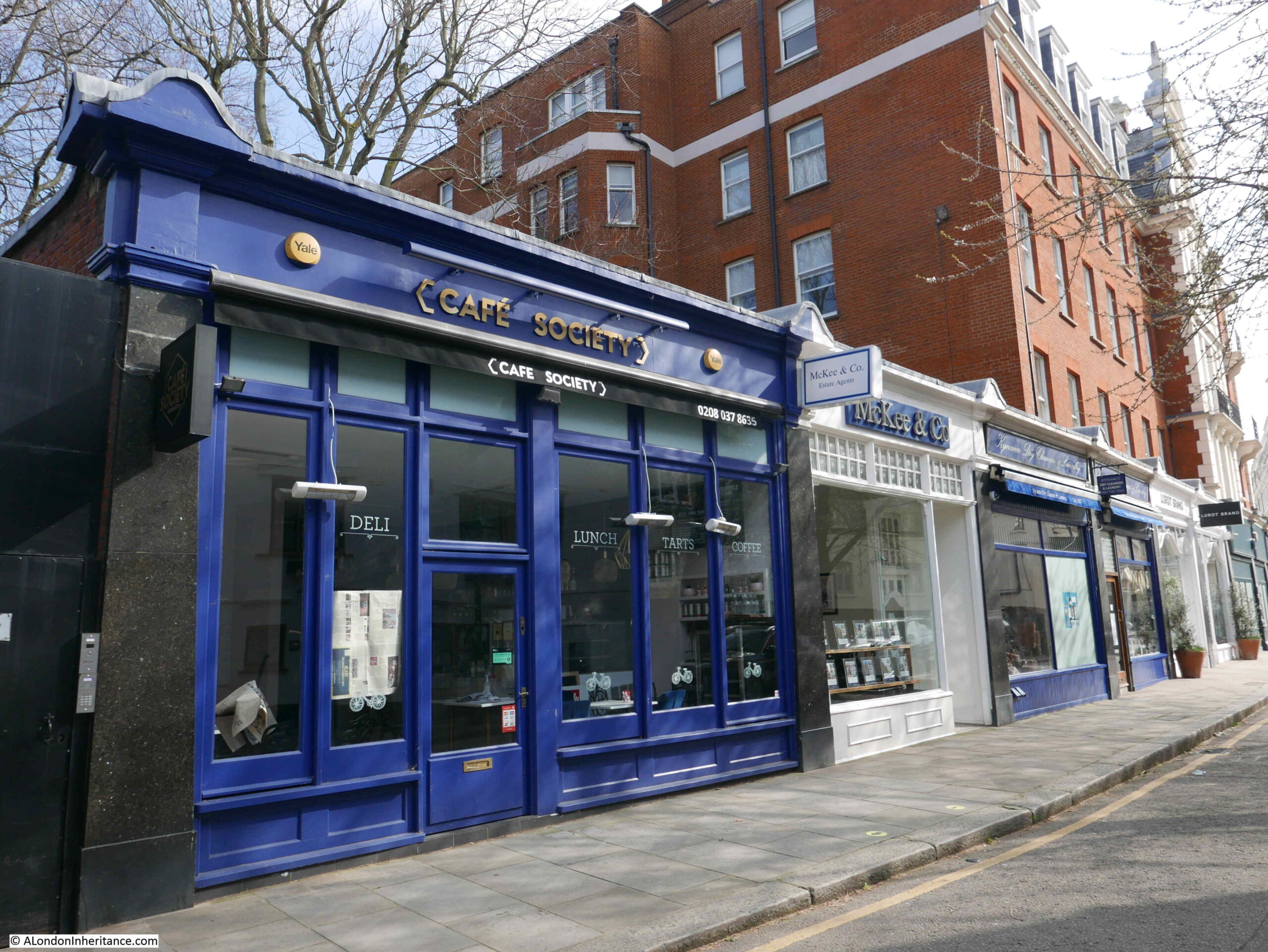
The northern side of Kynance Place has a line of small shops:
The early history of Kynance Place illustrates the problems that the early developers of these estates had with infrastructure.
Whilst Inderwick could complete the sewers across his estate, he would have needed a larger sewer to connect with to drain away from the estate. When he started to build the estate, no such sewers were available. There were plans to build a large sewer along Gloucester Road, however Inderwick would have had to pay the full costs of such a project.
Until there was a connecting sewer available, Inderwick was forced to construct a large open cesspool where Kynance Place now stands. Although Inderwick improved his own infrastructure, the estate had to wait until the 1860s when the Gloucester Road sewer was finally completed.
And at the end of Kynance Place, I am back to where I started the walk through Kynance Mews.
Kynance Mews probably looks even better now as the greenery will probably be out, and it is well worth a visit for a fascinating walk through an area where the boundaries of the three original estates that formed the area can still be found.
The subject of this week’s post is one of the earliest of my father’s photos as it dates from 1946. The negative is 75 years old and is not in that good a condition. The scanned image needed some processing to get it to the state you see below, and it is still rather grey with poor contrast.
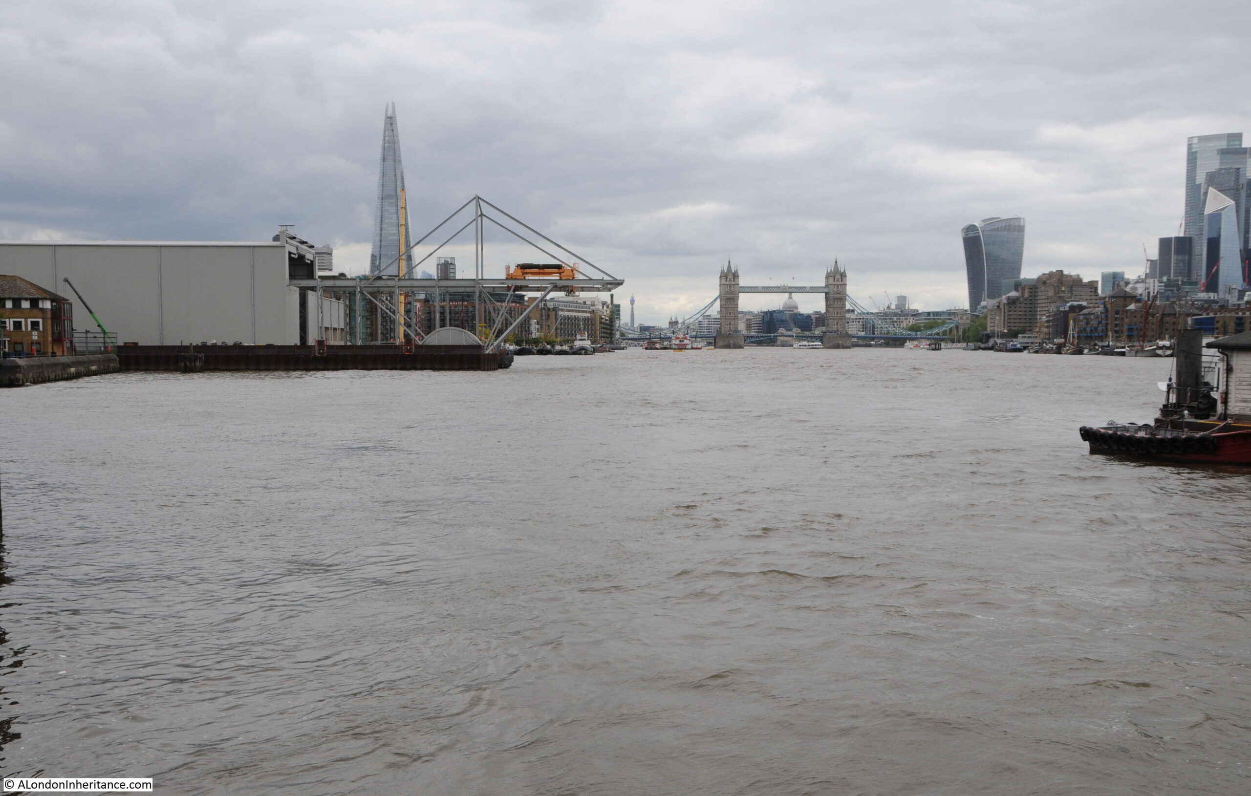
The photo is from Cherry Garden Stairs, Bermondsey, looking along the river towards the City, with the dome of St Paul’s Cathedral visible through Tower Bridge.
The same view today, with the dome of St Paul’s Cathedral in exactly the same place, however a very different river scene (the perspective looks different due to the very different camera and lens combinations used).
In 1946, the river bank was lined by warehouses, wharves and docks, with cranes along the river. A large number of lighters and barges are moored in the river, and directly in front of the camera, which would have been on the foreshore of the river.
In the 2021 photo the towers of the City are visible to the right, along with the Shard on the left. There are no more working warehouses, wharves or docks, and traffic on the river is today very different.
The river is though still used to transport construction equipment to a major construction site. In the 2021 there is a large shed on the left bank of the river, with the metal work of a travelling crane extending from the shed to over the river.
This is Chambers Wharf, one of the main construction sites for the Thames Tideway Tunnel. Chambers Wharf is one of the project’s main drive sites, with boring machines transported to the site via the river, and lowered by crane down to the point where the machines drive out, creating the tunnel.
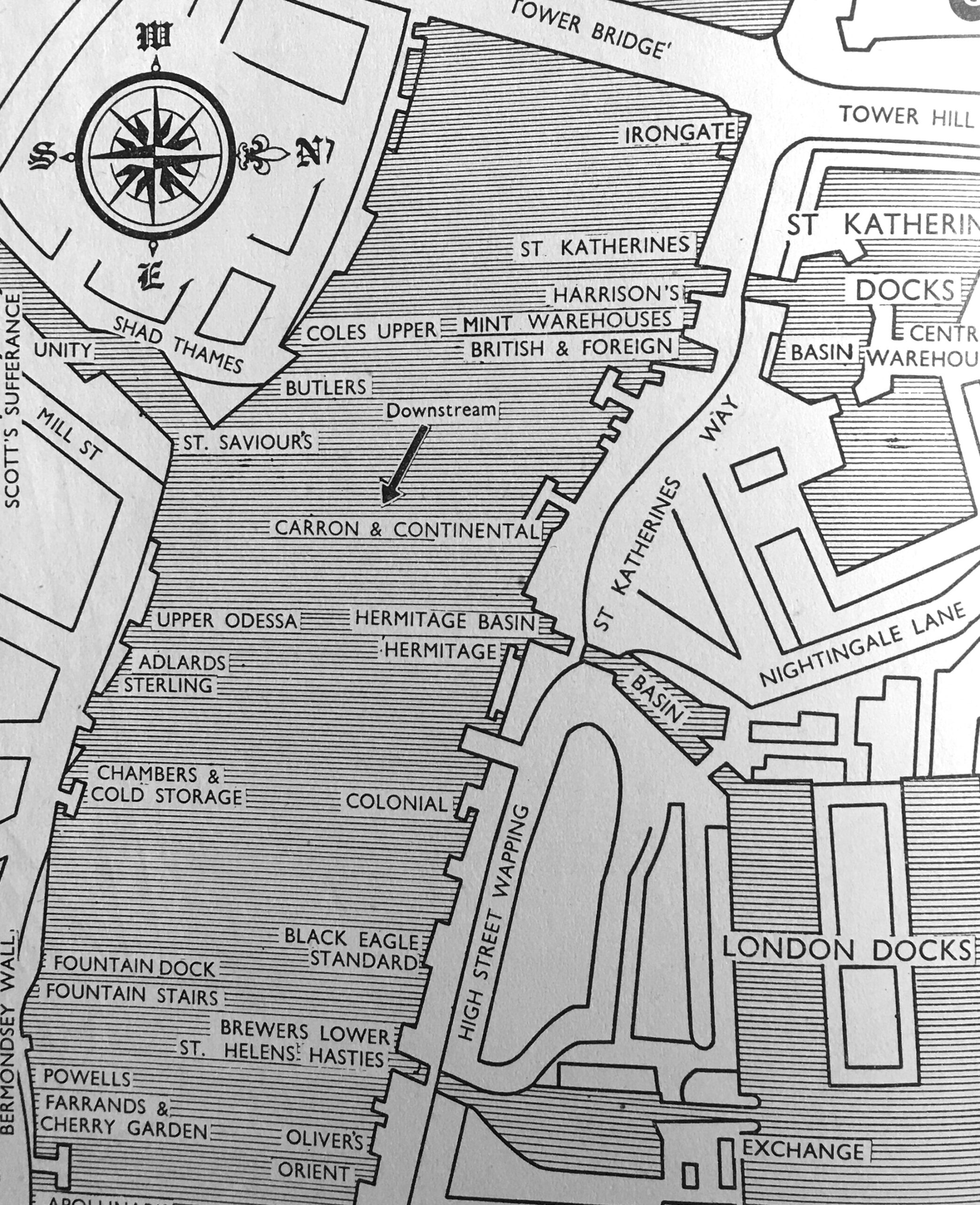
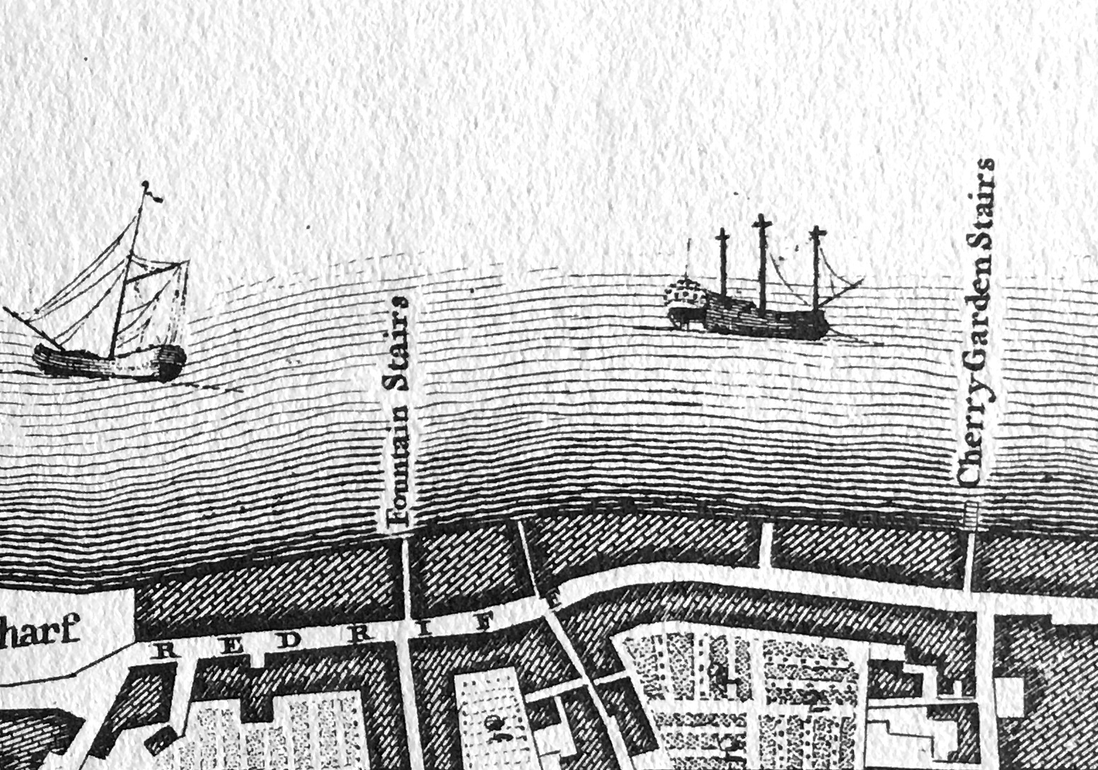
Chambers Wharf was one of the many wharves between Tower Bridge and Cherry Garden Stairs. The following map is from the 1953 edition of London Wharves and Docks, and the left of the river covers the area from Tower Bridge to Cherry Garden Stairs seen in my father’s photo.
The type of goods that these wharves dealt with are (from the top of the left bank of the river):
Coles Upper Wharf: Bulk grain, flour, cereals
Butler’s Wharf: Tea, rubber, colonial produce, bulk grain, fresh fruit
Sterling Wharf: General, strawboards and wood pulp boards
Chambers Wharf and Cold Storage: All types of food including highly perishable refrigerated dairy produce and quick frozen goods
Fountain Dock: Grabable rough goods, coal, granite, ballast and sand
Fountain Stairs Wharf: General, flour, cased goods
Powells Wharf: Foodstuffs
Farrands and Cherry Garden Wharf: General goods in bags, cases and casks, flour and corn starch
Also in the above map is St Saviour’s Dock, which I will save for a future post.
The list of wharfs does show the considerable range of goods that were being handled in the stretch of the south bank of the river shown in the 1946 photo.
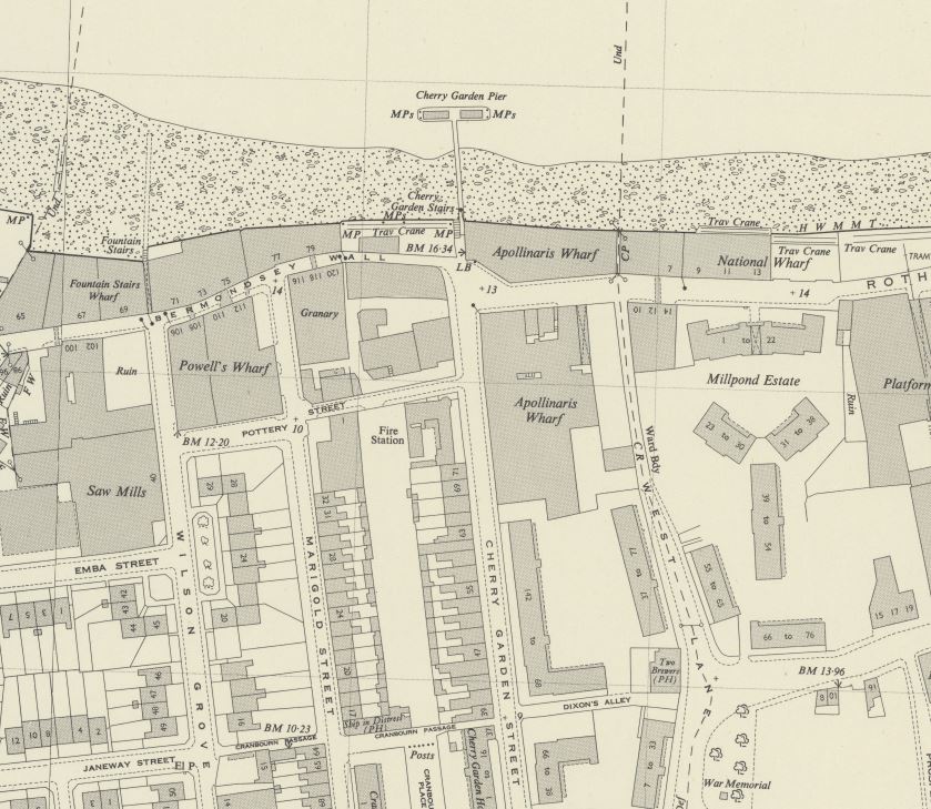
The following extract from the 1949 edition of the Ordnance Survey map shows Cherry Garden Street in the centre of the map, running up to Cherry Garden Stairs, which are at the lower left of Cherry Garden Pier (‘Reproduced with the permission of the National Library of Scotland’).
A pier at the site seems to date from the later half of the 19th century, and Cherry Garden Pier is still there today, although used by a private company with no public access.
One interesting point in the above map, is to the right of the map is the Millpond Estate, a 1930s housing development which can still be seen today. The location of the estate had been the site of a flour mill, mill pond and terrace housing. The mill pond was once part of an extensive irrigation system that ran inland to much larger ponds – lots more to discover around this part of Bermondsey.
Cherry Garden Stairs are one of the many old stairs that provided access to the river. The earliest newspaper reference I can find to the stairs dates from the 25th May 1738 when “Yesterday morning an eminent Shoemaker at Cherry Garden Stairs, Rotherhith, was found drowned in the River Thames”.
The stairs are probably much older than the 1738 reference. Leading back from the location of the stairs (see above map) is a street called Cherry Garden Street. The street is named after a pleasure garden that was here called Cherry Garden.
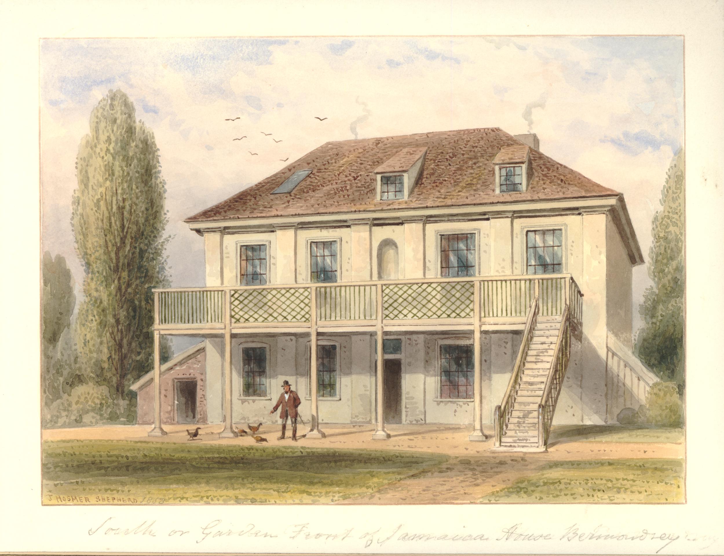
In volume four of the 1912 edition of the History of the County of Surrey in the Victoria County History series, there is reference to a Jacobean style house called Jamaica House which could still be found in Cherry Garden Street until 1860.
This house appears to have been part of the gardens as in the same volume, there is a quote from Pepys which reads “To Jamaica House, where I never was before, together with my wife, and the Mercers and our two maids, and there the girls did run wagers upon the bowling green: a pleasant day and spent but little”.
Pepys visit is referenced in an article in the Westminster Gazette on the 7th October 1910, which also recalls an inn that was located by the stairs: “Cherry Garden-street, the scene of yesterday’s big riverside fire, occupies the site and preserves the name of the old Bermondsey ‘Cherry Garden’, once a well-known place of public resort. The Cherry Garden was favourably known to Pepys, who recorded his visit there in his famous diary. At Cherry Garden Stairs there was formerly a celebrated inn known as the Lion and Castle, a name supposed to have been derived from the marriage which took place between the Royal House of Stuart and that of Spain. Close by was the even more famous Jamaica, traditionally supposed to have been the residence of Cromwell”.
Edward Walford in Old and New London (1878) doubts the Lion and Castle name originating from a Stuart / Spanish name and prefers the source to be “the brand of Spanish arms on the sherry casks, and have been put up by the landlord to indicate the sale of genuine Spanish wines, such as sack, canary and mountain”.
The Lion and Castle pub seems to have been at Cherry Garden Stairs from the late 18th century to some point around the 1860s. It was not shown on the 1895 OS map.
It may have been that the stairs were used for river access to the pleasure gardens and that was why they took the name of the gardens. Rocque’s map of London in 1746 shows Cherry Garden Stairs (right on the corner edge of my copy of the map):
Thames stairs were so very important for centuries in the life of the river, and for all those who had some connection with the activities carried out on, or alongside the Thames.
As well as providing access to and from the river, Thames stairs were a key landmark. There are hundreds of newspaper references to Cherry Garden Stairs during the 18th and 19th centuries. The majority of these are adverts of ships for sale, for lease, or that were about to set out and were advertising for cargo or passengers.
For example, the Public Ledger and Daily Advertiser on the 8th May 1818 has the following advert: “Has only room for a few Tons of Goods, and will be dispatched immediately. For Gibraltar direct. The fine, fast-sailing Brig PRINCE REGENT, Henry Stammers, Commander. lying at Cherry Garden Stairs. burthen 118 tons. For Freight or Passage”.
Other reports concern accidents, collisions, drowning and bodies pulled from the river near the stairs. Such an incident is recorded in the last newspaper reference to the stairs that I can find, when on the 29th November 1936, Reynold’s Newspaper recorded that a ten year old Bermondsey boy had fallen into the Thames from Cherry Garden Stairs and had drowned.
Thames stairs and pubs also seem to be a magnet for crime. For example, there are reports of passengers being rowed across the Thames and then robbed in, or close by the pubs that were often located near the landside of the stairs.
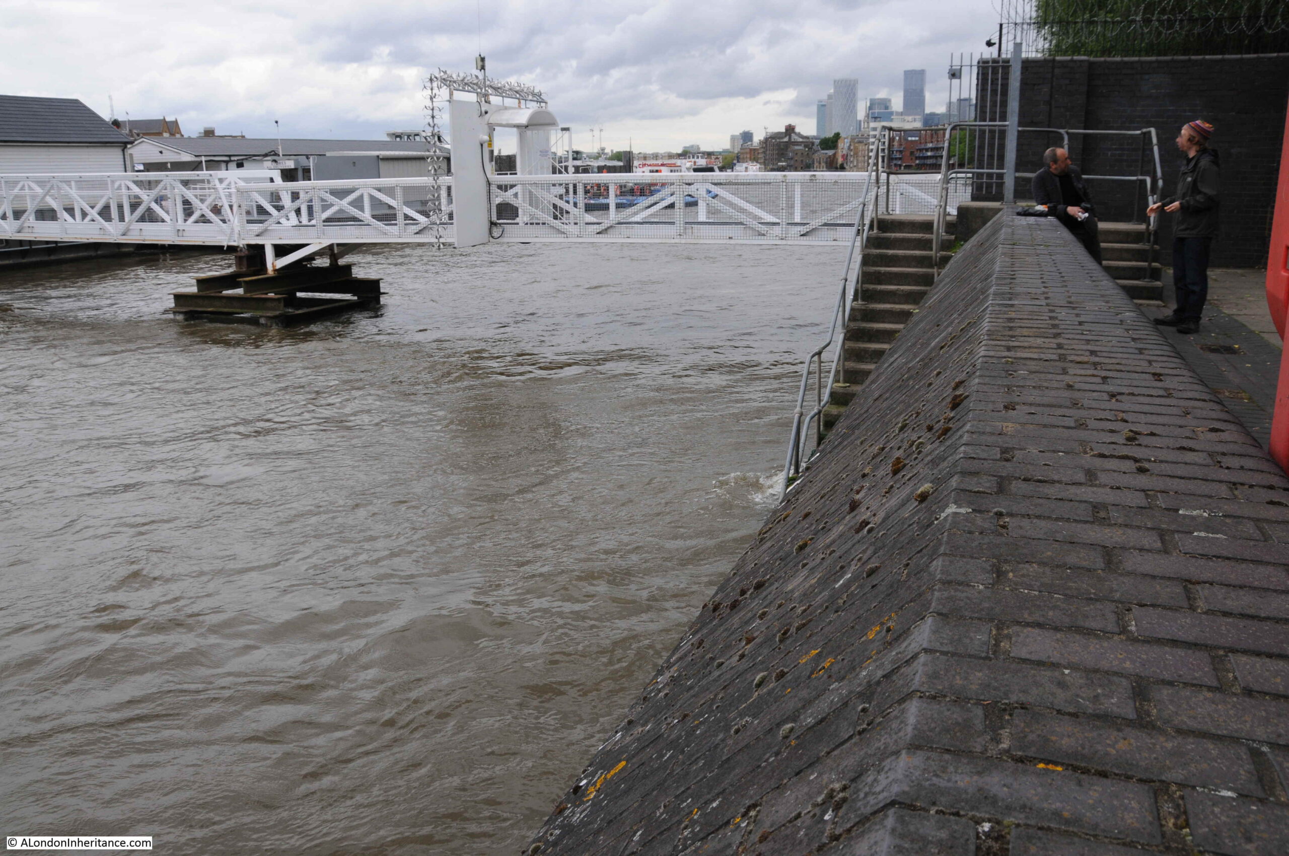
The tide was in when I arrived at Cherry Garden Stairs to taken the comparison photo. Access to the foreshore is now via a modern set of metal stairs that run over the embankment wall that was built as part of the walkway / tree lined open space that runs along the river. Difficult to photograph without being on the foreshore, but the stairs can be seen at the end of the wall in the following photo:
The walkway to the pier can be seen in the background.
I am sure that my father took the original photo from the 1946 version of the stairs, as it was by standing on the stairs that I could get the dome of St Paul’s Cathedral in exactly the same position. At this distance from Tower Bridge and the cathedral, even a small change in position changed the orientation of bridge and dome.
There is much more to discover in this part of Bermondsey, so it is an area I will be returning to again.
I hope that for this week’s post, you will excuse a bit of self advertising.
I have walked London for as long as I can remember. Some of my earliest memories are being taken for weekend walks around the city in the late 1960s – not sure it was always what I wanted to do, but those walks left an impression that has lasted.
I started scanning my father’s negatives in the late 1990s. It took many years as there were thousands of photos to scan, with family and work commitments being a priority. There were some notes to identify the locations and I did have a few years where he could identify the locations of scanned photos for me, however a large number still needed tracing.
The blog was started in 2014 to give me the incentive of going out and finding the locations of these photos dating back to 1946. It was also a means of discovering and learning more of London as a weekly post could cover my father’s photos or other areas of London that I wanted to walk and explore.
Looking back through my posts, they tend to focus on a single early photo or place. There are many individual posts that should combine to tell the story of how an area of London has changed, how the history of a place has influenced what we see today, along with the story of those who have lived and worked there.
A chance meeting with one of the tutors of the Islington and Clerkenwell Guiding Course at St Giles Clerkenwell during one of the Barbican at 50 events resulted in the idea of using a guided walk as a means of bringing together the story of a place. Stories that I have told in multiple blog posts, and using some of my father’s photos at the sites they were taken from.
I passed the course last year, however Covid restrictions delayed any further activity, but did allow the time to develop two guided walks (with more in the pipeline).
With restrictions easing, I am really pleased to announce the availability of my first two guided walks. Walks that will focus on a specific area of London. They will discover the history of the area, people who have lived and worked there, how the area has changed and how these changes have resulted in the place we see today.
Each walk will have small groups with a maximum of ten people, and will take around 2 hours with between 10 and 12 stops.
I will also be using some of my father’s photos, as close as possible to the spot from where they were taken, to illustrate 70 years of change.
I look forward to showing you around.
The first is:
The South Bank – Marsh, Industry, Culture and the Festival of Britain
In the 70th anniversary year of the Festival of Britain, come and discover the story of the Festival, the main South Bank site, and how a festival which was meant to deliver a post war “tonic for the nation” created a futuristic view of a united country, and how the people of the country were rooted in the land and seas.
We will also discover the history of the South Bank of the Thames, from Westminster to Blackfriars Bridges, today one of London’s major tourist destinations, and with the Royal Festival Hall and National Theatre, also a significant cultural centre.
Along the South Bank we will discover a story of the tidal river, marsh, a Roman boat, pleasure gardens, industry, housing and crime. The South Bank has been the centre of governance for London, and the area is an example of how wartime plans for the redevelopment of London transformed what was a derelict and neglected place.
Lasting around 2 hours, the walk will start by Waterloo Station and end a short distance from Blackfriars Bridge.
At the end of the walk, we will have covered almost 2,000 years of history, and walked from a causeway running alongside a tidal marsh, to the South Bank we see today.
On the evening of the 29th December 1940, one of the most devastating raids on London created fires that destroyed much of the area north of St Paul’s Cathedral and between London Wall, almost to Old Street.
The raid destroyed a network of streets that had covered this area of Cripplegate for centuries. Lives, workplaces, homes and buildings were lost. Well-known names such as Shakespeare and Cromwell and their connection with the Barbican and Cripplegate will be discovered, as well as those lost to history such as the woman who sold milk from a half house, and that artisan dining is not a recent invention.
Out of wartime destruction, a new London Wall emerged, along with the Barbican and Golden Lane estates that would dominate post-war reconstruction. Destruction of buildings would also reveal structures that had been hidden for many years.
On this walk, we will start at London Wall, and walk through the Barbican and Golden Lane estates, discovering the streets, buildings and people that have been lost and what can still be found. We will explore post-war reconstruction, and look at the significant estates that now dominate the area.
Lasting just under two hours, by the end of the walk, we will have walked through almost 2,000 years of this unique area of London, the streets of today, and the streets lost to history.
I have written a number of post over the last 7 years about the South Bank and surroundings of the Barbican. They are both places I find fascinating, and I really look forward to sharing the story of these historic parts of London with you.
I will be adding additional dates and more walks covering new areas in the coming weeks and months.
Normal service will be resumed with next week’s post.
The streets of London always have, and always will change. Buildings can disappear almost overnight and be replaced by a very different structure.
I try and photograph buildings and places before any demolition. This can be a challenge given the rate of change, however for today’s post, there are three places I want to focus on which will probably be very different in the years to come.
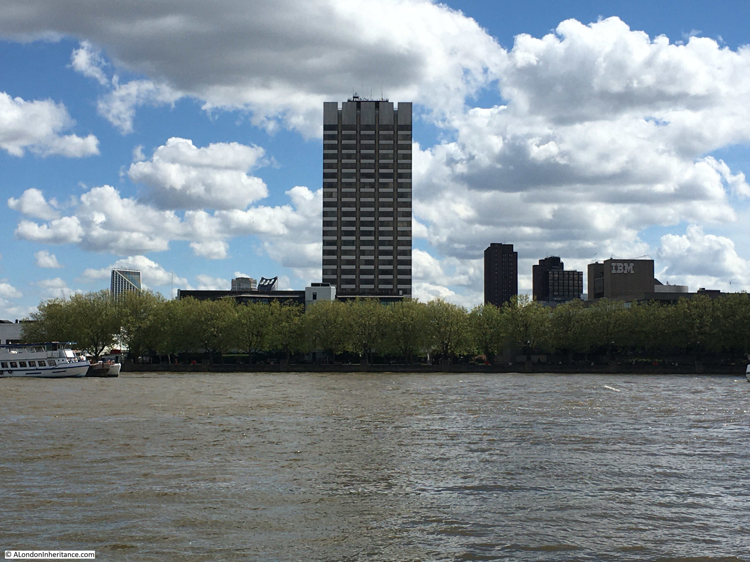
Look across the river from the Embankment by Temple Underground Station, and this is the view:
The tall tower was originally known as Kent House, a 24 story tower block, and the most visible part of the old studio complex which also includes a significant area of land around the base of the tower, including the low rise buildings which can just be seen to the left of the tower, above the tree line.
Kent House, and the low rise buildings were until 2018, ITV’s London Studios, also known as the Southbank Television Studios. It was here that ITV made Good Morning Britain, Loose Women, Ant and Dec’s Saturday Night Takeaway, the Jonathan Ross Show, along with a considerable number of shows for other channels, such as the Graham Norton Show and Have I Got News For You for the BBC. If you have watched ITV prior to 2018, chances are that you would have seen a programme filmed here on the south bank of the river.
The following photo shows the view of Kent House from Waterloo Bridge. The National Theatre is the building to the right.
ITV were intending to return to the south bank studios after refurbishment and development, however they made the decision to leave and sell the site, with their programmes such as Good Morning Britain now filmed at the old BBC Television Centre in White City.
The story of Kent House and the associated studio buildings dates back to the early 1970s when there were two independent television stations serving London. Thames Television operated from Monday to Friday, and from Friday evening to six on Monday mornings, London Weekend Television (LWT) would broadcast.
When LWT started broadcasting in 1968, they only had temporary studios in Wembley, and were in urgent need for custom built studios, which was even more important with the transition from black and white to colour TV.
LWT identified a block of land near the National Theatre on the south bank and proceeded to build the new studio complex, including Kent House. These opened in 1972 and became the hub for all LWT production. The benefit of a new build was that they became the most technically advanced colour TV studios in Europe at the time of opening.
The studio complex faces onto the walkway along the south bank of the river. The tower is at the rear of the complex, facing onto the street Upper Ground, with low rise buildings facing onto the river.
Studio buildings extend to the left of the above photo, with the block in the following photo up against the cafes, restaurants and shops at Gabriel’s Wharf which is further to the left.
The whole site will soon look very different.
ITV sold the studio complex in 2019, including Kent House, to the Japanese real estate company, Mitsubishi Estate, and plans have now been submitted for redevelopment.
Kent House and the entire studio complex will be demolished, and replaced by a 26 storey office building to the rear (Kent House has 24 floors), two lower rise blocks of 13 and 6 storeys facing on to the river.
What is a surprise is that the majority of the complex will be office space, with a capacity for up to 4,000 workers. Based on what normally happens to sites in such a prime location is conversion to apartment blocks, as is happening around the Shell Centre tower further west along the south bank. Whether the plan continues to be for offices after the work at home impact of the pandemic will be interesting to see.
The proposal also includes plans for some form of open space, the obligatory restaurants and some form of cultural space.
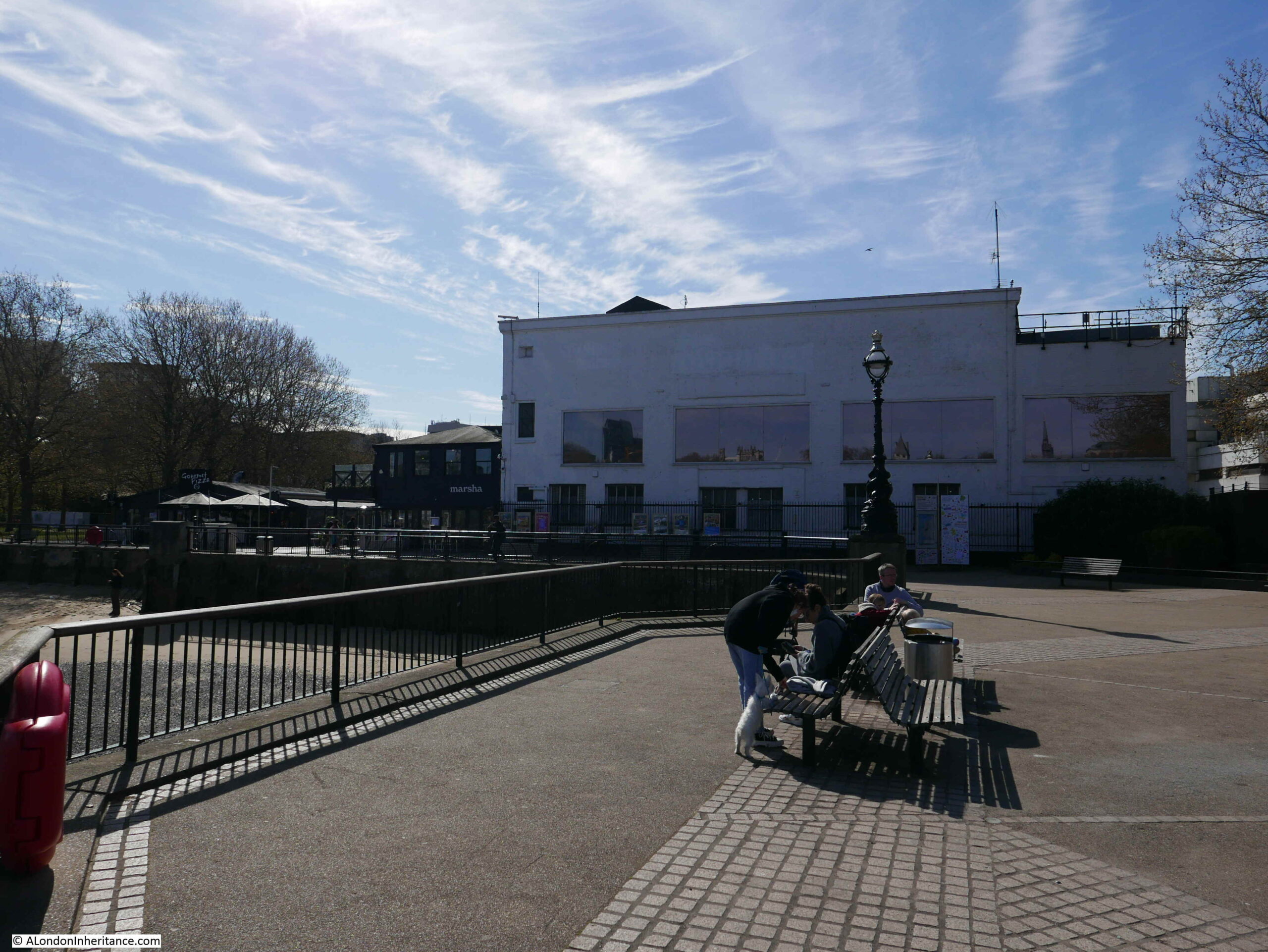
The view from Upper Ground:
The cafes, restaurants and shops at Gabriel’s Wharf are to the right of the two telephone boxes. Behind them are the low rise studio buildings.
Plans for the redevelopment of the area are still at an early stage, however Mitsubishi’s partner CO-RE are currently listing a 2026 date for completion of the project.
The following photo shows part of one of the old warehouses / offices at 58 Upper Ground, now part of the studio scenery stores.
To the left of 58 Upper Ground is the early 1970s studio complex at the base of Kent House:
The mock Tudor building is one of the few survivors from before post war redevelopment of the area.
ITV left the site in 2018, however the site still offers temporary office and studio space:
To the lower left of the Kent House tower, the studio complex can be seen at the rear. This is the western boundary of the studio complex. In the distance can just be seen the half roof of a covered walkway. This was where the audience attending a show would queue for entry. When I worked on the Southbank, it was common to see a long queue of people here in the late afternoon.
As shown in the above photo, there are frequently lorries parked around the base of the tower and studio area when the studios are in use.
The Southbank Conservation Area Statement prepared for Lambeth Council Planning states “The ITV tower is reasonably attractive but the lower buildings are of little architectural interest and the entrance forecourt is almost cluttered with waiting vehicles and delivery lorries”.
Personally, I think that this is a danger when looking at something only from a conservation perspective. The lorries at the base do add clutter to the scene, however they are there only because this is a working studio complex, which has added a diversity of activity and a busyness to Upper Ground.
The loss of a diverse range of activities when areas are transformed to a mix of expensive apartments, offices, hotels and chain restaurants, cafes and take-ways can really destroy an area.
Diversity of activity is essential in keeping a city alive.
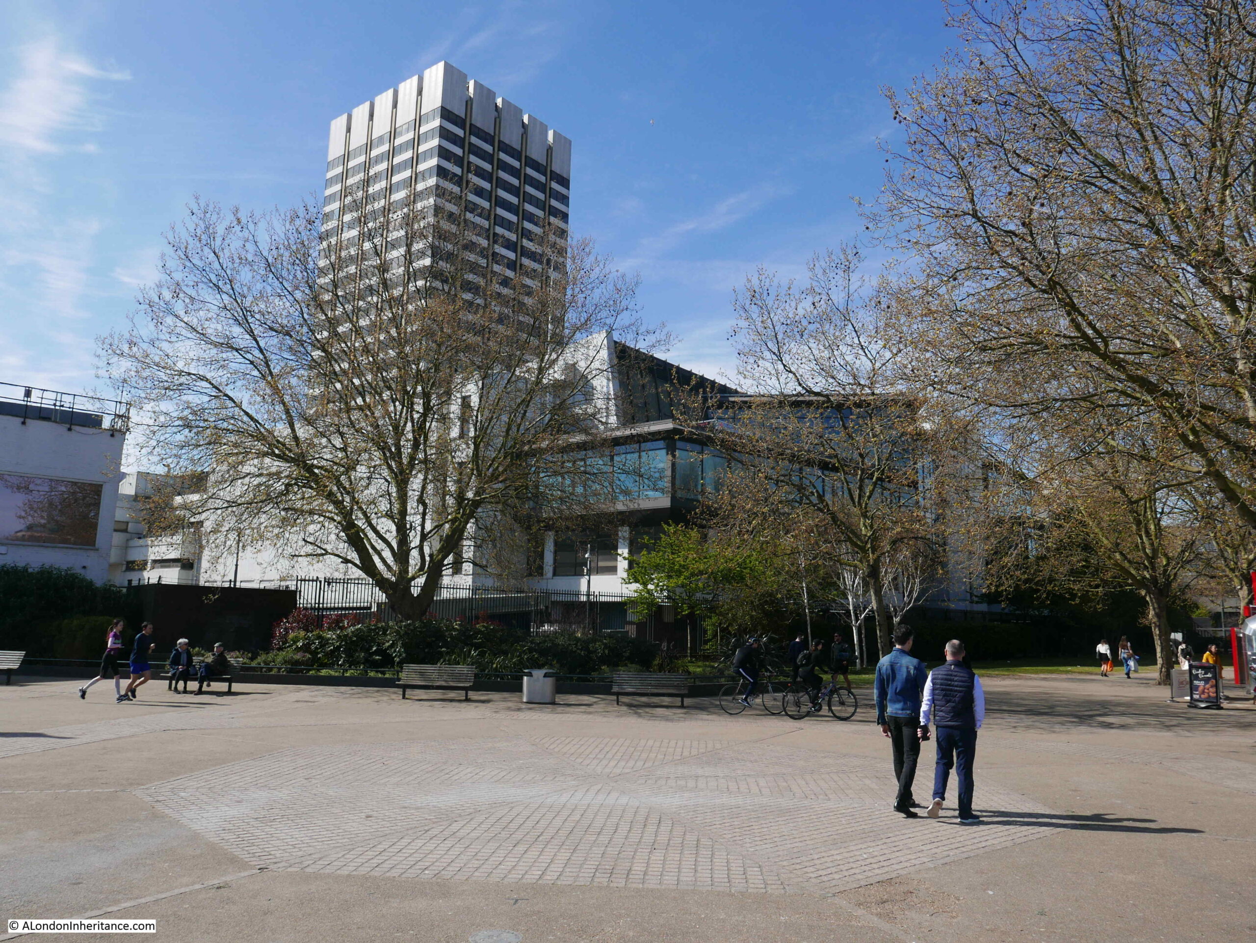
The following photo shows the base of the tower and the lower levels of the studio complex. I love the way the tower looks as if it has been slotted over the lower levels, with the legs of the tower reaching down along the sides to the ground.
A full view of the Kent House tower from Upper Ground:
The next site is still on the south of the river, close to London Bridge Station and Tooley Street is:
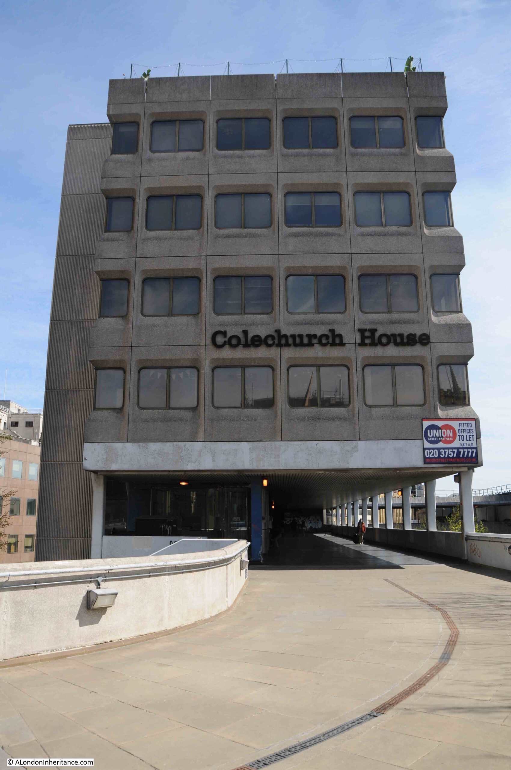
Colechurch House
Colechurch House is a late 1960s office block on a relatively narrow strip of land between Tooley Street and Duke Street Hill. The main office building is lifted above ground level, and includes a walkway which provides access to the taxi waiting area for the station and London Bridge Street.
Colechurch House was designed by architect E G Chandler for the City of London. It was named after Peter de Colechurch who was responsible for the first stone London Bridge, the building of which was started in 1176 and completed in 1209.
The building and the freehold of the land is owned by Bridge House Estates, and on the 14th October, the City of London Corporation as Trustee of Bridge House Estates released a press statement that property owner CIT had purchased a lease of the building, and would be bringing forward proposals for redevelopment.
CIT’s proposals for the complete redevelopment of the site include replacing Colechurch House with a new office building ranging in height from 12 to 22 storeys, with the lowest height part of the building being at the London Bridge / Borough High Street end of the street. The highest part of the building was originally planned to be 32 storeys, however following a consultation process this has now been reduced to 22.
The new office block will be lifted off the street, with the area at ground level being public open space called the Park, which will be divided into a number of areas – Bridge Gate Square, Old London Bridge Park and St Olaf Square.
View of Colechurch House from the elevated walkway. The entrance to the office block is where the two lights can be seen.
The planning application was submitted at the end of 2020, a number of issues with the application were raised in a letter dated the 1st March 2021. Consideration of these and a final decision is still to be confirmed, however I expect the demolition and rebuild will go ahead within the next couple of years.
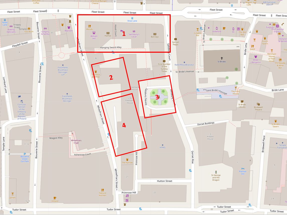
Across the river to Fleet Street now, to find the site of a much larger redevelopment:
Fleet Street and Salisbury Court
This is probably the larger of the three developments covered in this post, and it covers a significant frontage onto Fleet Street and to the rear within a block bounded by Salisbury Court and Whitefriars Street.
The redevelopment is for a new area which has been dubbed the “Justice Quarter” as it will include a number of new buildings that will house functions related to the law.
2 – New headquarter building for the City of London Police
3 – Public space covering an area slightly larger than the current Salisbury Square
4 – New commercial / office space with, you may have guessed, space for restaurants, bars or cafes on the ground floor
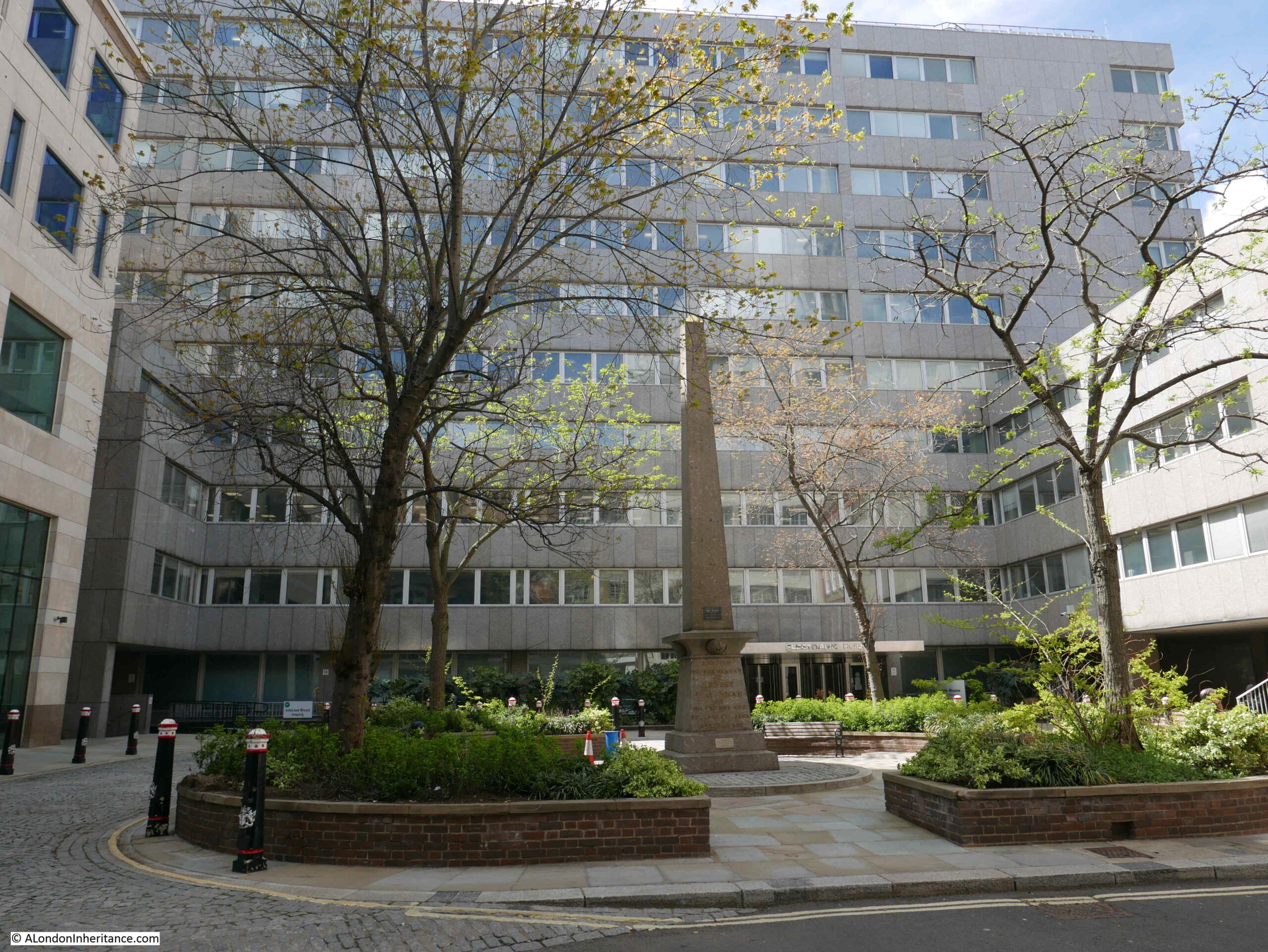
The following photos walk through the area, starting from Salisbury Square, which is the green space within rectangle 3 in the above map.
This is the view across the square.
The building in the background is Fleetbank House, built between 1970 and 1975, a large building that has a lower section to the right, and also runs down Whitefriars Street, which is behind the building.
The obelisk in the centre of the square is a memorial to Robert Waithman, Lord Mayor of the City between 1823 and 1824. The memorial states that it was erected by his friends and fellow citizens.
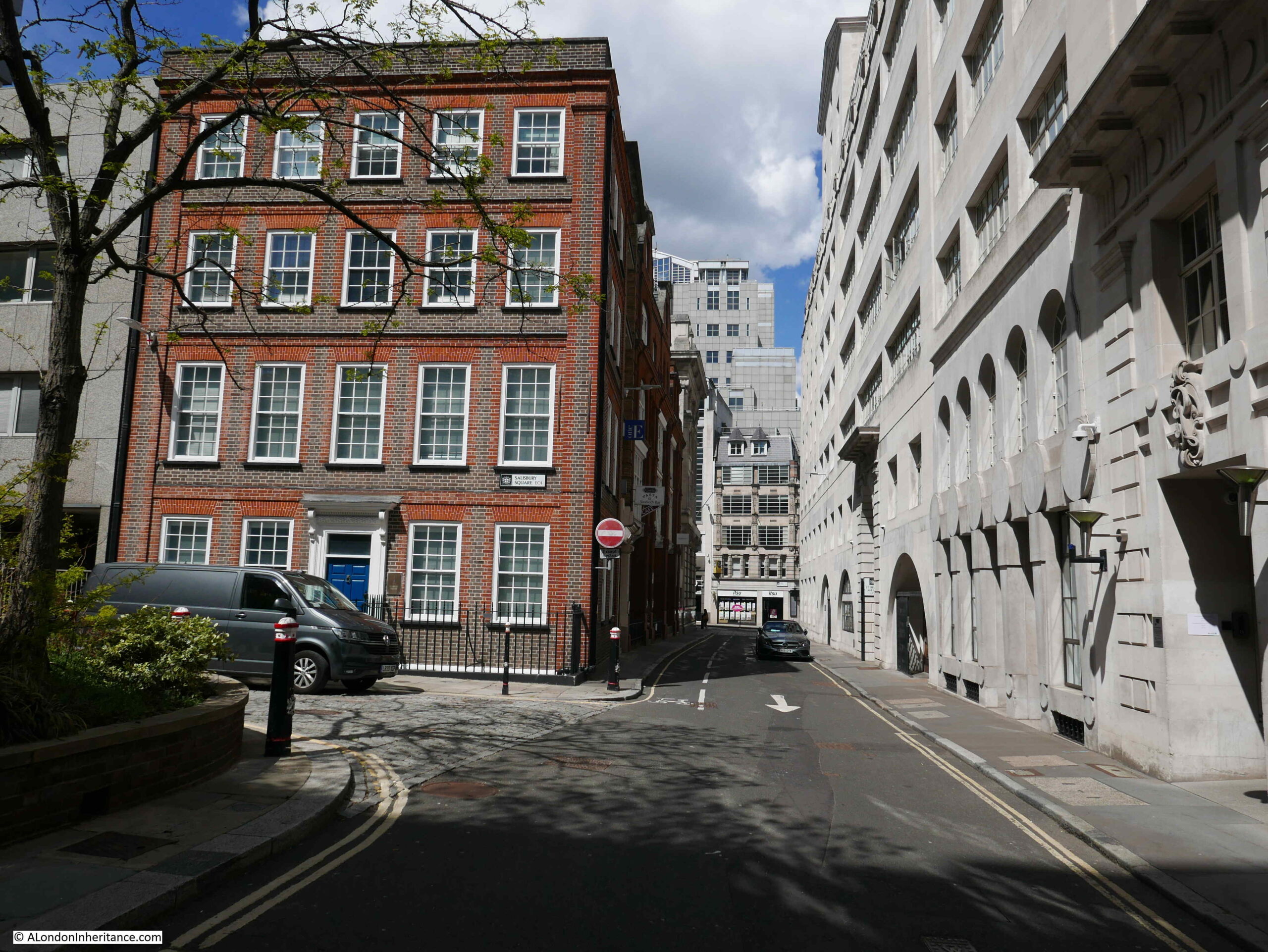
To the right of the above photo, is the following brick building, 1 Salisbury Square:
The road to the right is Salisbury Court, running up to Fleet Street at the top.
Both Fleetbank House and 1 Salisbury Court have been granted a certificate of immunity by Historic England. This certificate states that the Secretary of State does not intend to list the buildings for a specific period of time – in the case of these buildings, up to July 2025.
If I have understood the proposals correctly, 1 Salisbury Square will be demolished and the area occupied will become part of the larger public space of Salisbury Square.
The following photo is a wider view across the square:
The now part of the photo was taken on a relatively grey day, with people milling about, or hurrying across the square. The proposed computer generated picture, shows the square at dusk, subtle lighting lights up the trees and the ground floor area of the new public space and there is not a cloud to be seen in the sky. Buildings frequently look their best with this form of lighting.
This type of comparison is all too common with the proposals for any new development.
A row of bollards line Salisbury Square:
Walking along Salisbury Court, up to Fleet Street. A relatively narrow street, the edge of 1 Salisbury Court is to the left of the photo:
8 Salisbury Court – again if I have understood the proposals correctly, this building will also be demolished, and the land become part of the new public space.
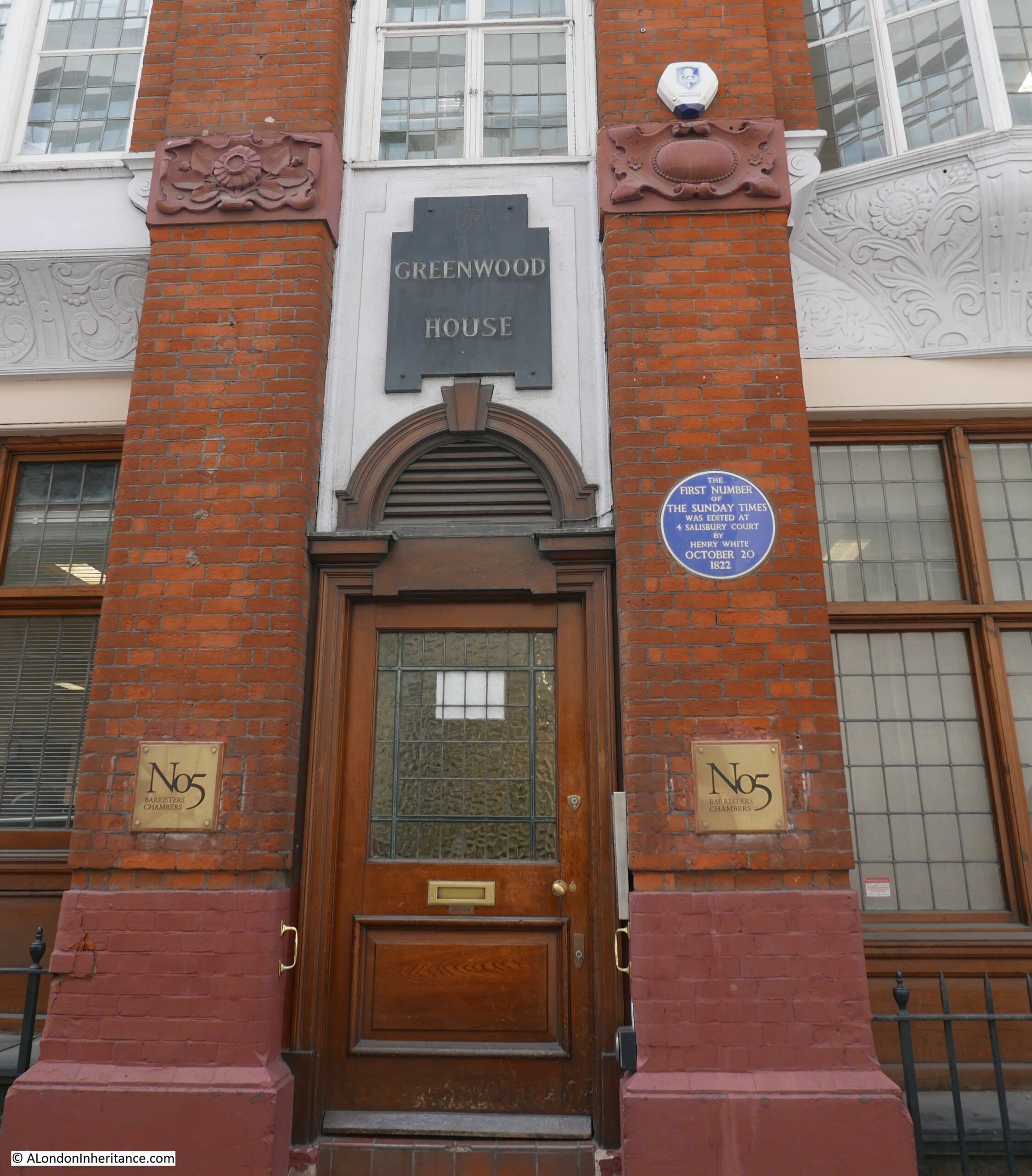
To the right of number 8, is a large brick building that covers number 2 to 7 Salisbury Court. This is Greenwood House.
The blue plaque states that the first number of the Sunday Times was edited at 4 Salisbury Court by Henry White on October 20th 1822.
The building dates from 1878, and was designed by the architect Alexander Peebles.
Between the ground and first floors, the building has some rather ornate terracotta carvings, and the land or building may have once belonged to the Vintners Company, as their arms with the three tuns can be seen on the wall between first floor windows.
2 to 7 Salisbury Court are Grade II listed, however a City of London notice cable tied to the iron railings outside the building state that a number of changes will be made:
i) Part demolition of 2-7 Salisbury Court Grade II listed;
ii) remodelling at roof level;
iii) formation of new facade to south elevation, and part new facade to west elevation;
iv) replacement fenestration;
v) new plant; and
v) associated internal alterations.
The two “v” bullets are directly from the notice, the final should I suspect be a vi.
Always hard to decode exactly what these planning notices mean, but I suspect it will be a new façade to replace the joining wall where number 8 has been demolished. Possible demolition of the internal structure of the building, with the wall facing Salisbury Court retained as a façade. A new roof and changes to the windows.
So some dramatic changes.
The view looking down Salisbury Court from the junction with Fleet Street:
On the corner of Salisbury Court and Fleet Street is 80 to 81 Fleet Street. A large corner building that was until recently a Barclays Bank. The building was originally, up to 1930, the home of the Daily Chronicle.
This corner building will also be demolished, and will form, along with the entire block along Fleet Street as shown in the above photo, the new City of London Law Courts.
The centre block in the following photo is Chronicle House, covering 72-78 Fleet Street. The building dates from 1924 and was designed and built by Hebert, Ellis & Clarke.
The building takes its name from being home to the newspaper, the News Chronicle. The building has also been granted immunity from listing by Historic England and the Secretary of State.
The following block is on the corner of Fleet Street and Whitefriars Street, and will also be demolished to become part of the Law Courts complex.
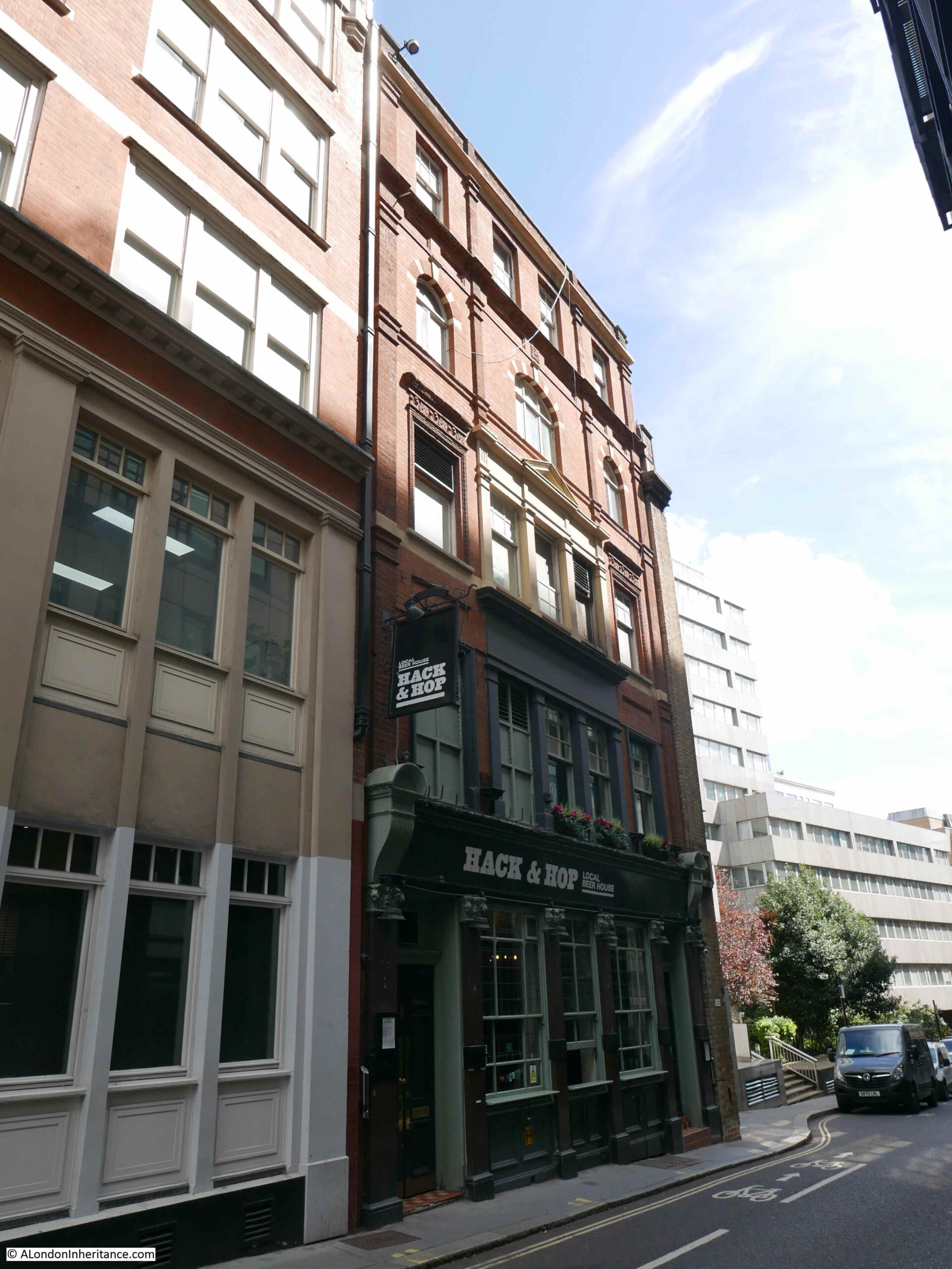
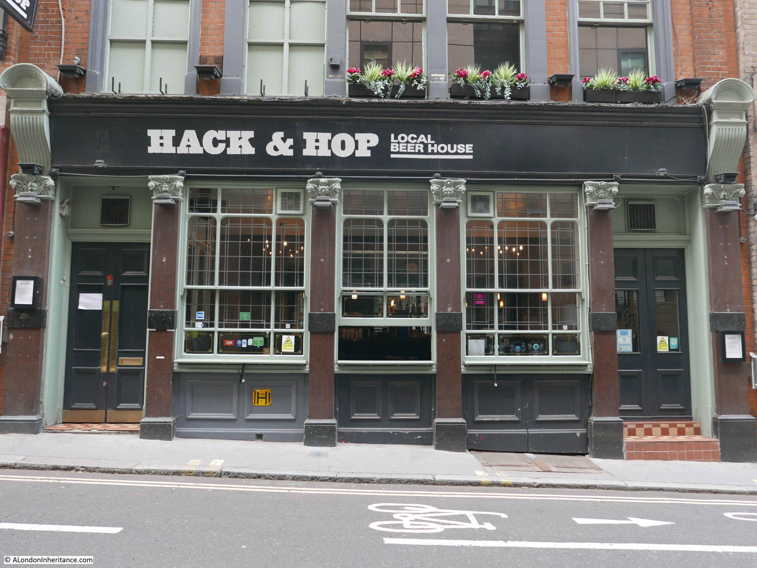
Walking down Whitefriars Street, and the following building is the Hack and Hop pub:
The Hack and Hop was originally the Coach and Horses, a pub that dates back to the mid 19th century. The earliest record I can find of the pub is a newspaper mention in the Morning Advertiser on the 25th November 1850, where there was an advert for a regular Monday evening meeting where a penny subscription would be collected for the London Copper-Plate Printers Benevolent Fund – a reminder of the long history of the area with the printing trade.
The buildings along this part of Whitefriars Street, including the Hack and Hop pub will be demolished and replaced by the new headquarters building for the City of London Police.
The new building will bring together police functions from a couple of existing buildings which have already been sold – Wood Street and Snow Hill police stations. The new building will have ten floors above ground with space for 1,000 police officers and civilian staff, with three levels below ground for specialist functions and parking.
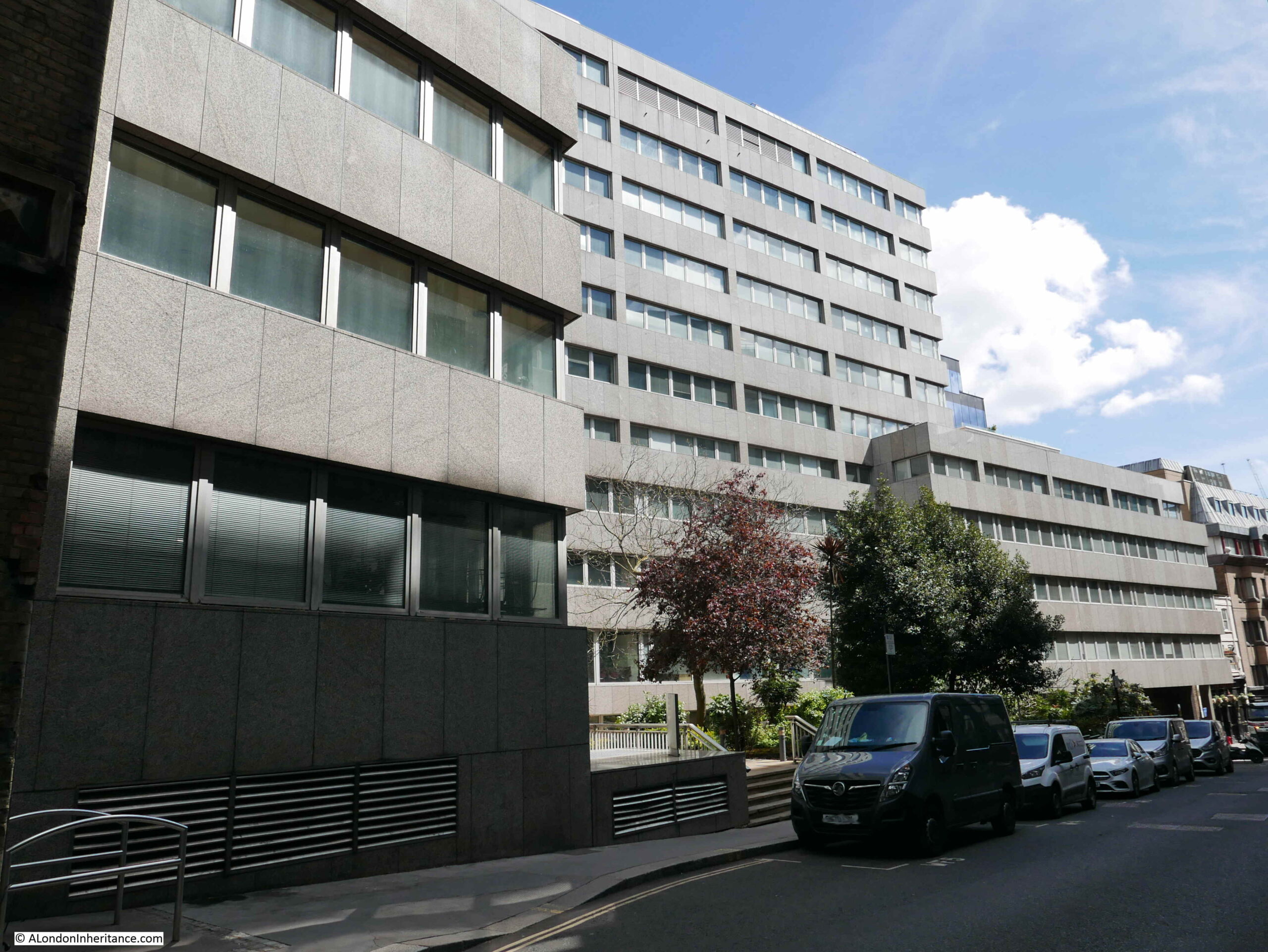
Continuing on down Whitefriars Street, and we see the other side of Fleetbank House:
Fleetbank House will be demolished and replaced with a new office / commercial building, which is described as having a “lively frontage”. I suspect this means cafes, bars and restaurants.
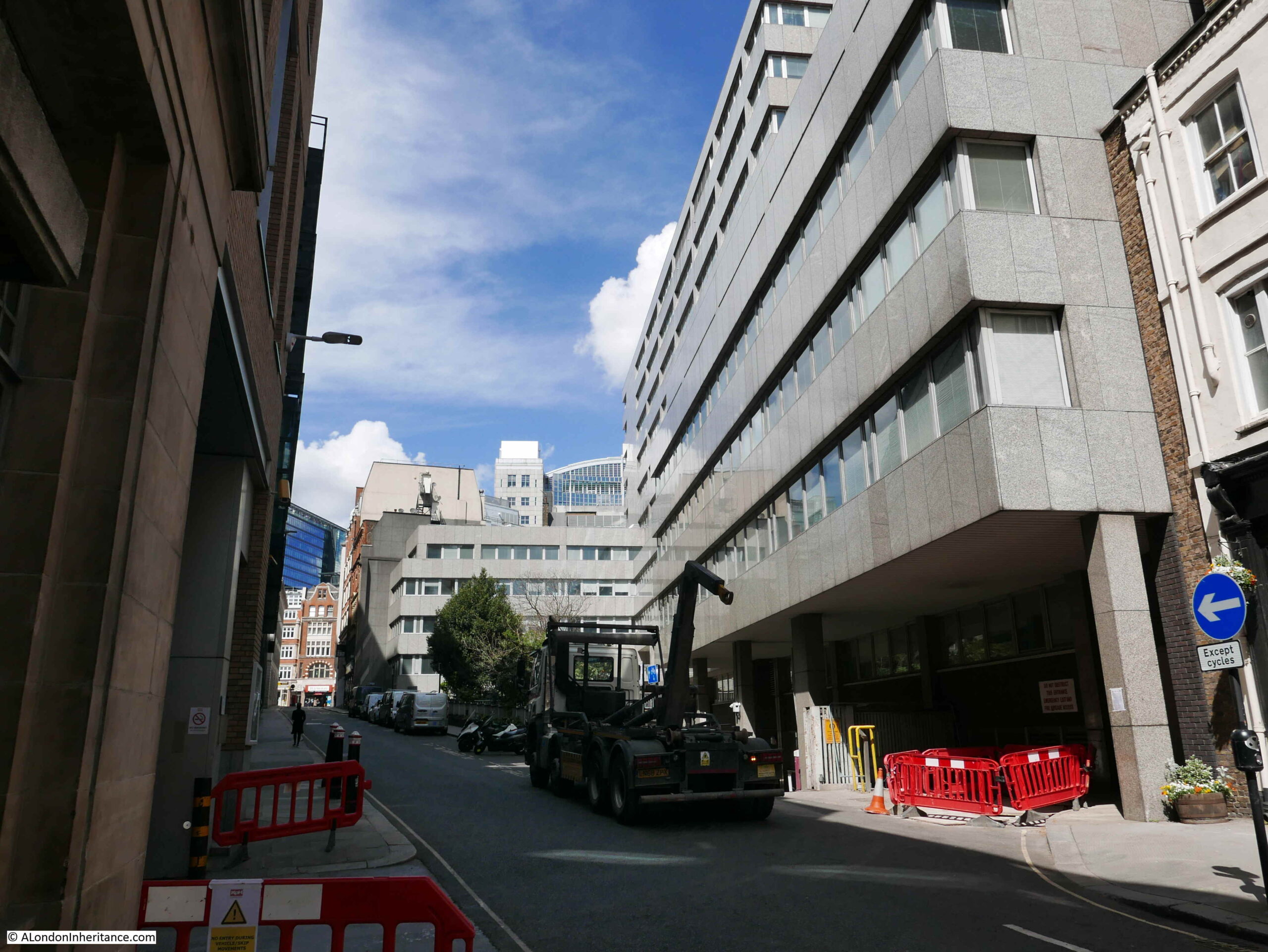
The view looking up Whitefriars Street, with the grey walls of Fleetbank House.
The end of Fleetbank House in the above photo marks the southern limit of the new re-development of Whietfriars Street. The work to create the so called Justice Quarter will be one of the most significant developments along Fleet Street for a very long time.
The area off Fleet Street has a considerable amount of history which will require a dedicated post. Hanging Sword Alley passes through the space from Whitefriars Street to Salisbury Court. There is a memorial to journalist T.P. O’Connor along Fleet Street. Bradbury and Evans, one of Dickens publishers were located here. The Fleet water conduit was here until the Great Fire in 1666.
The whole block has a long association with the journalism and the publishing industry, which ended in 2009 when the French Press Agency left 72-78 Fleet Street (Chronicle House).
It is hard to avoid getting into a discussion about the good or bad points of any new development, and I have tried to avoid this in the above post, focusing instead on recording what may well disappear in the coming years.
There is much to consider regarding any change. The buildings lost, the new buildings, what the change brings to the overall area, architecture, impact on wider views, jobs, diversity of activity etc. etc.
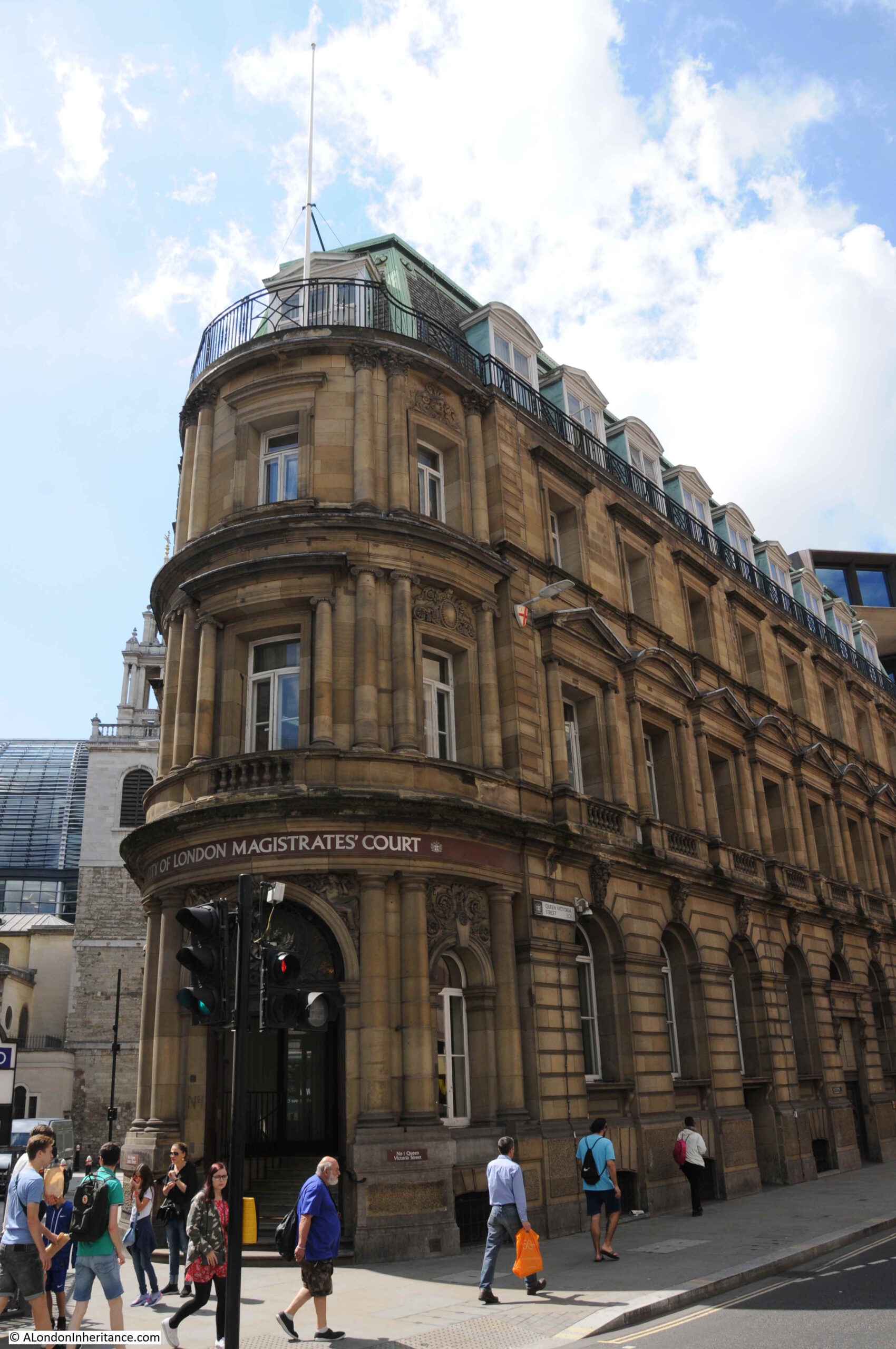
There is also the issue of what then happens to the buildings where functions will move from. For example, one of the City of London courts that will move into the new Fleet Street building is the City of London Magistrates Court on the corner of Queen Victoria Street and Walbrook, shown in the following two photos:
A building in a very prime location.
Development often leads to further development as functions, businesses etc. shuffle their way around the City.
Three possible future demolitions and re-developments that will have a significant impact on their local area of London.
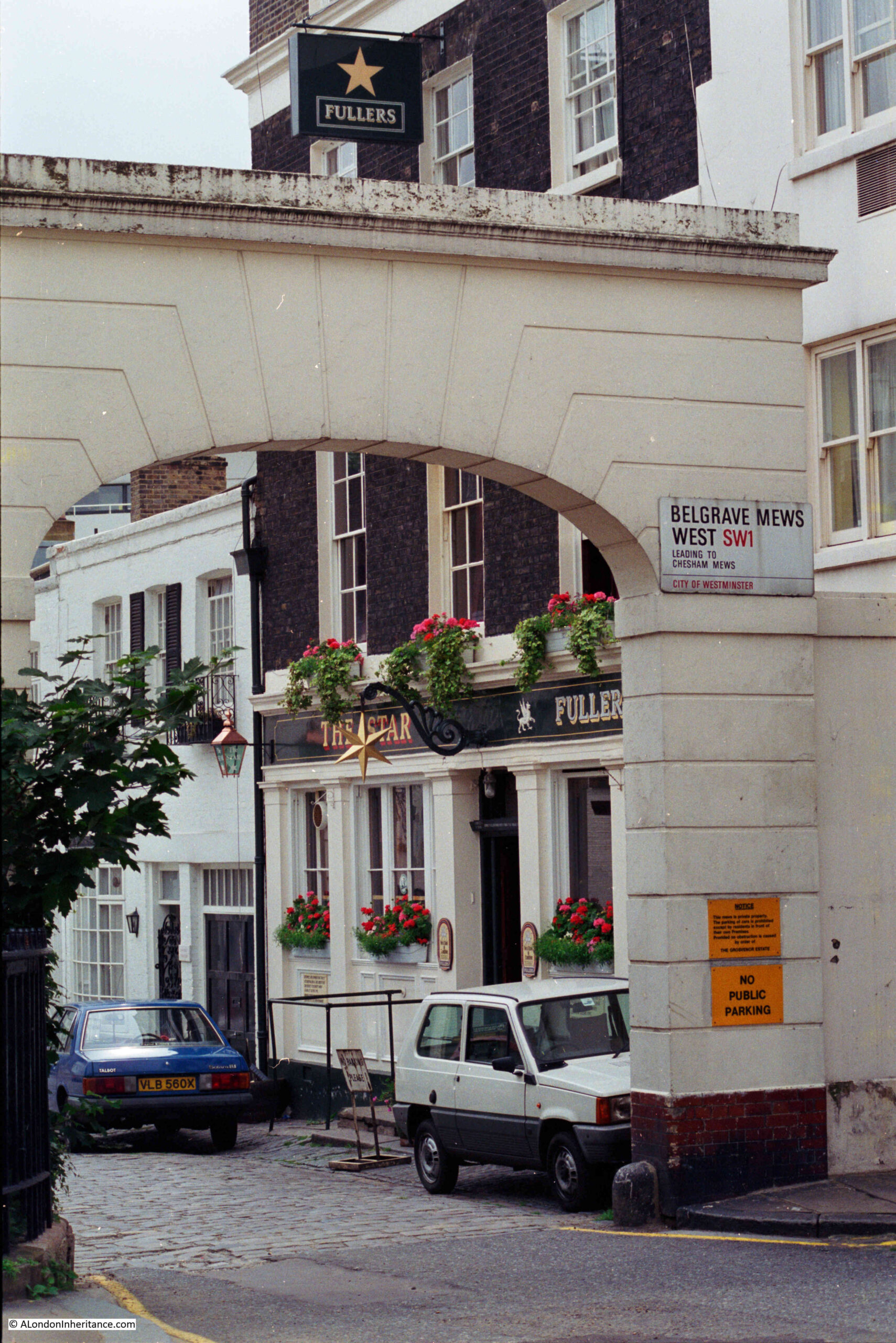
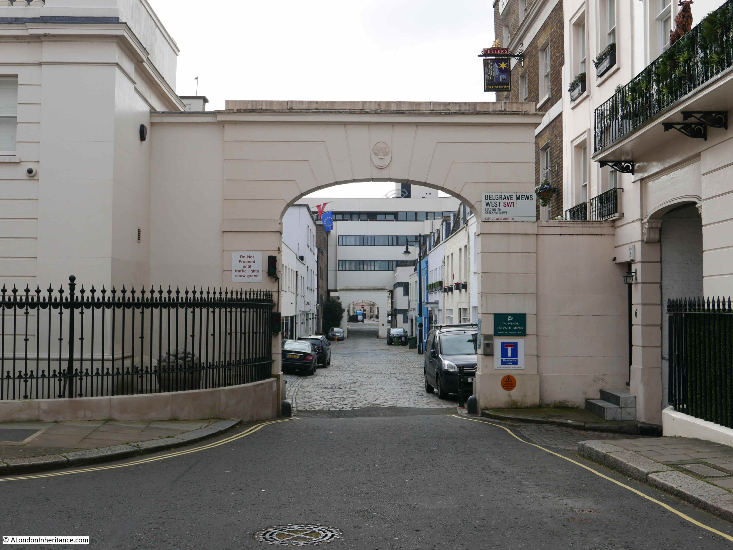
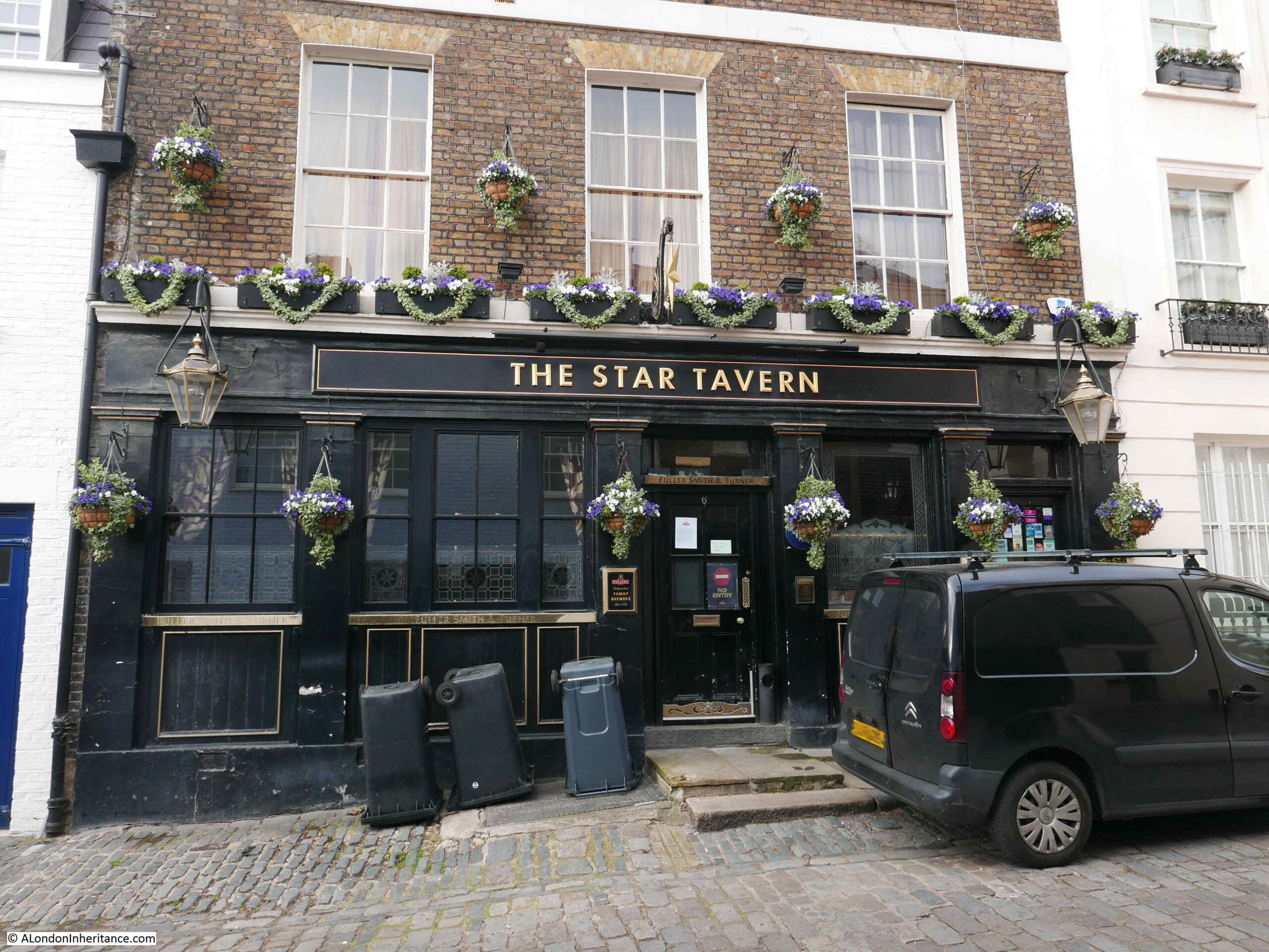
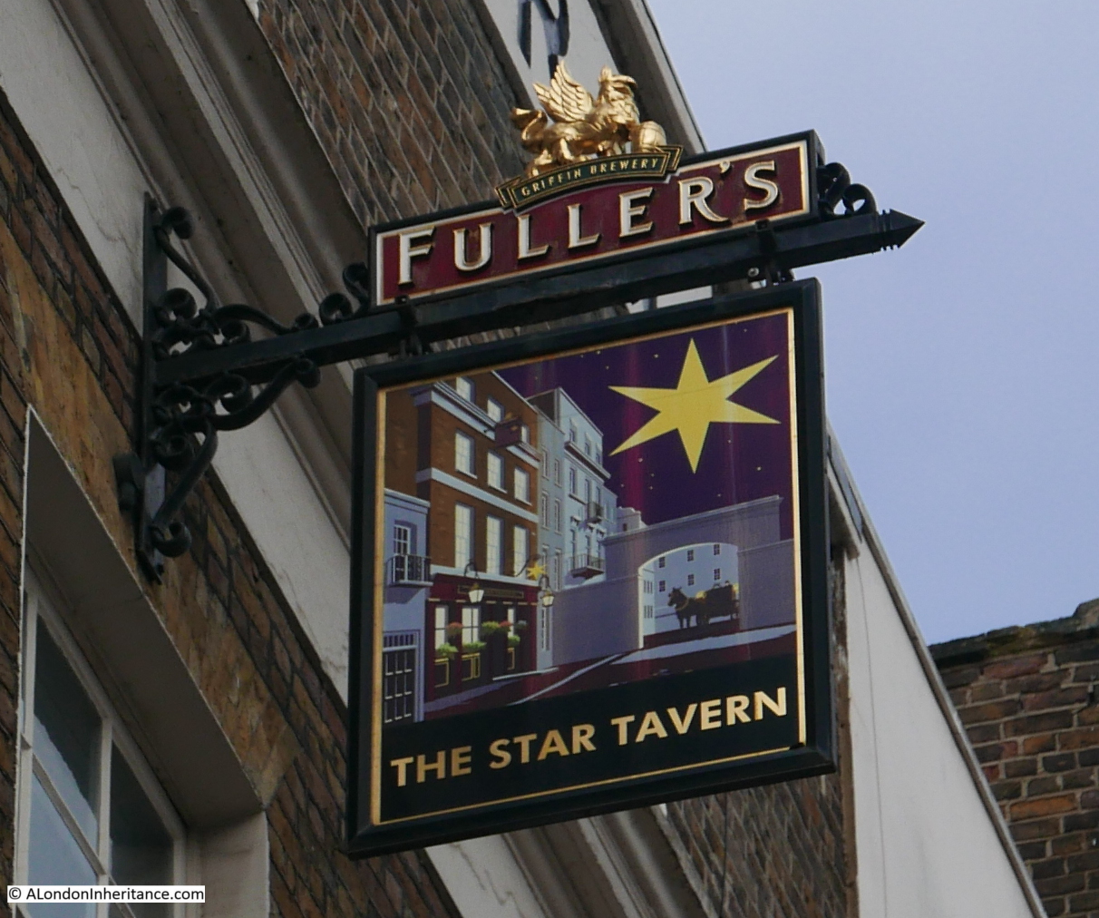
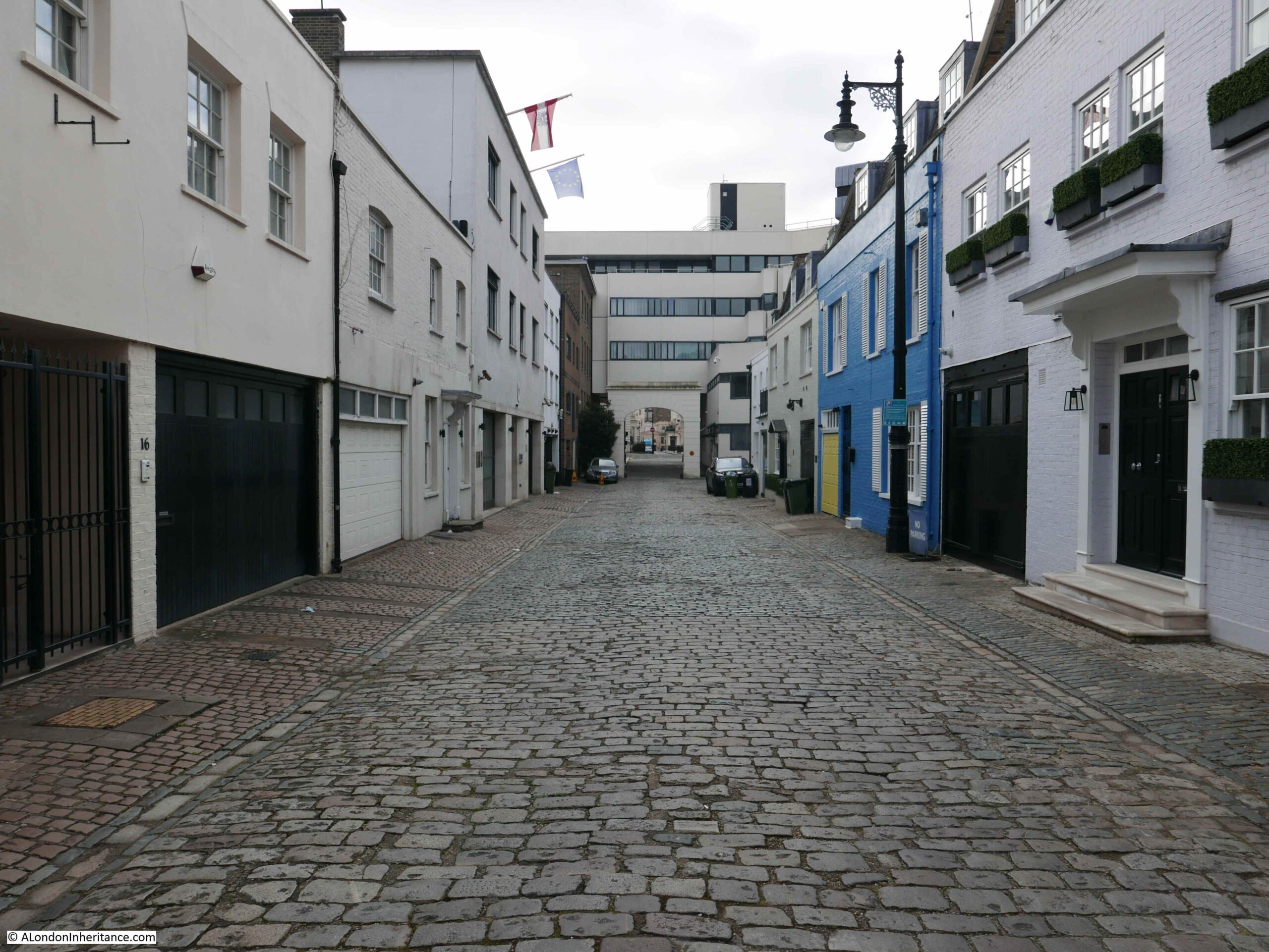
This week, I am back to exploring pubs of the 1980s, and unlike the last post on the Narrow Boat in Ladbroke Grove, today’s pub is still open. This is the Star in Belgrave Mews West:
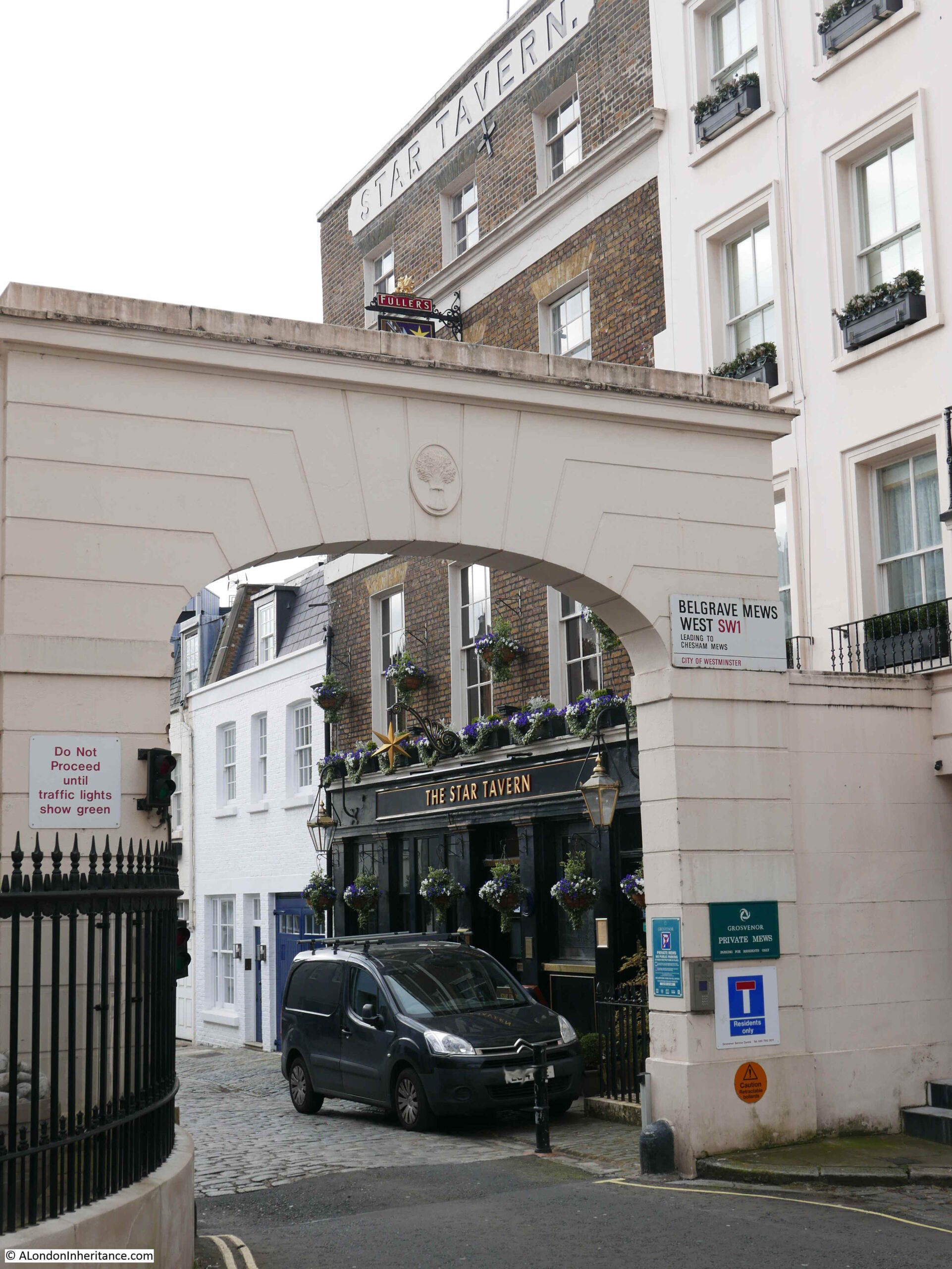
The same view today:
Apart from some minor cosmetic changes, and a change of colour for the ground floor of the pub, it has hardly changed in 35 years.
There is one minor difference which tells a wider story of how pubs have changed. Go back to the 1986 photo at the top of the post and look at the ground floor window to the left of the pub, and there is an Xpelair fan installed at the top of the window.
These were so common in pubs (there is one in the centre of the Horse and Groom Pub, Groom Place, Belgravia from a few weeks ago). They were needed as this was long before the smoking ban came into force in 2007, and pubs were mainly for drinking with a much smaller side line in food. I had a part time job in a pub in the early 1980s and I am sure I was on the equivalent of 20 day sometimes, just by breathing the air.
There is also a change at the top of the arch. In 1986 the top was plain, however in 2021 there is a wheatsheaf. The wheatsheaf is the symbol of the Grosvenor Estate, of which the mews are part.
The Star was part of the westward expansion of Belgravia in the 1830s / 1840s, with the development of the Grosvenor Estate. The pub has retained its original name, and the first reference I can find to the pub implies that it opened in 1848, as from the Morning Advertiser on the 13th March 1848, in the column detailing the results of licence applications:
“Star, Belgrave-mews West, Belgrave-square – Mr Woolff appeared for Richard William Ledger, a beer-house-keeper, and applied for a licence on the grounds that there were a great many workmen and servants of the nobility and gentry in the neighbourhood, who required that accommodation which only a licensed house could afford, and that there was no public-house nearer than the Turk’s Head which is distant 400 yards from the petitioner’s. There was no objection – Licence granted”.
The Turk’s Head mentioned in the licence application is still a pub, but is now called the Alfred Tennyson, and can be found at 10 Motcombe Street, Belgravia.
The Star looks to be in a purpose built pub building, so I am not sure what came first, the building or the licence application? I assume the building was designed with the sole purpose of being a pub.
The licence application is also interesting as it clearly identifies the target clientele. You would probably not have found any of the wealthy owners of the large houses around Belgrave Square in the Star, however for their servants, and those working in the area, the Star must have been a welcome escape.
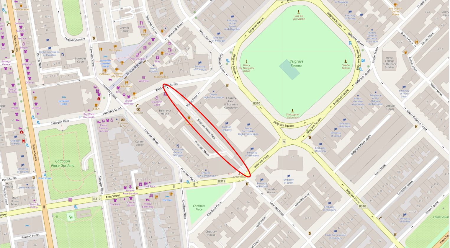
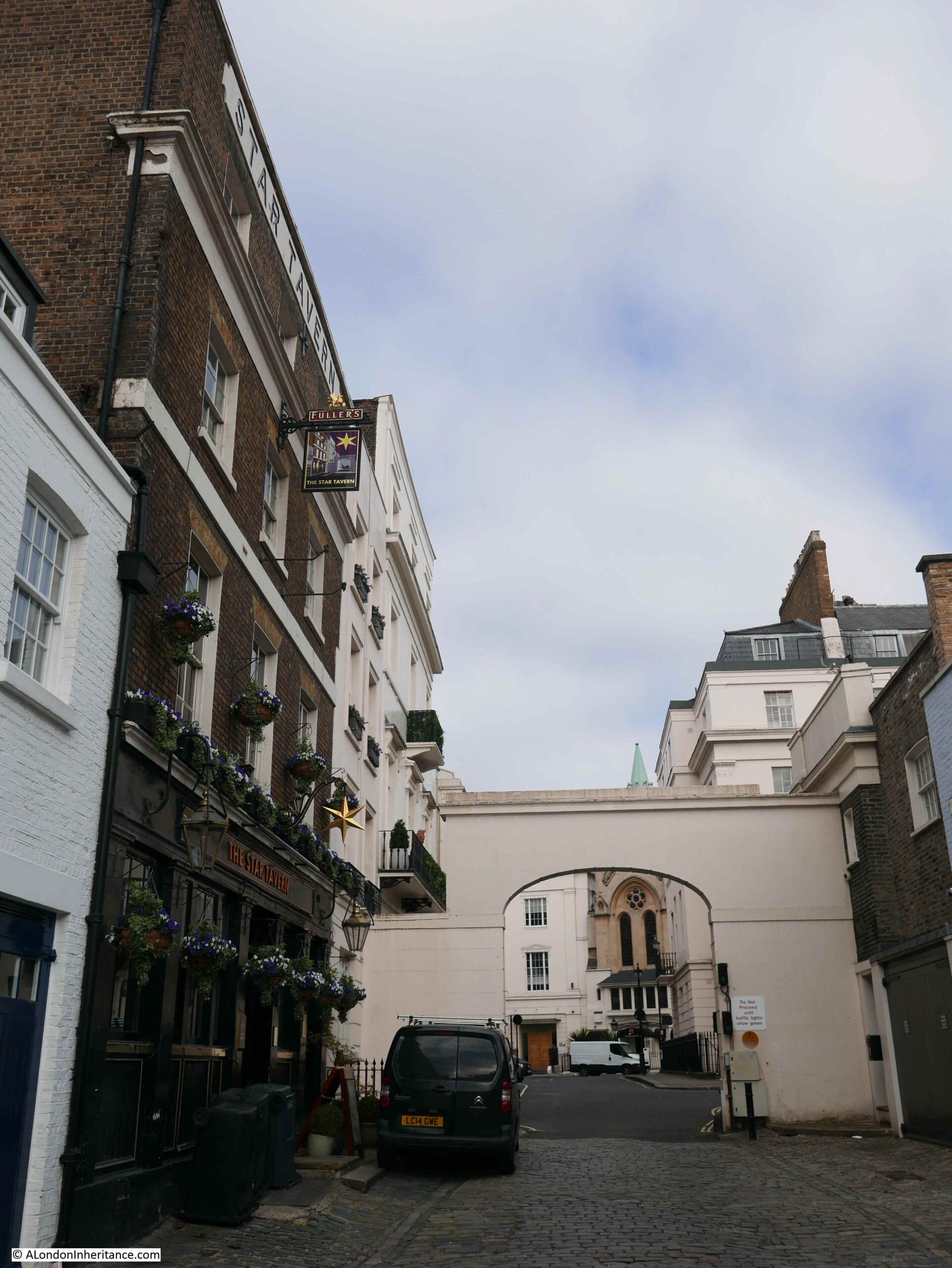
The following photo is looking south down Belgrave Mews West. Belgrave Square is to the left and the buildings on the left of the mews back onto the houses in Belgrave Square, which is probably where many of the pubs clientele worked.
The Star – currently closed, but opening soon.
The Star seems to have been a place where the rich and famous, as well as many of the major criminals of the time met in the 1950s and 1960s.
It is the place where members of the gang who carried out the Great Train Robbery met to plan the raid.
A description of the pub in the Tatler on the 23rd July 1966 describes the rather colourful landlord at the time:
“The Star, 6 Belgrave Mews West. Pat Kennedy’s voice sounds like gravel-chips being steamrollered. It is heard at full blast any time of day or night, as he holds court in the upstairs bar. Paddy’s, as the pub is known, has seen it all. Name a personality, and he or she has been there. Nuff said”.
Those reported as frequenting the Star included actors Albert Finney, Diana Dors and Peter O’Toole, A couple of months after the above report, in a section on London’s best bars, the Tatler described the Star as “it attracts fanatical partisans of darts and pin-tables, and creates an illusion of spies and illicit rendezvous”.
The pub sign features a view of the pub to the side, looking through the arched entrance to the mews, where a coach and horses are waiting.
Looking through the arch with the Star to the left:
Walking further down the mews and this is the view looking up, with the pub at the far left:
The majority of the buildings that line Belgrave Mews West are the type of buildings you would expect to find in such as place. Two storey buildings, many with large entrances on the ground floor which would have once been the stables for the large houses in Belgrave Square. The rear of these buildings face onto a small open space between them and the larger houses on Belgrave Square, allowing easy access when a servant needed to get the horse and carriage round to the front door in Belgrave Square.
The difference with Belgrave Mews West is that towards the southern end of the mews there are two embassy buildings.
The Austrian Embassy has a very impressive frontage onto Belgrave Square, however to the southern end of the mews, on the left, we can see the Austrian flag above the very plain rear of the embassy.
At the far end of the mews, between the arch that mirrors the arch by the Star is the German Embassy which occupies a large area of land between Belgrave Mews West and Chesham Place.
View through the southern arch of Belgrave Mews West:
The LCC Bomb Damage Maps show that the buildings in the space occupied by the Austrian Embassy in Belgrave Mews West suffered severe damage, and the houses that were along Chesham Place and the mews were damaged beyond repair, so bomb damage probably explains why the original early 19th century buildings have been replaced by more the more recent embassy buildings.
The following photo shows the entrance to Belgrave Mews West from Chesham Place, which passes underneath the German Embassy. I was surprised that it was so easy to walk around the embassy and take photos, however there were plenty of CCTV cameras around.
Belgravia has been a preferred location for embassies since the area was first built. In “Knightsbridge and Belgravia” E. Beresford Chancellor (1909) writes about Chesham Place, including that the “Russian Embassy has been located here since 1852”.
The Star is one of those wonderful pubs that make wandering the side streets so very enjoyable, even more so when the pub reopens on the 17th May. Brilliant to see that the Star is still to be found, and another pub added to the list to revisit when open.
I have no idea of the exact location of the following photo. It is one of my father’s and dates from 1949. Judging by the photos on the strips of negatives that included this photo, it is probably one of a number of Bankside alleys, although there is a chance it is a bit further east.
The photo shows a police officer walking through an alley, probably between warehouses. At the end of the alley, there is one of the typical walkways that were built to connect warehouses on opposite sides of a street.
I love the photo as it captures what must have been a relatively common event – a lone police officer patrolling his beat.
Policing has changed considerably in the 72 years since the photo. Budget cuts have reduced police numbers, streets now have CCTV and there is the ongoing threat of terrorism.
Along Bankside, there are no warehouses full of goods that would tempt a thieve. The river is quiet and is no longer teeming with barges and lighters, although as the tragic events on London Bridge just a week ago demonstrate, the Thames is still a very dangerous place for anyone who enters the water.
The police officer in the photo was probably on his “beat” – a set route around a district that an officer would patrol. They would get to know the streets, the people, activity that was normal, and what was not normal.
Being assigned to a beat was the first step in a police officer’s career after training and being posted to a station as a Police Constable.
In the book “Fabian of the Yard” (1950) by Superintendent Robert Fabian, he provides an introduction to the activity of “being on a beat”:
“On the beat, an officer should normally walk the regulation 2.5 m.p.h. – if he is hurrying he is probably after someone or more likely going home to his supper. Properly carried out, patrol duty is not half so dull as you might imagine. The most ordinary looking street can to the practiced eye be of absorbing interest. Each doorway, shadow at a window, hurried footstep or meaningful glance may have a tale to tell”.
(Fabian of the Yard is a fascinating account of London policing and crime between the 1920s and 1940s)
Crime was frequently reported after the event, however the benefit of being on the beat, was that anything unusual, and a possible crime, could be investigated as it happened. Detailed newspaper reporting of such events tended to reduce in the 20th century, however in the 19th century, papers were full of long accounts of crimes, often including the conversations that had taken place during an inquest, or the words of the police officers involved.
The following three extracts are examples of the type of action that a police officer on the beat would frequently get involved with, when patrolling along the river’s edge.
From the Shipping and Mercantile Gazzete on Thursday the 8th February, 1877:
“THEFT FROM A BARGE – At the Southwark Police-court, Joseph Sadler, 22, a returned convict, was charged with being concerned with two others in stealing three pieces of oak timber from a barge on the River Thames, the property of Messrs. Shuter and Co., coopers and stave merchants, Shad Thames.
George Barnett, police-sergeant 56M, said that between 10 and 11 on the previous night he was on duty in Bermondsey-wall when he saw the prisoner and two others coming from Eaton’s Wharf. They were each carrying a piece of timber and as soon as they saw him they dropped the timber and ran away. He, however, captured the prisoner, but his companions escaped. He made inquiries, and found that the timber had been stolen from a barge lying off Bermondsey-wall. Mr. William Joseph Littell, of the firm Shuter and Co., identified the three pieces of oak timber as the property of the firm. Mr. Partridge committed the prisoner for trial”.
From the St. James Chronicle, August 1855:
“SOUTHWARK. CHARGE OF BURGLARY – John Richard South, a tall young man, partially dressed in military attire, and who stated himself to belong to the Royal Artillery, was charged with being concerned with another, not in custody, with breaking in to the Watermen’s Arms public-house, Bankside.
Joseph Alley, police-constable, 30M, said he was on duty shortly before three o’clock that morning in Bankside, and when passing the Waterman’s Arms he heard something breaking inside, which induced him to stop.
Another constable then came up, when they again heard the breaking noise, and saw the reflection of a light inside. Witness immediately directed the other constable to go to the rear of the house, while he knocked on the door for admittance and rang the bell. While doing so he heard a rushing noise inside, and a minute or two afterwards, the landlord came down and opened the street door. Witness entered and passed through, when he saw two men climbing up a shed. He got up after them, and saw the prisoner concealed behind a chimney, and as he came near him he exclaimed ‘It’s all right, I’ll give myself up’. He took the prisoner into custody, but his companion made his escape”.
From the Morning Post, 2nd July 1833:
“Yesterday two men, named Morrett and Yates, were brought before Mr. Murray, charged on suspicion of drowning a young woman (name unknown), whose body was taken out of the water at Bankside.
A police sergeant of the M division on proceeding over Blackfriars Bridge on Sunday morning, about four o’clock, saw some persons looking through the balustrades, and heard them exclaim ‘That a woman was in the water’. He looked in the direction of Southwark bridge, and perceiving a splashing in the water at some distance off, he ran round to Bankside, and by the time he arrived saw the body of a young female just brought on shore by a waterman.
He observed two men standing upon a barge moored at some distance out in the river, and he had been informed that these two men were with this female at the time she was drowned. Acting upon this intelligence he procured a wherry, and immediately went on board the barge, and took them both into custody.
The accused were examined separately, and Yates made the following statement voluntarily;- he said that he and the other prisoner were brass founders, and worked at a large factory in St Martin’s-lane. On Saturday night after work, they went to the Cart and Horses in Upper St Martin’s-lane which they left at half past eleven o’clock, and then went home together, but did not retire to rest.
At three o’clock in the morning they left home together with the determination of taking an excursion on the water. On their way to Westminster bridge they met a young female near the Horse Guards, and they spoke to her, and told her they were going to have a pull down the river. She expressed her desire to accompany them; they endeavoured to dissuade her, but when they hired the boat, which was at Mr Lyons, near the bridge, she said she was determined to go with them, and accordingly jumped into the boat along with them.
They then proceeded down the rive, the tide running that way, and in the course of their progress, run against a chain or warp to which a barge was made fast. This was about midway between the two bridges, and in an attempt to extricate it the wherry heeled over and the female rolled into the river. One of them (Yates) got hold of the barge and saved himself, and rescued Morrett, who was on the point of being drowned, and would inevitably have shared the fate of the female had not Yates grasped him by the collar and pulled him on board the barge.
in reply to the Magistrate the accused said he never saw the deceased before; that she appeared to be 18 years of age, and that they were unacquainted with who or what she was. She was dressed in a dark half-mourning dress, and wore a straw bonnet with ribands. The other prisoner gave a similar account of the transaction, and they were ordered to be detained in custody, as there were some mysterious circumstances attending the case”.
The following day an inquest was held and a verdict of accidental death was returned. Much of the critiscm at the inquest seems to have fallen on two other parties, not the two men found on the barge.
When the young woman’s body was first found, “two medical men” had been called, but had refused to attend. One of their assistants only arrived an hour later.
The proprietor of the boat was criticised for “letting out a wherry at that hour in the morning without some experienced person to attend to it; and that it was in consequence of this neglect that many casualties occurred in the river”. A deodand of £5 was levied on the boat. A deodand was a forfeit on an object where it has caused, or been involved with, a person’s death.
A scene that a police officer on the beat may have been interested in is shown in the following photo from the same strip of negatives, so around the same bankside area.
A quiet alley and some activity around a car in the distance.
Again, I cannot identify the location of the alley, there are no features that enable identification, and the area has changed so much in the last 72 years that as far as I can tell, the alley has long disappeared.
In the above extract, Tate Modern now occupies the area on the left, and Southwark Bridge is on the right.
From left to right there is: Pike Gardens, leading to White Hind Alley, Moss Alley and Rose Alley, along with narrow streets leading up to the Thames such as Pond Yard and Bear Gardens.
These alleys have now dissapeard when you walk along the Thames, however there are traces further in land, such as Rose Alley, which is now a short stretch of narrow street acting as a service road to the building that now blocks the end of the old alley to the Thames.
There is one alley part remaining, although this is not named on the above map.
Underneath the letter I of the word Bankside (running along the street on the Thames embankment), there is a narrow alley with no name. This is Cardinal Cap Alley, with the entrance being found between two buildings just to the west of the Globe Theatre.
The alley has been controversially gated off for some years, however looking through the bars of the gate we can see the remains of an old Bankside alley.
Cardinal Cap Alley was open in the 1970s, and the view across to St Paul’s was one of my early photographic attempts, with my first camera, a Kodak Instamatic 126 (although the camera did not handle contrast that well, so St Paul’s is only just visible across the river).
I have no idea whether the police officer in my father’s 1949 photo was walking the regulation 2.5 mph, or as Fabian of the Yard also suggested that he may be hurrying home for his supper.
The policing of the river and the land along the river’s edge has changed considerably in the 72 years since the photo was taken, and the majority of Bankside alleys have been replaced with new buildings facing onto the Thames. Both Bankside and the river are today a very different place.
Regular readers will know that as well as London, my father also took very many photos whilst cycling around the country during the late 1940s and early 1950s. For a mid-week post, I am visiting the location of one of those photos, which tells an interesting story of how land has been reclaimed, and the uses to which we have put that land. This is the view of Portsmouth from Portsdown Hill in 1949:
The same view in 2021:
There are a couple of details that confirm that this is the same view. Both photos have the electricity cables on the right disappearing over the edge of the hill, and in the distance the profile of the Isle of Wight is the same.
Portsmouth can be considered as an island as it is surrounded by water on all sides. Portsmouth Harbour to the west, Langstone Harbour to the east, the Solent to the south, and around the north of the island there is a narrow channel of water.
It is not very clear from the above map, but the place from where both photos where taken is on a hill. Portsmouth is generally flat and low lying with a maximum height of 6 metres. Directly behind Portsmouth is a chalk hill, known as Portsdown Hill, running east to west. The height at the location of the photo is 101 metres, so considerably higher than Portsmouth as illustrated in the photos.
Portsdown Hill is part of the geologic feature called the Portsdown Anticline.
An anticline forms when the ground has been compressed from two sides, and the compression causes the land to rise and fall. An anticline is the part where the land has risen and a syncline is where the land falls. The following diagram illustrates the concept of an anticline and syncline.
The sides of an anticline sometimes erode over time, and also become exposed due to human activities, which has happened to the chalk of the Portsdown anticline, which I will show later in the post.
The anticline / syncline model explains much about the landscape of this part of southern England, with the hills on the Isle of Wight in the photo being part of the Sandown anticline, the ripples of anticlines and synclines forming the landscape up to Petersfield and Winchester, and further north, the Hog’s Back in Surrey, before flattening out to form the London Basin.
Human activity is often very visible with the construction of roads, housing, factories and warehouses, and in the two photos from Portsdown Hill we can see the impact of another form of human activity which has had a considerable impact on the waters of Portsmouth Habour since my father’s 1949 photo.
In the 1949 there is a large area of water in the foreground. In the 2021 photo this has disappeared. The following map extract shows the area in 1962. Again, the red circle indicates where the photos were taken from.
In the 1970s the area of land between Horsea Island and the mainland was reclaimed. The following map shows the reclaimed area.
Comparing the above map, with the map of the area in 2021 earlier in the post will show that the reclaimed area has been used for the M27 motorway, the M275 into Portsmouth, construction of Port Solent marina, along with housing, shopping, entertainment and buildings for marine businesses.
One large part of the reclaimed land was used as a landfill area for household waste. The area destined for landfill is shown in the above map highlighted in blue.
The Portsmouth landfill site closed in 2006, and the site has now been grassed over, although vents can be seen protruding from the ground to vent the gasses from the decaying materials below.
I have marked up my father’s 1949 photo with some of the key features, including the area that would become landfill.
The masts are part of a navy wireless station that occupied much of Horsea island. The island also had a torpedo testing range, which can still be seen as the long channel of water in the 2021 map earlier in the post.
The torpedo testing range was the result of earlier human intervention. Horsea Island was originally two islands – Great and Little Horsea. The admiralty purchased the islands in 1885, and they were merged into a single island using chalk excavated from Portsdown Hill. The enlarged island provided the space for the torpedo testing range which was eventually extended to a length of 1,000 yards.
The following photo from the same location shows the old landfill site as the large grass mound in the centre of the photo.
The Isle of Wight can be seen across the Solent and there is a tower rising to the right of the taller buildings of central Portsmouth.
This tower is the Spinnaker Tower located on the Portsmouth Harbour waterfront at Gunwharf Quays.
Gunwharf Quays is now a retail and entertainment complex, built on the site of HMS Vernon, an old part of Portsmouth’s naval base, and an area focusing on mine warfare and the development of torpedoes which provides a link with Horsea Island. HMS Vernon was decommissioned in 1986.
Construction of Gunwharf Quays started in 1998. It was a complex engineering and construction process as much of the new site would be built over tidal mudflats and one of the largest marine decks in Europe was built to support much of the new building.
Construction of the Spinnaker Tower started in late 2001, based on a design chosen from three designs put to a vote by the residents of Portsmouth. The design is intended to emulate the billowing out of a spinnaker sail to reflect Portsmouth’s marine heritage.
At the top of the Spinnaker Tower is a viewing gallery, which I visited a number of years ago. The height of the tower provides a spectacular view over the surrounding area. In the following photo, the view is back towards Portsdown Hill and I have marked the site of the 1949 photo with a red arrow.
The white of the exposed chalk can be seen just to the right of the arrow, with a much larger area to the left. This is the underlying chalk of Portsdown Hill which has been exposed by both weathering and erosion over time, as well as human quarrying.
The Portsmouth naval base as well as the historic dockyard occupy much of the foreground of the photo.
The large ship nearest to the camera is HMS Warrior. Built in 1860, HMS Warrior was powered by both steam and sail, and was Britain’s first iron hulled, armoured naval warship. The most technologically advanced ship of her time.
Follow up from the funnels of HMS Warrior and HMS Victory can also be seen. The Historic Dockyard is also home to the Mary Rose, the flagship of King Henry VIII, which sank in the Solent in 1545, and raised from the seabed in 1982.
Looking in the opposite direction, the Spinnaker Tower provideds a superb view over the Solent and the entrance to Portsmouth Harbour.
In the above photo, the area to the left of the harbour entrance is called Portsmouth Point, also known as Spice Island.
Today, there are a couple of brilliant pubs facing onto the harbour entrance, however in the past, Portsmouth Point / Spice Island had a reputation for drunkness, prostitution and crime, with press gangs roaming the streets.
Thomas Rowlandson produced the following satirical print of Portsmouth Point in 1814.
The view is looking out towards Portsmouth Harbour where numerous ships are moored or with their sails up. General confusion and chaos reigns on the Point with sailors just returned or about to leave (a sailor is saying goodbye to his family in the doorway on the right, whilst in the window above an officer is looking towards the harbour with his telescope).
The power station chimney seen in the 1949 photo was just to the left of the above photo, the area is now covered with housing.
Portsmouth harbour opens out into the Solent, the water that runs around the north of the Isle of Wight.
Although the Isle of Wight is now an island, this was not always the case. The Solent was once part of a large river system that drained part of southern England, including Portsmouth, Langstone and Chichester Harbours, along with Southampton Water.
The west of the Isle of Wight was connected to Dorset during the time of the Solent river system, however the land was breached around 7,000 years ago as sea levels rose following the end of the last glacial period and melting of large sheets of ice.
There is so much history to be discovered around Portsmouth. In the above photo, there are some round objects visible in the sea to the left of the photo. These are what have become known as Palmerston Forts, or Palmerston Follies:
These were built between 1865 and 1880 following a Royal Commision that raised concerns regarding the risk of a French invasion. They were intended to defend Portsmouth from an attack from the east.
They were named after Lord Palmerston who was Prime Minister at the time, and who championed the idea of the forts. They became known as Palmerston Follies as they were never used as a French invasion never materialised, and they quickly became outdated following advances in weapons technology.
Three additional land based forts were also built along Portsdown Hill which can still be seen when travelling along the road that runs along the top of the hill.
There is a tower like structure in the centre of the print, which can also be seen to the right of the 1949 photo. The tower is the Norman keep of Portchester Castle at the northern end of Portsmouth Harbour.
Portchester Castle was originally a Roman fort, built in the 3rd century as one of a number of shore forts to defend the area against Saxon raids.
The old Roman fort seems to have been occupied from the ending of the Roman period to the Norman conquest, when the site became a Norman castle, with a 12th century keep. The castle continued to be in use and further fortified due to its strategic position, and what seems to have been an almost continuous threat of invasion by the French.
Charles I sold the castle to a local landowner in 1632, and for periods during the next two centuries, the castle was rented to the Government as a prison to hold prisoners of war, including during the Napoleonic wars of 1793 to 1815, when the castle was home to thousands of prisoners.
Portchester Castle is still owned by descendants of the landowner who purchased the castle from Charles I, and is now managed by English Heritage.
Portchester Castle from the air, facing onto Portsmouth Harbour:
Some of the prisoners left their mark with graffiti on the castle stone:
The view from Portsdown Hill has changed considerably since 1949, however the view still includes a fascinating sweep of historical and geological time, and there is far more to be discovered than I have been able to cover in a single post. The view tells the story of how the land developed, and what we have done with that land.
The 1949 photo was taken by my father on one of his cycling trips out of London, Youth Hostelling with friends from National Service. Other locations I have so far covered on this route along the south of England include: