Category Archives: The Bombed City

Photos and stories from the bombed areas of London

Paternoster Square – Destruction and Development

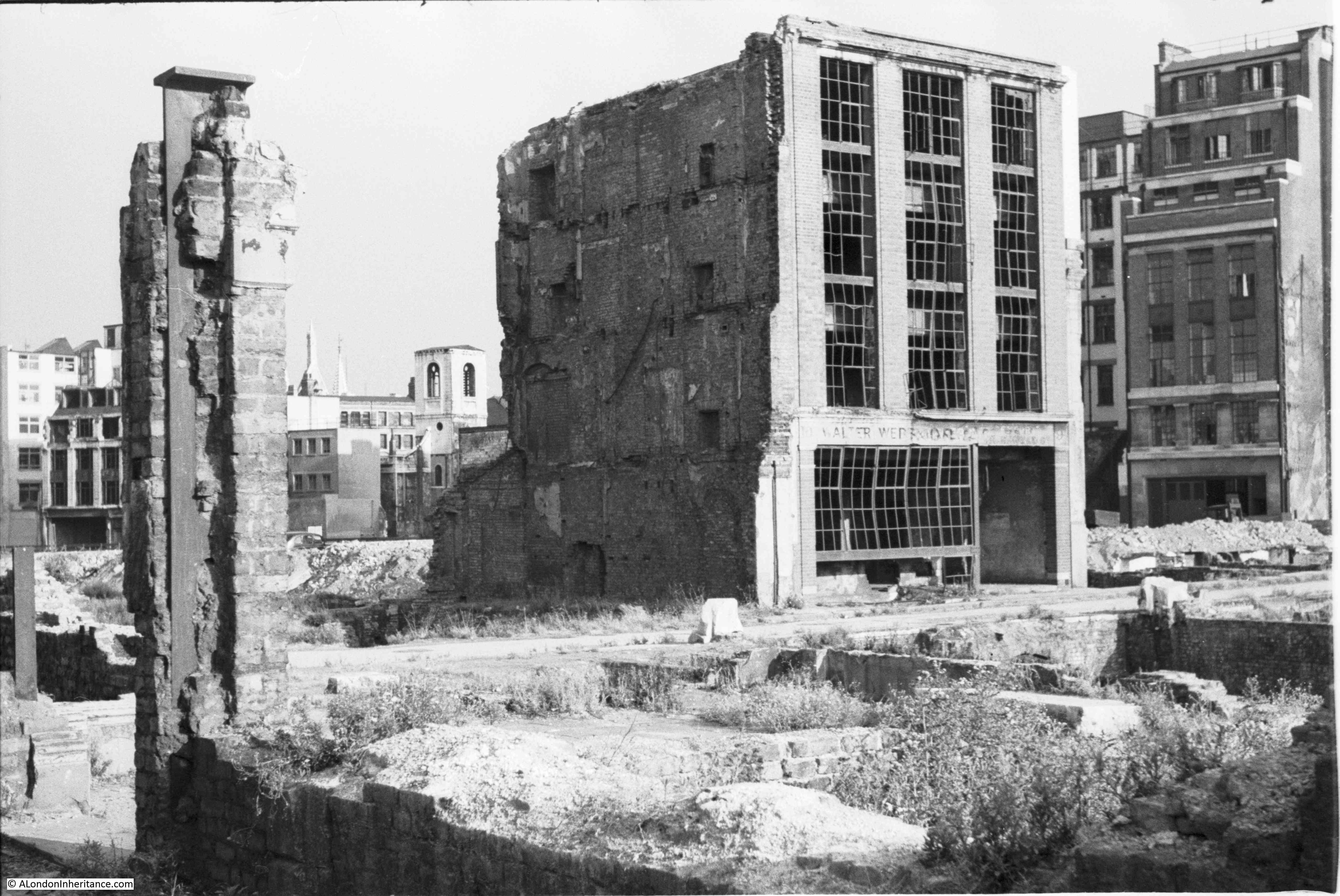
The area to the north of St. Paul’s Cathedral was destroyed during the war, mainly due to the use of incendiary bombs on the night of the 29th of December 1940. The destruction covered ancient streets such as Paternoster Row and Paternoster Square, and the shells of buildings were demolished and removed leaving a wide open space ready for new development.

The site was redeveloped during the 1960s, with the pre-war streets and original architectural styles being ignored, with an office complex built which followed a number of post war City planning themes which I will come on to later in the post.

The 1960s development was not popular, obstructed key views of the cathedral and tended to separate the cathedral from the area to the north. The buildings were not that well maintained and by the late 1980s the area was not an attractive place to work, or walk through, and did nothing to enhance the cathedral just to the south.

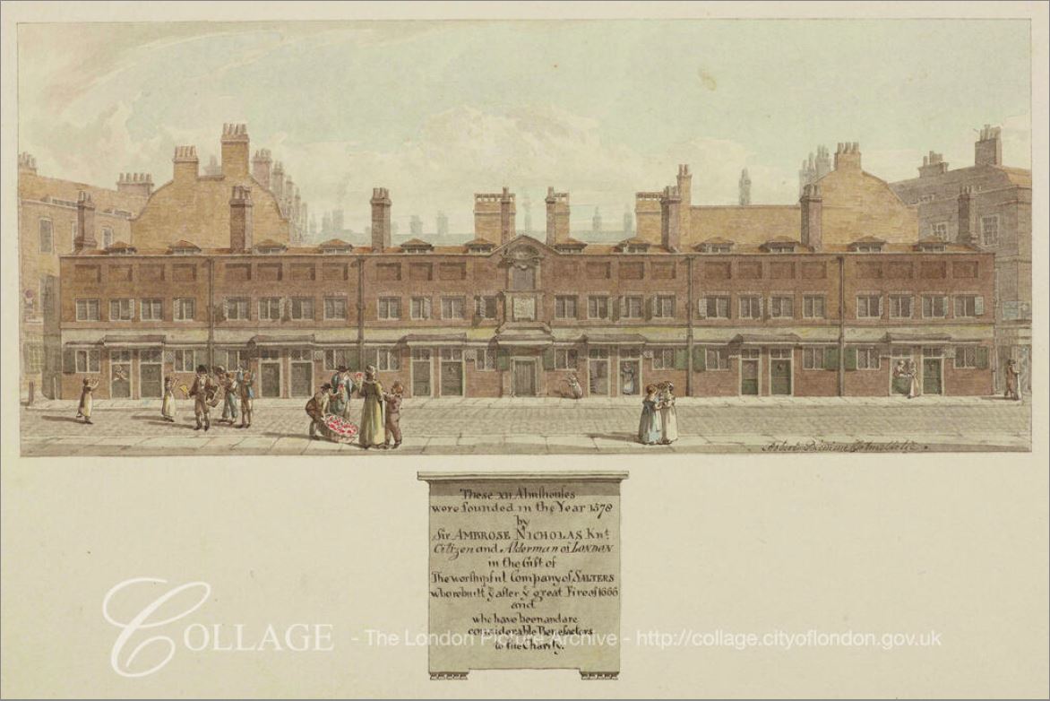
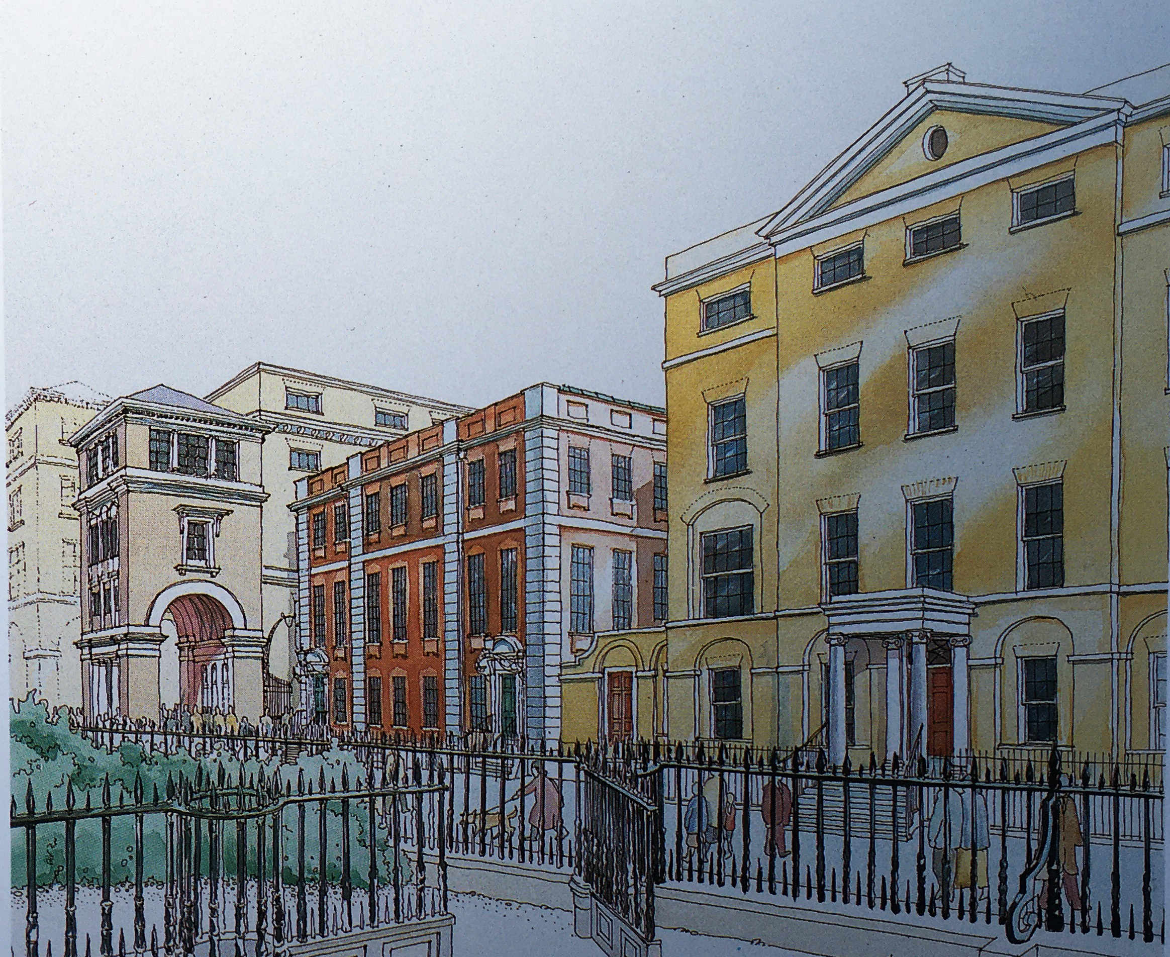
In the early 1990s, a proposed Masterplan was published by “Masterplanners” Terry Farrell, Thomas Beeby and John Simpson & Partners, and Design Architects Robert Adam, Paul Gibson, Allan Greenberg, Demetri Porphyrious and Quinlan Terry.

I have a copy of the Masterplan and it is fascinating to compare the original proposals with the site we see today. Not quite so architecturally ornate as the Masterplan, but very similar to what was originally proposed, and (in my view) a significant improvement on the 1960s development.

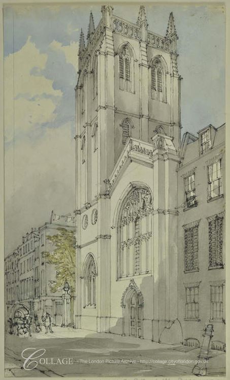
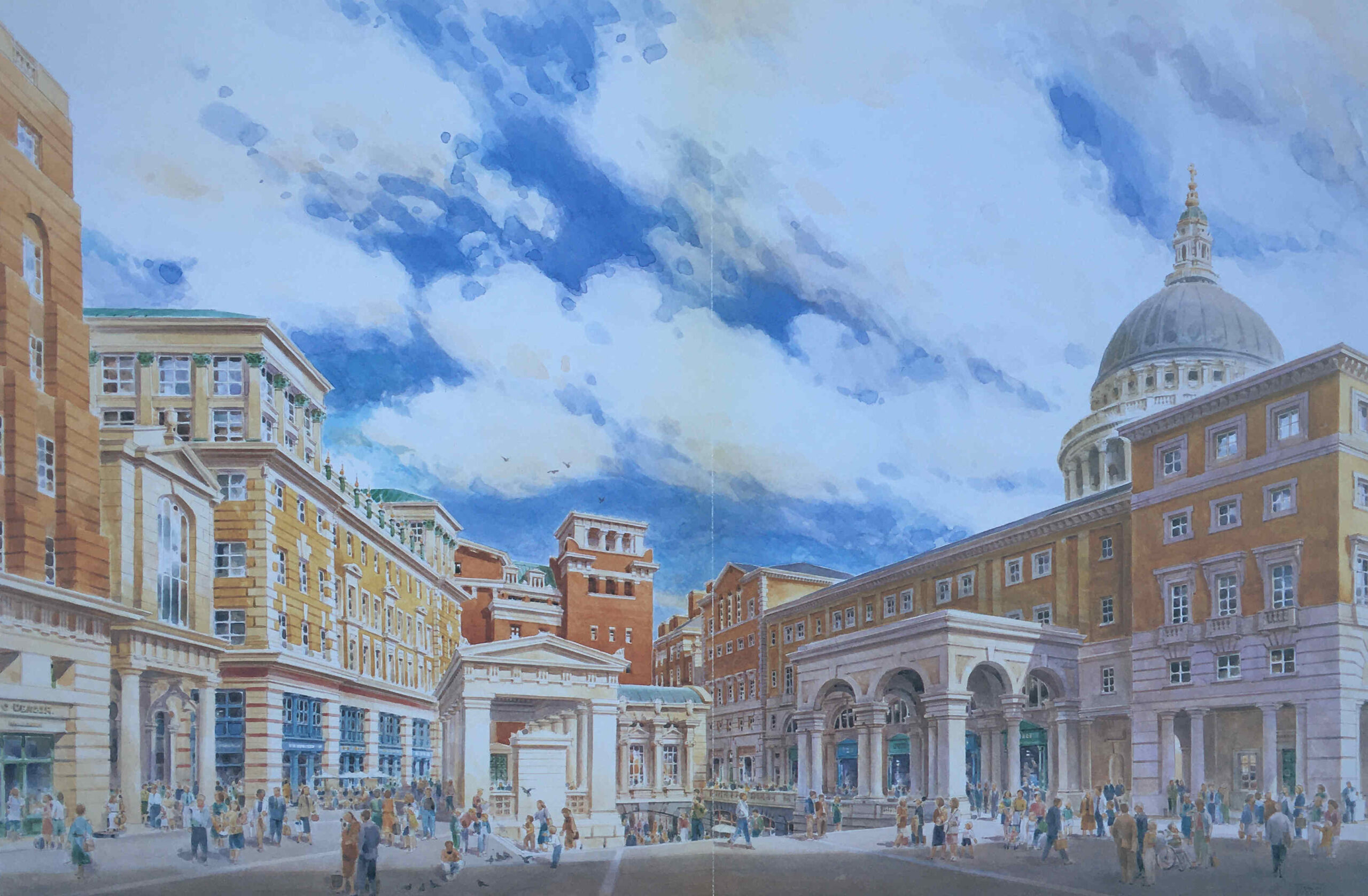
The following image is from the Masterplan and shows a “View of Paternoster Square looking south-east to the dome of St. Paul’s Cathedral”. The image is by Edwin Venn.

Paternoster Square

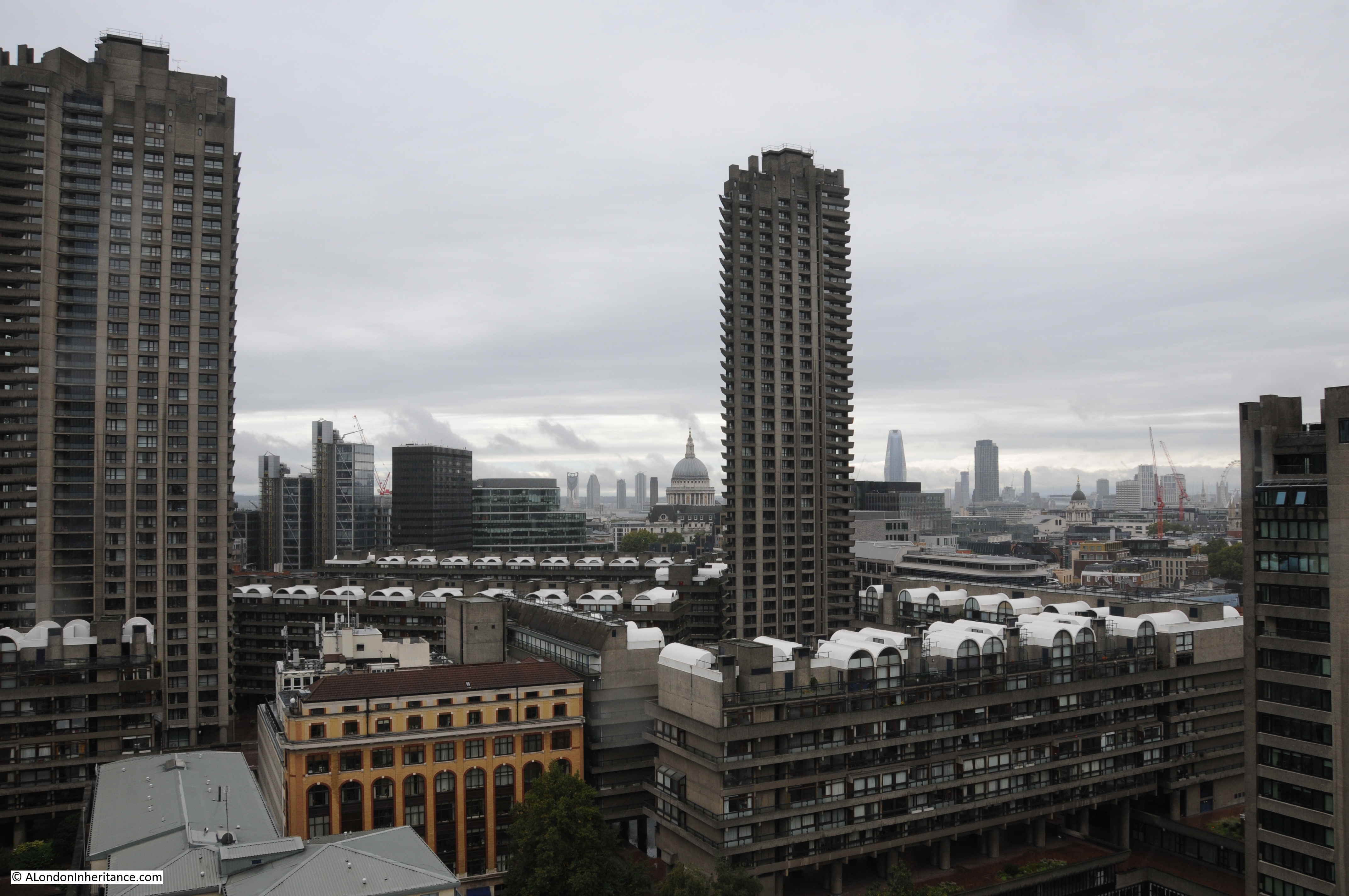
As with City developments such as the Barbican and Golden Lane estates, the damage inflicted on the City during the last war created the large area of space which could take a major, transforming development, rather than the simple rebuild of individual buildings.

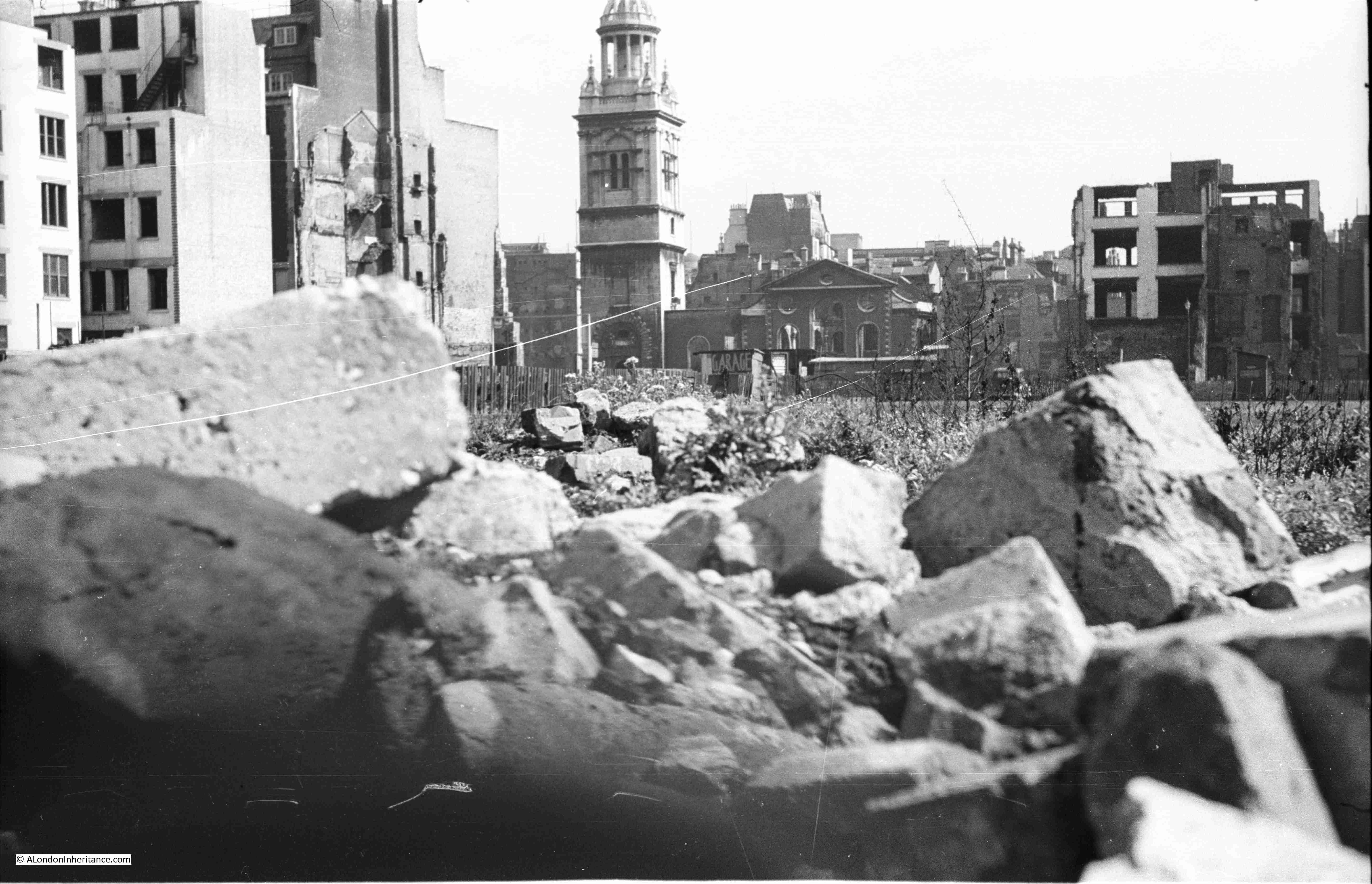
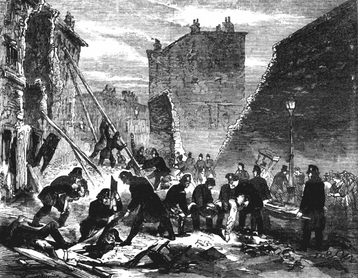
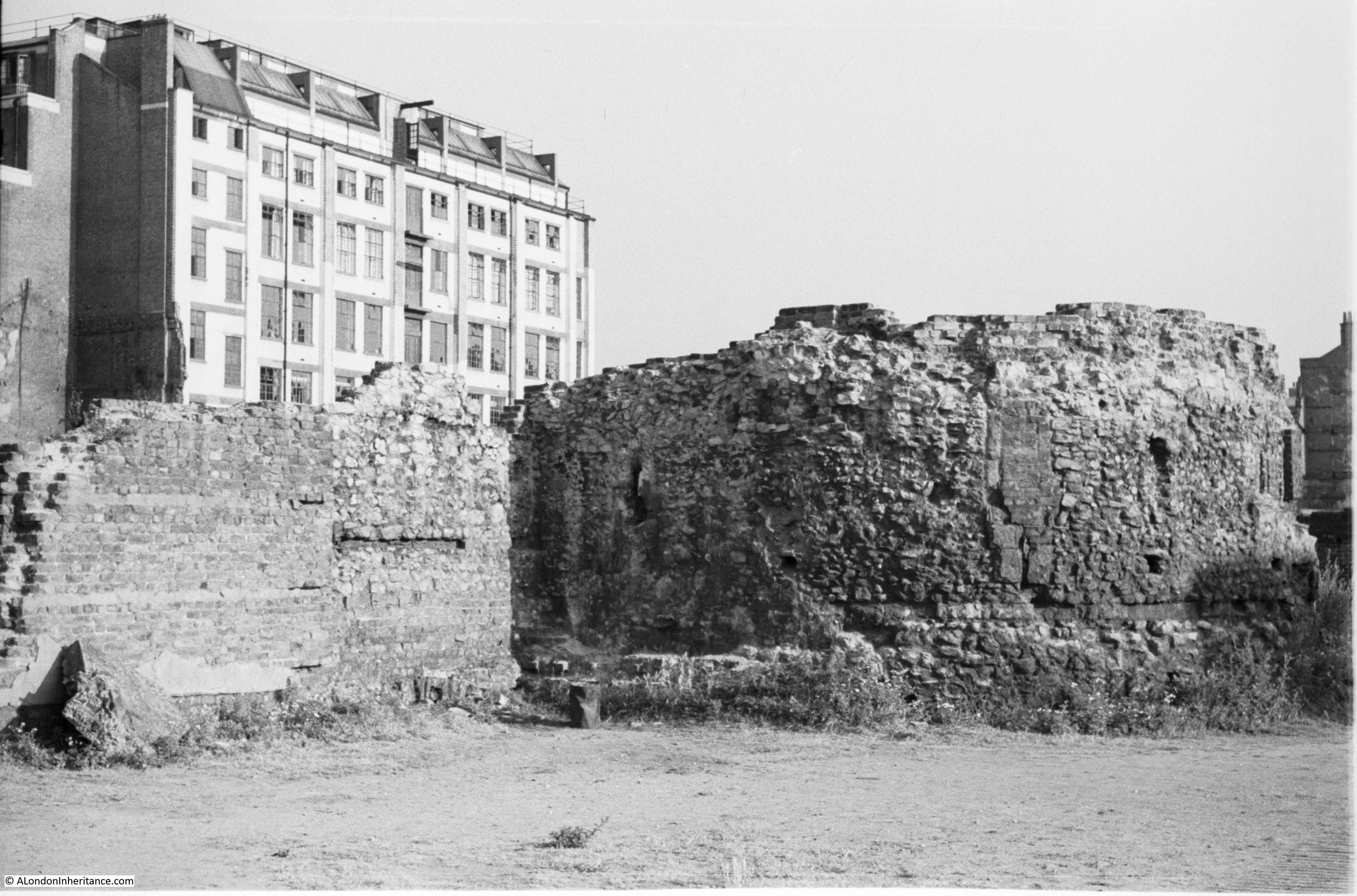
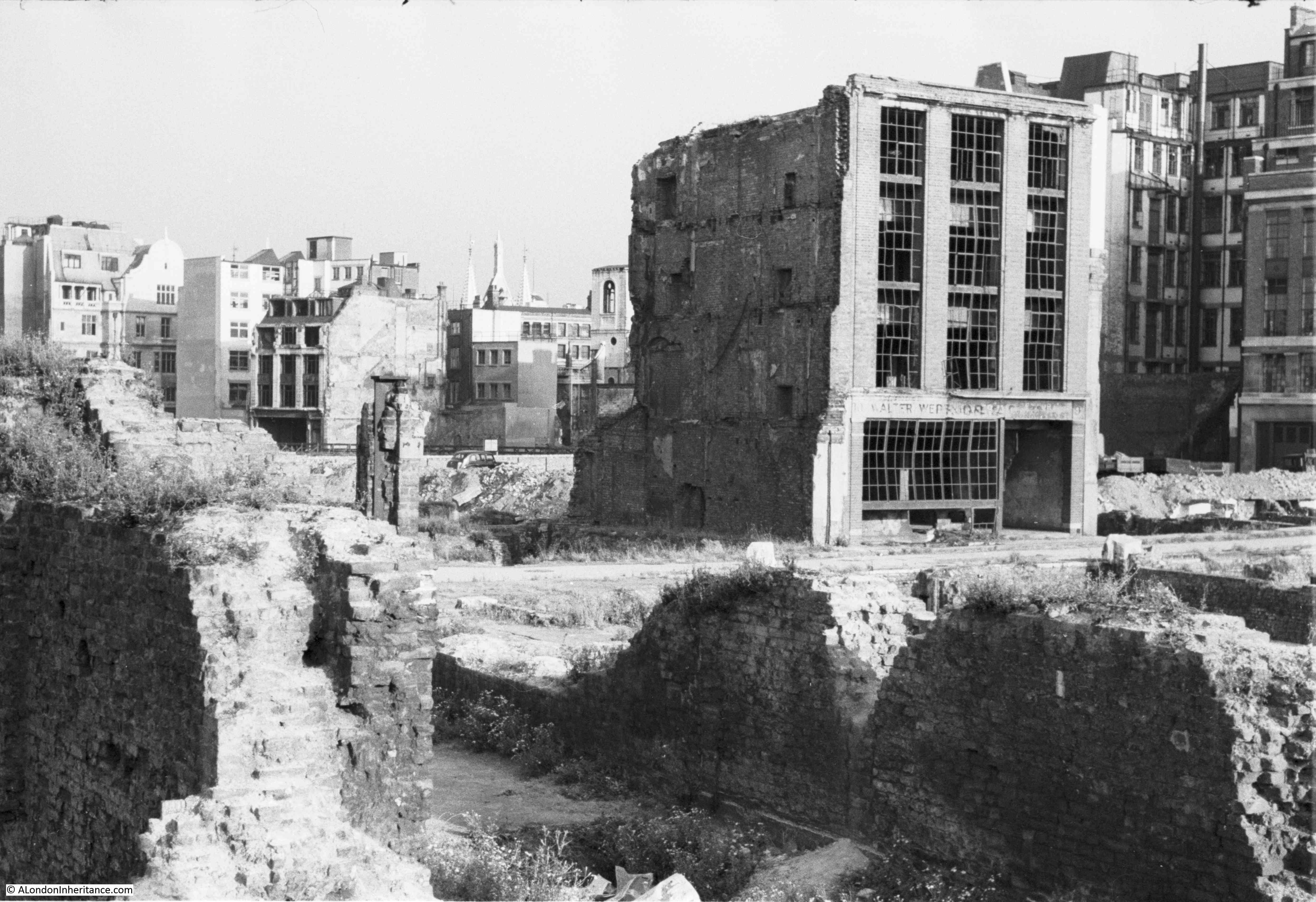
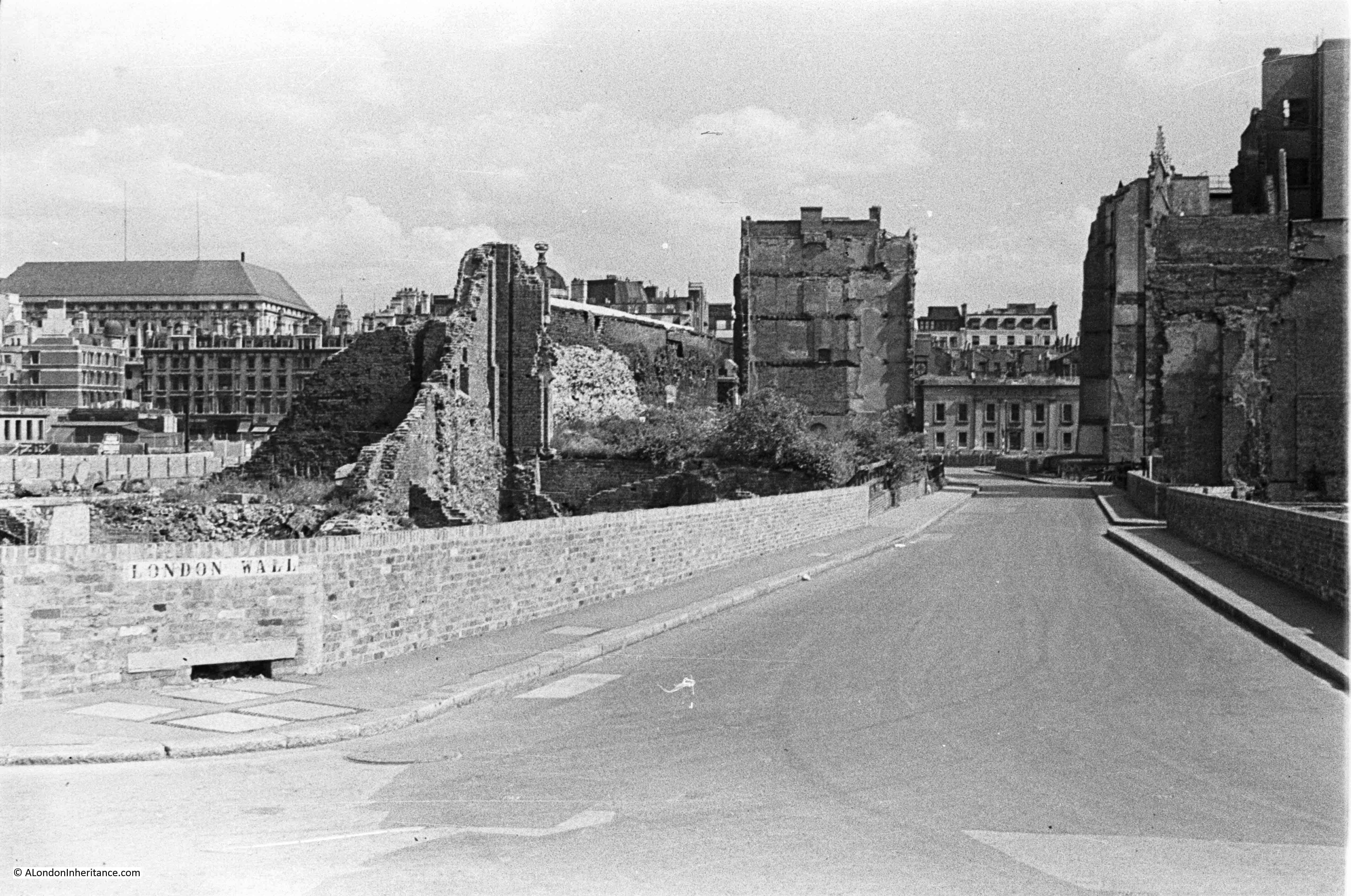
The following photo is one of my father’s, taken from the Stone Gallery of St. Paul’s Cathedral:

View of bombed Chapter House

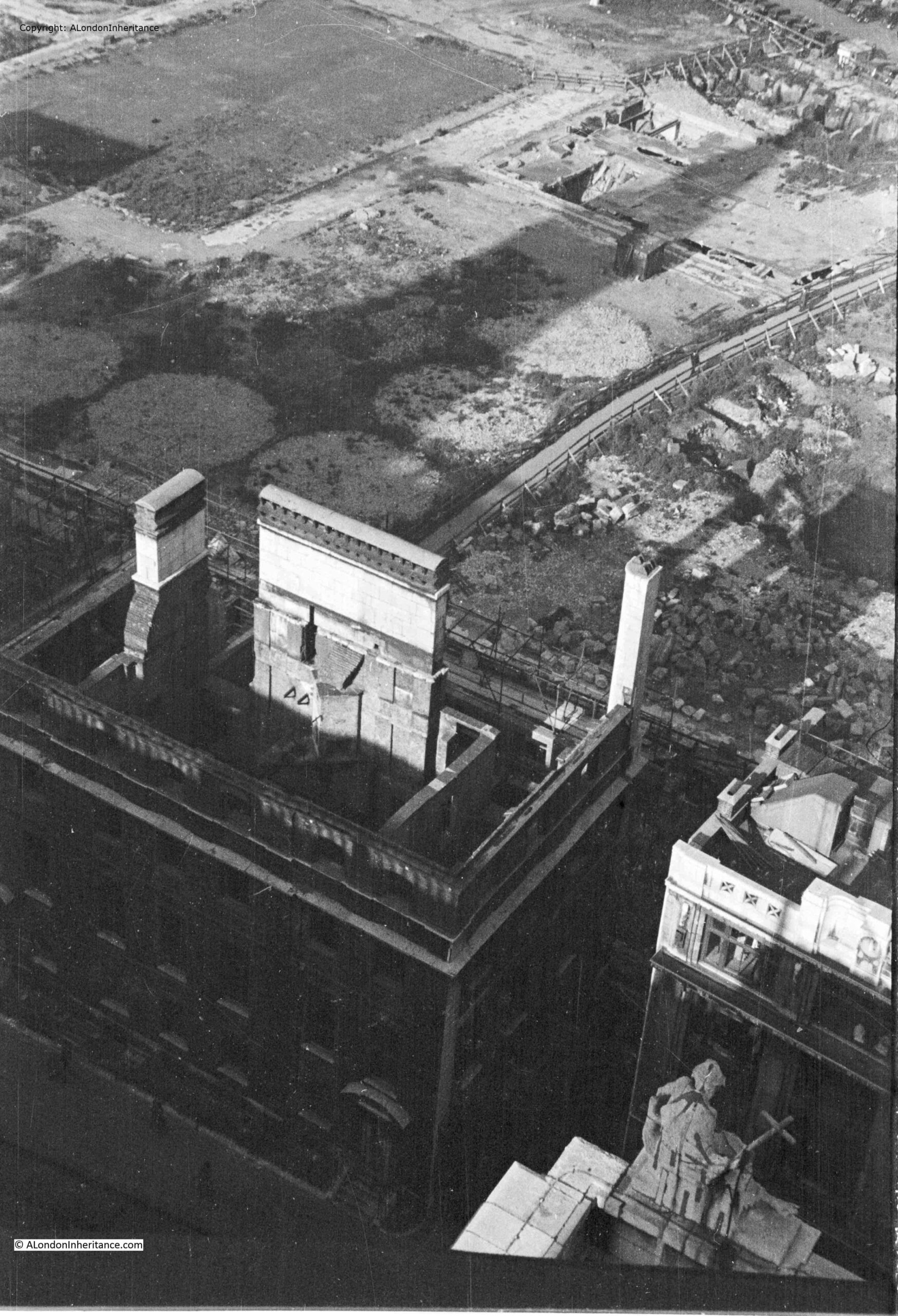
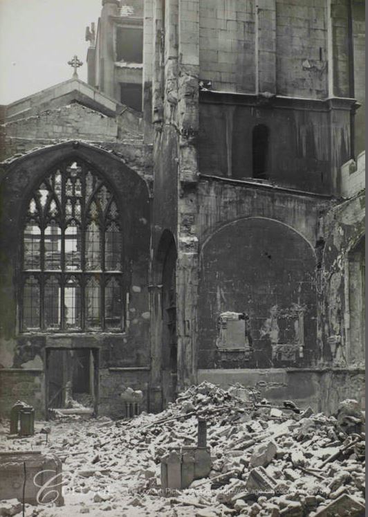
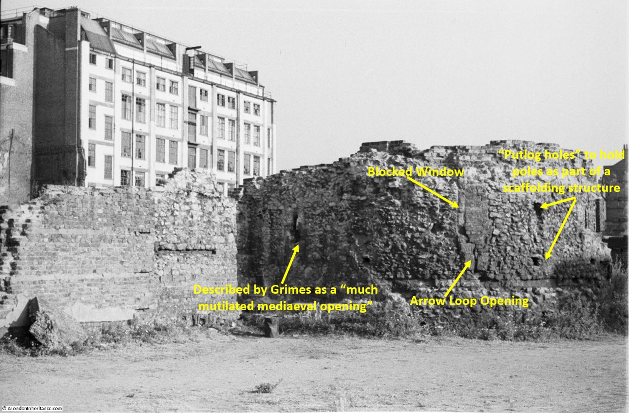
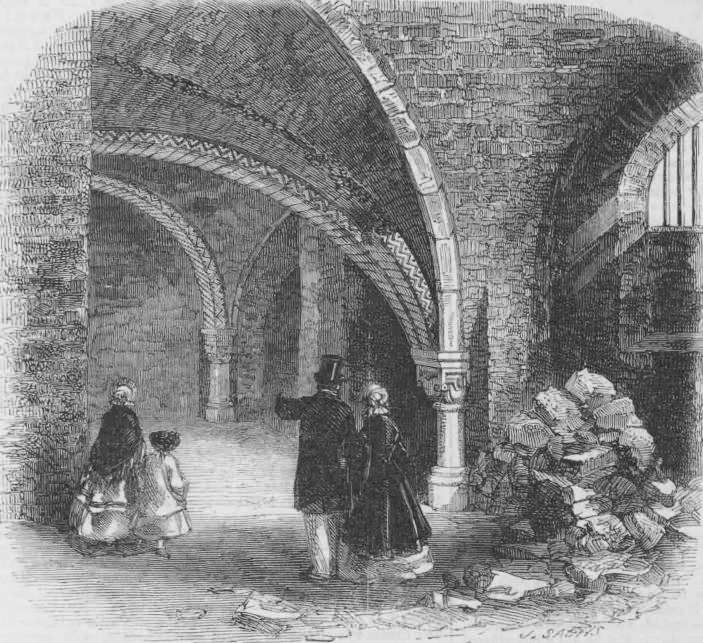
The shell of a building at the bottom left is the Chapter House of the Cathedral.

The circular features between what was Paternoster Square and the remains of the Chapter House are the outline of water tanks that were placed on site during the war to provide supplies of water for firefighting.

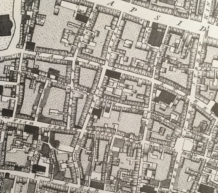
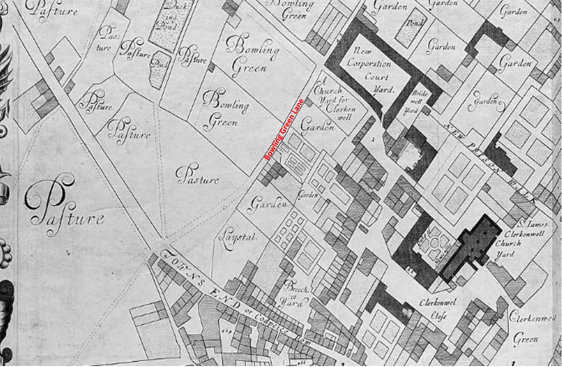
The following extract from Bartholomew’s 1940 Reference Atlas of Greater London shows the area to the north of the cathedral. In the map, a Paternoster Square can be seen. In the above photo, this is the rectangular feature at top left, with roads on all sides, but not a building in sight.

Map of pre-war St Paul's and Paternoster Row

As well as Paternoster Square, the map shows a network of streets such as Ivy Lane, Three Tuns Passage, Lovells Court and Queens Head Passage.

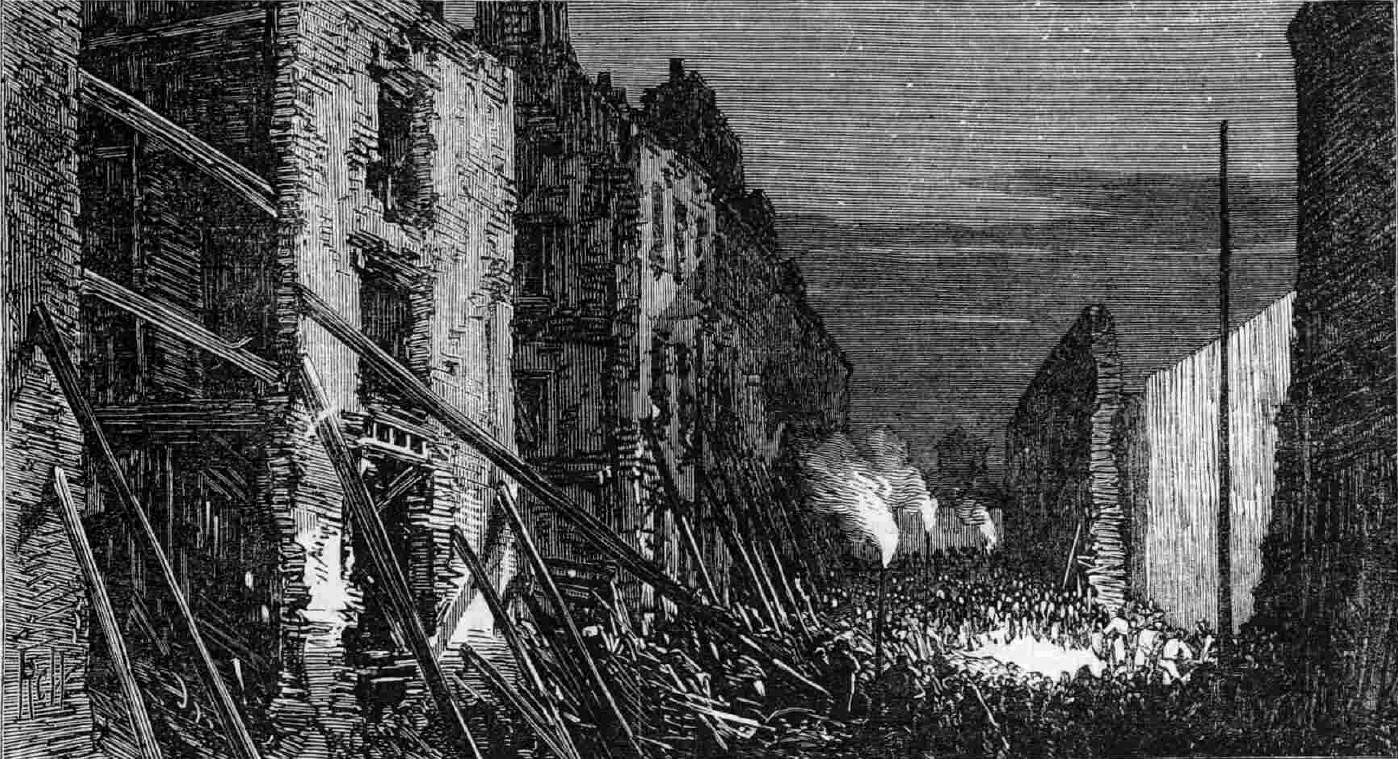
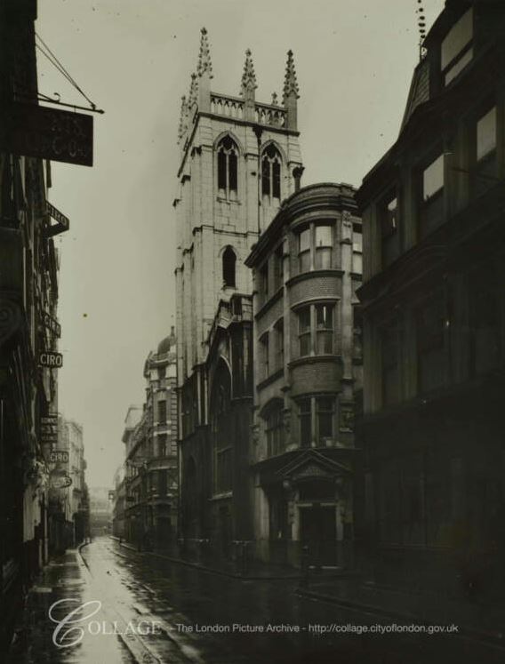
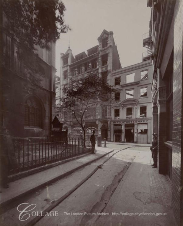
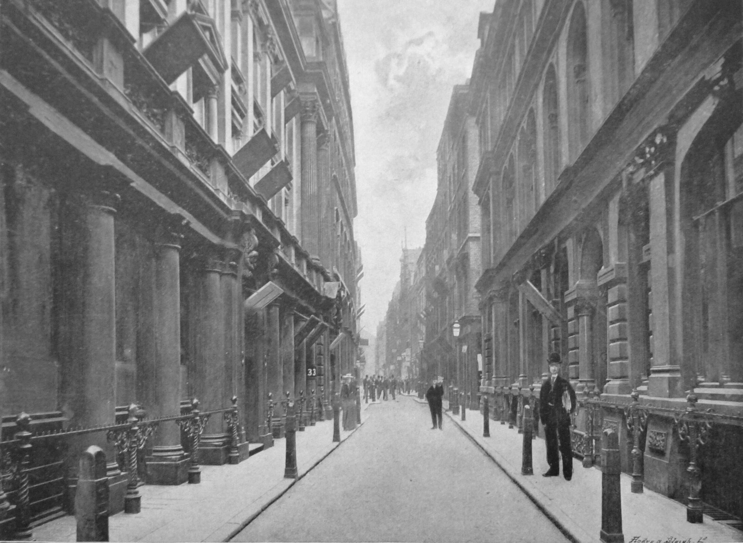
Running across the area was Paternoster Row, and the following photo from the book, the Queen’s London, published in 1896, shows the view along Paternoster Row, a narrow street but with substantial 19th century City office buildings on either side.

Paternoster Row

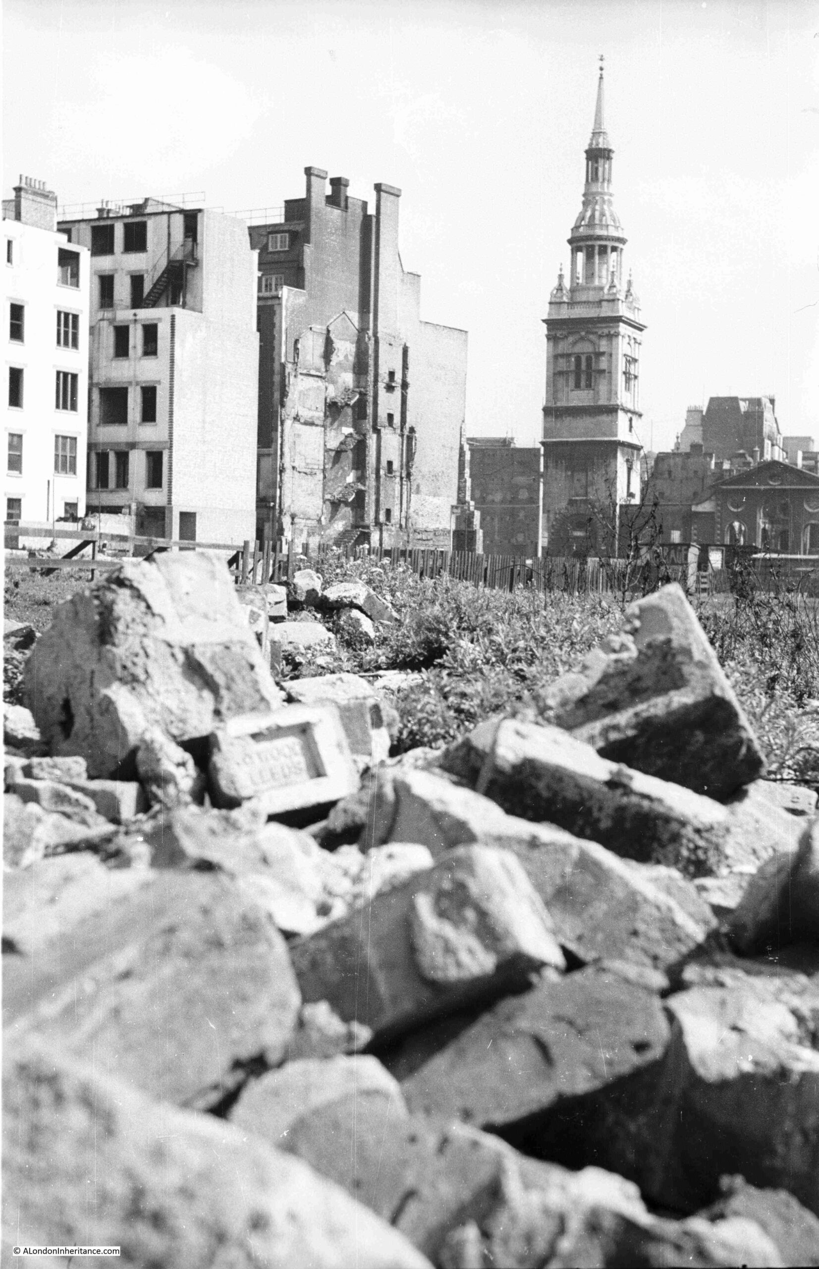
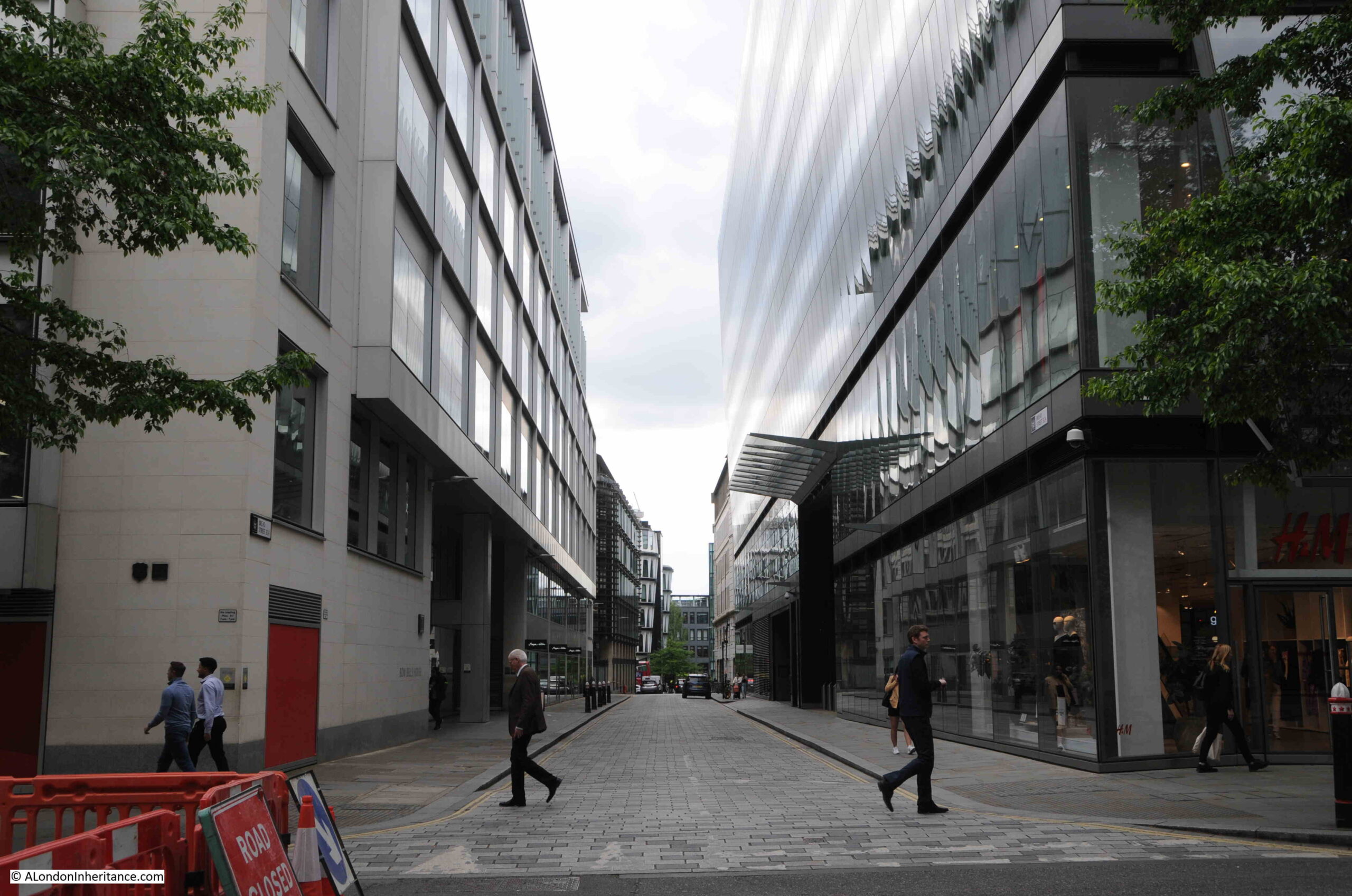
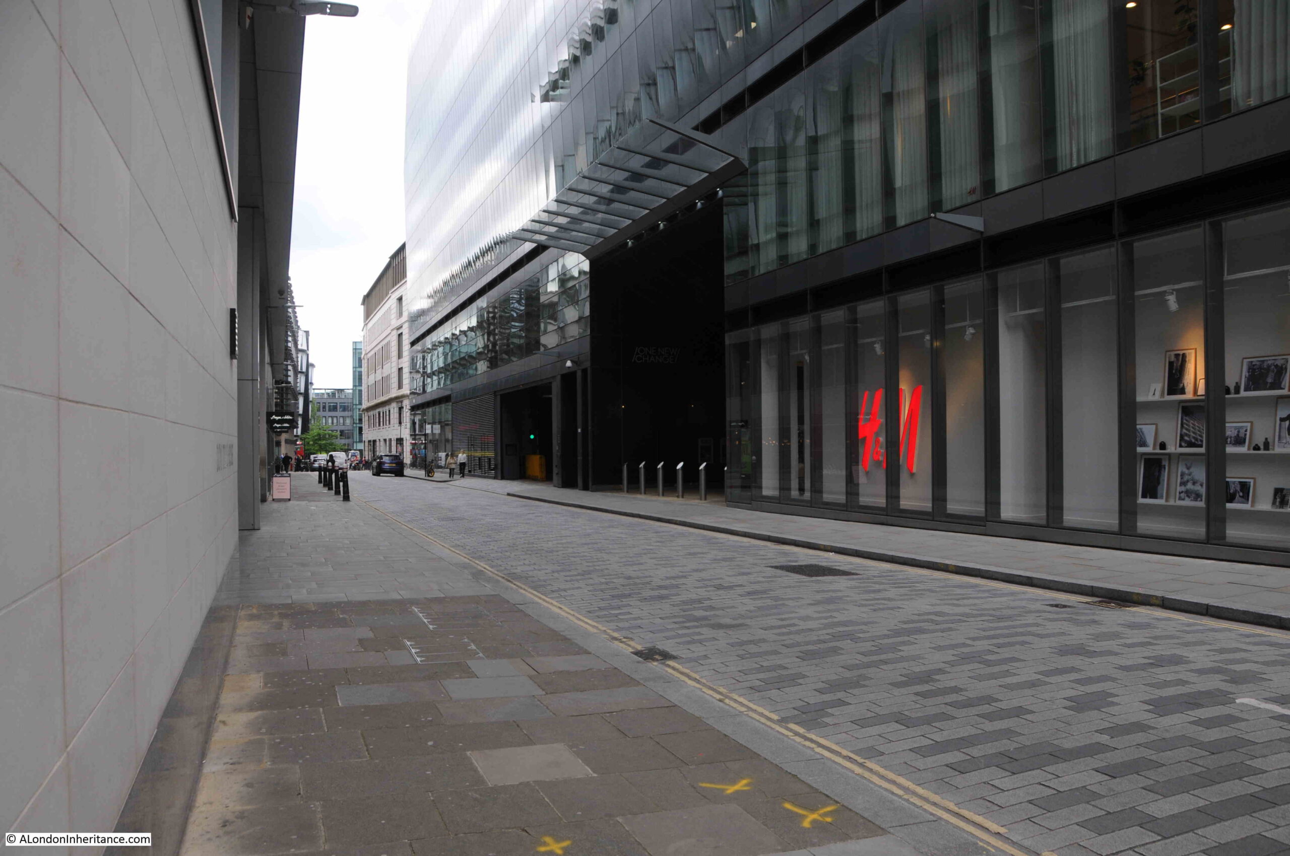
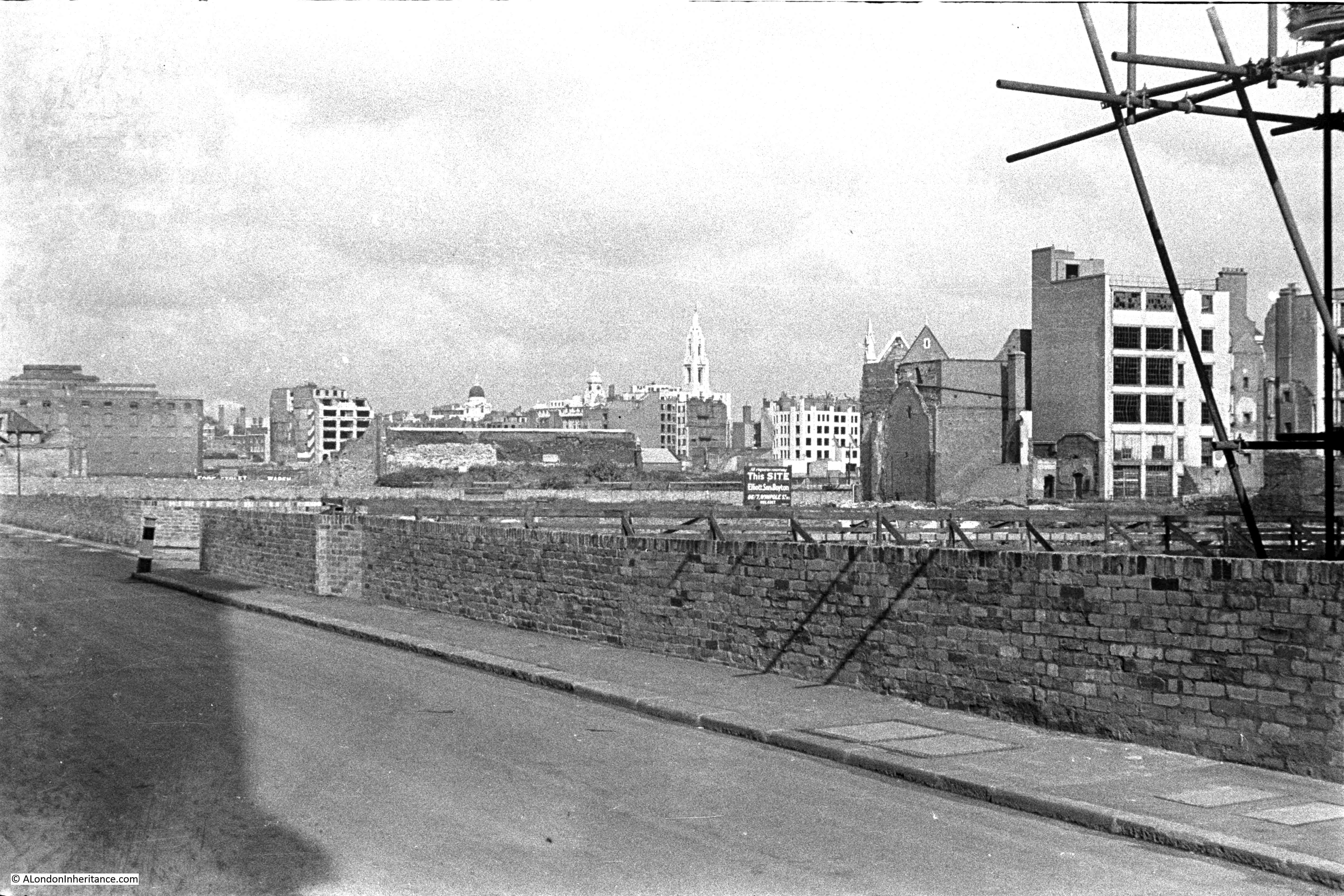
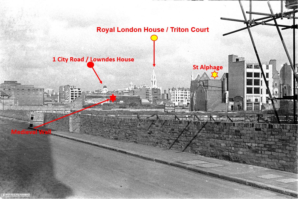
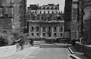
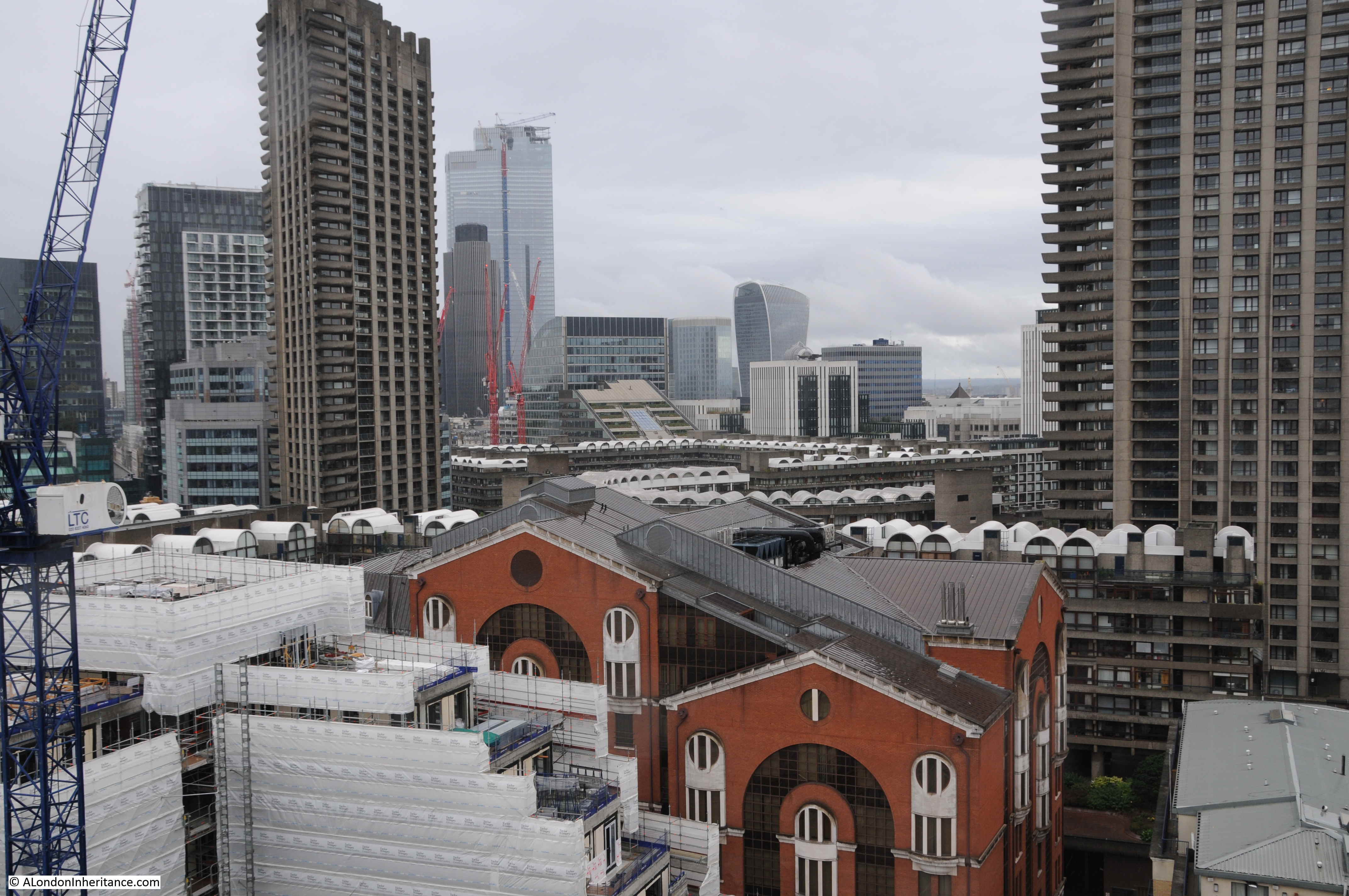
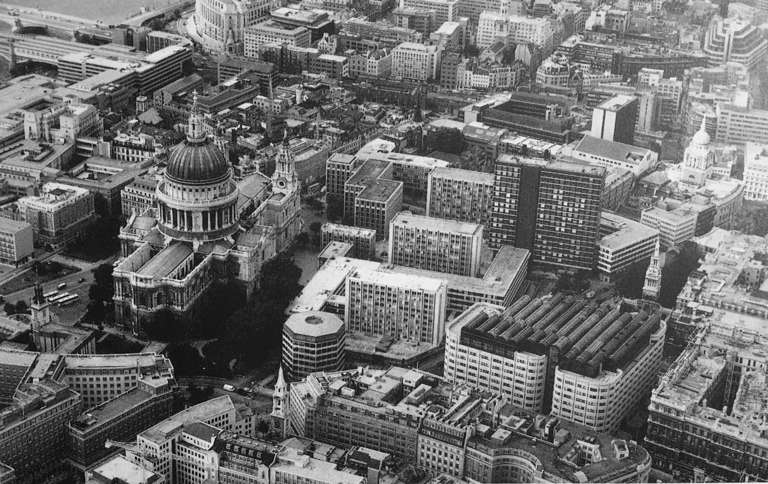
In the following photo, the dense network of streets and buildings to the north of the cathedral can be seen:

St Paul's before the war

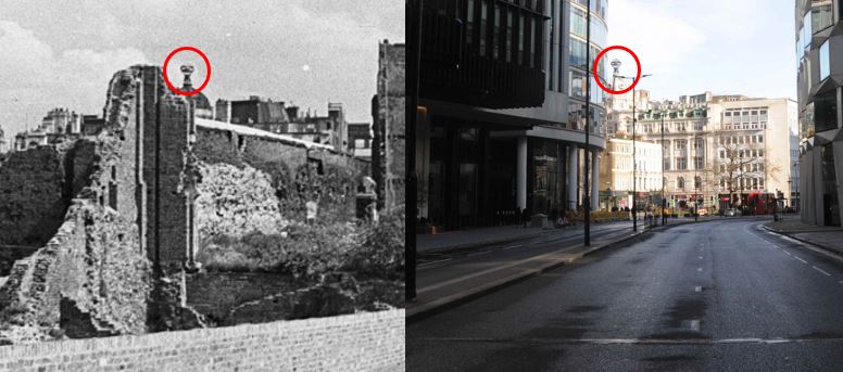
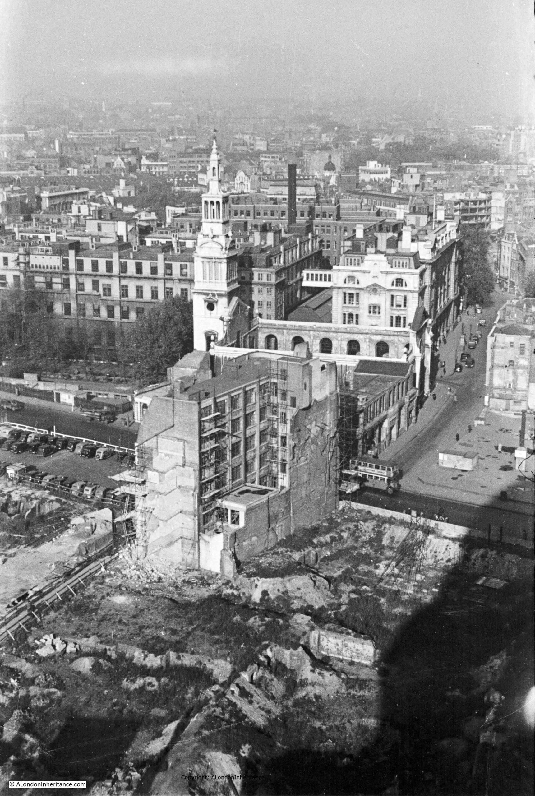
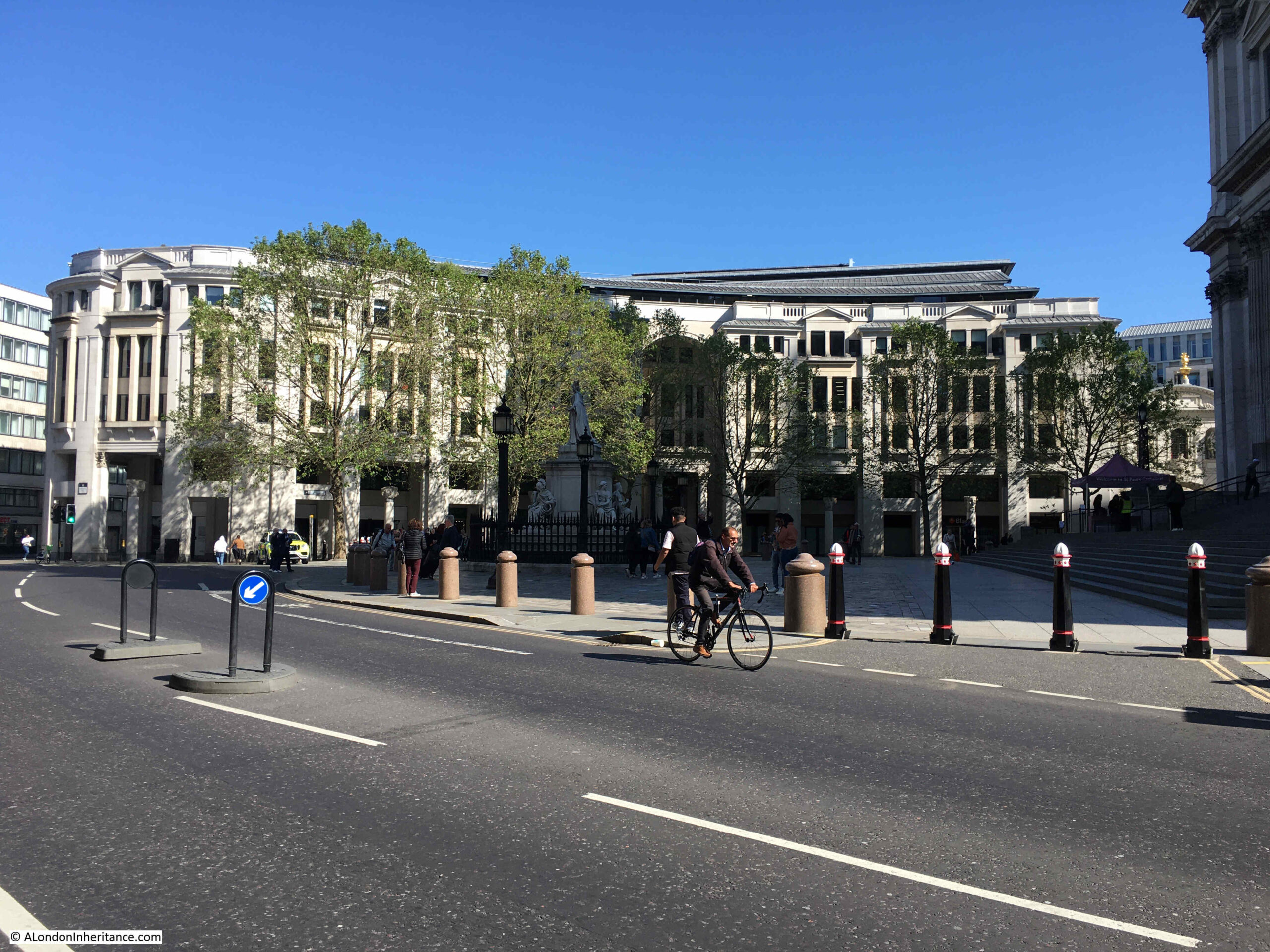
Another of my father’s views from the Stone Gallery, looking slightly above the earlier photo, with a bus running along Newgate Street. The Paternoster Square developments would occupy the area to the south of Newgate Street.

View from St Paul's of bombed landscape

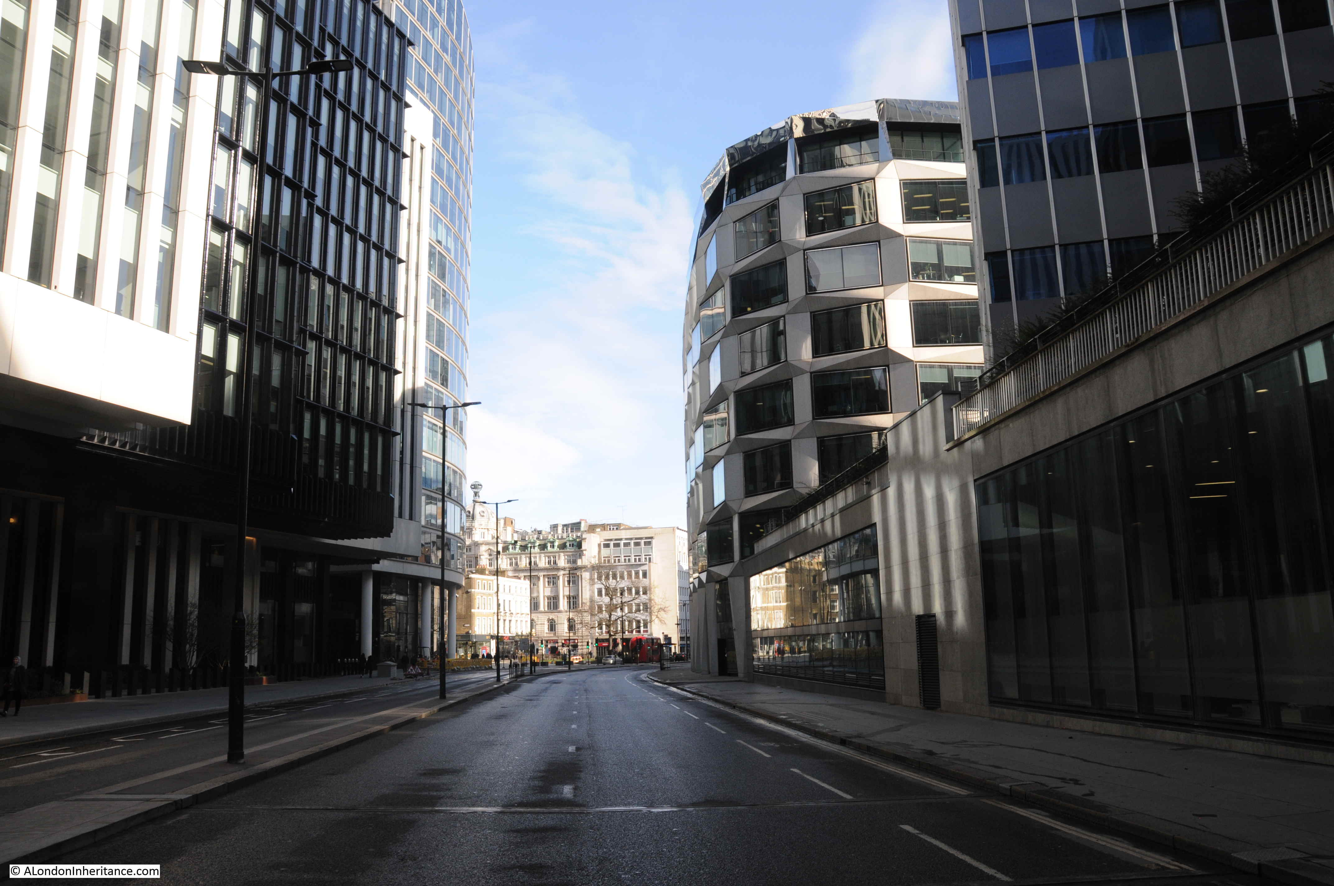
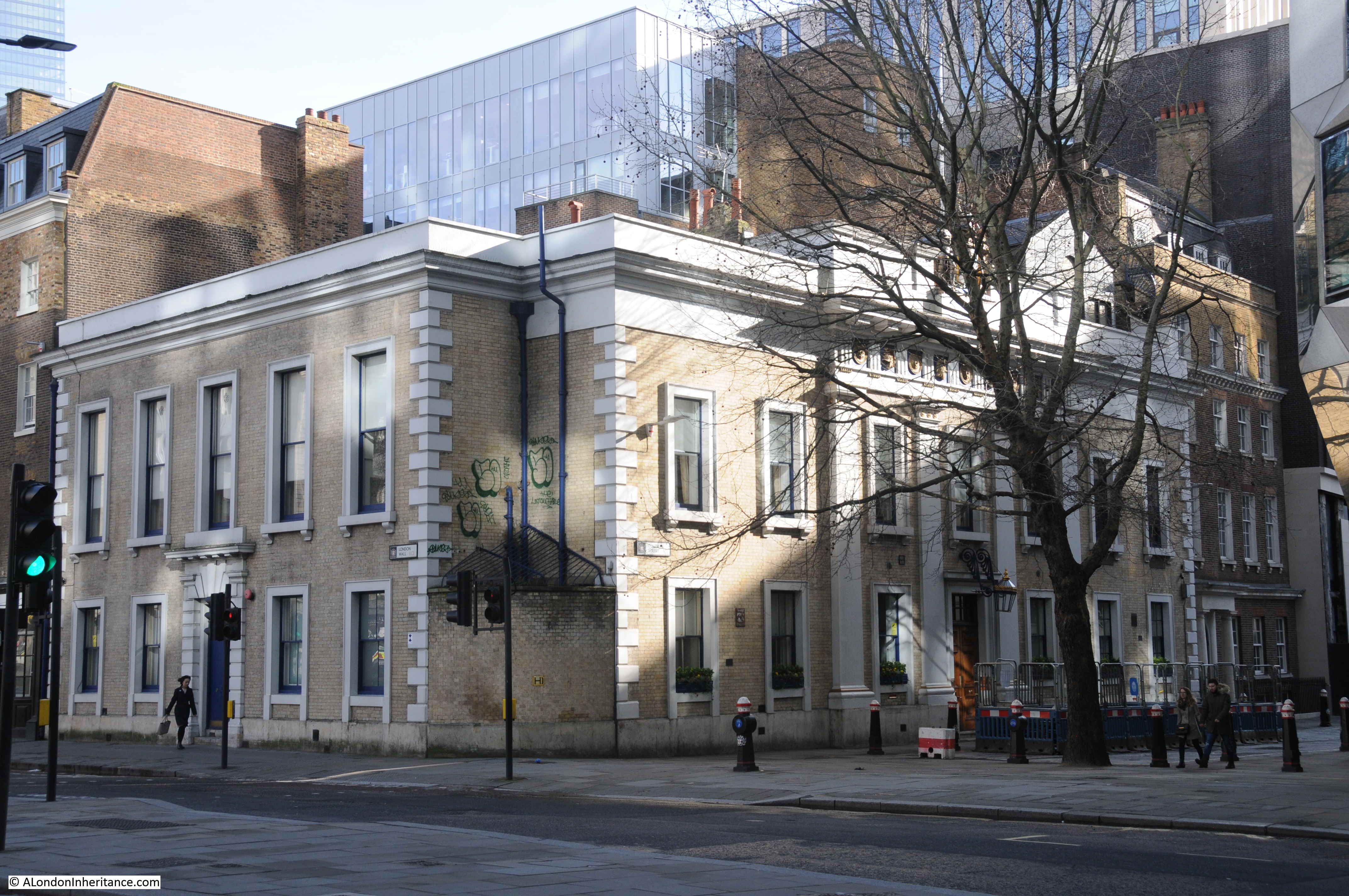
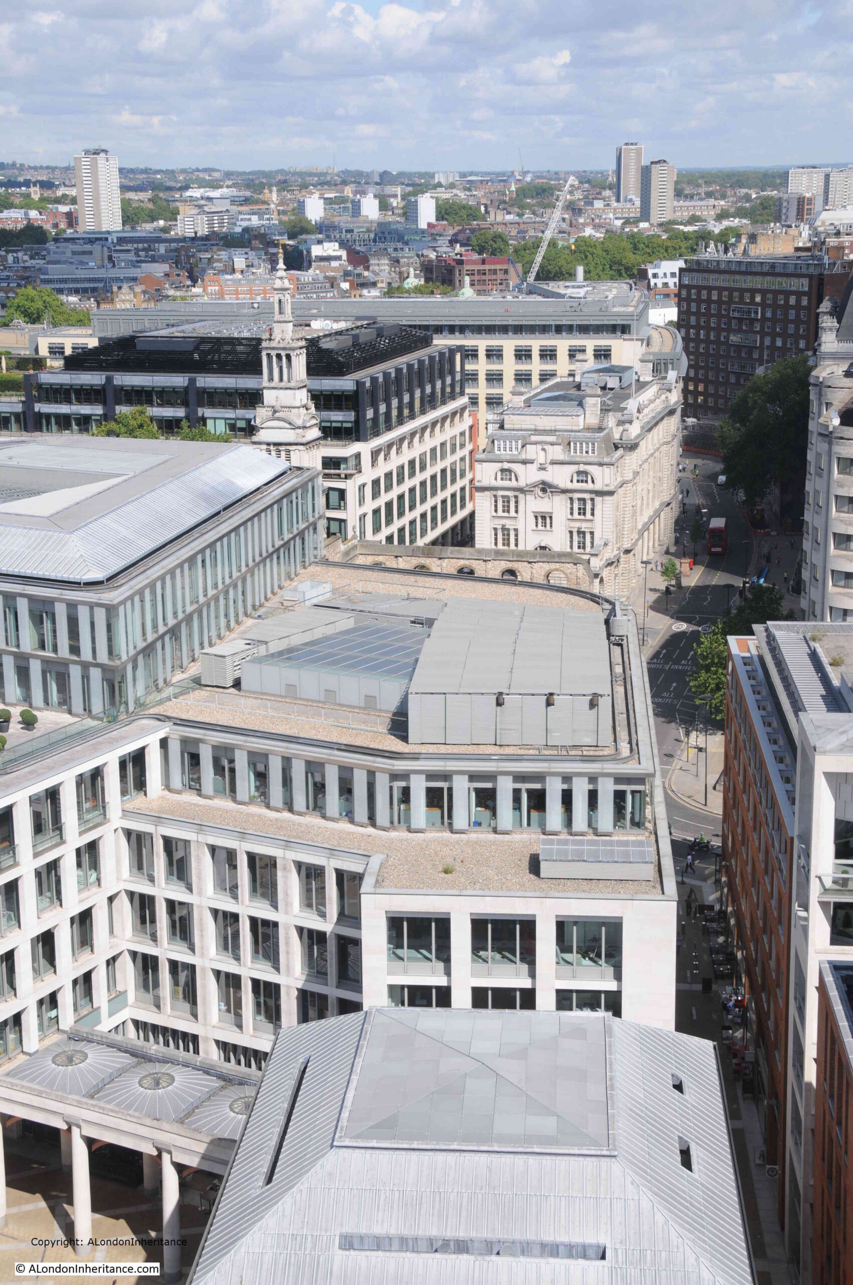
The same view today, showing the buildings of the Paternoster Square development:

Paternoster Square

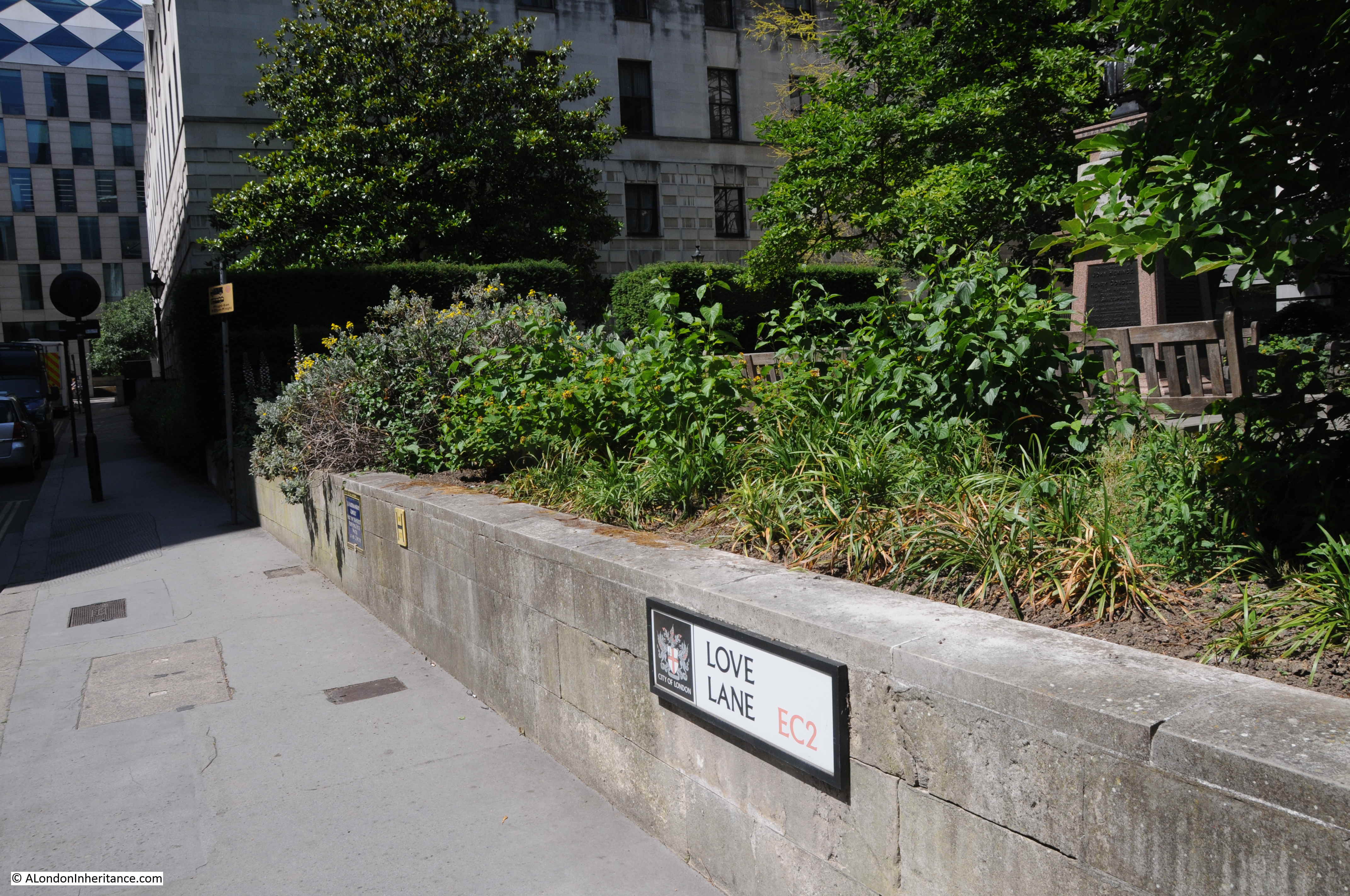
The area, and street names are of some considerable age. The first written records of the streets date from the 14th century, with Paternosterstrete in 1312 and Paternosterrowe in 1349.

From the early 19th century onwards, the area was home to many publishers, stationers and book sellers. Much of the stock held by these businesses contributed to the fires started on the 29th of December 1940.

Harben’s Dictionary of London references a Richard Russell dwelling there in 1374 and described as a “paternosterer”, and that paternosterers were turners of beads, and gave the street its name.

Harben also states that “A stone wall was found under this street at a depth of 18 feet running towards the centre of St. Paul’s. A few yards from this wall in the direction of St. Martin’s-le-Grand wooden piles were found covered with planks at a depth of 20 feet”, and that under Paternoster Square, “Remains of Roman pavements and tiles were found in 1884”.

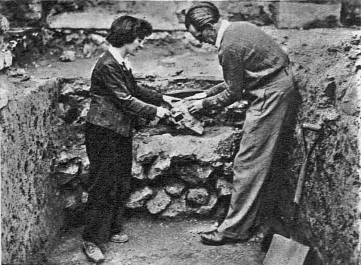
W.F. Grimes’ book, about his post war excavations across the City, “The Excavation of Roman and Mediaeval London” records his limited excavations across the area in 1961 to 1962, and that much of the Paternoster area “was not available for examination because the cellars had retained their bomb rubble and the sites around Paternoster Square had become a garage and car parks.”

In the limited excavations that did take place, Grimes found evidence of ditches and post holes, possibly where the wooden piles were found in the 19th century. He concludes that the area was probably occupied by timber framed buildings rather than stone.

The main discovery on the site was a hoard of about 530 coins, “mainly barbarous copies of coins of the Gallic Empire of the late third century A.D.”

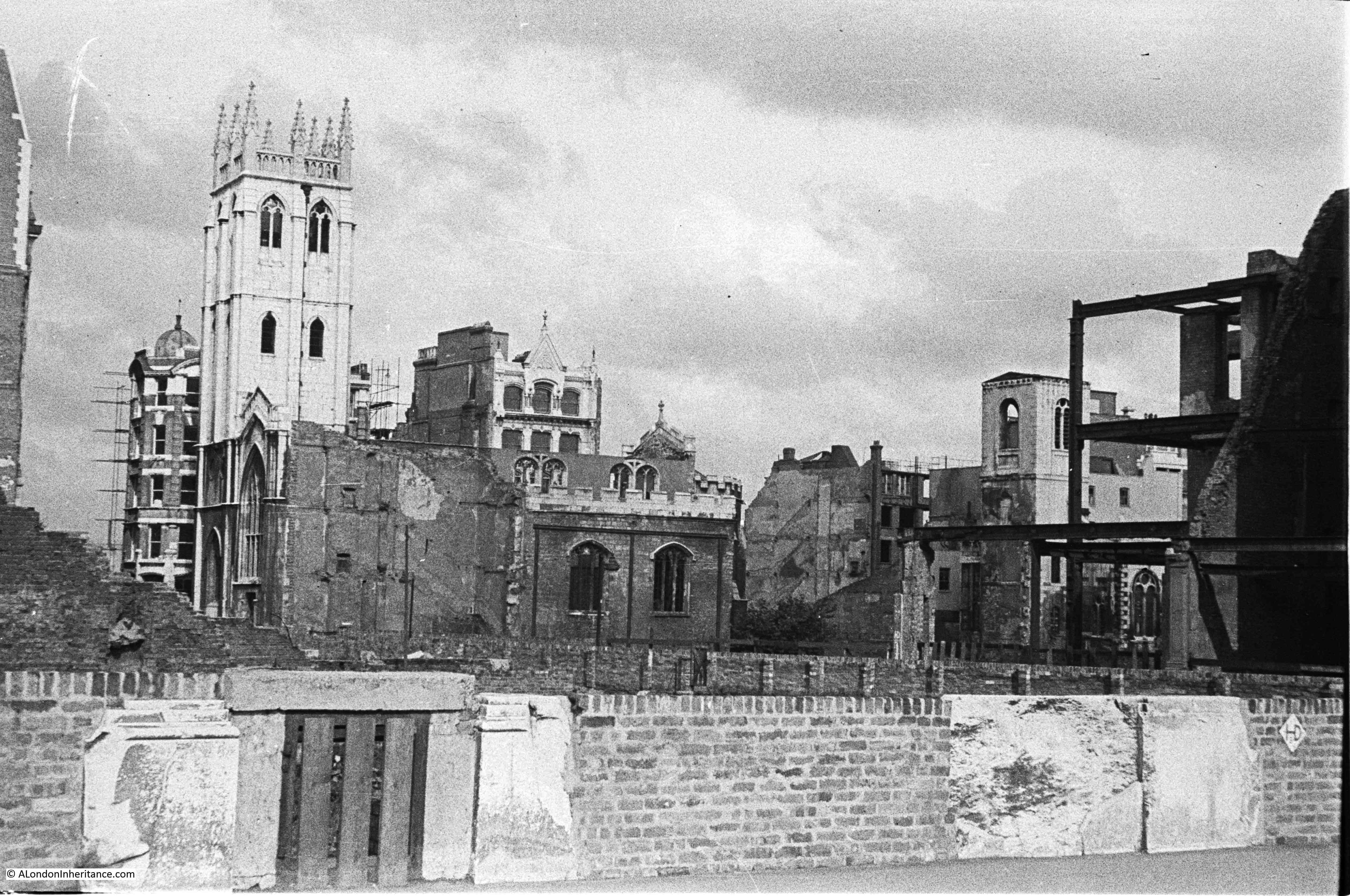
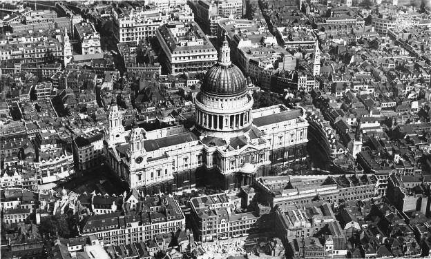
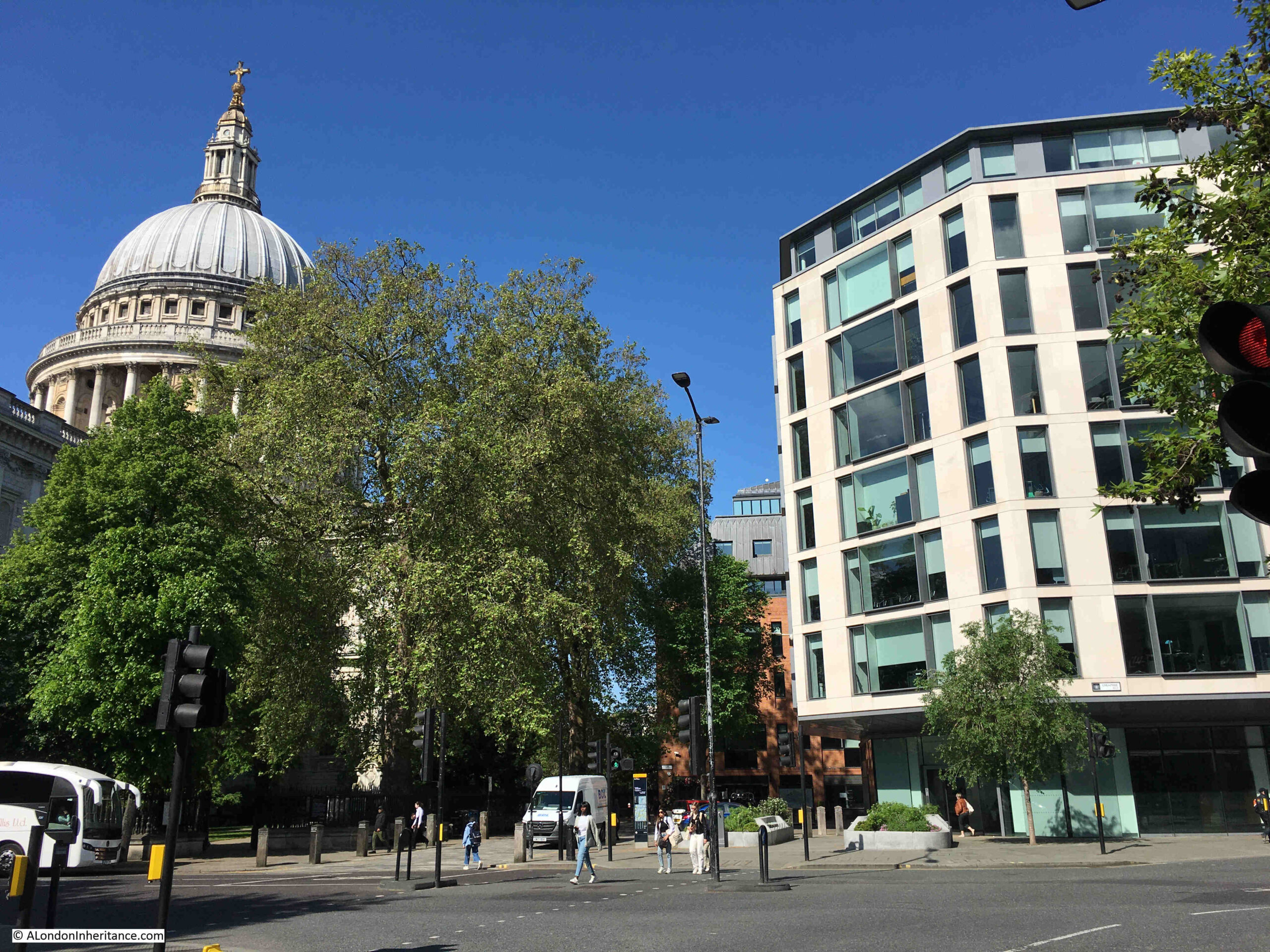
The limited excavation took place prior to the 1960s development of the site. This create a dense cluster of office blocks between the cathedral and Newgate Street, which can be seen in the following photo, to the right of the cathedral:

1960s Lord Holford development

The 1960s development of the site was based on the plans by architect and planner Lord Holford who was commissioned by the City Corporation to advise them on architectural policy, and the development of buildings within the “orbit of the dome of St. Paul’s”.

Lord Holford’s plan for the site followed post-war thinking about the City’s redevelopment. This included the separation of traffic and pedestrians, with vehicles having priority at ground level, and pedestrians moved to elevated walkways.

The original street plans were rejected in favour of a rigid matrix of building blocks, which resulted in a horizontal slab of blocks with the 18-storey office tower Sudbury House being the highest.

Lord Holford’s explanation of his approach to the design of the site was that “there is more to be gained by contrast in design, than from attempts at harmony of scale or character of spacing” (I think this is the design approach used for the current developments between Vauxhall and Battersea Power Station).

Not all of Holford’s ideas were implemented, and many of the buildings were by other architects, so the new development ended up as a rather uninspiring addition to the land north of the cathedral.

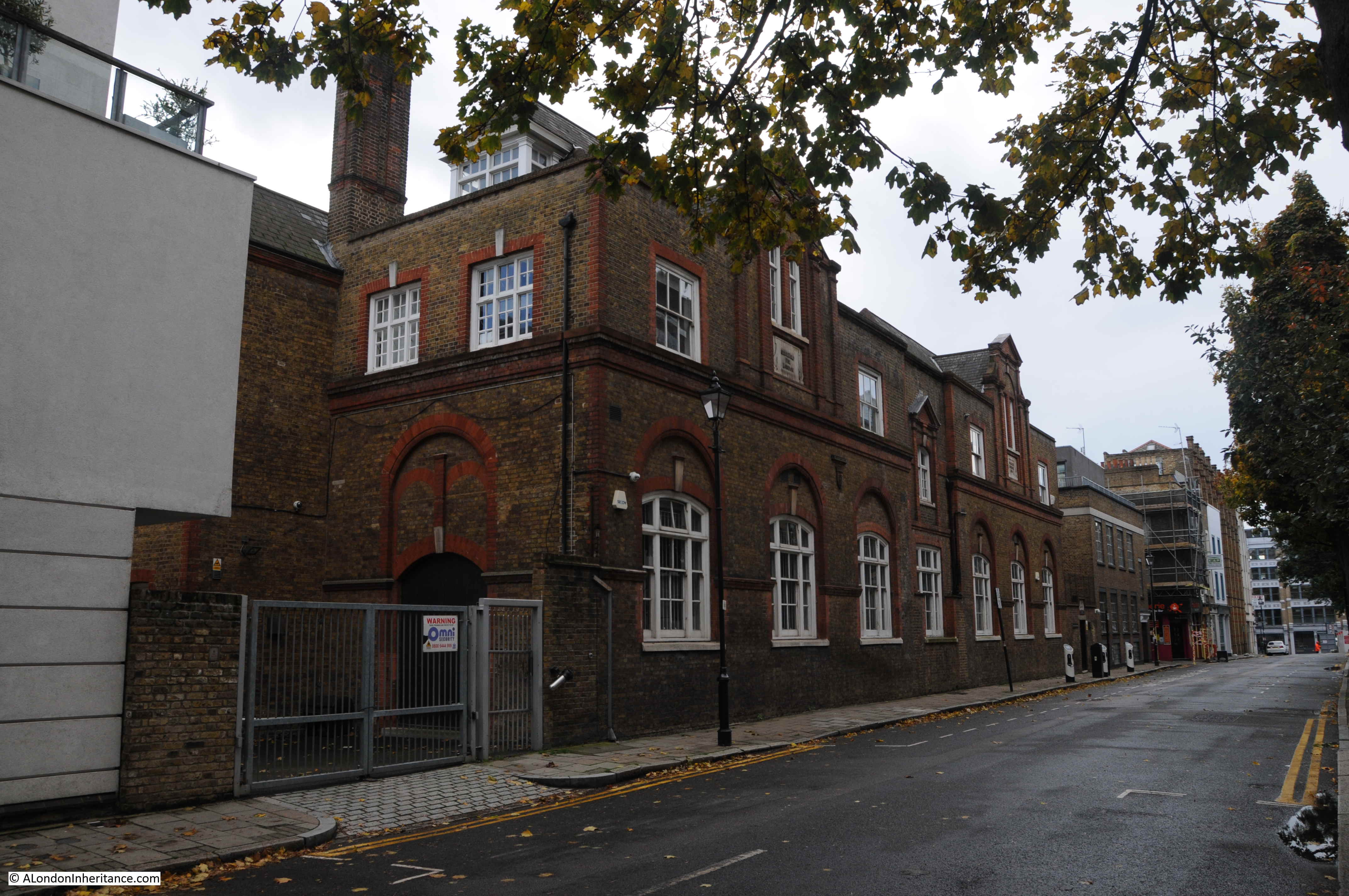
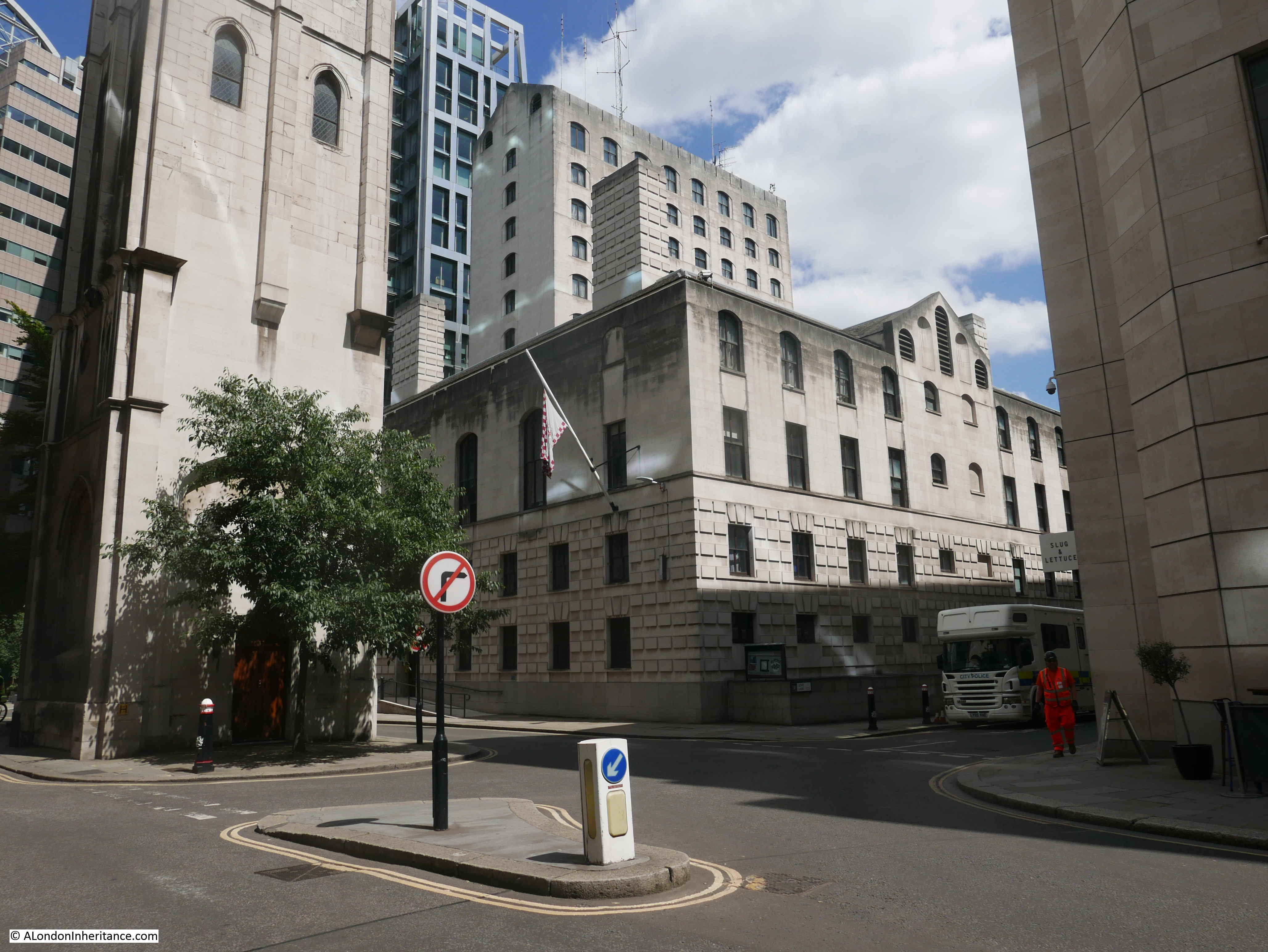
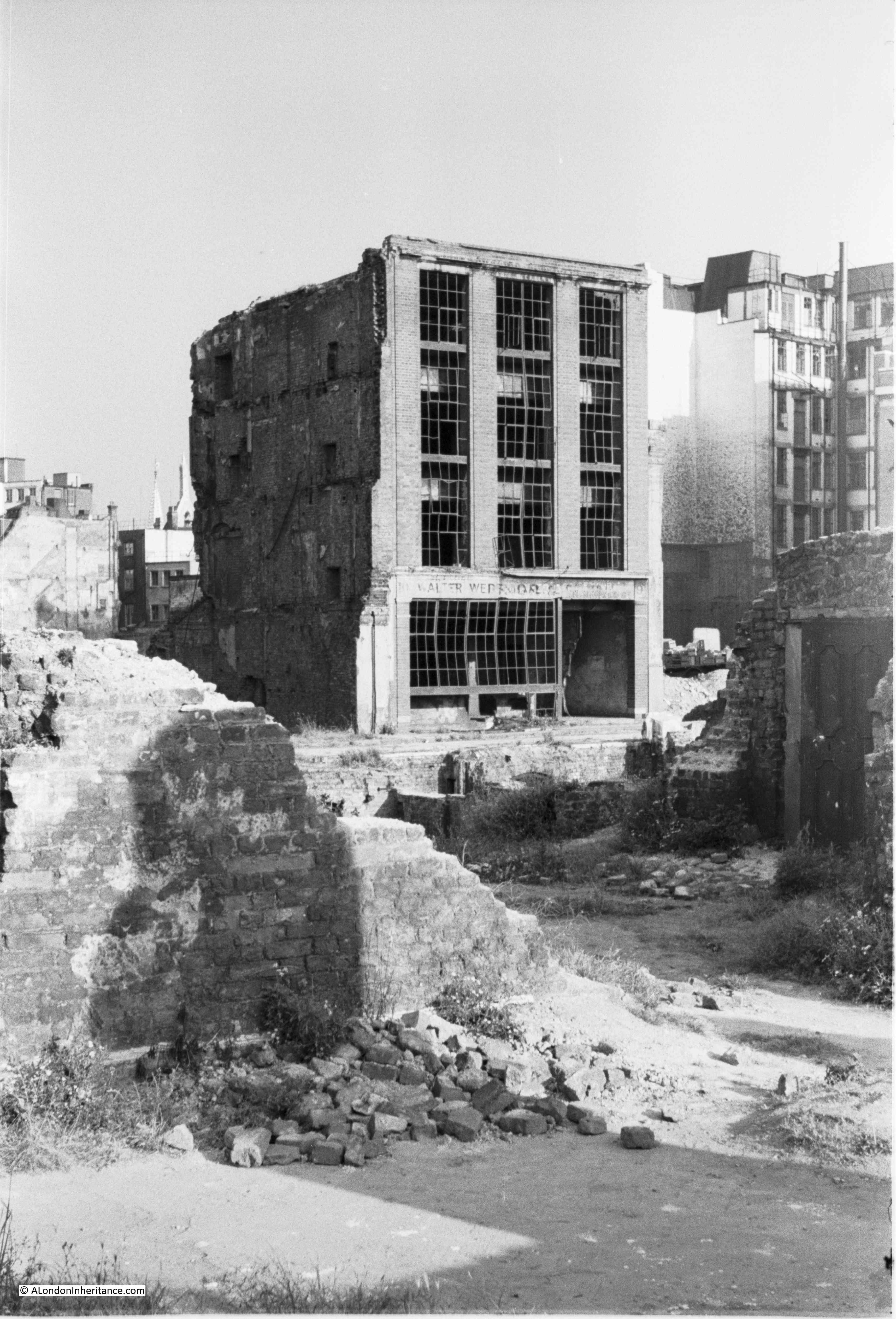
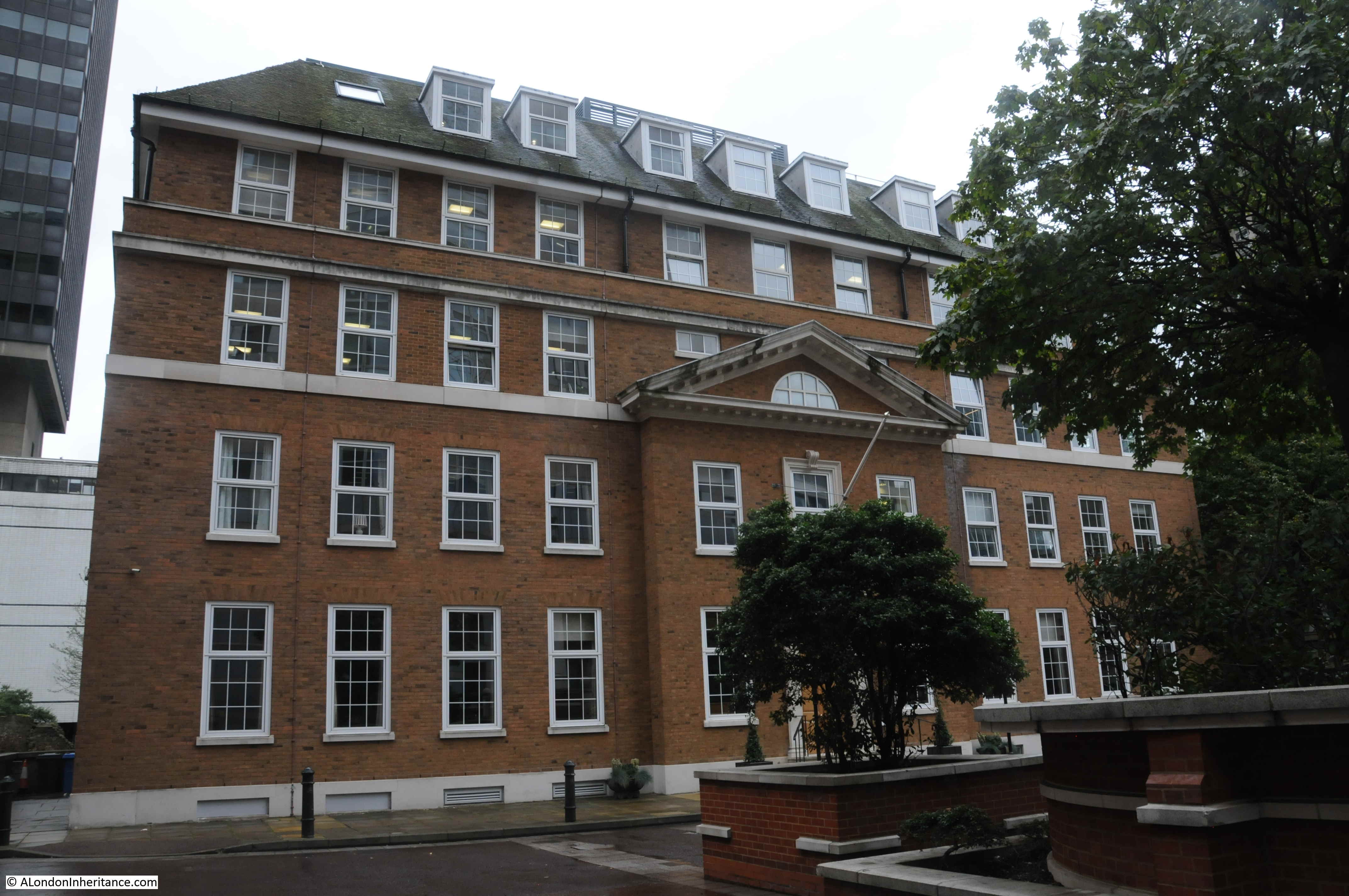
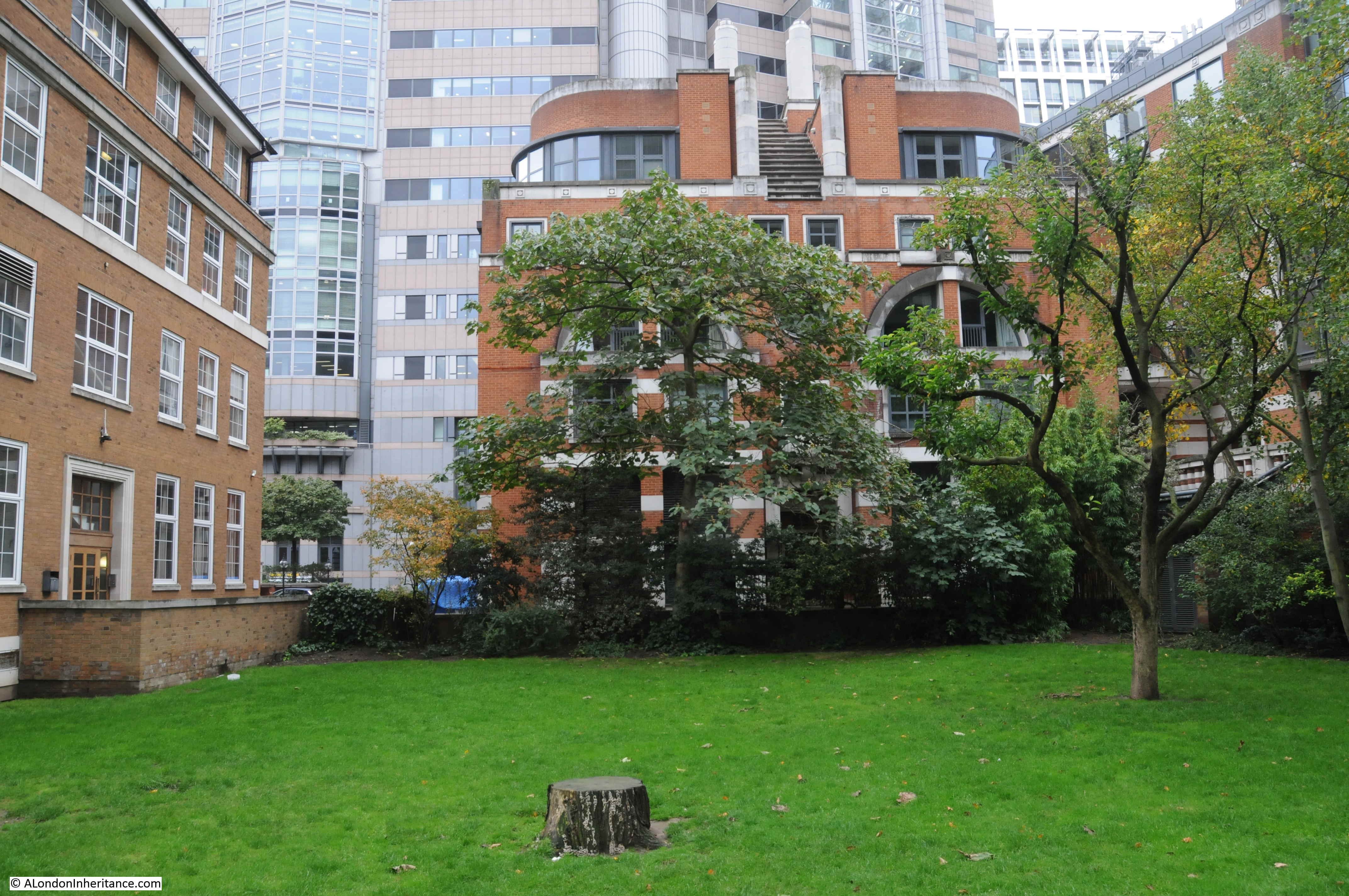
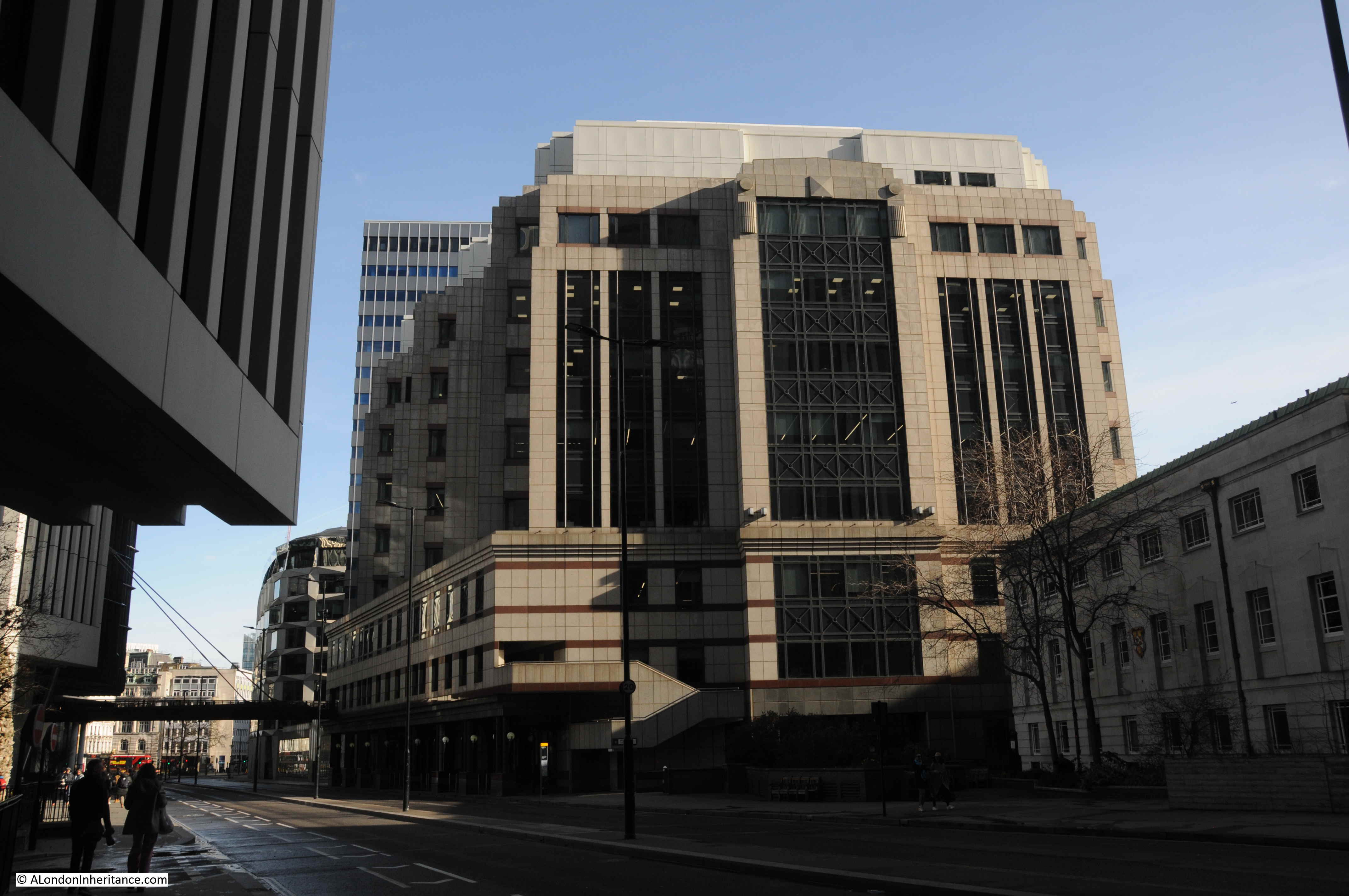
The following photo shows the 1960s office block immediately to the right of the old St. Paul’s Chapter House:

1960s Lord Holford development

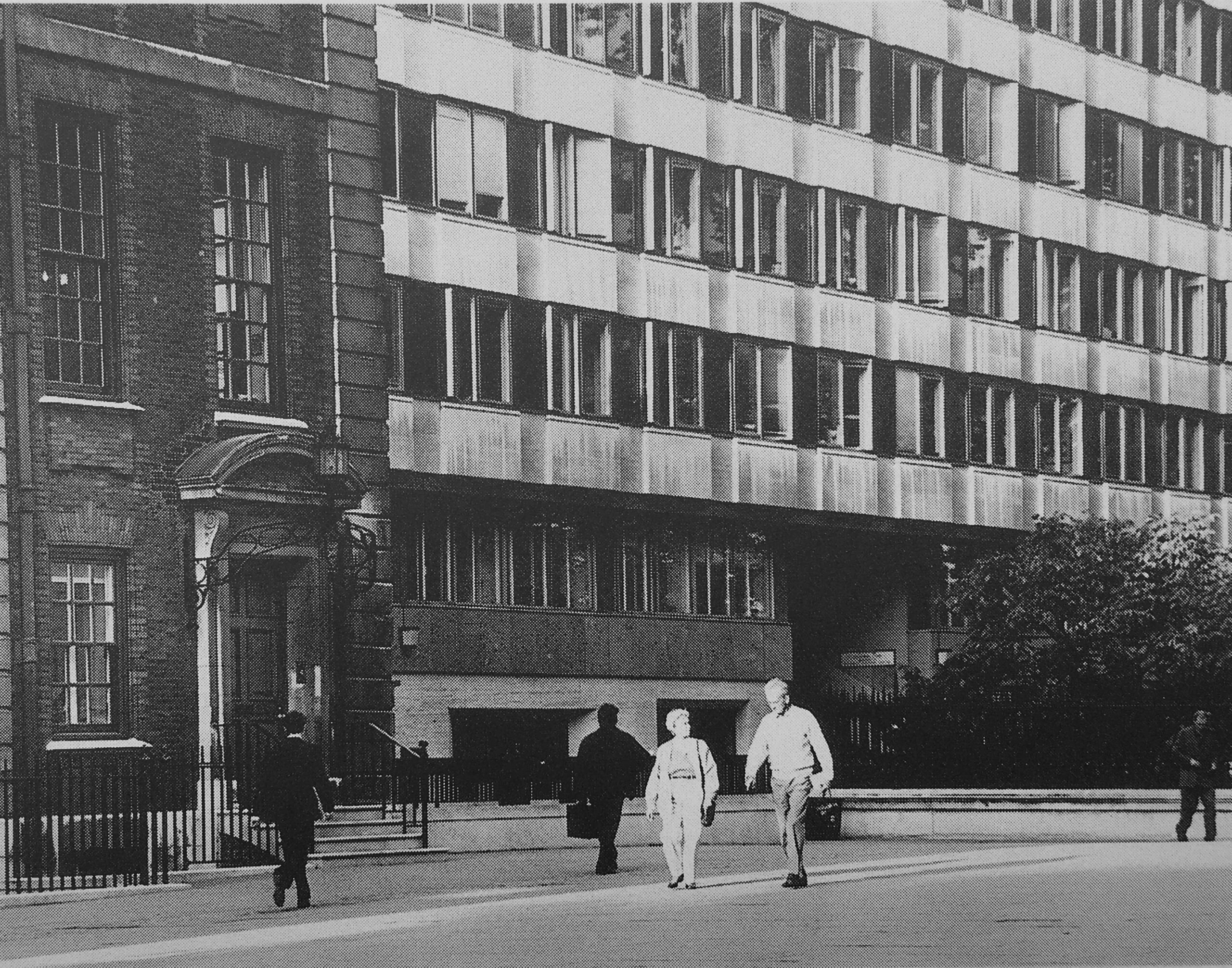
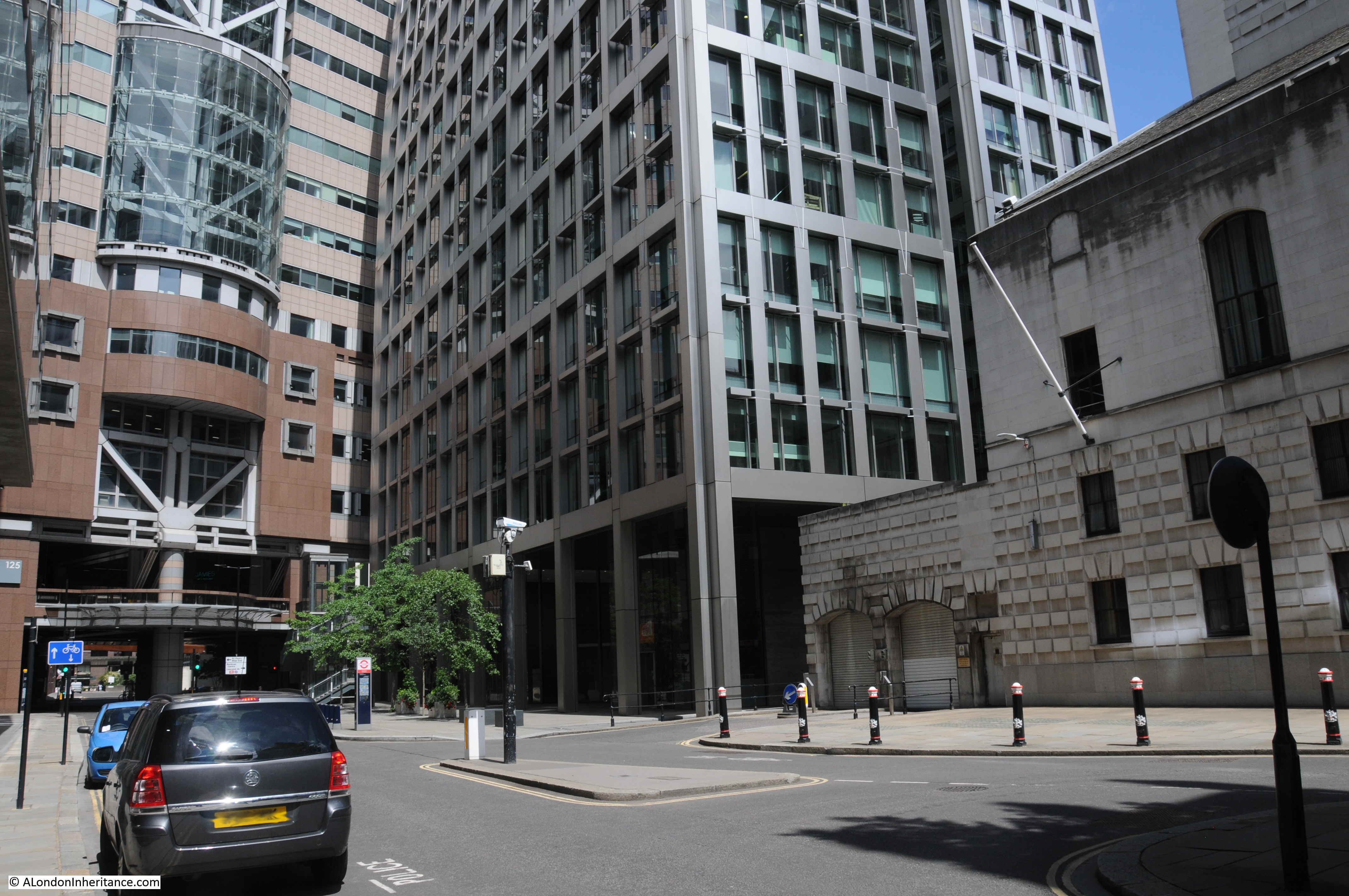
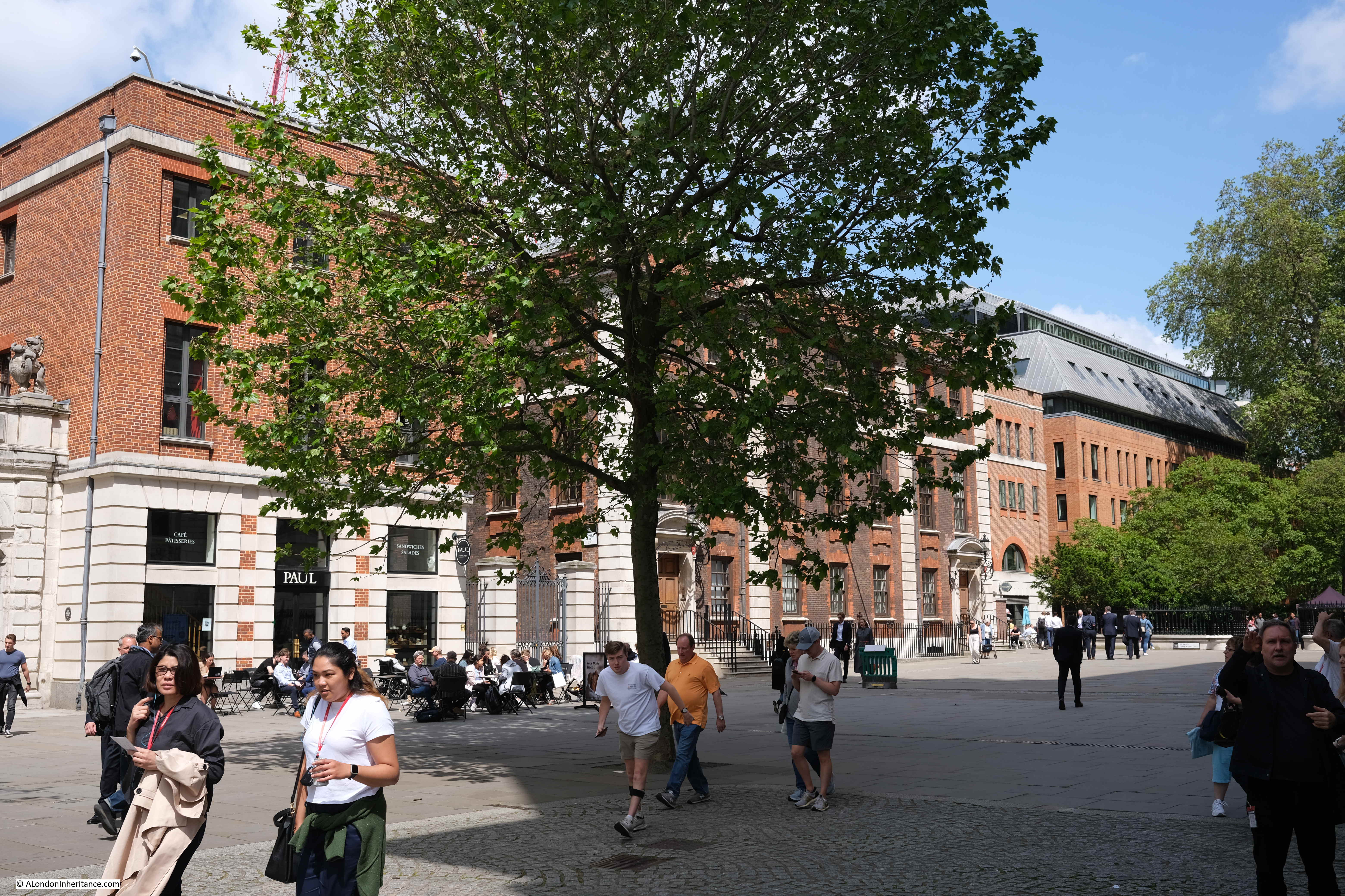
In the following photo, the Chapter House is the older building in dark brick behind the tree, and the new lighter red brick building to the right occupied the site of the 1960s office block seen in the above photo:

St Paul's Chapter House

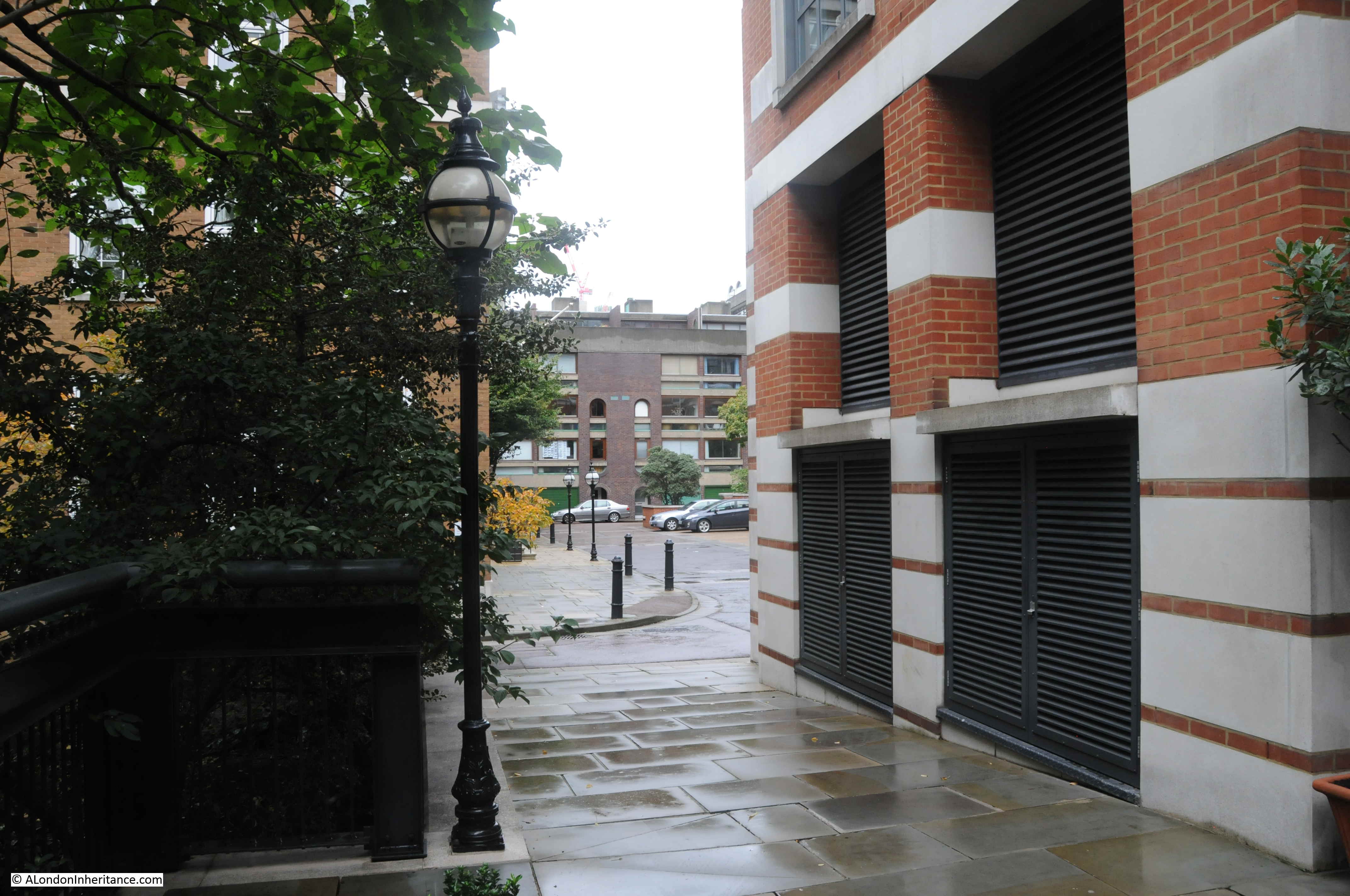
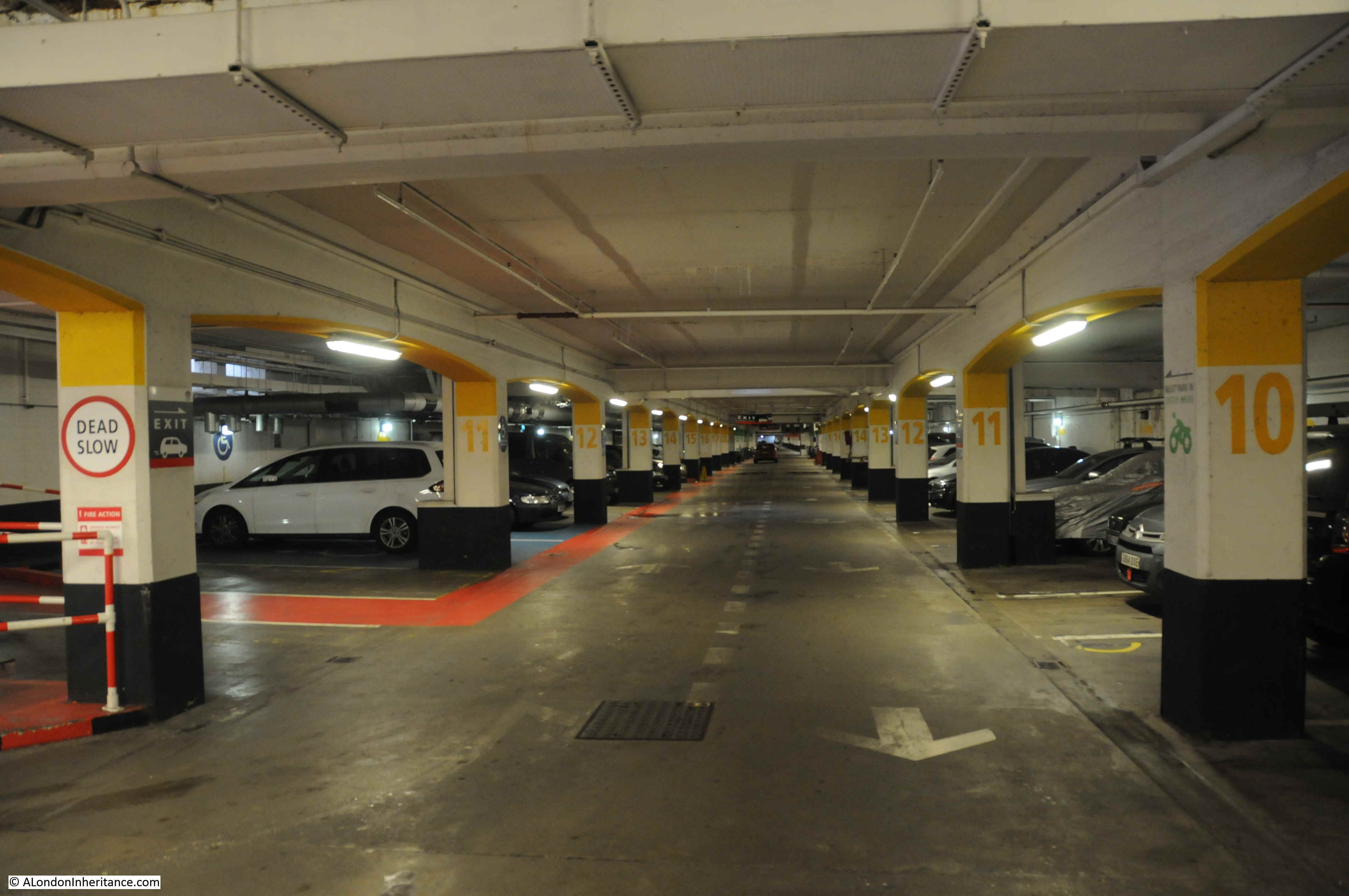
The following photo shows one of the access ramps that took pedestrians up to the pedestrian area. To the right is the lower vehicle route, with access to car parking:

1960s Lord Holford development

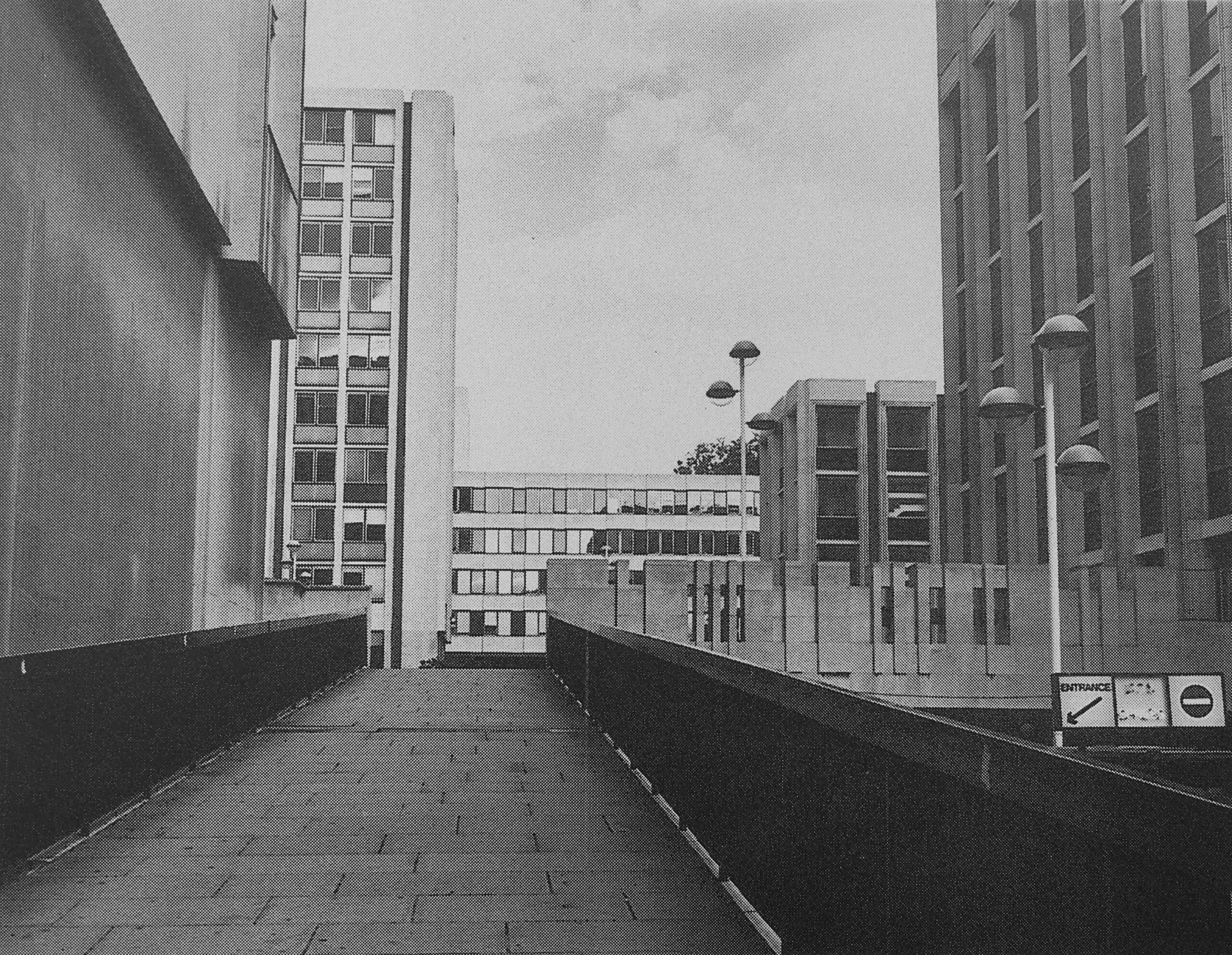
I may be completely wrong, but I vaguely remember there being a pub on the upper pedestrian area, which had an outside area with a view over the surrounding streets.

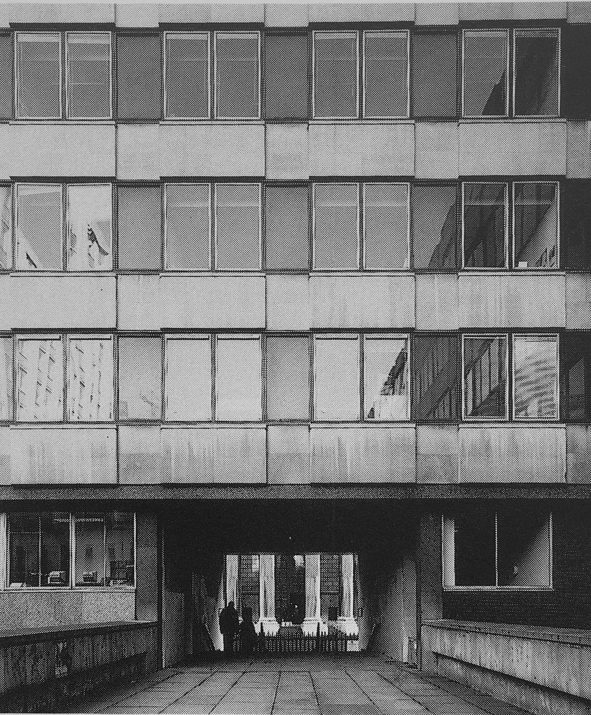
The 1960s development took no regard of the views of the cathedral just to the south.

This is the view to the northern entrance to the cathedral, with only a small part visible through a tunnel that takes a pedestrian walkway through an office block:

1960s Lord Holford development

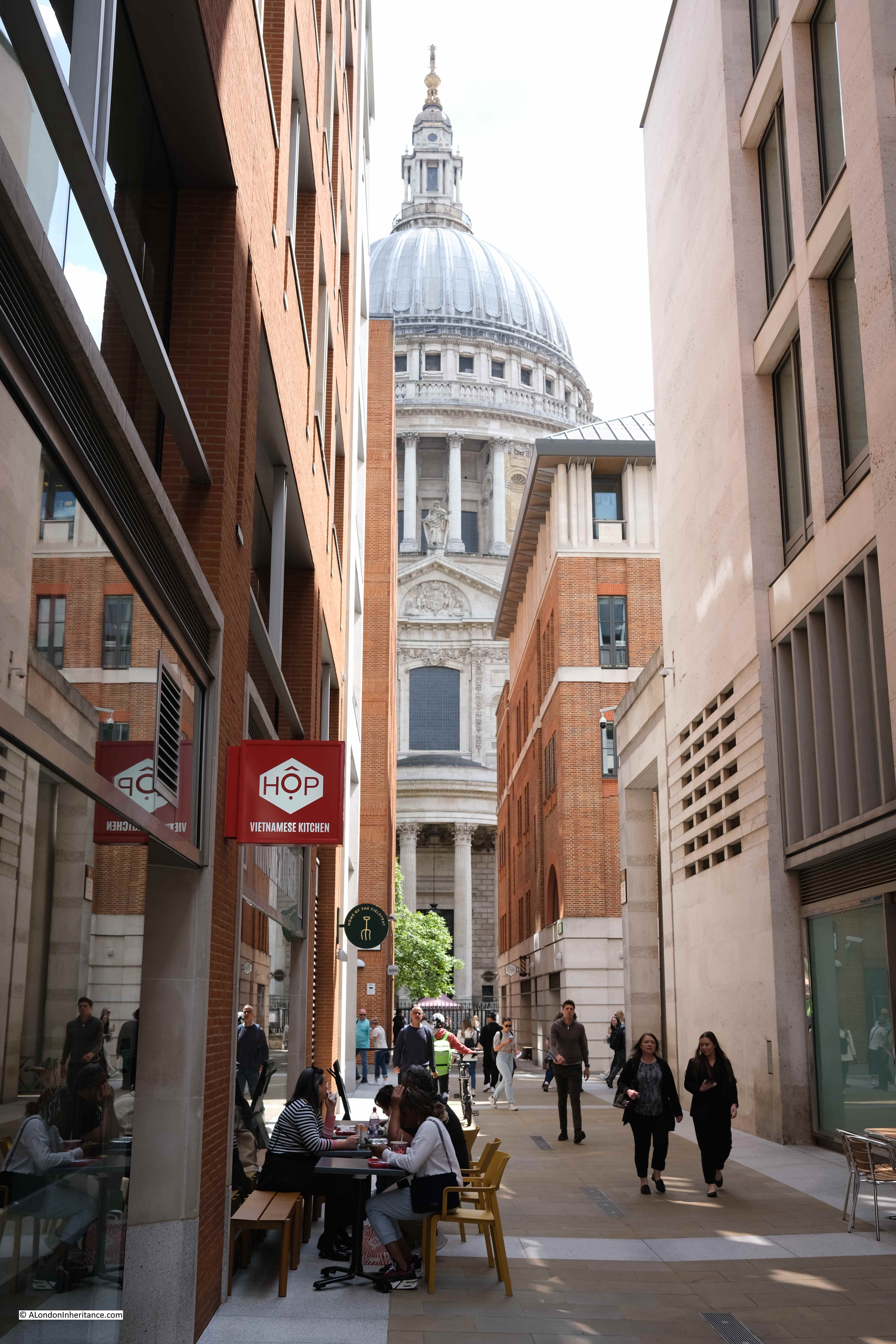
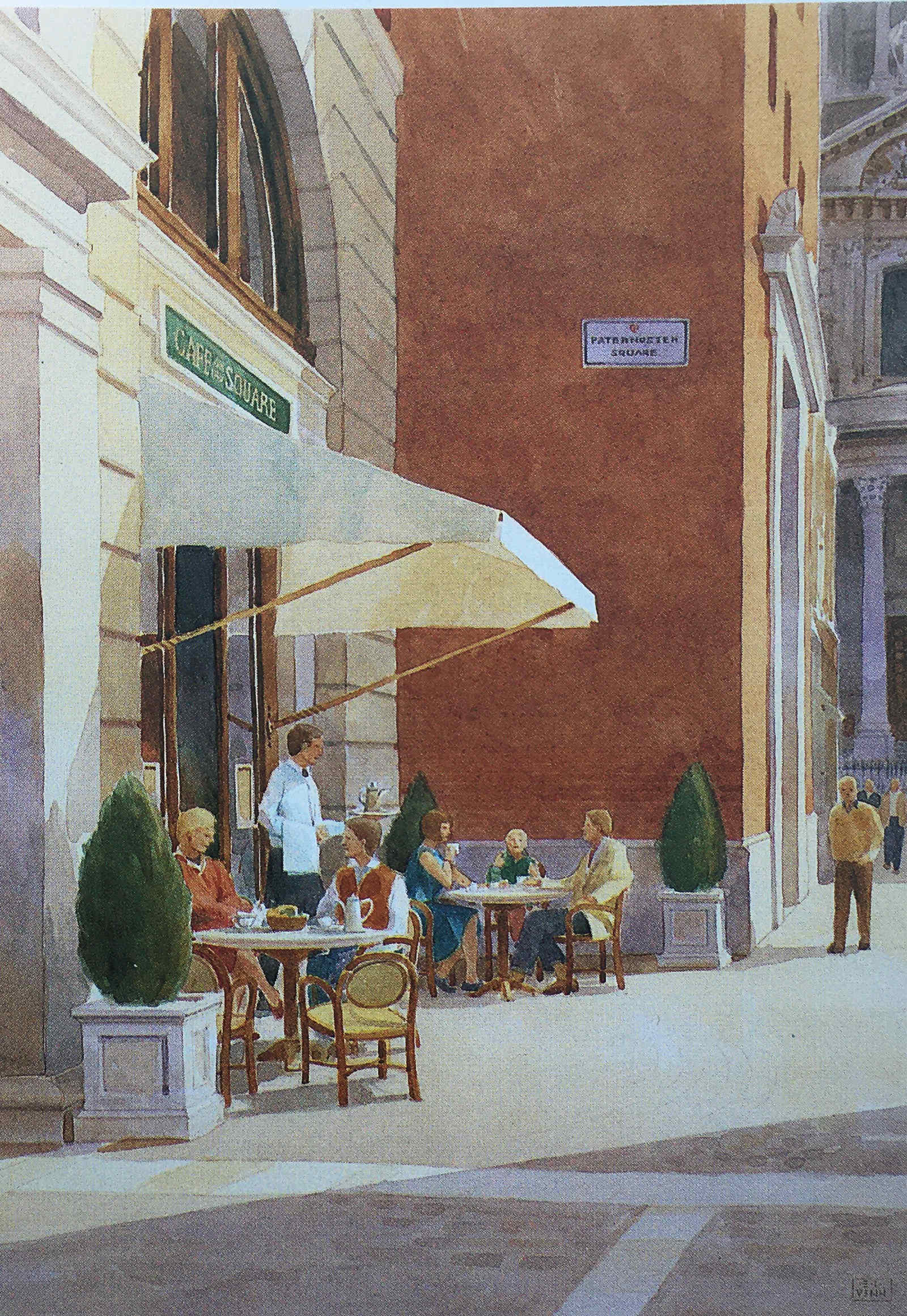
In the Masterplan, the proposed redevelopment delivers this alternative view of the same part of the cathedral:

Paternoster Square

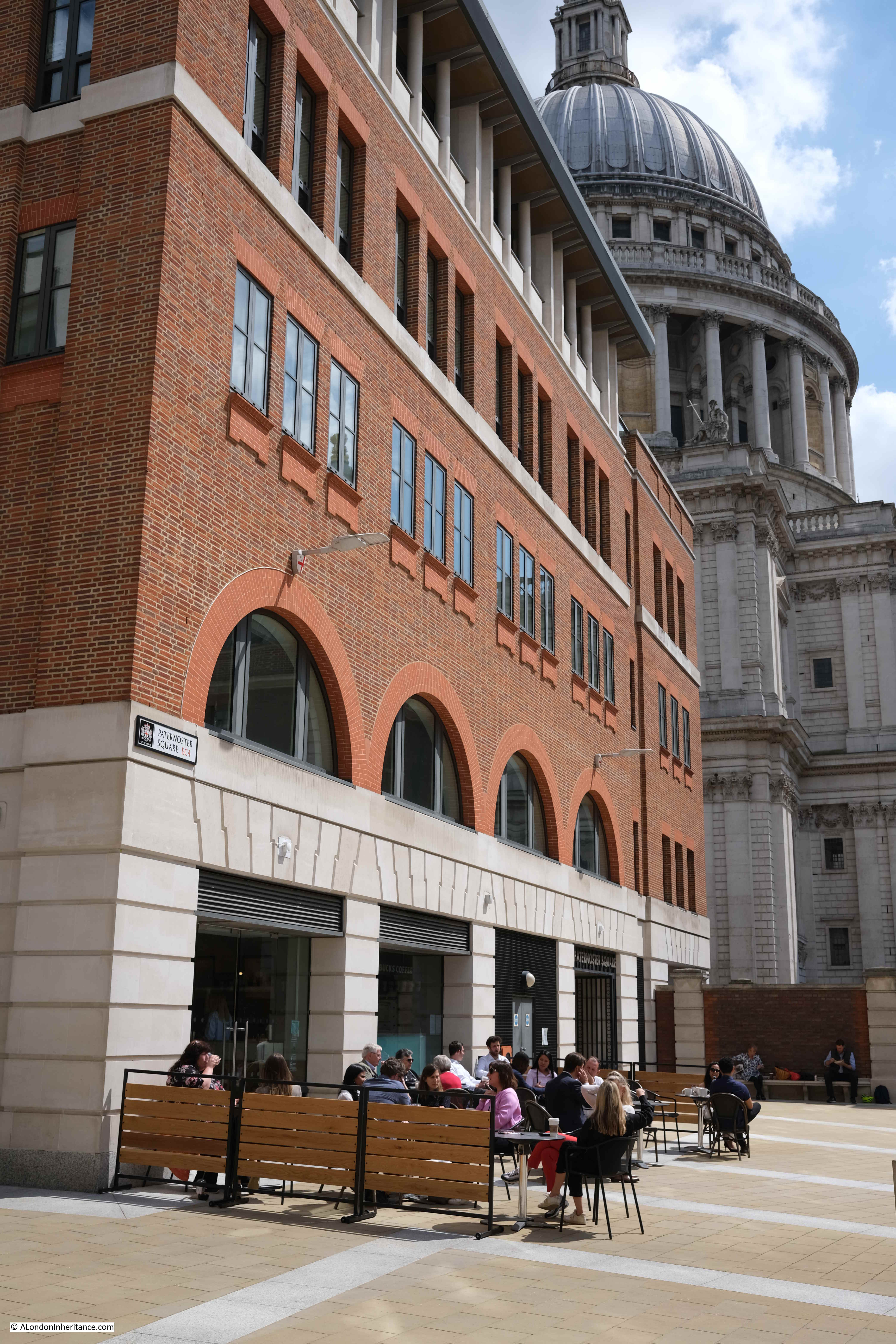
And whilst the buildings are less ornate than originally proposed, the view today is much the same as in the Masterplan, also with a café, on the site of the walkway:

Paternoster Square

The caption to the following illustration reads “St. Paul’s Church Yard will be re-aligned and the Cathedral gardens re-laid and enclosed”:

St Paul's Churchyard

The gardens were re-laid and enclosed, and new office blocks occupied the space to the north, and whilst these were very different to the 1960s versions, they were not quite as ornate as the Masterplan envisaged:

St Paul's Churchyard

The objectives of the Masterplan were to:

  • Restore views of St. Paul’s Cathedral from Paternoster Square at ground level and on the skyline, respecting St. Paul’s Heights and Strategic Views
  • To create buildings that are in harmony with St. Paul’s Cathedral
  • To restore the traditional alignment of St. Paul’s Church Yard and the Cathedral Gardens creating an enhanced public space
  • To re-establish a traditional street pattern and return pedestrian routes into the site to ground level
  • To create a new, traffic-free, public open space allowing ease of access, especially for the disabled
  • To follow the City tradition of classical architecture, using traditional materials such as stone, brick, tile, slate and copper
  • To be flexible enough for key corners, outside the Planning Application site to be integrated at a later date
  • To create a thriving new business community in the best traditions of City life
  • To create a much-needed, new shopping area in the heart of the City, with a variety of shops, restaurants and entertainment, linked into St. Paul’s Underground Station
  • To create new open public spaces for relaxation and enjoyment by office workers, visitors and shoppers alike

It is interesting to compare the development today with these objectives.

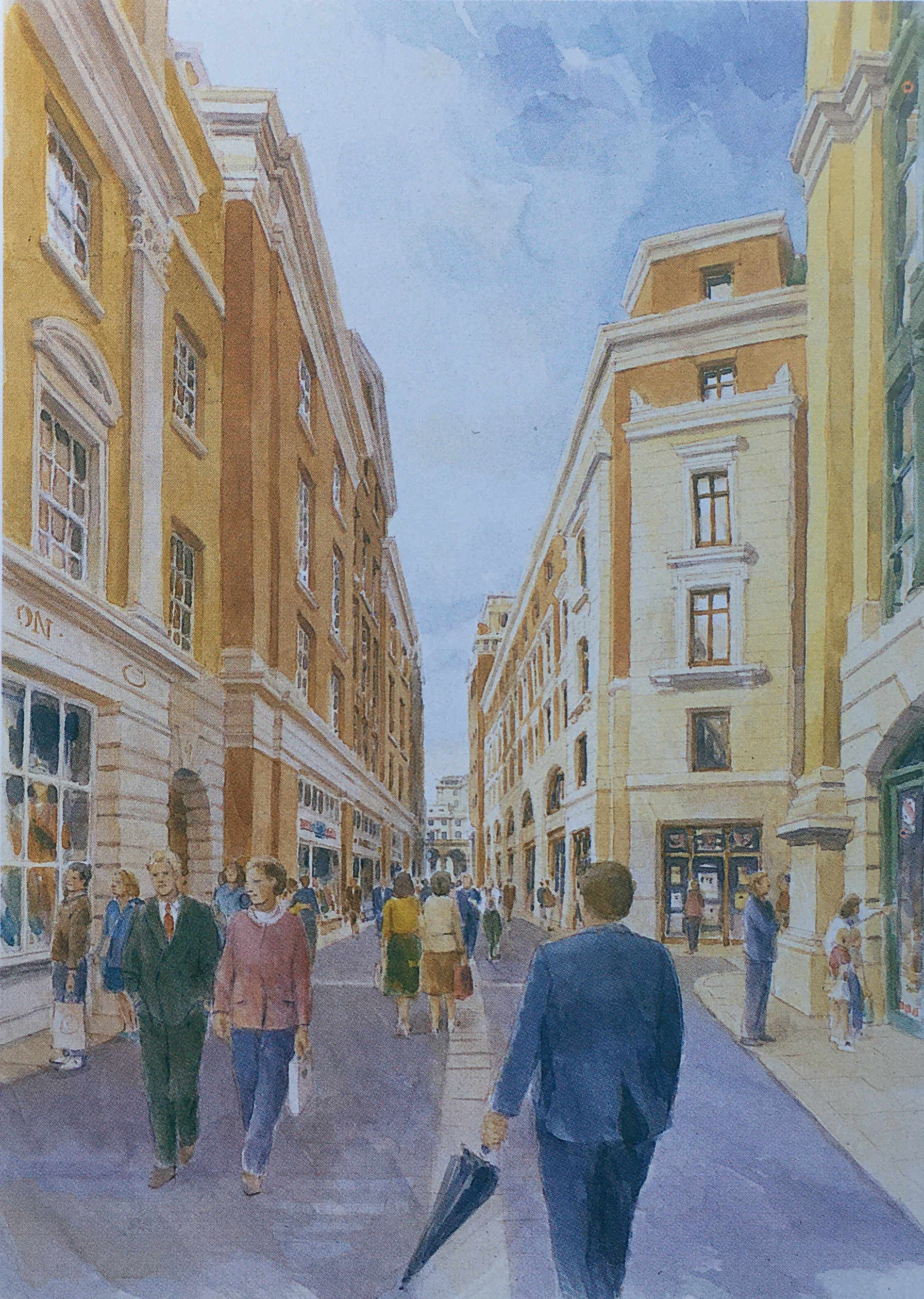
There was an intention to follow the City tradition of classical architecture, and this could be seen in the illustrations of the planned buildings, such as the following example showing “the frontage of the new buildings on Newgate Street”:

Paternoster Square

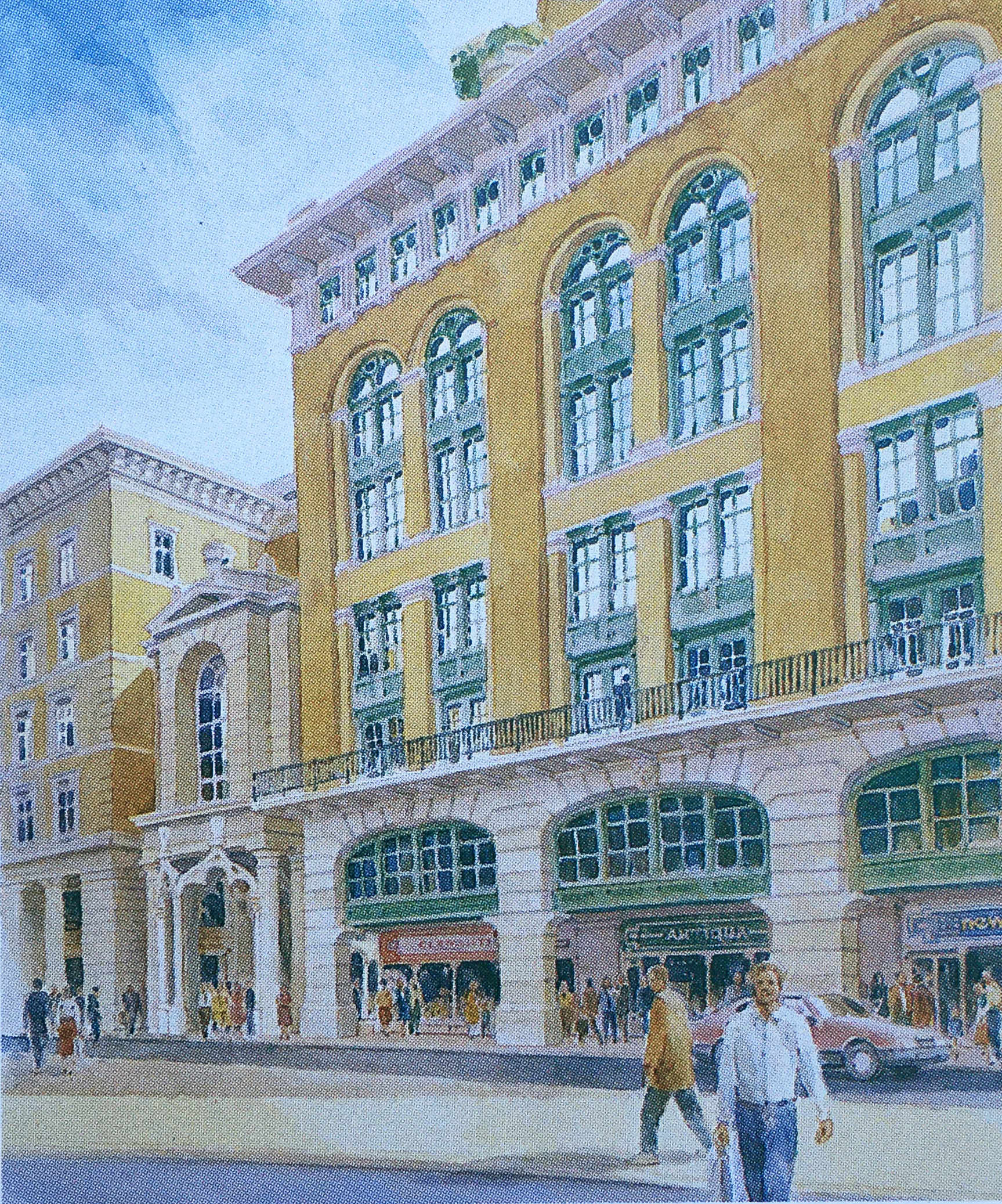
The frontage along Newgate Street today is comprised of standard office block design, without the classical architecture proposed in the Masterplan.

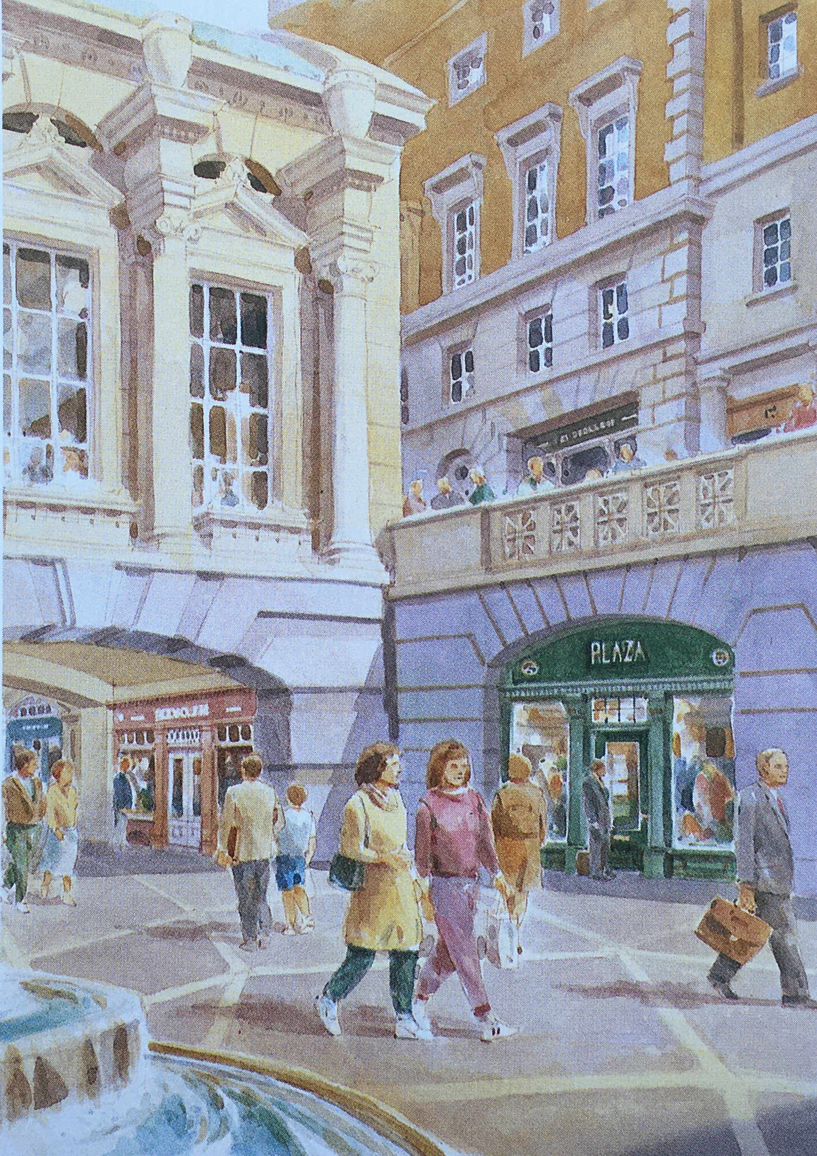
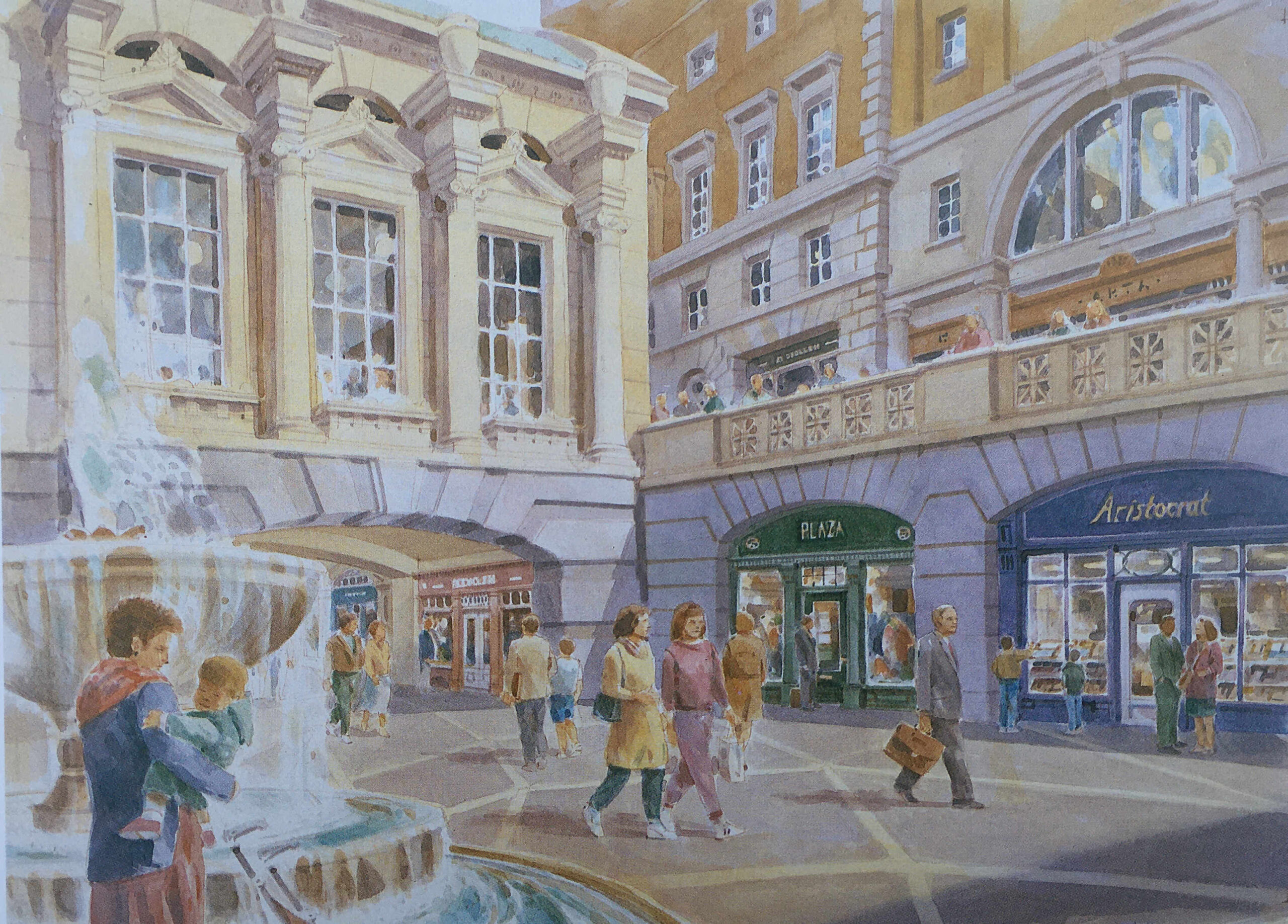
The title of the following illustration is “A Meeting Place – Paternoster Square will provide a social focus for the City, a place to meet friends and colleagues, to browse or to use the health club”:

St Paul's Cathedral

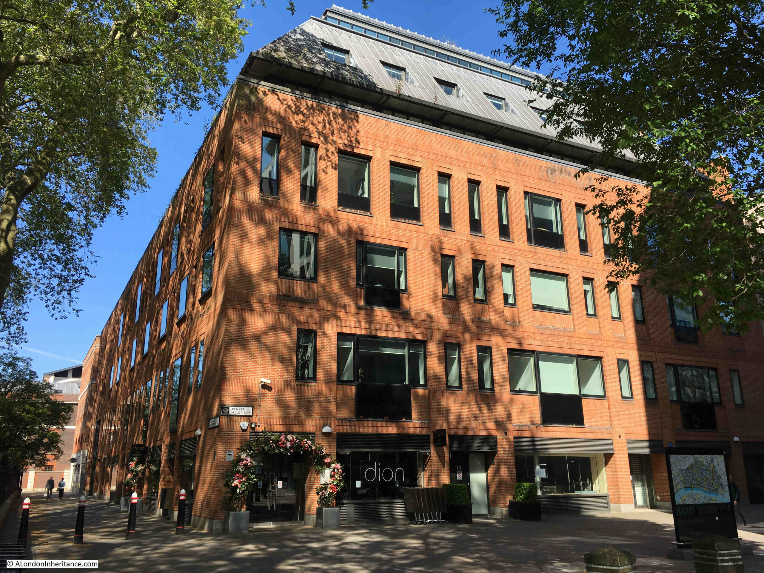
This approach can be seen across the Paternoster Square development, but in less ornate settings. Whilst the buildings do not have the same classical architectural styling, they do make use of stone, and there is a considerable amount of brick throughout the site which is a pleasant change from the glass and steel of many other recent City developments:

St Paul's Cathedral

Whereas today, Paternoster Square is at a single level, in the Masterplan it was intended that there would be steps leading down to a Lower Court, so whilst the plan did away with the upper pedestrian and lower vehicle levels of the 1960s development, it did retain different levels, but for pedestrians. The Lower Court:

Paternoster Square

The plan was that Paternoster Row would become almost a continuation of Cheapside.

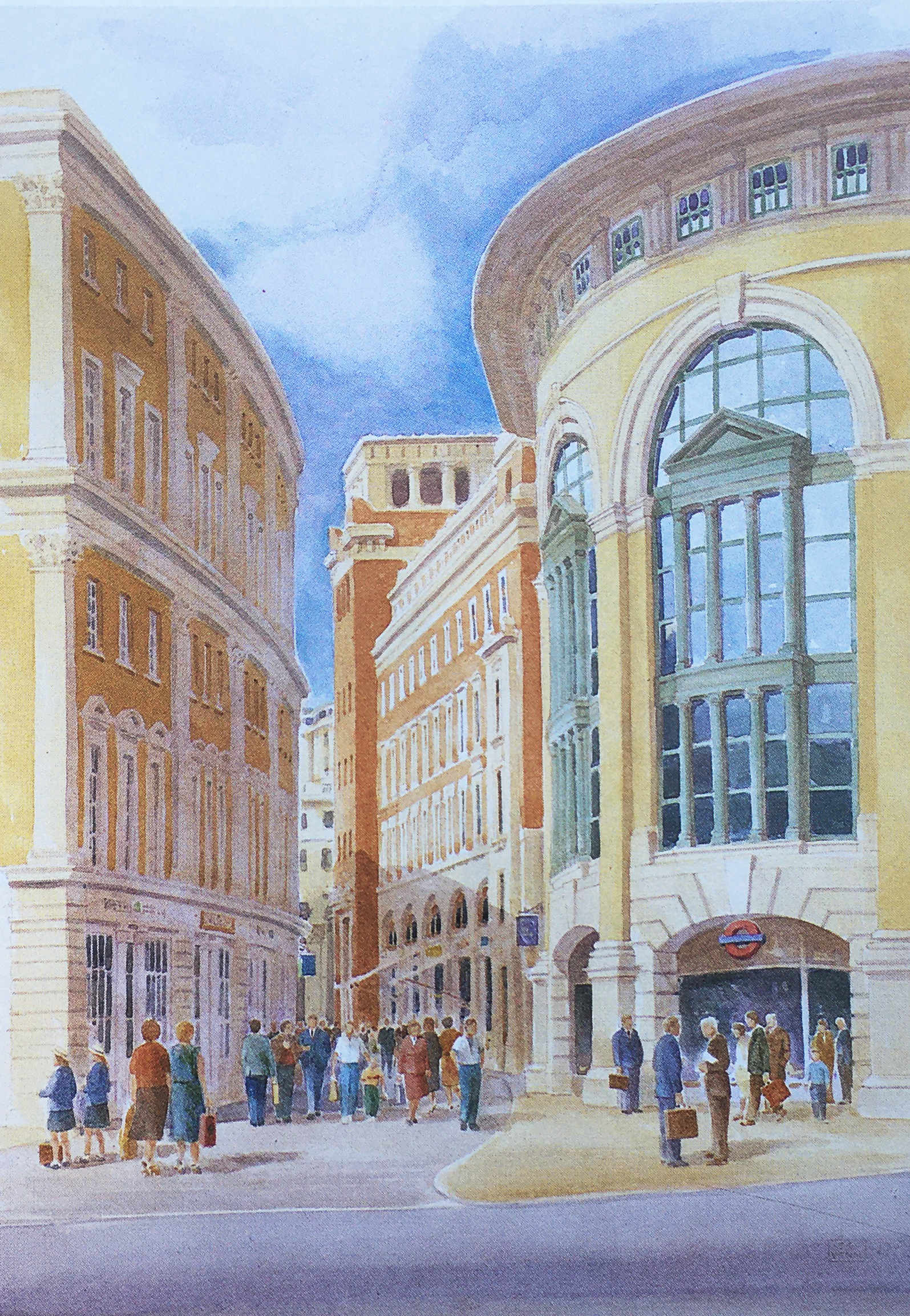
Cheapside was, and to an extent still is, the main shopping space of the City, and the One New Change development has enhanced this, but in the Masterplan, shopping would continue from Cheapside, across the road into Paternoster Row, and the underground station, which today is reached via a separate access point to the edge of the development, would have been integrated into the plan, as shown in the following illustration:

St Paul's Underground Station

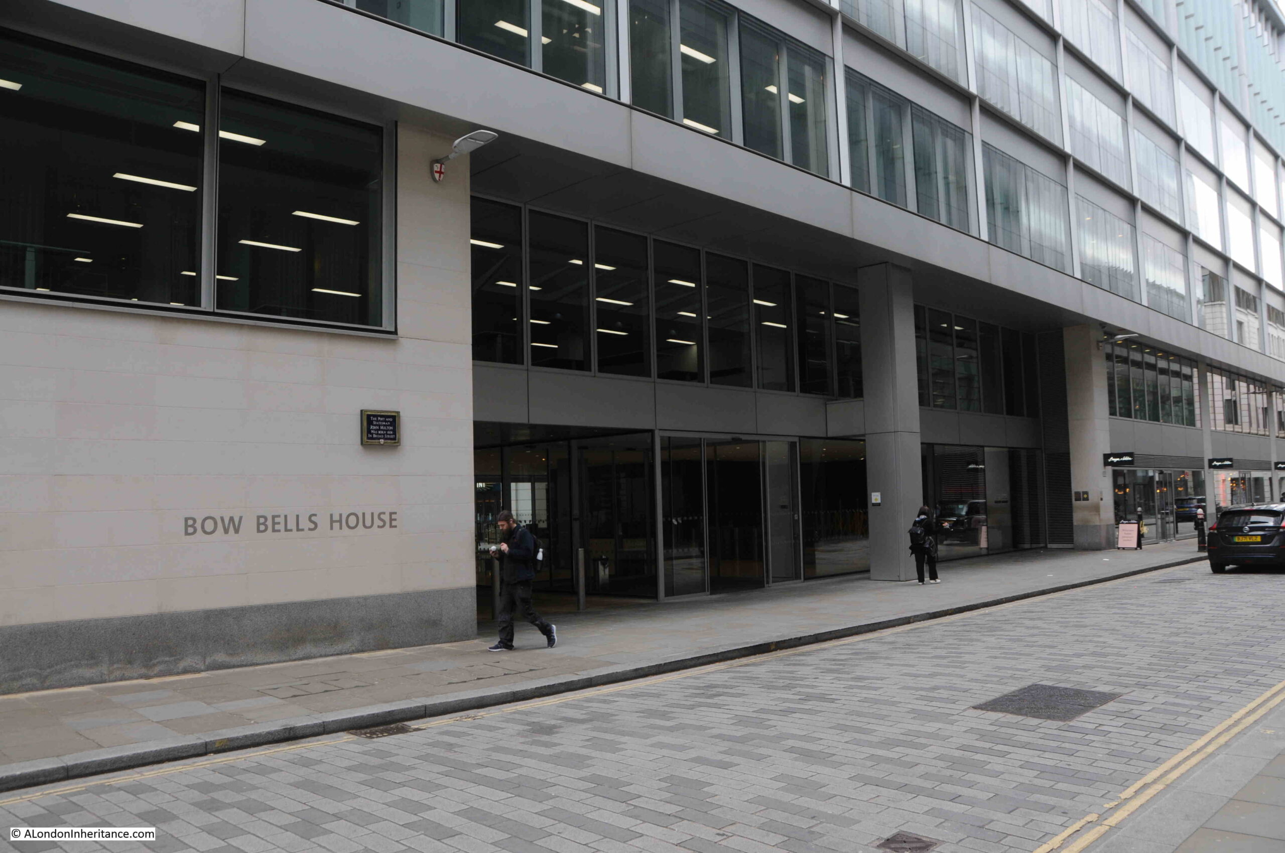
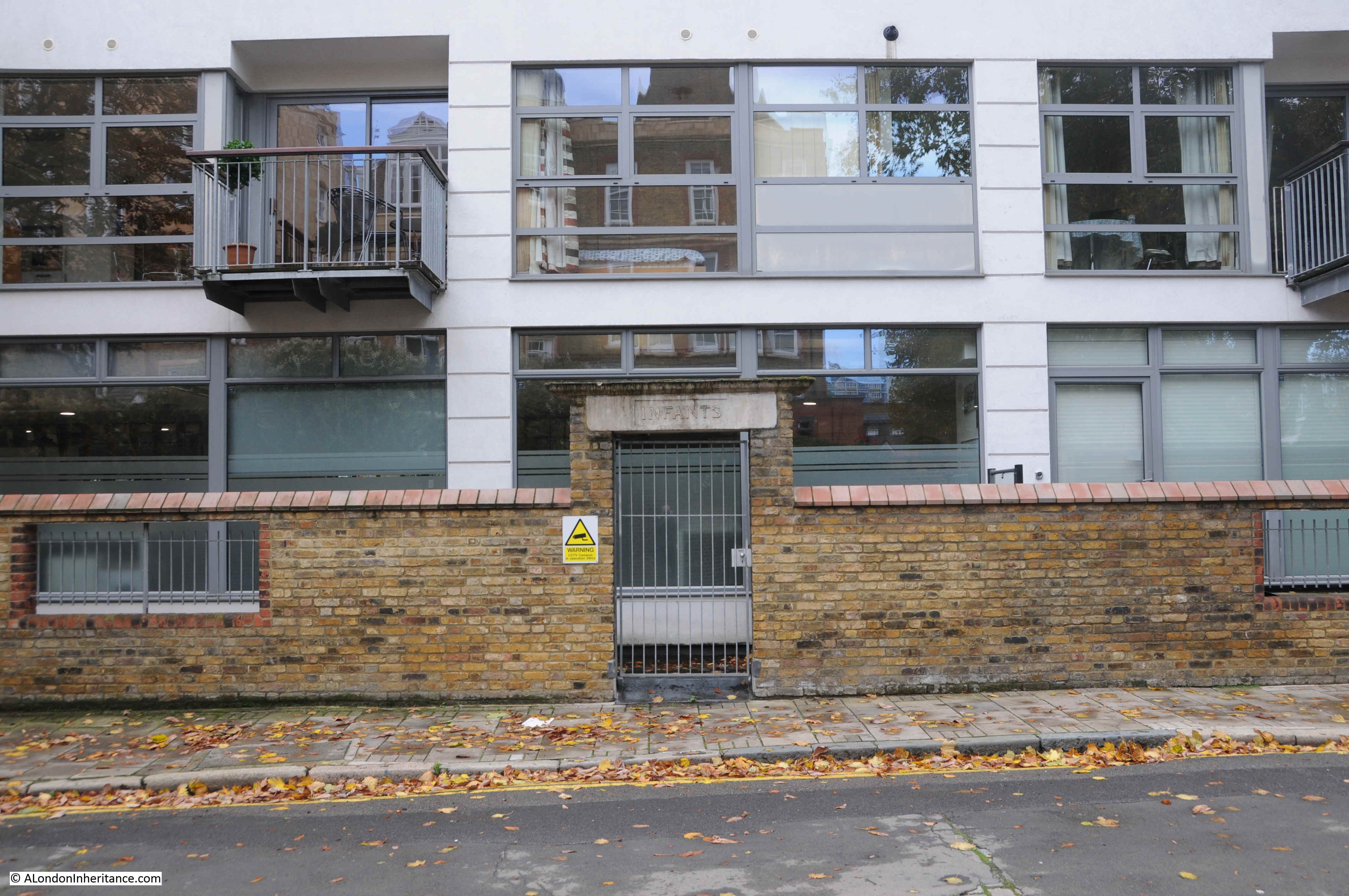
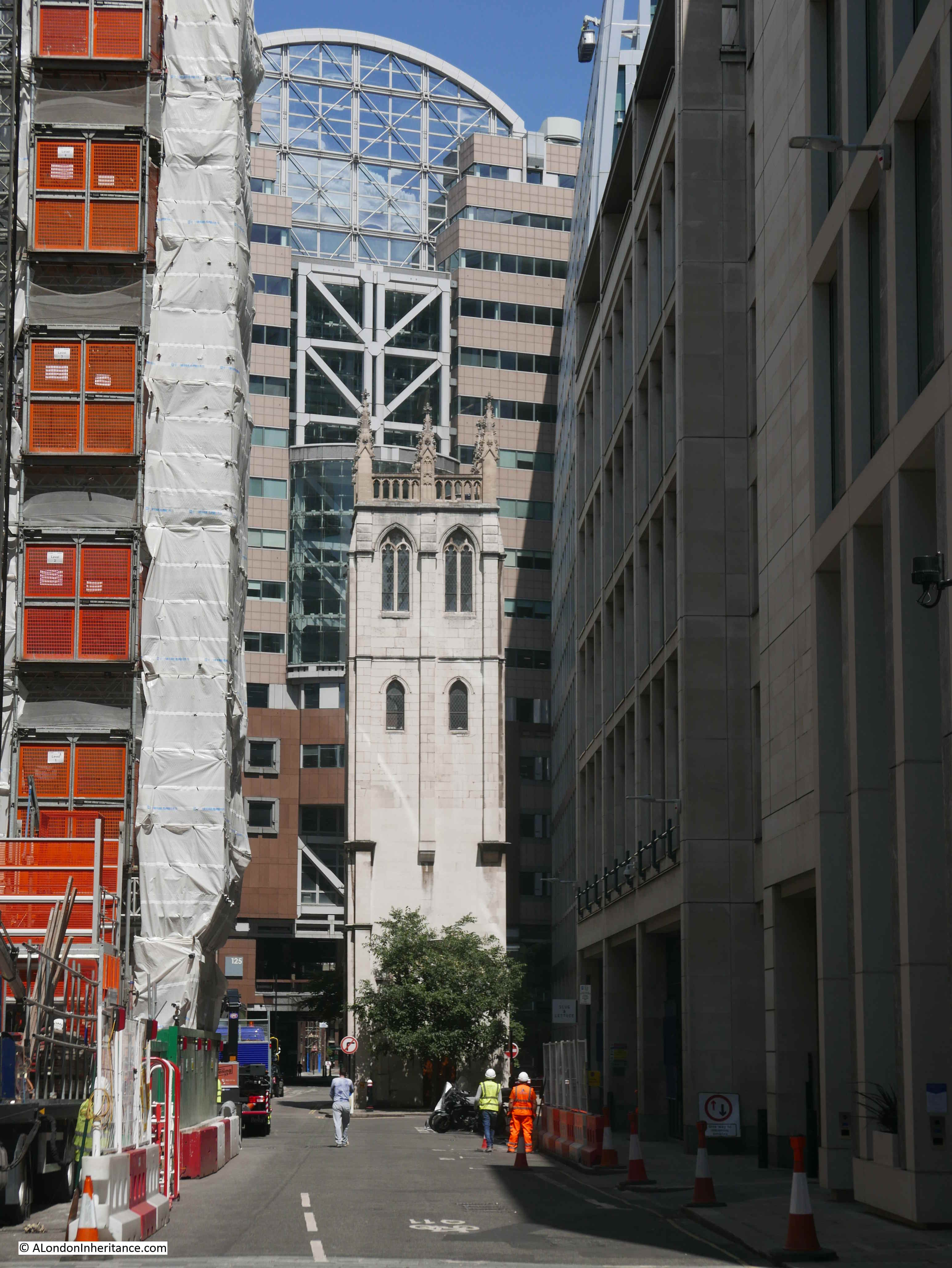
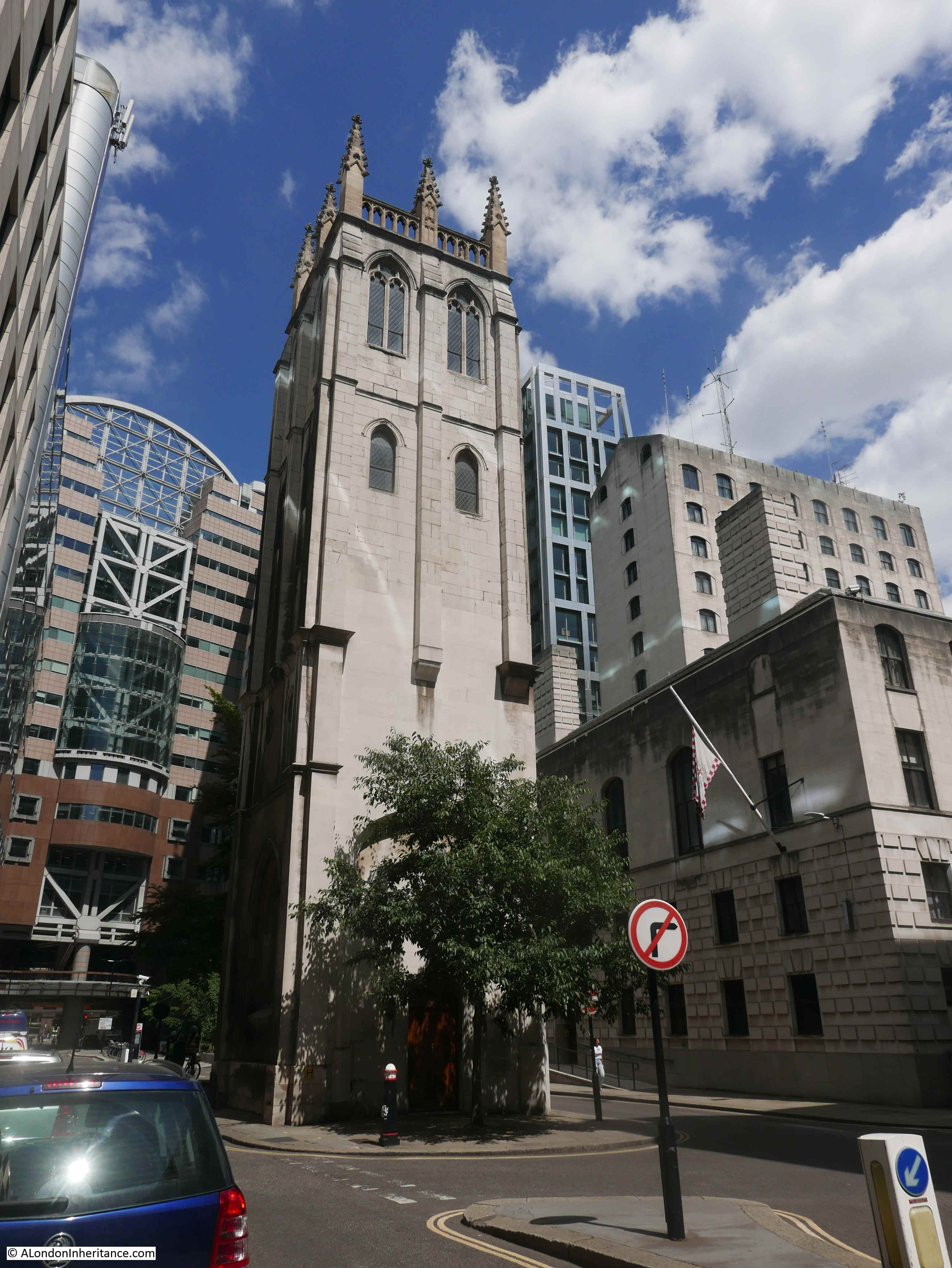
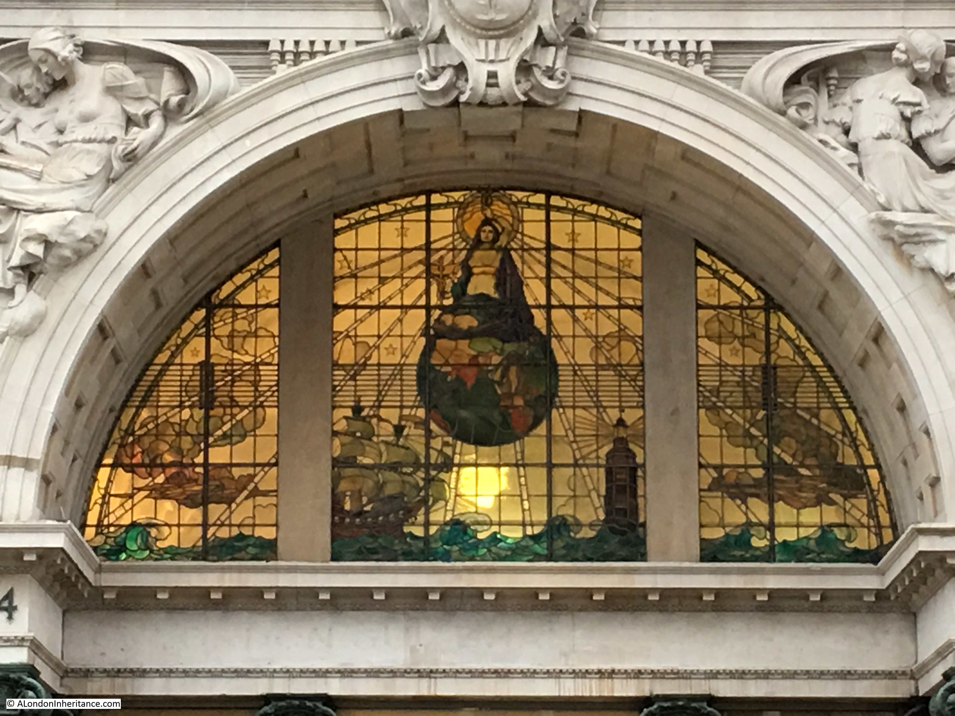
The St. Paul’s Chapter House was reduced to a shell of a building, as shown in my father’s photo, however it was restored and survived the 1960s redevelopment, and was included in the Masterplan, where it can be seen in the centre of the following illustration.

St Paul's Chapter House

To the left of the Chapter House is a rather ornate three storey gateway into Paternoster Square, which today has been replaced by Temple Bar.

Temple Bar was included as an option in the Masterplan, which is described as “currently in a state of decay in a Hertfordshire Park”.

As mentioned earlier, the central Paternoster Square was intended to be multi-level, and in the following illustration, there is a rather impressive Loggia (an outdoor corridor with a covered roof and open sides), that would have provided a lift down to the Lower Court, would provide shelter, and would mark the access point to the Lower Court:

Loggia

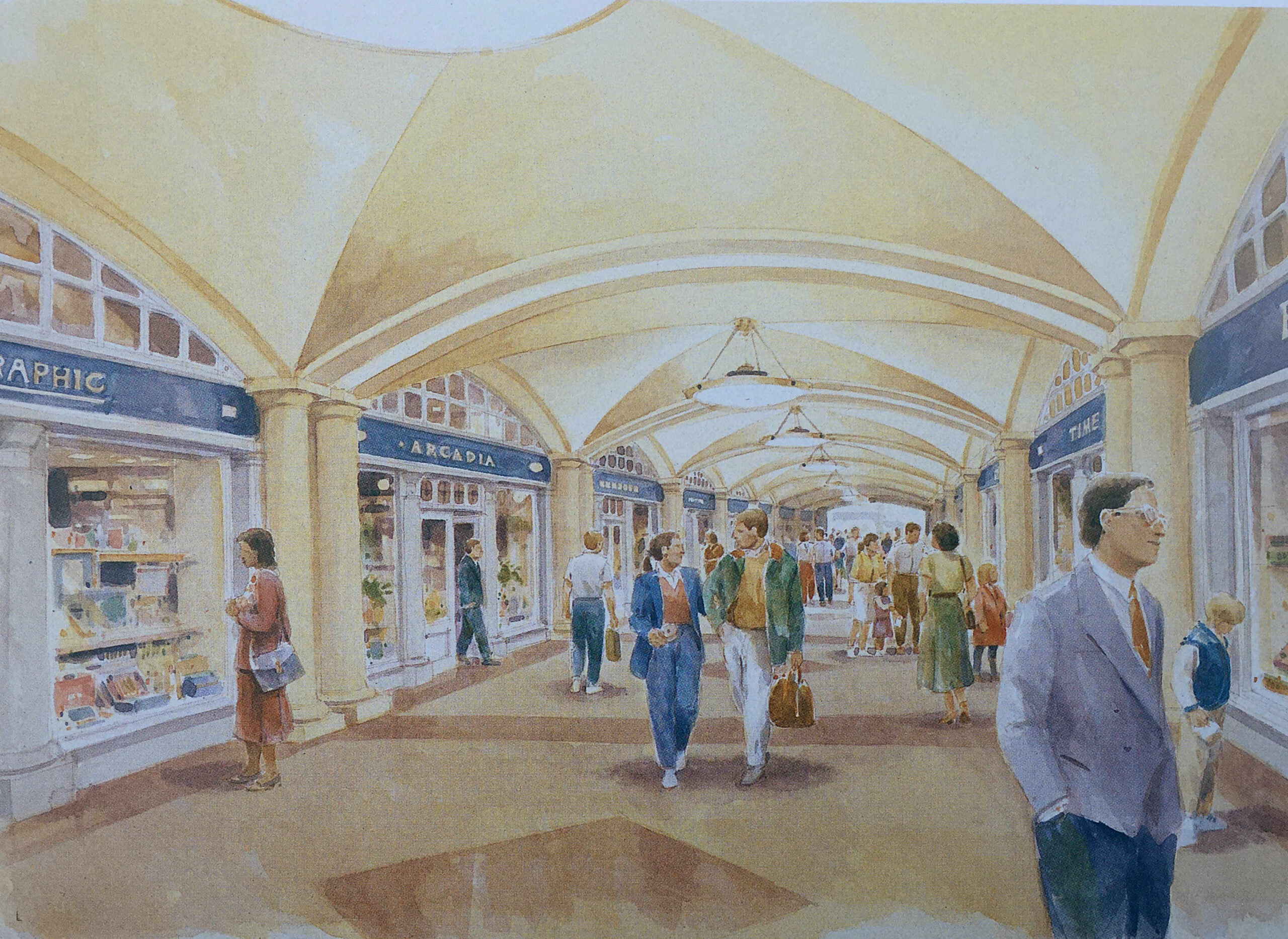
A key aim of the Masterplan was to bring life back to the area, and one of the ways to do this was via retail, and the plan stated that “Paternoster Square will be established as one of the foremost shopping areas in central London. There will be more than 80 shops, including a quality food hall or department store”.

The approach to retail included a Shopping Avenue, which was a covered route between the Lower Court and St. Paul’s Underground Station:

Shopping Avenue

Shops would also line the new Paternoster Row:

Paternoster Square

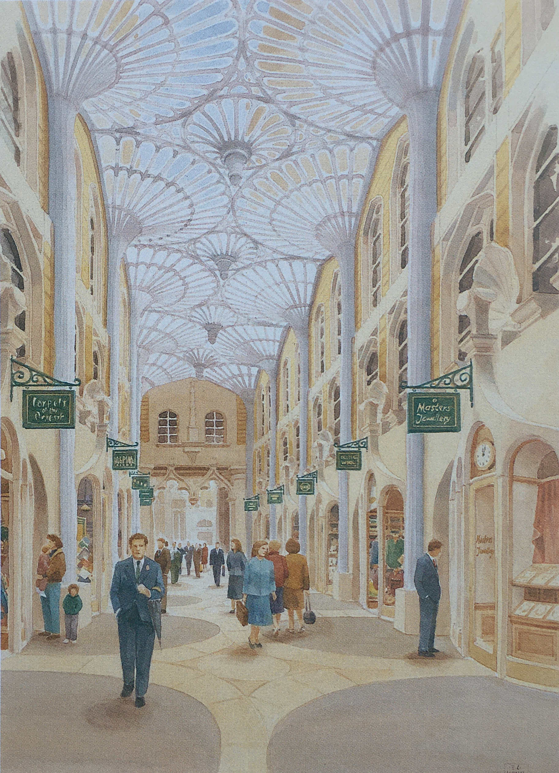
And along the route of the old Ivy Lane, there would be Ivy Lane Arcade “designed in the tradition of famous London arcades. It will attract specialty shops such as jewelers and galleries”:

Paternoster Square

And shopping around Paternoster Square and Lower Court:

Paternoster Square

The Paternoster Square estate does have some shopping, but far less than was intended in the original Masterplan. There is no lower court and no covered shopping avenues.

Most of the shops are either restaurants, bars or take away food and coffee shops, aimed at local office workers and at the number of visitors who pass through as part of a visit to the area around St. Paul’s Cathedral.

There are also many other differences. Whilst the overall concept appears the same, the classical building style is now very limited as is the overall decoration across the buildings and ground level pedestrian spaces.

In 1995, the owners of the land commissioned Whitfield Partners to deliver a Masterplan for redevelopment, and it is the outcome of this plan that we see today. Similar in concept, but different in implementation.

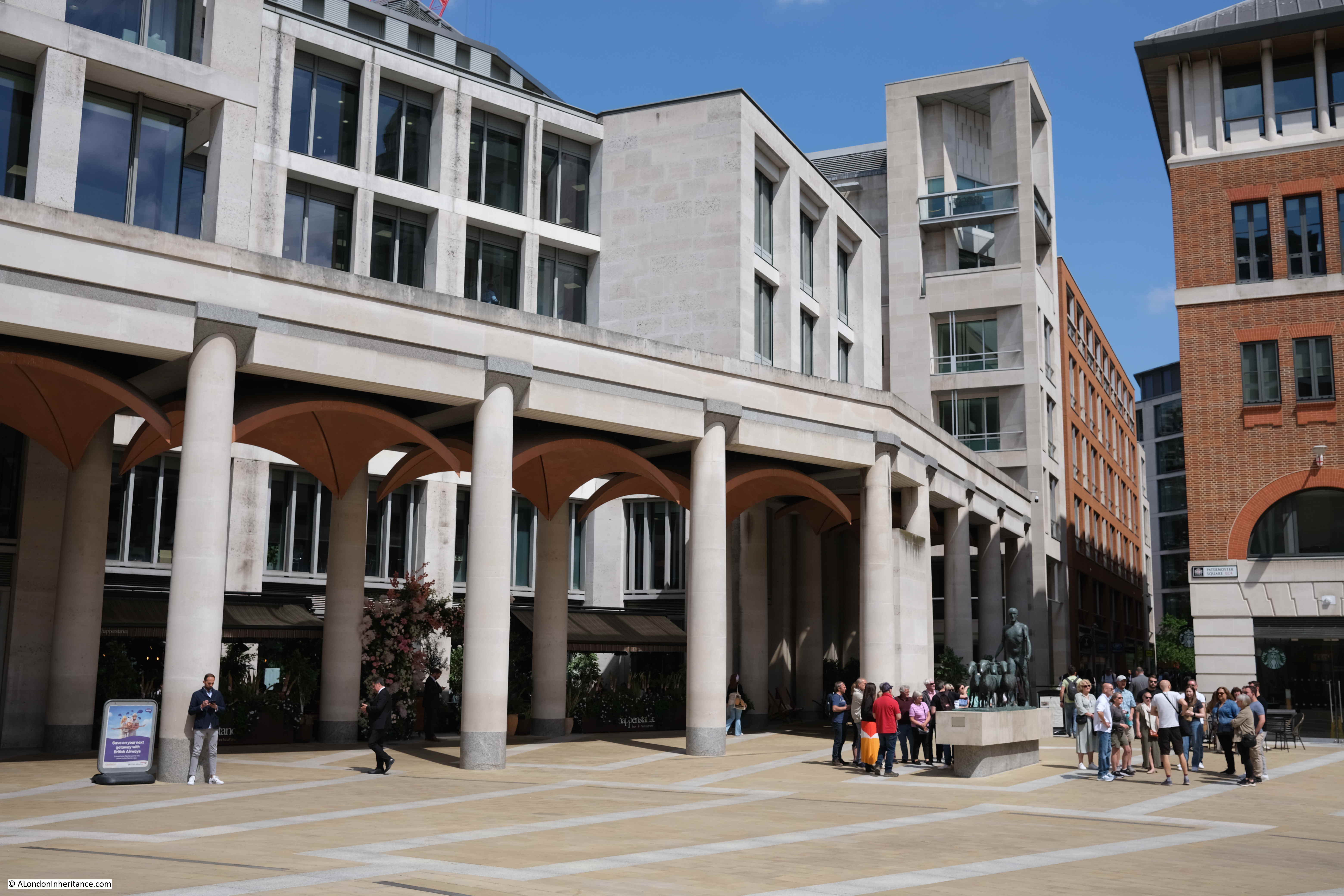
The Paternoster Square development today has a large central space, is pedestrianised, and some of the pedestrian walkways do roughly align with some of the original pre-war streets.

The objective of bringing life back to the area has been achieved, and during the day it is generally busy with local workers, visitors and tourists, and on a summer’s afternoon, the bars and restaurants are particularly busy.

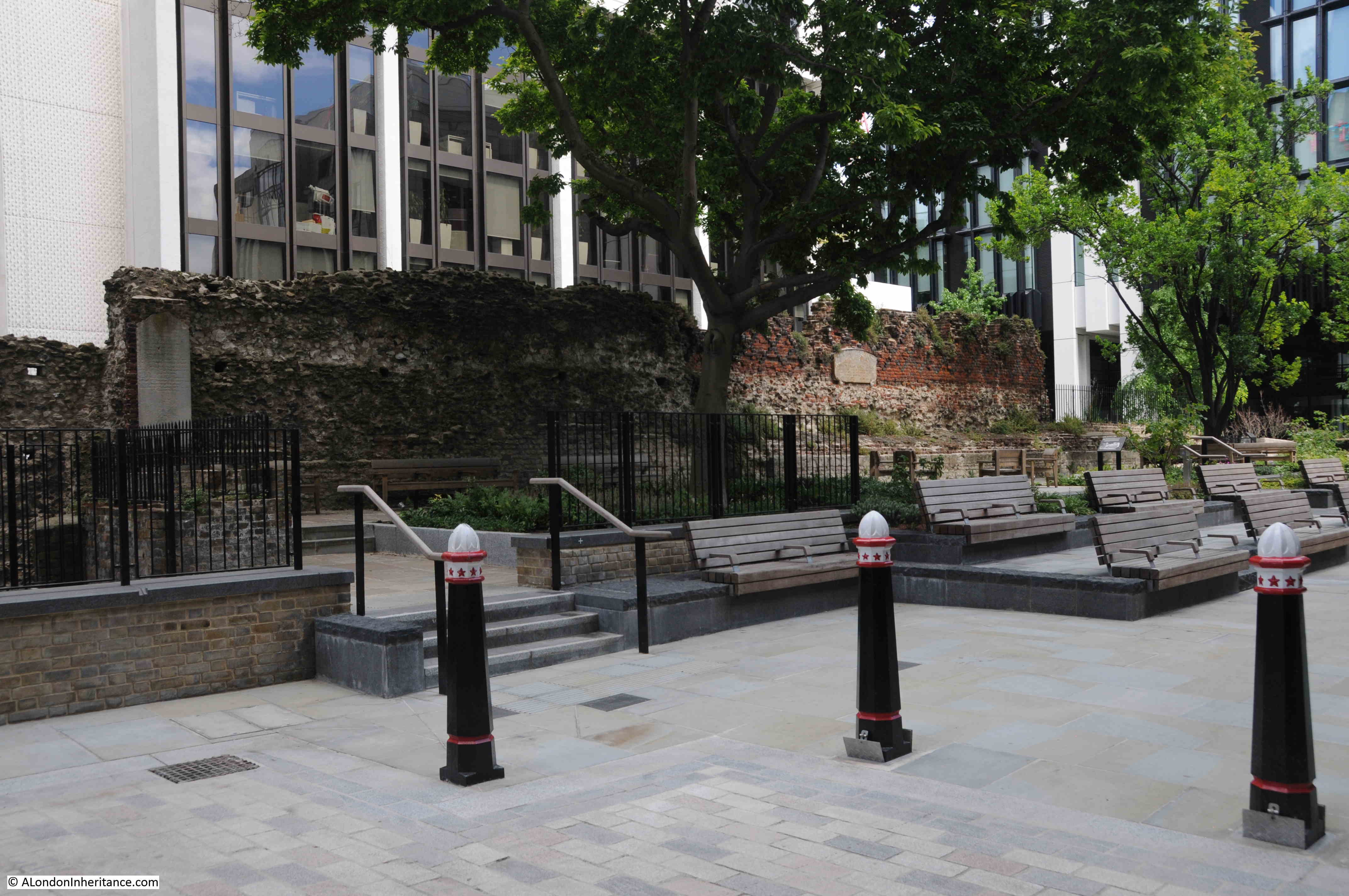
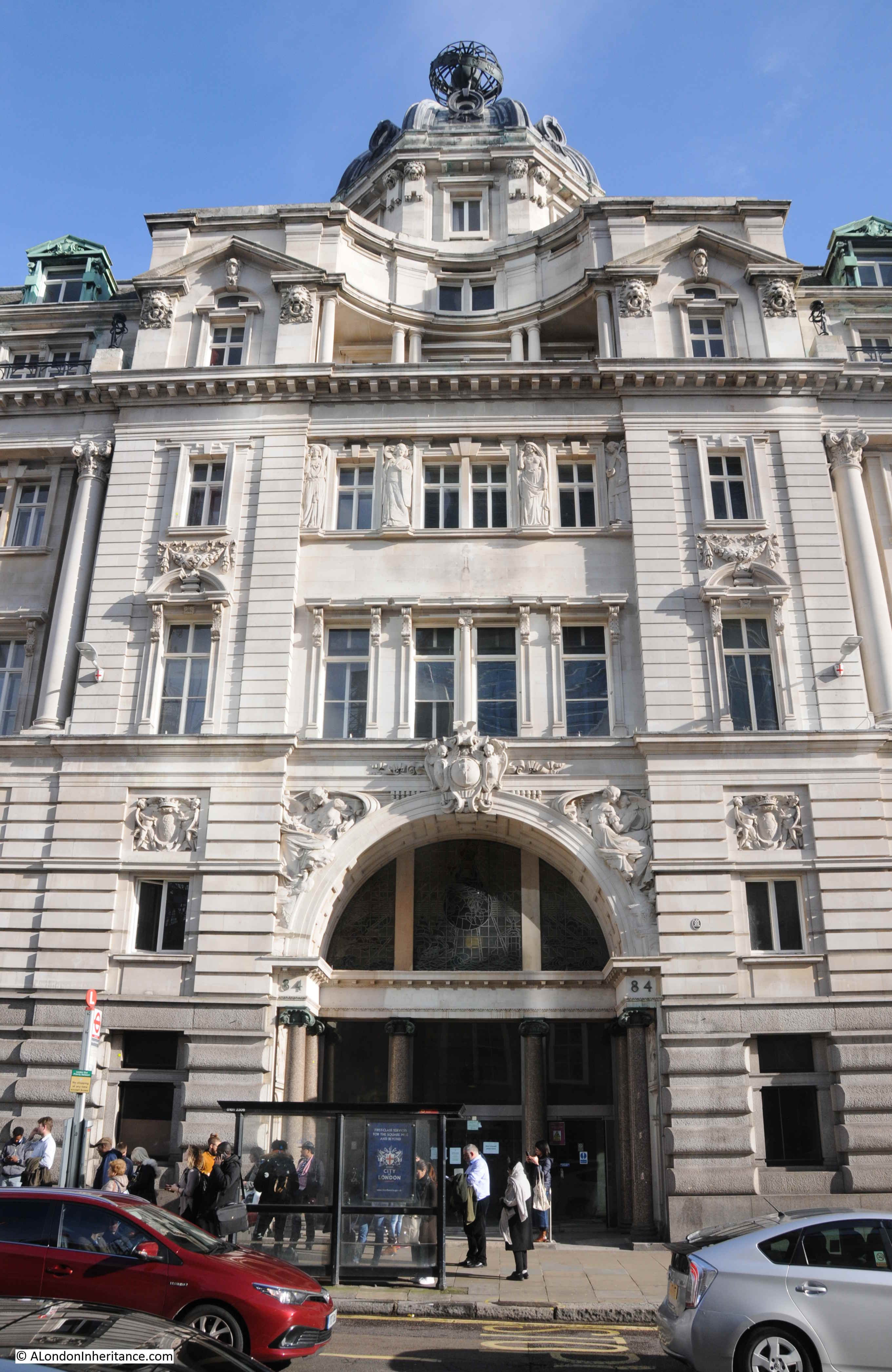
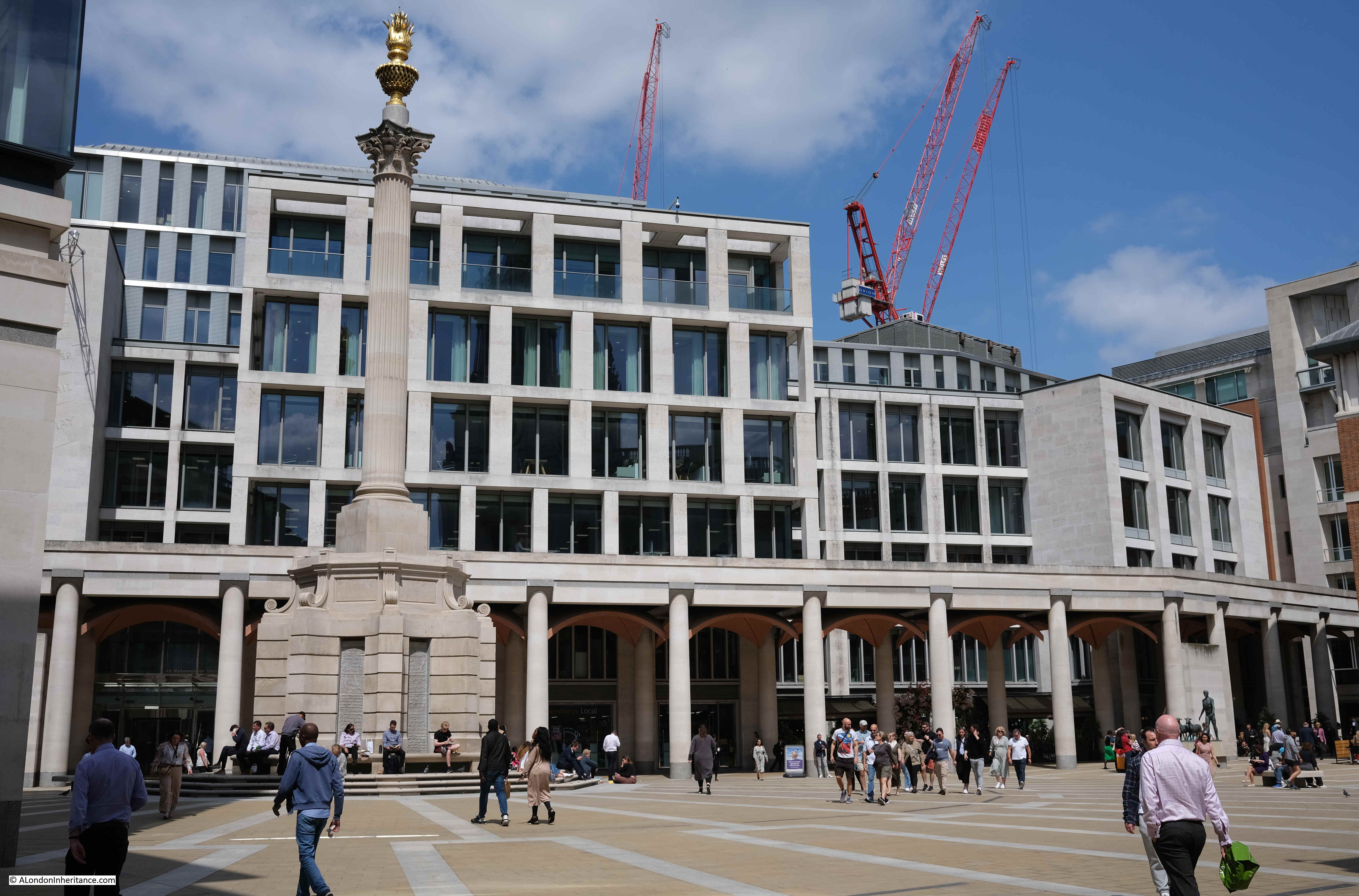
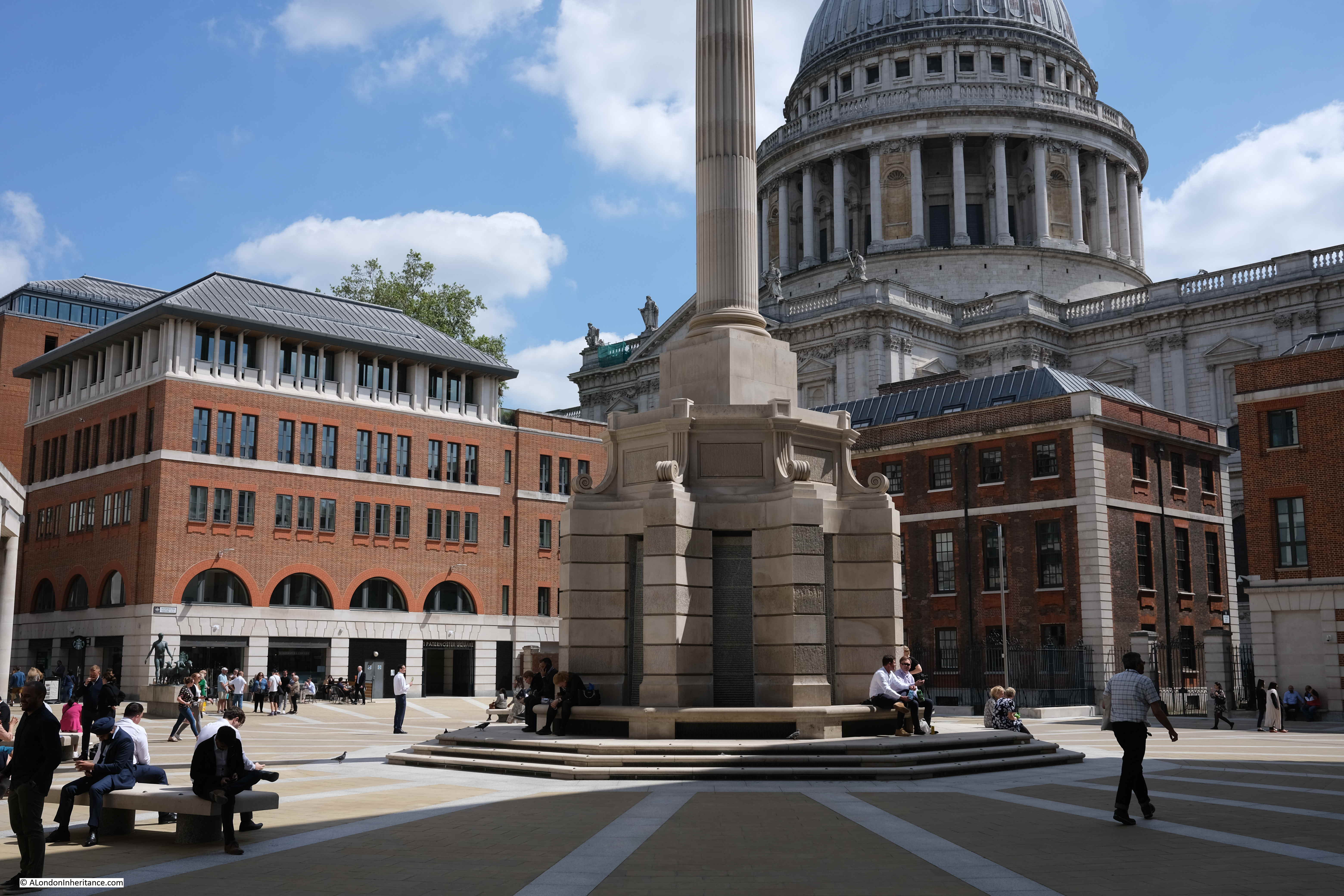
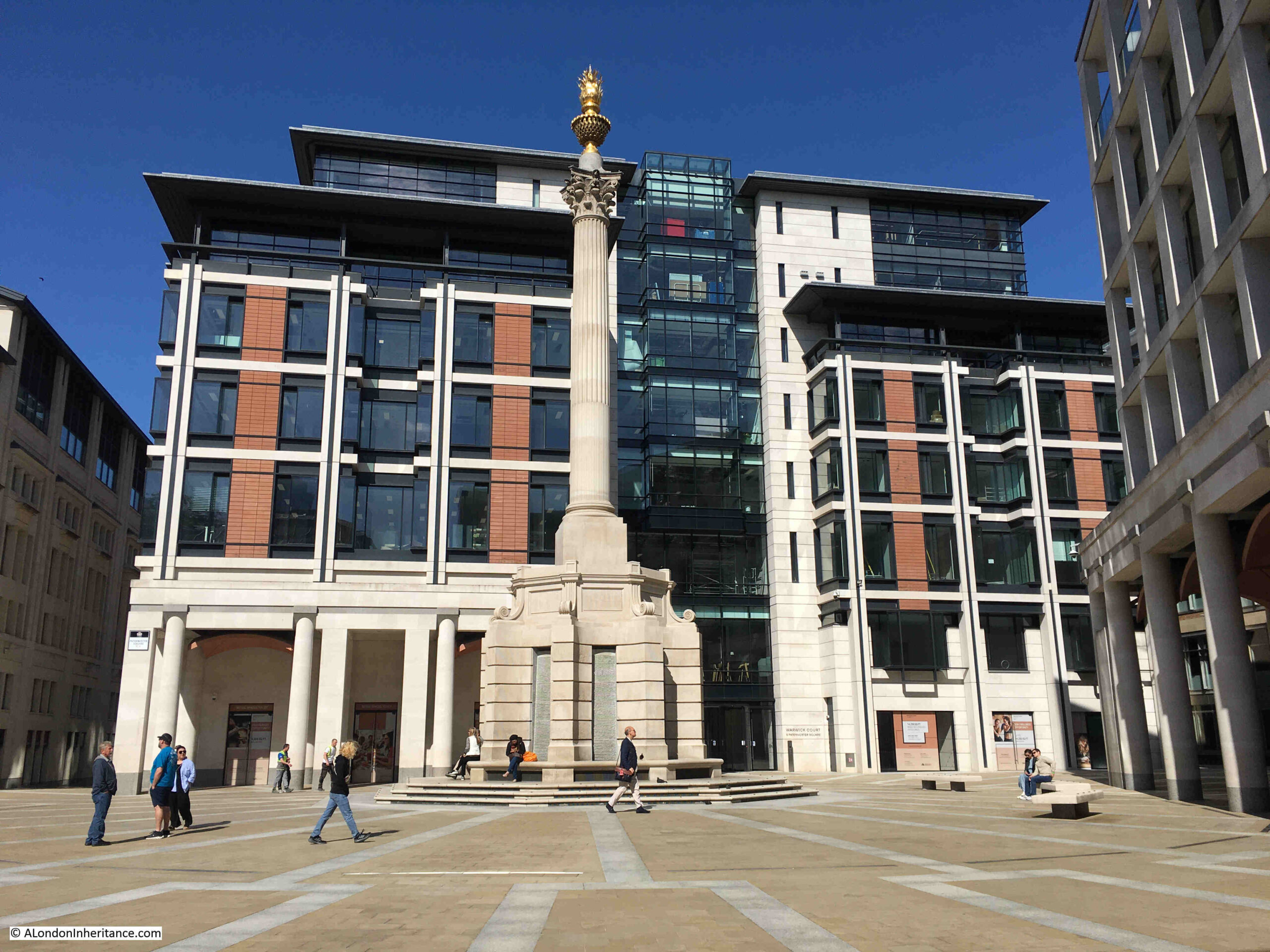
The central square features a 23.3 metre tall column, which conceals air vents to the parking space below the square:

Paternoster Square

The Masterplan by Farrell, Beeby and Simpson included a Loggia which would have provided a lift down to the Lower Court, and mark the access point to the Lower Court.

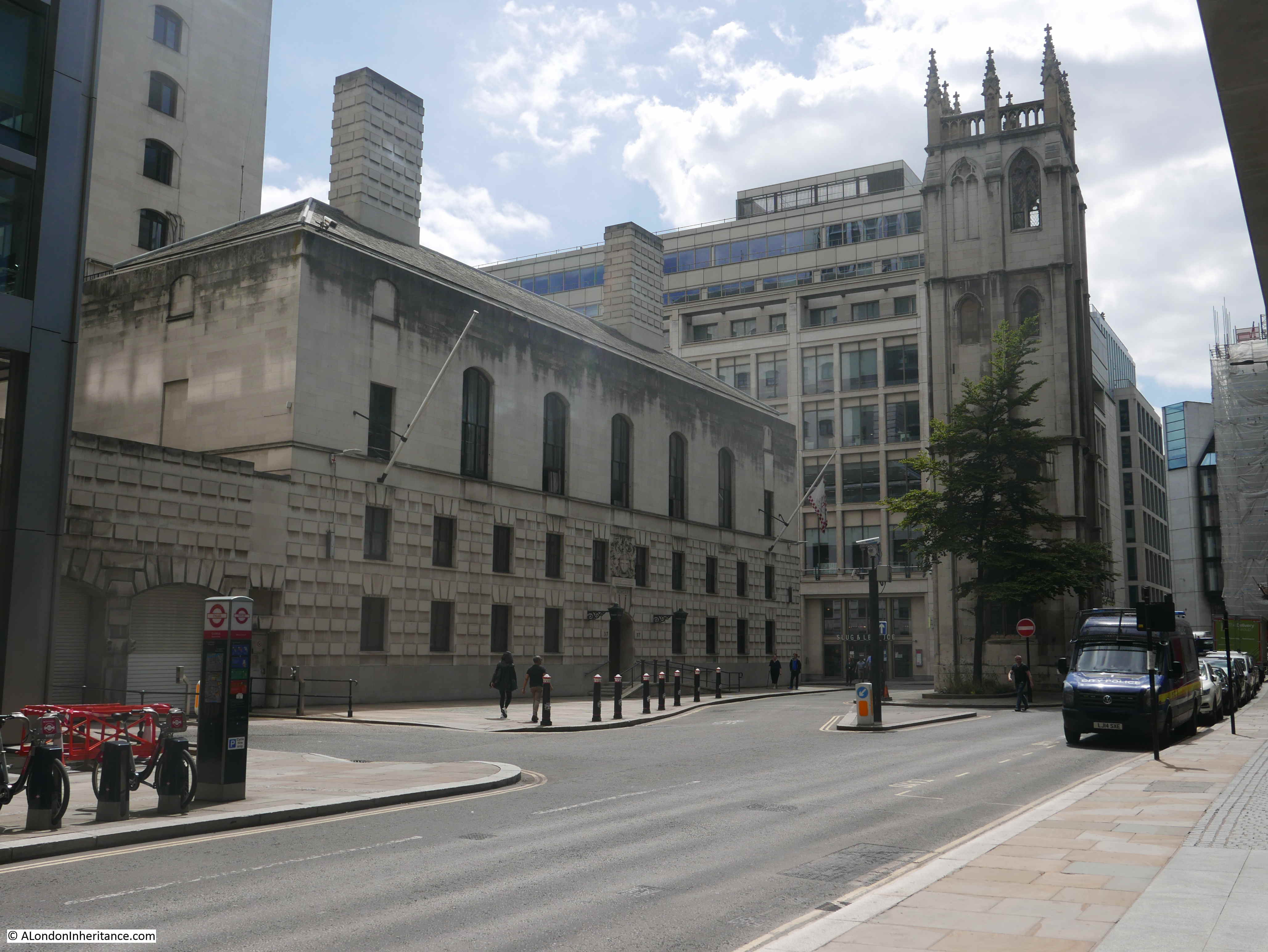
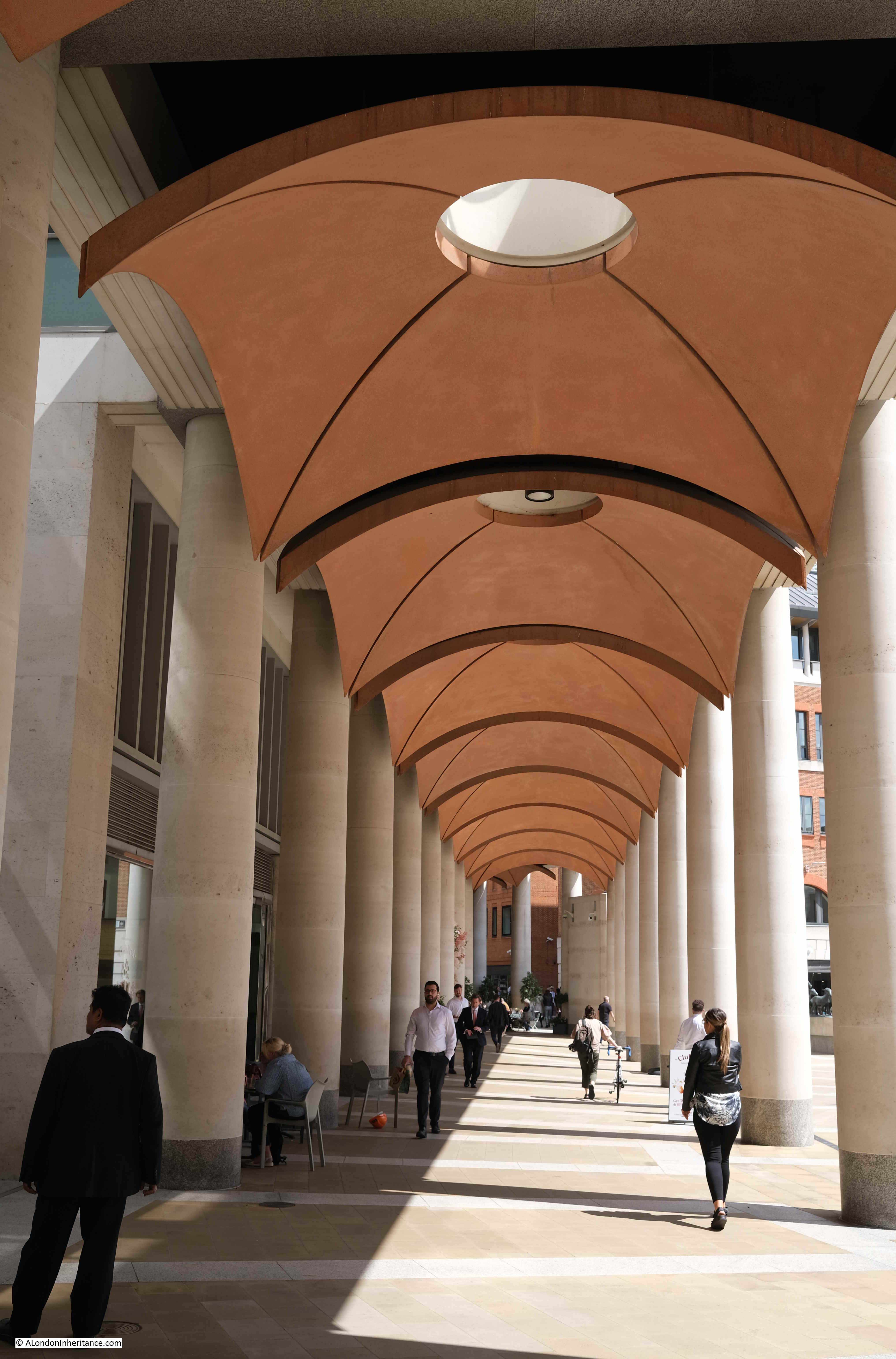
Whilst the Loggia and Lower Court were not part of the implemented Masterplan, there is a covered way along the northern edge of the square which has similarities to the original Loggia:

Paternoster Square

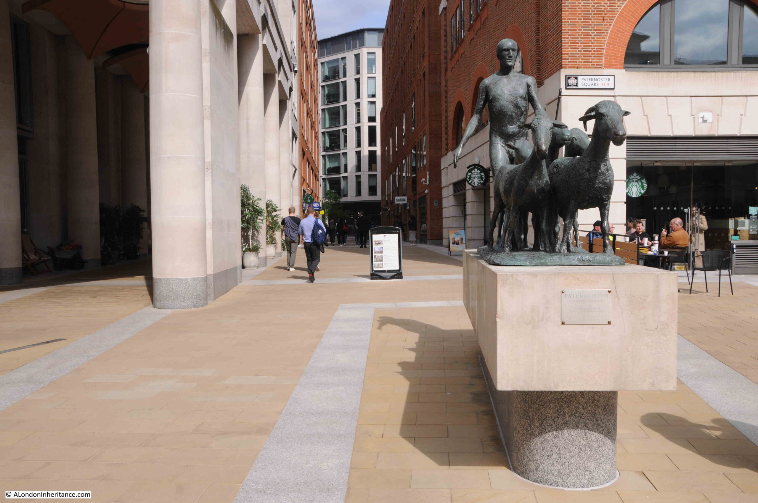
In the above photo, two groups of tourists with guides can be seen to the right. Between them is the artwork “The Sheep and Shepherd” by Elisabeth Frink. This came from the earlier Paternoster Square development as it was installed on the north side of the estate in 1975 when it was unveiled by Yehudi Menhuin.

It was moved to the high walk outside the Museum of London in 1997 prior to demolition of the 1960s estate, then returned to Paternoster Square in 2003.

The Sheep and Shepherd stands where Paternoster Square joins to Paternoster Row (which, as far as I can tell is very slightly north of the street’s original alignment).

The Sheep and Shepherd

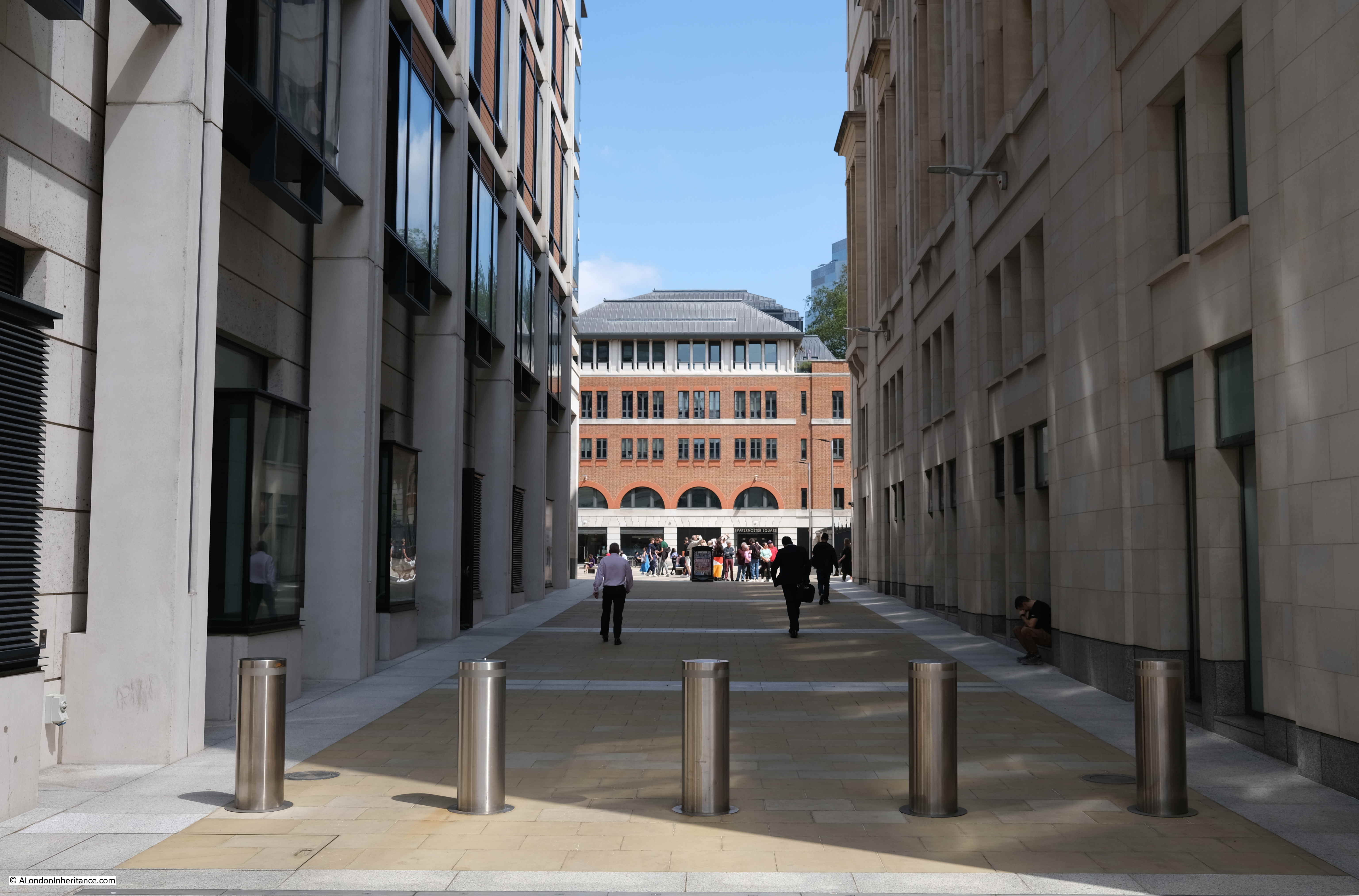
Looking through the Loggia that was built as part of the new development:

Paternoster Square

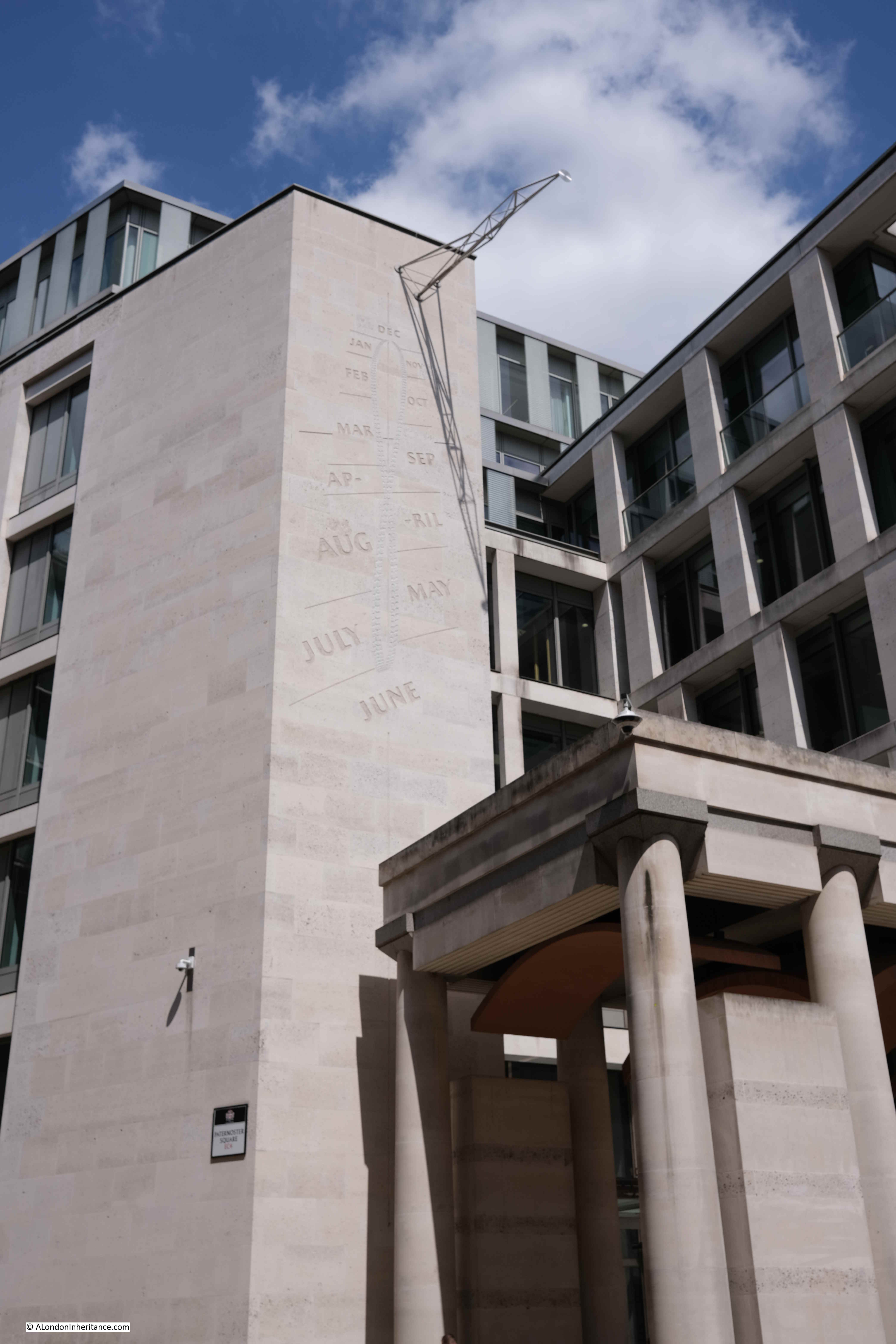
Rather than lots of classical decoration to the buildings, there is a “Noon Mark” on one of the buildings to the north of the square. In strong sunlight, at midday, the shadow indicates roughly the day of the year:

Noon mark solar clock

A key point with the development is the height of the buildings. In the 1960s development, there were office blocks that ran both parallel and at right angles to the cathedral and views of the cathedral were limited.

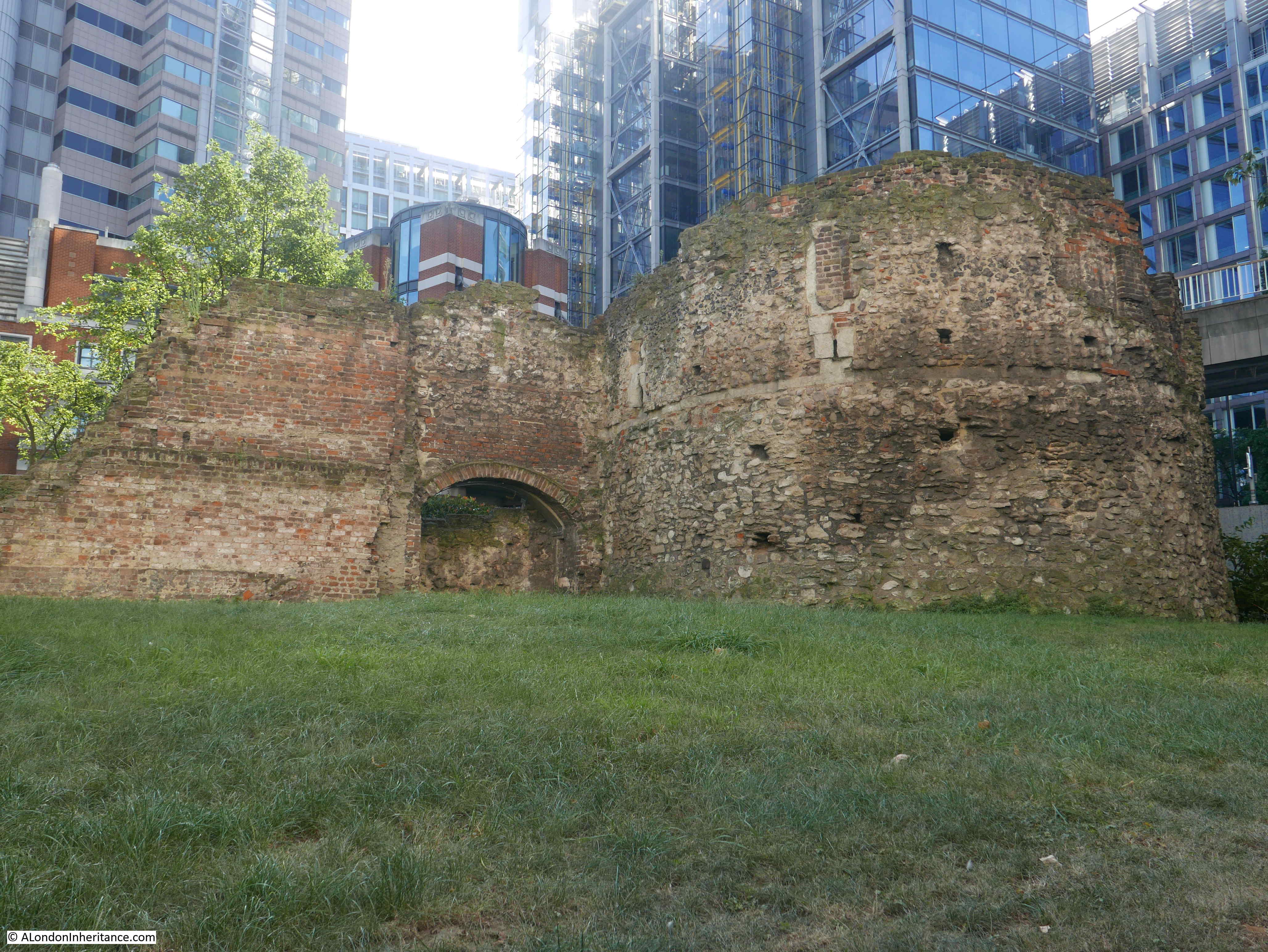
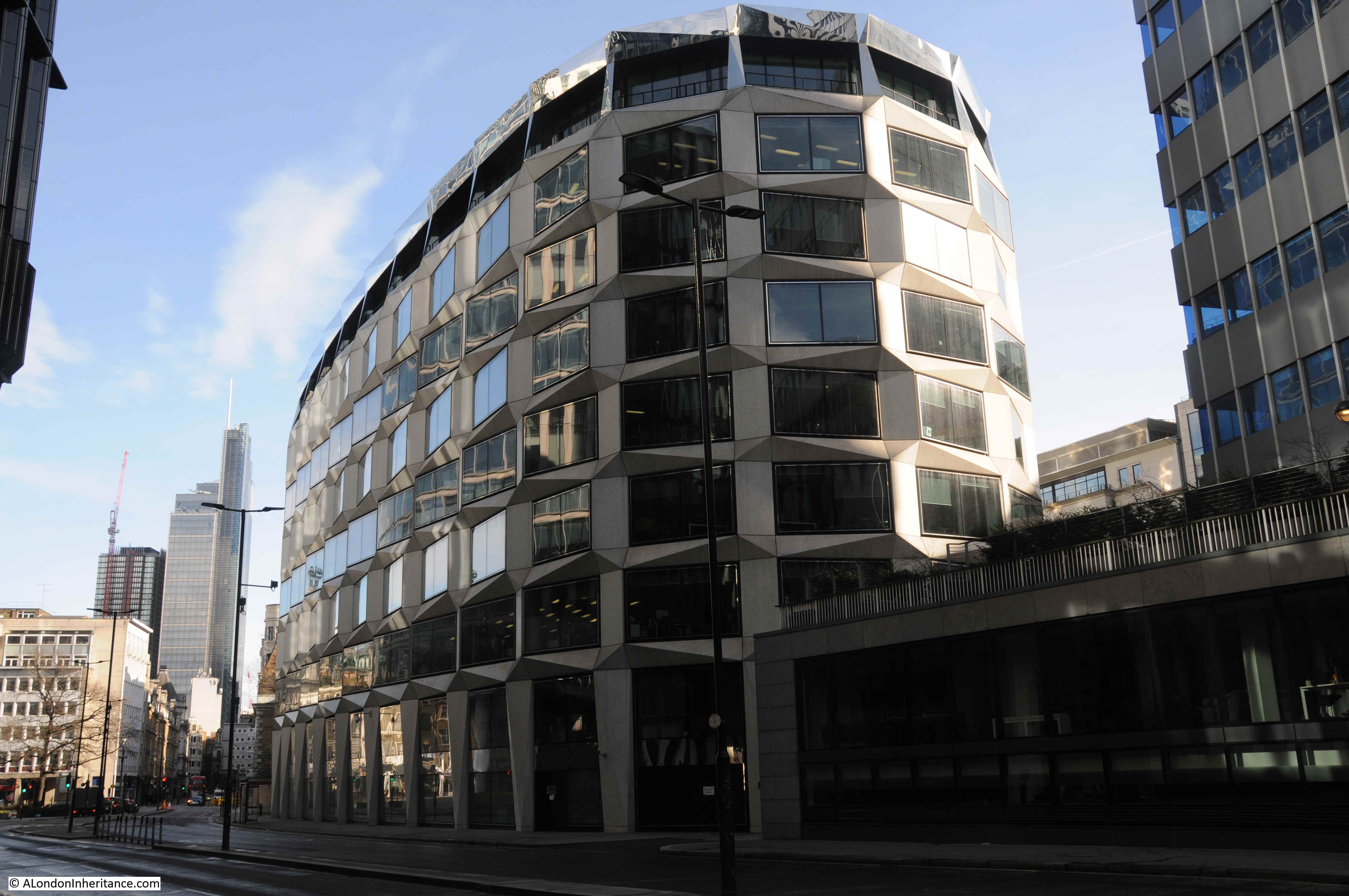
With the new development, building heights are lower and allow views of the cathedral. As can be seen in the following photo from the north west corner of Paternoster Square, the new buildings are just slightly higher than the original Chapter House (the older, dark brick building to the right of the column):

St Paul's Cathedral

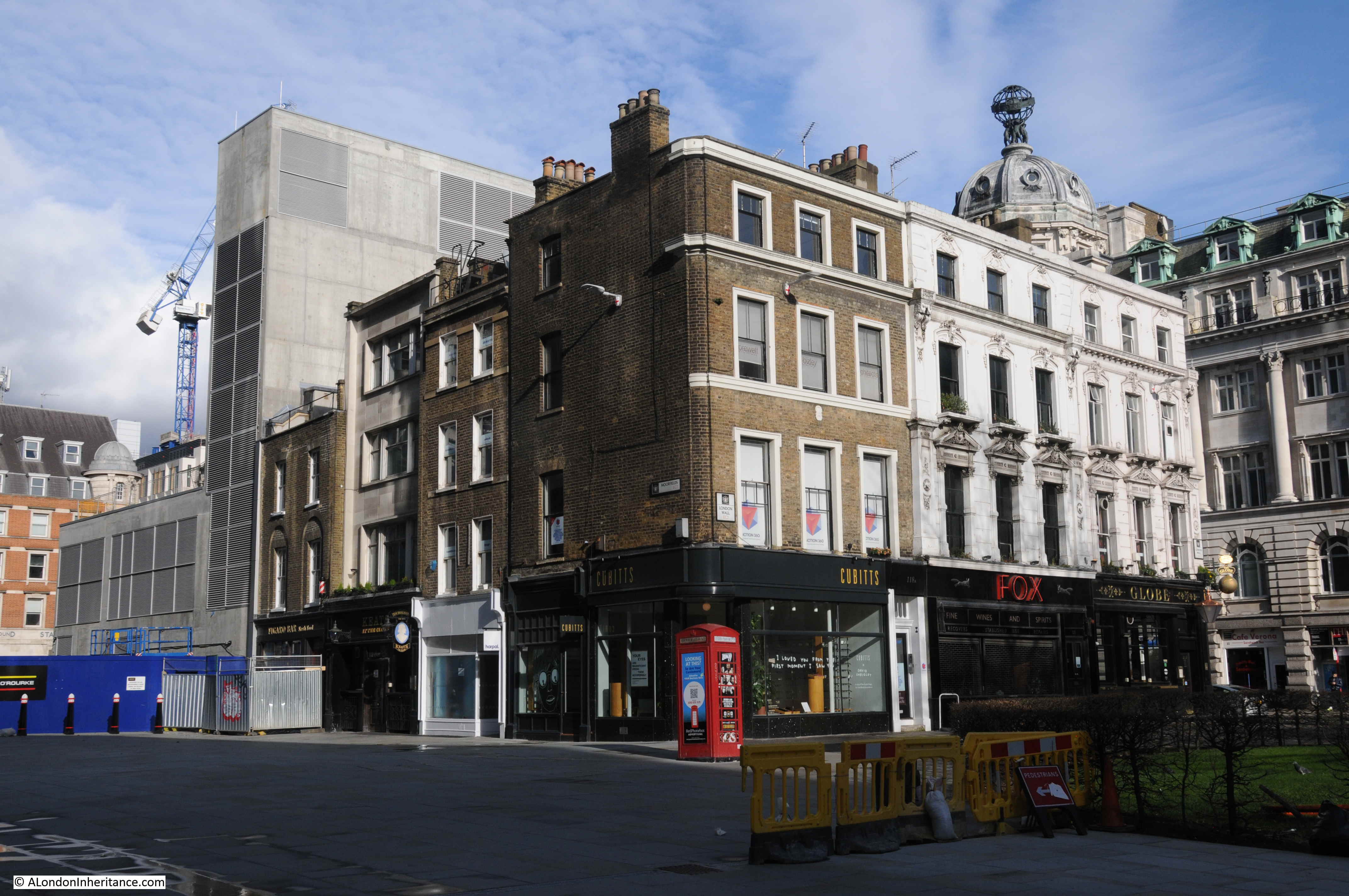
Whilst a number of the walkways do roughly align with the original streets, Paternoster Square is in a different place to the original square, which would have been to the northwest of the current square, to the right of the building in the following photo, which does retain some classical styling at ground level, but is a modern building above:

Paternoster Square

This is the view from the western end of Paternoster Lane towards the central square. This stretch of walkway is almost exactly on the original route of Paternoster Row:

Paternoster Lane

Sometimes it seems as if all the large sculpture across London’s streets is there to hide an air vent. This is the purpose of the column in the central square and also the purpose of a work of art on the corner where Paternoster Lane meets Ave Maria Lane:

Thomas Heatherwick

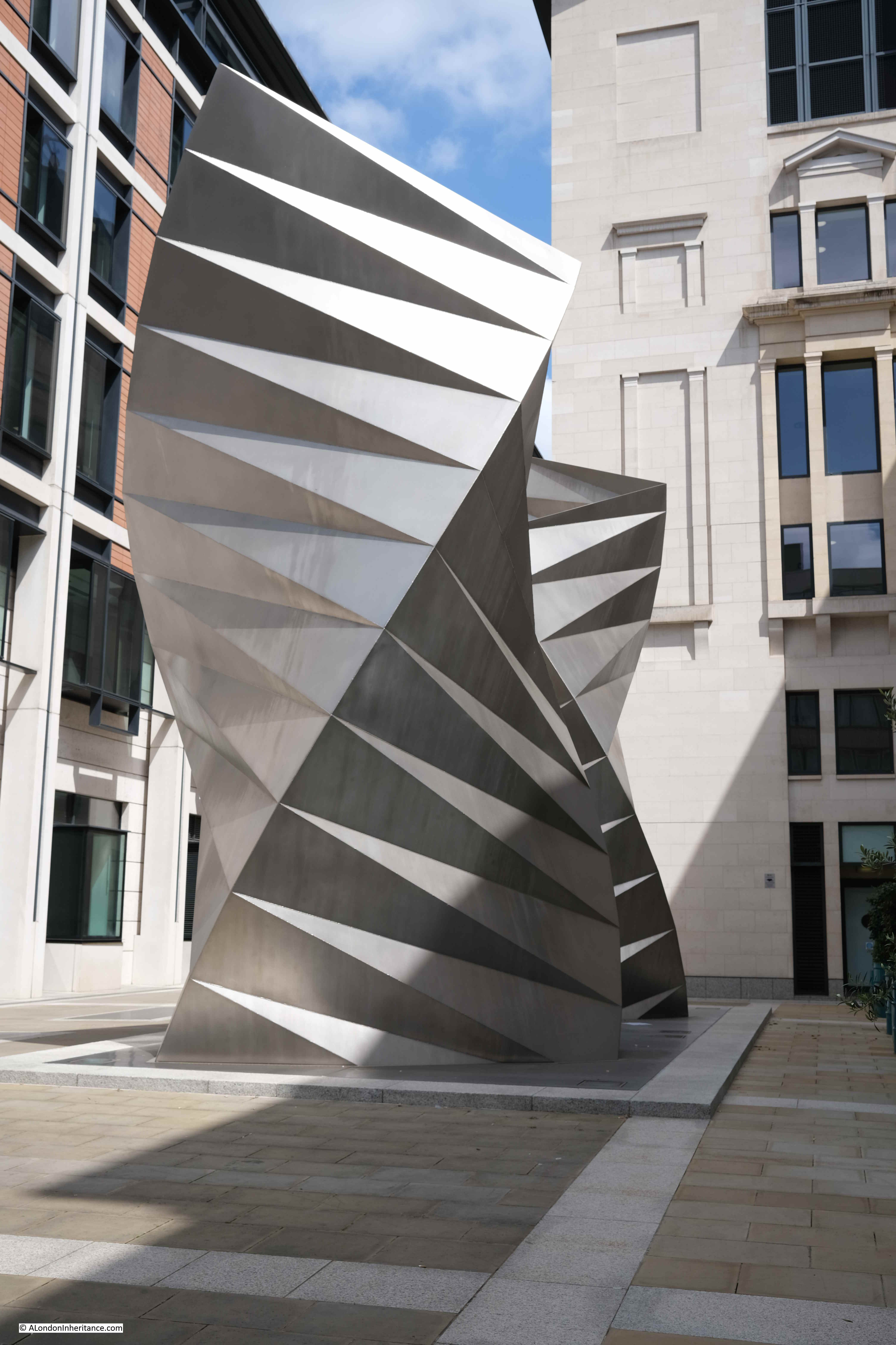
This is a 2002 work by Thomas Heatherwick, and consists of sixty three identical isosceles triangles of stainless steel sheet welded together.

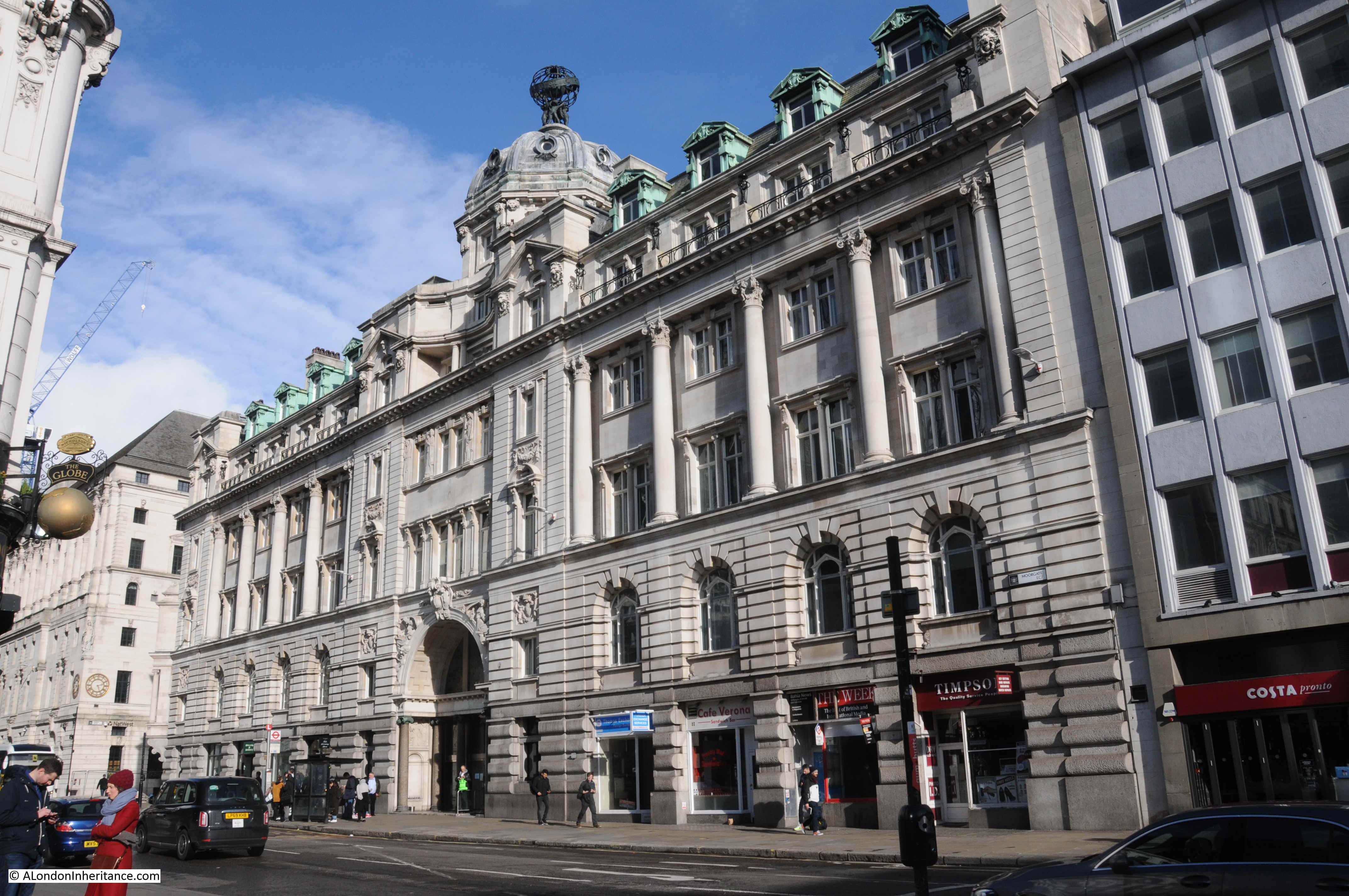
Round to the front of St. Paul’s Cathedral, and to the north of the large open space in front of the cathedral is an office block with shops at ground level which follows the alignment of the old street St. Paul’s Churchyard:

St Paul's Churchyard

The following photo is taken from Cheapside looking towards the cathedral and Paternoster Square development, and may offer a clue as to why the implemented Masterplan is different to the Masterplan of Farrell, Beeby and Simpson:

St Paul's Underground Station

To the right of the above photo are two sides of an octagonal building. It can be seen in the following extract of the photo of the 1960s estate:

St Paul's Underground Station

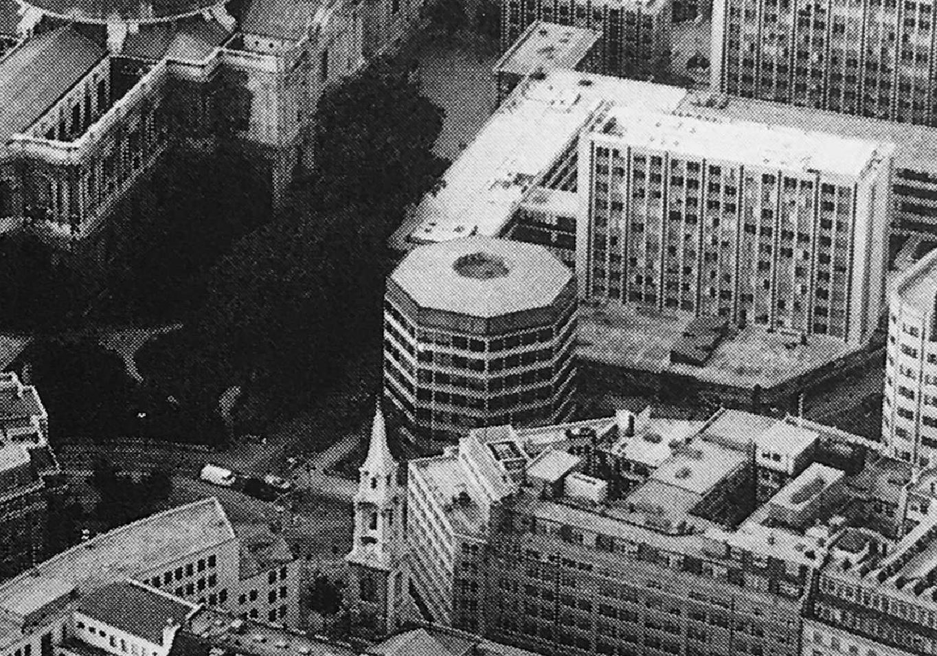
One of the entrances to St. Paul’s Underground Station is just to the right of the building in the photo, and the building is either part above, or extremely close to, the underground station.

I have no evidence to confirm this, however it may be that the estate we see today was down to cost.

Whilst the initial planning permission did not include the octagonal building, the Masterplan did. It would have been demolished and the entrance to St. Paul’s Underground Station would be integrated into one of the new buildings as can be seen in one of the earlier pictures. The proposed lower shopping arcade would also have led into the underground station.

I imagine that anything involving changes to an underground station incur significant extra planning time and costs.

The overall Paternoster estate, whilst aligning with the original Masterplan, does not have the level of classical architecture proposed in the plan, or the split level with the lower court.

All this extra work would have incurred cost, and in so much of the built environment, decisions often come down to cost.

Having said that, compared to the 1960s development, Paternoster Square is a very considerable improvement.

It integrates well with the cathedral to the south, recreates alignments close to some of the original streets, certainly has brought life back into the area from what I recall of the previous development, and is a generally pleasant space to walk through.

Reading the Masterplan though, it is interesting to speculate what might have been, if this plan had been adopted.

You may be interested in the following posts about the area around St. Paul’s:

Post War London from the Stone Gallery, St. Paul’s – The North and West

Post War London from the Stone Gallery, St. Paul’s – The South and East

Operation Textiles – A City Warehouse In Wartime

alondoninheritance.com

Bread Street – A Devastated City Street

To start this week’s post, I have two photos taken by my father when he was standing where the One New Change development is located today, just to the east of St. Paul’s Cathedral:

Bread Street

The church in the background is St. Mary-le-Bow:

Bread Street

Despite the considerable building activity of recent decades, many of the City of London’s streets still have buildings dating from the late 19th and early 20th centuries, however some streets have absolutely nothing of any age, with all buildings of recent construction.

One of these is one of the streets that should have been in the two photos above, between the photographer and the church, and this street is Bread Street.

Bread Street runs south from Cheapside, just to the east of St. Paul’s Cathedral. It crossed Watling Street and Cannon Street to terminate on Queen Victoria Street,

The upper section of the street is in my father’s two photos, and in the following map extract from the 1951 Ordnance Survey map, I have marked the key features which can be seen in the two photos, and are also shown on the map (‘Reproduced with the permission of the National Library of Scotland“):

Bread Street

Bread Street is to the right of the red circle, which surrounds a feature marked as a “ruin”, which the photo confirms.

A few buildings still stand around the junction of Friday Street and Cheapside, and St. Mary-le-Bow is marked as a ruin, which the photos confirm where the main body of the church can be seen as an empty shell. The tower of the church is marked by a solid square on the map, confirming that the tower is still standing and survived without significant wartime damage.

In the above map, apart from the ruin, this part of Bread Street is completely empty, as is much of the surrounding land, although as can be seen, many buildings to the right survived, including those along Bow Lane, many of which can still be seen today.

The name of the street does appear to refer to bread. Harben’s Dictionary of London quotes “So called Stow says, of bread in olde times sold for it appeareth by recordes, that in the yeare 1302, the bakers of London were bounden to sell no bread in their shops or houses, but in the market”.

This was a time when one of the main London markets operated in and around Cheapside and the surrounding streets, and there are other streets off Cheapside that still refer to the products sold, such as Milk Street and Honey Lane.

Richard Horwood’s map of 1799 provides an impression of the street at the end of the 18th century. In the following extract, Bread Street is running from the junction with Cheapside at the top of the map (just to the left of the letter P), down to Upper Thames Street, with the last section named Bread Street Hill, referring to the drop in height as the street headed down towards the Thames.

Horwood's map

The section of Bread Street in my father’s photos is that between Cheapside and Watling Street.

The map shows that in 1799, the street was lined with individual houses, with some courts and alleys leading off from the street.

Although the area was devastated by wartime bombing, Bread Street had already suffered a number of significant changes.

Continuing south after the junction with Watling Street and in 1799 we came to a junction with Basing Lane and Little Friday Street. Both of these streets were lost when Cannon Street was extended up towards St. Paul’s Churchyard.

The construction of this major road extension in the mid-19th century, along with the construction of Queen Victoria Street, split Bread Street and separated it entirely from Bread Street Hill, which in turn cut-off Bread Street from easy street access to the Thames, and which no doubt was used to transfer the products needed for baking bread.

My father’s photos were taken from near Friday Street, which has disappeared entirely under the One New Change buildings. Bread Street survives, but the bombing shown in the two photos explains why the street is as we see it today. A street without any buildings of any age, with the majority built during the last few decades.

The view looking south along Bread Street from the junction with Cheapside:

Bread Street

One New Change is the large building to the right of the above photo, a building which stands over nearly all of the land seen in the foreground of my father’s photos.

Much of One New Change is a large shopping centre:

Bread Street

Looking south along the street:

Bread Street

Between Bread Street and St. Mary-le-Bow is Bow Bells House, a 215,000 square foot office building, constructed in 2007:

Bow Bells House

As Bow Bells House dates from 2007, it shows that many of these new buildings are second or third generation buildings after the devastation of war.

On the wall of Bow Bells House is a City of London blue plaque, recording that the poet and statesman John Milton was born in Bread Street in 1608:

John Milton

Milton’s most well known work is the poem Paradise Lost. He was born in the street to reasonably affluent parents, his father, also John Milton and mother Sarah Jeffrey.

The street that John Milton would have known was lost during the 1666 Great Fire of London, so wartime bombing was the second time in the life of the street that it has been devastated, and put through a complete rebuild.

In the following photo, I have reached the junction with Watling Street:

Bread Street

Looking along Watling Street towards St. Paul’s Cathedral:

Watling Street

Watling Street is perfect example of why some city streets look as they do. In the above photo, I am looking along the final length of Watling Street as it approaches St. Paul’s Cathedral, and as with Bread Street, all the buildings are new.

However, walk a short distance east along Watling Street, and look back towards the cathedral, and this is the view:

Watling Street

Some new buildings, but many pre-war buildings remain, and perhaps this view hints at what Bread Street could have looked like before the war.

It is perhaps hard now to realise just how much whole areas of the City were devastated in the early 1940s, and how the buildings that once lined entire streets disappeared almost overnight.

But it does help explain why many of the City streets are as they are, with some streets lined with pre-war buildings, and others, even different lengths of the same street, consisting of entirely modern buildings.

alondoninheritance.com

Sans Walk, a Fenian Outrage and the Edge of London

There are three photos in my father’s collection that I have not been able to identify. They were labelled “Sans Walk area”. Sans Walk is in Clerkenwell, and the first photo shows what appears to be an empty shell of a building, probably damaged during the war.

Sans Walk

The second photo shows a corner house, in good condition and still occupied, with a lovely street lamp on the corner of the building:

Sans Walk

The third and final photo shows part of a terrace of houses, with a streetlamp and bollards in the foreground.

Sans Walk

No street names, or any other identifiable features to help locate the photos.

I thought if I walked the area around Sans Walk, I should be able to identify some of the locations. I had no idea whether the houses in the photos had been restored or demolished, but armed with printed copies of the photos I set off to walk the area on an early Autumn day.

Although I could not find the locations of the photos, what I did discover was an area packed full of history, and that once formed the edge of London as the city gradually expanded to the north.

The following map shows the places covered in the rest of the post (Map © OpenStreetMap contributors):

Sans Walk

Sans Walk is the nearly horizontal street in the centre of the map. I did walk the rest of the streets around Sans Walk, but this post was getting rather long with just the stops shown.

I started in Clerkenwell Close, opposite the Horse Shoe pub, a very traditional pub that probably dates back to the 18th century. The earliest written records I could find date to 1824 when a newspaper report referred to an inquest into a suicide which was held in the Horse Shoe.

Sans Walk

This area of Clerkenwell is full of narrow streets. Some new buildings intrude, but many 18th and 19th century buildings survive, along with warehouses and factories from the 19th and early 20th centuries.

Looking east along Clerkenwell Close:

Sans Walk

Clerkenwell Close is a strange street as it consists of a number of branches. Starting at Clerkenwell Green, it runs north-west, up to Pear Tree Court and the Clerkenwell Close Peabody Estate, with the branch I am walking along turning off and running up to Bowling Green Lane and Corporation Row. At one point the street runs parallel to a pedestrian alley, both called Clerkenwell Close, and indicative of how the area has developed as large warehouses replaced earlier streets, alley and buildings.

Sans Walk

New buildings had been added, but they are generally at the same height as the existing buildings, so despite the architectural and material changes, they blend in. Providing they are in keeping with the scale of the area, and there is a justification to replace rather than restore the  original building, it is good to have new buildings. The streets in the area have buildings from the last few centuries and 21st century additions are part of the continuous development of London.

Sans Walk

The above building was built on the corner of the playground of a Victorian school. The curving wall at street level retains a plaque recording the gift of Sir Robert Wood to the parish in 1844. I suspect this refers to the land:

Sans Walk

We are still in Clerkenwell Close, and the following building tells of the late 19th century expansion of London schools and the London School Board.

Sans Walk

The London School Board was responsible for the development of many of the large, brick, late 19th century schools that can still be found across London. As well as their construction, the London School Board was also responsible for their operation, and the supply of all the goods and materials needed to fit out, and keep a school running.

The Board consolidated the process of standardisation and supply, and one of the methods used was large central warehouses. The buildings in Clerkenwell Close were built between 1895 and 1897 as warehouses for school furniture, stationery and needlework supplies.

The growth in the volume of space needed grew in the early 20th century, and in 1920 an extra floor was added to the top of the Stationery and Needlework warehouse on the right of the above photo, and this addition is still visible in the change of brick colour from red/orange to  a brown brick for the 20th century addition of the top floor.

In the above photo, the furniture store was on the left, and the Stationery and Needlework departments were on the right, and these functions are still recorded in stone, above the doors.

Sans Walk

The initials at the top are those of the London School Board.

One of the schools that the warehouse would have supplied is directly opposite:

Sans Walk

The school was the Hugh Myddelton School, built by the London School Board in 1893 and with the distinction of being the only London School Board school opened by a member of the Royal family after it was opened by the Prince of Wales in December 1893.

Such was the importance of the visit of the Prince of Wales that the London School Board allocated £100 towards preparations for the visit, which caused some consternation as the money was thought better spent on education.

In his opening speech, the Prince of Wales said that the London School Board had contributed to a “marked advance in education, diminution in crime and an undoubted increase in general intelligence”.

Lesson in the Hugh Myddleton School in 1906:


Image credit: London Metropolitan Archives, City of London: catalogue ref: SC_PHL_02_0208_3943

Drill in the open area outside the school, also 1906:

Sans Walk

Image credit: London Metropolitan Archives, City of London: catalogue ref: SC_PHL_02_0208_68_4984

When opened, the school was the largest and most expensive built by the London School Board. The school had a number of special departments, including the Hugh Myddleton School for the Deaf. The site on which the school stands has an unusual history.

From 1845, the space occupied by the school had been the site of the Middlesex House of Detention, built as a short stay prison due to overcrowding in other prisons, the Middlesex House of Detention was demolished in 1886.

Some of the reception cells of the prison were in the basement, and these survived the demolition of the main building and were incorporated in the basement of the Hugh Myddelton School, and are presumably still there.

The school closed in 1971, was a Further Education College for the next couple of decades before being sold for development into flats and offices in 1999.

The site of the school, when occupied by the Middlesex House of Detention was the site of a bomb explosion in December 1867 reported extensively as the Fenian Outrage in the newspapers of the time.

This took place at the perimeter wall of the prison which ran along the northern edge of the site, in Corporation Street:

Sans Walk

The Fenians was another name for the Irish Republican Brotherhood, an organisation formed in the 1850s to fight for an independent, democratic Ireland.

The bomb was an attempt to free Ricard O’Sullivan Burke and Joseph Casey who had been arrested earlier regarding Burke’s attempts to purchase arms and ammunition in Birmingham, and a previous attempt to free a prisoner in transit, when a guard had been killed.

The view along Corporation Row in the immediate aftermath of the explosion:

Sans Walk

The Illustrated London News carried the following report of the explosion:

“The whole neighbourhood of Clerkenwell was startled at a quarter to four on Friday afternoon by an explosion, which resembled an earthquake. The houses were shaken violently, the windows in many cases were broken, and in some instances persons were thrown to the ground by the violence of the concussion. The scene of the explosion proved to be the wall of the House of Detention, opposite Corporation-row, some sixty feet of which were knocked down, and it was not long before the discovery was made that numerous persons were seriously, and some fatally injured, and that the calamity had been wilfully caused. It was at once attributed to the Fenians, the motive alleged being a desire to rescue Burke and Casey, who are confined in the prison, and facts which have since come to light show that this theory is the correct one.

The clearest account of what actually took place is given by a boy about thirteen years of age, named John Abbott, who is now in St Batholomew’s Hospital, happily not very much hurt.

This youth who lived in Corporation-row, says that at about a quarter to four o’clock he was standing at Mr Young’s door, No 5, when he saw a large barrel close to the wall of the prison, and a man leave the barrel and cross the road. 

Shortly afterwards the man returned with a long squib in each hand. One of these he gave to some boys who were playing in the street, and the other he thrust into the barrel. One of the boys was smoking and he handed the man a light, which the man applied to the squib. The man stayed a short time until he saw the squib began to burn, and then he ran away. A policeman ran after him, and when the policeman arrived opposite No 5, the thing went off.

The boy saw no more after that, as he himself was covered in bricks and mortar. The man, he says, was dressed something like a gentleman. He had on a brown overcoat and black hat, and had light hair and whiskers. He should know him again if he saw him. 

There was a white cloth over the barrel, which was black, and when the man returned with the squib he partly uncovered the barrel, but did not wholly remove the cloth. There were several men and women in the street at the time, and children playing. Three little boys were standing near the barrel at the time. Some of the people ran after the man who lighted the squib.

The effects of the explosion were soon visible in all directions. The windows of the prison itself, of coarse glass more than a quarter of an inch thick, were to a large extent broken, and the side of the building immediately facing the outer wall in which the breach was made, and about 150 feet from it, bears the marks of the bricks which were hurled against it by the explosion. The wall surrounding the prison is about 25 feet high, 2 feet 3 inches thick at the bottom, and about 14 inches thick at the top.

As to the number of persons injured it was impossible for some hours to learn anything satisfactory. It was found, however, that something like fifty at least had been hurt, and that two or three were killed. Thirty six of the sufferers were removed to St Bartholomew’s Hospital, where three died in the course of the evening, and six to the Royal Free Hospital in Gray’s Inn Road. Of the wounded some were mere infants, and the husband of a women, who has since died of injuries she sustained, lies in St Bartholomew’s; shockingly bruised and prostrated. Others are missing”.

In the following days, 12 were confirmed to have died in the explosion, with very many injuries.

A number of Fenian sympathisers were arrested, but after trial only one, Michael Barrett, was found guilty, and was sentenced to death. Barrett was the last person to be publically hung outside Newgate Prison.

The scene in Corporation Row after the explosion. A temporary wall has been erected to plug the gap caused by the explosion, and the walls of the opposite houses are being held up with timber supports.

Sans Walk

On a quiet autumn day in 2020 it is hard to imagine the explosion and devastation in Corporation Row.

As well as the Hugh Myddleton School built on the site of the prison, there is another closed school near by. Parts of the wall surrounding the playground and one of the entrances for infants can be seen in front of the recent building that now occupies part of the playground space.

Sans Walk

This is Bowling Green Lane School, built in 1874:

Sans Walk

Another London Board School, part of the site was originally a parish cemetery, along with housing and a tavern.

When the Hugh Myddleton School opened, Bowling Green Lane School became the junior school for the Hugh Myddleton.

Sans Walk

Having built and run many schools in the later part of the 19th century, the London School Board would become part of the London County Council when the authority took over responsibilities for education across London.

A rather nice London County Council coat of arms can still be seen on the side of the school facing the street.

Sans Walk

Bowling Green Lane school closed in 1970, but continued to provide additional space for Islington Green Secondary School until 1982 when it was converted into a range of business spaces, and today, a sign adjacent to the Girls and Infants entrance confirms that Zaha Hadid Architects now occupy the old school.

Sans Walk

The name of the school is after Bowling Green Lane, the street that runs in front of the school. This is both an old street and name and is named after the Bowling Greens that once occupied the land to the north of the street as shown in this extract from Ogilby and Morgan’s map of London published in 1677:

Sans Walk

For many years, Bowling Green Lane and Corporation Row were the northern edge of this part of London, with open space on the northern side of the streets.

The following map extract is from a map produced in 1755 for Stowe’s survey of London. The orientation is rather strange as north is to the left, east is at the top of the map.

Sans Walk

The built areas of Clerkenwell are to the right (south) and open space to the left (north) until we come to the New River Head.

Hugh Myddleton was the driving force behind the construction of the New River and round pond at New River Head, and the large new London School Board school was named after him.

Sadler’s Wells were just north of New River Head and the open space between Sadler’s Wells and Clerkenwell was often a dangerous place for those returning in the dark from entertainments – see my post on Sadler’s Wells.

I now reached Sans Walk, the street that was apparently the centre for the three photos.

Sans Walk appears to have been in existence at the time of the Middlesex House of Detention, but seems to have gone by the name of Short’s Buildings – the name of a terrace of buildings on the southern edge of the street.

The name Sans Walk seems to have come into use by 1893 and the name comes from Edward Sans, the oldest member of the parish vestry at the time.

In the western side of Sans Walk, there are new buildings on the southern edge and the old Hugh Myddleton School on the northern edge of the street:

Sans Walk

Ornate, carved name of the school, high up on the wall to the left of the building.

Sans Walk

The initials of the London School Board are also prominently displayed on the right of the school building:

Sans Walk

The eastern stretch of Sans Walk – I could not match any of the buildings in the street with those shown in my father’s photos.

Sans Walk

On the side wall of the house at the eastern end of Sans Walk is this plaque making clear that the entire wall is the property of the County of Middlesex. No idea if that applies to the rest of the house behind the wall, or just the wall.

Sans Walk

Looking down Sans Walk from the east.

Sans Walk

The building on the left does look like a restored version of one of the terrace of houses in the first photo, however the location is completely wrong. the house above is only a single house on the end of a very different terrace, and there is a road passing immediately in front of the house, with Sans Walk on the right.

At the end of Sans Walk is Woodbridge Street. I could not find any houses that matched the photos.

Sans Walk

Running along the opposite side of the houses to Woodbridge Street is Sekforde Street, lined with early terrace houses, but again nothing that matched my father’s photos.

Sans Walk

Half way along the street is an interesting building. painted white, that stands out from the terrace of houses on either side.

This is the former head office of the Finsbury Bank for Savings.

Sans Walk

The Finsbury Bank for Savings opened in August 1816 at St. John’s Square, Clerkenwell Green. Formed to provide a service for small traders, labourers etc.

The bank moved premises to the building in Sekforde Street shown in the photo above in April 1841 after being built for the bank during the previous year.

Although the bank was intended for customers with limited savings, it was used by many more affluent customers, including the author Charles Dickens.

The Finsbury Bank for Savings went through a series of mergers, eventually becoming part of TSB, which in turn was taken over by Lloyds Bank.

I failed in the aim of the walk, to find the locations of my father’s photos around Sans Walk, although one of the aims of searching for these locations is to explore the surrounding area, and there was plenty to be found around Sans Walk.

The schools and warehouses of the London School Board, a 19th century bomb planted by the Fenians, the northward limit of Clerkenwell in the 18th century and streets that record lost bowling greens and one of London’s early saving banks – all within a short walk.

London is always best explored on foot and almost every street tells a story.

alondoninheritance.com

Fire, Blitz and Route 11 – How Two Historic City Walls Have Survived The Centuries

I find it fascinating comparing my father’s photos of the bombed City with London of today. Exploring how much has changed, how the long history of the City survived, and despite how much has changed over the last seventy plus years, how much remains the same.

The following photo was taken in Wood Street looking roughly north east.

St Alphage

I know the exact spot where my father was standing to take the photo, and there are a number of landmarks that can be identified. I have marked these on the photo below, and will explore them in today’s post.

St Alphage

Firstly, the photo was taken from Wood Street, a short distance north of the tower of the church of St Alban. The following photo is from my post of a couple of weeks ago on the churches of St Alban and St Mary. Just behind the tower of St Alban is a building with scaffolding projecting from the side. This is the same scaffolding seen in the photo above.

St Alphage

I am trying to work out a way to bring together all the photos of the bombed City to provide a comprehensive walk through of the City in 1947 – not sure the best way to do this yet but they provide a detailed view of the bombed City that my father witnessed.

From the Wood Street viewpoint, the following map extract shows the landmarks identified in the photo. I have used the same symbols as in the above photo (Map © OpenStreetMap contributors).

St Alphage

The following photo shows the view from the same place that my father was standing at, in 1947. A very different view with none of the landmarks visible.

St Alphage

The shadow of the tower of St Alban is on the lower right corner, and the building with the scaffolding would have been on the right, with the scaffolding protruding into the edge of the photo.

The rather solid looking building on the right of the above photo is the Wood Street City of London police building, constructed in 1965.

In the 1947 photo there is a street entrance on the right. This was Addle Street, a street that has been lost in the development of the area. It was roughly just after the tree in the above photo.

Looking at the landmarks in the distance, and one of the most distinctive is a tall tower which I have marked with a yellow circle in the map and photo. This building can still be found on the north side of Finsbury Square.

St Alphage

The tower belongs to the building that was Royal London House, but is now called Triton Court. Royal London started as a Friendly Society and grew rapidly during the first half of the 20th century. They occupied the entire north side of Finsbury Square. The building on the left with the cupola on the corner was constructed first in 1905. The central block with the tower was added in 1930, and the block to the right was added in the 1950s.

The block on the right is now a hotel and the two earlier blocks are office space. Internally, the buildings have been mostly gutted as part of the conversion to new offices, with only the facades remaining as they were, including the original statue of the Roman god Mercury, who has been looking out over London for over one hundred years.

St Alphage

To the left of the tower in the 1947 photo is the cupola on the corner of the first of the Royal London buildings, then look further to the left and there is another cupola. This is marked on the photo as 1 City Road / Lowndes House (red circle on the map), and is seen in the following photo at the end of the street, where City Road bends to the left.

St Alphage

The building is now 1 City Road, but was called Lowndes House when built in 1929 for the Singer Sewing Machine Company as their London headquarters. It was designed by architect William Lewis, and is now Grade II listed.

The 1947 photo, and also just by walking the streets, show the boundaries of the fires caused by bombing during the Second World War. They covered an extensive area of the land now occupied by London Wall, the Barbican, and east to towards Finsbury Square, but getting towards Finsbury Square and many of the buildings that remain are still pre-war rather than the post-war buildings to the west.

Much of the damage to the area was through the fires caused by incendiary bombs rather than high explosive, and many walls of buildings did remain. Many had been cleared by the time my father took the original photo, however the clearance, and following post war work, did reveal some much older structures which, fortunately, have been preserved.

To the right of the 1947 photo there is the shell of a building that I have labelled St Alphage (yellow star on the map and photo).

Churches were also left during wartime demolition. Although many City churches were reduced to their outer walls and tower, there was an expectation that being churches they would be restored, which indeed did happen to many churches, although some were demolished. One was St Alphage, although not before some medieval remains of an earlier building that had been integrated within the structure of St Alphage were identified and saved.

These were from the former priory chapel of St Mary Elsing (also Elsyng and Elsyng Spital – Spital being the name given to a charitable establishment that would provide care for the sick), and these medieval remains can be found today alongside London Wall.

In the following photo looking east along London Wall, the stone arches of St Mary Elsing can be seen on the left.

St Alphage

The walls that we can see today alongside London Wall are from the medieval chapel of St Mary Elsing. This chapel was part of a hospital and priory which had been founded by Sir William Elsing early in the 14th century.

St Alphage

The hospital was founded with the intention of providing care for the blind, presumably by the nuns and sisters of the priory. It was common across the City for hospitals and priories to be a single institution.

The location of the priory may have been a religious site back to the 11th century when a nunnery may have occupied the location.

The priory was closed during the dissolution in 1537 when it became the property of the Crown, although most of the land and buildings were soon sold off.

The view of the remains of the priory of St Mary Elsing viewed from London Wall.

St Alphage

The area has recently been subject to redevelopment which has considerably enhanced the view of the medieval walls. As part of the original redevelopment along London Wall, the remains were hemmed in by new buildings and under the high level walkways that were such a feature of the post war development of London Wall.

The space around the walls has been opened up, and a new walkway was recently opened, set back from the remains of the priory, and of a much more sensitive design.

St Alphage

Close to the priory of St Mary Elsing was another religious building, the church of St Alphage.

The original St Alphage was built up against the London Wall, a very short distance to the north west of the priory. St Alphage may date from the 11th century, the same century as the saint after which the church is named died.

St Alphage was Bishop of Winchester and from the year 1006 was Archbishop of Canterbury, although this post would not last too long as in 1012 he was murdered by the Danes.

His murder is thought to have taken place at Greenwich, at, or near, the Greenwich church also dedicated to St Alphege (using one of the alternate spellings of his name).

St Alphage

By the early 16th century, the first St Alphage was in a very poor condition, and the parishioners were looking for an alternate site for the church. They were given the tower and chancel of St Mary Elsing, they converted the building, and moved their parish church into the new site.

The original St Alphage was demolished and the site sold to a carpenter. Wilberforce Jenkinson in London Churches Before The Fire states that the original location is “now used as a little garden of rest for London wayfarers”.

The view of the remains of St Mary Elsing, looking back towards London Wall is shown in the following photo. The tall arches which formed the base of the tower can clearly be seen. At the left there is a low wall. This has a small, arched recess which may have been used to house a tomb.

St Alphage

Note that there is a slight height difference between the base of the walls and the surrounding street level. The new St Alphage therefore included some of the medieval walls from St Mary Elsing. These medieval walls have been incredibly lucky to survive into the 21st century.

St Alphage survived the Great Fire of London. The church was significantly rebuilt in 1777, and the medieval walls remained.

In 1913, a new Gothic front was built on the side of the church facing the original route of London Wall. A couple of features of this facade can be seen in my father’s 1947 photo, where there is a short pinnacle on the top left corner of the church along with the triangular top of the wall.

The 1947 photo shows that these were on the northern side of the church which at the time was facing onto London Wall, however the route of London Wall was about to change, and St Alphage would see the final, dramatic change to its immediate landscape.

I have covered the route of London Wall in previous posts. The change in route was to meet the expected post war rise in car usage through the City. During the war, plans were made for the post war redevelopment of the City, and these included major new, wide roads through the City along with the parking needed for all those who would be driving into the City.

One of these new routes was Route 11, an 86 foot wide dual carriageway that would run from Ludgate Circus in the west to Aldgate High Street in the east.

The section between Aldersgate Street and Moorgate was the easiest to build as the area had been so damaged during the war and was almost an empty space waiting for redevelopment. The majority of the other sections of Route 11 were through existing streets that had not suffered so much damage and would have required major demolition of buildings.

The section of Route 11 between Aldersgate Street and Moorgate was named London Wall, with the western section being moved south from the original route of London Wall so that the new route would align with the expected westward extension.

The following photo from 1958 shows the construction of Route 11 along the new London Wall. I have marked the position of St Alphage and the original western section of London Wall.

St Alphage

The photo shows how the medieval walls of St Mary Elsing moved from being to the south of London Wall, to their current position to the north of the street.

The photo also demonstrates what a significant construction project this was. Basically a long hole being dug, then filled with a concrete box. Car park being within the concrete box and new street running along the top. The car park below London Wall has space for 250 cars – and includes the remains of a Roman Wall.

The plan for post war redevelopment – “Reconstruction of the City of London” by the Corporation of London was published in 1944 and includes a map of the planned trunk routes through the City. The routes included in this original plan were changed slightly. I have marked the original London Wall route in the map with A and B.

St Alphage

Whilst the eastern section would end where the new London Wall currently ends at the junction with Moorgate, the western end was originally planned to be at a large new roundabout at the Aldersgate Street / Long Lane junction, by Barbican Station.

This original route would have taken Route 11 through the area now occupied by the Barbican, and as plans for the Barbican were taking shape when the final plans for Route 11 were being made, the western end of the new street was moved south to leave a large area free to the north ready for the Barbican Estate.

The construction of London Wall did require the demolition of a small southern section of St Alphage. The majority of the church was demolished in the 1960s leaving the medieval walls of St Mary Elsing as a scheduled ancient monument, standing separate from the church that had been built around them, and looking out on a very different landscape.

We can get an impression of how the walls and arches of St Mary Elsing were incorporated in the structure of St Alphage by looking at some old prints.

The following print from 1815 states “An interior view of the porch of the parish church of St Alphage, London Wall: formerly the chapel of the priory of Elsynge Spital”. (©Trustees of the British Museum)

St Alphage

The fact that these were ancient walls was understood as the following print, also from 1815, demonstrates by showing the architectural details of the arches to be found in St Alphage (©Trustees of the British Museum).

St Alphage

The print also includes a map of the area showing the location of the church. Note that in the map there is an area labelled St Alphage Church Yard just to the left of the church, on the northern side of London Wall – we shall come to this later.

The following print shows the southern prospect of St Alphage in 1736. This was before the 1777 rebuild and presumably shows the church much as it could have been when the parishioners moved from their original church to the chapel of St Mary Elsing in the middle of the 16th century (©Trustees of the British Museum).

St Alphage

Hard to believe that the point where the above print was drawn from is now the dual carriageway of London Wall.

There is one landmark from the 1947 photo left to find. In the following photo I am standing in the original route of London Wall, now a pedestrian walkway, close to the junction with Wood Street. This is now called St Alphage Garden. The northern facade of St Alphage would have been at the far end, just where the brown of the high level walkway can be seen.

St Alphage

In my father’s 1947 photo, there is a feature I have labelled as Medieval Wall. This feature can still be seen today:

St Alphage

There is a plaque on the wall from 1872 that states Roman City Wall, however whilst the wall is on the alignment of the City Wall, only the very lower sections are Roman.

St Alphage

An information panel adjacent to the wall explains that the top brick section with the “crenellations and diaper pattern brickwork” (the regular battlement shape of the top of the wall and the brick pattern formed with the dark bricks) date from 1477 when the City Wall was strengthened during the Wars of the Roses. Medieval is below the brickwork, with Roman down at street level.

St Alphage

The space in front of the wall is now a garden / seating area and is the same space as marked in the map in the 1815 print as St Alphage Church Yard. This was also where the original St Alphage church was located.

Whilst the southern aspect of the wall was visible pre-war, much of the rear of the wall had buildings up against it – demolition of buildings damaged during the war opened up both sides of the wall as a free standing structure.

To bring this post full circle with my very first post in February 2014, when I wrote about the following photo.

St Alphage

This was the original sign put up by the Corporation of London in Fore Street to mark the site of the first bomb on the City. What I did not mention at the time was that on the left edge of the photo you can just see the ruins of St Alphage, with the same pinnacle as in the photo seen at the start of the post. The section of City Wall is behind the sign.

It is fascinating how places change. The former priory chapel of St Mary Elsing and the Roman Medieval Wall have survived so much change and now look out on a very different landscape. The area surrounding St Mary Elsing is not the same as the post war rebuild, with most of the buildings being from the last few decades, and the original pedestrianised high level walkways have also been replaced.

I very much doubt whether the view the wall and chapel look out on now could have been imagined by anyone over their hundreds of years of existence. Although my father was aware of Route 11 (he bought the books with the redevelopment proposals when they were first published), he did not expect the size of buildings that now surround London Wall and Wood Street.

When London Wall was built, the car was expected to be the future of transport in the City. The car is now being actively discouraged as a means of transport in the City, so whatever may seem to be the future, will always change.

I suspect the next big change to the area will be when the Museum of London moves, and the proposed Concert Hall is built on the site (if the money is still there). This may drive more local change if there are empty offices to be repurposed due to remote working becoming the norm.

When researching these photos, as well as the history, I always try to imagine what the future may bring to these places, but the lesson of looking at the past is that the future will almost certainly be very different – but hopefully the walls of St Mary Elsing will still be there.

alondoninheritance.com

Two Bombed Churches – St Alban and St Mary

I will complete my tour of the City pubs in the next week, but for today’s post, I am staying in the City, and visiting the location of one of my father’s 1947 posts, which shows a view of two bombed churches.

Two bombed churches

The church tower on the left is that of St Alban, Wood Street, and the smaller tower on the right is St Mary Aldermanbury. The remains of the body of the churches can be seen at the base of the towers. The photo was taken from Gresham Street. I took a photo from the same position today, but it was totally pointless, as new buildings completely obscure the view.

Two bombed churches

The 1947 photo shows that whilst the towers of the churches remained, the rest of the church, and the surrounding area, had been badly damaged by wartime bombing. The two churches are between Gresham Street and today’s route of London Wall. Wood Street runs between the two. The following map shows the location of the two churches today. The red circle shows the tower of St Alban, and the orange oval shows the site of St Mary (Map © OpenStreetMap contributors).

Two bombed churches

The 1894 Ordnance Survey map shows a very different place. The two churches, surrounded by streets, lanes, and dense building of low rise, individual buildings. The area today is occupied by large glass and steel office blocks.

Two bombed churches

Credit: ‘Reproduced with the permission of the National Library of Scotland’ 

The tower of St Alban looks out on very different surroundings today. The rest of the church was demolished in 1955 with only the tower remaining on an island, with Wood Street passing either side.

Where once the tower looked out over its surroundings, today, the surrounding office blocks close in and look down on the tower.

Two bombed churches

Fourteen years before the raids that would cause so much destruction, in 1926 Wood Street looked very different:

Two bombed churches

Image credit: London Metropolitan Archives, City of London: catalogue ref: v8482613

St Alban, Wood Street was an unusual church in that the tower was on the corner of the church. In the above photo you can see the body of the church on the right.

The church takes its name from St Alban, the first British Saint. The cathedral city of St Alban’s in Hertfordshire also takes it name from the same saint.

The London Encyclopedia states that the church was “built on the alleged site of the palace chapel of King Offa, the 8th century ruler of Mercia. In penance for his part in the murder of Alban, the first English martyr. Offa founded St Albans Abbey; and in 793 gave the patronage of Wood Street to the abbey”.  There is an immediate problem with this statement as Alban was recorded being executed in the early 4th century, whilst Offa was from the 8th century, so Offa could have had no part in murdering Alban.

The connection with the abbey at St Albans is probably correct. For example, in London Churches Before The Great Fire by Wilberforce Jenkins (1917), he states “The church was, at all events, built in Norman times, for we are told that the Abbey of S. Alban owned several churches in the Eleventh Century dedicated to S. Alban; and this was one of them”.

Jenkins aligns the church with a different Saxon King “Wood Street is said to have been formerly King Adel Street, justifying a tradition connecting the church with the Saxon King Adelstane. Anthony Munday, writing in 1633, gives his personal impression of the building as it then stood:

Another character of the antiquity of it is to be seen in the manner of the turning of the arches in the windowes and heads of the Pillars. A third note appears on the Romane bricks here and there inlayed among the stones of the building. King Adelstane the Saxon, as tradition says, had his house at the east end of this church”.

A Dictionary of London (Henry Harben, 1918)  adds a further twist to the street, with a first mention of the name Wodestrata dating to 1156-7. The book also includes a suggestion that the name came from the fact that wood was sold here – which is a possibility given the names of streets such as Milk Street and Honey Street to the south.

So there may have been some connection between the site and a Saxon King, the name comes from St Alban, and the abbey in the city of the same name owned the land, and the street is probably named after the sale of wood in the surroundings of the street – but as always, there is no firm written evidence from the time so impossible to be sure.

The original Norman church was rebuilt in 1633 and 1634 as the original Norman church was in a dreadful state of decay such that many of the parishioners would refuse to go into the church.

The church was then destroyed in the Great Fire, and the church destroyed in 1940 was built by Wren between 1682 and 1685 with the tower being added 12 years later.

St Alban, Wood Street in 1837:

Two bombed churches

Image credit: London Metropolitan Archives, City of London: catalogue ref: SC_PZ_CT_01_3672

Today, the tower sits on an island, with Wood Street passing either side. To the east of the tower is the City of London Police Station in Wood Street. In the following photo, the body of the church would be coming out from the church where the tree is located today, with the front of the church extending to the traffic island.

Two bombed churches

The church then extended back to cover a small part of the police station and the adjacent street.

I often wonder what someone who knew the area in the time of the 1926 photo would think if they could visit the area today.

Two bombed churches

The following photo is from the north, looking south down Wood Street. If you return to the 1894 OS map, you will see Liitle Love Lane, ran from Wood Street, this side of the church and circles around the church to Love Lane. Little Love Lane would have run roughly from the southern end of the traffic island, to the left, through the Police Station and round to Love Lane.

Two bombed churches

The following photo dates from 1915, and was taken from within Little Love Lane, with St Alban on the left, looking up to Wood Street.

Two bombed churches

Image credit: London Metropolitan Archives, City of London: catalogue ref: M0060679CL

In the above photo, the building opposite the end of Little Love Lane, showing just as a facade was the result of a First World War bombing raid on London by the Zeppelin L.13 over the 8th and 9th of September 1915. The use of incendiaries by the Zeppelin caused some serious fires in Wood Street and significant damage. A foretaste of what would come to the area in 25 years time.

The interior of the church showing the damage caused by the raids of 1940. we can see the entrance to Wood Street on the left with the large window above. The tower is on the right. As the tower now sites on an island, the eastern branch of Wood Street now runs in front of the tower in the photo below.

Two bombed churches

Image credit: London Metropolitan Archives, City of London: catalogue ref: M0017321CL

The second church in my father’s 1947 photo is that of St Mary Aldermanbury, of which there is even less remaining (in London) than there is of St Alban.

In the following photo I am standing at the junction of Love Lane (to the left) and Aldermanbury (to the right), looking over the site of St Mary Aldermanbury. The Wood Street police station is to the left, and the tower of St Alban can just be seen above the left hand corner of the police station.

Two bombed churches

Had I been standing in the same position, just over two hundred years ago in 1814, this would have been the view:

Two bombed churches

The buildings at the left end of the church are where the police station stands today.

St Mary Aldermanbury is another medieval church, with references to it belonging to St Paul’s and / or The Elsing Priory. It grew during the medieval period, for example the Mayor of the City in 1429 and 1437, Sir William Englefield, added a steeple to the church and renewed the church bells.

The church was one of the many destroyed during the Great Fire. Rebuilt by Wren, it was this church that is shown in the above print, and that was destroyed in 1940.

The main entrance to the church, shown on the right in the above print, faced onto Aldermanbury. A first reference to the name “Aldresmanesberi” dates from 1130.

Stow suggested that the Guildhall was originally a little further west, and was on the eastern edge of Aldermanbury, and that the street took its name from being adjacent to, or having within its precincts, the ‘bury’ or ‘court’ of the alderman of the City.

The fires of 1940 destroyed the core of the church, leaving only the tower and stone outer walls of the church remaining, and it was removed in the 1960s, however the outline of the church and churchyard remains today.

The following photo is looking from Aldermanbury at what was the front of the church:

Two bombed churches

Inside the footprint of the church, looking up towards the location of the tower, with stones and bushes marking the locations of the outer walls.

Two bombed churches

What was the base of the tower, with a plaque which provides some information as to the fate of the church, which I will come on to soon.

Two bombed churches

Looking back along the church from the location of the tower.

Two bombed churches

The name Love Lane survives in the street to the south of the church, and in the surrounding buildings:

Two bombed churches

There are many stories associated with St Mary Aldermanbury. Foundlings in the parish were christened Aldermanbury, but the name Berry was used as a more day to day abbreviation. One of the murderers of the young princes in the Tower is alleged to have died at the church, after taking sanctuary.

Judge Jeffries, the Hanging Judge was buried here in 1689, and the following print portrayed another event in the crypt of the church in 1778:

Two bombed churches

Image credit: London Metropolitan Archives, City of London: catalogue ref: q8018643

The text with the print states that George Roach, Robert Elliot and James Gould are stealing the leaden coffin of W.T. Aston in the vault of Aldermanbury Church.

The three were carpenters working on the church. At the time, coffins placed in the crypt had to be within a lead outer coffin. Overnight, the carpenters removed the inner coffin, cut up the lead outer coffin, removed it from the church, and sold the lead. They would have got away with the crime, but were reported by an apprentice who worked for their employer.

Roach and Elliot were sentenced to three years of hard labour. Gould seems not to have been charged, possibly because he gave evidence against the other two.

Sunday services were used as a means of making proclamations to the parish as a Sunday service would be the time when the majority of people in a parish were at one place, for example, in January 1754 “Sunday Morning, after Divine Service, a Proclamation for the Appearance of Elizabeth Canning, together with a Warrant direct to the Sheriffs of London for apprehending her, was read at the Door of the Parish-Church of St Mary in Aldermanbury”.

So why does nothing remain of St Mary Aldermanbury today, apart from the footprint of the church on the ground? The answer is that it was sent to America.

The Daily Herald on the 29th January 1963 provides some background:

“The cost of removing the Wren church of St Mary Aldermanbury to America was revealed yesterday. A staggering £1,670,000. 

The church, which now stands in the shadow of the Guildhall, is being shipped stone by stone to Westminster College, in Fulton, Missouri, where it will be reassembled.

it was bombed into a shell in the war and is a gift from London to the Americans.

Professor of Architecture at Nebraska University and Dr Robert Davidson, of Fulton, are in London to look into the arrangements for the church’s removal.

‘Virtually a military operation’ was how they described the task to me. But they seem to think it worthwhile. Just as well that their universities are a lot better off than ours.

The church is being re-erected at Fulton as a tribute to Sir Winston Churchill. At Fulton in 1946, Churchill made an historic speech about the need for western unity. In it he used a phrase that was to ring around the world – the Iron Curtain”.

In America, a large model of what the relocated and repaired church would look like, was made, and the importance of the project was such that President Truman made an inspection of the model.

Two bombed churches

The church is now part of the National Churchill Museum. The museum’s website has some video of the church in its new location.

Two bombed churches

I wonder what Wren, and the many thousands of parishioners who used the church over the centuries, would have thought of the new location?

Love Lane still runs to the south of the churchyard of St Mary Aldermanbury:

Two bombed churches

The churchyard includes a bust of Shakespeare. The playwright does not have a direct connection with the church, however two parishioners who were also buried in the church played a key part in ensuring Shakespeare’s plays would be available for future generations.

Two bombed churches

John Heminge and Henry Condell, were “Fellow actors and personal friends of Shakespeare. They lived many years in this Parish and are buried here. To their disinterested affection the world owes all that is called Shakespeare. They alone collected the dramatic writings regardless of pecuniary cost”.

Heminge and Condell published the Shakespeare Folio of 1623 which collected together his plays, many of which have no other printed copies.

The folio is represented by the open book below the bust. On the right page is printed the following words from Heminge and Condell “We have but collected them, and done an office to the dead, without ambition either of selfe profit or fame, onely to keepe the memory of so worthy a Friend and Fellow alive as was our Shakespeare”.

As usual, there is so much history to be found in a small area of the City. A plaque on the edge of the churchyard records the location of the Aldermanbury Conduit which provided free water from 1471 to the 18th century (the first date is strangely specific).

Two bombed churches

A rather nice drinking fountain, the gift of a Deputy of the Ward to the Parish of St Mary Aldermanbury sits at on the corner of the churchyard:

Two bombed churches

City churches fascinate me as they are a fixed point in an ever changing City. Performing the same function since medieval times, possibly earlier, and the surroundings of these two churches has changed so dramatically over the last 70 years.

Two bombed churches, they are now only ghostly outlines of the original churches. With St Alban only the tower remains, and with St Mary, only the foot print of the church and churchyard, but at least they remain.

Strange though that the stones of the tower of St Mary in my father’s 1947 photo are now standing in a location, many thousands of miles away.

It is also strange how stories spread about a location. Whilst I was taking photographs of the tower of St Alban, there was a couple looking quite intently at the tower. The man asked me if this is where people were hanged. I answered that I am sure it was not such a location – to which he replied very firmly that he was sure that it was. I have not heard or read any stories about executions taking place around St Alban.

In researching these posts, I always try to read and compare multiple sources, but as time stretches back, legends, hearsay and stories become accepted as fact, so it is always best to question and check – which is part of the enjoyment of discovering London.

alondoninheritance.com

Bastion 14, Cripplegate

This week, I am very close to Monkwell Street, the subject of a post a couple of weeks ago. I was going to include this location in the Monkwell Street post, but I did not want to inflict an even longer post on you, so Bastion 14 in Cripplegate gets its own post. At the end of the post, I also have a couple of photos of an archaeological dig in the City which I need help identifying.

The following is my father’s 1947 photo of Bastion 14 of the Medieval City wall. The bombed buildings have been cleared away from around the bastion, which is now almost fully exposed, for the first time in many years.

Bastion 14

This is Bastion 14 today:

Bastion 14

The main difference between the two photos is the height of the bastion. In 1947 only part of the structure was above the surface. Future development including the nearby build of the Museum of London, the Barbican and the landscaping of the green space along the line of the old Roman Wall, resulted in the lowering of the ground level and the exposure of a considerable part of the bastion.

Some of the features on the external wall of the bastion can be seen in both photos. The brick line along the top of the wall extending from the left of the bastion is also the same, although the lowering of ground level has revealed the arched feature in the lower part of the wall.

In the background of today’s photo are the glass and steel office blocks that now line London Wall, whilst in the 1947 photo, the Wood Street telephone exchange is in the background.

Bastion 14 is one of a number of bastions that line the route of the north east corner of the Roman Fort / City Wall, just to the south of St Giles’ Cripplegate. The following map shows the location and numbers of the bastions I will cover in today’s post  (Map © OpenStreetMap contributors).


The map shows the green space that was created as part of the post war development of the area. It is now possible to walk from London Wall, through the green space up to Bastion 12. The redeveloped Barber Surgeons Hall is set back from Bastion 13.

The area was so very different before the devastation of the Second World War. The following map shows the area in 1894:

Bastion 14

Credit: ‘Reproduced with the permission of the National Library of Scotland’ 

The map shows that in 1894 Bastion 14 was not free standing, indeed it was an integral part of the buildings that ran along Castle Street. To take today’s comparison photo, I was standing roughly where Castle Street once ran looking up at the bastion.

Part of Bastion 13 was visible, and the structure was part of the Barbers Hall. Bastion 12 was facing on to the churchyard of St Giles.

I am gradually documenting how the area has changed. In the above map you can see Monkwell Street, covered in this post and immediately to the south of Bastion 14 is now the new route of London Wall covered in this post.

The following photo is looking west along the southern edge of Bastion 14. London Wall is immediately to the left, and the entrance to the underground car park that runs under much of London Wall can be seen to the lower left.

Bastion 14

There is a Roman wall (not part of the City wall) in the underground car park – a subject for a later post, and for those who walk London, there are some toilets just inside the entrance.

The story of the post war excavation of the bastions is just as interesting as the history of these structures. There are two excellent books I have used to research the bastions, these are:

  • The Excavation of Roman and Mediaeval London by W.F. Grimes (Routledge & Kegan Paul Limited 1968), and;
  • Excavations at Medieval Cripplegate, London by Gustav Milne with Nathalie Cohen and contributors (English Heritage, 2001)

Professor W.F. Grimes was the excavation director for many of the post-war excavations across the City and his book is a fascinating read covering many of these sites, and Gustav Milne’s book covers the post war archaeology between 1946 and 1968 of Cripplegate with a detailed review of post war work and a modern update and interpretation.

The bombing of London resulted in large areas of destruction across the City. As many of my father’s photos show, buildings had been demolished down to their foundations and cellars to remove any danger of the walls collapsing and to prepare the areas for whatever development would be coming next.

This presented an opportunity to excavate and discover what lay beneath the surface – an opportunity never before available on such a scale. However, as with all things, archaeological excavations cost money, and after the war, money for such work when there were so many other demands was not easily available. The Ministry of Public Buildings and Works contributed £26,300, and Grimes’ book records several pages of donations from Business, Livery Companies and individuals, with the names of those donating down to £1 being recorded.

The scale of the work was such that the Society of Antiquaries in London formed the Roman and Mediaeval London Excavation Council to organise excavations across the City, and work began in July 1947.

Grimes writes that there were some twenty one bastions known or recorded along the City walls, with the stretch to the south of St Giles having a number of the bastions that have survived, with Bastion 14 being the best preserved.

The bastions are not Roman, they form part of the medieval City defences and were built up against the medieval wall, which used the Roman wall for foundations. Their use as a defensive structure did not last long and for much of their time they were used for other purposes, and with Bastion 14 that included being an integral part of a warehouse built across the site.

A quantity of pottery was found at the base of the excavated bastion during the work in 1947, however it was not till later that this was used, along with other findings during the excavations, to firmly date the bastions to the thirteenth century.

Bastion 14 displays medieval stone work and features on its outer facing, but internally the bastion has been faced with much later brickwork and other features. The following photo shows the internal view of Bastion 14.

Bastion 14

In the above photo, the gravel covering the floor of the bastion marks the floor level at the time of the excavations. The work digging below this floor level revealed a number of finds that helped date the bastion and also exposed the medieval base of the bastion.

The following photo is from Grimes’ book, and I have identified the main features of the bastion. By comparing with the above photo, you can see where the floor level was dug out revealing the medieval base.

Bastion 14

Grimes included the following drawing of Bastion 11 at All Hallows on the Wall in his book. It looks very similar to Bastion 14 with the bastion built up against the line of the original Roman wall, with the City ditch falling away in front of the bastion.

Bastion 14

The reduction of ground level in front of Bastion 14, and the way the ground slopes down from the base of the bastion means the view today must be very similar to when the bastion was originally built.

Grimes also included a photo in his book showing a section cut through the interior of Bastion 14 “showing gravel floor (arrows) overlying the Roman city ditch, its inner end coinciding with the top of the Roman fort wall (extreme right) as surviving”.

Bastion 14

The exterior of the bastion retains a number of early features which are still visible today. I have labelled these on my father’s photo of Bastion 14.

Bastion 14

The area between bastions 14 and 12 is a lovely bit of green space, and as well as the bastions, parts of the walls remaining from the buildings that occupied the site can still be seen.

This is the view looking back at Bastion 14 from the north, with a line of wall extending from the bastion (built on the original alignment of the Roman Wall). London Wall is on the elevated structure behind the bastion.

Bastion 14

The following view is looking in the opposite direction to the above photo, and shows the post war Barber Surgeons Hall.

Bastion 14

The location today of Barber Surgeons Hall is slightly different to the pre-war location and the large bay windows are relevant to the previous location.

The hall was originally built right up against Bastion 13, but as part of the planning for the new hall, it was a requirement to move the hall 30 feet to the east, separating the hall from the bastion (see my post on Monkwell Street).

That is the reason for the gap between the hall and Bastion 13 which is shown in the following photo.

Bastion 14

Grimes writes that Bastion 13 was once part of the courtroom of the Barber Surgeons Hall, the shape of which is today mirrored in the large bay which now faces the bastion across the 30 foot gap,

Bastion 13 is not in such good a condition as 14, and as well as once forming part of the Barber Surgeons Hall, the north west section was at the end of St Giles churchyard which as can be seen in the 1894 map above, originally curved around Bastion 12 and had a narrow extension down to Bastion 13.

Grimes writes “Bastion 13 survives only to the level of St Giles’ churchyard and has suffered extensive mutilation in other ways. Recent investigation has shown that on the north externally it ends on the city wall; to the south the junction has been destroyed. Internally, the ends of the bastion have been cut away or underpinned by modern foundations. In spite, however, of the low level of the cellar enough remained to show that the foundation, a little over 2 feet deep, was set in the floor of the Roman city ditch, the base of which has survived”.

A closer view of Bastion 13 and the adjacent Barber Surgeons Hall:

Bastion 14

Continuing walking north and there are more walls from the buildings that once stood here.

Bastion 14

On a sunny morning it is hard to believe that you are so close to London Wall and the Barbican:

Bastion 14

Approaching the northern end of the green space, part of what was St Giles’ churchyard and the buildings along Well Street have disappeared under one of the lakes built as part of the Barbican development.

Bastion 14

At the end we find Bastion 12 which formed the north west corner of the Roman Fort / City Wall, and from here the wall turned to the right, running to the south of the church which was “without” the City wall.

Bastion 14

Grimes does not have too much to say about Bastion 12, and refers to it as “the well known Cripplegate bastion”. Bastion 14 had been hidden within pre-war buildings, Bastion 13 had been part of the Barber Surgeons Hall, so they were the main points of interest.

In Gustav Milne’s book, reference is made to the bastion as standing “some 9m above the contemporary ground surface, which has been substantially lowered since the 1950s during landscaping”. So, the exterior probably looked like Bastion 14 in my father’s 1947 photo with much of the bastion still below the pre-war ground level.

Bastion 12 was excavated in 1947, but unlike Bastion 14, no artifacts were recovered from the interior. The bastion had already been excavated at the start of the 20th century and it had been through a number of restorations which made interpretation of the age of phases of the bastion somewhat complicated.

Bastion 12 may have been part of Lamb’s Chapel which I explored in my Monkwell Street post.

Looking back at some of the pre-war walls that remain:

Bastion 14

The following print from the LMA Collage archive and dated 1779 shows Bastion 12 at the point where St Giles’ churchyard curves round to extend down to Bastion 13.

Bastion 14Image credit: London Metropolitan Archives, City of London: catalogue ref: q4769128

At the right edge of the print is Bastion 13 as it was included in the Barber Surgeons Hall. The following print from 1800 shows the bay extension to Barber Surgeons Hall in detail. The medieval bastion 13 was incorporated within this feature.

Bastion 14


Image credit: London Metropolitan Archives, City of London: catalogue ref: v9041147

The following print from 1841 shows Bastion 12 with the churchyard of St Giles’ curving round the bastion  © The Trustees of the British Museum.

Bastion 14

Grimes book was published in 1968 and allowed some discoveries to be included which had not been part of the original excavations. As part of the Barbican development, the churchyard around St Giles’ was lowered ready for the Wallside building along the southern edge of the development, with space for grass and a water feature.

This lowering of the ground level revealed the remains of a new bastion. This was identified as Bastion 11A as it was between the known Bastion 12 and Bastion 11 at All-Hallows-on-the-Wall.

This new bastion survived as two curving stumps built against the city wall. The outer part had been cut away by a 17th century sewer which had been following the line of the ditch built along the external side of the city walls.

The remains of Bastion 11A can be seen in the photo below which is looking along the remains of the city wall towards Bastion 12. The remains are the low curved stones jutting out into the water.

Bastion 14

These bastions provide a fascinating glimpse of the medieval defences of the city, and how London made use of these features as the need for a walled city was replaced by the ever expanding need for warehouses, housing and halls. Thankfully the integration of bastions 13 and 14 meant that they survived, and Bastion 12 seems to have survived as the corner feature of St Giles’ churchyard.

I suspect that there was concern as to whether the bastions would survive the redevelopment of the City. On the 12th October 1942, a Mr Sydney R. Jones wrote to The Times:

“Recently I proceeded from Guildhall to the garden of St John Zachary and its adjacent neighbourhood to find not only interest but excitement as well. It is now possible to trace the line of the Roman wall in a manner which has not been known for hundreds of years. A sharp eye may detect many relics of the rampart incorporated in the work of subsequent buildings. These show all along London Wall on each side of the upstanding relic that had always been visible in the disused churchyard of St Alphage. At St Giles, Cripplegate, the wall joins the well-known bastion, and at that point, the right angled turn, carrying the wall southward, may be plainly followed until it meets another bastion which, though known of, hitherto has remained hidden. The once hidden bastion, now in full view, and other relics make a visit to this spot well worth while for those interested in the story of London. I do hope that all these Roman remains will be adequately recorded, for they may be lost for ever when London rises again glorious on its ancient foundations”.

My father took the original photo in the same year as W.F. Grimes had started excavations. He was limited in the number of photos he could take by the cost and availability of film, but it is always frustrating when looking at these photos as I always wonder what else could be seen – could he have photographed the inside of Bastion 14 and seen the excavations underway?

The book by W.F. Grimes provides a fascinating account of post war excavations across the City of London, and the book by Gustav Milne, along with Nathalie Cohen and contributors provides an equally fascinating update and appraisal of these excavations of Roman and Medieval London. Together they provide a comprehensive view of how our understanding of Roman and Medieval London developed during the later half of the 20th century.

The Sphere on the 15th November 1947 included a report on the excavations with the following photo of “Mr W.F. Grimes, Keeper of the London Museum, assisted by Miss Adrienne Farrell, a volunteer worker”:

Bastion 14

An Unknown City Excavation

I have recently scanned more of my negatives and came across a number of photos of an excavation somewhere in the City in the early 1980s. I cannot remember where it was and did not make any notes, so would be really grateful if by any chance, a reader recognises the site:

Bastion 14

There are some interesting features exposed at the bottom of the excavations.

Bastion 14

Today, with the number of photos limited by the size of memory card, I would take lots of photos of the surroundings of the excavation. Back then I was using 36 exposure film, and these were on the end of a film. How very different photography is today – I currently have a 4TB hard drive filling with photos and scans.

alondoninheritance.com

Monkwell Street, Barbican – Discovering A Lost Street

For this week’s post, I am back in the Barbican, looking for the location of one of my father’s photos of the area, taken soon after the war and before redevelopment had started.

The photo shows a derelict building standing alone with surrounding buildings having been demolished down to their foundations. There appears to be a street running in front of the building.

Whilst the street has disappeared in the rebuilding between London Wall and the Barbican, I will hopefully bring the street back to life by discovering the history of Monkwell Street.

Monkwell Street

Where was the location of the photo and Monkwell Street? The 1894 Ordnance Survey map shows the street in the centre of the following extract (under the V of St Olave) running roughly north – south, terminating at the junction with Wood Street Square and Hart Street, just south of the church of St Giles Cripplegate which is almost the one fixed point we can find in the same area today (All OS maps are credit: ‘Reproduced with the permission of the National Library of Scotland’ .

Monkwell Street

This photo was from a negative, so there were no written details of the location. I was able to find the location of the photo by using some of the features in the background, and the 1951 revision of the Ordnance Survey map.

If you look at the original photo, just to the left of the derelict building is a church tower. This is the church of St Mary Aldermanbury, and the view to the church tower is just over the small brick extension to the ground floor at the rear of the building.

Drawing a line between the corner of the derelict building and the church tower on the 1951 map gives an idea of where the photo was taken.

Monkwell Street

I have marked up the photo with details of what is in the scene, including some of the background details such as the spires of the Guildhall, and the location of Wood Street and Monkwell Street.

Monkwell Street

There are a couple of additional photos of the same view, and using these I can narrow down the location for all photos to within the yellow oval in the following map, where there is a passageway from Monkwell Street to a small open space in front of the Barbers’ Hall.

Monkwell Street

The Worshipful Company of Barbers’ is one of the City’s livery companies and had an address on Monkwell Street, although was set back from the street and reach through a passageway.

In the following photo of the same view, but from a slightly different position, there is a pavement between the remains of walls in the foreground. This is the passageway leading from Monkwell Street to the Barbers’ Hall.

Monkwell Street

And in the following photo which is slightly further back from the previous two, and looking slightly to the right, there is the remains of a wall, with a door. This is where the passageway opened out to the small open space in front of the Barbers’ Hall. The door must have been to whatever was at the rear of the building on the southern side of the passageway.

Monkwell Street

The majority of the damage done to Monkwell Street was during the night of the 29th December 1940 when the area north of St Paul’s covering the area now occupied by London Wall and the Barbican and Golden Lane estates were devastated by fire and explosives.

The following photo from the London Metropolitan Archive, Collage collection shows Monkwell Street after the raids. The view is looking north with the church of St Giles Cripplegate visible at the end of the street.

Monkwell Street

Image credit: London Metropolitan Archives, City of London: catalogue ref: M0019302CL

To the left of the photo is an arched passageway leading off from the street. I suspect this was the passageway leading to the Barbers’ Hall. By the time my father took the photos, the area had been cleared down to foundation level to remove the danger of collapsing walls and falling masonry. I do not know why the single building in my father’s photos was left as it does look badly damaged.

Is there anything left of Monkwell Street today? Apart from an element of the name, the answer is no.

I have marked the approximate location of Monkwell Street on today’s map in the extract shown below  (Map © OpenStreetMap contributors).

Monkwell Street

The street ran up from what is now London Wall (previously Silver Street and Falcon Square), to just south of St Giles, where a line of buildings separated the end of Monkwell Street from St Giles churchyard.

On a wet day in October of last year I was in the area of the Barbican and went to have a look at the area once occupied by Monkwell Street. These are poor photos due to the weather, I had intended to return this spring to photograph the area again in better weather, but the Barbican is a bit too far for an exercise walk.

There are no physical remains of Monkwell Street. The name does remain in a route that leads off from Wood Street, the name Monkwell Square applies to this route, and the square in front of Barbers’ Hall. This is not a general access road, it has a barrier across so only accessible for residents of the buildings on the right, the hall and the offices on the left.

Monkwell Street

The above entrance street to Monkwell Square runs parallel, but slightly to the south of Hart Street on the 1894 OS map.

The following photo is looking across Monkwell Square to the Barbners’ Hall – the light brick building directly across the square. Monkwell Street ran left to right, almost directly in front of Barbers’ Hall in its current location.

Monkwell Street

The Barbers’ Company is one of the old Companies of the City, dating back to the early 14th century. The company was incorporated by charter in 1461.

For many years there was friction between Barbers and Surgeons. This combination of trades came from the employment of barbers in medieval monasteries for the purpose of blood letting, and as Barbers made use of sharp instruments and their gradual development of basic surgery.  A Guild of Surgeons was based in London in the early 15th century, competing with the Barbers’ Company. In 1462 Edward IV granted the Barbers’ their first Royal Charter to regulate the practice of surgery in London.

In 1540 the roles of barbers and surgeons in London were defined by an Act of Parliament. The act also combined regulation of the two trades within the combined Company of Barbers and Surgeons. The act ensured that Barbers could not perform any surgery and Surgeons could not cut hair or shave another, although both trades could continue to pull teeth.

As the profession of Surgery developed and grew in status, the association of Barbers and Surgeons within the same Company was uneasy and an Act of Parliament in 1745 constituted surgeons as a separate body, one that eventually became the Royal College of Surgeons.

From 1919, links between the Barbers’ Company and the Royal College of Surgeons were established and today surgeons are also members of the Barbers’ Company.

The following photo shows the hall of the Barbers’ Company facing onto Monkwell Square.

Monkwell Street

In the above photo, Monkwell Street ran left to right almost directly in front of the hall. Originally, and as shown in the OS maps, the hall was set back further from Monkwell Street and reached through the alley. The hall was destroyed during wartime bombing and was rebuilt 30 feet to the east, as the earlier hall had included the medieval bastion in the western side of the building, and the rebuild required the bastion to be free standing.

This move of the hall to the east, therefore built over much of what was the alley, and took the front of the hall almost up to where Monkwell Street once ran.

To take the photos, my father was therefore standing somewhere just inside the Barbers’ Hall.

Walking towards London Wall and there is an office block facing onto the southern side of Monkwell Square. It is hard to be precise, but the following photo is looking roughly along the western edge of where Monkwell Street once ran, with the Barbers’ Hall on the left, the Wallside terrace of the Barbican development at the far end, occupying the space once occupied by Hart Street and Wood Street Square.

Monkwell Street

Much of the space to the west of Monkwell Street, apart from the Barbers’ Hall, is now open space, providing grass and a walking route along the old route of the Roman wall, and the medieval bastions.

In the following photo, London Wall is on the right, Barbers’ Hall on the left, and Monkwell Street ran left to right, in front of the brick building directly opposite.

Monkwell Street

Monkwell Street was a very old street. In ‘A Dictionary of London’ (1918), Henry A. Harben  writes the following regarding the name and age of the street:

“First mention: ‘Mukewellestrate’ in the 12th century. Other forms ‘Mogwellestrate’ 1287, ‘Mugwellestrate’ 1306, Mugglestreet’ 1596, ‘Munkes Well Streete’, ‘Mongwell Street’ (1666), ‘Mugwell Street’ (1677), ‘Monkwel Street’ or ‘Mugwel Street’ (1708).

Stow says the street was so named of a well at the north end, which belonged to the Abbot of Garendon, whose house or Cell was called ‘St James in the Wall’, of which the monks were the chaplains.

Riley says that this derivation is purely imaginary, and suggests that the earliest forms were Mogwell or Mugwell Street. This is, however, an error, for though the street was called by these names interchangeably from the 13th to the 18th centuries, the earliest form is, as shown above, ‘Mukwellestrate’ and this may easily have been a contraction of ‘Munkwell’ the ‘n’ being omitted. 

On the other hand, it seems more probable that the name is derived from the family name ‘Muchewella’, ‘Algarus de Muchewella’ being mentioned in a deed of the early 12th century. The family may have been named from the well. There seems to have been a well in existence under the crypt of Lamb’s Chapel in this street.” 

It is next to impossible to be absolutely certain as to the source of a street name, however I have found Harben to be one of the more well researched and accurate sources of information regarding the naming and history of London’s streets.

What is clear is that Monkwell Street was a very old street, dating back to at least the 12th century, but lost during the redevelopment of the area in the 20th century.

In 1746, Rocque shows Monkwell Street looking much as it would do 150 years later in the 1894 Ordnance Survey maps, running between Silver and Hart Streets, with Fell Street (although with a single L) on the right and the courts on the left.

Monkwell Street

The last sentence of Harben’s account of the street mentions a Lamb’s Chapel (also Lambe) in Monkwell Street. The location of this can be seen in the above map where at the top left of Monkwell Street is marked Lamb’s Chapel, above the large number 9.

In the following photo taken from one of the Barbican walkways, the bastion seen to the upper left of the number 9 in the 1746 map is at the far end of the grass space. In the map, the chapel is shown up against the old wall, to the right of the bastion. Although a stretch of the wall has since been lost, the chapel was up against the wall, roughly to the left of where the footpath crosses the water.

Monkwell Street

A corespondent to the Gentleman’s magazine describes the chapel in the 1783 edition:

“Lamb’s Chapel is a place perhaps not one in a thousand of your numerous readers hath ever visited. It is situated in an obscure court, to which it gives its name, at the north west corner of London Wall. It was founded in the reign of Edward I, and dedicated to St. James, when, it was distinguished from other places of religious worship of the same name by the denomination of St. James chapel, or hermitage, on the wall, from it being erected at or near the city wall in Monkwell Street.

At the dissolution of the religious houses, King Henry VIII granted this chapel to William Lamb, a rich clothworker, who bequeathed it, with other appurtenances, to the company of which he was a member, and from him it received its present name.

In this chapel is a fine old bust of the founder in his livery-gown, placed here in 1612, with a purse in one hand and gloves in the other. here are also four very delicate paintings on glass of St Peter, St Matthew, St Matthias and St James the Apostle.

It is in length from east to west thirty-nine feet and in breadth from north to south fifteen. In it are a pulpit, a font, a communion-table, with the portrait of Moses holding the two tablets, and a half length carving of the founder. The chapel is furnished with seats, benches and other accommodations for the master, wardens, and liverymen of the clothworkers company, and also with seats for the almsmen and women. There are also a few gravestones although some the brass plates are taken away, but on others they remain. The only inscriptions now legible are, one to Henry and Elizabeth Weldon of Swinscombe in kent, 1595 and another to Catherine Hird, daughter of Nicholas Best of Grays Inn, 1609″.

Lamb was a member of the Clothworkers’ Company and became their Master in 1569. He died in 1580 at the age of 85 and bequeathed the chapel to the Clothworkers’ in his will

The Clothworkers’ decided to close the chapel and almshouses in 1820, and they were both rebuilt on land the Clothworkers’ owned in Islington. The new church was dedicated to St James’ with St Peter, thereby reinstating the original pre-dissolution dedication of the chapel of St James on the Wall.

The 1612 bust of Lamb mentioned in the Gentleman’s magazine extract was moved to St. James, islington, where it can still be seen.

The crypt of the old chapel was later moved by the Clothworkers’ Company to All Hallows Staining, where it remains to this day.

The almsmen and women mentioned in the above text were from some Clothworkers’ Almshouses built adjacent to Lamb’s Chapel. The crypt of the chapel was still in existence in 1859 when it was part of the first visit to the City by members of the London and Middlesex Archaeological Society.

The crypt of Lamb’s Chapel in 1859:

Monkwell Street

As well as the Clothworkers’ the Salters’ Company had a terrace of Almshouses in Monkwell Street for four hundred years. They were located along the east side of the street between Hart Street and Fell Street.

The original almshouses were built in 1578 by Ambrose Nicholas, Lord Mayor of the City. The almshouses accommodated twelve women. The original almshouses were destroyed during the 1666 Great Fire, after which the Salters’ Company rebuilt the almshouses, and it is these buildings which appear in the following drawing of the Salters’ Almshouses in 1818:

Monkwell Street

Image credit: London Metropolitan Archives, City of London: catalogue ref: q8051250

The plaque details the founding of the almshouses and was located above the central door of the terrace.

The almshouses survived to 1864, by when they had become rather dilapidated. They were demolished after the move of the residents to new Almshouses in Watford. A report in the Illustrated London News provides the reason for the remove, one which sounds very similar to today, where the value of London land is often the driver for a change to more profitable use: “The rebuilding of the almshouses of the civic companies in the environs of the metropolis instead of the densely crowded City, as occasion requires, is a sanitary change much to be commended. It is true that we miss many a quaint old building in a quiet City nook and on the margin of the great town; but the value of property in these localities has increased to such an extent as to render the removal profitable to the funds of the company, besides adding to the lives and comforts of the poor almspeople”

As well as the drawing of the almshouses, I found a couple of photos of the passageway that led from Monkwell Street to the Barbers’ Hall.

The first photo dates from 1863 and shows the entrance to the passageway, with the courtyard and Barbers’ Hall part visible at the end of the alley. At the time the entrance was described as “Inigo Jones’s picturesque entrance”. It was around this courtyard that my father took the photos of a devastated landscape.

Monkwell Street

Image credit: London Metropolitan Archives, City of London: catalogue ref: m0010600cl

In 1863 / 1864 after the above photo was taken, it appears that the building with the passageway at the lower right was demolished and a new building and passageway constructed. The following photo from 1864 shows the new entrance to the Barbers’ Hall.

Monkwell Street

Image credit: London Metropolitan Archives, City of London: catalogue ref: m0010599cl

I like to really understand who lived and worked in London’s streets. the architecture can only tell you so much. It is the details of those who lived and worked in the street that can really bring the street to life.

Monkwell Street had long between an industrial / commercial street. Census reports list very few people actually living in the street, with the buildings instead being occupied by manufacturers, agents and warehouses. The move of the almshouses consolidated the street as one long run of industrial / commercial premises, and we can get a good view of the trades working in Monkwell Street by looking at the directories of the time.

Let’s take a walk along Monkwell Street in two separate years to understand the occupancy of the street and the type of business operating in this part of the City.

Looking at two years also allows a comparison of how trades changed and how long lasting businesses were in London.

I will start at the Coopers’ Arms Public House on the corner of Silver Street, walk along the east side of the street, then back along the west side of the street, as shown in the following map:

Monkwell Street

The following table is an extract from an 1895 directory, listing the building number, name of the occupying business and their trade:

Monkwell StreetMonkwell Street

With a few exceptions, Monkwell Street was occupied by companies that manufactured things that people would need in their day to day life. – gloves, shirts, umbrellas, collars, dressing gowns. They also made items that would ornament clothing such as ostrich and fancy feathers and braid.

There were a number of agents, typically in multi-occupancy buildings. I imagine these were single person or small businesses who facilitated trade between different businesses and shops.

Numbers 41 and 42 were occupied by the Artisans Dining and Refreshment Company – that is the type of name that I would expect to find for a coffee shop in east London today.

There was one strange address on the street, number forty and a half. This was occupied by Mrs Jane Davies whose trade was listed as “Dairy”, so I assume Jane Davies was running a small business selling milk, cheese and other basic products to the workers on Monkwell Street.

Now jump forward 20 years to 1915, and the following table is a walk in the same direction, listing the businesses occupying Monkwell Street. I wondered how many of those in the street in 1895 were still there twenty years later – I have highlighted these businesses still in Monkwell Street in yellow.

Monkwell Street Monkwell Street

Monkwell Street was still an industrial / commercial street, as it would be until the devastation of 1940. Still with the same types of trades, manufacturing for the clothing market, and agents who must have acted as the middlemen between those who produced products and the shops that would sell them.

Of the 59 businesses in the street in 1895, only 12 were still there 20 years later. I did not include the Coopers’ Arms at number 1A or the Dairy at number 40.5, as although these were still in business, they were run by different people. For example in 1895 the dairy was run by Mrs Jane Davies and in 1915 by Miss Margret Blott.

I suspect the dairy was a job for someone who was widowed, or not yet married. In 1915 the dairy was run by a “Miss” and in the 1901 census Mrs Jane Davies was listed as a Widow. She had been born in 1853 in Machynlleth in Wales. She lived in number 40 Monkwell Street with here sister Bridget Edwards, aged 41 and listed as single. They are both listed as Confectioners, so I assume they sold more than just dairy produce.

The census also perhaps helps with the strange address of the dairy as forty and a half. I suspect the dairy was in number 40 Monkwell Street, but they used a separate door / window for the dairy business and labelled this as 40.5.

The dairy must have been doing reasonably well, as at the time of the census they also had a General Domestic Servant, 18 years old Daisy Bedford.

There is so much more to be written about this historic lost street.

It was reported that Shakespeare lodged in a house on the north east corner of Silver and Monkwell Streets, and that the pub, the Coopers’ Arms was later built on the site. He lodged there for a number of years with a French Hugenot family named Mountjoy. In 1931 it was reported that the Coopers Arms has an old inscription commemorating Shakespeare’s stay, which ran from roughly 1601 to 1606. Every pub needs a Shakespeare connection.

Many London pubs were also a centre of some form of sporting activity. Pubs along the Thames often supported some form of river sport such as rowing, but at the Coopers Arms it was billiards. On Saturday November 8th 1890, the Sporting Life reported that:  “Last Thursday evening a large company assembled in the billiard saloon at the Cooper’s Arms, Monkwell-street, E.C. so ably presided over by Mr George Schneider. Two important events were set for decision, the first being the final heat of Mr Schneider’s Annual Amateur Handicap, for which prizes valued at £12 were given, and afterwards Mr Aldrich, a player in the front rank of amateurs, played a match of 1,000 up, three spots allowed, against Mr T.W. Horner, to whom he conceded 500, or half the game”.

There are many more newspaper reports that provide additional background to life in Monkwell Street, along with adverts for the products produced by the businesses occupying the street.

The earliest I could find was from the 28th September 1753, when: “About six weeks ago a Journeyman, who worked with Mr. Hearne, a Farrier in Monkwell Street, was bit by a mad dog, that belonged to a Jeweller in Noble Street. The said dog bit two or three other Persons who were afterwards dipped in Salt Water. They endeavour’d to persuade the Farrier to go along with them, but he seemed to make a Joke of the Affair, saying, that his Wound was but trifling, and would soon be healed; but on Sunday Morning he was seized with Symptoms of Madness, and yesterday he died raving mad“.

Other reports covered what was probably day to day life in such a street. Theft (for example one incident where 3,000 ostrich feathers were stolen), the occasional fire, and the follow up sale of damaged goods, adverts for staff and the sale or rent of premises.

Monkwell Street is long gone, after at least 800 years in this historic part of the City. The area was part of the Roman city and fort. Human occupation may have been for much longer. In London by George H. Cunningham, his final sentence in the entry on Monkwell Street is “Stone implements of Paleolithic man have been found in this street, far below the surface”.

The only part of Monkwell Street that remains today is part of the name in Monkwell Square, but at least we can stand in this quiet part of the Barbican and consider the many thousands of Londoners who have called this lost street home and workplace.

Some of my other posts that cover related places mentioned in this post are:

The church of St Mary Aldermanbury

London Wall

St Giles Cripplegate and Red Cross Street Fire Station

alondoninheritance.com

London Wall – A Location Shifting Historic Street

For this week’s post, I am back to tracing the locations of my father’s photos, and this photo dates from 1947. Locating the photo is helped by the street name, London Wall being displayed on one of the low walls built to separate street from bomb damaged buildings. Much of London Wall today is a very different place, not only with the buildings that line the street, but also the location of the street.

London Wall

This is roughly the same scene today, in 2020:

London Wall

There are a couple of features in the 1947 photo which help to confirm the location. I have ringed the first of these features in extracts from the 1947 and 2020 photos below:

London Wall

This feature can be found on top of the magnificent number 84 Moorgate, or Electra House, built in 1903 for the Eastern Telegraph and Allied Companies, one of the early telecommunications companies that built cable networks across the world.

London Wall

The two storey entrance to the building, with the dome at the top, and the feature that can be seen in my father’s 1947 photo.

London Wall

Above the main entrance is this magnificent coloured glass. A figure sits on top of the world, with a glowing orb above her head which sends rays across the seas, where a sailing ship and lighthouse can be seen. Eastern Telegraph was responsible for the installation and operation of a number of sub-sea communications cables that gradually connected the continents, so I suspect the glass mural in some way represented sub-sea cables shedding light across the world by providing the means for instant communications.

London Wall

The feature at the very top of Electra House, and visible from London Wall is in the photo below. For a company that was involved with technologies leading the global communications revolution, I was surprised to see the signs of the zodiac surrounding the world.

London Wall

The second feature that helped to identify the location is this two storey building seen at the end of the section of London Wall shown in the 1947 photo.

London Wall

Although only visible when you are near the building today, as new developments along London Wall have hidden the building from view along much of the street, the building still exists today.

It is the Armourers’ Hall of the Armourers and Brasiers’ Company, a rather nice Georgian building in the neo-Palladian style.  Due to new buildings, I could not photograph the Armourers’ Hall from the same direction as in my father’s photo, so this is the view looking across London Wall.

London Wall

The Armourers and Brasiers Company was formed in 1322 by a number of craftsman looking to maintain standards in the manufacturer or craft of armour.

London Wall

London Wall is two very different streets. The section of London Wall west of Moorgate is a wide dual carriageway, leading from the roundabout with the Museum of London at the centre at the junction with Aldersgate Street. East of the Moorgate junction, London Wall is a narrower street with many pre-war buildings still lining the street.

The following map shows the location of London Wall today, running left to right along the centre of the map, with the roundabout that forms the junction with Aldersgate Street on the left  (Map © OpenStreetMap contributors).

London Wall

The area between Moorgate and Aldersgate Street suffered terrible damage during the war. A large part would be redeveloped as the Barbican Estate, and a major change was made to London Wall. From just west of Moorgate, the road was diverted to a new southerly routing to a large new roundabout.

in the following map extract, the original route of London Wall can be seen coming from the right then moving diagonally up along the map. I have marked the first third with red lines.

London Wall

A third of the distance along, the new London Wall then takes a completely new direction, carving the new dual carriageway through a series of old streets and buildings, many of which had been badly damaged by wartime bombing.

The location of Armourers’ Hall is the green circle on the right. To the left, the red circle is the new roundabout that forms the junction with Aldersgate Street and is the location of the Museum of London. In the centre, there is another landmark that helps confirm the location. This is Brewers’ Hall, set back a short distance from London Wall, with the original, smaller hall shown as the blue oval in the above map.

London Wall

This new section of London Wall between Aldersgate Street and Moorgate Street was opened on the 7th July 1959. As the plaque shown in the following photo indicates, this was intended to be the first part of a major new traffic route through the City of London. A due carriageway providing a northern, east to west route, with the planned Upper and Lower Thames Street providing the southern, east to west route.

London Wall

The new dual carriageway would be lined with new office tower blocks, and the planned Barbican to the north would be the future of City residential living. This was how post war City planning was based on the assumption that car travel would be the future and City streets were needed that provided easier traffic flow, with pedestrian walkways above the streets separating pedestrians from traffic.

Fortunately, the full east and west extensions of the new London Wall did not get built, although part of the eastern stretch of the street was extended to dual carriageway, but not as drastically as the western section.

The differences between the two sections of London Wall can best be seen by taking a walk along the complete length of the street. This is the start, looking at the roundabout junction with Aldersgate Street, with part of the Museum of London in the centre of the street.

London Wall

From the junction with Aldersgate Street, we can look east along London Wall, a view which clearly shows a wide dual carriageway, designed to carry large amounts of traffic, quickly through the City.

London Wall

The buildings that line London Wall, and occupy space over the street are the second incarnation of office blocks along this street, having largely replaced the 1950s / 1960s office blocks that originally lined either side of London Wall.

London Wall was designed specifically for the car, and this can be seen both above and below ground.

Underneath London Wall is a large underground car park operated by the City of London. The car park runs for a large part of the new section of London Wall. The photo below was taken roughly underneath the lamp-post in the above photo.

London Wall

There is a section of the original London wall in the car park – a subject for another post.

The majority of the space either side of London Wall is occupied by gleaming new glass and steel office blocks. One exception are the ruins of the tower of the church belonging to the medieval hospital of Saint Elsyng Spital.

London Wall

The new office blocks that line London Wall are not just tall, they occupy large areas of land, and dwarf older building such as Brewers’ Hall which can be seen in the lower right of the following photo.

London Wall

The building in the following photo is the one that obscures the view of Armourers’ Hall, which is located just behind the building, where Coleman Street meets London Wall (although traffic access between the two streets is now blocked by a pedestrian route along London Wall).

London Wall

Nearing the junction of London Wall and Moorgate, where London Wall continues into the heart of the City as indicated by the gleaming towers in the background.

London Wall

From London Wall, we can look across to Moorgate, and set back from the road is this row of buildings, with a large pedestrian area and small green space between the buildings and London Wall, which help show how the area has changed.

London Wall

The building on the right of the terrace is a pub, the Globe, and this pub, and the other two buildings that make up this terrace can be seen in the map extract below.

London Wall

Credit: ‘Reproduced with the permission of the National Library of Scotland’ 

These buildings were originally on Fore Street, a street that once ran all the way up to St Giles Cripplegate. Fore Street has been shortened and blocked of by one of the new buildings alongside London Wall.

Fore Street ran just north of the original alignment of London Wall, and we can still walk part of the original route.

I have ringed a section of the original route of London Wall in the following map extract. Just above the word London, is a small space with the words London Wall.

London Wall

This is the section of Roman Wall in St Alphage Gardens, shown in the following photo:

London Wall

This section of wall helps explain why the street is called London Wall, as the street originally ran along the wall, just inside the City.

The following photo is looking west along what was the street London Wall, the section of wall at St Alphage Gardens can just be seen to the right.

London Wall

The following photo is looking along St Alphage Gardens, what was London Wall, from the junction with Wood Street.

London Wall

The above photo highlights one of the things I find fascinating about the city. Despite the amount of change, you can still trace out many lost streets, and although London Wall has been widened and moved to the south, we can still find the original junction with Wood Street and the original route down to Moorgate.

Returning now to the junction of London Wall and Moorgate, and the three houses on the left that once faced onto Fore Street, this is the old Fox umbrella shop.

London Wall

Now Grade II listed. Thomas Fox first opened an umbrella shop in Fore Street in 1868 and umbrellas were both made and sold on the premises for many years.

The wording below the FOX sign give an indication of the business at the site today, however Fox Umbrellas are still being made and sold from the company’s new location in Shirley, Croydon.

Now lets continue along the street, east of the Moorgate Junction, and this is the original London Wall with a much narrower street and still with many pre-war buildings. Thankfully the original scheme to extend the dual carriageway of the moved length of London Wall was never carried out in full.

London Wall

We have already seen the halls of the Armourers and Brasiers’ Company and the Brewers’ Company, and there is a third hall along London Wall. In the photo below, on the right, the building with the Corinthian Pillars is the hall of the Carpenters’ Company.

London Wall

The Carpenters’ have had their hall on this site in London Wall since 1429. The hall today is the third hall, as the previous hall had been badly damaged during the war.

On the opposite side of the street, old and new buildings sit on opposite corners.

London Wall

The building on the left in the above photo still has original London Wall street signs. Not sure of the exact age of these, but they must be pre-war.

London Wall

Just east of the Carpenters’ Hall, London Wall widens again from a single carriageway to a dual carriageway, as part of the scheme to create a major through route, however along this part of the street, the widening has not been as dramatic as on the section from Moorgate to Aldersgate Street,

Almost at the eastern end of London Wall is the church of All Hallows on the Wall, the name referencing the fact that the church is located up against the Roman wall, with the original church on the site being built on a bastion of the wall.

London Wall

The present church was built in 1767 to replace the earlier church which had become derelict. The church did suffer damage during the war, but was restored in the 1960s, and is now the Guild church of the Worshipful Company of Carpenters.

A short distance further east from the church, just by the green van and traffic lights in the above photo, London Wall comes to an end, where the road continues as Wormwood Street.

That completes a walk along London Wall. A historic street that originally followed the path of the Roman Wall, but now only does this for the eastern section up to Moorgate. Passing Moorgate, London Wall diverts to the south and becomes a large dual carriageway, reflecting the post-war view that city design had to accommodate the car.

However the magic of London is that we can still find the line of the original London Wall, and that these old routes and boundaries have been retained.

alondoninheritance.com

Hotwater Court, Fann Street and Golden Lane Estate

For today’s post, I am back in the area of the Barbican, Golden Lane Estate and Fann Street, searching for the locations of the photos taken by my father and showing a very different scene to that of today.

A few week’s ago, I wrote about the Baltic Street School as this appeared in one of the photos. This week’s photos are from roughly the same position, however looking east rather than to the north, and this was the post war view:

Fann Street

In the following photo, he had walked up closer to the building that remains on the site, and we can see part of the name of the business that occupied the building.

Fann Street

Locating the building was easy as I had already located the position from where the first photograph was taken to identify the Baltic Street School, and there is some overlap in the buildings in the distance.

The following map extract shows the large area, with all the buildings demolished and cleared following wartime destruction, ready for the future construction of the Golden Lane Estate.

Fann Street

The building circled by the red oval is the building that appears in my father’s photos. The premises of Maurice Rosenberg – Skirt Manufacturer. The edge of the building is on to Fann Street and the long side of the building faces the wonderfully named Hotwater Court.

Hotwater Court, although not visible, would have been in front of the building in my father’s photos.

This is the same location today  (Map © OpenStreetMap contributors):

Fann Street

The overall length of Fann Street has been straightened out, however the section where Maurice Rosenberg’s premises were located is very much the same, and possible to identify in the street pattern of today.

To the right of the junction of Viscount Street and Fann Street is the Jewin Welsh Church. This is marked on the 2019 map, and is marked as a “ruin” in the earlier Ordnance Survey map, however the current incarnation of the church stands on the same site as the original.

Hotwater Court was just across and to the right of the Viscount Street / Fann Street junction, and today’s map shows a narrow street leading north in the same location as the original Hotwater Court.

On a wet and overcast day, this was the view looking across from Fann Street to where Hotwater Court was located, which today provides an entrance from Fann Street into the Golden Lane Estate.

Fann Street

I tried some very amateur Photoshopping to show where the building in the original photo, facing onto Hotwater Court, would appear today – this was the result:

Fann Street

However, I can show a much better photograph. Post war London was used in a wide range of films in the late 1940s and 1950s, and following one of my earlier posts on the Golden Lane Estate, I was sent a reference to a 1950 film “No Place for Jennifer”, and a link to the wonderful Reel Streets site which features a number of locations from the film, including Fann Street and Hotwater Court.

I found a copy of the DVD online for £3.66, and ordered. The film dates from 1950 and tells the story of the impact on Jennifer of her parents divorce. Towards the end of the film, she runs away through the streets of London, Euston Station, the Underground, and at one point, hides from a strange pursuer in the ruins around what is now the Golden Lane Estate.

It is very much of its time, much of the dialogue is in received pronunciation, but the London street scenes are brilliant, and include a brief sequence looking across Fann Street to Hotwater Court, with the premises of Maurice Rosenberg on the corner:

Fann Street

The building on the right edge of the above still from the film is part of the ruins of the Jewin Welsh Church.

The building still looks intact, with none of the damage that the rest of the area suffered. No idea whether the building was just lucky, or whether it had been repaired after the bombing and resultant fires devastated so much of the area in 1940 / 41.

Checking the 1942 Kelly’s Post Office Directory, and the address of Maurice Rosenberg is still given as 40 Fann Street (although the longer edge of the building was on Hotwater Court, it had a Fann Street address). The entry also has an emergency address for Maurice Rosenberg at 87 Aldersgate, so he may have kept the original building and had some operations remain there, but had also moved to a building on Aldersgate Street possibly due to the damage around Fann Street.

Hotwater Court is an interesting name. I cannot find a source for the name, and Henry Harben in A Dictionary of London, states:

“Hot Water Court – North out of Fann Street at No. 49. A portion only within the City boundary. First mention: L.C.C List, 1901”

Although Harben gives 1901 as the first mention of the name, I did find earlier references to Hotwater Court, including the following letter printed in the Police Intelligence section of the London Sun on the 15th November 1847. It is a rather grim read, but does confirm the existence of the name at a much earlier date, and illustrates the dreadful conditions around Golden Lane in the mid 19th century:

“Sir, – I respectfully beg to submit the following report for your information, in consequence of illness and death in the neighbourhood of Barbican, Bridgewater-square &c, supposed to be caused by exhalations emanating from a burial ground situated in Golden-lane, part of which is within the City, belonging to a man named Bamford, who has it on a lease.

I sent police-constable 125 (Eade), who is on the beat, to the burial ground on Sunday last, when he saw 11 graves open, about 28 feet deep; one of them contained nine coffins on each other. the graves are merely covered over with planks, until they are quite full, leaving them about a yard from the surface when the ground is covered in. 

They are frequently left open as described, for a week or ten days; the ground is therefore seldom free from the effluvium of decomposed matter. On my rounds at night I have witnessed the obnoxious smell arising from the rear of the graveyard in Sun-court, which is almost suffocating. I am also informed by police-constable 125 (Eade), that a shopkeeper named Bouverie, 10, Golden-lane, opposite the burial ground, states, that during the last three of four years he has kept the house, 32 persons have died there; and at certain times he has absolutely been compelled to fumigate his shop, the smell from the graveyard and sewers being so offensive.

A publican named Duffy, in Golden-lane, is very seldom without a medical man in his house attending his family. A person named Parrock,, 12, Brackley-street, is compelled to leave his business (although a good one) through illness.

The courts leading from Golden-court, Crown-court, Collins-court, Sun-court, Hotwater-court, Turk’s Head-court, and Willis’s-court are thronged by very poor persons, and are much affected by the stench.

The houses in those courts are small and thickly inhabited, nine or ten persons living in a room, which causes the fever to rage rapidly. A metropolitan police-constable informed police-constable Eade that six persons are now lying dead and a great number are lying very ill in the locality of Golden-lane, between the burial ground alluded to and another burial ground being only 300 yards apart in Golden-lane.

I further beg to call your attention to the undermentioned names, persons who have died within the last three weeks in the immediate neighbourhood of Golden-lane; also to the names of persons who at the present time are labouring under illness – it is presumed fever.”

An appalling account of conditions around Golden Lane in 1847. Not just how nine to ten people were crowded together in a single room, but they were also living almost on top of the dead.

The article does at least confirm that Hotwater Court was, along with a number of other courts, in existence in 1847.

The area around Golden Lane is very different today, with empty space in the post war Ordnance Survey map now occupied by the 1950s and early 1960s Golden Lane Estate.

The building on the left of what was Hotwater Court is now Cuthbert Harrowing House, built between 1954 and 1956 and named after Public Health Committee former chair, Thomas Cuthbert Harrowing .

Fann Street

Adjacent to the entrance is this brilliant 3D map of the Golden Lane Estate, which I understand dates to around the time of construction of the estate.

Fann Street

Whilst I was taking a photograph, I was talking to a resident of the estate, who knew about the map, but had not looked at the map in detail. Whilst the Community Centre is still there, he was not sure what building 12, the workshop was or is.

Building number 6, Bowater House, is the building where the Maurice Rosenberg building was located, and between buildings 6 and 7, and up alongside building 11 was the location of Hotwater Court.

Directly opposite, on the corner of Fann Street and Viscount Street is the Jewin Welsh Presbyterian Chapel:

Fann Street

This is the building marked as a ruin in the Ordnance Survey map, and a corner of the building is seen in the film clip.

The roof and interior of the church had been destroyed during the war. The following photo from the LMA Collage site shows the front of the church in Viscount Street.

Fann Street

Image credit: London Metropolitan Archives, City of London: catalogue ref: M0078083CL

The Jewin Welsh Church or Chapel is the oldest Welsh church in London, although it has not always been at this location. Formed in Cock Lane, Smithfield in the 1770s, the church moved a couple of times before arriving in Jewin Crescent in 1823 (Jewin Cescent is one of the many streets lost under the Barbican development, I wrote about the street in my post on the Cripplegate Institute and Jewin Crescent.

The church moved from Jewin Crescent to the current location in 1879. A new church was built at a cost of around £10,000, and the church retained the name of Jewin, thereby providing a link between a church we can see today, and a street lost under the Barbican.

Apart from the outer walls, the church was destroyed in 1940, but rebuilt after the war, with the building we see today opening in 1960.

Dwindling attendance almost resulted in the closure of the chapel in 2013, however a campaign to raise awareness of the chapel resulted in closure being avoided, and although a relatively new building, it is good to see that the chapel remains and continues serving much the same function as when the original church formed in the 1770s.

There are a couple of interesting plaques along the Fann Street side of the church, one in the pavement, the second on the wall.

Fann Street

The plaque on the wall records the Huguenot Fan Makers who settled around Fann Street, and that the Worshipful Company of Fan Makers had their common hall nearby.

Fann Street

It would be an obvious association between the street name, and the fan making occupation, however this does not appear to be the case.

A number of references I checked with confirmed there was no association between the Fan making trade and the street name. Henry Harben in A Dictionary of London writes:

“Fann Street – east out of Aldersgate Street, at No 106 to Golden Lane. Part of the street is in Aldersgate and Cripplegate wards Without, and part is in the Borough of Finsbury outside the City boundary.

First mention: Fan Street (Horwood, 1799)

Former names: Fanns Alley (Ogilby and Morgan’s map of London 1677, Strype 1720)

Fanns Alley (Rocque, 1746)

Stanns Alley (Strype, 1720 and 1755)

Bridgewater Gardens (Company of Parish Clerks 1732, ordnance Survey, 1875)

In former times the street extended only from Aldersgate to Bridgewater Gardens, but in 1878 the name Fann Street was adopted for the whole street to Golden Lane, including Bridgewater Gardens.

The early forms suggest that it was named after an owner or builder.”

Other references suggest the same origins of the name, with The London Encyclopedia by Ben Weinreb and Christopher Hibbert stating that “The origin of the name is uncertain but it is thought to be that of a 17th-century land owner or builder.”

So no connection between the name of Fann Street and fan makers, however the Worshipful Company of Fan Makers is an interesting company, and demonstrates how a traditional City Livery Company has had to adapt to changing technologies and fashions, whilst maintaining an interest in the traditional craft.

The origins of the formation of the Fan Makers Company go back to the late 17th century, when there was a large influx of protestant fan makers from the Continent to London after the revocation of the Edict of Nantes in 1685. These were the Huguenot Fan Makers mentioned on the plaque on the side of the chapel.

The native fan makers started to organise to preserve their trade, and the Fan Makers were Incorporated on 19th April 1709 as a result of a petition to Queen Anne. They were concerned with both the impact of dilution on the indigenous trade by those migrating to the country, and also with the unrestricted import of fans.

The Company was granted Livery status in 1809, however by then the Company was past its peak as the Fan trade had peaked in the 18th century. It was then a story of gradual decline, but with occasional highlights including fan making competitions in the 1870s, the support of Queen Victoria (who donated £400 for prizes), and regular presentations of fans at events such as Coronations.

In the 20th century, the Fan Makers had to adapt further, and in 1939 extended their scope to the manufacture of industrial fans, and post war with aerospace technologies such as the fans used in jet engines.

The Fan Makers continue to champion the traditional fan, and have established an endowment fund to support the development and retention of fan making skills.

The Harben explanation of the street name includes a reference that part of the street is outside the City boundary, and physical proof of this can be seen along the pavement outside the Welsh Chapel where there is a boundary marker showing the boundary between St Luke’s Middlesex and the City of London.

Fann Street

The area bounded by Fann Street, Goswell Road, Golden Lane and Baltic Street is now unrecognisable from the dreadful description of the area in 1847. By the late 19th century many of the courts seem to have disappeared, although Hotwater Court, Turks Head Court and Bridgewater Square remained.

Late 19th / early 20th century development produced buildings of the type occupied by Maurice Rosenberg, however the area was devastated during the raids of 1940, and only recovered with the build of the Golden Lane Estate.

Few traces remain of the pre-war landscape, however the rebuilt Jewin Welsh Chapel continues the religious role, and association with the Welsh community of London from pre-war, and the lost Jewin Crescent.

Hotwater Court is an intriguing name. Names often had some local meaning, but I have not been able to find any reference as to the origins of the name.

The space occupied by Hotwater Court is today an entrance to the Golden Lane Estate – it would be nice to see the name return to maintain a link with the area’s history.

alondoninheritance.com

Baltic Street School and Great Arthur House, Golden Lane Estate

For today’s post, I am back in the area of the Barbican and Golden Lane Estates, exploring the location of one of my father’s photos of the area taken a couple of years after the war, prior to any clearance or construction of the new estates.

This is the view looking across an area that would later become part of the Golden Lane Estate:

Golden Lane Estate

With this photo there is one very obvious landmark, and a couple of other buildings that have helped to confirm the exact location.

The church spire in the photo is that of St Luke’s on Old Street. To the left of the photo there is a building with a rather distinctive bow front. This was the Baltic Street School, and fortunately this building is still there, and is now the London College of Fashion.

To the right of the school, and just below the church spire is a corner building, on the corner of Golden Lane and Garrett Street, and to the right of this building are a couple of other three / four storey buildings – all these have survived, and can still be found.

From some other photos in the same series, I know my father was standing on the edge of Fann Street to take this photo. There are two other street surfaces to be seen in the photo. If I have the alignments right, I suspect the short stub of street on the right edge of the photo was Little Arthur Street, and the street surface in the centre of the photo was Great Arthur Street – a name that can still be found on the estate today, but not as a street.

The following map shows the locations today, with arrows leading back to where I suspect my father was standing. The longest arrow points to St Luke’s and the shorter arrow to the Baltic Street School  / London College of Fashion with the distinctive bow front to the building also shown on the map (Map © OpenStreetMap contributors).

Golden Lane Estate

The view in my father’s photo is the rear of the school building as Baltic Street was on the opposite side of the school, however this view shows the forward thinking design of the school building as this is the south-facing facade, and the large bay of the building has tall, almost floor to ceiling windows, to let in as much light as possible. The rooms either side of the bay also have a considerable number of windows.

This view of the school is still visible today from Golden Lane, and the sun streaming onto the building shows how much natural light must have been let into the school.

Golden Lane Estate

The site immediately in front of Baltic Street School was occupied by the Richard Cloudesley School, built as part of the post war reconstruction of the area. This school has since been demolished as a new school for the City of London Primary Academy Islington is being built on the site, along with a number of residential flats.

The earliest written evidence I can find for the Baltic Street School dates from around 1890, so this would put the construction of the school within the period of time (1870 to 1904) that the London School Board were constructing some magnificent schools across London.

From the early 1890s onward there are numerous reports of prize-givings and events at the school, perhaps one that is most indicative of the poverty of the area was an article in the Hackney Express and Shoreditch Observer describing Christmas morning in 1902:

“Then I took a tram car to Golden-lane and in Baltic-street board school found a vastly different sight. Seven hundred boys and girls were tucking in a dinner of roast beef, bread and baked potatoes, some ravenous as young lions, and others overcome by the liberal helping. Last week Mr John Kirk, secretary of the Ragged School Union, received an offer of this dinner from Messrs. Pearks, Gunston, and Tee, Ltd, if he would find the guests. That was soon settled, and Mr Lewis Burtt went round to the board schools leaving batches of tickets for the poorest scholars.

The ticket cordially invited the bearer to dinner at 12 o’clock, and added ‘Please bring a knife, fork and spoon with you.’ I am afraid some came without these implements, and towards the end, as food was abundant, scores of hungry waiters outside were admitted.”

It is pointless to take a photo of the same view today, as although Fann Street is still there, the view is completely obscured by the buildings of the Golden Lane Estate which was built on the land in the foreground of my father’s photo in the late 1950s and early 1960s.

The following photo is looking back from Golden Lane with the school on the right, towards where the original was taken from, just behind the central tower block.

Golden Lane Estate

I looked through the school gates to see what was probably a small rear playground to the school. The tall windows seen on the central bay are replicated on the side of the building. To the left is a high brick wall.

Golden Lane Estate

This is an original wall and if you look closely at my father’s photo, it was visible in his photo. The brick wall originally separated the school grounds from Hatfield Street – one of the many streets now lost under the post-war development of the area.

The following photo is looking down Baltic Street from Golden Lane. the school is the dark brick building on the left, and the flat facade shows the difference in design between this north facade to the south-facing, with the large bay.

Golden Lane Estate

Going back to the original photo, to the right of Baltic Street School, on the opposite side of Golden Lane, is a lower corner building with a larger warehouse behind. These two buildings can still be seen on Garrett Street, although what was a warehouse building is probably now only a facade:

Golden Lane Estate

Also back in the original photo is another building with rows of closely spaced windows. This building also survives and the rear of the building (the facade seen in my father’s photo), can be seen in the photo below:

Golden Lane Estate

A better view of the building is on Garrett Street, where the building’s unusual design is easier to see. Long rows of relatively small, but closely spaced windows line the three floors of the building:

Golden Lane Estate

Signage on the front identifies the purpose of the building:

Golden Lane Estate

The building dates from a time when horses were still responsible for much of the haulage of goods across London and many thousands of horses needed to be stabled close to the centre of the city.

The building was purpose-built and designed to provide relatively good stabling for the horses of the Whitbread company – not I suspect out of any real concern just for the welfare of the horses, rather these were financial investments, and their ability to lead a reasonably long and productive life was an important concern for the Company.

The last horses left the stables in 1991. Although lorry transport had taken over nearly all of Whitbread’s transport, a limited number of shire horses were retained, mainly for show and a limited number of deliveries across the city.

The building is now occupied by the building materials distributor, Travis Perkins, whose initials are displayed on the main entrance from Garrett Street, on what could possibly be the original doors.

Golden Lane Estate

There was one last landmark from the original photo that I wanted to find, so leaving Garrett Street, I walked back up Golden Lane, along Old Street to find the church of St Luke, which provided one of the main landmarks in my father’s original photo:

Golden Lane Estate

The spire of St Luke’s is one of the most distinctive in London, being a fluted obelisk rising up from the tower.

The church was consecrated in 1733, and owes its existence to the 1711 Act of Parliament which proposed the build of 50 new churches across London to serve the spiritual needs of Londoners as the city rapidly expanded.

Only 12 were built, with St Luke’s being one of the last, and on a much restricted budget to many of the earlier churches, which could have led to the problems which nearly resulted in the loss of the church.

Throughout its existence, the church needed a considerable amount of repair work and underpinning, culminating in major subsidence in 1959 which left a number of the supporting pillars detached from the roof.

The roof of the church was removed and it was effectively left derelict with a very uncertain future.

Despite being Grade I listed, the state of the church gradually deteriorated as it was left roofless from 1959 to the 1990s, when it was taken over by the London Symphony Orchestra and rebuilt as a rehearsal and events space. After a considerable amount of work, the building reopened at the end of 2002.

The following extract from the 1896 Ordnance Survey map shows the area covered by my father’s photo. Fann Street is to the lower left, Golden Lane runs from top to bottom to the right of the map and the outline of the school, with the distinctive bay, can be seen to the left of the upper part of Golden Lane.

Just above Fann Street are Little Arthur Street and Great Arthur Street, the street surfaces of these I suspect were in my father’s photo if I have my alignments correct. Whilst these streets have disappeared, the name can be found in a different context, which I will explain shortly.

Golden Lane Estate

Credit: ‘Reproduced with the permission of the National Library of Scotland’ 

The following 1953 Ordnance Survey extract shows the same area as the above map and highlights the size of the area destroyed, mainly as a result of the fires created by the attack during the night of the 29th / 30th December 1940.

Golden Lane Estate

Credit: ‘Reproduced with the permission of the National Library of Scotland’ 

Whilst Little Arthur Street and Great Arthur Street have disappeared, the name lives on in the form of Great Arthur House, which was built between 1953 and 1957 as part of the Golden Lane development, This is the building that is in the background of my photo from next to the Baltic Street School, looking back to where my father took the original photo. It must have been just to the right of where I was standing to take the photo below of Great Arthur House:

Golden Lane Estate

The architects of Great Arthur House were Chamberlin, Powell and Bon, and at completion, it was the tallest inhabited tower block in England. Built using reinforced concrete, the roof of the block has a rather distinctive, concrete canopy sweeping out from the block that accommodates the equipment rooms on the roof.

The roof of Great Arthur House was open during Open House weekend this year. I booked my visit on the Sunday – a day of cloud and rain following the sunny, blue sky Saturday, however the views from the roof of the building were brilliant, and provided another viewpoint  to compare the area with my father’s photo.

In the following photo the Baltic Street School / London College of Fashion building can be seen. The area once occupied by Richard Cloudesley School has been cleared ready for the construction of the new school. Basterfield House of the Golden Lane Estate runs in the foreground across the photo, and part of Hatfield House (a reminder of Hatfield Street that once ran in front of the school) is just visible, with the blue panels on the left of the photo.

Golden Lane Estate

Fascinating how the names of some of the streets destroyed by the bombing of 1940 and the subsequent construction of the Golden Lane Estate, have been retained in the names of the buildings.

The concrete canopy seen from the rooftop (and with raindrops on the camera lens):

Golden Lane Estate

The arched roof to the equipment room:

Golden Lane Estate

I was dodging showers whilst on the roof, but it was still a spectacular view. The following photo is looking across Golden Lane’s neighbour, the Barbican Estate with two of the estate’s towers. St Paul’s Cathedral can be seen to the left of the central tower. It is only from height that the  white domes that cover the roofs of the lower blocks of the Barbican Estate can really be appreciated.

Golden Lane Estate

Looking to the west and the BT Tower is still a very prominent building on the skyline.

Golden Lane Estate

Looking towards the City.

Golden Lane Estate

To the immediate right of the Barbican tower on the left is the old NatWest building (now Tower 42, but for me the original name is still the natural name). I remember when this tower was built, it was the highest and most prominent building in the City – a gleaming example of the expansion of the financial sector in the City. Today, the tower is overshadowed by the developments of 21st century, and at times seems almost to disappear.

I am pleased to have found the location of another of my father’s photos looking across the space now occupied by the Barbican and Golden Lane Estates.

I am pleased that some of the old street names can still be found in the buildings of the Golden Lane Estate, and that many of the buildings seen in the original photo still remain, including the wonderful Baltic Street School building.

What does worry me is the future of the building. It is currently occupied by the London College of Fashion, one of several sites the college operates across London.

In 2022, the London College of Fashion will consolidate all their London sites to a new campus at the Queen Elizabeth Olympic Park in Stratford. What will this mean for the building at Golden Lane, a building that has served an educational function for well over a hundred years? I just hope it is not converted to yet more expensive apartments.

alondoninheritance.com