So many historical buildings were destroyed across London in the last war, however few have been reconstructed with such care, and continue to fulfill their original function as the subject of this week’s post.
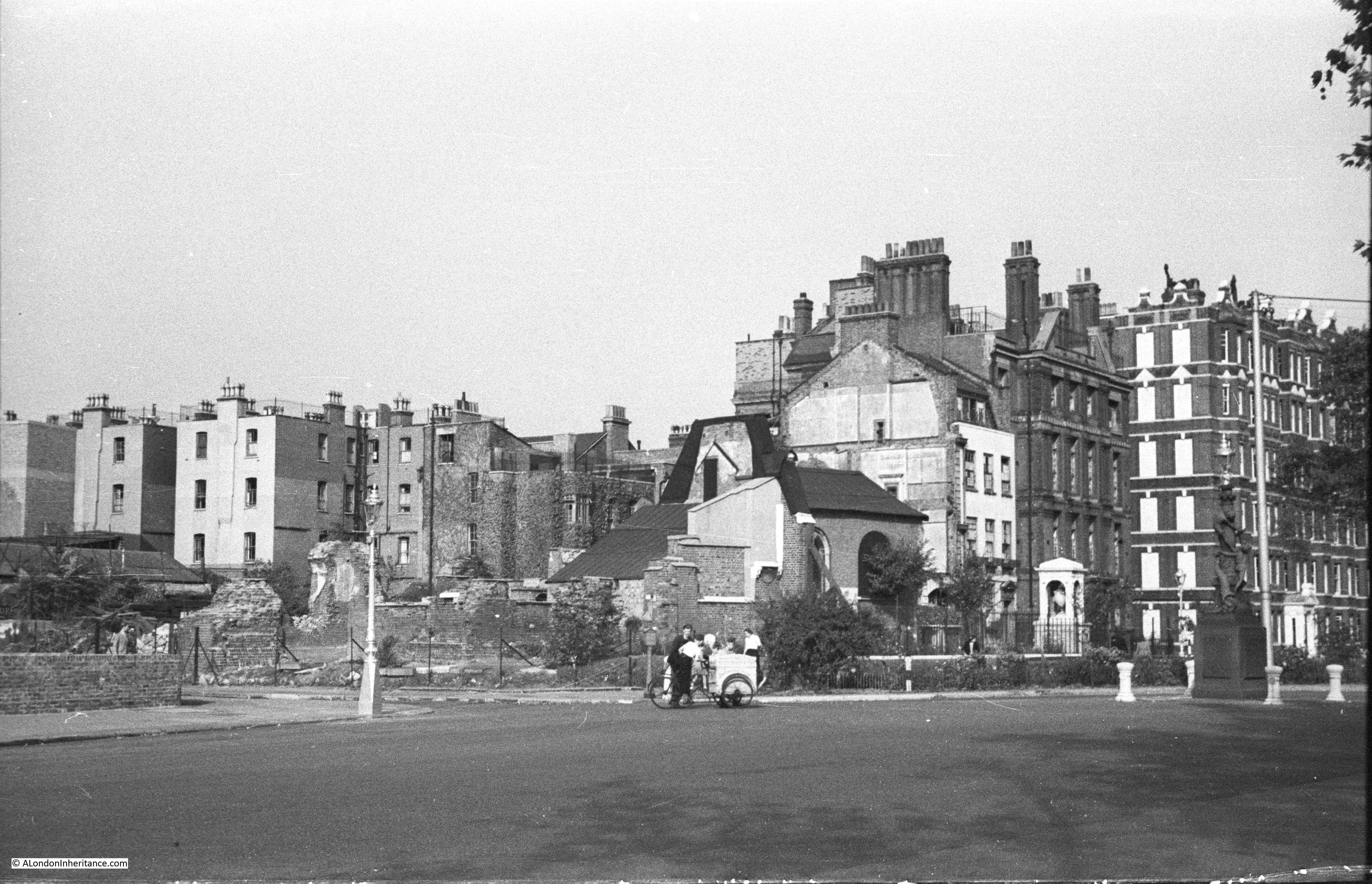
A quick look at the following photo and it is another bomb site, however the white monument on the right of the photo confirms exactly where this is, the site of Chelsea Old Church, at the junction of Old Church Street and Cheyne Walk. When my father took the photo, very little of the church remained apart from the chapel on the right. The main body of the church along with the tower had been completely destroyed.

The same location today, with the reconstructed church. The monument and buildings to the right confirm the location.
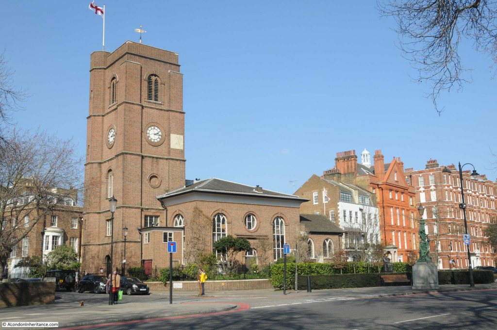
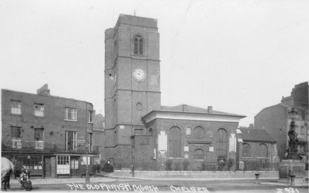
And to confirm how accurately the church was reconstructed, the following photo shows the pre-war church.
In 1957 a booklet was published to raise money for the rebuilding fund. Titled “Chelsea Old Church, 1941 – 1950” it tells the story of the destruction of the church and the battle to rebuild.
The booklet starts with a paragraph summing up the night on which the church was destroyed:
“On the night of the 16th-17th April 1941, four hundred and fifty German bombers attacked south and central London for nearly eight hours. Civilian casualties were over one thousand killed and two thousand seriously injured, and among the buildings hit were eighteen hospitals and thirteen churches, one of which was Chelsea Old Church.”
Chelsea was heavily bombed that night with a total of five parachute mines, a range of high explosive bombs and hundreds of incendiary bombs. Parachute mines, or landmines were really the same mines as used at sea. They were dropped by parachute and detonated either by vibration or magnetism making them a problem on the ground until they could be safely dealt with.
April 16th had been a fine spring day, much like the day I visited the church, with the sun shining all day long.
The air raid sirens sounded at five past nine in the evening and the residents of Chelsea either headed towards air raid shelters or stayed in their homes and the fire watchers took up their positions ready to deal with any fires caused by incendiaries and to try and deal with any casualties of bombing.
Parachute flares were the first signs of the attack, dropping over the south east of Chelsea and over the Lots Road Power Station. The raid then intensified and the booklet takes up the story:
“By one in the morning about forty trapped casualties had been reported at the Royal Hospital Infirmary. A wardens’ post nearby had dealt with more than that number of walking cases and homeless persons. The Post Warden was conducting his senior officer, the District Warden, on a tour of the area, and they were returning from watching incendiary bombs rattling down on the warehouse roofs across the river when they saw six members of the Old Church Fire Party leave the shadow of the tower and walk away from it along Cheyne Walk towards Danvers Street.
The Post Warden had returned to Cook’s Ground School and was just lowering himself into a chair to make an entry in the Log Book when two heavy explosions occurred close at hand. The time was twenty past one. Everything in the room jumped, dust was shaken down, the noise of breaking glass and splintering woodwork came from elsewhere in the building. Leaving the telephonist in charge of the Post, the Post Warden dispatched all available wardens to investigate and went out himself. The District Warden joined him in the corridor. His windows had been blown in on top of him as he sat in his office, but he escaped injury. As they turned the corner from Gleve Place into Upper Cheyne Row light came from some of the houses; windows and window frames complete with blackout had been sucked out into the road or pushed into the room. Tiles, broken slates, lath and plaster, bits of wood and glass littered the roadway; but this was only the minor damage. Justice Walk was blocked halfway in from Lawrence Street and it was evident that the center of the damage was somewhere on the other side of it. As they ran round the corner into Cheyne Walk they were brought down by a length of garden railing. They saw flames leaping up in a thinning dust haze. Near Danvers Street in a shallow crater in the road a gas main was on fire. And then it came to them both: “The Old Church has gone!” There was a jagged stump of brickwork and projecting timbers silhouetted where the eye had expected the massive square tower.”
The account in the booklet then explains what had happened to cause such destruction:
“About the time the sirens sounded the “Alert”, Mallett and the others on duty had gone up to the top of the church tower, the first time they had been up there, he said. They stayed up there for a time watching the flares and then went down to the embankment. Later on they went back to the room on the first floor of Petyt House (just behind the church) for a cup of tea. After that they were in and out all the time. About one o’clock they went along Cheyne Walk towards Danvers Street and some of them were talking to one of the fire party on duty at the cafe on the corner there. The ack-ack fire had been very heavy and there was a lot of shell casing lying about.
He had picked up a nose cap which had fallen outside the house with the copper panels on the gates (75 Cheyne Walk). He remembered saying to himself; ‘This is made of phosphorous bronze, expensive stuff to chuck about like this’, and then he heard something fall on the road beside him. It landed with a thump, not very loud, ‘like a fifty pound weight falling on soft ground’. It was not an alarming noise, and he looked round casually to see what it was. Actually it must have been painted dark green, with the sea green parachute collapsing beside it. Mallett described it as a ‘big thing about seven feet long and as big as you could get your arms round.’
He shouted a warning to the others and started running. They probably saw it first for they were ahead of him and had turned into Old Church Street when a second mine struck and exploded between Petyt House and the Church. the explosion detonated the one which had landed unexploded beside Mallett. How he was not killed, blown to fragments like Michael Hodge and the others caught in the open, can only be guessed at. He said he was running too fast to turn the corner and follow the others up Church Street, and he was kneeling beside the fire alarm post on the corner of the street when the explosion took place. As he was on the far side of the tower and probably below the level of the church yard wall he was protected from the direct blast of the first explosion. There was in fact a fraction of a second’s interval between the two. It may be that the debris of the tower collapsed beside him into the roadway in time to divert the blast of the other mine lying not more than seventy-five yards away.”
The tower and the majority of the church had been complete destroyed. Only the More Chapel at the far end of the church from the tower remained (as can be seen in my father’s photo).
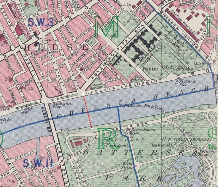
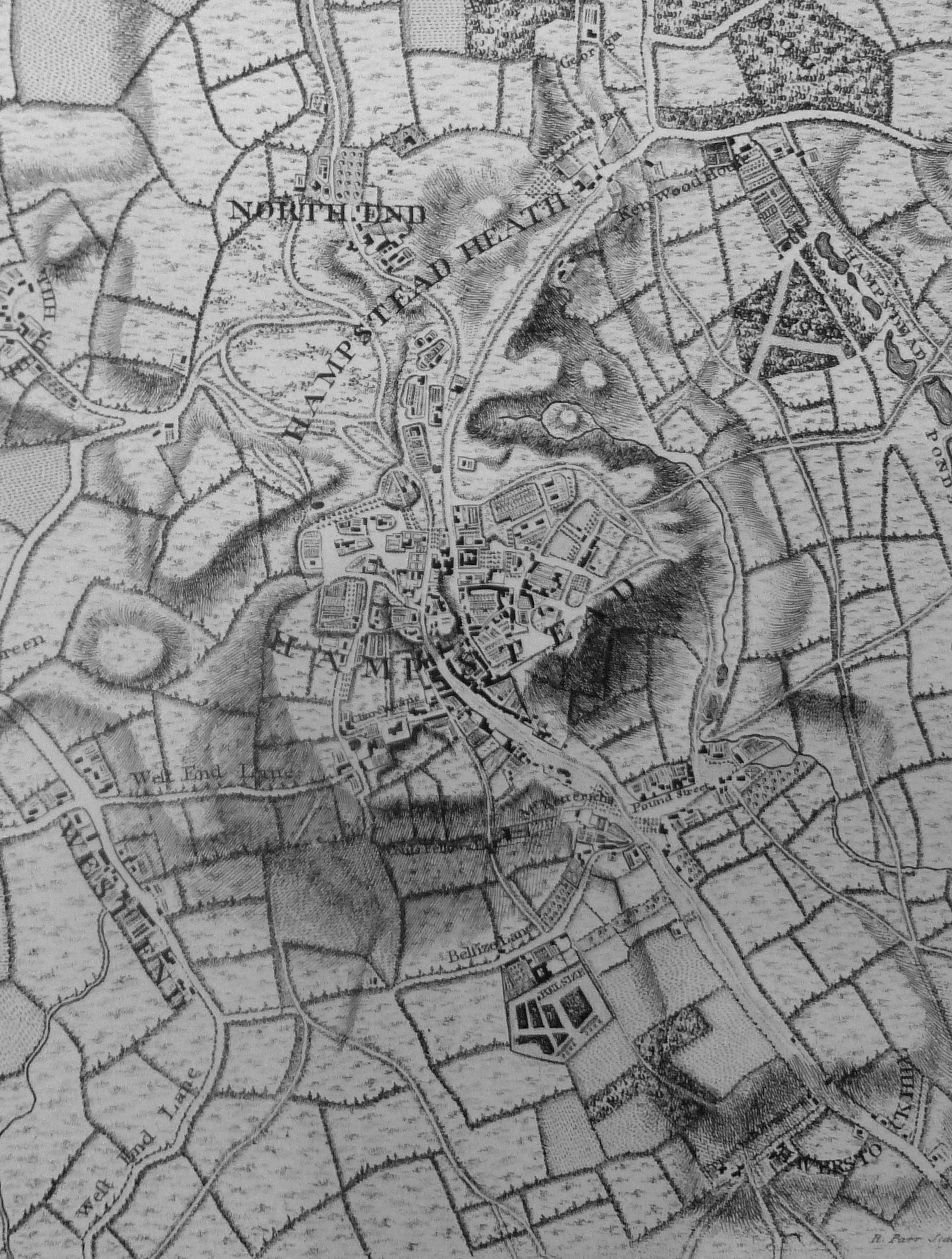
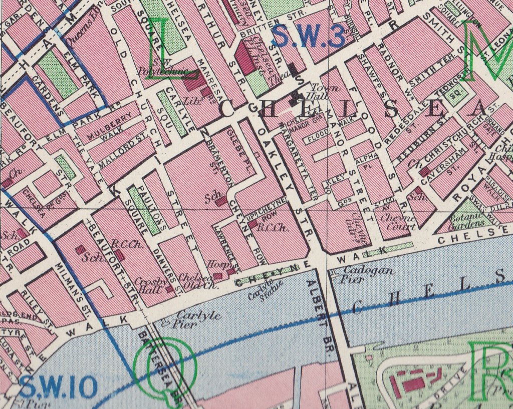
Map of the area in 1940 showing the church just above Carlyle Pier on the river with the street names, Old Church Street, Danvers Street, Lawrence Street, Cheyne Walk mentioned above.
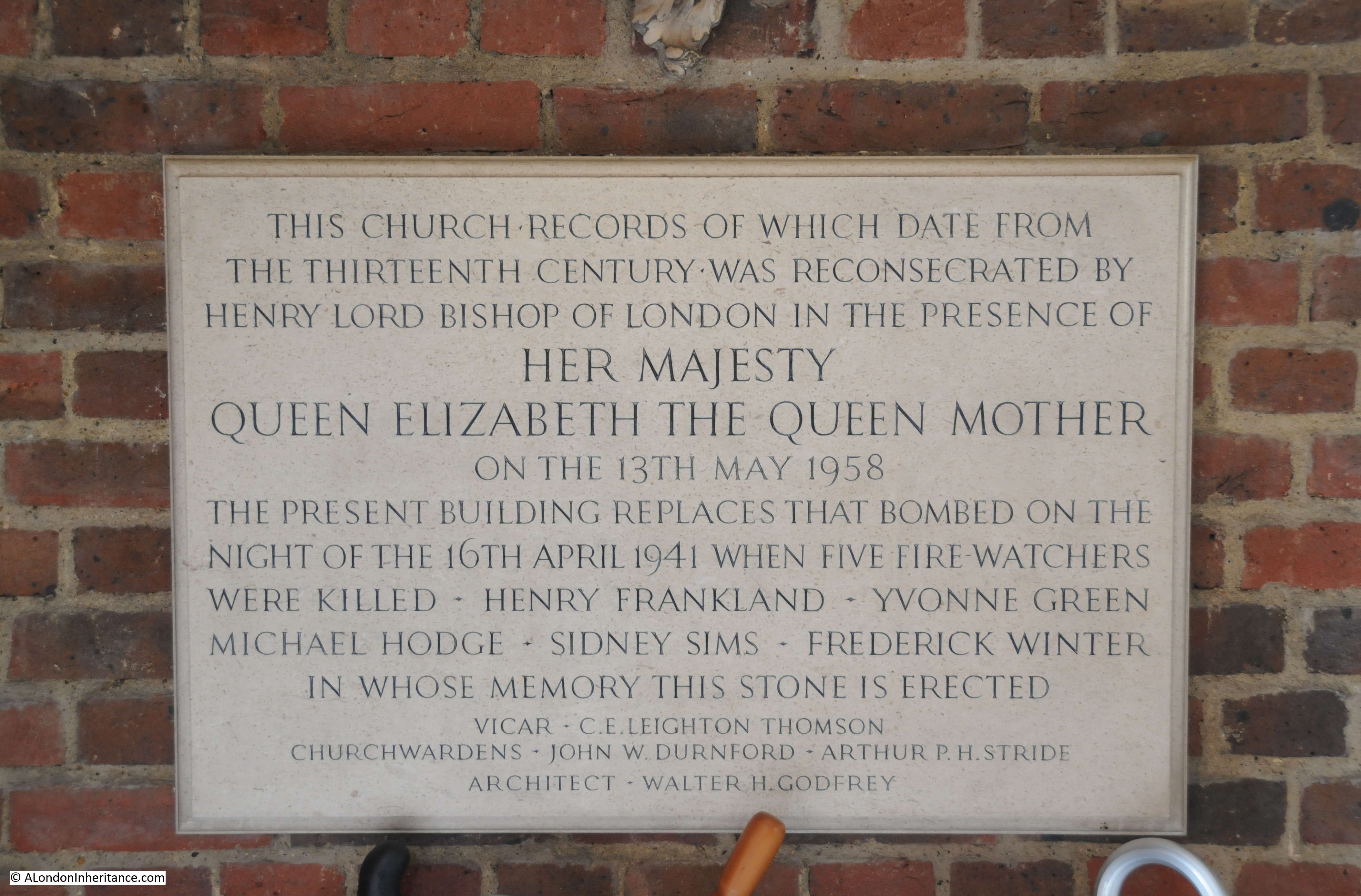
The following plaque in the entrance to the church records the names of the fire watchers who were killed when the church was bombed.
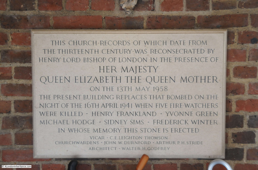
Whilst the plaque records their names, the booklet provides some background to help us understand more about the people who died protecting the church:
“There was a leader appointed for each night in the week. Normally Wednesday’s leader was Mr Bottley of Gregory Bottley & Co. Mineralogists, 30 Old Church Street and Mrs Bottley made one of the party, but they had gone away the week before on a three weeks trip to North Wales to obtain geological specimens and their places on the rota were taken by their manager, Mr Fred Winter and optical lens maker Mr. Sidney Sims. Both men had been with the firm since leaving school and were highly regarded. Sims was engaged to be married, Winter was married with two children. With Mallett, Winter and Sims on duty that Wednesday were Mrs. Greene, Michael Hodge and Mr. Franklin. The later was a carpenter employed by the Westminster Carriage Company, 48 Old Church Street, and was not strictly speaking a member of the Fire Party but had attached himself to them for the company and they included his premises in their patrols. Michael Hodge was aged seventeen and very tall for his age. He was waiting to go up to Cambridge but talking of enlisting in the Black Watch. He was staying at the Grosvenor Hotel with his parents and used to come down to Chelsea on Wednesday evening by taxi. Yvonne Greene of 34 Old Church Street, a Canadian and newly married to a Canadian army officer, was a part-time Auxiliary Fire Service driver.”
With the church destroyed, the challenge was now to protect the church site and plan for rebuilding. Anything that could be recovered from the site was quickly recovered and stored, however the site attracted problems during the years after the bombing:
“During the next two years there were no major engagements, though it was necessary to carry on a constant warfare against children who used the site as a playground, scribbling undesirable remarks on the stones and carrying off wood and bricks for their own purposes; and against adults, whom less excusably, stole lead to sell and wood to burn. It was Mr. Stewart Jones who took the initiative by getting the site fenced, and organised a concert to pay for it.”
The challenge for the church was getting approval and the funding needed to rebuild the church. The amount of damage across London meant that both funding and the labor and materials needed were in short supply during, and in the years after the war. There was no automatic assumption that Chelsea Old Church would be rebuilt.
Approval for reconstruction and funding was subject to Diocesan authority and expenditure required the consent of the Diocesan fund. A Diocesan Reconstruction Measure of 1941 placed the church on a list of bombed churches that would not be rebuilt within five years from the end of the war and there was doubt whether the church would ever be rebuilt.
In March 1945 proposals from the Diocesan Reorganization Committee recommended limited reconstruction of the church with just the More Chapel being retained to house the monuments recovered from the church. The concern was that the remains of the church would be little more than a museum for the recovered monuments. A hard-fought campaign was needed over the following years to convince the Diocesan Reorganisation Committee that the full church should be rebuilt with permission and funding to build to the same design as the destroyed church. Fund raising took place and approval was finally given with the More Chapel reopened for services in 1950 and the whole church reconsecrated in May 1958.
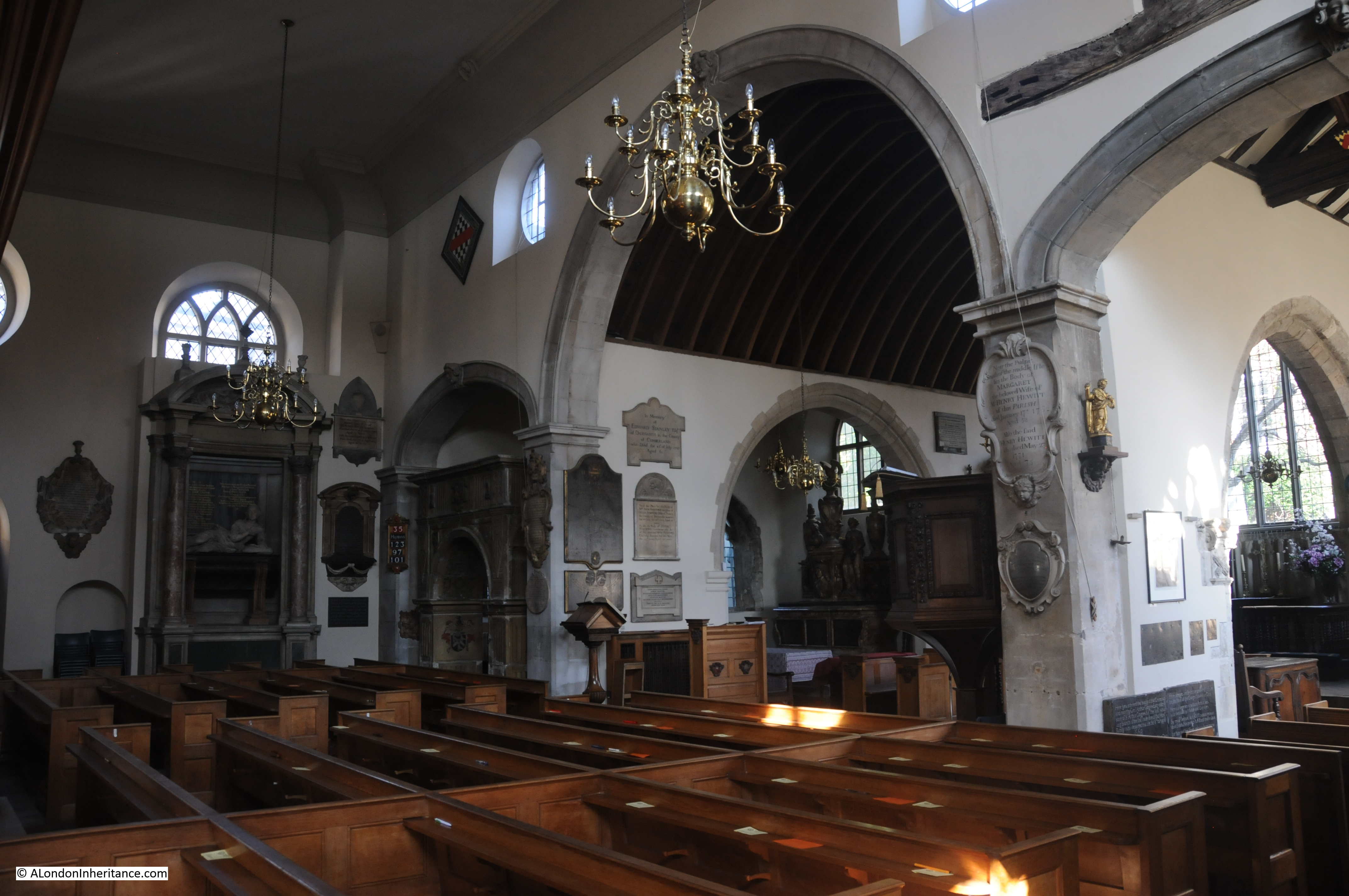
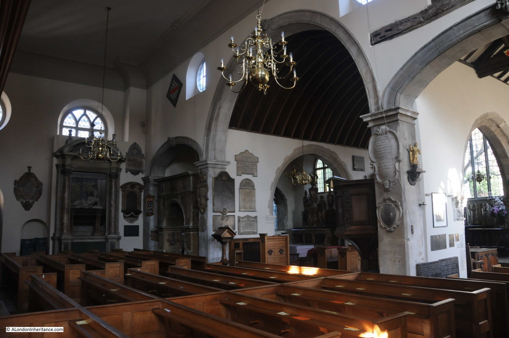
The history of Chelsea Old Church requires a dedicated post to do justice to the church, however the following is a brief walk round the church.
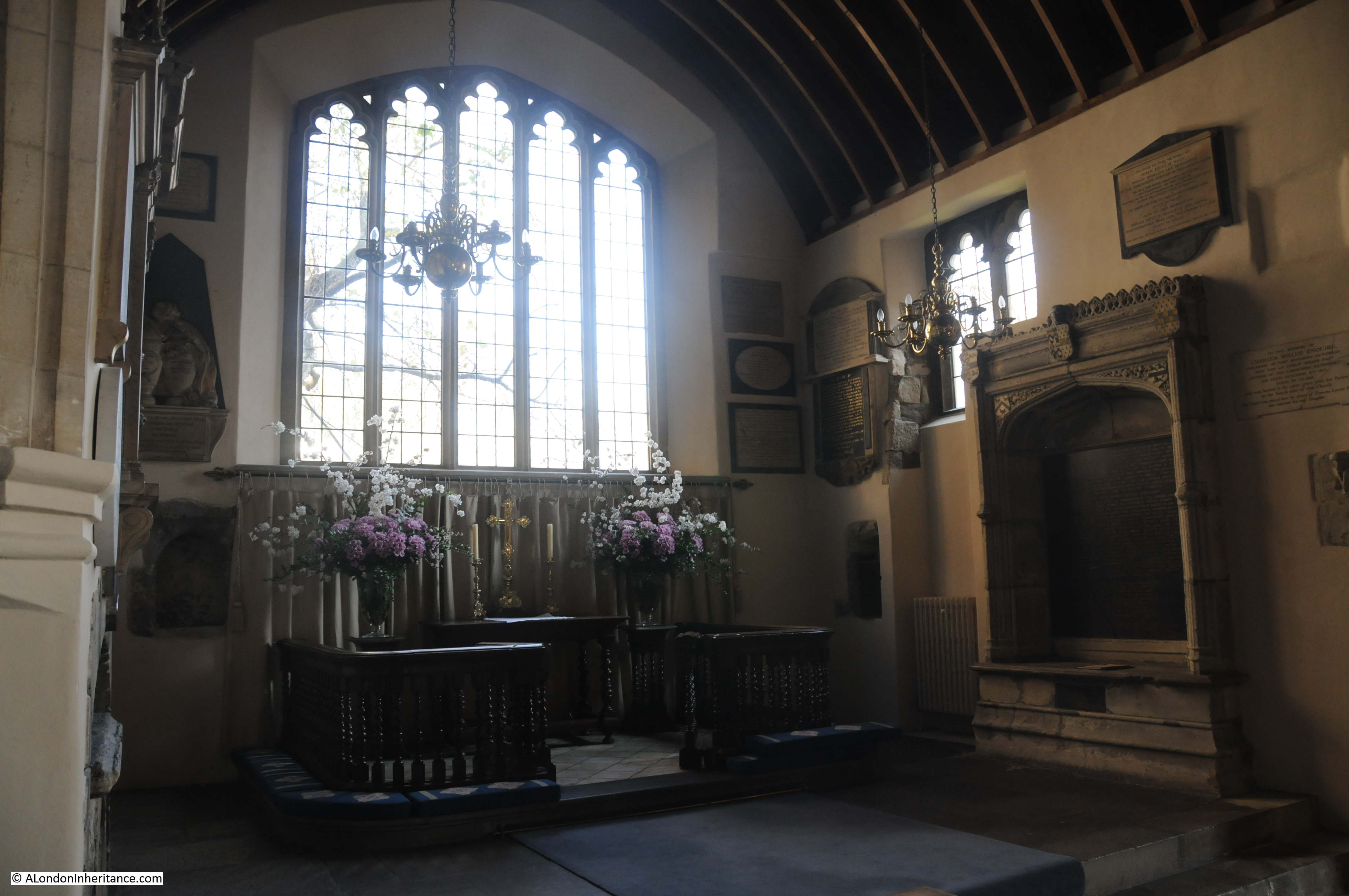
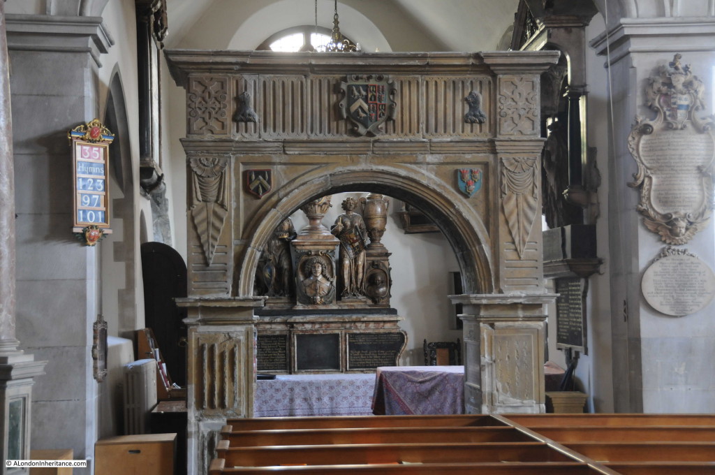
Looking across the church to the More Chapel, the Jervoise arch and the memorial to Lady Jane Cheyne:
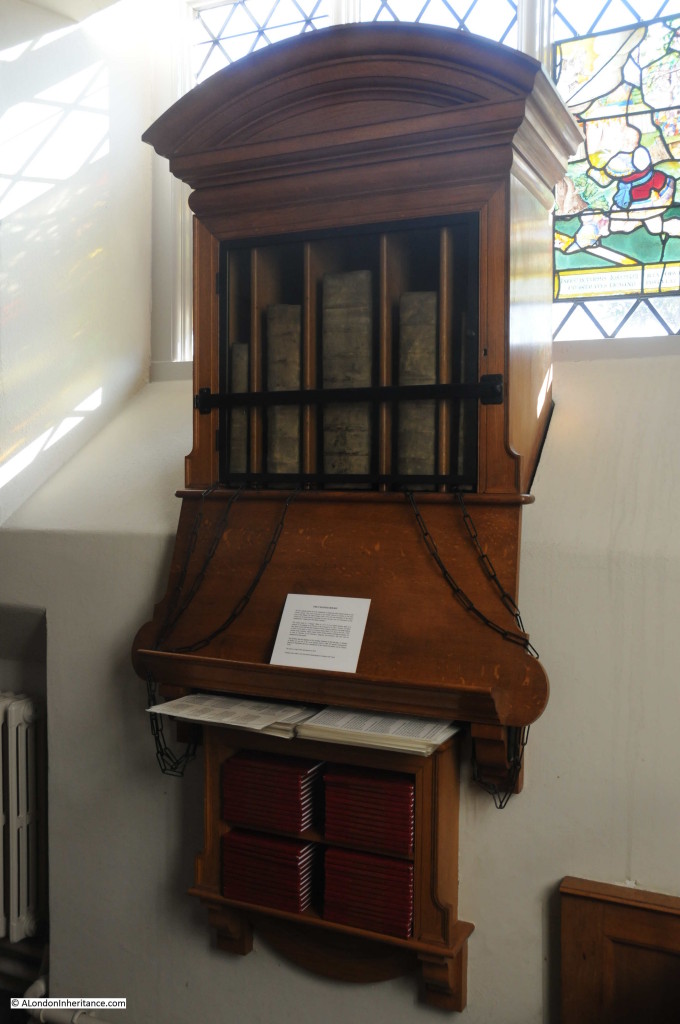
The church is the only one in London with any chained books. In a case within the church are five chained books, presented to the church by the Lord of the Manor, Sir Hans Sloane. The books consist of a Bible from 1717, first and third editions of Foxe’s Book of Martyrs from 1684, a 1723 book of Common Prayer and a 1683 volume of Homilies.
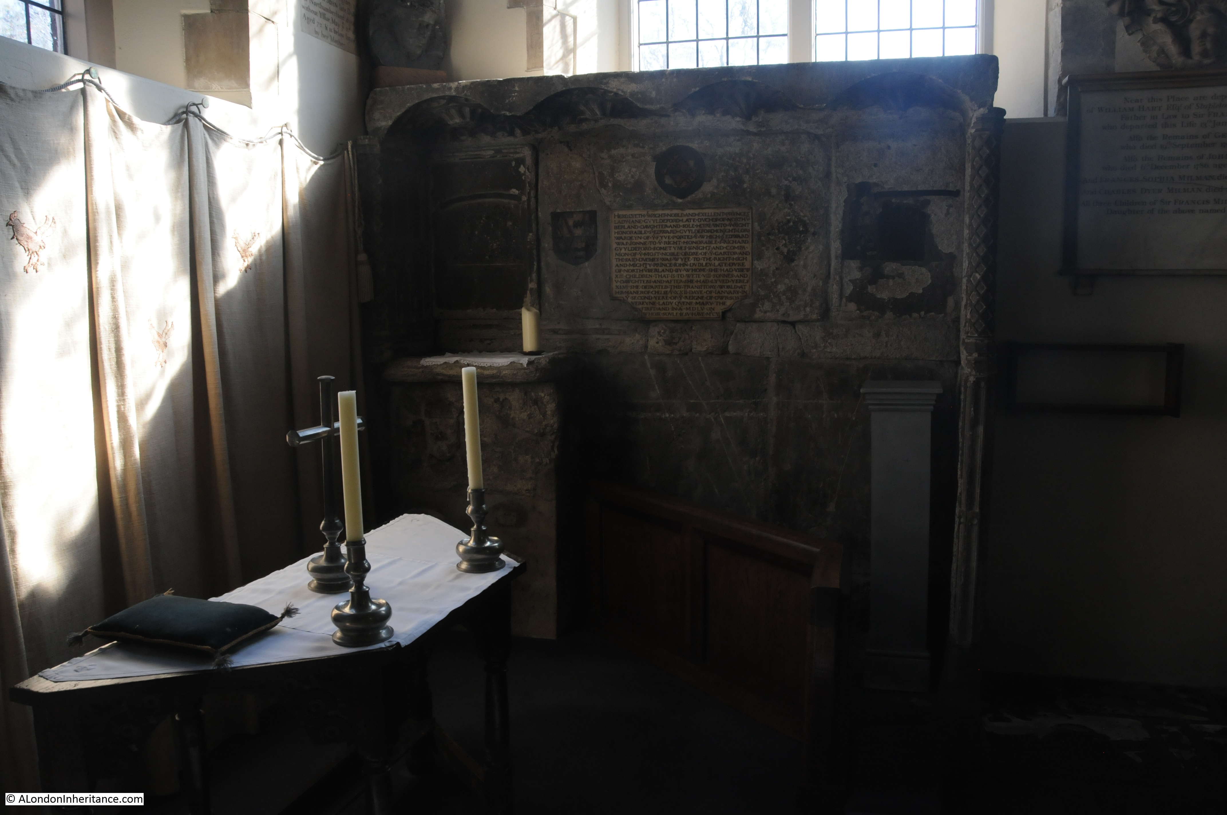
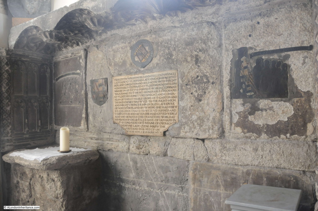
The remains of the tomb from 1555 of Lady Jane Guildford, Duchess of Northumberland.

The inscription reads:
HERE LYETH Y RIGHT NOBLE AND EXELLENT PRYNCES LADY JANE GVYLDEFORD LATE DVCHES OF NORTHVBERLAND DAUGHTER AND SOLE HEYRE VNTO Y RIGHT HONORABLE S EDWARD GVYLDEFORD KNIGHT LORD WARDEYN OF Y FYVE PORTES Y WHICH S EDWARD WAS SONNE TO Y RIGHT HONORABLE S RICHARD GVYLDEFORD SOMETYMES KNIGHT AND COMPANION OF Y MOST NOBLE ORDERE OF Y GARTOR AND THE SAID DVCHES WAS WYFE TO THE RIGHT HIGH AND MIGHTY PRINCE JOHN DVDLEY LATE DVKE OF NORTHVBERLAND BY WHOM SHE HAD YSSEW XIII CHILDREN THAT IS TO WETE VIII SONNES AND V DAWGHTERS AND AFTER SHE HAD LYVED YERES XLVI SHE DEPARTED THIS TRANSITORY WORLD AT HER MANER OF CHELSEY XXII DAY OF JANVARY IN Y SECOND YERE OF Y REIGNE OF OWR SOVEREYNE LADY QVEEN MARY THE FIRST AND IN A MDLV ON WHOSE SVLE IF SV HAVE M’CY
Standing in the church and thinking about even the recent history of the church, the words “this transitory world” are so very true for all those who have lived in, and traveled through London.
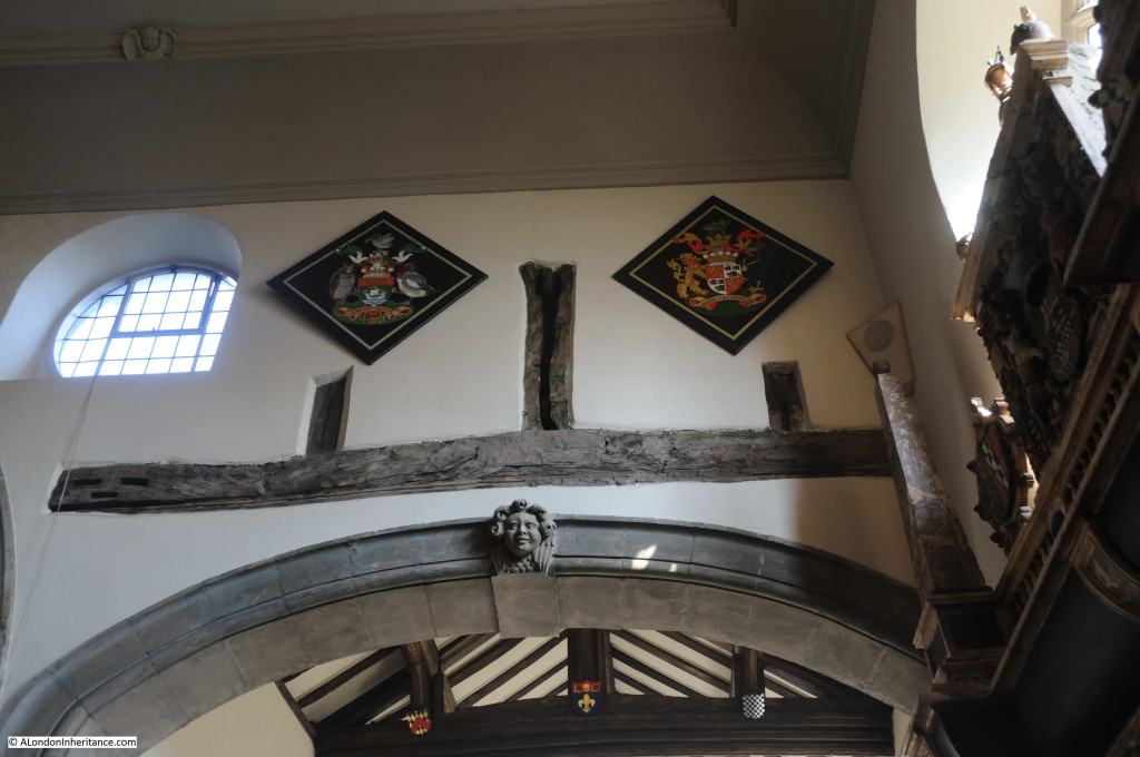
Although the bomb blast destroyed the majority of the church, the More Chapel was mainly intact and between the main body of the church and the More chapel, part of the original wooden construction of the church was exposed by the blast. The wooden “King Post” from the pre-Tudor construction of the building was not plastered over during rebuilding and has been left exposed.
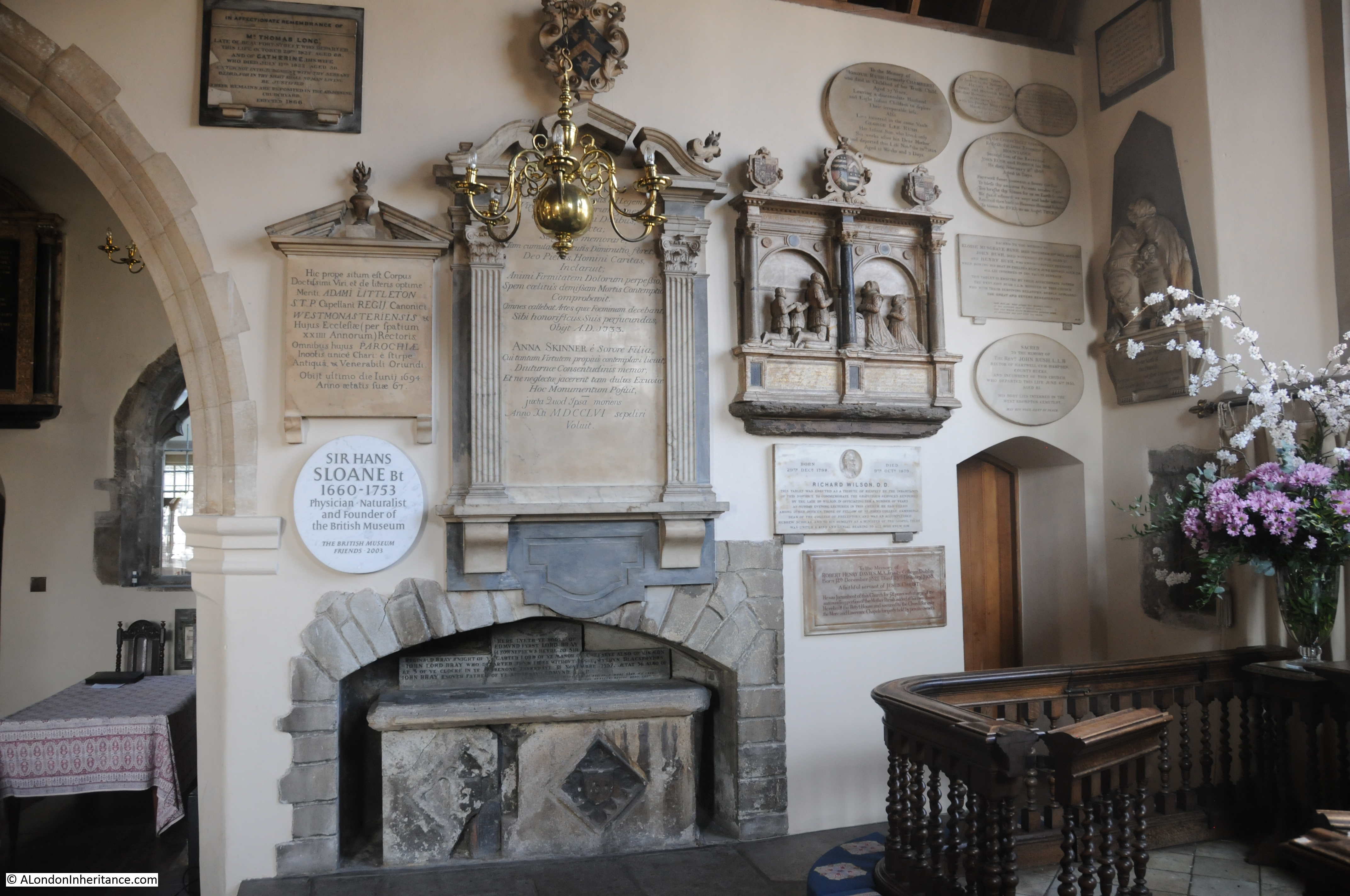
Monuments and plaques from the 16th century onwards:

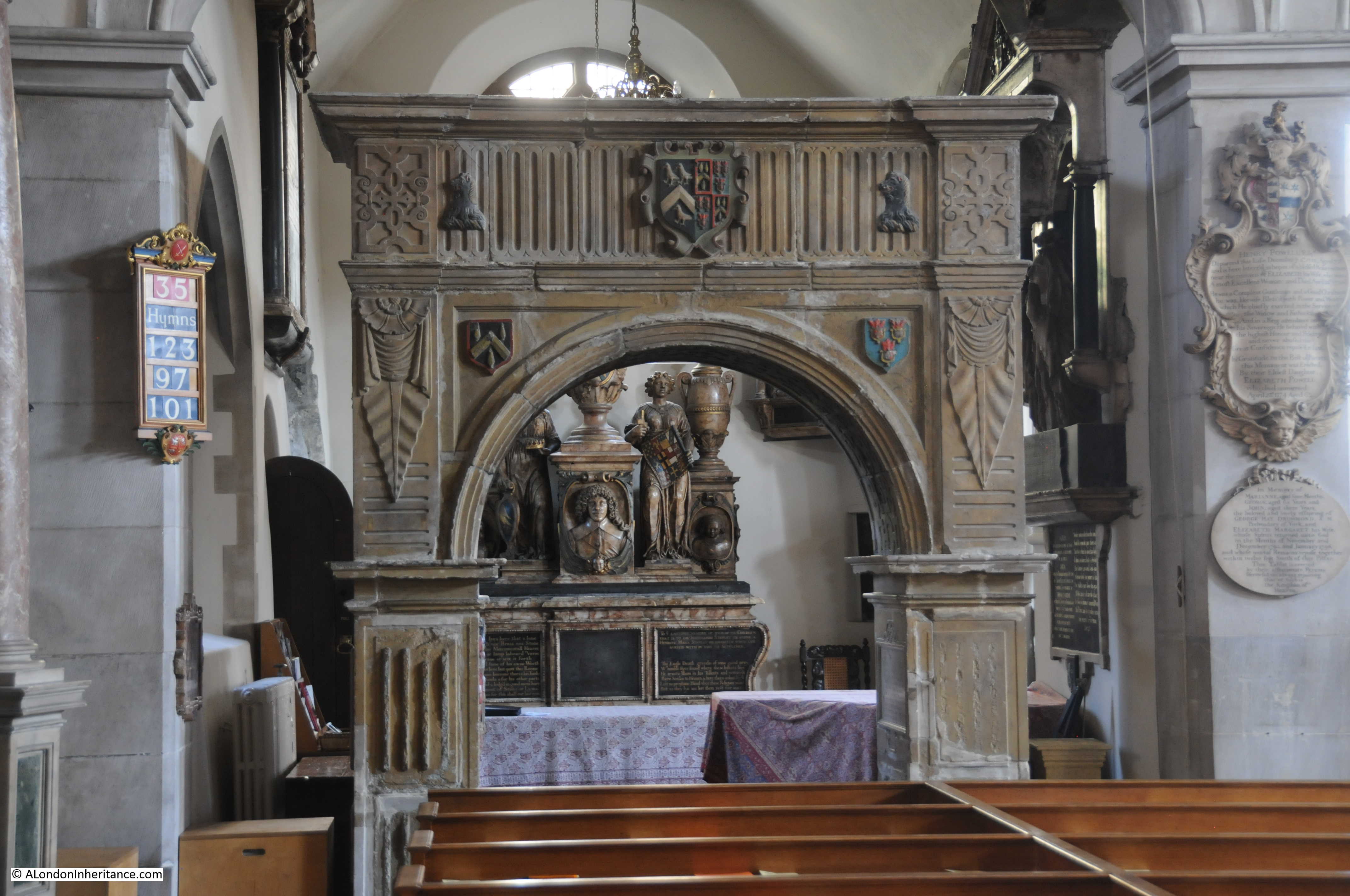
A view of the Sanctuary and on the right the memorial to Sir Thomas More.

Built by More for his first wife and intended by More also for him and his second wife after their deaths. The inscription, written by More describes his life and ends with a tribute to both his wives:
Sir Thomas More’s first loving wife lies here
For Alice and myself this tomb I rear
By Joan I had three daughters and one son
Before my prime and vig’rous strength was gone
To them such love was by Alice shown
In stepmothers, a virtue rarely known
The world believed the children were her own
Such is Alicia, such Joanna was
It’s hard to judge which was the happier choice
If piety or fate our prayers could grant
To join us three we should no blessings want
One grave shall hold us, yet in heaven we’ll live
And Death grants that which Life could never give
Another of the monuments from the original church, the triumphal arch commemorating Richard Jervoise:
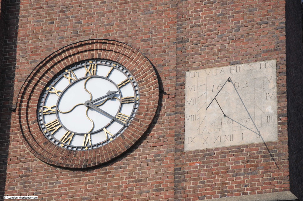
The sundial on the south-facing tower of the church, remade in 1957 and identical to the original (see the pre-war photo at the top of this post to see the original sundial in the same position).
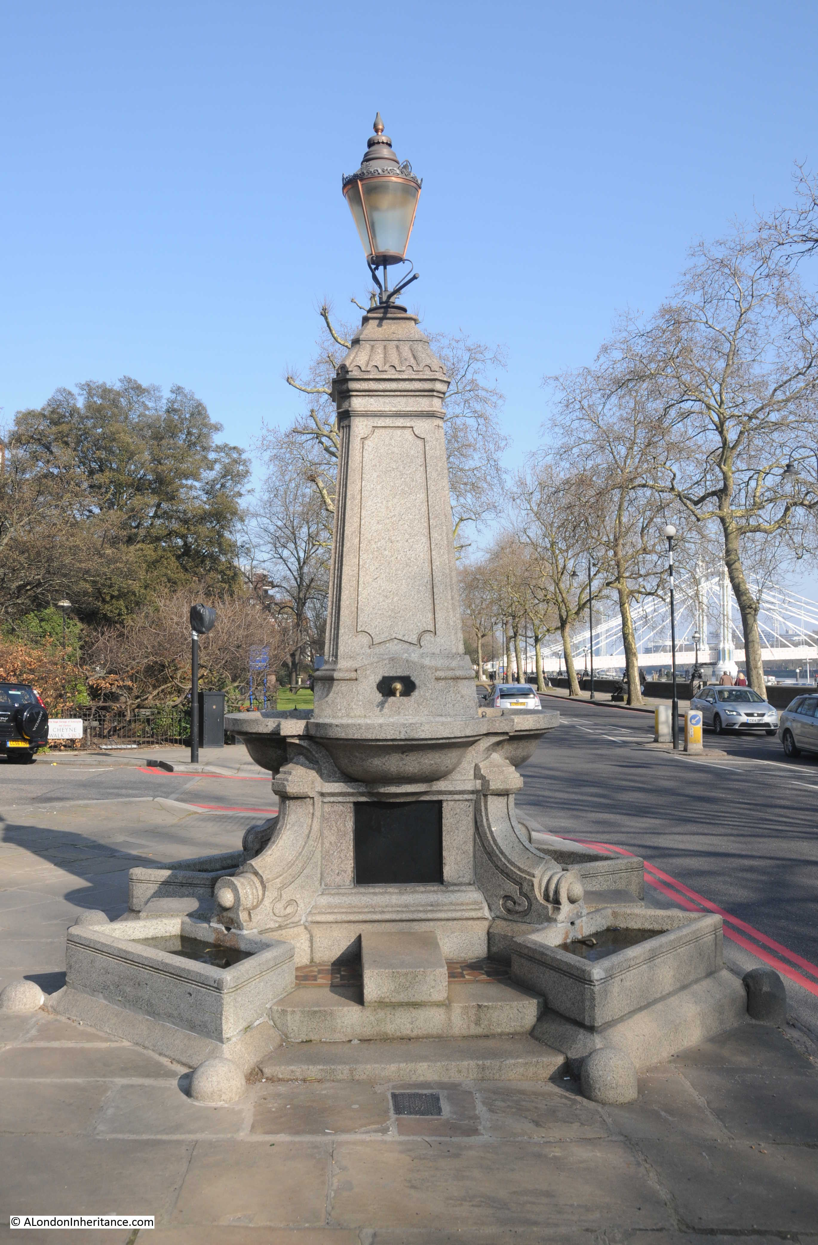
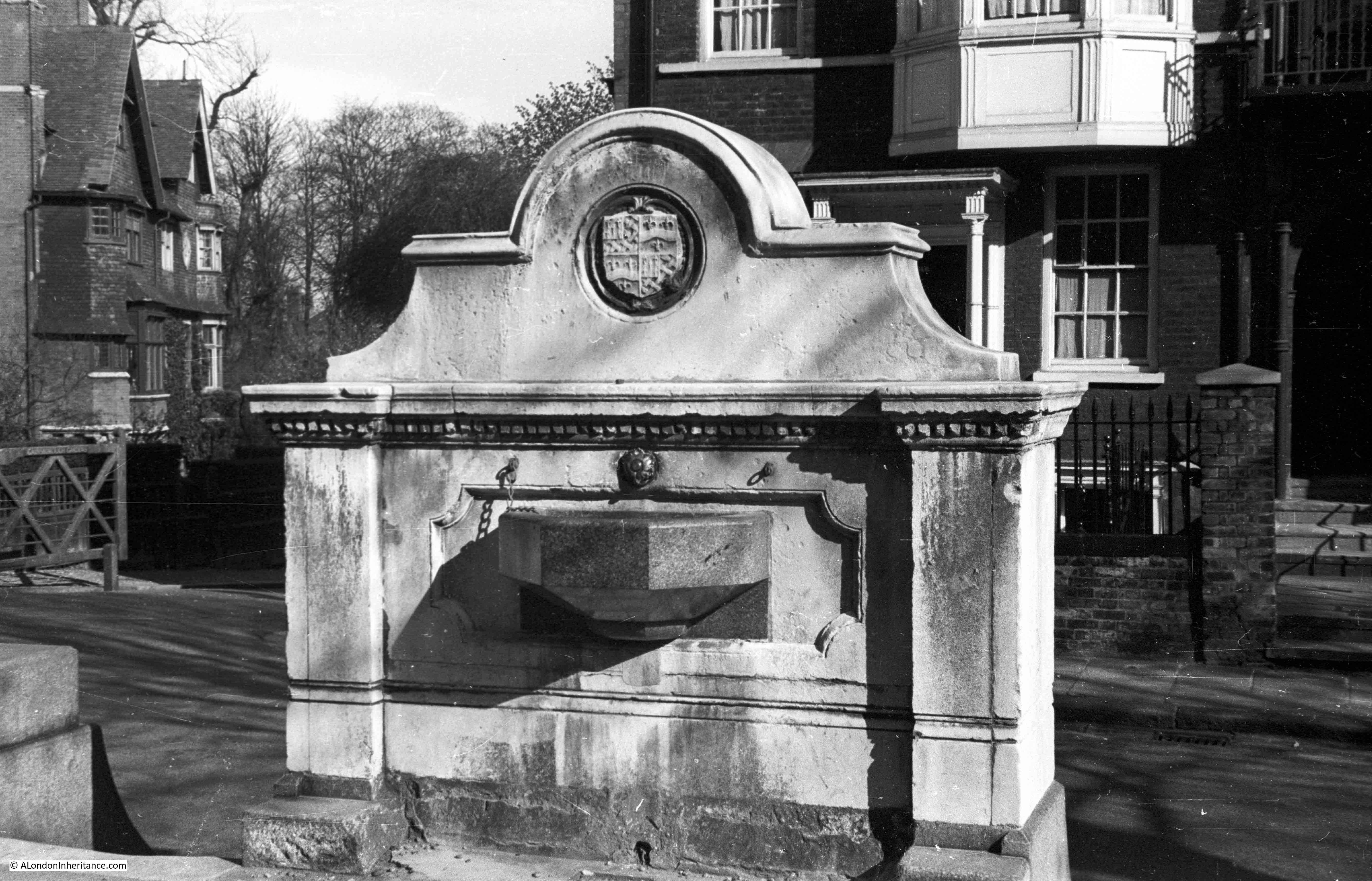
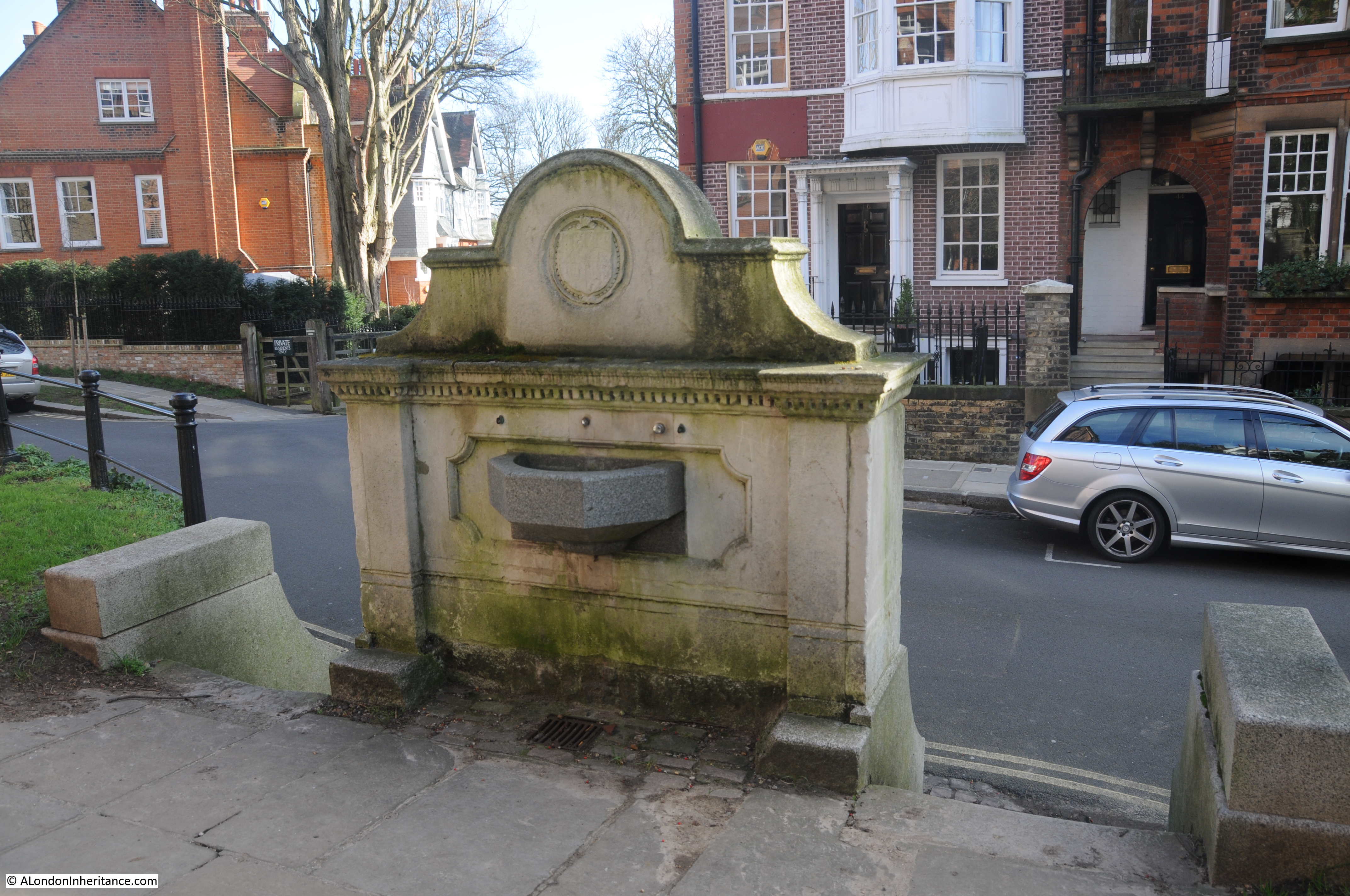
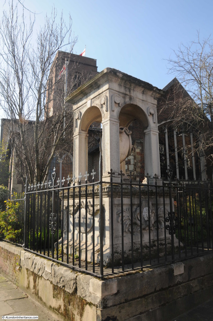
There are a number of monuments outside the church, including this water fountain built-in 1880 by the widow of George Sparkes of the East India Company:

The 1969 statue of Sir Thomas Moor.
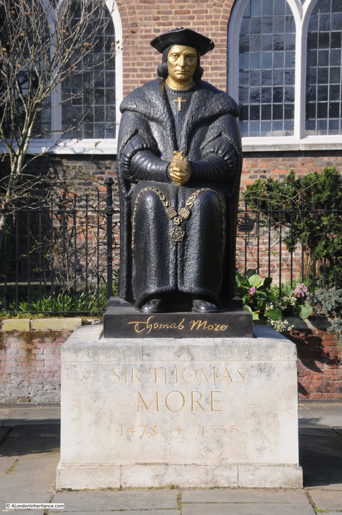
Sir Thomas More’s association with the church began when he settled in Chelsea, the owner of a large estate close to the church. When he moved to Chelsea in 1520 he rebuilt one of the chapels and with his family, worshiped at the church when at his Chelsea residence.
Another memorial to a person with a close connection to Chelsea is the memorial to Sir Hans Sloan, who was also involved with the founding of the nearby Chelsea Physic Garden:
The fact that Old Chelsea Church is still here is a tribute to those who fought hard for the church to be re-built and to the same design as the pre-war church. It also reminds us of those who died trying to protect the area in which they lived and worked during the last war.
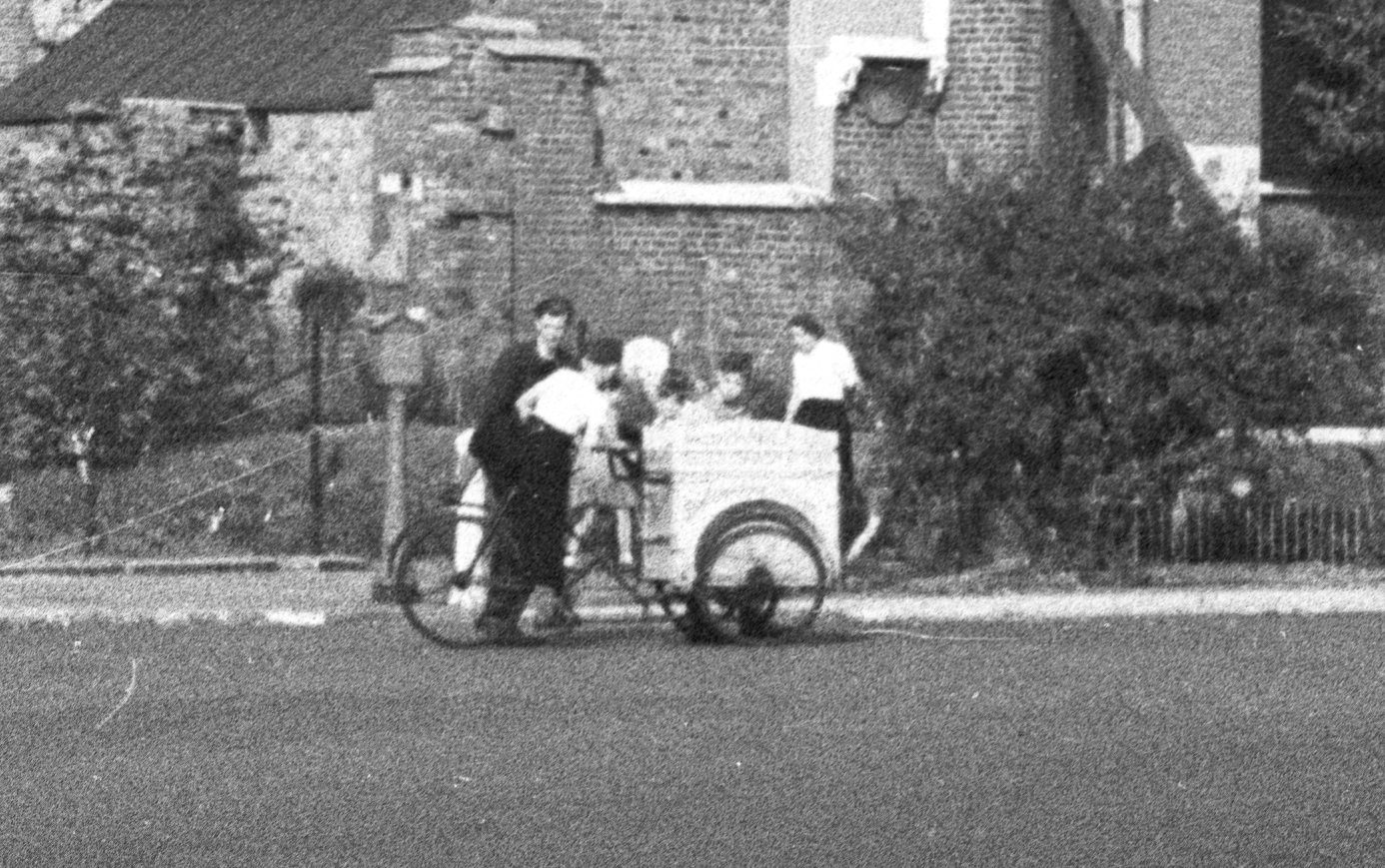
To finish, the following photo is an enlargement of a small section in front of the church from my father’s photo. I suspect this is an ice cream vendor cycling round the streets of Chelsea – very different to the busy road in front of the church today.

A church with a fascinating history and highly recommended for a visit, even if it is not a beautiful spring day in London.
alondoninheritance.com