Building The Royal Festival Hall

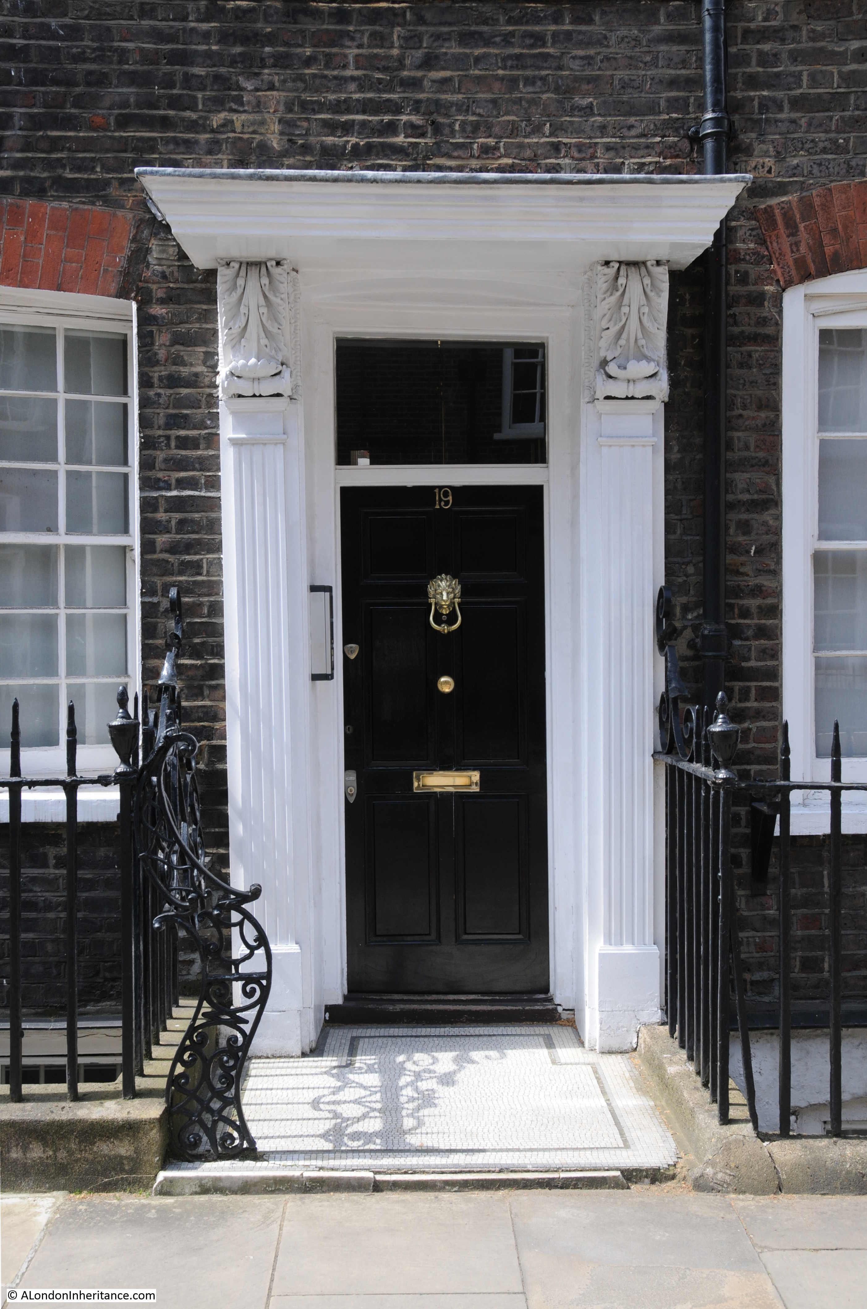
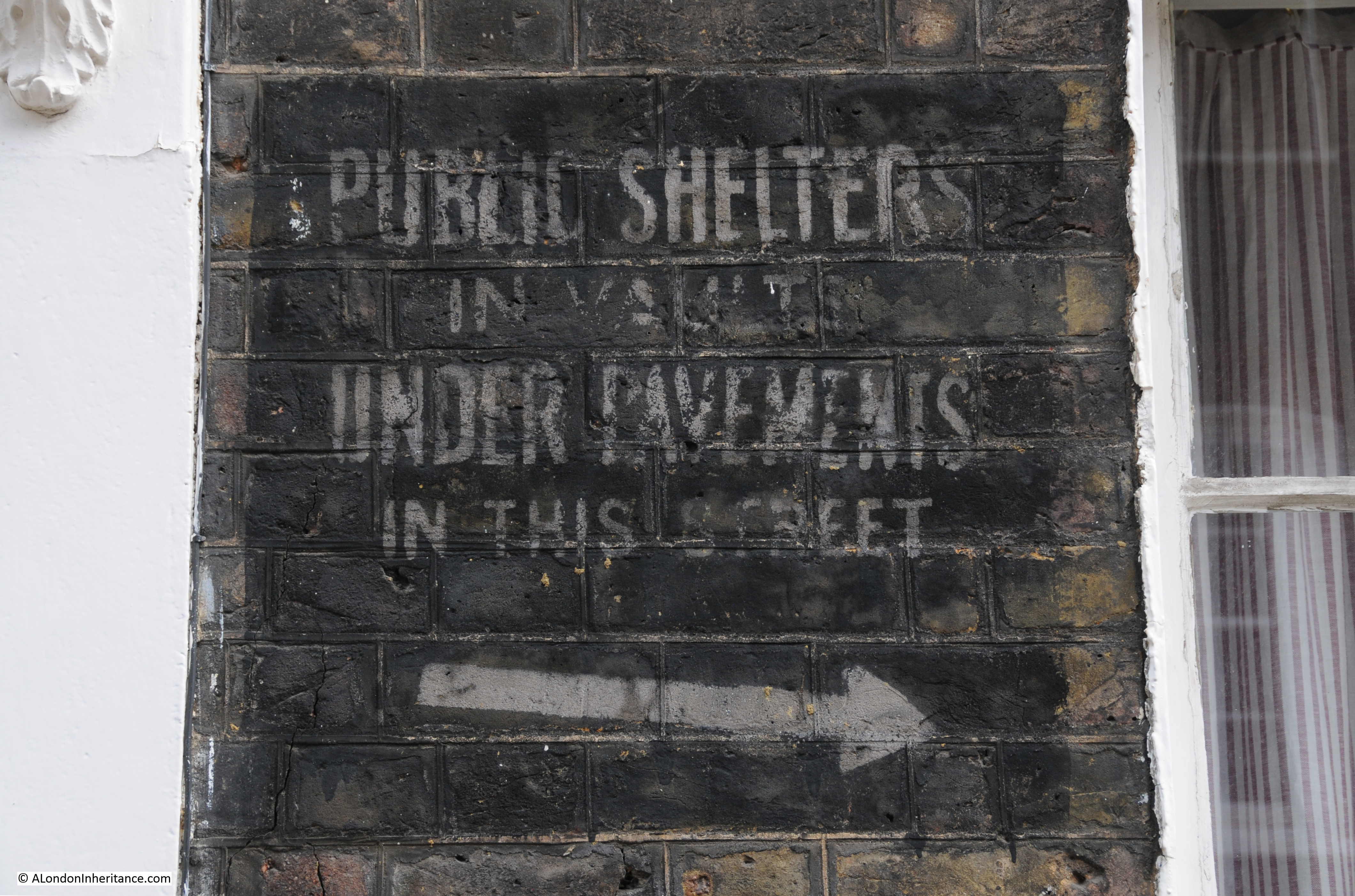
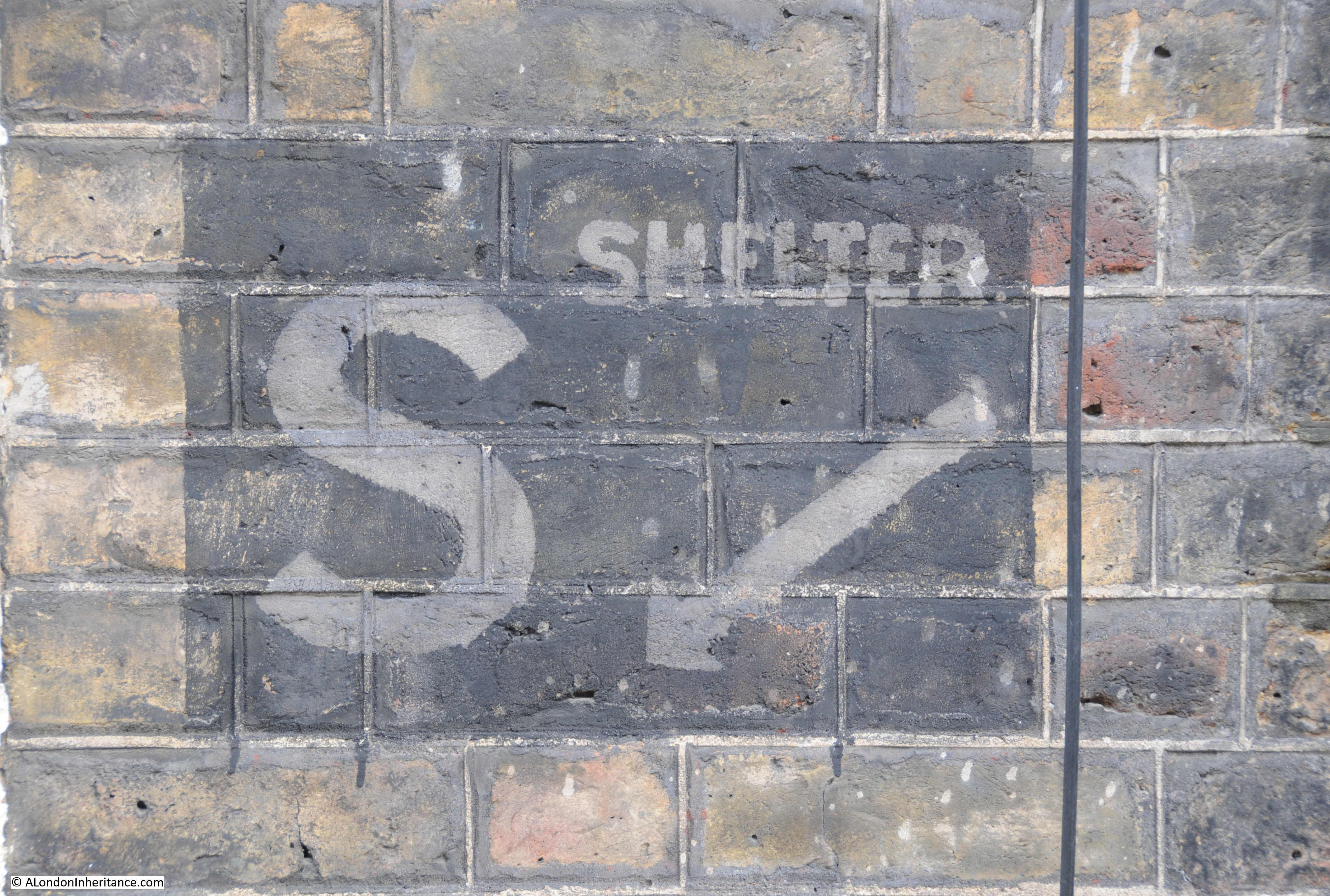
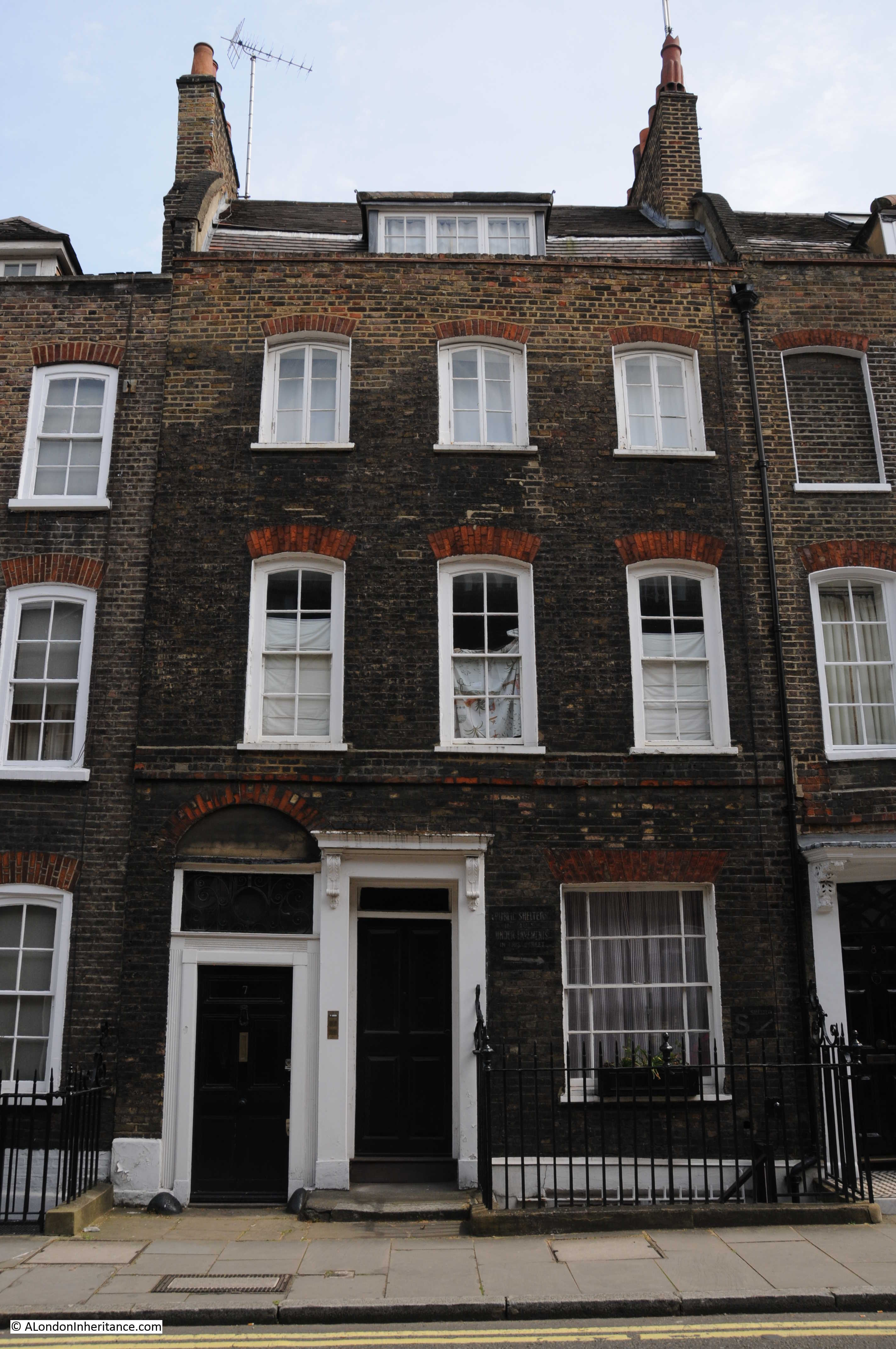
Now for the final post in my trilogy on the history of the South Bank. In my last post, we had walked the length of Belvedere Road which ends on the approach road to Westminster Bridge. In this post, it is a quick walk along the north bank of the river to get some views of the South Bank, then back across Hungerford Bridge to look at the building of the Royal Festival Hall.

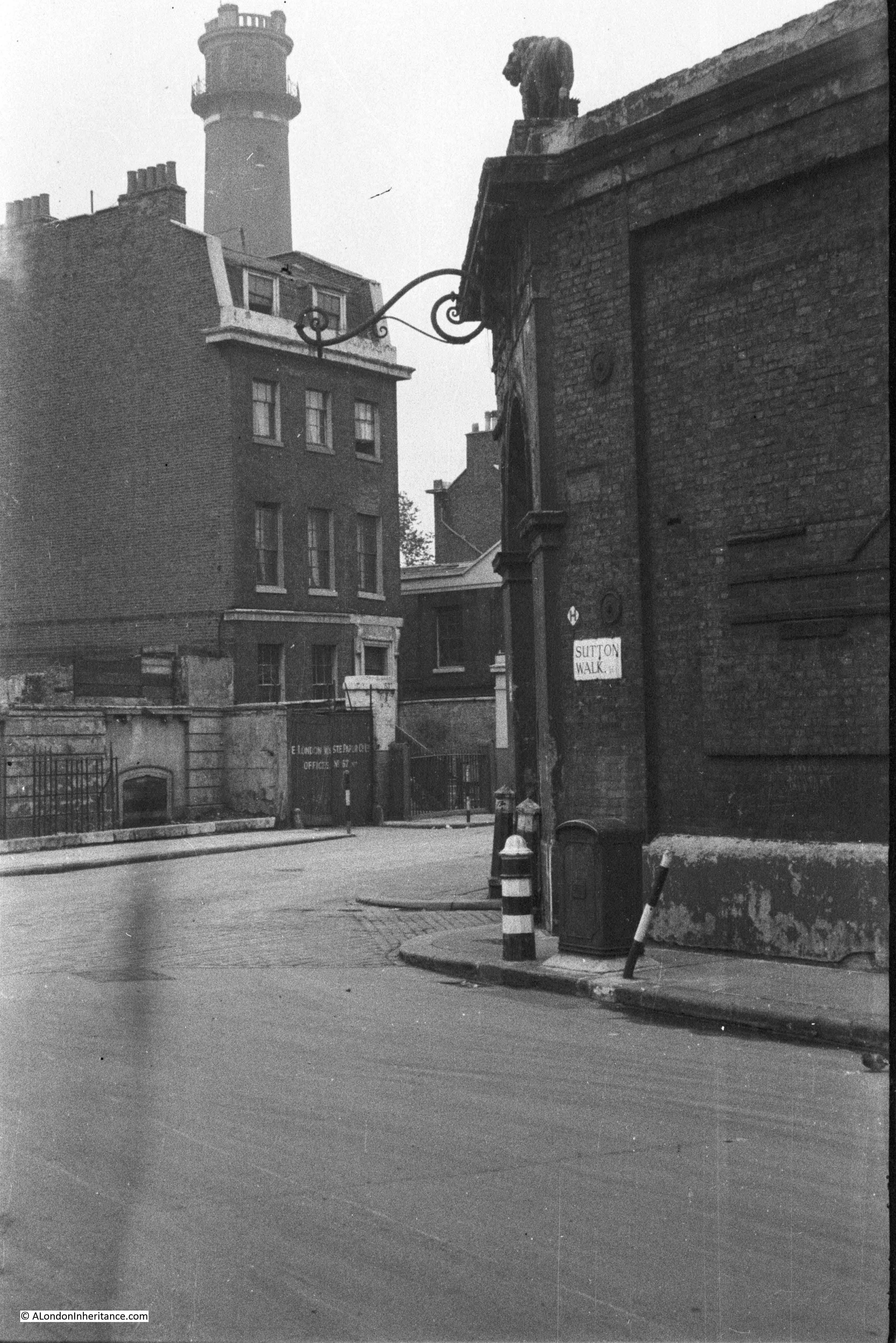
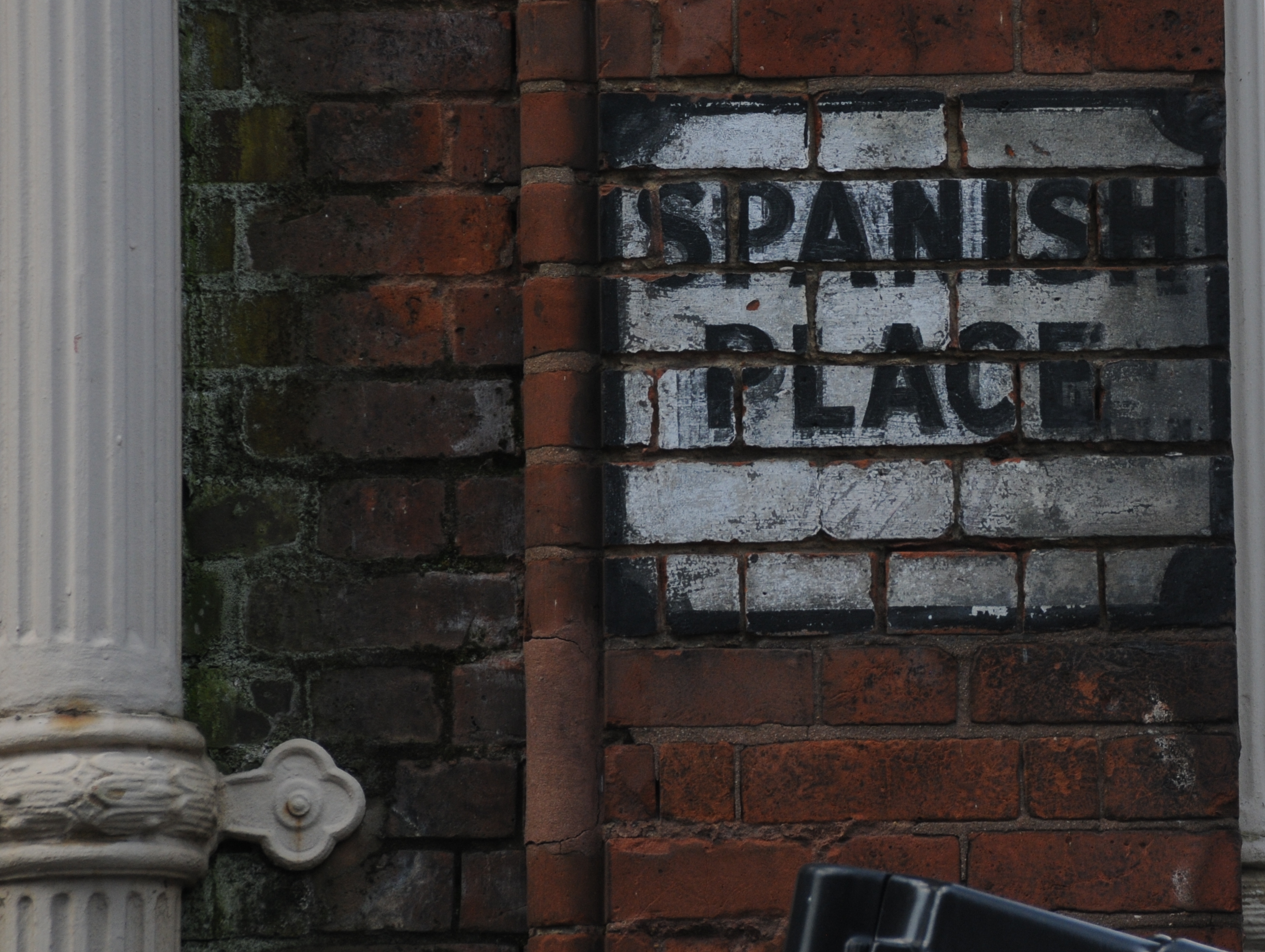
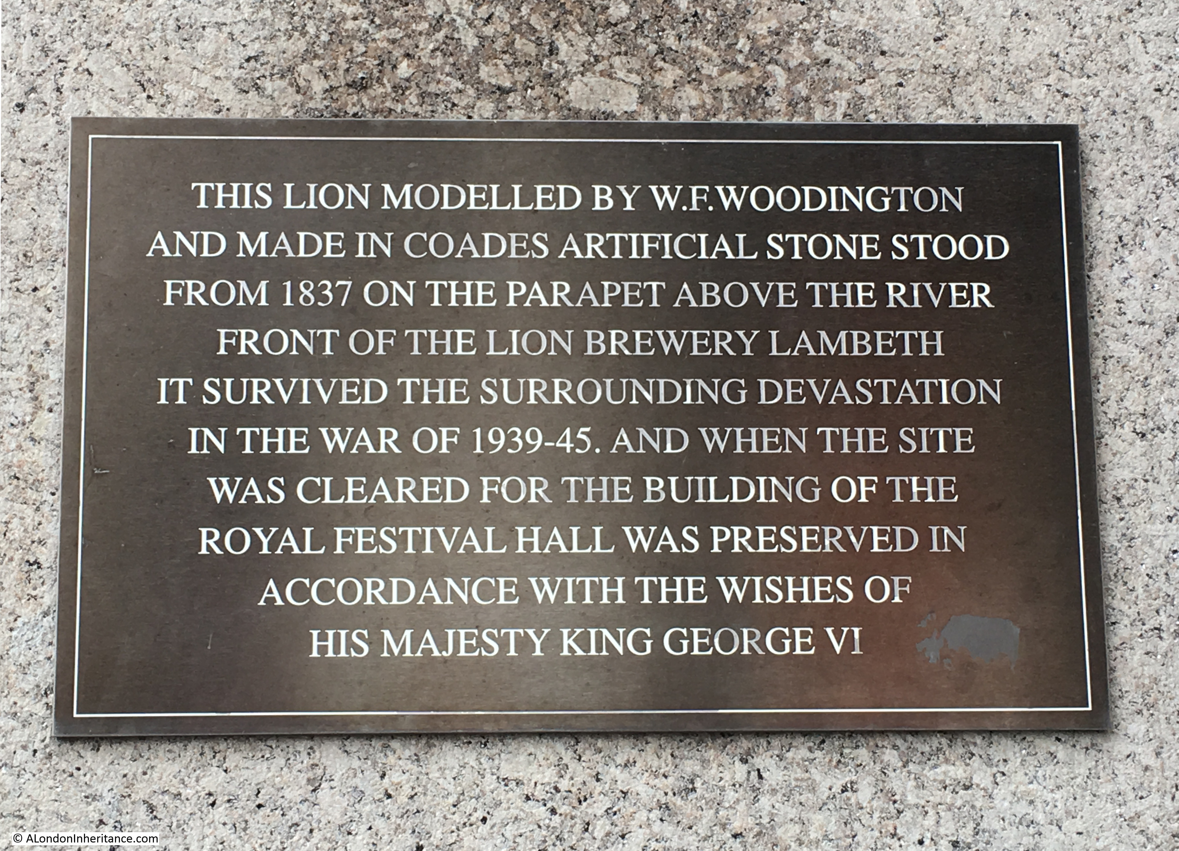
A short distance after leaving Belvedere Road and just before crossing Westminster Bridge is the lion that was at the top of the Lion Brewery building on the river facing side.

History of the Southbank 34

The lion is now on a large plinth which a plaque on the south facing side of the plinth with a brief history of the lion and how it came to be at the current location. We will meet the lion again as we cross Hungerford Bridge.

History of the Southbank 35

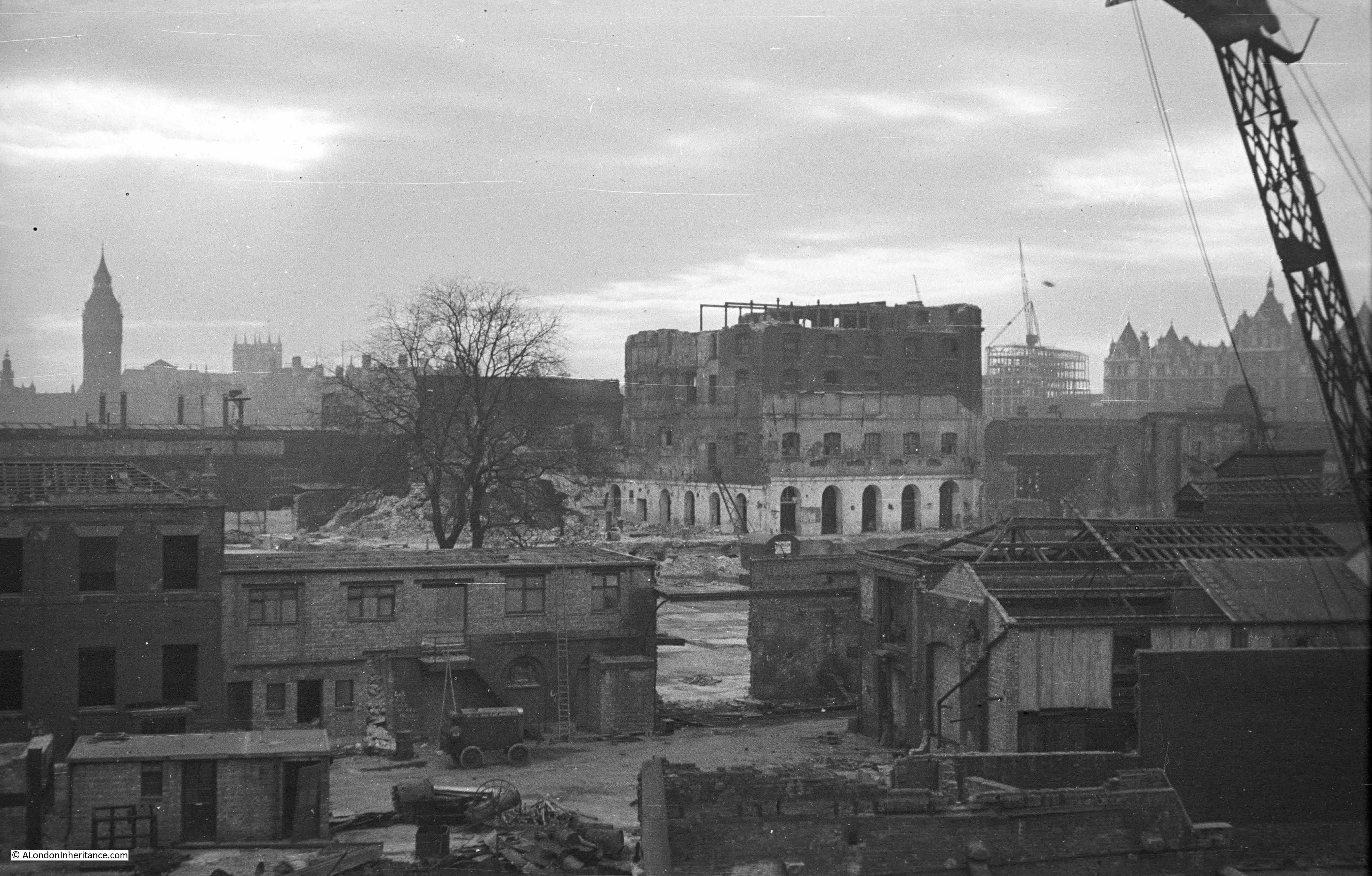
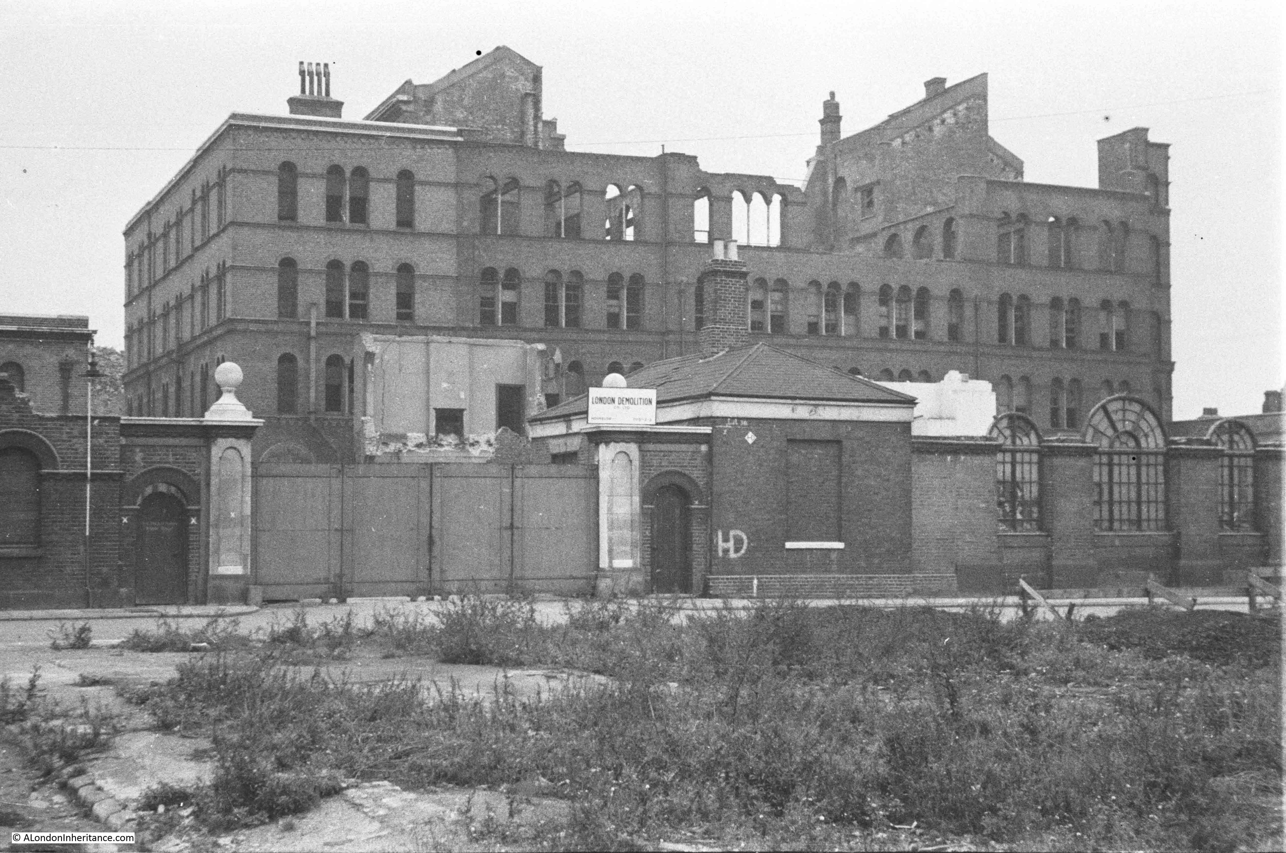
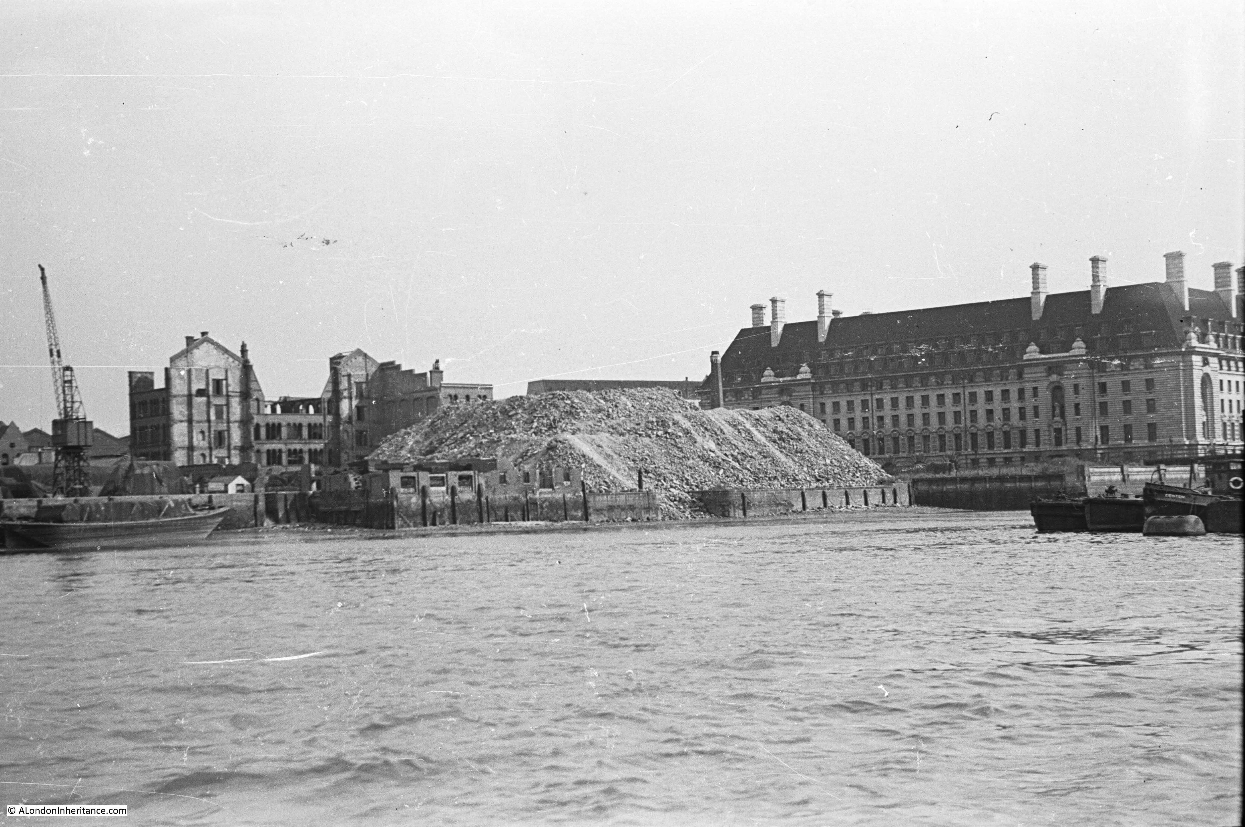
At the end of Westminster Bridge, turn along the north bank of the river, almost to Hungerford Bridge and look across the river to the South Bank. My father took the photo below when demolition of the buildings between County Hall and Hungerford Bridge had commenced. The shell of the building in the background is the India Store Depot. Along the edge of the river is a huge pile of rubble from the demolition work that had already taken place across the area. This was used to help build the extended embankment along the Thames where the embankment that has been built in front of County Hall would be extended all the way to Waterloo Bridge creating additional land that would be used for the Festival of Britain and would finally close and fill in all the various wharfs and inlets across this stretch of the river.

History of the Southbank 8

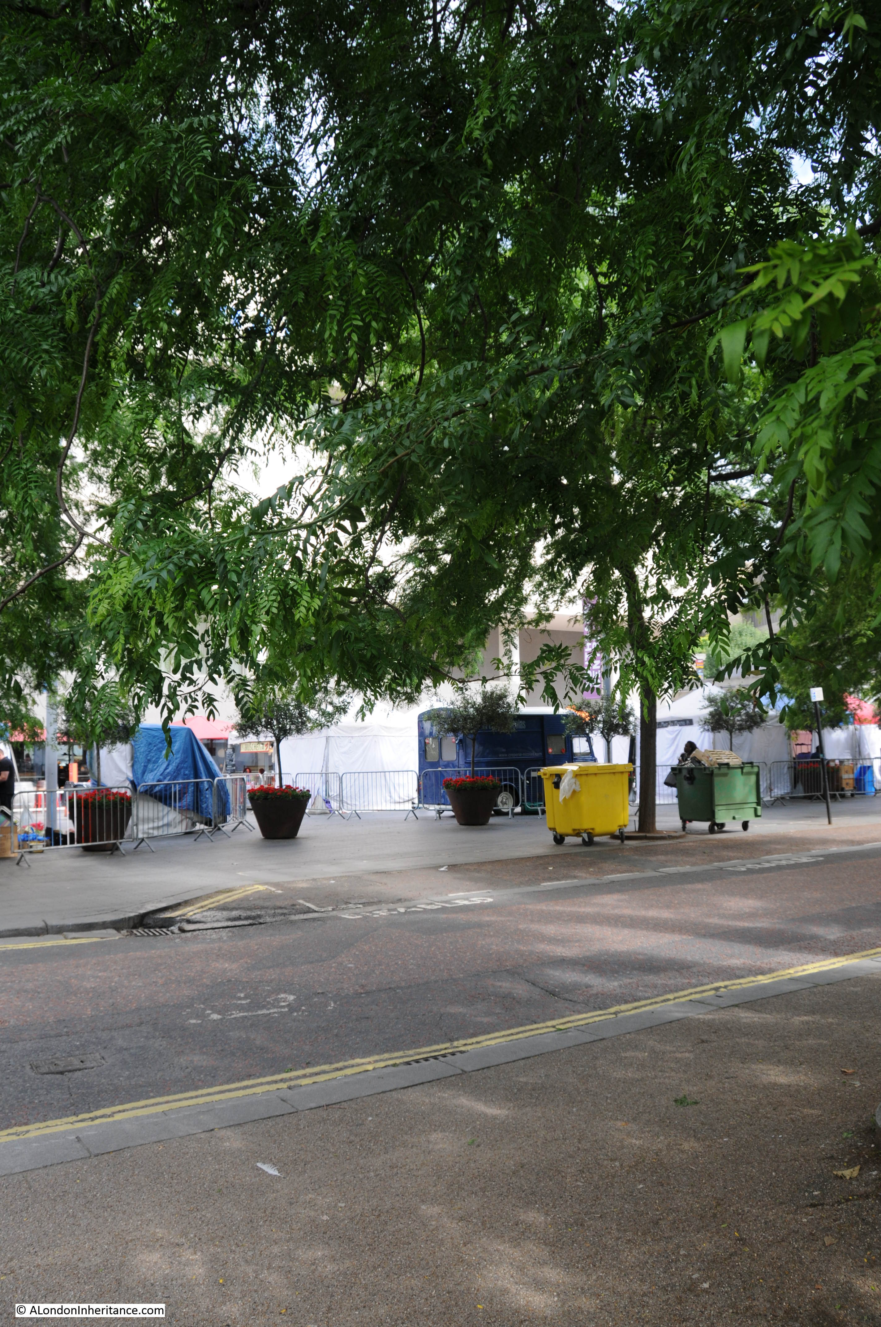
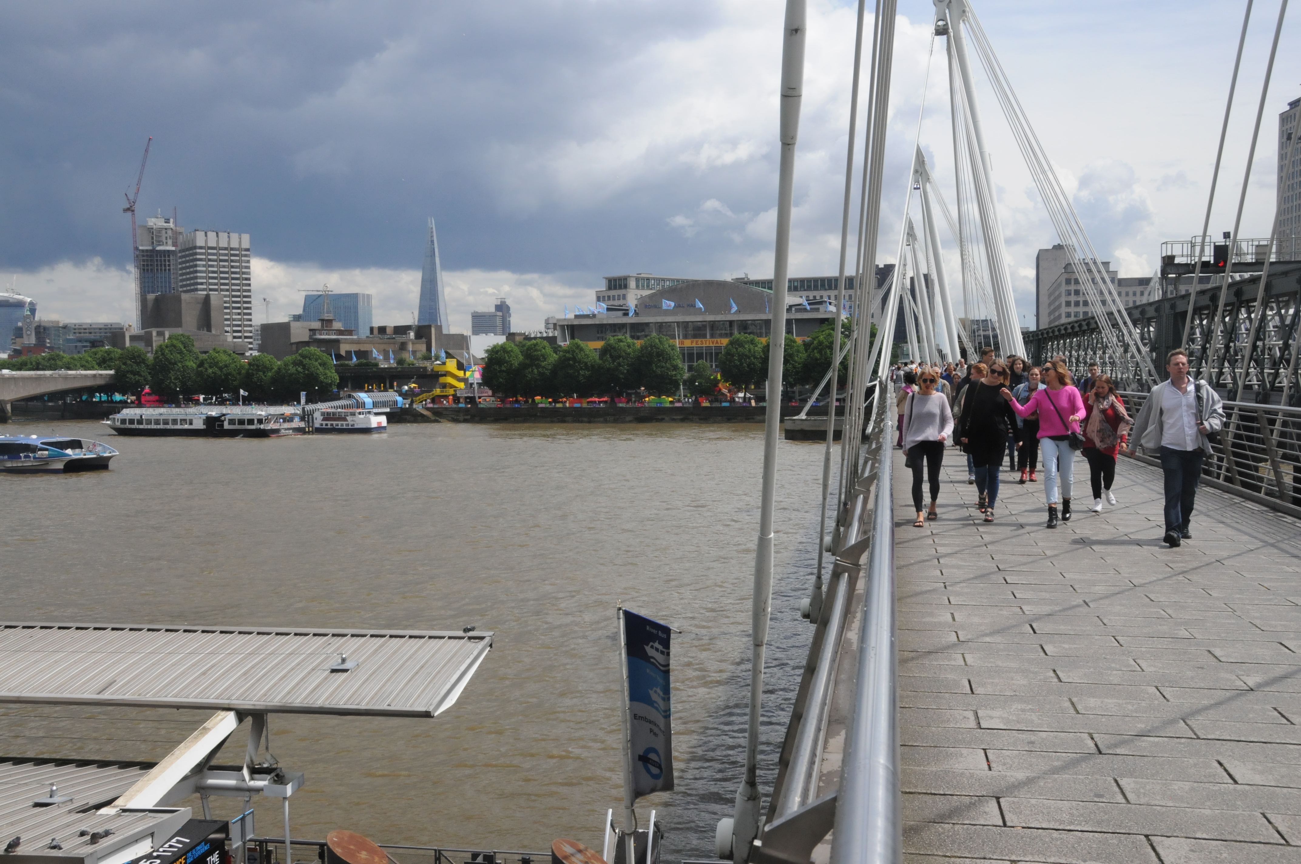
The following photo is from roughly the same position today. Not easy to get a clear photo due to the ships that are now moored along this side of the river.

Building the Royal Festival Hall 5

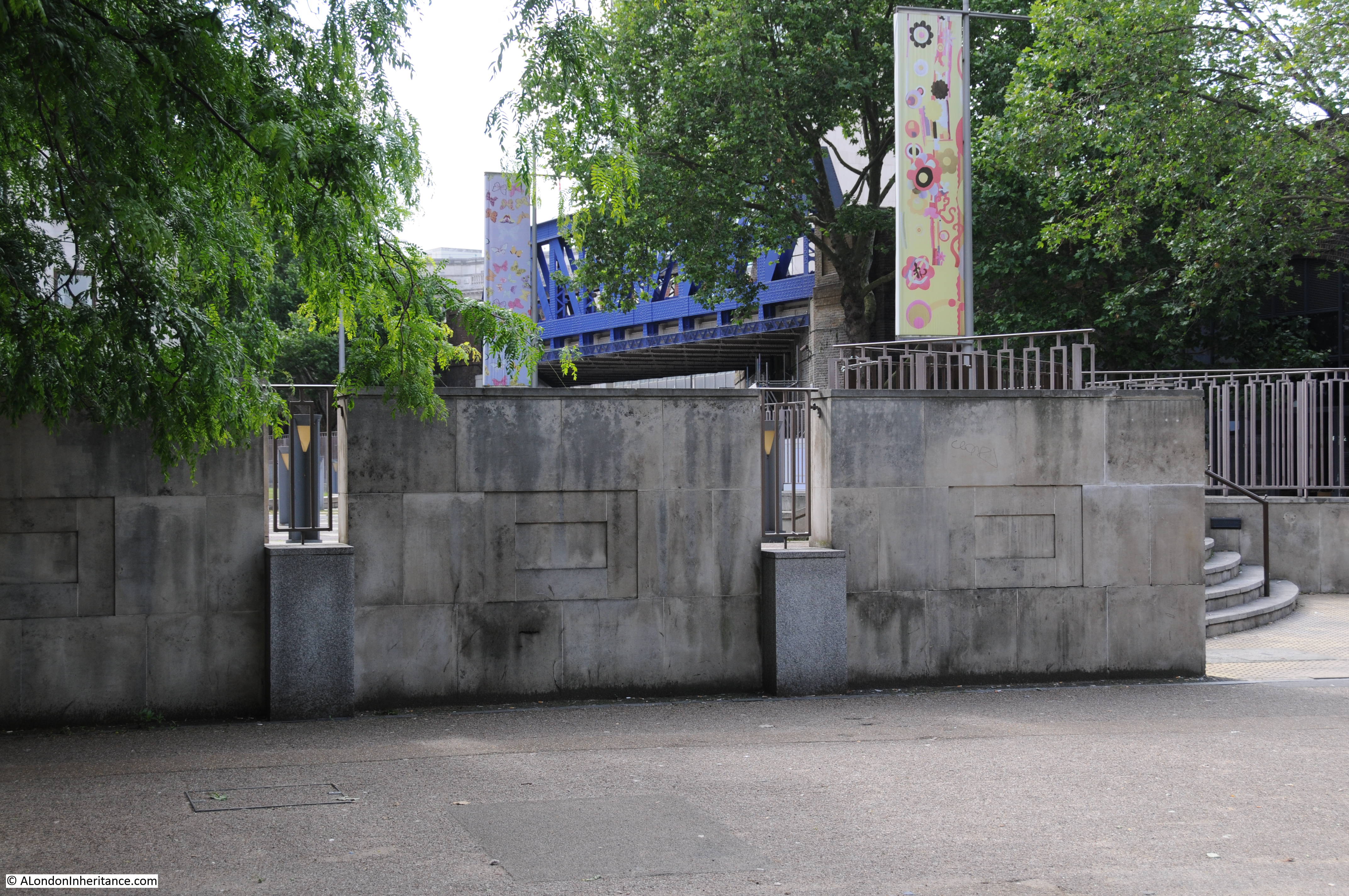
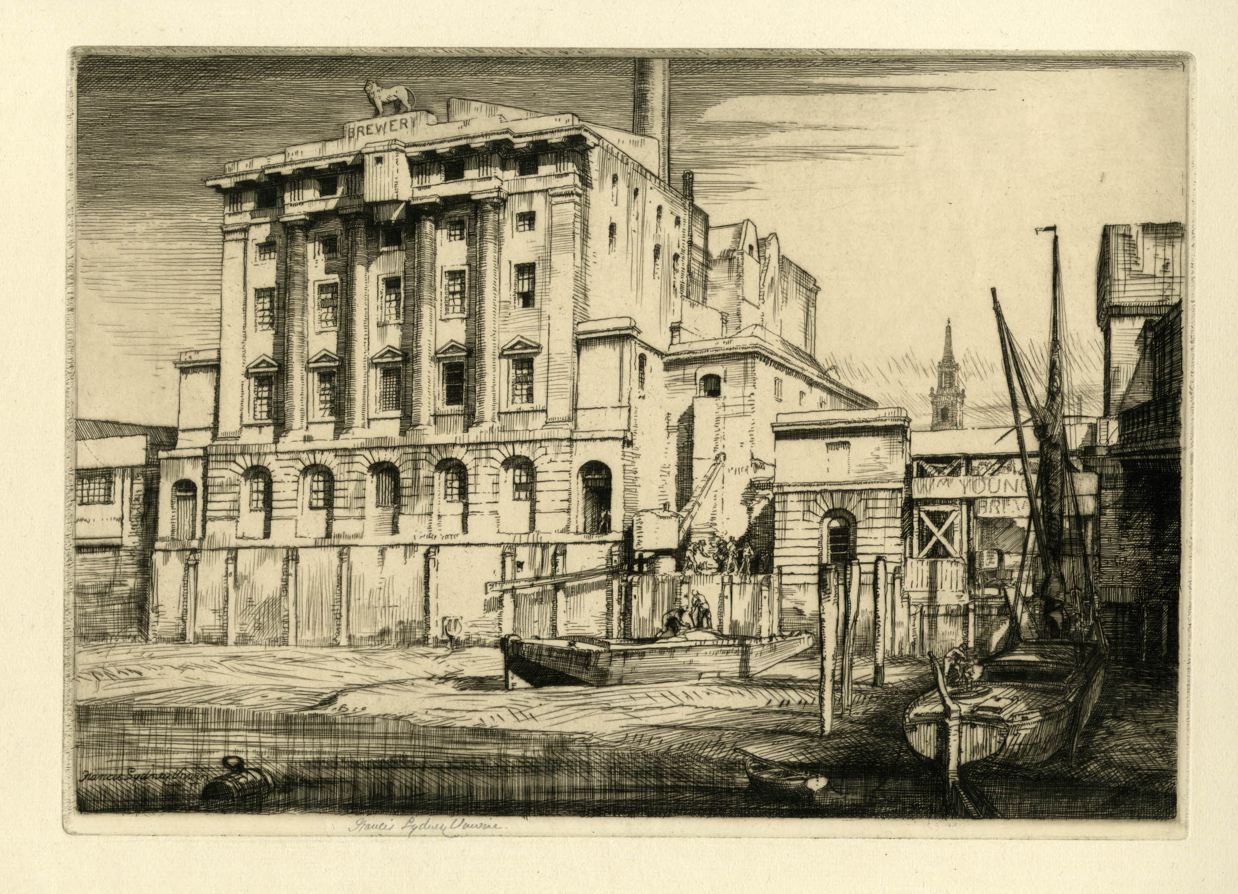
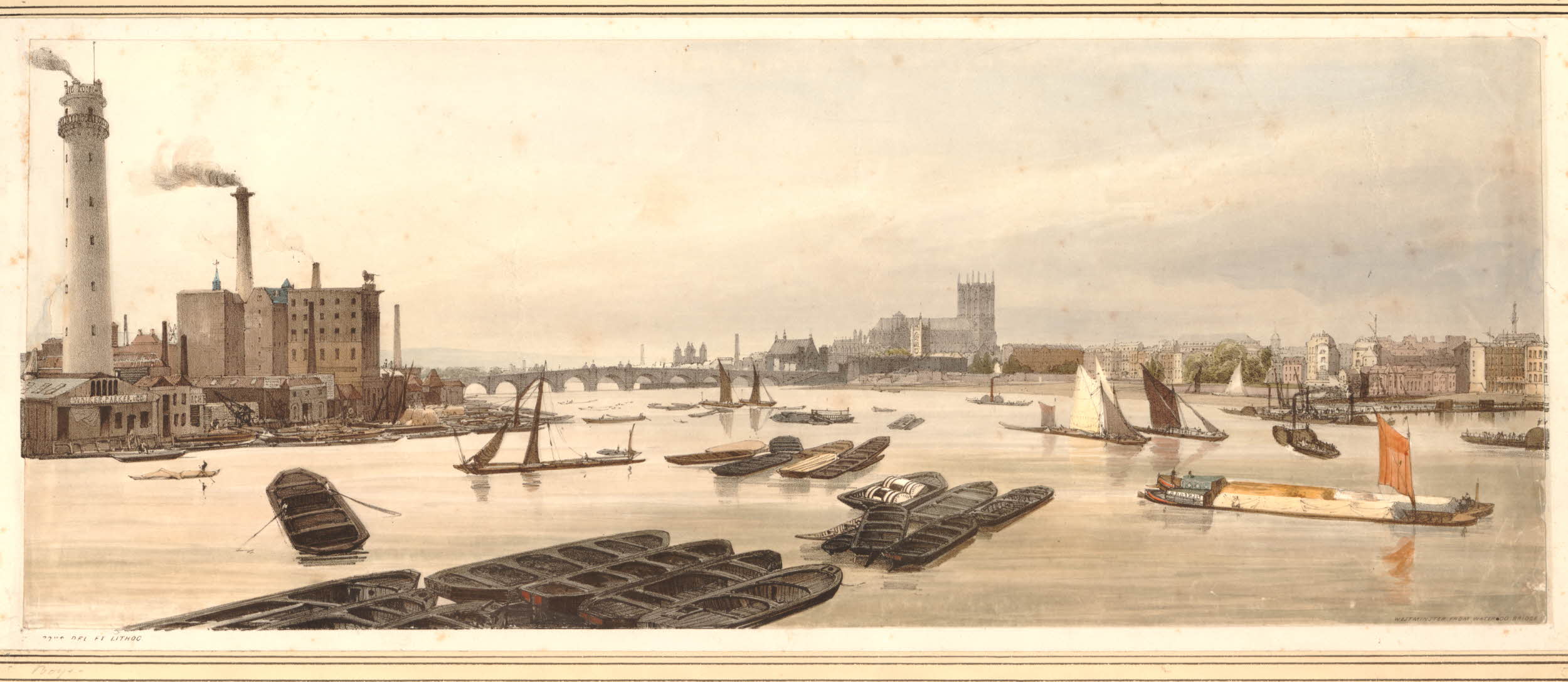
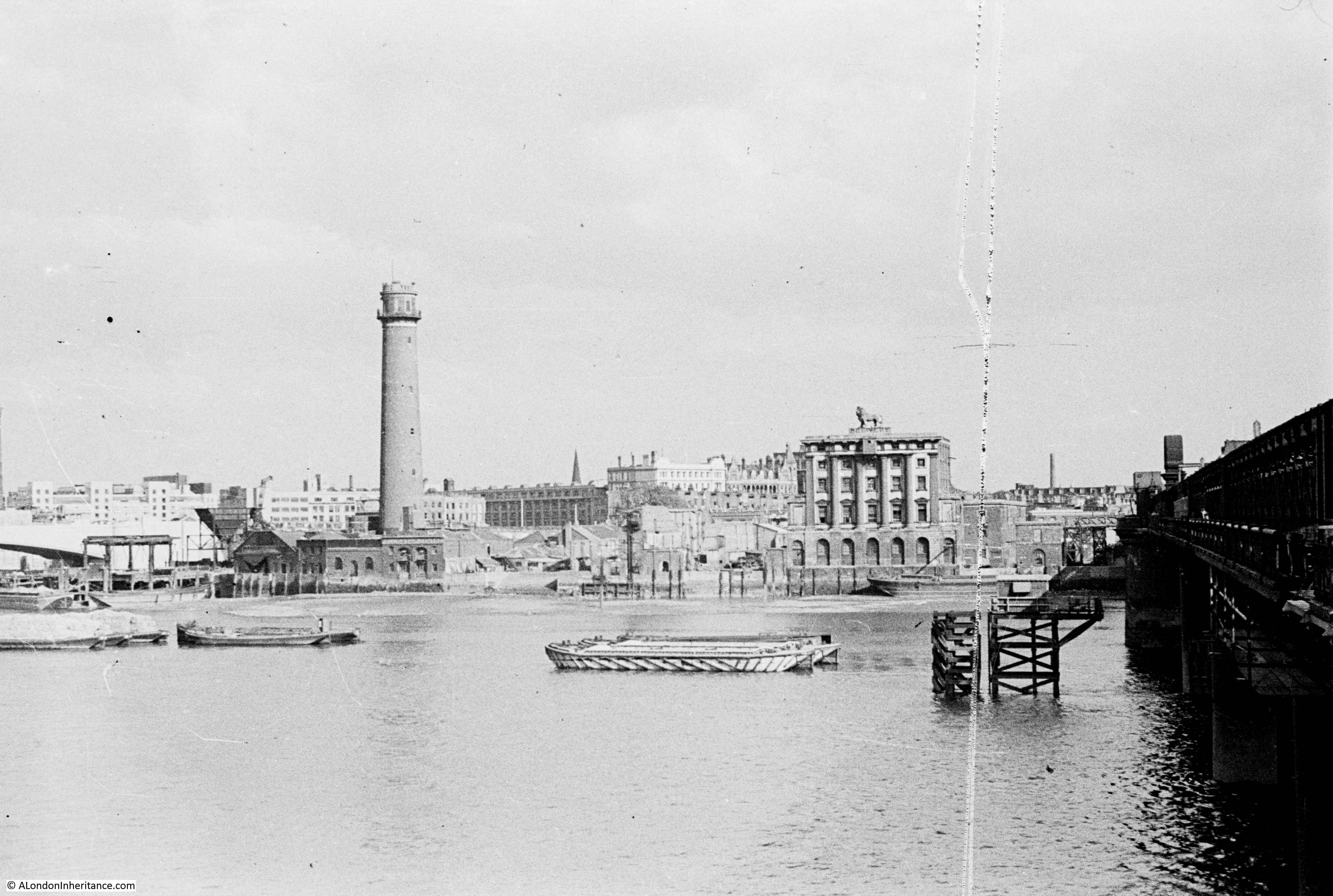
Now walk up to the footbridge on the side of Hungerford Railway Bridge that faces Waterloo Bridge. My father took the following photo from along here before the main demolition started. The Lion Brewery is on the right, still with the stone lion on the top of the brewery, the same lion that we walked past on the southern end of Westminster Bridge. The Shot Tower is on the left.

History of the Southbank 7

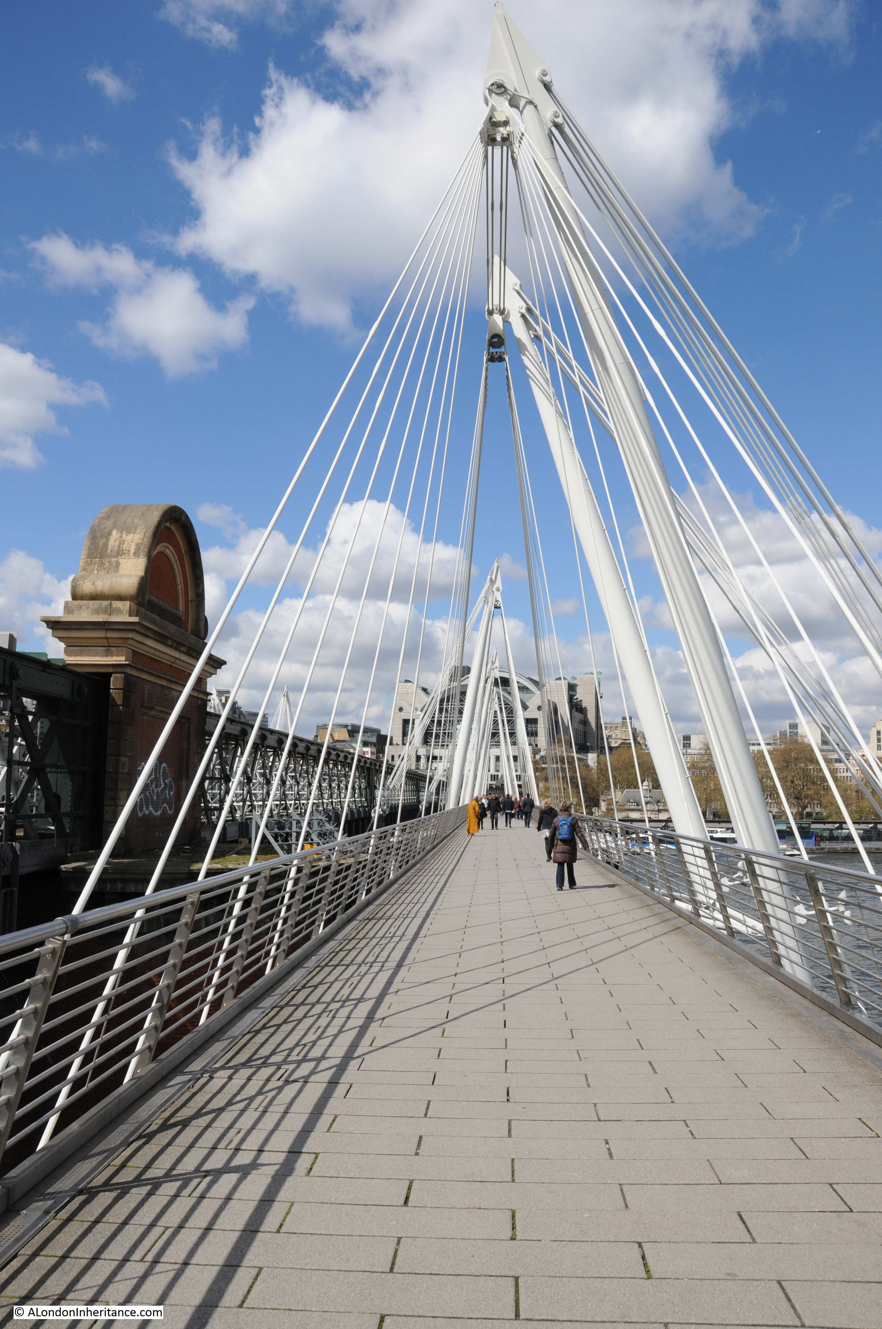
The original footbridge alongside the Hungerford Railway Bridge was a narrow walkway right up against the railway bridge, only on the side of the bridge facing Waterloo Bridge. This was replaced in 2002 by the much larger Golden Jubilee Footbridges which stand off from the railway bridge and are also on both sides of the railway bridge.

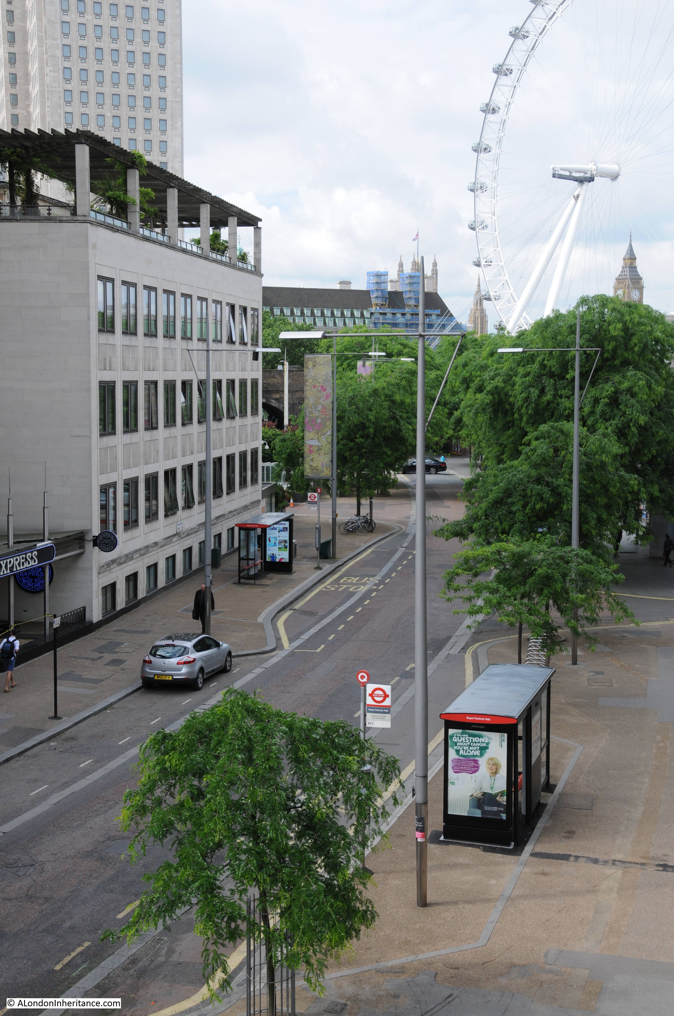
As these footbridges stand off from Hungerford Railway Bridge, it is not possible to get the same perspective, however the following photo is roughly from the same location. Waterloo Bridge is on the extreme left of both photos. The Royal Festival Hall is on the site of the Lion Brewery and the Hayward Gallery on the site of the Shot Tower,

Building the Royal Festival Hall 6

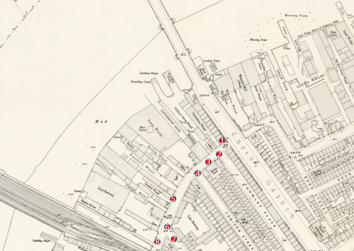
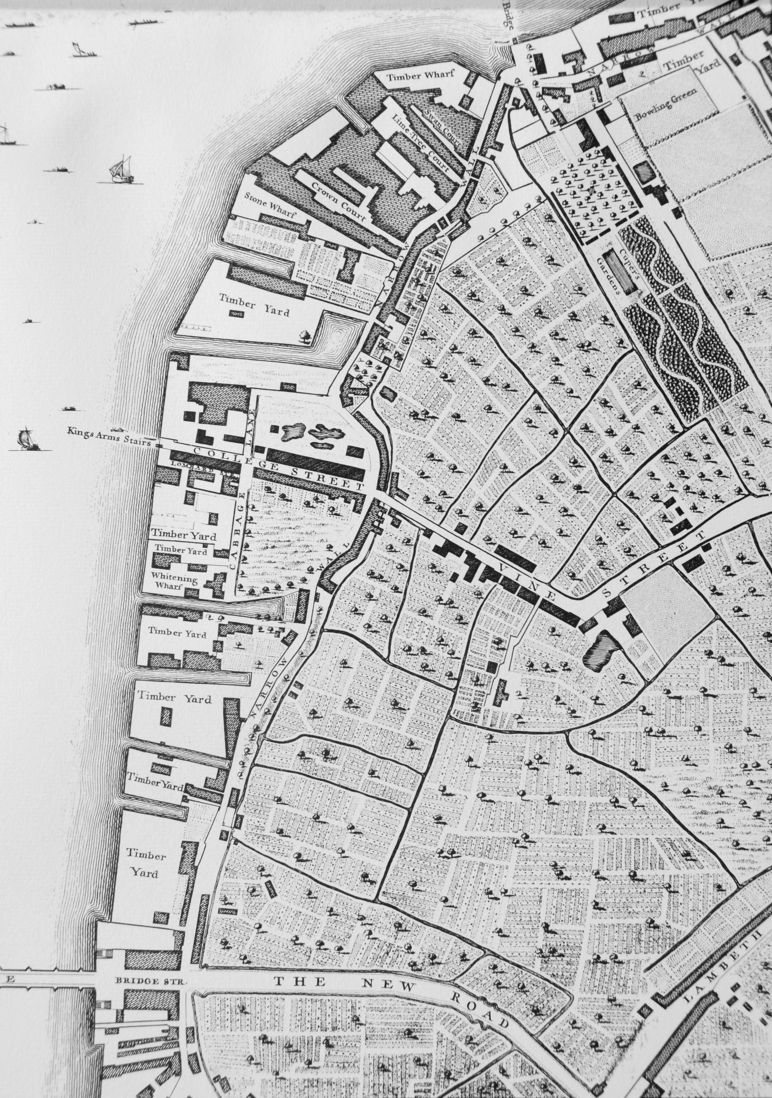
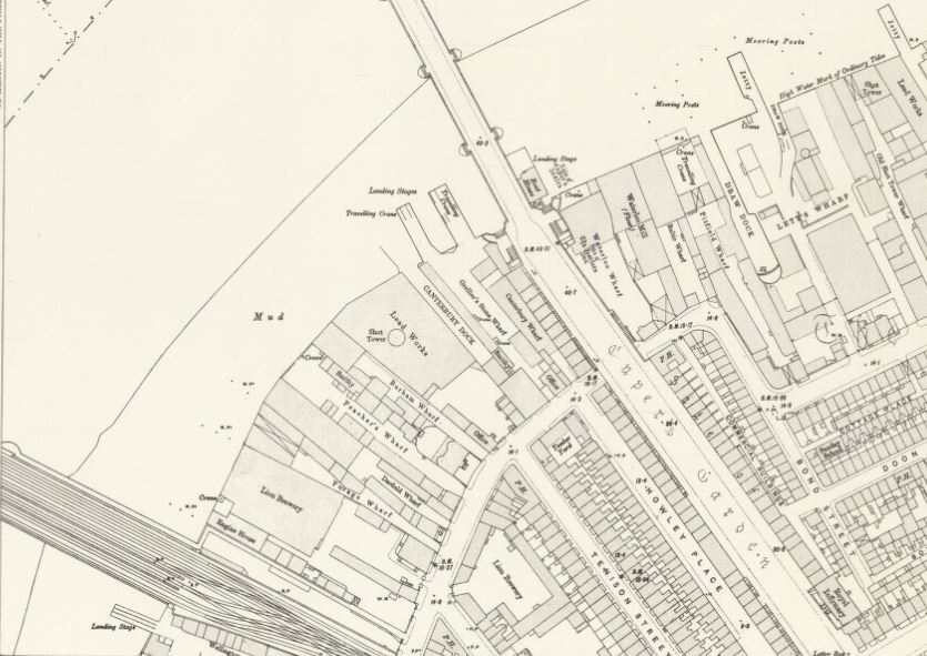
This photo was taken when my father took a boat trip down the Thames from Westminster to Greenwich. There is an inlet along the river edge to the left of the Shot Tower. Referring back to the 1895 Ordnance Survey map in my previous posts, this can be identified as Canterbury Dock. On the left of the Dock is a travelling crane.

History of the Southbank 9

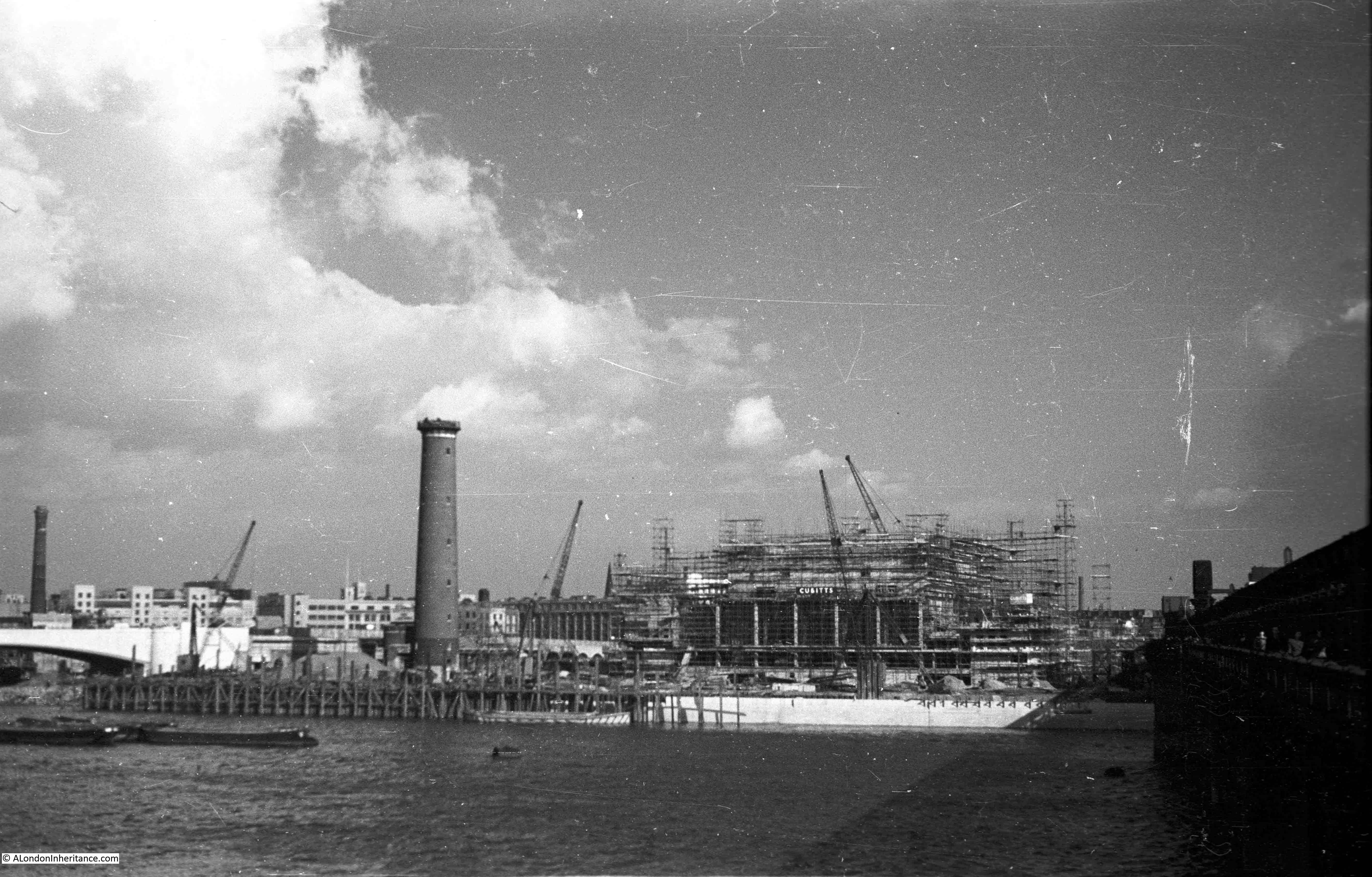
My father then took the following photo from the same position as the earlier photo, now showing the Royal Festival Hall under construction. All the original buildings on the site have been cleared with the exception of the Shot Tower, although the very top of the Shot Tower has been removed ready for the installation of the anti-aircraft gun that would provide the mount for the antennae that would be used during the Festival of Britain to bounce radio signals off the moon enabling visitors to see the echo of the radio signal – part of the Festival’s demonstration of British scientific achievements.

History of the Southbank 4

Walk further along the bridge and this is a closer view. The new embankment is also being built.

History of the Southbank 6

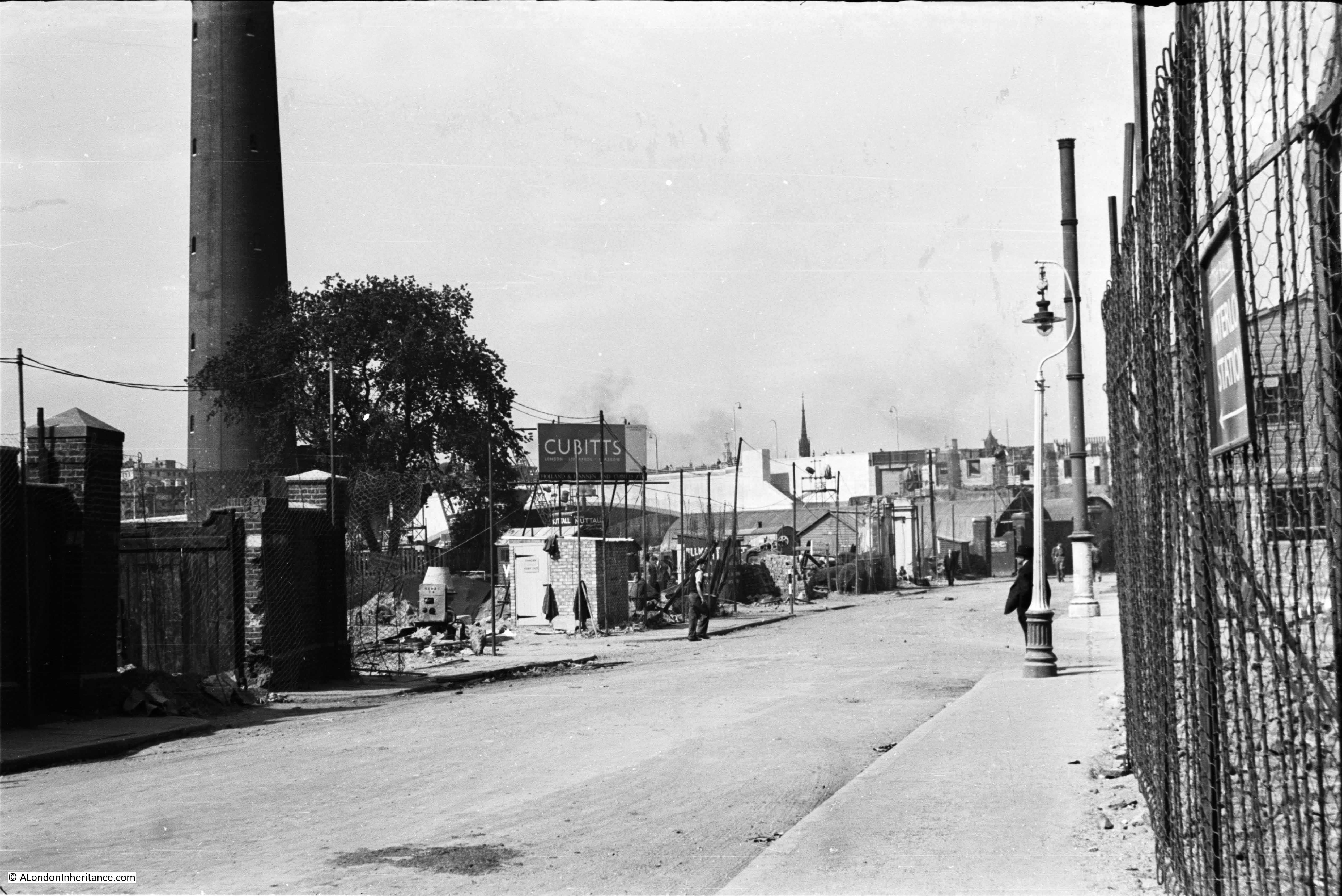
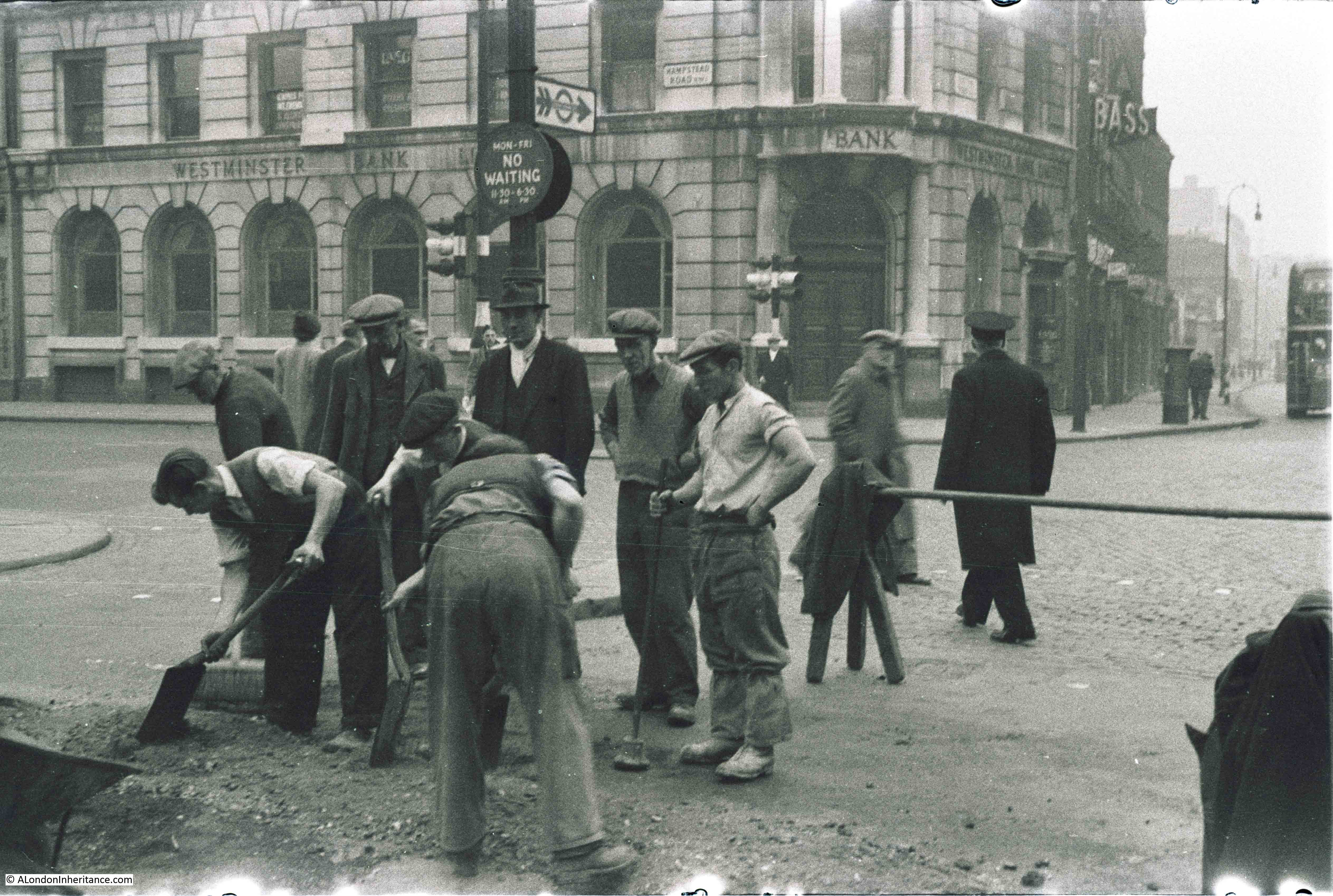
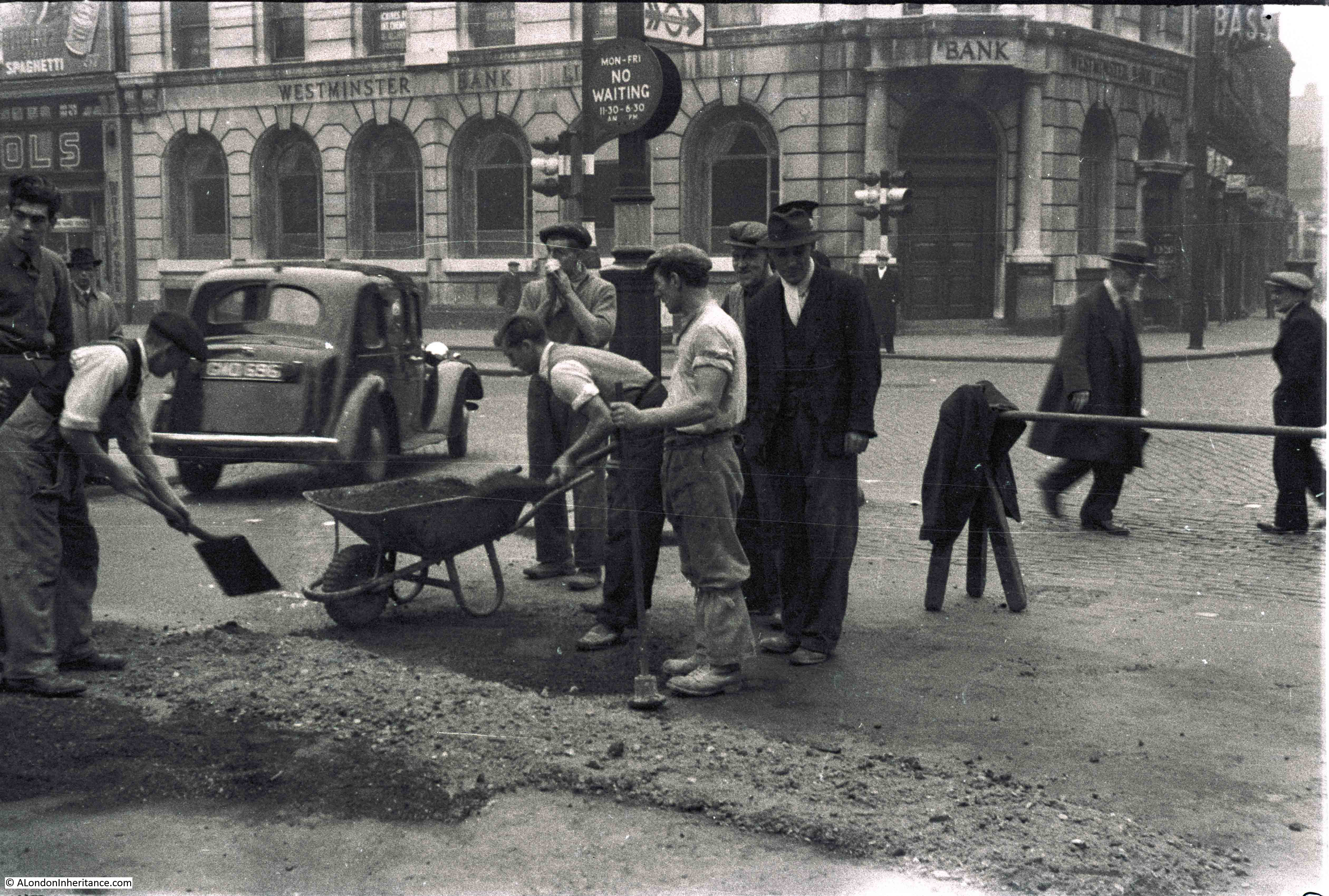
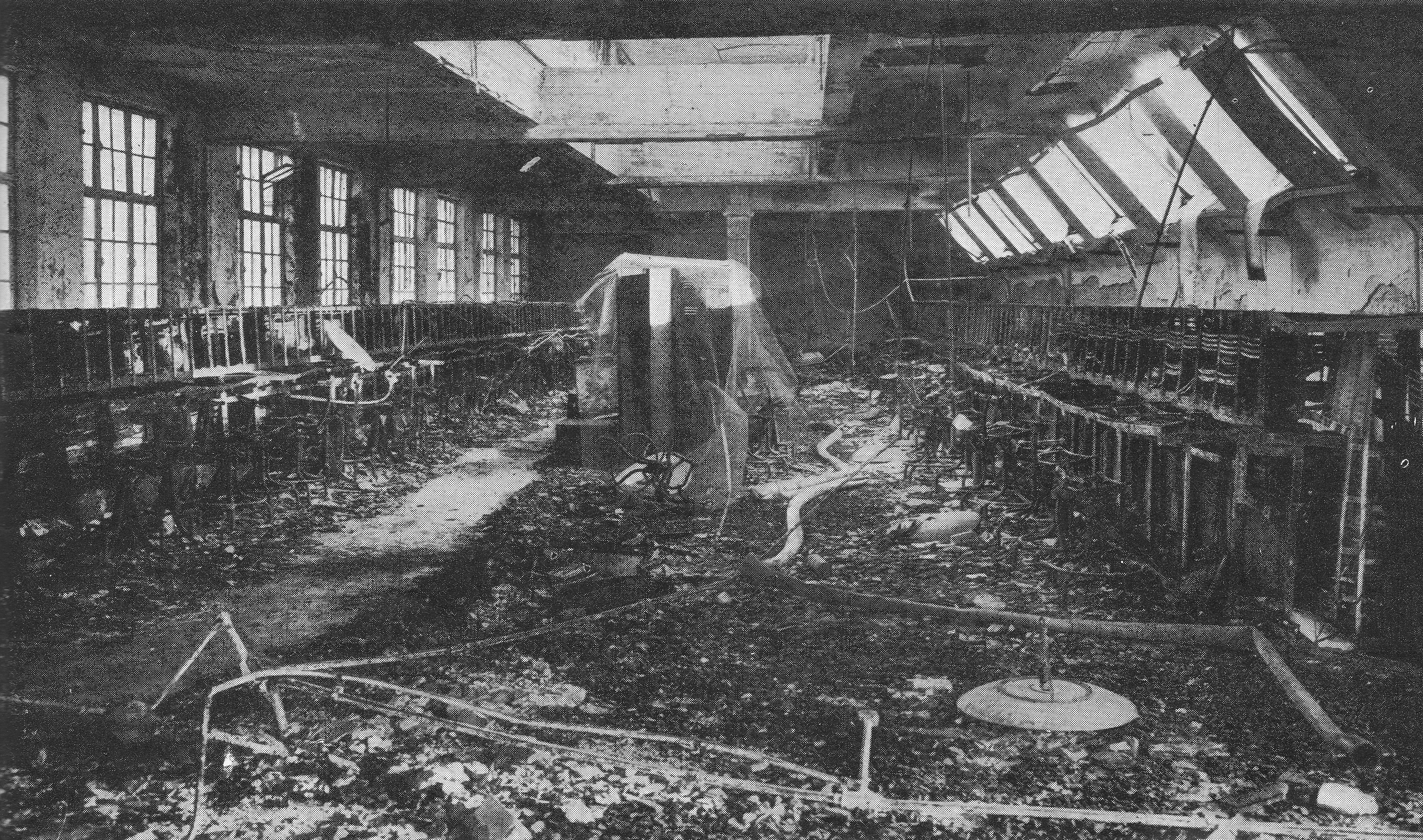
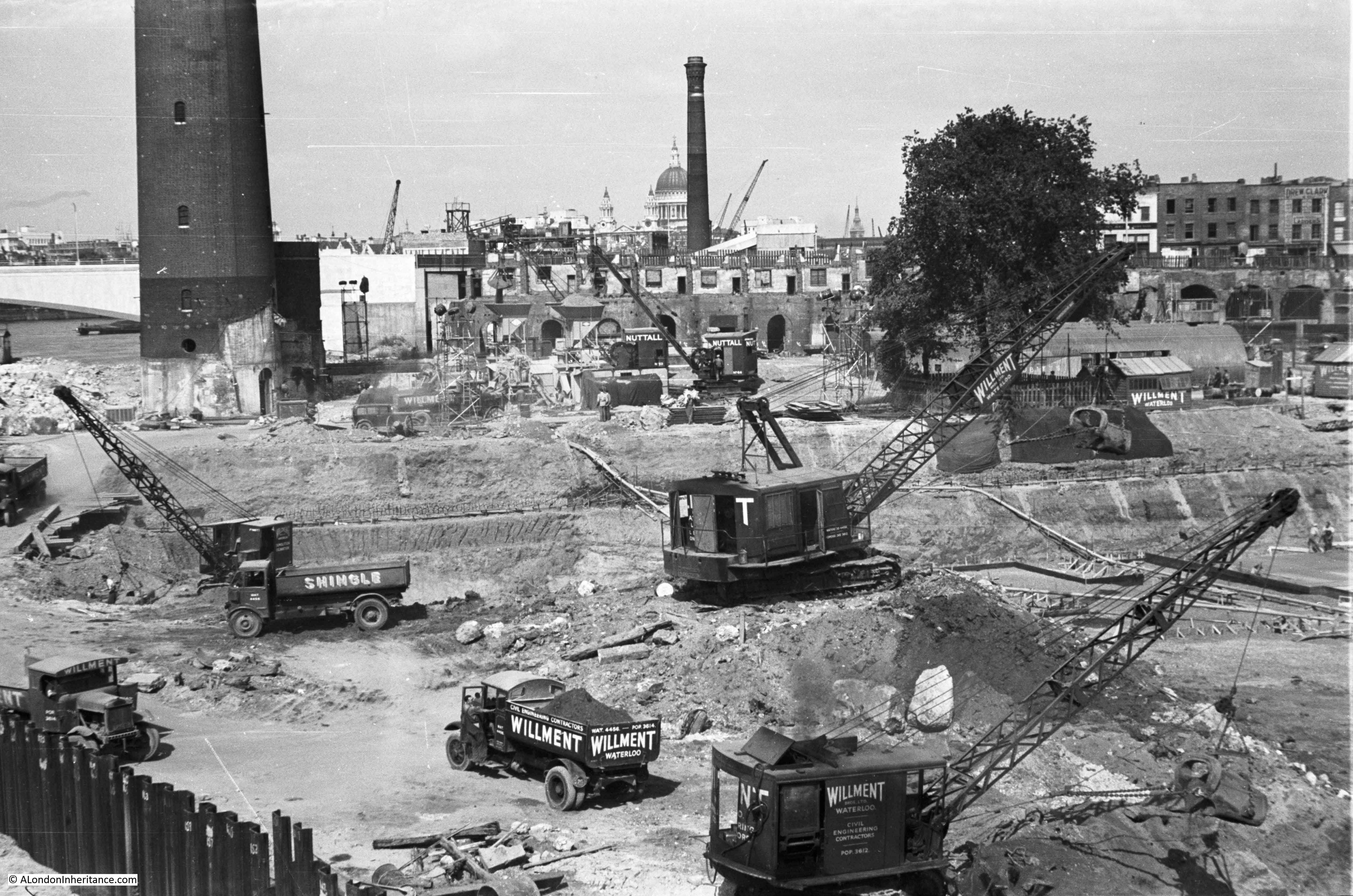
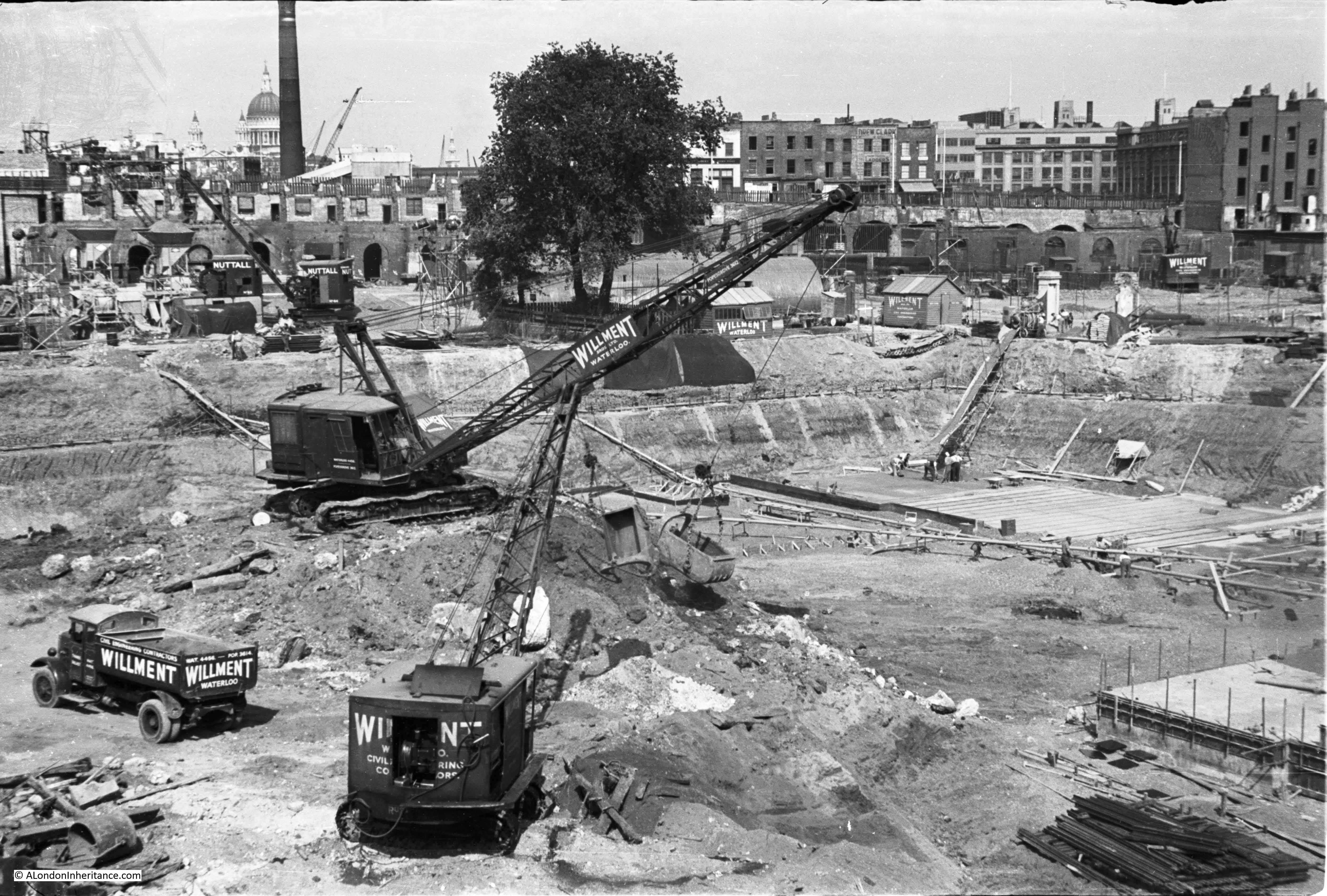
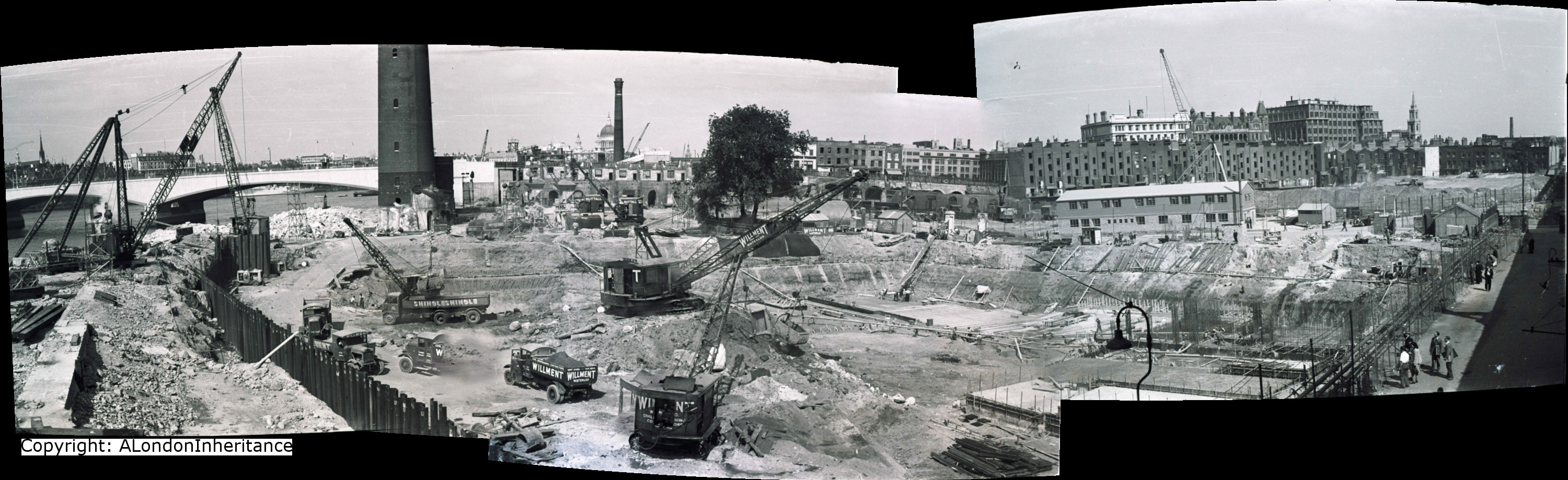
There are now a series of photos from the end of the footbridge, taken earlier than the above couple of photos, that show the digging of the foundations of the Royal Festival Hall. These start from the river edge and move round to the edge of the excavations. They show the amount of excavation needed as preparation for the rest of the build.

History of the Southbank 13

History of the Southbank 12

History of the Southbank 10

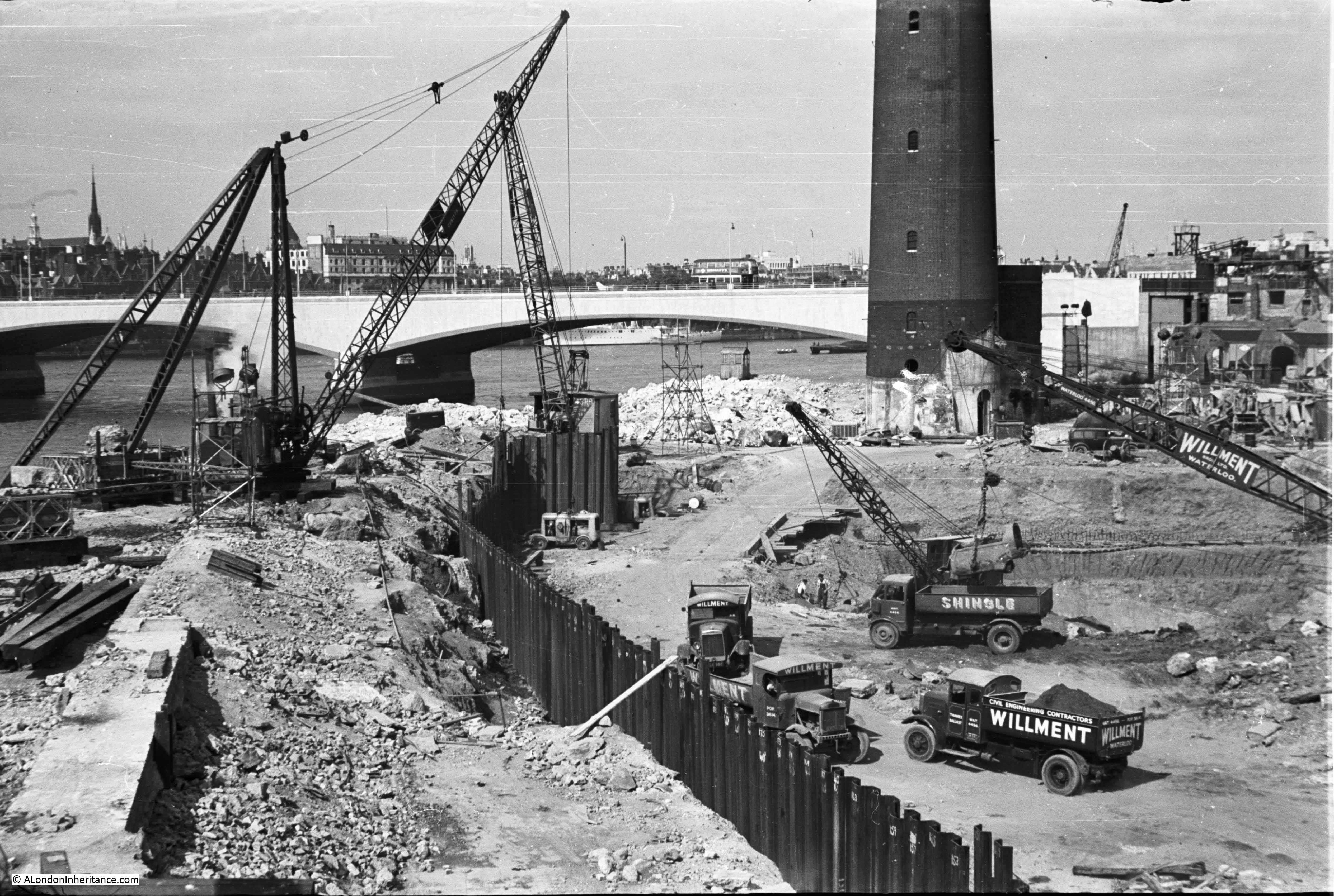
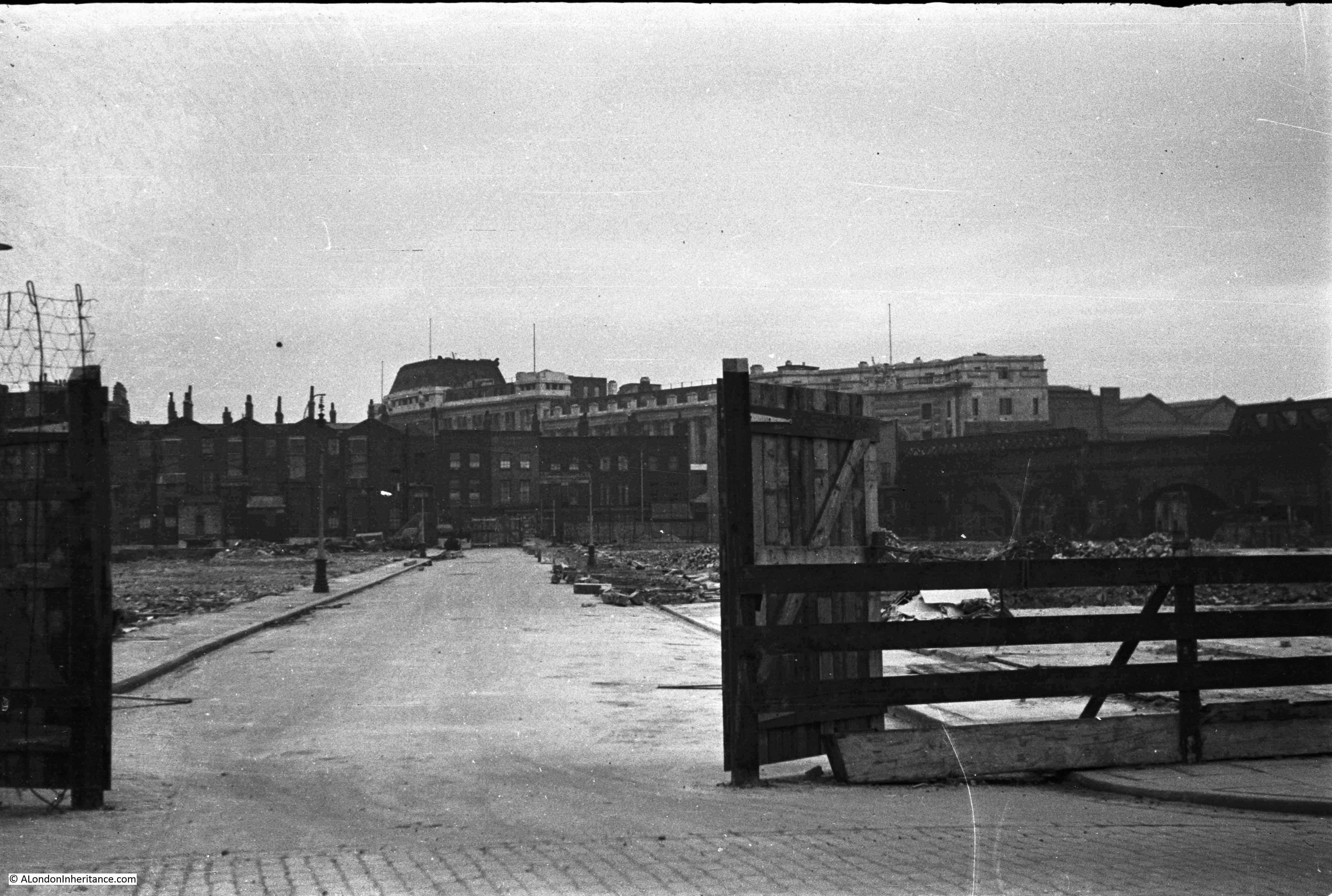
In this photo, the buildings of Howley Place can still be seen in the background behind Cubitts site office.

History of the Southbank 11

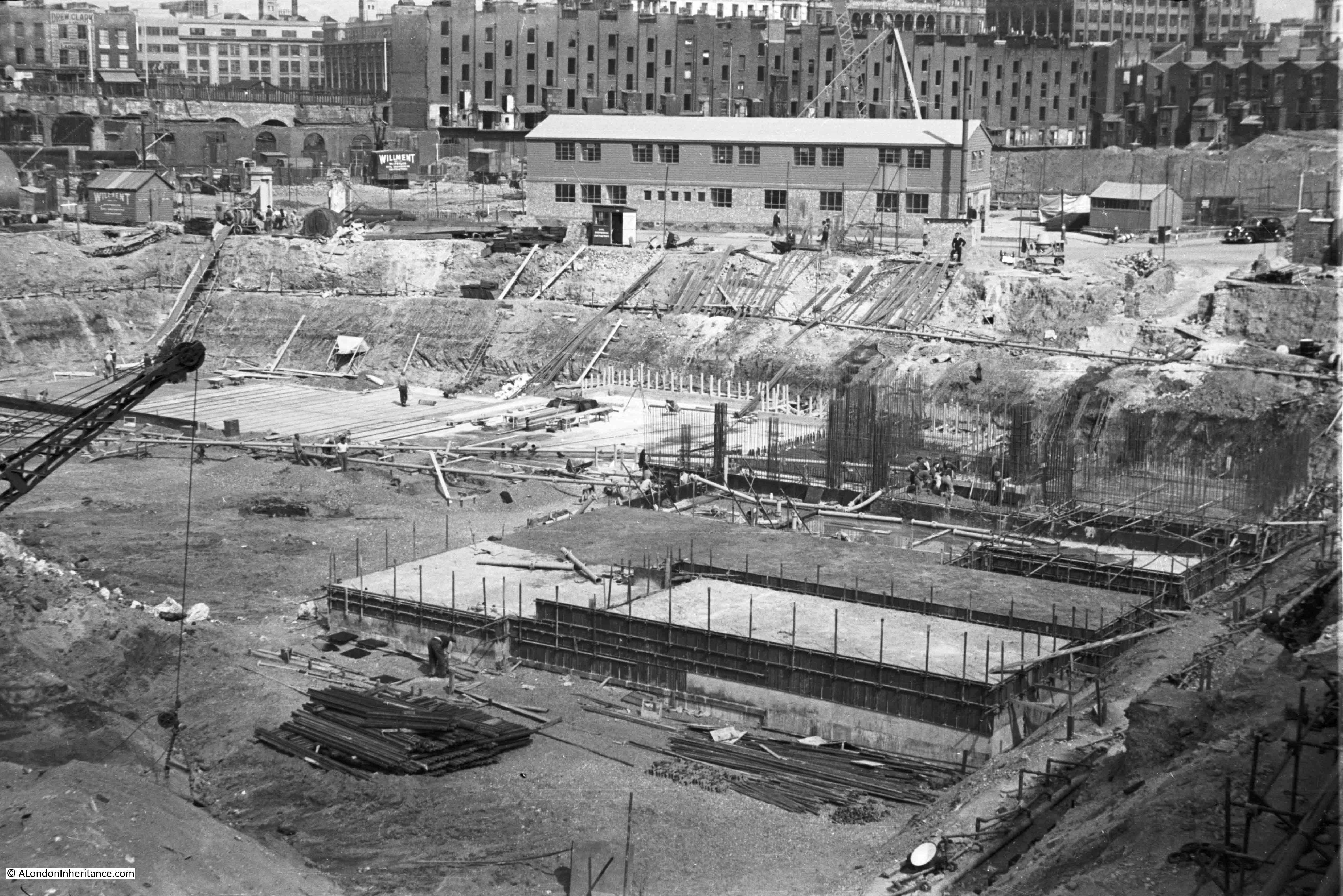
And in this photo, the buildings that ran along the edge of York Road are still there. These, and the building along Howley Place would soon be removed ready for the construction of the rest of the Festival of Britain site.

History of the Southbank 14

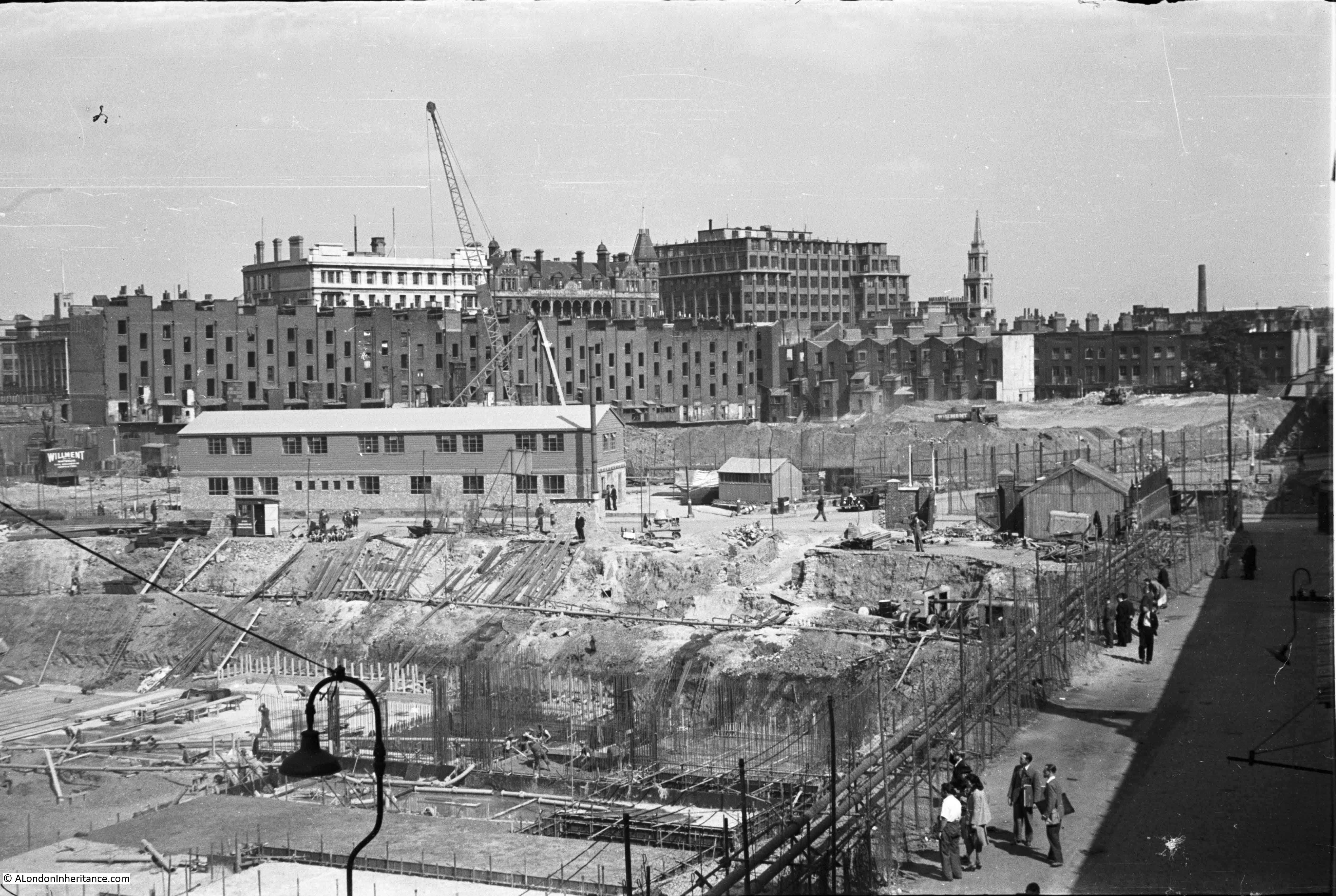
I stitched the above photos together to get a panorama of the building site.

Building the Royal Festival Hall 7

Construction of the Royal Festival Hall was documented in a book published for the Festival of Britain by the Association of Consulting Engineers. The book celebrates the role of Britain’s Engineers in a wide selection of global construction projects ranging from the Royal Festival Hall to Power Stations in South Africa and a Hydro-Electric scheme in Ceylon.

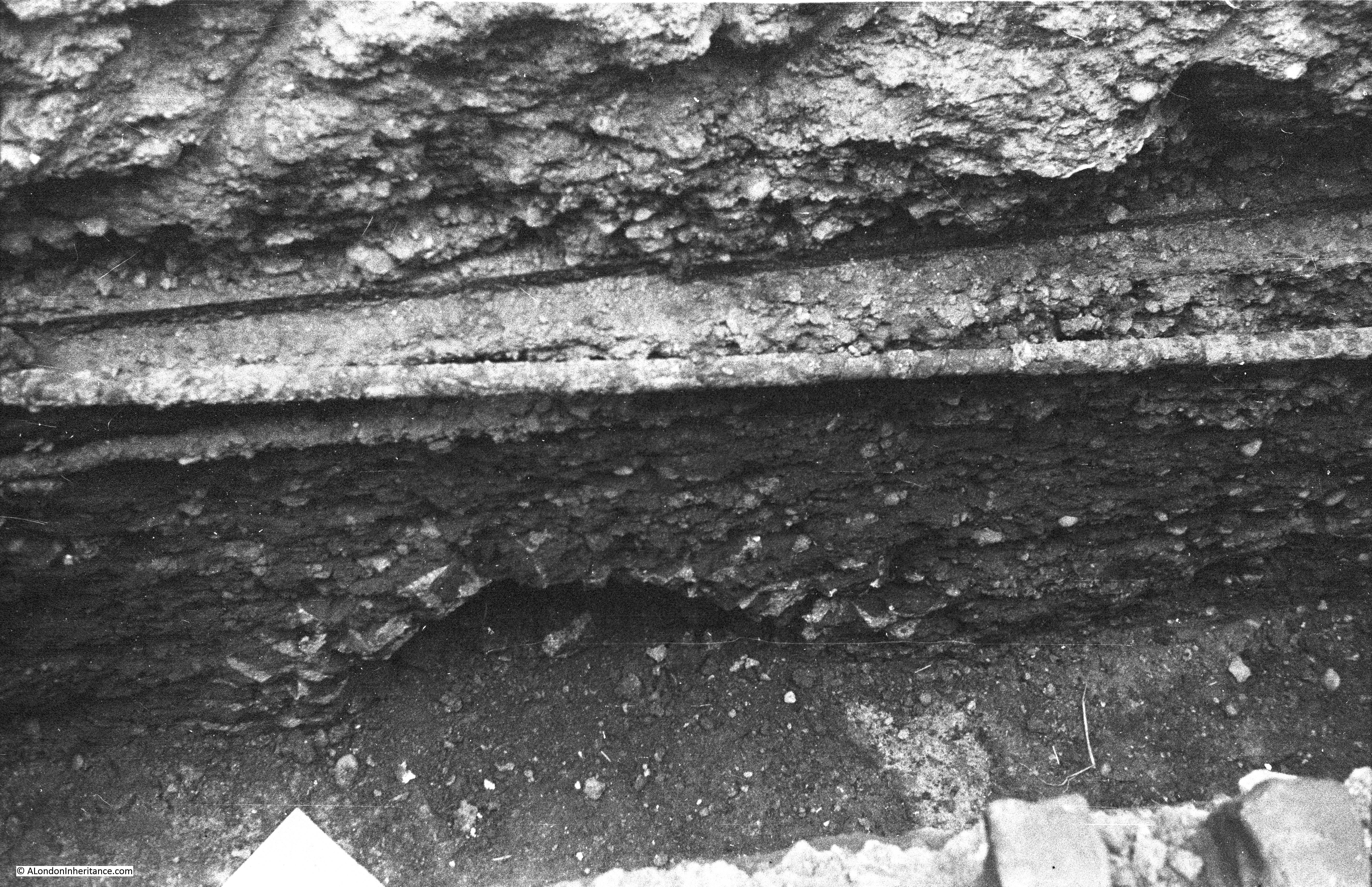
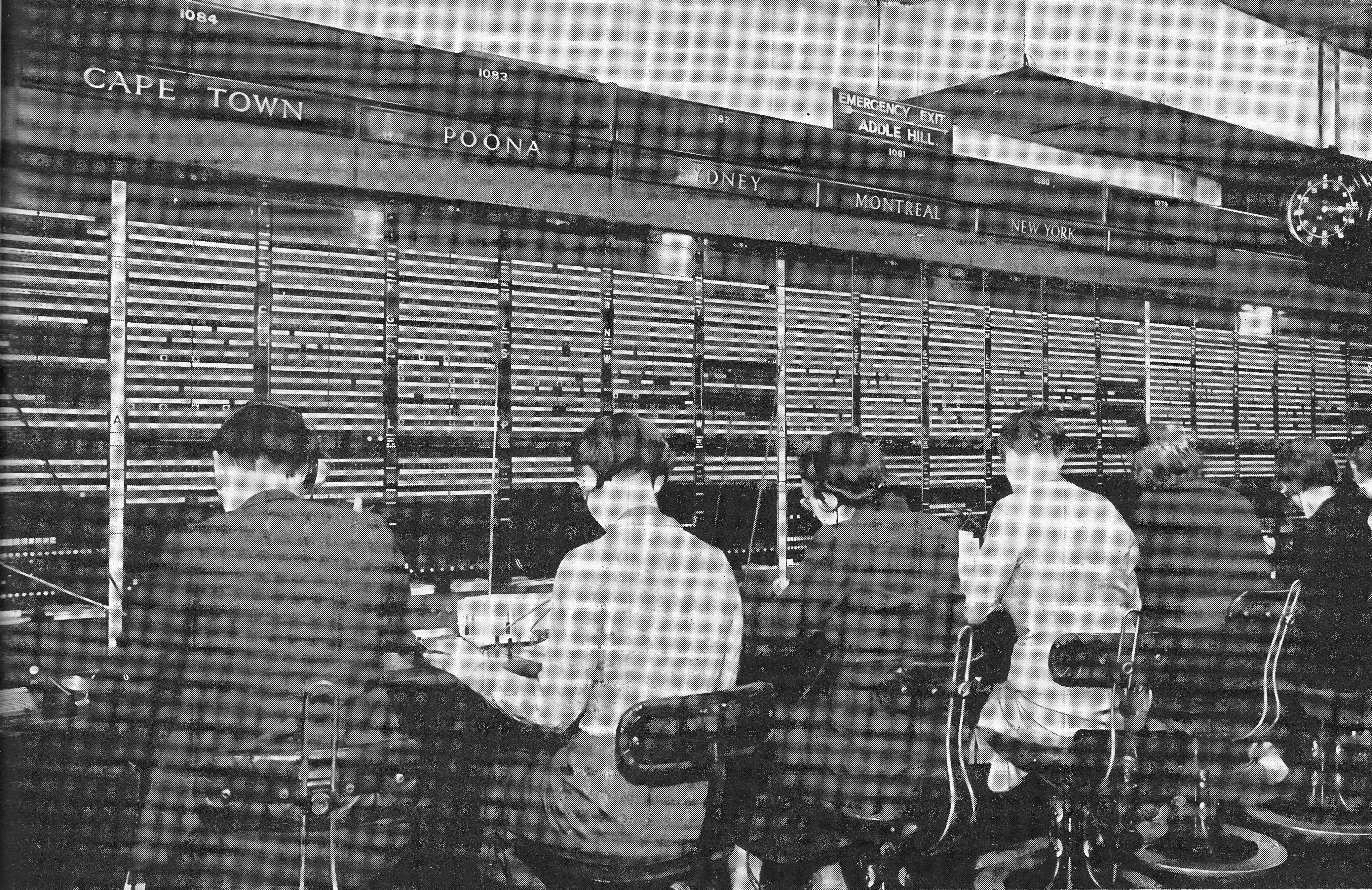
The section on the Royal Festival Hall details construction and some of the challenges with the build, for example with the proximity to the river and high ground water level. The land on which the Royal Festival Hall would be built is described as miscellaneous fill and silt down to about 10ft and London Clay at about 20ft. The ground water level also rises and falls with tide from a level of 2ft below and 3ft above ordnance datum (see picture below).

Building the Royal Festival Hall 3

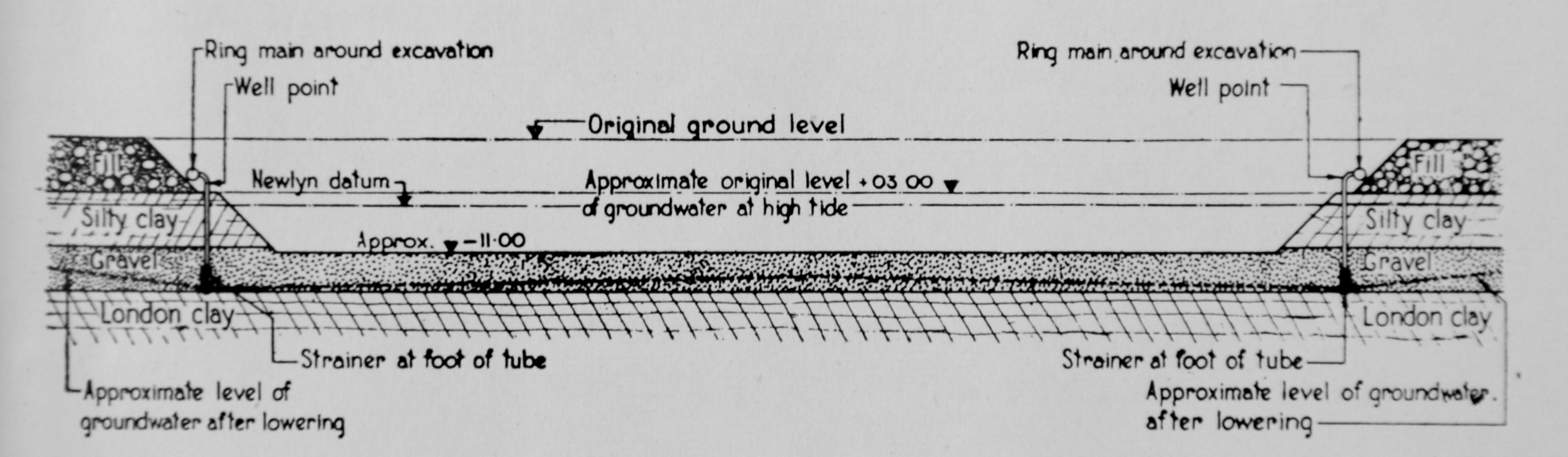
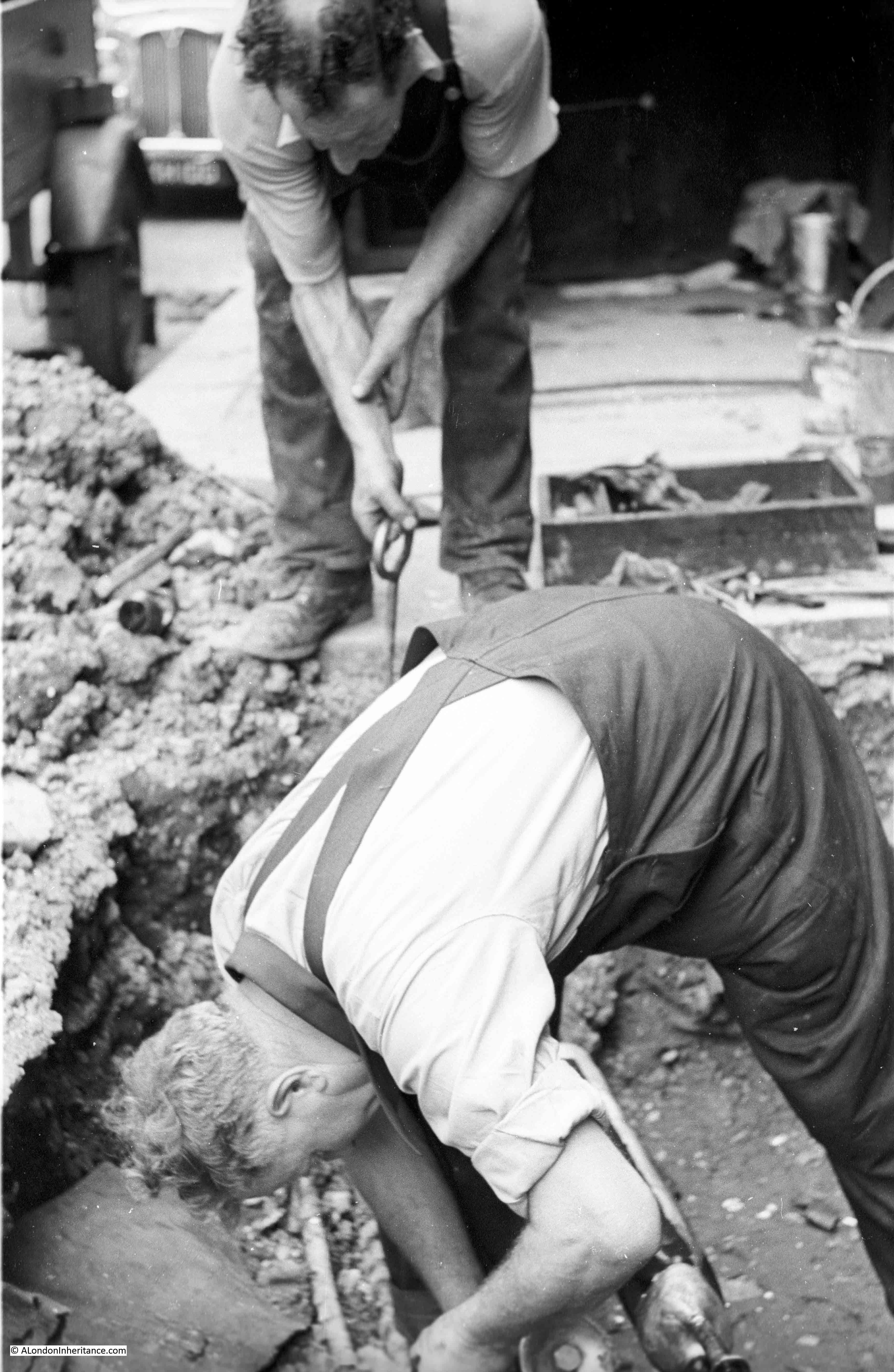
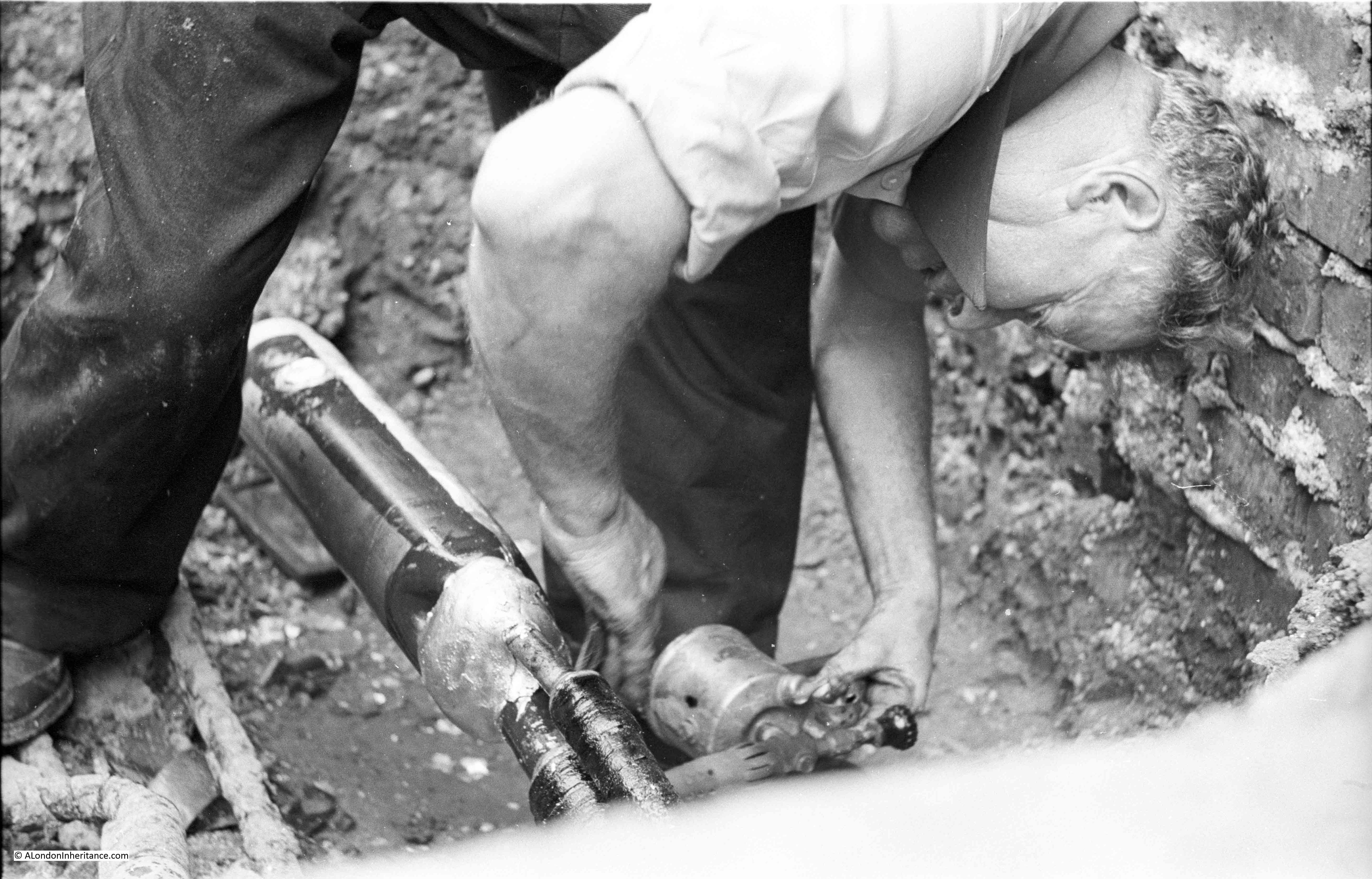
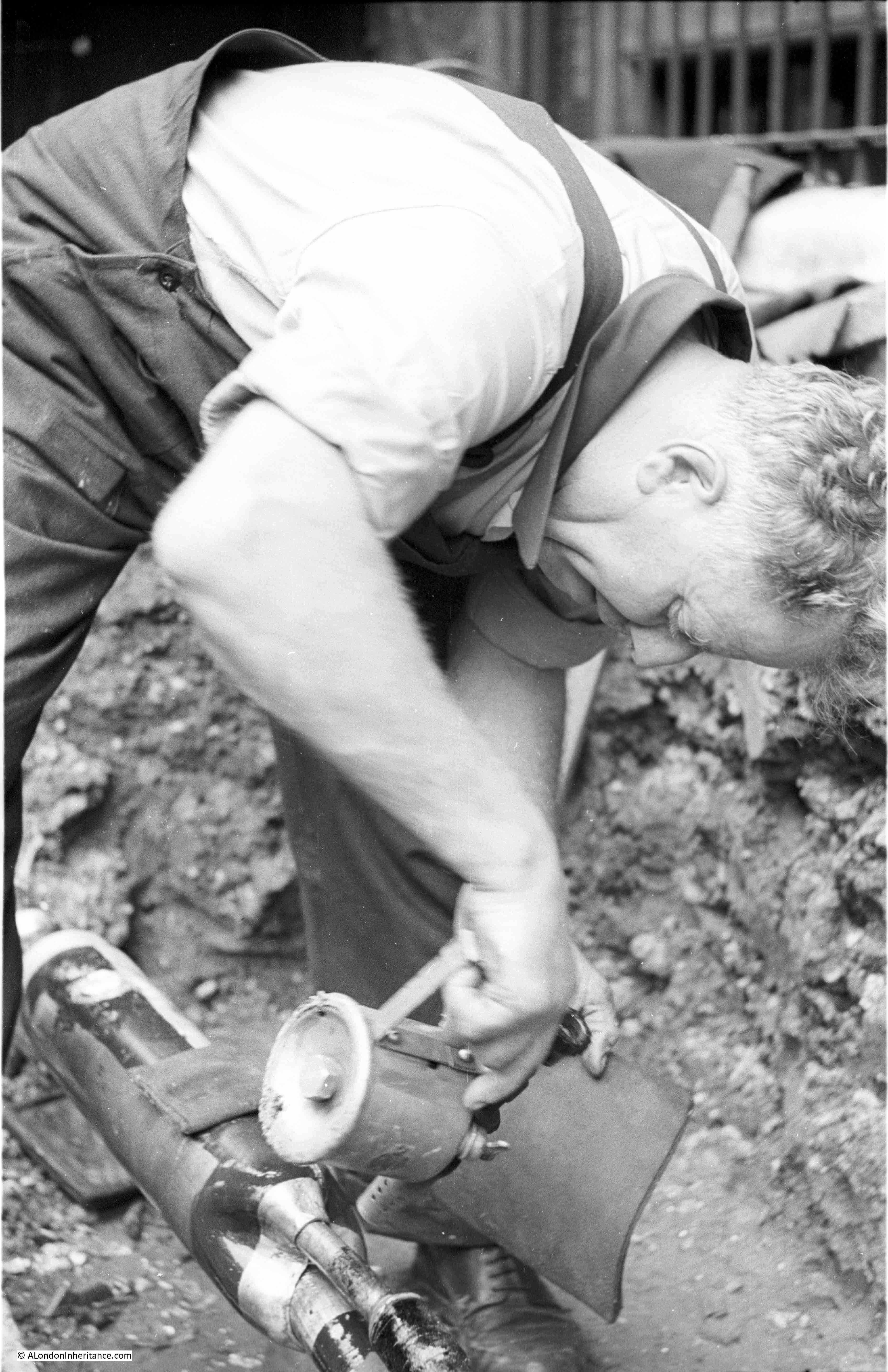
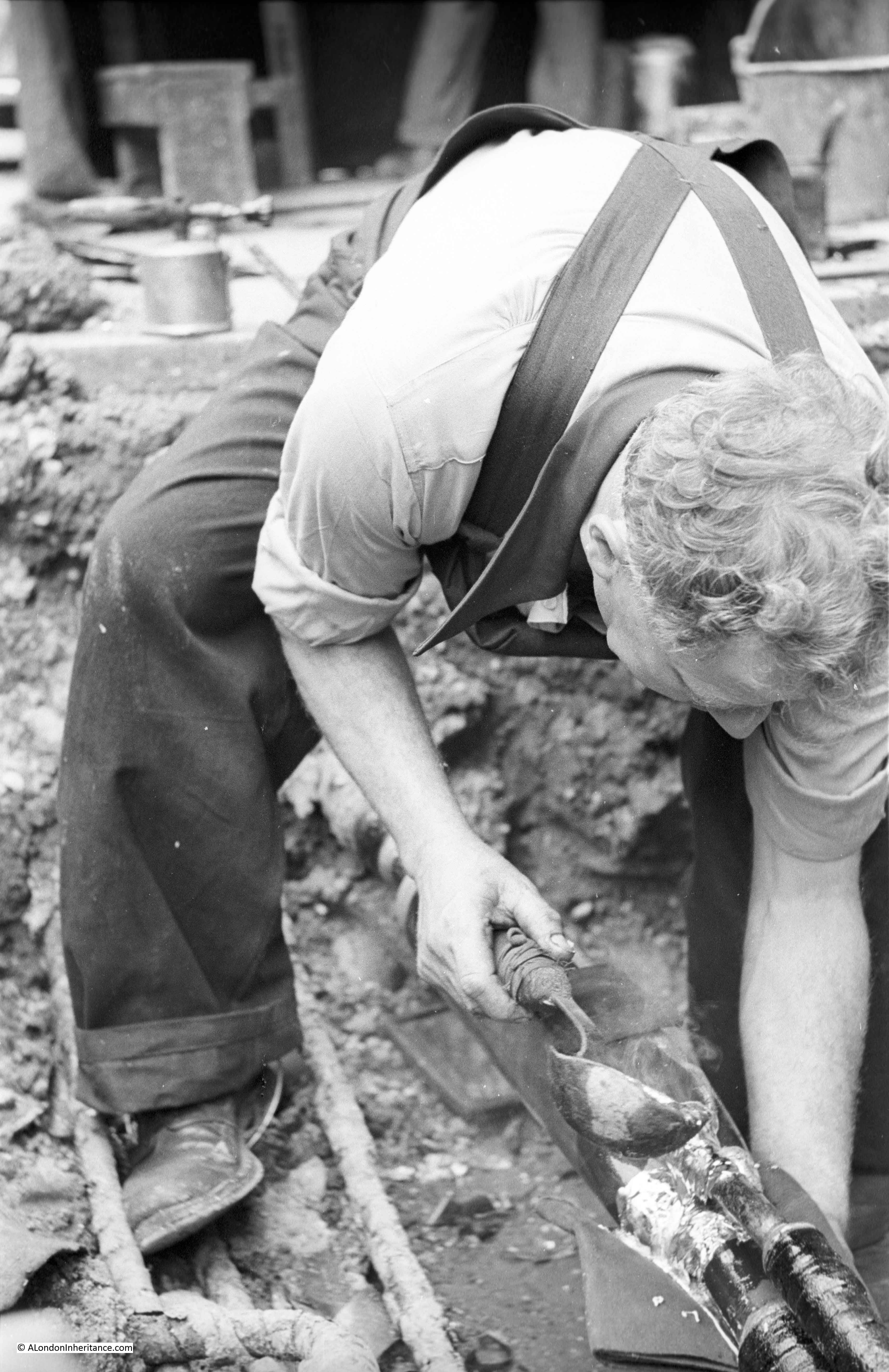
Work on the foundations started in May 1949 with bulk excavation of the whole area – as clearly seen in the photos above that my father took of the area. Bulk excavation was used as the easiest way to clear the area needed for the foundations. The centuries of previous construction on the site included the remains of the old water works along with the brewery which was built on a 6 foot thick mass concrete raft. There was a large amount of work to prepare, which included sinking well points and then pumping out water which started on the 17th June 1949, when, withing four days the ground water level was reduced to 13ft below the ordnance datum. A huge volume of water was extracted, with at the start of pumping 150,000 gallons of water per hour were being pumped out, and even after the site had been “de-watered”, pumping was still needed of 80,000 gallons per hour to keep the area of the foundations dry.

A total of 63,000 cubic yards of materials were removed for the foundations.

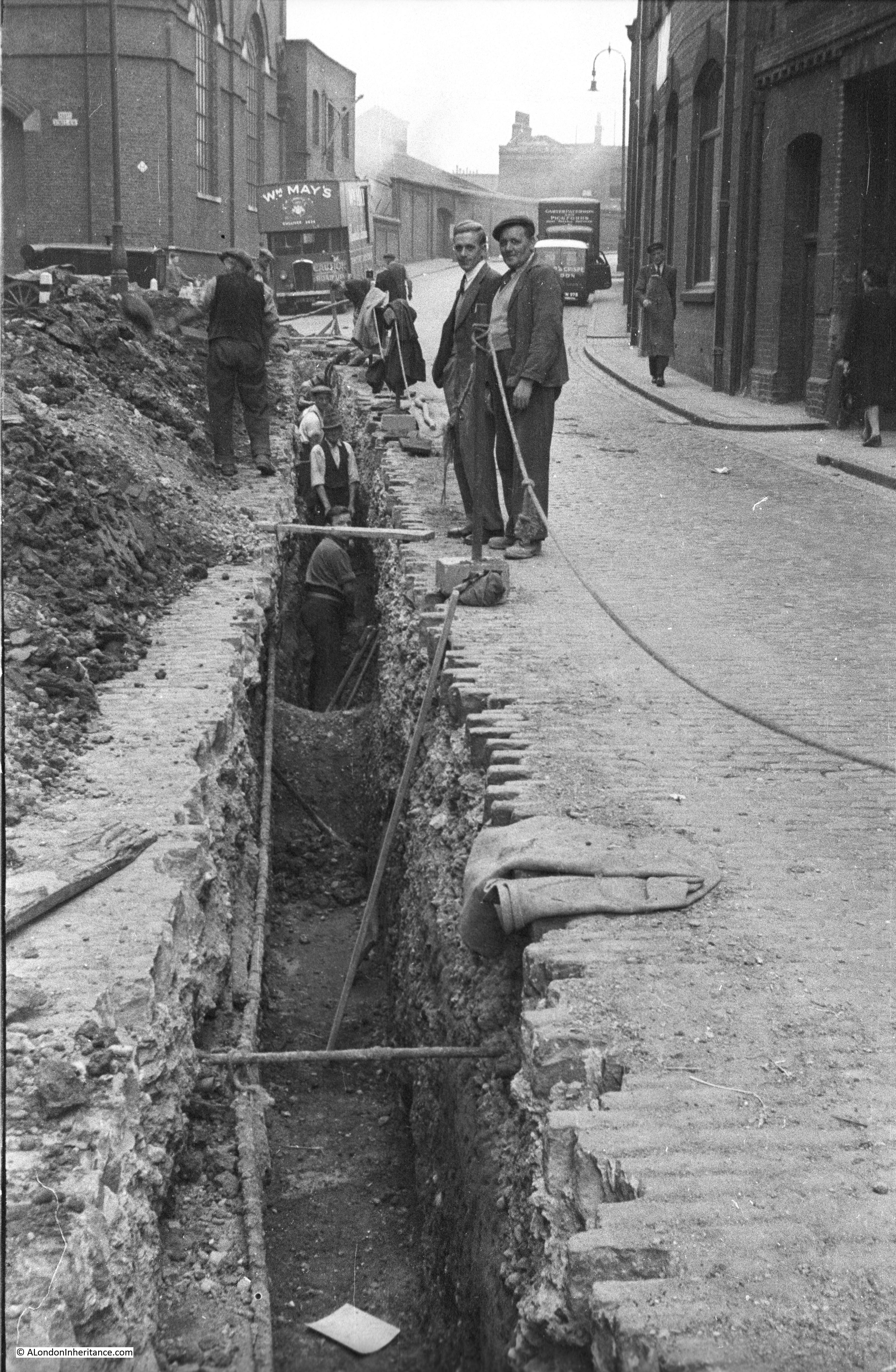
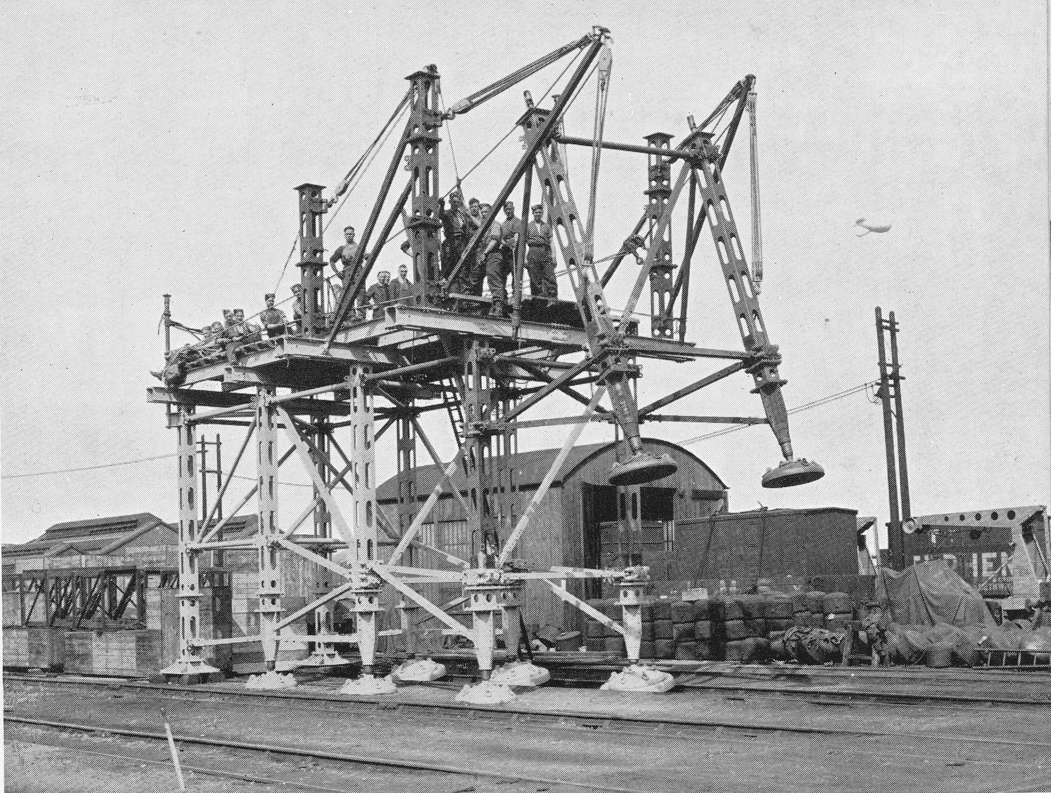
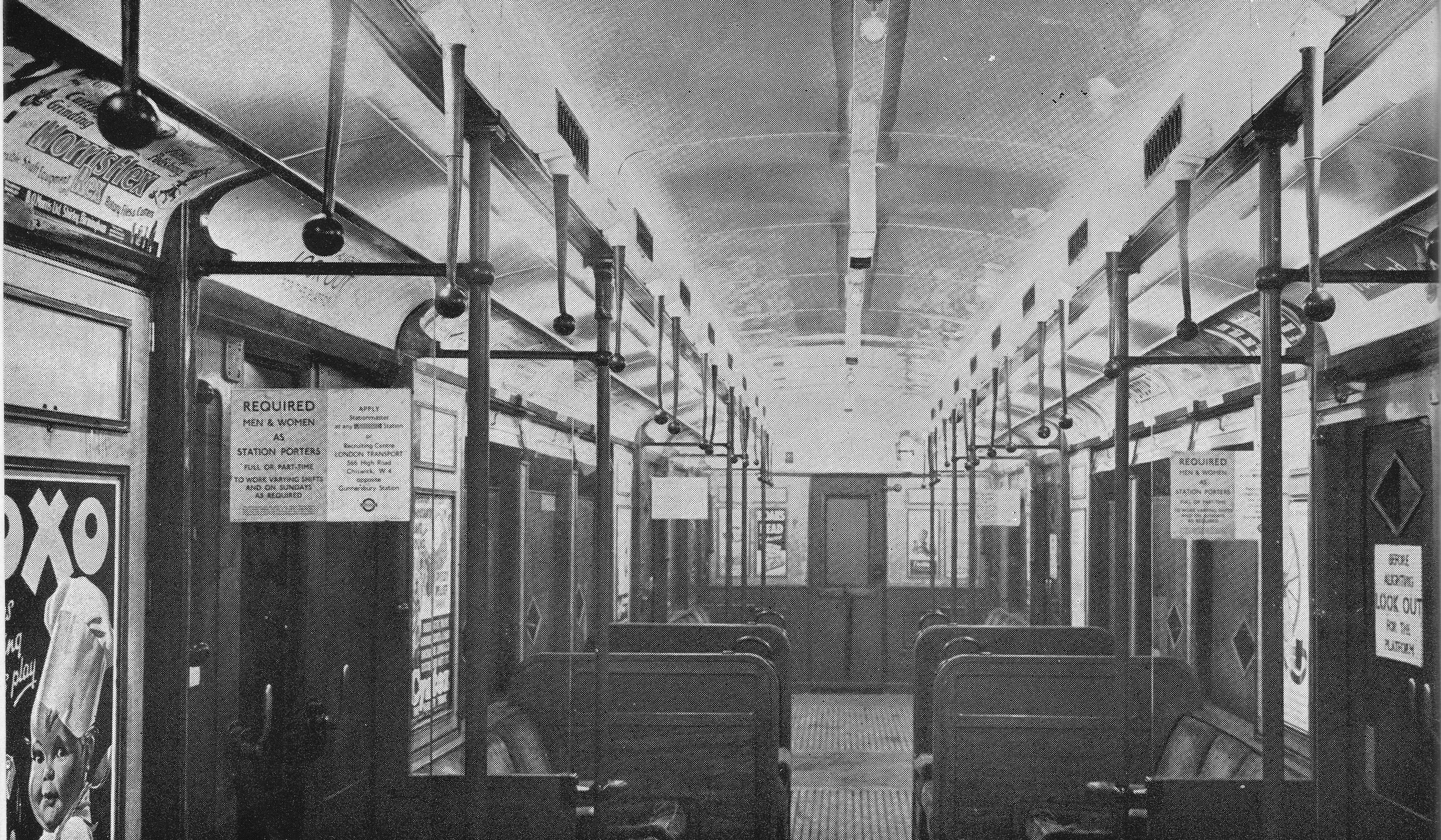
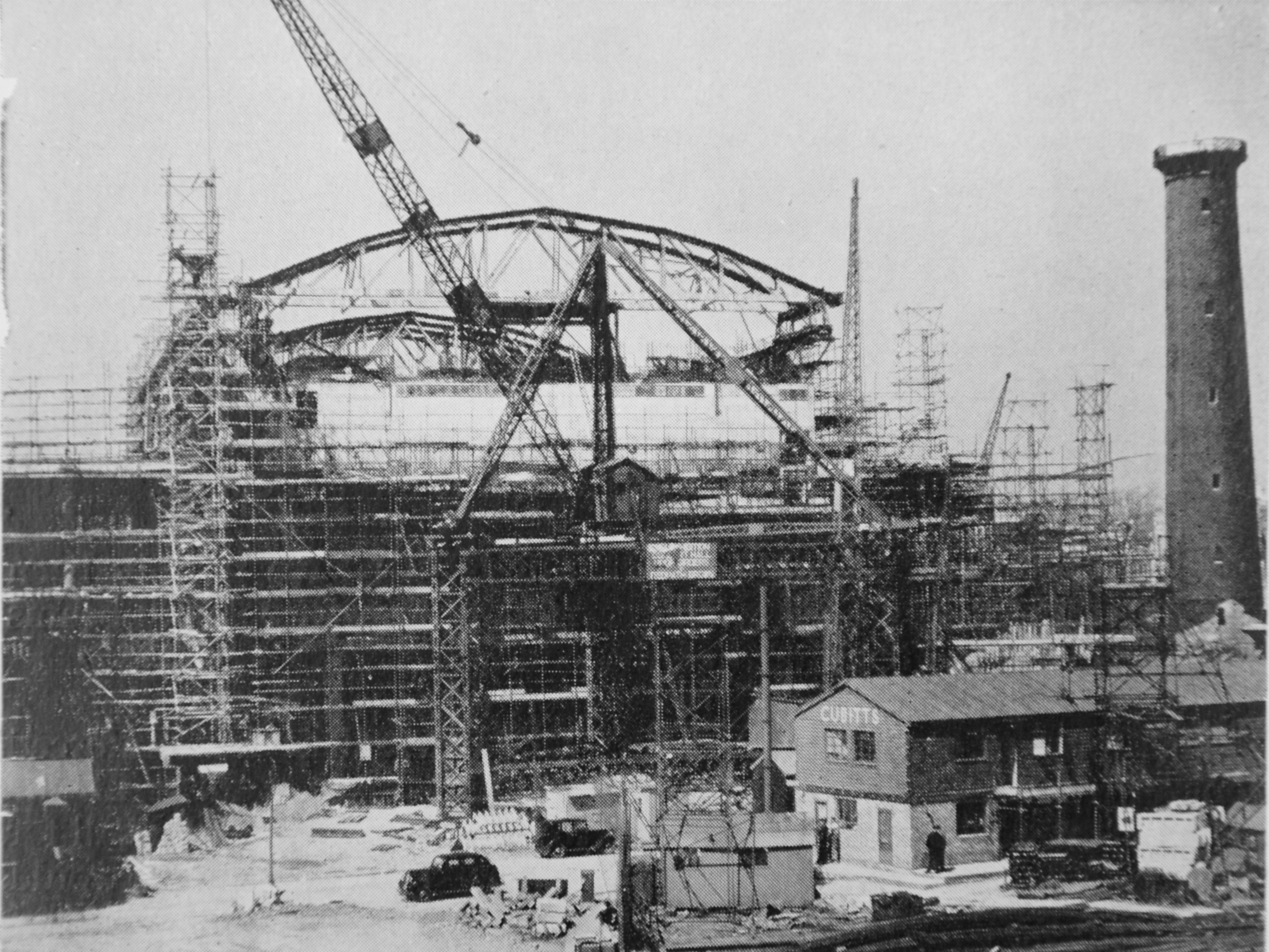
To assist with construction, a 10-ton derrick and and 50ft gabbard was erected adjacent to Belvedere Road. This is shown in the photo below and is the tripod like structure with the crane on the top platform – typical of the large cranes of the day, unlike the singe tower cranes that would be used today. Belvedere Road is running from left to right, the black cars show the location of the road and the Cubitts site office is the same as in the photos my father took along Belvedere Road and featured in the previous post.

Building the Royal Festival Hall 4

The book by the Association of Consulting Engineers describes the key structural features of the Royal Festival Hall:

“The structure under and around the auditorium consists of floors carried on columns and without infilling walls. The external faces of the building being largely glazed. These fundamentals of the architectural design resulted in the rather unusual condition  of the heavy mass of the auditorium weighing about 25,000 tons being supported at a high level on slender columns without lateral support. It was consequently decided to use the staircases at the four corners of the building as buttresses, and with this end in view they were designed as far as possible with reinforced concrete walls. It was found as the design developed that these walls had to be pierced by a large number of openings for ventilation and other services which has made them somewhat intricate. This result was not foreseeable at the time when the decision to use reinforced concrete walls was taken, since very little was known about the ventilation and other requirements. Had such information been available the design of the stair blocks would have been somewhat modified, although their function as buttresses would have had to be retained. This experience emphasises the importance of the ventilation scheme being developed at an early stage of the design of buildings.

The magnitude of the Festival Hall can be gauged from the particulars given below:

Contract price (including small hall)  £1,628,260

Tonnage of Steel reinforcement (excluding small hall): 2,340 tons

Weight of Roof Steelwork: 260 tons

Volume of mass of concrete: 8,800 cubic yards

Volume of Reinforced Concrete: 23,000 cubic yards”

The comment about the need to pierce the buttresses and install ventilation again shows the speed with which the Royal Festival Hall was being built with plans still being completed as the building was being constructed. New plans would be brought across from the Cubitts site office to specify the next part of the build and any problems would need to be resolved where the new plans required a change to what had already been built.

A criticism at the time that the Festival of Britain was planned and being built was that the manpower and resources being used were a distraction from the real need to build homes and factories after the devastation of the war, as well as the need to export production to bring in much needed foreign currency. The figures above illustrate the volume of materials needed for this single building.

The book then goes on to describe the challenges with the roof of the building:

“The acoustic consultants originally laid down that the roof of the auditorium should consist of two leaves, the inner one 8 inches thick and the outer 6 inches thick. These leaves were to be supported by an air space of 12 inches minimum thickness, and where the outer leaf rested on supports from the inner leaf, it was to be isolated by some insulating material which was subsequently decided to be 2 inches of glass silk. In addition to the 8 inch and 6 inch roof slabs, the roof girders are also required to carry a 2 inch solid suspended ceiling, ventilation ducts and other miscellaneous items. It will be realised that this constitutes a roof of unusual weight. The structural engineers recommended that the acoustic consultants should reconsider the rook thickness, and it was finally arranged that an inner leaf 6 inches thick and an outer 4 inches thick would suffice, a saving of 4 inches of concrete or approximately 50 lb. per square foot on the original proposal”.

The following drawing shows a cross section of the Royal Festival Hall showing the raised auditorium:

Building the Royal Festival Hall 2

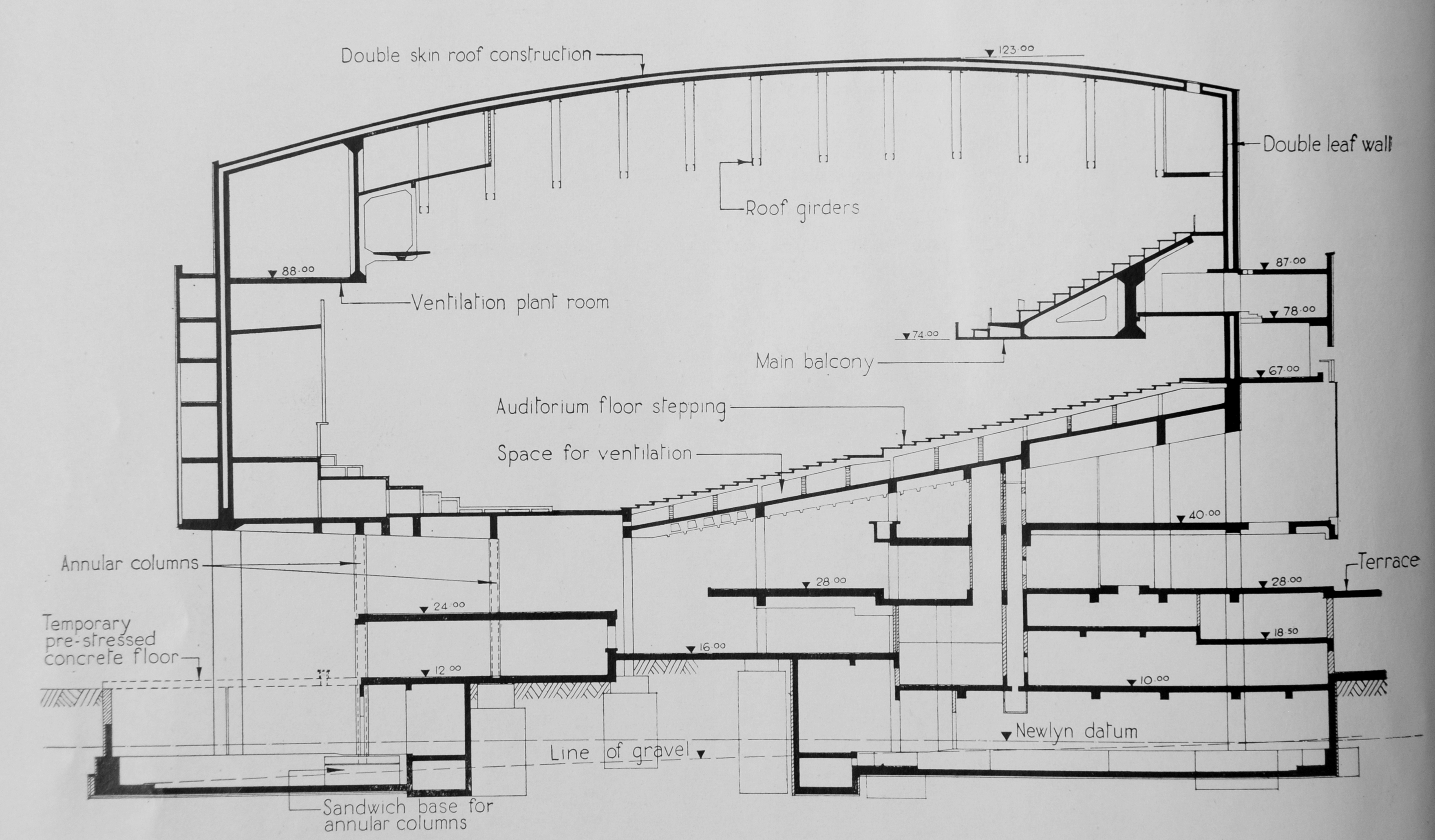
The design was dictated by the limited area of the site which resulted in the raised auditorium allowing two levels of main floors below the auditorium consisting mainly of open space for the main reception, restaurants and bars and exhibition areas. Walking in from the South Bank takes you directly into these open areas from where the fact that the main auditorium is built above is not immediately obvious – a very clever design.

The Royal Festival Hall went from design to completion in a very short time. A sketch design had been prepared by October 1948. Work on the engineering design started the following month in November 1948. Work on foundations started in May 1949 with the concrete super-structure starting to rise above ground level in October of the same year. The reinforced concrete roof was completed by the end of September 1950.

The short time for construction required work to continue throughout the cold winter of 1949/50. To ensure concreting work could continue during low temperatures, two stages were implemented. For stage one, precautions included heating of the mixing water, shielding and warming aggregate heaps to prevent them becoming frozen and covering over concrete with special mattresses. For even colder temperatures, stage two was needed during the early months of 1950 and included the use of a battery of steam boilers with steam heat being applied to newly concreted areas.

This was a significant achievement given that the Royal Festival Hall was only one part of a major construction site on the South Bank. There were also many other construction priorities across the country, there was a shortage of money and foreign currency, rationing was still in place and the country was still recovering after over 5 years of an intense war.

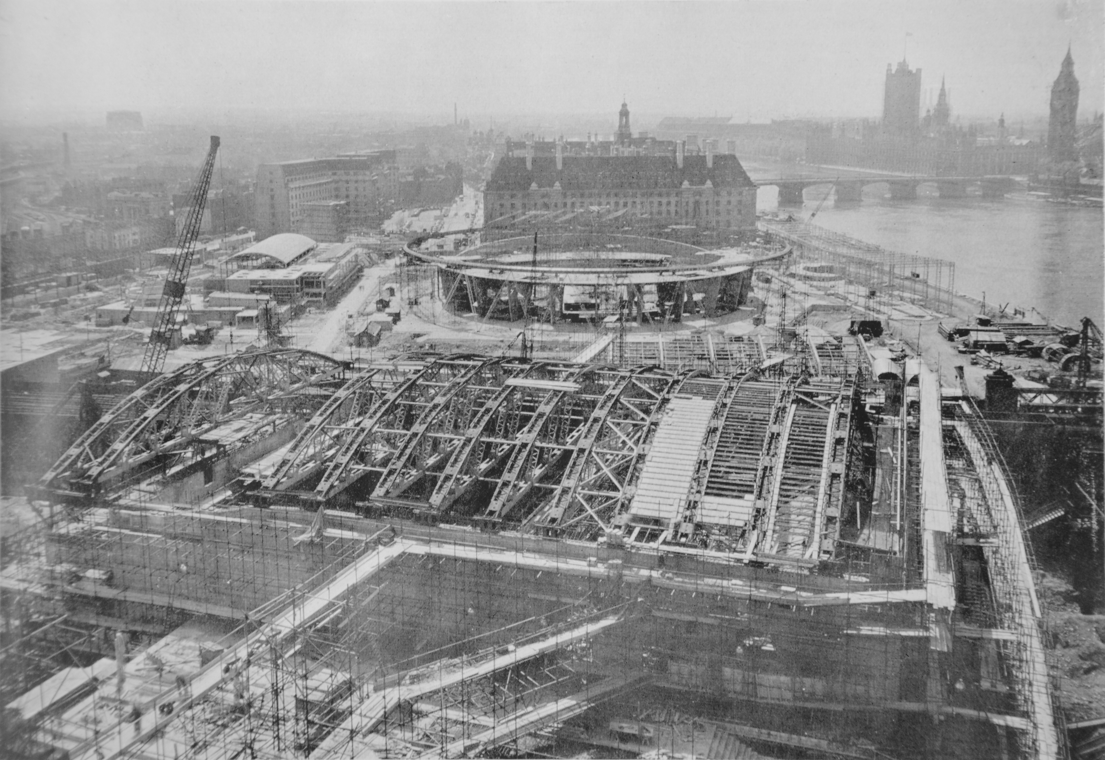
The following photo from the Association of Consulting Engineers book was taken from the top of the Shot Tower and shows the construction of the Royal Festival Hall in the foreground with the Dome of Discovery between the hall and County Hall, both surrounded by the construction site that will be the location of the Festival of Britain.

Building the Royal Festival Hall 1

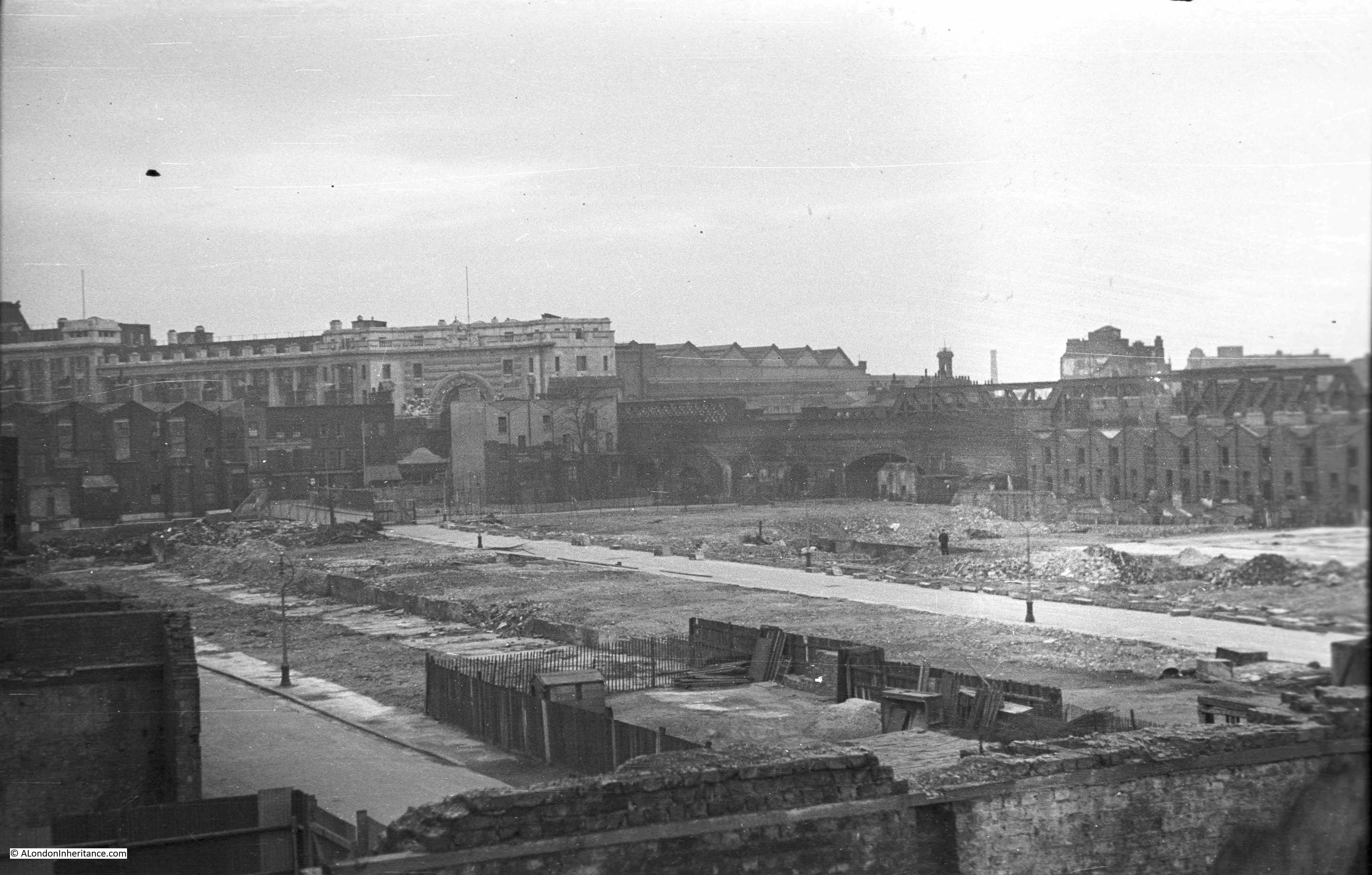
Still standing at the end of the footbridge, this is what the area looked like prior to the construction of the Royal Festival Hall.

History of the Southbank 28

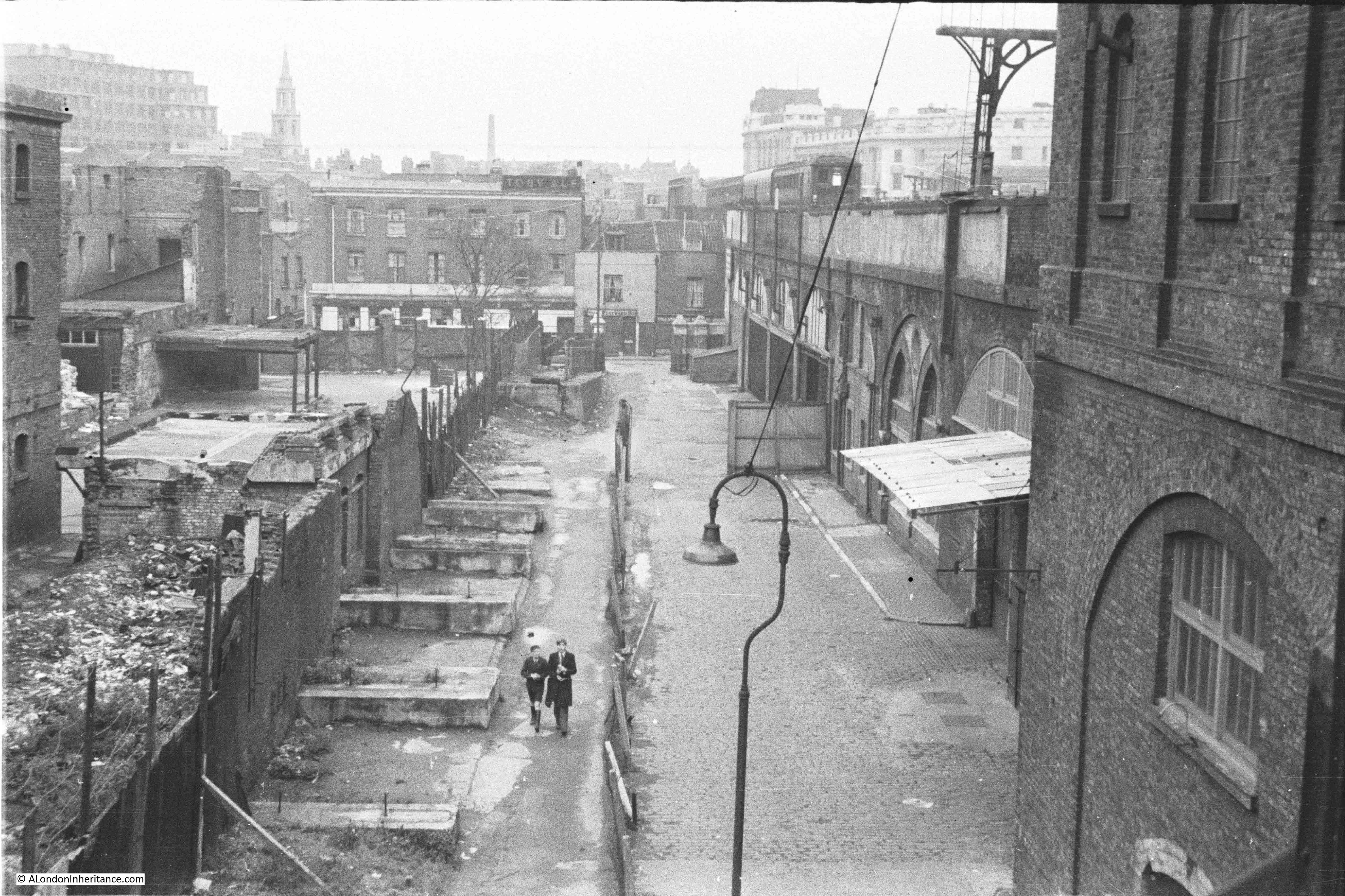
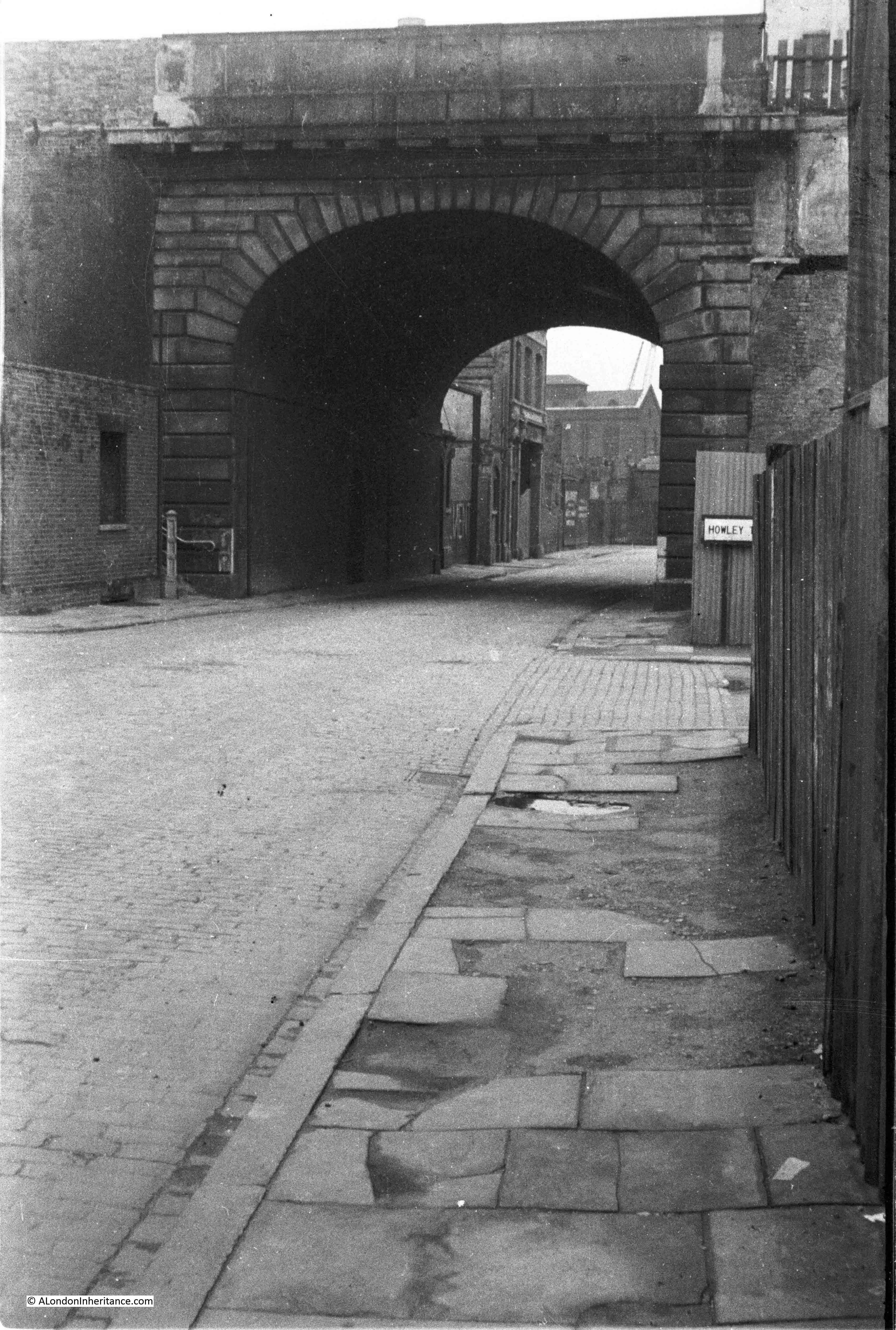
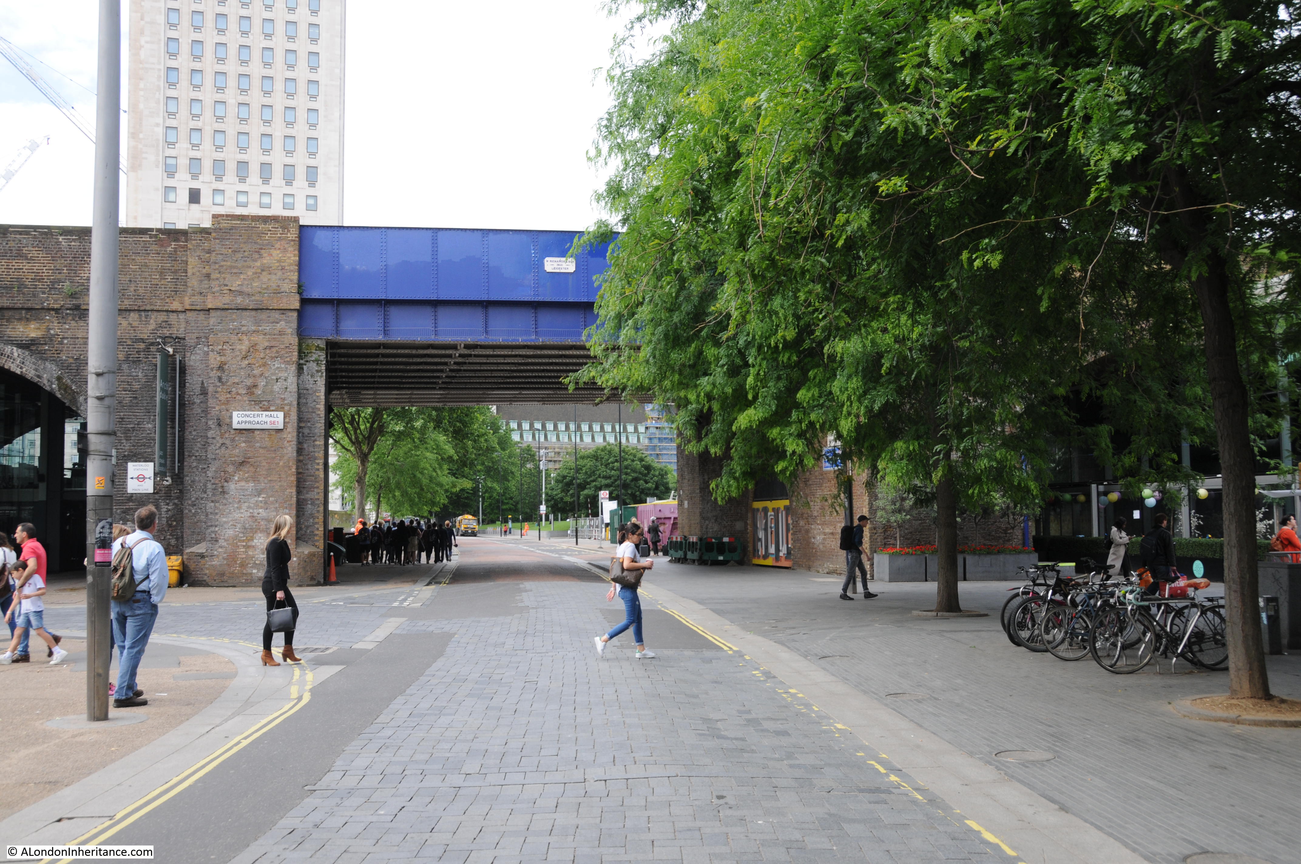
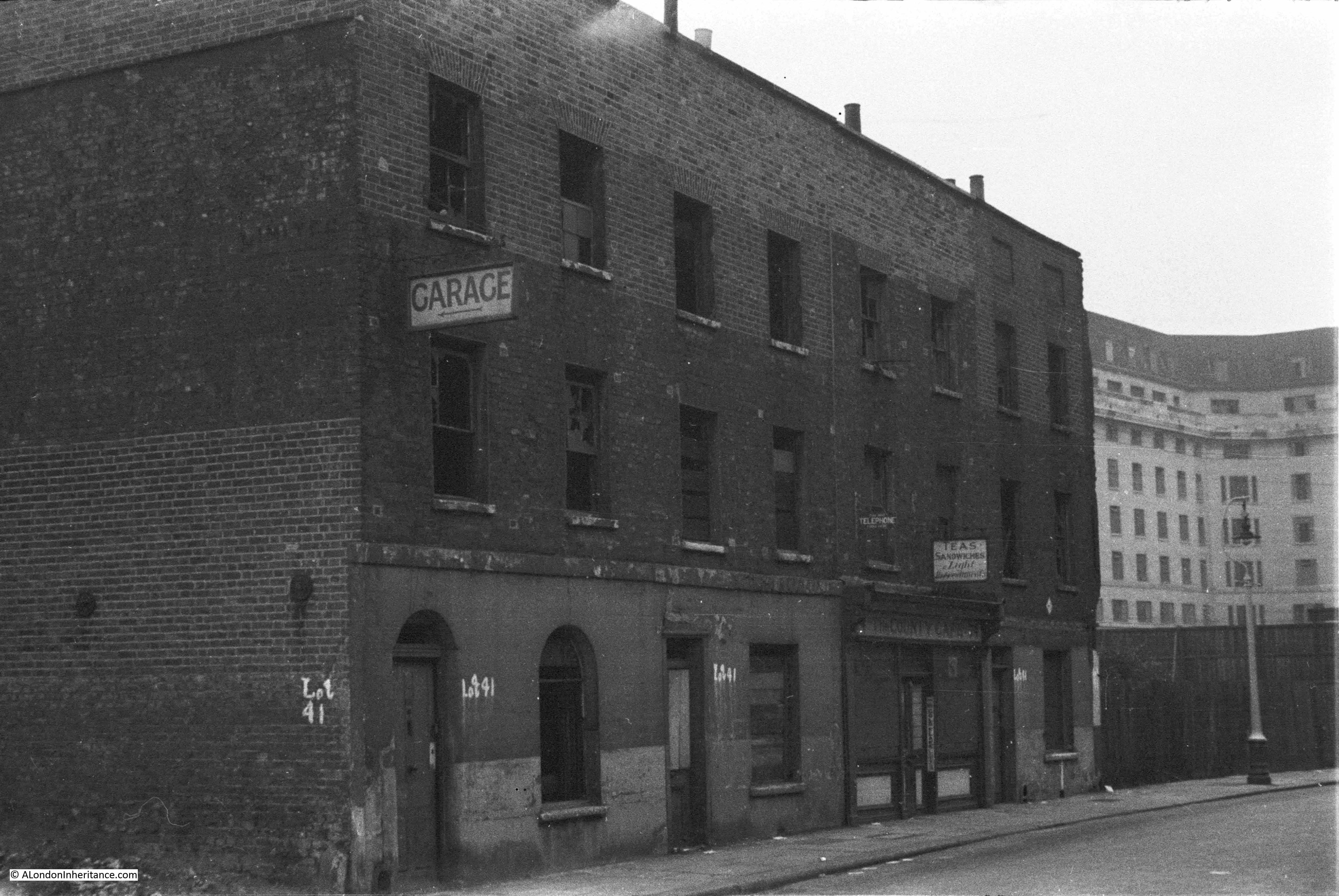
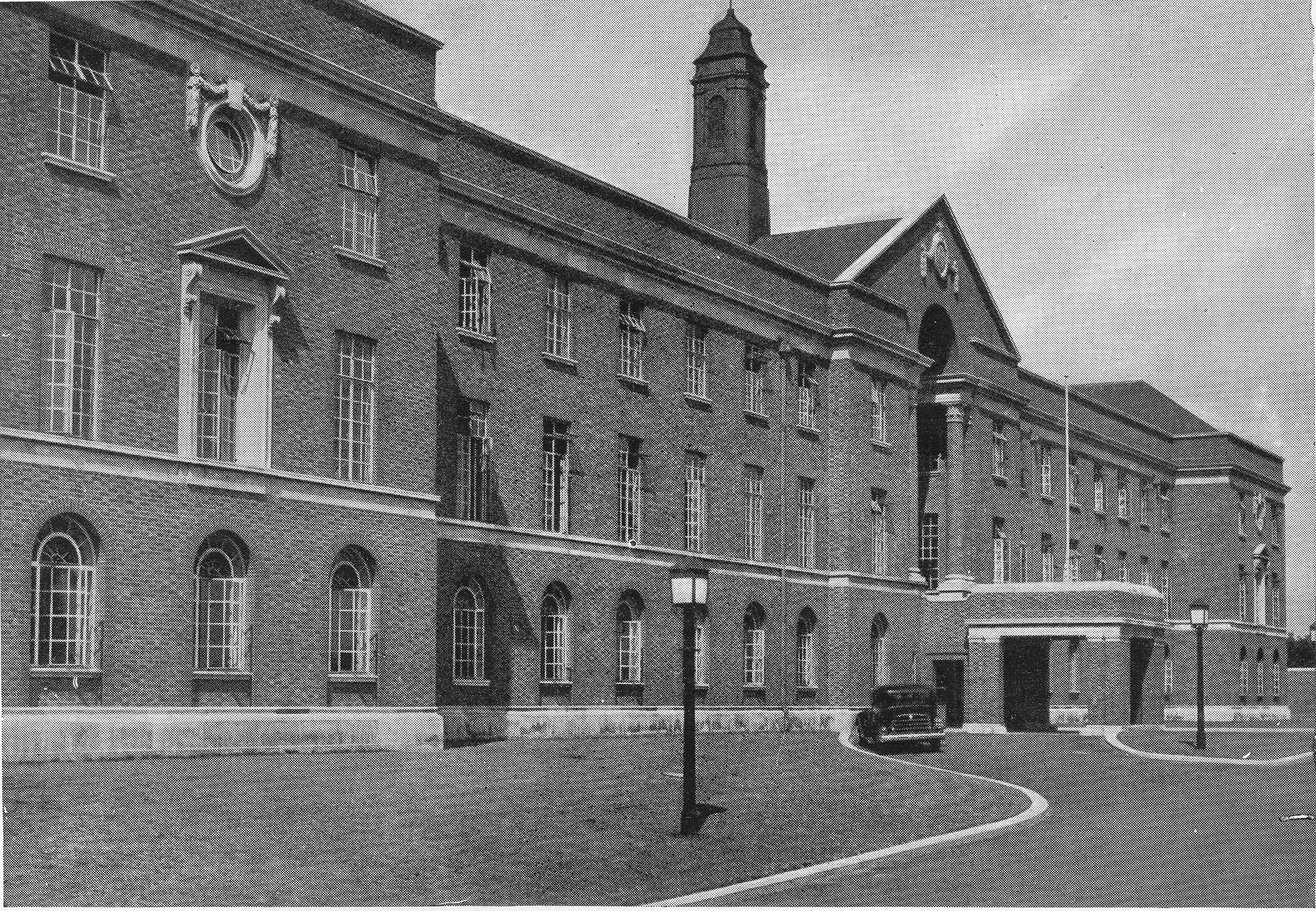
The Survey of London volume on the South Bank and Vauxhall included a drawing of the shop on Belvedere Road which can be seen at the far end of the road running alongside the railway arches.

Building the Royal Festival Hall 10

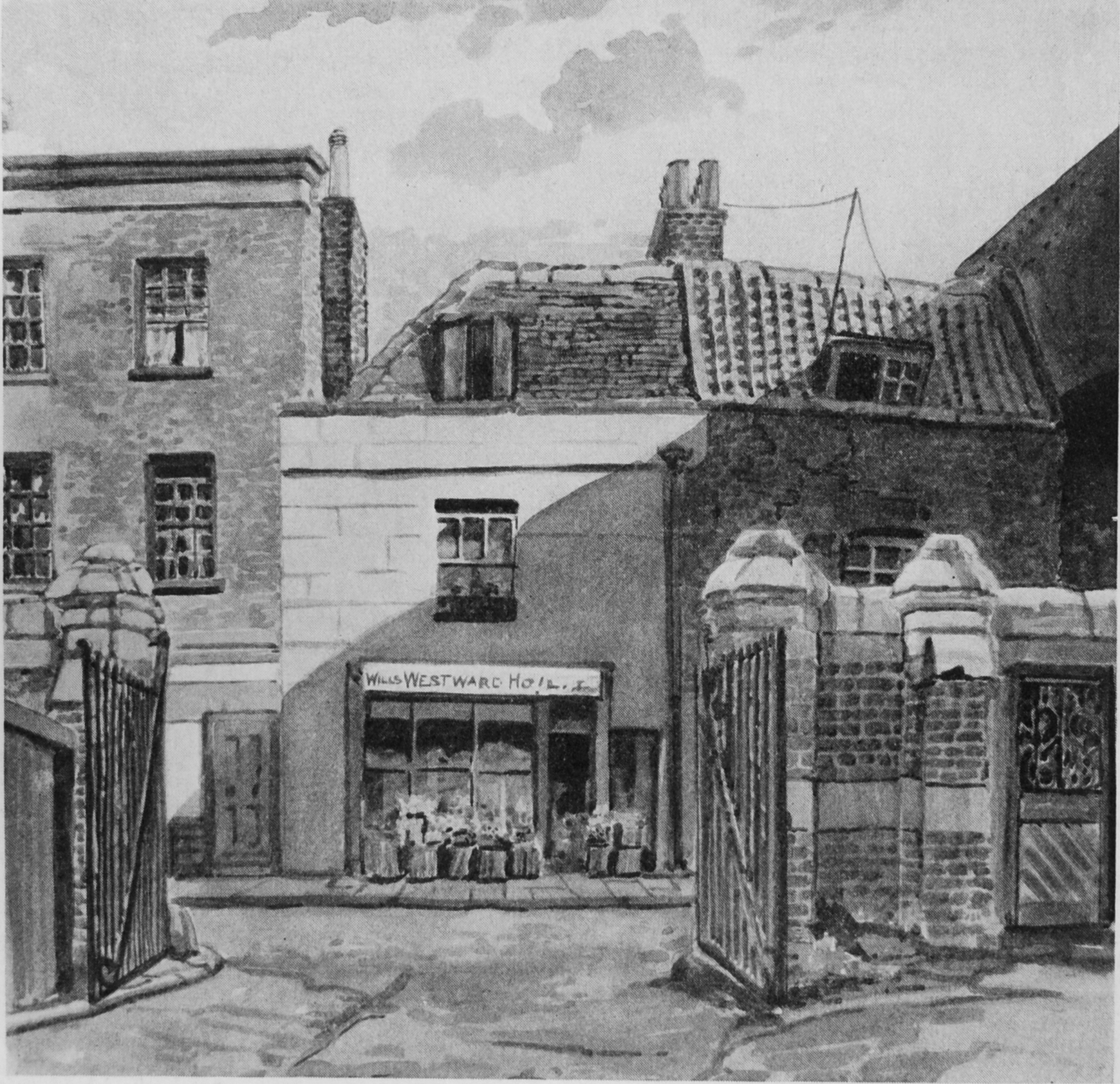
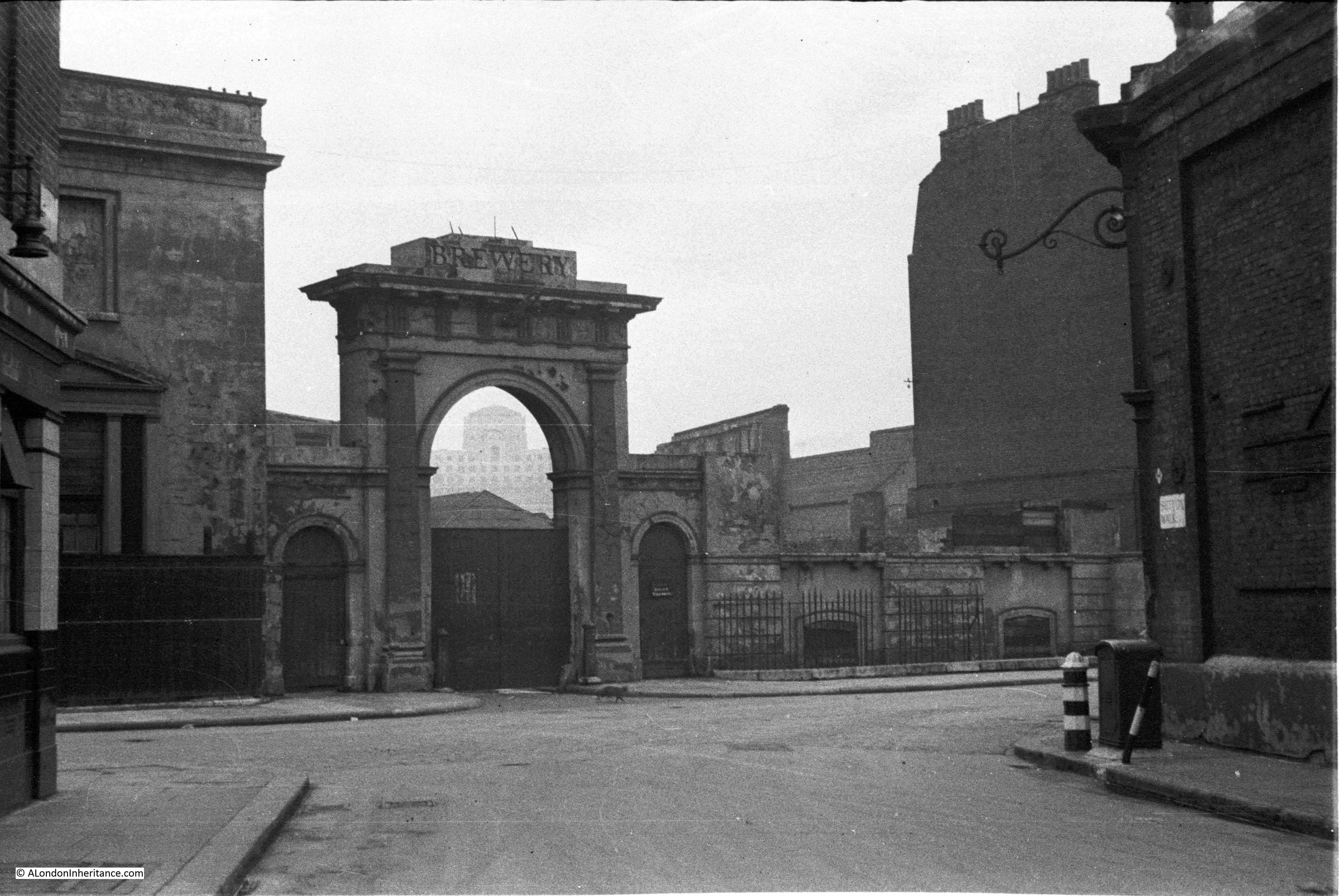
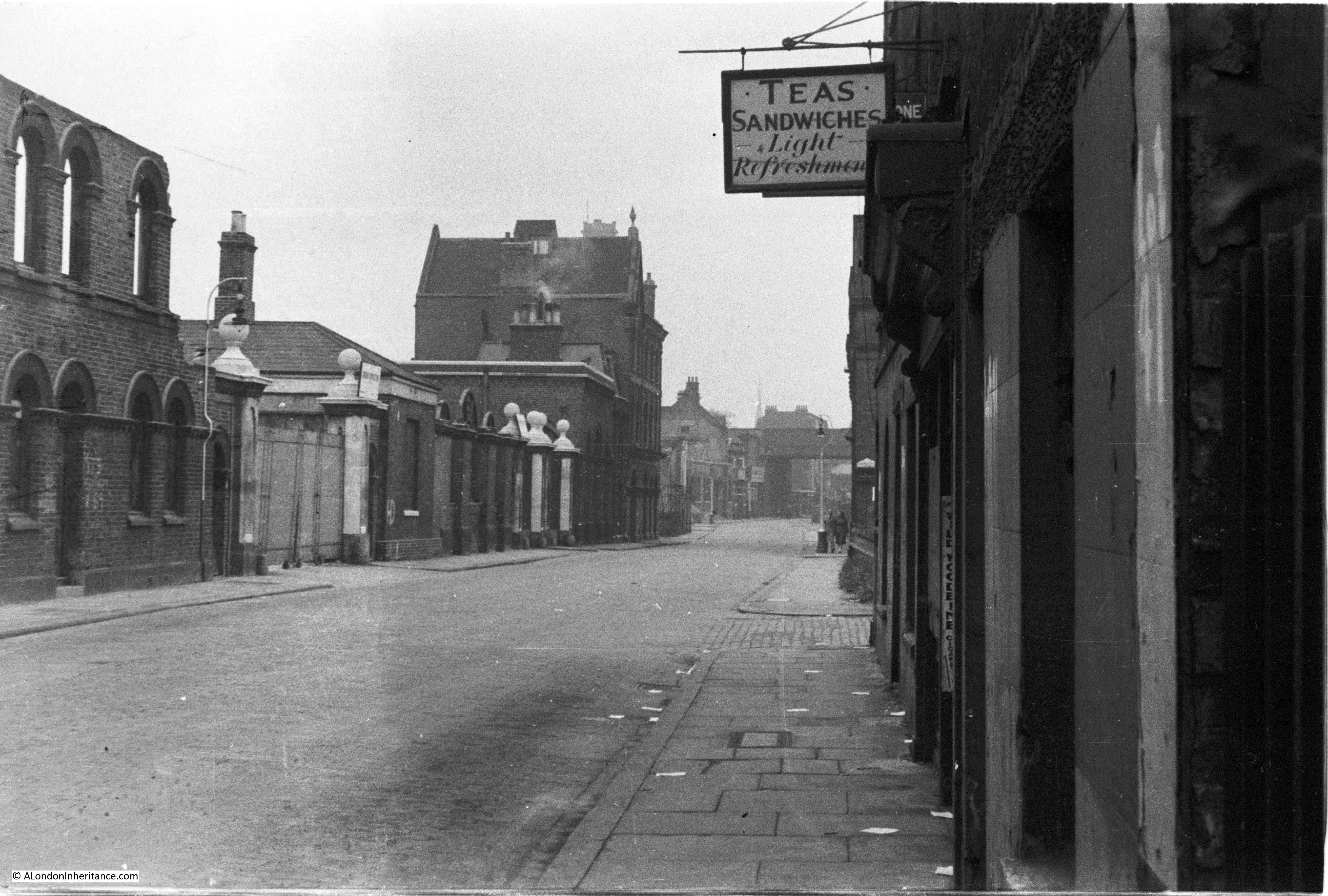
And months later, the same area with clearance well underway.The entrance arch to the Lion Brewery from Belvedere Road is still there.

History of the Southbank 26

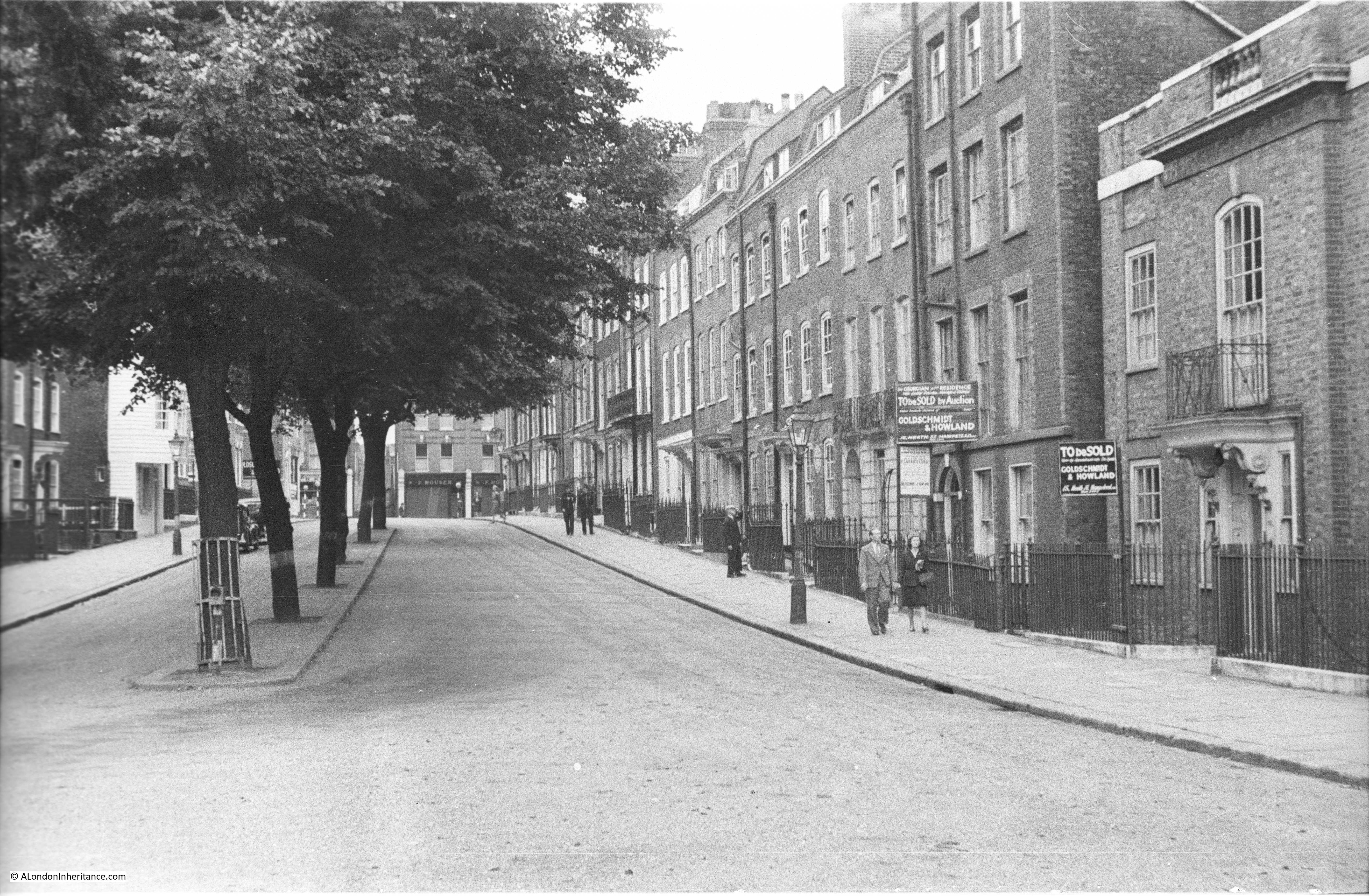
I mentioned in my first post on the South Bank that I first realised that my father had a large store of negatives of London when I started working here and he showed me some of the photos he had taken of the area. Back in 1980 I had also started taking photos of London which included photos around the South Bank and I have recently found and scanned some of these negatives.

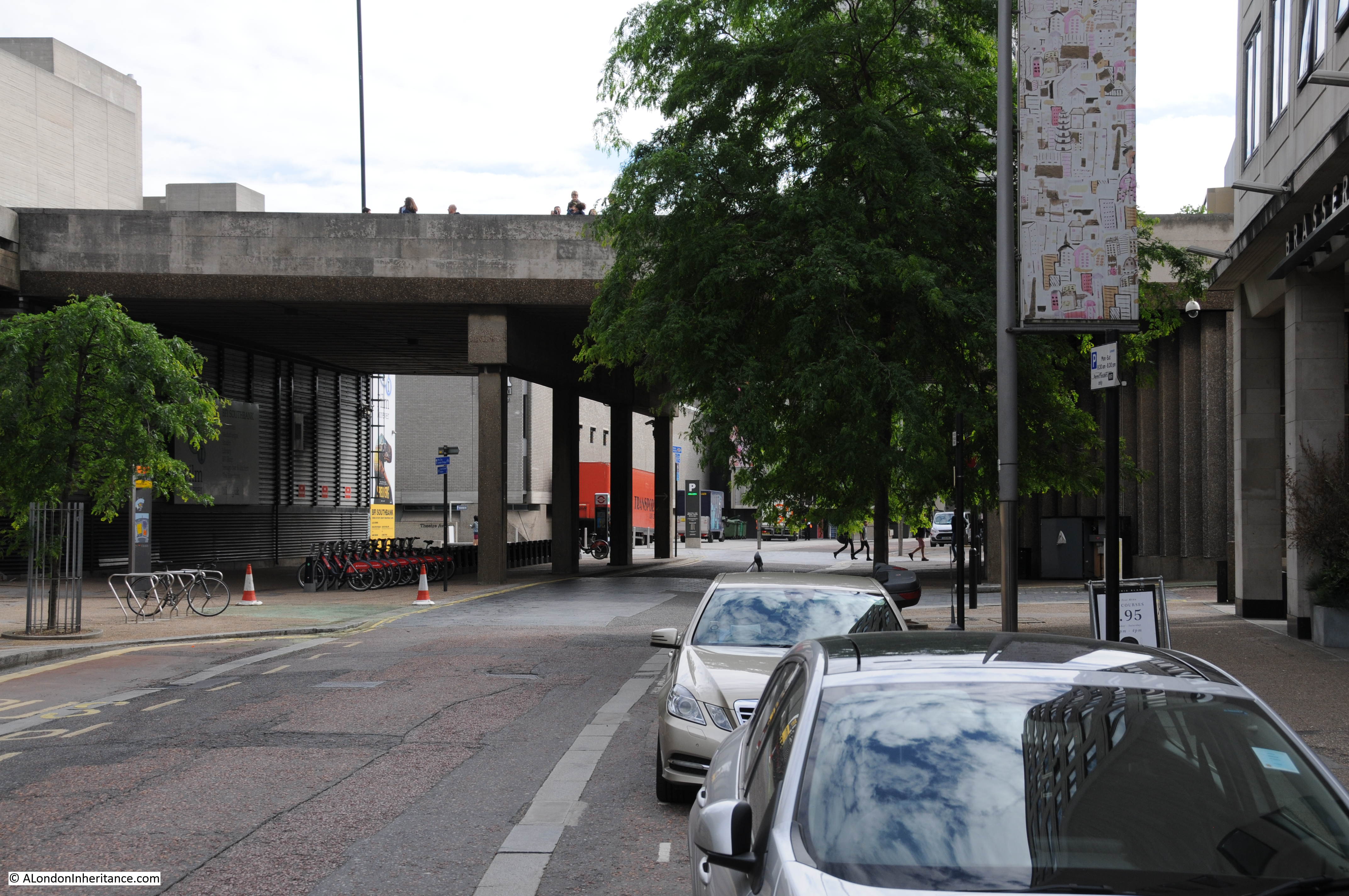
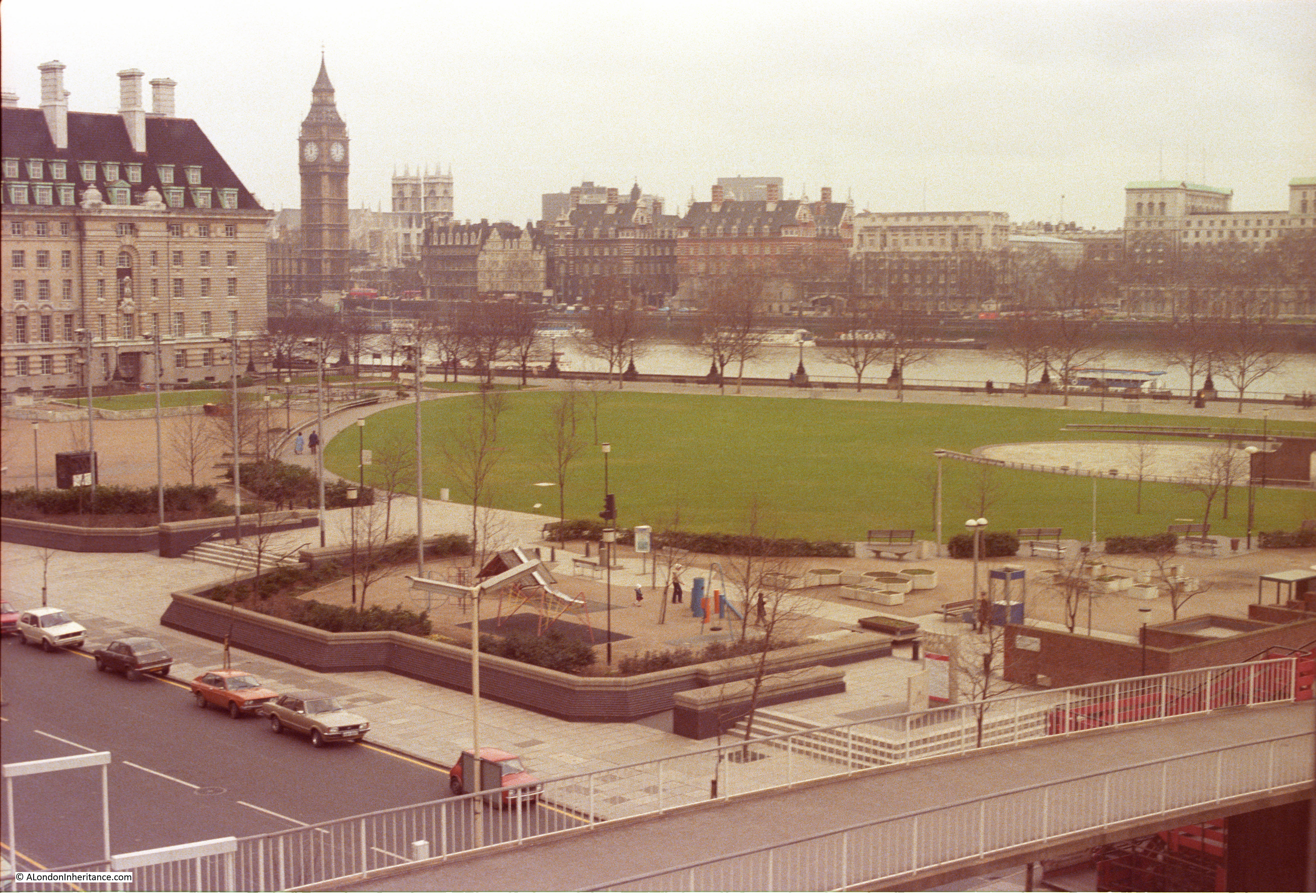
The following photo is the same scene as the above two, but taken in 1980. It is closer to the first of the above two photos, the part of the bridge on the right is still much the same and there is still a road on the lower right providing access to the arches underneath the railway.

Building the Royal Festival Hall 8

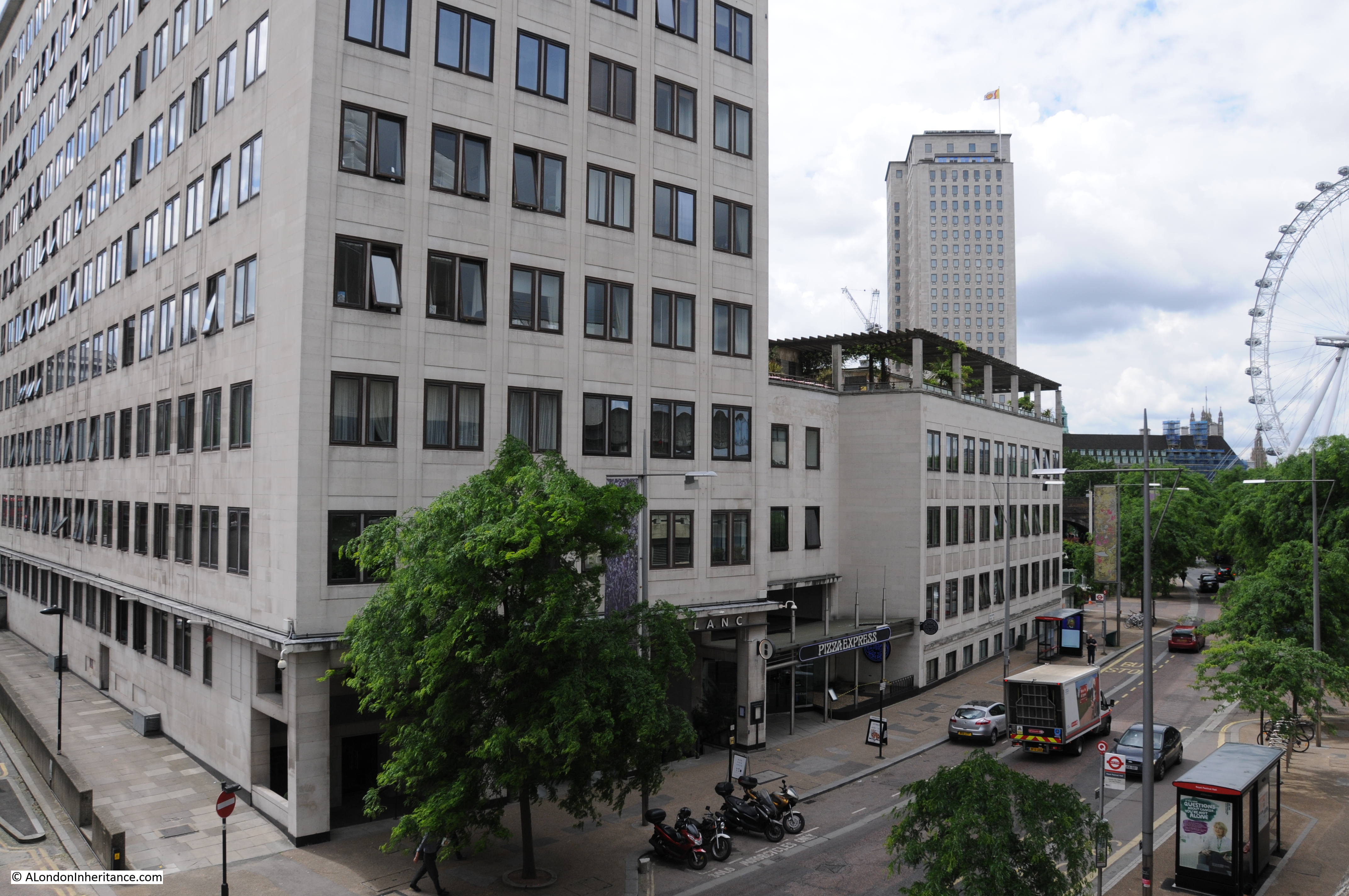
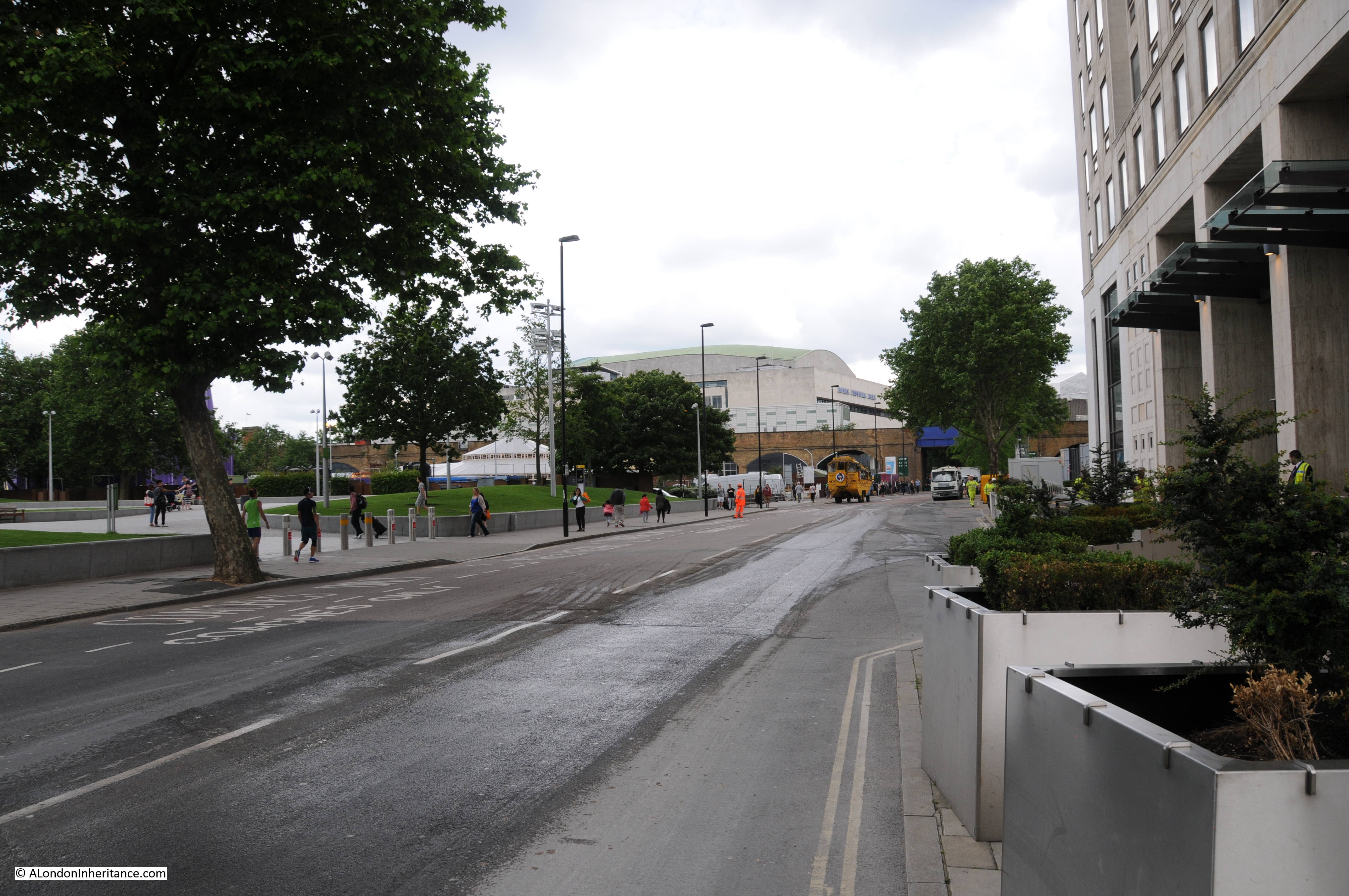
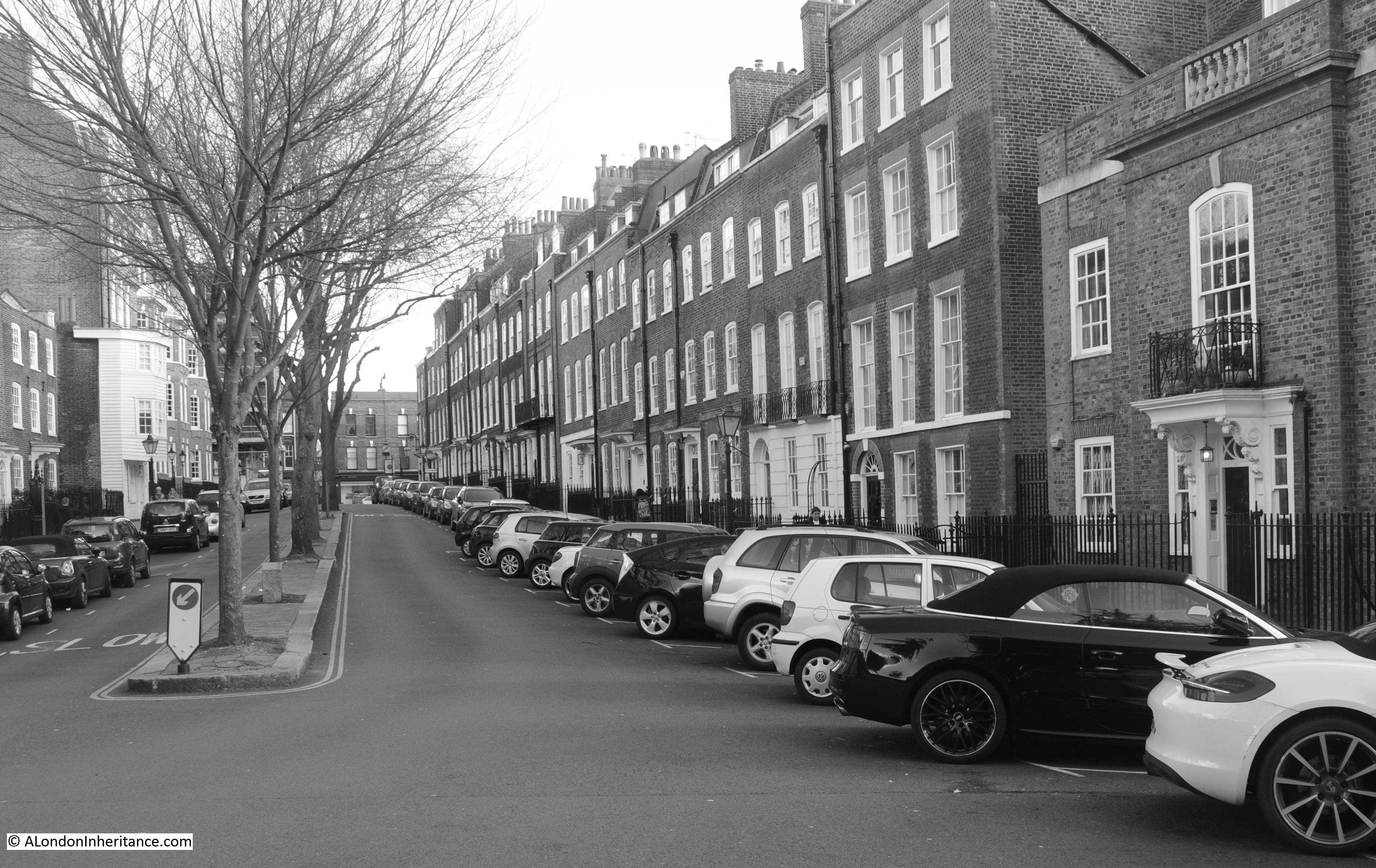
And below is my photo from June 2016 showing the same area, 36 years after I took the above photo and between 69 and 66 years after my father took the photos showing the various stages of the development of the site. It is much different now. New buildings have been constructed along the space of the original road.

Building the Royal Festival Hall 9

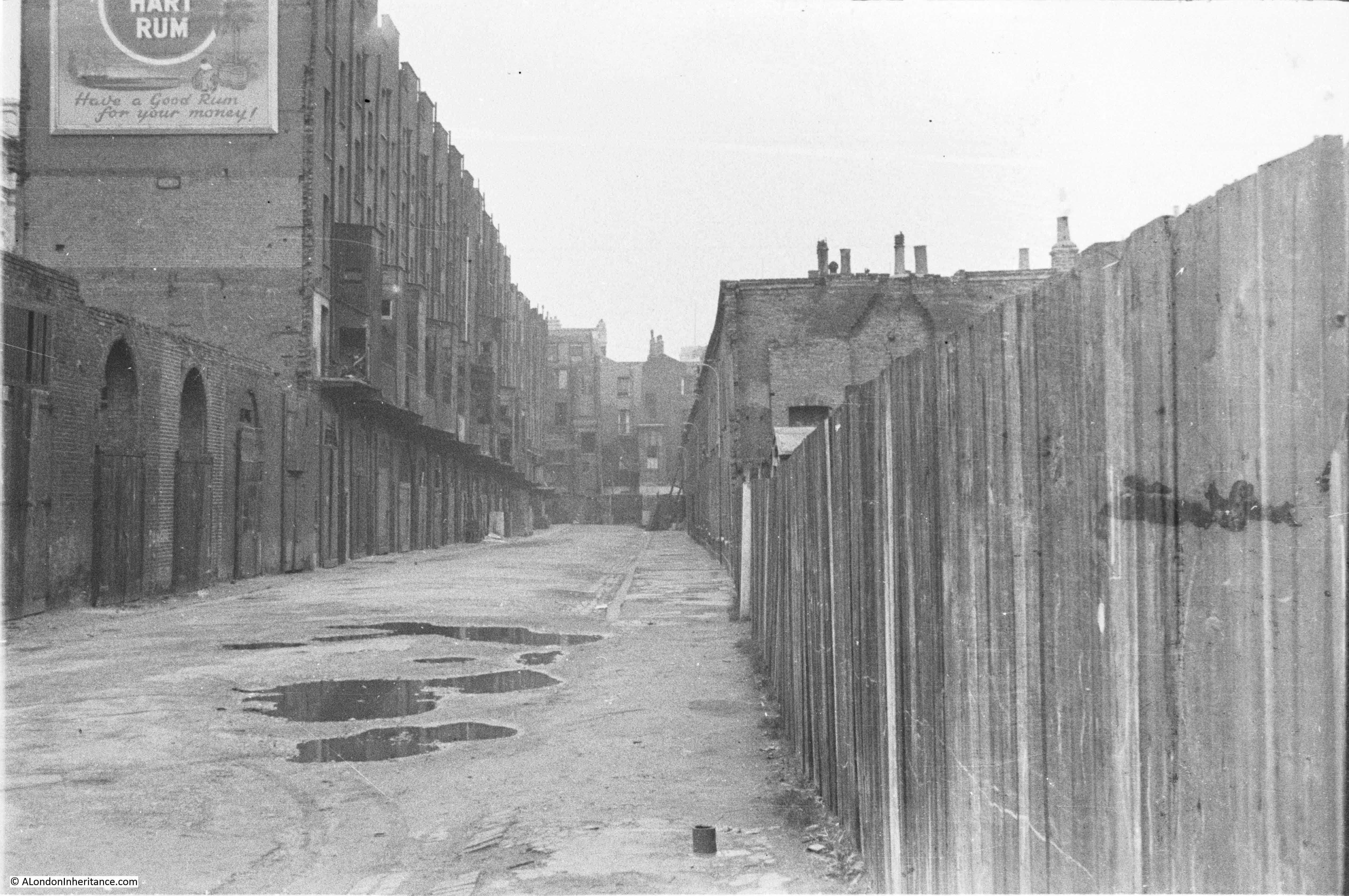
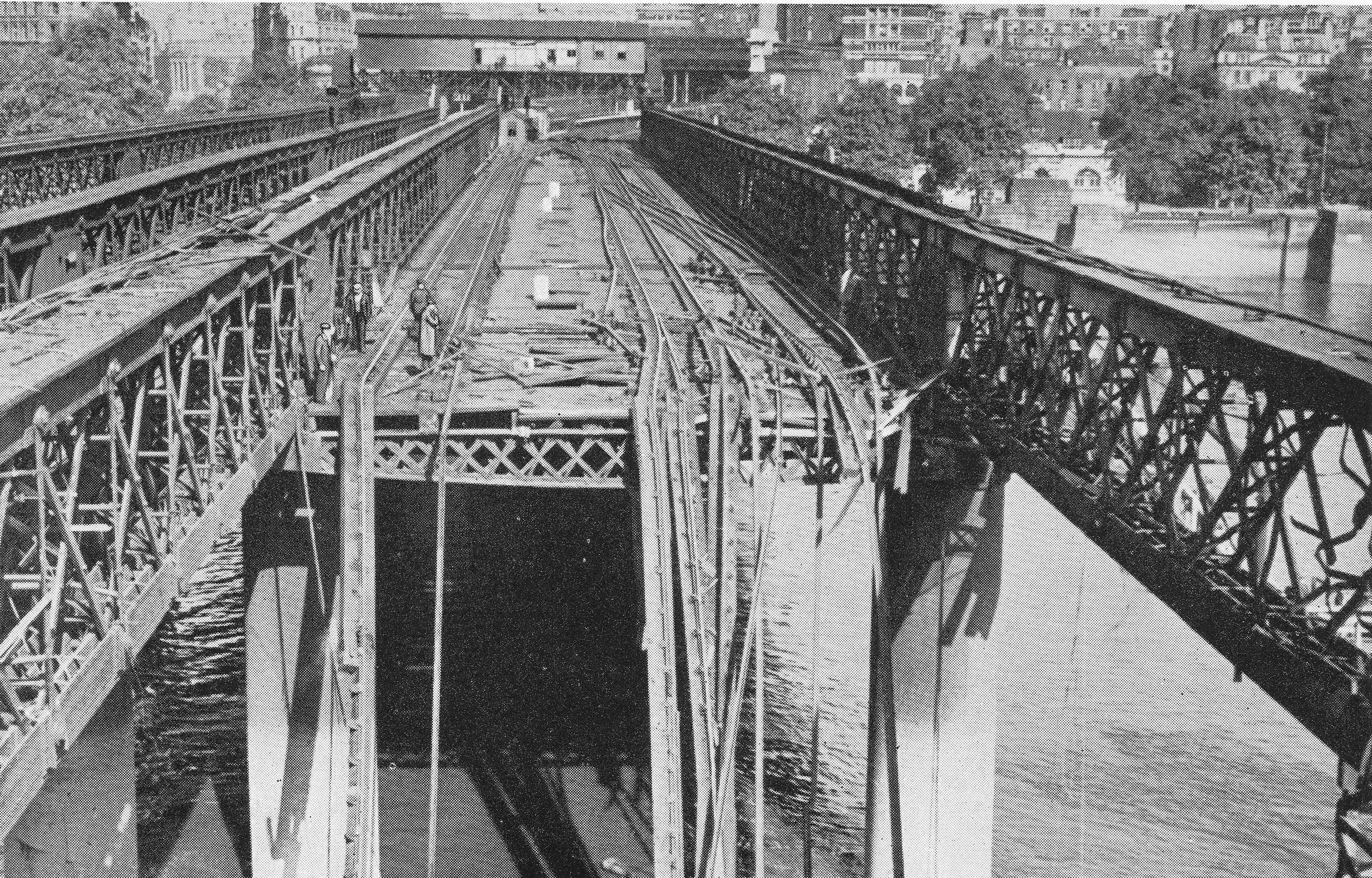
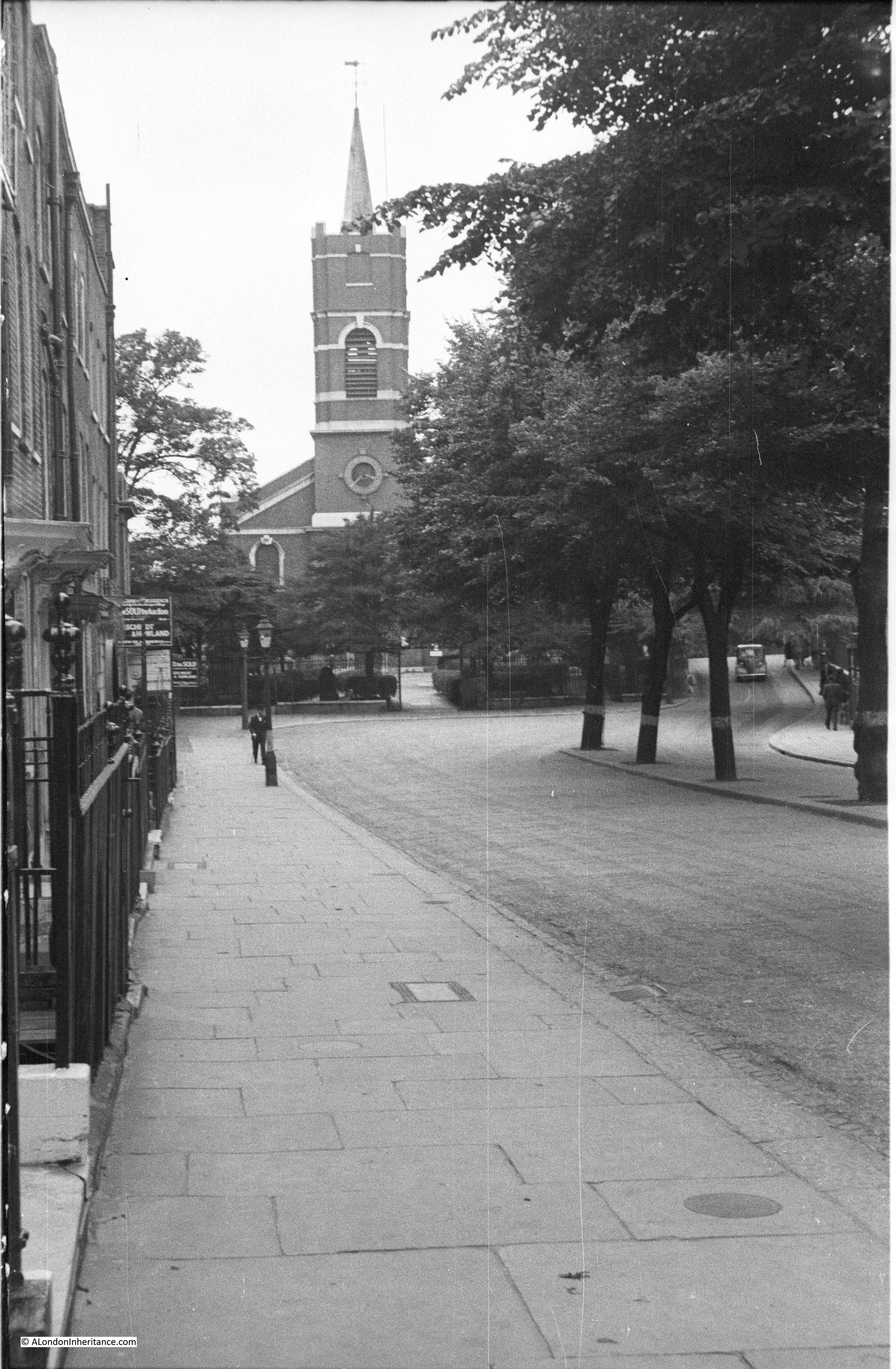
I have mentioned the footbridge alongside Hungerford Bridge a number of times and it was at the end of this bridge that my father took the above photos. He also took the following photo looking back from the southern end showing the bridge as it was when he was taking these photos between 1947 and 1951.

Building the Royal Festival Hall 11

The old footbridge is long gone and has been replaced by the Golden Jubilee footbridges that run on either side of Hungerford Bridge, unlike the original which only ran on the side facing Waterloo Bridge. I think you will agree, a major improvement to walking across the river.

Building the Royal Festival Hall 12

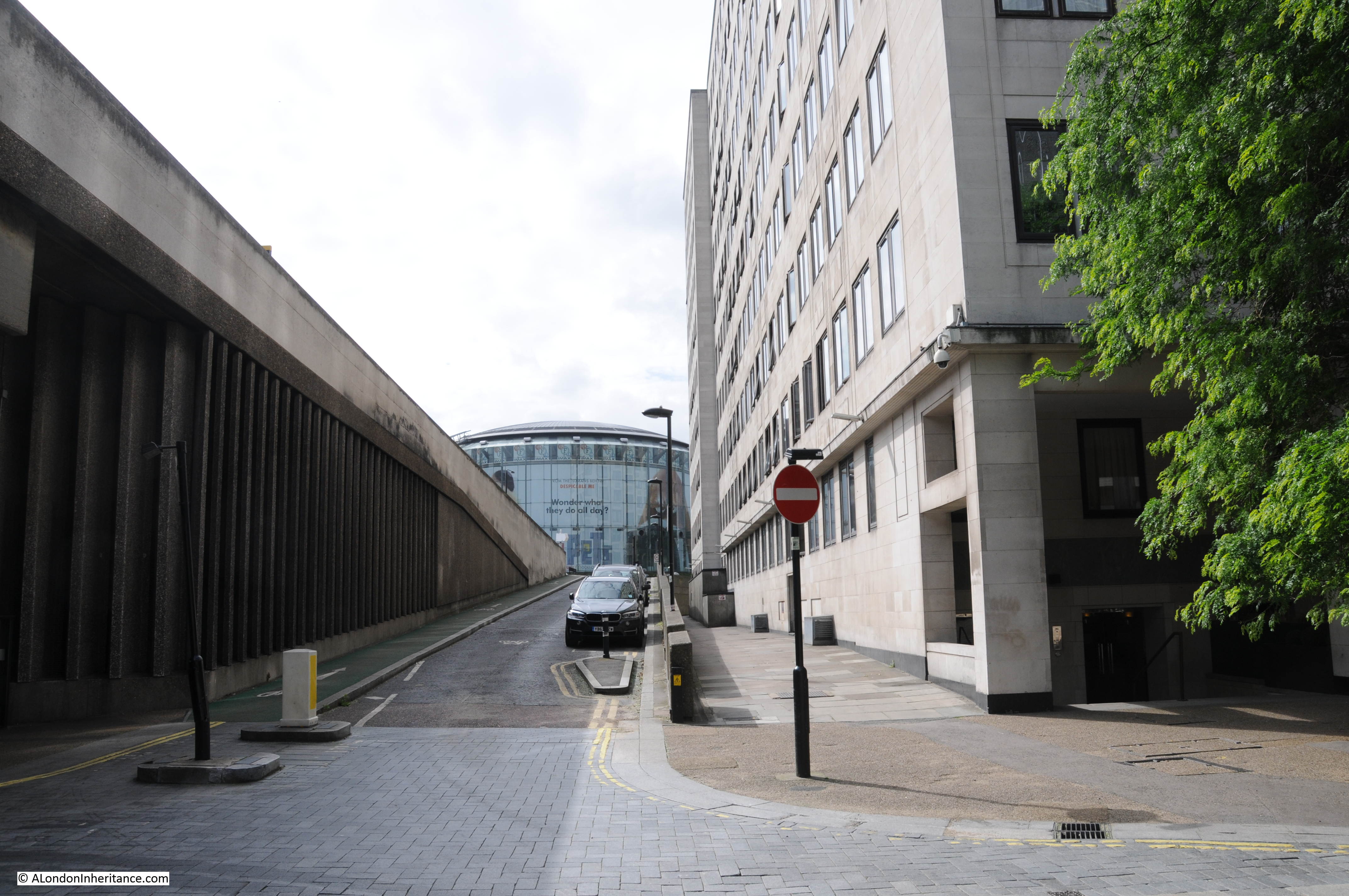
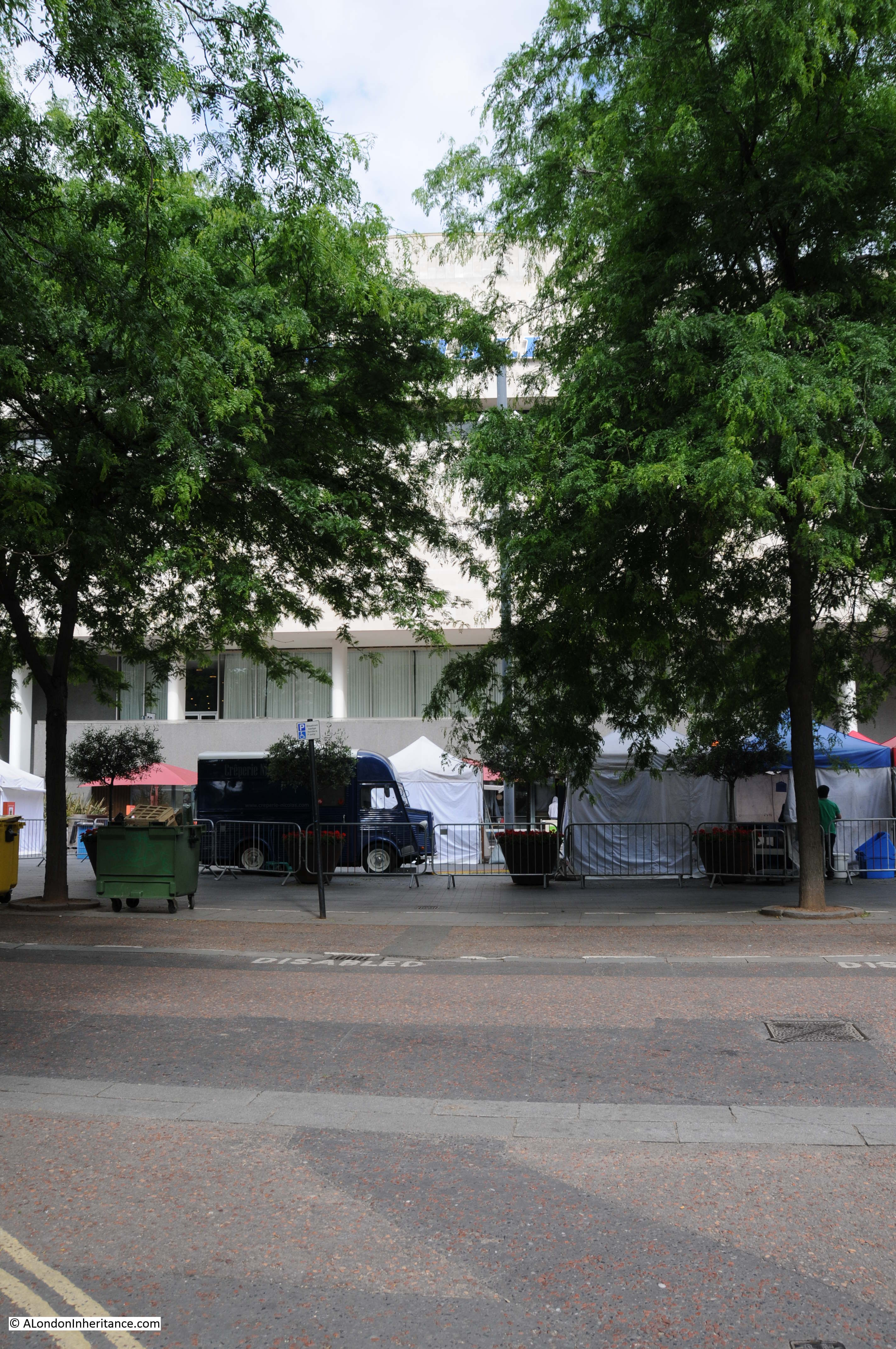
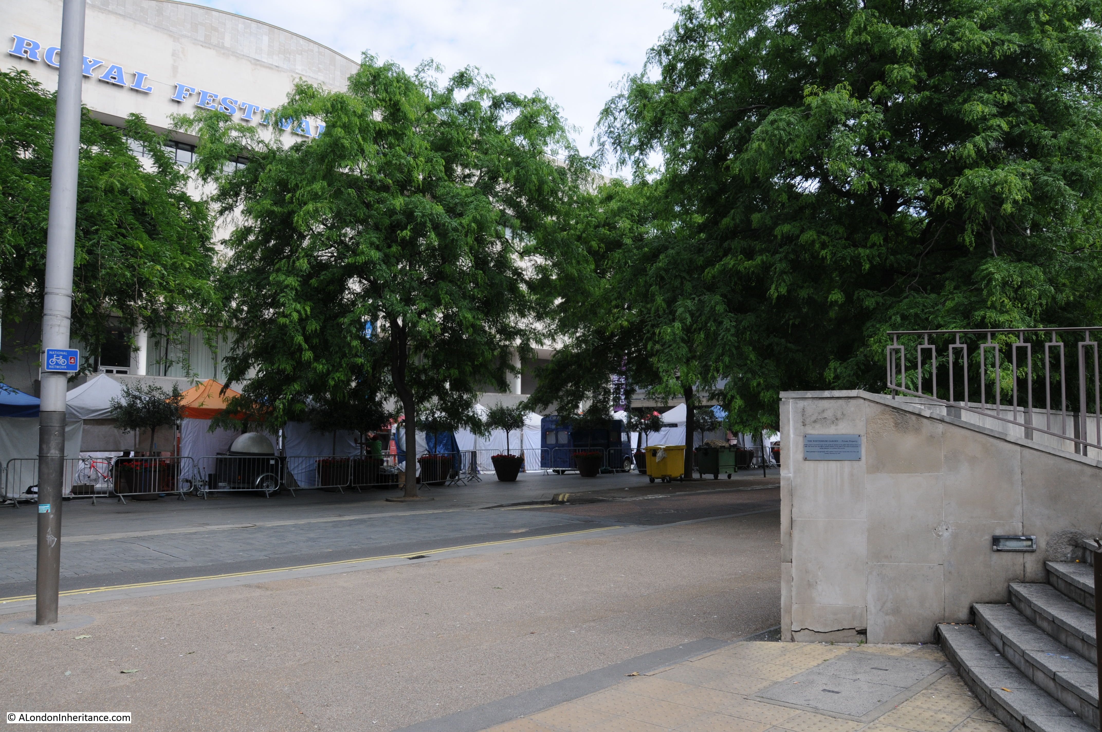
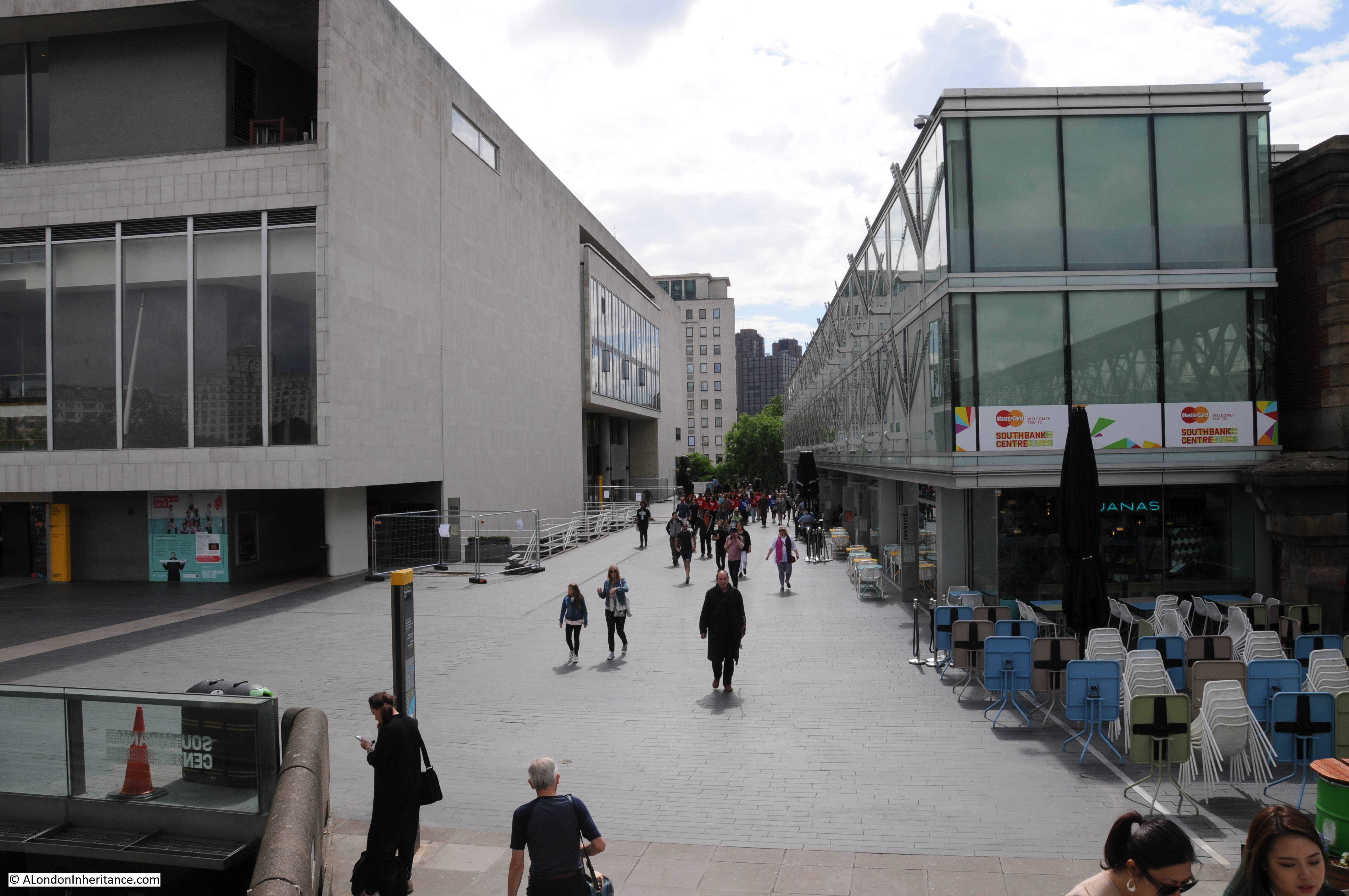
To finish off this exploration of the South Bank as it was before the Festival of Britain, walk straight on past the side of the Royal Festival Hall and walk down the steps to reach Belvedere Road and we have come full circle.

In my next post I will start to explore the Festival of Britain commencing with the South Bank Exhibition which occupied the area I have covered in my last three posts, and was the reason for the end to end clearance of the site and the construction of the Royal Festival Hall.

alondoninheritance.com

A Walk Along Belvedere Road – 1947 and 2016

Having explored the history of the South Bank in yesterday’s post, today it is time to take a walk along Belvedere Road to see the remains of buildings dating back to the start of the 19th century, the clearance ready for construction of the Festival of Britain and the foundations of the Royal Festival Hall. We will start from where Waterloo Bridge crosses Belvedere Road, drop down to Belvedere Road and then walk along Belvedere Road to County Hall.

My father visited this area a number of times between 1947 and 1951, first to photo the buildings as they were, then the area as it was cleared and finally as the construction of the Royal Festival Hall was underway. This post brings together photos distributed among a number of different posts over the last couple of years along with some new photos I have recently scanned.

The map below is the same extract from the 1895 Ordnance Survey Map covering the area between Hungerford and Waterloo Bridges as in yesterday’s post. I have marked in numbered red dots the locations from where the photos in today’s post were taken.

Belevedere Walk Map 1

The first three photos are at point one. I am not sure whether they were taken from Waterloo Bridge, or from one of the buildings alongside the bridge, however this first photo is looking along Belvedere Road towards the bridge under the rail tracks leading up to Hungerford Bridge.

Demolition is already underway. The remains of the entrance to the Lion Brewery can be seen on the right, in front of the railway, and clearance of the houses on the left is well underway.

History of the Southbank 3

This is roughly the same view today. I should have been a bit further to the right, however the buildings of the Hayward Gallery obscure the view. Belvedere Road curves to the left towards where the road passes under the rail tracks – the bridge is obscured by the trees.

Belvedere Road Walk 1

This next photo is from the same spot, but is looking towards the right, towards the Thames. The large building is the Lion Brewery. Note that on the opposite side of the river, construction of the new Ministry Defense Building is well underway. The buildings in the foreground are along Grellier’s Stone Wharf on the 1895 map.

History of the Southbank 2

Again, I should have been a bit further towards the right, however the following view from 2016 shows that the entire site of the above photo is now occupied by the Royal Festival Hall, the Hayward Gallery, Queen Elizabeth Hall and the Purcell Room.

Belvedere Road Walk 2

And the following photo is the last from the bridge and is looking to the left, towards Waterloo Station. Two streets can be seen, on the left is Howley Place and the street in the middle is Tenison Street. The terrace buildings that lined these streets have been demolished, however those along the boundary of the site remain. On the right are the houses along Sutton Street and the houses in front of Waterloo Station are along York Road. To the right of centre, there is a solitary figure standing on the rubble left by demolition.

History of the Southbank 1

And the same view today. The entire site is now occupied by what was the Downstream Building of the Shell Centre office complex, but is now the Whitehouse Apartments. When I checked on their website, two apartments were for sale, one from just over £1 Million and the second for £2,750,000. A chat box from a representative in Hong Kong popped up whilst looking at the page asking if I needed help which tells you all you need to know about central London”s property market.

Belvedere Road Walk 3

Now walk towards the large roundabout at the southern end of Waterloo Bridge and take an immediate right hand turn down the slip road that takes you down to Belvedere Road. This road does not appear to have a name, but runs along the route what was Howley Place. At the end of the slip road, on reaching Belvedere Road, turn round to look back up the slip road (position 2 on the map).

This was the original view:

History of the Southbank 27

The buildings on the left are the rear of buildings facing onto the approach road to Waterloo Bridge which has since been widened. The large roundabout with the glass IMAX cinema in the centre, which can be seen at the end of the current slip road had not been built at the time of these photos, so the houses seen at the end of Howley Place are roughly where the edge of the IMAX is currently located.

Belvedere Road Walk 4

We can now start walking along Belvedere Road, but only a short distance to point 3 on the map where we can look back at the original bridge which takes the approach road to Waterloo Bridge over Belvedere Road. The entrance to Howley Place is on the right with part of the street name sign visible.

History of the Southbank 18

The same scene today. The approach road to Waterloo bridge has been replaced and is wider than in the original photo.

Belvedere Road Walk 5

Now walk a short distance along to point 4. This is the entrance to Tenison Street, looking towards Waterloo Station.

History of the Southbank 23

And this is roughly from the same position today. Waterloo Station is behind the buildings of the Whitehouse Apartments.

Belvedere Road Walk 6

Now walk along to point 5 which is roughly half way along the rear of the Royal Festival Hall, and look towards the building. This was the scene at the start of construction of the Royal Festival Hall with the buildings on the north bank of the river clearly visible. There were some fascinating challenges with the construction of the building which I will cover in detail in my next post.

History of the Southbank 30

The same scene today, although not much to see with the trees in the foreground and then the rear of the Royal Festival Hall.

Belvedere Road Walk 7

Now walk along to point 6 which is at the end of the original alignment of Sutton Walk which has now been cut short by Concert Hall Approach. The following photo shows where the original Sutton Walk met Belvedere Road. Looking over the wall surrounding the Whitehouse Apartments it is possible to see the remaining length of Sutton walk where it passes under the railway tracks. Sutton Walk originally continued straight on, to end at the point where this photo was taken.

Belvedere Road Walk 15

From this point we can walk slightly further along then turn back and look across where Sutton Walk joined Belevdere Road. This is the entrance to the buildings of the Lion Brewery on the south side of Belvedere Road with one of the three lions that were used above brewery entrances and the main brewery building. These buildings were used for stables and also as a warehouse. Look in front of the entrance arch and there are bollards on either side.

History of the Southbank 22

And they are still here in this later photo following demolition of all the buildings. The buildings running along the left are those along the approach to Waterloo Bridge and Howley Place, with the buildings along York Road on the right. All the buildings in the background are still there, with the Royal Hospital for Children and Women being the second building from the left.

History of the Southbank 24

This is the same scene today.

Belvedere Road Walk 8

The following photo was taken from Sutton Walk, looking down towards the entrance to the Lion Brewery from Belvedere Road. There was a lion on top of this arch but this had already been removed.

History of the Southbank 20

Not easy to replicate this photo as this section of Sutton Walk does not exist, but the following photo is looking towards the area where the entrance to the brewery was located.

Belvedere Road Walk 9

The next photo was also taken from the original Sutton Walk and is looking towards the right with the Shot Tower in the background.

The house in front of the Shot Tower is number 55 Belvedere Road, one of the substantial houses that went up along Belvedere Road in the first decades of the 19th century.

In 1821 a tin plate worker named John Fowler extended his lease on the land and built No. 55 for his own use. The Survey of London describes the building:

“No. 55 was a house of substantial character. Though detached, it was of terrace type without openings in the flank walls. It was in yellow stock brick and its front elevation was three windows wide to each of the ground, first and second floors. The windows had gauged flat arches and all had glazing bars to their double hung sashes. The ground storey was raised above a semi-basement and the entrance, which was reached by a short flight of steps, had an architrave surround with consoles each side designed to support a flat hood. The hood had been removed some time prior to demolition. There was a moulded band at first floor level and a bold parapet cornice above the second floor. Behind the parapet dormer windows were set in a slated mansard roof”.

History of the Southbank 21

John Fowler annoyed his neighbours when in 1839 he converted a factory between the rear of his house and the river into a lead works. Concern about the works was such that Golding, the owner of the Lion Brewery complained to his landlord, however a report from a Professor of Chemistry into the conditions of the lead works stated that their construction and use was such as to prevent waste, injury to the workmen and annoyance to the neighbourhood.

Along with the Lion Brewery, No. 55 was used by the London Waste Paper Company in the 1930s and would be demolished in 1949.

Again, not easy to replicate the original view as this part of Sutton Walk does not now exist, however the following photo is as close as I could get. Not much to see due to the trees, but the Royal Festival Hall is in the background.

Belvedere Road Walk 10

The following photo was taken just before construction of the Royal Festival Hall commenced. It was taken from where Belvedere Road passes under the rail tracks leading up to Hungerford Bridge and is looking back down Belvedere Road towards Waterloo Bridge which can just be seen behind the Cubitts sign at the centre left. Sutton Walk is just behind the lamppost running to the right. The Shot Tower is on the left. Note the “stink pipe” behind the lamppost (not sure if that is the correct name, but that is what we always called them).

History of the Southbank 29

This is the view some weeks later, taken from the opposite side of the road. The “stink pipe” in the centre of the photo is the same as in the above photo. The Cubitts site office is on the former location of the Lion Brewery Stable and Warehouse. On the left is one of the three legs of the derrick supporting the crane that was used to build the Royal Festival Hall.

History of the Southbank 5

Cubitts were the main building contractors for the Royal Festival Hall, and the use of an onsite site office seems to have been unique for the time as it helped with the rapid construction of the building with drawings been passed from the office to the builders as the drawings were being completed – such was the pace with which the Royal Festival Hall was built.

This is the same view today as the above photo taken at point 8 on the map.

Belvedere Road Walk 11

Now it is time to walk through to the other half of the area which is split in two by the rail tracks running up to Hungerford Bridge. This brick-built viaduct is the only remaining construction from the pre-war period and provides a perfect reference point to locate the key places on the 19th century Ordnance Survey maps. The viaduct has retained the original position of Belvedere Road and by retaining the short length of Sutton Walk that runs from York Road to the new Concert Hall Approach, allows the alignment to be confirmed to Belvedere Road and therefore the position of the entrances to the Lion Brewery.

This is where Belvedere Road passes underneath the rail tracks. The white plaque on the blue bridge reads “W. Richards & Son – 1900 – Leicester”.

1900 is not old by London standards, but it is the oldest construction in this part of London.

Belvedere Road Walk 14

The following map shows the area we are now in, having passed under the rail tracks at the top and continuing along Belvedere Road.

Belevedere Walk Map 2

A short distance along Belvedere Road, we can look towards the river and this is the approximate position of College Street leading down to Kings Arms Stairs. There is an entrance to the car park here – would be interesting to believe that this is a remaining part of College Street.

Belvedere Road Walk 16

The next photo shows the India Stores Depot as it was prior to demolition. The photo was taken from point 9 in the above map, a short distance in Belvedere Crescent, the kerb of which can be seen in the lower left corner. The road running left to right in front of the gates is Belvedere Road. The India Stores Depot suffered badly from bombing during the war with the majority being left as a shell of a building.

History of the Southbank 16

I could not get to the same position as the original Belvedere Crescent is under the Shell Centre complex. The following photo was taken from in front of Shell Centre looking across Belvedere Road to where the India Stores Depot were located, on the current Jubilee Gardens.

Belvedere Road Walk 12

The Jubilee Gardens have been through a number of changes. I took the following photo in the mid 1980s of a much quieter Jubilee Gardens than today. The central area was later used as a construction site for the Jubilee Line extension with a large access shaft in the middle of the grassed area. The grass would be packed during summer lunchtimes with office workers from the Great London Council and Shell Centre.

Belvedere Road Walk 18

The buildings in the following photo were along Belvedere Road, roughly at point A, which today is the location of the Shell Centre tower building.

History of the Southbank 17

Another view with the buildings in the above photo now on the right of the photo below. The cafe in the photos above and below was called “The County Cafe” – I assume a reference to County Hall, just a bit further along Belvedere Road. It is small buildings such as these where the signs of the business still remain that bring home that this was once a busy area full of industry, cafes, shops and residents. The bridge carrying the rail tracks over Belvedere Road can be seen at the far end of the road and the entrance to the India Stores Deport is on the left.

History of the Southbank 15

This is same scene today with the main tower building of the Shell Centre complex on the immediate right, occupying the space where the County Cafe once stood. The blue bridge at the end of Belvedere Road is in the same position as the photo above.

Belvedere Road Walk 13

Many of the streets in this area were named after Archbishops of Canterbury. Sutton Walk was named after Charles Manners-Sutton (Archbishop between 1805 and 1828).

Tenison Street was named after Thomas Tenison (Archbishop from 1694 to 1715) and Chicheley Street. was named after Henry Chichele (Archbishop from 1414 to 1443).

The naming of streets after Archbishops extended beyond the area between York Road and Belvedere Road. The street in front of Waterloo Station, Mepham Street was named after Simon Mepeham, Archbishop of Canterbury from 1329 to 1333).

From outside Shell Centre, we can turn towards County Hall and walk to the junction of Belvedere Road and Chicheley Street. Instead of turning up Chicheley Street we can still walk up towards Westminster Bridge through the County Hall complex. Today this is marked on maps as Belvedere Road, but on the 1895 Ordnance Survey maps, Belvedere Road ended at the Chicheley Street junction and this stretch of road up to Westminster Bridge was still called Narrow Wall, the last remaining use of this original name and reference to the earthen bank that separated the Thames from the rest of Lambeth marshes.

The following photo shows the Belvedere Road / Narrow Wall passing through the County Hall buildings, I will continue on from the end of this road in my next post.

Belvedere Road Walk 17

We have now walked the length of Belvedere Road and traced the pre-1951 streets and buildings where much of the original street plan still remained.

Although Belvedere Road has been straightened and widened over the years, we have walked the route of the original earthen wall.

In my next post we will walk along the north bank of the river before returning alongside Hungerford Bridge to look at the building of the Royal Festival Hall.

alondoninheritance.com

A Brief History Of The South Bank

I have long been interested in the history of the South Bank, which for the purposes of this post I will define as the area between County Hall and Waterloo Bridge. I worked there for 10 years from 1979 and it was the location where I first realised that my father had a collection of photos as he brought out some of the photos he had printed to show me what the area where I was now working had looked like some 30 years earlier.

The South Bank has been through two major transformations since the war. The first with the construction of the Festival of Britain exhibition which required the demolition of the whole area between County Hall and Waterloo Bridge (with the exception of Hungerford Railway Bridge which provides a useful reference point).

Following closure, the Festival of Britain site was in turn swiftly demolished with only the Royal Festival Hall remaining, with the rest of the site being gradually built up to the position we see today.

The South Bank was an inspired location for the main Festival of Britain site, a decision which has resulted in the South Bank continuing to be an arts and entertainment centre to this day.

The Festival of Britain was in many ways, a break point between the immediate post war period and the decades to follow. The Festival attempted to define the place of Great Britain within a new world order and looked at how British industry, science, design and architecture could shape that future for the better.

Starting today, and for the next few weeks, I will be exploring the history of the South Bank and the Festival of Britain in detail, starting with three posts covering the South Bank prior to the Festival of Britain.

Then next week, exploring the Festival of Britain at the South Bank, the week after moving to the Festival of Britain Pleasure Gardens at Battersea, then moving onto the Festival’s Architectural Exhibition at Poplar and finally, rounding off with the wider impact of the Festival of Britain.

These are locations and a time in recent history that I find fascinating – I hope you will also enjoy the journey.

A Brief History of the South Bank

I have published a number of photos my father took of the South Bank over the last couple of years and in the next couple of posts I will take a walk along Belvedere Road and then look at the construction of the Royal Festival Hall using these photos, including a number that I have not published before, but first, some history of the South Bank.

Originally, the river frontage along this stretch of the Thames was mainly marsh land and at times of high tide, water would sweep inland. At some point, an earthen bank was constructed to prevent the Thames coming too far inland and by the Tudor period, a road had been constructed on the alignment of this original earthen bank, although according to Thomas Pennant, in 1560 there was not a single house standing between Lambeth Palace and Southwark. This road was shown on maps as Narrow Wall and today, Belvedere Road is roughly along the line of the old Narrow Wall and therefore also the original wall that formed the barrier to the Thames.

Land between Narrow Wall and the river was gradually drained and a number of small industries grew up along this stretch of the river, with the land behind the Narrow Wall staying as marsh and pasture with drainage ditches taking water into the river.

In the fifteenth and sixteenth centuries, the land between the current location of Waterloo and Westminster Bridges, from Narrow Wall to the river was called Church Osiers (Osier being a name for a type of Willow) after the osier bed which occupied this marshy land at the side of the river that would frequently flood. At some point prior to 1690 the land was named Pedlar’s Acre. 1690 is the first time that the name appears in a lease document. The legend behind the name Pedlar’s Acre is that a Pedlar from Swaffham in Suffolk had traveled to London with his dog in the hope of finding his fortune. Different versions of the legend either has the Pedlar’s dog digging up a pot of money either on the South Bank, or after returning home to Swaffham. The Pedlar then gave the strip of land along the river to the parish of Lambeth on condition that his portrait, along with his dog be preserved in painted glass in the parish church.

What ever the truth of this story, there was a picture of the pedlar and his dog in one of the windows of Lambeth Church until 1884.

From the 17th century onwards, the land between Narrow Wall and the river was gradually developed. John Rocque’s map shows the area in the middle of the 18th century.

Westminster Bridge is at the bottom of the map and the future location of Waterloo Bridge is at the top of the map, to the left of the bowling green.

History of the Southbank Map 1

Narrow Wall, the original earthen wall, can be seen running parallel to the river, dividing the development along the river from the pasture land that covered much of Lambeth. Starting at the top right of the map, Cuper’s Garden runs in land from the river following almost exactly the route today of the approach road up to Waterloo Bridge.

Cuper’s Garden, one of the many pleasure gardens that ran along the south bank of the river was well known for displays of fireworks and it was also described as “not however the resort of respectable company, but of the abandoned of either sex”. The name came from one Boydell Cuper who had been the gardener to Lord Arundel at his property on the north bank of the river and who rented the land and created the gardens including using some of the old statues from Arundel House.

The land from Cuper’s Gardens along the river went under a number of changes of ownership and names including Bishop’s Acre, Four Acres and Float Mead.

Follow the river south through the wharfs and timber yards that now occupy the space between the river and the Narrow Wall, until College Street.

College Street is on the edge of the current location of the Jubilee Gardens with the open space bounded by College Street, Cabbage Lane and Narrow Wall, called College Gardens part of which is also now the Jubilee Gardens. At the end of College Gardens is Kings Arms Stairs, one of the many stairs down to the river. The curve inland of Narrow Wall at this point was later straightened out, with the inland curve being retained and originally named Ragged Row and then Belvedere Crescent.

The name College Street and College Gardens may refer to the ownership of this parcel of land by Jesus College.

The land after the next Timber Yard and onwards to Westminster Bridge was the future location of County Hall.

There are a number of prints of Cuper’s Gardens which give the impression of a very pleasant place. The following is from the mid 18th century and is looking across the curve of the river to the north bank, but shows the water entrance to Cuper’s Garden on the right side of the print.

591508001

The following print is from 1798 and shows when part of the gardens were occupied by Beaufoy’s Distillery with a large amount of barrels outside. The print gives a good impression of the number of trees across the gardens as it was always described as a wooded area.

806092001

Another view of the Distillery in Cuper’s Gardens.

806217001

The next map is part of the “New and Correct Plan of London, Westminster and Southwark” from 1770. This shows the area to be roughly the same with Cuper’s Gardens at the top right of the map and Narrow Wall running down towards Westminster Bridge. This map is interesting as it shows the difficulty with relying on one specific map for accuracy. In the Rocque map, College Street is shown running into Vine Street. In the following map, College Street is now College Walk and Vine Street has changed into Wine Street. These are the only references I have found to these names so I assume that they are errors in 18th century map making.

History of the Southbank Map 6

The above map shows the location of Kings Arms Stairs. The following print from 1791 is titled “A View of Westminster Bridge, the Abbey &c. from Kings Arms Stairs, Narrow Wall, Lambeth Marsh”. The stairs can be seen on the left, the tide is low and there is much activity on the waters edge. Westminster Bridge can be seen across the river with Westminster Abbey and Westminster Hall just to the left of the Abbey.

The rest of the scene cannot be a usual scene on this part of the south bank. In the centre of the print is a very ornate boat facing into the river with the flag of the City of London on the stern of the boat. The two small boats in the river to the right have people in ornate dress and large baskets of flowers. It would be interesting to know what was happening. On the left, the building just past the stairs has a sign reading “Artificial Stone Manufactory”, referring to Coade’s Stone Factory which i will cover later in the post.

582791001

Between the above map of 1770 and the next map, the Ordnance Survey map of 1895, the whole area underwent considerable development.

This edition of Ordnance Survey map splits coverage of the area between two maps, so the following map shows the area between Waterloo Bridge and Hungerford Railway Bridge.

History of the Southbank Map 3

The approach road to Waterloo Bridge still has the name of Cuper’s Garden, retaining a link from when this now heavily built area was mainly pasture land. The Waterloo Bridge approach was developed between 1813 and 1816.

The area inland from Belvedere Road has been developed with rows of terrace houses.

The area between the old Narrow Wall, now named Belvedere Road, and the River Thames is still industrial with two major landmarks, the Iron Works and Shot Tower close to Waterloo Bridge and the Lion Brewery adjacent to Hungerford Bridge. Narrow Wall was widened and straightened between 1824 and 1829 to become Belvedere Road. The source of the name is from Belvidere, a house and grounds on the land south of the Iron Works in the above map. As with many of the other pleasure grounds along the river, Belvidere was opened to the public from 1718 and sold wine and food, including fish taken from the river.

The start of the Hungerford Railway Bridge is shown in the lower left of the above map. Construction of the bridge and the associated railway almost cut the area in two with Belvedere Road now being the main route through the area. If you look back at the Rocque map, Hungerford Bridge was built over the Timber Yard and land just north of College Street.

Designed by Brunel, construction of the original Hungerford Bridge was completed by 1845 when the bridge was opened. It was not originally a railway bridge, the aim of the bridge was to bring more custom to the Hungerford Market on the north side of the river. The original bridge did not last long and in 1859 the construction of a new railway bridge was authorised by the Charing Cross Railway Act. The old bridge was demolished and the new railway bridge was opened in 1864. The chains and ironwork from the old Hungerford Bridge were sold to be used in the construction of the new Clifton Suspension Bridge, also to a design by Brunel.

The original Hungerford Suspension Bridge:

582941001

The other major change was the construction of Waterloo Bridge, with the approach road across the former Cuper’s Gardens. Construction of the original Waterloo Bridge commenced in 1811 with the bridge being opened by the Prince Regent on the second anniversary of the Battle of Waterloo in 1817, after which the bridge was named following an act of parliament in 1816 to approve the proposed name.

The following map is interesting as it appears to bring together some of the later development around Waterloo Bridge with the area in 1746. Published in 1825, eight years after the bridge was opened, it is titled “A Plan of Cuper’s Gardens with part of the Parish of Lambeth in the year 1746 showing also the site of the Waterloo Bridge Road and the new roads adjacent”.

The map helps define the exact location of Cuper’s Gardens as the church of St. John is also shown. The large roundabout at the end of Waterloo Bridge Road is now covering the end of Cuper’s Gardens at the junction with Stamford Street.

The map also shows how the name Belvedere Road came into use. The first straightening of the Narrow Wall is shown close to the approach to Waterloo Bridge and the name for this short section is New Belvidere Road. It is the first reference to the new street name, and also retains the original spelling from the house and gardens. As the name was taken on by the rest of the Narrow Wall, the name changed to the present spelling.

806218001You will need to click on the map to expand a larger version to see the next reference point to the area today. In the gardens in the wooded area just at the bottom right corner of the pond is a building marked D. Checking the key at top left, D is given as the “Royal Universal Infirmary for Children”. This is on an alignment of Waterloo Bridge down to St. John’s Church and although it has now closed as a hospital, a later version of this building, the Royal Waterloo Hospital for Children and Women is still there, on the junction with Stamford Street. This allows us to place the location of Cuper’s Garden precisely and as you walk up towards Waterloo Bridge from St. John’s Church, you are walking through the middle of Cuper’s Gardens.

The following photo shows the Royal Waterloo Hospital for Children and Women on the corner of the approach to Waterloo Bridge and Stamford Street.

History of the Southbank 31

The church of St. John, although badly damaged by bombing during the last war, it was rebuilt to the original plan and is still exactly the same as the drawing on the 1825 map. During the Festival of Britain, the church was designated as the Festival Church with a programme of events during the period of the festival. The church is at the end of the original location of Cuper’s Gardens, the entrance to the gardens was on the left.

History of the Southbank 32

Looking up towards Waterloo Bridge from where the end of Cuper’s Gardens would have been. The hospital and Stamford Street are on the right. The IMAX cinema is on the left in the centre of the roundabout. A very different place to the 18th century gardens.

History of the Southbank 33

In 1923, Waterloo Bridge suffered from settlement to the central arch along with subsidence to the carriageway and parapet, leading to the bridge being closed to traffic in 1924. A temporary bridge was constructed alongside Waterloo Bridge and options were reviewed as to whether the original bridge should be repaired, rebuilt or a completely new design of bridge built.

The decision was for a new design of bridge and the Waterloo Bridge that we see today was fully opened in December 1945. The following postcard with a photograph taken from the top of the Shot Tower shows the original Waterloo Bridge with the damage to the central pier, along with the temporary bridge built alongside.

Postcard 5

Also in the above map, adjacent to Hungerford Bridge is the Lion Brewery. This area was originally the location of Belvidere House and Grounds, and in 1785, Water Works were built on the southern end of the gardens, drawing water from the river to supply the local residents. Not surprisingly, there were issues with the purity of the water being taken from the river and as part of the general improvements to London’s water supply, the water works were moved to outer London locations such as Surbiton. After the closure of the water works, the lease on the land was assigned to James Golding and the Lion Brewery was completed in 1837. On the opposite side of Belvedere Road to the brewery, Golding purchased a lease on an additional parcel of land and built stables and warehouses to support the brewery.

The Lion Brewery was taken over by the brewers Hoare and Company of Wapping in 1924 and in 1931 the building was badly damaged by fire. It was then temporarily used for paper storage before being demolished in 1949 to make way for the Royal Festival Hall.

During the demolition of the brewery buildings, a total of five wells were found which had been used to provide water for the brewery as water could not be taken from the Thames.

There are a number of prints which show the industry along the South Bank between Hungerford and Waterloo Bridges. The following shows the Lion Brewery. Note the tower of the church of St. John’s in the background.

334997001

Another print shows both the Lion Brewery and the Shot Tower with the original Waterloo Bridge on the left.

582939001

And a view from Waterloo Bridge along the river to Westminster Bridge before the construction of Hungerford Bridge. The Shot Tower and the Lion Brewery are on the left.

582808001

The Shot Tower was built in 1826. The gallery at the top of the tower is 163 feet high, and was used to drop molten lead for large shot. A gallery half way up the tower was used to make small lead shot.

The Shot Tower and the associated lead works were owned from 1839 by Walkers, Parker and Company who ran the business until 1949.

The area between Hungerford and Westminster Bridges is shown in the following map (the map cuts off before Westminster Bridge but if included it would be just at the bottom of the map to the left).

The map shows the straightened Belvedere Road, with the original curve in the road still in existence but is now named Belvedere Crescent. Follow Belevedere Road towards the bottom of the map and at the junction with Chicheley Street, it reverts back to Narrow Wall.

Below the Chicheley Street junction, the whole area between York Road and the river would later be occupied by County Hall. Following the Festival of Britain, the area bounded by York Road, Belevedere Road, the rail tracks and Chicheley Street would be occupied by the Shell Centre building. On the opposite site of Belvedere Road, up to the river, during the Festival of Britain, the Dome of Discovery would be built on the area occupied by the India Store Depot and today the Jubilee Gardens are on this spot.

History of the Southbank Map 4

At the top left of the map is a set of buildings, over which is written “site of Sparagus Garden”. This was also an early pleasure gardens, but unlike Culper’s Gardens, is not very well documented. This was also the site of Coade’s Artifical Stone Works.

The initial stone works on the site were opened in around 1770 by Daniel Pincot who published that he had opened a factory “by King’s Arms Stairs, Narrow Wall, Lambeth”. At some point soon after 1770, the factory appears to have been taken over by Eleanor Coade who would go on to run the factory for 25 years until her death in 1796 when her daughter, also called Eleanor, took over the factory. The younger Eleanor also ran the business well and opened a gallery for the factory’s products at the corner of Narrow Wall and Bridge Street – the street leading up to Westminster Bridge – along with a number of houses which took the name Coade’s Row.

The entrance to the Coade Stone showroom on Westminster Bridge Street:

853044001

Products from the Coade factory were used across London and wider afield, but the most long lasting and well known is the lion that was on top of the Lion Brewery. Removed and stored at the time that the brewery building was demolished, it was installed on a plinth at the southern end of Westminster Bridge in 1966.

The younger Eleanor Coade was unmarried and had no children by the time of her death in 1821, however she had already taken on a cousin, William Croggon to take control of the business, who was succeeded by his son Thomas in 1836, however his ownership of the business did not last long and the Coade Stone Factory appears to have closed a year later in 1837 and the production of this unique, man-made stone was consigned to history.

Just to the south of College Street, is labelled the India Stores Depot. This was built in 1862 on land leased by the Secretary of State for India. These stores were gradually extended until the start of the 2nd World War, during which they suffered considerable damage and were demolished to make way for the Festival of Britain.

As a final bit of confusion regarding continuity of street names, the following map extract is from the Bartholomew Greater London Street Atlas from 1940. It shows Belvedere Road running between Westminster and Waterloo Bridges, with Howley Place shown at Howley Terrace, Tension Street and Sutton Walk with the same names as previous maps, but further along, where College Street and Vine Street were shown in the 1895 Ordnance Surcey map, the street is now called Jenkins Street. This map is the only place I have seen this name for the street, so it was either an error, or there was a name change between 1895 and 1940.

History of the Southbank Map 7

And finally we come to today and the following map shows the layout of the area as it is now – although this will also change soon as the buildings surrounding the Shell Centre tower have been demolished to make way for a new development of multiple apartment towers.

History of the Southbank Map 5

The map shows roughly the same area, between Waterloo Bridge at the top of the map and Westminster Bridge at the bottom.

The only streets that remain from previous years are Belvedere Road and Chicheley Street. Belvedere Road has been widened and straightened over the years, but follows roughly the same route as the Narrow Wall and the original earthern embankment.

There is more land between Belvedere Road and the river as during the construction of County Hall and the Festival of Britain, the embankment was pushed further into the river.

The approach road to Waterloo Bridge now covers the area occupied by Cuper’s Gardens. The Royal Festival Hall occupies the site of Timber Yards and then the Lion Brewery.

The Coade Stone Factory was on the site now occupied by the car park above the Jubilee Gardens.

The rows of terrace houses between Belevedere Road and York Road have gone with the space being occupied by the Shell Centre Upsteam and Downstream buildings – off which all but the tower building have either been converted into apartments or have been demolished to make way for more apartment blocks.

In my next post we will have a walk along Belvedere Road looking at the buildings and views from between 1947 and 1950 as the site is prepared for the Festival of Britain and comparing with the same scenes today.

All the prints in the above post are ©Trustees of the British Museum

The extracts from the 1895 Ordnance Survey Map are reproduced by permission of the National Library of Scotland.

alondoninheritance.com

London Road Works

A brief post this week – short of time and researching some longer posts for the next few weeks.

A fact of London life is not just the continual building work that appears to be taking place across the whole of London, but also the never-ending road works. These have ranged from major works over the past year such as at the Elephant and Castle, and the Cycle Superhighway along the Embankment, through to a couple of hours needed to fill a hole in the road.

Road works also have a supporting cast of high-vis jackets, traffic cones, temporary traffic lights and lots of machinery with no doubt lots of planning and health and safety assessments.

My father worked for St. Pancras Borough Council Electricity and Public Lighting Department and then for the London Electricity Board, which is one of the reasons that he knew London so well, having worked across so many streets planning the installation of streetlights, cabling and electricity distribution equipment.

He took a number of photos of work taking place and I have a sample for today’s post. They show a very different working environment to that you would find today.

Firstly, two photos showing the same street scene which must have been taken only a few minutes apart. No idea where this is, there looks to be a street name on the building to the left however despite enlarging and trying different scan methods, the grain of the film does not allow the name to be read.

Road Works in London 10

Not a high visibility jacket or traffic cone in sight, although if you enlarge the photo, at the end of the trench there is a sign that states Caution Roadworks.

Road Works in London 9

Sadly, I always look down a trench or hole in the road to see if there is anything interesting below the surface. The following photo was in the same sequence as the two above. An arch of some form has been cut through, but is clearly seen in the side of the trench.

Road Works in London 8

The above photos are from the late 1940s, the photos below are from the early 1950s and show the method of sealing a joint between multiple cables.

Road Works in London 5

Again, I do not know the location and there is nothing I recognise in the background.

Road Works in London 4

Road Works in London 3

Above and below; heating up a joint with a paraffin blow torch.

Road Works In London 1

Lastly, pouting molten metal over the joint to form a seal, probably some alloy of lead was used. Very basic protection – you would not want to get that on your skin.

Road Works in London 2

The final set is back to the late 1940s and are a couple of photos I published back in July 2014 and show road works at the top of Tottenham Court Road at the junction with Euston Road and Hampstead Road. The area looks very different now  – you can read the post here.

Road Works in London 7

Again, very basic compared to today. A shovel, wheel barrow and a pole across the road.

Road Works in London 6

Road works have always been a feature of London roads and I suspect will always be so. Next time your journey is delayed by some, rather than complain, have a look down, they are often an interesting, but ignored, feature of everyday street life.

alondoninheritance.com

London Books

Books have probably been written about London for as long as books have been published. London books cover specific areas and topics, general guides, histories, picture and photo books etc. I suspect that a book has been written about any London topic you could think off.

My own collection of London books, starting with the books my father bought from the 1940s onwards, probably numbers around 450 and ranges from a 1756 edition of William Maitland’s History and Survey of London through to recently published books such as Up In Smoke – The Failed Dreams of Battersea Power Station by Peter Watts.

Second hand bookshops are always a good hunting ground, although today there are not that many to be found, however last Saturday on a trip out to Canterbury I found a good one and bought an excellent history of Chelsea by Thea Holme from 1972 for £6.50.

Since starting this blog, I have had the pleasure of meeting a number of people who have a knowledge of London that far exceeds mine, one of these is Hawk Norton, a collector of London books whose collection is larger than mine by several orders of magnitude.

I first found out about Hawk through an article on Londonist and have since made a number of visits to his collection in Brentford and have probably purchased far too many books than my limited shelf space will support.

Hawk has been collecting London books for several decades however for the last year has been selling much of his collection. If you are interested in London, or books (or ideally a combination of the two), I recommend getting in touch with Hawk via his e-mail ( hawk@btinternet.com ) to request the latest copy of his list of books or to arrange a visit, although be careful with a visit as if like me, you will leave with more books than you had planned on arrival.

A small part of Hawk’s collection of London Books:

London Books 10

And an equally impressive collection of maps:

London Books 11

My own collection of London books is much smaller, however here is a selection that provide a snapshot of the wide range of books that have been published about London over the years.

One of the first comprehensive and published history or survey of London is that of John Stow which was first published in 1598. A second edition was published in 1603. Unfortunately I do not have either of these original versions, but I do have a 1908 reprint of the 1603 publication. This version has two volumes and the books are a detailed survey of London at the end of the 16th Century, almost a street by street walk through of London with a description of the City Wards, main streets, churches, houses, historical characters etc. Stow has been the original reference for much later writing.

The next major survey is that of William Maitland who published his “History and Survey of London From Its Foundation to the Present Time” in 1739. I do not have the first edition, but I do have a copy of the 1756 edition, published in two large volumes as a detailed history and survey of London,

William Maitland was a Scottish merchant who lived in London for a time, returning to Scotland in 1740.

The title page from Maitland’s History and Survey of London:

London Books 1

Maitland’s book has a large number of prints of major buildings across London and also many City Ward maps. Over the years, the prints and maps from early books are often removed and sold separately for a higher amount than if they were contained within the book, however when they do survive, along with the text they provide a fantastic view of London from the mid 18th Century.

Map of Walbrook and Dowgate Wards from Maitland’s History and Survey of London, including drawings of the churches of St. Stephen Walbrook and St. Michael, Royal College Hill.

London Books 2

Soon after Maitland’s book, Henry Chamberlain published his History and Survey of London in 1770. The title page of Chamberlain’s book contains a wonderful dedication to the city:

Hail chief of Cities, whose immortal Name

Stands foremost in the glorious List of Fame;

Whose Trade and Splendor roll on Thames’s Tide,

Unrivall’d still by all the World beside.

London Books 3

Chamberlain’s book also contains prints of various buildings, streets and events within the city as well as a “A New and Correct Plan of London, Westminster and Southwark with the New Buildings to the Year 1770”

London Books 4

Click on the map is open a larger version. It is fascinating to see the state of London in 1770. To the north is the New River Head at Sadlers Wells, to the east is the cluster of buildings at Bethnall Green, still separate from the city and surrounded by fields. South of the river, the city is expanding out from the southern end of London Bridge and in 1770 there were only three bridges over the Thames, Westminster Bridge, Blackfriars Bridge and London Bridge.

The southern end of Westminster Bridge opens out mainly into fields. There are also interesting little details, follow the Lambeth Road and there is a building named Dog and Duck, this was described as a “notorious pleasure garden and haunt of prostitutes in the 18th century.”  The site of the Dog and Duck is now the Imperial War Museum. Along the river, the map also shows how many stairs there were down to the river, each individually named enabling the traveler to find the right stairs to meet a boatman.

Moving into the 19th century and my next major survey of London is the six volume set, “Old and New London: A Narrative of Its History, Its People, And Its Places”.

The first two volumes were by Walter Thornbury and published in 1873 with an extended six volume edition published in 1878 with the last four volumes by Edward Walford.

These six volumes provide a detailed history of London, and illustrate how London had grown since the 18th century books. Old and New London covers central London, but now also includes “the suburbs”, a new 19th century word to cover the ever-expanding city.

As well as a detailed written account of the city and suburbs, Old and New London has a large amount of drawings of all aspects of the city, the following being a typical example and is titled “Ancient View of Cheapside (From La Serre’s ‘Entree de la Reyne Mere du Roy’ showing the Procession of Mary de Medicis”.

London Books 5

In the time before photography and the mass printing of photographs in books, drawings such as this were the only way of conveying the visual sense of a place or event to the reader and Old and New London is probably one of the last major history and surveys of London before photography takes over.

As well as major books detailing the history of the whole of London, there are also many covering specific areas. One of these, which I bought from a bookshop in Launceston, Cornwall is the “History of the United Parishes of St. Giles In The Fields and St. George Bloomsbury” by Rowland Dobie and published in 1829. This is a fascinating book, not just because of the history of these parishes, but also the context in which the book was written. The preface to the book tells the story of a corrupt Vestry and the efforts of the parishioners to regain control which culminated in a court case when “the decision of a British Jury has established the long lost rights of the parishioners of St. Giles, by the overthrow of a pretended Select Vestry, whose authority had been exercised uncontrolled and with some deductions during more than two hundred years. This glorious triumph was achieved on the 23rd of July 1829, a day ever to be recorded in the annals of these parishes.”

I doubt that many people today walking the streets of these parishes to the east of Tottenham Court Road and south to Lincolns Inn Fields will be aware of the glorious triumph, but it is a fascinating insight into the way in which parishes were run and administered in the centuries leading up to more formal governance in the 19th century.

To conclude the preface to his book, written on the 15th December 1829, Dobie wrote:

“Finally, no exertion has been spared to render the Work both instructive and entertaining; and above all, to make it a faithful record of parochial government, where abuses and malversations are notorious, and thereby guarding the parishioners in future from similar evils. If I have succeeded in these objects, even in a remote degree, my end is answered – they are more invaluable in my estimation than the hope of profit, or the gratification of vanity.

As well as a detailed written account of the parishes, Dobie’s book included an excellent, fold out map of the area as shown below:

London Books 13

Again, clicking on this should open a larger copy of this detailed map. In the bottom left hand corner is the area just east of the Charing Cross Road and Tottenham Court Road junction where the major Crossrail and associated developments are currently taking place. The map includes Denmark Street which so far, is the southern boundary of the current developments, but is a street undergoing major change.

Books were often published to commemorate the opening of a new building. One such book was published in 1932 by the British Broadcasting Corporation to commemorate the opening of Broadcasting House at the corner of Portland Place and Langham Street. I found this in a second-hand bookshop in Leigh on Sea on the 15th February 1975 – according to the inscription on the inside of the book, my parents bought it for me for “a reasonable report”, I think the word “reasonable” probably tells you all you need to know about my latest school report, but luckily they still bought me the book.

The book provides a detailed account about the new building, specially built for the BBC. It contains plans of the building and photos of all the major rooms, studios and facilities, including lots of technical details. Who knew that Studio 8A used for Orchestral and Band Music had a reverberation time of 1.1 seconds.

The building design was heavily influenced by the Art Deco style of architecture and this extended to the plans in the book. The following shows a cut away side view of Broadcasting House with all the key rooms and studios labelled.

London Books 6

Broadcasting House is still there, with a recent, very large extension and is the main London location for the BBC following the closure of Television Centre and the gradual move out of White City.

Continuing with maps, and the publication of the London County Council Bomb Damage Maps provides a detailed, street by street view of the damage caused by bombing across London. These are fascinating for research and show both the concentration of damage and also how random bombing could be.

London Books 9

My latest find was “Chelsea” by Thea Holme and published in 1972. I found this last weekend in the excellent second-hand bookshop, The Chaucer Bookshop in the wonderfully named Beer Cart Lane in Canterbury. Continuing on the style of books from the 18th and 19th centuries, this book also has a large fold out map covering Chelsea detailing “Vanished Places” and “Places still in existence”. One of the Vanished Places is the Chelsea Bun House in Pimlico Road, a celebrated Bun House in Chelsea and home of the original Chelsea Bun. It was demolished in 1839.

London Books 12

Other interesting books include the various County of London Development Plans. These provide both a snapshot of London at the time of publication along with plans for the future, some of which were built, others were not. These books frequently included highly detailed maps covering various aspects of the city, some of which I have featured in previous posts. In the 1951 Administrative Plan, there is a page summarising post war development in London, what had already been built by 1951.

London Books 7

From the top left and reading left to right:

  • Sayes Court, Greenwich, a new open space
  • Flats at Lansbury Neighbourhood, Poplar
  • Flats at Tulse Hill Estate
  • Houses at Somerfield Estate, hackney
  • Model of Lansbury Neighbourhood
  • Bessemer Grange Primary School, Camberwell
  • Flats at Clapham Common
  • Parliament Square Improvement
  • Flats at Charlton Village
  • Chaucer Restaurant, Deptford
  • Flats at Somerford Estate, hackney
  • Flats at Brett Mannor, Hackney
  • River Wall at South Bank
  • Flats at Elder Street, Lambeth
  • Sayes Court, Greenwich
  • Old People’s Home, Plumstead
  • Flats at Bishops Bridge Road, Paddington
  • Royal Festival Hall
  • Flats at Pimlico. Westminster
  • Blackwall Point Power Station
  • House at Fitzroy Park, Highgate
  • Flats at St. Pancras Way
  • Surrey Lock Bridge
  • Sculpture in Battersea Park
  • Offices in Kensington
  • Trinity Congregational Church, Lansbury Neighbourhood
  • Flats at Tulse Hill Estate
  • Susan Lawrence Primary School, Lansbury

Reading these Development Plans, the aim of building for Londoners is very apparent. Not a single luxury apartment for sale as an investment.

My final book in this review of London Books, is Liber Albus: The White Book of the City of London.

London Books 8

The copy I have is the edition published in 1861 and translated from the original Latin and Anglo-Norman.

The introduction to Liber Albus states that “It is a fact, not the less true because not universally known that there is no city in existence in possession of a collection of archives so ancient and so complete as that belonging to the City of London.”

“From these archives, as they existed in the year of Our Lord 1419, combined probably with other sources of information now lost or unknown, the Liber Albus, or White Book, is a compilation prepared in the last Mayoralty of Richard Whittington, for the instruction and guidance of those to whom, before they should have gained the experience of old age, the governance of the City, or the management of its affairs and interests, might under circumstances of emergency be entrusted.”

Liber Albus provides a fascinating insight into the day-to-day life of the medieval city and the rules that applied to the inhabitants of the City, two examples:

Of Strangers

And that no freeman of the City shall hold partnership with a strange man, or avow the merchandise of a strange man, whereby the King or his bailiffs of the City may lose custom upon the same; and this, under pain of losing the freedom.

Of Rebellious Persons

And that there be no one who shall make resistance in deed or in word unto the serjeants of the bailiffs of the City; and be it ordered, that no one shall molest them in making execution upon judgments, attachments, distresses, or other things which unto such bailiffs pertain to do, under pain of imprisonment. But if any one shall consider that the bailiff has done him wrong, let him make his suit thereon before his superiors, and have his recovery before those unto whom it pertains to make amends.

The above represent a very tiny sample of the vast number of London books published over the centuries, half a book shelf in a large library. Many are now online, but holding a physical book and turning the pages provides a more physical connection with the author and the time the book was published, rather than scrolling on a screen. Books about London continue to be published, some of the new books I have purchased over the last year include:

  • Dirty Old London by Lee Jackson
  • London Night and Day by Matt Brown
  • The Isle of Dogs During World War II by Mick Lemmerman
  • Up In Smoke: The Failed Dreams of Battersea Power Station by Peter Watts
  • East End by John Claridge

And I am sure that more will be published in the years to come – my only problem is finding enough shelf space.

alondoninheritance.com


Euston Underground Station – The Lost Tunnels

Euston Underground Station – The Lost Tunnels is the name of the latest Hidden London tour by the London Transport Museum, and on a warm Thursday afternoon last week I took the tour and descended beneath Euston station to find a time capsule from the 1960s.

The tour started at the original Euston station of the Charing Cross, Euston and Hampstead Railway. The station is one of Leslie Green’s distinctive station designs and is the red building on the corner of Melton Street and Drummond Street, on the western side of Euston mainline station.

Euston Underground Tunnels 1

The Charing Cross, Euston and Hampstead Railway (better known as the Hampstead Tube), was one of two original underground lines serving Euston mainline station, opened in 1907, this line served from Charing Cross to the north of London (Golders Green and Highgate) through Euston Station.

The second of the lines was the City and South London Railway which ran from the City through to Stockwell in south London and extended from the City to Euston in 1907.

Although the two lines were separate and had stations on either side of Euston mainline station, they did agree to building an interconnecting passageway with a ticket hall and lifts to the mainline station platform.

The two separate station buildings were closed on the 30th September 1914 after the two railways were taken under the ownership of the Underground Electric Railways of London with the interconnecting passageway providing access to Euston Station. After work to enlarge some of the tunnels, the lines were combined to become the Northern line, with the two lines running south converging at Euston Underground Station.

Inside the remaining Hampstead Tube station building in Melton Street, mainly now used for air conditioning of the tube system.

Euston Underground Tunnels 2

Euston mainline station was rebuilt in the 1960s and along with the new Victoria line running through Euston, the opportunity was taken to rationalise the various underground passageways and ticket halls for the underground lines terminating at Euston.

The old connecting passageways and ticket hall closed on the 29th April 1962 and it is these passageways that were the subject of the tour.

After a look at the station building in Melton Street, it was then a walk through Euston Station, through the underground ticket hall and down to one of the Northern Line platforms, where at the very end of the platform was a door that led through to the closed passageways.

Through the door at the end of the platform and a series of steps lead upwards. The tiling on the side walls highlights that these were once passenger tunnels rather than service tunnels.

Euston Underground Tunnels 26

At the top of the steps and a long disused tunnel stretches ahead. No longer used by passengers moving between the different underground lines and the station above, now just used for carrying the infrastructure needed to run the transport system.

Euston Underground Tunnels 4

I mentioned at the start of this post, that the tunnels are a time capsule from the 1960s. Apart from the installation of cables, they have not been used since and the advertising posters that lined the walls of the tunnels are still in place. Whilst many have lost sections over the years, the lack of sunlight means that the colours are as vibrant as when they were first pasted on the walls.

Advertising fine furniture from the London Cooperative Society:

Euston Underground Tunnels 5

Posters on the walls include the posters informing passengers of the impending closure of the tunnels on the 29th April 1962:

Euston Underground Tunnels 6

Posters include the original telephone number format when the London area was still part of the dial code:

Euston Underground Tunnels 7

Along the passageway is the original ticket office. This provided passengers passing between the different rail networks with the option of buying tickets as they passed along the interconnecting tunnels.

Euston Underground Tunnels 8

Poster advertising the film West Side Story at the Astoria from the 27th February 1962:

Euston Underground Tunnels 9

Steps to a dead end. It would be interesting to know what is on the other side:

Euston Underground Tunnels 10

More posters:

Euston Underground Tunnels 11

And more posters. The poster in the centre invites you to Meet the Stars and includes names such as Brian Rix, Stratford Johns, Francesca Annis, Maurice Denham and Julie Andrew.

Euston Underground Tunnels 12

Cross tunnels with air conditioning:

Euston Underground Tunnels 13

And a bricked up entrance:

Euston Underground Tunnels 14

Poster advertising Bargain Travel on British Rail. Not sure that with the way ticket prices have changed since the early 1960s you would now get as much “More miles for your money”:

Euston Underground Tunnels 15

The Midland Pullman – a luxury 1st class only train aimed at business travelers between London and Manchester:

Euston Underground Tunnels 16

Advertising poster for Hitchcock’s film Psycho:

Euston Underground Tunnels 17

View along the tunnel:

Euston Underground Tunnels 18

The route up to the mainline station from the original connecting passageways was via lift. Two lifts shafts originally ran to the surface. Looking up one of the lift shafts:

Euston Underground Tunnels 19

As well as the original passenger tunnels that provided connectivity between the underground lines and the surface station, the complex of tunnels includes tunnels to help provide ventilation to the underground system. These tunnels are just the basic construction without any of the flat walkways and wall tiling to be found on the passenger tunnels.

Looking up the tunnel with a limited amount of infill on the floor of the tunnel to provide a walkway:

Euston Underground Tunnels 23

Further up the tunnel:

Euston Underground Tunnels 22

At the top of the tunnel where it runs across the top of the underground platforms below:

Euston Underground Tunnels 21

This is where the holes in the roof of the platforms below provide access to the ventilation tunnels above. If you look up from many of the platforms across the underground system you will see large grills set in the roof above the part of the tunnel where the train runs. It is these grills that lead to ventilation tunnels above. Trains entering and leaving the station help with ventilation by causing a large amount of air movement as they pass through.

The roof of a train and passengers just about to board seen from above the ventilation grill:

Euston Underground Tunnels 20

Back along the tunnels:

Euston Underground Tunnels 24

View back along one of the tunnels. Lots of tools stored along the tunnel edge:

Euston Underground Tunnels 25

Another view along the tunnels

Euston Underground Tunnels 27

And finally at the end of the tour. Looking down the steps to the door leading through to the platform. It was 5pm by the end of the tour, so just the other side of that door is the platform with the start of the evening rush hour in full flow.

Euston Underground Tunnels 3

This is the fifth Hidden London tour by the London Transport Museum that I have been on over the last couple of years and in someways, once you have seen one tunnel you have seen them all, however they are all unique.

They each tell part of the story of how London’s Underground system has evolved over the past hundred plus years. Initially, individual lines often competing with each other, now part of an integrated transport system.

Some, such as these at Euston Underground Station provide a snapshot of the time when they were closed, the walls still covered in the posters that the last passengers would have seen when they last walked these tunnels in April 1962.

The Hidden London tours run by the London Transport Museum are excellent and provide a fascinating view of the old tunnels that run alongside the tunnels that carry thousands of passengers every day.

Tickets for Hidden London tours can be purchase here.

alondoninheritance.com

Smith Square – Architecture, History, And Reformers

If you are in Westminster, walk past the Houses of Parliament towards Lambeth Bridge, but turn right before reaching the bridge and you will end up in Smith Square. The relative peace is in sharp contrast to the crowds around Westminster and it is a pleasure to walk here and explore the history of the area.

Smith Square and the surrounding streets still follow much of the original 18th century street plan. A central square occupied by a church, with streets radiating out, some still lined by the original terrace houses from when the square was originally developed.

If you have turned down Great Peter Street from Millbank, then the first turning on the left is Lord North Street. This street is a contemporary with the church of St. John at the centre of the square and is lined with terrace housing built between 1722 and 1726.

The view looking down Lord North Street:

Smith Square 1

Whilst the architectural style of the majority of the buildings along the street is the same  – the buildings have timber sash windows, iron railings and the same building materials – there are variations, for example with the decoration around the main door to the street, some being simple with others having a rather ornate door surround as shown in the photo below.

Smith Square 2

As well as retaining their original 18th century features, some of the buildings in Lord North Street have features from more recent events:

Smith Square 4

Smith Square suffered badly from bomb damage, the church was gutted by incendiary bombs and a high explosive bomb landed in the square also damaging the church and some of the surrounding buildings. The shelters in the basements of these buildings would have offered basic, but much needed protection from everything except for a direct hit.

Smith Square 5

Variations in style:

Smith Square

A plaque at the end of Lord North Street to W.T. Stead, a fascinating character who lived his last years here.

Smith Square 6

Stead was originally a journalist and newspaper publisher. His believe was that newspapers should be informative and entertaining and also an “engine for social reform” and pioneered a new form of journalism which led to the tabloid format of the 20th century. His expose of child prostitution in Victorian London was one of the most shocking newspaper articles of the time. He was a peace campaigner, attacking the Boer War and travelling widely to promote his ideas. In later years he developed an interest in spiritualism.

In 1912 he accepted an invitation to speak at the Men and Religion Forward Movement at Carnegie Hall in New York. He would probably have left his home here in Lord North Street to travel down to Southampton to catch the first sailing of the Titanic to attend the conference in New York.

He did not survive the sinking of the Titanic and accounts speak of Stead helping others into lifeboats and passing on his life jacket. His body was never recovered.

A fascinating man of his time, although some recent authors have been rather unsympathetic to Stead. For example, in “The Victorians”, A.N. Wilson writes:

“Stead, and the sort of journalism which he pioneered, was to provide for the lower-middle-class chapelgoers a marvelous substitute for the dramas of the Devils Theatre, the frivolous triumphs and disasters of the Devil’s Prayer Book. He was to redefine the world as a lurid back-drop for a new literary form, every bit as diverting as the three-decker novel from the Satanic circulating libraries.”

The real start of tabloid journalism!

The web site attackingthedevil,co,uk is a dedicated resource on W.T. Stead and is a highly recommended read.

The view looking back down Lord North Street from the steps of the church. Stead’s house is on the left corner of Lord North Street.

Smith Square 7

The land around Smith Square was dominated from medieval times by the Abbey and Westminster Palace with vine yards, market gardens, orchards and building moving west from the Abbey and Palace complex. During the 17th century, part of the land between Millbank and Tufton Street was purchased by Simon Smith and his son Henry, and building commenced towards the end of the century.

Smith Square was formed around the church of St. John the Evangelist. This was one of the 50 new churches that had been identified by the Church Building Commissioners to meet the needs of an expanding London and growing population.  Land was bought by the Church Building Commissioners and the church was built between 1714 and 1728.

The church was originally at the centre of a much larger square with a considerable amount of space between the church and the closest buildings. The extract below from John Rocque’s map of 1746 shows the newly built streets and the church at the centre of a large space.

Smith Square 29

The following map extract shows the core area around Smith Square today. The area is still bounded by Tufton Street and Millbank (to the left and right) with College Street to the top of the map and Market Street at the bottom (now named Horseferry Road). Much of Vine Street has disappeared with the remaining section now named Romney Street. The large open space to the top left of the church has since been built over with Gayfere Street connecting Smith Square  to Great Peter Street. Church Street now runs longer from MIllbank to the square and has been renamed Dean Stanley Street. Horse and Groom Yard to the top right of the church has been built over.

Smith Square 30

View from the church steps showing original houses along Smith Square.

Smith Square 8

The church from the edge of the square.

Smith Square 27

The church was designed by the architect Thomas Archer and was one of the few of the “50 churches” that were completed. It was also the most expensive, costing £40,875 to complete.

There are four identical short towers on each corner of the church. These have led to the story that the church was designed after Queen Anne’s footstool as when asked what the church should look like, she kicked over a footstool and said “Go, build me a church like that”. Another myth is that the towers were added to ensure an equal pressure on the marshy ground of the area which caused a number of problems during construction. The towers were though part of Archer’s original design and not added for any other reason.

In 1928 the church was the location for Emmeline Pankhurst’s funeral, despite having earlier been the target of a Suffragette bomb plot.

Following the considerable destruction of the church during the war, it was eventually rebuilt but as a music venue rather than as a church, a role that the building continues to this day.

A print of St. John’s, Smith Square from 1814. The text below the print states “Situated on the West Side of Millbank, is one of the 50 New Churches & was finished 1728, but has since suffered greatly by fire. This Parish was originally part of St. Margret’s. This structure has many beauties notwithstanding the peculiarity of the design, which probably suffered from a settlement while building which prevented the whole from being carried into execution.” The fire that the text refers to was a major fire in 1742 that caused significant damage to the church.

626079001

Looking up from Smith Square, along Gayfere Street to the towers of Westminster Abbey. A high explosive bomb fell in the road to the right of the red letter box during the war causing considerable damage to the surrounding buildings.

Smith Square 10

In the 1980s during the time when Margaret Thatcher was Prime Minster, Smith Square was often in the news due to the Conservative Party Central Office being located here at number 32. The Conservative Party moved here in the mid 1950s, moving out in 2004.

The building today is, perhaps ironically, the Information Office of the European Parliament.

Smith Square 9

Smith Square has had a long association with politicians. The Conservative MP Rab Butler lived in Smith Square as did the Labour MP Oswald Mosley who went on to leave Labour and set up the British Union of Fascists in 1932. Harold Wilson lived in Lord North Street during the early 1970s.

Another building (the photo below – Transport House) in Smith Square was also home to the Transport and General Workers Union as well as the Labour Party.

Smith Square 31

There is a rather strange building at one corner of Smith Square. A small part of the old ICI building, Nobel House, the bulk of which is on Millbank and extends to this corner of Smith Square and rather than blend in with Smith Square, the building has used exactly the same decoration as the main frontage of Nobel House on Millbank.

If you look up at the building along Millbank and part of Horseferry Road, the building is decorated with the faces of scientists on the keystone above the window with the name of the scientist across the balcony below. (See my original post covering Noble House). The corner of the building in Smith Square has:

  • John Dalton (1766 to 1844), a chemist, physicist and meteorologist, who was responsible for a wide range of scientific discoveries, and it was his work on Atomic Theory that was his major legacy, and;
  • Marcellin Berthelot (1827 – 1907), a French chemist  who demonstrated that organic substances could be synthetically produced rather than being dependent on some form of “vital spark” over which there was no human control.

The corner entrance to Nobel House in Smith Square with Dalton above the door and Berthelot to the right.

Smith Square 11

In the first decades of the 20th century, some of the original buildings around Smith Square were demolished to make way for new office blocks resulting in a range of building styles around the square.

Smith Square 12

If you leave Smith Square by Dean Bradley Street (named after George Bradley, who was Dean of Westminster from 1881 to 1902) and walk down to Horseferry Road, the view down Dean Bradley Street provides another view of the church.

Smith Square 13

The streets around Smith Square are fascinating. A short walk down Horseferry Road is this building on the corner of Tufton Street. There is an old plaque on the building at ground level.

Smith Square 15

The plaque is the foundation stone for one of Mr Fegan’s Homes.

Smith Square 14

Mr Fegan was James William Condell Fegan who was born in Southampton in 1852 and moved to London with his family in 1865. He worked in the office of a firm of brokers and in the evening taught at a Ragged School. His experience at the Ragged School of the very poor conditions of many of the children who did not benefit from the school led Fegan to set up a home where children could come and learn in the evening and be given shelter overnight.

Fegan’s homes quickly developed with homes being opened at Deptford, Greenwich, Ramsgate and Southwark. As well as providing education and shelter for children in London, he also supported the emigration of children to Canada where he believed they would have a much better future.

The building in Horseferry Road was built for Fegan when the Southwark building had been outgrown and the new building housed the General Offices, an Enquiry and Advisory Bureau and a reception for new arrivals along with a Working Lads Hostel.

Fegan’s Homes also had a number of properties based in the country to prepare children for living and working in Canada.

Fegan’s Homes have all closed, however Fegans continues to exist as a Christian charity supporting children and their families

Tufton Street has some interesting architectural features. Lansdale House with a second door surround, but with no door, built to provide symmetry to the overall building.

Smith Square 16.

Plaque in Tufton Street to Siegfried Sassoon (one of the First World War poets):

Smith Square 17

And another plaque on Tufton Street to Sir Michael Balcon who was a prolific British film producer. Just a few of the films he produced include The 39 Steps (produced when he was living here in Tufton Street), Passport to Pimlico and The Lavender Hill Mob.

Smith Square 18

The architecture of Sir Michael Balcon’s house in Tufton Street is fascinating:

Smith Square 19

The Tradesmen Entrance in the centre flanked by two entrance doors to two separate parts of the overall building.

Smith Square 20

Above the Tradesmen Entrance is a niche covered by an ornate metal grille which looks like it should have a statue within. At the bottom of the niche is this rather beautifully carved bat. I have never seen one of these before and to find one in the centre of Westminster was an interesting find.

Smith Square 21

I have always found plaques such as the blue and green ones found around Smith Square both frustrating and tantalising. They provide a very brief glimpse of a single aspect of a life. Take the following plaque to Eleanor Rathbone in Tufton Street:

Smith Square 22

Eleanor Rathbone was the daughter of the philanthropist and politician William Rathbone and a member of a wealthy and nonconformist shipping family.

Her first public roles were as a reformer and feminist in Liverpool, and she was the first woman to be elected to Liverpool City Council. Rathbone was a constant campaigner for family allowances, having published The Case for Family Allowance in 1940 and just lived to see the start of their introduction in 1945, however there were many other aspects to her life.

She was an MP for the Combined English Universities. This was one of the constituencies that did not represent a physical location, but for this position the representation was for the graduates of English Universities other than Oxford, Cambridge and London which had their own MPs.

She was a campaigner for Women’s Suffrage and the impact of war on the dependents of soldiers. She also recognised the danger that Hitler and the rise of the Nazi Party presented, early in the 1930s. In her role as an MP she was an outspoken critic of appeasement with Germany and supported Winston Churchill when he was also warning about the rise of Nazi Germany.

Rathbone denounced the Munich Agreement in 1938 much to Neville Chamberlains displeasure and pressured the Government to take dissident Germans and Austrians along with Jews fleeing from the rise of the Nazis. She also set-up the Parliamentary Committee on Refugees and during the war campaigned for the Government to publish the growing evidence of the holocaust.

Up to 1940, Rathbone lived in Romney Street (just further back along Tufton Street), however this house was badly bombed in 1940 and the building in Tufton Street with the plaque is where she moved to after bombing damaged her Romney Street house.

A remarkable woman. Rathbone moved to Highgate in April 1945 but died suddenly in January 1946.

At the end of Tufton Street at the junction with Great Peter Street is Mary Sumner House.

Smith Square 25

Mary Sumner was the founder of the Mothers Union, originally a group of mothers in the village of Old Alresford near Winchester formed by Mary in 1876. For the first nine years the group remained local but after a speech at the 1885 National Church Congress the concept of the Mothers Union grew rapidly across both the UK and the Commonwealth. By the end of the 19th century, the Mothers Union had 169,000 members.

Mary Sumner died in 1921 and is buried with her husband George (who held a number of posts in the church at Winchester) in the graveyard of Winchester Cathedral.

The foundation stone of Mary Sumner House, laid by her daughter in 1923.

Smith Square 23

Smith Square 24

A short distance down Great Peter Street we can turn into Gayfere Street and head back to Smith Square to complete this quick walk around Smith Square and the local streets.

Smith Square 26

Original two storey houses along Gayfere Street.Smith Square 28

A short walk around Smith Square and a couple of the surrounding streets, but a fascinating history and architecture. There is mush else I can add, however I apologise for my usual problem of doing justice to a subject within the constraints of a weekly post.

I walked around the area on a Saturday afternoon and the streets were very quiet, they are not that much busier during a week day so avoid the crowds around Parliament Square and much of the rest of Westminster and explore the streets around Smith Square.

alondoninheritance.com

It Can Now Be Revealed

It Can Now Be Revealed – not a tabloid headline but the title of a booklet printed in 1945 by the British Railways Press Office telling the story of the railways during the war and ending with hopes for a brighter transport future. This booklet was one of many that were issued in the immediate years after the 2nd World War by organisations such as the Railways, the Post Office, the Police, all the various branches of the armed forces, individual London boroughs along with towns and cities across the country.

My father bought a number of these as they were published and they make fascinating reading and give the impression of an urgent need to record what happened between 1939 and 1945 before the country quickly moved on to reconstruction and the hoped for brighter future.

For this week’s post, I would like to introduce two of these booklets: The Post Office Went To War, and to start with, the title of the post – It Can Now Be Revealed, More About The British Railways In Peace And War:

It can now be revealed 9

It Can Now Be Revealed has three main themes: how the railways contributed to the war effort, how the railways responded to the damage inflicted by bombing and a look to the future. In covering the railways, the booklet fully covers the London Transport Passenger Board where workshops and staff quickly moved from supporting London’s transport network to the manufacture of components and equipment for the war effort.

Pre-war, the rail network and the London Passenger Transport Board all had considerable engineering and manufacturing resources and these were immediately converted into wartime production. During the almost six years of war, these resources produced vast amounts of equipment of all types covering bombs, guns, boats, tanks, gliders and some very specialised equipment. The following photo shows one such item of specialised equipment produced by the Railway and London Transport workshops – a machine to help with the repair and installation of bridges.

It can now be revealed 2

London Transport, along with a number of road transport concerns, was part of the London Aircraft Production Group. The Group rapidly set up manufacturing resources and within fourteen months the first aircraft manufactured by the Group took flight and by the middle of 1944, the London Aircraft Production Group had built 503 Halifax bombers.

London Transport were able to make use of underground facilities for the secure manufacturing of aircraft components. The following photo shows once such production facility:

It can now be revealed 1

To give some idea of the breadth of equipment manufactured by London Transport, from the outbreak of war to 1944, London Transport had manufactured: 8,000 forgings for guns, 20,000 gun components, 80,000 sea mine components, 102,000 road vehicle parts and 158,000 2 inch shells as well as aircraft, bridges, tanks etc.

Transporting staff to the Railway and London Transport factories was a major effort as well as maintaining a degree of normal services. London’s buses were used for factory transport as well as continuing to provide services across the city and during the periods when bombing was at its peak there was considerable disruption with crowding on many of the routes across the city.

It can now be revealed 3

In the build up to war there was a considerable amount of planning and preparation to provide the staff of the rail networks with the equipment needed to protect the system and to install equipment to prevent damage. A serious concern with the London Underground system was the risk of flooding. This was a very real risk if the Thames embankment was breached or if bombing damaged water mains or sewers.

Floodgates were installed at a number of underground stations, including Waterloo, Charing Cross and the Strand stations. These were electrically operated floodgates installed across tunnels and connecting passages. The following photo shows one of the gates being tested at Charing Cross station.

It can now be revealed 4

The booklet recorded many of the incidents of damage across the rail network and the efforts that went in to restore the rail network as quickly as possible. Damage across the network was considerable, from the earliest days of the war through to the V1 and V2 weapons with both the above ground and underground networks suffering.

The booklet records an example of what happened when a V1 fell on the rail network:

“One of the worst incidents happened in the Southern. One night in August an express from Victoria bound for the Kent coast was travelling at 60 miles an hour when the girders of a bridge over a country lane less than 200 yards ahead of the train were damaged by a flying bomb falling nearby. The driver saw the explosion and at once threw on the brakes, but before he could bring the train to a stand it had reached the bridge, which collapsed when the engine, tender and leading coach had passed over. As a result the engine and tender were derailed about 100 feet from the bridge and the two first coaches were flung at right angles to the track. the third vehicle in the train got across, together with the leading end of the fourth, which came to a rest spanning the gap and supported on the damaged abutment. In the road beneath were poised four bogies torn from coaches. Eight persons, including a permanent way man who was on the bridge at the time, were killed and sixteen seriously injured, but strenuous efforts on the part of the railway engineers prevented serious dislocation to traffic. The damaged rolling stock was removed and a temporary bridge of two spans of 50 feet girders speedily erected, the outer ends of the girders being supported by bearing pads on the approach embankments and the centre by a steel trestle built in the middle of the roadway with the aid of a mobile crane. The relaying of the tracks was then quickly completed and within 66 hours of the incident both lines were again open for traffic.”

Which certainly brings the challenges of today’s commute into context.

Photos within the booklet show the considerable damage across the rail network including the following photo showing damage to the Hungerford railway bridge, taken from the southern end of the bridge looking north towards Charing Cross station.

It can now be revealed 5

The booklet concludes with a positive view of the future with the final chapter opening with the sentence “The British Railways and London Transport are determined to regain and surpass their peacetime standards of public service”.

This included plans for new stations and rolling stock. This was urgently needed as there had been hardly any new building during the war years and the rail and underground networks were suffering from pre-war infrastructure, wartime damage and temporary repair and minimum maintenance.

The following photo shows an example of new carriage construction and the title to the photo highlights one of the benefits being “improved lighting”.

It can now be revealed 6

Along with a presumably a new design of first class compartment judging by the telephone handset below the window, presumably so that a first class passenger could call for service.

It can now be revealed 7

As well as new rolling stock, the booklet looked forward to new stations that would be built in the post war period. The station was described as the “shop” in which railway transport is sold. The booklet describes the facilities that will be provided at these new stations:

“The future British railway station will incorporate as spacious a concourse as possible, equipped with all the facilities that passengers need, conveniently situated and easily identifiable. Both concourse and public rooms will be light, cheerful and attractively decorated. News theatres (no idea what these were), newsagents, fruiterers, chemists, confectioners shops and Post Office facilities will be included whenever needed. Special attention will be given to the standard of food, drink and service provided in the refreshment rooms. Finally the platforms will be kept as free as possible of obstructions and passengers given the clearest indication and guidance about their trains, and how to get to them, by means of carefully designed train indicators and signs, supplemented by loudspeakers.”

The booklet includes a drawing of one of the future stations, Finsbury Park which will be rebuilt “on the most modern lines”.

It can now be revealed 8

It Can Now Be Revealed provides a fascinating insight into the impact of the last war on the rail networks of London and the wider country and how every aspect of the railway network and those who worked on the network were involved in one way or another in the war effort. As with many publications of the later years of the war, the booklet is also looking forward to a much brighter future with reconstruction offering the chance to significantly improve all aspects of the rail network.

The second booklet was published a year later in 1946 and titled “The Post Office Went To War”. This was in the days when the Post Office ran a wide range of services, not just letter and parcel delivery, but also the telephone and telegraph networks, radio stations for long distance calls, sub-sea cables etc.

It can now be revealed 10

The extra year before publication may have allowed time for some additional graphic design as the Post Office booklet has a more interesting layout and artwork then the earlier Railways booklet published in 1945.

It can now be revealed 11

The opening paragraph to Chapter One states “Throughout our history as a nation it has been our cheerful habit to declare war first and then to prepare for it”, a statement that could also apply to events over the last few decades.

The challenges that faced the Post Office started long before there was any enemy action. Within the first week after war was declared, the Post Office lost fifteen percent of staff to the Forces, immediately having an impact on the ability to continue to provide services.

The first few months of war were spent putting in new telephone circuits to coordinate the services that would defend the country, and implementing alternative circuit routing so damage to one site would not cut out a large number of critical services.

When the bombing of London started, the impact was considerable. In one night alone in September 1940, twenty-three London Post Offices were hit and damage to the road and railway networks caused many problems with the transport of mail.

London was also a hub for much of the country’s telephone network with most of the international circuits terminating in a key number of London Telephone Exchanges. Bombing could damage cable at multiple points across the city, not just in the Exchanges, but also where they ran along the streets. After bombing it was an ongoing battle to quickly reconnect damaged cables to get telephone and telegraph services back up and running. Cables would be cut and fire would cause the lead cover and insulation to melt and burn away

The following photo from the booklet shows a team of engineers working on reconnecting damaged cables, and is titled “Joining up after a raid”.

It can now be revealed 12

The Post Office services hosted in London could not easily be moved out of the city. For telephone and telegraph services, the country network was design so that the majority of long distance and international calls were routed through a small set of London buildings. it was not just relocating staff from these buildings but also reconfiguring the whole network and implementing a new cabling system that would have been required to move out of London. The majority of these key services remained in central London buildings.

One of these was the Wood Street building, just north of Cheapside. This building housed three large automatic telephone exchanges, London Wall, Metropolitan and National along with Exchange services for City and Central areas. Wood Street also housed a large operator service.

On the night of the 29th December 1940, this area was very badly damaged by bombing. The building continued to operate throughout the night with operating staff working at an emergency manual switchboard in the basement of the building.

At 7pm a high explosive bomb fell close to the building blowing in all the doors and windows and the fires from the numerous incendiary bombs reached parts of the building overnight.

15,000 telephone lines terminated in Wood Street and the following morning 10,000 of these needed repair. The building itself was also badly damaged with the following photo showing one of the burnt out operator halls with the remains of operator positions lining the walls on either side.

It can now be revealed 13

In the days that followed, as well as work to repair the building, equipment and cabling, one hundred telephone boxes were installed along Cheapside and Moorgate to provide temporary services.

What the operator hall should have looked like is shown in the photo below taken in the Faraday Building in Queen Victoria Street which was a hub for Trunk and International telephone services and thankfully did not suffer the same level of damage as other telephone exchanges in the city.

It can now be revealed 18

The following two photos show the impact of a high explosive bomb falling in the road outside the Central Telegraph Office in King Edward Street.

It can now be revealed 14

The Central Telegraph Office was the heart of the whole British telegraph system (used to transmit telegrams) and had a staff of 3,000. A telegram was how you would send a fast written short message to someone, the early 20th century version of text messaging or Whatsapp. Written messages would be delivered or phoned in to the Central Telegraph Office, typed onto a teleprinter that would send the message to a similar machine at a location closest to the recipient where it would be printed out and hand delivered.

The Central Telegraph Office had galleries dedicated to Inland and Foreign telegrams. The Inland Gallery was equipped with 500 teleprinter machines dealing with 200,000 telegrams a day.

The Central Telegraph Office was completely gutted over the night of the 29th December 1940, but was rebuilt and continued to provide service during the later years of the war. The following photo shows one of the galleries in operation.

It can now be revealed 19

One of the methods to send a telegram for the businesses in the City was to phone the Central Telegraph Office and dictate the message, however with the damage to telephone cables, this was not always possible, so the Post Office stationed Telegraph Messengers at key points across the City to pick up messages and take them to the Central Telegraph Office.

It can now be revealed 15

As well as telephones and telegrams, the Post Office was also responsible for the collection and delivery of letters and parcels and in London this centered on Mount Pleasant which at the time was described as the largest Post Office in the World and just prior to the start of the war employed up to 7,000 Post Office workers.

The size of Mount Pleasant was such that it was bound to be hit by bombs but did get off relatively lightly being hit nine times throughout the war years, although some of these did cause considerable damage including a single bomb that on the 18th June 1943 completely gutted the three storey parcels building.

The Post Office Railway passes through Mount Pleasant and the booklet describes the railway during the war:

“During the war the Post Office Railway , in addition to its normal duties, made its own contribution to the Post Office war effort. It furnished an admirable air-raid shelter and dormitory; a series of cots, hinged to the wall by one end, being pulled down and set right across the track when the long day’s work was done and the conductor rail had gone dead for the night.

It was also a minor casualty when in December, 1944, a V2 rocket bomb fell in Bird Street, between Selfridges and the Western District Parcels Office. Besides putting this important parcels office out of action just before Christmas, it damaged a water-main which flooded the station of the Western District Parcels Office, nearly 80 feet below to a depth of 18 inches. But the Post Office Railway is prepared for such emergencies, and the station was soon pumped clear.”

Map from the Post Office booklet showing the stations of the Post Office railway:

It can now be revealed 16

An interesting couple of paragraphs in the booklet show that even in wartime, the collection of customs duties was fully in force:

“In war-time one class of parcel presents a particular problem – namely the packets of tobacco and cigarettes which may be dispatched duty-free to our Forces overseas. These are convenient to send, for all you have to do is hand an address and the requisite sum across a tobacconists counter, and a standard packet will be dispatched to your own particular sailor, solider or airman.

But if, as frequently happens, the packet cannot be delivered – possibly because the addressee has become a casualty or been transferred to another quarter of the globe – and the local authority sends it back, the nice question now arises ‘Who is to have the packet?’ Not the tobacconist for he has already been paid; nor the sender, for he has paid no duty. The Post Office solves the problem by handing over the packet to the customs authorities.”

The booklet also contains some fascinating detail of wartime mail distribution. It was possible to send letter to members of the British forces who were held as prisoners of war. An agreement was reached with Germany in 1941 allowing letters to be flown out to Lisbon where they would be handed over to the German airforce who would also hand over letters for German nationals held prisoner of war in the UK. Over 200,000 letters were sent each week from London to Lisbon for onward routing to British prisoners of war.

The booklet highlights the difficulties in maintaining the overall delivery of Post Office services, whether it was due to bombed Post Offices, damaged cabling or disruption to transport networks. Even when trying to repair the network, the impact of bombing can continue to cause problems. The following photo shows a cable drum blown from the street to the top floor of a house as a result of a bomb.

It can now be revealed 17

Unlike the Railway booklet, the Post Office Went To War does not have a chapter looking forward to post war reconstruction, however it does have a section on research and features the Post Office Research Station at Dollis Hill in north-west London.

Dollis Hill was the main Post Office Research Station and carried out research into all the technologies used by the Post Office including Telephone Systems, Radio, Cables, Sub-Sea systems etc. A significant number of engineers and scientists were employed at Dollis Hill with, for example, a staff of 300 in just the Radio Section.

It was still classified information at the time the booklet was written so it was not included, however the Collossus computers used at Bletchley Park during the war to decode German signals were built at Dollis Hill. Tommy Flowers (originally from Poplar in east London) who worked at Dollis Hill proposed using electronic valves rather than mechanical relays to build the computers needed by Alan Turing at Bletchley and despite considerable resistance that a machine with such a large number of valves (1,500 upwards) would be reliable, Tommy Flowers and his team constructed the Collossus computers which more than confirmed Flowers’ view that they would be much faster and more reliable than the existing mechanical relay based systems.

The Dollis Hill Research Station:

It can now be revealed 20

The Research Station moved out of London to Martlesham Heath in Suffolk during the 1970s after which Dollis Hill closed. The main building was preserved and converted into flats.The approach road to the flats has been named Flowers Close in honour of Tommy Flowers.

From the booklet, a photo of the interior of an undersea amplifier developed at Dollis Hill and used on sub-sea cable systems to amplify signals enabling telephone calls and telegrams to be sent over very long distances.

It can now be revealed 21

These two booklets, along with the many others published in the same period have a common theme. Recording with pride how their respective organisations, London boroughs or towns contributed to achieving victory at the end of the war, but also a recognition that times would very soon change and these events needed to be recorded quickly before the country focused on reconstruction and the possibilities that the future would bring.

alondoninheritance.com

Church Row – Hampstead

I have featured Hampstead in a number of posts and for this week I am back in Hampstead looking at a street which, architecturally, has hardly changed in the past 67 years. The street is Church Row which turns off from Heath Street as you walk up towards Hampstead Underground Station.

Church Row leads up to the parish church of St. John-at-Hampstead with a central, narrow avenue of trees that separates two rows of terrace houses in the section of road closest to the church. These houses were mainly built during the 1720s.

The following photo was taken by my father in 1949, standing outside the church and looking back up towards Heath Street.

Church Row 1

And the same view in 2016 (although I should really have waited a couple of months for the trees to be in full leaf).

Church Row 4

I thought that using black and white for the 2016 photo would emphasis how little Church Row has changed over the past 67 years, with one exception – the car and on-street parking.

A common challenge with taking photos of the locations today that my father photographed many years ago is trying to capture the same scene without traffic obscuring the view. With locations such as Church Row it is impossible to photograph without the on-street parking.

Car ownership and use across London has grown considerably over the last 70 years. Central London has always been busy, however the ongoing growth in traffic and need for parking has spread out from the centre to cover all parts of the city.

It is interesting to compare car ownership statistics to understand the growth of car use across London. The County of London Plan published in 1943 stated “In England, the ratio of cars to population is about one to twenty-two; in America it is one to six or seven. It is perhaps doubtful whether this country will equal America in this respect, but it is generally agreed that there is every likelihood of a rapid approach to the American figure and that the increase in the number of vehicles will far outstrip the 500 cars per day increase which was taking place in the days preceding the present war.”

This statement from the 1943 plan just shows the difficulties in trying to predict the future. The plan suspects it is doubtful that this country will get to a car ownership level or one car per six or seven of population, however for London in 2012, from the Transport for London report “Roads Task Force – Technical Note 12. How many cars are there in London and who owns them?” there are currently:

  • 2.6 million cars registered in London and 54% of households have at least one car
  • this gives a ratio of approximately 0.3 cars per adult
  • car ownership varies widely across London with the lowest percentage (13%) in the City of London and the highest (75%) in Richmond upon Thames
  • for Hampstead, the Borough of Camden has an ownership percentage of 38%, however I suspect this varies widely across the Borough

The above 2.6 million excludes the cars that travel into London during the day. I have been unable to find any reliable figures for the total number of cars across the whole of London.

This volume of cars all need to be parked somewhere so we see the streets of London changing as Church Row has done between 1949 and 2016.

The following photo from 1949 is looking back down Church Row towards the church. The above photo was taken from just outside the entrance to the churchyard.

Church Row 3

And the same scene in 2016:

Church Row 7

These two photos are interesting as they show the challenges with taking exactly the same photo and how using different cameras and lenses impact the perspective of the photo.  The 1949 photos were taken by my father using his Leica IIIc and a 50mm lens. I am using a Nikon D300 digital camera with an 18 to 200mm zoom lens – two very different camera systems and this is very noticeable in the perspective differences.

My 2016 photo looks further away from the church than my father’s however I walked up and down the street a number of times to find the same combination of manholes. In the 1949 photo there are two round nearer the camera and a rectangular manhole furthest away. I found the same combination, and although the paving slabs look to have been changed, there are the same number of rows of paving slabs between the various manholes so I am confident I found the same location although the perspective looks slightly different (and perhaps by counting paving slabs and manholes I am starting to take this project a bit too seriously !!)

My father sold the original camera to purchase a Leica IIIg which I still have along with the original 50mm lens which was transferable between different Leica camera bodies. On my to-do list is to learn how to use this entirely manual camera and start taking photos using the Leica and the original lens that may father used.

As you walk down Church Row, towards the church, on the left is a house with a plaque. The house in 1949:

Church Row 2

And the same house in 2016 (although I forgot when taking the photo that the original was portrait rather than landscape).

Church Row 5

Only very minor cosmetic changes, for example the change in rainwater down-pipe, apart from the burglar alarm and the car parked in front.

The plaque was installed in 1909 by the Hampstead Antiquarian and Historical Society. Formed in 1897, the “objects of the society are the study, and as far as possible, the recording of antiquarian and historical matters, especially in regard to the Borough of Hampstead, and also, should necessity arise, the protection of any historic landmark from needless violation.”

I cannot find exactly when the Society closed, however the Camden local history archive has the minutes, cashbooks, annual reports and papers of the society up to 1940 and I can find no record post 1940.

Thomas Park was an engraver, poet and antiquary who lived in Church Row for 30 years until his death. His son, John James Park published “The Topography and Natural History of Hampstead in the County of Middlesex with Appendix of original Records” in 1818. It was the first book dedicated to the history of Hampstead.

According to “London” by George Cunningham, H.G. Wells lived in number 17, the house to the right of that of Thomas Park, in 1912. His stay was obviously too short to justify a plaque.

The Hampstead Antiquarian and Historical Society plaque to Thomas Park and John James Park:

Church Row 6

As with the buildings along Church Row, there are some other aspects of London that change very little. Whilst reading the section on Road Transport in the 1943 County of London Plan I found the following paragraph:

“In 1927 the late Mr Frank Pick stated that the London General Omnibus Company lost, through delay and congestion on the roads, one million pounds a year in actual out-of-pocket expenses. This figure does not take into account the cost of time lost to passengers. Other estimates include those of a large catering firm, which estimated the cost of calls in congested periods at 6s 8d compared with 3s 4d outside those periods, and of Mr. Shrapnel Smith, who estimated the cost of delays in central London, within a three mile radius of Charing Cross, at over eleven million pounds a year. Uncomfortable and slow traffic, resulting from congestion and lack of system, is inefficient and bad for business.”

Multiply the financial values several times and those exact words could be written today. Some thing never change !

alondoninheritance.com

Manchester Square, The Marchioness Of Hertford And A Very Old Lane

Manchester Square is the subject of this week’s post. Georgian architecture, a Marchioness who had intimate meetings with the Prince Regent and an original lane that once ran through fields and now runs through the streets of Georgian London.

Manchester Square is a short distance north of Oxford Street and a perfect example of how in London you can walk in a matter of minutes from streets crowded with people and traffic to a peaceful place that is full of history and wonderful architecture.

Manchester Square still has the much of the original Georgian and Regency period houses from when the square was built, along with an original London town house that occupies one full side of the square. In the centre of the square is a garden which looked fantastic when I visited on a sunny spring day.

Manchester Square 15

Construction of Manchester Square was part of the Georgian expansion of London. The land formed part of the Portman Estate (as it still does) and a lease on a plot of land was granted to George Montagu, fourth Duke of Manchester who commenced construction in 1776 of a house on the north side of the square.

Other builders purchased leases on the other three sides of the square, the central gardens were laid out, and Manchester Square came into existence, named after the Duke, as was his house, which on completion in 1788 became Manchester House.

Soon after the completion of his house, the Duke died. The house was then purchased by the Spanish Government as their London embassy, a role it occupied until 1797 when the second Marquis of Hertford purchased the lease and renamed the house as Hertford House (and this is where the Marchioness of Hertford became a rather scandalous London figure – more later in this post).

The second Marquis died on 1822 and the house passed to the third Marquis, then in 1842 to the fourth Marquis of Hertford who was a collector of art, furniture, china etc. scouring the auction rooms of Europe to put together a very large collection that was stored in his houses in London and Paris. The fourth Marquis of Hertford died in 1870. He was unmarried and with no children, left his entire collection to his friend Sir Richard Wallace (who was also a collector). Wallace made a number of changes and extensions to the house to form the building that we see today.

The combined collection became known as the Wallace Collection, and on the death of Sir Richard Wallace, the collection was bequeathed to the nation, and it is this collection which is now housed in Hertford House

Hertford House, home of the Wallace Collection in Manchester Square:

Manchester Square 14

Manchester House soon after completion and before it became Hertford House:

Manchester Square 22

Standing in Manchester Square it is hard to believe that you are only a couple of minutes from Oxford Street. The central gardens are an oasis of green, spring blossom is blowing across the street and the few people around are either heading to the Wallace Collection, or using the street as a local parking place for Oxford Street.

Manchester Square 16

The original plan for Manchester Square was for a church to be built in the central square, however this did not get built and the gardens were laid out between 1776 and 1788.

Manchester Square 2

The second Marquis of Hertford who purchased Manchester House and renamed it Hertford House was a good friend of the Prince of Wales (who would later become George IV) and the Prince of Wales was a regular visitor to Hertford House, however it was his interest in the Marchioness, Lady Hertford that appears to have been his main reason for making the journey to Manchester Sqaure. It was written at the time that “The Prince does not pass a day without visiting Lady Hertford, indeed so notorious did these calls on ‘the lovely Marchesa’ become that a scurrilous print inserted in its columns the following advertisement: Lost, between Pall Mall and Manchester Square, his Royal Highness the Prince Regent”.

The relationship between the Prince of Wales and Lady Hertford was also the subject of a number of satirical cartoons. The following cartoon from 1819 shows Lady Hertford and the Prince Regent, the Prince of Wales on one of the new velocipedes. The signpost on the left is pointing to Wales and Hertford.

Manchester Square 24

©Trustees of the British Museum

The following carton shows a room in Hertford House with Manchester Square seen through the windows. The Prince Regent on the right is walking towards Lady Hertford. The Prince is holding the Privy Purse and the small character inside the purse is John McMahon who at the time was the keeper of the Privy Purse and the official private secretary to the Prince.

The Prince is saying to Lady Hertford: “I am so partial to the Privy Purse my Lady; that I have turn’d it into a Ridicule that I may have it always about me.” and she replies: “Well! upon my Honor, our Friend has got a snug birth there indeed.”

The two men talking in the square seen through the window are talking about the bad news of the day being that McMahon is now the keeper of the Privy Purse (and will do exactly what the Prince requires) and the Prince is therefore holding the Privy Purse up to ridicule.

Manchester Square 25

©Trustees of the British Museum

The Marchioness, Lady Hertford was considered one of the reigning beauties of the day. The Irish poet, Thomas Moore, initially a good friend of the Prince wrote of Lady Hertford:

“Or who will repair unto Manchester Square,

And see if the lovely Marchesa be there?

And bid her to come, with her hair darkly flowing,

All gentle and juvenile, crispy and gay,

In the manner of Ackerman’s dresses for May.”

Portrait of Isabella Anne Ingram Shepherd, 2nd Marchioness of Hertford by Sir Joshua Reynolds:

Manchester Square 26

©Trustees of the British Museum

When Manchester Square was built, London was expanding rapidly to the west and north. The area to the north of Oxford Street was being turned from fields to wide, formal streets and squares. To see what the area was like immediately before Manchester Square was built, I turned to John Rocque’s map of 1746, just 30 years before construction started on Manchester Square.

The following map shows the area on which Manchester Square would be built.

Manchester Square 21

I wanted to see if I could place Manchester Square in Rocque’s map and whilst doing so, found what I believe to be an original street remaining from when the area was all fields.

See the two maps below. On the left is Roqcue’s map of the area and on the right a Google map of the same area. If you look to the lower right of both maps, the 1746 extent of building can be seen.

I have shown the modern street names in red on the Google map. In the 270 years since Roqcue’s map there have been some subtle changes in street names:

Wigmore Row in 1746 is now Wigmore Street

Wellbeck Street is now Welbeck Street (it has lost an ‘l’)

Wimple Street is now Wimpole Street

Henrietta Street is now Henrietta Place

The dotted line in the Google map is the location of Wimple Mewse which has disappeared since the Rocque map.

Manchester Square 23

The extent of the building in 1746 is along Marybone Lane, this is now Marylebone Lane. I have marked the name in red in the Google map, however where it gets really interesting is if you follow Marylebone Lane north across Wigmore Street you will see that it curves to the left, following roughly the same curved path as Marybone Lane in 1746.

Marylebone Lane today is different to the majority of other streets in the area. It is a much narrower street and is not a formal straight street as are nearly all the others in the area. Also, look just above Wigmore Row in the 1746 map and Marybone Lane curves to the left to avoid a pond in the field, I have marked the rough position of this pond on the Google map by the blue oval.

I suspect that Marylebone Lane today follows the same alignment as Marybone Lane when it originally ran through open fields and the curved route of today avoids a long lost pond that is now under the Holiday Inn Hotel between Welbeck Street and Marylebone Lane.

I have marked my estimate of where Manchester Square would later be built on the 1746 Roque map, in the middle of a rather large field.

If I am right, it is remarkable that with the considerable 18th and 19th century development of this area, and the laying out of wide streets in straight lines, it is still possible to walk down a street that once ran through open fields and is probably many hundreds of years old.

After that diversion, let’s return to Manchester Square to admire the architecture.

Manchester Square 4

Many of the buildings surrounding the square have the wrought iron balconies of the late Georgian / Regency period.

Manchester Square 5

And as you might expect, there are plenty of Blue Plaques to be found. This one for Alfred Lord Milner, who started as a journalist, then was a civil servant before becoming High Commissioner for South Africa and Governor of the Cape Colony during times of considerable tension which led to the 2nd Boer War. On return to London he was chairman of the Rio Tinto mining company, a Director of the Joint Stock Bank and continued to have a number of roles in the Government, continuing to travel widely.

Manchester Square 6

The south west corner of Manchester Square.

Manchester Square 7

Below is the south east corner of Manchester Square. The windows in these buildings clearly show the impact of the 1774 Buildings Act which took the 1709 requirement for the windows to be recessed by 4 inches and added the requirement for the sash box to be hidden behind the brickwork. The main reasons for these changes were to prevent the spread of fires and the risk of the sash window falling out, but was also driven by the fashion of an austere and simple window design.

Manchester Square 8

Blue plaque to Sir Julius Benedict, a German composer and conductor who spent the majority of his life in London.

Manchester Square 9

And in the same corner of the square a blue plaque to John Hughlings Jackson, a prominent neurologist, whose work on epilepsy resulted in an improved ability to diagnose and understand the condition.

Manchester Square 10

Blocked up windows on the side of one of the buildings in Manchester Square, possibly to reduce the amount of Window Tax paid by the occupiers. The windows are blocked on the side street from the square so the main frontage of the building onto Manchester Square has the full complement of windows. The owner would not want the view of his house facing to the square to be any different from his neighbours and savings would be made where parts of the house were less visible.

Manchester Square 17

A different architectural style on the north east corner of Manchester Square:

Manchester Square 19

One of the streets leading off Manchester Square (to the right of Hertford House) is Spanish Place – the name recalling the Spanish connection of Hertford House when it was home to the Spanish Embassy.

Manchester Square 27

Some of the original houses in Spanish Place. As with many of the houses in the main square, they have the Georgian form of windows as well as the fanlight, arched window above the door:

Manchester Square 11

With yet more blue plaques. This time to Captain Frederick Marryat, a Royal Naval officer and author and also to George Grossmith, who was a theatre director, actor and playwright.

Manchester Square 12

Manchester Square and the surrounding area is fascinating. This area grew considerably during the Georgian period as London expanded rapidly to the west and north of Oxford Street and there are many fine streets and squares to be found, and Marylebone Lane looks to be a survivor from the time when this area was all fields.

The legacy of the 4th Marquis of Hertford and Sir Richard Wallace with the Wallace Collection housed in Hertford House is well worth a visit and whilst walking the rooms of Hertford House you are also walking the site of the Prince Regent, the Prince of Wales many visits to meet with the Marchioness, Lady Hertford.

alondoninheritance.com