Category Archives: The Thames

King Edward VII Memorial Park, Shadwell Fish Market, Explorers And Pubs

When I started this post, it was going to be a brief mid-week post about a bowling green in the King Edward VII Memorial Park, Shadwell, East London, sandwiched between the River Thames and the very busy road that is now called The Highway. Instead, it has turned into a much longer post as I discovered more about the area, and what was here before.

One of my favourite walks is from the Isle of Dogs to central London. There are so many different routes, all through interesting and historic places. A couple of routes are along the Thames path, or along the Highway. Both routes take you past the King Edward VII Memorial Park and it was here that I found a scene, more expected within a leafy suburb than in Shadwell.

Last November I walked through the park and found the rather impressive bowling green. I am not sure if it is still in use, the grass, although still very flat and green, does not look perfect.

King Edward VII Memorial Park

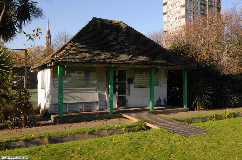
The pavilion at the far end:

King Edward VII Memorial Park

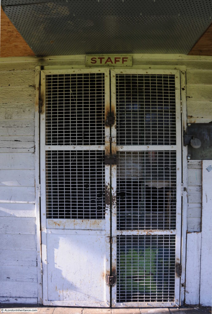
It appears to be used as a store room:

King Edward VII Memorial Park

The site was used by the Shadwell Bowls Club. The last reference I can find to the club is in the Tower Hamlets King Edward Memorial Park Management Plan January 2008, when the club was listed as active. In the 2016 Masterplan for the park, the site of the bowling green is shown as tennis courts, so the green may not be here for much longer.

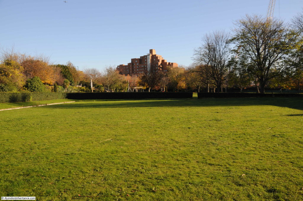
Looking back over the green, with the well-kept hedge running around the edge and the wooden boarding around the side of the green, it is not hard to imagine a game of bowls in this most unlikely of places:

King Edward VII Memorial Park

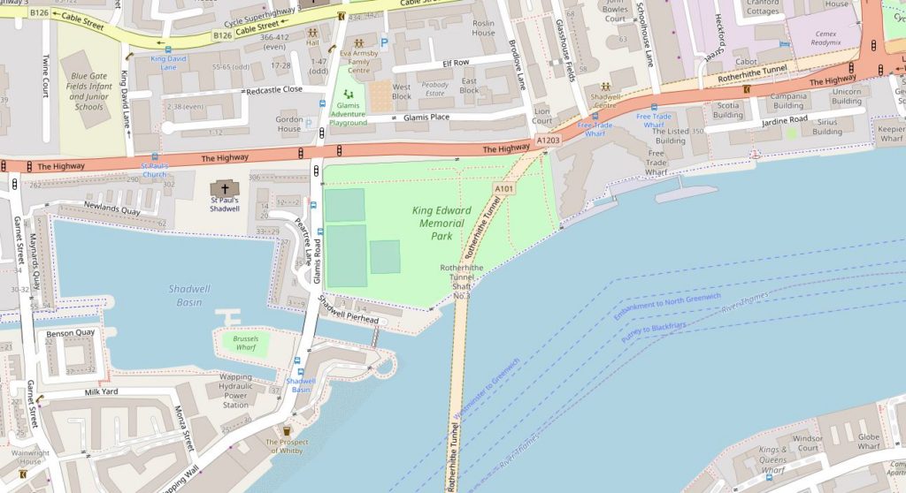
The following map shows the location of the King Edward VII Memorial Park. Just to the north east of the Shadwell Basin and between the Highway and the River Thames. The map shows a road crossing the park, however this is the Rotherhithe Tunnel, so instead of running across the surface of the park, it is some 50 feet below.

King Edward VII Memorial Park

After the death of King Edward VII in May 1910, a memorial committee was formed to identify suitable memorials to the king. One of the proposals put forward was the creation of a public park in east London, on land partly owned by the City Corporation.

Terms were agreed for the transfer of the land to the council, funding was put in place and on the 23rd December 1911, the East London Observer recorded that the plan for the King Edward VII Memorial Park was approved by the City Corporation, the London County Council and the Memorial Committee, and that “unless anything unforeseen occurs, it will become an accomplished fact in a very short time”.

Unfortunately, there was an unforeseen event, the First War which delayed completion of the park until 1922 when it was finally opened by King George V on the 26th June.

The park is a good example of Edwardian design. A terrace runs the full length of the park along the Highway. In the centre of the terrace is a monument to King Edward VII, with steps leading down to the large open area which runs down to the river walkway.

There were clear benefits of the park to the residents of east London at the time of planning. It would provide the only large area of public riverside access between Tower Bridge and the Isle of Dogs and it was the only public park in Stepney.

Over the years, the park has included glasshouses, a bandstand and children’s playground.

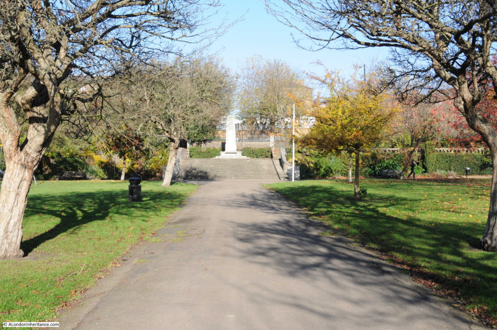
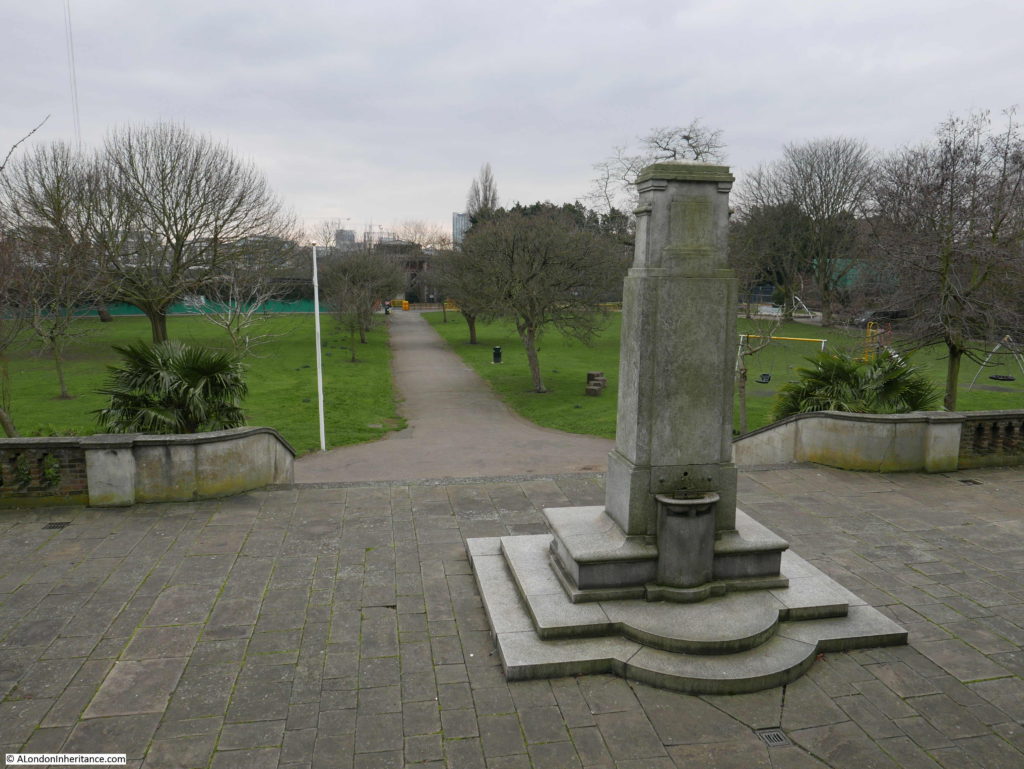
The following photo shows the pathway through the centre of the park from the river up to the monument on the terrace. There was a bronze medallion depicting King Edward VII on the centre of the monument, however this was apparently stolen some years ago.

King Edward VII Memorial Park

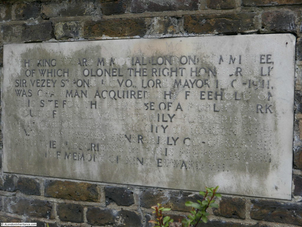
On the wall at the rear of the monument, between the terrace and the Highway is the following plaque:

King Edward VII Memorial Park

It reads:

“The King Edward, Memorial London Committee, of which Colonel the Right Honourable Sir Vezey Strong KCVO, Lord Mayor 1910 – 1911 was chairman acquired the freehold of this site for the purpose of a public park out of funds voluntarily subscribed. The Corporation of the City of London who were the owners generously cooperated with the subscribers in thus perpetuating the memory of King Edward VII”

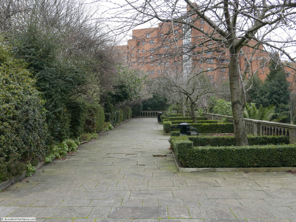
The view along the terrace to the east:

King Edward VII Memorial Park

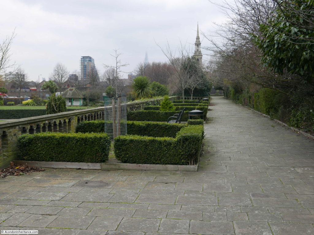
The view along the terrace to the west. The church steeple is that of St. Paul’s Shadwell.

King Edward VII Memorial Park

The view down from behind the monument towards the river. When the park was opened, the view of the river was open. It must have been a fantastic place to watch the shipping on the river.

King Edward VII Memorial Park

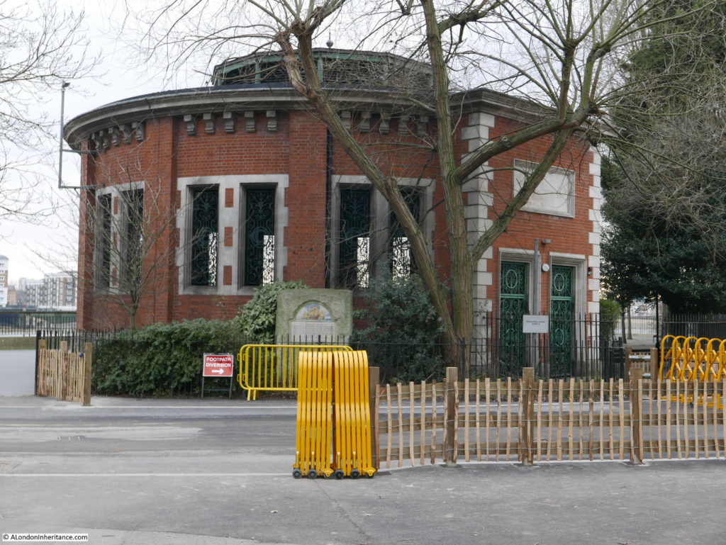
At the river end of the central walkway is one of the four shafts down to the Rotherhithe tunnel. Originally this provided pedestrian access to the tunnel as well as ventilation, so it was possible to walk along the river, down the shaft and under the Thames and emerge on the opposite side of the river.

King Edward VII Memorial Park

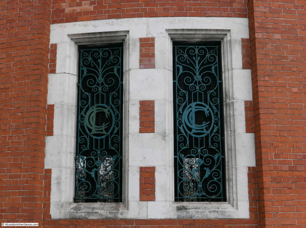
There is some lovely London County Council design detail in the building surrounding the shaft. The open windows have metal grills and within the centre of each grill are the letters LCC.

King Edward VII Memorial Park

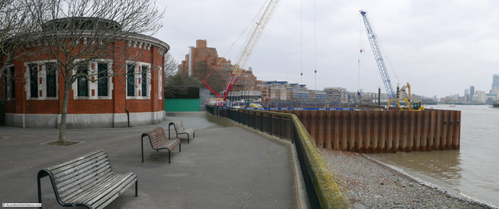
It was possible to walk along the river without entering the park, however this is one of the construction sites for the Thames Tideway project to build a new sewer and provide the capacity to take the overflow which currently runs into the Thames. The site at the King Edward VII Memorial Park will be used to intercept the existing local combined sewer overflow, and when complete will provide an extension to the park out into the river, which will cover the construction site.

King Edward VII Memorial Park

There are many accounts of the popularity of the park after it opened. Newspaper reports call the park a “green lung” in east London and during the summer the park was full with children of all ages.

During the hot August of 1933, access to the river from the park was very popular:

King Edward VII Memorial Park

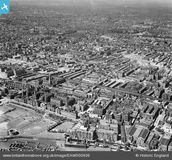
The following photo dated 1946 from Britain from Above shows the park at lower left. Note the round access shaft to the Rotherhithe tunnel. In the photo the shaft has no roof. The original glass roof was removed in the 1930s to improve ventilation. The current roof was installed in 2007.

King Edward VII Memorial Park

The King Edward VII Memorial Park is interesting enough, however I wanted to find out more about the site before the park was built.

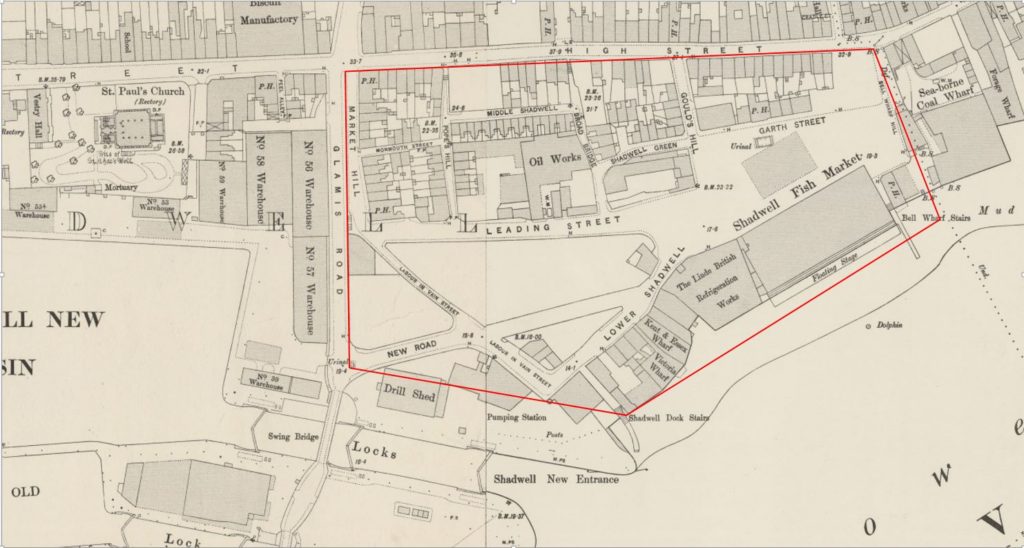
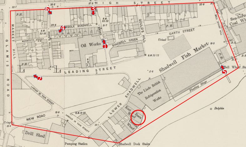
The 1895 Ordnance Survey map provides a detailed view of the site, and I have marked the boundaries of the park by the red lines to show exactly the area covered.

King Edward VII Memorial Park

There were some fascinating features. In the lower right section of the park, was the Shadwell Fish Market – I will come onto this location later in the post along with the adjacent refrigeration works.

Above the fish market is Garth Street. The public house (PH) shown in Garth Street was the King of Prussia. I cannot find too much about the pub apart from the usual newspaper reports of auctions and inquests being held at the pub, however there were a number of reports of a disastrous fire which destroyed the pub on the 14th November 1890. Two small children, Agnes Pass aged seven and Elizabeth Pass aged two died in the fire which started in the bar and spread rapidly through the pub. The location of the pub today is just in front of the eastern terrace, about half way along.

Interesting that in the map, there are urinals shown directly in front of the pub – a very convenient location.

To the left of centre of the park can be found a large building identified as an Oil Works. The left hand part of this building is covering part of the bowling green.

One of the streets in the lower right is called Labour In Vain Street, an interesting street name which could also be found in a couple of other London locations.

In 1895 the Rotherhithe Tunnel had not yet been built (it was constructed between the years 1904 and 1908), so the access shaft does not feature in the map. It would be built over the riverside half of the Kent and Essex Wharf building.

The main feature in the map is the Shadwell Fish Market. This was a short-lived alternative to Billingsgate Fish Market.

In the 19th century there were a number of proposals to relocate Billingsgate Fish Market. It had a relatively short frontage to the river and was located in a very crowded part of London with limited space to expand.

Shadwell was put forward as an alternative location. In September 1868, the Tower Hamlets and East End Local Advertiser reported on the petition put forward by the Board of Works for the Limehouse District to campaign for the Shadwell Fish Market. The petition put forward a number of reasons why Shadwell was the right place to relocate Billingsgate:

  1. That it is the nearest site to the city of London, abutting upon the river for the purposes of a fish market;
  2. That an area of land upwards of seven acres in extent could be obtained upon very reasonable terms;
  3. That by means of a short branch of railway to be constructed, communications can be made with every railway from London north and south of the Thames.
  4. That by means of the Commercial-road and Back-road (recently renamed Cable-street) and other thoroughfares, convenient approaches exist to the proposed site of the market from all parts of London;
  5. That in consequence of the bend in the river at Shadwell, which forms a bay, ample accommodation exists for the mooring of vessels engaged in the fishing trade, without interfering with the navigation of the river;
  6. That easy communication can be made with the south side of the Thames by means of a steam ferry, which would also be available for ordinary traffic, and which to a large extent would prevent the overcrowding of the traffic in the City, especially over London-bridge;
  7. That there is no other site on the River Thames which presents so many advantages as that proposed at Shadwell;
  8. That the establishment of a fish market at Shadwell would be a great boon to the whole of the East-end of London;
  9. That should Billingsgate-market be removed, the fish salesmen are in favour of the market being established at Shadwell.

A very compelling case, however there were a number of vested interests in the continuation of the fish market at Billingsgate and no progress was made with approval for a fish market at Shadwell.

However the issue never went away, and in 1884 a company was formed to “give effect to the London Riverside Fish Market Act of 1882”.  The company had “on its Board of Directors, three of the best known and most popular men in the East of London – men who taken a considerable interest in the welfare of the people of the district, and have embarked in this enterprise, feeling assured not only of its value to the public, but with confidence that it will prove a commercial success.”

The Directors of the company were Mr. E.R. Cook, Mr. Spencer Charrington, Mr. T.H. Bryant, Mr. E. Hart and Mr. Robert Hewett.

Robert Hewett was a member of the Hewett family who owned the Short Blue Fishing Fleet and was keen to leave Billingsgate due to the lack of space. He would transfer his fleet of ships from Billingsgate to Shadwell.

Work progressed on the construction of the market and at a ceremony to mark the pile driving, the local MP, Mr Samuel Morley, “confidently communicated to the assembled company the burning desire of the Home Secretary to find remunerative labour for the unemployed in East London. Mr Morley is now in a position to inform that the fish market at Shadwell will afford employment to many working men”.

Shares in the fish market company were advertised in the East London Local Advertiser and “those of the East London public who have not yet practically interested themselves in a scheme which promises so well, the opportunity once more offers itself. Applications for shares should, however, be made without delay.”

The new market opened at the end of 1885 and whilst it appeared to start well, the challenges of attracting business from Billigsgate were already very apparent. The London Daily News reported on the 1st March 1886:

“The new fish market at Shadwell has been going now for about three months, and the fact that a hundred tons of fish can be readily disposed of here every morning indicates pretty satisfactorily that already buyers have begun to find out that the market has at least some advantages over Billingsgate. As regards the supply of this new market, so far as it goes it cannot very well be better. Messrs. Hewett and Co., who are at present practically the only smack owners having to do with it, have 150 vessels out in the North Sea, and a service of steamers plying to and fro between the fleet and the market.”

Interesting how fish were brought in from the north sea fishing boats by a fleet of steamers – a rather efficient method for bringing fish quickly ashore and keeping the fishing boats fishing.

The article indicates the problem that would result in the eventual failure of the Shadwell Fish Market, It was only the Hewett Company that relocated from Billingsgate. None of the other traders could be convinced to move, and there was an extension of the Billingsgate Market which addressed many of the issues with lack of space.

The market continued in business, but Billingsgate continued as the main fish market for London. The Shadwell market was sold to the City of London Corporation in 1904, and in less than a decade later the market closed in preparation for the construction of the King Edward VII Memorial Park.

In total the Shadwell Fish Market had lasted for less than twenty years.

The building adjacent to the fish market was the Linde British Refrigeration Works. A company formed to use the refrigeration technology developed by the German academic Carl von Linde. The Shadwell works were capable of producing 150 tons of ice a day.

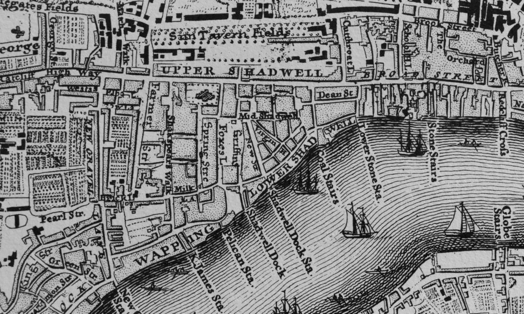
Before taking a look at the area just before demolition ready for the new park, we can look back a bit earlier to Rocque’s map of 1746.

King Edward VII Memorial Park

The road labelled Upper Shadwell is the Highway. Just below the two LLs of Shadwell can be seen Dean Street, this was the original Garth Street. Shadwell Dock Stairs can be seen under the W of Lower Shadwell and to the right is Coal Stairs which was lost with the development of the fish market.

To the right of Coal Stairs is Lower Stone Stairs. By 1895 these had changed name to Bell Wharf Stairs.

The map illustrates how in 1746 the area between the Highway and the river was already densely populated.

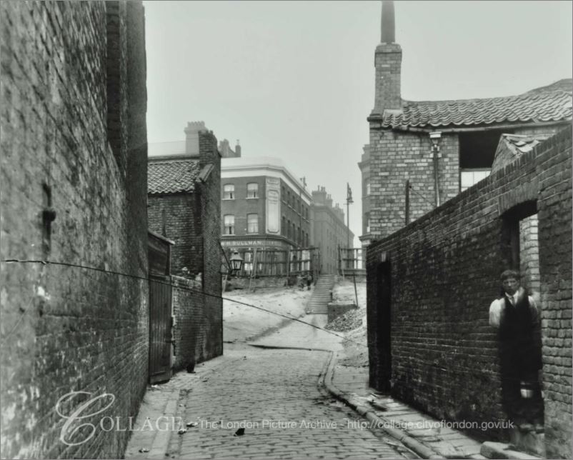
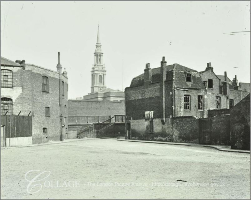
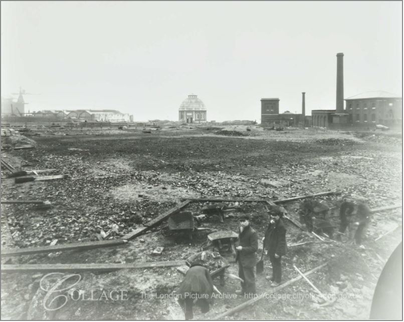
To see if there are any photos of the area, I check on the London Metropolitan Archives, Collage site and found a number of photos of the streets prior to, and during demolition. These are shown below and I have marked the location from where the photos were taken on the 1895 map.

King Edward VII Memorial Park

Site 1: Looking up towards the High Street (the Highway) along Broad Bridge. The building on the left is the Oil Works and residential houses are on the right. Note the steps leading up to the High Street, confirming that the high difference between the Highway and the main body of the park has always been a feature of the area, and is visible today with the terrace and steps leading down to the main body of the park.

King Edward VII Memorial Park

Image credit: London Metropolitan Archives, City of London: catalogue ref: SC_PHL_01_381_A361.

Site 2: This photo was taken to the south of Leading Street and is looking across to the steps leading up to Glamis Road, a road that is still there today. The church of St. Paul’s Shadwell is in the background.

King Edward VII Memorial Park

Image credit: London Metropolitan Archives, City of London: catalogue ref: SC_PHL_01_392_82_1222

Site 3: This photo was taken from the High Street (Highway) hence the height difference. It is looking down towards the river with the shaft of the Rotherhithe Tunnel one of the few remaining buildings – and the only building still to be found in the area. The remains of the metal framework of the fish market sheds can be seen to the left of the access shaft.

King Edward VII Memorial Park

Image credit: London Metropolitan Archives, City of London: catalogue ref: SC_PHL_01_392_A713

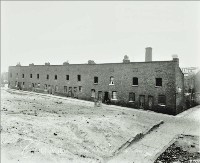
Site 4: This photo was taken in the street Middle Shadwell (the buildings being already demolished) looking down towards a terrace of houses remaining on Pope’s Hill. the buildings in the background are Number 56 and 57 Warehouse of the Shadwell New Basin on the opposite side of Glamis Road.

King Edward VII Memorial Park

Image credit: London Metropolitan Archives, City of London: catalogue ref: SC_PHL_01_396_A495

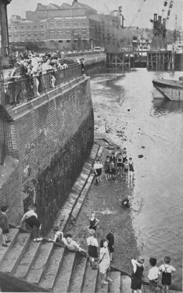
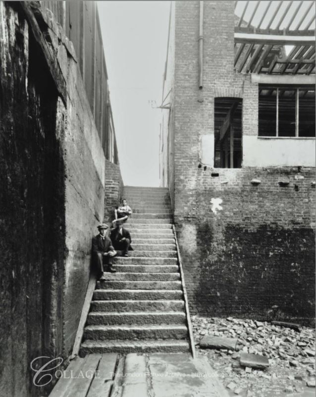
Site 5: This photo is taken looking up Bell Wharf Stairs from the Thames foreshore. The sheds of the Shadwell Fish Market are on the left. The building on the right is the remains of the pub the Coal Meters Arms.

King Edward VII Memorial Park

Image credit: London Metropolitan Archives, City of London: catalogue ref: SC_PHL_02_0638_A363

A possible source for the name Coal Meters Arms may be found in the following strange story from John Bull dated the 3rd April 1843:

“Jeremiah John Kelly, the man who entered the lobby of the House of Commons on Friday evening, in a half-mad, half-drunken state, and who was taken into custody by the police, with a carving-knife in his possession, is a person of wayward character and habits., who has given much trouble to the Thames Police Magistrates, and there can be little doubt that he intended to commit an assault on Lord J. Russell, and perpetuate an outrage on that Nobleman. Kelly has made no secret of his intention of attacking Lord John Russell for some time past, and fancies he has some claims on his Lordship for services performed during the last election for the city of London. A few years since Kelly was in business as a licensed victualler, and kept the Coal Meters Arms , in Lower Shadwell, where he also carried on the business of a coal merchant, and an agent for the delivery of colliers in the Pool.”

So perhaps an element of Kelly’s trade was used for the name of the pub.

Site 6: Is at the top of Pope’s Hill where it meets the Highway and is looking back at the remaining terrace houses on the southern side of Middle Shadwell.

King Edward VII Memorial Park

Image credit: London Metropolitan Archives, City of London: catalogue ref: SC_PHL_01_393_A364

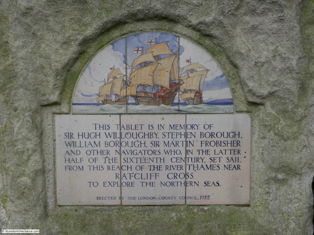
There is one final story to be found in the King Edward VII Memorial Park. Next to the Rotherhithe Tunnel entrance shaft is the following plaque:

King Edward VII Memorial Park

The plaque was put in place in the year that the park was opened, and records among others, Sir Hugh Willoughby, a 16th century adventurer and explorer. He died in 1554 whilst trying to find a route around the north of Norway to trade with Russia.

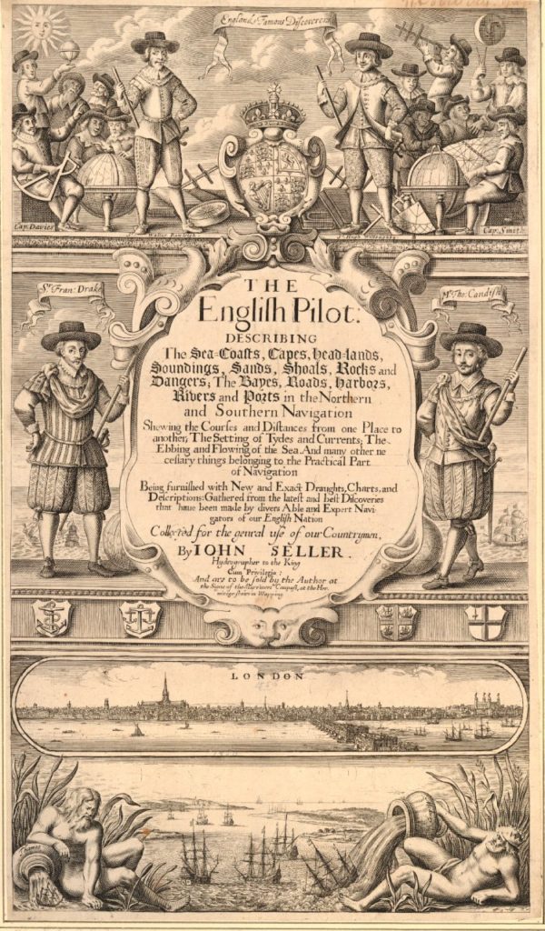
The title page to The English Pilot published in 1671 includes a picture of Willoughby in the top panel of the page, standing to the right of centre.

King Edward VII Memorial Park

The lower half of the page shows the Pool of London, the original London Bridge and St. Paul’s Cathedral. Below this are two figures pouring water into the river, one representing the Thames and the other representing the Medway.

This title page fascinates me. It highlights the connections between London, the River Thames, shipping, navigation and the high seas – a connection that is not so relevant to London today, but was so key in the development of London over the centuries.

And on the subject of connections, this post demonstrates why I love exploring London, in that one small area can have the most fascinating connections with the past and how London has developed over the centuries, and it all started with finding a bowling green in Shadwell.

alondoninheritance.com

Albert Bridge And The Extra Piers

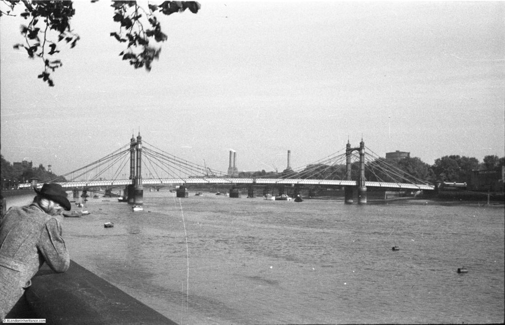
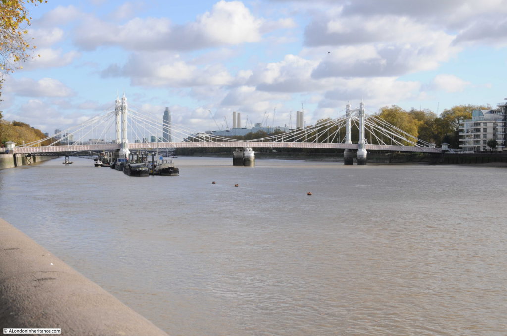
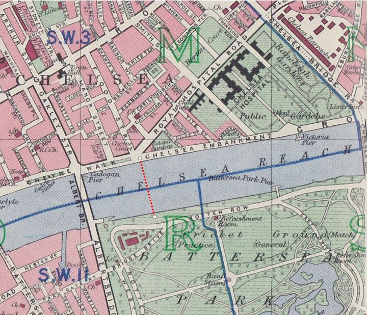
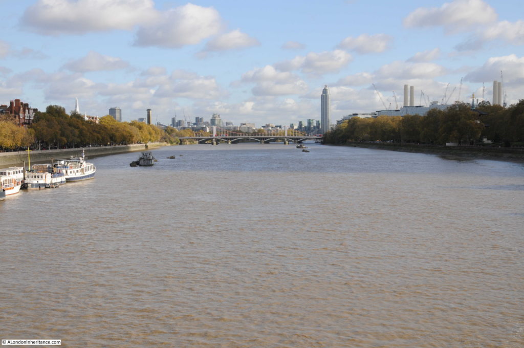
After exploring Cheyne Row for last week’s post, I walked along the Chelsea Embankment towards Battersea Bridge, to photographic the same view as my father’s photo looking along the River Thames towards Albert Bridge, with Battersea Park and Power Station in the background.

Albert Bridge

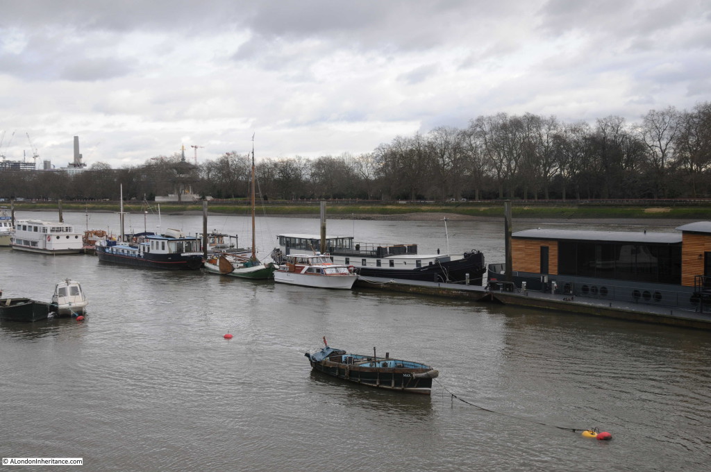
The same view today:

Albert Bridge

In the last half of the 19th century, Chelsea was growing rapidly. The Chelsea Embankment was under construction, the first Chelsea Bridge (originally called the Victoria Bridge) had been completed in 1858 and the nearby Battersea Bridge was of a rather old and fragile wooden construction.

Congestion and the rapid development of the area justified an additional river crossing and in 1860 Prince Albert proposed that an additional bridge between the two existing bridges would be justified by the volume of traffic and the revenue that would be generated by tolls for crossing the bridge. The Chelsea Bridge when opened was a toll bridge and proposals for the Albert Bridge included a toll for crossing the river.

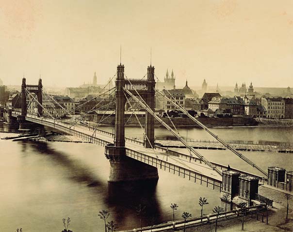
The Albert Bridge Company was formed to build and operate the bridge and construction started in 1870. The bridge was designed by Rowland Mason Ordish using his own patented design. Although construction of the Albert Bridge was approved in 1864, the six year delay to the start of construction (due to plans and work on the Chelsea Embankment), allowed Ordish to design and build another bridge using the same principles – the Franz Joseph Bridge which spanned the River Vltava in Prague.

The following photo of the Franz Joseph Bridge shows how similar the design was to the Albert Bridge, and also probably shows how the deck was suspended – a design that would lead to structural weaknesses in the Albert Bridge resulting in the need for additional strengthening over the years.

Albert Bridge

Source: By František Fridrich (21. 5. 1829 – 23. 3. 1892) [Public domain], via Wikimedia Commons)

The Albert Bridge was opened in 1873. The bridge was 710 feet long with a central span between the two towers of 384 feet. The design included toll booths at both ends of the bridge to collect the tolls for crossing the river. The cylindrical piers were the largest ever cast and were manufactured at a nearby metal works on the Battersea side of the river, then floated down to the location of the bridge, sunk in the river and filled with concrete.

Soon after construction, there were concerns about the strength of the bridge as it would frequently vibrate, a problem which was amplified when large numbers of people walked across the bridge in step – an issue when troops from the nearby Chelsea Barracks crossed the bridge.

The vibration of the bridge was the result of the synchronisation of the steps of those crossing the bridge. The same problem was seen when the Millennium Footbridge opened across the river in June 2000. When upwards of 2,000 people were on the bridge it would start to vibrate. Research has shown that when a bridge starts to vibrate, people walking across the bridge start to synchronise their step with the movement of the bridge, which in turn amplifies the vibration and movement.

Interesting that even after 130 years, the same problems can apply to a structure.

In 1884 Sir Joseph Bazalgette inspected the bridge and found that the iron rods supporting the bridge were showing signs of corrosion and a program of work was implemented to strengthen the bridge which included the installation of steel chains to support the deck along with the replacement of the timber decking.

The steel chains changed the appearance of the bridge from the original design, which probably looked very similar to the Franz Joseph bridge, to the Albert Bridge that we see today.

When I took the comparison photo, I was trying to align features on the bridge with the chimneys of Battersea Power Station to make sure I was roughly in the same position. There were a number of distractions to this.

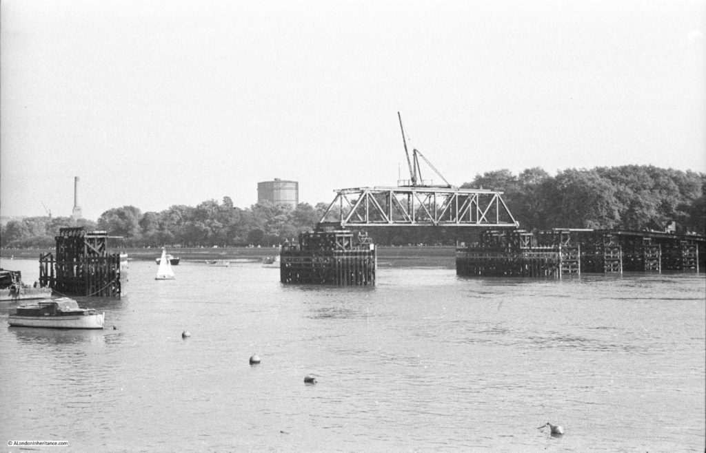
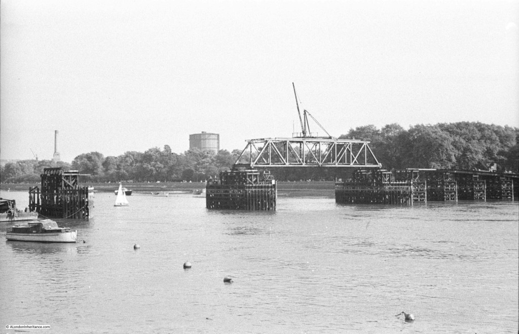
Firstly, if you look under the Albert Bridge there are a number of piers in the river further back. These are not the piers of Chelsea Bridge, rather they are the piers of one of the temporary bridges constructed over the river during the war to provide additional capacity should one of the main bridges be badly damaged by bombing. I wrote about this bridge in a previous post, and this is my father’s photo of the temporary bridge at Battersea:

Albert Bridge

But there was another difference looking underneath the bridge – when my father took the original photo the bridge was a suspension bridge, with the central span supported across the river by the chains running from the top of each tower. In my 2017 photo there is a large pier supporting the centre of the bridge.

The central pier was the result of ongoing concerns about the strength of the Albert Bridge. After Bazalgette’s inspection in 1884, as well as the additional strengthening work, he imposed a weight limit of five tons for vehicles crossing the bridge.

There was a proposal to demolish the bridge in 1926 and replace with a new, stronger bridge, however lack of funding meant that this did not progress beyond the proposal stage. A second attempt to demolish the bridge was made by the London County Council in 1957, however a campaign led by John Betjeman saved the bridge again.

The weight limit for vehicles crossing the bridge had been further reduced to two tons in 1935, so clearly something had to be done to strengthen and preserve the bridge.

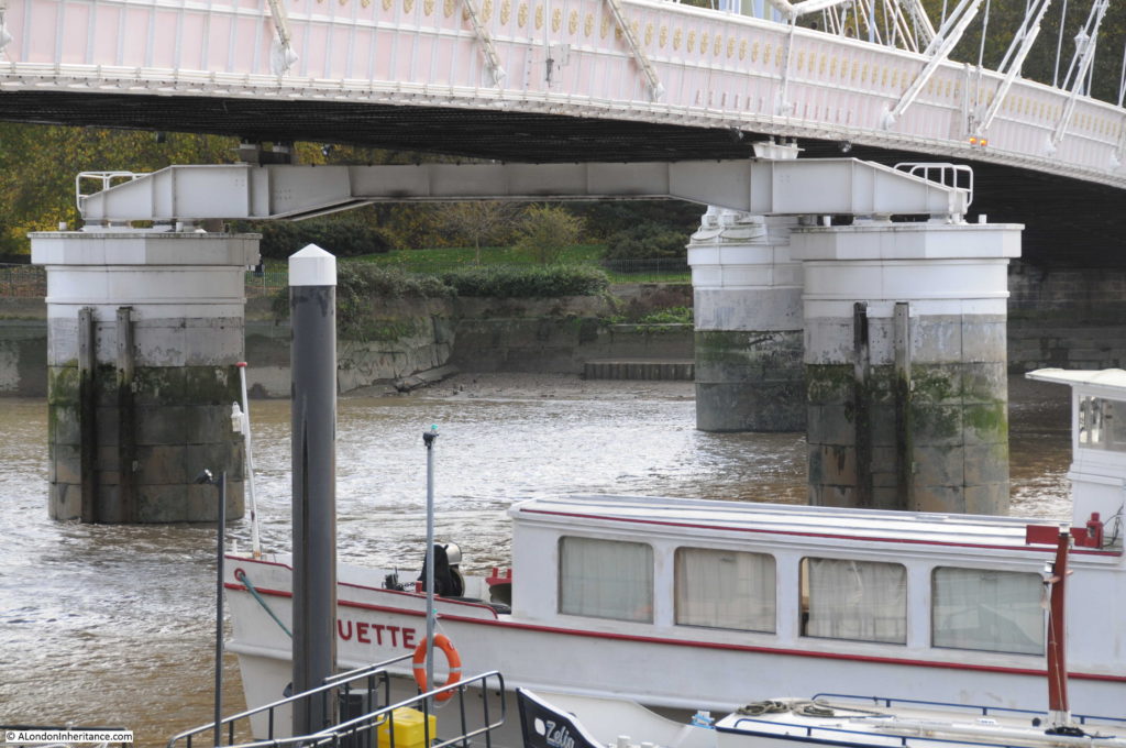
As well as replacing the decking and strengthening the bridge structure, the answer to significantly strengthen the bridge was to convert the bridge to a more traditional beam bridge by the addition of a central pier. The bridge closed in 1973 for this work to be carried out which resulted in the bridge we see today.

The two new central piers are of the same design as the original piers, however they support a metal girder that runs under, and supports the centre of the bridge:

Albert Bridge

In echoes of the Garden Bridge, there was also a proposal in 1973 to close the Albert Bridge to traffic and change the bridge into a public park and pedestrian walkway. John Betjeman also supported this proposal, along with many of the local inhabitants who probably saw the closure of the bridge to traffic as a way of reducing the ever increasing volumes of traffic along the Chelsea Embankment. Motoring groups opposed the idea and such was the need for river crossings capable of supporting vehicular traffic that the proposal was rejected and the bridge reopened to pedestrians and traffic after the strengthening work and the addition of the new central piers.

Despite this work, the weight limit has remained at two tons and to try and prevent vehicles over this weight from crossing the bridge a traffic island was introduced at the southern end of the bridge to narrow the entrance, thereby limiting the size of vehicles trying to cross.

The last strengthening work to be carried out was in 2010, and the Albert Bridge will continue to require periodic work to maintain the decking and the supporting ironwork well into the future.

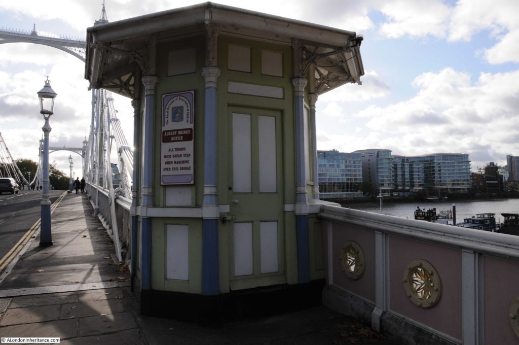
The toll booths at the entrance to the bridge:

Albert Bridge

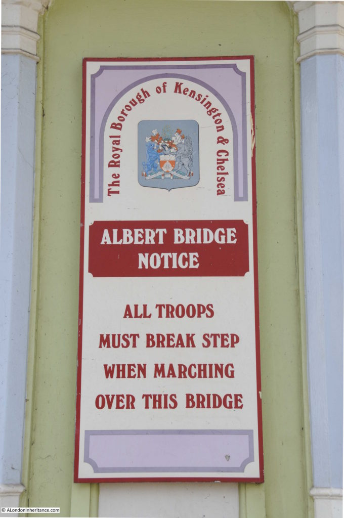
The toll booths still retain the signs warning troops to break step when marching across the bridge:

Albert Bridge

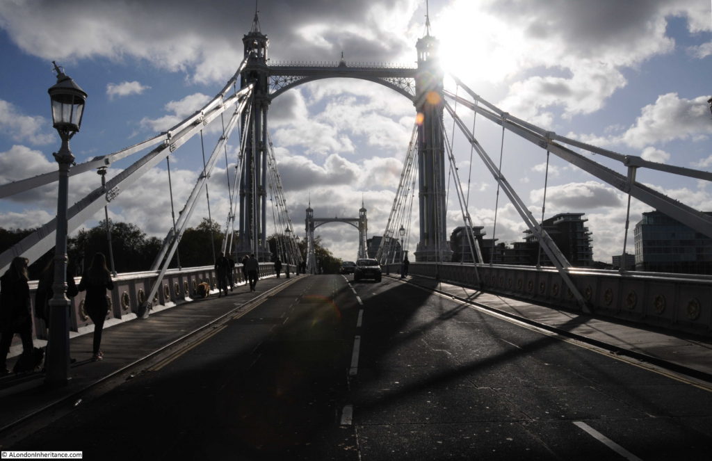
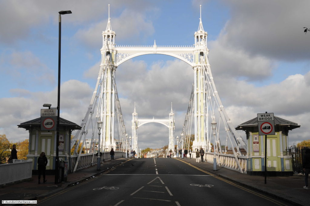
View across the bridge from the north side on a sunny autumn day:

Albert Bridge

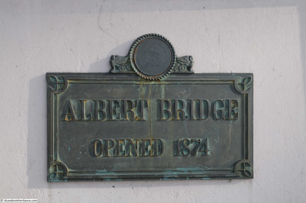
The plaque on the bridge states the bridge was opened in 1874, however the bridge had a phased opening.

Albert Bridge

The “Shipping and Mercantile Gazette” on the 1st January 1873 reported on the initial opening of the Albert Bridge:

“THE ALBERT BRIDGE AT CHELSEA – At 1 o’clock yesterday, amid the firing of cannon and waving of flags, the Albert Bridge at Chelsea was opened to the public. There was an absence of all ceremony, as the bridge is as yet in an unfinished condition. The opening simply consisted in the admission of the public over the bridge, the engineer, contractor and other gentlemen going over in a carriage. By this event, however, the conditions of the Act of Parliament have been complied with, which required that the bridge should be opened before the close of the year. The work of completion is being rapidly proceeded with, and in a short time the formal ceremony of opening the bridge may be expected to be performed.”

There does not appear to have been a formal opening ceremony, and there are reports in the newspapers of the time of the bridge opening to traffic in September 1873.

The view looking to the east from the centre of the bridge:

Albert Bridge

And the view looking to the west:

Albert Bridge

The bridges in the above photos, Chelsea and Battersea Bridges were, as with the Albert Bridge, all originally toll bridges, however soon after the Albert Bridge had opened, it was made toll free along with many other bridges across the river. The East London Observer reported in the 31st May 1879:

“FREEING THE BRIDGES OVER THE THAMES – a great work has just been accomplished in which the East End has co-operated with the West, although its first importance is for the latter. It was but the other day that Waterloo Bridge was thrown open free of toll, and the boon granted is conspicuous by the fact that in seven months the traffic has increased 90 per cent. But last Saturday five bridges were made free of toll for ever, these being the Lambeth, Vauxhall, Chelsea, the Albert and Battersea Bridges.

Within the Metropolis there are thirteen bridges spanning the River Thames and connecting the Middlesex and Surrey shores. With a view of obtaining for the public the full advantage of these bridges as a means of free communication between the various points of the Metropolis, the Board of Works in 1877, promoted a bill in Parliament, to enable them to purchase the interests of the several companies in all the toll bridges crossing the Thames within the metropolis, including the two foot-bridges at Charing Cross and Cannon Street railway stations, and also one bridge crossing the Ravensbourne at Deptford. the bill was successfully carried through both Houses of Parliament, and passed into law in July 1877.”

The Albert and Battersea Bridges were owned by the same company and the sum of £170,000 was paid by the Metropolitan Board of Works to the company for the purchase of the bridges.

From then on, crossing the river was toll free, which must have been one of the drivers to opening up business and trade on both sides of the River Thames, as the article also states that “A free communication across the Thames is an incalculable boon to all classes of inhabitants on both sides of the river”.

Following the opening of the bridges described above, the only bridges across the Thames that still had tolls were bridges at Wandsworth, Putney and Hammersmith.

The view from the centre of the bridge – the style of decoration is the same throughout the bridge, with the round patterns repeated across both sides of the bridge span, and along the edge of the steps that lead up from the river walkway on the north bank of the river.

Albert Bridge

View from the traffic island on the southern end of the bridge looking back over towards the north:

Albert Bridge

It is perhaps a wonder that the Albert Bridge has survived so long. A bridge that once had a twin crossing a river in Prague.

A bridge that if the Chelsea Bridge had retained its original name would be one half of the Victoria and Albert Bridges.

And a bridge that may have been the original “garden bridge”.

The Albert Bridge is a unique bridge. The addition of the central pier has changed the design of the bridge to a more traditional beam bridge, however on a sunny autumn day it still appeared as London’s most beautiful bridge across the Thames.

alondoninheritance,com


Thames River Police Museum And Hermitage Moorings

Finally, somewhat later than planned, here is the last post on my Open House 2017 visits. I had started in the Isle of Dogs and my final two locations were the Thames River Police Museum in Wapping and the Hermitage Moorings,  a short distance further along the river towards St. Katherine Docks.

Thames River Police Museum

The Thames River Police Museum is usually only open by appointment so Open House provided the opportunity to just turn up and see this fascinating museum in one of the old workshops in what is still a working Police Station.

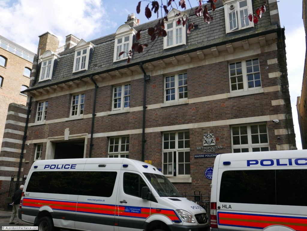
This is the front of the building on Wapping High Street. The museum is reached through the entrance on the left, through a small courtyard and up to the museum on the first floor of the part of the building facing the river.

Thames River Police Museum

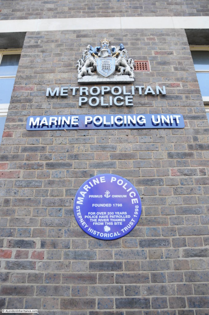
The Marine Policing Unit as it is now named, is one of, if not the earliest uniformed police force in the world.

The Port of London was growing rapidly around Wapping in the last decades of the 18th century. There would be hundreds of different ships moored on the river, along the wharfs and warehouses facing the river and in the docks. The cargo stored in these shops and warehouses provided a ready source of income for those willing to steal or pilfer from these cargoes.

The problem was getting so bad that in the 1790s a uniformed police force was organised, approved by the government and funded by the various merchant companies that operated along the river.

The river police force was based at the location that remains their headquarters to this day. The first patrol of the river set out from this location in 1798.

Thames River Police Museum

In my father’s collection of photos, there are some of 1950’s era police river launches moored by Waterloo Bridge so I plan to write more about the history of the river police when I cover these photos in the coming months, so in the photos below is a brief view of what is a fascinating museum.

The museum is housed in a long, single room, at the end of which is a door facing onto the river.

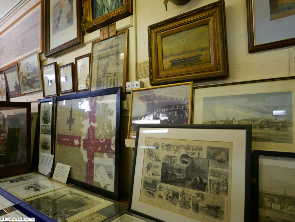
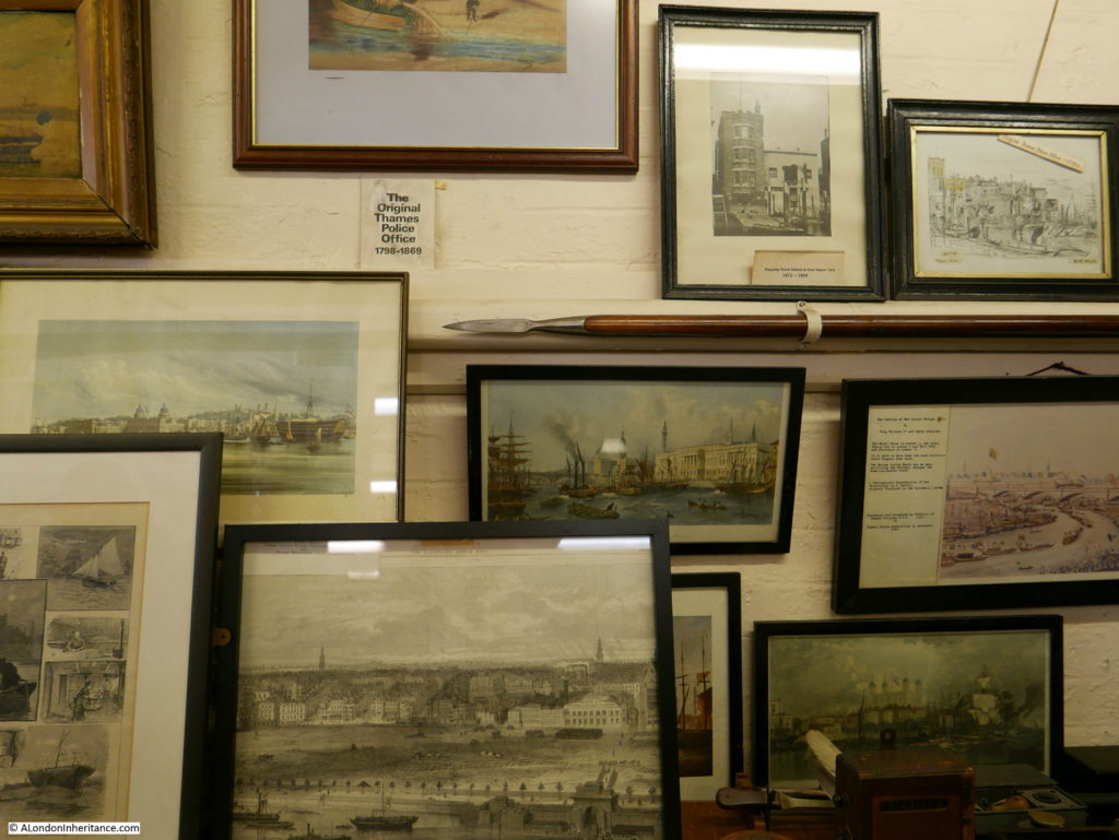
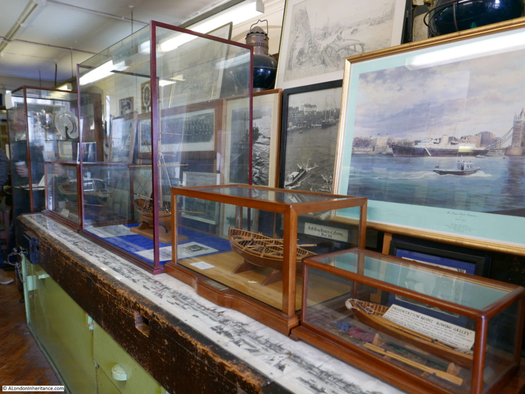
The museum is a bit overwhelming at first sight as there is so much to look at. A couple of long display cases run part of the length of the room full with models, books, record books, old equipment used by the river police and much more. The walls are covered in drawings, paintings, photographs, maps and flags that tell the story of some of the significant events over the past two hundred years, and how the river police have evolved.

Thames River Police Museum

Thames River Police Museum

Display cabinets show some of the craft used by the river police. The original river patrols were made using rowing galleys, often with a crew of four comprising a Surveyor or Inspector and up to three Constables.

Thames River Police Museum

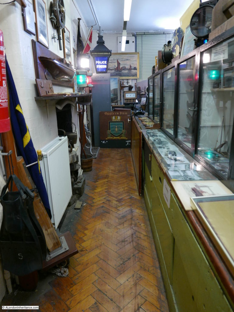
View of one narrow walkway showing how much there is to see in the museum.

Thames River Police Museum

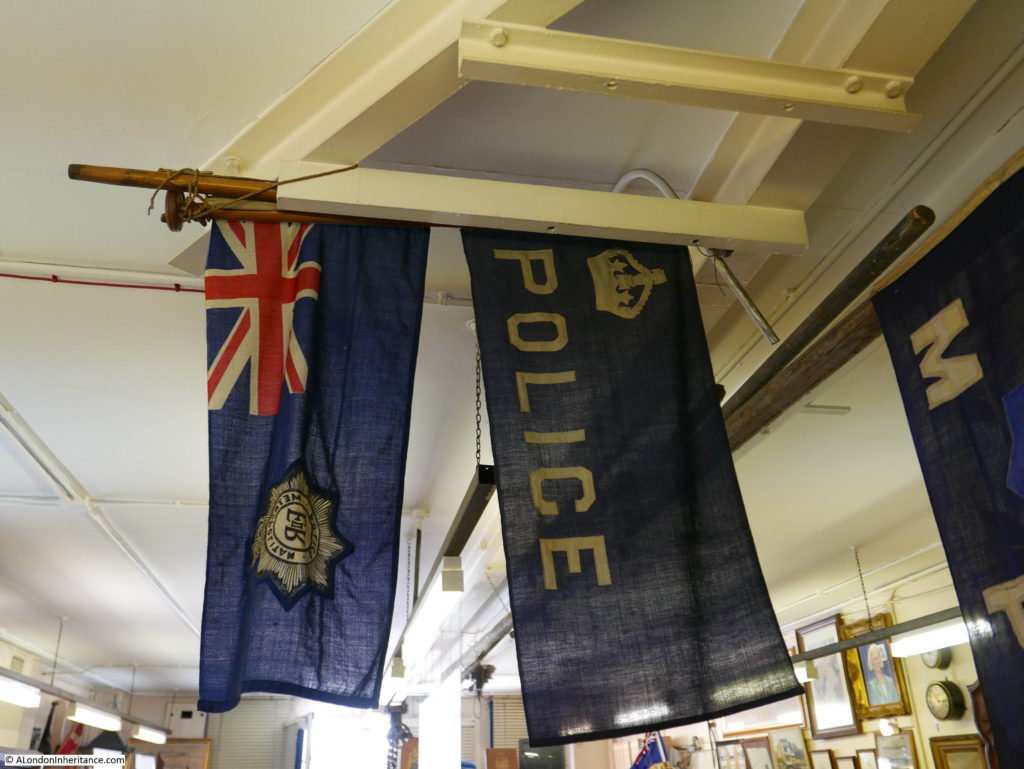
Flags used on the patrol boats:

Thames River Police Museum

At the end of the museum is a door facing onto the river which provides some unique views.

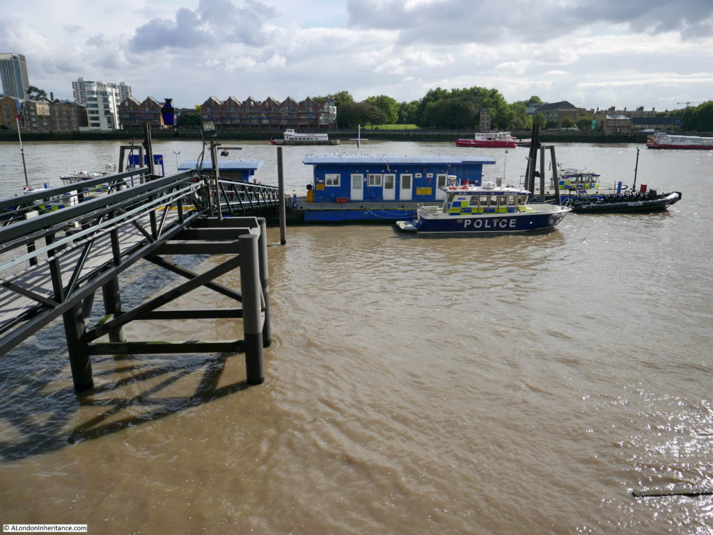
Being an operational police station, there is a walkway leading down to a pier where some of the police boats are moored.

Thames River Police Museum

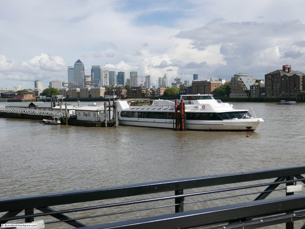
There is also a good view here across to Rotherhithe and down to the Isle of Dogs.

Thames River Police Museum

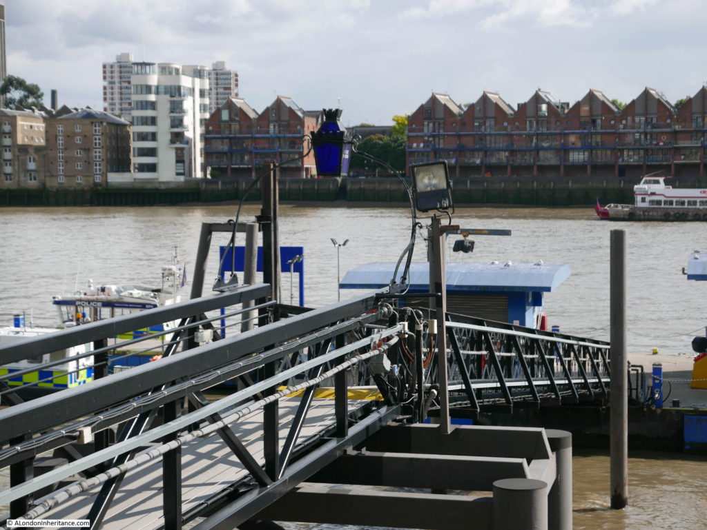
Half way along the walkway there is a traditional Police blue light:

Thames River Police Museum

The museum provides a fascinating view of the history of the Thames River Police, there is much to view and read. What makes this museum very special is that it is on the site where the original river police force was established and is within a building providing the same function to this day.

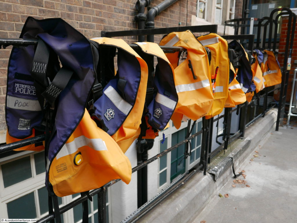
Back outside in the courtyard between the museum and the street there is a reminder that this is still a working river police station.

Thames River Police Museum

A short distance along Wapping High Street was my final Open House visit to:

Hermitage Moorings

In comparison with the other sites I visited during Open House, the Hermitage Moorings are very recent. The submission for planning permission was in 2004 and the Hermitage Moorings were constructed a few years later.

Despite being very recent, they are one of those many places around London that have a name that maintains a link with the location as it was many years ago.

The Hermitage Moorings can be found at the western end of Wapping High Street, just before the junction with St. Katherine’s Way.

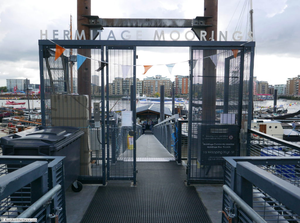
The Hermitage Riverside Memorial Gardens run between Wapping High Street and the river, and at the eastern end of the gardens is the entrance to Hermitage Moorings.

Thames River Police Museum

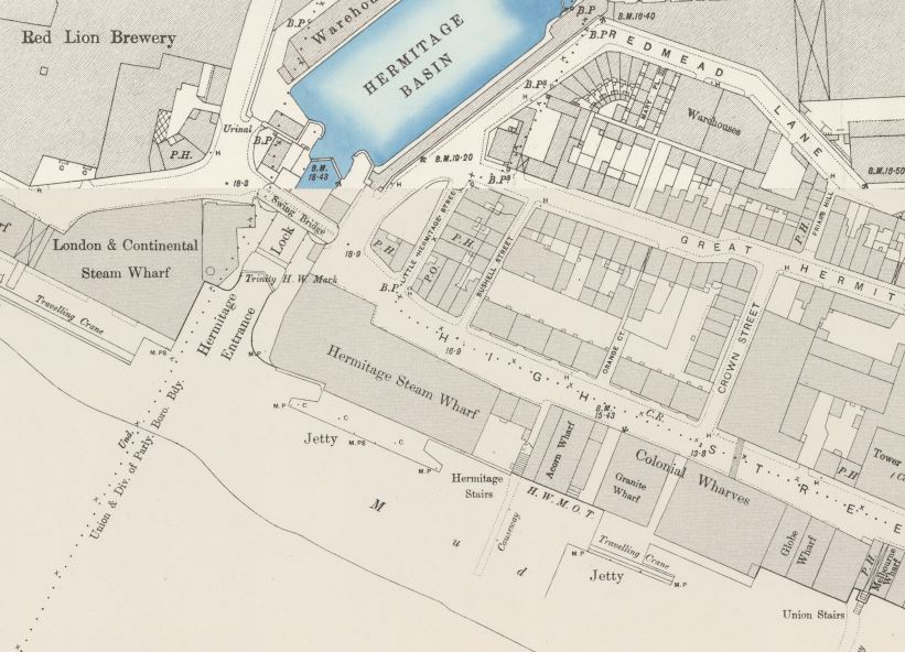
Before taking a walk around the moorings, some history of the area and the name. In the extract from the 1896 Ordnance Survey map below, in the centre of the river’s edge is the Hermitage Steam Wharf. Just to the right of this wharf are Hermitage Stairs running down to a causeway into the river. It is here that the entrance to the Hermitage Moorings is located.

Thames River Police Museum

As can be seen from the map, the name Hermitage is used for a number of features – the stairs, the wharf and the basin.

You can also see on the left of the map the Red Lion Brewery, however according to “A Dictionary of London” published in 1918:

“Hermitage Brewhouse – A Brewhouse ‘so called of an hermite sometime being there,’ at the southern end of Nightingale lane, E. Smithfield” and “This hermitage seems to have given its name, not only to the Brewhouse, but to the Stairs and the Dock, etc.”

Nightingale Lane is the street running down from the top of the map to the left of Hermitage Basin down to the junction with Wapping High Street, so Hermitage Brewhouse may have been the earlier name of the brewery prior to Red Lion and it may have been named after a hermit.

Very tenuous but good to imagine that the new moorings are named after a hermit that lived close by.

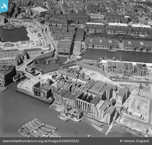
The photo below from the Britain from Above website shows the area in 1946.

Thames River Police Museum

At the bottom right of the photo you can see some stairs and a causeway leading down into the river – this is the Union Stairs. Move along the water front to the left, pass the cranes and you will come to another causeway leading down into the river – this is the Hermitage Stairs.

The area between the Hermitage Stairs, the road behind and the river entrance to the basin is now the Hermitage Riverside Memorial Gardens.

The view across the gardens from the edge of the basin entrance looking across to where the entrance to the Hermitage Moorings is located in shown in the photo below.

Thames River Police Museum

The gardens are a memorial to the East London civilians who lost their lives, or were injured during the Second World War.

Time for a look at the moorings which were fully open during Open House weekend.

Hermitage Moorings were built, and are now owned and operated by Hermitage Community Moorings and they provide up to 23 berths for historic vessels with the owners living aboard. The moorings therefore form a community on the river rather than a place for distant owners to moor their boats.

When planning permission was applied for, there was general support for establishing a community on the river, however there were also a number of objections which appear to have come from the occupiers of the new apartments that had recently been built along the river.

Objections included that the moorings would be  ‘blots on the landscape’ and ‘floating gypsy camps’ and that ‘rusting wrecks’ will be moored alongside the flats and the park.

The historic boats are very far from being rusting wrecks. The view looking downstream from the entrance to the moorings.

Thames River Police Museum

The view upstream towards Tower Bridge and the City.

Thames River Police Museum

There are two main pontoons extending either side from the centre of the moorings. All lined with a range of very well maintained historic boats. The majority with owners currently living aboard.

Thames River Police Museum

Some of the boats have potted gardens running along the edge of the pontoon.

Thames River Police Museum

Talking to some of the owners, there was a real pride in their boats, a very obvious community of people living on the river, and great pleasure in being able to live in such a way and location.

Thames River Police Museum

The boats are all extremely well maintained. many are Dutch, all have seen a working life of many decades and now rest at this wonderful location.

Thames River Police Museum

One of the differences between being on the river and walking the streets of the city is that from the river the wide sweep of the sky is visible and there is a connection between the river and weather which played such an important part in the lives of those who worked on the river for so many hundreds of years.

Thames River Police Museum

Names and numbers:

Thames River Police Museum

Despite the boats and owners living here at Hermitage Moorings, the boats are still in working order and able to make their way along the river. To have a mooring, the owner also needs a Day Skipper qualification as a minimum so the moorings are not simply providing a living place with a superb view – they are for those with the time and money to invest in maintaining a historic boat in working order and with the skill and qualifications to pilot those boats on the river.

Looking across towards Rotherhithe.

Thames River Police Museum

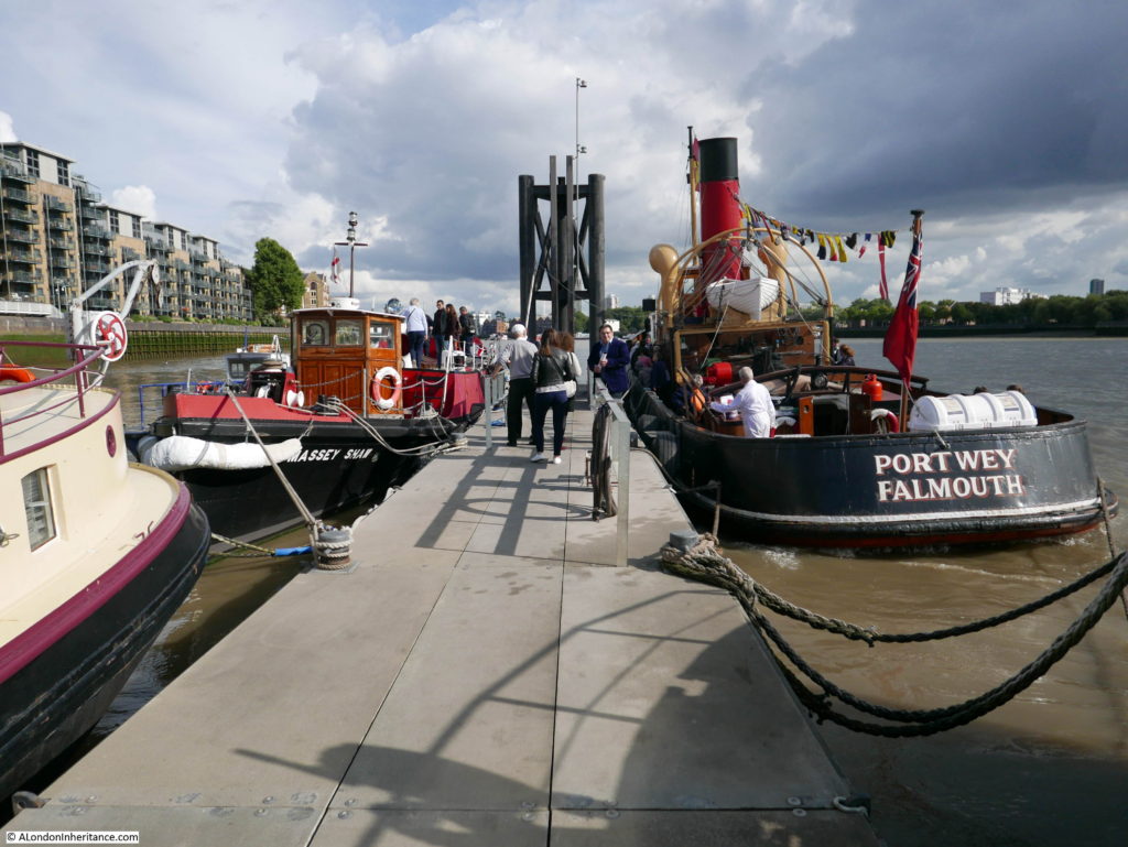
For Open House, there were also a couple of historic visitors to the Hermitage Moorings, including the Massey Shaw fireboat on the left.

Thames River Police Museum

There is a good view of the Hermitage Moorings from the riverside park and walkway along the river, however Open House provided the opportunity to walk among the boats and talk to the owners.

It was a fascinating day that demonstrated the sheer variety of sites open during Open House. From the pumping station on the Isle of Dogs, the Church and Town Hall at Limehouse, a museum in a working police station on the same location as where the river police force was formed, and river moorings from the last decade.

Hopefully, with some planning, I will get the whole weekend free for Open House 2018.

alondoninheritance.com

West India Dock Impounding Station

Last weekend was the annual Open House event across London, two days when it is possible to visit so many locations across the city that are not normally open. I only had Sunday free this year, and planned a walking route that would take in five locations that I have walked past many times, but never had the opportunity to see inside.

The route would start on the Isle of Dogs and end just outside St. Katharine Docks. My first visit was to the West India Dock Impounding Station:

West India Dock Impounding Station

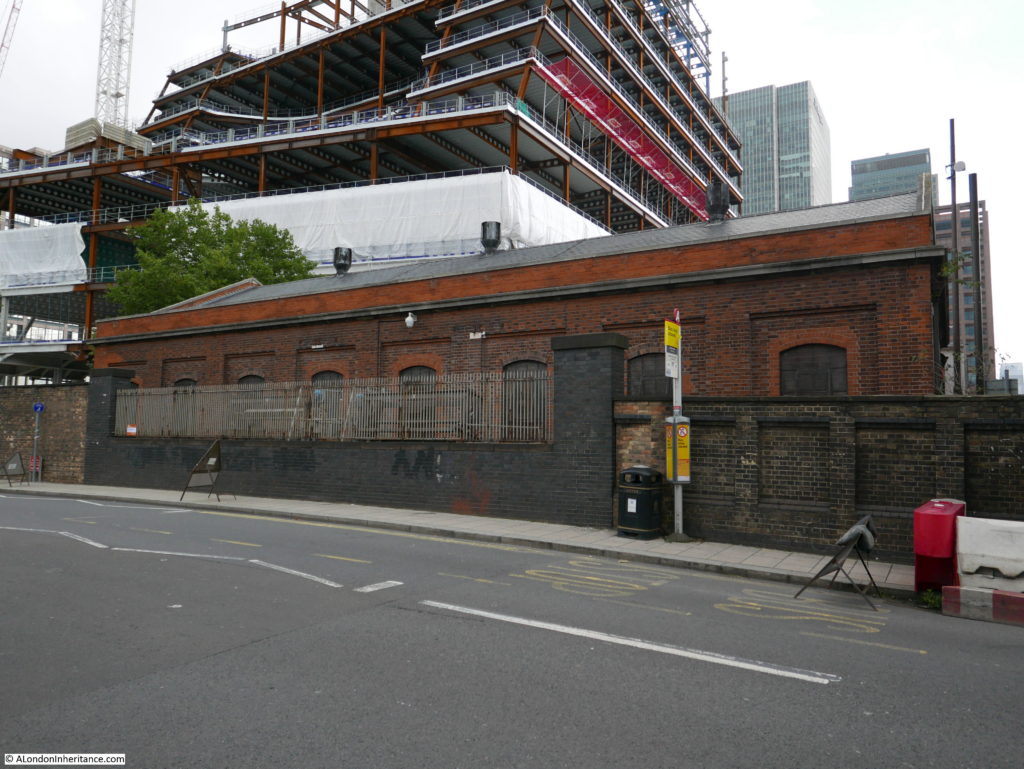
The Isle of Dogs has, and continues to undergo, significant development. The first building on my OpenHouse list is a low brick building between Marsh Wall and Westferry Road, surrounded on almost all sides by massive building sites.

This unassuming building is the West India Dock Impounding Station and since 1929 has provided the critical function of maintaining the water levels in the West India Dock complex and helping to reduce the build up of silt.

Side view of the building from Westferry Road:

West India Dock Impounding Station

The complex of interconnected docks (West India Dock Import, Export and the South Dock) form a large expanse of water. From the opening of the docks it was a challenge to keep the docks from silting up. Opening of the lock gates between the docks and river would frequently bring in a large quantity of water carrying silt which would be deposited across the docks.

The water level would also change. As well as the inflows and outflows when the lock gates were open, there was also evaporation from the large surface area of the water, as well as leakage through the walls and base of the docks.

The docks needed to be frequently dredged and there was an early attempt at a system to manage the flow of clean water into the docks built where Poplar Dock is now located, but these methods did not work well, or offer a long-term, cost-effective solution.

Plans for a new impounding station (impounding means the replenishment of a reservoir and in the case of the docks, the management of water into the docks) were ready in 1913, however construction of the new station did not start.

Modified plans were ready in 1921 and between 1926 and 1929 the new impounding station was built across the disused western entrance to the South Dock.

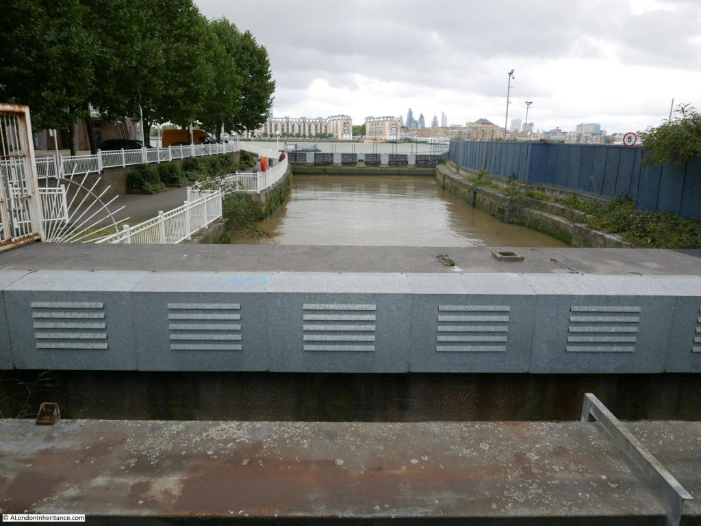
This view is from Westferry Road, looking along the disused entrance to the South Dock out towards the River Thames. The entrance now provides the water intake from the river to the pumps in the impounding station.

West India Dock Impounding Station

Externally, the building appears to be a simple, brick building with no hints of what could be inside. What does make the building stand out today, is that it is one of the very few surviving buildings in this area from when the docks were operational. So much has been demolished over the past decades.

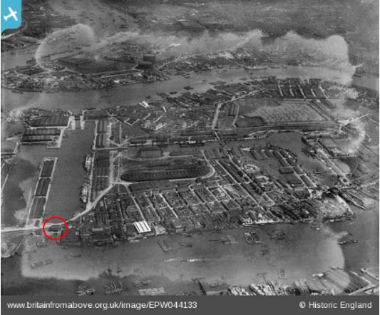
The isle of Dogs was heavily bombed in the last war, but the building also survived intact throughout this period. I searched through photos of the area on the Britain from Above web site and found the following photo from 1934. The West India Export Dock is on the left of the photo, and to the right of this dock is the South Dock. The West India Dock Impounding Station had been completed five years before this photo was taken and is just visible between the South Dock and the river. The red circle surrounds the building.

West India Dock Impounding Station

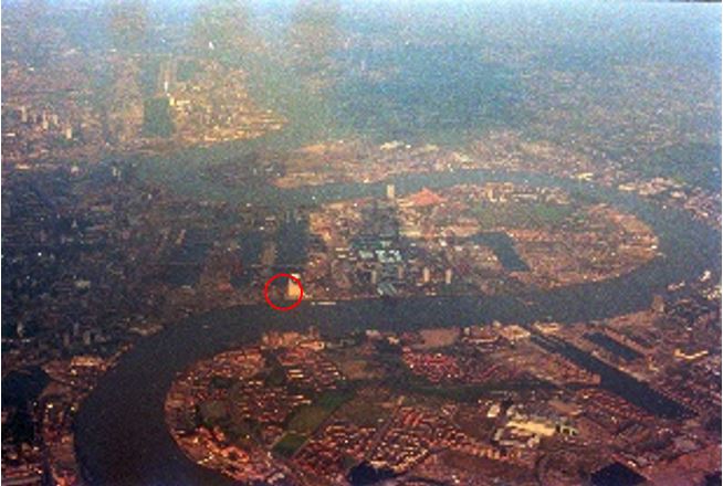
To show the overall expanse of water that was topped up by the West India Dock Impounding Station, I took the following photo during a flight over London in the early 1980s. I have again circled the location of the building. the South Dock is behind the building, the West India Export and Import docks are to the left.

West India Dock Impounding Station

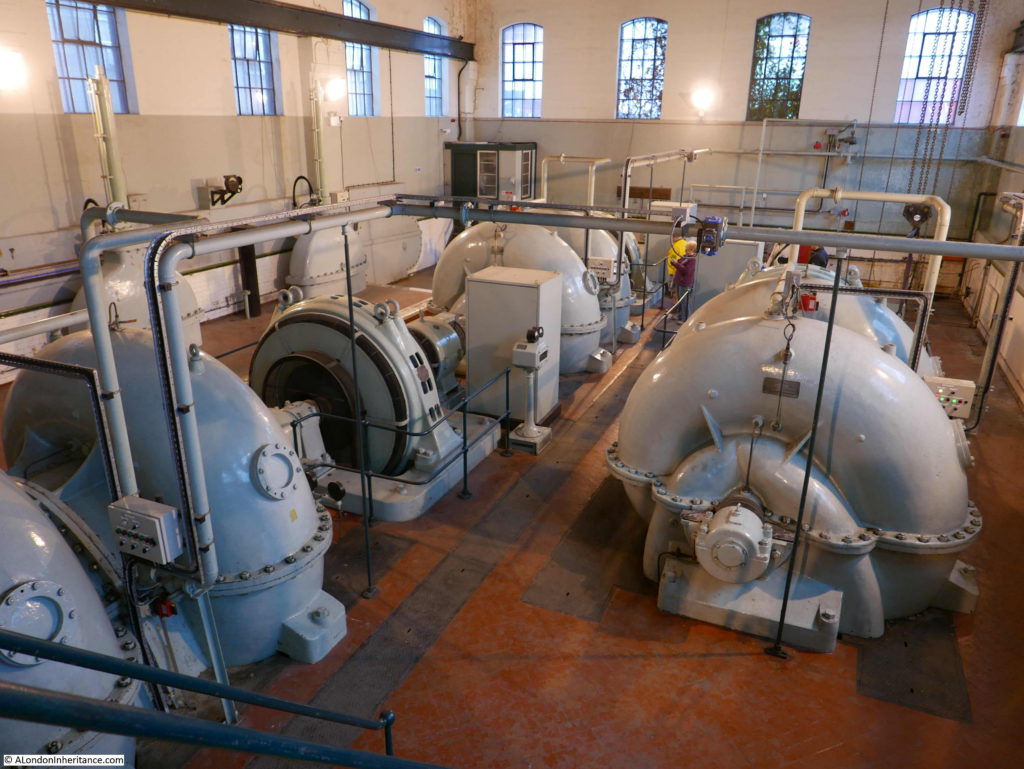
The building is slightly deceiving from the outside in that the machinery is all below ground level which is apparent on entering the building and looking down on the three large pumps and their associated electric motors that occupy the floor of the building.

West India Dock Impounding Station

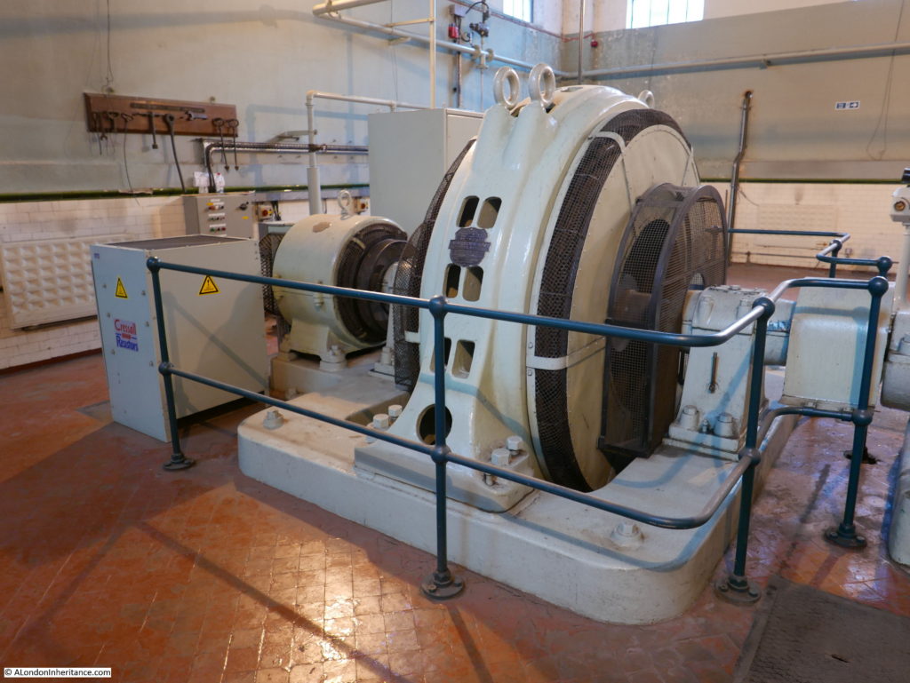
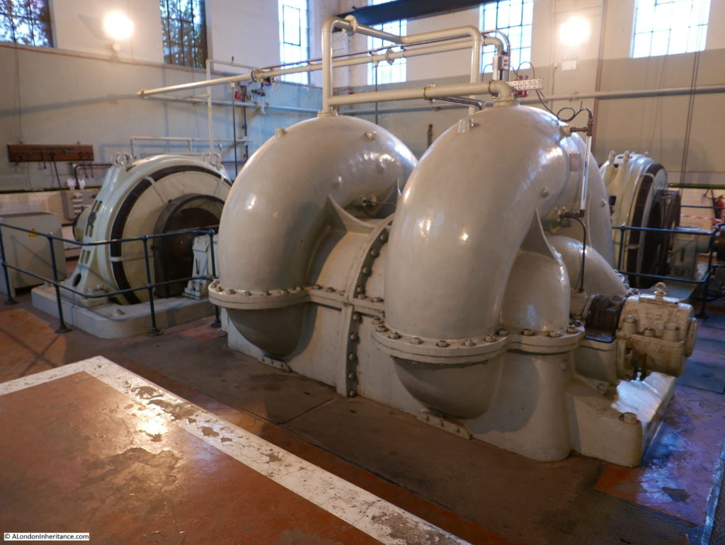
These are all the original 1929 machines, apart from the normal wear and tear replacement or refurbishment of components. Each of the pumps consist of three component parts:

  • the large doughnut shaped housings for the impellers that pump the water from the river into the dock
  • a large electric motor that runs the pump
  • a smaller electric motor that acts as a starter motor – the pumps are direct drive, there is no gearing so the torque needed to get the pumps running is considerable

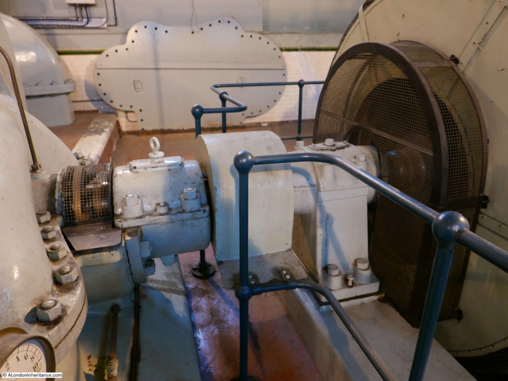
The photo below shows the drive between the electric motor and the pump. The large boards resting up against the wall at the back of the photo are blanking panels inserted across the lower half of the pump when the top half is removed to gain access to the impeller. Without sealing the pumps, water would escape into the building, which it did in the 1970s causing a minor flood in the building.

West India Dock Impounding Station

The pumps only operate when water needs to be transferred into the docks, so they do not run all the time. Generally only one pump is needed, the three pumps provide a level of redundancy to ensure that the impounding station can still work even with two pumps out of service for maintenance or repair.

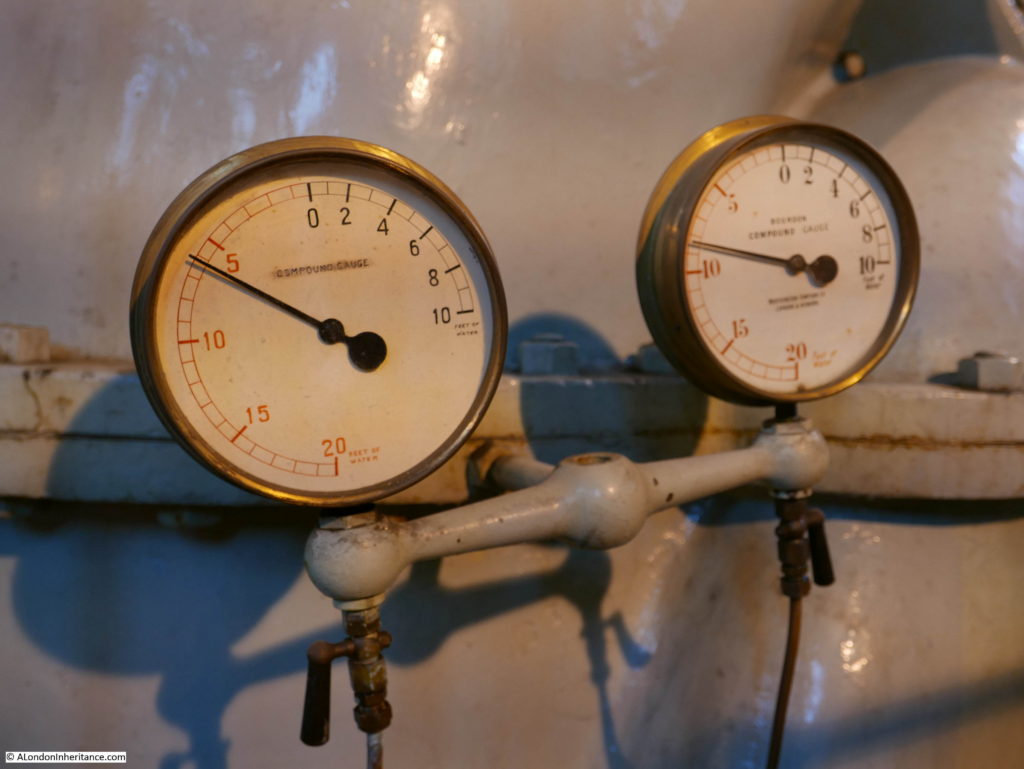
Depth of water gauges:

West India Dock Impounding Station

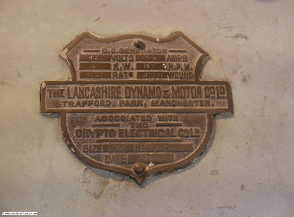
The pumps and electrical equipment still have their maker’s name plate, giving the manufacturer, location and year of build:

West India Dock Impounding Station

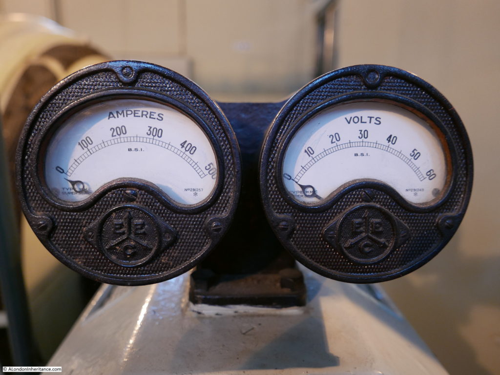
Original meters showing the electrical feed to the motors:

West India Dock Impounding Station

Each of the pumps consists of three main parts. In the photo below are the electrical motors. On the left is the smaller starter motor which generates sufficient torque to get the larger motor and pump moving and on the right is the large motor which drives the pump. The box to the left of the starter motor is full of resistors used to absorb excess electricity generated by the starter motor when the main motor is running.

West India Dock Impounding Station

The electric motors drive the impellers which are housed in these large doughnut shaped pump housings. Water is drawn in from the Thames via the old inlet to the South Dock, and through a wire mesh which traps items floating in the water from being drawn into the pumps.

West India Dock Impounding Station

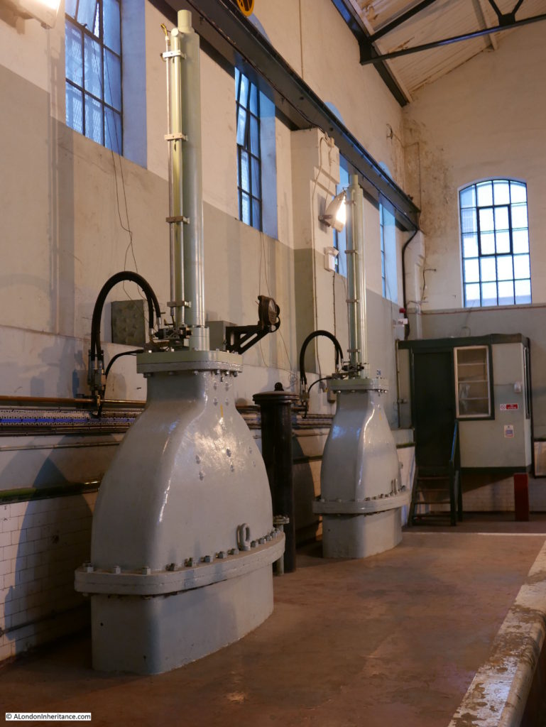
For each pump, there is a large blade that opens or closes the flow of water into the South Dock. The following photo shows two of these. When open, the blade is retracted into the large metal housing above floor level, when closed the blade is lowered to block the flow of water in the pipes below floor level, from the pump into the South Dock.

West India Dock Impounding Station

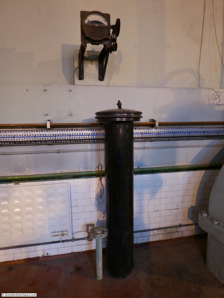
Monitoring water levels and control of the pumps is now mainly automated, however some of the original monitoring equipment is still in place. The photo below shows the original water level monitor. Water would rise up and down the large black pipe. A float on the top of the water column was connected by a cable to the gauge on the wall above.

West India Dock Impounding Station

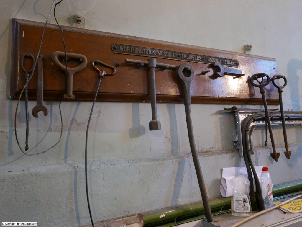
Original tools:

West India Dock Impounding Station

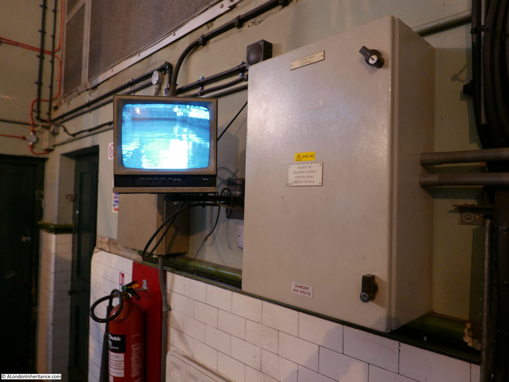
The water level on the inlet from the river is monitored automatically, however a monitor also provides a view of the inlet.

West India Dock Impounding Station

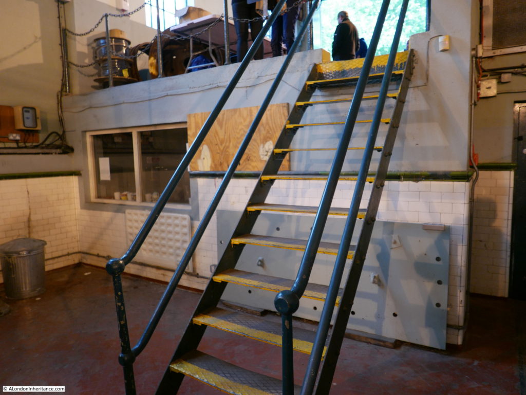
As I mentioned earlier in the post, the West India Dock Impounding Station managed to survive the blitz and the significant bomb damage that devastated much of the Isle of Dogs. The building included an air raid shelter for the workers in the form of a heavily protected room at one end of the building. This can be seen in the photo below with the thick concrete layer between the room and the entrance level above.

West India Dock Impounding Station

I was really surprised to learn that the West India Dock Impounding Station is not listed. Given the amount of building on the Isle of Dogs where any spare land seems to either be occupied by a recent build, or is currently a construction site this is a real worry.

The building seems surrounded by over bearing building sites at the moment which are very visible on leaving the building.

West India Dock Impounding Station

I can only hope that in a world which seems to know the price of everything and the value of nothing, the building is protected from the developments which seem to be covering much of this area.

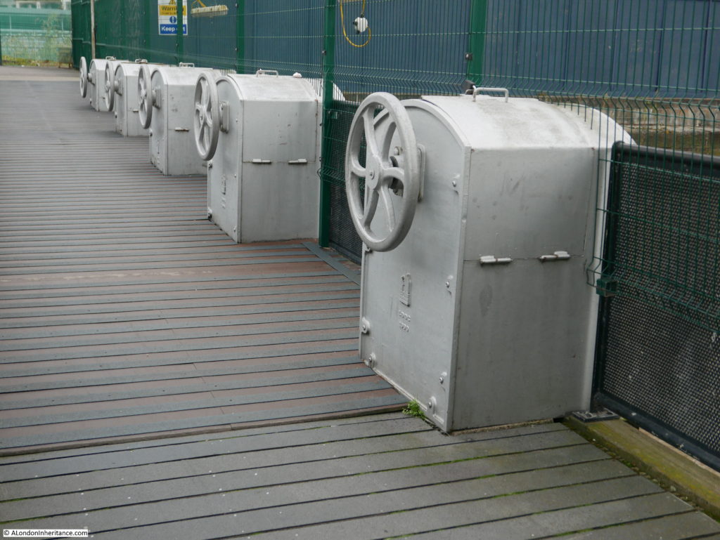
After leaving the West India Dock Impounding Station. I crossed over Westferry Road to the Thames path and crossed over the inlet from the river. Five large wheels control the opening and closing of the inlets to the Thames.

West India Dock Impounding Station

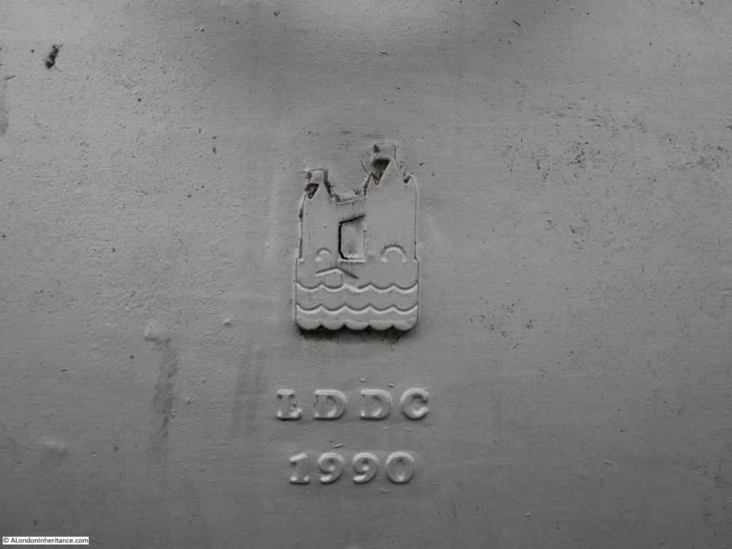
Each with a reminder of the old London Docklands Development Corporation.

West India Dock Impounding Station

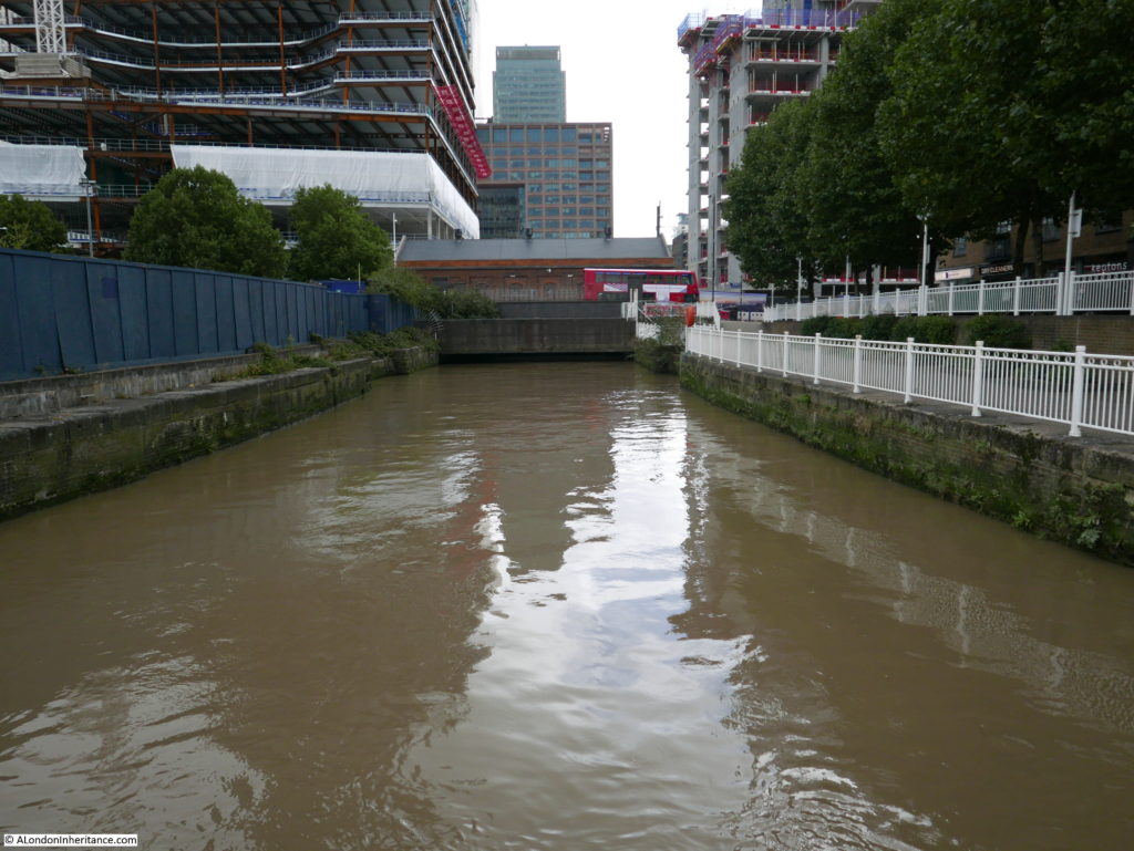
A final look back along the inlet towards the West India Dock Impounding Station.

West India Dock Impounding Station

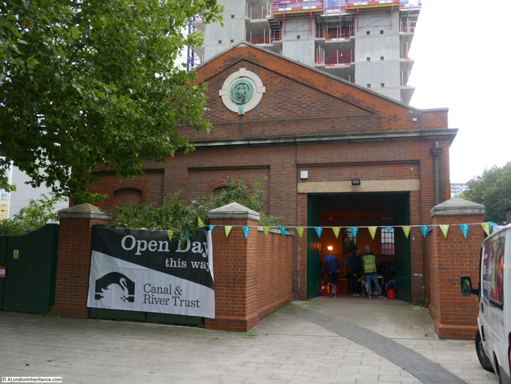
The opening of the West India Dock Impounding Station for Open House was organised by the Canal & River Trust and their guides were incredibly knowledgeable about this historic building.

Despite not being listed, I hope that the building will be protected in the future and continue to manage water levels across the docks using the original machinery within the 1929 brick building.

Now off to Limehouse for two more OpenHouse locations which I will cover in my next post.

alondoninheritance.com

The View From Blackfriars Bridge, Birds And A Fountain

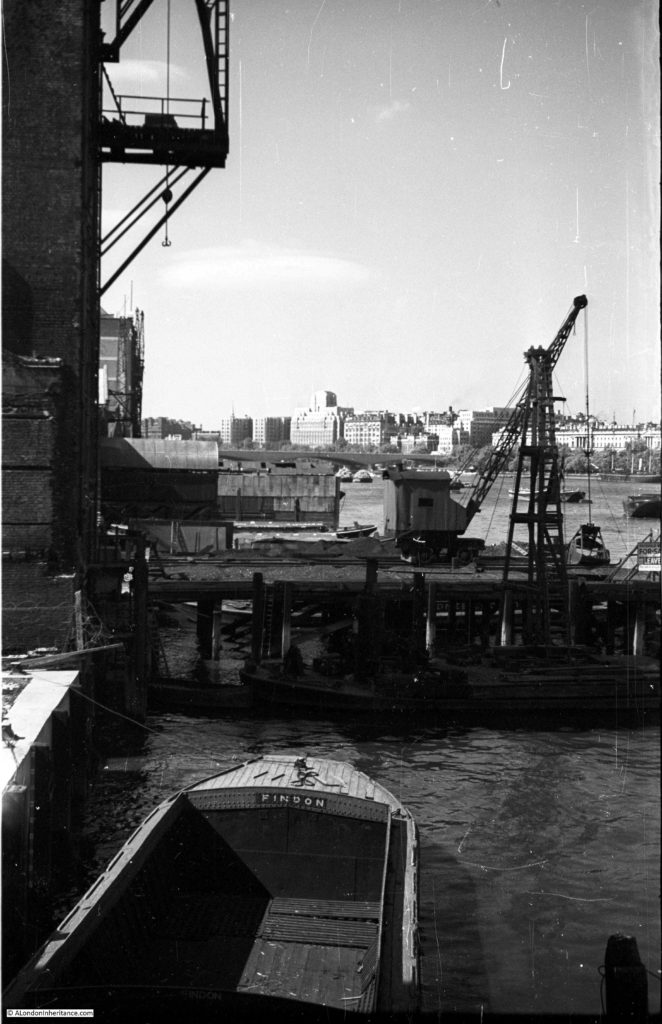
This week I am on the southern end of Blackfriars Bridge, looking along the river towards the west. This was the view that my father photographed in 1952:

Blackfriars Bridge

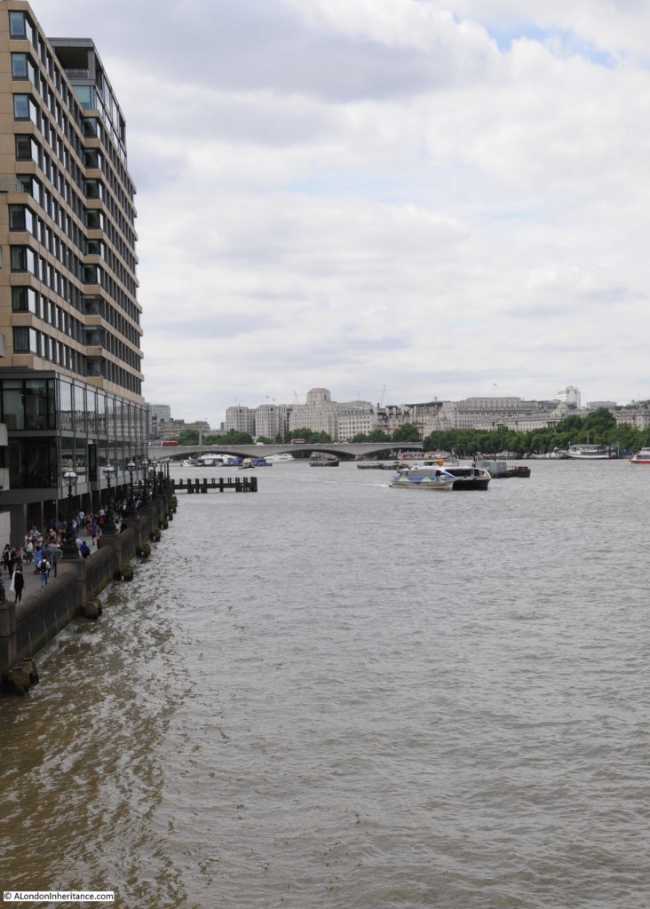
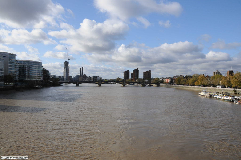
And the view from the same location, 65 years later in 2017:

Blackfriars Bridge

The buildings on the north bank of the river stand out well in my father’s photo, he had timed the sun perfectly. Shell Mex House, the Savoy, Waterloo Bridge and Somerset House provide a contrast with the south bank of the river.

In 1952, the south bank of the river was still an industrial landscape with warehouses lining the river’s edge and jetties sticking out into the river. All this has long since disappeared and the occasional remains of some of the jetties can be seen above the water, or on the muddy edge of the river at low tide.

Whilst the south bank of the river has changed dramatically, the north bank along this stretch of the river has hardly changed. A closer examination would show there have been cosmetic changes to the buildings, but at this distance the view looks much the same.

Blackfriars Bridge is the second bridge across the river at this location. It was designed by Joseph Cubitt, who was also responsible for the original Blackfriars Rail Bridge, the columns of which can still be seen in the river between the road bridge and the later rail bridge.

It was opened by Queen Victoria in 1869, on the same day as she opened Holborn Viaduct – a perfect illustration of how much development of the city’s infrastructure was taking place in the later half of the 19th century.

The top of the bridge is rather plain. The view to the east is obscured by the Blackfriars Rail Bridge and the new building work along the top of the bridge. To the west is the open view towards Waterloo Bridge along the stretch of the river known as King’s Reach.

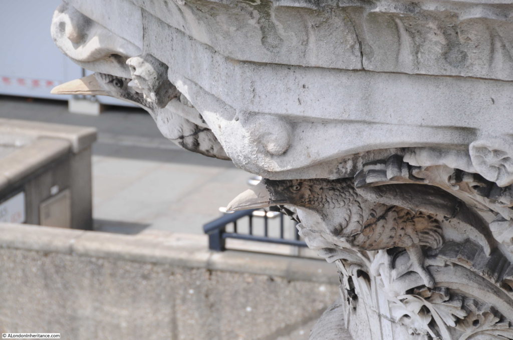
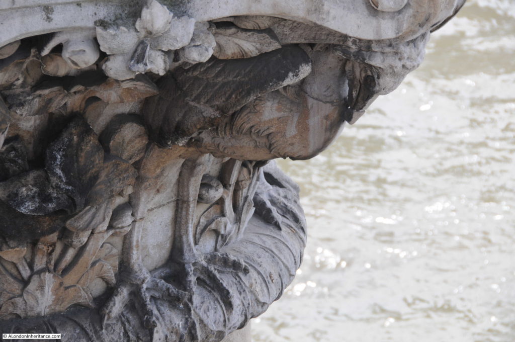
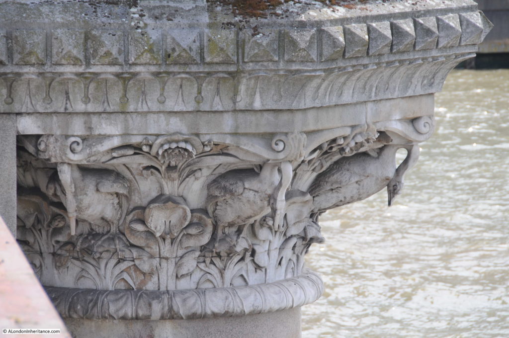
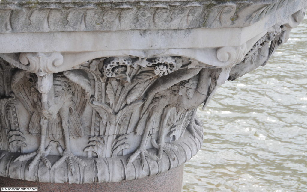
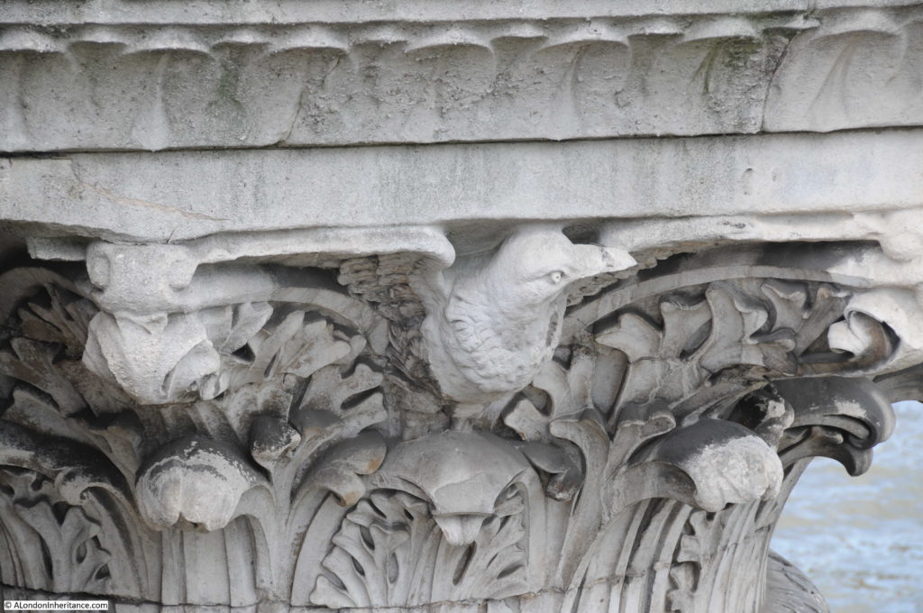
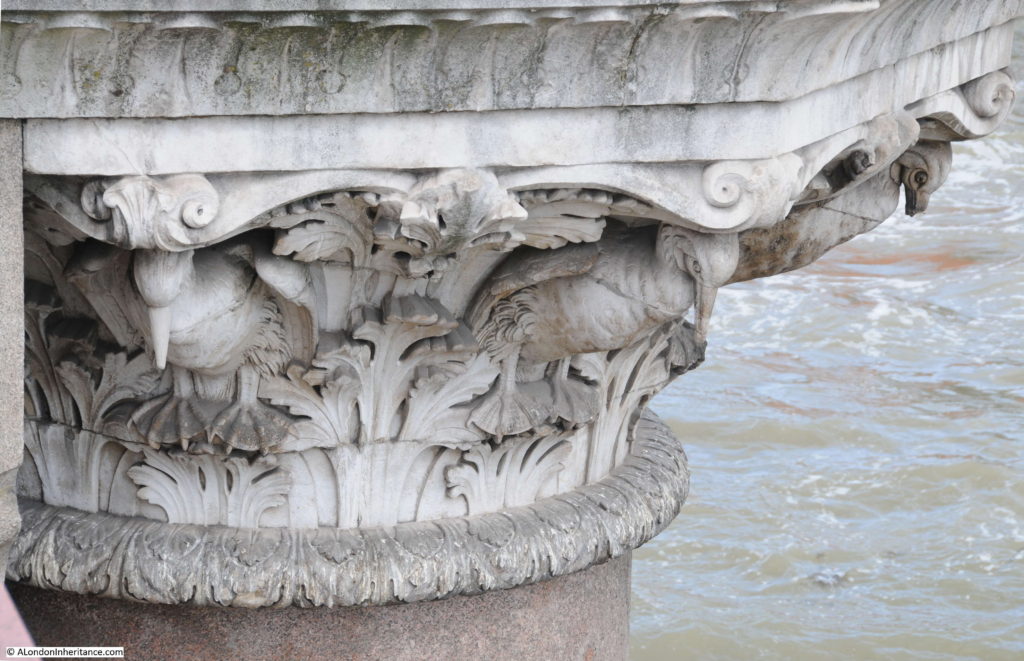
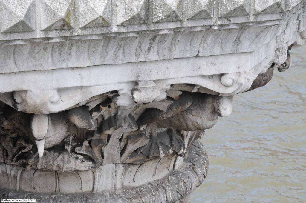
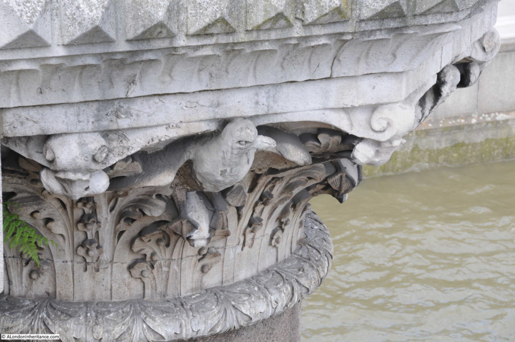
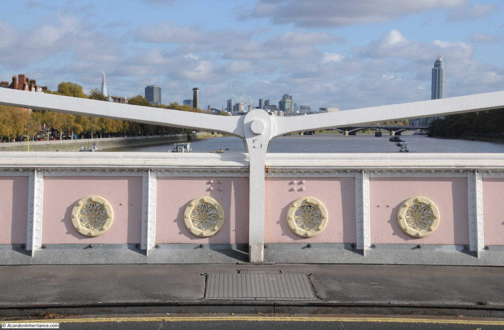
It is always interesting to look over the side of a bridge, and if you peer over the edge and look at the tops of the columns supporting Blackfriars Bridge you will find a series of beautifully carved birds. These were by the sculptor J.B. Philip and are carved in Portland Stone.

The birds along the west-facing side of the bridge are apparently fresh water birds and those on the eastern side of the bridge are salt water birds. I have read that the bridge marks the boundary of salt water penetration up the Thames, however I doubt this is correct, or that there is a clear boundary.  The Port of London Authority puts the boundary of river water and salt water at Barking, however this will move up or down river dependent on tides and the volumes of fresh water coming from the upper Thames. Theoretically, the river could have a gradually reducing salt content all the way to the tidal limit at Teddington Lock.

Starting from the northern end of the bridge, these are the four sets of birds that look out over the river, upstream towards the west:

Blackfriars Bridge

Blackfriars Bridge

Blackfriars Bridge

Blackfriars Bridge

And walking back along the eastern side of the bridge, these are the birds looking along the river towards the estuary and the sea (although their view is blocked by the railway bridge):

Blackfriars Bridge

Blackfriars Bridge

Blackfriars Bridge

Blackfriars Bridge

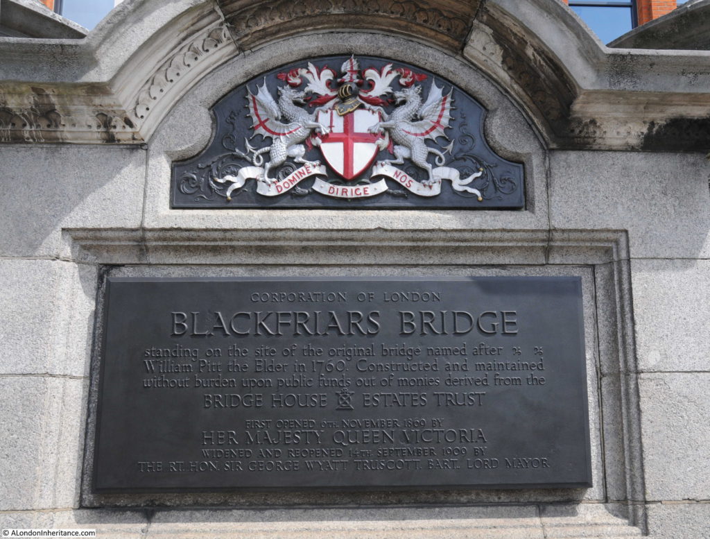
A plaque at the north-eastern corner of the bridge records that the current Blackfriars Bridge is on the site of the original 1760 bridge which was named after William Pitt the Elder who was Prime Minister during the construction of the bridge from 1760 to 1769. The name did not catch on and the location of the bridge gradually gave the name to Blackfriars Bridge.

Blackfriars Bridge

The plaque also records that the bridge was widened in 1909. This was done by adding 9 meters on the western edge of the bridge to allow tram lines to be run across the bridge. The following postcard shows a bus running along the western side of the bridge.

Blackfriars Bridge

The last time I took photos along the bridge was in 2014 and the building at the north-east corner of the bridge was empty and boarded up. I was rather worried about the wonderful fountain in front of this building after seeing building work and construction hoarding hiding the fountain from the pavement. The fountain was provided by the Metropolitan Free Drinking Fountain Association and erected by the Association in July 1861 by the Chairman Samuel Gurney MP.

The hoarding is now coming down with wire fencing remaining and it is good to see the fountain still looking good after 156 years.

Blackfriars Bridge

I have always been fascinated by the River Thames. Despite being the reason for London being where it is, and for the success of the City, today the river is often seen either as a flood risk or as a valuable scenic addition to the luxury apartments that continue to line the river.

Blackfriars Bridge is a means to cross the river, however the birds along the edges of the bridge acknowledge the river and the differences between the upstream and downstream sections of the river, pointing inland or down to the sea. The birds show that the river is not just a barrier to be crossed, but a living part of the city’s landscape.

alondoninheritance.com


Old Swan Stairs

Following last Sunday’s post covering the first part of my walk around London’s West End theatres, I had been expecting to publish the second part a couple of days ago, however I must admit I have never really counted up how many theatres there are (over 40), so I am still working on the post. Therefore today, back to one of my father’s photos of London 70 years ago.

This is my father’s post war view of the stretch of the north bank of the River Thames between London Bridge and Cannon Street Station:

Old Swan Stairs

The magnificent framework of the original glass roof of Cannon Street Station is in the rear of the photo, the glass had previously been removed so this is just the metal framework.

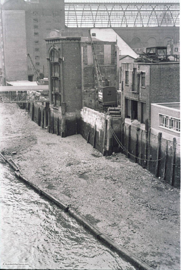
My father was standing on London Bridge to take the photo and the river front consists of space cleared of buildings damaged by wartime bombing and some of the remaining warehouse and wharf buildings.

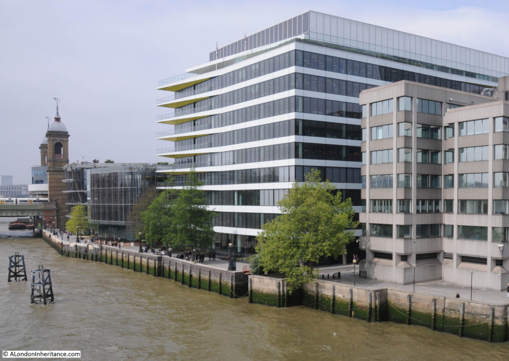
I took a wider photo of the scene today to set the context as the side walls of Cannon Street Station are now obscured and the station has long since lost the original roof.

Old Swan Stairs

The scene has completely changed, and the perspective of the two photos looks different due to very different lens and camera types, however there are some features remaining that allow the buildings in the original photo to be located.

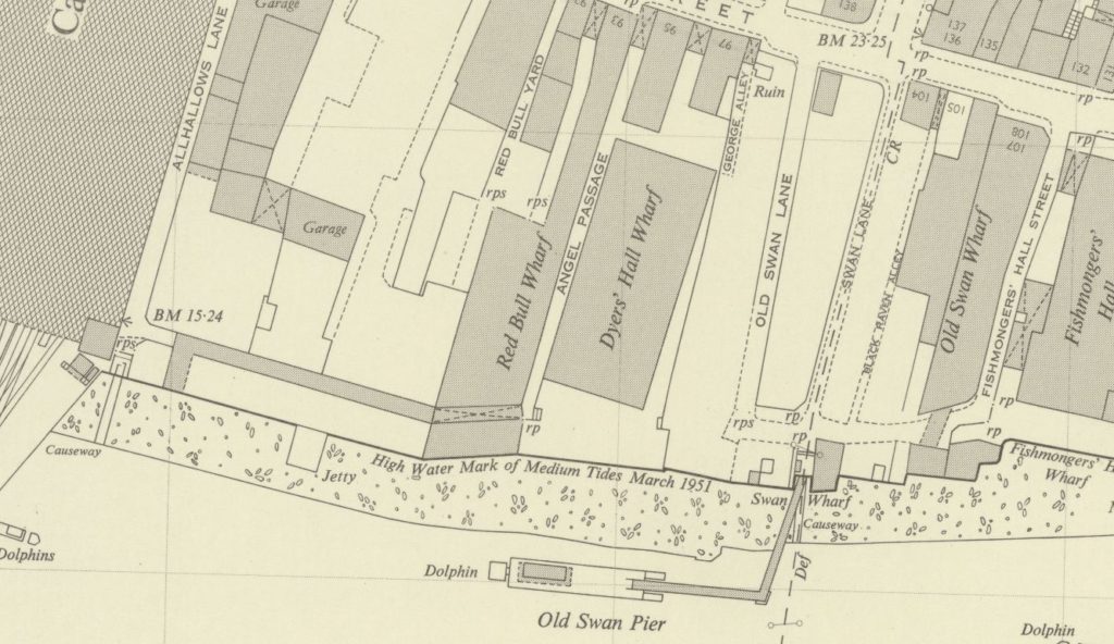
The following map extract is from the 1952 Ordnance Survey map of the area (published in 1952, surveyed the previous year).

Old Swan Stairs

In the map, Cannon Street Station is the large building, partly shown on the left of the map.

The first feature to identify on the photo is Old Swan Pier. In the map, this can be seen running from a small, rectangular indentation in the river wall. In the original photo, this is the metal walkway that can just be seen running out from the river wall, with the small indentation in the river wall also partly visible.
This allows the building to be identified adjacent to the pier, this is Swan Wharf, the building has a date on the very top which I can just make out as either 1896 or 1894.

Now follow the river wall from the pier and Swan Wharf back to the right hand edge of the photo and the river wall steps back twice, once alongside the edge of the Swan Wharf building, and the second slightly further along. These two steps backs in the river wall can also be seen in the 1952 map which identifies the building to the right of the crane as the building at the end of Old Swan Wharf in the map.

The definition of the original film is not sufficient to clearly read the white writing on the side of the crane, but it appears to read “The Swan Wharf & ———“. I cannot make out the last word.

Given the level of redevelopment in this area it would be surprising if any of these features (apart from the station) remain, however there are some that allow the location of the original buildings to be placed along the river’s edge today.

Firstly, look along the river wall in today’s photo and you will see an indention in the river wall. This is the same indentation as at the location of the pier in the original photo and was retained as this gap in the river wall is the location of Old Swan Stairs, one of the many historic stairs leading down to the river.
Two dolphin structures can also be seen in the river, these are a couple of the remaining supports from the Old Swan Pier.

To the right of the stairs in today’s photo is a large tree, this is the location of the Swan Wharf building in the original photo.

From the tree to the right of today’s photo there are two step backs in the river wall. These are the same as those in the post war photo, with the old building to the right of the crane being the building at the end of Old Swan Wharfe in the 1952 map.
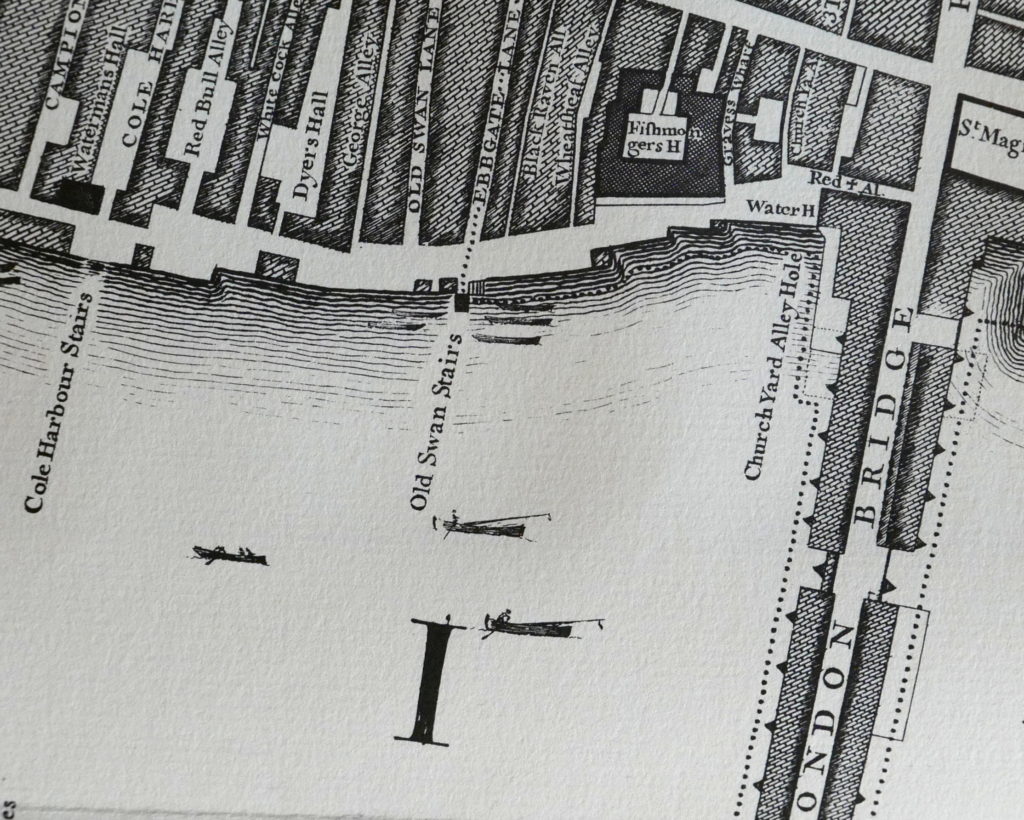
Old Swan Stairs have been here for many centuries. The following extract from John Rocque’s map of 1746 shows Old Swan Stairs.

Old Swan Stairs

In the 1746 map, the stairs are at the end of Ebbgate Lane, in the 1952 map this lane was then Swan Lane with Old Swan Lane to the left in both maps.

Swan Stairs were mentioned in the diaries of Samuel Pepys and in Stow’s 1603 Survey of London there is a mention Old Swan: “This ward turneth into Thames streete westwarde, some ten houses on a side to the course of the Walbrooke, but East in Thames streets on both sides to Ebgate lane, or old Swan.” in his description of the boundaries of Downegate (Dowgate) Ward.

In Old and New London, Walter Thornbury writes about how Swan Stairs were used to avoid the dangers of passing under the old London Bridge by boat: “The Swan Stairs, a little ‘above bridge’ was the place where people coming by boat used to land to walk to the other side of Old London Bridge when the current was swift and narrow between the starlings, and ‘shooting the bridge’ was rather like going down the rapids. Citizens usually took boat again at Billingsgate, as we find Johnson and Boswell once doing, on their way to Greenwich in 1763.”

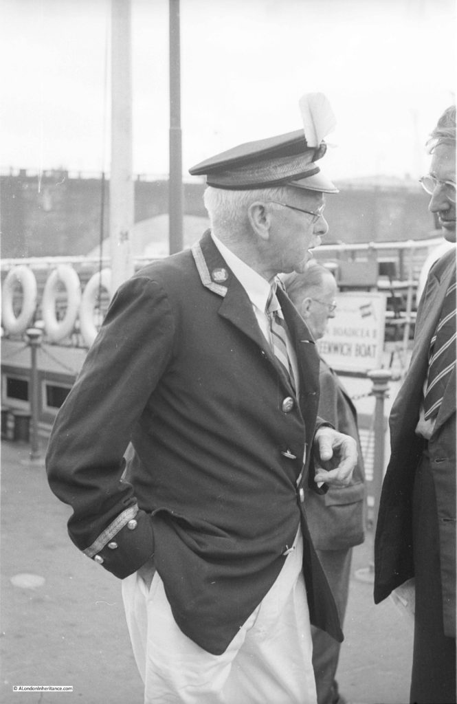
Old Swan Stairs were also the starting point for the Swan Upping ceremony when it started in central London. My father took some photos of Swan Upping starting around Old Swan Stairs and in the following photo is Mr Richard Turk who was the Vintners Swan Marker and Barge Master, with the Old Swan Pier in the background. The sign on the right of the piers indicates that boats to Greenwich could be boarded here. My full post on Swan Upping can be found here.

Old Swan Stairs

I am not sure exactly when Old Swan Pier opened, however the first adverts I can find for sailings from the pier are from 1838, when on the 21st May the Shipping and Mercantile Gazette carried an advert for “Steam – Cheap Fares from Old Swan Pier” . The sailings were:

  • To Gravesend – every morning at 9 o’clock, precisely. Cabin 1s: Saloon 1s 6d
  • To Richmond – Daily at half-past 9, calling at Hungerford at 10 o’clock, and to Twickenham every Monday, Wednesday and Friday. Week days 1s 6d; on Sundays 2s.
  • To Woolwich – Every Sunday at 10, 2 and 5, calling at West India Dock Pier, Blackwall, at 11, 3 and 6. To Woolwich 1s, to Blackwall 9d, from Blackwall to Woolwich, 6d

The earliest newspaper report I could find referring to Old Swan Stairs is from the 9th August 1729, when it was reported that:

“Last Monday a Waterman, naked all but his shirt, rowed in a Butcher’s Tray from the Old Swan Stairs, to Greenwich, for a Wager of four Guineas, and won the same”

There are frequent mentions of Old Swan Stairs in newspaper reports since the early 18th century, and they describe the life and tragedies that must have been day to day experiences along this stretch of the Thames.

From the London reports of the Ipswich Journal on the 12th February 1743:

“Sunday Morning a young Man, dressed in a Sailor’s Jacket with Trowsers and a speckled Shirt was found in the Mud near the Old Swan Stairs; his Buckles, which were supposed to be Silver, were taken out of his Shoes. He was carried into the Church-yard, near the Stairs, till own’d, or a Warrant granted for his Burial”.

The implications being that either he was murdered for the silver shoe buckles, or he had died accidentally and his shoe buckles had been stolen.

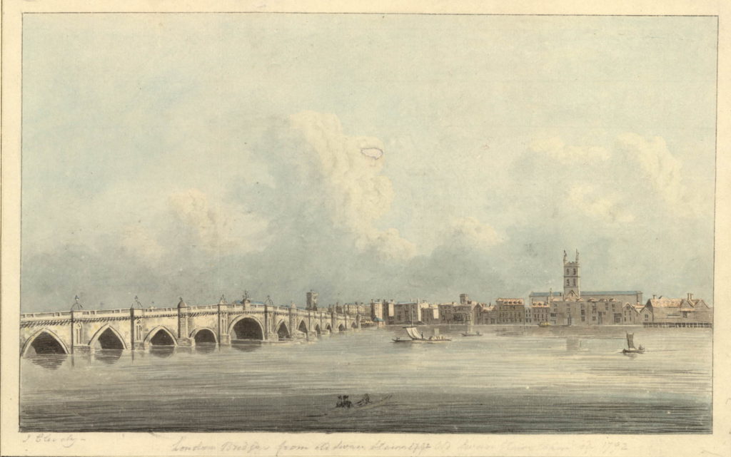
Standing at Old Swan Stairs would have provided a fascinating view across to what would later be Southwark Cathedral with London Bridge to the left. John Cleverly made the following drawing  (©Trustees of the British Museum) of the view from Old Swan Stairs in 1792. Old Swan Stairs

Despite the land along the river having changed so dramatically over the last 70 years, we can still find features that date back hundreds of years and allow us to accurately place events from centuries of London’s history.

alondoninheritance.com

Warehouses And Barges In The Heart Of The City

I have been travelling and working outside of the country for some of the last two weeks, so my apologies that this is a rather brief post.

Long before the docks running east along the River Thames from Tower Bridge were built, the docks of London lined the river in the heart of the City. Large ships could only travel as far as London Bridge, so to get to the warehouses further west along the river, goods had to be moved onto barges which could then travel underneath the bridges.

As the size of ships and the number visiting London grew, the London Docks, West India Docks, Royal Victoria Docks etc. diverted trade from the centre of the City, however the warehouses along the river west from Tower Bridge continued on until gradually closing during the last decades of the 20th century.

There were a large number of warehouses lining the river between Southwark and Blackfriars Bridges and some of my father’s photos show one of these warehouses in action.

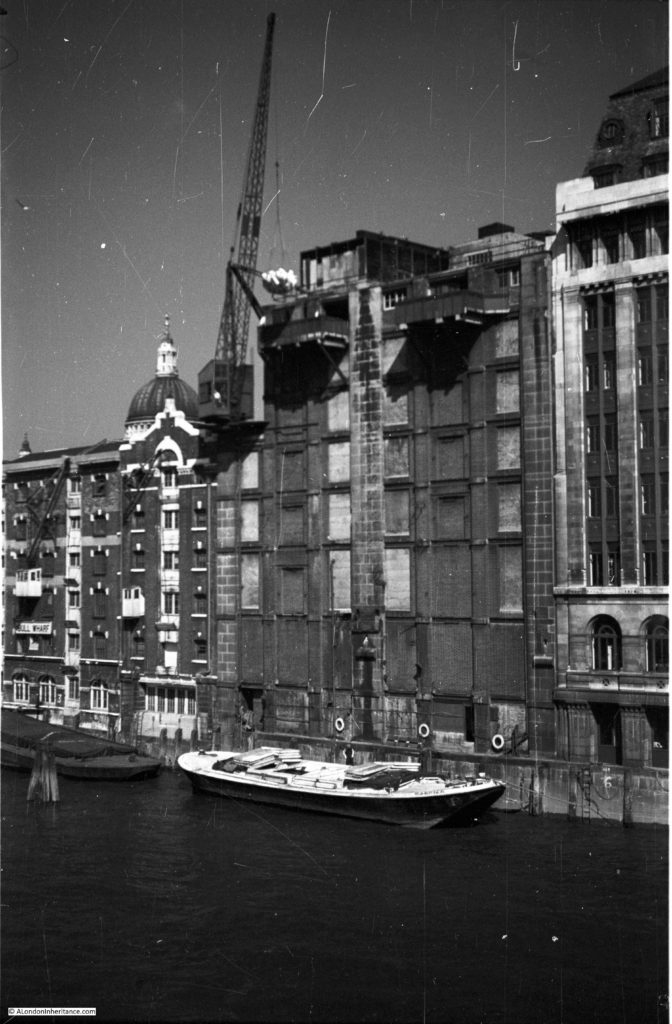
This was the view, looking west from Southwark Bridge. The Vinter’s Company Hall is on the extreme right of the photo and just past this is a barge being unloaded with sacks being carried by crane into the warehouse.

working-wharf-1

To save space, the cranes were generally mounted on the side of the warehouse. Barges would be taken alongside and goods transferred to and from the barge. If you look to the top right, the control cabin of the crane can be seen along with a man in what appears to be a white shirt operating the crane.

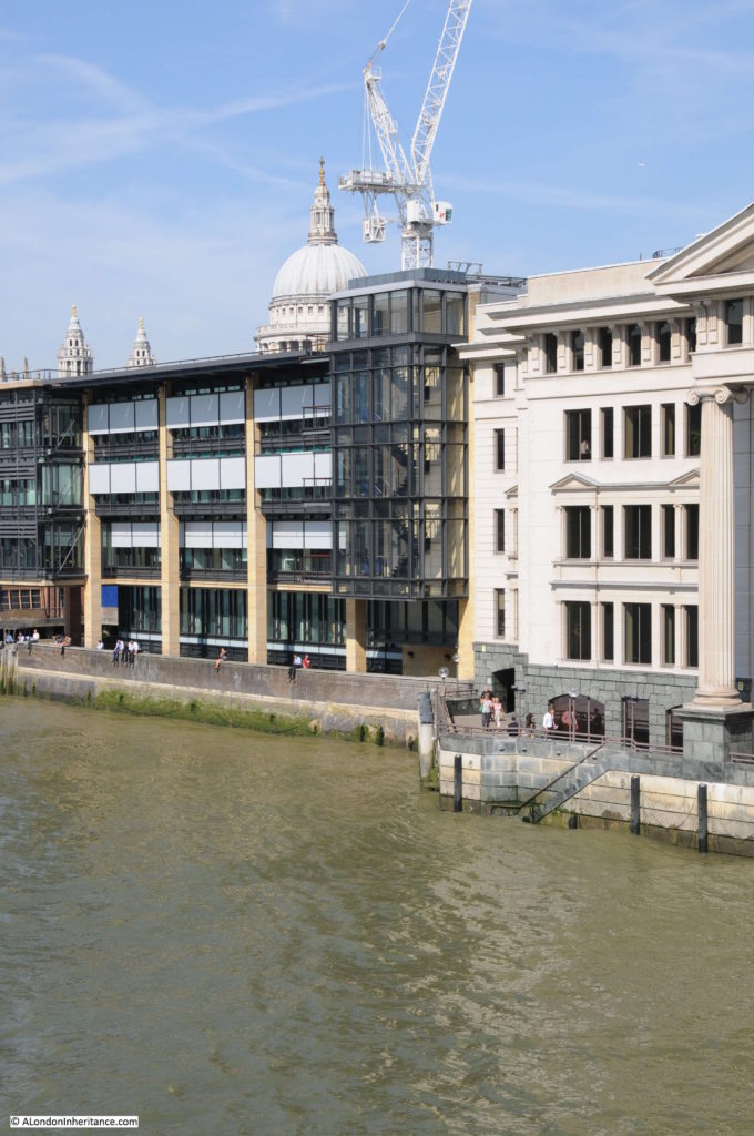
This is the same scene today. The riverside facade of the Vinter’s Hall was rebuilt in the 1990’s. In the distance, the curved Unilever House can be seen on the right and on the left, Shell Mex House.

working-wharf-5

This is a wider view of the river. The Oxo Tower is standing clear on the south bank of the river.

working-wharf-2

This is the same view today. The Oxo Tower is still there, but is hidden behind the developments on the south bank.

working-wharf-6

My father walked a bit further along Southwark Bridge and took the following view looking back at the warehouse. This shows the way cranes were installed on the edge of the buildings. The length of the boom was needed to reach barges moored in front of the warehouse and to reach the top floors of the warehouse. This avoided the need to transport goods between floors within the warehouse.

working-wharf-3

The same view today.

working-wharf-4

Although very little is left of the old warehouses that once covered so much of the banks of the river, if you look down on the river edge at low tide, you can often see large areas of white chalk. To provide a stable and flat surface on which the barges could settle at low tide whilst moored alongside the warehouse, chalk was compacted into the surface of the river bank.

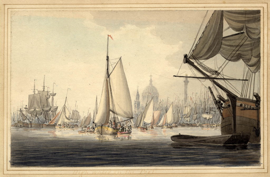
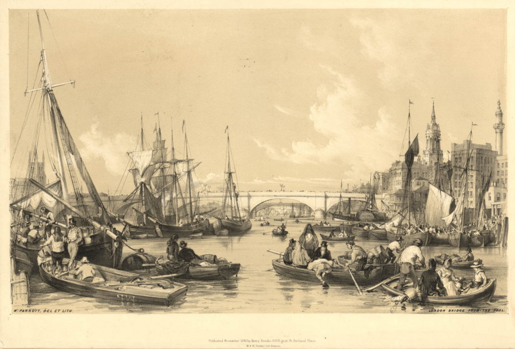
Reading accounts of the river during the 18th and 19th centuries, it is hard to believe that the river was once so busy. A couple of prints from the British Museum show an amazing number of vessels and considerable activity on the river. It was the high number of ships, growth in the size of ships and lack of warehouse and mooring space along the river in the heart of the city that resulted in the development of the large docks east of Tower Bridge in the 19th century.

284784001

This print from 1841 shows London Bridge with Southwark Cathedral on the left and the Monument on the right.

593968001

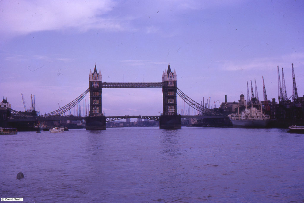
A few weeks ago I was contacted by David Smith whose mother had taken a number of photos in London during the early 1960s.

They are all in colour and provide some fascinating views of the city and I am very grateful to David for letting me publish some of them.

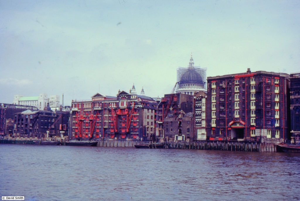
The following photo is of the warehouses just a bit further along the river towards Blackfriars Bridge. In the background is St. Paul’s Cathedral with the dome covered in scaffolding – I have not seen a photo of this before.

1960s_uk-slides_121-jul-66-thames

The warehouse on the left with the four red cranes and red doors and windows is the Sunlight Wharf of the LEP Company and LEP Transport Ltd.

When the LEP warehouses were redeveloped in the 1980s, the LEP Group published a fascinating history of the area on which the warehouse had been built. The book provides an insight into the operation of the warehouse:

“The four swinging cranes at Sunlight Wharf served an incessant queue of barges maneuvering for a position at the wharf. Cargoes varied from animal pelts to Polish onions, which were unloaded straight out of the barges into hinged flaps outside the doors of the appropriate floor of the warehouse. The fifth floor of the warehouse remained exclusively offices, the other floors were used for storage and as a Bond warehouse. After the Second World War the scene changed, the number of barges diminished and the ten ton Butters crane replaced the four swinging cranes. This could cope with a greater load and could unload straight from a barge into a waiting vehicle. It was for many years the only – and the last – working crane on the City’s riverfront. It was dismantled in January 1983, defeated by containerisation. Likewise Sunlight Wharf had the distinction of being the last wharf operating as such in the City.”

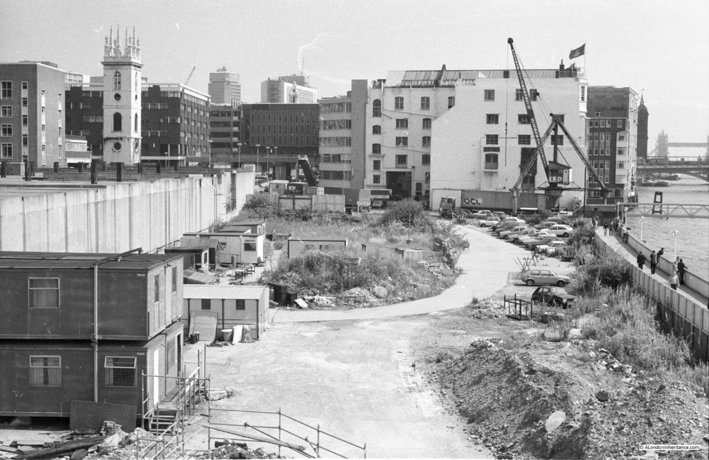
The Butters crane is the one immediately to the left of the LEP Sunlight Wharf buildings.

I took the following photo of the crane and Sunlight Wharf buildings just before demolition. I was walking along the new White Lion Hill which had been constructed as part of the development of the area to lead down from Queen Victoria Street to the Embankment. See here for the full post and photos of the area and excavations of Baynard’s castle.

working-wharf-7

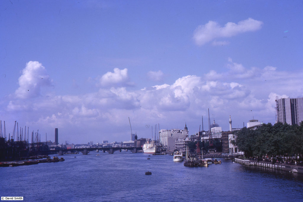
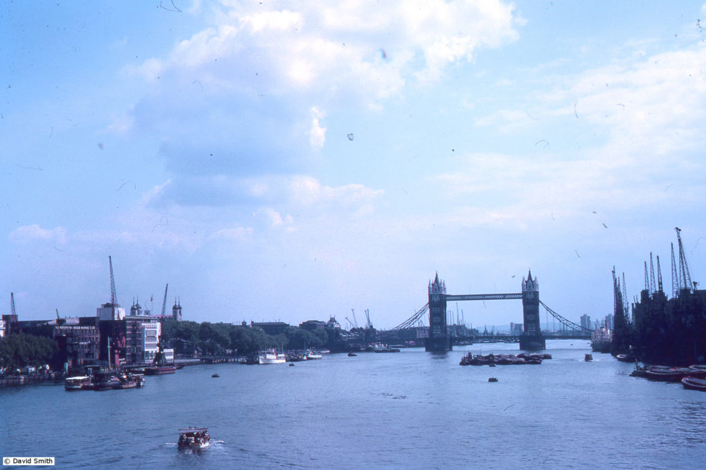
Included in the photos that David sent was the following taken from Tower Bridge. Note the cranes along the southern bank of the river and the large ship docked on the right of London Bridge.

1960s_uk-slides_007

And the following view from London Bridge. The cranes on the right are along the warehouses that backed onto Pickle Herring Street.

1960s_uk-slides_008

Another view, again showing the size of ship that would moor in this stretch of the river, alongside the warehouses at Pickle Herring Street.

1960s_uk-slides_009

The cranes along this stretch of the river have long gone. Some of the old warehouse buildings still survive, but now serve other purposes. The majority of the docks east of Tower Bridge have also closed apart from Tilbury Docks as the size of ships continued to grow along with the large areas of land needed for container storage. I hope to cover the London Docks in far more detail in the future.

My thanks again to David Smith for letting me see and publish some of his mother’s photos.

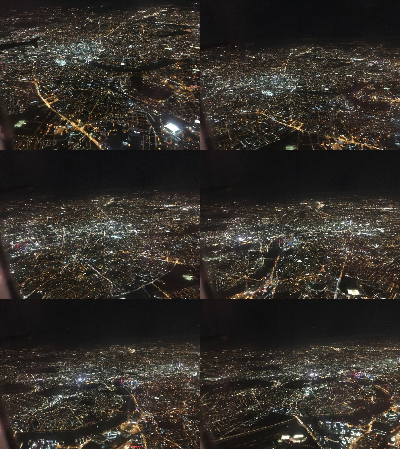
I mentioned at the start, that this is a brief post as I have been travelling for work over the last few weeks. I flew back into Heathrow one evening last week and had a window seat on the right side of the plane as the route was over the south of London providing a fantastic view of the city on a clear night.

Flying over London provides a wonderful opportunity to see the layout of the city, the river, rail tracks, buildings etc. and at night the city looks fantastic. Whilst the majority of other passengers seemed oblivious to the view of London, I had my eyes and phone pressed against the window taking photos as the plane flew over south London, and consolidated the photos into the following video.

flying-over-london

The view starts with the river and Tower Bridge as well as the dark thin line of the very straight rail track into London Bridge station, flying to the west and the red lit London Eye and ending with Chelsea Bridge and the dark of the park in front of the Royal Hospital Chelsea.

In centuries past, travelers to London from abroad would have traveled up the Thames and landed at one of the many steps along the river. Now they fly over the city and land to the west.

alondoninheritance.com

Along The Thames In 1947 And 2016 – Tower Bridge To Westminster Bridge

During the afternoon of Saturday 23rd August 1947, my father took a boat trip along the Thames from Westminster to Greenwich. I am able to date this accurately as the date was written on a number of the photos taken along the route that he printed afterwards.

I will be on the river later this year to photograph the same views on the stretch between Tower Bridge and Greenwich, however for the photos covering the route between Westminster and Tower Bridges, I cheated by taking a walk along the south bank of the river to photograph the north bank views.

My father’s photos were taken from a boat at low tide, so I was not able to get the view exactly right, however they do show roughly the same view and the changes that have occurred along the north bank of the river.

I have not processed these photos, they are straight from the scanner and some show some imperfections. I prefer the unprocessed look as a more genuine presentation of photos that are now 69 years old. Film was hard to get just two years after the war had finished and these photos were taken on 35mm movie film which was cut up to fit the film holder in the camera. I have no idea why movie film was available, or where it came from.

After taking the photos for last week’s post about Tower Bridge, I continued along the south bank of the river towards Westminster, so these photos are in reverse order.

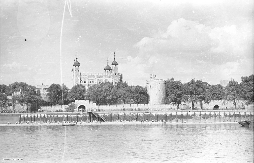
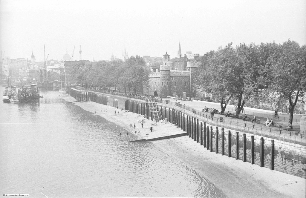
Starting the journey in 1947 with the Tower of London. As with last week’s photos the beach in front of the Tower looks to be busy on an August summer afternoon.

Southbank Walk 1

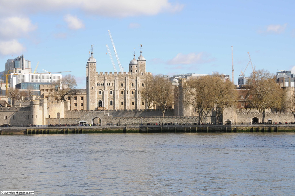
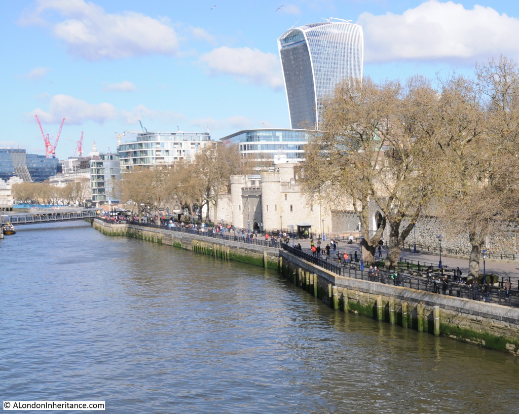
The view today from the opposite bank of the river. There are few high buildings immediately behind the Tower to detract from the view, however I doubt that this will remain the same for long, the number of cranes in the background are rather threatening.

Southbank Walk 13

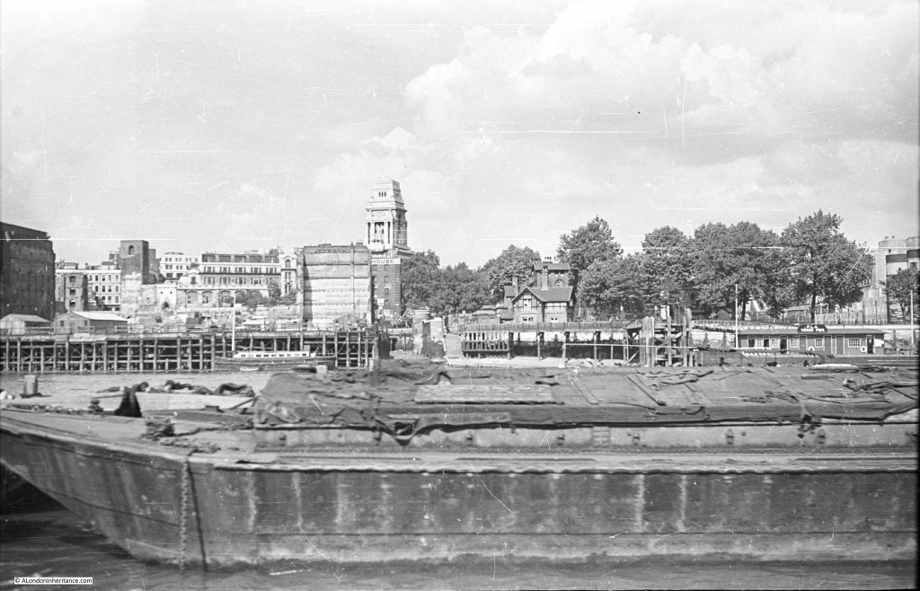
Just past the Tower is this view. The Tower of London is at the right of the photo (just behind the trees) and the large building in the centre is the former Port of London Authority building.

The area on the left of the photo, down to the river was bombed heavily during the war. To the left of the photo is the shell of a church tower. This is the church of All Hallows by the Tower. Below the PLA building and facing the river is the side of a building. This is the Ye Old Tiger Tavern on Tower Hill which survived bombing but was later pulled down in the reconstruction of the area. More on these buildings and the area in later posts.

Southbank Walk 2

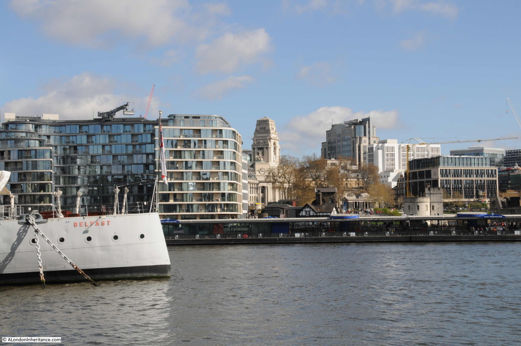
The view today. I should have been a bit further to the left, however the Belfast would have obstructed much of the view. The tower of the PLA building is still visible, however the new buildings on the left have obscured the view of All Hallows by the Tower which was rebuilt after the war.

Southbank Walk 14

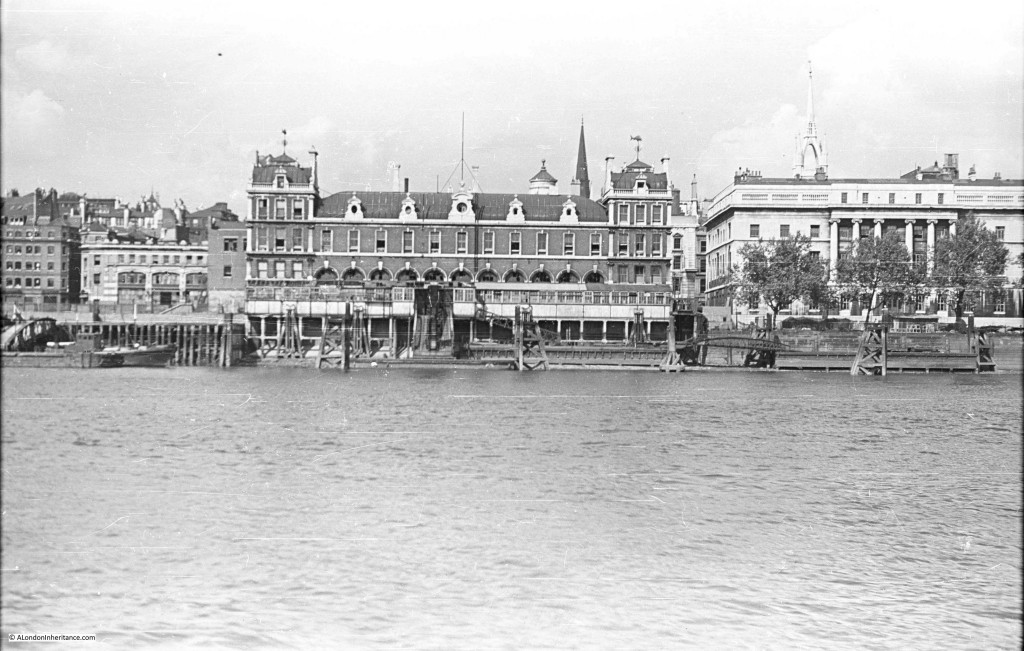
Further along we come to Billingsgate Market, with the Customs House on the right and the tower of the church of St. Dunstan in the East just behind the Custom House.

Southbank Walk 4

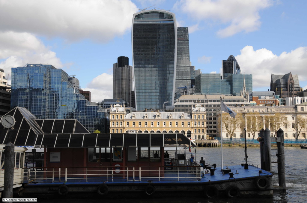
And the view today (although partially obscured by one of the new piers along the Thames). Billingsgate, the Custom House and the tower of St. Dunstan’s are the only buildings that remain from 1947 with the towers of the City rising up behind.

Southbank Walk 16The following photo shows the edge of the Billingsgate Market building on the extreme right of the photo. There is then a gap which before the war was occupied by Nicholson’s Wharf, destroyed by bombing along with a direct hit by a V1 flying bomb. To the left of the gap is New Fresh Wharf. This was a busy wharf that handled very large volumes of goods, general goods, fruit and canned goods as well as operating as a terminal for passenger ferries.

New Fresh Wharf was demolished in 1973. The building on the extreme left of the photo is Adelaide House. Construction of Adelaide House was completed in 1925. It is now a Grade II listed building. The dock facilities of New Fresh Wharf extended along the river frontage of Adelaide House.

Southbank Walk 5

The same view today with Billingsgate on the right of the photo and Adelaide House of the left. The scene in-between these two buildings is now completely different.

Southbank Walk 17

We have now moved further along the river, past London Bridge, the version of the bridge prior to the current one can be seen in the following photo with Adelaide House and New Fresh Wharf behind the bridge. We can now see the Monument and to the left of the bridge is Fishmongers Hall, the home of the Fishmongers’ Company. Damaged caused by bombing can be seen to the left.

Southbank Walk 6

Almost the same view today, although I should have been on a boat, mid river as my father was to get the same perspective. Adelaide House, the Monument and Fishmongers Hall are still there. My father’s photo included the 19th Century version of London Bridge and my photo shows the 1974 incarnation of the bridge that has crossed the river in roughly the same location for many hundreds of years.

Southbank Walk 18

If we now pass under the bridge taking the rail tracks across the river into Cannon Street Station, and view the small space between Cannon Street Station and Southwark Bridge. Cannon Street Station is on the right with the structure on top that held the glass canopy to the station. The church is St. Michael Paternoster Royal.
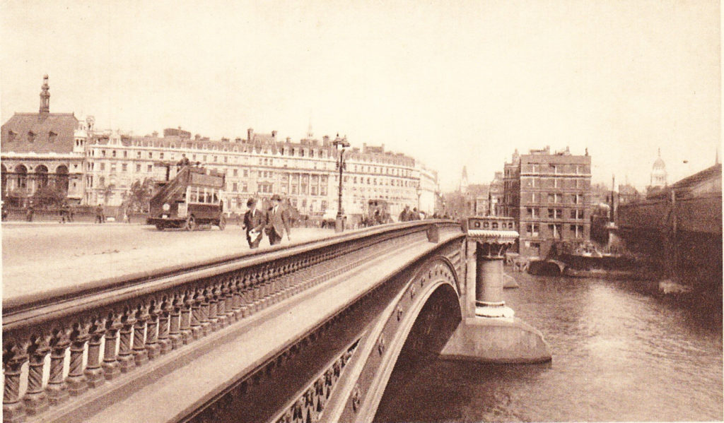
Southbank Walk 7

The view today. Cannon Street Station still on the right, although without the original roof, offices have now been built above the station platforms. The old Cameron Wharf area is now the City of London Corporation Waste Transfer Station with barges mooring along side to take rubbish from the City to processing locations further down river.
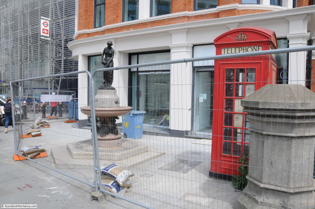
Southbank Walk 19

Now walk under the new Millennium Bridge and slightly further up river you would have had this view in 1947. Puddle Dock is on the extreme left. St. Paul’s Cathedral is in the centre, partially obscured by the Faraday Building in Queen Victoria Street, one of the main London telephone exchanges. The height of the Faraday Building and the impact on views of St. Paul’s was one of the reasons for the planning regulations that now protect specific sight-lines and views of the cathedral.

The building and wharf of Blundell Spence & Co Ltd (manufacturers of Paints, Varnishes and Colours) is just below the Faraday Building, with the Cannon Warehouse and Showrooms to the right.

Southbank Walk 8

The view today. The Faraday Building is still the highest building between the cathedral and the river. The church on the right of centre in the 2016 photo is St. Benets Welsh Metropolitan Church. If you look in exactly the same position in the 1947 photo the spire above the tower of the church can be seen. The building on the right hand edge of the photo is the new site of the City of London School.Southbank Walk 20

Now passing under Blackfriars Bridge, walk along a bit further and look back at St. Paul’s Cathedral. In this 1947 view, on the left is the City of London School with the Unilever Building just behind.

Southbank Walk 9

The same view today. The original building of the City of London School is still there, although the school moved out in 1987 to new buildings along Queen Victoria Street.

Southbank Walk 21

Walk further along the south bank, almost to Waterloo Bridge and look back along the north bank of the river and this is the 1947 scene. The steeple of St. Brides church is on the extreme right. Also on the right of the photo on the embankment wall is the memorial commemorating the naming of this stretch of the river as King’s Reach after King George V.

The ship in the middle of the photo is the Discovery, Robert Falcon Scott’s original ship. She was moored here from 1931 to 1979. Having been fully restored, the Discovery is now moored in Dundee. During the war she was used by the Sea Scouts, of which my father was a member. His written account of life in London during this time includes accounts of staying on the Discovery and sailing up and down the Thames between Pimlico and Tower Bridge on an old whaler doing things that would be a nightmare for current health and safety.

Southbank Walk 10

Roughly the current view, although not exactly the same viewpoint. The steeple of St. Brides church is still on the right, although as I could not get to exactly the same position, the Kings Reach memorial is now to the right of center.

The location of the Discovery is roughly at the position of the blue containers.

Southbank Walk 22

Much has changed along the Thames in the 69 years since my father took these photos, although some views are almost exactly the same. The following photo was taken close to Hungerford Railway Bridge. Cleopatra’s Needle is in the centre with the Shell-Mex building behind (the building with the clock). the Shell-Mex building was completed in 1931 and occupied by Shell Mex and BP Ltd. Although Shell have long since moved out, the building is Grade II listed so should be preserved as a major Thames landmark and an example of 1920s / 1930s architecture long into the future.

Southbank Walk 11

The same view today is almost unchanged, with the Adelphi on the left, then Shell-Mex House, the Savoy, then lower down, behind the trees the Institute of Electrical Engineers building, then Brettenham House and finally Somerset House on the extreme right of the photo.

I had intended to take this photo at the same time (2:50pm) as my father although due to taking too many photos along the walk I arrived slightly later at 3pm.

Southbank Walk 23

The final stop as we approach Westminster Bridge is the view across to the RAF memorial. The stone column was designed by Reginald Blomfield and the eagle on top of the memorial by William Reid Dick. The memorial was unveiled in 1923.

Southbank Walk 12

The view to the memorial today. I should have been a bit further to the left, however the infrastructure around the base of the London Eye obscures the view. The significant change is the building behind the memorial. These are the main Ministry of Defence buildings. Construction of these started in 1939, although the war then caused significant delays with construction being completed in 1951.

Southbank Walk 24

A boat trip or walk along the river is a fantastic way to view the city. Although there has been much development along the north bank over the years, it is surprising that whilst many of the buildings are different, the overall views are much the same. The most significant difference being the towers that now occupy much of the City.

Change along the south bank of the river and in the stretch between Tower Bridge and Greenwich has been much more dramatic and I will be covering these in future posts.

alondoninheritance.com

Tower Bridge

A brief post today as unfortunately work commitments have been rather heavy over the past week. Here are three photos that my father took in 1948, the first two show the northern approach to Tower Bridge with the third showing the view across to the City from Tower Bridge. This last photo really makes you wonder how we plan the City and the buildings that tower over their surroundings.

Firstly, standing on the approach road to Tower Bridge. The Tower of London on the right. The cranes that still lined the river are visible to the left and right of the bridge. The sign on the left warns that heavy goods vehicles much cross the bridge at 8 miles per hour.

Tower Bridge 3

68 years later and I am standing in roughly the same spot on a very sunny day – always a mistake due to the deep shadows. It should have been easy to locate the precise location, however I believe that the slip road to the left in the 1948 photo has been moved back, slightly further north.

Tower Bridge 4

My 2016 photo also shows an empty road, a bit deceiving as I had to wait a lengthy period to get a clear road.

The next photo is a bit closer to the bridge.

Tower Bridge 2

And in 2016.

Tower Bridge 5

The photo below was taken from the bridge, looking over to the City of London. Look at the background and the church spires of the City churches are standing above their surroundings. To the left of centre, the Monument is standing clear and slightly to the left of the Monument, in the background, is the dome of St. Paul’s Cathedral.

It is low tide, and along the bank of the Thames is the artificial beach, with stairs down from the walkway alongside the Tower.

Tower Bridge 1

And the same view in 2016. I did not time the tide right, but the beach and the stairs have long gone. If you look carefully, just to the right of the red cranes, the dome of St. Paul’s Cathedral can just be seen, with slightly further to the right, the very tip of the Monument.

Tower Bridge 6

But what really intrudes into the 2016 view is the 20 Fenchurch Street building, better known as the Walkie Talkie building. Whilst the City cannot stay static, this building is just in the wrong place and the intrusive top-heavy design does not help.

I doubt that my father, standing on Tower Bridge and looking at the view over the City, would have imagined that it would look like this, 68 years later.

alondoninheritance.com

A Temporary Wartime Chelsea Bridge

The bridges over the River Thames are key transport links between the north and south sides of the river and closure of any of the bridges can quickly lead to congestion during a busy London day. Today, any closures are normally for short periods of time, however during the last war there was a real risk that one or more of London’s bridges would be put out of action by bombing. Destruction of any of the bridges would quickly impact the day-to-day business of Londoners and would also cause problems for the emergency services and troop movements.

To help mitigate the impact of any damage to London’s bridges, a number of temporary bridges were constructed to provide alternative routes across the river. I featured the temporary bridge between Westminster and the Southbank in an earlier post, and whilst searching through my father’s photos I found a photo of one of the other bridges, the temporary Chelsea Bridge, this one providing a route across the Thames from Chelsea to Battersea Park and built across the river between the Albert and Chelsea Bridges.

The photo was taken in 1947 and shows the bridge in the final stages of demolition with only the centre box girder section in place, along with the full set of piers sunk into the river. One of the chimneys of Battersea Power Station can be seen to the left of the photo, and just to the left of the box girder section of the bridge is the blue gas holder at Battersea, a local landmark built in 1932 and finally removed in 2015.

Wartime Chelsea Bridge 1

The view from the same position in 2016.

Wartime Chelsea Bridge 2

Today, there are no remains of the bridge to be seen, which makes trying to locate the landing point of the bridge rather difficult and I have been unable to find the bridge marked on any maps from the period. Estimating the position from my father’s photo and looking at the roads in the area, I suspect that the bridge landed on the north bank on the Chelsea Embankment at the junction with Royal Hospital Road. The following map is from the 1940 Bartholomew’s Reference Atlas of Greater London. The streets in this area of Chelsea are almost unchanged. I have marked where I believe the bridge crossed the river with a red dotted line.

Wartime Chelsea Bridge 5

One of the reasons why a temporary bridge was built in this location was a concern that German bombing would be aimed at the Chelsea Barracks (see top right of the 1940 map) and that the local bridges would also be targeted.

I took the photo below from the Chelsea Embankment looking north into the junction with Royal Hospital Road. It is here that I believe the bridge landed.

Wartime Chelsea Bridge 3

Both the Albert and Chelsea Bridges continued in full service during the war, so the temporary bridge was not needed, but it demonstrates the planning that was put in place to ensure that key transport routes would continue to be available, even if the main London bridges were put out of action.

alondoninheritance.com