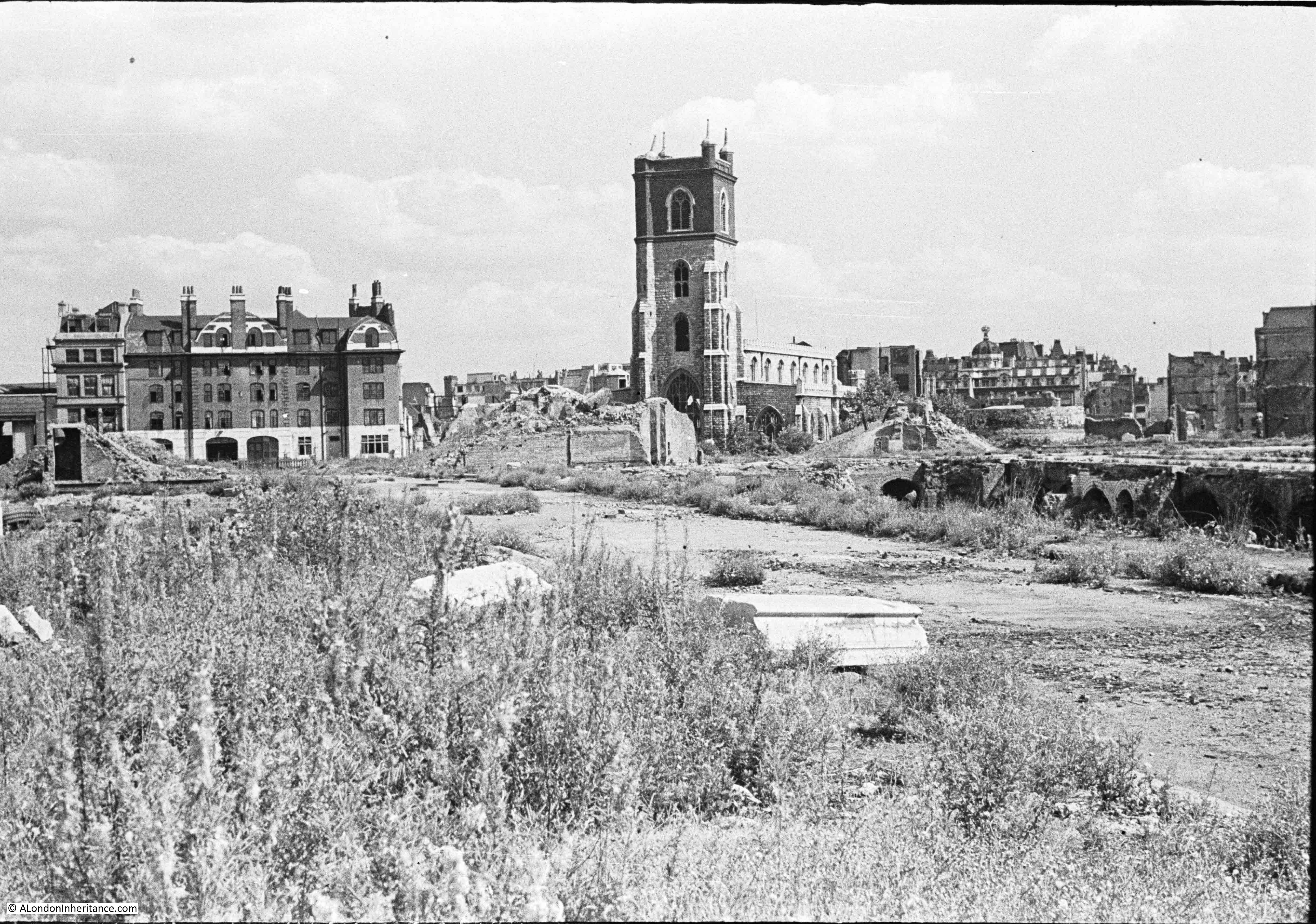
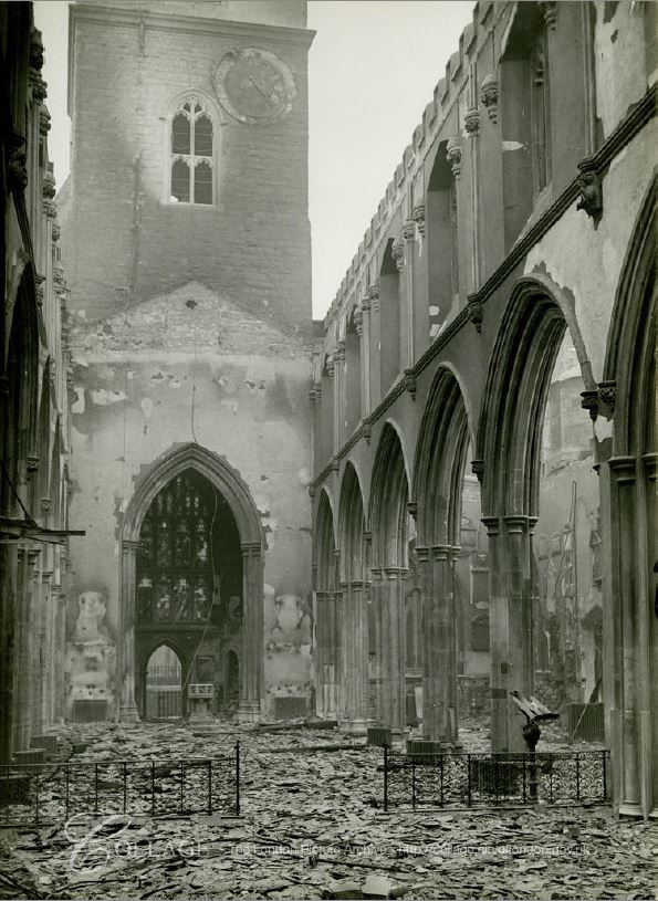
For this week’s post I am back in the Barbican, exploring Cripplegate with another of my father’s photos showing the area in 1947.
The church of St Giles provided a very clear landmark in last week’s photo, but when I first scanned the photo for this week’s post, there were no obvious landmarks or points of reference to help with identification.
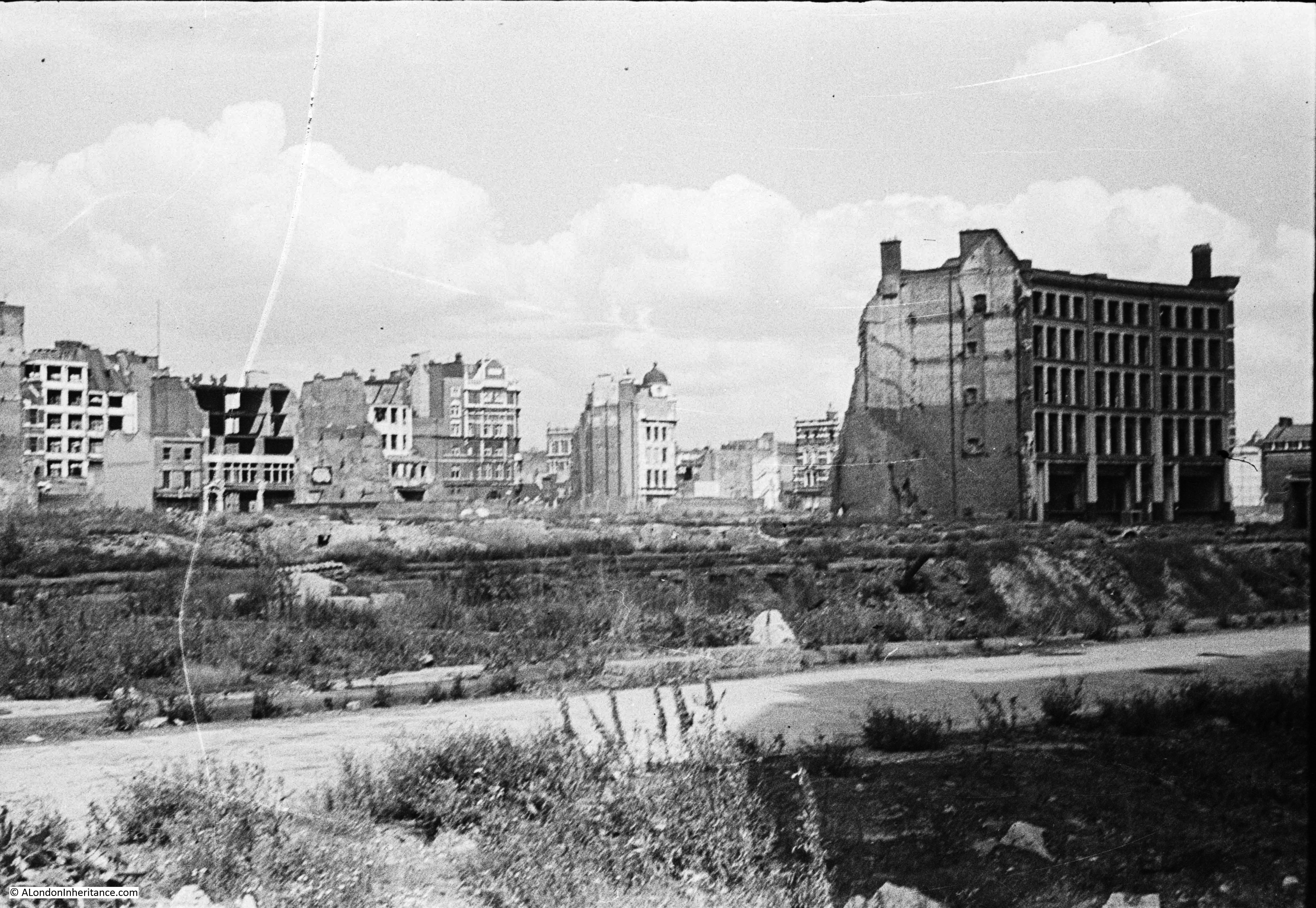
I always look for any building that may still be there today. In the above photo, all the buildings in the foreground have been demolished, apart from one, which looks badly damaged and will also probably be demolished.
There is the paved surface of a street just above where my father was standing.
Many of the buildings in the background do appear damaged, although there are a couple that appear to have minimal if any damage, so could possibly remain today if they were not demolished for the Barbican development.
One building had a rather distinctive design, and also looked in good condition. I have marked this building in the photo below:
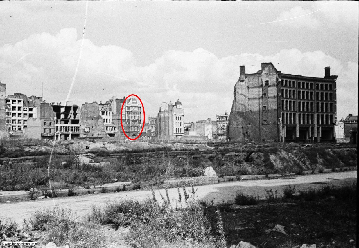
An enlargement from the original photo showing the distinctive features of this building:
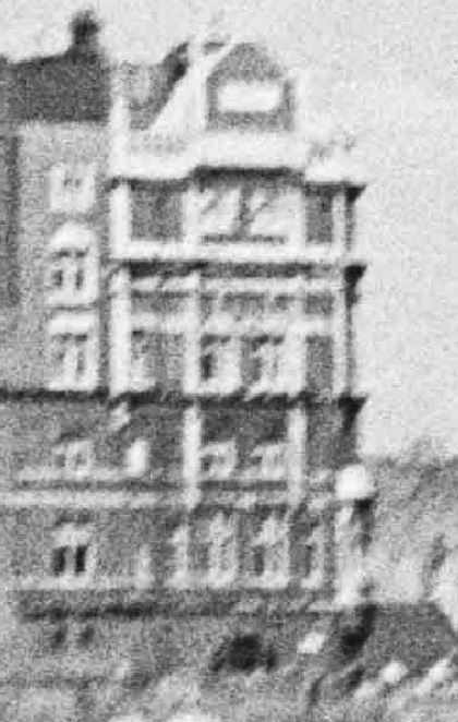
After much checking on Google StreetView, followed up by walking the area, I found the same building. It now has a roof extension, but the external features are identical to those in the 1947 photo. This is the building of the old Cripplegate Institute on the corner of Cripplegate Street and Golden Lane.

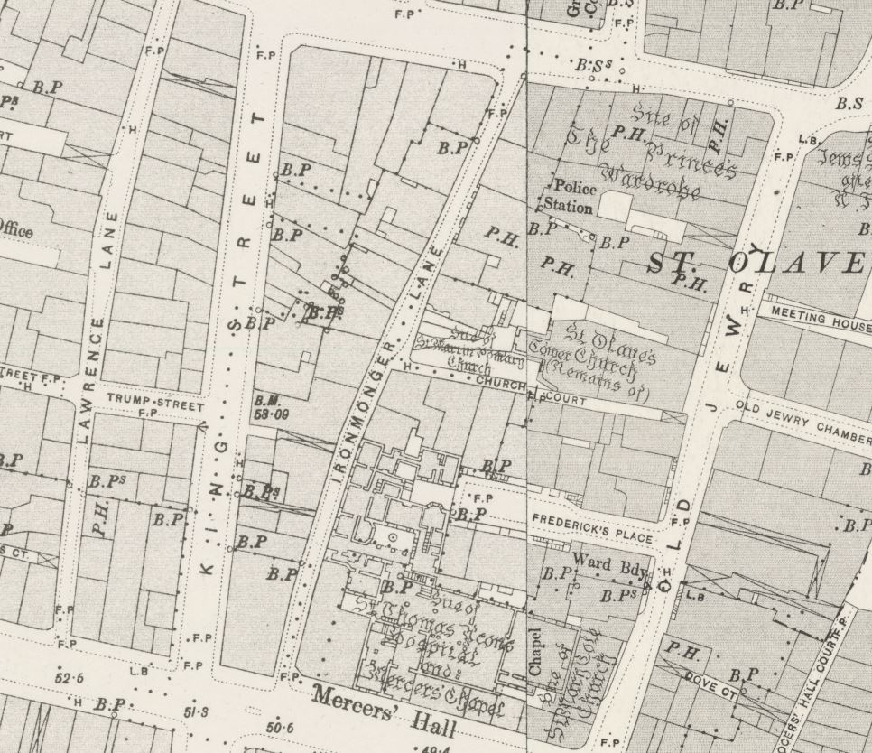
I now needed to track down where my father was standing, and the location of the building in the cleared area. As ever, the Ordnance Survey maps held by the National Library of Scotland provided further evidence.
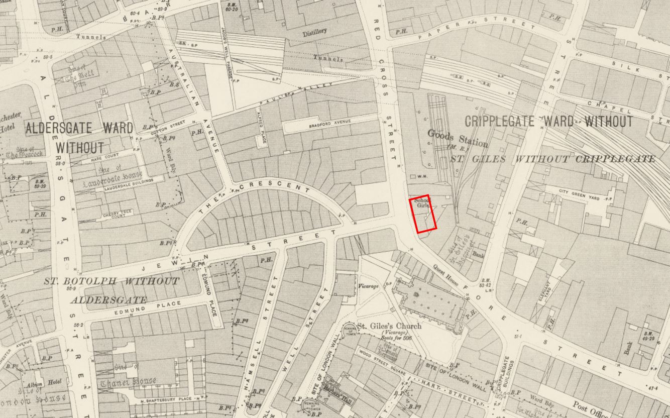
The following extract is from a post war Ordnance Survey map.
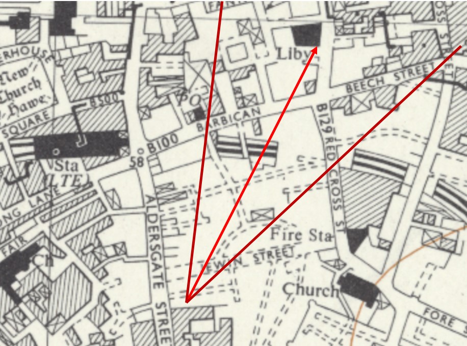
Credit: ‘Reproduced with the permission of the National Library of Scotland’
St Giles church is shown to the bottom right. The Cripplegate Institute is marked as a Library (it served multiple purposes which I will explain later in the post) towards the top of the map.
In the centre of the map, there is an empty area, with hashed lines for streets. This is the area demolished after the fires and bombing of the war.
There is one building still marked, a rectangle on what was Jewin Crescent, just above the ‘F’ of Fire Station. Could this be the large building in my father’s photo?
Between where my father was standing and the derelict building, there appears to be two streets. The first is easy to see, the second is a little distance back. This second street cannot be Jewin Crescent as it is not up against the derelict building. I therefore suspect that my father was standing at roughly the point marked where my red lines converge in the map extract.
This street, next to where my father was standing, was Edmund Place.
The alignment of the derelict building and the Cripplegate Institute / Library look right (centre arrow) and the arrows at the side show the approximate field of view in the 1947 photo.
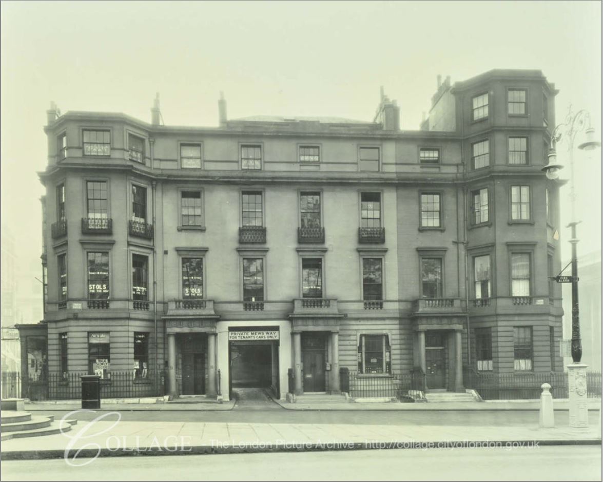
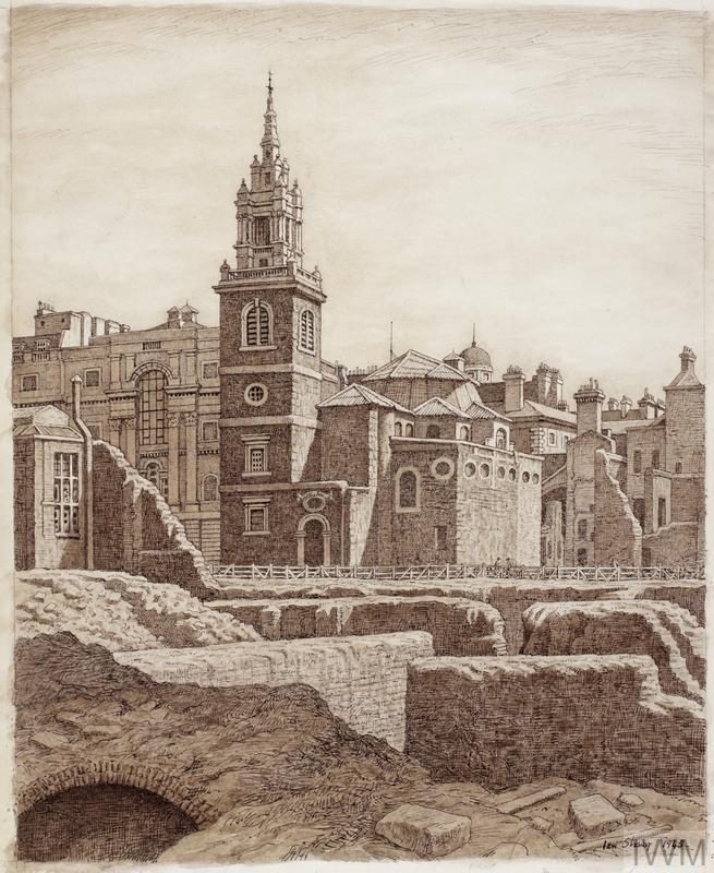
I found some more evidence to confirm from the London Metropolitan Archive, Collage collection. In the following photo we can see the same derelict building that appears in my father’s photo, however now we can clearly see the crescent shaped street, and the location of the building at a street junction, exactly as shown in the map extract.
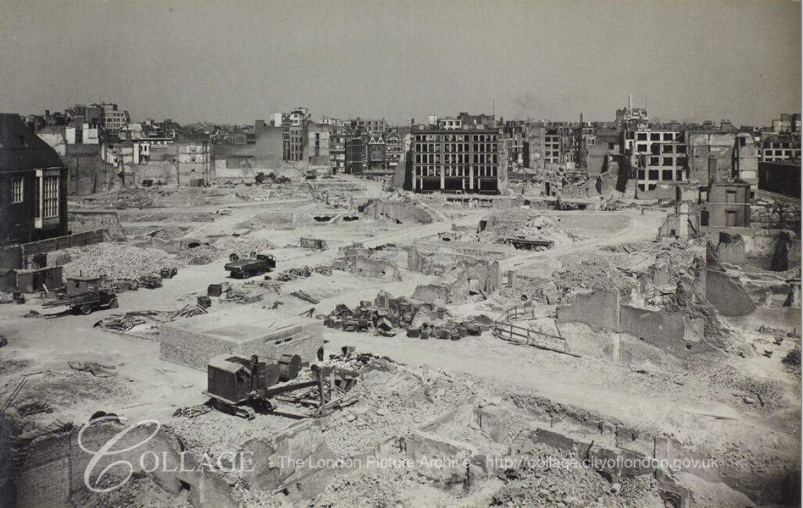
Image credit: London Metropolitan Archives, City of London: catalogue ref: M0020321CL
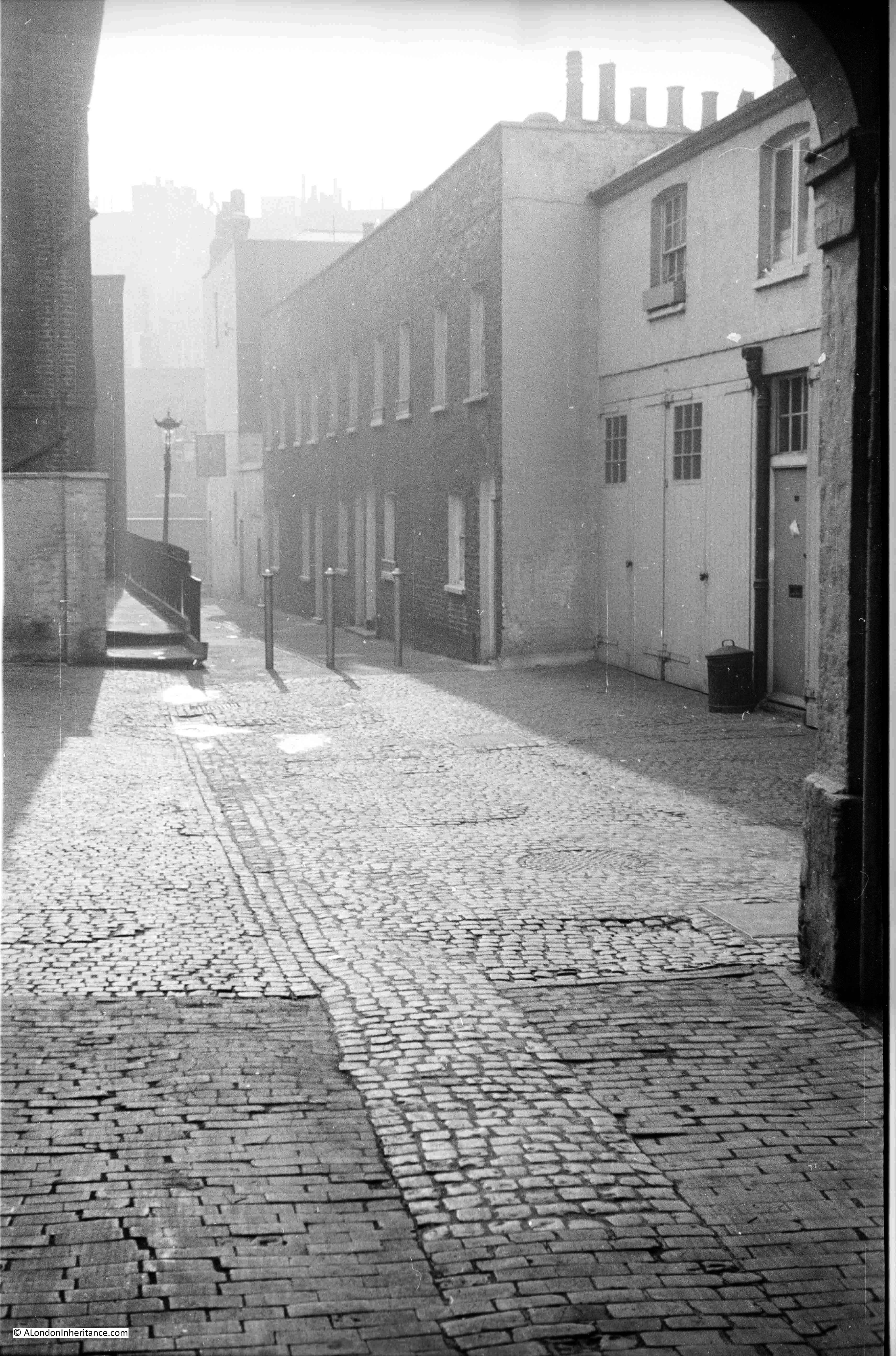
It is hard to imagine just how densely built these streets were prior to the destruction of 1940. My father’s photos show large areas of empty space, occupied only by cellars, low walls and the remains of paved streets.
Jewin Crescent was a relatively narrow street with tall buildings on either side. It was originally named simply “The Crescent”, but took on the name jewin Crescent in 1878.
The destruction of 1940 was not the first time that fire had damaged a large area of Cripplegate. On the 19th November 1897, another large fire destroyed much of Cripplegate. The following text is from the start of an article from the London Daily News on the 22nd November 1897 titled “The Terrible Fire – Acres of Ruins – Plans To Relief Sufferers – Four Thousand Persons Out Of Work – Narrow Escape of Firemen” which gives some idea of the scale of the fire:
“Yesterday crowds of persons from all parts of London visited the scene of the disastrous fire in the City to view all that remained of the warehouses and factories which were burned out on Friday. The police, who were again on duty in strong force, had the greatest difficulty in keeping the people back from the approaches to the ruined district, and all traffic in Aldersgate Street had to be suspended. It now appears that the thoroughfares affected more or less by the fire are seventeen in number, as follows: Hamsell-street, Well-street, Jewin-street, Jewin-crescent, Redcross-street, Monkwell-street, Edmund=place, Bradford-avenue, Australian-avenue, Nicholl-square, maidenhead-court, Fore-street, Paul’s Alley, Wood-street-square, Falcon-square, Hart-street and Peel-street.
It was on Saturday definitely discovered that the fire broke out at 15, Well-street, in the occupation of Messrs. Lewis and Company, ostrich feather dealers, and not at 30 and 31 Hamsell-street, as at first reported. This mistake is, however, explained by the fact that the rears of these two premises occupied by Messrs. Waller, Brown and Co., mantle manufacturers, and Messrs. Lewis, the former firm carrying on business in the top portions of the two houses. The fire, which it has now been ascertained was undoubtedly caused by an explosion of gas, broke through the premises of the firms in Hamsell-street, and it was in consequence of this that the flames spread with such rapidity along the two streets.
Of course, in some of the above mentioned street only a few of the houses have been touched but Jewin-crescent, Hamsell-street, Well-street, and the greater part of Jewin-street have been wholly destroyed.”
The City Press published a special supplement on the fire, showing the level of destruction across the street. One photo shows Jewin Crescent.
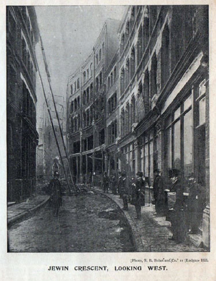
(reproduced from Grace’s Guide under Creative Commons Attribution ShareAlike Licence)
If you look in the above photo, there is a building on the right of the street that looks very similar to the building in my father’s 1947 photo, however counting the windows in the 1897 photo, it is not exactly the same, although it appears to be in the right position on Jewin Crescent.
I suspect that it was this building, but rebuilt and modified after the 1897 fire, as I did find a later view of the building, and it is identical to that in my father’s photo.
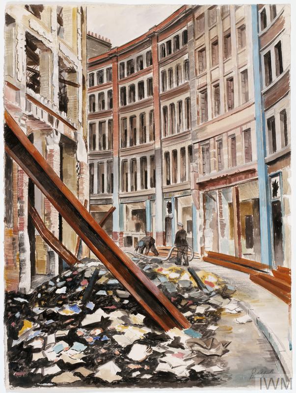
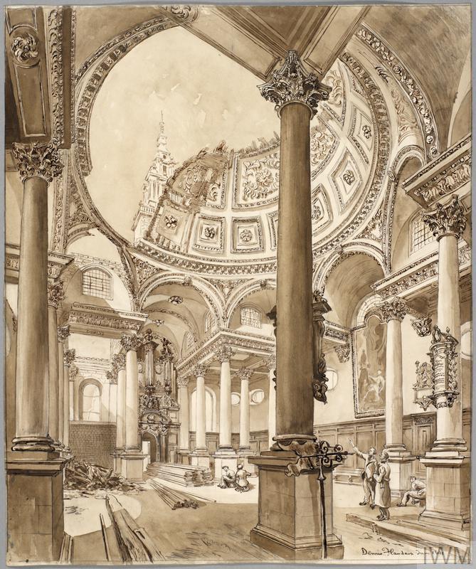
“Jewin Crescent, London EC1 (Art.IWM ART LD 1202)”
The above drawing is by Roland Vivian Pitchforth, one of his works for the War Artists Advisory Committee and is looking west along Jewin Crescent. At the end of the view, on the right of the street is a building that looks identical to that in my father’s 1947 photo.
Both the 1897 photo and wartime print provide a good impression of Jewin Crescent. A narrow, curving street, lined on both sides by tall shops, factories and warehouses. I suspect the building in the 1897 photo was modified or demolished after the fire, and a new building of similar style constructed on the same plot of land, but with changes to the floor layout and windows.
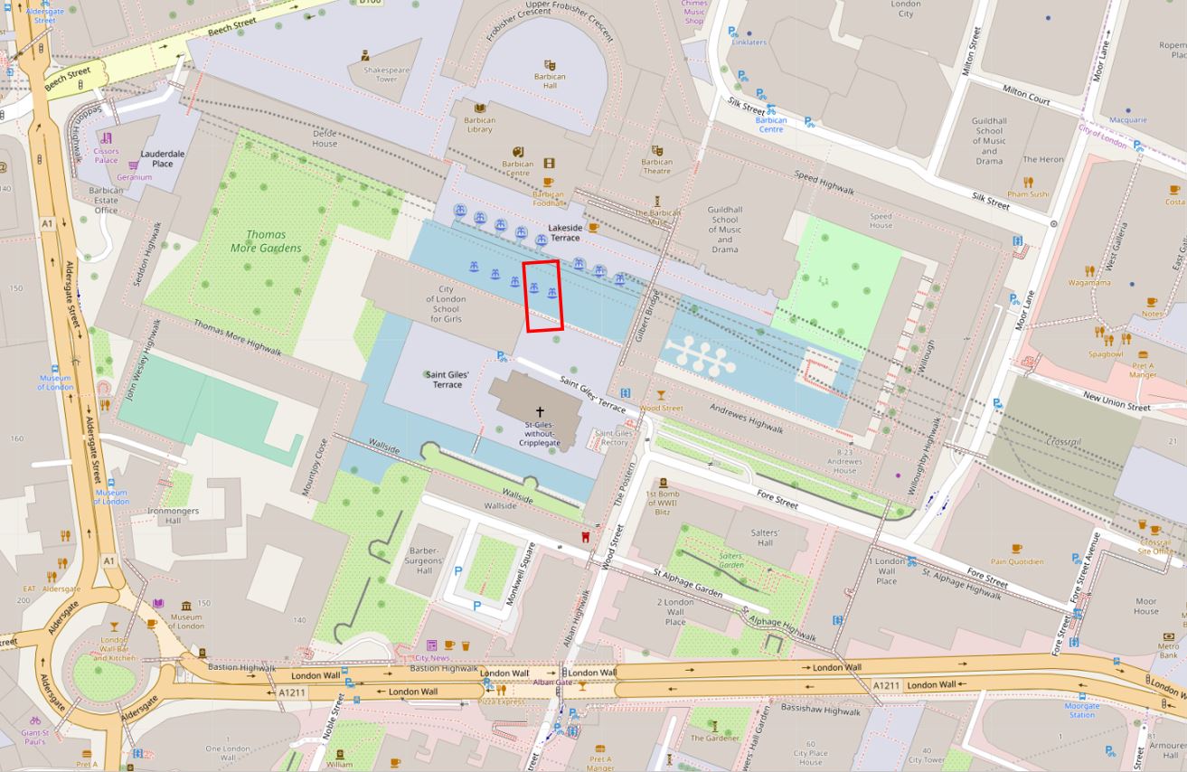
The area where Jewin Crescent and the 1947 building were located is so very different today.
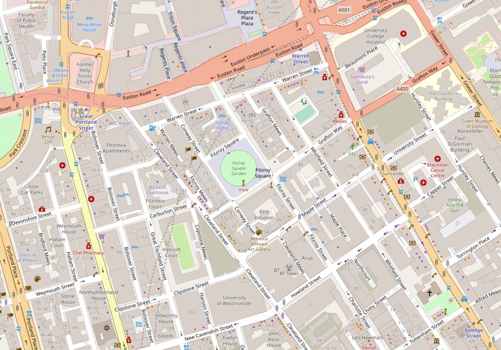
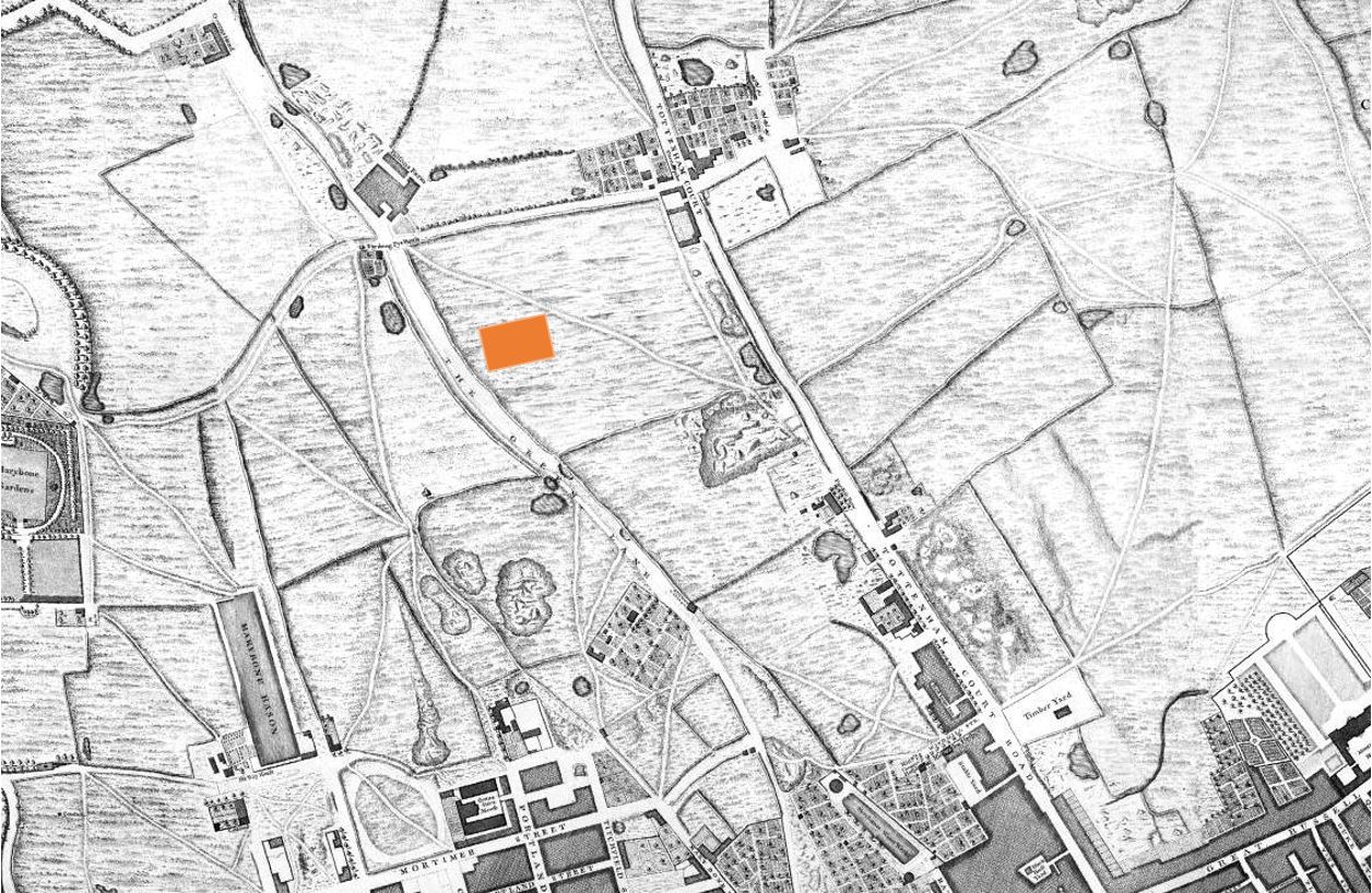
I have marked on the following map extract the approximate locations of Jewin Crescent (red line), Jewin Street (blue line), and the building on Jewin Crescent seen in my father’s photo (orange rectangle), in what are now Thomas More Gardens. The Cripplegate Institute is the orangae circle (© OpenStreetMap contributors).
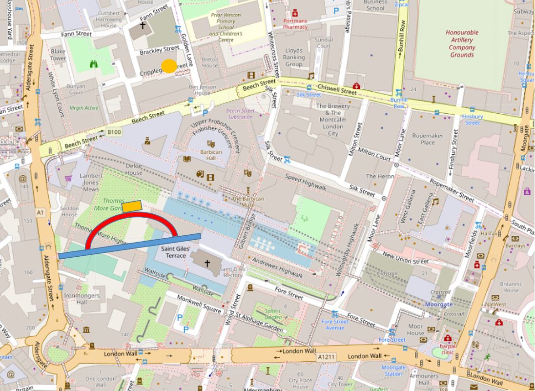
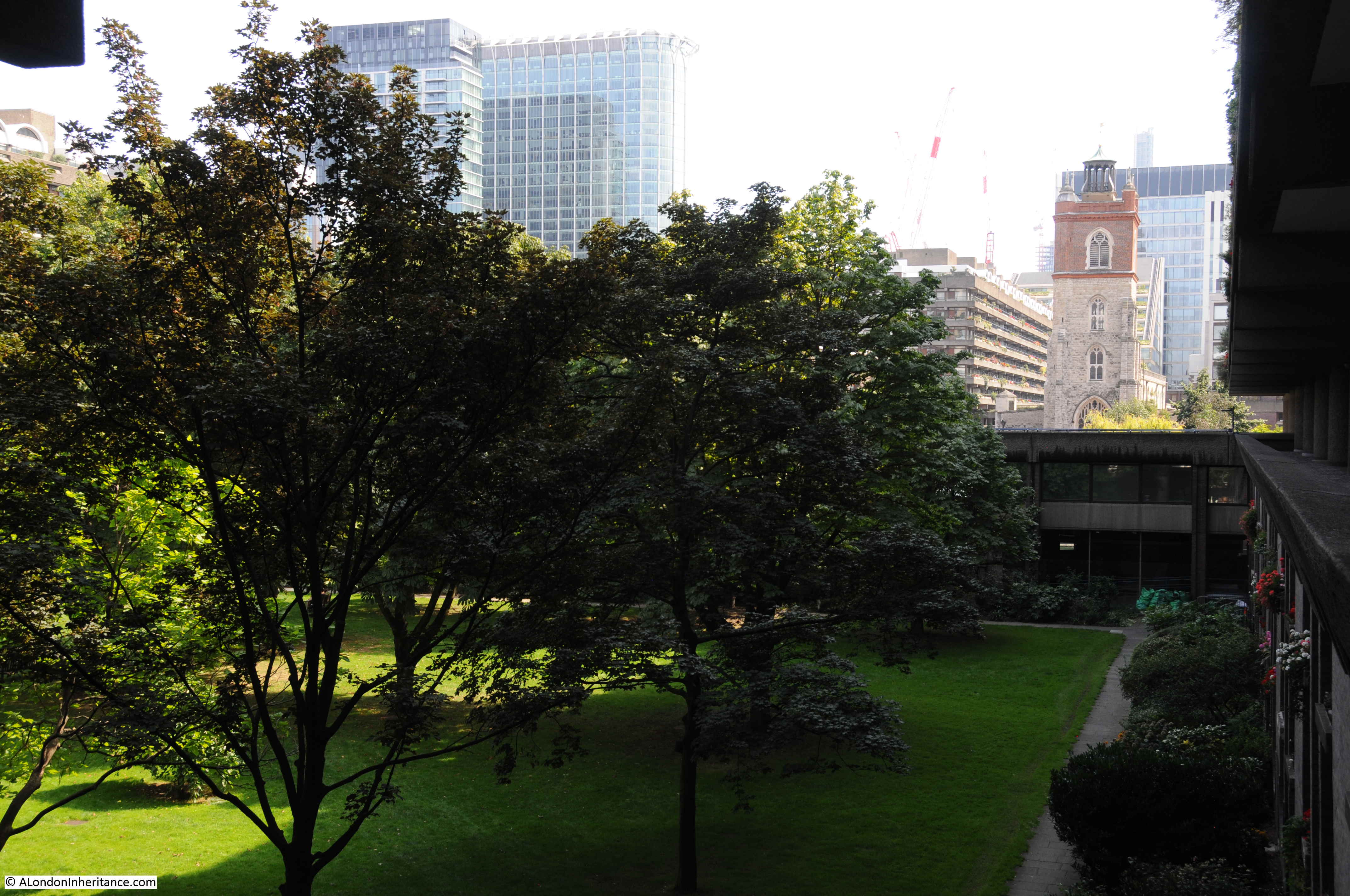
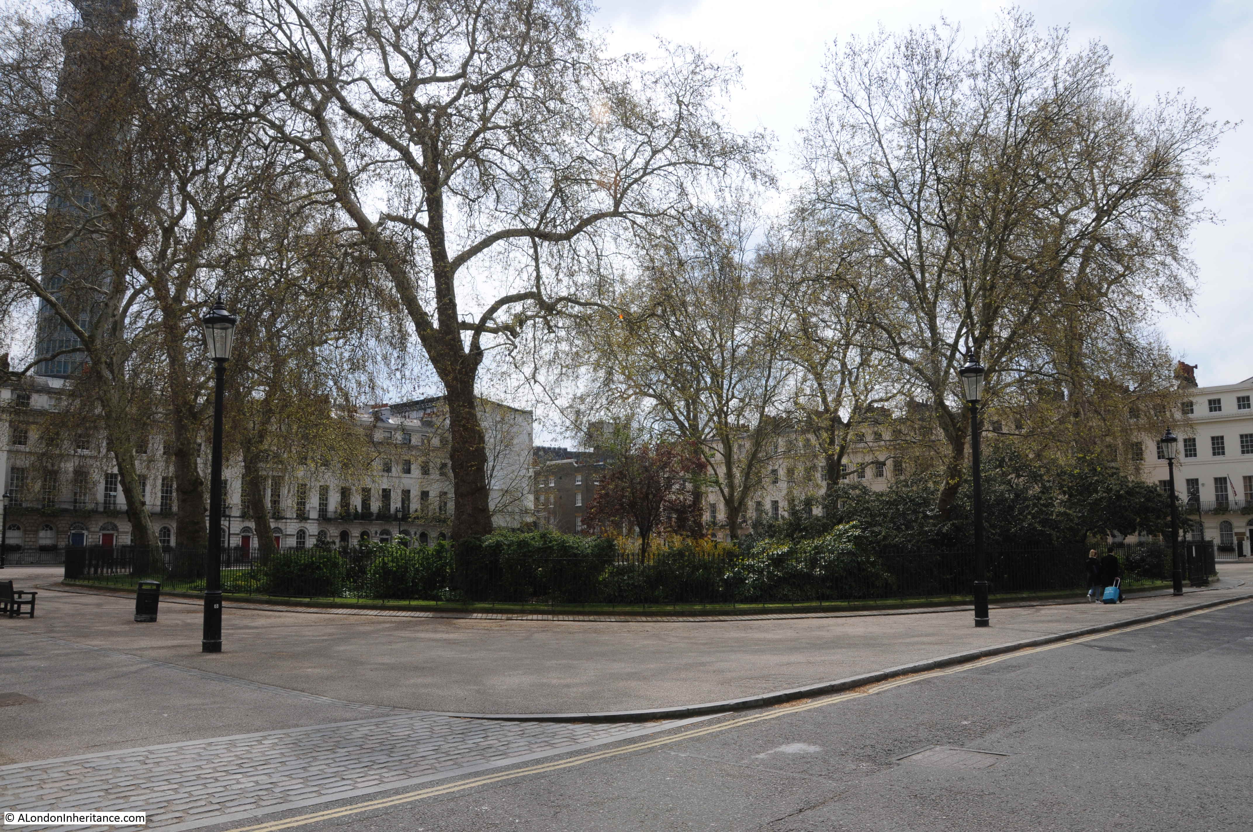
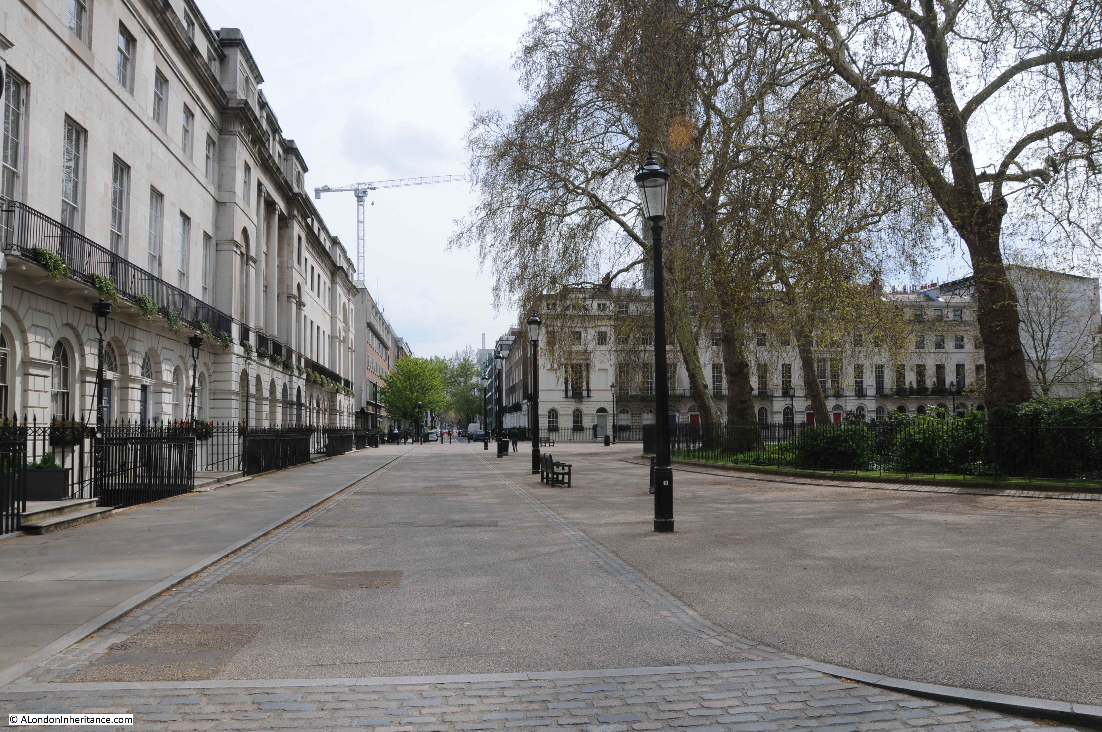
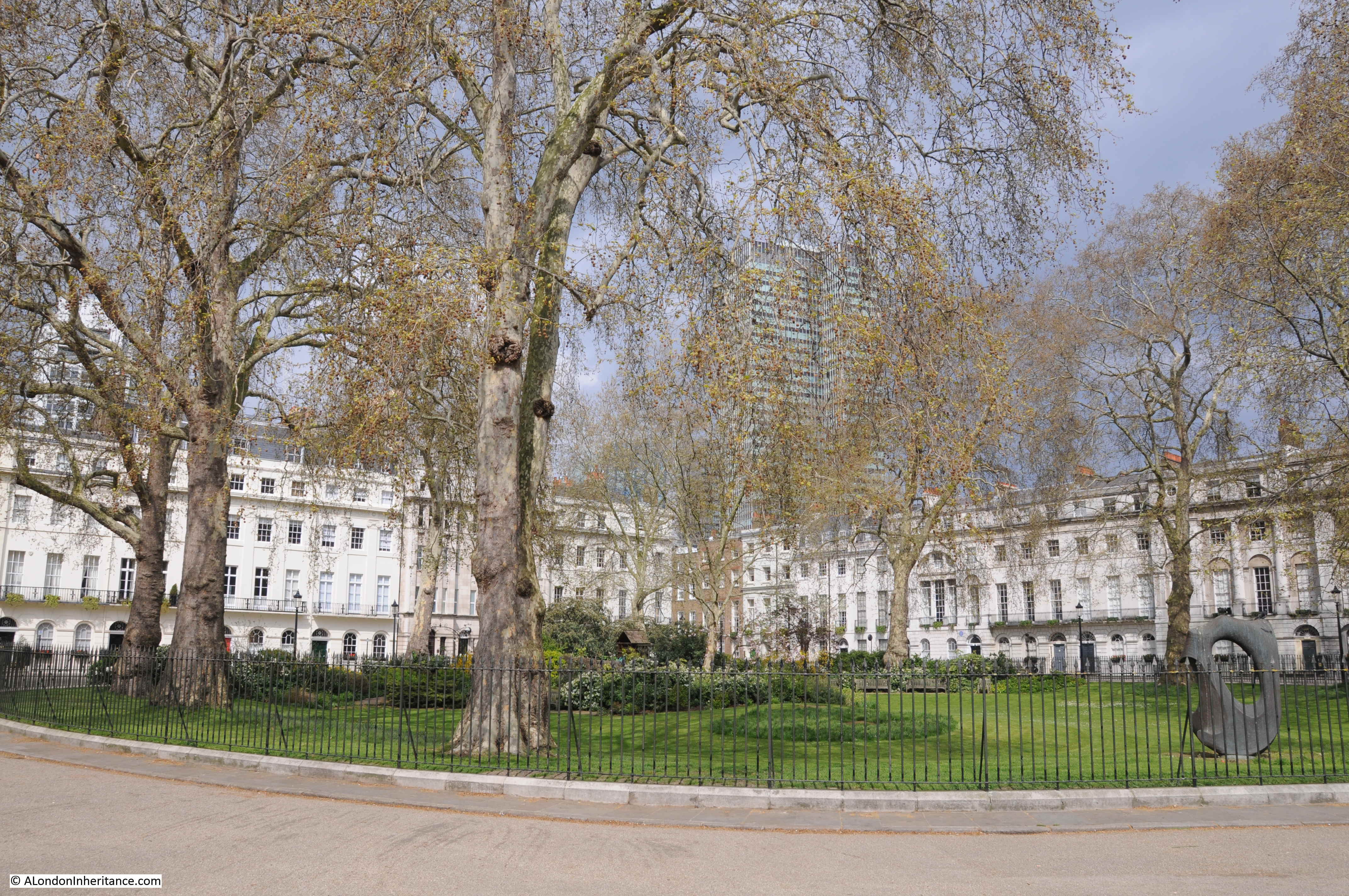
The following photo shows Thomas More Gardens today. The left part of the 1947 building would have been in the middle of the photo, leading off to the right.
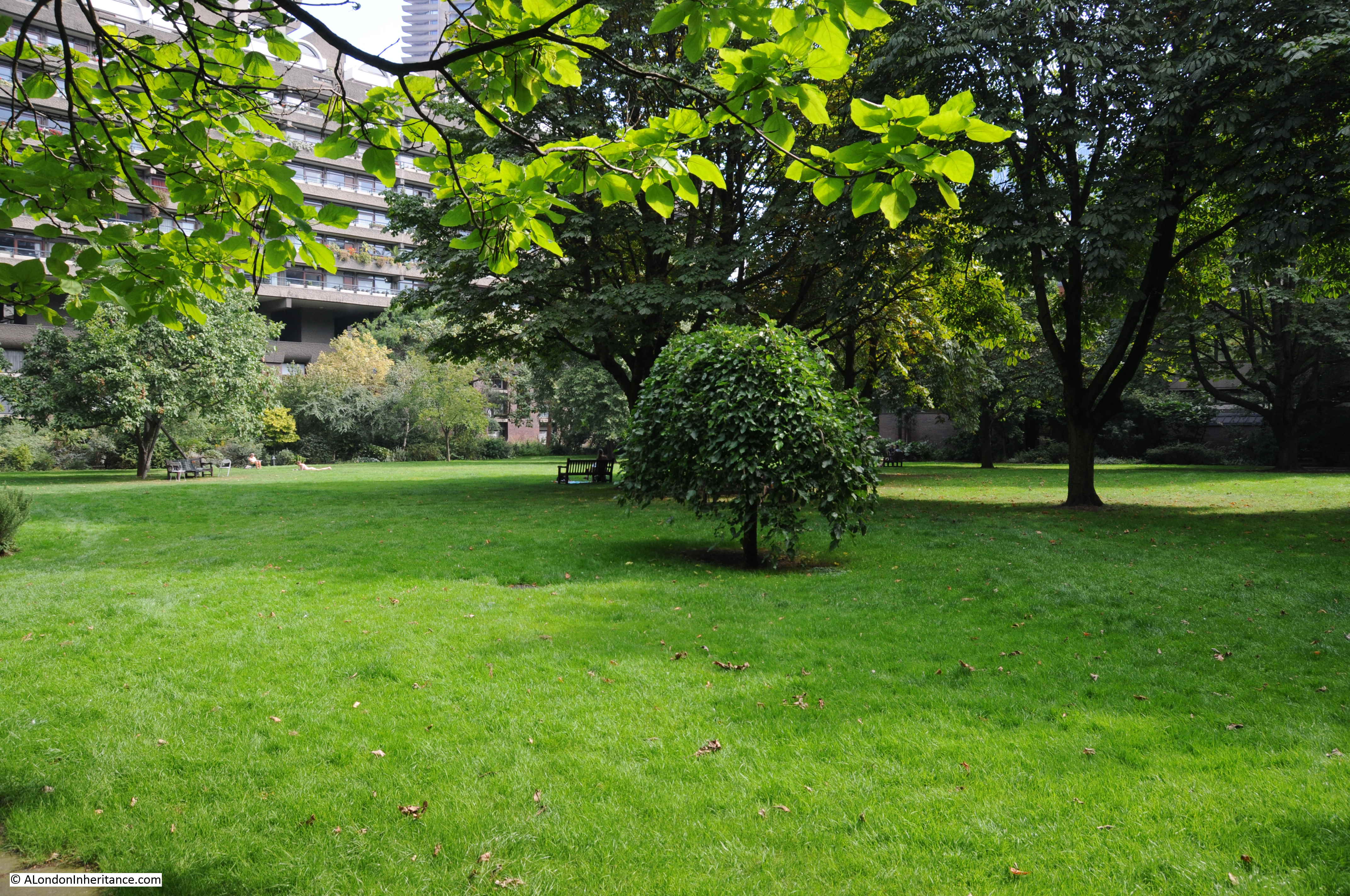
The same location could hardly be more different. Instead of a densely built, narrow street, which must have been busy with workers and the movement of goods on a work day, Jewin Crescent is now covered by grass, and is a peaceful place surrounded by the buildings of the Barbican estate.
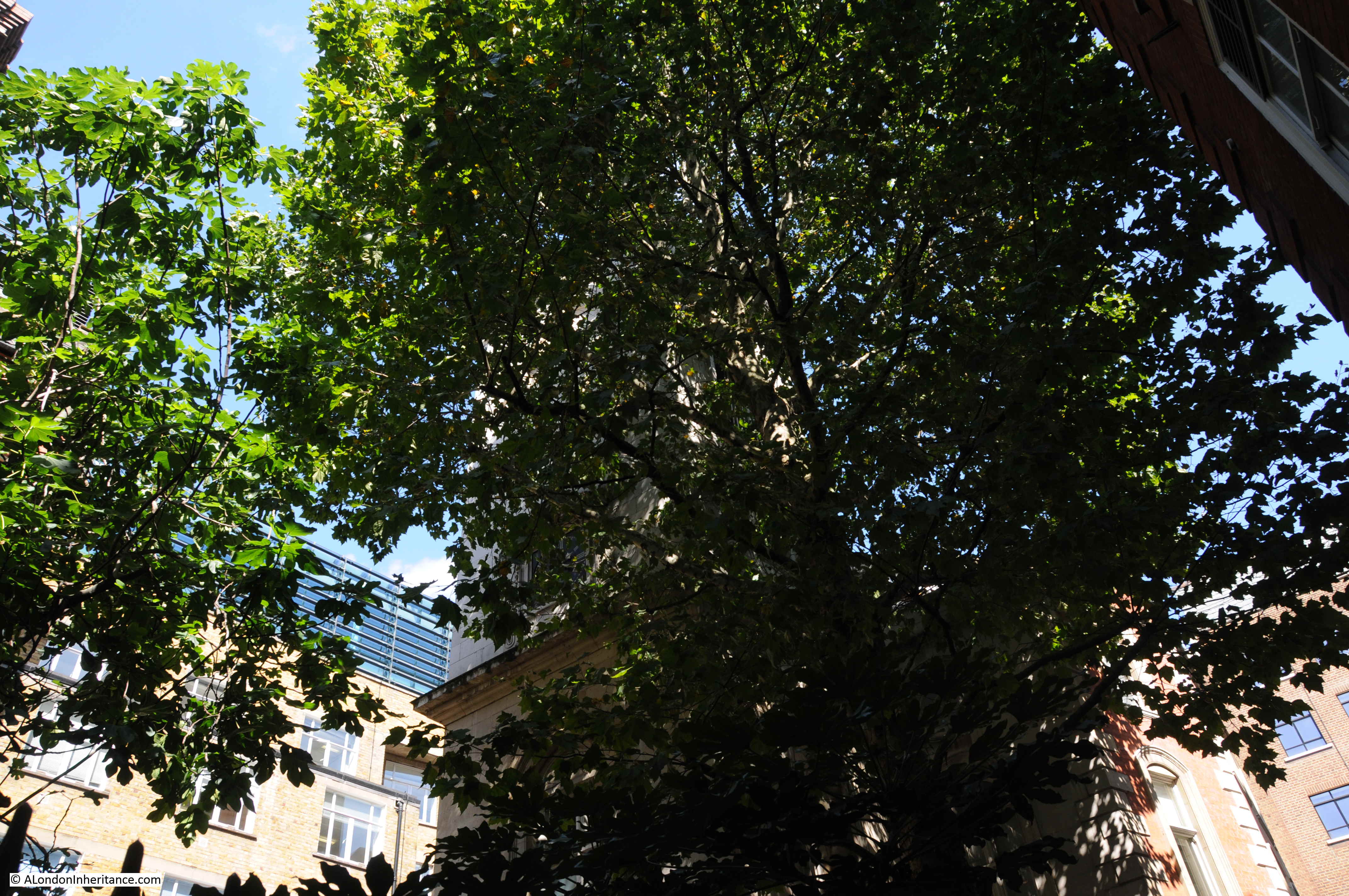
As an aside, a lower level view from around the gardens, provides some interesting perspectives of the Barbican’s architecture. In the following photo, it is clear to see how Gilbert House traverses the lake, held high above the water by a series of (at this distance) surprisingly slender pillars.

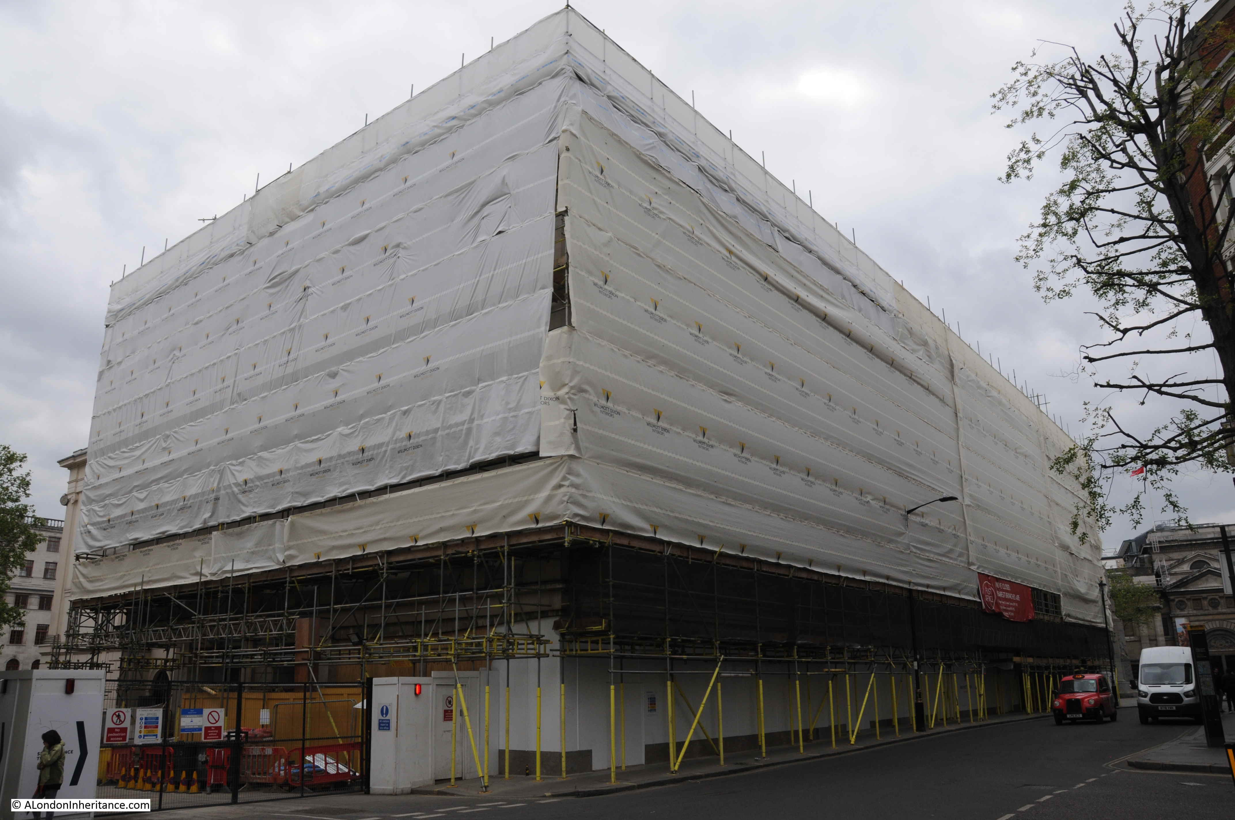
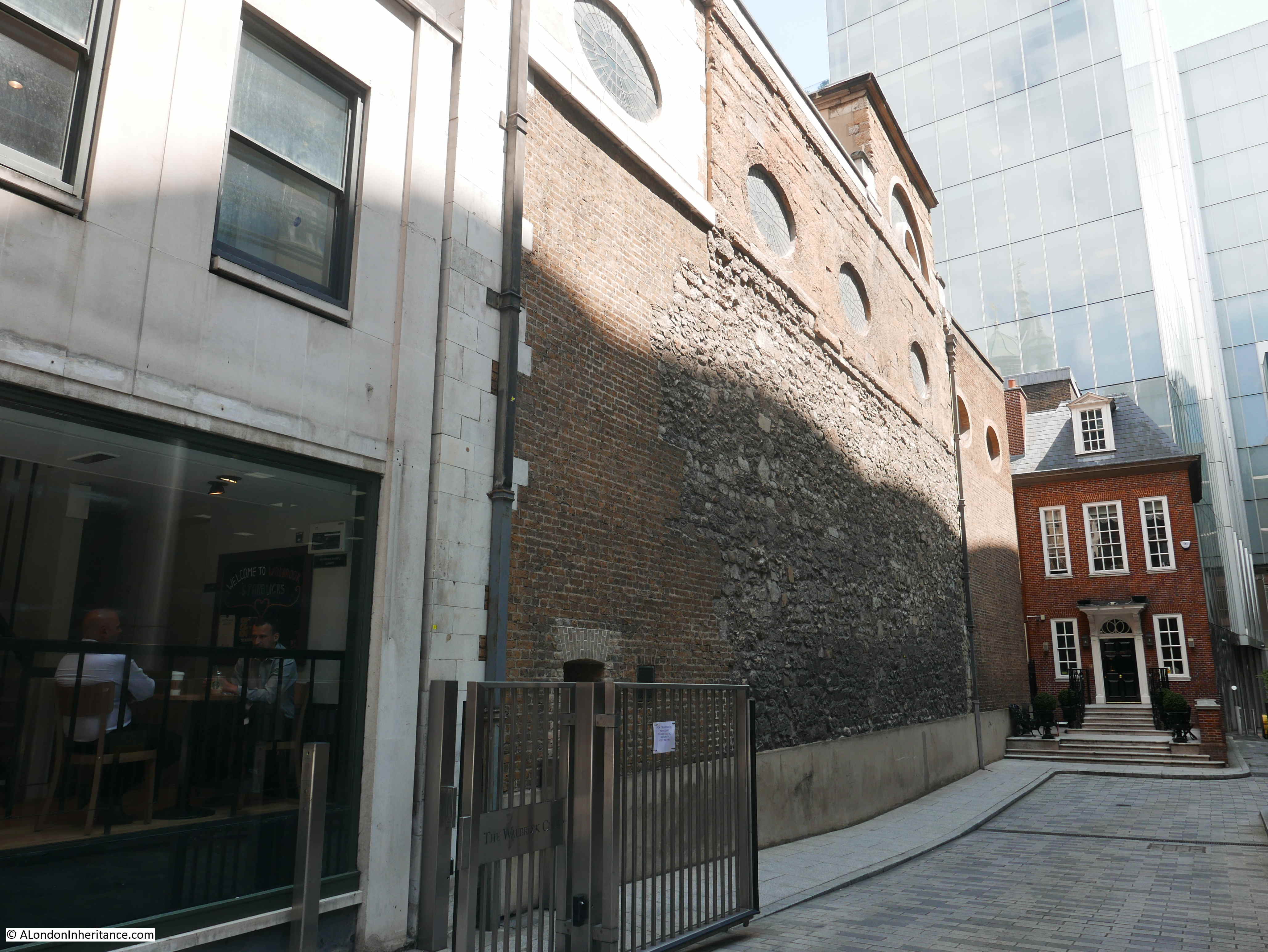
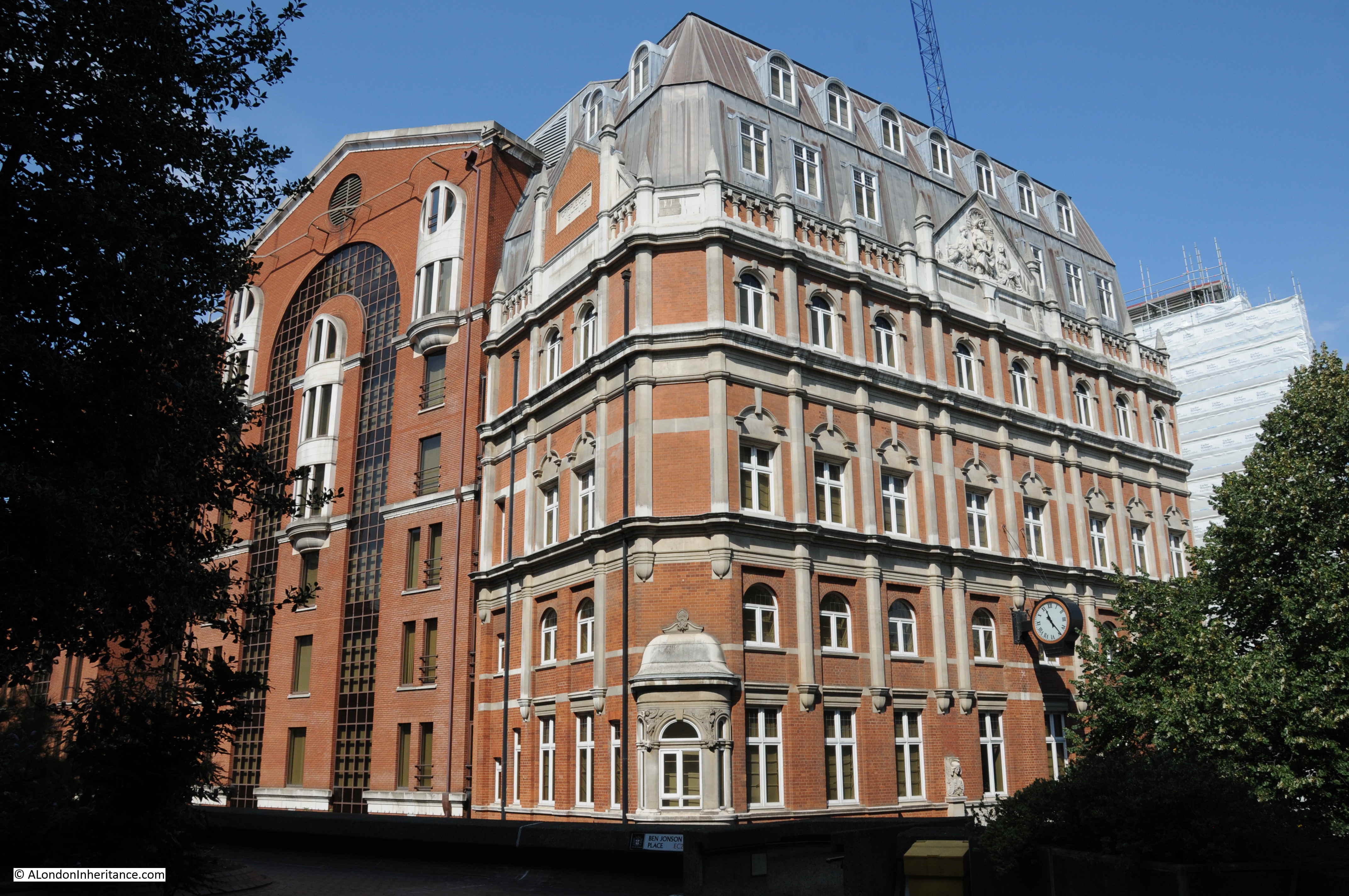
Returning to the building that initially helped me to identify the location, the Cripplegate Institute building is hard to photograph from the south as there is a raised walkway and buildings of the Barbican estate which obscure a full view of the south facing side.
The main part of the building faces onto Golden Lane. The following photo shows the part visible in the 1947 photo, with the main facade on the right.
The Cripplegate Institute provided a of range educational and cultural services to the residents and workers of the area. A good description of the scope of services offered by the institute, and the very high level of usage of these services is well described in an article from the Shoreditch Observer, dated the 7th November 1908:
“CRIPPLEGATE INSTITUTE – Cripplegate demonstrated its warm interest in its foundation institute on Wednesday night by attending the 12th anniversary conversaxione in strong force. Close upon 400 guests accepted invitations, and they were received in the handsome gold-and-white theatre hall by Mr. B.T. Swinstead, the chairman of the Governors and a member of the Corporation, many of whose members greatly assist the work. The prizes won in the various classes were presented by Deputy and Sheriff Baddeley, and the chairman, in referring to the work of the Institute, said that in the lending part of the library, in which there were 52,000 volumes, some 1,500 books were issued daily, while the average attendance in the newsroom was 5,000 per day.
A special feature was made of the St. John Ambulance and Nursing classes for men and women, and it was hoped to make the Institute the centre for first aid and nursing work in the City. The penny dinner-hour concerts had been attended by 13,284 persons during the year, and over forty societies and clubs had their headquarters in the building. An excellent musical and dramatic entertainment followed.
Owing to the tremendous pressure on the various departments of the Institute, the governors are considering the question of adding another storey to the building, to accommodate the physical drill and other sections of the educational and recreative work.”
The last paragraph explains how the building came to look as it does today. The original building was smaller and of plainer design. The majority of the features we see on the building today, are from the addition of an extra storey.
Some of the figures quoted in the article are remarkable – 1,500 books issued daily, and 5,000 people using the newsroom a day. The institute must have provided much needed services for those living and working in the area.
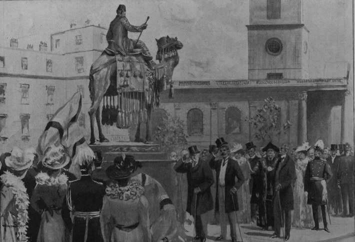
The Cripplegate Institute opened in 1896, however the foundation stone was laid by the Duke of York two years earlier in 1894:
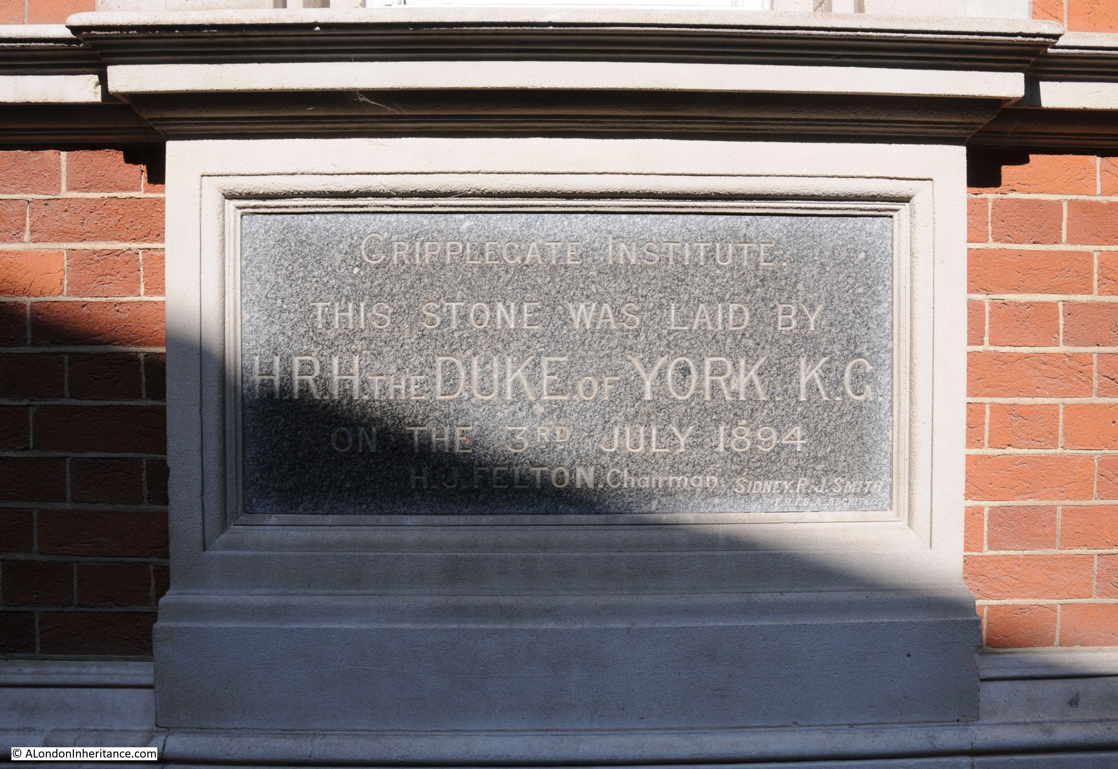
The laying of the foundation stone was a typically ceremonial event, with an honour guard from the Honourable Artillery Company, and a band from the same regiment providing the music.
The speeches included very clear references to why such an institution was needed and to the literary importance of Cripplegate:
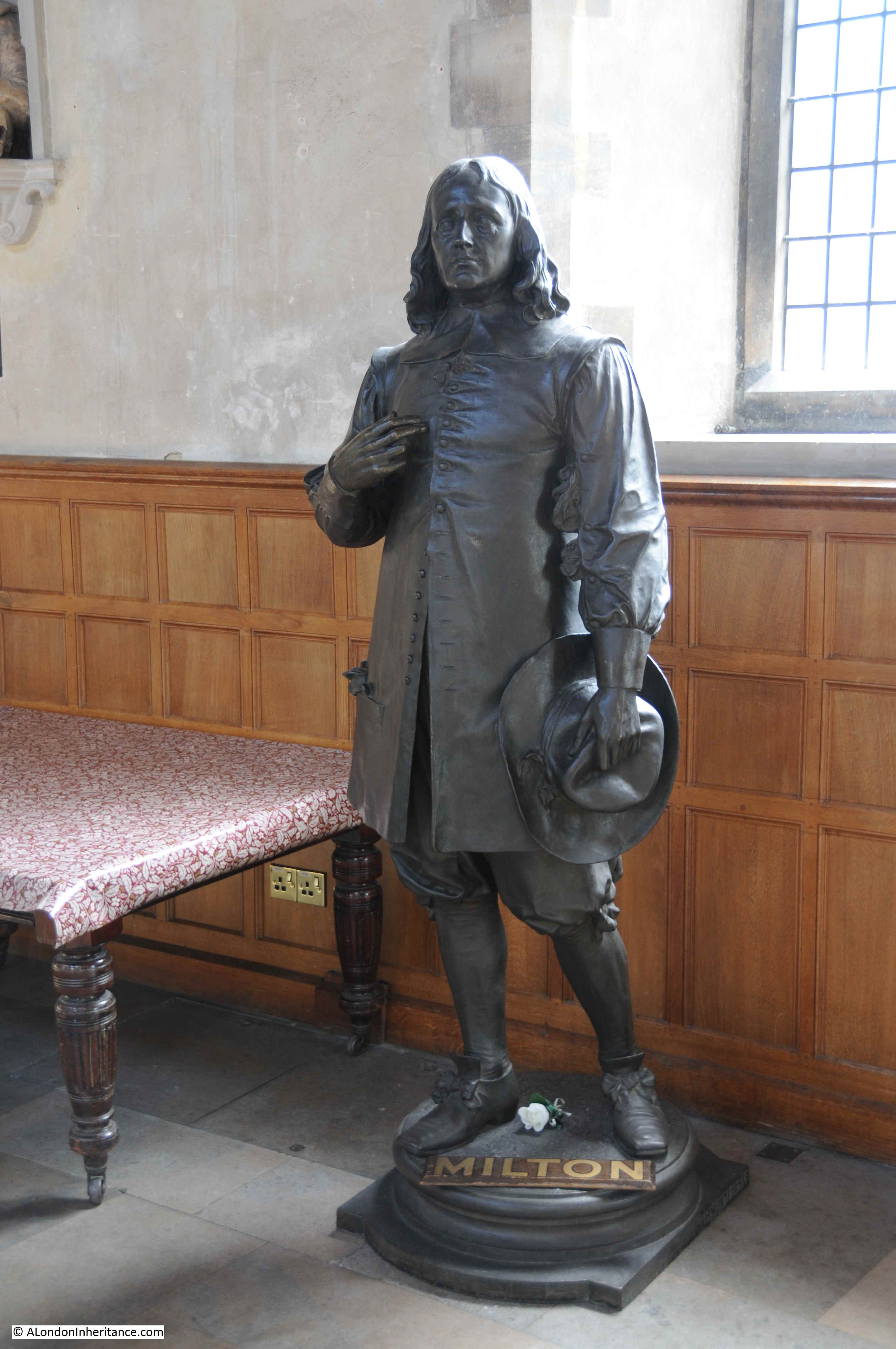
“The great increase in English literature which had taken place during recent years rendered it most necessary that every effort should be made to place some of that knowledge within the reach of those who were unable to provide themselves with books, either for recreation or instruction, and it was a very natural feeling that the ward of Cripplegate, where Milton and Defoe and other noted authors lived and worked should endeavour to place our literature at the disposal of even the very poorest of our fellow citizens by means of free libraries such as that institute could afford.”
The Duke of York was presented with an inscribed trowel – given the amount of foundation stones laid over the years, I imagine that in some Royal collection somewhere, there must be thousands of trowels, collected from a couple of centuries of foundation stone ceremonies.
The Cripplegate Institute was largely funded by the Cripplegate Foundation, a charity formed in 1891 by the London Parochial Charities Act based on the charitable assets of St. Giles Without Cripplegate, with original gifts dating back to 1500.
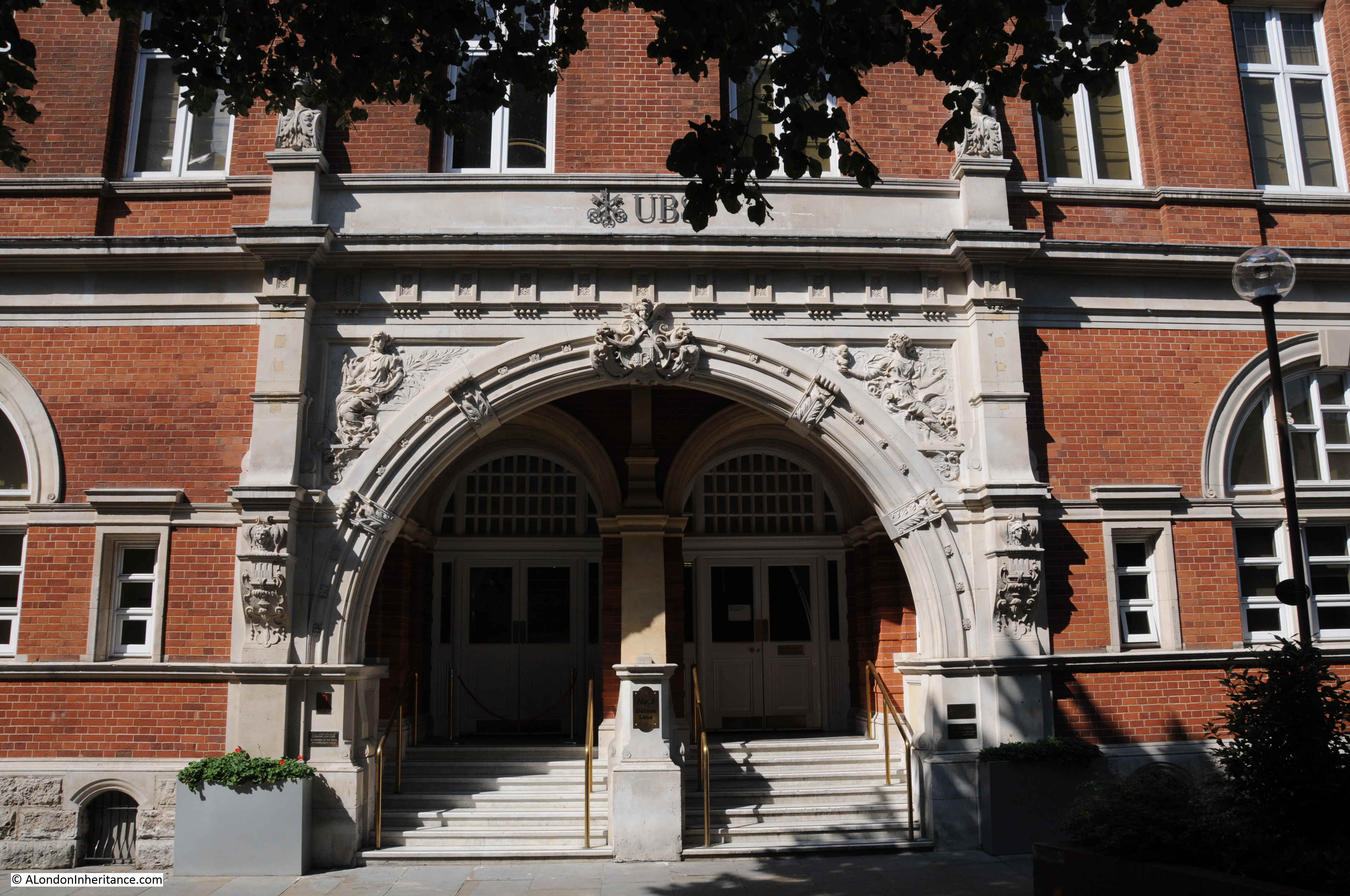
The Cripplegate Institute closed in 1973, and the building reopened soon after as the Golden Lane Theatre. The theatre presented a number of professional productions, but was also a focal point for amateur, educational, theatre and dance groups to put on productions.
The Golden Lane Theatre closed around 1988 and the interior has since been converted into office space, and is currently occupied by the Swiss bank UBS.
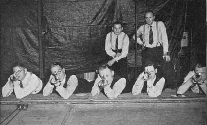
I suspect it disappeared during the office conversations, but the facilities of the Cripplegate Institute included a rifle range, and in 1940, when the possibility of a German invasion seemed very real, workers were encouraged to sign up for rifle training. 400 workers from the City of London trained at the Cripplegate Institute. Hopefully for the photographer, their guns were not loaded.
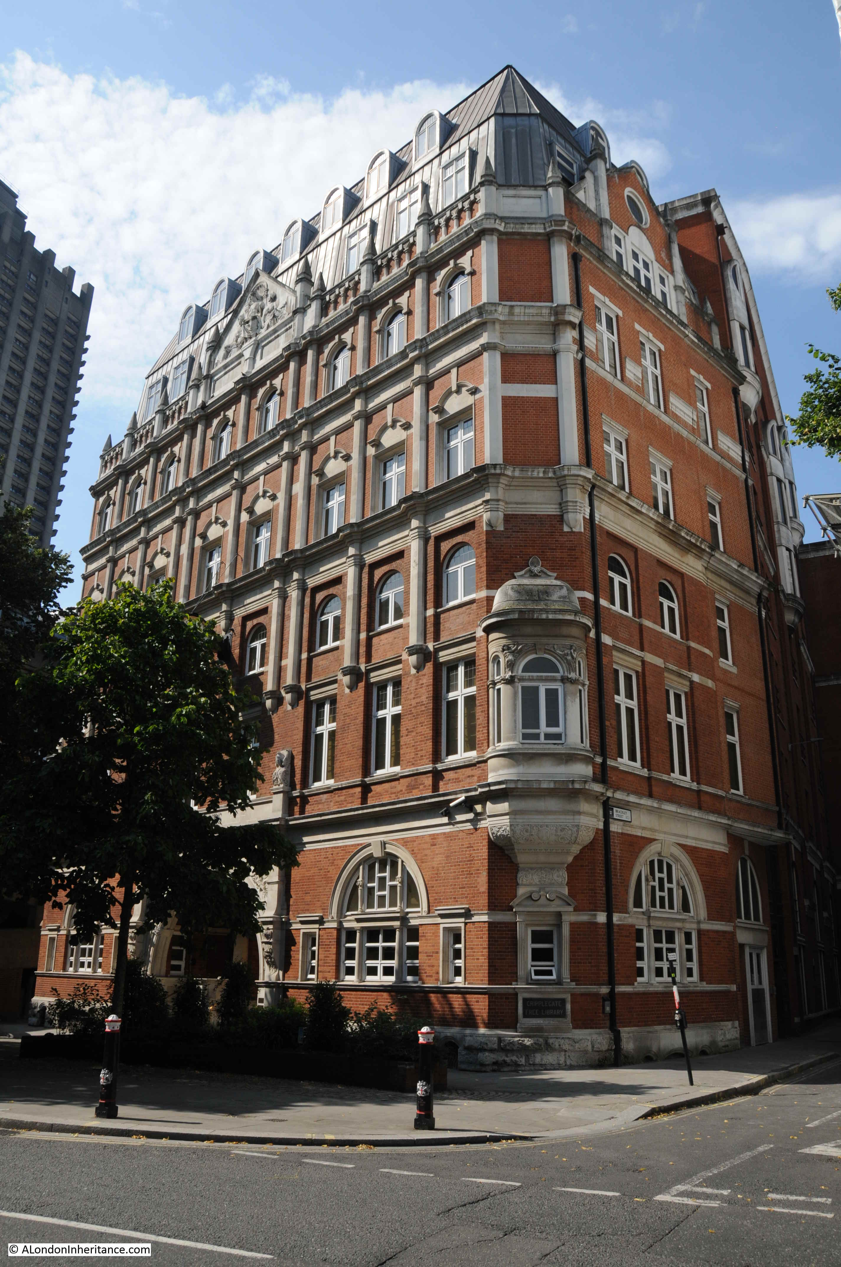
View of the old Cripplegate Institute building from slightly further along Golden Lane, at the junction with Brackley Street.
When I first scanned the 1947 photo, I was really not sure that I would be able to track down the location, but starting with the Cripplegate Institute I now know the buildings and street in the photo and roughly where my father was standing when he took the photo.
The development of the Barbican means that it is impossible to take a view of the same scene today, but it is brilliant when walking around the Barbican Estate to think about what was here before, and the fascinating history of this area.