Category Archives: London Streets

London At Night – The Strand To The Monument

London at night is a very different city. The West End continues to be just as busy as during the day with thousands of people at the theaters, pubs, bars, clubs and restaurants that make this area the entertainment center of London, however head just beyond the West End and London takes on a very different aspect.

My father took a number of photos in 1951 of the streets at the northern end of Waterloo Bridge, St. Paul’s Cathedral and the Monument. I do not know why he took photos of these locations, he was probably experimenting with nighttime photography which would have been a challenge for an amateur at the time given the camera and film available.

To take these, he must have taken a walk from Waterloo Bridge down to the Monument, so I thought I would take a late evening walk along the same route and take some photos of the same locations and more, along the route. I took many more than the five taken in 1951, the cost of film, home developing and printing all limited the number of photos that an amateur would have taken, and really brings home the differences with digital photography today.

I wanted to walk the route after the weather had been raining to get the same effect as in my father’s photos, so planned an evening when there should have been a rain shower, however as is typical with trying to forecast the weather, it failed to rain so my full walk of the route was in the dry. The evening before I published this article, it did rain so I headed out again, just to photo the first three locations to get the same effect, the rest of the photos are from my original walk.

The first location is from the approach road to Waterloo Bridge, looking to where the Strand crosses, the curve of Aldwych to the right, with Wellington Street running up on the left.

London after dark 28

Standing in the same position on a rain and wind-swept evening in February. The building on the right is the same as in my father’s photo, as is the building across the street. The public toilets that were in the middle of the road have disappeared.

London after dark 35

To also check that this is the right location, by enlarging the sign on the post in the original photo, we can see it reads “No crossing to Wellington Street”.

London after dark 31

Wellington Street is directly opposite the road that leads to Waterloo Bridge and today is blocked off for road traffic from the Strand. It is the location of the Lyceum Theater. The traffic signals appear temporary and are Police Signals, so this may have been some experimentation with traffic and pedestrian control at the end of Waterloo Bridge.

The next photo is from roughly the same position and is looking in the opposite direction down Waterloo Bridge:

London after dark 27

The same view today:

London after dark 34

The following photo should have been easy to locate given the bus stop clearly labelled as the Strand stop. I do not often use the bus in central London, preferring to walk, and was not sure where the Strand stop was located. Walking the length of the Strand, I could not find a stop with this name. What finally helped to locate the position of the photo is the wall on the right side of the photo.

London after dark 26

This is the wall at the side of the church of St. Mary-le-Strand and is the same in my 2016 photo below. The pillars in the original photo either side of the bus stop sign are still there, they are just hidden in the 2016 photo behind bushes running along the length of the church wall. The bus stop has been moved slightly along the street and the stop is now named “Aldwych”. Where the original bus stop and pillar box were located is now the entrance to the King’s College London, Strand Building.

London after dark 33

Having found these locations, it was time to walk down to the Monument. The Waterloo Bridge junction with the Strand seems to be a nighttime boundary. From the end of the bridge turn left and the streets are busy with people, turn right and it is a much quieter street with only a few late night walkers to be seen.

The church of St. Mary-le-Strand. The stone columns at the entrance to the church seen in my father’s photo can just be seen.

London after dark 32

Just a short distance along, turn right off the Strand, through the archway and into the courtyard of Somerset House. The buildings that surround the courtyard are brilliantly lit at night.

London after dark 25

Back on the Strand, bikes and buses:

London after dark 24

As with many other places across London, there are new buildings being constructed to the south of the Strand adjacent to the church of St. Clement Danes. I happened to notice this model of the area and the church lit up in one of the ground floor windows of the new building facing the Strand.

London after dark 23

The Royal Courts of Justice:

London after dark 22

Looking back at St. Clements Danes:

London after dark 21

I much prefer to walk London at night, but other options are available:

London after dark 20

The side roads from the Strand down to the Thames show how steeply the land slopes down to the river. The Oxo Tower on the south bank can be seen along many of these side roads.

London after dark 19

Now into Fleet Street and St. Paul’s Cathedral in the distance:

London after dark 18

Fast food shops that are busy during the day are closed and silent at night:

London after dark 17

A very quiet junction of Fleet Street, Farringdon Street, New Bridge Street and Ludgate Hill.

London after dark 15

An empty City Thameslink station on Ludgate Hill.

London after dark 13

Late night drinkers on Ludgate Hill:

London after dark 12

St. Paul’s Cathedral from the south-east:

London after dark 11

The following is one of my father’s photos from 1951. In the immediate post war period the very top of the Cathedral was lit up by search lights that only a few years earlier had been used to search the sky for enemy aircraft trying to bomb a city that was hiding in the blackout. The post war lighting had the effect of highlighting the Golden Gallery, the Lantern and Cross. Today, the whole of the cathedral is illuminated.

London after dark 30

The above photo was taken from a point on the land now occupied by One New Change. At the time, this was still empty land having been cleared of all the bomb damaged buildings. I could not get far enough back to take a photo from the same position so the following photo is the nearest I could get. The base of the Cathedral is also obscured by the post war buildings that house the Cathedral School.

London after dark 10

This photo from my post on the “Post war view from the Stone Gallery” shows the land then used as a car park that my father was standing in to take the nighttime view of the Cathedral:

IMG02593-upload

Time to head on down Cannon Street in the direction of the Monument. Empty offices, still lit up, waiting for their occupants:

London after dark 9

The Cathedral follows you as you walk down Cannon Street:

London after dark 8

Another very quiet station, this time Cannon Street:

London after dark 6

The next photo is of Abchurch Lane, leading up to the church of St. Mary Abchurch in the heart of the City. Very busy during the day, however I stood here for about 10 minutes and did not see a single person along the length of the lane. It is in these alleys and lanes across the city that it is possible to imagine a much earlier London. Many more people would have lived in the City, but long after dark what reason would there be for people with legitimate business to be walking the streets?

London after dark 5

Back to the 21st century and the junction of Cannon Street with King William Street. Walking across the City at night, I find that there are very few people walking, but the main streets through the City are always busy with traffic.

London after dark 4

Walking down King William Street and a quick look over at Upper Thames Street. Roadworks for the Cycle Superhighway have closed one of the carriageways leading to queues of traffic long into the night. Upper and Lower Thames Streets form the southern route taking traffic east – west through the City. The roads were widened post war rather than build the Embankment extension which was one of the options put forward in the plan for post war reconstruction of the City (see last weeks post).

London after dark 3

The next photo is my father’s photo of the Monument in 1951. I can place where the photo was taken from by looking at the position of the viewing gallery, the photo was looking up at the Monument and the glow in the background is from the searchlights on St. Paul’s. It was taken from Lower Thames Street prior to the widening of the road and the new buildings which have now obscured the view.

London after dark 29

As I could not get a photo of the Monument from the same position due to the height of the buildings between the Monument and Lower Thames Street, this is the Monument from Monument Street with typical London building work on the right. Advertising for the new office building shows the view from the roof with office workers on the roof apparently able to look straight across to the tourists on the viewing gallery of the Monument.

London after dark 2

A close-up of the viewing gallery and very top of the Monument:

London after dark 1

It would have been much darker in 1951 when my father took the same route to photograph the Strand junction, St. Paul’s Cathedral and the Monument which is probably why he did not take any photos between these locations, however walking London at night is still a very different experience to the day. The Strand and Ludgate Hill are relatively quiet compared to the day, but turn off the main streets through the City, away from the traffic and you can walk the lanes and alleys, often without seeing another person.

It is here that you can let your imagination run over the last two thousand years of London’s history and imagine who has walked and what has happened in this nighttime City.

alondoninheritance.com

Regent’s Park Power Station And The First Electric Lighting In Tottenham Court Road

Today, we take electricity for granted, however in the history of London it is only comparatively recently that the city has been lit and powered by electrical power.

The old power station at Bankside has been transformed to Tate Modern and the power station at Battersea is finally undergoing a major redevelopment, however before these two well known landmarks powered the city, there were a number of smaller stations built at the start of London’s electrical age at the end of the 19th century.

My grandfather worked in one of these during the 1930s and 1940s. I never met him as he died long before I was born, however I have always been interested in discovering where he worked and if I could find any history of the power station.

The site he worked at was the Regent’s Park Central Station, an unlikely name for such an industrial activity, but at the start of electrical generation in London, the technology available only supported small scale, local generation and there was a need for a station that could serve the area to the east of Regent’s Park.

The Regent’s Park Central Station was constructed by the Vestry of St. Pancras, the first local authority in London to start the transfer from gas street lighting to electric and to provide a supply to private consumers. Construction started in 1890 and the station started generating electricity in late 1891. (The Vestry of St. Pancras was the original Parish Administration before the change to a Metropolitan Borough following the London Government Act of 1899)

So where was this power station and what did it look like?

I have been searching a number of archives but have been unable to find any photos of the power station. I have found an aerial view taken by Aerofilms in 1926 which does show the chimney of the power station. See the photo below, the power station can be seen to the left of centre. (Aerofilms link here)

EPW015727

To highlight the location, and to show where it was relative to other landmarks, I have marked some locations in the photo below. The photo has been taken north of the power station, looking south. Tottenham Court Road is on the left, running from the junction with Euston Road away towards Oxford Street at the top of the photo. Regent’s Park can be seen to the right.

Regent's Park Power Station 9

I knew roughly where the power station was located as in the accounts written by my father of growing up in London during the war, he referred to the power station being in Longford Street and Stanhope Street, so my next challenge was to see if I could find the location today.

As with much of London, parts of this area have seen some significant change, particularly the major building work that has resulted in the Euston Tower and Triton Square office developments. The following map  (Reproduced by permission of the National Library of Scotland) shows the location of the power station, built within an area of land surrounded by houses, bounded by Longford Street and Stanhope Street.

Regent's Park Power Station 8

An 1892 issue of The Engineer contains an article about the power station and includes a number of plans and drawings, including the following detailed plan of the power station (I have rotated by 90 degrees to roughly align with the map above).

Regents Park Power Station 14

The challenge with locating the site of the power station today is that the routing of Longford Street changed in the 1960s as part of the redevelopment of the area. The following map shows the area today.

Regent's Park Power Station 10

Compare this map to the 1895 Ordnance Survey map. In 1895, Longford Street ran straight to Stanhope Street which continued down to the Euston Road. Today, Stanhope Street has been cut off from Euston Road by the Triton Square development and Longford Street now curves up to meet the end of Stanhope Street and Drummond Street. As can be seen from the 1895 map, this curve to get to Drummond Street (the road that is not named to the right of the power station) means that Longford Street now cuts across the lower part of the power station.

Having found the location of the power station and how the streets have changed, it was time to visit the area. I have repeated the 1895 map, and have now marked the approximate positions of where I took the following three photos.

Regent's Park Power Station 15

For the first photo, I walked down Drummond Street, and came to the junction with Stanhope Street. This photo is taken from position 1 and is looking down the new routing of Longford Street down towards position 2. Westminster Kingsway College now occupies the site of the power station and the houses that ran along Stanhope Street. The southern end of the power station building housing the engine and dynamos would also have run across the area now occupied by Longford Street.

Regent's Park Power Station 5

This photo is taken from position 2, looking across the houses that ran along Longford Street and directly into the power station which occupied the centre and left area of the college buildings with the engine and dynamo building extending onto the road.

Regent's Park Power Station 6

And this photo was taken from position 3, standing in the original section of Longford Street, which originally ran straight on. The revised layout with the curve round to the left can be clearly seen.

Regent's Park Power Station 7

So what did the power station look like? The “Engineer” publication also included drawings of the power station. In photo 2 above I am looking directly into the South Elevation shown below.

Regent's Park Power Station 12

The roof of the power station was constructed from glass panels. In my father’s account of growing up in the area, written just after the last war he refers to this roof. During September and October 1940 my grandfather was working the night shift at the power station. The following is my father’s account of one particularly heavy night’s raid when a land mine landed close to their flat during this time:

“After perhaps two hours, a warden appeared, told us of our miraculous escape from the land mines – we were not yet aware of what had happened – and suggested we should make our way to the nearest rest centre. now that the raid appeared to be easing.  However, mother’s priority was to get to see father although the thought of the glass roof and the electrical apparatus under it was not exactly comforting.

Mum said her grateful goodbyes from both of us, then passing through the passageway beneath Windsor House out into Cumberland Market to walk the quarter mile or so to Longford Street. the moon was still there, and from the east came the distant rumbles and flashes in the sky, marking the dying hours of the raid. Neither of us said much and hurried along fearing a sudden blast should the mines explode. The usual smell of smoke, and the far off sound of planes, bells of emergency and fire service vehicles making their way as best they could and hardly anyone around on their feet.

Answering the ringing bell at the generating station gate, father was shocked to see us standing there. He knew from reports that Saint Pancras was being plastered that night, but little else. in the warm again and with dad, more tea and the raid diminishing all the time we slowly made a sort of recovery.”

The power station was built for the Vestry of St. Pancras. A municipal electricity service to provide electrical street lighting and provide power for industry and homes in the local area.

The annual statements for the power station remain and make fascinating reading to understand the process for building a power station in the late 19th century and how quickly the use of electricity was adopted in the immediate area.

The construction of the power station was authorised by the St. Pancras (Middlesex) Electric Lighting Order 188x (the last number was not readable, but I believe to be 1888).

Loans were raised to fund the construction including an initial £70,000 loan, a temporary bank loan of £21,269 then in 1891 a loan of £10,000 from the London County Council.

Land was purchased for a total of £10,827, which included a number of houses along Longford Street which then contributed rent into the accounts of the power station.

Initial site clearance and erection of a hoarding was done by George Tatum for £36. Additional hoarding was provided by F.H. Culverhouse & Co. for £4, 17s, 6d.

Machinery and plant cost £24,878 and the laying of mains cables and services including royalties (presumably to land owners) came to £33,787.

The initial batch of public lamps cost £6,723 and £3 was spent on posters and £40 on advertising.

The station started generating electricity in 1891. The following table shows how the number of consumers, electricity generated, lamps and motors grew in the first few months of operation.

    30th Nov 1891 31st Dec 1891 31st Jan 1892 28th Feb 1892 31st Mar 1892 30th April 1892 31st May 1892 30th June 1892
Number of Consumers 57 72 81 93 103 108 115 119
Daily Consumption (Units) Minumum 17 33 79 174 104 201 187 144
Maximum 390 1825 3105 1641 880 1248 842 861
Average 220 665 1145 1067 640 757 625 540
Number of Arc Lamps 68 71 68 67 83 83 85 85
Number of Motors 0 3 3 3 3 4 4 3

The annual accounts provide very detailed information on the performance of the power station. Two examples of the information recorded are shown below.

For the month of January 1893:

260 tons of coal delivered at a cost of £260
Station staff: 18
Outdoor staff: 11
Total units sold: 49,750
Customers: 167
Units to private houses: 3,973
Units to other than private houses: 43,775
Public Lighting: 20,211
Complaints as to supply to Consumers and Arc Lights: 6

and for the month of December 1893:

306 tons of coal delivered at a cost of £272
Station staff: 19
Outdoor staff: 24
Total units sold: 57,784
Customers: 238
Units to private houses: 5,119
Units to other than private houses: 49,268
Public Lighting: 27,252
Complaints as to supply to Consumers and Arc Lights: 5
589,690 Gallons of water used = 5.4 gallons per unit generated
672,000 lbs of Coal used = 6.1 lbs per unit generated

Interesting that whilst the Station Staff stayed almost static, the number of Outdoor Staff more than doubled. I assume this was due to the manpower required to connect a growing number of new customers to the supply system across an infrastructure that did not yet exist and to maintain the connections of existing customers.

The volume of coal and water needed to support generation gives some idea of the complex  infrastructure and supply chain required to continue round the clock operation.

Also note that at this early stage, utilities were recording the number of complaints, something that utilities would continue to do well over 100 years later.

The accounts also record the average number of units consumed per household. These are shown in the following table and show a considerable increase per household during the last decade of the 19th century. Presumably due to the increased use of electric lighting and new electrical appliances being developed and bought by householders:

1892 18.8 1896 47.7
1893 24.7 1897 63.12
1894 29.57 1898 82.91
1895 35.29 1899 102.86

The generation of electricity allowed the transition to start from gas to electric street lighting and the Vestry of St. Pancras were one of the first municipal authorities to start this change.

The Engineer article and the accounts refer to some of the drivers for moving to electric street lighting and also some of the other day to day events for the power station and Vestry:

– In consequence of the War in South Africa, great difficulty in obtaining supplies of smokeless steam coal. As a result, the price of smokeless coal has increased between 50% and 75% on previous years contracts;

– Numerous complaints have been received of smoke nuisance;

– Four workmen employed by the department who were reservists and have been called up. Their wives are receiving half pay;

– For the gas street lights still in use in 1897, the wages of the lamp lighters increased from 21s 6d to 24s per week.

Tottenham Court Road and Euston Road were some of the first streets to be lit using electricity from the Regent’s Park Central Station. A number of experiments were undertaken to identify the best position for street lamps, their height and the type of light generated by arc lamps.

The best position for lamps was identified as being in the centre of the road and close to side roads. This enabled an even spread of light across the road, with light penetrating down side roads. Lights were installed and connected to the supply from the Regent’s Park station and in January 1892, Tottenham Court Road became the first street to be lit by electric lamps and electricity supplied by the Vestry of St. Pancras. A committee from the Vestry visited Tottenham Court Road and were most satisfied by the lighting from the new street lamps, which provided twelve times more light than the gas lamps they replaced.

The following map shows the position of the new arc lamps installed by the Vestry of St. Pancras.

Regent's Street Power Station 2

The original design of the street lamps.

Regent's Park Power Station 13

These original street lamps are still in place, although converted to modern forms of lighting and electricity (the original power station produced Direct Current unlike the Alternating Current (AC) of today’s electrical system). Just before visiting Longford and Stanhope Street I walked along part of Tottenham Court Road to take a look. The streetlamp at the junction with University Street and Maple Street.

Regent's Park Power Station 3

Looking up Tottenham Court Road to the junction with Euston Road. The final two street lamps at the top of Tottenham Court Road which also appear to have lost their glass domes.

Regent's Park Power Station 4

The St. Pancras Vestry was the first municipal authority in London to generate electricity. Others swiftly followed. Hampstead Vestry in 1894 and Islington in 1896. Shoreditch implemented an innovative way of generating electricity and profit for rate payers by using their refuse destructor as a means of generating electricity and disposing of waste.

By the end of the 19th century there were some 200 miles of streets across London lit by electricity generated by municipal authorities.

Victorian London is often portrayed through the perspective of fog and Jack the Ripper. I much prefer the view of an innovative city with a growing infrastructure and the sophistication and organisation to start the delivery of services that today we take for granted.

I hope that one day I will find some photos of the Regent’s Park Central Station, however it was still a moving experience to stand in Longford Street early one January morning and look at the site where my grandfather worked many years ago.

alondoninheritance.com

Park Row – Knightsbridge

“Very few of the people who use London ever look at it. But, as they use it, it is continually altering to meet their demands, and so it becomes the record, the expression of the complex personality , of millions upon millions of people.”

The above paragraph could have been written today, but comes from the late 1920’s, from the first page of the book “The Romance of London” by Alan Ivimey. The paragraph that follows the above is though a clear indication of when the book was written, along with the author’s expected audience:

“This book is written for those who have never noticed London before, but are not unfamiliar with that amiable state of mind induced by a pipe of tobacco and a tankard at one’s elbow.”

Alan Ivimey was a writer and journalist who was also the first presenter of the BBC radio programme “Woman’s Hour” from the first broadcast on the 7th October 1946. The Radio Times introduced Alan Ivimey as a specialist “in writing for and talking to women.” He continued being the presenter of the programme for the first three months when presumably the BBC realised the incongruity of having a male presenter as a specialist in writing for and talking to women and Joan Griffiths took over the presenting role.

So what is the relevance of the above to today’s post? The book is from the collection of London books that my father built up and when I was browsing through, I found one of his printed photos tucked in the pages opposite a photo of the same scene in the book. The book tells a story of continuous change in London, but also researching the author provides some background to the social attitudes of the time, also an area of constant change.

The photo in question is shown below. This is my father’s photo from 1948 and appears to show the end of a street, signs of bomb damage on the buildings and a missing row of buildings on the right, presumably again lost through bomb damage.

This photo has been on my list of photos to hunt down the location as it is not immediately obvious. There is a street name sign to the left of the top of the lamp post with the first two words Hyde Park and the last word hidden behind branches of the tree.

I could not find a similar street with the first two words of Hyde Park in any of my pre-war maps.

Park Row 1

There were also two other photos I had scanned from the same strip of negatives of the same street. The first photo is looking further to the right, at the land where presumably houses once stood:

Park Row 6

And the final photo was taken turning further to the right and shows dustbins up against a wall:

Park Row 7

The dustbin on the left has Westminster at the top, so presumably from the council and underneath states that dry pig food should be put in the bin. A leftover from wartime recycling where food waste was used for pig food.

To identify the location of these photos is where Alan Ivimey’s book came to the rescue. The printed copy of my father’s photo was inserted opposite the page in the book, with the title and text:

A Nook Of Old Knightsbridge

Between the Kensington Road, just beyond the Brompton Road fork, and Hyde Park is the narrow entry to Park Row whose 18th century brick and woodwork are painted as prettily as the black-cloth for a scene from The Rivals.

The photo from the book shows the street as it was pre-war. This photo includes the houses that were on the right of the street and are to the same design as the houses on the left, captured in my father’s photo. The second photo above is looking directly at the area once occupied by these houses. This really was a lovely street of 18th century houses.

Park Row 4

The street name, Park Row, in the photo from the book is different to that in my father’s photo, but this did enable me to track down the location.

The street must have been too small to appear in my normal reference, the Bartholomew Street Atlas, however using the 1895 Ordnance Survey maps provided online by the National Library of Scotland I was able to locate Park Row. See the following extract from the map, with the location of Park Row highlighted by the red arrow (Reproduced by permission of the National Library of Scotland)

Park Row 3

In the map, the junction to the right is the fork between Knightsbridge and the Brompton Road, with Knightsbridge running past the Hyde Park Barracks into the Kensington Road and Brompton Road heading south. Park Row is shown as the row of buildings at the end of the street, with the opposite side of the Park Row buildings facing onto Hyde Park. The part of the street leading up to the Park Row buildings is labelled Mill’s Buildings in the map.

Having found the exact location of Park Row I headed to Knightsbridge to see what, if anything remains, however this small part of Knightsbridge has seen considerable change and Park Row, the Mill’s Buildings and Albert Terrace (shown to the right on the map) have long gone.

Park Place, shown on the 1895 map to the left of Mill’s Buildings still exists (although now called Park Close) and maintains its alignment with the street on the opposite side of Knightsbridge so I had a starting point. Working back towards the junction, the following photo shows where I believe the Mill’s Buildings and Park Row were located:

Park Row 5

The 1895 map also shows a Public House almost opposite the entrance to the Mill’s Buildings and the Paxtons Head pub is still in the same position today, also helping to confirm the location.

The entrance to the Mill’s Buildings would have been roughly where the white van is in the above photo with the road to the left occupied by the buildings on the left of the original photo. The Park Row terrace would have been towards the end of this street, probably located around the end of the canopy that now covers the street.

A considerable change from the original street of 18th century houses.

I wanted to know more about this street. I checked the London County Council Bomb Damage Maps to confirm that bomb damage destroyed the buildings to the right, however these maps do not show any damage in the immediate vicinity of Park Row. I have often wondered if the Bomb Damage Maps did record all the bomb damage throughout London as it must have been a considerable task to record every event and area of damage. The Mill’s Buildings were accessed through an alley from Knightsbridge and if the buildings facing on to Knightsbridge were not damaged, I wonder if those surveying the city for damage just did not think to walk through into the Mill’s Buildings? I cannot believe that the buildings was demolished for any other reason soon after the war, with housing being in such short supply.

The Survey of London provides more information on Park Row and explains when the name change happened between the photo from the book and my father’s photo.

In 1776 Ralph Mills, a Knightsbridge carpenter-builder, took a lease on the original buildings and proceeded to redevelop the site. He built 26 houses consisting of Park Row and the Mill’s Buildings.

The houses that made up Mill’s Buildings were superior to those often found in small courts, but by the late 1820s several of the rate payers occupying these buildings were described as ‘poor’ or ‘very poor and aged’.

The Park Row buildings, constructed during the same period were of a higher status and had large bay windows facing onto Hyde Park.

The Chartist, poet and lecturer Thomas Cooper lived at number 5 Park Row and recorded that “We had no access to Hyde Park, but we looked into it from our really beautiful parlour, and had daily views of the Guards, and Royalty, and great people, passing by, in the Park.”

The Survey of London confirms that Park Row was renamed Hyde Park Row in 1939, but does not identify why the name change was made. The Survey also confirms that Park Row was demolished, but not when.

So, thanks to Alan Ivimey and his book, The Romance of London, I can confirm the location of another of my father’s photos, and as suggested by the author at the start of his book, I shall now get out my pipe of tobacco and tankard and finish reading his book with an amiable state of mind.

alondoninheritance.com

The Lamb And Flag, Rose Street

After the last few weeks of exploring the River Thames and beneath the city streets, this week it is time to return to London in the late 1940s.

This is my father’s photo of the Lamb and Flag pub in Rose Street, near Covent Garden, taken in 1948. The name Lamb and Flag can be seen just above the entrance to the Saloon. On many London pubs of the time, the name of the brewery was given much greater prominence than the name of the pub. Barclay, Perkins & Co. Ltd were a major London brewery operating from the Anchor Brewery in Park Street, Southwark. The brewery was originally founded in 1616, becoming Barclay, Perkins in 1781 when John Perkins and Robert Barclay took over. Barclay, Perkins merged with Courage in 1955 and the brewery closed in the early 1970s.

Lamb and Flag 2

And my photo of the same pub from the same location 67 years later in 2015.

Lamb and Flag 1

The Lamb and Flag occupies one of London’s older buildings. It was originally built at the same time as Rose Street in 1623 and much of the original timber frame survives although the front was rebuilt in 1958 as can be seen in the above two photos.

The 1958 rebuild of the front of the pub lost many of the original architectural features including what appears to be a parapet running the width of the building at the top of the wall.

A close-up from my father’s photo shows the carving of the Lamb and Flag at the centre of the parapet:

Lamb and Flag 3

The pub has a historic interior, unfortunately it was a bit too crowded for photos at the time of my visit.

To the right of the pub is an alleyway with a side entrance to the Saloon Bar. The alleyway leads  through to Lazenby Court.

Lamb and Flag 4

Halfway along the alleyway, the height of the ceiling drops and at this point is a plaque that records some of the history of the pub and the immediate area. The plaque looks very new, however the reference to Courage and Barclays beers rather than those of Fullers, the current brewery, indicates an older source for the text.

Lamb and Flag 10

The plaque makes reference to Charles Dickens as well as one Samuel Butler.

Butler died in a house on Rose Street and is buried nearby at St. Paul’s, Covent Garden. He was a royalist during the English Civil War and at the restoration had a number of posts with other royalists who held key positions close to Charles II.

Butler wrote “Hudibras”, a popular satirical poem directed mainly against religious sectarianism and due to his Royalist sympathies focused on the Roundheads and Puritans.

The plaque also records the attack on the poet John Dryden in 1679 “at the instance of Louise de Keroualle, Mistress of Charles II” for allegedly having written some scurrilous verses about her.

Louise de Keroualle was unpopular in London for being both French and a Catholic, so may not have been the real culprit and an alternative person responsible for the attack was another alleged target of John Dryden’s writings, John Wilmot the Earl of Rochester.

At the time of the attack, Rose Street was a dark and narrow alley and an ideal place to carry out such a deed. Despite Dryden depositing £50 with Child’s Bank in Fleet Street as a reward, the guilty party, responsible for the attack was never identified and a Mistress of Charles II probably sounds a better attribute to the history of the Lamb and Flag than the Earl of Rochester.

Walking through the alleyway into Lazenby Court. This was probably  more open than it is now, forming a small courtyard behind the pub.

Lamb and Flag 5

The source of the name Lamb and Flag has a religious basis. The “lamb” is from the Gospel of St. John: “Behold the Lamb of God, which taketh away the sins of the world” and the flag being that of St. George.

The pub was also once known as the Bucket of Blood due to links with prize fighting.

An older sign for Lazenby Court is partly hidden behind the direction sign for the pub.

Lamb and Flag 6

Rose Street runs from Long Acre, adjacent to the map and travel bookshop, Stanfords, down to Garrick Street, however today, it is cut in half by Floral Street.

As with many London streets, it has changed over the years. The following extract from John Rocque’s survey of London from 1746, shows Rose Street, with the alley running up from where the street bends to the left, in exactly the same position as the alley of today, however in 1746 it led to Glastonbury Court rather than today’s Lazenby Court. A very narrow Rose Street runs up to Long Acre.

To the right of Rose Street is Little Hart Street. Today, this street has been renamed Floral Street and extended just past the end of Rose Street where it meets Garrick Street, a street also not yet built in 1746 which cuts diagonally from the junction of Long Acre and St. Martins Lane (the street on the left with just the word Lane showing) down to King Street.

As far as I can tell from checking maps, the part of Rose Street leading up to Angel Alley, along with Angel Alley was lost when Little Hart Street was extended and renamed Floral Street.

Lamb and Flag 11

Older sign for Rose Street above the modern name sign.

Lamb and Flag 7

In Rose Street, just in front and to the right of the Lamb and Flag is the Westminster Fire Office, one of the original fire insurance companies who also ran a private fire fighting service.

Lamb and Flag 9

The door to the building records key dates for the Westminster Fire Office. 1717 was the founding year of the company. Offices were originally based in nearby King Street, but as the company grew more space was needed and in 1875 the company expanded into the building in Rose Street.

Lamb and Flag 8

The Lamb and Flag pub is a fascinating historic pub close by Covent Garden and Rose Street is an original street from the development of this part of London. They are both well worth a visit.

alondoninheritance.com

The Ticket Porter – Arthur Street

For this week’s post we are in the City of London in 1948, on the corner of Arthur Street where it joins with Upper Thames Street, close to the northern approach to London Bridge. A small part of the City that did not suffer major damage during the war just a few years earlier.

Looking up Arthur Street we can see a large pub, “The Ticket Porter”:

Ticket Porter 1

I stood at the same place in 2015 and looked across to a very different scene:

Ticket Porter 2

A building site now occupies the location of the Ticket Porter. The original pub lasted until the early 1970s and the building work on the site is for probably the third building since the destruction of the pub.

To confirm that this is the correct location, if you look at the buildings on the left of the street, the second building is still the same as when my father took the original. It is the only building on Arthur Street that has survived the last 67 years.

This photo taken from the approach road to London Bridge shows the original building and the curve of Arthur Street round to the right.

Ticket Porter 3

Arthur Street, by London standards, is a relatively new street and I believe it was constructed to provide a route up from Upper Thames Street to London Bridge.

The location of Arthur Street is shown in the Google Map below. The curve of the street from Upper Thames Street to King William Street providing easy access to London Bridge can be clearly seen.

Prior to the move of London Bridge to its current location, Arthur Street did not exist. The following map is an extract from John Rocque’s survey of London from 1746. I have highlighted St. Martin’s Lane with an orange line. This street once ran all the way to Upper Thames Street, however today, Arthur Street now forms the lower half of what was St. Martin’s Lane (you need to zoom in on the above Google map for the street names to appear).

Today, St. Martin’s Lane has also been abbreviated to Martin Lane.

The original London Bridge was further to the east than the current bridge, John Rocque’s map shows the bridge up against the church of St. Magnus. The London Bridge that replaced the one shown in Rocque’s map was built slightly further to the west, allowing the original bridge to continue in use until the new bridge was opened in 1831.

Ticket Porter Map 2

The following extract from Cruchley’s New Plan Of London Improved to 1835 shows the new London Bridge opened a few years earlier, with Fish Street Hill, the approach road to the original London Bridge now terminating at the river. Cutting across from St. Martin’s Lane, across King William Street to Fish Street Hill is Arthur Street.

1835 London Bridge 1

So, Arthur Street may well have been part of the changes in the area when the new London Bridge was built, originally to provide access up to King William Street and London Bridge from the surrounding roads.

At some point after 1835, Arthur Street was changed again to terminate on King William Street and down to Upper Thames Street, cutting in half St. Martin’s Lane. I suspect this change was soon after 1835 as licensing records from the 1840s give an Arthur Street address for the Ticket Porter pub.

Having established how Arthur Street may have come into existence, what about the pub?

Although there were probably more, I have only been able to find references to two pubs called The Ticket Porter. One in Moorfields and the one in Arthur Street.

The pub takes its name from those who were employed as Ticket Porters across London. The job of a Ticket Porter was to transport and carry goods across London. Ticket Porters who worked at the riverside would be responsible for the transport of goods to and from ships whilst Ticket Porters who worked in the streets would transport goods and parcels between London locations, so if a London Bookseller wanted to deliver a parcel of books to a customer, they would call on the services of a Ticket Porter.

Ticket Porters could be identified by the pewter badge that they wore, bearing the arms of the City of London.

Hogarth includes a Ticket Porter in his drawing “Beer Street”:

37376001

©Trustees of the British Museum

In the lower right of Beer Street can be seen a man drinking from a large tankard of beer. Across his chest can be seen the badge of the Ticket Porter and below him is a tied up bundle of books which he has set down whilst getting some refreshment during his journey across London.

The role of Ticket Porter also gave the name to the drink Porter, which they consumed on benches and tables set outside many London pubs as the thousands of men employed as Ticket Porters crossed London with their loads.

Hogarth’s drawing Beer Street was published to show the virtues of drinking beer rather than Gin. His Gin Lane drawing shows the drunken state to which Gin drinkers have descended whilst Beer Street shows a healthy, working population, even with the ability (as can be seen above) to work at height on the roofs of buildings. Health and safety was not the same in the 18th century.

To add to the positive images in the drawing, the text at the bottom reads:

Beer, happy Produce of our Isle,

Can sinewy Strength impart,

And wearied with fatique and Toil,

Can chear each manly Heart,

Labour and Art upheld by Thee

Succesfully advance,

We quaff Thy balmy Juice with Glee

And Water leave to France.

Genius of Health, thy grateful Taste

Rivals the Cup of Jove,

And warms each English generous Breast

With Liberty and Love

The next time I am in a London pub I will certainly be thinking of Hogarth’s words to justify the many benefits of a few pints of beer!

Compare the virtues of Beer Street and the Ticket Porter with the depravity of Gin Street:

37377001

©Trustees of the British Museum

Gin cursed Fiend with Fury fraught,

Makes human Race a Prey,

It enters by a deadly Draught,

And steals our Life away.

Virtue and Truth driven to Despair,

It’s Rage compels to fly,

But cherishes with bullish Care,

Theft, Murder, Perjury.

Damn’d Cup! that on the Vitals preys,

That liquid Fire contains,

Which Madness to the Heart conveys,

And rolls it thro’ the Veins.

Beer drinkers did not always achieve Hogarth’s high standards. The Old Bailey records include the case of a Mr James Collins who at the age of 67 was sentenced to 5 years of  “penal servitude” for unlawfully using counterfeit coin in the Ticket Porter pub.

At 7:30 on the evening of the 5th February 1870 James Collins had bought two glasses of ale and each time paid with a shilling which the barmaid (Ann Hawkins, also the daughter of the licensee of the pub) had found to be “bad”. Ann had asked for the change she had given James Collins back, when he refused she called the police and gave the bad shillings to the constable who attended.

James Collins defence in court was “I was not aware I had any bad money about me; I was very drunk.” Confirmation that the shillings were “bad” was not from any official but from a Pawnbroker from Bishopsgate Street, a Mr John Althon who confirmed to the court that both shillings were “bad”.

Hogarth would not have approved.

As ever when I am looking for the locations of my father’s photos I will take a walk around the area. I found the following on the side of The Olde Wine Shades in Martin Lane and I have no idea what is it. It looks old, and is built into a brick arch behind what looks like a layer of concrete. I could not work out the function it was meant to perform.

Ticket Porter 4

Another view from Martin Lane showing the location to the side of The Olde Wine Shades:

Ticket Porter 5

Any information as to what this is would be really appreciated.

The Ticket Porter is a long lost London pub, however it provides us with a reminder of one of the many jobs that provided employment to Londoners, and how these jobs were seen within the issues of the day as captured by Hogarth.

alondoninheritance.com

The Cornhill Water Pump

The City of London appears to be changing by the day with construction sites on every corner, however there are still some locations that have changed remarkably little over the past 70 plus years. This week’s post is about one such location, centred on the Cornhill Water Pump.

Cornhill is one of the streets that meet at the major road junction adjacent to the Bank of England. Originally the location of the north wall of the first Roman settlement, and later at about the centre of the city as Roman London developed from the original settlement.

My father took the following photo of the Cornhill Water Pump in 1948:

Cornhill Water Pump 1

This is the view of the pump from the same location, 67 years later in 2015:

Cornhill Water Pump 2

I will come on to the history of the pump, but what did surprise me as I was taking the photo is how little has changed. Not just the stonework of the buildings opposite (which have been cleaned in the intervening years), but also the windows, the large lamps either side of the door on the right and the stone decoration on both buildings. The man standing on the right of the 1948 photo could stand in the same position today and (apart from the traffic and the post box) see little change.

The building on the right of the photo was occupied by the Commercial Union Assurance Company, and to the right of this (just out of the photo) is the building originally built for Lloyds Bank.

During construction of the Lloyds Bank building in 1927, the roadway in Cornhill collapsed, with the result that part of the original Commercial Union building also collapsed. The damage was so bad that the Commercial Union building had to be rebuilt. It was completed in 1929 and it is that building we see today.

The collapse of the roadway was put down to the loose condition of the soil due to the Walbrook stream having once flowed across this part of the City down to the Thames.

The following photo from August 1927 shows the collapse of the roadway. It was taken from the main Bank junction looking down Cornhill. The Royal Exchange building is on the left. Note the tripod crane structure occupying the whole of the road at the approximate position of the water pump.

Cornhill Water Pump 7

The pump has been restored a couple of times since 1948, the last restoration was a few years ago, when the stone water trough between the pump and the road was also removed. The pump provides some historical background:

The well was discovered much enlarged and this pump erected in the year 1799 by the contributions of the Bank of England, the East India Company, the neighbouring Fire Offices together with the bankers and traders of the Ward of Cornhill

The view of the pump from the pavement. A real shame that it is also used as a prop for traffic signs.

Cornhill Water Pump 3

The road facing side of the pump provides an indication of the antiquity of the site:

On this spot a well was first made and a house of correction built thereon by Henry Wallis, Mayor of London in the year 1282 

Cornhill Water Pump 4

Sir Walter Besant writing in “London – The City”  in 1910 refers to the origin of the pump, using the original spelling of the mayor, Henry Wallis: “A conduit built by Henry le Waleys in 1282, and there was a standard for Thames water brought their by the contrivance of one Peter Morris, a Dutchman.”

Besant also refers to several conduits and a spring in the area of Cornhill, but it is not clear whether he is referring to the location of the pump. There were many pumps and wells sunk all over the City, typically shallow and reaching a depth of 30 feet. They would have about 14 foot of water in the winter reducing to 3 foot in the summer.

At some point, the well was covered, as the rediscovery in 1799 was caused by “a sinking of the pavement in front of the Royal Exchange, March 16, 1799” according to Springs, Streams and Spas of London by Alfred Foord. This book was published in 1910 and contains a detailed account of the many water sources across London. It also features the Cornhill pump on the front cover:

Cornhill Water Pump 6

Writing in 1910 Foord also states that “The well and pump have been disused for some years past; the water which fills the trough, so much enjoyed by the many horses of passing vehicles, being derived from the New River Company’s mains. The iron case of the pump remains, but deprived of handle and spout. The whole structure would be much better for a coat of paint, which would not only improve its appearance, but would also tend to arrest decay.” 

I am sure that 105 years later, Foord would be very pleased with the condition of the pump today.

Continuing the theme of public water supplies, a short distance away from the water pump is a large and ornate drinking fountain:

Cornhill Water Pump 5

This was erected in 1911 and unveiled by the then Lord Mayor of London, Sir T. Vezey Strong on the 3rd May 1911. It replaced an earlier drinking fountain from 1859.

The current fountain was built to commemorate the jubilee of the Metropolitan Drinking Fountain and Cattle Trough Association.

The association, originally called just the Metropolitan Drinking Fountain Association, (the Cattle Trough reference was added in 1867 to highlight the need to provide water for the many animals still on the streets of London), were responsible for the provision of a large number of drinking fountains across London. Another survival can be found at the north end of Blackfriars Bridge (see my post which can be found here)

The fountain today, like the pump, is just decorative without a supply of water and therefore unable to fulfil the intended function, however they are both a reminder of the many water fountains, wells, pumps and conduits that helped provide water to the inhabitants of London over the centuries.

The sources I used to research this post are:

  • London by George Cunningham published in 1927
  • Springs, Streams And Spas Of London by Alfred Stanley Foord published in 1910
  • The Face Of London by Harold Clunn published in 1932

alondoninheritance.com

Hole In The Wall Passage And The Cato Street Conspiracy

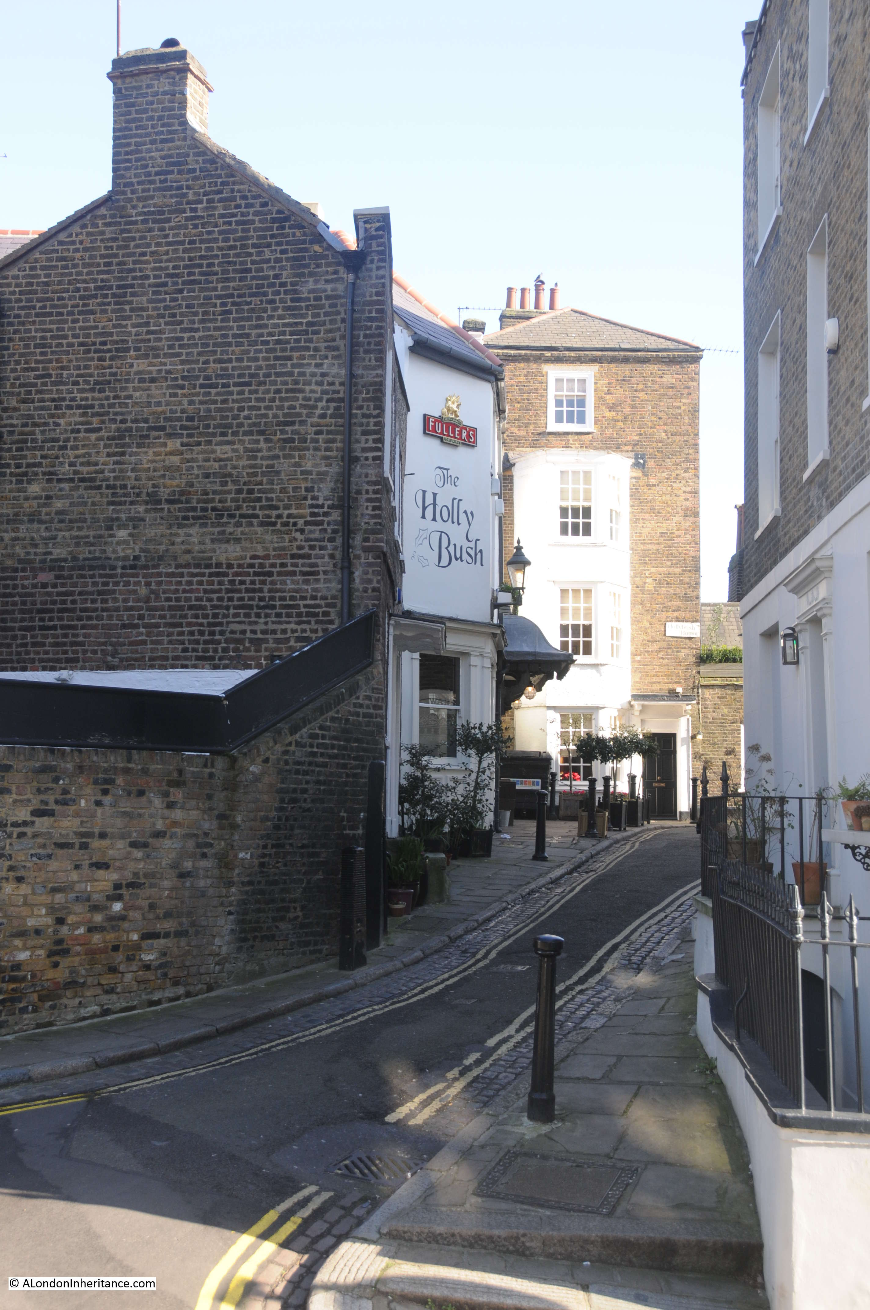
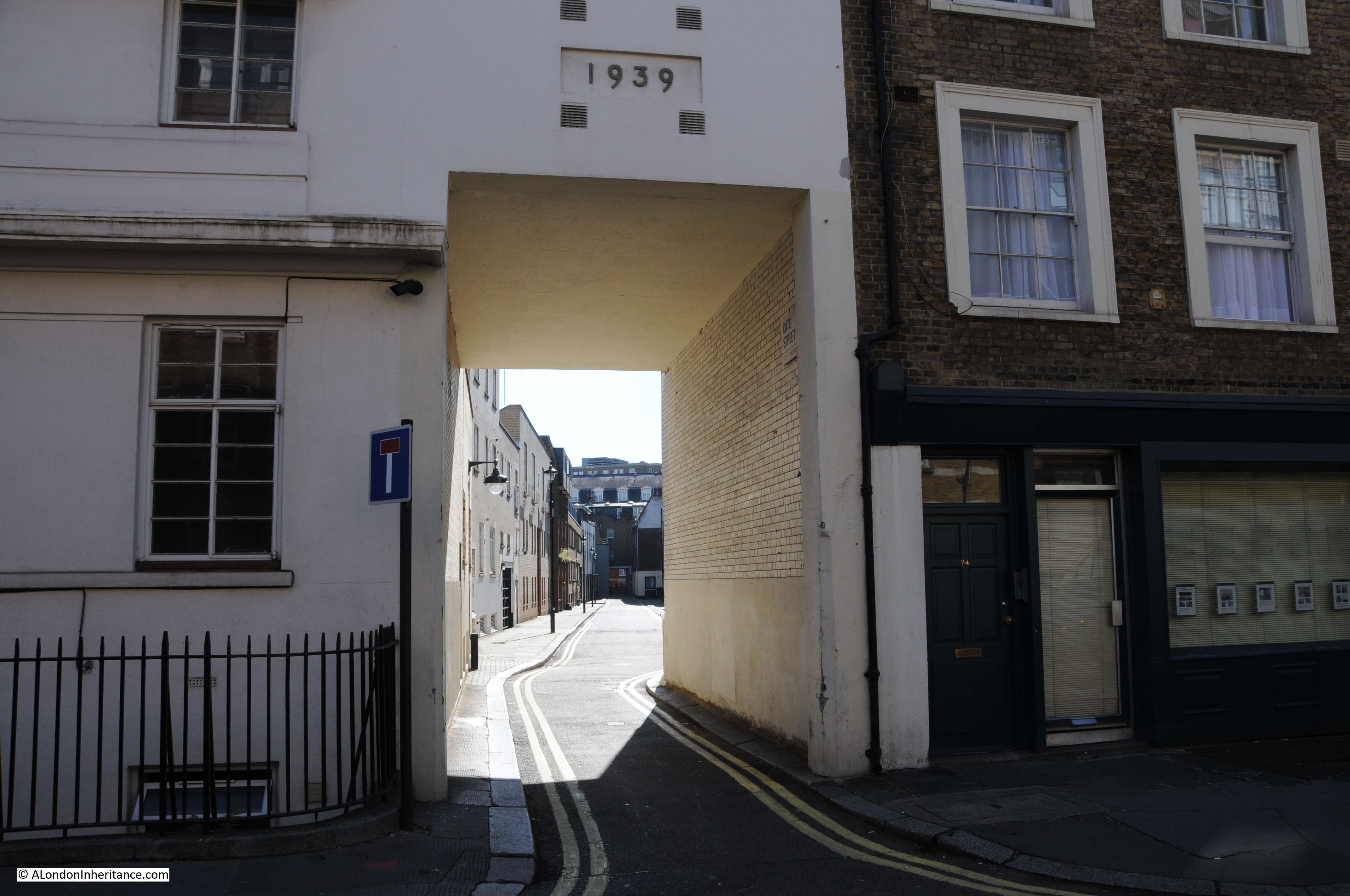
London always surprises, I thought the search for this location would be simple, but I found a lost passageway and a 19th century plot to murder the government of the country.

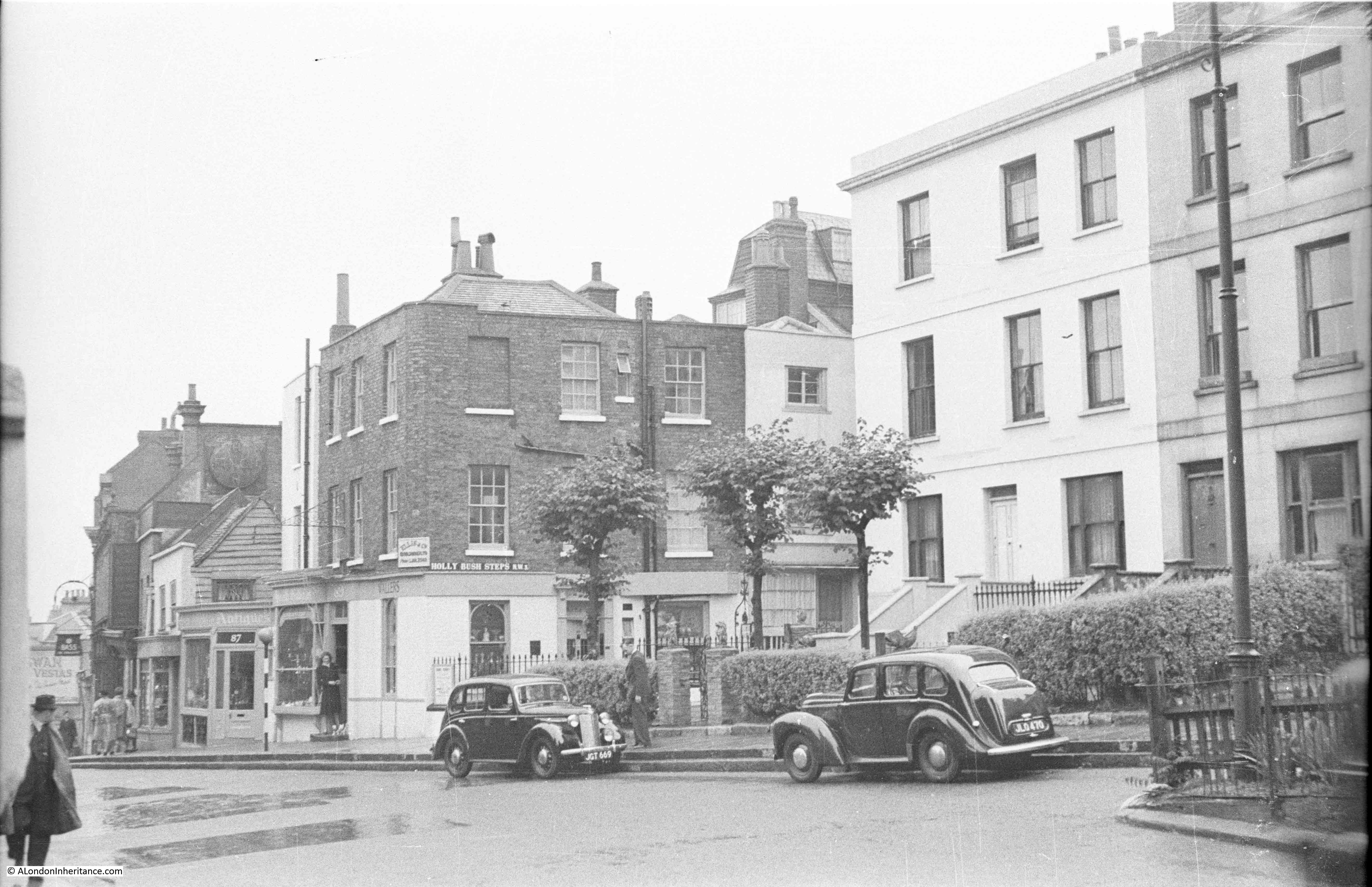
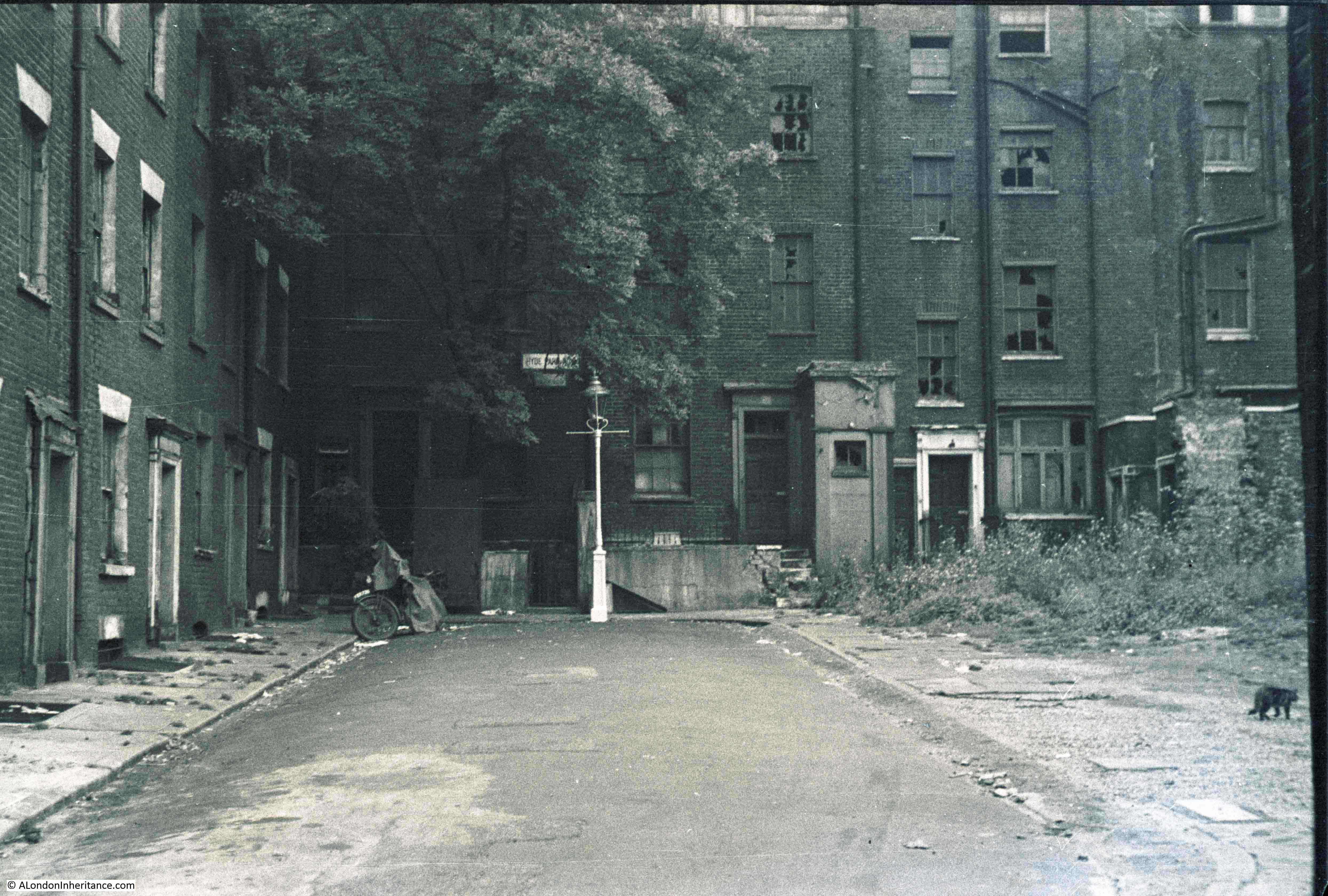
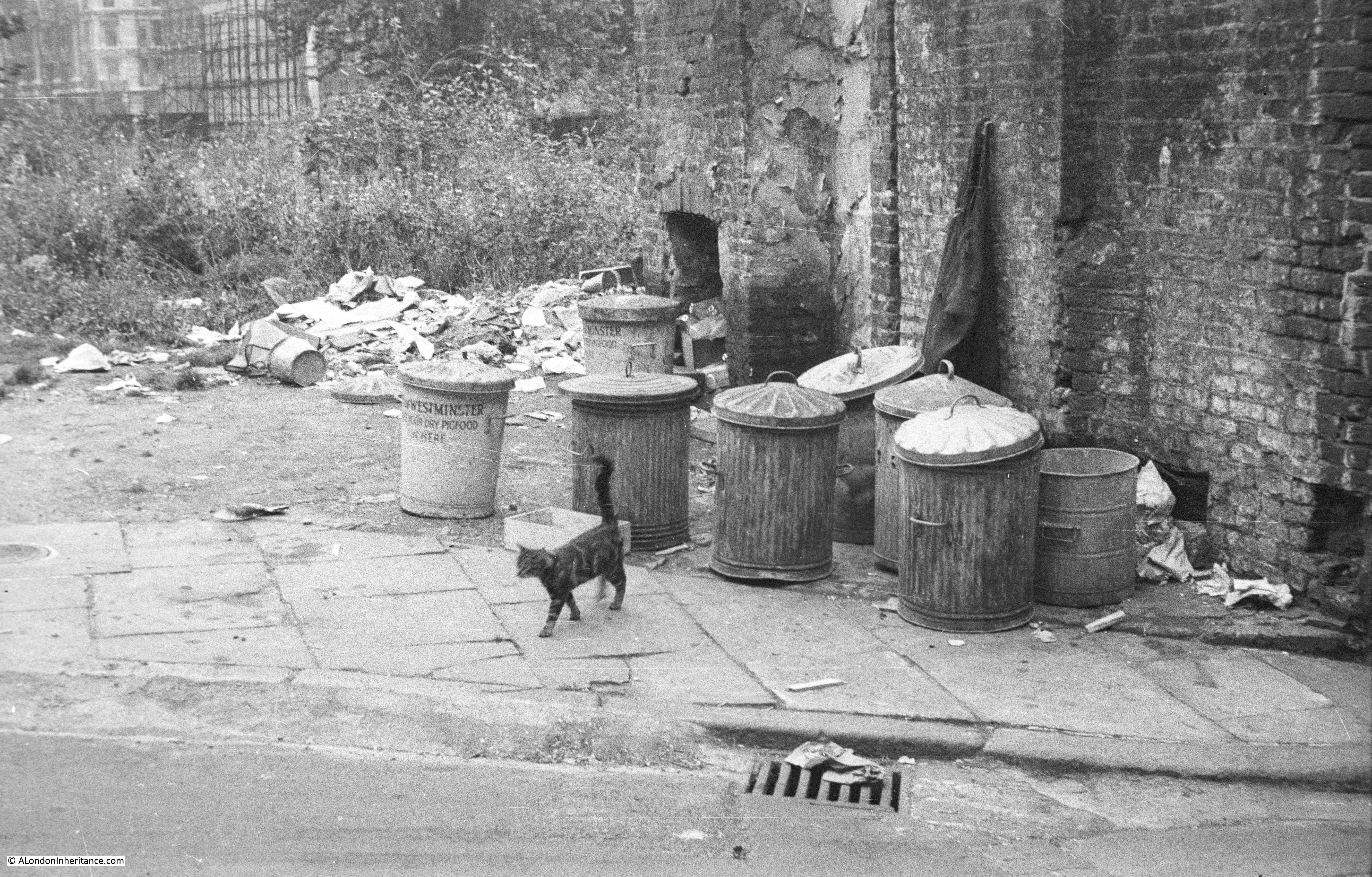
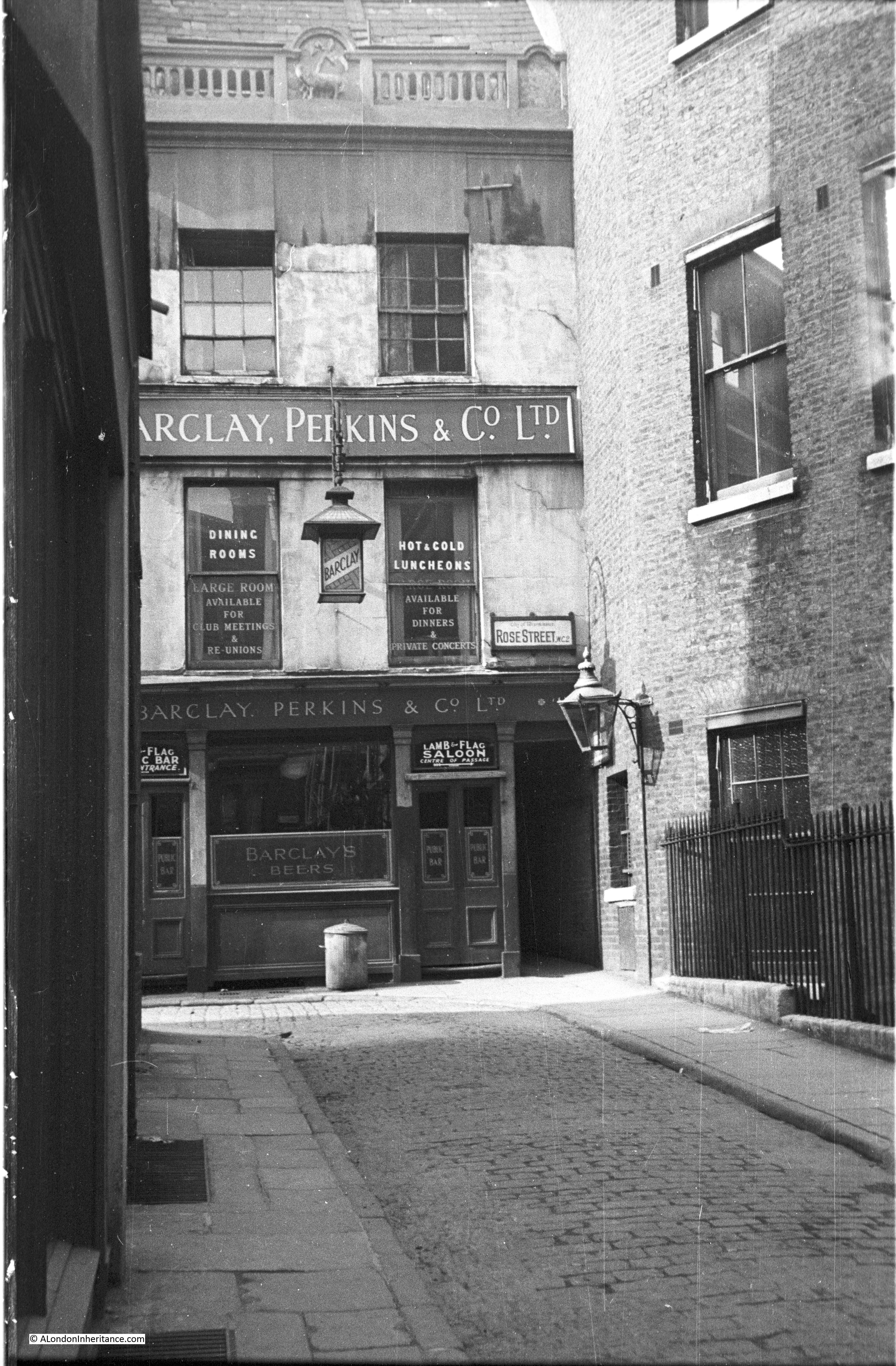
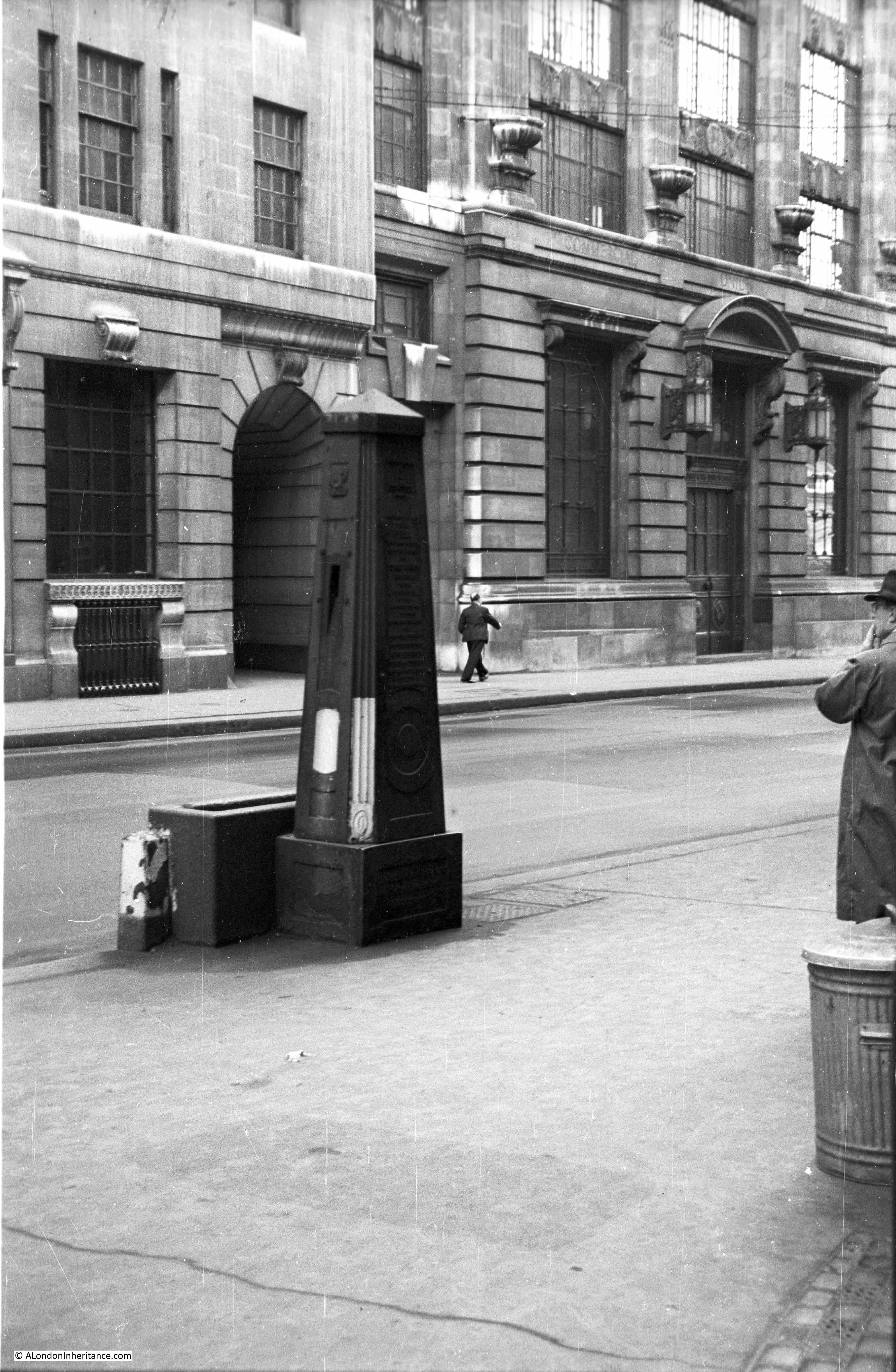
This is one of the photos my father took across London just after the last war showing one of the many locations devastated by bombing.

Hole In The Wall Passage
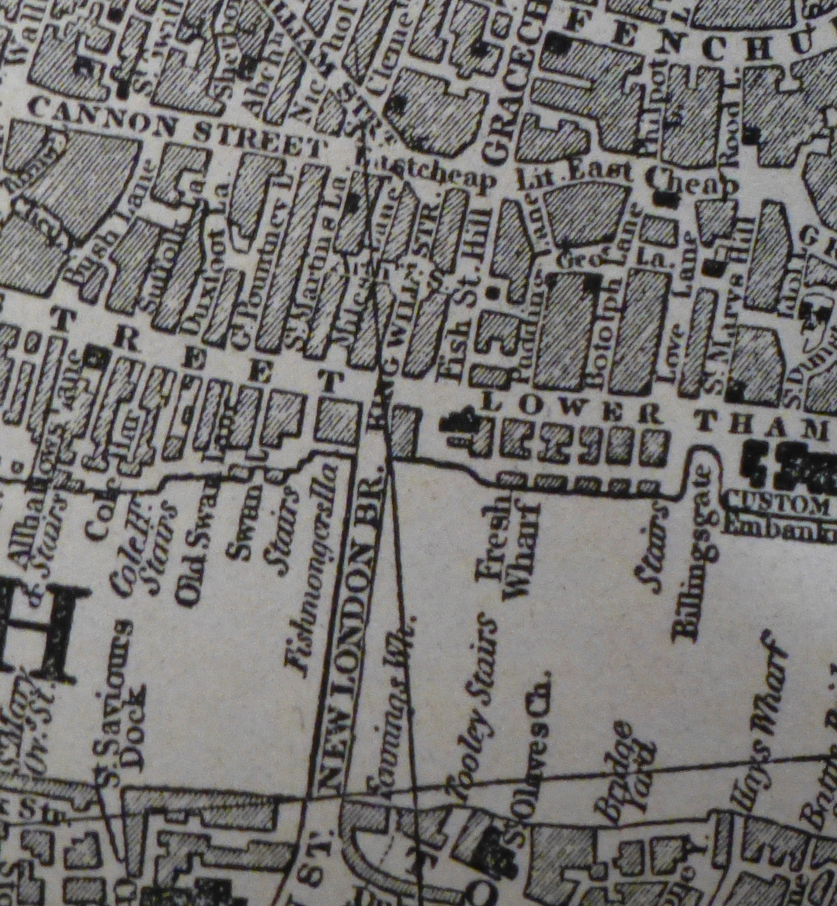
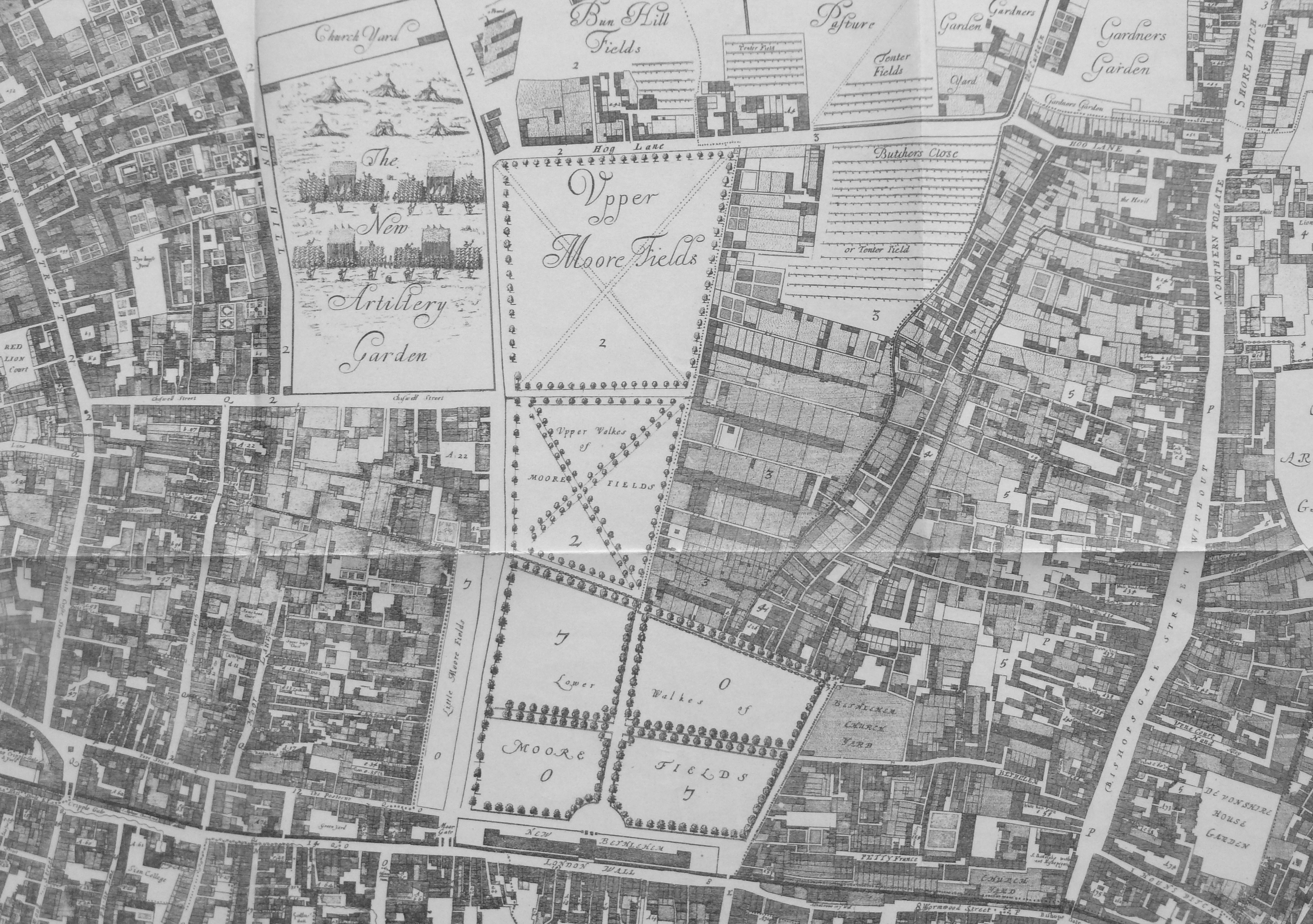
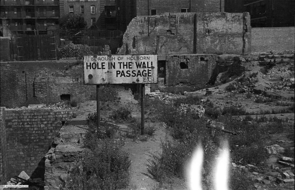
Finding this location should have been easy, the photo provides the name and the borough, however I could not find Hole In The Wall Passage on any of my maps from either before or after the last war.

I found one of the few references to the location of Hole In The Wall Passage in “A Topographical Dictionary of London And Its Environs”, by James Elmes published in 1831:

“Hole in the Wall Passage or Alley, Leather Lane, is about 12 houses on the left hand in Baldwin’s Gardens going from Leather Lane.” 

There was also a pub called the Hole In The Wall at 21 Baldwin Gardens during the 18th and 19th centuries. Was the pub named after the passage or the passage named after the pub?

The only reference I can find to Hole In The Wall Passage being shown on a map is from the National Archives where there is a document from the 26th February 1955  covering the following legislation:

Rights of Way: Stopping up of Highways (London) (No. 13) Order, 1955; Statutory Instrument 1955, No. 352; Location: Hole-in-the-Wall Passage, Baldwin’s Place and Verulam Street in the Metropolitan Borough of Holborn in the County of London

which covered the complete closure, or partial stopping up of a number of public spaces in the area. This confirms when Hole In The Wall Passage finally disappeared. Unfortunately, the National Archives record has not been digitised, so it will have to wait for a visit when hopefully I will finally see a map with Hope In The Wall Passage marked.

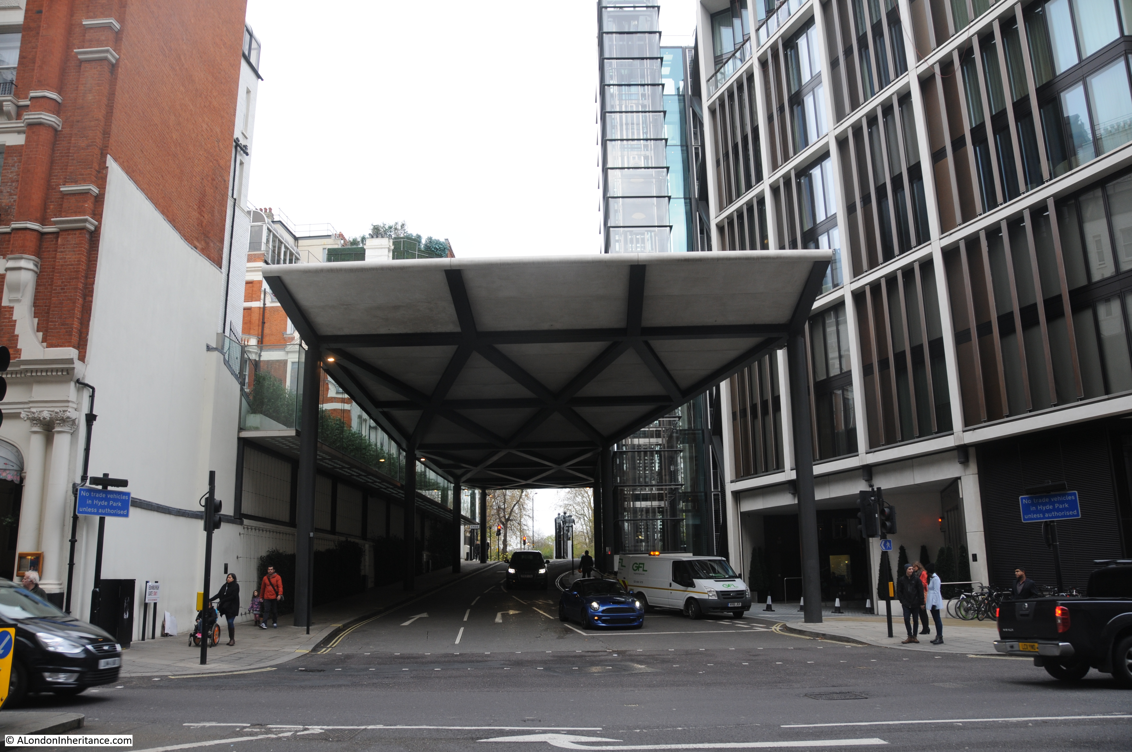
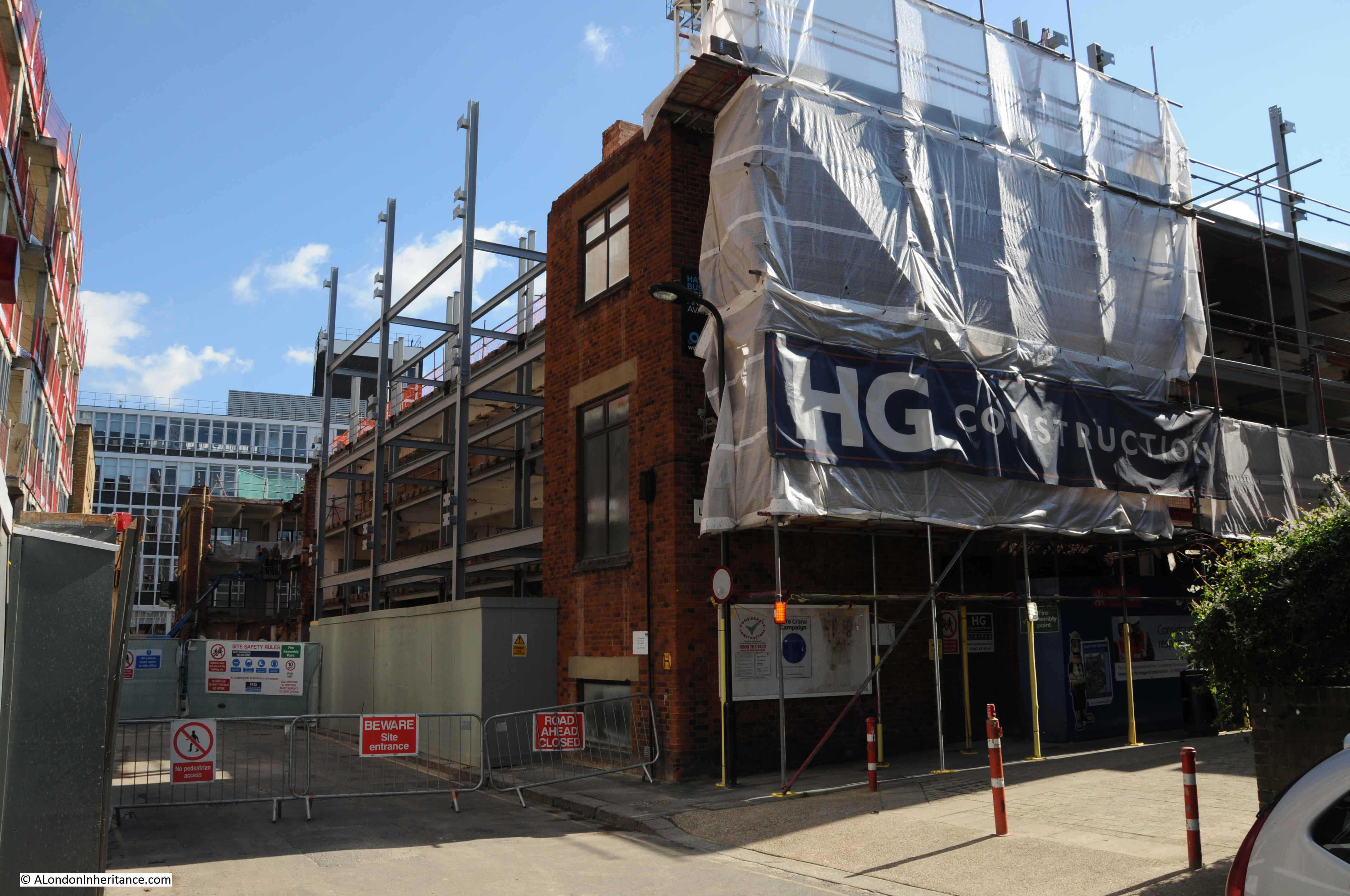
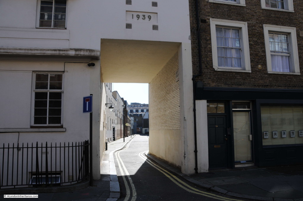
Despite the fact that Hole In The Wall Passage had almost certainly disappeared, I still wanted to see the location to check if there was any remaining indication that it had been there. I walked down Baldwin’s Gardens from Grays Inn Road only to find the road blocked and rebuilding taking place where Hole In The Wall Passage would have been located.

Hole in the Wall 4

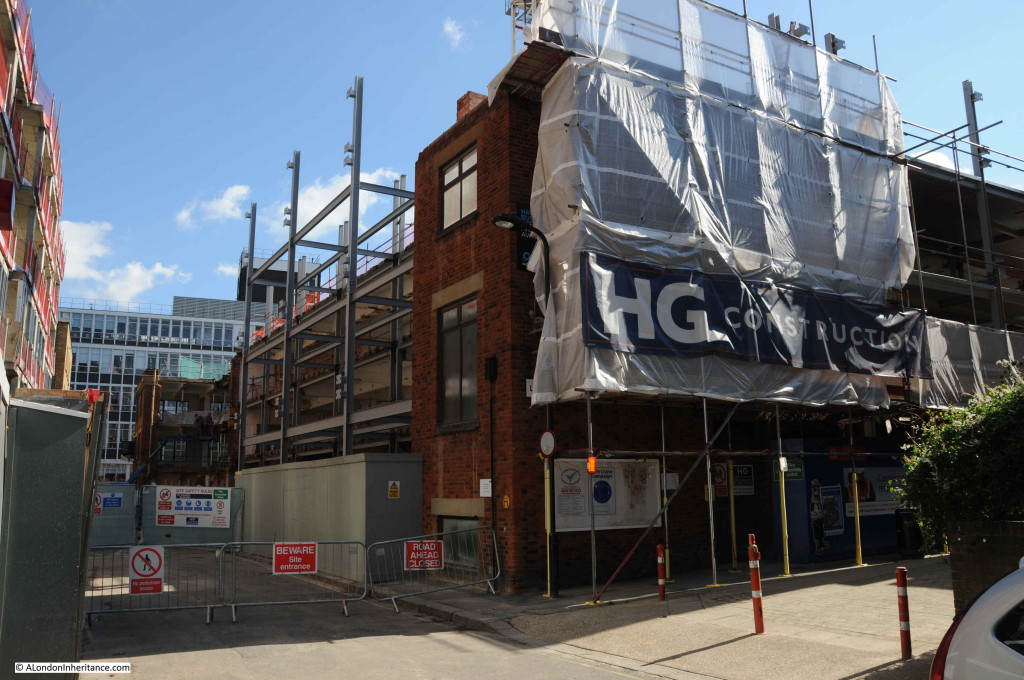
Hole In The Wall Passage would have been roughly where the middle of the new steel work is located.

Looking back at my father’s original photo, I believe the photo was taken on Hole in The Wall Passage looking towards Baldwin’s Gardens. The mounting of the sign looks temporary and it may have been placed across the passageway to mark the original location. The name sign looks as if it has suffered some damage and may have been the original wall mounted sign.

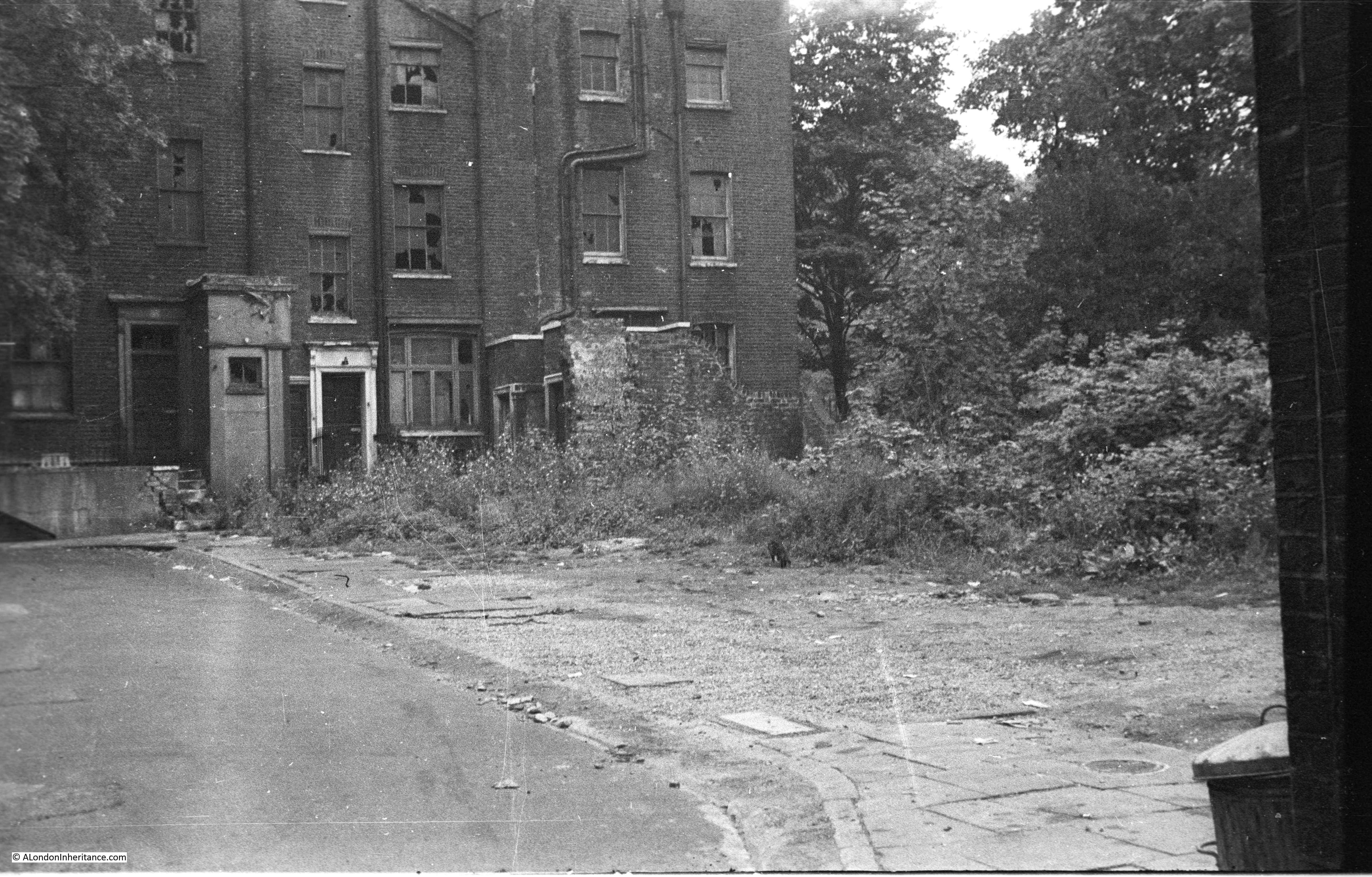
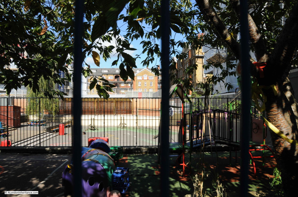
If you look back at the original photo, you can just see some flats in the background. These are still there. I took the following photo through the fencing surrounding a primary school playground from Baldwin’s Gardens:

Hole in the Wall 5

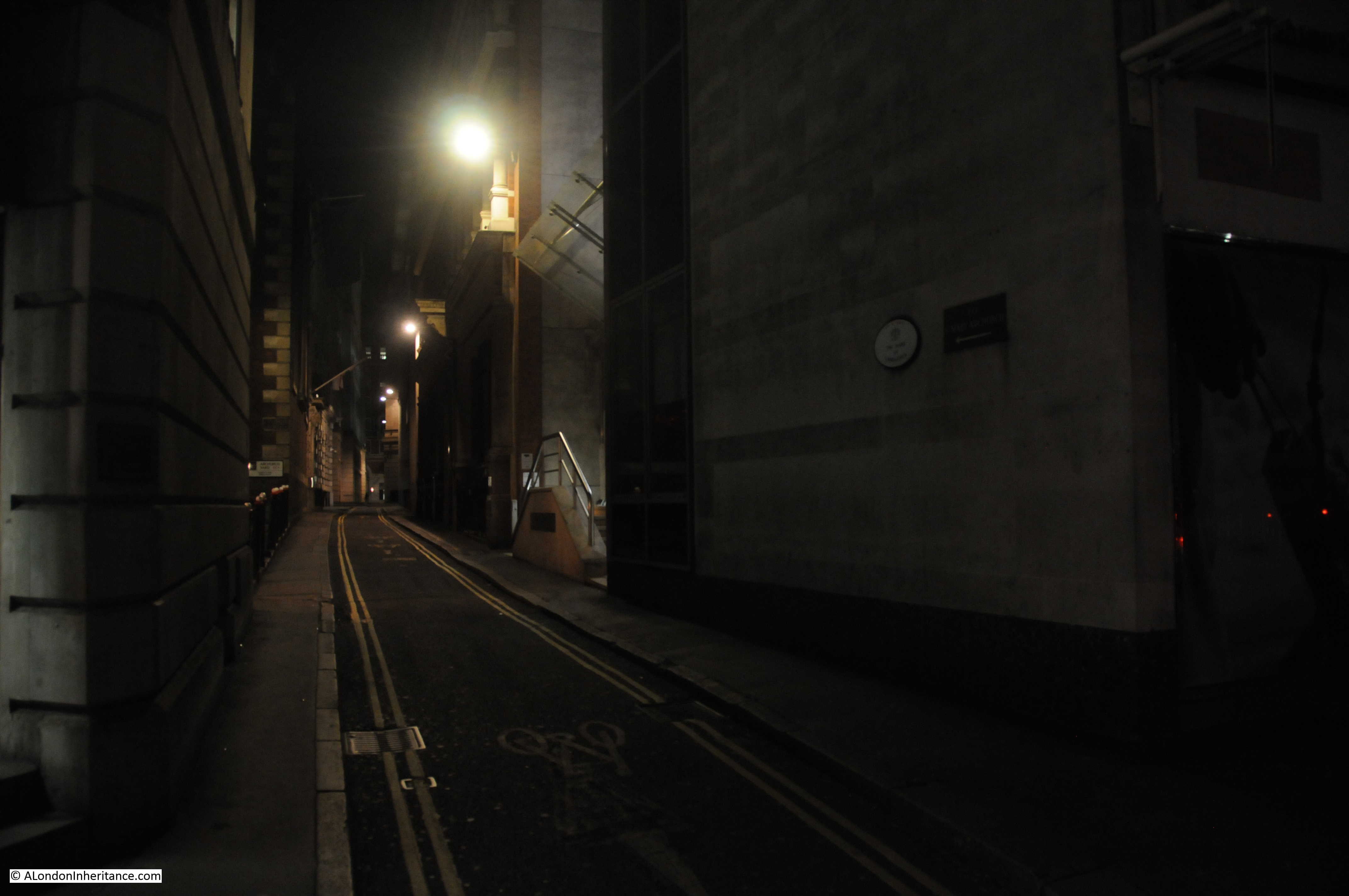
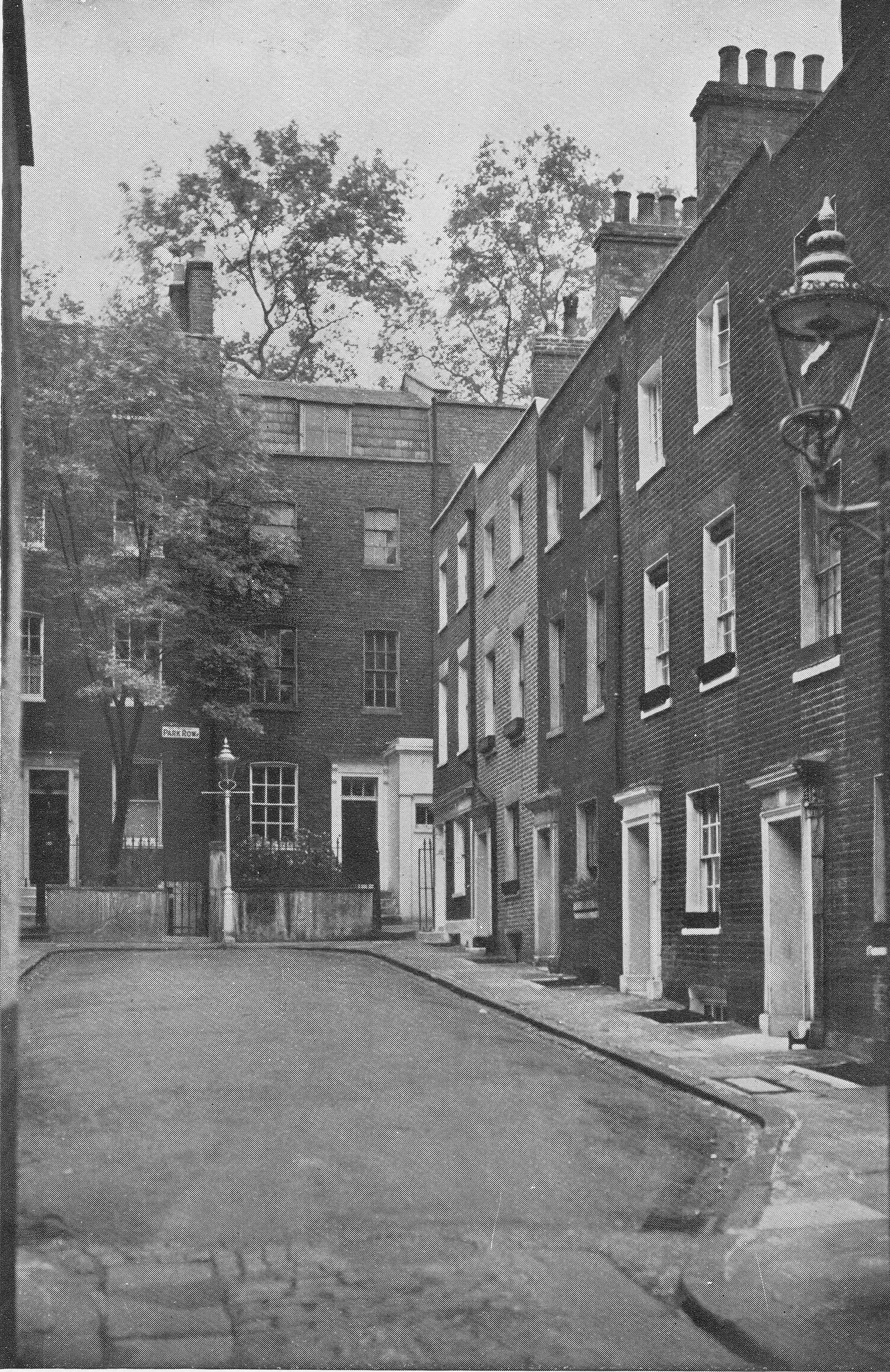
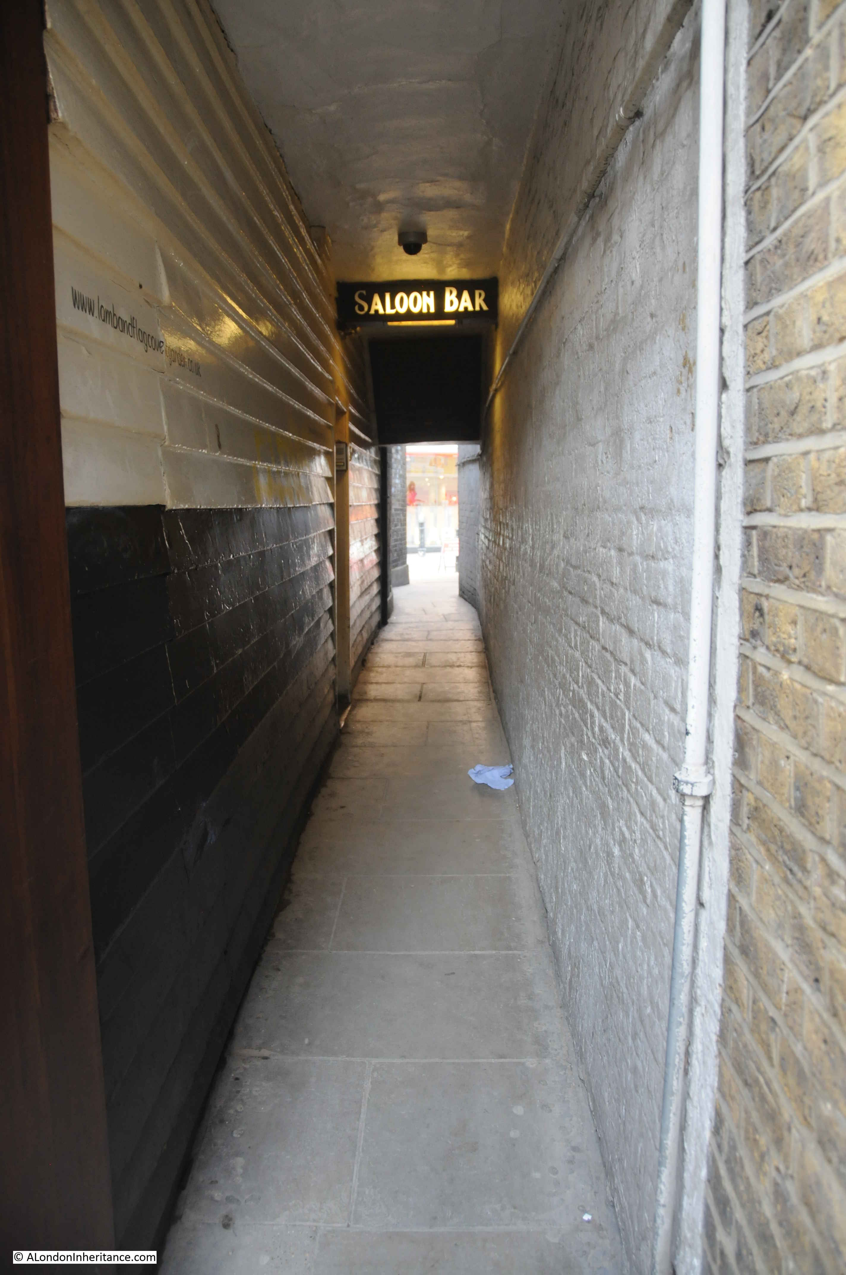
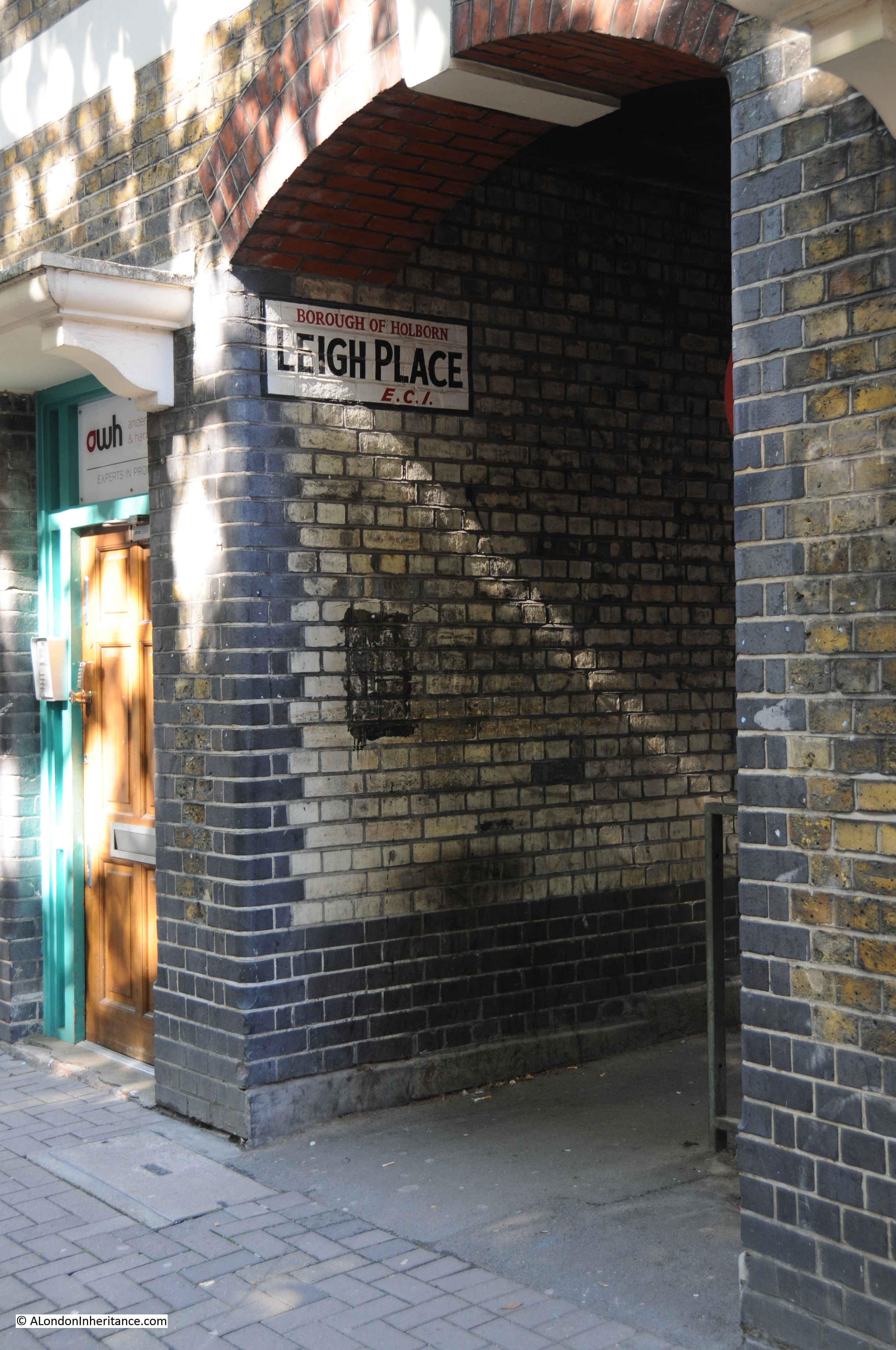
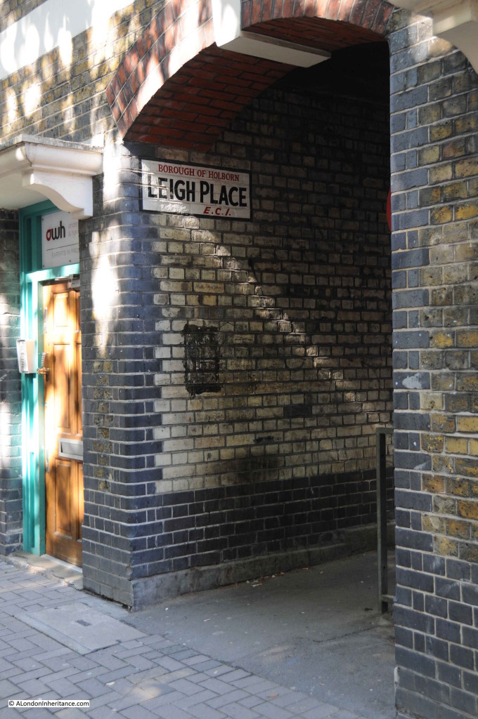
I walked down to Dorrington Street which would have been the other end of Hole In The Wall Passage through Leigh Place. This is also a narrow alley and gives an indication of what Hole In The Wall Passage may have looked like:

Hole in the Wall 6

One of the other references I found for Hole in the Wall Passage was in “London” by George H. Cunningham, published in 1927, which provided a rather sinister reference to the passageway:

“It was here in 1820 that the Cato Street conspiracy was formed to kill Wellington, Canning, Eldon and other Cabinet Ministers. The arms and powder were kept here.”

So what was the Cato Street conspiracy and what part did Hole In The Wall Passage play?

The later part of the 18th century and early part of the 19th century was a time of considerable change in the country. The industrial revolution was now well underway, the Napoleonic wars had finished, people were moving from the countryside to the towns, there was inflation and food shortages.

In the last decade of the 18th century there were riots and destruction of some of the new industrial infrastructure with the government’s response being the Combination Act of 1799 which outlawed the gathering of working men for common purpose. This was followed by the rise of the Luddite movement which started in 1811 and violently put down with show trials and harsh penalties in 1813.

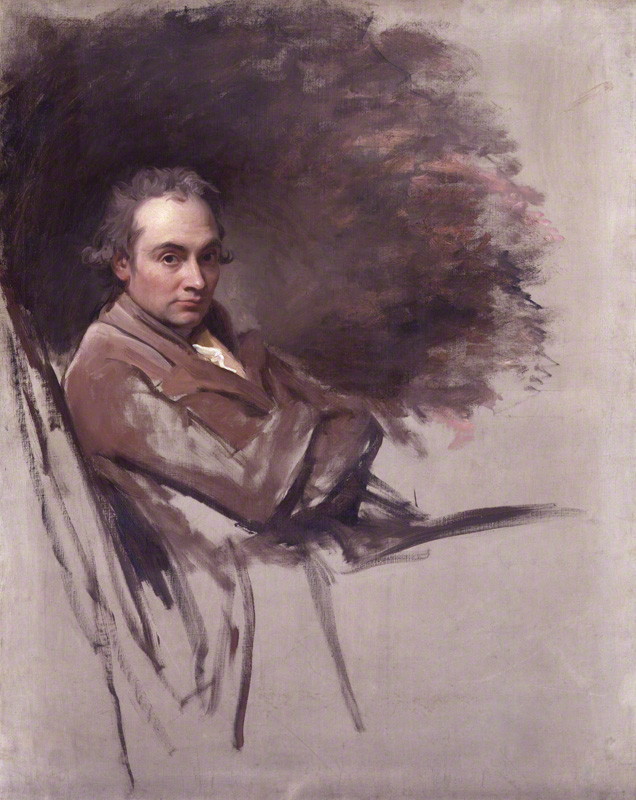
One of the London radicals who protested against the conditions being imposed by  government was Arthur Thislewood, and it was Thislewood who led the Cato Street conspirators, so named after their meeting place prior to their attempt to murder many members of the government.

Thislewood had intelligence that the Cabinet were meeting at Lord Harrowby’s home in Grosvenor Square. The plan was to burst into the meeting, murder the Cabinet members, behead them and then parade their heads on spikes through London.

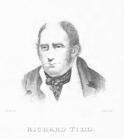
Among the group of almost thirty conspirators there was a spy who passed on details of Thistlewood’s plan. A contingent of police later supported by soldiers stormed the conspirators meeting place in Cato Street, resulting in the arrest of the majority, including one named Tidd who lived in Hole In the Wall Passage.

From “An Authentic History Of The Cato Street Conspiracy” by George Theodore Wilkinson published soon after the trial of the conspirators in 1820:

“The following account of Richard Tidd was given about the period of his arrest. He was about 50 years of age, and lived with his wife and family in a small and miserable dwelling in Hole-in-the-Wall Passage, leading from Baldwin’s Gardens to Dorrington Street. His family consisted of one daughter and two orphan children, whom he had taken under his care.

He had been esteemed among his neighbours, and those who had employed him in his trade, as an industrious sober man, and an excellent workman. He had earned by his own hands forty shillings a week, and very often a greater sum. During the whole course of his life, he was never known to neglect his work, or become inebriated; but with the last week he had been in a drunken state and his family had been at a lost to account for the extraordinary change in his conduct.

On Wednesday night, three men came to Tidd whilst in such a state of drunkenness as scarcely to be able to keep his legs, and forced him away, notwithstanding the earnest entreaties and remonstrances of his wife and family. Nothing was said by the men who took him away, as to their object either to the wife or any one in the house; and during the whole night, and the greater part of the next day, they were in total ignorance of the circumstances since disclosed, and were at a loss to account for the absence of Tidd. In the morning (Thursday), between seven and eight o’clock, two men came to the house, laden with a box of considerable size, and, putting It down on the floor said “they would call in a few minutes for it.” The men refused to answer the interrogatories put to them as to their object in leaving the box, and only repeated, that they would call in a short time, and take it away. Very soon afterwards, two more men came with a large bundle of sticks, some of them of the thickness of a man’s wrist. these were left in a similar manner, and the men also refused to answer any questions, saying only, that they would call again for them in a few minutes. ten minutes had not elapsed before two police-officers entered the house and seized the box and sticks. When opened , the box was discovered to contain a great number of pike-heads, sharpened ready for use. The sticks were also seized, and carried away by the officers. It would appear, from this statement that Tidd was taken by the three men whom we have described to the stable in Cato Street, where he was subsequently apprehended, and carried to Bow Street, together with several others.”

So that is the connection between the Hole In the Wall Passage and the Cato Street Conspiracy.

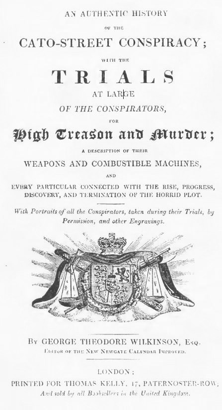
The book on the Cato Street Conspiracy is a wonderfully dramatic account of the event, the title page gives an indication of what is to come:

cato book 1

The opening paragraphs sets the scene:

“On the morning of Thursday the 24th of February 1820, the metropolis was thrown into the greatest consternation and alarm, by the intelligence, that, in the course of the preceding evening, a most atrocious plot to overturn the government of the country, had been discovered, but which, by the prompt measures directed by the privy council, who remained sitting the greatest part of night, had been happily destroyed by the arrest and dispersion of the conspirators. Before day-light the following proclamation was placarded in all the leading places in and about London ;-

LONDON GAZETTE EXTRAORDINARY

Thursday, February 24, 1820

Whereas Artuhur Thistlewood stands charged with high treason, and also the wilful murder of Richard Smithers, a reward of One Thousand Pounds is hereby offered to any person or persons who shall discover or apprehend, the said Arthur Thistlewood, to be paid by the lords commissioners of his majesty’s treasury; upon his being apprehended and lodged in any of his Majesty’s gaols. And all persons are hereby cautioned upon their allegiance not to receive or harbour the said Arthur Thistlewood, as any person offending herein will be thereby guilty of high treason. “

Later in the book there is an account of the storming of the assembly place of the conspirators in Cato Street:

“The officers, with a resolution and courage which does them honour, considering the desperation and determination of these characters immediately ascended the ladder without securing the persons below. They merely gave directions to those who followed, to keep them secure, and they thought that would be enough, without actually confining them. The first man who went up was a person of the name of Ruthven, he was followed by a man named Ellis: after who came a man named Smithers, who met his death by the hand of Thistlewood.

On Smithers ascending the ladder, either Ings or Davidson hallooed out from below, as a signal for them to be on their guard above, and upon Ruthven ascending the ladder, Thistlewood, who was at a little distance from the landing place, and who was distinctly seen, for there were several lights in the place, receded a few paces, and the police-officers announced who they were, and demanded a surrender. Smithers unfortunately pressed forward in the direction in which Thistlewood had retreated, into one of the small rooms over the coach-house, when Thistlewood drew back his arm, in which there was a sword, and made a thrust at the unfortunate man, Smithers, who received a wound near his heart, and, with only time to exclaim, “Oh God !” he fell a lifeless corpse into the arms of Ellis. Ellis seeing this blow given by Thistlewood, immediately discharged a pistol at him, which missed its aim. Great confusion followed, the lights were struck out; the officers were forced down the ladder, which was so precipitous, being almost perpendicular, that they fell, and many of the party followed them.

Thistlewood, among the rest, came down the ladder; and not satisfied with the blood of one person, he shot at another of the officers as he came down the ladder, and pressed through the stable, cutting at all who attempted to oppose him, and made his escape out into John Street, the military not having yet arrived; and he was seen no more at that time, except with a sword in his hand in the Edgware Road. By the other persons an equally desperate resistance was made.

Conscious of the evil purpose for which they had assembled, they waited not to know on what charge they were about to be apprehended; but instantly made a most desperate resistance. Ings, Davidson and Wilson were particularly desperate, each, I believe, firing at some of the officers or military, who had only come to the ground on hearing the report of the fire-arms and not having been previously directed to the exact spot.

Not withstanding the resistance, however, which they so desperately made, and in which resistance Thistlewood, Tidd, Davidson, Ings and Wilson took a most active part, by attacking the officers and solders, the whole of the conspirators were, at length, fortunately overcome, and eventually eleven of them secured. Not on that night, however, for three out of the eleven for the time escaped, namely Thistlewood, Brunt, and Harrison. The officers, however not only secured on that night the eight men, but various articles of fire-arms, numerous weapons, and certain combustibles.”

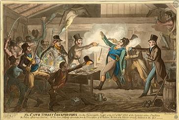
The point where the officers storm the meeting place of the conspirators in Cato Street is captured in the following drawing:

Catostconspirators

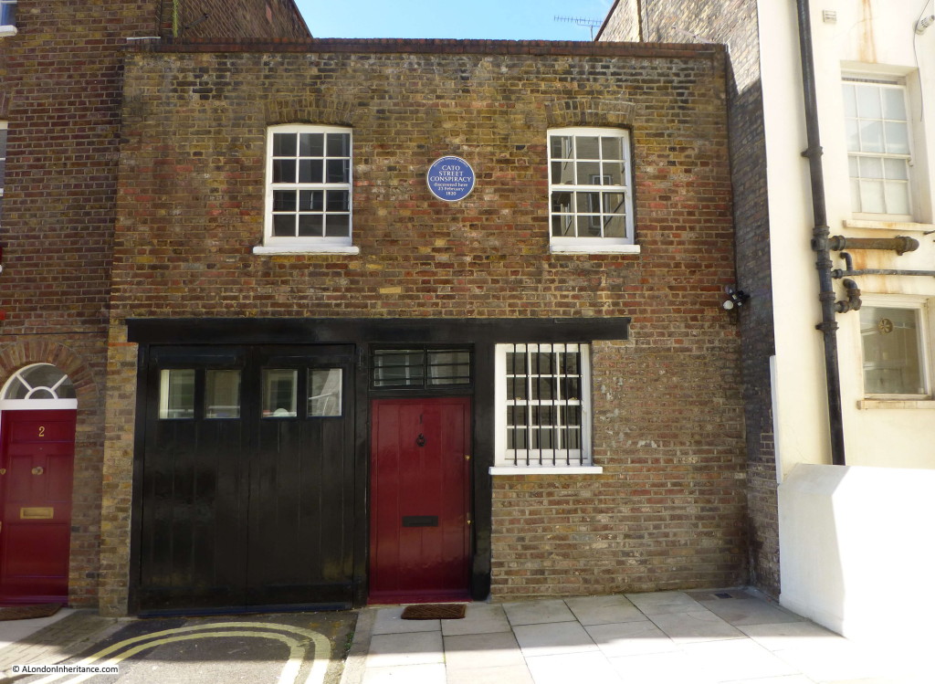
The building where the conspirators met and these events took place in Cato Street is still there, now with a blue plaque recording the event:

Hole in the Wall 2Cato Street is still a narrow street with entrances at each end through buildings. The entrance to Cato Street from Crawford Place.

Hole in the Wall 3

The penalty for each of the conspirators was very severe, probably to be expected given their intentions, however I was very surprised that this form of execution was still available in 1820. Again, from the account:

“That you, and each of you, be taken from hence to the gaol from whence you came, and from thence that you will be drawn upon a hurdle to a place of execution, and be there hanged by the neck until you be dead; and that afterwards your heads shall be severed from your bodies, and your bodies shall be divided into four quarters, to be disposed of as his majesty sees fit. And may God of his infinite goodness have mercy on your souls !

The prisoners were then removed from the bar; some of them, particularly Thistlewood, Brunt and Davidson, appearing to be wholly unconcerned at the awful sentence which had been passed upon them, and the whole of them evincing great firmness and resignation.

Tidd complained of the immense weight of his irons.”

The executions was carried out shortly after the trial although some of the sentences were changed.

Only Thistlewood, Brunt, Davidson and Tidd were to be executed, the rest of the conspirators had their death sentence commuted to transportation for life.

The death sentence was also changed so that the part which directed that their bodies be quartered was now removed. The book of the conspiracy provides a detailed account of the executions. Given that my search for the Cato Street Conspiracy started with Tidd, who “lived with his wife and family in a small and miserable dwelling in Hole-in-the-Wall Passage” we can follow his last hour:

“Tidd, who had stood in silence, was now summoned to the scaffold. He shook hands with all but Davidson, who had separated himself from the rest.

Ings again seized Tidd’s hand at the moment he was going out, and exclaimed, with a burst of laughter “Give us your hand, Good-bye !”

A tear stood in Tidd’s eye, and his lips involuntarily muttered, “My wife and –!” Ings proceeded – “Come my old cock-o-wax, keep up your spirits it will be over soon.

Tidd immediately squeezed his hand, and ran towards the stars leading to the scaffold. In his hurry, his foot caught the bottom step, and he stumbled. He recovered himself, however, in an instant, and rushed upon the scaffold, where he was immediately received with three cheers from the crowd, in which he made a slight effort to join.

The applause was evidently occasioned by the bold and fearless manner in which the wretched man advanced to his station. He turned to the crowd who were upon Snow Hill, and bowed to them. He then looked down upon the coffins and smiled, and turning round to the people who were collected in the Old Bailey towards Ludgate Hill bowed to them. Several voices were again heard, and some in the crowed expressed their admiration of Tidd’s conduct.

The rope having been put round his neck, he told the executioner that the knot would be better on the right than the left side, and that the pain of dying might be diminished by the change. he then assisted the executioner, and turned round his head several times for the purpose of fitting the rope to his neck. He afterwards familiarly nodded to some one whom he recognised at a window, with an air of cheerfulness. He also desired that the cap might not be put over his eyes, but said nothing more. He likewise had an orange in his hand, which he continued to suck most heartily. He soon became perfectly calm, and remained so till the last moment of his life.”

Mr Richard Tidd of Hole In The Wall Passage. Drawn at the time of his trial:

Tidd 1

I wonder what happened to the family that Tidd left behind? How did they survive and did they still continue living in Hole In The Wall Passage?

I really did not expect to find such a story when I first started researching the location of my father’s original photo. Hole In The Wall Passage has left no trace, but fortunately we can still follow the story of one of the inhabitants.

The sources I used to research this post are:

  • London by George Cunningham published in 1927
  • A Topographical Dictionary Of London And Its Environs by James Elmes published in 1831
  • An Authentic History Of The Cato Street Conspiracy by George Theodore Wilkinson

 alondoninheritance.com

London Maps

To help research London’s history, I have a collection of London maps, built up from when my father purchased his first map of London in 1941, along with collecting maps issued to mark special events in the city over the years.

Maps provide not only street plans, they also show how the city has developed, what is important at the time and how the approach to map-making has changed over the centuries.

As well as being functional, many London maps are also a work of art, with some fantastic design being used to also make the map a pleasure to look at and use.

I also find it fascinating to take some of these old maps out when walking London, to try and follow the streets on these maps, to understand the changes and the London we see today.

For this week’s post, I present a sample of the maps I use which I hope you will find of interest.

If you click on any of the following maps on the blog, a much larger version of the map should open.

My first map is a reproduction of the 16th century map of London by Ralph Agas, included in the 1904 book “London In The Time Of The Tudors” by Sir Walter Besant.

Map 1

The Agas map is the most comprehensive map of London in Tudor times, drawn probably between 1553 and 1559 when the population of London was not more than 100,000. The map is rich in detail and shows a city still bounded by the city walls with mainly fields beyond. There is a single bridge over the Thames leading to the south of the river which was a place of entertainment.

To the west of the city the Fleet River extends a considerable way in land with the Fleet Bridge at the bottom of Ludgate and further upstream a Holburne Bridge over the Fleet.

Although named the Ralph Agas map, there is no certainty that he was the artist who drew the map. Agas was a map-maker, originally from Suffolk where he was also a land-surveyor. Born in the mid 16th century he died in 1621. The period of his birth also being around or slightly before the assumed period when the map was drawn would also argue against Agas being responsible.

Despite the uncertainty of who created the map, it is a superbly detailed view of London from a time when London had yet to expand in any degree beyond the original city walls.

The next map is the Ogilby and Morgan map from 1676. My copy is again from Sir William Besant, but this time from “London In The Time Of The Stuarts”.

Map 2

This map shows in considerable detail the city rebuilt after the Great Fire which had occurred 10 years earlier. The section shown above is centred on Spittlefields with the Old Artillery Garden to the left below which is Petticoat Lane. The wide street running from bottom to top starts off as Bishops Gate Street Without, then becomes Northern Folgate (note the difference in name from Norton Folgate as it is now), and then becomes Shore Ditch.

John Ogilby was born in 1600, originally from Scotland he moved to London and had an unusual career, first as a dancer, then running a dance school, a theatre and a publisher in Whitefriars which was lost during the Great Fire. It was at the age of 69 that his short career as a map-maker started, although he died in 1676, just before the map was published.

Ogilby worked with William Morgan who drew each house and garden on the map. It is this level of detail which makes the map so interesting.

In the late 17th Century Richard Blome produced a series of maps of the City Wards. These were published with the 1720 edition of John Stows Survey of London. My example below is Tower Street Ward.

Thames Street Map

Originally published in black and white, many examples were later hand coloured. They provide a detailed view of each individual ward as it appeared at the end of the 17th century.

In the map above, the Customs House is lower right with Billingsgate Dock to the lower left. The church of St. Dunstan’s is to the centre left and Allhallows Barking to the centre right with the Navy Office to the top right.

It is fascinating to walk around the London Wards with these maps, trace the outlines of the wards and see how much remains from the time they were drawn.

A series of Ward maps were also drawn for William Maitland’s History of London published in 1756. My following example is the map of Cordwainer Ward.

Cordwainer Ward Map

Drawn by Benjamin Cole who was an engraver working near Snow Hill. As well as providing a detailed street map, Cole’s maps are also illustrated with pictures of important buildings within the wards (mainly churches) along with the Coat of Arms of prominent inhabitants.

We now move forward to a series of maps published between 1744 and 1746 by John Rocque which covered a very wide area of London, including much that was still mainly agricultural.

Two examples from John Rocque’s map. The first shows London north of London Wall, the street running left to right along the lower part of the following map.

Map 3

Above London Wall are the Lower and Upper Walks of Moore Fields, with to the left of the Upper Fields is the New Artillery Garden which contains ranks of Artillery Men and Tents.

John Roque was of Huguenot ancestry. He lived in Soho where he practised his career as a surveyor. For the time, his map of London was a massive undertaking. It was not just drawing the streets and ground plans of the buildings, but measuring these as accurately as possible.

The streets were measured with chains or with a surveyor’s wheel, an instrument which can still be seen in use today and consists of a wheel of known circumference on the end of a handle. The distance walked is simply the number of turns of the wheel multiplied by the circumference.

Roque also used a theodolite to measure the angles of street corners (again an instrument still in use today).

The map took nine years to complete and was partly funded by Hogarth.

The following extract shows St. Paul’s Cathedral with to the left the Fleet still running up past Ludgate at the Fleet Bridge, although the name in Roque’s map has now been relegated to Fleet Ditch rather than river. A sign of the decreasing importance of this waterway and that it was probably considered a nuisance rather than an asset to the city.

Map 5

My next map is from the 19th century and is Cruchley’s New Plan Of London Improved to 1835 and shows the advance of London to the east. The extract shows the Isle of Dogs.

Map 4

This was at a time when much of East London, north east of Limehouse was unbuilt. The two West India Docks had been built and below these are shown the proposed Collier Docks which was probably a mistake for Cruchley to include as these did not get built, the South Dock and Millwall Dock being constructed instead.

The Lea River is to the top right with Westham Abbey Marsh alongside (note also the “marsh land” just above the East India Dock) which gives an indication of the condition of the land in this area at the time.

The next map comes from the atlas which, although not that old, is my personal favourite. This is Bartholomew’s Reference Atlas of Greater London, this edition published in 1940. It is my favourite as this is the one my father purchased during the war from Foyles in Charing Cross Road. He was about 13 when he got hold of this copy and he had to get a neighbour who was in the Home Guard to purchase the atlas as only those in uniform could purchase maps.

Map 11

I use the Bartholomew’s Atlas as a reference to compare London as it was just before the last war with the redevelopment after. Significant bomb damage, along with future reconstruction resulted in the loss of many streets. In the above extract, the area between St. Paul’s and Newgate Street (consisting of the area around Paternoster Row and Square) was obliterated by bombing, mainly the fires created by incendiary bombs on the 29th December 1940. These streets were not rebuilt and a whole historic area was lost.

Along with street maps, there are also many maps for special events that have taken place across London. The following map is of the British Empire Exhibition at Wembley in 1924. A work of art as well as a map, created by Kennedy North in 1923.

Map 10

As well as providing a plan of the exhibition, the map also shows Motor Bus and Rail routes to the Exhibition, with a ring of stations centred (stations and lines which would form the Circle Line) around Nelson’s Column, described as “The Heart Of The Empire”

The next map shows the locations across London for the 1951 Festival of Britain.

Map 7

As well as the main site on the South Bank, the map also includes;

– the Festival Pleasure Gardens at Battersea

– the Exhibitions of Science and Books at Kensington

– the Exhibition of Architecture at Poplar

A functional map, but also with some artistic design with the flags showing the location of the festival sites, the colours, and the border extending around the plan of the South Bank site.

Maps were also produced for many of the major ceremonial events during the first half of the 20th century. The following map was produced jointly by the London Transport Executive and the Commissioner of Police of the Metropolis for the Coronation of Elizabeth II on Tuesday 2nd June 1953.

Map 6

The map shows the route of the royal procession, bus and coach routes, entry to viewing points, which stations are open all day and which will be closed until after the procession, or closed all day etc.

The colour coded Processional Route  has individual boxes at the bottom of the map to show the best way to get to that part of the procession.

The other side of the map contains detailed written instructions and advise for travelling in London, a map of the London Underground and details of interchange stations.

The map was issued free and shows the degree of planning that went into the event.

I always pick up new editions of the London Underground maps, but in the past there have been maps showing other forms of transport across the city. The following is the Trolleybus and Tram Map of London issued in 1940 by London Transport.

Map 8

A detailed map showing Trolleybus and Tram routes across central London and also out into the suburbs, also showing Underground and Mainline Rail Stations.

The reverse of the map has a timetable including details of all night trams and trolleybuses.

This is one of my father’s maps and when going through his map collection the following ticket fell out:

Map 9

His ticket from the Last Tram Week in July 1952. (See the photos he took of the event here).

London is constantly changing and maps provide a snapshot of the city at a point in time. They show how London has expanded out from the original walled city, they show the significant development of the London Docks, they show how transport has been provided across the city and they show how London has marked significant events.

It will be interesting to see how long paper maps continue to be published with the growth in on-line mapping and the easy availability of a map on a smart phone. Whilst they are, I will continue to collect them to keep a record of a changing city.

alondoninheritance.com

London Streets In The 1980s – Part 2

Back in May I published a number of photos we took showing London streets in the 1980s. Judging by the number of page views they were very popular (and can be found here), so for this week’s post, please join me in another walk along the streets of London in 1986.

We will start in East London.

In the mid 1980s, London still had very many independent corner shops selling a wide variety of goods from premises that had not really changed for many years. This is Fowlers Stores in Old Ford Road, off Cambridge Heath Road between Bethnal Green Underground and Cambridge Heath Overground stations.

1980s - 17

A general stores in Fordham Street, one of the many side streets between Whitechapel Road and Commercial Road.

1980s - 4

Corner shop in Parfett Street, again one of the side streets between Whitechapel Road and Commercial Road.

1980s - 1

Hessel Street at the junction with Commercial Road. The wall advertising has long gone and the café has been replaced by the Shalamar Kebab House.

1980s - 2

Not sure the exact location, but a side street off Commercial Road.

1980s - 3

There was always plenty of colourful graffiti to be found whilst walking round East London in the 1980s.

I like this one as it was obviously important to get the spelling correct:

1980s - 5

Back in 1986 Rupert Murdoch was well on his way in building up his reputation as a controversial character. This was the time of the printers strike when News International had built a new printing plant in Wapping and started the move of newspaper publishing out of Fleet Street.

1980s - 22

A quick hop across the river to Deptford. Graffiti on the side of a house in Grinstead Road:

1980s -18

Now back to Bethnal Green and the railway arches leading out of Liverpool Street Station, doing what railway arches always seem to do and host car maintenance businesses.

1980s - 19

Railway arches alongside Three Colts Lane, Bethnal Green:

1980s - 20

This is G.J. Chapman, located at 10 Penton Street, just off the Pentonville Road. The type of general hardware store that had an early morning and evening custom of moving many of their goods for sale out and then back into the shop. Closed I beleive about 20 years ago and now replaced by flats.

1980s - 14

Another corner store.

1980s - 13

Despite the very poor condition of the building that is home to the Boleyn Pet Stores, the building is still there. Fully repaired although the pet shop has long gone and the last time I passed was a café. The location is on the corner of Bradbury Street and Boleyn Road, Dalston.

1980s - 7

Cannot remember where this was, but typical 1980s posters.

1980s - 15

Street sign advertising the butchers….

1980s - 18

…. and a café. There were many of this type of pavement advertising. I included a number in my previous 1980s street photos post.

1980s - 16

The Nobody Inn. A pub in Mildmay Road, Islington. Last time I walked past it was a completely refurbished pub and restaurant with a new name.

1980s - 21

An upholstery business on the corner of Alfearn Road and Millfields Road, between Clapton and Hackney. Established 1950, but no longer there.

1980s - 12

Allen Road, Stoke Newington / Newington Green. You would not find a scrap metal dealer on this road now, although the building is still there.

1980s - 11

Florists in Dalston.

1980s - 10

Butchers:

1980s - 9

French’s Dairy in Rugby Street, Holborn. The plaque on the wall states that in the rear is the White Conduit (circa 1300), originally part of the water supply to the Greyfriars Monastery in Newgate Street.

The dairy has gone, but the plaque and building are still there.

1980s - 8

Whittington Park, Islington.

1980s - 23

An old shop front, brightly painted for a furniture business which seems to have gone out of business.

1980s - 24

Many of the buildings featured above are still there, but they now provide a very different function and the days of the individual general store, pet shop, dairy etc. are now mostly long gone or disappearing fast as the process of gentrification moves from one London street to the next.

Whilst the streets of London are now in a much better state of repair, they are loosing much of their individuality and colour (but I still enjoy walking them !).

alondoninheritance.com

A 1943 View Of A Redeveloped London

In 1943, although the end of the last war was still two years away,  the thoughts of the London County Council were focussed on the post war reconstruction of the city.

London had yet to suffer the barrage of V1 and V2 weapons, but in 1943 the London County Council published the County of London Plan, a far reaching set of proposals for the post-war development of the city.

I find the many plans for London that have been published fascinating to read. They show the challenges of trying to forecast the needs of a city such as London for decades to come. They provide a snapshot of the city at the time, and they demonstrate that time after time, development of London has reverted to ad-hoc rather than grandiose, city wide schemes.

In the forward to the plan, Lord Latham the Leader of the London County Council wrote:

“This is a plan for London. A plan for one of the greatest cities the world has ever known; for the capital of an Empire; for the meeting place of a Commonwealth of Nations. Those who study the Plan may be critical, but they cannot be indifferent.

Our London has much that is lovely and gracious. I do not know that any city can rival its parks and gardens, its squares and terraces. but year by year as the nineteenth and twentieth centuries grew more and more absorbed in first gaining and then holding material prosperity, these spaces were over-laid, and a tide of mean, ugly, unplanned building rose in every London borough and flooded outward over the fields of Middlesex, Surrey, Essex, Kent.

Athens was the glory of Greece, Rome the great capital of a great Empire, a magnet to all travellers. Paris holds the hearts of civilised people all over the world. Russia is passionately proud of Moscow and Leningrad; but the name we have for London is the Great Wen.

It need not be so. Had our seventeenth century forefathers had the faith to follow Wren, not just the history of London, but perhaps the history of the world might have been different.

Faith, however was wanting. It must not be wanting again – no more in our civic, than in our national life. We can have the London we want; the London that people will come from the four corners of the world to see; if only we determine that we will have it; and that no weakness or indifference shall prevent it.”

The 1943 plan provides plenty of detailed analysis of London at the time, with some graphical presentation using techniques I have not seen in any earlier London planning documents.

The following diagram from the report provides a Social and Functional Analysis of London. This divides London into individual communities, identifies the main functions of the central areas, shows town halls, man shopping centres and open spaces.

The City is surrounded by an area of “Mixed General Business and Industry”. Press (Fleet Street) and Law (the Royal Courts of Justice) provide the main interface between the City and the West End, which also contains the University and Government areas of the city.

The darker brown communities are those with a higher proportion of obsolescent properties. (click on any of the following maps to enlarge)

Social and Functional Map 1

The plan placed considerable importance on community structure within London:

“The social group structure of London is of the utmost importance in the life of the capital. Community grouping helps in no small measure towards the inculcation of local pride, it facilitates control and organisation, and is the means of resolving what would otherwise be interminable aggregations of housing. London is too big to be regarded as a single unit. If approached in this way its problems appear overwhelming and almost insoluble.

The proposal is to emphasise the identity of the existing communities, to increase their degree of segregation, and where necessary to reorganise them as separate and definite entities. The aim would be to provide each community with its own schools, public buildings, shops, open spaces etc. At the same time care would be taken to ensure segregation of the communities was not taken far enough to endanger the sense of interdependence on the adjoining communities or on London as a whole.”

The following map shows a more traditional view of the Communities and Open Spaces within the Greater London area.

Communities and Open Space 1

The plan identifies a number of issues that divide communities, chief among them the way that railways, mainly on the south of the river have divided local communities with railway viaducts acting as a wall between parts of the same community.

The plan used the following photo of the railway viaducts on the approach to Cannon Street Station and down to Waterloo to illustrate the impact. The report, as with a number of other proposals for the post war development of London, placed considerable importance on moving the over ground railways into tunnels to remove viaducts, bring communities together and to remove rail bridges, such as the one shown leading into Cannon Street Station, from across the Thames.

The Southbank 2

The first sentence in the section on Roads is remarkable, remember this was written in 1943, not 2015:

“The need for improved traffic facilities in and around London has become so acute, that unless drastic measures are taken to relieve a large number of the thoroughfares, crossings and junctions of their present congestion, there will be a grave danger that the whole traffic system, will, before long, be slowed to an intolerable degree.”

The plan also emphasises the dangers resulting from traffic on London roads with in 1937 a total of 57,718 accidents in the Greater London area that involved personal injury.

At the time of planning, the ratio of cars to population was one to twenty two. The plan expects a considerable increase in car usage after the war, stating that the war has “made a vast number of people for the first time mechanically minded, and has given a great impetus to the production of motor vehicles.”

Parking this number of cars was also expected to be a problem. The plan includes the provision of underground car parks and that legislation should be passed that enforces the provision of car parking facilities for all buildings of a certain size.

A new ring road was planned for fast moving traffic.  This is shown as the B Ring Road in the following map. Circling the central area of London and with a tunnel under the Thames running from the Isle of Dogs to Deptford. Roads radiating out from the B Ring Road would allow traffic circulating around London to quickly leave to, or arrive from the rest of the country.

Road Plan 1

The plan also identifies the “cumulative effect of street furniture on the appearance of London and on the convenience of pedestrians and vehicular traffic is very considerable” and recommends the formation of a Panel to provide a degree of control over street furniture, with a preference for embellishing streets with tree-planting and green-swards. With the level of street furniture on the streets today, perhaps a Panel to control this would have been a good outcome.

The provision of more open space was seen as a key component of the future development of London with the standardised provision of space for Londoners.

At the time the plan was written there was a considerable variation in the amount of open space available to Londoners in different boroughs, for example the inhabitants of Woolwich benefited from the availability of 6 acres per 1,000 inhabitants, whilst for those of Shoreditch the amount of open space available was 0.1 acres per 1,000 inhabitants.

The provision of 4 acres of open space for every 1,000 inhabitants across London was adopted as a key strategy for future development.

Examples of how open space could be made available to the public included the use of Holland Park, the grounds of the Hurlingham Club and the Bishops Palace Grounds in Fulham.

Indeed at Hurlingham, after the war, the London County Council made a compulsory purchase of the polo grounds to build the Hurlingham Park recreation grounds, along with the Sullivan Court flats and a school, leaving the Hurlingham Club with the 42 acres retained today.

The plan also states that “The difficulty of finding alternative housing accommodation for people displaced when open spaces are provided in built up areas, has been partly removed through the destruction of many houses by bombing.” I am not sure what the view of those who had lost their homes through bombing would have been, that there was a plan to replace their homes with open space.

The following Open Space Plan shows the proposed new public open space in dark green:

Open Space Plan 1

The 1943 plan presents a fascinating view of the industrialisation of London.

The East End of London and the London Docks were well known industrial areas, however every London borough had a significant amount of factories and industrial employment. The report includes a summary of industry for every London borough. I have shown a sample below to indicate the range of factory numbers, employment levels and types of industry across some of the London boroughs.

Borough Principal industries according to numbers employed Size of Factories Factory numbers in 1938 Factory employees in 1938
Bermondsey Food, engineering, and chemicals, including tanneries Each of the principal industries has a large number of factories 711 31,058
Bethnal Green Furniture and clothing Furniture factories very small, clothing small with a few large premises 1,746 15,945
Finsbury Clothing, printing and engineering, though appreciable numbers are employed in all other industries Mostly medium to small, though each industry has a number of large factories and the average size if bigger than in Bethnal Green, Shoreditch or Stepney 2,523 66,556
Islington Engineering, clothing, furniture and miscellaneous (principally builders’ yards, cardboard boxes and laundries) Mostly small, though engineering, furniture and miscellaneous each has a number of medium sized factories 1,998 35,649
Stepney Clothing, food (including breweries and tobacco) and engineering Mostly small (especially clothing) but each industry has a number of large factories 3,270 58,073
Westminster Clothing, printing and engineering, though appreciable numbers are employed in all other industries Mostly small (especially clothing), but each industry has several large factories 4,414 46,528

The plan identifies a trend of decentralisation which had already being happening for a number of decades with the gradual migration of industry from central to outer London and also identifies the improvement in transport facilities as enabling industry to move away from the main residential areas.

Even in 1943 the report identifies the importance of the new industrial estates at Slough, Park Royal, along the Great West Road etc. as the future home for more of London’s industry.

What the plan does not identify is how the Docks would change over the coming decades. The expectation was that the London Docks would continue to provide a key role in both London and the Nation’s global trade.

The following map shows the proposed approach for how industry would be located across the Greater London area. Note the concentration of industrial areas around the Docks and along the Thames.

Industrial Proposals 1

In addition to planning at the Greater London level, the 1943 report also focussed on a number of specific areas that had suffered extensive bomb damage and were therefore important redevelopment locations.

An example is the redevelopment of Bermondsey. The following plan shows the proposed post-war reconstruction of Bermondsey:

Bermondsey 1

The plan for Bermondsey illustrates how the 1943 plan proposed:

  • replacing the long runs of railway viaducts with underground rail tunnels thereby avoiding the way the viaducts divided communities
  • a considerable increase in the amount of public open space
  • wide through roads to carry traffic efficiently across London
  • reduced housing density

How far these plans were actually implemented after the war can be judged by comparison with the following 2015 map of Bermondsey. The railway viaducts still remain, cutting across the borough, and the street layout remains largely unchanged. Southward Park provides a large amount of open space, however there is not the amount proposed in 1943 and the large park planned to run adjacent to the Old Kent Road was not constructed.

New Bermondsey Map 1

Another focus for significant redevelopment was the South Bank. Starting from Westminster Bridge and County Hall at the right of the following picture, the plans consisted of:

  • a Youth centre to the left of County Hall
  • a new road bridge across the Thames leading to Charing Cross to replace the rail bridge after the railways had been diverted underground
  • a Theatre between Charing Cross and Waterloo Bridges (which did get built in the form of the Royal Festival Hall)
  • Government offices running to…..
  • a new bridge – Temple Bridge – across the Thames from the South Bank to Temple Station, in exactly the same place as the proposed Garden Bridge
  • offices then running to Blackfriars Bridge
  • followed by office and flats leading up to a landscaped area around Southwark Cathedral
  • with public gardens running the length of the Thames embankment

The South Bank 1

When reading the plan I was really surprised to find that in 1943 there were proposals for a bridge across the river at Temple. Although this would have been more functional than the proposed Garden Bridge, it would still have blocked some of the view from Waterloo Bridge and the South Bank across to St. Paul’s and the City.

The following picture is an artist impression from the 1943 report of the proposed new Charing Cross road bridge:

Charing Cross Bridge 1

The 1943 report places considerable importance on the need for housing after the war, claiming that “Of the many aspects of London’s future in so far as replanning is concerned, that of housing must claim first attention.” and that “The provision of new housing accommodation will be a most urgent task to be tackled immediately after the war.” Some things do not change, although in 1943 the plans for housing in central London were very much the provision of affordable housing for Londoners rather than the endless development of luxury apartments we see today.

The 1943 plan proposes a comprehensive housing plan to address the need to improve the housing conditions for Londoners as well as providing the number needed.

The following photo from the 1943 plan shows some of the building commenced prior to the war. This is the White City Housing Estate, Hammersmith. Construction started in 1936 and was suspended in 1939. The plan states that when work recommences, the estate will cover an area of 52 acres and comprise 49, 5 storey blocks with accommodation for 11,000 people.

The White City Stadium can be seen on the left of the photo. Completed in 1908 for the Summer Olympics of the same year, the stadium was demolished in 1985 following which the BBC occupied the site. The BBC are now gradually vacating the site so it will be interesting to see what happens with this significant site in the future. (There is plaque on one of the BBC White City buildings at the point of the finishing line of the 1908 track)

White City 1

The 1943 plan recommends the development of housing estates and uses the Roehampton Cottage Estate in Wandsworth as an example of the type of estate that should be built, including the preservation of trees which “adds greatly to the attractive lay-out”

Roehampton 1The 1943 plan also makes recommendations for greater architectural control and uses the following view of Oxford Street as an example of “the chaos of individual and uncoordinated street development” 

Architectural Control 1

The plan recommends “that Panels of architects and planners might be set up to assist the planning authority in the application of a control for street design, similar to those already in operation in other countries, notably in America and Scandinavia. Cornice and first floor levels, as well as the facing materials used, should be more strictly controlled so as to give a sense of continuity and orderliness to the street”. 

The 1943 plan is a fascinating read, not only covering London at the time, but also how London could be today if these plans had of been adopted in full. I have only been able to scratch the surface of the report in this week’s post.

Reading the plan it is clear that some issues do not change, for example housing and traffic congestion.

The plan also highlights the difficulty in planning for the future. There is only a very limited reference to “Aerodromes”, beginning with “All the portents indicate that, after the war, there will be a very considerable expansion in air transport for passengers and, perhaps, for freight. Any plan for the future of London must have close regard for these eventualities.”

The plan does seem to rule out the construction of a large airport within the central London area as this would be “inimical to the interests and comfort of large sections of the population to embark on a scheme of this kind” The post war development of Heathrow was not considered in 1943.

In many ways I am pleased that many of the plans for the large scale redevelopment proposed in the 1943 plan did not take place. As with Wren’s plans for the City after the Great Fire, London tends to avoid large scale planning and seems to evolve in a haphazard manner which contributes much to the attraction of the city, although I feel that this is now under threat with the rows of identical towers that seem to be London’s future.

alondoninheritance.com