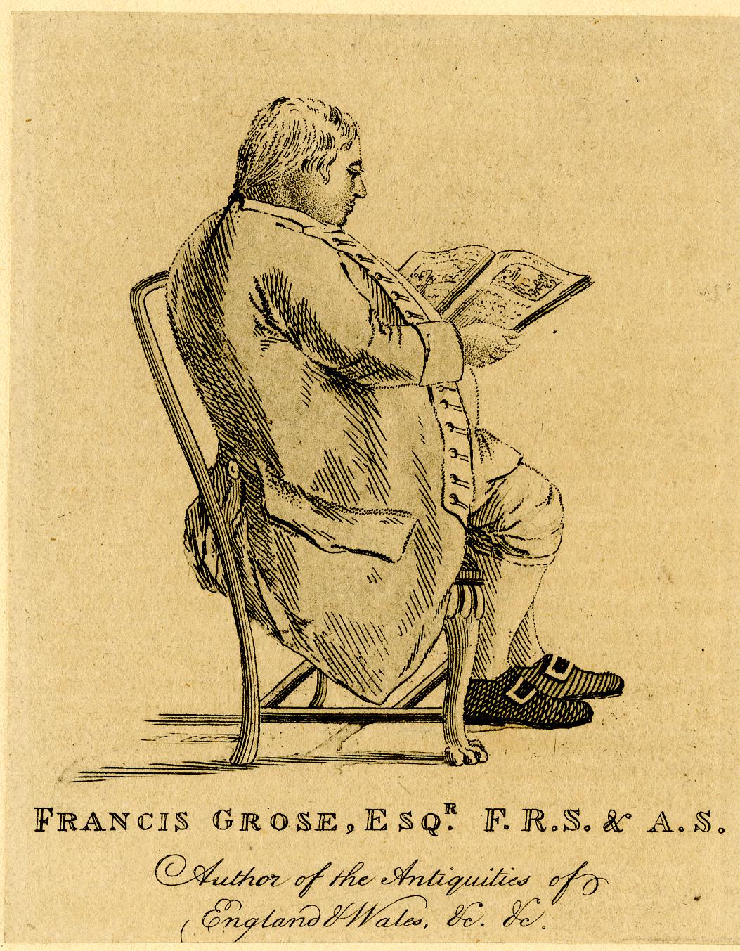
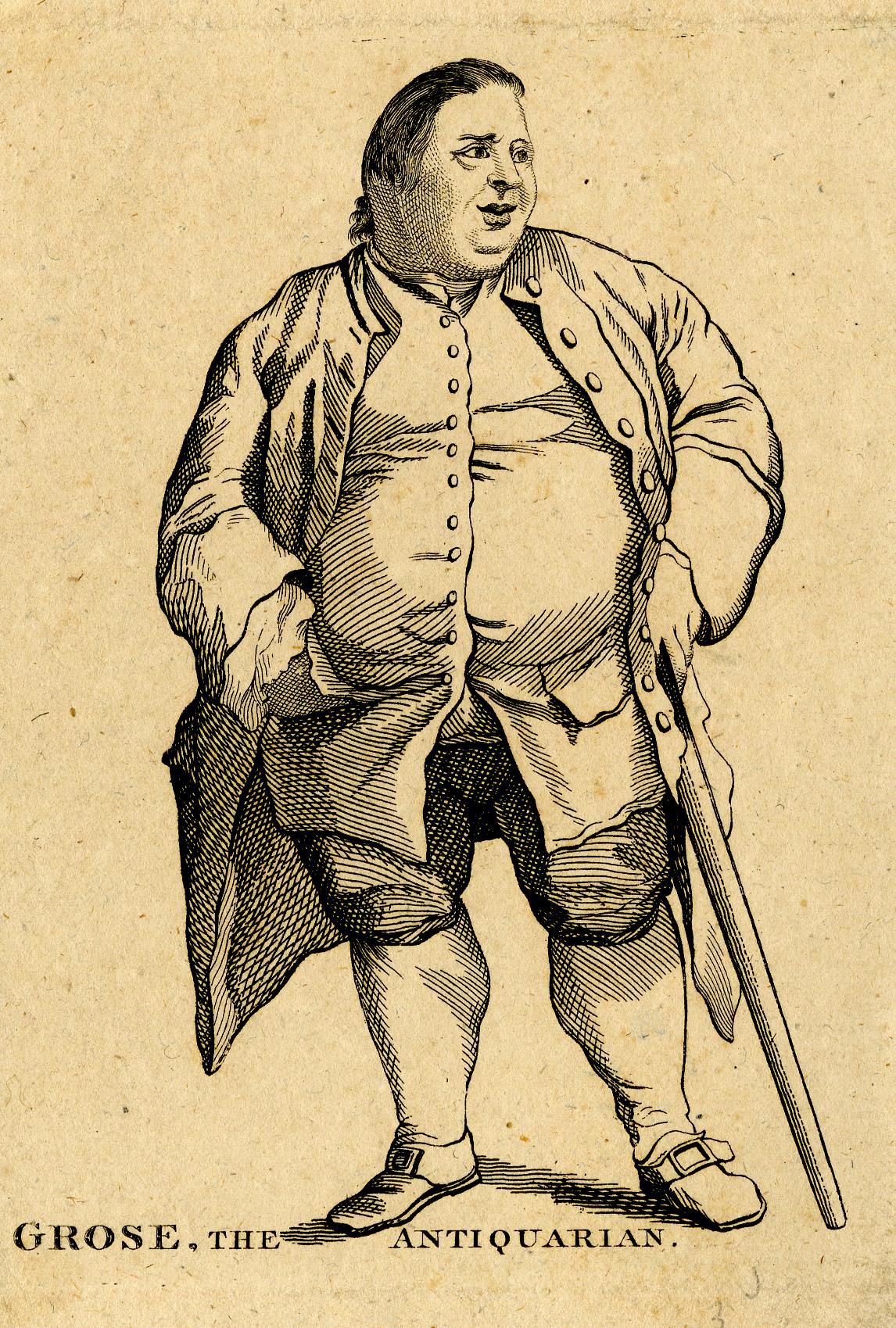
An extra post this weekend, following up on the post a couple of weeks ago on Captain Francis Grose’s Dictionary of the Vulgar Tongue which was first published in 1785; a fascinating little book that really bring to life the language that would have been heard on the streets of London in the 18th century.
This week I am covering words starting with the letters N to Z, and as with the first post covering A to M, there is the same focus on crime and punishment, and the challenges of everyday life.
There are words and phrases that are still in use today, many others have been redundant for a very long time.
There are also early examples of how we communicate today, with “gentlemen’s visiting cards” showing an early use of the type of text abbreviation used today with text and Whatsapp messaging (see P.P.C and D.I.O).
It was not just the vulgar tongue of London that Grose collected, he also published “A Glossary of Provincial and Local Words used in England” – a collection of words used across the country and show a very different focus than the vulgar tongue with an emphasis on agriculture, the weather and rural life, my favourite being AQUABOB which I will be using should we get any really cold weather this winter.
So, starting with the letter N from Dictionary of the Vulgar Tongue, we find some people that you would not want to meet on the streets of London:
NATTY LADS – Young thieves or pickpockets.
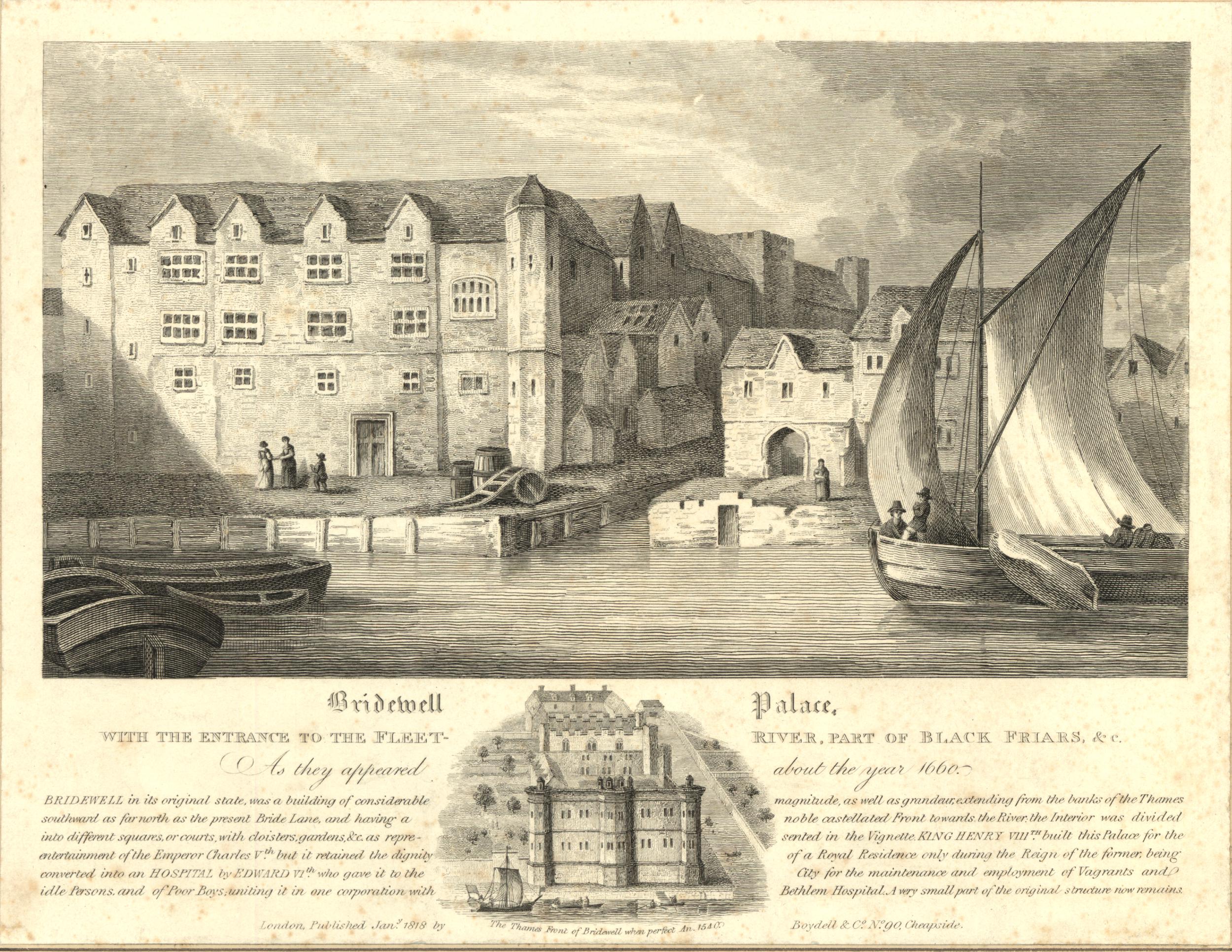
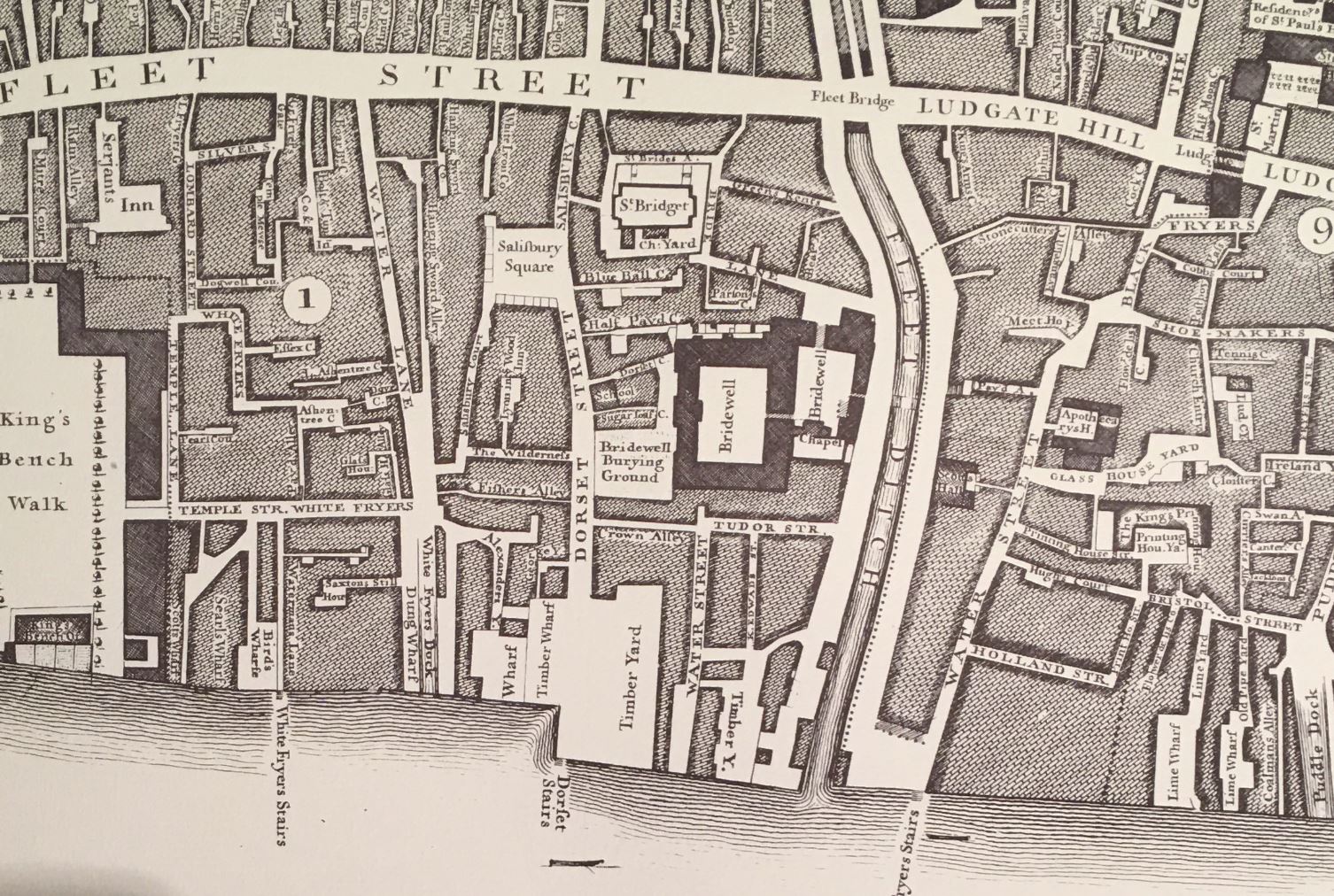
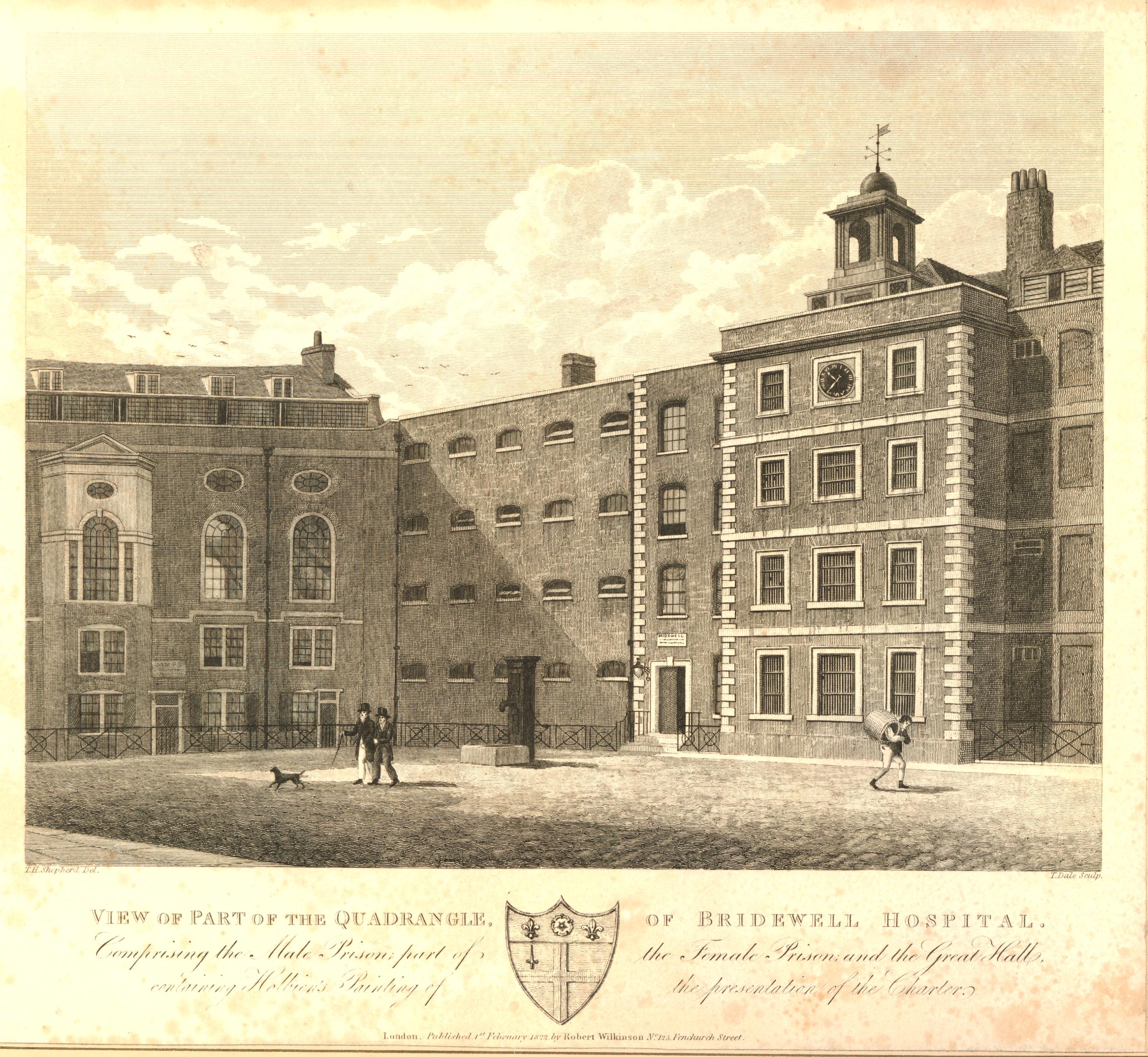
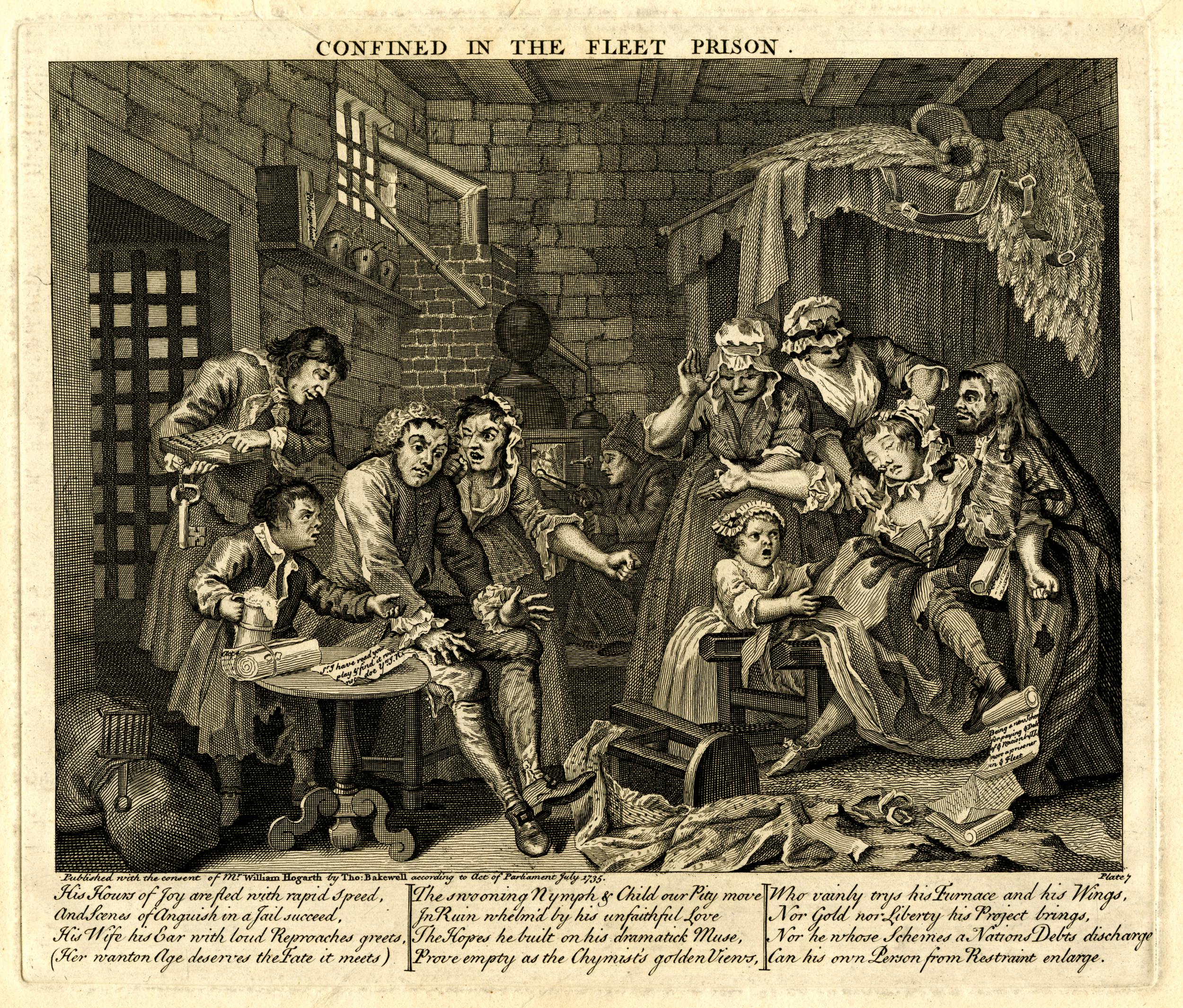
NAVY OFFICE – The Fleet prison. Commander of the Fleet; the warden of the Fleet prison.
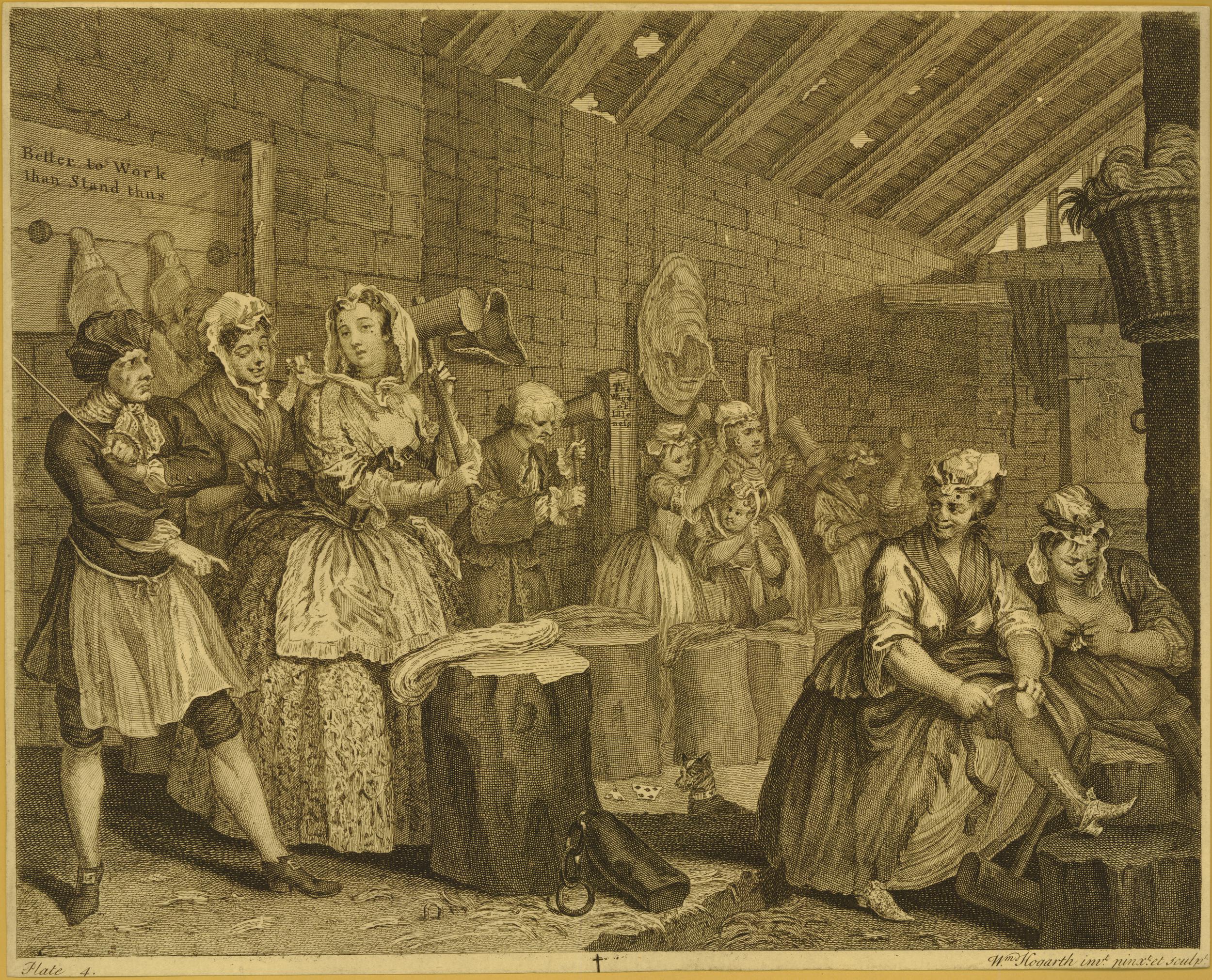
Confined in the Fleet Prison, from “A Rake’s Progress” by Hogarth ( © The Trustees of the British Museum):
NECK STAMPER – The boy who collects the pots belonging to an alehouse, sent out with beer to private houses.
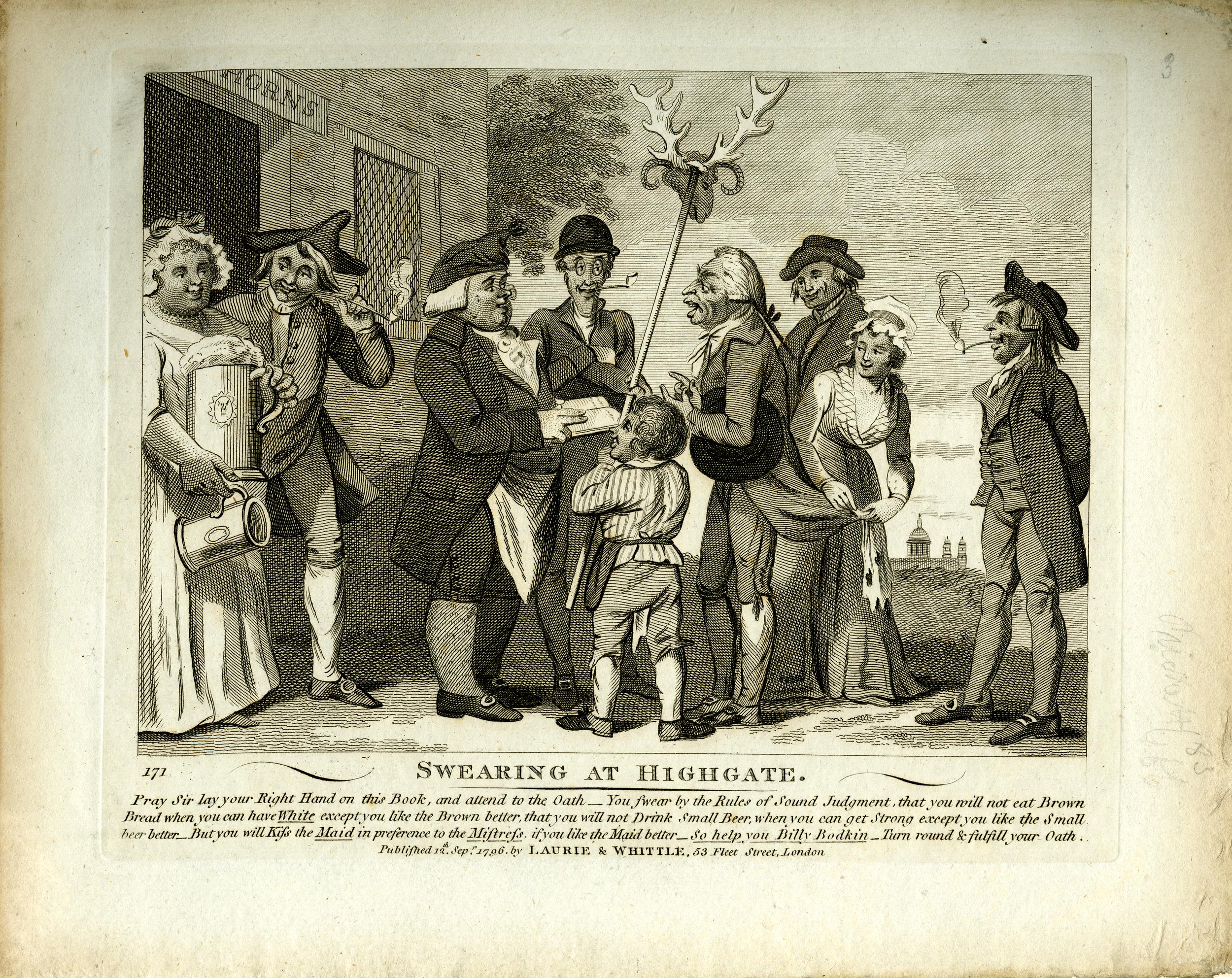
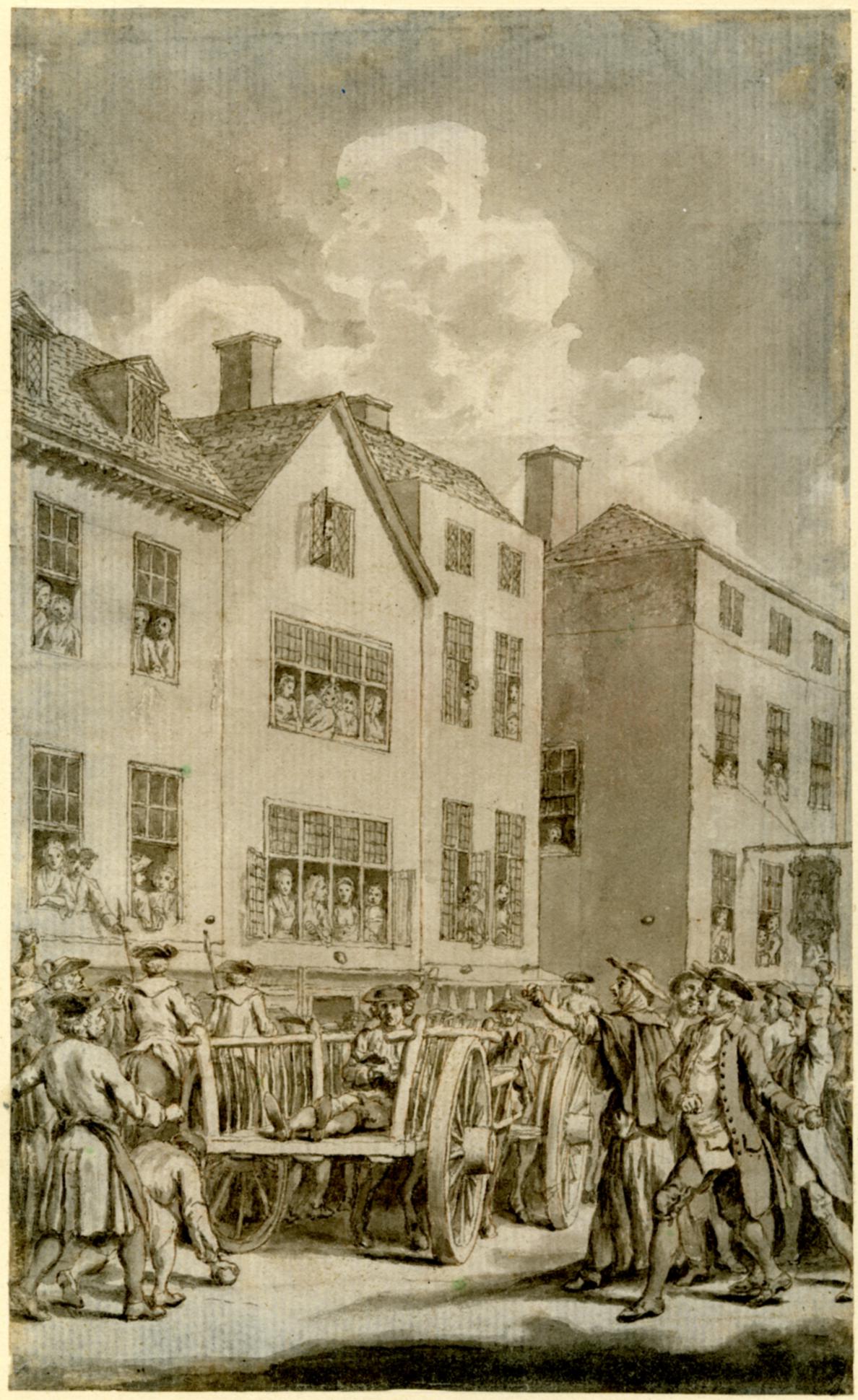
NEW DROP – The scaffold used at Newgate for hanging criminals; which dropping down, leaves them suspended. By this improvement, the use of that vulgar vehicle, a cart, is entirely left off.
NICKNACKS – Toys, baubles or curiosities.
NIGHTMAN – One whose business is to empty the necessary houses in London, which is always done in the night.
NYP SHOP – The Peacock in Gray’s Inn Lane, where Burton ale is sold in nyps.
NIPPER – A cut-purse; so called by one Wotton who in the year 1585 kept an academy for the education and perfection of pickpockets and cut-purses; his second school was near Billingsgate, London. As in the dress of ancient times many people wore their purses at their girdles, cutting them was a branch of the light fingered art, which is now lost, though the name remains.
OAR – To put in one’s oar; to intermeddle, or give an opinion unasked; as, to be sure, you must put in your oar.
OLD HAND – Knowing or expert in any business.
OLD HARRY – A composition used by the vintners to adulterate their wines, also the nick name for the devil.
OLD NICK – The Devil.
ORGAN – A pipe. Will you cock your organ? will you smoke your pipe?
OTTOMISED – To be ottomised; to be dissected. You’ll be scragged, ottomised, and grin in a glass case; you’ll be hanged, anatomised, and your skeleton kept in a glass case at Surgeons Hall.
OVERSEER – A man standing in the pillory, is, from his elevated situation, said to be made an overseer.
OWL – To catch the; a trick practiced upon ignorant country boobies, who are decoyed into a barn under pretence of catching an owl, where, after divers preliminaries, the joke ends in their having a pail of water poured upon their heads.
OWL IN AN IVY BUSH – He looks like an owl in an ivy bush; frequently said of a person with a large frizzled wig, or a woman whose hair is dressed a-la-blowse.
OWLERS – Those who smuggle wool over to France.
P.P.C. – An inscription on the visiting cards of our modern fine gentleman, signifying that they have called pour prendre conge, i.e. ‘to take leave’. This has of late been ridiculed by cards inscribed D.I.O. i.e.’ Damme, I’m off’.
PADDINGTON FAIR DAY – An execution day, Tyburn being in the parish of Paddington. To dance the Paddington frisk; to be hanged.
PALL – A companion. One who generally accompanies another, or who commit robberies together.
PANNIER MAN – A servant belonging to the Temple and Gray’s Inn, whose office is to announce dinner. This in the Temple is done by blowing a horn, and in Gray’s Inn proclaiming the word Manger, Manger, Manger, in each of the three courts.
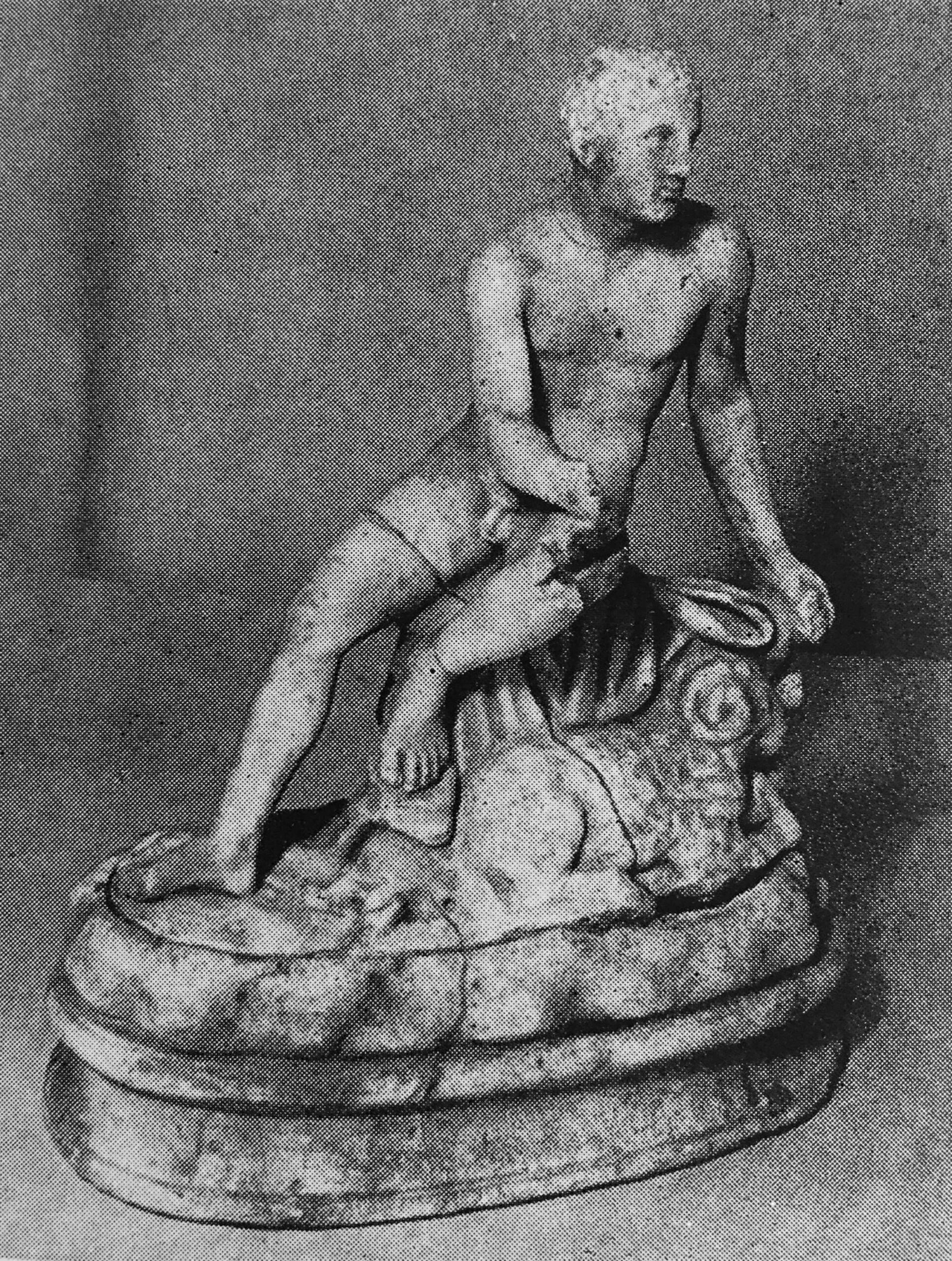
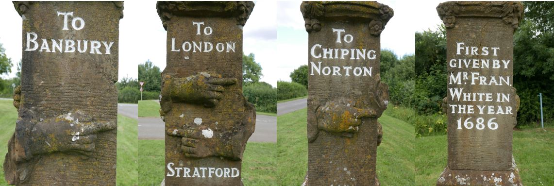
PARSON – A guide post, hand or finger post by the road for directing travelers: compared to a parson, because like him, it sets people in the right way.
I discovered the Guide Post shown in the photo below, which dates from 1686 and includes a pointing hand at Wroxton, from my post On The Road To Stratford-Upon-Avon
PECKISH – Hungry
PETER GUNNERE – will kill all the birds that died last summer. A piece of wit commonly thrown out at a person walking through a street or village near London, with a gun in his hand.
PETTICOAT HOLD – One who has an estate during his wife’s life, called the apron-string hold.
PETTICOAT PENSIONER – One kept by a woman for secret services.
PIGEONS – Sharpers, who, during the drawing of the lottery, wait ready mounted near Guildhall, and, as soon as the first two or three numbers are drawn, which they receive from a confederate on a card, ride with them full speed to some distant insurance office, where there is another of the gang, commonly a decent looking woman, who takes care to be at the office before the hour of drawing; to her he secretly gives the numbers, which she insures for a considerable sum.
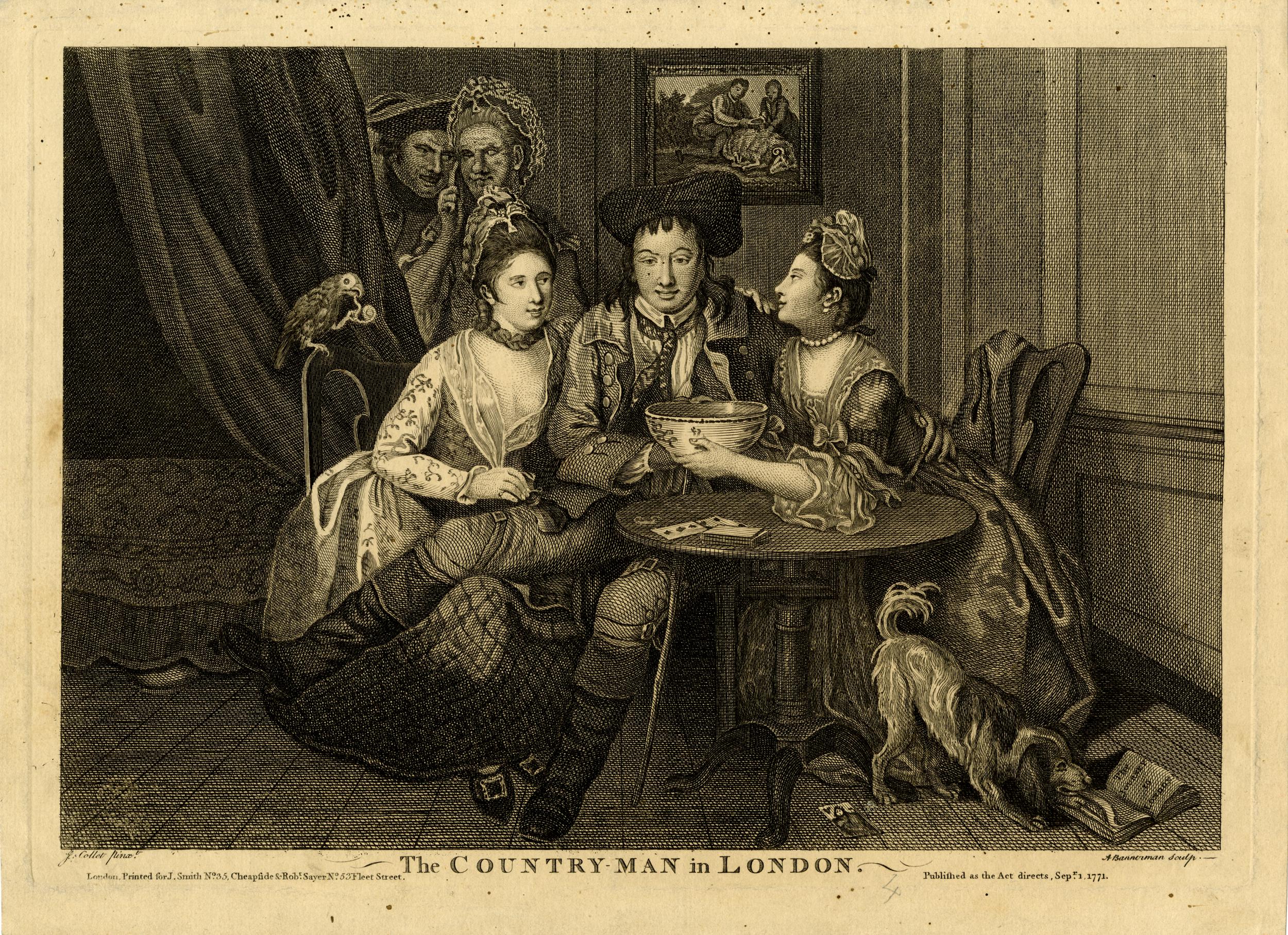
PIMP – A male procurer, or cock bawd; also a small fagot used about London for lighting fires, named from introducing the fire to the coals.
The following print from 1771 is a satire on gullible youths and dishonest prostitutes. The women on the left is picking the man’s pockets, and behind the curtain is the pimp. To emphasize the story being told, the picture on the wall behind the three at the table is of a sheep being fleeced ( © The Trustees of the British Museum).
PISS POT HALL – near Hackney, built by a potter chiefly out of the profits of chamber pots.
PISS-PROUD – Having a false erection. That old fellow thought he had an erection, but his _______ was only piss-proud; said of any old fellow who marries a young wife.
PITT’S PICTURE – A window stopt up on the inside, to save the tax imposed in that gentleman’s administration.
PURL – Ale in which wormwood has been infused, or ale and bitters drunk warm.
QUEEN STREET – A man governed by his wife, is said to live in Queen Street, or at the sign of the Queen’s Head.
QUEER BIRDS – Rogues relieved from prison, and returned to their old trade.
QUEER PLUNGERS – Cheats who throw themselves into the water, in order that they may be taken up by their accomplices, who carry them to one of the houses appointed by the Humane Society for the recovery of drowned persons; and the supposed drowned persons, pretending he was driven to that great extremity by great necessity, is also frequently sent away with a contribution in his pocket.
QUICK AND NIMBLE – More like a bear than a squirrel. Jeeringly said to any one moving sluggishly on a business errand that requires dispatch.
RABBIT CATCHER – A midwife.
RAINY DAY – To lay up something for a rainy day; to provide against a time of necessity of distress.
RANTALLION – One whose scrotum is so relaxed as to be longer than his penis, i.e. whose shot pouch is longer than the barrel of his piece.
RAREE SHEW MEN – Poor Savoyards, who subsist by showing the magic lantern and marmots about London.
RIDING ST. GEORGE – The woman uppermost in the amorous congress, that is, the dragon upon St. George. This is said the way to get a bishop.
RIGMAROLE – Roundabout, nonsensical. He told a long rigmarole story.
RING – Money procured by begging; beggars so called it from its ringing when thrown to them. Also a circle formed for boxers, wrestlers, and cudgel-players, by a man styled Vinegar; who, with his hat before his eyes, goes round the circle, striking at random with his whip to prevent the populace from crowding in.
ROMEVILLE – London
ROUGH – To lie rough; to lie all night in one’s clothes; called also roughing it. Likewise to sleep on the bare deck of a ship, when the person is commonly advised to choose the softest plank.
ROUND ABOUT – An instrument used in house-breaking. This instrument has not been long in use. It will cut a round piece about five inches in diameter out of a shutter or door.
RUFFLERS – The first rank of criminals; also notorious rogues pretending to be maimed soldiers or sailors.
RUNNING STATIONERS – Hawker of newspapers, trials and dying speeches.
RUSSIAN COFFEE HOUSE – The Brown Bear in Bow-street, Covent Garden, a house of call for thief-takers and runners of the Bow street justices.
SANDWICH – Ham, dried tongue, or some other salted meat cut thin and put between two slices of bread and butter; said to be a favourite morsel with the Earl of Sandwich.
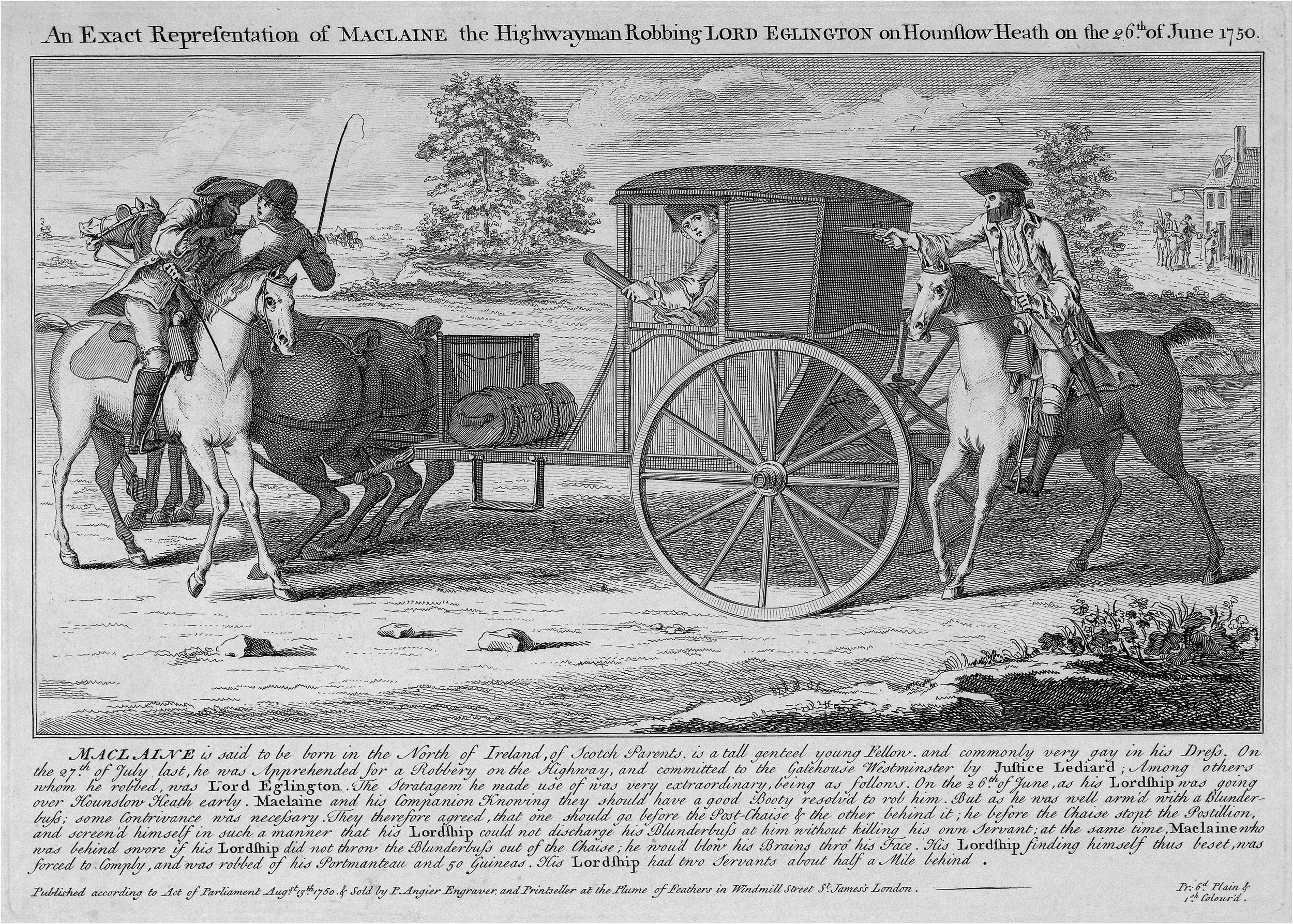
SCAMP – A highwayman. Royal Scamp; a highwayman who robs civilly. Royal foot scamp; a footpad who behaves in like manner.
A Scamp in action ( © The Trustees of the British Museum):
SCOURERS – Riotous bucks, who amuse themselves with breaking windows, beating the watch, and assaulting every person they meet; called scouring the streets.
SHARK – A sharper; perhaps from his preying upon anyone he can lay hold of. Also a custom-house officer, or tide-waiter. Sharks; the first order of pickpockets. Bow-street term, 1785.
SHOOT THE CAT – To vomit from excess of liquor; called also catting.
SHOPLIFTER – One that steals whilst pretending to purchase goods in a shop.
SHY COCK – One who keeps within doors for fear of bailiffs.
SILVER LACED – Replete with lice. The cove’s kickseys are silver laced; the fellow’s breeches are covered with lice.
SIMPLES – Physical herbs; also follies. He must go to Battersea, to be cut for the simples – Battersea is a place famous for its garden grounds
SNAP DRAGON – A Christmas gambol; raisins and almonds being put into a bowl of brandy, and the candles extinguished, the spirit is set on fire, and the company scrambles for the raisins.
STARVE’EM, ROB’EM AND CHEAT’EM – Stroud, Rochester and Chatham; so called by sailors, and not without good reason.
SUGAR SOPS – Toasted bread, soaked in ale, sweetened with sugar, and grated nutmeg; it is eaten with cheese.
SUNNY BANK – A good fire in winter.
SURVEYOR OF THE HIGHWAYS – One reeling drunk
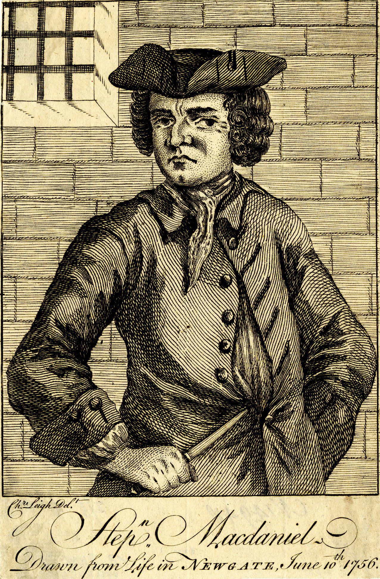
THIEF TAKER – Fellows who associate with all kinds of villains, in order to betray them, when they have committed any of those crimes which entitle the persons taking them to a handsome reward, called blood money. It is the business of these thief takers to furnish subjects for a handsome execution, at the end of every sessions.
The thief-taker Stephen Macdaniel, 1756 ( © The Trustees of the British Museum):
THIMBLE – A watch. the swell flashes a rum thimble; the gentleman sports a fine watch.
THREE-PENNY UPRIGHT – A retailer of love, who, for the sum mentioned, dispenses her favours standing against a wall.
THREE THREADS – Half common ale, mixed with stale and double beer.
TILBURY – Sixpence; so called from its formerly being the fare for crossing from Gravesend to Tilbury fort.
TWITTER – All in a twitter; in a fright. Twittering is also the note of some small birds such as the robin &c.
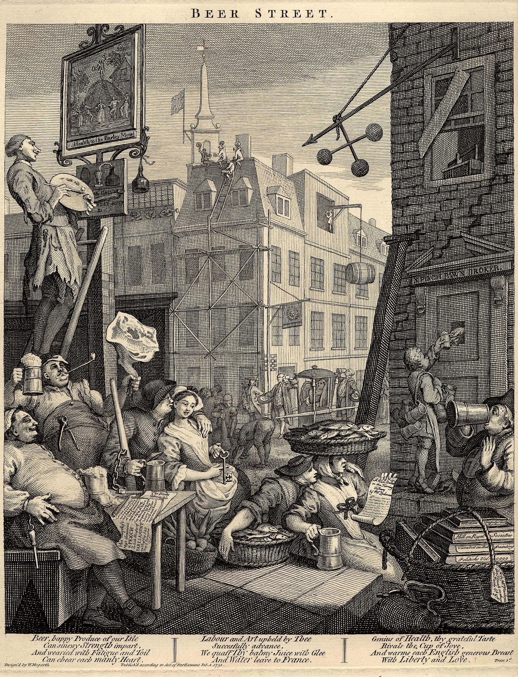
TWO TO ONE SHOP – A pawnbroker’s; alluding to the three blue balls, the sign of that trade; or perhaps to its being two to one that the goods pledged are never redeemed.
The three balls of a pawnbroker’s can be seen in this Hogarth print “Beer Street” from 1751. The drawing shows the collapsing house of “N Pinch Pawn Broker”, and looking at the people shown in the view, one can imagine how the phrases listed in Captain Grose’s Dictionary of the Vulgar Tongue were part of normal street language.
UPPING BLOCK – Steps for mounting a horse. he sits like a toad on a jossing block; said of one who sits ungracefully on horseback
UPSTARTS – Persons lately raised to honours and riches from mean stations.
VAULTING SCHOOL – A bawdy-house; also an academy where vaulting and other manly exercises are taught.
WAITS – Musicians of the lower order, who in most towns play under the windows of the chief inhabitants at midnight, a short time before Christmas, for which they collect a Christmas-box from house to house. They are said to derive their name of waits from being always in waiting to celebrate weddings and other joyous events happening in the district.
WATER SNEAKSMAN – A man who steals from ships or craft on the river.
WATERPAD – One that robs ships on the River Thames
WESTMINSTER WEDDING – A match between a whore and a rogue.
WHETSTONE PARK – A lane between Holborn and Lincoln’s Inn Fields, formerly famed for being the resort of women of the town.
WIBLING’S WITCH – The four of clubs: from one James Wibling, who in the reign of King James I, grew rich by private gaming and was commonly observed to have that card, and never to lose a game but when he had it not.
WINDOW PEEPER – A collector of the window tax.
XANTIPPE – The name of Socrates’s wife; now used to signify a shrew or scolding wife.
YARMOUTH PYE – A pye made of herrings highly spiced, which the city of Norwich is by charter bound to present annually to the King.
ZNEES – Frost or Frozen, Zueesy weather; frosty weather.
A Glossary of Provincial and Local Words used in England
Francis Grose also published “A Glossary of Provincial and Local Words used in England”, and the words and phrases in this publication are very different to those in his Dictionary of the Vulgar Tongue.
Whilst those in the Vulgar Tongue have a number of common themes such as crime and punishment, prostitution, sexual relations, and general street life, those in Provincial and Local Words have mainly agricultural and rural meanings.
It is though impossible to know whether there was any bias in Grose’s collection of words and phrases. Was he looking for words that confirmed the worst of city life for his dictionary of the vulgar tongue, whilst looking for words that confirmed the rural nature of the countryside?
The two books do show the split between City and Country life which was still very marked in the 18th century, and would change significantly during the 19th century with the rapid expansion of industry and migration to the city by very large numbers of those who had lived in the countryside.
Examples from “A Glossary of Provincial and Local Words used in England”, include:
AQUABOB – An icicle
BARSON – A horse’s collar
BERRY – to berry, to thresh out corn
CANDLING – a supper given in some parts by landlords of ale houses to their customers on the Eve of Candlemas-day; part of it is a pie, thence called a CANDLING-PIE
CUSHETS – Wild pigeons
DALLOP – A patch of ground among corn that has escaped the plough; also tufts of corn where dung-heaps have long laid
ERRISH – A stubble field
FEATHERING – Binding a hedge
FLIGGURS – Young birds, just fledged.
GIBBET – A great cudgel, such as are thrown at trees, to beat down fruit.
HOPPER-CAKE – a seed cake with plums in it, with which the farmers treat their servants when seed-time is finished.
IMP – to rob, or disposes a person.
JACK – half a pint.
KING HARRY – A goldfinch
LEASTY WEATHER – dull, wet, dirty.
MAWKIN – a bunch of rags used for cleansing the oven.
NEB or NIB – the nose, also the beak of a bird.
NOON-SCAPE – the time when labourers rest after dinner.
OLD LAND – ground that had laid long untilled, and just ploughed up.
PINGSWILL – a boil
QUAKLED – almost choked, or suffocated.
RANDLE BAWK – an iron gibbet in a chimney, to hang the pot-hooks on.
SEEING-GLASS – a mirror, or looking glass.
TWITTER – to tremble. This is a word of general use. My heart twitters; I am all of a twitter. To TWITTER thread or yarn, is to spin it uneven; generally used also in this sense.
URCHIN – a hedgehog
VELLING – ploughing up the turf, or upper surface of the ground, to lay in heaps to burn.
WARPING – turning a river on land to obtain the mud for manure when it recedes.
YEAVELING – evening.
ZINNILA – a son-in-law
Francis Grose left a wonderful collection of words and phrases in use in the city and country during the late 18th century. The importance of these words is that they provide an insight into life at the time,
I did wonder how many of these terms were invented by those providing them to Grose, however I have found very many of them in newspapers from the 18th and 19th centuries, confirming their use in the way described by Grose.
For example, the first reference I could find of the term SNAP DRAGON dated from 1738, and in the Bristol Mercury dated the 30th of December 1889, there is a feature on Christmas customs, and the following is included:
“SNAP DRAGON – With regards to Christmas fare, snap dragon is a very ancient favourite, although I think it is dying out. A number of raisins are deposited in a shallow disk or bowl, and brandy is poured over them and ignited. The fun is to snatch a raisin through the flames. To this there is such a song as:
Here he comes with flaming bowl, Don’t he mean to take his toll; Snip snap dragon,
Take care you don’t take too much, Be not greedy in your clutch, Snip snap dragon.“
Although Grose collected all these words and phrases in the second part of the 18th century, many of them must have had some considerable age, particularly those of the Provincial and Local words as I suspect words in use in the city changed more frequently than those in the countryside..
Both of Grose’s publications help to bring to life the everyday experience of the late 18th century, and provide a very valuable record.