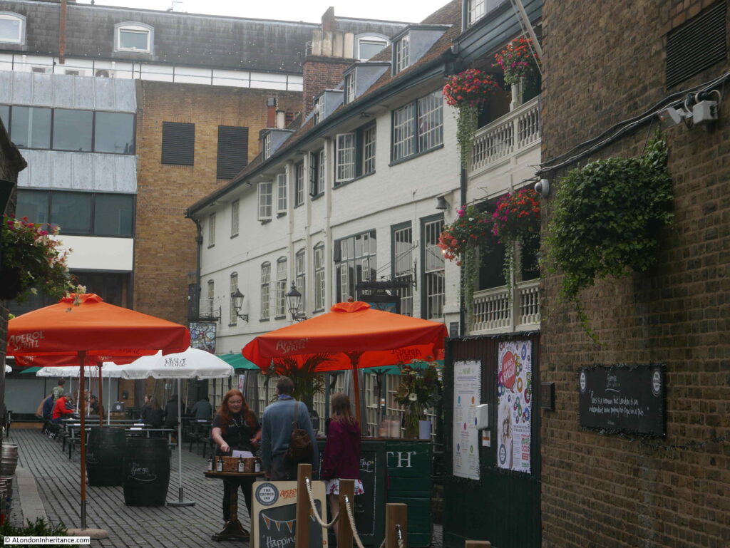
The George Inn, along Borough High Street, Southwark is the only remaining galleried coaching inn in London of the many that once serviced the numerous coaches that connected the city with the rest of the country.
The George remains thanks to the London and North Eastern Railway. Although they did demolish large parts of the original buildings leaving only one side of the complex, they sold to the National Trust in 1937, who continue to own the property with it currently being leased to the pub chain and brewer, Greene King.
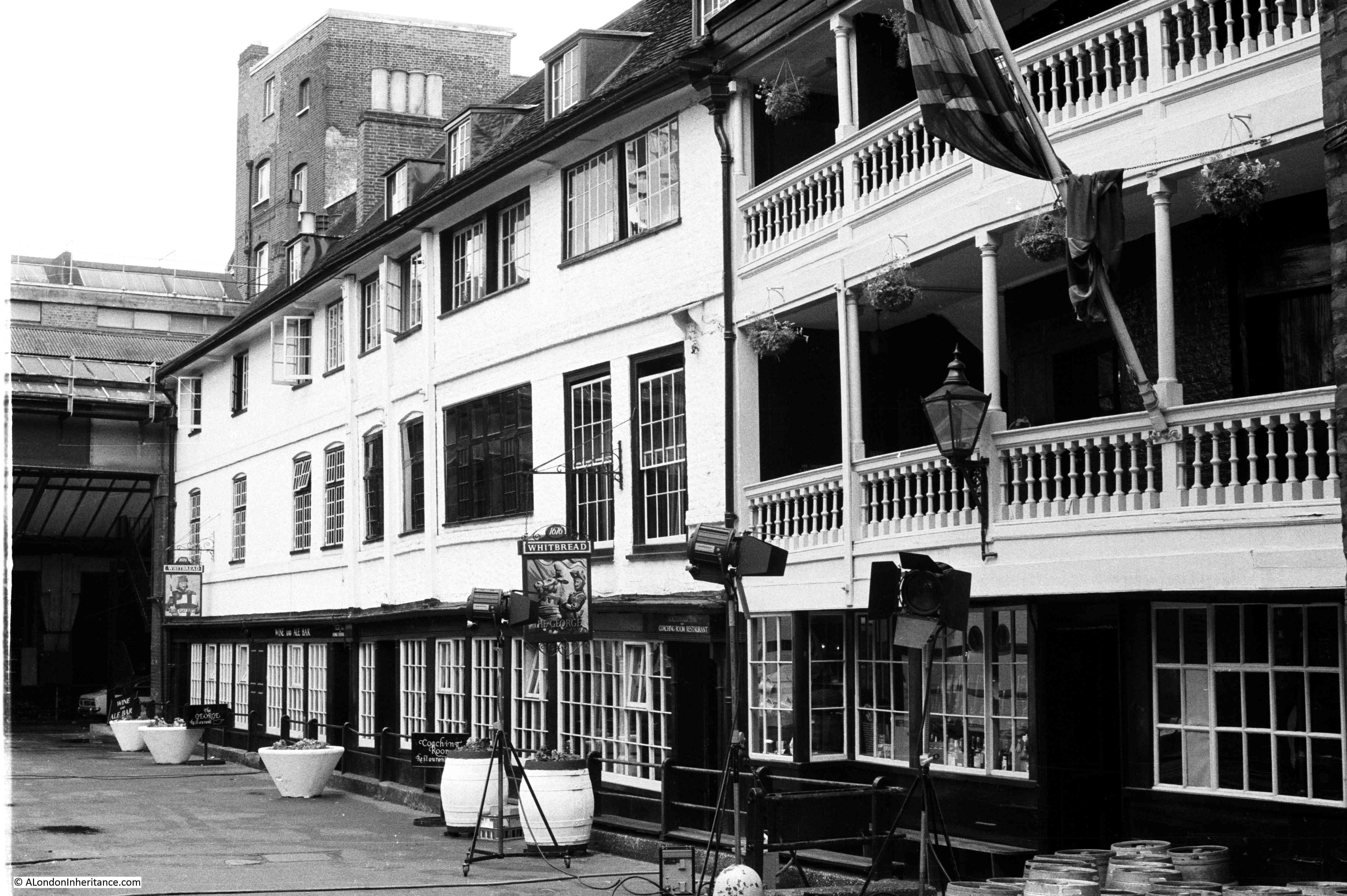
Back in 1977, I took the following photograph of the George with the main building and galleried upper floors.

There was something being filmed at the time of my visit, as the lights facing into the building demonstrate – cannot remember what it was – a late 1970s period drama.
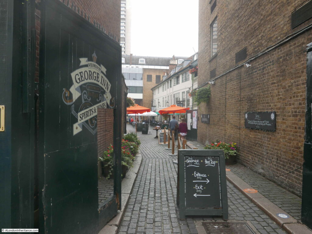
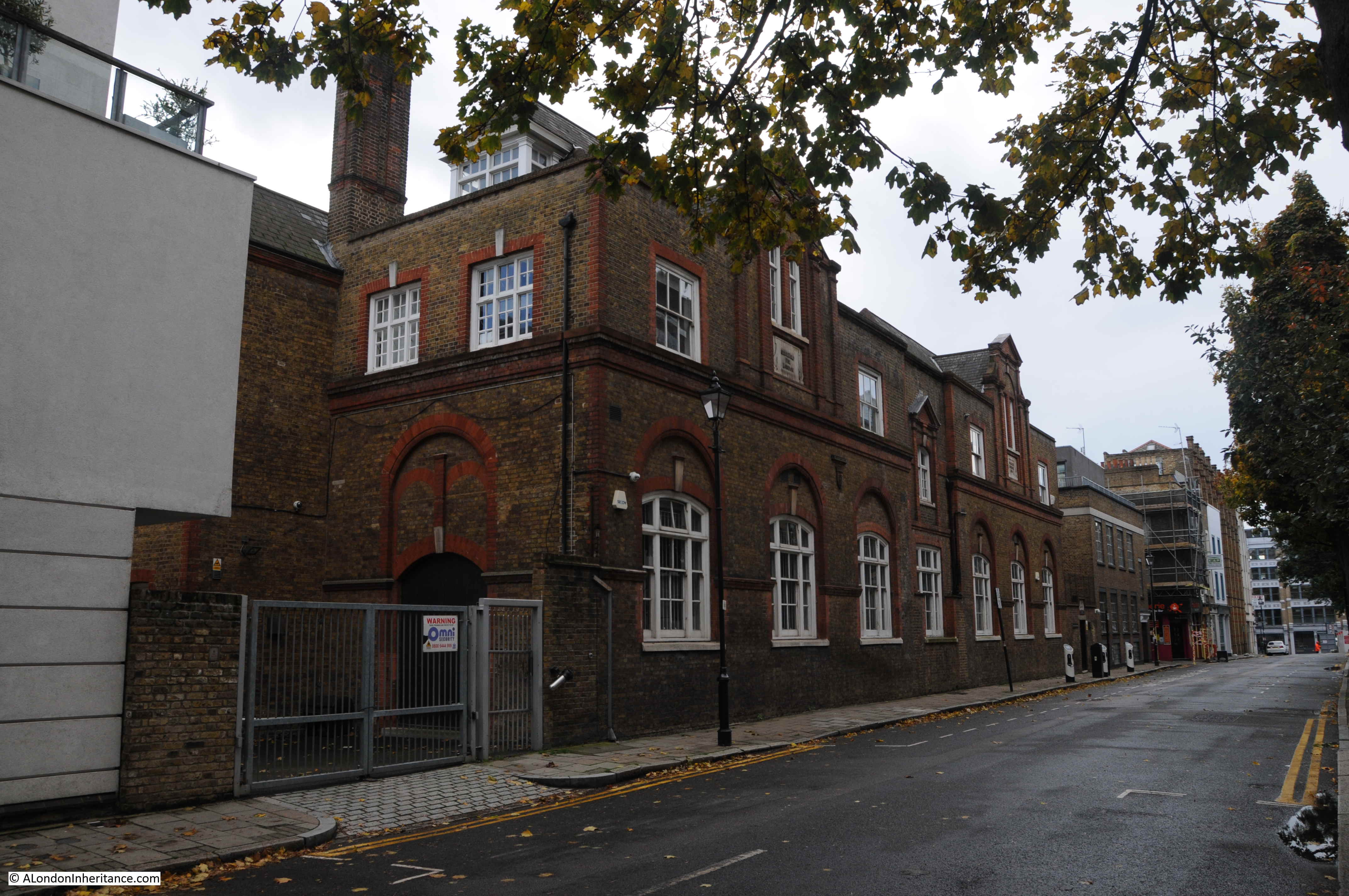
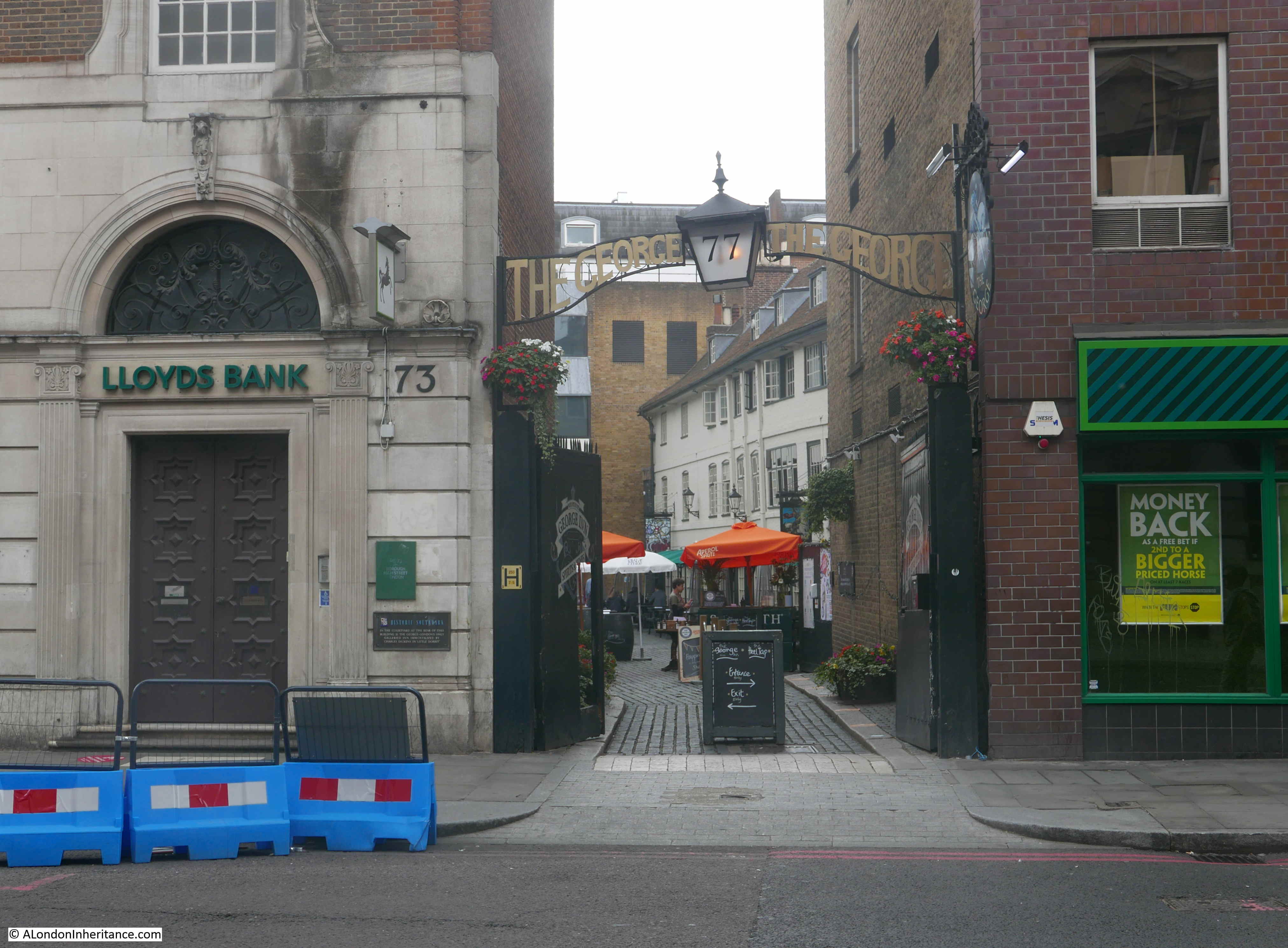
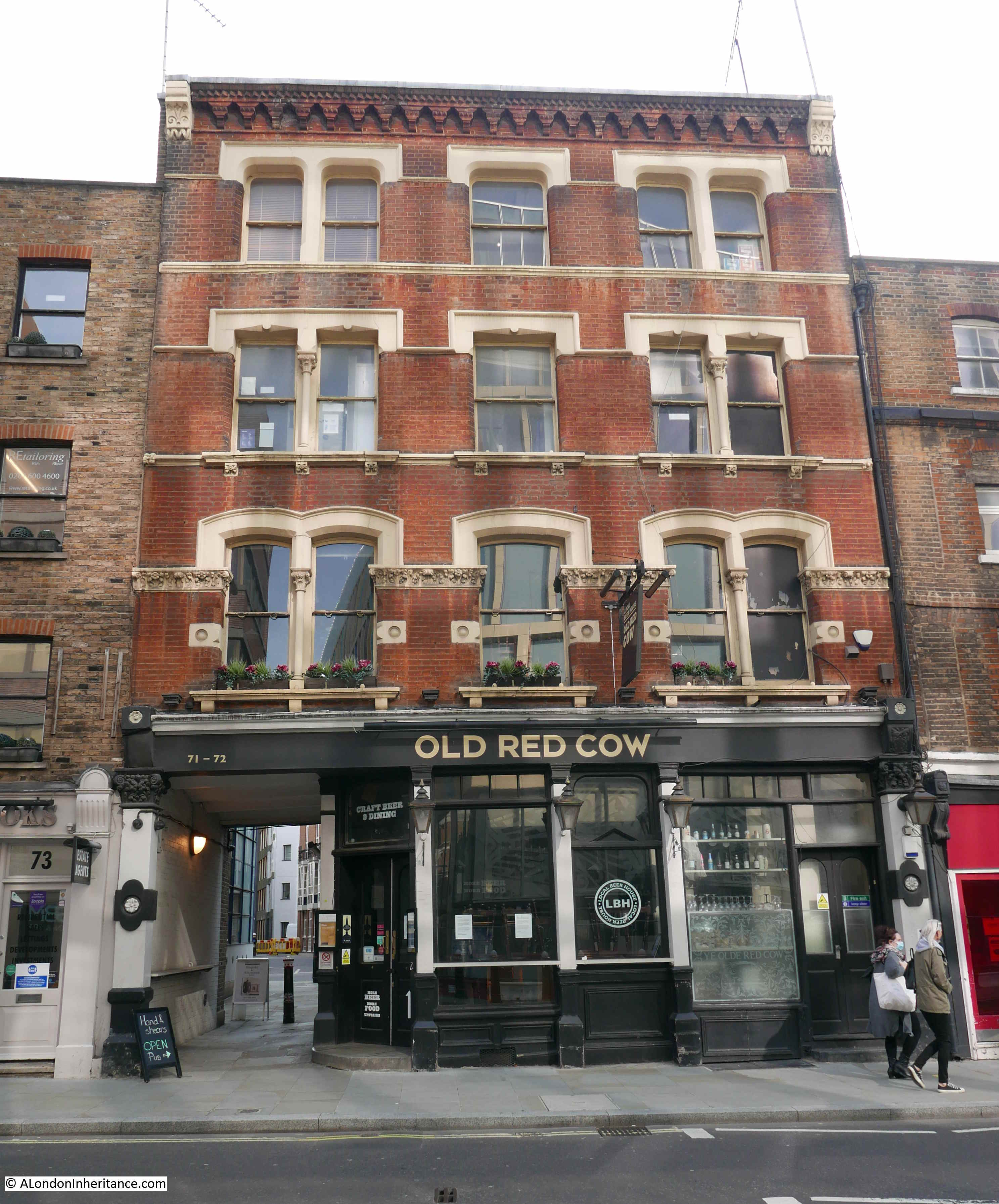
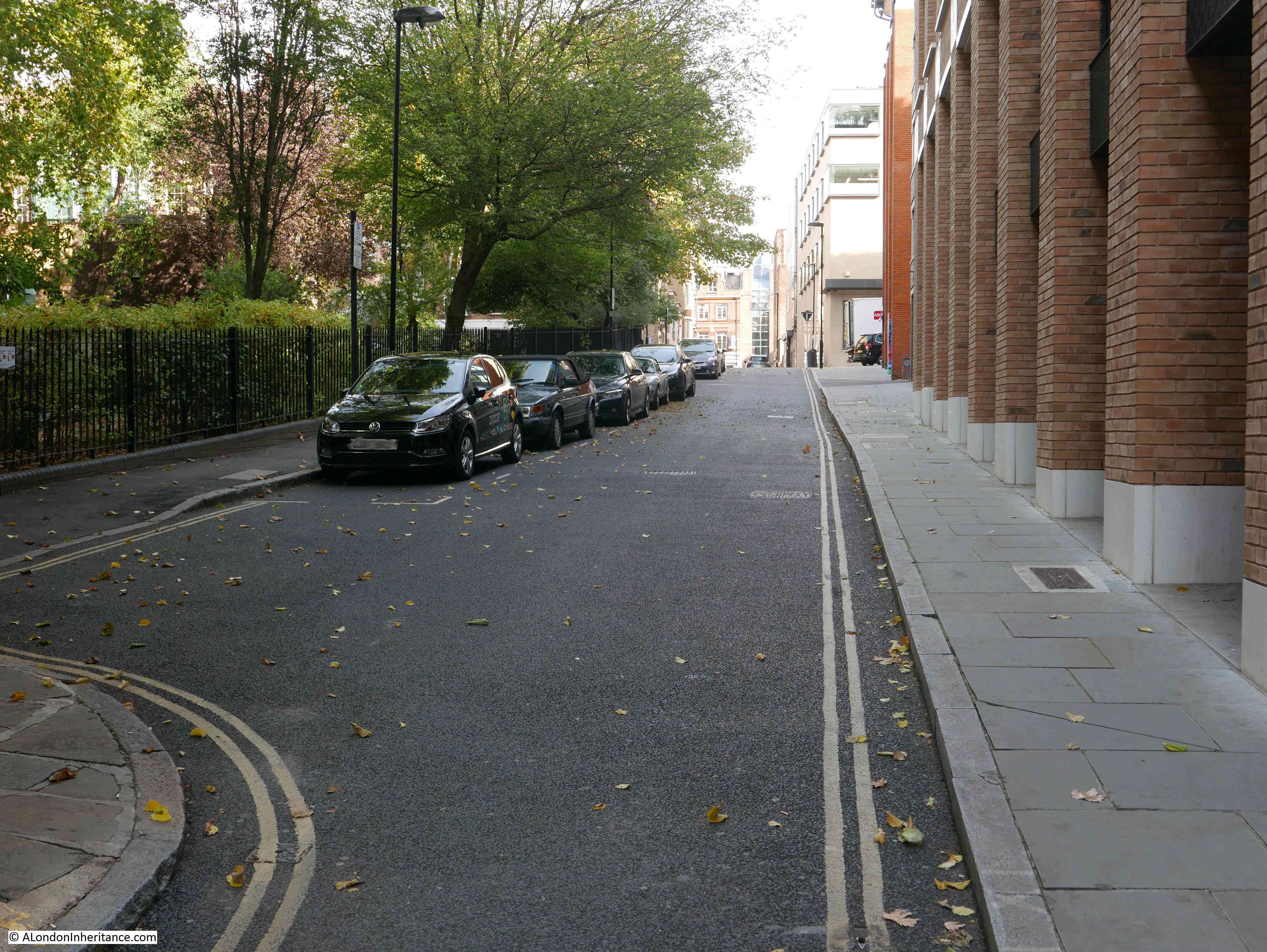
On a rather overcast September day, I went back to Borough High Street to photograph the George Inn.
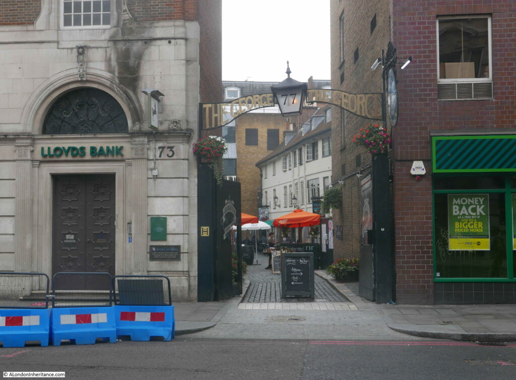
The George still has the narrow entrance from Borough High Street. These are days of COVID precautions and the sign indicated a separate side for entrance and exit.
I did not want to challenge the restrictions in place, so did not walk into the yard just to take photos. I was short of time, having to be in Clerkenwell that afternoon so could not stop for a drink. The George is on the list for a return visit, and some better photos.
The George looks much the same as in my 1977 photo, however the building at the end of the yard in 1977 has been demolished and replaced.
The George is a very old Inn, dating back to at least the 16th century. It was mentioned by Stowe in 1598 as one of the “fair inns” of London.
It was originally called the St. George, but because of changes in sentiment towards religious iconography, Popery and saints, the inn became the George in the mid 16th century.
In 1622 the inn is described as being built of “brick and timber”. In 1670 a Mark and Mary Wayland were running the George for an annual rent of £150. That year the pub was damaged by fire. Wayland rebuilt and had his rent reduced to £80 and a sugar loaf.
A much larger fire in 1676 that burnt through much of the surrounding area, totally destroyed the George, but again it was rebuilt by the tenant who had the rent further reduced to £50 and a sugar loaf, along with an extension of the lease.
In 1825, the George is recorded as being “a good commercial inn in the Boro High Street; well known, whence several coaches and many wagons depart laden with the merchandise of the metropolis, in return for which they bring back from various parts of Kent, that staple article of the country, the hop, to which we are indebted for the good quality of the London porter”.
In 1855, a description of the stables area of the inn included “a round room for the ostlers in the days of pack-horses, and a stable below ground with steps leading down to it”.
For many years, the George was owned by the trustees of Guy’s Hospital, which was on the eastern boundary of the original George Inn – the building we see today is a small part of the original inn and the associated buildings to support the coaching business.
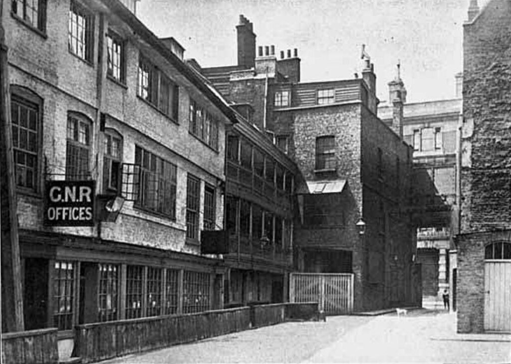
In 1874, St Guy’s Hospital sold the George Inn to the Great Northern Railway. The coming of the railways had seen a rapid decline in travel by horse and coach, so the sale of the inn to the GNR, who used the site as a receiving station for goods to be transported on their rail network, was in many ways a logical continuation of the main transport function of the inn.
The following photo shows the courtyard of the George, looking towards Borough High Street, with a sign above the entrance to the offices of the Great Northern Railway:
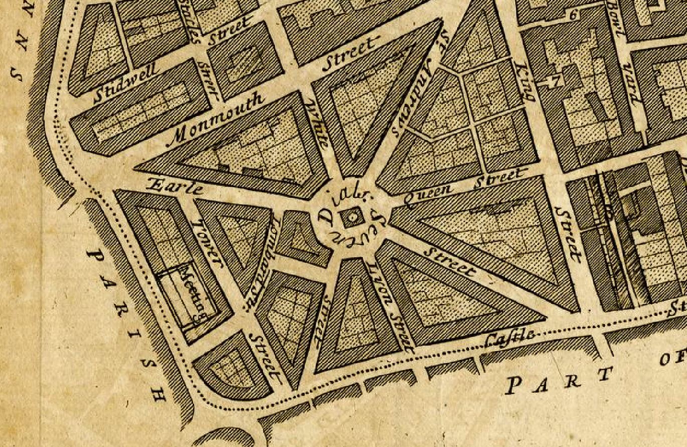
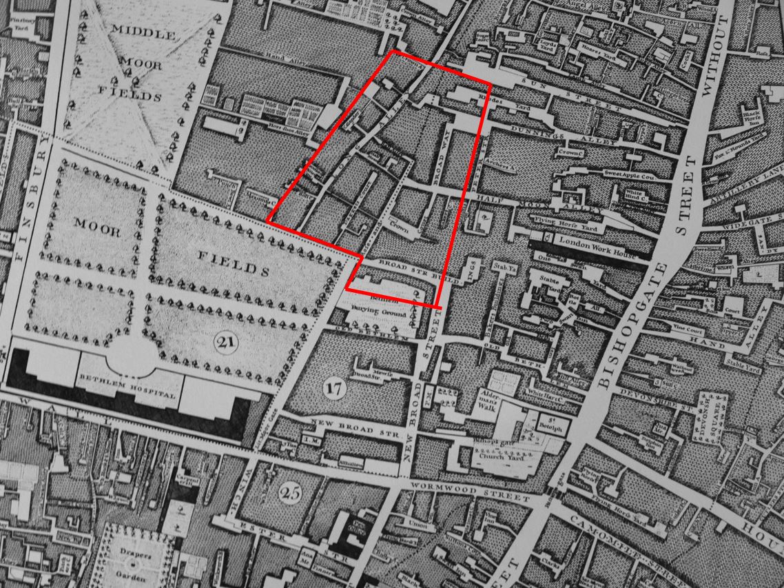
The location of the George Inn was key to the success of the inn as a coaching inn, as one of many inns located in courtyards along the main road that led south from London Bridge.
The following map extract is from a map of the Parish of St. Saviours Southwark by Richard Blome (late 17th century but published by John Stow in 1720).
It shows the road leading from London Bridge at the top of the map, down to the Marshalsea Prison at the bottom of the map. This road had long been the only southern route out of the City of London.
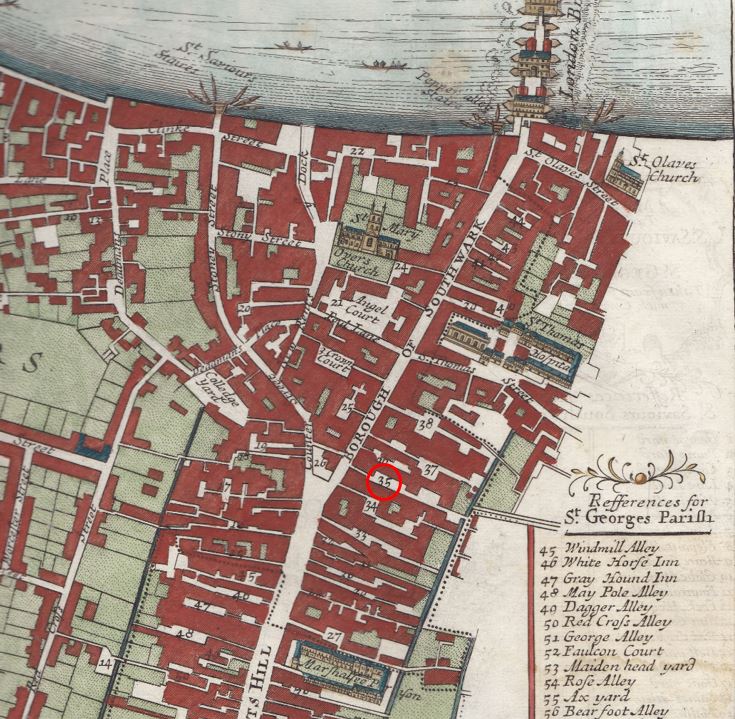
To the right of the road are numerous alleys and courts. Many of these were inns such as the Spur Inn, Queen’s Head Inn, Talbot Inn, White Heart Inn, King’s Head Inn, Black Swan Inn, Ship Inn and Bores Head Inn. Southwark really did have a lot of Inns.
At number 35, with the red circle is the George Inn. The narrow access from the street leads on to a large courtyard.
There were a number of reasons for the high number of inns. The road was originally the only road from the City of London to the southern counties of England. The area was outside the control of the City of London, there was more land available and rents were cheaper than on the other side of London Bridge.
Catching a coach from one of the Inns in Southwark was almost the equivalent of walking across London Bridge today and catching a train at London Bridge Station.
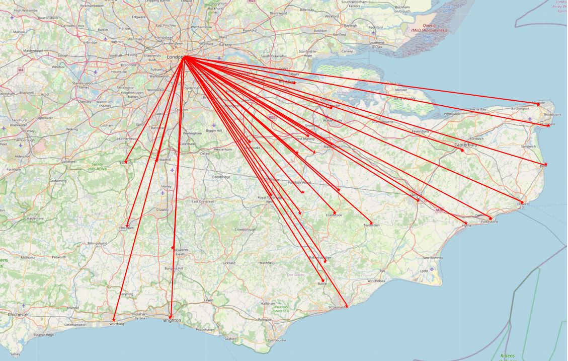
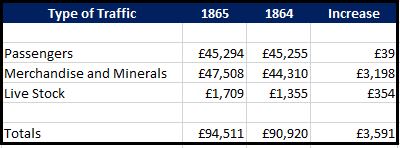
Coaches from the Southwark Inns served numerous destinations in the counties of Kent, Sussex and Hampshire and in 1809, W.S. Scholefield who was running the George at the time, published a list of the destinations from the inn, and their frequency:
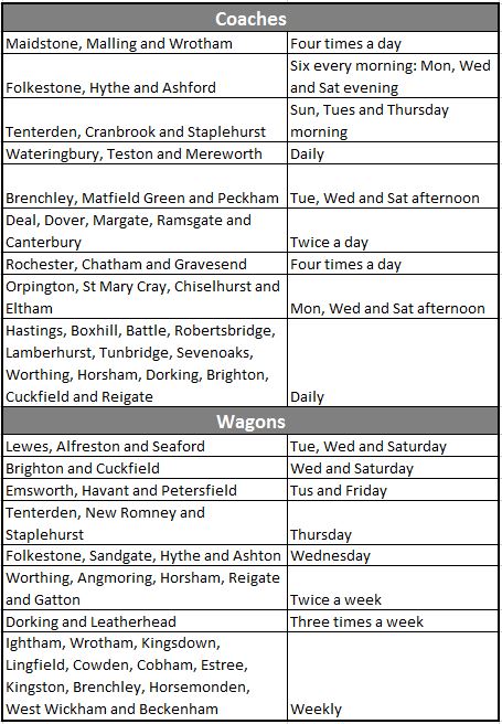
The table demonstrates just how busy the George Inn must have been. Numerous destinations, with some having four coaches a day. Horses being stabled at the George, passengers staying in the rooms of the George before an onward journey, luggage and other goods for onward transport across London.
The table includes coaches, which were mainly for passenger transport, and also wagons, which were used for the transport of goods, so the George was also the hub for a transport network for products, raw materials and personal / household goods that needed to be sent to destinations from Kent to Hampshire, and returning goods for sale in the City.
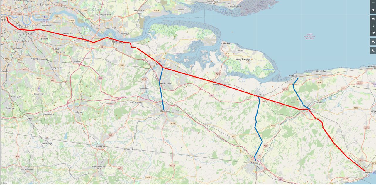
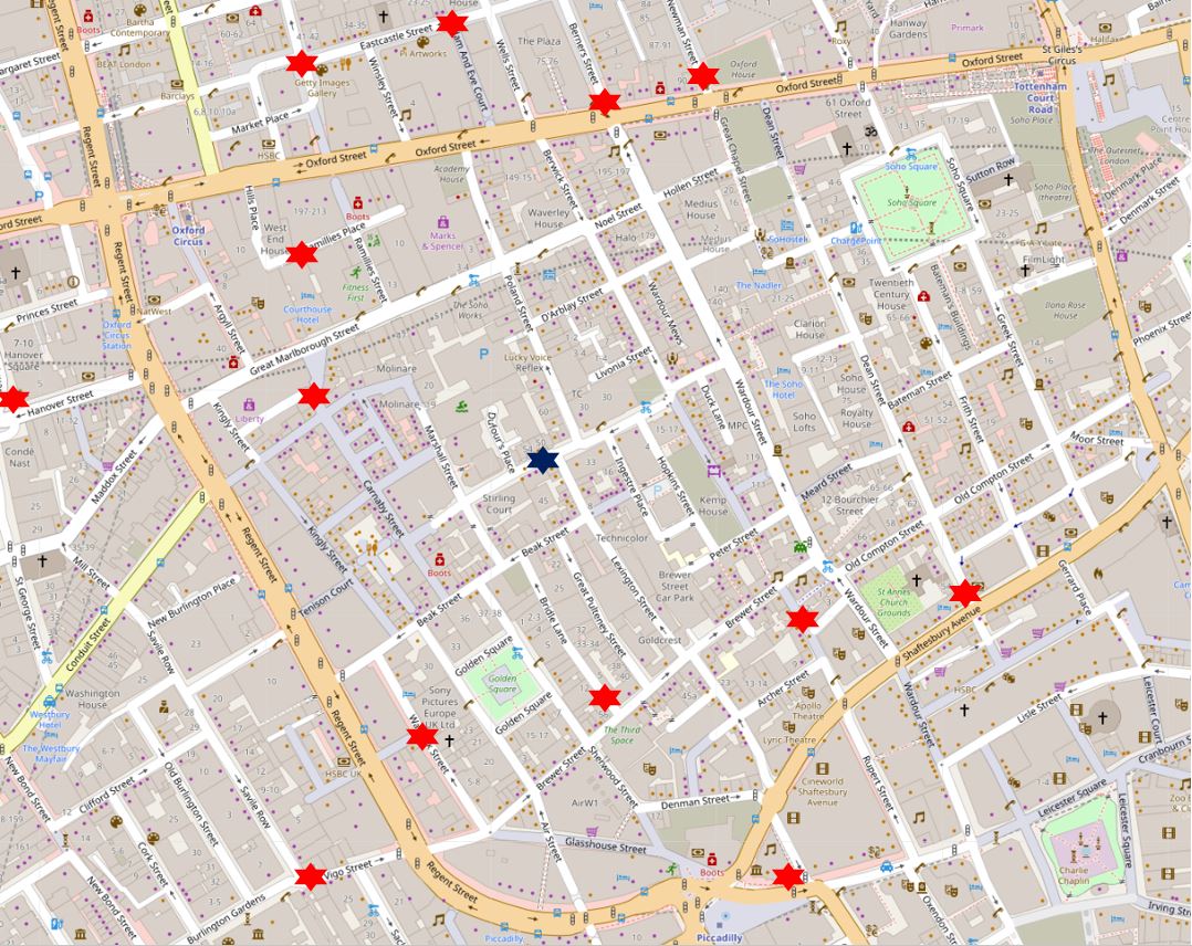
I plotted the coach network onto a map to give a graphical view of the geographic spread and number of destinations (Map © OpenStreetMap contributors):
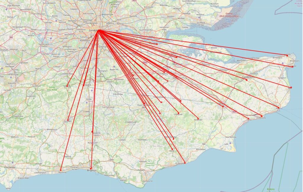
The majority of destinations are in the county of Kent, with some in Sussex. There is a significant gap between the main Kent services and the five destinations to the west of the map, with no services to towns such as Edenbridge, East Grinstead, Uckfield and Lewes.
It may have been that there was no market for these destinations, or that they were served by coaches from other Southwark based coaching inns. I did consider trying to put together a map showing the destinations from the different inns, where these are known, colour coding based on the Southwark inn. An 18th century / early 19th century equivalent of a 21st century rail network map, but as usual have the idea but not the time.
What the list of destinations does not show is whether each was a single route with multiple stops, or whether these were individual destinations, or a mix of both. Or, whether some of these destinations were reached through a change in coach.
There is a brilliant book called “Paterson’s Roads – An Entirely Original and Accurate Description of all the Direct and Principal Cross Roads in England and Wales”.
I have the 1826 edition, and the book is basically an early 19th century SatNav, It provides detailed routes to get from Town A to Town B, listing all the intermediate towns, turnpikes, and where other destinations could be reached through turning off from the main route. The routes are annotated with descriptions of the towns and villages along the route, milestones, turnpikes and important buildings.
One of the routes is from London (the Surrey side of London Bridge) to Dover. An important destination, as from Dover boats provided the shortest crossing of the channel over to continental Europe. As Dover is one of the destinations from the George, I plotted the route from 1826 as the red line on the following map:
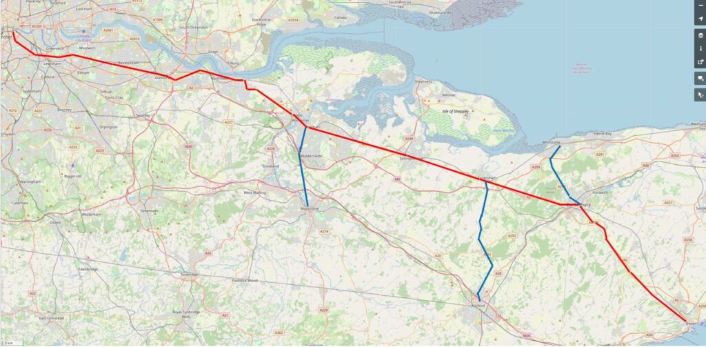
The route is the most direct route, but with a short diversion for a stop at Gravesend – a long route in a horse drawn coach on 18th / early 19th century roads.
Paterson’s Roads describes Gravesend as “the first port in the Thames, and by a grant of Richard II, enjoys the privilege of conveying passengers to and from London; the vessels depart from Billingsgate every day at high water, on the ringing of a bell, and from Gravesend every flood tide. All outward bound vessels are obliged to bring-to here, till they have been examined by the proper officers, and receive their clearances; here also all foreigners are detained on arriving from abroad; till they have obtained permission from the Secretary of State’s office to proceed, and all foreigners departing must receive their clearance from the Aliens office here”.
Paterson’s Roads also provides points where there is a route to a secondary destination, shown as the blue lines on the map. So a stop at Chatham provides a route south to Maidstone, a stop at Faversham provides a route to Ashford, and a stop at Canterbury provides a route north to Whitstable.
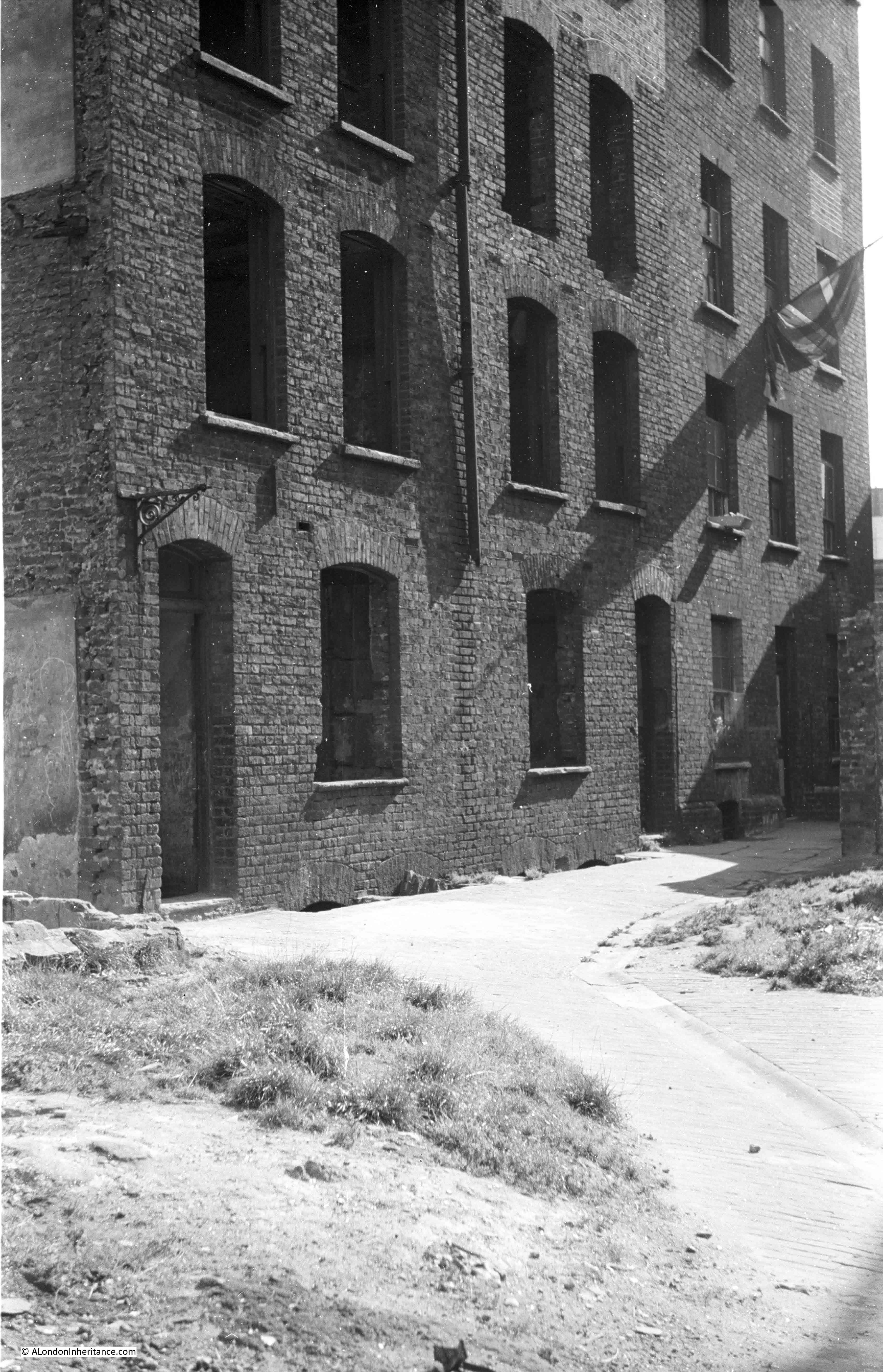
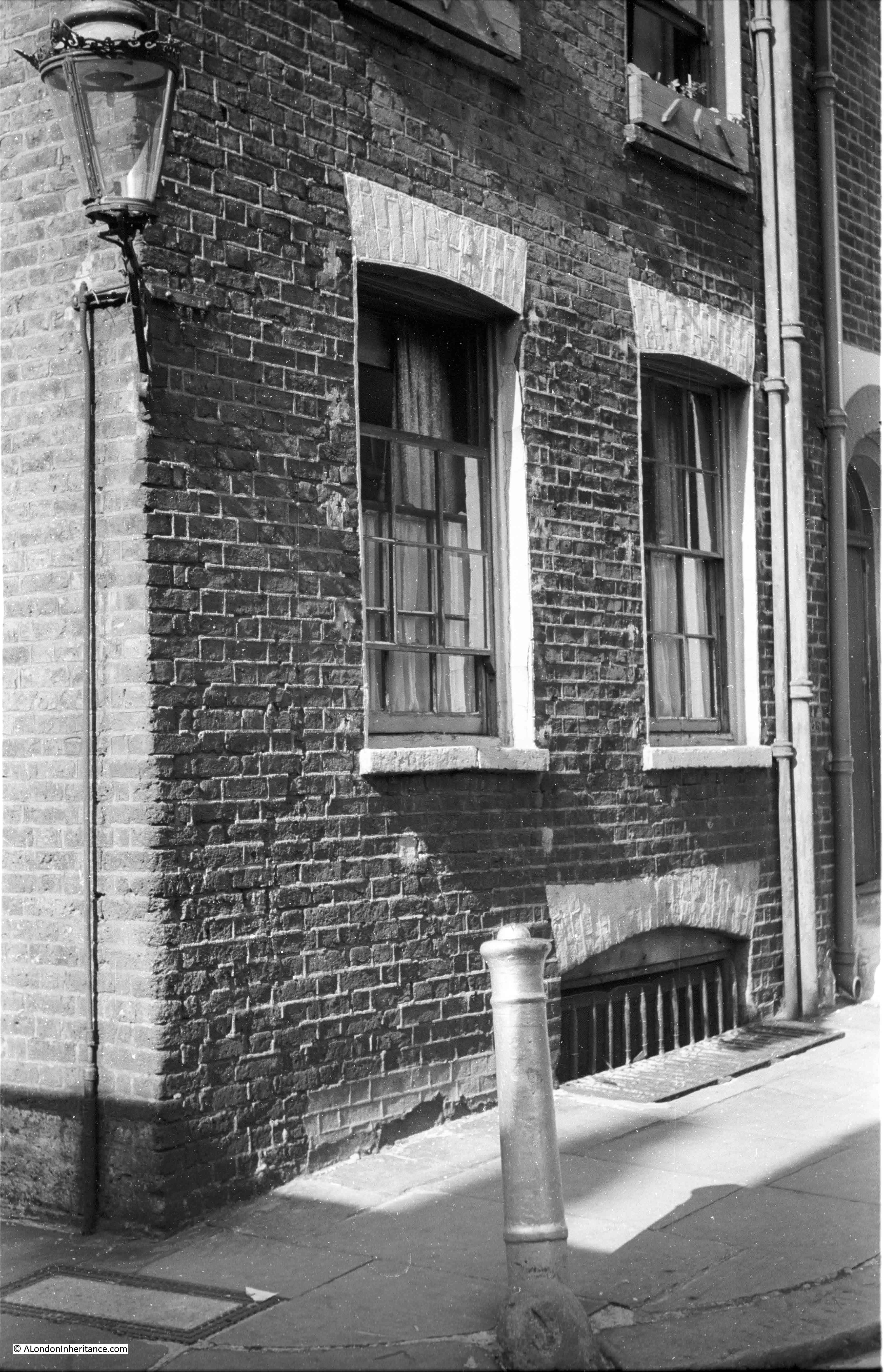
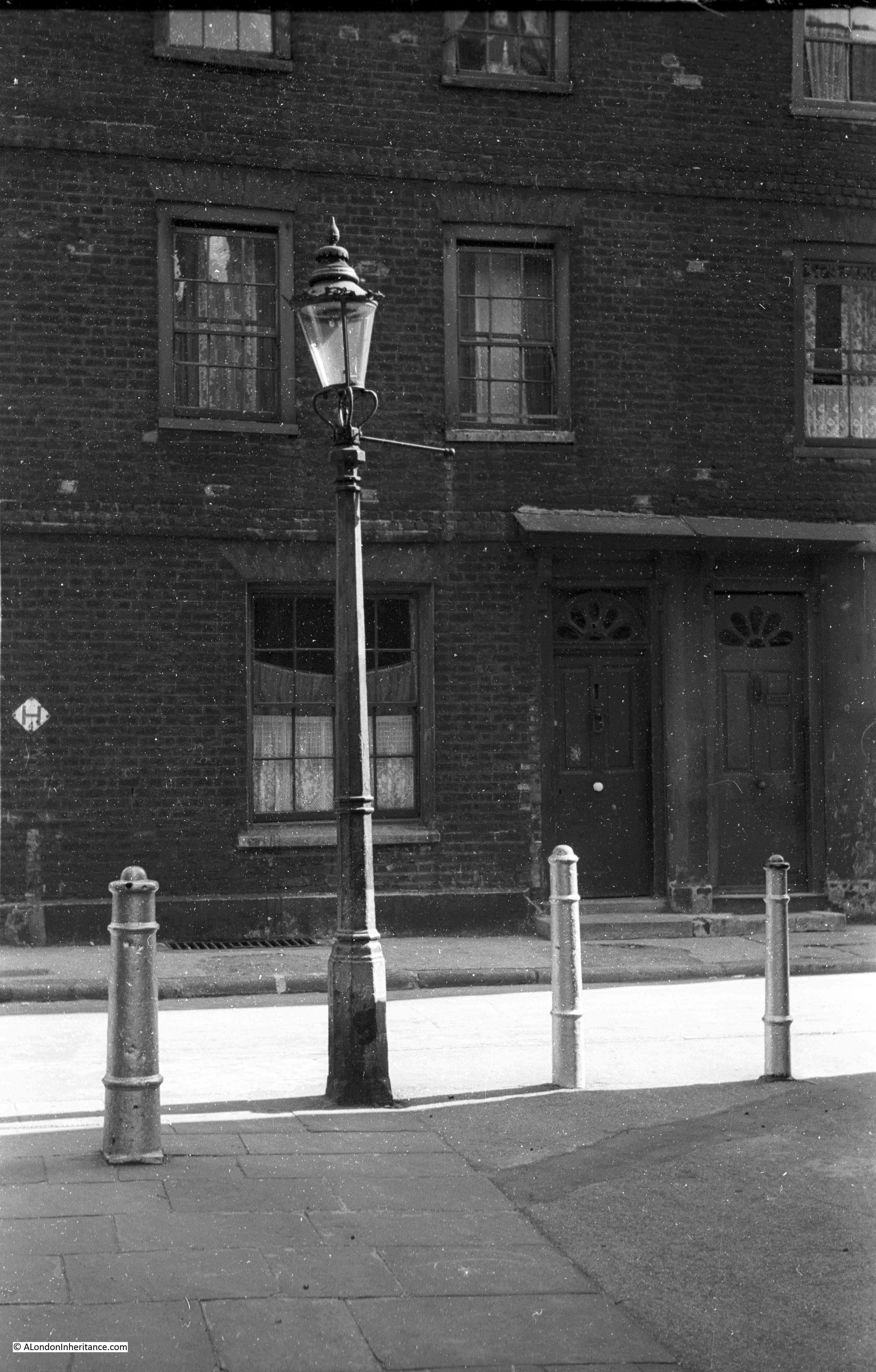
The infrastructure needed to support the number of coaches and wagons departing from and arriving at the George Inn was significant and originally the Inn was much larger than we see today.
The coming of the railways destroyed the coach and wagon business and Inns such as the George lost much of their business over a relatively short period of time.
Buildings and land that were originally part of the George were sold, and part was demolished or converted by the Great Northern Railway to be used as storage space.
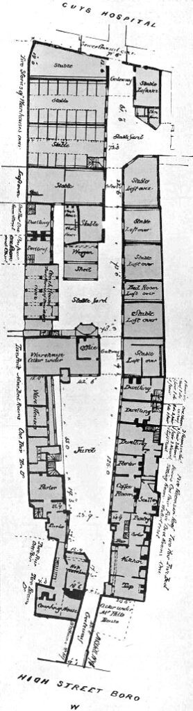
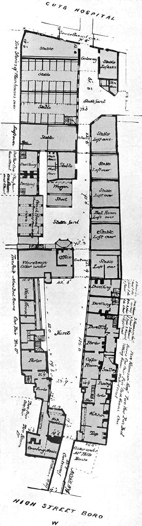
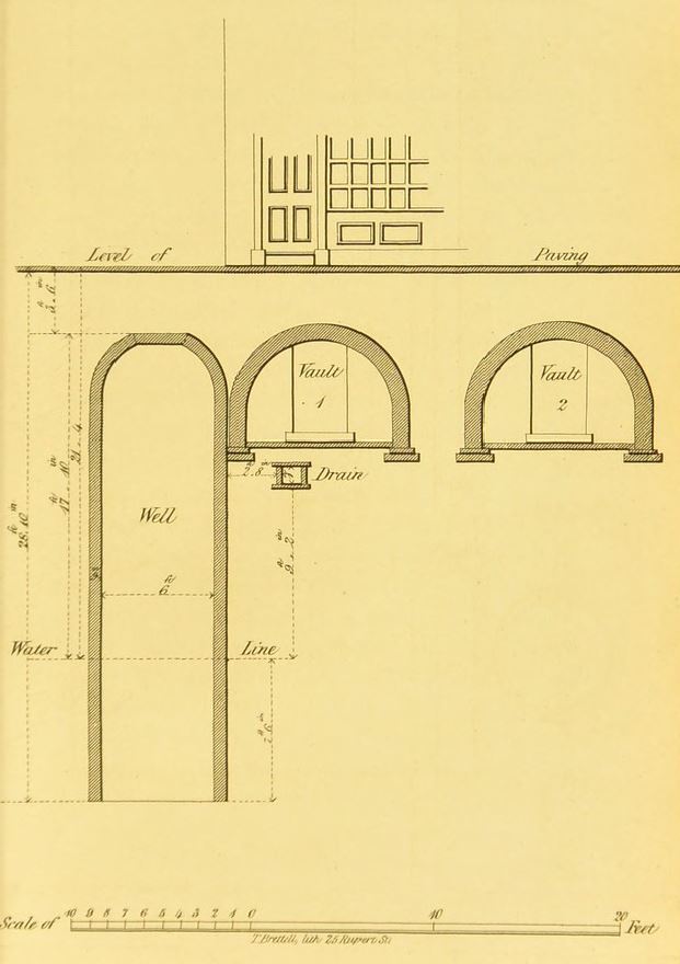
The Great Northern Railway became the London and North Eastern Railway, and in 1937, the LNER sold the George to the National Trust, who still own the building. As part of the sale, the LNER produced a plan created in 1847 when the previous owner, Guy’s Hospital, had sold to the Great Northern Railway.
This plan provides a detailed view of the original scale of the George, not just the yard in front of the current pub, but extending much further back towards Guy’s Hospital, where there were a large number of stables for the horses that once pulled the coaches and wagons across the counties south of London:
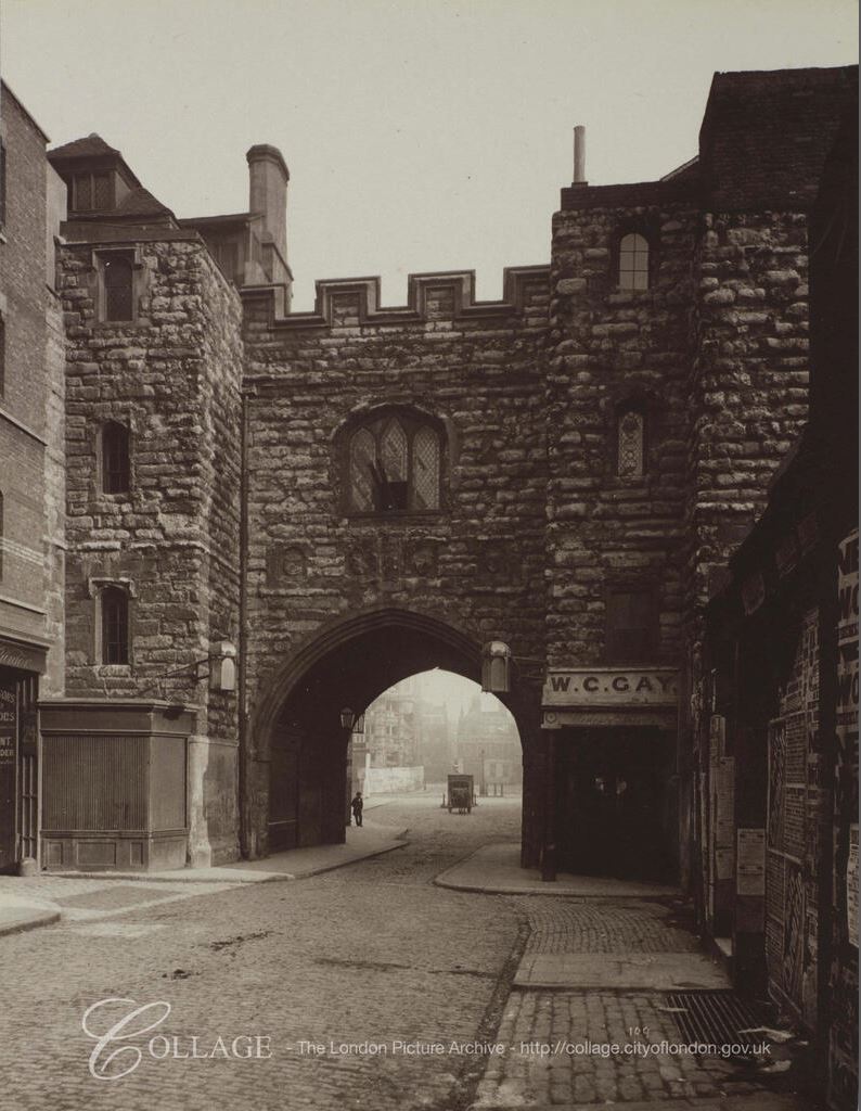
The following photo, dated to the 1880s shows the yard outside the current pub. The archway at the end of the yard is that shown in the plan above which leads into the stable yard and extensive stabling.
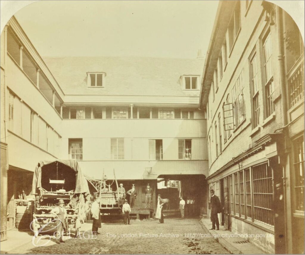
Image credit: London Metropolitan Archives, City of London: catalogue ref: SC_PHL_02_0970_X72_310
Newspaper records mainly reference the George Inn for coaching services rather than the alcoholic problems that a 18th / 19th century inn would often have, for example, even in 1812 it was not a good idea to fraudulently claim expenses:
“28th October 1812 – MIDDLESEX SESSIONS. Thomas Pearson, lately employed as office keeper in the office of his Majesty’s Quarter-Master-General, stood indicted for fraudulently altering, in a bill from the coach-office of the George Inn, Southwark, the sum of 3s 1d to 13s 1d for the carriage and porterage of a parcel from Hythe; and thereby defrauding his Majesty”.
There were adverts of coach services from the George, and the mention of reduced fares probably indicates the competitive nature of coach services. From the Maidstone Advertiser on the 20th September 1842:
Reduced Fares. Direct to London in three and a half hours by the favorite 4-horse coach, from the Swan Inn, Maidstone, every afternoon at 4 o’clock. Returning from the Ship, Charing Cross, Belle Sauvage, Ludgate Hill; Bull and Mouth, St Martin’s Le Grand; Blossoms Inn, Lawrence-lane; every morning at nine o’clock; and the George Inn, Borough, at half past nine, Fares 10 Shillings Inside. 6 Shillings Outside”.
On the same page as the above advert, is another that tells of the coming demise of the horse drawn coach services, and is probably why the above advert was advertising reduced fares:
“South-Eastern Railway Booking Office. Swan-Inn, High-street, Maidstone.
To and from London in three and a quarter hours!
Superior appointed coaches start punctually at the stated times from the above office to the station Paddock Wood, passing through Testom, Wateringbury and Peckham. Fares 2 Shillings Inside, 1 Shilling Outside”.
The above advert is interesting as it shows the hybrid nature of early train services and how the railway companies used the coach services they wanted to replace as feeder services to their stations.
The South Eastern Railway had reached Paddock Wood in Kent in May 1842, but would not reach Maidstone until 1874, so the South Eastern Railway ran coach services to take customers from nearby towns such as Maidstone to the nearest station. A clever idea as it not only grew traffic on the new rail network, but also encouraged those who had to use a feeder service to support the extension of the rail network to their own town.
The railways would quickly kill off the horse and coach services, and with them the need for coaching inns, and in the latter half of the 19th century London lost nearly all the coaching inns, with the exception of the George Inn. Even the nearby Tabard Inn, which seems to have been older than the George was demolished in 1873.
By 1899, the importance of the George was being recognised. From the 4th September 1899:
“I am glad to observe that London is not to be deprived of the old George Inn at Southwark – the last of the picturesque galleried hostelries of London. It was reported in one quarter that this ancient inn was to come down; in another, that it was to be turned into a common-place gin palace.
It was frequently visited by the sixth Lord Digby, a benevolent member of the Peerage, who midway in the eighteenth century, used to disguise himself in a shabby old blue dress and visit the old Marshalsea prison, and free a number of prisoners by paying their debts in full. He did this twice a year, at Christmas and Easter, and then took them to the George, celebrating the occasion by entertaining the liberated prisoners to a repast”.
An earlier story about Lord Digby tells of thirty people he had released from the Marshalsea prison, sitting at dinner at the George Inn.
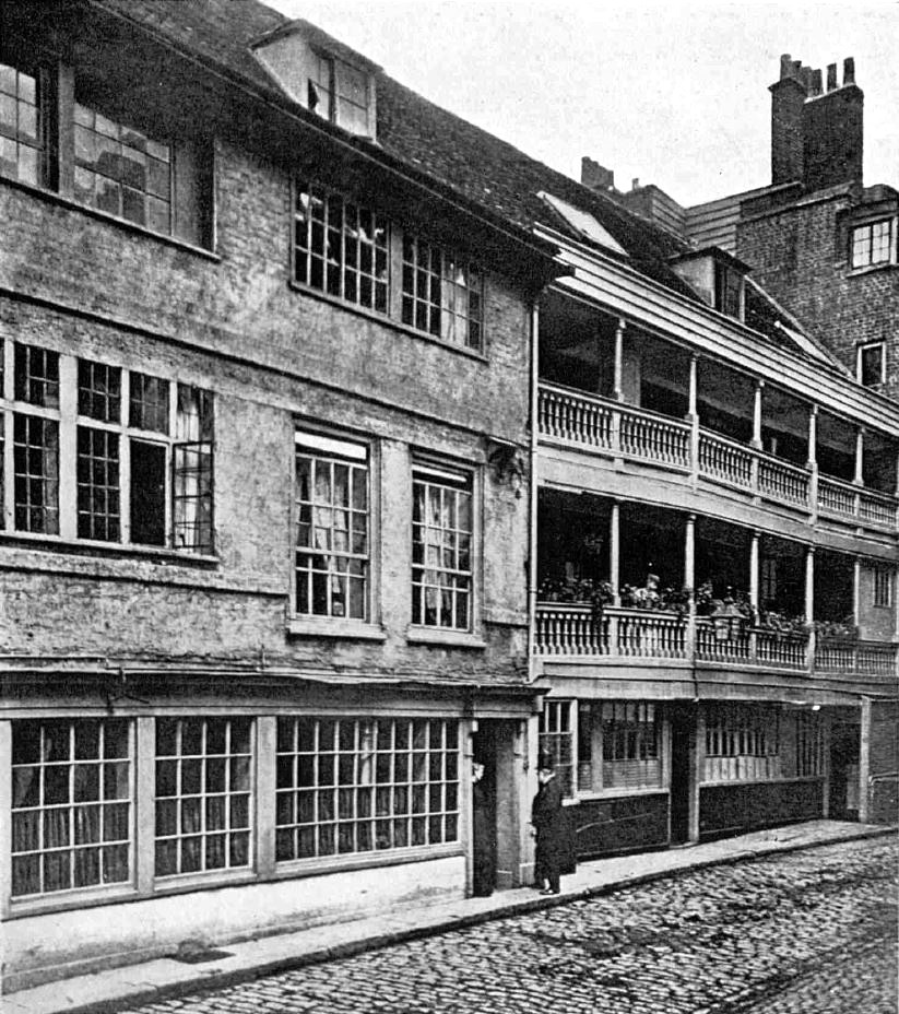
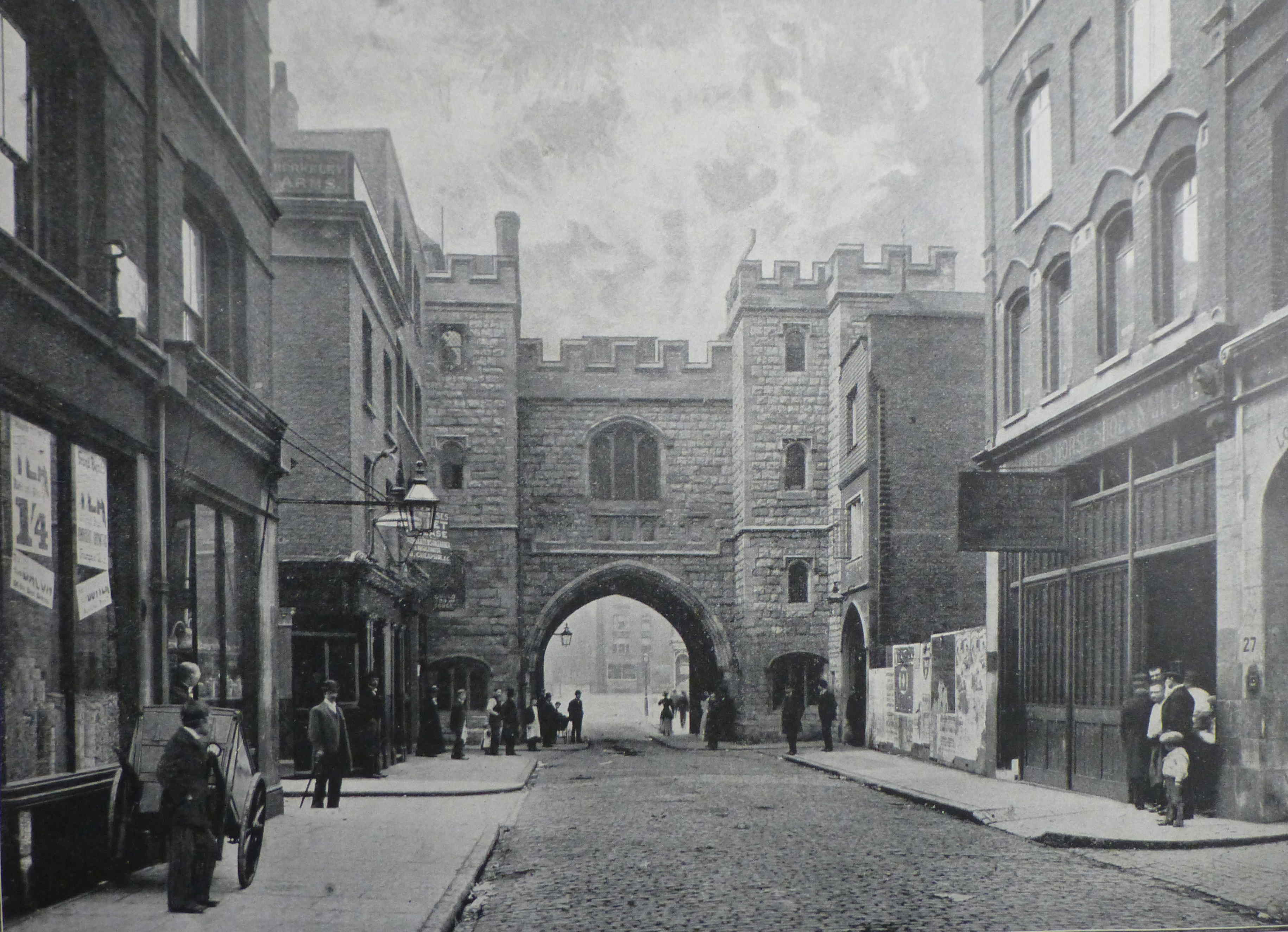
Late 19th century view of the George:
The George Inn is one of the many London locations that claim an association with the author Charles Dickens, although with the George it is almost certainly true that he did visit the inn and it does get a brief mention in Little Dorrit.
There are many original features inside the pub, dating back to the 19th, 18th and 17th centuries, and there is possible reuse of medieval beams and stone.
The George Inn is still owned by the National Trust, is Grade I listed and the inn is currently run by Greene King.
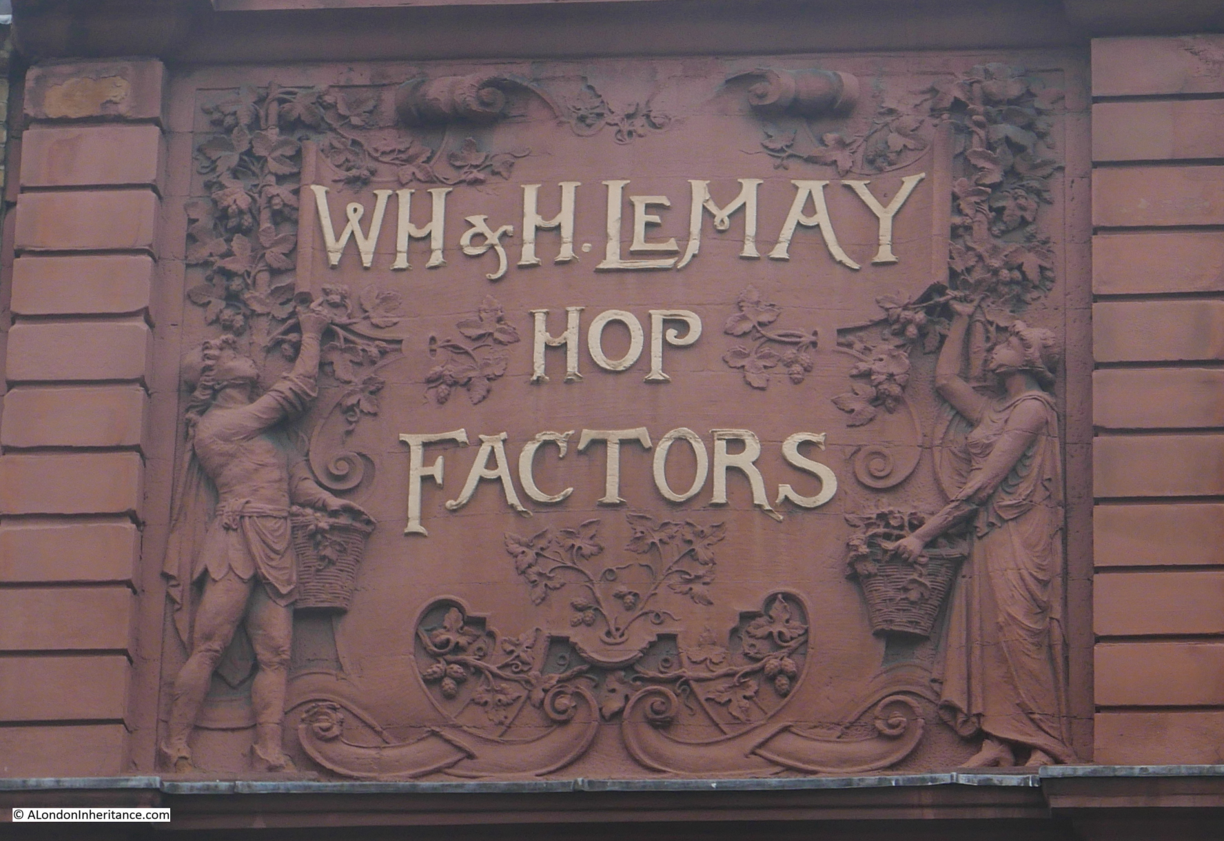
The George was a key location for transport to Kent, and there are plenty of other reminders in this area of Southwark of how Kent produce was taken to, traded and sold in Borough.
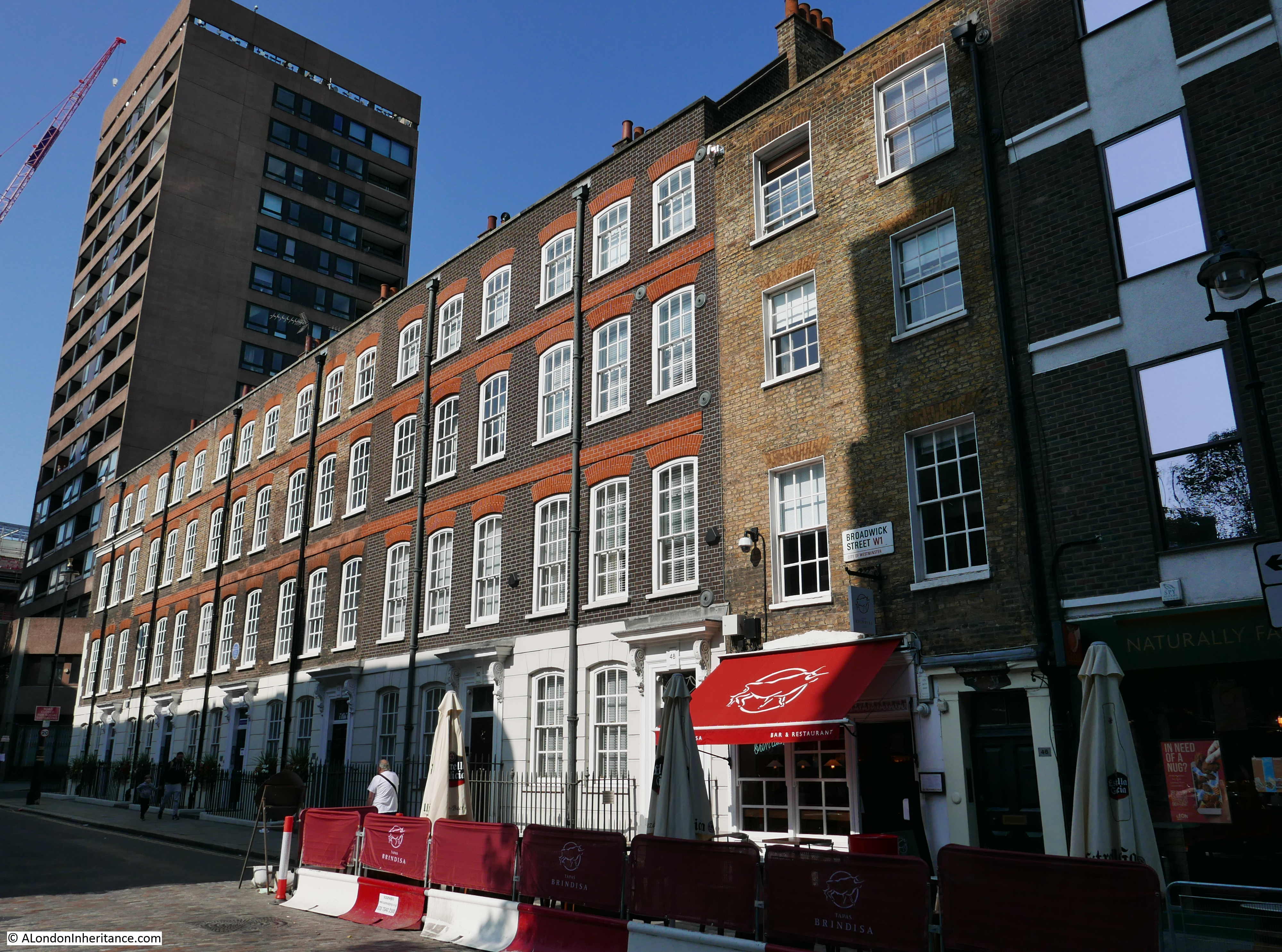
A couple of weeks ago I wrote about Borough Market and the Hop Exchange, and a short distance in Borough High Street from the George is this facade:
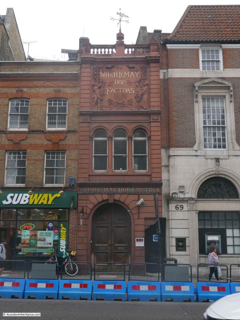
WH and H Le May were William Henry and his brother Herbert. Born in Gun Lane, Limehouse, they went on to establish a very successful hop trading business based on Borough High Street.
Their trade extended to all the hop growing areas of the country, not just Kent, but counties such as Herefordshire where newspapers had adverts for the business encouraging growers to consign their hops to WH and H Le May, to be “sold in London, the best market for hops”.
Advertising included pricing updates and in 1911 they reported that “the demand for all types of hops continues, and prices have again advanced on all the hop markets of the world”.
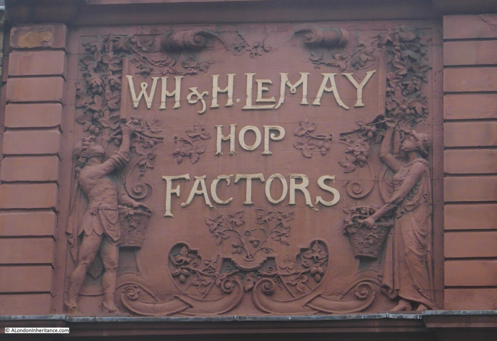
The business may be long gone, but the ornate facade provides a reminder of this area of Southwark’s connection with the trade of agricultural produce from Kent, southern England and further afield.
One of the books I have used to research this post is “The Old Inns of Southwark and their Associations”, by William Rendle and Philip Norman. The book was published in 1888.
Old books help as they provide information closer to the time they are recording. Some care must be taken to double check, but they are a good source of information.
These books also have their own history as they pass from owner to owner over the years, accumulating a memory of their time with some of the owners of the book.
In the Old Inns of Southwark, on the rear of the title page, I found the following photo glued onto the page.
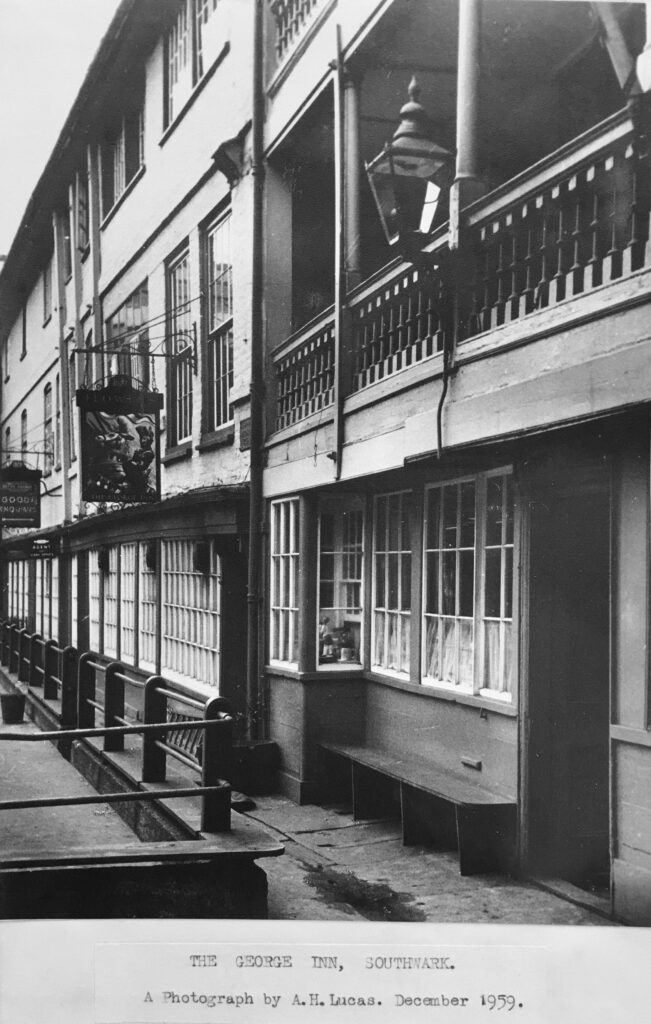
I have no idea who A.H, Lucas was, perhaps the owner of the book in December 1959 when the photo was taken.
I was considering adding my 1977 photo, but I did not own the book at the time, so when it is possible to get back to the George, I will take another photo and add to the book.
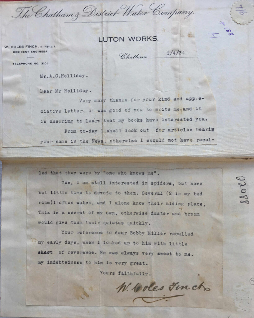
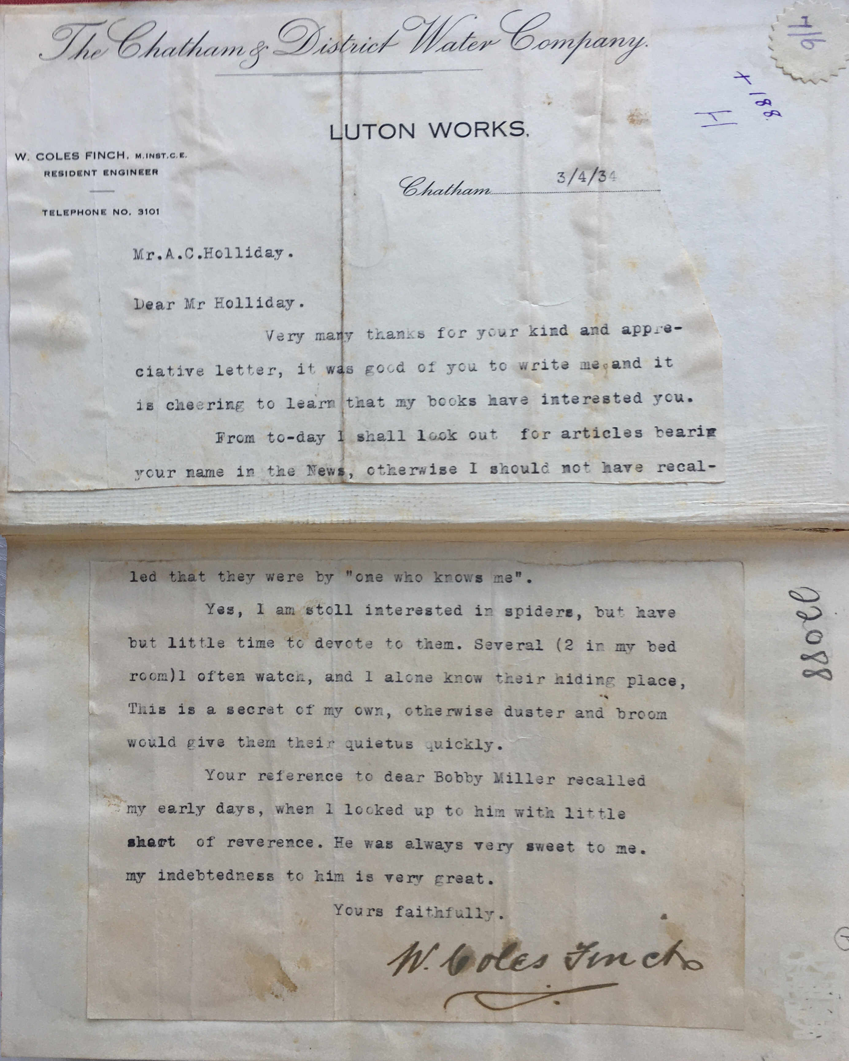
Another book which takes this to a more extreme level, with additions that tell of the coaching history of Chatham is “The Medway River and Valley” by William Coles Finch, an author and resident engineer of the Chatham and District Water Company. The book was published in 1929 and is a fascinating history of the River Medway, and the towns along the Medway.
The book was purchased when published by a Mr A.C. Holliday, a local teacher.
In 1934 A.C. Holliday had written to William Coles Finch, apparently praising his books as Coles Finch replied, and A.C. Holliday glued the reply into the book:
A.C. Holliday also glued into the book, on every empty page at the start and end of the book, newspaper cuttings on the history of Chatham.
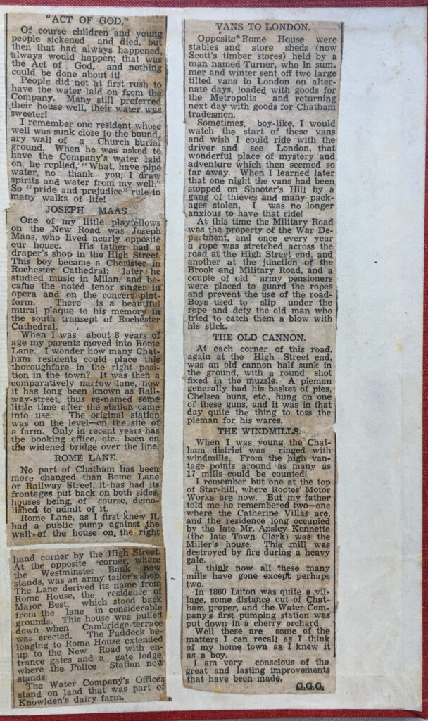
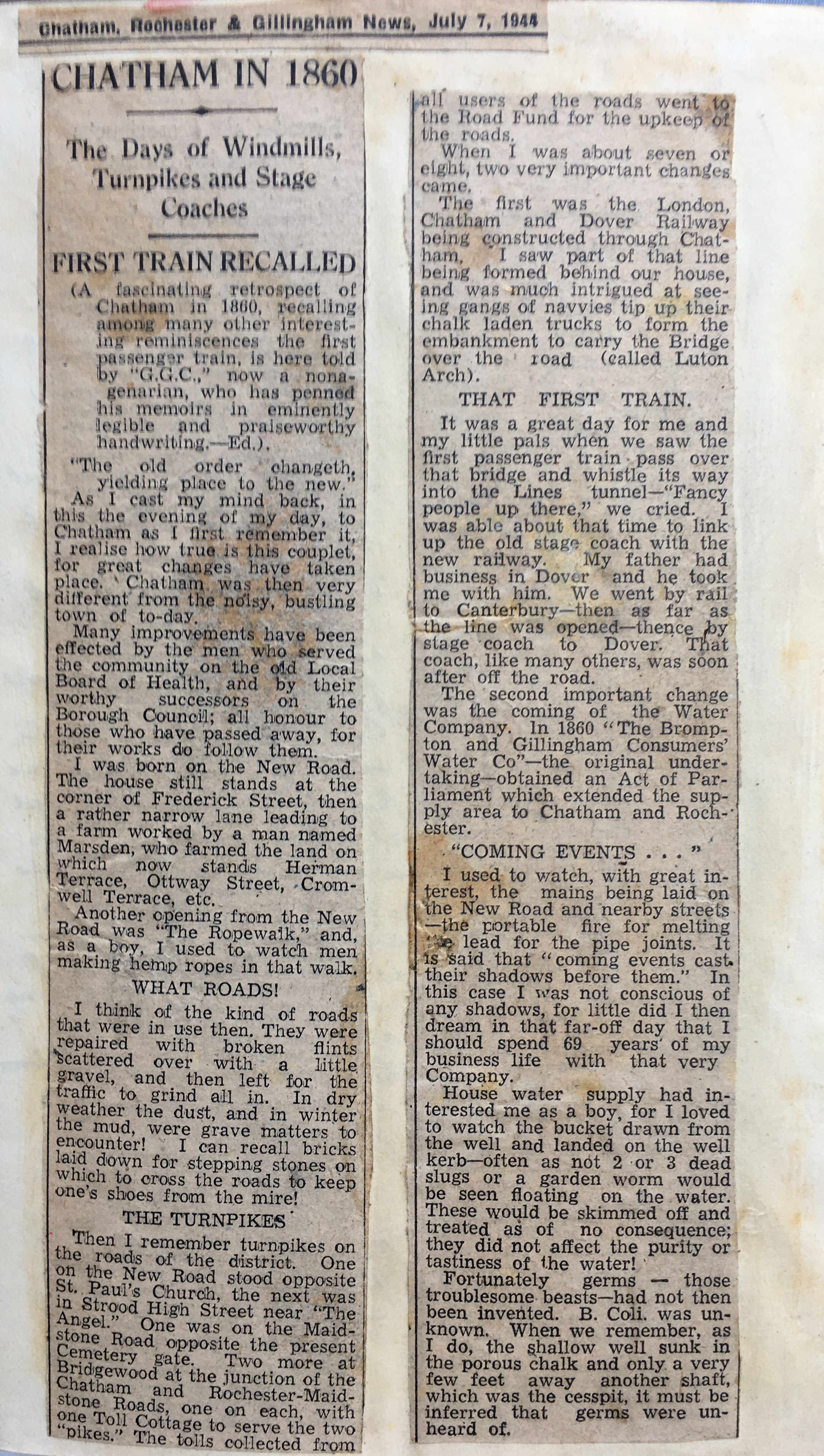
This cutting tells of the first train to arrive in Chatham, and also recalls the state of the roads which the old horse drawn coaches would have used to reach Chatham from London from inns such as the George Inn, with dust in dry weather and mud in winter:
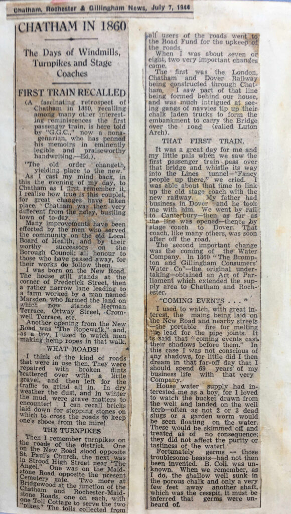
The article includes mention of the Vans that once ran to London, loaded with goods. The sense of London as being a distant place of mystery and adventure, and of the problems that a traveler would encounter with thieves on Shooters Hill:
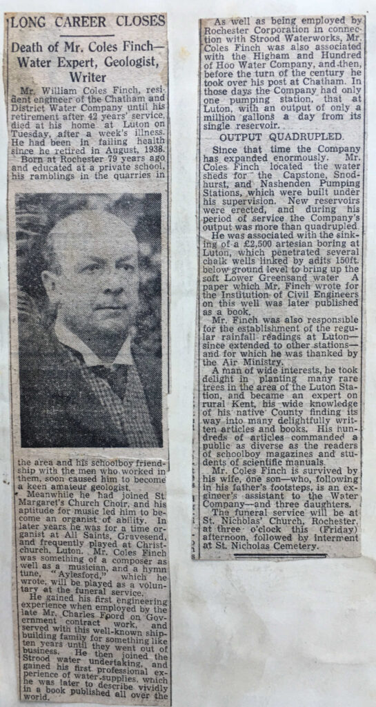
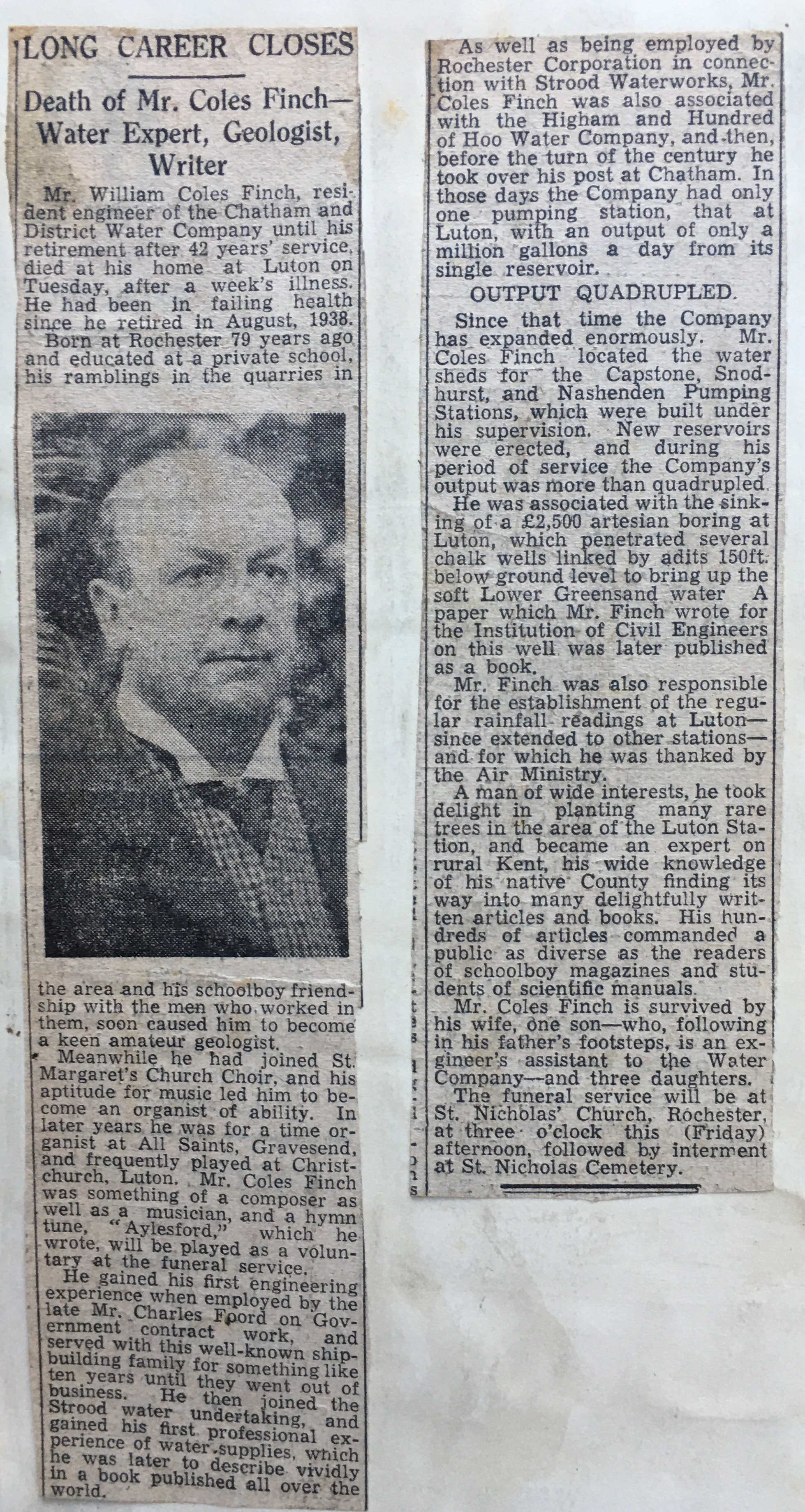
William Coles Finch died in 1945, and an obituary is glued in the book:
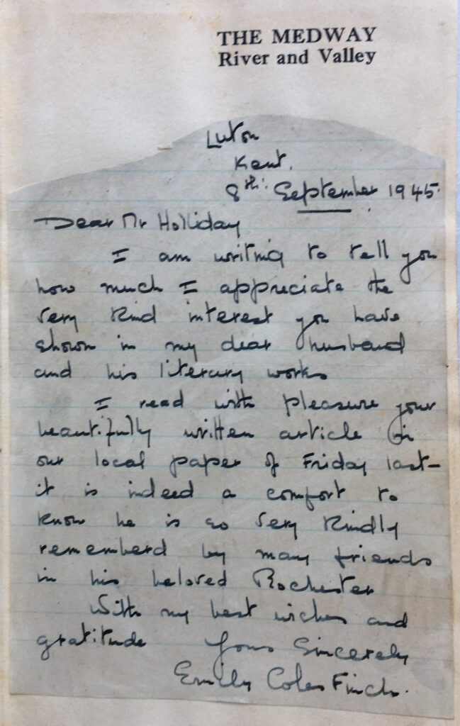
William Coles Finch wife, Emily wrote to A.C. Holliday regarding the article, and the letter is also glued into the book:
There is no free space in the book to add any further contributions, however I printed one of my photos of the London Stone at Yantlet Creek to use as a book mark, and have this in the book as my addition to its history.
I have always used the latest London Underground folded maps, exhibition or concert tickets, or photos as bookmarks and leave these in the book when finished – my contribution to their history.
The George is now much smaller than the original establishment, when horses needed to be stabled and coaches and wagons set out for the southern counties, but it still shows what an inn would have looked like when horse drawn vehicles were the main mode of transport.
As the George Inn is owned by the National Trust (a brilliant decision by the LNER), the long term future looks assured, and it is the perfect place to stop for a drink and consider the many thousands of travelers who must have departed or arrived here, each on their own special journey through, what was described in Coles Finch’s book as “London, being a distant place of mystery and adventure”.
alondoninheritance.com


