Wonderful London

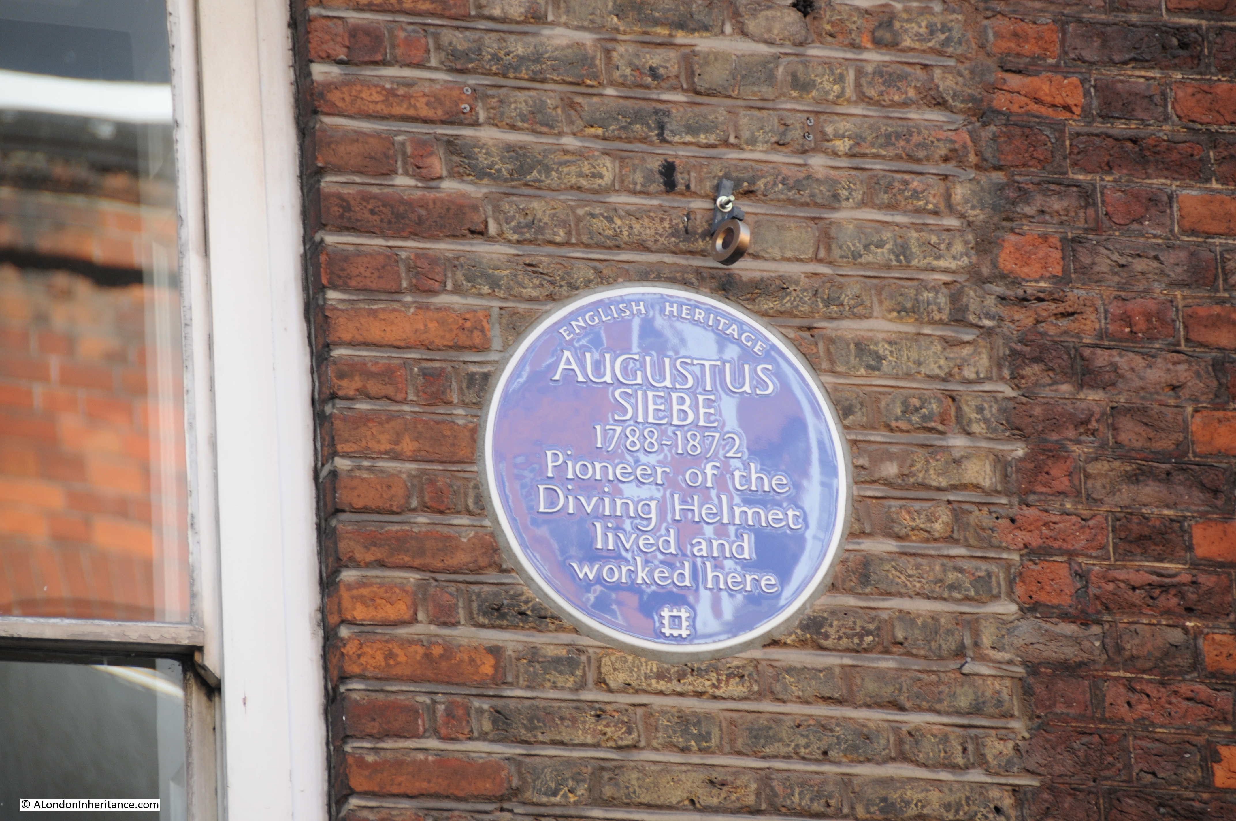
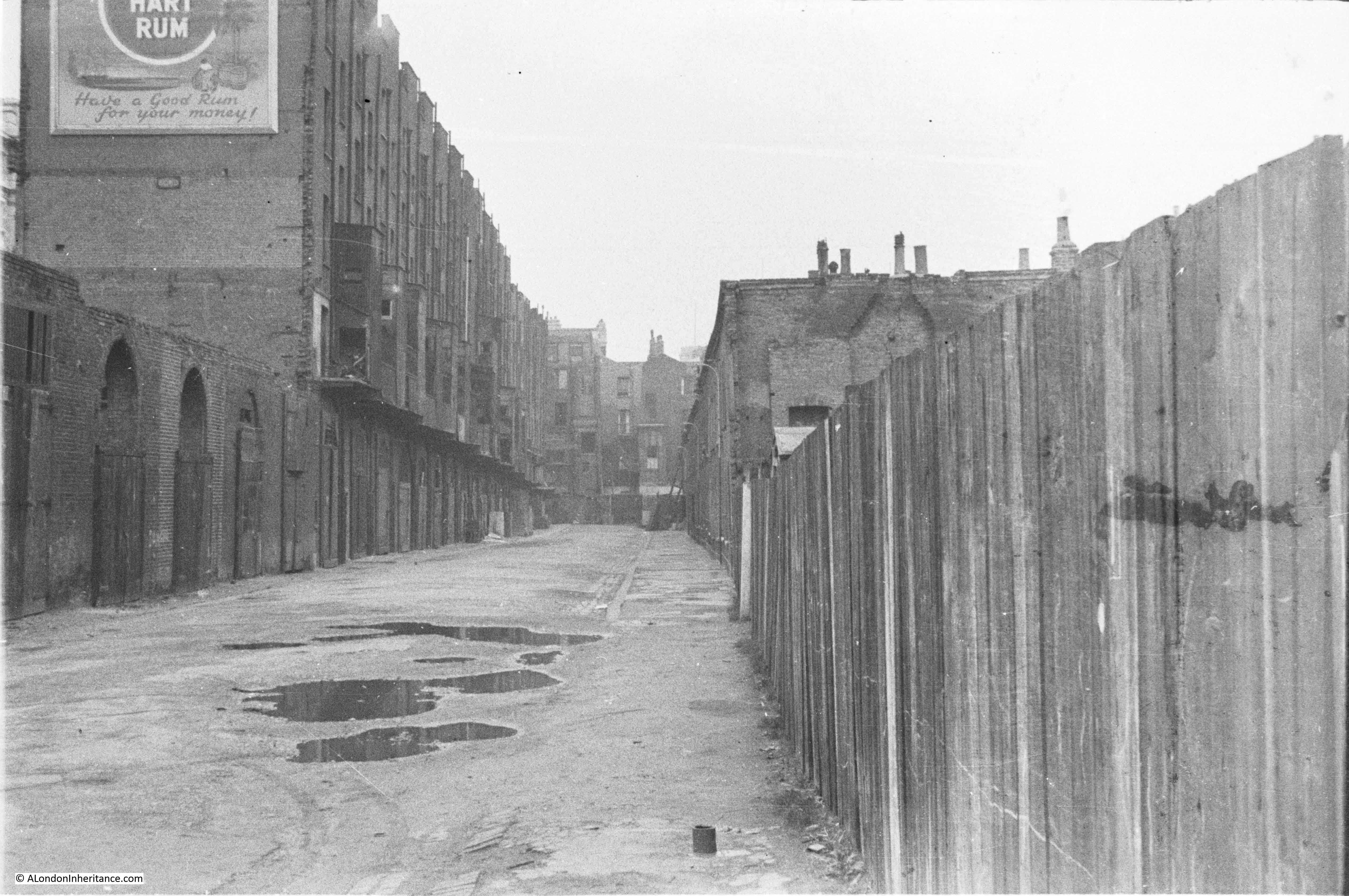
I have been collecting books about London for many years, my first purchase was in the mid 1970s in a second-hand bookshop in one of the alleys leading into Greenwich Market. It was H.V. Morton’s London, first published in 1940, a collection of three individual books published in the 1920s. H.V. Morton was a journalist and his writing about London was probably embellished somewhat, but at the time it seemed to bring alive the history and romance of London.

I recently bought a remarkable 3 volume set – Wonderful London, published in the late 1920s. It was edited by St. John Adcock (a prolific author and poet who lived in Hampstead and died in 1930) and described as “The World’s Greatest City Described by its Best Writers and Pictured by its Finest Photographers”.

Wonderful London has chapters on all aspects of the city, each written by a different author, for example “How London Strikes A Provincial” by J.B. Priestley, “The Case For Old London” by G.K. Chesterton and “Sunday In Town” by H.V. Morton.

The three volumes run to over 1100 pages and 1200 photos and provides a fantastic snapshot of London in the 1920s with the text highlighting the social attitudes of the time.

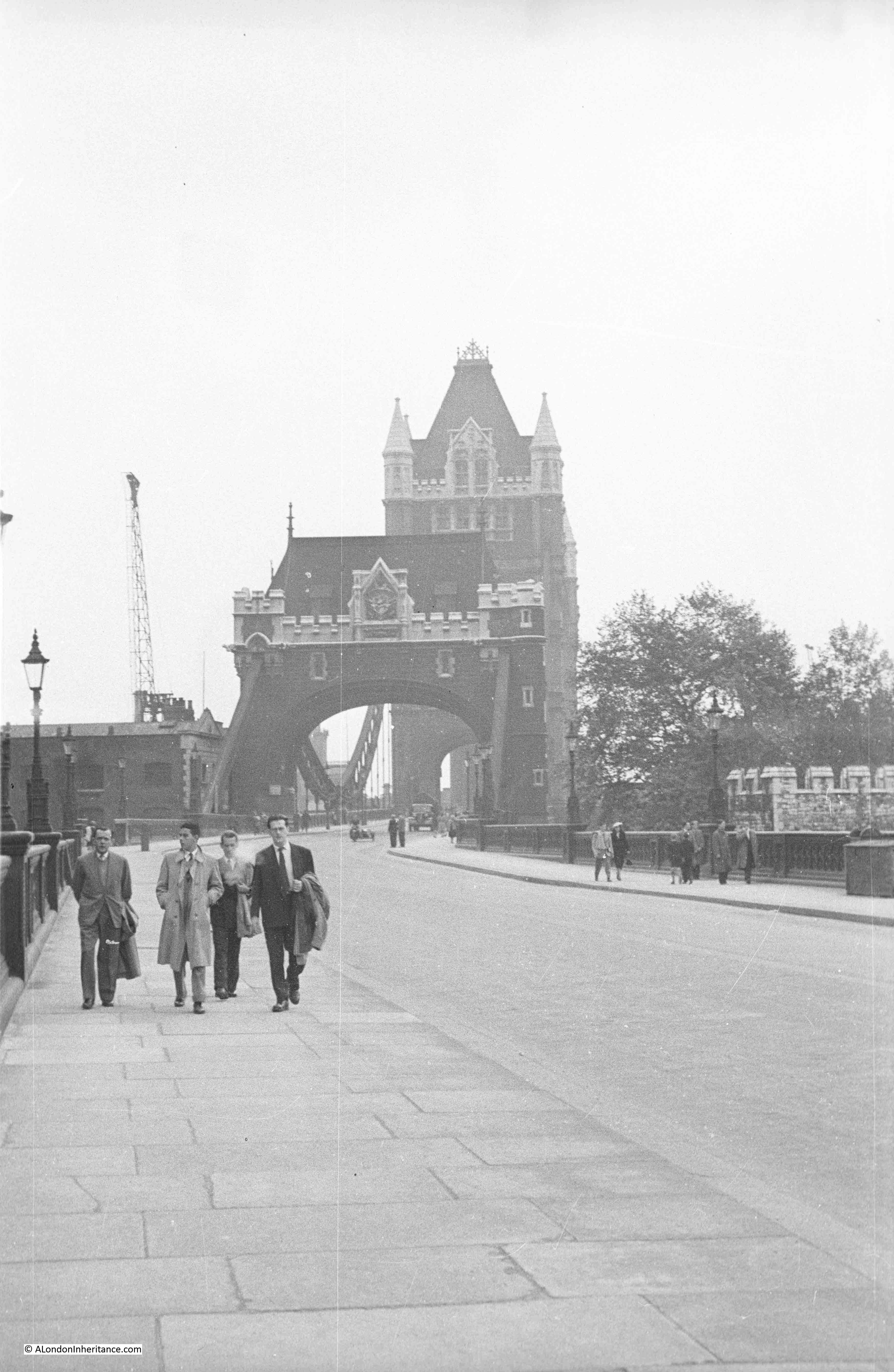
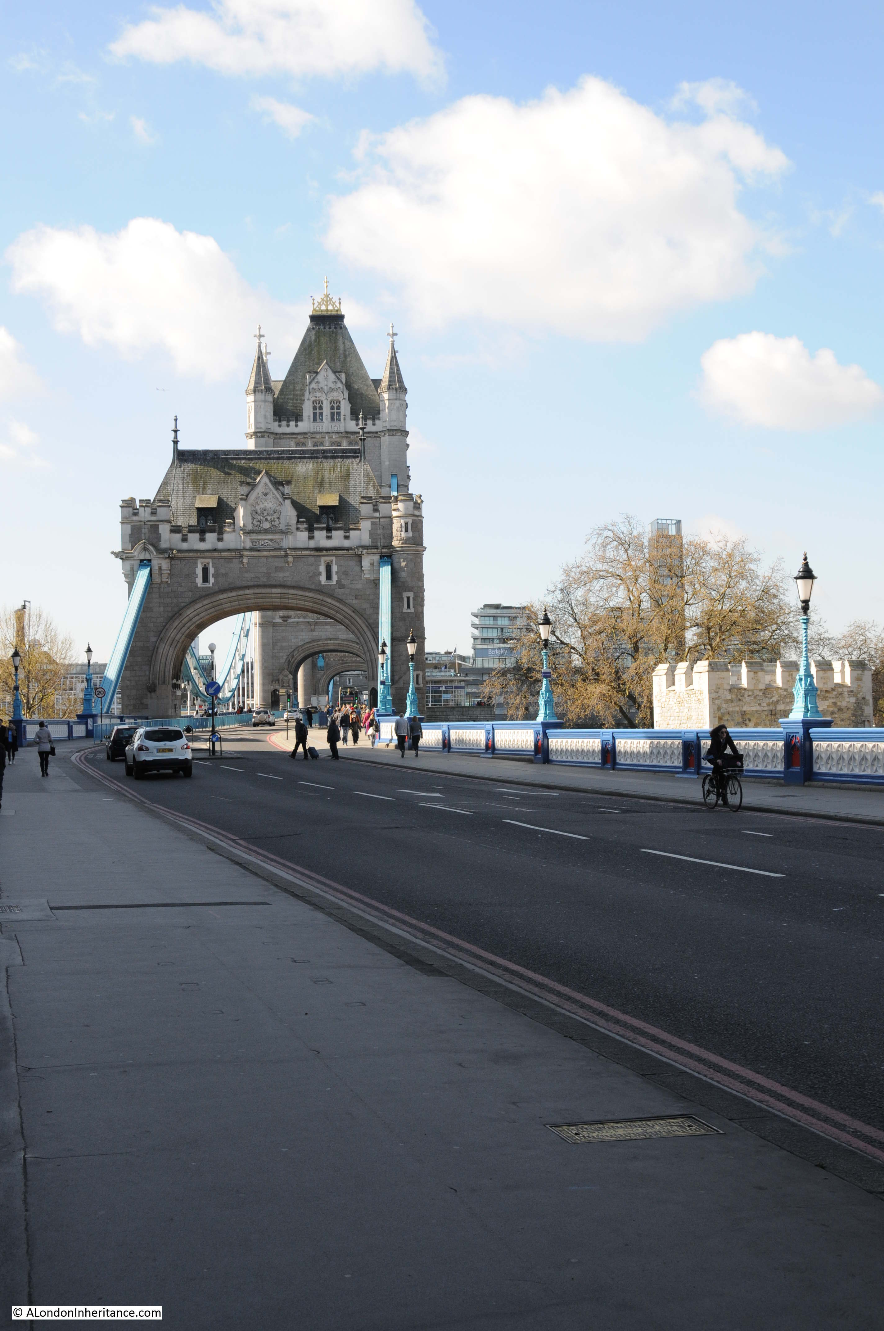
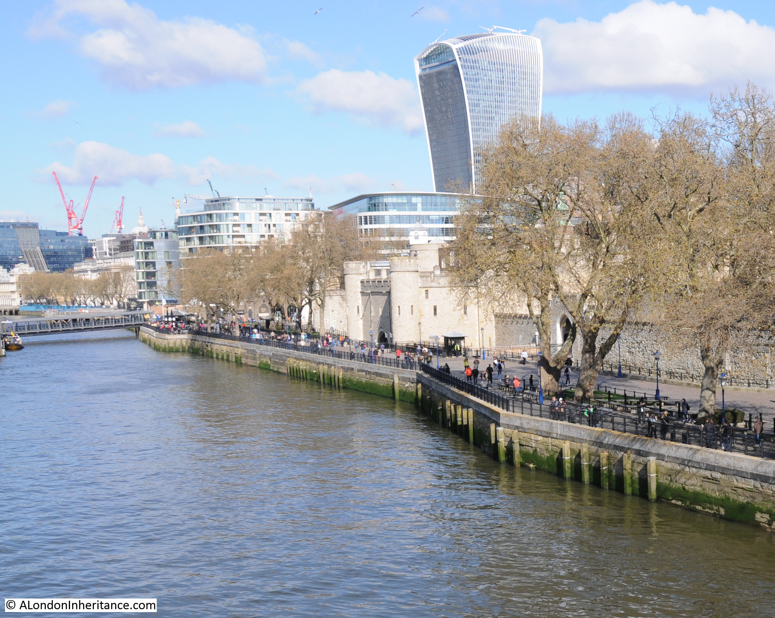
As I scanned through the book, many of the photos are of the same scenes that my father took in the late 1940s and early 1950s and which I have been photographing over the years. There are also some remarkable photos showing London in the first decades of the 20th century and for this week’s post, let me bring you a sample of photos from Wonderful London.

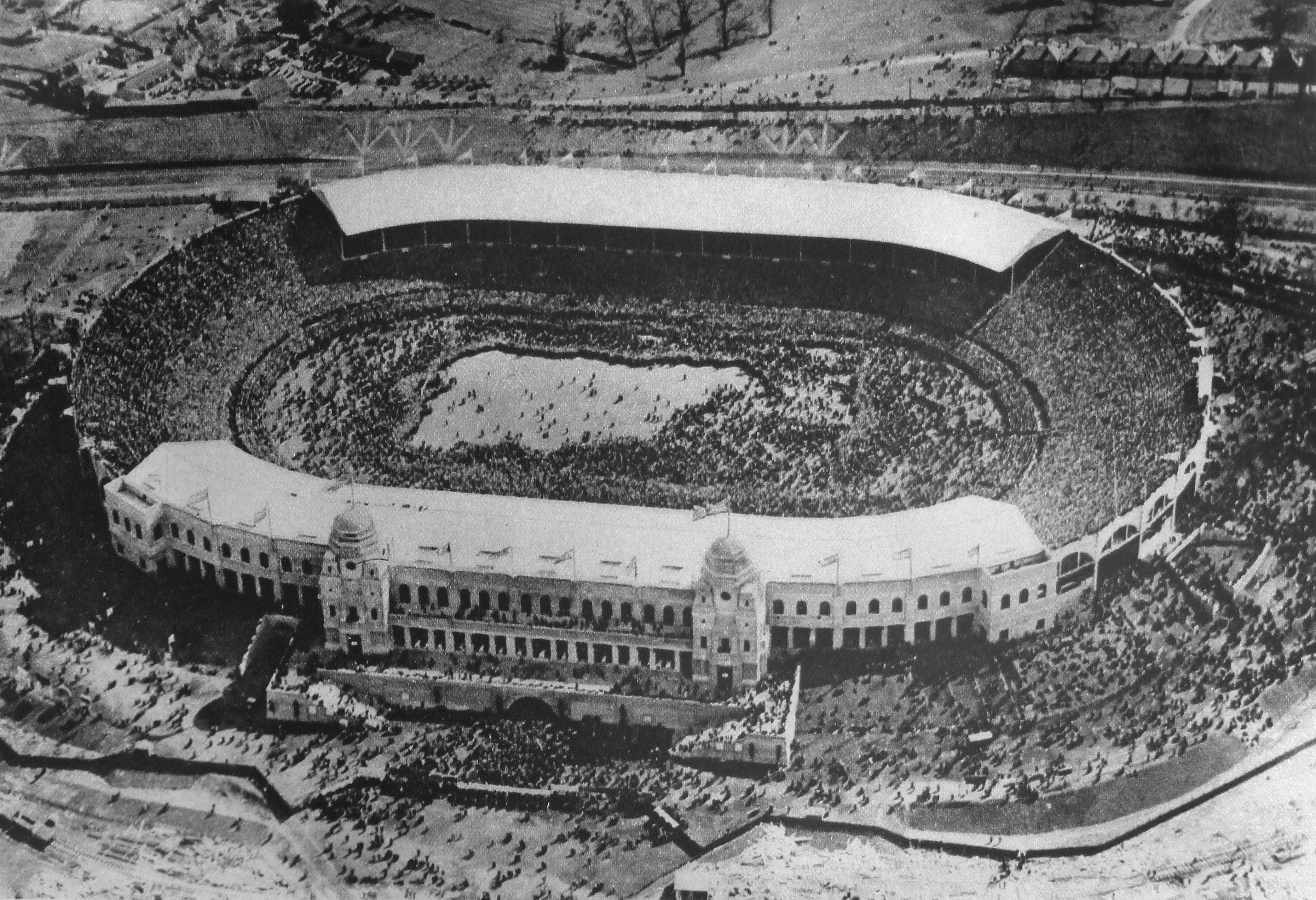
To start, the first photo is a fantastic aerial view of Wembley Stadium. the title to the photo is “Ants Nest Carelessly Broken Open Or Wembley Stadium Seen From The Cockpit Of An Aeroplane”. The caption to the photo reads:

“When at the end of 1925, after two years of stucco splendour, the pavilions and palaces of the British Empire Exhibition melted beneath the workmen’s hands, one building, as though in irony remained, the Wembley Stadium, solid-built as the shrine of professional football. It is symptomatic boast that the Stadium exceeds the Colosseum in size by one-half. During the period of the Exhibition the arena was used for various pageants and military displays, but it is not on record that they ever drew a crowd nearly as dense as the one on which we are gazing.”

Wonderful London 1

Continuing on the football theme, the following photo is titled “Street Hawkers Sell Football Favours At Walham Green” and has the caption:

“At Walham Green coloured favours and match programmes are for sale near Stamford Bridge, the ground of the Chelsea Football Club.”

Wonderful London 9

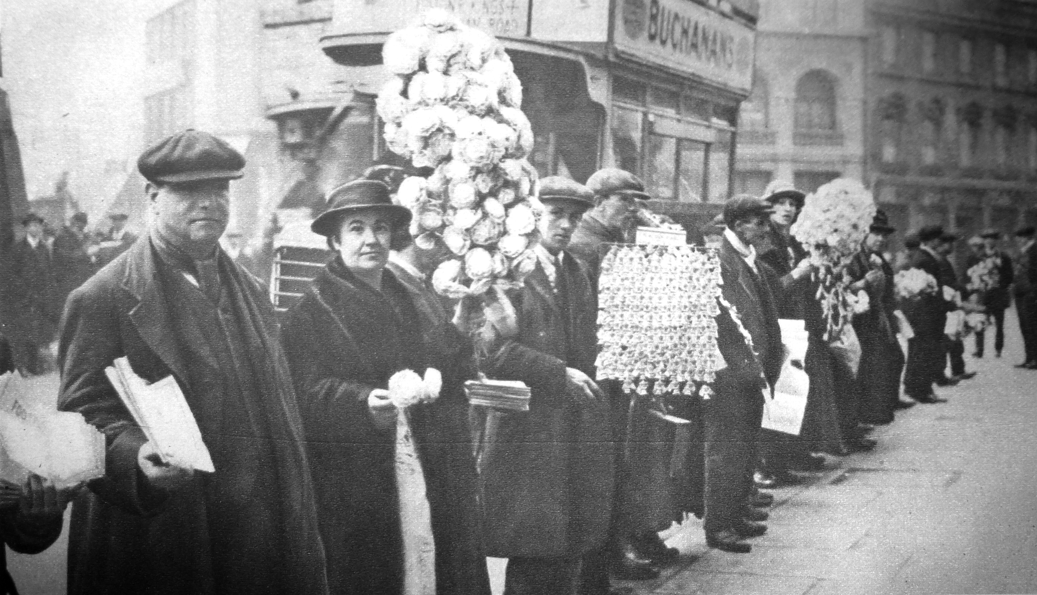
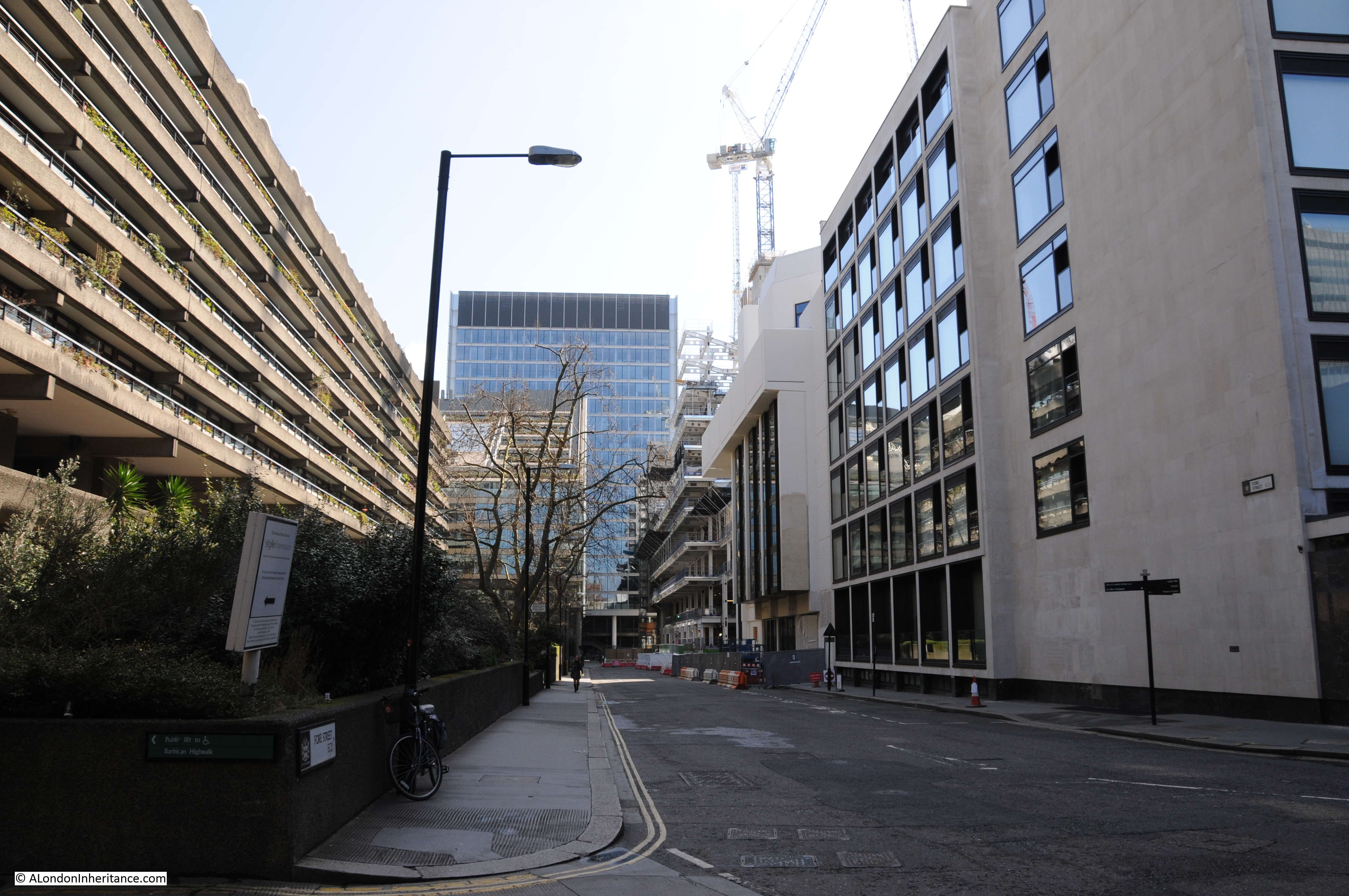
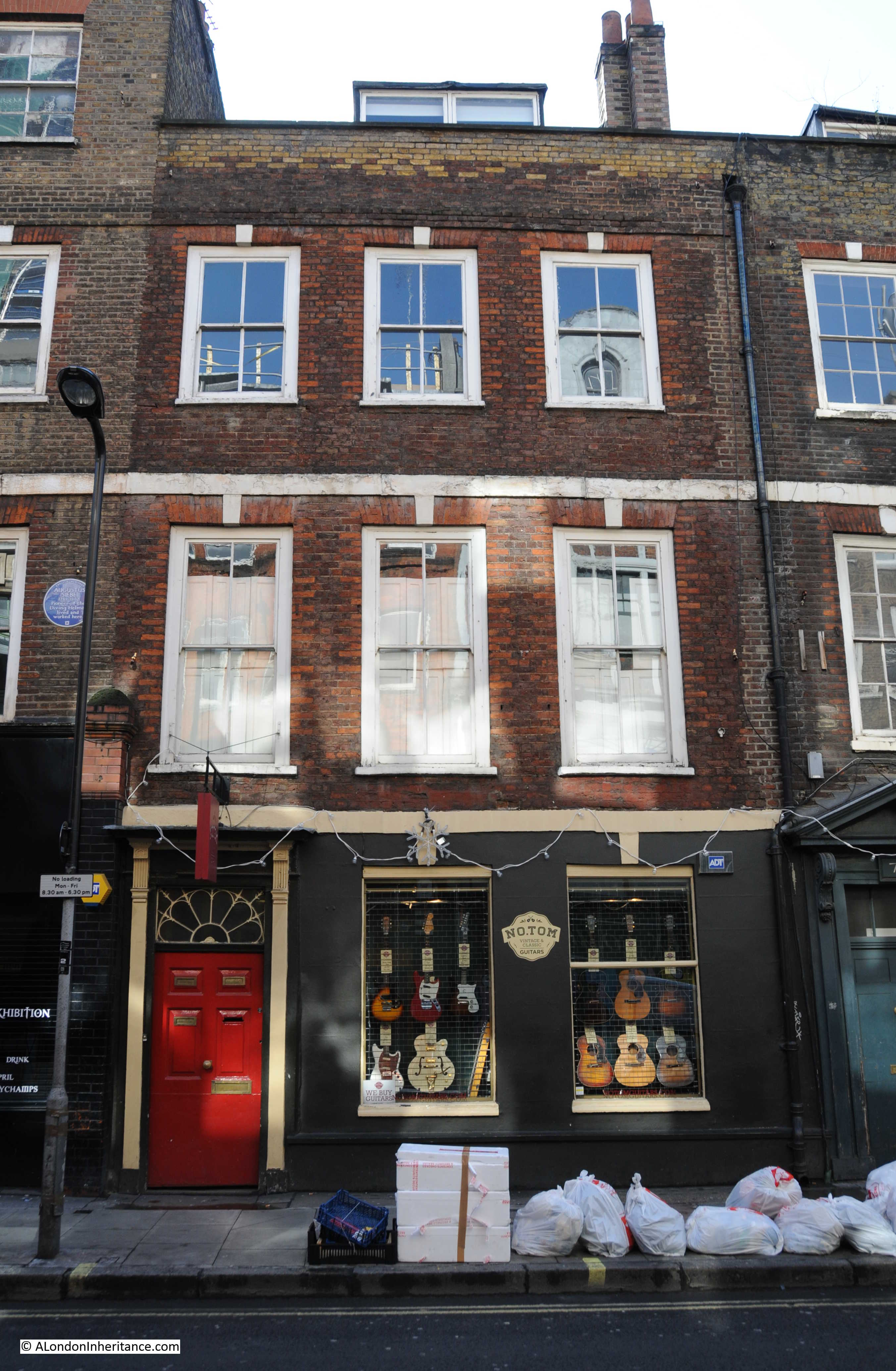
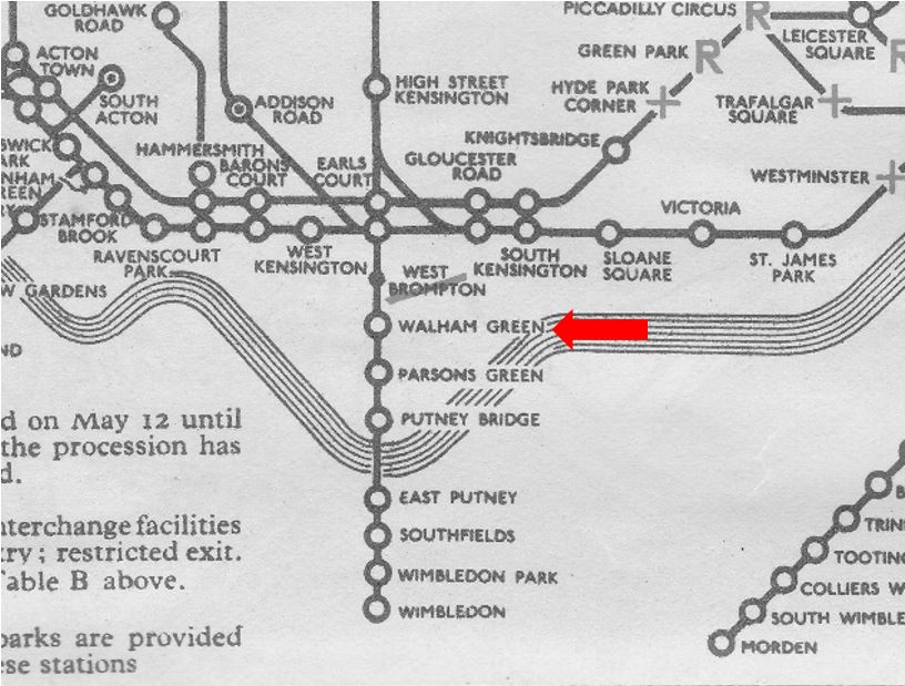
Walham Green is a name that is rarely heard today. Originally the name of a village in west London, dating back to at least 1383 when it was known as Wandongrene. As the above reference to Chelsea Football Club suggests, it was integrated into Chelsea and Fulham. The underground station on the District Line that is now called Fulham Broadway was originally called Walham Green. See the following scan from a 1937 underground map. The name changed to Fulham Broadway in 1952.

Wonderful London 40

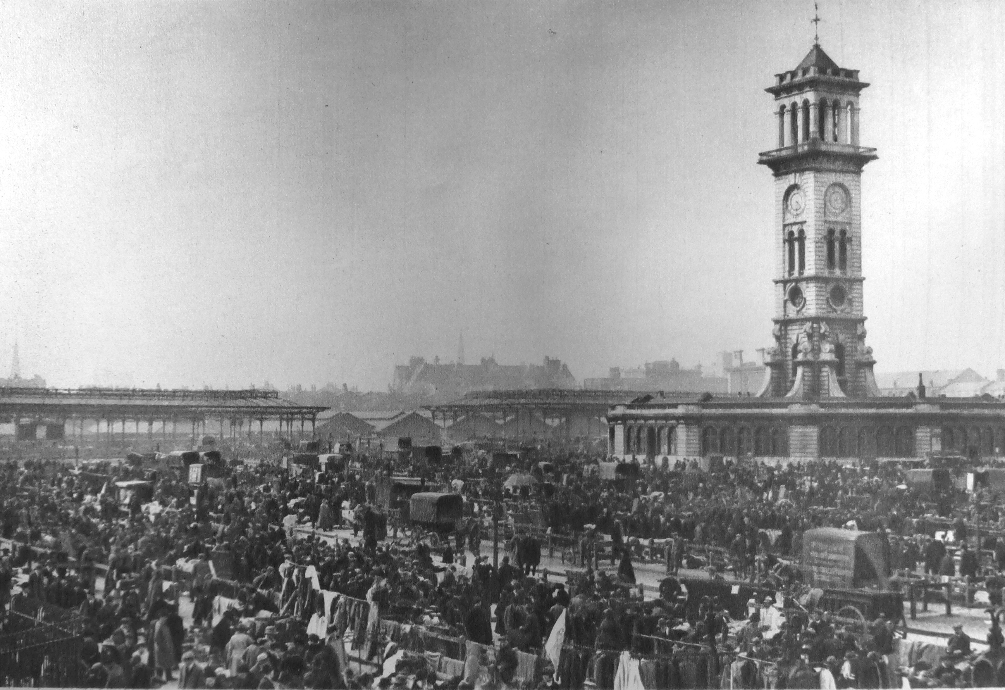
Last year I published a couple of posts on the Caledonian Market, including climbing the Clock Tower which can be found here and here. Wonderful London includes a few photos of the market, including the following photo showing an overview of the market in action. The clock tower is still there, but the surroundings are now completely different.

Wonderful London 2

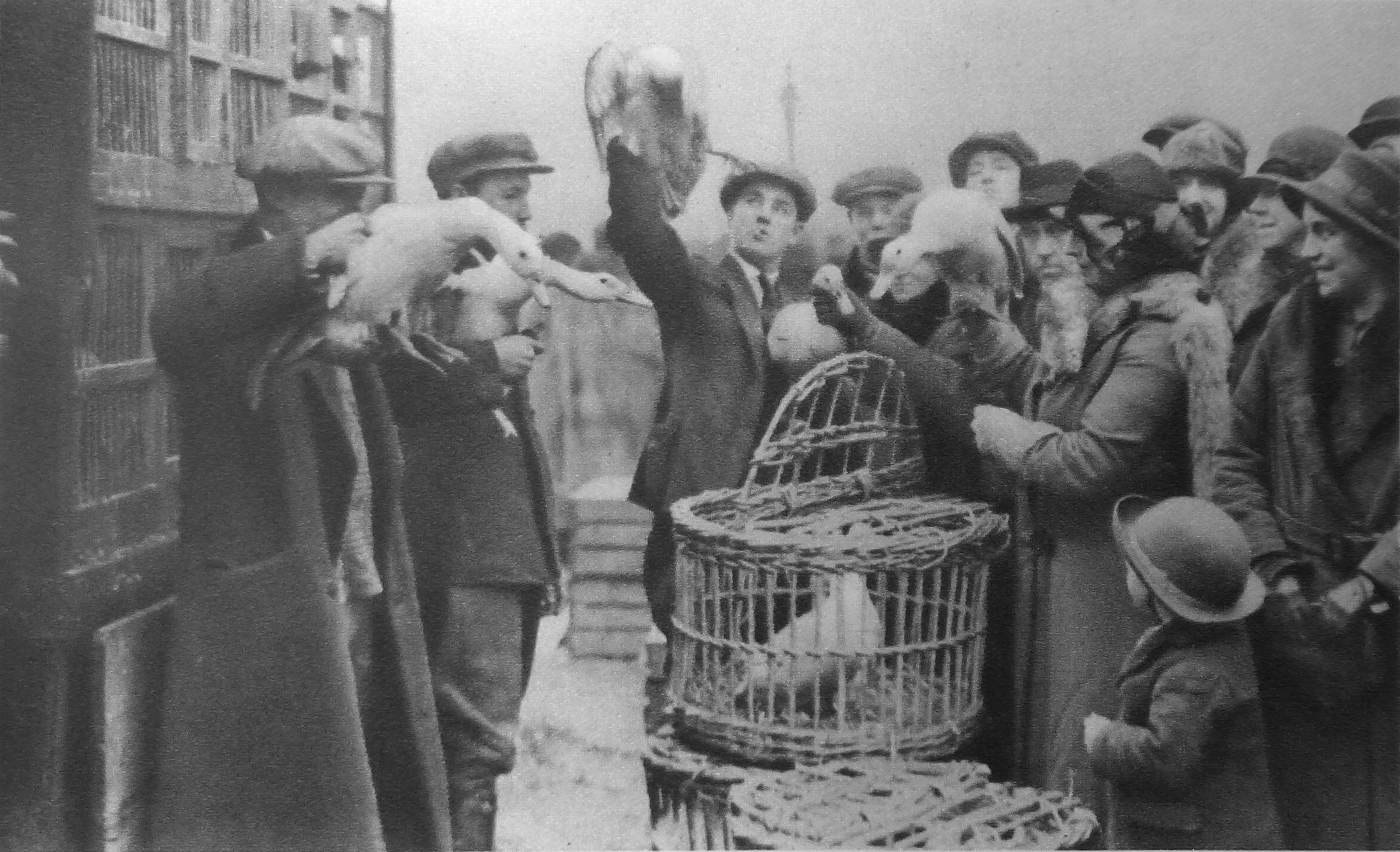
As well as the main cattle market, the Caledonian Market area was also the site of a Friday “pedlars’ market”  where is was possible to buy almost anything. The following photo shows the sale of poultry at the pedlars market.

Wonderful London 3

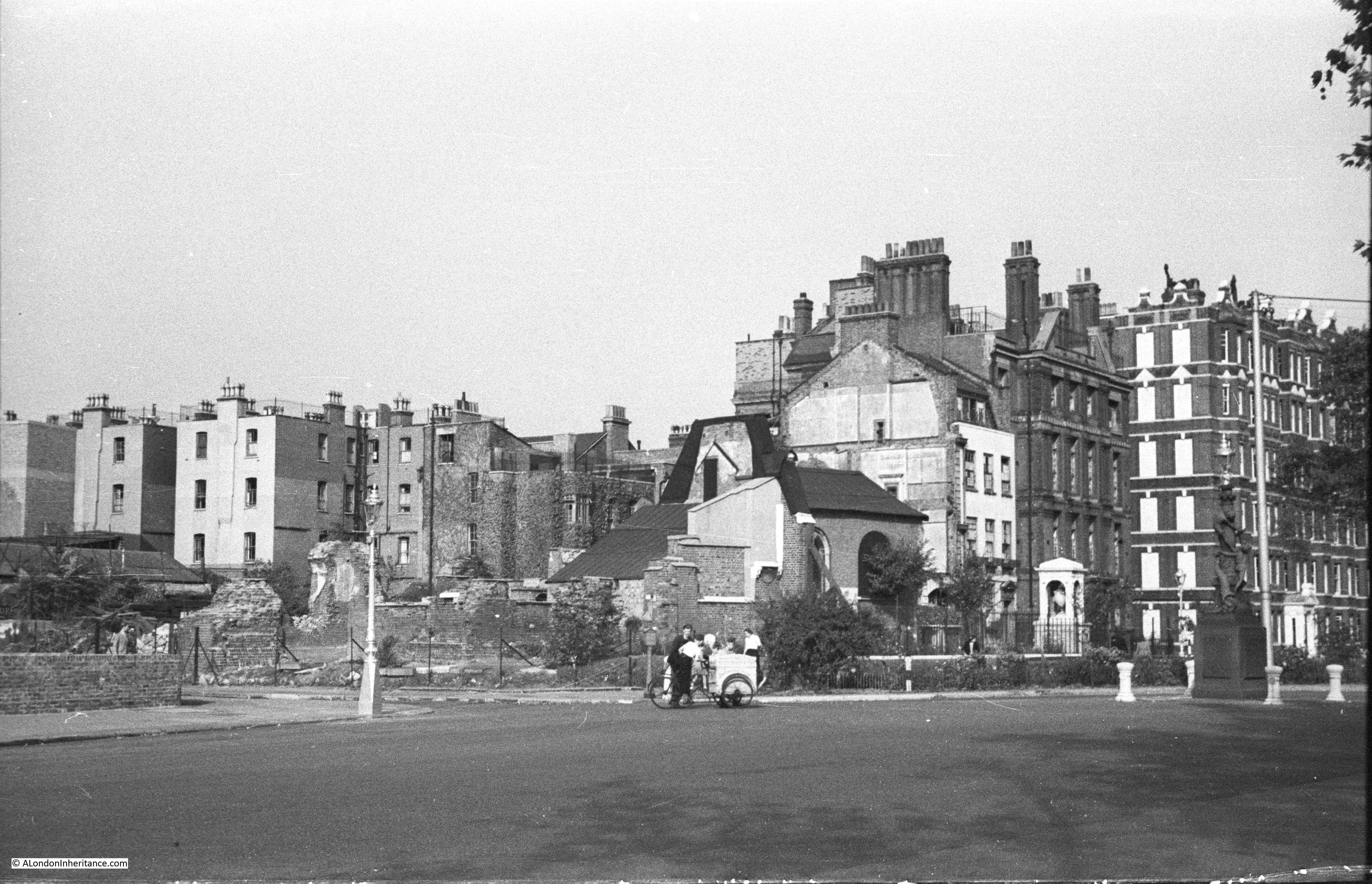
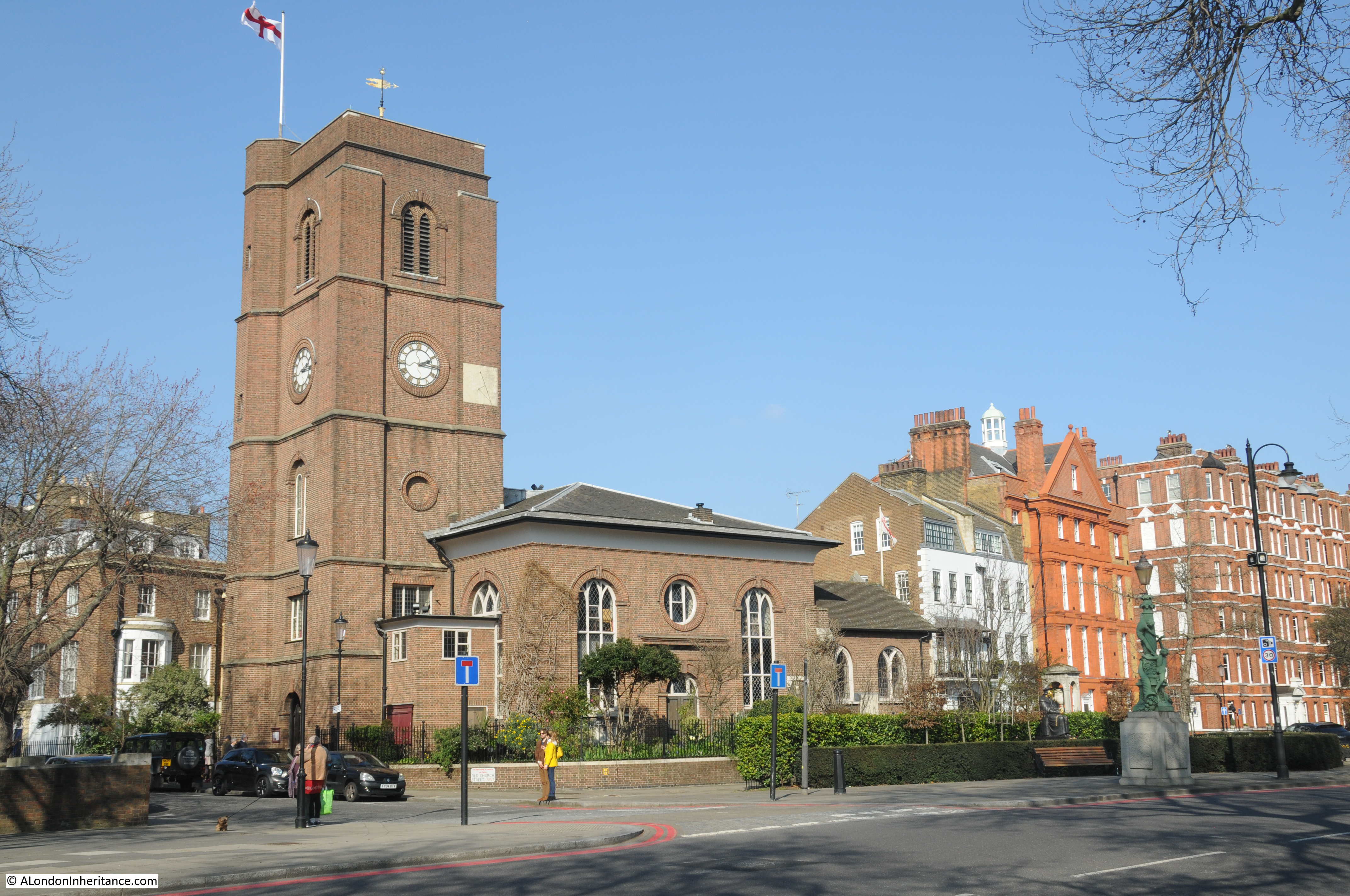
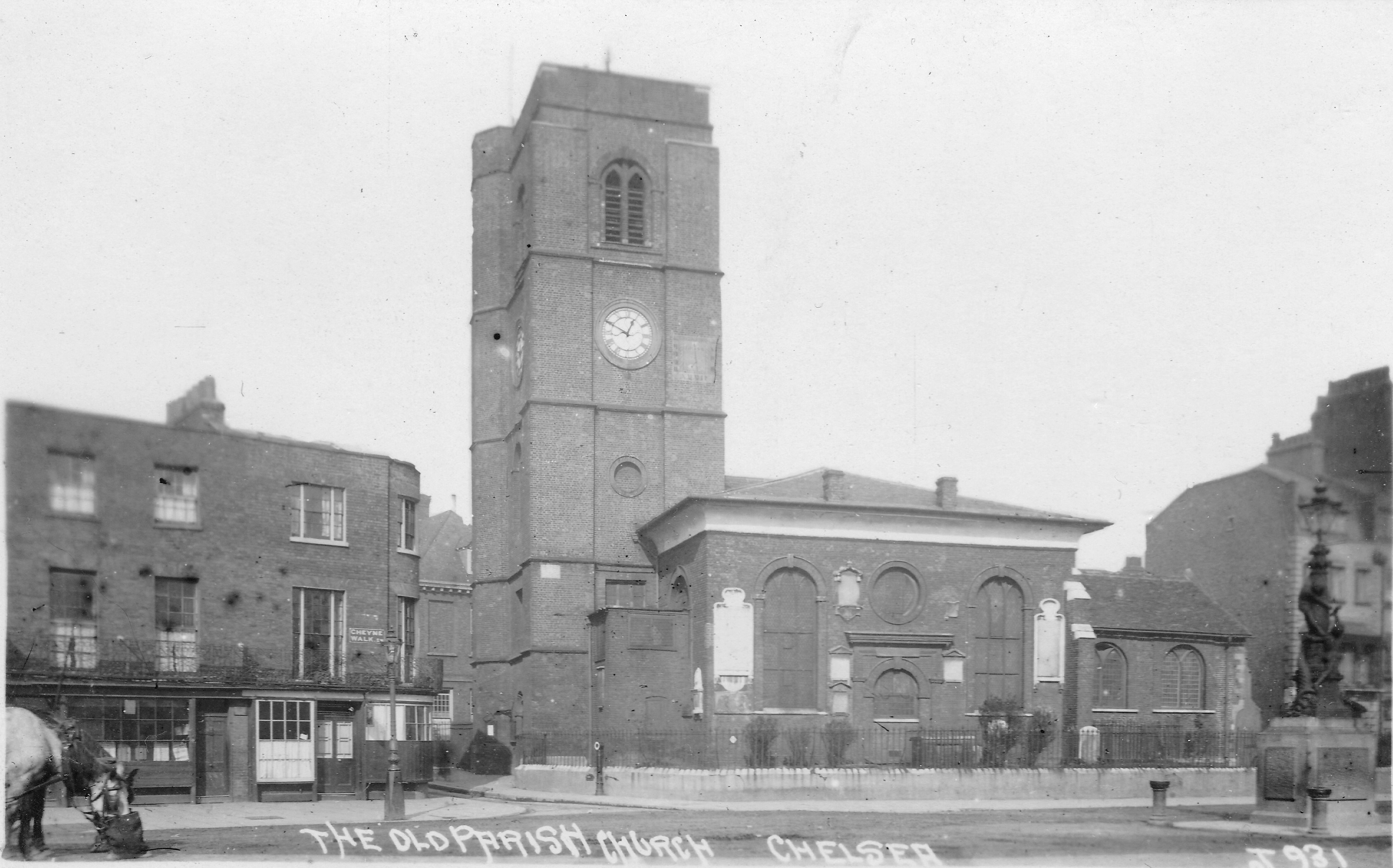
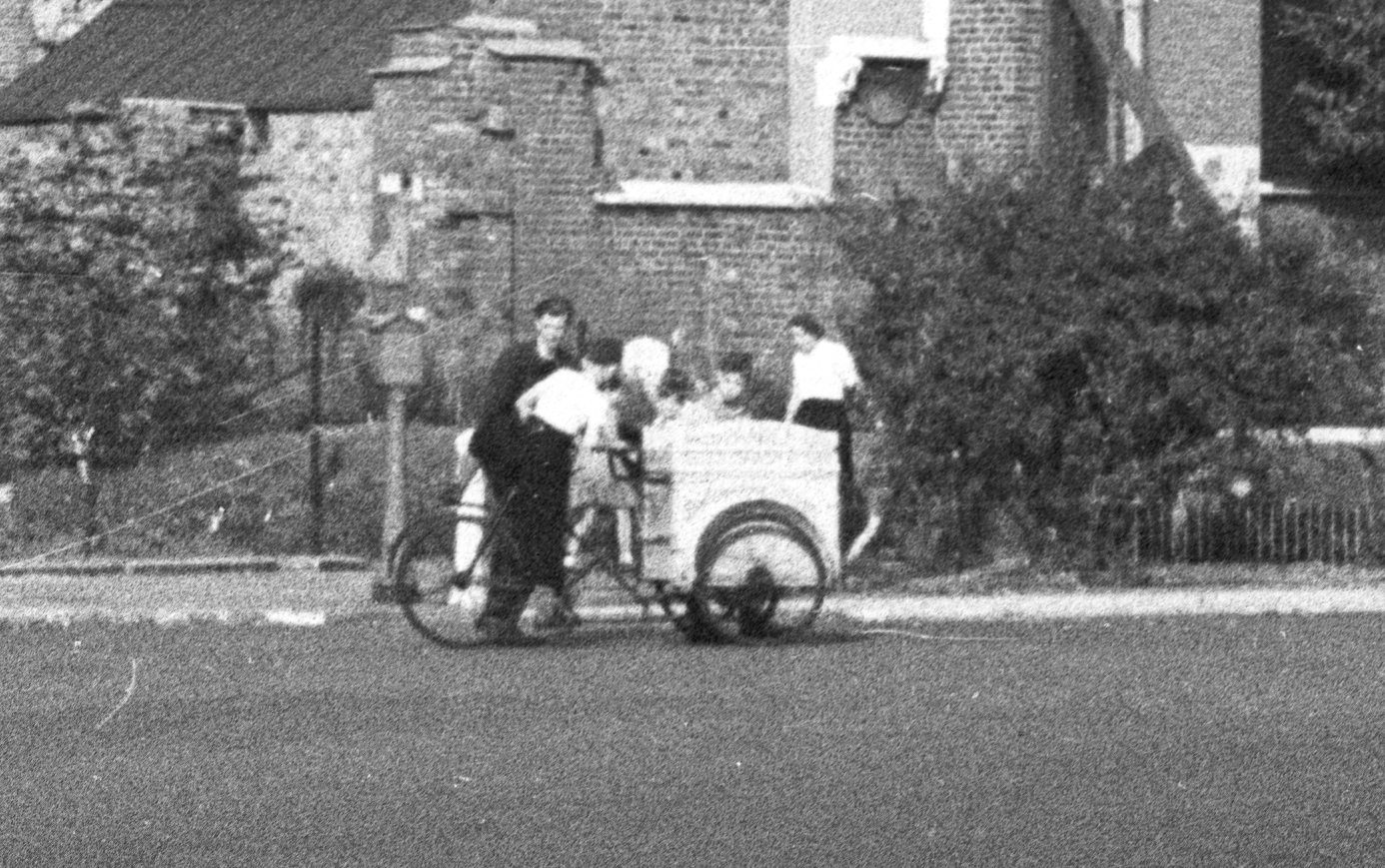
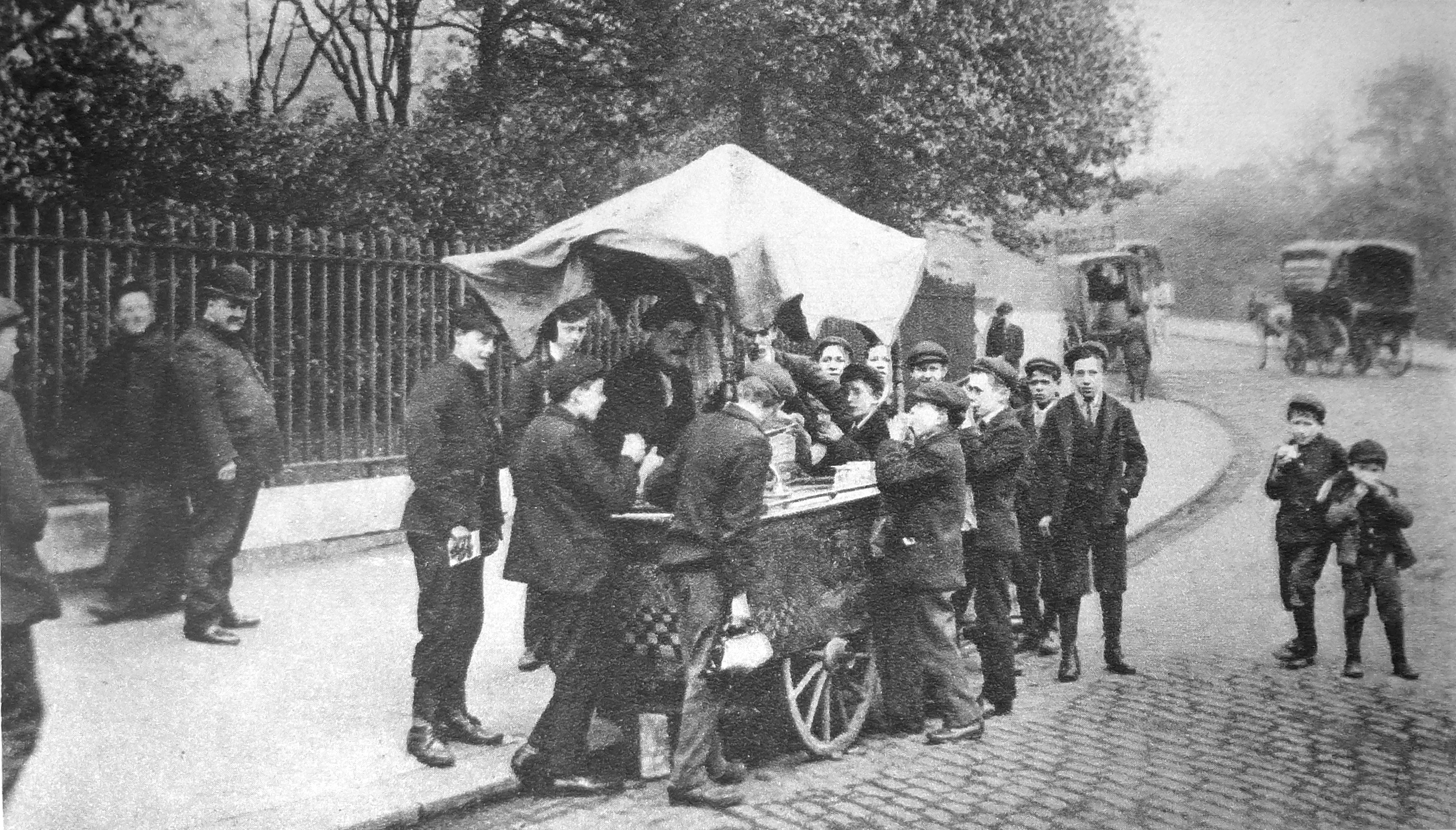
A couple of months ago, I published a photo my father took after the war of the ruins of Chelsea Old Church. In frount of this photo there is a cart with a few children. The cart appears to be an ice cream cart. In Wonderful London there is the photo below of a similar scene with the title “A Son Of Italy Does A Brisk Trade In Frozen Something-Or-Other.”

Wonderful London 4

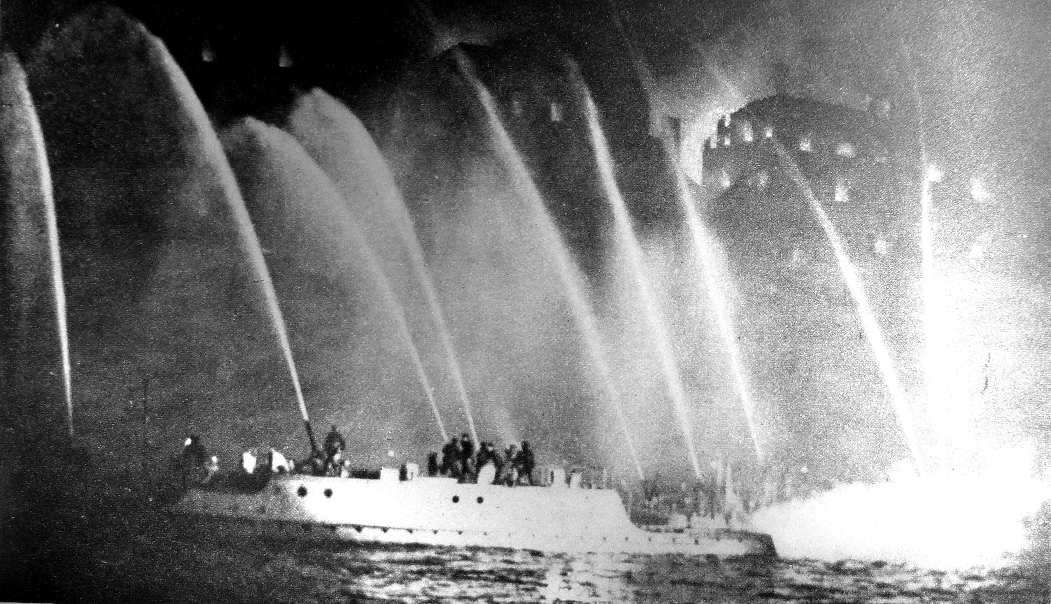
At the end of last year, I went on the Massey Shaw Fireboat as it traveled along the Thames to demonstrate how river based firefighting was carried out. Wonderful London includes the following photo of a huge warehouse fire at Millwall with “thousands of tons of rubber are burning here besides large quantities of tallow and carpets”, being fought by fireboats on the river.

Wonderful London 5

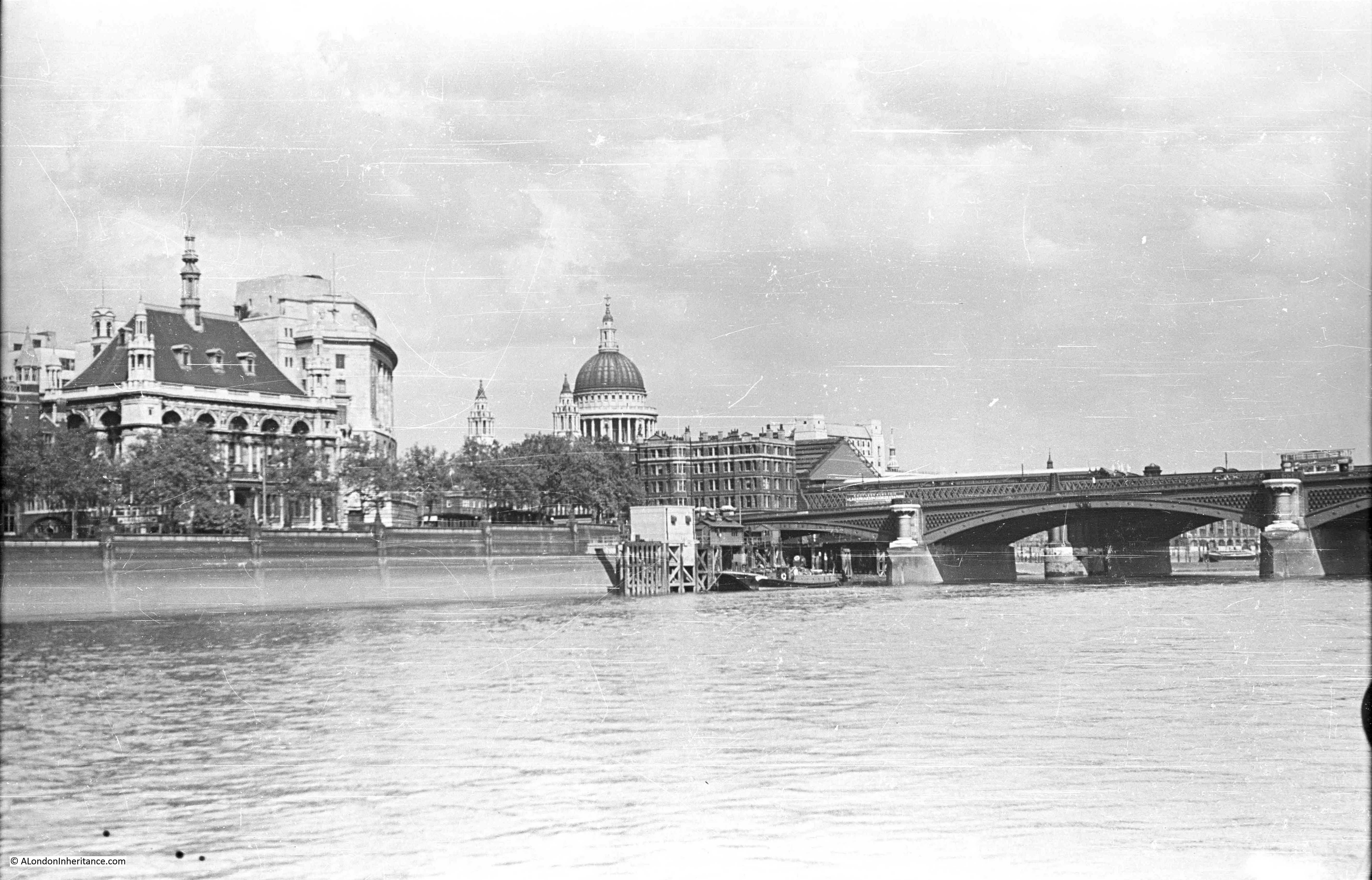
Wonderful London includes a couple of full-page spreads showing views along the Thames. The following photo shows the original Waterloo Bridge from the top of the Savoy Hotel and is titled “Before Evil Days Fell Upon Waterloo Bridge After A Century Of London Traffic.” The caption reads:

“This is a last look at the old bridge as it was before two of its arches failed and began to take up that bent and disquieting appearance which caused the steel auxiliary to be built, the old bridge shored up and so much ink spilt about it.”

Wonderful London 6

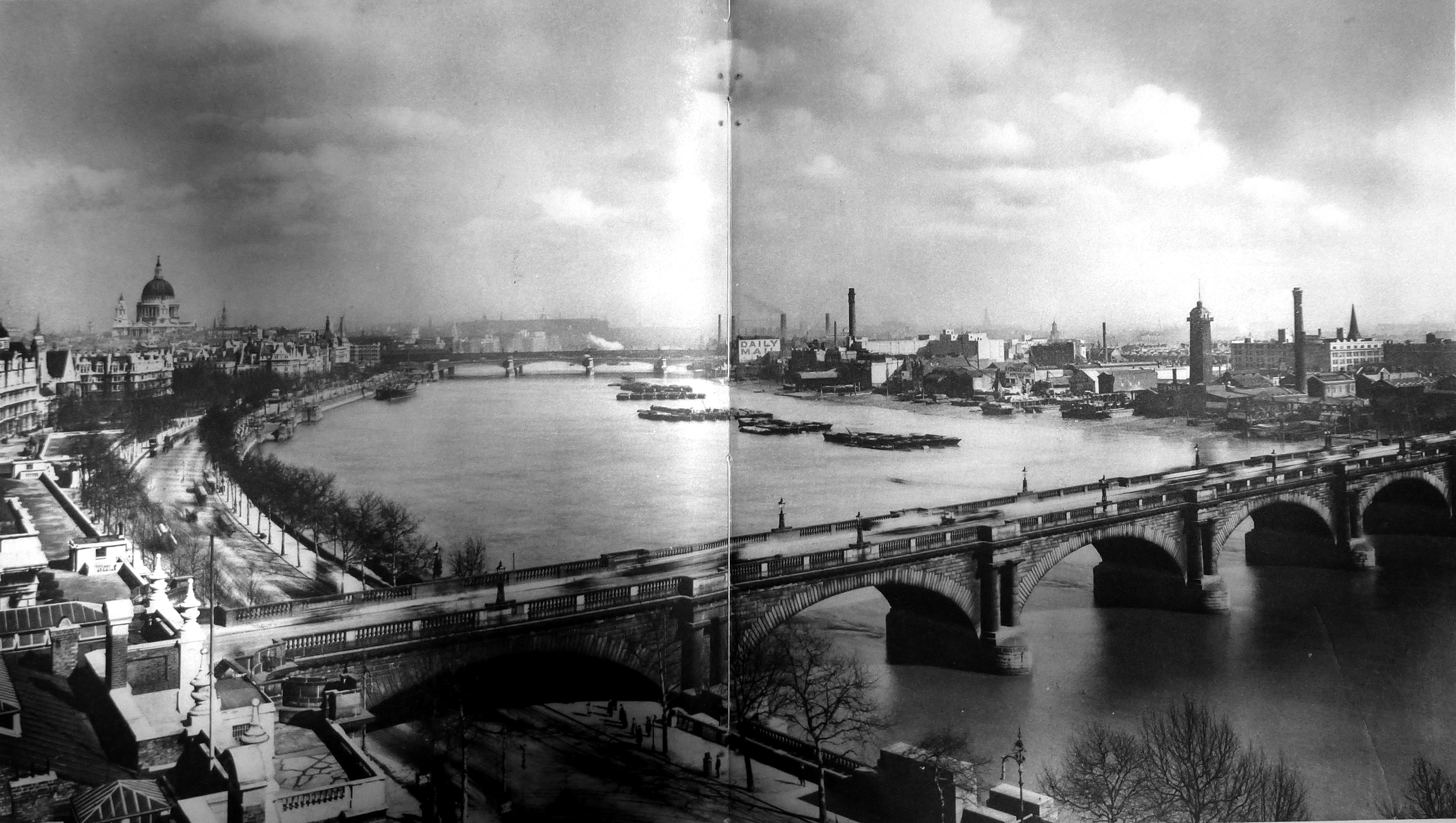
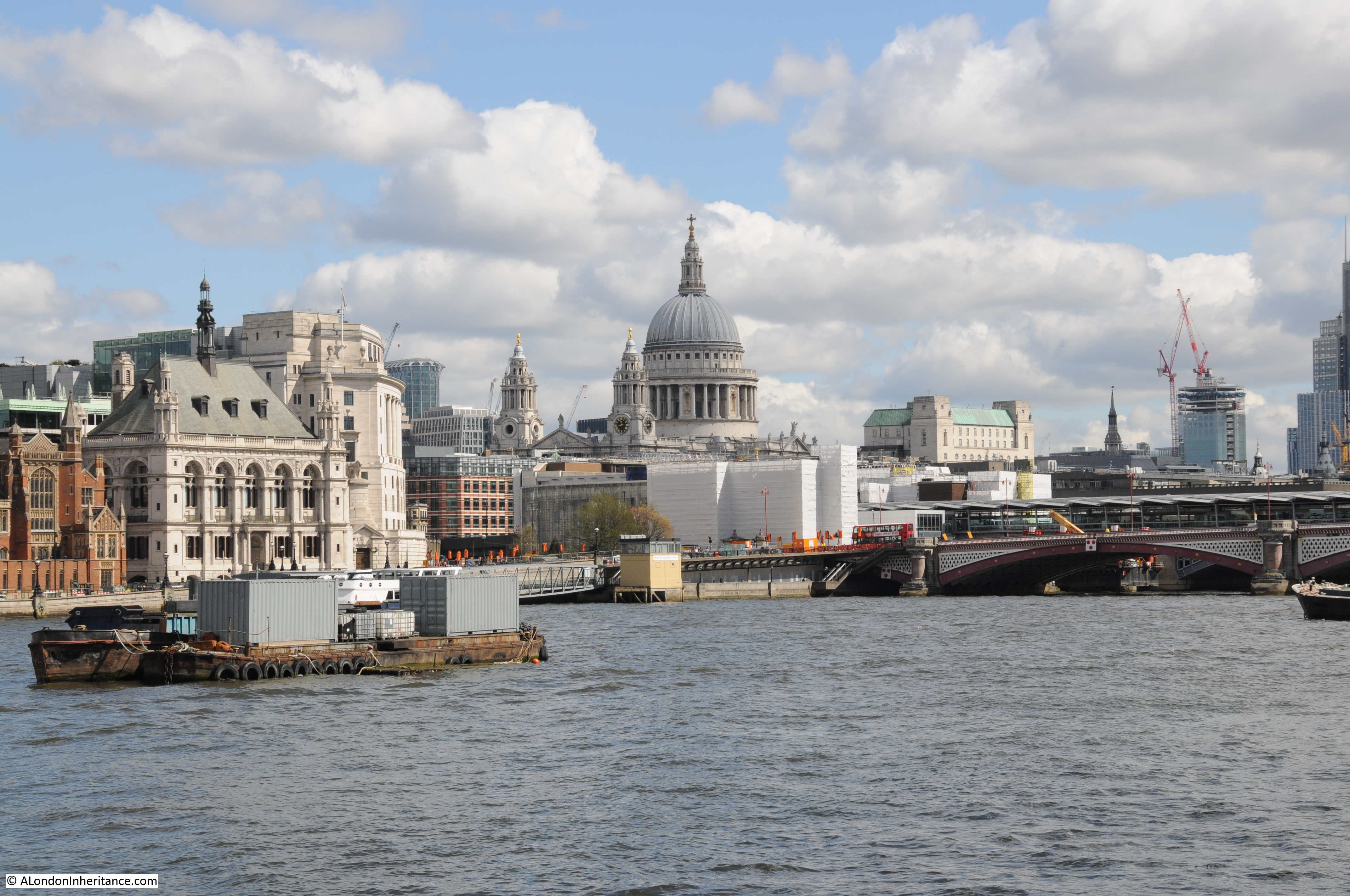
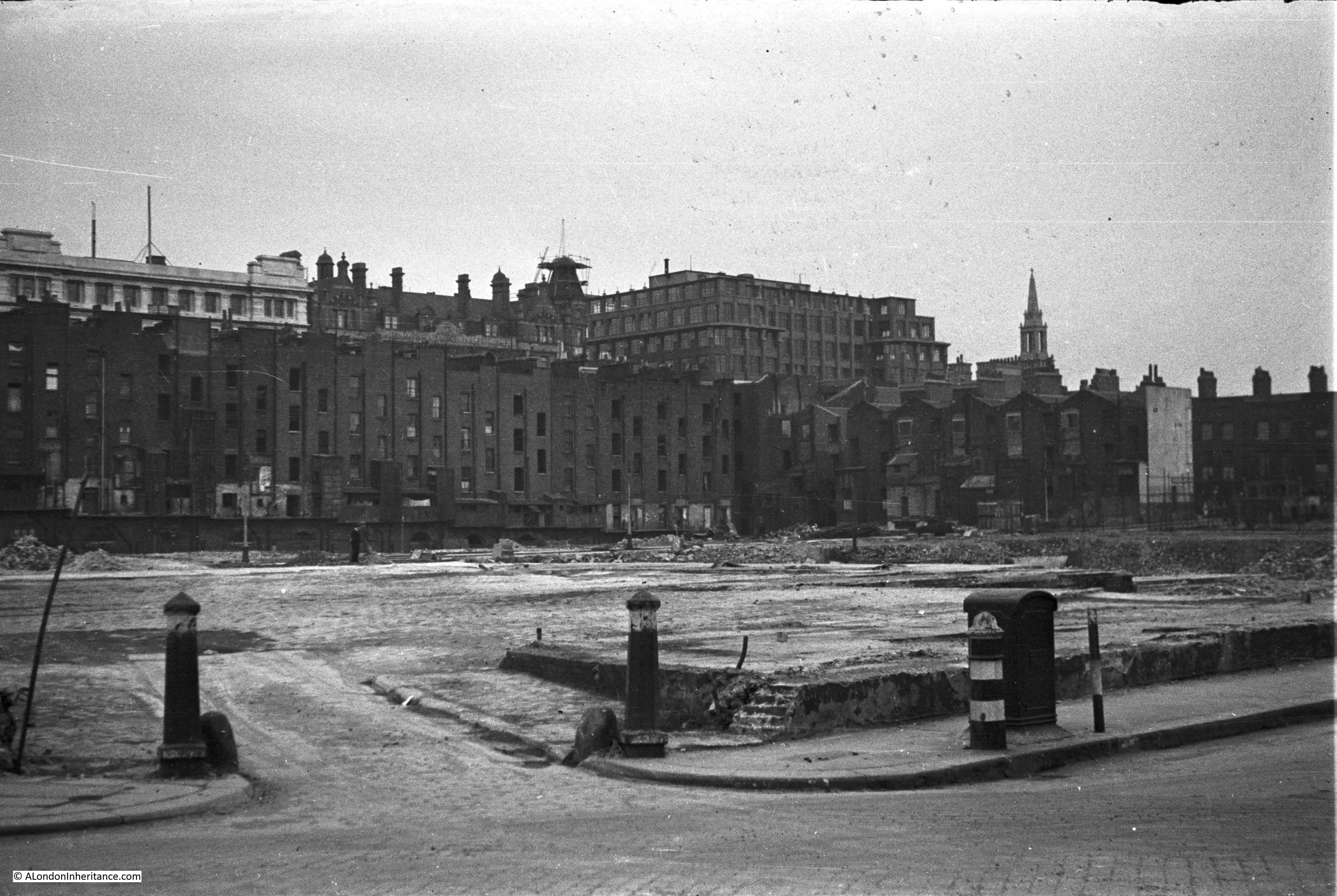
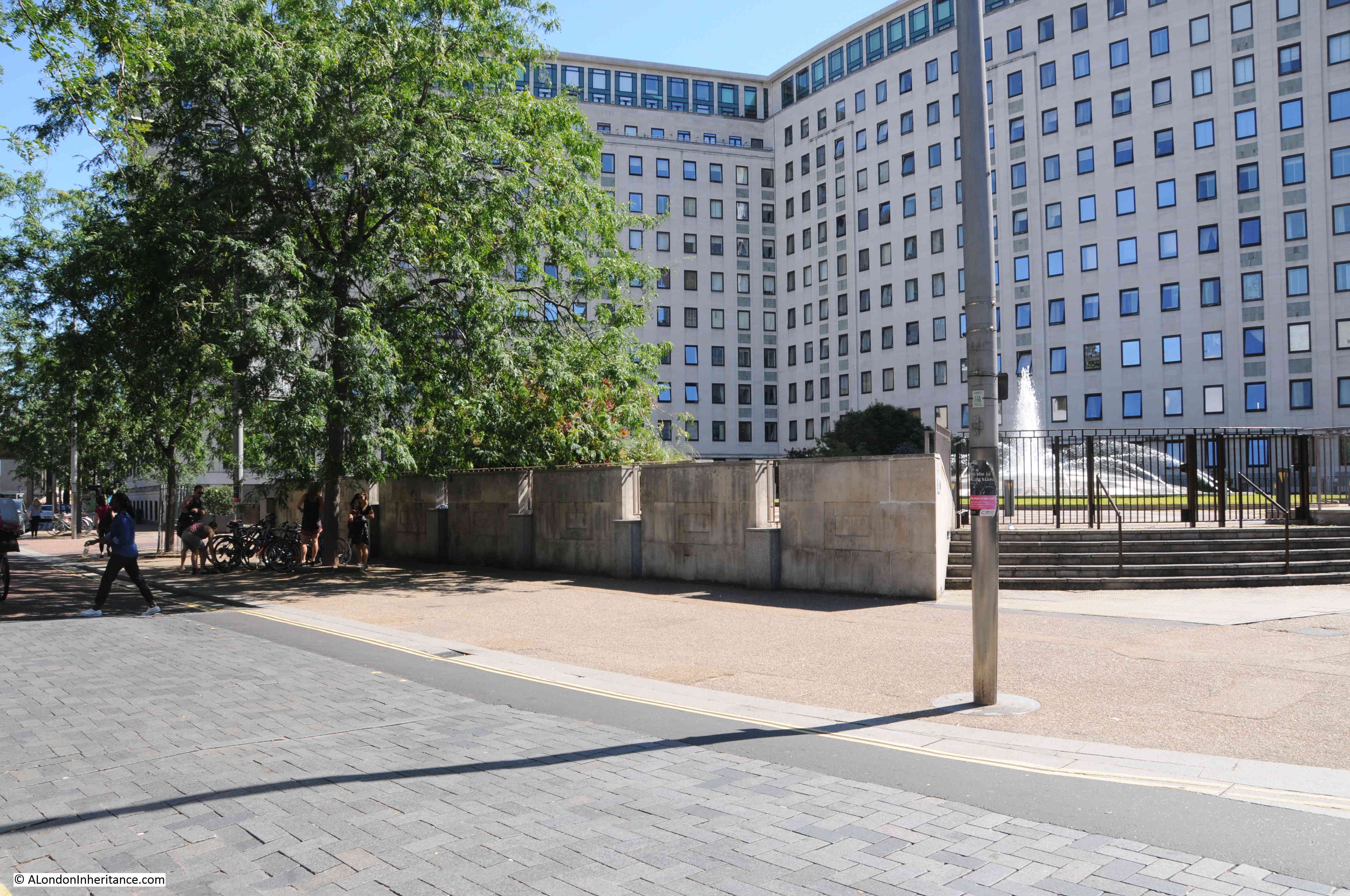
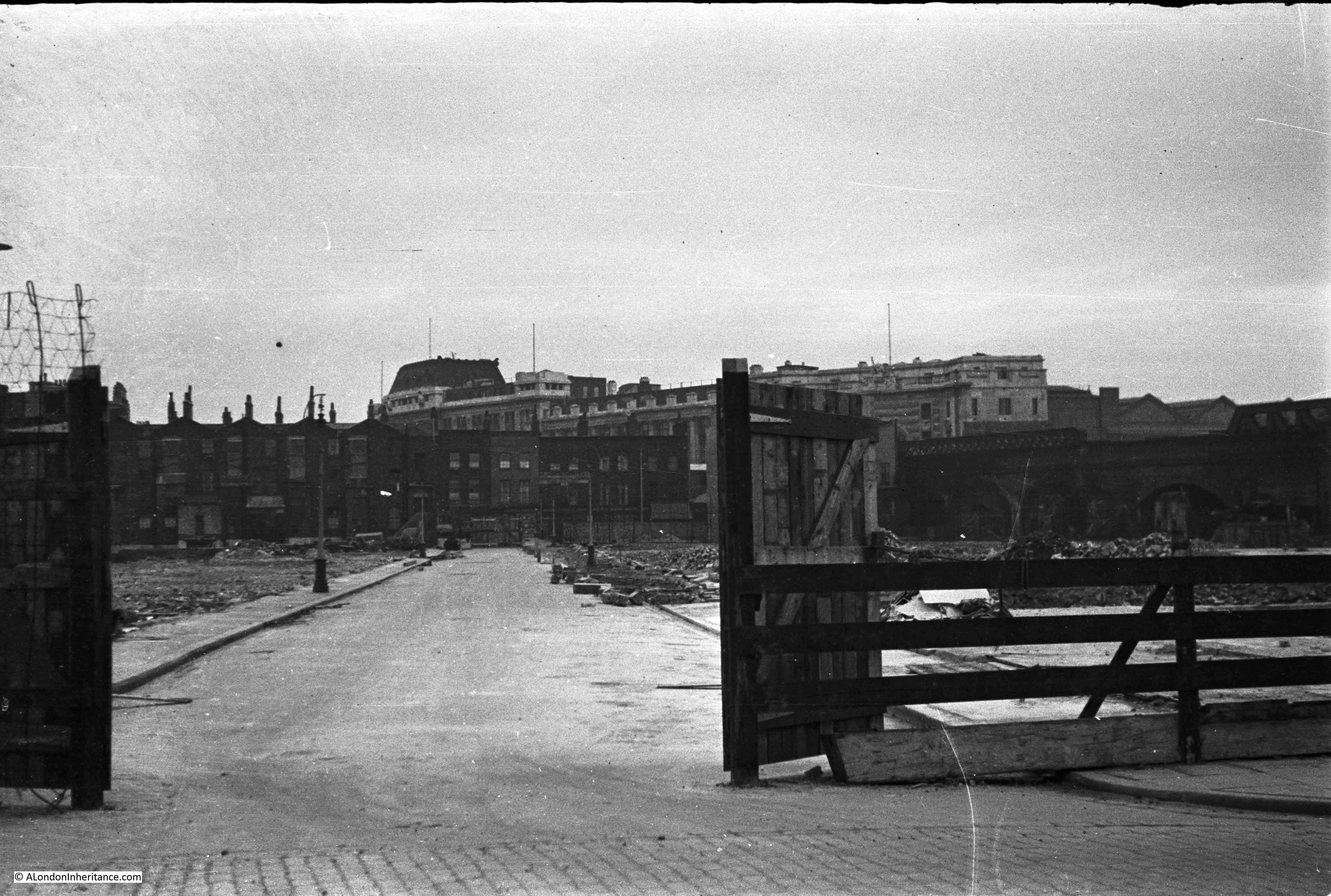
Another of the panorama photos is the following photo taken from the roof of Bush House. The photo is looking towards the South Bank and shows the Shot Tower and the industrial area on the South Bank prior to the post war redevelopment leading to the Festival of Britain.

Wonderful London 7

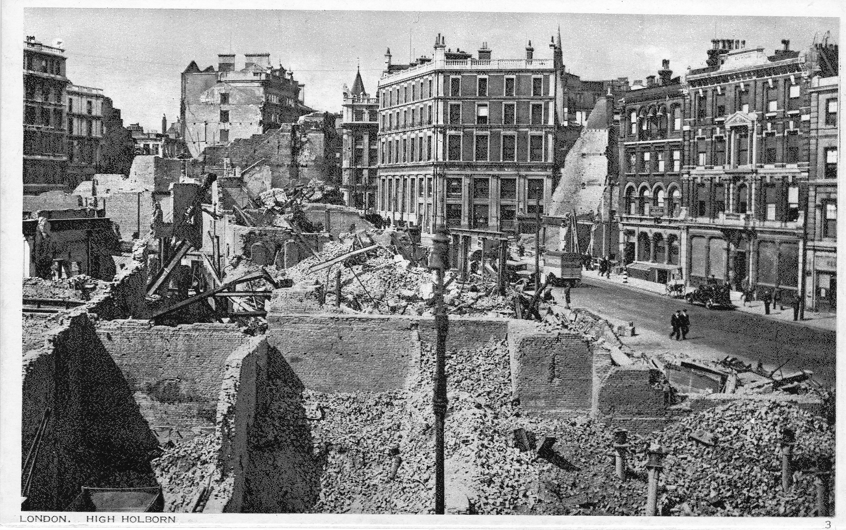
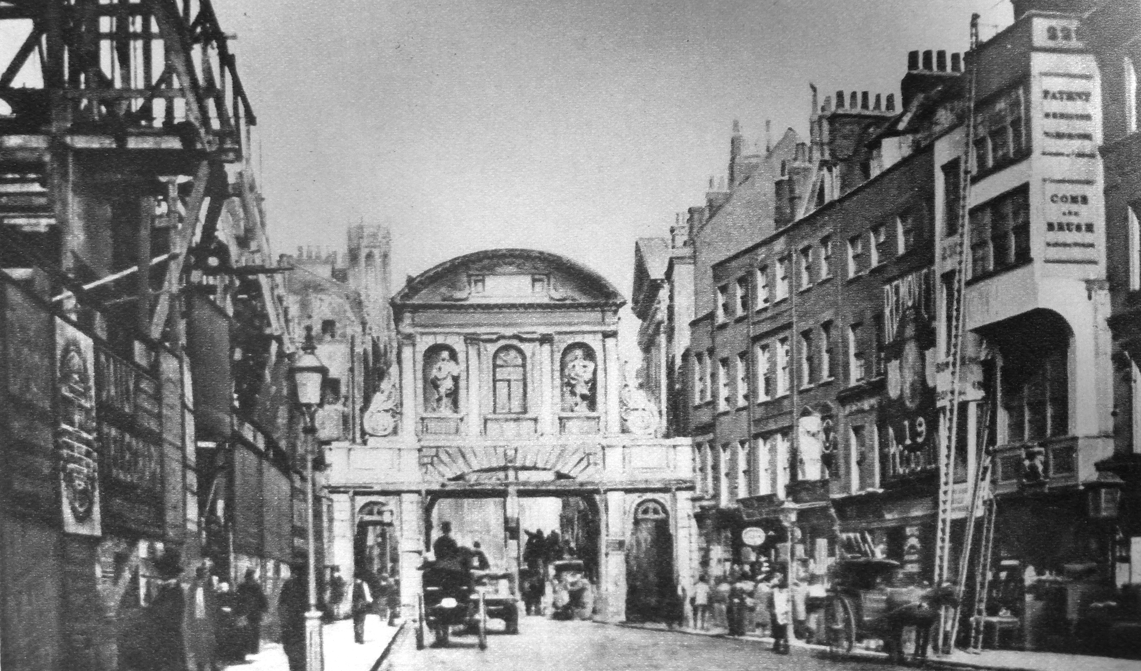
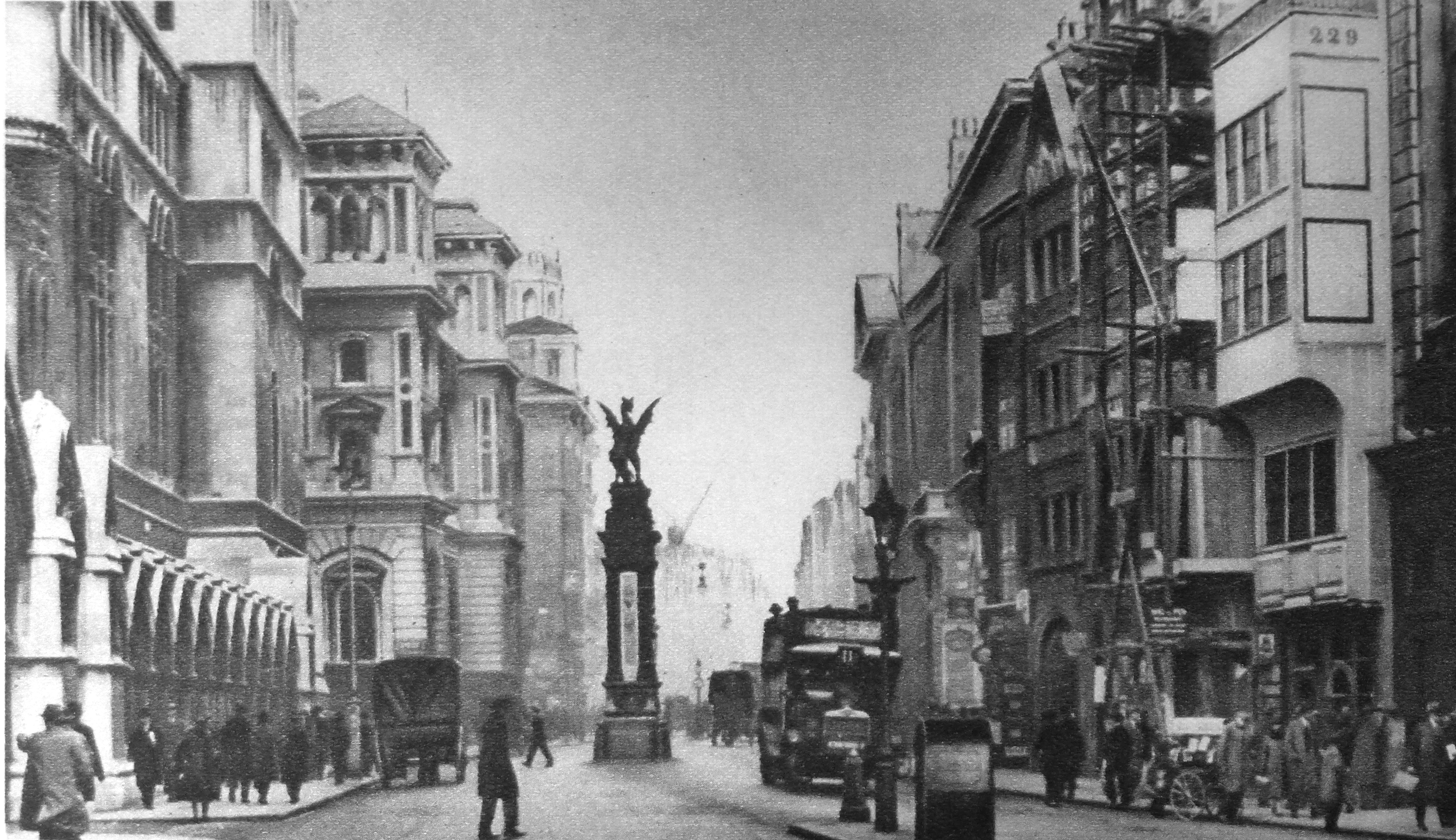
It is interesting that London has always been the subject of “before and after photos”, which is also one of my aims for this blog, to take photos today of the locations my father photographed in the 1940s/50s. Wonderful London includes a number of examples, including the following two photos taken from the same position in the Strand. The first photo shows the original Temple Bar city boundary in 1878. The second photo shows exactly the same scene in the 1920s following removal of Temple Bar, widening of the street and new buildings on either side of the Strand. The location can be confirmed by building number 229 which is on the right of both photos.

Wonderful London 10

Wonderful London 11

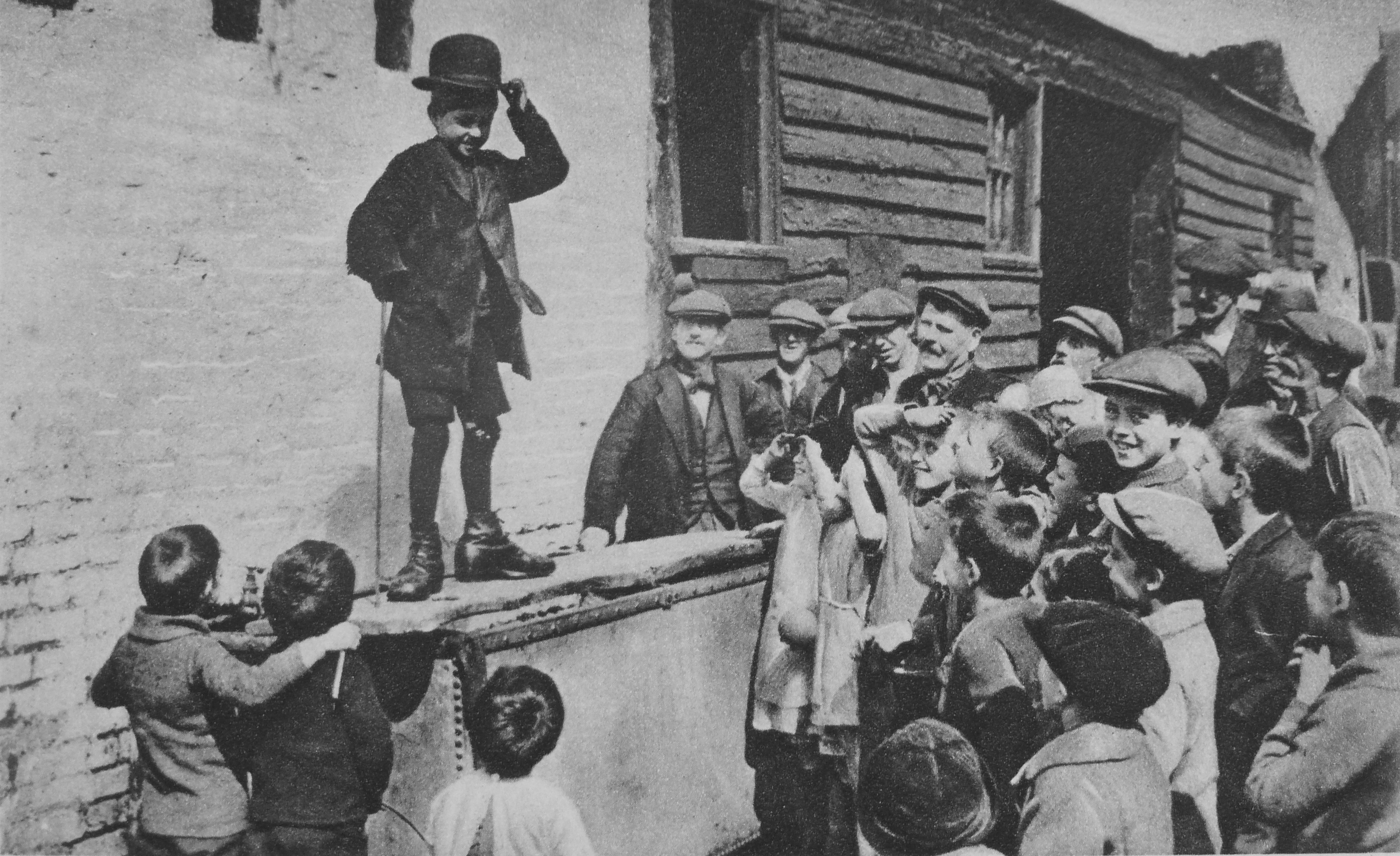
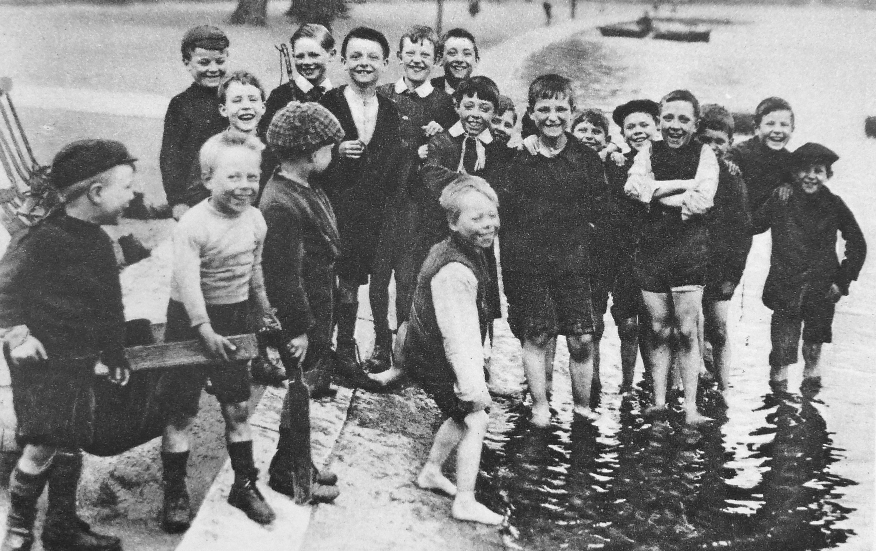
Wonderful London features a range of photos of London children, including the two photos below which are titled “A Budding Humorist Of The East-End And The Serpentine Smile”. the caption for both photos reads:

“A water-tank covered by a plank in a back-yard among the slums is an unlikely place for a stage, but an undaunted admirer of that great Cockney humorist, Charlie Chaplin, is holding his audience with an imitation of the well-known gestures  with which the comic actor indicates the care-free-though-down-and-out view of life which he has immortalised on the screen. Below is a group of summer paddlers in the Serpentine. On the extreme left is a boy holding the shafts of the inevitable sugar-box cart fixed on perambulator wheels.”

Wonderful London 13

Wonderful London 12

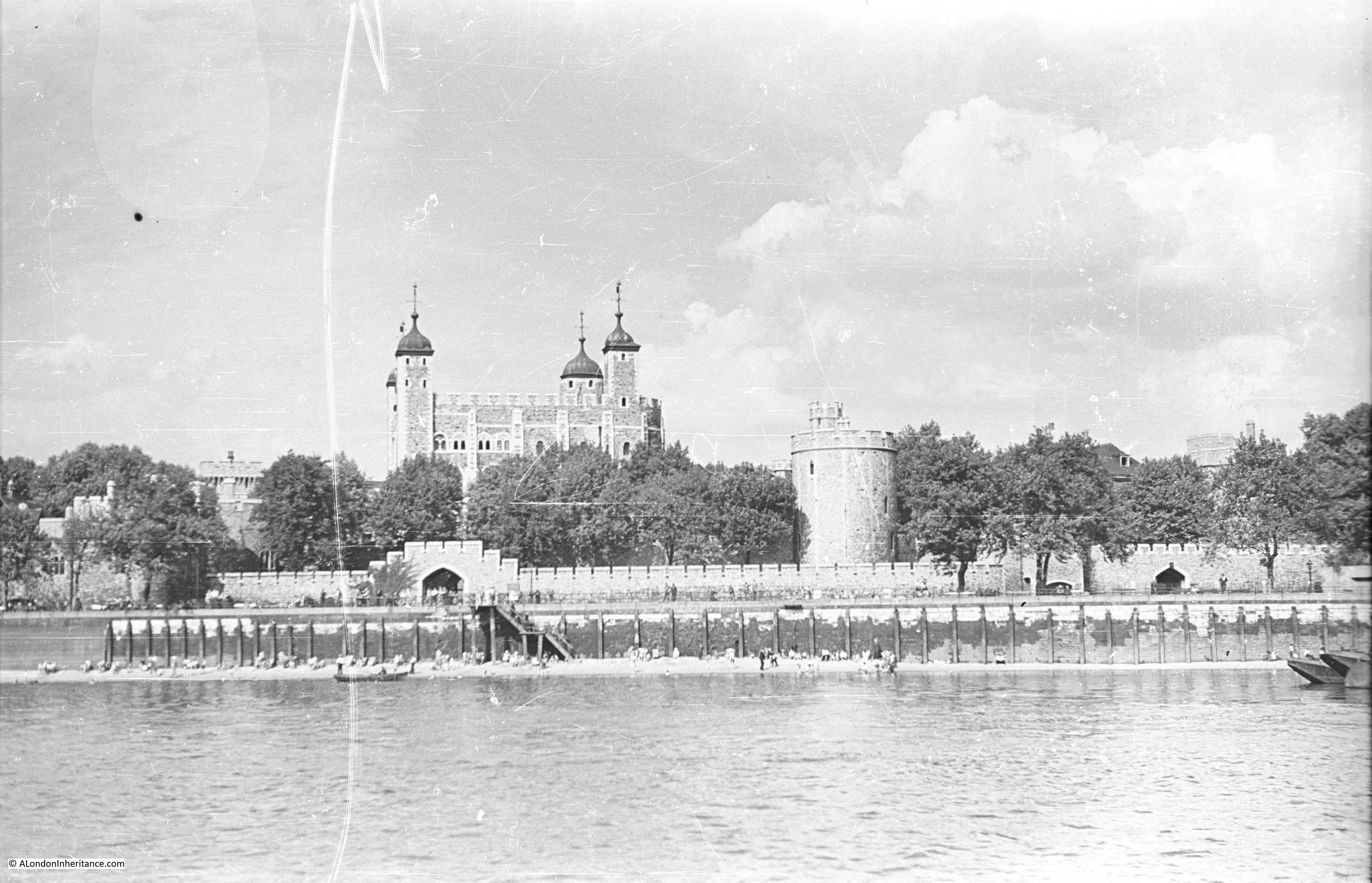
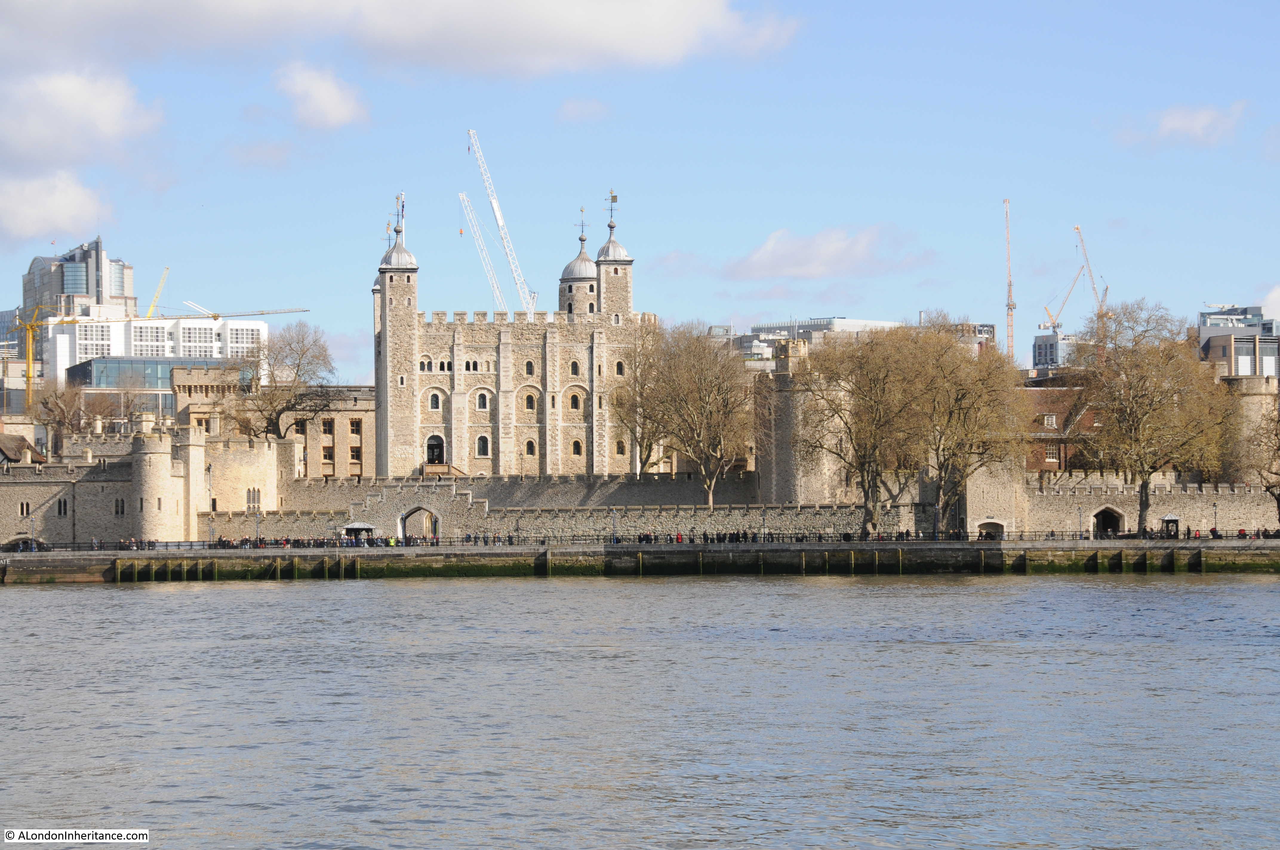
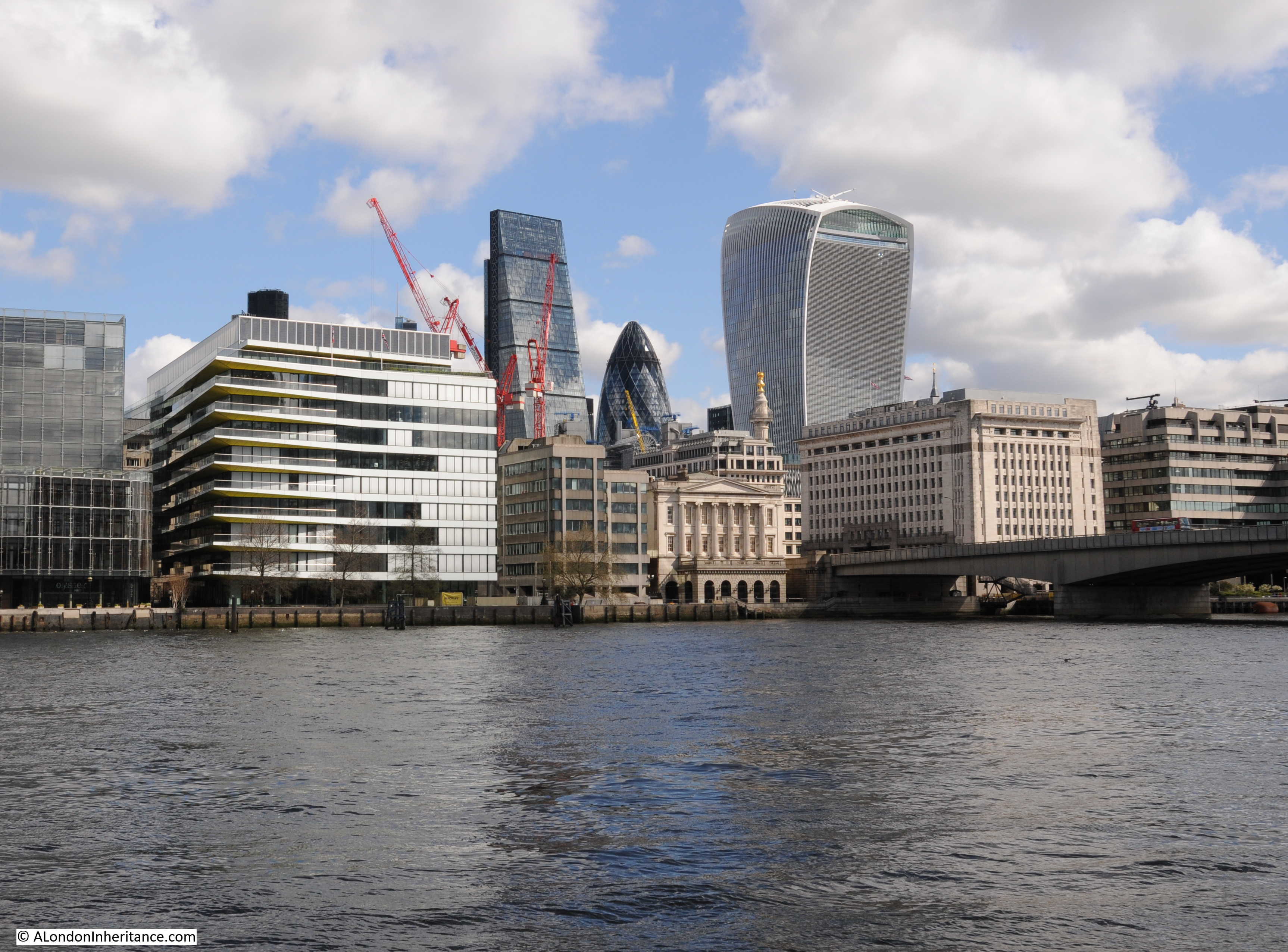
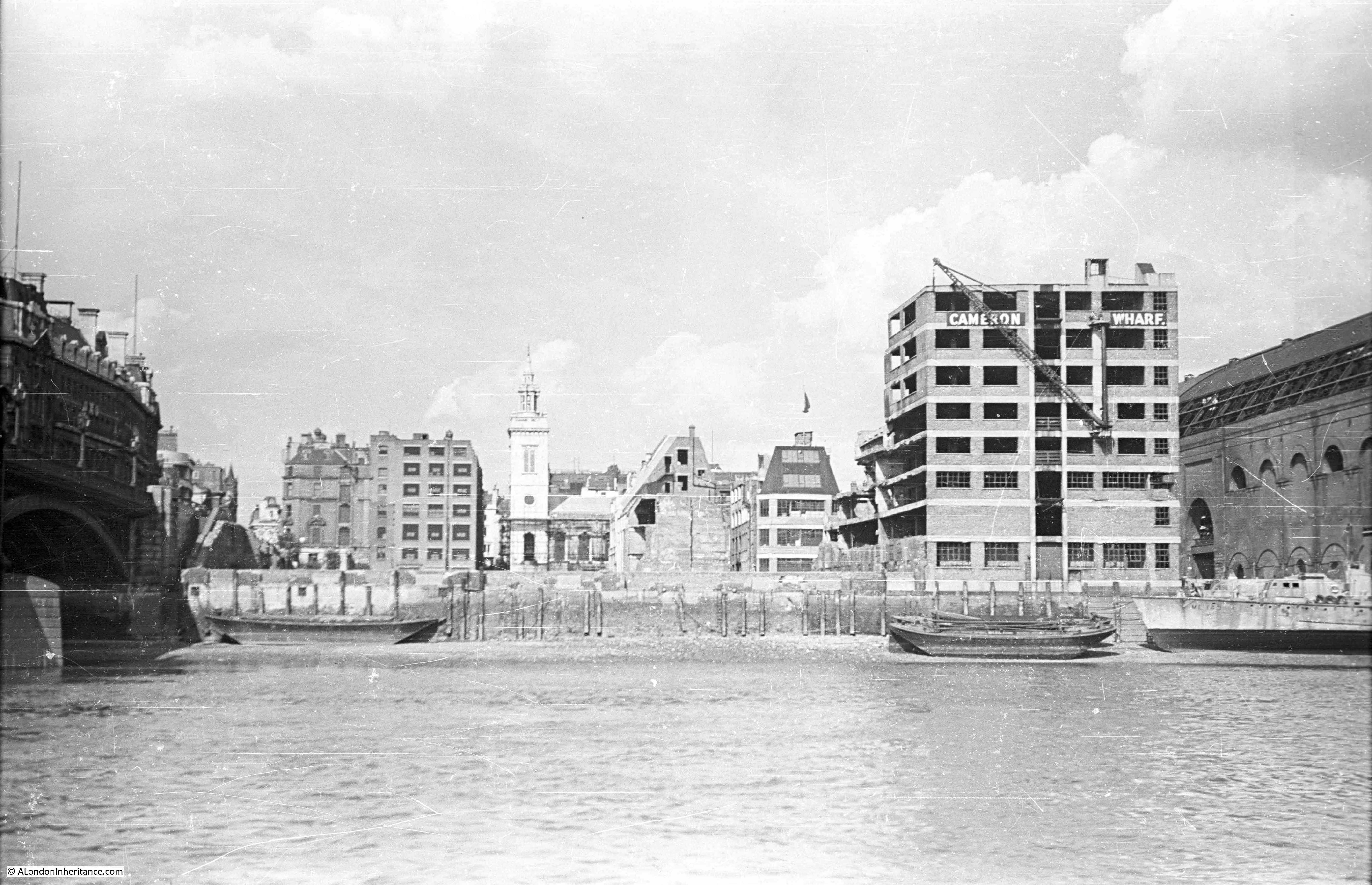
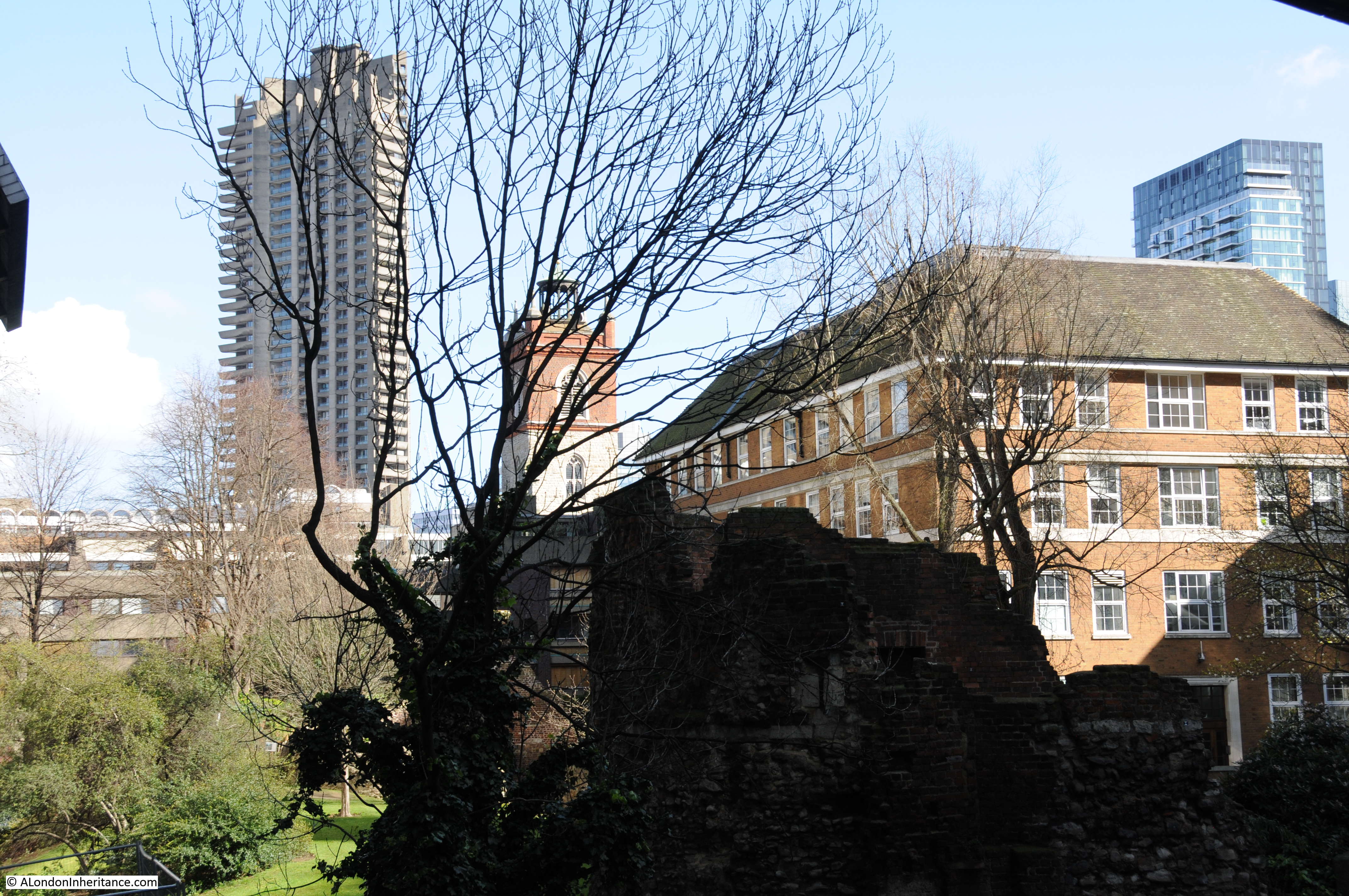
In last week’s post I featured photos my father had taken from the river looking at the north bank of the river. One of these photos had the shell of the church of Allhallows by the Tower which had suffered severe bomb damage during the war. Wonderful London includes the following photo of the church in the 1920s, looking south. The buildings behind the church to the right are between the church and the river. The majority of the surrounding buildings would also be destroyed by bombing in just over 10 years following the decade when this photo was taken.

Wonderful London 14

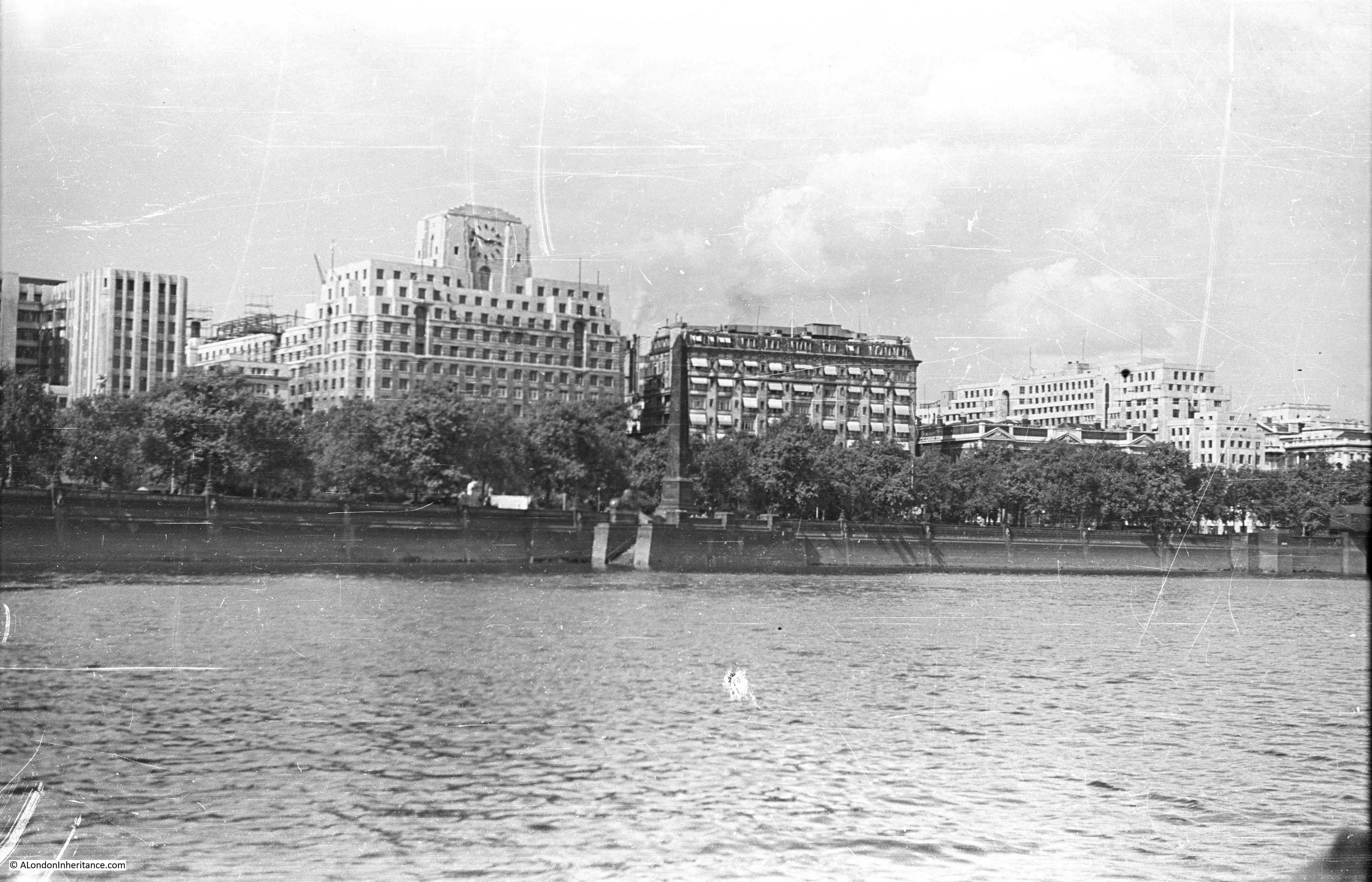
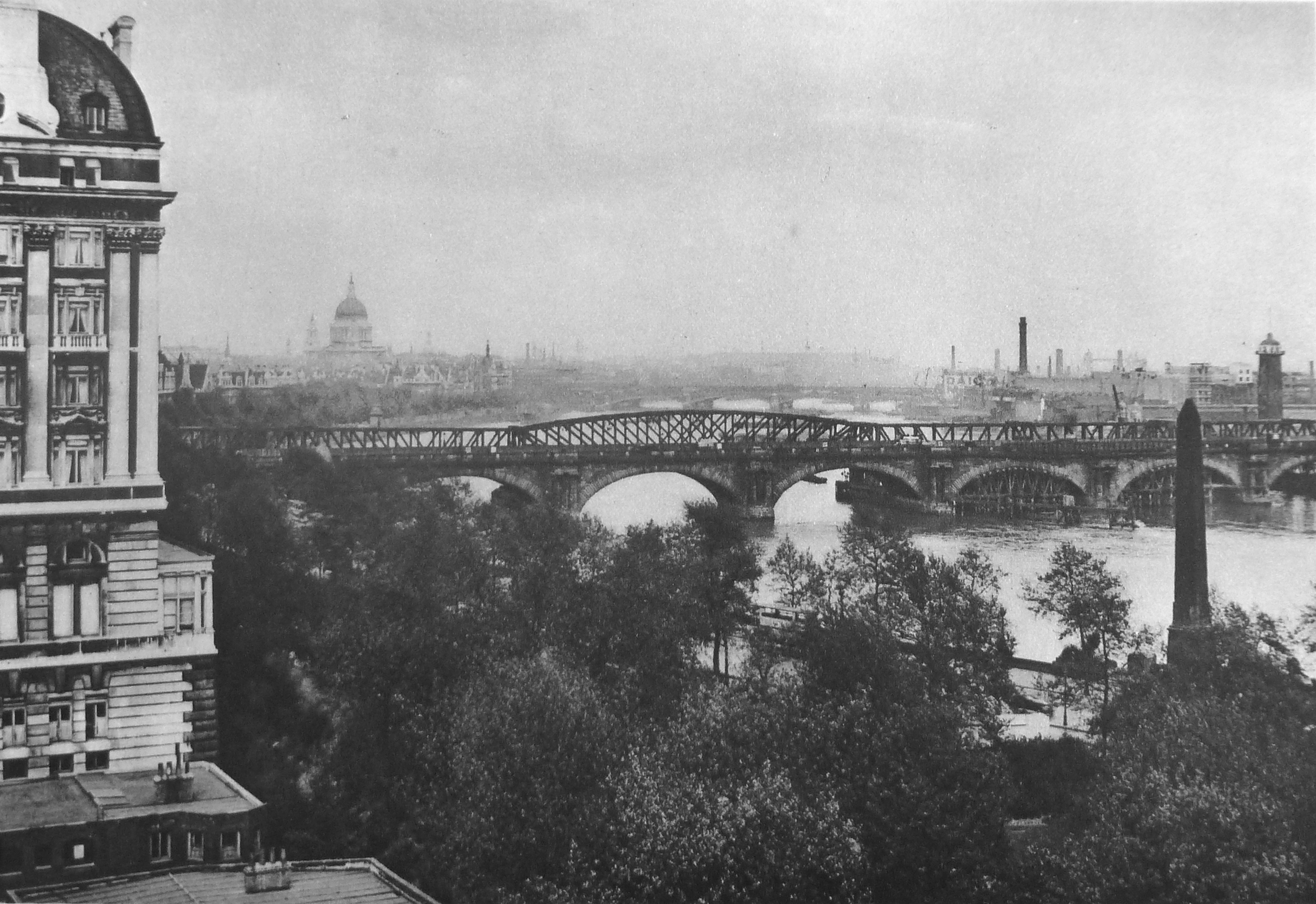
Photos of views along the river with many of the earlier bridges are included. The following photo shows the view from the Adelphi Terrace looking eastward along the river. The bridge is the original Waterloo Bridge that crossed the river before the version of the bridge in place today, and was photographed after the failures mentioned in the earlier photo. The bridge has the “steel auxiliary” also mentioned above.

Wonderful London 15

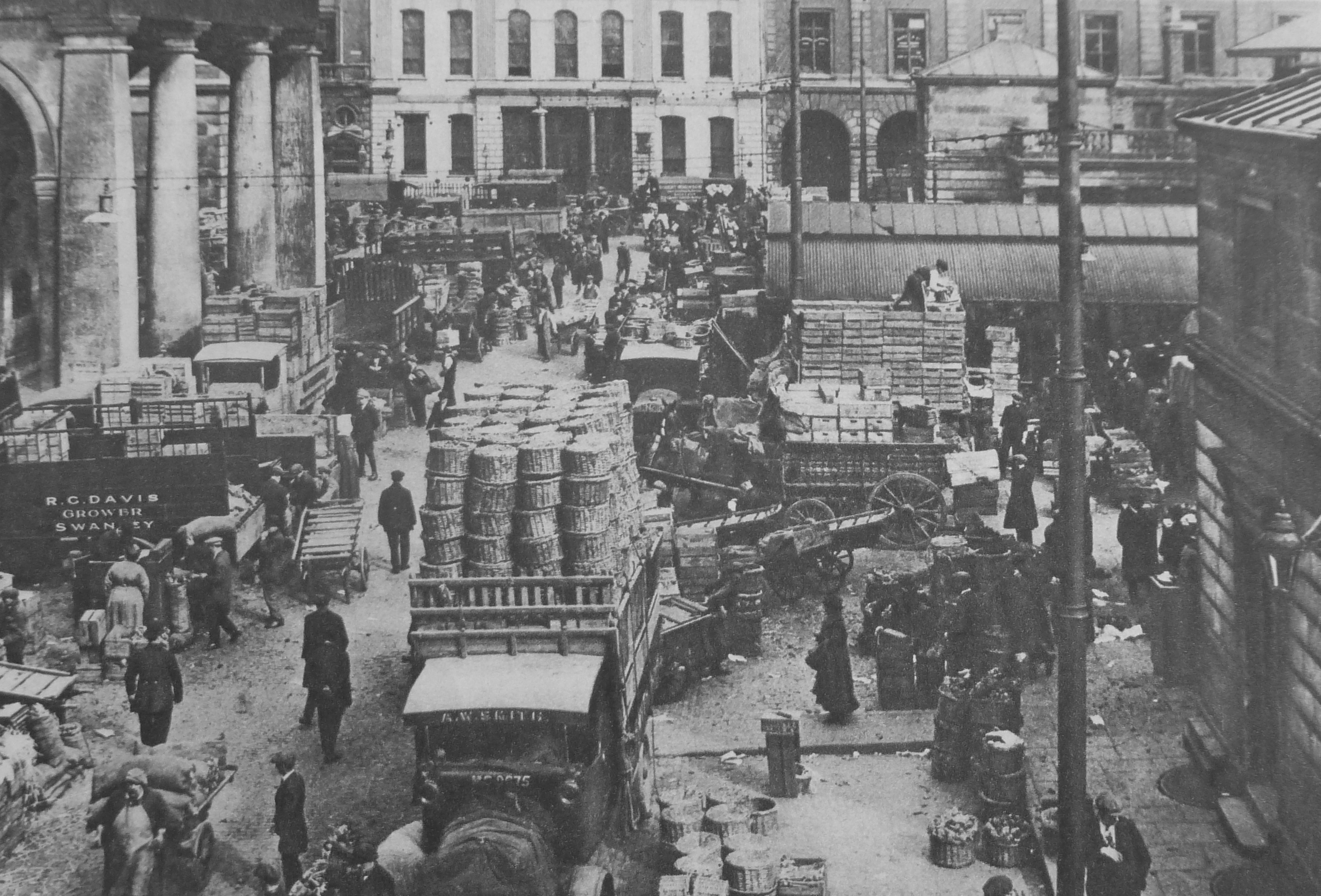
The markets of London feature in Wonderful London. Here is Covent Garden, with the title “Early Morning In The Convent Garden Which Has become Covent Garden” and the caption reads:

“It seems that the Convent Garden of Westminster stretched along the north side of the Strand between Drury Lane and St. Martin-in-the-Fields. When Henry VIII made his pounce upon the monasteries and flung the pieces to his followers, the Russell family got the garden and built themselves Bedford House on the south side. They caused Inigo Jones to lay out a piazza on the north and east and a church on the west. Stalls for selling fruit and vegetables were already established. In 1704 the Russells (or Bedfords) moved to Bloomsbury, and in 1830 most of the current buildings were put up. Soon after midnight the carts start their journeys from the market gardens beyond outer London to reach Covent Garden in time.”

Wonderful London 16

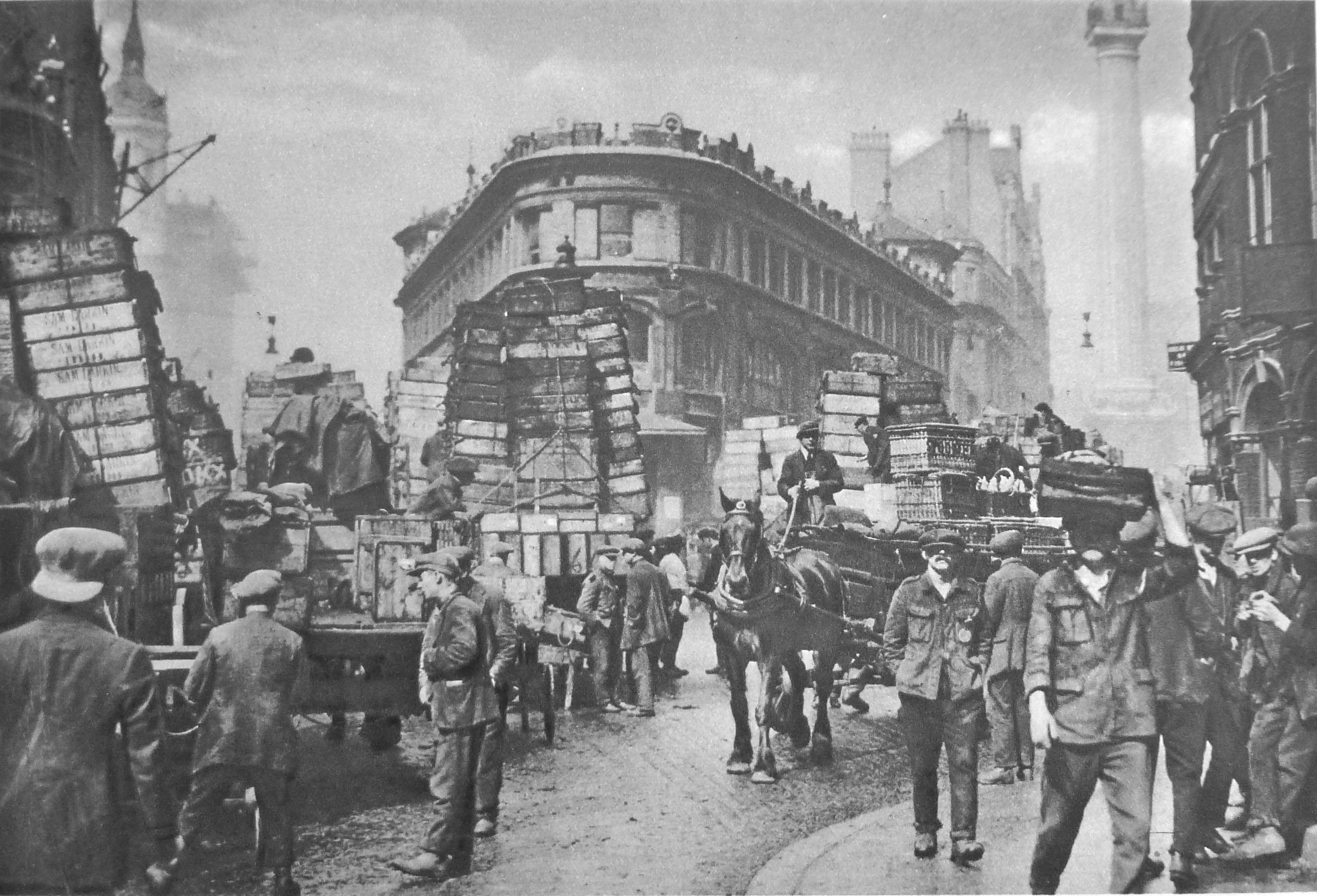
Another London market is Billingsgate Market and the photo in Wonderful London below of the streets outside the market is taken from roughly the same location as one my father had taken (see here). The photo is titled “Fish-Porters Of Billingsgate Gathered About Consignments Lately Arrived From The Coast” and the caption reads:

“At Billingsgate is the chief fish market of London. and to it are brought all kinds of fish from aristocratic salmon and oysters to democratic shrimps and dog-fish of rock salmon. At one time smacks brought all the fish sold in the market, and were unloaded at Billingsgate Wharf, which is said to be the oldest in London. Today however, most comes by train, and little by boat.  The daily market is always crowded, and business is conducted at a speed extremely confusing to the casual spectator. Here we may see the fish porters, who have an almost legendary reputation for bad language, handling the slippery loads with the precision of experts. In the background of this view, to the right, is seen the monument.”

Wonderful London 17

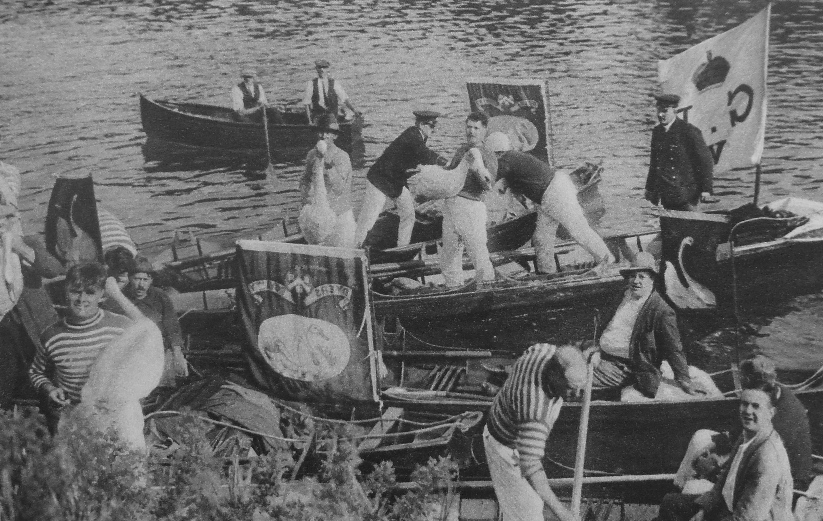
One of the ancient customs covered by Wonderful London is Swan Upping. A custom which my father photographed, as did I during the 2015 event. My post can be found here. Photos of the event in the 1920s look almost identical to the event of today.

Wonderful London 18

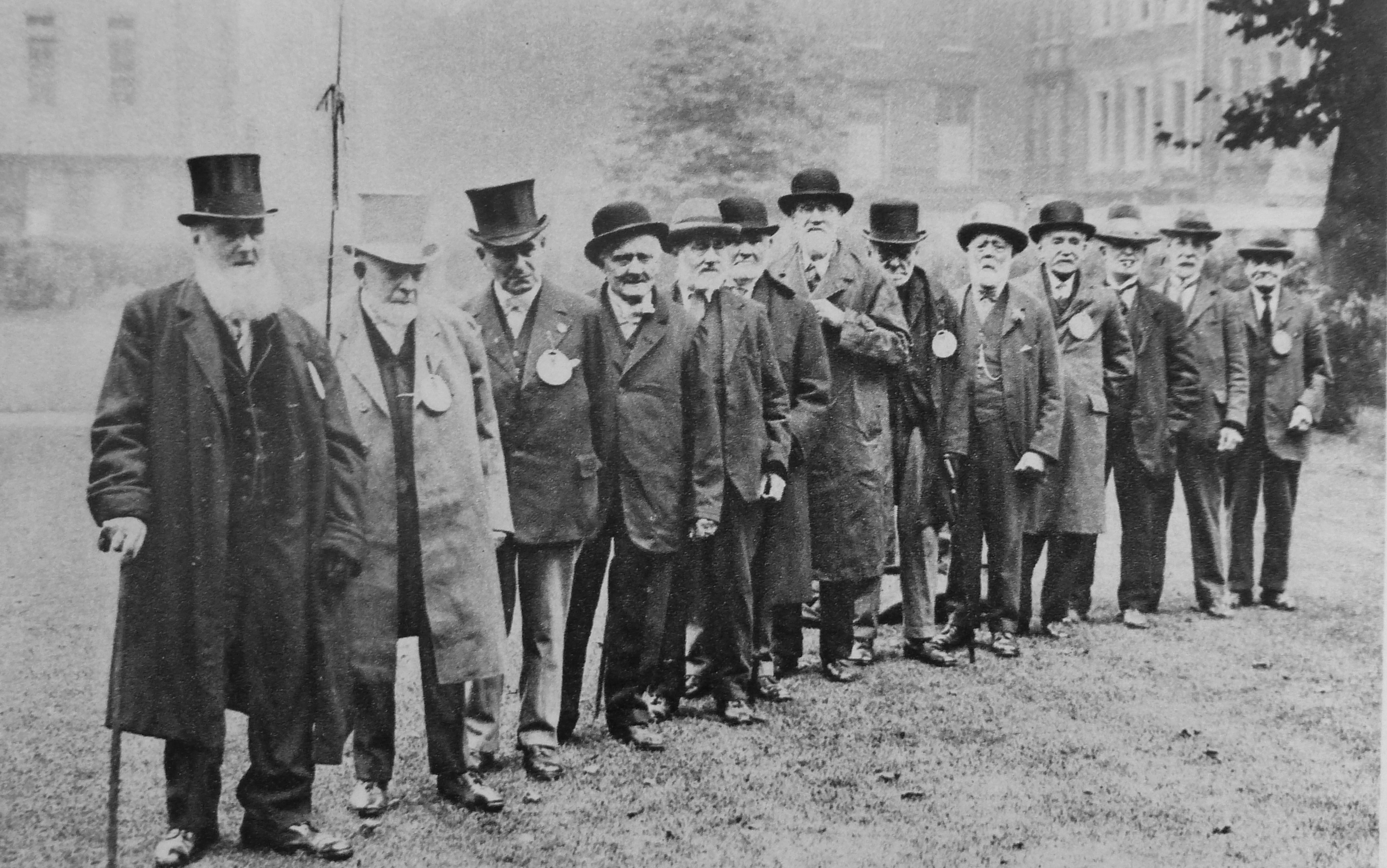
Among photos of Londoners and their trades is the following of “old cabbies headed by an ancient who claims that he once drove King Edward when Prince of Wales, from Waterloo to Marlborough House, in 1868.” You probably would not want to question the route taken by these cabbies!

Wonderful London 19

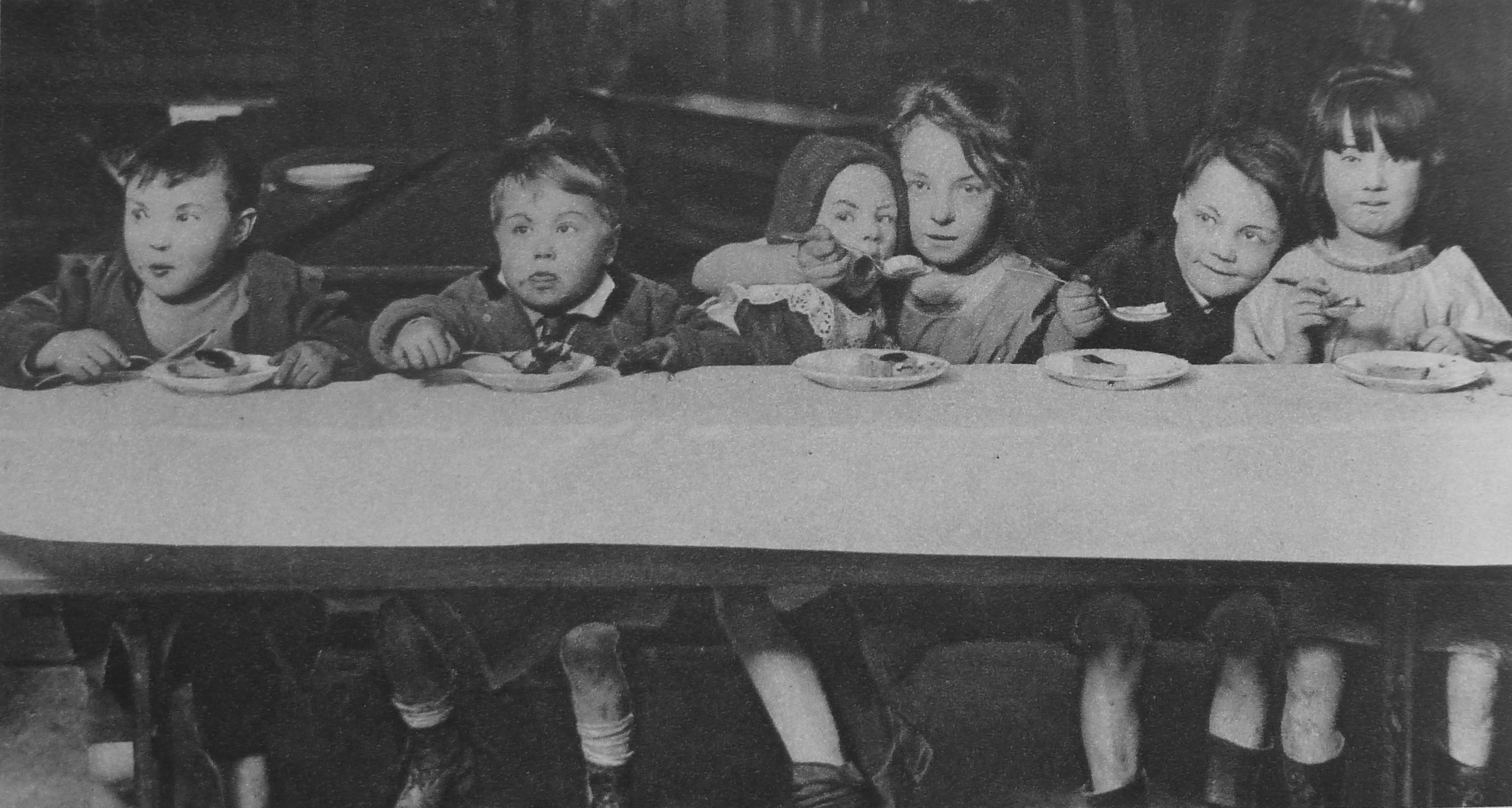
A chapter in Wonderful London covers Social Work, but a very different form of Social Work to that we understand today. Provided to Londoners through a range of organisations such as the Salvation Army, Police Court Missionaries, Dr. Barnardo’s, the Watercress and Flower Girls’ Christian Mission, St. Dunstan’s, the Morning Post Home for Destitute Men, a Medical Mission for ailing working women and children and the YMCA.

The following photo has the title: “Little Citizens Of London Who Ask For A Change In Life” and is captioned:

“There is no more important branch of social work in great cities than amelioration of the slum child’s lot. The public conscience is difficult to stir, but much is nevertheless being done by philanthropical societies and by individual effort to brighten the drab lives of these little unfortunates, to rescue them from surroundings of cruelty or crime and to start them upon happy and useful careers. Many east-end children have never been beyond their own disease-ridden courts and the dingy streets that form their playground.”

Wonderful London 20

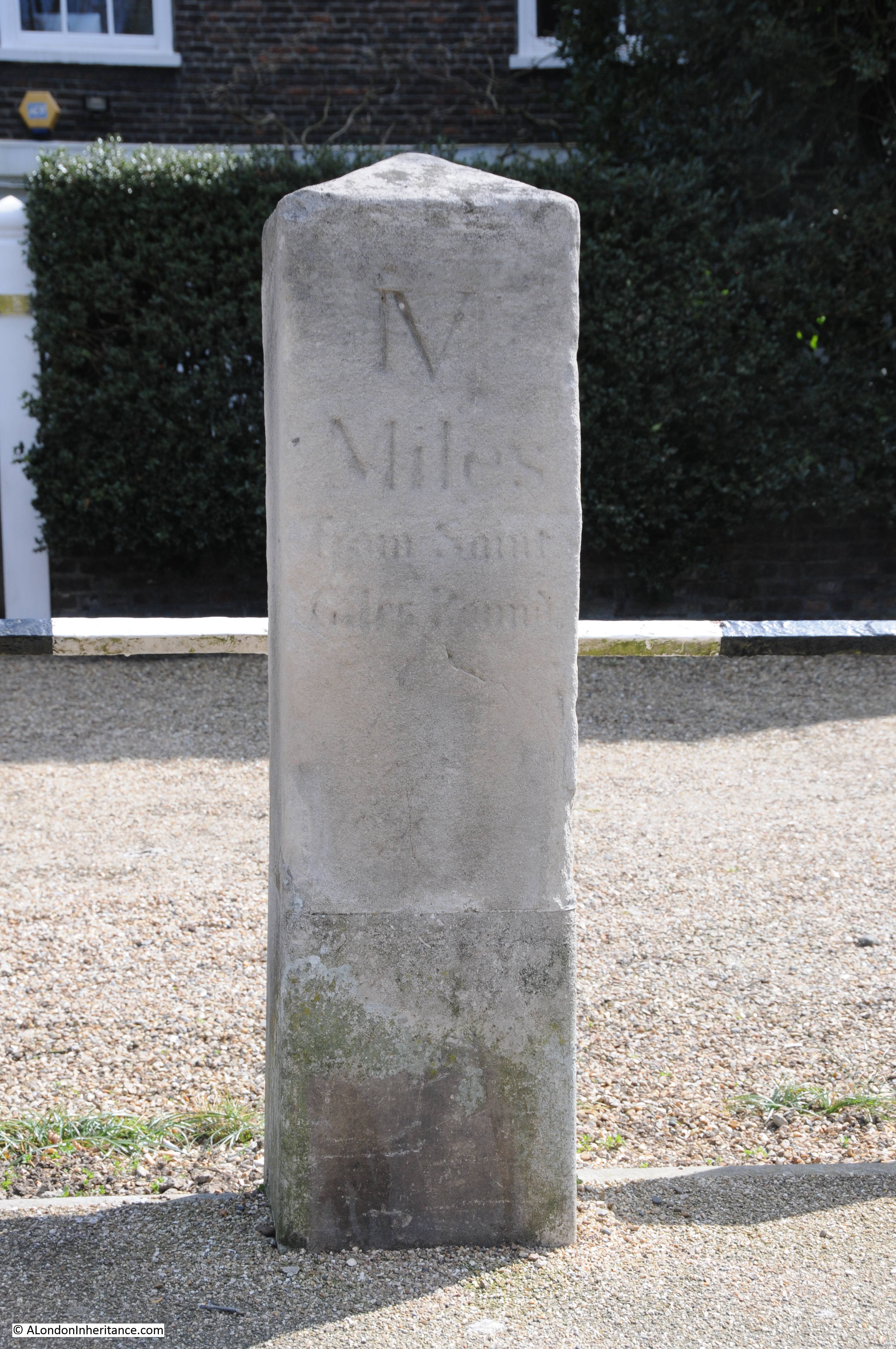
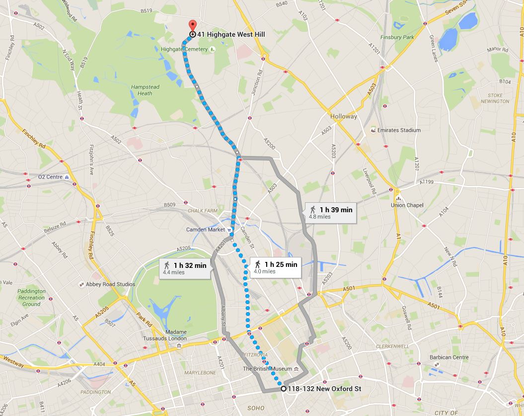
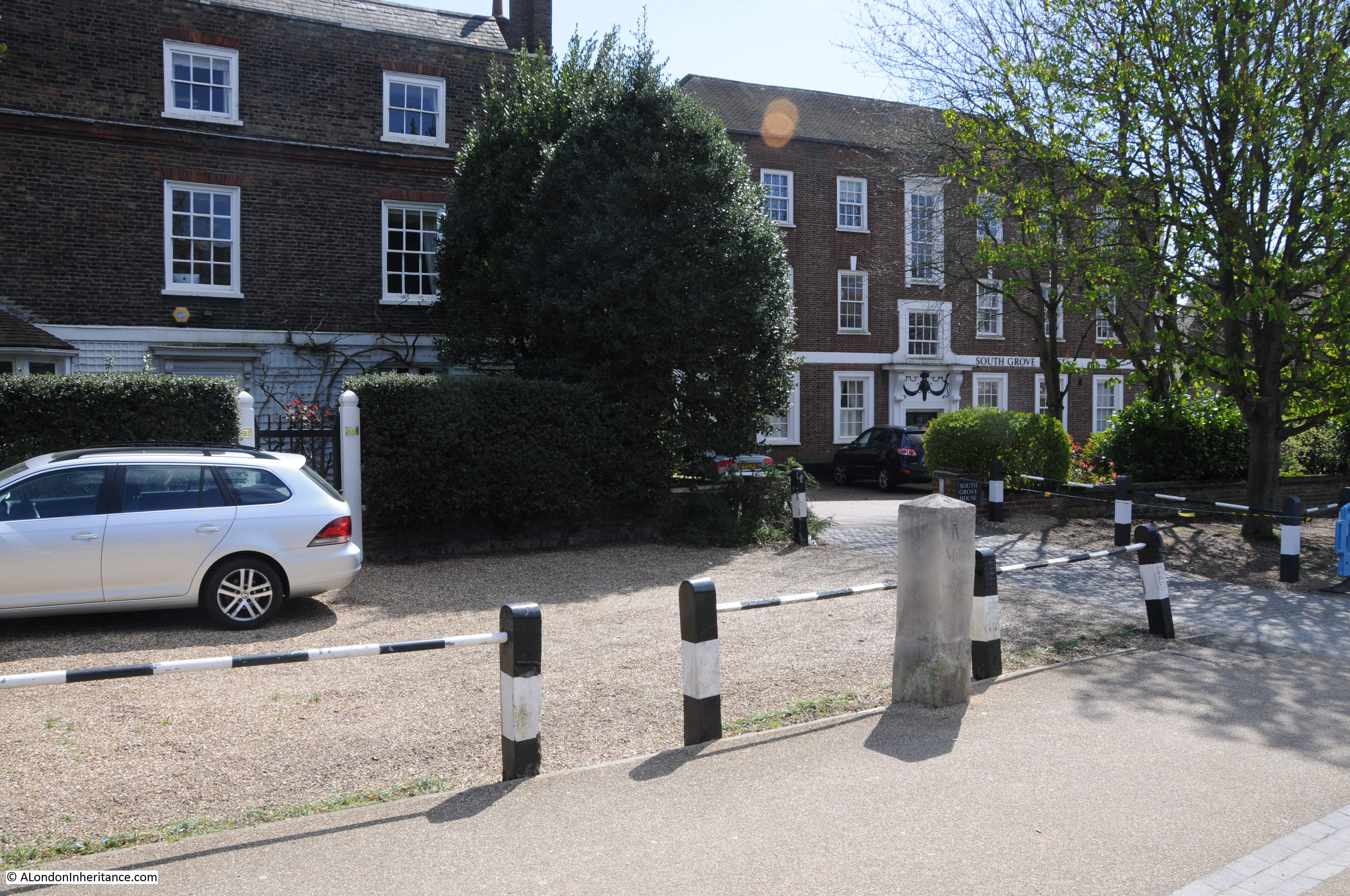
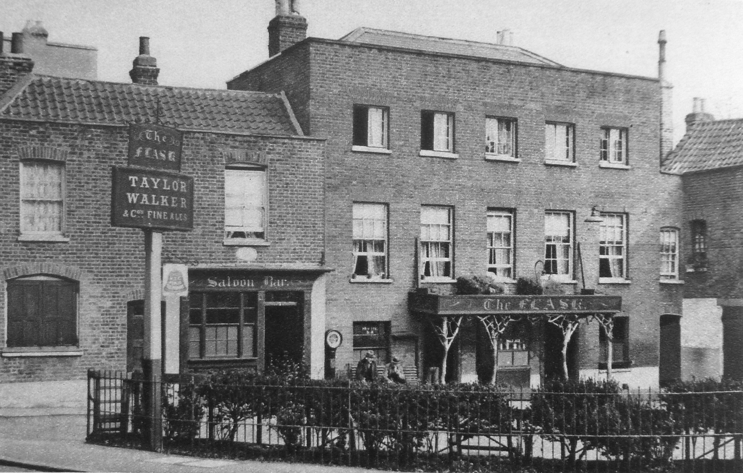
There are many photos in the books which show exactly the same scenes that my father would later photograph. One of these is The Flask in Highgate (see my post on The Flask which can be found here). The caption to the photo reads:

“At The Flask, labourers from the few surviving farms still drink the good ale, as their forerunners did a century ago. This tavern was much frequented by revellers’ clubs of late Georgian times.”

Wonderful London 21

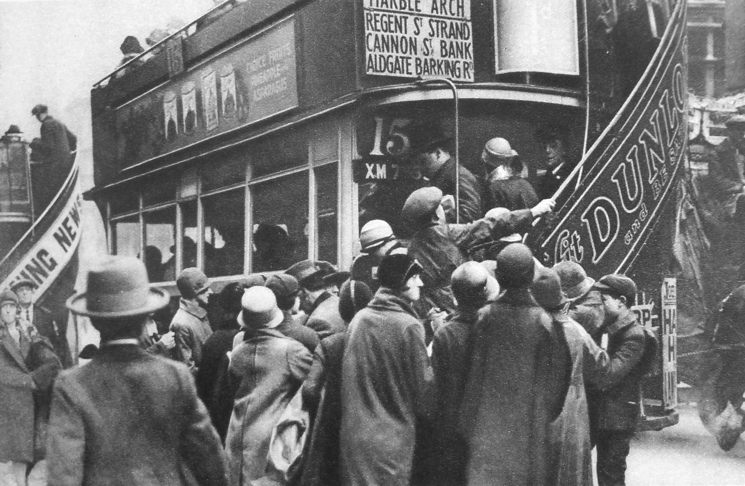
It is interesting that in almost 100 years, aspects of London’s transport system have not really changed.  The following photo has the title “Herding Passengers On To A Bus On Ludgate Hill” and the caption starts “Londoners endure a state of perpetual and acute discomfort in the daily travelling to and from their work which is really astonishing.” A sentence that could equally apply today.

Wonderful London 22

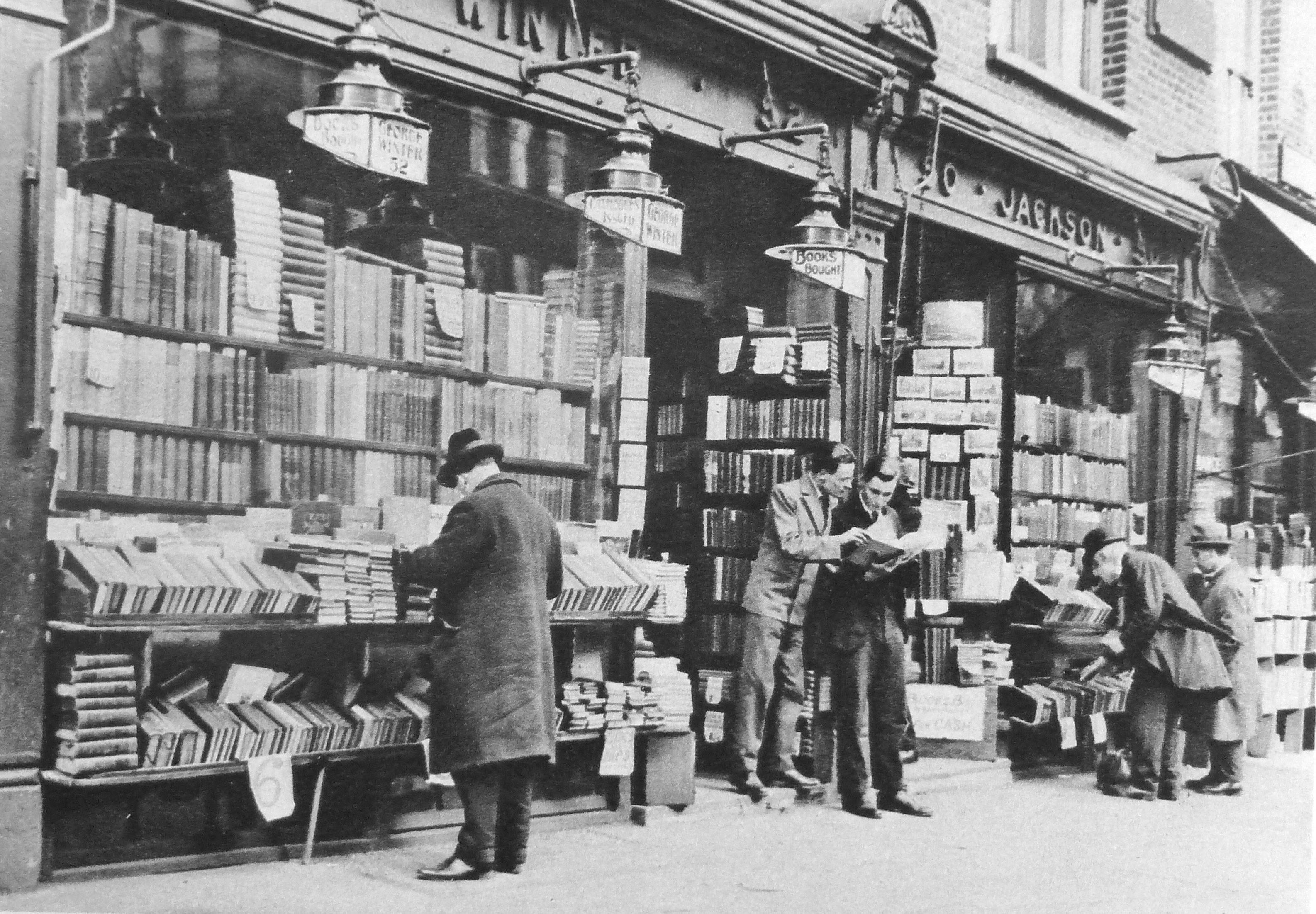
One of the chapters in Wonderful London covers second-hand bookshops and includes the following photo of a second-hand bookshop in Charing Cross Road, which as well as being the home to Foyles (which originally had a second-hand department) also had many other book shops.

Just looking at this photo makes me wonder what treasures could be found in this shop. Had I been around at the time I would probably have spent far too much time and money in shops like this one.

Wonderful London 23

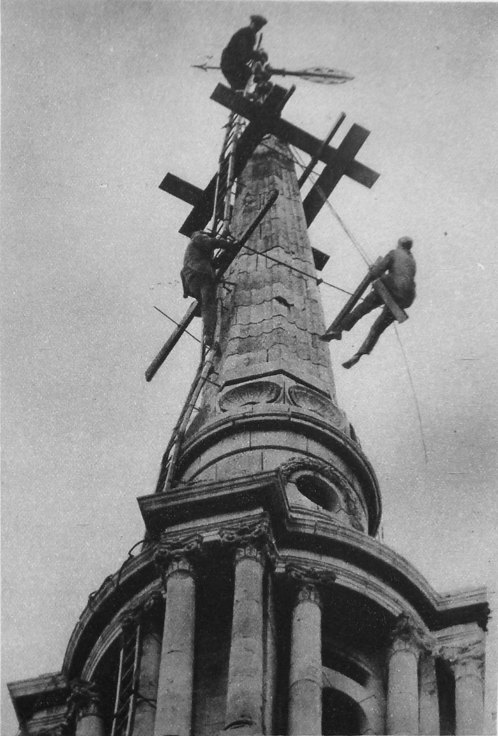
A range of occupations are covered in the three volumes, including the following photo of steeplejacks defying vertigo on the spire of All Saints, Poplar.

Wonderful London 24

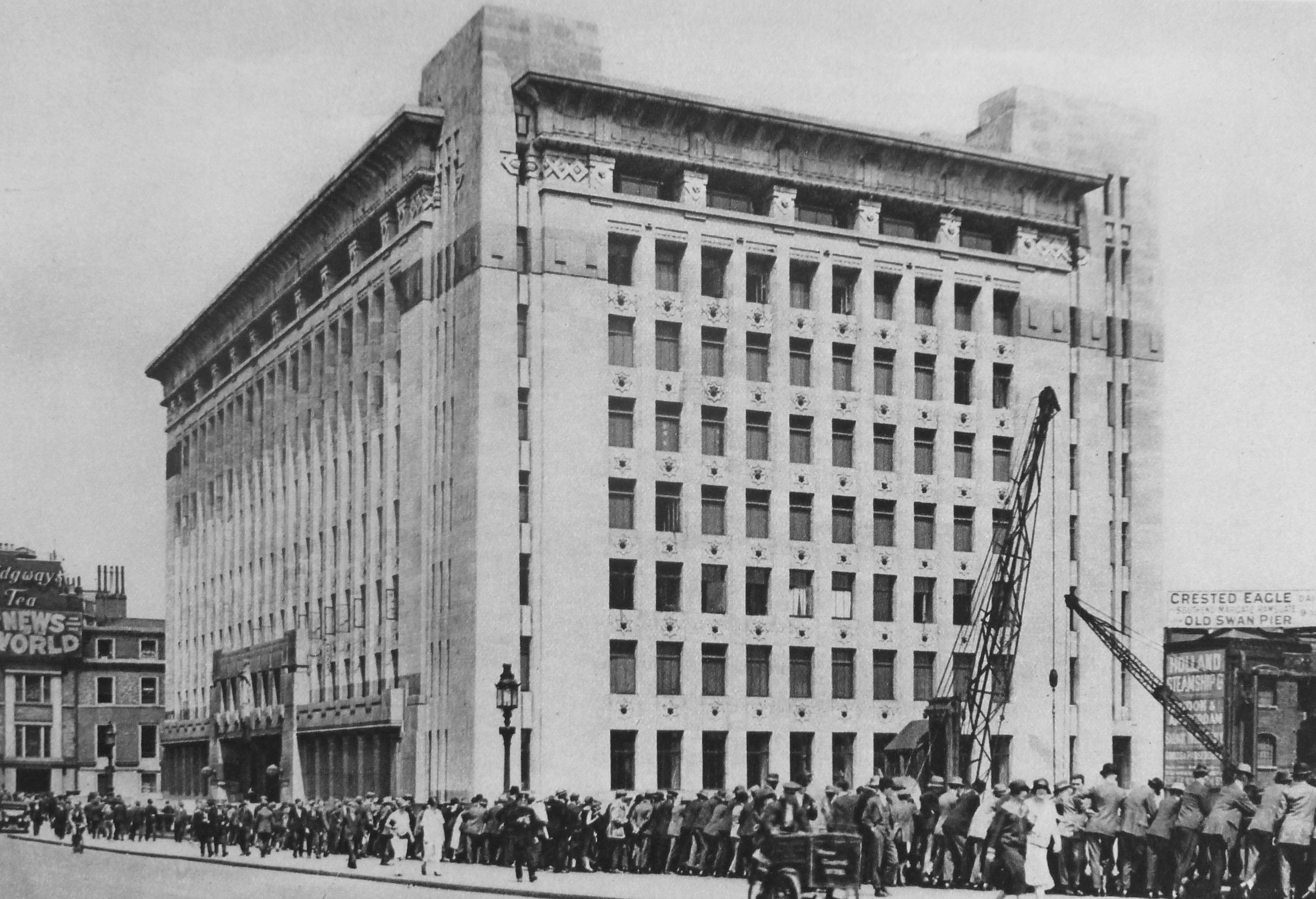
In last weeks post I included a photo taken from the river showing Adelaide House adjacent to London Bridge. Wonderful London includes the following photo of the building soon after completion. The title reads “Adelaide House, A Monument of Modern Architecture On The Site Of Old London Bridge”. The caption to the photo reads:

“In observing this new expression of the architect’s attempt to meet the problems of rebuilding in London it must be remembered that, according to design, a superstructure has yet to be added, and that the bridge level is not the ground level of the building. To get the full height effect, Adelaide House must be viewed from the river or else its south bank. Another place from which to be impressed or perhaps oppressed by the height of the thing is Lower Thames Street. Sir John Burnet and his partners were responsible for the huge study in concrete, and several designs for it were submitted and revised. There is a curious effect about the main entrance as though doorways had shrunk under the tremendous weight above.”

Interesting that the height of buildings has always been an issue in London.

Wonderful London 27

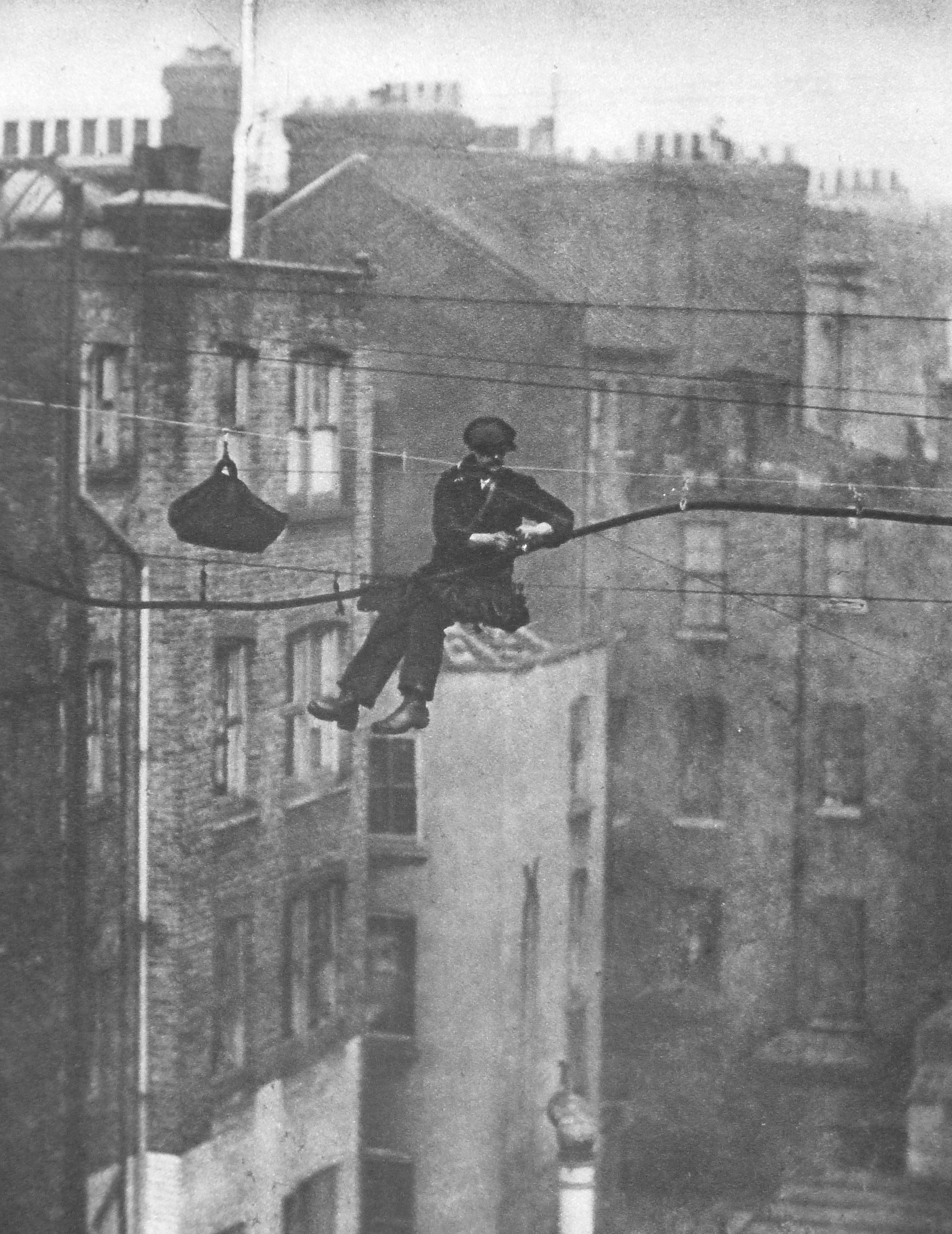
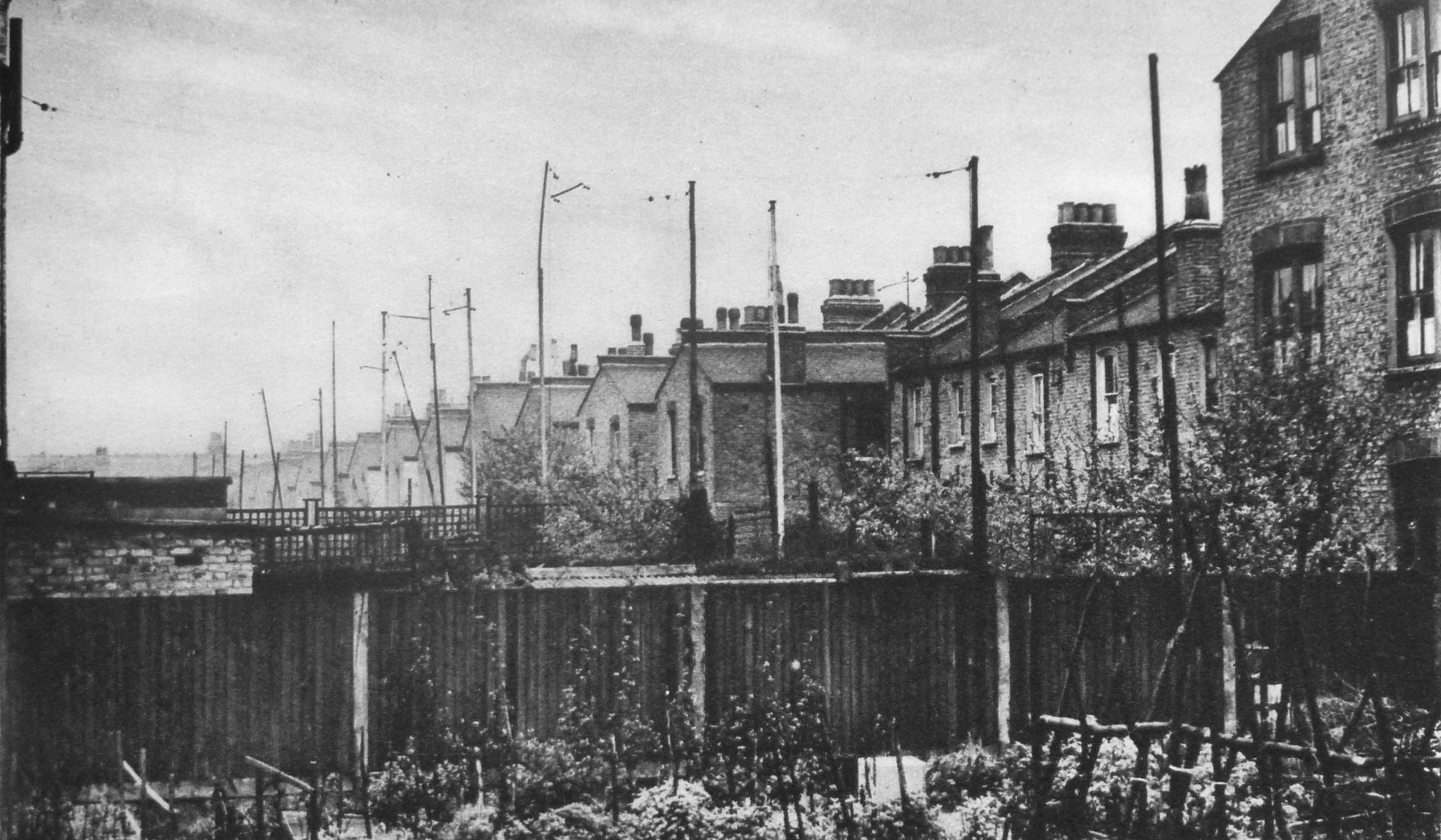
When the telephone was introduced across London, the majority of wiring was above ground. Old photos often show telegraph poles on top of office buildings with wiring strung across the rooftops and streets. These required a good head for heights to maintain. The title for the following photo reads: “Suspending a telephone cable between Conduit and Maddox Streets.”

And has the caption:

Twice a year the steel wires which support London’s telephone cables – each cable may hold the lines of thirty subscribers – are inspected. The cables are fastened to the wires by rawhide suspenders and this man is detaching the thick dark cable from the old wire and fastening it to the new wire, which shows fresh and bright above. The new wire also supports the worker. He sits in a bo’sn’s chair, consisting of a board slung by a loop at either end, which is fastened to the wire. Overhead wires are gradually being superseded by underground systems.”

Wonderful London 28

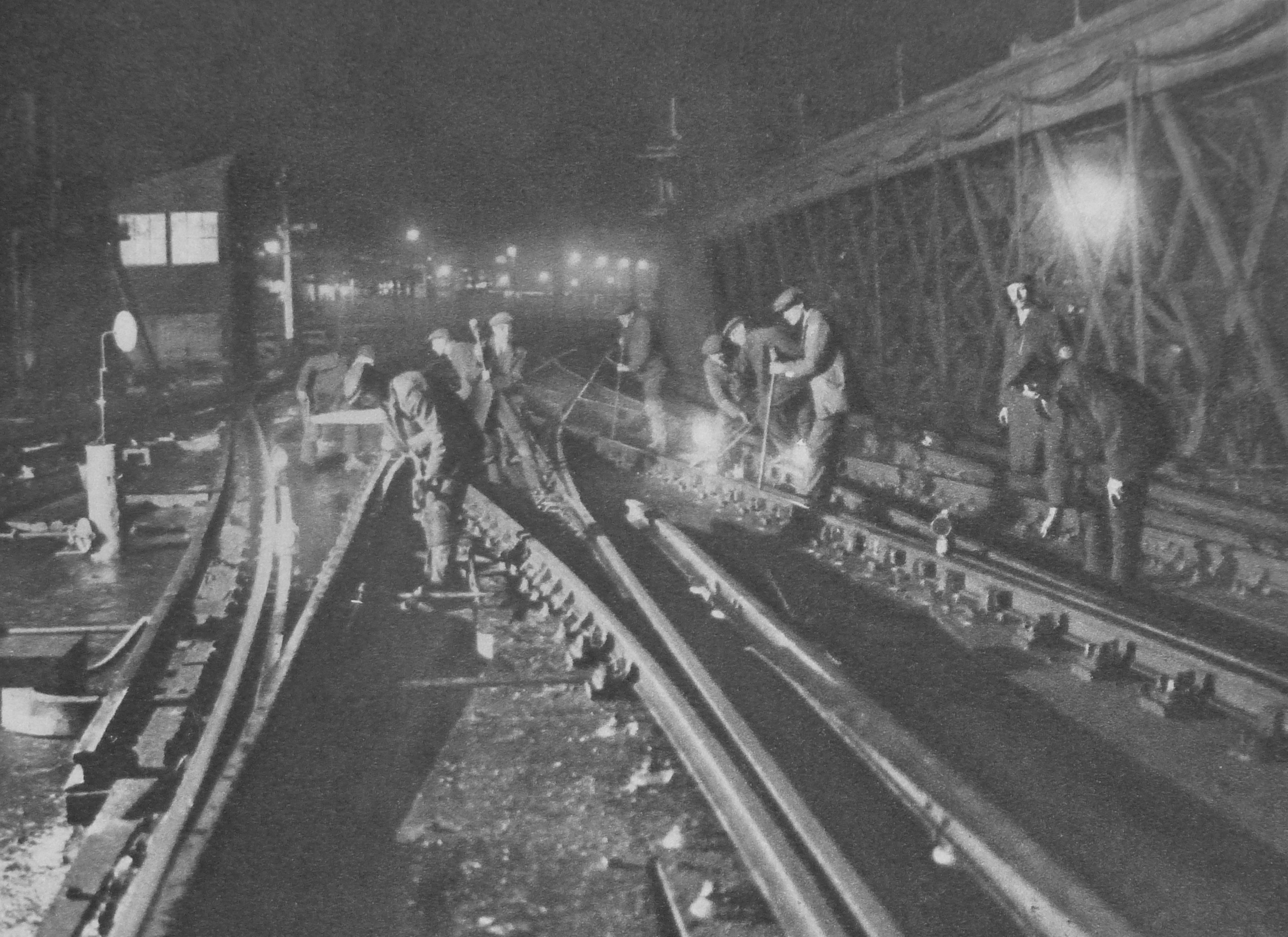
Some jobs are almost the same now as they were then, for example overnight maintenance work on the city’s railways. The following photo has the caption:

“A gang is at work on the permanent way on Charing Cross Bridge. The lights of the station can be seen in the distance.”

Wonderful London 30

Fog was very much a problem for London in the 1920s. The following photo is titled “Fogbound, Flares For Traffic In A London Particular” and is captioned:

“When the minute particles of dust which are always overhanging London become coated with moisture and the temperature falls below what is called dew point, that is when the temperature at which the moisture in the atmosphere condenses, fog blankets the streets. It is one of the scourges of the city, and much time and money are lost annually by its delaying the traffic. In a real pea-souper acetylene flares are placed at traffic control points. In the photo a constable is directing traffic where Charing Cross meets Trafalgar Square.”

Wonderful London 31

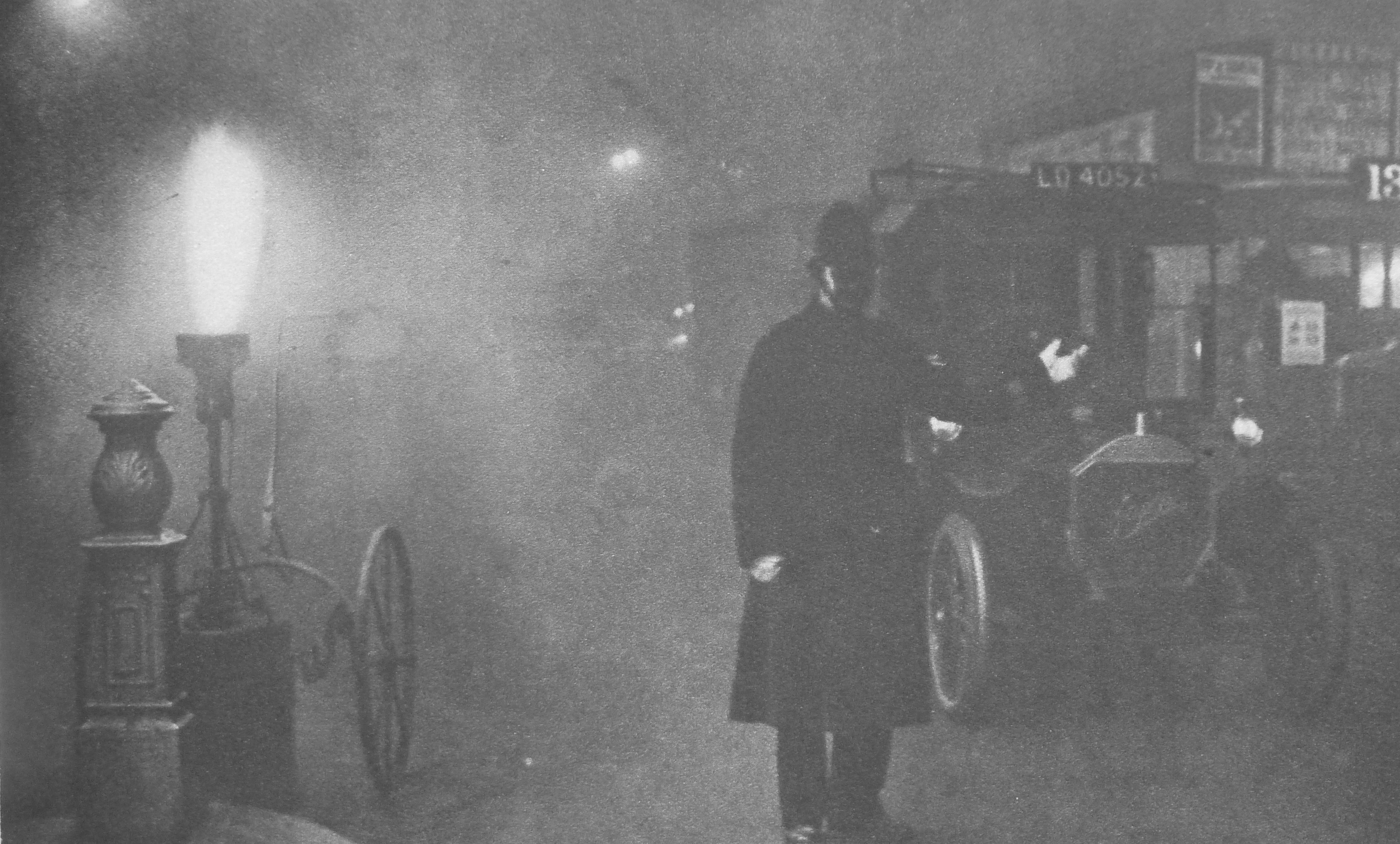
Interesting that the caption refers to the time and money lost due to London fogs rather than the impact on the health of Londoners. Business, trade and making money has always been the main driver of London life.

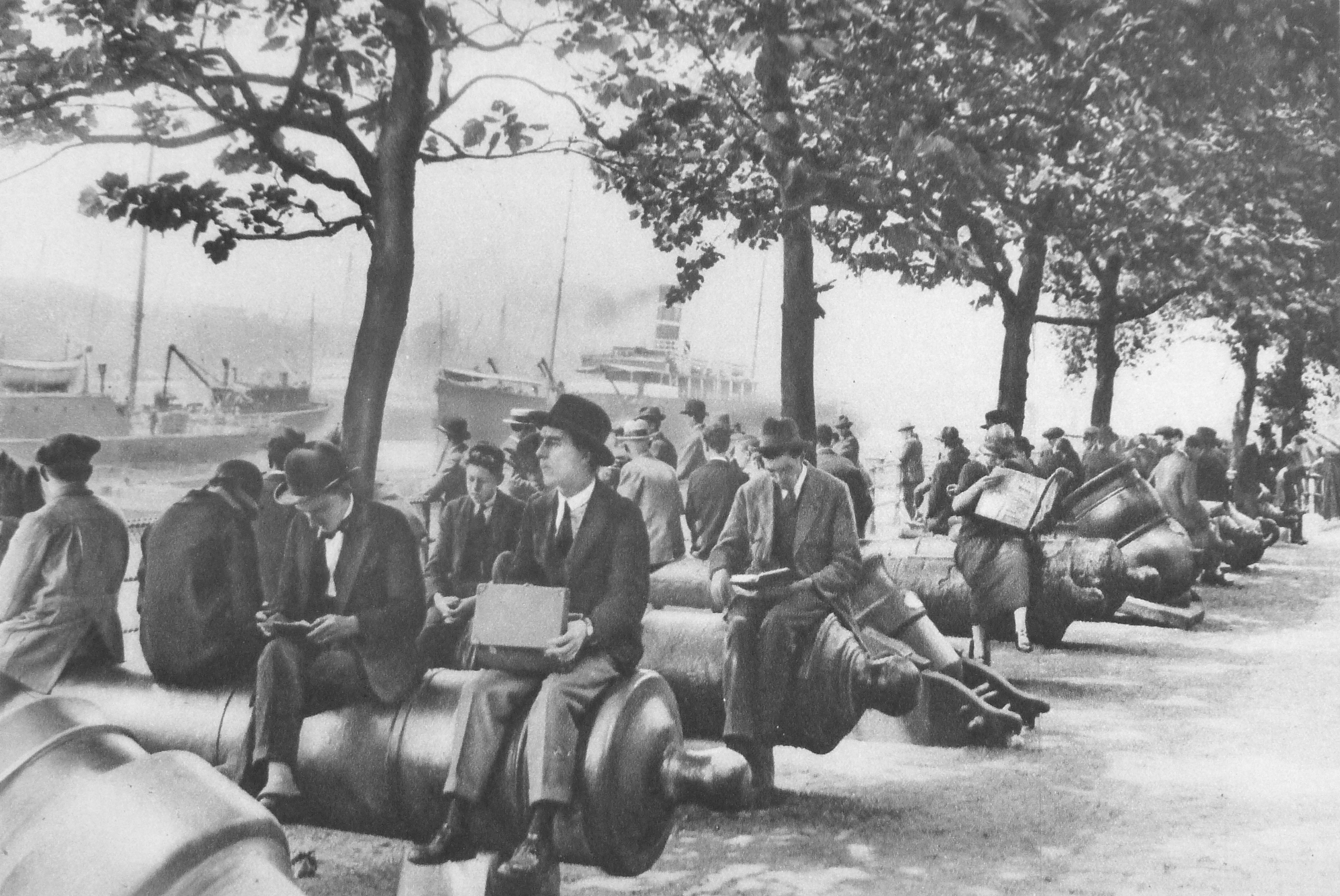
I covered the cannon in frount of the Tower of London in a post showing my father’s 1947 photo of the area.  Wonderful London includes a photo of the same area from the 1920s with the title “Tower Wharf: One Of London’s Lunch-Time Gathering Grounds” and the caption:

“Despite the tremendous number and variety of eating places, many hundreds of those who work in the City and its surroundings prefer, in fine weather, to eat their lunch on a park seat or as here, seated on the slippery surface of an old cannon. Tower Wharf, whatever its merits as a restaurant, is a fine place to view the Tower, and also the shipping in the Upper Pool and the opening of Tower Bridge. The wharf was built by Henry III who also made Traitors Gate. The wharf gave the fortress one more line of protection. On the very ground where this crowd is sitting another crowd assembled day after day to scream for the trembling Judge Jeffryes to be thrown to them, in quittance for the Bloody Assize.”

Wonderful London 32

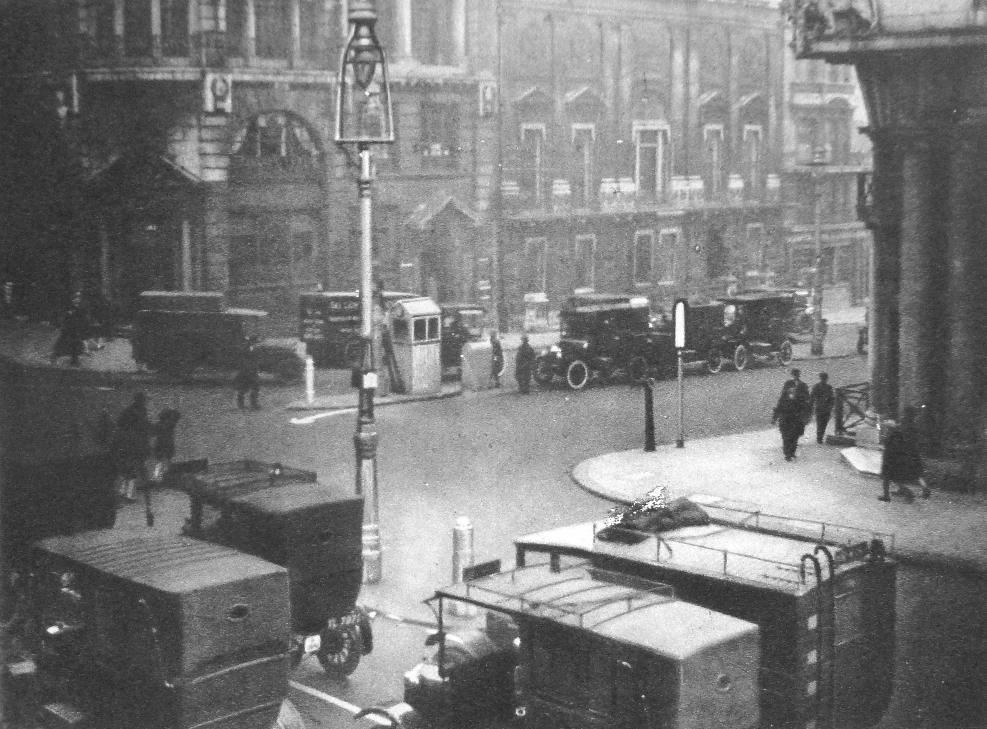
A theme during the 1920s was the growth in motorised traffic across London and the need to manage traffic. This required new systems of control and in 1925 manually operated traffic lights were installed at the junction of St. Jame’s Street and Piccadilly.

The photo below shows the junction. Look in the middle of the photo and there is a small hut.

Wonderful London 33

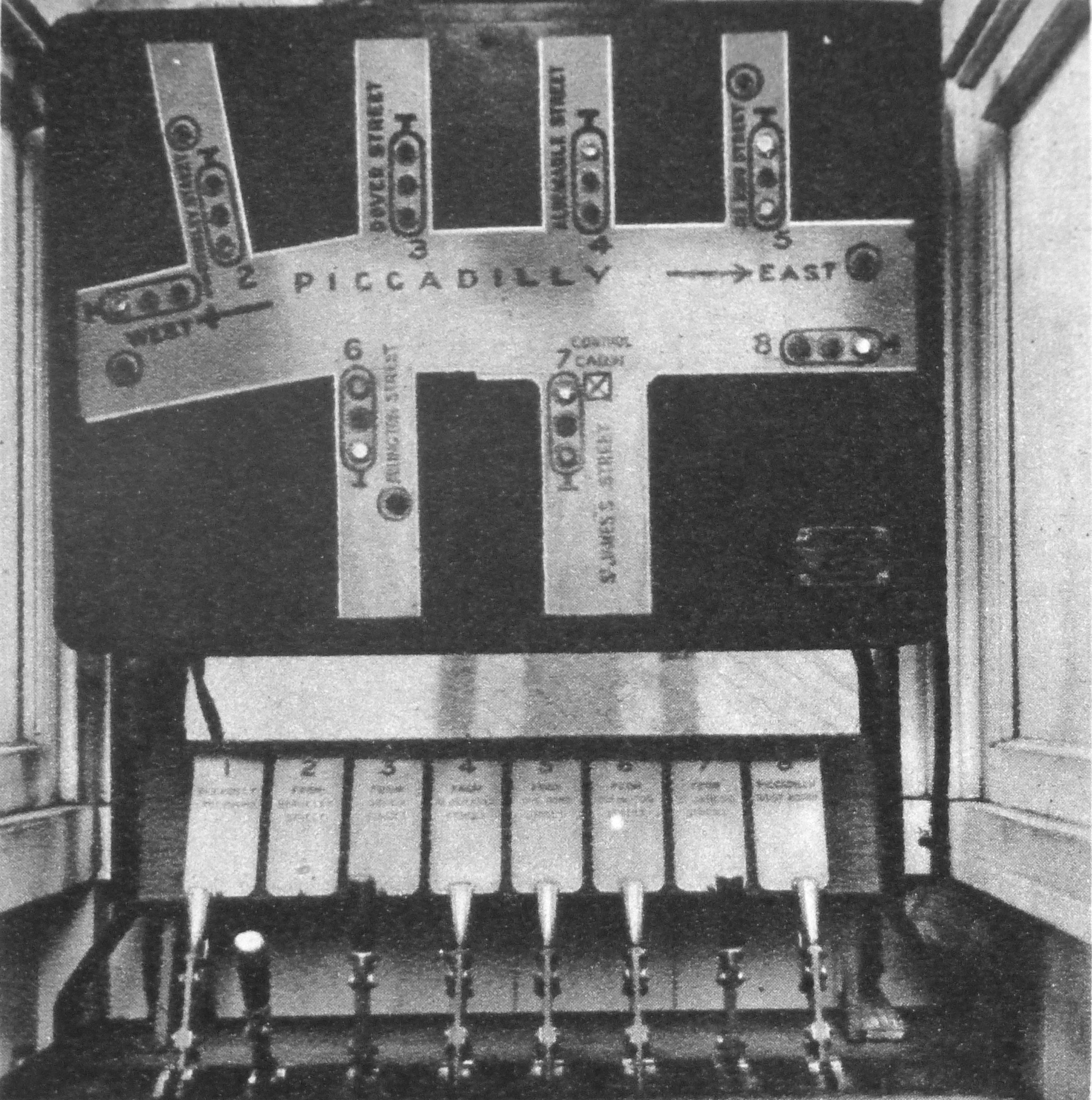
Within this hut is the control equipment for the traffic lights. Operated manually by the levers at the bottom of the photo with the street layout and indicators showing the status of the traffic lights above. Requiring an operator for each set of traffic lights, it is no wonder that they only really started to proliferate across London when automated lights were developed a few years later.

Wonderful London 34

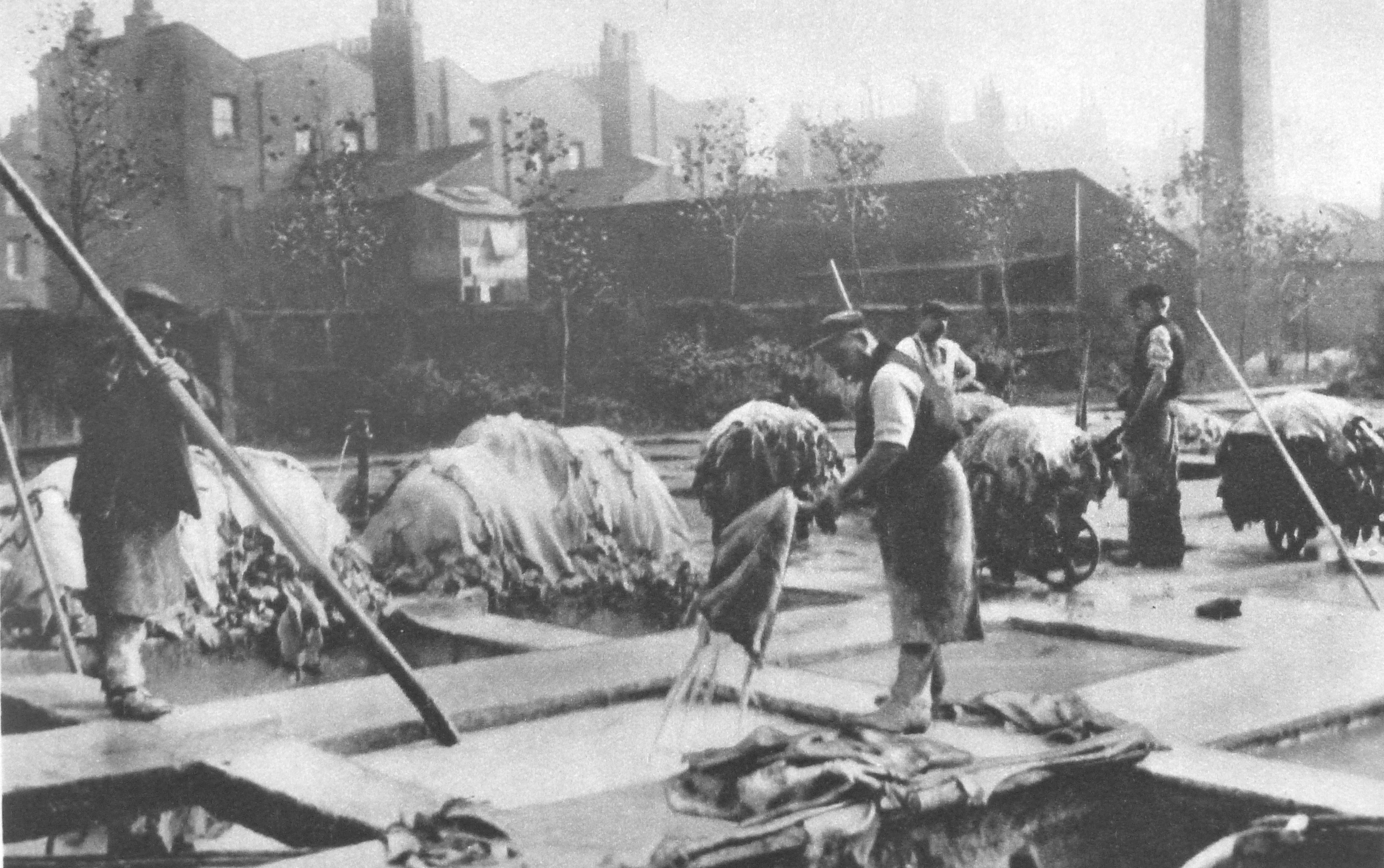
The book also features trades that have long since disappeared. Tanneries were a major industry in 19th century London but in the first decades of the 20th century they were gradually disappearing. The following photo shows one of the remaining tanneries and is captioned:

“At Bermondsey tanning is, so to speak, in the air as one traverses the dingy streets towards the Neckinger Mills, where the photograph was taken. We are looking at the lime yard full of pits about seven feet deep, and built some 60 or 70 years ago. Fifteen to thirty dozen skins go to a ‘pack’ and each pack is soaked in fresh water, then in a solution of limewater, for 3 – 6 weeks to remove the hair. Goat skins are being dealt with here.”

Wonderful London 35

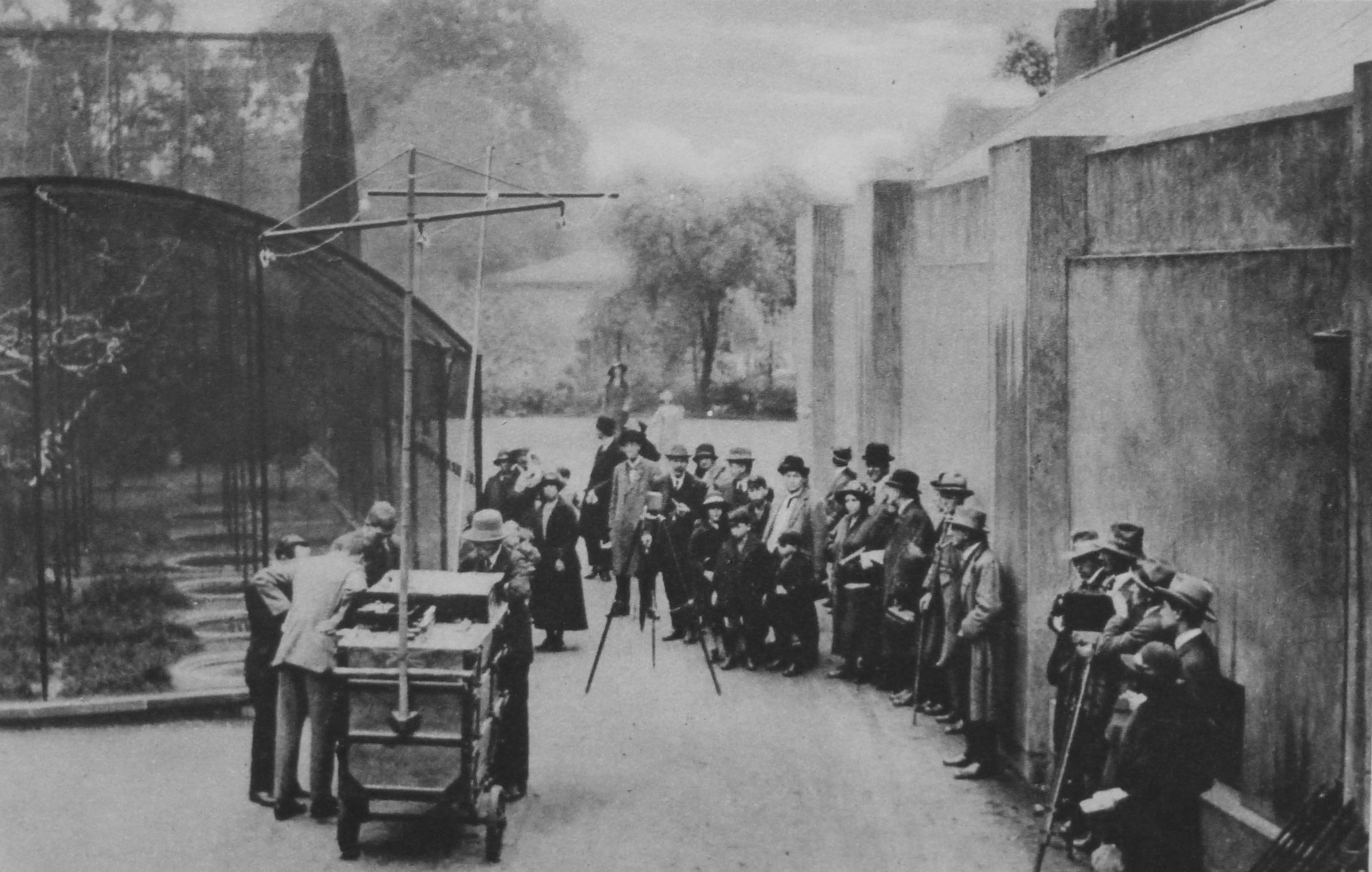
Radio broadcasting, or wireless was a new technology in the 1920s with the BBC having started daily broadcasts in 1922. Wonderful London shows how this technology is starting to impact the lives of Londoners with two photos under the title: “Broadcasting Noises From The Zoo To The Aerials Of Suburbia”

The photos are captioned:

“Howling is only approved of by ‘listeners-in’ when it comes from the Zoo, and several experiments have been made in bringing the wild animal into the home by wireless. We see the officials of the British Broadcasting Co. preparing to receive a few screeches from the aviary.”

Wonderful London 36

“These will be wafted over the forest of wireless poles that has sprung up all over London since the broadcasting craze took its hold on the inhabitants. The poorer neighbourhoods seem particularly to bristle with aerial poles, and this is very noticeable from a train traversing such districts.”

Wonderful London 37

As well as radio providing a new means of communication and entertainment another new technology that started to be widely available and continues to have a huge impact on London is flight.

Long before Heathrow or Gatwick, Croydon was London’s airport, and the following photos show the first steps in London’s aviation journey. The first photo is titled “The Air Port of London As It Was In 1925” and is captioned:

“The official designation of the great aerodrome is “The Air Port Of London” though it is popularly known as the Croydon, or Waddon aerodrome for it is included in the latter parish”

Wonderful London 38

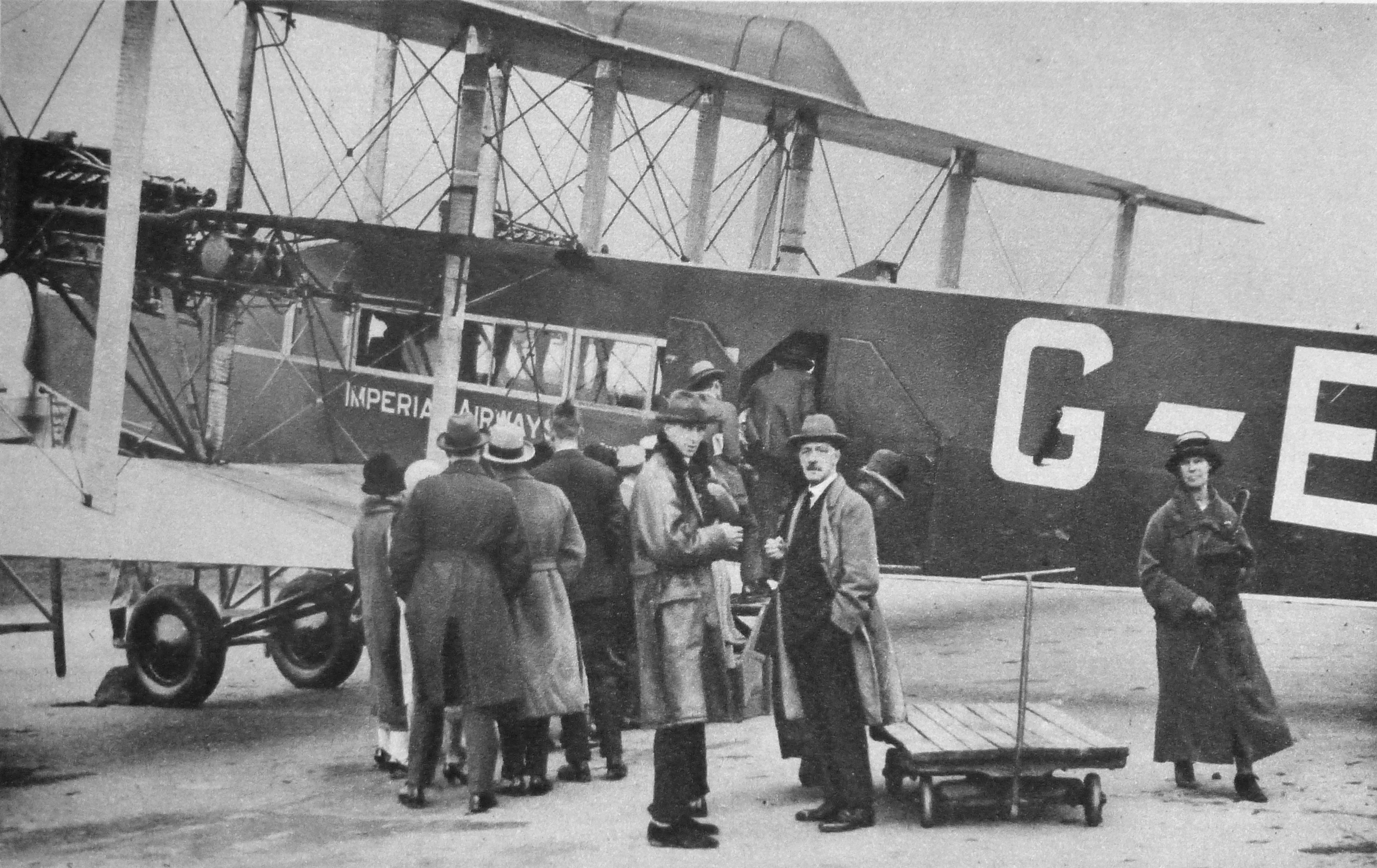
And the following photo “Loading Cargo and Passengers”

“Passengers are embarking for Paris by an Imperials Airways machine.”

Wonderful London 39

When you consider how quickly these first tentative steps in commercial aviation transformed into the scale and complexity that we now see at Heathrow, it does make you wonder what the next 90 years will hold for London.

Wonderful London does live up to its name and with the written chapters that cover almost any topic you could think off, and with so many photos the books really do justice to describing the world’s greatest city.

alondoninheritance,com

Along The Thames In 1947 And 2016 – Tower Bridge To Westminster Bridge

During the afternoon of Saturday 23rd August 1947, my father took a boat trip along the Thames from Westminster to Greenwich. I am able to date this accurately as the date was written on a number of the photos taken along the route that he printed afterwards.

I will be on the river later this year to photograph the same views on the stretch between Tower Bridge and Greenwich, however for the photos covering the route between Westminster and Tower Bridges, I cheated by taking a walk along the south bank of the river to photograph the north bank views.

My father’s photos were taken from a boat at low tide, so I was not able to get the view exactly right, however they do show roughly the same view and the changes that have occurred along the north bank of the river.

I have not processed these photos, they are straight from the scanner and some show some imperfections. I prefer the unprocessed look as a more genuine presentation of photos that are now 69 years old. Film was hard to get just two years after the war had finished and these photos were taken on 35mm movie film which was cut up to fit the film holder in the camera. I have no idea why movie film was available, or where it came from.

After taking the photos for last week’s post about Tower Bridge, I continued along the south bank of the river towards Westminster, so these photos are in reverse order.

Starting the journey in 1947 with the Tower of London. As with last week’s photos the beach in front of the Tower looks to be busy on an August summer afternoon.

Southbank Walk 1

The view today from the opposite bank of the river. There are few high buildings immediately behind the Tower to detract from the view, however I doubt that this will remain the same for long, the number of cranes in the background are rather threatening.

Southbank Walk 13

Just past the Tower is this view. The Tower of London is at the right of the photo (just behind the trees) and the large building in the centre is the former Port of London Authority building.

The area on the left of the photo, down to the river was bombed heavily during the war. To the left of the photo is the shell of a church tower. This is the church of All Hallows by the Tower. Below the PLA building and facing the river is the side of a building. This is the Ye Old Tiger Tavern on Tower Hill which survived bombing but was later pulled down in the reconstruction of the area. More on these buildings and the area in later posts.

Southbank Walk 2

The view today. I should have been a bit further to the left, however the Belfast would have obstructed much of the view. The tower of the PLA building is still visible, however the new buildings on the left have obscured the view of All Hallows by the Tower which was rebuilt after the war.

Southbank Walk 14

Further along we come to Billingsgate Market, with the Customs House on the right and the tower of the church of St. Dunstan in the East just behind the Custom House.

Southbank Walk 4

And the view today (although partially obscured by one of the new piers along the Thames). Billingsgate, the Custom House and the tower of St. Dunstan’s are the only buildings that remain from 1947 with the towers of the City rising up behind.

Southbank Walk 16The following photo shows the edge of the Billingsgate Market building on the extreme right of the photo. There is then a gap which before the war was occupied by Nicholson’s Wharf, destroyed by bombing along with a direct hit by a V1 flying bomb. To the left of the gap is New Fresh Wharf. This was a busy wharf that handled very large volumes of goods, general goods, fruit and canned goods as well as operating as a terminal for passenger ferries.

New Fresh Wharf was demolished in 1973. The building on the extreme left of the photo is Adelaide House. Construction of Adelaide House was completed in 1925. It is now a Grade II listed building. The dock facilities of New Fresh Wharf extended along the river frontage of Adelaide House.

Southbank Walk 5

The same view today with Billingsgate on the right of the photo and Adelaide House of the left. The scene in-between these two buildings is now completely different.

Southbank Walk 17

We have now moved further along the river, past London Bridge, the version of the bridge prior to the current one can be seen in the following photo with Adelaide House and New Fresh Wharf behind the bridge. We can now see the Monument and to the left of the bridge is Fishmongers Hall, the home of the Fishmongers’ Company. Damaged caused by bombing can be seen to the left.

Southbank Walk 6

Almost the same view today, although I should have been on a boat, mid river as my father was to get the same perspective. Adelaide House, the Monument and Fishmongers Hall are still there. My father’s photo included the 19th Century version of London Bridge and my photo shows the 1974 incarnation of the bridge that has crossed the river in roughly the same location for many hundreds of years.

Southbank Walk 18

If we now pass under the bridge taking the rail tracks across the river into Cannon Street Station, and view the small space between Cannon Street Station and Southwark Bridge. Cannon Street Station is on the right with the structure on top that held the glass canopy to the station. The church is St. Michael Paternoster Royal.

Southbank Walk 7

The view today. Cannon Street Station still on the right, although without the original roof, offices have now been built above the station platforms. The old Cameron Wharf area is now the City of London Corporation Waste Transfer Station with barges mooring along side to take rubbish from the City to processing locations further down river.

Southbank Walk 19

Now walk under the new Millennium Bridge and slightly further up river you would have had this view in 1947. Puddle Dock is on the extreme left. St. Paul’s Cathedral is in the centre, partially obscured by the Faraday Building in Queen Victoria Street, one of the main London telephone exchanges. The height of the Faraday Building and the impact on views of St. Paul’s was one of the reasons for the planning regulations that now protect specific sight-lines and views of the cathedral.

The building and wharf of Blundell Spence & Co Ltd (manufacturers of Paints, Varnishes and Colours) is just below the Faraday Building, with the Cannon Warehouse and Showrooms to the right.

Southbank Walk 8

The view today. The Faraday Building is still the highest building between the cathedral and the river. The church on the right of centre in the 2016 photo is St. Benets Welsh Metropolitan Church. If you look in exactly the same position in the 1947 photo the spire above the tower of the church can be seen. The building on the right hand edge of the photo is the new site of the City of London School.Southbank Walk 20

Now passing under Blackfriars Bridge, walk along a bit further and look back at St. Paul’s Cathedral. In this 1947 view, on the left is the City of London School with the Unilever Building just behind.

Southbank Walk 9

The same view today. The original building of the City of London School is still there, although the school moved out in 1987 to new buildings along Queen Victoria Street.

Southbank Walk 21

Walk further along the south bank, almost to Waterloo Bridge and look back along the north bank of the river and this is the 1947 scene. The steeple of St. Brides church is on the extreme right. Also on the right of the photo on the embankment wall is the memorial commemorating the naming of this stretch of the river as King’s Reach after King George V.

The ship in the middle of the photo is the Discovery, Robert Falcon Scott’s original ship. She was moored here from 1931 to 1979. Having been fully restored, the Discovery is now moored in Dundee. During the war she was used by the Sea Scouts, of which my father was a member. His written account of life in London during this time includes accounts of staying on the Discovery and sailing up and down the Thames between Pimlico and Tower Bridge on an old whaler doing things that would be a nightmare for current health and safety.

Southbank Walk 10

Roughly the current view, although not exactly the same viewpoint. The steeple of St. Brides church is still on the right, although as I could not get to exactly the same position, the Kings Reach memorial is now to the right of center.

The location of the Discovery is roughly at the position of the blue containers.

Southbank Walk 22

Much has changed along the Thames in the 69 years since my father took these photos, although some views are almost exactly the same. The following photo was taken close to Hungerford Railway Bridge. Cleopatra’s Needle is in the centre with the Shell-Mex building behind (the building with the clock). the Shell-Mex building was completed in 1931 and occupied by Shell Mex and BP Ltd. Although Shell have long since moved out, the building is Grade II listed so should be preserved as a major Thames landmark and an example of 1920s / 1930s architecture long into the future.

Southbank Walk 11

The same view today is almost unchanged, with the Adelphi on the left, then Shell-Mex House, the Savoy, then lower down, behind the trees the Institute of Electrical Engineers building, then Brettenham House and finally Somerset House on the extreme right of the photo.

I had intended to take this photo at the same time (2:50pm) as my father although due to taking too many photos along the walk I arrived slightly later at 3pm.

Southbank Walk 23

The final stop as we approach Westminster Bridge is the view across to the RAF memorial. The stone column was designed by Reginald Blomfield and the eagle on top of the memorial by William Reid Dick. The memorial was unveiled in 1923.

Southbank Walk 12

The view to the memorial today. I should have been a bit further to the left, however the infrastructure around the base of the London Eye obscures the view. The significant change is the building behind the memorial. These are the main Ministry of Defence buildings. Construction of these started in 1939, although the war then caused significant delays with construction being completed in 1951.

Southbank Walk 24

A boat trip or walk along the river is a fantastic way to view the city. Although there has been much development along the north bank over the years, it is surprising that whilst many of the buildings are different, the overall views are much the same. The most significant difference being the towers that now occupy much of the City.

Change along the south bank of the river and in the stretch between Tower Bridge and Greenwich has been much more dramatic and I will be covering these in future posts.

alondoninheritance.com

Tower Bridge

A brief post today as unfortunately work commitments have been rather heavy over the past week. Here are three photos that my father took in 1948, the first two show the northern approach to Tower Bridge with the third showing the view across to the City from Tower Bridge. This last photo really makes you wonder how we plan the City and the buildings that tower over their surroundings.

Firstly, standing on the approach road to Tower Bridge. The Tower of London on the right. The cranes that still lined the river are visible to the left and right of the bridge. The sign on the left warns that heavy goods vehicles much cross the bridge at 8 miles per hour.

Tower Bridge 3

68 years later and I am standing in roughly the same spot on a very sunny day – always a mistake due to the deep shadows. It should have been easy to locate the precise location, however I believe that the slip road to the left in the 1948 photo has been moved back, slightly further north.

Tower Bridge 4

My 2016 photo also shows an empty road, a bit deceiving as I had to wait a lengthy period to get a clear road.

The next photo is a bit closer to the bridge.

Tower Bridge 2

And in 2016.

Tower Bridge 5

The photo below was taken from the bridge, looking over to the City of London. Look at the background and the church spires of the City churches are standing above their surroundings. To the left of centre, the Monument is standing clear and slightly to the left of the Monument, in the background, is the dome of St. Paul’s Cathedral.

It is low tide, and along the bank of the Thames is the artificial beach, with stairs down from the walkway alongside the Tower.

Tower Bridge 1

And the same view in 2016. I did not time the tide right, but the beach and the stairs have long gone. If you look carefully, just to the right of the red cranes, the dome of St. Paul’s Cathedral can just be seen, with slightly further to the right, the very tip of the Monument.

Tower Bridge 6

But what really intrudes into the 2016 view is the 20 Fenchurch Street building, better known as the Walkie Talkie building. Whilst the City cannot stay static, this building is just in the wrong place and the intrusive top-heavy design does not help.

I doubt that my father, standing on Tower Bridge and looking at the view over the City, would have imagined that it would look like this, 68 years later.

alondoninheritance.com

Saint Giles Pound

The problem I find with this blog is that there is so much to discover and learn, each post really needs much more investigation than I currently have the time to do. This week’s post is an example.

My father took the following photo of a milestone in Highgate in 1948. It is just south of the Flask pub along Highgate West Hill. (For a view of the Flask and Highgate in 1948 see my post here.)

Saint Giles Pound 1

The milestone is still there. See my following photo of the milestone today. Nothing special you might think, but compare the mileage, five in 1948 and four today and the destination is a location that does not now exist in London, Saint Giles Pound.

Saint Giles Pound 2

So where and what was Saint Giles Pound?

Saint Giles refers to the parish of St. Giles in the Fields, the parish that took in the area around the church of the same name, just a short distance south-east from the junction of Tottenham Court Road, Oxford Street and Charing Cross Road.

In my usual London reference books I have found a number of references to the Saint Giles Pound which was a fenced area to hold sheep and cattle etc.

From “The History of the United Parishes of St. Giles in the Fields” by Rowland Dobie, published in 1829:

“The Pound and Cage originally adjoined each other, and stood in the middle of the High Street, from whence Parton informs us it was removed in 1656, to make way for the almshouses which were afterwards built there.

‘The Pound’ he adds, probably existed from a very early period, as a necessary appendage to the parish while a village, and abounding in pasture lands, though it is unnoticed in the books of the parish, till Lord Southampton’s grant of the ground on which it stood for the almshouses, where it is described as occupying a space of 30-feet, which was to the dimensions of the new Pound, therein directed to be removed to the end of Tottenham Court Road. The exact site of the Pound was the broad space where St. Giles High Street, Tottenham Court Road, and Oxford Street meet, where it stood till within memory. Noticed for the profligacy of its inhabitants, the vicinity of this spot became proverbial: witness the couplet of an old song.

‘At Newgate steps Jack Chance was found,

And bred up near St. Giles Pound’

it was finally removed about the year 1765, since when the neighbourhood has experienced many improvements, particularly by the erection of the great Brewery of Messrs. Meux and Co.

The Cage appears to have been used as a prison, not merely of a temporary kind, but judging from the parish records, with little lenity.”

Charles Knight in the Milestones section of his book, London, published in 1841 states:

“Again, St. Giles Pound, a real pound for cattle, which is marked upon the old plans, was a prominent object, standing in the village of St. Giles at the intersection of the roads from Hampstead and from Oxford. This also was something like the beginning of London: but Hicks’s Hall and St. Giles Pound have long since vanished; and the milestones which record their glory ought also to be swept away.”

The milestone therefore is alongside one of the old routes that was used to bring animals in from the north, through Highgate and down into London, and thankfully it has not been “swept away”.

The two photos of the milestones also have different distances, five in 1948 and four in 2016. The only reference I can find to this change is that it was made by a local resident of Highgate who was frustrated with the error. So is four miles correct? Although I have walked the route, I have not measured, so a quick check on Google maps, from Highgate West Hill at roughly the position of the milestone, to a point on New Oxford Street a very short distance past the end of Tottenham Court Road to allow for the possible siting of the Pound more towards St. Giles High Street. The following map confirms the distance as being exactly four miles (the blue dots). Even with some longer alternative routes, the distance does not reach five miles.

Saint Giles Pound 6

It would be interesting to know if the error in distance was from when the milestone was originally installed, or perhaps when the figures may have been re-cut as they do look very sharp in the 1948 photo with very little deterioration to the edge of the lettering. The key point is that today, the distance is correct.

A wider view of the milestone alongside Highgate West Hill.

Saint Giles Pound 3

Intriguingly, the Pound may be marked on a map. The following is an extract from John Rocque’s map of London from 1746. This is 19 years before the Pound was removed. Look in the lower right of the map, at the junction of Tottenham Court Road, Oxford Street and the High Street of St. Giles. There is a rectangular feature in the open area of the junction – could this be the Pound? The location fits perfectly the description given by Rowland Dobie in his book, quoted earlier.

Saint Giles Pound 4

Strange to think that this very busy junction, with the new Crossrail station being built, was once the location of a Pound, holding animals being brought down from the north.

The map extract is from the very lower right hand corner of the page. At the very bottom right corner is a street with only the word “Street” showing. This is Denmark Street featured in my post of a couple of weeks ago.

The map has some other references that point to the original use of this area. In the above map, the road running south from the junction is Hog Lane. The alley leading off from the top right of Hog Lane is Farmers Alley.

Hog Lane is now the northern section of Charing Cross Road. From “London” by George H. Cunnigham (1927):

“In Hogarth’s time this portion of the street was known as Hog Lane, later Crown Street, under which name it was widened and made part of Charing Cross Road.”

So after the Pound had disappeared, there was no longer an association with animals so the name changed, with finally as so often happens in London, the street being integrated in the lengthening and widening of a main street.

Returning to my opening comment at the start of today’s post, just finding this single milestone opens up so many questions.

Is there more information on the Pound, and is the original location marked on any maps? (the Rocque map shows the location after the move from St. Giles High Street). Are there any more of the milestones? I have not found any, however Knight’s book refers to another milestone in Camden at the two-mile point. What was the purpose of the Pound? Was it used as a stopping off point before heading into the City or did it serve the local area?

More questions for my ever-growing list of things to learn about London.

alondoninheritance.com

London Under Fire

London Under Fire is the title of a set of postcards issued during the last war showing some of the damage caused by bombing around the city.

You might think that this was a strange subject for a postcard, and given the levels of censorship at the time, why would photos showing considerable damage to London be published?

The envelope containing the set of twelve postcards, “passed by the censor”:

London under fire 1

Although showing how much damage had been caused, these postcards had a very serious message. Firstly, the photos were mainly of the City of London, not the main population centres, for example across east London that had suffered so much damage which directly impacted the lives of Londoners.

The postcards were meant to inspire and motivate the population, London has taken this much damage and has come through and will be rebuilt again. The rear of the postcards carried exerts from the speeches of Winston Churchill:

“Let us all strive without failing in faith or in duty”

“This is a time for everyone to stand together and hold firm”

This was after the initial Blitz but before the V1 and V2 weapons fell upon London. The war still had an at the time unknown number of years to run so the message carried by the postcards was very clear, we have taken this much so this is not the time to weaken in any shape or form.

As well as an example of one of the many forms of subtle propaganda employed during the war, today they are helpful in understanding how the city has changed so a couple of weeks ago, I took the postcards up to the city for a walk to see what the locations looked like now and how much remained from these original photos.

The first postcard is of St. Paul’s Cathedral from Paternoster Row, this whole area across Paternoster Square was destroyed during the attack on the night of the 29th December 1940. The area today is now covered by the Paternoster Square development, I located the position where I suspect the photo was taken from, but looking across towards St. Paul’s I was looking into an office wall with no sight of the Cathedral.

As well as the cathedral, the only building that remains today is the Chapter House. This had been reduced to a shell and is the building in the centre of the photo below the dome of St. Paul’s. The Chapter House was rebuilt and has recently finished a full restoration.

London under fire 2

I had better luck with the next postcard, again of St. Paul’s but now from Cannon Street.

London under fire 5

The photo was taken on the corner of Friday Street and Cannon Street. As can be seen in the postcard by the remains of buildings leading up to St. Paul’s along the right hand side of Cannon Street, this view was only possible due to the destruction of these buildings and in the plan for rebuilding the City, the area around the cathedral was opened up making the views we see today possible.

London under fire 20

The next postcard was taken from London Wall and is looking north across to the church of St. Giles, Cripplegate.

London under fire 3

With the amount of building along London Wall, I could not get to the exact position of the original photo, however I did find one position in London Wall where the church tower is visible today. This also shows the Barbican development which would cover so much of this area in the post war redevelopment.

London under fire 16

Postcard showing the remains of the interior of St. Giles, Cripplegate. Again, the church suffered this damage mainly on the night of the 29th December 1940.

London under fire 10

The church was rebuilt after the war, and apart from the remains of the Roman city wall, is all that remains in this area from the pre-war city following the development of the Barbican.

London under fire 19

The next postcard is showing Fore Street, no idea where in Fore Street as there are no points of reference.

London under fire 7

But this is Fore Street today. The Barbican is on the left and office buildings between Fore Street and London Wall are on the right.

London under fire 18

The following postcard is titled New Basinghall Street.

London under fire 8

I could not find a New Basinghall Street in the City today. There is a Basinghall Street, but not a “New”, so it was to the 1940 Batholomew’s Reference Atlas of Greater London to check and this is where I found New Basinghall Street, a short extension of Basinghall Street from London Wall to Fore Street.

London under fire 14

Today, New Basinghall Street does not exist. In the photo below of Fore Street today, it was on the right, just past where the road is closed and passed to the right under the new office development to meet up with London Wall. Returning to the postcard of Fore Street, this shows a road leading off to the right and this may have been New Basinghall Street.

London under fire 17

The next postcard is of the buildings of the General Post Office from Newgate Street. Strange that the postcard does not mention the church in the foreground, only the buildings of the G.P.O in the rear. The church is Christ Church, Greyfriars.

London under fire 12

I could not get the same angle due to new building in the area, so I took the following of the church. The church was not rebuilt after the war, the tower was preserved and the main body of the old church turned into a garden. One of the few reminders in the area of the damage suffered during the last war.

London under fire 15

We are now at Ludgate Hill, looking down towards the junction with Fleet Street. The church tower on the left is that of St. Brides.

London under fire 4

Ludgate Hill today still has the slight bend to the left, however since the photo for the postcard was taken, the railway bridge has been removed and new building on the left has obscured the view of St. Brides with only the very tip of the steeple visible if you find the right place. The buses also look very different as well.

London under fire 21

Now moving slightly to the west, the following postcard is titled “View from High Holborn”. The buildings in the background to the right are those of Smithfield Market.

London under fire 9

Although I could find the position from where I suspect the photo was taken, the view is totally obscured by new building, so I walked back to where Holborn Viaduct crosses Farringdon Street and took the following photo of the market buildings.

London under fire 22

The next postcard is of St. Andrew’s Church from High Holborn:

London under fire 6

And another view of High Holborn. There is a single building in this wartime view that remains to this day.

London under fire 13

The building is the one in the centre of the photos above and below. I could not get the same angle as the original photo as the photographer must have been standing on the ruins of buildings between High Holborn and Charterhouse Street so the original photo is looking onto the side of the building which in my photo is off to the right.

London under fire 23

The final photo is of Temple Church, closed during my walk around London.

London under fire 11

It would be interesting to know how many of these postcards were posted. I suspect the majority were purchased and kept as a record of the destruction of the City rather than for posting.

They provide a fascinating view of the city at a point in time, before the start of the post war redevelopment that in many areas such as the Barbican and Paternoster Square, would result in so much change.

alondoninheritance.com

Denmark Street

London has always had areas which attracted specific types of trade, shops and industry, a number of which clustered around Tottenham Court Road underground station.

To the south, along Charing Cross Road was Foyles and a range of second hand bookshops (some of which remain, along with Foyles in their new location). To the north, along Tottenham Court Road was to be found a large number of electronics shops. It was here that I bought my first calculator whilst still at school in 1976, a Decimo Vatman, so called because as well as the normal addition, subtraction, multiplication and division keys, it also had a (revolutionary for the time), percentage key. When I last walked along Tottenham Court Road, nearly all of these electronics shops have now disappeared.

The Paolozzi mosaics at Tottenham Court Road underground station featured designs including cameras, electronics, music shops and saxophones to reflect the area around the station. It is these last two which feature in this week’s post, from a street I have been wanting to photograph for some time as the area is changing considerably. Walk a short distance south along Charing Cross Road and you will find Denmark Street, a street that has been the hub of the music industry for many decades.

I walked to Denmark Street early on a very sunny morning – not always the best for photography with the contrast between light and dark.

Looking back up towards the large building site at the top of Charing Cross Road, an indication of what is happening to the area:

Denmark Street 17

On the corner of Charing Cross Road and Denmark Street:

Denmark Street 29

Looking down Denmark Street from Charing Cross Road, a mix of architectural styles, with at the end of the street, a sign of things to come with the standard new build that can now be found anywhere across London.

Denmark Street 16

According to George Cunningham in “London – a Comprehensive Survey”, Denmark Street was built in 1689 and is the scene for the Noon drawing from Hogarth’s series Four Times of The Day. The drawing contrasts the different populations of the area, an elegant crowd leaving a French Huguenot Church, compared with a rowdy crowd of Londoners outside a tavern.

Numbers 4, 5, 6, 7, 9 and 10 Denmark Street, although having had many alterations, are still much the original buildings from the 1689 construction of the street.

Denmark Street is now mainly guitar shops, but at the peak of the music industry here in the 1960s was also the home of music publishers, recording studios, and the music papers NME and Melody Maker.

Wunjo Guitars and the Gary O’Toole School of Music:

Denmark Street 28

There have been a number of recent closures, including this Saxophone shop which has now moved to Hampstead Road.

Denmark Street 27

The old signs still on the building:

Denmark Street 13

Number 6 Denmark Street, one of the remaining 17th century townhouses which was recently Grade II listed. The building was the home of the Sex Pistols for a time in the 1970s and has John Lydon’s graffiti still on the walls.

Denmark Street 23

Number 5 was the London home of Augustus Siebe who designed a version of the diving helmet which was detachable from the main body and included a valve in the helmet. This new design revolutionised diving for the construction, naval and salvage industries.

Denmark Street 24

Number 7, the Smoking Goat restaurant:

Denmark Street 22

Rose Morris, opened in Denmark Street in 1920:

Denmark Street 21

Plaque recording the alternative name sometimes used for the street:

Denmark Street 20

Music Room:

Denmark Street 18

Westside:

Denmark Street 5

Regent Sounds Studio. The original recording studios here were used by the Rolling Stones to record their first album. Others recording here included the Kinks and Black Sabbath:

Denmark Street 4

Guitars are everywhere:

Denmark Street 2

Taking photos of guitars in the sun:

Denmark Street 30

Hanks Guitar shop:

Denmark Street 7

Denmark Street 6

Denmark Place alley, adjacent to Hanks, closed now and subject to a stopping-up order due to the large development at the rear of Denmark Street:

Denmark Street 9

Denmark Place – an old alley, now with nowhere to go:

Denmark Street 10

Yet more guitars:

Denmark Street 15

Denmark Street 14

Looking back up Denmark Street towards Charing Cross Road:

Denmark Street 8

The opposite side of the street:

Denmark Street 11

At the end of Denmark Street is St. Giles-in-the Fields. Outside the church and looking back at the corner of Denmark Street. New building to the right:

Denmark Street 25

Looking down St. Giles High Street towards the Centre Point building which is now being redeveloped and will consist of “82 highly exclusive, superior luxury apartments” .

Denmark Street 26

The redevelopment will also apparently transform the area into “one of the most visited retail, leisure and prime residential hubs in the country”. I fully agree that the area around Centre Point was in need of development, however I fear this area will now become the hub of ridiculously expensive luxury apartments and global retail brands – much as can be found across the rest of London with no local character or acknowledgement of the areas history.

To see the scale of construction, walk down St. Giles High Street and turn left to see this example of facadism. The whole area at the rear of Denmark Street is being rebuilt and the old facade onto St. Giles High Street looks to be the only part that will possibly remain.

Denmark Street 1

Although the 1960s and 1970s were the peak for the music industry in Denmark Street, it still retains a very unique character, which I fear will be lost in the years ahead as the area sucumbs to the corporate development which is sanitising so much of London. Specialist shops will go online or disperse across London (as with the Sax shop) and the impact of clustering a specific trade will be lost.

For an in depth look at Denmark Street, I recommend the excellent Street of Sound photo blog.

alondoninheritance.com

A Walk Through 1980s London

When I get the time, it is great to have a walk round London without any fixed purpose other than look at the buildings, shops, streets and people. I always have a camera with me to record how London continues to change.

Last year I posted a number photos we took of 1980s London on a number of walks just exploring the city, and for this week’s post I have another selection of photos from across London in 1986. (The earlier posts can be found here and here)

Many of these shops and businesses have long since disappeared, however surprisingly a number still remain and thankfully many of the buildings have survived.

This was only thirty years ago, but in some ways, a very different City.

To start with, this is the shop of Amos Jones, theatrical chemist on the corner of Drury Lane and Long Acre, Amos Jones has long since disappeared however the building is still there and looking much the same.

Walk through 1980s London 14

S. Krantz & Son, Specialist Shoe Repairers, 180 Drury Lane. Another closed business, but the building remains.

Walk through 1980s London 15

L. Cornelissen & Son, Artists’ Colourmen in their original shop in Drury Lane. The business is still going and is now located at 105 Great Russel Street. The photo also has one of the parking meters that were so common on the streets in the 1980s (on the left, underneath the number 22). Funny how what was so common on the streets can disappear without really being noticed.

Walk through 1980s London 13

G. Smith & Sons – Smith’s Noted Snuff Shop Est 1869 at 74 Charing Cross Road. Lasted for over 120 years, but now closed. The building remains the same.

Walk through 1980s London 16

Dodds the Printers, 193 King’s Cross Road. Again, closed but the building is still much the same.

Walk through 1980s London 10

Covent Garden now and N. Mann, Picture Framers, closed many years ago.

Walk through 1980s London 5

Into the City, and the corner of Wood Street and Cheapside. The building is still there, but L & R Wooderson, Shirtmakers, have been replaced by a gift card shop.

Walk throgh 1980s London 1

Attenborough Jewelers, 244 Bethnal Green Road. The past 30 years must have been good to them as they now occupy the building to the right as well as the original building.

Walk through 1980s London 22

The Monmouth Coffee House at 27 Monmouth Street, Covent Garden. Still at the same location, but now called the Monmouth Coffee Company. Unfortunately the impressive display of coffee beans hanging above the shop are not there now.

Walk through 1980s London 4

Albert France & Son, not sure where this photo was taken, however they are still in business and based in Lamb’s Conduit Street.

Walk through 1980s London 3

James Smith & Sons, 53 New Oxford Street. Umbrella manufacturers since 1830. Still in the same shop with the same signage as back in 1986.

Walk through 1980s London 6

F. W. Collins & Son, 14 Earlham Street, Covent Garden. Run by seven generations of the Collins family, with each first-born son always being named Fred to ensure the continuity of the business. Closed around 2006.

Walk through 1980s London 8

J. Evans, Dairy Farmer on the corner of Warren Street and Conway Street. The shop has long closed, however the exterior decoration has remained and the shop is now a cafe.

Walk through 1980s London 7

LLoyd and Son, Dairy Farmers on the corner of River Street and Amwell Street. The shop has closed, but the building and the original exterior decoration is still in place.

Walk through 1980s London 18

Another photo of Lloyd & Son showing one of the shop windows. Corner shops like this just do not exist anymore.

Walk through 1980s London 19

Camden:

Walk through 1980s London 11

Another Camden shop – walk along Camden High Street today and the shops are much the same,

Walk through 1980s London 12

Syd’s Coffee Stall, opened in 1919 and still going strong on the corner of Shoreditch High Street and Calvert Avenue.

Walk through 1980s London 21

Did not make a note of the location of this building – original signs on the walls. Do not recall having seen this building in recent years.

Walk through 1980s London 9

B. Flegg in Monmouth Street. I suspect these signs are not there anymore as I do not recall seeing them when I last walked down Monmouth Street as I would have taken another photo.

Walk through 1980s London 2

Advertising signs on building on the corner of Cambridge Gardens and Ladbroke Grove. The building is still there (much cleaner now) but the signs have gone.

Walk through 1980s London 20

F. Bowman, Engineer’s Pattern Makers, 13 Amwell Street. Although the business has long since closed, the shop front is still in place.

Walk through 1980s London 17

London is a fantastic city to walk, having a few hours to go on a walk with no clear direction and turning down streets at random just to see what is there often reveals so much about the city. Hopefully now that the lighter evenings are here with the hope of better weather, there will be plenty of opportunities for more long, random walks.

alondoninheritance.com

Chelsea Old Church

So many historical buildings were destroyed across London in the last war, however few have been reconstructed with such care, and continue to fulfill their original function as the subject of this week’s post.

A quick look at the following photo and it is another bomb site, however the white monument on the right of the photo confirms exactly where this is, the site of Chelsea Old Church, at the junction of Old Church Street and Cheyne Walk. When my father took the photo, very little of the church remained apart from the chapel on the right. The main body of the church along with the tower had been completely destroyed.

Chelsea Old Church 1

The same location today, with the reconstructed church. The monument and buildings to the right confirm the location.

Chelsea Old Church 2

And to confirm how accurately the church was reconstructed, the following photo shows the pre-war church.

Chelsea Old Church 15

In 1957 a booklet was published to raise money for the rebuilding fund. Titled “Chelsea Old Church, 1941 – 1950” it tells the story of the destruction of the church and the battle to rebuild.

The booklet starts with a paragraph summing up the night on which the church was destroyed:

“On the night of the 16th-17th April 1941, four hundred and fifty German bombers attacked south and central London for nearly eight hours. Civilian casualties were over one thousand killed and two thousand seriously injured, and among the buildings hit were eighteen hospitals and thirteen churches, one of which was Chelsea Old Church.”

Chelsea was heavily bombed that night with a total of five parachute mines, a range of high explosive bombs and hundreds of incendiary bombs. Parachute mines, or landmines were really the same mines as used at sea. They were dropped by parachute and detonated either by vibration or magnetism making them a problem on the ground until they could be safely dealt with.

April 16th had been a fine spring day, much like the day I visited the church, with the sun shining all day long.

The air raid sirens sounded at five past nine in the evening and the residents of Chelsea either headed towards air raid shelters or stayed in their homes and the fire watchers took up their positions ready to deal with any fires caused by incendiaries and to try and deal with any casualties of bombing.

Parachute flares were the first signs of the attack, dropping over the south east of Chelsea and over the Lots Road Power Station. The raid then intensified and the booklet takes up the story:

“By one in the morning about forty trapped casualties had been reported at the Royal Hospital Infirmary. A wardens’ post nearby had dealt with more than that number of walking cases and homeless persons. The Post Warden was conducting his senior officer, the District Warden, on a tour of the area, and they were returning from watching incendiary bombs rattling down on the warehouse roofs across the river when they saw six members of the Old Church Fire Party leave the shadow of the tower and walk away from it along Cheyne Walk towards Danvers Street.

The Post Warden had returned to Cook’s Ground School and was just lowering himself into a chair to make an entry in the Log Book when two heavy explosions occurred close at hand. The time was twenty past one. Everything in the room jumped, dust was shaken down, the noise of breaking glass and splintering woodwork came from elsewhere in the building. Leaving the telephonist in charge of the Post, the Post Warden dispatched all available wardens to investigate and went out himself. The District Warden joined him in the corridor. His windows had been blown in on top of him as he sat in his office, but he escaped injury. As they turned the corner from Gleve Place into Upper Cheyne Row light came from some of the houses; windows and window frames complete with blackout had been sucked out into the road or pushed into the room. Tiles, broken slates, lath and plaster, bits of wood and glass littered the roadway; but this was only the minor damage. Justice Walk was blocked halfway in from Lawrence Street and it was evident that the center of the damage was somewhere on the other side of it. As they ran round the corner into Cheyne Walk they were brought down by a length of garden railing. They saw flames leaping up in a thinning dust haze. Near Danvers Street in a shallow crater in the road a gas main was on fire. And then it came to them both: “The Old Church has gone!” There was a jagged stump of brickwork and projecting timbers silhouetted where the eye had expected the massive square tower.”

The account in the booklet then explains what had happened to cause such destruction:

“About the time the sirens sounded the “Alert”, Mallett and the others on duty had gone up to the top of the church tower, the first time they had been up there, he said. They stayed up there for a time watching the flares and then went down to the embankment. Later on they went back to the room on the first floor of Petyt House (just behind the church) for a cup of tea. After that they were in and out all the time. About one o’clock they went along Cheyne Walk towards Danvers Street and some of them were talking to one of the fire party on duty at the cafe on the corner there. The ack-ack fire had been very heavy and there was a lot of shell casing lying about. 

He had picked up a nose cap which had fallen outside the house with the copper panels on the gates (75 Cheyne Walk). He remembered saying to himself; ‘This is made of phosphorous bronze, expensive stuff to chuck about like this’, and then he heard something fall on the road beside him. It landed with a thump, not very loud, ‘like a fifty pound weight falling on soft ground’. It was not an alarming noise, and he looked round casually  to see what it was. Actually it must have been painted dark green, with the sea green parachute collapsing beside it. Mallett described it as a ‘big thing about seven feet long and as big as you could get your arms round.’

He shouted a warning to the others and started running. They probably saw it first for they were ahead of him and had turned into Old Church Street when a second mine struck and exploded between Petyt House and the Church. the explosion detonated the one which had landed unexploded beside Mallett. How he was not killed, blown to fragments like Michael Hodge and the others caught in the open, can only be guessed at. He said he was running too fast to turn the corner and follow the others up Church Street, and he was kneeling beside the fire alarm post on the corner of the street when the explosion took place. As he was on the far side of the tower and probably below the level of the church yard wall he was protected from the direct blast of the first explosion. There was in fact a fraction of a second’s interval between the two. It may be that the debris of the tower collapsed beside him into the roadway in time to divert the blast of the other mine lying not more than seventy-five yards away.”

The tower and the majority of the church had been complete destroyed. Only the More Chapel at the far end of the church from the tower remained (as can be seen in my father’s photo).

Map of the area in 1940 showing the church just above Carlyle Pier on the river with the street names, Old Church Street, Danvers Street, Lawrence Street, Cheyne Walk mentioned above.

Chelsea Old Church 17

The following plaque in the entrance to the church records the names of the fire watchers who were killed when the church was bombed.

Chelsea Old Church 4

Whilst the plaque records their names, the booklet provides some background to help us understand more about the people who died protecting the church:

“There was a leader appointed for each night in the week. Normally Wednesday’s leader was Mr Bottley of Gregory Bottley & Co. Mineralogists, 30 Old Church Street and Mrs Bottley made one of the party, but they had gone away the week before on a three weeks trip to North Wales to obtain geological specimens and their places on the rota were taken by their manager, Mr Fred Winter and optical lens maker Mr. Sidney Sims. Both men had been with the firm since leaving school and were highly regarded. Sims was engaged to be married, Winter was married with two children. With Mallett, Winter and Sims on duty that Wednesday were Mrs. Greene, Michael Hodge and Mr. Franklin. The later was a carpenter employed by the Westminster Carriage Company, 48 Old Church Street, and was not strictly speaking a member of the Fire Party but had attached himself to them for the company and they included his premises in their patrols. Michael Hodge was aged seventeen and very tall for his age. He was waiting to go up to Cambridge but talking of enlisting in the Black Watch. He was staying at the Grosvenor Hotel with his parents and used to come down to Chelsea on Wednesday evening by taxi. Yvonne Greene of 34 Old Church Street, a Canadian and newly married to a Canadian army officer, was a part-time Auxiliary Fire Service driver.”

With the church destroyed, the challenge was now to protect the church site and plan for rebuilding. Anything that could be recovered from the site was quickly recovered and stored, however the site attracted problems during the years after the bombing:

“During the next two years there were no major engagements, though it was necessary to carry on a constant warfare against children who used the site as a playground, scribbling undesirable remarks on the stones and carrying off wood and bricks for their own purposes; and against adults, whom less excusably, stole lead to sell and wood to burn. It was Mr. Stewart Jones who took the initiative by getting the site fenced, and organised a concert to pay for it.”

The challenge for the church was getting approval and the funding needed to rebuild the church. The amount of damage across London meant that both funding and the labor and materials needed were in short supply during, and in the years after the war. There was no automatic assumption that Chelsea Old Church would be rebuilt.

Approval for reconstruction and funding was subject to Diocesan authority and expenditure required the consent of the Diocesan fund. A Diocesan Reconstruction Measure of 1941 placed the church on a list of bombed churches that would not be rebuilt within five years from the end of the war and there was doubt whether the church would ever be rebuilt.

In March 1945 proposals from the Diocesan Reorganization Committee recommended limited reconstruction of the church with just the More Chapel being retained to house the monuments recovered from the church.  The concern was that the remains of the church would be little more than a museum for the recovered monuments. A hard-fought campaign was needed over the following years to convince the Diocesan Reorganisation Committee that the full church should be rebuilt with permission and funding to build to the same design as the destroyed church. Fund raising took place and approval was finally given with the More Chapel reopened for services in 1950 and the whole church reconsecrated in May 1958.

The history of Chelsea Old Church requires a dedicated post to do justice to the church, however the following is a brief walk round the church.

Looking across the church to the More Chapel, the Jervoise arch and the memorial to Lady Jane Cheyne:

Chelsea Old Church 3

The church is the only one in London with any chained books. In a case within the church are five chained books, presented to the church by the Lord of the Manor, Sir Hans Sloane. The books consist of a Bible from 1717, first and third editions of Foxe’s Book of Martyrs from 1684, a 1723 book of Common Prayer and a 1683 volume of Homilies.

Chelsea Old Church 8

The remains of the tomb from 1555 of Lady Jane Guildford, Duchess of Northumberland.

Chelsea Old Church 6

The inscription reads:

HERE LYETH Y RIGHT NOBLE AND EXELLENT PRYNCES LADY JANE GVYLDEFORD LATE DVCHES OF NORTHVBERLAND DAUGHTER AND SOLE HEYRE VNTO Y RIGHT HONORABLE S EDWARD GVYLDEFORD KNIGHT LORD WARDEYN OF Y FYVE PORTES Y WHICH S EDWARD WAS SONNE TO Y RIGHT HONORABLE S RICHARD GVYLDEFORD SOMETYMES KNIGHT AND COMPANION OF Y MOST NOBLE ORDERE OF Y GARTOR AND THE SAID DVCHES WAS WYFE TO THE RIGHT HIGH AND MIGHTY PRINCE JOHN DVDLEY LATE DVKE OF NORTHVBERLAND BY WHOM SHE HAD YSSEW XIII CHILDREN THAT IS TO WETE VIII SONNES AND V DAWGHTERS AND AFTER SHE HAD LYVED YERES XLVI SHE DEPARTED THIS TRANSITORY WORLD AT HER MANER OF CHELSEY XXII DAY OF JANVARY IN Y SECOND YERE OF Y REIGNE OF OWR SOVEREYNE LADY QVEEN MARY THE FIRST AND IN A MDLV ON WHOSE SVLE IF SV HAVE M’CY

Standing in the church and thinking about even the recent history of the church, the words “this transitory world” are so very true for all those who have lived in, and traveled through London.

Chelsea Old Church 7

Although the bomb blast destroyed the majority of the church, the More Chapel was mainly intact and between the main body of the church and the More chapel, part of the original wooden construction of the church was exposed by the blast. The wooden “King Post” from the pre-Tudor construction of the building was not plastered over during rebuilding and has been left exposed.

Chelsea Old Church 16

Monuments and plaques from the 16th century onwards:

Chelsea Old Church 9

A view of the Sanctuary and on the right the memorial to Sir Thomas More.

Chelsea Old Church 5

Built by More for his first wife and intended by More also for him and his second wife after their deaths. The inscription, written by More describes his life and ends with a tribute to both his wives:

Sir Thomas More’s first loving wife lies here

For Alice and myself this tomb I rear

By Joan I had three daughters and one son

Before my prime and vig’rous strength was gone

To them such love was by Alice shown

In stepmothers, a virtue rarely known

The world believed the children were her own

Such is Alicia, such Joanna was

It’s hard to judge which was the happier choice

If piety or fate our prayers could grant

To join us three we should no blessings want

One grave shall hold us, yet in heaven we’ll live

And Death grants that which Life could never give

Another of the monuments from the original church, the triumphal arch commemorating Richard Jervoise:

Chelsea Old Church 10

The sundial on the south-facing tower of the church, remade in 1957 and identical to the original (see the pre-war photo at the top of this post to see the original sundial in the same position).

Chelsea Old Church 13

There are a number of monuments outside the church, including this water fountain built-in 1880 by the widow of George Sparkes of the East India Company:

Chelsea Old Church 11

The 1969 statue of Sir Thomas Moor.

Chelsea Old Church 12

Sir Thomas More’s association with the church began when he settled in Chelsea, the owner of a large estate close to the church. When he moved to Chelsea in 1520 he rebuilt one of the chapels and with his family, worshiped at the church when at his Chelsea residence.

Another memorial to a person with a close connection to Chelsea is the memorial to Sir Hans Sloan, who was also involved with the founding of the nearby Chelsea Physic Garden:

Chelsea Old Church 14

The fact that Old Chelsea Church is still here is a tribute to those who fought hard for the church to be re-built and to the same design as the pre-war church. It also reminds us of those who died trying to protect the area in which they lived and worked during the last war.

To finish, the following photo is an enlargement of a small section in front of the church from my father’s photo. I suspect this is an ice cream vendor cycling round the streets of Chelsea – very different to the busy road in front of the church today.

Chelsea Old Church 18

A church with a fascinating history and highly recommended for a visit, even if it is not a beautiful spring day in London.

alondoninheritance.com

Tenison Street and Howley Terrace – Lost Streets On The Southbank

The area on the Southbank between Waterloo Station, the Thames, Waterloo Bridge and County Hall has seen considerable change over the last 70 years. Originally the location of industry and closely packed housing, post war the streets and buildings were almost completely erased and the Festival of Britain was built on the site in 1951.

Following the end of the Festival, the Royal Festival Hall remained with later additions including the Hayward Gallery and Purcell Room. On the area between Belvedere Road and Waterloo Station, Shell Centre, the UK head offices of the Royal Dutch Shell oil company were built, consisting of a tower block and upstream building to the west of Hungerford Bridge, with a downstream building to the east. The downstream building of Shell Centre was converted into flats some years ago, and currently the wings around the tower building are almost fully demolished ready for the construction of more residential towers (see my post covering a walk round the Shell Centre viewing gallery for more information).

My father took a number of photos of the area just after the war and during the building of the Royal Festival Hall. I have already covered posts on Building the Foundations of the Royal Festival Hall, the South Bank before the Royal Festival Hall, Construction of the Royal Festival Hall, and Sutton Walk.

Scanning through negatives, I have since found additional photos of the area and I feature these for this weeks post.

The map below is from the 1940 Bartholomew’s Atlas of Greater London and I have marked the locations and directions of view of this week’s photos.

More Southbank 12

The following photo is from position 1 on the map and was taken from the end of the footbridge that ran alongside Hungerford Railway Bridge. The Lion Brewery is on the left and the railway into Waterloo East and across the river to Charing Cross Station is on the right, with Waterloo Station being the building on the far right. The buildings at the end of the road alongside the railway are along Belvedere Road. The building with the white lower level is a pub, however I have been unable to confirm the name, there were a number of pubs along Belvedere Road but I cannot find the name of this one. Sutton Walk is to the left of the pub.

More Southbank 5

Enlarging the photo, the building to the right of the pub has the name “Westward Ho” on the sign above the ground floor door and window. Not sure what this was, however in the Survey of London volume for the area there is a drawing of the building, the online page can be found here. Unfortunately, the Survey of London does not shed any light on the name of the pub. It does confirm that these buildings were numbered 116 and 118, the only pubs I can find were the White Hart at number 35 and the Green Dragon at number 68.

These photos were taken in 1948, before demolition took place in 1949. Another view at a slightly different angle from the end of the footbridge:

More Southbank 6

The Royal Festival Hall now occupies the area on the left and the whole scene has changed dramatically. Standing on the end of the new footbridge alongside Hungerford Bridge, I took the following photo.

More Southbank 10

My father visited the area again as demolition was taking place. This must have been around 1949 as this was the time when the area was being cleared ready for construction of the Festival of Britain.

The following photo is from the same position on the end of the Hungerford Bridge footbridge and is looking slightly to the left of the above photos. Much of the Lion Brewery has now been cleared with only the entrance arch to Belvedere Road remaining. It also looks as if the pub has been gutted with empty windows now looking out onto the area.

More Southbank 3

The tall buildings in the background to the left all remain to this day. The church is St. Johns at Waterloo, the building to the left of the tall office block is the old Royal Waterloo Hospital for Women and Children.

I featured the following photo in my post on Sutton Walk. This was taken outside the pub with Sutton Walk running off to the right and part of the Lion Brewery directly opposite.

More Southbank 7

I have repeated this photo as the following photo was taken from roughly the same position after the brewery buildings had been demolished. The bollards confirm the location. This is looking from point 2 on the 1940 map.

The buildings that edge the open area are houses that ran along Howley Terrace.

More Southbank 2

Sutton Walk has changed location, however the following photo was taken from roughly the same location and looking in the same direction. This whole area is now occupied by the White House Apartment Building (the old Shell Centre Downstream Building).

More Southbank 8

Moving along Belvedere Road towards Waterloo Bridge, the following photo is looking along point 3 in the map, along what was Tenison Street. The buildings have all been demolished but the road, pavement and street lamps remain, however they will also soon go ready for the Festival of Britain.

More Southbank 1

It is difficult to get the precise location today as the White house building obscures the view of Waterloo Station, however I took the following looking in the direction of where I believe Tenison Street ran.

More Southbank 13

As I covered in one of my earlier posts on the area, many of the roads in this area were named after Archbishops of Canterbury. Tension Street was named after Thomas Tenison who was Archbishop of Canterbury from 1695 to 1715.

Move a bit further along Belvedere Road, and the following photo is looking along Howley Terrace (view 4 in the above map). The approach road running up to Waterloo Bridge is to the left of the photo hence the large advertisement on the side of the building to catch the eye of those travelling across Waterloo Bridge from the north to the south.

More Southbank 4

As part of the reconstruction of the area, a new approach road was built up to Waterloo Bridge. This approach road covered some of the area occupied by most of the housing on the left. Today, at the end of the approach road to Waterloo Bridge, at the junction with York Road and Stamford Street is a large roundabout which covers the space occupied by the houses at the very end of Howley Terrace.

The following photo is looking along the same view today.

More Southbank 11

Remarkable how the area has changed. The original buildings along Howley Terrace (named after William Howley, Archbishop of Canterbury from 1828 to 1848) were crowded, multi-tenant housing with very basic facilities. Apartments in the White House now sell for between one and three million pounds.

William Kent in his 1951 edition of An Encyclopedia Of London has a couple of references to Tenison Street and Howley Terrace:

“The Lion Brewery has always been associated with a famous crime. In 1872 Dr. W.C. Minor, who had been a surgeon in the American Civil War, and on a visit to this country, was staying at 41 Tenison Street, shot a stoker, an employee of the Brewery in Belvedere Road. At the trial, he was found guilty but insane. From Broadmoor criminal lunatic asylum, where he was confined, he contributed between five and eight thousand quotations to Sir James Murray’s famous Oxford English Dictionary, and his name will be found in the acknowledged assistants to that great work.

In the process of making a site for the Festival of Britain, in the course of excavations, a skeleton was found near Howley Terrace. It was 12ft below ground and in 2ft of mud. It is believed to have been two hundred years old. Its legs were sprawled in odd directions, which seemed to indicate a violent end.”

Kent also states that during the preparation of the site for the Festival of Britain, sixty men used 93,000 tons of demolition material to build the river wall which is 1,691ft long,  so it is interesting to think that as you walk along the Southbank, next to the Thames, you may well be walking on all the materials that once made up the brewery and houses that occupied this area.

It is fascinating to walk around the Southbank with the photos from this and previous posts on the area. I can now build up a detailed photographic record of this small but fascinating part of London. I plan to bring these all together in a future post for a detailed walk around the area covering before, during and after the Festival of Britain to the current day.

alondoninheritance.com

A Temporary Wartime Chelsea Bridge

The bridges over the River Thames are key transport links between the north and south sides of the river and closure of any of the bridges can quickly lead to congestion during a busy London day. Today, any closures are normally for short periods of time, however during the last war there was a real risk that one or more of London’s bridges would be put out of action by bombing. Destruction of any of the bridges would quickly impact the day-to-day business of Londoners and would also cause problems for the emergency services and troop movements.

To help mitigate the impact of any damage to London’s bridges, a number of temporary bridges were constructed to provide alternative routes across the river. I featured the temporary bridge between Westminster and the Southbank in an earlier post, and whilst searching through my father’s photos I found a photo of one of the other bridges, the temporary Chelsea Bridge, this one providing a route across the Thames from Chelsea to Battersea Park and built across the river between the Albert and Chelsea Bridges.

The photo was taken in 1947 and shows the bridge in the final stages of demolition with only the centre box girder section in place, along with the full set of piers sunk into the river. One of the chimneys of Battersea Power Station can be seen to the left of the photo, and just to the left of the box girder section of the bridge is the blue gas holder at Battersea, a local landmark built in 1932 and finally removed in 2015.

Wartime Chelsea Bridge 1

The view from the same position in 2016.

Wartime Chelsea Bridge 2

Today, there are no remains of the bridge to be seen, which makes trying to locate the landing point of the bridge rather difficult and I have been unable to find the bridge marked on any maps from the period. Estimating the position from my father’s photo and looking at the roads in the area, I suspect that the bridge landed on the north bank on the Chelsea Embankment at the junction with Royal Hospital Road. The following map is from the 1940 Bartholomew’s Reference Atlas of Greater London. The streets in this area of Chelsea are almost unchanged. I have marked where I believe the bridge crossed the river with a red dotted line.

Wartime Chelsea Bridge 5

One of the reasons why a temporary bridge was built in this location was a concern that German bombing would be aimed at the Chelsea Barracks (see top right of the 1940 map) and that the local bridges would also be targeted.

I took the photo below from the Chelsea Embankment looking north into the junction with Royal Hospital Road. It is here that I believe the bridge landed.

Wartime Chelsea Bridge 3

Both the Albert and Chelsea Bridges continued in full service during the war, so the temporary bridge was not needed, but it demonstrates the planning that was put in place to ensure that key transport routes would continue to be available, even if the main London bridges were put out of action.

alondoninheritance.com