St Bride’s Tavern, Bridewell Place, Prison and Palace

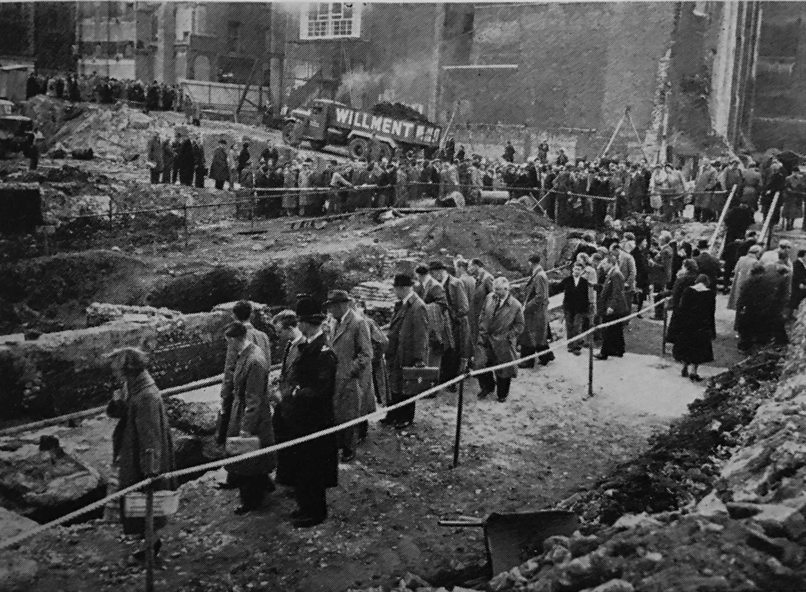
In 2020 I wrote a couple of posts on City of London pubs. It was in the middle of the Covid pandemic, and between a couple of lock downs I walked a very quiet City of London, photographing all the old pubs. A project based on what I have learnt from exploring all my father’s photos – it is the ordinary that changes so quickly, and we seldom notice trends or significant changes until they have happened.

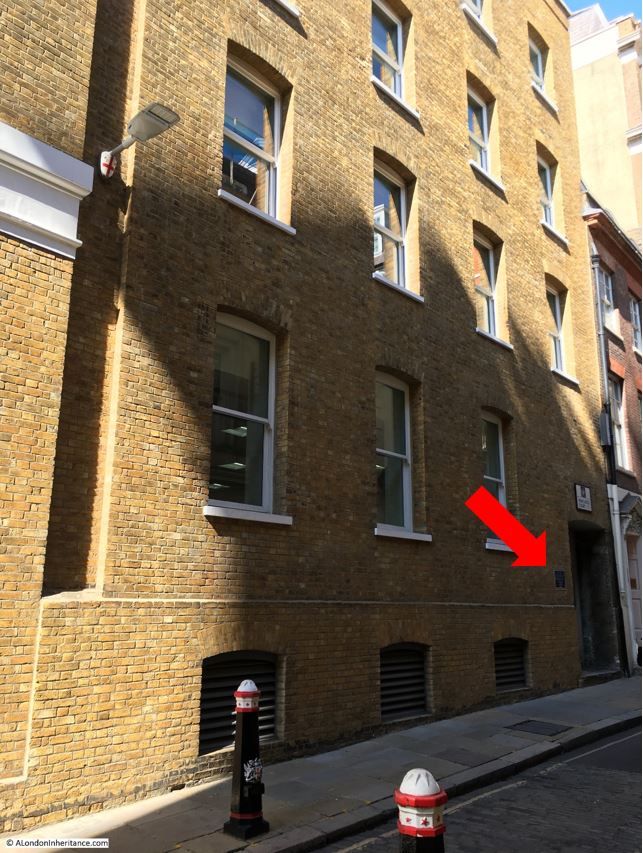
Since that post, just three years ago, three pubs have closed. The White Swan in Fetter Lane has been demolished, the Tipperary in Fleet Street has been closed for some time and it is doubtful if it will reopen, and the latest pub to close is the St. Bride’s Tavern in Bridewell Place, which I photographed a couple of weeks ago:

St. Bride's Tavern

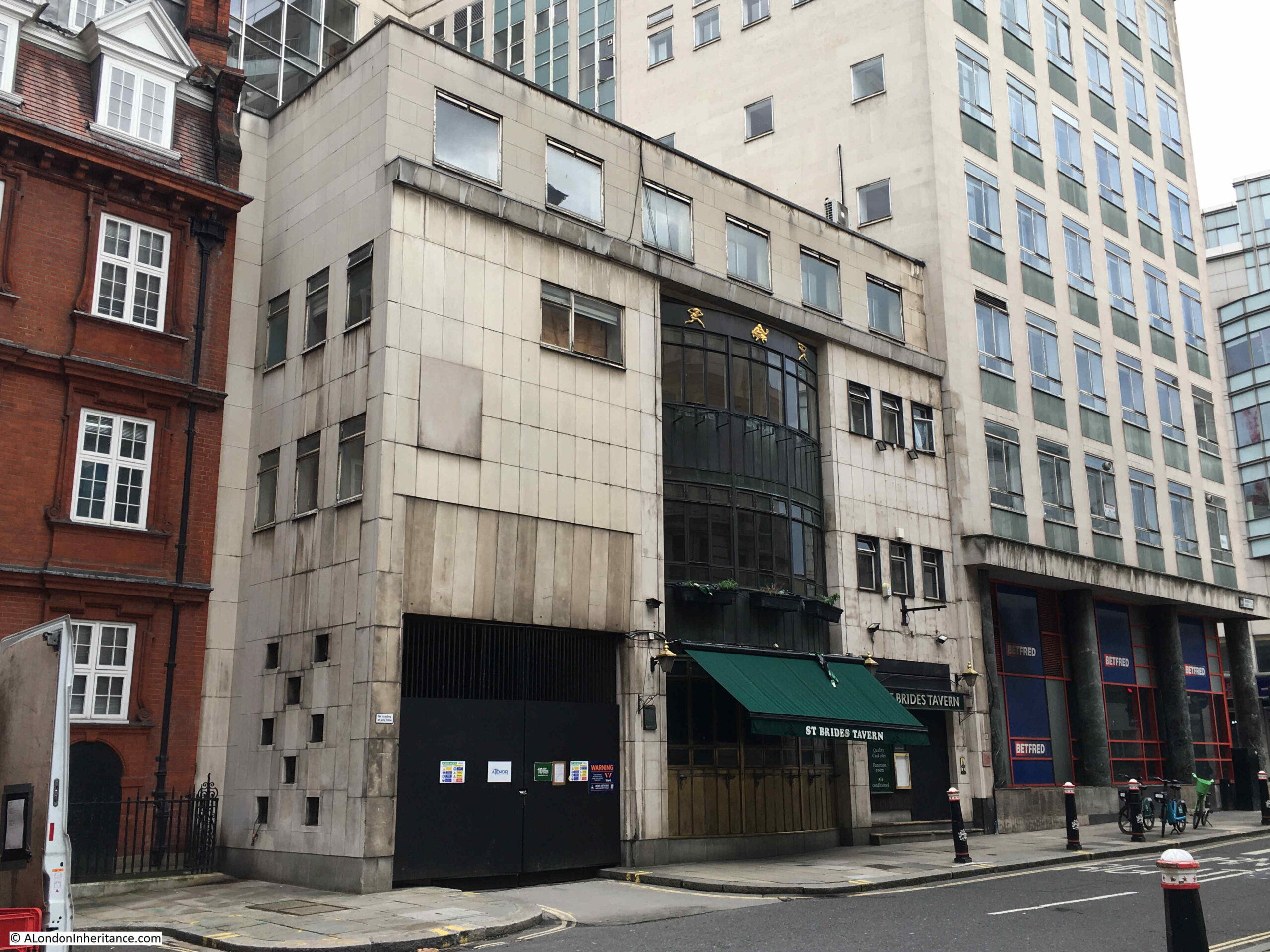
It was not down to a post pandemic lack of trade, or any financial problems with the pub, it was that the owner of the property would not let the pub renew the lease in January 2023, so the pub closed on Friday the 23rd of December 2022.

The owner of the land plans to strip back the office block to the right of the pub in the above photo, demolish the pub, and rebuild the building on the right with a new extension where the St. Bride’s Tavern is now located. to create a much large office block.

There was a well supported application to the City of London Environment Department to nominate the St. Bride’s Tavern as an Asset of Community Value, however this did not work, and closure went ahead.

With the trend of recent years for greater working from home, and a general decline in the need for office space, I really do wonder why establishments such as the St. Bride’s Tavern need to be demolished to create new office space.

The City of London was also planning to pivot more towards heritage, culture, arts and tourism as a response to post pandemic working, and retaining pubs would align with this strategy, however the City is being reasonably successful in tempting businesses to move back to the City from Canary Wharf as companies such as HSBC let go of large office space in the Isle of Dogs, in favour of smaller offices in the City.

An image of the new development can be seen on the website of the company that secured planning approval for the development. Click here to see the news item.

The image at top left shows the smaller extension of the new development to the rear of the main building on New Bridge Street, and the details of the development include the statement that there will be a “re-provided public house at ground-floor and part-basement level”, however a pub as part of the ground floor and basement of a modern office block just does not have the character and attraction of a dedicated building.

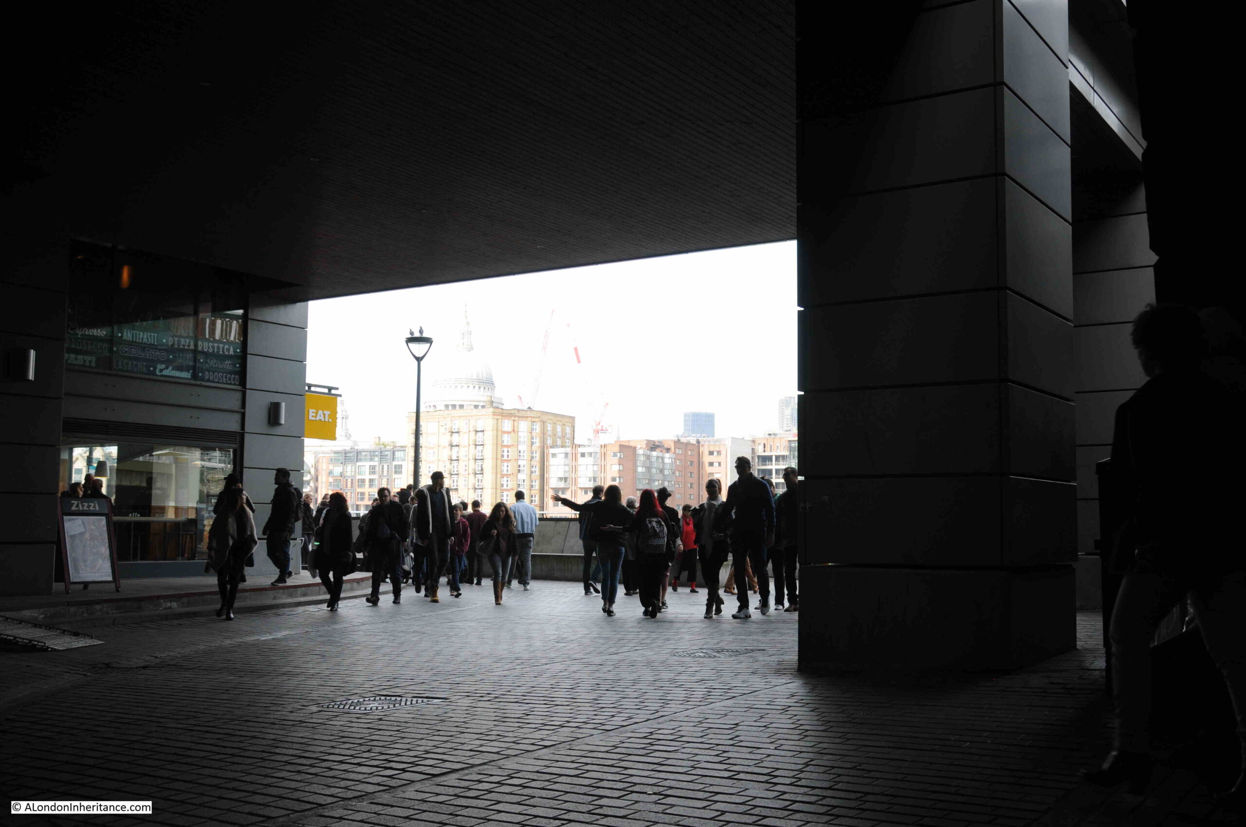
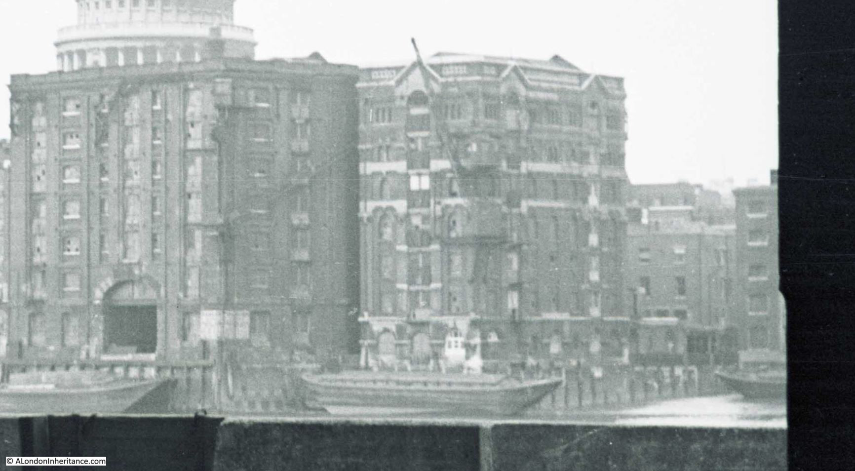
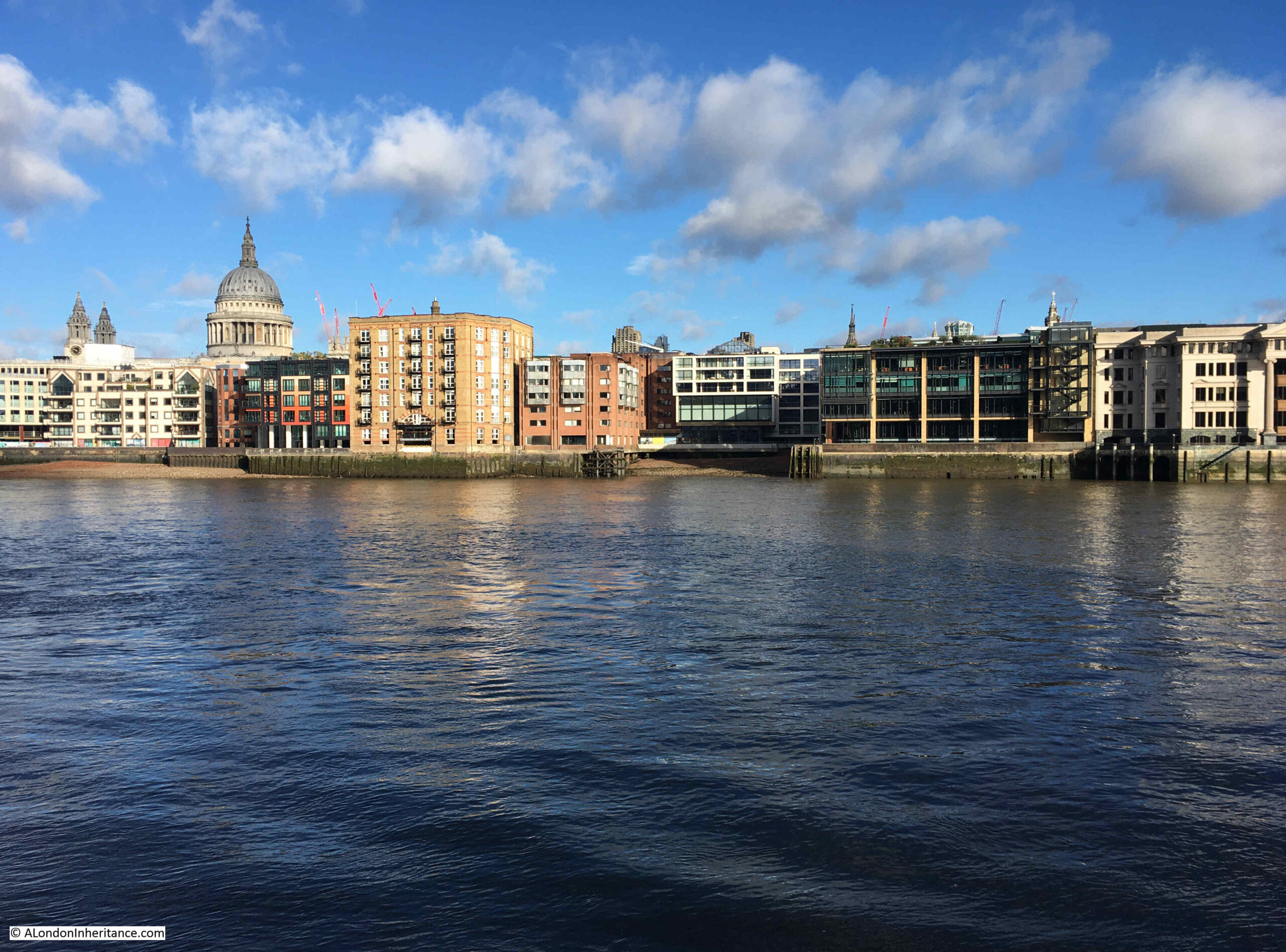
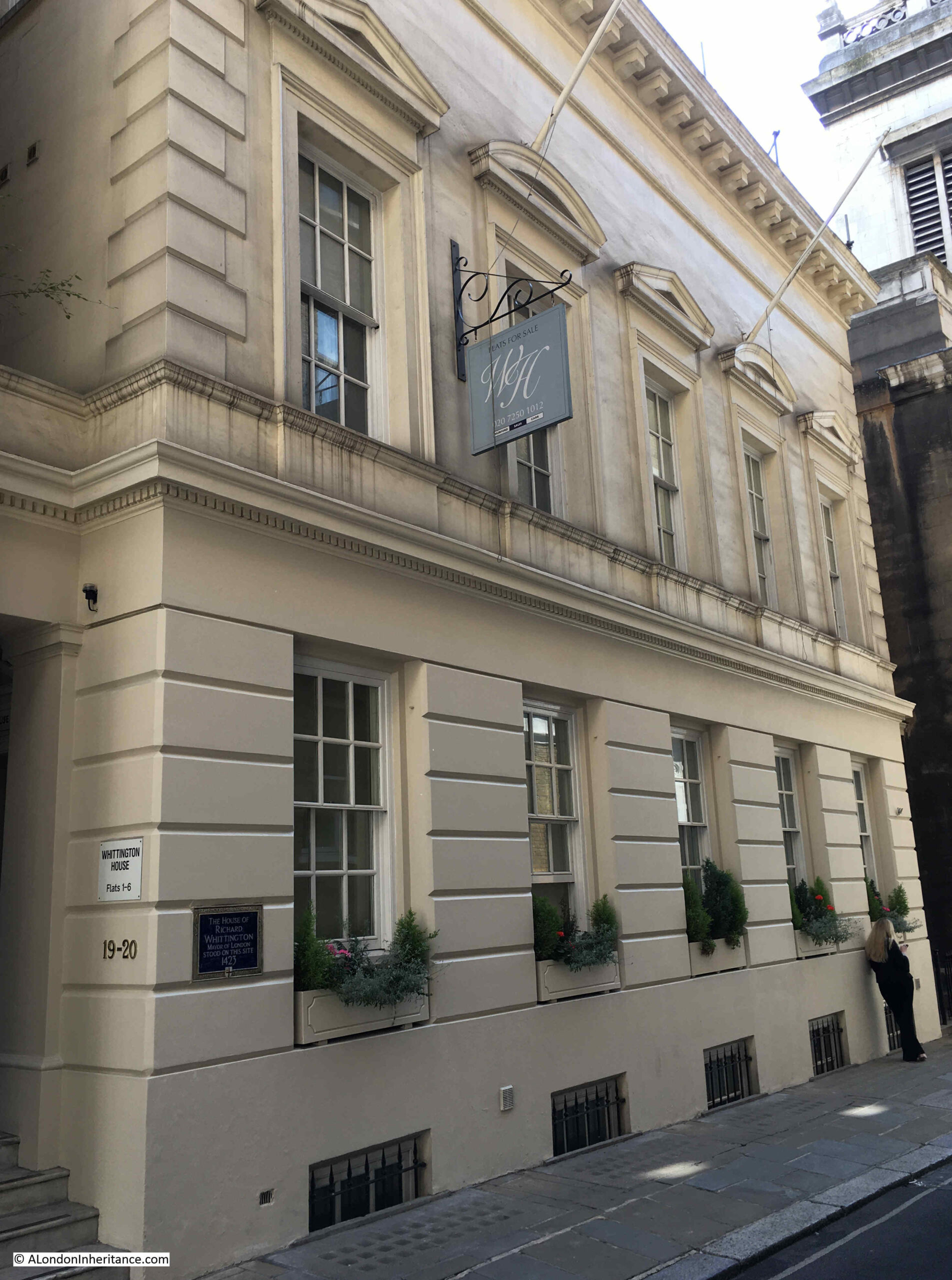
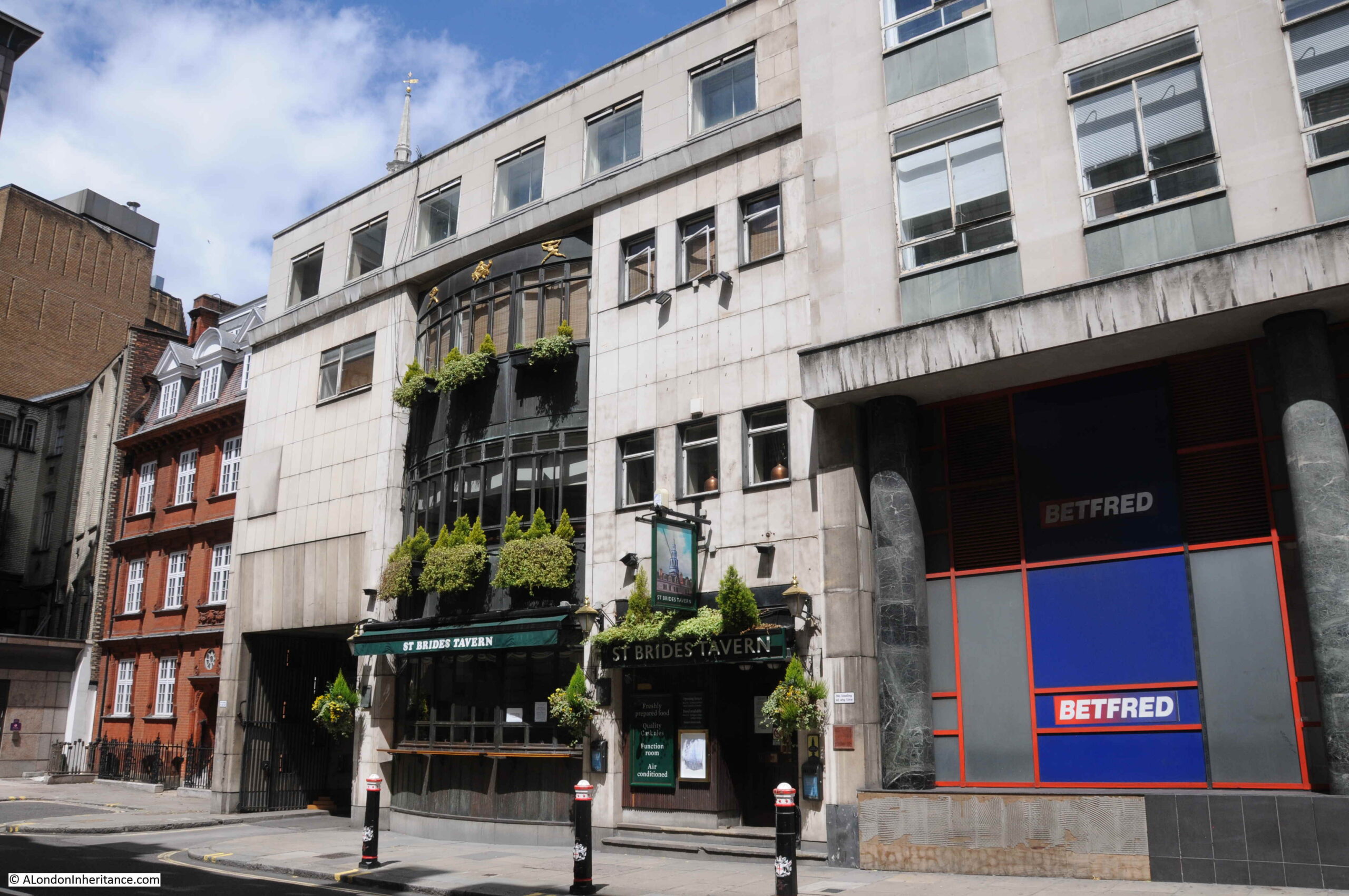
The building in which the St. Bride’s Tavern was located is not particularly attractive. A post-war development, which does have a rather unusual central bay of windows that runs up to include the second floor. This always looked good in the evening when the bay windows were lit.

The following photo shows St. Bride’s Tavern when it was open back in 2020:

St. Bride's Tavern

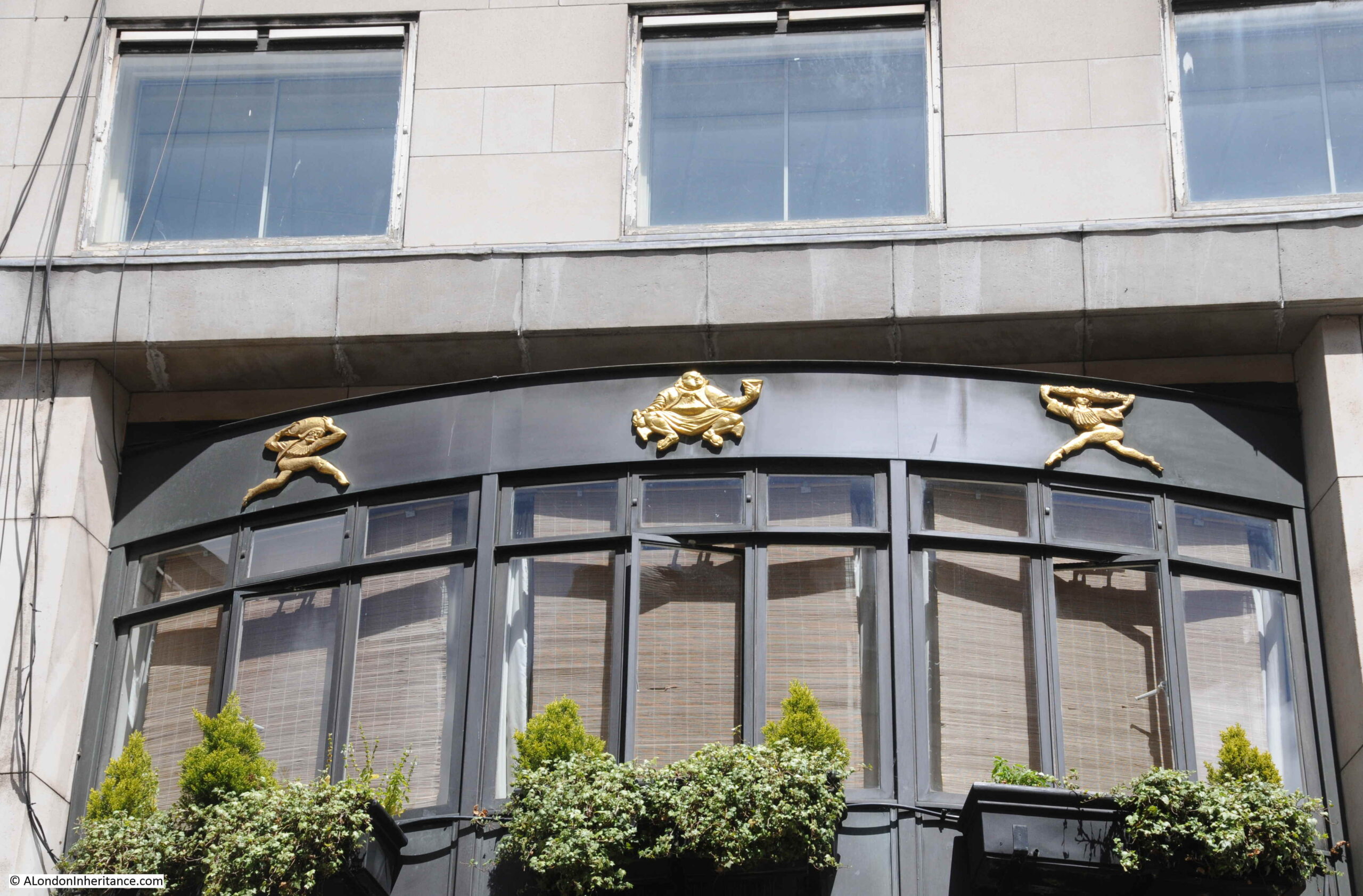
Decoration at the top of the bay windows:

St. Bride's Tavern

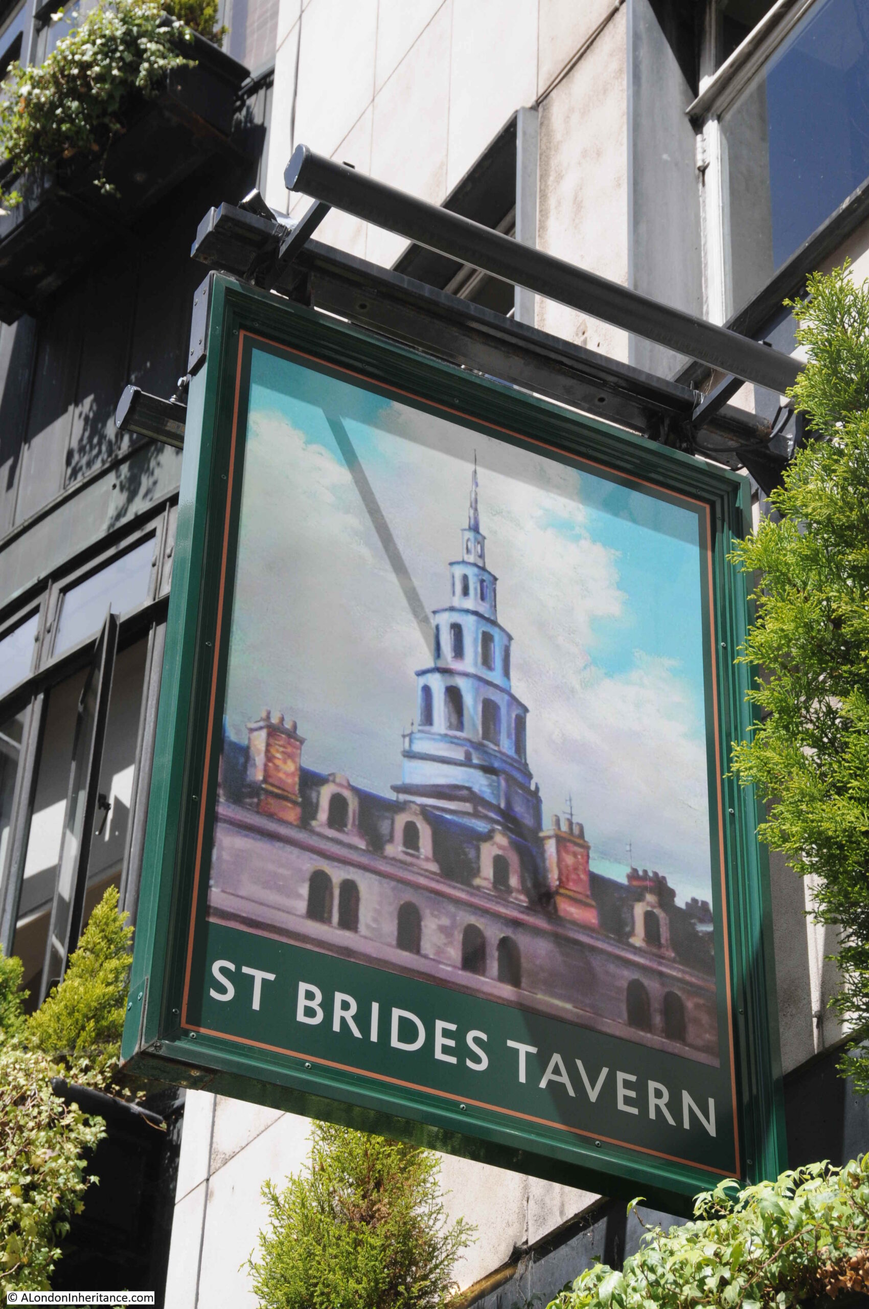
The pub sign has been removed, however I did photograph the sign back in 2020, which showed the tower of the church after which the pub was named:

St. Bride's Tavern

The pub is a post war building as the pre-war buildings on the site had been damaged during the war.

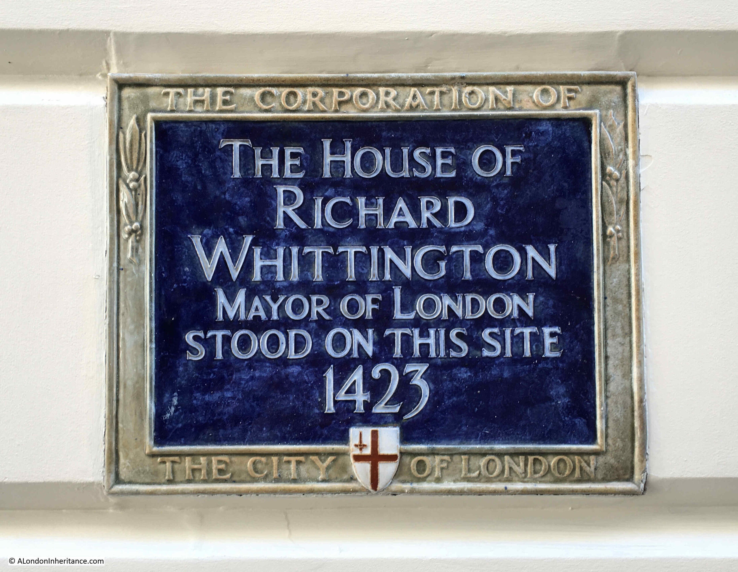
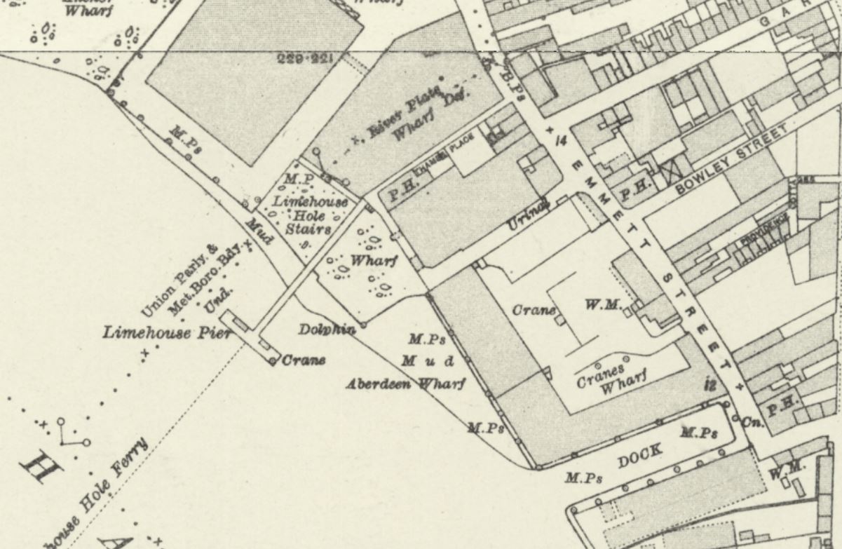
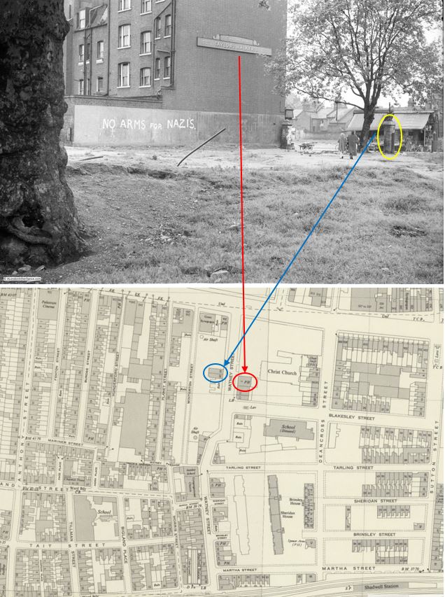
I am not sure that the site of the pub today is the original site of the pub as in the 1894 Ordnance Survey map it was not marked as a Public House and the building on the site appears to have been occupied by a Police Station of the 3rd Division.

Searching through old newspaper reports about the pub and a St. Bride’s Tavern appears to have been in the street behind the current pub – Bride Lane, for example in the Daily News on Saturday October the 19th, 1901, the pub was up for sale: “Freehold ground rent of £100 per annum, exceptionally well secured upon those fully-licensed premises, licensed as the White Boar, but also known as the St. Bride’s Tavern, Bride-lane, Fleet-street”.

Also, in the East London Observer on the 8th of December, 1900, there was a report on the marriage of Charles Seaward who was the Licensed Victualler of the Drum and Monkey pub in Whitecross-street and Miss Clara C. Wilkins, the manageress of the St. Bride’s Tavern, Bride-lane, Ludgate Circus. The wedding took place at St. Bride’s Church and the wedding breakfast was held in the St. Bride’s Tavern, from where the newly married couple would leave, later in the day, for a honeymoon in Brighton.

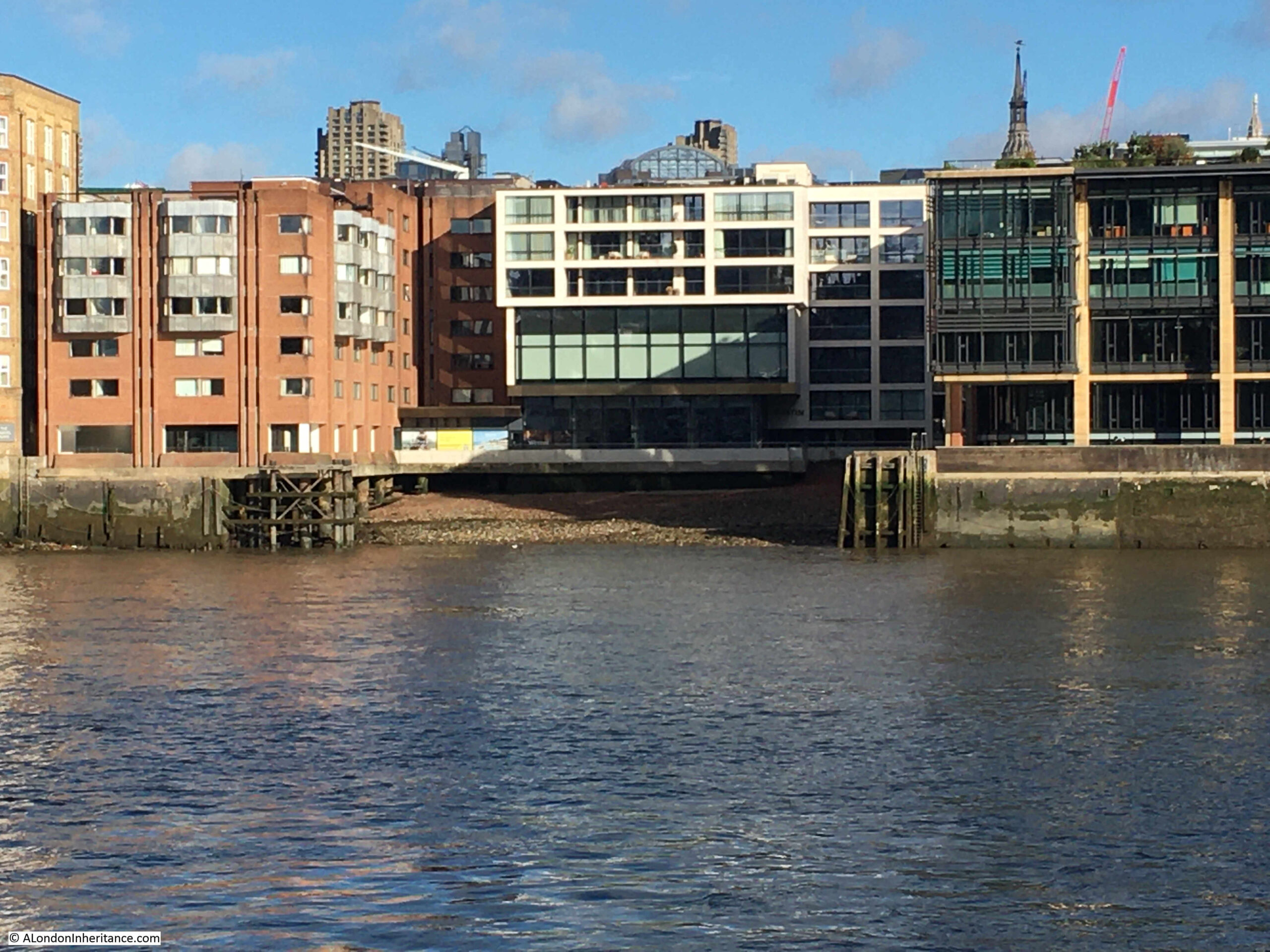
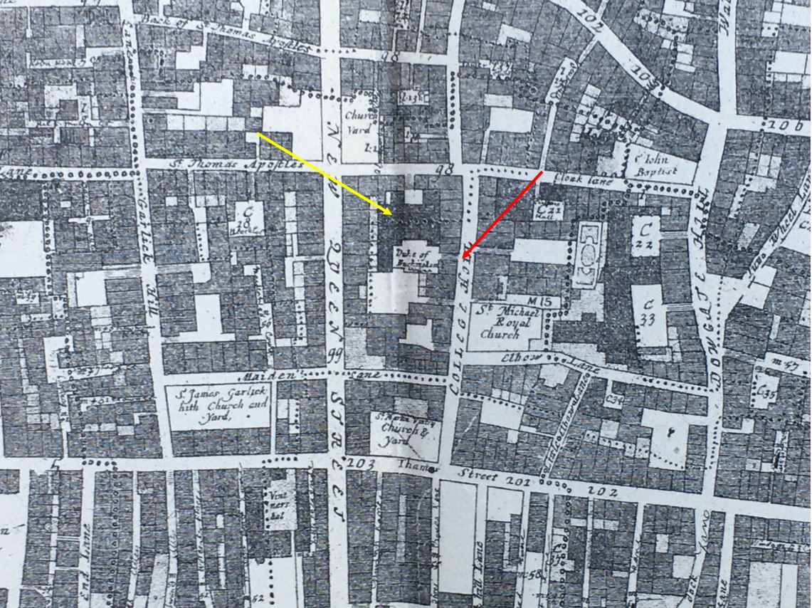
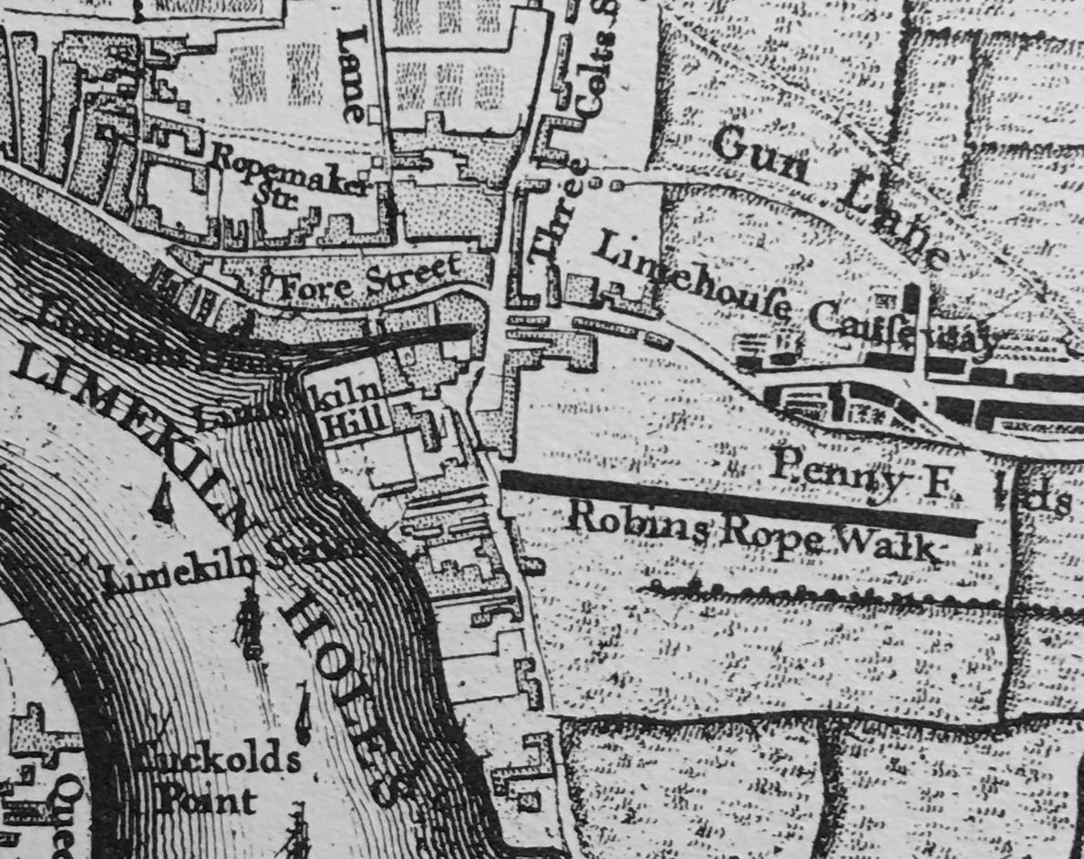
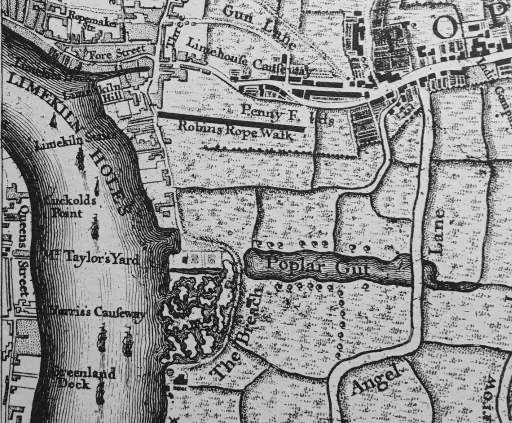
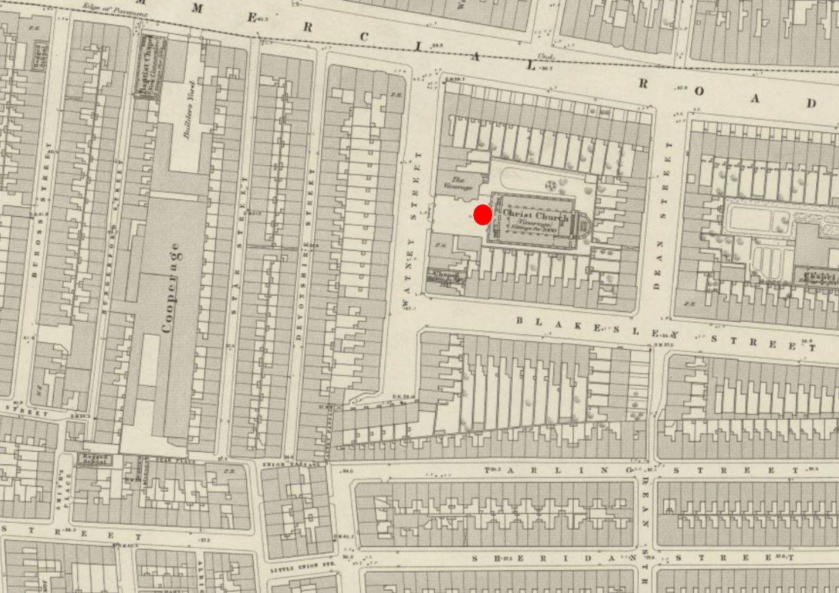
In the following extract from the 1894 OS map, I have ringed the current site of the St. Bride’s Tavern in red (and not labelled as a public house), and the pub that I believe was the original White Boar / St. Bride’s Tavern in yellow, and in the 1951 revision of the OS map, the pub in Bride Lane is still marked, with the space of the current pub an empty space (‘Reproduced with the permission of the National Library of Scotland“):

St. Bride's Tavern

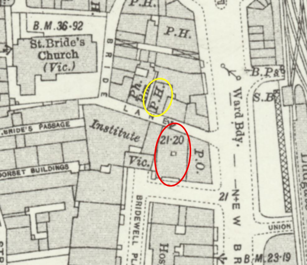
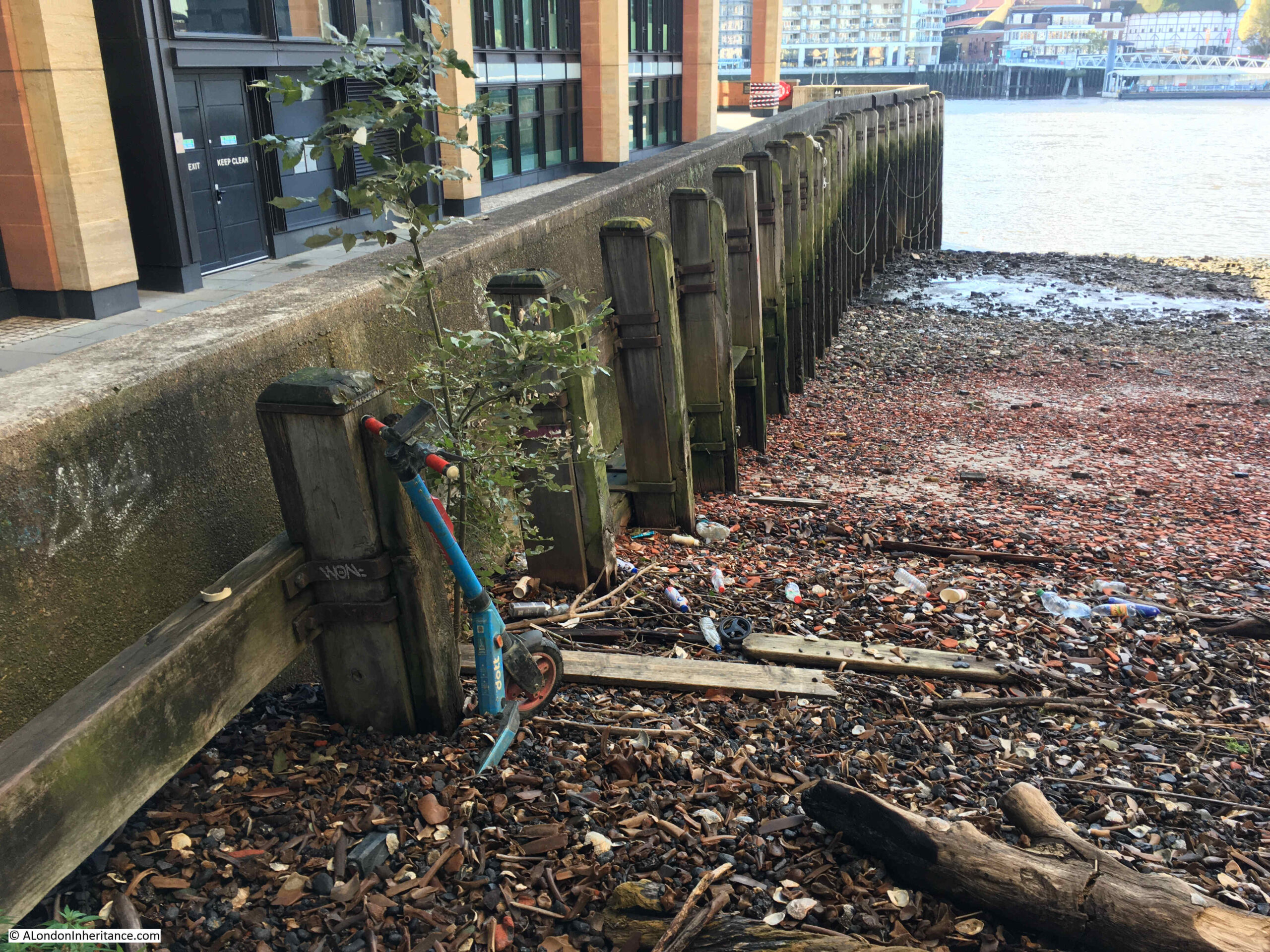
The current St. Bride’s Tavern building does extend all the way between Bridewell Place and Bride Lane, so I suspect that the original pub may have wanted a larger site, and had available the land almost directly opposite, with the new pub still retaining an aspect (although the rear) onto Bride Lane.

If the site of the current pub was also the site of the original, it would have faced onto Bride Lane so could have had that address, but it was not marked as a public house in the OS map.

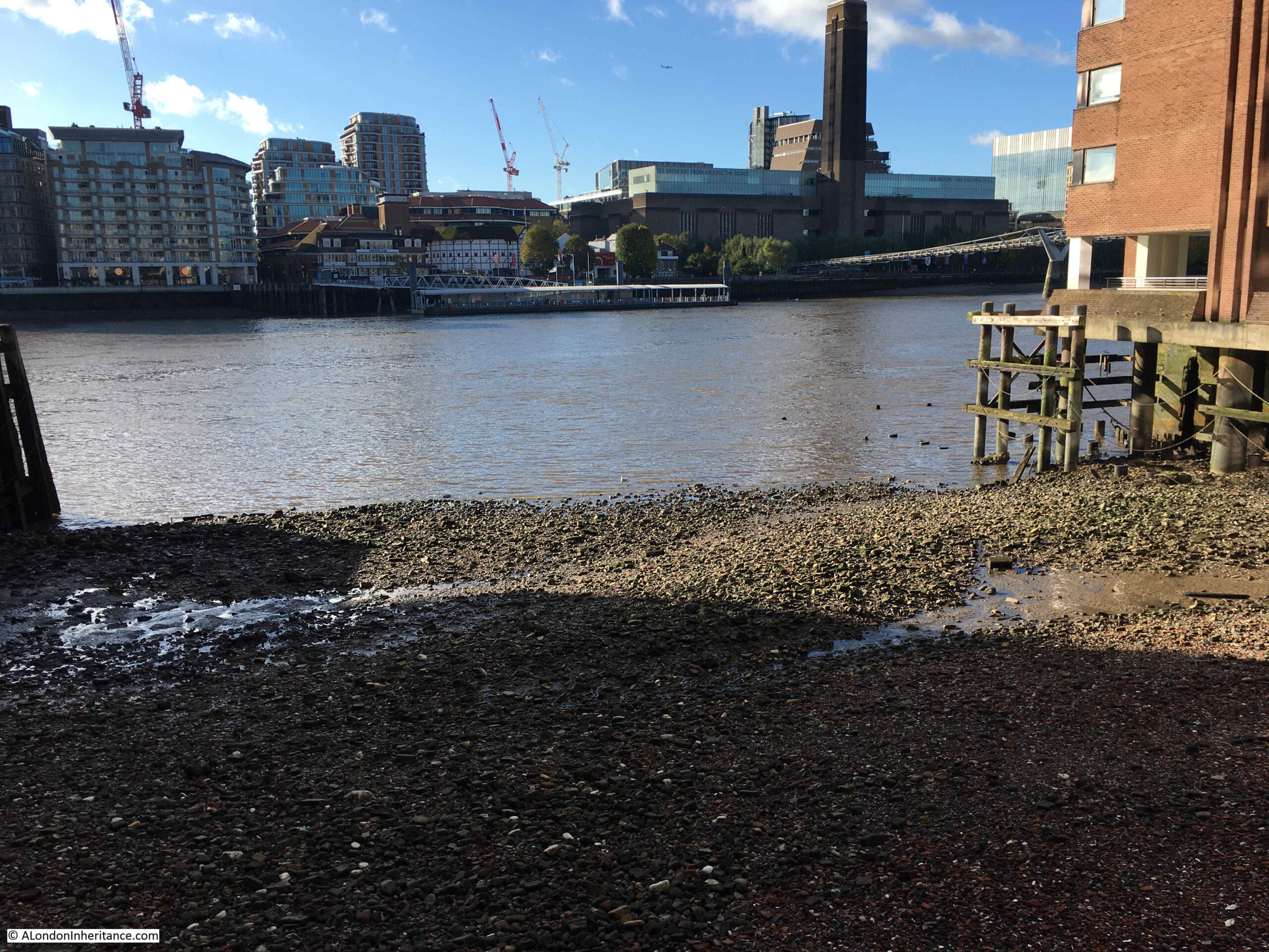
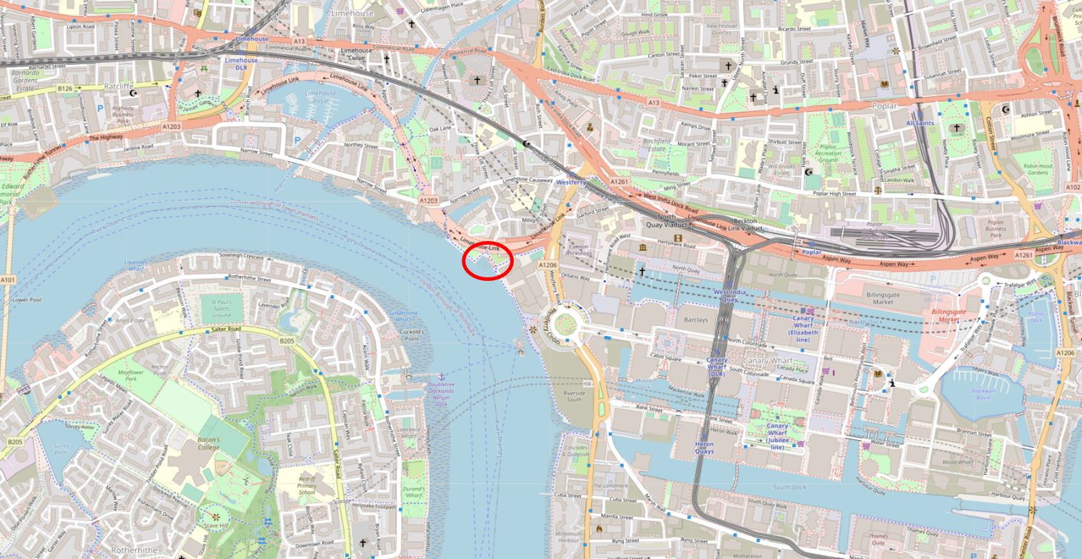
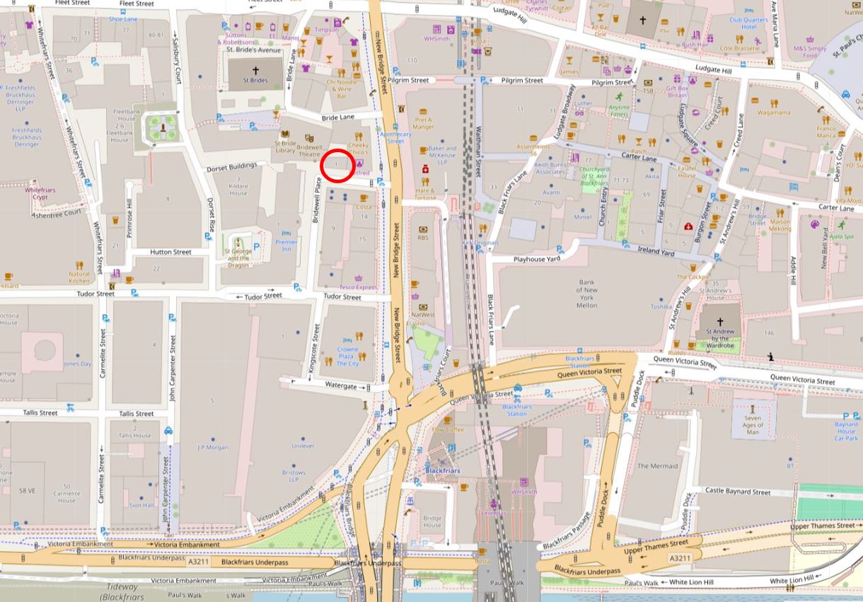
I have marked the site today of the pub with a red circle in the following map (© OpenStreetMap contributors):

St. Bride's Tavern

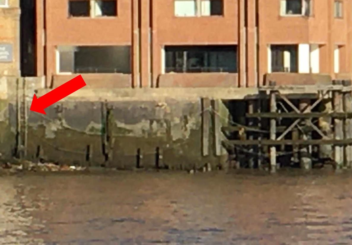
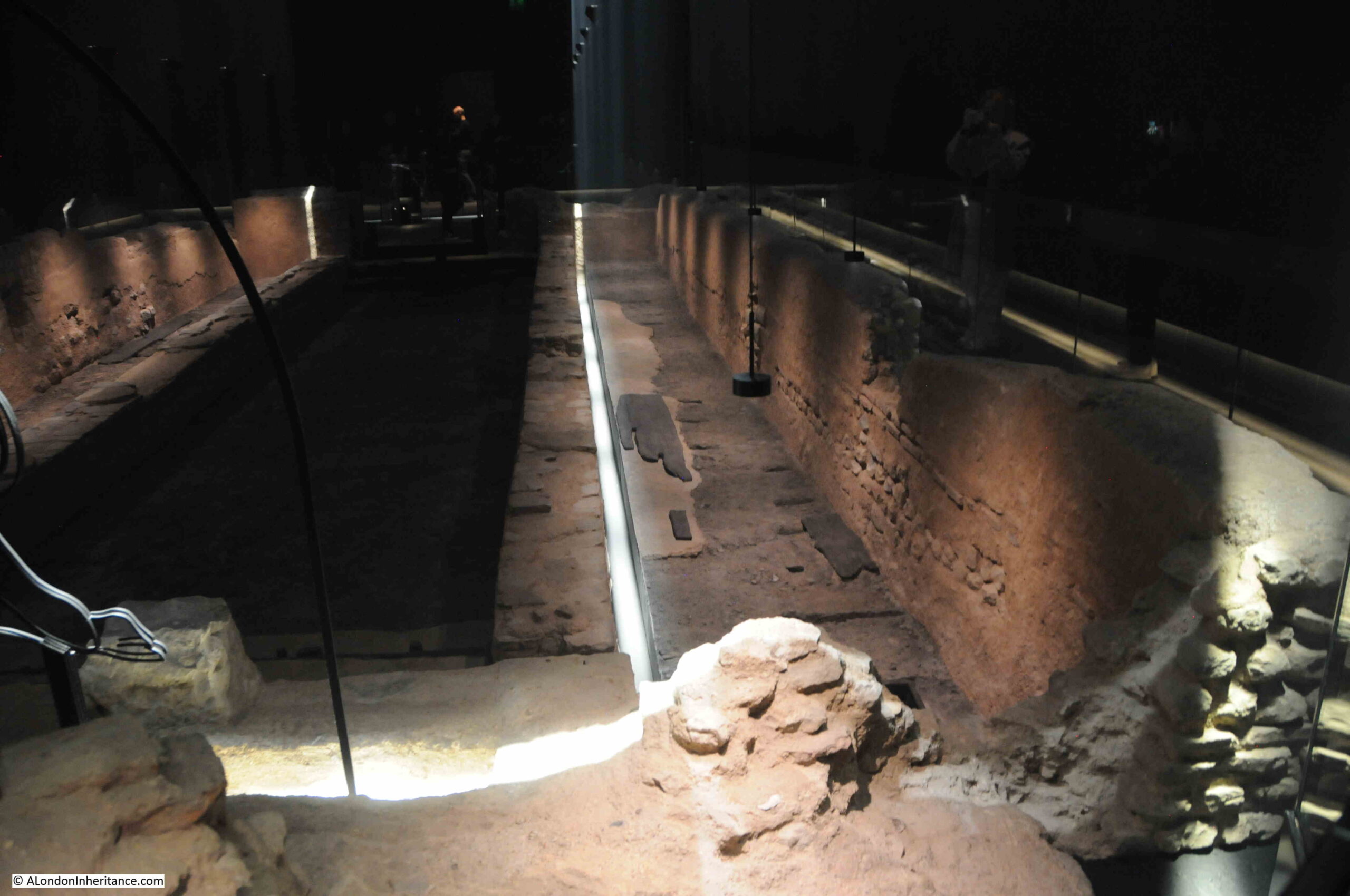
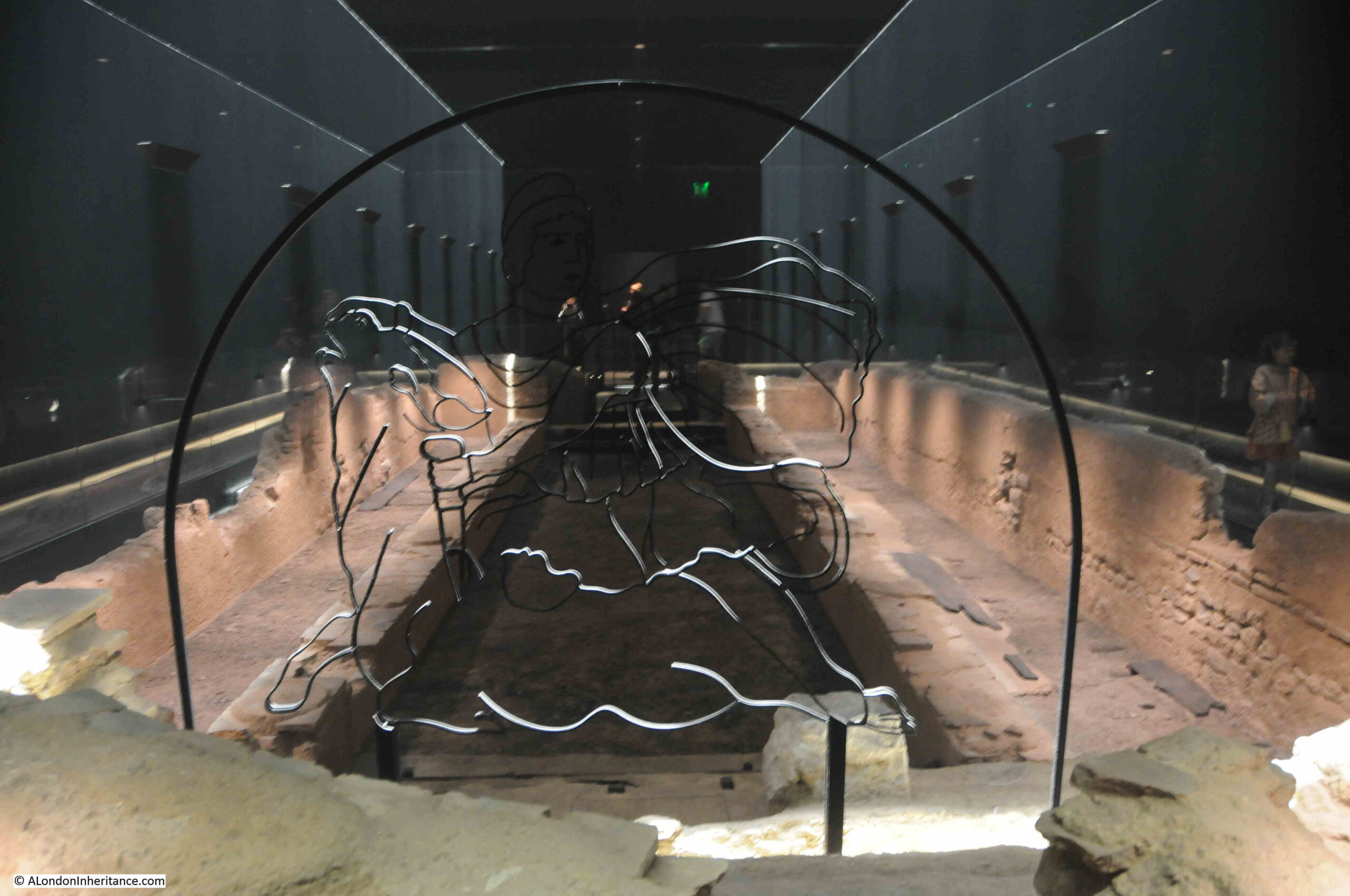
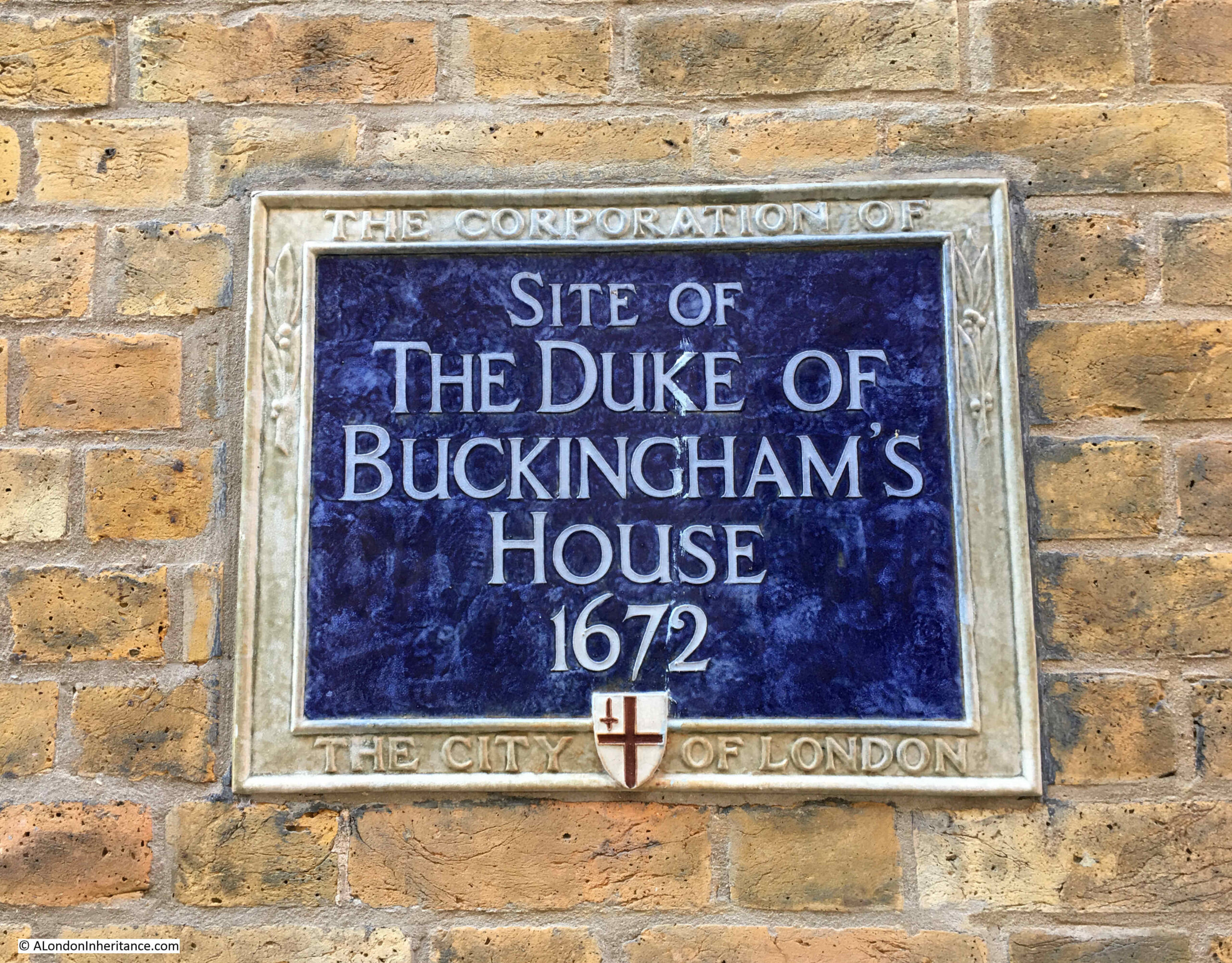
The St. Bride’s Tavern is named after the nearby church, as the image on the pub sign confirms, however the pub is in Bridewell Place, which is a very historic name and location.

The name Bridewell originally came from a well between Fleet Street and the Thames, which was dedicated to St. Bride. The name Bridewell was also given to what was described as a “stately and beautiful house” built by Henry VIII in 1522.

London Past and Present, by Henry B. Wheatley (1891) provides the following information: “Built by Henry VIII in the year 1522 for the reception of Charles V of Spain. Charles himself was lodged at Blackfriars, but his nobles in this new built Bridewell, ‘a gallery being made out of the house over the water (the Fleet) and through the wall of the City into the Emperor’s lodgings at the Blackfriars”

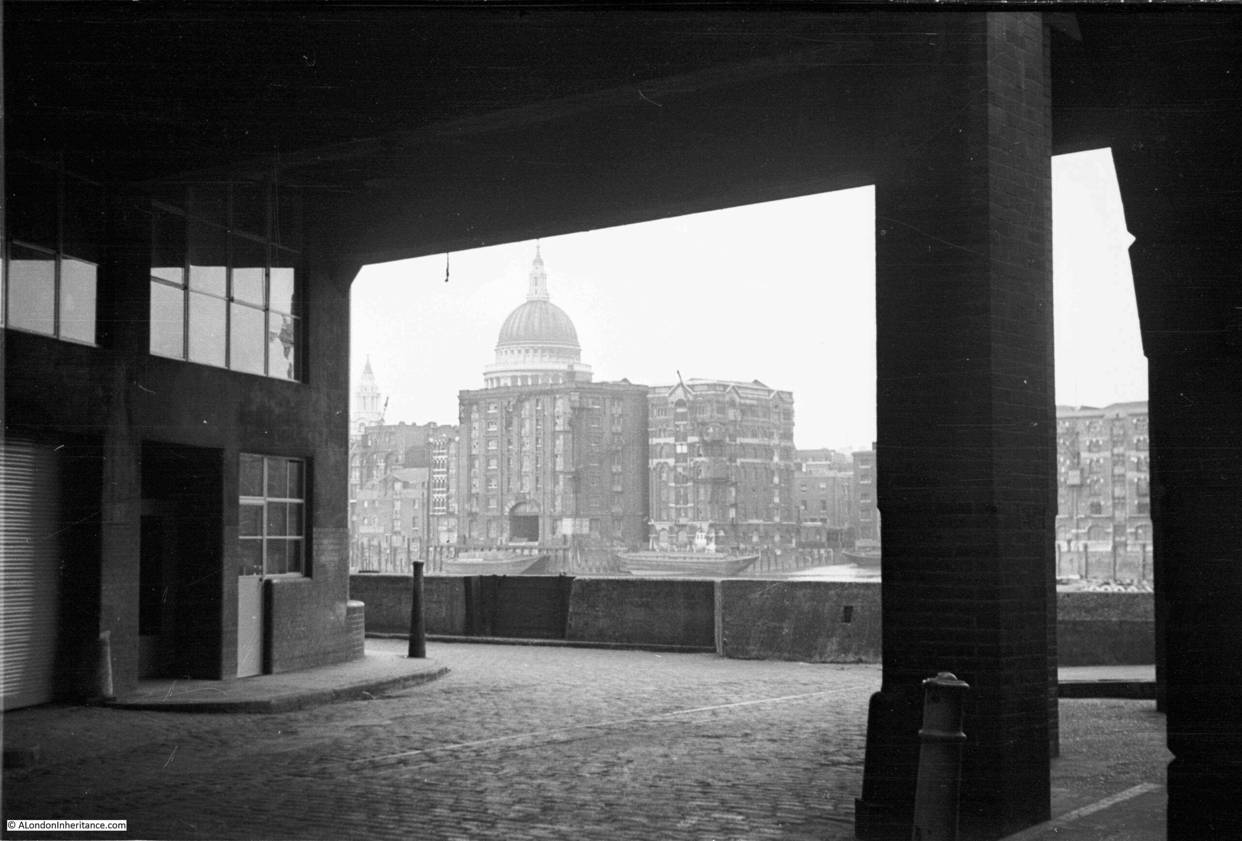
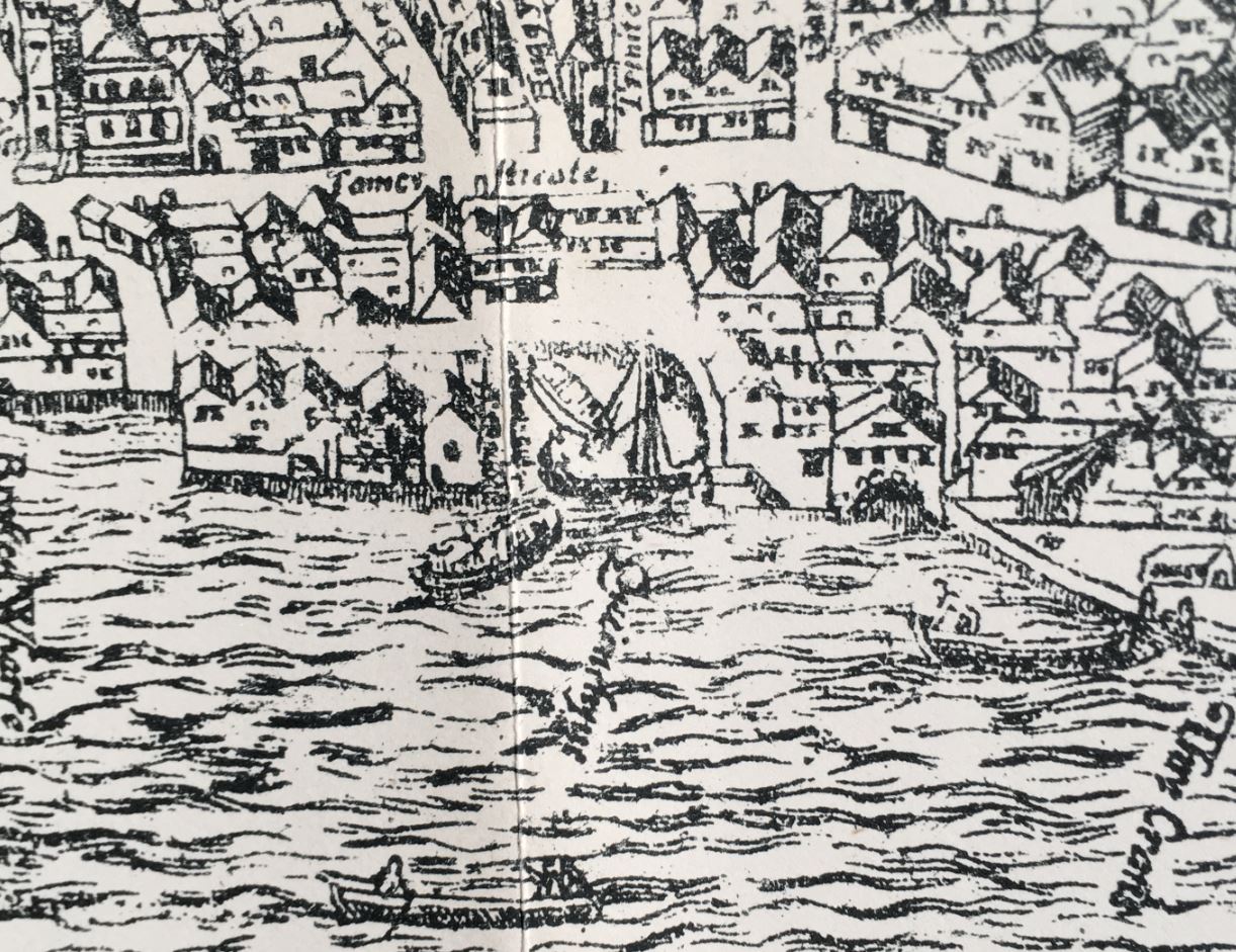
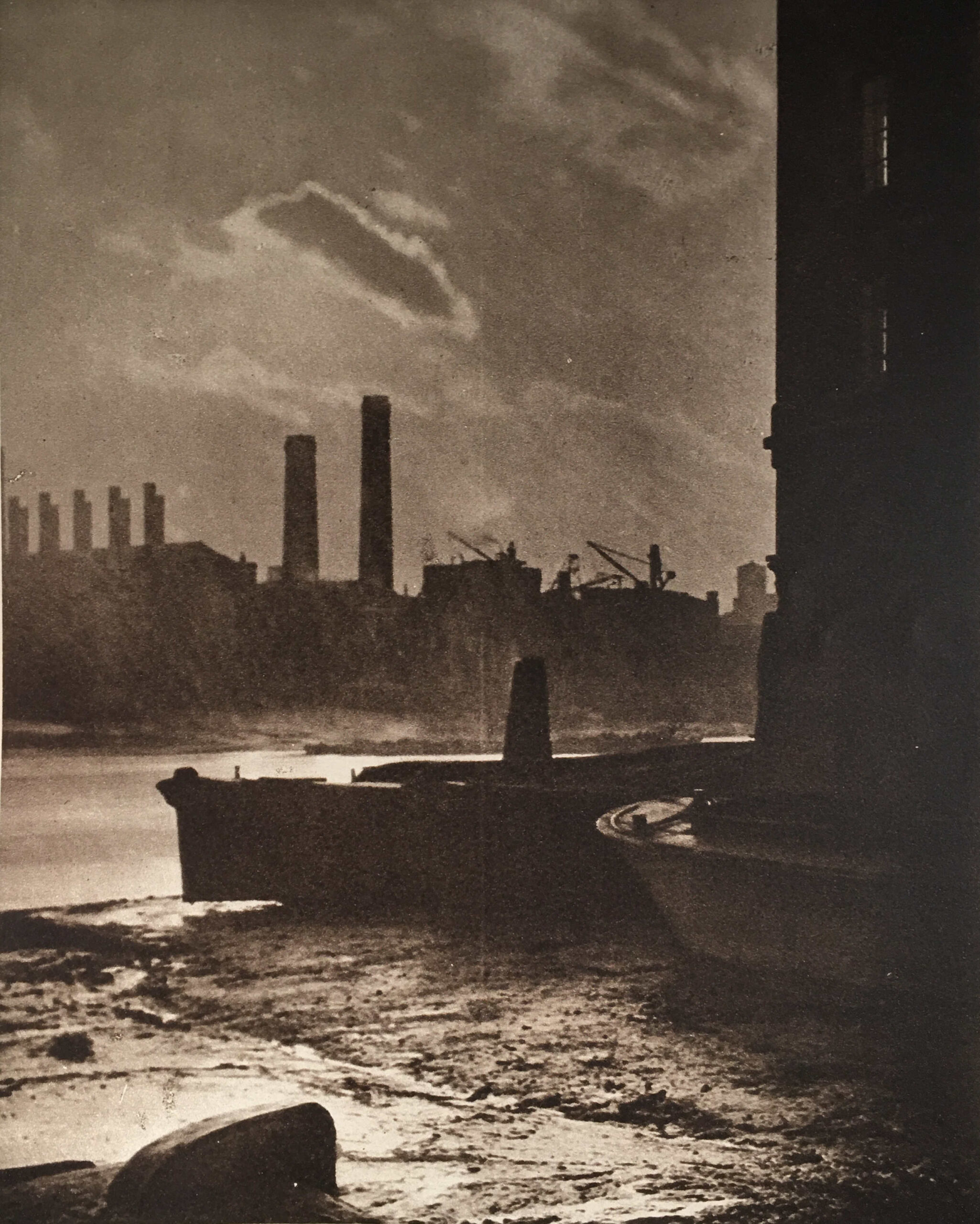
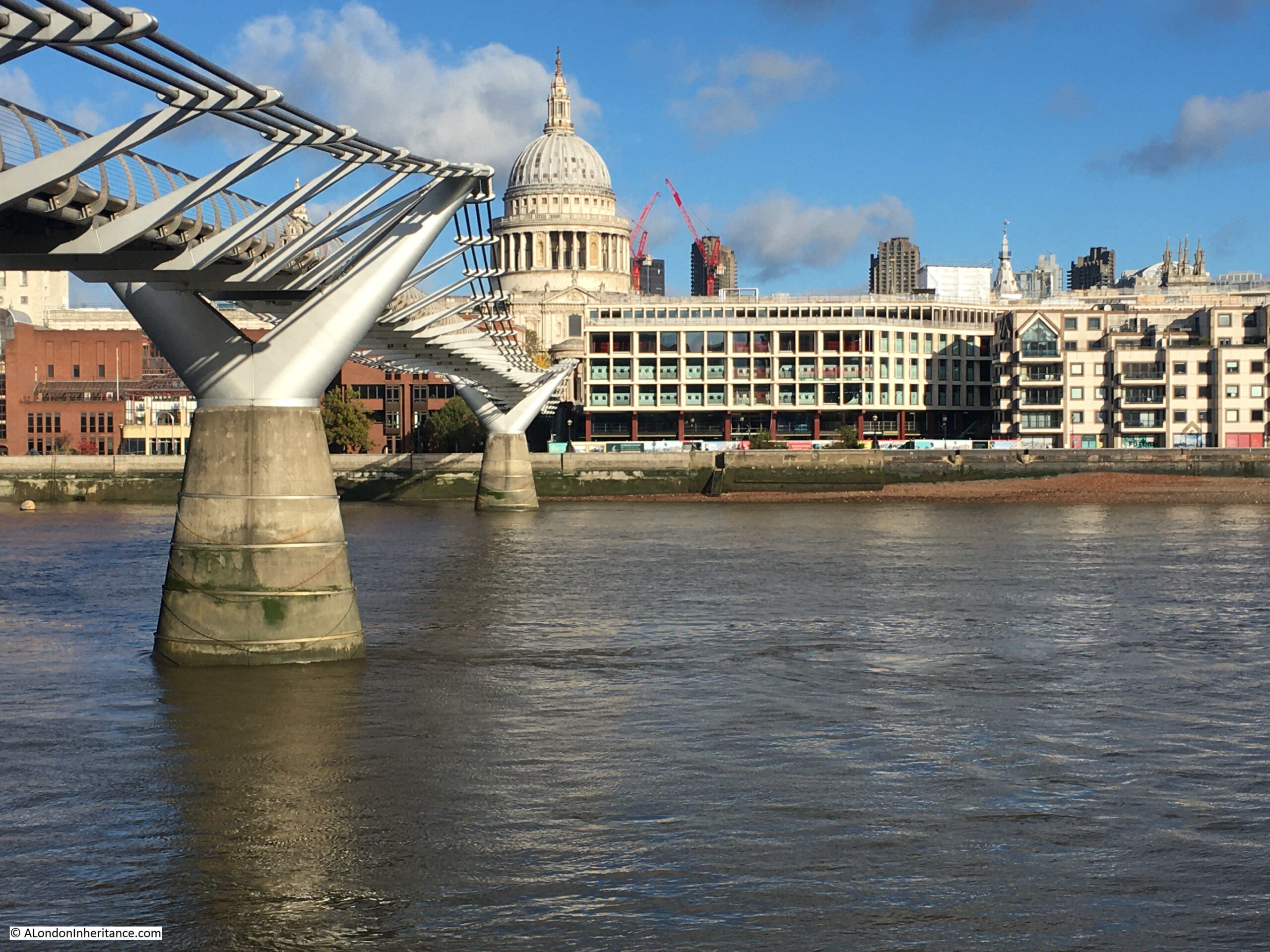
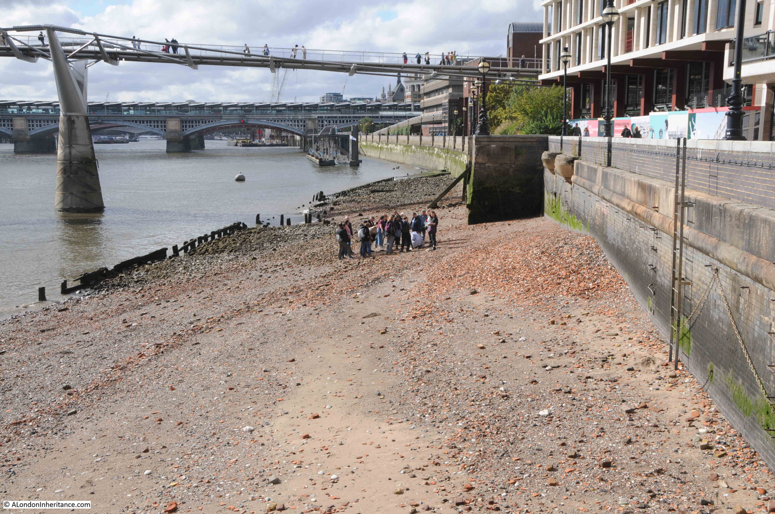
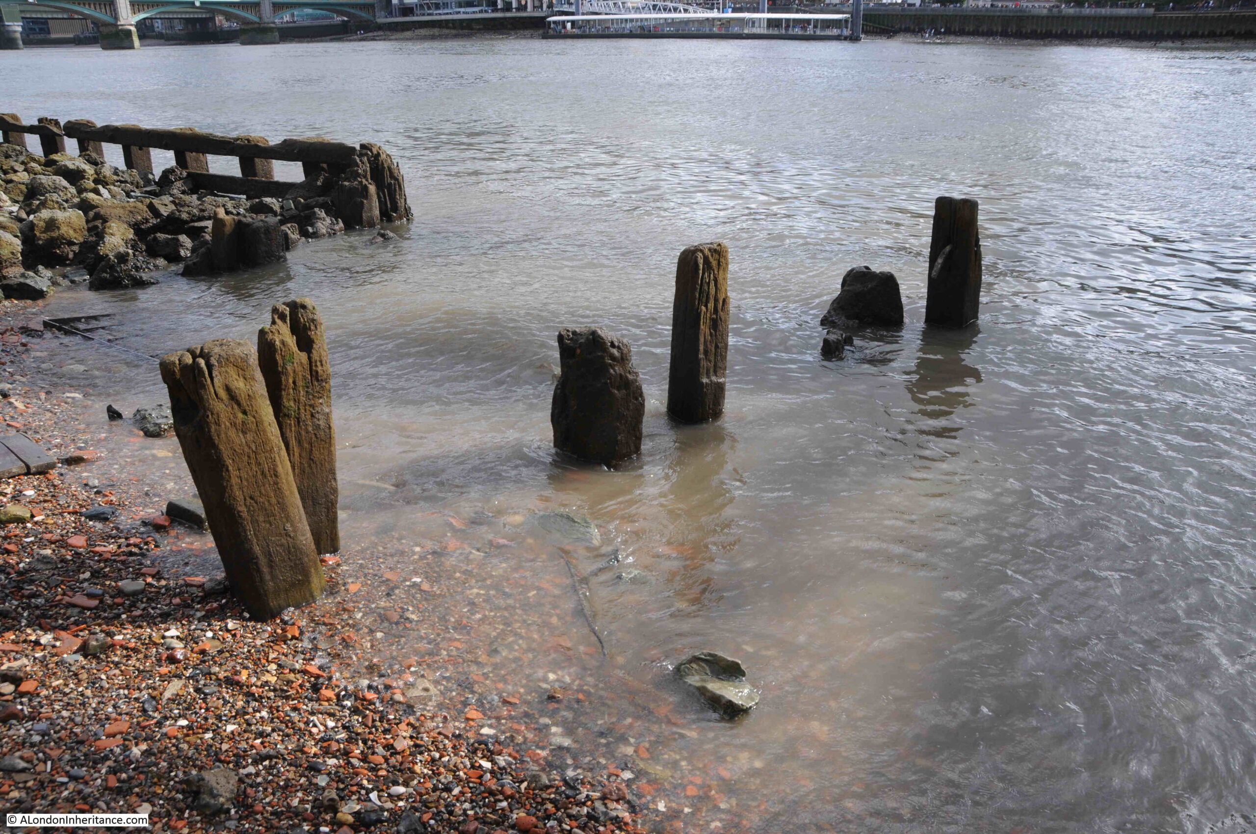
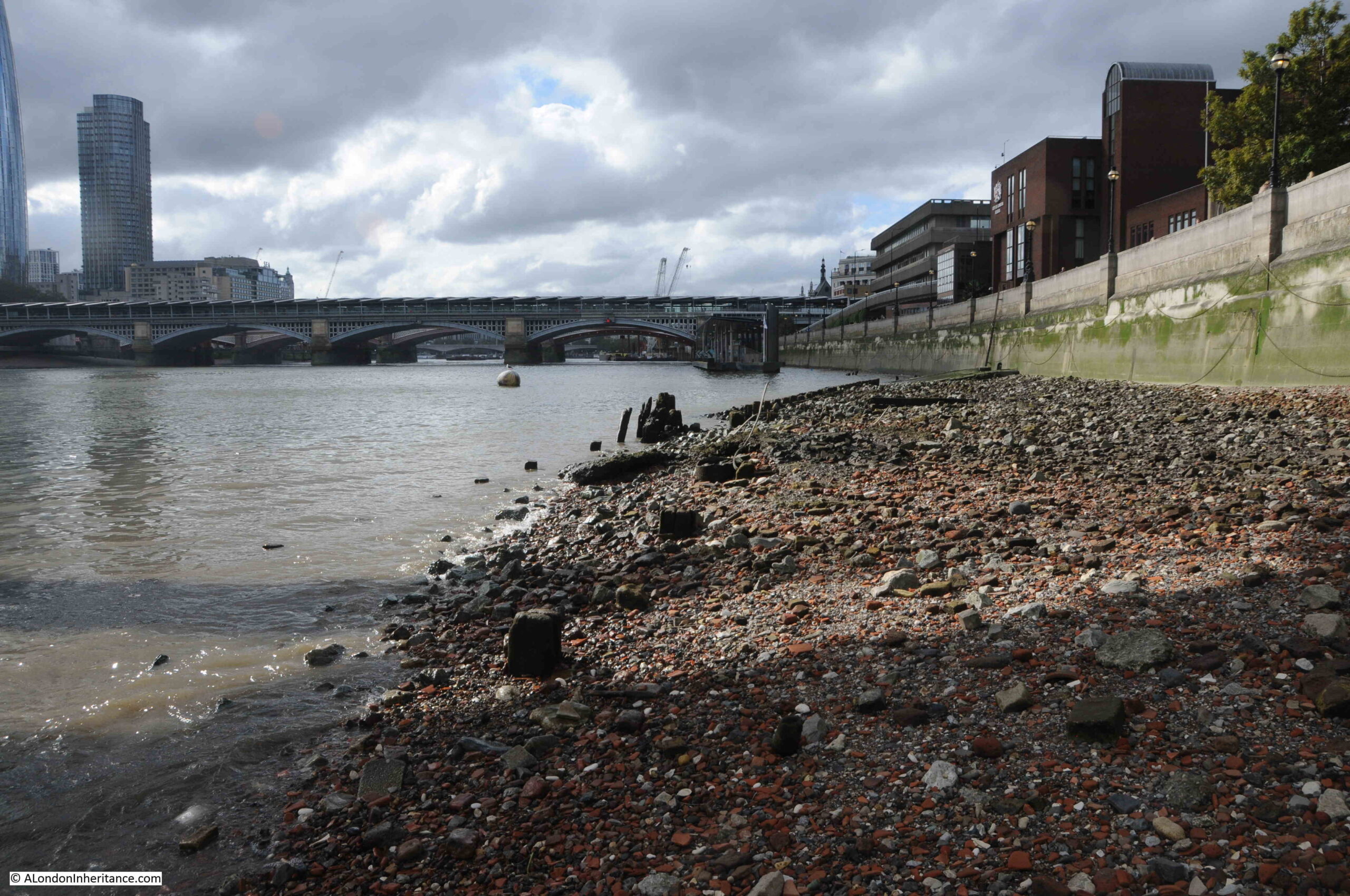
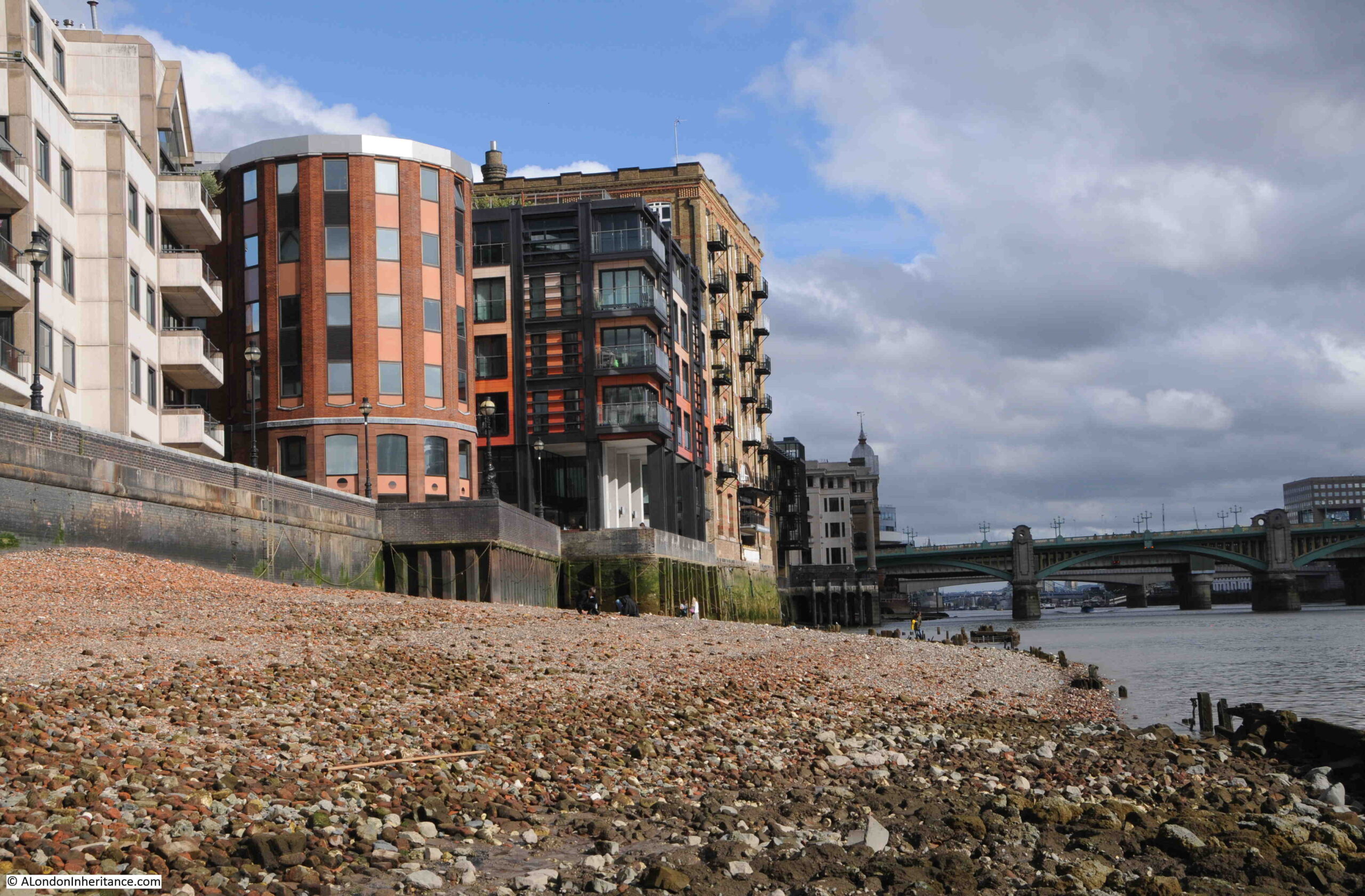
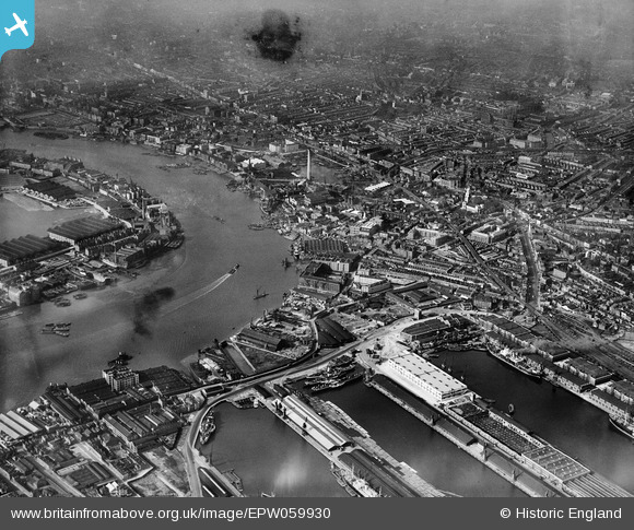
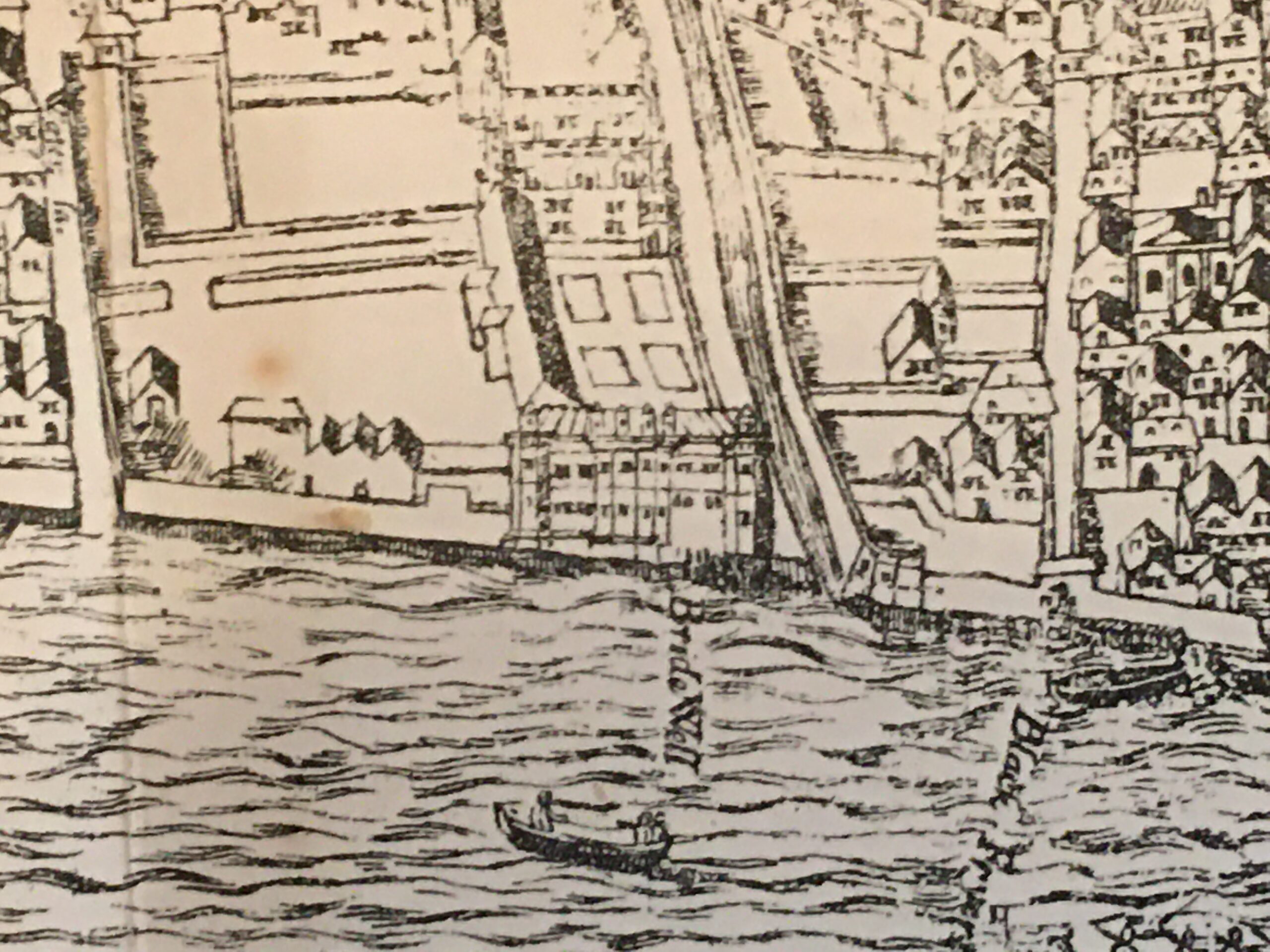
The Agas map includes an image of Bridewell, alongside the Fleet and part of which looked onto the Thames. In the 16th century the bank of the river was further in land than the river is today:

Bridewell

The following print from 1818 shows Bridewell Palace as it appeared in 1660 © The Trustees of the British Museum):

Bridewell

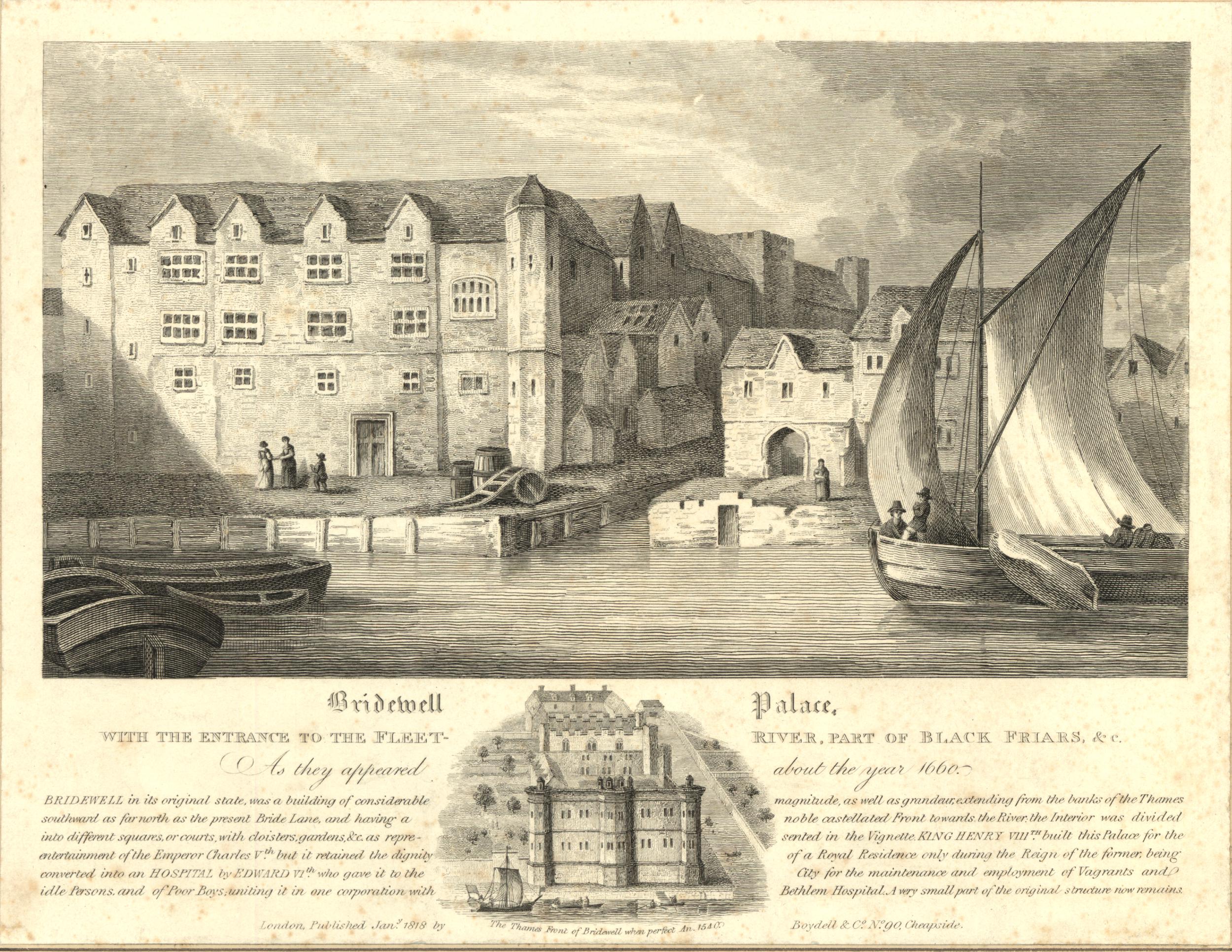
We can see what was by the 17th century, the narrow entrance to the Fleet, Bridewell on the left bank and part of Blackfriars on the right.

The print provides the following background: “Bridewell in its original state , was a building of considerable magnitude, as well as grandeur, extending from the banks of the Thames southward, as far north as the present Bride Lane, and having a noble castellated front towards the river, the interior was divided into different squares or courts with cloisters, gardens &c. as represented in the vignette. King Henry VIII built this Palace for the entertainment of the Emperor Charles V, but it retained the dignity of a Royal residence only during the former, being converted into an Hospital by Edward VI who gave it to the City for the maintenance and employment of vagrants and Idle Persons and of Poor Boys uniting it in one cooperation with Bethlem Hospital. A very small part of the original structure now remains.”

So if Henry VIII’s Bridewell extended as far north as Bride Lane, then the St. Bride’s Tavern of today is located inside the very northern edge of the old palace.

London Past and Present, by Henry B. Wheatley (1891) provides the following regarding the change in use of the building: “Bridewell, a manor or house, so called – presented to the City of London by King Edward VI, after an appeal through Mr. Secretary Cecil and a sermon by Bishop Ridley, who begged it of the King as a workhouse for the Poor, and a house of Correction ‘for the strumpet and idle person, for the rioter that consumeth all, and for the vagabond that will abide in no place”.

The problem for the new institution was that the availability of food and lodgings in the workhouse attracted people from across London, and it was “found to be a serious inconvenience. Idle and abandoned people from the outskirts of London and parts adjacent, under colour of seeking an asylum in the new institution, settled in London in great numbers, to the great annoyance of the graver residents.”

A number of children that were housed at Bridewell ended up being transported to the United States following a petition in 1618 from the Virginia Company for 100 children of the streets, who have no homes or anyone to support or provide for them. These children became part of the new colony at Jamestown. 

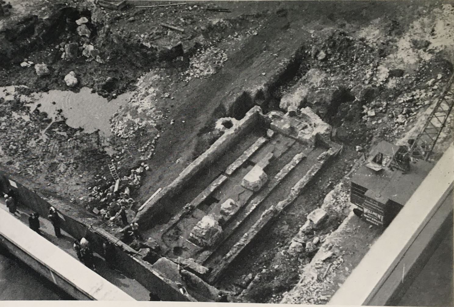
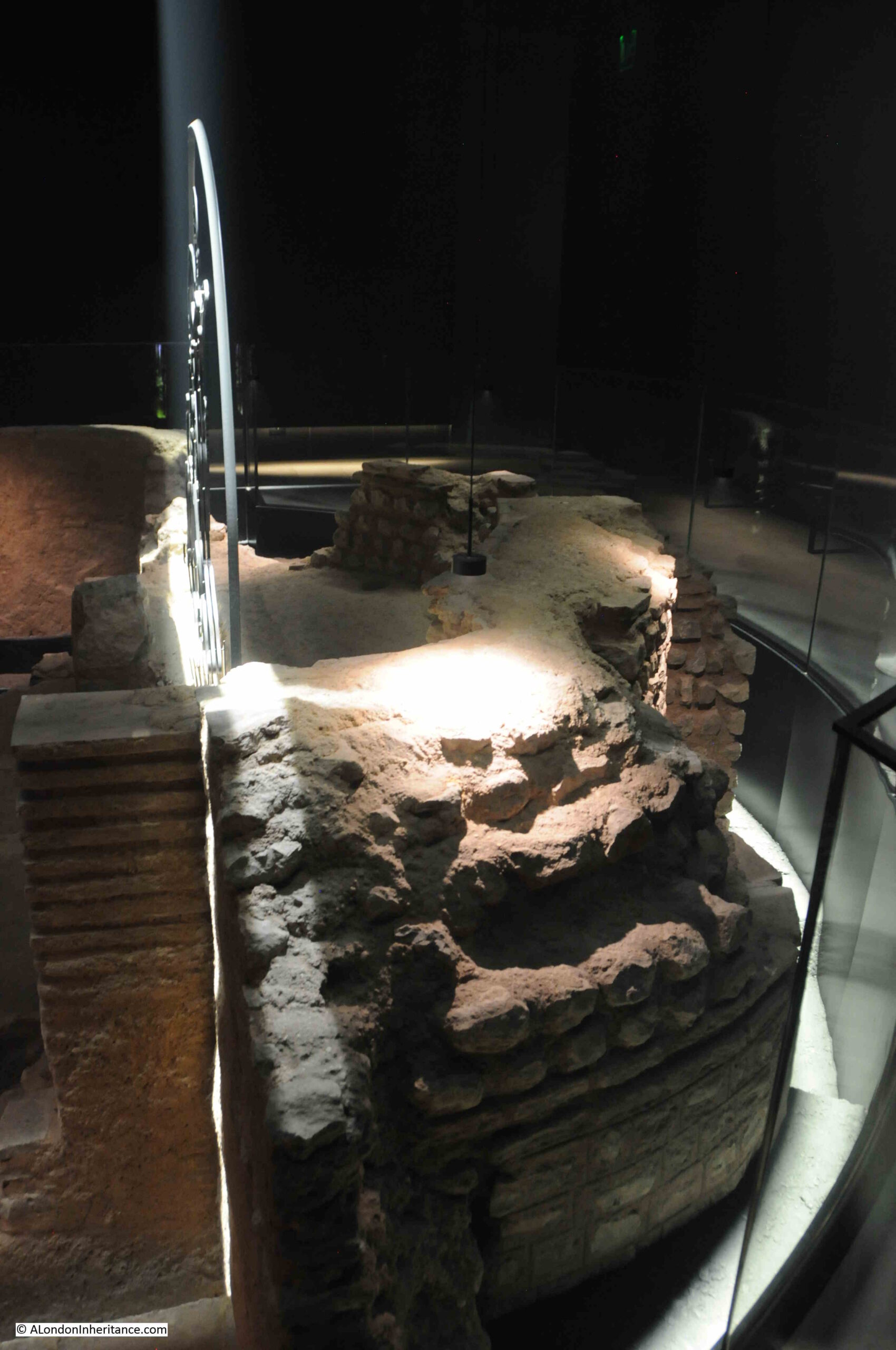
In response to complaints about the numbers attracted to the institution, the City changed parts of the buildings of the Bridewell into a granary, however in 1666 the original house and precincts were destroyed in the Great Fire.

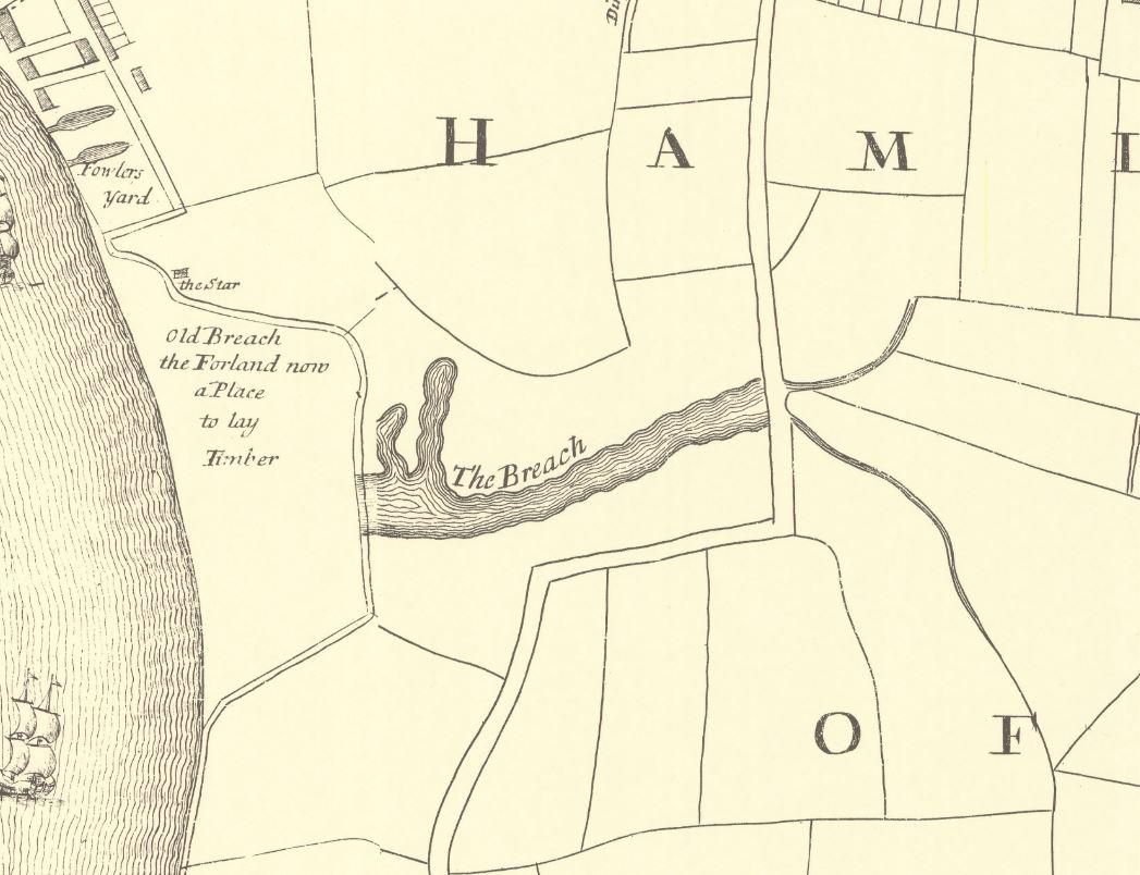
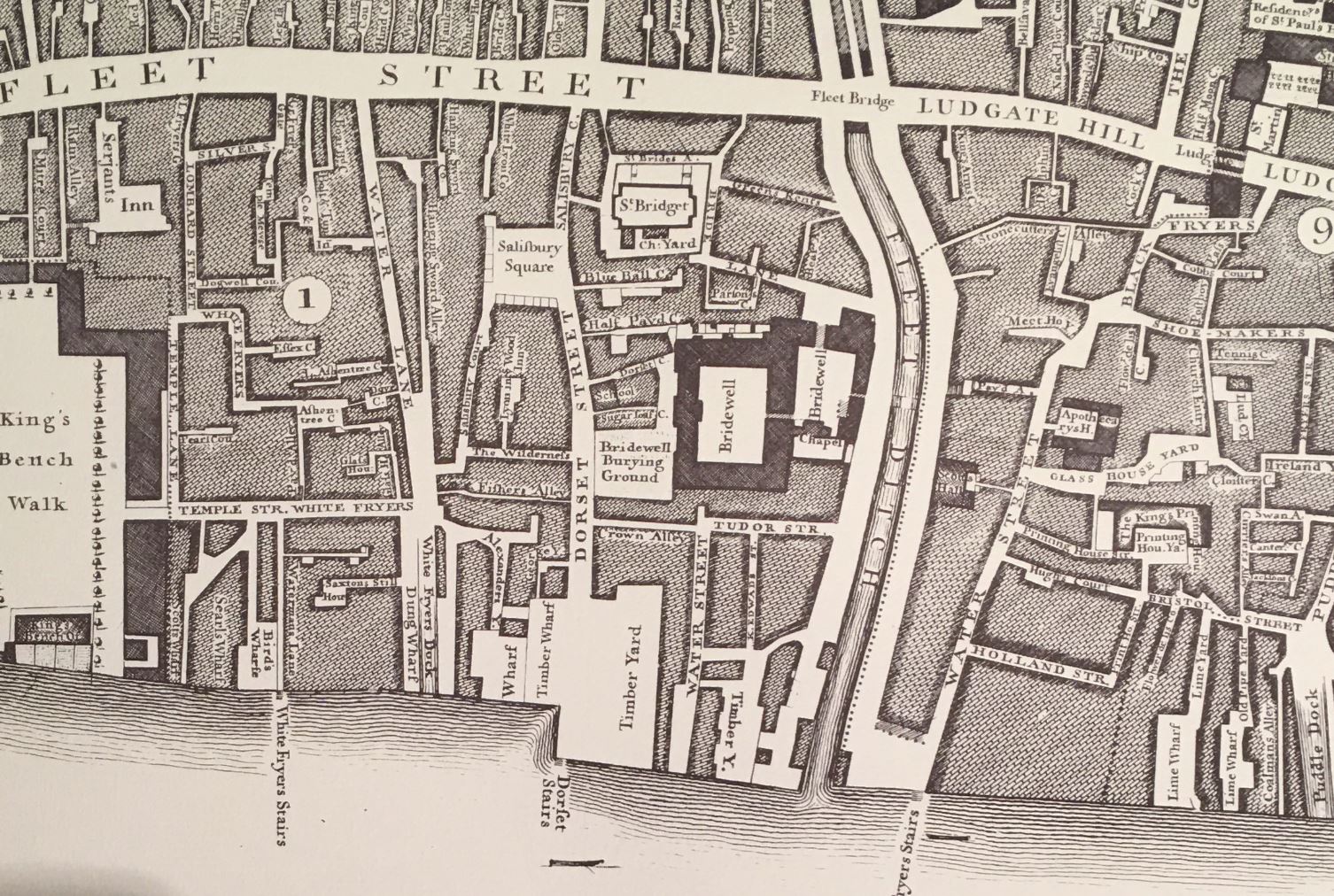
A new house was built in a “more magnificent and convenient manner than formerly”, and these new buildings, based around two central courtyards, can be seen in the centre of the following extract from Rocque’s 1746 map:

Bridewell

In the early 18th century, Bridewell was a place where are “maintained and brought up in the diverse arts and mysteries a considerable number of apprentices”, however “vagrants and strumpets” were still being committed into Bridewell with an average of 421 per year, with a peak of 673 in 1752.

Bridewell took on the role of a prison, and as well as holding a City Magistrates Court, the buildings also had seventy cells for male offenders and thirty for female.

Taking one year, 1743, we can get a view of some of the reasons why Londoners were being taken to Bridewell;

  • Margaret Skylight (a Fortune Teller) was committed to Bridewell for stealing a pair of diamond ear rings
  • On Saturday last a Man was committed to the Bridewell of this City for retailing Spirituous Liquors without a licence
  • Last Wednesday Francis Karver, alias Blind Fanny was committed to Old Bridewell for hawking newspapers, not being duty stamped, contrary to Act of Parliament
  • On Sunday Night last, a Parcel of Link-Men, who generally ply about Temple-Bar, made a sham Quarrel near that place, and got a great number of people together, several of whom had their pockets pick’d, by another Gang of Roques, who mingled with the Crowd, as has been very often practiced. We hear four Rogues have been since committed to Bridewell
  • Yesterday James Williamson was committed to Bridewell by Mr. Alderman Arnold, for attempting to pick the Pocket of one William Burris, last Saturday Night of his Handkerchief; while he was carrying him to the Constable, one of the Gang picked his Pocket of his Watch.

I hope I have the location of all the above correct, as by the early 18th century, the name Bridewell had become a common term for a prison, or place where someone was remanded before being put up before a judge.

In London there was a Bridewell in Clerkenwell and one at Tothill Fields, Westminster, and there were several so called Bridewell’s across the country, including one at Oxford and another at Colchester.

In newspaper reports, the name was often given as Clerkenwell Bridewell or Oxford Bridewell, whereas the original establishment seems to have been referred to as simply Bridewell or Old Bridewell.

The large numbers of apprentices at Bridewell also seem to have caused much trouble in the surrounding area. They were called Bridewell Boys, and also in 1743: “On Thursday Night last about Nine o’clock, as some Bridewell Boys were coming through Shoe-lane, they attacked two women, who ran for refuge into the Salutation Tavern near Field Lane End, the Boys followed them, and to get at them, broke the glasses of the Bar, on which one of them was seized, whereupon the others retired, but soon returned in greater numbers, armed with broomsticks, &c. and demanded their Companion; which being refused, they broke all the Windows, Lamps, and whatever else they could get at; however at length, several of them were secured, and it is hoped will meet with a Punishment due to their Crime.”

Bridewell also makes an appearance in Captain Grose’s “Dictionary of Buckish Slang, University Wit and Pickpocket Eloquence”, or the “1811 Dictionary of the Vulgar Tongue”, with the term Flogging Cove, which was used to describe the beadle, or whipper, in Bridewell.

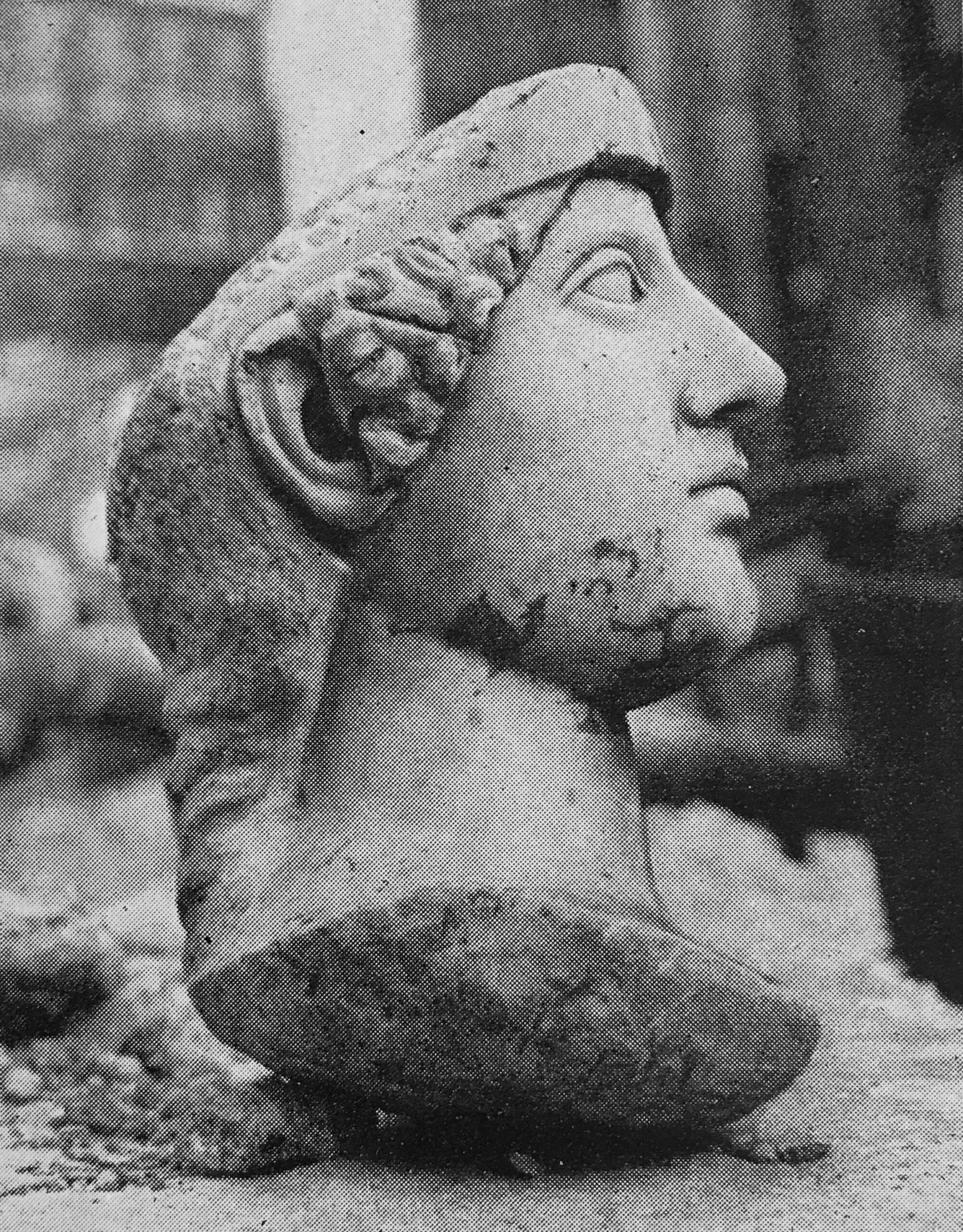
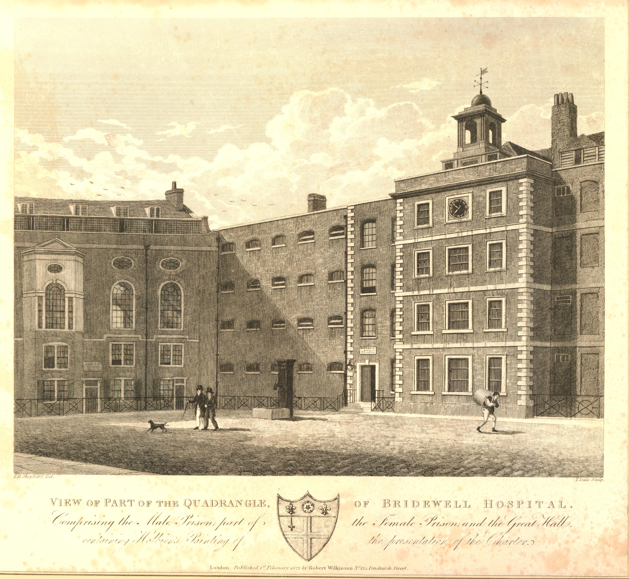
This print dating from 1822 shows part of the quadrangle at Bridewell, with the male prison, part of the female, and the Great Hall. Note the bars over the windows in the central block, and small windows in the block to the left © The Trustees of the British Museum):

Bridewell

The end of Bridewell as a prison came in the 1860s when the City Prison at Holloway was built in 1863, following which, the materials of Bridewell were sold at auction and cleared away by the following year, with the chapel being demolished in 1871.

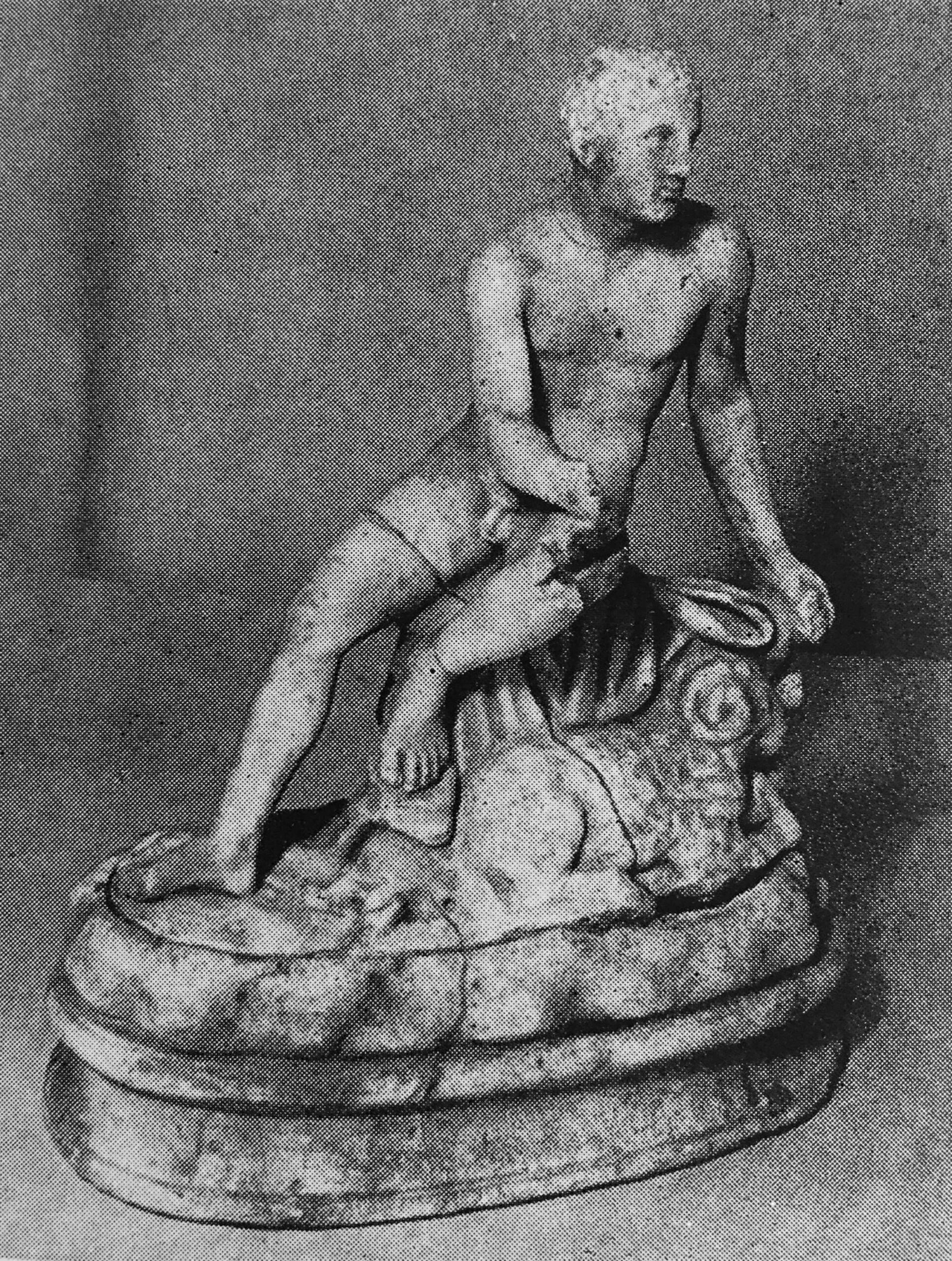
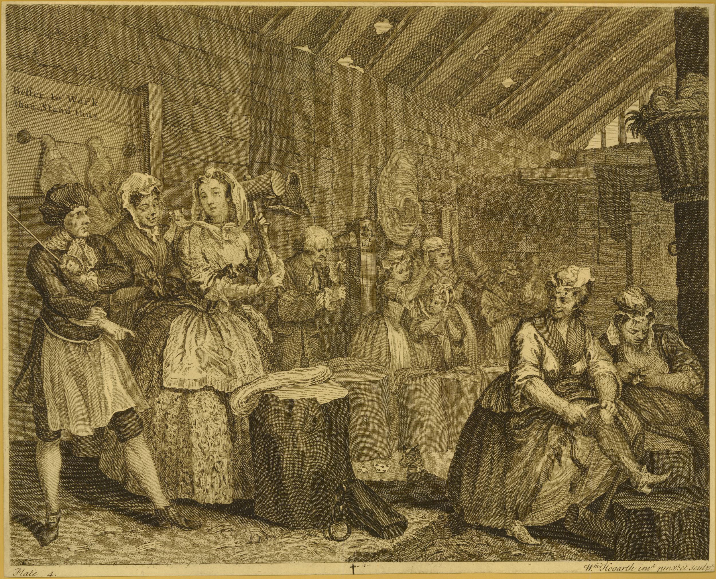
Bridewell featured in one of the prints by Hogarth in his 1732 series “A Harlot’s Progress”, and in this print we see Moll, the women featured through the series, still in her finery, as she is beating hemp, along with other inmates, under the watchful eye of a warden © The Trustees of the British Museum):

Bridewell

Although Bridewell prison has long gone, the 1805 former offices of the Bridewell Prison / Hospital and entrance from New Bridge Street survives.

I have taken a photo of the building and its associated plaque several times, but cannot find them (if you knows of a cheap and efficient application for sorting and indexing thousands of digital photos, I would be really grateful), however the wonderful Geograph site came to the rescue, and the Grade II* listed building can be seen here, between the traffic lights:

Bridewell

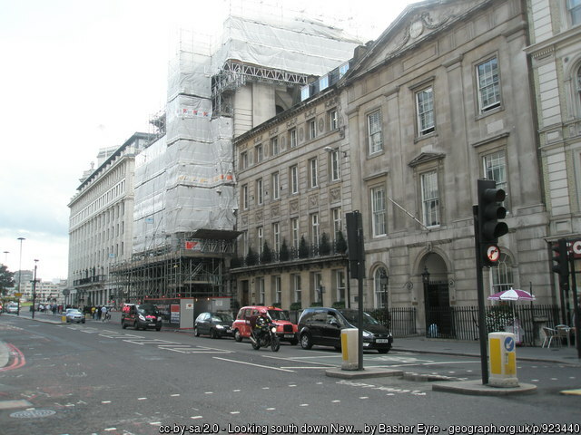
Looking south down New Bridge Street cc-by-sa/2.0 – © Basher Eyre – geograph.org.uk/p/923440

The St. Bride’s Tavern will soon be similar to Bridewell – just a memory on the ever changing streets of London.

The development proposals apparently include a pub within the ground floor and basement of the new office block, but this will not be the same as the dedicated pub that currently stands on the site.

Three City of London pubs have now closed since my walk in 2020. How many more over the coming years will suffer the same fate?

alondoninheritance.com

Queenhithe – The Original London Dock

The following photo was taken by my father from the south bank of the river, looking across to the north bank, it is where the walkway along the river turns slightly inland to pass under Southwark Bridge:

Queenhithe and the north bank of the River thames

The same view today:

View to the north bank of the River Thames from Bankside

The layout of the place is the same today, with the pillars (although today much more substantial) supporting the building overhead, being in the same place. The building on the left is now a Zizi Italian restaurant, replacing the warehouses and industrial buildings that once lined this stretch of the river.

The view is across to the north bank of the river, where a number of warehouses can be seen. Of these, there is only one building that remains today. That is the large warehouse directly underneath the dome of St. Paul’s Cathedral.

The subject of today’s post, is a feature on the north bank, that is just visible in the above photo.

Whilst the warehouses form an almost continuous line along the river, there is one place where the river cuts slightly in land to form a small dock. This can just be seen to the right of the following enlargement from the above photo and is Queenhithe Dock:

North bank of the River Thames

The view across the river today. Queenhithe can just be seen as the indention in the river wall, just to the right of centre. The tall brick building to the left is the warehouse seen below the dome of the cathedral in the above photos:

North bank of the River Thames

A closer view showing Queenhithe Dock. The building at the back of the dock is a recently completed hotel:

Queenhithe

Queenhithe’s importance comes from the fact that it is a surviving dock space dating back to the Saxon and Medieval period.

The dock is believed to have been established by King Alfred after he reoccupied the area within the City walls in 886. At that time, it was called Ethelredshythe after King Alfred’s son in law, when it was a place where boats were pulled up on the foreshore with goods being sold from the boats.

The name Queenhithe comes from Queen Matilda, the wife of Henry I, who was granted the taxes generated by trade at the dock. Hithe means a small landing place for ships and boats.

Matilda also had built London’s first public lavatory at the dock, which was available for the “common use of the citizens” of London, and was no doubt built at the dock so the output of the lavatory could flow directly into the river – some things do not change.

Queenhithe is shown in the Agas map (from around the mid 16th century to the early 17th century), with one boat with a sail, and a smaller boat being within the dock:

Agas Map

The map appears to show some open space between the end of the dock and the houses lining Thames Street, and this space was presumably used for holding cargos being moved between the ships on the river and the land, and for conducting sales.

Writing in London Past and Present (1891), Henry Wheatley describes Queenhithe as:

“It was long the rival of Billingsgate and would have retained the monopoly of the wharfage of London had it been below instead of above bridge. In the 13th century it was the usual landing place for wine, wool, hides, corn, firewood, fish and indeed all kinds of commodities then brought by sea to London.”

The dock today is a much smaller part of what was the original dock and trading area. Excavations beneath some of the buildings surrounding the dock have found remains of a Roman quay along with the 9th century shore where trading took place, along with a series of medieval waterfronts, showing how during the medieval period the river wall was gradually being pushed further into the river.

The edge of the dock as it enters the Thames:

Queenhithe

Queenhithe is classed as a Scheduled Ancient Monument, and is one of the areas along the river where any form of mudlarking or disturbance of the dock or foreshore is prohibited.

The Historic England description of the reason for designating Queenhithe as a Scheduled Ancient Monument provides a good explanation of the importance of the place:

“Quays are structures designed to provide sheltered landing places with sufficient depth of water alongside to accommodate vessels over part of the tidal circle. The features and complexity of quays vary enormously depending partly on their date but also on their situation and exposure, the nature of the underlying geology and alluvium, and the volume and types of trade they need to handle. By their nature, quays also tend to occur in proximity to centres of trade and administrative authority, usually in locations already sheltered to some extent by natural features. Basic elements of quays may include platforms built up and out along a part of the coast or riverside that is naturally deep or artificially dredged, or along an artificial cut forming a small dock on a riverside or coast.

Urban waterfront structures and their associated deposits provide important information on the trade and communication links of particular periods and on the constructional techniques and organisation involved in the development of waterfronts. Artefacts recovered through excavation and the deposits behind revetments will retain evidence for the commodities which were traded at such sites.

Major redevelopment schemes along the Thames in the past have meant that the site at Queenhithe Dock is a rare survival of a sequence of waterfront constructions dating from the Roman period. The timber quays, revetments and the occupation levels are well preserved as buried features. It will provide evidence for the riverside development of London including archaeological and environmental remains and deposits. These deposits will provide information about the river and riverside environment and, by extension, about the people who lived alongside and have used it. The site is of particular significance as one of the few early medieval docks recorded in London.”

At low water, the full extent of the foreshore within Queenhithe can be seen:

Queenhithe

Queenhithe featured in a range of newspaper reports which help to give an idea of what life was like at the dock, and in London. Some examples:

3rd December 1741: “On Friday a wealthy Baker near Bishopsgate Street, was by two Money-Droppers, deluded into a Public House by Queenhithe, and there at Cards tricked out of above £100. Tis strange this stale Cheat should still prevail.”

According to the rather wonderful “The 1811 Dictionary of the Vulgar Tongue” by Francis Grose, a Money Dropper was a cheat who would drop some money, and then pretend to find it in front of someone, who he would then entice into a pub to share in his good luck at apparently finding the money.

Once in the pub, the Money Dropper would then cheat or rob the person he had enticed into the pub out of any money they had on them, and with the Baker, it was £100, a considerable sum of money in 1741.

Interesting that in 1741 it was thought that the was a “stale” cheat, so must have been a method employed by cheats for many years before.

The Lord Mayor’s procession (now the Lord Mayor’s show), when the new mayor took office was once a very riotous affair across the City. Crowds, fighting, fatal accidents – all very different to today. A long account of the November 1774 procession included the following reference to Queenhithe: “A man was run over by a coach at Queenhithe, and killed. A boat was overset near Queenhithe Stairs by the Watermen attempting to row passengers nigh enough to see the Lord-Mayor take water, and, it is said, six people were drowned”.

A reference to Queenhithe in 1799 adverts headed “Important Inland Communication” highlights how, in the days before the railways, goods arriving or departing from the river around Queenhithe could transfer goods across the rest of the country.

The advert stated that “The Public are respectfully informed, that Goods are regularly conveyed from Queenhithe, London, to Newbury, and from thence o Andover and Salisbury, and also down the Andover Canal to Southampton, and vice versa”.

It cost 11d (old pence) to send a hundredweight (about 112 pounds or 50kg) to Newbury, 2shillings and 6d to Salisbury and 2shillings to Southampton.

The advert shows how in 1799 there was an integrated transport system to transfer goods between London and surrounding counties and towns, as it also states the company “affords a regular communication with the following market and borough towns, and their respective neighbourhoods: Amesbury, Blandford, Cranborne, Christchurch, Dorchester, Downton, Fordingbridge, Fareham, Gosport, Havant, Kingscleare, Lymington, Mere, Newport, Poole, Portsmouth, Ringwood, Romsey, Shaftesbury, Whitchurch, Wilton, Wimborne and Yarmouth”.

It is often overlooked that the success of London as a trading port and as a commercial centre was only possible because of an interdependent relationship with a complex transport network between London and the rest of the country.

It was no good if people or goods arriving in London could not travel to destinations across the country with reliability and with a reliable timetable and cost.

One of my many unfinished projects is mapping out all the 18th century coach routes out of London. It was a very extensive network, equal in its day to the train network we have today.

As well as a reliable transport network, another important factor in the success of trade along the river was transparency in the pricing of key goods, so a market could develop based on pricing transparency. Here again, Queenhithe featured in many newspaper reports on the previous day’s prices:

“The Price of Flour for Bread at Queenhithe, from 4s, 9d per Bushel, Second Sort from 4s 4d to 4s 8d per Bushel. Windsor Beans £8, 2s per Quarter. Common Ditto £2 per Quarter.”

Sometimes the flour brought up for sale did not always sell as in 1757: “Last week several Mealmen at Queenhithe loaded their barges with the Flour that they had brought up for Sale, and sent it back”.

A “Mealman” was the name given to those who traded in grains and flour.

In the following photo, I am looking across the Thames from the north east corner of the dock:

Queenhithe

There was a very similar view in the book Wonderful London, published in the 1920s, which shows lighters moored at the entrance, and inside the dock:

Queenhithe

The description that goes with the above photo reads “Old Queenhithe, Once The Principal Dock Of London Port – All that is left of Queenhithe is an indentation in the line of wharves backing onto Upper Thames Street. But this, with Billingsgate, once formed the Port of London. It was called by its present name in the reign of Henry II, but as a dock it is centuries older, for we first hear of it in 899 during Alfred’s reign. To encourage its prosperity taxes were levied on foreign vessels discharging cargo elsewhere in the city. By Stow’s time it had fallen into disuse. It is now used for floating lighters to the surrounding warehouses”.

Queenhythe as a trading dock gradually lost its usefulness as the size of ships increased and the docks grew along the river, both within the City of London, and along the rest of the Thames.

As shown by the Wonderful London photo above, it did continue to be a place where lighters could be moored, with the relatively flat bottom of the dock allowing a lighter to be settled at low water, rather than being moored in the river. Space along the foreshore would have been at a premium during the 18th and 19th centuries, and partly into the 20th.

The Wonderful London photo shows the bed of Queenhithe appearing to be a level layer of mud. Today. the bed of the dock is mainly stone, broken bricks and the other detritus that gets carried along the river.

I suspect that the mud has gone as there is no activity in the dock today, and the lack of moored lighters and shipping along the river has increased the flow of the river, which has led to erosion of the mud.

If you look at the dock today, it gives the appearance that the mud has been cleared, and the incoming tide has pushed some of the old dock surface, and rubbish from the river, up to a pile at the back of the dock. Even an old scooter looks as if it is now becoming part of the buried history along the river:

Rubbish on the foreshore

Along the eastern wall of the dock is the Queenhithe Mosaic, which provides “A timeline displaying the remarkable layers of history from Roman times to Her Majesty’s Diamond Jubilee”:

Queenhithe Mosaic

The mosaic was design by Tessa Hunkin and Southbank Mosaics created the installation in 2014, and next to the river, it starts with the first Roman invasion:

Queenhithe Mosaic

Then we see the first reference to Queen Matilda and Queenhithe:

Queenhithe Mosaic

And that Queenhithe was London’s Grain Dock, a role it still had in the 18th century:

Queenhithe Mosaic

Other key London events are included such as when St. Paul’s Cathedral was first built in stone, and when London became a Saxon town:

Queenhithe Mosaic

There is then the 19th century “Big Stink” and World War 2 and the Blitz, which damaged so much of the area surrounding Queenhithe:

Queenhithe Mosaic

And finally the Millennium Bridge and the Jubilee. The mosaic is mainly a timeline, although the Thames flows along the length of the mosaic and at the end. as well as covering events in 2012, we also see the river opening out into the estuary, and four turbines from the wind farms that have covered parts of the wider estuary:

Queenhithe Mosaic

Rocque’s map of 1746 shows Queenhithe Dock with a small area of open space at the top of the dock, labelled Queen Hith (earlier references to the dock often spelt the Hith part without an e):

1746 map of Thames Stairs

There are a number of boats which look as if they could be either sailing into, or away from the dock. There are also two sets of stairs. On the right are Queen Hith Stairs, and on the left are Queen Hith Little Stairs.

I can find a number of references to Queenhithe Stairs over the last few centuries. I quoted one earlier in the post with the story of the “boat was overset near Queenhithe Stairs“, when a Waterman was taking people out into the river to see the new Lord Mayor take to the river.

The Port of London Authority listing of all the steps, stairs and landing places on the tidal Thames does not have any reference to these stairs, however, they are still there. Not the nice set of stone steps leading down to a causeway on the foreshore, rather Queenhithe Stairs now consist of a vertical metal set of steps right up against the river wall, with a short set of steps providing access over the river wall as can be seen in the following photo, in exactly the same place as in the 1746 map:

Queenhithe Stairs

Looking over the edge of the river wall, and we can see the vertical steps heading down to the foreshore:

Queenhithe Stairs

There is a high river wall around Queenhithe, an essential bit of infrastructure to keep the surrounding land dry during times of very high tide, and building embankments along the river has been a continuous project in keeping the City of London dry.

I found a mention of Queenhithe Stairs in a reference to building an embankment wall, when in 1856 the London Weekly Chronicle had an article on an Act of Parliament to progress a whole series of infrastructure projects across London, including;

“An embankment along the Middlesex side of the River Thames, which said embankment will commence at or near certain stairs called Queenhithe Stairs, in the parish of St. Michael, Queenhithe, in the city of London, and from thence run in a westerly direction along and in front of the north bank of the river, and terminate on the river bank at or about a point in the parish of Saint Margaret in the City of Westminster, in the county of Middlesex.”

Other parts of the Act included building a railway within the embankment, so this was one of the enabling acts for both creating a new wall along the river and building what has now become the Circle and District underground railway lines along the Embankment.

The embankment as actually built ended at Blackfriars and did not extend to Queenhithe Stairs. The warehouses along the river, with their need for easy access directly onto the river prevented the new embankment being built as far as Queenhithe, but it is one of those “what ifs” with the development of London over the centuries.

From the walkway along the side of the river, there is nothing to be seen of Queenhithe Little Stairs, and I cannot find any written reference to the stairs, however looking across from the south bank of the river, we can see a set of steps vertically up against the river wall in the place shown in Roqcue’s 1746 map:

Thames Stairs

Interesting how there is a rise in the height of the foreshore around the bottom of the steps, and how these stairs survive despite having very little practical use these days, although I suspect that with the height of the river wall, having stairs along the foreshore is a sensible precaution for anyone stranded on the foreshore as the tide comes in, or having fallen in the river, although with the tides in the river, getting to the stairs would be a challenge.

Queenhithe is an interesting survivor, as what survives is the space, rather than any physical structure such as a building, wall, paving, etc. Whilst there are remains of the use of the dock below the surface, Queenhithe’s importance is as a reminder of how the City and the Thames developed and for so many centuries, were interdependent.

Given the level of 19th century rebuilding of the City, I am surprised that Queenhithe survived, and was not replaced by new warehouses, however the dock had already given its name to a Ward, so the importance of the place must have long been clear, and removing the place that was the source of the Ward’s name was probably too much, even for Victorian commercial redevelopment of the City of London.

alondoninheritance.com

Euston Station and HS2 – A 2023 Update

In 2017, I photographed the area to the west of Euston Station, with a focus on  St. James’s Gardens, as this area was about to become the construction site for the expanded Euston Station, for the London terminus of HS2, a high speed railway that would run to Birmingham with branches to Manchester and the east Midlands.

Each year since 2017, I have made a return visit to the area around Euston Station, intending to photograph what was there before demolition, then the construction phase and finally the new Euston Station.

In recent years, the future of HS2 has been in doubt, and a couple of months ago, the Government announced that the northern sections would be dropped and that the London section between Old Oak Common and Euston Station would be paused.

In the latest HS2 6-monthly report to Parliament – November 2023, it was stated that delivery remains on track for “Old Oak Common in west London and Birmingham Curzon Street by 2029 to 2033”. There was no date given for completion of the section from Old Oak Common to Euston.

There is a list of all my previous HS2 posts at the end of this post, and after anticipating seeing a new station as the final post in this series, I now wonder whether I will ever get to see a new HS2 station at a redeveloped Euston.

The following map from the Media section of the HS2 website shows the route as it was still planned in 2022:

HS2
HS2_print_Infrastructure map_post IRP_220607_jpg

As well as pausing construction of the section from Old Oak Common to Euston, the November report to Parliament stats that “we will not proceed with Phase 2a, 2b or HS2 East”.

Much of the construction area is hidden behind panels, many of which have artwork and advertising that tells the story of what HS2 will bring to Euston, and the wider benefits of the project. Much of this now looks rather hollow and out of date, and includes the new Euston Station:

HS2

And as well as “building you a better Euston”, the following poster still states that HS2 will be “Connecting eight out of ten of Britain’s largest cities”, and will “More than double the number of train seats out of Euston in peak hours”:

HS2

And that improvements to the existing station will provide a “Bigger, better concourse, 100s of new seats, wider platform ramps”.

Extension of HS2 from Old Oak Common to Euston has been “paused”, and the November report to Parliament states that:

“We are going to scale back the project at Euston and adopt a new development led approach to the Euston Quarter which will deliver a station that works, is affordable and can be open and running trains as soon as possible. We will not provide design features we do not need and will instead deliver a 6-platform station which can accommodate the trains we will run to Birmingham and onwards and which best supports regeneration of the local area. In this way we will attract private funding and unlock the wider land development opportunities the new station offers, while radically reducing its costs to the taxpayer.”

But the most scary part of the new plans for Euston is this sentence in the November report:

“At Euston, we will appoint a development company, separate from HS2 Ltd, to manage the delivery of this project. We will also take on the lessons of success stories such as Battersea Power Station and Nine Elms, which secured £9 billion of private sector investment and thousands of homes.”

Whilst economically, Nine Elms has been considered a success in bringing in considerable (mainly overseas) investment to develop the area, the Nine Elms development seems to have resulted in the random placement of individually designed tower blocks, without any apparent cohesive design for the area. The towers look as if they have been randomly dropped from the sky, with a height and density to maximise profit rather than to add character and improve a key part of London.

Is this the future for Euston? A station hiding underneath another vision of Nine Elms, delivering enough cash from developers to complete the section from Old Oak Common to Euston along with the new station, but with a focus on the needs of developers, rather than a new the design and build of a new station that could have served as the London terminus of a growing railway to the north of the country.

In the following map, I have added a red line to show the area which had been cleared for the new station, and the tracks leaving the station to head to Old Oak Common (Map © OpenStreetMap contributors):

HS2

HS2 have a couple of photos in the Media section of their website which shows the scale of the site. The following is looking at the site from the north:

HS2
An aerial still of the HS2 Euston Station site, August 2022

And the following view is looking north, with Euston Station to the right:

HS2
An aerial still of the HS2 Euston Station site, August 2022

Both of the above photos are available to download from the Construction section of the HS2 media Gallery at this link.

I suspect that the main problem that HS2 has had is the name – High Speed 2.

The slightly shorter journey time from London cannot really justify the expense of the project, and the additional speed will only really benefit journeys much further north than Birmingham.

The main benefit that HS2 provides is extra capacity on existing rail lines, such as the West Coast Main Line (WCML).

Transferring high speed trains from the existing WCML onto HS2 would have released a significant amount of extra capacity which could have been used for freight, additional passenger train services between many of the places on the WCML route, as well as increasing the number of high speed trains.

However, calling the project Extra Capacity 1, or EC1 does not sound as exciting as HS2, although it would have been a better description of the real benefits.

I started my 2023 walk on a weekday, when hopefully it would be clear how much work was still underway. My route started in Clarkson Row, just to the west of Mornington Crescent, as here you can just about see over the wall, across the existing tracks, to where new tracks will be run as the railway heads from Euston to Old Oak Common:

HS2

Heading along Hampstead Road, and this is the view along the street, back towards Mornington Crescent. The main entrance to the site to the west of Hampstead Road is here:

HS2

There was still work underway, however according to HS2 press releases, what is happening now around Euston is “enabling work” rather than construction works, and there were utility works on the street, so I assume this means minor, low cost works which may make the project easier to get underway if and when it restarts.

One of the entrances to the main Euston site:

HS2

Look back along the Hampstead Road:

HS2

This is the main entrance from Hampstead Road to the main site around Euston Station:

HS2

There appeared to be very little happening, and the only vehicle that was running through the site was a road sweeper.

There is no sign of any elements of a new station, and the appearance of the site was much the same as last year. Parts of the site which were open last year have now been fenced off, so the site appears more enclosed than a year ago, but again, not much happening within the site.

There are three places where there is a change to last year, the first is the National Temperance Garden, described as “a temporary green space for all to enjoy”. It has been built on the site of the old National Temperance Hospital, and this is the view of the garden from Hampstead Road:

National Temperance Garden

The large structure behind the gardens are offices and have been there for the last few years. The fencing between the gardens and Hampstead Road are standard HS2 Euston green security fencing and surround places on the site where there are no large panels.

Inside the gardens, which apparently has been “specially designed to be moved and re-used in the local area when the site closes”:

National Temperance Garden

These buildings were home to the Maria Fidelis School:

HS2

To free up the school site, HS2 have built a new school between Drummond Crescent and Phoenix Road, and the site in Starcross Street is now closed.

The school and a large new building behind the school are a new “Euston Skills Centre”, set-up to provide training to local people and thereby providing the number of trained workers that such a large project requires.

The Euston Skills Centre was handed over to Camden Council on the 20th of November, however given that work within Camden has now been paused it will be interesting to see what Camden Council does with the facility. Hopefully there are still plenty of training opportunities for Camden locals to work on the project from Old Oak Common northwards.

Between the skills centre and Starcross Street is the second of the places where there has been a tangible change, compared to last year.

This is another temporary open space, in the form of Starcross Yard:

Starcross Yard

The theme for Starcross Yard is “echoes of place”, and within the space there are physical reminders of places from a surprisingly wide area, not just the HS2 construction site, or Euston.

To highlight these, there are information panels along the railings which tell of the “uncommon histories of people and space”.

The first is the Temperance Hospital, which was demolished as part of the clearance of the HS2 construction site:

Starcross Yard

The second covers the St. James’s Burial Ground, which again was cleared as part of HS2 site clearances. The panel highlights the boxer Bill Richmond who was buried at St. James’s Burial Ground, and a number of others buried are also named, as well as many from the workhouse:

Starcross Yard

Railings from the old burial ground now form part of Starcross Yard.

The above two panels refer to places that have become part of the HS2 construction site. The rest of the panels cover people and places that are further away, and not part of HS2.

The first of these is the German Gymnasium which today can be found by the southern entrance to Pancras Square, between St. Pancras and King’s Cross Stations:

Starcross Yard

Poles from the German Gymnasium can now be found at Starcross Yard.

Next up is Cumberland Market:

Starcross Yard

Cumberland Market was a short distance to the west of Euston Station, at the southern end of the Regents Park Basin, a small dock area off the Regents Canal.

My father grew up next to the Regents Park Basin, and I wrote about the area in this post. Starcross Yard has cobbles from Cumberland Market.

Next is St. Aloysius, a Somers Town Catholic Church:

Starcross Yard

The church is still functioning, although a mid 1960s rebuild, rather than the buildings shown on the panel. The church can be found to the east of Euston station, in Eversholt Street.

And the final panel covers the local schools, including the Maria Fidelis school, which is the large brick building beside Starcross Yard:

Starcross Yard

I rather like what they have done with Starcross Yard. Too often when large areas of London are redeveloped, there is nothing left to indicate anything about the people and places that once had a connection to the place.

Starcross Yard is temporary, and I hope whatever comes next retains this approach to the areas history.

Meanwhile, at the end of Starcross Street, the Exmouth Arms are still open:

Exmouth Arms Starcross Street

Next to the Exmouth Arms is another of the site entrances, guarded by a rather bored security person:

Starcross Street

At the end of Starcross Street is Cobourg Street, although the road element of the street is now boarded off, with only the footpath remaining.

Cobourg Street crosses Drummond Street, and last year you could walk along this far stretch of Cobourg Street, but during my 2023 visit, the footpath was being fenced off:

Drummond Street

It seems to be a result of the “pause” in work of HS2 into Euston, that the whole site seems to be getting more enclosed and secure. I assume if you have a large area of open land sitting idle, you do not want the risk of anyone getting in.

This is the view back along Cobourg Street from Drummond Street towards the Exmouth Arms:

Cobourg Street

Where Drummond Street once ran all the way to the edge of Euston Station, it now stops at the junction with Cobourg Street, and continues on as a walkway, with the HS2 construction site on either side.

This is the view along the walkway, looking up towards Drummond Street:

HS2

And from the same location, looking towards Euston Station:

HS2

And back towards Drummond Street:

HS2

At the corner of where Drummond Street once met Melton Street is the original Euston station of the Charing Cross, Euston and Hampstead Railway (I wrote about a visit to the station and tunnels in this post):

Euston underground station

To the left of the underground station is another large area of cleared space, this was the area once bounded by Melton Street, Drummond Street, Euston Street and Cobourg Street, and was where the Bree Louise pub was to be found:

HS2

The following view is from the same position as the above photo, and is looking along where Melton Street ran into Cardington Street. It was a short distance along Cardington Street that St. James’s Gardens could be found. The tree is the only reminder of the trees that once lined part of the street and across the gardens.

HS2

The view along what was Melton Street, with a walkway into Euston Station up the ramp to the left:

HS2

The walkway along what was Melton Street:

Melton Street

There is a small stub of Melton Street left, where it meets Euston Road, and again has a very quiet entrance to the HS2 construction site:

Melton Street

I then walked along Euston Road to find the third place where there is any tangible sign of a change. At the eastern side of the station is Eversholt Street, and in front of the station, and the bus stops, between Eversholt Street and Euston Road, one of the open spaces alongside Euston Road has been redeveloped:

Eversholt Street

The area is still secured by standard HS2 Euston green mesh fencing, but through it there appears to be a new taxi drop of point. It all looks finished, but no indication of when it will be opening:

Eversholt Street

Then a walk to the open space in front of the station:

Euston station concourse

With a view in the opposite direction showing the office blocks between Euston Station and Euston Road:

Euston station

Returning to Melton Street, where there is a ramp leading to a walkway into Euston Station, this is the view, with a large open construction site behind the panels on the right:

Euston Station

If you walk into Euston Station, up to the first floor area where there is a pub and food outlets, at the western end of this space there are stairs back down to ground level, and from here there is a view over the construction space in front of the station, with Melton Street to the right, and taxi ranks alongside Euston Road:

View from Euston station

Not much happening in this large area:

View from Euston station

The station concourse:

Euston station concourse

That was the HS2 Euston construction site in 2023. Very little change compared to a year ago, with only two small gardens and a taxi drop off point the only external signs of change.

There were not that many construction workers around, and the perimeter of the site seems to be getting more secure, as if it is closing up for a long period.

HS2 seems to be a love / hate project, and whatever your individual views on the project, it does not give a good impression of the country when we seem unable to build major infrastructure projects such as HS2.

There is an interesting article on the London reconnections website, comparing the costs of infrastructure projects in the UK and other, comparable countries, and it is remarkable just how much extra, projects in this country are to build compared to others.

There are many complex reasons for this. Planning processes, funding complexity, objections to projects, long decision making, changes to decisions etc. all add to cost.

Although the Old Oak Common to Euston section has been paused, there will still be cost, at the very minimum the construction sites will need security, and I suspect it will take very many years before sufficient private finance is found to complete the project.

London Mayors and Government Ministers of all parties seem to like the phrase that “London is open for business”, a phrase which I find rather meaningless, but seems to translate as the city is open for anyone to purchase London’s assets, and this will probably be the way for Euston with offshore investment building up a new Nine Elms above a very slimmed down station.

Apart from the Silvertown Tunnel, HS2 is the only other major public transport infrastructure project in London.

Crossrail 2 has been “paused” since October 2020, and I doubt there will be anything for some decades to come.

Sorry to be so depressing on your Sunday morning.

I stayed taking a few more photos as it got dark, and as I left the station, the new information board in the outside concourse mirrored my thoughts at the time about the future of Euston’s development, with almost every train being delayed:

Euston departure board

My visits to the Euston HS2 construction site for the past six years are covered in the following posts:

My first post was back in 2017 and covered St James Gardens, just before they were closed for excavation.

My second post in 2018 walked around the streets to the west of the station, as buildings began to close, and the extent of the works could be seen.

I then went back in 2019 as demolition started.

In 2020, demolition was well underway and St James Gardens had disappeared, and the associated archaeological excavation had finished

And in June 2021 I went back for another walk around the edge of the construction site.

Last year’s 2022 walk around the site is here.

I suspect the site will be much the same when I visit again later in 2024.

alondoninheritance.com

Trig Lane Stairs and Thames Foreshore Erosion

Trig Lane Stairs lead down to the Thames foreshore, just to the east of the Millennium Bridge. Today, the stairs connect the foreshore with the walkway that now runs along the edge of the river, with apartments and offices between the river and Upper Thames Street.

Back in 1949 it was a very different place, a mix of wartime bomb damage and with many of the warehouses remaining from the time when this section of the river was busy with the movement of goods between barges and warehouses.

This is one of my father’s photos from 1949. The wooden stairs of Trig Lane Stairs lead down to the foreshore, warehouses either side with an open space between (not bomb damage, but an open space for movement of goods), and one of my father’s friends standing on the stairs:

Trig Lane Stairs

I took the following photo from the south bank of the river. To the right of the Millennium Bridge, along the wall that runs alongside the river, you can see a dark rectangle, which is the entrance to Trig Stairs through the river wall, and the wooden stairs to the foreshore can just be seen below the gap:

Trig Lane Stairs

As with the edge of the Thames through most of London, this area has changed dramatically in the 74 years between the two photos.

The warehouses have been replaced with new buildings, with a single block covering the space behind the stairs and along where several warehouses once stood.

Walking along the edge of the river from the east, and the Trig Lane Stairs can be seen in the following photo, just behind the group of people on the foreshore:

Trig Lane Stairs

The entrance to Trig Lane Stairs in 2023:

Trig Lane Stairs

The stairs go up, before going down to the foreshore are an indication of the height of the river wall now needed to prevent any flooding at times of exceptionally high tide.

Once over the stairs, we can get a view of the wooden stairs going down to the foreshore:

Thames foreshore

And this was the same view in 1949:

Thames foreshore

In 1949 the warehouses were still in use, and the loaded barges which can be seen in the background are probably holding goods that are waiting to be moved to the warehouses as these were mostly used for import.

According to the 1953 edition of “London Wharves and Docks”, published by Commercial Motor, the warehouse to the left of the stairs in my father’s photo was the warehouse of Crown and Horseshoe Wharf, which traded in general goods, and specialised in canned goods and chemicals. The warehouse had storage space for 100,000 cubic feet of goods.

The warehouse on the right of the stairs was Sunlight Wharf, owned by LEP Transport, and in 1953 was described as “premises particularly suited for storage of canned goods, having large basement accommodation at average low temperature”.

One of my photos is of the last days of Sunlight Wharf and is in my post “Baynard’s Castle, A Roman Monument And The Last Working Crane In the City”.

The following extract from the 1951 edition of the OS map shows Trig Lane Stairs just below the centre of the map, at the end of Trig Lane (‘Reproduced with the permission of the National Library of Scotland“):

Trig Lane Stairs

According to “A Dictionary of London” by Henry Harben, the first mention of the name was as Trigge Lane in the 1603 edition of Stow’s Survey of London, and by 1677 it was Trigg Lane.

The first mention of the stairs was by John Strype, who published a new, expanded version of Stow’s Survey of London in 1720. Strype’s description of the stairs and lane was “Trig Stairs, so called from the Stairs on the Water side, which is indifferently well supplied by Watermen. The Lane is pretty open, reasonably well built and inhabited”.

Henry Harben states that the name came from John Trigge, the owner of property around the lane and stairs, and in the following centuries, the name has changed from Trigge to Trig. The “London Encyclopedia” (Ben Weinreb and Christopher Hibbert) also repeats the source of the name, and that “the Trigge family were local residents in the 14th and 15th centuries”.

The street Trig Lane has all but disappeared. It no longer runs from Upper Thames Street down to the stairs. Development over the last few decades has obliterated the original route of the street, but the name remains in an east – west street, which is mainly an access route to the rear of one of the buildings that now faces onto the river.

The current routing of Trig Lane can be seen in the following map  (© OpenStreetMap contributors):

Trig Lane

Having photos from 1949 and 2023, looking down from the stairs to the foreshore allows comparison of the foreshore, 74 years apart.

The following photo is an extract from the 1949 photo, looking at the area where a number of wooden structures can be seen:

Thames foreshore erosion

I have labeled what I assume is the top of the groyne line on the right. The groyne line is shown in the 1951 OS map, and apart from a gap opposite the stairs, it runs along the foreshore, a little distance out from the embankment.

The groyne line was probably a wooden wall used to retain the foreshore and create a reasonably flat surface on wich barges could be positioned and their cargo unloaded into the warehouses.

I have also labeled wooden posts that appear to be retaining a plank. There is a similar plank to the left and these two may have been where the groyne line returned to the river wall, or could have formed the edge to a causeway that ran out from the bottom of the stairs.

Looking at the same view today, and we can see just how much of the foreshore has eroded in the last seven decades:

Thames foreshore erosion

The groyne on the right, the top of which was visible in 1949 has now disappeared. The groyne on the left which was just below the foreshore is now fully exposed.

We can also see the wooden posts which were once retaining the planks along the edge of the causeway.

Comparing these two photos shows that at the location of the groynes, the foreshore has eroded a good two to three feet.

The Thames foreshore is a very fluid space, in all senses of the word.

Trig Lane and the stairs date from the 17th century, and are probably much older and even if the name Trig dated from around that time, there were probably stairs here much earlier as stairs were such an important part of access between the land and the river, and along this part of the river, there has been port infrastructure for so many centuries.

The London Encyclopedia has the same view as it states that the stairs were earlier known as Fish Wharf.

Excavation at Trig Lane between 1974 and 1976, prior to major development of the area revealed remarkable remains of the medieval waterfront with significant wooden revetments and other infrastructure of the port between the late 13th and mid-15th centuries.

The following is an extract from William Morgan’s map of London from 1682, and shows Trigg Stairs. To the left of Trigg Stairs is Paul’s Wharf which also had a set of stairs. I do not know whether it was an artistic interpretation of the scene, or whether it was fact, but the stairs by Paul’s Wharf had a large cluster of watermen’s boats, but none at Trigg Stairs:

Trig Lane Stairs

What I love above Thames stairs is not just the physical structure, but the stories you can find about what happened at the stairs. Just small glimpses, but they help with an understanding of what life was like at the boundary between river and City.

For example, from the Newcastle Courant on the 15th of July, 1721:

“Last Monday, Mr. Hargrave, who sometime ago killed one Capt. Wilkes, a half Pay Officer in Racket Court, Fleet Street, and fled, and coming off the water at Trig Stairs, drew his sword upon the Waterman, without any provocation, and stabbed him very dangerously in the Breast, for which he and his Companion were forthwith seized, and carried before the Lord Mayor, who committed them to Wood Street Compter”.

And from the Caledonian Mercury on the 1st of July, 1728:

“On Tuesday in the afternoon, a Barge Man was struck down by lightening as he was going up a ladder at Trig Stairs; and falling into the River, was drowned before any help could be got”.

From the Kentish Weekly Post on the 24th of January, 1759:

“A Journeyman Carpenter crossing the water from Trig Stairs, being a little in liquor, and imagining he was near the shore, jumped out of the boat and was drowned”.

The Reading Mercury reported on the 28th of July, 1783, that:

“The lighters of Mr. Rodbard, at Trig Stairs, Thames Street, having been lately frequently robbed, a guard was appointed to overlook them; and early yesterday morning three persons were discovered filling the corn into sacks, who being fired at by the guard, one of them was killed; the others immediately rowed off in a boat which they had stolen for the occasion, to Pepper Alley Stairs, where they escaped, leaving the body in the boat.”

The London Morning Herald reported on the 13th of October, 1837, that:

“Yesterday evening an inquest was held in the King’s Arms, Queenhithe, before W. Payne (City Coroner), on view of the body of Joseph Colcourt, a lighterman. It appeared from evidence that the deceased was in company with a boy bringing a barge down the river, on Wednesday morning last, about three o’clock, and had arrived alongside Trig Stairs, Queenhithe, when the barge struck against another which was moored off the stairs, and deceased, who was at the time standing on the gunwale, was, in consequence of the concussion, precipitated overboard, and sunk immediately. The boy made what efforts he could at the time to save him, but they were ineffectual. The tide was running down very strong, and it was impossible to render assistance. The body of the deceased was found next morning near to the spot where he fell in. Verdict – Accidental Death.”

Whilst all these stories are of assault, theft and accidental death (as today, the press only report the bad news), they are a common theme to all Thames stairs, and show the dangers of working on the river, of crossing the river, crime on the river, children also working in such dangerous conditions etc.

Standing at the stairs today, it is hard to imagine a guard firing and killing one of those trying to steal corn from barges moored by the stairs.

In Morgan’s map of London from 1682, the stairs were spelt Trigg, but by the time of Rocque’s map of London in 1746, the last “g” had been dropped, and they were just Trig Stairs, as they remain today.

Trig Lane Stairs

It is interesting how place names change, and I suspect that it was usually a gradual simplification of the name, so the stairs started with the name of a local land owner as Trigge, then Trigg and finally Trig, so the name ends with a spelling that more accurately mirrors how the name is pronounced.

The groynes today still seem to form a boundary between the water and the foreshore at a typical low tide:

Wooden structures in the Thames

I assume that the rubble behind the groyne may have been used as infill to build up the foreshore on the land side of the groyne to create a platform where barges could be moored on some reasonably level ground.

And today we can also see where the eastern groyne ends, there is a gap where the causeway would have extended, and the wooden posts along the side of the causeway now project above the surface. It could also have been where the groynes returned to the river wall. This shows just how much erosion the foreshore has suffered in the last 70 years:

Wooden structures in the Thames

View along the foreshore to the west:

Thames foreshore

And to the east – the large brick building at the end of the run of modern buildings is the only warehouse that remains from the pre-war period:

Thames foreshore

In the Port of London Authority book: “Access to the River Thames. A Port of London Authority GuideSteps, Stairs and Landing Places on the Tidal Thames” (published around 1995), Trig Lane Stairs is listed as having 9 stone steps and 18 wood steps, and that the condition was bad.

The stairs today have 16 steps. The stairs in the 1949 photo are longer as they went into the recess in the wall, so I do wonder if the stairs at the time of the PLA survey were the same as in my father’s photo, as they would probably have been in bad condition having been exposed to decades of Thames tides washing over them.

The PLA listing confirms that the stairs were in use in 1708, and at the time of the survey they were not in use.

The stairs today are in good condition, and whilst probably not in use as a landing place, they provide access to the foreshore:

Trig Lane Stairs

The following photo shows the view across the river to Tate Modern, the old Bankside Power Station:

Bankside Power Station

My father did take photos across the river from the top of the stairs at different times to the photos of Trig Lane Stairs.

The first shows dates from 1953 and shows the new Bankside Power Station when the first half had been completed and was in operation. The original power station is on the left, where the parallel rows of chimneys can be seen. I wrote about the view, along with other photos in the post Building Bankside Power Station.

Bankside Power Station

And this view from 1949 shows the original power station on the left, and the Phoenix Gas Works on the right. I wrote about this view, along with a wider view of Bankside in the post A Bankside Panorama In 1949 And 2017:

Bankside Power Station

Trig Stairs are in good condition, but the same cannot be said for the remains of the wooden structures on the foreshore, the groynes and the possible edges to a causeway leading out from the base of the stairs.

I suspect that erosion of the foreshore may have been speeding up over the last few decades, as the groynes and platform they protected are now not needed and are therefore not maintained, and that there are no obstructions along the foreshore or the river that would have slowed down water passing over the foreshore (for example, barges on the river and moored on the foreshore).

I doubt whether the remaining wooden structures below the Trig Lane Stairs will be there in another 74 years time.

alondoninheritance.com

The Temple of Mithras and Vine Street Roman Wall

The City of London has been occupied in one form or another for around 2,000 years, and those centuries of occupation have left their mark, whether it is in the pattern of the streets, pushing the embankment wall into the river and reclaiming parts of the foreshore, churches, rising ground levels, and the buried remains of buildings along with the accumulated rubbish, lost possessions, burials and industrial waste of the centuries.

In today’s post, I am visiting two places where the remains of Roman occupation are on display. two very different structures and methods of display, but each telling a story of London’s long history, and how these remains have survived, and their discovery, starting with:

The Temple of Mithras

The Temple of Mithras was one of the major post-war discoveries in the City of London as archaeologists rushed to excavate sites, although they had very limited funds and time.

The Temple of Mithras tells an interesting story of Roman occupation of the City, post-war archaeology, and how we value such discoveries.

The Temple of Mithras is now on display at the London Mithraeum, built as part of the construction of Bloomberg’s new European headquarters.

The remains of the temple have been displayed in a really imaginative way. Subtle lighting, a recreation of the sounds of activity in the temple during the Roman period and an image of the god Mithras overlooking the temple from the location of the apse and the block where the final altar in the temple was located.

The view on entering the Temple of Mithras:

Temple of Mithras

The Temple of Mithras was discovered in 1954 by the archaeologist W.F. Grimes.

The post-war bomb sites across the City of London offered a one off opportunity to excavate and explore for remains of occupation of the City from previous centuries, and in 1946 the Society of Antiquaries of London sponsored a short trial session, and then established the Roman and Mediaeval London Excavation Council in order to more formally establish a long term series of excavations.

These continued through to December 1962, with the majority being led by W.F. Grimes.

There were two main challenges to this work, both of which almost resulted in the failure to discover the Temple of Mithras – money and time.

The Excavation Council was able to raise funds from private donors, and in 1968 Grimes published “The Excavation of Roman and Medieval London”, a brilliant book providing an initial record of the work between 1947 and 1962. In the back of the book is a list of donors, which included the Government Ministry of Works (£26,300) and the Bank of England (£2,750) as the top two donors, down to two pages of donors who contributed £1. There were also a large number of donors who gave less than a £1, but were not recorded in the book.

By 1954, donor funds were growing short, and in the many newspaper reports of the discovery, it was reported that “Mr. Grimes had only found the temple because, after private subscriptions fell off, a grant from the Ministry of £2,000 a year had kept him going”.

There was also the challenge of time, and the walls of the temple were found towards the very end of the period agreed with the developer to excavate the site. Such was the importance of the find, that the developers allowed an extra two weeks for excavation.

At the temple today, there are two walkways along the sides of the temple, and at the end of these, we can look back at the interior of the temple:

Temple of Mithras

From the location of the apse, and where the altar was located:

Temple of Mithras

The area that was being excavated, and where the Temple of Mithras was found, was a large almost triangular plot bounded by Queen Victoria Street in the north, Budge Row to the south and Walbrook to the east. Budge Row sort of exists, but is now a covered walkway between two sections of the Bloomberg building, and appears to be called the Bloomberg Arcade.

The importance of the site was that it was part of the valley of the old Walbrook stream, and at the time, very little was known of the extent and nature of the stream and the surrounding valley.

Prior to the temple being found, work had focused on identifying the location of the stream, and sectional cuts were taken across the site which found that the Walbrook was in a shallow basin of around 290 to 300 feet across, and that the stream was around 14 feet wide and relatively shallow.

Excavations also found that the process of raising the land surface had started at a very early date, with dumping of material in the basin of the stream, mainly on the western edge of stream.

A number of timber deposits were found, mainly floors, and also contraptions such as guttering, all to deal with the wet conditions of the land surrounding the Walbrook stream.

There were very few stone structures, and apart from the temple, only one other stone building was found on the site, so although the site was in the centre of Roman London, it was very different to what could have been expected, with no concentration of stone buildings, and probably an area which had a stream running through, and was wet and marshy.

The main body of the temple was found to be rectangular and around 58.5 feet long and 26 feet wide, and consisted of a semi-circular apse at the western end.

In Grimes book, he mentions that the eastern end of the building consisted of a narthex or vestibule, which projected beyond the side walls of the building, and that part of this vestibule lay, and in 1954 at the end of excavation, remained under the street Walbrook. I need to find out if that is still the case, or whether it has since been excavated.

Photo from the book “The Excavation of Roman and Medieval London” by W.F. Grimes showing the Temple of Mithras as finally excavated. The photo was taken from the north east, so would have been next to the street Walbrook:

Temple of Mithras

The photo below is a view of the apse, which was at the western end of the temple, the upper right of the temple in the photo above:

Temple of Mithras

The excavated temple was opened to the public for a short period between excavation and the removal of the stones, and very long queues formed to get a glimpse of this Roman survivor:

Temple of Mithras

However, you can forget all the stories of polite British queuing, as the News Chronicle reported on Wednesday the 22nd of September 1954: “Sightseers Storm the Cordon. When darkness came, hundreds were still queuing. They got angry and dozens stormed through police barriers to see the Temple of Mithras.

Instead of the 50 to 500 people expected at the half acre bomb site near Mansion House, where last week a marble head of the god was unearthed, there were 10,000.

Police reinforcements were called as they milled around. At 6:30 when the site was due to close, thousands were still queuing. Then the contractors – who are to build London’s tallest office block on the site – decided to keep it open till seven.

There was an angry scene when the police announced half an hour later that no more people could be allowed. By then, darkness was falling and hundreds were still queuing. The disappointed crowd shouted ‘We’ve been waiting more than an hour’.”

Looking back at the apse:

Temple of Mithras

There were a number of finds at the site of the temple, including, Mercury, a messenger god, seated on a ram:

Temple of Mithras

Mable head representing the godess Minerva:

Temple of Mithras

And then there was the head and neck of Mithras. This was found by one of the excavators on the site, Mrs. Audrey Williams, and I found a photo of her, holding the head of Mithras, in the book “Buried London” by William Thomson Hill (1955):

Temple of Mithras

Audrey Williams was a highly experienced archeaologist, but was, and still is, rather unrecognised.

She was mentioned in some newspaper reports about the temple, a typical report being “Excavators were about to put aside their trowels when Mrs. Audrey Williams, second-in-command to Mr. W.F. Grimes, director of the London Museum in charge of the excavations, scraped the side of a marble cheek”.

There is a biography of Audrey Williams on the excellent Trowel Blazers site, which also records that it was Audrey who was on site every day, and her work makes up much of the archive as Grimes was also working on another site.

Mithras was one of many Roman gods, and the cult of Mithras started in Rome and eventually spread across the Roman empire. It seems to have attracted those who were administrators, merchants and soldiers within the empire, and meetings were held in temples, often below ground. Dark, windowless places, which the presentation at the London Mithraeum demonstrates well.

The location of the temple, on the banks of the Walbrook stream would have added an extra dimension to the place.

At the end of the time available for the excavation, there was concern about the future of the temple, and whether the cost of preserving or moving the temple would be supported by the Government. A solution was found thanks to the owners of Bucklersbury House, the building that would be constructed on the site, as reported in the Courier and Advertiser on the 2nd of October, 1954:

“The Temple of Mithras, recently uncovered in the City of London, is to be moved, brick by brick, and re-erected on a site 80 yards away.

A Ministry of Works statement yesterday said – It has been decided that the cost of preserving the remains of the Temple of Mithras in its present position, estimated at more that £500,000 cannot be met from public funds. Happily, however, Mr. A.V. Bridgland, and the owners of the site of Bucklersbury House, have made a most generous proposal, which the Government believe will be widely welcomed.

The temple is to be moved from its present low level and put up again in an open courtyard on the Queen Victoria Street front of Bucklersbury House site.

Estimated cost of the removal is £10,000 which is to be borne by the owner of the site.”

Photo from the book “Buried London” by William Thomson Hill (1955), showing the Temple of Mithras being rebuilt in its temporary location in October 1954 before being moved to Temple Court in Queen Victoria Street where it was put on open air, public display in the early 1960s:

Temple of Mithras

It is interesting to speculate just how original many of these early buildings remain.

Grimes, in his book states that the individual stones of the temple were not numbered, rather the walls were photographed and the rebuild of the temple was based on these photos.

The reconstruction in the London Mithraeum also used new mortar between the stones, but using a formula which would have been used at the time..

The Temple of Mithras remained in the open until the Bloomberg building was constructed on a large site, which included the location of the post-war Bucklersbury House.

The Temple of Mithras is not in exactly the same position as when discovered as it is a small distance to the west, but it is close enough, and at the level below ground to its original location.

There is also an exhibition of many of the finds from the site, including a steelyard balance and weights, used for measuring the weight of goods which would have been suspended from the hook on the right:

Temple of Mithras

And rings:

Temple of Mithras

The Temple of Mithras is well worth a visit. As well as the physical remains of the temple and finds from the site, the presentation as part of the London Mithraeum provides a good impression of how the temple may have been used, when it was sitting on the banks of the Walbrook, some 1800 years ago.

Details can be found at the site of the London Mithraeum, here.

There is a British Pathe film of the discovery here.

There is an absolutely fascinating lecture by Sadie Watson on the Return of the Temple of Mithras in London, part of the Gresham College series of lectures. It can be found here.

The Vine Street Roman Wall

The City Wall at Vine Street is the name of a new exhibition of part of the Roman London wall in the basement area of a new building complex that seems to consist of student accommodation and offices.

Although the name of the exhibition includes Vine Street, the entrance is at 12 Jewry Street. The overall building complex sits between Jewry Street and Vine Street.

After entering at ground level, a walk down to the lower level reveals the section of London wall:

Vine Street Roman Wall

The face of the wall in the above photo is the side that was on the inside of the City of London.

The presentation of the wall is really very good, because it shows not just the Roman wall, but also tells the story of how it has survived for so long.

Today, in preparation for a new building, the existing building on the site is usually fully demolished, down to a big hole in the ground. The new building is then constructed without any use of parts of the structure of the previous building.

This is starting to change, for example the old BT building on Newgate Street is being completely remodeled, and the building’s structural frame will be mainly retained in a building that will look completely different from the outside.

In the past, where there were existing walls, it was often very cost effective to incorporate these into a new building. I have written about a couple of examples in previous posts such as St. Alphage on London Wall, the Bastions and Wall between London Wall and St. Giles, Cripplegate, and the Roman Wall on Tower Hill, and it was only by being included in much later buildings that these earlier structures have survived.

The Roman Wall did continue in use during the medieval period, when medieval brick and stone work extended the height of the wall as the ground level in many parts of London was gradually rising, but it was becoming redundant.

The City was expanding outside the wall, so although parts were demolished and stones often reused as building material, other parts of the wall were built against, and included in new structures, and the section on display became part of a number of buildings on the site.

In the construction of a new building on the site in 1905, the wall was exposed, and thankfully it was preserved in the basement.

In the above photo, the black piers supporting the wall are from the 1905 construction, and underneath are jacks installed as part of the build of the current building on the site.

And to the left of the Roman wall in the above photo, and more clearly in the photo below, can be seen the walls of the last building on the site, and how they butted up to the Roman wall:

Vine Street Roman Wall

Walking to the other side of the wall and we are now presented with the wall that would have faced outside of the City:

Vine Street Roman Wall

And we can also see the remains of a bastion, a small building on the side of the wall, usually with a semi-circular end, that was used for defensive purposes:

Vine Street Roman Wall

As with the London Mithraeum, there is a large display of the many finds from the site and surrounding area:

Vine Street Roman Wall

The finds represent the whole period that the wall has stood on the site. As the level of the ground increased in height, centuries of London’s rubbish, broken pottery and china, accidently lost personal items, animal bones and the waste from industrial activities have all accumulated:

Vine Street Roman Wall

One of the finds is a bit of a mystery. It was found further to the south in 1957, during construction work in Crosswall. It appears to be a stele (an upright stone slab bearing a relief and / or an inscription, and often used as a gravestone):

Vine Street Roman Wall

It is believed to have come from the eastern Mediterranean and dating from around 200 BC, with the inscription perhaps being added a couple of centuries later.

It is unclear how the stone came to be in the City of London, and one of the theories put forward was that the stone was brought to London many centuries later during a Grand Tour, when those rich enough and still relatively young, would embark on a tour through the major cultural and historical centers of Europe and bring back artifacts from their travels.

The Vine Street Roman wall is also very well worth a visit. A different form of presentation to the Temple of Mithras, but it shows how the wall survived by becoming part of much later buildings.

Details can be found at the website of the Vine Street Roman Wall, here.

alondoninheritance.com

Christopher Wren, London Transport and St Mary Aldermary

Christopher Wren, London Transport and St. Mary Aldermary – there is an obvious link between two of those subjects, but London Transport looks out of place, hopefully it will become clear.

One of the pleasures of buying second hand books is not just the book, but what can be found in the book. A few years ago, I purchased the book “Wren and His Place In European Architecture” by Eduard Sekler.

There is no publication date listed in the book for the edition I found in the bookshop in Chichester, however at the end of the preface to the book, the date August 1954 is given, so the book possibly dates from the mid 1950s.

The purpose of the book was to “promote a better understanding of Wren’s work as an architect by relating it t contemporary architectural activity on the Continent and Wren’s own intellectual and spiritual background” – a task that it does rather well.

The bonus with the book, was what was tucked in between the pages, a small booklet published by London Transport in 1957:

Christopher Wren

The booklet was one of a number published by London Transport which had the underlying aim of encouraging people to get out and explore the city. and to “Make the most of your public transport”.

The Latin “Si monmentum requiris, circumspice” is taken from Wren’s tomb in St. Paul’s Cathedral, and which translates as “If you seek his monument, look around you”.

The use of the phrase on the tomb is meant to refer to the cathedral which Wren designed, but in this case, London Transport have admitted that this is freely translated to making the most of your public transport, presumably to explore London to find the many buildings designed by Christopher Wren which are also his monuments.

The London Transport booklet is a 19 page guide to the architecture of Christopher Wren, in and near London:

Christopher Wren

The booklet is organised into 7 chapters, which cover:

  • Chapter 1 – An overview of Christopher Wren
  • Chapter 2 – Architect, an overview of Wren’s work
  • Chapter 3 – St. Paul’s Cathedral
  • Chapter 4 – City Churches
  • Chapter 5 – Remnants, Wren’s churches that still survive although their fabric had been devastated by bomb damage
  • Chapter 6 – Secular Buildings, Including Chelsea Hospital, Morden College and the Royal Naval Hospital etc.
  • Chapter 7 – How to get there, underground stations, bus routes and trains to use to get to the places mentioned in the booklet

At the back of the booklet, there is a map showing Wren’s City Churches, along with Underground Stations, so the visitor could work out which station to use to visit some of Wren’s City churches:

Christopher Wren

It is a wonderful little booklet, and an example of when London Transport probably had more of a budget for publications and maps aimed at encouraging people to make more use of the city’s transport network.

This year would have been an ideal time for an updated booklet, as this year it is 300 years since Christopher Wren’s death in 1723.

At the start of the year, I had been intending to follow the advice of the booklet and visit all of Wren’s City churches for a series of blog posts, however time and poor planning has forced that idea to be abandoned, so to link the London Transport booklet with one of Wren’s churches, I had a look around a church I have not written about before – St. Mary Aldermary.

The church is located within a triangle of land, with Queen Victoria Street, Bow Lane and Watling Street forming the three sides of the triangle. The church is at a strange angle to Queen Victoria Street and is also hemmed in by surrounding buildings:

St. Mary Aldermary

A plaque on the church hints at why the church is positioned as it is, as it follows its mediaeval outline:

Christopher Wren

The plaque also states that the church was rebuilt between 1679 and 1682 by “Wren’s Office”. This is an interesting phrase as it does hint at the question of how much Wren was involved in the buildings attributed to him.

The amount of post Great Fire rebuilding, along with all his other building projects, interests and responsibilities must have meant that for many of his buildings, whilst he was probably responsible for the overall design, he had others working on the detail and overseeing the construction of the buildings.

The following photo is looking along Queen Victoria Street as it heads down towards Blackfriars. Part of the church can be seen on the right and a narrow building making use of a small plot of land between street and church can be seen in the middle.

St. Mary Aldermary

The following map is an extract from a map of Bread Street Ward and Cordwainer Ward, dated 1754 and for an edition of Stow’s Survey of London. The map shows St. Mary Aldermary in the centre, with Bow Lane at the front of the church and Watling Street to the right.

St. Mary Aldermary

The map shows the church within a typical City streetscape, surrounded by buildings, streets and narrow lanes.

The reason for the strange triangular plot of land on which the church sits today is down to the 19th century construction of Queen Victoria Street, when this wide street was carved through a dense network of streets, as part of Victorian “improvements” to the City, with the aim of providing a fast route from the large junction at the Bank, down to the newly constructed Embankment.

In Watling Street, the side of the church is more visible:

St. Mary Aldermary

Entrance to St. Mary Aldermary in Bow Lane:

St. Mary Aldermary

Due to the narrowness of the street, it is impossible to get a photograph of the church showing the front façade and tower. The following print from 1812 provides a view of the church which is impossible to get today:

Christopher Wren

The trees and railings have gone, as has the building on the left, however the rest of the church looks the same, the lower part of the church can be compared with my photo above.

In the above print, the body of the church is to the left and the tower on the right. The book on Wren in which I found the London Transport booklet, includes a floor plan of all of Wren’s City of London churches, and it is surprising just how much variety there is across his City churches.

The floor plan for St. Mary Aldermary from the book is shown below:

Christopher Wren

The floor plan clearly shows the location of the square tower at bottom left of the plan.

The church has a Gothic feel to the design, and according the Eduard Sekler, in the book on Wren, he had an “obligation to deviate from a better style”, because the patron who was funding the rebuild of the church insisted that it was rebuilt as an exact copy of the church that was destroyed in the Great Fire.

The book “If Stones Could Speak” by F. St. Aubyn-Brisbane (1929) states that the patron was a certain Henry Rogers, who had bequeathed £5,000 towards the expense of rebuilding, and it was his widow who insisted that the church was rebuilt as an exact imitation of the former church. It does not state why this was so important.

There appears to be no image of what the church looked like prior to the Great Fire, but it would seem that we are looking today on a church that is a replica of the one that stood on the site prior to 1666.

The church has a long history, with a church possibly being on the site from the 11th or early 12th centuries.

Looking through the entrance into the church from Bow Lane:

St. Mary Aldermary

The area of the church just inside the entrance is used as a café when services are not being conducted. It is a really good place for a drink and to sit down after some miles of walking.

As shown in the image of the floor plan, the church has three aisles. The central aisle is the highest and has a magnificent plaster fan-vaulted ceiling:

St. Mary Aldermary

View towards the altar at the eastern end of the central aisle:

St. Mary Aldermary

In the above photo, you can see that the rear wall is at a slight angle from the rest of the church, a feature which is confirmed by the floor plan shown earlier.

A look at the ceiling:

St. Mary Aldermary

The organ:

St. Mary Aldermary

The following photo shows the altar and reredos (the wooden screen at the rear of the altar). As can be seen, the wooden screen is at an angle to the rear wall, to allow the screen and altar to face directly down the centre of the church despite the angled rear wall:

St. Mary Aldermary

St. Mary Aldermary did not suffer too much damage during the last war, although much of the Victorian stained glass windows were lost.

There is an interesting set of stained glass at the end of the southern aisle of the church:

St. Mary Aldermary

At the bottom of the windows are three panels:

Christopher Wren

At the centre is an image of the church surrounded by the flames of the Great Fire. The windows to left and right record the rebuilding of the church by Christopher Wren and the amalgamation of parishes.

St. Thomas the Apostle was not rebuilt after the Great Fire and the parish was united with St. Mary.

St. John the Baptist was destroyed in the fire and the parish was united with St. Antholin’s Watling Street which was demolished in 1874 and these two parishes united with St. Mary Aldermary, so the church today is the sum of four parishes, which highlights just how many churches there were in the City prior to the Great Fire.

The Aldermary part of the name and dedication of the church is believed to come from “Older Mary” which has been assumed to indicate that it was the oldest church in the City to be dedicated to Mary, however this does seem unlikely, given that the church seems to date from around the late 11th / early 12th centuries, however given how long ago this was, and the lack of supporting documents, it is impossible to be sure.

There are a number of monuments remaining in the church, and one of the more ornate of these is to a Mr. John Seale who was apparently “Late of London Merchant”. I assume there should have been a comma between London and Merchant:

John Seale

City church monuments often tell stories of how those recorded travelled the world. This was off course only those who could afford to have monuments were those who were able to travel.

John Seale is recorded as being “Born in the Island of Jersey. resided many years in Bilboa in the Dominions of Spain”. He died aged 48 on the 11th of July, 1714, by when he had presumably moved to London.

The Seale’s appear to have been a long standing Jersey family, and the use of the first name of John stretched back several generations. The first John Seale was born in 1564 and as an adult was a Constable at St, Brelade, Jersey in the Channel Islands.

His son. also a john was also a Constable in Jersey. His son was also a John, and it was this John whose son was the John Seale buried in St. Mary Aldermary.

The buried John Seale also had a son called John who is recorded as being a London Merchant and Banker and who took on an apprentice from Westminster School in 1736.

The next John Seale would become a Baronet, and the Whig Member of Parliament in 1838, and although he had several children, including boys, none of them were called John.

The loss of the first name of John was only for one generation, and the name John Seale returned in 1843, and four generations later, John Robert Charters Seale is the current Seale Baronet.

A bit of monument trivia, but it is interesting that the dusty monuments in City of London churches still have traceable, living descendants.

The font, which according to the description of the church in “If Stones Could Speak”, dates to 1682, the same time as Wren’s reconstruction of the church. It was apparently a gift from one Dutton Seaman, when wealthy members of the parish would have been expected to contribute to the rebuilding and furnishing of their parish churches.

St. Mary Aldermary

St. Mary Aldermary is a lovely church, and a small bit of Gothic among Christopher Wren’s City churches. Back to the book “Wren and His Place In European Architecture” by Eduard Sekler, and as well as the London Transport booklet, there was also a photo of a bust of Wren. On the back were notes that it was by Edward Pierce, 1673 and that it was in the Ashmolean Museum in Oxford:

Christopher Wren

Christopher Wren had been knighted the year before the date of the bust, so perhaps this was to mark his becoming Sir Christopher Wren. The full bust can be seen in the Ashmolean’s imagae archive, at this link.

I have mentioned this in a previous post, but leaving bookmarks in books is something I have been doing for years, usually it is the latest London Underground map, museum or exhibition tickets etc. Hopefully something that a future owner of the book may find of interest.

I am very grateful to whoever left the 1957 London Transport guide to Wren in the city in the book.

alondoninheritance.com

College Hill – The Street With Four Plaques

A walk along College Hill in today’s post, but first, if you would like to come on one of my walks, a couple of places have just become free on two of my final walks until late next spring next year. Details and links are:

2 places available on the walk Bankside to Pickle Herring Street – History between the Bridges on Sunday the 5th of November

1 place available on the walk Limehouse – A Sink of Iniquity and Degradation on Sunday the 12th of November

College Hill is a short street that runs from Cloak Lane to College Street, to the west of Cannon Street Station in the City of London.

It is only 238 feet in length, but within that distance there is a considerable amount of history and four City of London plaques commemorating people and places within the street. I cannot yet confirm, but I suspect this is the highest number of plaques in such a short street.

This post will explore the street based on the stories that the plaques tell, and also hopefully show some of the difficulties in being able to be certain of the truth, and that whilst the sources on the Internet require a degree of scepticism, this also applies to many written books on the history of London.

I will also find a plaque that appears to commemorate someone’s burial before he was actually dead.

So, turning into College Hill from Cloak Lane in the north, the first plaque is to:

Turners’ Hall

The first plaque along is on the left of a very ornate doorway on the east side of College Hill:

Turners Hall

Recording that “On or near this site stood the second Turners’ Hall. 1736 to 1766”:

Turners Hall

Turners’ Hall was the home for only 30 years of the Worshipful Company of Turners.

Members of the Tuners’ were those who specialised in wood turning on a lathe, and whilst this would have included the manufacture of furniture, a key product of the Turners’ appears to have been wooden measuring vessels, a device that would hold a set quantity of liquids such as wine or ale, and therefore able to show that an expected quantity (such as a pint or a quart) was being provided.

The trade of a Turner seems to date back many hundreds of years. According to “The Armorial Bearings of the Guilds of London” by John Bromley (1960):

“In 1310 six turners were sworn before the mayor not to make any other measures than gallons, pottles and quarts, and were enjoined to seize any false measures found in the hands of others whether free of the City or not.”

The problem with false measures was still a problem a couple of hundred years later, when in 1547 Turners were again summoned before the mayor and ordered to make only measures which conformed to the standard.

The mayor is still indirectly responsible for measures in the City of London, although rather than being hauled up before the Mayor, today it is the City of London Corporation Trading Standards team that manage this, and the sale of ale is still on their agenda as they have a web page dedicated to the Pub trade within the City of London and “Was your pint a short measure?”.

In 1604, King James the 1st granted the Turners’ their first Royal Charter.

The first Turners’ Hall was in Philpot Lane, off Eastcheap, where the company leased a mansion in 1591.

The Turners’ occupied this hall until 1736 when they had o leave their Philpot Lane location due to the landlord and the legal representative of the landlord’s estate both going bankrupt, apparently as a result of the South Sea Bubble.

The hall in College Hill was basically a merchants house. It was small, so did not have room for large, formal dinners, and at the same time the trade of the Turners’ was in decline, so in 1756 the building was let, and the Turners’ finally sold the building in 1766.

Today, the Turners’ do not have their own hall and now use halls of other City companies for their formal functions.

The Arms of the Turners’ are shown below:

Turners

The hatchet at the bottom and the columns on either side represent tools of the Turners’ craft, however the wheel in the centre has a much more gruesome origin.

It is a torture or execution wheel, also known as an execution wheel. It was used to break the bones and execute those convicted of crimes such as murder, and was also the device intended for the execution of St. Catherine of Alexandria in the early 4th century, by the Roman emperor Maxentius for converting people to Christianity.

Allegedly, when Catherine touched the wheel intended for her execution, it broke into many pieces, although rather than being set free, she was then beheaded.

“The Armorial Bearings of the Guilds of London” provides the following regarding the link between the Turners’ and St. Catherine:

“Because of her eloquence and learning St. Catherine is generally regarded as the patroness of students and philosophers, but she has also, as a result of her emblem, been adopted as the tutelary saint of wheelwrights and mechanics. Whether the emblem was used by the Turners’ on account of its traditional use by other similar crafts, or whether the Company was originally founded as a fraternity with vows to St. Catherine has not been determined.”

Catherine appears at the top of the Turners’ arms.

St. Catherine also gave her name to the firework known as a Catherine Wheel, so if you see one of these spinning round on November the 5th, recall that the origins of the name go back to an instrument of torture and execution and a 3rd century saint.

The plaque is on the far left of the following rather intriguing building:

College Hill

Two massive entrances lead to courtyards behind. The doorways have impressive sculpture above.

This is number 22 College Hill and the building is Grade II* listed. The Historic England listing details are:

“Circa 1680 probably by Nicholas Barbon. Double gatehouse with inexplicably grand stone front now painted. 2 principal storeys. 2 round arched entrances with double gates and wooden tympanum. Bolection moulded surrounds and segmental pediments on carved brackets with richly carved ornament above each arch. Circular windows above with carved surrounds. Small shop inserted in centre with square and round arched windows over. Plain parapet. Rear of red brick (partly rendered) with wooden eaves cornice to tiled roof. Dormers. Central part set forward but whole much altered.”

I like the comment “inexplicably grand stone front” in the listing. The shop mentioned in the listing in the centre is now a restaurant, the India, and photos on their website show the restaurant is within a long, brick arched room, rather like the arch under a railway viaduct, which looks very unexpected when compared to the front of the building.

The entrances on either side of the building lead through to a courtyard and offices at the rear:

College Hill

The following print dating from 1837 shows one of the entrances to the building, along with the building next along the street, which has a sign above the first floor windows stating that it is the Mercers School © The Trustees of the British Museum):

College Hill

The Mercers School dates from 1542, and was in College Hill from around 1805 until the school moved to High Holborn in 1894.

There is another print which shows the building, but adds some confusion, The following print is dated to between 1829 and 1831 and is titled “Whittington’s College, College Hill”  © The Trustees of the British Museum):

College Hill

The text on the British Museum collection website for the photo reads “View of Mercers’ School, founded by Whittington, c.1419, rebuilt c.1668; a cart laden with barrels stands outside the grand arched entrances to the college, a tower rises in the background.”

The text states that it is a view of the Mercers’ School, however the previous print shows the school in what is the empty plot of the above photo, so I wonder if the school originally moved into the building with the ornate entrances before a purpose built building was completed next door.

The text also states that Mercers’ School was founded by (Richard) Whittington c1419, however according to the Mercers’ School History, the school was started in 1542, over one hundred years after Whittington’s death.

There was though a Whittington College in College Hill, however it was dissolved in 1547 during Henry VIII’s dissolution of religious establishments. It was revived after his death by Mary, but finally wound up during the reign of Elizabeth I, so long before the building was constructed in 1680.

So the British Museum text appears to have errors, and whoever published the print of the building appears to have wrongly assumed that it was Whittington College, when by the time of the print the Mercers’ School was in College Hill.

The House of Richard Whittington

At numbers 19 to 20 College Hill is another Grade II listed building, dating from the mid 19th century:

Richard Whittington

On the left of the building is a plaque which states that “The House of Richard Whittington Mayor of London Stood on this Site in 1423”:

Richard Whittington

There has been much written about Richard Whittington, and many of these stories are myths. There was no cat (this was added centuries later), he was not poor, and whether he turned again as he was leaving the City to the north is probably unlikely.

Where he did have a challenge is that he was the younger son of Sir William Whittington, from Pauntley in Gloucestershire, and being a younger son, he would not have inherited his father’s wealth and lands.

On his arrival in London, he was apprenticed to a mercer, and gradually grew a reputation as a successful trader and also sold to the King. Between 1392 and 1394 Richard II purchased around £3,475 worth of goods from Whittington. He exported wool and also lent money to the King, all activities which built his wealth and reputation within the royal court.

His future reputation would be sealed when he became Mayor of London. It was his money lending, friendship and loyalty to the King, Richard II which enabled this, as in 1397 the City of London was being badly governed.

The King confiscated much of the City’s land, and selected Richard Whittington to be Mayor of the City, a choice which was confirmed by a vote of those eligible to vote within the City of London.

He appears to have been liked by the people of London, he carried out a number of improvements to the City, which apparently included rebuilding parts of the Guildhall, and according to the Museum of London, he built a communal ‘longhouse’, a communal privy which would have overhung the Walbrook river. He also ensured that the City was able to buy back the land that the King had confiscated.

Although he did own property, he did not own large estates, including a large estate outside of London, as would have been normal at the time for a person of his position and wealth.

He was Mayor of the City of London in 1397, 1406 and 1419, and he was also an MP, as well as being a member of the Mercers Company.

He wife Alice died in 1410, and Whittington died in 1423, and as they had no surviving children, much of Whittington’s wealth was left for charitable purposes.

The date on the plaque is 1423 for Richard Whittington’s house being on the site. This is the year that he died, and it highlights one of the problems with these plaques, in that they do not explain the relevance of the date.

Whilst it was the year he died, was he living in the house at the time, how long had he owned or lived in the house, why is 1423 important as regards the house?

But there is a much stranger date on the next plaque.

Richard Whittington Founded and was Buried in this Church 1422

The plaque can just be seen on the corner of the church, highlighted by the red arrow:

College Hill

So, there is an immediate problem with this plaque, according to nearly all the sources I have read, Richard Whittington died in 1423, not 1422, so at the time of the date on this plaque, claiming burial in the church, he seems to have been very much alive.

Richard Whittington

I may be wrong that the date on the plaque refers to his year of death, it may be something to do with the church. According to records in the London Metropolitan Archives, Whittington paid for the rebuild of the church in 1409, so did it take thirteen years to complete, and was being reconsecrated / reopened in 1422?

This is one of the problems with some of the plaques in the City of London, they do not provide any context to some of the dates listed.

The sources stating his death was in March 1423 include:

Along with many others books and websites. An example of a book which could perhaps be expected to have the correct date is Old and New London by Walter Thornbury, where in a comprehensive listing of Lord Mayor’s of the City, Whittington is stated as having died in 1627, four years after what appears to have been his correct year of death.

An early 17th century “true” portrait of Richard Whittington  © The Trustees of the British Museum):

Richard Whittington

Two hundred years after his death, the story of the cat seems to have been established as he is shown stroking a small cat in the above print, which also lists his good works:

“Thrice Mayor of London, a virtuous and godly man full of good works and those famous he builded the Gate of London called Newgate which before was a miserable dungeon. He builded Whittington College and made it an almshouse for poor people. Also he builded a great part of the hospital of St. Bartholomews in West Smithfield in London. He also builded the great Library at Grey Friers in London called Christes Hospital. Also he builded the Guilde Halle Chapel and increased a great part of the east side of the said hall, beside many other good works.”

The plaque is on the corner of the church of St. Michael Paternoster Royal, and there are a number of stories regarding the founding and age of the church.

The plaque claims that the church was founded by Richard Whittington, but that is not quiet true.

The first reference to a church on the site dates from 1219. The name of the church comes from the sellers of paternosters or rosaries who were based in College Hill, which was then called Paternoster Lane. The Royal element of the name comes from a now lost nearby street called Le Ryole, which was a corruption of the name of a town in Bordeaux called La Reole. The street was apparently home to wine sellers, which presumably explains the Bordeaux connection.

Richard Whittington’s involvement with the church dates from 1409 when he paid for the rebuilding of the church, and the extension of the church by the purchase of a plot of land in the street Le Ryole.

Although he was not responsible for the founding of the original church, Whittington did found a College within the extended church for the training of priests, the College of St Spirit and St Mary. The association of the church with the college enabled St Michael’s to become a collegiate church, so perhaps this is what the plaque is referring to.

The college is also the reason why the street is called College Hill.

The church was destroyed in the 1666 Great Fire, and rebuilt by Wren, with Nicholas Hawksmoor adding the steeple between 1713 and 1717.

The church was badly damaged during the last war, and there was a proposal to demolish all of the church except for the tower, however this was opposed by the Corporation of the City of London, and the church was finally rebuilt and restored in the late 1960s, the last City church to be rebuilt after the damage of the early 1940s.

The tower and steeple of St. Michael Paternoster Royal:

St. Michael Paternoster Royal

St. Michael Paternoster Royal as it appeared in 1812  © The Trustees of the British Museum):

St. Michael Paternoster Royal

And by 1859, houses and a pub appear to have been built on the open space to the south of the church, down to Upper Thames Street, with a pub, the White Swan on the corner  © The Trustees of the British Museum):

College Hill

The main door to the church:

St. Michael Paternoster Royal

Every time I have walked past the church, it has been closed. I hope at some point I will be able to get in and write a more comprehensive post on the church.

Although there is nothing left of Richard Whittington’s tomb, there is apparently a marked stone on the floor near the altar recording the location of his burial place.

The view looking up College Hill is shown in the following photo. The hill is an indication that the street is sloping down towards the Thames.

College Hill

The following history of the street name is from one of the books on London that does seem accurate and well researched, Harben’s “A Dictionary of London” (1918):

“The earliest name Paternosterchurch Street (1232) commemorated the church, then in all probability its distinguishing feature.

The subsequent name ‘La Reole’ recalls the memory of the foreign merchants assembled there for purposes of their trade of whom a great number are said to have imported wine from the town of ‘La Reole’ near Bordeaux and to have named the street in which they resided after their native town. The name appears to have been given in the first instance to one principal messuage or tenement, and only later applied to the whole street.

The present name commemorates the great foundation of Whittington College in the church of St. Michael Paternoster Royal.”

There is one more plaque to find in College Hill, and this is on the left / west side of the street, so I walked back up the street to find the site of:

The Duke of Buckingham’s House

As you walk back up College Hill, on the left, on a large brick building, next to an entrance to a courtyard, is another plaque, arrowed in the following photo:

College Hill

The plaque states that this is the site of the Duke of Buckingham’s House, 1672:

Duke of Buckingham's House

The information on this plaque does not really explain which Duke of Buckingham, and the relevance of the date. Was 1672 when the house was built, when it was demolished, or when the Duke of Buckingham lived in the house, and if it was only for a single year, why does it need a plaque?

Firstly, who was the Duke of Buckingham?

The Duke of Buckingham in the 17th century refers to two generations of the Villiers family.

George Villiers purchased a number of large estates in the early 17th century, He was a favourite of King James I, and one history of the county of Rutland (where Villiers primary country estate was located) states that “It was his elegant legs that first brought George Villiers to the adoring attention of James I”.

George Villiers was made the first Duke of Buckingham in 1623.

James I died in 1625 and Charles I then took the throne and George Villiers continued to have royal favour, although it appears he was not a popular man, and was often used as a scapegoat for poor decisions.

Villiers end came about due to failed naval battles. He had the position of Lord Admiral, and led a naval force to attempt the relief of La Rochelle. The attempt was a failure and there were around 5,000 casualties in the forces led by Villiers.

A second expedition also failed, and following these two naval disasters sailors and soldiers were left unpaid, fed up with Villiers command and willing to mutiny. In the naval town of Porrsmouth, sailors rioted even though Villiers promised to provide their pay from his own funds.

Such was the feeling among the sailors of the navy, that one of their number, John Felton assassinated Villiers on the 23rd of August 1628, and that was the end of the first Duke of Buckingham.

Seven months prior to his death, his first son George was born, and it was to this infant that the title of the second Duke of Buckingham passed.

George Villiers, the second Duke of Buckingham grew to follow in his father’s footsteps and continue to support the king, Charles I. He fought on the Royalist side during the Civil War and escaped to Europe with the future Charles II he was later captured and prisoned in Jersey, Windsor and the Tower of London.

After Cromwell’s death in 1658, Buckingham was released from the Tower in 1659, and with Charles II restored to the throne, Buckingham had his estates restored and became a rich man, and was also at the centre of the royal court.

Buckingham did though have very expensive and extravagent tastes, and also racked up large gambling debts.

George Villiers, the Second Duke of Buckingham died in 1687, and his estates were sold to pay off his debts.

He had no legitimate heir, so the 17th century father and son, both George Villiers and the first and second Dukes of Buckingham ended in 1687, so the plaque refers to one or both of these two men.

I have read in some well respected blogs that the house belonged to George Villiers, the first Duke of Buckingham, with no mention of the second Duke. The first Duke died almost 50 years before the date on the plaque.

The book “A Handbook for London, Past and Present” by Peter Cunningham (1849) states that Buckingham House was “A spacious mansion on the east side of College Hill, for some time the city residence of the second, and last Duke of Buckingham“.

There is an error in this statement, as if the plaque is in the right position, Buckingham House was on the west side of College Hill, not the east.

The City of London Queen Street Conservation Area document states that “The Dukes of Buckingham owned a substantial property accessed from the west side of College Hill until its redevelopment in 1672”.

Strype, writing in 1720, stated “Buckingham house, so called as being bought by the late Duke of Buckingham and where he some time resided upon a particular humour: It is a very large and graceful Building, late the Seat of Sir John Lethulier an eminent Merchant; some time Sheriff and Alderman of London, deceased“.

Buckingham House was shown on Ogilby and Morgan’s 1676 map of London. The yellow arrow in the following extract points to the house which was a substantial building for the area, between College Hill and New Queen Street:

College Hill

The building appears to have been accessed through an alleyway from College Hill which the red arrow points to, and as far as I can tell by aligning maps, an alley still exists in the same place today (the Buckingham House plaque is on the left of the entrance to the alley):

Duke of Buckingham's House

At the end of the alley is the small space of Newcastle Court, surrounded by offices, but occupying a small part of the space that was once in front of Buckingham House.

So after reading many different sources, there is still no final answer as to which Duke of Buckingham owned Buckingham House, or whether it was both of them. And no firm answer as to the relevance of the date 1672.

In writing these posts, I try and avoid stating what may appear to be simple statements of truth, when in reality there are many different versions, and I suspect it would only be after some considerable effort in various archives, that the correct story could be revealed, if documents covering the period, the two Dukes of Buckingham, and the house on College Hill still remain.

alondoninheritance.com

Commercial Road Café

If you would like to come on one of my walks, a couple of places have just become free on two of my final walks until late next spring. Details and links are:

2 places available on the walk Bankside to Pickle Herring Street – History between the Bridges on Sunday the 5th of November

1 place available on the walk Limehouse – A Sink of Iniquity and Degradation on Sunday the 12th of November

For this week’s post, I am in Whitechapel, on the Commercial Road, a short distance east from Aldgate East Underground Station, where, in 1952, my father took the following photo:

Commercial Road Café

The view is looking east along Commercial Road. My father was standing in a cleared bomb site, looking across to where a café was parked. The café looks as if it was once a tram or coach, however after a quick bit of Googling, I could not find anything similar, so any information would be appreciated.

Roughly the same view today (although the street in the foreground is not the same in both photos, I had to stand slightly to the east to avoid trees, parked lorries and other obstructions on the pavement that obscured the view):

Commercial Road Café

I have marked the location and direction of view by the red circle and arrow in the following extract from the 1948 revision of the OS map, with the blue line showing the location of the café (‘Reproduced with the permission of the National Library of Scotland“):

Commercial Road Café

The map shows the amount of bomb damage in this part of Whitechapel with plenty of blank space where bomb damaged buildings had been cleared.

The map also shows the name of the narrow lane in the foreground of my father’s photo. This was Plumbers Row, a lane that went much further north from Commercial Road up to the junction of Fieldgate Street and Whitechapel Road, however today, the southern section has been built over, covering much of the area along Commercial Road with a large new building over the bombsite where my father was standing, where the café was located, and up to Greenfield Road.

Although nothing remains of the view to the left of Commercial Road in my father’s photo, much of the right hand side of the road is still recognisable. In the following extract from the 1952 photo, there is a row of terrace houses of difference sizes:

Commercial Road Café

In the above photo, from the centre to the right, there is a row of terrace houses of the same height. These still remain today, although they have all had an additional floor added at roof level as shown in the same view, seventy one years later in 2023:

Commercial Road Café

The building to the right of the terrace is still the same, as are the taller terrace buildings to the left.

The reason my father took this particular photo must have been the rather unusual café on the bomb site. On the front there are adverts for a number of soft drinks:

Pepsi Cola

On the left is an advert for Fling with their slogan that it “Freshens and Fortifies”. It was sold in a bottle that was very similar to that used by Coke, and from what I have read it seems to have been a cheaper version of the American drink.

In the middle is an advert for Solo, an orange drink, highlighted by the illustration of a cut orange in the advert.

One the right is an advert for Pepsi Cola, which ten years later would rebrand as just Pepsi. There was also a large advert for Pepsi Cola on the left of the café, which seems to have had a small kitchen area at the rear:

Pepsi Cola

There are also a couple of milk churns, one of which is in a box which appears to be mounted at the front of a bike. No idea whether this was to bring milk to the café, or whether milk was distributed to local residents from the café.

The building behind the café had a large advert for Liquid Sunshine Rum – Pure Jamaica:

Charles Kinloch

This was a brand of Charles Kinloch who were wine and spirits merchants, who seem to date from the early 1860s.

They were an independent company until 1957, five years after the above photo, when they were taken over by the brewer Courage.

I cannot find out for how long Liquid Sunshine Rum was sold, however their rum trade seems to have taken a back seat during the 1960s as wine started to become a popular alcoholic drink.

Charles Kinloch had plenty of adverts in the press and on TV targeting the low cost wine market, and they seem to have focused on lower cost Spanish wines, rather than more expensive French. Their marketing was on the pleasure of drinking their wines, rather than “putting by or putting one over the next door neighbour”.

In 1966 they advertised that “My Spanish wines are for drinkers, not collectors, says Charles Kinloch, They’re Good and Cheap”. Cheap was 9 shillings, 3 pence a bottle. In 1966 they also had an advertising slot on ITV titled “The Great Charles Kinloch Wine Robbery”, and in newspapers had full page adverts providing helpful lists of which of their wines to use for different types of food, and courses during a dinner.

At the time, their head office was in Kinloch House, Cumberland Avenue, London NW10. As Courage was taken over several times during the following decades, the Kinloch brand gradually disappeared.

And this is where research gets really frustrating as I found a Charles Kinloch building close to the site of the 1952 photo, the subject of this post.

Almost on the opposite side of the road, from the 1952 and my 2023 photo is Back Church Lane that runs from Commercial Road to Cable Street.

Along Back Church Lane was a large Charles Kinloch warehouse, and the building remains, along with the name Charles Kinloch in large letters along the top of the building.

It is frustrating as I found this during final research for the post on the Saturday prior to publication, so did not have time to go and take a photo, so to make up for the lack of a photo, you can see the building at this link to Google StreetView.

A relatively short post this week, but I am pleased to have found and photographed another of the locations of my father’s early photos.

alondoninheritance.com

Limehouse Hole Stairs and the Breach

Limehouse Hole Stairs are one of the very old stairs between the land and the river. They are towards the eastern edge of Limehouse, in an area once known as Limehouse Hole, where the river turns south on its journey around the Isle of Dogs.

Today, the stairs are a wide and well maintained set of steps leading down from the walkway alongside the river, towards a very roughly rectangular area which is accessible when the tide is low:

Limehouse Hole Stairs

The location of Limehouse Hole Stairs is shown by the red oval in the following map (© OpenStreetMap contributors):

Limehouse Hole Stairs

On the foreshore at low tide:

Limehouse Hole Stairs

The foreshore at Limehouse Hole Stairs has large sandy patches along with plenty of stone and brick that has found its way into the river from the buildings and infrastructure that once lined the Thames.

If you look closely, it is interesting how similar items can be found in lines along the foreshore. They were left when the tide went out, and form a line across the sand. I have no idea of the mechanism that leaves them in a line rather than randomly scattered, and on the foreshore at Limehouse Hole Stairs, a line of green glass / plastic / minerals (not sure what they were), was stretched across the sand:

Limehouse Hole Stairs

The Port of London Authority list of the steps, stairs and landing places on the tidal Thames has very little information on Limehouse Hole Stairs, just recording that they were in good condition, with stone and concrete steps and in use. The PLA had not recorded whether the stairs were in use in their two key recording years of 1708 and 1977.

The stairs are old, but the stairs we see today are very different to what was there prior to the redevelopment of the area in recent decades, which I will show later in the post.

The following extract from the 1949 revision of the OS map shows the location of Limehouse Hole Stairs  (‘Reproduced with the permission of the National Library of Scotland“)..

Limehouse Hole Stairs

There is an area of foreshore that dries when the tide is low shown mainly within the red circle. Limehouse Pier extends into the river. Follow the pier back to land, and in the corner is Limehouse Hole Stairs.

You can also see in the above map, a line forming two sides of a square, with the river walls forming the other two sides. The two lines running across the dried foreshore in the map were a wooden surround, parts of which can still be seen today, as I will show later.

I will come to the relevance of the blue circle later in the post.

This area has a complicated naming history.

Written references to the stairs date back to the early 19th century, although these do not explicitly name Limehouse Hole Stairs. A typical advert in February 1807 was for the Schooner Anne which was for sale and could be seen “lying at Limehouse Hole, opposite the stairs”.

The name Limehouse Hole is also a bit of a mystery. It may refer to a form of small harbour or dock, although I find this unlikely as the larger Limekiln Dock is within the area traditionally known as Limehouse Hole.

I did wonder if the name referred to a hole in the river, perhaps a particularly deep part of the Thames, however in the area known as Limehouse Hole, the bed of the river is of a depth that is normal for much of this stretch of the river, typically around 6 metres deep at the lowest astronomical tide.

There is though a strange depression in the bed of the river not far to the west, in the middle of the river opposite the entrance to Limehouse Dock, where the river descends from a depth of 5.5 metres to a depth of 11.4 metres, all within a small area of the Thames.

To add to naming confusion, if we look at Rocque’s map from 1746, there are stairs in the rough location of Limehouse Hole Stairs, however Rocque calls then Limekiln Stairs, and he also names this stretch of the river Limekiln Holes rather than Limehouse Hole, so perhaps the name refers to some aspect of the Limekiln industry, and as this industry declined, the name changed from Limekiln to Limehouse Hole.

The Survey of London does though state that the name Limehouse Hole was in use for this section of the river by the seventeenth century, so perhaps Rocque was confused with the Limekilns and Limekiln Dock, or in the 18th century there were different names in use.

The extract from Rocque’s map is shown below:

Limehouse Hole Stairs

The first references to the full name of Limehouse Hole Stairs start to appear around 1817, and there are multiple references in the 1820s onwards. All the usual events that make their way into the papers – accidents on the river, ships for sale, fires in the buildings by the stairs, rowing competitions, and tables of rates for Watermen to charge to row passengers along the river.

In the OS map shown above, there is a pier coming out from Limehouse Hole stairs. The earliest reference I can find to the pier dates from 1843, when there was an article in the November 5th edition of The Planet recording a court case, where “On Tuesday, Jonathan Bourne, a waterman, and one of the proprietors of the floating-pier at Limehouse Hole stairs, appeared to answer a charge of carrying passengers in his boat on Sunday, in violation of the rights and privileges of William Banks, the Sunday ferryman. The real question in dispute between the parties was as to the right of the watermen owning the floating pier to convey passengers to and from the Watermen’s Company steamers which stop there. When the tide is low there is not sufficient water for the steamers to come alongside the outer barge of the pier, and the watermen row the passengers to the steamers, and vice versa, but no money is taken.”

From the article, it appears that the pier was owned by a group of watermen. The article also shows how watermen were regulated, and had specific rights covering what they could do, and when. I did not know that the Watermen’s Company ran steamers on the river. This must have been a far more efficient way of conveying passengers along the river, rather than rowing as watermen in previous years would have done. Also, an early version of the Thames Clippers that provide the same service today.

The pier seems to have disappeared by the 1860s, as in the East London Observer on the 1st of May, 1869, there was a report on a public meeting of the parishioners of Limehouse “to consider what action should be taken in obtaining the construction of a pier on the Thames, for the convenience of the inhabitants of Limehouse”, and that “there were many persons who would far rather go to the city by boat than either rail or bus”.

A new pier was needed because “the old pier was never under the management of the Thames Conservators, but under that of the watermen, who let it go to ruin”.

A new pier was built in 1870 and this second pier lasted until 1901, when it was removed for the construction of Dundee Wharf, and a couple of years later, the London County Council built the third pier on the site.

Getty Images have some photos of this third iteration of the pier, with the following photos showing the pier stretching out across the foreshore, with Dundee Wharf in the background, on the left. Click on the arrows to the sides of each photo to see all images of the pier in the gallery. (If you have received this post via email, the photo may not be visible due to the way code embedding works. Go to the post here https://alondoninheritance.com/ to see the photo).

Embed from Getty Images

The photos show the wooden surround which was shown in the earlier OS map. The photo helps with the purpose of this surround, as it presumably held back a raised area of the foreshore to create a reasonably level space for barges and lighters to be moored.

The Survey of London states that this third pier “was removed by the PLA in 1948, but the stairs and Thames Place, though closed off in 1967, survived until 1990”. The survival of the stairs until 1990 presumably refers to the version of the stairs prior to that which we see today.

The result of multiple piers, along with the wooden surround to the area, means that there are still remains on the foreshore which we can see today:

Limehouse Hole Stairs

Including plenty of loose timbers which may have been washed here from other locations along the river:

Limehouse Hole Stairs

And when the tide is low, we can still see the wooden surround which once enclosed a flat area of the foreshore as can be seen in the Getty photo above:

Limehouse Hole Stairs

The following 1914 revision of the OS map shows Limehouse Hole Stairs and the pier, and also shows Limehouse Hole Ferry running across the river from the pier. This was a ferry to the opposite site of the river which landed at Horn Stairs, and which provided a fast way of crossing the river, rather than having to travel to either the Rothehithe or Blackwall Tunnels (‘Reproduced with the permission of the National Library of Scotland“):

Limehouse Hole Stairs

The following photo from Britain from Above shows the site in 1953 when the pier had been removed. I have marked Limehouse Hole Stairs, which at the time was simply wooden steps leading down to the foreshore. To get a closer view, the photo can be found here.

Limehouse Hole Stairs

The pier had been removed just a few years before the above photo. Limekiln Dock runs inland towards the top of the photo, and, along with the shape of the river wall where Limehouse Hole Stairs is located, is the only feature that survives today. Almost every single building has disappeared.

Although Limehouse Hole Pier has gone, there is another pier, a short distance to the south, where the Canary Wharf pier can be found today, which provides access to the Thames Clippers, providing a similar function to the old steamers that once docked at Limehouse Hole pier:

Canary Wharf pier

Looking north from Canary Wharf pier, and there is another feature that survives. In the following photo, looking towards the location of Limehouse Hole Stairs, there is a straight row of metal piling, followed by a brick wall:

remaining wall to a lost dock

With a closer look, we can see that the brick wall turns inwards:

Remaining wall to a lost dock

Returning to the 1949 revision of the OS map, I have marked the curved brick wall in the above photo, by a blue circle in the following map:

Limehouse Hole Stairs

The curved brick wall was at the northern side of the entrance to a dock that ran alongside Lower Aberdeen Wharf.

The wall today looks as if it continues in land and I would love to know how much of the old dock, and the walls that once surrounded the dock, survive under the modern walkway that has been built as part of the redevelopment of the area.

We can also see the dock in an aerial photo, again from the Britain from Above web site, and dating from 1938:

View of Limehouse

I have highlighted the corner wall we can see today in an extract from the above photo, and have also marked the stairs and pier:

Remaining dock wall

As well as Limehouse Hole Stairs, the other part of the title of the post is “the Breach”.

Much of the Isle of Dogs, and indeed much of the land alongside the Thames, is low lying, and over the centuries, it has been very common for there to be floods during high tides.

As London grew, and trade along the river developed, land was reclaimed, and river walls were built, but until the 20th century, these walls were often not of the height and strength we see today.

Nor far south of Limehouse Hole Stairs is an area of land where the river wall was breached, and was flooded, or in a state of marsh, for very many years. This was known as “The Breach”, and was shown on maps, including Rocque’s 1746 map, where it can be seen with a road running around what appears to be an area of marsh:

The Breach

There is also a water feature in the above map called the “Poplar Gut”, and both this and the Breach were mentioned in an article in the East London Observer in 1903, when “Pepys in his diary under date of 23rd March, 1660, mentions that he saw the great breach which the late high water had made, to the loss of many thousands of pounds to the people about Limehouse. In Gascoyne’s map, the spot is marked by the explanation ‘Old Breach, the Foreland, now a place to lay timber’ and ‘The Breach’ is applied to what was more recently known as the Poplar Gut”.

The reason why the Breach happened where it did was down to the natural erosion of the land by the river at this particular point in its meander around the Isle of Dogs.

In time, and without any human intervention, the Thames would have cut through the northern section of the Isle of Dogs, leaving the part of the river around the south of the Isle of Dogs as an Oxbow Lake. The Thames has made subtle changes to its course over the centuries, and it is only in recent years that we have effectively put the river into a concrete and banked channel, and limited the natural forces of erosion.

There are also stories of people digging out ballast from the foreshore around where the Breach occurred, which would have contributed to the flood.

The view from Greenwich would have looked very different if the river had continued with the Breach.

in the quote from Pepys, he mentions that the Breach is now a place to lay timber, and this would have been a good place, as timber was often kept in a wet environment to stop the wood drying out and to allow gradual conditioning before sale.

In a parish map from 1703, the area is marked as a place to lay timber:

The Breach

In Rocque’s map, there is an inland area of water called the Poplar Gut and in the above map it is labelled as the Breach. This was part of the area that flooded when the river breached the bank along the river.

This must have been a significant area of reasonably deep water, as on the 10th of June, 1748, it was reported that “On Saturday last, in the evening as Mr. George Newman, son of Mr. Newman, an eminent Linen Draper in Whitechapel, was washing himself in Poplar Gut, he was unfortunately drowned, although all possible means were used by a companion he was along with, to save him, to the inexpressible grief of his parents, and all who knew him”.

The Breach lasted for some years, and was still shown in the 1816 edition of Smith’s New Plan of London, which also included the recently completed West India Docks, which had been built over the Poplar Gut:

The Breach

The Breach would soon be reclaimed after the publication of the above map, as the size and number of docks grew on the Isle of Dogs, and industry expanded along the edge of the river (the West India Docks and the channel across the Isle of Dogs will be the subject of future posts).

Nothing remains to be seen of the Breach today, although it was to the south of where the Canary Wharf pier is today, in the following view:

The Breach

And almost as a reminder of when it was impossible to cross where the water of the Thames had breached the bank, during my visit, the path was closed, but this time for maintenance, rather than a flood:

The Breach

This small area of Limehouse has changed dramatically over the last few decades, however there are still places where we can see traces of the previous industrial. docks and riverside infrastructure.

Wooden planks still poking through the foreshore, although being gradually eroded, a brick wall running along the river’s edge, and location and names of the stairs that bridge the boundary between land and the river.

You can find links to all my posts on Thames stairs in the map at this link.

alondoninheritance.com

Watney Market and Watney Street, Shadwell.

All my walks have sold out, however I have had a request to run the “South Bank – Marsh, Industry, Culture and the Festival of Britain” walk on a weekday, so have added a walk on Thursday, the 9th of November, which can be booked here.

For this week’s post, I am in Watney Market and Watney Street in Shadwell. A street that runs between Cable Street and Commercial Road.

It is a rather long post, however the post does what I really love about writing the blog. It takes one of my father’s photos and with some digging discovers so much about life in the area of a single street.

East London poverty, the relationship with the River Thames, a market that has traded for many years, a lost pub, Blackshirts, post-war Germany and post-war redevelopment which erased a long familiar street.

This is the photo, taken by my father in 1952:

Watney Market

As c;lose as I could get to the same view today:

Watney Street

My father’s photo was taken from the bombed space once occupied by a church, and it was looking southwest towards a pub, the Masons Arms, which faced onto Watney Street and Watney Market.

The following extract from the 1952 photo shows on the left, the large sign or perhaps a lantern on the front of the pub and two of the remaining shops which seem to have part survived the bombing which destroyed the area around them.

I have marked the spot with the red circle in the following map of the area today ( © OpenStreetMap contributors):

Watney Market

Commercial Road is the road running left to right at the top of the map. The train tracks at the bottom of the map is the Docklands Light Railway. Watney Street is running from the junction with Commercial Road at the top centre of the map, down to the DLR where it heads under the railway, down to Cable Street which is just below the bottom of the map

The following map is from the 1948 revision of the OS map, and shows the area much as it was when my father took the photo, from the location of the red dot (‘Reproduced with the permission of the National Library of Scotland“).:

Map of Watney Street

I have mapped some of the key features in the photo onto the map below.

  • The red line and arrow points from the Masons Arms pub in the photo to the pub in the map
  • The blue line and arrow points from the two remaining shops in this section of Watney Street to their location on the map
  • The yellow oval is around one of the pillars that originally stood either side of the main entrance into the open space in front of the church
Mason's Arms Watney Street

In the above maps, you will see that my father was standing in front of the outline of Christ Church.

These were the ruins of a church that had been very badly damaged by bombing in 1941, and had then been demolished. It was not rebuilt, and the land was integrated into the post war redevelopment.

The church was not that old. The foundation stone was laid on the 11th of March, 1840, with the land being the site of three former houses on land owned by the Mercers Company, who conveyed the land to the church.

The site of the church, and the surrounding housing, before wartime bombing and post war redevelopment obliterated the area is shown in the following extract from the 1914 revision of the OS map (again the red circle indicates where my father was standing to take the photo) (‘Reproduced with the permission of the National Library of Scotland“).:

Map of Watney Street

In my father’s photo, the slogan “No arms for Nazis” is painted on the wall running alongside the pub. This slogan represented a concern about the level of Nazi sympathies still remaining in Germany, rearming Germany, and the need to integrate Germany into the wider European community.

In 1953, British security services had made several arrests, and the US had undertaken a survey which revealed that the undercurrents of Nazi-ism in Germany should be taken seriously. It was claimed that the growth of “nationalistic discontent among young men is ominous”.

There was unemployment in Germany and economic grievances were being intensified by the numbers of refuges from the Eastern Zone.

At the time, Germany was not considered an equal partner with other countries in western Europe, and, to quote papers of the time “And the vagueness of British policy, the passive attitude of the Tories towards European co-operation – which they encouraged with words when not in power – has done nothing to speed things up”.

This had already been going on for some years, and when the German Chancellor, Konrad Adenauer was in London in December 1951, he was met by a demonstration when he arrived in Downing Street for a lunch with Churchill.

He was met with cries of “Adenauer go home”, “Sieg heil” and “Heil Hitler”.

Adenaur had been an opponent of the Nazis and had only just survived the war as he had lost all his property, money and position in the 1930s.

He was strongly anti-communist, wanted cooperation within Europe and the US, wanted to start the rearming of Germany, and he had earlier ended the de-Nazification process.

He was part of the negotiations that led to the Treaty of Paris in 1951, which established the European Coal and Steel Community (the predecessor of the European Union), not a popular move in Germany as it was seen to give France too much influence over German industry.

Adenaur also ensured that West Germany joined NATO in May 1955, and secured agreement for Germany to rearm (although agreeing that Germany would not have nuclear weapons).

When Adenaur visited Downing Street in 1951, leaflets were handed out to the crowd with the words “No arms for Nazis”. These leaflets, and the slogan were part of a campaign by the London Peace Council, based at New Compton Street, W.C.2.

The slogan appeared at many sites across London, and also across the country, for example an article in the East Kent Times reported that in Ramsgate “Motorists and residents were startled to see on the parapet of the viaduct, high above the main Margate Road, the words ‘No arms for Nazis’ painted in large white capitals.”

The use of white paint and capital letters seems to have been standard for where the slogan was found.

The slogan was on the wall that ran alongside the Masons Arms pub. The pub seems to date from the mid 19th century and features in numerous newspaper reports. All the usual issues of crime, drunkenness, change in licensee, meetings etc.

There were a couple of reports which gave an insight into life in 19th century London and the River Thames.

From the Kentish Gazette on the 17th of May, 1859:

“ENROLMENT OF NAVAL WOLUNTEERS – The recruiting officers of the Royal Navy had quite a field-day on the river of Tuesday. A steam boat, profusely decorated with union jacks, ensigns and other national colours, and manned by a dashing crew of blue jackets, with a powerful band on board, left the London-bridge-wharf shortly after eleven o’clock for a cruise down the river. The steamer on her paddle-box bore the words ‘Queen’s bounty’ and on her sides fore and aft, ‘£10 able seamen, £5 ordinary seamen’.

On leaving the band struck up ‘Hearts of Oak’. The sailors gave a most deafening cheer, which was taken up by the vast multitude which lined London-bridge and crowded the water side. The trip was continued to Gravesend, where the blue jackets landed and paraded through the principle thoroughfares, and the proclamation being frequently read. A vast crowd followed the recruiting party, and during their stay the town was kept in a most lively state of excitement. many volunteers were received and numbers promised to present themselves at the rendezvous on Tower-hill. Owing, however to the long prevalence of easterly winds there were not so many first class seamen in port, a large fleet of homeward-bounders being detained in the Channel.

As far as it has gone, however this new popular mode of beating up naval recruits has answered admirably; and the Masons Arms, Watney Street, Commercial Road (situated in a locality crowded with sailors), has been opened as a rendezvous. A change in wind must bring in large numbers of first-class men, who will doubtless avail themselves of the £10 bounty.”

There is so much in the above article. It tells us that in the mid 19th century:

  • Large numbers of sailors lived around Watney Street
  • Ships still being mainly powered by the wind could be stuck in the channel with an easterly wind as they could not round the eastern edge of Kent to access the Thames Estuary
  • That the Thames and the London Docks were a very important part in the life of London

As with most other East London pubs, inquests into unexpected and accidental deaths would be held in the Masons Arms. A newspaper report from October 1841 tells the story of 34 year old James Holland who worked as a coal-whipper (a coal-whipper brought up the coal from below decks using baskets attached to a pulley system).

He was working on the “Three Sons”, a collier from Sunderland which was moored in the river off Rotherhithe and whilst filling a basket with coal, he collapsed with blood pouring from his mouth and nose, and died almost immediately.

At the inquest in the Masons Arms, the verdict was “Died by a visitation of God”. No reference to his working conditions, long exposure to coal dust etc.

Time to have a look at Watney Street. The street has almost completely been rebuilt, with only a couple of pre-war buildings remaining at the very southern part of the street.

The alignment of the northern half of the street changed, and it has been rebuilt with new tiered housing on either side of a central raised section where the market is now located.

Walking along Commercial Road, this is the first view of Watney Street and Market:

Clock Tower

To the east of the entrance to the market is a clock tower:

Clock tower

Which has a plaque mounted on the side:

Plaque to industrial accident

The plaque recalls a dreadful tragedy when three workers died on the 22nd of September, 1990. At the time, they were investigating a blockage in a drain. There were four workers involved. One of them had descended into the drain which was at the bottom of a 9ft shaft. He was overcome by fumes, and in an attempt to rescue him, two other descended the shaft, but were in turn overcome by fumes.

The Fire Brigade was called, and firemen wearing breathing apparatus descended the shaft and pulled the three men out. The man who remained at the top of the shaft was also affected by fumes from the sewer.

It turned out they they have been overcome by hydrogen sulphide gas, and the three who descended all died.

They were not provided with any safety equipment, gas monitoring or breathing equipment, ropes and harnesses etc. and had received no training to undertake such work. It was the type of accident that would have happened in 1890 rather than 1990.

The three who died were trainee electrician Paul Richardson (aged 17), his brother trainee plumber David Richardson (aged 19) and electrician Steven Hammond (aged 32).

Their employer was fined £50,000 which even at the time seemed a ridiculously low amount for the loss of three lives in such avoidable circumstances.

A dreadfully sad loss of life which so easily could have been prevented if they had been provided with the correct equipment and training.

This is the view looking down into Watney Market from Commercial Road:

Watney Market

The London Overground between Shadwell and Whitechapel runs beneath Watney Market. If you go back to the 1952 OS map of the area, to the upper left of the original routing of Watney Street, just below Commercial Road, there is a circle with the words “Air Shaft”.

This was a ventilation shaft for the railway which runs just below the surface. In the rebuilt market, the above ground infrastructure of the airshaft can be seen, which is also used to advertise Watney Market:

Air vent to London overground below the street

View looking through the market back up to Commercial Road:

Watney Market

There was an article in the East London Advertiser on Saturday the 21st of August, 1886 about Watney Market. It was a rather long article, however it does provide a really good view of the market, those who shopped there, and the conditions of many of those who lived in the area. The core of the article follows:

“WATNEY STREET MARKET – How, when, or by whom this market was commenced no one seems to know. It has no charter, nor any legal status but that of usage, and like Topsy, it seems to have ‘growed’. Nevertheless it has become an important market, and to the poor inhabitants of St. George’s and Shadwell it is a most useful institution.

At first the market seems to have been confined mostly to the Cable-street end of Watney-street, the busiest being in the neighbourhood of the railway arch; but now, on some days, and particularly on Saturdays, it extends the whole length of the curved street, from Cable-street to Commercial-road and in it can be purchased almost everything needed in a household, from a pennyworth of pins to a suite of furniture, with bedding, bolsters, curtain lace, baby-linen, suits of clothing. washing machines, pianos and perambulators; whilst in the edible department it is always well stocked.

There is fish in every variety, from the lordly salmon down to a fresh herring, whilst the butchers cater for all classes, and in a manner suitable to the means of their numerous customers. Thus, on a Saturday, from morning till late at night, and particularly in the latter portion of the day, this market is crowded. in addition to the shops on both sides of the street, which are numerous, stalls are erected on and outside the footpath, leaving only a sufficient space for a limited amount of vehicular traffic.

A very large proportion of the purchasers in this market are women, and these mostly of the very poorest class, whose families live from hand to mouth. They can afford little at once, but they want that little every day when they can find the money to buy it; and hence the individual amounts spent at any one time are small, whilst their aggregate for a year must represent a very large sum. here the ‘ladies’ saunter about the market in dozens, in the most careless of deshabille, with hair unkempt, faces unwashed, and a general appearance of not having been dressed or undressed for a very considerable period. Each of them is accompanied by two, three or four children, equally elegantly attired. Whilst the mothers are looking out the cheapest bargains, these youngsters dive in, under and around the stalls, picking up rotten fruit, and anything else from the stalls on which the vendor does not keep a sharp eye.

And yet, notwithstanding all this squalor in dress and cleanliness, there is a general air of cheerfulness, frequently arising to hilarity, amongst the habitués of the market, and the general tone is one of careless happiness, especially when the weather is fine, when the women seem in no hurry about their business, but enjoy a thorough good gossip in the market place. Very few bags or baskets are brought by the buyers, they are not needed. A pound of bits of meat for about four pence, a couple of pounds of potatoes for two pence, and a cabbage for a penny, with perhaps a pennyworth of onions, and there is a dinner which has frequently to be eked out, with the aid of bread, for a family of six. An apron or the skirt of a dress will hold much more than this, and so the ladies who attend here will not encumber themselves with a basket, even if they have one, which in most cases is doubtful.

The women who purchase on Saturdays, are for the most part, wives of working men who are paid their wages on Friday; but there is a large class of men who are not paid until Saturday, and sometimes late even on that day. The bulk of these do not go straight home when they have received their wages, but remain about in public houses, where they are joined by their wives in very many instances, until it is too late, or they are too much overcome, to go shopping. What becomes of the children in the interval nobody knows and nobody seems to care. They play out on the street until they are all thoroughly tired out, and then made their way supperless and unwashed to such beds as they have, whilst their parents, with drunken recklessness, are wasting the food supplies on that which makes them utterly oblivious of the morrow and its responsibilities.”

The London Poverty Maps created by Charles Booth date from around the same time as the above report. Watney Street is in the centre of the following extract, and the streets around the street appear to have almost every category from Middle Class, Well-to-do (along Commercial Road), down to Lowest class. Vicious, semi-criminal (area in black).

Charles Booth poverty map

There has been a constant battle regarding space in Watney Market which has been going on for over 100 years, both in the original market, and the post-war rebuild.

The market stalls operate in the central space, with shops in the ground floors of the buildings on either side. These shop owners have long complained about the market stalls hiding their shops. They have complained about the size of the market stalls, the volume of product on display, how close the stalls are to their shops, the amount of traders products also displayed on the floor, and all the problems which the shop owners believe prevent shoppers from seeing, and getting to their shops.

This has been a recurring issue in newspaper reports back to the mid 19th century, and the market today remains a busy place, with market traders using as much space as is possible for the stalls, and to display their goods.

There is only a narrow walkway through the centre of the market, and the shops that line the ground floors of the buildings on either side are quite hard to see:

Watney Market

The southern end of Watney Street is at Cable Street, a street that is well known as the scene of the “Battle of Cable Street”, when on the 4th of October 1936, there were clashes between the Police, ant-fascist demonstrators, and the British Union of Fascists, led by Oswald Mosley, who were attempting to march through the area.

Whilst Cable Street is remembered as the scene of the attempted march, and anti-march demonstrators, in the 1930s, this area of east London was the scene pf regular provocation of the mainly Jewish community who lived in the area, by members of fascist organistions.

Watney Street and Watney Market frequently appeared in newspaper reports of these events. For example, on the 30th of May 1936, the City and East London Observer carried a report titled “Fascists in Watney Street”:

“There was great excitement among the many shoppers and stallholders in Watney Street on Sunday morning when about a dozen Blackshirts paraded up and down the market selling Fascist newspapers amid cries of ‘More Stalls for Englishmen’, ‘Foreigners Last and Nowhere’, while from another section of the crowd there were cries of ‘Blackshirt Thugs’, ‘Rats’, etc.

A great crowd gathered, and a Jewish girl, going up to one of the Blackshirts, bought a paper, tore it to pieces and stamped on the fragments. After this the police took a hand but they found it very difficult to keep the crowd on the move owing to the barrows in the market. Somebody picked up a cucumber from one of the stalls, but was prevented from throwing it at a Blackshirt.

A surprising number of the people present appeared to be in sympathy with the Blackshirts. The Blackshirts are, it is believed, about to open a branch in Stepney.”

A few months later in July 1936 is was reported that the market place in Watney Street “seems to be the chief hunting ground for Blackshirts selling their propaganda, who, according to reports, do their best to encourage hatred of the Jewish community.”

Many of the traders in the market were concerned about the lack of action from the authorities, and “rightly or wrongly, are of the opinion that the police are pro-Fascist”.

The traders were concerned that the Blackshirts were having a negative impact on their trade. Their actions and language put off many of the customers of the market, and when they arrived many of the traders packed up and left.

This all came to a head with the Battle of Cable Street, which greatly diminished the impact of the Blackshirts in Watney Street.

Another air vent, half way along the market. Possibly another air vent to the railway below:

Air shaft and air vent

Post war redevelopment of Watney Street and surroundings took some time. It was being planned in the 1950s, however nothing happened on the ground until the 1960s when the market was relocated in 1965, the surviving buildings demolished and the area flattened.

Tiered sets of new flats were built on either side of the new routing of Watney Street and a raised area along the new alignment was created for the market.

This took a long time to complete, with work not being substantially finished until 1977.

The flats were not popular with the original inhabitants of the street. Flats had been planned in the last days of the war, and in 1944 there were protests against the plan for flats, with residents of the Watney Street area telling the Borough Council that “Working people with families must have decent houses in which they can rear them properly”.

The wholesale demolition of many streets of terrace housing across east London, and the construction of flats is one of the themes of post war redevelopment of the area.

Whilst the demolished houses were in very poor condition, often badly maintained by uninterested landlords, lacking basic facilities, and suffering from general war damage and lack of attention, very many could have been refurbished, and would have provided housing, at street level, suitable for a wide range of occupants.

The following photo is looking through the market showing the tiered flats on either side:

Watney Market

The whole scheme, including the tiered flats was designed by the Architect’s Department of the Greater London Council.

The redevelopment work took over ten years, and in 1977 graffiti was appearing in the area complaining that the market has been murdered.

Redevelopment and relocation resulted in a reduction of trade for those running stalls, and the number of market stalls was gradually declining so by the end of the 1970s there were only about 19 market stalls remaining.

It would take the 1980s and most of the 1990s for the market to recover, and to make use of the full space provided by the redevelopment work.

As well as the central market stalls, a large number and range of shops have occupied the buildings along the side. The supermarket Sainsbury’s was a long time resident of Watney Street, opening their first store in the street in 1881, expanding into a second building 13 years later.

Sainsbury’s were in Watney Street for over 100 years, finally moving to Whitechapel in 1994. Iceland then took over the store and are still in Watney Street, at the north-eastern corner, just behind the clock tower.

A couple of the shops are unoccupied, and the space directly in front is quickly occupied by the Watney Market traders:

Watney Market

As can be seen in the 1949 OS map earlier in the post, Watney Street had a rather strange routing. A short distance north along the street, it angled to the east before resuming a northerly route up to Commercial Road.

The point where this swerve to the east happened was at the junction with Tarling Street.

In the photo below, Watney Street is to the right, and where the road does a sharp turn to the right, that is Tarling Street. At this point, Watney Street angled to the right, under where the flats have been built, and continued north, under the flats.

Watney Street

It would seem that when the area was first developed in the early decades of the 19th century, Tarling Street ran left to right across the above photo, and the southern section of what is now Watney Street between Cable Street and Tarling Street was originally Charles Street.

After the junction with Tarling Street, Charles Street changed to Watney Street and was reached through a narrow street or alley, around a larger building to the main section of Watney Street.

This larger building was demolished at some point, replaced by terrace houses, which were also later demolished, and the angle to the right then went through where these buildings was located.

I suspect the name Watney Street displaced Charles Street as the market grew in size and popularity.

I cannot find a firm source for the origin of the name. The general consensus seems to be it comes from the Watney Brewery in Whitechapel, although this was a little distance to the north west so there is no obvious connection.

Watney Market and Watney Street. A working market for well over 150 years. A place once occupied by those working on the river and by the poor of east London, a large Jewish community, and an area targeted by the Blackshirts of the 1930s. Badly bombed during the 1940s then with a lengthy redevelopment that would not see the market busy again until the 1990s.

A fascinating place of east London history.

alondoninheritance.com