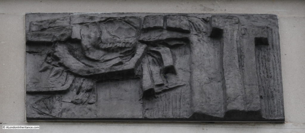
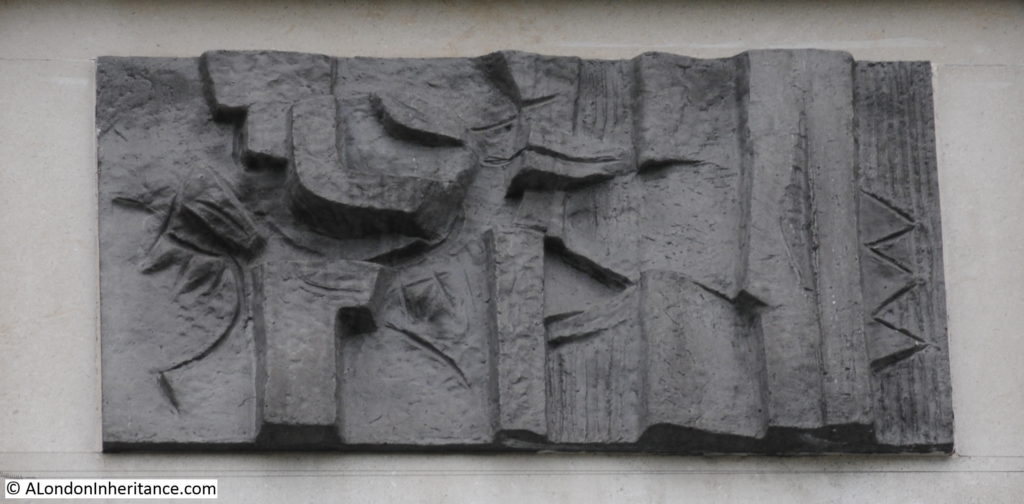
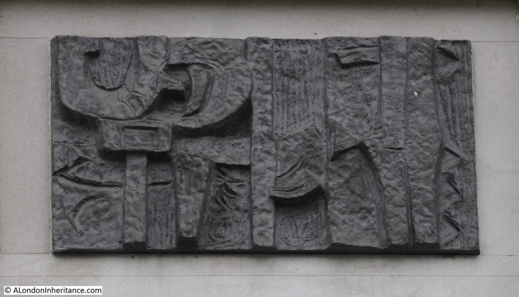
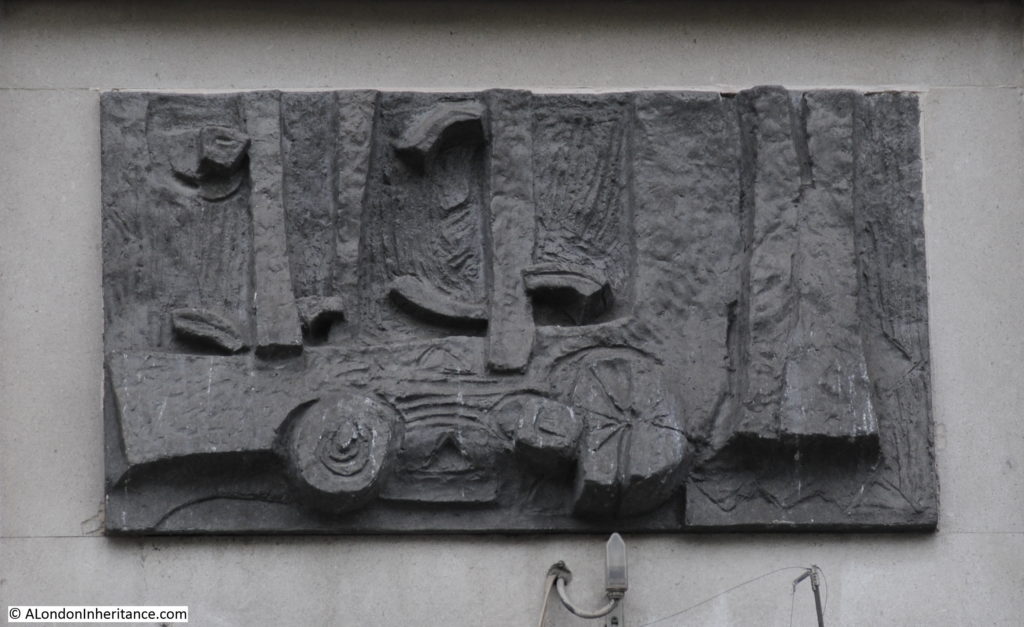
Category Archives: London Buildings

Millbank Estate and Millbank Penitentiary

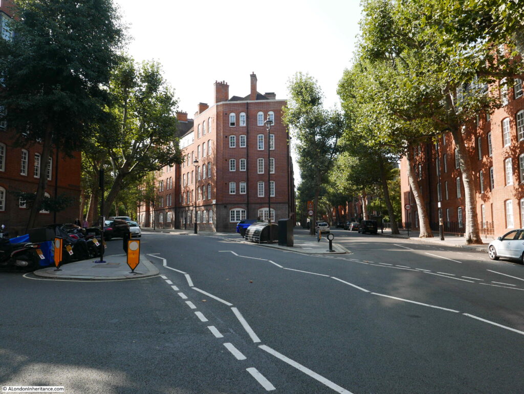
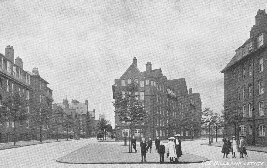
I have a postcard with a photo dated 1906 of the recently completed London County Council, Millbank Estate. The view shows some of the new blocks of flats, wide streets, newly planted trees, and children – probably residents of the new estate.

Millbank Estate

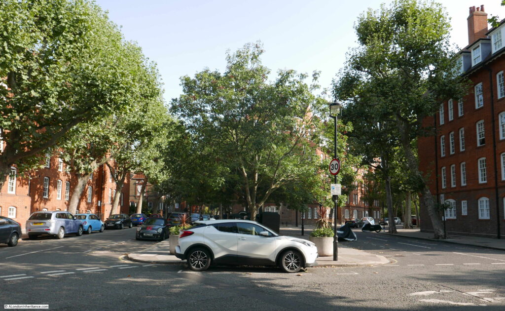
The same view in September 2020:

Millbank Estate

The trees have grown and now obscure the view of the blocks of flats. The wide streets now have parked cars, and the children in the view went on to see and hopefully survive, two world wars.

Remove the cars, see through the trees and the two views are much the same.

Both photos were taken at the south western end of the estate, looking north east. The street in front of the camera is Cureton Street and Erasmus Street is on the left and Herrick Street on the right.

The Millbank Estate is a large estate, built at the start of the 20th century, to provide flats for the working class. The estate was designed to accommodate upwards of 4,430 people in a number of separate blocks.

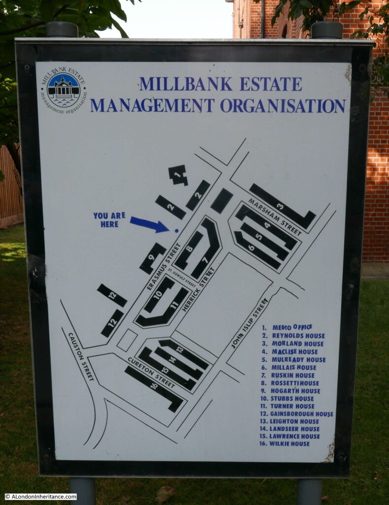
A map of the estate is displayed on a number of panels across the estate:

Millbank Estate

The Millbank Estate is adjacent to the Tate Britain gallery which was opened a couple of years before work started on the Millbank Estate, and the artistic theme of the Tate was extended to the new housing estate as each of the blocks was named after an artist. The full list of names is shown on the lower right of the above panel.

The Millbank Estate was built between 1897 and 1902 by the London County Council and was one of their most significant estates in terms of size and design. It was designed within the LCC’s Architects Department under Owen Fleming and was influenced by the arts and crafts style of design.

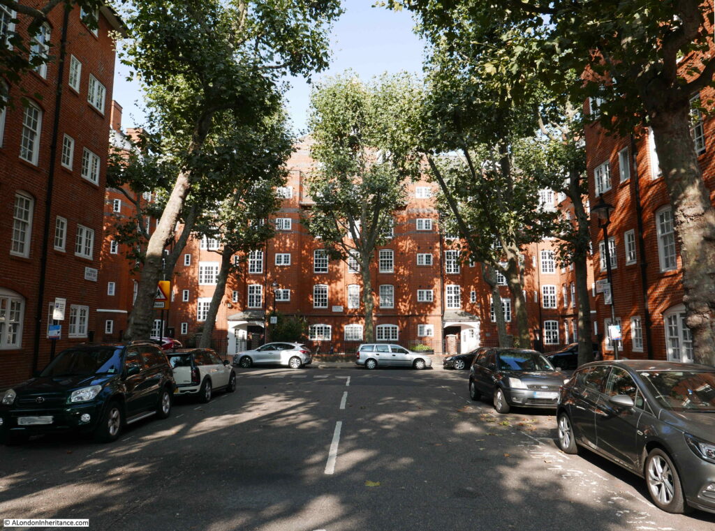
The estate is stunning on a sunny day, when the colour of the brick brings a richness to the buildings. The trees – which I assume from their size were planted at the time of the estate’s construction – break up the sunlight and leave patterns on the walls of the blocks.

The trees are regularly pollarded, when their branches are cut back significantly leaving stumps pointing at the sky, but they always grow back and enhance the view.

The view along St Oswulf Street with Hogarth House at the end of the street:

Millbank Estate

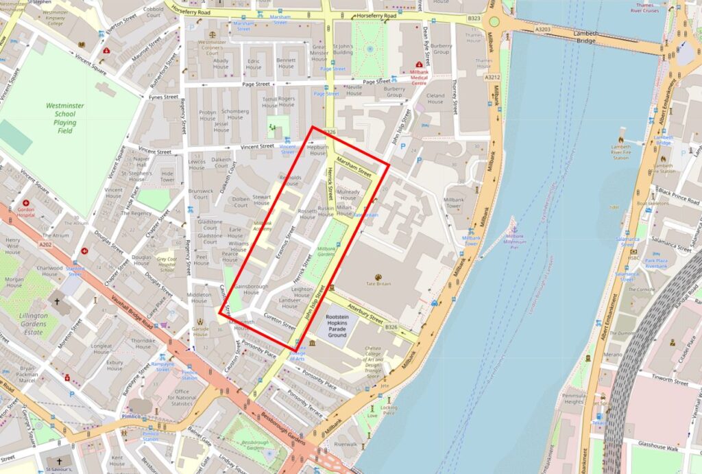
The area occupied by the Millbank Estate has a fascinating history. On land to the west of the River Thames, between Lambeth and Vauxhall Bridges, it was a large area to be free for building at the end of the 19th century. In the map below, the red rectangle shows the approximate area occupied by the estate (Map © OpenStreetMap contributors).

Millbank Estate

The area occupied by the Millbank estate, and indeed the Tate Gallery was available for new development because of the demolition of a large establishment that had previously the same space.

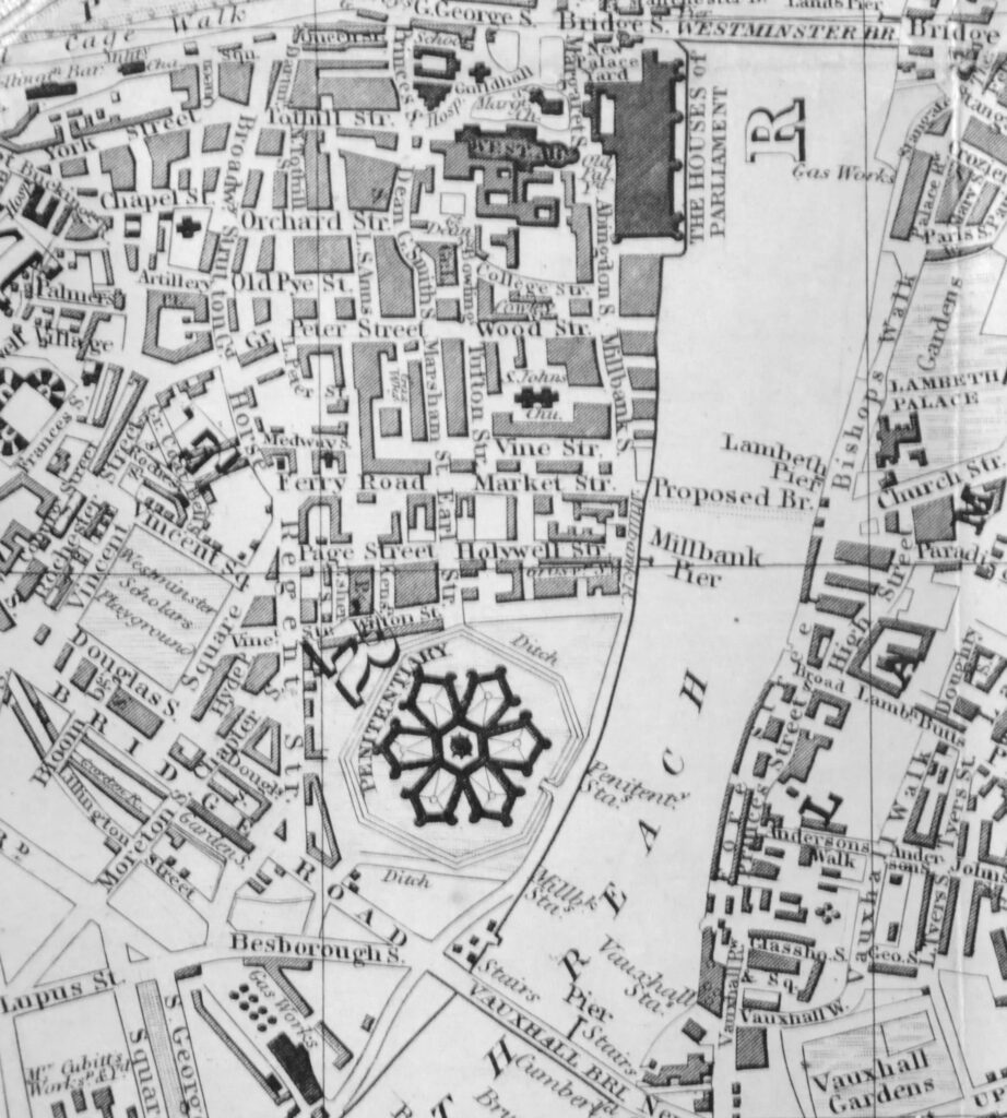
In the following extract from the 1847 edition of Reynolds’s New Map of London, there is a structure with a rather unusual design in the lower centre of the map. This was the Millbank Penitentiary or Prison.

Millbank Estate

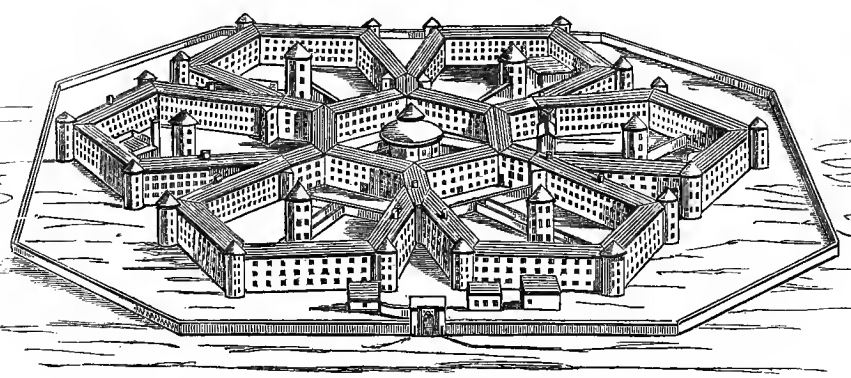
Millbank Penitentiary opened in 1816 and was in use until 1886, and was demolished by 1890. The shape was unusual for the time, with six individual pentagons of cells radiating out from the central governor’s block.

The pentagon design enabled the whole of the prison to be viewed from the central governor’s block.

The prison was initially designed to hold 1,000 prisoners, however as always seems to be the way with prisons, the population was frequently much higher.

Each of the pentagons was home to different types of prisoner. Writing about the prisons of London in 1862, Henry Mayhew and John Binny identified pentagon one as being the reception wing. Number two being for prisoners to work at various trades in their cells. Pentagon three was for women prisoners. Pentagon four housed the infirmary, along with a mix of different prisoners. Number five had individual cells, but also had shared cells which prisoners often preferred for the company and conversation instead of the individual cells.

Mayhew and Binny do not list the functions of the sixth pentagon, but looking at the diagram of the prison in the book, the sixth pentagon was were you would find the surgeon and the chaplain, with a corn mill in the centre.

Birds-eye drawing of Millbank Penitentiary:

Millbank Estate

Millbank Penitentiary was often used as a holding prison before prisoners moved onto other establishments. This included a period where prisoners sentenced to transportation were held at Millbank before boarding ship.

Mayhew and Binny’s book states that in 1854, 2,461 male prisoners passed through Millbank.

Six hundred and ninety seven remained at the end of the year. During the year, prisoners had been moved to other prions. One thousand and ninety five prisoners had been moved to sites of “public works” projects across the country. Of the total number of prisoners passing through Millbank in 1854, only four were pardoned, had a conditional pardon, or were set free.

One hundred and ninety eight female prisoners were in Millbank at the start of 1854, but by the end of the year they had all been moved to Brixton Prison apart from nineteen who had been discharged and one who had died.

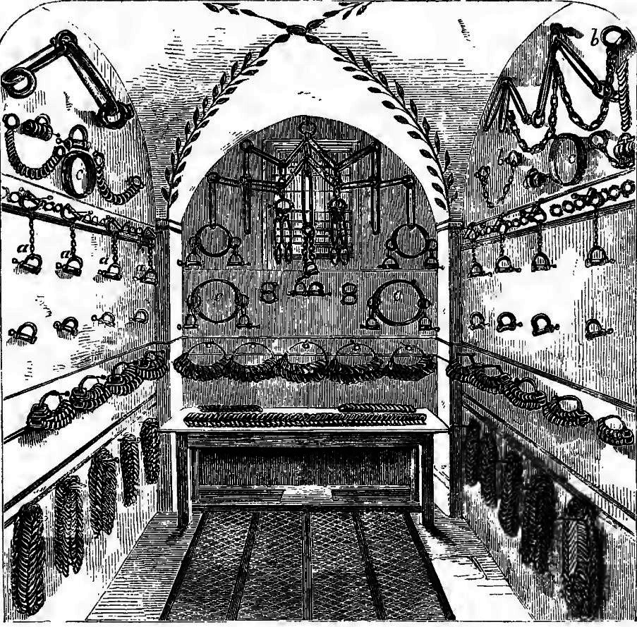
Conditions were harsh for the prisoners at Millbank. The location next to the River Thames must have meant the prison could be very cold and damp in winter. The prison also suffered a cholera outbreak. Prisoners would also be transported or held in irons, and the prison had a Chain Room where the implements to restrain prisoners were stored:

Millbank Estate

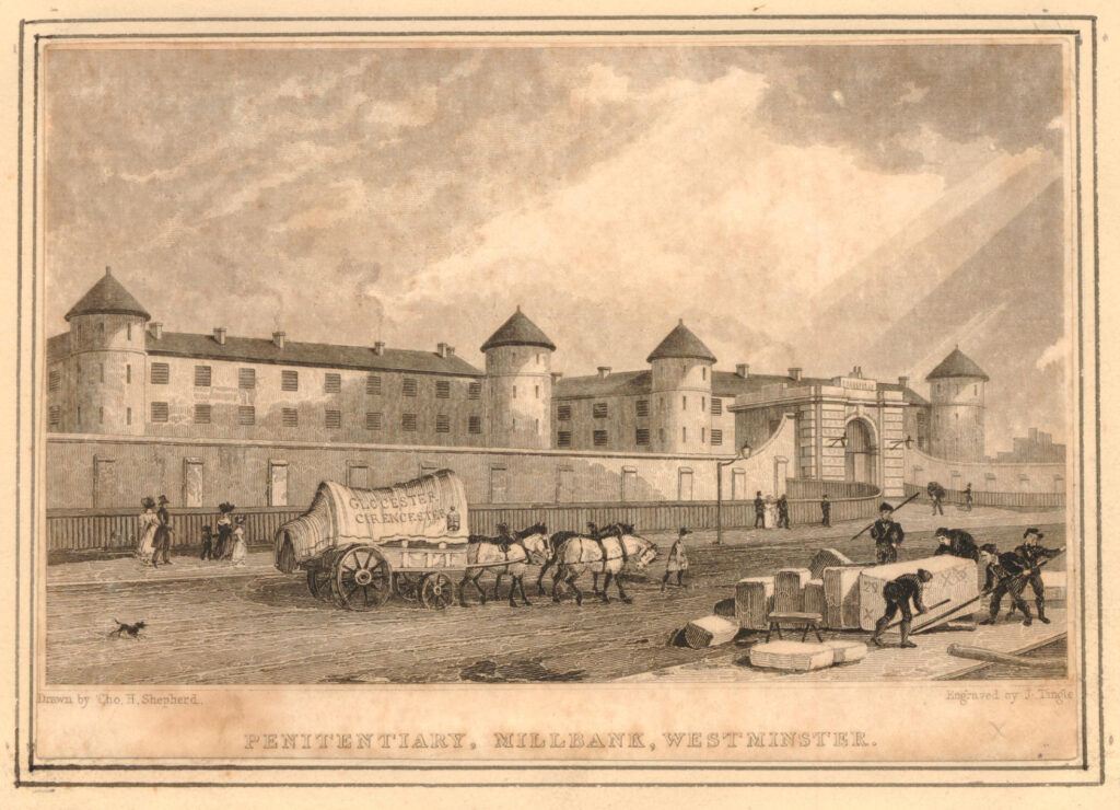
The following print shows the main entrance to the prison, with some of the prison wings behind the walls. This must have been drawn from the edge of the river, and shows the road running towards Westminster on the right, between prison and river.

Millbank Estate

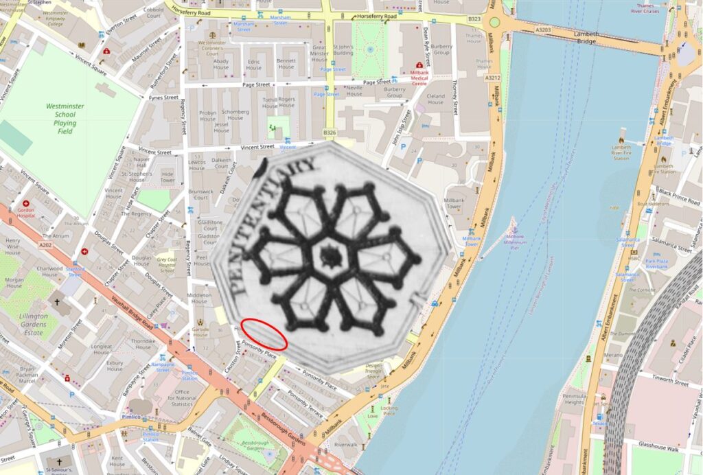
I have mapped the location of Millbank Penitentiary on the map of the area today in the following map extract.

Millbank Estate

The Tate Gallery, Millbank Estate and a number of other buildings now occupy the site today, but does anything remain of the prison?

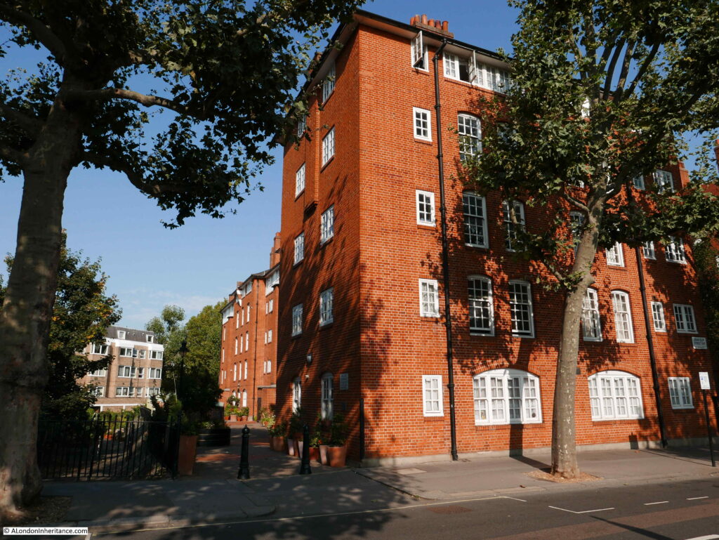
In the above map, I have added a red oval to the rear of the houses that face onto Ponsonby Place. This is the boarder with the south western edge of the Millbank Estate, and Wilkie House is the block that was built with the rear of the block facing the rear of the houses in Ponsonby Place.

There is a gap between the rear of Wilkie House and the houses to the west as shown in the following photo:

Millbank Estate

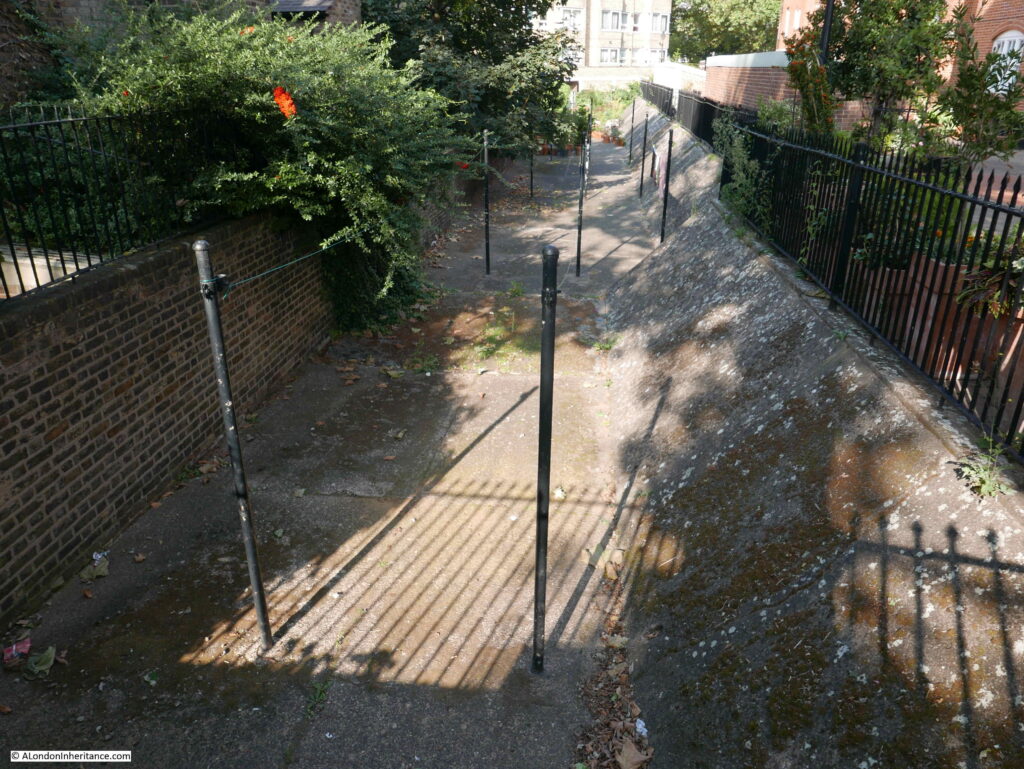
Look over the railings into the gap, and we can see the ditch and sloping wall of the original Millbank Penitentiary:

Millbank Estate

The City of Westminster Conservation Area Audit states about the ditch and wall:

“Of great importance is the octagonal shape of the former Millbank Penitentiary site, not only for its definition of the shape of the conservation area but also for the surviving sections of wall. This is an important historical and townscape characteristic of the area.”

The Millbank Penitentiary really deserves a dedicated post, so I will continue with my exploration of the Millbank Estate.

Families were a significant percentage of those living in the estate, so there was a need to provide schools for such a large estate and two were built at the same time as the housing blocks.

The two schools are both in Erasmus Street on the western side of the estate. The first one comes into view:

Millbank Estate

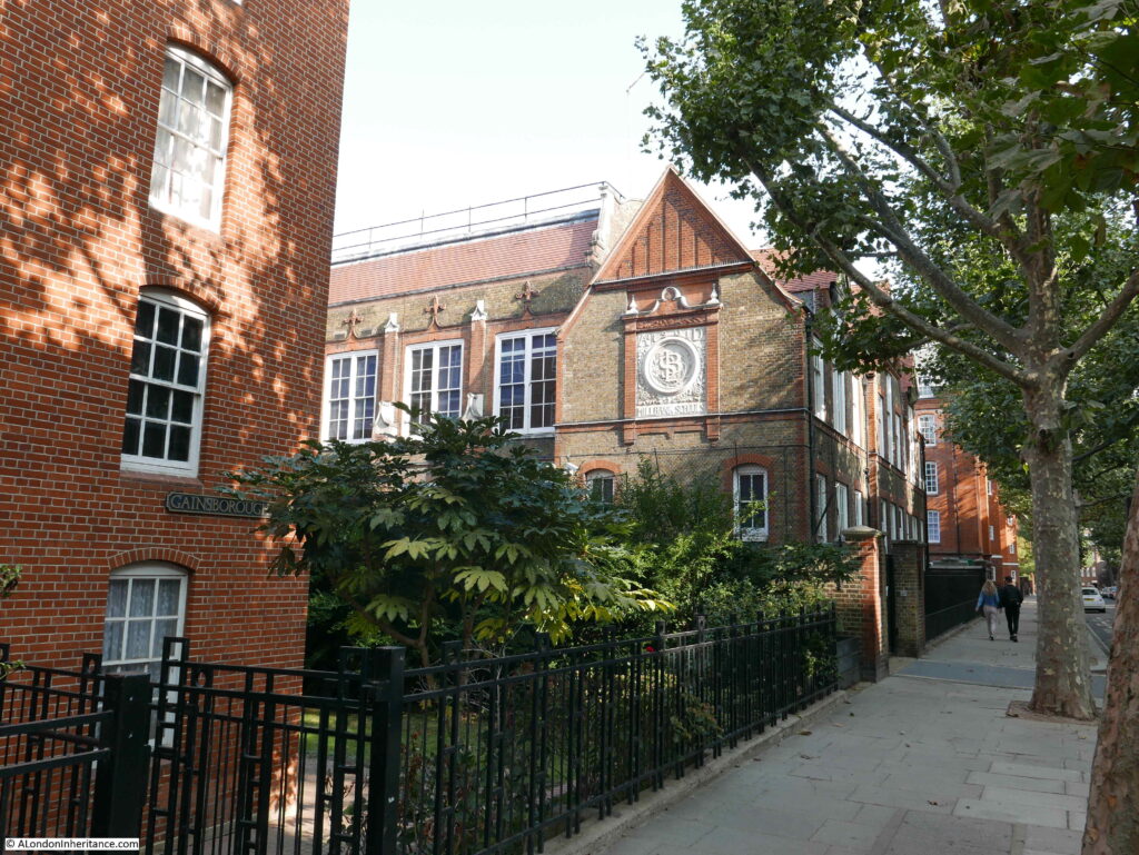
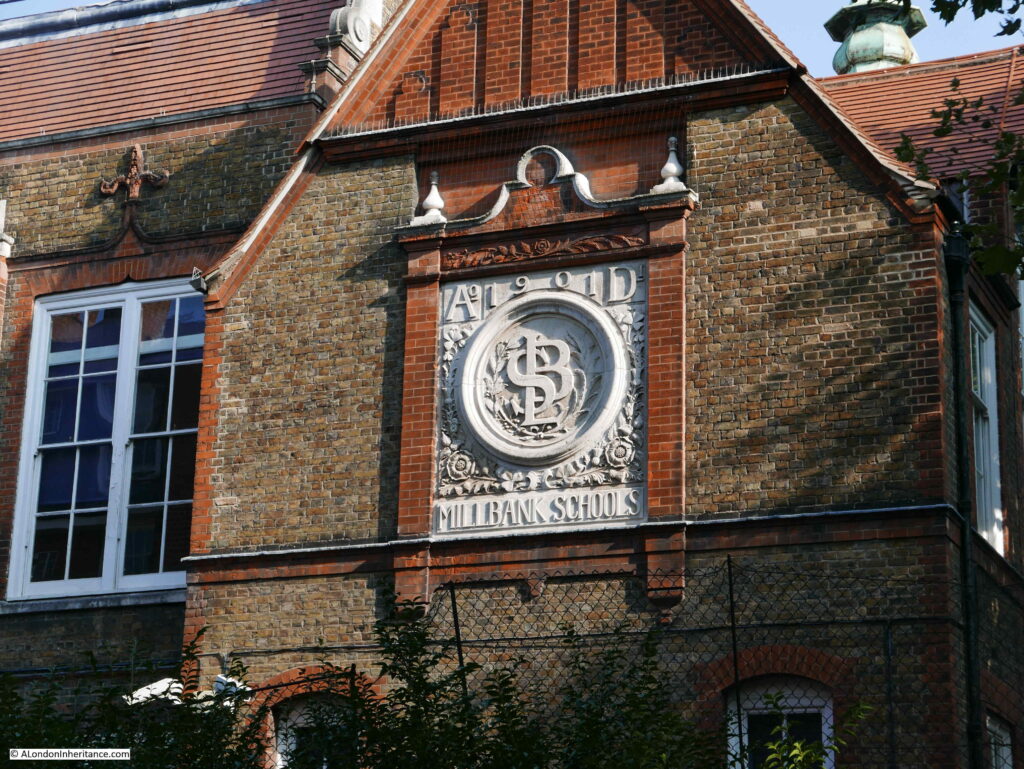
On the side of the first school is a rather ornate decoration stating Millbank Schools and the year of construction, 1901. In the centre are the initials LSB. These are not the initials of a person, rather the initials are of the London School Board who were responsible for the construction of the schools and it was their architects who produced the designs.

Millbank Estate

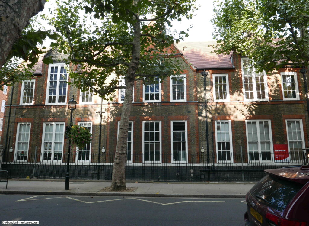
The fount of the first school facing onto Erasmus Street:

Millbank Estate

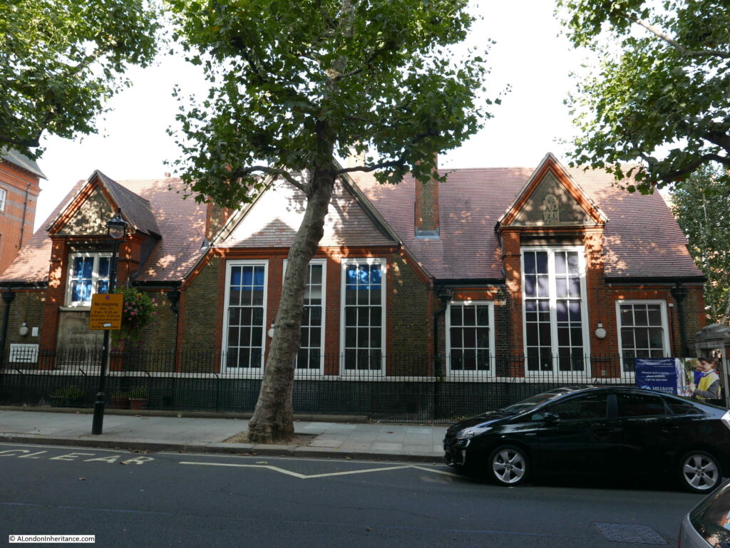
Further along is the infant school, also by the London School Board:

Millbank Estate

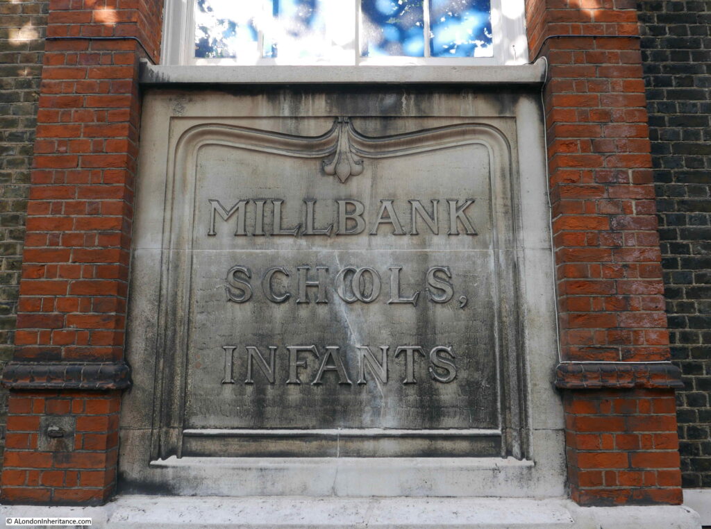
Plaque confirming  this building as the infants school:

Millbank Estate

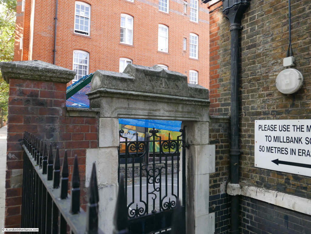
There are entrances and playgrounds at each side of the school building. A stone arch with the word “infants” provides access:

Millbank Estate

The reason for the two schools becomes apparent as you walk around the estate and realise the size, number of flats and how many children must have lived across the estate.

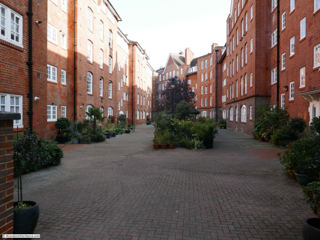
Between the main blocks of flats there are large courtyards, providing a very child friendly play area:

Millbank Estate

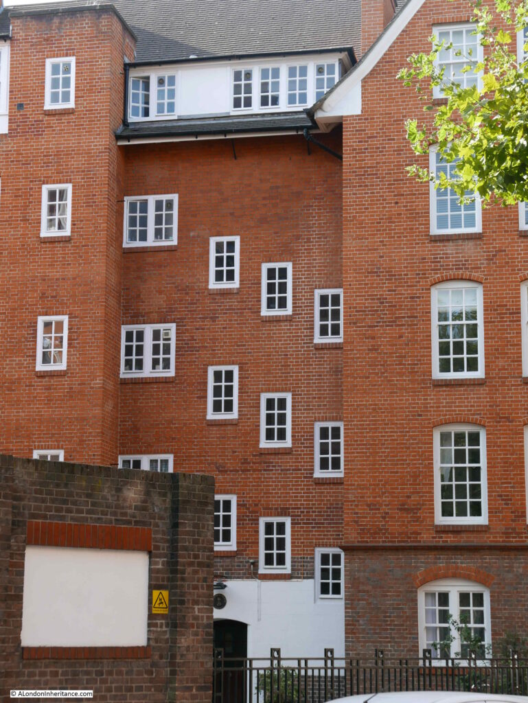
The blocks are not a monolithic design, they have plenty of individual features which break up the brick. In this view, staggered windows provide light to internal stairs:

Millbank Estate

Despite the large scale of the estate, there are small features dotted across the blocks, such as this small corner window:

Millbank Estate

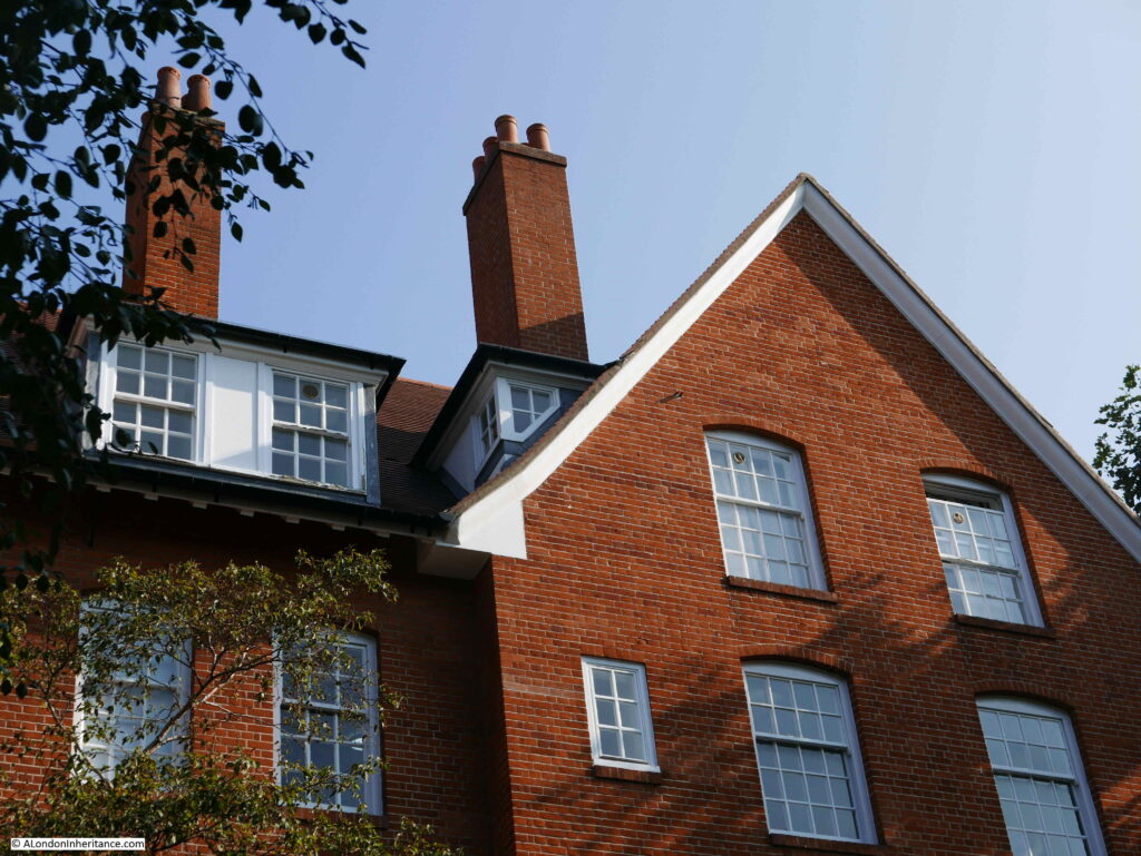
Following photo shows the view looking up the central part of Hogarth House, with a curving, triangular roof line, and long balcony:
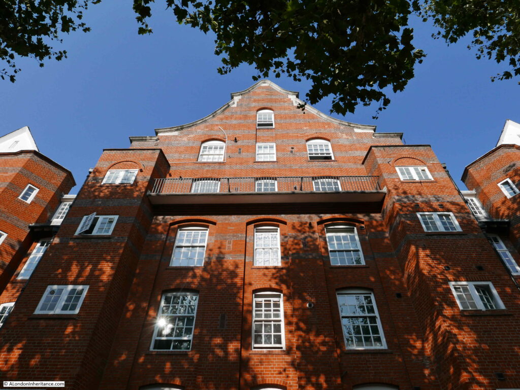
Millbank EstateThe Millbank Estate is Grade II listed, however Hogarth House has a higher Grade II* listing. It was the first block to be started in 1899 and the design of Hogarth House by the architects Henry Spalding and Alfred Cross was the winning design in the competition run by the London County Council Architects Department for the design of the estate.

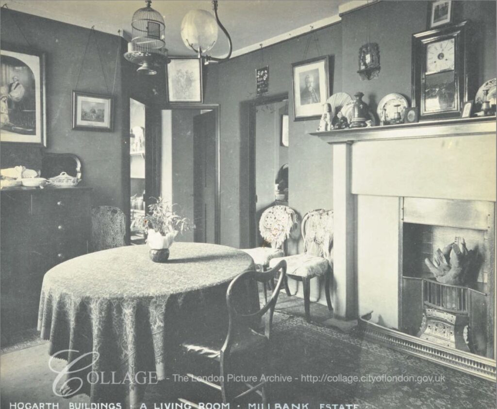
A living room in Hogarth House was photographed in 1909, not long after the building opened.

Millbank Estate

Image credit: London Metropolitan Archives, City of London: catalogue ref: SC_PHL_02_0832_70_1063

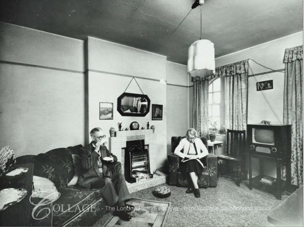
Being almost 120 years old, the Millbank Estate has been through a number of renovations. The condition of the flats had deteriorated by the late 1940s, and there were renovations throughout the 1950s and 1960s. The following photo shows a living room in Millais House in 1962.

Millbank Estate

Image credit: London Metropolitan Archives, City of London: catalogue ref: SC_PHL_02_0832_62_1623

The coal fire has by now been replaced with an electric fire, and the flats have moved into the television age.

The 1909 photo shows a well furnished Edwardian living room, and looking at the census data we can get an impression of the residents of the Millbank Estate (I was going to produce some detailed tables, but ran out of time).

Many or the residents were working / professional people, London County Council employees, Policemen, Workers from the nearby gas works (there were gas holders just to the west of the estate) and also at the Army and Navy Co-Operative Stores both on the Millbank river front, and at the end of the nearby Johnson Street – a street that has since been built over.

There were also residents who had come from the West End following the demolition of many of the slum housing in the area. LCC building was frequently to provide housing for those who had been moved following many of the late 19th century improvement schemes.

Despite this range of jobs, many of the newspaper reports of the opening of the estate still classed the new residents as poor. For example, this report from February 1906 was titled “The King And The Poor”:

“The King visited Millbank on Wednesday and inspected the model dwellings the London County Council had erected on a portion of the site of old Millbank Prison. The Queen accompanied his Majesty. The Royal party left Buckingham Palace at three o’clock in open landaus. The occasion was regarded as semi-private, but thousands of people collected near the point where the reception was to take place. The schools in the neighbourhood were given a half-holiday, and many of the children assembled to see the King.

As to the buildings, the King said they appeared light and comfortable, and these qualities were all the more striking in view of what he saw when visiting some of the lowest slum districts a few years ago. He sincerely hoped that the Council’s scheme would result in nothing but good to those whom it was sought to benefit.”

The Queen’s main concern appears to have been the lack of cupboards in the kitchen, and those who guided the Royal party around the estate promised they would look into the matter with urgency.

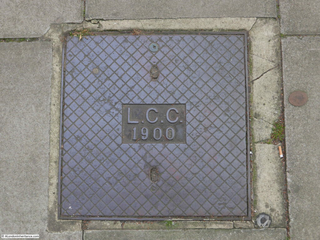
As well as the architectural features across the Millbank blocks, it is also worthwhile looking down at the ground, as across the estate are these LCC access covers, dated 1900, so from the original construction of the estate:

Millbank Estate

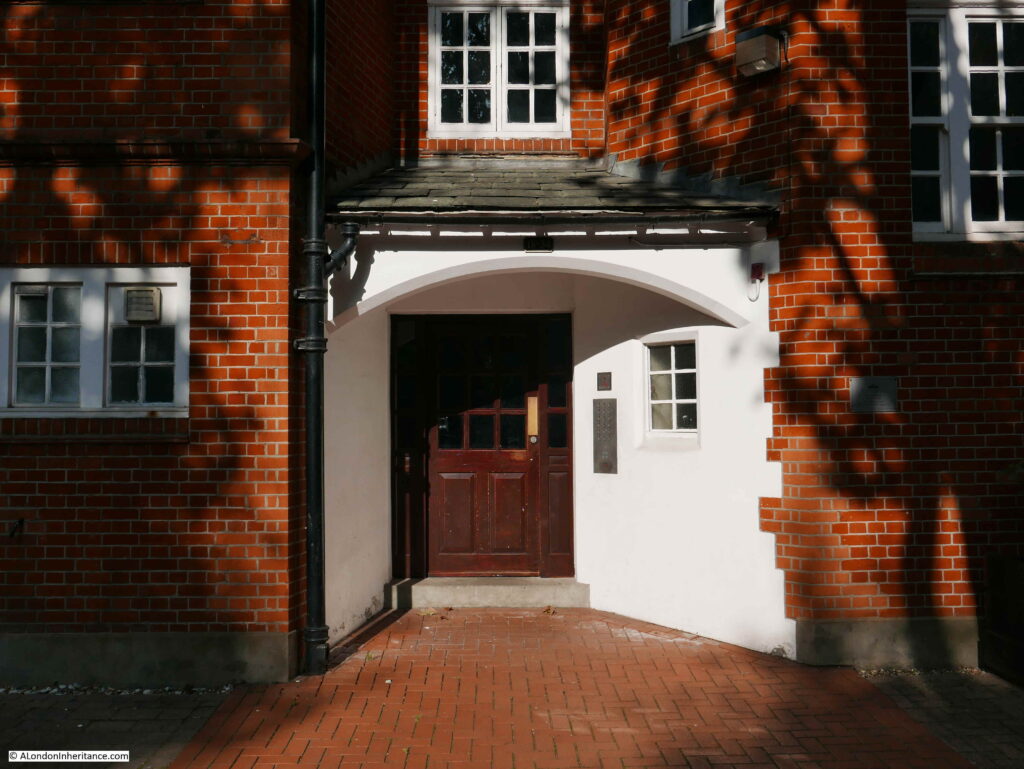
The inspiration of the arts and craft movement to the design of the estate is apparent in many of the features, such as the entrances to the blocks:

Millbank Estate

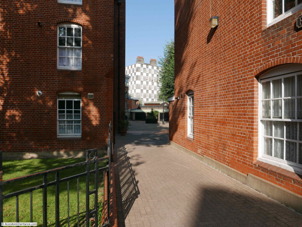
View between the blocks of Reynolds House, showing the distinctive chequer board patterns of the housing scheme in Vincent Street built for the Grosvenor Estate in the 1920s:

Millbank Estate

Another example of staggered windows:

Millbank Estate

The external condition of the Millbank Estate today is very good, and the estate has been through a number of renovations, however this has not always been the case. In 1947 the West London Press reported on a tenants’ protest and a Millbank Estate petition:

“A petition signed by 600 tenants of the Millbank Housing Estate, protesting about the conditions there, was handed by Mrs Lawler of 5 Morland Buildings to Communist L.C.C. member Jack Gaster when a crowded meeting of 200 Millbank Estate tenants was held at Millbank School recently.

Cllr. Gaster will hand the petition to the L.C.C. when their meeting takes place at County Hall next Tuesday.

The petition, which Mrs. Lawler said had met with great support throughout the estate, asks the L.C.C. to provide suitable storage facilities for the storage of coal, so that tenants can build up adequate supplies for the winter months. It also asks for the erection of pram-sheds in the yards to safeguard young mothers from undue strain in pulling prams up many flights of stairs.

The need for the L.C.C. to take immediate steps regarding essential repairs and decorations and to provide labour and materials for cleaning stairs and windows are also stressed in the petition, while a plea is made for railings to enclose the yards to keep children off the streets.”

The L.C.C. did agree that the work was needed, but did not expect the work to completed for a while due to post war shortages of materials and labour.

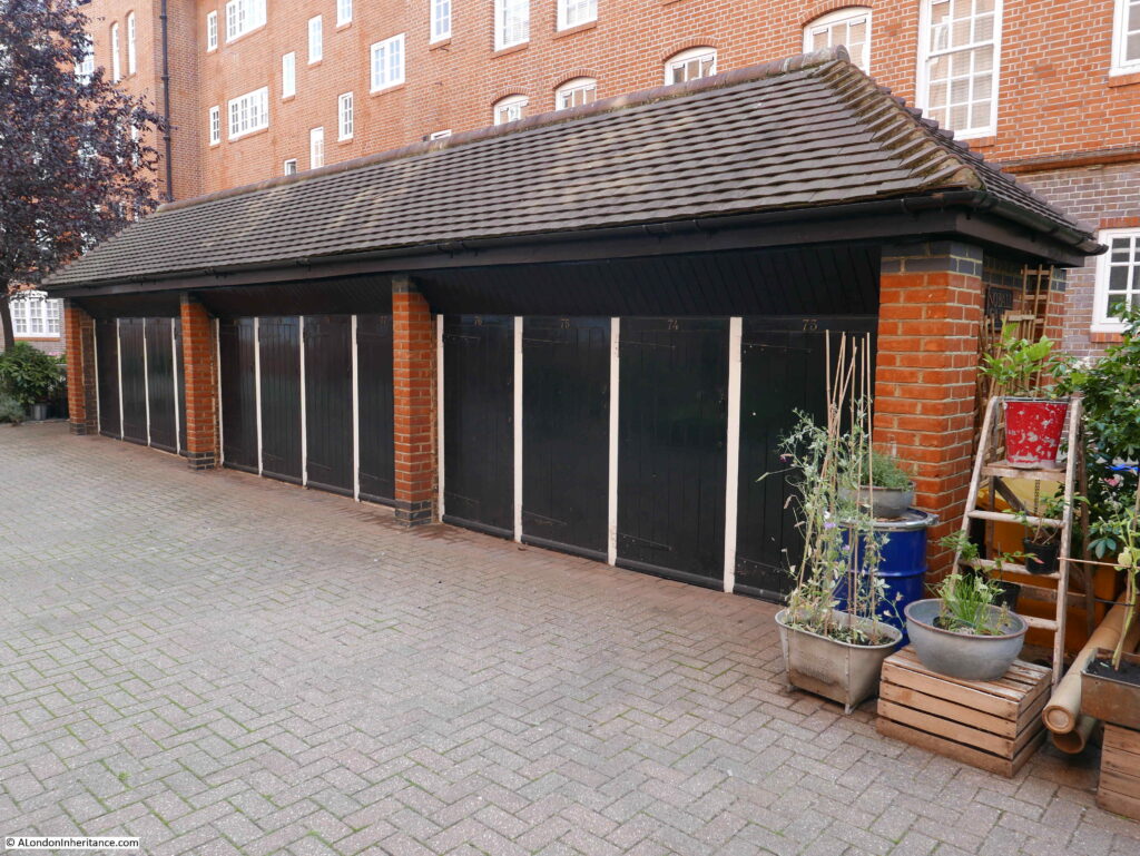
I suspect that the following photo shows that one of the requests from the tenants of 1947 was delivered, with the provision of pram sheds in the courtyards between the blocks:

Millbank Estate

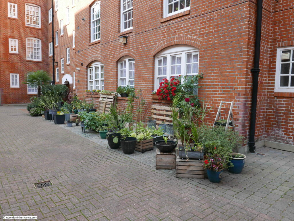
Many of the internal courtyards have been decorated with plants and flowers which provide a lovely contrast to the brick of the blocks of flats.

Millbank Estate

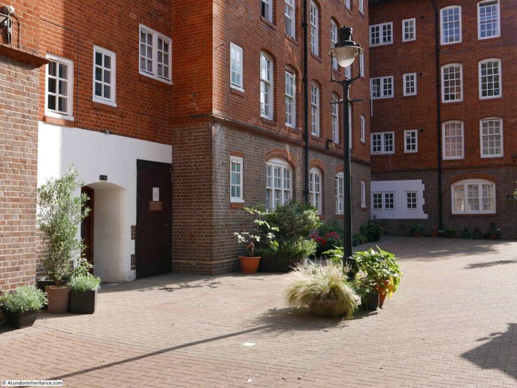
Internal courtyard with plants and lamp post:

Millbank Estate

The Millbank Estate was built for the working class, and it is interesting how the influx of the new residents changed the demographic of the area. The Morning Post on the 11th January 1906 noted the impact the new estate could have on the General Election, and the re-election of the Conservative MP Mr. W. Burdett-Coutts who had held the Westminster seat for the past 20 years:

“The struggle is rendered the more interesting from the fact that the character of the constituency has greatly altered since the last election. The present electorate is 7,530, and the extensions of artisans’ dwellings on the Millbank Estate and the City of Westminster Council buildings in Regency-street has increased the working class vote to 5,000. This important fact, together with the general effect of the swinging of the political pendulum, and the prejudice raised against the late Government on education, fiscal and other questions, induce the Liberals to think they have a good opportunity of winning the borough in which the Houses of Parliament and so many other important buildings are included.”

Burdett-Coutts did not have to worry, as he won the 1906 election, and would go on to hold the Westminster seat until it was abolished in the 1918 election.

This is Maclise House with the Millbank Tower in the background:

Millbank Estate

Maclise House is one of the blocks on the Millbank Estate that has this wonderful doorway – it almost looks as if it is providing a portal into another world.

Millbank Estate

Note how above the entrance doorway, there is the stairway that juts out from the wall, ending at the top with a curved roof.

View back across the courtyard of Maclise House:

Millbank Estate

This is the view from the north-eastern end of the estate. I am standing by Marsham Street, which turns left in front of the camera. Herrick Street then on the left and Erasmus Street on the right.

Millbank Estate

There was relatively little bomb damage to the Millbank Estate. Where there was damage it was well repaired – this included the side of the building directly facing the camera in the above photo.

Those children in the 1906 photo at the top of the post could therefore step straight back into the estate and notice few differences – the main changes being almost 120 years of tree growth and parked cars now lining all the streets.

Externally, the housing blocks look impressive and in a well maintained condition. I talked with a few residents in the courtyards and they appeared very happy with their flats.

The London County Council’s Millbank Estate is a far better use of the land than the Millbank Penitentiary that previously occupied the site, however it is good that we can still find a physical reminder of the prison on the boundary of the estate, which shows how the shape of the prison influenced the space occupied by the estate, built by the London County Council for the working class of London.

alondoninheritance.com

The Globe at Borough Market

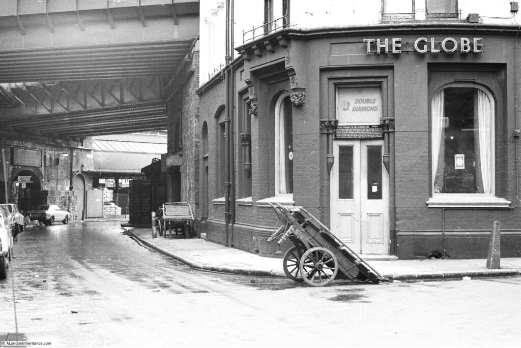
In 1977 I was taking some photos around Southwark using my brand new Canon AE-1, purchased using hire purchase as at the time it was the only way I could afford such a camera, and I was desperate to replace the cheap Russian Zenit camera I had been using. The main feature of this camera seemed to be a sticking shutter which ruined far too many photos.

A couple of these photos were of the Globe at Borough Market. A very different market to the market of today.

Globe at Borough Market

The same view 43 years later in 2020:

Globe at Borough Market

The Globe was built in 1872 to a design by architect Henry Jarvis. A lovely brick pub, the paint on the external walls in my 1977 photo has since been removed to reveal the original brickwork.

When I took the original photo, Borough Market was a very different place. Selling all types of fruit, vegetables, potatoes etc. The market started very early in the morning mainly selling to businesses such as the shops and restaurants of south London.

The narrow aisles between the market stalls meant that vehicles could not easily enter the market so porters were employed to transfer goods from lorries parked in the streets, into the market.

One of the barrows used by a porter is outside the corner entrance to the pub. This was why I took the photo as the barrow and pub seemed to be a good combination that in many ways summed up a London market at the time. There is another barrow parked alongside the Globe at left.

There were a number of pubs surrounding Borough Market, catering to the needs of those who worked in the market, which included being open much earlier in the morning than a normal London pub. Reading the licence information above the door of the Globe gives an indication of days and times that the pub served the market, and the trades of those who were expected in the Globe:

“NOTICE PURSUANT TO THE LICENSING ACT 1964 – Intoxicating liquors are permitted to be sold and supplied in these premises between the hours of six-thirty and eight-thirty of the clock on the morning of Tuesday, Wednesday, Thursday, Friday and Saturday of each week. Excepting Christmas Day, Good Friday and Bank Holidays for the accommodation of persons following their lawful trade of calling as Salesmen, Buyers, Carmen, Assistants or Porters and attending a Public Market at the Borough of Southwark”.

Another photo of the Globe in 1977:

Globe at Borough Market

And in 2020. The days of selling Double Diamond are long gone.

Globe at Borough Market

In the above photo, at the very top right corner, you can just see an edge of the Thameslink Viaduct that was built over Borough Market between 2009 and 2013.

The first floor of the Globe was the film location for Bridget Jones flat in the 2001 film Bridget Jones Diary.

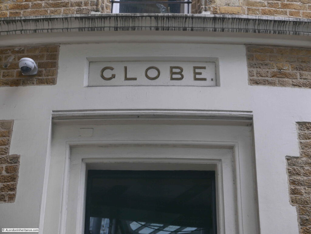
Globe – the name of the pub in stone above the windows, seen in both the 1977 and 2020 photos:

Globe at Borough Market

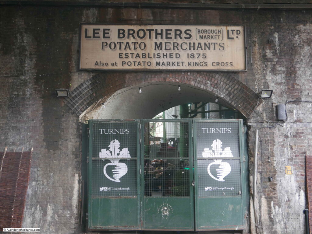
If you go back to the photo at the top of the post, and look along the left side of the street, and in the distance is an arch with a sign above. The sign still remains although Lee Brothers Potato Merchants have long gone.

Globe at Borough Market

The origins of Borough Market are ancient, dating back for at least 1,000 years. Originally a market at the southern end of London Bridge, however by 1754 the City of London was fed up with the Southwark entrance to the bridge being congested by a market, and that the market was taking business away from the City markets. A bill was introduced to Parliament to stop the market trading in March 1756.

The local residents were not happy with the loss of their market and raised £6,000 to buy an area of land called The Triangle, and this became the new home of what is today Borough Market.

The market flourished, and the arrival of the railways with their local goods yards increased the volume of fruit, veg, etc. being sold at the market.

The end of the wholesale market started in the late 1970s and continued in the early 1980s. The City of London constructed New Covent Garden market in Nine Elms. This was a much larger market with considerably easier access and plenty of parking, unlike at Borough Market.

In parallel was the gradual replacement of the traditional corner shop and green grocer by much larger supermarkets who had their own supply chain and had no need to purchase fruit and veg from a local market such as Borough.

The market’s renaissance started in the late 1990s when specialist food suppliers started to move in, and food fairs were organised. Borough Market has since gone from strength to strength, and on most days (prior to the Covid-19 pandemic) it would be crowded with tourists and shoppers.

When walking among the stalls, it almost looks as if you could buy a different cheese for every single day of the year.

Along with the market traders, a wide range of restaurants have opened surrounding the market, and the old pubs that once served the market porters at 6:30 in the morning, have a new lease of life and are serving a very different customer – no longer are barrows left outside the pub door.

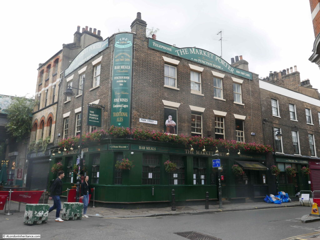
One of the pubs surrounding the market is the appropriately named The Market Porter on the corner of Stoney Street and Park Street.

Globe at Borough Market

The Market Porter dates from 1890, however the site was previously occupied by a pub named the Harrow.

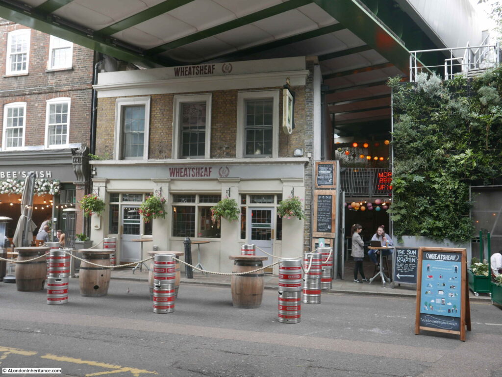
Further along Stoney Street is another pub that looks in a rather strange location, squashed by the railway bridge directly above the pub. This is the Wheatsheaf:

Globe at Borough Market

The current Wheatsheaf building dates from 1840, although a pub had been on the site since the 18th century. It originally had three floors and was part of a terrace. The pub lost the third floor when the pub closed in 2009 for the construction of the Thameslink Viaduct which now runs directly overhead. The Wheatsheaf reopened in 2014 in its new, cramped looking condition, however thankfully this historic pub survived such a dramatic change.

Construction of the Thameslink Viaduct was a significant engineering achievement, with building such a structure above a working market. The viaduct runs for 322 metres across the market, and during construction, work included the removal and replacement of the market’s historic roof.

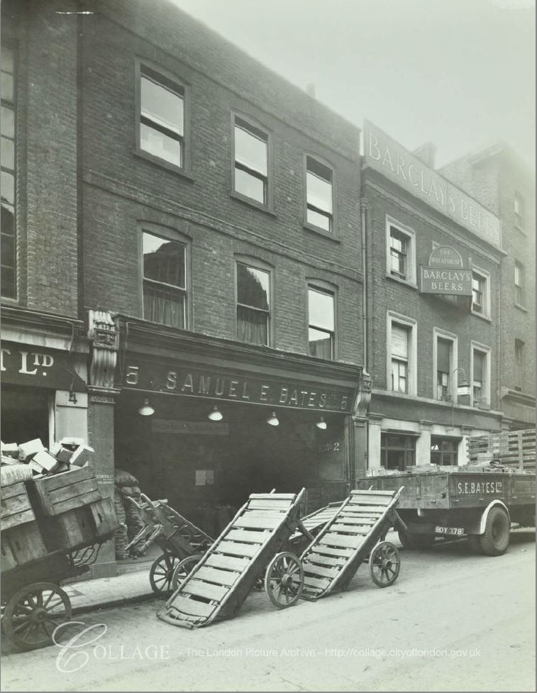
The following photo shows the Wheatsheaf in 1943, in its original condition (the building on the right), along with the same style of barrow that I would photograph in 1977:

Globe at Borough Market

Image credit: London Metropolitan Archives, City of London: catalogue ref: SC_PHL_01_376_F1582

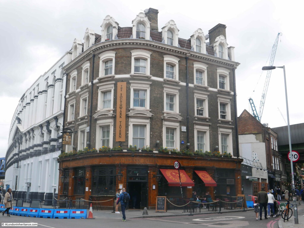
On the corner of Stoney Street and Southwark Street is the Southwark Tavern, a lovely Victorian corner pub dating from 1862:

Globe at Borough Market

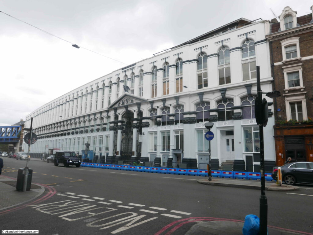
However a more remarkable building is alongside the Southwark Tavern. This is the imposing Hop and Malt Exchange.

Globe at Borough Market

The Hop and Malt Exchange dates from 1867 and was designed by the architect R.H. Moore, and was the premises of the Hop Planters Association.

The frontage along Southwark Street is 340 feet and it covered more than an acre of land.

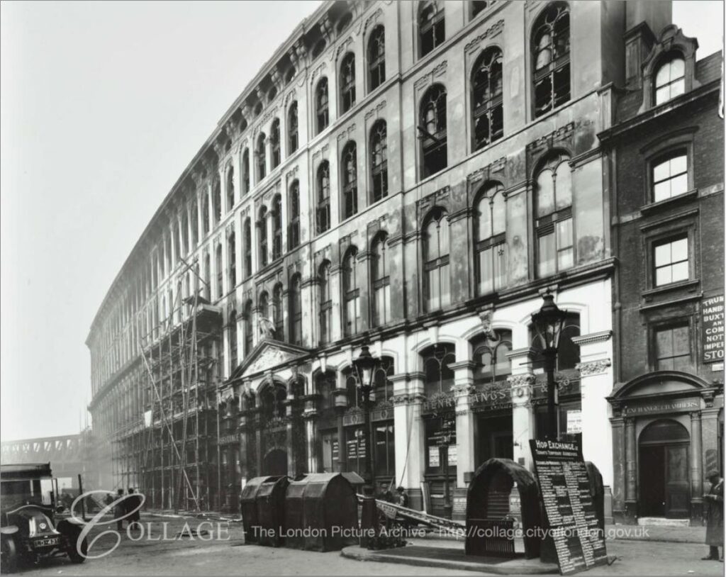
Although the building looks impressive today, it was originally a much taller building, however after a fire in 1920 which gutted much of the building, the top two floors were demolished. The original, larger facade just after the fire can be seen in the photo below:

Globe at Borough Market

Image credit: London Metropolitan Archives, City of London: catalogue ref: C_PHL_01_375_574c_2

The Hop and Malt Exchange was built in Southwark, as it was close to the main railway stations and goods depots that served the hop growing counties of Kent, Sussex and Surrey and provided a place were growers and buyers could meet in one place to conduct the sale of hops.

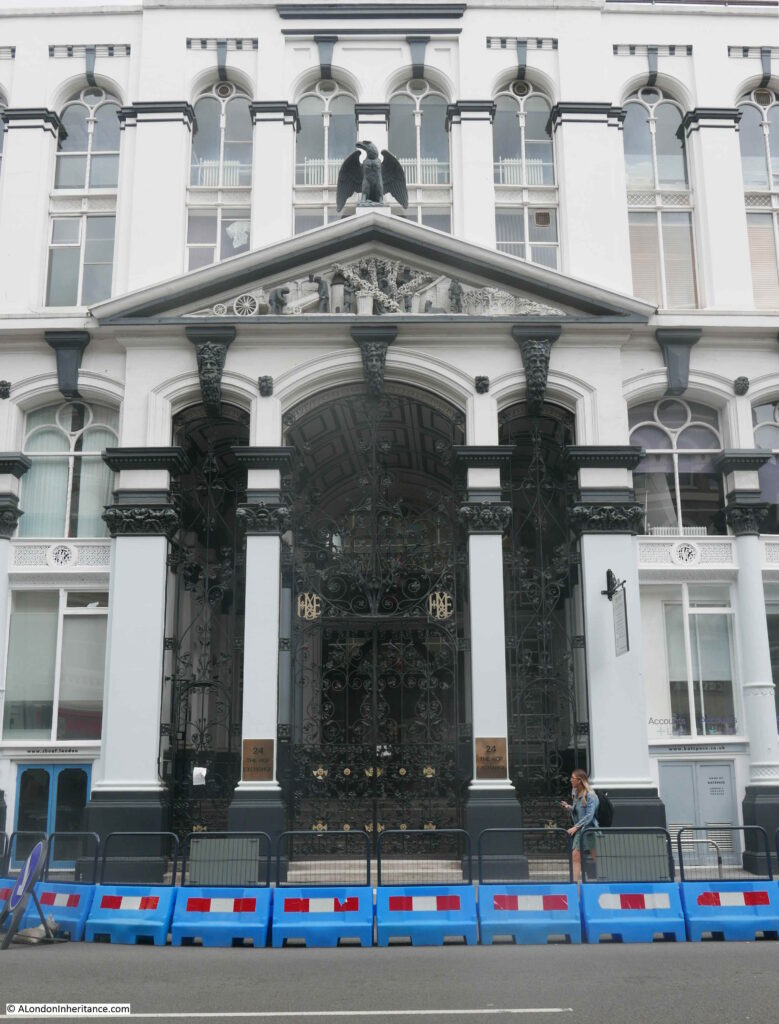
The main entrance to the Hop and Malt Exchange:

Globe at Borough Market

The pediment above the main entrance contains some wonderful decoration showing hop and malt production. Hops being grown and picked in the centre. Barley being grown on the right for the production of malt, with these products being carried in a sack on a barrow on the left.

Globe at Borough Market

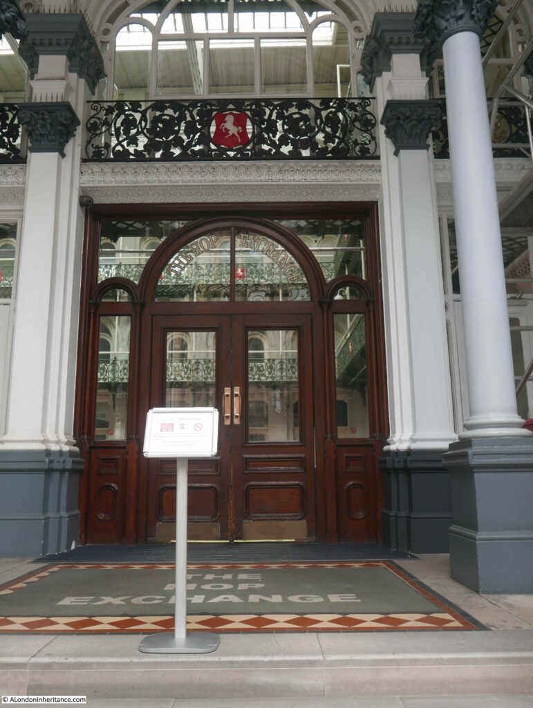
Looking through the iron gates of the entrance (which are also beautifully decorated), we can glimpse the main Exchange Room:

Globe at Borough Market

The Exchange Room was the central point for trading activities. It was 80 feet long by 50 feet wide and 75 feet was the original height to the top floor. The roof was glass allowing plenty of natural light to shine on the floor below. There was a central lantern feature running along the length of the roof, and in the pre-fire building, this was 115 feet above the floor of the Exchange Room.

The Exchange Room was surrounded by four floors of offices and show rooms where growers could show off their products to potential buyers. First and second class refreshment rooms were also provided. Presumably you used the first class when trying to impress a buyer, and the second class for normal refreshment.

A view of the Exchange Room after opening:

Globe at Borough Market

Today, the Hop and Malt Exchange has been restored and is currently a location providing office, corporate hospitality and a live events space, so in some ways is still true to the original use of the building – although no longer trading in hops and malt.

Borough Market and the Hop and Malt Exchange highlight that this area was a significant place for trading agricultural products. What started off as a market on the southern end of London Bridge, grew considerably with the arrival of the railways. Road and rail access to the southern agricultural counties turned this part of Southwark into a key location where London’s shops, restaurants and breweries could negotiate and buy the key agricultural products they needed for their business.

My 1977 photo captured the very end of that long period, but Borough Market still remains serving a new, 21st century customer.

alondoninheritance.com

Sadler’s Wells – How Water Shaped North Clerkenwell

London today is covered by streets, pavements and buildings. Apart from the larger parks, there are a limited number of small green spaces. So much of what shaped the surface has been long hidden, but we can still find signs as to why the built environment appears as it does, and how names recall features we cannot see.

Clerkenwell, up to the Angel has been shaped by water. The River Fleet created much of the western boundary. New River Head was built at a point which was almost at the same 100m contour that followed the river back to the springs in Hertfordshire, the fall in height to the City and Thames provided a distribution system using gravity.

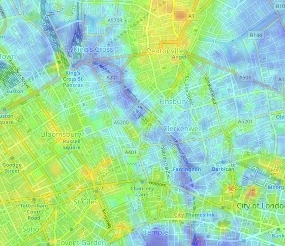
We can see this by overlaying an elevation map on top of a street map. In the following extract, dark blues are lowest height, with the colours changing up to red as height increases (map from topographic-map.com)

Sadler's Wells

We can see the dark blues of the River Fleet valley. As elevation increases the map shades through green then orange and red as the height increases up to north Clerkenwell, Finsbury and the Angel at the top centre of the map.

Much of this area had numerous springs and wells, and as the land increased in height, it passed through bands of London Clay and gravel, and it is a band of gravel and a well that gave rise to the location of today’s post – Sadler’s Wells.

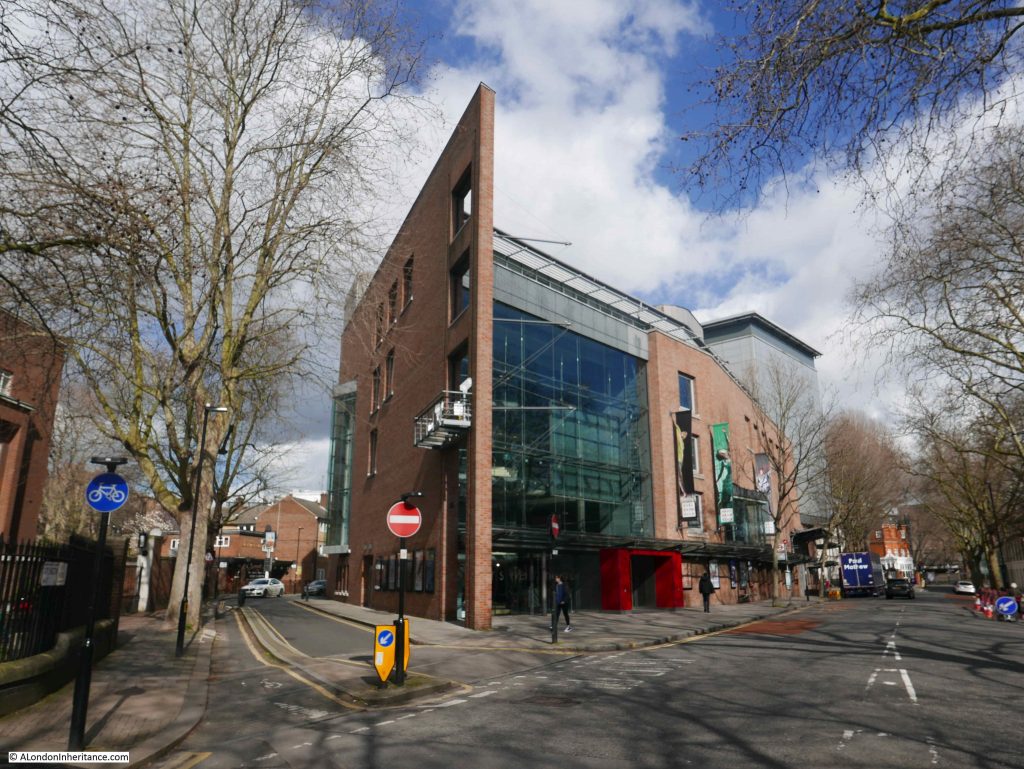
Sadler’s Wells is a world leading theatre and centre of dance, located at the northern end of Rosebery Avenue. There has been a theatre on the site for many centuries, the current building opened in 1998, photographed below looking north along Rosebery Avenue with Arlington Way on the left.

Sadler's Wells

William J. Pinks in the History of Clerkenwell (1865) describes the origins of Sadler’s Wells: “This popular place of amusement is the oldest theatre in London. Some time before the year 1683 a wooden building, called Sadler’s Music House, stood on the north side of the New River about this spot. Sadler, as well as being the proprietor of this establishment, was a surveyor of the highways. In the year last mentioned, his servants, while digging in the garden for gravel, discovered a well of mineral water, which shortly afterwards became very celebrated for its curative properties; so that it was visited by five or six hundred people every morning”.

The well that Edward Sadler’s workmen had discovered possibly dated from the 12th century or earlier when many of the wells in Clerkenwell were used by the Clerkenwell priory to persuade people that the virtue of the waters came from the strength of their prayers. (Books have different accounts of Sadler’s first name, with Richard or Dick being frequent references, however the Survey of London concludes Edward as being the almost certain name, based on a Chancery Court proceeding against him. Edward Sadler was a vintner, who in 1671 had taken a 35 year lease on the area that would become Sadler’s Wells).

The wells were closed at the reformation as they were claimed to support a superstitious believe in the power of the waters.

Pinks provides some additional description of the well found by the workmen: “When they had dug pretty deep, one of them found his pick axe handle strike upon something that was very hard, whereupon he endeavoured to break it, but could not,; whereupon, thinking within himself that it might, peradventure, be some treasure hid there, he uncovered it very carefully, and found it to be a broad flat stone, which having loosed and lifted up, he saw it was supported by four oaken posts, and under it a large well of stone arched over, and curiously carved”.

Sadler capitalised on the discovery of the well, and quickly promoted the health benefits of the waters, and as Pinks described, the wells were soon visited by several hundred people a day.  Sadler encouraged the regular drinking of the waters, and put on several forms of entertainment to encourage people to come, stay, and spend money. Treatment included recommendations to stay at the well for a whole day, drinking the waters at specified times, walking and resting around the surrounding gardens in between drinking sessions.

Sadler and the well that his workmen discovered would provide the name for the site, and most histories seem to put the discovery of the well as the starting point for the following centuries of the site as a place of entertainment, however Pinks provides a hint that it was probably providing such a function for many years prior to 1683:

“A petition from the proprietor of Sadler’s Wells to the House of Commons, stating that the site was a place of public entertainment in the reign of Queen Elizabeth. If this be correct, Sadler was certainly not its first possessor for musical purposes and water drinking”.

It appears that Sadler was not running the site for too many years after discovery of the well, and the popularity of the well would also quickly decline. In the 1690’s the well appears to have been closed, but by June 1697 the following advert would appear in the ‘Post Boy’:

“Sadler’s excellent Steel Waters, at Islington, having been obstructed for some years past, are now opened and current again, and the waters are found to be in their full vigour, strength and virtue, as ever they were, as is attested and assured by the physicians who have since fully tried them”.

By 1699 the building occupying the site was called Miles’s Music House, and entertainment, rather than the waters seems to have been the main focus.

The following photo was taken a little further south along Rosebery Avenue and shows how close Sadler’s Wells is to New River Head which is on the left, with the curved Laboratory Building on the left of the theatre.

Sadler's Wells

Today, Sadler’s Wells is in the heart of north Clerkenwell / Islington. A short distance south from the busy junction at the Angel, however the theatre has its origins when the area was still rural.

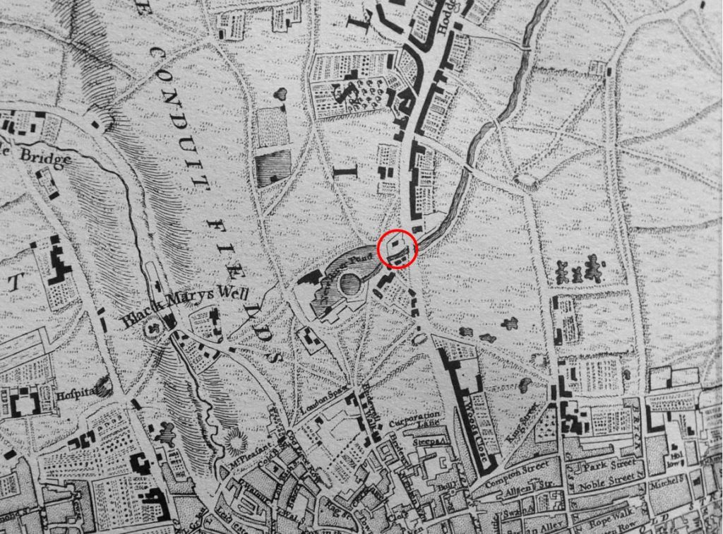
In the following extract from Rocque’s 1746 map, I have circled the location of Sadler’s Wells.

Sadler's Wells

The rectangular shape in the upper part of the circle is presumably the theatre, surrounded by gardens. Note the New River coming in from top right down to the round pond of New River Head to the left of Sadler’s Wells. The New River would form a southern border for the site for many years. The River Fleet is on the left of the map, running between the lines that indicate sloping land forming the valley of the river – exactly as we can see today on the elevation map, and when walking the streets.

The map also shows that in 1746, over 60 years since the discovery of the well, Sadler’s Wells was still surrounded by fields.

At night, the area between Sadler’s Wells and the City was a notorious area for thieves, and those heading back often risked their lives, as the following report from the Newcastle Courant in 1716 makes clear:

“On Saturday Night, a Gentlewoman, one Madam Napp, and her Son, betwixt 10 and 11 coming from Sadler’s Wells at Islington, where they have been to see the Diversion of Dancing, to their House in Warwick Court in Holburn; were attacked by some Foot Padders, on this Side of Gray’s Inn Garden Wall. 

The Gentleman Collar’d one of them, and flung him down to the Ground, and whilst he was struggling with another, his Mother cryed out Murder; upon which the third Rogue fired a Pistol and shot her dead.

Some People at Bromley Street hearing the Pistol go off, ran to see what was the Matter, and the Roques scoured off, and had not Time to take any Thing from the Gentleman, but his Hat and Wigg. A Soldier, and two others, were seized on Suspicion of being the Rogues, and carried before Mr Plummer, a Justice of the Peace in Bedford Row, who committed them to Newgate”.

Not every attempted robbery ended with such fatal consequences, but judging by the number of newspaper reports, care needed to be taken when walking home at the end of an evening’s performance.

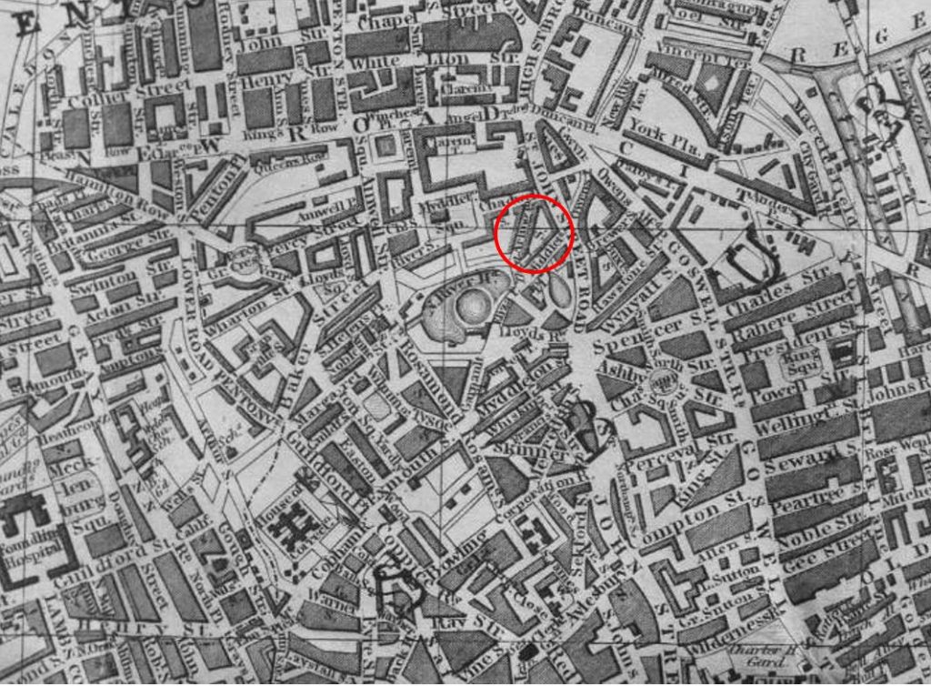
One hundred years later, and London had reached, and surrounded Sadler’s Wells as shown in the following extract from Reynolds’s Splendid New Map of London of 1847:

Sadler's Wells

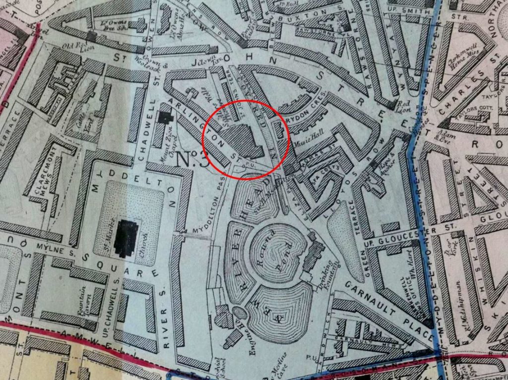
And for no other reason than I love maps, and will use any excuse to put one in a post, this is an extract from the large scale map of Clerkenwell in Pinks’ History of Clerkenwell, showing the location of Sadler’s Wells around 1860.

Sadler's Wells

From Sadler’s original Music House, the buildings of Sadler’s Wells have been through many iterations with rebuilds and additions as the popularity of the site changed, along with the type of entertainments put on by the theatre.

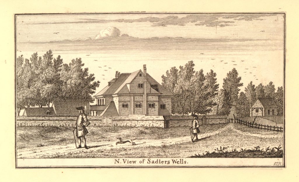
In 1731, 15 years before the Roque map, the following print shows Sadler’s Wells in a very rural location, the theatre surrounded by trees and a couple of out buildings.

Sadler's Wells

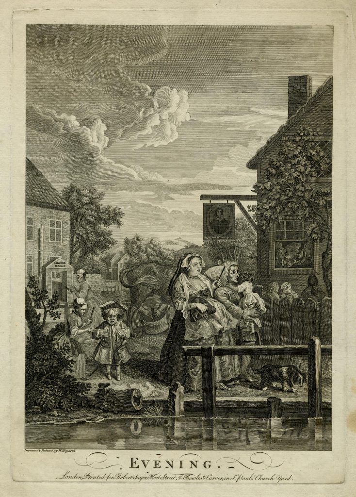
Sadler’s Wells also featured in a 1738 print by Hogarth from his Four Times of Day series. In “Evening”, we see the entrance to Sadler’s Wells on the left, with the inn, the Sir Hugh Myddelton on the right. In the scene, a Dyer and his family are strolling over a footbridge by the New River.

Sadler's Wells

The entertainments provided at Sadler’s Wells were many and varied. An advert from July 1740 stated that there would be “rope-dancing, tumbling, singing, and several new grand dances, both serious and comic. With a new entertainment called ‘The Birth of Venus’ or Harlequin Paris’. Concluding with ‘The Loves of Zephyrus and Flora’. The scenes, machines, dresses and music being entirely new”.

An advert from 1742, concluded with “Several extraordinary performances by M. Henderick Kerman, the famous ladder dancer”.

In the 1740s. Sadler’s Wells were described as a place of “great extravagance, luxury, idleness and ill fame”, and that there were frequently great numbers of loose, disorderly people.

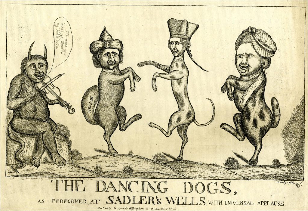
Probably because of the perception of Sadler’s Wells, it was included in a number of satirical prints of the time, including the following print from 1784:

Sadler's Wells

The devil plays the violin whilst three dogs dance. Each dog has the head of a politician. The Whig politician Charles James Fox is on the left. Facing him is the Whig MP Edmund Burke, and on the right is Lord North, who had resigned as Prime Minister the previous year following a vote of no confidence after the loss of the American War of Independence.

Dancing dogs were indeed one of the 18th century forms of entertainment at Sadler’s Wells, and other forms of animal entertainment included a singing duck.

In the 18th century, theatres and plays needed to be licensed. The Licensing Act of 1737 theoretically prevented all theatres apart from the Royal Patent Theatres at Drury Lane, Covent Garden and Haymarket, from putting on drama without musical accompaniment. Many theatres did continue to put on productions, including Sadler’s Wells and the licence conditions do not seem to have been rigorously enforced. They were mainly meant to prevent anti-government propaganda, with plays having to be submitted for approval. Remarkably, this continued until 1968.

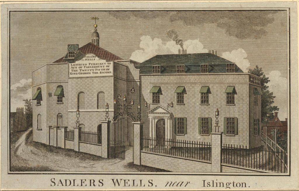
In 1790, Sadler’s Wells had a large sign on the side of the building indicating that the theatre was licensed.

Sadler's Wells

There was tragedy at Sadler’s Wells in 1807, when eighteen people lost their lives and many more were badly injured. From a newspaper report of the time:

“DREADFUL ACCIDENT AT SADLER’S WELLS. On Thursday night, as the curtain was letting down at Sadler’s Wells theatre, to prepare for the water scene, in the Wood Daemon, a quarrel commenced in the pit, and some people cried out ‘A Fight’. The exclamation was mistaken for a cry of ‘Fire’. It was a benefit night and the house was crowded. Every part was immediately terror and confusion; the people in the gallery, pit and boxes, all pressed eagerly forward to the doors, but could not obtain egress in time to answer their impatience. The pressure was dreadful; those next to the avenues were thrown down and run over by those immediately behind, without distinction of age or sex. Of those quite in the rear some became desperate; they threw themselves from the gallery into the pit, and from the boxes onto the stage. A horrible discord of screams, oaths and exclamations reigned throughout. On the exterior of the theatre, the scene was not less dreadful; at every door and avenue might be seen people dragging out those persons whose strength was exhausted, and who were unable to effect their escape, but had just strength to gain the passage, or had been forced forward by the crowd behind. Not less than 50 women were fainting at the same time, on the inside and outside of the house”.

Of the 18 dead, there were seven men, seven women, three boys and one girl. Two men suspected of causing the initial commotion were taken to Clerkenwell Bridewell and brought before a judge, however he directed the jury that they could not be found guilty of murder or manslaughter, and that the eighteen met their deaths “Casually, accidentally and by misfortune”.

On a happier note, the first couple of decades of the 19th century were when the actor, comedian and dancer, Joseph Grimaldi was one of the leading attractions of Sadler’s Wells, and also recognised as one of London theatres leading clowns.

Grimaldi appeared at Covent Garden, Drury Lane and Sadler’s Wells theatres, but appears to have been more successful at the Islington venue. In 1812 he earned £8 a week at Covent Garden and £12 a week at Sadler’s Wells.

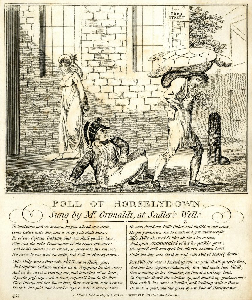
It was common at the time to publish the songs from well known entertainers such as Grimaldi, along with a suitable drawing portraying the theme of the song. One of those sung by Joseph Grimaldi at Sadler’s Wells in 1807 was Poll of Horselydown:Sadler's Wells

Also in the early years of the 19th century, Sadler’s Wells made use of the theatres proximity to the New River. Pinks writes that “An immense tank was constructed under the stage, and extending beyond it, which was filled by a communication with the New River, and emptied again at pleasure. On this aquatic stage, the boards being removed, was given a mimic representation of the Siege of Gibraltar, in which real vessels of considerable size, bombarded the fortress, but were subdued by the garrison, and several of them in appearance burnt”.

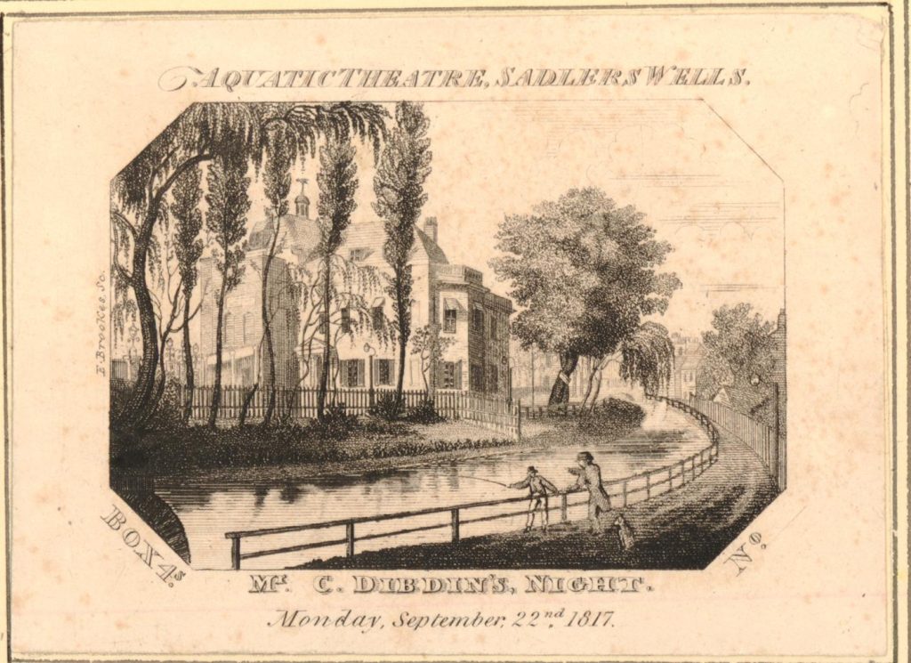
The Aquatic Theatre as such performances were known added another novel element to the performances at Sadler’s Wells. The following ticket was for a box on Monday 22nd September 1817 to watch one of the aquatic performances.

Sadler's Wells

The view on the ticket presents Sadler’s Wells still in a rural setting. Trees in the gardens and the New River flowing alongside the boundary of the theatre.

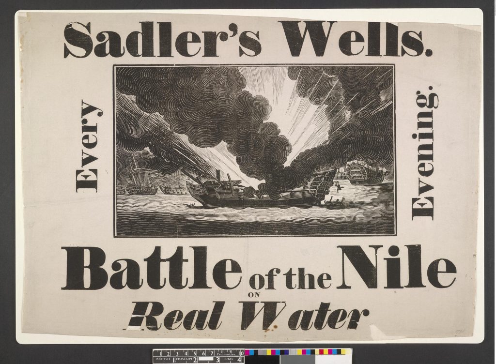
As well as the Siege of Gibraltar, another performance that made use of the water tanks under the stage was the Battle of the Nile, performed with “Real Water”.

Sadler's Wells

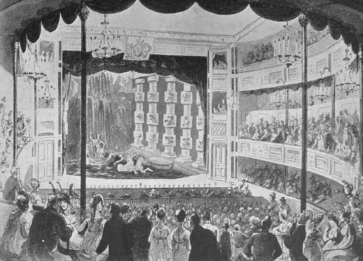
We can get an impression of the interior of the theate during one of the aquatic performances from the following print. The boards on the stage have been removed and the performance is now taking place in a large tank of water.

Sadler's Wells

It was common for audience members to throw themselves into the water at the end of a performance – probably with the help of plenty of alcohol consumed during the evening.

Competition for London audiences was intense, and perhaps more difficult for Sadler’s Wells having a location outside the centre of London. The theatre was always on the look out for ever more dramatic and daring events.

in May 1833 Sadler’s Wells announced that there would be a stupendous representation of the Russian Mountains. This consisted of “sliding down at break-neck speeds in cars along a highly inclined plane of wood, previously laid over with blocks of ice united into a mass of water thrown purposely over them. The cars descended with great velocity from a considerable height at the extremity of the stage across the orchestra to the back of the pit”. No record of what must have been a number of injuries from this performance.

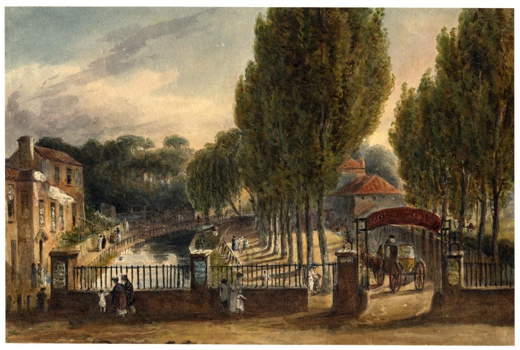
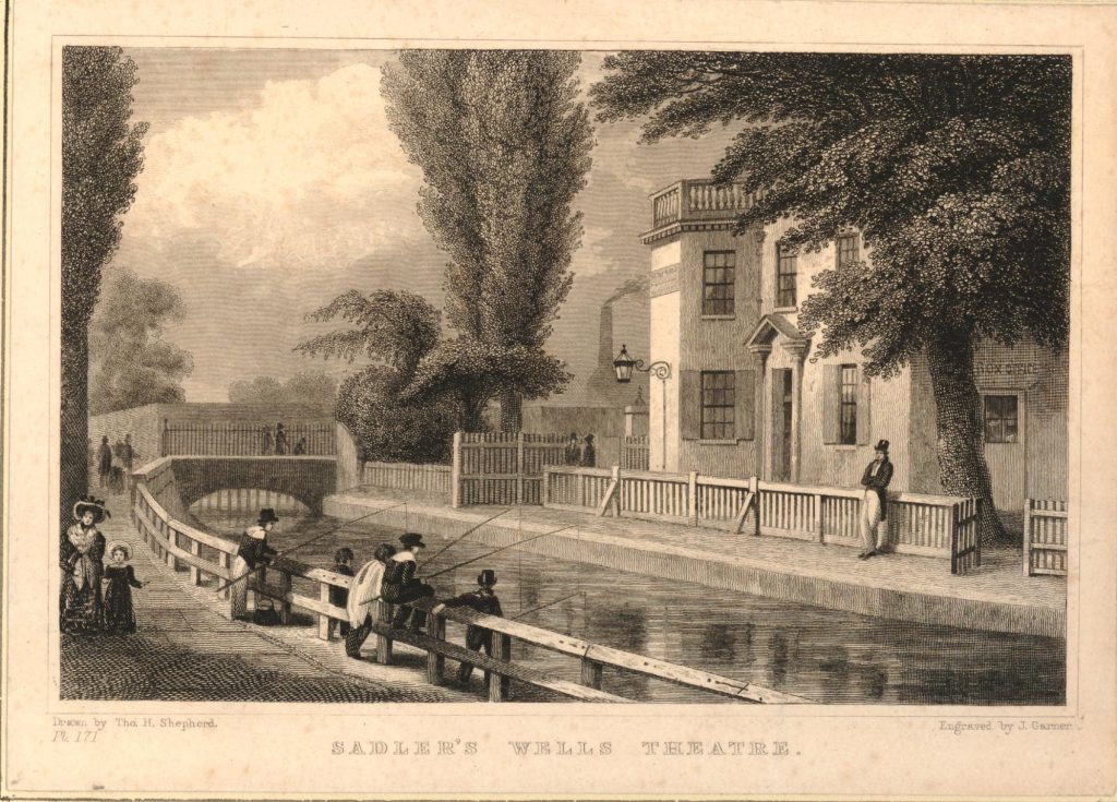
A colour print of the entrance to Sadler’s Wells with the New River running alongside:

Sadler's Wells

The following print from 1830, also shows Sadler’s Wells and the New River, but look at the background, just to the left of the theatre and there is a smoking chimney – the pump house at New River Head.

Sadler's Wells

From the 1840s onwards, the performances put on by Sadler’s Wells started to change. No more dancing dogs or representations of sea battles, rather more intellectual and improving performances. Samuel Phelps, the manager at this time planned to put on productions of all of Shakespeare’s plays. He succeeded with 30 plays, and under his management there were four thousand nights of Shakespeare’s plays with Hamlet being put on for 400 nights.

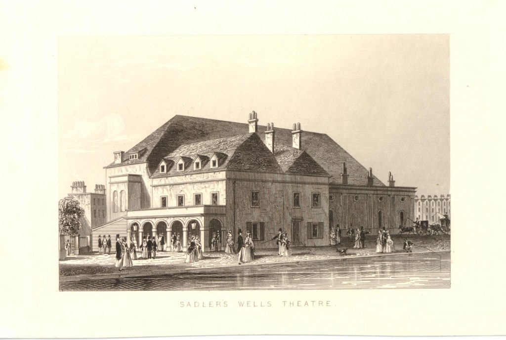
By this time, Sadler’s Wells was a substantial theatre. London had now grown out from the centre and surrounded the theatre, which had also lost most of the gardens and trees. The theatre in 1850:

Sadler's Wells

Although by the second half of the 19th century, Sadler’s Wells was putting on serious productions, some were not without controversy, such as when the American actress Adah Menken appeared in May 1868. The Era provides the following description of the performance:

“SADLER’S WELLS – Miss Menken has been giving her celebrated impersonation of Mazeppa at this house during the week. The audiences have been good, and the far famed actress has nightly been received with great applause. Though Mademoiselle causes a sensation by appearing very sparsely clad in the course of her performance, she is splendidly dressed at the commencement of it. Her page’s costume, which she wears as Casimer in the first act, is of the most costly and gorgeous nature. Whatever may be thought of the propriety of a lady making a public exhibition of her figure, with the outlines of it almost as distinct as those of a piece of undrapped sculpture, there can be no question that the beauty of the form displayed by Miss Menken is of remarkable character”.

In the latter decades of the 19th century, Sadler’s Wells went through a period of considerable change, and a variety of uses. During one period of four years, the theatre had eleven managers. Shows were put on, but they were not successful enough to attract the funding needed.

In 1875, 104 pounds of lead were stolen from the theatre’s roof. There were rumours that the building might be sold for a furniture warehouse, but by June 1876, the theatre had been converted and reopened as the New Spa Skating Rink and Winter Garden – however this use failed within a couple of months.

The building was used for boxing and wrestling matches, although these events were closed down by Police. In 1878 an application for a theatre licence was refused because the building still had wooden stairs which were considered a danger compared to stone stairs.

The theatre did manage to stagger on, putting on a range of different productions from variety to serious drama – all with variable success. For a short time at the start of World War I, the building was in use as a cinema.

Real change came in 1925. The Old Vic, south of the Thames was run by Lilian Baylis, and during the 1920s the plan to expand north of the river was considered. Baylis pursued the idea of purchasing Sadler’s Wells and engaged as many people in public life as possible to support the proposal, and to raise funds. On the 30th March 1925, a public appeal was launched:

“To purchase Sadler’s Wells (freehold), reconstruct the interior, and save it, with its historic traditions, for the Nation,

To establish it as a Foundation, not working for profit, under the Charity Commissioners, and by providing for its use by the Old Vic Shakespeare and Opera Companies, conjointly with their present Theatre in the Waterloo Road, to give an old Vic to North London”

The appeal was successful, and a new theatre was designed by F.G.M. Chancellor, opening on January 6th 1931, with a performance of Twelfth Night (suitable for the date), with John Gielgud.

The new theatre brought together Opera and Ballet, and included a School of Ballet.

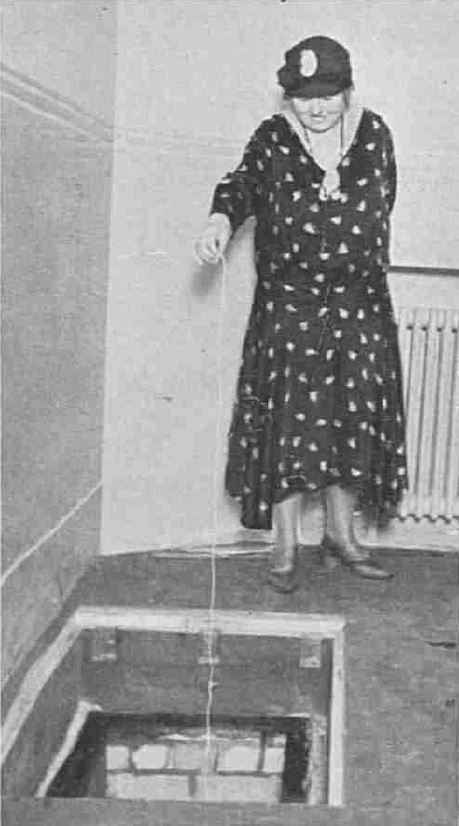
The new theatre still retained the well, which was to be found at the back of the pit, concealed under a heavy iron plate. Here, a Miss Noble tests the depth of the well:

Sadler's Wells

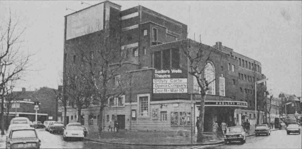
The 1931 building is shown below, as it appeared in the early 1970s, looking from the same viewpoint as my 2020 photo at the top of the post:

Sadler's Wells

After the war, the ballet company of Ninette de Valois which had formed at Sadler’s Wells moved to Covent Garden to become the Royal Ballet.

The theatre continued the long tradition of dance and the D’Oyly Carte Opera performed seasons at Sadler’s Wells. The theatre hosted touring companies from across the world. However there were financial challenges, rumours that the site may be sold as part of development plans from the New River Company (which by then was a property company).

In the 1990s there was again significant change at Sadler’s Wells, with a campaign for a new, purpose built dance theatre. The campaign was successful, including a significant £36 million from the National Lottery.

The new theatre opened in October 1998, and continues the tradition of dance and entertainment on this site in north Clerkenwell / islington well into the 21st century.

I started the post talking about how this area of London has been shaped by water. If the location had not been the site of a well, the name would be very different, and perhaps also without the initial fame of the well, Sadler’s original gardens and music house may not have continued too much further than the 17th century.

Although the area is very different to the fields covering the area in the 17th century, the water is still there, deep below the surface. A borehole in the sub-basement of the theatre descends some 600 feet to the chalk basin that runs under London, from where water is taken for the sinks, toilets, heating and cooling of the theatre. The borehole supplies water at a rate of 12 litres a second and at a temperature that varies between 11 and 12 degrees Centigrade.

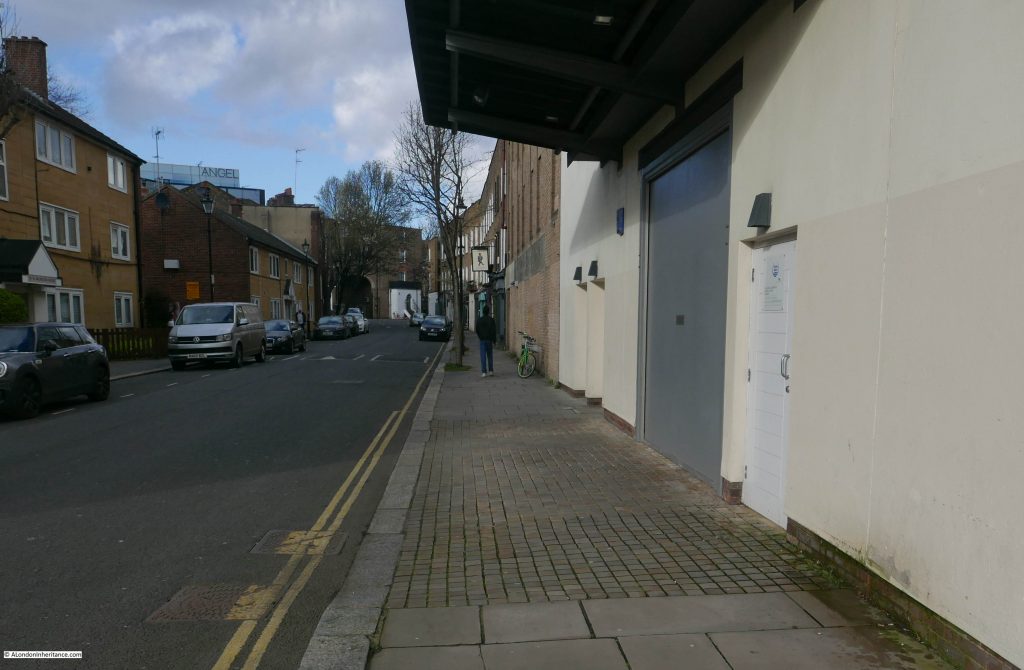
Walk down Arlington Way, to the west of the building and there is a door facing onto the street, to the right of the large grey door.

Sadler's Wells

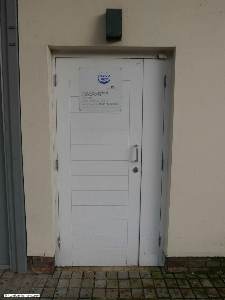
On the door is a sign confirming the location as the site of the Sadler’s Wells Borehole pumping station, where Thames Water are also extracting water from far below the surface.

Sadler's Wells

Thames Water hold the licence to extract water from the borehole, however up until 2004, the Sadler’s Wells Trust held a licence to extract water for water bottling. I cannot find any reference after 2004, so I suspect that was the last time you could buy bottled water drawn from below the theatre.

Again, a weekly post only allows me to scratch the surface of the history of Sadler’s Wells.

The History of Clerkenwell by William J. Pinks provides a detailed history of the first couple of centuries of the theatre. The Story of Sadler’s Wells by Dennis Arundell provides a detailed history up until 1977, and the Survey of London, volume 47 provides the usual highly detailed history. All prints used in this post are  © The Trustees of the British Museum

Sadler’s Wells, a very successful theatre that owes its name and probable longevity to a patch of gravel and discovery of a well in the fields of Clerkenwell.

alondoninheritance.com

The Buildings of Smithfield Market

Over the years I have been trying to photograph London’s buildings as they change. An example is the area around Euston where buildings and streets have been demolished ready for HS2. Another area that will be changing considerably over the coming years is Smithfield Market.

The arrival of Crossrail, the transfer of the Museum of London from London Wall to part of the old Smithfield Market buildings, will have a significant impact and will drive change across the surrounding area.

I have been taking photos of the market for many years, but over the last few years have made it a focus to take more photos as change starts to accelerate.

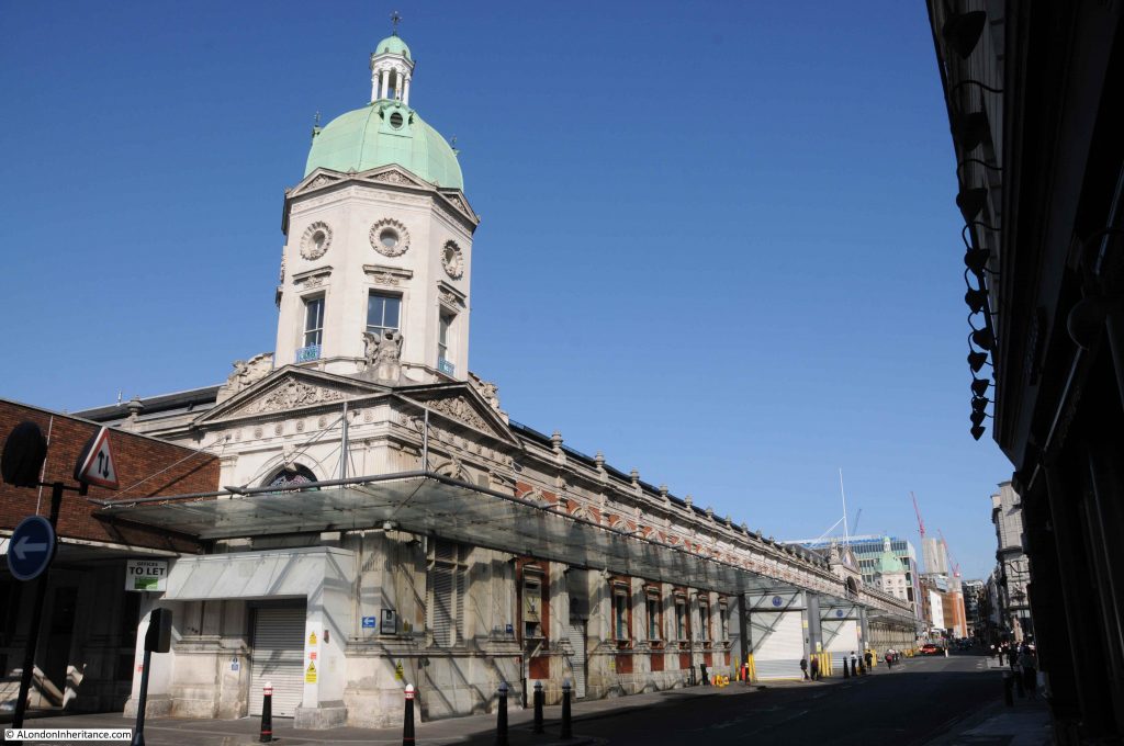
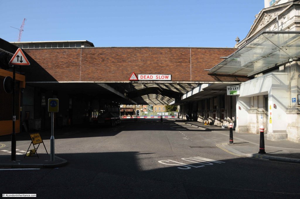
For this week’s post, here is a sample of my latest photos showing the current state of the Smithfield Market buildings (or at least a few months ago).

Smithfield Market is comprised of a number of different buildings. There is the main Central Market facing onto West Smithfield, however there are many other market buildings all the way down to Farringdon Street, along with supporting buildings in the surrounding streets.

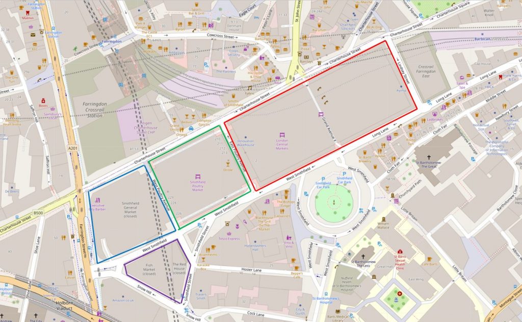
in the map below I have identified the main Smithfield Market buildings (Map © OpenStreetMap contributors):

Smithfield Market

The buildings bounded by the red line are the London Central Market – the main meat market of Smithfield Market.

The building bounded by the green line is the Poultry Market.

Blue surrounds the old Smithfield General Market.

The purple line surrounds the old Fish Market and the Red House.

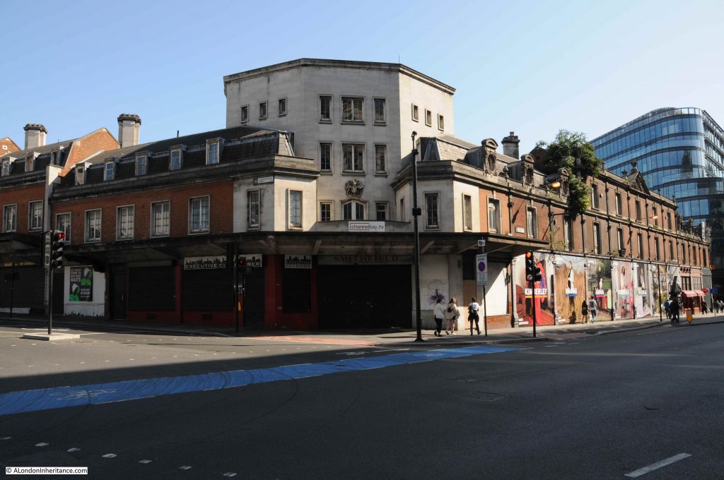
There is so much history and architecture to be found in the area bounded by Farringdon Street, Charterhouse Street, Lindsey Street and West Smithfield, that for today’s post I will concentrate mainly on the area between the Grand Avenue of the Central Market and Farringdon Street. Future posts will cover the rest of the area and explore more of the history of Smithfield Market.

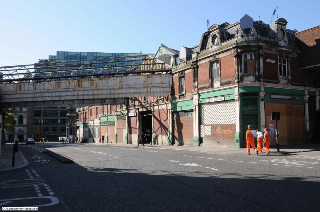
I will start in Farringdon Street, and the following photo is looking at the western wall of the General Market, opened in 1883.

Smithfield Market

As with many of the buildings to the west of the main market, they are closed and boarded up. The pediment at the centre of the roof line has the arms of the City of London, confirming the ownership of the market, the buildings and land.

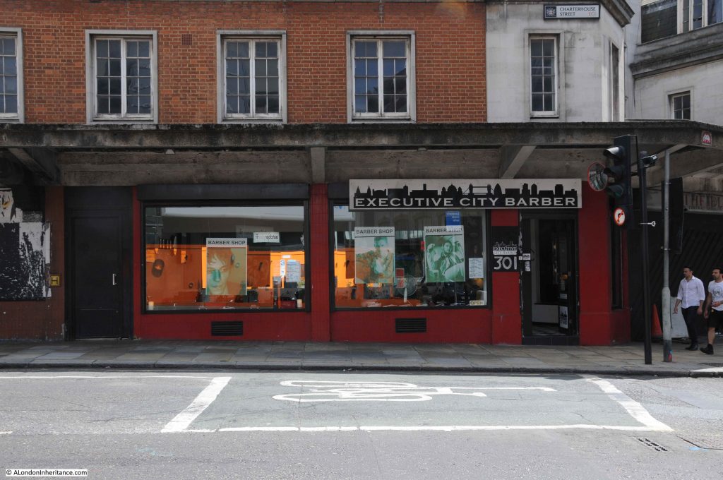
On the corner of Farringdon Street and Charterhouse Street, a later addition to the market buildings, forming one of the main entrances to this section of the market, along with market offices.

Smithfield Market

A number of business had taken up space on the ground floor of this building. Executive City Barbers were still in operation where Charterhouse Street meets Farringdon Street – not sure if they are still there.

Smithfield Market

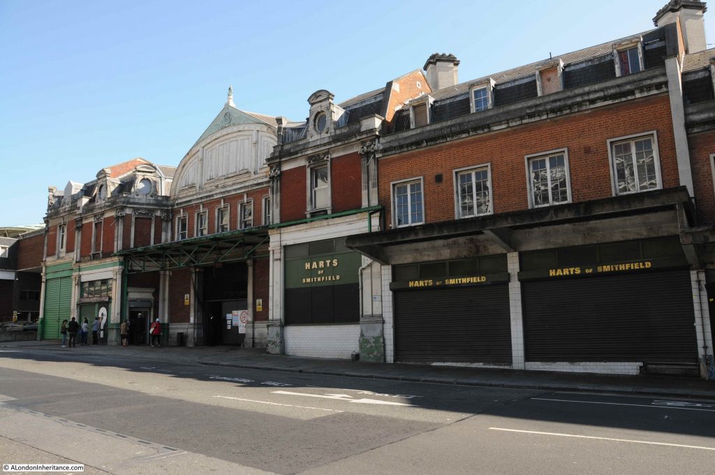
Further along Charterhouse Street is Harts of Smithfield – the location of the Christmas Eve meat auction, with to the left, one of the main entrances to the General Market buildings.

Smithfield Market

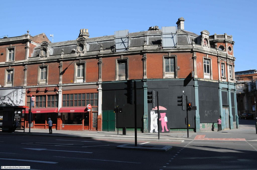
If we walk back to Farringdon Street, we can walk along the other side of the General Market buildings. The following photo is to the right of the photo at the top of the post, and is on the corner of Farringdon Street and West Smithfield.

Smithfield Market

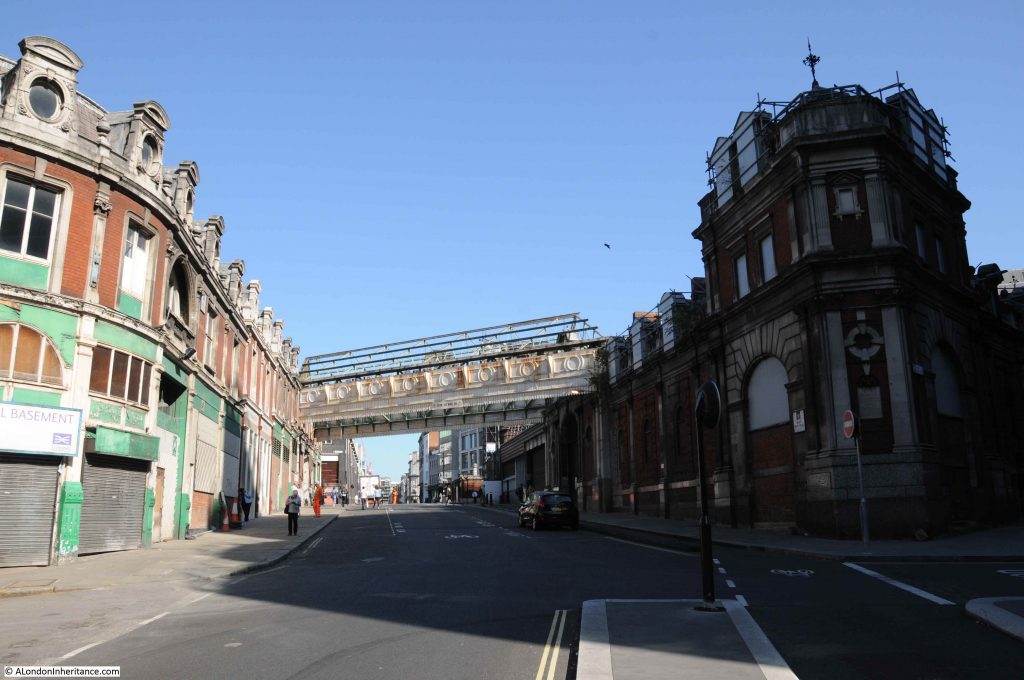
The view looking up West Smithfield with the General Market on the left and the old Fish Market on the right.

Smithfield Market

The buildings we see above ground are just part of the market, and there is considerable space below ground. The building below is on the left in the above photo and on the left is one of the access points for Crossrail construction, where a ramp slopes down to the basement levels.

Smithfield Market

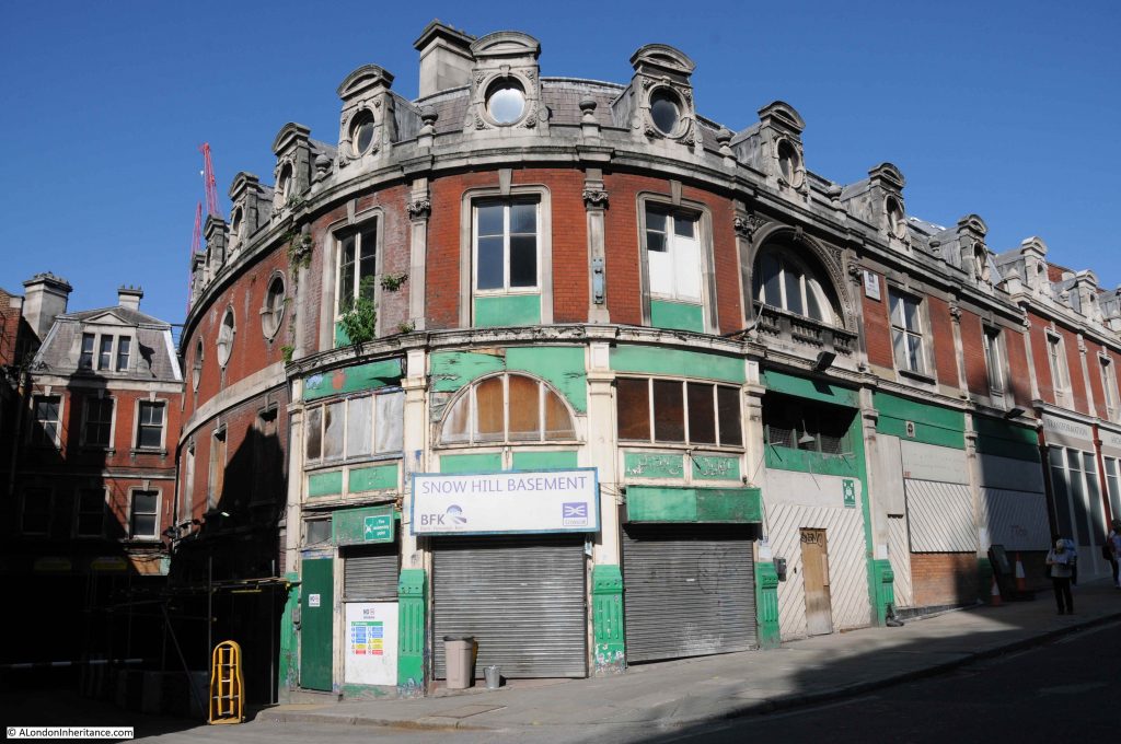
On the opposite side of the ramp is this round corner building, showing the way use was made of every available space, and the unusual architecture that resulted.

Smithfield Market

Directly opposite, where Snow Hill branches off to the right is the old Fish Market.

Smithfield Market

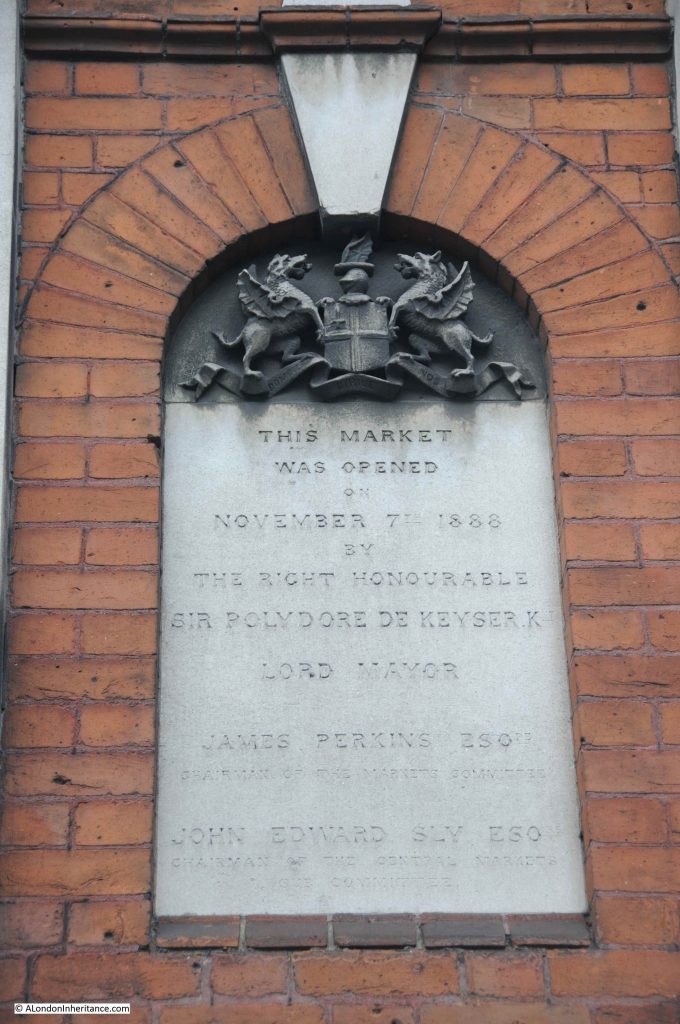
If you look on the corner of the above building, towards street level there is a rectangular plaque. This records the opening of the market in 1888 by Sir Polydore de Keyser.

Smithfield Market

Polydore de Keyser was an interesting character. A Catholic immigrant from Belgium who became Lord Mayor of the City of London. I wrote a post about him, his hotel by Blackfriars Bridge and his time as Mayor.

A report at the time of the opening of the fish market records the reasons for having a fish market at Smithfield, as well as Billingsgate:

“Mr. Perkins, Chairman of the Markets Committee, briefly explained the circumstances which had induced the Corporation to construct the present market. The old fish market on the other side of the roadway, which was originally intended for the sale of fruit and vegetables, had proved a loss to the Corporation of about £10,000 a year. Hence the erection of the present market, Billingsgate having proved insufficient for the supply of fish for the Metropolis. Nearly every shop in the new market was let, and the old market would be used in future for fruit and vegetable. the Corporation hoped that it would be successful, and prove advantageous to the salesman.”

Based on the current plans for the new Museum of London at Smithfield, the old Fish Market buildings will become the location for “food and beverage and events”.

The old General Market buildings will become the site for “Displays, events and installations”, with a museum restaurant and bar towards Farringdon Street. The following photo is looking down West Smithfield at the General Market buildings. This will be an impressive location for the Museum of London.

Smithfield Market

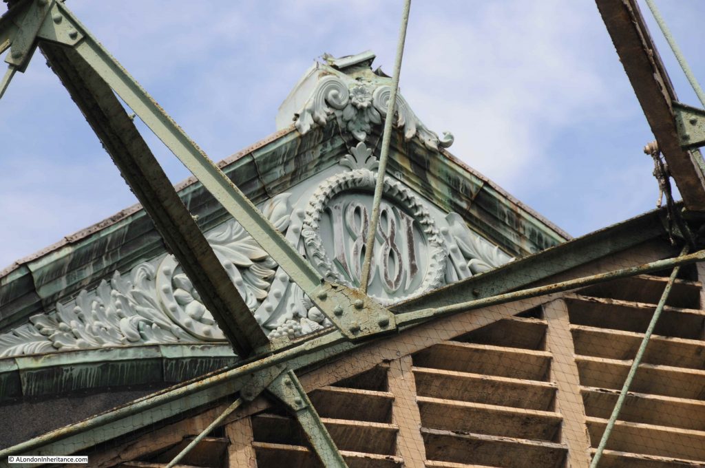
There are numerous architectural features on the old market buildings which hopefully will be retained by the Museum of London. The following photo is of the apex of the roof where the overhead walkway in the above photo joins the market building.

Smithfield Market

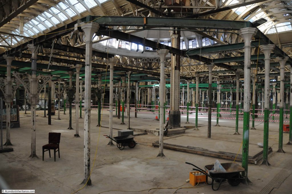
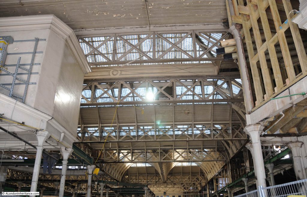
The doors to the old general market building were open so I had a quick look in. Much of the space has been cleared, with just the frames that supported the old market stalls remaining in place. I assume these will go to open up the space for the museum.

Smithfield Market

The roof comprises angled glass panels to let in as much light as possible to illuminate the market below.

Smithfield Market

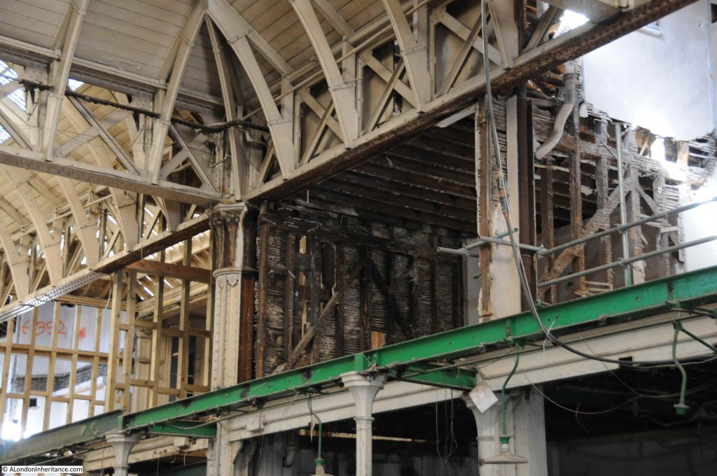
First floor rooms, showing the construction technique to build partitions between rooms.

Smithfield Market

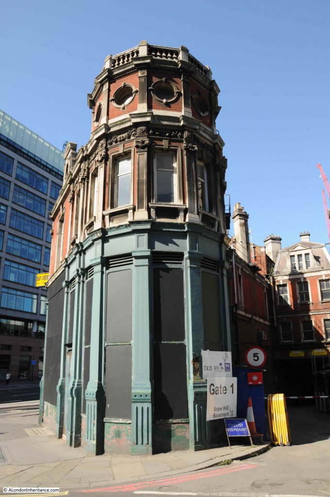
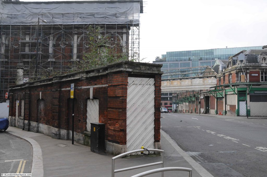
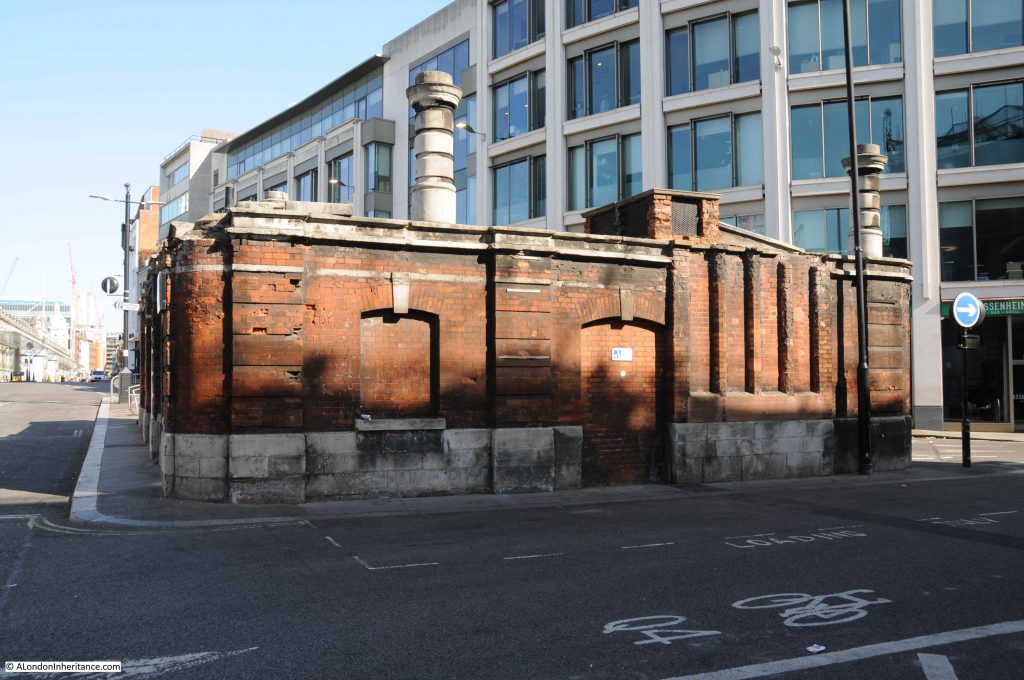
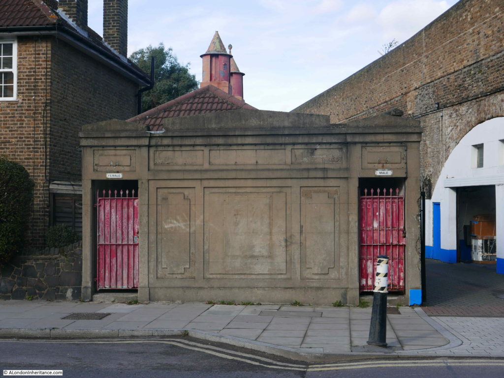
Back outside, and at the junction of West Smithfield with Smithfield Street, and in the triangular space where the two streets converge is this small building, which I believe were once public toilets for the market.

Smithfield Market

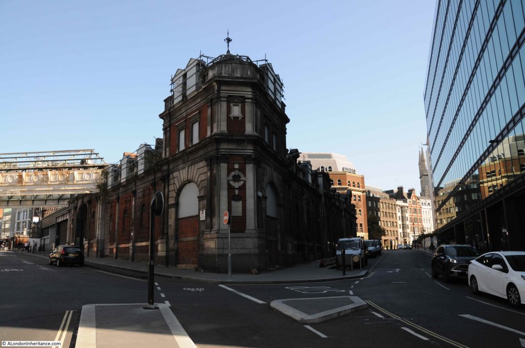
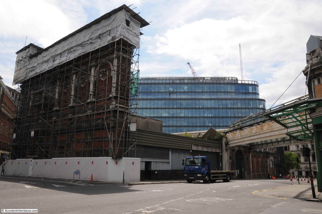
The building shown in the above photo covered in scaffolding, and below as a facade is the Red House, built in 1898 as a cold store. I have not fully worked out the sequence of buildings around the Red House, and the reason for the facade, but there is a considerable amount below ground here, with vaults extending out under the streets for storage, freezer infrastructure and connecting corridors.

Smithfield Market

View of what I believe was the old toilet block from in front of the facade of the Red House.

Smithfield Market

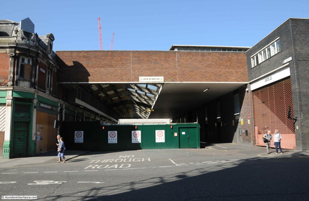
Across West Smithfield to the above photo is West Poultry Avenue which separated the General Market (on the left) from the Poultry Market (on the right).

Smithfield Market

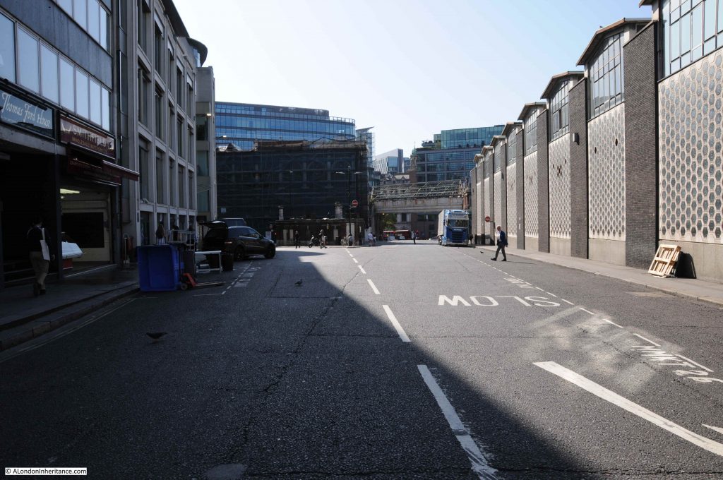
The following view looking down West Smithfield towards Farringdon Street. The Poultry Market is on the right.

Smithfield Market

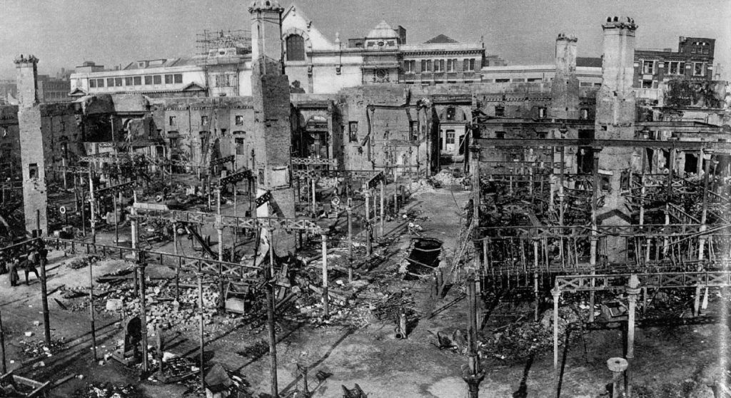
The Poultry Market is relatively new compared to the rest of the Smithfield Market buildings. It was completed in 1963 to replace the original Poultry Market which had been destroyed by fire in 1958.

The photo below shows the remains of the old Poultry Market after the fire. Note that the infrastructure that carved the space up into individual market stalls is the same as in my internal photo of the General market.

Smithfield Market

The fire was very difficult to contain, and resulted in the deaths of two firemen. The Sphere reported on the fire:

“Two firemen died fighting what has been described as the worst subterranean fire London has ever known, when the cellars of Smithfield Poultry Market blazed last week. The outbreak was discovered at 2 a.m. on Thursday morning. As the day progressed it spread throughout a labyrinth of cellars and tunnels over an area of 2.5 acres. As flames began to break through the floor of the market, firemen abandoned attempts to drive the fire from one side of the Union Cold Storage Company’s basement to the other and concentrated on keeping the blaze from getting a hold on the surface buildings.

Station Officer Jack Fourt-Wells and Fireman Richard Stocking lost their lives, suffocated in the smoke-filled underground passages. Nearly forty firemen were injured and eight were taken to hospital suffering from the effects of smoke. In spite of thousands of gallons of water being pumped into the cellars the fire spread to the central poultry market buildings. The following day the market was a roofless gutted shell, and the fire was still burning. Two of the four ornamental towers on each corner of the building had collapsed and paving stones had been flung into the air. Two more firemen were injured during the day.”

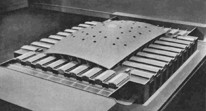
The new poultry market was of a very different design to the original. Rather than ornate market buildings, the new market was made of reinforced concrete with brick cladding. The roof is a concrete shell that spans the central market space, only supported at the edges leaving a large area of free space. It was a radical design by T.P. Bennett and Son. The following model shows the new market building.

Smithfield Market

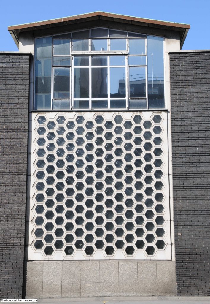
The walls facing onto West Smithfield and Charterhouse Street were of brick covering the reinforced concrete shell, with, as can be seen by my photo above, frequent sections of wall which included hexagonal glass blocks, with more normal windows above.

Smithfield Market

Designed to maximise the flow of light from outside the market into the interior.

The poultry market is one of the Smithfield Market buildings that will become part of the Museum of London. I hope that these wall sections of glass blocks are retained, which they should as the building is Grade II listed. They are a unique feature from early 1960’s architecture and when viewed along the full length of the wall, break up what could have been a long expanse of brick.

Returning to Charterhouse Street, and there are a number of buildings that whilst not part of the central market, formed part of the overall market infrastructure that occupied so much of Smithfield.

The following building, dating from 1914 and built for the Port of London Authority was a cold store. The five large entrances at the front show where deliveries and collections would have been made, with lorries backing up to transfer their cargo.

Smithfield Market

The Port of London Authority were not exactly retiring when it came to having their name spread across the front of the building. Along the very top of the building can be seen the PLA’s motto Floreat Imperii Portus, which seems to translate as “Let the Imperial Port Flourish”. Again, not a sign of a retiring organisation.

The building also illustrates how much there is below ground level across Smithfield. There are several floors below the building which were originally used for the storage of meat, however they have now been put to a unique use, as E.On / Citigen have built a power station in the space below ground.

Comprised of two natural gas fueled, combined heat and power generators, the building provides not just electricity for London, but also heat and cooling which is used for buildings such as the Guildhall and the Barbican Centre.

Adjacent to the PLA building is another cold store. This is the Central Cold Store, designed by C. Stanley Peach and built in 1899. The building is Grade II listed.

Smithfield Market

According to a number of planning applications, the building is also part of the E.On / Citigen power station, and houses the majority of the generating infrastructure.

The name and original function of the building is displayed in a rather ornate manner on the front.

Smithfield Market

Walking further along Charterhouse Street are the main buildings of the Central Market. These date from 1868 and were designed by Sir Horace Jones. They start at East Poultry Avenue, which is the street that runs between the Central Market and the Poultry Market. The name avenue is a strange name for this short stretch of roadway which is mainly used for access to the buildings on either side, and is covered for the whole stretch between Charterhouse Street and West Smithfield.

It does though provide some perfect opportunities to photograph these unique buildings.

Smithfield Market

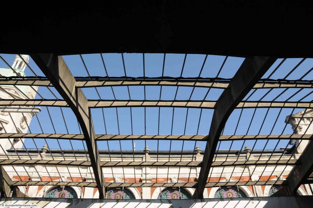
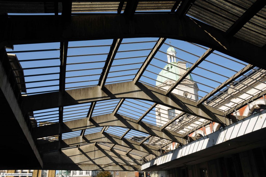
Through the roof, we can see one of the ornamental towers that sit at each corner of the building. The original poultry market was of the same design, and had similar towers. The sight of flames spreading out from the towers indicated how serious the damage was in 1958.

Smithfield Market

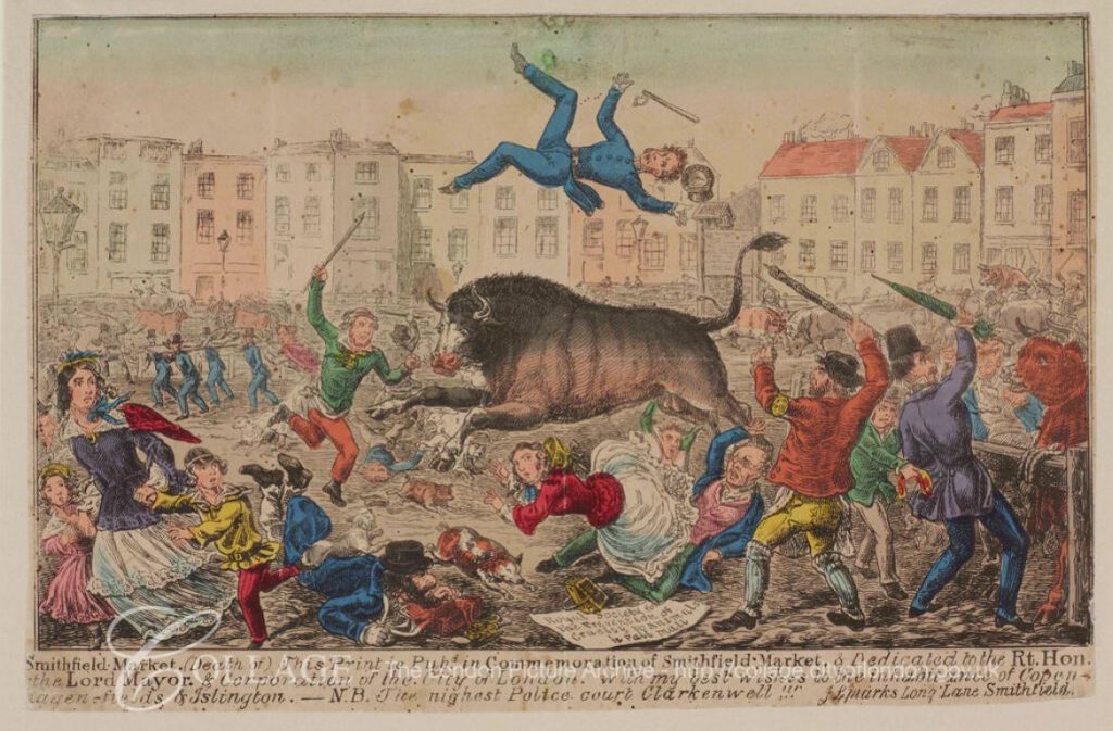
The new market was part of the 19th century City improvements and was designed to replace the previous market where livestock was driven into Smithfield. The chaos that this created in the crowded 19th century City was considerable, and the City of London decided to transfer the livestock market to Copenhagen Fields in Islington, and in the last Christmas market at Smithfield in 1854, the number of animals at the market was 6,100.

The livestock market was therefore at Islington, which included associated infrastructure such as slaughter houses, with the meat market at Smithfield. A solution that allowed a meat market to continue in the City of London, but moved the less attractive elements away from the City.

The following print from 1855 shows a bull raging through Smithfield Market when livestock were brought directly into the City. The text offers best wishes to Copenhagen Fields and Islington.

Smithfield Market

Image credit: London Metropolitan Archives, City of London: catalogue ref: q607963x

The view looking along West Smithfield, with East Poultry Avenue on the left. The main market buildings disappearing into the distance.

Smithfield Market

Looking back along East Poultry Avenue, the street that separates the poultry market from the main meat market.

Smithfield Market

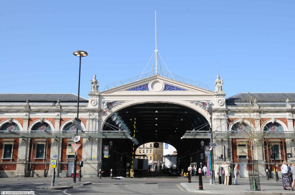
The main market buildings consist of two main blocks, the east and west market buildings, either side of the Grand Avenue, where West Smithfield becomes Long Lane. The photo below shows the impressive entrance to the Grand Avenue.

Smithfield Market

This has just been an introduction to some of the buildings of Smithfield Market. There is so much more to cover, including the main market buildings, the areas underground, the rail sidings and route under the market, more buildings along Charterhouse Street together with the long history of the market – all to be covered in future posts, when I dig out more photos of the area.

Work on Crossrail continues, the space within the General, Poultry and Fish Markets should become the new Museum of London.

The meat market continues to trade, however the City of London Corporation plans to move the meat market, along with the City’s other managed markets to a new site, with Barking Reach being the current preferred location.

In years to come, the area between Lindsey and Farringdon Streets will be very different.

alondoninheritance.com

The Royal Aquarium, Cock Inn and Westminster Hospital

Many of London’s buildings seem so substantial that they almost appear permanent, however looking back there have been so many buildings of all types that at the time must have seemed destined for a long future, but in reality would only grace the city streets for a limited number of years.

There are so many trends that influence the buildings that spring up across the city. Changing work and living patterns, the economy, financial incentives, industrial changes, government policy, transport etc. and it is interesting to speculate how this might continue as the city we see today is only ever a snapshot of a point in time.

In 30 years time will there be campaigns to preserve the Walkie Talkie building, threatened with demolition as with technology changes there is a significantly reduced need for office space in the City and the City of London is now approving hotel and apartment building? Demand for office space across London may be reduced in the next few years as more companies recognise the economic benefits of staff working from home?

What got me thinking about this was looking at a map, and seeing a large building that was only in existence for a few decades.

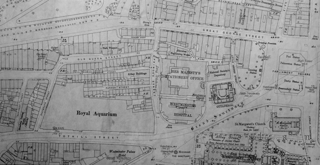
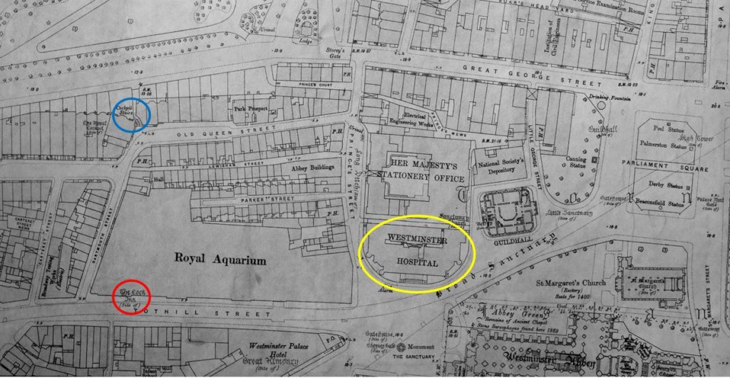
Last summer, a reader generously gave me a number of maps, including large-scale Ordnance Survey maps from the end of the 19th and start of the 20th century. One of these covered Westminster, and just opposite Westminster Abbey, there was a large building with bold lettering naming the building as the Royal Aquarium.

Royal Aquarium

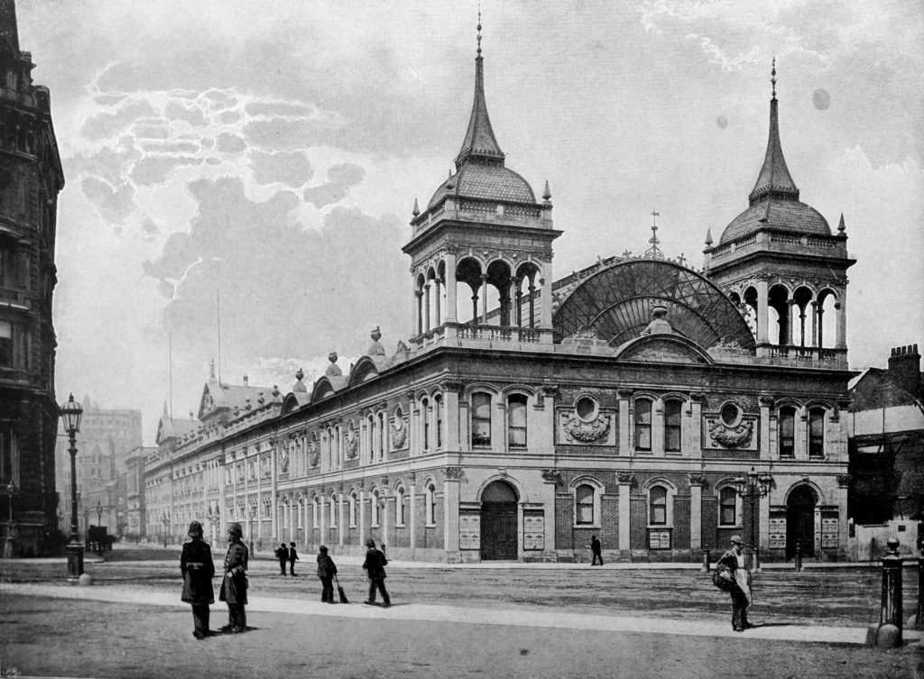
The Royal Aquarium was a rather magnificent building, as illustrated by this view of the building from the book The Queen’s London. the view is from the yard outside Westminster Abbey. Tothill Street is running to the left of the Royal Aquarium.

Royal Aquarium

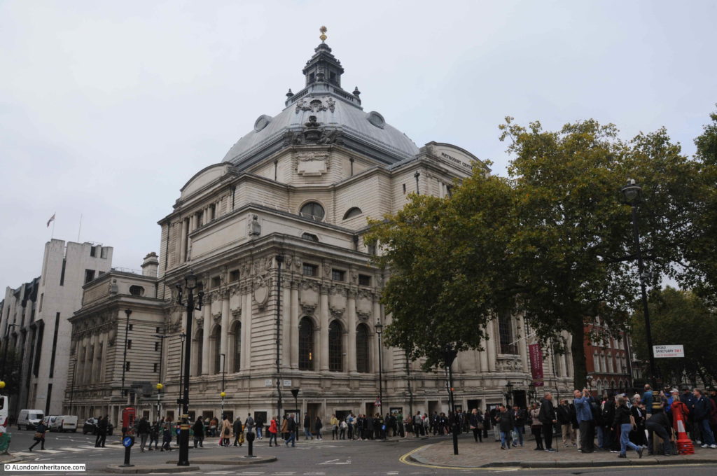
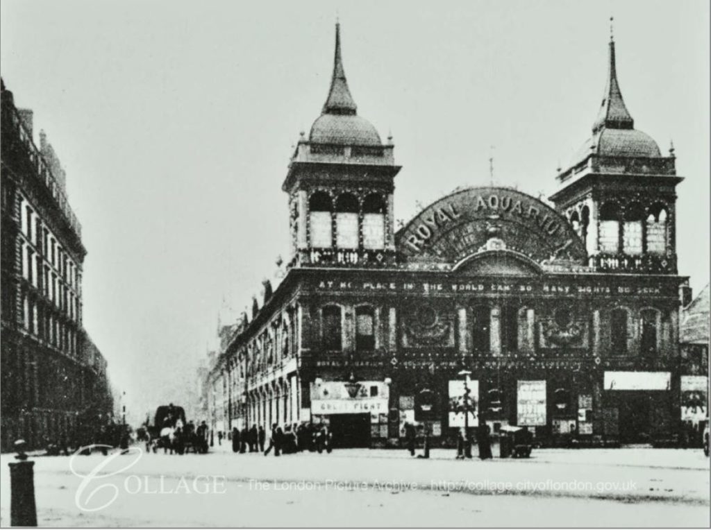
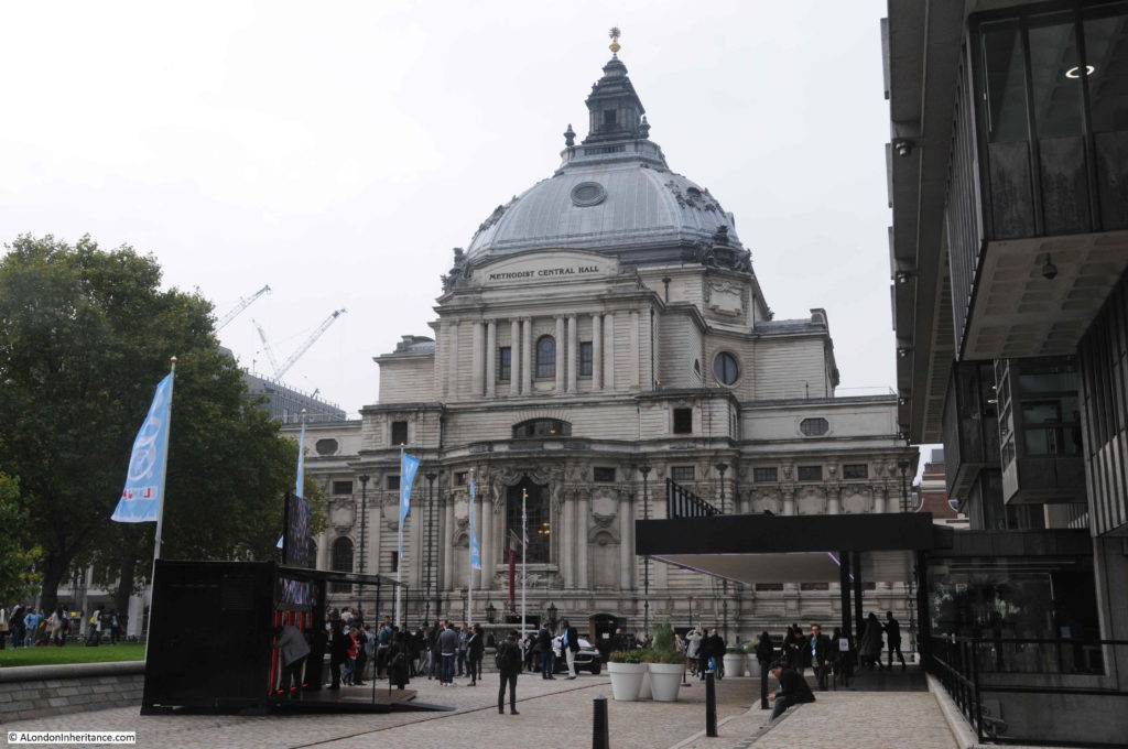
The Royal Aquarium had a relatively short life. Opened in April 1876, it was demolished in 1903, to make way for the building that we find on part of the site today – the part facing Westminster Abbey – the Methodist Central Hall.

Royal Aquarium

The Royal Aquarium was built by the Royal Aquarium and Summer and Winter Garden Society, a limited company which had been set-up with an initial £200,000 of capital through the sale of shares of £5 each.

An aquarium had recently been built in Brighton and was financially very successful with the shares at a 30% premium to their original sale price, and the Society argued that the same success could be achieved in London, although I would have thought that a sea-side town like Brighton was a much more suitable location for an aquarium than central London.

Despite the name, the Royal Aquarium would cover far more than the display of marine life, and it was intended to deliver, in the Victorian approach of such institutions, cultural and educational entertainments. These would include “vocal and instrumental performance of the most brilliant manner, supported by a splendid orchestra and best known artists of the day”. The Royal Aquarium would also feature Reading Rooms, a Library and Picture Gallery.

The Royal Aquarium and Summer and Winter Garden Society was soon renamed the Royal Westminster Aquarium Company. Opening commenced in January 1876 with a formal opening of the main building by the Duke of Edinburgh. The rest of the building’s facilities opened during the following months with the theatre opening in April.

The Royal Aquarium was a really big building, and some idea of the scale can be had from the following description from The Era on the 3rd of October 1875:

“The Royal Aquarium promises soon to be an accomplished fact, for already the building is so far advanced that on Tuesday, in response to the invitation of the Managing Director, a number of gentlemen inspected the works. 

There is still, of course, a great deal of scaffolding to interrupt the view of the building. Still enough can be seen to form some idea of the size, grace and elegance of design of this new addition to the pleasure resorts of the Metropolis.

The large tanks for fish on each side of the great central avenue have sills of polished granite, and are lighted both from above and at the back; the plate glass in front being one inch in thickness. the whole of the flooring of encaustic tiles on concrete cement is now being laid down. The promenade, or winter and summer garden, is about 400 feet long by 160 feet wide, and is approached by two bold entrances from the Tothill-street frontage, surmounted by pediments; with representations of Neptune and the sea-horse, above which rises a figure of Britannia, twelve feet in height. 

The height of the gallery from the floor of the promenade is sixteen feet and from this level to the springing of the vaulted roof is about sixteen feet. The whole height from the floor level to the top of the roof is seventy-two feet. The galleries round the building are forty feet in width, a large portion being set apart for refreshments. On the north side in the centre is the large orchestra, sixty feet by forty feet. The concert room at the west end is a noble and lofty apartment, and is capable of being converted into a large and handsome Theatre. It is 106 feet long by sixty-six feet in width. the stage is thirty feet in width to the sides of the proscenium, and forty-three feet in depth.

There are also two galleries, which, together with the ground-floor space, will accommodate an audience of 2,500 persons. About 800 tons of iron have been used in the construction of the building.”

The name Royal Aquarium does not really cover the multiple functions that the building could serve, as from the description, with the galleries, large promenade, concert room / theatre, this really was a multipurpose space, capable of being converted to host a range of different functions.

The Royal Aquarium photographed in 1902 from Victoria Street:

Royal Aquarium

Image credit: London Metropolitan Archives, City of London: catalogue ref: SC_PHL_01_536_78_7349

There was some criticism soon after opening regarding the lack of marine life, for example: “It was said that the Aquarium does not deserve its title because there were no fish, but great efforts have been made of late to stock the tanks, and some drawback in their construction and arrangement having been removed, the public will have the opportunity of judging the Institution fairly.”

The Royal Aquarium was eventually well stocked with a variety of marine live, however the methods used to transport animals to the Aquarium were very basic and often resulted in a tragic outcome.

In 1877 a whale was being delivered to the Royal Aquarium from Labrador, Canada, however on arrival it was found to be suffering from what appeared to be a bad cold, with mucus coming from the whale’s blow hole. It arrived on a Wednesday but died the following Saturday. The lungs of the dead whale were found to be very badly congested and the cause was identified as the method used to transport the whale.

It had been on an exposed open deck during the trip across the Atlantic, and had been covered in sea water every five minutes, however water evaporated quickly between the regular soaking, which resulted in extreme cold, and the subsequent impact on the whale’s lungs.

A very barbaric treatment of the whale for the sole purpose of entertainment.

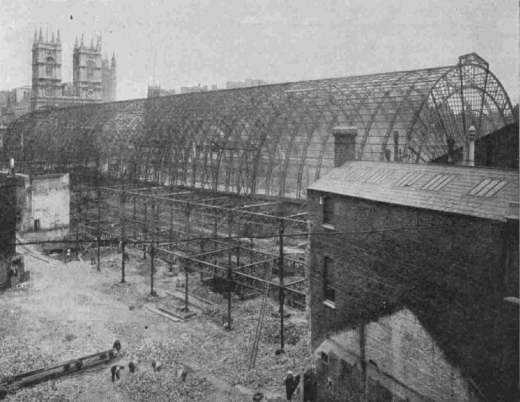
Some idea of the scale, the volume of iron used, and the way an iron framework was used to construct the building can be seen from the following photo that was taken during demolition of the Royal Aquarium (note the twin towers of Westminster Abbey in the background):

Royal Aquarium

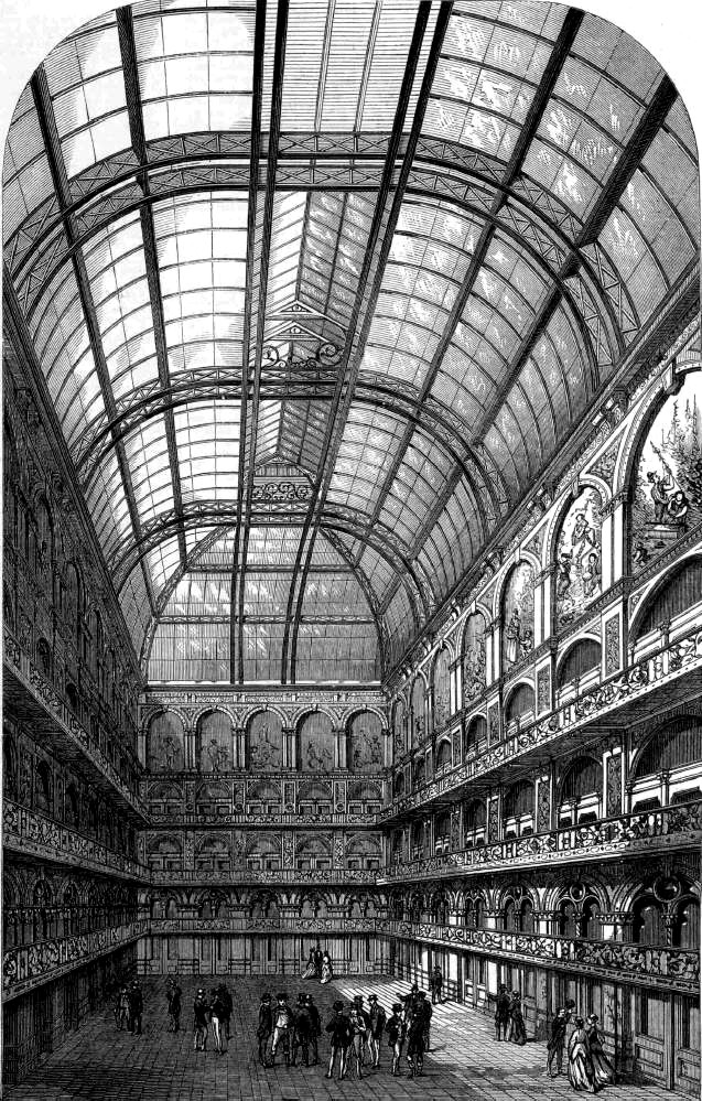
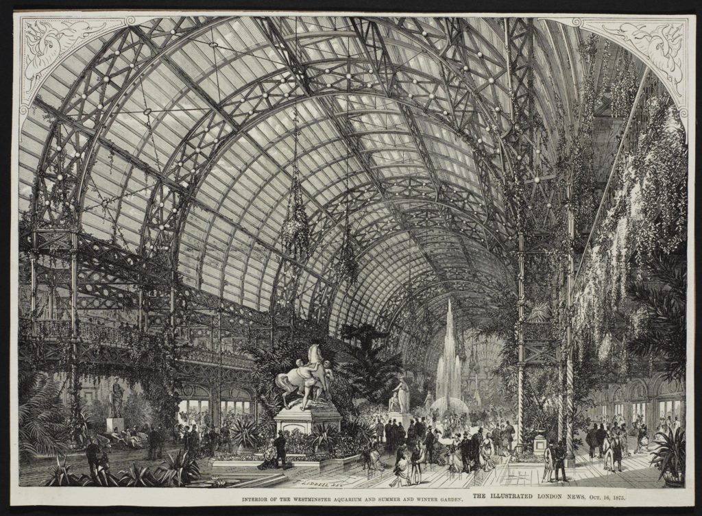
The following drawing shows the interior of the Royal Aquarium:

Royal Aquarium

Picture credit: © Victoria and Albert Museum, London

From the above view it can be seen that the design was very similar to that of the Great Exhibition, with a long central space covered by a glass arched roof. Side galleries also ran the length of the building.

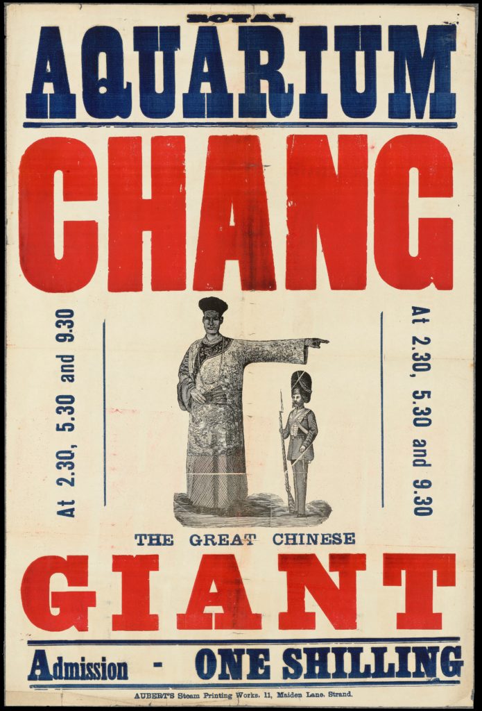
Entertainment at the Royal Aquarium was what would be expected of late Victorian mass entertainment, consisting of Music Hall style acts along with people who were considered very different to the norm. One being Chang the Great Chinese Giant:

Royal Aquarium

Credit: Poster: Royal Aquarium : Chang, the great Chinese giant : admission one shilling. Credit: Wellcome CollectionAttribution 4.0 International (CC BY 4.0)

Chang, according to his obituary, was born in China in 1842. He came to England in 1868 and toured extensively across the UK and Europe, including displays at the Royal Aquarium. It was claimed he was 8 foot tall.

He settled in England and married a woman from Liverpool, but settled on the south coast at Bournemouth, where he was listed as a resident under the name of Mr Chang Woo Gow. He was known for his readiness to help and get involved in local matters, he sold Chinese objects at charitable bazaars and exhibited at local art exhibitions.

He died in 1893 at the age of 51 and was buried in a local Bournemouth cemetery in the same grave as his wife. His coffin was reported as being 8ft 6in long. Chang and his wife had two sons who were still alive at the funeral of their father.

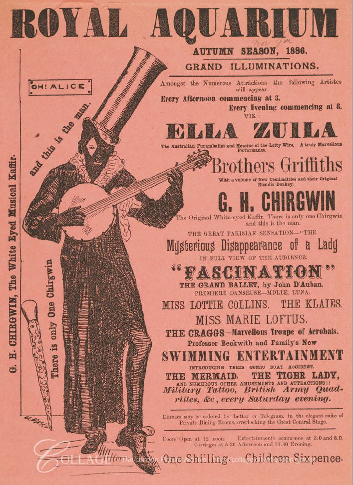
Other entertainments were similar to those put on at a Music Hall, but on a much larger scale. The following is the Autumn Season in 1886, where you could see the Mysterious Disappearance of a Lady, in full view of the audience, or Professor Beckwith and Family’s New Swimming Entertainment.

Royal Aquarium

Image credit: London Metropolitan Archives, City of London: catalogue ref: SC_GL_ENT_125b

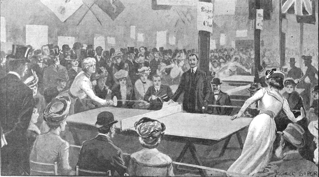
One of the events hosted in the Royal Aquarium was when the management “scored a great success with their first ping-pong or table tennis tournament”.

The drawing below shows the final in the ladies section between Mrs Thomas and Miss V. Eames, when “each lady scored one game and twenty-five points, upon which it was decided to play for five consecutive points, Miss Eames ultimately scoring, and winning the ladies championship.”

Royal Aquarium

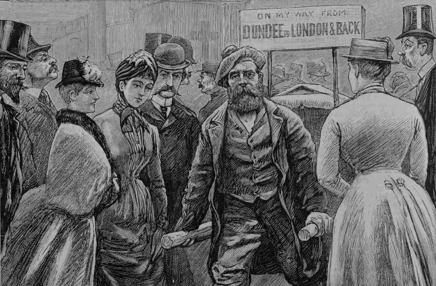
A very different appearance at the Royal Aquarium, was that by James Gordon, a street-porter from Dundee, in December 1886.

He was 47 years old, and originally apprenticed as an engineer, however he had his right hand smashed at work and lost his thumb and three fingers. He then tried work as a baker, as a painter, before finally working as a light porter in Dundee. He had twelve children. four had died and one had emigrated to New Zealand. Finding work was difficult and some weeks he would only earn four shillings.

With his disability, there was very little hope of finding any better work, so he decided to push a wheel barrow from Dundee to London and back – a distance of roughly 1,000 miles.

On reaching London, he rested for three days and appeared at the Royal Aquarium, where many visitors came to see him. He had a collecting box in his wheel barrow and people put in money during his journey, and at each town he stopped at, he would pay in the money at the Post Office, to be sent back to his wife at Dundee.

Mr James Gordon pulling his wheel barrow and setting of at the start of his return journey from London to Dundee.

Royal Aquarium

By the early years of the 20th century, the Royal Aquarium was in decline. It had grown a slightly dubious reputation as the newspapers of the time reported on the “single women” who would walk the galleries of the building.

So after a short 27 years in existence, the main building closed in January 1903. At the closing performance, the president and managing director of the aquarium company referred to some of the successful entertainments put on at the Aquarium, including Ladies’ Cycle Races, a Boxing Kangaroo, and that the public had paid one shilling a seat to watch a man in a trance awake (an experience that was compared to simply watching a sleeping man wake up !!). The theatre would continue on until 1907 when it too would be closed and demolished.

The site would soon be handed over to the Wesleyan Methodists, who would build their new Central Hall which would be open by 1912. The Central Hall today, from along side the Queen Elizabeth II Centre:

Royal Aquarium

Although the Methodist Central Hall has a very different purpose to the Royal Aquarium, the building is now the location for the BBC’s New Years Eve concert before and after the fireworks, so there is a small entertainment link remaining with the popular culture of the Royal Aquarium.

The Ordnance Survey large-scale maps are fascinating, there is so much detail to discover. In addition to the Royal Aquarium, I have circled three other sites:

Royal Aquarium

The red circle is around some text stating The Cock Inn (site off).

The Cock Inn was one of London’s very old inns:

Royal Aquarium

Image dated 1845 © The Trustees of the British Museum

According to Stow, the original Cock, or Cock and Tabard existed as far back as the reign of Edward III (1327 to 1377), and workmen were paid at the Inn during the building of Westminster Abbey. This original Inn may at some point have been demolished, and a new Inn, the Cock, was built on the opposite, north side of the street, which would be the location marked on the map.

Timber was reused from the original Inn to build the new, and there is a story in Old and New London which was also reported in the London Evening Standard on the 9th January 1854:

“DISCOVERY OF ANCIENT GOLD AND SILVER COINS – On Saturday morning, while some workmen were taking down some outhouses belonging to the well-known Old Cock and Tabard Inn, Tothill-street, Westminster, in the occupation of Mr Flixton, they came in contact with a large oak beam, which was hollow in the centre, when to their great surprise, they discovered a very large quantity of gold and silver coins, besides other antiquities of the reign of Henry V and Henry VII. The men, not knowing the real value of these coins, which are in a state of very good preservation, sold several to parties in the neighbourhood for a few pots of beer. Fortunately Messrs. J.C. Wood and Co., the eminent brewers, of Victoria-street, Westminster, hearing of the discovery, got possession of the remainder; and it is supposed by antiquaries and others competent of judging that they must have remained in the place where they were found for 500 or 600 years.”

The newspaper report uses the old name for the Inn, and there does seem some confusion regarding whether the inn on the northern side of Tothill-street was the original inn, or whether it was a rebuild of an inn that had existed on the opposite of the street, Old and New London states that the large oak beams were from the original inn, and it was common to reuse building materials.

The Cock Inn was demolished in 1873 to make way for the development of the Royal Aquarium – a sad fate of an inn that was probably around 500 years old.

The yellow oval is around another building that had a longer life than the Royal Aquarium, but has since been demolished and replaced by a very different building.

This is the Westminster Hospital:

Royal Aquarium

Image credit: London Metropolitan Archives, City of London: catalogue ref: SC_PHL_02_0579_5846C

The above photo is dated 1913 and shows the Westminster Hospital facing onto the yard at the entrance to Westminster Abbey. The front of the Methodist Central Hall can just been seen on the left of the photo.

The site of the Westminster Hospital is today occupied by the Queen Elizabeth II Centre, and the grass space in frount.

Royal Aquarium

The origins of the Westminster Hospital date back to 1716. The founders (Henry Hoare from the Hoare banking family, William Wogan, a religious author, a wine merchant, Robert Witham and the Reverand Patrick Coburn) were concerned about the very unhealthy conditions along the north bank of the Thames in Westminster. The area was subject to frequent flooding and the land was marshy.

In 1719, the Westminster Infirmary opened in a small house in Petty France, as a voluntary hospital, dependent on donations for all running costs.

The Westminster Hospital opposite the Royal Aquarium was the fourth version of the hospital, as it expanded and moved around Westminster as property became available.

Built in 1834 with an initial capacity of 106 in-patients, the hospital expanded over the years, with the additional of nurses accommodation and a medical school.

The first operation under general anesthetic was performed at the Westminster Hospital in 1847. One of the Doctors at Westminster Hospital was Dr. John Snow, who was responsible for tracking down the source of a cholera outbreak in Soho in 1854.

Within 10 days there were a large number of fatal cases of cholera within a small radius of the junction of Broad Street (now Broadwick Street) and Cambridge Street (now Lexington Street).

John Snow worked meticulously on tracking down all those who became infected to discover any common link between infections, and he gradually came to the conclusion that the common source was a water pump close to the junction of Broad and Cambridge Street’s. To confirm that this was the source, he also tracked locals who were not infected to find out where they sourced their water and in all cases it was a different source to the water pump.

He had some trouble trying to convince officials that the pump was the source, but after the pump handle was removed, cases stopped appearing.  In his report to the Medical Times and Gazette, he wrote:

“I had an interview with the Board of Guardians of St. James’s parish, on the evening of the 7th, and represented the circumstances to them. In consequence of what I said, the handle of the pump was removed on the following day. The number of attacks of cholera had been diminished before this measure was adopted, but whether they had diminished in a greater proportion than might be accounted for by the flight of the great bulk of the population I am unable to say. In two or three days after the use of the water was discontinued the number of fresh attacks became very few.

The pump-well in Broad-street is from 28 to 30 feet in depth and the sewer which passes a few yards away from it is 22 feet below the surface. the sewer proceeds from Marshall-street, where some cases of cholera had occurred before the great outbreak. 

I am of the opinion that the contamination of the water of the pump-wells of large towns is a matter of vital importance. Most of the pumps in this neighbourhood yield water that is very impure; and I believe that it is merely to the accident of cholera evacuations not having passed along the sewers nearest to the wells that many localities in London near a favourite pump have escaped a catastrophe similar to that which occurred in this parish. ” 

An early example of the importance of track and trace, and of listening to experts.

A pub called John Snow is now on the corner of Broadwick and Lexington Street, close to the original location of the contaminated pump.

Back to the Westminster Hospital, and the buildings opposite Westminster Abbey remained open until 1939, when a new and enlarged hospital building was completed at St. Johns Gardens.

Westminster Hospital remained at St Johns Gardens until 1993, when the buildings of the 5th version of the hospital closed, and reopened as the Chelsea and Westminster Hospital on Fulham Road.

The hospital buildings opposite Westminster Abbey remained for a number of years, and there were plans to build a new Colonial Office on the site. The following is an illustration of what the Colonial Building could have looked like.

Royal Aquarium

There were plans for the site to become an open space, or alternative government offices, however it was not until 1975 that the plan for a conference centre was approved, and construction of the current building that occupies the site started in 1981 with the Queen Elizabeth II Conference Centre opening in 1986.

There is one final site marked on the map by the blue circle. This is the location of Cockpit Steps, which I wrote about here.

I started this post with the theme of how London’s buildings change continuously, and the Royal Aquarium, Westminster Hospital building and a 500 year old pub are now just historical footnotes. But they all hold a wealth of history, whether the story of James Gordon pulling his wheelbarrow from Dundee to feed his family, hidden treasure in centuries old beams, or a pioneering doctor who found the source of a cholera outbreak in Soho.

The same will apply to nearly every building across London today, at some point they will also become a historical footnote as the city responds to continuous change, and reinvention.

alondoninheritance.com

Trinity Hospital and Power Station, Greenwich

Trinity Hospital Greenwich can be found facing the River Thames, roughly half way between two pubs, the Trafalgar Tavern and the Cutty Sark. In 1951 my father took the following photo of the river facing entrance and clock tower of the hospital, with the chimneys of the adjacent power station behind.

Trinity Hospital

I suspect his thinking in composing the above photo was to show the contrast between what was at the time the almost 350 year old hospital and the relatively recent power station that then dominated the area. The photo also shows two buildings with very different form and function. One enormous building generating electricity from coal for the tram network of London, the other much smaller building providing accommodation for the poor of Greenwich.

On a fine day last Autumn, i was on my way to the Cutty Sark pub, remembered that my father had taken a photo of the hospital and power station chimneys, but did not have a copy of the original photo with me, so took a couple of comparison photos in landscape rather than portrait, but hopefully they show what has changed, and what has not in the past 70 years.

The entrance gates, entrance and clock tower, with the power station in the background.

Trinity Hospital

A slightly wider view showing all four chimneys.

Trinity HospitalThe main difference between the two photos is the build of the chimneys. The power station has four chimneys. The two chimneys in my fathers photo, and to the left in the above photo date from the first stage of the power station which was opened in 1906. The two chimneys of the second stage, shown to the right of the above photo were originally constructed to the same design, but were soon shortened due to complaints by the Royal Greenwich Observatory.

The construction of the power station used some leading edge technology for the beginning of the 20th century, and an article in the 20th October 1906 edition of the Kentish Independent described the power station:

“THE HEAVENLY TWINS – GREENWICH ELECTRIC POWER STATION: Very much the reverse of beautiful though they are, the two great chimneys which stand side by side, gaunt and forbidding, near the Thames at Greenwich, represent power, importance, and engineering skill. They are the outward and visible sign of the inward wonders of the London County Council’s new power station. One of the largest in the world it will be when completed. 

‘The Heavenly Twins’ Greenwich people have christened the towers, but it is the interior which is to supply the vitality and volatility which will be the better reminder of Angelica and Diavolo. 

Along the side wall of the vast chamber, where the plant is to be stored, runs a series of vertical girders, writes a correspondent who has paid the generating station a visit. On these a travelling iron bridge moves from end to end carrying a crane which lifts any weight up to 50 tons. Heavy objects are taken up at the front door and gingerly carried to any part of the hall. Below us the furnaces, consuming 600 tons a day, occupy the great basement. The dynamos are on the ground floor, in the side gallery a giant switchboard will strike the visitor with awe and fear at its death dealing potentialities.

It will come as a surprise to many homely people to find that here the ‘coal cellars’ are on top of the house. These bunkers comprise 24 square iron chambers, holding in all 16,000 tons of coal. The bottom of each is shaped, in cement and metal, like an inverted cone, the depressed point being an open funnel or shoot, down which the coal falls directly into the furnace openings as the stoker directs.”

The following photo from Britain from Above shows the power station in 1924 with the two “Heavenly Twins”, chimneys from the first phase of the power station nearest to the river and the shortened chimneys of the second phase to the right.

Trinity Hospital

Trinity Hospital is to the left of the power station. The hospital buildings and clock tower facing the river, with the hospital gardens stretching back, parallel to the power station.

The power station supplied electricity to the London tram system, and later to the London Underground, along with Lotts Road in Chelsea. The power station was built on an earlier tramway depot. The following extract from the 1895 Ordnance Survey map shows the hospital in the centre of the map, with the tramway depot to the right.

Trinity Hospital

Credit: ‘Reproduced with the permission of the National Library of Scotland’ 

Power stations in the first decades of the 20th century operated independently, with no backup and breakdowns would have an immediate impact to users of electricity, and this was very visible on the London transport system.

A letter to the East London Observer on the 17th October 1908 by the president of the Associated Municipal Electrical Engineers raised two recent failures of the Greenwich Power Station, and the power station at Lotts Road, Chelsea which supplied the London Underground:

“The Greenwich Power Station of the London County Council and the Chelsea Power Station of the Underground Railways, both these stations have recently broken down, with the result that in the former case about 600 to 800 trams were brought to a standstill, and in the latter case all trains and lifts on the Bakerloo, Piccadilly and Hampstead Tube Railways and the District Railways were stopped and the stations and lifts plunged into utter darkness, as well as causing a stoppage on the Wimbledon and Surbiton sections of the London United Tramways systems.”

The author then goes on to propose that these sort of power outages can only be fixed if electricity generating stations are interconnected so there is no single point of failure, and other stations are available to take on the load of a failed power station. An idea that would eventually be implemented across the country in the form of the National Grid, which today provides electricity to the Underground network, with the Greenwich Power Station being available as a back-up generator having been converted to gas operation.

Trinity Hospital is also shown on the 1895 map, and by the time of the map, it was already almost 300 years old. The book “The Endowed Charities of the City of London” (published in 1829) describes the founding of the hospital as:

“By letters patent, King James I, dated 5th June, in the 13th year of his reign (1615) reciting that Henry, late Earl of Northampton, did, in his lifetime, begin to erect a certain edifice at East Greenwich, for the habitation and support of poor men”

Accommodation was provided for 20 poor men, who would live in the hospital along with a Warden. Residents were expected to comply with a set of standards which included not being allowed to go to Taverns or Ale-houses.

A 19th century report of a dinner provides a glimpse of life at Trinity Hospital and for the increased number of residents (now 25). From the 11th September 1841;

“Trinity Hospital, Greenwich – A most gratifying scene was presented at this hospital on Wednesday last, on the occasion of a dinner being given to the inmates, nurses &c, by the Rev. William Jurin Totton, rector of Debden, Essex, and old member of the Mercer’s Company, who are the governors and trustees of the charity. It was pleasing to those who saw the old members, 25 in number, and whose ages amounted to 1680 years, assembled in the sub-hall at a dinner of true old English fare of roast beef, plum-pudding, and other substantial refreshments. The dinner was served soon after noon according to primitive custom; and, afterwards various appropriate toasts were given by Mr Tatham, the warden. ‘God save the Queen’ being sung after that of the ‘ Queen and Royal Family’, by as many of the old men as were able, aided by the young men of Greenwich, whose musical services were kindly volunteered for the occasion.

The crowning point of the evening was the presentation by the liberal donor of the feast, of twenty-five valuable books, consisting of sermons and works of edification and amusement, thus forming the foundation of a library for the use of the poor men in their leisure hours. The Earl of Northampton’s banner was hoisted on the turret of the building, in honour of this innocent festivity, and at night-fall each inmate retired to his chamber with his heart filled with gratitude towards the Rev. Mr Totton, whose health was drank in the ancient silver loving-cup, with three times three.”

The report states that there were 25 residents with a combined age of 1680 years, therefore the average age of the residents was just over 67 years.

Note the reference to the Reverend being an old member of the Mercer’s Company. Trinity Hospital was one of the charities managed by the Mercer’s Company, and this relationship continues to this day with Trinity Hospital being one of the Mercer’s Almshouses. On their website, the conditions for admittance as a resident are:

  • being in reduced financial circumstances
  • reasonable good health and able to look after daily needs
  • resident of Greenwich for at least 4 years

So Trinity Hospital has retained its relationship with the Mercer’s and providing accommodation for local Greenwich residents for almost 400 years.

The London Metropolitan Collage Archive has a photo of Trinity Hospital looking in the opposite direction to the power station, dated 1937:

Trinity Hospital

Image credit: London Metropolitan Archives, City of London: catalogue ref: SC_PHL_02_0151_50_738_C

Interestingly, Collage also has a photo very similar to my father’s photo. Taken in 1960 it was obviously a favorite photographic subject, showing the contrast between two very different chimneys.

Trinity Hospital

Image credit: London Metropolitan Archives, City of London: catalogue ref: SC_PHL_02_0151_62_722

Trinity Hospital is sometimes open during the Open House London weekend and it has been on my list of places to visit, but not yet had the time. Hopefully this year.

As usual, there is so much to find in the immediate local area. Directly opposite Trinity Hospital is the river wall, heightened over the years to prevent flooding. With plaques on the wall detailing the heights and dates of previous high tides.

Trinity Hospital

The plaque on the right records an extraordinary high tide on the 7th January 1928 when 75 feet of the wall were demolished, this must have flooded the hospital.

The river is always making its presence felt along the river walkway. A tell-tale flow of water from underneath this metal gate:

Trinity Hospital

Sticking my camera over the top of the gate reveals a narrow gap between two buildings, with the river surging in.

Trinity Hospital

Passing above the riverside walkway and extending out into the river is the old power station coal jetty.

Trinity Hospital

As can be seen in the Britain from Above photo, the jetty once included two cranes which were used for moving coal from the river to the power station, and for transferring ash from the power station to barges on the river for disposal.

Along the riverside walkway, the power station is surrounded by a high brick wall, I suspect not just to keep people out, but also to keep water out in the event of a high tide.

Trinity Hospital

The wall is covered in a mysterious set of ceramic works that tell the story of a young boy taking his dog for a walk along the Thames foreshore, and finding a strange creature that led the boy into the murky depths of the river. The work was created by Amanda Hinge.

Trinity Hospital

I have featured the Cutty Sark pub before, which is to the east of Trinity Hospital, if you are walking along the river from the ship, the Cutty Sark, the first pub you come to is the Trafalgar Tavern. Built in 1837, the pub stands on the site of an earlier pub, the Old George Tavern.

Trinity Hospital

Facing directly onto the river provides a superb view from the pub, however the high tides get close to the windows.

The power station is still providing a standby capability for the London Underground. Now gas-powered, the station is cabled to a number of points on the underground network, enabling Greenwich to provide electricity should there be problems with the main supply from the grid.

Unfortunately, the chimneys are today much reduced and the original pair do not justify the 1906 title of the Heavenly Twins.

Trinity Hospital continues to provide homes for the elderly of Greenwich, so this strange pairing of buildings look set to continue living next to each other for years to come.

alondoninheritance.com

Fitzrovia Chapel or the Middlesex Hospital Chapel

A brief post for this Sunday, with a visit to a stunning building that is almost all that remains of one of London’s early hospitals. This is the chapel of the old Middlesex Hospital, now known as the Fitzrovia Chapel.

Turn off Tottenham Court Road into Goodge Street, then cross over to where it becomes Mortimer Street, and a short distance along is this rather bland entrance to a recent development – Fitzroy Place.

Fitzrovia Chapel

This is the site of the old Middlesex Hospital, now occupied by a development of apartments, restaurants and office space. There is one main survivor of the hospital, located at the core of the new development that is well worth a visit. This is the chapel of the Middlesex Hospital, now known as the Fitzrovia Chapel. Located in a central square, partly behind a row of trees is the brick built chapel, looking very different from the buildings that now surround.

Fitzrovia Chapel

The exterior of the Fitzrovia Chapel is relatively plain, constructed mainly of red brick with very little in the way of exterior decoration, but step inside the building and a very different experience awaits.

Looking along the nave of the chapel towards the altar (behind the TV screen), and the chancel.

Fitzrovia Chapel

Looking up at the decoration of the chapel.

Fitzrovia Chapel

The interior decoration of the chapel is the complete opposite to the exterior. Colour and decoration cover almost every surface.

Fitzrovia Chapel

The Fitzrovia Chapel is of relatively recent construction. Dating from 1891, with the interior decoration completed by 1929, although the origins of the Middlesex Hospital of which the chapel was part, date back to the 1740s.

The chapel was commissioned by the governors of the hospital in the 1880s as a memorial to Major Alexander Henry Ross, MP who had been Chairman of the Board of hospital governors for 21 years. The architect was John Loughborough Pearson who used a background in Gothic religious architecture to his design for the Middlesex Hospital Chapel.  He would not live to see the chapel completed as he died in 1897, however work on the chapel was continued by his son, Frank Loughborough Pearson, and the chapel was finally completed in 1929.

One of the reasons for the length of time it took to complete the chapel was that a commitment was made that no money meant for patient care would be used for the chapel, so as well as the time needed for building and the complex decoration, it was also the time needed to collect sufficient donations to finish such as beautiful building.

The vaulted roof of the chapel is decorated with stars against a stunning gold background with bands of decoration meeting at the centre.

Fitzrovia Chapel

Another view of the roof.

Fitzrovia Chapel

Stained glass windows add to the impression of a religious building, which indeed it is, however the chapel was not consecrated (there was no legal Deed of Consecration), but was dedicated by the Archbishop of Canterbury in February 1939, who described the building as “without question one of the most beautiful hospital chapels in the realm”.

Fitzrovia Chapel

A weekly service held in the chapel was relayed across the hospital to patients.

The chapel was used for many different purposes over the years. Services, concerts by touring choirs, funerals, however one of the more unusual was probably after the death of Rudyard Kipling at the Middlesex Hospital in January 1936. Kipling, who was described in newspaper reports of the time as the “poet of the British Empire”, was taken to the chapel, where his coffin, draped in a Union Jack, was placed before the altar. A bunch of violets were placed on the coffin. These had been sent by Mrs Baldwin, the wife of the Prime Minister. His body was later cremated and his ashes interred in Westminster Abbey.

Since the original establishment of the Middlesex Hospital, the hospital buildings have been through a number of waves of extension and rebuilding, and the last major rebuild was at the time when the chapel was completed, when virtually the whole of the hospital was rebuilt during the late 1920s and early 1930s.

Fitzrovia Chapel

Either side of the entrance to the nave of the chapel is an apse. The south-west apse is decorated in rich blue and golds.

Fitzrovia Chapel

Which provides space for a font, built from a solid block of deep green marble.

Fitzrovia Chapel

The north-west apse includes a roundel of Saint Barnabas just below the vaulted roof.

Fitzrovia Chapel

The organ gallery above the main entrance to the nave.

Fitzrovia Chapel

The vestibule between the entrance to the chapel and the nave is lined with plaques recording the names of those who donated towards the costs of the chapel, eminent hospital staff, as well as hospital staff who died on duty, including nurses such Dorothy Adams, Maudie Mason, and Grace Briscoe who died from influenza and scarlet fever in 1919.

Fitzrovia Chapel

There are also plaques commemorating John and Frank Loughborough Pearson, the architects of the chapel.

Fitzrovia Chapel

The central square of Fitzroy Place, in which the chapel is located, is called Pearson Square, after the architect(s) of the chapel.

From the 1980s onward, the functions of the Middlesex Hospital were gradually relocated to other London hospitals, with final closure of the site in 2005 when the remaining services were moved to University College Hospital.

The site was sold off for private development, and with the exception of the chapel which was Grade II listed, the entire hospital was demolished in 2008, leaving a large expanse of land with the chapel at the centre. The financial crash of 2008 delayed redevelopment of the site, which was finally commenced in 2011.

As with any large development in London during the last few decades, development included going down as well as up, and the space for four floors of car parking and other facilities was excavated around the chapel, which was underpinned and supported on piers to protect the structure of the chapel.

A condition of Westminster City Council’s planning permission for the overall site was that the developers would fund the restoration of the chapel, which had deteriorated as the hospital gradually contracted and closed. Following restoration, the chapel opened in 2015, having also been transferred to an independent charitable foundation, the Fitzrovia Chapel Foundation to maintain, preserve and run the chapel. It is now open for public viewing on  Wednesday’s, as well as being available for hire for secular wedding ceremonies (I assume because the chapel was dedicated rather than consecrated), exhibition space, private functions etc.

At the time of redevelopment of the site and restoration of the chapel, there was a campaign to retain the name of the Middlesex Hospital Chapel, however this original name probably did not fit with the developer’s intentions for the branding of the new development. The Middlesex Hospital Chapel became the Fitzrovia Chapel to reflect the wider area of Fitzrovia, rather than the old hospital.

I am no expert, but it does seem a trend of the last few decades where public institutions are gradually dispersed allowing a central site to be closed and sold off. Middlesex Hospital had been in operation for over two hundred years and had built up a long tradition of expertise, team work and institutional memory – things which take many years to develop, but are quickly lost and almost impossible to replace.

The Fitzrovia Chapel is all that is left to recall the hospital that once occupied the wider site for over two hundred years. Although it has a new name, hopefully, it will always be the Middlesex Hospital Chapel.

alondoninheritance.com 

Seven St Martin’s Place and London Hotel Growth

London changes at such a rate that it seems every time you walk down a street, there is new building work underway. I was recently walking down Charing Cross Road towards Trafalgar Square and saw scaffolding and sheeting around this building – Seven St Martin’s Place.

Seven St Martin's Place

Seven St Martin’s Place is between the church of St Martin in the Fields and William IV Street and faces the Edith Cavell Memorial.

There is nothing very special about the building. It is a late 1950s office block with retail space along the ground floor. The company I worked for in the early 1980s had a couple of floors in the building.

What the building does have is a rather good location. Opposite the National Gallery, less than a minute’s walk from Trafalgar Square, at the southern end of Charing Cross Road and close to the Strand – a prime west London location.

The location of the building is shown by the red rectangle in the following map extract  (© OpenStreetMap contributors) .

Seven St Martin's Place

The reason for the building work at Seven St Martin’s Place is that the building is being converted to a hotel.

The City of Westminster planning decision approves a change of use for the first to fourth floors from offices to hotel accommodation along with extensions at the fifth floor roof level to create a new rooftop restaurant and bar with external terrace,

The existing ground floor retail units will be reconfigured and new retail space created, both at ground and basement levels.

The hotel will consist of 136 bedrooms and be operated by the Butterfly Hotel Group, a Hong Kong based hotel company.

The redevelopment of Seven St Martin’s Place mirrors so much other development across London, where almost any property that becomes available, or can be purchased, is converted to either apartments or hotels. Not in itself a bad thing, providing that residential apartments are affordable, which is rare, or that the diversity of use found across London streets is not restricted.

The planning decision states that whilst “Policy S20 of the City Plan July 2016” resists the loss of offices to residential use, there is no policy that resists the loss of office space to hotel use. Apparently because it is also another use that generates employment, so providing the proposal meets regulations such as noise control, light, appearance, access etc. there is no reason to turn down the application, although an additional Policy S23 does state that existing hotels must be protected and that there are no adverse effects on residential amenity.

I suspect that with the demand for hotel rooms in London, very few applications are turned down.

Building name above the original entrance to the building:

Seven St Martin's Place

The conversion of Seven St Martin’s Place did get me wondering about how many hotels there are in London and the level of growth as there does seem to be new hotels opening all the time, and at what point is saturation reached?

There are a number of reports available, and a report by London & Partners (the Mayor of London’s official promotional agency) titled “London Hotel Development Monitor – The Investment Hotspot” provides an overview.

The function of the agency is to promote London and the report is very much focused on promoting the city as a tourist destination and the opportunities for hotel development that tourism brings.

The report states that:

  • In July 2018 there were 140,000 hotel rooms in London
  • An additional 11,600 rooms were expected to be built by 2020
  • Room occupancy is significantly high. In 2018, 79.6% of rooms were occupied, slightly behind Dublin (82%), but higher than Dubai (76.4%), Paris (77.1%), Berlin (74.7%) and Rome (70.1%)

An earlier report stated that the City of Westminster had the most hotels, with 433, with Kensington and Chelsea being second at 189. The City of London had 68 hotels.

The report highlights the impact of the 2012 Olympics on the number of hotel rooms opened across London:

  • 2012: 8,133 new hotel rooms
  • 2013: 1,833 new hotel rooms
  • 2014: 5.442 new hotel rooms
  • 2015: 3,117 new hotel rooms

The money involved is significant with the report claiming hotel investment in 2015 was £3.9 billion.

This level of growth and investment is expected to continue. A working paper “Projections of demand and supply for visitor accommodation in London to 2050” (Greater London Authority – April 2017) provides a projection of visitor numbers to London over the coming decades, with International visitor growth expected to be:

  • 2015 – 18.581 million
  • 2020 – 19.992 million
  • 2025 – 21.215 million
  • 2030 – 22.439 million
  • 2036 – 23.907 million
  • 2041 – 25.130 million
  • 2050 – 27.332 million

Domestic visitors to London, staying overnight will also be growing significantly in the same period;

  • 2015 – 12.938 million
  • 2020 – 13.964 million
  • 2025 – 15.451 million
  • 2030 – 16.938 million
  • 2036 – 18.598 million
  • 2041 – 19.928 million
  • 2050 – 22.413 million

Projections are notoriously difficult to get right, but I suspect it is safe to assume that the number of hotels required in London will continue to grow significantly, and there will be many more redevelopments of existing buildings over the coming decades.

The closed Post Office on the ground floor of Seven St Martin’s Place – will this type of business ever return to the retail space of redeveloped buildings, with probably increased rents? The planning decision does confirm that space will be available for the Post Office should the company choose to return.

Seven St Martin's Place

The growth in hotels across London has been considerable, but to understand the impact on local communities, pricing pressure on the cost of housing, apartments and flats, costs for renting, we must also look at the growth of Airbnb in London, which has been dramatic over the last few years.

The Inside Airbnb site has some fascinating detail on the number and type of accommodation listed, cost, occupancy etc. The overview for London at the time of writing this post shows that for London there are:

  • A total of 77, 096 listings, of which;
  • 42,758 are entire homes or apartments
  • 33,594 are private rooms
  • 744 are shared rooms

The supporting data is downloadable. I was creating a graphic showing the number of Airbnb’s for each London borough, but ran out of time (I will add when complete), but for now, along with the new hotel being built, there are 9,411 Airbnb listings in Westminster.

The relative ease and low cost of global travel is driving the rise in tourism, and therefore the demand for accommodation in cities across the world. Other cities such as Venice and Barcelona are taking steps to control tourism, and the growth in Airbnb. These cities also have to manage the rise in tourists arriving by cruise ship – an issue which currently has minimal impact on London, apart from the occasional cruise ship moored by HMS Belfast or at Greenwich. Whilst these methods of travel do not require accommodation in the city, they do drive a high number of visitors who spend little in the host city.

Amsterdam is another city trying to manage ever increasing visitor numbers with a number of steps being taken including the Netherlands Tourist Board no longer actively promoting the country as a tourist destination.

The demand for land and buildings for hotel development is one of the many drivers behind the price of property across London.

In 2010, Seven St Martin’s Place was sold for £41 million and four years later in 2014 it was sold again, with the prospect of change of use to a hotel, for £65 million – a profit of £24 million in four years.

The facade of the building is relatively bland, however there is some interesting decoration on the side of the building facing the Edith Cavell monument. There are two vertical sets of, I am not sure what – artwork, carvings – one panel between each window, creating vertical columns of panels spaced between windows. See the photo at the top of the post for the location of these panels.

Close-up photos of these panels reveal some intriguing designs:

Seven St Martin's Place

Seven St Martin's Place

Seven St Martin's Place

Seven St Martin's Place

Seven St Martin's Place

Seven St Martin's Place

Seven St Martin's Place

Seven St Martin's Place

I have no idea as to the origin of these panels, or what they are intended to represent.

The building is not listed, and strangely the planning decision document which details the conditions of planning approval does not make any mention of these panels.

The drawings in the planning document appear to include these panels, so hopefully they will remain.

I have really tried to make out what these panels mean, but cannot find any reference, or looking at them, see any recognisable form or pattern.

I did wonder if put together they would make a map. I have written about the building at 111 Strand, where a map of the area has been carved into the Portland Stone across the 1st to 5th floor of the building.

To see if they made a map, or if there was any other meaning when the panels are combined, I put them together in the same order as they appear on the building:

Seven St Martin's Place

It does look as if the panels are meant to be combined. There are features that run from one panel to the adjacent. There looks to be a boarder around combined panels. On the far right of the panels, there are vertical wavy lines running down all four panels – could this be the River Thames?

Despite looking at these panels for ages, rotating the photos, trying different combinations, I cannot see any meaning – perhaps there is none. If anyone knows what they mean and who created them, I would be really interested to know.

Although the focus of this week’s post was on the building, and what another hotel conversion means for London, I wanted to have a quick look at the history of the site.

The area demands a full post, so this is a brief look. The 1895 Ordnance Survey Map shows the area as it was around 125 years ago:

Seven St Martin's Place

Credit: ‘Reproduced with the permission of the National Library of Scotland’ 

The street plan is much the same as today, but the block of land that is now occupied by Seven St Martin’s Place was St Martin’s Mews. The Vicarage remains to this day

What is interesting is that the location now occupied by the monument to Edith Cavell, also had a statue in 1895, however it must have been different as the Edith Cavell monument was unveiled in 1920.

On July 18th 1902 a rather impressive statue to General Gordon, mounted on a camel was unveiled in the same position:

Seven St Martin's Place

But this was seven years after the Ordnance Survey map – I could not find any reference to an earlier statue, but my research time was limited.

The London Metropolitan Archives Collage collection, as usual provided some views of the site prior to the construction of the building we see today.

This is the view of the building that occupied the site, note the entrance to the Mews. The photo is dated 1930 and I suspect are the same buildings that are shown on the 1895 Ordnance Survey map.

Seven St Martin's Place

Image credit: London Metropolitan Archives, City of London: catalogue ref: SC_PHL_01_523_A7058

In the above photo, the darker section on the right of the block is the vicarage. This part of the block remains to this day and it is the lighter section on the left that was demolished to be replaced by Seven St Martin’s Place.

The following photo is a 1958 view of the building. As the 1895 map indicates, it was a collection of different buildings with a central mews.

Seven St Martin's Place

Image credit: London Metropolitan Archives, City of London: catalogue ref: SC_PHL_01_523_58_2190

As the above photo is dated 1958, it was either demolished soon after, or the references to the current building on the site being a late 1950s office block are wrong, and it is perhaps early 1960s.

The view of the building from William IV Street today, shrouded in sheeting as part of the building work.

Seven St Martin's Place

Changes to London are gradual, and normally it is only the historically or culturally significant buildings that get publicity when their use is changed, or they are threatened, but there are also so many changes involving rather ordinary buildings from the last half of the 20th century.

Hotels and expensive residential buildings appear to be the main drivers of development, however there still appears to be an expectation for plenty of office space. The 2017 London Office Policy Review for the Greater London Authority projects that office employment across the greater London area will rise from 1.982 million in 2016 to 2.861 million in 2050, so office space will continue to be required in larger volumes to accommodate this workforce.

So with the 2050 projections for both office space and tourism numbers – London is set for a considerable amount of development over the coming decades, and we will continue to see change whilst walking the streets of London, although I am not sure how much trust I would put in future projections.

alondoninheritance.com

New Deal For East London – Isle Of Dogs

In my last post, I had just left Poplar and was about to continue along the eastern edge of the Isle of Dogs in my hunt for the sites listed as at risk in the 1972 Architects’ Journal.

After crossing the bridge over the entrance to the Blackwall Basin, I turned towards the river along Coldharbour.

Site 27 – Early 19th Century Houses In Coldharbour

Coldharbour is a narrow street that runs parallel to the river in the space between the entrances to Blackwall Basin and the South Dock. It is not part of the main street along the east side of the Isle of Dogs, that function is performed by Preston’s Road, so Coldharbour is quiet, and probably not visited unless you have a reason to be there.

The street may well be a remnant of the pathway that ran along the Blackwall medieval river embankment, so has a long history however the houses identified by the Architects’ Journal only date from the early 19th century.

The artist William Daniell produced a series of prints of the new docks in 1802 and the following print shows Coldharbour as a line of buildings along the river front, between the entrance to the Blackwall Basin on the right and the South Dock to the left.

Isle of Dogs

Building has occupied this part of the river bank since at least the 17th century.

I approached Coldharbour from the north end of the street and this is the first of the historic houses that line part of the eastern side of the street. This is Isle House.

Isle of Dogs

The London Metropolitan Archive Collage site has a photo from almost the same position showing the house looking much the same in 1948.

Isle of Dogs

Image credit: London Metropolitan Archives, City of London: catalogue ref: SC_PHL_01_288_AV63_989

Isle House was built to a design by John Rennie between 1825 and 1826 as the Dockmaster’s house, and its elevated position and bay windows provided views of the river and the dock entrance just to the north. It replaced an earlier dockmaster’s house that had fallen into a state of dilapidation.

The design of the house, and the use of the large bow section, is very similar to Bridge House, the last building in my previous post. One of the possible reasons for the similarities of design is that this house was designed by Rennie’s father, although the design was also probably functionally best for the role of the occupant.

In my photo above, a row of taller terrace houses can be seen following on from Isle House. They are rather difficult to photograph in such a narrow street. I walked further down and took the following photo looking back.

Isle of Dogs

In the above photo, the furthest house, next to Isle House is Nelson House, built around 1820. The two houses closest to the camera with brick facing were built around 1809.

There is no access to the river along Coldharbour. There are various gaps between buildings, however they are all closed off so no possibility to view the river.

Isle of Dogs

Further along Coldharbour there is a rather imposing building. This is the entrance to the old Blackwall Police Station.

Isle of Dogs

Blackwall Police Station was built between 1893 and 1894 to a design by John Butler. The need for the police station was due to the poor conditions that the local division were housed in – an old hulk floating on the river.

The Police Station closed in the late 1970s, it was then converted into flats.

Isle of Dogs

The ground floor is raised above the level of Coldharbour as shown by the photos above where a flight of steps reaches up to the main entrance. This was a design response to a unique need.

The photo below of Blackwall Police Station from the river in 1969 shows a large entrance at river level. This was a boat dock to provide access for boats directly underneath the building so that stores, or indeed people, could be securely transferred within the building rather than alongside.

The height of the entrance had to be sufficient to provide access at all states of the tide.

Isle of Dogs

Image credit: London Metropolitan Archives, City of London: catalogue ref: SC_PHL_02_0183_69_1313

At the end of Coldharbour, where the street turns away from the river back up to Preston’s Road (although access is only for pedestrians, the junction is closed for traffic), is one of may favourite pubs. This is The Gun:

Isle of Dogs

The Gun is a genuinely old pub with a pub on the site since the early 18th century. The current name of the pub originates from 1771. Earlier names for the pub on the site were the Ramsgate Pink, the Rose and Crown and the first recorded name in 1722 as the King and Queen.

A board on the front of the pub states that Admiral Nelson met Emma Hamilton for “secret assignations” in an upstairs room. Whatever the truth in this, the pub is a perfect, out of the way location for a secret meeting.

The pub can get very busy, and is Grade II listed, so hopefully the future of this historic pub, alongside the river, is safe.

Returning to Preston’s Road, I continued to head south. crossing the entrance to the South Dock. There are some fascinating views from this point. This is looking north west with two types of crane symbolising the change that is taking place on the Isle of Dogs – original cranes for loading and unloading cargo alongside the docks, with the cranes that are now building the towers that are taking over large parts of the area.

Isle of Dogs

Looking along the entrance channel to the location of the original South Dock with a growing forest of high rise towers.

Isle of Dogs

The view in the opposite direction, across the River Thames to the Millennium Dome.

Isle of Dogs

I have a load of photos that both my father and me have taken of the Isle of Dogs over the years. Many of them I still need to scan, but there is one that I have scanned that I wanted to find the location of on this walk.

This is a photo of the Gun pub taken from the opposite bank of the channel between river and South Dock taken in 1986.

Isle of Dogs

This viewpoint shows the side of the Gun as well as the river frontage of the buildings alongside Coldharbour. The tide is out and the large entrance into the boat dock underneath the old police station can be clearly seen.

Crossing the bridge, I tried to find the location of the above photo. New flats have been built across the area. I walked in the entrance roadway hoping to find access to the river. The length up against the channel is fenced off. The nearest I could get to a similar photo is shown in the following photo, but I am not far enough out.

Isle of Dogs

This pontoon extends out into the river and I suspect my father took the photo from the end of the pontoon. It is behind a fence and locked gates in I think an area controlled by the Canal and River Trust – I will have to get in contact and see if I can access this area.

Isle of Dogs

Walking back up to the road, which has now changed name from Preston’s Road to Manchester Road, and the large blue bridge can be seen over the entrance to the South Dock.

Isle of Dogs

The bridge viewed from the southern approach.

Isle of Dogs

This latest incarnation of the bridge across the channel between docks and river was installed in 1969. The design of the bridge is the same as I saw in Amsterdam last year, although on a much larger scale.

Just to the south of the bridge there is a separate spur of Manchester Road on what was the original alignment of the street. Along this spur is a terrace of houses that date from the early 1890s.

Isle of Dogs

Up to this point, I had not seen any survivors from before the war, apart from the houses in Coldharbour. This terrace has managed to survive the expansion of the docks and the considerable bombing of the area during the war. The terrace is named Glen Terrace after the shipping line of the same name which operated on the space the houses now occupy prior to their construction.

The 1895 Ordnance Survey map shows that Manchester Road once ran on the alignment of the spur that runs directly in front of Glen Terrace and that a large Graving Dock once extended from the river up to Manchester Road.

Leaving Glen Terrace, I continued south along Manchester Road. Nearly all the building along this stretch of Manchester Road comprise post war flats of varying heights, there is very little or pre-war age, a reflection of the intense bombing of the Isle of Dogs and the post war loss of the Docks and their associated industries.

There is an interesting exception. Hidden behind a row of hedges and trees is a crescent of houses that would not look out of place in deepest suburbia. This is Jubilee Crescent:

Isle of Dogs

The houses in Jubilee Crescent form 28 retirement flats managed as social housing.

They were built in 1935, the year of King George V’s Silver Jubilee which accounts for the name of the crescent. They were built for retired workers in the shipbuilding industry by the ship repair company R. & H. Green & Silley Weir Ltd, who then handed the completed buildings to the Shipworkers Jubilee Housing Trust. They are now managed by the Southern Housing Group.

Walking along Manchester road there are a couple of closed pubs. The first is the Cubitt Arms:Isle of Dogs

The pub was built in 1864 and closed in 2011.

The Cubitt Arms may be an early example of planning blight. Whilst researching through newspapers, I came across the following article from The Era, dated the 31st January 1869:

“COMPENSATION FOR A PUBLIC-HOUSE ON THE ISLE OF DOGS – A Special Jury, under the presidency of Mr. Under-Sheriff Burchell was engaged the whole of Thursday at the Sheriffs’ Court, Red Lion-square, in the case of Smallman v. the Millwall Canal Company, to assess the amount of compensation to be given to the claimant of the Cubitt’s Arms, poplar, which premises were required for the new docks at the Isle of Dogs, and for the consequent damage to the property. Mr. Digby Seymour Q.C. and Mr. J.H. Lloyd were for the claimant; Mr. Hawkins, Q.C.  represented the Company. Several witnesses were called, and the compensation was estimated at between £5,000 and £6,000. Mr. Hawkins addressed the Court in mitigation, and, after a long investigation, the Jury awarded £3,760.”

The Millwall Canal Company was the original name of the company formed in 1864 to build the Millwall Docks. These docks form a reversed L shape with the lower arm of the L running from the middle of the Isle of Dogs towards the west. An eastern entrance would have been an advantage as it would have saved the effort of ships having to round the Isle of Dogs and enter from the west. An entrance from the east was planned by the Millwall Canal Company but never built.

I have ringed the location of the Cubitt’s Arms in red in the following extract from the 1895 Ordnance Survey map.

Isle of Dogs

The lower segment of the Millwall Dock is almost due west of the pub’s location. This lower segment has an entrance to the river in the west and the easterly entrance may have been proposed to run across the open land to the east of the dock, across the pub and into the river.

The pub was built in the same year as the Millwall Canal Company was formed, so the potential of an entrance running to the east would have put off any additional house building around the pub. it could have been this loss of customer business and the impact of not knowing whether you would still have a business in a few years that resulted in the claim for damages.

i will have to try and track down any plans showing the proposed route for the eastern entrance to confirm, but this does demonstrate that the impact of plans for large infrastructure developments on small businesses is not a recent problem.

The second pub is the Pier Tavern. Built a year earlier than the Cubitt Arms in 1863, but closed around the same time. It did have a short life as a restaurant, but is currently closed and the ground floor is boarded.

Isle of Dogs

I am sure it will end up as a full residential conversion.

A short distance further south is an interesting wall with a series of entrances running along the wall.

Isle of Dogs

There is a relatively recent housing development behind the wall, however this space was once occupied by Dudgeon’s Wharf, Pyrimont and Plymouth Wharf. It may be that these entrances originally led from Manchester Road into these wharves.

A short walk further on, I arrived at the final location listed in the Architects’ Journal as at risk in 1972.

Site 26 – Practically all that survives of original Cubitt Town – Cubitt’s Church in early English style.

This is the church of Christ and St. John on the junction of Manchester Road and Glenaffric Avenue.

Isle of Dogs

The Architects’ Journal reference to the church included the name Cubitt Town. This was the area to the south east of the Isle of Dogs that was developed by William Cubitt during the mid 19th century.  The development consisted of industrial premises on the land facing onto the river, with housing inland.

The rapid growth of Cubitt Town required a church to serve the growing population. Cubitt offered the land for the construction of the church, along with a donation, however he ended up funding the full construction and the church was completed around 1854.

The rows of terrace houses that once lined the streets of Cubitt Town and the industrial premises along the river have disappeared, however the church remains as a significant local landmark, with the tall spire being visible from across the river in Greenwich.

The street names have also changed. Newcastle Street was the original name for Glenaffric Avenue, so whilst Manchester Road has retained its name, some of the streets have changed name since Cubitt’s original development.

I walked up Glenaffric Street, alongside the church to find a pub at the end. This is the Great Eastern.

Isle of Dogs

The pub was part of Cubitt’s development and originally opened as the Newcastle Arms, in the street that was named at the time Newcastle Street. The pub later changed name to the Waterman’s Arms and relatively recently to the Great Eastern.

I have some photos of the pub from the 1980s and it has a fascinating history which I plan to cover in a later post.

Another reference to the name Newcastle is in the name of the dock that can still be found at the end of Glenaffric Avenue and adjacent to the pub.

Isle of Dogs

This is Newcastle Draw Dock, an open dock where boats can be drawn in, out of the river. This would enable a ship to be worked on and repaired below the waterline during periods of low tide.

The dock, the original brick wall and wooden buttresses are part of the reason for the dock being listed, as well as the dock’s part in the view from Greenwich of the dock, church and the pub.

Adjacent to the dock is a monument set into a brick wall. The smaller plaque to the left states “re-erected in 1882”, which must refer to the monuments previous location.

Isle of Dogs

I cannot find any reference to the significance and previous location of this monument. I suspect it must have been from within a church and appears to be the type that would decorate a tomb.

Having reached the church, I had found all the locations on my list from Bromley by Bow to the southern end of the Isle of Dogs. I now headed to Mudchute and to the DLR station of the same name, and there were still some fascinating places to be found.

Walking further along Manchester Road, and next to the Island Gardens DLR station are these derelict toilets.

Isle of Dogs

No idea of the age, however it is unusual to see buildings of this type and design still on the streets of London. The rather nice air vents on the roof make an interesting addition to the plain concrete walls, which I imagine would once have been full of adverts.
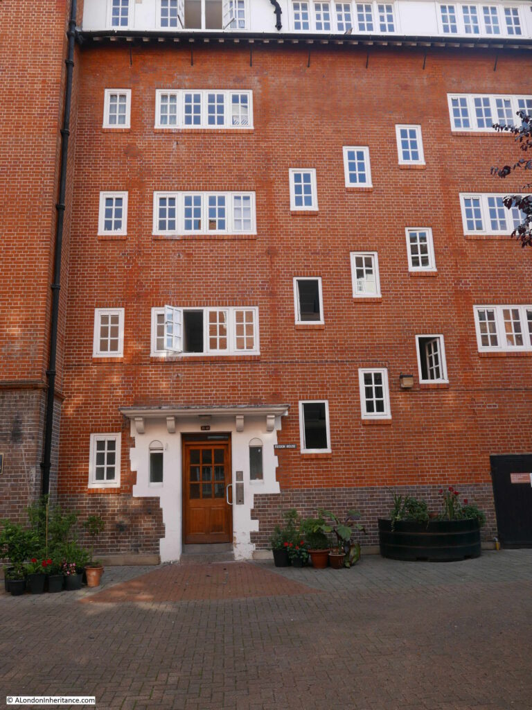
Further along Manchester Road is a very sad sight – this is the Lord Nelson pub which appears to be closed, although whether permanently or just for refurbishment is not clear.

Isle of Dogs

The pub was built in 1855 and today is still a good example of a Victorian corner pub, but in its original form it was a brilliant example of Victorian pub decoration.

The LMA Collage archive has the following photo of the Lord Nelson from 1904.

Isle of Dogs

Image credit: London Metropolitan Archives, City of London: catalogue ref: SC_PHL_02_0974_2301

A statue of Lord Nelson looks out from the corner of the roof. The font and lettering of the brewery and pub names, and a very large lantern hanging above the main entrance of directly onto the street corner.

Going for a pint at the Lord Nelson on a dark Friday evening must have been an experience. The windows lit and the light from the lantern shining out over the street corner.

I love traditional London pubs, and they are closing too fast, however I am always very aware that whilst they were important centres of the community, they also were there to encourage drinking and probably took far too much of a worker’s wages at the end of the working week.

The Lord Nelson marks a boundary in the road that rings the edge of the Isle of Dogs. Along the eastern edge, all the way from the entrance to South Dock, the road has been Manchester Road, but here it turns into Westferry Road which then runs along the western edge of the Isle of Dogs.

Directly opposite the Lord Nelson, and now in Westferry Road is another closed fire station.

Isle of Dogs

A fire station was originally opened on the site in 1877, however this was too small given the rapid development of the area and the new fire station was designed by the London County Council in 1904.

The main building fronts onto Westferry Road and there was a yard to the rear of the building in East Ferry Road. What stands out on the roof of the fire station is the number of chimneys. The building must have needed a considerable number of fireplaces to keep the building warm.

Just to the right of the main doors there is a plaque.

Isle of Dogs

Joan Bartlett and Violet Pengelly were two members of the Auxiliary Fire Service and were killed when a local school being used as an emergency depot took a direct hit by a high explosive bomb on the night of the 18th September 1940.

The fire station closed in 2006 and has since been converted into apartments. The small street that led into the fire station yard has been named Bartlett Mews, and the new flats adjacent to the old fire station are named Pengelly Apartments.

This was a fascinating walk from Bromley by Bow to the southern tip of the Isle of Dogs. As usual, I have only briefly touched on the places I have walked past, and far more deserves to be written.  Whether it is a building that has the core of a late 15th century manor house alongside the six lanes of the A12, London County Council Fire Stations, a pub that may have been in the sights of the Millwall Canal Company, and the hidden presence of the River Thames – I really enjoyed exploring this historic part of east London.
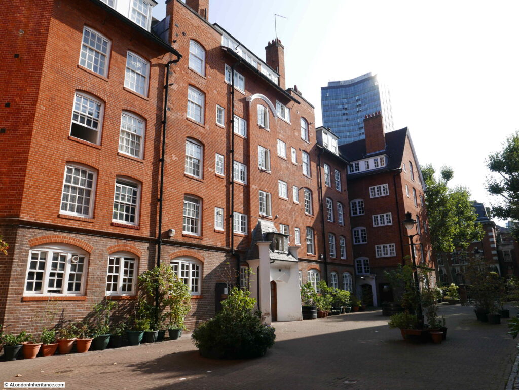
alondoninheritance.com

New Deal For East London – Bromley By Bow to Poplar

Two years ago I started a project to revisit all the locations listed as at risk in an issue of the Architects Journal. dated 19th January 1972. This issue had a lengthy, special feature titled “New Deal For East London”. The full background to the article is covered in my first post on the subject here.

I have almost completed the task of visiting all 85 locations, there are just a few more to complete. I had a day off work last Monday, the weather was perfect, so I took a walk from Bromley by Bow to the southern tip of the Isle of Dogs to track down another set of locations featured in the 1972 article, and also to explore an area, the first part of which, is not usually high up on the list for a London walk.

There was so much of interest on this walk, that I have divided into two posts. Bromley by Bow to Poplar today, and Poplar to the tip of the Isle of Dogs, hopefully mid-week.

I had five sites to visit, which are shown in the following map from the 1972 article, starting at location number 29, passing by sites 56, 28 and 27 before finishing at site 26.

To get to the start of my planned route, I took the Hammersmith & City line out to Bromley by Bow station. There have been some considerable changes to the area in the years since the 1972 article, changes which are still ongoing. The following map shows the area today with the five locations marked. One obvious difference between the 1972 and 2019 maps are the major roads that have been cut through the original streets, and it is by one of these new roads that I would start the walk.

Map  © OpenStreetMap contributors. 

The entrance to Bromley by Bow underground station has been a building site for the last few years, although with not too much evidence of building work underway. The exterior of the station entrance is clad in hoardings and scaffolding.

Bromley by Bow

The underground station entrance opens out onto a busy road. Three lanes of traffic either side of a central barrier. This is the A12 which leads from the Bow Flyover junction with the A11 and takes traffic down to the junction with the A13 and the Blackwall Tunnel under the River Thames.

Directly opposite the station is a derelict building. This, along with surrounding land has been acquired by a development company ready for the construction of a whole new, mainly residential area, including a 26 storey tower block.

Bromley by Bow

In the photo above, i am looking across the 6 lanes and central barrier of the A12. The construction of this road in the 1970s had a major impact on the area. It was once a network of smaller streets, terrace housing and industry, much of which was due to the location adjacent to the River Lea. The following extract from the 1940 Bartholomew’s Reference Atlas of Greater London shows a very different area. Bromley Station (now Bromley by Bow) is towards the top of the map with St. Leonard’s Street passing the station, leading down to Brunswick Road. Parts of these streets remain, however as the north to south route they have been replaced by the six lane A12. Many of the side streets have also disappeared or been shortened.

Bromley by Bow

There are still many traces that can be found of the original streets and the buildings that the local population would have frequented. This photo is of the old Queen Victoria pub at 179 St Leonard’s Street.

Bromley by Bow

The pub is surrounded by the new buildings of Bow School, however originally to the side of the pub and at the back were large terraces of flats which presumably provided a large part of the customers for the Queen Victoria. The pub closed in 2001 and is presumably now residential.

Walking further along the road, the road crosses the Limehouse Cut, built during the late 1760s and early 1770s to provide a direct route between the River Thames to the west of the Isle of Dogs loop and the River Lea.

Bromley by Bow

New build and converted residential buildings have been gradually working their way along the Limehouse Cut, however there are a few survivors from the light industrial use of the area, including this building where the Limehouse Cut passes underneath the A12.

Bromley by Bow

A short distance along is another old London County Council Fire Brigade Station for my collection. This was built in 1910, but has since been converted into flats.

Bromley by Bow

The building is Grade II listed, with the Historic England listing stating that the building “is listed as one of London’s top rank early-C20 fire stations“. The building originally faced directly onto Brunwsick Road and was known as Brunswick Road Fire Station, however with the A12 cutting through the area, the small loop of the original Brunswick Road that separates the fire station from the A12 has been renamed Gillender Street.

The short distance on from the fire station is the first of the Architects Journal sites on my list:

Site 29 – Bromley Hall

The view approaching Bromley Hall:

Bromley by Bow

For an area that has been through so much pre and post war development, the original industrialisation of the area and wartime bombing, it is remarkable that Bromley Hall has survived.

Although having been through many changes, the building can trace its origins back to the end of the 15th century when it was built as a Manor House, later becoming a Tudor Royal Hunting Lodge. The site is much older as it was originally occupied by the late 12th century Lower Brambeley Hall, and parts of this earlier building have been exposed and are on display through a glass floor in the building.

Bromley by Bow

The London Metropolitan Archives, Collage site has a few photos of Bromley Hall. The first dates from 1968 and shows the hall, apparently in good condition, but surrounded by the industry that grew up along the River Lea.

Bromley by Bow

Image credit: London Metropolitan Archives, City of London: catalogue ref: SC_PHL_01 288 68 5683

The photo highlights the impact that the A12 has had in the area. The above photo was taken from Venue Street, a street that still remains, but in a much shorter form. Everything in the above photo, in front of Bromley Hall, is now occupied by the six lane A12.

An earlier photo from 1943 showing Bromley Hall. The windows have been bricked up, I assume either because of loss of glass due to bombing, or as protection for the building.

Bromley by Bow

Image credit: London Metropolitan Archives, City of London: catalogue ref: SC_PHL_01_288_F1262

Bromley Hall is Grade II listed and has been open during Open House London weekends and is well worth a visit.

Further along is another example that this area, now isolated across the A12 was once a thriving community. This imposing facade is of Bromley Library, built between 1904 and 1906.

Bromley by BowBromley Library was one of four libraries in Poplar. The others being Poplar Library in the High Street, Cubitt Town Library in Strattondale Street and Bow Library in Roman Road. These libraries were open from 9 in the morning till 9:30 in the evening, and in 1926 almost half a million books were issued across the four libraries.

The Bromley Library building is now Grade II listed. It closed in 1981 and after standing empty for many years, the old library building has been converted into small business units.

I walked on a bit further, then took a photo looking back up the A12 to show the width of the road.

Bromley by Bow

Bromley Hall is the building with the white side wall to camera, and the library is just to the left of the new, taller building.

There is a constant stream of traffic along this busy road, when I took this photo it was during one of the occasional gaps in traffic when a pedestrian crossing just behind me was at red. There are not too many points to cross the road, with crossings consisting of occasional pedestrian traffic lights and also a couple of pedestrian underpass.

Much of this lower part of the A12 widening between the Limehouse Cut and East India Dock Road was originally Brunswick Street. The following Collage photo from 1963 shows Brunswick Street before all this would be swept away in the 1970s for the road between the Bow Flyover and the Blackwall Tunnel.

Bromley by Bow

Image credit: London Metropolitan Archives, City of London: catalogue ref: SC_PHL_01_288_AV63_989

Before the road meets the East India Dock Road, there are additional lanes to take traffic under the A12 and across to Abbott Road to the east.

Bromley by Bow

Close to the junction between the A12 and the East India Dock Road is the Balfron Tower.

A whole post could be written about Balfron Tower, the flats design by Erno Goldfinger and built in 1967. Balfron Tower tends to generate either love it or loathe it views of the building. dependent on your appreciation of high-rise accommodation and concrete construction.

The recent past has also been controversial in the history of the building. Like many estates from the 1960s, Balfron Tower suffered from lack of maintenance, failing lifts, problems with plumping and anti-social behavior.

In 2007 the building was transferred from Tower Hamlets Council to the housing association Poplar HARCA. The transfer included a commitment for refurbishment of the building which required considerable work and cost.

Tenants were initially given the option to remain whilst refurbishment was carried out, or move to a new local property. Whilst a number of residents took up the option to move, a number of residents remained.

The remaining residents were moved out in 2010, the reason given being the difficulty of managing a significant refurbishment project along with health and safety issues whilst there are residents in the building. Initially there was an indication that the residents may have a right of return, however this option disappeared as work progressed, and the costs of building works grew.

The redevelopment work is being undertaken by a joint venture including Poplar HARCA, LondonNewcastle and Telford Homes. There will not be any social housing in the refurbished building and all flats will be sold at market rates.

A long hoarding separates the building from the A12 with artist impressions of the new Balfron Tower and the address of the website where you can register your general interest, or as a potential purchaser of one of the flats.

Bromley by Bow

Balfron Tower photographed in February 2019, clad for building work.

Bromley by Bow

A couple of years ago, I climbed the clock tower at Chrisp Street Market and photographed Balfron Tower:

Bromley by Bow

This is a development that will continue to be controversial due to the lack of any social housing and the sale of the flats at market rates. Another example of the gradual demographic change of east London.
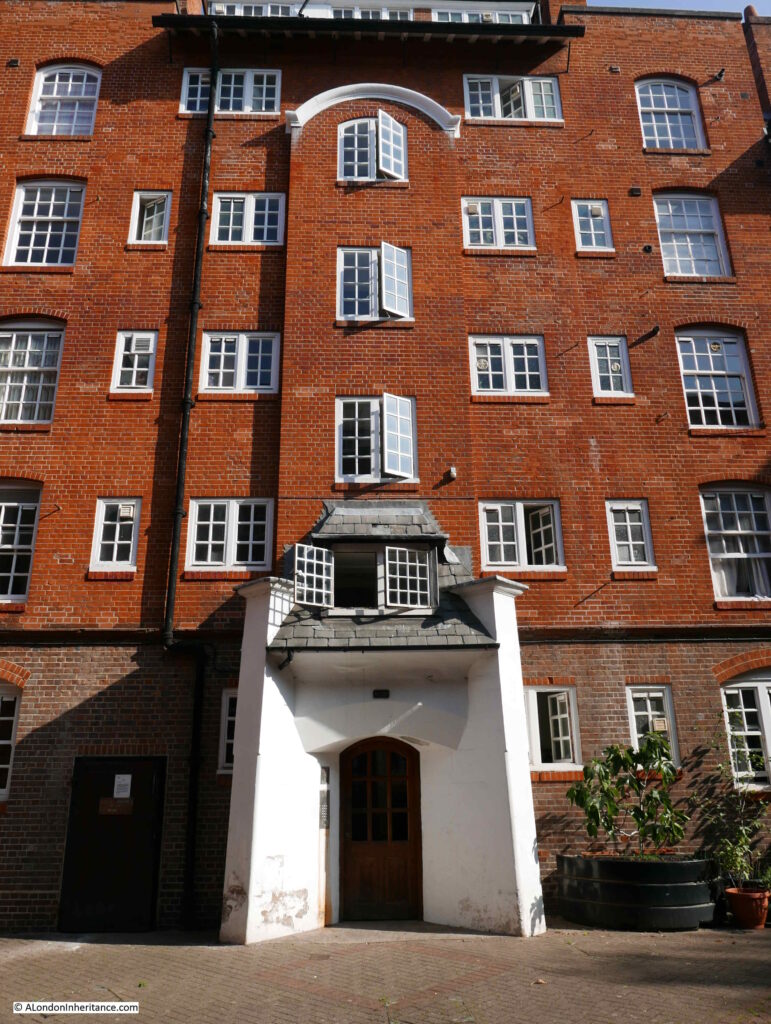
To reach my next destination on the Architects’ Journal list, I turn into East India Dock Road. A terrace of 19th century buildings with ground floor shops runs along the north of the street and above Charlie’s Barbers there is an interesting sign:

Bromley by Bow

Interesting to have this reference to a north London club in east London. I put this photo on Twitter with a question as to the meaning and one possible reference is the boring way Arsenal use to play and results would only ever be one nil. I would have asked Charlie, if he still owns the barbers, however they were shut during my visit.
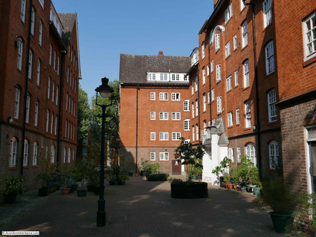
Bromley by Bow

A short distance from Charlies Barbers and across the East India Dock Road was my next location.
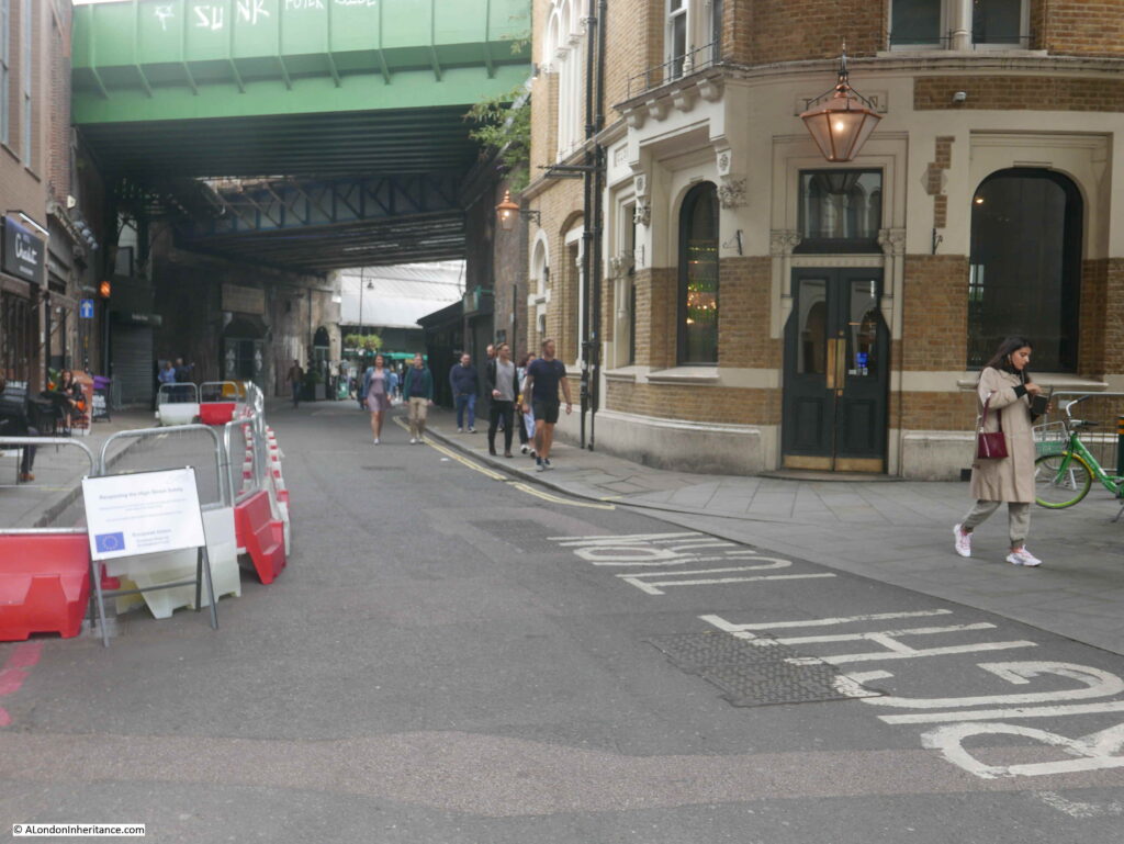
Site 56 – Early 19th Century All Saints, Poplar, With Contemporary Rectory And Terraces

Buildings seem to have a habit of surrounding themselves in scaffolding whenever I visit and All Saints, Poplar was certainly doing its best to hide, however it still looks a magnificent church on a sunny February morning.

Bromley by Bow

Poplar was originally a small hamlet, however the growth of the docks generated a rapid growth in population. The East India Dock Road was built between 1806 and 1812 to provide a transport route between the City and the newly built East India Docks.
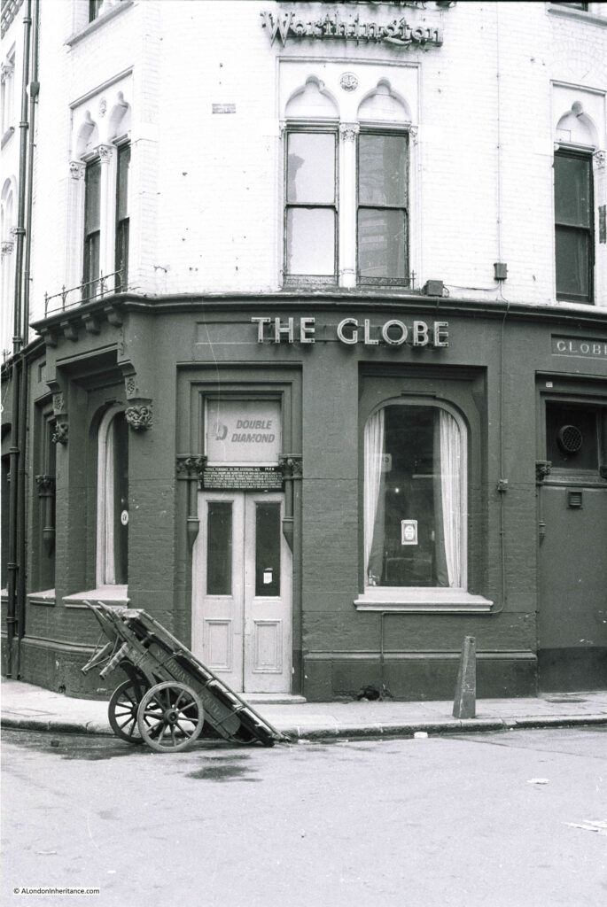
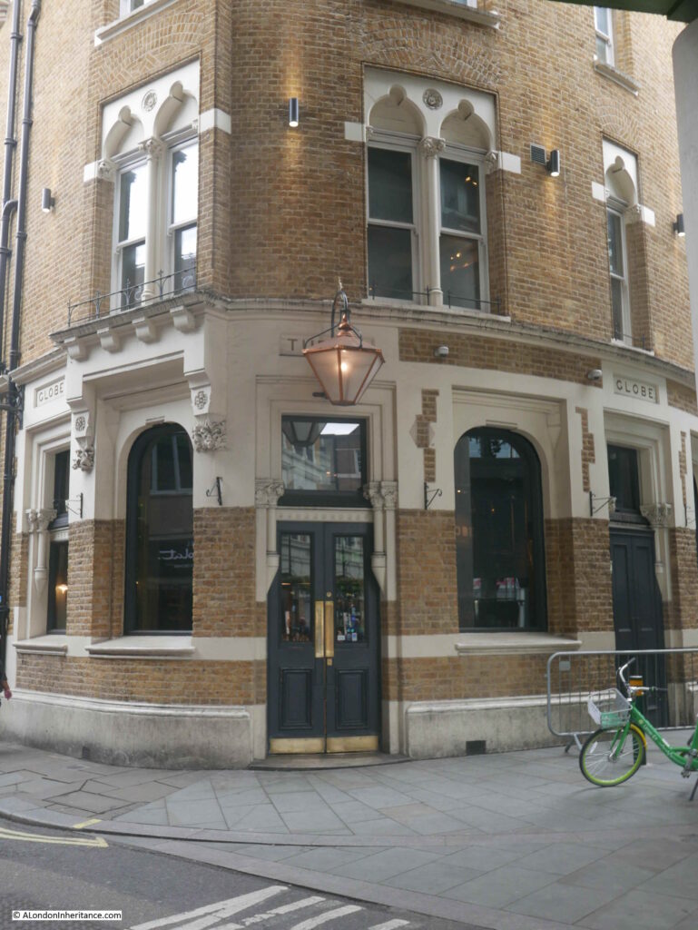
Alongside the East India Dock Road, All Saints was constructed in the 1820s by the builder Thomas Morris who was awarded the contract in 1821.

The church survived the bombing of the docks during the last war until March 1945 when a V2 rocket landed in Bazely Street alongside the eastern boundary of the churchyard, causing considerable damage to the east of the church.

The church was designed to be seen as a local landmark along the East India Dock Road and across the local docks. The spire of the church is 190 feet high and the white Portland stone facing would have impressed those passing along the major route between City and Docks.

Burials in the churchyard ended in the 19th century and the gravestones have been moved to the edge, lining the metal fencing along the boundary of the church.

Bromley by Bow

The area around the church was developed during the same years as construction of the church. A couple of streets around the church now form a conservation area. These were not houses built for dock workers. Their location in the streets facing onto the church would be for those with a substantial regular income, rather than those working day-to-day in the docks.

This is Montague Place where there are eight surviving terrace houses from the 1820s.

Bromley by Bow

At the eastern end of Montague Place there is another terrace of four houses in Bazely Street. These date from 1845 and are in remarkably good condition.
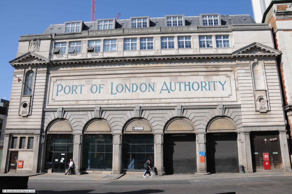
Bromley by Bow

The church and two terraces of houses form a listed group and are part of a single conservation area.

A short distance further down Bazely Street is one of my favourite pubs in the area – the Greenwich Pensioner. The pub closed for a few years recently but has fortunately reopened.

Bromley by Bow

One of the problems of walking in the morning – the pubs are still closed.

I continued along Bazely Street to Poplar High Street, then turned south to the large roundabout where Cotton Street (the A1206) meets the multi-lane Aspen Way. This is not really a pedestrian friendly area, however I needed to cross under the Aspen Way to continue heading south for my next destination.
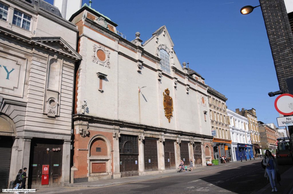
This photo looking towards the east, is from the roundabout underneath the flyover that takes the Aspen Way on its way to the Lower Lea Crossing.
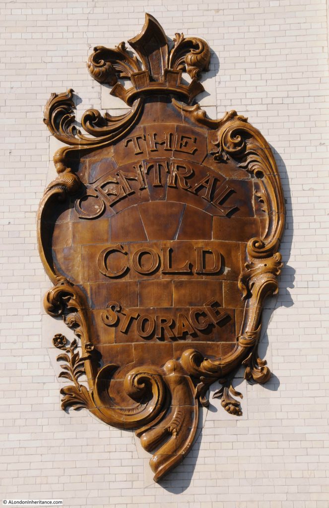
Bromley by Bow

As with the A12 along Bromley by Bow, this area has been cut through with some major new multi-lane roads as part of the redevelopment of the docks.

A poster seen underneath the flyover alongside the roundabout.

Bromley by Bow

A poster that is relevant to a specific point in time. I was not sure who would see the poster as it is facing inwards, away from the traffic on the roundabout, and I doubt that many pedestrians take this route.

Emerging from underneath the flyover and the developments on the northern edge of the Isle of Dogs can be seen.

Bromley by Bow

Crossing over Trafalgar Way, and one of the old docks can be found. This is Poplar Dock looking west with two cranes remaining from when the dock was operational.

Bromley by Bow

The site is now Poplar Dock Marina and is full with narrow boats and an assorted range of other smaller craft. Poplar Dock opened in 1851, however the site had originally been used from 1827 as a reservoir to balance water levels in the main West India Dock just to the west. In the 1840s the area was used as a timber pond before conversion to a dock.

Poplar Docks served a specific purpose, being known as a railway dock. The following extract from the 1895 Ordnance Survey map shows Poplar Docks almost fully ringed by railway tracks and depots of the railway companies.

Bromley by Bow

Credit: ‘Reproduced with the permission of the National Library of Scotland’ 

Again, the docks deserve far more attention than I can give in this post, so for now, I will leave Poplar Docks at their southern end and walk along Preston’s Road to get to my next location on the Architects’ Journal list.

Site 28 – Early 19th Century Dockmaster’s House, Now Empty

Those last two words must have been the reason for inclusion in the list. An empty building in the docklands in the 1970s would have been at risk, however fortunately the building has survived and this is the view when approaching the location along Preston’s Road.

Bromley by Bow

The Dockmaster’s House goes by the name of Bridge House and is now occupied by apartments available for short term rent.

The house is alongside the Blackwall entrance to the docks, a channel that connects the River Thames to the Blackwall Basin so would have seen all the shipping entering from the river, heading via the basin to and from the West India Dock.

Evidence of the historic function of the place can be found hidden in the gardens between the house and the channel.

Bromley by Bow

Bridge House was built between 1819 and 1820 for the West India Dock Company’s Principal Dockmaster. The entrance to the house faces to the channel running between docks and river, however if you look at the first photo of Bridge House taken from Preston’s Road you will see large bay windows facing out towards the river. This was a deliberate part of the design by John Rennie as these windows, along with the house being on raised ground would provide a perfect view towards the river and the shipping about to enter or leave the docks.

The Architects’ Journal in January 1972 were right to be worried about the future of Bridge House. Later that same year a fire destroyed the roof. The rest of the house survived and a flat roof was put in place.

The house was converted to flats in 1987 and a new roof to the same design as the original replaced the flat roof. The luxury flats did not sell, and Bridge House has hosted a number of temporary office roles before apparently now providing a short term let for flats which have been constructed inside the building.

The view from in front of the house. This side of the house is facing down to the channel that leads from the Thames to the Blackwall Basin.

Bromley by Bow

A view from the bridge over the channel showing the house in its raised position, overlooking the channel and to the right, the River Thames (although that view is now obstructed by buildings).

Bromley by Bow

Before continuing on down through the Isle of Dogs in my next post, I will pause here on the bridge over the channel between docks and river to enjoy the view.

This is looking west towards the original Blackwall Basin:

Bromley by Bow

This is looking east, the opposite direction towards the river with the Millennium Dome partly visible across the river.

Bromley by Bow

I really enjoyed this part of the walk, what could be considered an unattractive route, walking down from Bromley by Bow station is completely wrong. It is an area going through considerable change but there is so much history and so much to explore.

In my next post I will continue walking south towards the far end of the Isle of Dogs to find the remaining two locations from the 1972 issue of the Architects’ Journal.

alondoninheritance.com