Even if you have not visited the area, or travelled to the underground station with the same name, you probably recognise the name of the Angel, Islington.
This is probably down to the game of Monopoly, where The Angel, Islington can be purchased for £100, and is one of the light blue board positions, along with Euston Road and Pentonville Road.
Monopoly is probably why the name Angel is nearly always followed by Islington. Unlike the majority of other places on the Monopoly board, the Angel, Islington is not a street, and when you buy a hotel for the location in the game, you are bringing some historic reality to the game.
The original Monopoly game was a US invention, and its migration to the UK happened when the board game makers John Waddington licensed the game for UK sale. The game required UK locations, and the story is that the Managing Director of the company, Victor Watson, along with his secretary, Marjory Phillips, visited the capital looking for locations for the game. Dependent on different Internet sources (always a dangerous thing), they either met, or had lunch at the Angel, and decided it would be a good location and name for inclusion in their new game.
The Angel, Islington had been a key London landmark and meeting place long before its appearance on the Monopoly board.
It appeared in the 1896 book “The Queen’s London”, published as a pictorial and descriptive record of London in the 59th year of the reign of Queen Victoria.
In the book, the Angel, Islington is described as:
“Trams and omnibuses give an invaluable gratuitous advertisement to the inns at certain points on their route; and one of the hostelries best known in all London – by name at least – from this cause is the Angel. For here trams start and stop, and innumerable omnibuses converge and diverge. The Angel occupies a commanding position at the corner of the High Street, Islington, and of Pentonville Road, leading to King’s Cross, while it faces the end of the City Road, Goswell Road, and St. John’s Street Road. It is no wonder, therefore that the pavement in front of it should be always thronged.”
The photo from the 1896 Queen’s London showing the Angel, Islington:
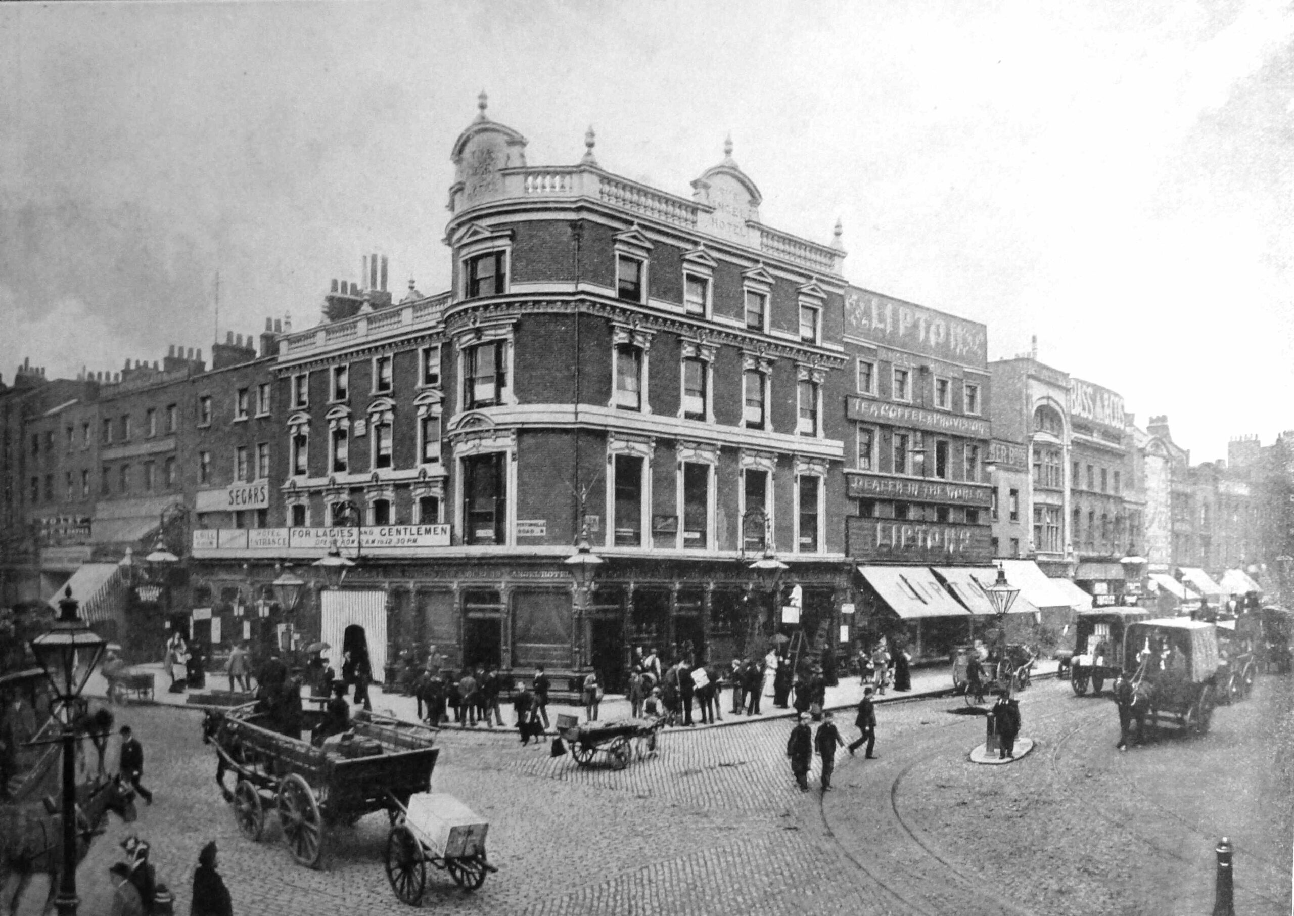
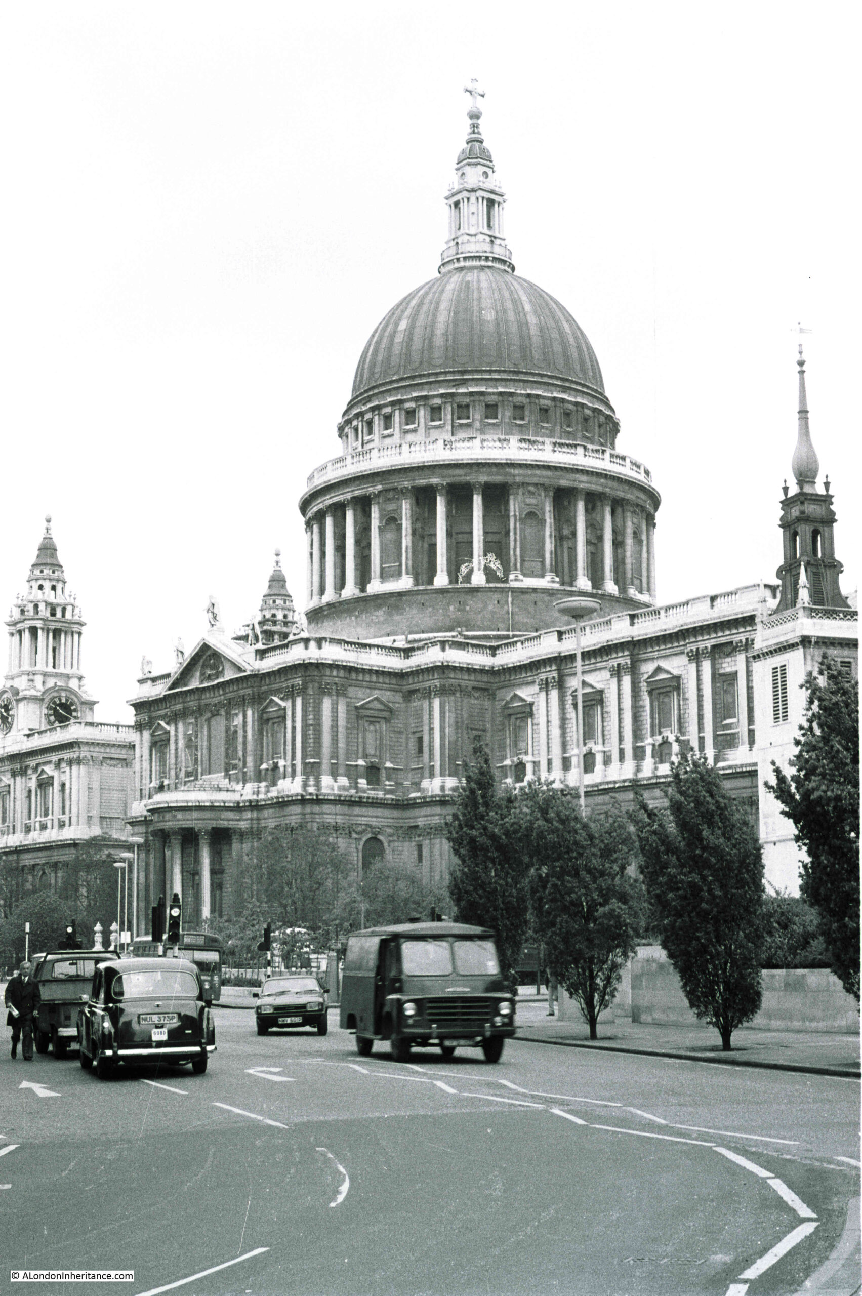
The text from the Queen’s London sums up why the Angel, Islington became such a well known location – its position at the junction of four important London Roads.
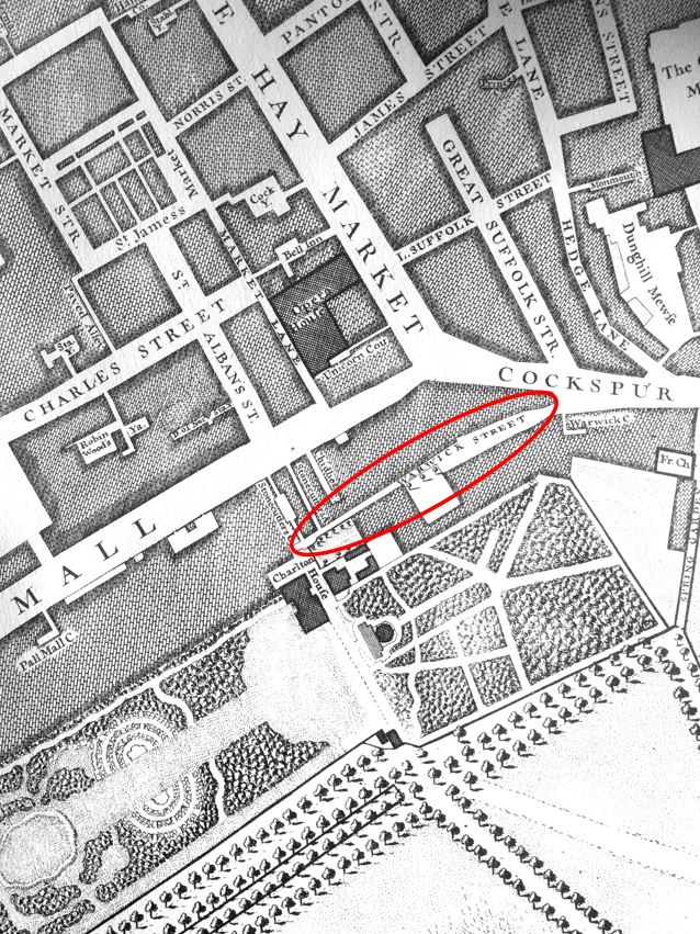
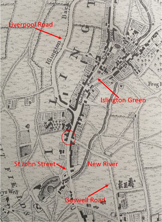
In the following map, I have circled the location of the Angel (Map © OpenStreetMap contributors):

To the left is Pentonville Road, opened in 1756 as the eastern section of the New Road. It took its current name in 1857 after the Pentonville Estate which had been built on land around the road.
To the right is the City Road, completed in 1761, to continue the New Road on towards east London. These streets formed an 18th century “North Circular” allowing traffic to pass around the City, and to reach the best street for entering the City. One of these was Goswell Road which in the map above branches off to the south from City Road.
To the south is St John Street which led to the City and provided a direct route to Smithfield Market.
To the north, Islington High Street now forms the A1, indicating the street’s importance as the start of a key route to the north of the country.
The Angel, Islington was therefore located where drovers and farmers bringing their sheep and cattle to Smithfield Market would stop off before making the final journey. Where those heading north or south would stop before continuing their journey. Where those travelling around the City would stop, as the junction was a key meeting point, a place where people could relatively easily travel to and meet others from across both London and the rest of the country.
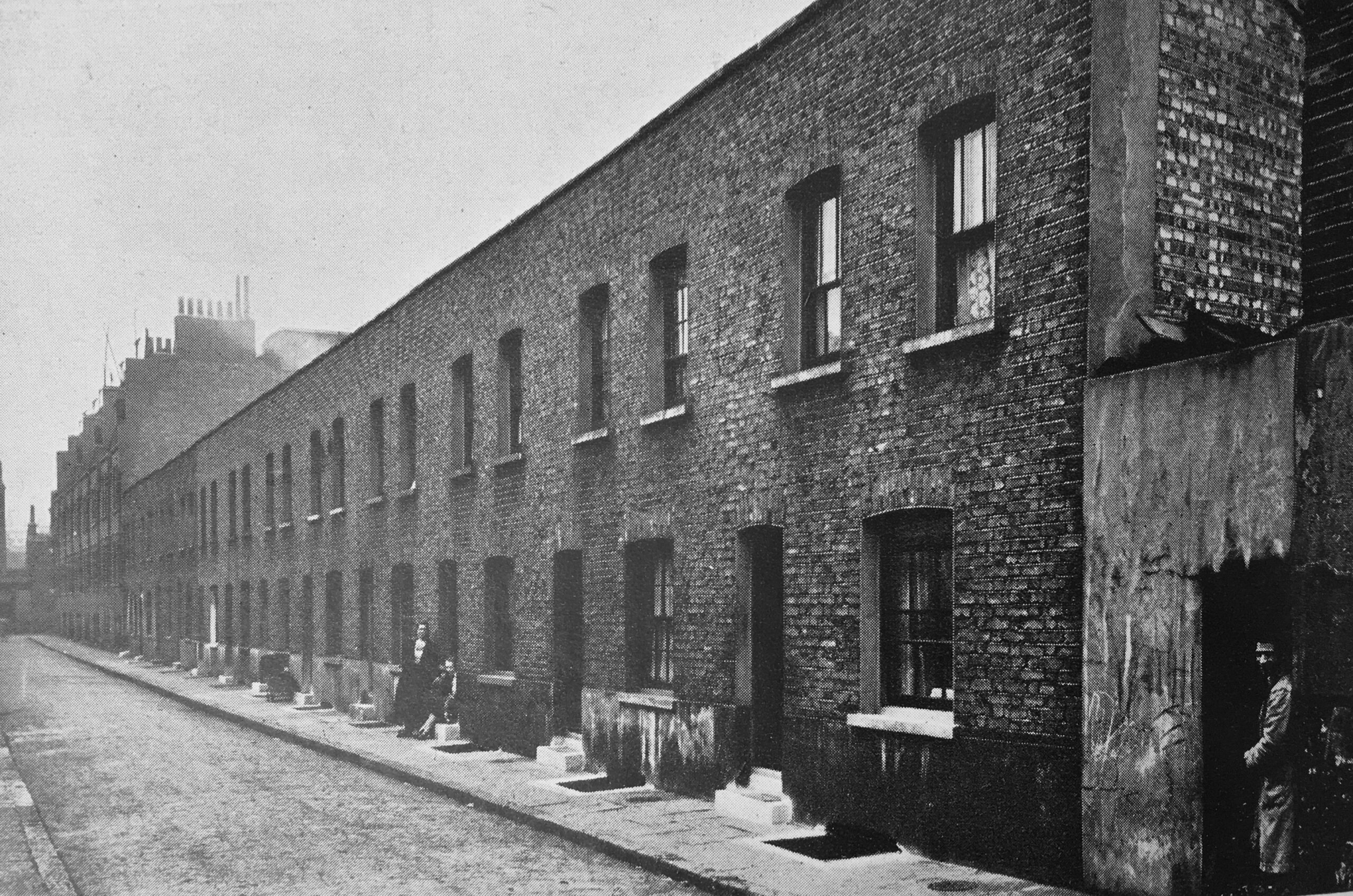
The area has long been associated with livestock. Local cattle farms as well as the fields around Islington providing stopping off points to feed and fatten cattle on their way to Smithfield Market. The Royal Agricultural Hall, built a short distance away in 1862 continued this tradition.
Long before the construction of Pentonville Road / New Road / City Road, the Angel had been a key stopping point. In the following extract from Rocque’s map of 1746, I have circled the location of the Angel, at the junction where the road that would become the start of City Road, with the branch of what is now Goswell Road, meet the street that continues south to Smithfield.
Looking towards the upper half of the map, we can see how three key streets converged just before the Angel, which also contributed to the location’s importance.
The Angel, and the buildings lining the road up to Islington Green, Upper and Lower Streets are surrounded by the fields that were used for livestock and for the temporary provision of grazing prior to completing their journey to Smithfield Market.
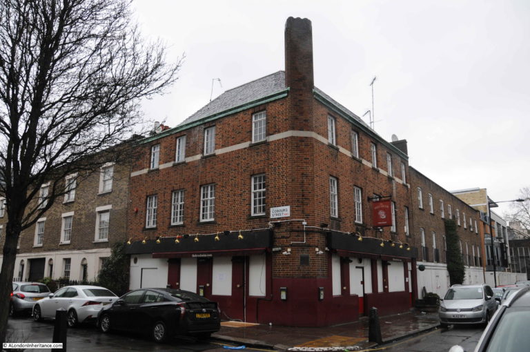
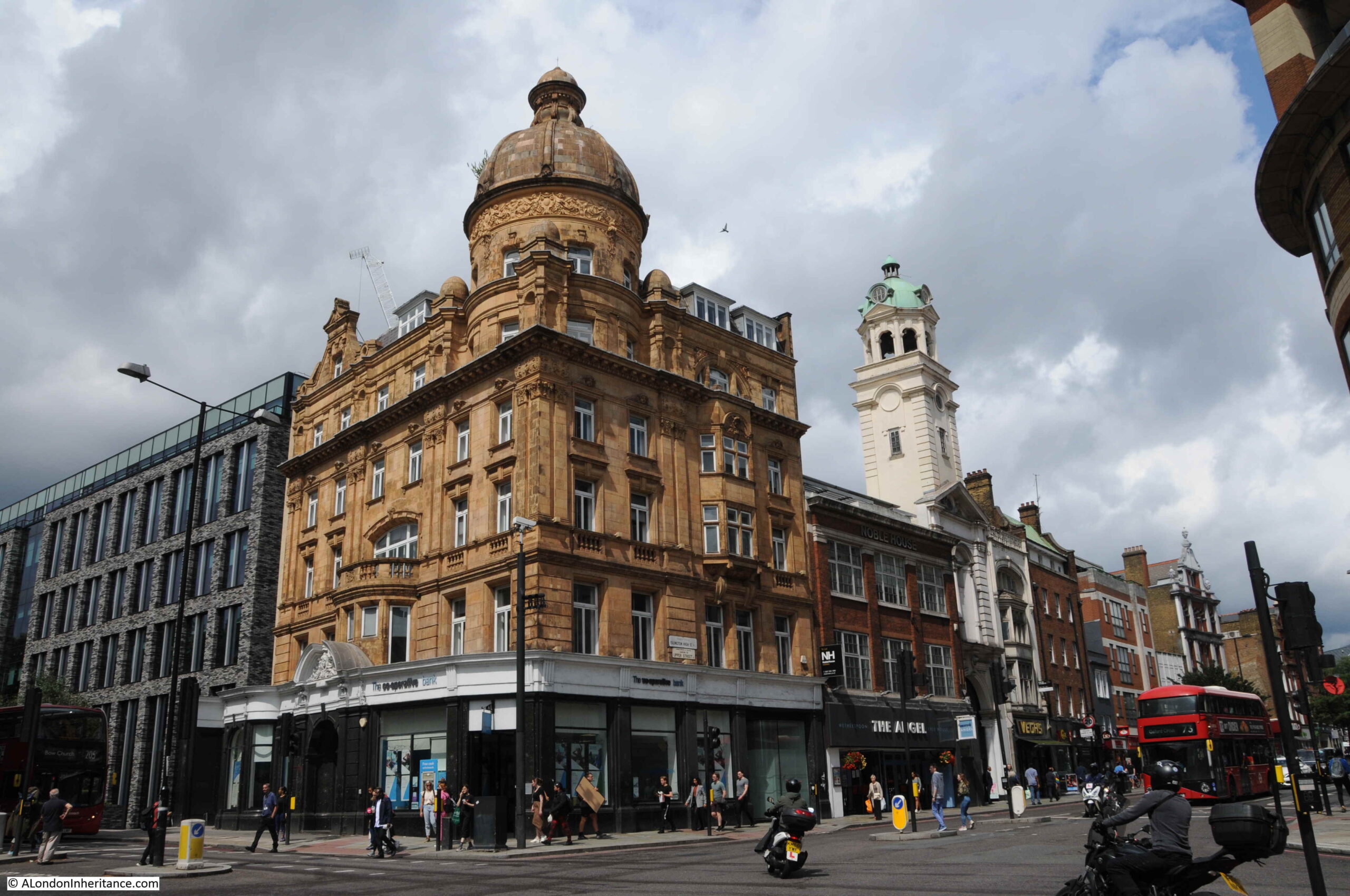
The building seen in the photo from the Queen’s London was originally built in 1819, however by the time of the 1896 photo it had been heavily modified over the years and was known as the Angel Hotel. It was demolished to make way for a new version of the Angel, built by the owners of the site, Truman, Hanbury, Buxton & Co. – the London brewery company.
The 1903 building (again, modified a number of times over the years) is the building that we see on the site today:
The location of the Angel has long been the site for an inn or tavern. Some of the first references are to an inn on the site towards the end of the 16th century, when the property on the site was called Sheepcote.
The name Angel for the inn appears around 1614. There is a Wikipedia reference as to the origin of the name, however I cannot find any written references, either to confirm the Wikipedia suggestion, or to offer an alternative. When researching these posts, I prefer to have at least two different written sources, so for the purposes of the post I cannot find the source.
The excellent “Streets with a Story – The Book of Islington” by Eric A. Willats does state that early in the 17th century, the Angel had a sign of the Angel of the Annunciation, with wings outstretched, however the sign only aligns with the name, and does not identify the source.
The inn was a staging post for travelers from and to the city, and it was a good place to spend a night before entering the city. There are numerous 18th century newspaper articles about thefts and muggings across the fields, paths and roads between Islington and the built edge of the city, so after dark it was not a safe place to travel, and the Angel Hotel was the perfect place to stay until the following morning.
The following print shows the Angel as it appeared in 1808 (© The Trustees of the British Museum):
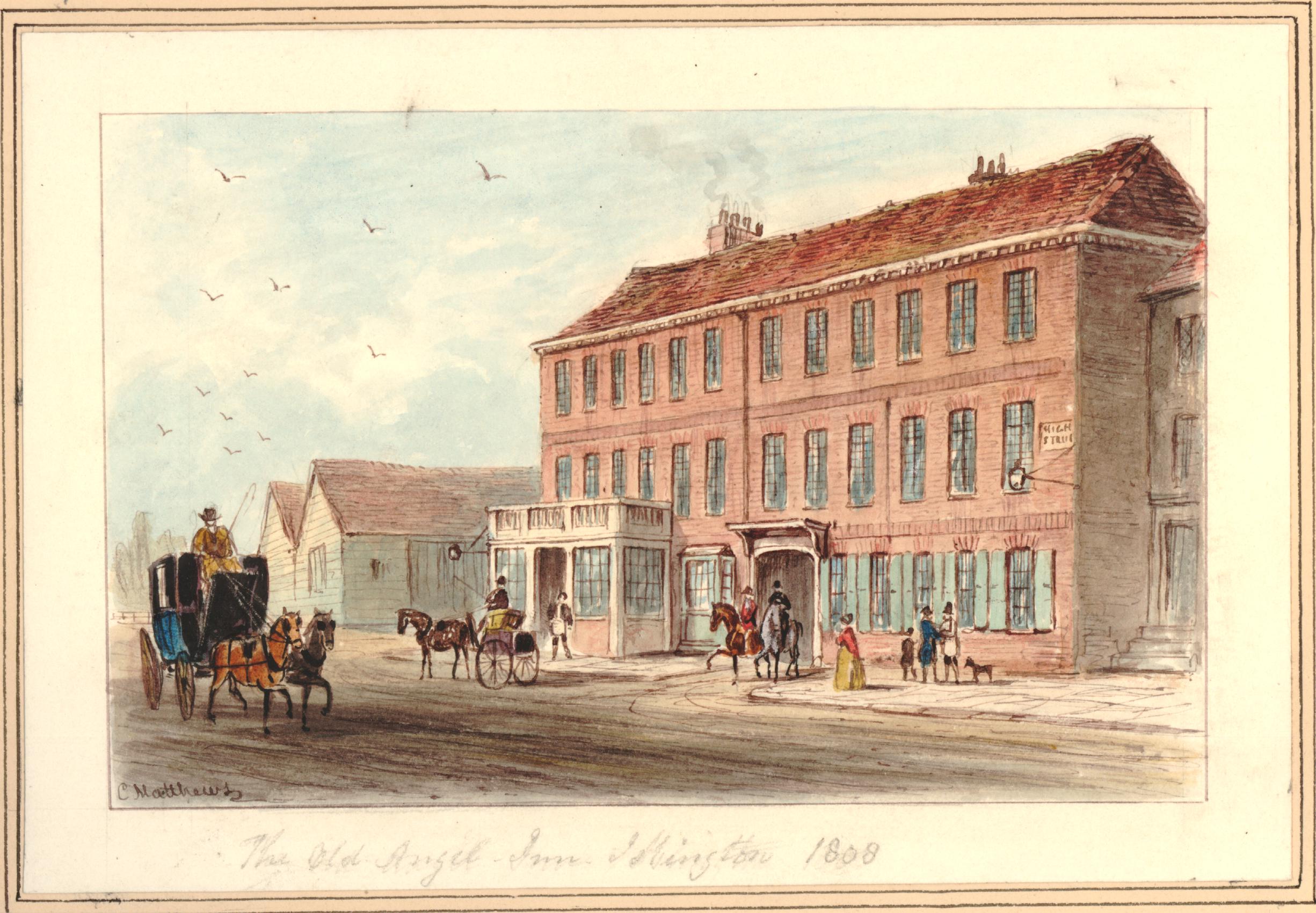
The view is from what is now Islington High Street. The singe storey buildings to the left of the picture are stables that were on land owned by the Angel, located where Pentonville Road now runs, and extending across the street to the opposite side of the Angel.
The following print shows the view from the Angel, looking down the City Road. Goswell Road is the road branching off to the right (© The Trustees of the British Museum):
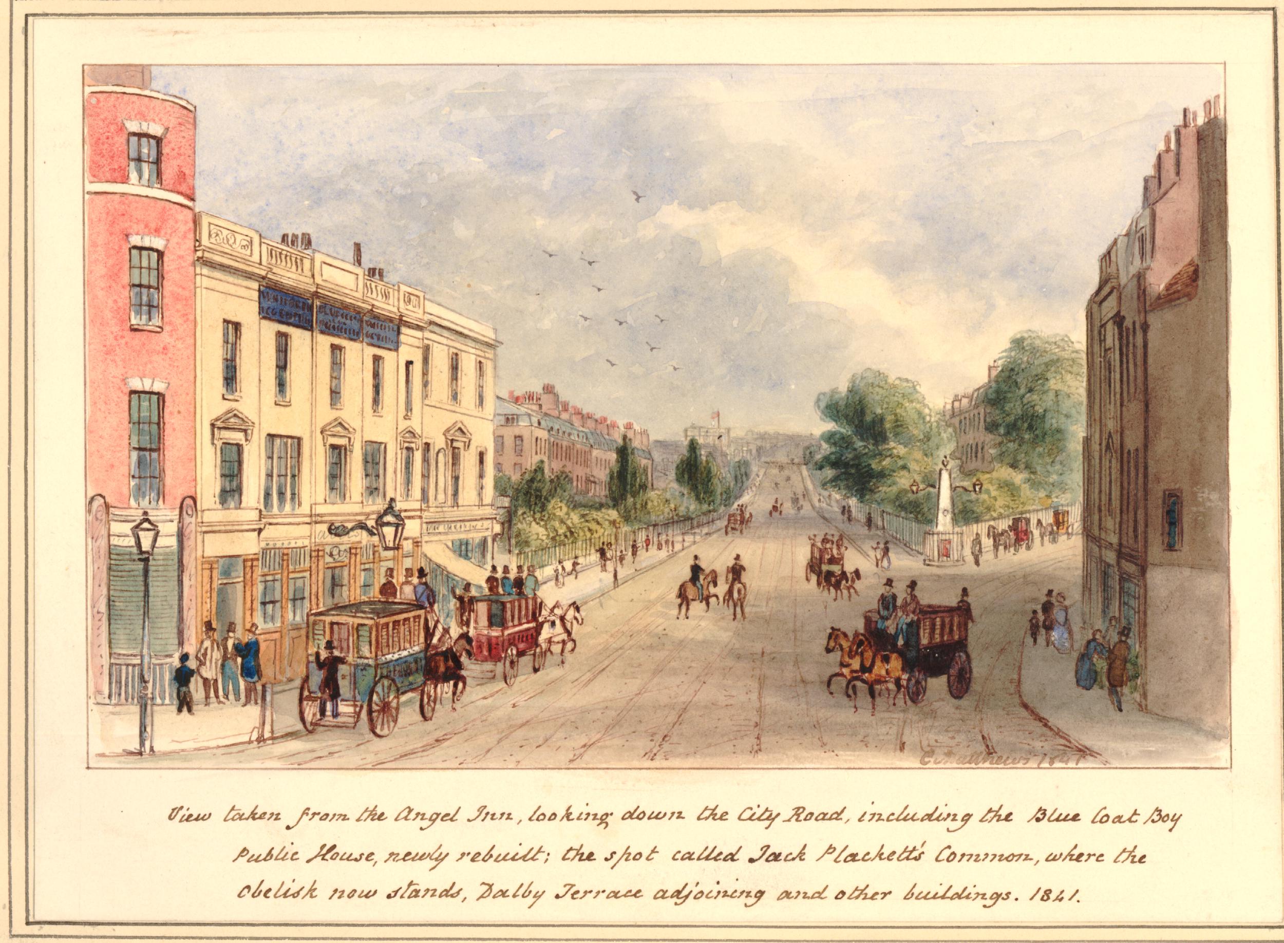
The print mentions the Blue Coat Boy public house. This is the building on the left of the print.
The print is also a perfect example of how easy it is to go off on a tangent with London’s history. The text at the bottom of the above print mentions Jack Plackett’s Common as the space where the obelisk now stands, (to the right of the print) at the junction of City Road and Goswell Road.
I suspect that Jack Plackett was John Plackett who was executed on City Road in 1762. A newspaper report of the time reads: “Yesterday the report was made to his Majesty at St. James’s, by Sir William Morton, Knight, Recorder of this City, of the Six Capital Convicts in Newgate, when John Plackett, for robbing Mr. Jacob Faye, was ordered, for Execution on Wednesday next, near the Turnpike-House, on the New Road from Islington to Old-Street”.
John Plackett was a career criminal who had already served seven years transportation for house robbery. At the end of this sentence, he returned to England and continued to commit a series of robberies between Islington and London.
The crime that led to his execution happened on the 10th June 1762, after he had spent the day drinking in a pub in Wapping. He left the pub around midnight and met the Norwegian merchant Jacob Faye (also written as Fayne).
Faye was trying to find his lodgings in Shadwell, however because of his poor English he could not explain where he wanted to go, or get any directions. Plackett met him and indicated that he should follow. Faye assumed he was taking him to Shadwell.
They walked for a lengthy time, and ended in the fields around Islington. It was here that Plackett hit Faye on the head from behind. Faye collapsed to the ground and after a while awoke to find that Plackett had stolen all his clothes and possessions, including his pocket book and money.
A reward was offered, and Plackett was quickly found, still in possession of Faye’s shirt. He was sentenced to be hung, and was executed on the 28th July 1762, on City Road, close to where he had committed his crime in the fields of Islington.
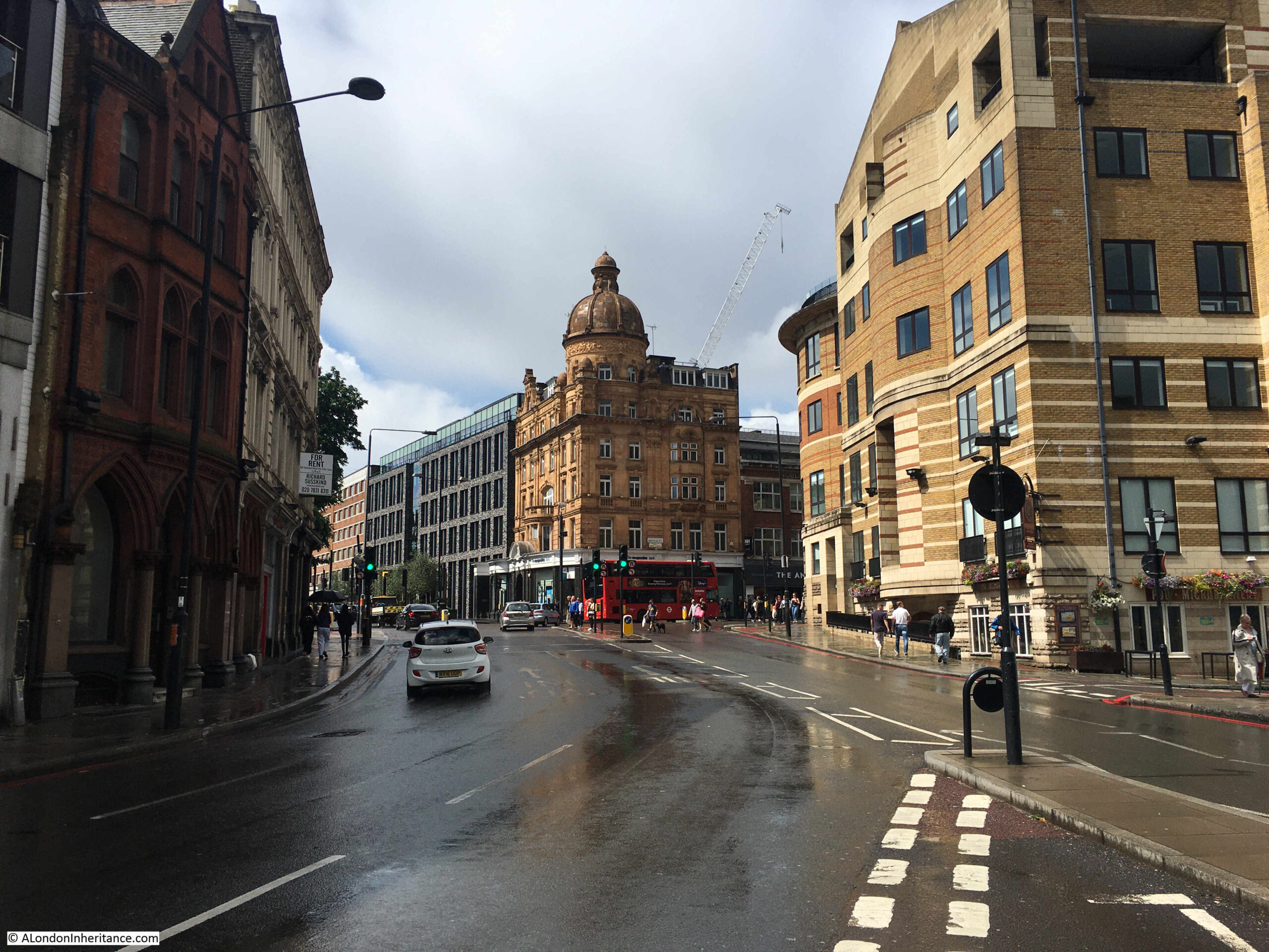
Although the obelisk has gone, there is still a landmark where City and Goswell Roads divide and at the point where Jack Plackett’s Common was located.
A short walk down City Road from the Angel, and this is the view where the roads divide:
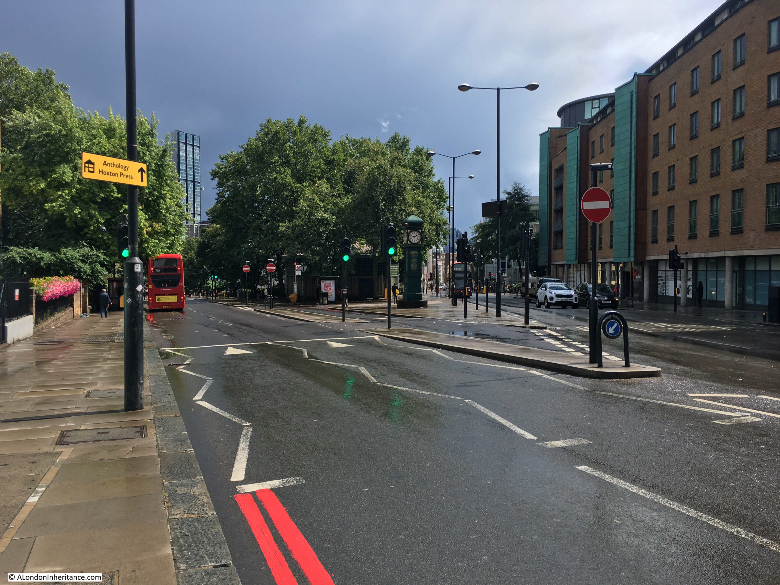
A clock tower is now at the space once occupied by the obelisk – the area identified as Jack Plackett’s Common in the print.
Apparently, the obelisk was replaced by a clock tower, which in turn was replaced early in the 20th century by the clock tower we see today.
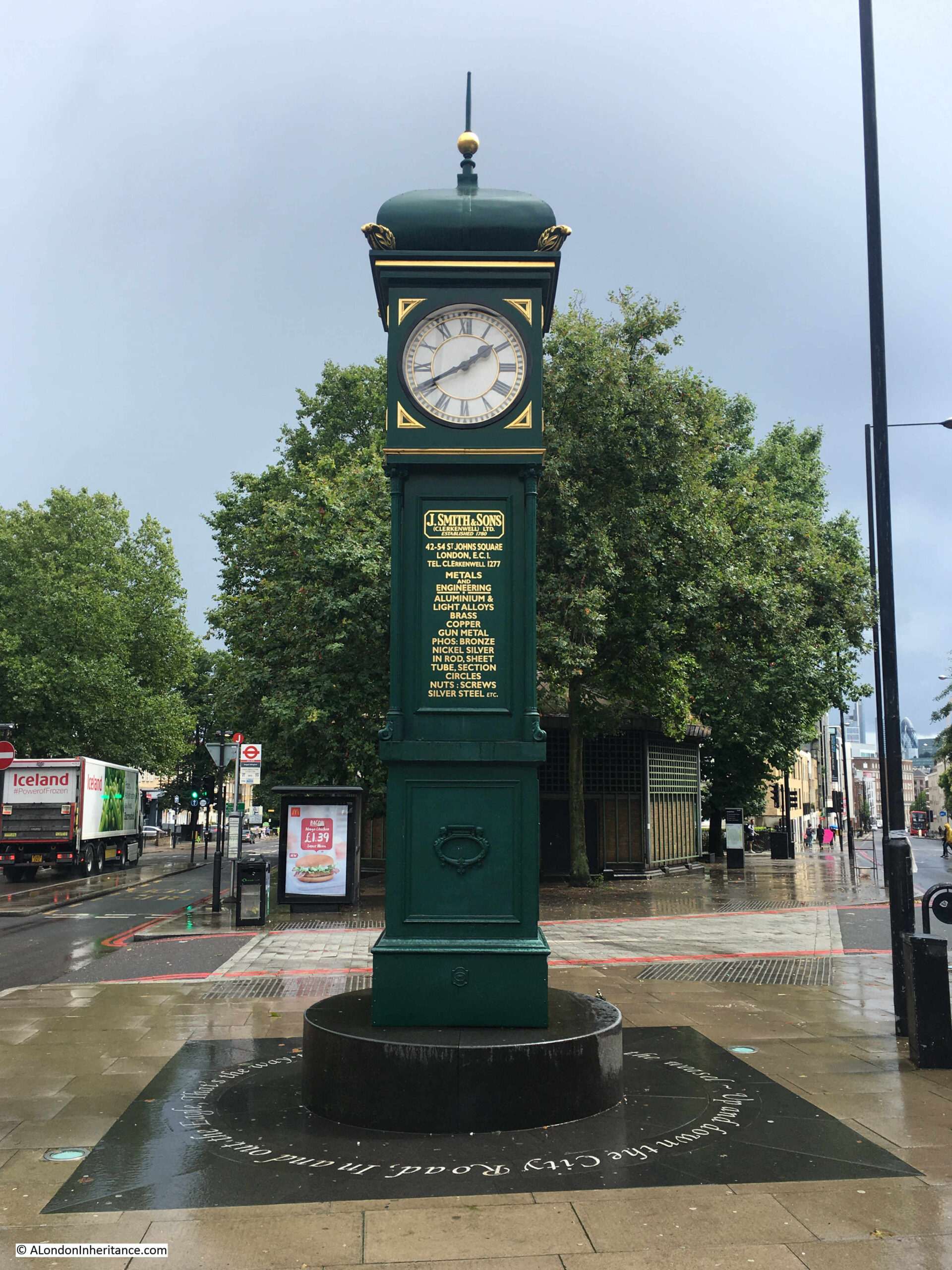
Around the base of the clock tower are the words from the third verse of the nursery rhyme “Pop goes the weasel”, as the City Road in the rhyme passes to the left of the clock tower:
Up and down the City road,
In and out the Eagle,
That’s the way the money goes,
Pop goes the weasel
The clock tower was made by the St Johns Square, Clerkenwell firm of J. Smith & Sons, and they donated the clock to replace the previous version. It was originally clockwork, and the company retained responsibility for maintaining and winding the clock. It is now electric.
It was somewhere on the space that stretches south from the clock tower that John Plackett was executed for the crime he had committed in the surrounding fields.
The view looking back towards the Angel, from where City and Goswell Roads divide, shows how both the height of the land, and the corner location contributed to the Angel being in such a prominent position for those travelling the roads in and out of the City of London:
Although many of the 18th century newspaper references to the area around the Angel often refer to crime, there are the occasional reports that bring to life the people that once walked these streets. A report from the 5th January 1793:
“Saturday, a cutler, in the City road, undertook for a wager of five shillings, to hold by the spokes of a carriage wheel, while it was turned round for a given distance. A Hackney Coach was in consequence procured, and he placed himself on the outside of the wheel, holding the spokes with his knees and hands, and in this position continued from the Angel at Islington, to the turnpike, the coachman driving for the most part of the way with great velocity. At the turnpike he leaped from the wheel while in motion, and when the horses were in a smart canter, resumed his station on his return, eating with much composure, an orange”.
Throughout the 19th and early 20th centuries, there are many adverts for staff, adverts for auctions taking place at the Angel, and also references to the many meetings that would take place, many with an agricultural theme, continuing the Angel’s long term association with those bringing their livestock to Smithfield Market, and also those visiting the nearby Royal Agricultural Hall. For example, in December 1900, there was a meeting of the Cotswold Sheep Society, who held their annual general meeting in the Angel Hotel.
The Angel was also a stopping place for coach and mail services. The following print dated 1828, shows the Royal Mails at the Angel Inn, Islington, on the night of his majesty’s birthday (© The Trustees of the British Museum):
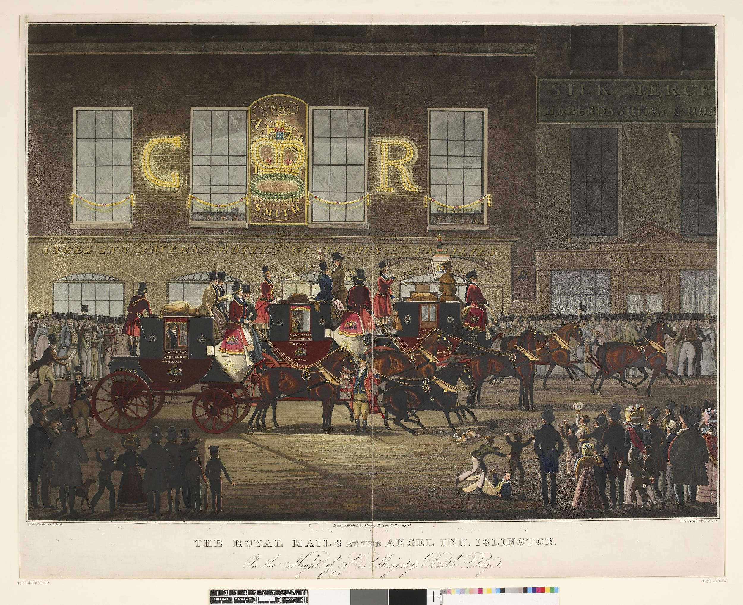
The destinations listed on the side of the coaches are Holyhead, Manchester and Liverpool, illustrating the routes that would be taken by those passing the Angel.
Lettering on the side of the building reads “Angel Inn Tavern and Hotel for Gentlemen and Families”.
The Angel would change significantly in 1921, when the lower three floors of the building were converted into a Lyons’ Café, with a Grill in the basement, Café on the ground floor, and cafeteria on the first floor.
The Lyons’ Café lasted until 1959, with the site then being sold to the London County Council.
The Angel had long been at an important road junction, with an ever increasing volume of traffic moving through the junction in front of the building. In 1932, Harold Clunn in The Face of London was describing the junction as “the busiest traffic centre of north London”.
The road junction was the reason for the London County Council’s purchase of the Angel site. There had long been proposals for ways in which the junction could be improved, however in the 1960s and early 1970s, a rather large roundabout was proposed as the solution for the amount of traffic using the junction, and the traffic bypassing the junction and using residential streets as alternative routes.
In January 1973, Mr. George Cunningham, the MP for Islington, South-West asked a parliamentary question about the plans for the junction and whether the Greater London Council or the national Government would be funding the costs.
Cunningham describes “The proposal at the Angel is for an enormous roundabout, the central island of which will be an acre or perhaps 1.1 acres in area. It will be surrounded by a relatively narrow carriageway of 20 yards—relatively narrow, that is, in relation to the central island”
There was strong opposition to the loss of the Angel, and such a large roundabout taking so much space, and in 1975 the GLC started researching less ambitious options for the junction. There was an updated proposal in 1979, however with political changes, proposals for the junction disappeared and the junction remained as we see it today.
The Angel, along with the Angel side of Islington High Street is now part of the Angel Conservation Area. In 1979 it was sold by the GLC to the New River Company, which by then was a property company and a subsidiary of London Merchant Securities. The building was refurbished and opened as offices and a bank on the ground floor. It now appears to be owned by an offshore property company.
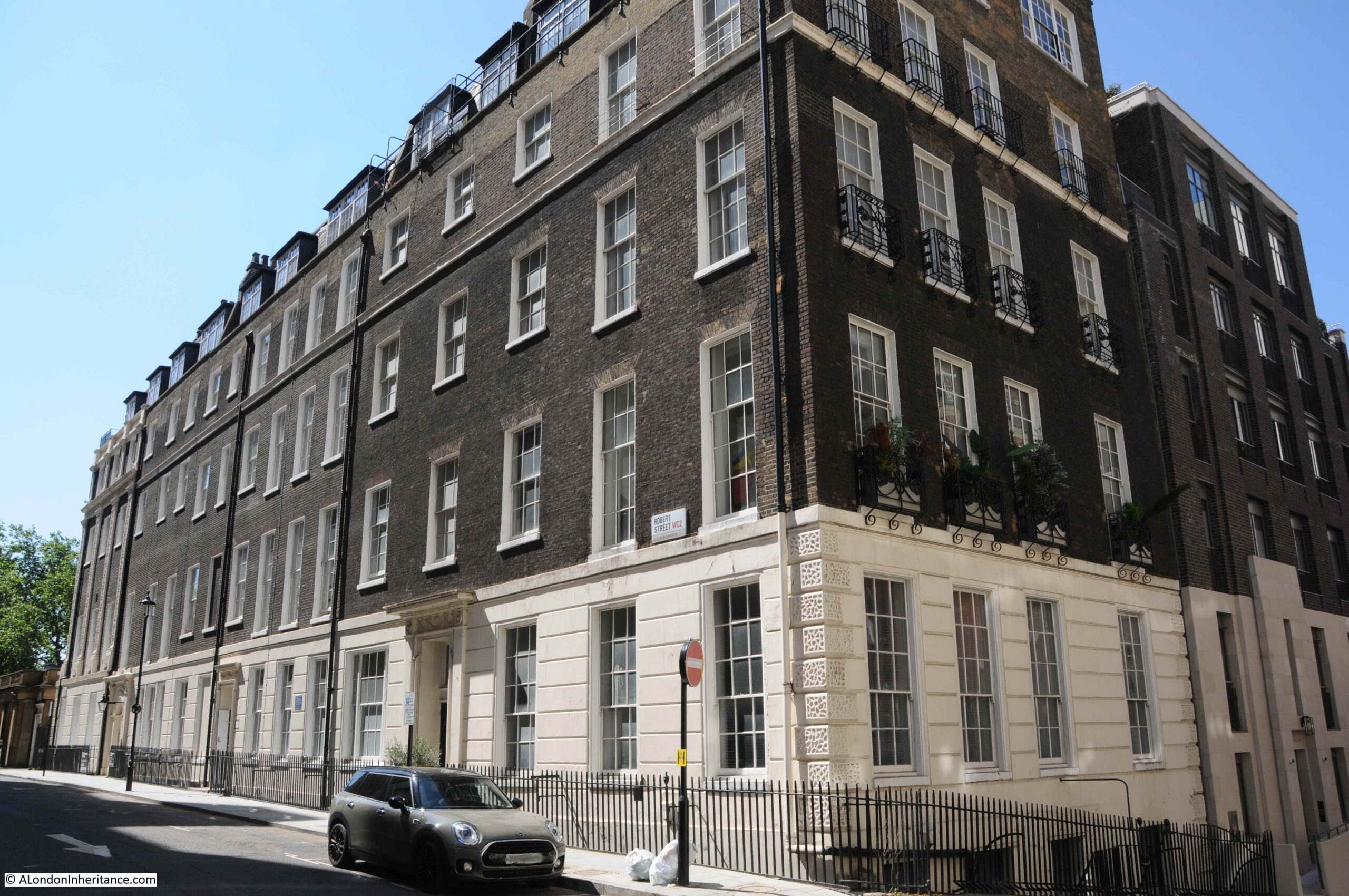
The western side of Islington High Street, with the Angel at the southern end has an interesting range of buildings, that tell part of the story of the evolution of this part of Islington.
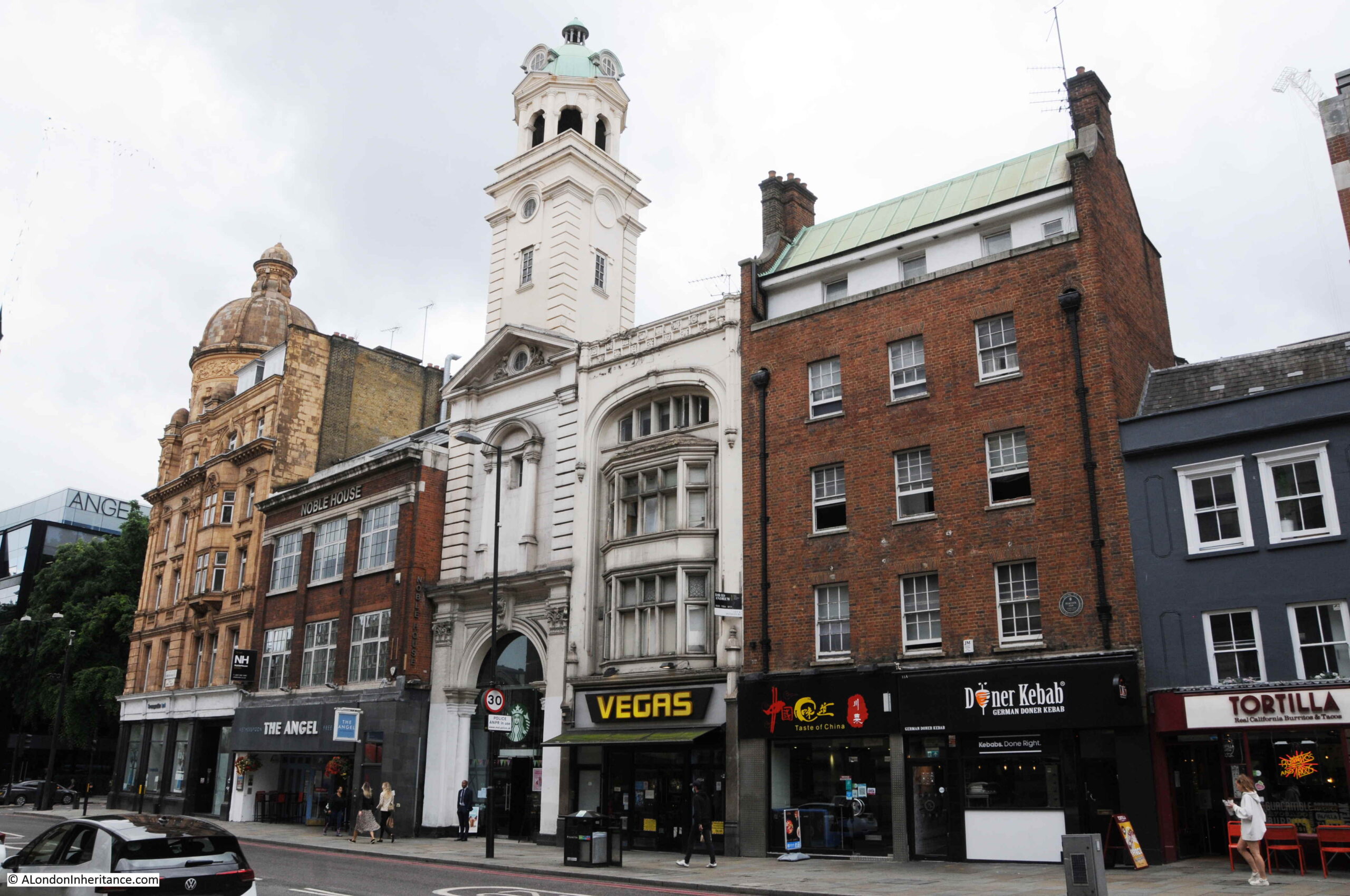
In the above photo, the old Angel Hotel is on the far left. To the right is a Wetherspoons pub called the Angel. This is on land that was part of the original Angel Inn.
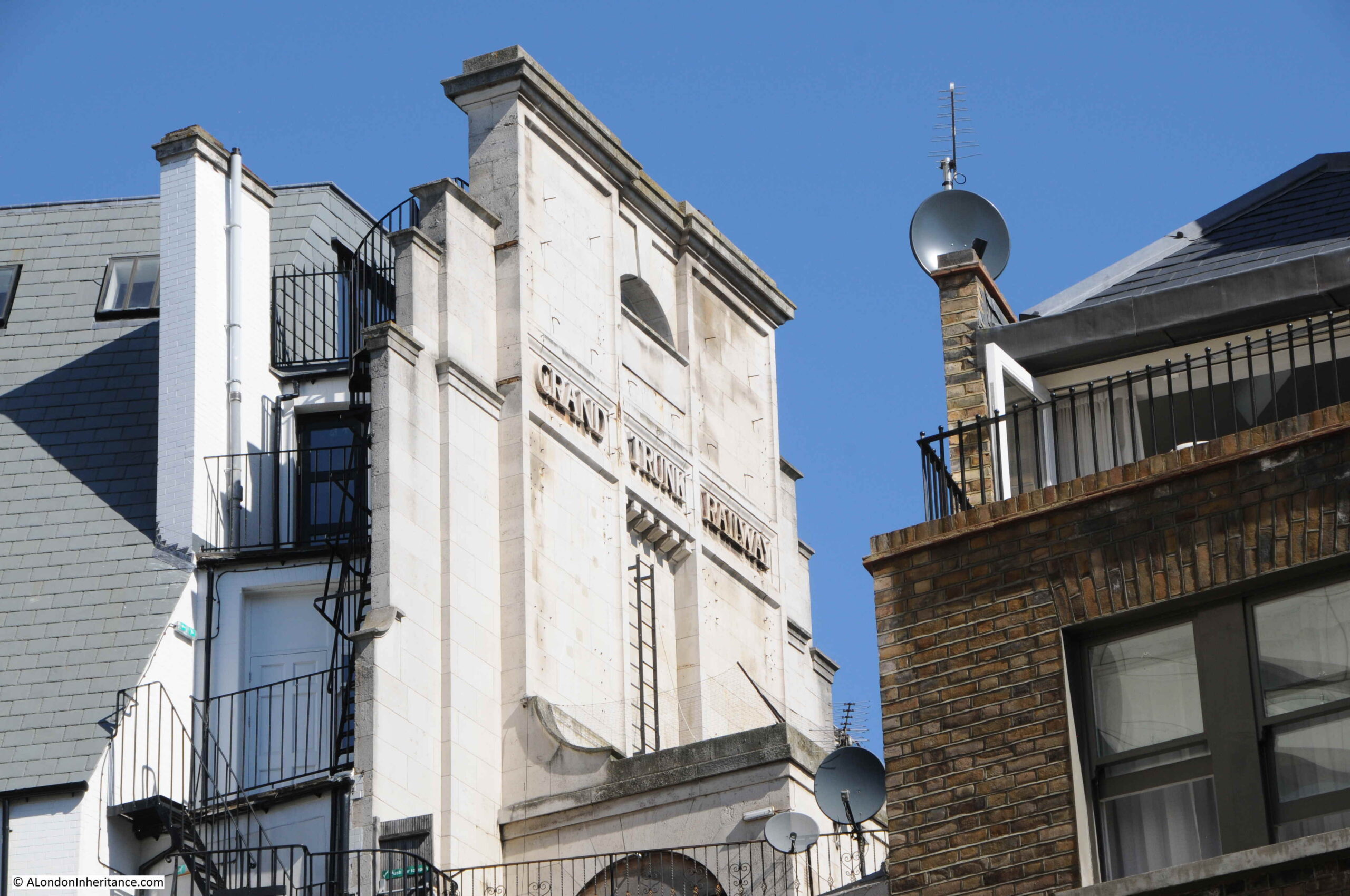
The narrow building with the tower is the remains of the Angel Cinema, built in 1911, the building was the narrow entrance foyer to the cinema, which led back to a large auditorium on land behind the buildings that face onto Islington High Street.
The building to the right dates from 1891, then the large brick building, along with the much smaller three story building on the right edge of the photo mark the site of another old inn, serving the people passing along these roads. This was the Peacock Inn that lasted from 1564 to 1962.
The large brick building was the final version of the Peacock and dates from 1931. The small building on the right is all that survives of the terrace that formed the 1700 version of the Peacock.
This was a fascinating walk around a very small area, and as usual there is so much to discover. Opposite the location of the clock tower was the original entrance to Angel underground station, which I covered in an earlier post.
The Angel is still a well known landmark, as it was well before the game of Monopoly brought the name to the attention of those who had never been to the area.
When exploring London, it is always interesting to find long lost places and place names, that tell some of the history of London life, and discovering Jack (or John) Plackett’s Common was a perfect example.