The Disappearing Cannon At The Tower of London

Walking around London it is easy to see many of the major changes to the city. The constant building, new towers adding to the skyline, however sometimes small changes can go unnoticed although they still have a profound impact on the character of an area and memories of the past.

One such change is the disappearance of the cannon that once lined the walkway running along the River Thames in front of the Tower of London.

I had not really noticed how much had changed until I was looking through some of my father’s photos and found the three photos from 1947 that I feature this week.

In the first, a range of cannon lined the river. I remember these from childhood walks and school visits, and for years before they had been a feature that no visit could ever have been complete without climbing one of these cannon.

Tower of London Cannons 3

I walked down to the Tower one recent Sunday to see how much had changed. The weather was dull and rain was expected, so the lighting was not that good. The following photo is my 2015 photo from roughly the same position. The majority of the cannon have been removed, although a couple remain, looking rather sad up against the approach to Tower Bridge at the far end of the photo.

Tower of London Cannons 5

I do not know when they were removed or why, I can only guess. Perhaps health and safety considerations, although falling was an accepted risk of climbing anything as a boy. An understandable reason could have been damage to the cannon. Making more space in this area is possible as it really does get crowded at the peak of the tourist season. Or perhaps the fact that they all seemed to be pointing directly at City Hall on the south bank of the river may have made certain occupants rather nervous.

What ever the reason it is a loss of some of the character of the place.

Standing at this point, it is fascinating to consider the incredible amount of change that the Tower of London has seen during the centuries. Just in the last 70 years the changes have been remarkable.

Whilst here, my father also took the following photo. I do not think this was to capture the south bank of the river as the warehouses must have seemed a rather fixed feature of day to day London activity, rather it was probably to photo the ship that was about to pass under Tower Bridge.

What the photo does show is the amount of change along this part of the river, which in 1947 still consisted of rows of cranes and their associated warehouses along with a steady stream of cargo ships mooring alongside. The warehouses on the left of the photo are the ones that lined Pickle Herring Street which I featured here.

Tower of London Cannons 2

The following photo shows the same scene today. I was able to position the photo accurately using Southwark Cathedral. If you look to the far right of both photos, you can just see the four spires on the top of the tower of Southwark Cathedral.

I doubt that anyone looking across at this view in 1947 would have expected this scene to host Europe’s tallest building in the decades to come.

Tower of London Cannons 4

The next photo my father took followed the ship as it passed under Tower Bridge.

Tower of London Cannons 1

It was just about to pour with rain when I took the following photo so the lighting is very poor. Apart from the missing cannon, the scene is much the same today. The top of the old Anchor Brewery building behind the southern approach to Tower Bridge provides a convenient reference point to get the right position for the 2015 photo.

Tower of London Cannons 6

The walk between the Tower of London and the River Thames is still a great place to watch activity on the river and the view along the south bank, however with the removal of the cannon it has lost some of its character and childhood memories.

alondoninheritance.com

Window Shopping At Selfridges – Christmas 1951

A brief post to say thank you for reading, commenting and subscribing to my blog over the last year and to wish you a very Happy Christmas.

Here are three photos my father took in the run up to Christmas 1951, looking through the windows of Selfridges in Oxford Street showing a group of window shopping children and their parents.

Hamleys 1 Hamleys 2 Hamleys 3

alondoninheritance.com

London Ghosts

I read this week that sales of printed books are rising and that their demise at the hands of the eBook reader is hopefully not going to turn out to be true.

I love printed books. Not just to read, but also as a living record of information added by those who have owned the book. Many of the London books in my collection have annotations along with cuttings from newspapers and magazines over the last 70 years that add to the original text contained within the pages of the book.

The 1975 edition of Dan Cruickshank’s “London: The Art Of Georgian Building” has newspaper articles inserted detailing the destruction and development planned for London’s Georgian buildings during the 1970s, 80s and 90s. The 1923 edition of Historic Streets of London by Lilian and Ashmore Russan has the comment “Rot !!! confused with Battle Bridge N.W.1”  against the entry for Battle Bridge Lane in Bermondsey which states that it “Marks the place where the Romans defeated the Iceni, under Queen Boadicea, in the year AD61”

Rather than a one off read, books can therefore be a repository for new information as well as something to challenge and correct.

One such book is “Unbidden Guests – A Book of Real Ghosts” by William Oliver Stevens published in 1949. As well as the contents of the book, my copy is also stuffed full of newspaper and magazine articles recounting ghost stories from the last 60 years, and for this week’s post, as we approach the shortest day of the year when darkness falls over London from the late afternoon, here are a few of those articles, a sample from a series printed by the London Evening News in the run up to the Christmas of 1957.

These were written by Leslie Thomas who would later find fame following publication of his book The Virgin Soldiers in 1966. At the time of these articles, he was a feature writer for the London Evening News. He worked for the paper from 1955 to 1966 when the success of The Virgin Soldiers convinced him that he could make a career as an author.

These stories of London Ghosts are written in a suitably dramatic form and most have an illustration of the haunting to draw in the reader. I like to imagine Londoners reading these articles as they make their way home in the evening on a cold, dark and foggy December night when anything would seem possible.

The first story is from 1926 when a Mr Gibson, a night watchman guarding roadwork’s in Church Hill Road, Barnet saw the ghost of Sir Geoffrey de Mandeville, Earl of Essex as a skeleton clad in a metal breast plate and black cape coming up the road towards him.

There were two Sir Geoffrey’s in the 12th century, the elder inheriting lands in Essex, Middlesex and Hertfordshire. His political scheming resulted in him being accused of being a traitor. Sir Geoffrey and his followers carried out guerrilla warfare, travelling on roads to London through Enfield Chase and Barnet. On his eventual death his body lay in Old Temple, Holborn for 20 years without burial. The second Sir Geoffrey had a fortress at Barnet and apparently fell from a tree and drowned in his own moat.

An old house in East Barnet called the Grange was allegedly built on the de Mandeville’s old fortress and when excavations disturbed the foundations of the old building the haunting started, including the stamping of footsteps and clanking of spurs, along with sightings as witnessed by the poor night-watchman.

The Evening News story concludes with a party of local people including a councillor spending the night at the night-watchman’s hut in Church Hill Road. Although nothing was seen, just after midnight the party heard a rumbling like that of many hoof beats and the ground shook.

A chilling tale from Barnet and I doubt the night watchman ever returned if the illustration is an accurate portrayal of his night on Church Hill Road.

London Ghosts 1a

London Ghosts 1b

The next tale is from Pond Square, Highgate and starts with the experience of Aircraftman Terence Long in December 1943. Walking through Pond Square he heard the sudden pulling up of a carriage and then a frightening shriek.  Moonlight revealed the sight of a ghostly chicken – “It was a frightened, squawking fowl, dashing about in frenzied circles, half running, half flying, and shivering.”

The unlikely story of the chicken goes back to the 17th century when Francis Bacon was riding through the snow covered streets of Highgate. Pondering scientific questions, he suddenly asked his coachman to stop and fetch a chicken. The chicken was killed, and Bacon promptly stuffed it with snow and then put it in a bag filled with more snow. This experiment was following Bacon’s observation that the grass underneath snow always appeared fresh and he wondered whether snow and the cold could help with the preservation of food.

Whilst working on this experiment in the cold Highgate night, Bacon collapsed and was taken to the home of Lord Arundel in Pond Square where he died a few days later.

The chicken has since been seen many times in Pond Square, although why the chicken continues to haunt rather than Francis Bacon is a bit of a mystery.

London Ghosts 4

London Ghosts 4a

The next story moves into central London, to Covent Garden underground station and tells the story of the ghost of the Victorian actor, William Terriss.

On November 24th 1955, the foreman ticket collector Jack Hayden was in the staff mess room which was divided in two with a partition which included a door when, “This door was open and in the other section of the room there appeared the figure of a tall man, grey of face and wearing white gloves.” Jack Hayden and a colleague who had also seen the ghost were shown a photo of Terriss and immediately recognised him. William Terriss had been murdered at the nearby Adelphi Theatre.

Along with the ghost story, this cutting from the Evening News includes a fascinating advert for “Trips by Trains” and includes:

– Football excursions to see Sheffield United play Leyton Orient from St. Pancras. Grimsby Town play Charlton from King’s Cross and Colchester United play Brentford from Liverpool Street.

– There is a train leaving Paddington to see the Passing-Out Parade of Naval Apprentices at H.M.S Fishguard, Torpoint

– A Sunday timetable of trains, mainly with buffet cars from the main London stations

– weekday trains to the “Hants & Dorset Resorts”

This was when a train ticket from Waterloo to Bournemouth would have cost 15 shillings.

London Ghosts 3

The next story is from south London and starts with the terrifying headline “It came to Battersea and terrorised a family until they did what it wanted.”

The haunting at the house in Eland Road, Battersea owned by the Robinson family, started on the 27th November, 1927 with breaking glass in the Conservatory, which was followed by flying coal, pennies and soda, loud noises and bangs, furniture falling in all directions, broken windows and door panels.

Mr Robinson called in the Police who were also subjected to flying coal, but could not do anything to help, so “the Robinsons spent the most miserable Christmas of their lives in a house that was full of flying coal, pennies and soda.”

Despite a steady stream of people trying to help, police, clergymen and spirit investigators, nothing could be done. There were also newspaper reporters and crowds of “open-mouthed sightseers.”

Members of the family tried to stay in the house, but were gradually driven out. The last to stay, a Mrs Perkins, was hit by a large lump of flying soda – “She ran from the kitchen followed by a tumult of banging’s and a shower of heavy pieces of coal. By this time, almost in tears she cried ‘Alright I’m going’ immediately the noise and the flying coal stopped.”

With the family who lived in the house now gone the spirit was satisfied and peace descended on the house in Eland Road.

London Ghosts 2

Leslie Thomas went on to publish 30 novels until his death in 2014. These articles highlight some of his earliest writings for the Evening News, nine years before publication of The Virgin Soldiers.

They also tell of some of the many possible ghostly encounters you may experience walking the streets of London after dark.

alondoninheritance.com

London Postcards

Back in August, I published a number of London Postcards showing the city during the first decades of the 20th Century. For this week’s post I have another series of postcards from the same time period.

I find these fascinating as they show many different aspects of London and provide a tangible link with those who lived in, or were visiting London.

The first postcard is of a very wintry Royal Observatory at Greenwich. Taken at a time when this was still a working observatory. Very rare to see such snowfall in London today.

The postcard was posted at a very different time of year to the pictured scene, on the 31st August 1905. With a Greenwich postmark, posted to a child in Lowestoft with a birthday wish from his aunt and uncle.

Postcards from London 2 7

As well as scenic views, early postcards are also populated by Londoners. This postcard shows Covent Garden with some fantastic detail of a very busy street scene. This was at a time when wearing a hat was almost mandatory, with the type of hat indicating your position in the social structure of the day. The scene is also piled high with baskets ready to transport goods to and from the market.

Postcards from London 2 8

The following postcard shows Regent Street at a time when almost all shops had awnings or shop blinds. The shop on the right is the London Stereoscopic Company. Formed during the 1850s, the company started selling stereoscopic photos and viewers and then went into the general photographic business selling cameras, photographic paper and other photography supplies. The company lasted until 1922.

The bus in the foreground is the number 13 covering Finchley Road, Baker Street, Oxford Street, Piccadilly Circus, Charing Cross and Fleet Street. The number 13 bus route today covers many of the same locations.

Postcards from London 2 2

Another street scene, this time Holborn (posted on the 18th September 1913).

Postcards from London 2 3

All these photos show the main street lamps on islands in the centre of the road. When electric lighting was introduced to the streets of London, the centre of the road was found to be the best location to spread light across both sides of the road. These lighting islands also had other benefits. A report presented to the Vestry of St. Pancras in 1891 covering the use of public lighting by electricity claimed that one advantage of central street lighting in busy thoroughfares is that they regulate the traffic. The report stated:

“Your committee are informed that the Commissioner of Metropolitan Police has suggested that there ought to be a rest at that point to prevent the numerous stoppages and accidents that occur there. The Police seem to be strongly of the opinion that the fixing of rests assists very materially in the regulation of the traffic, and your Committee feel therefore that although at first sight many people may think the lighting from the centre of the road would tend to obstruction, it really assists in facilitating the traffic and preventing obstruction in crowded thorough-fares.”

“Rests” refers to the islands built in the centre of the road where a street lamp could be installed and protected from traffic. They also provided a safe stopping point, or rest, for pedestrians trying to cross the road. The report was written as part of the planning for the installation of electric arc lamps in Tottenham Court Road. The following postcard shows Tottenham Court Road taken looking north from the junction with Charing Cross Road. The buildings on the left, along with the pub are still there.

Postcards from London 2 9

The above postcard was sent by a visitor to London from North Wales who “has been seeing the sights and are now going to the zoo.”

Perhaps one of those sights was Leicester Square, much quieter than it is today, possibly a weekend in winter when sitting in, or running through the square was the ideal way to pass the afternoon. The building in the background with the large flag is the original Empire Theatre. Opened in 1884 and demolished in 1927.

Postcards from London 2 5

It was not just central London locations that were popular subjects for postcards. The following card, postmarked 1912, shows Clapham Junction. Although the type of traffic has changed, the scene looks remarkably similar today, although the Arding and Hobbs department store on the corner is now a Debenhams.

The sender of the card wrote “On back is the new Arding & Hobbs. Old building burnt down a few years ago.” The new building shown in the postcard was completed in 1910.

Postcards from London 2 15

At first glance, the following photo looks to be of Charing Cross Station, although, as the name across the building confirms, it is the original Cannon Street Hotel, forming the entrance to Cannon Street Station.

Postcards from London 2 11

To show how similar they are, the following shows Charing Cross Station. This is no coincidence as they were both designed by Edward Middleton Barry who also designed the replica Queen Eleanor Cross which stands in the forecourt of the station. The hotel at Cannon Street has long gone, and the station entrance now looks very different. Charing Cross provides a physical reminder of what once stood in Cannon Street.

Postcards from London 2 10

The next postcard is of the Monument, however what I find more interesting about the scene are the people, and also the large amount of advertising on the building to the left. The postcard was posted at the station at Walton on Thames by someone who had just moved into a new house in Weybridge. Perhaps a City worker who had bought the postcard in London.

Postcards from London 2 6The posters include adverts for, Nestles Swiss Milk, Bass beer, the Royal Military Tournament, Regie Cigarettes, Allsopp’s Lager and Triscuit, which if it is the same thing is a cracker produced in America and is still in production today. The building on the corner on the right is the Monument Tavern.

London’s bridges have always been popular subjects for postcards, and the following view is of London Bridge. The bridge shown is that designed by John Rennie and opened in 1831. It was sold in 1968 to make way for the current London Bridge and rebuilt in Lake Havasu City, Arizona. Both the buildings on either side of the end of the bridge are still there, Adelaide House on the right and Fishmongers Hall on the left.

Postcards from London 2 12

And the following postcard shows Blackfriars Bridge. The large curved building at the left of the bridge is De Keyser’s Royal Hotel which was opened on the 5th September 1874 by Sir Polydore de Keyser who came to London as a waiter from Belgium and eventually became Lord Mayor of London. The Uniliver building is now on this site.

Postcards from London 2 14

The following postcard is titled “The Hanging Gardens of London, Selfridges Water Gardens Looking West”. The roof of the Oxford Street department store, Selfridges, had gardens and cafes during the 1920s and 30s and were a popular location after shopping. The roof gardens were damaged during the last war and never reopened.

Postcards from London 2 13

The following postcard shows the London County Council Millbank Estate, and judging by the condition of the streets, this must be soon after construction of the estate finished in 1902. The building halfway down the road on the left is a school. The estate and the school are still in existence and the buildings today look much the same although there is now parking lining most of these streets. The Milbank Estate is Grade II listed. The people in the photo are probably some of the first occupants of the estate.

Postcards from London 2 4

Although the Tower of London is the subject of the following postcard, I find the background of more interest as it shows London when the height of buildings was relatively low compared to the City we see today. This postcard has a 1931 postmark and was sent to Belgium by a visitor to London.

Postcards from London 2 16

The following photo taken from Bankside shows the north bank of the river with the original wharfs.

Paul’s Wharf in the centre with St. Paul’s Pier in front, the London & Lisbon Cork Wood Company (the smaller building towards the right with the white upper part), and Trig Wharf to the right. The Millennium Bridge now crosses the river here, roughly at the site of the London & Lisbon Cork Wood Company.  The Bankside location has always provided a superb view across the river and has a fascinating history which I wrote about here, mainly involving the transport of coal and other goods on the river hence the lighters on the river in the foreground.

Postcards from London 2 1

In the days before the personal ownership of portable cameras, postcards were about the only means of sending a message showing where the author lived or was visiting and as such they provide a fascinating insight into early 20th century London.

alondoninheritance.com

Park Row – Knightsbridge

“Very few of the people who use London ever look at it. But, as they use it, it is continually altering to meet their demands, and so it becomes the record, the expression of the complex personality , of millions upon millions of people.”

The above paragraph could have been written today, but comes from the late 1920’s, from the first page of the book “The Romance of London” by Alan Ivimey. The paragraph that follows the above is though a clear indication of when the book was written, along with the author’s expected audience:

“This book is written for those who have never noticed London before, but are not unfamiliar with that amiable state of mind induced by a pipe of tobacco and a tankard at one’s elbow.”

Alan Ivimey was a writer and journalist who was also the first presenter of the BBC radio programme “Woman’s Hour” from the first broadcast on the 7th October 1946. The Radio Times introduced Alan Ivimey as a specialist “in writing for and talking to women.” He continued being the presenter of the programme for the first three months when presumably the BBC realised the incongruity of having a male presenter as a specialist in writing for and talking to women and Joan Griffiths took over the presenting role.

So what is the relevance of the above to today’s post? The book is from the collection of London books that my father built up and when I was browsing through, I found one of his printed photos tucked in the pages opposite a photo of the same scene in the book. The book tells a story of continuous change in London, but also researching the author provides some background to the social attitudes of the time, also an area of constant change.

The photo in question is shown below. This is my father’s photo from 1948 and appears to show the end of a street, signs of bomb damage on the buildings and a missing row of buildings on the right, presumably again lost through bomb damage.

This photo has been on my list of photos to hunt down the location as it is not immediately obvious. There is a street name sign to the left of the top of the lamp post with the first two words Hyde Park and the last word hidden behind branches of the tree.

I could not find a similar street with the first two words of Hyde Park in any of my pre-war maps.

Park Row 1

There were also two other photos I had scanned from the same strip of negatives of the same street. The first photo is looking further to the right, at the land where presumably houses once stood:

Park Row 6

And the final photo was taken turning further to the right and shows dustbins up against a wall:

Park Row 7

The dustbin on the left has Westminster at the top, so presumably from the council and underneath states that dry pig food should be put in the bin. A leftover from wartime recycling where food waste was used for pig food.

To identify the location of these photos is where Alan Ivimey’s book came to the rescue. The printed copy of my father’s photo was inserted opposite the page in the book, with the title and text:

A Nook Of Old Knightsbridge

Between the Kensington Road, just beyond the Brompton Road fork, and Hyde Park is the narrow entry to Park Row whose 18th century brick and woodwork are painted as prettily as the black-cloth for a scene from The Rivals.

The photo from the book shows the street as it was pre-war. This photo includes the houses that were on the right of the street and are to the same design as the houses on the left, captured in my father’s photo. The second photo above is looking directly at the area once occupied by these houses. This really was a lovely street of 18th century houses.

Park Row 4

The street name, Park Row, in the photo from the book is different to that in my father’s photo, but this did enable me to track down the location.

The street must have been too small to appear in my normal reference, the Bartholomew Street Atlas, however using the 1895 Ordnance Survey maps provided online by the National Library of Scotland I was able to locate Park Row. See the following extract from the map, with the location of Park Row highlighted by the red arrow (Reproduced by permission of the National Library of Scotland)

Park Row 3

In the map, the junction to the right is the fork between Knightsbridge and the Brompton Road, with Knightsbridge running past the Hyde Park Barracks into the Kensington Road and Brompton Road heading south. Park Row is shown as the row of buildings at the end of the street, with the opposite side of the Park Row buildings facing onto Hyde Park. The part of the street leading up to the Park Row buildings is labelled Mill’s Buildings in the map.

Having found the exact location of Park Row I headed to Knightsbridge to see what, if anything remains, however this small part of Knightsbridge has seen considerable change and Park Row, the Mill’s Buildings and Albert Terrace (shown to the right on the map) have long gone.

Park Place, shown on the 1895 map to the left of Mill’s Buildings still exists (although now called Park Close) and maintains its alignment with the street on the opposite side of Knightsbridge so I had a starting point. Working back towards the junction, the following photo shows where I believe the Mill’s Buildings and Park Row were located:

Park Row 5

The 1895 map also shows a Public House almost opposite the entrance to the Mill’s Buildings and the Paxtons Head pub is still in the same position today, also helping to confirm the location.

The entrance to the Mill’s Buildings would have been roughly where the white van is in the above photo with the road to the left occupied by the buildings on the left of the original photo. The Park Row terrace would have been towards the end of this street, probably located around the end of the canopy that now covers the street.

A considerable change from the original street of 18th century houses.

I wanted to know more about this street. I checked the London County Council Bomb Damage Maps to confirm that bomb damage destroyed the buildings to the right, however these maps do not show any damage in the immediate vicinity of Park Row. I have often wondered if the Bomb Damage Maps did record all the bomb damage throughout London as it must have been a considerable task to record every event and area of damage. The Mill’s Buildings were accessed through an alley from Knightsbridge and if the buildings facing on to Knightsbridge were not damaged, I wonder if those surveying the city for damage just did not think to walk through into the Mill’s Buildings? I cannot believe that the buildings was demolished for any other reason soon after the war, with housing being in such short supply.

The Survey of London provides more information on Park Row and explains when the name change happened between the photo from the book and my father’s photo.

In 1776 Ralph Mills, a Knightsbridge carpenter-builder, took a lease on the original buildings and proceeded to redevelop the site. He built 26 houses consisting of Park Row and the Mill’s Buildings.

The houses that made up Mill’s Buildings were superior to those often found in small courts, but by the late 1820s several of the rate payers occupying these buildings were described as ‘poor’ or ‘very poor and aged’.

The Park Row buildings, constructed during the same period were of a higher status and had large bay windows facing onto Hyde Park.

The Chartist, poet and lecturer Thomas Cooper lived at number 5 Park Row and recorded that “We had no access to Hyde Park, but we looked into it from our really beautiful parlour, and had daily views of the Guards, and Royalty, and great people, passing by, in the Park.”

The Survey of London confirms that Park Row was renamed Hyde Park Row in 1939, but does not identify why the name change was made. The Survey also confirms that Park Row was demolished, but not when.

So, thanks to Alan Ivimey and his book, The Romance of London, I can confirm the location of another of my father’s photos, and as suggested by the author at the start of his book, I shall now get out my pipe of tobacco and tankard and finish reading his book with an amiable state of mind.

alondoninheritance.com

Down Street Station

This year has been a good year for exploring disused underground tunnels. The London Transport Museum and the British Postal Museum have arranged a number of tours throughout the year, and last Thursday I took my last tour of the year, to the disused London Underground Station at Down Street.

You could argue that once you have seen one old underground tunnel, you have seen them all, however each location is unique and they have their own story to tell of London’s development and recent history. Down Street is no exception and held a critical role in the running of the country’s transport network during the last war.

Down Street station is, as the name suggests, in Down Street which runs from Piccadilly to Hertford Street.

The station opened on the 15th March 1907 on the Great Northern, Piccadilly and Brompton Railway (part of today’s Piccadilly line), between the stations at Green Park (or as it was called Dover Street) and Hyde Park Corner.

The station however did not meet expectations on passenger numbers for a number of reasons. Green Park and Hyde Park stations were very close by, the station was in a side street rather than on Piccadilly, and the residents of this affluent area tended to have their own private transport rather than use the Underground.

As a result of the station’s limited use, it closed on the 21st May 1932.

The street level station in Down Street as it is today:

Down Street 28

The exterior design of the station was by Leslie Green who was responsible for a number of other stations on the underground. The design and tiling were used on many other stations and clearly marks out the previous function of the building.

Entrance to the platform level today is via the emergency stairs. An original World War 2 sign at the top of the stairs hints at the use of the station during the last war.

Down Street 1

Looking down the stairs:

Down Street 26

Prior to the start of the last war, committees were formed to coordinate key elements of the country’s war effort. One of these was the Railway Executive Committee (REC) and they were in need of a location which would protect the staff and their telephone communication systems.

The role of the REC was to coordinate and manage the wartime operation of the railway companies and the London transport system.

The REC had representatives from each of the rail companies and the London Passenger Transport Board along with telephone communications with each of these organisations. The REC would coordinate the essential movement of troop trains, ammunitions and equipment, raw materials and other goods critical to the war effort, and manage the impact of enemy bombing on the rail network

At the bottom of the stairs, more signs hinting at the previous use of the station.

Down Street 2

Looking back at the bottom of the stairs. The sign on the wall indicates the depth below ground, with the height of the shaft being 22.22 meters.

Down Street 3

The tunnels were converted to provide accommodation for the REC by both London Transport and the London Midland & Scottish Railway.

London Transport were responsible for structural changes and the Railway Company fitted out the tunnels so they were suitable to provide office and living accommodation for the staff of the REC.

Many of the tunnels were plastered or boarded over, partition walls installed and furnished using stock from both the above ground office of the REC and from Railway Hotels, so the quality of furnishing was reasonably high.

This is the tunnel that held the committee room of the Railway Executive Committee. Originally the tunnel walls were boarded and partition walls installed with doors providing entry and exit to the rest of the tunnels. The white tape on the floor marks the position of the board room table.

Down Street 9

One of the side tunnels was converted to provide bathroom facilities for those who would work a shift of several days below ground. The remains of these still exist, although the decay of the past 70 years is clearly evident. These facilities are in individual alcoves along the side of one of the tunnels. It was fascinating to peer into these as they are in almost total darkness. I had to use flash for these photos.

Down Street 4

Bath in the photo above and sink in the photo below.

Down Street 5

Double sink unit. Really good that the historic value of these facilities has been recognised with signs warning not to remove or damage these objects.

Down Street 6

An original water heater.

Down Street 7

Photo showing how the tunnels were partitioned to provide a narrow walkway past the facilities installed in the tunnel on the right.

Down Street 8

As well as the Railway Executive Committee, Down Street also provided accommodation for Winston Churchill at the height of the Blitz.

The original facilities in Whitehall and the Cabinet War Rooms were not considered strong enough to withstand a direct hit by high explosive bombs and whilst new facilities were being constructed, Churchill needed a secure central London location and Down Street provided this service from October to December 1940.

Despite the amount of change needed to accommodate the REC for the duration of the war, much of the original station signage remains:

Down Street 10

To support the work of the REC, communications were needed with the rest of the country’s railway systems. For the time, an advanced telephone system was installed for this purpose and some of this switching equipment still remains:

Down Street 11

Another view of one of the tunnels showing how they were partitioned with narrow walkways providing access across the complex:

Down Street 12

As well as washing and sleeping facilities, the occupants of Down Street also needed to be fed. The station had a kitchen capable of feeding the 40 staff based on site plus any visitors.

Down Street 13

The Piccadilly line still passes through the station. As part of the construction work to make the station suitable for the REC, a wall was built along the length of the platform edge. This still remains with occasional entrances through to the section of the tunnel with the train tracks.

The noise of passing underground trains echoed throughout much of the station. It must have been difficult to work, and to sleep for those off shift during the time when trains would still be running.

Down Street 14

Stairs up to the tunnels which connect with the lifts bringing passengers to and from ground level.

Down Street 15

Some of the original station signage remains behind later paint, plaster and the accumulated dirt of many decades. Later signage helps with orientation in the tunnels.

Down Street 16

An alcove built during the war to accommodate additional communications equipment:

Down Street 17

Station tunnel:Down Street 18

More original signage:

Down Street 21

Curving tunnels always fascinate. What is around the corner?

Down Street 22

Here is the original lift shaft. Lifts were installed during the original station construction. As part of the work to ready the station for occupancy by the REC, a thick concrete cap was installed to ensure that the impact of any surface bombing could not reach the platform levels through the lift shaft.

Down Street 19

The REC continued to use Down Street until the end of 1947. Since then, there have been no other occupants of the station. Many of the partitions were removed to allow various elements of underground signalling and communications to be installed, but the rest of the REC facilities have been left in slow decay.

The main use of Down Street has been to provide ventilation to the Piccadilly Line which is the role the lift shaft provides today.

Looking up the lift shaft:

Down Street 20

These holes in the wall at the bottom of the lift shaft provided the entrance from the platforms tunnels to the lifts.

Down Street 23

The facilities in Down Street were designed not only to provide protection from explosive bombing, but could also be sealed against gas attack with air filtration equipment providing breathable air for the REC staff. An original wartime door.

Down Street 24

Back up to the surface and heading towards the street:

Down Street 27

Down Street is a fascinating station. It only served the Piccadilly Line for a short period of time, but then played a key role in the war, maintaining the efficient coordination and running of the country’s railways.

The London Transport Museum is performing an excellent service in opening up these old stations with well run tours and very knowledgeable guides.  The tour of Down Street is highly recommended to see the remains of the station’s wartime use.

If you do visit Down Street, near by is Shepherd Market. Also well worth a visit which I covered here.

alondoninheritance.com

St Clement Eastcheap

When the 19th century London Bridge was built to replace the original medieval bridge, the new bridge was built slight further west along the river allowing the old bridge to continue in use until the new bridge was completed.

The construction of the 19th century bridge had quite a dramatic impact on the streets on the north bank of the river. I have already covered some examples in my post on the Ticket Porter in Arthur Street which you can find here, and there were more street changes further north.

Today’s post on the church of St Clement Eastcheap provides us with another example.

St Clement Eastcheap is a modest church in Clements Lane almost at the corner with Cannon Street. The church does not have a spire and the church tower is at the same level as the surrounding buildings so unlike many other City churches, you will not find a spire to help locate the church.

The church does though have a fascinating piece of early 18th century graffiti in one of the most unusual locations, more on this later.

So, to start, here is St Clement Eastcheap in Clements Lane taken from Cannon Street.

St Clement Eastcheap 1

St Clement Eastcheap, located in Candlewick Ward, dates from at least the 12th Century, probably earlier and was originally adjacent to the street Great Eastcheap.

The church was destroyed in the Great Fire of London and rebuilt by Wren between 1683 and 1687. The church suffered very little damage during the 2nd World War which is surprising given the central City location, so the church we see today is much the same as the original Wren construction.

The following map is from the 1940 Bartholomew London Street Atlas. The street plan is also much the same today. St Clement Eastcheap can be seen to the lower right, just above Monument Station.

Clements Lane today, runs between Lombard Street and King William Street which runs on to London Bridge.

St Clement Eastcheap 12

Much of this street plan was created to provide an efficient route onto the new London Bridge with King William Street providing direct access from the major road junction at the Bank.

The extract below from  John Rocque’s map of 1746 shows the street plan when the original London Bridge was still in place.

Here, Gracechurch Street runs to Fish Street Hill then on to London Bridge. Compare this with the above map where Gracechurch Street now curves past Monument Station to King William Street and the approach to London Bridge, highlighting the slight westward move of the bridge.

Just above and to the right of the number 3 in the map below can be seen St Clement. Here, St Clements Lane runs down to Great Eastcheap. Note also how Eastcheap is split into Great and Little Eastcheap, with Little Eastcheap remaining to this day, but now called simply Eastcheap.

Stowe states in his 1603 Survey of London that:

“The street of Great Eastcheape is so called of the Market kept, in the east part of the City, as West Cheape is a market so called of being in the West.

This Eastcheape is now a flesh Market of Butchers there dwelling, on both sides of the street, it had sometime also Cookes mixed amongst the Butchers, and such other as solde victuals readie dressed of all sorts.”

Great Eastcheap was lost when King William Street was built, with Great Eastcheap being included in the end of Cannon Street, King William Street and the Gracechurch Street, Eastcheap section by Monument Station.

St Clement Eastcheap 10

When I visited the church, there was an interesting reminder of the geology of the City. When I entered the church, there was a clear blue sky, however on leaving there was a very heavy rain shower and water was streaming down the narrow Clements Lane, carrying various bits of rubbish in the flow. Whilst today, the water disappeared down the nearest drain, this was a graphical reminder of how much of this side of the City slopes down towards the Thames and how in the past the water and rubbish running down these streets would have been carried straight down towards the river.

On entering the church from the street we look straight at the gilded reredos behind the altar.

St Clement Eastcheap 6

There was some redesign of the interior of the church during the Victorian period and much of the ceiling was renewed in 1925.

The interior of the church has always been relatively simple, Stowe summed up the church as “This is a small church, void of any monuments”, and today the church performs a function which would have surprised Stowe. The pews have been removed and half of the floor space is now office space for charities. A good use and which helps the continued occupation of the church.

Looking back towards the entrance with the charity office space to the left. The original oak casing surrounding the organ appears to have a look of surprise, perhaps because of the current use of the church.

St Clement Eastcheap 5

One of the most unique features of the church can be found in the toilets. Modern toilets have been built up against the original wooden wall panelling as can be seen in the photo below. It cannot be seen in the photo due to the lighting and dark panelling, but on the panelling, just to the left of the small wooden table is some very early 18th century graffiti.

St Clement Eastcheap 8

A close up of the graffiti, dating from the year 1703, carved 15 years after the church was completed. A remarkable survival and very surprising to find this in such a location.

St Clement Eastcheap 9

The church also retains some original Bread Shelves, used to store bread ready for charitable distribution.

St Clement Eastcheap 7

To the side of the church is St Clement’s Court, a narrow lane leading to the small churchyard at the rear of the church.

The plaque on the building on the left reads:

Here lived in 1784

Dositey Obradovich

1742 – 1811

Eminent Serbian man of letters

First Minister of Education

in Serbia

The lane also provides access to some of the office buildings that back onto the rear of the church.

St Clement Eastcheap 13

The remaining churchyard is very small with only a couple of in-situ graves. In 1910, Sir Walter Besant wrote of the churchyard:

“In Church Court we come to the ancient graveyard of St Clement, a minute space with one great shapeless tomb in the centre of the asphalt and a few small erect tombstones on the little border running inside the railings”

Not much has changed in the 105 years since that was written.

St Clement Eastcheap 4

And a couple of gravestones which have been relocated up against the wall of adjoining buildings.

St Clement Eastcheap 3

The church of St Clement, Eastcheap is easy to miss when walking in the area, but well worth a visit, including an essential trip to the toilet to see graffiti from 1703.

alondoninheritance.com

Autumn In The City

Whilst the majority of my father’s photos came to me as negatives, a number were printed, and of these some had the location written on the back. As well as the location, a few are also specific about the time of year as the photo reflects how London appears as the seasons change.

For this week’s post, I bring you two photos on which my father had written the simple title “Autumn in Finsbury Circus”.

Both were taken early in the morning and show autumnal light shining through the trees, with the first autumn leaves on the path. There are two photos, one showing a woman pushing what looks like a pram, whilst the second shows a man starting to sweep the fallen leaves.

City in Autumn 2

I suspect that he had taken these photos either for exhibition or competition at the St. Brides Institute Photographic Society as they have a more composed quality rather than the straight forward recording of London’s buildings and streets.

City in Autumn 1

To try and find the location of these photos, a day off from work last Friday provided the opportunity for an autumn walk around London.

Finsbury Circus is much the same today, with one significant exception being that it is a major construction site for Crossrail with the centre of the gardens in the middle of the square being used for access to Crossrail and sections of the path that runs round the perimeter of the gardens also being closed.

If I correctly located the buildings in the background, they were behind part of the closed off path, however parts that remain open provided the opportunity to show that not too much has changed (if you ignore the major construction site to your left).

City in Autumn 3

The layout of Finsbury Circus was established in the early 19th Century, with the office buildings we see today being built over the following century, with some redevelopment continuing today.

As one of the few areas of green space, the gardens were very popular with city workers, with a bandstand and bowling green occupying part of the centre of the gardens. A small, temporary bandstand remains today. The gardens at the centre of Finsbury Circus will be restored after the Crossrail works are complete.

The main entrance to the Crossrail construction site which currently occupies much of the gardens in the centre of Finsbury Circus.

City in Autumn 4

Walking in central London, there are very few indicators of the season of the year. Apart from temperature and the times of the rising and setting of the sun, it could be any time of year. The natural indicators of whether it is spring, summer, autumn or winter are few and far between.

Taking inspiration from the title of my father’s photos, I thought it would be interesting to take a walk through the City and look for any other examples of where autumn can be found in amongst such a built environment.

The weather last Friday at least was very autumnal with strong winds and alternating between heavy showers of rain and clear blue sky (although in fairness that could be English weather at any time of year).

There are very few green spaces left in the City, the majority that remain are usually associated with a church, either still remaining or one that was lost in the last war, and it was to one of these that I headed to after Finsbury Circus.

This is the garden that occupies the site of St. Mary Aldermanbury. a church that was heavily damaged in the last war, not rebuilt and the remains shipped to America (see my first post here). Just south of London Wall at the corner of Aldermanbury and Love Lane.

A heavy rain shower as I stood in the garden, and a strong wind blowing the fallen leaves up against the far wall.

City in Autumn 5

The next stop was the garden that occupies the graveyard of the church of St. Anne and St. Agnes at the corner of Noble Street and Gresham Street.

This garden occupies a relatively small space, however some mature trees reach up to the sky in amongst the surrounding buildings, with the leaves starting to turn to their autumn colours.

City in Autumn 6

Walking to the end of Gresham Street, then turning up St. Martin’s Le Grand I came to Postman’s Park. At this time of year, the sun does not reach above the buildings to the south in order to shine on Postman’s Park, so the park spends much of this time of year in shade that appears to be made darker by the sunlight on the surrounding buildings. Many of the trees here had already lost the majority of their leaves.

City in Autumn 7

Walking out from Postman’s Park into King Edward Street and I was back in the sunshine of an autumn day.

City in Autumn 8

Heading south from Postman’s Park to one of the larger areas of green open space remaining in the City, the churchyard of St. Paul’s Cathedral.

City in Autumn 9

Here plenty of mature trees can be found around the eastern half of the cathedral and their autumn colours looking spectacular against both the stone of St. Paul’s and the sky.

City in Autumn 10

From St. Paul’s, it was then a walk down Cannon Street, Eastcheap and Great Tower Street to Trinity Square Gardens. (I did miss out the garden at St. Dunstan in the East as the sky to the east was getting very dark and I wanted to get to Trinity Square before another heavy shower of rain).

This large (for the City) open space also benefits from a lack of tall buildings to the south so the rare combination of a City garden that also gets the sun at this time of year.

The pavements showing the signs of recent rain. Overhung by mature trees, the pavements will soon be covered by leaves.

City in Autumn 13

The old Port of London Authority building in the background with the new memorial to Royal Fleet Auxiliary and Merchant Seamen who lost their lives in the Falklands Campaign. The mature trees around the edge of the gardens just starting to change to their autumn colours.

City in Autumn 11

My final visit was to the churchyard of St. Olave in Seething Lane. A small churchyard just catching the last glimpse of an autumn sun, with leaves on the trees starting to fall.

City in Autumn 12

It was a fascinating walk through the city on a typical autumn day with extremes of weather from heavy rain showers to clear blue sky. Even with the amount of building there are still places were it is possible to observe the changing of the seasons and retain contact with the natural cycle through the year.

I fear though that with the ever increasing height of buildings in the City, these valuable survivors of the natural world will be spending more and more of their days in the shadow of their surroundings.

alondoninheritance.com

The Lamb And Flag, Rose Street

After the last few weeks of exploring the River Thames and beneath the city streets, this week it is time to return to London in the late 1940s.

This is my father’s photo of the Lamb and Flag pub in Rose Street, near Covent Garden, taken in 1948. The name Lamb and Flag can be seen just above the entrance to the Saloon. On many London pubs of the time, the name of the brewery was given much greater prominence than the name of the pub. Barclay, Perkins & Co. Ltd were a major London brewery operating from the Anchor Brewery in Park Street, Southwark. The brewery was originally founded in 1616, becoming Barclay, Perkins in 1781 when John Perkins and Robert Barclay took over. Barclay, Perkins merged with Courage in 1955 and the brewery closed in the early 1970s.

Lamb and Flag 2

And my photo of the same pub from the same location 67 years later in 2015.

Lamb and Flag 1

The Lamb and Flag occupies one of London’s older buildings. It was originally built at the same time as Rose Street in 1623 and much of the original timber frame survives although the front was rebuilt in 1958 as can be seen in the above two photos.

The 1958 rebuild of the front of the pub lost many of the original architectural features including what appears to be a parapet running the width of the building at the top of the wall.

A close-up from my father’s photo shows the carving of the Lamb and Flag at the centre of the parapet:

Lamb and Flag 3

The pub has a historic interior, unfortunately it was a bit too crowded for photos at the time of my visit.

To the right of the pub is an alleyway with a side entrance to the Saloon Bar. The alleyway leads  through to Lazenby Court.

Lamb and Flag 4

Halfway along the alleyway, the height of the ceiling drops and at this point is a plaque that records some of the history of the pub and the immediate area. The plaque looks very new, however the reference to Courage and Barclays beers rather than those of Fullers, the current brewery, indicates an older source for the text.

Lamb and Flag 10

The plaque makes reference to Charles Dickens as well as one Samuel Butler.

Butler died in a house on Rose Street and is buried nearby at St. Paul’s, Covent Garden. He was a royalist during the English Civil War and at the restoration had a number of posts with other royalists who held key positions close to Charles II.

Butler wrote “Hudibras”, a popular satirical poem directed mainly against religious sectarianism and due to his Royalist sympathies focused on the Roundheads and Puritans.

The plaque also records the attack on the poet John Dryden in 1679 “at the instance of Louise de Keroualle, Mistress of Charles II” for allegedly having written some scurrilous verses about her.

Louise de Keroualle was unpopular in London for being both French and a Catholic, so may not have been the real culprit and an alternative person responsible for the attack was another alleged target of John Dryden’s writings, John Wilmot the Earl of Rochester.

At the time of the attack, Rose Street was a dark and narrow alley and an ideal place to carry out such a deed. Despite Dryden depositing £50 with Child’s Bank in Fleet Street as a reward, the guilty party, responsible for the attack was never identified and a Mistress of Charles II probably sounds a better attribute to the history of the Lamb and Flag than the Earl of Rochester.

Walking through the alleyway into Lazenby Court. This was probably  more open than it is now, forming a small courtyard behind the pub.

Lamb and Flag 5

The source of the name Lamb and Flag has a religious basis. The “lamb” is from the Gospel of St. John: “Behold the Lamb of God, which taketh away the sins of the world” and the flag being that of St. George.

The pub was also once known as the Bucket of Blood due to links with prize fighting.

An older sign for Lazenby Court is partly hidden behind the direction sign for the pub.

Lamb and Flag 6

Rose Street runs from Long Acre, adjacent to the map and travel bookshop, Stanfords, down to Garrick Street, however today, it is cut in half by Floral Street.

As with many London streets, it has changed over the years. The following extract from John Rocque’s survey of London from 1746, shows Rose Street, with the alley running up from where the street bends to the left, in exactly the same position as the alley of today, however in 1746 it led to Glastonbury Court rather than today’s Lazenby Court. A very narrow Rose Street runs up to Long Acre.

To the right of Rose Street is Little Hart Street. Today, this street has been renamed Floral Street and extended just past the end of Rose Street where it meets Garrick Street, a street also not yet built in 1746 which cuts diagonally from the junction of Long Acre and St. Martins Lane (the street on the left with just the word Lane showing) down to King Street.

As far as I can tell from checking maps, the part of Rose Street leading up to Angel Alley, along with Angel Alley was lost when Little Hart Street was extended and renamed Floral Street.

Lamb and Flag 11

Older sign for Rose Street above the modern name sign.

Lamb and Flag 7

In Rose Street, just in front and to the right of the Lamb and Flag is the Westminster Fire Office, one of the original fire insurance companies who also ran a private fire fighting service.

Lamb and Flag 9

The door to the building records key dates for the Westminster Fire Office. 1717 was the founding year of the company. Offices were originally based in nearby King Street, but as the company grew more space was needed and in 1875 the company expanded into the building in Rose Street.

Lamb and Flag 8

The Lamb and Flag pub is a fascinating historic pub close by Covent Garden and Rose Street is an original street from the development of this part of London. They are both well worth a visit.

alondoninheritance.com

The Post Office Railway

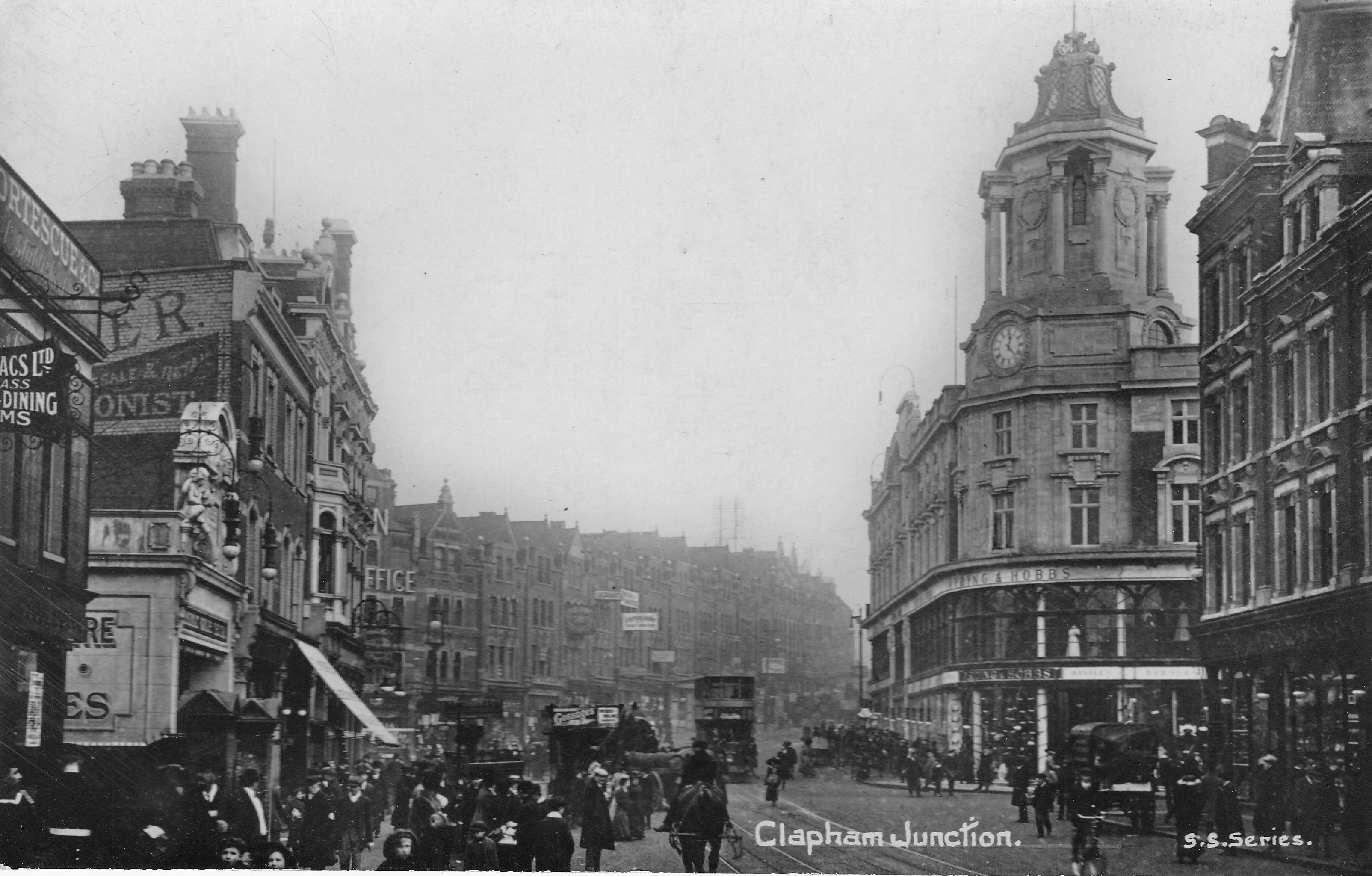
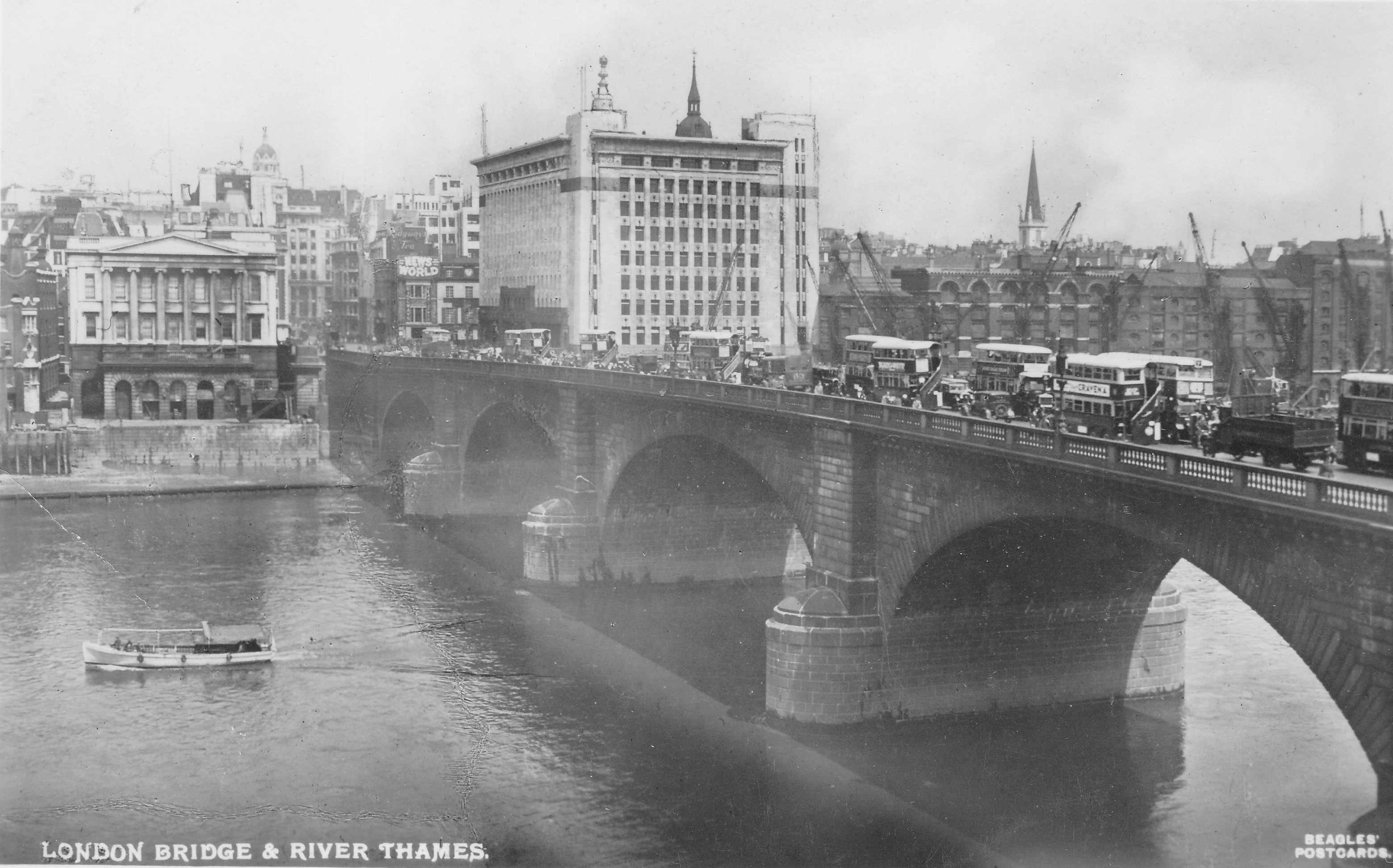
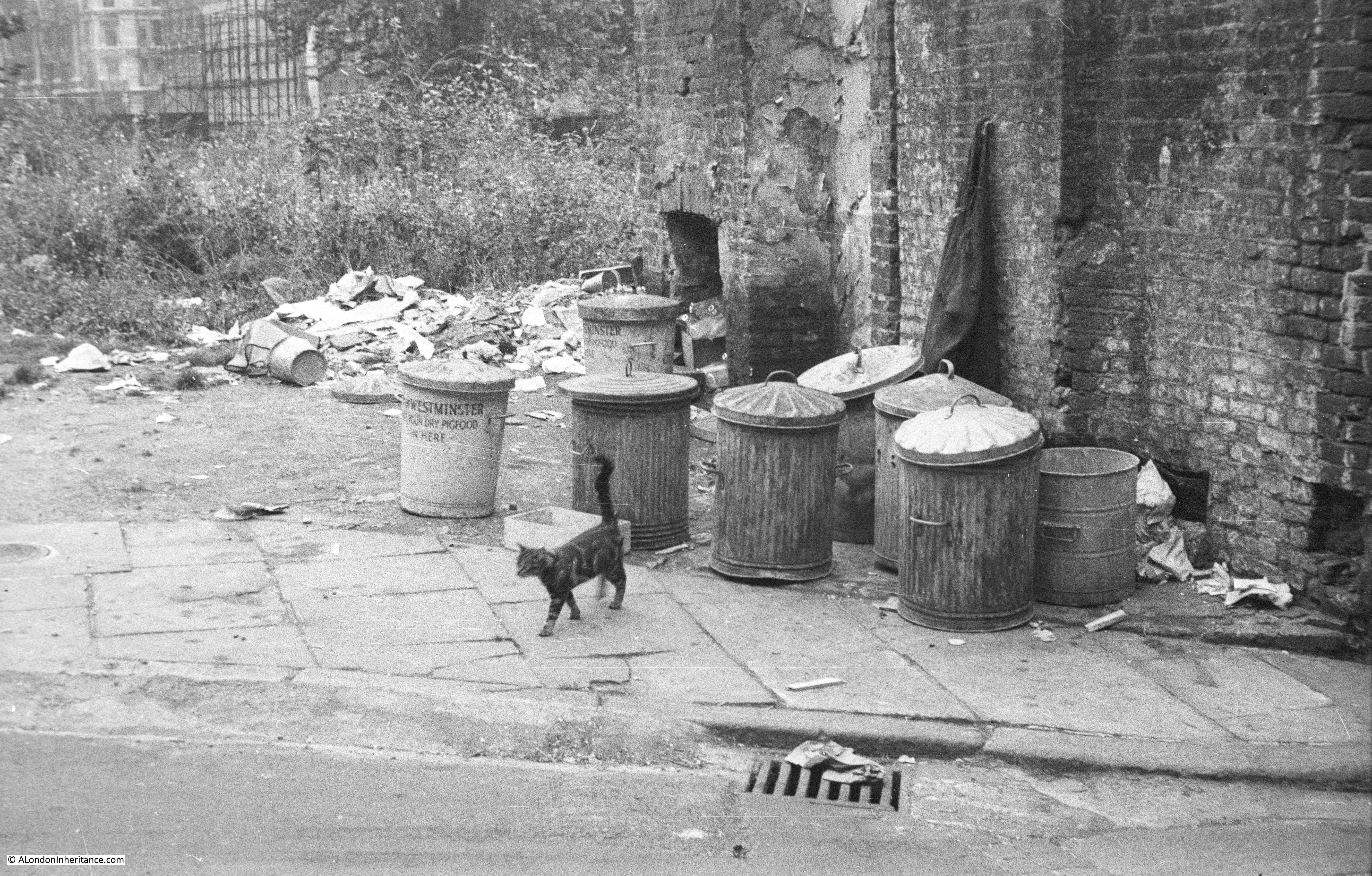
There is a parallel city beneath the streets of London with all the services needed to support such a complex city. Changes in the life of the city above ground are often reflected below ground with new means of transport and the closure of services that have become outdated.

One of these is the Post Office Railway which ran the six and a half miles from Paddington in the west to Whitechapel in the east, with a total of eight stations located below key postal sorting offices including the major sorting office at Mount Pleasant.

I have long wanted to see this railway and in October the British Postal Museum arranged a limited number of tours of the railway at Mount Pleasant.

My first introduction to the Post Office Railway was reading my first book on what is below the city streets, Under London, by F.L. Stevens, published in 1939. This book describes a visit to the railway when it was in full operation.

The plan for the railway was to speed the delivery of mail between the main London sorting offices and the key rail stations. The streets of London were getting more congested and removing the transport of mail from the streets would save time and help reduce congestion.

Construction of the railway stared in 1914, however construction had to be suspended due to the shortage of manpower and materials during the first world war and the sections of tunnel that were completed were used for storage of rare and valuable items from the London museums.

Construction started again in the early 1920s and the railway fully opened in 1927 and in the period up to the 2nd world war it was carrying six and a half million letter-bags and four  million parcel-bags a year.

The railway closed in 2003. The closure of a number of the sorting offices above ground that connected to the railway reduced the efficiency of the service, and transport by road was seen to be a more economical method.

Since then, it has been mothballed, however the British Postal Museum have plans to open up the platforms and a section of the railway at Mount Pleasant as part of a new museum and visitor centre.

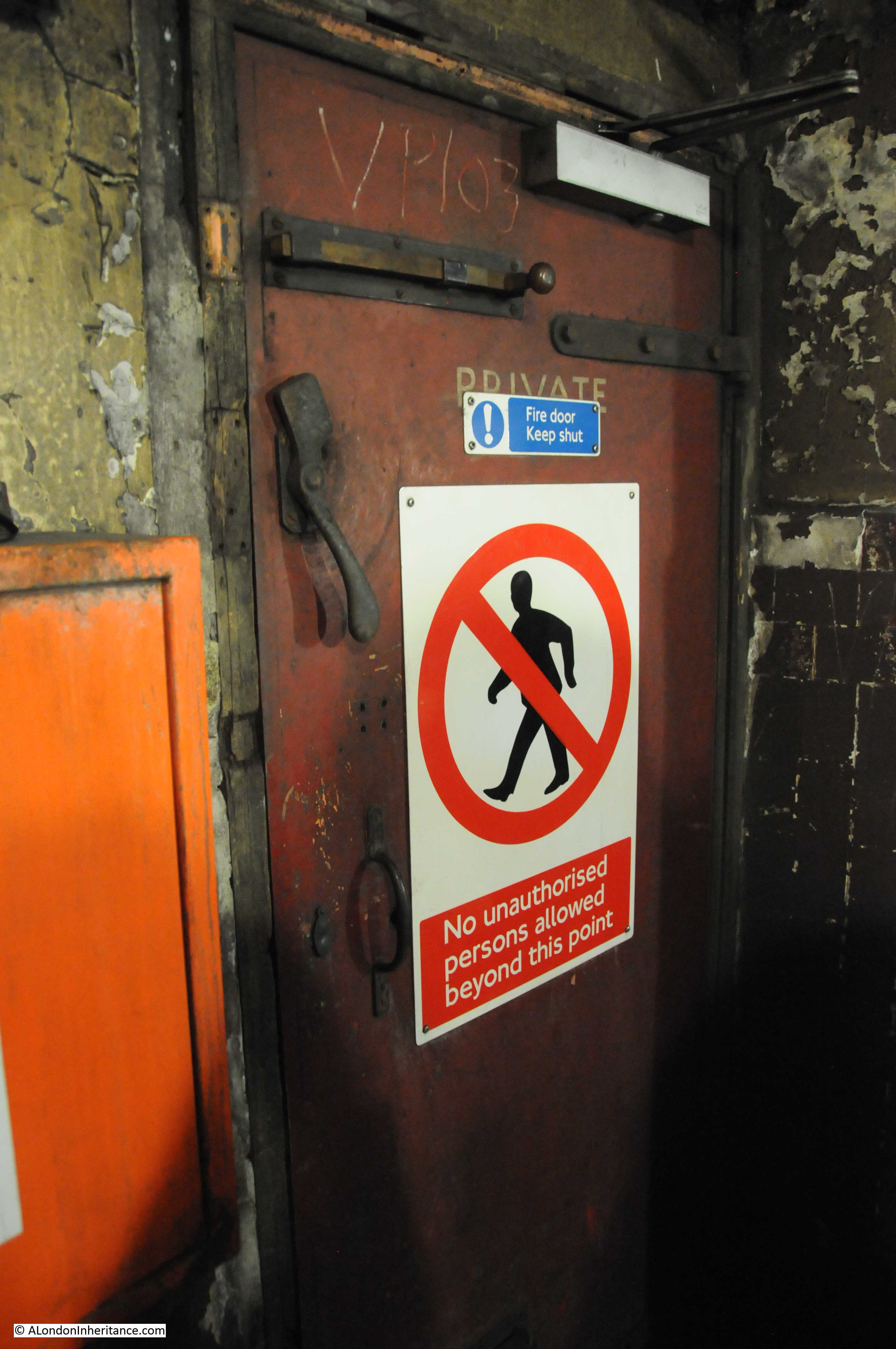
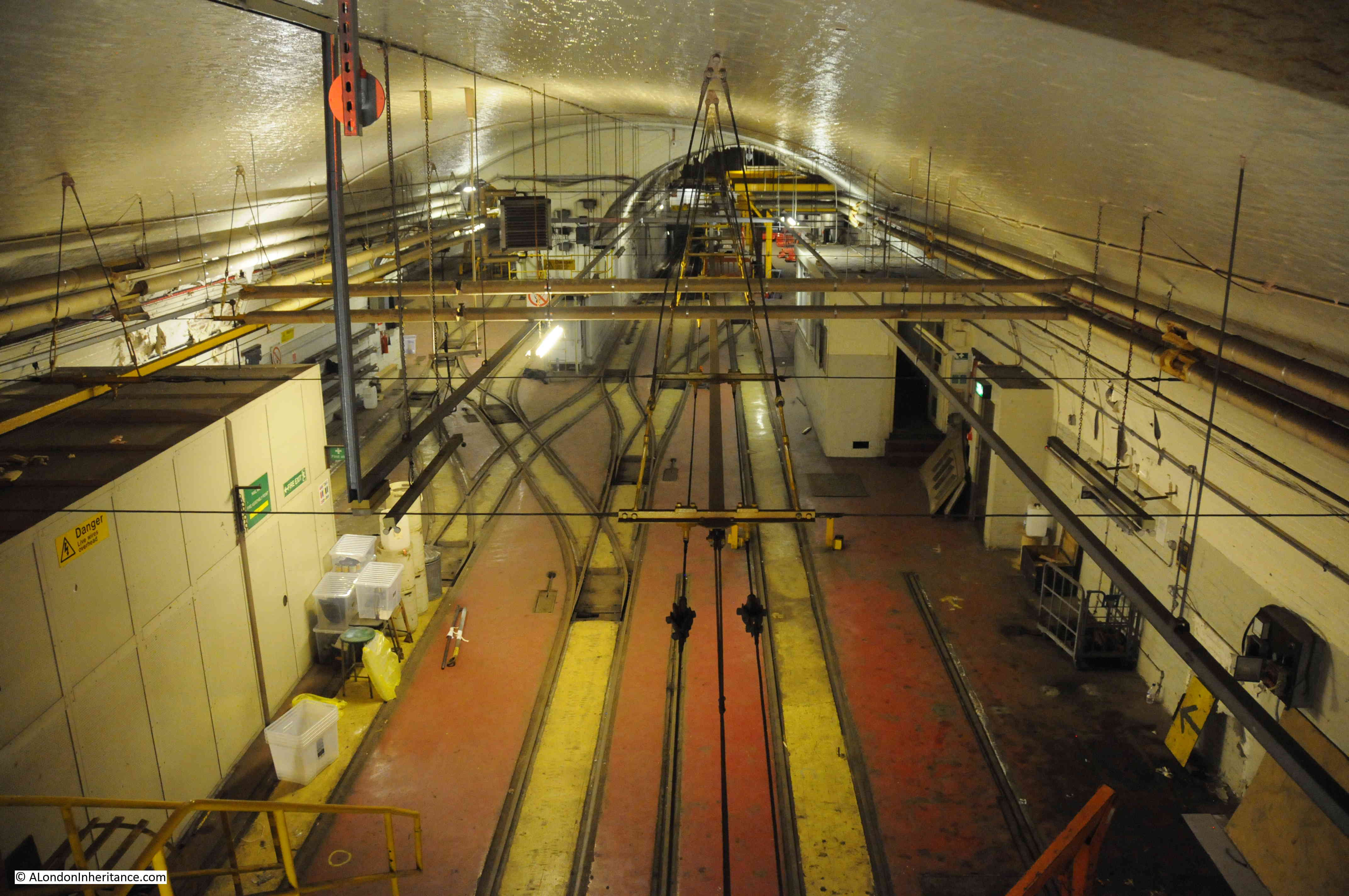
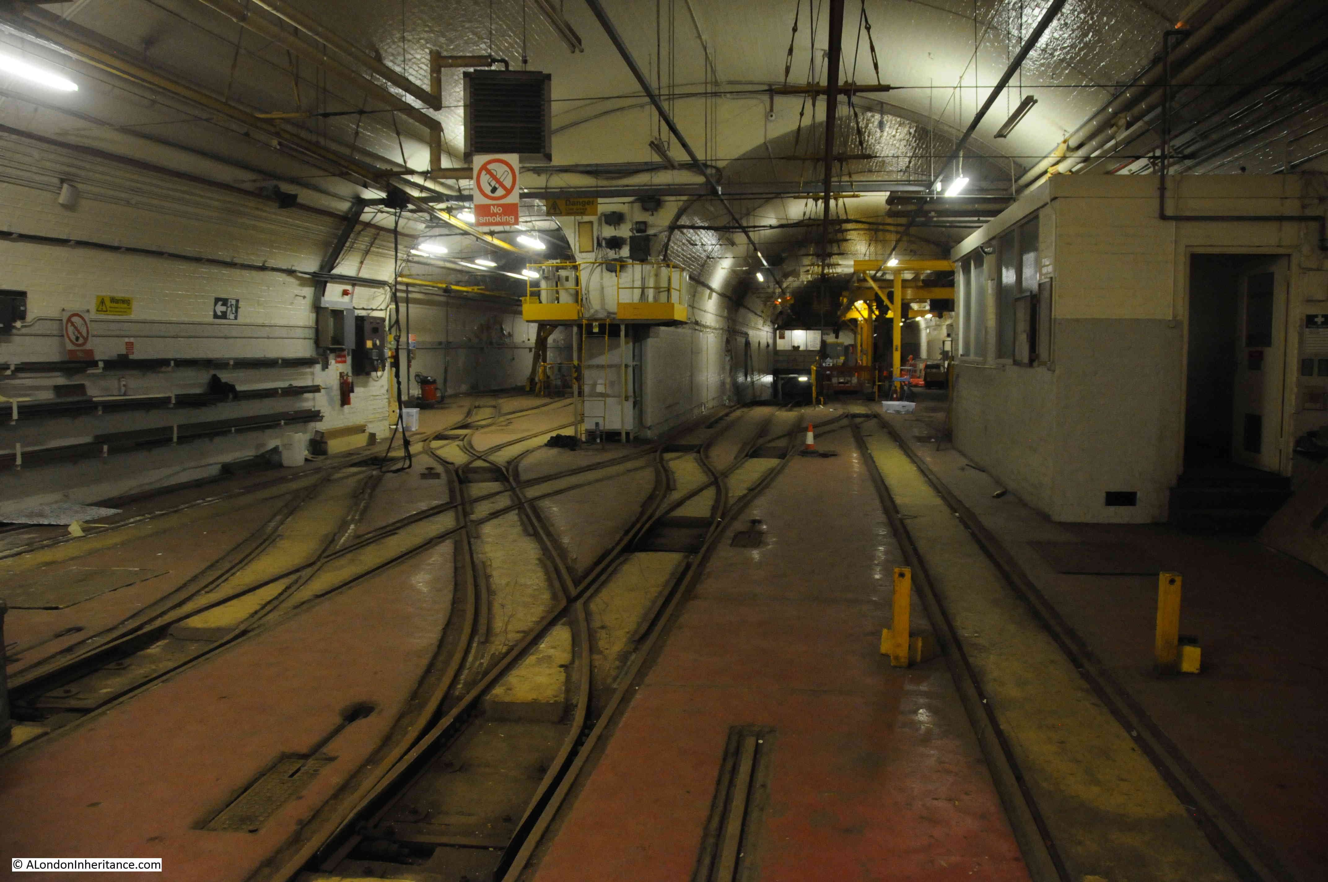
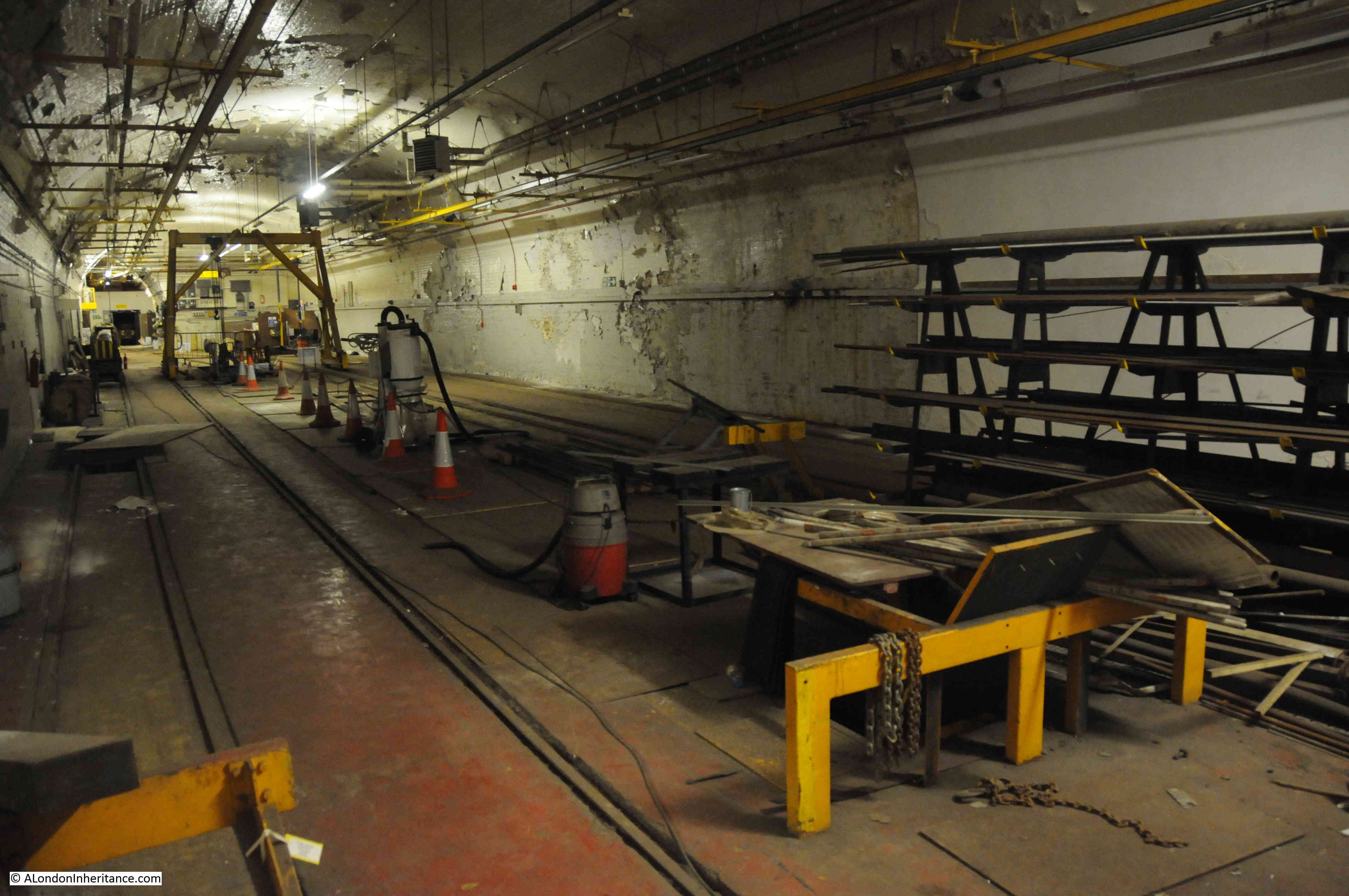
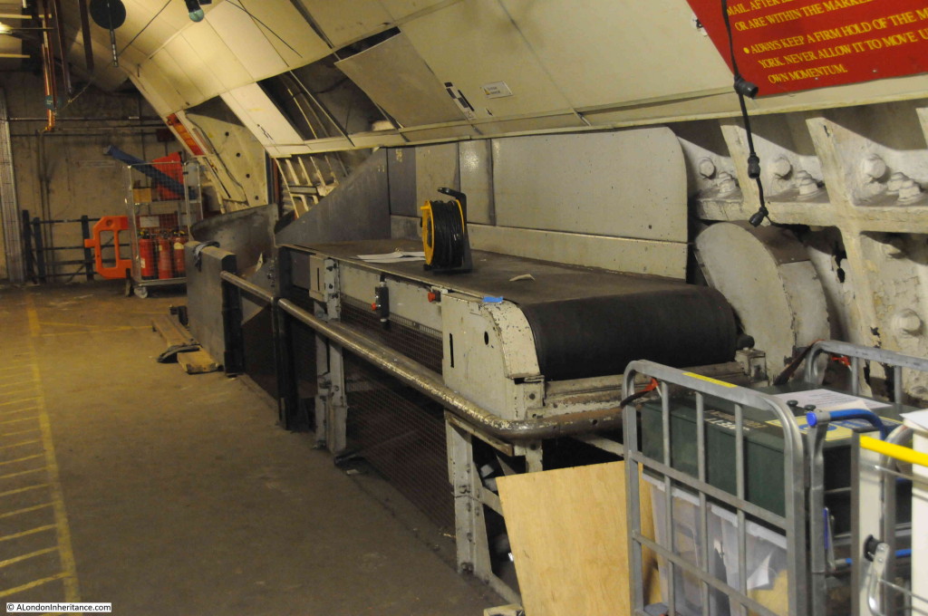
The visit to the railway started with the main workshop area. Much of the repair and maintenance of the railway was performed in-house and these workshops had the majority of facilities to keep the service running.

The view on entering the workshops:

Post Office Railway 1

In the workshops. Two main workshop areas leading to a common space. Trains from the railway can be driven up from the tunnels below for maintenance.

Post Office Railway 2

One of the workshop areas. The ramp leading down to the tunnels is on the left.

Post Office Railway 3

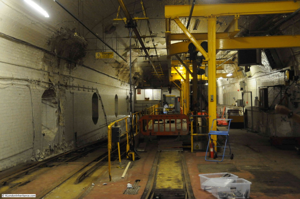
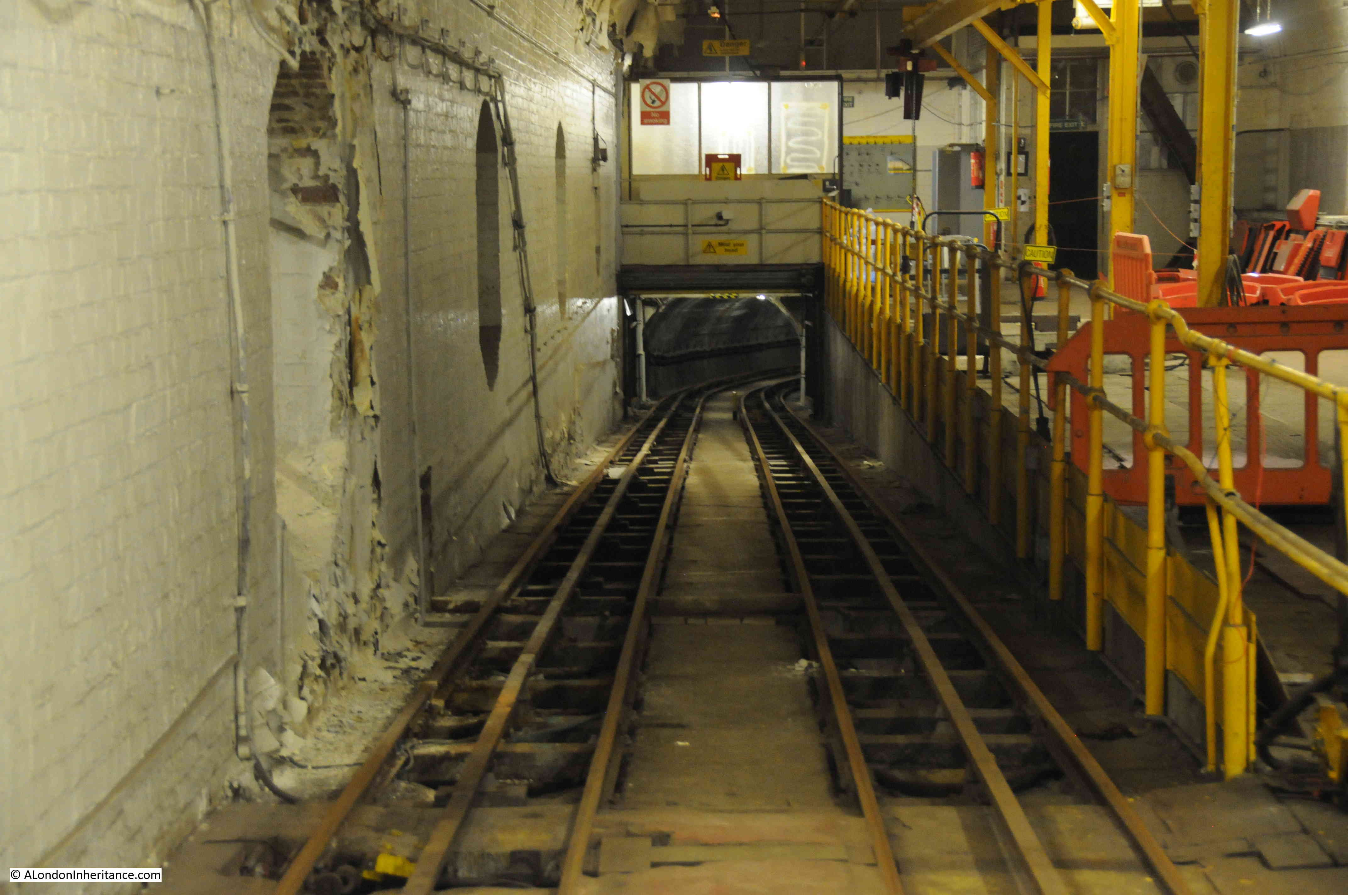
Looking down the tunnel that connects the underground tunnel system with the workshops.

Post Office Railway 4

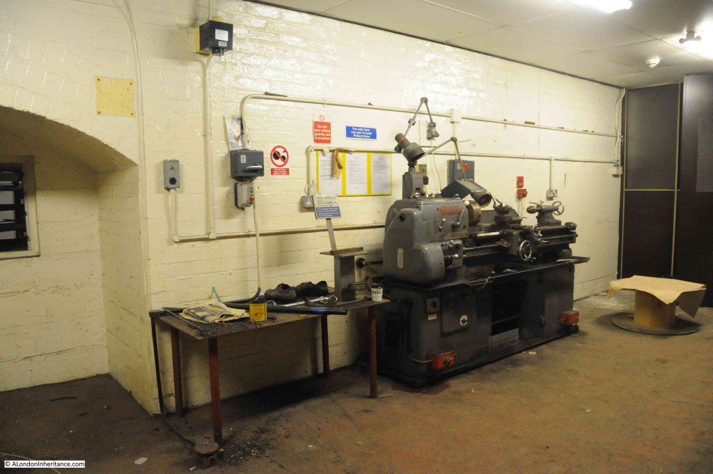
Lathe in the workshop showing the in-house capabilities.

Post Office Railway 5

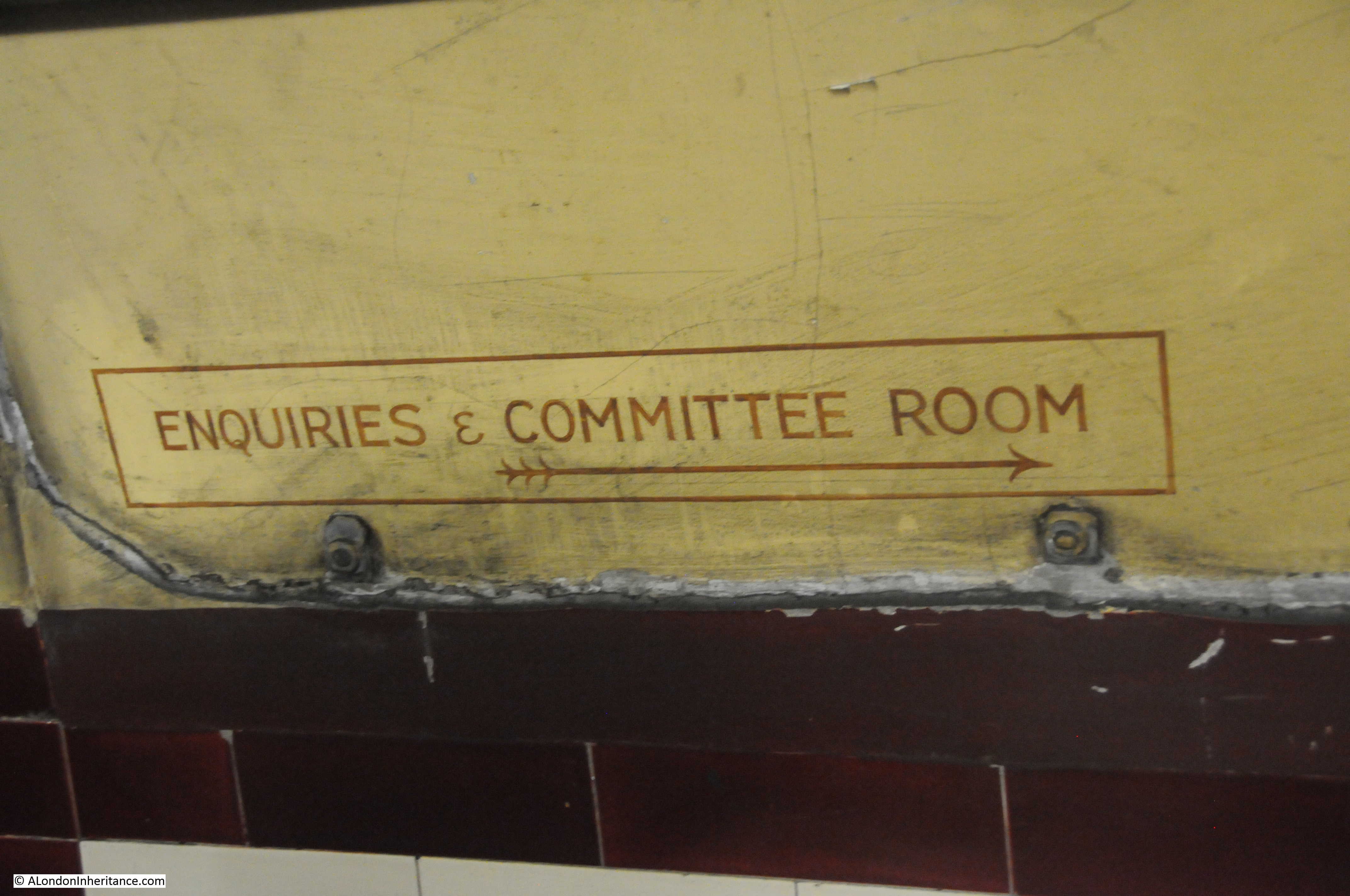
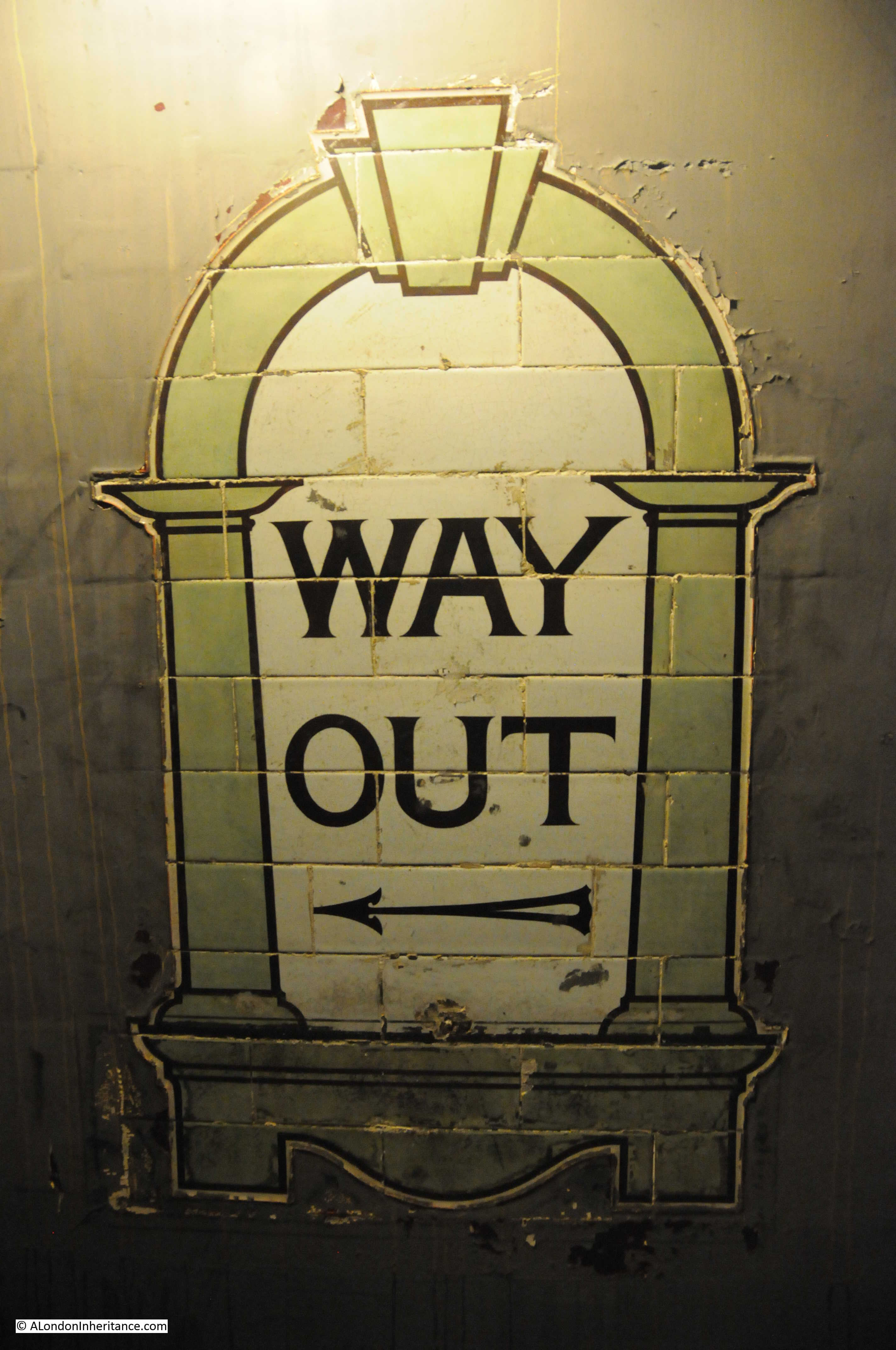
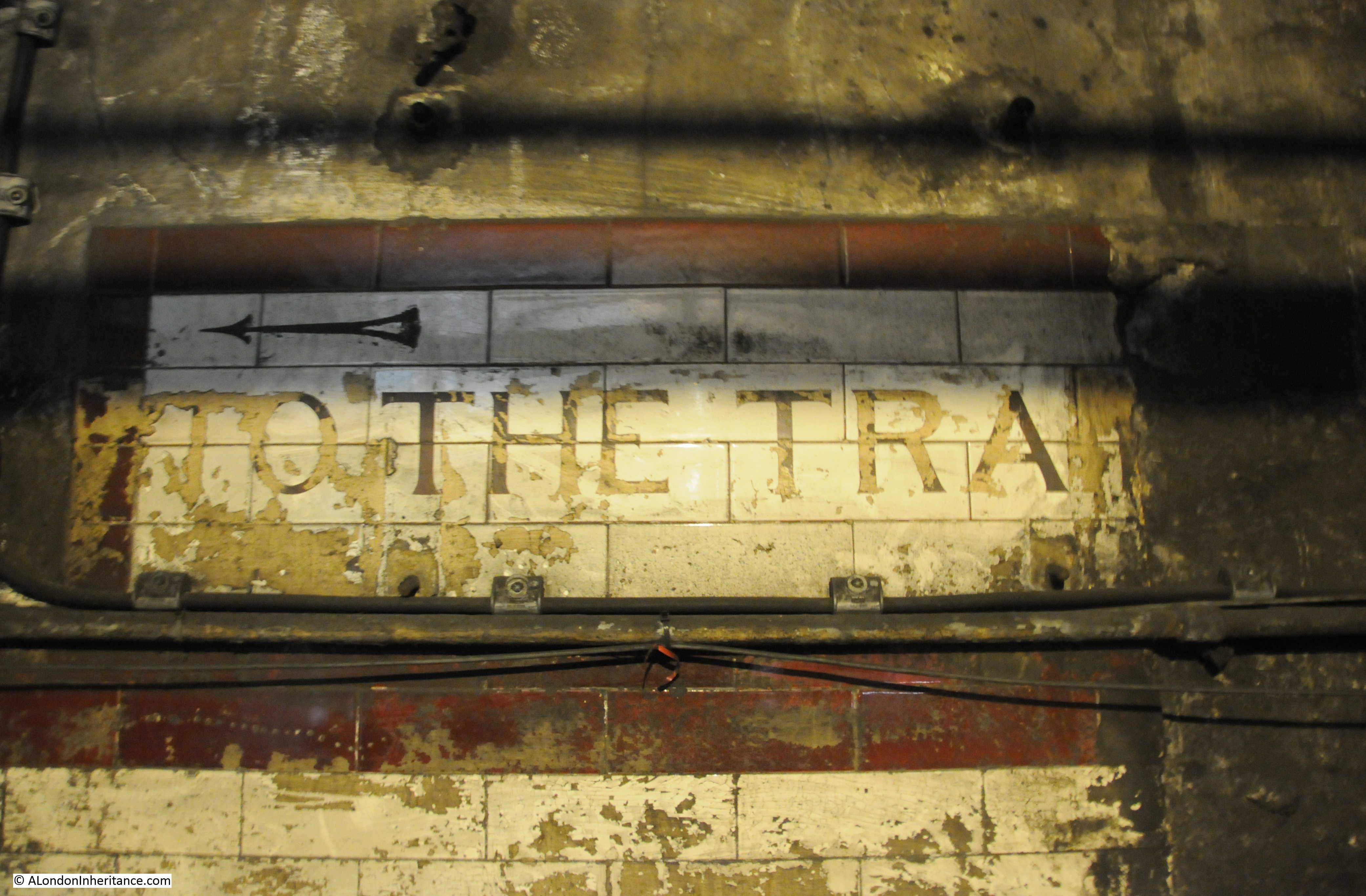
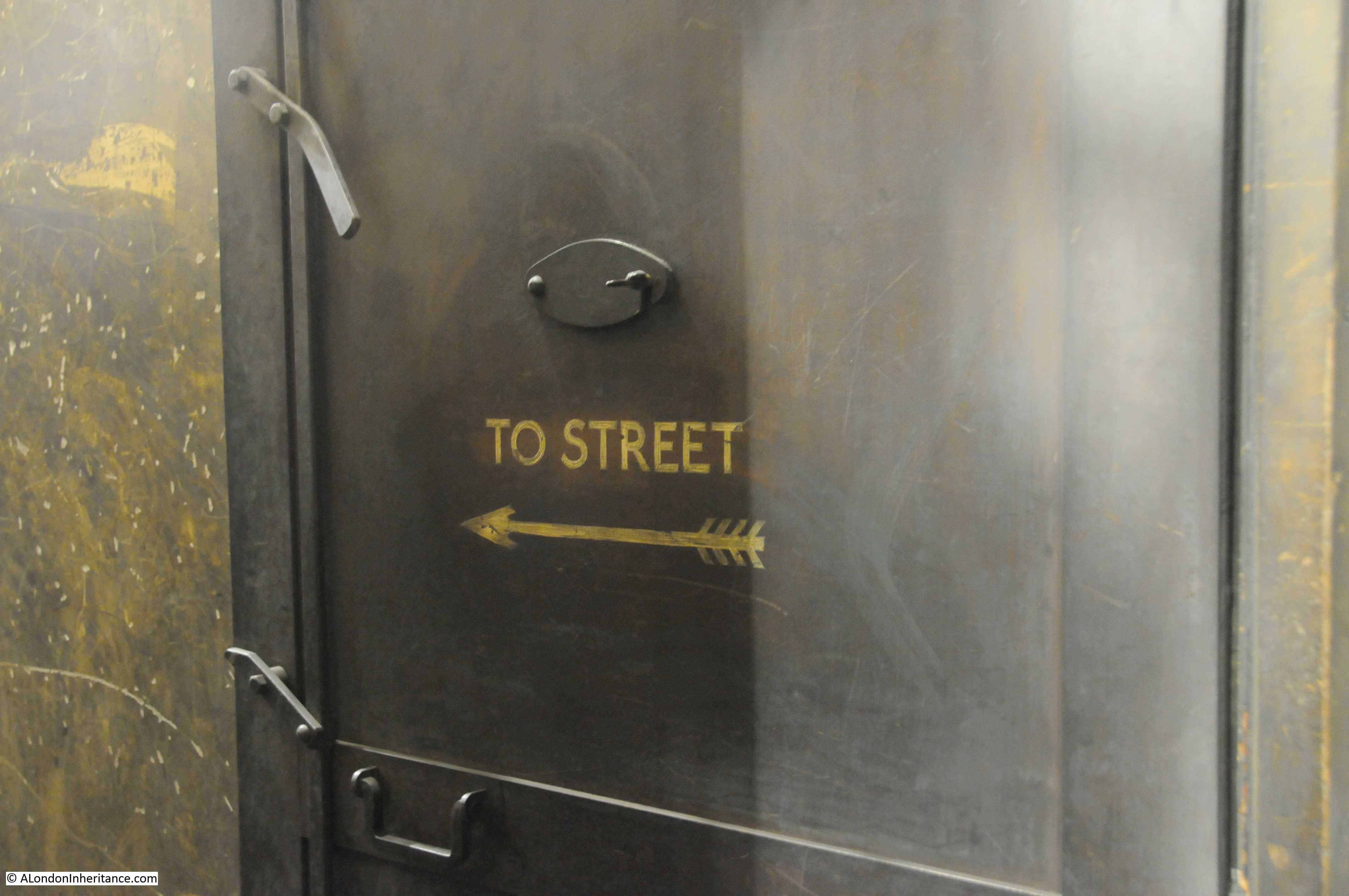
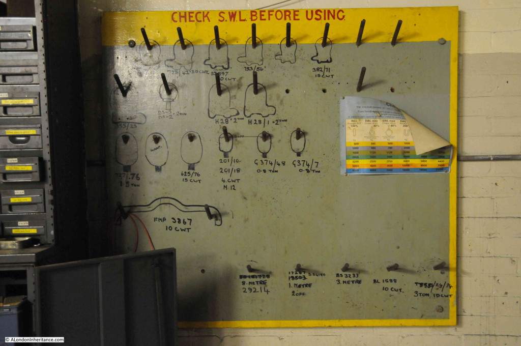
Most of the original equipment and signage is still in place. Although the railway closed twelve years ago it felt as if it could spring back into action at any time.

Post Office Railway 6

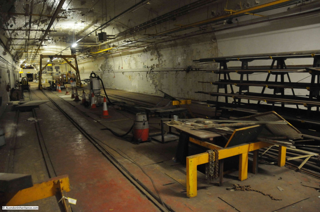
Looking down one of the workshop areas.

Post Office Railway 7

Original rolling stock in the maintenance area.

Post Office Railway 8

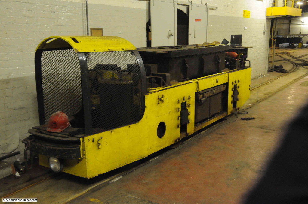
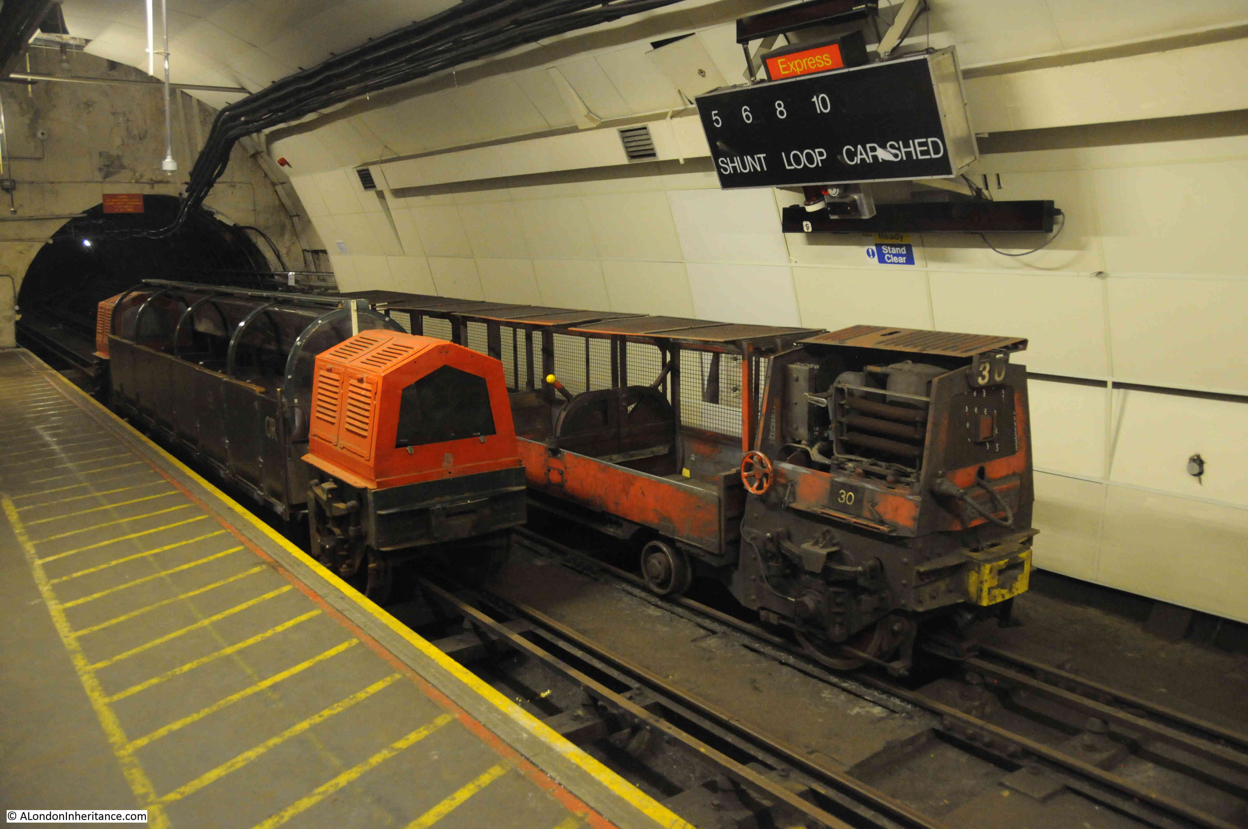
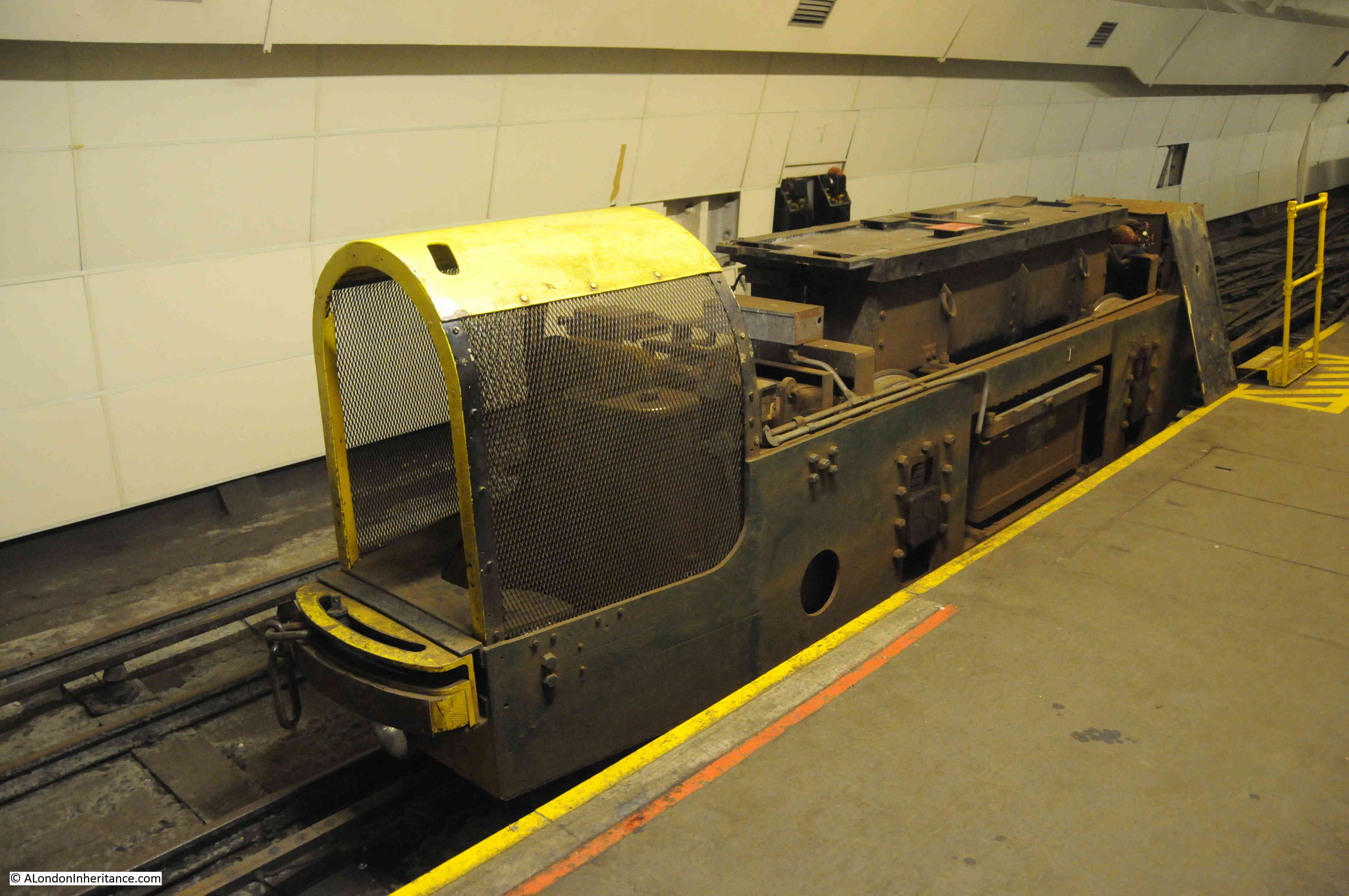
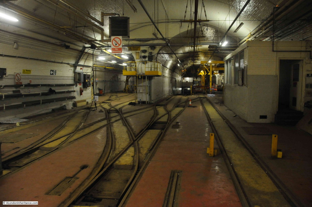
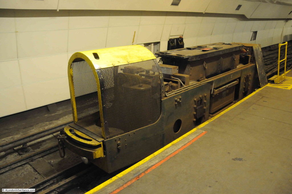
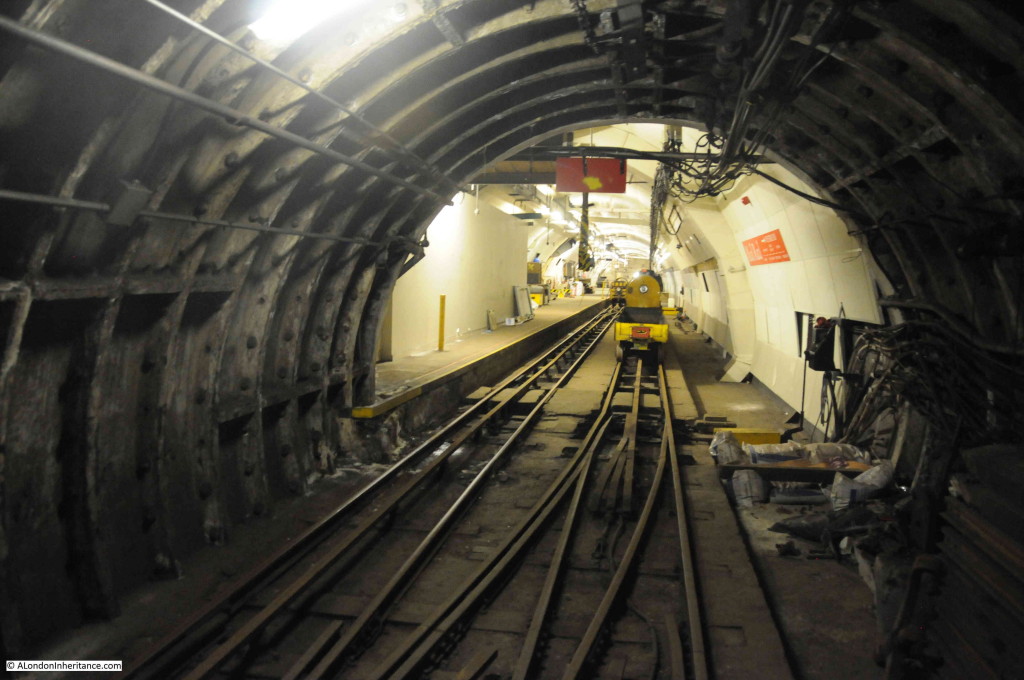
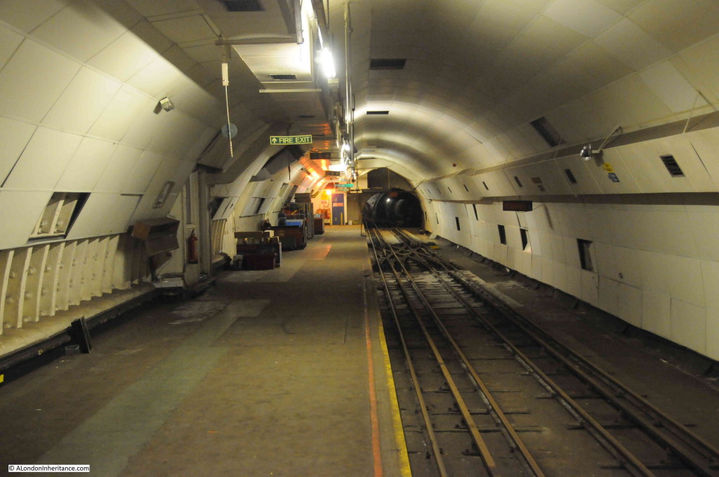
Having walked around the workshop areas, it was now down to the platform where the trains would arrive and depart with their loads of letters and parcels. Two more items of rolling stock waiting at the platform. During peak operation, forty of these trains an hour travelled underneath the streets of London carrying letters and parcels.

Post Office Railway 9

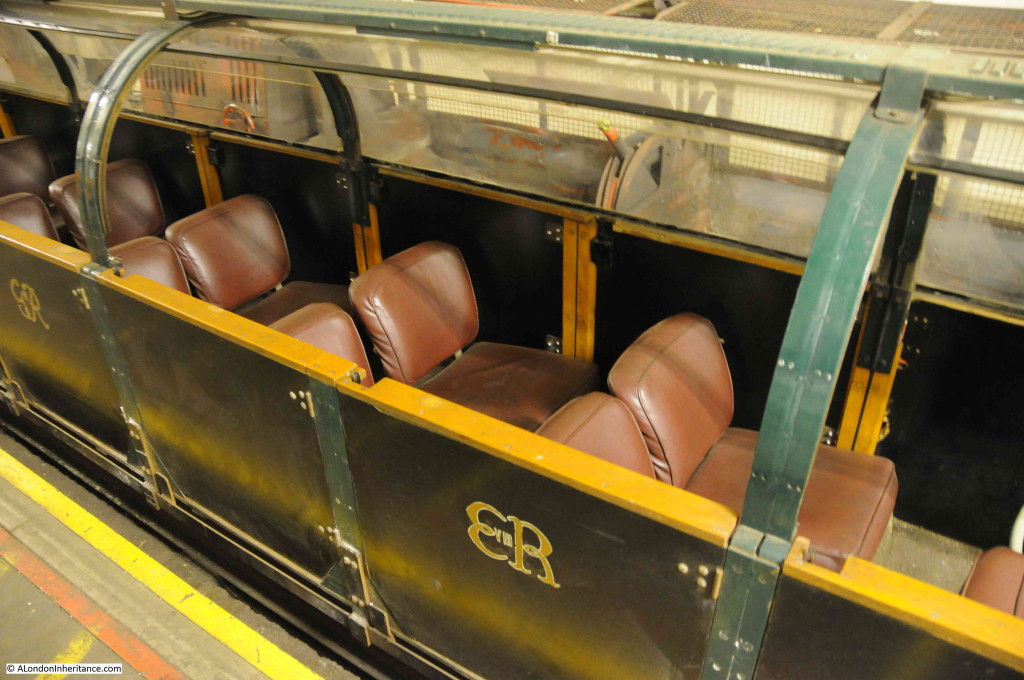
The one nearest the platform had been modified to carry passengers. The size of the rolling stock reflect the nine foot diameter of the main tunnels on the system.

Post Office Railway 10

One of the specialised trains. This one is battery powered (the batteries are carried in the large box on the top of the train). If a train needed to be recovered from the tunnels with the power switched off, the train could independently go and retrieve.

Post Office Railway 11

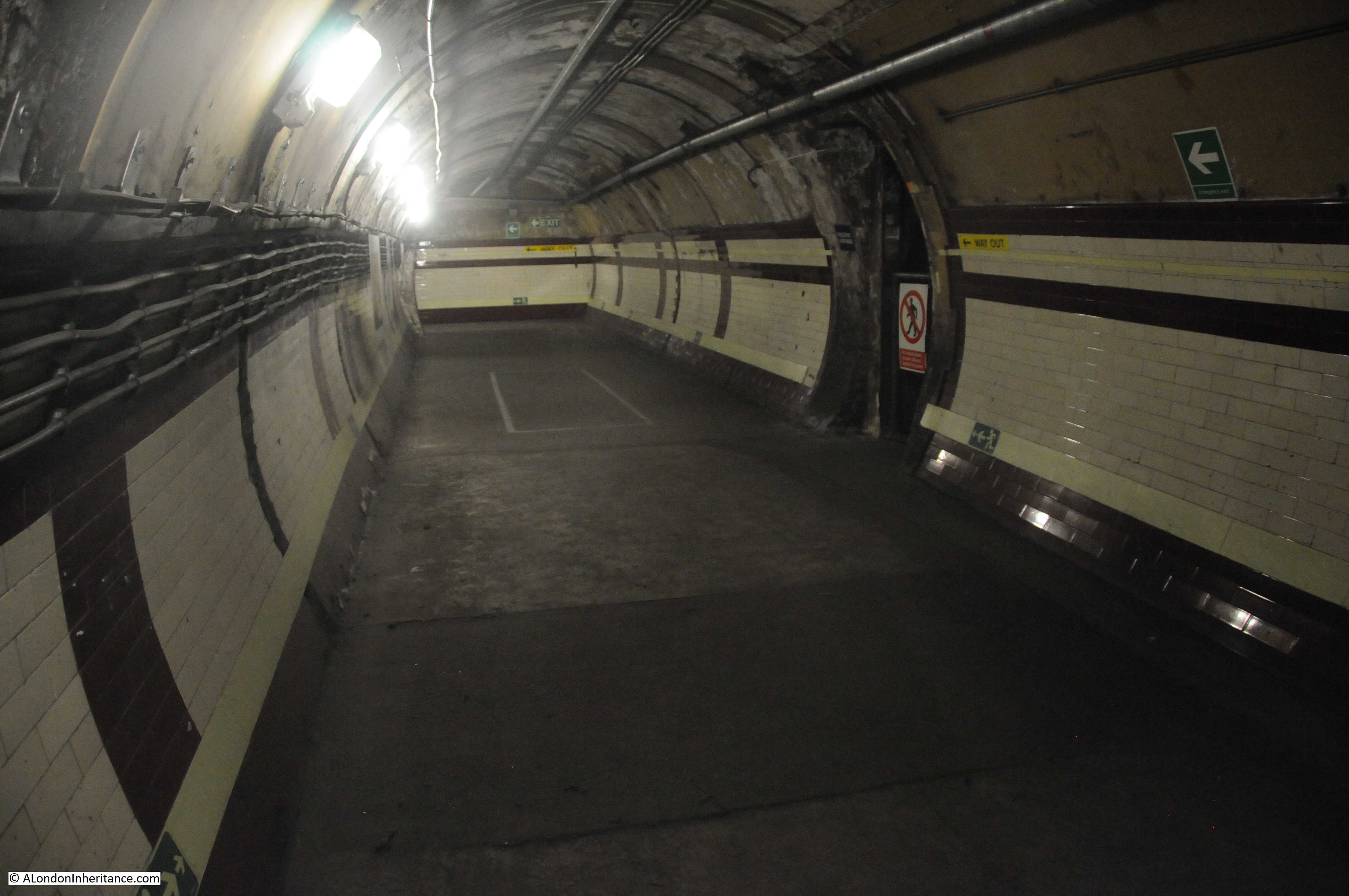
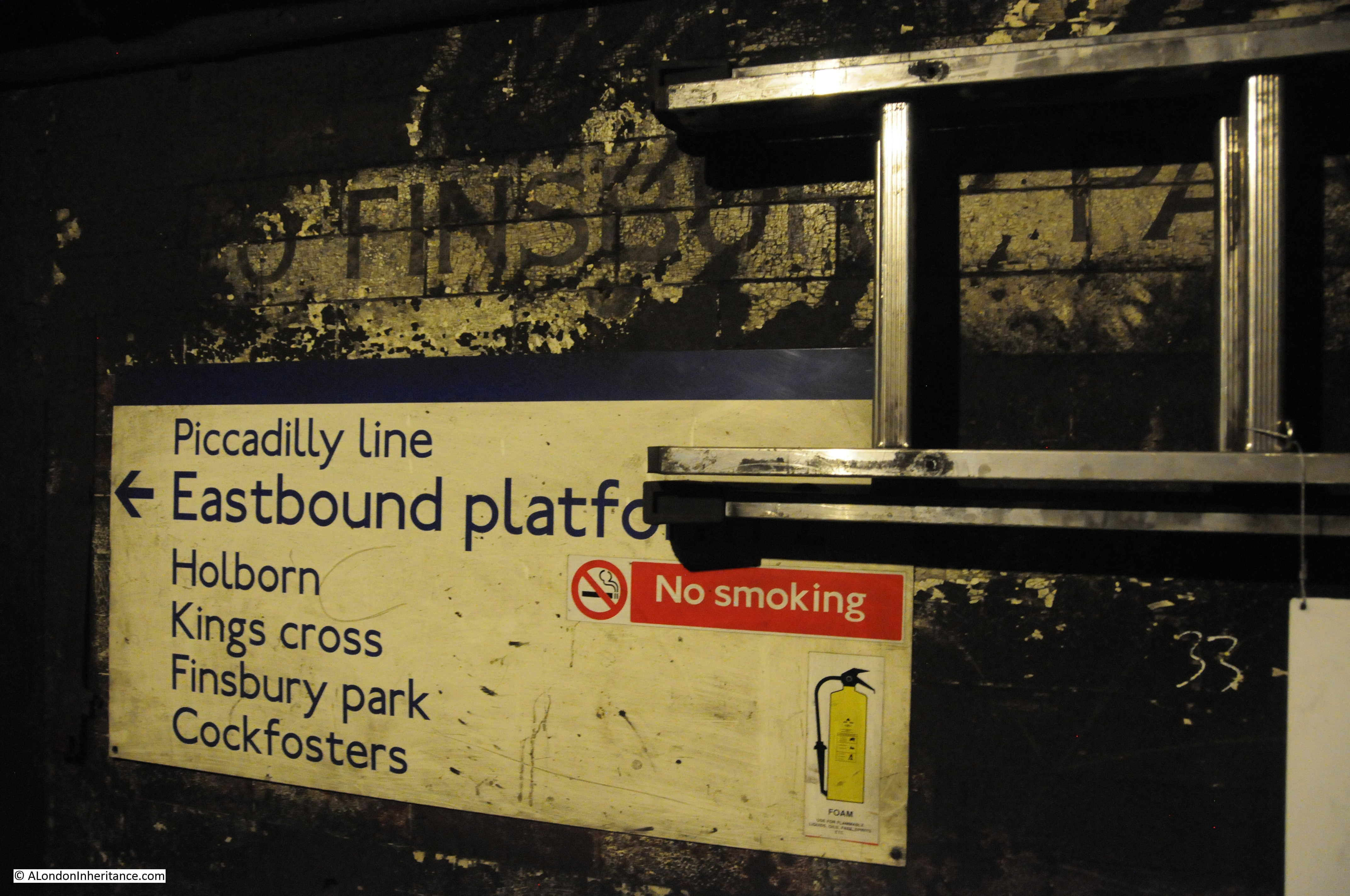
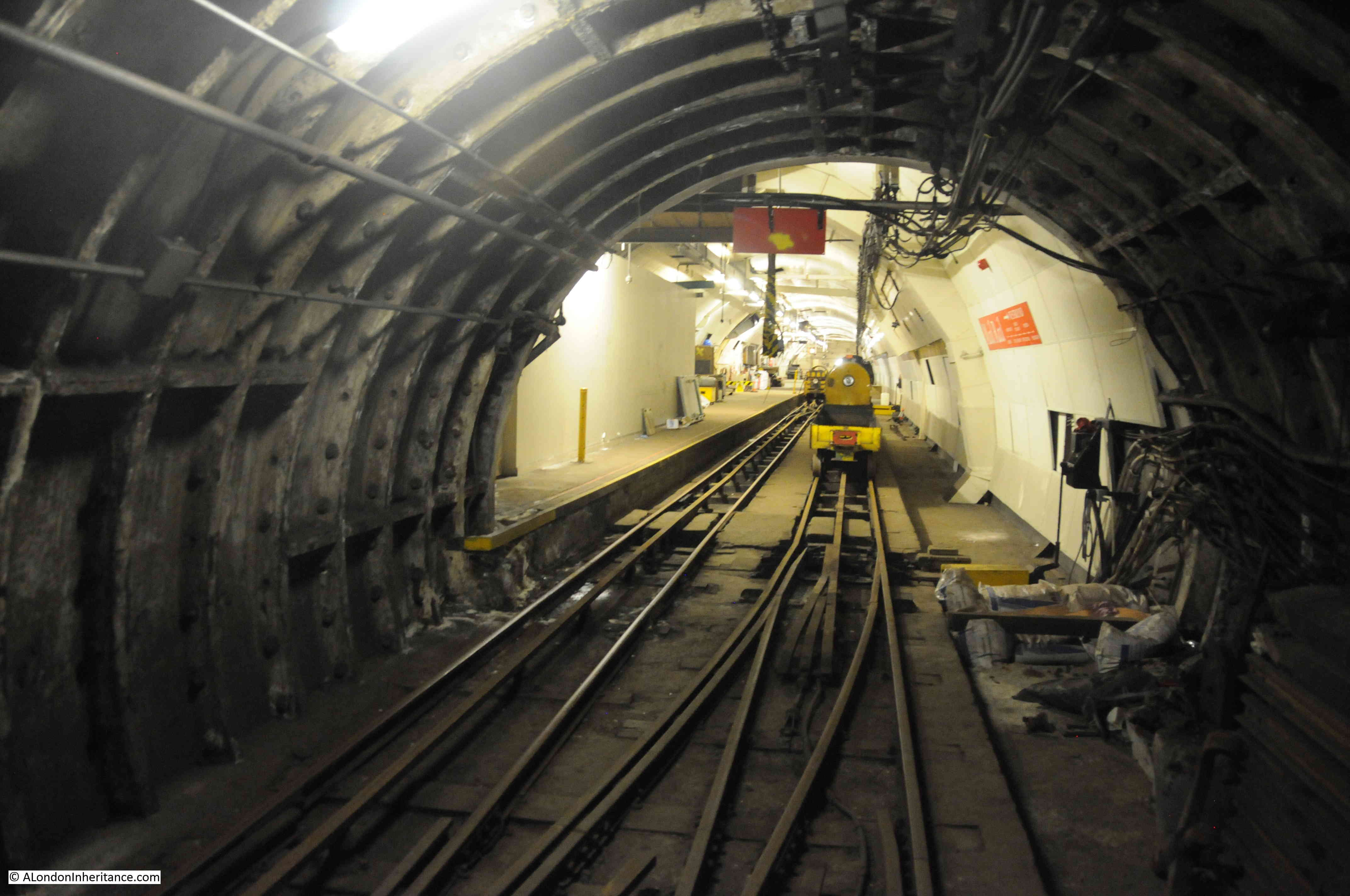
Looking down the full length of the platform.

Post Office Railway 12

F.L. Stevens writing in Under London in 1939 also visited the same station, and it was fascinating to recall his account of the railway in operation whilst standing on the same platforms over 76 years later:

“I made my introduction to the Post Office railway at Mount Pleasant, a station which occupies a key position in the system. It was rather queer to find oneself in a clean and large underground station so like all the others – and yet so different. There were no advertisements on the wall, and that was the first odd thing I noticed. Then there were the little perky trains, stopping and setting off again without any apparent sign of control. Of course, the control is there all right, and very thorough and alert it is, but you cannot see it. The electric locomotives have a kind of robot head and face, which seems to be perpetually at the wink, and saying ‘Pretty clever, eh?’

Picture the scene on the west-bound platform at Mount Pleasant. here comes our train, running smoothly out of the tunnel and stopping at precisely the appointed place. Actually it stops twice at Mount Pleasant; once for letters at one end of the long platform, and again for parcels at the other.

As soon as it stops, a couple of men step forward and move the containers – shaped like long cradles – on to tippers, which turn the containers upside down, emptying the bags on to conveyors running beneath the platform. In a few seconds the bags are emptied again into a “bag elevator”, which is really a big dredger, with great buckets which scoop up the bags as they fall and carry them up to a sorting office above ground.

Whilst this is going on, letter-bags from the offices above are tumbling down the chute (which is exactly  like a helter-skelter at the fair ground) on to the platforms, where they are piled into empty containers in readiness for the next train. It is all done very quietly and methodically; the three-minute service is operating and everything goes like clockwork.

Meanwhile our train moves on a hundred yards or so to the parcels end of the platform. The men can see at once from the ticket fixed to the containers which parcels are meant for them, and off they come and are wheeled, not to a tipper this time, but to a conveyor, a kind of endless carpet, moving uphill at quiet a steep gradient. It is odd to watch the parcels drop on to the conveyor. Many of them seem to come to life, and act just like children. They do not want to go up the moving hill, so they dance and writhe, sit up for a minute and fall back, sometimes clutching their neighbour, turning head over heels, or just shaking with rage. After a few seconds these fits of obstinacy pass, and they lie down and disappear in the shadows of their upward journey.

But who is controlling all this, you might ask? Who knows when the men have finished unloading and loading? Well, as soon as the job is finished, and the train is ready to set off again, the head man of the platform staff presses a button. A red light appears, which means ‘ Stand clear and don’t touch’. At the same time, a green light, meaning ‘Set her off,’ appears in the underground switch-cabin which is the nerve-centre of the system.”

All is silent now on the Post Office Railway and it will not carry any more letters or parcels.

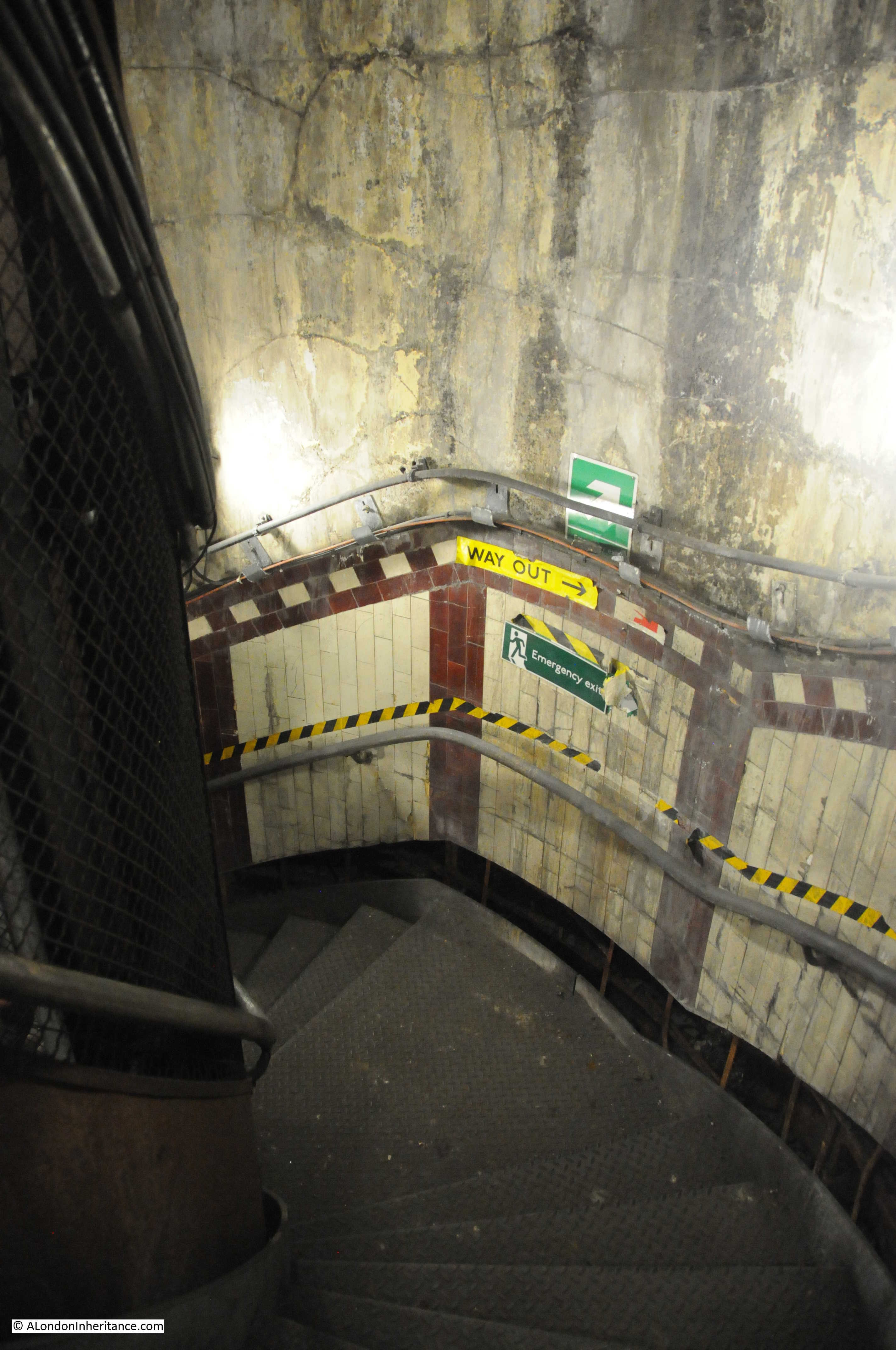
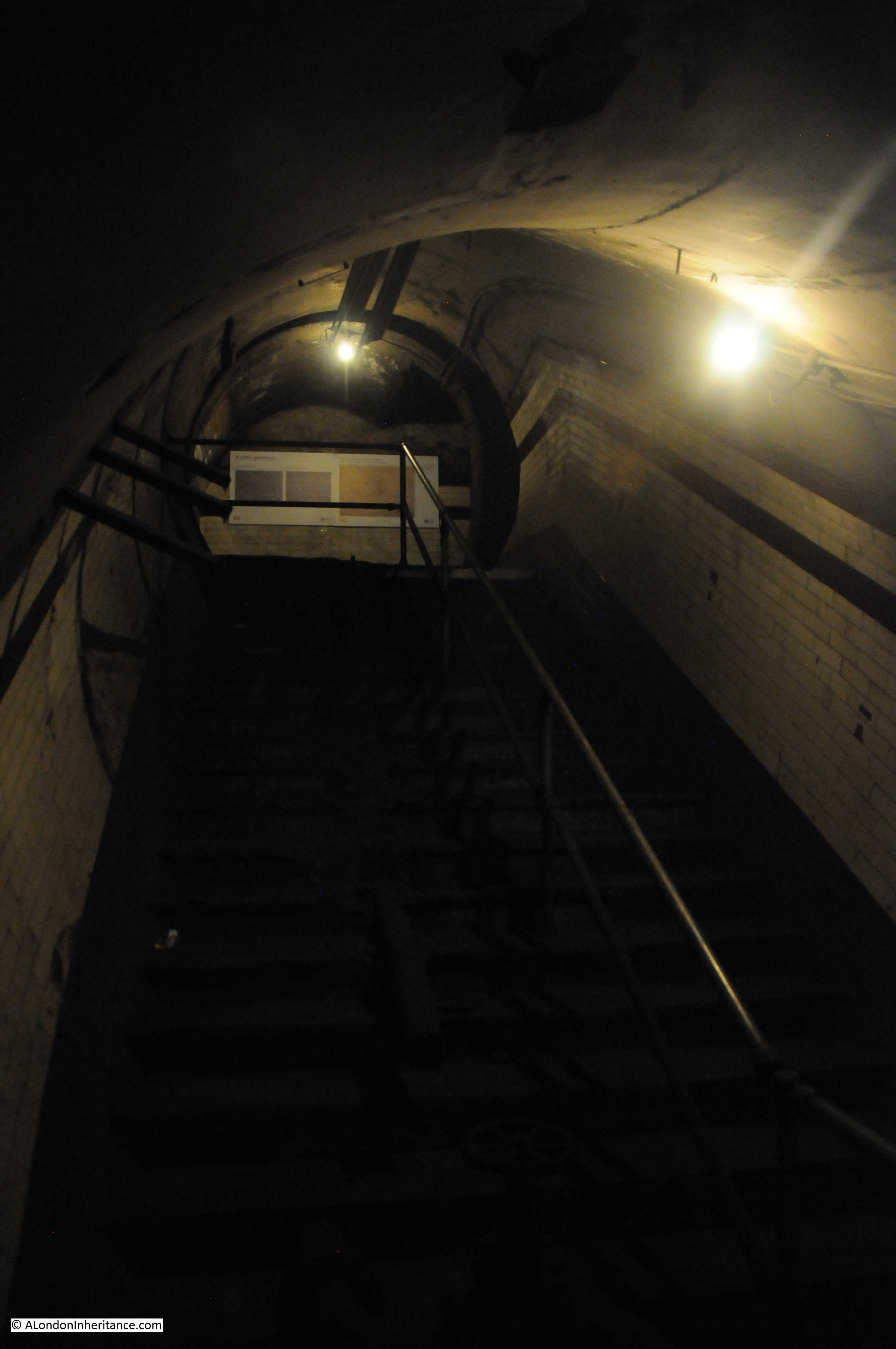
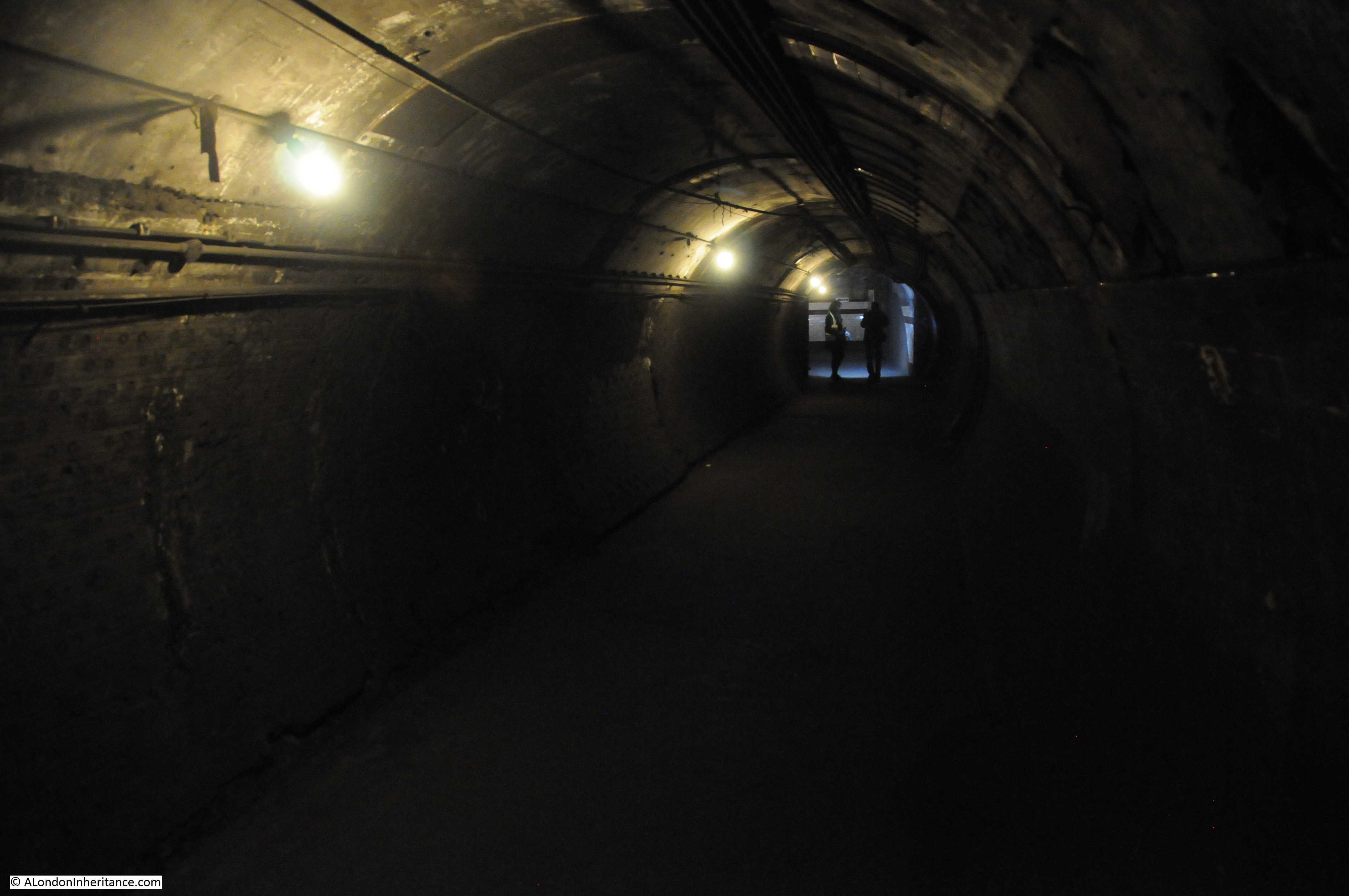
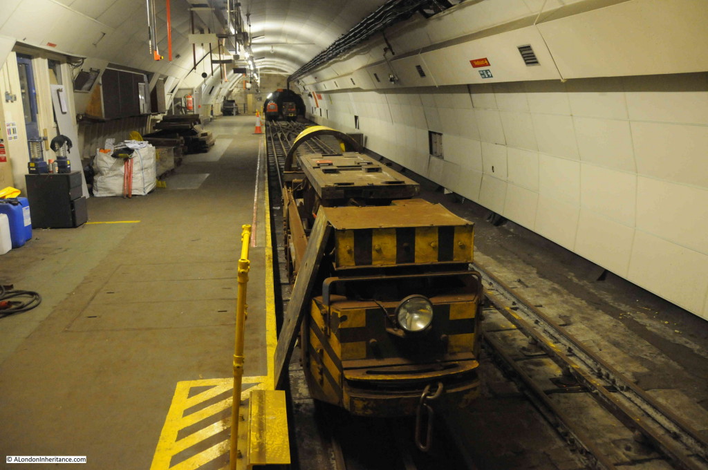
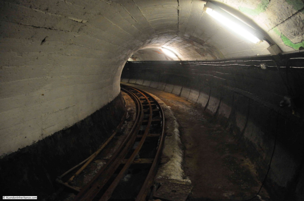
Having reached the end of the platform, it was now time to take a look at some of the tunnels.

Post Office Railway 13

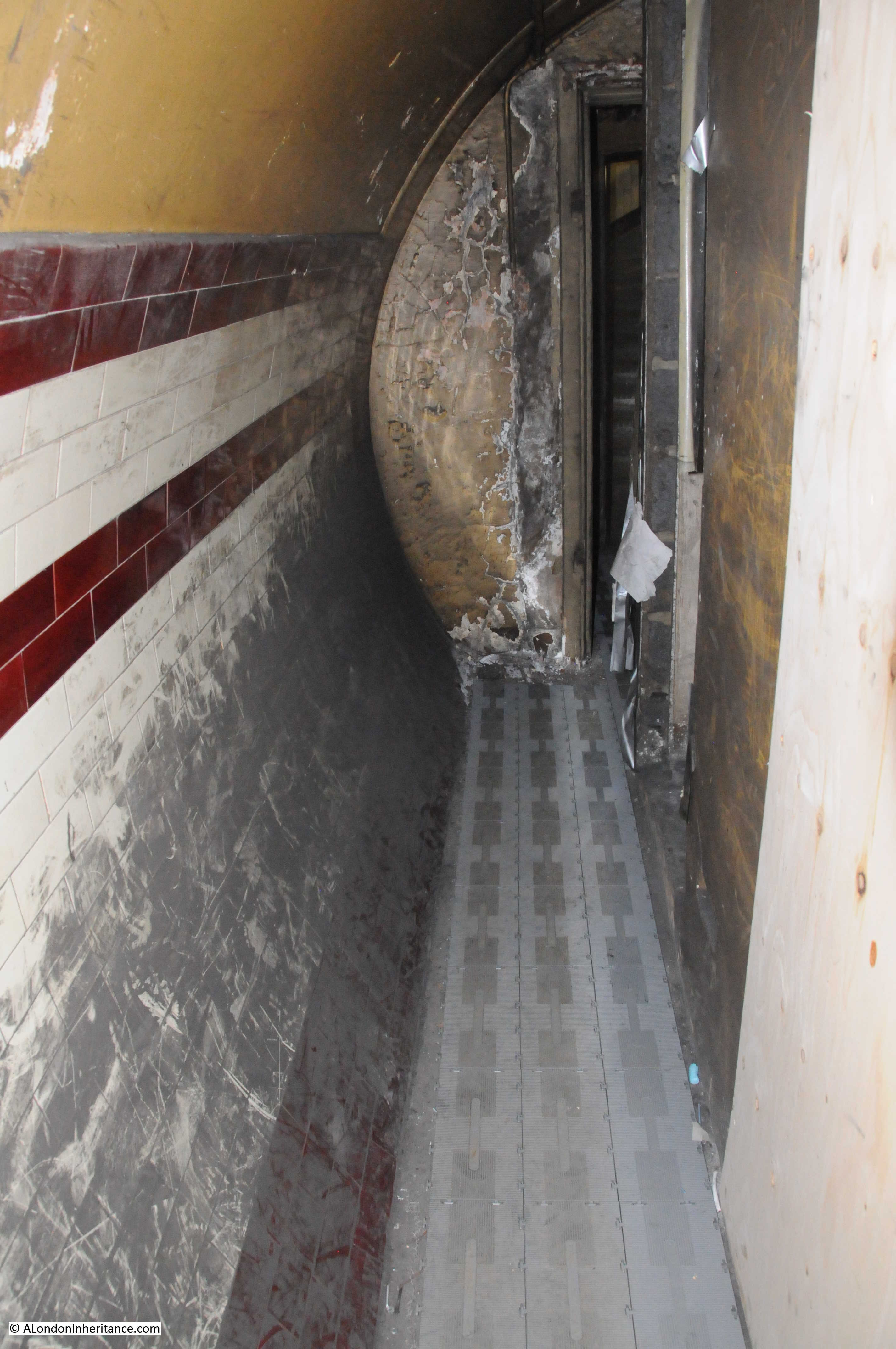
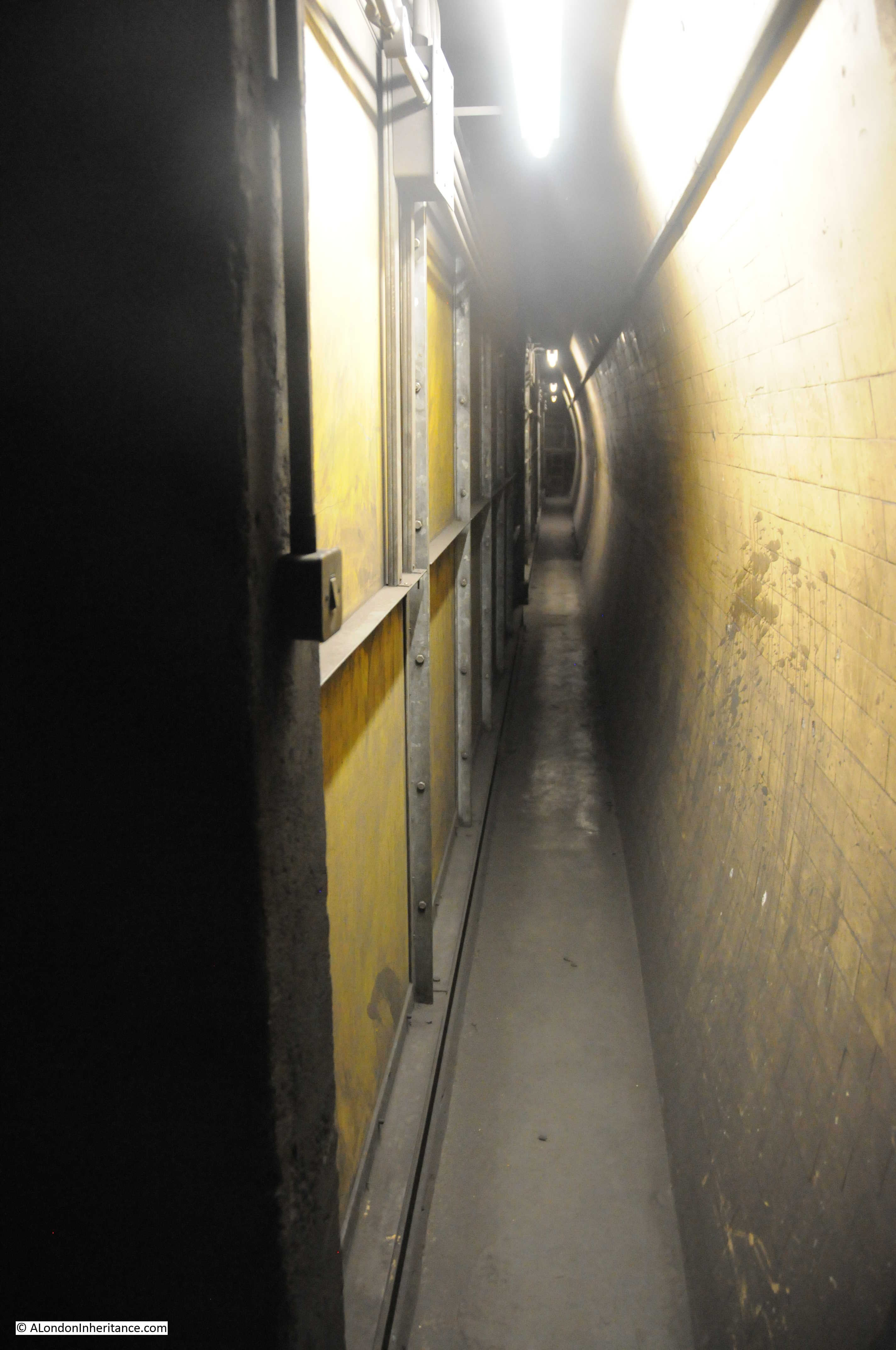
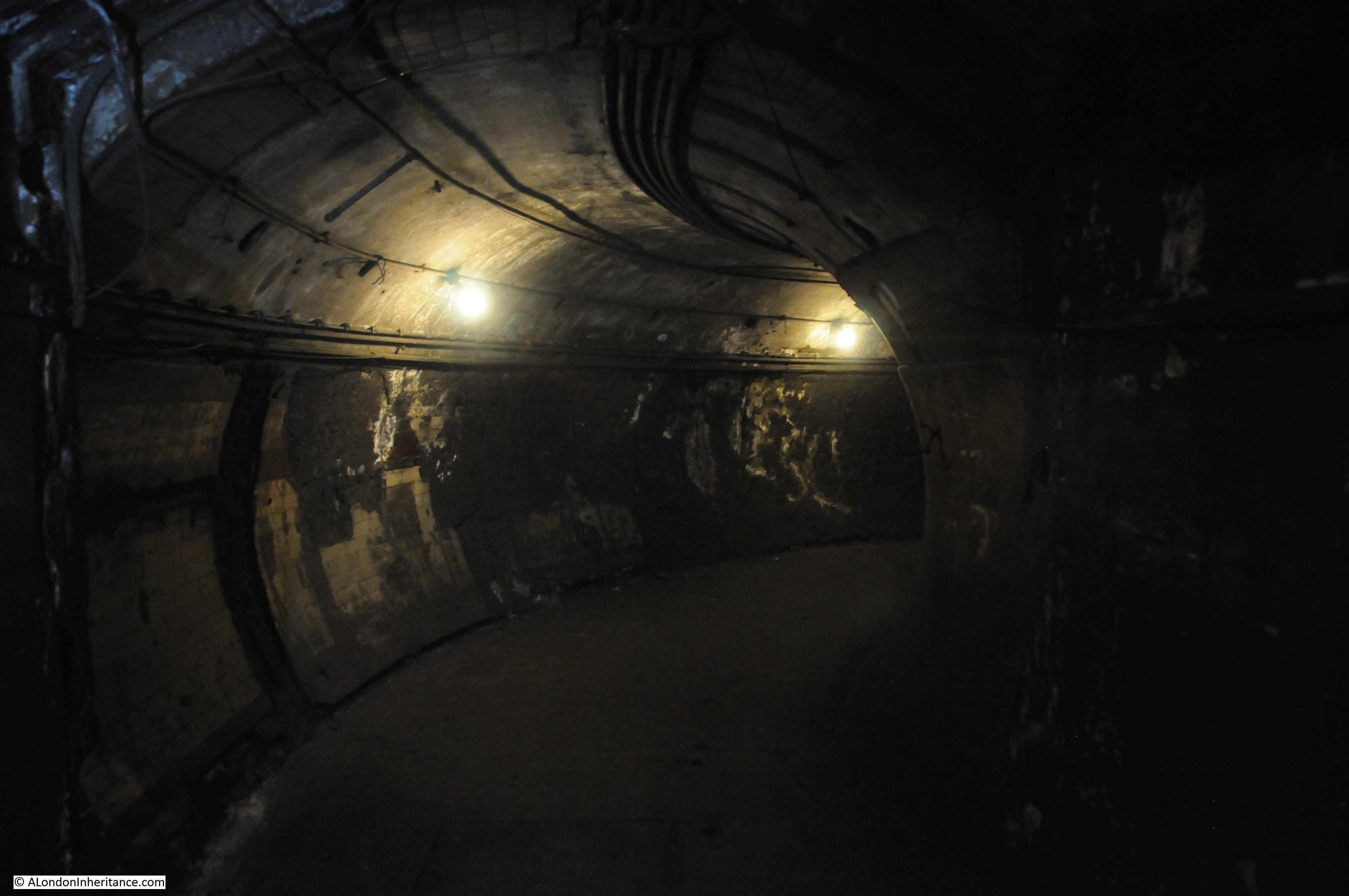
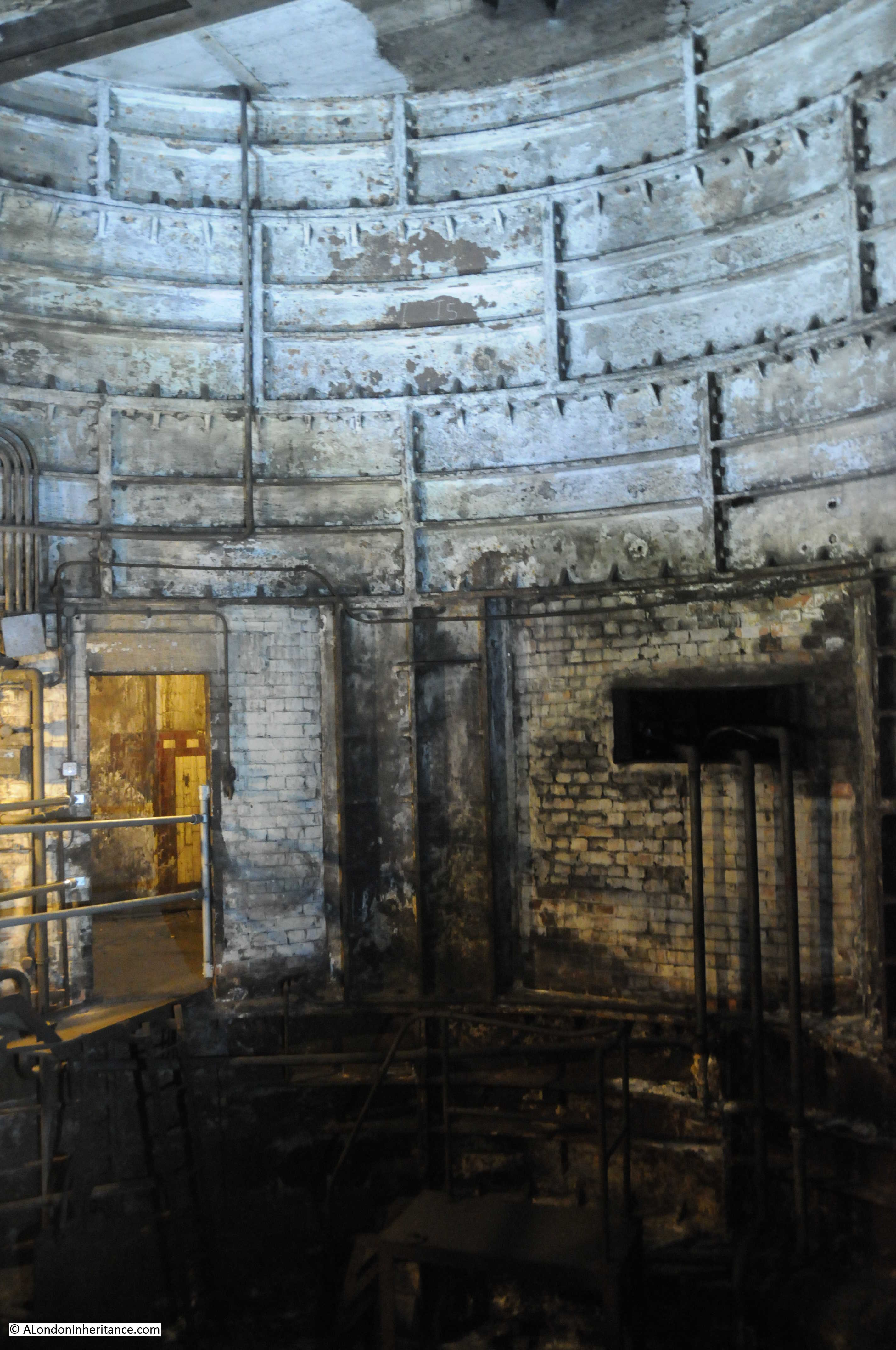
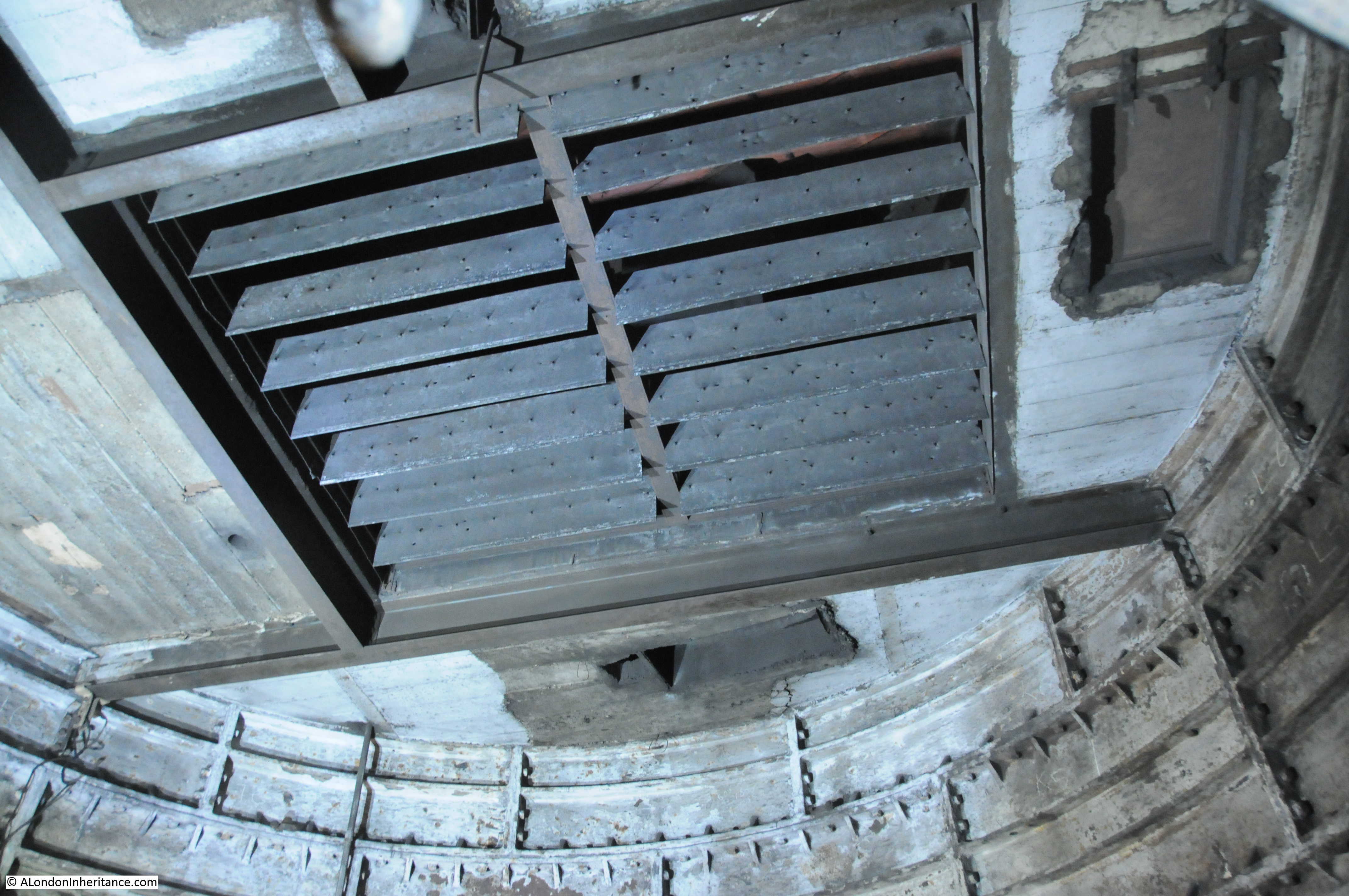
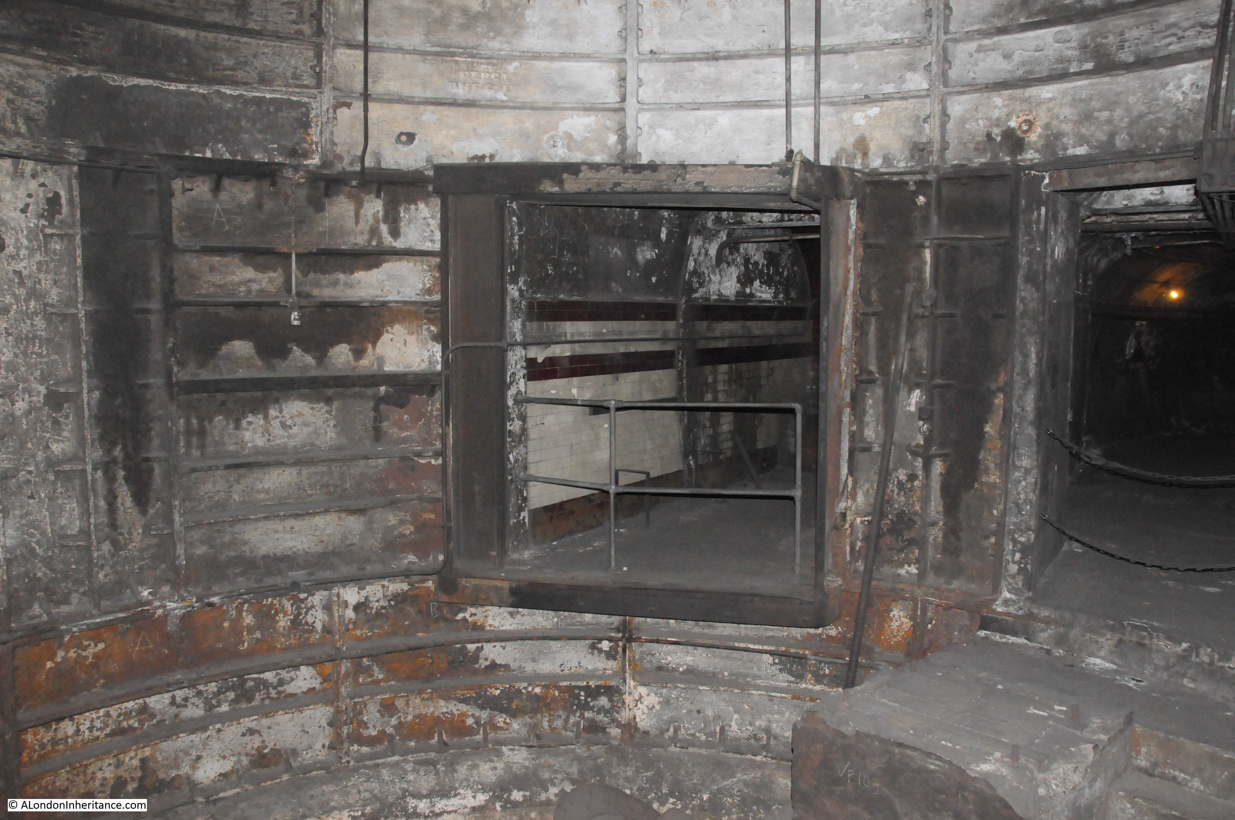
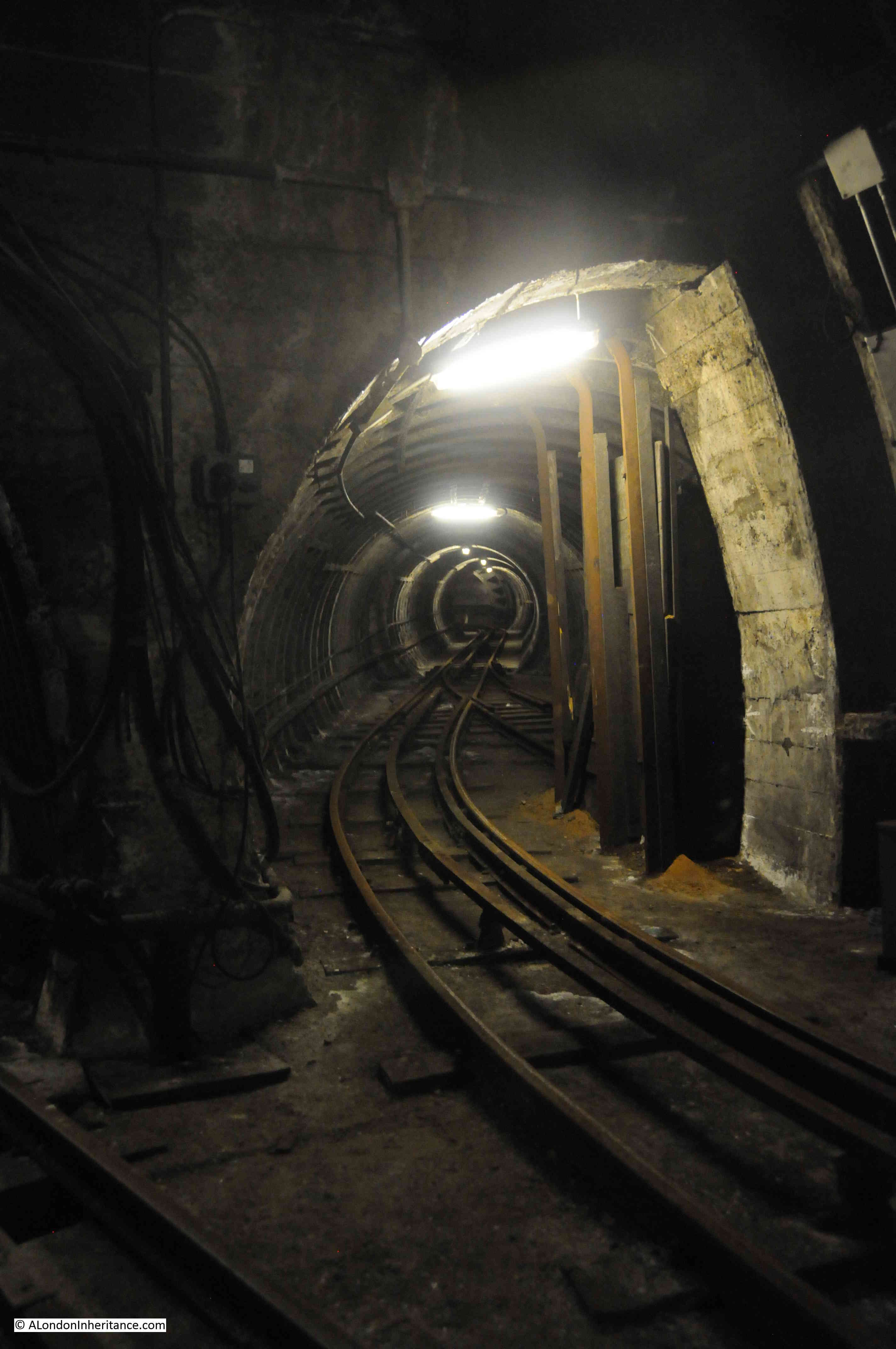
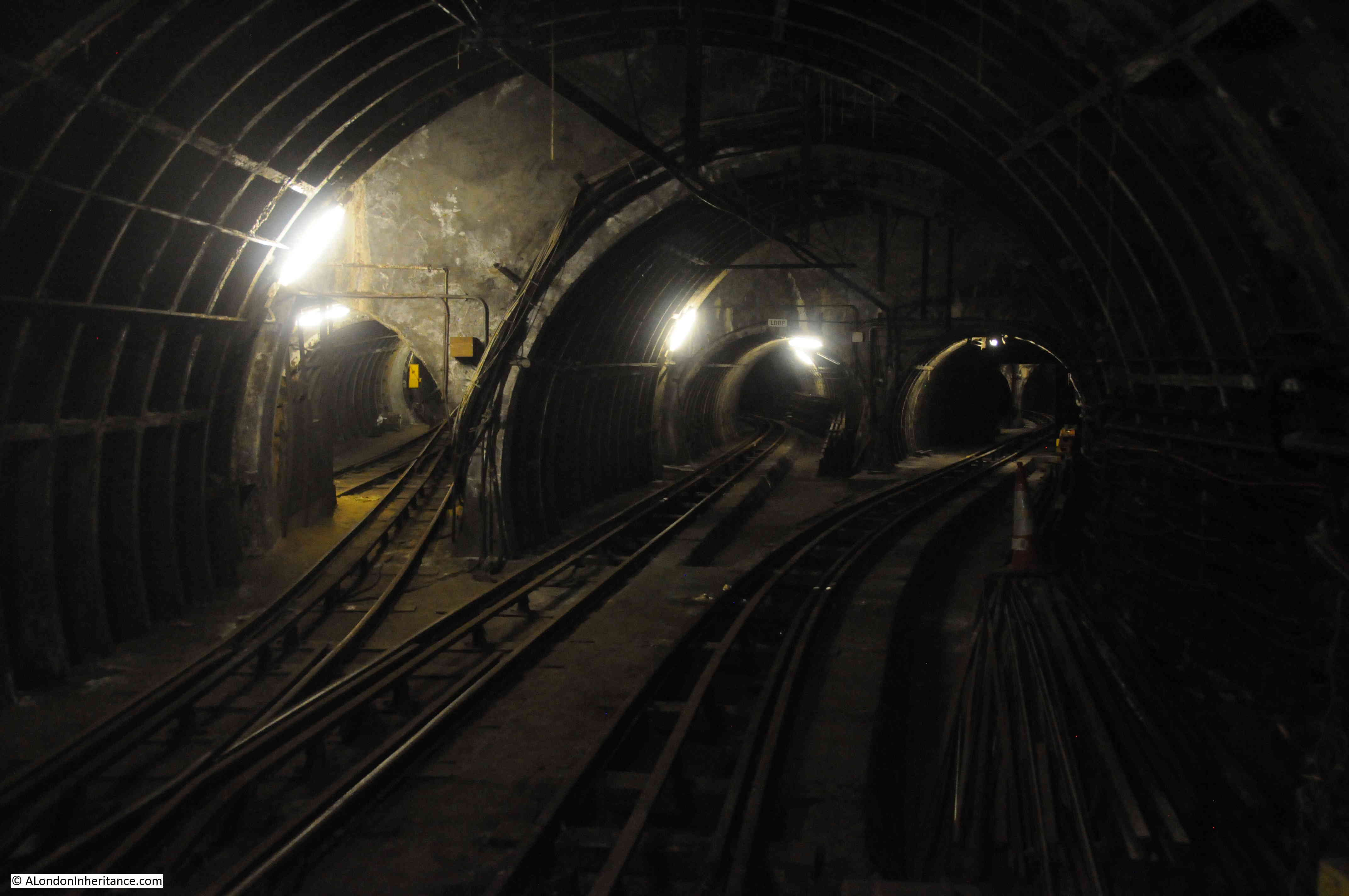
There seem to be numerous tunnels. The main tunnels running to the next stations, loop tunnels between the platforms and tunnels up to the workshops.

Post Office Railway 14

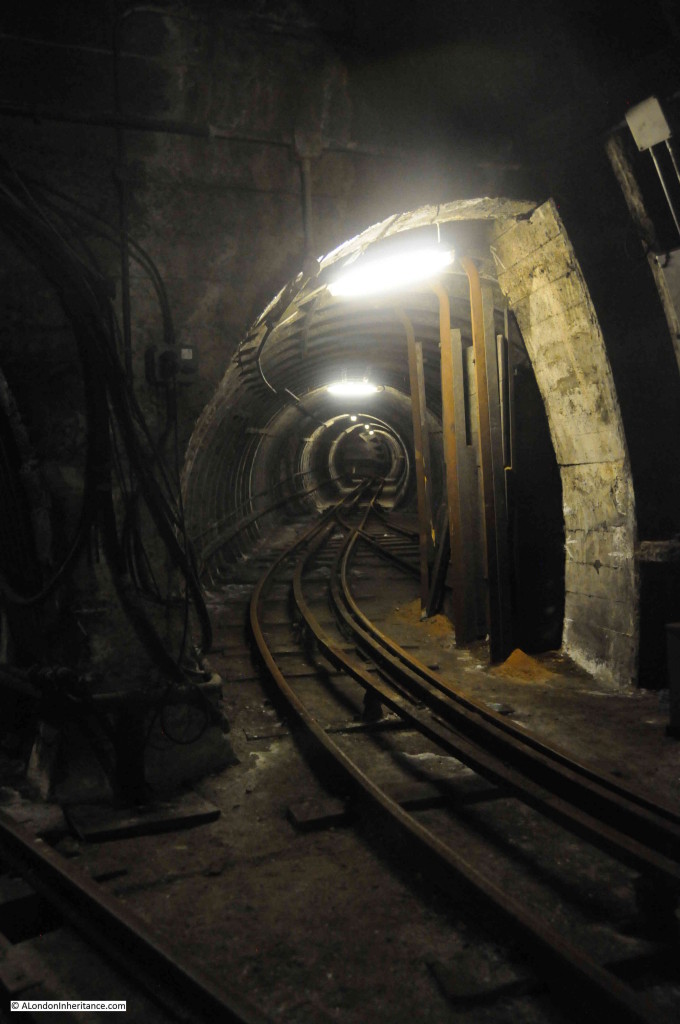
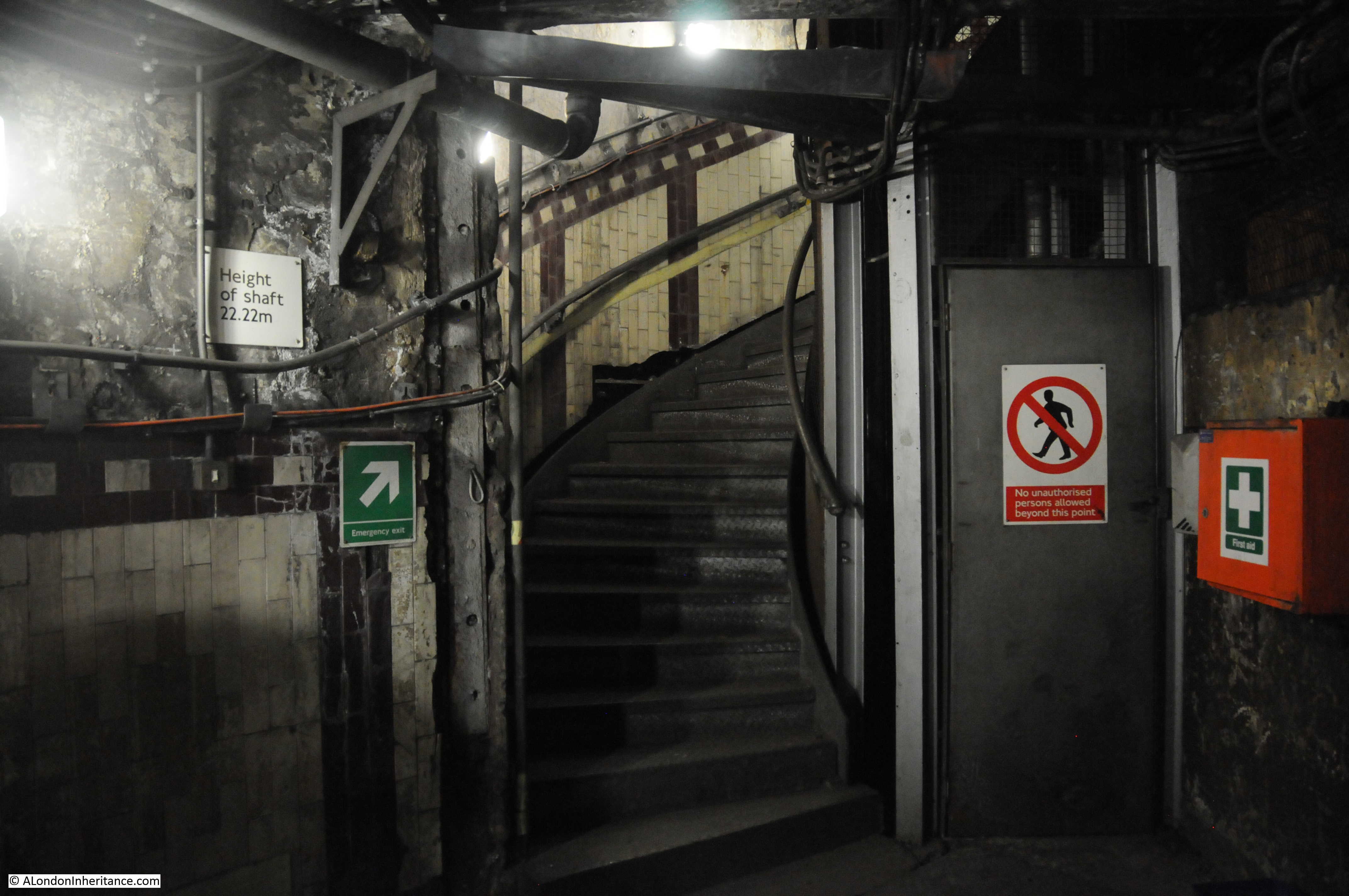
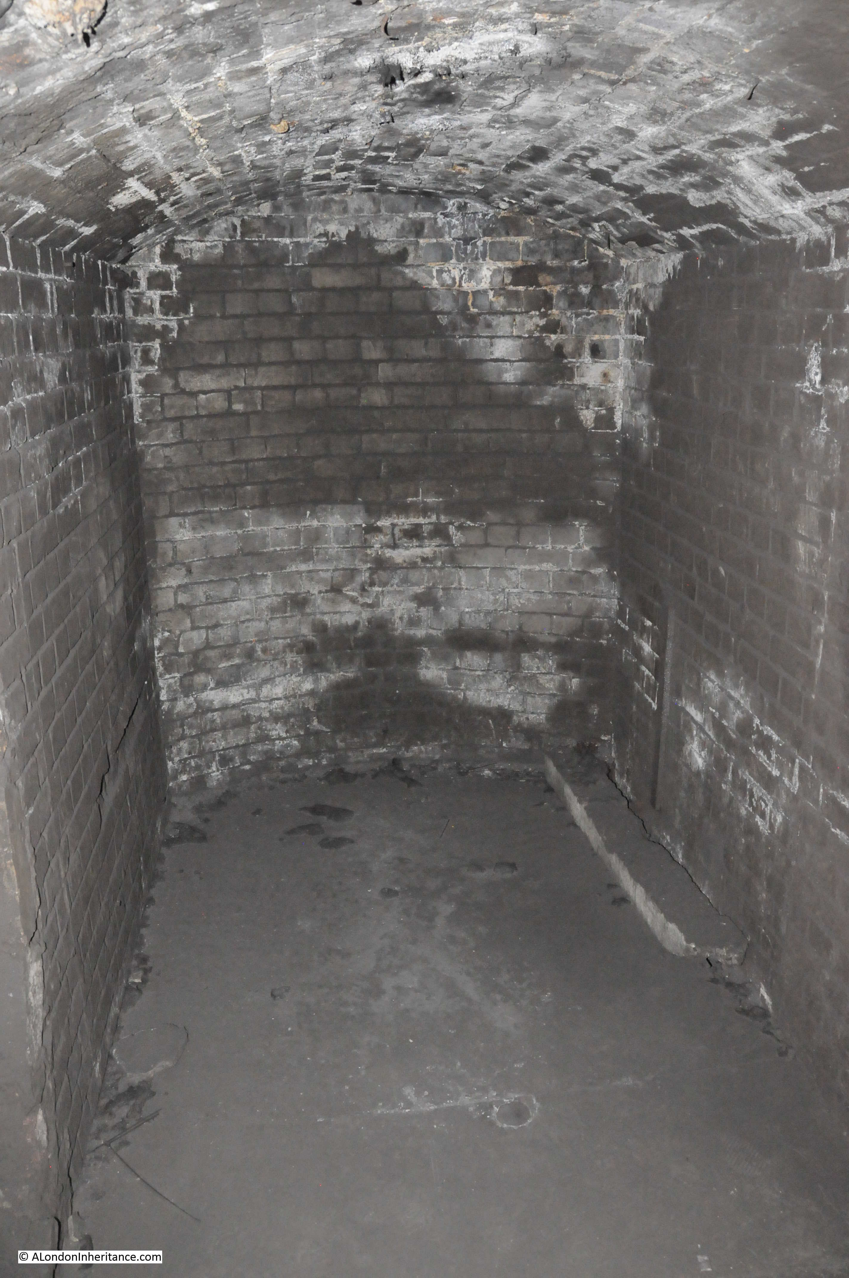
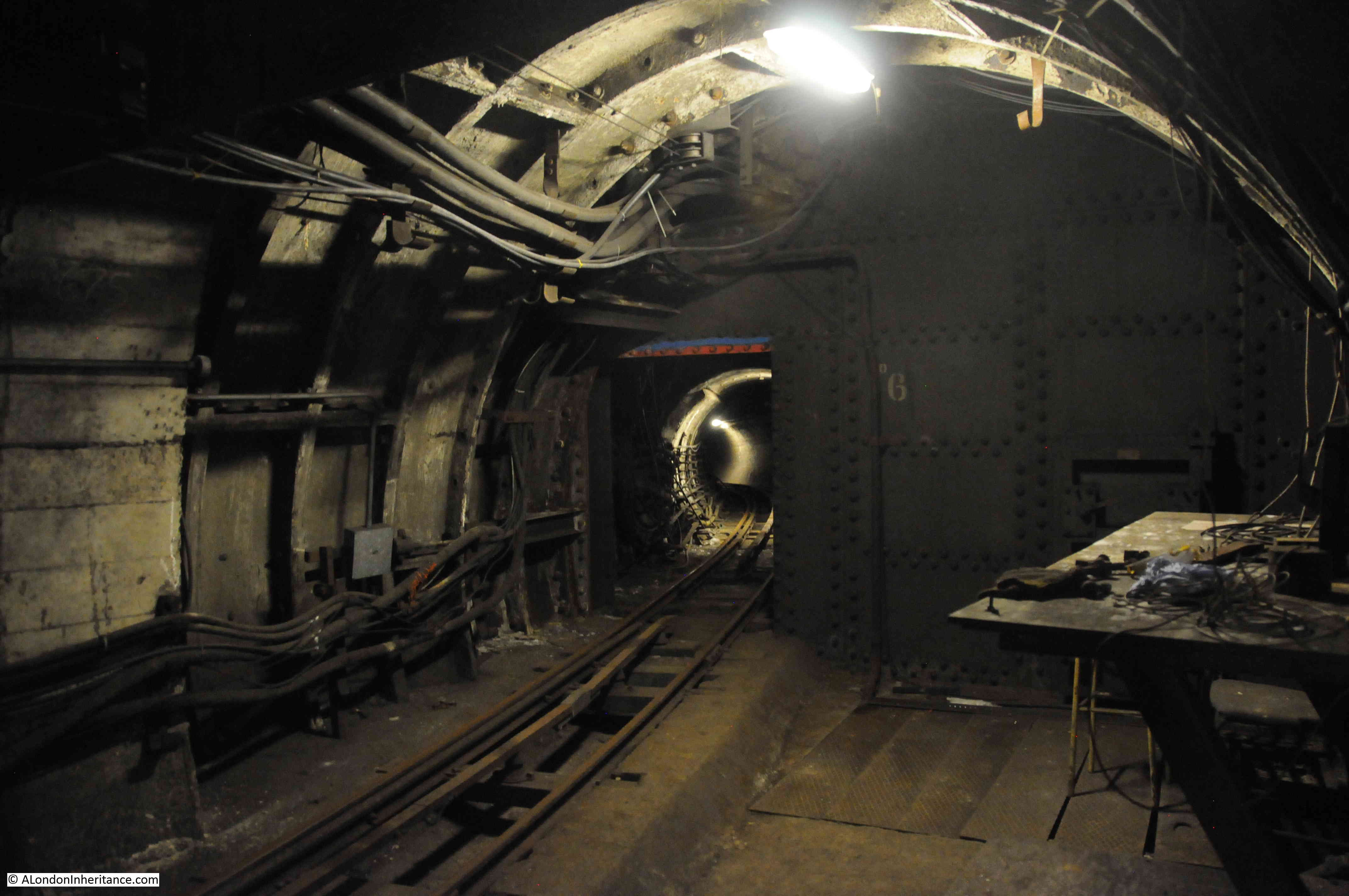
Tunnels into the stations are 25 foot in diameter.

Post Office Railway 15

Here is the tunnel leading of to the next station, this is where the tunnels reduce to 9 foot in diameter. The tunnels between stations are on average 70 foot below ground level.

Post Office Railway 16

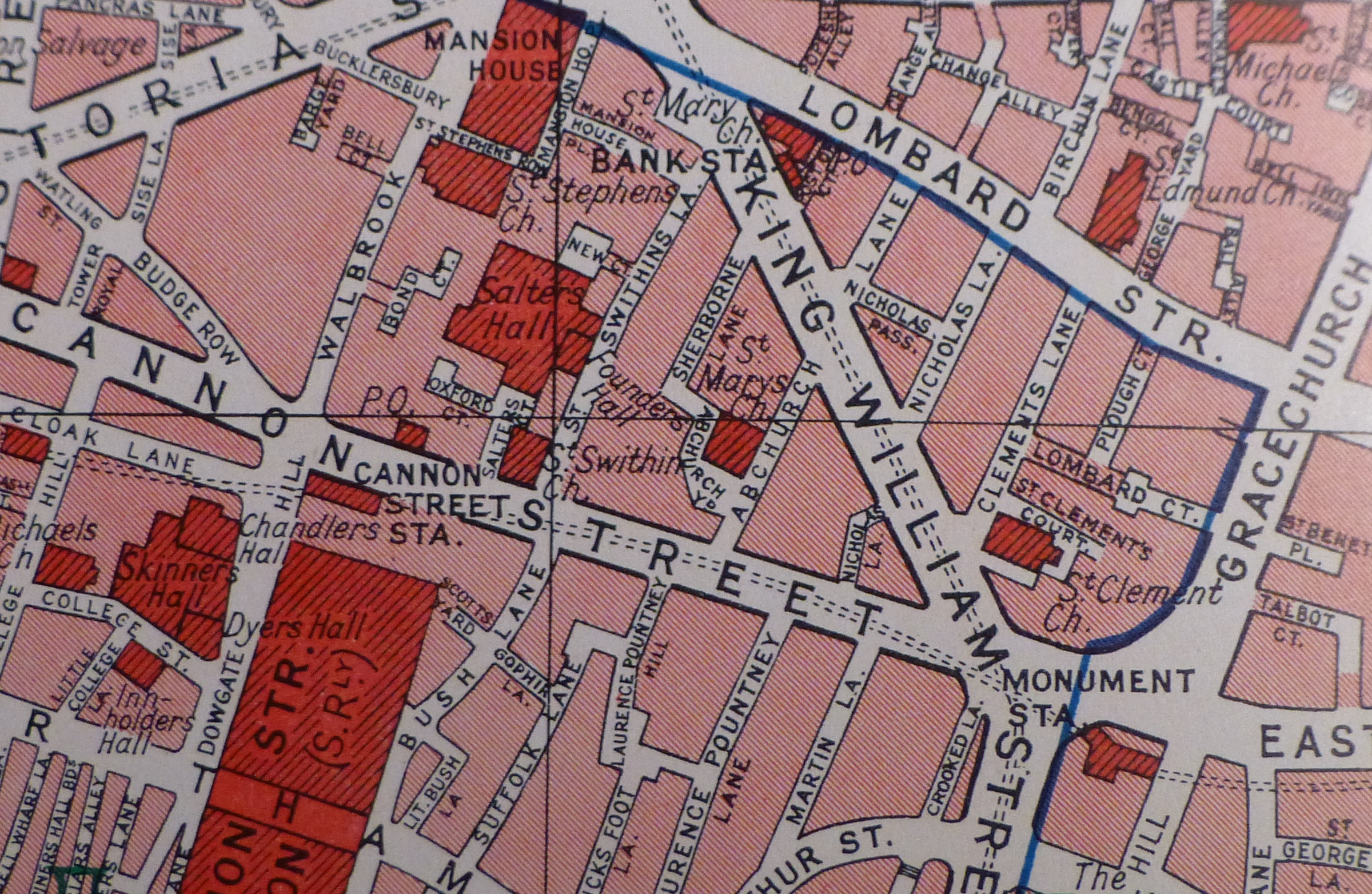
The stations that these tunnels connect were:

  • Paddington Station
  • Western Parcels Office – Barrett Street
  • Western District Office – Wimpole Street
  • West Central District Office – New Oxford Street
  • Mount Pleasant – Main London Sorting Office
  • King Edward Building Sorting Office – King Edward Street
  • Liverpool Street Station
  • Eastern District Office – Whitechapel Road

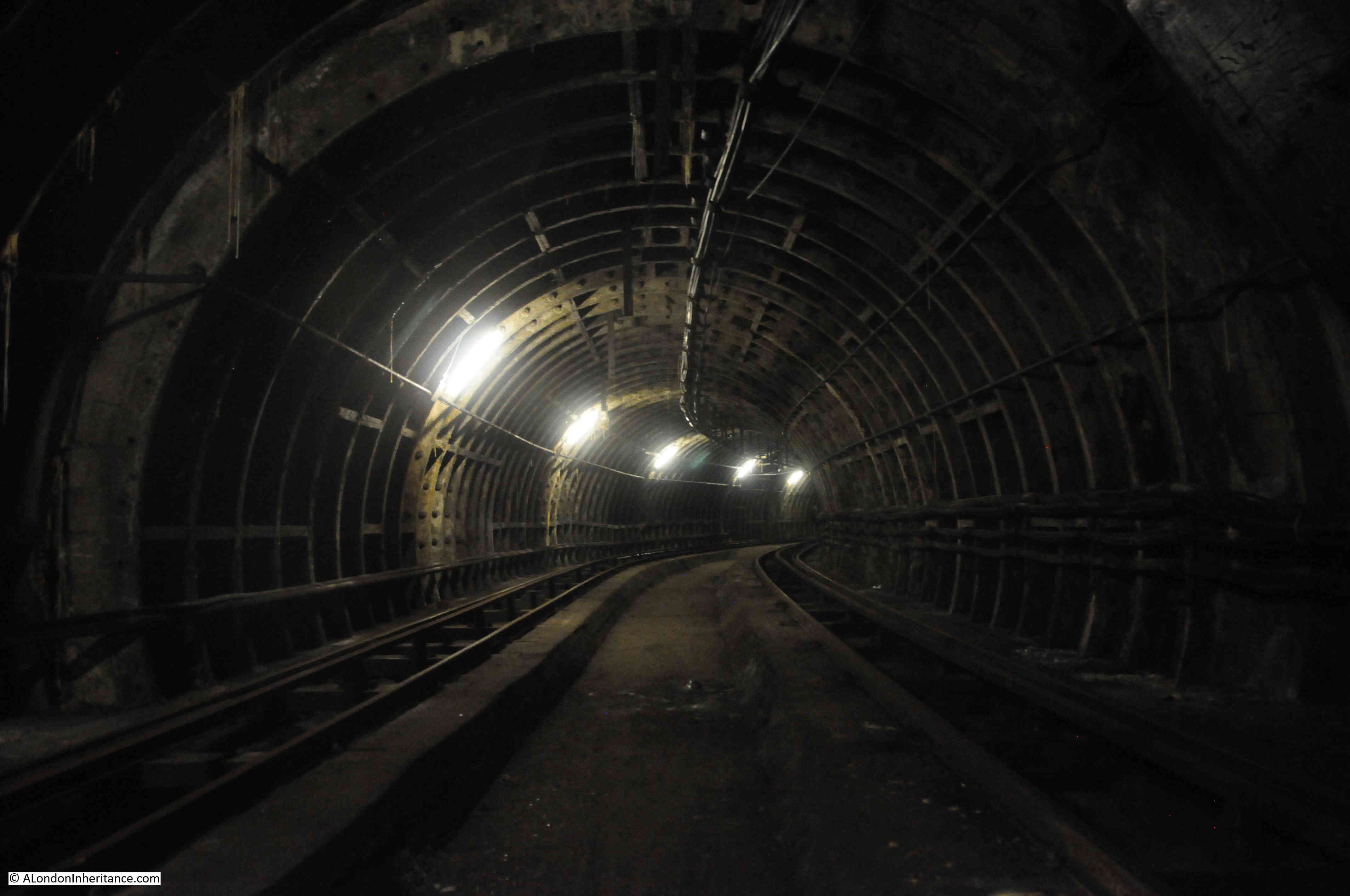
In between stations the trains would get up to 35 miles per hour. The tunnels are designed so that they slope up towards a platform to help reduce the speed of the train, and slope down from a station to help accelerate the train.

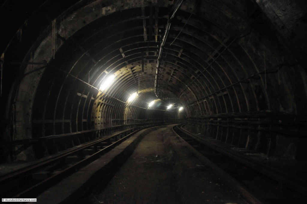
The tunnel curving into the distance.

Post Office Railway 17

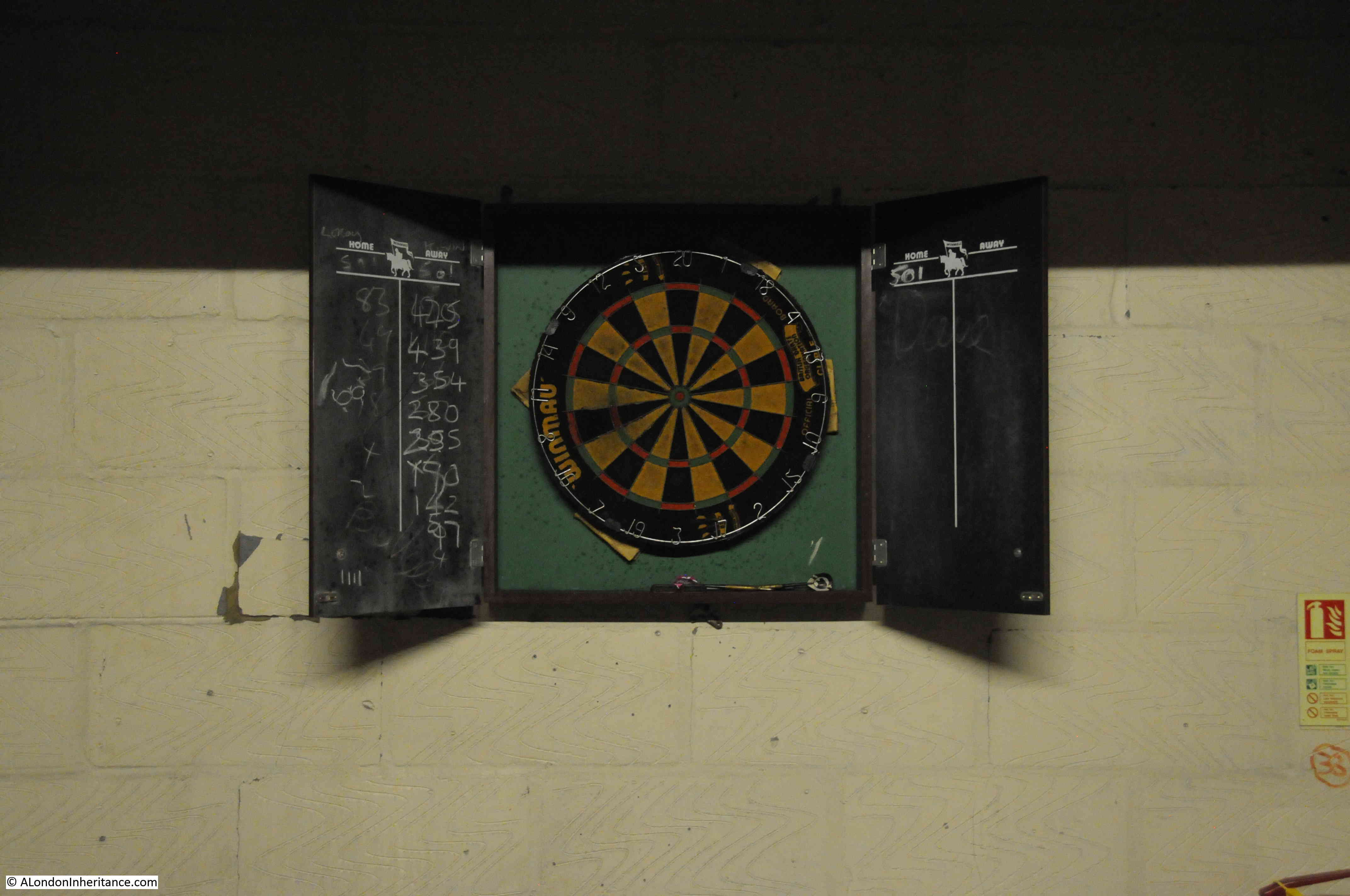
Part of the loop tunnel between platforms was painted white with Christmas paintings in paint that will glow under ultra-violet lighting. This was for Christmas Parties organised by the staff when children would be taken on a train between the two platforms in the dark, but with the paintings on the wall glowing under the special light.

Post Office Railway 18

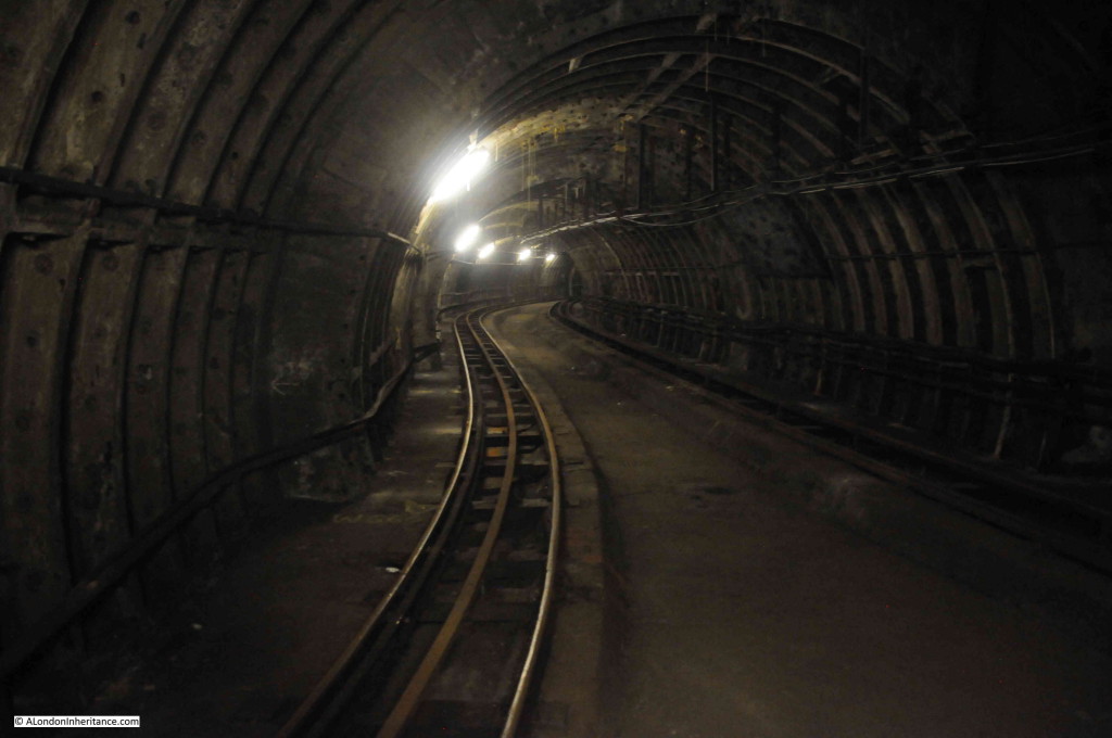
Another reduction in tunnel diameter.

Post Office Railway 19

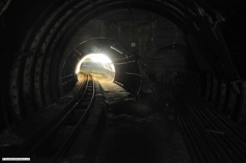
Tunnels leading off in all directions.

Post Office Railway 20

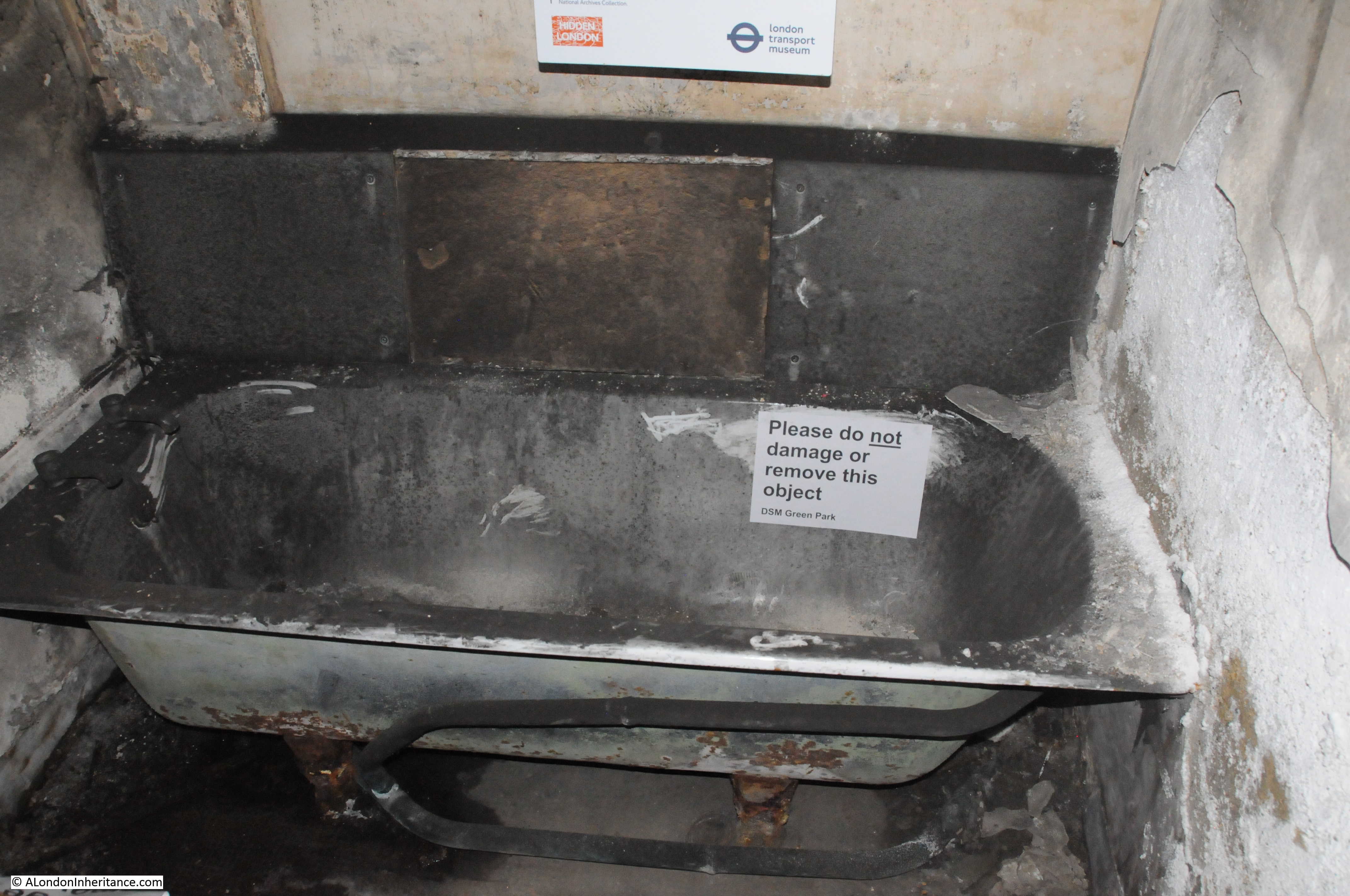
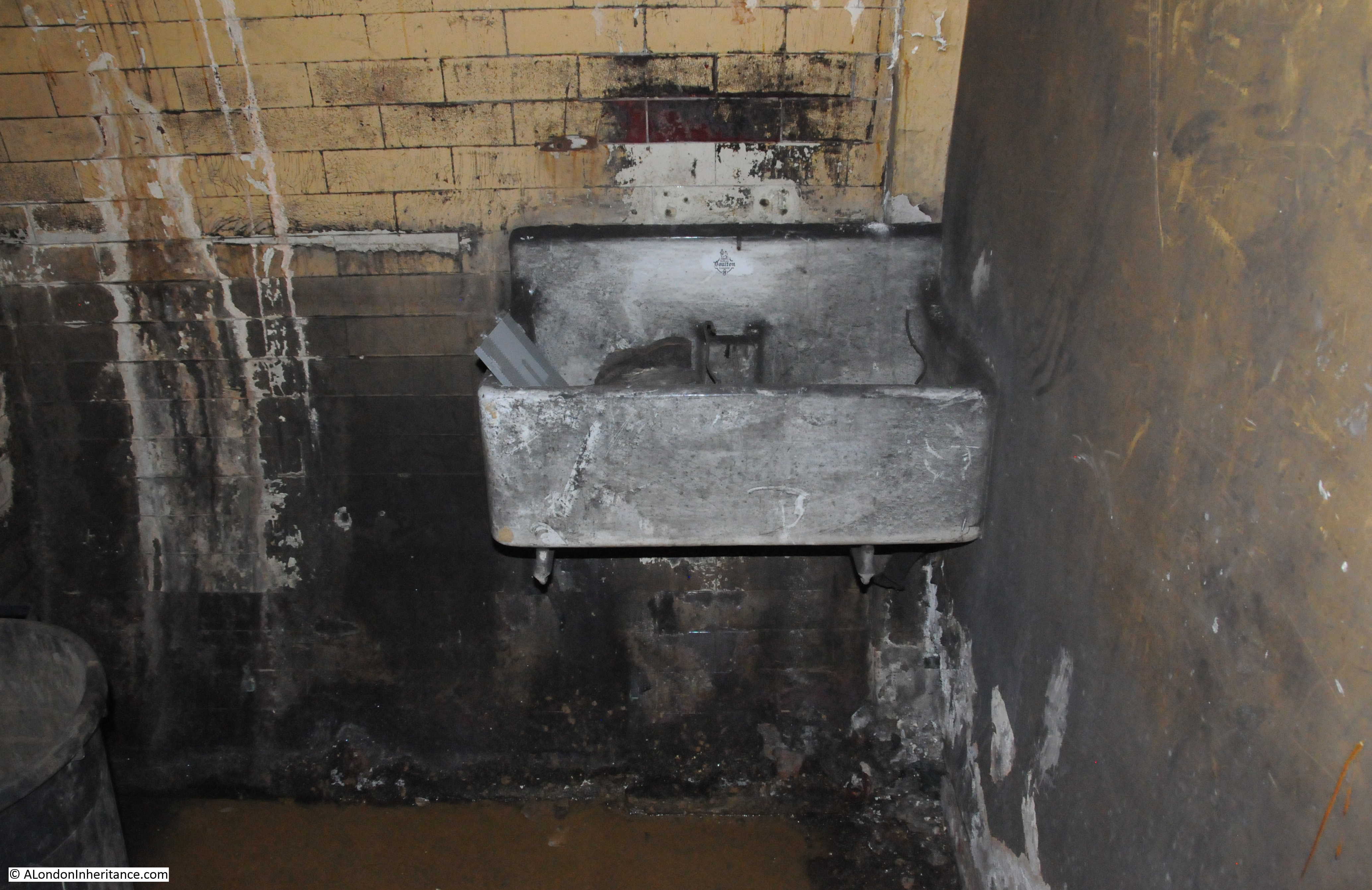
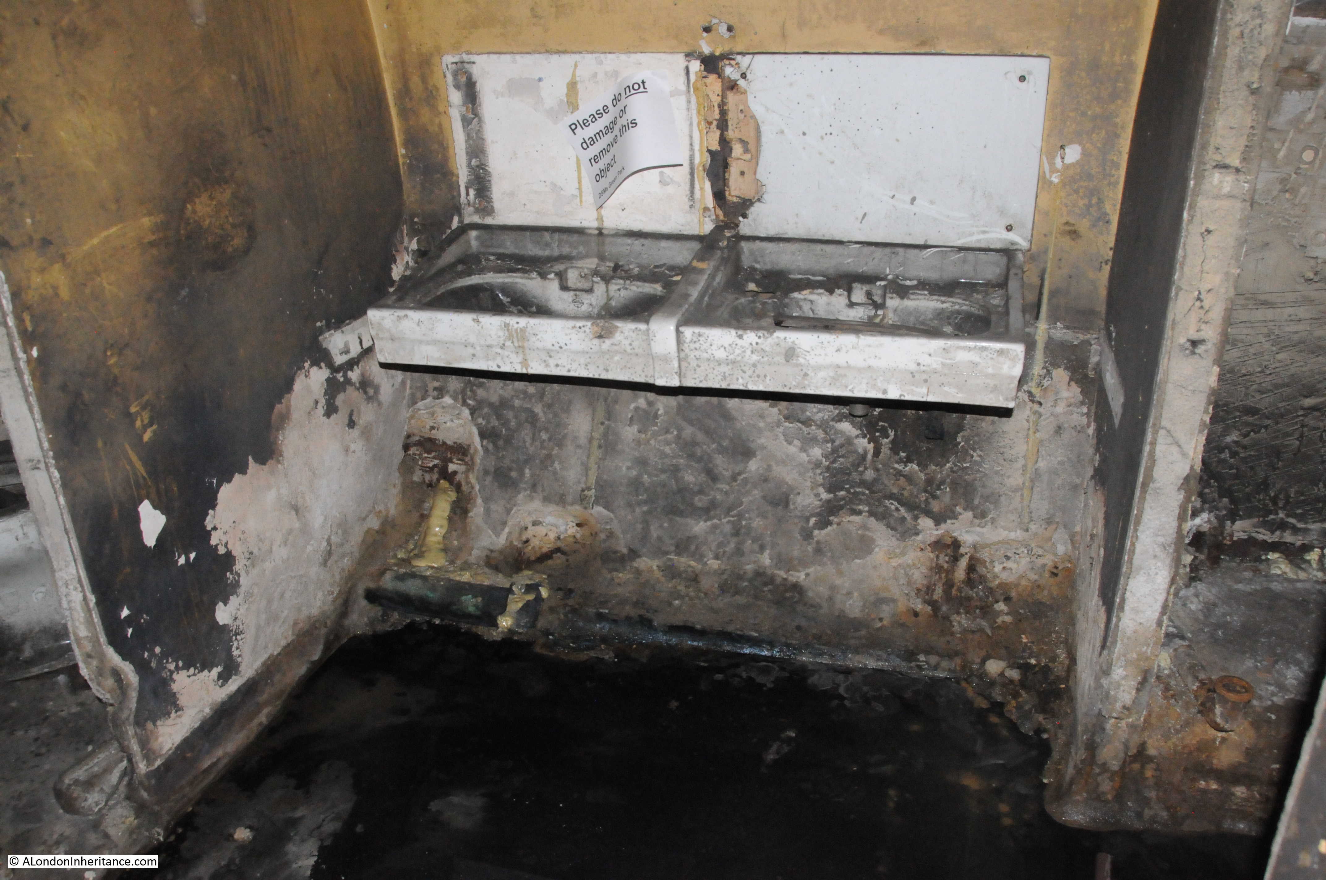
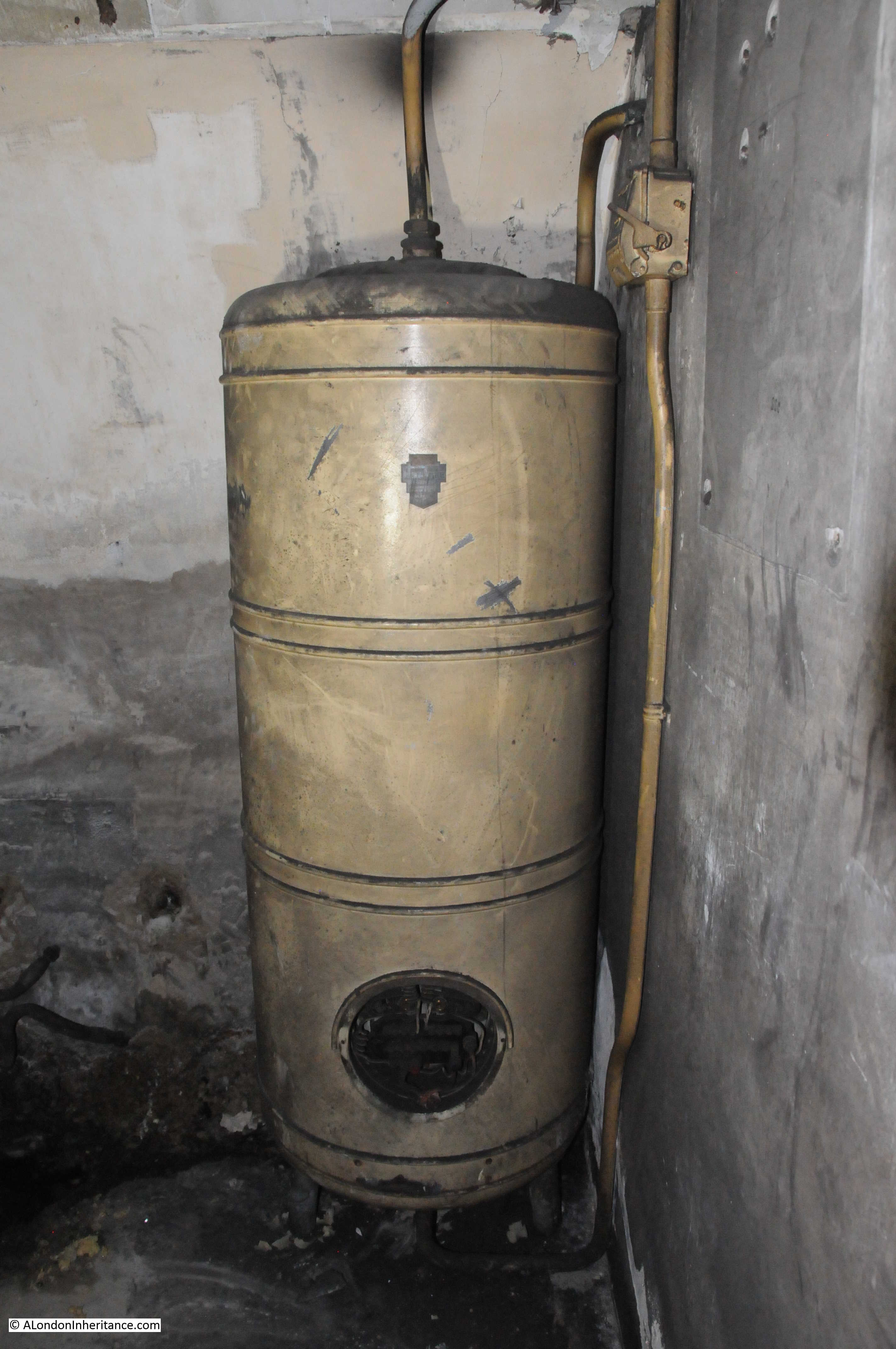
Back on the platforms, one of the essential bits of equipment.

Post Office Railway 21

Standing on the platform imagining the scene as described by F.L. Stevens with the trains running up to the platforms, being unloaded, loaded with new mail and parcel bags and running on to the next station.

Post Office Railway 22

Some of the platform equipment for managing letter and parcel bags.

Post Office Railway 23

It was a fascinating tour run by the British Postal Museum with very informative and knowledgeable guides. When opened as part of the new museum, the Post Office Railway will be a great example of London’s industrial heritage.

alondoninheritance.com