Category Archives: The Thames

Limekiln Dock and the Black Ditch

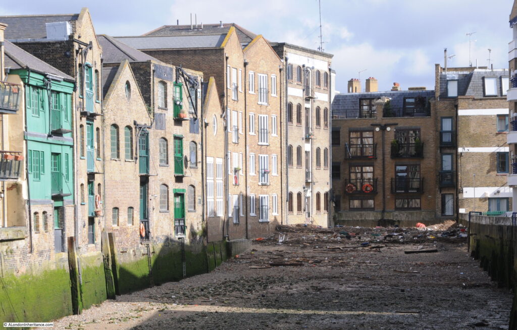
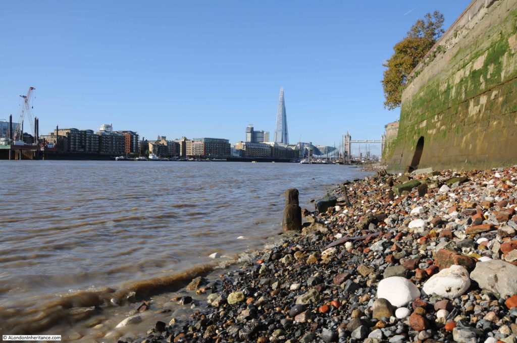
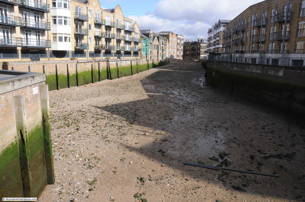
Walking between Tower Bridge and the Isle of Dogs back in early March, I crossed the entrance to Limekiln Dock. The tide was out and the dock presented the strange view of being completely empty of water.

Limekiln Dock

Limekiln Dock is a relatively short expanse of water leading off from the Thames at Limehouse. Over the last few centuries the dock has been called several variations of the name, including Limekiln Creek, Limehouse Creek and Limehouse Dock.

Limekiln Dock seems to be the most commonly used name.

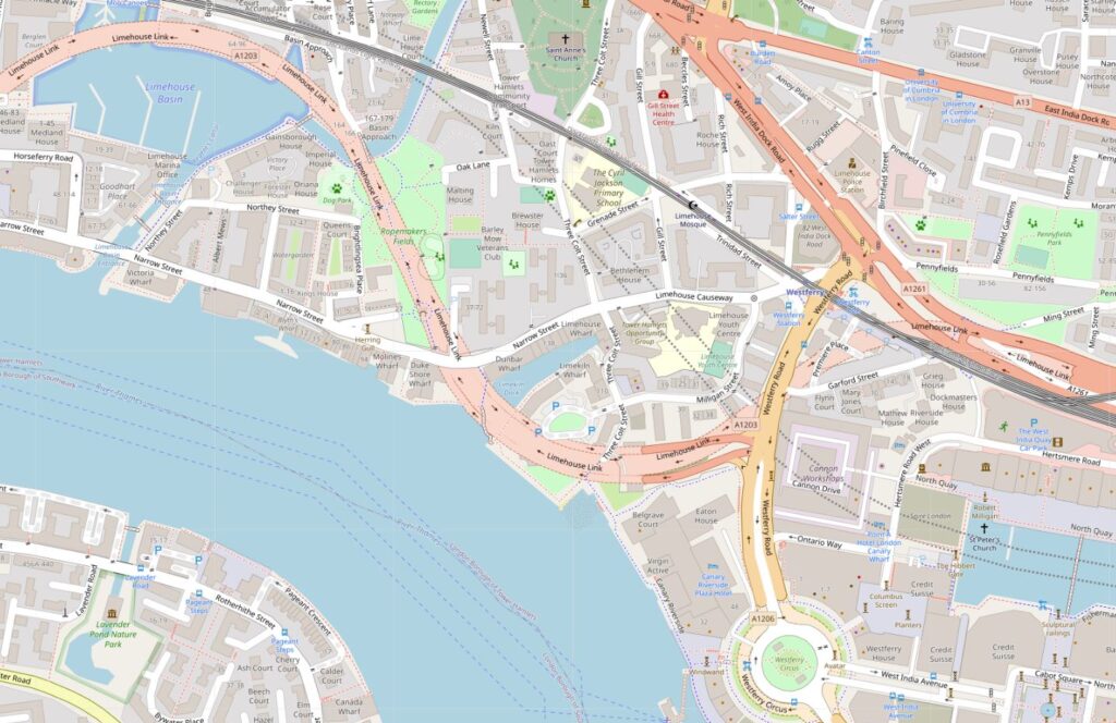
The following map extract shows Limekiln Dock in the centre of the map (Map © OpenStreetMap contributors).

Limekiln Dock

The map implies there is a road running over the entrance to the dock. This is the Limehouse Link Tunnel and runs underneath the entrance to the dock – the lighter colour used for the road on the map shows the extent of the underground routing.

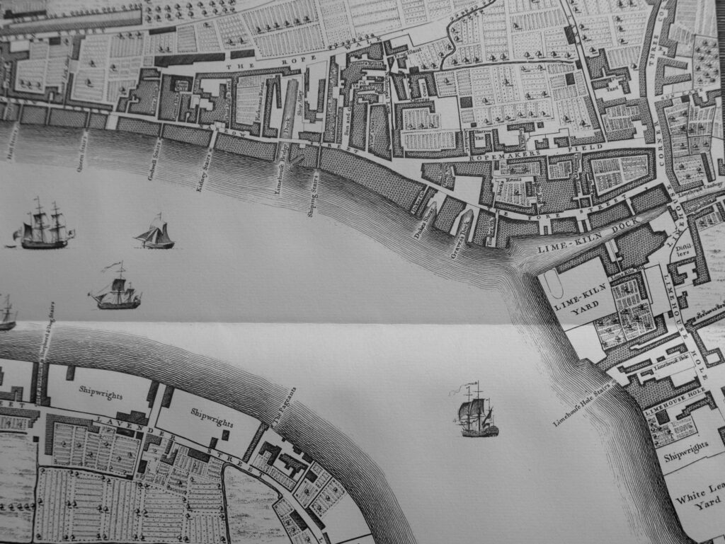
Limekiln Dock is an old feature. In the following Rocque map extract from 1746, the dock is to the right.

Limekiln Dock

Rocque shows that on the southern side of the dock entrance was Lime Kiln Yard. This was the location of the lime kilns that as well as giving their name to the dock, were also the origin of the name Limehouse.

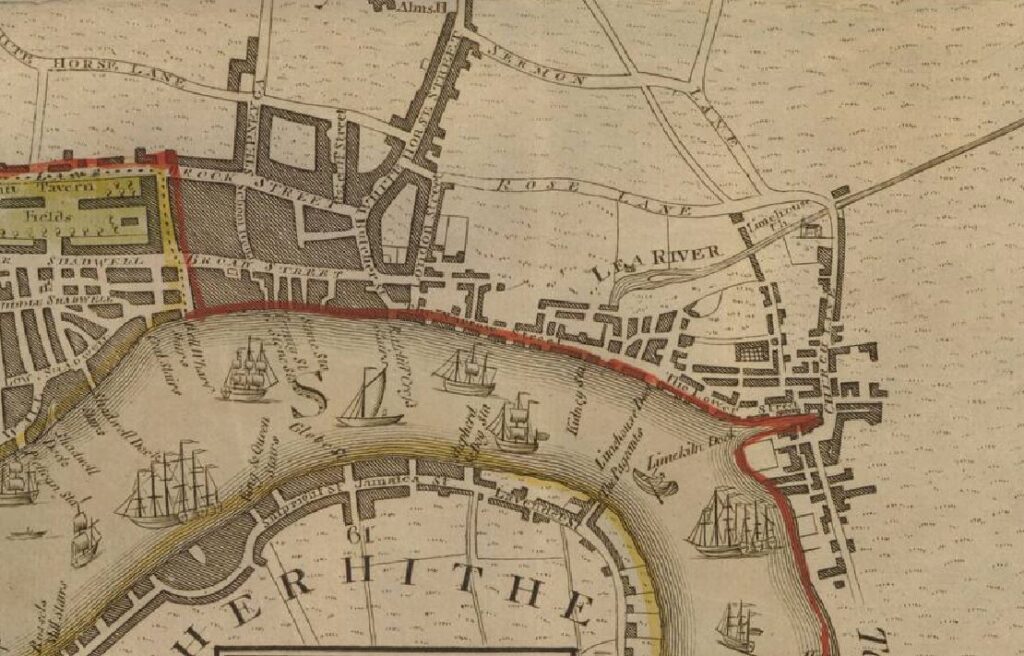
The following extract from Haines & Son map of 1796 also shows Limekiln Dock to the right of the map.

Limekiln Dock

The views of Limekiln Dock in the two 18th century maps show an inlet from the Thames, wider at the entrance, and tapering along the length of the dock. It was not the shape of many other docks along the river, which were more of a rectangular shape, with the full width of the dock staying almost constant along the length.

The reason for the shape of Limekiln Dock is that it is a mainly natural feature. Whilst the shape may have been modified over the years, the dock is the shape it is as it was the entry point into the River Thames of the Black Ditch.

The Black Ditch is one of the many London rivers and streams that has long been hidden underground, becoming part of the City’s sewer system.

As can be seen in the two maps, during the 18th century, the city was extending along the Thames and had reached Limehouse, although still the majority of building was located close to the river. Inland, most of the area was still field and agricultural, although long rope walks could be found, where the open space provided the large elongated area needed for the manufacture of ropes for the shipping industry.

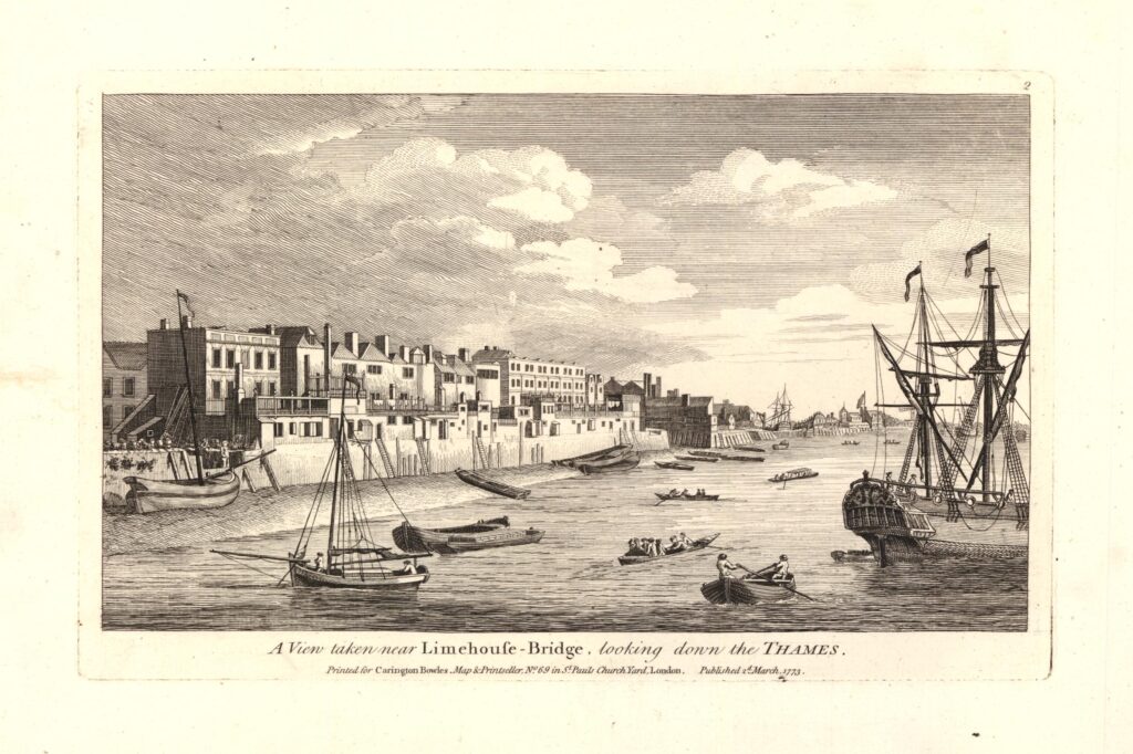
We can get an impression of the area from the following 1773 print. The entrance to Limekiln Dock is just visible, about three quarters of the way along the shoreline © The Trustees of the British Museum.

Limekiln Dock

The whole area saw a dramatic increase in industry and housing during the 19th century, and by 1894, Limehouse was a large area of East London, covered in streets, warehouses, factories and terrace housing.

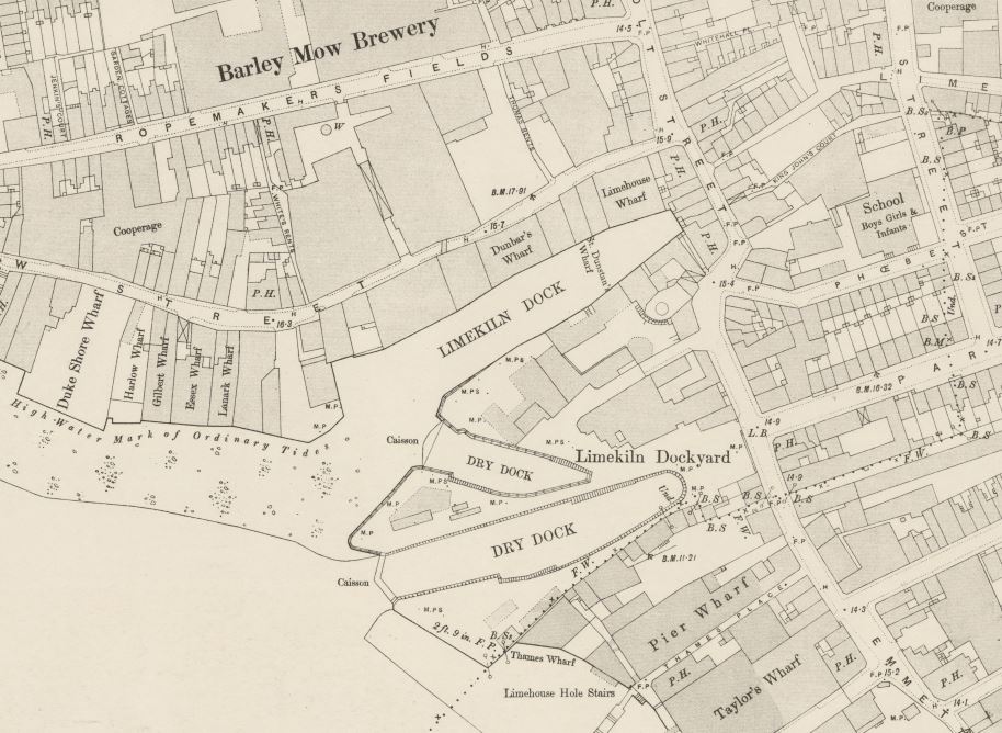
Limekiln Dock had grown a Dry Dock, with a second Dry Dock built just to the south of the entrance, all part of Limekiln Dockyard – it seems that the original Lime Kilns had disappeared many years earlier ‘Reproduced with the permission of the National Library of Scotland’ ..

Limekiln Dock

Walking along Narrow Street, Three Colt Street and Limehouse Causeway, it is not obvious that Limekiln Dock is there – hidden behind the old warehouse buildings and the recently constructed apartment buildings.

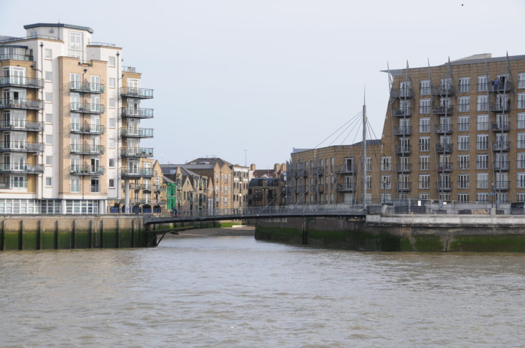
The photo at the start of the post was taken from the footbridge that now crosses the entrance to Limekiln Dock, and from on the river, we can get a good view of the entrance to Limekiln Dock today.

Limekiln Dock

The footbridge is a swing bridge as there are historical rights to bring ships into the dock and moor at the warehouse buildings, although I suspect that this very rarely happens. The bridge was completed in 1996 and designed by YRM and Anthony Hunt Associates and built by Littlehampton Welding.

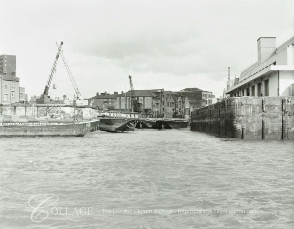
The photo above shows all the new apartment buildings that now line the majority of Limekiln Dock. These have been built over the last 30 years, and in 1981, the entrance to Limekiln Dock looked very different:

Limekiln Dock

Image credit: London Metropolitan Archives, City of London: catalogue ref: SC_PHL_02_0912_81_120_6813_4

The only buildings that remain from the 1981 photo are some of the older buildings visible in the above photo towards the end of the dock.

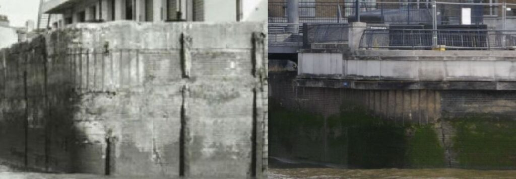
I love finding little details in these photos which are the same, despite significant change in the area. If you look at the right hand corner of the dock entrance, on both photos there is a section with vertical lines, perhaps reinforcing rods. There is also the same crack visible leading down to the base of the wall, although in the 2020 the crack seems to have extended higher.

I have enlarged the two sections below:

Limekiln Dock

During the 19th century, Limekiln Dock was a very busy place, with goods being unloaded and loaded into the surrounding warehouses. It cannot though have been a very pleasant place to work as the state of Limekiln Dock was a continuing problem.

In a letter to the East Observer on the 27th February 1869, a Mr P. writes:

“THE LIMEKILN CESSPOOL – On several occasions the Limekiln-dock has been alluded to at the Limehouse District Board, as the common receptacle for the sewerage of part of Fore-street, and also being a harbour for a large portion of the animal refuse of the Thames. The place alluded to is Limekiln Creek. The sanitary condition of the place may be seen by any of your readers who will ask permission of several occupiers of houses adjoining the abominable place; we hear of fevers and other contagious diseases being prevalent. Need we wonder ! What will be the consequence if the present mild winter is succeeded with a warm spring?”

The letter was one of the few places I found the word Creek being used rather than Dock. The state of the dock was obviously a long standing problem, as 24 years later, the responsibility for cleaning Limekiln Dock had reached the courts. From the Standard on Thursday December the 14th 1893:

“The Conservators of the Thames V. The Sanitary Authority of the Port of London – This was a specially constituted Court for a hearing of a special case stated by Mr. Mead, Metropolitan Police Magistrate, sitting at the Thames Police-court, in respect to a dispute between the Corporation of the City of London, in their capacity as Sanitary Authority for the Port of London, and the Conservators of the Thames.

The dispute arose in reference to the cleansing of Limekiln Creek, at Limehouse. The Creek, which runs inland some 500 feet from the river is occupied by wharves on each side, is said to have become a public nuisance, and dangerous to health, through the accumulation of foul sewage matter, besides floating dead animals, refuse thrown from barges, &c.”

Initially, the Magistrate found in favour of the Corporation of the City of London, and that it was the Conservators of the Thames responsibility to clean Limekiln Dock, however on appeal, this was overturned and the responsibility was with the Corporation of the City of London as Sanitary Authority.

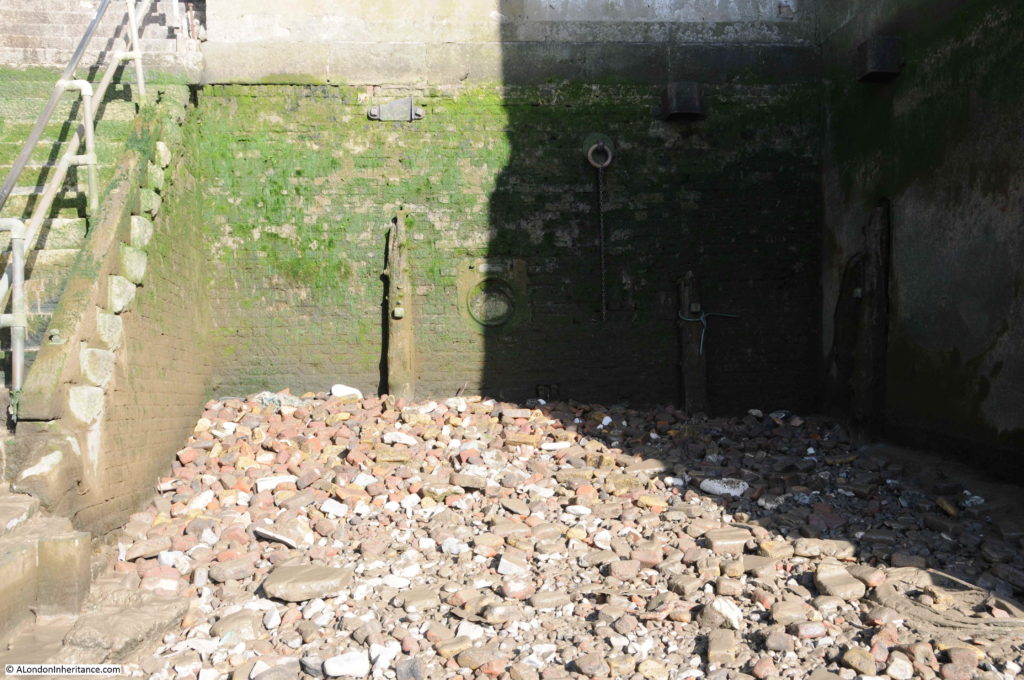
The following photo is of the far end of Limekiln Dock. You can see at the end there is a large pile of rubbish left as the tide has gone out. I suspect the dock has the same problem as the 19th century articles described where the incoming tide carried rubbish into the dock, which settled and remained at the end of the dock as the water then went out.

Limekiln Dock

As well as everything that washed up from the Thames into Limekiln Dock, the dock also suffered from everything that was washed down the Black Ditch and into the dock as the Black Ditch’s access point to the River Thames.

The Black Ditch is one of London’s lost rivers and has not been very well documented. Most of the detailed routings come from the time when the Black Ditch was a sewer, and whilst the name was used for the full extent of the sewer, it may not have been the original route of the stream.

Care is also needed as the words “black ditch” seemed to have been used as a generic description of a polluted, dirty stream or ditch of water and there are a number of references to other black ditches across London.

The East London Observer had a fascinating regular column going by the name of Roundabout Old East London. The column would be packed with local history, although it is difficult to know how true there all were, but the columns always provide some interesting background information to East London at the time. In the 5th April 1913 column, there was reference to the river running from Limekiln Dock, but under a different name (although the Black Ditch was mentioned). The paragraph was headed The Barge River:

“It would seem from old records of place names in the parishes and hamlets along the Thames side, that Limehouse Hole was so-called because a stream – a Century ago called the Barge River – at that place found its way to the great River.

This effluent, which through the greater part of its course came to be little more than an open ditch, is now the Limekiln Dock Sewer. It is described in the first Metropolis Act 1855 as a Main Sewer of the Metropolis, as commencing at Bonner’s Hall Bridge, leading into Victoria Park, and it extends along Victoria Park-road, East side of Bethnal Green, Globe-road, White Horse-lane, and Rhodeswell-road. It passed under the Regent’s Canal at Rhodeswell Wharf, thence along the Black Ditch, Upper North-street; and discharges into the River Thames at Lime Kiln Dock.

For a considerable length before it entered the Thames the Barge River was tidal, even within living memory.

In 1835 there was an old resident of Narrow-street, Limehouse, who recalled through his father, some strange yarns of smugglers and Revenue Officers on the Barge River when it was navigable for ships and boats for a considerable distance at some seasons and tides.

There are vague references to this stream, and to another which probably joined it across what was afterwards called Bow Common by way of South Grove in the extreme west of Mile End Old Town in very old land records. Of this latter now subterranean river, the engineers of the extension of the Underground Railway made troublesome acquaintance when the tunnel was being constructed”.

I suspect that the use of the name Barge River was an error. I cannot find any other references linking the name to the Black Ditch. There are a few cryptic references to a Barge River near the Lee and in Tottenham, but that is it – I suspect the author was describing the route of the Black Ditch.

I checked the referenced 1855 Metropolis Act and it does not mention the Barge River, but does list the same route for the Limekiln Dock Sewer. The Metropolis Act is a fascinating document (if you like that sort of thing, which I do) as it lists all the main sewers across London in 1855, and there was a considerable number of them. Many were old rivers and streams, covered in and converted to sewers.

The route compares well with the route of the Black Ditch described by Nicholas Barton and Stephen Myers in The Lost Rivers of London. Running alongside Upper North Street, Rhodeswell Street and the east side of White Horse Lane.

One tributary then goes a short distance over Mile End Road to Globe Road. Where the book and article differ is that Barton and Myers do not have the Black Ditch heading up to Victoria Park. They have the ditch in three separate streams heading to Whitechapel, Spitalfields and Bethnal Green.

I suspect the 1855 Metropolis Act correctly routed the sewer which ran from Bonner’s Hall Bridge. Part of the route included the route of the Black Ditch, with pipes leading from the main sewer carrying the old Black Ditch to the destinations listed by Barton and Myers.

There are very few maps which show any part of the Black Ditch. Some show some tantalising river like features. For example, the following extract from Rocque’s 1746 map shows a river like line to the south of Rhodes Well.
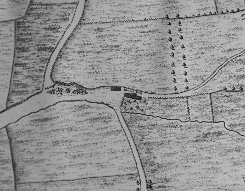
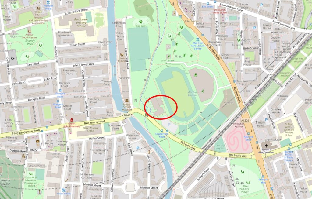
Limekiln DockRhodes Well is the source of the name Rhodeswell Road, and was located roughly within the red oval as shown in the following map extract – exactly where the Black Ditch was described as crossing the Regent’s Canal (Map © OpenStreetMap contributors).

Limekiln Dock

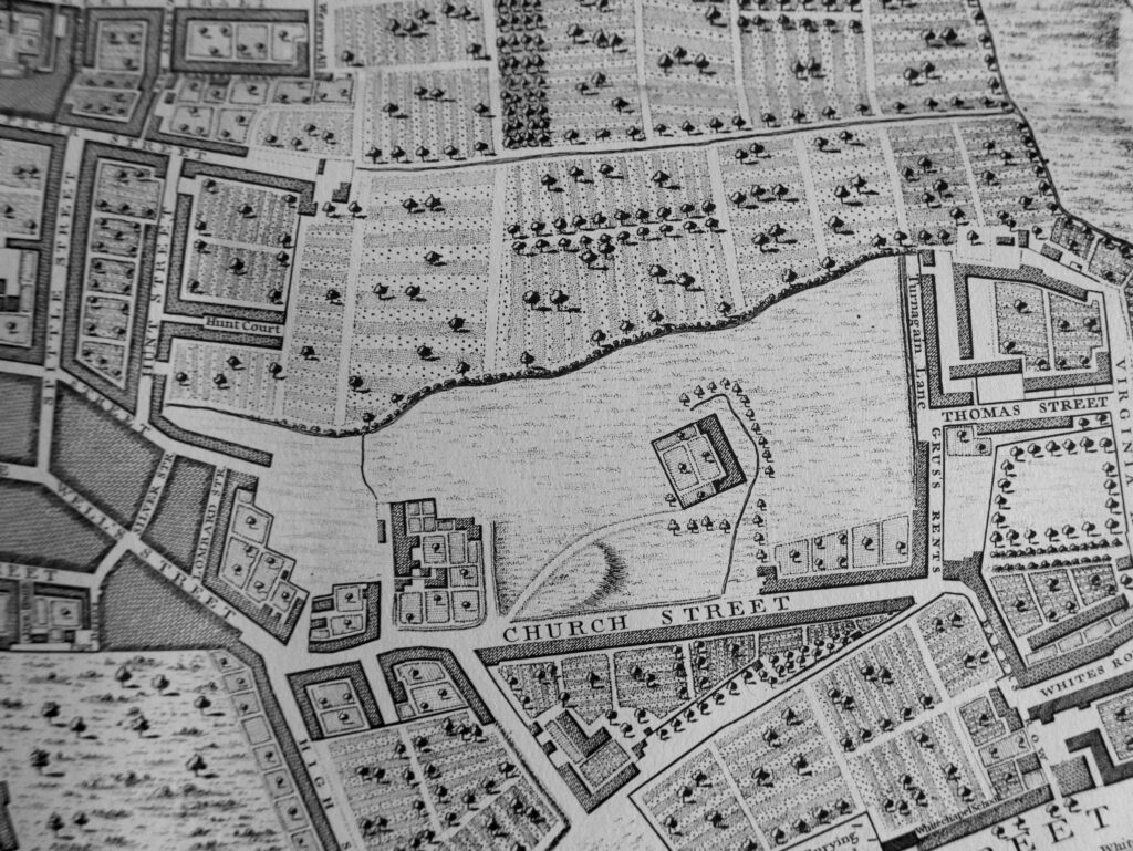
One of the tributaries of the Black Ditch was from Spitalfields and in the following extract from 1746, there is a wavy line forming a boundary between what appears to be cultivated fields to the north and grassland to the south. This must be a natural feature due to the irregular line which looks as you would expect of a stream.

Limekiln Dock

The possible stream in the above map runs from the junction of Vallance Road and Buxton Street down to Woodseer Street on today’s streets, and is similar to the route mapped by Nicholas Barton and Stephen Myers.

The Black Ditch may have formed a boundary between Mile End and Bethnal Green. At a meeting of the Mile End Old Town Vestry in August 1877, the upgrade of a sewer was one of the points for discussion, and the sharing of costs between Bethnal Green and Mile End Vestries. During the meeting, it was stated that “The old sewer, as it had been called, was really no sewer at all, but the old black ditch through which the ancient boundary of the two hamlets ran. It was in a horrible state, and if not attended to at once, should heavy rains ensue, it was hard to say what might happen”.

The state of the Black Ditch had been the subject of complaint for many years prior to the work in 1877.

In 1859 it was described as the “receptacle for the sewage from a great number of houses”. The Black Ditch ran under houses for part of its route. In an 1831 murder investigation it was revealed that there was no problem with access to a house which was built over the Black Ditch as anyone could gain access to the premises from the Black Ditch than accessing the house above.

The route of the Black Ditch is on my list of future walks, however I suspect that there is very little to see of this lost river which now runs below the streets in London’s sewers, but it is always worth having a listen at any manhole covers along the route after heavy rains.

Returning to Limekiln Dock, lets have a look at some of the buildings that line the dock.

When walking along Narrow Street, it is not immediately obvious that the dock is behind the buildings, however the names of the buildings provide a clue.

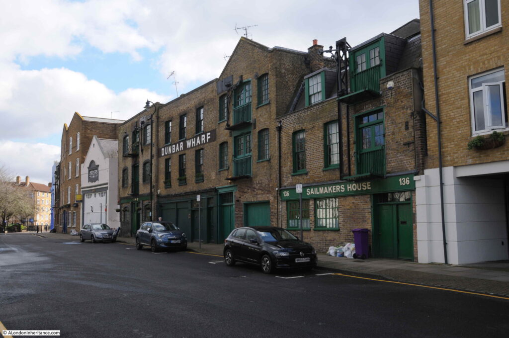
Dunbar Wharf is one of the buildings that date from the time when Limekiln Dock was a busy dock on the Thames. Today, the building retains many of the original external features:

Limekiln Dock

Dunbar Wharf was named after the Dunbar family who had a very successful business at Limekiln Dock.

The Dunbar family wealth was initially from a Limehouse brewery established by Duncan Dunbar. It was his son, also called Duncan, who used the money he inherited from his father to build the shipping business that was based at Dunbar Wharf.

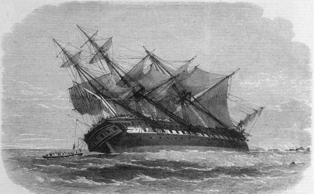
Dunbar’s ships carried passengers and goods across the world as well as convicts to Australia. Whilst very successful, this was not without the occasional disaster, as described in this article from the Western Times on the 7th November 1865:

“The Wreck Of The Duncan Dunbar – The passengers and crew of the Duncan Dunbar reached Southampton on Saturday morning on board the Brazil mail steamer Oneida. It seems that the vessel struck on the reef Las Rocas at about half past eight in the evening of the 7th of October, and an awful night was passed on board. On the following morning they were all, 117 in number, landed on a little island or bank of sand, which was covered with birds. They remained in this situation, with the exception of the captain, one of the passengers and six seamen, who started in a lifeboat to Pernambuco for aid, till the 17th, when they were fetched off by the Oneida. Though the sufferings, mental and bodily were indescribable, not a life was lost or a limb broken.”

The Duncan Dunbar stuck on the reef off the coast of Brazil.

Limekiln Dock

The problem I find with researching a specific subject is that it always opens up another interesting subject, and so it was with Duncan Dunbar.

He was widely known as a “protectionist” in matters of trade, and the battle between trade protection and free trade came to a head in 1849.

During the previous couple of centuries, a number of Navigation Acts had been put in place which protected British trade, and gave a commercial advantage to British manufacturers, agriculture and shipping.

By the mid 19th century the Free Trade movement was pushing for the repeal of these acts, and the opening up of Global Trade.

A large meeting was held in the City of London in May 1849 of what were known as “Protectionists” and Duncan Dunbar was at the meeting and was elected to the committee – an indication of his reputation. An association was formed and went by the name of the The National Association for the Protection of British Industry and Capital. One of the resolutions passed stated:

“That it is of the opinion of this meeting, that the adoption of a Free Trade policy has failed to produce the national benefits predicted by its promoters; that it has been followed by deep injury to many of the great interests of this country; that a reaction in public opinion is widely diffused, and is rapidly extending in favour of just and moderate protection to the productions of the land, the manufacturers, and the industry of the United Kingdom and British possessions; and that it is of the utmost importance to the restoration of the prosperity to the nation, that the influence of agricultural, colonial, mercantile, manufacturing and shipping interests should be united in resistance to the further progress of experimental legislation”.

Duncan Dunbar and his fellow members of the new association were not successful, and the repeal of the navigation acts remained in force.

Duncan Dunbar died in 1862. The report of the funeral, published on the 17th March 1862 provides a view of the standing of Duncan Dunbar in London and the wider shipping community:

“Funeral Of The Late Mr Duncan Dunbar, the Shipowner – The funeral of the late Mr Duncan Dunbar, the eminent shipowner, took place on Friday at Highgate cemetery. The mournful cortege, which comprised ten mourning coaches and several private carriages, left the deceased gentlemen’s residence, Portchester Terrace, Bayswater, at 12 o’clock, and reached the cemetery shortly after 1 o’clock. the mourners comprised a number of gentlemen of high standing in the commercial world. At Poplar and Limehouse much respect was shown. Nearly all the shipping in the East and West India Docks had their colours hoisted half mast high, as also the flags on the pier head entrances of the docks, the lofty mast house at Blackwall and Limehouse Church, the bells of which tolled during the hours appointed for the mournful ceremony.”

Duncan Dunbar did not have any children so his wealth was divided across his wider family members, although no one in the wider family wanted to continue the shipping business. The ships and warehouses were sold, however Dunbar Wharf remains to this day as a reminder of a once highly successful shipping business.

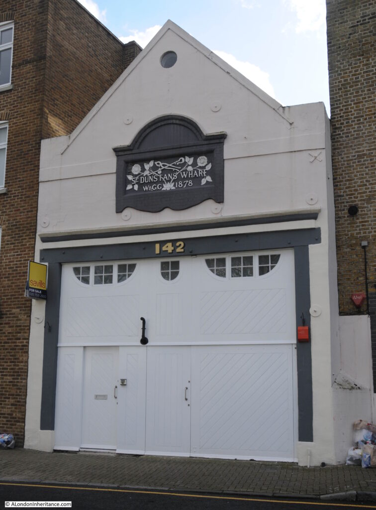
As well as Dunbars Wharf, there are a number of other building remaining along Narrow Street that face onto Limekiln Dock, including Dunstans Wharf:

Limekiln Dock

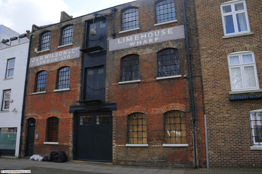
And Limehouse Wharf:

Limekiln Dock

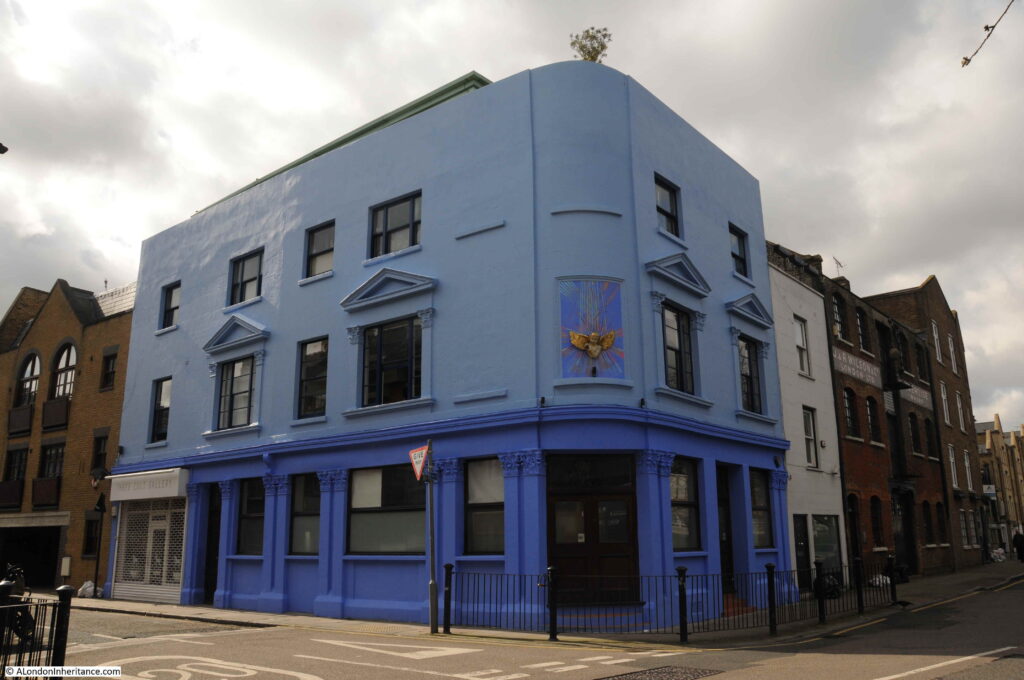
On the corner of Narrow Street and the southern stretch of Three Colt Street is an old pub:

Limekiln Dock

This was the Kings Head, a late 18th Century / early 19th Century pub, that although it is still clear that this was once a pub, closed a long time ago, around the early 1930s after which it became the office of a banana importing business.

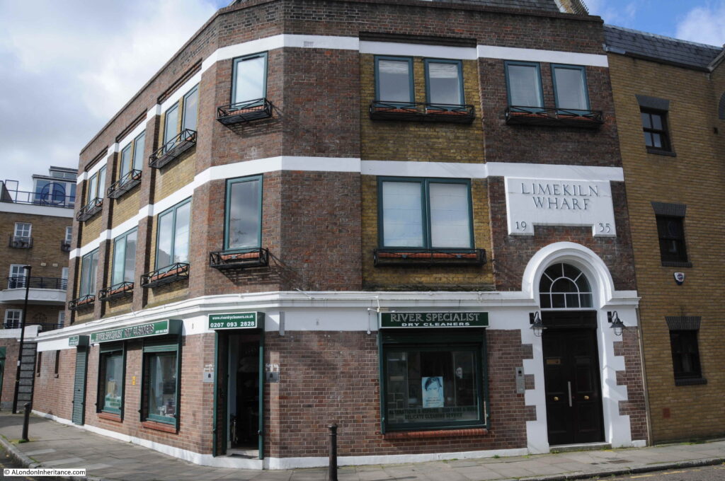
Walking along Three Colt Street towards the river is Limekiln Wharf, dating from 1935:

Limekiln Dock

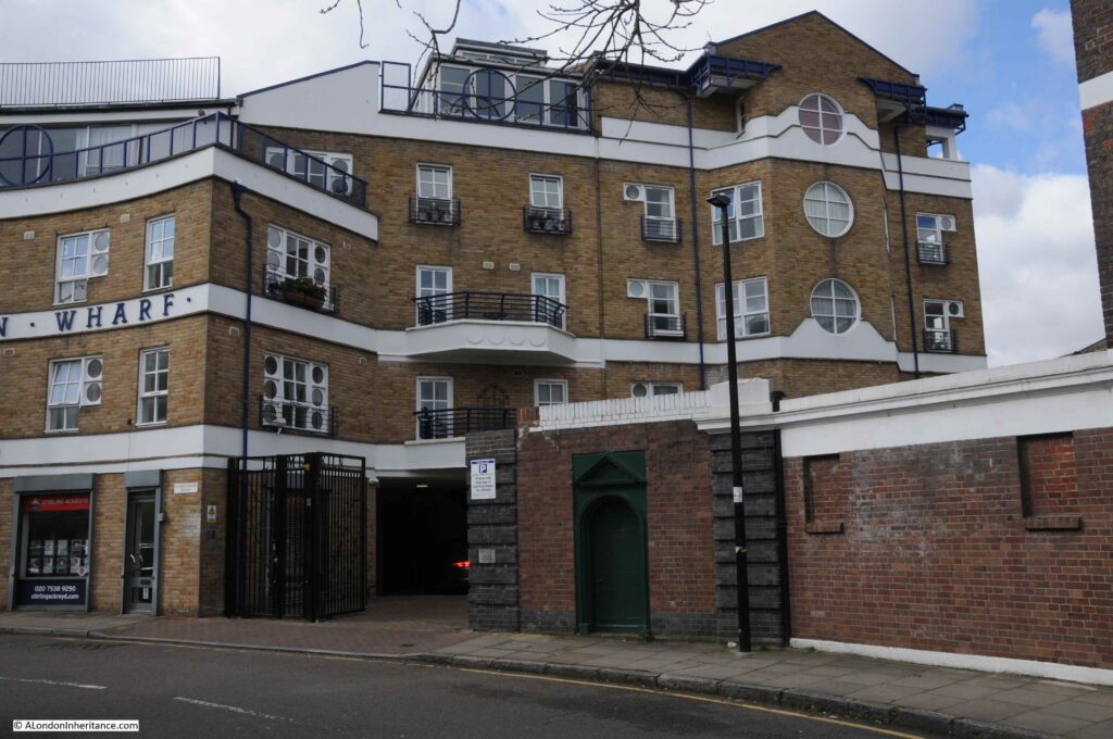
Further along is one of the new apartment blocks that now surround the entrance to Limekiln Dock:

Limekiln Dock

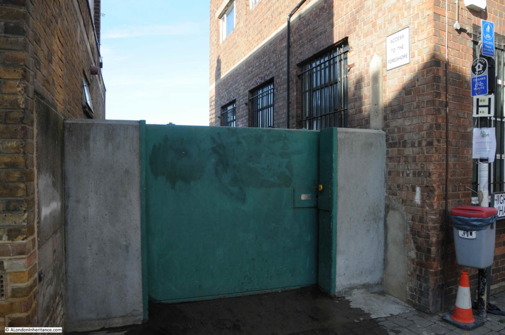
At the end of the wall with darker bricks, there is a dark green door built into the wall.

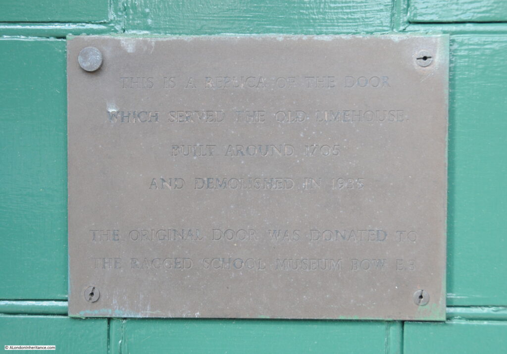
A rather faded plaque on the door provides some background:

Limekiln Dock

“This is a replica of the door which served the old Limehouse built around 1705 and demolished in 1935. The original door was donated to the Ragged School Museum Bow E.3.”

Which really brings me back to where I started. The Lime Kilns at the southern entrance to Limekiln Dock that gave the dock its name, and indeed the area of Limehouse.

Standing on a new footbridge looking along Limekiln Dock opens up the history of the dock, one of London’s lost rivers that ran to Spitalfields and Bow, one of the 19th centuries most successful shipping companies, the tension between protectionism and free trade, and the location of Limehouse Lime Kilns.

alondoninheritance.com

Shadwell Dock Stairs

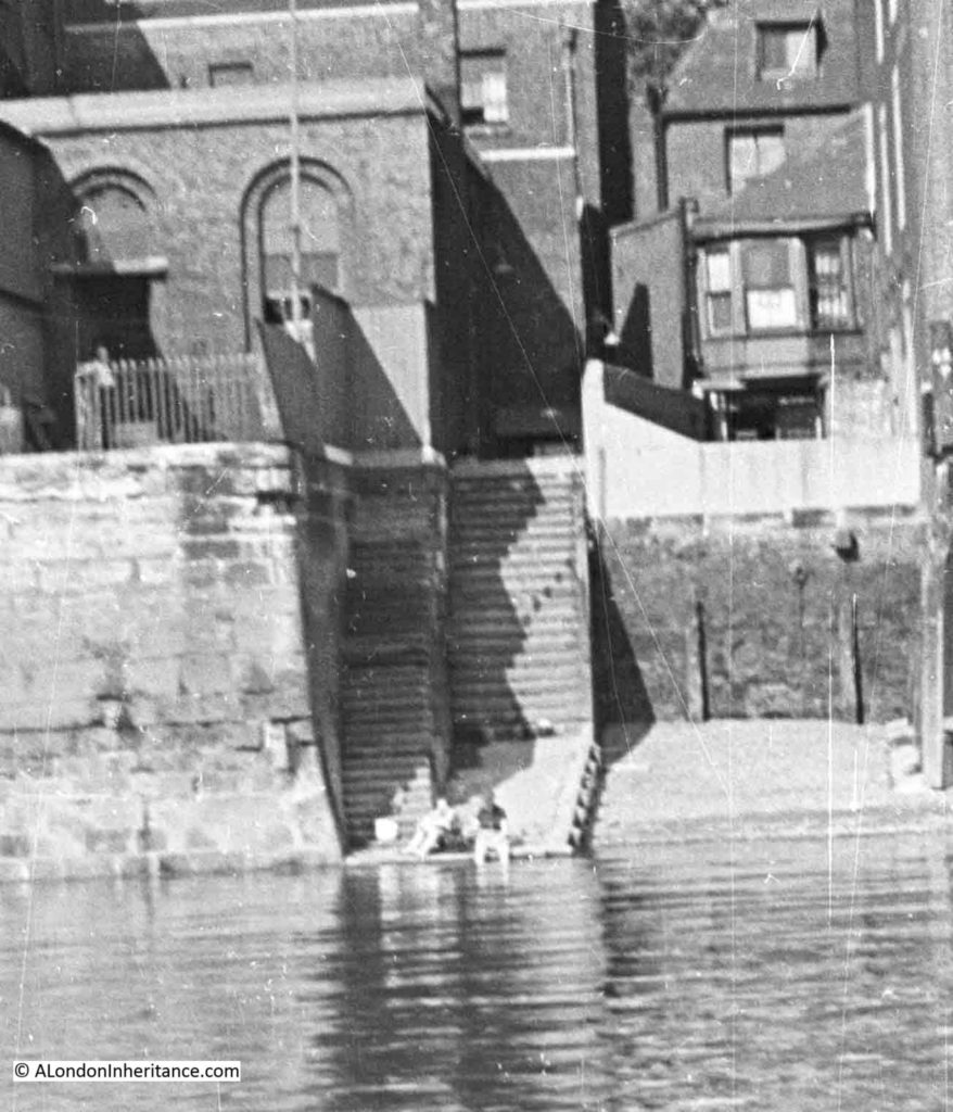
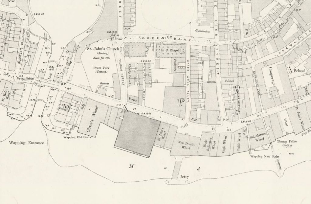
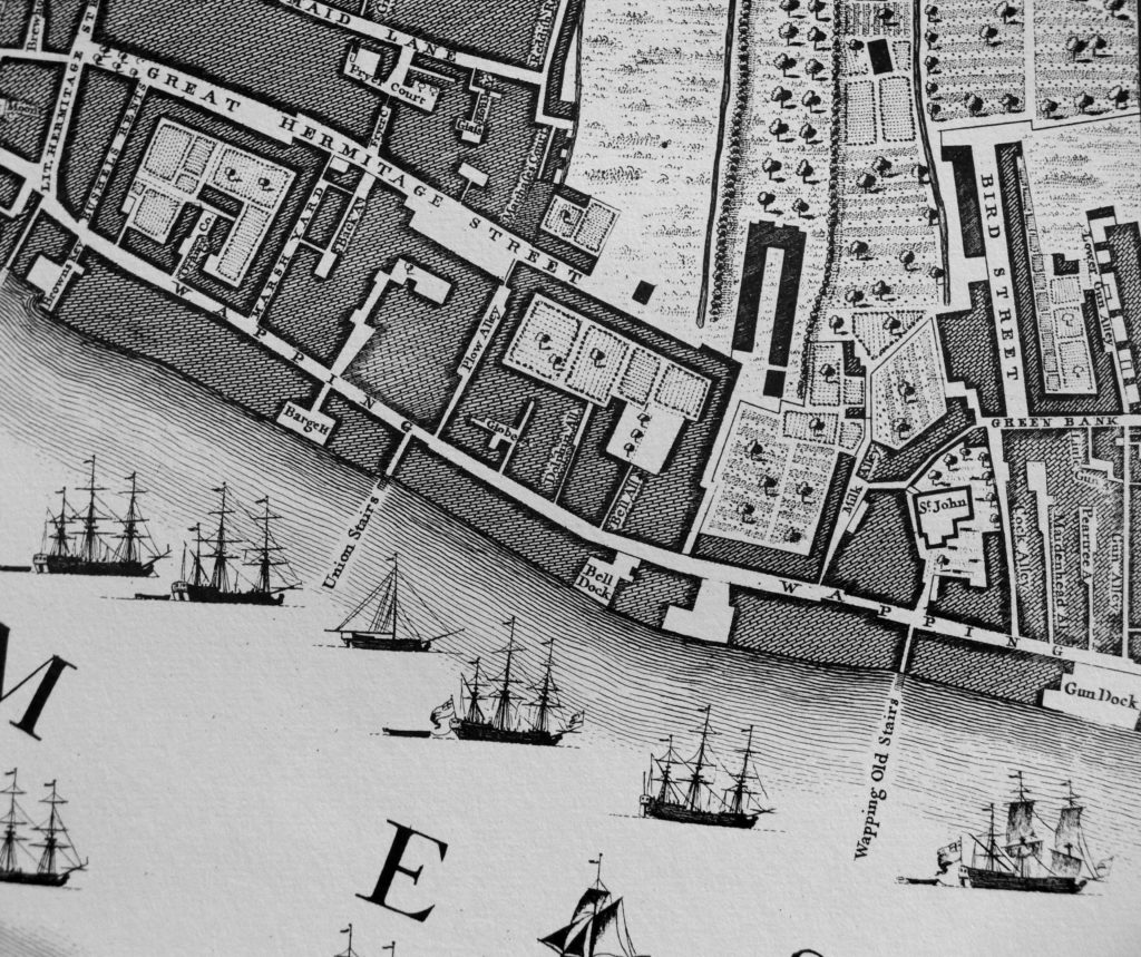
Six week’s ago, I walked along the north bank of the Thames from Tower Bridge to the Isle of Dogs, hunting some of the stairs down to the river. I am trying to trace all those that have been lost, and visit all those that remain. I have already covered a number of these fascinating places, and for this post I am at one of the probably lesser known stairs, Shadwell Dock Stairs.

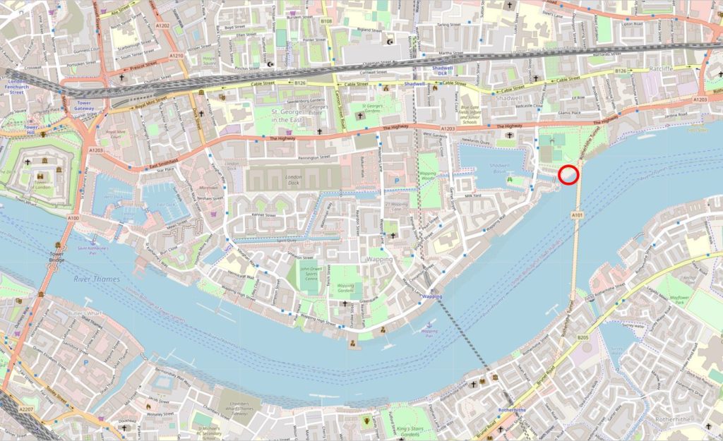
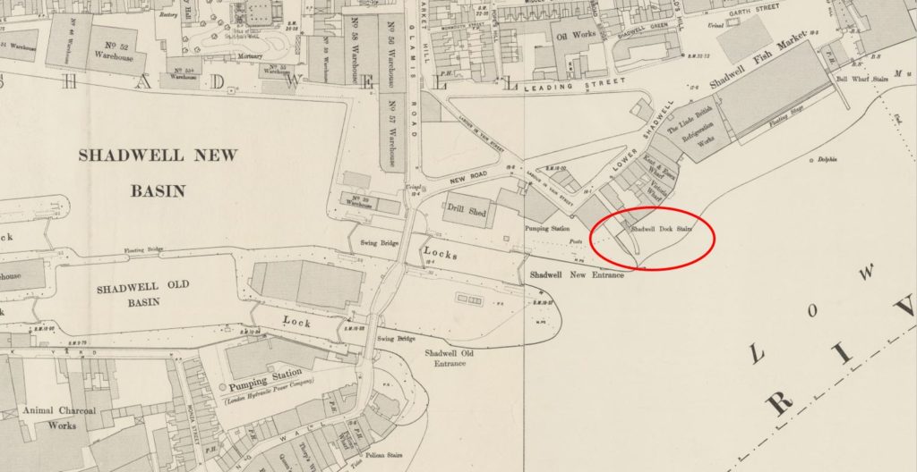
The red circle in the following map extract shows the location of the stairs, between King Edward Memorial Park and the entrance to Shadwell Basin  (Map © OpenStreetMap contributors).

Shadwell Dock Stairs

Shadwell Dock Stairs are shown on the 1894 Ordnance Survey map, but in a rather unusual location as they are almost hard up against the entrance to the Shadwell New Basin. This was the eastern entrance to the London Docks, so must have been a busy place with ships entering and departing from the London Dock complex.

Shadwell Dock Stairs

Credit: ‘Reproduced with the permission of the National Library of Scotland’ 

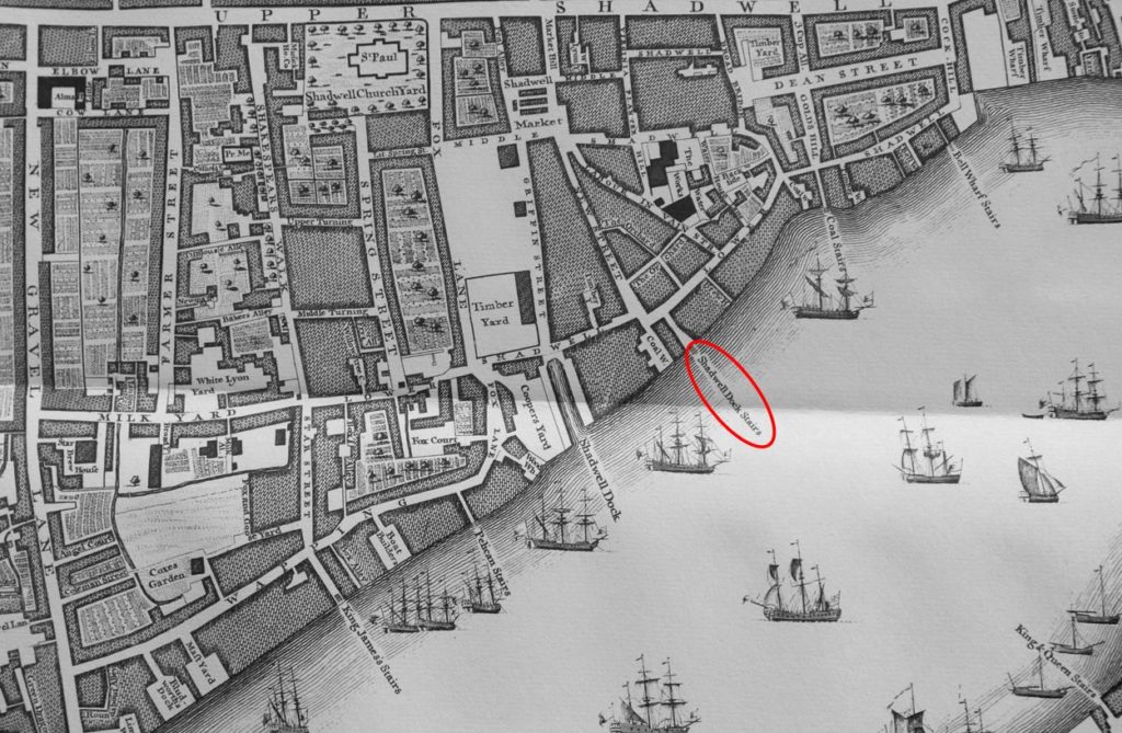
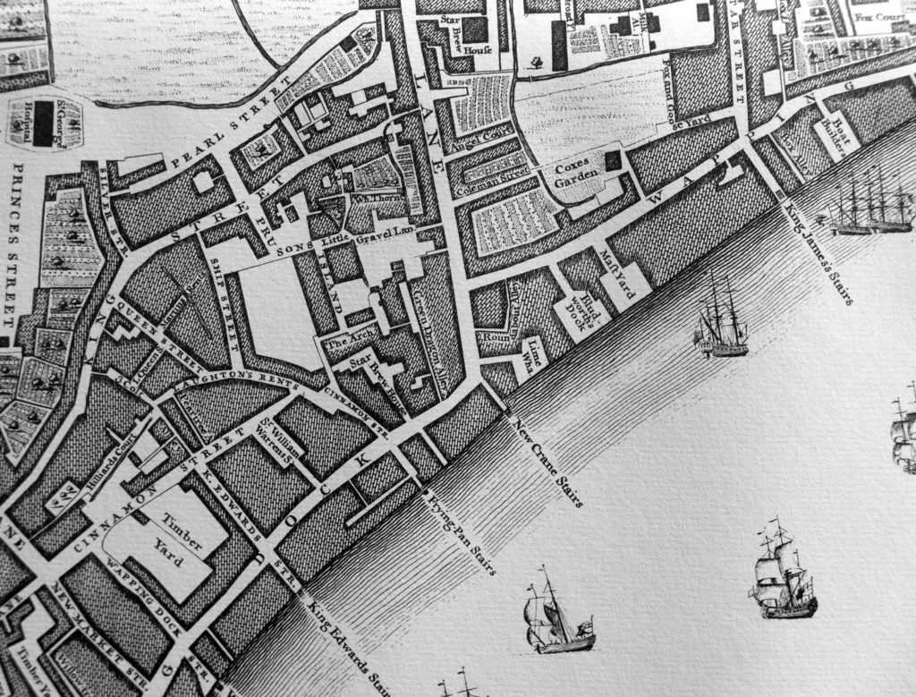
The reason they are there is explained by looking at an earlier map, the 1746 Rocque map of London which shows the stairs in place, long before the build of the Shadwell Basin. They are highlighted by the red oval in the following map.

Shadwell Dock Stairs

The above map also explains the source of the name. If you look to the left of the stairs, there is a narrow channel leading a short distance inland to the street Lower Shadwell. This channel of water is named Shadwell Dock. There is a Timber Yard across the street, so perhaps Shadwell Dock was the route by which timber was landed to be moved to and from the Timber Yard.

So, I suspect it is safe to assume that Shadwell Dock Stairs are earlier than 1746, and were named after the nearby dock.

The Faithorne and Newcourt map of 1658 shows a continuous line of buildings along the river at this point, without the stairs or Shadwell Dock, so they must have been built in the years between 1658 and 1746.

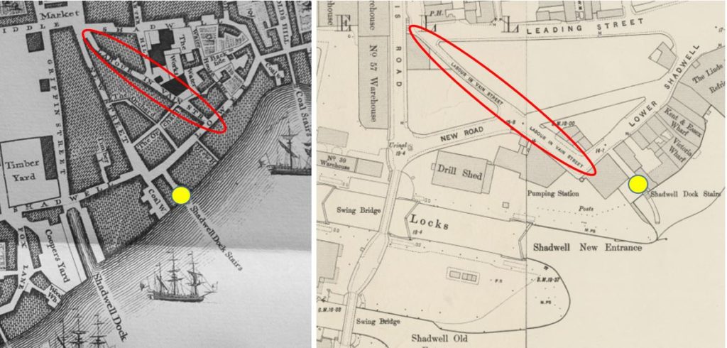
UPDATE: Reader David Crowther highlighted in the comments a key point regarding the location of the stairs which I completely missed. In the 1746 map, Shadwell Dock Stairs are to the west of Labour In Vain Street, however in the 1894 map the stairs are just to the east of the same street. To check that this was not a mapping error in the 1746 map, I checked Horwood’s map of 1799 and that also shows the stairs to the west of Labour In Vain Street, the same position as the 1746 map. 

The Shadwell Basin entrance was constructed in the 19th century, and aligning Horwood’s map with the position of the basin entrance shows that the original position of the stairs was where the new entrance would be constructed, so the stairs were re-built just to the east of the basin entrance, to the new position shown in the 1894 map.

This perhaps demonstrates the importance of the stairs, in that they were not simply lost when the Shadwell Basin was constructed, but were rebuilt just to the east of the new basin entrance.

The following maps (1746 on left and 1894 on right) clearly show the change in location between Labour in Vain Street (red oval) and Shadwell Dock Stairs (yellow circle).

My thanks to David for finding this.

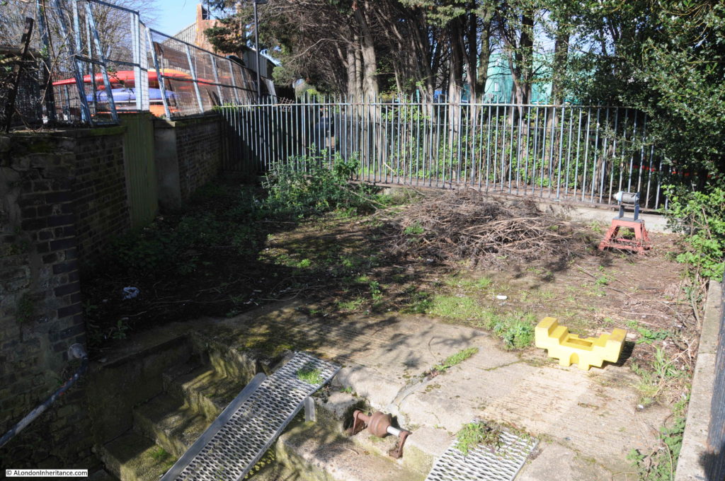
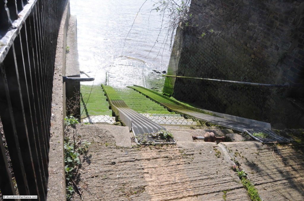
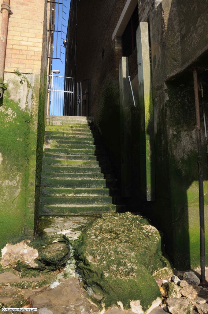
Shadwell Dock Stairs today are fenced off and show evidence of an alternative use of providing access to the river. They are located on the pathway that leads from Glamis Road to the southern end of the King Edward Memorial Park, where the northern ventilation  / old pedestrian access building for the Rotherhithe Tunnel is located.

This is the view looking towards the top of the stairs. The walkway is behind the fence at the top of the photo.

Shadwell Dock Stairs

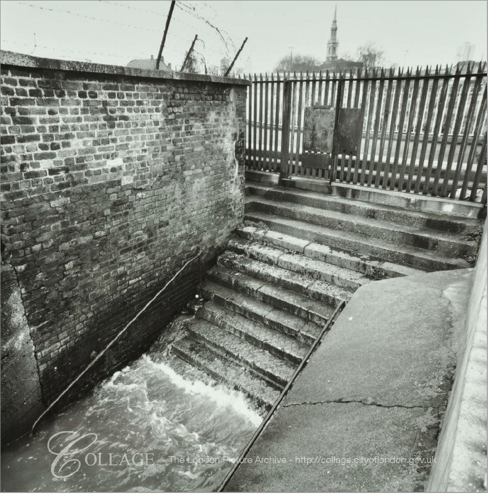
The LMA Collage archive has a similar view of the stairs from 1978, when much of the land behind was still derelict.

Shadwell Dock Stairs

Image credit: London Metropolitan Archives, City of London: catalogue ref: SC_PHL_02_0639_78_120_100_2

The clue as to the most recent use of the Shadwell Dock Stairs is found in the space between the stairs and the entrance to Shadwell Basin. This space is now occupied by Shadwell Basin Outdoor Activity Centre which provides water sport activities, and the Tower Hamlets Canoe Club.

The steps provided a launching route into the river for the adjacent organisations, however there now appears to be a much larger slipway built directly into the entrance to Shadwell Basin so I assume the stairs are now redundant, hence the current condition.

Boats would have been run down and up the metals runners which have been installed over the steps.

Shadwell Dock Stairs

Shadwell Dock Stairs feature in numerous newspaper reports over the years. All the usual accidents, drowned bodies being found, crime, ships for sale etc. There are three reports that I want to cover, as they reveal some of the more unusual aspects of life on the river, centred around these river stairs.

From the Morning Chronicle on the 16th January 1841, a report which shows that it was not just the Thames around the area of the City that froze in winter:

“NARROW ESCAPE OF THREE WATERMEN ON THE RIVER – On Thursday night, at about six o’clock, three Greenwich watermen, who had been into the London Dock with a vessel they had brought up the river, were returning from the upper entrance at Wapping, when their progress was stopped by a large field of ice, which nearly broke their boat in two, and drove them towards Shadwell Dock-stairs. Here they were completely hemmed in among the ice, which extended from one side of the river to the other, and completely blocked up the navigation.

The boatmen endeavoured in vain to extricate themselves, and were at length driven nearly into the middle of the river. Here they remained stationary for some time, exposed to the sleet and snow.

Soon afterwards the ebb tide drove the ice a little further down the river, and again the poor watermen tried to get out, but with no better success than before, and the field of ice was again stopped by the barges and shipping.

The watermen continually hailed the people ashore to render them some assistance, but none could be afforded, and the masses of ice were not sufficiently consolidated together for any one to venture in safety.

The men at last began to complain of the wet and cold, and said they could not hold out much longer. They had been four hours among the ice and their situation became very critical.

Some watermen and lightermen ashore threw lines towards them, but they fell very far short of the boat.  At ten o’clock, when they appeared quite exhausted, Judge, an Inspector of Thames police, and three river constables came to the spot at Shadwell and determined to make some effort to save them.

They borrowed two hurdles and some ropes. Constable Jones ventured as far upon the ice as was consistent with safety, and threw a line towards the boat, but the men were unable to catch it. The Thames Police, finding no time to be lost, and that the men were benumbed with cold, and incapable of any exertion, resolved upon a bolder attempt to save them.

A rope was fastened around Jones, the youngest and most expert of the party, and he placed one of the hurdles across the blocks of ice in advance of the one he was standing on. 

After much difficulty, Jones got back with a second line he had made fast to the boat. On reaching the shore, the Thames police, with the assistance of five other men, pulled the boat right over the ice, with the three men in it, and brought it close alongside one of Mr Charrington’s coal barges.

The watermen were taken out and were conveyed to the nearest public house.

Their exposure to the snow storm had affected them so much that it was some time before they recovered; and had not the greatest attention been paid them one or more would have perished.”

Very descriptive, and looking across the river at this point, it is hard to imagine that it could have frozen, being much wider than in the City, but in reality the sheer number of moored ships and barges would have provided plenty of spaces where ice could aggregate, and tides would have broken free large sheets of ice which would have drifted around the river as described in the report.

There are a number or reports which mention a ferry running from Shadwell Dock Stairs, but so far I have not been able to find any detail of the type of ferry, the destination and for how long it operated. There was consideration of starting a large steam powered ferry service from Shadwell, similar to the Woolwich ferry, and in Lloyd’s List on the 15th February 1893, there is a report that the London County Council is proposing a ferry between Rotherhithe and Shadwell.

The article reports on the considerable differences in opinion of the effect on navigation of a two ferry-boat service running across the river at intervals of every 15 minutes throughout the day. The proximity to the entrance to the London Docks was identified as a risk, with a ferry being a serious danger to ships entering or leaving the docks.

The Rotherhithe to Shadwell ferry was part of a bill put before Parliamentary Committee, but the ferry proposals did not make any progress, the proposal for a road tunnel underneath the Thames was a much better option, able to move far greater volumes of traffic and with no impact on river traffic. The Rotherhithe Tunnel opened in 1908, and now runs underneath the river, very close to Shadwell Dock Stairs.

I have often wondered whether these Thames stairs were administered or overseen in any way, or whether they provided open access to the river. In the days when there was so much traffic on the river, with people and goods of all types being stored on ships and barges. Given the right tide, the river was probably the fastest method of moving across London. The Thames stairs were important gateways between the river and land.

An article in the London Sun on the 10th March 1868 mentions a Watchbox at Shadwell Dock Stairs.

The article reports on the trial of Thomas Deacon, a 19 year old lighterman who was charged with violently assaulting Edward Dove, a Waterman at Shadwell Dock Stairs. The report states that:

“The complainant said that the prisoner was a perfect nuisance at the place and was in the watchbox at Shadwell Dock-stairs last night with another man. They had no right there, and were requested to turn out, which they refused to do, and the prisoner, who is a strong and powerful fellow, struck the complainant a tremondous blow on the mouth with his clenched fist, and completely wounding the upper lip.”

Thomas Deacon was sentenced to two months of hard labour for the assault.

Watermen were higher in the river hierarchy than lightermen, and watermen had a range of rights covering their work on the river, and perhaps were involved in some form of policing, or watching over the river and stairs.

The Watchbox at Shadwell Dock Stairs possibly being part of this approach – a problem with writing this blog, researching any topic always opens up lots of additional subjects to investigate.

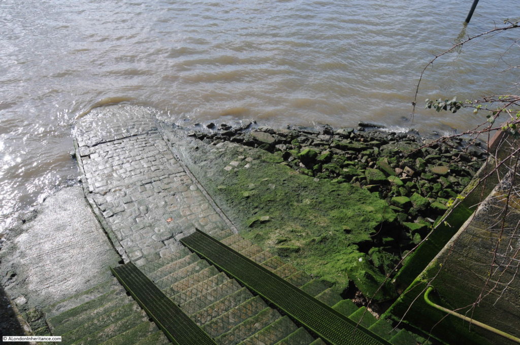
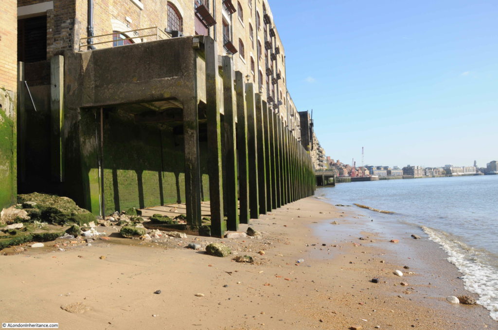
Looking down Shadwell Dock Stairs and the following photo provides a better view of the stones forming the causeway leading out into the river.

Shadwell Dock Stairs

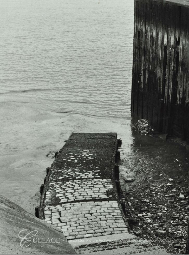
The LMA Collage archive has a better photo of this part of the stairs at low tide in 1971. Interesting in comparing the above and below photos, the 1971 photo did not have what looks to be some form of concrete / stone platform either side of the causeway. This must have helped with preserving the state of the causeway. The concrete appears to have replaced the wooden posts that once held the side of the causeway in place.

Shadwell Dock Stairs

Image credit: London Metropolitan Archives, City of London: catalogue ref: SC_PHL_02_0639_71_35_513_23

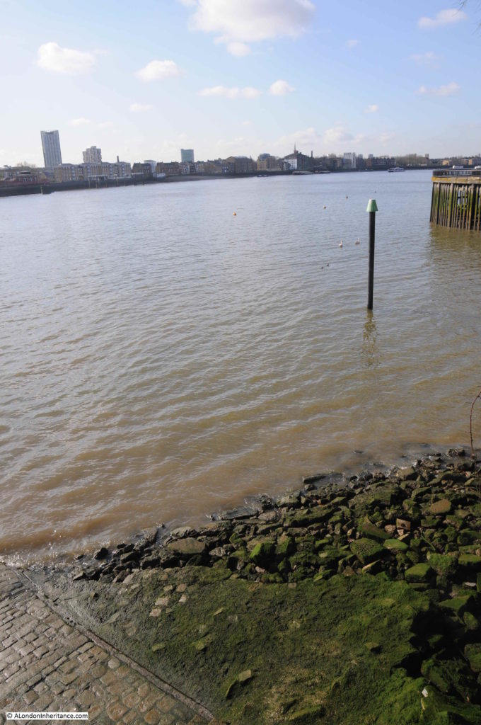
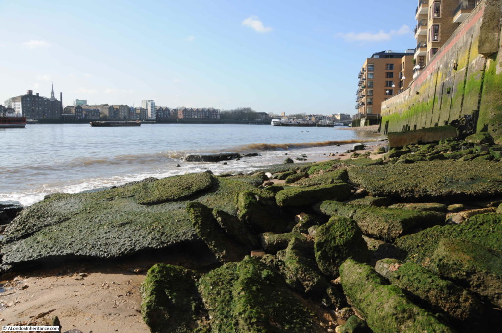
Looking west along the river with Shadwell Dock Stairs in the lower left corner. To the right, between the marker post and the opposite river wall is the entrance to the Shadwell Basin, showing how close the entrance is to the stairs.

Shadwell Dock Stairs

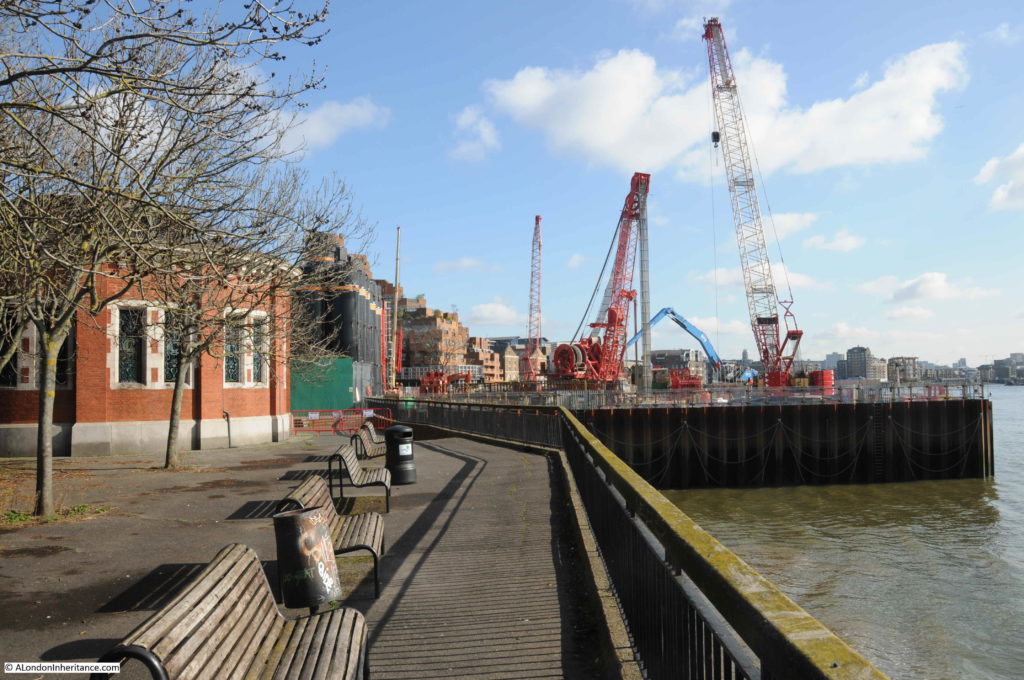
Shadwell Dock Stairs are Grade II listed, and they were included in the impact assessments for the construction of the Thames Tideway Tunnel and close by is one of the construction sites for the tunnel, where part of the river facing walkway has been closed off. The following view is from the location of the Shadwell Dock Stairs, looking east, with the old Rotherhithe Tunnel pedestrian entrance, now ventilation point on the left, and the construction site on the right.

Shadwell Dock Stairs

A small part of King Edward Memorial Park is now part of the construction site, but the major part of this park is unaffected. It is a park with a fascinating story, including competition for Billingsgate Fish Market. I wrote about the history of the park here.

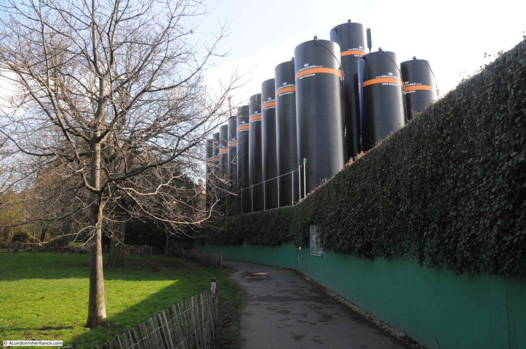
Large, black, storage tanks form an interesting view along the southern edge of the park:

Shadwell Dock Stairs

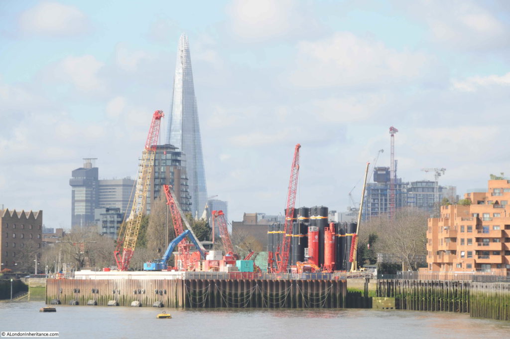
A longer view of the Tideway Tunnel construction site. Shadwell Dock Stairs can just been on the left edge of the photo.

Shadwell Dock Stairs

Shadwell Dock Stairs were in existence before the London Docks, and the construction of the entrance to Shadwell Basin must have demolished the Shadwell Dock seen in the 1746 map, that the stairs must have been named after.

Shadwell Basin is the only remaining expanse of water from the London Docks, with the entrance to the basin being adjacent to the stairs.

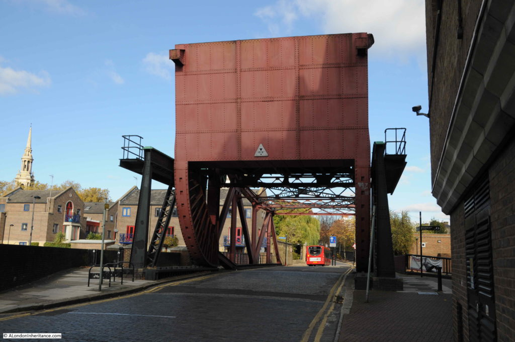
A large lifting bridge remains over the entrance to the basin, carrying Glamis Road from Wapping Wall up to The Highway.

Shadwell Dock Stairs

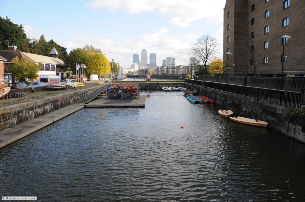
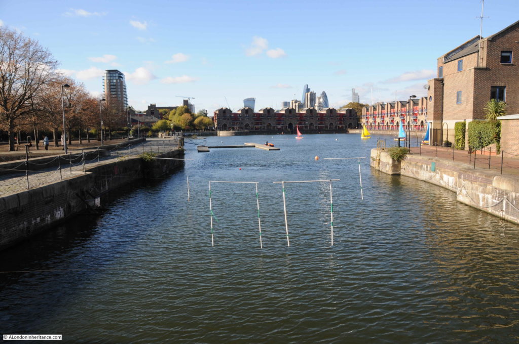
The section of the basin entrance between bridge and river is now occupied by the Outdoor Activity Centre.

Shadwell Dock Stairs

Looking from the bridge in the opposite direction with the basin entrance leading into the larger Shadwell Basin. The towers of the City in the distance.

Shadwell Dock Stairs

At the risk of sounding repetitive as I have mentioned this in my previous posts on Thames Stairs, I do find them fascinating. Shadwell Dock Stairs today is fenced off, but as with all the stairs I have looked at, they are a focal point for discovering the human history of the river and shore.

Standing by the stairs, we can imagine the thousands of people who have used the stairs to get to and from the river. The coming of the Shadwell Basin must have had a huge impact on the stairs. The times when ice from the frozen river broke up against the stairs, and the watchbox that must have been a scary place to sit on a dark winter’s night – all part of London’s centuries old relationship with the River Thames.

alondoninheritance.com

New Crane Stairs and the Anchor and Hope Pub

In the week before the lock down was implemented, I walked from London Bridge to the isle of Dogs. One of my favourite walks as the views of the river are wonderful in the gaps between old warehouse buildings. I am gradually working through as many Thames Stairs as I can find, and for this week’s post, let me take you to New Crane Stairs and a lost pub.

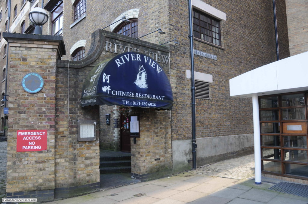
New Crane Stairs can be found at the corner where Wapping High Street turns away from the river towards Garnet Street. the entrance is tucked away between the old New Crane Wharf building and a recent new apartment building, with the entrance to the River View Chinese restaurant at the entrance to the stairs.

New Crane Stairs

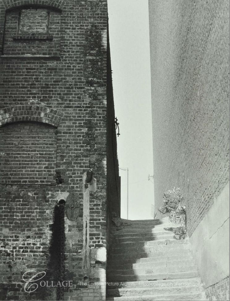
The view along the passageway leading to the stairs:

New Crane Stairs

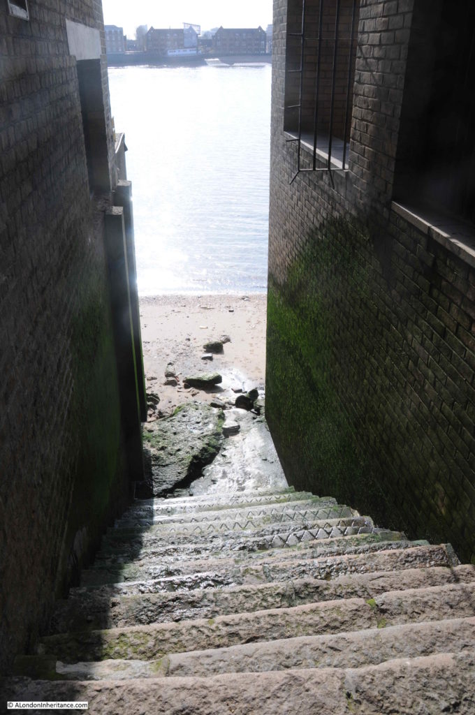
At the end of the passageway, New Crane Stairs lead down to the river foreshore:

New Crane Stairs

Despite the name, New Crane Stairs are an old set of stairs down to the river. They appear in Morgan’s 1682 map of the whole of London. The word “New” at the start of the name is interesting as it implies there may have been an earlier set of stairs with the Crane name. There are other examples of this, for example Horselydown Old and New Stairs on the south bank of the river, east of Tower Bridge.

The London Borough of Tower Hamlets Wapping Wall Conservation Area document states that: “Great Jubilee Wharf and New Crane Wharf (following the post medieval river wall line) form a continuous ‘wall’ of buildings between the street and the Thames.” Intriguing to wonder if New Crane Stairs could possibly date back to a route over the medieval river wall to the river.

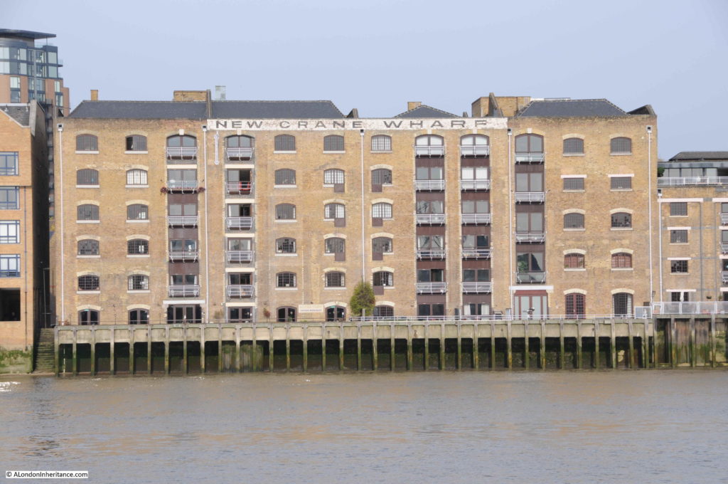
The following photo shows the view of New Crane Wharf from the river, with the stairs to the left:

New Crane Stairs

I cannot find a source for the name, whether there was an earlier set of stairs with the Crane name, or whether the name was in reference to the nearby installation of a “new crane” which perhaps in the 17th century or even earlier would have been worthy of note.

Rocque’s 1746 map clearly shows New Crane Stairs at the point where the road turns north, in the centre of the following map:

New Crane Stairs

The first written reference I can find to the stairs, in addition to the above maps is a rather touching newspaper report from the 4th August 1758:

“Thursday, the Wife of John Newcomb, a Waterman, belonging to New Crane Stairs, Wapping, was delivered of three fine boys, and all are like to do well.”

That this was newsworthy probably indicates how rare it was in the mid 18th century for three babies to be born, presumably without any complication – although typical for the time, the wife’s name is not given, or her health following the birth.

Five years later, in July 1763 there was one of the disastrous events that were relatively common in the wooden, close built houses and warehouses crammed with combustible materials:

“Sunday morning, about One o’Clock, a most dreadful Fire broke out at the New Crane Stairs, Wapping, which burnt with great Fury for 4 Hours before it could be stopped, and consumed all the Houses from New Crane Stairs to King James’s Stairs, and from the River-side back to the Garden Ground which includes both sides of the Street called Wapping Wall, and Part of Gravel Lane; it ended in consuming Mr Wilson’s large and fine Cooperage: The Number of Houses burnt are computed around 170, besides Shops, Warehouses and Docks, &c. and it is reckoned 1500 Persons, Housekeepers, Lodgers, &c. are burnt out. The loss is immensely great.

In the Dock by New Crane Stairs was the Mary Gally, captain Clarke, a fine Ship in the West-India Trade, almost ready to come out, which was entirely consumed to the keel, with all materials about the Dock. 

It is said the Fire broke out in a Small-Beer Brewery, which immediately communicated itself to the Ship Alehouse; and the Wind blowing strong from the South carried the Flames to the Dock-Yard and other Houses adjoining; and the street being narrow, greatly impeded the working of the Engines. Two men are said to be buried in the Ruins and a Fireman had his skull fractured by the falling of a Wall.”

The damage caused by the fire can be judged by Sun Fire Office alone paying out £40,000 to those who had suffered losses in the fire.

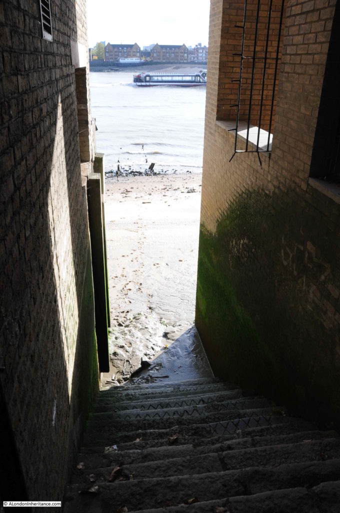
It was a sunny and peaceful day when I walked down New Crane Stairs. The following photo is looking back up the stairs, the green algae demonstrating the height of high water on the stairs and surrounding buildings.

New Crane Stairs

Part of the foreshore at the base of the stairs is covered in large concrete blocks, possibly the remains bombed buildings, river wall of structures that once ran into the river.

The foreshore at the base of many of the Thames stairs are remarkable places. I very rarely see anyone else, they are very peaceful, but have the full view of the river and adjoining buildings.

New Crane Stairs

To the east (the above photo), the foreshore is almost beach like with a fine silt covering much of the surface. To the west as shown in the photo below there are more of the large concrete blocks:

New Crane Stairs

The foreshore is covered with the tide worn remains of bricks and the chalk blocks that were used to provide flat and firm bases on the foreshore for barges and lighters.

New Crane Stairs

When the tide is low it is possible walk some distance along the foreshore, but not today – and always with care to watch the tide and access to and from the river.

New Crane Stairs

A rather tragic event at New Crane Stairs in 1911 demonstrated the lack of care for people really struggling and probably with mental health problems. The following article was titled “A Lucky Escape”:

“James Rick, 48, a meat porter of Angle-street, Walworth, was charged with attempting to commit suicide by jumping into the River Thames at New Crane Stairs, Wapping.

Police-Sargent Anderson, stated that early on Saturday morning he saw the accused struggling in the water. He rowed to his assistance, and succeeded in getting him into the boat. When questioned at the station, the accused replied ‘I have lost my wife, and everything has gone wrong. Everything seems to have gone wrong with me’.

Prisoner was remanded for a week.”

That someone who had attempted suicide, and had been driven to that fate by who knows what tragedy had been treated as a criminal seems incredible, but was a standard approach at the time.

A different example, but which also shows how people were treated comes from 1832 when Hugh Elliot of the coal ship Flora from Sunderland was charged with assaulting John Morrison, a boy belonging to another collier.

The boy had been assaulted at midnight at New Crane Stairs where he was waiting for his master, when the prisoner and several other ‘north country seamen’ came down and asked the boy to row them to their ships. He refused as he was waiting for his Captain, and Hugh Elliot assaulted him with several blows about the face and body.

This was bad enough, but the boy had been waiting since 10 pm and was “almost perished with cold”. It was apparently common practice for the masters of colliers to get their apprentices to row them to shore, then wait in the cold whilst they got drunk in the pubs. The report adds that a few winters ago, two lads were found by their officers frozen to death while waiting for their captains.
New Crane Wharf, to the east of the stairs is one of the pre-war warehouses, however the building to the west of the stairs is a new apartment building replacing a smaller building seen on the left of the following photo of New Crane Stairs in 1971:

New Crane Stairs

Image credit: London Metropolitan Archives, City of London: catalogue ref: SC_PHL_02_0639_71_35_518_11

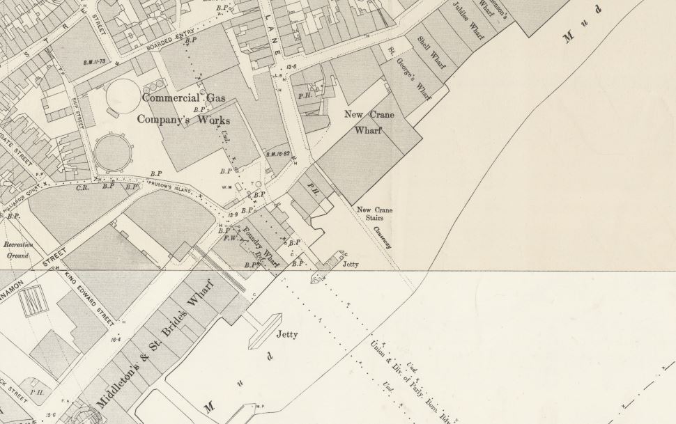
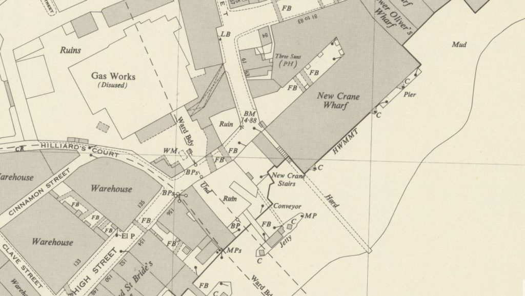
We can get an idea of the industry in the immediate vicinity of New Crane Stairs by looking at maps of the area. The following extract from the 1894 Ordinance Survey Map shows New Crane Stairs in the centre of the map, with a causeway extending out into the river.

New Crane Stairs

Credit: ‘Reproduced with the permission of the National Library of Scotland’ 

There is a jetty extending into the river, and to the upper left of New Crane Stairs are a “Commercial Gas Company’s Works”. More detail can be seen in the 1948 Ordnance Survey Map below, where New Crane Stairs is shown with a “Hard” extending into the river, the pier is still there with a conveyor which I suspect was used for taking coal to the Gas Works, which by 1948 are now shown as disused.

New Crane Stairs

Credit: ‘Reproduced with the permission of the National Library of Scotland’ 

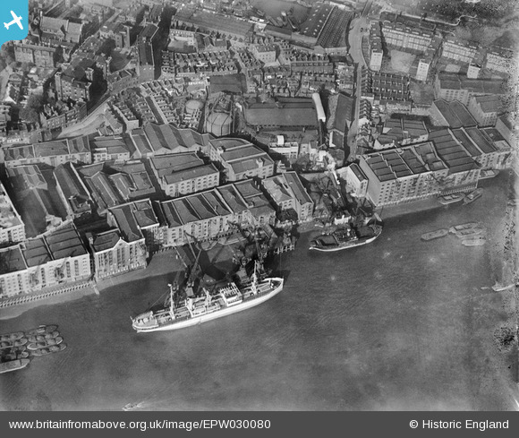
There is a 1929 Britain from Above photo which shows the area covered by the above two maps. Ignore the large white ship, rather look to the right and there is a smaller ship with two square holds which I suspect carried coal which would then be transported via conveyor to the Gas Works, the area to the right of the gas holders.
New Crane Stairs

New Crane Stairs are to the upper right of the smaller ship, between the large warehouse (New Crane Wharf) and the smaller building.

Coal for the Gas Works was at continual risk of theft. An article in the East London Observer on the 29th May 1920 reported on two boys, John Vincent and John Bullman, both of Whitehorn-place, Wapping who were charged with the theft of 84lbs of coal, the property of the Commercial Gas Company. They had been seen by Constable 393 H who was on duty at New Crane Stairs coming from the barge Spaniard with a large sack.

They were up before the magistrate at Old Street Police Court and were given some “good advice” and bound over to be of good behaviour for twelve months.

I suspect the large amount of broken concrete blocks on the foreshore to the west of New Crane Stairs could be the remains of the jetty, or other infrastructure which was part of transporting coal from moored ships to the gas works.

The two maps also show a causeway or hard extending from the stairs into the river. There was no sign of that on the day of my visit, however on a visit a couple of years ago when the tide was lower, remains of this feature were visible existing out from the silt of the foreshore into the river, as shown in the following photo:

New Crane Stairs

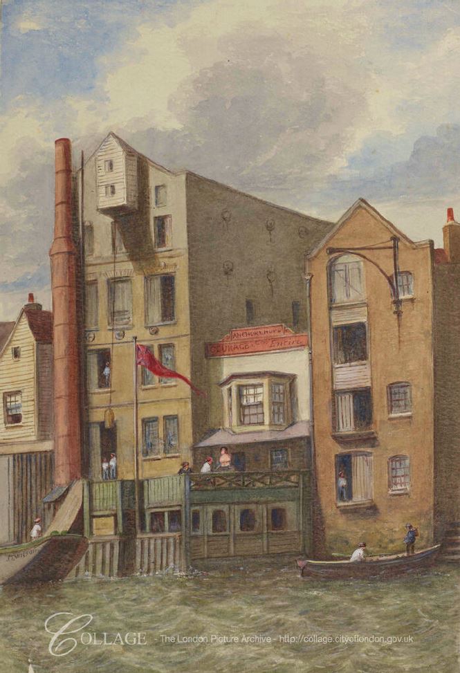
The following drawing from the LMA Collage archive, dated c1870, shows the New Crane Stairs on the far right, along with the smaller warehouse building shown in the maps, Britain from Above photo and the 1971 photo.

New Crane Stairs

Image credit: London Metropolitan Archives, City of London: catalogue ref: p540958x

In the centre of the drawing is a pub. This is the Anchor and Hope public house, the building labeled P.H. just to the west of the stairs in the 1894 Ordnance Survey map.

I cannot find any photos of the pub, or much written about the pub, although there are plenty of newspaper references to the pub, either as a reference point for some event, or to activities using the pub. These references are always useful in understanding more about life in London as they record the day to day events that were important at time.

The unhealthy state of the River Thames is clear from an article in The Sportsman on the 14th January 1889 when the capture of a fish justifies an article:

” Perhaps the most startling incident in the world of sport during the last few days is the catch of a large carp in the Thames at Wapping. On Tuesday afternoon, opposite Mr Bat Murphy’s well-known hostelry, the Anchor and Hope, Wapping, a lighterman caught a very fine specimen of an English carp in the river, weighing more than 7lb. Mr Murphy has given instructions that this ‘below-bridge novelty’ should be stuffed and placed in a glass case.”

So perhaps the carp in its glass case was on display in the Anchor and Hope. The article goes on to mention a previous capture of a carp in the Thames, which was cooked for a special dinner to commemorate the capture of such a fish in the river, however after one bite, the taste was so bad that the diners had to reach for the brandy – a possible indicator of how bad the pollution of the river was in the 19th century.

Pigeon racing was a popular sport in East London and in August 1883, Mr Murphy, representing the Anchor and Hope came 3rd and won £3 in a race that started from the Derby Arms, Charlton.

In August 1880, the City of London, Tower Hamlets, Middlesex, Shadwell, Wapping and Ratcliffe Annual Regatta took place and all watermen and lightermen’s apprentices of the River Thames from Teddington to Gravesend were invited to enter their names at the Anchor and Hope, New Crane, Wapping for their annual coat and silver badge, and freedoms of the Watermen’s and Lightermen’s Company.

Pubs were used as a meeting point, both for activities at the pub and also as a reference point for unrelated activities. An event in 1806 is a reminder of how General Elections were very restricted and the appointment of MPs controlled by the MPs, who often held seats for very long periods of time.

In the November 1806 General Election, George Byng was returned to Parliament for Middlesex. He had already been an MP since 1790 and would remain an MP for Middlesex until his death in 1847.

Voting was limited to Freeholders, and one way to get Freeholders to vote was to arrange their transport, and George Byng was advertising in newspapers that on election day:

“the Friends of Mr Byng are respectively informed that Carriages are provided for the conveyance of Freeholders in that Gentleman’s interest, and stationed at the following places, viz. Near the Anchor and Hope, New Crane, Wapping.”

As well as the Anchor and Hope, the advert then lists an additional 8 locations across East London and the City where coaches would be provided to transport his supporters to the election at Brentford.

I can identify exactly how and when the Anchor and Hope pub closed. The following is from an article titled “Exciting Scenes At Wapping” in the Daily News on the 5th July 1904:

“The East-end was the scene of an exciting fire in the early hours of yesterday morning, at which two persons were injured and three had very narrow escapes.

Shortly before two o’clock a fierce fire burst out in the spirit stores on the first floor of the Anchor and Hope public-house, Wapping High-street. In a short time the entire floor was blazing.

When the Shadwell firemen arrived they were informed that there were people in the burning building. Dashing up the staircase, and beating back the flames with a hydrant as they went, the crew of the escape brought down a man and a woman – the latter, Mrs Margaret Allen, 68, being in a condition of semi-unconsciousness. Meanwhile a third person had leaped out of the second floor window to the foreshore of the Thames. Her name is Ann Donovan, 43, and when she was picked up and removed to hospital it was found that she had broken her leg in two places, and was otherwise injured.

The fire was not extinguished until the public-house and it contents had been practically destroyed.”

It may be that fires were at the start and end of the Anchor and Hope, probably built after the destruction of the 1763 fire, and destroyed in the 1904 fire. After the 1904 fire, the area once occupied by the pub seems to have been included in the space occupied between river and gas works, probably used for the movement of coal from river to gas works.

I continue to be fascinated by Thames Stairs. They are some of the oldest features to be found along the river and almost certainly date back many hundreds of years.

Most times when I walk down stairs and on to the foreshore, even on a glorious sunny day, they are quiet. It is not often I find someone else on the foreshore.

A perfect place to watch the river and consider the considerable human history centred around these places that form the boundary between land and river.

alondoninheritance.com

Trinity Hospital and Power Station, Greenwich

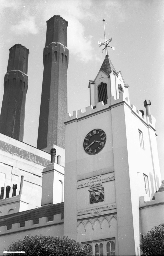
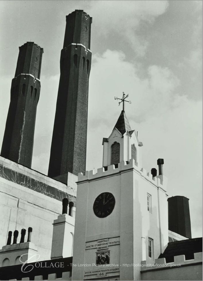
Trinity Hospital Greenwich can be found facing the River Thames, roughly half way between two pubs, the Trafalgar Tavern and the Cutty Sark. In 1951 my father took the following photo of the river facing entrance and clock tower of the hospital, with the chimneys of the adjacent power station behind.

Trinity Hospital

I suspect his thinking in composing the above photo was to show the contrast between what was at the time the almost 350 year old hospital and the relatively recent power station that then dominated the area. The photo also shows two buildings with very different form and function. One enormous building generating electricity from coal for the tram network of London, the other much smaller building providing accommodation for the poor of Greenwich.

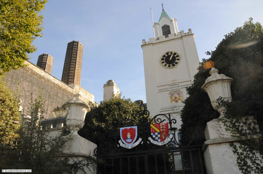
On a fine day last Autumn, i was on my way to the Cutty Sark pub, remembered that my father had taken a photo of the hospital and power station chimneys, but did not have a copy of the original photo with me, so took a couple of comparison photos in landscape rather than portrait, but hopefully they show what has changed, and what has not in the past 70 years.

The entrance gates, entrance and clock tower, with the power station in the background.

Trinity Hospital

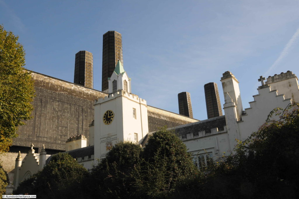
A slightly wider view showing all four chimneys.

Trinity HospitalThe main difference between the two photos is the build of the chimneys. The power station has four chimneys. The two chimneys in my fathers photo, and to the left in the above photo date from the first stage of the power station which was opened in 1906. The two chimneys of the second stage, shown to the right of the above photo were originally constructed to the same design, but were soon shortened due to complaints by the Royal Greenwich Observatory.

The construction of the power station used some leading edge technology for the beginning of the 20th century, and an article in the 20th October 1906 edition of the Kentish Independent described the power station:

“THE HEAVENLY TWINS – GREENWICH ELECTRIC POWER STATION: Very much the reverse of beautiful though they are, the two great chimneys which stand side by side, gaunt and forbidding, near the Thames at Greenwich, represent power, importance, and engineering skill. They are the outward and visible sign of the inward wonders of the London County Council’s new power station. One of the largest in the world it will be when completed. 

‘The Heavenly Twins’ Greenwich people have christened the towers, but it is the interior which is to supply the vitality and volatility which will be the better reminder of Angelica and Diavolo. 

Along the side wall of the vast chamber, where the plant is to be stored, runs a series of vertical girders, writes a correspondent who has paid the generating station a visit. On these a travelling iron bridge moves from end to end carrying a crane which lifts any weight up to 50 tons. Heavy objects are taken up at the front door and gingerly carried to any part of the hall. Below us the furnaces, consuming 600 tons a day, occupy the great basement. The dynamos are on the ground floor, in the side gallery a giant switchboard will strike the visitor with awe and fear at its death dealing potentialities.
It will come as a surprise to many homely people to find that here the ‘coal cellars’ are on top of the house. These bunkers comprise 24 square iron chambers, holding in all 16,000 tons of coal. The bottom of each is shaped, in cement and metal, like an inverted cone, the depressed point being an open funnel or shoot, down which the coal falls directly into the furnace openings as the stoker directs.”
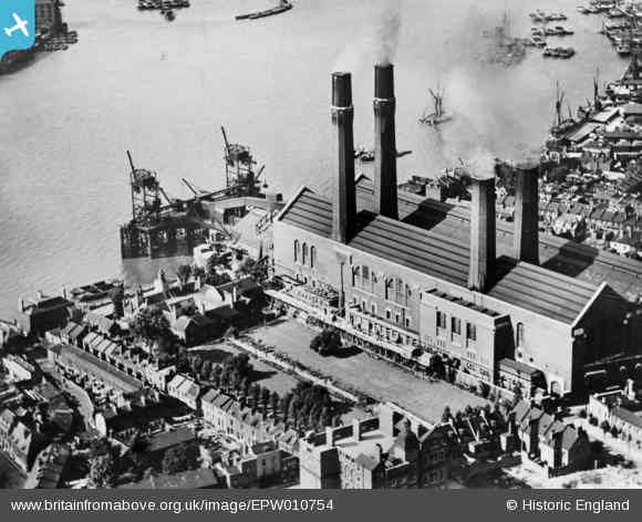
The following photo from Britain from Above shows the power station in 1924 with the two “Heavenly Twins”, chimneys from the first phase of the power station nearest to the river and the shortened chimneys of the second phase to the right.

Trinity Hospital

Trinity Hospital is to the left of the power station. The hospital buildings and clock tower facing the river, with the hospital gardens stretching back, parallel to the power station.

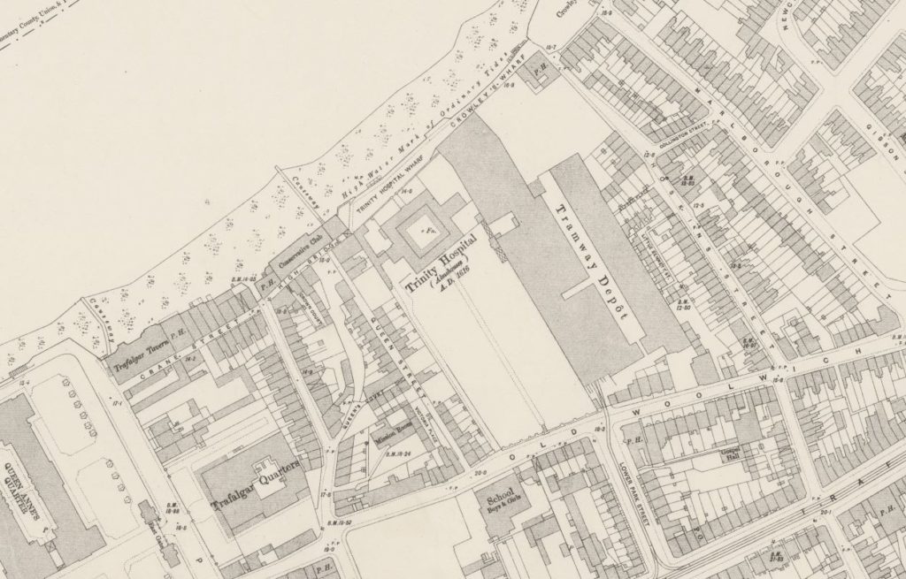
The power station supplied electricity to the London tram system, and later to the London Underground, along with Lotts Road in Chelsea. The power station was built on an earlier tramway depot. The following extract from the 1895 Ordnance Survey map shows the hospital in the centre of the map, with the tramway depot to the right.

Trinity Hospital

Credit: ‘Reproduced with the permission of the National Library of Scotland’ 

Power stations in the first decades of the 20th century operated independently, with no backup and breakdowns would have an immediate impact to users of electricity, and this was very visible on the London transport system.

A letter to the East London Observer on the 17th October 1908 by the president of the Associated Municipal Electrical Engineers raised two recent failures of the Greenwich Power Station, and the power station at Lotts Road, Chelsea which supplied the London Underground:

“The Greenwich Power Station of the London County Council and the Chelsea Power Station of the Underground Railways, both these stations have recently broken down, with the result that in the former case about 600 to 800 trams were brought to a standstill, and in the latter case all trains and lifts on the Bakerloo, Piccadilly and Hampstead Tube Railways and the District Railways were stopped and the stations and lifts plunged into utter darkness, as well as causing a stoppage on the Wimbledon and Surbiton sections of the London United Tramways systems.”

The author then goes on to propose that these sort of power outages can only be fixed if electricity generating stations are interconnected so there is no single point of failure, and other stations are available to take on the load of a failed power station. An idea that would eventually be implemented across the country in the form of the National Grid, which today provides electricity to the Underground network, with the Greenwich Power Station being available as a back-up generator having been converted to gas operation.

Trinity Hospital is also shown on the 1895 map, and by the time of the map, it was already almost 300 years old. The book “The Endowed Charities of the City of London” (published in 1829) describes the founding of the hospital as:

“By letters patent, King James I, dated 5th June, in the 13th year of his reign (1615) reciting that Henry, late Earl of Northampton, did, in his lifetime, begin to erect a certain edifice at East Greenwich, for the habitation and support of poor men”

Accommodation was provided for 20 poor men, who would live in the hospital along with a Warden. Residents were expected to comply with a set of standards which included not being allowed to go to Taverns or Ale-houses.

A 19th century report of a dinner provides a glimpse of life at Trinity Hospital and for the increased number of residents (now 25). From the 11th September 1841;

“Trinity Hospital, Greenwich – A most gratifying scene was presented at this hospital on Wednesday last, on the occasion of a dinner being given to the inmates, nurses &c, by the Rev. William Jurin Totton, rector of Debden, Essex, and old member of the Mercer’s Company, who are the governors and trustees of the charity. It was pleasing to those who saw the old members, 25 in number, and whose ages amounted to 1680 years, assembled in the sub-hall at a dinner of true old English fare of roast beef, plum-pudding, and other substantial refreshments. The dinner was served soon after noon according to primitive custom; and, afterwards various appropriate toasts were given by Mr Tatham, the warden. ‘God save the Queen’ being sung after that of the ‘ Queen and Royal Family’, by as many of the old men as were able, aided by the young men of Greenwich, whose musical services were kindly volunteered for the occasion.

The crowning point of the evening was the presentation by the liberal donor of the feast, of twenty-five valuable books, consisting of sermons and works of edification and amusement, thus forming the foundation of a library for the use of the poor men in their leisure hours. The Earl of Northampton’s banner was hoisted on the turret of the building, in honour of this innocent festivity, and at night-fall each inmate retired to his chamber with his heart filled with gratitude towards the Rev. Mr Totton, whose health was drank in the ancient silver loving-cup, with three times three.”

The report states that there were 25 residents with a combined age of 1680 years, therefore the average age of the residents was just over 67 years.

Note the reference to the Reverend being an old member of the Mercer’s Company. Trinity Hospital was one of the charities managed by the Mercer’s Company, and this relationship continues to this day with Trinity Hospital being one of the Mercer’s Almshouses. On their website, the conditions for admittance as a resident are:

  • being in reduced financial circumstances
  • reasonable good health and able to look after daily needs
  • resident of Greenwich for at least 4 years

So Trinity Hospital has retained its relationship with the Mercer’s and providing accommodation for local Greenwich residents for almost 400 years.

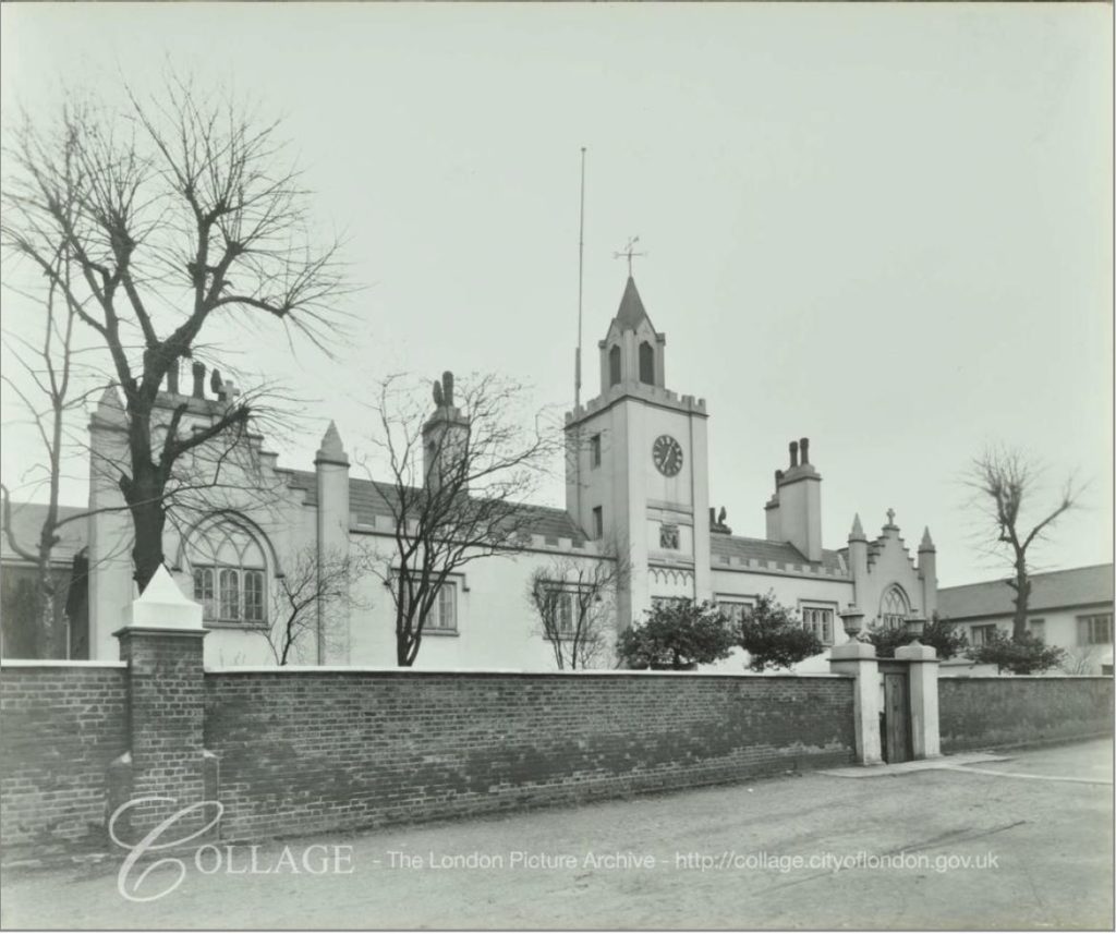
The London Metropolitan Collage Archive has a photo of Trinity Hospital looking in the opposite direction to the power station, dated 1937:

Trinity Hospital

Image credit: London Metropolitan Archives, City of London: catalogue ref: SC_PHL_02_0151_50_738_C

Interestingly, Collage also has a photo very similar to my father’s photo. Taken in 1960 it was obviously a favorite photographic subject, showing the contrast between two very different chimneys.

Trinity Hospital

Image credit: London Metropolitan Archives, City of London: catalogue ref: SC_PHL_02_0151_62_722

Trinity Hospital is sometimes open during the Open House London weekend and it has been on my list of places to visit, but not yet had the time. Hopefully this year.

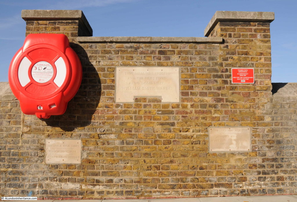
As usual, there is so much to find in the immediate local area. Directly opposite Trinity Hospital is the river wall, heightened over the years to prevent flooding. With plaques on the wall detailing the heights and dates of previous high tides.

Trinity Hospital

The plaque on the right records an extraordinary high tide on the 7th January 1928 when 75 feet of the wall were demolished, this must have flooded the hospital.

The river is always making its presence felt along the river walkway. A tell-tale flow of water from underneath this metal gate:

Trinity Hospital

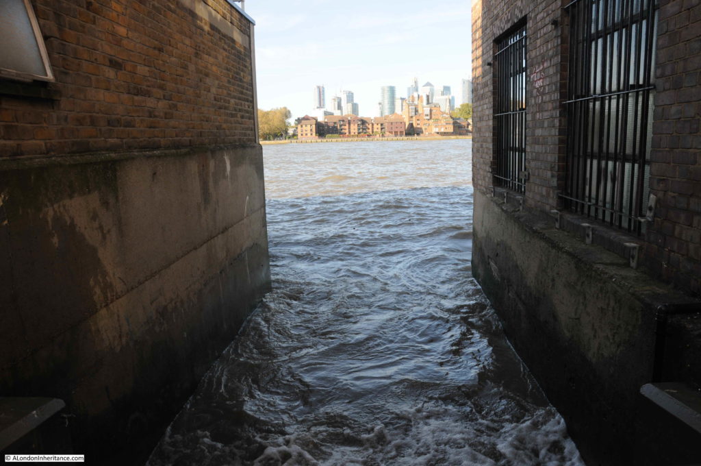
Sticking my camera over the top of the gate reveals a narrow gap between two buildings, with the river surging in.

Trinity Hospital

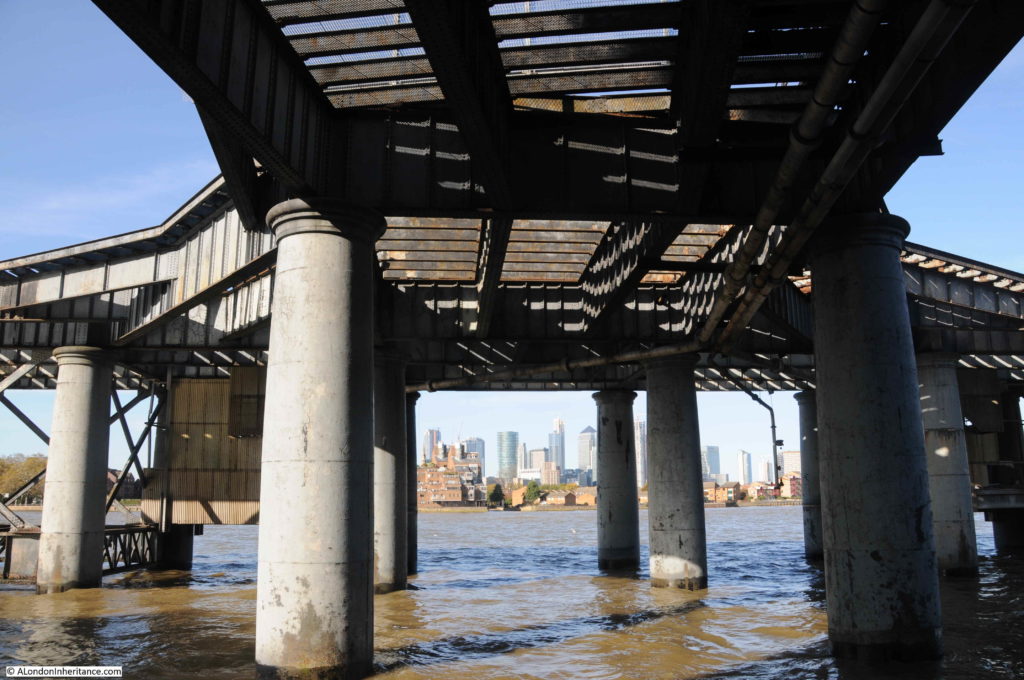
Passing above the riverside walkway and extending out into the river is the old power station coal jetty.

Trinity Hospital

As can be seen in the Britain from Above photo, the jetty once included two cranes which were used for moving coal from the river to the power station, and for transferring ash from the power station to barges on the river for disposal.

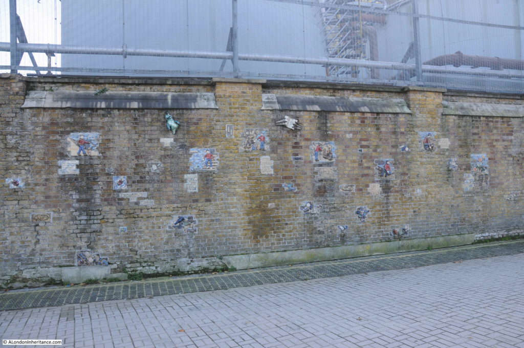
Along the riverside walkway, the power station is surrounded by a high brick wall, I suspect not just to keep people out, but also to keep water out in the event of a high tide.

Trinity Hospital

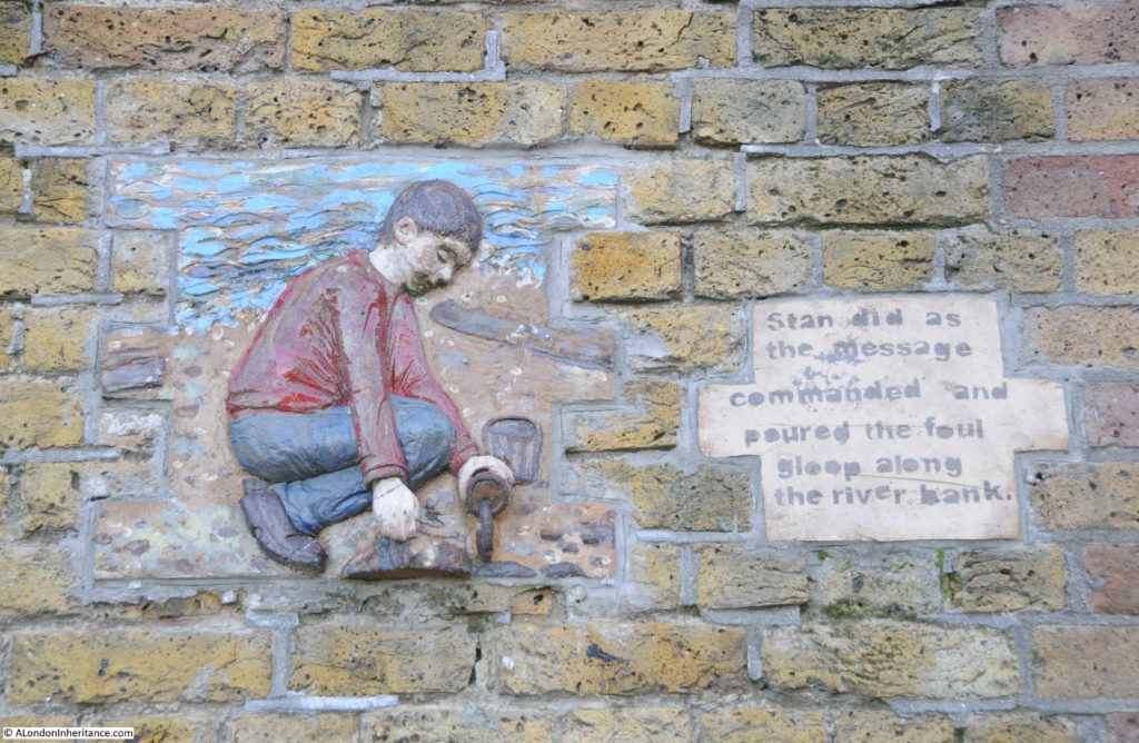
The wall is covered in a mysterious set of ceramic works that tell the story of a young boy taking his dog for a walk along the Thames foreshore, and finding a strange creature that led the boy into the murky depths of the river. The work was created by Amanda Hinge.

Trinity Hospital

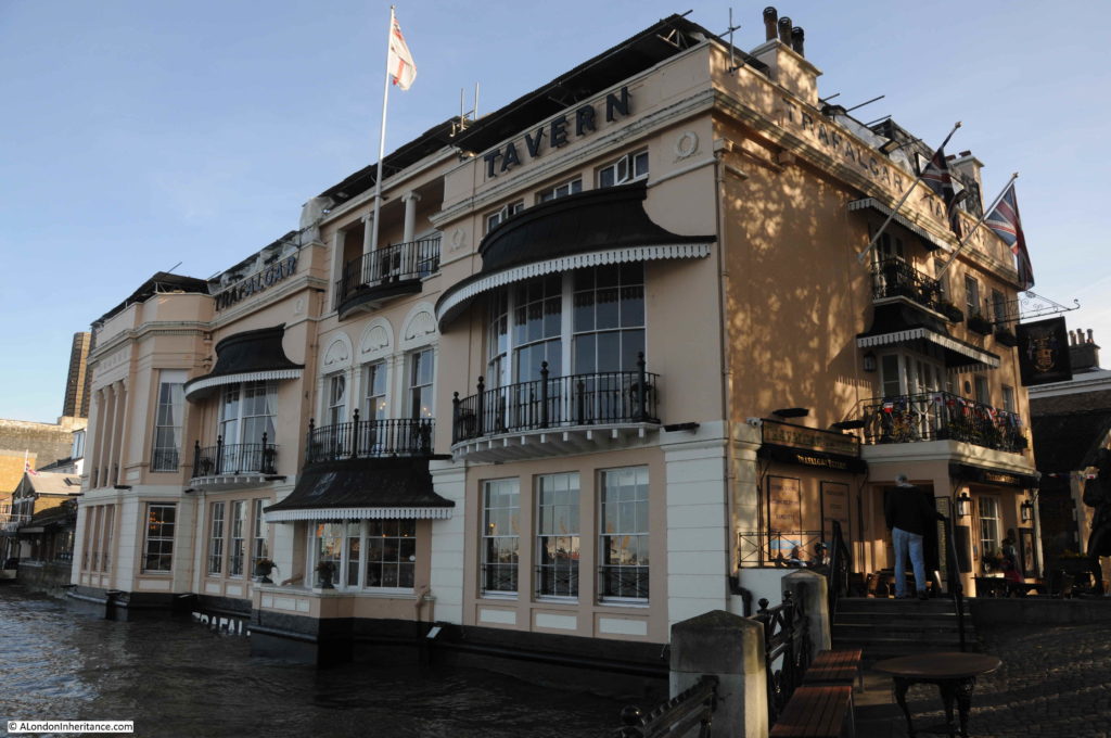
I have featured the Cutty Sark pub before, which is to the east of Trinity Hospital, if you are walking along the river from the ship, the Cutty Sark, the first pub you come to is the Trafalgar Tavern. Built in 1837, the pub stands on the site of an earlier pub, the Old George Tavern.

Trinity Hospital

Facing directly onto the river provides a superb view from the pub, however the high tides get close to the windows.

The power station is still providing a standby capability for the London Underground. Now gas-powered, the station is cabled to a number of points on the underground network, enabling Greenwich to provide electricity should there be problems with the main supply from the grid.

Unfortunately, the chimneys are today much reduced and the original pair do not justify the 1906 title of the Heavenly Twins.

Trinity Hospital continues to provide homes for the elderly of Greenwich, so this strange pairing of buildings look set to continue living next to each other for years to come.

alondoninheritance.com

Cannon Street Station from the Thames Foreshore

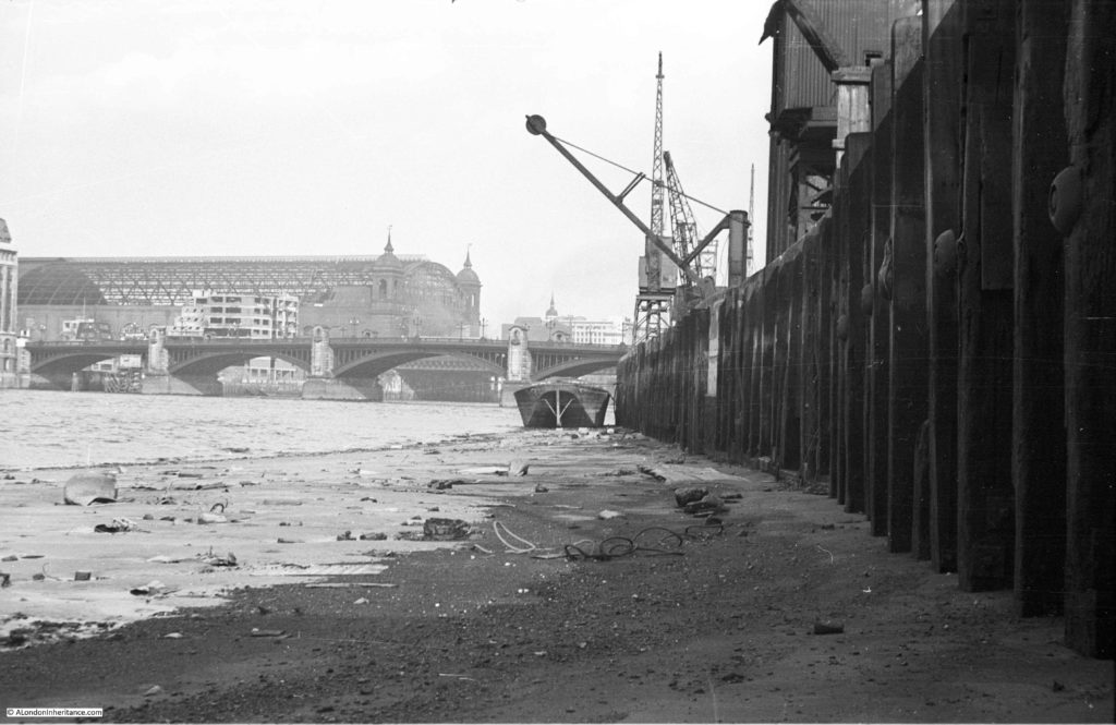
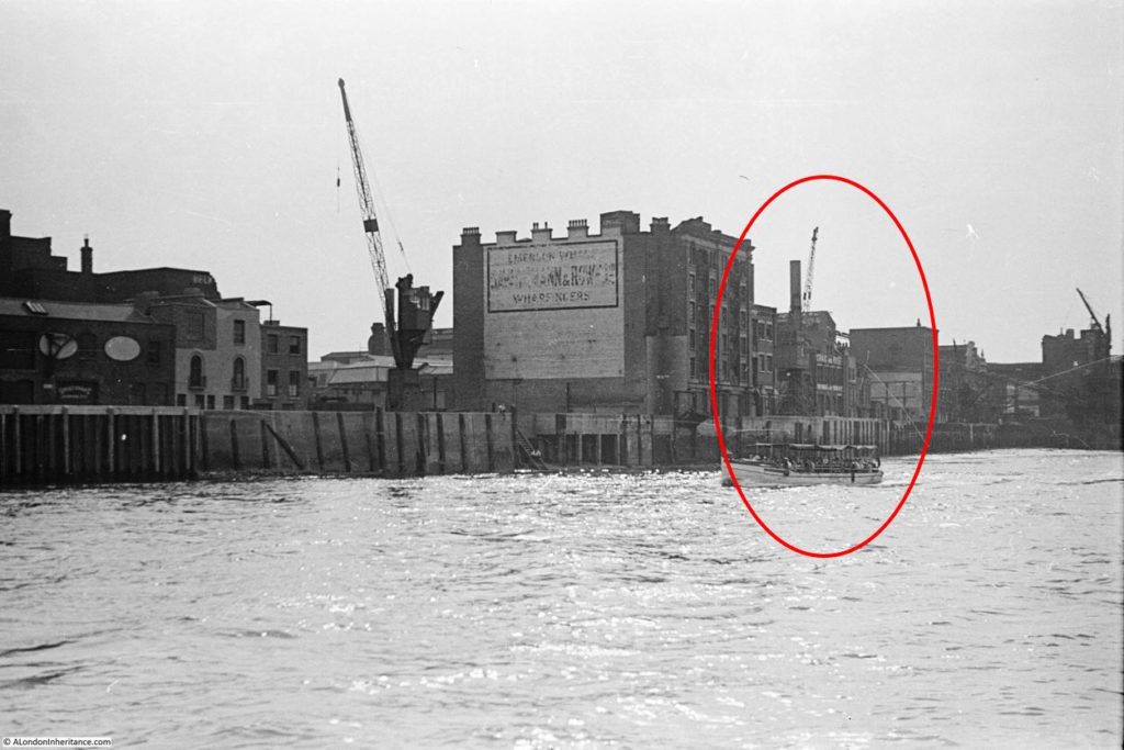
The joy of scanning negatives is finding different views of places that have been the subject of other photos. This week’s photo is of Cannon Street Station, photographed from the Thames foreshore at Bankside.

Thames Foreshore

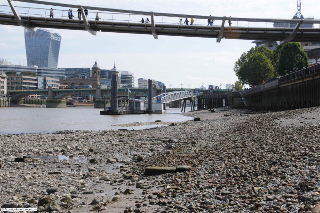
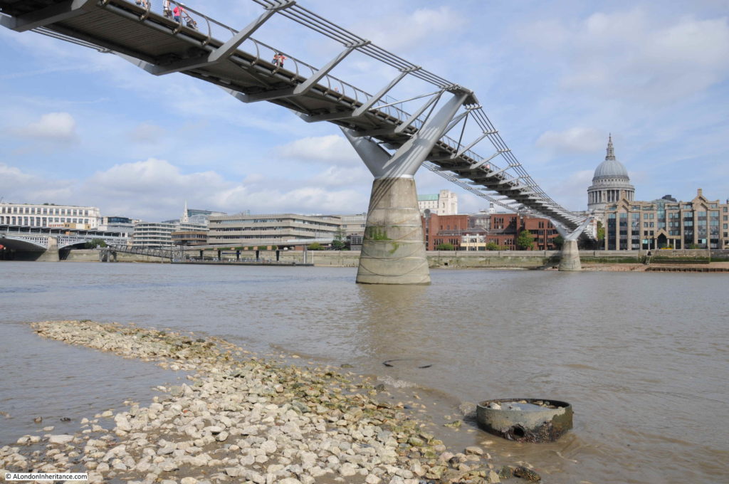
The same view today (although I had walked slightly further away from the river wall):

Thames Foreshore

The view has changed considerably in the 70 plus years between the two photos. The only consistent features are obviously the river, Southwark Bridge and the twin towers at the entrance to Cannon Street Station.

The station has since lost the fantastic roof that stretched back from the entrance towers to the station hotel that once faced onto Cannon Street. The Walkie-Talkie, or 20 Fenchurch Street is the City tower visible from this perspective and the Millennium Bridge stretches over the foreshore, transferring walkers between south and north banks of the Thames.

I love being able to cross-reference photos so you can see both sides of the view. A few months ago I wrote about Emerson Stairs and published the following photo which is looking back from Southwark Bridge towards Bankside and includes the area where my father was standing to take the original photo.

Thames Foreshore

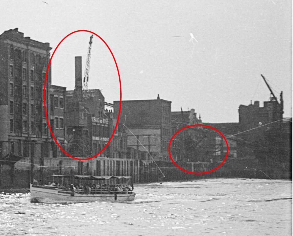
If you look at the photo at the top of the post, there is a Derrick Crane with the jib leaning out over the foreshore, and behind is one of the more traditional riverside cranes. In the photo above, taken from Southwark Bridge, I have ringed a small area. The following photo is an enlargement of this area.

Thames Foreshore

On the left is the crane in the background of the photo from the foreshore and to the right I have ringed the Derrick Crane. This is not easily visible due to the grain and contrast of the film, but can just be seen, so my father was standing just a short distance further to the right of the Derrick Crane, not far from where the conveyor belt taking coal from river barges to the original Bankside Power Station was located.

I have an almost complete set of photos of the south and north banks of the river between Westminster and Tower bridges in the late 1940s, and the plan for a future post is to bring these all together and document a trip along the river showing how both sides have changed in the intervening 70 years.

In the original photo, Cannon Street Station still has the arched metal framework which ran from the station entrance and hotel, all the way to the river entrance and the twin towers.

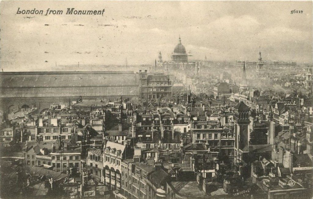
Cannon Street Station was opened in 1866 and the iron and glass arch was around 700 feet long and must have been a magnificent sight. The following postcard with a photo from the Monument gives an impression of what the arched roof must have looked like soon after completion, and how the new station dominated this area of the City.

Thames Foreshore

Maintenance of the station roof had been neglected prior to the last war, and the glass panels had been removed from the roof, leaving just the iron frame at the start of the war. Bomb damage included many incendiary bombs and a few explosive bombs, however as can be seen from my father’s photo, the majority of the iron frame of the arch survived.

The iron frame of the roof was removed in 1958, and the space above the platforms has been redeveloped with the office space that we see today.

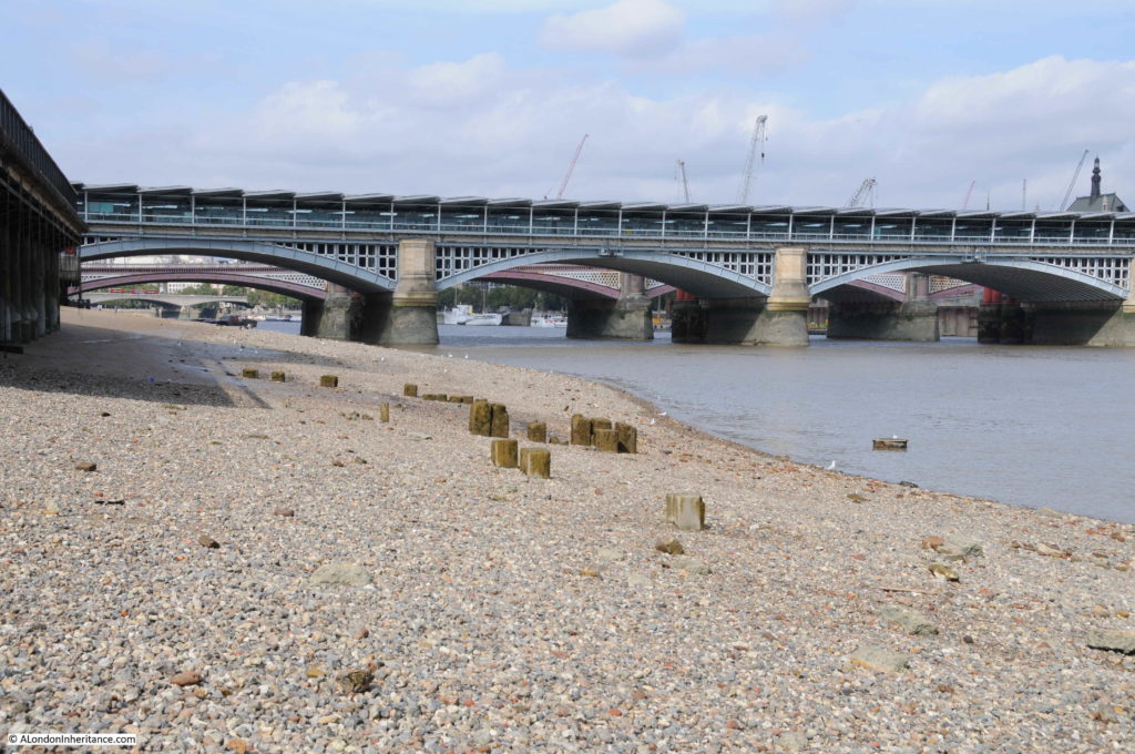
The following photo is looking in the opposite direction, and shows the railway bridge running across the river for Blackfriars Station.

Thames Foreshore

The Thames foreshore is a fascinating place, with plenty of relics of the industrial past of the river. Comparing my father’s photo with view today, it looks as if there is now a more pronounced slope of the foreshore. It looked reasonably flat in the original photo, but as can be seen in my photos from the same place, the foreshore looks to slope down into the river. Possibly more erosion is taking place with increased water flow?

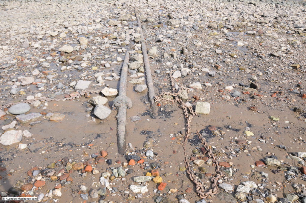
The foreshore is littered with traces of the past. Exposed pipes that run from the land down into the river. What was their original use, or are they still in use?

Thames Foreshore

Chains, the red / orange of tide worn bricks and lumps of chalk that were once used to create level platforms to position barges, all provide evidence of an earlier city.

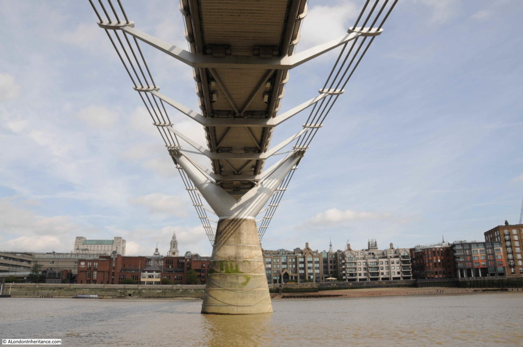
The main change to the river in the area of my father’s photo has been the construction of the Millennium Bridge, which is just as interesting from below the bridge as from above.

Thames Foreshore

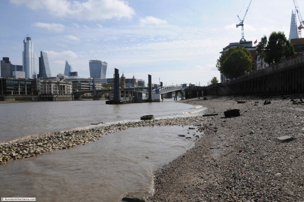
The day I was on the Thames foreshore to take an updated photo was a day of an exceptionally low tide. This is when the river reveals many more features including those that demonstrate that the foreshore is not a flat slope down to the centre of the river. Here a raised bank runs out further into the river.

Thames Foreshore

Almost certainly not a natural feature, but possibly enhanced by the river eroding softer sediment on either side.

Alongside the raised bank, the remains of iron piers run out into the river. The remains of a structure from the days when Bankside was industrialised and dependent on the river.

Thames Foreshore

When the water is this low, it is intriguing to imagine what the view would look like if all the water was drained away. The detritus of a couple of thousand years of London’s history revealed.

During the reconstruction of the area and the new walkway along Bankside, the river wall was replaced by metal piles, however they do not provide an impervious barrier between land and river and there are still plenty of points where water drains into the river, as well as strange pipes which serve no obvious purpose.

Thames Foreshore

For centuries, the river has collected everything that has been lost by those working or travelling alongside, or on the river. Buried under the silt and often returned to the surface following erosion by water flow and the tides. You will not find clay pipes being dropped into the river these days, rather the evidence of 21st century construction work on, or alongside the river.

Thames Foreshore

Low tide is a fascinating time to walk along the Thames foreshore, walking on a couple of thousand years of London’s history. Cannon Street Station has only been there for a very short period in that history, the wonderful arched roof has been lost, but the twin towers will continue to welcome trains into the station for years to come.

alondoninheritance.com

The View from Hungerford Bridge – 1985 and 2020

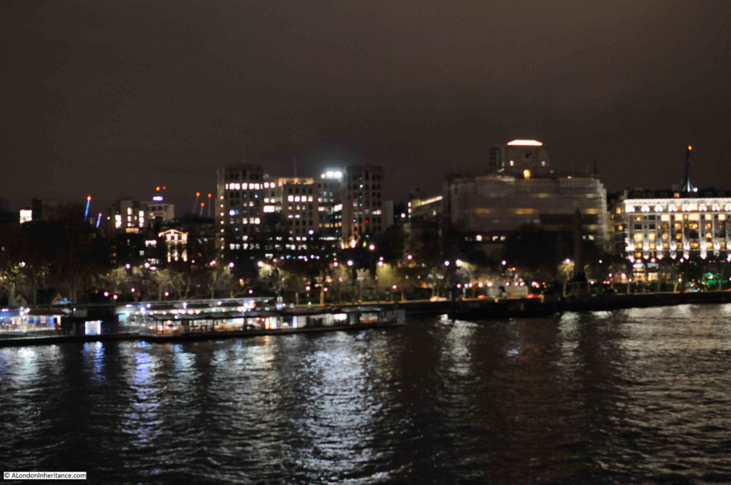
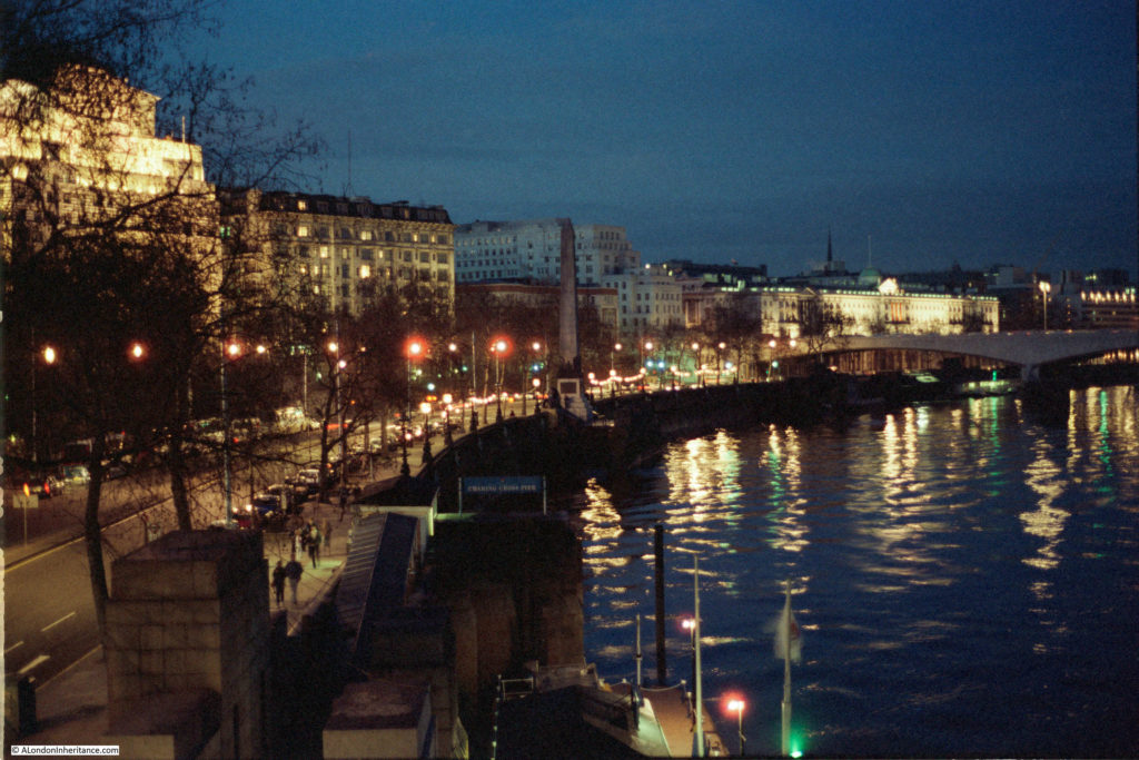
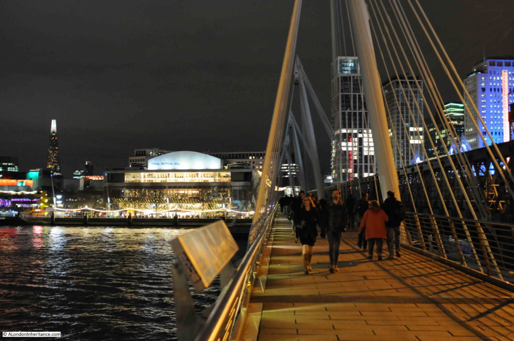
I usually try to get in a couple of evening walks in that quiet period just after Christmas and before the main return to work at the start of January. This year, part of one of these walks crossed the River Thames using the Golden Jubilee walkways alongside Hungerford Bridge. I wanted to photograph the same scenes as 35 years ago in 1985, and to have a look at what has changed. Although the formal name of the crossing is the Golden Jubilee Bridge, I have called the post the view from Hungerford Bridge, as this was the original 1985 walkway and seems to be the most used name for the crossing.

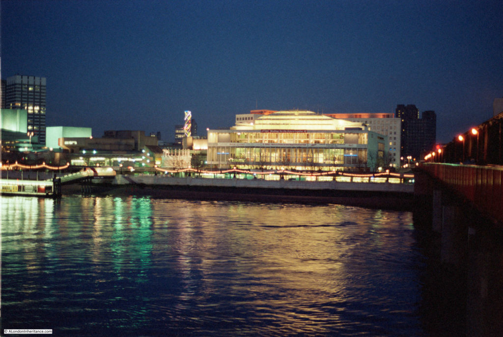
This was the view in 1985, looking south across the river towards the Royal Festival Hall.

View from Hungerford Bridge

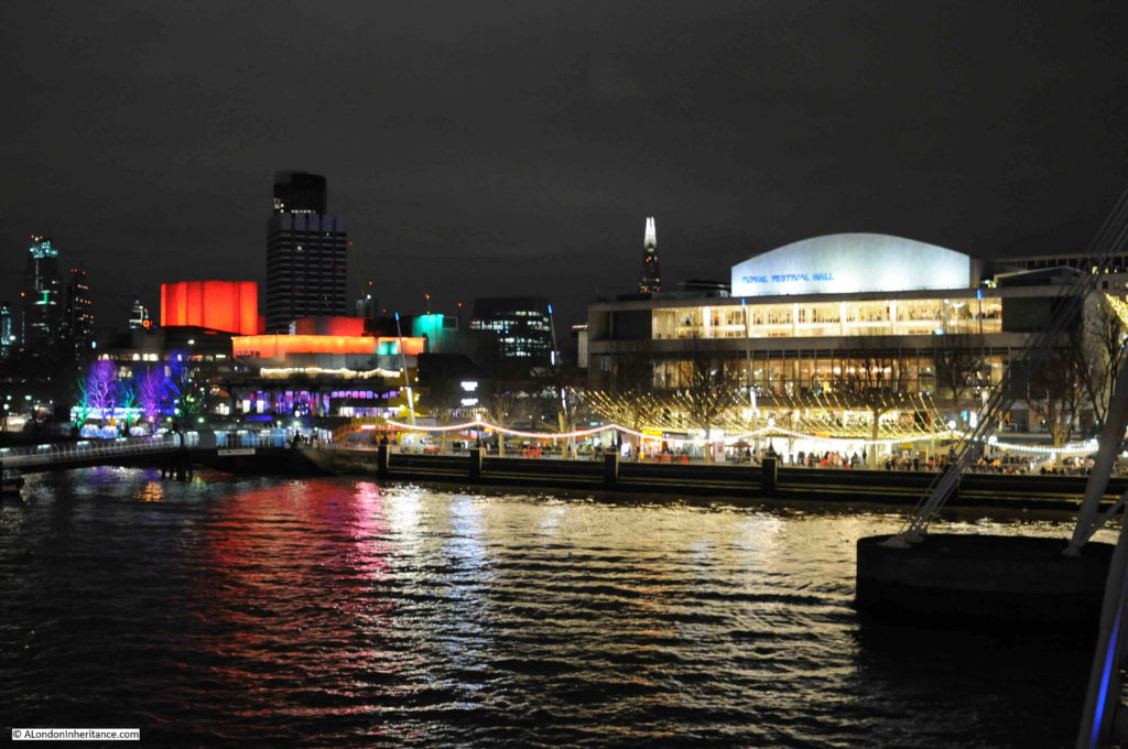
The same view 35 years later:

View from Hungerford Bridge

The viewpoint is slightly different, as seen by the different location of the tall office block on the left, however the area around the Royal Festival Hall is still an illuminated focal point on the South Bank.

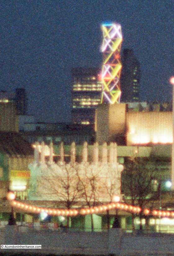
The 1985 photo does include a feature that was a focal point of the South Bank. To the left of the Royal Festival Hall was a tall, illuminated lattice structure. The coloured lights were continuously changing.

I was working on the South Bank for much of the 1980s, and these ever changing lights were always in the background when working or walking in the area after dark. I moved abroad for a few years at the end of the decade, and cannot remember when these lights disappeared. It is these subtle changes that are so easy to miss.

The following photo shows a detailed section from the original 1985 photo, which includes the lights, and also another unique feature from the 1980s.

View from Hungerford Bridge

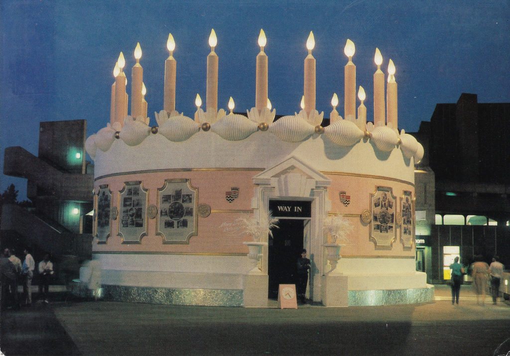
In a previous post on London postcards, I included one of a large birthday cake created by the Greater London Council on the South Bank as an exhibition and celebration of 95 years of the London County Council / Greater London Council. I had visited the exhibition within the cake, and taken photos, but had not yet scanned the negatives. In scanning negatives I finally found some which included the GLC cake.

This can be seen in the 1985 photo above, and also in the extract, which does give an indication of the size of the cake, and how incongruous a traditionally decorated birthday cake looked against the concrete architecture of the South Bank.

The following photo is from the original postcard which shows the cake close up.

View from Hungerford Bridge

There was also some event advertising along the front of the Royal Festival Hall. The following is an extract from the 1985 photo which shows this advertising along the front of the building.

View from Hungerford Bridge

The red banner requests “Keep GLC Working for the Arts in London”. The mid 1980s was a time of conflict between the Thatcher led Conservative Government and the Labour majority Greater London Council led by Ken Livingstone.

This resulted in the 1985 Local Government Act which dissolved the GLC in 1986. Campaigns by the GLC could not influence the majority of the Conservative Government, and at the time there were serious concerns about future funding of South Bank complex. Probably one of the reasons why now the majority of the exterior ground level of the Royal Festival Hall is occupied by commercial businesses.

In the centre of the hall, there is a banner advertising that “EROS: Back in Town at the Royal Festival Hall”. I had completely forgotten about this, but in the 1980s the statue on the top of the Shaftesbury Memorial Fountain in Piccadilly Circus (so I assume technically correct to state Eros, which is frequently applied to the whole fountain), had been removed for restoration.

Prior to the return of the statue to Piccadilly Circus in 1985, it was displayed for a short period in the Royal Festival Hall.

The banner on the right advertises the “Mars London Marathon Exhibition” in advance of the marathon which took place in April of that year. Perhaps strange now that a health focused event would be sponsored by a brand such as Mars, but at the time (and for many years previously), the energy giving benefits of glucose were a major advertising feature of Mars bars.

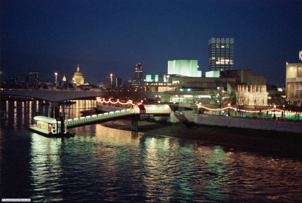
The following 1985 photo again shows the GLC cake, and also the Festival Pier.

View from Hungerford Bridge

The same view from a slightly different angle, as to the right, the Kings Reach Tower office block now appears from behind the square office block of what was London Weekend Television.

View from Hungerford Bridge

A similar view in 2020 is shown in the photo below. The Kings Reach Tower building is now much taller having had several floors added during conversion of the block from offices to apartments.  The future of the old London Weekend Television building (known after the closure of London Weekend Television as the London Studios and operated by ITV) is not clear. ITV moved out of the complex a few years ago, originally intending to return to refurbished studios, but they now uses studios at the redeveloped BBC Television Centre site in White City. I am sure that this high value location on the South Bank will become yet more expensive apartments.

View from Hungerford Bridge

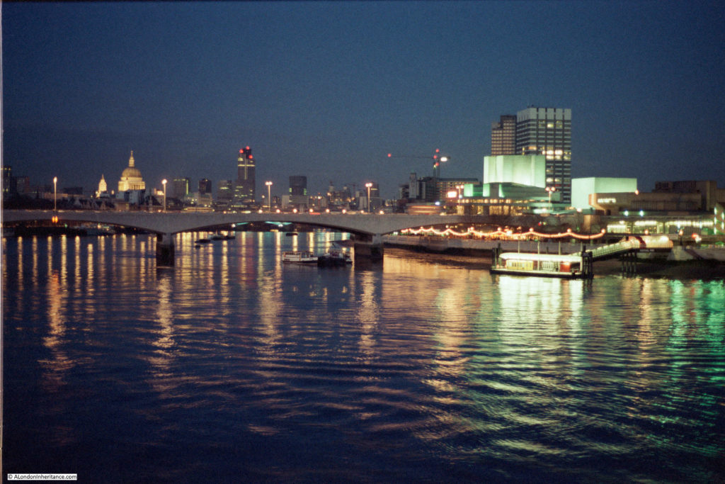
The following 1985 photo is looking along the river towards Waterloo Bridge, St Paul’s Cathedral and the City of London.

View from Hungerford Bridge

In the above photo, the cathedral stands clear, as does the old Nat West Tower to the right. This building, now called Tower 42, was the tallest building in the City.

The same view today is shown in the following photo. The Nat West Tower is now dwarfed and almost lost by the City developments of the last few decades.

View from Hungerford Bridge

The following 1985 view is of the north bank of the river from the Hungerford Bridge walkway. The brightly lit building is the wonderful 1931, Grade II listed, Shell-Mex House, occupied at the time by Shell UK.  The building is now known as 80 Strand. To the left is the Adelphi building, and the Savoy on the right.

View from Hungerford Bridge

The same view today, although a bit later in the evening so a somewhat darker sky. The front of the Shell-Mex building is covered in sheeting as part of an ongoing refurbishment.

View from Hungerford Bridge

Walking along the walkway towards the north bank, and this was the 1985 view from Hungerford Bridge looking towards the Embankment.

View from Hungerford Bridge

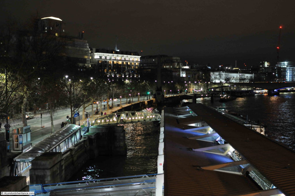
The same view in 2020:

View from Hungerford Bridge

The Embankment is much the same, however the main change is the scale of the Embankment Pier. This is a relatively small feature in the 1985 photo, which has since been replaced by a much larger pier by the 2020 photo. This is indicative of the considerable growth in passenger transport along the Thames in the 35 years since 1985, when river piers were mainly used for tourist focused cruises of the river. The opening of the Thames Clipper Service in 1999 has contributed significantly to passenger traffic on the river, with the resulting upgrades and additions of river piers to support this traffic.

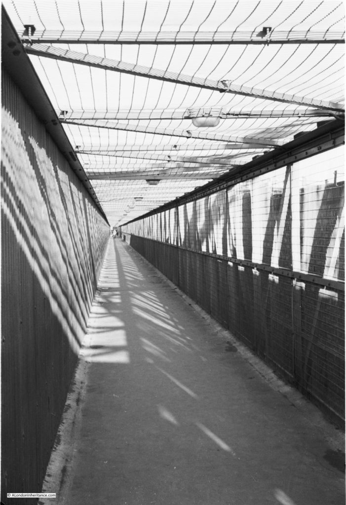
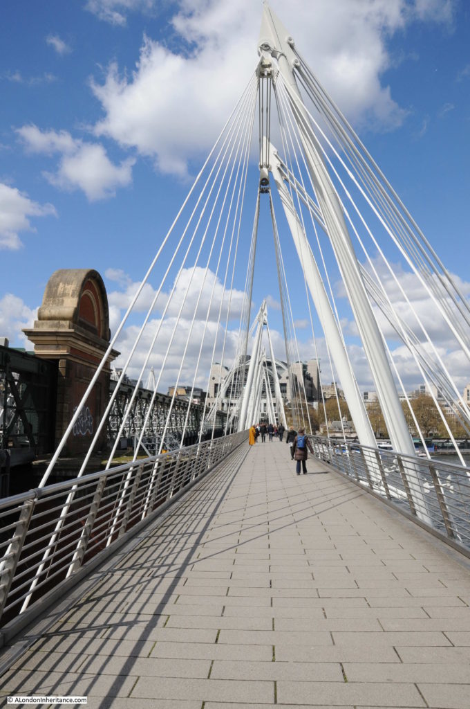
The main change between 1985 and 2020 has been the bridge across the river from which the photos were taken.

In 1985 there was only a single walkway on the side of the bridge looking towards the City. It was a narrow walkway, frequently covered in large puddles of water, and from experience, not somewhere that you would really want to walk across late at night.

The following photo shows the original walkway:

View from Hungerford Bridge

Today, there is a walkway on either side of Hungerford Bridge. Officially named the Golden Jubilee Bridge, these new walkways were completed in 2002 and provide a considerably improved walking route between the north and south banks of the River Thames.

With the growth of attractions and events along the South Bank, the number of people walking across the bridges has grown considerably. According to the website of the architects Lifschutz Davidson Sandilands, who with engineering company WSP, won the competition for the bridges, they are the busiest walking routes across the river in London, with 8.4 million pedestrians in 2014.

The following photo is the view south along the walkway, towards the Royal Festival Hall.

View from Hungerford Bridge

A view during the day of the Golden Jubilee bridge:

View from Hungerford Bridge

The architects state that the bridges “are slung from inclined pylons that pay homage to similar structures created for the 1951 Festival of Britain, held on the adjoining South Bank”.

As evidence of this, the following photo was taken by my father from the southern end of Hungerford bridge, just after the Festival of Britain had closed, and shows the structures referenced by the architects.

View from Hungerford Bridge

The view looking north along the walkway towards the illuminated buildings above Charing Cross Station.

View from Hungerford Bridge

One final photo before I headed off north of the river – the Embankment from the walkway looking unusually quiet:

View from Hungerford Bridge

The Golden Jubilee Bridge is a considerable improvement over the previous walkway and provides a wonderful location to look at a spectacular view of the river, north and south banks, and the City, whether by day or night. The second walkway on the other side of Hungerford Bridge provides superb views towards Westminster.

The opening up of a walking route from the South Bank through Bankside and to Tower Bridge and beyond, along with attractions such as the London Eye and growth in the numbers of bars and restaurants has significantly increased walking across the river, along with the always present use of the bridge as a route between the north bank of the river and Waterloo Station.

Use of the river has grown since 1985 as evidenced by the considerably enlarged Embankment Pier.

In another 35 years time, the Royal Festival Hall will be just over 100 years old – it will be interesting to see how the area changes in the coming decades. One change I suspect will happen is the growth of tower blocks on the south bank beyond Waterloo Bridge and across the City. The area around the old London Weekend Television tower block and the London Studios will certainly look very different.

alondoninheritance.com

Wapping Old Stairs

I have touched very briefly on Wapping Old Stairs in a previous post, when I went for a walk along Wapping High Street and Wapping Wall. I am returning to the stairs as when working through the photos my father had taken on a boat trip along the Thames in August 1948, I found one of Wapping Old Stairs and the adjacent Oliver’s Wharf.

Wapping Old Stairs

I tried to take a photo of the same view when out on the river a couple of months ago, but failed completely to get as good a photo as the one above.

The following photo is the area today. Oliver’s Wharf is the building on the right, the stairs are to the left of Oliver’s Wharf.Wapping Old Stairs

What I love about these photos is that they frequently show people, often children, on the stairs (for example, see the post on Emerson Stairs), and this includes the photo of Wapping Old Stairs, see the following enlargement from the original which shows two children at the bottom of the stairs.

Wapping Old Stairs

Wapping Old Stairs are – old. There is the possibility that stairs at this location date back to the 16th century or earlier. The first newspaper reference I can find is from the 12th August 1736 when “The Body of a young Man well dressed, with a Watch and a Sum of Money in his Pockets, was taken up floating at Wapping Old Stairs: Upon fetching him he appeared to be an Apprentice belonging to Mr. Stilton, a Currier in Bermondsey-street; but by what Means he came drowned is very uncertain.”

This report confirms that in 1736 they were called the “Old” stairs. This part of the name was used to separate these stairs from another set of stairs built slightly to the east along the river, which were called Wapping New Stairs (these can also be found today).

The following extract from the 1896 Ordnance Survey Map shows Oliver’s Wharf and Wapping New Stairs to the left of the map, just before the Wapping Entrance to Wapping Basin of the London Docks. Towards the right of the map are Wapping New Stairs, just by Old Aberdeen Wharf.

Wapping Old Stairs

Credit: ‘Reproduced with the permission of the National Library of Scotland’ 

So presumably Wapping Old Stairs were the original stairs, and Wapping New Stairs came latter, with the old and new being added to uniquely identify the stairs. This method of identifying stairs can be found in the names of a number of Thames stairs, for example I have already written about Horselydown Old and New Stairs.

Despite being called “New”, Wapping New Stairs are also old, and I found a newspaper reference to them a couple of years before that for Wapping Old Stairs, when, from the 28th December 1728:

“On Monday, between one and two in the Morning, a Fire was discovered at the Waterman’s Arms Ale-House near Wapping New Stairs, and by timely assistance was quenched, having only burnt some Apparel and a Chest, on which the Servant Maid of the House had stuck a Candle, but had fallen asleep and left it burning.”

The number of fires in the timber buildings along the river was considerable, and a regular occurrence. In the same newspaper was another report of a fire at the nearby Gun Dock:

“Yesterday Morning early, a Fire broke out at a Hatter’s near Gun Dock in Wapping, which in a short space consumed the same, and three other Houses adjoining to it: In one of the Houses a Man and three Women went upstairs to save some Goods, but were prevented by the Flames from getting down again: one was saved by escaping over the Tops of some Houses, and the three Women flung themselves out of a Window into the street but one of them (a Servant Maid) pitched on her Head and died on the Spot.”

Both stairs therefore date from at least the early 18th century, with Wapping Old Stairs almost certainly being of a much earlier date.

Both stairs also feature on the 1746 Rocque map. The following extract shows Wapping Old Stairs to the right of the map (the new stairs are also on the map, but on a separate page in my copy of Roque’s maps).

Wapping Old Stairs

Thames stairs provide a useful geographic reference point to events on the river, and newspapers from the early 18th century onward are full of reports of bodies being found, arrivals and departures, crime, lost goods, arriving and departing ships etc.

One report from the 28th October 1738 gives an idea of the types of exotic goods that were arriving at Wapping in the 18th century:

“On Saturday Mess. Wills and Fleming, two Tide Surveyors, found 200 lb of Venice Glass at Wapping Old Stairs, which were sunk in the River in three Bags, fix’d to two Boat-Hooks very artfully. ‘Tis a rich Capture.”

I suspect that 200 lbs of Venice Glass would indeed be a rich capture. What the report does not help with is why they were in the river – lost while transferring from river to land, or perhaps hidden in the river by a thief, ready for later recovery.

Thames river stairs are rich sources of history for that part of London that forms the boundary between river and land (see my post on Life and Death at Alderman Stairs, where I explored in more detail the history of one set of Thames stairs).

Wapping Old Stairs also probably has more cultural references than the majority of other river stairs.

Wapping Old Stairs was the title of a Comic Opera at the Vaudeville Theatre in 1894:

Wapping Old Stairs

The St. James’s Gazette review of the play, which had a rather serious subject for a comic opera:

“The author and composer of ‘Wapping Old Stairs’, the new opera or operetta produced at the Vaudeville on Saturday night, may be congratulated on having achieved a genuine musical and dramatic success. There is but little of the spectacular element in the piece; the same set scene does duty throughout, and almost the only dresses are those of sailors and of their constant associates, ‘the merry maids of Wapping’. The eminent musician in using for his score the old melody of ‘Wapping old Stairs’ , which might have been treated with dramatic effect. 

Mr Stuart Robertson’s book, with but little dramatic basis is ingeniously constructed, and his lyrics are written with grace and point. It appears that in the last century, or even earlier, two sailors of Wapping fell in love with the same girl; on which the most unscrupulous of the young woman’s admirers committed a murder, and so arranged matters that his rival was looked upon as the assassin and, to save his life, fled to foreign parts. But after the lapse of many years the truth came out; when the good man returned to the land of his birth and the girl of his heart, while the bad man was executed, and after ‘ suspension by the neck’ hung ignominiously in chains.

This story is, no doubt a little tragic for a comic opera, and the librettist, whilst softening its harsher features, has introduced in abundance the element of mirth.”

The Vaudeville Theatre is probably the nearest that most West End theatre goers would get to the realities of life in 19th century Wapping. The review of the play also comments on the execution by hanging, which refers to the practice of hanging criminals along the river and a number of places, including Wapping Old Stairs have been referenced as “Execution Dock”. I suspect no single site was used and a number of locations along the Wapping riverbank would have been used.

The Tatler in 1903 produced the following print to go with a song written by Charles Dibdin which referenced the stairs:

“Your London girls with all their airs

Must strike to Poll of Wapping Stairs

No tighter lass is going

From Iron Gate to Limehouse Hole

You’ll never meet a kinder soul

Not while the Thames is flowing”

Wapping Old Stairs

Wapping Old Stairs is reached today, as it has been for many years, by turning off Wapping High Street and walking alongside a pub, which possibly dates back to the 15th Century as the location for a pub. Known from 1533 as The Red Cow, then the Ramsgate Old Town and finally from 1811 as the Town of Ramsgate. This may also date the origins of Wapping Old Stairs as a pub alongside stairs would be ideal for those arriving or departing on the river.

Wapping Old Stairs

The narrow alley leading to the stairs:

Wapping Old Stairs

View of the stairs at low tide:

Wapping Old Stairs

The liquefied mud covering the stairs at low tide does make the stairs a rather risky route down to the foreshore, but once at the bottom, the reward is a superb view along the river. The photo below is the view looking west towards the City. The entrance to what was the London Docks can be seen where the river wall appears to break.

Wapping Old Stairs

The foreshore is littered with London’s history. Rounded nodules of chalk, once used to provide a flattened base on the foreshore for mooring barges and lighters. The bricks that once built the City and Docks, now broken and worn by a thousand tides.

The distinctive two sets of stairs. I suspect the stairs on the right are the original Wapping Old Stairs, and those on the left were added to provide private access for the buildings on the left, built alongside the entrance to the London Docks.

Wapping Old Stairs

It was at the base of these stairs that the children were sitting in the 1948 photo. Interesting to speculate on the countless thousand who have arrived or departed along these stairs, transported cargo to and from the river, or just sat here and watched the river.

The small dock space to the right of the stairs is much the same as in 1948.

Wapping Old Stairs

In the centre of the dock wall, at the point between light and shadow in the above photo is a large round pipe that looks to have been filled, above is a manufacturer’s name:

Wapping Old Stairs

J. Burton Sons & Waller were Gas, Hydraulic and Sanitary Engineers  of John’s Place, Holland Street, Blackfriars, Southwark.

As usual, a brief exploration of part of London’s history, and writing these posts always generates a long list for further research. When were Wapping Old Stairs first used and named, and what part did the stairs play in the development of Wapping. Confirmation of the reason for the double sets of stairs. What did J. Burton Sons & Waller install at Wapping Old Stairs.

For me, the Thames Stairs are where I feel closest to London’s long history in that unique area between the river and the land, and there are many more stairs to explore.

alondoninheritance.com

St Katharine Docks

St Katharine Docks opened on the 25th October 1828. In August 1948, my father took the following photo of the dock entrance, whilst on a boat travelling from Westminster to Greenwich.

St Katherine Docks

In September 2019, I took a boat onto the river, and managed to get into roughly the same position to take a photo of the same view of the dock entrance (although the weather was not as sunny as in my father’s original photo).

St Katherine Docks

The Grade II listed Dock Master’s Office, with the curved frontage onto the river, still has a prominent position to the right of the dock entrance.

Part of the warehouse infrastructure can be seen in the background in both photos.

In the 1948 photo, you can just about see the original swing bridge over the entrance to St Katharine Dock. This bridge carried St Katherine Way from the east to the west of the dock.

The buildings on either side of the dock entrance have all changed. The large warehouse in the background on the right of the 1948 photo, is the warehouse seen in my father’s photo of St Katharine’s Way

The building on the left of the 2019 photo is the Tower Hotel.

A wider view (and in better weather) taken from the walk way along the south bank of the river is shown below:

St Katherine Docks

St Katharine Docks are the nearest to the City of London, of the docks constructed along the river starting in the 19th century. Occupying a relatively small area of land, and with a narrow entrance to the river, they were constructed on a historic location, immediately to the west of the Tower of London (Map © OpenStreetMap contributors):

St Katherine Docks

The following extract from John Rocque’s map of 1746 shows the same area as the above map. Tower bridge has yet to be built, and the area that would become St Katharine Docks is to the right of the Tower, and consists of a number of streets, church, cloisters and gardens.

St Katherine Docks

The name Catherine is used for various features across Roque’s map, however I suspect this was the exception as most early maps and books reference the name spelt as Katherine, but it does highlight that the name has a long association with this specific area.

There was also a St Catherine’s Stairs shown on the map.

The area of land to be used for the new docks consisted of the foundations of St Katharine Hospital and Church, a brewery, around 1,100 houses along the streets, mainly to the north of the land.

If you look at Rocque’s map, to the right of the location of the future docks, is a narrow feature called St Catherine’s Dock, however the map strangely shows this feature not connected to the river. This dock provided a private landing place for the hospital, so in Rocque’s map it was either an error that the extension to the river was not shown, or by 1746 it had been filled in, which I doubt.

St Katharine Hospital was founded by Matilda, wife of King Stephen, on land she purchased from Holy Trinity, Aldgate.

Matilda was a fascinating character. The wife of Stephen of Blois, who was pregnant and living in Boulogne when Henry I died. Stephen raced across the channel to claim the crown in 1135, leaving Matilda in France to have her baby.

She joined him after the birth, and supported him throughout his war with another Matilda (Empress Matilda, Stephen’s cousin who also claimed the crown).

As well as raising support for Stephen from her allies in France, Matilda purchased the land, and founded the Hospital. Matilda transferred the custody of the Hospital to Holy Trinity, Aldgate, but reserved the right to choose the Master for herself, and all the Queens who would follow her.

The following map from 1781 shows the Hospital in more detail to Rocque’s map, and shows the church, cloisters, houses for brothers and sisters, burying ground and orchard. The St Katharine Dock, that provided private access to the Hospital is shown on the right of the map. The River Thames is at the bottom of the map as shown by St Katherine’s Stairs on the lower left.

St Katherine Docks

Image credit: London Metropolitan Archives, City of London: catalogue ref: p5412730

The following print from 1810, shows the church of St Katherine’s, Tower:

St Katherine Docks

The text provides some background (although I suspect the author has his Matilda’s muddled, as he states Maud, wife of King Stephen, rather than Matilda. Maud was also the name applied to Empress Matilda, the other claimant to the English crown):

“This Hospital dedicated to St Katherine, was founded in the Year 1148 by Maud, wife of King Stephen and is said to have been dissolved by the unjust machinations of Eleanor, widow of Henry the third, who refounded the present edifice and appointed to it a Master, three Bretheren Chaplains, three Sisters, ten Bedes Women and six poor Clerks. In the Year 1780 this Structure had nearly fallen a victim to popular phrensy under the idea of its being a Popish establishment; fortunately the Gentlemen of the London Association arrived in time to protect it from the effects of error and intoxication.”

The problem with secondary (or much more remote) sources such as prints or books is that they often have errors and contradictory information.

Old and New London (Walter Thornbury, 1881) also states that the Hospital was dissolved and refounded by Eleanor, widow of Henry III, whilst London Churches Before The Great Fire (Wilberforce Jenkinson, 1917) states that “The Hospital and Collegiate Church of St Katherine by the Tower, founded by Queen Alienore, widow of Henry II”.

What appears to have happened is that the standards of the Master and Brothers had fallen below what was expected as they were found to be “frequently inebriated”, so in 1273 Queen Eleanor refounded the Hospital and appointed a new Master and Brothers.

The brothers houses in 1781:

St Katherine Docks

The Hospital survived the Reformation, probably as a result of the influence of Katharine of Aragon, who despite her divorce from Henry VIII, remained the patron of the Hospital, Anne Boleyn did not take up the role, despite this being the traditional role of the Queen.

The early 19th century was a time of considerable expansion of the docks, eastward from the City. The volume of shipping and of goods was high, and the charges levied by the dock owners had limited competition, so there was no incentive to reduce charges. Shipping volumes across the Port of London increased from 13,949 in 1794 to 23,618 in 1824.

The scheme for St Katherine Docks comprised a basin of about 1.5 acres, and two docks of around 4 acres each.

The following plan from 1825 showing the proposed St Katharine Docks is fascinating:

Image credit: London Metropolitan Archives, City of London: catalogue ref: q8051215

The plan shows how the new docks would overlay the existing streets and buildings, and therefore provides a means to locate where these would be across the current site. It also shows the location of the original St Katharine Dock, the narrow channel to the right of the central basin.

The plan shows that originally two entrances to the docks were planned, however only one was built.

St Katharine Docks had a rather unique design, different to the design of the London and West India Docks. in these docks, which had already been constructed, there was an area of land between the edge of the dock and the warehouses. This allowed goods to be offloaded, then sorted before moving to the correct warehouse.

With the design of St Katharine Docks, the warehouses were built almost up against the edge of the dock, with the intention that goods would be unloaded directly from ship into the warehouse, therefore making the whole process considerably more efficient. This would work well if the goods from a ship were all of the same type, but not for a mixed cargo. This design was not used again at any other London dock, which probably gives an indication that the intended efficiencies were not achieved, or that the design lacked flexibility to support mixed cargoes.

The dock entrance from the river was also of a smaller width than the other docks, thereby limiting the size of ship that could enter St Katherine Docks.

The scheme was put before Parliament in 1823, but was opposed by the Commons on the second reading. The scheme returned to parliament in 1825. The owners of the London Docks opposed the building of the new docks and attempted to demonstrate that spare capacity was available at other docks on the river, however incorrect figures put forward by the London Docks Company was shown to be wrong, and that there were indeed problems with warehousing space, and that the London Docks sometimes had 4,000 to 5,000 casks waiting on the dock side for space in the warehouses.

There were also arguments against the use of such historical land, which had been used for religious purposes for seven centuries, however the remaining Brothers were offered new accommodation near Regent’s Park, which was probably a much improved location to that near the river, which Stowe described as “tenements and homely cottages having inhabitants, English and strangers, more in number than on some city in England”, and with street names such as Dark Entry, Cat’s Hole, Shovel Alley and Pillory Lane.

The new buildings by Regents Park for the Brothers were designed by Ambrose Poynter in a Gothic style, much to the frustration of Nash, who saw the buildings as a Gothic intrusion into his Georgian terraces.

The bill, as approved by Parliament, had clauses added to protect and refund the landlords of the properties, however those who were renting the houses in the streets that would soon disappear had to fend for themselves, and find new accommodation in the City (reading the proceedings of the bill, it is remarkable how the process appears to be the same as today, and perhaps also the focus on land owners rights, rather than those only able to rent a property).

The last service in the church took place on the 30th October 1825, with construction starting in 1827, the foundation stone being laid in May of that year.

The soil excavated from the docks was transported west along the river and used to fill in the old reservoirs of the Chelsea water works, and along the southern parts of Pimlico.

Delays to completion of the docks were caused by an exceptionally high tide on the 31st October 1827, which flooded part of the dock workings – newspaper reports tell of Londoners watching the inundation from the edge of the construction site.

The docks were completed and officially opened on the 25th October 1828.

The following painting shows the first ships entering St Katharine Docks during the opening ceremony.

St Katherine Docks

The opening ceremony was reported in the press as a great celebration – from Bell’s Weekly Messenger on the 27th October 1828

“The interesting ceremony of opening the St Katharine Docks took place on Saturday afternoon, and was witnessed by between 18,000 and 20,000 persons. Such was the excellence of the arrangements made, that not a single accident occurred.

By one o’clock in the day, the wharfs and ranges of warehouses presented a most brilliant and animated scene, being filled by highly respectable individuals. Four bands of music were stationed at different positions, and enlivened the scene by playing national and other airs. The ships, nine in number, destined to enter the Docks, were off the entrance dressed out in the colours of all nations, and nearly every vessel in the vicinity of the Docks hoisted her colours, so what with the numerous banners flying in all directions, and the fineness of the day, a more interesting sight has seldom been witnessed. On the eastern dock wharf was stationed a small pack of artillery, which was discharged repeatedly during the entrance of the vessels into the Docks. At about a quarter to two o’clock the tide had risen sufficiently high to permit the commencement of the ceremony.

The Dock gates  were opened, and the Eliza, a fine East India trader, in ballast, entered amid the most deafening applause. The bands struck up ‘God save the King’. The yards were manned, and the deck was crowded by visitors. She entered majestically and was greeted loudly. She is bound for Madras, and waits a cargo at the Docks. Next followed the Mary, laden with goods from the Cape of Good Hope; she also was greeted warmly. The Catherine, Prince Regent and five other vessels followed, all dressed out, and were loudly cheered. the latter are in the Baltic trade. The ceremony having been concluded, the large mass of the visitors departed – those having blue tickets however, passed up into the second floor of the warehouses, marked C, and there partook of a grand collation provided for the occasion.

Success to the St Katharine Docks was drank in bumpers from every mouth, and the day passed off without the occurrence of any untoward event to damp the spirits of the numerous company.”

The docks as they appeared in full operation:

St Katherine Docks

The business opportunities offered by the new Docks were quickly recognised by the businesses in the immediate vicinity, as illustrated by the following newspaper advert:

“Lot 2. A substantial brick-built Free Public-house, the Camel, No 107 Minories, in view of the entrance of the St Katharine Docks, capable of doing a good trade in the spirit and tavern department, from its approximation to the Docks. Lease 19 years, at a moderate rent.”

A rather unusual import occurred in December 1848 when an immense cask of Port Wine was delivered from Oporto by the ship Pezo da Regoa. It held around 620 gallons with a value of £650 – a considerable sum in 1848. The justification for the large cask, was that wine develops a “high vinous character more fully in a large bulk, than it is possible to do in the casks (little more than one-sixth in size usually employed for transmission to this country”.

The giant cask:

St Katherine Docks

St Katharine Docks were reasonably successful, although perhaps not as good as expected. Returns to investors averaged between 2.75% and 5% in the years up to 1864, when St Katharine Docks amalgamated with the nearby London Docks.

One of the limitations to the success of St Katherine Docks was the narrow entrance from the Thames which limited the size of ships able to enter.

The docks were bombed during the war, and never recovered after the war, becoming the first of the London docks to close, in 1968.

Unlike the docks further east, St Katharine Docks were not left derelict for too long, however many of the original warehouses were demolished to make way for new buildings in the 1970s, and the dock itself became a mariner.

I suspect it was the proximity to the City that resulted in the rapid reuse of the site. The docks further east, and on the Isle of Dogs were too remote from the City, and also St Katharine Docks was a much smaller parcel of land than the other locations.

I went for a walk around St Katharine Docks at the end of August, when the weather was far better than on the day i was on the river. There is now a foot bridge over the dock entrance, close to the river. This is the view looking up towards the basin, with one of the few remaining buildings in the background, along with the clock tower seen in my father’s 1948 photo.

St Katherine Docks

I have taken loads of photos around St Katharine Docks over the years. The majority I have yet to find and scan, however this is a photo from 1981 from above the dock entrance showing a similar view.

St Katherine Docks

On the day of my visit, it was the start of the Round the World Clipper Race, so the docks were looking more colourful than usual.

St Katherine Docks

This is the view over the eastern dock. All the original warehouse buildings have been demolished, to be replaced with new apartment buildings.

St Katherine Docks

The Clipper yachts adding a splash of colour in the central basin:

St Katherine Docks

At the time of writing, the Clipper yachts have left Uruguay and are a short distance into their crossing of the South Atlantic Ocean, on their way to Cape Town, South Africa. A nice link with the past, when ships arriving at, or leaving St Katharine Docks would travel to all regions of the world.

The following photo is of the walkway alongside the main remaining warehouse.

St Katherine Docks

The photo illustrates the design, only used at St Katharine Docks, where the warehouse was built very close to the edge of the dock. There was no space for unloading from the ship and sorting on the quayside, before moving to the correct warehouse. At St Katharine Dock, the intention was to move cargo more efficiently directly from ship to warehouse.

The photo also shows how St Katharine Docks have now been transformed into a popular food and drink destination, with restaurants lining the ground floors of the old warehouse and some of the buildings that have replaced many of the original buildings.

Looking back over the central basin. The entrance to the dock is on the right:

St Katherine Docks

The walkway across from the central basin to the edge of the western dock:St Katherine Docks

The western dock, showing how St Katharine Docks are now used as a marina.

St Katherine Docks

The photo below is another of my 1981 photos of St Katharine Docks. This is on the north bank of the western dock. In the above photo, it is where the new buildings along the right of the dock are located.

St Katherine Docks

This was at a time when parts of the dock were still yet to be developed, and you could drive into and park directly alongside the docks. The cast iron pillars are all that was left of the warehouse that ran alongside this part of the docks. These all appear to have been lost as part of the redevelopment.

Detail from one of the pillars:

St Katherine Docks

The original stone of the dock side walls survives:

St Katherine Docks

Mayhew, in London Labour and the London Poor provided some interesting statistics which give some insight into employment at St Katharine Docks.

St Katharine Docks employ a ticket system for the employment of workers. The docks would not employ casual workers, only workers who had previously been recommended to the Company and were seen to be of good character. The Company would allocate a ticket to the worker, allowing them to be employed as a preferable ticket labourer.

Despite having a ticket, a worker would not have a guaranteed level of work, as this was dependent on the number of ships, and volume of goods to be moved.

The base level of employment at the docks was 35 officers, 105 clerks and apprentices, 135 markers, samplers and foreman, 250 permanent labourers, 150 preferable ticket labourers, proportionate to the work to be done.

The number of labourers needed could fluctuate dramatically. In 1860, the number of labourers employed at the docks on any one day ranged from 515 to 1,713, so a range of 1,200 a day, in the need for labourers.

Mayhew commented that the ticket system at St Katherine Docks did appear to result in a workforce that “have a more decent look, but seem to be better behaved than any other dock-labourers I have yet seen”.

Despite the ticket system and the workforce “having a more decent look”, the daily fluctuation in the number of workers needed would result in many hundreds not receiving a wage for the day, whilst for those in work, the newspaper advert mentioned earlier told of the pubs that lined up. close to the dock entrance, ready to take the wages of the worker before he reached home.

Again, I have only just scratched the surface of such an interesting and historic London location. History dating back to the 12th century, with a religious function for 700 years until religion was replaced by commerce with the building of the docks in the early 19th century.

A subject to return to, when I have found more of my photos of the site over the last few decades.

alondoninheritance.com

Defending The Thames – Hadleigh Castle

Long term readers of the blog will probably recognise my fascination with the River Thames and how the river has shaped London, and London’s influence on the river.

The river was the main driver in London’s economic growth, providing the route by which ships could reach the City from the sea. This led to the expansion of central London docks, followed by the move of docks from the City out to the Estuary.

The river has also been a weak point, allowing enemies to attack key locations along the Rivers Thames and Medway, and potentially strike at the City.

The River Thames has been lined with various forms of defence over the centuries. I have already written about Tilbury Fort and Coal House Fort, and at Hadleigh in Essex there are the remains of a medieval castle, refurbished and extended to defend the Thames Estuary against the French during the 100 years war, and to provide a royal residence away from London.

A couple of week’s ago I was in Southend (Gary Numan at the Cliffs Pavilion – reliving the late 1970s / early 1980s), so I used the opportunity to visit Hadleigh Castle, just to the west of Southend, on a hill and overlooking the estuary of the River Thames.

The origins of Hadleigh Castle date back to 1215, when King John gave Hubert de Burgh land around the village of Hadleigh. de Burgh constructed the first castle on the site to demonstrate his position in the country and ownership of the Manor of Hadleigh.

As was often the case, relationships became strained as power shifted and de Burgh was forced to return his lands to Henry III in 1239.

Not much happened at the castle until the early 1300s when Edward II started to use the castle as a residence and constructed a number of internal buildings to help make the castle more suitable to providing royal accommodation.

Hadleigh Castle’s potential value as a fortification overlooking the Rover Thames was seen by Edward III during the Hundred Years War – the period straddling the 14th and 15th centuries when the Kings of England fought for the French crown, and the ownership of lands in France.

The Thames was a route whereby the French, and their allies, could attack the towns along the river, potentially all the way to London. This was a very real risk as demonstrated by the attack on Gravesend in the 1380s, and concerns that the French were assembling a large fleet for invasion.

Edward III built on the work of Edward II, strengthening and extending Hadleigh Castle.

Edward III may also have been interested in the castle as a retreat from London, providing views over the river and estuary. The area around the castle also provided extensive hunting grounds for Edward III and his guests.

The river provided easy access to the castle and there are records of the Royal Barge being moored at Hadleigh.

Royal interest in Hadleigh Castle was short-lived as after the death of Edward III the castle was no longer used as a royal residence, instead being leased to a series of tenants, until being sold off in 1551 to Lord Riche, who took no interest in occupying the castle, and started demolition to sell off the castle as building materials.

The version of Hadleigh Castle we see today is therefore a ruin and a shadow of its former self. Just a few towers, walls and foundations that have survived demolition and the castle’s geologically unstable location.

This is the view looking east, with the estuary on the right and the one remaining tower in the centre of the photo.

Hadleigh Castle

Almost the same view was the subject of a painting by John Constable in 1829, titled “The Mouth of the Thames–Morning after a Stormy Night”:

Hadleigh Castle

Image credit: Yale Center for British Art, Paul Mellon Collection

I really do like this painting. It perfectly captures the relationship between the sky and the estuary. Blue sky is starting to appear after the stormy night, and the sun is shining on the ruins of the castle.

In many ways Constable’s view is much the same today, although there was no Southend pier jutting out into the estuary in 1829, and today, cows are not grazing on the slopes adjacent to the castle.

Constable exhibited the painting at the Royal Academy in 1829, where it was described as “Full of nature and spirit, and graceful easy beauty; though freckled and pock-marked after its artist’s usual fashion”.

The painting now appears to be part of the Yale Centre for British Art collection in New Haven, Connecticut in the United States. I am not sure how it was acquired by the Yale Centre. In 1936 newspaper reports were congratulating the National Gallery on the acquisition of the painting and saving the painting for the nation.

The same newspaper reports were also expressing concerns about the planned development of the area around Hadleigh Castle. Factory sites were planned for the land around the castle. The villages of Leigh-on-Sea and West Benfleet were expected to expand towards the castle, and a road was planned to be built to run parallel to the railway.

The site of the castle is still relatively isolated. There are houses about half a mile further in land, and the Salvation Army run Hadleigh Farm is on the approach to the castle. I suspect the war put a hold on the proposed factories.

The following map extract shows the strategic location of Hadleigh Castle, marked by the yellow circle (Map © OpenStreetMap contributors).

Hadleigh Castle

The map shows that the castle’s position provided an ideal view over the estuary, and any attacking force would be clearly seen. The map does not clearly show the height of the castle, which stands 42m above sea level. Not that high, but high enough in this part of southern Essex to provide a commanding view over the river.

The geology of the site is interesting as the castle stands on the edge of high ground, which quickly falls to a level stretch of land between the castle and the river. The following photo is the view looking towards the south-west, with a c2c train running on the route from London Fenchurch Street to Southend and Shoeburyness.

Hadleigh Castle

In the distance are the cranes of the London Gateway port, and in front of them are the oil storage tanks to the west of Canvey Island and in Coryton. Canvey Island is between the oil tanks and the stream of water.

The view below is looking south. The river is at sea level, and the land gradually rises to 6 metres at the rail line.

Hadleigh Castle

During the medieval period when the castle was constructed and in use, the area between the mound on which the castle was built, and the river would have been marshland, and probably subject to flooding at times of very high tide.

The view looking to the east, Southend Pier is visible in the distance.

Hadleigh Castle

The following print from 1772 shows Hadleigh Castle from where the railway line runs today. Although the majority of the castle had been demolished for building materials, some of the southern walls still remained, although the majority of these have since disappeared.

Hadleigh Castle

Although from a strategic perspective, Hadleigh Castle was built in an ideal position, with a commanding view over the approaches to the estuary and River Thames, geologically it was built in a very precarious position.

The castle sits on an unstable spur of London Clay. Over the centuries there have been numerous slippages and damage to the castle building, beginning soon after completion of the castle. The last major landslip was during the winter of 1969 / 1970.

Today, about a third of the southern side of the original castle has been lost due to slippage.

In Constable’s painting, two towers can be seen. Today, only one tower survives. The second tower to the north has slipped and collapsed and the remains can be seen to the right in the photo below:

Hadleigh Castle

The main tower still looks impressive, and gives a good idea of what the whole castle must have looked like in the 14th century:

Hadleigh Castle

Although the tower sits at the edge of the descent down to lower ground towards the river, and cracks inside the tower tell of the possible future for this one substantial remaining part of Hadleigh Castle.

Hadleigh Castle

The exterior of the collapsed tower:

Hadleigh Castle

The interior of the collapsed tower:

Hadleigh CastleThe following photo from Britain from Above shows Hadleigh Castle in 1930.

Hadleigh Castle

The tower on the left of the above photo is the one that has since collapsed.

The photo does provide a good view of the overall size of the castle, and the rather precarious position, situated on top of a high mound of London Clay.

The river is to the right of the photo and the two towers are facing to the east – to the Continent and to the Estuary, so the two large towers would have been the first evidence of the king’s power that anyone arriving from the Continent would have seen.

19th century interest in Gothic landscapes and architecture, and recreating late medieval architecture may have been the source of considerable growth in visitor numbers to Hadleigh Castle. Constable’s painting probably contributed, as did the relatively easy access from London on the Fenchurch Street line.

Visitor numbers were of such a size that in the later part of the 19th century, a large refreshment room was opened in the grounds of the castle, with seating for 400 people.

No such facilities at the castle today, just neatly clipped grass as the castle is now under the care of English Heritage.

Hadleigh Castle

When the Crown sold the castle to Lord Riche in 1551, he seems to have commenced the demolition of the castle for building materials in an organised manner. In the grounds of the castle are the remains of a lead melting hearth from the mid 16th century. The hearth was used to melt down the lead window frames from the castle, thereby making it easier to transport the lead away from the site.

Hadleigh Castle

The hearth is located in the middle of the castle’s hall, with only the foundations remaining today.

Hadleigh Castle

Part of the remaining curtain wall:

Hadleigh Castle

The southern edge of the castle, looking towards the west:

Hadleigh Castle

The above photo marks the boundary to the left, with the land that has fallen away in previous landslides.

To the left, there was the King’s Chamber, continuation of the curtain wall surrounding the castle, and the south tower. All lost as the London Clay fell away.

The one main archaeological excavation of the castle was carried out in 1863 by a Mr H.M. King, working for the Essex Archaeological Society. The work was extensive, however the finds from the excavation have since been lost.

Edward III also constructed a castle on the opposite side of the Thames at Queensborough on the Isle of Sheppy, although nothing now survives of this castle.

So, Hadleigh Castle is the one remaining example of a medieval castle on the Thames Estuary. The last land slip was in 2002, so for how long the castle will remain in its current condition is open to question as the London Clay gradually slips away.

Although the castle is fading away, it is still more substantial than the ghost that a Mr Wilfred Davies of Canvey Island was looking for in the 1960s and early 1970s, when armed with tea and sandwiches, he would keep a nightly vigil at the castle, looking for a female ghost that was reported to slap people’s faces. I bet though, on a dark night at the castle’s isolated position, looking over the Thames Estuary, it would be easy to imagine the ghosts of those who made it their home in the 13th to 15th centuries.

alondoninheritance.com

London Stone Upnor, Rochester Castle and Cathedral and Cooling Church

A couple of week’s ago, I wrote about the Crow and London Stones that marked the boundary on the Essex and Kent coasts of the City of London’s jurisdiction over the River Thames.

The City of London also claimed part of the River Medway. This ran from the southern end of Yantlet Creek to a point at Lower Upnor just to the east of Rochester. Lower Upnor also has stones marking the City’s claim, so I went to find these stones, and also took the opportunity to visit a number of other sites in north Kent, and understand how London has influenced the development of this part of Kent.

The following map shows the City’s boundaries on the River Thames and River Medway, and the other places I will visit in this post (Map © OpenStreetMap contributors)..

Rochester Castle

The upper red line shows the City of London’s boundary between the Crow Stone at Southend and the London Stone at Yantlet Creek at the Isle of Grain.

Yantlet Creek did provide a navigable route between the Thames and Medway, and it is this short cut that seems to have formed the basis for the City’s claim over part of the Medway.

The eastern boundary on the Medway was from the southern end of Yantlet Creek to the opposite shore, as shown by the lower red line.

The western boundary on the Medway was at Lower Upnor, a short distance before Rochester, see the short red line on the map. This was where the City of London’s claim over the Medway met the Liberty of Rochester.

The lower black circle on the map highlights the location of Rochester which I will visit in this post, and the upper black circle covers the church of St James at Cooling which I will also visit.

Lower Upnor London Stone

My first stop was at Lower Upnor to find the City of London’s boundary stones:

Rochester Castle

There are two stones marking the City of London’s western boundary at Lower Upnor, on the roadway alongside the River Medway. The smaller stone to the right in the above photo is a footpath marker.

The stone at the rear is the older of the boundary markers and is believed to date from the 18th century.

The year 1204 is carved at the top of the stone. The refers to the original charter which granted rights over the River Thames, given by King John to the City of London, although the charter was dated a couple of years before 1204.

Rochester Castle

The City of London’s crest is also on the front of the stone, and on the rear is the legend “God Preserve the City of London”.

Rochester Castle

This section of the Medway has a rather strange history, and at times it was a very contentious issue that the City of London regarded the stretch from Yantlet Creek to Lower Upnor as within their jurisdiction.

As one point, a local landowner’s name was carved into the boundary marker stone to replace the City’s claims. This was discovered on one of the routine visits of the Lord Mayor to the stone, to re-assert the City’s claims.

The following print is dated 1830 and is titled “View of Upnor Castle near Chatham, Kent, with boats on the River Thames and figures on the river bank in the foreground“.  Upnor Castle is further to the west of the boundary stone, close to Rochester, yet the print references this being on the River Thames.

Rochester Castle

Image credit: London Metropolitan Archives, City of London: catalogue ref: k124617x

Although in Southend, the older stone was removed when a replacement was installed, at Lower Upnor, the new 1836 pillar was installed adjacent to the 18th century pillar which was left in place.

Rochester Castle

The visits of the Lord Mayor of the City of London to the Lower Upnor stones seem to be even more theatrical than their visits to the stones at Southend and Yantlet. Possibly this was down to the dubious claim of the City of London over the waters of the Medway, and therefore the need to make this claim very visible and impressive to the citizens of Rochester.

The following text is part of a report from the Illustrated London News on the 21st July, 1849 detailing the visit of the Lord Mayor and representatives of the City to Rochester and Lower Upnor. The report lists the number and roles of City representatives who attended the ceremony at the boundary stone and illustrates the impression the event must have given to the people of Rochester.

The City representatives had already been to Southend, and on the ship across from Southend to Rochester (during which there had been dancing), we now join them in Rochester:

“Shortly after ten o’clock, the Mayor and Corporation of Rochester proceeded to the Crown Hotel; and the Recorder having briefly stated the object of their visit, introduced severally to the Lord Mayor, the members of the Corporation. His Lordship expressed the gratification he felt at receiving the Mayor and Corporation of Rochester; and, after a brief address, invited them to dine with him that evening, and then introduced the members of the Corporation of London.

At the conclusion of the visit, the Lord Mayor and Lady Mayoress, accompanied by their guests, proceeded on board the steamer down the Medway, and shortly after anchored opposite Cockham Wood, near Upnor Castle, where the City boundary-stone is erected. The Lord Mayor and Aldermen landed, attended by the civic officers, and a procession was formed in the following order:-

  • Police Officers
  • Six Watermen in state liveries, with colours
  • The Band
  • The Lord Mayor’s Bargemaster in state livery, bearing the City Colours
  • City Marshal in uniform
  • The Engineer of the Thames Navigation and Port of London Committee
  • The Water-Bailiff
  • The Sword-bearer
  • The Right Hon, the Lord Mayor
  • The Aldermen (seniors first)
  • The Sheriffs
  • City Officers
  • Six Watermen in state liveries, with colours
  • Police Offices

Having made the circuit of the stone three times, his Lordship directed the City colours and the state sword to be placed thereon, asserting his right to the jurisdiction, as Conservator of the River Thames and waters of the Medway, by charter, prescription, and usage confirmed to, and enjoyed by, the City of London from time immemorial; and directed the Water-Bailiff, as his sub-conservator, to have the date of his Lordship’s visit duly inscribed on the stone. His Lordship then gave as a toast, the ancient inscription on the boundary-stone, ‘God preserve the City of London’. The band played the National Anthem, amidst the shouts of a large number of spectators who had assembled to witness the ceremony, and who were delighted by a distribution of wine, and some coin being scattered amongst them. 

The colours were placed upon the stone by Mr J. Bishop of St. Benet’s Hill, Doctors’ Commons.

The civic party returned to the steam-vessel, which then continued its progress down the Medway. On arriving off Sheerness, the company went on board Her Majesty’s ship Ocean, the guard-ship. where they were received with great courtesy; the Lord Mayor’s band, which accompanied them on board, playing the National Anthem and Rule Britannia. The Lord Mayor having also visited the Wellington, by steamer returned up the Medway, and reached Rochester in time for his Lordship to receive his guests at the Crown Hotel, facing the bridge.”

No idea how much these visits must have cost, however the expenditure in re-asserting the City’s rights must have been considerable.

The following print shows the City of London’s party at the Lower Upnor boundary stone. Upnor Castle is in the near distance. The steam-ship Meteor is lying offshore.

Rochester Castle

This print is titled “The distribution of money”, part of the ceremony at the boundary stone as money was distributed to the local citizens, although it seems to be basically throwing coins into a fighting scrum of people.

Rochester Castle

The visit in 1949 was by Sir James Duke, the Lord Mayor of the City of London between 1848 and 1849. In the report above, the water-bailiff is instructed to have the date of the Mayor’s visit carved on the stone, and we can still see this today towards the base of the pillar.

Rochester Castle

The following photo shows the view eastwards from the pillar along the River Medway in the direction of Yantlet Creek. It was these waters over which the City of London claimed jurisdiction.

Rochester Castle

These stones, along with the stones at Southend and Yantlet Creek mark the eastern boundaries of the City of London’s claimed jurisdiction.

Whilst I can understand the City’s claim along the River Thames, standing at Lower Upnor and looking out over the River Medway, the City’s claim over this river does seem rather stretched and I am not surprised that the regular visits to reinforce the claim were as theatrical as the 1849 description.

I suspect that whilst the civic authorities in Rochester participated, they were not particularly happy with the City of London approaching almost up to their town.

To follow in the Lord Mayor of London’s footsteps, it was to Rochester that I headed next.

Rochester Castle and Cathedral

Rochester is a lovely town, and one that I have not visited enough. An impressive Norman Castle and a beautiful Cathedral, along with a High Street of historic buildings make this a place worth spending more than a few hours exploring.

At the north western tip of the town is Rochester Castle, despite being almost 1,000 years old, it is still a domineering structure, built to overlook the River Medway and river crossing. This is the view of the castle from in front of the Cathedral.

Rochester Castle

As well as wanting to explore the town, I had a specific reason to visit Rochester as my father had taken a photo of the castle in 1952 from across the river. I could not get to the same place as there was construction work along the road from where the following photo was taken, however it does show how the castle appeared to anyone travelling along the river, and the nearby river crossing.

Rochester Castle

The original castle was constructed during the 1080s by Gundulf, Bishop of Rochester, and consisted of an earth mound and timber ring work fortification. The Great Keep dates from the 12th century when Henry I granted the castle to the Archbishop of Canterbury, on condition that the Archbishop constructed a stone castle.

Bishop Gundulf has a London connection as he was appointed by King William I to oversee the construction of the White Tower at the Tower of London.

Rochester dates from Roman times when it was the town of Durobrivae, built on an important crossing over the River Medway for a road from London to east Kent. The Norman fort was constructed for the same reasons as the Roman town, in that it protected the route from London to Dover, the channel ports and therefore to the Continent.

The Great Keep is today still a remarkable structure and apparently is the tallest such building in Europe.

Rochester Castle

Rochester Castle was involved in a couple of sieges during the 13th century. Firstly when the castle was occupied by William de Aubigny and Robert Fitzwalter, as part of the Baron’s revolt against King John. The castle was put under siege by King John who ordered that tunnels were dug under the castle walls and keep. Fires were then set to burn the timber props within the tunnels leading to the destruction of part of the castle walls and a corner of the keep.

The second siege was when the castle was held by Royalist forces in support of King Henry III , who were defending the castle during the second Barons Revolt when Simon de Montfort, Earl of Leicester attempted to take the castle.

The defenders held out to the point where Simon de Montfort had to withdraw.

From the mid 16th century, the castle started to fall into decline, as a defensive position adjacent to the Medway river crossing was by now redundant. Stone was robbed from the castle to build nearby Upnor Castle (which was needed to defend Royal Navy moorings on the River Medway from attack by French ships). A later fire and general deterioration furthered the decay of the castle, until it was purchased in 1884 by the Corporation of Rochester and it was opened to the public.

The interior of the keep is today open to the elements and consists of the surrounding walls and a central wall that divided the keep into two sections.

Rochester Castle

Although only the walls remain, it is very clear from the architecture, carvings, holes cut into the walls to support floors etc. that this must have been an incredibly impressive structure.

Rochester Castle

Walkway along the top of the castle:

Rochester Castle

Which provides some brilliant views over the surrounding countryside.

In the photo below is the key river crossing over the River Medway. A crossing here dates from Roman times when the road from London onward to Canterbury and the channel ports crossed the river at this point. The importance of the crossing is the reason for Rochester’s location and the justification for the castle, built to defend the crossing.

Rochester Castle

The castle provides some magnificent views of Rochester Cathedral, which was my next stop in my exploration of Rochester:

Rochester Castle

On walking into the Cathedral I was greeted with a rather surprising sight. The nave had been taken over by a mini golf installation, arranged for charity, and there were families with children playing golf in a most unusual setting. The following photo is the view along the nave, above the heads of the golf players.

Rochester Castle

The earliest church in Rochester dates from 604, when King Ethelbert donated land for a church.

Building of the Cathedral we see today was commenced in 1083 by the same Gundulf, Bishop of Rochester who was responsible for the construction of the first castle.

The nave was the first part of the Cathedral to be completed, with consecration of the cathedral in 1130 in front of King Henry I.

The cathedral was badly damaged during the sieges of the castle in the 13th century, and there was further restoration work and building during the following centuries. The cathedral was damaged again during the Civil War by Parliamentarian soldiers.

George Gilbert Scott carried out major restoration work during the late 19th century and the present tower and spire were dedicated in 1904.

Rochester Castle

Rochester Cathedral has a remarkable wall painting, only part of which survives. This is the Wheel of Fortune dating from the 1200s.

Rochester Castle

The missing part of the painting was destroyed during the Civil War. It was then covered by a Pulpit and only discovered again during 19th century restoration work.

The Wheel of Fortune was a common medieval representation of how a rise in status in society could just as swiftly be followed by a fall. The women in the middle, controlling the wheel is Fortuna. The three men holding on to the wheel represent those at different levels of success within life. The man at the top of the wheel is wealthy and powerful.

The two men on the left are working their way up in life, starting from the lowest level of society at the bottom of the wheel.

The man at the top of the wheel is sitting down, an indication that he has reached the peak of society, however he is looking to the right, possibly where a warning to the powerful would be seen. Based on similar representations, on the right of the painting there would have been a man falling to the bottom of the wheel – a warning that no matter how rich and powerful you become, the risk of a fall to the lowest levels of society are always lurking in the background.

A powerful Medieval representation, but one that is also very relevant today.

There are numerous interesting memorials across the cathedral. This one was unusual with a hand originally pointing to the seal of office of Frederick Hill, who was responsible for “Providing for His Majesty’s Sick and Wounded Seamen at this Port. So Fair, So Just, Such His Love and Care for them”. A reminder of Rochester and nearby Chatham, along with the River Medway’s part in supporting the Royal Navy over the centuries.

Rochester Castle

Part of the Crypt:

Rochester Castle

This remarkable door is the entrance to the Cathedral Library.

Rochester Castle

When Henry VIII dissolved the priory attached to the cathedral, the books in the library were taken into the King’s own collection, and then into the Royal Collection and the British Library, however a number of the books have since returned to the library at Rochester.

The detail of each carved figure is fascinating, and show the level of craftsmanship that went into the Cathedral in the 14th century.

Rochester Castle

Gardens to the south of the cathedral mark the original location of the priory attached to the cathedral, and the chapter house.

Rochester Castle

Original 12th and early 13th century walls surround the gardens.

Rochester Castle

This archway originally led to the 12th century Chapter House. After the dissolution, the chapter house had briefly become part of a Royal Palace for King Henry VIII, however the roof was later removed and it fell into decay.

Rochester Castle

Although worn by centuries of weathering, it is still evident how ornate and carefully carved these walls, arches and doorways were from the 12th and 13th centuries.

Rochester High Street

Rochester High Street retains the look and feel of an important, provincial town. A straight, relatively narrow road runs along the centre of the High Street, leading originally from the crossing over the River Medway (there is now a wider road bypassing the centre of the town).

The High Street is lined by a variety of architectural styles from the last few centuries and the buildings support a variety of shops and businesses, fortunately, many still local.

Rochester Castle

In the above photo, on the left, is the type of shop that always damages my credit card. Baggins Book Bazaar is one of the most remarkable second-hand bookshops I have been in for a long time. A standard shop front, but once inside, the bookshop extends a long way back and offers multiple levels stacked high with books – I came out with several.

The building in the following photo was erected in 1706 “at the sole charge and expense of Sir Cloudsley Shovel” who represented Rochester as MP during three Parliaments in the reign of King William III and one Parliament during the reign of Queen Anne.

Rochester Castle

The following rather plain looking building has an interesting history.

Rochester Castle

The building has the name Abdication House and the plaque on the front provides the background as “King James II of England stayed at the house as a guest of Sir Richard Head before embarking for France on the 23rd December 1688 when he finally left England”.

The following building is the site of the French Hospital Almshouses.

Rochester Castle

The Almshouses were founded in 1718 for “poor French protestants and their descendants residing in Great Britain”.

This was a quick run through Rochester High Street – there are many more buildings that tell the history of the area and the importance of Rochester as a town. The above examples – King James II before leaving for France, and the almshouses for protestant refugees arriving from France highlight Rochester’s’ role as a gateway town, where people would leave and enter the country, with one of the main roads to London running through the town providing easy access to the capital, alongside the River Medway.

There was one final place that I wanted to visit whilst in this part of Kent.

St James Church, Cooling

North of Rochester on the Hoo Peninsula is the village of Cooling and it was St. James Church that was my intended destination.

Rochester Castle

Cooling church was the inspiration for the setting of the encounter between Pip and Magwitch in the opening of Charles Dickens book Great Expectations. In the book Dickens describes the area:

“Ours was the marsh country, down by the river, within, as the river wound, twenty miles of the sea.”

The river is still visible from the churchyard, flat fields and marshes provide an unobstructed view, although the traffic and business on the river is now very different to anything that Dickens could have seen, or expected.

Rochester Castle

The large container ships docked at the new London Gateway port are clearly visible to the north. A very different form of transport to Dickens’ time, but the river is still a major artery for seaborne trade in and out of the country.

My visit was during a warm and sunny day, very different to the “bleak place overgrown with nettles” on a “raw afternoon towards evening” as described in Great Expectations. It must be a very different place on a late winter’s afternoon, with rain and wind blowing in from the east, along the Thames estuary and across the Hoo Peninsula.

Among the graves surrounding the church are a tragic collection of small graves that were well-known to Dickens.

These are the graves of babies and children from the Baker and Comport families who died between 1771 and 1779. Three of the children died around the age of one month. The graves are a very visible demonstration of the dreadful infant mortality rates that must have inflicted terrible anguish on parents in the centuries before the standards of health we perhaps take for granted today.

They are lined up in what Dickens described as ” little stone lozenges each about a foot and a half long, which were arranged in a neat row beside their (parents) graves”.

Rochester Castle

Ten smaller graves are on one side of the headstone and three larger graves are on the other side.

Rochester Castle

The church of St. James’ Cooling dates from the 13th century. It is no longer an active church, and is in the care of the Churches Conservation Trust

The interior of the church is open and the white walls provide an impression of light and space. The following photo is looking along the nave, with the 13th century font in the foreground.

Rochester Castle

The pulpit dates from the 18th century, and in common with nearly all churches, there was 19th century restoration work, the majority of the church dates from between the 13th and 15th centuries.

Rochester Castle

The wooden door on the right of the photo below is around 500 years old, and there are benches that possibly date from the 14th century.Rochester Castle

The Churches Conservation Trust now offers the opportunity to stay overnight at St James Church, Cooling on one of their “Champing” experiences. I would rather like to do that on a wet and windy night.

This has been a very quick tour of a number of fascinating sites, and I have not been able to do justice to them in a single post, but there is a theme to these sites.

It is how London’s influence extends far wider than just the City. The boundary markers at Lower Upnor tell of how the City of London tried to exert authority over a much wider area than just the River Thames.

Rochester is a town that probably owes its existence to being on the site where the road from the channel coast and Canterbury to London crossed the River Medway. A crossing that dates back almost 2,000 years to the time of the Roman occupation of Britain.

The exception is St James, Cooling, however the church connects in some ways to the River Thames as the church has seen the changes in river traffic over many hundreds of years.

alondoninheritance.com